Risk Assessment for UAS Logistic Delivery under UAS Traffic ...
20
aerospace Article Risk Assessment for UAS Logistic Delivery under UAS Traffic Management Environment Pei-Chi Shao Department of Aviation & Maritime Transportation Management, Chang Jung Christian University, Tainan 711301, Taiwan; [email protected] Received: 25 August 2020; Accepted: 19 September 2020; Published: 25 September 2020 Abstract: Resulting from a mature accomplishment of the unmanned aircraft system (UAS), it is feasible to be adopted into logistic delivery services. The supporting technologies should be identified and examined, accompanying with the risk assessment. This paper surveys the risk assessment studies for UAVs. The expected level of safety (ELS) analysis is a key factor to safety concerns. By introducing the UTM infrastructure, the UAS implementation can be monitored. From the NASA technical capability level (TCL), UAV in beyond visual line of sight (BVLOS) flights would need certain verifications. Two UAS logistic delivery case studies are tested to assert the UAS services. To examine the ELS to ground risk and air risk, the case studies result in acceptable data to support the UAS logistic delivery with adequate path planning in the remote and suburban areas in Taiwan. Keywords: UAS safety; risk assessment; expected level of safety (ELS); UAV logistic delivery 1. Introduction The advances of micro electro-mechanical systems (MEMS) have led the unmanned aircraft system (UAS) into rapid growth since 2012. The vertical take-off and landing (VTOL) multi-rotor unmanned aerial vehicle (UAV) has made very successful progress in characteristics of simple structure, easy operation, and good performance to suit for wide applications. Thus, UAVs can easily be used to work with dirty, dangerous, and dull (3D) jobs with higher operational efficiency and personnel safety. VTOL UAVs have also successfully grasped consumer markets, and have replaced many conventional systems into new visions. The International Civil Aviation Organization (ICAO) document 328 for unmanned aircraft systems (UASs) gives the definition of UAS as “An aircraft and its associated elements which are operated with no pilot on-board.” VTOL UAVs use brushless (BL) motors, electronic speed controllers (ESC), Li polymer (LiPo) battery, GPS navigation, and inertia navigation microcontroller to build on fiber materials with a required payload through the radio link to a ground controller to fly. This creates a friendly UAS operation environment [1,2]. The UAV flight operation and management in Taiwan is legislated by the Ministry of Transportation and Communications (MOTC), to approve the legal use of UAVs in non-integrated airspace (NIA) by the “Civil Aviation Act”. This was legislated on 3 April 2018 [3] and is effective on 31 March 2020. This UAV law regulates UAS operations and is enforced into surveillance and management to assure the UAS flight safety. Research and development on the UAS traffic management (UTM) with appropriate UAS business models and applications are booming. Several UAS services and business models are established for journalist/news broadcasting air photography, traffic surveillance, agriculture insecticide spray, mountainside slide inspection, bridge inspection, and logistic delivery, etc. The Federal Aviation Administration (FAA) advisory circular (AC) no. 107-2 states that the operational limitations for small UAV (sUAV) are to fly less than a ground speed of 160 km/h and lower than 400 feet above ground level (AGL) [4]. AC 107-2 by FAA allows all the applications of sUAV Aerospace 2020, 7, 140; doi:10.3390/aerospace7100140 www.mdpi.com/journal/aerospace
-
Upload
khangminh22 -
Category
Documents
-
view
0 -
download
0
Transcript of Risk Assessment for UAS Logistic Delivery under UAS Traffic ...

aerospace
Article
Risk Assessment for UAS Logistic Delivery underUAS Traffic Management Environment
Pei-Chi Shao
Department of Aviation amp Maritime Transportation Management Chang Jung Christian UniversityTainan 711301 Taiwan pcshaomailcjcuedutw
Received 25 August 2020 Accepted 19 September 2020 Published 25 September 2020
Abstract Resulting from a mature accomplishment of the unmanned aircraft system (UAS) it isfeasible to be adopted into logistic delivery services The supporting technologies should be identifiedand examined accompanying with the risk assessment This paper surveys the risk assessmentstudies for UAVs The expected level of safety (ELS) analysis is a key factor to safety concerns Byintroducing the UTM infrastructure the UAS implementation can be monitored From the NASAtechnical capability level (TCL) UAV in beyond visual line of sight (BVLOS) flights would needcertain verifications Two UAS logistic delivery case studies are tested to assert the UAS servicesTo examine the ELS to ground risk and air risk the case studies result in acceptable data to supportthe UAS logistic delivery with adequate path planning in the remote and suburban areas in Taiwan
Keywords UAS safety risk assessment expected level of safety (ELS) UAV logistic delivery
1 Introduction
The advances of micro electro-mechanical systems (MEMS) have led the unmanned aircraft system(UAS) into rapid growth since 2012 The vertical take-off and landing (VTOL) multi-rotor unmannedaerial vehicle (UAV) has made very successful progress in characteristics of simple structure easyoperation and good performance to suit for wide applications Thus UAVs can easily be used towork with dirty dangerous and dull (3D) jobs with higher operational efficiency and personnel safetyVTOL UAVs have also successfully grasped consumer markets and have replaced many conventionalsystems into new visions
The International Civil Aviation Organization (ICAO) document 328 for unmanned aircraftsystems (UASs) gives the definition of UAS as ldquoAn aircraft and its associated elements which are operatedwith no pilot on-boardrdquo VTOL UAVs use brushless (BL) motors electronic speed controllers (ESC)Li polymer (LiPo) battery GPS navigation and inertia navigation microcontroller to build on fibermaterials with a required payload through the radio link to a ground controller to fly This createsa friendly UAS operation environment [12]
The UAV flight operation and management in Taiwan is legislated by the Ministry of Transportationand Communications (MOTC) to approve the legal use of UAVs in non-integrated airspace (NIA)by the ldquoCivil Aviation Actrdquo This was legislated on 3 April 2018 [3] and is effective on 31 March2020 This UAV law regulates UAS operations and is enforced into surveillance and managementto assure the UAS flight safety Research and development on the UAS traffic management (UTM)with appropriate UAS business models and applications are booming Several UAS services andbusiness models are established for journalistnews broadcasting air photography traffic surveillanceagriculture insecticide spray mountainside slide inspection bridge inspection and logistic delivery etc
The Federal Aviation Administration (FAA) advisory circular (AC) no 107-2 states thatthe operational limitations for small UAV (sUAV) are to fly less than a ground speed of 160 kmh andlower than 400 feet above ground level (AGL) [4] AC 107-2 by FAA allows all the applications of sUAV
Aerospace 2020 7 140 doi103390aerospace7100140 wwwmdpicomjournalaerospace
Aerospace 2020 7 140 2 of 20
to be legitimated for delivery of goods surveillance and search and rescue by Kopardekar et al [5]Figure 1 shows a typical commercial legal application involving Amazonrsquos logistics trials using sUAVsin NIA for air traffic control (ATC) under 400 feet AGL [67] The European Union Aviation SafetyAgency (EASA) and Single European Sky ATM Research (SESAR) also define the U-space concept forsUAVs NIA below 700 feet [89] Different regulations from FAA and EASA can be adopted to suit forUAV operations to different countries and territories
Aerospace 2020 7 x FOR PEER REVIEW 2 of 19
The Federal Aviation Administration (FAA) advisory circular (AC) no 107-2 states that the
operational limitations for small UAV (sUAV) are to fly less than a ground speed of 160 kmh and
lower than 400 feet above ground level (AGL) [4] AC 107-2 by FAA allows all the applications of
sUAV to be legitimated for delivery of goods surveillance and search and rescue by Kopardekar et
al [5] Figure 1 shows a typical commercial legal application involving Amazonrsquos logistics trials using
sUAVs in NIA for air traffic control (ATC) under 400 feet AGL [67] The European Union Aviation
Safety Agency (EASA) and Single European Sky ATM Research (SESAR) also define the U-space
concept for sUAVs NIA below 700 feet [89] Different regulations from FAA and EASA can be
adopted to suit for UAV operations to different countries and territories
Figure 1 Amazonrsquos non-integrated airspace for unmanned aerial vehicles (UAVs) [6]
In Taiwan the NIA below 400 feet is authorized and commissioned to local governments for
management while higher altitude flights are controlled by the CAA authority and air traffic control
(ATC) [3] Under such circumstance a hierarchical UTM is designed and constructed to include all
UAVs into regional UTM (RUTM) or national UTM (NUTM) [1011] The hierarchical UTM proposes
an ADS-B like infrastructure with an on-board unit (OBU) to broadcast flight data down to ground
transceiver stations (GTS) to UTM cloud for surveillance The surveillance data include position track
and flight data with six-degrees-of-freedom to transparently watch all UAVs flying in the
responsible airspace The preliminary tests verify the importance of introducing UTM for UAV
surveillance [10]
Due to the lack of statistical data for the past UAS flight experience it is difficult to collect real
flight data for risk analysis From the literature survey many studies adopted general aviation (GA)
data to simulate UAV risk assessment [12] However UAVs are indeed increasingly used for
commercial or private activities further studies in deep involvement become urgent and critical The
developing UTM system tries to collect UAV big data from UAV surveillance with flight data for
flight operation quality assurance (FOQA) analysis [10] UAS FOQA can support UAV risk analysis
with real data The safe operation of sUAVs becomes a great concern to the public and turns into a
significant challenge to aviation safety Studies include risk assessment concerning airspace UAV
MRO (maintenance repair and overhaul) in manipulation [113] To investigate the UAS risk and
safety a logistic delivery integrated pilot program (IPP) is demonstrated for technical verification in
this paper
On the UAV risk assessment it is termed into air risk and ground risk classifications [1415] In
the UAV air risk collision avoidance resulting from geofensing detect and avoid (DAA) mechanism
and front detect is focused on While in the UAV ground risk crash mode [11] ground impact kinetic
energy and debris casualty [1617] due to failures were analyzed in profundity and have been paid
highly attentions in the UAS operation
A typical risk assessment study focusing on sUAVs was undertaken by the FAA [112] to
determine the risk level of flying sUAVs over different types of areas In this report only small UAVs
of less than 250 g and flying at less than 25 ms were taken into account However in reality a velocity
of 25 ms can only be achieved in fixed wings [1] From real experience multi rotor UAVs are flying
4~8 ms with their maximum take-off weight (MTOW) around 10 kg that may be a typical carrier for
Figure 1 Amazonrsquos non-integrated airspace for unmanned aerial vehicles (UAVs) [6]
In Taiwan the NIA below 400 feet is authorized and commissioned to local governments formanagement while higher altitude flights are controlled by the CAA authority and air traffic control(ATC) [3] Under such circumstance a hierarchical UTM is designed and constructed to include allUAVs into regional UTM (RUTM) or national UTM (NUTM) [1011] The hierarchical UTM proposesan ADS-B like infrastructure with an on-board unit (OBU) to broadcast flight data down to groundtransceiver stations (GTS) to UTM cloud for surveillance The surveillance data include position trackand flight data with six-degrees-of-freedom to transparently watch all UAVs flying in the responsibleairspace The preliminary tests verify the importance of introducing UTM for UAV surveillance [10]
Due to the lack of statistical data for the past UAS flight experience it is difficult to collect real flightdata for risk analysis From the literature survey many studies adopted general aviation (GA) data tosimulate UAV risk assessment [12] However UAVs are indeed increasingly used for commercial orprivate activities further studies in deep involvement become urgent and critical The developingUTM system tries to collect UAV big data from UAV surveillance with flight data for flight operationquality assurance (FOQA) analysis [10] UAS FOQA can support UAV risk analysis with real dataThe safe operation of sUAVs becomes a great concern to the public and turns into a significant challengeto aviation safety Studies include risk assessment concerning airspace UAV MRO (maintenancerepair and overhaul) in manipulation [113] To investigate the UAS risk and safety a logistic deliveryintegrated pilot program (IPP) is demonstrated for technical verification in this paper
On the UAV risk assessment it is termed into air risk and ground risk classifications [1415] Inthe UAV air risk collision avoidance resulting from geofensing detect and avoid (DAA) mechanismand front detect is focused on While in the UAV ground risk crash mode [11] ground impact kineticenergy and debris casualty [1617] due to failures were analyzed in profundity and have been paidhighly attentions in the UAS operation
A typical risk assessment study focusing on sUAVs was undertaken by the FAA [112] to determinethe risk level of flying sUAVs over different types of areas In this report only small UAVs of less than250 g and flying at less than 25 ms were taken into account However in reality a velocity of 25 mscan only be achieved in fixed wings [1] From real experience multi rotor UAVs are flying 4~8 mswith their maximum take-off weight (MTOW) around 10 kg that may be a typical carrier for deliveryIn addition wind effect may interrupt sUAS flight operations due to the small flight momentumThe flight conditions need verifications by real flights Logistic delivery flight cases will be discussedin this paper
Aerospace 2020 7 140 3 of 20
This paper accounts an UAS risk assessment study using flight scenarios that involves the FAAformulation for commercial UAVs of 12 kg MTOW flying at 5ndash8 ms [11] The logistic delivery casestudy is used to support the analysis of risk assessment and the expected level of safety (ELS) and forfurther estimation on risk level to population density in remote and suburban areas
UAV accidents are monitored by the aviation authority and police administrations The CivilAviation Act legislates regulations for UAV flights UAVs can plan routine flights in legal airspaceswhich are colored as yellow and green areas except the restricted red areas in Taiwan [3] The operationof UAVs brings a significant facilitation of convenience but impacts public safety
Before 2004 without adequate regulations UAVs were governed by the following guidelines [13]
UAV Operations Shall not Increase the Risk to Other Airspace Users or Third Parties
The Joint Aviation Authorities (JAA) used an ldquoEquivalent Riskrdquo for UAV operations [13] to monitorthe safety of UAVs and UAV accidents for the past 15 years Due to the lack of UAV eventaccident datamanned aircraft eventaccident data have been referred to determine the risk level [1318] for UAVsIn order to determine the risk of UAV operations some safety factors are proposed using the linearmodel such as the physical factors of weight velocity kinetic energy (KE) and frontal impact area [11]the ground population and the effect of shelter and the number of casualties [1819] Frequent UAVactivities in the near future imply that air traffic monitor and control in the low-altitude airspace isrequired with an effective methodology in surveillance [510]
ldquoSpecific Operations Risk Assessmentrdquo (SORA) by the Joint Authorities for rulemaking ofunmanned system (JARUS) [15] claims that the UAS risk is a combination of probability of anyassociated levels of severity in occurrence The safety level defined by probability fatalities is classifiedon the ground or in the air The SORA provides a systematic methodology to identify risks associatedwith an UAS operation in a holistic way The SORA process is a valuable tool to standardize the riskframework in UAS operations For example in order to reduce the air risk for mid-air collisionthe SORA takes the tactical mitigations by the DAA mechanism or alternate means of services ofoperational procedures Since DAA is one of the ways to mitigate the air risk in mid-air collisionthe hierarchical UTM system can detect UAVs in the approach and command and avoidance bysoftware manipulation With real data performance through real time flight surveillance softwareDAA is achieved [10] A principal task of UTM is applied to accurately determine the safety levelof UAVs
An UAV delivery is demonstrated as an integrated pilot program (IPP) for UAS under UTMsurveillance It is used to verify the feasible use of UAS in logistic delivery From the results it doesstrongly enable the risk level assessment from such UAS applications
A hexa-rotor VTOL UAV is tested in a remote area and suburban area for risk assessmentunder UTM surveillance The purpose of the tests is to verify the technical feasibility and capabilityThe quantitative analysis is not focused on in this phase of experiments The flights carried 24 kg flyingat 35 m above ground level (AGL) for delivery over 5 km away The demonstrations were successful interms of autopilot performance flying beyond the visual line of sight (BVLOS) To determine the safetyuse of UAV in logistic delivery the risk analysis for this case study has arisen to take flight planninginto account [11] Although the mean time between failures (MTBF) for VTOL UAVs is still as lowas 100 h the risk assessment for this study results in a safety measure to banish society concerns toUAS operations
2 Risk Orientation
The UAV risk assessment in terms of safety management uses the pilot experiences and safetyrecords for manned aircraft [12] However UAVs carry no passengers so the safety standard for UAVcan be focused on the protection of third parties and property To increase public safety an equivalentlevel of safety (ELOS) for manned aircraft was used to certify UASs by the Joint Aviation Authority (JAA)in 2004 [1220] Weibel and Hansman [17] demonstrated the use of ELOS to determine the operational
Aerospace 2020 7 140 4 of 20
requirements for different classes However it is difficult to quantify an ELOS for UAV applications dueto the lack of real data Dalamagkidis et al used the standard components of the system to establisha target level of safety (TLS) [21] Neither ELOS nor TLS can be used for a real UAV safe assessmentusing the simulated data An equivalent analysis concept is used to determine the similarities in riskdevelopment for UAVs and manned aircraft
UAV technologies are elevating into maturity rapidly Runaway pilots operating incontrollableUAVs have threatened aviation safety near airports in Taiwan since 2015 [3] An orderly regulated UAVsurveillance under UTM is expected Recent studies of UAV risk relate to the sUAV operational safetyin low-altitude airspace focusing on UTM [22] ground impact hazard [17] the third party casualtyrisk [113] and the target level of safety (TLS) [1821] Under scheduled IPP flight tests the UASoperation safety or risk can be analyzed and estimated from the observable and controllable data
21 Ground Risk Assessment
The SORA [16] describes the guidelines to approach safety created by the UAS operations forspecific assurance and integrity levels (SAIL) into either ground risk and air risk Both risk and SAILcan be reduced by the effective methodology It can be accomplished through the UAS operators byutilizing certain threat barriers and mitigating measures From which UTM is one of legal feasibleand effective solutions Under such understanding risk assessment and prevention from ground andair shall be taken into account seriously Most studies refer to the general aviation or air transportaircraft However this is indeed impractical In this study the risk assessment study considers somepreliminary tests with certain scenarios to assert a feasible evaluation
The event tree analysis was used to analyze four scenarios for harm to the public on the ground fromthe effect of UAV operations to impact public safety The events include (1) Failure of UAS (2) impactin the populated area (3) debris penetration to sheltering and (4) resulting fatal penetration [131617]Lin and Shao [10] analyzed the UAV air crash behavior to explore the severity of ground impactresulting from the experiments The UAV ground impact event tree shows the risk factors for UAVfailure The ldquoGround Impact Hazardrdquo is a model to determine the effect of different factors onthe expected level of safety (ELS) [172324] It is expressed in terms of ground fatality events per hourof flight (Eh) The factors for ground impact include the total system reliability UAV size UAV kineticenergy (KE) at the moment of power loss and population density near UAV flight operations [17]Since there is very little data about UAV fatalities [15] the TLS for the ground impact model uses a valueof 1 times 10minus7 Eh which is recommended by the FAA for manned aircraft operations In the referencethe TLS for air transportation ground fatalities is 2 times 10minus7 Eh which is recommended by the NationalTransportation Safety Board (NTSB) database These data can fit either manned aircraft or unmannedvehicles According to these data the ELS for the ground impact model for an UAV is 1 times 10minus8 Ehfatalities [17]
Melnyk et al [13] used a linear model to estimate casualties and determine the UAS risk The modelparameters include area population shelter effect and frontal impact area casualties In terms ofthe linear model the parameters for UAVs are frontal impact area [10] kinetic energy and the effect ofshelter [120]
There is a wide range of UAS sizes and characteristics such as the on-board flight control systemandor the presence of a communication link Therefore the model for manned aircraft ELOS cannotdirectly apply to UAVs because an UAV does not carry passengers and crew The probability of injuriesand fatalities for UAVs are lower than that of any kind of manned aircraft [21] Since the variousaccident types have resulted in different effects on the safety level the ELOS TLS and ELS must becategorized for UAV operations of different types power weight and altitudes using similar accidentscenarios for risk analysis This is an important key to UAS An UAS database must be established toassert risk assessment from the causes of failure to reduce the estimation error A preliminary study onthe construction of an UTM by Lin et al [10] acquired flight control data on the UAV performance forflight operation quality assurance (FOQA)
Aerospace 2020 7 140 5 of 20
The SORA methodology by JARUS [16] provides the ground risk class (GRC) determination toidentify the ground risk level using the risk scores of UAS categorizations of operation The groundrisk level determined by the (1) maximum UAS characteristics dimension from 1 3 8 m or larger(2) their corresponding typical kinetic energy from 700 J 34 kJ 1084 kJ or larger and (3) operationalscenarios such as VLOS BVLOS and population area their intrinsic UAS ground risk classes varyfrom low to high Each different condition of class impacts the severity of ground risk It is obviousthat the UAS kinetic energy causes a dominant casualty to the ground either to human life or property
Lin and Shao [11] used the Weibelrsquos ground impact model [17] to define possible injuries andfatalities and ELS is the risk assessment tool to identify the risk level The simulation resulted froman effective path planning for least crash probability density (CPD) [11]
To determine the damage due to the UAV failure the physical characteristics of the UAV areused from the FAA in experiments The most significant factors involve UAV weight and kineticenergy [110] The FAA task force used information from a study by the United Kingdom Ministry ofDefense in 2010 which states that an object with a kinetic energy level of 80 J has a 30 probabilityof striking the head of a person [15] In terms of the number of casualties for a threshold value formass and velocity this equates to an object weighing 250 g traveling at a terminal velocity of 25 ms(approximately 57 mh) Although the terminal velocity of 25 ms used in this report is not realistic inexperience the impact harm and injury to people on the ground resulted from failures
In order to determine the probability of a catastrophic event involving an UAV the FAA task forceuses the mean time between failures (MTBF) the population density and the exposed fraction andprobability lethality to calculate the probability of an UAV event that results in casualties The resultsof experiments by the task force mean that FAA does not require the registration of any UAV witha MTOW lt 250 g (055 pounds) [4]
Based on the UAV flight path risk Lin and Shao [11] developed the crash probability density(CPD) radius of UAV path planning The ELS can provide risk level information to avoid the highpopulation along the path planning in the pre-flight process
In medium- and high-risk environments UAS applications for logistic delivery over populatedareas are allowed in the near future The European Union Aviation Safety Agency (EASA) releasesa special condition to certify UAVs for logistic services It is open to the public for comments before30 September 2020 [25] The proposed certification approach SC-light UAS will apply to all UAVswith a MTOW lt 600 k (1322 pounds) However this does not allow transporting passengers in anyway which is operated without a remote pilot being able to intervene The document also applies toUAV operations in terms of ldquospecificrdquo The EUs risk-based framework is defined as open specificand certified Rulemaking on the certified category is on-going [25] In the near future the urban airmobility (UAM) vehicles may become a different story to discuss
22 Air Risk Assessment
The NASA UTM technical capability level (TCL) is surveyed based on the four metrics aboutground and air risks with UAS operations (1) Population density (2) the amount of people andproperty on the ground (3) the number of manned aircraft in close proximity to the sUAS operationsand (4) the density of the UAS operations [26] The TCL verifies and confirms the maturity of UAVs inurban and suburban services especially logistic delivery
For the air risk management in NAS airspace Melnyk et al [18] proposed a framework todevelop an effectiveness standard of sense and avoid (SAA) for UAS ldquoEffectivenessrdquo is defined asthe combination of reliability and efficacy which also indicates UAS failures or insufficient performancestandards In order to develop the minimum effectiveness standard for SAA a framework is utilizedto include a target level of safety (TLS) approach to the problem and an event tree format risk model topredict mid-air collision (MAC) fatality rates resulting from UAS operations The event tree model isa risk mitigation by proper separation or collision avoidance The event tree is a series of branches
Aerospace 2020 7 140 6 of 20
with options for the air environment mitigation and event outcomes based on the probability of eachof the branches in occurring and the effects of progress along a branch [18]
Since UAS needs a vehicle function certification to ensure or minimize with the least in-flightcollision and ground impact fatality this is defined as target levels of safety (TLS) Therefore Schragedeveloped the sUAS operators that need a functional safety management (FSM) approach that isaffordable to ensure safety for their limited operations The air risks are including the functions orsubsystems of UAS failure The risk assessment tools for functional hazard assessment (FHA) andoperational risk assessment (ORA) are utilized to complete the UAS safety assessment process inthe UAS logistic delivery experiment [27] FHA identifies and evaluates the hazards associated withfunctions of the operation system while ORA evaluates the overall risks associated with each hazard offunction TLS is used as a constraint for sUAS functional safety management (FSM) The key purpose ofFHA identifies and evaluates the hazards associated with aircraft-level functions Based on the researchresults the functions associated with failures will have the highest risk dealing with flight control andSAA capabilities The functional decompositions of sUAS for logistic delivery referring to different risklevels are constructed in block diagrams From this block diagram SAA is the most significant area forrisk mitigation as important as guidance navigation and control (GNC) in the flight control [27]
Martin et al addressed [28] that SORA adopts a holistic view for managing air risk incorporatinggreater flexibility This indicates how mitigation can be combined with a strategic or tactical wayThe flexibility deals with a qualitative set of rules on traffic density with a continuous performancefunction of detect decide and avoid The SORA employs three air risk classifications (ARC) whereARC-b c d are necessary equipment integrity and assurance requirements ARC is a qualitativeclassification for the rate at which an UAS would encounter manned aircraft in NAS It is an initialhypothesis for aggregated collision risk in the airspace before any mitigations may be applied
Allouch et al [14] followed the ISO 12100 to approach risk assessment and risk mitigation bythree step risk analyses (1) First to start with system limits specification in five categories on physicaltemporal environmental behavioral limits and networking limits (2) Second performing hazardidentification to provide a list of potential drone hazards according to their external and internal sources(3) Third estimating UAV risk measures of probabilities and severity levels of the consequences ofthe identified UAS operational hazards According to the ISO 12100 standard the risk estimationconsists of determinations on the risk severity and probability The risk severity is estimated based onthe injury level or the harmful impact on people environment and UAV itself The risk severity ofthe hazard is usually affected by the degrees of consequence as catastrophic critical marginal andnegligible while the risk probability is recognized by frequent probable occasional remote andimprobable occurrence The hazard sources from internal and external affecting factors are importantto UAV pilots to prevent from malfunction and failure
The 4GLTE communication is selected as one possible implementation of information exchangeby Allouch et al [14] The procedures are specified into pre-flight in-flight and post-flight Eachphase needs to establish a standard operation procedure (SOP) to assure that the pilot vehicle andenvironment are being ready and suitable to perform an UAS mission flight In recent research Linand Shao [10] demonstrated the ADS-B like infrastructure to establish a surveillance down link intothe UTM
From the literature reviews UAV operations have different levels of risk including flight proceduresystem infrastructure CNS meteorological and environmental factor and human factor Differenttypes of UAVs with various specifications may result in different levels of risk assessment referring tomethodologies and suited regulations These are also varying in different countries under differentnational regulations in traffic management under low altitude with 400 feet by FAA UTM and 700 feetin EASA U-space
Aerospace 2020 7 140 7 of 20
3 Integrated Pilot Program for UAV Logistic Delivery
To examine the risk level of UAV flight operations two cases of logistic delivery will be carried tolook into the details of risk analysis The IPP is a typical example for system performance verification
31 UTM Environment for IPP
In the UTM system [1029] the ADS-B like infrastructure plays an important role to cover 400feet of regional UAS surveillance The ADS-B like technology develops ground transceiver station(GTS) and on-board unit (OBU) from 4GLTE (long term evolution) APRS (automatic packet reportingsystem) LoRa (long range wide area network) and XBee for data link to UTM as shown in Figure 2
Aerospace 2020 7 x FOR PEER REVIEW 7 of 19
3 Integrated Pilot Program for UAV Logistic Delivery
To examine the risk level of UAV flight operations two cases of logistic delivery will be carried
to look into the details of risk analysis The IPP is a typical example for system performance
verification
31 UTM Environment for IPP
In the UTM system [1029] the ADS-B like infrastructure plays an important role to cover 400
feet of regional UAS surveillance The ADS-B like technology develops ground transceiver station
(GTS) and on-board unit (OBU) from 4GLTE (long term evolution) APRS (automatic packet
reporting system) LoRa (long range wide area network) and XBee for data link to UTM as shown
in Figure 2
Internet
UTM Cloud
National UTM
gt 400 feet BVLOS to Integrated Airspace
lt 400 feet VLOS + BVLOS Regional Airspace
CAA Regulations
Regional Regulations
AP
RS
LT
E
Lo
Ra
X-B
ee
ADS-B Like
sUASlt400 feet
Pilot-in-command
UASgt400 feet
Pilot-in-the-loop
Pilot-in-command
ADS-R
ANSP
NAS ATM
In-flight Communication via Mobile Phone
Regional UTM
Airspace
1090MHz
978MHz
UAV Flight Data
UAV
Flight Data
Flight Data
Flight Data
Figure 2 The hierarchical unmanned aircraft system (UAS) traffic management (UTM) in Taiwan
[1029]
Similar to the 4GLTE base transceiver station (BTS) in mobile communication three other types
of the ADS-B like technology need to deploy and build their specific GTSs for territorial coverage to
relay UAV surveillance data into the Internet to the UTM cloud The first region UTM was
constructed in Tainan City with five LoRa stations as shown in Figure 3 [19] for proof of concept
(POC) These five GTS sites are CJCU Yujing Baihe Yanshui and Xigang as marked in Figure 3
The flight tests have been verified with full surveillance coverage in Tainan City under UTM
operation [1029]
Figure 2 The hierarchical unmanned aircraft system (UAS) traffic management (UTM) in Taiwan [1029]
Similar to the 4GLTE base transceiver station (BTS) in mobile communication three other typesof the ADS-B like technology need to deploy and build their specific GTSs for territorial coverage torelay UAV surveillance data into the Internet to the UTM cloud The first region UTM was constructedin Tainan City with five LoRa stations as shown in Figure 3 [19] for proof of concept (POC) These fiveGTS sites are CJCU Yujing Baihe Yanshui and Xigang as marked in Figure 3 The flight tests havebeen verified with full surveillance coverage in Tainan City under UTM operation [1029]
Two types of OBUs are selected for tests in this paper a 4GLTE cell phone and a LoRa OBU asshown in Figure 4 [29] corresponding to its infrastructure
32 Processes for IPP
This study tries to examine the UAV flight trajectories to estimate risk prevention functions suchas risk assessment and UTM surveillance In the operation the integrated UAV risk prevention can beexamined by Figure 5 in real time including air risk and ground risk [141519] The air risk is focusedon UAV collision avoidance via DAA while the ground risk concerns the human injury due to crashFor sUAS time to conflict (TTC) among UAVs is conducted by the DAA software in UTM server [30]The performance is feasible to implement since sUAS is not capable of carrying additional space orpayload to carry the detection hardware on the airborne
Aerospace 2020 7 140 8 of 20
Aerospace 2020 7 x FOR PEER REVIEW 8 of 19
Baihe
Xigang
Yanshui
CJCU
Yujing
Figure 3 Long range wide area network (LoRa) ground transceiver station (GTS) deployment in
Tainan for the first proof of concept (POC)
Two types of OBUs are selected for tests in this paper a 4GLTE cell phone and a LoRa OBU as
shown in Figure 4 [29] corresponding to its infrastructure
(a) 4G (b) LoRa
Figure 4 Automatic dependent surveillancendashbroadcast (ADS-B) like on-board units (OBUs) for the
4th generation mobile communi cation long term evolution (4GLTE) and LoRa
32 Processes for IPP
This study tries to examine the UAV flight trajectories to estimate risk prevention functions such
as risk assessment and UTM surveillance In the operation the integrated UAV risk prevention can
be examined by Figure 5 in real time including air risk and ground risk [141519] The air risk is
focused on UAV collision avoidance via DAA while the ground risk concerns the human injury due
to crash For sUAS time to conflict (TTC) among UAVs is conducted by the DAA software in UTM
server [30] The performance is feasible to implement since sUAS is not capable of carrying additional
space or payload to carry the detection hardware on the airborne
Figure 3 Long range wide area network (LoRa) ground transceiver station (GTS) deployment in Tainanfor the first proof of concept (POC)
Aerospace 2020 7 x FOR PEER REVIEW 8 of 19
Baihe
Xigang
Yanshui
CJCU
Yujing
Figure 3 Long range wide area network (LoRa) ground transceiver station (GTS) deployment in
Tainan for the first proof of concept (POC)
Two types of OBUs are selected for tests in this paper a 4GLTE cell phone and a LoRa OBU as
shown in Figure 4 [29] corresponding to its infrastructure
(a) 4G (b) LoRa
Figure 4 Automatic dependent surveillancendashbroadcast (ADS-B) like on-board units (OBUs) for the
4th generation mobile communi cation long term evolution (4GLTE) and LoRa
32 Processes for IPP
This study tries to examine the UAV flight trajectories to estimate risk prevention functions such
as risk assessment and UTM surveillance In the operation the integrated UAV risk prevention can
be examined by Figure 5 in real time including air risk and ground risk [141519] The air risk is
focused on UAV collision avoidance via DAA while the ground risk concerns the human injury due
to crash For sUAS time to conflict (TTC) among UAVs is conducted by the DAA software in UTM
server [30] The performance is feasible to implement since sUAS is not capable of carrying additional
space or payload to carry the detection hardware on the airborne
Figure 4 Automatic dependent surveillancendashbroadcast (ADS-B) like on-board units (OBUs) for the 4thgeneration mobile communi cation long term evolution (4GLTE) and LoRa
Referring to Allouch et al [14] of a useful flight process the UAS provider or operators shouldset up standard operation procedures (SOP) to carry pre-flight in-flight and post-flight In Taiwanthe UTM flight procedures are also with three similar phases In the pre-flight phase the CPD pathplanning [11] and ELS [17] are applied to check referring to the territorial geodetic information toby-pass the densely populated areas The pre-flight procedure is shown in Figure 6 Pilots and theirUAVs are required to log-in from the UAS management information system (MIS) by CAA [3] The MISincludes databases of licensed pilots registered UAVs and no-flight zones (NFZ) In MIS red yellowand green areas are marked to identify restricted (red) conditioned (yellow) and free (green) airspaceto fly The pilots need to submit the flight plan into UTM for approval UTM will check the proposedflight route to keep away from the red NFZ Since multi-rotor UAVs can fly no longer than 60 minat 8 ms velocity at present the flight route will not be farther than 28 km in its surveillance rangeThe communication test between controller to pilot should adopt either the 4GLTE cell phone or Zellobroadcast [1029]
Aerospace 2020 7 140 9 of 20
Aerospace 2020 7 x FOR PEER REVIEW 9 of 19
Pre-Flight
In-Flight
Post-Flight
Risk Assessment Corridor Path Planning
Geofensing Avoidance
Expected Level of Safety
Risk Prevention ADS-B Like Communication
UTM SurveillanceDetect and Avoid
Data Analysis Flight Performance
Flight Operation Quality
Assurance
Figure 5 The concept of integrated UAV risk prevention system
Referring to Allouch et al [14] of a useful flight process the UAS provider or operators should
set up standard operation procedures (SOP) to carry pre-flight in-flight and post-flight In Taiwan
the UTM flight procedures are also with three similar phases In the pre-flight phase the CPD path
planning [11] and ELS [17] are applied to check referring to the territorial geodetic information to by-
pass the densely populated areas The pre-flight procedure is shown in Figure 6 Pilots and their
UAVs are required to log-in from the UAS management information system (MIS) by CAA [3] The
MIS includes databases of licensed pilots registered UAVs and no-flight zones (NFZ) In MIS red
yellow and green areas are marked to identify restricted (red) conditioned (yellow) and free (green)
airspace to fly The pilots need to submit the flight plan into UTM for approval UTM will check the
proposed flight route to keep away from the red NFZ Since multi-rotor UAVs can fly no longer than
60 min at 8 ms velocity at present the flight route will not be farther than 28 km in its surveillance
range The communication test between controller to pilot should adopt either the 4GLTE cell phone
or Zello broadcast [1029]
Registered Pilot
Databasee
Registration
PilotUAV
Log-in
Restrict Airspace
Database
Flight Approval
Payment
Flight Plan
Approve to Take-off
Via CPC
ADS-B Like
Communication
Log-in
Approval
PilotOperator Sign-In
UAV
Flight
Schedule
E-Pay
Pilot Call in
Verification
Controller-Pilot
Communication
CAA UAV Management
Information System
Registered
UAV Database
Waypoint 0
Verification
UTM
Regional
Center
Meteorological
Observation
Internet
Initial Setup
Call
Initial Setup
Test
Communication
Cleared
Figure 6 UTM pre-flight procedures
Figure 5 The concept of integrated UAV risk prevention system
Aerospace 2020 7 x FOR PEER REVIEW 9 of 19
Pre-Flight
In-Flight
Post-Flight
Risk Assessment Corridor Path Planning
Geofensing Avoidance
Expected Level of Safety
Risk Prevention ADS-B Like Communication
UTM SurveillanceDetect and Avoid
Data Analysis Flight Performance
Flight Operation Quality
Assurance
Figure 5 The concept of integrated UAV risk prevention system
Referring to Allouch et al [14] of a useful flight process the UAS provider or operators should
set up standard operation procedures (SOP) to carry pre-flight in-flight and post-flight In Taiwan
the UTM flight procedures are also with three similar phases In the pre-flight phase the CPD path
planning [11] and ELS [17] are applied to check referring to the territorial geodetic information to by-
pass the densely populated areas The pre-flight procedure is shown in Figure 6 Pilots and their
UAVs are required to log-in from the UAS management information system (MIS) by CAA [3] The
MIS includes databases of licensed pilots registered UAVs and no-flight zones (NFZ) In MIS red
yellow and green areas are marked to identify restricted (red) conditioned (yellow) and free (green)
airspace to fly The pilots need to submit the flight plan into UTM for approval UTM will check the
proposed flight route to keep away from the red NFZ Since multi-rotor UAVs can fly no longer than
60 min at 8 ms velocity at present the flight route will not be farther than 28 km in its surveillance
range The communication test between controller to pilot should adopt either the 4GLTE cell phone
or Zello broadcast [1029]
Registered Pilot
Databasee
Registration
PilotUAV
Log-in
Restrict Airspace
Database
Flight Approval
Payment
Flight Plan
Approve to Take-off
Via CPC
ADS-B Like
Communication
Log-in
Approval
PilotOperator Sign-In
UAV
Flight
Schedule
E-Pay
Pilot Call in
Verification
Controller-Pilot
Communication
CAA UAV Management
Information System
Registered
UAV Database
Waypoint 0
Verification
UTM
Regional
Center
Meteorological
Observation
Internet
Initial Setup
Call
Initial Setup
Test
Communication
Cleared
Figure 6 UTM pre-flight procedures Figure 6 UTM pre-flight procedures
When the flight plan has been approved and the airspace is clear to go the UTM controller willissue a clearance to the pilot for take-off as shown in Figure 7 In the in-flight phase UAVs havebeen equipped with an ADS-B like OBU for surveillance [1029] ADS-B like OBU broadcasts flightdata down to GTS and connects into the UTM cloud The UTM controller will monitor UAV flightsand offer flight tracking with no path violation The DAA performance will be carried on the UTMserver software with conflict detection and resolution Once an UAV separation violates the UTMcontroller will intervene by the controller-pilot communication (CPC) for conflict resolution advisory(RA) [1030] The UTM software DAA creates a mechanism similar to the separation bubble in TCASas shown in Figure 8 When multiple UAVs appear in a small window (range) the DAA will be
Aerospace 2020 7 140 10 of 20
activated UAV speed extrapolations will check the possible time to conflict (TTC) for the next few dataintervals TTC generates warning signals for traffic advisory (TA) and resolution advisory (RA) whereTA = 48 s and RA = 25 s In UTM the surveillance data interval are regularly set from 8ndash10 s Figure 8shows the concept of DAA referring to TCAS by ICAO DAA RA is performed by CPC The priorityassessment follows the air traffic control rule
Aerospace 2020 7 x FOR PEER REVIEW 10 of 19
When the flight plan has been approved and the airspace is clear to go the UTM controller will
issue a clearance to the pilot for take-off as shown in Figure 7 In the in-flight phase UAVs have been
equipped with an ADS-B like OBU for surveillance [1029] ADS-B like OBU broadcasts flight data
down to GTS and connects into the UTM cloud The UTM controller will monitor UAV flights and
offer flight tracking with no path violation The DAA performance will be carried on the UTM server
software with conflict detection and resolution Once an UAV separation violates the UTM controller
will intervene by the controller-pilot communication (CPC) for conflict resolution advisory (RA)
[1030] The UTM software DAA creates a mechanism similar to the separation bubble in TCAS as
shown in Figure 8 When multiple UAVs appear in a small window (range) the DAA will be
activated UAV speed extrapolations will check the possible time to conflict (TTC) for the next few
data intervals TTC generates warning signals for traffic advisory (TA) and resolution advisory (RA)
where TA = 48 s and RA = 25 s In UTM the surveillance data interval are regularly set from 8ndash10 s
Figure 8 shows the concept of DAA referring to TCAS by ICAO DAA RA is performed by CPC The
priority assessment follows the air traffic control rule
Internet
UTM Cloud
DAADetourContact Pilot
UTM
Controllers
Situation
Awareness
Waypoint
Management
Landing
Report
CAA UAV
Specification
Management
SystemMission Complete
Log-Out
Google Map
Surveillance
Auto Log Book
UAV Take-offClearance
UTM Center
Main Server
ADS-B Like
Surveillance Data
Internet
CP
C E
mer
gen
cy C
all
UAVs
UA
S S
erv
ice
Air Navigation
Service
Figure 7 UTM in-flight and post-flight procedures
RA
TA
GPS x y zHeadingSpeed
CPA
TTC
Intruder
TTC= 60 sec Surveillance Circle
about 600 m radius
Figure 8 Concept of UTM detect and avoid (DAA) mechanism
The UTM server extrapolates UAV headings to check their separation by TTC If a conflict is
possible in the next few time intervals an alert will generate to the UTM controller The UTM
controller will check the priority and contact the less priority pilot to detour via CPC CPC is activated
using a cell phone or Zello broadcasting In Figure 9 AK 1035 has less priority to detour by a right
turn of 15 degrees to avoid
Figure 7 UTM in-flight and post-flight procedures
Aerospace 2020 7 x FOR PEER REVIEW 10 of 19
When the flight plan has been approved and the airspace is clear to go the UTM controller will
issue a clearance to the pilot for take-off as shown in Figure 7 In the in-flight phase UAVs have been
equipped with an ADS-B like OBU for surveillance [1029] ADS-B like OBU broadcasts flight data
down to GTS and connects into the UTM cloud The UTM controller will monitor UAV flights and
offer flight tracking with no path violation The DAA performance will be carried on the UTM server
software with conflict detection and resolution Once an UAV separation violates the UTM controller
will intervene by the controller-pilot communication (CPC) for conflict resolution advisory (RA)
[1030] The UTM software DAA creates a mechanism similar to the separation bubble in TCAS as
shown in Figure 8 When multiple UAVs appear in a small window (range) the DAA will be
activated UAV speed extrapolations will check the possible time to conflict (TTC) for the next few
data intervals TTC generates warning signals for traffic advisory (TA) and resolution advisory (RA)
where TA = 48 s and RA = 25 s In UTM the surveillance data interval are regularly set from 8ndash10 s
Figure 8 shows the concept of DAA referring to TCAS by ICAO DAA RA is performed by CPC The
priority assessment follows the air traffic control rule
Internet
UTM Cloud
DAADetourContact Pilot
UTM
Controllers
Situation
Awareness
Waypoint
Management
Landing
Report
CAA UAV
Specification
Management
SystemMission Complete
Log-Out
Google Map
Surveillance
Auto Log Book
UAV Take-offClearance
UTM Center
Main Server
ADS-B Like
Surveillance Data
Internet
CP
C E
mer
gen
cy C
all
UAVs
UA
S S
erv
ice
Air Navigation
Service
Figure 7 UTM in-flight and post-flight procedures
RA
TA
GPS x y zHeadingSpeed
CPA
TTC
Intruder
TTC= 60 sec Surveillance Circle
about 600 m radius
Figure 8 Concept of UTM detect and avoid (DAA) mechanism
The UTM server extrapolates UAV headings to check their separation by TTC If a conflict is
possible in the next few time intervals an alert will generate to the UTM controller The UTM
controller will check the priority and contact the less priority pilot to detour via CPC CPC is activated
using a cell phone or Zello broadcasting In Figure 9 AK 1035 has less priority to detour by a right
turn of 15 degrees to avoid
Figure 8 Concept of UTM detect and avoid (DAA) mechanism
The UTM server extrapolates UAV headings to check their separation by TTC If a conflict ispossible in the next few time intervals an alert will generate to the UTM controller The UTM controllerwill check the priority and contact the less priority pilot to detour via CPC CPC is activated usinga cell phone or Zello broadcasting In Figure 9 AK 1035 has less priority to detour by a right turn of15 degrees to avoid
In the post-flight phase the UAV pilots need to log out from the UTM and CAA MIS The ADS-Blike reports 90 byte data including pilot ID UAV ID GPS position and six-DoF flight data It appearsas follows
[Heading(5) UAV(6) Pilot(6) Lat(9) Long(10) Alt(4) 6 DoF(p q r α β γ) (36) V(6) A(6)Tail(2)] The short one is only UAV ID Pilot ID and X Y Z data After flights the flight performancecan be analyzed for flight operation quality assurance (FOQA) using the UTM surveillance data
Aerospace 2020 7 140 11 of 20
Aerospace 2020 7 x FOR PEER REVIEW 11 of 19
MX1122 50
AK1035 50
DAA Alert
TTClt60 sec
MX1122 50
AK1035 50
DAA Resolution
TTCgt100 sec
(a) (b)
Figure 9 Conflict alert and resolution less priority UAV avoids (a) TTC lt 60sec with DAA alert (b)
TTC gt 100 s with DAA resolution
In the post-flight phase the UAV pilots need to log out from the UTM and CAA MIS The ADS-
B like reports 90 byte data including pilot ID UAV ID GPS position and six-DoF flight data It
appears as follows
[Heading(5) UAV(6) Pilot(6) Lat(9) Long(10) Alt(4) 6 DoF(p q r α β γ) (36) V(6) A(6)
Tail(2)] The short one is only UAV ID Pilot ID and X Y Z data After flights the flight performance
can be analyzed for flight operation quality assurance (FOQA) using the UTM surveillance data
33 UAV Delivery Case Study
This study concerns the use of UAV for logistic delivery in case studies The flight system and
test specifications are described in detail The purpose of the delivery case tries to examine the
effectiveness of surveillance capability of ADS-B like infrastructure under UTM and further to
analyze UAV expected levels of safety (ELS) Two cases are demonstrated for the logistic delivery
scenario
An hexa-rotor UAV is used to deliver a parcel with a weight of 24 kg (four bottles of water) The
UAV flies at a velocity of 5ndash8 ms and cruises at 35ndash50 m AGL for less than 40 min The flight
performance adopts a Pixhawk flight control autopilot with a Google map mission planner for
beyond visual line of sight (BVLOS) The flight is fully monitored by UTM using ADS-B like
technology
The first flight case is flying in Ping Tung County UAV carries the 4GLTE cell phone for flight
operation and video surveillance A 900 MHz communication is added for the control uplink A QR
code is placed on the ground as the final target The video downlink aims at the target with image
processing in the QR code recognition to accurately locate the delivery target via 4GLTE This
scenario performs the UAS delivery over a river where ground transportation detours a long router
The surveillance uses 4GLTE to report the flight track via the Internet to UTM
In the second flight case the UAV delivery is from CJCU to Hsin-Ta Harbor The delivery goes
directly from CJCU to the destination However ground transportation needs to detour with several
junctions The flight is monitored under the Tainan RUTM The UAV flight data are collected and
broadcast into ground transceiver station (GTS) via the Internet to the UTM cloud This test uses the
LoRa ADS-B like on-board unit (OBU) for real time cloud surveillance [1019]
34 Risk Mitigation from Path Planning
In the pre-flight phase in Figure 6 the first flight case was operated in a remote area where the
density of population results in less safety concerns In the first scenario Figure 10 shows delivery
across a river in Santiman Pingtung County The UAV delivers a small parcel of 24 kg to the ultra-
light field at the other side of river which is about 16 km away Since the area is a countryside the
route is planned point to point and is flown at a velocity of 5ndash8 ms The test was conducted on a clear
sunny day wind milesh from azimuth 320 The UAV flew a fair wind to cross the river The actual
Figure 9 Conflict alert and resolution less priority UAV avoids (a) TTC lt 60sec with DAA alert(b) TTC gt 100 s with DAA resolution
33 UAV Delivery Case Study
This study concerns the use of UAV for logistic delivery in case studies The flight system and testspecifications are described in detail The purpose of the delivery case tries to examine the effectivenessof surveillance capability of ADS-B like infrastructure under UTM and further to analyze UAV expectedlevels of safety (ELS) Two cases are demonstrated for the logistic delivery scenario
An hexa-rotor UAV is used to deliver a parcel with a weight of 24 kg (four bottles of water)The UAV flies at a velocity of 5ndash8 ms and cruises at 35ndash50 m AGL for less than 40 min The flightperformance adopts a Pixhawk flight control autopilot with a Google map mission planner for beyondvisual line of sight (BVLOS) The flight is fully monitored by UTM using ADS-B like technology
The first flight case is flying in Ping Tung County UAV carries the 4GLTE cell phone forflight operation and video surveillance A 900 MHz communication is added for the control uplinkA QR code is placed on the ground as the final target The video downlink aims at the target withimage processing in the QR code recognition to accurately locate the delivery target via 4GLTE Thisscenario performs the UAS delivery over a river where ground transportation detours a long routerThe surveillance uses 4GLTE to report the flight track via the Internet to UTM
In the second flight case the UAV delivery is from CJCU to Hsin-Ta Harbor The delivery goesdirectly from CJCU to the destination However ground transportation needs to detour with severaljunctions The flight is monitored under the Tainan RUTM The UAV flight data are collected andbroadcast into ground transceiver station (GTS) via the Internet to the UTM cloud This test usesthe LoRa ADS-B like on-board unit (OBU) for real time cloud surveillance [1019]
34 Risk Mitigation from Path Planning
In the pre-flight phase in Figure 6 the first flight case was operated in a remote area wherethe density of population results in less safety concerns In the first scenario Figure 10 shows deliveryacross a river in Santiman Pingtung County The UAV delivers a small parcel of 24 kg to the ultra-lightfield at the other side of river which is about 16 km away Since the area is a countryside the route isplanned point to point and is flown at a velocity of 5ndash8 ms The test was conducted on a clear sunnyday wind milesh from azimuth 320 The UAV flew a fair wind to cross the river The actual flight timewas about 8 min and the UAV flew at a constant altitude of 35 m above ground level (AGL) The 8-minUAV flight would require 25 min for ground transportation In this flight test 4GLTE of the selectedADS-B like is adopted for surveillance into the UTM This test just tries to verify 4GLTE as a choice ofADS-B like technology wherever the BTS can cover Figure 10a shows the path planning and 5b showsthe real flight surveillance
Aerospace 2020 7 140 12 of 20
Aerospace 2020 7 x FOR PEER REVIEW 12 of 19
flight time was about 8 min and the UAV flew at a constant altitude of 35 m above ground level
(AGL) The 8-min UAV flight would require 25 min for ground transportation In this flight test
4GLTE of the selected ADS-B like is adopted for surveillance into the UTM This test just tries to
verify 4GLTE as a choice of ADS-B like technology wherever the BTS can cover Figure 10a shows
the path planning and 5b shows the real flight surveillance
Parachute
Landing
Ultralight
Airfield
Flight Path
Planning 165 km
(a) (b)
Figure 10 UAV delivery test 1 at Santiman across the river under 4G to UTM (a) Test 1 path
planning (b) Test 1 UTM tracking
In the second scenario the delivery takes place in a suburban area at Queiren Tainan The UAV
delivered a parcel from CJCU (Chang Jung Christian University) to Hsin-Ta Harbor which has a
direct distance of about 8 km as shown in Figure 11 Figure 11a shows the path planning with GTS
coverage under Tainan RUTM The test uses LoRa OBU to report UAV surveillance data to LoRa
GTS In Figure 11a the CJCU GTS has its coverage of 15 km The arrows show the range within the
GTS coverage Test 2 was flown on a clear sunny day with wind 3 m at azimuth 020 It is a fair wind
for flight A geo-fence mechanism was activated to keep the UAV away from the restricted area of
the airport This test flies over the freeway On the delivery path planning the UAV has an altitude
trajectory constraint to pass the freeway by 50 m above The total flight time was 245 min cruising
at 50 m AGL For test 2 the UAV took off at 35 m elevation and landed at 5 m elevation at Hsin-Ta
Harbor In this flight scenario it takes 67 min on the ground traffic Since the second scenario is
performed near the airport the UTM controller will monitor the UAV logistic operation from
intrusion into the restrict area
UTM GTS
at CJCU
10 km
10 km
10
5km
Flight Path
Planning 8 km
Hsin-Ta
Harbor
Chang Jung
Christian Univ
(a) (b)
Figure 11 UAV delivery test 2 from CJCU Queiren to Hsin-Ta Harbor under UTM (a) Test 2 path
planning (b) Test 2 UTM tracking
Take-off
Point
Delivery
Point
Path Plan
Flight Track
CJCU Take-off
HT Harbor
Landing
Airport Restricted Area
Path Plan
Flight
Track
Figure 10 UAV delivery test 1 at Santiman across the river under 4G to UTM (a) Test 1 path planning(b) Test 1 UTM tracking
In the second scenario the delivery takes place in a suburban area at Queiren Tainan The UAVdelivered a parcel from CJCU (Chang Jung Christian University) to Hsin-Ta Harbor which has a directdistance of about 8 km as shown in Figure 11 Figure 11a shows the path planning with GTS coverageunder Tainan RUTM The test uses LoRa OBU to report UAV surveillance data to LoRa GTS InFigure 11a the CJCU GTS has its coverage of 15 km The arrows show the range within the GTScoverage Test 2 was flown on a clear sunny day with wind 3 m at azimuth 020 It is a fair windfor flight A geo-fence mechanism was activated to keep the UAV away from the restricted area ofthe airport This test flies over the freeway On the delivery path planning the UAV has an altitudetrajectory constraint to pass the freeway by 50 m above The total flight time was 245 min cruisingat 50 m AGL For test 2 the UAV took off at 35 m elevation and landed at 5 m elevation at Hsin-TaHarbor In this flight scenario it takes 67 min on the ground traffic Since the second scenario isperformed near the airport the UTM controller will monitor the UAV logistic operation from intrusioninto the restrict area
Aerospace 2020 7 x FOR PEER REVIEW 12 of 19
flight time was about 8 min and the UAV flew at a constant altitude of 35 m above ground level
(AGL) The 8-min UAV flight would require 25 min for ground transportation In this flight test
4GLTE of the selected ADS-B like is adopted for surveillance into the UTM This test just tries to
verify 4GLTE as a choice of ADS-B like technology wherever the BTS can cover Figure 10a shows
the path planning and 5b shows the real flight surveillance
Parachute
Landing
Ultralight
Airfield
Flight Path
Planning 165 km
(a) (b)
Figure 10 UAV delivery test 1 at Santiman across the river under 4G to UTM (a) Test 1 path
planning (b) Test 1 UTM tracking
In the second scenario the delivery takes place in a suburban area at Queiren Tainan The UAV
delivered a parcel from CJCU (Chang Jung Christian University) to Hsin-Ta Harbor which has a
direct distance of about 8 km as shown in Figure 11 Figure 11a shows the path planning with GTS
coverage under Tainan RUTM The test uses LoRa OBU to report UAV surveillance data to LoRa
GTS In Figure 11a the CJCU GTS has its coverage of 15 km The arrows show the range within the
GTS coverage Test 2 was flown on a clear sunny day with wind 3 m at azimuth 020 It is a fair wind
for flight A geo-fence mechanism was activated to keep the UAV away from the restricted area of
the airport This test flies over the freeway On the delivery path planning the UAV has an altitude
trajectory constraint to pass the freeway by 50 m above The total flight time was 245 min cruising
at 50 m AGL For test 2 the UAV took off at 35 m elevation and landed at 5 m elevation at Hsin-Ta
Harbor In this flight scenario it takes 67 min on the ground traffic Since the second scenario is
performed near the airport the UTM controller will monitor the UAV logistic operation from
intrusion into the restrict area
UTM GTS
at CJCU
10 km
10 km
10
5km
Flight Path
Planning 8 km
Hsin-Ta
Harbor
Chang Jung
Christian Univ
(a) (b)
Figure 11 UAV delivery test 2 from CJCU Queiren to Hsin-Ta Harbor under UTM (a) Test 2 path
planning (b) Test 2 UTM tracking
Take-off
Point
Delivery
Point
Path Plan
Flight Track
CJCU Take-off
HT Harbor
Landing
Airport Restricted Area
Path Plan
Flight
Track
Figure 11 UAV delivery test 2 from CJCU Queiren to Hsin-Ta Harbor under UTM (a) Test 2 pathplanning (b) Test 2 UTM tracking
4 Risk Assessment for UAS Delivery
From the logistic delivery tests the selected territories are either remote or suburban with lesspopulation This is the most feasible condition for UAS logistic delivery at present How is the risklevel to adopt UAV into logistic delivery Using FAA simulations this paper examines the expectedlevel of safety (ELS) in these two demonstrations
Aerospace 2020 7 140 13 of 20
41 FAA Risk Level
The risk assessment is given in terms of the FAAs report in 2015 The risk level is evaluated bythe probability of events A sUAV (lt25 kg) failed to free-fall to the ground [1] The FAA scenario appliesto the UAV flying above a certain population density (nm2) concerning the MTBF for the specificUAV the frontal impact area of the UAV (SUAV) the impact area of humans (Sh) the kinetic energy ofthe sUAV (KE) the exposed fraction (EF) of humans and the probability of lethality (Pl) for impactcasualties for an UAV with MTOW (M) and flight velocity (V) The population density is calculated bythe total ground area of the surface (SS) to the number of humans (n)
The KE of the sUAV is determined using the terminal velocity of the sUAV the MTOW (M) andthe drag coefficient (Cd = 03) as
KE =12
MV2 (1)
The FAAs risk level is calculated using the probability of a sUAV event as
Pevent =SUAS times (
nss) times EFtimes Pl
MTBF(2)
wherePopulation Density =
nss
(3)
In the pre-flight phase of Figure 6 this paper uses the assessment formula and modifiesthe assumptions for the real situation to calculate the risk level for the delivery scenario Twoflight test results at Santiman Pingtung and Queiren Tainan were used to estimate the safety level ofdelivery using the population density figures for 2018 for suburban and remote areas from the Ministryof Interior (MOI) Taiwan [31] The risk assessment data are listed as follows
a Selected UAV Arm pitch 83 cm hexa-rotor MTOW M = 12 kg cruise speed V = 8 msb Population nSS = 000013 (Santimanremote area 130 nkm2) and 0000651 (Queirensuburban
area 651 nkm2)c MTBF 100 h in accordance with the FAA data [14]d Area of UAV (SUAV) 06889 m2 arm pitch 083 times 083 m from a hexa-rotore Exposed Fraction (EF) 02 in accordance with the FAA data [14]f Probability of lethality (Pl) 03 in accordance with the FAA data [14]g Kinetic energy of UAV (KE) 384 Joules from a hexa-rotorh MTOW (M) 12 kgi Velocity (V) 8 ms (maximum operating speed of hexa-rotor H83)
The results are shown in Table 1 The most significant differences are seen in the KE M and Vterms Referring to the FAA simulation uses 250 g at a speed of 25 ms in an area with a high population(10000 nm2 or 3853 nkm2) the flight tests in this paper use the hexa-rotor H83 flying with 12 kg at8 ms speed and at an altitude of 35 m In terms of the population density the probability of an eventin a remote area (Santiman PT) is less than that for a suburban area (Queiren TN) [31] In comparisonthe respective risk level for a commercial air transport and general transport is 1 times 10minus9 Eh and5 times 10minus5 Eh and the risk levels of this study 537 times 10minus8 and 269 times 10minus7 in Table 1 are reasonableAccording to the FAAs statistical data for general aviation (GA) fatal accident rates from 2010 to2017 [12] the average GA fatal accident rate is 1028 times 10minus5 per 100000 flight hours The probabilityfor an UAV that is calculated by this study is less than the GA fatal accident rate [12] The lack ofsafety data for UAV has no direct effect on the reliability and safety level compared with the GAand commercial air transport safety records Experience shows that due to the gyroscopic effect ofthe multi-rotor system [11] the quad-rotor does fall in a spiral trajectory The impact to the ground isdifferent from that of free-fall Table 1 shows that the terminal velocity of the sUAS is 257 ms [111]
Aerospace 2020 7 140 14 of 20
This is an exaggerated result in terms of the real performance for a sUAS This study uses a maximumterminal velocity of 8 ms [11] from the actual flight experience
The UAVs weight and speed (KE) the population density and the failure rate have the greatestimpact on the number of casualties [13] The results of the risk assessment for this study show thatfuture research should focus on the reasons for the failure of an UAV UAV performance parameterssuch as MTOW and velocity determine the severity of an UAV failure for a specific population densityso the reliability of an UAS must be improved in terms of the MTBF Further study of risk preventionand risk management for UAS services is necessary to increase the safety to the public
42 Analysis on Expected Level of Safety (ELS)
The level of safety is calculated for the purpose of integrating different types of UAV intothe NAS regarding the safety requirements Based on Weibelrsquos ground impact model [21] in Figure 12the possible injury and fatality are taken into account Moreover the expected level of safety (ELS)is calculated using Equation (4) In Figure 12 the air risk model is also descriptive to the failure ofDAA Two UAVs might collide to crash to turn into this ground impact model It is also important thatthe UTM controller is highly responsible to pay attention to the DAA alert when multiple UAVs appearin the same area In Figure 8 the UAV icon on the UTM display can extrapolate by their headingarrows by 5 to 10 times of the surveillance data period of 5ndash8 s It will examine the TTC of two UAVsby their TAs and following RAs
ELS =1
MTBFAexpρpPpen(1minus Pmit) (4)
ELS Expected level of safety (failurehour)MTBF Mean time between failure of UAVAexp Area of exposure (m2) or frontal impact area (FA) of UAVρp Population densityPpen Probability of penetration rotor UAV of 025 [1324]Pmit Probability of mitigation preventing ground fatality rotor UAV of 075 [24]
Aerospace 2020 7 x FOR PEER REVIEW 14 of 19
lack of safety data for UAV has no direct effect on the reliability and safety level compared with the
GA and commercial air transport safety records Experience shows that due to the gyroscopic effect
of the multi-rotor system [11] the quad-rotor does fall in a spiral trajectory The impact to the ground
is different from that of free-fall Table 1 shows that the terminal velocity of the sUAS is 257 ms
[111] This is an exaggerated result in terms of the real performance for a sUAS This study uses a
maximum terminal velocity of 8 ms [11] from the actual flight experience
Table 1 Comparison of risk level for this study and using FAA data [1]
Test Area UAV Pevent Population
Density(nm2)
MTBF
(h)
Suav
(m2) EF
Pl
()
KE
(J)
M
(kg)
V
(ms)
Urban FAA sUAS 468 times 10minus8 00039 100 002 02 03 8247 025 257
Santiman PT Hexa-rotor 537 times 10minus8 000013 100 06889 02 03 384 12 8
Queiren TN Hexa-rotor 269 times 10minus7 0000651 100 06889 02 03 384 12 8
The UAVs weight and speed (KE) the population density and the failure rate have the greatest
impact on the number of casualties [13] The results of the risk assessment for this study show that
future research should focus on the reasons for the failure of an UAV UAV performance parameters
such as MTOW and velocity determine the severity of an UAV failure for a specific population
density so the reliability of an UAS must be improved in terms of the MTBF Further study of risk
prevention and risk management for UAS services is necessary to increase the safety to the public
42 Analysis on Expected Level of Safety (ELS)
The level of safety is calculated for the purpose of integrating different types of UAV into the
NAS regarding the safety requirements Based on Weibelrsquos ground impact model [21] in Figure 12
the possible injury and fatality are taken into account Moreover the expected level of safety (ELS) is
calculated using Equation (4) In Figure 12 the air risk model is also descriptive to the failure of DAA
Two UAVs might collide to crash to turn into this ground impact model It is also important that the
UTM controller is highly responsible to pay attention to the DAA alert when multiple UAVs appear
in the same area In Figure 8 the UAV icon on the UTM display can extrapolate by their heading
arrows by 5 to 10 times of the surveillance data period of 5ndash8 s It will examine the TTC of two UAVs
by their TAs and following RAs
Failure of
UAV
System
Impact in
Populated Area
Debris
Penetration of
sheltering
Resulting
Penetration
Fatal
Harm to
Public on
Ground
Recovery
No
No
No
Yes
Exposure to Debris
Penetration
None
None
None
Possible Injury
Accident
Fatality
Figure 12 Ground impact model [21]
119864119871119878 =1
119872119879119861119865119860119890119909119901120588119901119875119901119890119899(1 minus 119875119898119894119905) (4)
ELS Expected level of safety (failurehour)
MTBF Mean time between failure of UAV
Aexp Area of exposure (m2) or frontal impact area (FA) of UAV
ρp Population density
Ppen Probability of penetration rotor UAV of 025 [1324]
Figure 12 Ground impact model [21]
Based on Equation (4) the ELS of outcome in this study is shown as Table 2In Table 2 the ELS is relatively high in areas with large populations However according to
the frontal impact area of different UAVs [11] the smaller the UAV the lower the risk In this studythe unsafety rank of ELS for Table 2 are Queiren Santiman and FAA area
Aerospace 2020 7 140 15 of 20
Table 1 Comparison of risk level for this study and using FAA data [1]
Test Area UAV PeventPopulation
Density (nm2)MTBF
(h)Suav(m2) EF Pl
()KE(J)
M(kg)
V(ms)
Urban FAA sUAS 468 times 10minus8 00039 100 002 02 03 8247 025 257Santiman PT Hexa-rotor 537 times 10minus8 000013 100 06889 02 03 384 12 8Queiren TN Hexa-rotor 269 times 10minus7 0000651 100 06889 02 03 384 12 8
Table 2 Comparison of the expected level of safety (ELS) for this study with the ground impact model
Test Area UAVPopulation
Density (nm2)1MTBF
(h)Suav(m2)
Ppen (1 minus Pmit) ELS
Urban FAA sUAS 00039 001 002 025 025 4875 times 10minus8
Santiman PT Hexa-rotor 000013 001 069 025 025 5597 times 10minus8
Queiren TN Hexa-rotor 0000651 001 069 025 025 2803 times 10minus7
Aerospace 2020 7 140 16 of 20
43 Risk Prevention Tool for the UTM System
The UAV flight operation must be real time monitoring in the in-flight phase and analysis inthe post-flight phase via the UTM system as shown in Figure 5 For this reason this study selectsthe ADS-B like communication infrastructure in the developing UTM by introducing 4GLTE and LoRafor flight test 1 and 2 respectively for sUAs [1029] During the in-flight phase UTM provides the UAVsurveillance function using ADS-B like OBU Unlike manned aircraft the sUAS are not detectable viaradar or other independent surveillance techniques ADS-B like surveillance on UTM shall be feasibleto develop [17] Mobile communication is the most affordable communication system to adopt for itswide area deployment The 4GLTE cell phone is most available to adopt into UAVs either using cellphones or modules However 4GLTE will not guarantee to cover as high as 400 feet The developinghierarchical UTM [10] system with the ADS-B like communication adopts devices [21] in high reliabilitylight weight low cost and wide coverage through gateway deployment Other than 4GLTE the LoRaand other proposed technology require constructing and GTS deployment to relay radio surveillancefrom UAVs into the UTM cloud [103031] The proposed ADS-B like GTSs receive all UAV surveillancedata into the UTM cloud and distributes to the regional UTM (RUTM) for local governments
In the UTM operation DAA is another key function to build Using software manipulationDAA can effectively intervene to the controller-pilot communication (CPC) for pilot manipulation toavoidance [30] With big data collection UTM FOQA would definitely offer a great contribution toUAVUAS risk assessment in the future In the UTM the real time communication delay by a fewseconds as shown in Table 3 from flight experiences using ADS-B like surveillance infrastructureshould be paid attention to These data will be key factors to affect the UAS risk assessment
Table 3 Real time delay in UTM
ADS-B Like Period TxRx Cloud UTM C-P
4GLTE 6~8 08 08~1 1~2 6~10
LoRa 6~10 1~2 1~2 1~2 6~10
APRS 5~13 4~8 2~4 1~2 6~10
Xbee 6~10 1~2 1~2 1~2 6~10
in seconds
5 Conclusions
This paper demonstrates an UAV risk assessment using the case study on logistic delivery inremote and suburban areas Referring to the FAA TCL certification [27] the population density isa major concern to approve the UAS into flight services The case studies release UAVs in the BVLOSflight By way of careful path planning the UAV services can be feasible to meet TCL 3 to reachthe accepted risk level to the public
In this paper the UAS flight surveillance is effectively monitored under UTM using the ADS-B likeinfrastructure operating BVLOS under UTM surveillance Google routing is used for path planning tokeep away from the highly populated areas and NFZ A restricted area and geo-fence is also createdto fulfill the UTM requirement for UAVs flying below 400 feet The ADS-B like infrastructure using4GLTE or LoRa is adopted for surveillance with excellent performance In terms of the risk impact ofUAV services to the public the risk assessment calculates the risk level for a UAV logistic deliveryservice The results accomplish very high confidence in the UAV logistic delivery flights with effectivedata surveillance on UTM
The risk assessment uses the FAA task forcersquos recommendation [1] for simulations In termsof actual UAV operations and flight scenarios the risk level is higher (10minus8ndash10minus7 Eh) than that inthe manned air transportation system However this result is still acceptable for UAV delivery
Aerospace 2020 7 140 17 of 20
application in remote areas and in suburban areas The real operation of an UAV parcel deliveryservice in different areas is verified to be efficient and feasible for safe operation
From the flight tests the UTM system can completely monitor the logistic delivery flights It isconfident for risk assessment with effective and transparent flight surveillance The demonstrationsuse 4GLTE and LoRa for UTM surveillance The ADS-B like infrastructure would be more dependentand reliable in surveillance coverage [102930] Referring to the GTS deployment in Tainan City ofFigure 3 the developing ADS-B like infrastructure can offer a seamless UTM surveillance whichmitigates the risk of failure during flight operations
The safety level assessment using the database for manned aircraft is not realistic becausethe velocity of a VTOL sUAV is set at 257 ms [1] For low altitude flights the feasible velocity lieswithin 8 ms for the multiple rotor UAVs
In conclusion the risk assessment for UAS using a case study of logistic deliveries in remoteand suburban areas demonstrates an acceptable measure for the expected level of safety (ELS) It isfeasible to use the UAS routine services for logistic delivery services in Taiwan This paper merits flightexperiments to calculate the expected level of safety using UAVs for logistic delivery under the UTMenvironment The result supports the applications of UAV logistic delivery in Taiwan
Funding This work is financially supported by the Ministry of Science and Technology under contractno MOST109-2622-E-309-001-CC1
Acknowledgments The flight tests are conducted by the UTM team in CJCU by Chin E Lin to support this paper
Conflicts of Interest There is no conflict of interest to any institutes or individuals since this is an academicresearch program
Nomenclature
as Acceleration including Fall Dragρ Air density at sea level (kgm3)H Cruise Height (m)V Cruise Velocity V = V0V0 Cruise Velocity or Initial Velocity (ms)Cd Drag coefficientg Gravitational acceleration (ms2)M Maximum Take-off Weight (MTOW) or Mass (kg)y0 Initial Altitude (m) y0 = HV0 Initial velocity (ms)Vt Terminal velocity (ms)FIA Frontal Impact Area (m2)KE Kinetic Energy (kg m2s2)
Abbreviations
3D Dirty Danger and Dull4GLTE 4th Generation Mobile Communication Long Term EvolutionAC Advisory CircularADS-B Like Automatic Dependent SurveillancendashBroadcast LikeAGL Above Ground LevelAPRS Automatic Packet Reporting SystemARC Air Risk ClassificationsATCATM Air Traffic ControlAir Traffic ManagementBVLOS Beyond Visual Line of SightCJCU Chang Jung Christian UniversityCPC Controller-Pilot CommunicationCPD Closest Point Detection
Aerospace 2020 7 140 18 of 20
DAASAA Detect (Sense) and AvoidDoF Degrees-of-FreedomELOS Equivalent Level of SafetyELS Expected Level of SafetyESC Electronic Speed Control (Converter)FAA Federal Aviation Administration USAFHA Functional Hazard AssessmentFSM Function Safety ManagementGA General AviationGTS Ground Transceiver StationHTOL Horizontal Take-off and Landing (Fixed Wings)ICAO International Civil Aviation OrganizationIPP Integrated Pilot ProgramISO International Standard OrganizationJAA Joint Aviation Authority EuropeJARUS Joint Authorities for Rulemaking of Unmanned SystemKE Kinetic EnergyLiPo Lithium Polymer BatteryLoRa Long Range Wide Area NetworkMAC Mid-Air CollisionMEMS Microelectromechanical SensorsMRO Maintenance Repair and OverhaulMTBF Mean Time between FailuresMTOW Maximum Take-off WeightNAS National Airspace SystemNIA Non-Integrated AirspaceOBU On-Board UnitRA Resolution AdvisoryRUTMNUTM Regional UTMNational UTMSORA Specific Operation Risk AssessmentTA Traffic AdvisoryTCAS Traffic Alert and Collision Avoidance SystemTCL Technical Capability LevelTLS Target Level of SafetyTTC Time to ConflictUAV Unmanned Aerial VehicleUAS Unmanned Aircraft SystemUTM UAS Traffic ManagementVTOL Vertical Take-off and Landing (Rotor Wings)
References
1 FAA Unmanned Aircraft System (UAS) Registration Task Force (RTF) Aviation Rulemaking Committee(ARC) Task Force Recommendations Final Repot Available online httpswwwfaagovuasresourcesevent_archivemediamicro-uas-arc-final-reportpdf (accessed on 20 November 2015)
2 FAA UAS Regulation FAA Website Washington DC USA 20163 Civil Aeronautical Administration (CAA) Aviation Regulations in UAV Special Chapter April 2018
Available online httpswwwcaagovtwarticleaspxa=188amplang=1 (accessed on 28 February 2020)4 FAA Small Unmanned Aircraft Systems (sUAS) AC 107-2 FAA Washington DC USA 20165 Kopardekar P Rios J Prevot T Johnson M Jung J Robinson JE Unmanned Aircraft System Traffic
Management (UTM) Concept of Operation AIAA Aviation Technology Integration and Operations (ATIO)Washington DC USA 2016
Aerospace 2020 7 140 19 of 20
6 Amazon Prime Air Amazon Revising the Airspace Model for the Safe Integration of small UnmannedAircraft Systems Available online httpsutmarcnasagovdocsAmazon_Revising20the20Airspace20Model20for20the20Safe20Integration20of20sUAS[6]pdf (accessed on 3 July 2019)
7 Business Insider Intelligence Amazon Gives Prime Air Public Demo 27 March 2017 Available onlinehttpwwwbusinessinsidercomamazon-gives-prime-air-public-demo-2017-3 (accessed on 3 May 2019)
8 EASA Civil Drones (Unmanned Aircraft) Available online httpswwweasaeuropaeueasa-and-youcivil-drones-rpas (accessed on 18 December 2019)
9 SESAR Joint Undertaking Blueprint U-Space SESAR Joint Undertaking Publications office of the EuropeanUnion Luxembourg 2017
10 Lin CE Shao P-C Lin Y-Y System Operation of Regional UTM in Taiwan Aerospace 2020 7 65 [CrossRef]11 Lin CE Shao P-C Failure Analysis for an Unmanned Aerial Vehicle Using Safe Path Planning J Aerosp
Inf Syst 2020 17 358ndash369 [CrossRef]12 FAA Fact SheetndashGeneral Aviation Safety Available online httpswwwfaagovnewsfact_sheetsnews_
storycfmnewsid=21274 (accessed on 30 July 2018)13 Melnyk R Schrage D Volovoi V Jimenez H A third-party casualty risk model for unmanned aircraft
system operations Reliab Eng Syst Saf 2014 124 105ndash116 [CrossRef]14 Allouch A Koubaa A Khalgui M Abbes T Qualitative and Quantitative Risk Analysis and Safety
Assessment of Unmanned Aerial Vehicles Missions Over the Internet IEEE Access 2019 7 53392ndash53410[CrossRef]
15 Joint Authorities for Rulemaking of Unmanned System (JARUS) JARUS Guidelines on Specific Operations RiskAssessment 2nd ed JARUS Cologne Germany 2019
16 Melnyk R Schrage D Volovoi V Jimencz H Sens and AVOID Requirements for Unmanned AircraftSystems Using a Target Level of Safety Approach Risk Anal 2014 34 1894ndash1906 [CrossRef] [PubMed]
17 Weibel RE Hansman RJ Safety considerations for operation of different class of UAVs in the NASIn Proceedings of the AIAA 3rd Unmanned Unlimited Technical Conference Chicago IL USA 20ndash23September 2004
18 Dalamagkidis K Valavanis KP Piegl LA Evaluating the risk of unmanned aircraft ground impacts InProceedings of the 2008 16th Mediterranean Conference on Control and Automation Institute of Electricaland Electronics Engineers Ajaccio France 25ndash27 June 2008 pp 709ndash716
19 Barr LC Newman R Ancel E Belcastro CM Foster JV Evans J Klyde DH Preliminary PreliminaryRisk Assessment for Small Unmanned Aircraft Systems In Proceedings of the 17th AIAA Aviation TechnologyIntegration and Operations Conference Denver CO USA 5 June 2017 [CrossRef]
20 JAAEUROCONTROL A Concept for European Regulations for Civil Unmanned Aerial Vehicles Appendix35 2004 Available online httpswwweasaeuropaeusitesdefaultfilesdfuNPA_16_2005_Appendixpdf(accessed on 24 July 2019)
21 Dalamagkidis K Valavanis KP Piegl LA On Integrating Unmanned Aircraft Systems into the NationalAirspace System 2nd ed Springer BerlinHeidelberg Germany 2012
22 Ancel E Capristan FM Foster JV Condotta RC Real-Time Risk Assessment Framework for UnmannedAircraft System (UAS) Traffic Management (UTM) In Proceedings of the 17th AIAA Aviation TechnologyIntegration and Operations Conference Denver CO USA 5 June 2017 American Institute of Aeronauticsand Astronautics (AIAA) Washington DC USA 2017
23 Lum C Waggoner B A Risk Based Paradigm and Model for Unmanned Aerial Systems in the National AirspaceInfotechAerospace St Louis MI USA 2011
24 Grimsley FM Equivalent Safety using Casualty Expectation Approach In Proceedings of the AIAA 3rdUnmanned Unlimited Technical Conference Chicago IL USA 20ndash23 September 2004
25 Garrett-Glaster B EASA Propose Risk-Based Airworthiness Standards for Light Unmanned Aircraft AviationToday 21 July 2020 Available online httpswwwaviationtodaycom20200721easa-proposes-risk-based-airworthiness-standards-light-unmanned-aircraft (accessed on 21 July 2020)
26 Aweiss A Owens B Rios J Homola J Mohlenbrink C Unmanned Aircraft Systems (UAS) TrafficManagement (UTM) National Campaign II In Proceedings of the AIAA-2018-1727 2018 AIAA Science andTechnology Forum (SciTech) Kissimmee FL USA 8ndash12 January 2018
27 Schrage D Integration of Functional Safety Management and Systems Engineering for DevelopmentAssurance Engineering 2017 1ndash33
Aerospace 2020 7 140 20 of 20
28 Martin T Huang ZF McFadyen A Airspace Risk Management for UAVs a Framework for OptimisingDetector Performance Standards and Airspace Traffic using JARUS SORA In Proceedings of the 2018IEEEAIAA 37th Digital Avionics Systems Conference (DASC) London UK 23ndash27 September 2018pp 1516ndash1525
29 Lin Y-H Lin CE Chen H-C ADS-B Like UTM Surveillance Using APRS Infrastructure Aerospace 20207 100 [CrossRef]
30 Lin CE Shao P-C Development of Hierarchical UAS Traffic Management (UTM) in Taiwan J PhysConf Ser 2020 1509 012012 [CrossRef]
31 Pingtung City Government Pingtung City Government Pingtung City Population Density Availableonline httpwwwptcggovtwDefaultaspx (accessed on 5 June 2019)
copy 2020 by the author Licensee MDPI Basel Switzerland This article is an open accessarticle distributed under the terms and conditions of the Creative Commons Attribution(CC BY) license (httpcreativecommonsorglicensesby40)
- Introduction
- Risk Orientation
-
- Ground Risk Assessment
- Air Risk Assessment
-
- Integrated Pilot Program for UAV Logistic Delivery
-
- UTM Environment for IPP
- Processes for IPP
- UAV Delivery Case Study
- Risk Mitigation from Path Planning
-
- Risk Assessment for UAS Delivery
-
- FAA Risk Level
- Analysis on Expected Level of Safety (ELS)
- Risk Prevention Tool for the UTM System
-
- Conclusions
- References
-
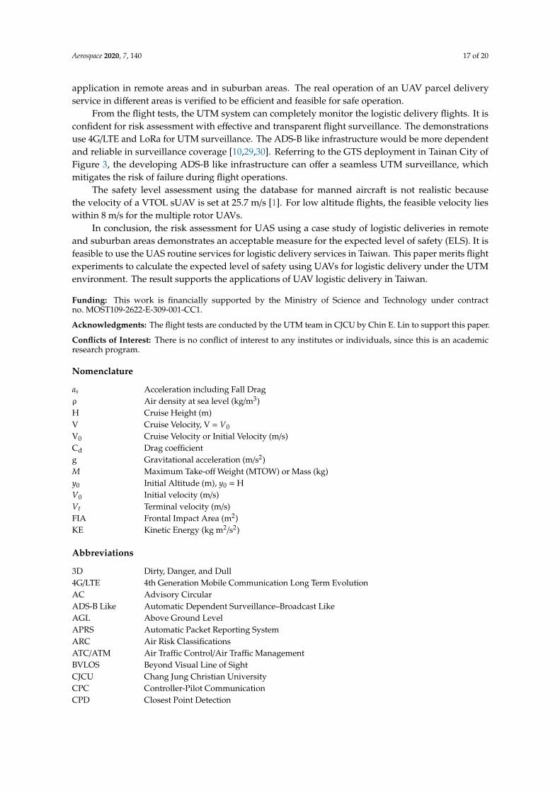