Environmental and Social Impact Mitigation Measures Study ...
713
Environmental and Social Impact Mitigation Measures Study (ESIMMS) of the DFC Project Final Report Volume 2: Rajasthan State OCTOBER 2007 MINISTRY OF RAILWAYS DFCC of India Ltd.
-
Upload
khangminh22 -
Category
Documents
-
view
0 -
download
0
Transcript of Environmental and Social Impact Mitigation Measures Study ...
Environmental and Social Impact Mitigation Measures Study
(ESIMMS) of the DFC Project
Final Report
Volume 2: Rajasthan State
OCTOBER 2007
MINISTRY OF RAILWAYS
DFCC of India Ltd.
Exchange Rates (31/OCTOBER/2007) US$1.00 = INR39.32 INR1.00 = JPY 2.93
Environmental and Social Impact Mitigation Measures
Study (ESIMMS) Report of the DFC Project
CONTENTS
Volume-1: Gujarat Volume-2: Rajasthan Volume-3: Haryana
i
Table of Contents
Pages
CHAPTER 1 INTRODUCTION....................................................................................... 1-1 1.1 BACKGROUND ................................................................................................... 1-1 1.2 OBJECTIVE OF ESIMMS ...................................................................................... 1-2 1.3 SCOPE OF ESIMMS............................................................................................... 1-3 1.4 STUDY AREA ........................................................................................................ 1-5
CHAPTER 2 APPLIED GUIDELINES, POLICIES AND ACTS...................................... 2-1 2.1 APPLICABLE NATIONAL POLICIES AND REGULATIONS............................... 2-1 2.1.1 Environment Protection Act, 1986 ........................................................................ 2-1 2.1.2 EIA Notification in India ...................................................................................... 2-2 2.1.3 Forest Conservation Act, 1980.............................................................................. 2-2 2.1.4 Biological Diversity Act, 2002.............................................................................. 2-5 2.1.5 Wildlife Protection Act, 1972 ............................................................................... 2-6 2.1.6 Land Acquisition Act............................................................................................ 2-7 2.1.7 Noise Pollution Regulation and Control Rules ...................................................... 2-9 2.1.8 Air (Prevention and Control of Pollution) Act, 1981 ............................................. 2-9 2.1.9 Water (Prevention and Control Pollution) Act ....................................................... 2-9 2.1.10 Other Relevant Acts ............................................................................................. 2-9
2.2 APPLICABLE GUIDELINES AND POLICIES/STRATEGIES ............................... 2-10 2.2.1 JICA Guidelines on Environmental and Social Considerations.............................. 2-11 2.2.2 JBIC Guidelines on Environmental and Social Considerations.............................. 2-11 2.2.3 Asian Development Bank (ADB) Environmental Policies..................................... 2-11 2.2.4 World Bank Safeguard Policies............................................................................. 2-12 2.2.5 National and State Environmental Policies............................................................ 2-13 2.2.6 National and State Forest Policies......................................................................... 2-13 2.2.7 Resettlement & Rehabilitation Policy ................................................................... 2-14 2.2.8 Applicable Cross Sectoral Laws ........................................................................... 2-16
CHAPTER 3 DESCRIPTION OF THE PROJECT ........................................................... 3-1 3.1 ALIGNMENT OF THE PROJECT .......................................................................... 3-1 3.2 PROJECT ACTIVITIES ENVISAGED.................................................................... 3-2 3.3 FACILITY CONSTRUCTION PLAN...................................................................... 3-3 3.3.1 Junction Stations .................................................................................................. 3-3 3.3.2 Crossing Stations.................................................................................................. 3-3 3.3.3 Detours ................................................................................................................ 3-4 3.3.4 Railway Over Bridge (ROB) & Railway Under Bridge (RUB).............................. 3-4 3.3.5 Bridges................................................................................................................. 3-4
CHAPTER 4 EXISTING ENVIRONMENT..................................................................... 4-1 4.1 GENERAL .............................................................................................................. 4-1 4.2 APPROACH AND METHODOLOGY .................................................................... 4-1 4.3 TOPOGRAPHY....................................................................................................... 4-3 4.4 GEOLOGY.............................................................................................................. 4-3 4.5 SOIL........................................................................................................................ 4-4 4.6 CLIMATE................................................................................................................ 4-5 4.7 LAND USE ............................................................................................................. 4-5 4.8 WATER BODIES..................................................................................................... 4-5
ii
4.9 NATURAL ENVIRONMENT.................................................................................. 4-5 4.9.1 Flora .................................................................................................................... 4-7 4.9.2 Fauna ................................................................................................................... 4-23 4.9.3 National Parks and Wildlife Sanctuaries ............................................................... 4-25
4.10 BASELINE SOCIO-ECONOMIC STATUS ............................................................. 4-25 4.10.1 General ................................................................................................................ 4-25 4.10.2 Demographic Features.......................................................................................... 4-26 4.10.3 Social Stratification .............................................................................................. 4-29 4.10.4 Occupational Pattern ............................................................................................ 4-32 4.10.5 Land Holding ....................................................................................................... 4-34 4.10.6 Other Key Socio-Economic Indicators.................................................................. 4-35 4.10.7 Socio-Economic Features on Primary Data ........................................................... 4-55
CHAPTER 5 POTENTIAL ENVIRONMENTAL IMPACT EVALUATION AND
MITIGATION MEASURES........................................................................ 5-1 5.1 INTRODUCTION ................................................................................................. 5-1 5.2 IMPACT EVALUATION METHODOLOGY ......................................................... 5-1 5.3 EXPECTED IMPACTS AND MITIGATION MEASURES ON NATURAL
ENVIRONMENT .................................................................................................. 5-1 5.3.1 Topography and Geology .................................................................................... 5-2 5.3.2 Soil .................................................................................................................... 5-2 5.3.3 Ground water ..................................................................................................... 5-3 5.3.4 Hydrology (Rivers and Lakes) ............................................................................ 5-3 5.3.5 Flora .................................................................................................................. 5-4 5.3.6 Fauna ................................................................................................................. 5-6 5.3.7 Biodiversity ........................................................................................................ 5-7 5.3.8 Protected Areas/Sanctuaries ................................................................................ 5-7 5.3.9 Landscape .......................................................................................................... 5-8 5.3.10 Environmental Impact Matrix ............................................................................. 5-8
5.4 SOCIAL IMPACT EVALUATION ......................................................................... 5-12 5.4.1 Approach and Methodology Adopted .................................................................. 5-13 5.4.2 Land Acquisition & Resettlement ....................................................................... 5-14 5.4.3 Impact on Private Structures ............................................................................... 5-15 5.4.4 Impact Due to Land Acquisition ......................................................................... 5-18 5.4.5 Inducement of Land Speculation and Squatter Influx .......................................... 5-19 5.4.6 Removal of Encroachments and Squatter Influx .................................................. 5-19 5.4.7 Loss of Utilities and Amenities ........................................................................... 5-20 5.4.8 Impact on Vulnerable Section ............................................................................. 5-21 5.4.9 Severance and Access ......................................................................................... 5-21 5.4.10 Impact on Sensitive Community Facilities .......................................................... 5-21 5.4.11 Impact on Local Economy/ Employment & Livelihood ....................................... 5-25
5.5 POLLUTION CONTROL MEASURES ................................................................. 5-47 5.5.1 Introduction ........................................................................................................ 5-47 5.5.2 Existing Condition .............................................................................................. 5-47 5.5.3 Potential Environmental Impact evaluation and mitigation Measures (Pollution) . 5-57
5.6 NOISE AND VIBRATION SURVEY....................................................................... 5-65 5.6.1 Background and Purpose .................................................................................... 5-65 5.6.2 Approach and Methodology of Railway Noise and Vibration Measurement .......... 5-65 5.6.3 Results of Railway Noise and Vibration Measurement ........................................ 5-68
5.7 Prediction and Evaluation of Impacts on Noise and Vibration alongside Railway Lines .................................................................................................................... 5-89
5.7.1 Procedure of Prediction and Evaluation .............................................................. 5-89 5.7.2 Examination of Prediction Method ..................................................................... 5-90 5.7.3 Overall Findings and Recommendations ............................................................. 5-94
iii
CHAPTER 6 STAKEHOLDER/PUBLIC CONSULTATION MEETING.......................... 6-1 6.1 PUBLIC CONSULTATION ..................................................................................... 6-1 6.2 SELECTION OF STAKEHOLDERS....................................................................... 6-1 6.3 METHOD OF SELECTION STAKEHOLDERS...................................................... 6-2 6.4 STAKEHOLDER/PUBLIC CONSULTATION MEETING....................................... 6-2 6.4.1 Selection of Meeting Facilitators .......................................................................... 6-3 6.4.2 Method of Information Dissemination .................................................................. 6-3 6.4.3 Venue of Stakeholder/Public Consultation Meeting............................................... 6-3 6.4.4 Summary of Stakeholder/Public Consultation Meeting ......................................... 6-4
CHAPTER 7 ENVIRONMENTAL MANAGEMENT PLAN ........................................... 7-1 7.1 INTRODUCTION ................................................................................................... 7-1 7.2 ENVIRONMENTAL MANAGEMENT PROCESS.................................................. 7-1 7.3 EMP DURING CONSTRUCTION AND OPERATION........................................... 7-1 7.3.1 Construction Phase ................................................................................................ 7-1 7.3.2 Operation Phase..................................................................................................... 7-5
7.4 ENVIRONMENTAL MANAGEMENT PLAN & RESPONSIBILITIES.................. 7-5 7.5 ENVIRONMENTAL BUDGET ............................................................................... 7-7 7.6 RECOMMENDATIONS.......................................................................................... 7-8
CHAPTER 8 RESETTLEMENT AND REHABILITATION PLAN (RRP)....................... 8-1 CHAPTER 9 ENVIRONMENTAL MONITORING FRAMEWORK ............................... 9-1 9.1 INSTITUTIONAL FRAMEWORK.......................................................................... 9-1 9.1.1 Construction Phase............................................................................................... 9-2 9.1.2 Operation Phase ................................................................................................... 9-2
9.2 ENVIRONMENTAL MONITORING -CONSTRUCTION PHASE ......................... 9-2 9.3 ENVIRONMENTAL MONITORING - OPERATION PHASE................................. 9-3 9.4 ENVIRONMENTAL MONITORING FRAME WORK ........................................... 9-3 9.5 ENVIRONMENTAL AWARENESS AND TRAINING............................................ 9-3 9.6 MONITORING AND EVALUATION OF R&R PLAN............................................ 9-4 9.6.1 Internal Monitoring .............................................................................................. 9-5 9.6.2 External Monitoring ............................................................................................. 9-5
iv
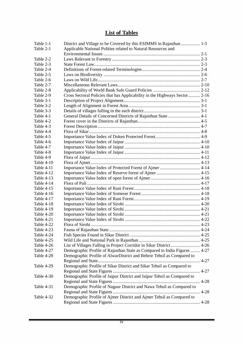
List of Tables Table 1-1 District and Village to be Covered by this ESIMMS in Rajasthan ................ 1-5 Table 2-1 Applicable National Polities related to Natural Resources and
Environmental Issues .................................................................................. 2-1 Table 2-2 Laws Relevant to Forestry ........................................................................... 2-3 Table 2-3 State Forest Law.......................................................................................... 2-3 Table 2-4 Definitions of Forest-related Terminologies ................................................. 2-4 Table 2-5 Laws on Biodiversity .................................................................................. 2-6 Table 2-6 Laws on Wild Life....................................................................................... 2-7 Table 2-7 Miscellaneous Relevant Laws...................................................................... 2-10 Table 2-8 Applicability of World Bank Safe Guard Policies ........................................ 2-12 Table 2-9 Cross Sectoral Policies that has Applicability in the Highways Sector .......... 2-16 Table 3-1 Description of Project Alignment................................................................. 3-1 Table 3-2 Length of Alignment in Forest Area............................................................. 3-1 Table 3-3 Details of villages falling in the each district................................................ 3-1 Table 4-1 General Details of Concerned Districts of Rajasthan State ........................... 4-1 Table 4-2 Forest cover in the Districts of Rajasthan..................................................... 4-5 Table 4-3 Forest Description ....................................................................................... 4-7 Table 4-4 Flora of Sikar .............................................................................................. 4-8 Table 4-5 Importance Value Index of Doken Protected Forest...................................... 4-9 Table 4-6 Importance Value Index of Jaipur ................................................................ 4-10 Table 4-7 Importance Value Index of Jaipur ................................................................ 4-10 Table 4-8 Importance Value Index of Jaipur ................................................................ 4-11 Table 4-9 Flora of Jaipur............................................................................................. 4-12 Table 4-10 Flora of Ajmer............................................................................................. 4-13 Table 4-11 Importance Value Index of Protected Forest of Ajmer .................................. 4-14 Table 4-12 Importance Value Index of Reserve forest of Ajmer ..................................... 4-15 Table 4-13 Importance Value Index of open forest of Ajmer .......................................... 4-16 Table 4-14 Flora of Pali ................................................................................................ 4-17 Table 4-15 Importance Value Index of Rani Forest ........................................................ 4-18 Table 4-16 Importance Value Index of Someser Forest .................................................. 4-18 Table 4-17 Importance Value Index of Rani Forest ........................................................ 4-19 Table 4-18 Importance Value Index of Sirohi ................................................................ 4-20 Table 4-19 Importance Value Index of Sirohi ................................................................ 4-21 Table 4-20 Importance Value Index of Sirohi ................................................................ 4-21 Table 4-21 Importance Value Index of Sirohi ................................................................ 4-22 Table 4-22 Flora of Sirohi ............................................................................................. 4-23 Table 4-23 Fauna of Rajasthan State ............................................................................. 4-24 Table 4-24 Fish Species Found in Sikar District ............................................................ 4-25 Table 4-25 Wild Life and National Park in Rajasthan .................................................... 4-25 Table 4-26 List of Villages Falling in Project Corridor in Sikar District ......................... 4-26 Table 4-27 Demographic Profile of Rajasthan State as Compared to India Figures ........ 4-27 Table 4-28 Demographic Profile of AlwarDistrict and Behror Tehsil as Compared to
Regional and State....................................................................................... 4-27 Table 4-29 Demographic Profile of Sikar District and Sikar Tehsil as Compared to
Regional and State Figures .......................................................................... 4-27 Table 4-30 Demographic Profile of Jaipur District and Jaipur Tehsil as Compared to
Regional and State Figures .......................................................................... 4-28 Table 4-31 Demographic Profile of Nagaur District and Nawa Tehsil as Compared to
Regional and State Figures .......................................................................... 4-28 Table 4-32 Demographic Profile of Ajmer District and Ajmer Tehsil as Compared to
Regional and State Figures .......................................................................... 4-28

v
Table 4-33 Demographic Profile of Pali District and Pali Tehsils as Compared to Regional and State Figures .......................................................................... 4-29
Table 4-34 Demographic Profile of Sirohi District and Sirohi Tehsil as Compared to Regional and State Figures .......................................................................... 4-29
Table 4-35 Comparison of the Social Profile - Alwar..................................................... 4-29 Table 4-36 Comparison of the Social Profile - Sikar...................................................... 4-30 Table 4-37 Comparison of the Social Profile - Jaipur..................................................... 4-30 Table 4-38 Comparison of the Social Profile - Nagaur................................................... 4-31 Table 4-39 Comparison of the Social Profile - Ajmer .................................................... 4-31 Table 4-40 Comparison of the Social Profile - Pali ........................................................ 4-32 Table 4-41 Comparison of the Social Profile - Sirohi..................................................... 4-32 Table 4-42 Number of Marginal Worker by Category.................................................... 4-33 Table 4-43 Trend Analysis of Land Holding in Rajasthan.............................................. 4-35 Table 4-44 Baseline Socio-economic Indicators (Alwar) ............................................... 4-56 Table 4-45 Baseline Socio-economic Indicators (Sikar)................................................. 4-57 Table 4-46 Baseline Socio-economic Indicators (Jaipur) ............................................... 4-58 Table 4-47 Baseline Socio-economic Indicators (Nagaur) ............................................. 4-59 Table 4-48 Baseline Socio-economic Indicators (Ajmer) ............................................... 4-60 Table 4-49 Baseline Socio-economic Indicators (Pali)................................................... 4-61 Table 4-50 Baseline Socio-economic Indicators (Sirohi) ............................................... 4-62 Table 5-1 Parameter and Scale of Impact Matrix ......................................................... 5-1 Table 5-2 Market Rate of Trees ................................................................................... 5-4 Table 5-3 Species present in the relevant districts of Rajasthan.................................... 5-5 Table 5-4 Environmental Impact Matrix (Alwar, Sikar, Nagaur, Jaipur)....................... 5-9 Table 5-5 Environmental Impact Matrix (Post Construction Phase) - Alwar, Sikar,
Jaipur, Nagaur Districts ............................................................................... 5-10 Table 5-6 Environmental Impacts Matrix - Ajmer, Pali and Sirohi Districts ................. 5-11 Table 5-7 Environmental Impact Matrix (Post Construction Phase) - Ajmer, Pali,
Sirohi Districts ............................................................................................ 5-11 Table 5-8 Details of villages affected by DFC ............................................................. 5-14 Table 5-9 Impact on Private Structures (Sikar) ............................................................ 5-16 Table 5-10 Impact on Private Structures (Jaipur) ........................................................... 5-16 Table 5-11 Impact on Private Structures (Ajmer)........................................................... 5-17 Table 5-12 Impact on Private Structures (Pali) .............................................................. 5-18 Table 5-13 Impact on Private Structures (Sirohi) ........................................................... 5-18 Table 5-14 Impact due to land Acquisition .................................................................... 5-19 Table 5-15 Loss of Residence in Sikar District .............................................................. 5-20 Table 5-16 Loss of Residence in Jaipur District............................................................. 5-20 Table 5-17 Loss of Utilities and Amenities Sikar District .............................................. 5-20 Table 5-18 Loss of Utilities and Amenities Jaipur District ............................................. 5-21 Table 5-19 Loss of Utilities and Amenities Ajmer District ............................................. 5-21 Table 5-20 Impact on Community Facilities in Sikar District ........................................ 5-22 Table 5-21 Impact on Community Facilities in Jaipur District ....................................... 5-23 Table 5-22 Impact on Community Facilities in Ajmer District ....................................... 5-23 Table 5-23 Impact on Community Facilities in Pali District........................................... 5-24 Table 5-24 Impact on Community Facilities in Sirohi District ....................................... 5-24 Table 5-25 Social Impact Matrix (Alwar)...................................................................... 5-26 Table 5-26 Social Impact Matrix (Post Construction Phase) (Alwar) ............................. 5-27 Table 5-27 Social Impact Matrix – Sikar District........................................................... 5-29 Table 5-28 Social Impact Matrix – Sikar District (Post Construction Phase)_ ................ 5-30 Table 5-29 Social Impact Matrix (Jaipur) ...................................................................... 5-32 Table 5-30 Social Impact Matrix (Post Construction Phase) (Jaipur) ............................. 5-33 Table 5-31 Social Impact Matrix (Nagaur) .................................................................... 5-35 Table 5-32 Social Impact Matrix (Post Construction Phase) (Nagaur)............................ 5-36 Table 5-33 Social Impact Matrix (Ajmer)...................................................................... 5-38
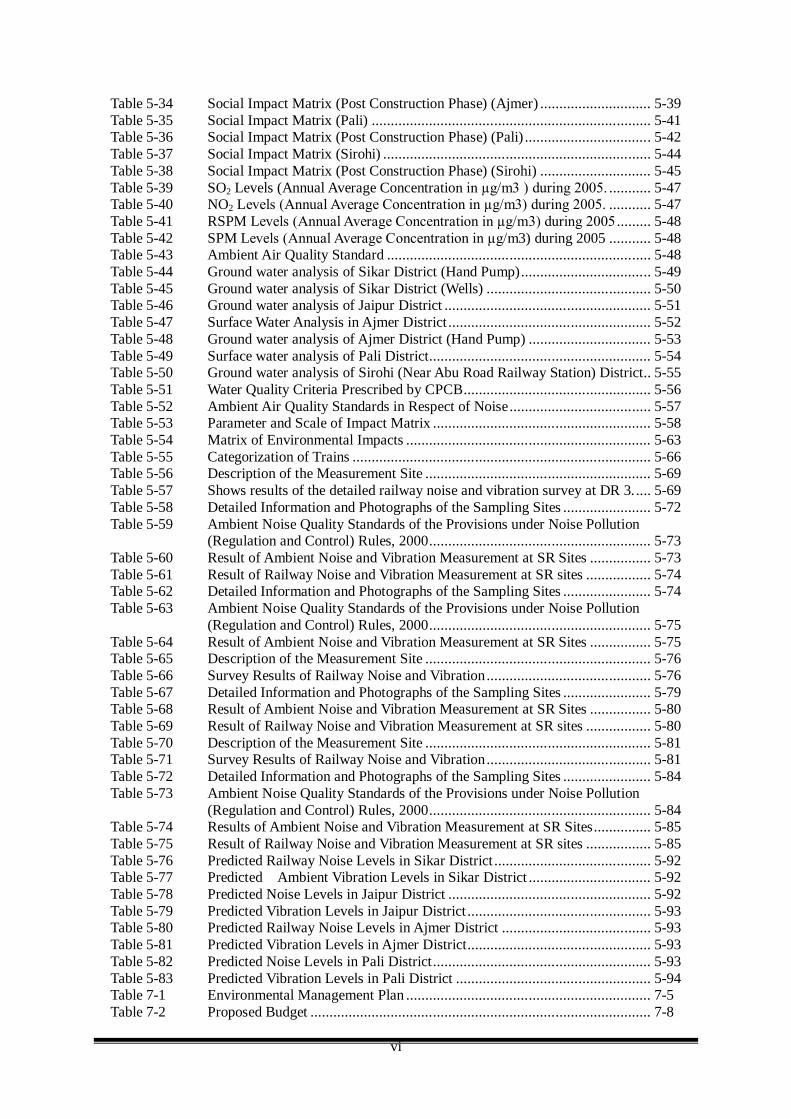
vi
Table 5-34 Social Impact Matrix (Post Construction Phase) (Ajmer) ............................. 5-39 Table 5-35 Social Impact Matrix (Pali) ......................................................................... 5-41 Table 5-36 Social Impact Matrix (Post Construction Phase) (Pali) ................................. 5-42 Table 5-37 Social Impact Matrix (Sirohi) ...................................................................... 5-44 Table 5-38 Social Impact Matrix (Post Construction Phase) (Sirohi) ............................. 5-45 Table 5-39 SO2 Levels (Annual Average Concentration in µg/m3 ) during 2005. ........... 5-47 Table 5-40 NO2 Levels (Annual Average Concentration in µg/m3) during 2005. ........... 5-47 Table 5-41 RSPM Levels (Annual Average Concentration in µg/m3) during 2005 ......... 5-48 Table 5-42 SPM Levels (Annual Average Concentration in µg/m3) during 2005 ........... 5-48 Table 5-43 Ambient Air Quality Standard ..................................................................... 5-48 Table 5-44 Ground water analysis of Sikar District (Hand Pump).................................. 5-49 Table 5-45 Ground water analysis of Sikar District (Wells) ........................................... 5-50 Table 5-46 Ground water analysis of Jaipur District ...................................................... 5-51 Table 5-47 Surface Water Analysis in Ajmer District ..................................................... 5-52 Table 5-48 Ground water analysis of Ajmer District (Hand Pump) ................................ 5-53 Table 5-49 Surface water analysis of Pali District.......................................................... 5-54 Table 5-50 Ground water analysis of Sirohi (Near Abu Road Railway Station) District.. 5-55 Table 5-51 Water Quality Criteria Prescribed by CPCB................................................. 5-56 Table 5-52 Ambient Air Quality Standards in Respect of Noise..................................... 5-57 Table 5-53 Parameter and Scale of Impact Matrix ......................................................... 5-58 Table 5-54 Matrix of Environmental Impacts ................................................................ 5-63 Table 5-55 Categorization of Trains .............................................................................. 5-66 Table 5-56 Description of the Measurement Site ........................................................... 5-69 Table 5-57 Shows results of the detailed railway noise and vibration survey at DR 3. .... 5-69 Table 5-58 Detailed Information and Photographs of the Sampling Sites ....................... 5-72 Table 5-59 Ambient Noise Quality Standards of the Provisions under Noise Pollution
(Regulation and Control) Rules, 2000.......................................................... 5-73 Table 5-60 Result of Ambient Noise and Vibration Measurement at SR Sites ................ 5-73 Table 5-61 Result of Railway Noise and Vibration Measurement at SR sites ................. 5-74 Table 5-62 Detailed Information and Photographs of the Sampling Sites ....................... 5-74 Table 5-63 Ambient Noise Quality Standards of the Provisions under Noise Pollution
(Regulation and Control) Rules, 2000.......................................................... 5-75 Table 5-64 Result of Ambient Noise and Vibration Measurement at SR Sites ................ 5-75 Table 5-65 Description of the Measurement Site ........................................................... 5-76 Table 5-66 Survey Results of Railway Noise and Vibration........................................... 5-76 Table 5-67 Detailed Information and Photographs of the Sampling Sites ....................... 5-79 Table 5-68 Result of Ambient Noise and Vibration Measurement at SR Sites ................ 5-80 Table 5-69 Result of Railway Noise and Vibration Measurement at SR sites ................. 5-80 Table 5-70 Description of the Measurement Site ........................................................... 5-81 Table 5-71 Survey Results of Railway Noise and Vibration........................................... 5-81 Table 5-72 Detailed Information and Photographs of the Sampling Sites ....................... 5-84 Table 5-73 Ambient Noise Quality Standards of the Provisions under Noise Pollution
(Regulation and Control) Rules, 2000.......................................................... 5-84 Table 5-74 Results of Ambient Noise and Vibration Measurement at SR Sites............... 5-85 Table 5-75 Result of Railway Noise and Vibration Measurement at SR sites ................. 5-85 Table 5-76 Predicted Railway Noise Levels in Sikar District ......................................... 5-92 Table 5-77 Predicted Ambient Vibration Levels in Sikar District ................................ 5-92 Table 5-78 Predicted Noise Levels in Jaipur District ..................................................... 5-92 Table 5-79 Predicted Vibration Levels in Jaipur District ................................................ 5-93 Table 5-80 Predicted Railway Noise Levels in Ajmer District ....................................... 5-93 Table 5-81 Predicted Vibration Levels in Ajmer District................................................ 5-93 Table 5-82 Predicted Noise Levels in Pali District......................................................... 5-93 Table 5-83 Predicted Vibration Levels in Pali District ................................................... 5-94 Table 7-1 Environmental Management Plan ................................................................ 7-5 Table 7-2 Proposed Budget ......................................................................................... 7-8
vii
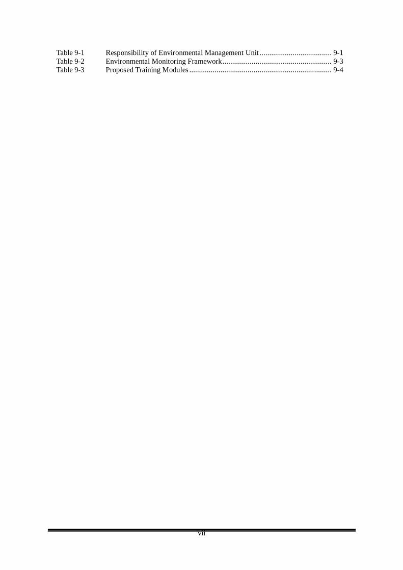
Table 9-1 Responsibility of Environmental Management Unit ..................................... 9-1 Table 9-2 Environmental Monitoring Framework........................................................ 9-3 Table 9-3 Proposed Training Modules ......................................................................... 9-4
viii
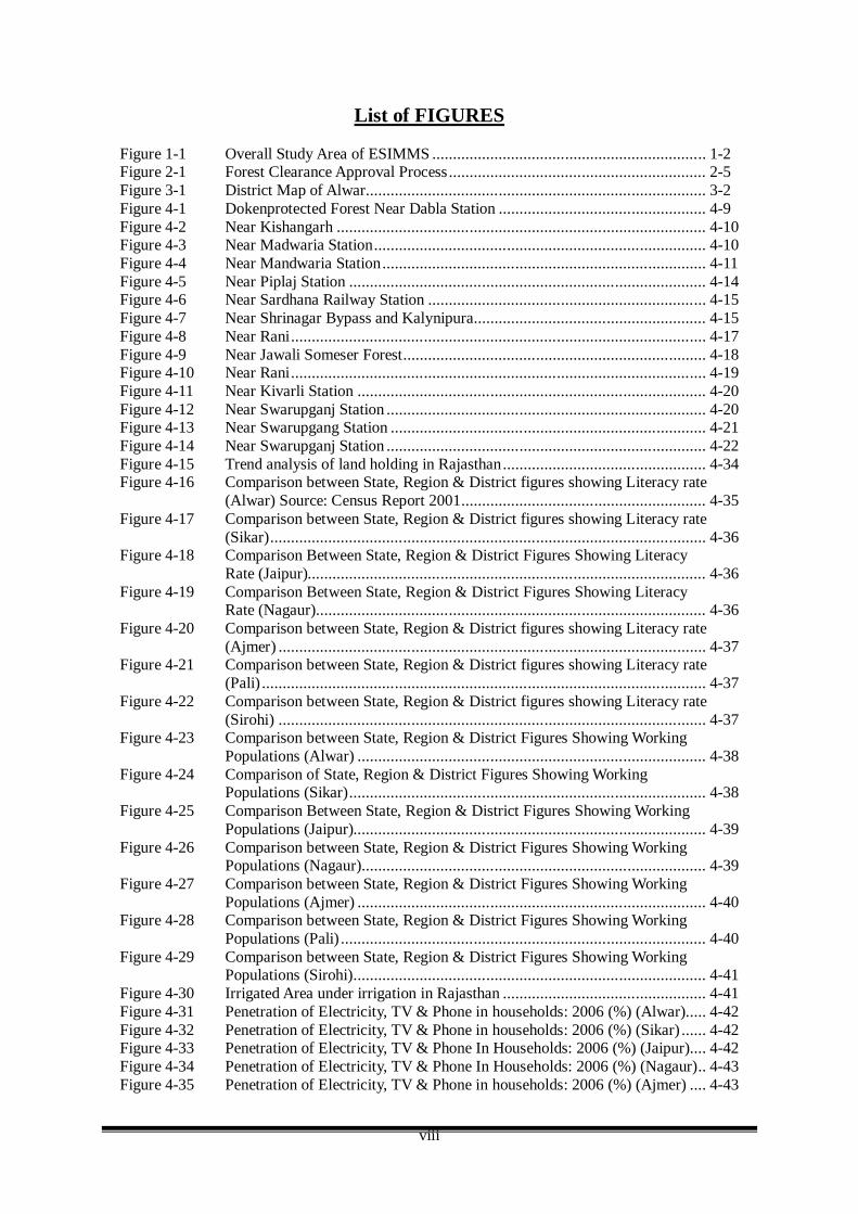
List of FIGURES Figure 1-1 Overall Study Area of ESIMMS .................................................................. 1-2 Figure 2-1 Forest Clearance Approval Process.............................................................. 2-5 Figure 3-1 District Map of Alwar.................................................................................. 3-2 Figure 4-1 Dokenprotected Forest Near Dabla Station .................................................. 4-9 Figure 4-2 Near Kishangarh ......................................................................................... 4-10 Figure 4-3 Near Madwaria Station................................................................................ 4-10 Figure 4-4 Near Mandwaria Station.............................................................................. 4-11 Figure 4-5 Near Piplaj Station ...................................................................................... 4-14 Figure 4-6 Near Sardhana Railway Station ................................................................... 4-15 Figure 4-7 Near Shrinagar Bypass and Kalynipura........................................................ 4-15 Figure 4-8 Near Rani.................................................................................................... 4-17 Figure 4-9 Near Jawali Someser Forest......................................................................... 4-18 Figure 4-10 Near Rani.................................................................................................... 4-19 Figure 4-11 Near Kivarli Station .................................................................................... 4-20 Figure 4-12 Near Swarupganj Station ............................................................................. 4-20 Figure 4-13 Near Swarupgang Station ............................................................................ 4-21 Figure 4-14 Near Swarupganj Station ............................................................................. 4-22 Figure 4-15 Trend analysis of land holding in Rajasthan................................................. 4-34 Figure 4-16 Comparison between State, Region & District figures showing Literacy rate
(Alwar) Source: Census Report 2001........................................................... 4-35 Figure 4-17 Comparison between State, Region & District figures showing Literacy rate
(Sikar)......................................................................................................... 4-36 Figure 4-18 Comparison Between State, Region & District Figures Showing Literacy
Rate (Jaipur)................................................................................................ 4-36 Figure 4-19 Comparison Between State, Region & District Figures Showing Literacy
Rate (Nagaur).............................................................................................. 4-36 Figure 4-20 Comparison between State, Region & District figures showing Literacy rate
(Ajmer) ....................................................................................................... 4-37 Figure 4-21 Comparison between State, Region & District figures showing Literacy rate
(Pali) ........................................................................................................... 4-37 Figure 4-22 Comparison between State, Region & District figures showing Literacy rate
(Sirohi) ....................................................................................................... 4-37 Figure 4-23 Comparison between State, Region & District Figures Showing Working
Populations (Alwar) .................................................................................... 4-38 Figure 4-24 Comparison of State, Region & District Figures Showing Working
Populations (Sikar)...................................................................................... 4-38 Figure 4-25 Comparison Between State, Region & District Figures Showing Working
Populations (Jaipur)..................................................................................... 4-39 Figure 4-26 Comparison between State, Region & District Figures Showing Working
Populations (Nagaur)................................................................................... 4-39 Figure 4-27 Comparison between State, Region & District Figures Showing Working
Populations (Ajmer) .................................................................................... 4-40 Figure 4-28 Comparison between State, Region & District Figures Showing Working
Populations (Pali) ........................................................................................ 4-40 Figure 4-29 Comparison between State, Region & District Figures Showing Working
Populations (Sirohi)..................................................................................... 4-41 Figure 4-30 Irrigated Area under irrigation in Rajasthan ................................................. 4-41 Figure 4-31 Penetration of Electricity, TV & Phone in households: 2006 (%) (Alwar)..... 4-42 Figure 4-32 Penetration of Electricity, TV & Phone in households: 2006 (%) (Sikar) ...... 4-42 Figure 4-33 Penetration of Electricity, TV & Phone In Households: 2006 (%) (Jaipur).... 4-42 Figure 4-34 Penetration of Electricity, TV & Phone In Households: 2006 (%) (Nagaur).. 4-43 Figure 4-35 Penetration of Electricity, TV & Phone in households: 2006 (%) (Ajmer) .... 4-43
ix
Figure 4-36 Penetration of Electricity, TV & Phone in households: 2006 (%) (Pali) ........ 4-44 Figure 4-37 Penetration of Electricity, TV & Phone in households: 2006 (%) (Sirohi)..... 4-44 Figure 4-38 Classification of Houses by Type of Construction (2001) (Alwar)................ 4-45 Figure 4-39 Classification of Houses by Type of Construction (2001) (Sikar) ................. 4-45 Figure 4-40 Classification of houses by type of construction (2001) (Jaipur)................... 4-46 Figure 4-41 Classification of Houses by type of Construction (2001) (Nagaur) ............... 4-46 Figure 4-42 Classification of Houses by Type of Construction (2001) (Ajmer)................ 4-47 Figure 4-43 Classification of Houses by Type of Construction (2001) (Pali) ................... 4-47 Figure 4-44 Classification of Houses by Type of Construction (2001) (Sirohi) ................ 4-48 Figure 4-45 Awareness and Use of Family Planning Methods: 2003-04 (%) (Alwar) ...... 4-48 Figure 4-46 Awareness and Use of Family Planning Methods: 2003-04 (%) (Sikar)........ 4-49 Figure 4-47 Awareness and Use of Family Planning Methods: 2003-04 (%) (Jaipur)....... 4-49 Figure 4-48 Awareness and Use of Family Planning Methods: 2003-04 (%) (Nagaur)..... 4-50 Figure 4-49 Awareness and Use of Family Planning Methods: 2003-04 (%) (Ajmer) ...... 4-50 Figure 4-50 Awareness and Use of Family Planning Methods: 2003-04 (%) (Pali) .......... 4-51 Figure 4-51 Awareness and Use of Family Planning Methods: 2003-04 (%) (Sirohi)....... 4-51 Figure 4-52 Awareness among Women about RTI/STI & HIV/AIDS: 2003-04 (%)
(Alwar) ....................................................................................................... 4-52 Figure 4-53 Awareness among Women about RTI/STI & HIV/AIDS: 2003-04 (%)
(Sikar)......................................................................................................... 4-52 Figure 4-54 Awareness among Women about RTI/STI & HIV/Aids: 2003-04 (%)
(Jaipur) ....................................................................................................... 4-53 Figure 4-55 Awareness among Women about RTI/STI & HIV/AIDS: 2003-04 (%)
(Nagaur)...................................................................................................... 4-53 Figure 4-56 Awareness among Women about RTI/STI & HIV/AIDS: 2003-04 (%)
(Ajmer) ....................................................................................................... 4-54 Figure 4-57 Awareness among Women about RTI/STI & HIV/AIDS: 2003-04 (%) (Pali) 4-54 Figure 4-58 Awareness among Women about RTI/STI & HIV/AIDS: 2003-04 (%)
(Sirohi) ....................................................................................................... 4-55 Figure 5-1 Schematic Plan & Elevation of Railway, Ambient Noise and Vibration ........ 5-67 Figure 5-2 Attenuation Pattern of Railway Noise for DR 3 ........................................... 5-70 Figure 5-3 Relation of Noise Dispersion with Train Speed for DR 3 ............................. 5-70 Figure 5-4 Attenuation Pattern of Railway Vibration for DR 3...................................... 5-71 Figure 5-5 Attenuation Pattern of Railway Noise for DR 4 ........................................... 5-77 Figure 5-6 Relation of Noise Dispersion with Train Speed for DR 4 ............................. 5-77 Figure 5-7 Attenuation Pattern of Railway Vibration for DR 4...................................... 5-78 Figure 5-8 Relation of Vibration Dispersion with Train Speed for DR 4........................ 5-78 Figure 5-9 Attenuation Pattern of Railway Noise.......................................................... 5-82 Figure 5-10 Relation of Noise Dispersion with Train Speed............................................ 5-82 Figure 5-11 Attenuation Pattern of Railway Vibration .................................................... 5-83 Figure 5-12 Relation of Vibration Dispersion with Train Speed ...................................... 5-83 Figure 5-13 Occupation of Respondents ......................................................................... 5-86 Figure 5-14 Perception on Issues of Annoyance from Railway........................................ 5-86 Figure 5-15 Occupation of Respondents ......................................................................... 5-87 Figure 5-16 Perception on Issues of Annoyance from Railway........................................ 5-87 Figure 5-17 Occupation of Respondents ......................................................................... 5-88 Figure 5-18 Perception on Issues of Annoyance from Railway........................................ 5-88 Figure 5-19 Occupation of Respondents ......................................................................... 5-89 Figure 5-20 Perception on Issues of Annoyance from Railway........................................ 5-89 Figure 5-21 Procedures for Prediction and Evaluation of Noise and Vibration Levels...... 5-90 Figure 9-1 Proposed Structure of Environmental Management Unit .............................. 9-1
x
LIST OF ANNEX
ANNEX-2.1 APPLICATION FORM FOR SEEKING PRIOR APPROVAL FOR FOREST
ANNEX-3.1 LIST OF RAILWAY STATION IN PACKAGE ANNEX-3.2 TYPICAL SECTION OF DETOUR ROUTE ANNEX-4.1 FORMAT FOR FLORA ASSESSMENT ANNEX-4.2 NATURAL ENVIRONMENT ANNEX-5.1 NOISE AND VIBRATION SURVEY ANNEX-6.1 STAKEHOLDER MEETING ANNEX9.1 ENVIRONMENT MANAGEMENT ACTION PLAN COMPLIANCE
REPORT
xi
LIST OF ABBREVIATIONS
AAQ : Ambient Air Quality ADB : Asian Development Bank AFS : Affected Families AIDS : Acquired Immunodeficiency Syndrome ASI : Archaeological Survey of India ASR : Ambient Noise & Vibration Measurement at Sensitive Receptors BIS : Bureau of Indian Standard BOD : Biological Oxygen Demand cc : Cubic Centimeter CF : Conservator of Forest Cl : Chlorine CO : Carbon Monoxide CPCB : Central Pollution Control Board CPRS : Common Property Resources CS : Construction Supervision CWC : Central Water Commission, India dB : Decibel DFC : Dedicated Freight Corridor DFCCIL : Dedicated Freight Corridor Corporation of India Limited DFO : Divisional Forest Offices DO : Dissolve Oxygen DPR : Detailed Project Report DR : Detailed Railway EA : Environmental Assessment EAC : Expert Appraisal Committee EIA : Environment Impact Assessment EMAP : Environmental Management Action Plan EMP : Environment Management Plan EMU : Environment Management Unit ESIMMS : Environmental and Social Impact Mitigation Measure Study EWG : Environmental Working Group Fe : Iron (Ferrum) GOI : Government of India Hg : Mercury (Hydrargyrum) HIV : Human Immunodeficiency Virus ICDS : Inland Container Depot IS : Indian Standard JARTS : Japan Railway Technical Services JBIC : Japan Bank for International Cooperation JICA : Japan International Cooperation Agency JIS : Japanese International Standard K : Potassium (Kalium) LA : Land Acquisition LA Act : Land Acquisition Act LAE : Exposure Noise Level LAeq : Equivalent Noise Level LPG : Liquefied Petroleum Gas MLA : Member of Legislative Assembly MOEF : Ministry of Environment and Forest
xii
MP : Member of Parliament MOR : Ministry of Railway N : Nitrogen Na : Sodium (Natrium) NEP : National Environmental Policy NGO : Non Government Organization NK : Nippon Koei Co.Ltd. NOx : Oxides of Nitrogen NPRR : National Policy on Resettlement and Rehabilitation NRCP : National River Conservation Plan NRP : National Rehabilitation Policy NTH : Non Titleholder OM : Organic Matter OP : Operational Policy PAFS : Project Affected Families PAPS : Project Affected Person Pb : Lead (Plumbum) PCCF : Principal Conservator of Forest PCI : Pacific Consultants International PCM : Public Consultation Meeting PDA : Passenger Diesel A (Plain Route) Train PIU : Project Implementation Unit PUC : Pollution Under Control Certificate RAP : Resettlement Action Plan ROB : Railway Over Bridge ROW : Right of Way RPM : Respiratory Particulate Matter R&R : Resettlement & Rehabilitation RRP : Resettlement and Rehabilitation Plan RS : Railway Station RUB : Railway Under Bridge SAR : Sodium Absorption Ratio SC : Scheduled Caste SDOE : State Department of Environment SEIAA : State Environment Impact Assessment Authority SGRY : Sampoorna Grammeen Rojgar Yojna SHM : Stakeholder Meeting SIA : Social Impact Assessment Sox : Oxides of Sulphur SPCB : State Pollution Control Board SPM : Suspended Particulate Matter SR : Sensitive Receptor ST : Scheduled Tribe TH : Title Holder TOR : Term of Reference VRC : Village Rehabilitation Committee WB : World Bank WHH : Women Headed Households WHO : World Health Organization WLS : Wild Life Sanctuaries Zn : Zinc

xiii
ESIMMS Report of the Dedicated Freight Corridor Project for Rajasthan State October 2007
Page 1-1
CHAPTER 1 INTRODUCTION
1.1 BACKGROUND
Indian Railways, the prime movers of the nation, have the distinction of being one of the largest railway systems in the world under a single management. Its contribution to the nation’s progress is immeasurable and it has a dual role to play as a commercial organization as well as a vehicle for fulfillment of aspirations of the society at large. It is an important catalyst to growth of trade, industry and the economy as a whole, with immense potential for providing indirect employment. Considering this, Indian Government attaches the highest priority to the development and expansion of railway infrastructure. The Golden Quadrilateral and diagonals of the railway system are heavily congested routes and strengthening/widening of these routes has been taken up as part of National Rail Vikas Yojana. Surveys and construction of gauge conversion and new lines have been undertaken with a view to provide alternate routes to decongest the heavily utilized ones. Delhi-Mumbai and Delhi-Howrah stretches of Quadrilateral railway system have been identified as heavily congested routes and need to be decongested on priority basis.
In view of this, on the request of Ministry of Railways (MOR), Japan International Cooperation Agency (JICA) has conducted the feasibility study for the “The Development of Dedicated Multimodal High Axle Load Freight Corridor with computerized Control for Delhi-Mumbai and Delhi-Howrah in India (JICA F/S)”. Objective of JICA F/S was to review the PETS and Final Location Survey (FLS) of the Dedicated Freight Corridor (DFC) Project that was supposed to be prepared by the GOI. However, since the FLS could not be available during JICA F/S, Guideline Design (GLD) and General Arrangement Drawings (GAD) have been proposed for the preparation of FLS for both Eastern and Western Corridors during JICA F/S.
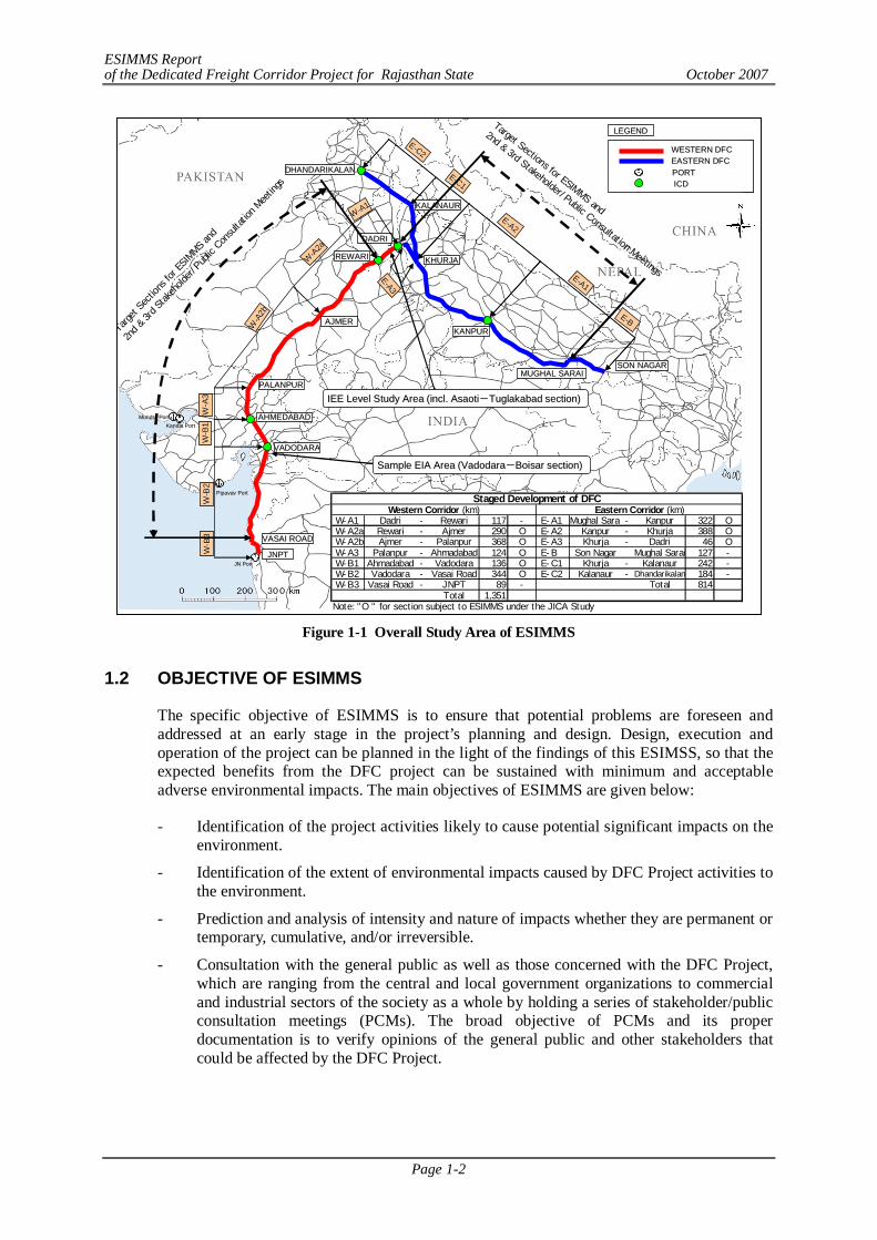
The Environmental and Social Considerations Study (ESCS), which was equivalent to Initial Environmental Examination (IEE) level study, was conducted from November 2006 to March 2007 in the First Year of JICA F/S. In the Second Year of JICA F/S, Environmental and Social Impact Mitigation Measures Study (ESIMMS), which is equivalent to Environmental Impact Assessment (EIA) level study, has been conducted base on GLD and GAD covering the development stage sections between Rewari, Haryana and Vasai Road, Maharashtra (approx. 1,262 km) for the Western Corridor and between Dadri and Mughal Sarai, Uttar Pradesh (approx. 756 km) for the Eastern Corridor. The overall study area of ESIMMS is shown in Figure 1-1.
For the Western Corridor, ESIMMS has been conducted for the DFC route from Rewari to JNPT Mumbai which includes 2 districts of Haryana, 7 districts of Rajasthan, 12 districts of Gujarat and 1 district of Maharashtra. However, this ESIMMS report elaborates environmental and social impact mitigation measures for the DFC route in Rajasthan state up to Abu Road. The districts covered in this ESIMMS are Alwar, Sikar, Jaipur, Nagaur, Ajmer, Pali and Sirohi.
ESIMMS Report of the Dedicated Freight Corridor Project for Rajasthan State October 2007
Page 1-2
Figure 1-1 Overall Study Area of ESIMMS
1.2 OBJECTIVE OF ESIMMS
The specific objective of ESIMMS is to ensure that potential problems are foreseen and addressed at an early stage in the project’s planning and design. Design, execution and operation of the project can be planned in the light of the findings of this ESIMSS, so that the expected benefits from the DFC project can be sustained with minimum and acceptable adverse environmental impacts. The main objectives of ESIMMS are given below:
- Identification of the project activities likely to cause potential significant impacts on the environment.
- Identification of the extent of environmental impacts caused by DFC Project activities to the environment.
- Prediction and analysis of intensity and nature of impacts whether they are permanent or temporary, cumulative, and/or irreversible.
- Consultation with the general public as well as those concerned with the DFC Project, which are ranging from the central and local government organizations to commercial and industrial sectors of the society as a whole by holding a series of stakeholder/public consultation meetings (PCMs). The broad objective of PCMs and its proper documentation is to verify opinions of the general public and other stakeholders that could be affected by the DFC Project.
KHURJAKHURJA
KALANAURKALANAUR
DHANDARIKALANDHANDARIKALAN
KANPURKANPUR
DADRIDADRI
REWARIREWARI
PALANPURPALANPUR
AHMEDABADAHMEDABAD
VADODVADODAARARA
VASAI ROADVASAI ROAD
JNPTJNPT
MUGHAL SARAIMUGHAL SARAISON NAGARSON NAGAR
AJMERAJMER
EE--C2C2
EE--A3A3
WESTERN DFC WESTERN DFC EASTERN DFC EASTERN DFC PORT PORT ICD ICD
LEGENDLEGEND
WW-- B
3B3WW
-- B2B2
WW-- B
1B1WW
-- A3A3
WW--A
2bA2b
WW--A
2aA2a
WW--A1A1
EE--C1C1
EE--A2A2
EE--A1A1
EE--BB
PipavavPipavav PortPort
KandlaKandla PortPortMundraMundra PortPort
JN PortJN Port
Target Sections for ESIMMS and
2nd & 3rd Stakeholder/Public Consultation Meetings
Target
Sec
tions
for E
SIMMS
and
2nd &
3rd St
akeh
olde
r/Pu
blic Con
sulta
tion Mee
tings
IEE Level Study Area (incl. IEE Level Study Area (incl. AsaotiAsaoti--TuglakabadTuglakabad section) section)
Sample EIA Area (VadodaraSample EIA Area (Vadodara--Boisar section) Boisar section)
Staged Development of DFCWestern Corridor (km) Eastern Corridor (km)
W-A1 Dadri - Rewari 117 - E-A1 Mughal Sarai - Kanpur 322 O W-A2a Rewari - Ajmer 290 O E-A2 Kanpur - Khurja 388 O W-A2b Ajmer - Palanpur 368 O E-A3 Khurja - Dadri 46 O W-A3 Palanpur - Ahmadabad 124 O E-B Son Nagar Mughal Sarai 127 - W-B1 Ahmadabad - Vadodara 136 O E-C1 Khurja - Kalanaur 242 - W-B2 Vadodara - Vasai Road 344 O E-C2 Kalanaur - Dhandarikalan 184 - W-B3 Vasai Road - JNPT 89 - Total 814
Total 1,351Note: "O " for section subject to ESIMMS under the JICA Study
KHURJAKHURJA
KALANAURKALANAUR
DHANDARIKALANDHANDARIKALAN
KANPURKANPUR
DADRIDADRI
REWARIREWARI
PALANPURPALANPUR
AHMEDABADAHMEDABAD
VADODVADODAARARA
VASAI ROADVASAI ROAD
JNPTJNPT
MUGHAL SARAIMUGHAL SARAISON NAGARSON NAGAR
AJMERAJMER
EE--C2C2
EE--A3A3
WESTERN DFC WESTERN DFC EASTERN DFC EASTERN DFC PORT PORT ICD ICD
LEGENDLEGEND
WW-- B
3B3WW
-- B2B2
WW-- B
1B1WW
-- A3A3
WW--A
2bA2b
WW--A
2aA2a
WW--A1A1
EE--C1C1
EE--A2A2
EE--A1A1
EE--BB
PipavavPipavav PortPort
KandlaKandla PortPortMundraMundra PortPort
JN PortJN Port
Target Sections for ESIMMS and
2nd & 3rd Stakeholder/Public Consultation Meetings
Target
Sec
tions
for E
SIMMS
and
2nd &
3rd St
akeh
olde
r/Pu
blic Con
sulta
tion Mee
tings
IEE Level Study Area (incl. IEE Level Study Area (incl. AsaotiAsaoti--TuglakabadTuglakabad section) section)
Sample EIA Area (VadodaraSample EIA Area (Vadodara--Boisar section) Boisar section)
Staged Development of DFCWestern Corridor (km) Eastern Corridor (km)
W-A1 Dadri - Rewari 117 - E-A1 Mughal Sarai - Kanpur 322 O W-A2a Rewari - Ajmer 290 O E-A2 Kanpur - Khurja 388 O W-A2b Ajmer - Palanpur 368 O E-A3 Khurja - Dadri 46 O W-A3 Palanpur - Ahmadabad 124 O E-B Son Nagar Mughal Sarai 127 - W-B1 Ahmadabad - Vadodara 136 O E-C1 Khurja - Kalanaur 242 - W-B2 Vadodara - Vasai Road 344 O E-C2 Kalanaur - Dhandarikalan 184 - W-B3 Vasai Road - JNPT 89 - Total 814
Total 1,351Note: "O " for section subject to ESIMMS under the JICA Study
ESIMMS Report of the Dedicated Freight Corridor Project for Rajasthan State October 2007
Page 1-3
1.3 SCOPE OF ESIMMS
In ESCS which was mainly conducted based on the collected secondary data as IEE level study, the major environmental and social consideration items were identified. Based on the results of ESCS, further EIA level study has been required for the following components.
(1) Natural Environment
The secondary data collection and survey of natural reserves, such as national parks and wildlife sanctuaries along the DFC alignment shall be conducted. Reserved forests and protected forests along the DFC alignment shall be examined to assess their impacts.
(2) Pollution Control
1) Sensitive Receptors (SRs) along the DFC alignment shall be identified for noise and vibration measurement. Ambient and railway noise/vibration levels shall be measured at the selected SRs. In addition, railway noise and vibration measurements were conducted along the DFC alignment to obtain unit sample data at 16 sites in total.
2) The secondary data collection of water quality, air quality and other components shall be conducted. The mitigation measures shall be proposed based on the analysis of the collected data.
(3) Social Environment
1) Field survey to identify the number of Project Affected Families (PAFs)1 shall be identified.
2) Socio-economic questionnaire survey shall be conducted at 10% of total number of the identified PAFs.
3) The social impact assessment along the DFC alignment shall be conducted. The Resettlement and Rehabilitation Plan Framework shall be formulated.
(4) Stakeholder/Public Consultation Meetings
1) The 2nd Stage PCM was planned to be conducted at each district to be directly affected by the DFC Project.
2) Targeted PCM participants shall be representatives of Panchayats, villages and towns.
3) After the 2nd Stage PCM participated representatives of Panchayats, villages and towns shall disseminate the information obtained from the PCM amongst villagers and town residents, discuss with the issues and exchange opinions with residents at a village feedback meeting. The results of the village meeting shall be recorded.
4) In the 3rd Stage PCM, either one representative of each Panchayats, villages or towns or one representative of potential Project Affected Persons (PAPs) shall present their outcomes of the village meeting. The outcomes shall be discussed, and components of the suggested RRP Framework shall be agreed by the participants of the 3rd Stage PCM.
(5) Formulation of the Resettlement and Plan Framework
1) In the village feedback meetings to be organised before the 3rd Stage PCM, the RRP Framework shall be introduced to village residents. The components shall be confirmed and discussed by village residents.
1 PAF is defined as Project Affected Families to be relocated; however, at the stage of ESIMMS, the number of affected
residential structures is considered as PAF. The exact number of the PAF shall be identified by the detailed field survey at the next stage of the project.
ESIMMS Report of the Dedicated Freight Corridor Project for Rajasthan State October 2007
Page 1-4
2) The components of the RRP Framework shall be discussed and agreed by participants of the 3rd Stage PCM.
3) The social environmental monitoring plan shall be formulated in order to use for 3-5 years after the resettlement is completed.
(6) Environmental Management Plan (EMAP) and Environmental Monitoring Plan (EMOP)
EMAP and EMOP for construction of relevant railway facilities of each district shall be prepared.
Scope of ESIMMS as EIA level study has been elaborated in a well defined manner in Terms of Reference (TOR) as Technical Working Paper as part of JICA F/S. As per the TOR, major issues to be covered are summarized under four major heads as the details of major four components are discussed below:
- Natural Environment Impact Assessment Study - Pollution Control Study - Social Impact Assessment Study - Stakeholder/Public Consultation Meeting
1) Natural Environment Impact Assessment Study
The significant environmental issues, particularly ecologically sensitive areas on natural environmental components such as topography, geology, soil, climate, land use, water bodies, and ecology etc. likely to be impacted due to proposed activities of DFC, were identified and a suitable and effective environmental management and monitoring plan to mitigate negative impacts and enhance positive impacts was prepared. Monitoring Plan was elaborated for construction period as well as spanning over 3-5 years covering locations sensitive to other pollution aspects as well as areas covering protected areas, wildlife sanctuary, eco-sensitive along DFC alignment. Effective and feasible measures were identified and elaborated necessary to take in order to mitigate, reduce, rectify or compensate adverse impacts caused by the project to the areas subject to protection of forest, wildlife, or any other species of fauna and flora and eco-sensitive areas. Baseline status of natural environmental components was prepared based on reconnaissance environmental survey and secondary data available. Detailed field survey was carried out to substantiate the findings focusing on forestry and railway side plantation using quadrate survey representing each forest by three minimum plots with size 10 m x 10 m. This was further supported by interview survey with relevant expert and local residents covering confirmation of the present situation in flora and fauna including avifauna.
2) Pollution Control Survey
The current status of water quality in rivers, air quality, noise, vibration along the proposed alignment was grasped based on mainly secondary data supported with reconnaissance field survey. Primary survey was carried out for ambient and railway noise and vibration including its attenuation at the selected sensitive receptors near proposed DFC alignment. Interview survey on noise and vibration with local residents living along the existing railway side at each monitoring location using suitable questionnaire was conducted so as to record the surrounding land use and other activities as well as to get the feedback from the local people. Noise and vibration levels were predicted and evaluated.
ESIMMS Report of the Dedicated Freight Corridor Project for Rajasthan State October 2007
Page 1-5
C) 3) Social Impact Assessment Study
Baseline regional socio-economic status such as demographic features, social stratification, occupational pattern, land holdings, cultural aspects was prepared using secondary data. No of Project Affected Families (PAFs) and its respective locations were identified in each district where resettlement of local people is necessary. Socio-economic primary survey on 10 % of the population directly affected by the project in the respective district was conducted using a suitable questionnaire where construction of detours, junction/crossing stations, bridges, and other railway facilities so as to reflect baseline socio-economic status of PAFs. Based on the findings of socio-economic survey and extensive stakeholder/public consultation meetings, a Resettlement and Rehabilitation Plan (RRP) was elaborated for titled PAFs, non-titled PAFs, scheduled caste and tribes based on the provision of draft National Rehabilitation Policy, 2006. Social environment monitoring plan spanning 3-5 years was elaborated for PAFs after resettlement and R & R activities in a village or in a hamlet formed by bi-secting or fragmented by construction of DFC facilities.
4) Stakeholder/Public Consultation Meetings
Integrating valuable feedback from stakeholders from the conceptualizing and planning stage of the project has been recognized as important activities as part of EIA level study. In line with this, three rounds of PCMs have been planned in JICA F/S. The first round PCMs were hold in February 2007 during the First Year of JICA F/S, while the second and third rounds of PCMs have been conducted as part of ESIMMS. These two rounds of PCMs have been conducted in each project district. The key objective of second round consultation is to verify opinions of the general public that would be affected by the proposed alignment of DFC Project and elaborate with the PAFs a general framework of RRP. The key objective of third round consultation was to reach general agreement in principle with the identified PAFs in terms of the contents of RRP. During PCMs, a questionnaire is used to collect important feedback from all participants. Information on the DFC project as well as the record of the first round PCMs was disseminated through feedback meeting with head of each directly affected panchayat organization. All meeting proceedings were properly documented.
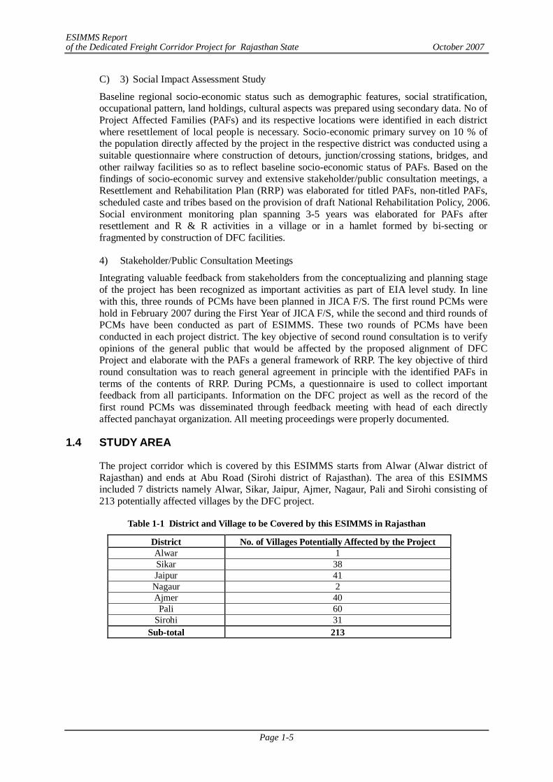
1.4 STUDY AREA
The project corridor which is covered by this ESIMMS starts from Alwar (Alwar district of Rajasthan) and ends at Abu Road (Sirohi district of Rajasthan). The area of this ESIMMS included 7 districts namely Alwar, Sikar, Jaipur, Ajmer, Nagaur, Pali and Sirohi consisting of 213 potentially affected villages by the DFC project.
Table 1-1 District and Village to be Covered by this ESIMMS in Rajasthan
District No. of Villages Potentially Affected by the Project Alwar 1 Sikar 38 Jaipur 41 Nagaur 2 Ajmer 40
Pali 60 Sirohi 31
Sub-total 213
ESIMMS Report of the Dedicated Freight Corridor Project for Rajasthan State October 2007
Page 2-1
CHAPTER 2 APPLIED GUIDELINES, POLICIES AND ACTS
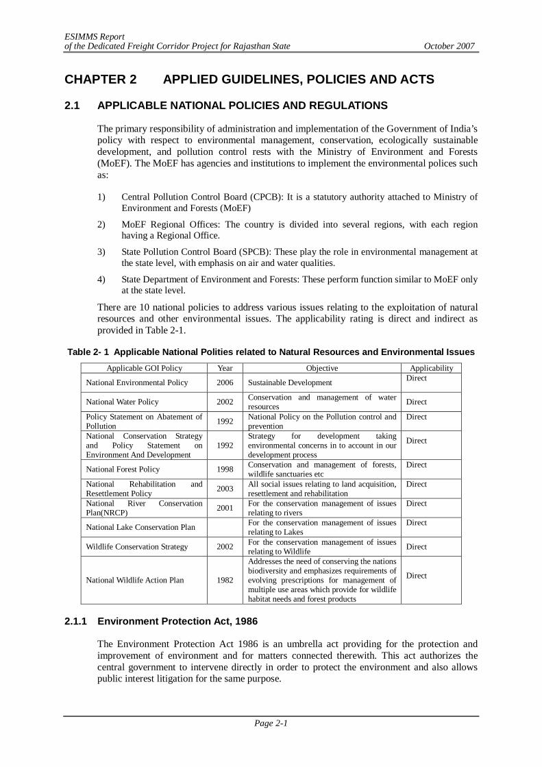
2.1 APPLICABLE NATIONAL POLICIES AND REGULATIONS
The primary responsibility of administration and implementation of the Government of India’s policy with respect to environmental management, conservation, ecologically sustainable development, and pollution control rests with the Ministry of Environment and Forests (MoEF). The MoEF has agencies and institutions to implement the environmental polices such as:
1) Central Pollution Control Board (CPCB): It is a statutory authority attached to Ministry of Environment and Forests (MoEF)
2) MoEF Regional Offices: The country is divided into several regions, with each region having a Regional Office.
3) State Pollution Control Board (SPCB): These play the role in environmental management at the state level, with emphasis on air and water qualities.
4) State Department of Environment and Forests: These perform function similar to MoEF only at the state level.
There are 10 national policies to address various issues relating to the exploitation of natural resources and other environmental issues. The applicability rating is direct and indirect as provided in Table 2-1.
Table 2- 1 Applicable National Polities related to Natural Resources and Environmental Issues Applicable GOI Policy Year Objective Applicability
National Environmental Policy 2006 Sustainable Development Direct
National Water Policy 2002 Conservation and management of water resources Direct
Policy Statement on Abatement of Pollution 1992 National Policy on the Pollution control and
prevention Direct
National Conservation Strategy and Policy Statement on Environment And Development
1992 Strategy for development taking environmental concerns in to account in our development process
Direct
National Forest Policy 1998 Conservation and management of forests, wildlife sanctuaries etc
Direct
National Rehabilitation and Resettlement Policy 2003 All social issues relating to land acquisition,
resettlement and rehabilitation Direct
National River Conservation Plan(NRCP) 2001 For the conservation management of issues
relating to rivers Direct
National Lake Conservation Plan For the conservation management of issues relating to Lakes
Direct
Wildlife Conservation Strategy 2002 For the conservation management of issues relating to Wildlife Direct
National Wildlife Action Plan 1982
Addresses the need of conserving the nations biodiversity and emphasizes requirements of evolving prescriptions for management of multiple use areas which provide for wildlife habitat needs and forest products
Direct
2.1.1 Environment Protection Act, 1986
The Environment Protection Act 1986 is an umbrella act providing for the protection and improvement of environment and for matters connected therewith. This act authorizes the central government to intervene directly in order to protect the environment and also allows public interest litigation for the same purpose.
ESIMMS Report of the Dedicated Freight Corridor Project for Rajasthan State October 2007
Page 2-2
2.1.2 EIA Notification in India
This is the Indian government’s guideline for environmental impact assessment governing all of the development interventions that takes place within the boundaries of India. EIA notification was issued by Ministry of Environment and Forests (MoEF) in 1984 and later amended in 2002. Purpose of this was to impose restrictions and prohibitions on the expansion and modernization of any activity or new projects as specified in Schedule 1 in any part of India unless environmental clearance has been accorded by the Central Government or State Government in accordance with the procedure specified in the notification. This notification on environmental clearance has been recently revised in order to make it more transparent and effective and notified on September 14, 2006.
According to new latest gazette notification, there are two categories of projects via, category A and Category B. Category A will be cleared by the Ministry of Environment and forests at central level (Expert Appraisal Committee or EAC constituted by MOEF)) and the category B project will be cleared by the State Environmental Impact Assessment authority (SEIAA) constituted by MoEF at State level. If there is no State level authority constituted, all categories of projects, as spelt out in Schedule 1 would be dealt at central level.
The objective of the notification is:
To formulate a transparent, decentralized and efficient regulatory mechanism to:
- Incorporate necessary environmental safeguards at planning stage; - Involve stakeholders in the public consultation process; and - Identify developmental projects based on impact potential instead of the
investment criteria.
Differences between EIA Notifications, 1994 & 2006
1) Public consultation structured; to be conducted by SPCB and presided by DM (with in 45 days); proceedings to be video graphed; MoEF to intervene if PH not held in time;
2) Time limits with consequences at each stage; and
3) State Environment Impact Assessment Authority (SEIAA) at the state level and Expert Appraisal Committee (EAC) at central level.
According to latest EIA notification, Railway and bridge construction projects do not appear in the list of Schedule 1 and as such, are exempted from the environmental clearance.
Draft Environmental State Policy: Draft environment policy of the State discourages land use changes i.e., from green fields to brown fields. It envisages promotion of bio-agriculture; crop rotation; bio-fertilizer and bio-pesticides use, and promote integrated micro watershed management.
2.1.3 Forest Conservation Act, 1980
This Act provides for the conservation of forests and regulating diversion of forestlands for non-forestry purposes. When any projects falls within forestlands, prior clearance is required from relevant authorities under the Forest (Conservation) Act, 1980. State governments cannot de-reserve any forestland or authorize its use for any non-forest purposes without approval from the Central government.
ESIMMS Report of the Dedicated Freight Corridor Project for Rajasthan State October 2007
Page 2-3
(1) Applicability of Forest Conservation Act to Railway side strip plantations
In 1986, when MoEF enacted the Environmental Protection Act, the entire linear stretches of roadside, railway line and canal plantations were declared as protected forests. The February 18, 1998 MoEF circular on linear plantations on roadsides, canal and railway lines modified the applicability of provisions of Forest (Conservation) Act, 1980 to linear plantations. The new modification recognizes that the spirit behind the Forest (Conservation) Act was conservation of natural forests and not strips plantations. In the case of the “notified to be protected” railway side plantations, the clearance may be given by the concerned regional office of the MoEF, irrespective of the area of plantation lost. While issuing the approval, in place of normal provision for compensatory afforestation, the regional offices will stipulate a condition that for every tree removed at least two trees should be planted. If the concerned Regional office does not issue the decision within thirty days of the receipt of fully completed application, the project proponent may proceed with widening/expansion under intimation to the State Forest Department and the MoEF.
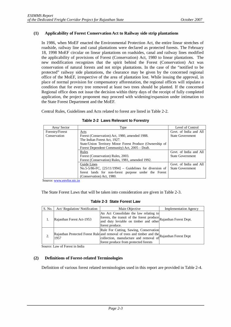
Central Rules, Guidelines and Acts related to forest are listed in Table 2-2.
Table 2-2 Laws Relevant to Forestry Area/ Sector Type Level of Control
Acts Forest (Conservation) Act, 1980, amended 1988. The Indian Forest Act, 1927. State/Union Territory Minor Forest Produce (Ownership of Forest Dependent Community) Act, 2005 – Draft.
Govt. of India and All State Government
Rules Forest (Conservation) Rules, 2003. Forest (Conservation) Rules, 1981, amended 1992.
Govt. of India and All State Government
Forestry/Forest Conservation
Guide Lines No.5-5/86-FC, [25/11/1994] – Guidelines for diversion of forest lands for non-forest purpose under the Forest (Conservation) Act, 1980.
Govt. of India and All State Government
Source: www.envfor.nic.in
The State Forest Laws that will be taken into consideration are given in Table 2-3.
Table 2-3 State Forest Law
S. No. Act/ Regulation/ Notification Main Objective Implementation Agency
1. Rajasthan Forest Act-1953
An Act Consolidate the law relating to forests, the transit of the forest produce and duty leviable on timber and other forest produce.
Rajasthan Forest Dept.
2. Rajasthan Protected Forest Rule 1957
Rule For Cutting, Sawing, Conservation and removal of trees and timber and the collection, manufacture and removal of forest produce from protected forests
Rajasthan Forest Dept
Source: Law of Forest in India
(2) Definitions of Forest-related Terminologies
Definition of various forest related terminologies used in this report are provided in Table 2-4.
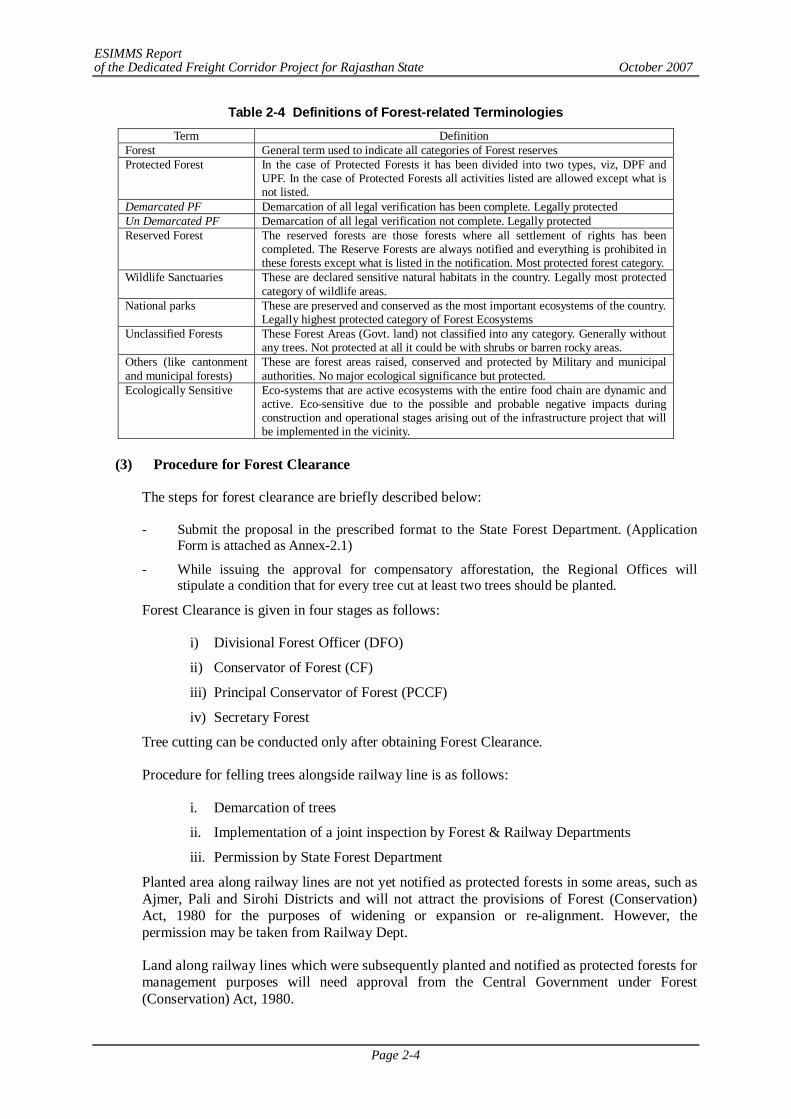
ESIMMS Report of the Dedicated Freight Corridor Project for Rajasthan State October 2007
Page 2-4
Table 2-4 Definitions of Forest-related Terminologies Term Definition
Forest General term used to indicate all categories of Forest reserves Protected Forest In the case of Protected Forests it has been divided into two types, viz, DPF and
UPF. In the case of Protected Forests all activities listed are allowed except what is not listed.
Demarcated PF Demarcation of all legal verification has been complete. Legally protected Un Demarcated PF Demarcation of all legal verification not complete. Legally protected Reserved Forest The reserved forests are those forests where all settlement of rights has been
completed. The Reserve Forests are always notified and everything is prohibited in these forests except what is listed in the notification. Most protected forest category.
Wildlife Sanctuaries These are declared sensitive natural habitats in the country. Legally most protected category of wildlife areas.
National parks These are preserved and conserved as the most important ecosystems of the country. Legally highest protected category of Forest Ecosystems
Unclassified Forests These Forest Areas (Govt. land) not classified into any category. Generally without any trees. Not protected at all it could be with shrubs or barren rocky areas.
Others (like cantonment and municipal forests)
These are forest areas raised, conserved and protected by Military and municipal authorities. No major ecological significance but protected.
Ecologically Sensitive Eco-systems that are active ecosystems with the entire food chain are dynamic and active. Eco-sensitive due to the possible and probable negative impacts during construction and operational stages arising out of the infrastructure project that will be implemented in the vicinity.
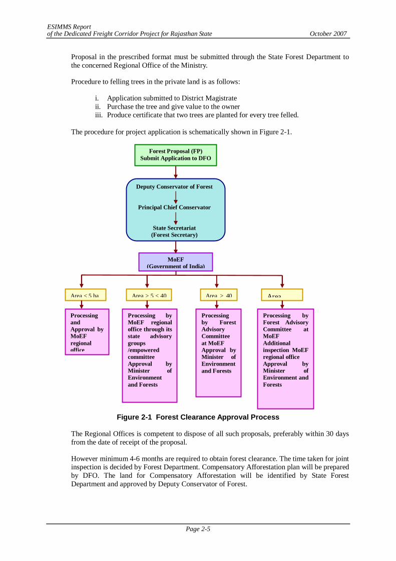
(3) Procedure for Forest Clearance
The steps for forest clearance are briefly described below:
- Submit the proposal in the prescribed format to the State Forest Department. (Application Form is attached as Annex-2.1)
- While issuing the approval for compensatory afforestation, the Regional Offices will stipulate a condition that for every tree cut at least two trees should be planted.
Forest Clearance is given in four stages as follows:
i) Divisional Forest Officer (DFO)
ii) Conservator of Forest (CF)
iii) Principal Conservator of Forest (PCCF)
iv) Secretary Forest
Tree cutting can be conducted only after obtaining Forest Clearance.
Procedure for felling trees alongside railway line is as follows:
i. Demarcation of trees
ii. Implementation of a joint inspection by Forest & Railway Departments
iii. Permission by State Forest Department
Planted area along railway lines are not yet notified as protected forests in some areas, such as Ajmer, Pali and Sirohi Districts and will not attract the provisions of Forest (Conservation) Act, 1980 for the purposes of widening or expansion or re-alignment. However, the permission may be taken from Railway Dept.
Land along railway lines which were subsequently planted and notified as protected forests for management purposes will need approval from the Central Government under Forest (Conservation) Act, 1980.
ESIMMS Report of the Dedicated Freight Corridor Project for Rajasthan State October 2007
Page 2-5
Proposal in the prescribed format must be submitted through the State Forest Department to the concerned Regional Office of the Ministry.
Procedure to felling trees in the private land is as follows:
i. Application submitted to District Magistrate ii. Purchase the tree and give value to the owner iii. Produce certificate that two trees are planted for every tree felled.
The procedure for project application is schematically shown in Figure 2-1.
Figure 2-1 Forest Clearance Approval Process
The Regional Offices is competent to dispose of all such proposals, preferably within 30 days from the date of receipt of the proposal.
However minimum 4-6 months are required to obtain forest clearance. The time taken for joint inspection is decided by Forest Department. Compensatory Afforestation plan will be prepared by DFO. The land for Compensatory Afforestation will be identified by State Forest Department and approved by Deputy Conservator of Forest.
Forest Proposal (FP) Submit Application to DFO
MoEF (Government of India)
Area < 5 ha Area > 5 < 40 Area > 40 Area
Processing and Approval by MoEF regional office
Processing by MoEF regional office through its state advisory groups /empowered committee Approval by Minister of Environment and Forests
Processing by Forest Advisory Committee at MoEF Approval by Minister of Environment and Forests
Processing by Forest Advisory Committee at MoEF Additional inspection MoEF regional office Approval by Minister of Environment and Forests
Deputy Conservator of Forest
Principal Chief Conservator
State Secretariat (Forest Secretary)
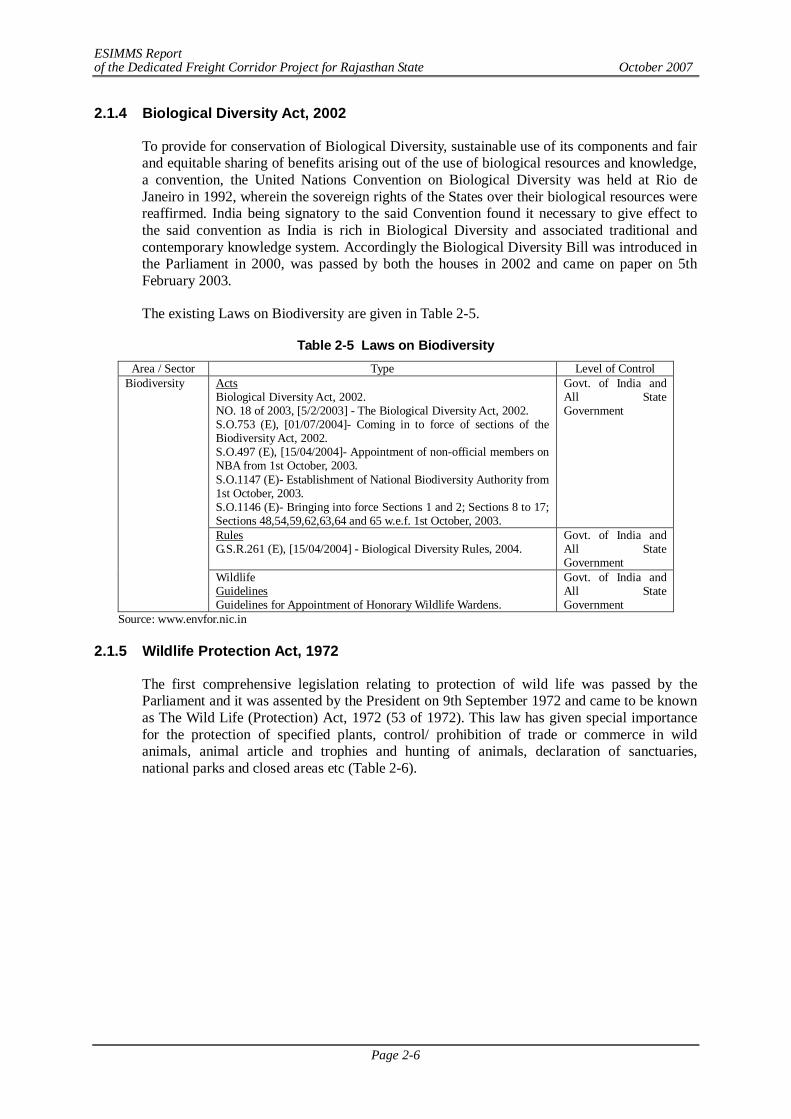
ESIMMS Report of the Dedicated Freight Corridor Project for Rajasthan State October 2007
Page 2-6
2.1.4 Biological Diversity Act, 2002
To provide for conservation of Biological Diversity, sustainable use of its components and fair and equitable sharing of benefits arising out of the use of biological resources and knowledge, a convention, the United Nations Convention on Biological Diversity was held at Rio de Janeiro in 1992, wherein the sovereign rights of the States over their biological resources were reaffirmed. India being signatory to the said Convention found it necessary to give effect to the said convention as India is rich in Biological Diversity and associated traditional and contemporary knowledge system. Accordingly the Biological Diversity Bill was introduced in the Parliament in 2000, was passed by both the houses in 2002 and came on paper on 5th February 2003.
The existing Laws on Biodiversity are given in Table 2-5.
Table 2-5 Laws on Biodiversity Area / Sector Type Level of Control
Acts Biological Diversity Act, 2002. NO. 18 of 2003, [5/2/2003] - The Biological Diversity Act, 2002. S.O.753 (E), [01/07/2004]- Coming in to force of sections of the Biodiversity Act, 2002. S.O.497 (E), [15/04/2004]- Appointment of non-official members on NBA from 1st October, 2003. S.O.1147 (E)- Establishment of National Biodiversity Authority from 1st October, 2003. S.O.1146 (E)- Bringing into force Sections 1 and 2; Sections 8 to 17; Sections 48,54,59,62,63,64 and 65 w.e.f. 1st October, 2003.
Govt. of India and All State Government
Rules G.S.R.261 (E), [15/04/2004] - Biological Diversity Rules, 2004.
Govt. of India and All State Government
Biodiversity
Wildlife Guidelines Guidelines for Appointment of Honorary Wildlife Wardens.
Govt. of India and All State Government
Source: www.envfor.nic.in 2.1.5 Wildlife Protection Act, 1972
The first comprehensive legislation relating to protection of wild life was passed by the Parliament and it was assented by the President on 9th September 1972 and came to be known as The Wild Life (Protection) Act, 1972 (53 of 1972). This law has given special importance for the protection of specified plants, control/ prohibition of trade or commerce in wild animals, animal article and trophies and hunting of animals, declaration of sanctuaries, national parks and closed areas etc (Table 2-6).
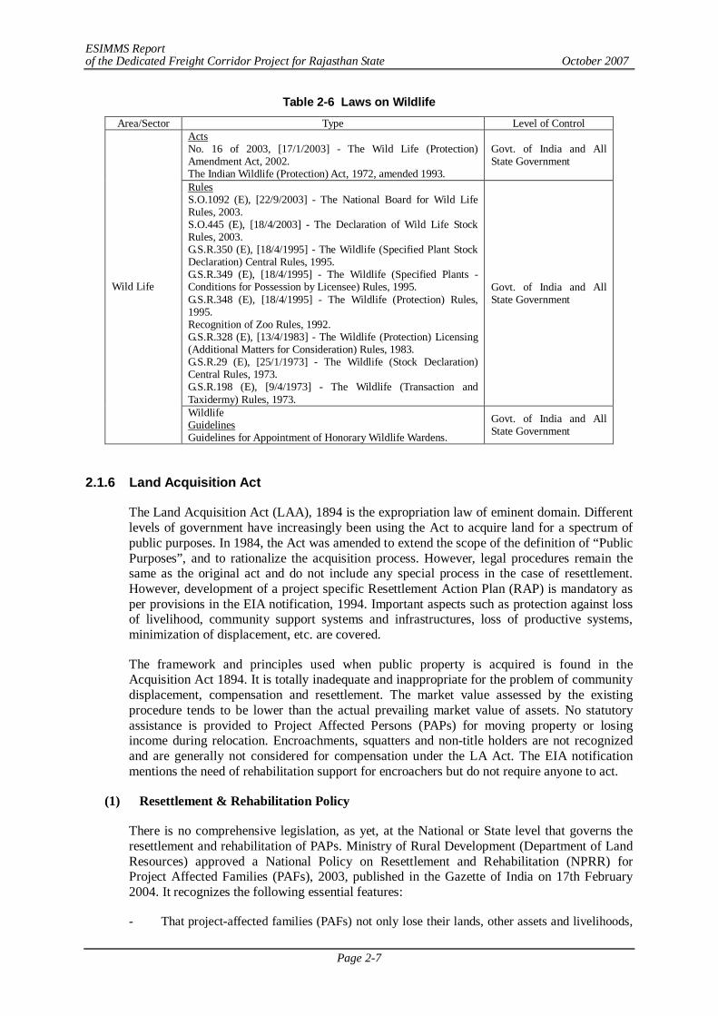
ESIMMS Report of the Dedicated Freight Corridor Project for Rajasthan State October 2007
Page 2-7
Table 2-6 Laws on Wildlife Area/Sector Type Level of Control
Acts No. 16 of 2003, [17/1/2003] - The Wild Life (Protection) Amendment Act, 2002. The Indian Wildlife (Protection) Act, 1972, amended 1993.
Govt. of India and All State Government
Rules S.O.1092 (E), [22/9/2003] - The National Board for Wild Life Rules, 2003. S.O.445 (E), [18/4/2003] - The Declaration of Wild Life Stock Rules, 2003. G.S.R.350 (E), [18/4/1995] - The Wildlife (Specified Plant Stock Declaration) Central Rules, 1995. G.S.R.349 (E), [18/4/1995] - The Wildlife (Specified Plants - Conditions for Possession by Licensee) Rules, 1995. G.S.R.348 (E), [18/4/1995] - The Wildlife (Protection) Rules, 1995. Recognition of Zoo Rules, 1992. G.S.R.328 (E), [13/4/1983] - The Wildlife (Protection) Licensing (Additional Matters for Consideration) Rules, 1983. G.S.R.29 (E), [25/1/1973] - The Wildlife (Stock Declaration) Central Rules, 1973. G.S.R.198 (E), [9/4/1973] - The Wildlife (Transaction and Taxidermy) Rules, 1973.
Govt. of India and All State Government
Wild Life
Wildlife Guidelines Guidelines for Appointment of Honorary Wildlife Wardens.
Govt. of India and All State Government
2.1.6 Land Acquisition Act
The Land Acquisition Act (LAA), 1894 is the expropriation law of eminent domain. Different levels of government have increasingly been using the Act to acquire land for a spectrum of public purposes. In 1984, the Act was amended to extend the scope of the definition of “Public Purposes”, and to rationalize the acquisition process. However, legal procedures remain the same as the original act and do not include any special process in the case of resettlement. However, development of a project specific Resettlement Action Plan (RAP) is mandatory as per provisions in the EIA notification, 1994. Important aspects such as protection against loss of livelihood, community support systems and infrastructures, loss of productive systems, minimization of displacement, etc. are covered.
The framework and principles used when public property is acquired is found in the Acquisition Act 1894. It is totally inadequate and inappropriate for the problem of community displacement, compensation and resettlement. The market value assessed by the existing procedure tends to be lower than the actual prevailing market value of assets. No statutory assistance is provided to Project Affected Persons (PAPs) for moving property or losing income during relocation. Encroachments, squatters and non-title holders are not recognized and are generally not considered for compensation under the LA Act. The EIA notification mentions the need of rehabilitation support for encroachers but do not require anyone to act.
(1) Resettlement & Rehabilitation Policy
There is no comprehensive legislation, as yet, at the National or State level that governs the resettlement and rehabilitation of PAPs. Ministry of Rural Development (Department of Land Resources) approved a National Policy on Resettlement and Rehabilitation (NPRR) for Project Affected Families (PAFs), 2003, published in the Gazette of India on 17th February 2004. It recognizes the following essential features:
- That project-affected families (PAFs) not only lose their lands, other assets and livelihoods,
ESIMMS Report of the Dedicated Freight Corridor Project for Rajasthan State October 2007
Page 2-8
they also experience adverse psychological and social/cultural consequences;
- The need to minimize large-scale displacement and where displacement is inevitable, resettlement and rehabilitation has to be handled with utmost care. This is especially necessary for tribal, small and marginal farmers and women;
- That cash compensation alone is often inadequate to replace lost agricultural land, homesteads and other resources. Landless labourers, forest dwellers, tenants, artisans are not eligible for cash compensation;
- The need to provide relief especially to the rural poor (with no assets), small and marginal farmers, Scheduled Castes (SCs)/ Scheduled Tribes (STs) and women;
- The importance of dialogue between PAFs and the administration responsible for resettlement for smoother implementation of projects and Resettlement and Rehabilitation Plan (RRP).
- The policy is in the form of broad guidelines and executive instructions and will be applicable to projects displacing 500 families or more in plain areas and 250 families or more in hilly areas.
The NPRR does not meet some of the International Funding Agencies (World Bank, ADB, etc.) resettlement policy's key requirements. Firstly, the NPRR states that in acquisitions for highways, railway lines, transmission lines and pipelines, project affected families will be offered an ex-gratia payment of Rs.10,000 and no other resettlement and rehabilitation benefits. Secondly, the cut-off numbers of affected persons for whom World Bank requires resettlement plans are much lower. Thirdly, replacement value is not clearly defined and more importantly is not taken into account in the various lump-sum compensation payments that have been decreed in the policy. Fourthly, no specific entitlements have been provided for untitled persons such as squatters and encroachers. However, the policy does recognize some significant principles. It requires projects to (a) minimize displacement and to identify non-displacing or least-displacing alternatives; (b) plan the resettlement and rehabilitation of PAPs including special needs of tribal and vulnerable sections; (c) provide a better standard of living to PAFs; and (d) facilitate harmonious relationships between the requiring body and PAFs through mutual cooperation. A National Monitoring Committee will be set up comprising the Secretary Land Resources (Chair), Secretary Planning Commission, Secretary Social Justice and, Secretary Water Resources, Secretary Tribal Affairs, Secretary Railways, Secretary Power and Secretary Coal. In addition, a National Monitoring Cell will be established in the Department of Land Resources in the Ministry of Rural Development under a Joint Secretary, assisted by zonal directors, subject matter specialists, deputy directors and other support staff.
In view of many deficiencies identified in NPRR, this existing policy has been reviewed and a draft Rehabilitation Policy at the National Level, that has been formulated and awaits approval by the central government. It is expected that it will be cleared by parliament session this year and that it would become as “National Rehabilitation Act of 2006” which makes new compensation scheme for resettlement and rehabilitation of PAPs mandatory. In brief, the proposed policy acknowledges the inadequate measures taken in the past and inaccessibility to studies, reports and data about the projects, for PAPs and NGOs. It suggests full access and information disclosure to PAPs and NGOs to ensure effective participation and representation. The draft policy further emphasizes the need for a separate institutional framework and organizational structure, as well as a sustained system for monitoring and evaluating resettlement and rehabilitation projects.
(2) R & R under Current Project
Resettlement and Rehabilitation Framework for this project has been elaborated and subjected to the objectives and the scope of following guidelines and policies.
ESIMMS Report of the Dedicated Freight Corridor Project for Rajasthan State October 2007
Page 2-9
- National Rehabilitation Policy (NRP 2006)
- JICA Guidelines
- JBIC Guidelines
- World Bank Safeguard Policies
- ADB Environmental Policies
Entitlement framework for this project has been recommended for this project derived from specific project requirement identified by a baseline socio-economic census and exhaustive community consultation sessions. Considerable references were made to the earlier R & R experiences from a road project financed by ADB and other best-demonstrated practices in Haryana and Rajasthan in India.
2.1.7 Noise Pollution Regulation and Control Rules
As a result of considering the deleterious and psychological effects of the noise pollution on the human well being. Ministry of Environment and Forests (MoEF) has drawn up the above rules, which have come to force with effect from 14th February 14, 2000.
- EIA shall identify all “industrial”, “commercial”, “residential” and “silent” zones within the project study area
- EIA shall assess if the levels of noise generated by the project in any area exceeded the ambient air quality standards in respect of noise in the schedule of rules
- EIA shall describe noise pollution measures to achieve compliance with the ambient air quality standards in respect of noise.
2.1.8 Air (Prevention and Control of Pollution) Act, 1981
This Act provides for the prevention, control and abatement of air pollution. It is triggered by air polluting activity in an air pollution control area or when emissions of any air pollutants into the atmosphere exceed the standards set by the Central and State Boards.
- EIA shall identify air pollution control areas.
- Document shall identify all air polluting activities and sources associated with the project.
- EIA confirms that consent will be obtained for air pollution control areas.
Environmental report describes mechanisms requested for the operation of industrial equipment and to notify the State Board of an unforeseen release of air pollutants exceeding the standards. Remedial measures proposed to mitigate air pollution in air pollution control areas are to be described.
2.1.9 Water (Prevention and Control Pollution) Act
The Water (Prevention and Control of Pollution) Act, 1974 resulted in the establishment of the Central and State-level Pollution Control Boards whose responsibilities include managing water quality and effluent standards, as well as monitoring water quality, prosecuting offenders and issuing licenses for construction and operation of certain facilities.
2.1.10 Other Relevant Acts
The other relevant acts that will be involved with the project are given in Table 2-7.
ESIMMS Report of the Dedicated Freight Corridor Project for Rajasthan State October 2007
Page 2-10
(1) Cultural Environment Related Act, 1958
As a result of growing interest in cultural heritage in the nation, both government agencies and NGOs concerned with the preservation and conservation of this heritage have been established. The Archaeological Survey of India (ASI) is the organization working on the protection and conservation of monuments and archaeological sites. It is supported in its endeavors by the state Directorate of Archaeology. The ASI administers the Ancient Monuments and Archaeological Sites and Remains Act, 1958. According to this act, areas within radii of 100 m and 300 m from the “protected property” are designated as “protected” and “controlled” respectively. No development activity is permitted in the protected area, without prior permission of the GOI. Similarly, certain development (likely to damage the protected property) activities require prior permission from GOI. Conservation for the designated protected monuments/sites/remains is addressed by the existing legislation. However, there are several railway side cultural properties that are not “protected”, but are of significant cultural or religious value to the community. No procedure exists at present for conservation of these “smaller” cultural properties.
(2) Motor Vehicle Act, 1988
In 1988, the Indian Motor Vehicle Act empowered the State Transport Authority to enforce standards for vehicular pollution and prevention control. The authority also checks emission standards of registered vehicles, collects road taxes, and issues licenses. In August 1997, the “Pollution Under Control Certificate” (PUC) programme was launched in an attempt to crackdown on the amount of vehicular emissions in the state. To date it has not been highly effective.
Table 2-7 Miscellaneous Relevant Laws Area / Sector Type Level of Control
Act No.6 of 1991, [22/1/1991] - The Public Liability Insurance Act, 1991, amended 1992.
Govt. of India and All State Government
Rules S.O.330 (E), [15/5/l991] - The Public Liability Insurance Rules, 1991, amended 1993.
Govt. of India and All State Government
Public Liability Insurance
Notifications G.S.R.253, [27/3/1991] - Date on which the Public Liability Insurance Act, 1991 came into force. S.O.282, [19/3/1993] - List of Officers delegated powers of section 13 & 18 of PLI Act. S.O.779 (E), [15/11/1991] - Delegation of powers to the State Governments. S.O.780 (E), [15/11/1991] - Delegation of powers to the State Governments. S.O.227(E), [24/3/1992] - Hazardous substances and quantities to which PLI is applicable
Govt. of India and All State Government
Ancient Monuments and Archaeological Sites
Ancient Monuments and Archaeological Sites and Remains Act, 1958
Govt. of India and All State Government
Source: www.envfor.nic.in 2.2 APPLICABLE GUIDELINES AND POLICIES/STRATEGIES
Some other applicable policies and the policies and Strategies of some prospective donors are given in the following sub-sections.
ESIMMS Report of the Dedicated Freight Corridor Project for Rajasthan State October 2007
Page 2-11
2.2.1 JICA Guidelines on Environmental and Social Considerations
JICA supports the recipient governments by offering cooperation projects into which JICA incorporates appropriate environmental and social considerations so as to avoid or minimize development projects’ adverse impacts on the environment and local communities. JICA thus promotes sustainable development in developing countries.
The impacts to be assessed with regard to environmental and social considerations include impacts on human health and safety as well as the natural environment. Impacts on the natural environment include trans-boundary or global-scale impacts through air, water, soil, waste, accidents, water usage, climate change, ecosystems and biodiversity. The impacts to be assessed also include social impacts, which include the migration of populations and involuntary resettlement; local economy such as employment and livelihood; utilization of land and local resources; social institutions such as social infrastructure and local decision-making institutions; existing social infrastructures and services; vulnerable social groups such as the poverty level and indigenous peoples; equality of benefits and losses and equality in development process; gender; children’s rights; cultural heritage; local conflict of interests and infectious diseases such as HIV/AIDS.
In addition to the direct and immediate impacts of projects, derivative, secondary and cumulative impacts are also to be assessed in regard to environmental and social considerations within the extent possible. The life cycle impact during a project period is considered as well.
2.2.2 JBIC Guidelines on Environmental and Social Considerations
JBIC established "Japan Bank for International Cooperation Guidelines for Confirmation of Environmental and Social Considerations" on April 1, 2002, as unified guidelines of two environmental guidelines applied to International Financial Operations and Overseas Economic Cooperation Operations respectively. The Guidelines has been implemented from October 1, 2003.
The guidelines placed a premium on participation by such stakeholders as local community inhabitants who will be affected by the project. They require the project executor to solicit stakeholders' participation from the project planning stage. The checklist to be confirmed by JBIC now includes social considerations pertaining to resettlement, indigenous people and women. Also more strengthened than in the previous guidelines is a provision on information disclosure. JBIC is required to make public such items as the category classification of the project prior to loan approval.
The guidelines were established on 1st April, 2002, and have been fully implemented since October 1, 2003. The guidelines will be applied to the projects for which a substantive loan request is made in October 2003 and later. The projects for which an approval of loan was already given or a substantive loan request was made before October 2003, the previous "Environmental Guidelines for International Financial Operations", "JBIC Environmental Guidelines for ODA loans" or the relevant will be applied. However, in advance of the full implementation, JBIC has been implementing since October 2002 the key items set forth in the guidelines, including the checklist, category classification, its disclosure, and the disclosure of environmental review.
2.2.3 Asian Development Bank (ADB) Environmental Policies
ADB’s specialized guidance for environmental assessment includes methods and approaches that might be used in the conduct of a specific aspect of the environmental assessment, irrespective of the sector or project type. This is to be contrasted with sector guidance, which
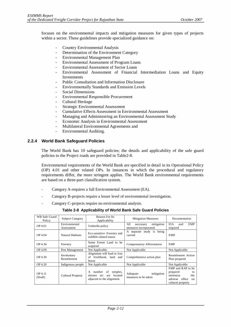
ESIMMS Report of the Dedicated Freight Corridor Project for Rajasthan State October 2007
Page 2-12
focuses on the environmental impacts and mitigation measures for given types of projects within a sector. These guidelines provide specialized guidance on:
- Country Environmental Analysis - Determination of the Environment Category - Environmental Management Plan - Environmental Assessment of Program Loans - Environmental Assessment of Sector Loans - Environmental Assessment of Financial Intermediation Loans and Equity
Investments - Public Consultation and Information Disclosure - Environmentally Standards and Emission Levels - Social Dimensions - Environmental Responsible Procurement - Cultural Heritage - Strategic Environmental Assessment - Cumulative Effects Assessment in Environmental Assessment - Managing and Administering an Environmental Assessment Study - Economic Analysis in Environmental Assessment - Multilateral Environmental Agreements and - Environmental Auditing.
2.2.4 World Bank Safeguard Policies
The World Bank has 10 safeguard policies; the details and applicability of the safe guard policies to the Project roads are provided in Table2-8.
Environmental requirements of the World Bank are specified in detail in its Operational Policy (OP) 4.01 and other related OPs. In instances in which the procedural and regulatory requirements differ, the more stringent applies. The World Bank environmental requirements are based on a three-part classification system.
- Category A-requires a full Environmental Assessment (EA).
- Category B-projects require a lesser level of environmental investigation.
- Category C-projects require no environmental analysis.
Table 2-8 Applicability of World Bank Safe Guard Policies WB Safe Guard
Policy Subject Category Reason For Its Applicability Mitigation Measures Documentation
OP 4.01 Environmental Assessment Umbrella policy All necessary mitigation
measures incorporated. EIA and EMP required
OP 4.04 Natural Habitats Eco-sensitive -Forestry and wildlife related issues
A separate study is being carried
EMP.
OP 4.36 Forestry Some Forest Land to be acquired Compensatory Afforestation EMP
OP 4.09 Pest Management Not Applicable Not Applicable Not Applicable
OP 4.30 Involuntary Resettlement
Alignment will lead to loss of livelihood, land and house
Comprehensive action plan Resettlement Action Plan prepared
OP 4.20 Indigenous people Not Applicable Not Applicable Not Applicable
OP 4.11 (Draft) Cultural Property
A number of temples, shrines etc are located adjacent to the alignment.
Adequate mitigation measures to be taken
EMP and RAP to be prepared to minimize the adverse effect on cultural property
ESIMMS Report of the Dedicated Freight Corridor Project for Rajasthan State October 2007
Page 2-13
2.2.5 National and State Environmental Policies
The National Environmental Policy (NEP) 2006 is a response to national commitment to clean environment mandated in the Indian Constitution and is intended to mainstream environmental concerns in all development activities. NEP recognizes environmental degradation as a major causal factor in enhancing and perpetuating poverty particularly among the rural poor. One of the key objectives of NEP is to integrate environmental concerns into policies, plans, programmes and projects for economic and social development. This policy has evolved from the recognition that only such development is sustainable, which respects environmental and ecological constraints. In order to achieve sustainable development, environmental protection shall constitute an integral part of the development process and cannot be considered in isolation from it.
In consistent with NEP, Haryana and Rajasthan state environmental policy focuses the necessity of development in environmental friendly manner. State policy identifies poverty as the root cause of environmental degradation and encourages sustainable development for poverty reduction in order to support 16 % of country population with 7 % geographical area.
2.2.6 National and State Forest Policies
Government of India in the erstwhile Ministry of Food and Agriculture enunciated a National Forest Policy to be followed in the management of State Forests in the country long time back in 1952. However, forests in the country have serious depletion over the years. The need to review the situation and to evolve a new strategy of forest conservation for the future has become imperative. In view of this, National Forest Policy has been revised in 1988. The principal aim of new Forest Policy is to ensure environmental stability and maintenance of ecological balance including atmospheric equilibrium which is vital for sustenance of all life forms, human, animal and plant. The derivation of direct economic impact must be subordinated to this principal aim. As mandated by this policy, a minimum of 33 % of total geographical area under forest/tree cover has been determined desirable.
State Policy for Forestry Development
In the foregoing background the State's Policy from the angle of forestry development are envisaged as under:
- Conservation of unique rich heritage, cultural and ethnical traditions of conservation of floral and faunal diversity and gene pool reserves through a network of protected areas, such as National Parks, Sanctuaries, Biosphere Reserves and Closed Areas.
- Conservation of rare and endangered species of flora and fauna of the state by undertaking in-situ and ex-situ conservation measures and establishing linkages with the natural habitats of the species for their rehabilitation.
- Providing proper protection to the wildlife in multiple use areas forming corridors and linking them up with the protected areas for genetic continuity.
- Development of research and monitoring facilities for scientific understanding of species and ecosystems, population and habitats for sustainable management of biodiversity resources of the state.
- Protection and development of natural forest ecosystems for sustainable production and consumption of goods and services.
- Promoting eco development around protected areas with the involvement of local people and NGOs.
- Enhancing productivity of forests, public wastelands and optimising production from private
ESIMMS Report of the Dedicated Freight Corridor Project for Rajasthan State October 2007
Page 2-14
degraded lands.
- Ecological restoration of all degraded forests, public wastelands (Community/Panchayat) and private degraded lands by using appropriate technology and management inputs based on land capability classes.
- Combating desertification by undertaking various measures, such as, in-situ soil and water conservation and water harvesting, sand dune stabilisation and promoting combined production systems, namely, agro-forestry, silvi-pastoral, agri-silvi-pastoral, agri-horticultural systems.
- Augmenting fuelwood, fodder, timber and non-timber forest products for meeting the demands of local people and the state, with particular focus on fuelwood and fodder production.
- Promoting efficient utilisation of forest products and maximising substitution of wood.
- Empowerment of the village forest protection committees for sustainable management of the forests managed under Joint Forest Management Systems.
- Development of facilities for processing, grading, value addition and marketing of non-timber forest products especially in tribal areas.
- Strengthening forestry research base for enhancing productivity of forests and promoting rational utilisation of forest products.
- Extension and dissemination of research findings and proven technologies for adoption by the users, government, non-government and private individuals.
- Providing support services to the farmers for promotion of agro-forestry through a system of incentives.
- Instituting human resource development through a proper system of career planning and development for upgrading the technical and professional skills of forestry personnel.
- Shifting the onus of management of forests from the traditional management practices to people oriented approaches by internalising intensive and extensive participatory strategies in the working system of the Forest Department.
- Education and awareness raising through interpretation aimed at public appreciation of the importance of wildlife to human society.
- Bringing forestry close to people by creating massive people’s movement with the involvement of women to minimise pressure on the existing forests.
2.2.7 Resettlement and Rehabilitation Policy
There is no comprehensive legislation, as yet, at the National or State level that governs the resettlement and rehabilitation of PAPs. Ministry of Rural Development (Department of Land Resources) approved a National Policy on Resettlement and Rehabilitation (NPRR) for Project Affected Families (PAFs), 2003, published in the Gazette of India on 17th February 2004. It recognizes the following essential features:
That project affected families (PAF) not only lose their lands, other assets and livelihoods, they also experience adverse psychological and social/cultural consequences;
The need to minimize large-scale displacement and where displacement is inevitable, resettlement and rehabilitation has to be handled with utmost care. This is especially necessary for tribal, small and marginal farmers and women;
ESIMMS Report of the Dedicated Freight Corridor Project for Rajasthan State October 2007
Page 2-15
That cash compensation alone is often inadequate to replace lost agricultural land, homesteads and other resources. Landless labourers, forest dwellers, tenants, artisans are not eligible for cash compensation;
The need to provide relief especially to the rural poor (with no assets), small and marginal farmers, SCs/ STs and women;
The importance of dialogue between PAFs and the administration responsible for resettlement for smoother implementation of projects and R &R.
The policy is in the form of broad guidelines and executive instructions and will be applicable to projects displacing 500 families or more in plain areas and 250 families or more in hilly areas.
The NPRR does not meet some of the International Funding Agencies (World Bank, ADB etc.) resettlement policy's key requirements. Firstly, the NPRR states that in acquisitions for highways, railway lines, transmission lines and pipelines, project affected families will be offered an ex-gratia payment of Rs 10,000 and no other resettlement and rehabilitation benefits. Secondly, the cut-off numbers of affected persons for whom World Bank requires resettlement plans are much lower. Thirdly, replacement value is not clearly defined and more importantly is not taken into account in the various lump-sum compensation payments that have been decreed in the policy. Fourthly, no specific entitlements have been provided for untitled persons such as squatters and encroachers. However, the policy does recognize some significant principles. It requires projects to (a) minimize displacement and to identify non-displacing or least-displacing alternatives; (b) plan the resettlement and rehabilitation of PAPs including special needs of tribal and vulnerable sections; (c) provide a better standard of living to PAFs; and (d) facilitate harmonious relationships between the requiring body and PAFs through mutual cooperation. A National Monitoring Committee will be set up comprising the Secretary Land Resources (Chair), Secretary Planning Commission, Secretary Social Justice and, Secretary Water Resources, Secretary Tribal Affairs, Secretary Railways, Secretary Power and Secretary Coal. In addition a National Monitoring Cell will be established in the Department of Land Resources in the Ministry of Rural Development under a Joint Secretary, assisted by zonal directors, subject matter specialists, deputy directors and other support staff.
In view of many deficiencies identified in NPRR, this existing policy has been reviewed and a draft Rehabilitation Policy at the National Level, that has been formulated and awaits approval by the central government. It is expected that it will be cleared by parliament session this year and that it would become as “National Rehabilitation Act of 2006” which makes new compensation scheme for resettlement and rehabilitation of PAPs mandatory. In brief, the proposed policy acknowledges the inadequate measures taken in the past and inaccessibility to studies, reports and data about the projects, for PAPs and NGOs. It suggests full access and information disclosure to PAPs and NGOs to ensure effective participation and representation. The draft policy further emphasizes the need for a separate institutional framework and organizational structure, as well as a sustained system for monitoring and evaluating resettlement and rehabilitation projects.
R & R under Current Project
Resettlement & Rehabilitation Framework for this project has been elaborated and subjected to the objectives and the scope of following guidelines and policies.
- National Rehabilitation Policy (NRP 2006) - JICA Guidelines - JBIC Guidelines - World bank Safeguard Policies
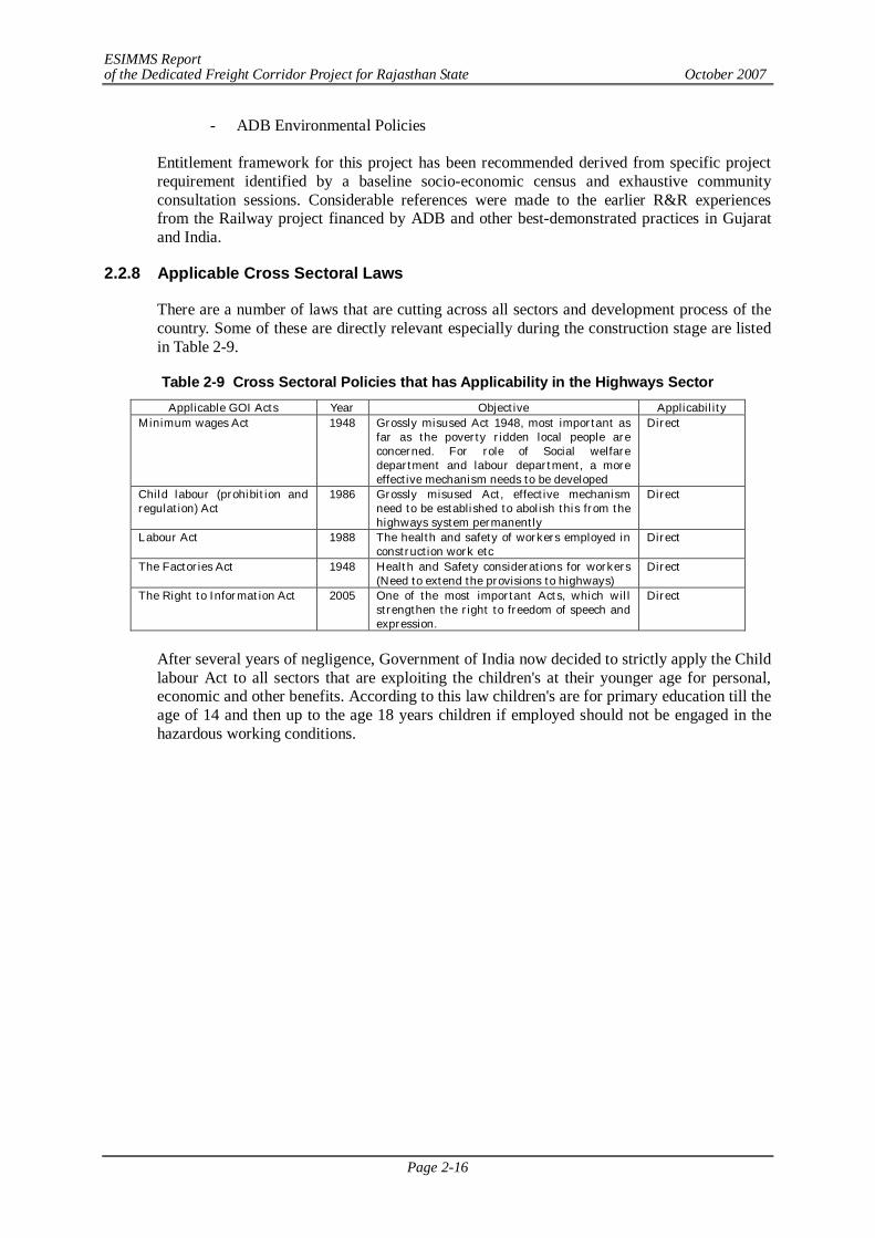
ESIMMS Report of the Dedicated Freight Corridor Project for Rajasthan State October 2007
Page 2-16
- ADB Environmental Policies
Entitlement framework for this project has been recommended derived from specific project requirement identified by a baseline socio-economic census and exhaustive community consultation sessions. Considerable references were made to the earlier R&R experiences from the Railway project financed by ADB and other best-demonstrated practices in Gujarat and India.
2.2.8 Applicable Cross Sectoral Laws
There are a number of laws that are cutting across all sectors and development process of the country. Some of these are directly relevant especially during the construction stage are listed in Table 2-9.
Table 2-9 Cross Sectoral Policies that has Applicability in the Highways Sector Applicable GOI Acts Year Objective Applicability
Minimum wages Act 1948 Grossly misused Act 1948, most important as far as the poverty ridden local people are concerned. For role of Social welfare department and labour department, a more effective mechanism needs to be developed
Direct
Child labour (prohibition and regulation) Act
1986 Grossly misused Act, effective mechanism need to be established to abolish this from the highways system permanently
Direct
Labour Act 1988 The health and safety of workers employed in construction work etc
Direct
The Factories Act 1948 Health and Safety considerations for workers (Need to extend the provisions to highways)
Direct
The Right to Information Act
2005 One of the most important Acts, which will strengthen the right to freedom of speech and expression.
Direct
After several years of negligence, Government of India now decided to strictly apply the Child labour Act to all sectors that are exploiting the children's at their younger age for personal, economic and other benefits. According to this law children's are for primary education till the age of 14 and then up to the age 18 years children if employed should not be engaged in the hazardous working conditions.
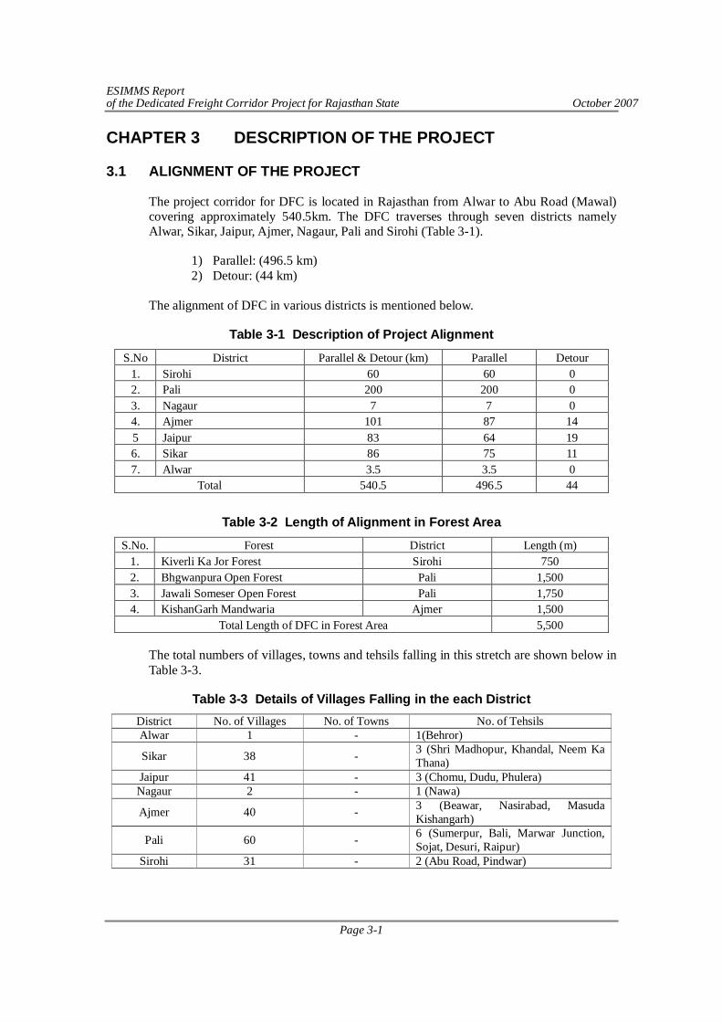
ESIMMS Report of the Dedicated Freight Corridor Project for Rajasthan State October 2007
Page 3-1
CHAPTER 3 DESCRIPTION OF THE PROJECT
3.1 ALIGNMENT OF THE PROJECT
The project corridor for DFC is located in Rajasthan from Alwar to Abu Road (Mawal) covering approximately 540.5km. The DFC traverses through seven districts namely Alwar, Sikar, Jaipur, Ajmer, Nagaur, Pali and Sirohi (Table 3-1).
1) Parallel: (496.5 km) 2) Detour: (44 km)
The alignment of DFC in various districts is mentioned below.
Table 3-1 Description of Project Alignment
S.No District Parallel & Detour (km) Parallel Detour 1. Sirohi 60 60 0 2. Pali 200 200 0 3. Nagaur 7 7 0 4. Ajmer 101 87 14 5 Jaipur 83 64 19 6. Sikar 86 75 11 7. Alwar 3.5 3.5 0
Total 540.5 496.5 44
Table 3-2 Length of Alignment in Forest Area
S.No. Forest District Length (m) 1. Kiverli Ka Jor Forest Sirohi 750 2. Bhgwanpura Open Forest Pali 1,500 3. Jawali Someser Open Forest Pali 1,750 4. KishanGarh Mandwaria Ajmer 1,500
Total Length of DFC in Forest Area 5,500
The total numbers of villages, towns and tehsils falling in this stretch are shown below in Table 3-3.
Table 3-3 Details of Villages Falling in the each District District No. of Villages No. of Towns No. of Tehsils Alwar 1 - 1(Behror)
Sikar 38 - 3 (Shri Madhopur, Khandal, Neem Ka Thana)
Jaipur 41 - 3 (Chomu, Dudu, Phulera) Nagaur 2 - 1 (Nawa)
Ajmer 40 - 3 (Beawar, Nasirabad, Masuda Kishangarh)
Pali 60 - 6 (Sumerpur, Bali, Marwar Junction, Sojat, Desuri, Raipur)
Sirohi 31 - 2 (Abu Road, Pindwar)
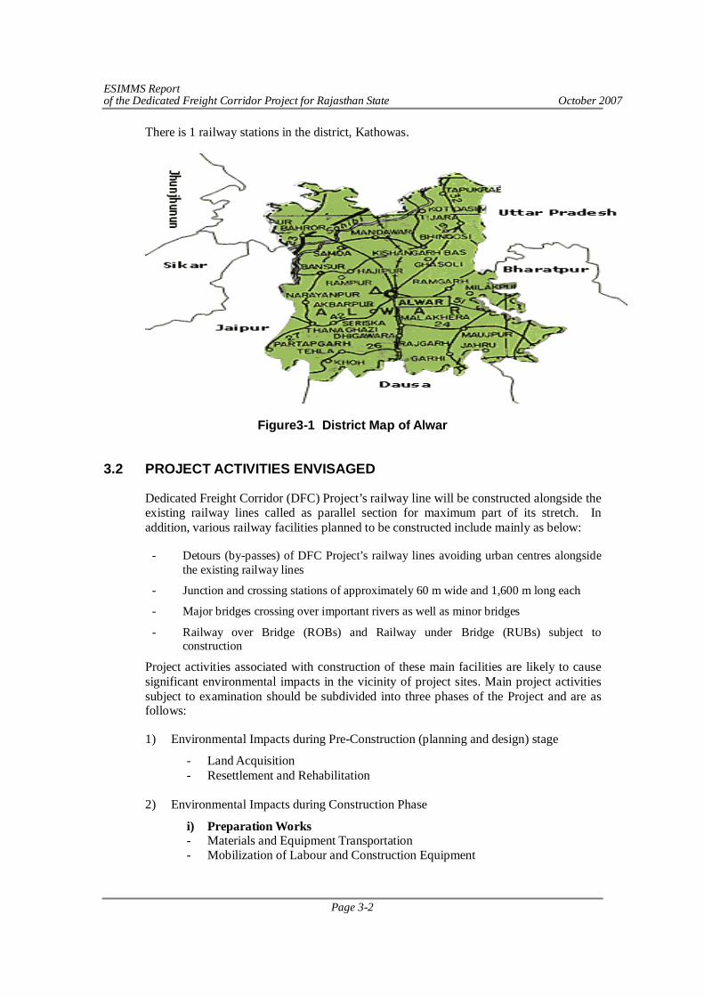
ESIMMS Report of the Dedicated Freight Corridor Project for Rajasthan State October 2007
Page 3-2
There is 1 railway stations in the district, Kathowas.
Figure3-1 District Map of Alwar
3.2 PROJECT ACTIVITIES ENVISAGED
Dedicated Freight Corridor (DFC) Project’s railway line will be constructed alongside the existing railway lines called as parallel section for maximum part of its stretch. In addition, various railway facilities planned to be constructed include mainly as below:
- Detours (by-passes) of DFC Project’s railway lines avoiding urban centres alongside the existing railway lines
- Junction and crossing stations of approximately 60 m wide and 1,600 m long each
- Major bridges crossing over important rivers as well as minor bridges
- Railway over Bridge (ROBs) and Railway under Bridge (RUBs) subject to construction
Project activities associated with construction of these main facilities are likely to cause significant environmental impacts in the vicinity of project sites. Main project activities subject to examination should be subdivided into three phases of the Project and are as follows:
1) Environmental Impacts during Pre-Construction (planning and design) stage
- Land Acquisition - Resettlement and Rehabilitation
2) Environmental Impacts during Construction Phase
i) Preparation Works - Materials and Equipment Transportation - Mobilization of Labour and Construction Equipment
ESIMMS Report of the Dedicated Freight Corridor Project for Rajasthan State October 2007
Page 3-3
- Preparation of base camp, workshop, storage etc, - Identification of borrow areas and quarry sites - Clearance for forest land diversion - Planning and approval for Utilities shifting - Resettlement and Rehabilitation (Continue)
ii) Implementation - Site Clearance and Land Preparation - Excavation and filling - Material transportation (quarry/borrow pit activities) - Earth works followed by rail, electric line and signal installation works - ROBs/RUBs, Crossing/Junction station and bridge construction works - Demobilization and site restoration
3) Environmental Impacts during Post-construction (Operation) Stage
- Operation and maintenance of trains, railways, ROBs/RUBs and bridges 3.3 FACILITY CONSTRUCTION PLAN
The DFC will entail construction of the Railway alignment with associated facilities. The alignment has been selected judiciously considering environmental and social aspects. Detours are proposed to avoid the congested cities so that land acquisition and Project Affected Persons (PAPs) are minimized. The other features of alignment include construction of junction stations, crossing stations, service lanes and bridges.
3.3.1 Junction Stations
The number of junction stations of DFC in the districts of Rajasthan is shown below:
District Number of Junction Stations Size of Junction Stations (m) Alwar - - Sikar - -
Jaipur 1 (Existing, Jaipur) + 1 (Proposed Phulera) 60 x 2,130
Nagaur - - Ajmer 1 (Existing) 60 x 2,130
Pali 1 (Existing Pali) + 1 (Proposed Marwar) 60 x 2,130
Sirohi - -
There are about 84 railway stations falling in the entire route of existing alignment. List of stations are attached as Annex-3.1.
3.3.2 Crossing Stations
The number of crossing stations of DFC in the districts of Rajasthan is shown below:
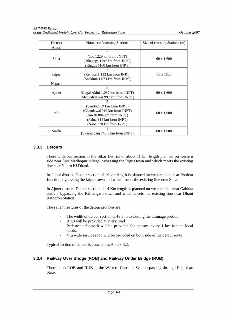
ESIMMS Report of the Dedicated Freight Corridor Project for Rajasthan State October 2007
Page 3-4
District Number of crossing Stations Size of crossing Stations (m) Alwar - -
Sikar
3 (Jilo 1229 km from JNPT)
( Bhagega 1197 km from JNPT) (Ringus 1160 km from JNPT)
60 x 1,600
Jaipur 2
(Renwal 1,132 km from JNPT) (Shakhun 1,073 km from JNPT)
60 x 1600
Nagaur - -
Ajmer 2
(Gegal Akhri 1,037 km from JNPT) (Mangaliyawas 997 km from JNPT)
60 x 1,600
Pali
5 (Sendra 959 km from JNPT)
(Chandawal 919 km from JNPT) (Jawali 884 km from JNPT) (Falna 814 km from JNPT) (Nana 778 km from JNPT)
60 x 1,600
Sirohi 1 (Swarupganj 740.5 km from JNPT) 60 x 1,600
3.3.3 Detours
There is detour section in the Sikar District of about 11 km length planned on western side near Shri Madhopur village, bypassing the Rigus town and which meets the existing line near Nahro Ki Dhani.
In Jaipur district, Detour section of 19 km length is planned on western side near Phulera Junction, bypassing the Jaipur town and which meets the existing line near Sirsa.
In Ajmer district, Detour section of 14 Km length is planned on western side near Gahlota station, bypassing the Kishangarh town and which meets the existing line near Dhani Rathoron Station.
The salient features of the detour sections are:
- The width of detour section is 43.5 m excluding the drainage portion. - RUB will be provided at every road - Pedestrian footpath will be provided for approx. every 1 km for the local
needs. - 4 m wide service road will be provided on both side of the detour route
Typical section of detour is attached as Annex-3.2.
3.3.4 Railway Over Bridge (ROB) and Railway Under Bridge (RUB)
There is no ROB and RUB in the Western Corridor Section passing through Rajasthan State.
ESIMMS Report of the Dedicated Freight Corridor Project for Rajasthan State October 2007
Page 3-5
3.3.5 Bridges
There is no major bridge in the Western Corridor section passing through Rajasthan State.
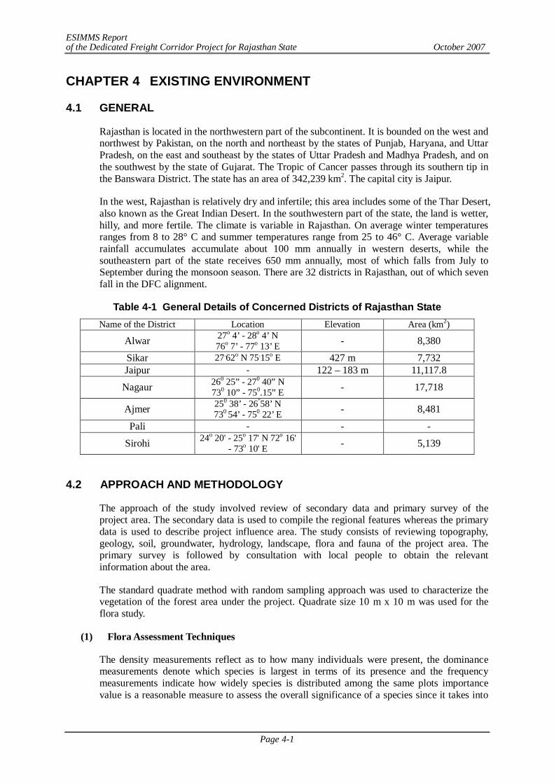
ESIMMS Report of the Dedicated Freight Corridor Project for Rajasthan State October 2007
Page 4-1
CHAPTER 4 EXISTING ENVIRONMENT
4.1 GENERAL
Rajasthan is located in the northwestern part of the subcontinent. It is bounded on the west and northwest by Pakistan, on the north and northeast by the states of Punjab, Haryana, and Uttar Pradesh, on the east and southeast by the states of Uttar Pradesh and Madhya Pradesh, and on the southwest by the state of Gujarat. The Tropic of Cancer passes through its southern tip in the Banswara District. The state has an area of 342,239 km2. The capital city is Jaipur.
In the west, Rajasthan is relatively dry and infertile; this area includes some of the Thar Desert, also known as the Great Indian Desert. In the southwestern part of the state, the land is wetter, hilly, and more fertile. The climate is variable in Rajasthan. On average winter temperatures ranges from 8 to 28° C and summer temperatures range from 25 to 46° C. Average variable rainfall accumulates accumulate about 100 mm annually in western deserts, while the southeastern part of the state receives 650 mm annually, most of which falls from July to September during the monsoon season. There are 32 districts in Rajasthan, out of which seven fall in the DFC alignment.
Table 4-1 General Details of Concerned Districts of Rajasthan State Name of the District Location Elevation Area (km2)
Alwar 27o 4’ - 28o 4’ N 76o 7’ - 77o 13’ E - 8,380
Sikar 27.62o N 75.15o E 427 m 7,732 Jaipur - 122 – 183 m 11,117.8
Nagaur 260 25” - 270 40” N 730 10” - 750.15” E - 17,718
Ajmer 250 38’ - 26°58’ N 730 54’ - 750 22’ E - 8,481
Pali - - -
Sirohi 24o 20' - 25o 17' N 72o 16' - 73o 10' E - 5,139
4.2 APPROACH AND METHODOLOGY
The approach of the study involved review of secondary data and primary survey of the project area. The secondary data is used to compile the regional features whereas the primary data is used to describe project influence area. The study consists of reviewing topography, geology, soil, groundwater, hydrology, landscape, flora and fauna of the project area. The primary survey is followed by consultation with local people to obtain the relevant information about the area.
The standard quadrate method with random sampling approach was used to characterize the vegetation of the forest area under the project. Quadrate size 10 m x 10 m was used for the flora study.
(1) Flora Assessment Techniques
The density measurements reflect as to how many individuals were present, the dominance measurements denote which species is largest in terms of its presence and the frequency measurements indicate how widely species is distributed among the same plots importance value is a reasonable measure to assess the overall significance of a species since it takes into
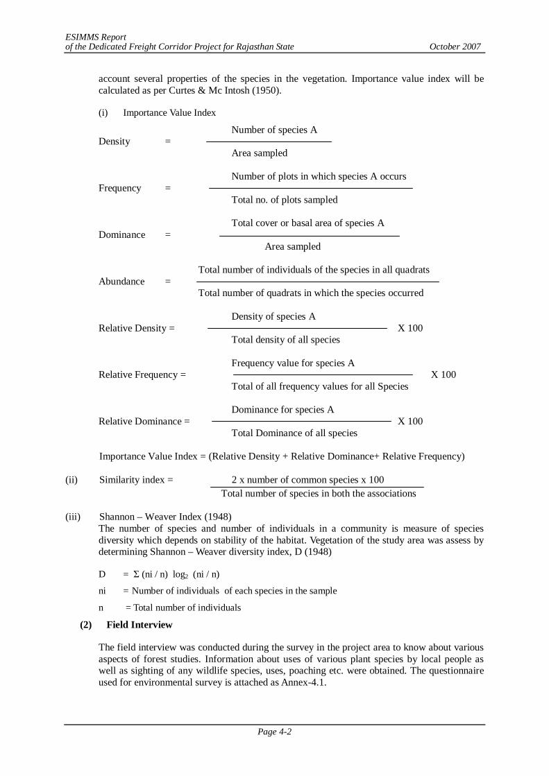
ESIMMS Report of the Dedicated Freight Corridor Project for Rajasthan State October 2007
Page 4-2
account several properties of the species in the vegetation. Importance value index will be calculated as per Curtes & Mc Intosh (1950).
(i) Importance Value Index
Number of species A Density = Area sampled Number of plots in which species A occurs Frequency = Total no. of plots sampled Total cover or basal area of species A Dominance = Area sampled Total number of individuals of the species in all quadrats Abundance = Total number of quadrats in which the species occurred Density of species A Relative Density = X 100 Total density of all species Frequency value for species A Relative Frequency = X 100 Total of all frequency values for all Species Dominance for species A Relative Dominance = X 100 Total Dominance of all species
Importance Value Index = (Relative Density + Relative Dominance+ Relative Frequency) (ii) Similarity index = 2 x number of common species x 100
Total number of species in both the associations (iii) Shannon – Weaver Index (1948)
The number of species and number of individuals in a community is measure of species diversity which depends on stability of the habitat. Vegetation of the study area was assess by determining Shannon – Weaver diversity index, D (1948)
D = Σ (ni / n) log2 (ni / n)
ni = Number of individuals of each species in the sample
n = Total number of individuals
(2) Field Interview
The field interview was conducted during the survey in the project area to know about various aspects of forest studies. Information about uses of various plant species by local people as well as sighting of any wildlife species, uses, poaching etc. were obtained. The questionnaire used for environmental survey is attached as Annex-4.1.
ESIMMS Report of the Dedicated Freight Corridor Project for Rajasthan State October 2007
Page 4-3
4.3 TOPOGRAPHY
Alwar District is situated at 268 m above mean sea level.
In Sikar District, eastern part of Moondwara is a less fertile area covered by sand dunes. South and west part of the village are comparatively fertile. Agriculture is dependent on monsoon and electricity. Presently, a lot of farms use boring wells for irrigation. The inhabitation's village covers an area of 500 acres.
The south-eastern area of Jaipur District is higher in elevation (100 to 350 m above sea level) and more fertile, has a very diversified topography. In the south lies the hilly tract of Mewar. In the southeast, a large area of the districts of Kota and Bundi forms a tableland, and to the northeast of these districts, is a rugged region (badlands) following the line of the Chambal River. Further north the country levels out; the flat plains of the north-eastern Bharatpur District are part of the alluvial basin of the Yamuna River.
The eastern portion of the Ajmer District is generally flat, broken only by gentle undulations, but the western parts, from north-west to south-west, are intersected by the great Aravalli Range. Many of the valleys in this region are sandy deserts, part of India's Thar Desert, with an occasional oasis of cultivation, but there are also some very fertile tracts; among these is the plain on which lies the town of Ajmer. This valley, however, is not only fortunate in possessing a noble artificial lake, but is protected by the massive walls of the Nagpathar range or Serpent rock, which forms a barrier against the sand. The only hills in the district are the Aravalli Range and its offshoots.
Pali District is situated at 180-500 m. above sea level.
Sirohi District is in the shape of an irregular triangle, with the apex near the village of Harji in the extreme e north and the base extending west by north-west from a point where the territories of the former states of Sirohi, Idar and Danta met. It is much broken up hills and rocky ranges. The main feature is the almost isolated mountain of Abu, the highest peak of which, Guru Sikhar, rises 1,722 m above the mean sea level. The mountain is situated near the southern border. It is separated by a narrow pass from an adjacent range of narrow hills which runs in north-eastern direction almost up to Sheoganj and divides the district into two not very unequal parts. Most of the area of tehsils Reodar, Sirohi and Sheoganj lies in the western part of these hills.
4.4 GEOLOGY
(1) Alwar
Semi-arid, the region is largely an elevated, undulating plateau broken by hills and rocky ranges of the Aravallis. The rocks exposed in the district are pre-Delhi granites, granite, gneisses, schist and Alwar, Ajabgarh and Rialto formation of Delhi group.
(2) Sikar
Archaean Basement Rocks (2500 Ma): The Banded Gneissic Complex (BGC) with enclaves of amphibolites and intrusive granitoids such as Untala granite, Gingla granite, Berach granite etc., which form the basement for Aravalli and other younger meta-sediments.
(3) Jaipur
The rocks exposed in the district are pre-Delhi granites, granite, gneisses, schist and Alwar, Ajabgarh and Rialto formation of Delhi group. The major part of the district is covered by
ESIMMS Report of the Dedicated Freight Corridor Project for Rajasthan State October 2007
Page 4-4
quarter- hairy sediments. The pre-Delhi group of rocks comprises Mica-schists and gneisses. Occupy a major part of the western part of the district. The rocks of Delhi form super group from high relief in the north, north-east and south-eastern part of the district. The Rajalos are exposed in a small patch towards north-east of the district. The Aravalli hills and piedmont, plains contain good amount a fractures/lineaments because of multiphase tectonic movement. The lineament is generally parallel to the great boundary fruit of Rajasthan, Lineament intersection density also counted per 10 km2.
(4) Nagaur
The Nagaur-Ganganagar basin1 in western Rajasthan, India is an elongated, asymmetrical sedimentary basin trending NNE-SSW. Jodhpur Gp., Bilara Gp., Hanseran Evaporite Gp. and Nagaur Gp. constitute the late Proterozoic-early Cambrian sedimentary package (Marwar Super Gp.) which rests on the Rhyolytic Basement (Malani Rhyolite) dated 680Ma. The Jodhpur and Nagaur Groups are essentially clastic units whereas the intermediate Bilara Gp. is comprised of limestone and dolomite. The Hanseran Evaporite Gp. is a coeval facies equivalent of the Bilara carbonates. Presence of algal facies, stromatolites, ripple lamintes, mud-crack and mudchip conglomerates indicate shallow marine peritidal depositional environment for the Bilara carbonates. Owing to lack of characteristic faunal evidence and radiogenic dates from Bilara rocks, its correlation with globally recorded late Neoproterozoic carbonates and evaporates has been enigmatic. Combination of lithostratigraphy and chemostratigraphy can be used as a potent tool for stratigraphic correlation particularly when sections are sparsely fossiliferous. In an effort to constrain the age and to shed light on the paleoenvironment of the unmetamorphosed Bilara carbonates a detailed analysis of its carbon and oxygen isotope geochemistry was performed.
(5) Ajmer
Ajmer is almost totally devoid of rivers, the Banas being the only stream, which can be dignified with that name, and it only touches the south-eastern boundary of the district so as to irrigate the pargana of Samur. Four small streams--the Sagarmati, Saraswati, Khari and Dai--also intersect the district. In the dry weather they are little more than brooks.
The district is divided into four subdivisions, Ajmer, Beawar, Kekri and Kishangarh, and further subdivided into six tehsils, Ajmer, Beawar, Nasirabad, Kekri, Kishangarh and Sarwar.
(6) Pali
The rocks exposed in the district are pre-Delhi granites, granite, gneisses, schist and Alwar, Ajabgarh and Rialto formation of Delhi group. The major part of the district is covered by quarter- hairy sediments. The pre-Delhi group of rocks comprising Mica-schists and gneisses occupy a major part of the district.
(7) Sirohi
Sirohi District is broken up by hills and rocky ranges. The granite massif of Mount Abu divides the district into two portions, running from north-east to south-west. The south and south-east part of the district, which lies between Mount Abu and the main spine of the Aravallis, is mountainous and rugged, and is drained by the West Banas River. Abu Road, a station on the main Delhi-Ahmedabad rail line, lies in the valley of the West Banas.
4.5 SOIL
The soils of the Arid Zone are generally sandy to sandy-loam in texture. The consistency and depth vary according to the topographical features. The low-lying loams are heavier and may
ESIMMS Report of the Dedicated Freight Corridor Project for Rajasthan State October 2007
Page 4-5
have a hard pan of clay, calcium carbonate (CaCO3) or gypsum. The pH varies between 7 and 9.5. The soils improve in fertility from west and northwest to east and northeast. Desert soils are Regosols of wind blown sand and sandy fluiratile deposits, derived from the disintegration of rock in the subjacent areas and blown in from the coastal region and the Indus Valley.
Some of these soils contain a high percentage of soluble salts in the lower horizons, turning water in the wells poisonous. Being poor in organic matter they show a low loss on ignition. They contain varying amount of calcium carbonate.
4.6 CLIMATE
The state has a hot summer, scanty rainfall, a chilly winter season and general dryness of the air except in brief monsoon season. The average maximum & minimum temperature are 46 & 00C respectively. The normal rainfall, mostly received from southwest monsoon varies between 466 mm and 570 mm.
4.7 LAND USE
Alwar District of Rajasthan has an important place in Agriculture production. Total geographical area of the district is 782,897 ha which is about 2.5% of the State. In the year 2001-2002 the net cultivated area is 509,107 ha from which about 83% area viz. - 426,204 is irrigated and remaining 17 percent area viz. - 82,903 is unirrigated. Double cropped area is 272,508 ha of which 32,230 ha (12%) area is irrigated and remaining 240,278 ha (88%) area is unirrigated. Thus, the total cropped area of the district is 781,615 ha. In Kharif season Bajra, Maize, Jowar, Karif pulses, Arhar, Sesamum, Cotton, Guar etc. are sown in about 3,29,088 ha (42%) and in Rabi season Wheat, Barley, Gram, Mustard, Taramira, Rabi pulses etc. are sown in about 4,52,527 ha (58%).
In Jaipur District about 52% area is under Net Sown Area (NSA). More than 60% NSA is found in central and eastern parts of the district indicating high ground water potentiality particularly in younger alluvial plains of Bangansa and Bandi riverse. Medium intensity of NSA is found in north-eastern areas, viz. are Kotoutly, Baswa, Phagi and Chaksu tehsil. In these areas ground water potentiality is medium to low and very low water potential areas of western, north-western and south part of the district.
4.8 WATER BODIES
The major rivers are Luni, Arvari, Ban ganga and Sabi. Pushkar lake is the main lake in the state.
4.9 NATURAL ENVIRONMENT
Table 4-2 Forest cover in the Districts of Rajasthan
Sl. No. Name of District Geog. Area (km2) Forest Area (km2) As Per June 99
% Forest Area. w.r.t. Geog. Area
1 Alwar 8,380 1,808.4 21.3 2 Sikar 7,732 185 2.4 3 Jaipur 16,440 1,424 8.7 4 Nagaur 17,718 221.4 1.2 5 Ajmer 8,479 592 7 6 Pali - - - 7 Sirohi - - -
Source: State Forest Department
ESIMMS Report of the Dedicated Freight Corridor Project for Rajasthan State October 2007
Page 4-6
(1) Sikar
In Sikar District, Mehara, Khetri and Dokan Protected forest area are reported.
a) Between Dabla and Mavanda Station - Khetri Forest, Mehera forest and some protected forest are approximate 4.0 km away from DFC line in western side.
b) Between Mavanda, Jilo and Neem ka Thana Station - Dokan Protected forest is approximate 1.5 km away from DFC in eastern side. Bhudou Forest and Ganwari Forrest are approximate 2.5 to 7.5 km. away from DFC line in Eastern side.
(2) Jaipur
In Jaipur District, there are reserved, protected and unclassed forests. It covers the entire area of civil district of Jaipur, four tehsils namely Bamanvas, Nadoti, Tedabhim and Mahuwa of Sawaimadhopur District and some parts of Alwar and Sikar Districts. The tract lies in the Eastern part of Rajasthan between 75 o 45’ E to 77 o 05 E longitude and 77 o 15’ N to 28 o 30’ N latitudes. The approximate stretches of the area from North to South and East to West are 160 km and 200 km respectively.
The Jaipur Forest Division is bounded in the North by common border with Haryana, in North – East by Alwar District, in the East by Sawai-madhopur District, in the south by Tonl and Sawai Madhopur in the west by Ajmer and in the North – West by Nagpur and Sikar Districts. The total land area of the Division is 16,440 km2. Out of which 1,424 km area is under the possession of Forest Department. Thus, area under the forest is namely 8.7% of the total land area. It is furthermore alarming that only about 20% being blank, depleted, barren hills, and degraded forester. Detailed Data described in Annex-4.2.
(3) Nagaur
The district of Nagaur is poor in forest resources. The total area under including hills, is reported to be 221.4 km2, which is 1.2% of total geographical area of the district. Scanty rainfall & other geographical constraints account for this. The western part of the district is divided of natural vegetation cover except for low hurbs & grass which grows on low sand dunes. However, the south-eastern part of the district and part of the northern tehsil of Ladnun and Didwana have much greater greenery as compared to north-west part of the. Khejri District, trees are commonly found in the district. It's leaves are used as fodder. It also gives gum. Apart from commercial value, this tree is considered holy. The tree also plays an important role in checking soil erosion. The other common species found in the district are babul, neem, shisham, peepal, rohira, kalsi, dhangood, akara etc. Rohira and shisham trees provide timber and are used for making furniture. Dhangood is generally used for making cots. A common shrub-phog provides building material from its roots & twigs. Common grass found in the district include bargers, bhambar etc.
(4) Ajmer
The Ajmer forests lie in five ranges namely, Ajmer, Kishangarh, Beawar, Sarwar and Raoll. These ranges are all with in Ajmer revenue district. Bhim Range of Udaipur District, which used to be in Ajmer Forest Division has been gently transferred to Udaipur Forest Division and has been excluded from this working plan.
The tract lies nearly in the central portion of Rajasthan between 250 38’ and 26052’ North latitude and 73054’ and 75024’East longitude. Nagaur and Jaipur District, in the South by Udaipur and Bhilwara Districts, in the East by Jaipur, Tonk and Bhilwara Districts and in the West by Nagaur and Pali Districts of Rajasthan, bound Ajmer Forest Division in the North.
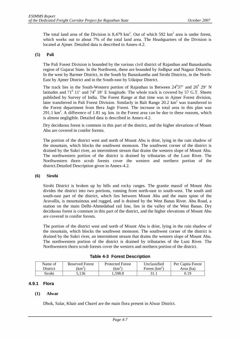
ESIMMS Report of the Dedicated Freight Corridor Project for Rajasthan State October 2007
Page 4-7
The total land area of the Division is 8,479 km2. Out of which 592 km2 area is under forest, which works out to about 7% of the total land area. The Headquarters of the Division is located at Ajmer. Detailed data is described in Annex-4.2.
(5) Pali
The Pali Forest Division is bounded by the various civil district of Rajasthan and Banaskantha region of Gujarat State. In the Northwest, these are bounded by Jodhpur and Nagaur Districts. In the west by Barmer District, in the South by Banaskantha and Sirohi Districts, in the North-East by Ajmer District and in the South-east by Udaipur District.
The track lies in the South-Western portion of Rajasthan in Between 24037’ and 260 29’ N latitudes and 710 11’ and 740 18’ E longitude. The whole track is covered by 57 G.T. Sheets published by Survey of India. The Forest Range at that time was in Ajmer Forest division, later transferred in Pali Forest Division. Similarly in Bali Range 20.2 km2 was transferred to the Forest department from Bera Jagir Forest. The increase in total area in this plan was 291.1 km2. A difference of 1.81 sq. km. in the Forest area can be due to these reasons, which is almost negligible. Detailed data is described in Annex-4.2.
Dry deciduous forest is common in this part of the district, and the higher elevations of Mount Abu are covered in conifer forests.
The portion of the district west and north of Mount Abu is drier, lying in the rain shadow of the mountain, which blocks the southwest monsoon. The southwest corner of the district is drained by the Sukri river, an intermittent stream that drains the western slope of Mount Abu. The northwestern portion of the district is drained by tributaries of the Luni River. The Northwestern thorn scrub forests cover the western and northern portion of the district.Detailed Description given in Annex-4.2.
(6) Sirohi
Sirohi District is broken up by hills and rocky ranges. The granite massif of Mount Abu divides the district into two portions, running from north-east to south-west. The south and south-east part of the district, which lies between Mount Abu and the main spine of the Aravallis, is mountainous and rugged, and is drained by the West Banas River. Abu Road, a station on the main Delhi-Ahmedabad rail line, lies in the valley of the West Banas. Dry deciduous forest is common in this part of the district, and the higher elevations of Mount Abu are covered in conifer forests.
The portion of the district west and north of Mount Abu is drier, lying in the rain shadow of the mountain, which blocks the southwest monsoon. The southwest corner of the district is drained by the Sukri river, an intermittent stream that drains the western slope of Mount Abu. The northwestern portion of the district is drained by tributaries of the Luni River. The Northwestern thorn scrub forests cover the western and northern portion of the district.
Table 4-3 Forest Description Name of District
Reserved Forest (km2)
Protected Forest (km2)
Unclassified Forest (km2)
Per Capita Forest Area (ha)
Sirohi 5,136 1,598.8 31.1 0.19 4.9.1 Flora
(1) Alwar
Dhok, Salar, Khair and Churel are the main flora present in Alwar District.
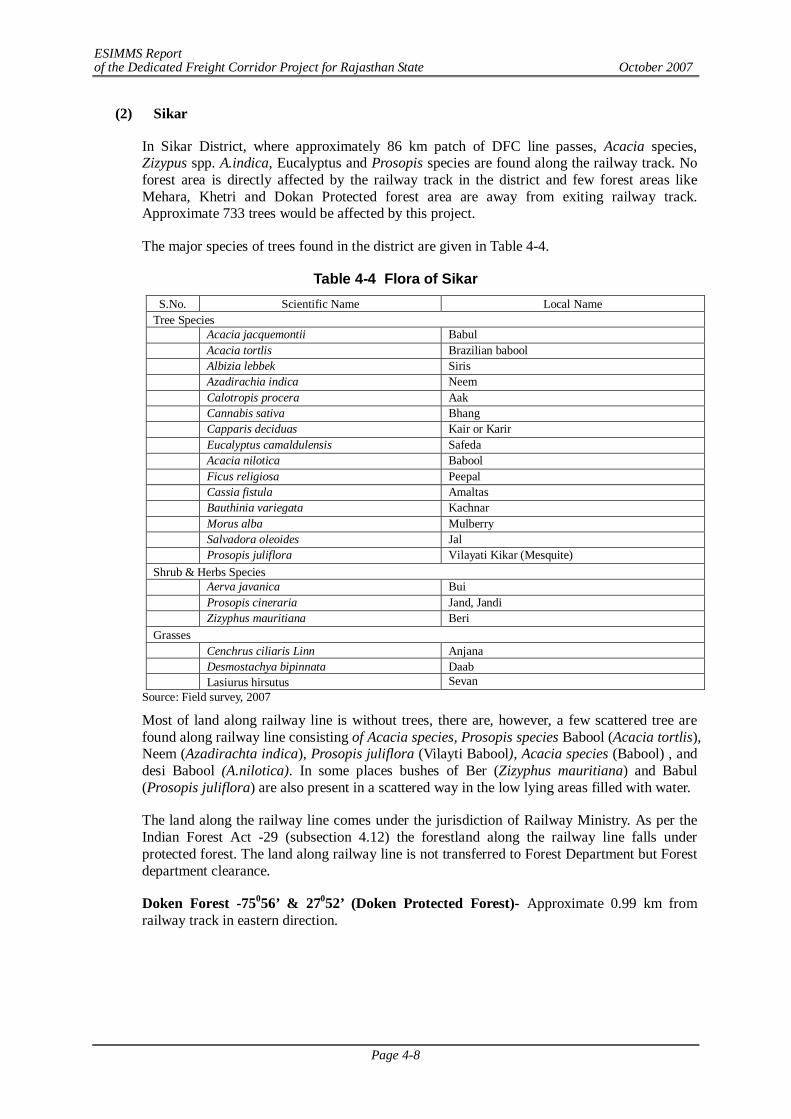
ESIMMS Report of the Dedicated Freight Corridor Project for Rajasthan State October 2007
Page 4-8
(2) Sikar
In Sikar District, where approximately 86 km patch of DFC line passes, Acacia species, Zizypus spp. A.indica, Eucalyptus and Prosopis species are found along the railway track. No forest area is directly affected by the railway track in the district and few forest areas like Mehara, Khetri and Dokan Protected forest area are away from exiting railway track. Approximate 733 trees would be affected by this project.
The major species of trees found in the district are given in Table 4-4.
Table 4-4 Flora of Sikar S.No. Scientific Name Local Name
Tree Species Acacia jacquemontii Babul Acacia tortlis Brazilian babool Albizia lebbek Siris Azadirachia indica Neem Calotropis procera Aak Cannabis sativa Bhang Capparis deciduas Kair or Karir Eucalyptus camaldulensis Safeda Acacia nilotica Babool Ficus religiosa Peepal Cassia fistula Amaltas Bauthinia variegata Kachnar Morus alba Mulberry Salvadora oleoides Jal Prosopis juliflora Vilayati Kikar (Mesquite) Shrub & Herbs Species Aerva javanica Bui Prosopis cineraria Jand, Jandi Zizyphus mauritiana Beri Grasses Cenchrus ciliaris Linn Anjana Desmostachya bipinnata Daab Lasiurus hirsutus Sevan
Source: Field survey, 2007
Most of land along railway line is without trees, there are, however, a few scattered tree are found along railway line consisting of Acacia species, Prosopis species Babool (Acacia tortlis), Neem (Azadirachta indica), Prosopis juliflora (Vilayti Babool), Acacia species (Babool) , and desi Babool (A.nilotica). In some places bushes of Ber (Zizyphus mauritiana) and Babul (Prosopis juliflora) are also present in a scattered way in the low lying areas filled with water.
The land along the railway line comes under the jurisdiction of Railway Ministry. As per the Indian Forest Act -29 (subsection 4.12) the forestland along the railway line falls under protected forest. The land along railway line is not transferred to Forest Department but Forest department clearance.
Doken Forest -75056’ & 27052’ (Doken Protected Forest)- Approximate 0.99 km from railway track in eastern direction.
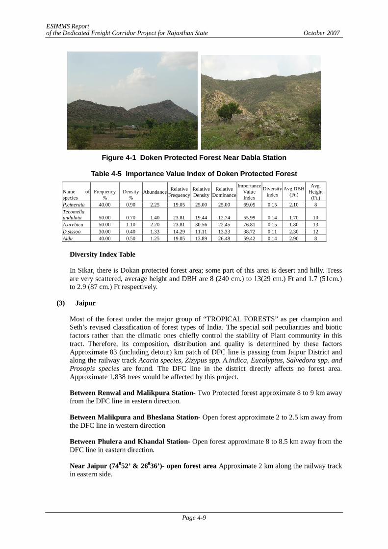
ESIMMS Report of the Dedicated Freight Corridor Project for Rajasthan State October 2007
Page 4-9
Figure 4-1 Doken Protected Forest Near Dabla Station
Table 4-5 Importance Value Index of Doken Protected Forest
Name of species
Frequency %
Density %
Abundance Relative Frequency
Relative Density
Relative Dominance
Importance Value Index
Diversity Index
Avg.DBH (Ft.)
Avg. Height
(Ft.) P.cineraia 40.00 0.90 2.25 19.05 25.00 25.00 69.05 0.15 2.10 8 Tecomella undulata 50.00 0.70 1.40 23.81 19.44 12.74 55.99 0.14 1.70 10 A.arebica 50.00 1.10 2.20 23.81 30.56 22.45 76.81 0.15 1.80 13 D.sissoo 30.00 0.40 1.33 14.29 11.11 13.33 38.72 0.11 2.30 12 Aldu 40.00 0.50 1.25 19.05 13.89 26.48 59.42 0.14 2.90 8
Diversity Index Table
In Sikar, there is Dokan protected forest area; some part of this area is desert and hilly. Tress are very scattered, average height and DBH are 8 (240 cm.) to 13(29 cm.) Ft and 1.7 (51cm.) to 2.9 (87 cm.) Ft respectively.
(3) Jaipur
Most of the forest under the major group of “TROPICAL FORESTS” as per champion and Seth’s revised classification of forest types of India. The special soil peculiarities and biotic factors rather than the climatic ones chiefly control the stability of Plant community in this tract. Therefore, its composition, distribution and quality is determined by these factors Approximate 83 (including detour) km patch of DFC line is passing from Jaipur District and along the railway track Acacia species, Zizypus spp. A.indica, Eucalyptus, Salvedora spp. and Prosopis species are found. The DFC line in the district directly affects no forest area. Approximate 1,838 trees would be affected by this project.
Between Renwal and Malikpura Station- Two Protected forest approximate 8 to 9 km away from the DFC line in eastern direction.
Between Malikpura and Bheslana Station- Open forest approximate 2 to 2.5 km away from the DFC line in western direction
Between Phulera and Khandal Station- Open forest approximate 8 to 8.5 km away from the DFC line in eastern direction.
Near Jaipur (74052’ & 26036’)- open forest area Approximate 2 km along the railway track in eastern side.
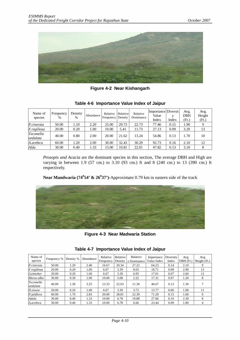
ESIMMS Report of the Dedicated Freight Corridor Project for Rajasthan State October 2007
Page 4-10
Figure 4-2 Near Kishangarh
Table 4-6 Importance Value Index of Jaipur
Name of species
Frequency %
Density % Abundance Relative
Frequency Relative Density
Relative Dominance
Importance Value Index
Diversity
Index
Avg. DBH (Ft.)
Avg. Height (Ft.)
P.cineraia 50.00 1.10 2.20 25.00 29.73 22.73 77.46 0.15 1.90 9 F.regiliosa 20.00 0.20 1.00 10.00 5.41 11.73 27.13 0.09 3.20 13 Tecomella undulata 40.00 0.80 2.00 20.00 21.62 13.24 54.86 0.13 1.70 10
A.arebica 60.00 1.20 2.00 30.00 32.43 30.29 92.73 0.16 2.10 12 Aldu 30.00 0.40 1.33 15.00 10.81 22.01 47.82 0.13 3.10 8
Prosopis and Acacia are the dominant species in this section, The average DBH and High are varying in between 1.9 (57 cm.) to 3.10 (93 cm.) ft and 8 (240 cm.) to 13 (390 cm.) ft respectively.
Near Mandwaria (74054’ & 26037’)-Approximate 0.79 km in eastern side of the track
Figure 4-3 Near Madwaria Station
Table 4-7 Importance Value Index of Jaipur
Name of species Frequency % Density % Abundance Relative
Frequency Relative Density
Relative e Dominance
Importance Value Index
Diversity Index
Avg. DBH (Ft.)
Avg. Height (Ft.)
P.cineraia 50.00 1.20 2.40 16.67 20.34 27.22 64.23 0.14 2.10 9 F.regiliosa 20.00 0.20 1.00 6.67 3.39 8.65 18.71 0.08 2.90 13 Gulmoher 20.00 0.20 1.00 6.67 3.39 6.95 17.01 0.07 2.60 12 Morus alba 30.00 0.30 1.00 10.00 5.08 2.22 17.31 0.07 1.20 8 Tecomella undulata 40.00 1.30 3.25 13.33 22.03 11.30 46.67 0.13 1.30 7
D.sissoo 20.00 0.20 1.00 6.67 3.39 3.72 13.77 0.06 1.90 11 P.juliflora 60.00 1.70 2.83 20.00 28.81 22.39 71.20 0.15 1.60 9 Adulu 30.00 0.40 1.33 10.00 6.78 10.88 27.66 0.10 2.30 8 A.arebica 30.00 0.40 1.33 10.00 6.78 6.66 23.44 0.09 1.80 4
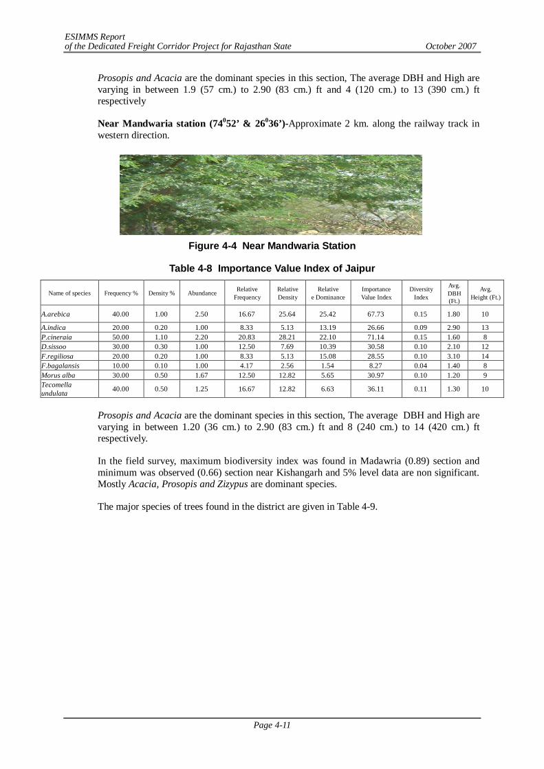
ESIMMS Report of the Dedicated Freight Corridor Project for Rajasthan State October 2007
Page 4-11
Prosopis and Acacia are the dominant species in this section, The average DBH and High are varying in between 1.9 (57 cm.) to 2.90 (83 cm.) ft and 4 (120 cm.) to 13 (390 cm.) ft respectively
Near Mandwaria station (74052’ & 26036’)-Approximate 2 km. along the railway track in western direction.
Figure 4-4 Near Mandwaria Station
Table 4-8 Importance Value Index of Jaipur
Name of species Frequency % Density % Abundance Relative Frequency
Relative Density
Relative e Dominance
Importance Value Index
Diversity Index
Avg. DBH (Ft.)
Avg. Height (Ft.)
A.arebica 40.00 1.00 2.50 16.67 25.64 25.42 67.73 0.15 1.80 10
A.indica 20.00 0.20 1.00 8.33 5.13 13.19 26.66 0.09 2.90 13 P.cineraia 50.00 1.10 2.20 20.83 28.21 22.10 71.14 0.15 1.60 8 D.sissoo 30.00 0.30 1.00 12.50 7.69 10.39 30.58 0.10 2.10 12 F.regiliosa 20.00 0.20 1.00 8.33 5.13 15.08 28.55 0.10 3.10 14 F.bagalansis 10.00 0.10 1.00 4.17 2.56 1.54 8.27 0.04 1.40 8 Morus alba 30.00 0.50 1.67 12.50 12.82 5.65 30.97 0.10 1.20 9 Tecomella undulata 40.00 0.50 1.25 16.67 12.82 6.63 36.11 0.11 1.30 10
Prosopis and Acacia are the dominant species in this section, The average DBH and High are varying in between 1.20 (36 cm.) to 2.90 (83 cm.) ft and 8 (240 cm.) to 14 (420 cm.) ft respectively.
In the field survey, maximum biodiversity index was found in Madawria (0.89) section and minimum was observed (0.66) section near Kishangarh and 5% level data are non significant. Mostly Acacia, Prosopis and Zizypus are dominant species.
The major species of trees found in the district are given in Table 4-9.
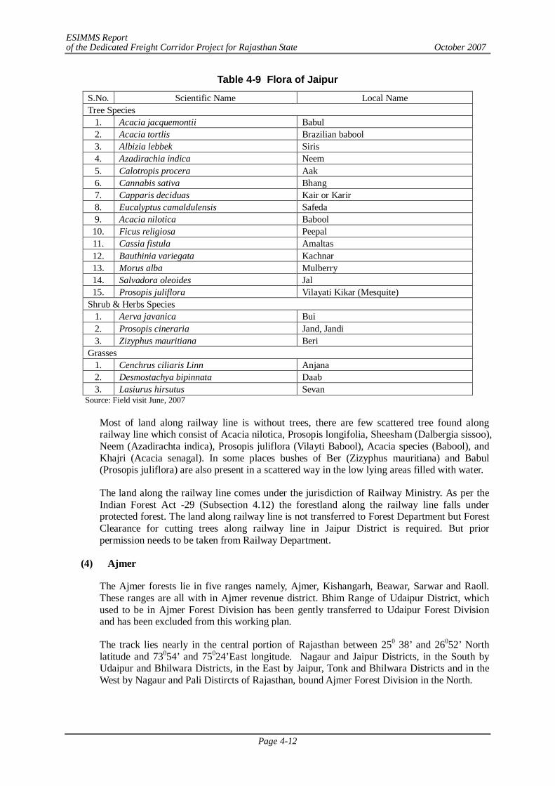
ESIMMS Report of the Dedicated Freight Corridor Project for Rajasthan State October 2007
Page 4-12
Table 4-9 Flora of Jaipur
S.No. Scientific Name Local Name Tree Species
1. Acacia jacquemontii Babul 2. Acacia tortlis Brazilian babool 3. Albizia lebbek Siris 4. Azadirachia indica Neem 5. Calotropis procera Aak 6. Cannabis sativa Bhang 7. Capparis deciduas Kair or Karir 8. Eucalyptus camaldulensis Safeda 9. Acacia nilotica Babool 10. Ficus religiosa Peepal 11. Cassia fistula Amaltas 12. Bauthinia variegata Kachnar 13. Morus alba Mulberry 14. Salvadora oleoides Jal 15. Prosopis juliflora Vilayati Kikar (Mesquite)
Shrub & Herbs Species 1. Aerva javanica Bui 2. Prosopis cineraria Jand, Jandi 3. Zizyphus mauritiana Beri
Grasses 1. Cenchrus ciliaris Linn Anjana 2. Desmostachya bipinnata Daab 3. Lasiurus hirsutus Sevan
Source: Field visit June, 2007
Most of land along railway line is without trees, there are few scattered tree found along railway line which consist of Acacia nilotica, Prosopis longifolia, Sheesham (Dalbergia sissoo), Neem (Azadirachta indica), Prosopis juliflora (Vilayti Babool), Acacia species (Babool), and Khajri (Acacia senagal). In some places bushes of Ber (Zizyphus mauritiana) and Babul (Prosopis juliflora) are also present in a scattered way in the low lying areas filled with water.
The land along the railway line comes under the jurisdiction of Railway Ministry. As per the Indian Forest Act -29 (Subsection 4.12) the forestland along the railway line falls under protected forest. The land along railway line is not transferred to Forest Department but Forest Clearance for cutting trees along railway line in Jaipur District is required. But prior permission needs to be taken from Railway Department.
(4) Ajmer
The Ajmer forests lie in five ranges namely, Ajmer, Kishangarh, Beawar, Sarwar and Raoll. These ranges are all with in Ajmer revenue district. Bhim Range of Udaipur District, which used to be in Ajmer Forest Division has been gently transferred to Udaipur Forest Division and has been excluded from this working plan.
The track lies nearly in the central portion of Rajasthan between 250 38’ and 26052’ North latitude and 73054’ and 75024’East longitude. Nagaur and Jaipur Districts, in the South by Udaipur and Bhilwara Districts, in the East by Jaipur, Tonk and Bhilwara Districts and in the West by Nagaur and Pali Distircts of Rajasthan, bound Ajmer Forest Division in the North.
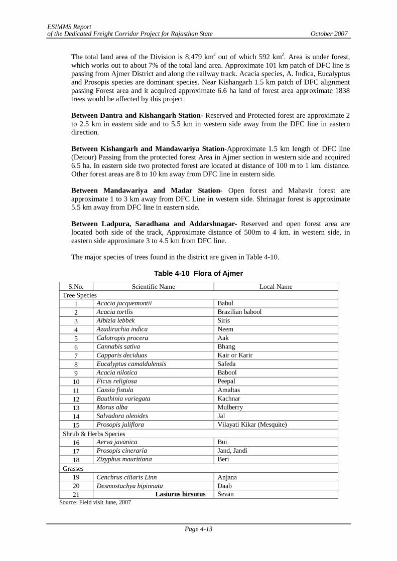
ESIMMS Report of the Dedicated Freight Corridor Project for Rajasthan State October 2007
Page 4-13
The total land area of the Division is 8,479 km2 out of which 592 km2. Area is under forest, which works out to about 7% of the total land area. Approximate 101 km patch of DFC line is passing from Ajmer District and along the railway track. Acacia species, A. Indica, Eucalyptus and Prosopis species are dominant species. Near Kishangarh 1.5 km patch of DFC alignment passing Forest area and it acquired approximate 6.6 ha land of forest area approximate 1838 trees would be affected by this project.
Between Dantra and Kishangarh Station- Reserved and Protected forest are approximate 2 to 2.5 km in eastern side and to 5.5 km in western side away from the DFC line in eastern direction.
Between Kishangarh and Mandawariya Station-Approximate 1.5 km length of DFC line (Detour) Passing from the protected forest Area in Ajmer section in western side and acquired 6.5 ha. In eastern side two protected forest are located at distance of 100 m to 1 km. distance. Other forest areas are 8 to 10 km away from DFC line in eastern side.
Between Mandawariya and Madar Station- Open forest and Mahavir forest are approximate 1 to 3 km away from DFC Line in western side. Shrinagar forest is approximate 5.5 km away from DFC line in eastern side.
Between Ladpura, Saradhana and Addarshnagar- Reserved and open forest area are located both side of the track, Approximate distance of 500m to 4 km. in western side, in eastern side approximate 3 to 4.5 km from DFC line.
The major species of trees found in the district are given in Table 4-10.
Table 4-10 Flora of Ajmer
S.No. Scientific Name Local Name Tree Species
1 Acacia jacquemontii Babul 2 Acacia tortlis Brazilian babool 3 Albizia lebbek Siris 4 Azadirachia indica Neem 5 Calotropis procera Aak 6 Cannabis sativa Bhang 7 Capparis deciduas Kair or Karir 8 Eucalyptus camaldulensis Safeda 9 Acacia nilotica Babool 10 Ficus religiosa Peepal 11 Cassia fistula Amaltas 12 Bauthinia variegata Kachnar 13 Morus alba Mulberry 14 Salvadora oleoides Jal 15 Prosopis juliflora Vilayati Kikar (Mesquite)
Shrub & Herbs Species 16 Aerva javanica Bui 17 Prosopis cineraria Jand, Jandi 18 Zizyphus mauritiana Beri
Grasses 19 Cenchrus ciliaris Linn Anjana 20 Desmostachya bipinnata Daab 21 Lasiurus hirsutus Sevan
Source: Field visit June, 2007
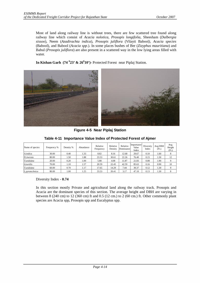
ESIMMS Report of the Dedicated Freight Corridor Project for Rajasthan State October 2007
Page 4-14
Most of land along railway line is without trees, there are few scattered tree found along railway line which consist of Acacia nolotica, Prosopis longifolia, Sheesham (Dalbergia sissoo), Neem (Azadirachta indica), Prosopis juliflora (Vilayti Babool), Acacia species (Babool), and Babool (Acacia spp.). In some places bushes of Ber (Zizyphus mauritiana) and Babul (Prosopis juliflora) are also present in a scattered way in the low lying areas filled with water.
In Kishan Garh (74 023’ & 26010’)- Protected Forest near Piplaj Station.
Figure 4-5 Near Piplaj Station
Table 4-11 Importance Value Index of Protected Forest of Ajmer
Name of species Frequency % Density % Abundance Relative Frequency
Relative Density
Relative Dominance
Importance Value Index
Diversity Index
Avg.DBH (Ft.)
Avg. Height (Ft.)
A.indica 30.00 0.40 1.33 8.82 8.16 12.68 29.67 0.10 1.60 8 P.cineraia 80.00 1.50 1.88 23.53 30.61 22.26 76.40 0.15 1.50 12 T.undulata 20.00 0.20 1.00 5.88 4.08 11.87 21.83 0.08 1.90 9 A.tortilis 70.00 1.10 1.57 20.59 22.45 42.59 85.63 0.16 0.90 10 T.undulata 60.00 0.70 1.17 17.65 14.29 7.44 39.37 0.12 1.30 9 L.pyrotechnica 80.00 1.00 1.25 23.53 20.41 3.17 47.10 0.13 1.30 8
Diversity Index - 0.74
In this section mostly Private and agricultural land along the railway track. Prosopis and Acacia are the dominant species of this section. The average height and DBH are varying in between 8 (240 cm) to 12 (360 cm) ft and 0.5 (12 cm.) to 2 (60 cm.) ft. Other commonly plant species are Acacia spp, Prosopis spp and Eucalyptus spp.
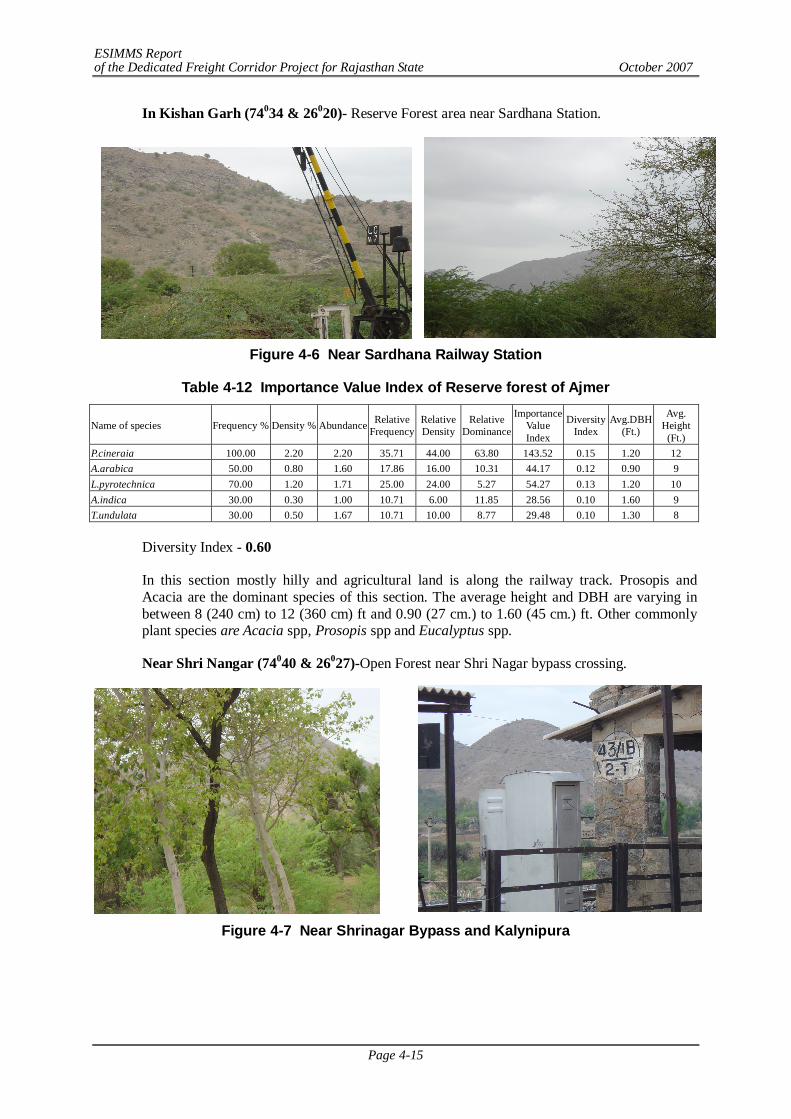
ESIMMS Report of the Dedicated Freight Corridor Project for Rajasthan State October 2007
Page 4-15
In Kishan Garh (74034 & 26020)- Reserve Forest area near Sardhana Station.
Figure 4-6 Near Sardhana Railway Station
Table 4-12 Importance Value Index of Reserve forest of Ajmer
Name of species Frequency % Density % Abundance Relative Frequency
Relative Density
Relative Dominance
Importance Value Index
Diversity Index
Avg.DBH (Ft.)
Avg. Height
(Ft.) P.cineraia 100.00 2.20 2.20 35.71 44.00 63.80 143.52 0.15 1.20 12 A.arabica 50.00 0.80 1.60 17.86 16.00 10.31 44.17 0.12 0.90 9 L.pyrotechnica 70.00 1.20 1.71 25.00 24.00 5.27 54.27 0.13 1.20 10 A.indica 30.00 0.30 1.00 10.71 6.00 11.85 28.56 0.10 1.60 9 T.undulata 30.00 0.50 1.67 10.71 10.00 8.77 29.48 0.10 1.30 8
Diversity Index - 0.60
In this section mostly hilly and agricultural land is along the railway track. Prosopis and Acacia are the dominant species of this section. The average height and DBH are varying in between 8 (240 cm) to 12 (360 cm) ft and 0.90 (27 cm.) to 1.60 (45 cm.) ft. Other commonly plant species are Acacia spp, Prosopis spp and Eucalyptus spp.
Near Shri Nangar (74040 & 26027)-Open Forest near Shri Nagar bypass crossing.
Figure 4-7 Near Shrinagar Bypass and Kalynipura
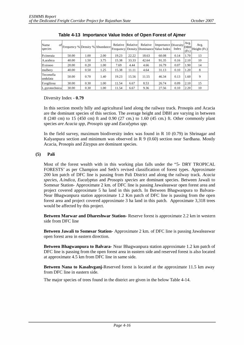
ESIMMS Report of the Dedicated Freight Corridor Project for Rajasthan State October 2007
Page 4-16
Table 4-13 Importance Value Index of Open Forest of Ajmer
Name of species Frequency % Density % Abundance Relative
Frequency Relative Density
Relative Dominance
Importance Value Index
Diversity Index
Avg. DBH (Ft.)
Avg. Height (Ft.)
P.cineraia 50.00 1.00 2.00 19.23 22.22 18.63 60.08 0.14 1.70 13 A.arabica 40.00 1.50 3.75 15.38 33.33 42.64 91.35 0.16 2.10 10 D.sissoo 20.00 0.20 1.00 7.69 4.44 4.66 16.79 0.07 1.90 14 mulbery 40.00 0.50 1.25 15.38 11.11 4.64 31.13 0.10 1.20 8 Tecomella undulata 50.00 0.70 1.40 19.23 15.56 11.55 46.34 0.13 1.60 9
F.regiliosa 30.00 0.30 1.00 11.54 6.67 8.53 26.74 0.09 2.10 15 L.pyrotechnica 30.00 0.30 1.00 11.54 6.67 9.36 27.56 0.10 2.20 10
Diversity Index - 0.79
In this section mostly hilly and agricultural land along the railway track. Prosopis and Acacia are the dominant species of this section. The average height and DBH are varying in between 8 (240 cm) to 15 (450 cm) ft and 0.90 (27 cm.) to 1.60 (45 cm.) ft. Other commonly plant species are Acacia spp, Prosopis spp and Eucalyptus spp.
In the field survey, maximum biodiversity index was found in R 10 (0.79) in Shrinagar and Kalyanpura section and minimum was observed in R 9 (0.60) section near Sardhana. Mostly Acacia, Prosopis and Zizypus are dominant species.
(5) Pali
Most of the forest wealth with in this working plan falls under the “5- DRY TROPICAL FORESTS’ as per Champion and Seth’s revised classification of forest types. Approximate 200 km patch of DFC line is passing from Pali District and along the railway track. Acacia species, A.indica, Eucalyptus and Prosopis species are dominant species. Between Jawali to Somesar Station- Approximate 2 km. of DFC line is passing Jawaleaswar open forest area and project covered approximate 5 ha land in this patch. In Between Bhagwanpura to Balvara- Near Bhagwanpura station approximate 1.2 Km patch of DFC line is passing from the open forest area and project covered approximate 3 ha land in this patch. Approximate 3,318 trees would be affected by this project.
Between Marwar and Dhareshwar Station- Reserve forest is approximate 2.2 km in western side from DFC line
Between Jawali to Somesar Station- Approximate 2 km. of DFC line is passing Jawaleaswar open forest area in eastern direction.
Between Bhagwanpura to Balvara- Near Bhagwanpura station approximate 1.2 km patch of DFC line is passing from the open forest area in eastern side and reserved forest is also located at approximate 4.5 km from DFC line in same side.
Between Nana to Kasahvganj-Reserved forest is located at the approximate 11.5 km away from DFC line in eastern side.
The major species of trees found in the district are given in the below Table 4-14.

ESIMMS Report of the Dedicated Freight Corridor Project for Rajasthan State October 2007
Page 4-17
Table 4-14 Flora of Pali S.No. Scientific Name Local Name
Tree Species Acacia jacquemontii Babul Acacia tortlis Brazilian babool Albizia lebbek Siris Azadirachia indica Neem Calotropis procera Aak Cannabis sativa Bhang Capparis deciduas Kair or Karir Eucalyptus camaldulensis Safeda Acacia nilotica Babool Ficus religiosa Peepal Cassia fistula Amaltas Bauthinia variegata Kachnar Morus alba Mulberry Salvadora oleoides Jal Prosopis juliflora Vilayati Kikar (Mesquite) Shrub & Herbs Species Aerva javanica Bui Prosopis cineraria Jand, Jandi Zizyphus mauritiana Beri Grasses Cenchrus ciliaris Linn Anjana Desmostachya bipinnata Daab Lasiurus hirsutus Sevan Source: Field visit June, 2007
Most of land along railway line is without trees, there are few scattered tree found along railway line which consist of Sheesham (Dalbergia sissoo), Neem (Azadirachta indica), Prosopis juliflora(Vilayti Babool), Acacia spp. (Babool) , and Khajri(Acacia Senagal). In some places bushes of Ber (Zizyphus mauritiana) and Babul (Prosopis juliflora) are also present in a scattered way in the low lying areas filled with water.
The land along the railway line comes under the jurisdiction of Railway Ministry. As per the Indian Forest Act -29 (Subsection 4.12) the forestland along the railway line falls under protected forest. The land along railway line is not transferred to Forest Department but Forest Clearance for cutting trees along railway line in Pali District is required. But prior permission needs to be taken from Railway Department.
Near Rani-73021’ & 25024’- open reserve area
Figure 4-8 Near Rani
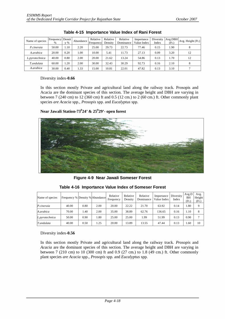
ESIMMS Report of the Dedicated Freight Corridor Project for Rajasthan State October 2007
Page 4-18
Table 4-15 Importance Value Index of Rani Forest
Name of species Frequency %
Density % Abundance Relative
Frequency Relative Density
Relative Dominance
Importance Value Index
Diversity Index
Avg.DBH (Ft.) Avg. Height (Ft.)
P.cineraia 50.00 1.10 2.20 25.00 29.73 22.73 77.46 0.15 1.90 8
A.arabica 20.00 0.20 1.00 10.00 5.41 11.73 27.13 0.09 3.20 12
L.pyrotechnica 40.00 0.80 2.00 20.00 21.62 13.24 54.86 0.13 1.70 12
T.undulata 60.00 1.20 2.00 30.00 32.43 30.29 92.73 0.16 2.10 8 A.arabica 30.00 0.40 1.33 15.00 10.81 22.01 47.82 0.13 3.10 7
Diversity index-0.66
In this section mostly Private and agricultural land along the railway track. Prosopis and Acacia are the dominant species of this section. The average height and DBH are varying in between 7 (240 cm) to 12 (360 cm) ft and 0.5 (12 cm.) to 2 (60 cm.) ft. Other commonly plant species are Acacia spp., Prosopis spp. and Eucalyptus spp.
Near Jawali Station-73024’ & 25029’- open forest
Figure 4-9 Near Jawali Someser Forest
Table 4-16 Importance Value Index of Someser Forest
Name of species Frequency % Density % Abundance Relative Frequency
Relative Density
Relative Dominance
Importance Value Index
Diversity Index
Avg.DBH (Ft.)
Avg. Height (Ft.)
P.cineraia 40.00 0.80 2.00 20.00 22.22 21.70 63.92 0.14 1.80 9
A.arabica 70.00 1.40 2.00 35.00 38.89 62.76 136.65 0.16 1.10 8
L.pyrotechnica 50.00 0.90 1.80 25.00 25.00 1.99 51.99 0.13 0.90 7
T.undulata 40.00 0.50 1.25 20.00 13.89 13.55 47.44 0.13 1.60 10
Diversity index-0.56
In this section mostly Private and agricultural land along the railway track. Prosopis and Acacia are the dominant species of this section. The average height and DBH are varying in between 7 (210 cm) to 10 (300 cm) ft and 0.9 (27 cm.) to 1.8 (49 cm.) ft. Other commonly plant species are Acacia spp., Prosopis spp. and Eucalyptus spp.
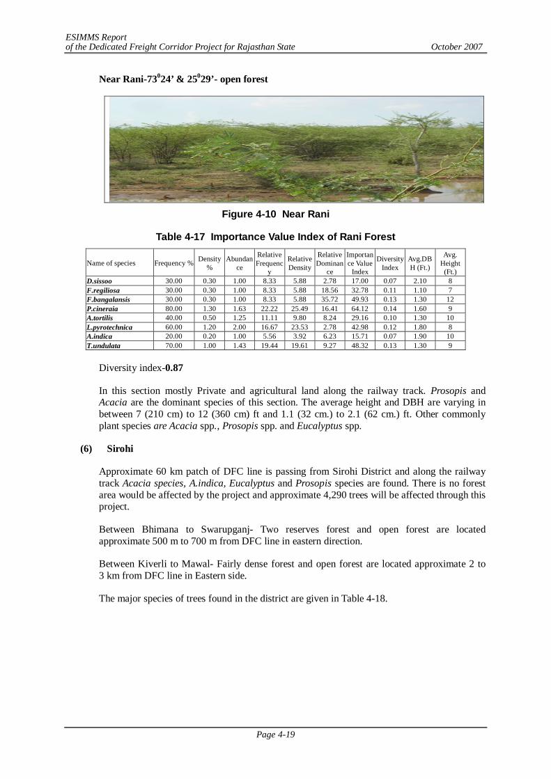
ESIMMS Report of the Dedicated Freight Corridor Project for Rajasthan State October 2007
Page 4-19
Near Rani-73024’ & 25029’- open forest
Figure 4-10 Near Rani
Table 4-17 Importance Value Index of Rani Forest
Name of species Frequency % Density %
Abundance
Relative Frequenc
y
Relative Density
Relative Dominan
ce
Importance Value
Index
Diversity Index
Avg.DBH (Ft.)
Avg. Height
(Ft.) D.sissoo 30.00 0.30 1.00 8.33 5.88 2.78 17.00 0.07 2.10 8 F.regiliosa 30.00 0.30 1.00 8.33 5.88 18.56 32.78 0.11 1.10 7 F.bangalansis 30.00 0.30 1.00 8.33 5.88 35.72 49.93 0.13 1.30 12 P.cineraia 80.00 1.30 1.63 22.22 25.49 16.41 64.12 0.14 1.60 9 A.tortilis 40.00 0.50 1.25 11.11 9.80 8.24 29.16 0.10 1.30 10 L.pyrotechnica 60.00 1.20 2.00 16.67 23.53 2.78 42.98 0.12 1.80 8 A.indica 20.00 0.20 1.00 5.56 3.92 6.23 15.71 0.07 1.90 10 T.undulata 70.00 1.00 1.43 19.44 19.61 9.27 48.32 0.13 1.30 9
Diversity index-0.87
In this section mostly Private and agricultural land along the railway track. Prosopis and Acacia are the dominant species of this section. The average height and DBH are varying in between 7 (210 cm) to 12 (360 cm) ft and 1.1 (32 cm.) to 2.1 (62 cm.) ft. Other commonly plant species are Acacia spp., Prosopis spp. and Eucalyptus spp.
(6) Sirohi
Approximate 60 km patch of DFC line is passing from Sirohi District and along the railway track Acacia species, A.indica, Eucalyptus and Prosopis species are found. There is no forest area would be affected by the project and approximate 4,290 trees will be affected through this project.
Between Bhimana to Swarupganj- Two reserves forest and open forest are located approximate 500 m to 700 m from DFC line in eastern direction.
Between Kiverli to Mawal- Fairly dense forest and open forest are located approximate 2 to 3 km from DFC line in Eastern side.
The major species of trees found in the district are given in Table 4-18.
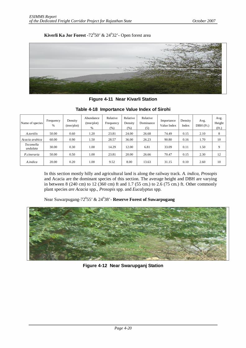
ESIMMS Report of the Dedicated Freight Corridor Project for Rajasthan State October 2007
Page 4-20
Kiverli Ka Jor Forest -72050’ & 24032’- Open forest area
Figure 4-11 Near Kivarli Station
Table 4-18 Importance Value Index of Sirohi
Name of species Frequency
% Density
(tree/plot)
Abundance (tree/plot)
%
Relative Frequency
(%)
Relative Density
(%)
Relative Dominance
(5)
Importance Value Index
Density Index
Avg. DBH (Ft.)
Avg. Height
(Ft.)
A.tortilis 50.00 0.60 1.20 23.81 24.00 26.68 74.49 0.15 2.10 8
Acacia arabica 60.00 0.90 1.50 28.57 36.00 26.23 90.80 0.16 1.70 10 Tecomella undulata 30.00 0.30 1.00 14.29 12.00 6.81 33.09 0.11 1.50 9
P.cineraria 50.00 0.50 1.00 23.81 20.00 26.66 70.47 0.15 2.30 12
A.indica 20.00 0.20 1.00 9.52 8.00 13.63 31.15 0.10 2.60 10
In this section mostly hilly and agricultural land is along the railway track. A. indica, Prosopis and Acacia are the dominant species of this section. The average height and DBH are varying in between 8 (240 cm) to 12 (360 cm) ft and 1.7 (55 cm.) to 2.6 (75 cm.) ft. Other commonly plant species are Acacia spp., Prosopis spp. and Eucalyptus spp.
Near Suwarpugang-72055’ & 24038’- Reserve Forest of Suwarpugang
Figure 4-12 Near Swarupganj Station
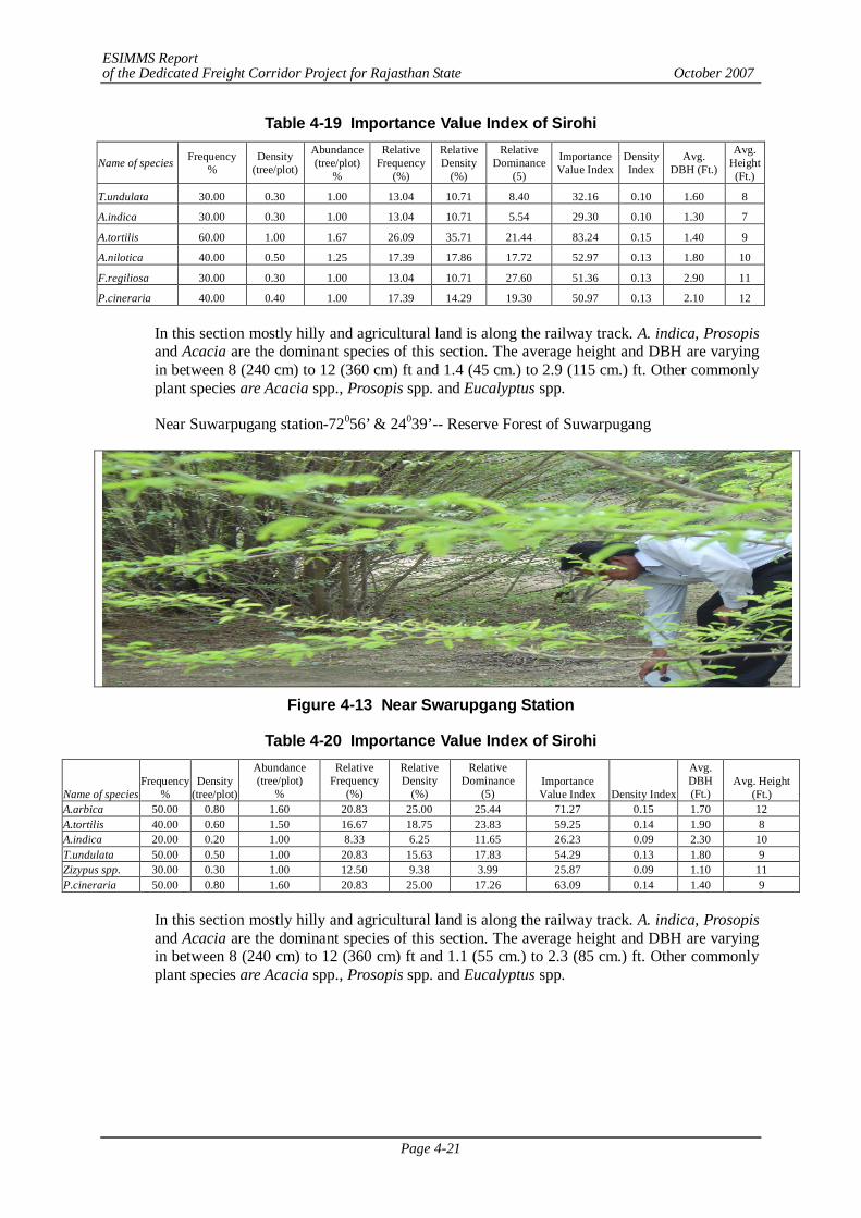
ESIMMS Report of the Dedicated Freight Corridor Project for Rajasthan State October 2007
Page 4-21
Table 4-19 Importance Value Index of Sirohi
Name of species Frequency %
Density (tree/plot)
Abundance (tree/plot)
%
Relative Frequency
(%)
Relative Density
(%)
Relative Dominance
(5)
Importance Value Index
Density Index
Avg. DBH (Ft.)
Avg. Height (Ft.)
T.undulata 30.00 0.30 1.00 13.04 10.71 8.40 32.16 0.10 1.60 8
A.indica 30.00 0.30 1.00 13.04 10.71 5.54 29.30 0.10 1.30 7
A.tortilis 60.00 1.00 1.67 26.09 35.71 21.44 83.24 0.15 1.40 9
A.nilotica 40.00 0.50 1.25 17.39 17.86 17.72 52.97 0.13 1.80 10
F.regiliosa 30.00 0.30 1.00 13.04 10.71 27.60 51.36 0.13 2.90 11
P.cineraria 40.00 0.40 1.00 17.39 14.29 19.30 50.97 0.13 2.10 12
In this section mostly hilly and agricultural land is along the railway track. A. indica, Prosopis and Acacia are the dominant species of this section. The average height and DBH are varying in between 8 (240 cm) to 12 (360 cm) ft and 1.4 (45 cm.) to 2.9 (115 cm.) ft. Other commonly plant species are Acacia spp., Prosopis spp. and Eucalyptus spp.
Near Suwarpugang station-72056’ & 24039’-- Reserve Forest of Suwarpugang
Figure 4-13 Near Swarupgang Station
Table 4-20 Importance Value Index of Sirohi
In this section mostly hilly and agricultural land is along the railway track. A. indica, Prosopis and Acacia are the dominant species of this section. The average height and DBH are varying in between 8 (240 cm) to 12 (360 cm) ft and 1.1 (55 cm.) to 2.3 (85 cm.) ft. Other commonly plant species are Acacia spp., Prosopis spp. and Eucalyptus spp.
Name of species Frequency
% Density
(tree/plot)
Abundance (tree/plot)
%
Relative Frequency
(%)
Relative Density
(%)
Relative Dominance
(5) Importance Value Index Density Index
Avg. DBH (Ft.)
Avg. Height (Ft.)
A.arbica 50.00 0.80 1.60 20.83 25.00 25.44 71.27 0.15 1.70 12 A.tortilis 40.00 0.60 1.50 16.67 18.75 23.83 59.25 0.14 1.90 8 A.indica 20.00 0.20 1.00 8.33 6.25 11.65 26.23 0.09 2.30 10 T.undulata 50.00 0.50 1.00 20.83 15.63 17.83 54.29 0.13 1.80 9 Zizypus spp. 30.00 0.30 1.00 12.50 9.38 3.99 25.87 0.09 1.10 11 P.cineraria 50.00 0.80 1.60 20.83 25.00 17.26 63.09 0.14 1.40 9

ESIMMS Report of the Dedicated Freight Corridor Project for Rajasthan State October 2007
Page 4-22
Near Swarupganj Station -72057’ & 24040’- Open Forest Area
Figure 4-14 Near Swarupganj Station
Table 4-21 Importance Value Index of Sirohi
Name of species
Frequency %
Density (tree/plot)
Abundance
(tree/plot) %
Relative Frequenc
y (%)
Relative Density
(%)
Relative Dominanc
e (5)
Importance Value Index
Density Index
Avg. DBH (Ft.)
Avg. Height (Ft.)
F.regiliosa 20.00 0.20 1.00 9.09 8.33 33.49 50.92 0.13 3.20 8 A.tortilis 60.00 0.80 1.33 27.27 33.33 18.83 79.44 0.15 1.20 9 A.arabica 40.00 0.40 1.00 18.18 16.67 18.89 53.74 0.13 1.70 12 A.indica 20.00 0.20 1.00 9.09 8.33 10.60 28.03 0.10 1.80 8 T.undulata 30.00 0.30 1.00 13.64 12.50 8.29 34.43 0.11 1.30 7 P.cineraria 50.00 0.50 1.00 22.73 20.83 9.89 53.45 0.13 1.10 10
In this section mostly hilly and agricultural land is along the railway track. A. indica, Prosopis and Acacia are the dominant species of this section. The average height and DBH are varying in between 8 (240 cm) to 12 (360 cm) ft and 1.1 (55 cm.) to 3.2 (110 cm) ft. Other commonly plant species are Acacia spp., Prosopis spp. and Eucalyptus spp.
In the field survey, maximum biodiversity index was found in R 4 (0.75) and Swraupganj section and minimum was observed in R 1 (0.67) section near Keverli Raiway Station. Mostly Acacia, Prosopis and Zizypus are dominant species.
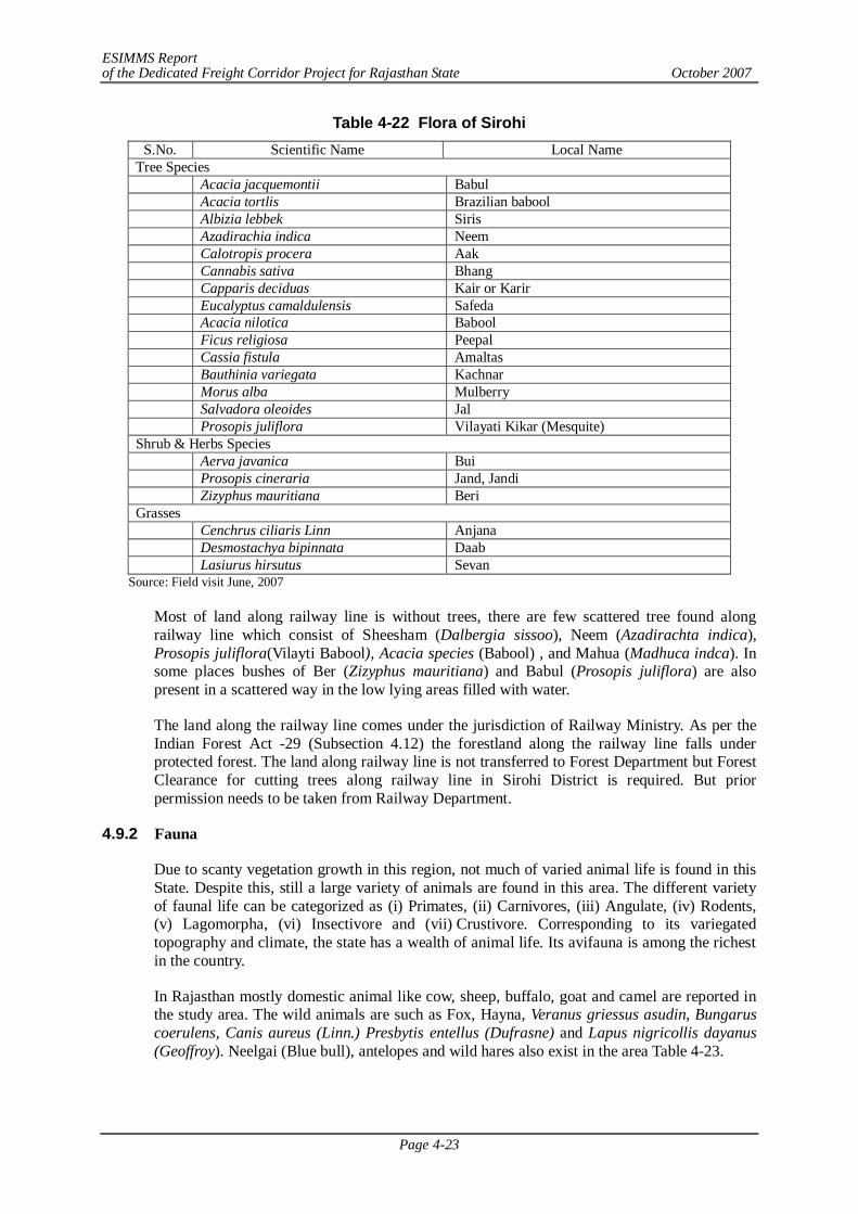
ESIMMS Report of the Dedicated Freight Corridor Project for Rajasthan State October 2007
Page 4-23
Table 4-22 Flora of Sirohi S.No. Scientific Name Local Name
Tree Species Acacia jacquemontii Babul Acacia tortlis Brazilian babool Albizia lebbek Siris Azadirachia indica Neem Calotropis procera Aak Cannabis sativa Bhang Capparis deciduas Kair or Karir Eucalyptus camaldulensis Safeda Acacia nilotica Babool Ficus religiosa Peepal Cassia fistula Amaltas Bauthinia variegata Kachnar Morus alba Mulberry Salvadora oleoides Jal Prosopis juliflora Vilayati Kikar (Mesquite) Shrub & Herbs Species Aerva javanica Bui Prosopis cineraria Jand, Jandi Zizyphus mauritiana Beri Grasses Cenchrus ciliaris Linn Anjana Desmostachya bipinnata Daab Lasiurus hirsutus Sevan
Source: Field visit June, 2007
Most of land along railway line is without trees, there are few scattered tree found along railway line which consist of Sheesham (Dalbergia sissoo), Neem (Azadirachta indica), Prosopis juliflora(Vilayti Babool), Acacia species (Babool) , and Mahua (Madhuca indca). In some places bushes of Ber (Zizyphus mauritiana) and Babul (Prosopis juliflora) are also present in a scattered way in the low lying areas filled with water.
The land along the railway line comes under the jurisdiction of Railway Ministry. As per the Indian Forest Act -29 (Subsection 4.12) the forestland along the railway line falls under protected forest. The land along railway line is not transferred to Forest Department but Forest Clearance for cutting trees along railway line in Sirohi District is required. But prior permission needs to be taken from Railway Department.
4.9.2 Fauna
Due to scanty vegetation growth in this region, not much of varied animal life is found in this State. Despite this, still a large variety of animals are found in this area. The different variety of faunal life can be categorized as (i) Primates, (ii) Carnivores, (iii) Angulate, (iv) Rodents, (v) Lagomorpha, (vi) Insectivore and (vii) Crustivore. Corresponding to its variegated topography and climate, the state has a wealth of animal life. Its avifauna is among the richest in the country.
In Rajasthan mostly domestic animal like cow, sheep, buffalo, goat and camel are reported in the study area. The wild animals are such as Fox, Hayna, Veranus griessus asudin, Bungarus coerulens, Canis aureus (Linn.) Presbytis entellus (Dufrasne) and Lapus nigricollis dayanus (Geoffroy). Neelgai (Blue bull), antelopes and wild hares also exist in the area Table 4-23.
ESIMMS Report of the Dedicated Freight Corridor Project for Rajasthan State October 2007
Page 4-24
Table 4-23 Fauna of Rajasthan State
S.No Scientific Name Local Name Mammals
1 Macacu mulatta Bandar 2 Presbytis entellus Langoor 3 Canis aureus Siyaar/ Jackal 4 Gervus unicolor Sambhar 5 Herpestes odwardsitotus Nebla 6 Vulpus bengalensis Indian Fox 7 *Boselaphus tragocamelus Nilgai 8 Canis lupus Wolf 9 Funumbulus pennanti Palm Squrrial 10 Oryctolagus cuniculus Rabbit
Reptiles 11 Python morulus Python 12 Hemidactylis brukaii House Geeko 13 Varanus monitor Goh 14 Gavialis gangeticus Ghadiyal
Avifauna 15 * Tadorna ferruginea. Chakwa 16 Egretta gazetta Bagula 17 *Grus antigone Saras 18 *Alcedo atthis Kingfisher 19 *Eudanamys scolopacea Koel 20 *Corvus splendens House Crow 21 Coracias bengalensis Kingfisher 22 *Ardea cinera Bagula 23 *Pavo cristatus Peacock 24 Francolinus pondicarinus Titar 25 Coturnix coturnix Ghapas Bater 26 Turnix sylavtica Chota Bater 27 Pycnonotus cafer Bulbul 28 Bubulcus ibis Cattle Egret
Source: Field survey in 2007
Nilgai (Boselaphus tragocamelus) seen in herds near Agricultural areas is very common in the State. In some localities like the ravenous land and in the open forest areas Hyaena and Wolves are found.
Some of the common fish s species found in the rivers and surface water bodies of the districts are Rohu (Labeo rohita), Catla/Bhakur (Catla catla), Kalbas/Karuch/Karoch/Kalbasu (Labeo clabasu), etc. The detailed list of other species of fish in Sikar is given in Table 4-24.
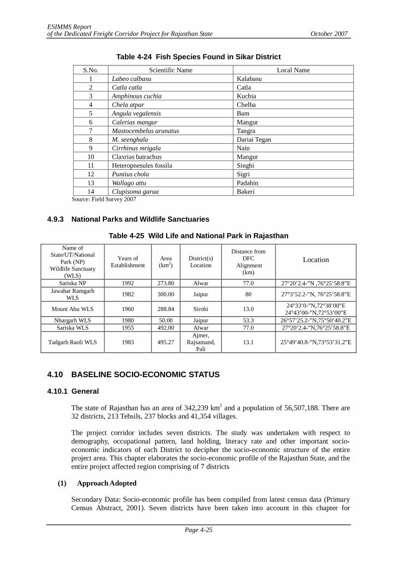
ESIMMS Report of the Dedicated Freight Corridor Project for Rajasthan State October 2007
Page 4-25
Table 4-24 Fish Species Found in Sikar District
S.No. Scientific Name Local Name 1 Labeo calbasu Kalabasu 2 Catla catla Catla 3 Amphinous cuchia Kuchia 4 Chela atpar Chelba 5 Angula vegalensis Bam 6 Calerias mangur Mangur 7 Mastocembelus arunatus Tangra 8 M. seenghala Dariai Tegan 9 Cirrhinus mrigala Nain 10 Claxrias batrachus Mangur 11 Heteropnesules fossila Singhi 12 Puntius chola Sigri 13 Wallago attu Padahin 14 Clupisoma garua Bakeri
Source: Field Survey 2007
4.9.3 National Parks and Wildlife Sanctuaries
Table 4-25 Wild Life and National Park in Rajasthan Name of
State/UT/National Park (NP)
Wildlife Sanctuary (WLS)
Years of Establishment
Area (km2)
District(s) Location
Distance from DFC
Alignment (km)
Location
Sariska NP 1992 273.80 Alwar 77.0 2720’2.4-”N ,76°25’58.8”E Jawahar Ramgarh
WLS 1982 300.00 Jaipur 80 27°3’52.2-”N, 76°25’58.8”E
Mount Abu WLS 1960 288.84 Sirohi 13.0 24°33’0-”N,72°38’00”E 24°43’00-”N,72°53’00”E
Nhargarh WLS 1980 50.00 Jaipur 53.3 26°57’25.2-”N,75°50’40.2”E Sariska WLS 1955 492.00 Alwar 77.0 27°20’2.4-”N,76°25’58.8”E
Tadgarh Raoli WLS 1983 495.27 Ajmer,
Rajsamand, Pali
13.1 25°49’40.8-”N,73°53’31.2”E
4.10 BASELINE SOCIO-ECONOMIC STATUS
4.10.1 General
The state of Rajasthan has an area of 342,239 km2 and a population of 56,507,188. There are 32 districts, 213 Tehsils, 237 blocks and 41,354 villages.
The project corridor includes seven districts. The study was undertaken with respect to demography, occupational pattern, land holding, literacy rate and other important socio-economic indicators of each District to decipher the socio-economic structure of the entire project area. This chapter elaborates the socio-economic profile of the Rajasthan State, and the entire project affected region comprising of 7 districts
(1) Approach Adopted
Secondary Data: Socio-economic profile has been compiled from latest census data (Primary Census Abstract, 2001). Seven districts have been taken into account in this chapter for
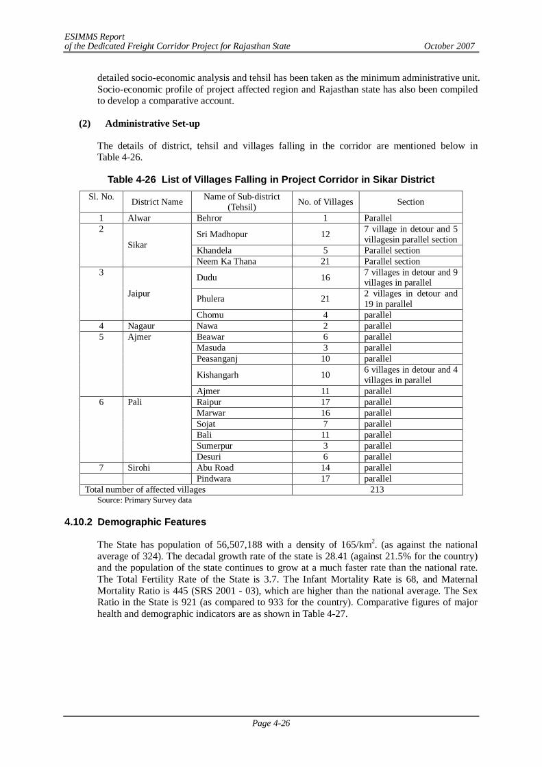
ESIMMS Report of the Dedicated Freight Corridor Project for Rajasthan State October 2007
Page 4-26
detailed socio-economic analysis and tehsil has been taken as the minimum administrative unit. Socio-economic profile of project affected region and Rajasthan state has also been compiled to develop a comparative account.
(2) Administrative Set-up
The details of district, tehsil and villages falling in the corridor are mentioned below in Table 4-26.
Table 4-26 List of Villages Falling in Project Corridor in Sikar District Sl. No. District Name Name of Sub-district
(Tehsil) No. of Villages Section
1 Alwar Behror 1 Parallel
Sri Madhopur 12 7 village in detour and 5 villagesin parallel section
Khandela 5 Parallel section
2
Sikar
Neem Ka Thana 21 Parallel section
Dudu 16 7 villages in detour and 9 villages in parallel
Phulera 21 2 villages in detour and 19 in parallel
3
Jaipur
Chomu 4 parallel 4 Nagaur Nawa 2 parallel
Beawar 6 parallel Masuda 3 parallel Peasanganj 10 parallel
Kishangarh 10 6 villages in detour and 4 villages in parallel
5 Ajmer
Ajmer 11 parallel Raipur 17 parallel Marwar 16 parallel Sojat 7 parallel Bali 11 parallel Sumerpur 3 parallel
6 Pali
Desuri 6 parallel 7 Sirohi Abu Road 14 parallel Pindwara 17 parallel
Total number of affected villages 213 Source: Primary Survey data
4.10.2 Demographic Features
The State has population of 56,507,188 with a density of 165/km2. (as against the national average of 324). The decadal growth rate of the state is 28.41 (against 21.5% for the country) and the population of the state continues to grow at a much faster rate than the national rate. The Total Fertility Rate of the State is 3.7. The Infant Mortality Rate is 68, and Maternal Mortality Ratio is 445 (SRS 2001 - 03), which are higher than the national average. The Sex Ratio in the State is 921 (as compared to 933 for the country). Comparative figures of major health and demographic indicators are as shown in Table 4-27.
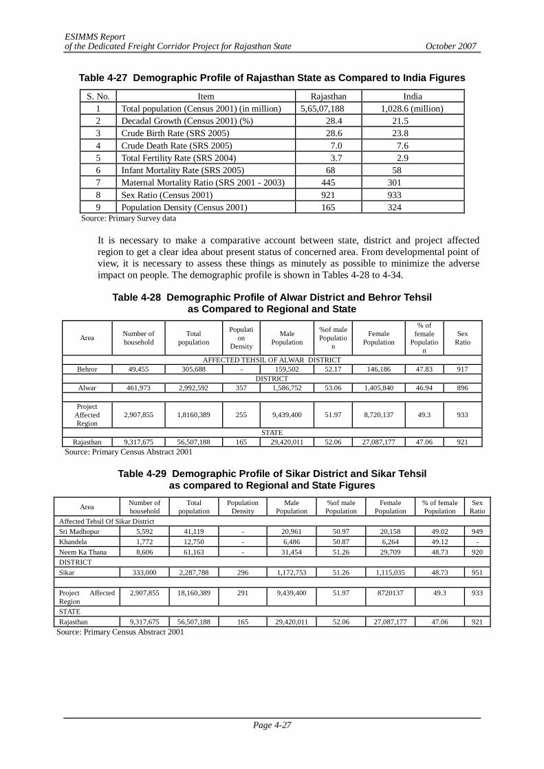
ESIMMS Report of the Dedicated Freight Corridor Project for Rajasthan State October 2007
Page 4-27
Table 4-27 Demographic Profile of Rajasthan State as Compared to India Figures
S. No. Item Rajasthan India 1 Total population (Census 2001) (in million) 5,65,07,188 1,028.6 (million) 2 Decadal Growth (Census 2001) (%) 28.4 21.5 3 Crude Birth Rate (SRS 2005) 28.6 23.8 4 Crude Death Rate (SRS 2005) 7.0 7.6 5 Total Fertility Rate (SRS 2004) 3.7 2.9 6 Infant Mortality Rate (SRS 2005) 68 58 7 Maternal Mortality Ratio (SRS 2001 - 2003) 445 301 8 Sex Ratio (Census 2001) 921 933 9 Population Density (Census 2001) 165 324
Source: Primary Survey data
It is necessary to make a comparative account between state, district and project affected region to get a clear idea about present status of concerned area. From developmental point of view, it is necessary to assess these things as minutely as possible to minimize the adverse impact on people. The demographic profile is shown in Tables 4-28 to 4-34.
Table 4-28 Demographic Profile of Alwar District and Behror Tehsil as Compared to Regional and State
Area Number of household
Total population
Population
Density
Male Population
%of male Populatio
n
Female Population
% of female
Population
Sex Ratio
AFFECTED TEHSIL OF ALWAR DISTRICT Behror 49,455 305,688 - 159,502 52.17 146,186 47.83 917
DISTRICT Alwar 461,973 2,992,592 357 1,586,752 53.06 1,405,840 46.94 896
Project
Affected Region
2,907,855 1,8160,389 255 9,439,400 51.97 8,720,137 49.3 933
STATE Rajasthan 9,317,675 56,507,188 165 29,420,011 52.06 27,087,177 47.06 921
Source: Primary Census Abstract 2001
Table 4-29 Demographic Profile of Sikar District and Sikar Tehsil as compared to Regional and State Figures
Area Number of household
Total population
Population Density
Male Population
%of male Population
Female Population
% of female Population
Sex Ratio
Affected Tehsil Of Sikar District Sri Madhopur 5,592 41,119 - 20,961 50.97 20,158 49.02 949 Khandela 1,772 12,750 - 6,486 50.87 6,264 49.12 - Neem Ka Thana 8,606 61,163 - 31,454 51.26 29,709 48.73 920 DISTRICT Sikar 333,000 2,287,788 296 1,172,753 51.26 1,115,035 48.73 951 Project Affected Region
2,907,855 18,160,389 291 9,439,400 51.97 8720137 49.3 933
STATE Rajasthan 9,317,675 56,507,188 165 29,420,011 52.06 27,087,177 47.06 921
Source: Primary Census Abstract 2001
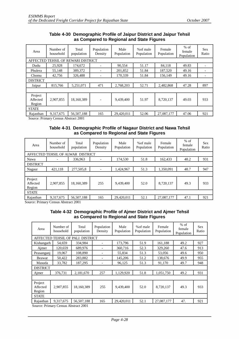
ESIMMS Report of the Dedicated Freight Corridor Project for Rajasthan State October 2007
Page 4-28
Table 4-30 Demographic Profile of Jaipur District and Jaipur Tehsil as Compared to Regional and State Figures
Area Number of household
Total population
Population Density
Male Population
%of male Population
Female Population
% of female
Population
Sex Ratio
AFFECTED TEHSIL OF REWARI DISTRICT Dudu 25,928 174,672 - 90,554 51.17 84,118 49.83 -
Phulera 55,148 389,372 - 201,852 51.84 187,520 49.16 - Chomu 42,756 326,488 - 170,339 51.84 156,149 49.16 -
DISTRICT Jaipur 815,766 5,251,071 471 2,768,203 52.71 2,482,868 47.28 897
Project
Affected Region
2,907,855 18,160,389 - 9,439,400 51.97 8,720,137 49.03 933
STATE Rajasthan 9,317,675 56,507,188 165 29,420,011 52.06 27,087,177 47.06 921 Source: Primary Census Abstract 2001
Table 4-31 Demographic Profile of Nagaur District and Nawa Tehsil as Compared to Regional and State Figures
Area Number of household
Total population
Population Density
Male Population
%of male Population
Female Population
% of female
Population
Sex Ratio
AFFECTED TEHSIL OF ALWAR DISTRICT Nawa - 336,963 - 174,530 51.8 162,433 48.2 931 DISTRICT Nagaur 421,118 277,505,8 - 1,424,967 51.3 1,350,091 48.7 947 Project Affected Region
2,907,855 18,160,389 255 9,439,400 52.0 8,720,137 49.3 933
STATE Rajasthan 9,317,675 56,507,188 165 29,420,011 52.1 27,087,177 47.1 921
Source: Primary Census Abstract 2001
Table 4-32 Demographic Profile of Ajmer District and Ajmer Tehsil as Compared to Regional and State Figures
Area Number of household
Total population
Population Density
Male Population
%of male Population
Female Population
% of female
Population
Sex Ratio
AFFECTED TEHSIL OF PALI DISTRICT Kishangarh 54,659 334,984 - 173,796 51.9 161,188 49.2 927
Ajmer 120,659 689,976 - 360,716 52.3 329,260 47.6 913 Peasanganj 19,067 108,890 - 55,834 51.3 53,056 49.6 950
Beawar 50,422 283,882 - 145,206 51.2 138,676 49.9 955 Masuda 33,782 187,295 - 96,125 51.3 91,170 49.7 948
DISTRICT Ajmer 376,731 2,181,670 257 1,129,920 51.8 1,051,750 49.2 931 Project Affected Region
2,907,855 18,160,389 255 9,439,400 52.0 8,720,137 49.3 933
STATE Rajasthan 9,317,675 56,507,188 165 29,420,011 52.1 27,087,177 47. 921
Source: Primary Census Abstract 2001
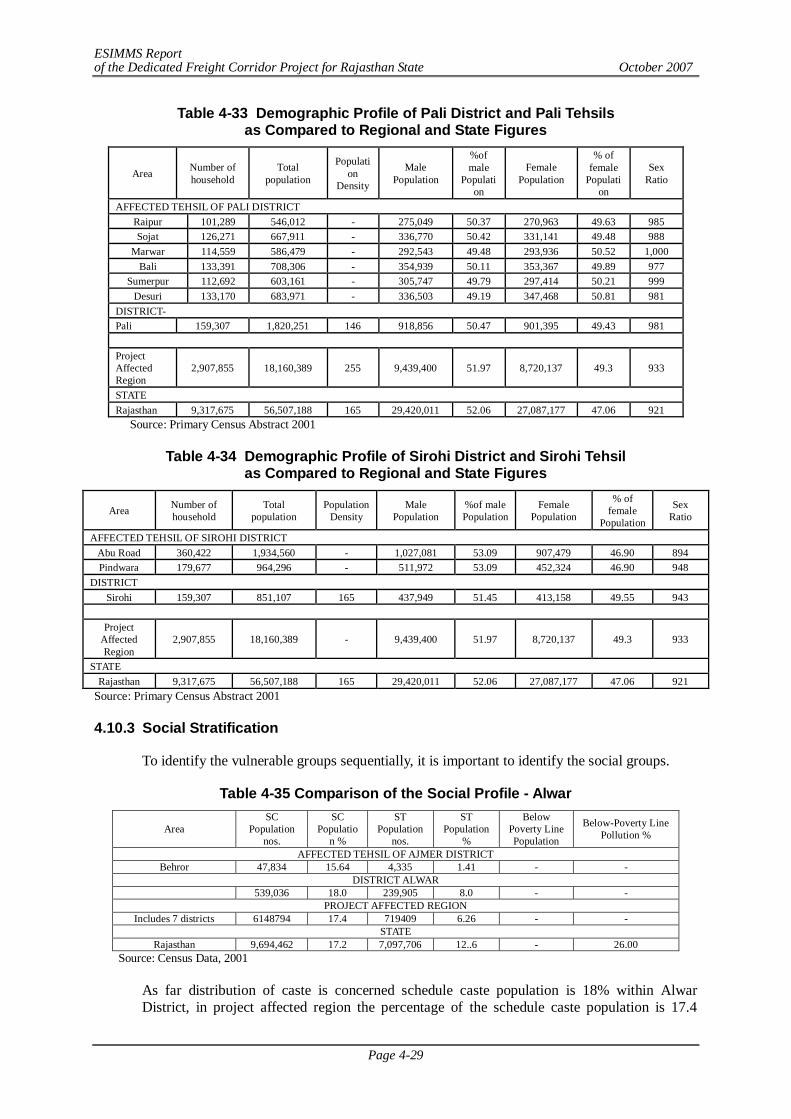
ESIMMS Report of the Dedicated Freight Corridor Project for Rajasthan State October 2007
Page 4-29
Table 4-33 Demographic Profile of Pali District and Pali Tehsils as Compared to Regional and State Figures
Area Number of household
Total population
Population
Density
Male Population
%of male
Population
Female Population
% of female
Population
Sex Ratio
AFFECTED TEHSIL OF PALI DISTRICT Raipur 101,289 546,012 - 275,049 50.37 270,963 49.63 985 Sojat 126,271 667,911 - 336,770 50.42 331,141 49.48 988
Marwar 114,559 586,479 - 292,543 49.48 293,936 50.52 1,000 Bali 133,391 708,306 - 354,939 50.11 353,367 49.89 977
Sumerpur 112,692 603,161 - 305,747 49.79 297,414 50.21 999 Desuri 133,170 683,971 - 336,503 49.19 347,468 50.81 981
DISTRICT- Pali 159,307 1,820,251 146 918,856 50.47 901,395 49.43 981 Project Affected Region
2,907,855 18,160,389 255 9,439,400 51.97 8,720,137 49.3 933
STATE Rajasthan 9,317,675 56,507,188 165 29,420,011 52.06 27,087,177 47.06 921
Source: Primary Census Abstract 2001
Table 4-34 Demographic Profile of Sirohi District and Sirohi Tehsil as Compared to Regional and State Figures
Area Number of household
Total population
Population Density
Male Population
%of male Population
Female Population
% of female
Population
Sex Ratio
AFFECTED TEHSIL OF SIROHI DISTRICT Abu Road 360,422 1,934,560 - 1,027,081 53.09 907,479 46.90 894 Pindwara 179,677 964,296 - 511,972 53.09 452,324 46.90 948
DISTRICT Sirohi 159,307 851,107 165 437,949 51.45 413,158 49.55 943
Project
Affected Region
2,907,855 18,160,389 - 9,439,400 51.97 8,720,137 49.3 933
STATE Rajasthan 9,317,675 56,507,188 165 29,420,011 52.06 27,087,177 47.06 921
Source: Primary Census Abstract 2001 4.10.3 Social Stratification
To identify the vulnerable groups sequentially, it is important to identify the social groups.
Table 4-35 Comparison of the Social Profile - Alwar
Area SC
Population nos.
SC Populatio
n %
ST Population
nos.
ST Population
%
Below Poverty Line Population
Below-Poverty Line Pollution %
AFFECTED TEHSIL OF AJMER DISTRICT Behror 47,834 15.64 4,335 1.41 - -
DISTRICT ALWAR 539,036 18.0 239,905 8.0 - -
PROJECT AFFECTED REGION Includes 7 districts 6148794 17.4 719409 6.26 - -
STATE Rajasthan 9,694,462 17.2 7,097,706 12..6 - 26.00
Source: Census Data, 2001
As far distribution of caste is concerned schedule caste population is 18% within Alwar District, in project affected region the percentage of the schedule caste population is 17.4
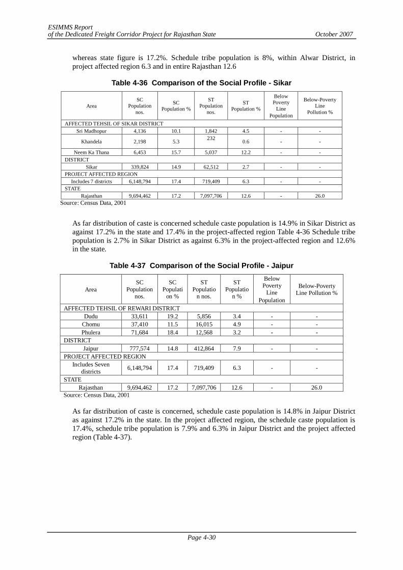
ESIMMS Report of the Dedicated Freight Corridor Project for Rajasthan State October 2007
Page 4-30
whereas state figure is 17.2%. Schedule tribe population is 8%, within Alwar District, in project affected region 6.3 and in entire Rajasthan 12.6
Table 4-36 Comparison of the Social Profile - Sikar
Area SC
Population nos.
SC Population %
ST Population
nos.
ST Population %
Below Poverty
Line Population
Below-Poverty Line
Pollution %
AFFECTED TEHSIL OF SIKAR DISTRICT Sri Madhopur 4,136 10.1 1,842 4.5 - -
Khandela 2,198 5.3 232
0.6 - -
Neem Ka Thana 6,453 15.7 5,037 12.2 - - DISTRICT
Sikar 339,824 14.9 62,512 2.7 - - PROJECT AFFECTED REGION
Includes 7 districts 6,148,794 17.4 719,409 6.3 - - STATE
Rajasthan 9,694,462 17.2 7,097,706 12.6 - 26.0 Source: Census Data, 2001
As far distribution of caste is concerned schedule caste population is 14.9% in Sikar District as against 17.2% in the state and 17.4% in the project-affected region Table 4-36 Schedule tribe population is 2.7% in Sikar District as against 6.3% in the project-affected region and 12.6% in the state.
Table 4-37 Comparison of the Social Profile - Jaipur
Area SC
Population nos.
SC Populati
on %
ST Populatio
n nos.
ST Populatio
n %
Below Poverty
Line Population
Below-Poverty Line Pollution %
AFFECTED TEHSIL OF REWARI DISTRICT Dudu 33,611 19.2 5,856 3.4 - -
Chomu 37,410 11.5 16,015 4.9 - - Phulera 71,684 18.4 12,568 3.2 - -
DISTRICT Jaipur 777,574 14.8 412,864 7.9 - -
PROJECT AFFECTED REGION Includes Seven
districts 6,148,794 17.4 719,409 6.3 - -
STATE Rajasthan 9,694,462 17.2 7,097,706 12.6 - 26.0
Source: Census Data, 2001
As far distribution of caste is concerned, schedule caste population is 14.8% in Jaipur District as against 17.2% in the state. In the project affected region, the schedule caste population is 17.4%, schedule tribe population is 7.9% and 6.3% in Jaipur District and the project affected region (Table 4-37).
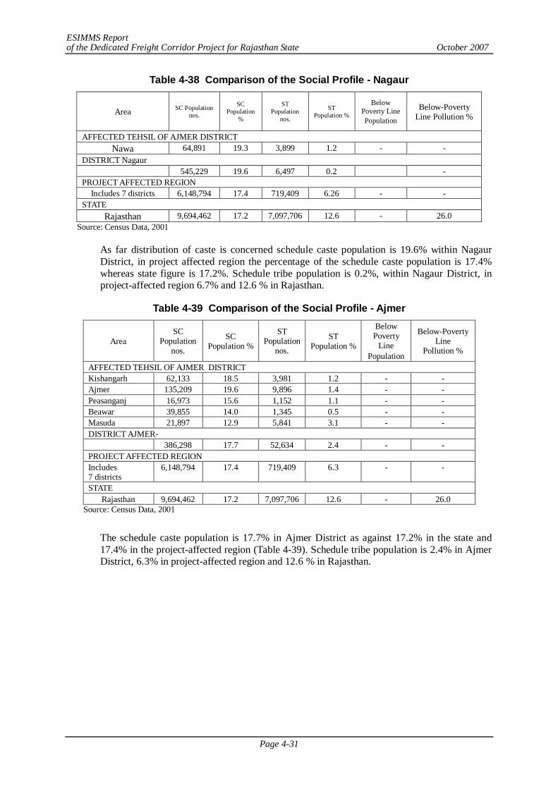
ESIMMS Report of the Dedicated Freight Corridor Project for Rajasthan State October 2007
Page 4-31
Table 4-38 Comparison of the Social Profile - Nagaur
Area SC Population nos.
SC Population
%
ST Population
nos.
ST Population %
Below Poverty Line Population
Below-Poverty Line Pollution %
AFFECTED TEHSIL OF AJMER DISTRICT Nawa 64,891 19.3 3,899 1.2 - -
DISTRICT Nagaur 545,229 19.6 6,497 0.2 -
PROJECT AFFECTED REGION Includes 7 districts 6,148,794 17.4 719,409 6.26 - -
STATE Rajasthan 9,694,462 17.2 7,097,706 12.6 - 26.0
Source: Census Data, 2001
As far distribution of caste is concerned schedule caste population is 19.6% within Nagaur District, in project affected region the percentage of the schedule caste population is 17.4% whereas state figure is 17.2%. Schedule tribe population is 0.2%, within Nagaur District, in project-affected region 6.7% and 12.6 % in Rajasthan.
Table 4-39 Comparison of the Social Profile - Ajmer
Area SC
Population nos.
SC Population %
ST Population
nos.
ST Population %
Below Poverty
Line Population
Below-Poverty Line
Pollution %
AFFECTED TEHSIL OF AJMER DISTRICT Kishangarh 62,133 18.5 3,981 1.2 - - Ajmer 135,209 19.6 9,896 1.4 - - Peasanganj 16,973 15.6 1,152 1.1 - - Beawar 39,855 14.0 1,345 0.5 - - Masuda 21,897 12.9 5,841 3.1 - - DISTRICT AJMER- 386,298 17.7 52,634 2.4 - - PROJECT AFFECTED REGION Includes 7 districts
6,148,794 17.4 719,409 6.3 - -
STATE Rajasthan 9,694,462 17.2 7,097,706 12.6 - 26.0
Source: Census Data, 2001
The schedule caste population is 17.7% in Ajmer District as against 17.2% in the state and 17.4% in the project-affected region (Table 4-39). Schedule tribe population is 2.4% in Ajmer District, 6.3% in project-affected region and 12.6 % in Rajasthan.
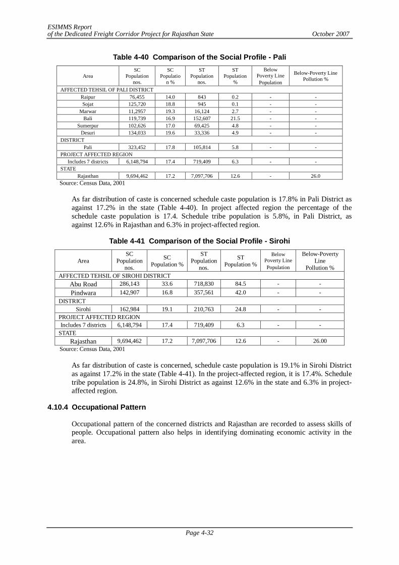
ESIMMS Report of the Dedicated Freight Corridor Project for Rajasthan State October 2007
Page 4-32
Table 4-40 Comparison of the Social Profile - Pali
Area SC
Population nos.
SC Populatio
n %
ST Population
nos.
ST Population
%
Below Poverty Line Population
Below-Poverty Line Pollution %
AFFECTED TEHSIL OF PALI DISTRICT Raipur 76,455 14.0 843 0.2 - - Sojat 125,720 18.8 945 0.1 - -
Marwar 11,2957 19.3 16,124 2.7 - - Bali 119,739 16.9 152,607 21.5 - -
Sumerpur 102,626 17.0 69,425 4.8 - - Desuri 134,033 19.6 33,336 4.9 - -
DISTRICT Pali 323,452 17.8 105,814 5.8 - -
PROJECT AFFECTED REGION Includes 7 districts 6,148,794 17.4 719,409 6.3 - -
STATE Rajasthan 9,694,462 17.2 7,097,706 12.6 - 26.0
Source: Census Data, 2001
As far distribution of caste is concerned schedule caste population is 17.8% in Pali District as against 17.2% in the state (Table 4-40). In project affected region the percentage of the schedule caste population is 17.4. Schedule tribe population is 5.8%, in Pali District, as against 12.6% in Rajasthan and 6.3% in project-affected region.
Table 4-41 Comparison of the Social Profile - Sirohi
Area SC
Population nos.
SC Population %
ST Population
nos.
ST Population %
Below Poverty Line Population
Below-Poverty Line
Pollution % AFFECTED TEHSIL OF SIROHI DISTRICT
Abu Road 286,143 33.6 718,830 84.5 - - Pindwara 142,907 16.8 357,561 42.0 - -
DISTRICT Sirohi 162,984 19.1 210,763 24.8 - -
PROJECT AFFECTED REGION Includes 7 districts 6,148,794 17.4 719,409 6.3 - -
STATE Rajasthan 9,694,462 17.2 7,097,706 12.6 - 26.00
Source: Census Data, 2001
As far distribution of caste is concerned, schedule caste population is 19.1% in Sirohi District as against 17.2% in the state (Table 4-41). In the project-affected region, it is 17.4%. Schedule tribe population is 24.8%, in Sirohi District as against 12.6% in the state and 6.3% in project-affected region.
4.10.4 Occupational Pattern
Occupational pattern of the concerned districts and Rajasthan are recorded to assess skills of people. Occupational pattern also helps in identifying dominating economic activity in the area.
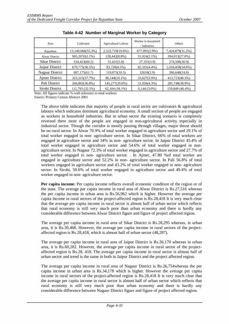
ESIMMS Report of the Dedicated Freight Corridor Project for Rajasthan State October 2007
Page 4-33
Table 4-42 Number of Marginal Worker by Category
Area Cultivator Agricultural Labour Worker in household
/ industries Others
Rajasthan 13,140,066(55.3%) 2,523,719(10.6%) 677,991(2.9%) 7,424,879(31.2%) Alwar District 905,207(62.1%) 128,442(8.8%) 31,024(2.1%) 394,013(27.0%)
Sikar District 534,423(60.2) 51,631(5.8) 27,355(3.9) 274,506(30.9) Jaipur District 679,775(36.5%) 83,720(4.5%) 82,101(4.4%) 1,018,459(54.6%) Nagaur District 697,175(61.7) 119,073(10.5) 32618(2.9) 280,648(24.8) Ajmer District 323,315(37.7%) 86,144(10.1%) 33,627(3.9%) 413,723(48.3%)
Pali District 266,802(36.8%) 145,277(20.0%) 31,056(4.3%) 281,748(38.9%) Sirohi District 111,793 (32.5%) 62,104 (18.1%) 6,144 (3.0%) 159,849 (46.4%)
Note: All figures indicate % with reference to total workers Source: Primary Census Abstract 2001
The above table indicates that majority of people in rural sector are cultivators & agricultural labours which indicates dominant agricultural economy. A small section of people are engaged as workers in household industries. But in urban sector the existing scenario is completely reversed there most of the people are engaged in non-agricultural activity especially in industrial sector. Though the corridor is mostly passing through villages, major thrust should be on rural sector. In Alwar 70.9% of total worker engaged in agriculture sector and 29.1% of total worker engaged in non- agriculture sector. In Sikar District, 66% of total workers are engaged in agriculture sector and 34% in non- agriculture sector. In Jaipur District 45.4% of total worker engaged in agriculture sector and 54.6% of total worker engaged in non- agriculture sector. In Nagaur 72.3% of total worker engaged in agriculture sector and 27.7% of total worker engaged in non- agriculture sector. . In Ajmer, 47.80 %of total worker are engaged in agriculture sector and 52.2% in non- agriculture sector. In Pali 56.8% of total workers engaged in agriculture sector and 43.2% of total worker engaged in non- agriculture sector. In Sirohi, 50.6% of total worker engaged in agriculture sector and 49.4% of total worker engaged in non- agriculture sector.
Per capita income: Per capita income reflects overall economic condition of the region or of the state. The average per capita income in rural area of Alwar District is Rs.27,516 whereas the per capita income in urban area is Rs.56,962 which is higher. However the average per capita income in rural sectors of the project-affected region is Rs.28,418 It is very much clear that the average per capita income in rural sector is almost half of urban sector which reflects that rural economy is still very much poor than urban economy and there is hardly any considerable difference between Alwar District figure and figure of project affected region.
The average per capita income in rural area of Sikar District is Rs.28,295 whereas, in urban area, it is Rs.30,468. However, the average per capita income in rural sectors of the project-affected region is Rs.28,418, which is almost half of urban sector (48,287).
The average per capita income in rural area of Jaipur District is Rs.26,170 whereas in urban area, it is Rs.60,282. However, the average per capita income in rural sector of the project-affected region is Rs.28, 418. The average per capita income in rural sector is almost half of urban sector and trend is the same in both in Jaipur District and the project affected region.
The average per capita income in rural area of Nagaur District is Rs.26,754whereas the per capita income in urban area is Rs.34,178 which is higher. However the average per capita income in rural sectors of the project-affected region is Rs.28,418 It is very much clear that the average per capita income in rural sector is almost half of urban sector which reflects that rural economy is still very much poor than urban economy and there is hardly any considerable difference between Nagaur District figure and figure of project affected region.
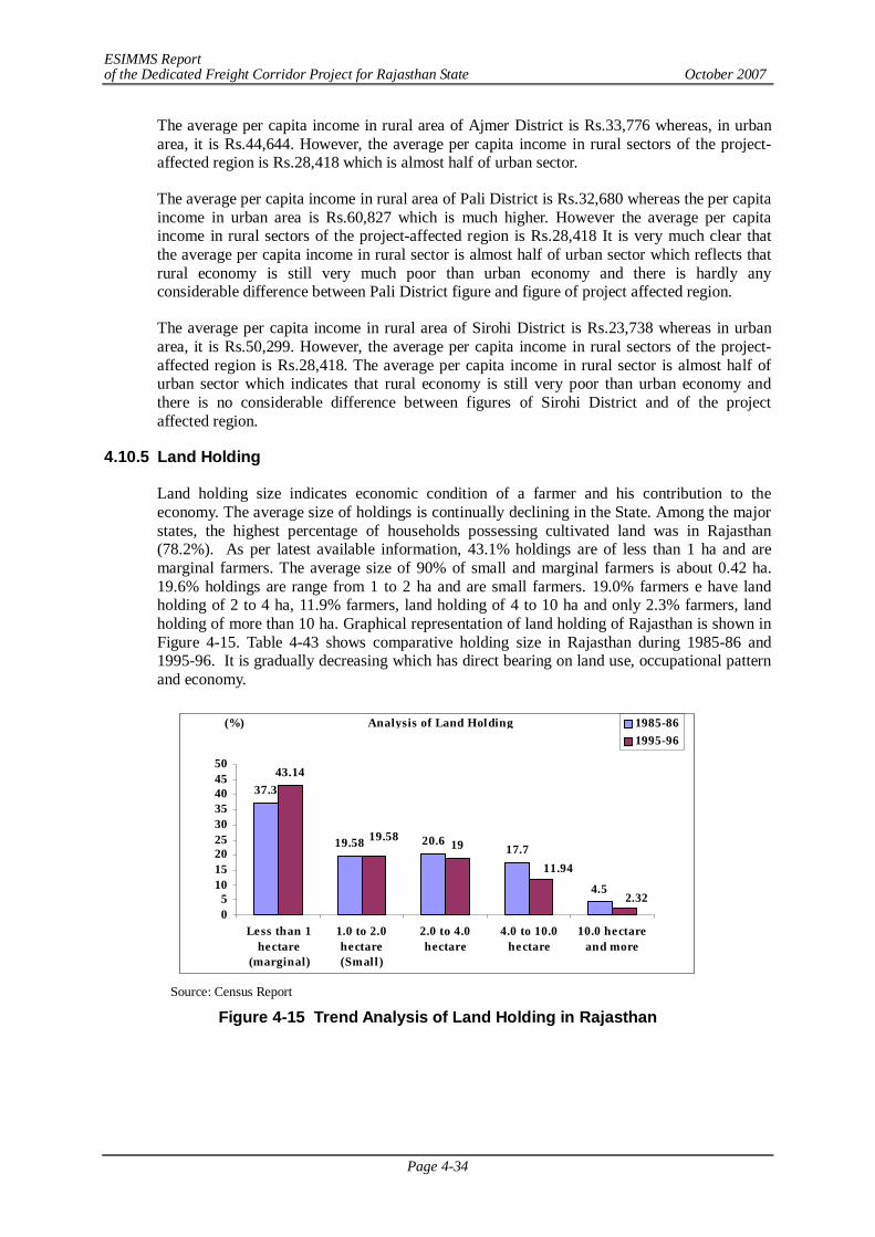
ESIMMS Report of the Dedicated Freight Corridor Project for Rajasthan State October 2007
Page 4-34
The average per capita income in rural area of Ajmer District is Rs.33,776 whereas, in urban area, it is Rs.44,644. However, the average per capita income in rural sectors of the project-affected region is Rs.28,418 which is almost half of urban sector.
The average per capita income in rural area of Pali District is Rs.32,680 whereas the per capita income in urban area is Rs.60,827 which is much higher. However the average per capita income in rural sectors of the project-affected region is Rs.28,418 It is very much clear that the average per capita income in rural sector is almost half of urban sector which reflects that rural economy is still very much poor than urban economy and there is hardly any considerable difference between Pali District figure and figure of project affected region.
The average per capita income in rural area of Sirohi District is Rs.23,738 whereas in urban area, it is Rs.50,299. However, the average per capita income in rural sectors of the project-affected region is Rs.28,418. The average per capita income in rural sector is almost half of urban sector which indicates that rural economy is still very poor than urban economy and there is no considerable difference between figures of Sirohi District and of the project affected region.
4.10.5 Land Holding
Land holding size indicates economic condition of a farmer and his contribution to the economy. The average size of holdings is continually declining in the State. Among the major states, the highest percentage of households possessing cultivated land was in Rajasthan (78.2%). As per latest available information, 43.1% holdings are of less than 1 ha and are marginal farmers. The average size of 90% of small and marginal farmers is about 0.42 ha. 19.6% holdings are range from 1 to 2 ha and are small farmers. 19.0% farmers e have land holding of 2 to 4 ha, 11.9% farmers, land holding of 4 to 10 ha and only 2.3% farmers, land holding of more than 10 ha. Graphical representation of land holding of Rajasthan is shown in Figure 4-15. Table 4-43 shows comparative holding size in Rajasthan during 1985-86 and 1995-96. It is gradually decreasing which has direct bearing on land use, occupational pattern and economy.
Source: Census Report
Figure 4-15 Trend Analysis of Land Holding in Rajasthan
Analysis of Land Holding
37.3
19.58 20.617.7
4.5
43.14
1919.58
11.94
2.3205
101520253035404550
Less than 1hectare
(marginal)
1.0 to 2.0hectare(Small)
2.0 to 4.0hectare
4.0 to 10.0hectare
10.0 hectareand more
(%) 1985-861995-96
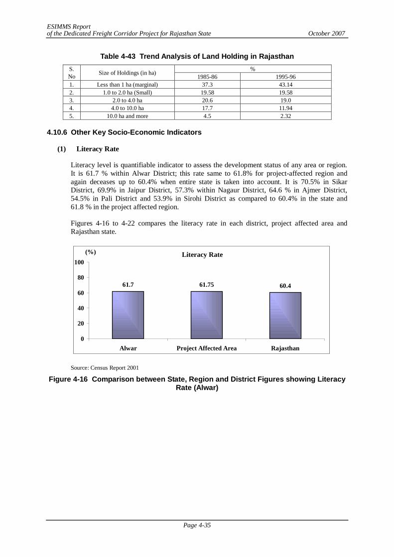
ESIMMS Report of the Dedicated Freight Corridor Project for Rajasthan State October 2007
Page 4-35
Table 4-43 Trend Analysis of Land Holding in Rajasthan % S.
No Size of Holdings (in ha) 1985-86 1995-96
1. Less than 1 ha (marginal) 37.3 43.14 2. 1.0 to 2.0 ha (Small) 19.58 19.58 3. 2.0 to 4.0 ha 20.6 19.0 4. 4.0 to 10.0 ha 17.7 11.94 5. 10.0 ha and more 4.5 2.32
4.10.6 Other Key Socio-Economic Indicators
(1) Literacy Rate
Literacy level is quantifiable indicator to assess the development status of any area or region. It is 61.7 % within Alwar District; this rate same to 61.8% for project-affected region and again deceases up to 60.4% when entire state is taken into account. It is 70.5% in Sikar District, 69.9% in Jaipur District, 57.3% within Nagaur District, 64.6 % in Ajmer District, 54.5% in Pali District and 53.9% in Sirohi District as compared to 60.4% in the state and 61.8 % in the project affected region.
Figures 4-16 to 4-22 compares the literacy rate in each district, project affected area and Rajasthan state.
Literacy Rate
61.7 61.75 60.4
0
20
40
60
80
100
Alwar Project Affected Area Rajasthan
(%)
Source: Census Report 2001
Figure 4-16 Comparison between State, Region and District Figures showing Literacy Rate (Alwar)
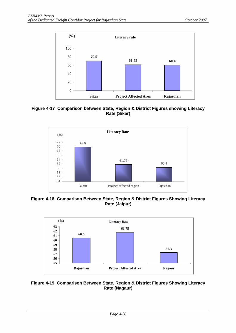
ESIMMS Report of the Dedicated Freight Corridor Project for Rajasthan State October 2007
Page 4-36
Literacy rate
70.561.75 60.4
0
20
40
60
80
100
Sikar Project Affected Area Rajasthan
(%)
Figure 4-17 Comparison between State, Region & District Figures showing Literacy Rate (Sikar)
Literacy Rate
69.9
61.7560.4
54565860626466687072
Jaipur Project affected region Rajasthan
(%)
Figure 4-18 Comparison Between State, Region & District Figures Showing Literacy
Rate (Jaipur)
Literacy Rate
60.561.75
57.3
555657585960616263
Rajasthan Project Affected Area Nagaur
(%)
Figure 4-19 Comparison Between State, Region & District Figures Showing Literacy Rate (Nagaur)
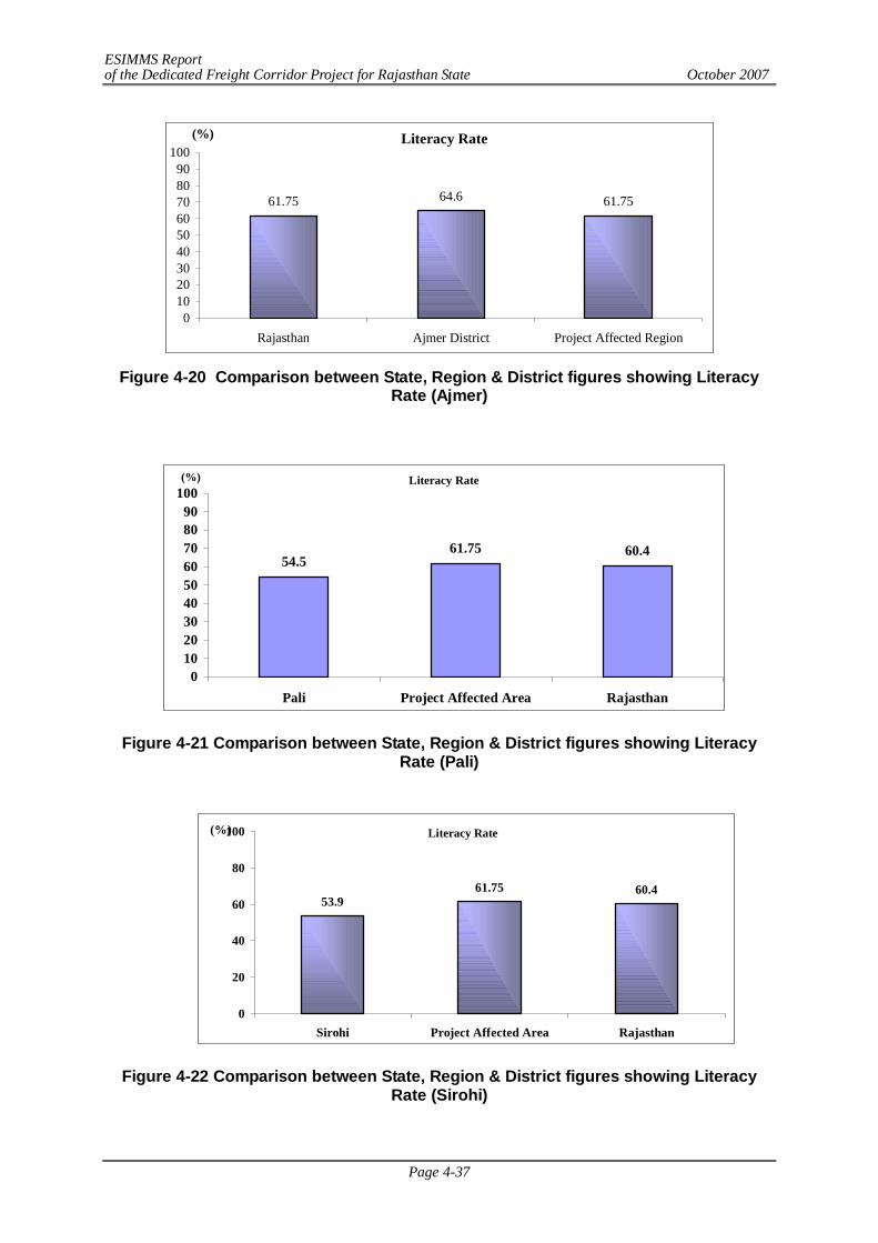
ESIMMS Report of the Dedicated Freight Corridor Project for Rajasthan State October 2007
Page 4-37
Literacy Rate
61.75 64.6 61.75
0102030405060708090
100
Rajasthan Ajmer District Project Affected Region
(%)
Figure 4-20 Comparison between State, Region & District figures showing Literacy
Rate (Ajmer)
Literacy Rate
54.561.75 60.4
0102030405060708090
100
Pali Project Affected Area Rajasthan
(%)
Figure 4-21 Comparison between State, Region & District figures showing Literacy Rate (Pali)
Literacy Rate
53.961.75 60.4
0
20
40
60
80
100
Sirohi Project Affected Area Rajasthan
(%)
Figure 4-22 Comparison between State, Region & District figures showing Literacy Rate (Sirohi)
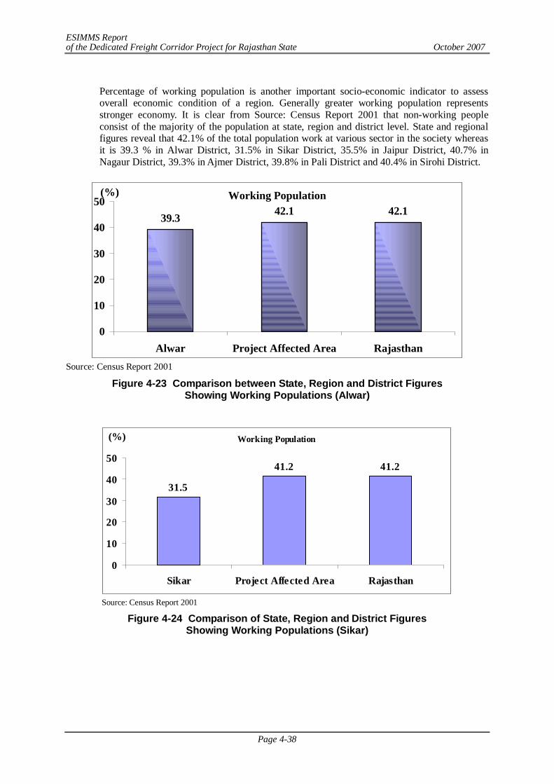
ESIMMS Report of the Dedicated Freight Corridor Project for Rajasthan State October 2007
Page 4-38
Percentage of working population is another important socio-economic indicator to assess overall economic condition of a region. Generally greater working population represents stronger economy. It is clear from Source: Census Report 2001 that non-working people consist of the majority of the population at state, region and district level. State and regional figures reveal that 42.1% of the total population work at various sector in the society whereas it is 39.3 % in Alwar District, 31.5% in Sikar District, 35.5% in Jaipur District, 40.7% in Nagaur District, 39.3% in Ajmer District, 39.8% in Pali District and 40.4% in Sirohi District.
Working Population
39.3 42.1 42.1
0
10
20
30
40
50
Alwar Project Affected Area Rajasthan
(%)
Source: Census Report 2001
Figure 4-23 Comparison between State, Region and District Figures Showing Working Populations (Alwar)
Working Population
31.5
41.2 41.2
0
10
20
30
40
50
Sikar Project Affected Area Rajasthan
(%)
Source: Census Report 2001
Figure 4-24 Comparison of State, Region and District Figures Showing Working Populations (Sikar)
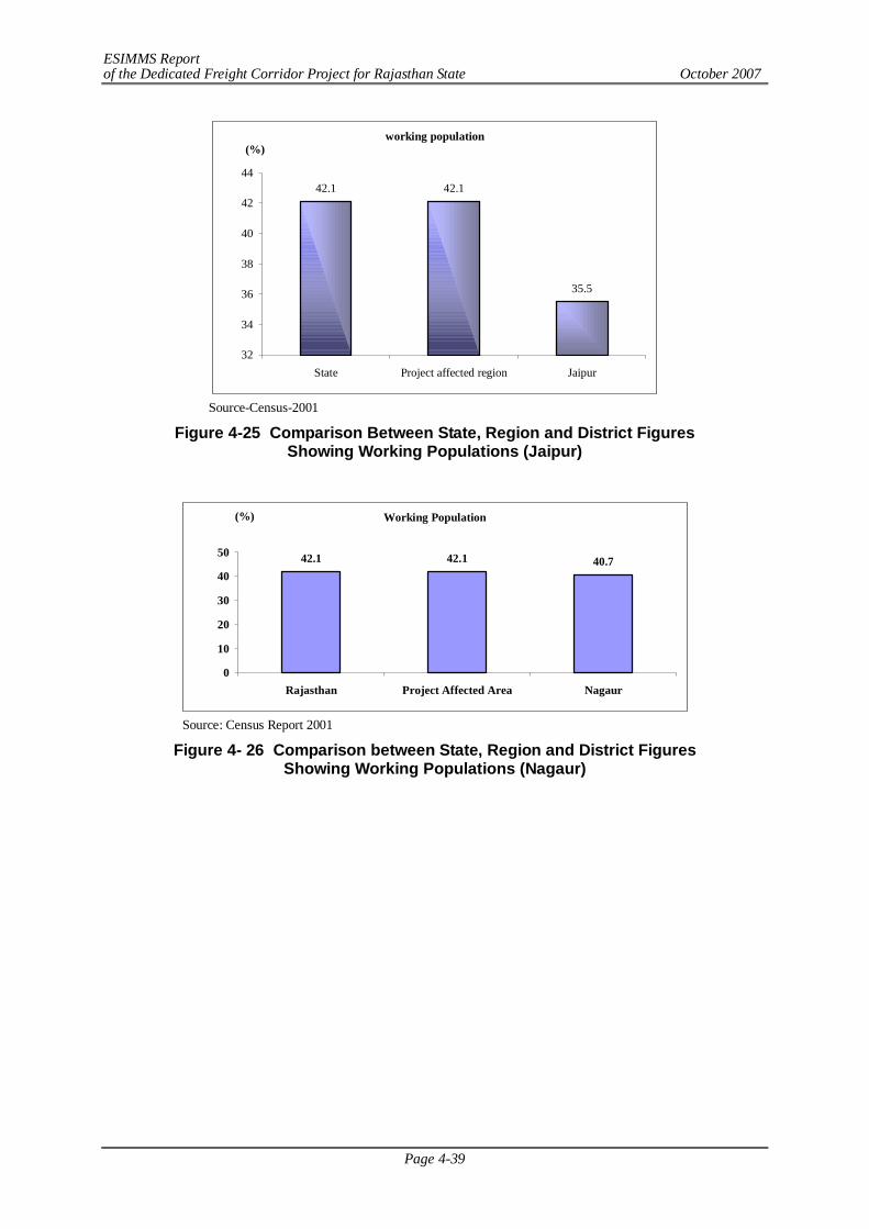
ESIMMS Report of the Dedicated Freight Corridor Project for Rajasthan State October 2007
Page 4-39
working population
42.1 42.1
35.5
32
34
36
38
40
42
44
State Project affected region Jaipur
(%)
Source-Census-2001
Figure 4-25 Comparison Between State, Region and District Figures Showing Working Populations (Jaipur)
Working Population
42.1 42.1 40.7
0
10
20
30
40
50
Rajasthan Project Affected Area Nagaur
(%)
Source: Census Report 2001
Figure 4- 26 Comparison between State, Region and District Figures Showing Working Populations (Nagaur)
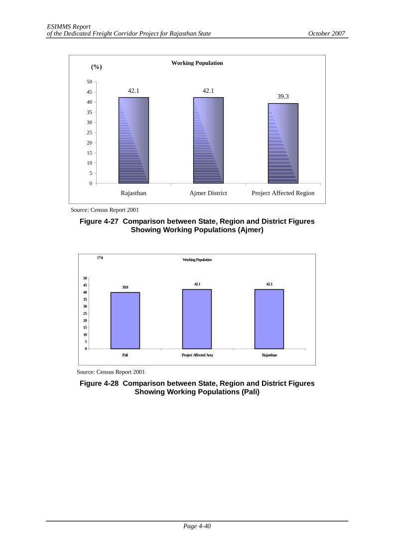
ESIMMS Report of the Dedicated Freight Corridor Project for Rajasthan State October 2007
Page 4-40
Working Population
42.1 42.139.3
0
5
10
15
20
25
30
35
40
45
50
Rajasthan Ajmer District Project Affected Region
(%)
Source: Census Report 2001
Figure 4-27 Comparison between State, Region and District Figures Showing Working Populations (Ajmer)
Working Population
39.842.1 42.1
0
5
10
15
20
25
30
35
40
45
50
Pali Project Affected Area Rajasthan
(%)
Source: Census Report 2001
Figure 4-28 Comparison between State, Region and District Figures Showing Working Populations (Pali)
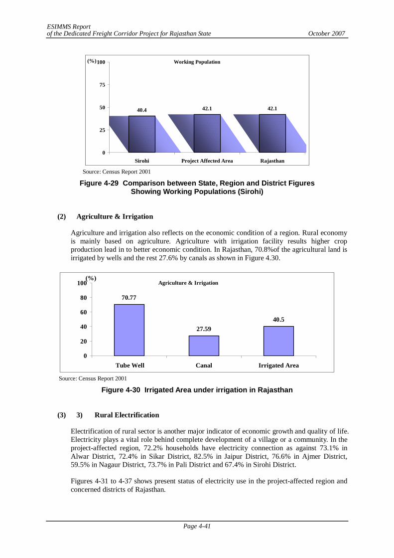
ESIMMS Report of the Dedicated Freight Corridor Project for Rajasthan State October 2007
Page 4-41
Working Population
40.4 42.1 42.1
0
25
50
75
100
Sirohi Project Affected Area Rajasthan
(%)
Source: Census Report 2001
Figure 4-29 Comparison between State, Region and District Figures Showing Working Populations (Sirohi)
(2) Agriculture & Irrigation
Agriculture and irrigation also reflects on the economic condition of a region. Rural economy is mainly based on agriculture. Agriculture with irrigation facility results higher crop production lead in to better economic condition. In Rajasthan, 70.8%of the agricultural land is irrigated by wells and the rest 27.6% by canals as shown in Figure 4.30.
Agriculture & Irrigation
70.77
27.5940.5
0
20
40
60
80
100
Tube Well Canal Irrigated Area
(%)
Source: Census Report 2001
Figure 4-30 Irrigated Area under irrigation in Rajasthan
(3) 3) Rural Electrification
Electrification of rural sector is another major indicator of economic growth and quality of life. Electricity plays a vital role behind complete development of a village or a community. In the project-affected region, 72.2% households have electricity connection as against 73.1% in Alwar District, 72.4% in Sikar District, 82.5% in Jaipur District, 76.6% in Ajmer District, 59.5% in Nagaur District, 73.7% in Pali District and 67.4% in Sirohi District.
Figures 4-31 to 4-37 shows present status of electricity use in the project-affected region and concerned districts of Rajasthan.
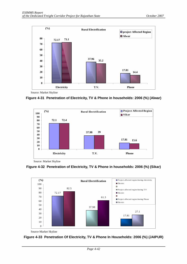
ESIMMS Report of the Dedicated Freight Corridor Project for Rajasthan State October 2007
Page 4-42
Rural Electrification
72.17
37.96
17.81
73.1
35.2
14.4
0
10
20
30
40
50
60
70
80
Electricity T.V. Phone
(%)project Affected RegionAlwar
Source: Market Skyline
Figure 4-31 Penetration of Electricity, TV & Phone in households: 2006 (%) (Alwar)
Rural Electrification
72.1
37.98
17.81
72.4
39
15.6
0102030405060708090
100
Electricity T.V. Phone
(%) Project Affected RegionSikar
Source: Market Skyline
Figure 4-32 Penetration of Electricity, TV & Phone in households: 2006 (%) (Sikar)
Rural Electrification
72.17
82.5
37.98
61.3
17.8127.1
0102030405060708090
100(%) Pro ject affceted reg io n having electricity
Dis trict
Pro ject affected reg io n having T.V
Dis trict
Pro ject affected reg io n having Pho ne
Dis trict
Source-Market Skyline
Figure 4-33 Penetration Of Electricity, TV & Phone In Households: 2006 (%) (JAIPUR)
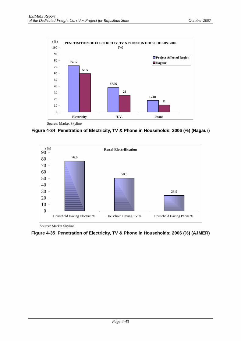
ESIMMS Report of the Dedicated Freight Corridor Project for Rajasthan State October 2007
Page 4-43
PENETRATION OF ELECTRICITY, TV & PHONE IN HOUSEHOLDS: 2006 (%)
72.17
37.96
17.81
59.5
26
11
0
10
20
30
40
50
60
70
80
90
100
Electricity T.V. Phone
(%)
Project Affected RegionNagaur
Source: Market Skyline
Figure 4-34 Penetration of Electricity, TV & Phone in Households: 2006 (%) (Nagaur)
Rural Electrification
76.6
50.6
23.9
0102030405060708090
Household Having Electrict % Household Having TV % Household Having Phone %
(%)
Source: Market Skyline
Figure 4-35 Penetration of Electricity, TV & Phone in Households: 2006 (%) (AJMER)
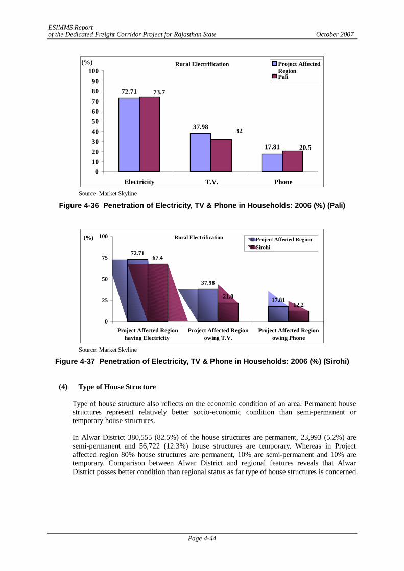
ESIMMS Report of the Dedicated Freight Corridor Project for Rajasthan State October 2007
Page 4-44
Rural Electrification
72.71
37.98
17.81
73.7
32
20.5
0102030405060708090
100
Electricity T.V. Phone
(%) Project AffectedRegionPali
Source: Market Skyline
Figure 4-36 Penetration of Electricity, TV & Phone in Households: 2006 (%) (Pali)
Rural Electrification
72.71
37.98
17.81
67.4
21.812.2
0
25
50
75
100
Project Affected Regionhaving Electricity
Project Affected Regionowing T.V.
Project Affected Regionowing Phone
(%) Project Affected RegionSirohi
Source: Market Skyline
Figure 4-37 Penetration of Electricity, TV & Phone in Households: 2006 (%) (Sirohi)
(4) Type of House Structure
Type of house structure also reflects on the economic condition of an area. Permanent house structures represent relatively better socio-economic condition than semi-permanent or temporary house structures.
In Alwar District 380,555 (82.5%) of the house structures are permanent, 23,993 (5.2%) are semi-permanent and 56,722 (12.3%) house structures are temporary. Whereas in Project affected region 80% house structures are permanent, 10% are semi-permanent and 10% are temporary. Comparison between Alwar District and regional features reveals that Alwar District posses better condition than regional status as far type of house structures is concerned.
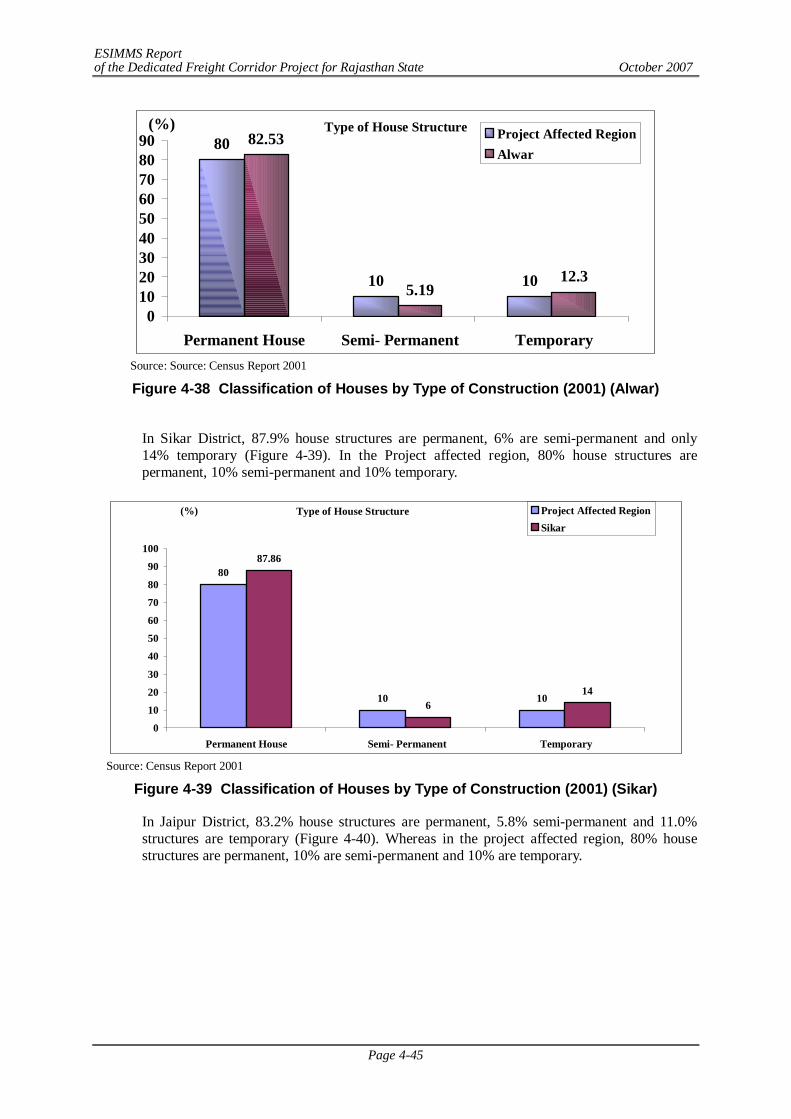
ESIMMS Report of the Dedicated Freight Corridor Project for Rajasthan State October 2007
Page 4-45
Type of House Structure80
10 10
82.53
5.1912.3
0102030405060708090
Permanent House Semi- Permanent Temporary
(%)Project Affected RegionAlwar
Source: Source: Census Report 2001
Figure 4-38 Classification of Houses by Type of Construction (2001) (Alwar)
In Sikar District, 87.9% house structures are permanent, 6% are semi-permanent and only 14% temporary (Figure 4-39). In the Project affected region, 80% house structures are permanent, 10% semi-permanent and 10% temporary.
Type of House Structure
80
10 10
87.86
614
0
10
20
30
40
50
60
70
80
90
100
Permanent House Semi- Permanent Temporary
(%) Project Affected RegionSikar
Source: Census Report 2001
Figure 4-39 Classification of Houses by Type of Construction (2001) (Sikar)
In Jaipur District, 83.2% house structures are permanent, 5.8% semi-permanent and 11.0% structures are temporary (Figure 4-40). Whereas in the project affected region, 80% house structures are permanent, 10% are semi-permanent and 10% are temporary.
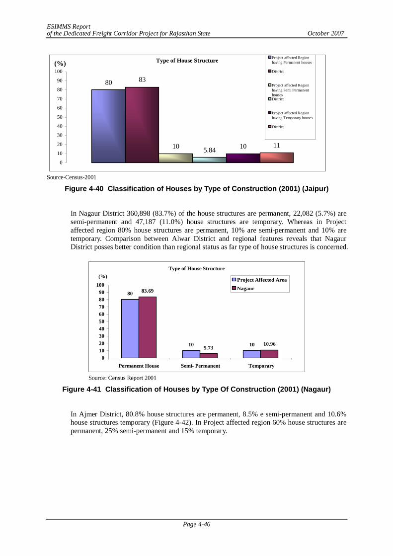
ESIMMS Report of the Dedicated Freight Corridor Project for Rajasthan State October 2007
Page 4-46
Type of House Structure
80 83
10 5.84 10 11
0
10
20
30
40
50
60
70
80
90
100(%)
Project affected Regionhaving Permanent houses
District
Project affected Regionhaving Semi PermanenthousesDistrict
Project affected Regionhaving Temporary houses
District
Source-Census-2001
Figure 4-40 Classification of Houses by Type of Construction (2001) (Jaipur)
In Nagaur District 360,898 (83.7%) of the house structures are permanent, 22,082 (5.7%) are semi-permanent and 47,187 (11.0%) house structures are temporary. Whereas in Project affected region 80% house structures are permanent, 10% are semi-permanent and 10% are temporary. Comparison between Alwar District and regional features reveals that Nagaur District posses better condition than regional status as far type of house structures is concerned.
Type of House Structure
80
10 10
83.69
5.7310.96
0102030405060708090
100
Permanent House Semi- Permanent Temporary
(%) Project Affected AreaNagaur
Source: Census Report 2001
Figure 4-41 Classification of Houses by Type Of Construction (2001) (Nagaur)
In Ajmer District, 80.8% house structures are permanent, 8.5% e semi-permanent and 10.6% house structures temporary (Figure 4-42). In Project affected region 60% house structures are permanent, 25% semi-permanent and 15% temporary.
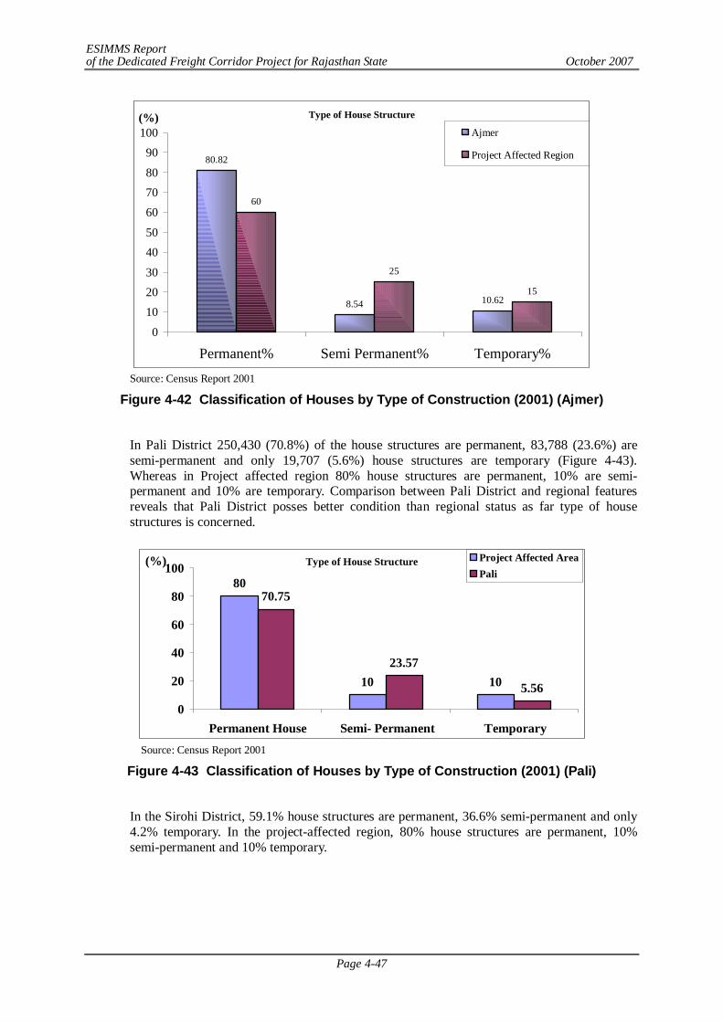
ESIMMS Report of the Dedicated Freight Corridor Project for Rajasthan State October 2007
Page 4-47
Type of House Structure
80.82
8.54 10.62
60
25
15
0
102030
4050
607080
90100
Permanent% Semi Permanent% Temporary%
(%)Ajmer
Project Affected Region
Source: Census Report 2001
Figure 4-42 Classification of Houses by Type of Construction (2001) (Ajmer)
In Pali District 250,430 (70.8%) of the house structures are permanent, 83,788 (23.6%) are semi-permanent and only 19,707 (5.6%) house structures are temporary (Figure 4-43). Whereas in Project affected region 80% house structures are permanent, 10% are semi-permanent and 10% are temporary. Comparison between Pali District and regional features reveals that Pali District posses better condition than regional status as far type of house structures is concerned.
Type of House Structure
80
10 10
70.75
23.57
5.56
0
20
40
60
80
100
Permanent House Semi- Permanent Temporary
(%) Project Affected AreaPali
Source: Census Report 2001
Figure 4-43 Classification of Houses by Type of Construction (2001) (Pali)
In the Sirohi District, 59.1% house structures are permanent, 36.6% semi-permanent and only 4.2% temporary. In the project-affected region, 80% house structures are permanent, 10% semi-permanent and 10% temporary.
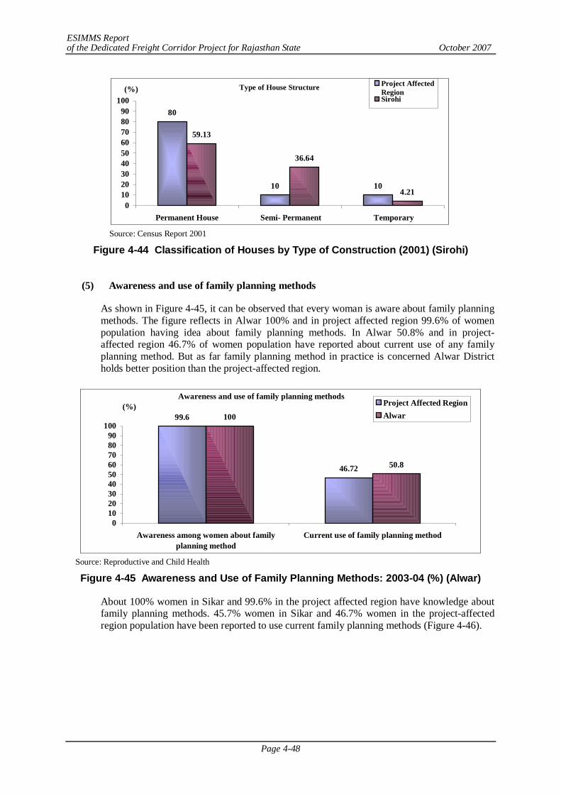
ESIMMS Report of the Dedicated Freight Corridor Project for Rajasthan State October 2007
Page 4-48
Type of House Structure
80
10 10
59.13
36.64
4.210
102030405060708090
100
Permanent House Semi- Permanent Temporary
(%)Project AffectedRegionSirohi
Source: Census Report 2001
Figure 4-44 Classification of Houses by Type of Construction (2001) (Sirohi)
(5) Awareness and use of family planning methods
As shown in Figure 4-45, it can be observed that every woman is aware about family planning methods. The figure reflects in Alwar 100% and in project affected region 99.6% of women population having idea about family planning methods. In Alwar 50.8% and in project-affected region 46.7% of women population have reported about current use of any family planning method. But as far family planning method in practice is concerned Alwar District holds better position than the project-affected region.
Awareness and use of family planning methods
99.6
46.72
100
50.8
0102030405060708090
100
Awareness among women about familyplanning method
Current use of family planning method
(%) Project Affected RegionAlwar
Source: Reproductive and Child Health
Figure 4-45 Awareness and Use of Family Planning Methods: 2003-04 (%) (Alwar)
About 100% women in Sikar and 99.6% in the project affected region have knowledge about family planning methods. 45.7% women in Sikar and 46.7% women in the project-affected region population have been reported to use current family planning methods (Figure 4-46).
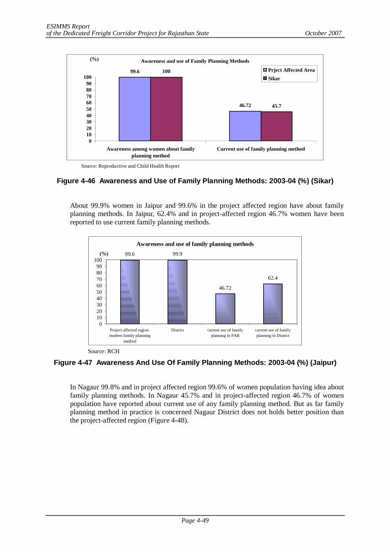
ESIMMS Report of the Dedicated Freight Corridor Project for Rajasthan State October 2007
Page 4-49
Awareness and use of Family Planning Methods
99.6
46.72
100
45.7
0102030405060708090
100
Awareness among women about familyplanning method
Current use of family planning method
(%)
Prject Affected AreaSikar
Source: Reproductive and Child Health Report
Figure 4-46 Awareness and Use of Family Planning Methods: 2003-04 (%) (Sikar)
About 99.9% women in Jaipur and 99.6% in the project affected region have about family planning methods. In Jaipur, 62.4% and in project-affected region 46.7% women have been reported to use current family planning methods.
Awareness and use of family planning methods
99.6 99.9
46.72
62.4
0102030405060708090
100
Project affected region modern family planning
method
District current use of familyplanning in PAR
current use of familyplanning in District
(%)
Source: RCH
Figure 4-47 Awareness And Use Of Family Planning Methods: 2003-04 (%) (Jaipur)
In Nagaur 99.8% and in project affected region 99.6% of women population having idea about family planning methods. In Nagaur 45.7% and in project-affected region 46.7% of women population have reported about current use of any family planning method. But as far family planning method in practice is concerned Nagaur District does not holds better position than the project-affected region (Figure 4-48).
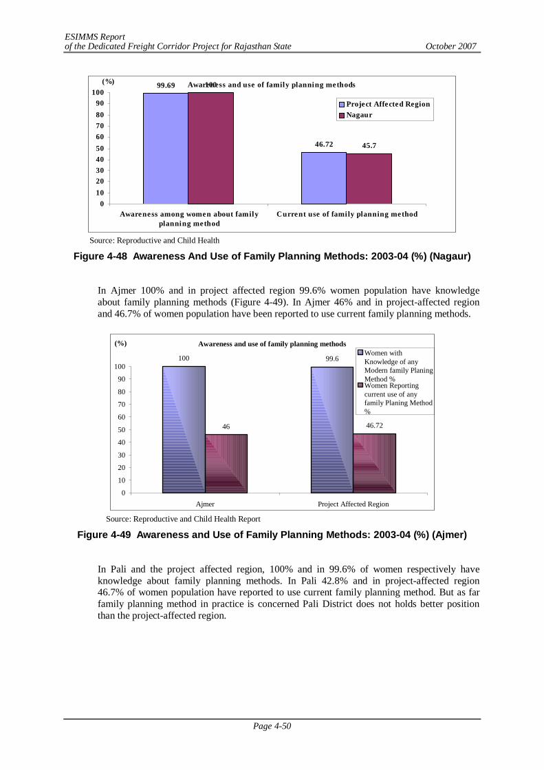
ESIMMS Report of the Dedicated Freight Corridor Project for Rajasthan State October 2007
Page 4-50
Awareness and use of family planning methods99.69
46.72
100
45.7
0102030405060708090
100
Awareness among women about familyplanning method
Current use of family planning method
(%)
Project Affected RegionNagaur
Source: Reproductive and Child Health
Figure 4-48 Awareness And Use of Family Planning Methods: 2003-04 (%) (Nagaur)
In Ajmer 100% and in project affected region 99.6% women population have knowledge about family planning methods (Figure 4-49). In Ajmer 46% and in project-affected region and 46.7% of women population have been reported to use current family planning methods.
Awareness and use of family planning methods
100 99.6
46 46.72
0
10
20
30
40
50
60
70
80
90
100
Ajmer Project Affected Region
(%)Women withKnowledge of anyModern family PlaningMethod %Women Reportingcurrent use of anyfamily Planing Method%
Source: Reproductive and Child Health Report
Figure 4-49 Awareness and Use of Family Planning Methods: 2003-04 (%) (Ajmer)
In Pali and the project affected region, 100% and in 99.6% of women respectively have knowledge about family planning methods. In Pali 42.8% and in project-affected region 46.7% of women population have reported to use current family planning method. But as far family planning method in practice is concerned Pali District does not holds better position than the project-affected region.
ESIMMS Report of the Dedicated Freight Corridor Project for Rajasthan State October 2007
Page 4-51
Awareness and use of Family Planning Methods
99.6 100
46.72 42.8
0102030405060708090
100
Awareness among women about familyplanning method
Current use of family planning method
(%)
Project Affected Area
Pali
Source: Reproductive and Child Health
Figure 4-50 Awareness and Use of Family Planning Methods: 2003-04 (%) (Pali)
About 100% and 99.6% women have knowledge about family planning methods in Sirohi District and project affected region respectively. In Sirohi District, 33.7% and in project-affected region 46.7% of women population have reported to use current family planning method.
Awareness and use of Family Planning Methods99.6
46.72
100
33.7
0102030405060708090
100
Awareness among women about familyplanning method
Current use of family planning method
(%)
Porejecr Affected RegionSirohi
Source: Reproductive and Child Health
Figure 4-51 Awareness and Use of Family Planning Methods: 2003-04 (%) (Sirohi)
(6) Awareness among women about RTI/STI & HIV/AIDS
Awareness about respiratory/stomach infection or HIV/AIDS is necessary as there is potential risk of spreading of these during construction phase.
As shown in Figure 4-52, it can be observed that in Alwar District women have low awareness for RTI/STI & HIV/AIDS but for the entire project affected region point of view these two figures are little bit better. As far RTI/STI is concerned almost 52.4% population is aware in Project affected district On the other hand, approximately 36.4% of population is aware about HIV/AIDS in Project affected region(65.6% in Per, 29.1% in Alwar District)
ESIMMS Report of the Dedicated Freight Corridor Project for Rajasthan State October 2007
Page 4-52
Awareness among women about RTI/STI & HIV/AIDS
52.44
36.35
65.64
29.09
0
20
40
60
80
100
RTI/STI HIV/AIDS
(%)Project Affected RegionAlwar
Source: Reproductive and Child Health
Figure 4-52 Awareness among Women about RTI/STI & HIV/AIDS: 2003-04 (%) (Alwar)
In the Sikar District, women have less awareness about RTI/STI & HIV/AIDS as compared to the project affected region In the Project affected district, about 72.2% population is aware of RTI/STI district and approximately 40.9% of population is aware of HIV/AIDS (Figure 4-53)
Awareness among women about RTI/STI & HIV/AIDS
65.64
36.35
72.15
40.89
010
2030405060708090
100
RTI/STI HIV/AIDS
(%)Project Affected AreaSikar
Source: Reproductive and Child Health Report
Figure 4-53 Awareness among Women about RTI/STI & HIV/AIDS: 2003-04 (%) (Sikar)
In Jaipur District women have higher awareness for RTI/STI & HIV/AIDS as compared to project affected region. In the project affected district, 92.8% population is aware of RTI/STI and 48.5% about HIV/AIDS.
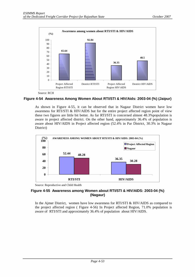
ESIMMS Report of the Dedicated Freight Corridor Project for Rajasthan State October 2007
Page 4-53
Awareness among women about RTI/STI & HIV/AIDS
65.64
92.84
36.35
48.5
0102030405060708090
100
Project AffectedRegion RTI\STI
Destrict RTI\STI Project AffectedRegion HIV\AIDS
Destrict HIV\AIDS
(%)
Source: RCH
Figure 4-54 Awareness Among Women About RTI/STI & HIV/Aids: 2003-04 (%) (Jaipur)
As shown in Figure 4-55, it can be observed that in Nagaur District women have low awareness for RTI/STI & HIV/AIDS but for the entire project affected region point of view these two figures are little bit better. As far RTI/STI is concerned almost 48.3%population is aware in project affected district. On the other hand, approximately 36.4% of population is aware about HIV/AIDS in Project affected region (52.4% in Par District, 30.3% in Nagaur District)
AWARENESS AMONG WOMEN ABOUT RTI/STI & HIV/AIDS: 2003-04 (%)
52.44
36.3548.28
30.28
0
20
40
60
80
100
RTI/STI HIV/AIDS
(%)
Project Affected RegionNagaur
Source: Reproductive and Child Health
Figure 4-55 Awareness among Women about RTI/STI & HIV/AIDS: 2003-04 (%) (Nagaur)
In the Ajmer District, women have low awareness for RTI/STI & HIV/AIDS as compared to the project affected region ( Figure 4-56) In Project affected Region, 71.0% population is aware of RTI/STI and approximately 36.4% of population about HIV/AIDS.
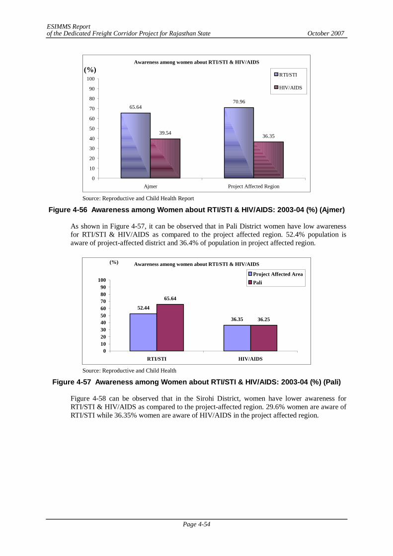
ESIMMS Report of the Dedicated Freight Corridor Project for Rajasthan State October 2007
Page 4-54
Awareness among women about RTI/STI & HIV/AIDS
65.6470.96
39.54 36.35
0
10
20
30
40
50
60
70
80
90
100
Ajmer Project Affected Region
(%)RTI/STI
HIV/AIDS
Source: Reproductive and Child Health Report
Figure 4-56 Awareness among Women about RTI/STI & HIV/AIDS: 2003-04 (%) (Ajmer)
As shown in Figure 4-57, it can be observed that in Pali District women have low awareness for RTI/STI & HIV/AIDS as compared to the project affected region. 52.4% population is aware of project-affected district and 36.4% of population in project affected region.
Awareness among women about RTI/STI & HIV/AIDS
52.44
36.35
65.64
36.25
0102030405060708090
100
RTI/STI HIV/AIDS
(%)
Project Affected AreaPali
Source: Reproductive and Child Health
Figure 4-57 Awareness among Women about RTI/STI & HIV/AIDS: 2003-04 (%) (Pali)
Figure 4-58 can be observed that in the Sirohi District, women have lower awareness for RTI/STI & HIV/AIDS as compared to the project-affected region. 29.6% women are aware of RTI/STI while 36.35% women are aware of HIV/AIDS in the project affected region.
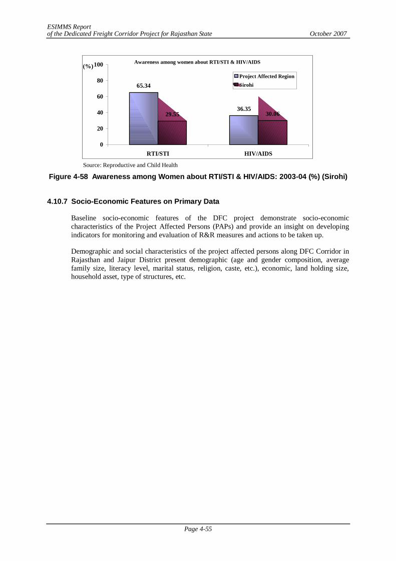
ESIMMS Report of the Dedicated Freight Corridor Project for Rajasthan State October 2007
Page 4-55
Awareness among women about RTI/STI & HIV/AIDS
65.34
36.3529.55 30.06
0
20
40
60
80
100
RTI/STI HIV/AIDS
(%)Project Affected RegionSirohi
Source: Reproductive and Child Health
Figure 4-58 Awareness among Women about RTI/STI & HIV/AIDS: 2003-04 (%) (Sirohi)
4.10.7 Socio-Economic Features on Primary Data
Baseline socio-economic features of the DFC project demonstrate socio-economic characteristics of the Project Affected Persons (PAPs) and provide an insight on developing indicators for monitoring and evaluation of R&R measures and actions to be taken up.
Demographic and social characteristics of the project affected persons along DFC Corridor in Rajasthan and Jaipur District present demographic (age and gender composition, average family size, literacy level, marital status, religion, caste, etc.), economic, land holding size, household asset, type of structures, etc.
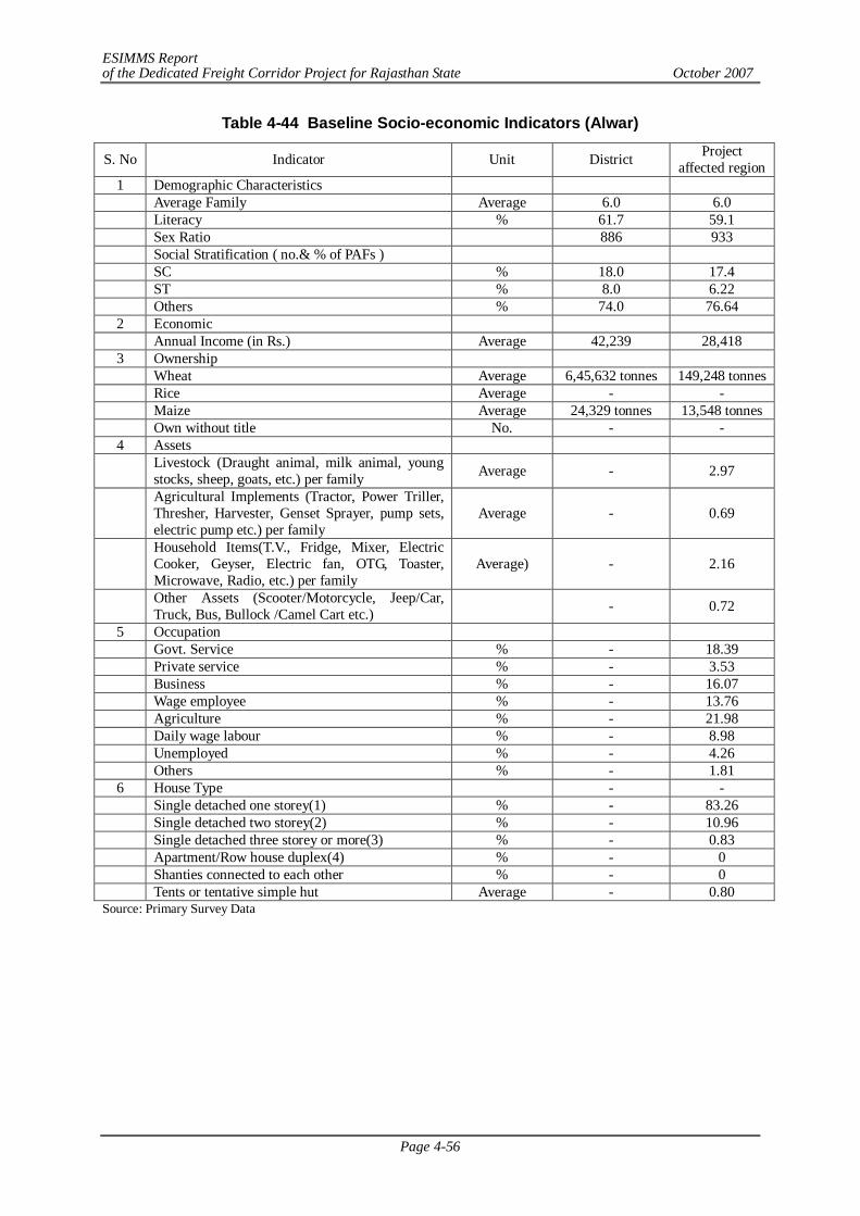
ESIMMS Report of the Dedicated Freight Corridor Project for Rajasthan State October 2007
Page 4-56
Table 4-44 Baseline Socio-economic Indicators (Alwar)
Source: Primary Survey Data
S. No Indicator Unit District Project affected region
1 Demographic Characteristics Average Family Average 6.0 6.0 Literacy % 61.7 59.1 Sex Ratio 886 933 Social Stratification ( no.& % of PAFs ) SC % 18.0 17.4 ST % 8.0 6.22 Others % 74.0 76.64 2 Economic Annual Income (in Rs.) Average 42,239 28,418 3 Ownership Wheat Average 6,45,632 tonnes 149,248 tonnes Rice Average - - Maize Average 24,329 tonnes 13,548 tonnes Own without title No. - - 4 Assets
Livestock (Draught animal, milk animal, young stocks, sheep, goats, etc.) per family Average - 2.97
Agricultural Implements (Tractor, Power Triller, Thresher, Harvester, Genset Sprayer, pump sets, electric pump etc.) per family
Average - 0.69
Household Items(T.V., Fridge, Mixer, Electric Cooker, Geyser, Electric fan, OTG, Toaster, Microwave, Radio, etc.) per family
Average) - 2.16
Other Assets (Scooter/Motorcycle, Jeep/Car, Truck, Bus, Bullock /Camel Cart etc.) - 0.72
5 Occupation Govt. Service % - 18.39 Private service % - 3.53 Business % - 16.07 Wage employee % - 13.76 Agriculture % - 21.98 Daily wage labour % - 8.98 Unemployed % - 4.26 Others % - 1.81 6 House Type - - Single detached one storey(1) % - 83.26 Single detached two storey(2) % - 10.96 Single detached three storey or more(3) % - 0.83 Apartment/Row house duplex(4) % - 0 Shanties connected to each other % - 0 Tents or tentative simple hut Average - 0.80
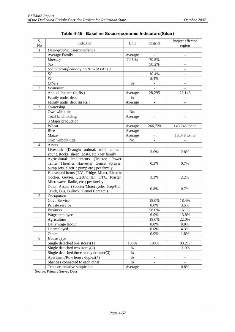
ESIMMS Report of the Dedicated Freight Corridor Project for Rajasthan State October 2007
Page 4-57
Table 4-45 Baseline Socio-economic Indicators(Sikar) S. No Indicator Unit District Project affected
region 1 Demographic Characteristics Average Family Average - - Literacy 70.5 % 70.5% - Sex 50.2% - Social Stratification ( no.& % of PAFs ) - - SC 10.4% - ST 5.4% - Others % - -
2 Economic - - Annual Income (in Rs.) Average 28,295 28,148 Family under debt % - - Family under debt (in Rs.) Average - -
3 Ownership Own with title No. - - Total land holding Average - - 3 Major production Wheat Average 266,720 149,248 tonne Rice Average - - Maize Average - 13,548 tonne Own without title No. - -
4 Assets
Livestock (Draught animal, milk animal, young stocks, sheep, goats, etc.) per family 3.6% 2.8%
Agricultural Implements (Tractor, Power Triller, Thresher, Harvester, Genset Sprayer, pump sets, electric pump etc.) per family
0.5% 0.7%
Household Items (T.V., Fridge, Mixer, Electric Cooker, Geyser, Electric fan, OTG, Toaster, Microwave, Radio, etc.) per family
3.3% 2.2%
Other Assets (Scooter/Motorcycle, Jeep/Car, Truck, Bus, Bullock /Camel Cart etc.) 0.8% 0.7%
5 Occupation Govt. Service 18.0% 18.4% Private service 0.0% 3.5% Business 58.0% 16.1% Wage employee 6.0% 13.8% Agriculture 18.0% 22.0% Daily wage labour 0.0% 9.0% Unemployed 0.0% 4.3% Others 0.0% 1.8%
6 House Type Single detached one storey(1) 100% 100% 83.2% Single detached two storey(2) % - 11.0% Single detached three storey or more(3) % - - Apartment/Row house duplex(4) % - - Shanties connected to each other % - - Tents or tentative simple hut Average - 0.8%
Source: Primary Survey Data
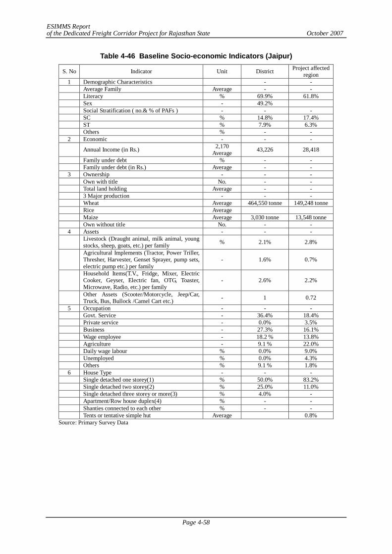
ESIMMS Report of the Dedicated Freight Corridor Project for Rajasthan State October 2007
Page 4-58
Table 4-46 Baseline Socio-economic Indicators (Jaipur)
S. No Indicator Unit District Project affected region
1 Demographic Characteristics - - Average Family Average - - Literacy % 69.9% 61.8% Sex - 49.2% Social Stratification ( no.& % of PAFs ) - - - SC % 14.8% 17.4% ST % 7.9% 6.3% Others % - -
2 Economic - - -
Annual Income (in Rs.) 2,170 Average 43,226 28,418
Family under debt % - - Family under debt (in Rs.) Average - -
3 Ownership - - - Own with title No. - - Total land holding Average - - 3 Major production - - - Wheat Average 464,550 tonne 149,248 tonne Rice Average Maize Average 3,030 tonne 13,548 tonne Own without title No. - -
4 Assets - - -
Livestock (Draught animal, milk animal, young stocks, sheep, goats, etc.) per family % 2.1% 2.8%
Agricultural Implements (Tractor, Power Triller, Thresher, Harvester, Genset Sprayer, pump sets, electric pump etc.) per family
- 1.6% 0.7%
Household Items(T.V., Fridge, Mixer, Electric Cooker, Geyser, Electric fan, OTG, Toaster, Microwave, Radio, etc.) per family
- 2.6% 2.2%
Other Assets (Scooter/Motorcycle, Jeep/Car, Truck, Bus, Bullock /Camel Cart etc.) - 1 0.72
5 Occupation - - - Govt. Service - 36.4% 18.4% Private service - 0.0% 3.5% Business - 27.3% 16.1% Wage employee - 18.2 % 13.8% Agriculture - 9.1 % 22.0% Daily wage labour % 0.0% 9.0% Unemployed % 0.0% 4.3% Others % 9.1 % 1.8%
6 House Type - - - Single detached one storey(1) % 50.0% 83.2% Single detached two storey(2) % 25.0% 11.0% Single detached three storey or more(3) % 4.0% - Apartment/Row house duplex(4) % - - Shanties connected to each other % - - Tents or tentative simple hut Average 0.8%
Source: Primary Survey Data
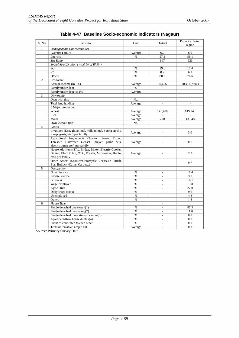
ESIMMS Report of the Dedicated Freight Corridor Project for Rajasthan State October 2007
Page 4-59
Table 4-47 Baseline Socio-economic Indicators (Nagaur)
S. No Indicator Unit District Project affected region
1 Demographic Characteristics Average Family Average 6.0 6.0 Literacy % 57.3 59.1 Sex Ratio 947 933 Social Stratification ( no.& % of PAFs ) SC % 19.6 17.4 ST % 0.2 6.2 Others % 80.2 76.6
2 Economic Annual Income (in Rs.) Average 30,466 28,418(rural) Family under debt % - - Family under debt (in Rs.) Average - -
3 Ownership Own with title No. - - Total land holding Average - - 3 Major production Wheat Average 141,400 149,248 Rice Average - - Maize Average 270 13,548 Own without title No. - -
4 Assets
Livestock (Draught animal, milk animal, young stocks, sheep, goats, etc.) per family Average - 3.0
Agricultural Implements (Tractor, Power Triller, Thresher, Harvester, Genset Sprayer, pump sets, electric pump etc.) per family
Average - 0.7
Household Items(T.V., Fridge, Mixer, Electric Cooker, Geyser, Electric fan, OTG, Toaster, Microwave, Radio, etc.) per family
Average - 2.2
Other Assets (Scooter/Motorcycle, Jeep/Car, Truck, Bus, Bullock /Camel Cart etc.) - 0.7
5 Occupation Govt. Service % - 18.4 Private service % - 3.5 Business % - 16.1 Wage employee % - 13.8 Agriculture % - 22.0 Daily wage labour % - 9.0 Unemployed % - 4.3 Others % - 1.8
6 House Type - Single detached one storey(1) % - 83.3 Single detached two storey(2) % - 11.0 Single detached three storey or more(3) % - 0.8 Apartment/Row house duplex(4) % - 0.0 Shanties connected to each other % - 0.0 Tents or tentative simple hut Average - 0.8
Source: Primary Survey Data
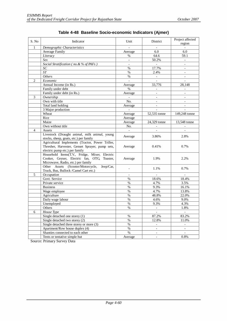
ESIMMS Report of the Dedicated Freight Corridor Project for Rajasthan State October 2007
Page 4-60
Table 4-48 Baseline Socio-economic Indicators (Ajmer)
S. No Indicator Unit District Project affected region
1 Demographic Characteristics - - - Average Family Average 6.0 6.0 Literacy % 64.6 59.1 Sex - 50.2% - Social Stratification ( no.& % of PAFs ) - - - SC % 17.7% - ST % 2.4% - Others % - -
2 Economic - - - Annual Income (in Rs.) Average 33,776 28,148 Family under debt % - - Family under debt (in Rs.) Average - -
3 Ownership - - - Own with title No. - - Total land holding Average - - 3 Major production - - - Wheat Average 52,535 tonne 149,248 tonne Rice Average Maize Average 24,329 tonne 13,548 tonne Own without title No. - -
4 Assets - - -
Livestock (Draught animal, milk animal, young stocks, sheep, goats, etc.) per family Average 3.86% 2.8%
Agricultural Implements (Tractor, Power Triller, Thresher, Harvester, Genset Sprayer, pump sets, electric pump etc.) per family
Average 0.41% 0.7%
Household Items(T.V., Fridge, Mixer, Electric Cooker, Geyser, Electric fan, OTG, Toaster, Microwave, Radio, etc.) per family
Average 1.9% 2.2%
Other Assets (Scooter/Motorcycle, Jeep/Car, Truck, Bus, Bullock /Camel Cart etc.) - 1.1% 0.7%
5 Occupation - - - Govt. Service % 18.6% 18.4% Private service % 4.7% 3.5% Business % 9.3% 16.1% Wage employee % 4.7% 13.8% Agriculture % 48.8% 22.0% Daily wage labour % 4.6% 9.0% Unemployed % 9.3% 4.3% Others % - 1.8%
6 House Type - - Single detached one storey (1) % 87.2% 83.2% Single detached two storey (2) % 12.8% 11.0% Single detached three storey or more (3) % - - Apartment/Row house duplex (4) % - - Shanties connected to each other % - - Tents or tentative simple hut Average - 0.8%
Source: Primary Survey Data
ESIMMS Report of the Dedicated Freight Corridor Project for Rajasthan State October 2007
Page 4-61
Table 4-49 Baseline Socio-economic Indicators (Pali)
S. No Indicator Unit District Project affected region
1 Demographic Characteristics Average Family Average Literacy % 54.4% 61.8% Sex 50.0% - Social Stratification ( no.& % of PAFs ) SC % 17.8% 17.4% ST % 5.8% 6.3% Others % - -
2 Economic Annual Income (in Rs.) Average 32,680 28,148 Family under debt % - - Family under debt (in Rs.) Average - -
3 Ownership Own with title No. - - Total land holding Average - - 3 Major production Wheat Average 43,650 tonne 149,248 tonne Rice Average - - Maize Average 22,350 tonne 13,548 tonnes Own without title No.
4 Assets
Livestock (Draught animal, milk animal, young stocks, sheep, goats, etc.) per family Average 4% 2.79%
Agricultural Implements (Tractor, Power Triller, Thresher, Harvester, Genset Sprayer, pump sets, electric pump etc.) per family
Average 0% 0.69%
Household Items(T.V., Fridge, Mixer, Electric Cooker, Geyser, Electric fan, OTG, Toaster, Microwave, Radio, etc.) per family
Average) 1.1% 2.16%
Other Assets (Scooter/Motorcycle, Jeep/Car, Truck, Bus, Bullock /Camel Cart etc.) 0.44% 0.72%
5 Occupation Govt. Service % 12% 18.39% Private service % 0% 3.53% Business % 24% 16.07% Wage employee % 4% 13.76% Agriculture % 4% 21.98% Daily wage labour % 40% 8.98% Unemployed % 12% 4.26% Others % - 1.81%
6 House Type Single detached one storey(1) % 88% 83.23% Single detached two storey(2) % 8% 10.96% Single detached three storey or more(3) % - - Apartment/Row house duplex(4) % - - Shanties connected to each other % - - Tents or tentative simple hut Average 4% 0.8%
Source: Primary Survey Data
ESIMMS Report of the Dedicated Freight Corridor Project for Rajasthan State October 2007
Page 4-62
Table 4-50 Baseline Socio-economic Indicators (Sirohi)
S. No Indicator Unit District Project affected region
1 Demographic Characteristics Average Family Average - - Literacy % 53.9% 61.755 Sex 50% - Social Stratification ( no.& % of PAFs ) SC % 19.14% 17.4% ST % 24.76% 6.26% Others % - -
2 Economic Annual Income (in Rs.) Average 23,738 28,418 Family under debt % - - Family under debt (in Rs.) Average - -
3 Ownership Own with title No. - - Total land holding Average - - 3 Major production Wheat Average 30,250 tonne 149,248 tonne Rice Average - - Maize Average 12,690 tonne 13548 tonne Own without title No. - -
4 Assets
Livestock (Draught animal, milk animal, young stocks, sheep, goats, etc.) per family Average 0.4% 2.8%
Agricultural Implements (Tractor, Power Triller, Thresher, Harvester, Genset Sprayer, pump sets, electric pump etc.) per family
Average 1.0% 0.7%
Household Items(T.V., Fridge, Mixer, Electric Cooker, Geyser, Electric fan, OTG, Toaster, Microwave, Radio, etc.) per family
Average) 2.0% 2.2%
Other Assets (Scooter/Motorcycle, Jeep/Car, Truck, Bus, Bullock /Camel Cart etc.) 0.3% 0.7%
5 Occupation Govt. Service % 7% 18.4% Private service % 13% 3.5% Business % 14% 16.1% Wage employee % 36% 13.8% Agriculture % 30% 22.0% Daily wage labour % - 9.0% Unemployed % - 4.3% Others % - 1.8%
6 House Type Single detached one storey(1) % 91% 83.2% Single detached two storey(2) % 9% 11.0% Single detached three storey or more(3) % - - Apartment/Row house duplex(4) % - - Shanties connected to each other % - - Tents or tentative simple hut Average - 0.8%
Source: Primary Survey Data
ESIMMS Report of the Dedicated Freight Corridor Project for Rajasthan State October 2007
Page 5-1
CHAPTER 5 POTENTIAL ENVIRONMENTAL IMPACT EVALUATION AND MITIGATION MEASURES
5.1 INTRODUCTION
Potential environmental impact evaluation involves prediction of potential impacts by the development of the project on the surrounding area. Based on baseline environmental status described in part II and proposed project activities, potential impacts have been assessed, predicted and appropriate mitigation measures are suggested to avoid/reduce/compensate the potential adverse impacts and enhance the positive impacts. The impacts due to development of the proposed Dedicated Freight Corridor are assessed for planning, construction and implementation phases.
The following activities are likely to cause impact:
- Construction of Embankment - Vegetation removal - Settlements removal - Utilities shifting - Transportation of construction material - Establishment of construction/ labour camp - Borrow areas
5.2 IMPACT EVALUATION METHODOLOGY
The project is likely to have some potential impacts during planning, construction and operation phases. Appropriate mitigation measures are proposed to mitigate/reduce/eliminate the adverse impacts. Impact matrix is prepared depicting nature of impact by various activities on the environmental parameters.
Within the framework of DFC Project study, a simple method determining potential existence of impact has been employed. The magnitude and importance of the impacts caused by the project is presented. Matrix system is considered as a tool for organizing and presenting information on the environmental impacts caused to the natural and social environment by the DFC Project. Thus, the following parameter and scales are used for producing matrix impacts (Table 5-1).
For the assessment of impacts, the following criteria are used.
Table 5-1 Parameter and Scale of Impact Matrix
Parameter Scale Remarks No impact E Positive : + Negative : - Negligible impact D Positive : + Negative : - Insignificant impact C Positive : + Negative : - Relatively significant impact B Positive : + Negative : -
Significance
Significant impact A Positive : + Negative : - 5.3 EXPECTED IMPACTS AND MITIGATION MEASURES ON NATURAL
ENVIRONMENT
Impacts on natural resources are provided with appropriate mitigation measures are described below.
ESIMMS Report of the Dedicated Freight Corridor Project for Rajasthan State October 2007
Page 5-2
5.3.1 Topography and Geology
(1) Planning Phase
During planning phase, no impact is envisaged on the topography and geology of the project area.
(2) Construction Phase
- During construction phase change in topography is envisaged due to clearing of land, felling trees, cutting and filling of land and construction of structures.
- Construction of railway embankment is also likely to change the view of the landscape.
- Filling and cutting of land will be required in detour stretch where it traverses through undulating topography.
- However, changes will be limited within ROW of the track hence overall impact will be insignificant.
- No impact is envisaged on geology due to the project.
Mitigation measures
- Plantation program may be carried out to improve the aesthetic look of the construction area.
(3) Post-Construction Phase
- No impact is envisaged on topography and geology in post-construction phase.
5.3.2 Soil
(1) Planning Phase
- No impact is envisaged on soil erosion during planning phase. Hence no mitigation measures are required.
(2) Construction Phase
- Clearing of land, cutting of trees, excavation of borrow areas are likely to trigger soil erosion. Movement of vehicle/machinery/equipments and working force is also likely to cause soil erosion.
- The detour section is likely to traverse through agricultural and forest land which will require clearing of the land.
- Soil of the agricultural area is fertile and consists of alluvial deposits; loss of fertile soil is likely to occur.
- Borrow areas will be required for the project. Most portion of the DFC is embankment and cutting. The volume of earthwork estimated for the DFC corridor for embankment is 26,363,000 m3, for blanket material 8,208,000 m3, for embankment & blanket 34,571,000 m3 and for cutting 773,000 m3. The borrow areas are likely to cause soil erosion and affect agricultural areas.
- Pits may be formed due borrowing which may cause harm to local residents in the vicinity.
ESIMMS Report of the Dedicated Freight Corridor Project for Rajasthan State October 2007
Page 5-3
Mitigation Measures
- Suitable protection measures consisting of bio-engineering techniques such as plantation of grasses and shrubs and check dams, may be provided to control erosion.
- Borrow areas may be finalized in concern with ecological sensitivity of the area. Agriculture land may not be used as borrow areas. Priority may be given to degraded area for excavation of borrows material. Rehabilitation of borrow area may be taken under the project.
- Construction work may be avoided during rainy season to evade erosion and spreading of loose material.
- Top soil removed from agricultural land may be stored separately in bunded areas and utilized during plantation or refilling of excavated area.
- Selection of borrow areas may be done considering the waste land available in the district. Agricultural areas may be not used as borrow areas.
- A separate borrow area management plan may be made providing location, ownership details, timing of borrowing and rehabilitation measures.
(3) Post- Construction Phase
- No impact is envisaged on soil during post implementation phase.
5.3.3 Ground water
(1) Planning Phase
- No impact is envisaged on ground water in planning phase.
(2) Construction Phase
- During construction phase pollution of groundwater is likely to occur due to seepage and runoff from construction site. However the impact will be negligible.
- Borrow areas may act as recharge ponds enhancing the ground water level
Mitigation Measures
- Formation of stagnant pools may not be allowed near construction sites especially near workshop from where oil and other pollutants may seep into water.
(3) Post- Construction Phase
- No impact is envisaged on soil during post implementation phase.
5.3.4 Hydrology (Rivers and Lakes)
(1) Planning Phase
- No impact is envisaged on hydrological cycle during planning phase
(2) Construction Phase
- As per the baseline status and project site condition as described in earlier section, project site and its vicinity is highly vulnerable to drainage and flood. The impact due to drainage and flood is critical both during construction and operation. The construction of DFC will have long term and regional impact on drainage and flood.
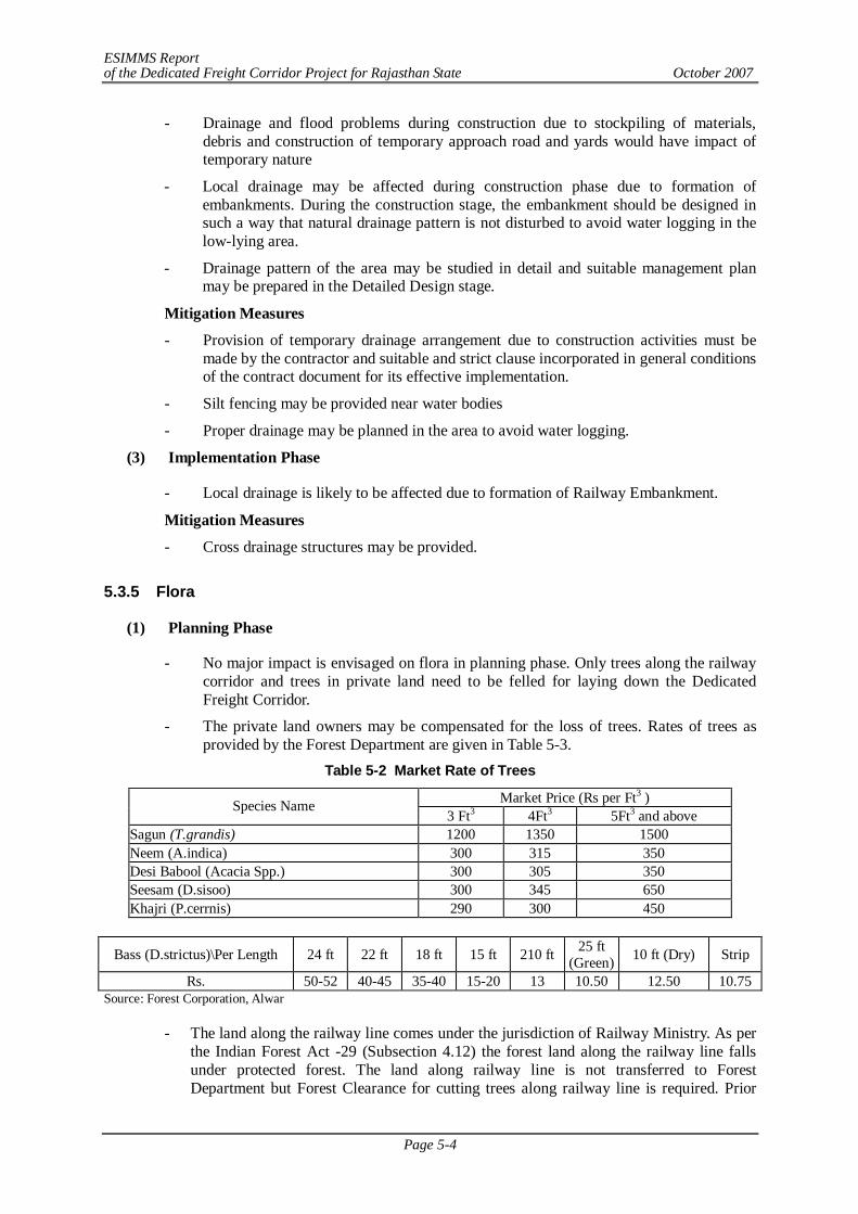
ESIMMS Report of the Dedicated Freight Corridor Project for Rajasthan State October 2007
Page 5-4
- Drainage and flood problems during construction due to stockpiling of materials, debris and construction of temporary approach road and yards would have impact of temporary nature
- Local drainage may be affected during construction phase due to formation of embankments. During the construction stage, the embankment should be designed in such a way that natural drainage pattern is not disturbed to avoid water logging in the low-lying area.
- Drainage pattern of the area may be studied in detail and suitable management plan may be prepared in the Detailed Design stage.
Mitigation Measures
- Provision of temporary drainage arrangement due to construction activities must be made by the contractor and suitable and strict clause incorporated in general conditions of the contract document for its effective implementation.
- Silt fencing may be provided near water bodies
- Proper drainage may be planned in the area to avoid water logging.
(3) Implementation Phase
- Local drainage is likely to be affected due to formation of Railway Embankment.
Mitigation Measures
- Cross drainage structures may be provided.
5.3.5 Flora
(1) Planning Phase
- No major impact is envisaged on flora in planning phase. Only trees along the railway corridor and trees in private land need to be felled for laying down the Dedicated Freight Corridor.
- The private land owners may be compensated for the loss of trees. Rates of trees as provided by the Forest Department are given in Table 5-3.
Table 5-2 Market Rate of Trees
Market Price (Rs per Ft3 ) Species Name 3 Ft3 4Ft3 5Ft3 and above
Sagun (T.grandis) 1200 1350 1500 Neem (A.indica) 300 315 350 Desi Babool (Acacia Spp.) 300 305 350 Seesam (D.sisoo) 300 345 650 Khajri (P.cerrnis) 290 300 450
Bass (D.strictus)\Per Length 24 ft 22 ft 18 ft 15 ft 210 ft 25 ft (Green) 10 ft (Dry) Strip
Rs. 50-52 40-45 35-40 15-20 13 10.50 12.50 10.75 Source: Forest Corporation, Alwar
- The land along the railway line comes under the jurisdiction of Railway Ministry. As per the Indian Forest Act -29 (Subsection 4.12) the forest land along the railway line falls under protected forest. The land along railway line is not transferred to Forest Department but Forest Clearance for cutting trees along railway line is required. Prior
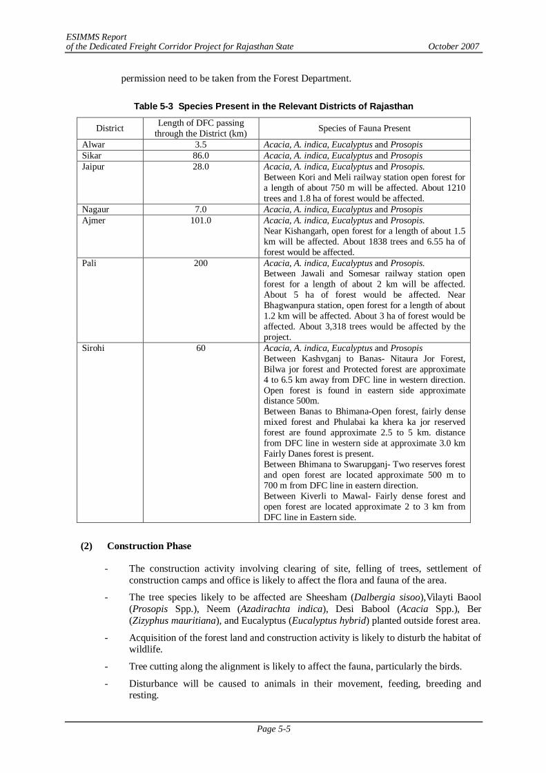
ESIMMS Report of the Dedicated Freight Corridor Project for Rajasthan State October 2007
Page 5-5
permission need to be taken from the Forest Department.
Table 5-3 Species Present in the Relevant Districts of Rajasthan
District Length of DFC passing through the District (km) Species of Fauna Present
Alwar 3.5 Acacia, A. indica, Eucalyptus and Prosopis Sikar 86.0 Acacia, A. indica, Eucalyptus and Prosopis Jaipur 28.0 Acacia, A. indica, Eucalyptus and Prosopis.
Between Kori and Meli railway station open forest for a length of about 750 m will be affected. About 1210 trees and 1.8 ha of forest would be affected.
Nagaur 7.0 Acacia, A. indica, Eucalyptus and Prosopis Ajmer 101.0 Acacia, A. indica, Eucalyptus and Prosopis.
Near Kishangarh, open forest for a length of about 1.5 km will be affected. About 1838 trees and 6.55 ha of forest would be affected.
Pali 200 Acacia, A. indica, Eucalyptus and Prosopis. Between Jawali and Somesar railway station open forest for a length of about 2 km will be affected. About 5 ha of forest would be affected. Near Bhagwanpura station, open forest for a length of about 1.2 km will be affected. About 3 ha of forest would be affected. About 3,318 trees would be affected by the project.
Sirohi 60 Acacia, A. indica, Eucalyptus and Prosopis Between Kashvganj to Banas- Nitaura Jor Forest, Bilwa jor forest and Protected forest are approximate 4 to 6.5 km away from DFC line in western direction. Open forest is found in eastern side approximate distance 500m. Between Banas to Bhimana-Open forest, fairly dense mixed forest and Phulabai ka khera ka jor reserved forest are found approximate 2.5 to 5 km. distance from DFC line in western side at approximate 3.0 km Fairly Danes forest is present. Between Bhimana to Swarupganj- Two reserves forest and open forest are located approximate 500 m to 700 m from DFC line in eastern direction. Between Kiverli to Mawal- Fairly dense forest and open forest are located approximate 2 to 3 km from DFC line in Eastern side.
(2) Construction Phase
- The construction activity involving clearing of site, felling of trees, settlement of construction camps and office is likely to affect the flora and fauna of the area.
- The tree species likely to be affected are Sheesham (Dalbergia sisoo),Vilayti Baool (Prosopis Spp.), Neem (Azadirachta indica), Desi Babool (Acacia Spp.), Ber (Zizyphus mauritiana), and Eucalyptus (Eucalyptus hybrid) planted outside forest area.
- Acquisition of the forest land and construction activity is likely to disturb the habitat of wildlife.
- Tree cutting along the alignment is likely to affect the fauna, particularly the birds.
- Disturbance will be caused to animals in their movement, feeding, breeding and resting.
ESIMMS Report of the Dedicated Freight Corridor Project for Rajasthan State October 2007
Page 5-6
- The animal species likely to be affected do not fall in rare, threatened and endangered category and are common in distribution.
Mitigation Measures
- Felling of trees must be undertaken only after obtaining clearance from the Forest Dept.
- Trees outside the ROW should not be felled.
- Compensation must be provided before initiating construction activity.
- The loss of fruit bearing trees may be compensated including 5 years fruit yield.
- Labour camps and office site may be located outside and away from the forest area.
(3) Post-Construction Phase
- No impact is envisaged on flora during post construction phase, however, development of green belt is suggested near stations and maintenance of plantation may be undertaken by Railway Dept. The plantation carried along alignment as compensatory afforestation is likely to enhance the ecological condition of the area.
5.3.6 Fauna
(1) Planning Phase
- No impact is envisaged on fauna in planning phase
(2) Construction Phase
- The habitat of wildlife is likely to be disturbed during construction phase.
- Nilgai- Boselaphus tragocamelus is the most common wildlife found in the area. The construction activity is likely to affect the movement of the animal
- Most of the fauna such as Vulpus bengalensis (Fox), Canis aureus (Jackal),etc. are restricted towards the ravenous land. However, the construction activity is likely to affect the resting, breeding and feeding activities of the animals.
- Felling of trees is likely to affect the avifauna.
- During construction near water bodies, the aquatic life is likely to be affected.
- The impact on the Habitat is likely to be permanent, as the DFC will fragment the area, restricting the movement of animals on either side.
Mitigation Measures
- Crossing passages must be made for wildlife by provision of under pass followed with some plantation so that it resembles with the habitat of wildlife and facilitates crossing of wildlife.
- Water Bodies may be developed inside forest areas for the birds.
- Borrow areas can also be developed as ponds with grasses and shrubs planted around it.
- Silt fencing may be used near water bodies to avoid runoff into the water bodies
- Construction activity may be avoided during night hours in forest area.
- Poaching must be strictly banned in the forest area. It may be ensured by the Contractor that no hunting or fishing is practiced at the site by the workers and site personnel are aware of the location, value and sensitivity of the wildlife resources
ESIMMS Report of the Dedicated Freight Corridor Project for Rajasthan State October 2007
Page 5-7
- Awareness program on Environment and Wildlife Conservation may be provided to the work force. Forest Act and Wildlife Act may be strictly adhered to.
(3) Post-Construction Phase
- The movement of Freight Train is likely to restrict the movement of wildlife on either side of the track
- Possibilities of collision of wildlife with Freight train.
- Disturbance to wildlife due to the noise produced during the passage of train.
Mitigation Measures - Animal underpasses made for wildlife near forest areas must be camouflaged to match
the surrounding environment with plantation of shrubs and trees.
- Fencing if feasible, may be provided along DFC in wild life habitation concentration areas to avoid collision.
5.3.7 Biodiversity
(1) Planning Phase
- No impact is envisaged on biodiversity during planning phase.
(2) Construction Phase
- The DFC is not likely to affect the biodiversity, as there are no endangered and threatened species of flora and fauna.
- The disturbance to flora (felling trees and acquiring agricultural land) and fauna is not likely to change the biodiversity of the area. The alignment is not traversing through National Park, Biosphere or Sanctuary.
Mitigation Measures
- Plantation of forest and fruit trees species may be undertaken to maintain the diversity. Forest, Horticulture and Agricultural Dept may be consulted.
- The project must support habitat development program as a part of conservation of biodiversity.
(3) Post-Construction Phase
- No impact is envisaged on biodiversity during post- construction phase.
5.3.8 Protected Areas/Sanctuaries
The DFC alignment is not traversing through any National Park and Sanctuary.
In Sikar District, the nearest sanctuary is Nahar Wildlife Sanctuary which is located 22 km away from the project corridor. The DFC is likely to have no impact on the Nahar Wildlife Sanctuary.
In Pali District there is Tadgarh Raoli wildlife sanctuary. There is no national park in the district.
In Sirohi District, Wild Life sanctuary (WLS) is approximate 8 km away from DFC line in eastern direction posing no harm to the wild life sanctuary.
ESIMMS Report of the Dedicated Freight Corridor Project for Rajasthan State October 2007
Page 5-8
The Mount Abu Sanctuary 288 km. wide is located between 24°33' and 24°43' North latitude and 72°38' and 72°53' East longitude in the hill station Mt. Abu having subtropical evergreen forest. The oldest mountain ranges – Aravalli are found in this sanctuary. This sanctuary was declared as a Wildlife Sanctuary in 1960.
5.3.9 Landscape
(1) Planning Phase
- No impact on landscape during planning phase
(2) Construction Phase
- During construction phase, the landscape within the ROW of DFC is likely to alter due to improper excavation of borrow pits, construction of temporary approach roads and construction and labor camps are the usual practices degrading the existing topography and landscape.
Mitigation Measures
- Landscaping Plan involving the following may be formulated for restoration, leveling and landscaping of the area after completion of construction activities.
- The stockpiles may be designed such that the slope does not exceed 1:2 (vertical to horizontal) and the height of the pile is restricted to 2 m.
- Stockpiled topsoil may be used to cover the disturbed areas and cut slopes. The top soil shall be utilized for redevelopment of borrows areas, landscaping along slopes, incidental spaces, etc.
- Incorporation of suitable and effective contractual clauses for rehabilitation and restoration of borrow areas and other temporary works and landscaping it with surrounding area immediately after its use
- Landscaping of surrounding area with plantation, Ornamentals plants may be planted near Stations.
(3) Post-Construction Phase
- No impact is envisaged on landscape in operation phase, however the green belt development
5.3.10 Environmental Impact Matrix
Based of the potential impacts on natural resources in planning construction and operation phase an impact matrix has been framed. The scale of impact is discussed above under individual parameter with mitigation measures. Environmental impact Matrix for various districts is given in from Table 5-4 to Table 5-7.
Most the impacts are insignificant and temporary in nature with localized impact.
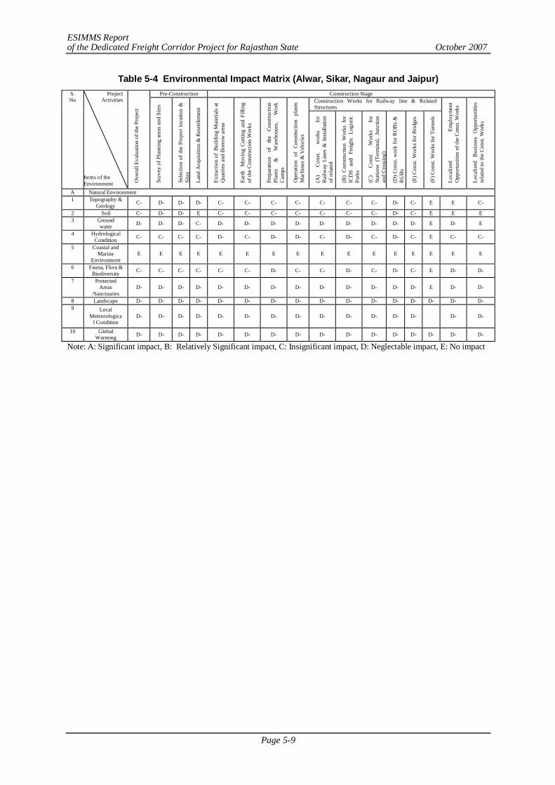
ESIMMS Report of the Dedicated Freight Corridor Project for Rajasthan State October 2007
Page 5-9
Table 5-4 Environmental Impact Matrix (Alwar, Sikar, Nagaur and Jaipur) Pre-Construction Construction Stage
Construction Works for Railway line & Related Structures
S. No
Project Activities
Items of the Environment O
vera
ll Ev
alua
tion
of th
e Pr
ojec
t
Surv
ey o
f Pla
nnin
g ar
eas a
nd S
ites
Sele
ctio
n of
the
Proj
ect l
ocat
ion
&
Site
s
Land
Acq
uisi
tion
& R
eset
tlem
ent
Extra
ctio
n of
Bui
ldin
g M
ater
ials
at
Qua
rries
and
Bor
row
are
as
Earth
M
ovin
g C
uttin
g an
d Fi
lling
of
the
Con
stru
ctio
n W
orks
Prep
arat
ion
of
the
Cons
truct
ion
Plan
ts
&
War
ehou
ses,
Wor
k C
amps
Ope
ratio
n of
Con
stru
ctio
n pl
ants
Mac
hine
s & V
ehic
les
(A)
Con
st.
wor
ks
for
Rai
lway
Lin
es &
Ins
talla
tion
of re
late
d
(B)
Con
stru
ctio
n W
orks
for
IC
DS
and
Frei
ght
Logi
stic
Park
s
(C)
Con
st
.Wor
ks
for
Stat
ions
(Te
rmin
al,
Junc
tion
and
Cro
ssin
g)
(D) C
onst
. wor
k fo
r RO
Bs
&
RU
Bs
(E) C
onst
. Wor
ks fo
r Brid
ges
(F) C
onst
. Wor
ks fo
r Tun
nels
Loca
lized
Em
ploy
men
t O
ppor
tuni
ties o
f the
Con
st. W
orks
Loca
lized
Bus
ines
s O
ppor
tuni
ties
rela
ted
to th
e C
onst
. Wor
ks
A Natural Environment 1 Topography &
Geology C- D- D- D- C- C- C- C- C- C- C- D- C- E E C-
2 Soil C- D- D- E C- C- C- C- C- C- C- D- C- E E E 3 Ground
water D- D- D- C- D- D- D- D- D- D- D- D- D- E D- E
4 Hydrological Condition C- C- C- C- D- C- D- D- C- D- C- D- C- E C- C-
5 Coastal and Marine
Environment E E E E E E E E E E E E E E E E
6 Fauna, Flora & Biodiversity C- C- C- C- C- C- D- C- C- D- C- D- C- E D- D-
7 Protected Areas
/Sanctuaries D- D- D- D- D- D- D- D- D- D- D- D- D- E D- D-
8 Landscape D- D- D- D- D- D- D- D- D- D- D- D- D- D- D- D- 9 Local
Meteorological Condition
D- D- D- D- D- D- D- D- D- D- D- D- D- D- D-
10 Global Warming D- D- D- D- D- D- D- D- D- D- D- D- D- D- D- D-
Note: A: Significant impact, B: Relatively Significant impact, C: Insignificant impact, D: Neglectable impact, E: No impact
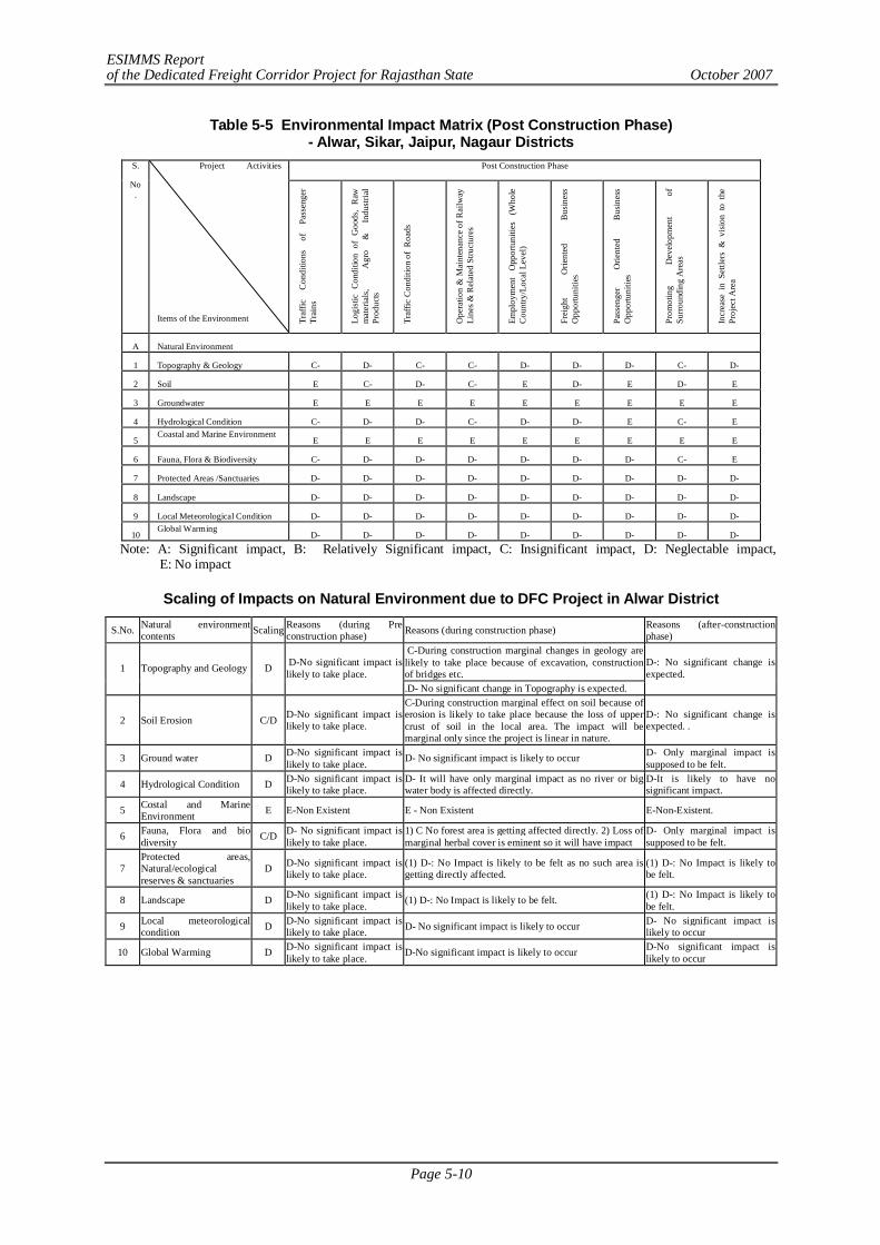
ESIMMS Report of the Dedicated Freight Corridor Project for Rajasthan State October 2007
Page 5-10
Table 5-5 Environmental Impact Matrix (Post Construction Phase) - Alwar, Sikar, Jaipur, Nagaur Districts
Post Construction Phase S.
No.
Project Activities
Items of the Environment Traf
fic
Con
ditio
ns
of
Pass
enge
r Tr
ains
Logi
stic
Con
ditio
n of
Goo
ds,
Raw
m
ater
ials
,
Agr
o &
In
dust
rial
Prod
ucts
Traf
fic C
ondi
tion
of R
oads
Ope
ratio
n &
Mai
nten
ance
of R
ailw
ay
Line
s & R
elat
ed S
truct
ures
Empl
oym
ent
Opp
ortu
nitie
s (W
hole
Cou
ntry
/Loc
al L
evel
)
Frei
ght
Orie
nted
B
usin
ess
Opp
ortu
nitie
s
Pass
enge
r O
rient
ed
Bus
ines
s O
ppor
tuni
ties
Prom
otin
g D
evel
opm
ent
of
Surro
undi
ng A
reas
Incr
ease
in
Settl
ers
& v
isio
n to
the
Pr
ojec
t Are
a
A Natural Environment
1 Topography & Geology C- D- C- C- D- D- D- C- D-
2 Soil E C- D- C- E D- E D- E
3 Groundwater E E E E E E E E E
4 Hydrological Condition C- D- D- C- D- D- E C- E
5 Coastal and Marine Environment
E E E E E E E E E
6 Fauna, Flora & Biodiversity C- D- D- D- D- D- D- C- E
7 Protected Areas /Sanctuaries D- D- D- D- D- D- D- D- D-
8 Landscape D- D- D- D- D- D- D- D- D-
9 Local Meteorological Condition D- D- D- D- D- D- D- D- D-
10 Global Warming
D- D- D- D- D- D- D- D- D-
Note: A: Significant impact, B: Relatively Significant impact, C: Insignificant impact, D: Neglectable impact, E: No impact
Scaling of Impacts on Natural Environment due to DFC Project in Alwar District
S.No. Natural environment contents Scaling Reasons (during Pre
construction phase) Reasons (during construction phase) Reasons (after-construction phase)
C-During construction marginal changes in geology are likely to take place because of excavation, construction of bridges etc. 1 Topography and Geology D D-No significant impact is
likely to take place. .D- No significant change in Topography is expected.
D-: No significant change is expected.
2 Soil Erosion C/D D-No significant impact is likely to take place.
C-During construction marginal effect on soil because of erosion is likely to take place because the loss of upper crust of soil in the local area. The impact will be marginal only since the project is linear in nature.
D-: No significant change is expected. .
3 Ground water D D-No significant impact is likely to take place. D- No significant impact is likely to occur D- Only marginal impact is
supposed to be felt.
4 Hydrological Condition D D-No significant impact is likely to take place.
D- It will have only marginal impact as no river or big water body is affected directly.
D-It is likely to have no significant impact.
5 Costal and Marine Environment E E-Non Existent E - Non Existent E-Non-Existent.
6 Fauna, Flora and bio diversity C/D D- No significant impact is
likely to take place. 1) C No forest area is getting affected directly. 2) Loss of marginal herbal cover is eminent so it will have impact
D- Only marginal impact is supposed to be felt.
7 Protected areas, Natural/ecological reserves & sanctuaries
D D-No significant impact is likely to take place.
(1) D-: No Impact is likely to be felt as no such area is getting directly affected.
(1) D-: No Impact is likely to be felt.
8 Landscape D D-No significant impact is likely to take place. (1) D-: No Impact is likely to be felt. (1) D-: No Impact is likely to
be felt.
9 Local meteorological condition D D-No significant impact is
likely to take place. D- No significant impact is likely to occur D- No significant impact is likely to occur
10 Global Warming D D-No significant impact is likely to take place. D-No significant impact is likely to occur D-No significant impact is
likely to occur
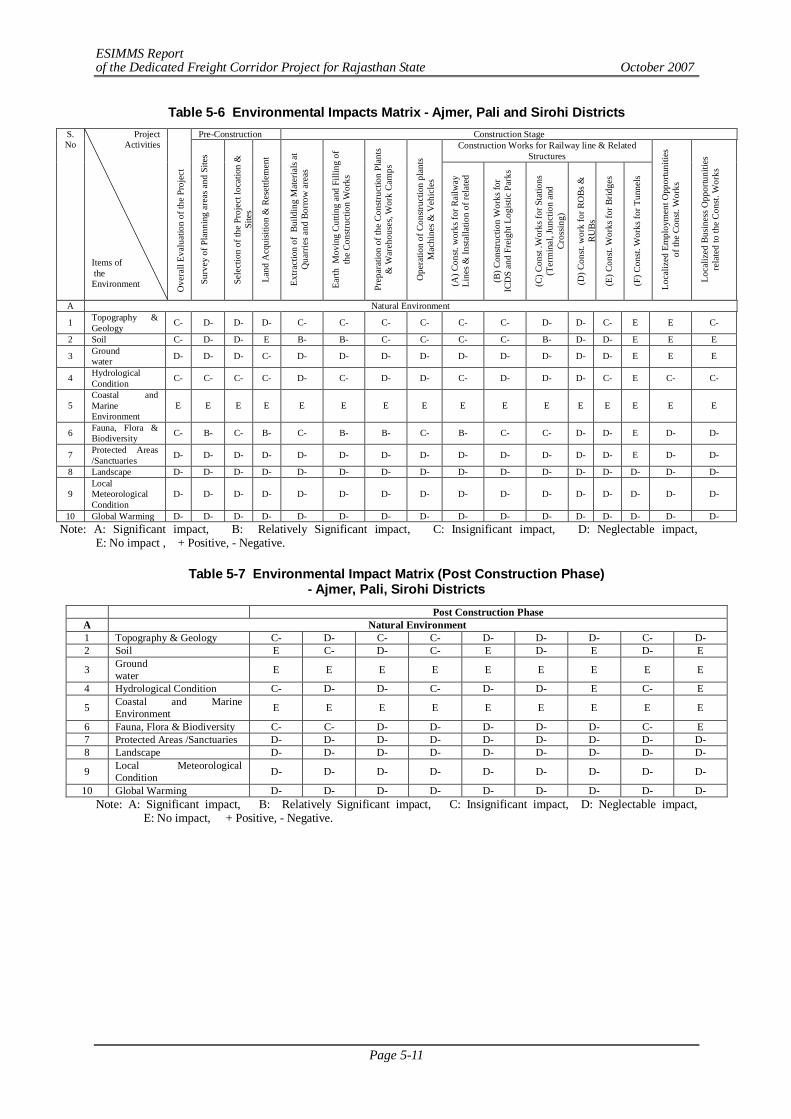
ESIMMS Report of the Dedicated Freight Corridor Project for Rajasthan State October 2007
Page 5-11
Table 5-6 Environmental Impacts Matrix - Ajmer, Pali and Sirohi Districts Pre-Construction Construction Stage
Construction Works for Railway line & Related Structures
S. No
Project Activities
Items of the Environment O
vera
ll Ev
alua
tion
of th
e Pr
ojec
t
Surv
ey o
f Pla
nnin
g ar
eas a
nd S
ites
Sele
ctio
n of
the
Proj
ect l
ocat
ion
&
Site
s
Land
Acq
uisit
ion
& R
eset
tlem
ent
Extra
ctio
n of
Bui
ldin
g M
ater
ials
at
Qua
rrie
s and
Bor
row
are
as
Earth
Mov
ing
Cutti
ng a
nd F
illin
g of
th
e Co
nstru
ctio
n W
orks
Prep
arat
ion
of th
e Co
nstru
ctio
n Pl
ants
& W
areh
ouse
s, W
ork
Cam
ps
Ope
ratio
n of
Con
struc
tion
plan
ts M
achi
nes &
Veh
icle
s
(A) C
onst.
wor
ks fo
r Rai
lway
Li
nes &
Insta
llatio
n of
rela
ted
(B) C
onstr
uctio
n W
orks
for
ICD
S an
d Fr
eigh
t Log
istic
Par
ks
(C) C
onst
.Wor
ks fo
r Sta
tions
(T
erm
inal
, Jun
ctio
n an
d Cr
ossin
g)
(D) C
onst.
wor
k fo
r RO
Bs &
RU
Bs
(E) C
onst.
Wor
ks fo
r Brid
ges
(F) C
onst.
Wor
ks fo
r Tun
nels
Loca
lized
Em
ploy
men
t Opp
ortu
nitie
s of
the
Cons
t. W
orks
Loca
lized
Bus
ines
s Opp
ortu
nitie
s re
late
d to
the
Cons
t. W
orks
A Natural Environment
1 Topography & Geology C- D- D- D- C- C- C- C- C- C- D- D- C- E E C-
2 Soil C- D- D- E B- B- C- C- C- C- B- D- D- E E E
3 Ground water D- D- D- C- D- D- D- D- D- D- D- D- D- E E E
4 Hydrological Condition C- C- C- C- D- C- D- D- C- D- D- D- C- E C- C-
5 Coastal and Marine Environment
E E E E E E E E E E E E E E E E
6 Fauna, Flora & Biodiversity C- B- C- B- C- B- B- C- B- C- C- D- D- E D- D-
7 Protected Areas /Sanctuaries D- D- D- D- D- D- D- D- D- D- D- D- D- E D- D-
8 Landscape D- D- D- D- D- D- D- D- D- D- D- D- D- D- D- D-
9 Local Meteorological Condition
D- D- D- D- D- D- D- D- D- D- D- D- D- D- D- D-
10 Global Warming D- D- D- D- D- D- D- D- D- D- D- D- D- D- D- D- Note: A: Significant impact, B: Relatively Significant impact, C: Insignificant impact, D: Neglectable impact,
E: No impact , + Positive, - Negative.
Table 5-7 Environmental Impact Matrix (Post Construction Phase) - Ajmer, Pali, Sirohi Districts
Post Construction Phase A Natural Environment 1 Topography & Geology C- D- C- C- D- D- D- C- D- 2 Soil E C- D- C- E D- E D- E
3 Ground water E E E E E E E E E
4 Hydrological Condition C- D- D- C- D- D- E C- E
5 Coastal and Marine Environment E E E E E E E E E
6 Fauna, Flora & Biodiversity C- C- D- D- D- D- D- C- E 7 Protected Areas /Sanctuaries D- D- D- D- D- D- D- D- D- 8 Landscape D- D- D- D- D- D- D- D- D-
9 Local Meteorological Condition D- D- D- D- D- D- D- D- D-
10 Global Warming D- D- D- D- D- D- D- D- D- Note: A: Significant impact, B: Relatively Significant impact, C: Insignificant impact, D: Neglectable impact,
E: No impact, + Positive, - Negative.
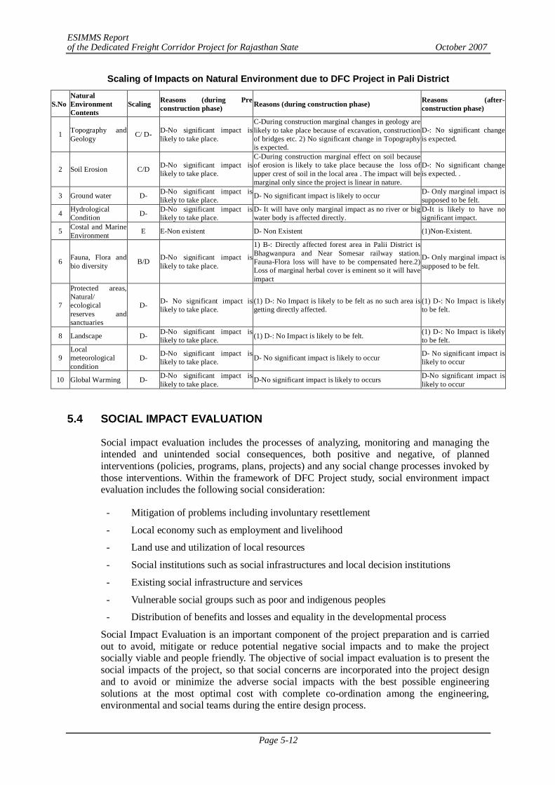
ESIMMS Report of the Dedicated Freight Corridor Project for Rajasthan State October 2007
Page 5-12
Scaling of Impacts on Natural Environment due to DFC Project in Pali District
S.No Natural Environment Contents
Scaling Reasons (during Pre construction phase) Reasons (during construction phase) Reasons (after-
construction phase)
1 Topography and Geology C/ D- D-No significant impact is
likely to take place.
C-During construction marginal changes in geology are likely to take place because of excavation, construction of bridges etc. 2) No significant change in Topography is expected.
D-: No significant change is expected.
2 Soil Erosion C/D D-No significant impact is likely to take place.
C-During construction marginal effect on soil because of erosion is likely to take place because the loss of upper crest of soil in the local area . The impact will be marginal only since the project is linear in nature.
D-: No significant change is expected. .
3 Ground water D- D-No significant impact is likely to take place. D- No significant impact is likely to occur D- Only marginal impact is
supposed to be felt.
4 Hydrological Condition D- D-No significant impact is
likely to take place. D- It will have only marginal impact as no river or big water body is affected directly.
D-It is likely to have no significant impact.
5 Costal and Marine Environment E E-Non existent D- Non Existent (1)Non-Existent.
6 Fauna, Flora and bio diversity B/D D-No significant impact is
likely to take place.
1) B-: Directly affected forest area in Palii District is Bhagwanpura and Near Somesar railway station. Fauna-Flora loss will have to be compensated here.2) Loss of marginal herbal cover is eminent so it will have impact
D- Only marginal impact is supposed to be felt.
7
Protected areas, Natural/ ecological reserves and sanctuaries
D- D- No significant impact is likely to take place.
(1) D-: No Impact is likely to be felt as no such area is getting directly affected.
(1) D-: No Impact is likely to be felt.
8 Landscape D- D-No significant impact is likely to take place. (1) D-: No Impact is likely to be felt. (1) D-: No Impact is likely
to be felt.
9 Local meteorological condition
D- D-No significant impact is likely to take place. D- No significant impact is likely to occur D- No significant impact is
likely to occur
10 Global Warming D- D-No significant impact is likely to take place. D-No significant impact is likely to occurs D-No significant impact is
likely to occur 5.4 SOCIAL IMPACT EVALUATION
Social impact evaluation includes the processes of analyzing, monitoring and managing the intended and unintended social consequences, both positive and negative, of planned interventions (policies, programs, plans, projects) and any social change processes invoked by those interventions. Within the framework of DFC Project study, social environment impact evaluation includes the following social consideration:
- Mitigation of problems including involuntary resettlement
- Local economy such as employment and livelihood
- Land use and utilization of local resources
- Social institutions such as social infrastructures and local decision institutions
- Existing social infrastructure and services
- Vulnerable social groups such as poor and indigenous peoples
- Distribution of benefits and losses and equality in the developmental process
Social Impact Evaluation is an important component of the project preparation and is carried out to avoid, mitigate or reduce potential negative social impacts and to make the project socially viable and people friendly. The objective of social impact evaluation is to present the social impacts of the project, so that social concerns are incorporated into the project design and to avoid or minimize the adverse social impacts with the best possible engineering solutions at the most optimal cost with complete co-ordination among the engineering, environmental and social teams during the entire design process.
ESIMMS Report of the Dedicated Freight Corridor Project for Rajasthan State October 2007
Page 5-13
5.4.1 Approach and Methodology Adopted
Within the framework of DFC Project study, socio-economic survey was conducted in Rajasthan State. Following methodology has been adopted to conduct social environment impact evaluation study.
1) Identified affected districts, sub-districts and villages where existing railway is passes through in parallel and detour sections. The villages were identified by using the GPS register as a positioning reference of the relevant points detour alignment, verified with the geographical data available on Goggle Earth TM and the correspondent 1:50,000 scale topographic charts.
2) Understanding perspective of the problems of PAFs and objective of the study
3) Finalization of schedule/questionnaire
4) Identification of Affected Structures a) All affected structures were listed/counted at a distance of 25 m from the center of the
existing track nearest to DFC Project in the parallel section except selected crossing stations and junction stations.
b) All affected structures were listed/counted at a distance of 22 m from the center of the existing track nearest to DFC Project in the detour sections.
c) All the affected structures were listed/counted at a distance of 60 meters and 2 km in length from the center of the existing track in parallel section for selected crossing stations & junction stations.
d) All the affected structures were captured through drawing on the register represent complete social mapping of the affected village.
5) Socio-economic survey was conducted of 10% of the total affected structures at each locality of the detour routes, junction stations and crossing stations as well as road over bridges or road under bridges. A detailed questionnaire was used to collect information on:
- Demographic details of affected family - Ownership of land and structure affected - Occupation patterns - Household assets - Income and expenditure - Land holding size - Ownership of other assets, etc.
a) In parallel sections, the socio-economic survey was conducted at a distance of 25 meters from the centre of the existing track nearest to DFC Project.
b) In detour sections, the socio-economic survey was conducted in 43.5 m wide area.
c) In selected junction stations and crossing stations, the socio-economic survey was conducted at a distance of 60 meters and 2 km in length from the center of the existing track nearest to DFC Project
6) Compilation, computerization and analyses of the collected primary and secondary information
7) Parameter and scale of impact matrix and its description
8) Preparation of Resettlement and Rehabilitation Framework
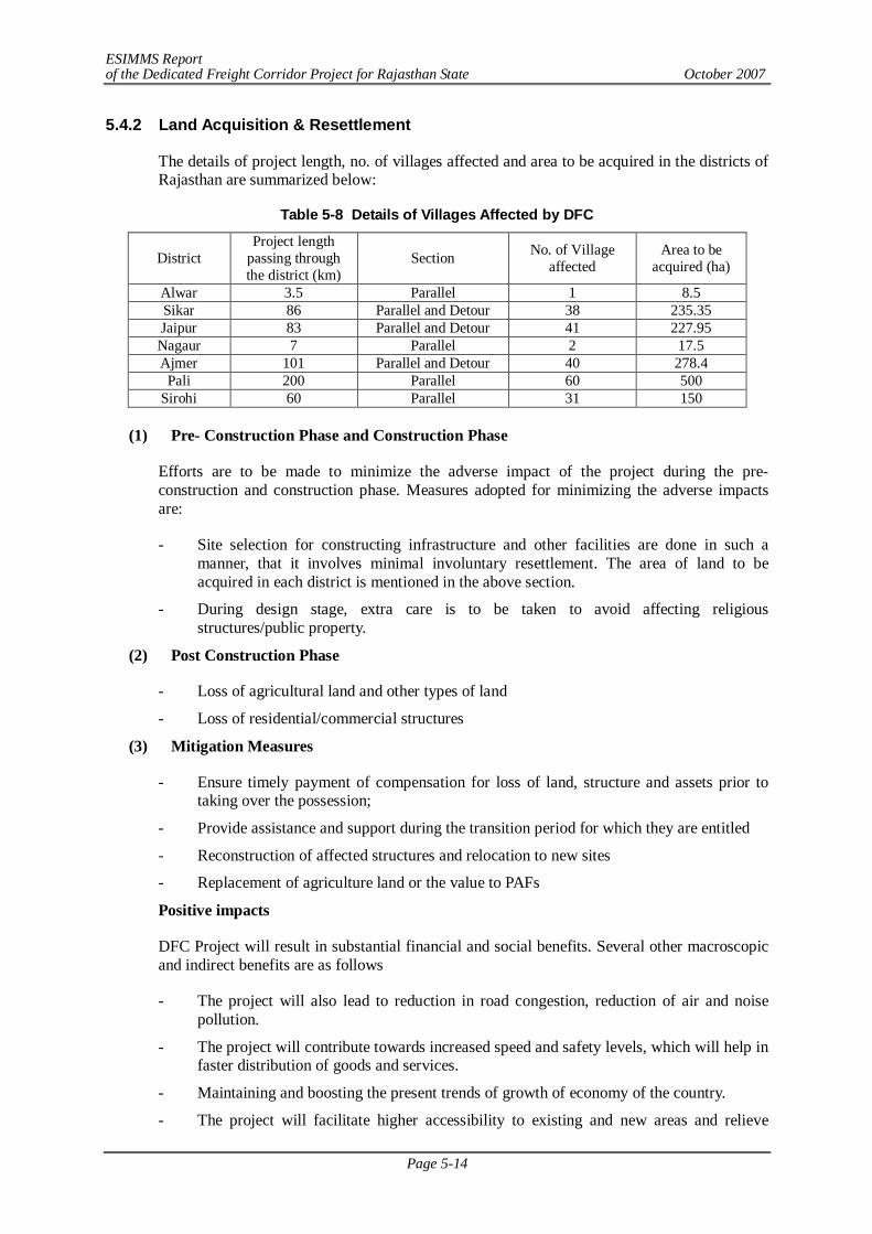
ESIMMS Report of the Dedicated Freight Corridor Project for Rajasthan State October 2007
Page 5-14
5.4.2 Land Acquisition & Resettlement
The details of project length, no. of villages affected and area to be acquired in the districts of Rajasthan are summarized below:
Table 5-8 Details of Villages Affected by DFC
District Project length
passing through the district (km)
Section No. of Village affected
Area to be acquired (ha)
Alwar 3.5 Parallel 1 8.5 Sikar 86 Parallel and Detour 38 235.35 Jaipur 83 Parallel and Detour 41 227.95 Nagaur 7 Parallel 2 17.5 Ajmer 101 Parallel and Detour 40 278.4
Pali 200 Parallel 60 500 Sirohi 60 Parallel 31 150
(1) Pre- Construction Phase and Construction Phase
Efforts are to be made to minimize the adverse impact of the project during the pre-construction and construction phase. Measures adopted for minimizing the adverse impacts are:
- Site selection for constructing infrastructure and other facilities are done in such a manner, that it involves minimal involuntary resettlement. The area of land to be acquired in each district is mentioned in the above section.
- During design stage, extra care is to be taken to avoid affecting religious structures/public property.
(2) Post Construction Phase
- Loss of agricultural land and other types of land
- Loss of residential/commercial structures
(3) Mitigation Measures
- Ensure timely payment of compensation for loss of land, structure and assets prior to taking over the possession;
- Provide assistance and support during the transition period for which they are entitled
- Reconstruction of affected structures and relocation to new sites
- Replacement of agriculture land or the value to PAFs
Positive impacts
DFC Project will result in substantial financial and social benefits. Several other macroscopic and indirect benefits are as follows
- The project will also lead to reduction in road congestion, reduction of air and noise pollution.
- The project will contribute towards increased speed and safety levels, which will help in faster distribution of goods and services.
- Maintaining and boosting the present trends of growth of economy of the country.
- The project will facilitate higher accessibility to existing and new areas and relieve
ESIMMS Report of the Dedicated Freight Corridor Project for Rajasthan State October 2007
Page 5-15
several bottlenecks to development.
- Utilization of DFC Corridor for passenger trains connecting new areas along detour cannot be denied at this stage for more efficient utilization of the system.
- Industrial sector in the state is expected to receive a tremendous boost. As a result, new areas along detour sections will be opened up for urban-industrial settlement.
5.4.3 Impact on Private Structures
(1) Alwar
No area is directly affected through this project.
1) Pre-construction and Construction Phase
- No structure is affected.
2) Mitigation Measures
- Reconstruction of structures and relocation to new sites or cash compensation to be given to affected families before the start of the project
- Refund of registration cost, stamp etc. incurred for replacement land to be paid by the project
Positive Impacts
- Increase business opportunities for the local people in terms of transporting their products in the future.
(2) Sikar
A total number of 75 Project Affected Families (PAFs) and approx. 445 PAPs from 85 private structures is the target of involuntary resettlement in the built up area. It is also observed that affected families in residential com commercial structures will not only lose their residences but also means on their livelihood, e.g. 28 shops in residences. The impact found in this district is insignificant. Table 5-9 provides details of impact on private structures in Sikar District.
1) Pre-construction and Construction Phase
- A total no. of 113 structures includes houses, residential cum commercial structures and shops in houses are the target of involuntary resettlement thus making it an insignificant impact.
2) Mitigation Measures
- Reconstruction of structures and relocation to new sites or cash compensation to be given to affected family before the start of the project
- Refund of registration cost, stamp etc. incurred for replacement land to be paid by the project
Positive Impacts
- Increase business opportunities for the local people in terms of transporting their products in the future.
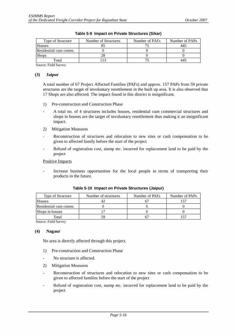
ESIMMS Report of the Dedicated Freight Corridor Project for Rajasthan State October 2007
Page 5-16
Table 5-9 Impact on Private Structures (Sikar)
Type of Structure Number of Structures Number of PAFs Number of PAPs Houses 85 75 445 Residential cum comm. 0 0 0 Shops 28 0 0
Total 113 75 445 Source: Field Survey
(3) Jaipur
A total number of 67 Project Affected Families (PAFs) and approx. 157 PAPs from 59 private structures are the target of involuntary resettlement in the built up area. It is also observed that 17 Shops are also affected. The impact found in this district is insignificant.
1) Pre-construction and Construction Phase
- A total no. of 4 structures includes houses, residential cum commercial structures and shops in houses are the target of involuntary resettlement thus making it an insignificant impact.
2) Mitigation Measures
- Reconstruction of structures and relocation to new sites or cash compensation to be given to affected family before the start of the project
- Refund of registration cost, stamp etc. incurred for replacement land to be paid by the project
Positive Impacts
- Increase business opportunities for the local people in terms of transporting their products in the future.
Table 5-10 Impact on Private Structures (Jaipur)
Type of Structure Number of structures Number of PAFs Number of PAPs Houses 42 67 157 Residential cum comm. 0 0 0 Shops in houses 17 0 0
Total 59 67 157 Source: Field Survey
(4) Nagaur
No area is directly affected through this project.
1) Pre-construction and Construction Phase
- No structure is affected.
2) Mitigation Measures
- Reconstruction of structures and relocation to new sites or cash compensation to be given to affected families before the start of the project
- Refund of registration cost, stamp etc. incurred for replacement land to be paid by the project
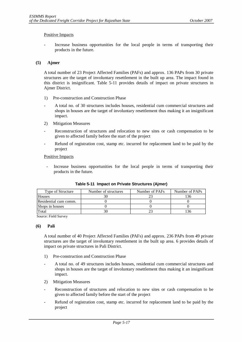
ESIMMS Report of the Dedicated Freight Corridor Project for Rajasthan State October 2007
Page 5-17
Positive Impacts
- Increase business opportunities for the local people in terms of transporting their products in the future.
(5) Ajmer
A total number of 23 Project Affected Families (PAFs) and approx. 136 PAPs from 30 private structures are the target of involuntary resettlement in the built up area. The impact found in this district is insignificant. Table 5-11 provides details of impact on private structures in Ajmer District.
1) Pre-construction and Construction Phase
- A total no. of 30 structures includes houses, residential cum commercial structures and shops in houses are the target of involuntary resettlement thus making it an insignificant impact.
2) Mitigation Measures
- Reconstruction of structures and relocation to new sites or cash compensation to be given to affected family before the start of the project
- Refund of registration cost, stamp etc. incurred for replacement land to be paid by the project
Positive Impacts
- Increase business opportunities for the local people in terms of transporting their products in the future.
Table 5-11 Impact on Private Structures (Ajmer)
Type of Structure Number of structures Number of PAFs Number of PAPs Houses 30 23 136 Residential cum comm. 0 0 0 Shops in houses 0 0 0 Total 30 23 136
Source: Field Survey
(6) Pali
A total number of 40 Project Affected Families (PAFs) and approx. 236 PAPs from 49 private structures are the target of involuntary resettlement in the built up area. 6 provides details of impact on private structures in Pali District.
1) Pre-construction and Construction Phase
- A total no. of 49 structures includes houses, residential cum commercial structures and shops in houses are the target of involuntary resettlement thus making it an insignificant impact.
2) Mitigation Measures
- Reconstruction of structures and relocation to new sites or cash compensation to be given to affected family before the start of the project
- Refund of registration cost, stamp etc. incurred for replacement land to be paid by the project
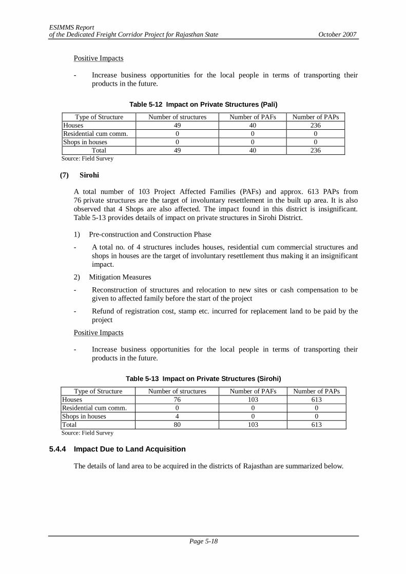
ESIMMS Report of the Dedicated Freight Corridor Project for Rajasthan State October 2007
Page 5-18
Positive Impacts
- Increase business opportunities for the local people in terms of transporting their products in the future.
Table 5-12 Impact on Private Structures (Pali)
Type of Structure Number of structures Number of PAFs Number of PAPs Houses 49 40 236 Residential cum comm. 0 0 0 Shops in houses 0 0 0
Total 49 40 236 Source: Field Survey
(7) Sirohi
A total number of 103 Project Affected Families (PAFs) and approx. 613 PAPs from 76 private structures are the target of involuntary resettlement in the built up area. It is also observed that 4 Shops are also affected. The impact found in this district is insignificant. Table 5-13 provides details of impact on private structures in Sirohi District.
1) Pre-construction and Construction Phase
- A total no. of 4 structures includes houses, residential cum commercial structures and shops in houses are the target of involuntary resettlement thus making it an insignificant impact.
2) Mitigation Measures
- Reconstruction of structures and relocation to new sites or cash compensation to be given to affected family before the start of the project
- Refund of registration cost, stamp etc. incurred for replacement land to be paid by the project
Positive Impacts
- Increase business opportunities for the local people in terms of transporting their products in the future.
Table 5-13 Impact on Private Structures (Sirohi)
Type of Structure Number of structures Number of PAFs Number of PAPs Houses 76 103 613 Residential cum comm. 0 0 0 Shops in houses 4 0 0 Total 80 103 613 Source: Field Survey
5.4.4 Impact Due to Land Acquisition
The details of land area to be acquired in the districts of Rajasthan are summarized below.
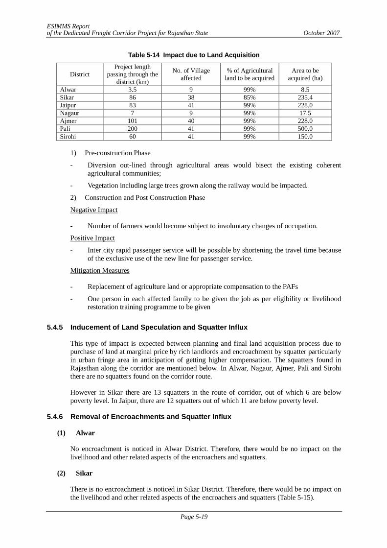
ESIMMS Report of the Dedicated Freight Corridor Project for Rajasthan State October 2007
Page 5-19
Table 5-14 Impact due to Land Acquisition
District Project length
passing through the district (km)
No. of Village affected
% of Agricultural land to be acquired
Area to be acquired (ha)
Alwar 3.5 9 99% 8.5 Sikar 86 38 85% 235.4 Jaipur 83 41 99% 228.0 Nagaur 7 9 99% 17.5 Ajmer 101 40 99% 228.0 Pali 200 41 99% 500.0 Sirohi 60 41 99% 150.0
1) Pre-construction Phase
- Diversion out-lined through agricultural areas would bisect the existing coherent agricultural communities;
- Vegetation including large trees grown along the railway would be impacted.
2) Construction and Post Construction Phase
Negative Impact
- Number of farmers would become subject to involuntary changes of occupation.
Positive Impact
- Inter city rapid passenger service will be possible by shortening the travel time because of the exclusive use of the new line for passenger service.
Mitigation Measures
- Replacement of agriculture land or appropriate compensation to the PAFs
- One person in each affected family to be given the job as per eligibility or livelihood restoration training programme to be given
5.4.5 Inducement of Land Speculation and Squatter Influx
This type of impact is expected between planning and final land acquisition process due to purchase of land at marginal price by rich landlords and encroachment by squatter particularly in urban fringe area in anticipation of getting higher compensation. The squatters found in Rajasthan along the corridor are mentioned below. In Alwar, Nagaur, Ajmer, Pali and Sirohi there are no squatters found on the corridor route.
However in Sikar there are 13 squatters in the route of corridor, out of which 6 are below poverty level. In Jaipur, there are 12 squatters out of which 11 are below poverty level.
5.4.6 Removal of Encroachments and Squatter Influx
(1) Alwar
No encroachment is noticed in Alwar District. Therefore, there would be no impact on the livelihood and other related aspects of the encroachers and squatters.
(2) Sikar
There is no encroachment is noticed in Sikar District. Therefore, there would be no impact on the livelihood and other related aspects of the encroachers and squatters (Table 5-15).
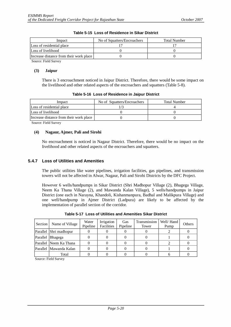
ESIMMS Report of the Dedicated Freight Corridor Project for Rajasthan State October 2007
Page 5-20
Table 5-15 Loss of Residence in Sikar District
Source: Field Survey
(3) Jaipur
There is 3 encroachment noticed in Jaipur District. Therefore, there would be some impact on the livelihood and other related aspects of the encroachers and squatters (Table 5-8).
Table 5-16 Loss of Residence in Jaipur District
Impact No of Squatters/Encroachers Total Number Loss of residential place 1/3 4 Loss of livelihood 0 0 Increase distance from their work place 0 0 Source: Field Survey
(4) Nagaur, Ajmer, Pali and Sirohi
No encroachment is noticed in Nagaur District. Therefore, there would be no impact on the livelihood and other related aspects of the encroachers and squatters.
5.4.7 Loss of Utilities and Amenities
The public utilities like water pipelines, irrigation facilities, gas pipelines, and transmission towers will not be affected in Alwar, Nagaur, Pali and Sirohi Districts by the DFC Project.
However 6 wells/handpumps in Sikar District (Shri Madhopur Village (2), Bhagega Village, Neem Ka Thana Village (2), and Mawanda Kalan Village), 5 wells/handpumps in Jaipur District (one each in Narayna, Khandoli, Kishanmanpura, Badhal and Malikpura Village) and one well/handpump in Ajmer District (Ladpura) are likely to be affected by the implementation of parallel section of the corridor.
Table 5-17 Loss of Utilities and Amenities Sikar District
Source: Field Survey
Impact No of Squatters/Encroachers Total Number Loss of residential place 17 17 Loss of livelihood 0 0 Increase distance from their work place 0 0
Section Name of Village Water Pipeline
Irrigation Facilities
Gas Pipeline
Transmission Tower
Well/ Hand Pump Others
Parallel Shri madhopur 0 0 0 0 2 0 Parallel Bhagega 0 0 0 0 1 0 Parallel Neem Ka Thana 0 0 0 0 2 0 Parallel Mawanda Kalan 0 0 0 0 1 0 Total 0 0 0 0 6 0
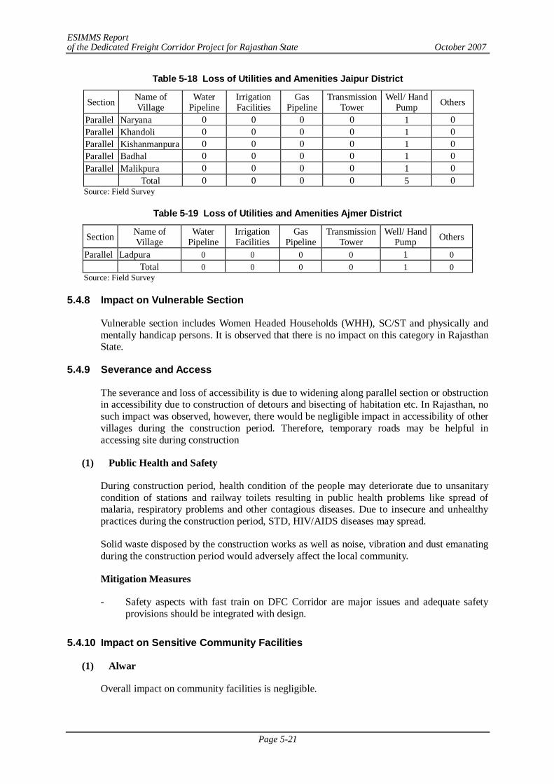
ESIMMS Report of the Dedicated Freight Corridor Project for Rajasthan State October 2007
Page 5-21
Table 5-18 Loss of Utilities and Amenities Jaipur District
Section Name of Village
Water Pipeline
Irrigation Facilities
Gas Pipeline
Transmission Tower
Well/ Hand Pump Others
Parallel Naryana 0 0 0 0 1 0 Parallel Khandoli 0 0 0 0 1 0 Parallel Kishanmanpura 0 0 0 0 1 0 Parallel Badhal 0 0 0 0 1 0 Parallel Malikpura 0 0 0 0 1 0 Total 0 0 0 0 5 0 Source: Field Survey
Table 5-19 Loss of Utilities and Amenities Ajmer District
Section Name of Village
Water Pipeline
Irrigation Facilities
Gas Pipeline
Transmission Tower
Well/ Hand Pump Others
Parallel Ladpura 0 0 0 0 1 0 Total 0 0 0 0 1 0 Source: Field Survey
5.4.8 Impact on Vulnerable Section
Vulnerable section includes Women Headed Households (WHH), SC/ST and physically and mentally handicap persons. It is observed that there is no impact on this category in Rajasthan State.
5.4.9 Severance and Access
The severance and loss of accessibility is due to widening along parallel section or obstruction in accessibility due to construction of detours and bisecting of habitation etc. In Rajasthan, no such impact was observed, however, there would be negligible impact in accessibility of other villages during the construction period. Therefore, temporary roads may be helpful in accessing site during construction
(1) Public Health and Safety
During construction period, health condition of the people may deteriorate due to unsanitary condition of stations and railway toilets resulting in public health problems like spread of malaria, respiratory problems and other contagious diseases. Due to insecure and unhealthy practices during the construction period, STD, HIV/AIDS diseases may spread.
Solid waste disposed by the construction works as well as noise, vibration and dust emanating during the construction period would adversely affect the local community.
Mitigation Measures
- Safety aspects with fast train on DFC Corridor are major issues and adequate safety provisions should be integrated with design.
5.4.10 Impact on Sensitive Community Facilities
(1) Alwar
Overall impact on community facilities is negligible.
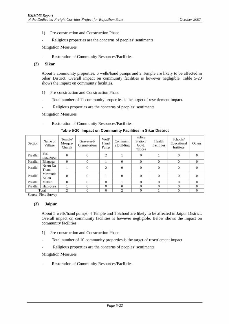
ESIMMS Report of the Dedicated Freight Corridor Project for Rajasthan State October 2007
Page 5-22
1) Pre-construction and Construction Phase
- Religious properties are the concerns of peoples’ sentiments
Mitigation Measures
- Restoration of Community Resources/Facilities
(2) Sikar
About 3 community properties, 6 wells/hand pumps and 2 Temple are likely to be affected in Sikar District. Overall impact on community facilities is however negligible. Table 5-20 shows the impact on community facilities.
1) Pre-construction and Construction Phase
- Total number of 11 community properties is the target of resettlement impact.
- Religious properties are the concerns of peoples’ sentiments
Mitigation Measures
- Restoration of Community Resources/Facilities Table 5-20 Impact on Community Facilities in Sikar District
Section Name of Village
Temple/ Mosque/ Church
Graveyard/ Crematorium
Well/ Hand Pump
Community Building
Police Station/ Govt.
Offices
Health Facilities
Schools/ Educational
Institute Others
Parallel Shri madhopur 0 0 2 1 0 1 0 0
Parallel Bhagega 0 0 1 0 0 0 0 0
Parallel Neem Ka Thana 1 0 2 0 0 0 0 0
Parallel Mawanda Kalan 0 0 1 0 0 0 0 0
Parallel Makari 0 0 0 1 0 0 0 0 Parallel Hanspura 1 0 0 0 0 0 0 0
Total 2 0 6 2 0 1 0 0 Source: Field Survey
(3) Jaipur
About 5 wells/hand pumps, 4 Temple and 1 School are likely to be affected in Jaipur District. Overall impact on community facilities is however negligible. Below shows the impact on community facilities.
1) Pre-construction and Construction Phase
- Total number of 10 community properties is the target of resettlement impact.
- Religious properties are the concerns of peoples’ sentiments
Mitigation Measures
- Restoration of Community Resources/Facilities
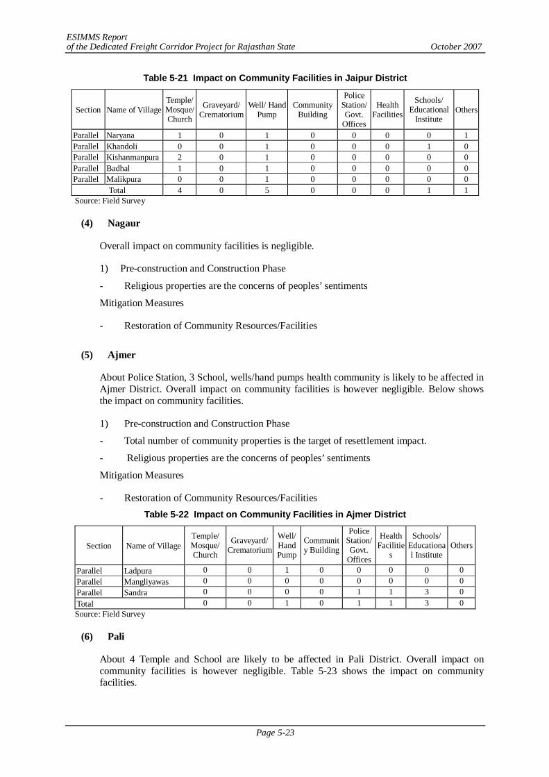
ESIMMS Report of the Dedicated Freight Corridor Project for Rajasthan State October 2007
Page 5-23
Table 5-21 Impact on Community Facilities in Jaipur District
Section Name of Village Temple/ Mosque/ Church
Graveyard/ Crematorium
Well/ Hand Pump
Community Building
Police Station/ Govt.
Offices
Health Facilities
Schools/ Educational
Institute Others
Parallel Naryana 1 0 1 0 0 0 0 1 Parallel Khandoli 0 0 1 0 0 0 1 0 Parallel Kishanmanpura 2 0 1 0 0 0 0 0 Parallel Badhal 1 0 1 0 0 0 0 0 Parallel Malikpura 0 0 1 0 0 0 0 0
Total 4 0 5 0 0 0 1 1 Source: Field Survey
(4) Nagaur
Overall impact on community facilities is negligible.
1) Pre-construction and Construction Phase
- Religious properties are the concerns of peoples’ sentiments
Mitigation Measures
- Restoration of Community Resources/Facilities
(5) Ajmer
About Police Station, 3 School, wells/hand pumps health community is likely to be affected in Ajmer District. Overall impact on community facilities is however negligible. Below shows the impact on community facilities.
1) Pre-construction and Construction Phase
- Total number of community properties is the target of resettlement impact.
- Religious properties are the concerns of peoples’ sentiments
Mitigation Measures
- Restoration of Community Resources/Facilities Table 5-22 Impact on Community Facilities in Ajmer District
Section Name of Village Temple/ Mosque/ Church
Graveyard/ Crematorium
Well/ Hand Pump
Community Building
Police Station/ Govt.
Offices
Health Facilitie
s
Schools/ Educational Institute
Others
Parallel Ladpura 0 0 1 0 0 0 0 0 Parallel Mangliyawas 0 0 0 0 0 0 0 0 Parallel Sandra 0 0 0 0 1 1 3 0 Total 0 0 1 0 1 1 3 0 Source: Field Survey
(6) Pali
About 4 Temple and School are likely to be affected in Pali District. Overall impact on community facilities is however negligible. Table 5-23 shows the impact on community facilities.
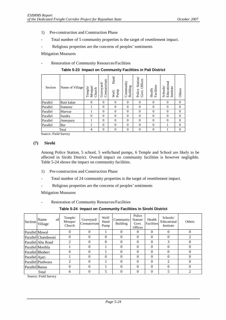
ESIMMS Report of the Dedicated Freight Corridor Project for Rajasthan State October 2007
Page 5-24
1) Pre-construction and Construction Phase
- Total number of 5 community properties is the target of resettlement impact.
- Religious properties are the concerns of peoples’ sentiments
Mitigation Measures
- Restoration of Community Resources/Facilities Table 5-23 Impact on Community Facilities in Pali District
Section Name of Village Te
mpl
e/
Mos
que/
C
hurc
h
Gra
veya
rd/
Cre
mat
oriu
m
Wel
l/ H
and
Pum
p
Com
mun
ity
Bui
ldin
g
Polic
e St
atio
n/
Gov
t. O
ffic
es
Hea
lth
Faci
litie
s
Scho
ols/
Ed
ucat
iona
l In
stitu
te
Oth
ers
Parallel Rani kalan 0 0 0 0 0 0 0 0 Parallel Someser 1 0 0 0 0 0 0 0 Parallel Marwar 1 0 0 0 0 0 0 0 Parallel Sandra 0 0 0 0 0 0 0 0 Parallel Amerpura 1 0 0 0 0 0 0 0 Parallel Bar 1 0 0 0 0 0 1 0
Total 4 0 0 0 0 0 1 0 Source: Field Survey
(7) Sirohi
Among Police Station, 5 school, 5 wells/hand pumps, 6 Temple and School are likely to be affected in Sirohi District. Overall impact on community facilities is however negligible. Table 5-24 shows the impact on community facilities.
1) Pre-construction and Construction Phase
- Total number of 24 community properties is the target of resettlement impact.
- Religious properties are the concerns of peoples’ sentiments
Mitigation Measures
- Restoration of Community Resources/Facilities Table 5-24 Impact on Community Facilities in Sirohi District
Section Name of Village
Temple/ Mosque/ Church
Graveyard/ Crematorium
Well/ Hand Pump
Community Building
Police Station/ Govt.
Offices
Health Facilities
Schools/ Educational
Institute Others
Parallel Mawal 0 0 1 0 0 0 0 0 Parallel Chandawati 0 0 0 0 0 0 0 2 Parallel Abu Road 2 0 0 0 0 0 3 0 Parallel Morthla 1 0 1 0 0 0 0 0 Parallel Bhaberi 0 0 1 0 0 0 0 0 Parallel Ajari 1 0 0 0 0 0 0 0 Parallel Pindwara 2 0 1 0 0 0 2 0 Parallel Banas 0 0 1 0 0 0 0 0
Total 6 0 5 0 0 0 5 2 Source: Field Survey

ESIMMS Report of the Dedicated Freight Corridor Project for Rajasthan State October 2007
Page 5-25
5.4.11 Impact on Local Economy/ Employment & Livelihood
Although the impact on local economy/employment is negligible, however, it is noticeable that agriculture is the main occupation of the affected people. About 90% of the work force is dependent on agriculture and related activities and depend upon agriculture for their livelihood.
1) Pre construction and construction phase
Negative Impact
Agriculture being the main livelihood, the affected persons would lose their source of livelihood and become subject to involuntary changes of occupation.
Mitigation Measures
- Employment in the construction work
- Livelihood restoration training programme
- One member in each affected family-losing livelihood should be given job as per eligibility
Positive Impacts
- The project will generate tremendous requirement for the collection of goods for transportation in bulk to the freight corridor lifting points and offloading points for their carriage to the destination points. This will require more transporters and transport workers leading to the growth of this sector creating a number of feeder corridors and its associated local employment. The requirement of carriage of goods and services will need more workers and trucks and also open up tremendous opportunities in a number of diversified sectors due to the technical and operational requirements of the Freight Corridor Project.
- The Project could contribute to the local economy as local residents could enjoy a temporary period of improvement of small-scale business for the construction workers as well as to seize the opportunity for casual labour.
2) Post Construction Period
Positive Impact
- Ever increasing local business in district would significantly benefit for their business opportunities in terms of transporting their products in the future.
Social Impact Matrix
- Social Impact matrix is presented in Table 5-25 and Table 5-26.
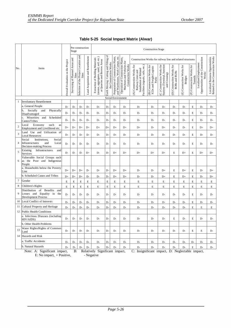
ESIMMS Report of the Dedicated Freight Corridor Project for Rajasthan State October 2007
Page 5-26
Table 5-25 Social Impact Matrix (Alwar)
Pre-construction Stage Construction Stage
Construction Works for railway line and related structures
No.
Items
Ove
rall
Eval
uatio
n on
the
Proj
ect
Surv
eyin
g of
Pla
nned
Are
as a
nd
Site
s Se
lect
ion
of th
e Pr
ojec
t Loc
atio
n an
d Si
tes
Land
Acq
uisit
ion
and
Rese
ttlem
ent
Extra
ctio
n of
Bui
ldin
g M
ater
ials
(sto
nes,
aggr
egat
es, s
and,
soil,
etc
.) at
Qua
rrie
s and
Bor
row
Are
as
Earth
Mov
ing:
Cut
ting
and
Filli
ng o
f th
e Co
nstru
ctio
n W
orks
Pr
epar
atio
n of
Con
struc
tion
Plan
ts,
and
War
ehou
ses,
Wor
k Ca
mps
, etc
. O
pera
tion
of C
onstr
uctio
n Pl
ants,
M
achi
nes a
nd V
ehic
les f
or
Cons
truct
ion
Wor
ks
(A) C
onstr
uctio
n W
orks
for
Railw
ay L
ines
and
In
stalla
tion
of R
elat
ed
Faci
litie
s (sig
nals,
rails
, etc
.)
(B) C
onstr
uctio
n W
orks
for
ICD
s and
Fre
ight
Log
istic
Pa
rks
(C )
Cons
truct
ion
Wor
ks fo
r St
atio
ns (T
erm
inal
, Jun
ctio
n an
d Cr
ossin
g)
(D) C
onstr
uctio
n W
orks
for
ROBs
and
RU
Bs
(E) C
onstr
uctio
n W
orks
for
Brid
ges
(F) C
onstr
uctio
n W
orks
for
Tunn
els
Loca
lized
Em
ploy
men
t O
ppor
tuni
ties o
f the
Con
struc
tion
Wor
ks
Loca
lized
Bus
ines
s Opp
ortu
nitie
s Re
late
d to
the
Cons
truct
ion
Wor
ks
Social Environment 1 Involuntary Resettlement
a. General People D- D- D- D- D- D- D- D- D- D- D- D- D- E D- D-
b. Socially and Physically Disadvantaged D- D- D- D- D- D- D- D- D- D- D- D- D- E D- D-
c. Minorities and Scheduled Castes/Tribes D- D- D- D- D- D- D- D- D- D- D- D- D- E D- D-
2 Local Economy such as Employment and Livelihood etc. D+ D+ D+ D+ D+ D+ D+ D+ D+ D- D+ D- D- E D+ D+
3 Land Use and Utilization of Local Resources D- D- D- D- D- D- D- D- D- D- D- D- D- E D- D-
4 Social Institutions, Social Infrastructures and Local Decision-making Process
D- D- D- D- D- D- D- D- D- D- D- D- D- E D- D-
5 Existing Infrastructures and Services D- D- D- D+ D- D- D+ D+ D+ D+ D+ E D+ E D+ D+
6 Vulnerable Social Groups such as the Poor and Indigenous People
a. Households below the Poverty Line D+ D+ D+ D- D- D- D+ D+ D- D- D+ E D+ E D- D+
b. Scheduled Castes and Tribes D+ D+ D+ D- D- D- D+ D+ D- D- D+ E D+ E D- D+ 7 Gender E E E E E E E E E E E E E E E E 8 Children's Rights E E E E E E E E E E E E E E E E
9 Distribution of Benefits and Losses and Equality in the Development Process
D- D- D- D- D- D- D- D- D- D- D- D- D- E D- D-
10 Local Conflict of Interests D- D- D- D- D- D- D- D- D- D- D- D- D- E D- D- 11 Cultural Property and Heritage D- D- D- D- D- D- D- D- D- D- D- D- D- E E E 12 Public Health Conditions
a. Infectious Diseases (including HIV/AIDS) D- D- D- D- D- D- D- D- D- D- D- E D- E D- D-
b. Other Health Problems
13 Water Rights/Rights of Common Land D- D- D- D- D- D- D- D- D- D- D- D- D- E E D-
14 Hazards and Risk a. Traffic Accidents D- D- D- D- D- D- D- D- D- D- D- D- D- D- D- D- b. Natural Hazards D- D- D- D- D- D- D- D- D- D- D- D- D- E D- D-
Note: A: Significant impact, B: Relatively Significant impact, C: Insignificant impact, D: Neglectable impact, E: No impact, + Positive, - Negative
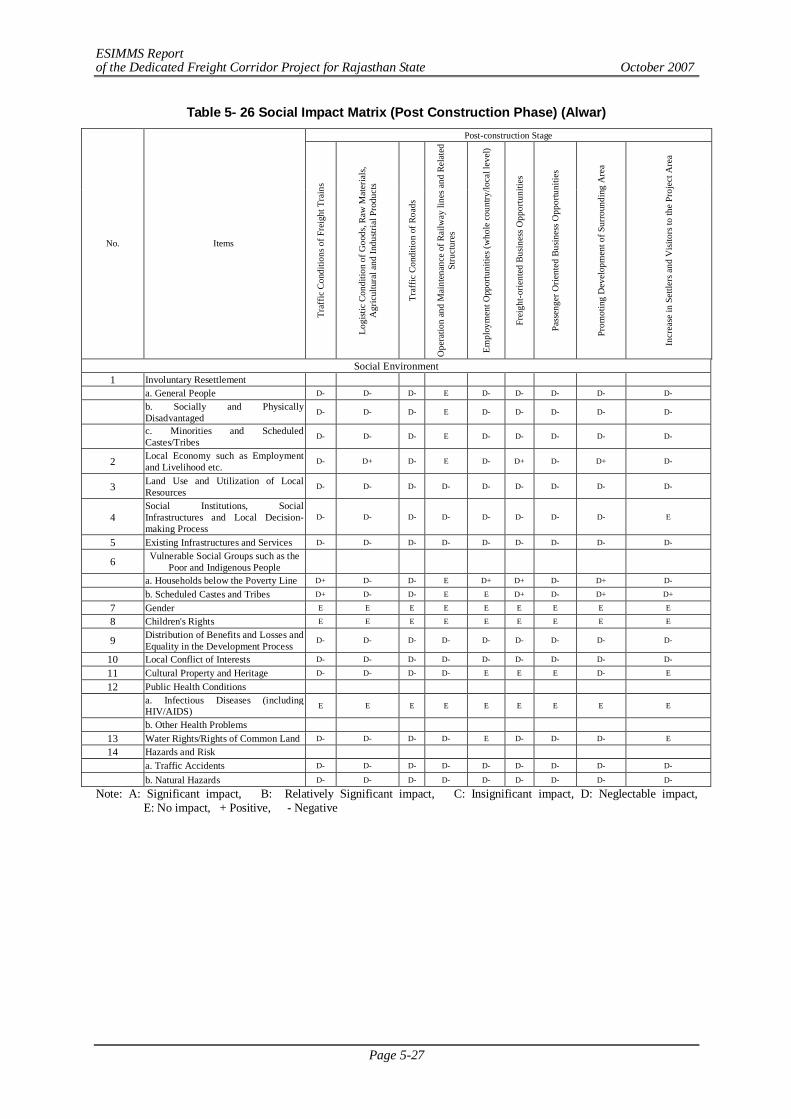
ESIMMS Report of the Dedicated Freight Corridor Project for Rajasthan State October 2007
Page 5-27
Table 5- 26 Social Impact Matrix (Post Construction Phase) (Alwar) Post-construction Stage
No. Items
Traf
fic C
ondi
tions
of F
reig
ht T
rain
s
Logi
stic
Cond
ition
of G
oods
, Raw
Mat
eria
ls,
Agr
icul
tura
l and
Indu
stria
l Pro
duct
s
Traf
fic C
ondi
tion
of R
oads
Ope
ratio
n an
d M
aint
enan
ce o
f Rai
lway
line
s and
Rel
ated
St
ruct
ures
Empl
oym
ent O
ppor
tuni
ties (
who
le co
untry
/loca
l lev
el)
Frei
ght-o
rient
ed B
usin
ess O
ppor
tuni
ties
Pass
enge
r Orie
nted
Bus
ines
s Opp
ortu
nitie
s
Prom
otin
g D
evel
opm
ent o
f Sur
roun
ding
Are
a
Incr
ease
in S
ettle
rs a
nd V
isito
rs to
the
Proj
ect A
rea
Social Environment 1 Involuntary Resettlement a. General People D- D- D- E D- D- D- D- D-
b. Socially and Physically Disadvantaged
D- D- D- E D- D- D- D- D-
c. Minorities and Scheduled Castes/Tribes
D- D- D- E D- D- D- D- D-
2 Local Economy such as Employment and Livelihood etc.
D- D+ D- E D- D+ D- D+ D-
3 Land Use and Utilization of Local Resources
D- D- D- D- D- D- D- D- D-
4 Social Institutions, Social Infrastructures and Local Decision-making Process
D- D- D- D- D- D- D- D- E
5 Existing Infrastructures and Services D- D- D- D- D- D- D- D- D-
6 Vulnerable Social Groups such as the Poor and Indigenous People
a. Households below the Poverty Line D+ D- D- E D+ D+ D- D+ D-
b. Scheduled Castes and Tribes D+ D- D- E E D+ D- D+ D+
7 Gender E E E E E E E E E
8 Children's Rights E E E E E E E E E
9 Distribution of Benefits and Losses and Equality in the Development Process
D- D- D- D- D- D- D- D- D-
10 Local Conflict of Interests D- D- D- D- D- D- D- D- D-
11 Cultural Property and Heritage D- D- D- D- E E E D- E
12 Public Health Conditions
a. Infectious Diseases (including HIV/AIDS) E E E E E E E E E
b. Other Health Problems
13 Water Rights/Rights of Common Land D- D- D- D- E D- D- D- E
14 Hazards and Risk
a. Traffic Accidents D- D- D- D- D- D- D- D- D-
b. Natural Hazards D- D- D- D- D- D- D- D- D-
Note: A: Significant impact, B: Relatively Significant impact, C: Insignificant impact, D: Neglectable impact, E: No impact, + Positive, - Negative
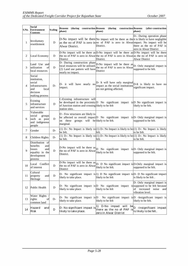
ESIMMS Report of the Dedicated Freight Corridor Project for Rajasthan State October 2007
Page 5-28
S.No. Social Environment Contents
Scaling Reasons (during construction phase)
Reasons (during construction phase)
Reasons (after-construction phase)
1 Involuntary resettlement D
D-No impact will be there as the no of PAF is zero in Alwar District.
No impact will be there as the no of PAF is zero in Alwar District.
D-: During operation phase it is likely to have negligible impact. No impact will be there as the no of PAF is zero in Alwar District
2 Local Economy D D-No impact will be there as the no of PAF is zero in Alwar District
D-No impact will be there as the no of PAF is zero in Alwar District.
D-No impact will be there as the no of PAF is zero in Alwar District
3 Land Use and utilization of local resources
D
D- During construction phase local resources will be utilized. (2) Land use pattern will have nearly no impact.
D-No impact will be there as the no of PAF is zero in Alwar District
D- Only marginal impact is supposed to be felt.
4
Social institution, social infrastructures and local decision making process
D- D- it will have nearly no impact.
D- It will have only marginal impact as the social institutions are not getting affected.
D-It is likely to have no significant impact.
5 Existing infrastructure and services
D
C-Existing infrastructure will be developed in the proximity of Junction station and crossing station sites .
D No significant impact is likely to be felt
D No significant impact is likely to be felt.
6
Vulnerable social groups such as poor and indigenous people
D
D - Few structures are likely to be affected so overall impact on these groups will be marginal.
D No significant impact is likely to be felt.
D- Only marginal impact is supposed to be felt.
7 Gender D- (1) D-: No Impact is likely to be felt.
(1) D-: No Impact is likely to be felt.
(1) D-: No Impact is likely to be felt.
8 Children Rights D- (1) D-: No Impact is likely to be felt.
(1) D-: No Impact is likely to be felt.
(1) D-: No Impact is likely to be felt.
9
Distribution of benefits and losses and equality in the development process
D D-No impact will be there as the no of PAF is zero in Alwar District.
D No significant impact is likely to be felt
D- Only marginal impact is supposed to be felt.
10 Local Conflict of interest D
D-No impact will be there as the no of PAF is zero in Alwar District
D- D No significant impact is likely to be felt.
D-Only marginal impact is supposed to be felt.
11 Cultural property and Heritage
D D- No significant impact is likely to take place.
1) D No significant impact is likely to be felt
D- D No significant impact is likely to be felt .
12 Public Health D D- No significant impact is likely to take place.
D No significant impact is likely to be felt
D- Only marginal impact is supposed to be felt because of increased noise and vibration level.
13 Water Rights / rights of common land
D- D- No significant impact is likely to take place.
D No significant impact is likely to be felt
D -Insignificant impact is likely to be felt.
14 Hazard and Risk D D- No significant impact is
likely to take place. 1) D-No impact will be there as the no of PAF is zero in Alwar District
D -Insignificant impact is likely to be felt.
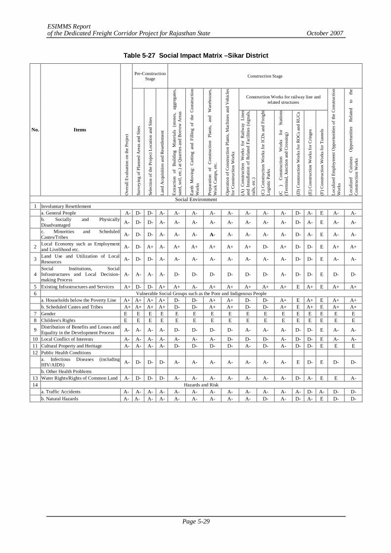
ESIMMS Report of the Dedicated Freight Corridor Project for Rajasthan State October 2007
Page 5-29
Table 5-27 Social Impact Matrix –Sikar District
Pre-Construction Stage Construction Stage
Construction Works for railway line and related structures
No. Items O
vera
ll Ev
alua
tion
on th
e Pr
ojec
t
Surv
eyin
g of
Pla
nned
Are
as a
nd S
ites
Sele
ctio
n of
the
Proj
ect L
ocat
ion
and
Site
s
Land
Acq
uisit
ion
and
Rese
ttlem
ent
Extra
ctio
n of
Bui
ldin
g M
ater
ials
(sto
nes,
aggr
egat
es,
sand
, soi
l, et
c.) a
t Qua
rrie
s and
Bor
row
Are
as
Earth
Mov
ing:
Cut
ting
and
Filli
ng o
f th
e Co
nstru
ctio
n W
orks
Prep
arat
ion
of
Cons
truct
ion
Plan
ts, a
nd W
areh
ouse
s, W
ork
Cam
ps, e
tc.
Ope
ratio
n of
Con
struc
tion
Plan
ts, M
achi
nes
and
Veh
icle
s fo
r Con
struc
tion
Wor
ks
(A)
Cons
truct
ion
Wor
ks f
or R
ailw
ay L
ines
an
d In
stalla
tion
of R
elat
ed F
acili
ties
(sig
nals,
ra
ils, e
tc.)
(C) C
onstr
uctio
n W
orks
for I
CDs
and
Frei
ght
Logi
stic
Park
s
(C
) Co
nstru
ctio
n W
orks
fo
r St
atio
ns
(Ter
min
al, J
unct
ion
and
Cros
sing)
(D) C
onstr
uctio
n W
orks
for R
OCs
and
RU
Cs
(E) C
onstr
uctio
n W
orks
for C
ringe
s
(F) C
onstr
uctio
n W
orks
for T
unne
ls
Loca
lized
Em
ploy
men
t Opp
ortu
nitie
s of t
he C
onstr
uctio
n W
orks
Loca
lized
Cu
isine
s O
ppor
tuni
ties
Rela
ted
to
the
Cons
truct
ion
Wor
ks
Social Environment 1 Involuntary Resettlement a. General People A- D- D- A- A- A- A- A- A- A- A- D- A- E A- A-
b. Socially and Physically Disadvantaged A- D- D- A- A- A- A- A- A- A- A- D- A- E A- A-
c. Minorities and Scheduled Castes/Tribes A- D- D- A- A- A- A- A- A- A- A- D- A- E A- A-
2 Local Economy such as Employment and Livelihood etc. A- D- A+ A- A+ A+ A+ A+ A+ D- A+ D- D- E A+ A+
3 Land Use and Utilization of Local Resources A- D- D- A- A- A- A- A- A- A- A- D- D- E A- A-
4 Social Institutions, Social Infrastructures and Local Decision-making Process
A- A- A- A- D- D- D- D- D- D- A- D- D- E D- D-
5 Existing Infrastructures and Services A+ D- D- A+ A+ A- A+ A+ A+ A+ A+ E A+ E A+ A+ 6 Vulnerable Social Groups such as the Poor and Indigenous People a. Households below the Poverty Line A+ A+ A+ A+ D- D- A+ A+ D- D- A+ E A+ E A+ A+ b. Scheduled Castes and Tribes A+ A+ A+ A+ D- D- A+ A+ D- D- A+ E A+ E A+ A+ 7 Gender E E E E E E E E E E E E E E E E 8 Children's Rights E E E E E E E E E E E E E E E E
9 Distribution of Benefits and Losses and Equality in the Development Process A- A- A- A- D- D- D- D- A- A- A- D- D- E A- A-
10 Local Conflict of Interests A- A- A- A- A- A- A- D- D- D- A- D- D- E A- A- 11 Cultural Property and Heritage A- A- A- A- D- D- D- D- A- D- A- D- D- E E E 12 Public Health Conditions
a. Infectious Diseases (including HIV/AIDS) A- D- D- D- A- A- A- A- A- A- A- E D- E D- D-
b. Other Health Problems 13 Water Rights/Rights of Common Land A- D- D- D- A- A- A- A- A- A- A- D- A- E E A- 14 Hazards and Risk a. Traffic Accidents A- A- A- A- A- A- A- A- A- A- A- A- D- A- D- D- b. Natural Hazards A- A- A- A- A- A- A- A- A- D- A- D- A- E D- D-
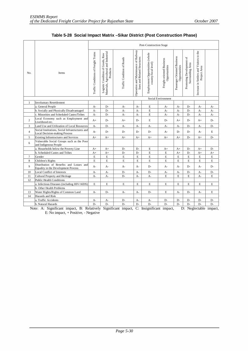
ESIMMS Report of the Dedicated Freight Corridor Project for Rajasthan State October 2007
Page 5-30
Table 5-28 Social Impact Matrix –Sikar District (Post Construction Phase)
Post-Construction Stage
No. Items
Traf
fic C
ondi
tions
of F
reig
ht T
rain
s
Logi
stic
Cond
ition
of G
oods
, Raw
M
ater
ials,
Agr
icul
tura
l and
Indu
stria
l Pr
oduc
ts
Traf
fic C
ondi
tion
of R
oads
Ope
ratio
n an
d M
aint
enan
ce o
f Rai
lway
lin
es a
nd R
elat
ed S
truct
ures
Empl
oym
ent O
ppor
tuni
ties (
who
le
coun
try/lo
cal l
evel
)
Frei
ght-o
rient
ed B
usin
ess
Opp
ortu
nitie
s
Pass
enge
r Orie
nted
Bus
ines
s O
ppor
tuni
ties
Prom
otin
g D
evel
opm
ent o
f Su
rrou
ndin
g A
rea
Incr
ease
in S
ettle
rs a
nd V
isito
rs to
the
Proj
ect A
rea
Social Environment 1 Involuntary Resettlement a. General People A- D- A- A- E A- A- D- A- A- b. Socially and Physically Disadvantaged A- D- A- A- E A- A- D- A- A- c. Minorities and Scheduled Castes/Tribes A- D- A- A- E A- A- D- A- A-
2 Local Economy such as Employment and Livelihood etc. A+ D- A+ D- E D- A+ D- A+ D-
3 Land Use and Utilization of Local Resources A- D- A- A- A- A- A- D- A- D-
4 Social Institutions, Social Infrastructures and Local Decision-making Process A- D- D- D- D- A- D- D- A- E
5 Existing Infrastructures and Services A+ A+ A+ A+ A+ A+ A+ D- A+ D-
6 Vulnerable Social Groups such as the Poor and Indigenous People
a. Households below the Poverty Line A+ A+ D- D- E A+ A+ D- A+ D- b. Scheduled Castes and Tribes A+ A+ D- D- E E A+ D- A+ A+ 7 Gender E E E E E E E E E E 8 Children's Rights E E E E E E E E E E
9 Distribution of Benefits and Losses and Equality in the Development Process A- A- A- A- D- A- A- D- A- D-
10 Local Conflict of Interests A- A- D- A- D- A- A- D- A- D- 11 Cultural Property and Heritage A- A- D- A- A- E E E A- E 12 Public Health Conditions a. Infectious Diseases (including HIV/AIDS) E E E E E E E E E E b. Other Health Problems
13 Water Rights/Rights of Common Land A- D- A- A- D- E A- D- A- E 14 Hazards and Risk a. Traffic Accidents A- A- D- A- A- D- D- D- D- D- b. Natural Hazards D- D- D- D- D- D- D- D- D- D- Note: A: Significant impact, B: Relatively Significant impact, C: Insignificant impact, D: Neglectable impact,
E: No impact, + Positive, - Negative
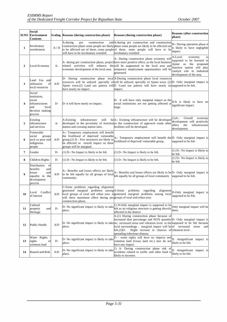
ESIMMS Report of the Dedicated Freight Corridor Project for Rajasthan State October 2007
Page 5-31
Sl.NO Social Environment Contents
Scaling Reasons (during construction phase) Reasons (during construction phase) Reasons (after-construction phase)
1 Involuntary resettlement A-/ D
A-during pre construction and construction phase some people are likely to be affected out of these, some people will have to be involuntary resettled
A-during pre construction and construction phase some people are likely to be affected out of these, some people will have to be involuntary resettled
D-: During operation phase it is likely to have negligible impact.
2 Local Economy A- A- during pre construction phase, project related activities will enhance the economic development of the local area.
A- During construction phase economy will have more positive effect, as the local business will be augmented in the local area and temporary employment opportunities will be generated.
A-Local economy is supposed to be boosted in Ajmer as the proposed Junction station will play catalyst role in industrial development of the area.
3 Land Use and utilization of local resources
A/D
D- During construction phase local resources will be utilized ,specially of Ajmer town.(2) Land use pattern will have nearly no impact.
A-During construction phase local resources will be utilized, specially of Ajmer town. (2) D -Land use pattern will have nearly no impact.
D- Only marginal impact is supposed to be felt.
4
Social institution, social infrastructures and local decision making process
D- D- it will have nearly no impact. D- It will have only marginal impact as the social institutions are not getting affected at large.
D-It is likely to have no significant impact.
5 Existing infrastructure and services
A- A-Existing infrastructure will be developed in the proximity of Junction station and crossing station sites .
A-: Existing infrastructure will be developed as the construction of approach roads other facilities will be developed.
(1)A-: Overall economy development will positively affect the infrastructure development.
6
Vulnerable social groups such as poor and indigenous people
A/D
A-: Temporary employment will benefit the livelihood of deprived/ vulnerable group.(2) D - Few structures are likely to be affected so overall impact on these groups will be marginal.
A-: Temporary employment will benefit the livelihood of deprived/ vulnerable group.
D- Only marginal impact is supposed to be felt.
7 Gender D- (1) D-: No Impact is likely to be felt. (1) D-: No Impact is likely to be felt. (1) D-: No Impact is likely to be felt.
8 Children Rights D- (1) D-: No Impact is likely to be felt. (1) D-: No Impact is likely to be felt. (1) D-: No Impact is likely to be felt.
9
Distribution of benefits and losses and equality in the development process
A/D A-: Benefits and losses effects are likely to be felt equally by all groups of local community.
A-: Benefits and losses effects are likely to be felt equally by all groups of local community
D- Only marginal impact is supposed to be felt.
10 Local Conflict of interest A/D
C-Some problems regarding alignment generated marginal problems among local groups of rural and urban area .it will show maximum effect during pre construction phase.
A-Some problems regarding alignment generated marginal problems among local groups of rural and urban area.
D-Only marginal impact is supposed to be felt.
11 Cultural property and Heritage
D- D- No significant impact is likely to take place.
1) D-Only marginal impact is supposed to be felt as no religious structure is getting directly affected in the district
Only marginal impact will be there.
12 Public Health A/D D- No significant impact is likely to take place.
A-(1) During construction phase because of increased dust percentage and NOX quantity etc, increased noise and vibration level. in the local surroundings , marginal impact will be felt.(2)D- Slight increase in chances of spreading infectious disease.
D- Only marginal impact is supposed to be felt because of increased noise and vibration level .
13 Water Rights / rights of common land
D- D- No significant impact is likely to take place.
D - water rights will have no impacts and common land (Grass land etc.) also do not have any impact.
D -Insignificant impact is likely to be felt.
14 Hazard and Risk A/D D- No significant impact is likely to take place.
1) A- During construction phase risk of accidents related to traffic and other kind is likely to increase.
D -Insignificant impact is likely to be felt.
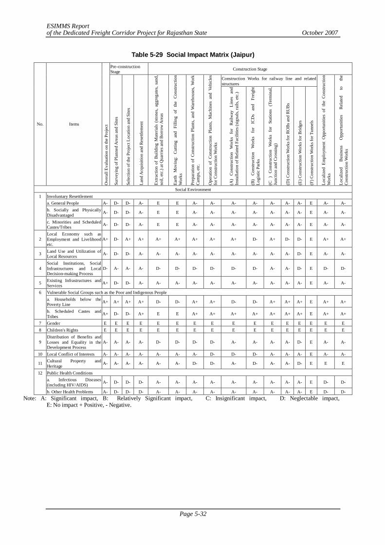
ESIMMS Report of the Dedicated Freight Corridor Project for Rajasthan State October 2007
Page 5-32
Table 5-29 Social Impact Matrix (Jaipur) Pre-construction Stage Construction Stage
Construction Works for railway line and related structures
No. Items
Ove
rall
Eval
uatio
n on
the
Proj
ect
Surv
eyin
g of
Pla
nned
Are
as a
nd S
ites
Sele
ctio
n of
the
Proj
ect L
ocat
ion
and
Site
s
Land
Acq
uisit
ion
and
Rese
ttlem
ent
Extra
ctio
n of
Bui
ldin
g M
ater
ials
(sto
nes,
aggr
egat
es, s
and,
so
il, e
tc.)
at Q
uarr
ies a
nd B
orro
w A
reas
Earth
Mov
ing:
Cut
ting
and
Filli
ng o
f th
e Co
nstru
ctio
n W
orks
Prep
arat
ion
of C
onstr
uctio
n Pl
ants,
and
War
ehou
ses,
Wor
k Ca
mps
, etc
.
Ope
ratio
n of
Con
struc
tion
Plan
ts, M
achi
nes
and
Vehi
cles
fo
r Con
struc
tion
Wor
ks
(A)
Cons
truct
ion
Wor
ks
for
Railw
ay
Line
s an
d In
stalla
tion
of R
elat
ed F
acili
ties (
signa
ls, ra
ils, e
tc.)
(B)
Cons
truct
ion
Wor
ks
for
ICD
s an
d Fr
eigh
t Lo
gisti
c Pa
rks
(C )
Con
struc
tion
Wor
ks f
or S
tatio
ns (
Term
inal
, Ju
nctio
n an
d Cr
ossin
g)
(D) C
onstr
uctio
n W
orks
for R
OBs
and
RU
Bs
(E) C
onstr
uctio
n W
orks
for B
ridge
s
(F) C
onstr
uctio
n W
orks
for T
unne
ls
Loca
lized
Em
ploy
men
t O
ppor
tuni
ties
of t
he C
onstr
uctio
n W
orks
Loca
lized
Bu
sines
s O
ppor
tuni
ties
Rela
ted
to
the
Cons
truct
ion
Wor
ks
Social Environment 1 Involuntary Resettlement a. General People A- D- D- A- E E A- A- A- A- A- A- A- E A- A-
b. Socially and Physically Disadvantaged A- D- D- A- E E A- A- A- A- A- A- A- E A- A-
c. Minorities and Scheduled Castes/Tribes A- D- D- A- E E A- A- A- A- A- A- A- E A- A-
2 Local Economy such as Employment and Livelihood etc.
A+ D- A+ A+ A+ A+ A+ A+ A+ D- A+ D- D- E A+ A+
3 Land Use and Utilization of Local Resources A- D- D- A- A- A- A- A- A- A- A- A- D- E A- A-
4 Social Institutions, Social Infrastructures and Local Decision-making Process
D- A- A- A- D- D- D- D- D- D- A- A- D- E D- D-
5 Existing Infrastructures and Services A+ D- D- A- A- A- A- A- A- A- A- A- A- E A- A-
6 Vulnerable Social Groups such as the Poor and Indigenous People
a. Households below the Poverty Line A+ A+ A+ A+ D- D- A+ A+ D- D- A+ A+ A+ E A+ A+
b. Scheduled Castes and Tribes A+ D- D- A+ E E A+ A+ A+ A+ A+ A+ A+ E A+ A+
7 Gender E E E E E E E E E E E E E E E E 8 Children's Rights E E E E E E E E E E E E E E E E
9 Distribution of Benefits and Losses and Equality in the Development Process
A- A- A- A- D- D- D- D- A- A- A- A- D- E A- A-
10 Local Conflict of Interests A- A- A- A- A- A- A- D- D- D- A- A- A- E A- A-
11 Cultural Property and Heritage A- A- A- A- A- A- D- D- A- D- A- A- D- E E E
12 Public Health Conditions
a. Infectious Diseases (including HIV/AIDS) A- D- D- D- A- A- A- A- A- A- A- A- A- E D- D-
b. Other Health Problems A- D- D- D- A- A- A- A- A- A- A- A- A- E D- D- Note: A: Significant impact, B: Relatively Significant impact, C: Insignificant impact, D: Neglectable impact,
E: No impact + Positive, - Negative.
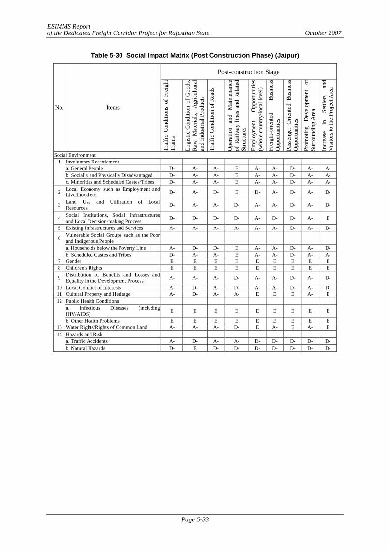
ESIMMS Report of the Dedicated Freight Corridor Project for Rajasthan State October 2007
Page 5-33
Table 5-30 Social Impact Matrix (Post Construction Phase) (Jaipur)
Post-construction Stage
No. Items
Traf
fic C
ondi
tions
of
Frei
ght
Trai
ns
Logi
stic
Con
ditio
n of
Goo
ds,
Raw
M
ater
ials
, A
gric
ultu
ral
and
Indu
stria
l Pro
duct
s
Traf
fic C
ondi
tion
of R
oads
Ope
ratio
n an
d M
aint
enan
ce
of R
ailw
ay li
nes
and
Rela
ted
Stru
ctur
es
Empl
oym
ent
Opp
ortu
nitie
s (w
hole
cou
ntry
/loca
l lev
el)
Frei
ght-o
rient
ed
Bus
ines
s O
ppor
tuni
ties
Pass
enge
r O
rient
ed B
usin
ess
Opp
ortu
nitie
s
Prom
otin
g D
evel
opm
ent
of
Surr
ound
ing
Are
a
Incr
ease
in
Se
ttler
s an
d V
isito
rs to
the
Proj
ect A
rea
Social Environment 1 Involuntary Resettlement a. General People D- A- A- E A- A- D- A- A- b. Socially and Physically Disadvantaged D- A- A- E A- A- D- A- A- c. Minorities and Scheduled Castes/Tribes D- A- A- E A- A- D- A- A-
2 Local Economy such as Employment and Livelihood etc. D- A- D- E D- A- D- A- D-
3 Land Use and Utilization of Local Resources D- A- A- D- A- A- D- A- D-
4 Social Institutions, Social Infrastructures and Local Decision-making Process D- D- D- D- A- D- D- A- E
5 Existing Infrastructures and Services A- A- A- A- A- A- D- A- D-
6 Vulnerable Social Groups such as the Poor and Indigenous People
a. Households below the Poverty Line A- D- D- E A- A- D- A- D- b. Scheduled Castes and Tribes D- A- A- E A- A- D- A- A-
7 Gender E E E E E E E E E 8 Children's Rights E E E E E E E E E
9 Distribution of Benefits and Losses and Equality in the Development Process A- A- A- D- A- A- D- A- D-
10 Local Conflict of Interests A- D- A- D- A- A- D- A- D- 11 Cultural Property and Heritage A- D- A- A- E E E A- E 12 Public Health Conditions
a. Infectious Diseases (including HIV/AIDS) E E E E E E E E E
b. Other Health Problems E E E E E E E E E 13 Water Rights/Rights of Common Land A- A- A- D- E A- E A- E 14 Hazards and Risk
a. Traffic Accidents A- D- A- A- D- D- D- D- D- b. Natural Hazards D- E D- D- D- D- D- D- D-
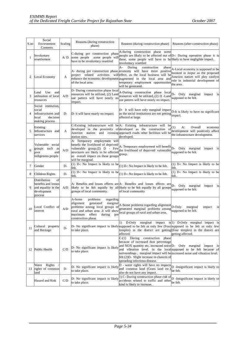
ESIMMS Report of the Dedicated Freight Corridor Project for Rajasthan State October 2007
Page 5-34
S.no Social
Environment Contents
Scaling Reasons (during construction phase) Reasons (during construction phase) Reasons (after-construction phase)
1 Involuntary resettlement A/ D
C-during pre construction phase some people some people will have to be involuntary resettled
A-during construction phase some people are likely to be affected out of these, some people will have to be involuntary resettled
D-: During operation phase it is likely to have negligible impact.
2 Local Economy A
A- during pre construction phase, project related activities will enhance the economic development of the local area.
A- During construction phase economy will have more positive effect, as the local business will be augmented in the local area and temporary employment opportunities will be generated.
A-Local economy is supposed to be boosted in Jaipur as the proposed Junction station will play catalyst role in industrial development of the area .
3 Land Use and utilization of local resources
A/D
D- During construction phase local resources will be utilized, (2) Land use pattern will have nearly no impact.
A-During construction phase local resources will be utilized,.(2) D -Land use pattern will have nearly no impact.
D- Only marginal impact is supposed to be felt.
4
Social institution, social infrastructures and local decision making process
D- D- it will have nearly no impact. D- It will have only marginal impact as the social institutions are not getting affected at large.
D-It is likely to have no significant impact.
5 Existing infrastructure and services
A
C-Existing infrastructure will be developed in the proximity of Junction station and crossing station sites.
A: Existing infrastructure will be developed as the construction of approach roads other facilities will be developed.
(1) A: Overall economy development will positively affect the infrastructure development.
6
Vulnerable social groups such as poor and indigenous people
A/D
A: Temporary employment will benefit the livelihood of deprived/ vulnerable group.(2) D - Few structures are likely to be affected so overall impact on these groups will be marginal.
A: Temporary employment will benefit the livelihood of deprived/ vulnerable group.
D- Only marginal impact is supposed to be felt.
7 Gender D- (1) D-: No Impact is likely to be felt. (1) D-: No Impact is likely to be felt. (1) D-: No Impact is likely to be
felt.
8 Children Rights D- (1) D-: No Impact is likely to be felt. (1) D-: No Impact is likely to be felt. (1) D-: No Impact is likely to be
felt.
9
Distribution of benefits and losses and equality in the development process
A/D A: Benefits and losses effects are likely to be felt equally by all groups of local community.
A: Benefits and losses effects are likely to be felt equally by all groups of local community
D- Only marginal impact is supposed to be felt.
10 Local Conflict of interest A/D
A-Some problems regarding alignment generated marginal problems among local groups of rural and urban area .it will show maximum effect during pre construction phase.
A-Some problems regarding alignment generated marginal problems among local groups of rural and urban area.
D-Only marginal impact is supposed to be felt.
11 Cultural property and Heritage D- D- No significant impact is likely
to take place.
1) D-Only marginal impact is supposed to be felt as only few (Four temples) in the district are getting affected.
1) D-Only marginal impact is supposed to be felt as only few (Four temples) in the district are getting affected.
12 Public Health C/D D- No significant impact is likely to take place.
C-(1) During construction phase because of increased dust percentage and NOX quantity etc, increased noise and vibration level. in the local surroundings , marginal impact will be felt.(2)D- Slight increase in chances of spreading infectious disease.
D- Only marginal impact is supposed to be felt because of increased noise and vibration level.
13 Water Rights / rights of common land
D- D- No significant impact is likely to take place.
D - water rights will have no impacts and common land (Grass land etc.) also do not have any impact.
D -Insignificant impact is likely to be felt.
Hazard and Risk C/D D- No significant impact is likely to take place.
1) C- During construction phase risk of accidents related to traffic and other kind is likely to increase.
D -Insignificant impact is likely to be felt.
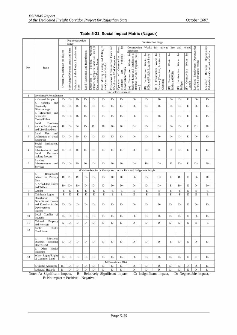
ESIMMS Report of the Dedicated Freight Corridor Project for Rajasthan State October 2007
Page 5-35
Table 5-31 Social Impact Matrix (Nagaur)
Pre-construction Stage Construction Stage
Construction Works for railway line and related structures
No. Items
Ove
rall
Eval
uatio
n on
the
Proj
ect
Surv
eyin
g of
Pla
nned
Are
as a
nd S
ites
Sele
ctio
n of
the
Pro
ject
Loc
atio
n an
d Si
tes
Land
Acq
uisit
ion
and
Rese
ttlem
ent
Extra
ctio
n of
Bu
ildin
g M
ater
ials
(sto
nes,
aggr
egat
es, s
and,
soi
l, et
c.)
at
Qua
rrie
s and
Bor
row
Are
as
Earth
Mov
ing:
Cut
ting
and
Filli
ng o
f th
e Co
nstru
ctio
n W
orks
Prep
arat
ion
of C
onstr
uctio
n Pl
ants,
and
W
areh
ouse
s, W
ork
Cam
ps, e
tc.
Ope
ratio
n of
Co
nstru
ctio
n Pl
ants,
M
achi
nes
and
Veh
icle
s fo
r Co
nstru
ctio
n W
orks
(A
) Co
nstru
ctio
n W
orks
fo
r Ra
ilway
Lin
es a
nd In
stalla
tion
of
Rela
ted
Faci
litie
s (s
igna
ls, r
ails,
et
c.)
(B)
Cons
truct
ion
Wor
ks
for
ICD
s and
Fre
ight
Log
istic
Par
ks
(C
) Co
nstru
ctio
n W
orks
fo
r St
atio
ns (
Term
inal
, Jun
ctio
n an
d Cr
ossin
g)
(D)
Cons
truct
ion
Wor
ks
for
ROBs
and
RU
Bs
(E)
Cons
truct
ion
Wor
ks
for
Brid
ges
(F)
Cons
truct
ion
Wor
ks
for
Tunn
els
Loca
lized
Em
ploy
men
t O
ppor
tuni
ties
of th
e Co
nstru
ctio
n W
orks
Loca
lized
Bu
sines
s O
ppor
tuni
ties
Rela
ted
to th
e Co
nstru
ctio
n W
orks
Social Environment 1 Involuntary Resettlement a. General People D- D- D- D- D- D- D- D- D- D- D- D- D- E D- D-
b. Socially and Physically Disadvantaged
D- D- D- D- D- D- D- D- D- D- D- D- D- E D- D-
c. Minorities and Scheduled Castes/Tribes
D- D- D- D- D- D- D- D- D- D- D- D- D- E D- D-
2 Local Economy such as Employment and Livelihood etc.
D+ D- D+ D- D+ D+ D+ D+ D+ D- D+ D- D- E D+ D+
3 Land Use and Utilization of Local Resources
D- D- D- D- D- D- D- D- D- D- D- D- D- E D- D-
4
Social Institutions, Social Infrastructures and Local Decision-making Process
D- D- D- D- D- D- D- D- D- D- D- D- D- E D- D-
5 Existing Infrastructures and Services
D- D- D- D+ D- D- D+ D+ D+ D+ D+ E D+ E D+ D+
6 Vulnerable Social Groups such as the Poor and Indigenous People
a. Households below the Poverty Line
D+ D+ D+ D- D- D- D+ D+ D- D- D+ E D+ E D- D+
b. Scheduled Castes and Tribes D+ D+ D+ D- D- D- D+ D+ D- D- D+ E D+ E D- D+
7 Gender E E E E E E E E E E E E E E E E 8 Children's Rights E E E E E E E E E E E E E E E E
9
Distribution of Benefits and Losses and Equality in the Development Process
D- D- D- D- D- D- D- D- D- D- D- D- D- E D- D-
10 Local Conflict of Interests D- D- D- D- D- D- D- D- D- D- D- D- D- E D- D-
11 Cultural Property and Heritage D- D- D- D- D- D- D- D- D- D- D- D- D- E E E
12 Public Health Conditions
a. Infectious Diseases (including HIV/AIDS)
D- D- D- D- D- D- D- D- D- D- D- E D- E D- D-
b. Other Health Problems
13 Water Rights/Rights of Common Land D- D- D- D- D- D- D- D- D- D- D- D- D- E E D-
14Hazards and Risk a. Traffic Accidents D- D- D- D- D- D- D- D- D- D- D- D- D- D- D- D- b.Natural Hazards D- D- D- D- D- D- D- D- D- D- D- D- D- E D- D-
Note: A: Significant impact, B: Relatively Significant impact, C: Insignificant impact, D: Neglectable impact, E: No impact + Positive, - Negative.
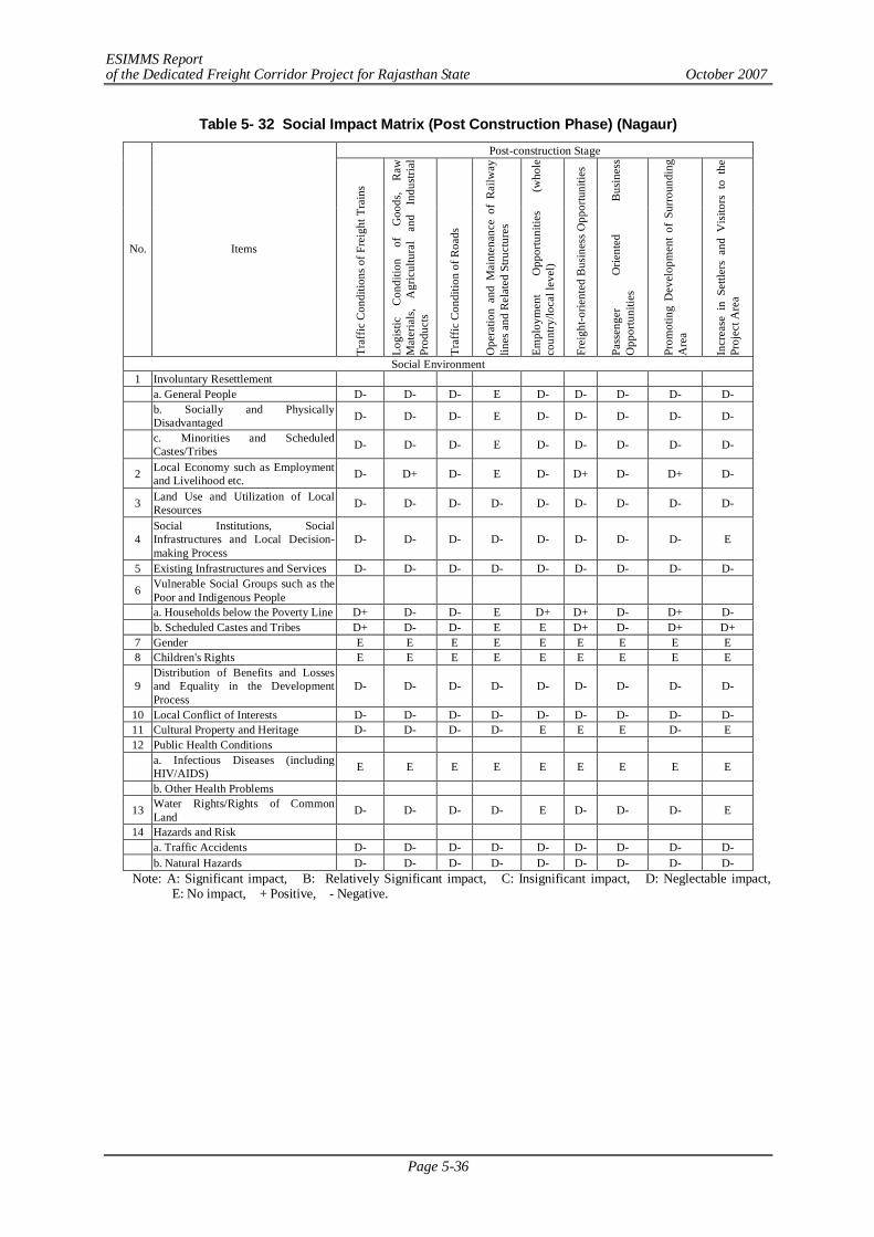
ESIMMS Report of the Dedicated Freight Corridor Project for Rajasthan State October 2007
Page 5-36
Table 5- 32 Social Impact Matrix (Post Construction Phase) (Nagaur) Post-construction Stage
No. Items
Traf
fic C
ondi
tions
of F
reig
ht T
rain
s
Logi
stic
C
ondi
tion
of
Goo
ds,
Raw
M
ater
ials
, A
gric
ultu
ral
and
Indu
stria
l Pr
oduc
ts
Traf
fic C
ondi
tion
of R
oads
Ope
ratio
n an
d M
aint
enan
ce o
f R
ailw
ay
lines
and
Rel
ated
Stru
ctur
es
Empl
oym
ent
Opp
ortu
nitie
s (w
hole
co
untry
/loca
l lev
el)
Frei
ght-o
rient
ed B
usin
ess O
ppor
tuni
ties
Pass
enge
r O
rient
ed
Bus
ines
s O
ppor
tuni
ties
Prom
otin
g D
evel
opm
ent
of S
urro
undi
ng
Are
a
Incr
ease
in
Settl
ers
and
Vis
itors
to
the
Proj
ect A
rea
Social Environment 1 Involuntary Resettlement a. General People D- D- D- E D- D- D- D- D-
b. Socially and Physically Disadvantaged D- D- D- E D- D- D- D- D-
c. Minorities and Scheduled Castes/Tribes D- D- D- E D- D- D- D- D-
2 Local Economy such as Employment and Livelihood etc. D- D+ D- E D- D+ D- D+ D-
3 Land Use and Utilization of Local Resources D- D- D- D- D- D- D- D- D-
4 Social Institutions, Social Infrastructures and Local Decision-making Process
D- D- D- D- D- D- D- D- E
5 Existing Infrastructures and Services D- D- D- D- D- D- D- D- D-
6 Vulnerable Social Groups such as the Poor and Indigenous People
a. Households below the Poverty Line D+ D- D- E D+ D+ D- D+ D- b. Scheduled Castes and Tribes D+ D- D- E E D+ D- D+ D+
7 Gender E E E E E E E E E 8 Children's Rights E E E E E E E E E
9 Distribution of Benefits and Losses and Equality in the Development Process
D- D- D- D- D- D- D- D- D-
10 Local Conflict of Interests D- D- D- D- D- D- D- D- D- 11 Cultural Property and Heritage D- D- D- D- E E E D- E 12 Public Health Conditions
a. Infectious Diseases (including HIV/AIDS) E E E E E E E E E
b. Other Health Problems
13 Water Rights/Rights of Common Land D- D- D- D- E D- D- D- E
14 Hazards and Risk a. Traffic Accidents D- D- D- D- D- D- D- D- D- b. Natural Hazards D- D- D- D- D- D- D- D- D-
Note: A: Significant impact, B: Relatively Significant impact, C: Insignificant impact, D: Neglectable impact, E: No impact, + Positive, - Negative.
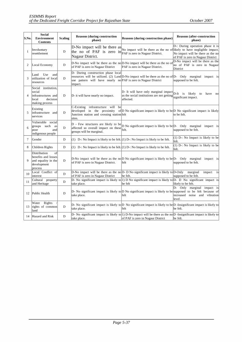
ESIMMS Report of the Dedicated Freight Corridor Project for Rajasthan State October 2007
Page 5-37
S.No. Social
Environment Contents
Scaling Reasons (during construction phase) Reasons (during construction phase) Reasons (after-construction
phase)
1 Involuntary resettlement D
D-No impact will be there as the no of PAF is zero in Nagaur District.
No impact will be there as the no of PAF is zero in Nagaur District.
D-: During operation phase it is likely to have negligible impact. No impact will be there as the no of PAF is zero in Nagaur District
2 Local Economy D D-No impact will be there as the no of PAF is zero in Nagaur District
D-No impact will be there as the no of PAF is zero in Nagaur District.
D-No impact will be there as the no of PAF is zero in Nagaur District
3 Land Use and utilization of local resources
D
D- During construction phase local resources will be utilized. (2) Land use pattern will have nearly no impact.
D-No impact will be there as the no of PAF is zero in Nagaur District
D- Only marginal impact is supposed to be felt.
4
Social institution, social infrastructures and local decision making process
D D- it will have nearly no impact. D- It will have only marginal impact as the social institutions are not getting affected.
D-It is likely to have no significant impact.
5 Existing infrastructure and services
D
C-Existing infrastructure will be developed in the proximity of Junction station and crossing station sites.
D No significant impact is likely to be felt
D No significant impact is likely to be felt.
6
Vulnerable social groups such as poor and indigenous people
D D - Few structures are likely to be affected so overall impact on these groups will be marginal.
D No significant impact is likely to be felt.
D- Only marginal impact is supposed to be felt.
7 Gender D (1) D-: No Impact is likely to be felt. (1) D-: No Impact is likely to be felt. (1) D-: No Impact is likely to be felt.
8 Children Rights D (1) D-: No Impact is likely to be felt. (1) D-: No Impact is likely to be felt. (1) D-: No Impact is likely to be felt.
9
Distribution of benefits and losses and equality in the development process
D D-No impact will be there as the no of PAF is zero in Nagaur District.
D No significant impact is likely to be felt
D- Only marginal impact is supposed to be felt.
10 Local Conflict of interest D D-No impact will be there as the no
of PAF is zero in Nagaur District D- D No significant impact is likely to be felt.
D-Only marginal impact is supposed to be felt.
11 Cultural property and Heritage D D- No significant impact is likely to
take place. 1) D No significant impact is likely to be felt
D- D No significant impact is likely to be felt.
12 Public Health D D- No significant impact is likely to take place.
D No significant impact is likely to be felt
D- Only marginal impact is supposed to be felt because of increased noise and vibration level .
13 Water Rights / rights of common land
D D- No significant impact is likely to take place.
D No significant impact is likely to be felt
D -Insignificant impact is likely to be felt.
14 Hazard and Risk D D- No significant impact is likely to take place.
1) D-No impact will be there as the no of PAF is zero in Nagaur District
D -Insignificant impact is likely to be felt.

ESIMMS Report of the Dedicated Freight Corridor Project for Rajasthan State October 2007
Page 5-38
Table 5-33 Social Impact Matrix (Ajmer) Pre-construction
Stage Construction Stage
Construction Works for railway line and related structures
No.
Items
Ove
rall
Eval
uatio
n on
the
Proj
ect
Surv
eyin
g of
Pla
nned
Are
as a
nd S
ites
Sele
ctio
n of
the
Proj
ect L
ocat
ion
and
Site
s
Land
Acq
uisit
ion
and
Rese
ttlem
ent
Extra
ctio
n of
Bui
ldin
g M
ater
ials
(sto
nes,
aggr
egat
es,
sand
, soi
l, et
c.) a
t Qua
rrie
s and
Bor
row
Are
as
Earth
Mov
ing:
Cut
ting
and
Filli
ng o
f the
Con
struc
tion
Wor
ks
Prep
arat
ion
of C
onstr
uctio
n Pl
ants,
and
War
ehou
ses,
Wor
k Ca
mps
, etc
.
Ope
ratio
n of
Con
struc
tion
Plan
ts, M
achi
nes a
nd V
ehic
les
for C
onstr
uctio
n W
orks
(A) C
onstr
uctio
n W
orks
for R
ailw
ay
Line
s and
Insta
llatio
n of
Rel
ated
Fac
ilitie
s (s
igna
ls, ra
ils, e
tc.)
(B) C
onstr
uctio
n W
orks
for I
CDs a
nd
Frei
ght L
ogist
ic P
arks
(C )
Cons
truct
ion
Wor
ks fo
r Sta
tions
(T
erm
inal
, Jun
ctio
n an
d Cr
ossin
g)
(D) C
onstr
uctio
n W
orks
for R
OBs
and
RU
Bs
(E) C
onstr
uctio
n W
orks
for B
ridge
s
(F) C
onstr
uctio
n W
orks
for T
unne
ls
Loca
lized
Em
ploy
men
t Opp
ortu
nitie
s of t
he C
onstr
uctio
n W
orks
Loca
lized
Bus
ines
s Opp
ortu
nitie
s Rel
ated
to th
e Co
nstru
ctio
n W
orks
Social Environment
1 Involuntary Resettlement
a. General People -A -D -D -A -A -A -A -A -A -A -A -D -A E -A -A
b. Socially and Physically Disadvantaged -A -D -D -A -A -A -A -A -A -A -A -D -A E -A -A
c. Minorities and Scheduled Castes/Tribes -A -D -D -A -A -A -A -A -A -A -A -D -A E -A -A
2 Local Economy such as Employment and Livelihood etc. -A -D +A -A +A +A +A +A +A -D +A -D -D E +A +A
3 Land Use and Utilization of Local Resources -A -D -D -A -A -A -A -A -A -A -A -D -D E -A -A
4 Social Institutions, Social Infrastructures and Local Decision-making Process
-A -A -A -A -D -D -D -D -D -D -A -D -D E -D -D
5 Existing Infrastructures and Services +A -D -D +A +A -A +A +A +A +A +A E +A E +A +A
6 6
Vulnerable Social Groups such as the Poor and Indigenous People
a. Households below the Poverty Line +A +A +A +A -D -D +A +A -D -D +A E +A E +A +A
b. Scheduled Castes and Tribes +A +A +A +A -D -D +A +A -D -D +A E +A E +A +A
7 Gender E E E E E E E E E E E E E E E E
8 Children's Rights E E E E E E E E E E E E E E E E
9 Distribution of Benefits and Losses and Equality in the Development Process
-A -A -A -A -D -D -D -D -A -A -A -D -D E -A -A
10 Local Conflict of Interests -A -A -A -A -A -A -A -D -D -D -A -D -D E -A -A
11 Cultural Property and Heritage -A -A -A -A -D -D -D -D -A -D -A -D -D E E E
12 Public Health Conditions
a. Infectious Diseases (including HIV/AIDS) -A -D -D -D -A -A -A -A -A -A -A E -D E -D -D
b. Other Health Problems
13 Water Rights/Rights of Common Land -A -D -D -D -A -A -A -A -A -A -A -D -A E E -A
14 14Hazards and Risk
a. Traffic Accidents -A -A -A -A -A -A -A -A -A -A -A -A -D -A -D -D
b. Natural Hazards -A -A -A -A -A -A -A -A -A -D -A -D -A E -D -D
Note: A: Significant impact, B: Relatively Significant impact, C: Insignificant impact, D: Neglectable impact, E: No impact, + Positive, - Negative
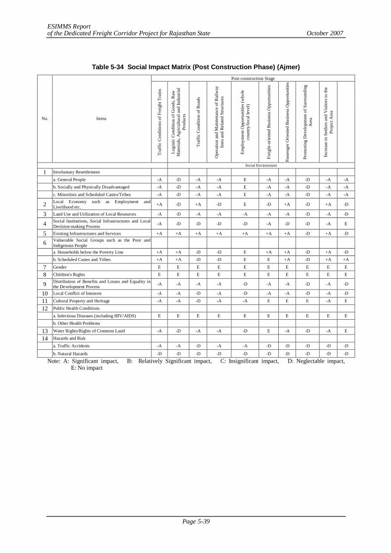
ESIMMS Report of the Dedicated Freight Corridor Project for Rajasthan State October 2007
Page 5-39
Table 5-34 Social Impact Matrix (Post Construction Phase) (Ajmer) Post-construction Stage
No. Items
Traf
fic C
ondi
tions
of F
reig
ht T
rain
s
Logi
stic
Cond
ition
of G
oods
, Raw
M
ater
ials,
Agr
icul
tura
l and
Indu
stria
l Pr
oduc
ts
Traf
fic C
ondi
tion
of R
oads
Ope
ratio
n an
d M
aint
enan
ce o
f Rai
lway
lin
es a
nd R
elat
ed S
truct
ures
Empl
oym
ent O
ppor
tuni
ties (
who
le
coun
try/lo
cal l
evel
)
Frei
ght-o
rient
ed B
usin
ess O
ppor
tuni
ties
Pass
enge
r Orie
nted
Bus
ines
s Opp
ortu
nitie
s
Prom
otin
g D
evel
opm
ent o
f Sur
roun
ding
A
rea
Incr
ease
in S
ettle
rs a
nd V
isito
rs to
the
Proj
ect A
rea
Social Environment
1 Involuntary Resettlement a. General People -A -D -A -A E -A -A -D -A -A
b. Socially and Physically Disadvantaged -A -D -A -A E -A -A -D -A -A
c. Minorities and Scheduled Castes/Tribes -A -D -A -A E -A -A -D -A -A
2 Local Economy such as Employment and Livelihood etc. +A -D +A -D E -D +A -D +A -D
3 Land Use and Utilization of Local Resources -A -D -A -A -A -A -A -D -A -D
4 Social Institutions, Social Infrastructures and Local Decision-making Process -A -D -D -D -D -A -D -D -A E
5 Existing Infrastructures and Services +A +A +A +A +A +A +A -D +A -D
6 Vulnerable Social Groups such as the Poor and Indigenous People
a. Households below the Poverty Line +A +A -D -D E +A +A -D +A -D
b. Scheduled Castes and Tribes +A +A -D -D E E +A -D +A +A
7 Gender E E E E E E E E E E
8 Children's Rights E E E E E E E E E E
9 Distribution of Benefits and Losses and Equality in the Development Process -A -A -A -A -D -A -A -D -A -D
10 Local Conflict of Interests -A -A -D -A -D -A -A -D -A -D
11 Cultural Property and Heritage -A -A -D -A -A E E E -A E
12 Public Health Conditions
a. Infectious Diseases (including HIV/AIDS) E E E E E E E E E E
b. Other Health Problems
13 Water Rights/Rights of Common Land -A -D -A -A -D E -A -D -A E
14 Hazards and Risk
a. Traffic Accidents -A -A -D -A -A -D -D -D -D -D
b. Natural Hazards -D -D -D -D -D -D -D -D -D -D
Note: A: Significant impact, B: Relatively Significant impact, C: Insignificant impact, D: Neglectable impact, E: No impact
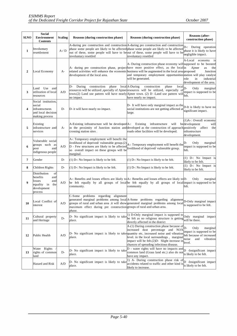
ESIMMS Report of the Dedicated Freight Corridor Project for Rajasthan State October 2007
Page 5-40
Sl.NO Social
Environment Contents
Scaling Reasons (during construction phase) Reasons (during construction phase) Reasons (after-construction phase)
1 Involuntary resettlement A-/ D
A-during pre construction and construction phase some people are likely to be affected out of these, some people will have to be involuntary resettled
A-during pre construction and construction phase some people are likely to be affected out of these, some people will have to be involuntary resettled
D-: During operation phase it is likely to have negligible impact.
2 Local Economy A- A- during pre construction phase, project related activities will enhance the economic development of the local area.
A- During construction phase economy will have more positive effect, as the local business will be augmented in the local area and temporary employment opportunities will be generated.
A-Local economy is supposed to be boosted in Ajmer as the proposed Junction station will play catalyst role in industrial development of the area.
3 Land Use and utilization of local resources
A/D
D- During construction phase local resources will be utilized ,specially of Ajmer town.(2) Land use pattern will have nearly no impact.
A-During construction phase local resources will be utilized, especially of Ajmer town. (2) D -Land use pattern will have nearly no impact.
D- Only marginal impact is supposed to be felt.
4
Social institution, social infrastructures and local decision making process
D- D- it will have nearly no impact. D- It will have only marginal impact as the social institutions are not getting affected at large.
D-It is likely to have no significant impact.
5 Existing infrastructure and services
A- A-Existing infrastructure will be developed in the proximity of Junction station and crossing station sites .
A-: Existing infrastructure will be developed as the construction of approach roads other facilities will be developed.
(1)A-: Overall economy development will positively affect the infrastructure development.
6
Vulnerable social groups such as poor and indigenous people
A/D
A-: Temporary employment will benefit the livelihood of deprived/ vulnerable group.(2) D - Few structures are likely to be affected so overall impact on these groups will be marginal.
A-: Temporary employment will benefit the livelihood of deprived/ vulnerable group.
D- Only marginal impact is supposed to be felt.
7 Gender D- (1) D-: No Impact is likely to be felt. (1) D-: No Impact is likely to be felt. (1) D-: No Impact is likely to be felt.
8 Children Rights D- (1) D-: No Impact is likely to be felt. (1) D-: No Impact is likely to be felt. (1) D-: No Impact is likely to be felt.
9
Distribution of benefits and losses and equality in the development process
A/D A-: Benefits and losses effects are likely to be felt equally by all groups of local community.
A-: Benefits and losses effects are likely to be felt equally by all groups of local community
D- Only marginal impact is supposed to be felt.
10 Local Conflict of interest A/D
C-Some problems regarding alignment generated marginal problems among local groups of rural and urban area .it will show maximum effect during pre construction phase.
A-Some problems regarding alignment generated marginal problems among local groups of rural and urban area.
D-Only marginal impact is supposed to be felt.
11 Cultural property and Heritage D- D- No significant impact is likely to take
place.
1) D-Only marginal impact is supposed to be felt as no religious structure is getting directly affected in the district
Only marginal impact will be there.
12 Public Health A/D D- No significant impact is likely to take place.
A-(1) During construction phase because of increased dust percentage and NOX quantity etc, increased noise and vibration level. in the local surroundings , marginal impact will be felt.(2)D- Slight increase in chances of spreading infectious disease.
D- Only marginal impact is supposed to be felt because of increased noise and vibration level.
13 Water Rights / rights of common land
D- D- No significant impact is likely to take place.
D - water rights will have no impacts and common land (Grass land etc.) also do not have any impact.
D -Insignificant impact is likely to be felt.
Hazard and Risk A/D D- No significant impact is likely to take place.
1) A- During construction phase risk of accidents related to traffic and other kind is likely to increase.
D -Insignificant impact is likely to be felt.
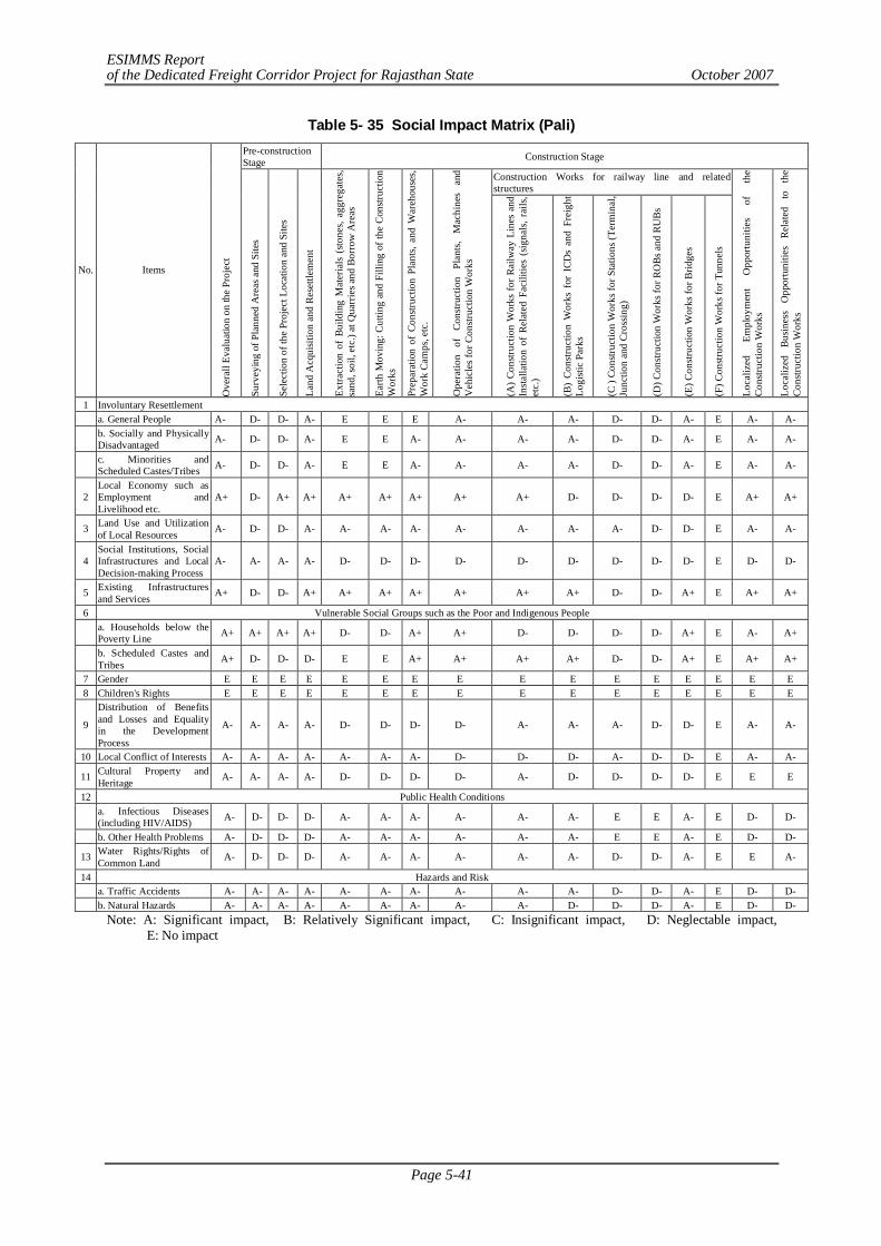
ESIMMS Report of the Dedicated Freight Corridor Project for Rajasthan State October 2007
Page 5-41
Table 5- 35 Social Impact Matrix (Pali) Pre-construction Stage Construction Stage
Construction Works for railway line and related structures
No. Items
Ove
rall
Eval
uatio
n on
the
Proj
ect
Surv
eyin
g of
Pla
nned
Are
as a
nd S
ites
Sele
ctio
n of
the
Proj
ect L
ocat
ion
and
Site
s
Land
Acq
uisit
ion
and
Rese
ttlem
ent
Extra
ctio
n of
Bui
ldin
g M
ater
ials
(sto
nes,
aggr
egat
es,
sand
, soi
l, et
c.) a
t Qua
rrie
s and
Bor
row
Are
as
Earth
Mov
ing:
Cut
ting
and
Filli
ng o
f the
Con
struc
tion
Wor
ks
Prep
arat
ion
of C
onstr
uctio
n Pl
ants,
and
War
ehou
ses,
Wor
k Ca
mps
, etc
.
Ope
ratio
n of
Co
nstru
ctio
n Pl
ants,
M
achi
nes
and
Veh
icle
s for
Con
struc
tion
Wor
ks
(A) C
onstr
uctio
n W
orks
for R
ailw
ay L
ines
and
In
stalla
tion
of R
elat
ed F
acili
ties
(sig
nals,
rai
ls,
etc.
)
(B)
Cons
truct
ion
Wor
ks f
or I
CDs
and
Frei
ght
Logi
stic
Park
s
(C )
Cons
truct
ion
Wor
ks fo
r Sta
tions
(Ter
min
al,
Junc
tion
and
Cros
sing)
(D) C
onstr
uctio
n W
orks
for R
OBs
and
RU
Bs
(E) C
onstr
uctio
n W
orks
for B
ridge
s
(F) C
onstr
uctio
n W
orks
for T
unne
ls
Loca
lized
Em
ploy
men
t O
ppor
tuni
ties
of
the
Cons
truct
ion
Wor
ks
Loca
lized
Bu
sine
ss
Opp
ortu
nitie
s Re
late
d to
th
e Co
nstru
ctio
n W
orks
1 Involuntary Resettlement a. General People A- D- D- A- E E E A- A- A- D- D- A- E A- A-
b. Socially and Physically Disadvantaged A- D- D- A- E E A- A- A- A- D- D- A- E A- A-
c. Minorities and Scheduled Castes/Tribes A- D- D- A- E E A- A- A- A- D- D- A- E A- A-
2 Local Economy such as Employment and Livelihood etc.
A+ D- A+ A+ A+ A+ A+ A+ A+ D- D- D- D- E A+ A+
3 Land Use and Utilization of Local Resources A- D- D- A- A- A- A- A- A- A- A- D- D- E A- A-
4 Social Institutions, Social Infrastructures and Local Decision-making Process
A- A- A- A- D- D- D- D- D- D- D- D- D- E D- D-
5 Existing Infrastructures and Services A+ D- D- A+ A+ A+ A+ A+ A+ A+ D- D- A+ E A+ A+
6 Vulnerable Social Groups such as the Poor and Indigenous People
a. Households below the Poverty Line A+ A+ A+ A+ D- D- A+ A+ D- D- D- D- A+ E A- A+
b. Scheduled Castes and Tribes A+ D- D- D- E E A+ A+ A+ A+ D- D- A+ E A+ A+
7 Gender E E E E E E E E E E E E E E E E 8 Children's Rights E E E E E E E E E E E E E E E E
9
Distribution of Benefits and Losses and Equality in the Development Process
A- A- A- A- D- D- D- D- A- A- A- D- D- E A- A-
10 Local Conflict of Interests A- A- A- A- A- A- A- D- D- D- A- D- D- E A- A-
11 Cultural Property and Heritage A- A- A- A- D- D- D- D- A- D- D- D- D- E E E
12 Public Health Conditions
a. Infectious Diseases (including HIV/AIDS) A- D- D- D- A- A- A- A- A- A- E E A- E D- D-
b. Other Health Problems A- D- D- D- A- A- A- A- A- A- E E A- E D- D-
13 Water Rights/Rights of Common Land A- D- D- D- A- A- A- A- A- A- D- D- A- E E A-
14 Hazards and Risk a. Traffic Accidents A- A- A- A- A- A- A- A- A- A- D- D- A- E D- D- b. Natural Hazards A- A- A- A- A- A- A- A- A- D- D- D- A- E D- D-
Note: A: Significant impact, B: Relatively Significant impact, C: Insignificant impact, D: Neglectable impact, E: No impact

ESIMMS Report of the Dedicated Freight Corridor Project for Rajasthan State October 2007
Page 5-42
Table 5- 36 Social Impact Matrix (Post Construction Phase) (Pali)
Post-construction Stage
No. Items
Ove
r all
Impa
ct
Traf
fic C
ondi
tions
of F
reig
ht T
rain
s
Logi
stic
Con
ditio
n of
Goo
ds,
Raw
M
ater
ials
, A
gric
ultu
ral
and
Indu
stria
l Pro
duct
s
Traf
fic C
ondi
tion
of R
oads
Ope
ratio
n an
d M
aint
enan
ce
of
Rai
lway
lin
es
and
Rel
ated
St
ruct
ures
Empl
oym
ent
Opp
ortu
nitie
s (w
hole
co
untry
/loca
l lev
el)
Frei
ght-o
rient
ed
Bus
ines
s O
ppor
tuni
ties
Pass
enge
r O
rient
ed
Bus
ines
s O
ppor
tuni
ties
Prom
otin
g D
evel
opm
ent
of
Surr
ound
ing
Are
a
Incr
ease
in S
ettle
rs a
nd V
isito
rs to
th
e Pr
ojec
t Are
a
Social Environment 1 Involuntary Resettlement a. General People A- D- A- A- E A- A- D- A- A-
b. Socially and Physically Disadvantaged A- D- A- A- E A- A- D- A- A-
c. Minorities and Scheduled Castes/Tribes A- D- A- A- E A- A- D- A- A-
2 Local Economy such as Employment and Livelihood etc. A- D- A+ D- E D- A+ D- A+ D-
3 Land Use and Utilization of Local Resources A- D- A- A- D- A- A- D- A- D-
4 Social Institutions, Social Infrastructures and Local Decision-making Process
A- D- D- D- D- A- D- D- A- E
5 Existing Infrastructures and Services A+ A+ A+ A- A+ A+ A+ D- A+ D-
6 Vulnerable Social Groups such as the Poor and Indigenous People
a. Households below the Poverty Line A+ A+ D- D- E A+ A+ D- A+ D- b. Scheduled Castes and Tribes A+ D- A+ A+ E A+ A+ D- A+ A+ 7 Gender E E E E E E E E E E 8 Children's Rights E E E E E E E E E E
9 Distribution of Benefits and Losses and Equality in the Development Process
A- A- A- A- D- A- A- D- A- D-
10 Local Conflict of Interests A- A- D- A- D- A- A- D- A- D- 11 Cultural Property and Heritage A- A- D- A- A- E E E A- E 12 Public Health Conditions
a. Infectious Diseases (including HIV/AIDS) E E E E E E E E E E
b. Other Health Problems E E E E E E E E E E 13 Water Rights/Rights of Common Land A- A- A- A- D- A- A- E A- E 14 Hazards and Risk
a. Traffic Accidents D- A- D- A- A- D- D- D- D- D- b. Natural Hazards D- D- E D- D- D- D- D- D- D-
Note: A: Significant impact, B: Relatively Significant impact, C: Insignificant impact, D: Neglectable impact, E: No impact
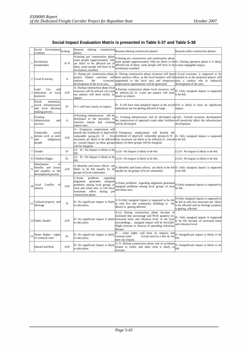
ESIMMS Report of the Dedicated Freight Corridor Project for Rajasthan State October 2007
Page 5-43
Social Impact Evaluation Matrix is presented in Table 5-37 and Table 5-38
Social Environment Contents Scaling Reasons (during construction
phase) Reasons (during construction phase) Reasons (after-construction phase)
1 Involuntary resettlement A/ D
A-during pre construction phase some people (approximately 236) are likely to be affected out of these, some people will have to be involuntary resettled
A-during pre construction and construction phase some people (approximately 236) are likely to be affected out of these, some people will have to be involuntary resettled
D-: During operation phase it is likely to have negligible impact.
2 Local Economy A
A- during pre construction phase, project related activities will enhance the economic development of the local area.
A- During construction phase economy will have more positive effect, as the local business will be augmented in the local area and temporary employment opportunities will be generated.
C-Local economy is supposed to be boosted in as the proposed project will play a catalyst role in industrial development of the area .
3 Land Use and utilization of local resources
A/D
A- During construction phase local resources will be utilized .(2) Land use pattern will have nearly no impact.
A-During construction phase local resources will be utilized,.(2) D -Land use pattern will have nearly no impact.
D- Only marginal impact is supposed to be felt.
4
Social institution, social infrastructures and local decision making process
D- D- it will have nearly no impact. D- It will have only marginal impact as the social institutions are not getting affected at large.
D-It is likely to have no significant impact.
5 Existing infrastructure and services
A
A-Existing infrastructure will be developed in the proximity of Junction station and crossing station sites .
A-: Existing infrastructure will be developed as the construction of approach roads other facilities will be developed.
(1)A-: Overall economy development will positively affect the infrastructure development.
6
Vulnerable social groups such as poor and indigenous people
A/D
A-: Temporary employment will benefit the livelihood of deprived/ vulnerable group.(2) D - Few structures are likely to be affected so overall impact on these groups will be marginal.
A-:Temporary employment will benefit the livelihood of deprived/ vulnerable group.(2) D - Few structures are likely to be affected so overall impact on these groups will be marginal.
D- Only marginal impact is supposed to be felt.
7 Gender D- (1) D-: No Impact is likely to be felt. (1) D-: No Impact is likely to be felt. (1) D-: No Impact is likely to be felt.
8 Children Rights D- (1) D-: No Impact is likely to be felt. (1) D-: No Impact is likely to be felt. (1) D-: No Impact is likely to be felt.
9
Distribution of benefits and losses and equality in the development process
A/D A-:Benefits and losses effects are likely to be felt equally by all groups of local community .
A-:Benefits and losses effects are likely to be felt equally by all groups of local community
D- Only marginal impact is supposed to be felt.
10 Local Conflict of interest A/D
C-Some problems regarding alignment generated marginal problems among local groups of rural and urban area .it will show maximum effect during pre construction phase.
A-Some problems regarding alignment generated marginal problems among local groups of rural and urban area .
D-Only marginal impact is supposed to be felt.
11 Cultural property and Heritage D D- No significant impact is likely
to take place.
1) D-Only marginal impact is supposed to be felt as only few one community building) in the district is getting affected.
D-Only marginal impact is supposed to be felt as only few structures are likely to be affected and no heritage property is getting affected.
12 Public Health A/D D- No significant impact is likely to take place.
A-(1) During construction phase because of increased dust percentage and NOX quantity etc, increased noise and vibration level. in the local surroundings , marginal impact will be felt.(2)D- Slight increase in chances of spreading infectious disease.
D- Only marginal impact is supposed to be felt because of increased noise and vibration level.
13 Water Rights / rights of common land D- D- No significant impact is likely
to take place.
D - water rights wail have no impacts and common land (Grass land etc.) also do not have any impact.
D -Insignificant impact is likely to be felt.
Hazard and Risk A/D D- No significant impact is likely to take place.
1) A- During construction phase risk of accidents related to traffic and other kind is likely to increase.
D -Insignificant impact is likely to be felt.
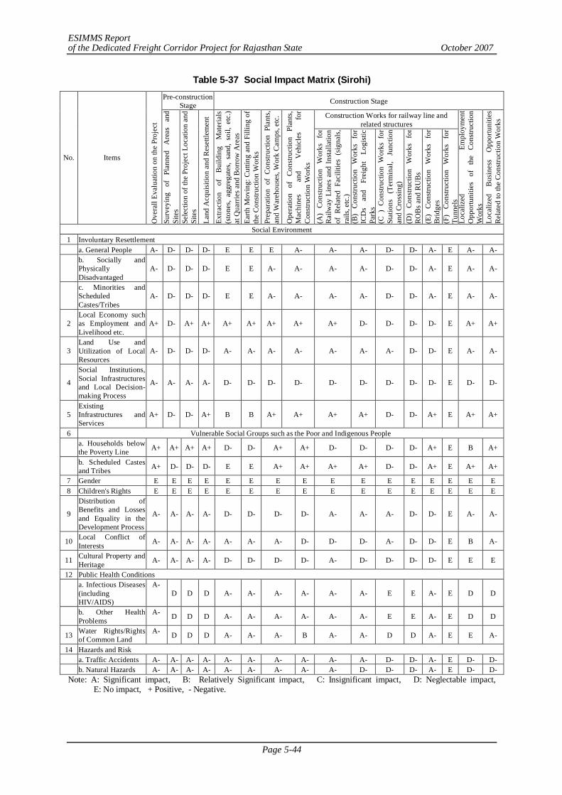
ESIMMS Report of the Dedicated Freight Corridor Project for Rajasthan State October 2007
Page 5-44
Table 5-37 Social Impact Matrix (Sirohi) Pre-construction
Stage Construction Stage
Construction Works for railway line and related structures
No. Items O
vera
ll Ev
alua
tion
on th
e Pr
ojec
t Su
rvey
ing
of
Plan
ned
Are
as
and
Site
s Se
lect
ion
of th
e Pr
ojec
t Loc
atio
n an
d Si
tes
Land
Acq
uisi
tion
and
Res
ettle
men
t
Extra
ctio
n of
B
uild
ing
Mat
eria
ls
(sto
nes,
aggr
egat
es,
sand
, so
il, e
tc.)
at Q
uarr
ies a
nd B
orro
w A
reas
Ea
rth M
ovin
g: C
uttin
g an
d Fi
lling
of
the
Con
stru
ctio
n W
orks
Pr
epar
atio
n of
Con
stru
ctio
n Pl
ants
, an
d W
areh
ouse
s, W
ork
Cam
ps, e
tc.
Ope
ratio
n of
C
onst
ruct
ion
Plan
ts,
Mac
hine
s an
d V
ehic
les
for
Con
stru
ctio
n W
orks
(A
) C
onst
ruct
ion
Wor
ks
for
Rai
lway
Lin
es a
nd In
stal
latio
n of
Rel
ated
Fac
ilitie
s (s
igna
ls,
rails
, etc
.) (B
) C
onst
ruct
ion
Wor
ks
for
ICD
s an
d Fr
eigh
t Lo
gist
ic
Park
s (C
) C
onst
ruct
ion
Wor
ks f
or
Stat
ions
(T
erm
inal
, Ju
nctio
n an
d C
ross
ing)
(D
) C
onst
ruct
ion
Wor
ks
for
RO
Bs a
nd R
UB
s (E
) C
onst
ruct
ion
Wor
ks
for
Brid
ges
(F)
Con
stru
ctio
n W
orks
fo
r Tu
nnel
s Lo
caliz
ed
Empl
oym
ent
Opp
ortu
nitie
s of
th
e C
onst
ruct
ion
Wor
ks
Loca
lized
B
usin
ess
Opp
ortu
nitie
s R
elat
ed to
the
Con
stru
ctio
n W
orks
Social Environment 1 Involuntary Resettlement a. General People A- D- D- D- E E E A- A- A- D- D- A- E A- A-
b. Socially and Physically Disadvantaged
A- D- D- D- E E A- A- A- A- D- D- A- E A- A-
c. Minorities and Scheduled Castes/Tribes
A- D- D- D- E E A- A- A- A- D- D- A- E A- A-
2 Local Economy such as Employment and Livelihood etc.
A+ D- A+ A+ A+ A+ A+ A+ A+ D- D- D- D- E A+ A+
3 Land Use and Utilization of Local Resources
A- D- D- D- A- A- A- A- A- A- A- D- D- E A- A-
4
Social Institutions, Social Infrastructures and Local Decision-making Process
A- A- A- A- D- D- D- D- D- D- D- D- D- E D- D-
5 Existing Infrastructures and Services
A+ D- D- A+ B B A+ A+ A+ A+ D- D- A+ E A+ A+
6 Vulnerable Social Groups such as the Poor and Indigenous People
a. Households below the Poverty Line A+ A+ A+ A+ D- D- A+ A+ D- D- D- D- A+ E B A+
b. Scheduled Castes and Tribes A+ D- D- D- E E A+ A+ A+ A+ D- D- A+ E A+ A+
7 Gender E E E E E E E E E E E E E E E E 8 Children's Rights E E E E E E E E E E E E E E E E
9
Distribution of Benefits and Losses and Equality in the Development Process
A- A- A- A- D- D- D- D- A- A- A- D- D- E A- A-
10 Local Conflict of Interests A- A- A- A- A- A- A- D- D- D- A- D- D- E B A-
11 Cultural Property and Heritage A- A- A- A- D- D- D- D- A- D- D- D- D- E E E
12 Public Health Conditions
a. Infectious Diseases (including HIV/AIDS)
A- D D D A- A- A- A- A- A- E E A- E D D
b. Other Health Problems
A- D D D A- A- A- A- A- A- E E A- E D D
13 Water Rights/Rights of Common Land
A- D D D A- A- A- B A- A- D D A- E E A-
14 Hazards and Risk a. Traffic Accidents A- A- A- A- A- A- A- A- A- A- D- D- A- E D- D-
b. Natural Hazards A- A- A- A- A- A- A- A- A- D- D- D- A- E D- D- Note: A: Significant impact, B: Relatively Significant impact, C: Insignificant impact, D: Neglectable impact,
E: No impact, + Positive, - Negative.
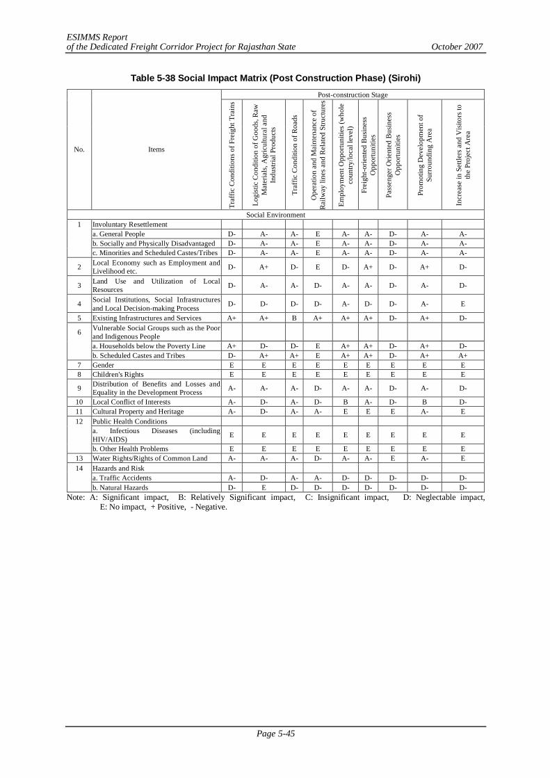
ESIMMS Report of the Dedicated Freight Corridor Project for Rajasthan State October 2007
Page 5-45
Table 5-38 Social Impact Matrix (Post Construction Phase) (Sirohi) Post-construction Stage
No. Items
Traf
fic C
ondi
tions
of F
reig
ht T
rain
s
Logi
stic
Con
ditio
n of
Goo
ds, R
aw
Mat
eria
ls, A
gric
ultu
ral a
nd
Indu
stria
l Pro
duct
s
Traf
fic C
ondi
tion
of R
oads
Ope
ratio
n an
d M
aint
enan
ce o
f R
ailw
ay li
nes a
nd R
elat
ed S
truct
ures
Empl
oym
ent O
ppor
tuni
ties (
who
le
coun
try/lo
cal l
evel
)
Frei
ght-o
rient
ed B
usin
ess
Opp
ortu
nitie
s
Pass
enge
r Orie
nted
Bus
ines
s O
ppor
tuni
ties
Prom
otin
g D
evel
opm
ent o
f Su
rrou
ndin
g A
rea
Incr
ease
in S
ettle
rs a
nd V
isito
rs to
th
e Pr
ojec
t Are
a
Social Environment 1 Involuntary Resettlement a. General People D- A- A- E A- A- D- A- A- b. Socially and Physically Disadvantaged D- A- A- E A- A- D- A- A- c. Minorities and Scheduled Castes/Tribes D- A- A- E A- A- D- A- A-
2 Local Economy such as Employment and Livelihood etc. D- A+ D- E D- A+ D- A+ D-
3 Land Use and Utilization of Local Resources D- A- A- D- A- A- D- A- D-
4 Social Institutions, Social Infrastructures and Local Decision-making Process D- D- D- D- A- D- D- A- E
5 Existing Infrastructures and Services A+ A+ B A+ A+ A+ D- A+ D-
6 Vulnerable Social Groups such as the Poor and Indigenous People
a. Households below the Poverty Line A+ D- D- E A+ A+ D- A+ D- b. Scheduled Castes and Tribes D- A+ A+ E A+ A+ D- A+ A+ 7 Gender E E E E E E E E E 8 Children's Rights E E E E E E E E E
9 Distribution of Benefits and Losses and Equality in the Development Process A- A- A- D- A- A- D- A- D-
10 Local Conflict of Interests A- D- A- D- B A- D- B D- 11 Cultural Property and Heritage A- D- A- A- E E E A- E 12 Public Health Conditions
a. Infectious Diseases (including HIV/AIDS) E E E E E E E E E
b. Other Health Problems E E E E E E E E E 13 Water Rights/Rights of Common Land A- A- A- D- A- A- E A- E 14 Hazards and Risk a. Traffic Accidents A- D- A- A- D- D- D- D- D- b. Natural Hazards D- E D- D- D- D- D- D- D-
Note: A: Significant impact, B: Relatively Significant impact, C: Insignificant impact, D: Neglectable impact, E: No impact, + Positive, - Negative.
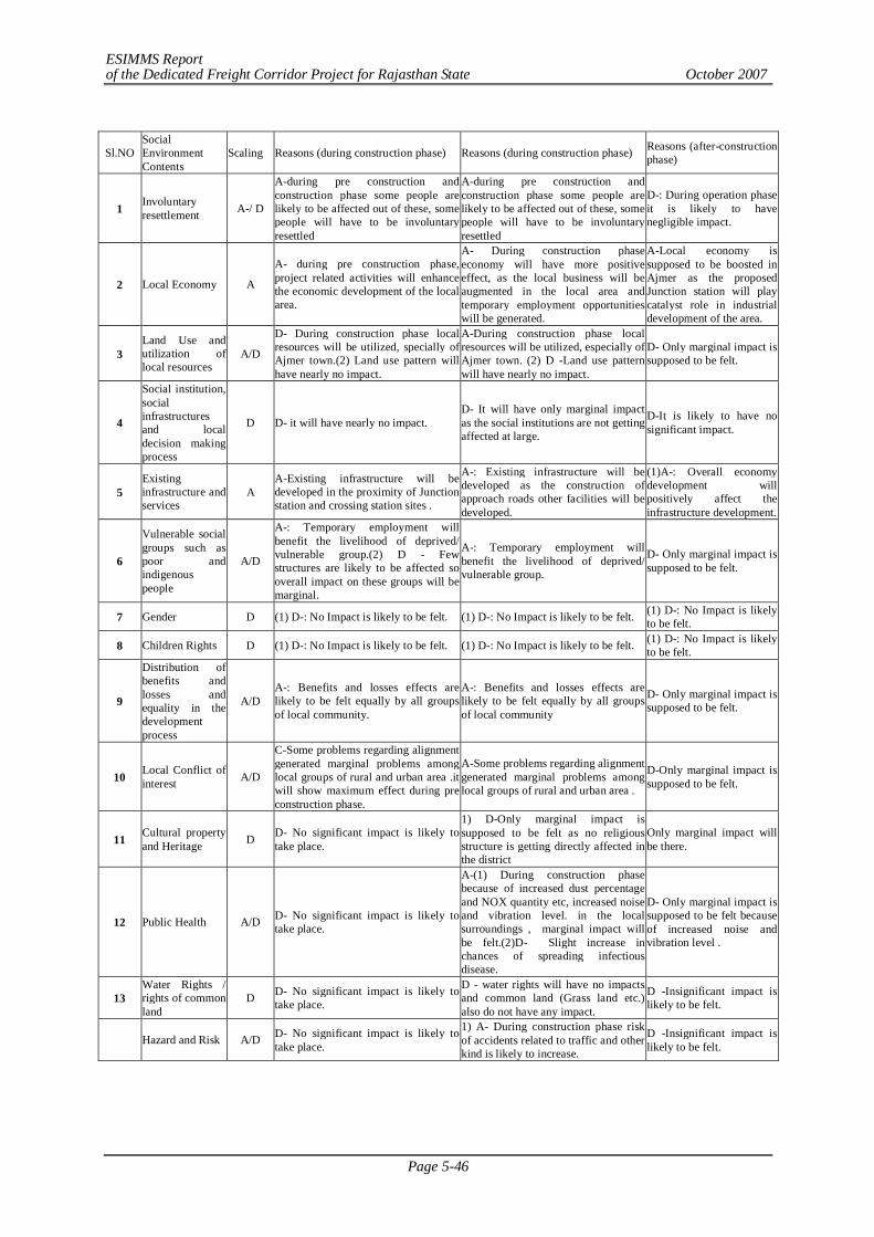
ESIMMS Report of the Dedicated Freight Corridor Project for Rajasthan State October 2007
Page 5-46
Sl.NO Social Environment Contents
Scaling Reasons (during construction phase) Reasons (during construction phase) Reasons (after-construction phase)
1 Involuntary resettlement A-/ D
A-during pre construction and construction phase some people are likely to be affected out of these, some people will have to be involuntary resettled
A-during pre construction and construction phase some people are likely to be affected out of these, some people will have to be involuntary resettled
D-: During operation phase it is likely to have negligible impact.
2 Local Economy A
A- during pre construction phase, project related activities will enhance the economic development of the local area.
A- During construction phase economy will have more positive effect, as the local business will be augmented in the local area and temporary employment opportunities will be generated.
A-Local economy is supposed to be boosted in Ajmer as the proposed Junction station will play catalyst role in industrial development of the area.
3 Land Use and utilization of local resources
A/D
D- During construction phase local resources will be utilized, specially of Ajmer town.(2) Land use pattern will have nearly no impact.
A-During construction phase local resources will be utilized, especially of Ajmer town. (2) D -Land use pattern will have nearly no impact.
D- Only marginal impact is supposed to be felt.
4
Social institution, social infrastructures and local decision making process
D D- it will have nearly no impact. D- It will have only marginal impact as the social institutions are not getting affected at large.
D-It is likely to have no significant impact.
5 Existing infrastructure and services
A A-Existing infrastructure will be developed in the proximity of Junction station and crossing station sites .
A-: Existing infrastructure will be developed as the construction of approach roads other facilities will be developed.
(1)A-: Overall economy development will positively affect the infrastructure development.
6
Vulnerable social groups such as poor and indigenous people
A/D
A-: Temporary employment will benefit the livelihood of deprived/ vulnerable group.(2) D - Few structures are likely to be affected so overall impact on these groups will be marginal.
A-: Temporary employment will benefit the livelihood of deprived/ vulnerable group.
D- Only marginal impact is supposed to be felt.
7 Gender D (1) D-: No Impact is likely to be felt. (1) D-: No Impact is likely to be felt. (1) D-: No Impact is likely to be felt.
8 Children Rights D (1) D-: No Impact is likely to be felt. (1) D-: No Impact is likely to be felt. (1) D-: No Impact is likely to be felt.
9
Distribution of benefits and losses and equality in the development process
A/D A-: Benefits and losses effects are likely to be felt equally by all groups of local community.
A-: Benefits and losses effects are likely to be felt equally by all groups of local community
D- Only marginal impact is supposed to be felt.
10 Local Conflict of interest A/D
C-Some problems regarding alignment generated marginal problems among local groups of rural and urban area .it will show maximum effect during pre construction phase.
A-Some problems regarding alignment generated marginal problems among local groups of rural and urban area .
D-Only marginal impact is supposed to be felt.
11 Cultural property and Heritage D D- No significant impact is likely to
take place.
1) D-Only marginal impact is supposed to be felt as no religious structure is getting directly affected in the district
Only marginal impact will be there.
12 Public Health A/D D- No significant impact is likely to take place.
A-(1) During construction phase because of increased dust percentage and NOX quantity etc, increased noise and vibration level. in the local surroundings , marginal impact will be felt.(2)D- Slight increase in chances of spreading infectious disease.
D- Only marginal impact is supposed to be felt because of increased noise and vibration level .
13 Water Rights / rights of common land
D D- No significant impact is likely to take place.
D - water rights will have no impacts and common land (Grass land etc.) also do not have any impact.
D -Insignificant impact is likely to be felt.
Hazard and Risk A/D D- No significant impact is likely to take place.
1) A- During construction phase risk of accidents related to traffic and other kind is likely to increase.
D -Insignificant impact is likely to be felt.
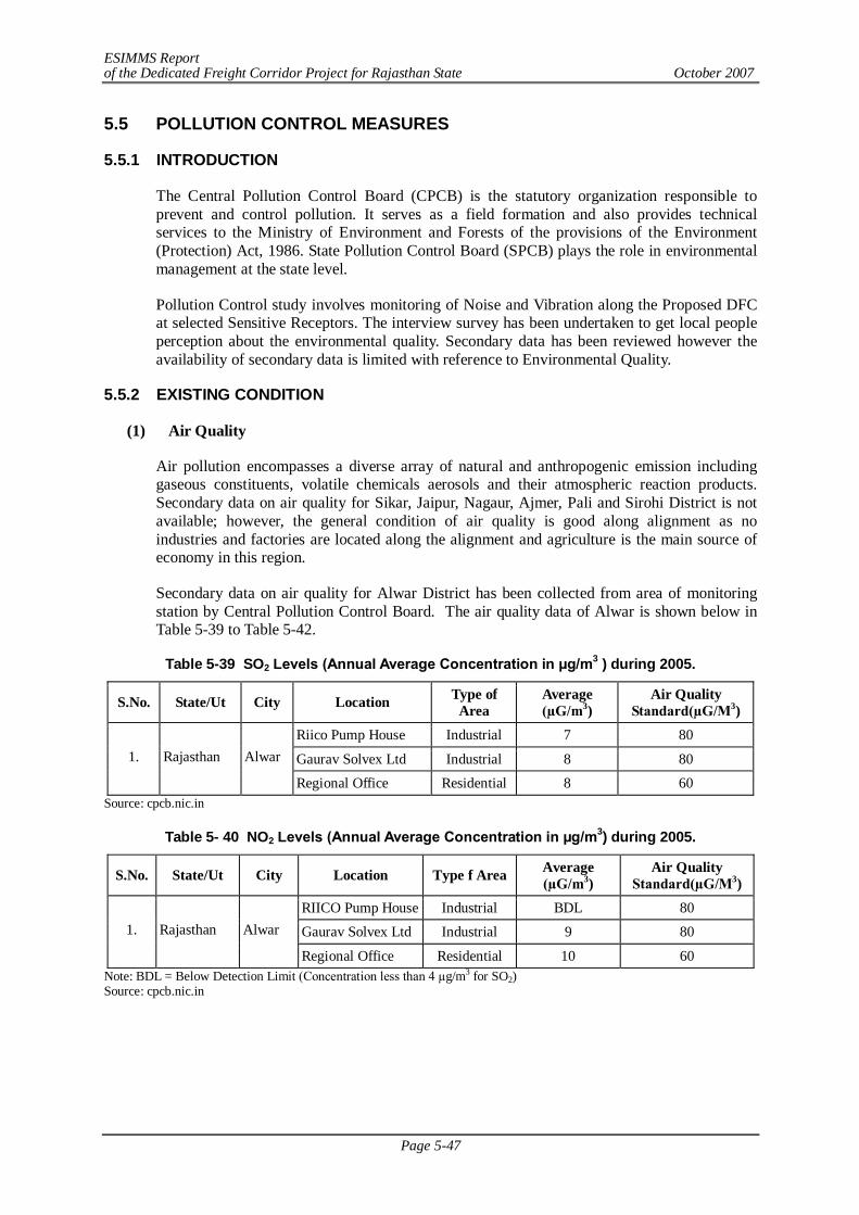
ESIMMS Report of the Dedicated Freight Corridor Project for Rajasthan State October 2007
Page 5-47
5.5 POLLUTION CONTROL MEASURES
5.5.1 INTRODUCTION
The Central Pollution Control Board (CPCB) is the statutory organization responsible to prevent and control pollution. It serves as a field formation and also provides technical services to the Ministry of Environment and Forests of the provisions of the Environment (Protection) Act, 1986. State Pollution Control Board (SPCB) plays the role in environmental management at the state level.
Pollution Control study involves monitoring of Noise and Vibration along the Proposed DFC at selected Sensitive Receptors. The interview survey has been undertaken to get local people perception about the environmental quality. Secondary data has been reviewed however the availability of secondary data is limited with reference to Environmental Quality.
5.5.2 EXISTING CONDITION
(1) Air Quality
Air pollution encompasses a diverse array of natural and anthropogenic emission including gaseous constituents, volatile chemicals aerosols and their atmospheric reaction products. Secondary data on air quality for Sikar, Jaipur, Nagaur, Ajmer, Pali and Sirohi District is not available; however, the general condition of air quality is good along alignment as no industries and factories are located along the alignment and agriculture is the main source of economy in this region.
Secondary data on air quality for Alwar District has been collected from area of monitoring station by Central Pollution Control Board. The air quality data of Alwar is shown below in Table 5-39 to Table 5-42.
Table 5-39 SO2 Levels (Annual Average Concentration in µg/m3 ) during 2005.
S.No. State/Ut City Location Type of Area
Average (µG/m3)
Air Quality Standard(µG/M3)
Riico Pump House Industrial 7 80
Gaurav Solvex Ltd Industrial 8 80 1. Rajasthan Alwar
Regional Office Residential 8 60 Source: cpcb.nic.in
Table 5- 40 NO2 Levels (Annual Average Concentration in µg/m3) during 2005.
S.No. State/Ut City Location Type f Area Average (µG/m3)
Air Quality Standard(µG/M3)
RIICO Pump House Industrial BDL 80
Gaurav Solvex Ltd Industrial 9 80 1. Rajasthan Alwar
Regional Office Residential 10 60 Note: BDL = Below Detection Limit (Concentration less than 4 µg/m3 for SO2) Source: cpcb.nic.in
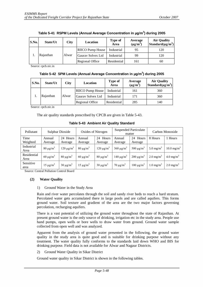
ESIMMS Report of the Dedicated Freight Corridor Project for Rajasthan State October 2007
Page 5-48
Table 5-41 RSPM Levels (Annual Average Concentration in µg/m3) during 2005
S.No. State/Ut City Location Type of Area
Average (µg/m3)
Air Quality Standard(µg/m3)
RIICO Pump House Industrial 95 120
Gaurav Solvex Ltd Industrial 99 120 1. Rajasthan Alwar
Regional Office Residential 161 60 Source: cpcb.nic.in
Table 5-42 SPM Levels (Annual Average Concentration in µg/m3) during 2005
S.No. State/Ut City Location Type of Area
Average (µg/m3)
Air Quality Standard(µg/m3)
RIICO Pump House Industrial 161 360
Gaurav Solvex Ltd Industrial 171 360 1. Rajasthan Alwar
Regional Office Residential 285 140 Source: cpcb.nic.in
The air quality standards prescribed by CPCB are given in Table 5-43.
Table 5-43 Ambient Air Quality Standard
Pollutant Sulphur Dioxide Oxides of Nitrogen Suspended Particulate matter Carbon Monoxide
Time Weighted
Annual Average
24 Hours Average
Annual Average
24 Hours Average
Annual Average
24 Hours Average
8 Hours 1 Hours
Industrial Area 80 µg/m3 120 µg/m3 80 µg/m3 120 µg/m3 360 µg/m3 500 µg/m3 5.0 mg/m3 10.0 mg/m3
Residential Area 60 µg/m3 80 µg/m3 60 µg/m3 80 µg/m3 140 µg/m3 200 µg/m3 2.0 mg/m3 4.0 mg/m3
Sensitive area 15 µg/m3 30 µg/m3 15 µg/m3 30 µg/m3 70 µg/m3 100 µg/m3 1.0 mg/m3 2.0 mg/m3
Source: Central Pollution Control Board
(2) Water Quality
1) Ground Water in the Study Area
Rain and river water percolates through the soil and sandy river beds to reach a hard stratum. Percolated water gets accumulated there in large pools and are called aquifers. This forms ground water. Soil texture and gradient of the area are the two major factors governing percolation, recharging aquifers.
There is a vast potential of utilizing the ground water throughout the state of Rajasthan. At present ground water is the only source of drinking, irrigation etc in the study area. People use hand pumps, open wells or bore wells to draw water from ground. Ground water sample collected from open well and was analyzed.
Apparent from the analysis of ground water presented in the following, the ground water quality in the study area is quite good and is suitable for drinking purpose without any treatment. The water quality fully conforms to the standards laid down WHO and BIS for drinking purpose. Field data is not available for Alwar and Nagaur Districts.
2) Ground Water Quality in Sikar District
Ground water quality in Sikar District is shown in the following tables.

ESIMMS Report of the Dedicated Freight Corridor Project for Rajasthan State October 2007
Page 5-49
Table 5-44 Ground Water analysis of Sikar District (Hand Pump)
Sl. No. Parameter Units of Measurements Value Prescribed
Limits Protocol
1. pH 6.8 6.5-8.5 IS:3025 2. Dissolved Oxygen mg/L - - IS:3025 3. Conductivity Micromho/cm 680 - IS:3025 4. Total Suspended Solids mg/L Nill - IS:3025 5. Total Dissolved Solids mg/L 448 500-2000 IS:3025 6. Alkalinity as CaCO3 mg/L 295 200-600 IS:3025 7. Total Hardness as CaCO3 mg/L 208 300-600 IS:3025 8. Calcium as CaCO3 mg/L 138 75-200 IS:3025 9. Magnesium as CaCO3 mg/L 60 30-100 IS:3025 10. Sodium mg/L 68 - IS:3025 11. Potassium mg/L 06 - IS:3025 12. Chloride mg/L 40 250-1000 IS:3025 13. Phosphate mg/L 0.173 - IS:3025 14. Sulphate mg/L 9 200-400 IS:3025 15. Nitrate mg/L Nill 45 IS:3025 16. Oil & Grease mg/L - - IS:3025 17. Silica mg/L - - IS:3025 18. Phenolic Compounds mg/L - - IS:3025 19. Chemical Oxygen Demand mg/L - - IS:3025 20. Biological Oxygen Demand mg/L - - IS:3025 21. Arsenic mg/L - 0.01 APHA 22. Mercury mg/L - 0.001 APHA 23. Lead mg/L - 0.05 APHA 24. Cadmium mg/L - 0.01 APHA 25. Hexavalent Chromium mg/L - 0.05 APHA 26. Copper mg/L - 0.05 APHA 27. Zinc mg/L - 5 APHA 28. Selenium mg/L - 0.01 APHA 29. Iron mg/L - 0.3 APHA
Source: Field Data Survey
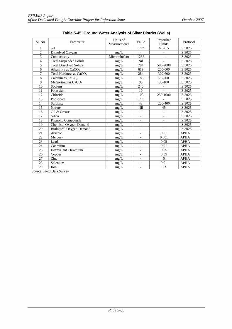
ESIMMS Report of the Dedicated Freight Corridor Project for Rajasthan State October 2007
Page 5-50
Table 5-45 Ground Water Analysis of Sikar District (Wells)
Sl. No. Parameter Units of Measurements Value Prescribed
Limits Protocol
1 pH 6.77 6.5-8.5 IS:3025 2 Dissolved Oxygen mg/L - - IS:3025 3 Conductivity Micromho/cm 1285 - IS:3025 4 Total Suspended Solids mg/L Nil - IS:3025 5 Total Dissolved Solids mg/L 794 500-2000 IS:3025 6 Alkalinity as CaCO3 mg/L 619 200-600 IS:3025 7 Total Hardness as CaCO3 mg/L 284 300-600 IS:3025 8 Calcium as CaCO3 mg/L 186 75-200 IS:3025 9 Magnesium as CaCO3 mg/L 98 30-100 IS:3025
10 Sodium mg/L 240 - IS:3025 11 Potassium mg/L 10 - IS:3025 12 Chloride mg/L 108 250-1000 IS:3025 13 Phosphate mg/L 0.51 - IS:3025 14 Sulphate mg/L 42 200-400 IS:3025 15 Nitrate mg/L Nil 45 IS:3025 16 Oil & Grease mg/L - - IS:3025 17 Silica mg/L - - IS:3025 18 Phenolic Compounds mg/L - - IS:3025 19 Chemical Oxygen Demand mg/L - - IS:3025 20 Biological Oxygen Demand mg/L - - IS:3025 21 Arsenic mg/L - 0.01 APHA 22 Mercury mg/L - 0.001 APHA 23 Lead mg/L - 0.05 APHA 24 Cadmium mg/L - 0.01 APHA 25 Hexavalent Chromium mg/L - 0.05 APHA 26 Copper mg/L - 0.05 APHA 27 Zinc mg/L - 5 APHA 28 Selenium mg/L - 0.01 APHA 29 Iron mg/L - 0.3 APHA
Source: Field Data Survey
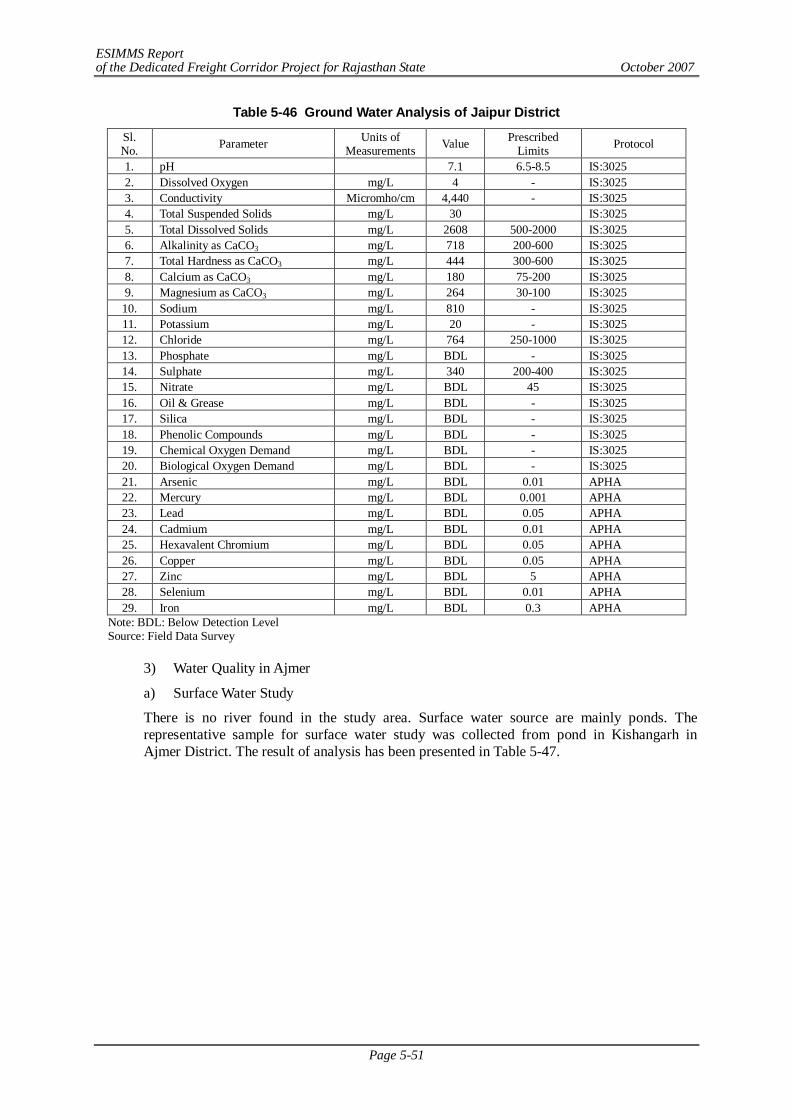
ESIMMS Report of the Dedicated Freight Corridor Project for Rajasthan State October 2007
Page 5-51
Table 5-46 Ground Water Analysis of Jaipur District
Sl. No. Parameter Units of
Measurements Value Prescribed Limits Protocol
1. pH 7.1 6.5-8.5 IS:3025 2. Dissolved Oxygen mg/L 4 - IS:3025 3. Conductivity Micromho/cm 4,440 - IS:3025 4. Total Suspended Solids mg/L 30 IS:3025 5. Total Dissolved Solids mg/L 2608 500-2000 IS:3025 6. Alkalinity as CaCO3 mg/L 718 200-600 IS:3025 7. Total Hardness as CaCO3 mg/L 444 300-600 IS:3025 8. Calcium as CaCO3 mg/L 180 75-200 IS:3025 9. Magnesium as CaCO3 mg/L 264 30-100 IS:3025 10. Sodium mg/L 810 - IS:3025 11. Potassium mg/L 20 - IS:3025 12. Chloride mg/L 764 250-1000 IS:3025 13. Phosphate mg/L BDL - IS:3025 14. Sulphate mg/L 340 200-400 IS:3025 15. Nitrate mg/L BDL 45 IS:3025 16. Oil & Grease mg/L BDL - IS:3025 17. Silica mg/L BDL - IS:3025 18. Phenolic Compounds mg/L BDL - IS:3025 19. Chemical Oxygen Demand mg/L BDL - IS:3025 20. Biological Oxygen Demand mg/L BDL - IS:3025 21. Arsenic mg/L BDL 0.01 APHA 22. Mercury mg/L BDL 0.001 APHA 23. Lead mg/L BDL 0.05 APHA 24. Cadmium mg/L BDL 0.01 APHA 25. Hexavalent Chromium mg/L BDL 0.05 APHA 26. Copper mg/L BDL 0.05 APHA 27. Zinc mg/L BDL 5 APHA 28. Selenium mg/L BDL 0.01 APHA 29. Iron mg/L BDL 0.3 APHA
Note: BDL: Below Detection Level Source: Field Data Survey
3) Water Quality in Ajmer
a) Surface Water Study
There is no river found in the study area. Surface water source are mainly ponds. The representative sample for surface water study was collected from pond in Kishangarh in Ajmer District. The result of analysis has been presented in Table 5-47.
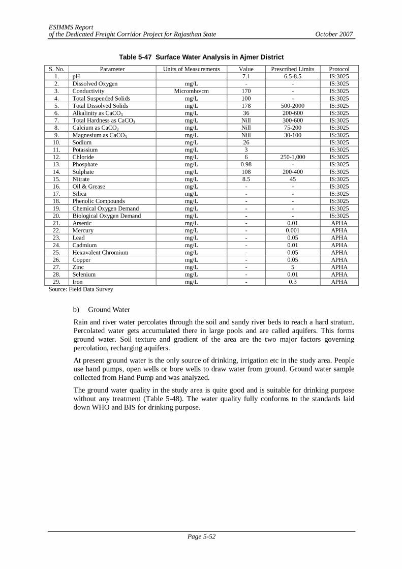
ESIMMS Report of the Dedicated Freight Corridor Project for Rajasthan State October 2007
Page 5-52
Table 5-47 Surface Water Analysis in Ajmer District S. No. Parameter Units of Measurements Value Prescribed Limits Protocol
1. pH 7.1 6.5-8.5 IS:3025 2. Dissolved Oxygen mg/L - - IS:3025 3. Conductivity Micromho/cm 170 - IS:3025 4. Total Suspended Solids mg/L 100 - IS:3025 5. Total Dissolved Solids mg/L 178 500-2000 IS:3025 6. Alkalinity as CaCO3 mg/L 36 200-600 IS:3025 7. Total Hardness as CaCO3 mg/L Nill 300-600 IS:3025 8. Calcium as CaCO3 mg/L Nill 75-200 IS:3025 9. Magnesium as CaCO3 mg/L Nill 30-100 IS:3025
10. Sodium mg/L 26 IS:3025 11. Potassium mg/L 3 IS:3025 12. Chloride mg/L 6 250-1,000 IS:3025 13. Phosphate mg/L 0.98 - IS:3025 14. Sulphate mg/L 108 200-400 IS:3025 15. Nitrate mg/L 8.5 45 IS:3025 16. Oil & Grease mg/L - - IS:3025 17. Silica mg/L - - IS:3025 18. Phenolic Compounds mg/L - - IS:3025 19. Chemical Oxygen Demand mg/L - - IS:3025 20. Biological Oxygen Demand mg/L - - IS:3025 21. Arsenic mg/L - 0.01 APHA 22. Mercury mg/L - 0.001 APHA 23. Lead mg/L - 0.05 APHA 24. Cadmium mg/L - 0.01 APHA 25. Hexavalent Chromium mg/L - 0.05 APHA 26. Copper mg/L - 0.05 APHA 27. Zinc mg/L - 5 APHA 28. Selenium mg/L - 0.01 APHA 29. Iron mg/L - 0.3 APHA
Source: Field Data Survey
b) Ground Water
Rain and river water percolates through the soil and sandy river beds to reach a hard stratum. Percolated water gets accumulated there in large pools and are called aquifers. This forms ground water. Soil texture and gradient of the area are the two major factors governing percolation, recharging aquifers.
At present ground water is the only source of drinking, irrigation etc in the study area. People use hand pumps, open wells or bore wells to draw water from ground. Ground water sample collected from Hand Pump and was analyzed.
The ground water quality in the study area is quite good and is suitable for drinking purpose without any treatment (Table 5-48). The water quality fully conforms to the standards laid down WHO and BIS for drinking purpose.
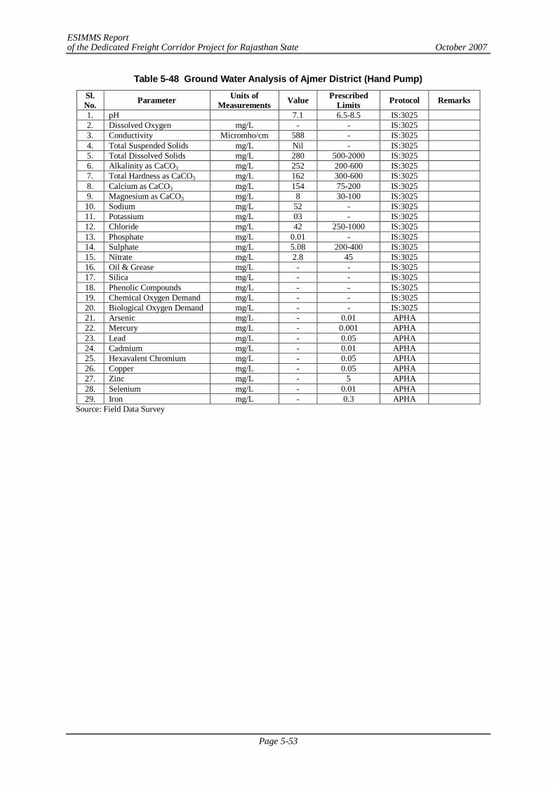
ESIMMS Report of the Dedicated Freight Corridor Project for Rajasthan State October 2007
Page 5-53
Table 5-48 Ground Water Analysis of Ajmer District (Hand Pump)
Sl. No. Parameter Units of
Measurements Value Prescribed Limits Protocol Remarks
1. pH 7.1 6.5-8.5 IS:3025 2. Dissolved Oxygen mg/L - - IS:3025 3. Conductivity Micromho/cm 588 - IS:3025 4. Total Suspended Solids mg/L Nil - IS:3025 5. Total Dissolved Solids mg/L 280 500-2000 IS:3025 6. Alkalinity as CaCO3 mg/L 252 200-600 IS:3025 7. Total Hardness as CaCO3 mg/L 162 300-600 IS:3025 8. Calcium as CaCO3 mg/L 154 75-200 IS:3025 9. Magnesium as CaCO3 mg/L 8 30-100 IS:3025 10. Sodium mg/L 52 - IS:3025 11. Potassium mg/L 03 - IS:3025 12. Chloride mg/L 42 250-1000 IS:3025 13. Phosphate mg/L 0.01 - IS:3025 14. Sulphate mg/L 5.08 200-400 IS:3025 15. Nitrate mg/L 2.8 45 IS:3025 16. Oil & Grease mg/L - - IS:3025 17. Silica mg/L - - IS:3025 18. Phenolic Compounds mg/L - - IS:3025 19. Chemical Oxygen Demand mg/L - - IS:3025 20. Biological Oxygen Demand mg/L - - IS:3025 21. Arsenic mg/L - 0.01 APHA 22. Mercury mg/L - 0.001 APHA 23. Lead mg/L - 0.05 APHA 24. Cadmium mg/L - 0.01 APHA 25. Hexavalent Chromium mg/L - 0.05 APHA 26. Copper mg/L - 0.05 APHA 27. Zinc mg/L - 5 APHA 28. Selenium mg/L - 0.01 APHA 29. Iron mg/L - 0.3 APHA
Source: Field Data Survey
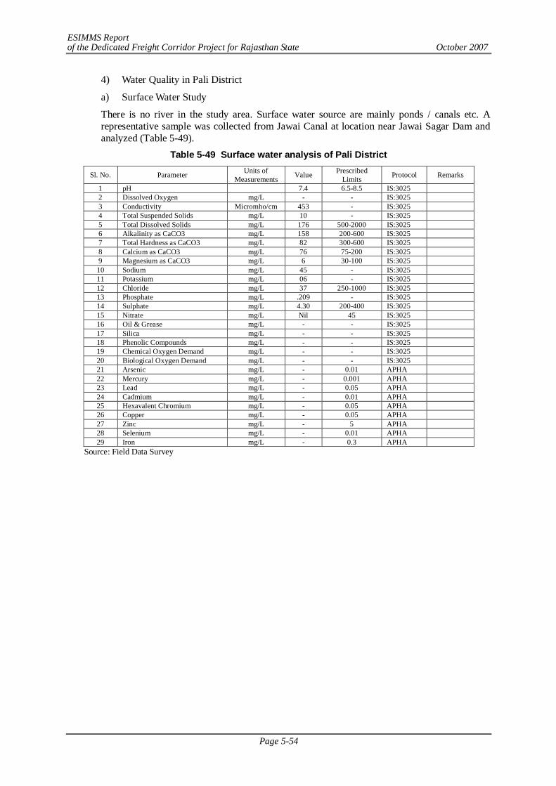
ESIMMS Report of the Dedicated Freight Corridor Project for Rajasthan State October 2007
Page 5-54
4) Water Quality in Pali District
a) Surface Water Study
There is no river in the study area. Surface water source are mainly ponds / canals etc. A representative sample was collected from Jawai Canal at location near Jawai Sagar Dam and analyzed (Table 5-49).
Table 5-49 Surface water analysis of Pali District
Sl. No. Parameter Units of Measurements Value Prescribed
Limits Protocol Remarks
1 pH 7.4 6.5-8.5 IS:3025 2 Dissolved Oxygen mg/L - - IS:3025 3 Conductivity Micromho/cm 453 - IS:3025 4 Total Suspended Solids mg/L 10 - IS:3025 5 Total Dissolved Solids mg/L 176 500-2000 IS:3025 6 Alkalinity as CaCO3 mg/L 158 200-600 IS:3025 7 Total Hardness as CaCO3 mg/L 82 300-600 IS:3025 8 Calcium as CaCO3 mg/L 76 75-200 IS:3025 9 Magnesium as CaCO3 mg/L 6 30-100 IS:3025 10 Sodium mg/L 45 - IS:3025 11 Potassium mg/L 06 - IS:3025 12 Chloride mg/L 37 250-1000 IS:3025 13 Phosphate mg/L .209 - IS:3025 14 Sulphate mg/L 4.30 200-400 IS:3025 15 Nitrate mg/L Nil 45 IS:3025 16 Oil & Grease mg/L - - IS:3025 17 Silica mg/L - - IS:3025 18 Phenolic Compounds mg/L - - IS:3025 19 Chemical Oxygen Demand mg/L - - IS:3025 20 Biological Oxygen Demand mg/L - - IS:3025 21 Arsenic mg/L - 0.01 APHA 22 Mercury mg/L - 0.001 APHA 23 Lead mg/L - 0.05 APHA 24 Cadmium mg/L - 0.01 APHA 25 Hexavalent Chromium mg/L - 0.05 APHA 26 Copper mg/L - 0.05 APHA 27 Zinc mg/L - 5 APHA 28 Selenium mg/L - 0.01 APHA 29 Iron mg/L - 0.3 APHA
Source: Field Data Survey
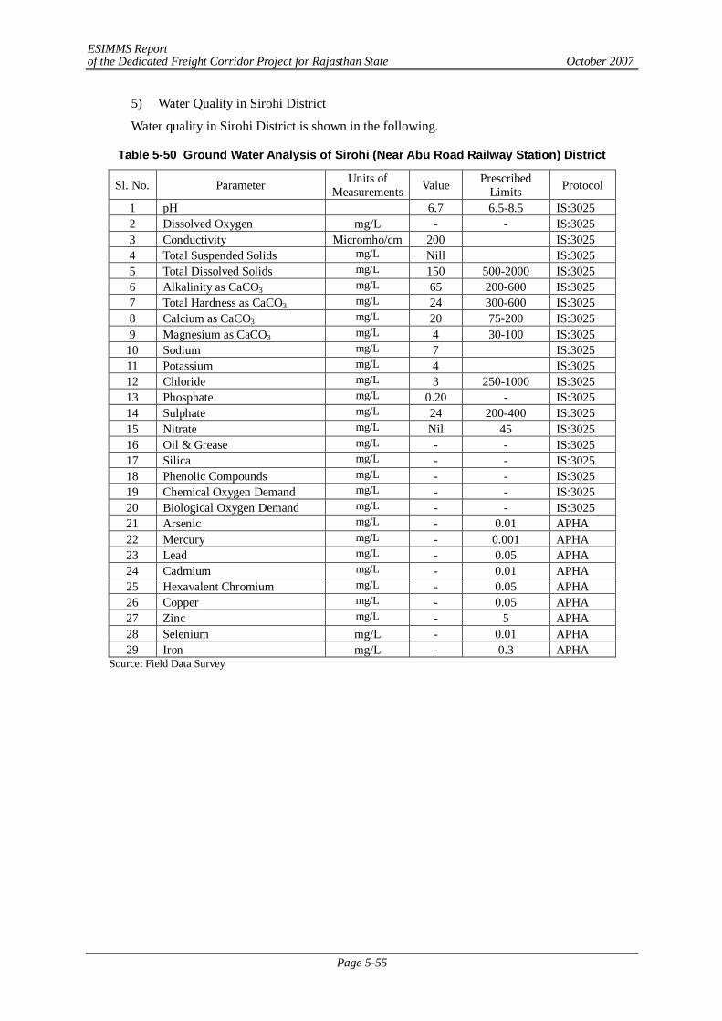
ESIMMS Report of the Dedicated Freight Corridor Project for Rajasthan State October 2007
Page 5-55
5) Water Quality in Sirohi District
Water quality in Sirohi District is shown in the following.
Table 5-50 Ground Water Analysis of Sirohi (Near Abu Road Railway Station) District
Sl. No. Parameter Units of Measurements Value Prescribed
Limits Protocol
1 pH 6.7 6.5-8.5 IS:3025 2 Dissolved Oxygen mg/L - - IS:3025 3 Conductivity Micromho/cm 200 IS:3025 4 Total Suspended Solids mg/L Nill IS:3025 5 Total Dissolved Solids mg/L 150 500-2000 IS:3025 6 Alkalinity as CaCO3 mg/L 65 200-600 IS:3025 7 Total Hardness as CaCO3 mg/L 24 300-600 IS:3025 8 Calcium as CaCO3 mg/L 20 75-200 IS:3025 9 Magnesium as CaCO3 mg/L 4 30-100 IS:3025
10 Sodium mg/L 7 IS:3025 11 Potassium mg/L 4 IS:3025 12 Chloride mg/L 3 250-1000 IS:3025 13 Phosphate mg/L 0.20 - IS:3025 14 Sulphate mg/L 24 200-400 IS:3025 15 Nitrate mg/L Nil 45 IS:3025 16 Oil & Grease mg/L - - IS:3025 17 Silica mg/L - - IS:3025 18 Phenolic Compounds mg/L - - IS:3025 19 Chemical Oxygen Demand mg/L - - IS:3025 20 Biological Oxygen Demand mg/L - - IS:3025 21 Arsenic mg/L - 0.01 APHA 22 Mercury mg/L - 0.001 APHA 23 Lead mg/L - 0.05 APHA 24 Cadmium mg/L - 0.01 APHA 25 Hexavalent Chromium mg/L - 0.05 APHA 26 Copper mg/L - 0.05 APHA 27 Zinc mg/L - 5 APHA 28 Selenium mg/L - 0.01 APHA 29 Iron mg/L - 0.3 APHA
Source: Field Data Survey
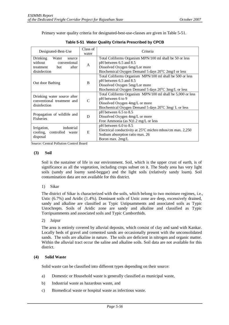
ESIMMS Report of the Dedicated Freight Corridor Project for Rajasthan State October 2007
Page 5-56
Primary water quality criteria for designated-best-use-classes are given in Table 5-51.
Table 5-51 Water Quality Criteria Prescribed by CPCB
Designated-Best-Use Class of water Criteria
Drinking Water source without conventional treatment but after disinfection
A
Total Coliforms Organism MPN/100 ml shall be 50 or less pH between 6.5 and 8.5 Dissolved Oxygen 6mg/Lor more Biochemical Oxygen Demand 5 days 20oC 2mg/l or less
Out door Bathing B
Total Coliforms Organism MPN/100 ml shall be 500 or less pH between 6.5 and 8.5 Dissolved Oxygen 5mg/Lor more Biochemical Oxygen Demand 5 days 20oC 3mg/L or less
Drinking water source after conventional treatment and disinfection
C
Total Coliforms Organism MPN/100 ml shall be 5,000 or less pH between 6 to 9 Dissolved Oxygen 4mg/L or more Biochemical Oxygen Demand 5 days 20oC 3mg/ L or less
Propagation of wildlife and Fisheries D
pH between 6.5 to 8.5 Dissolved Oxygen 4mg/L or more Free Ammonia (as N)1.2 mg/L or less
Irrigation, industrial cooling, controlled waste disposal
E
pH between 6.0 to 8.5 Electrical conductivity at 25oC michro mhos/cm max. 2,250 Sodium absorption ratio max. 26 Boron max. 2mg/L
Source: Central Pollution Control Board
(3) Soil
Soil is the sustainer of life in our environment. Soil, which is the upper crust of earth, is of significance as all the vegetation, including crops subset on it. The Study area has very light soils (sandy and loamy sand-beggar) and the light soils (relatively sandy loam). Soil contamination data are not available for this district.
1) Sikar
The district of Sikar is characterized with the soils, which belong to two moisture regimes, i.e., Ustic (6.7%) and Aridic (1.4%). Dominant soils of Ustic zone are deep, excessively drained, sandy and alkaline are classified as Typic Ustipsamments and associated soils as Typic Ustochrepts. Soils of Aridic zone are sandy and alkaline and classified as Typic Torripsamments and associated soils and Typic Camborthids.
2) Jaipur
The area is entirely covered by alluvial deposits, which consist of clay and sand with Kankar. Locally beds of gravel and cemented sands are occasionally present with the unconsolidated sands. The soils are alkaline in nature. The soils are deficient in nitrogen and organic matter. Within the alluvial tract occur the saline and alkaline soils. Soil data are not available for this district.
(4) Solid Waste
Solid waste can be classified into different types depending on their source:
a) Domestic or Household waste is generally classified as municipal waste,
b) Industrial waste as hazardous waste, and
c) Biomedical waste or hospital waste as infectious waste.
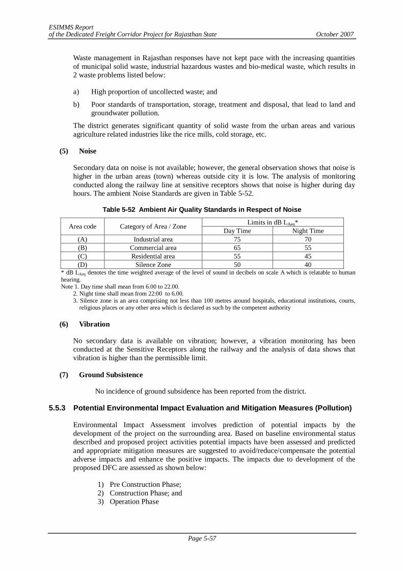
ESIMMS Report of the Dedicated Freight Corridor Project for Rajasthan State October 2007
Page 5-57
Waste management in Rajasthan responses have not kept pace with the increasing quantities of municipal solid waste, industrial hazardous wastes and bio-medical waste, which results in 2 waste problems listed below:
a) High proportion of uncollected waste; and
b) Poor standards of transportation, storage, treatment and disposal, that lead to land and groundwater pollution.
The district generates significant quantity of solid waste from the urban areas and various agriculture related industries like the rice mills, cold storage, etc.
(5) Noise
Secondary data on noise is not available; however, the general observation shows that noise is higher in the urban areas (town) whereas outside city it is low. The analysis of monitoring conducted along the railway line at sensitive receptors shows that noise is higher during day hours. The ambient Noise Standards are given in Table 5-52.
Table 5-52 Ambient Air Quality Standards in Respect of Noise
Limits in dB LAeq* Area code Category of Area / Zone Day Time Night Time (A) Industrial area 75 70 (B) Commercial area 65 55 (C) Residential area 55 45 (D) Silence Zone 50 40
* dB LAeq denotes the time weighted average of the level of sound in decibels on scale A which is relatable to human hearing. Note 1. Day time shall mean from 6.00 to 22.00.
2. Night time shall mean from 22:00 to 6.00. 3. Silence zone is an area comprising not less than 100 metres around hospitals, educational institutions, courts,
religious places or any other area which is declared as such by the competent authority
(6) Vibration
No secondary data is available on vibration; however, a vibration monitoring has been conducted at the Sensitive Receptors along the railway and the analysis of data shows that vibration is higher than the permissible limit.
(7) Ground Subsistence
No incidence of ground subsidence has been reported from the district.
5.5.3 Potential Environmental Impact Evaluation and Mitigation Measures (Pollution)
Environmental Impact Assessment involves prediction of potential impacts by the development of the project on the surrounding area. Based on baseline environmental status described and proposed project activities potential impacts have been assessed and predicted and appropriate mitigation measures are suggested to avoid/reduce/compensate the potential adverse impacts and enhance the positive impacts. The impacts due to development of the proposed DFC are assessed as shown below:
1) Pre Construction Phase; 2) Construction Phase; and 3) Operation Phase
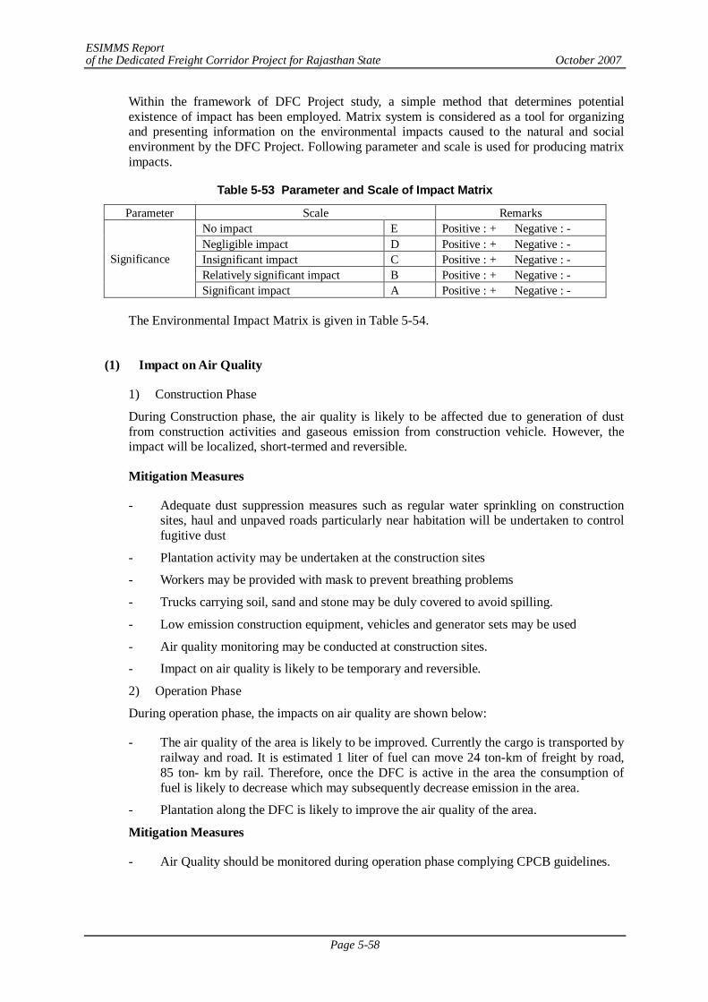
ESIMMS Report of the Dedicated Freight Corridor Project for Rajasthan State October 2007
Page 5-58
Within the framework of DFC Project study, a simple method that determines potential existence of impact has been employed. Matrix system is considered as a tool for organizing and presenting information on the environmental impacts caused to the natural and social environment by the DFC Project. Following parameter and scale is used for producing matrix impacts.
Table 5-53 Parameter and Scale of Impact Matrix
Parameter Scale Remarks No impact E Positive : + Negative : - Negligible impact D Positive : + Negative : - Insignificant impact C Positive : + Negative : - Relatively significant impact B Positive : + Negative : -
Significance
Significant impact A Positive : + Negative : -
The Environmental Impact Matrix is given in Table 5-54.
(1) Impact on Air Quality
1) Construction Phase
During Construction phase, the air quality is likely to be affected due to generation of dust from construction activities and gaseous emission from construction vehicle. However, the impact will be localized, short-termed and reversible.
Mitigation Measures
- Adequate dust suppression measures such as regular water sprinkling on construction sites, haul and unpaved roads particularly near habitation will be undertaken to control fugitive dust
- Plantation activity may be undertaken at the construction sites
- Workers may be provided with mask to prevent breathing problems
- Trucks carrying soil, sand and stone may be duly covered to avoid spilling.
- Low emission construction equipment, vehicles and generator sets may be used
- Air quality monitoring may be conducted at construction sites.
- Impact on air quality is likely to be temporary and reversible.
2) Operation Phase
During operation phase, the impacts on air quality are shown below:
- The air quality of the area is likely to be improved. Currently the cargo is transported by railway and road. It is estimated 1 liter of fuel can move 24 ton-km of freight by road, 85 ton- km by rail. Therefore, once the DFC is active in the area the consumption of fuel is likely to decrease which may subsequently decrease emission in the area.
- Plantation along the DFC is likely to improve the air quality of the area.
Mitigation Measures
- Air Quality should be monitored during operation phase complying CPCB guidelines.
ESIMMS Report of the Dedicated Freight Corridor Project for Rajasthan State October 2007
Page 5-59
(2) Impact on Water Quality
1) Construction Phase
- There would not be any significant impact on the surface water quality due to the activities during construction phase. However, there will be some impact on the ground water quality as the water table in this area is high and in some low lying areas water logging problem is also prevalent.
- The activities which are likely to impact water quality are surface run-off from construction sites, spillage & leakage from construction equipments and sewage generated from construction camps. These activities may result in short-term mild reversible impact on water quality.
- The water quality of the irrigational canals crossing the DFC is also likely to be affected; however, this will be temporary and for short duration.
- The impact on water quality will be localized and reversible, suspended particulate matter tends to settle down in due course of time.
Mitigation Measures
- Silt fencing may be provided near water bodies to avoid spillage of construction material.
- Discharge of waste from construction/labour camp into water bodies may be strictly prohibited.
- Construction methodologies with minimum or no impact on water quality may be adopted, disposal of construction wastes at designated sites and adequate drainage system may be provided.
- Project design may take care of irrigational canal and proper culverts may be provided so that irrigation setup is not disturbed.
- Construction activity may be prohibited during rainy season near water bodies.
- Water quality monitoring may be conducted during construction phase.
2) Operation Phase
- During operation phase no impact is envisaged on water bodies, as adequate design provision will be made for proper discharge of wastewater.
(3) Impact on Soil
1) Construction Phase
- During construction phase soil contamination is likely to take place due to leakage of asphalt emulsifier at pavement of road.
- Soil contamination may also take place during filling of oil in vehicles or leakage from vehicles.
Mitigation Measures
- Asphalt emulsifier must be handled with caution and any leakage detected must be immediately rectified.
- Construction work should not be done during rainy season to avoid erosion and spreading of loose material.
- Topsoil removed during excavation work should be stored separately in the bunded area
ESIMMS Report of the Dedicated Freight Corridor Project for Rajasthan State October 2007
Page 5-60
and should be utilized during plantation or refilling of excavated area.
2) Operation Phase
- During operation phase no impact is envisaged on soil.
(4) Solid Waste
1) Construction Phase
- Solid waste is likely to be generated due to extraction of building materials, earth moving, and operation of construction plant and construction of railway related structures.
- Construction camp is also likely to generate solid waste and pollute the area.
Mitigation Measures
- Construction work must be carried in such a way that minimum or no solid waste is generated at construction site. Extra earth material produced may be utilized for refilling of borrow areas.
- Rainy season may be avoided to minimize spreading of loose materials.
- Solid waste management may be framed for camp areas. Dustbins may be provided in the camps.
- The Contractor must provide proper sanitation facilities in camps.
2) Operation Phase
- Solid waste may be generated during operation phase due to the operation of freight train and related facilities.
Mitigation Measures
- Solid waste management program must be framed for operation phase. Excess of material generated must be disposed in eco-friendly manner.
- Biodegradable and non-biodegradable waste must be collected separately.
- Regular cleaning must be conducted at ICD and at Stations.
(5) Noise and Vibration
1) Construction Phase
- Noise is likely to be generated due to various construction activities such as movement of construction vehicles, machineries and equipments, extraction of building materials, earth moving, and construction works of railway and related structures.
- The noise level is likely to rise; however, such exposure shall not occur for long period, the noise shall be intermittent, temporary and limited to construction site only.
Mitigation Measures
- Modern technologies producing low noise may be used during construction.
- Construction equipment’s and vehicles must be in good working condition, properly lubricated and maintained to keep noise within permissible limit.
- Near Settlements and in Fisher Forest construction activity may be conducted only in day time and noise producing activity may be prohibited during night hours.
ESIMMS Report of the Dedicated Freight Corridor Project for Rajasthan State October 2007
Page 5-61
- Temporary noise barriers installed at settlements and forest area, if required.
- Plantation may be carried at the work site.
- Head phones, ear plugs to be provided to the workers at construction site.
- Noise level monitoring must conducted during construction phase.
- The construction methods with lower vibration generation shall be applied.
- Machines and vehicles equipped with lower vibration devices such as vibration-proofing cover shall be used.
- Vibration propagation shall be prevented by keeping the distance and changing the direction and location of machines.
- Near settlement and forest areas, construction activities shall be conducted only during daytime, and vibration generating activities shall be prohibited during night time.
- Vibration level monitoring shall be conducted during the construction phase.
2) Operation Phase
- During operation phase noise and vibration are likely to occur due to due to movement of trains and related facilities such as loading and unloading.
Mitigation Measures
- Plantation must be maintained along DFC corridor.
- New technologies shall be incorporated to lower vibration generation with respect to structures and rolling stocks.
- Use of long welded rails without fishplate joint is suggested for reduction in vibration.
- Crushed stones shall be used for ballast materials, and accumulation of crushed ballast by passing trains is to be removed through frequent ballast cleaning.
- For a railway bridge girder, steel may be replaced with concrete materials such as PC and RC to minimise oscillation of the bridge girder which generates vibration in addition to noise.
- If necessary, building the vibration-proof trench and underground wall may be built to prevent the vibration propagation.
- Provide appropriate maintenance of locomotives, tracks and structures.
- Running speed of freight trains in the urban area and the railway station shall be controlled, if required.
- Fences and structures to shelter and absorb vibration in addition to noise are duly provided to the sections where houses and Sensitive Receptors are located near railway tracks, if required.
- Monitoring of railway noise and vibration generated from dedicated freight trains shall be conducted.
(6) Land Subsidence
1) Construction Phase
- Land subsidence is not envisaged, as the project area is plain except the detour section where it traverses through undulating stretch.
- Soil erosion may take place in the undulating section; however, the impact will be
ESIMMS Report of the Dedicated Freight Corridor Project for Rajasthan State October 2007
Page 5-62
insignificant.
Mitigation Measures
- Plantation must be carried to control erosion.
2) Operation Phase
- During operation phase no impact is envisaged on land subsidence.
(7) Bottom Sediment
1) Construction Phase
- The DFC alignment crosses Perennial River; during construction sediment pollution may occur. The impact will be neglect able as the bridge will be a minor one.
Mitigation Measures
- Silt fencing may be provided to avoid runoff into the river.
2) Operation Phase
- During operation phase no impact is envisaged on bottom sediment
(8) Offensive Odour
No activities activity causing offensive odour is envisaged; however, cleanliness must be maintained at construction site during construction and at ICD & stations to avoid any foul odour.
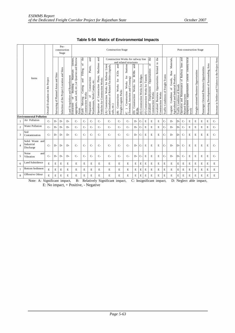
ESIMMS Report of the Dedicated Freight Corridor Project for Rajasthan State October 2007
Page 5-63
Table 5-54 Matrix of Environmental Impacts
Pre-construction
Stage Construction Stage Post-construction Stage
Construction Works for railway line and related structures
Items
Ove
rall
Eval
uatio
n on
the
Proj
ect
Surv
eyin
g of
Pla
nned
Are
as a
nd S
ites
Sele
ctio
n of
the
Proj
ect L
ocat
ion
and
Site
s
Land
Acq
uisit
ion
and
Rese
ttlem
ent
Extra
ctio
n of
Bu
ildin
g M
ater
ials
(sto
nes,
aggr
egat
es, s
and,
soil,
etc
.) at
Qua
rrie
s and
Bor
row
A
reas
Ea
rth
Mov
ing:
Cu
tting
an
d Fi
lling
of
th
e Co
nstru
ctio
n W
orks
Pr
epar
atio
n of
Co
nstru
ctio
n Pl
ants,
an
d W
areh
ouse
s, W
ork
Cam
ps, e
tc.
Ope
ratio
n of
Con
struc
tion
Plan
ts, M
achi
nes
and
Veh
icle
s for
Con
struc
tion
Wor
ks
(A)
Cons
truct
ion
Wor
ks f
or R
ailw
ay L
ines
an
d In
stalla
tion
of R
elat
ed F
acili
ties (
signa
ls,
rails
, etc
.)
(B)
Cons
truct
ion
Wor
ks
for
ICD
s an
d Fr
eigh
t Log
istic
Par
ks
(C
) Co
nstru
ctio
n W
orks
fo
r St
atio
ns
(Ter
min
al, J
unct
ion
and
Cros
sing)
(D)
Cons
truct
ion
Wor
ks
for
ROBs
an
d RU
Bs
(E) C
onstr
uctio
n W
orks
for B
ridge
s
(F) C
onstr
uctio
n W
orks
for T
unne
ls
Loca
lized
Em
ploy
men
t O
ppor
tuni
ties
of
the
Cons
truct
ion
Wor
ks
Loca
lized
Bus
ines
s O
ppor
tuni
ties
Rela
ted
to t
he
Cons
truct
ion
Wor
ks
Traf
fic C
ondi
tions
of F
reig
ht T
rain
s
Logi
stic
Cond
ition
of
G
oods
, Ra
w
Mat
eria
ls,
Agr
icul
tura
l and
Indu
stria
l Pro
duct
s Tr
affic
Con
ditio
n of
Roa
ds
Ope
ratio
n an
d M
aint
enan
ce o
f Ra
ilway
lin
es a
nd
Rela
ted
Stru
ctur
es
Empl
oym
ent
Opp
ortu
nitie
s (w
hole
cou
ntry
/loca
l le
vel)
Frei
ght-o
rient
ed B
usin
ess O
ppor
tuni
ties
Pass
enge
r Orie
nted
Bus
ines
s Opp
ortu
nitie
s
Prom
otin
g D
evel
opm
ent o
f Sur
roun
ding
Are
a
Incr
ease
in S
ettle
rs a
nd V
isito
rs to
the
Proj
ect A
rea
Environmental Pollution
1 Air Pollution C- D- D- D- C- C- C- C- C- C- C- D- C- E E E C- D- D- C- E E E E C-
2 Water Pollution C- D- D- D- C- C- C- C- C- C- C- D- C- E E E C- D- D- C- E E E E C-
3 Soil Contamination C- D- D- D- C- C- C- C- C- C- C- D- C- E E E C- D- D- C- E E E E C-
4 Solid Waste and Industrial Discharge
C- D- D- D- C- C- C- C- C- C- C- D- C- E E E C- D- D- C- E E E E C-
5 Noise and Vibration C- D- D- D- C- C- C- C- C- C- C- D- C- E E E C- D- D- C- E E E E C-
6 Land Subsidence E E E E E E E E E E E E E E E E E E E E E E E E E
7 Bottom Sediment E E E E E E E E E E E E E E E E E E E E E E E E E
8 Offensive Odour E E E E E E E E E E E E E E E E E E E E E E E E E
Note: A: Significant impact, B: Relatively Significant impact, C: Insignificant impact, D: Neglect able impact, E: No impact, + Positive, - Negative
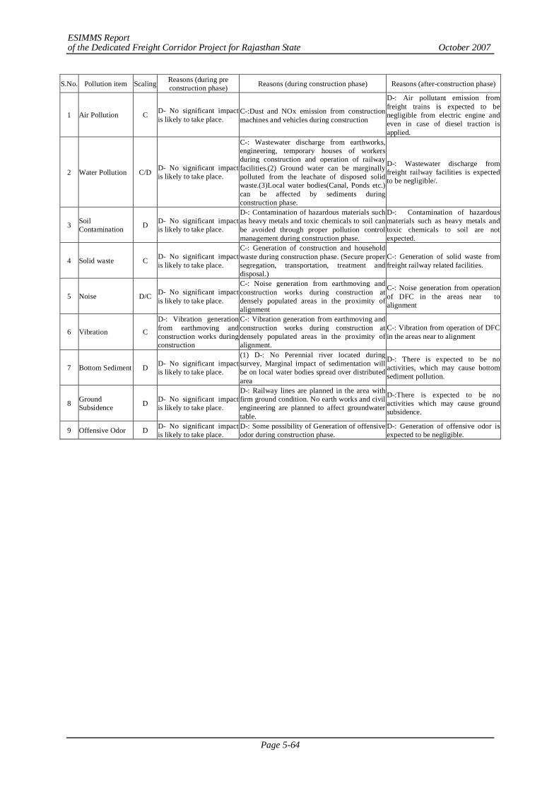
ESIMMS Report of the Dedicated Freight Corridor Project for Rajasthan State October 2007
Page 5-64
S.No. Pollution item Scaling Reasons (during pre construction phase) Reasons (during construction phase) Reasons (after-construction phase)
1 Air Pollution C D- No significant impact is likely to take place.
C-:Dust and NOx emission from construction machines and vehicles during construction
D-: Air pollutant emission from freight trains is expected to be negligible from electric engine and even in case of diesel traction is applied.
2 Water Pollution C/D D- No significant impact is likely to take place.
C-: Wastewater discharge from earthworks, engineering, temporary houses of workers during construction and operation of railway facilities.(2) Ground water can be marginally polluted from the leachate of disposed solid waste.(3)Local water bodies(Canal, Ponds etc.) can be affected by sediments during construction phase.
D-: Wastewater discharge from freight railway facilities is expected to be negligible/.
3 Soil Contamination D D- No significant impact
is likely to take place.
D-: Contamination of hazardous materials such as heavy metals and toxic chemicals to soil can be avoided through proper pollution control management during construction phase.
D-: Contamination of hazardous materials such as heavy metals and toxic chemicals to soil are not expected.
4 Solid waste C D- No significant impact is likely to take place.
C-: Generation of construction and household waste during construction phase. (Secure proper segregation, transportation, treatment and disposal.)
C-: Generation of solid waste from freight railway related facilities.
5 Noise D/C D- No significant impact is likely to take place.
C-: Noise generation from earthmoving and construction works during construction at densely populated areas in the proximity of alignment
C-: Noise generation from operation of DFC in the areas near to alignment
6 Vibration C
D-: Vibration generation from earthmoving and construction works during construction
C-: Vibration generation from earthmoving and construction works during construction at densely populated areas in the proximity of alignment.
C-: Vibration from operation of DFC in the areas near to alignment
7 Bottom Sediment D D- No significant impact is likely to take place.
(1) D-: No Perennial river located during survey, Marginal impact of sedimentation will be on local water bodies spread over distributed area
D-: There is expected to be no activities, which may cause bottom sediment pollution.
8 Ground Subsidence D D- No significant impact
is likely to take place.
D-: Railway lines are planned in the area with firm ground condition. No earth works and civil engineering are planned to affect groundwater table.
D-:There is expected to be no activities which may cause ground subsidence.
9 Offensive Odor D D- No significant impact is likely to take place.
D-: Some possibility of Generation of offensive odor during construction phase.
D-: Generation of offensive odor is expected to be negligible.
ESIMMS Report of the Dedicated Freight Corridor Project for Rajasthan State October 2007
Page 5-65
5.6 NOISE AND VIBRATION SURVEY
5.6.1 Background and Purpose
One of the major environmental concerns arises out of the railway operation is the noise and vibration. While vibration may lead to damage of cultural assets and other establishments near railway track, noise has impacts on the human health. The country has definite statutory specifications, rules and regulations regarding noise level at different regions, as has been discussed already in the previous section.
The noise and vibration survey has therefore been incorporated in the scope of study as a very important requirement to study the feasibility of a dedicated freight corridor (DFC) construction.
5.6.2 Approach and Methodology of Railway Noise and Vibration Measurement
(1) Selection of Sensitive Receptors:
As per the agreed methodologies, for noise and vibration survey a primary field visit was conducted to identify the locations of sensitive receptors. The identification was done following the standard norms and guidance of JICA Study Team. Total 25 points for ambient noise and vibration survey and 5 points of detailed railway noise and vibration survey were chosen, along with a few other optional points where the measurement could be done if any of the scheduled point is missed. A few of the points selected for ambient noise and vibration measurement have also been chosen for measuring the noise and vibration level at the time of when a train either passenger or freight is passing by the existing railway track. Hence, the noise and vibration survey was conducted in three categories: 1) railway noise and vibration survey along the railways, 2) ambient noise and vibration survey at sensitive receptors, and 3) railway noise and vibration survey at sensitive receptors.
Along with the noise and vibration measurement and collection of secondary information on the sampling locations, a questionnaire survey was also done at all the points of noise and vibration survey at sensitive receptors to assess the people’s perception regarding existing problem of railway noise and vibration at their neighborhood. For each measurement point, the total 10 persons were interviewed on the aspect.
(2) Railway Noise and Vibration Measurement along Railways
The integrated noise and vibration level meters were put in a horizontal series at 12.5 m, 25 m, 50 m and 100m distances from the central line of the existing railway track. The readings were taken simultaneously at all the four points, for a period as long as that at least eight trains including both passenger and freight passed by in the same direction.
There have been total 5 numbers of railway noise and vibration measurement sites chosen along the whole railway track covered in Rajasthan and Haryana. Among those, two have been done near bridges and rests at the areas of plain running rail track on embankment. The steps followed in the railway noise and vibration measurement along railways are as follows.
- The baseline data in respect of railway noise and vibration features and patterns viz. track characteristics, attenuation patterns with distance, train speed etc. have been collected. The train categorizations are followed as Table 5-55.
- The noise and vibration level for the time interval of each train passing, were noted.
- Sound exposure level or LAE and LAeq (equivalent continuous A-weighted sound pressure level) of passing trains by train categories were noted in accordance JIS Z 8731
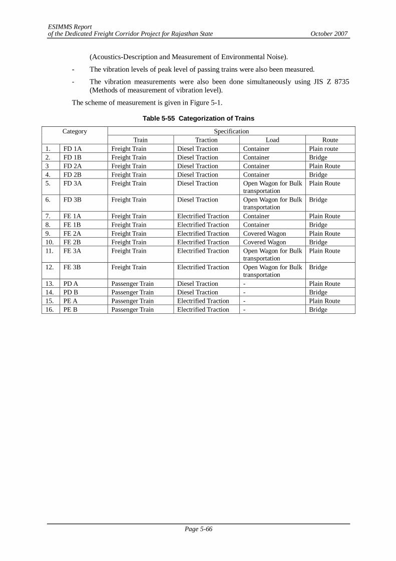
ESIMMS Report of the Dedicated Freight Corridor Project for Rajasthan State October 2007
Page 5-66
(Acoustics-Description and Measurement of Environmental Noise).
- The vibration levels of peak level of passing trains were also been measured.
- The vibration measurements were also been done simultaneously using JIS Z 8735 (Methods of measurement of vibration level).
The scheme of measurement is given in Figure 5-1.
Table 5-55 Categorization of Trains
Specification Category Train Traction Load Route
1. FD 1A Freight Train Diesel Traction Container Plain route 2. FD 1B Freight Train Diesel Traction Container Bridge 3 FD 2A Freight Train Diesel Traction Container Plain Route 4. FD 2B Freight Train Diesel Traction Container Bridge 5. FD 3A Freight Train Diesel Traction Open Wagon for Bulk
transportation Plain Route
6. FD 3B Freight Train Diesel Traction Open Wagon for Bulk transportation
Bridge
7. FE 1A Freight Train Electrified Traction Container Plain Route 8. FE 1B Freight Train Electrified Traction Container Bridge 9. FE 2A Freight Train Electrified Traction Covered Wagon Plain Route 10. FE 2B Freight Train Electrified Traction Covered Wagon Bridge 11. FE 3A Freight Train Electrified Traction Open Wagon for Bulk
transportation Plain Route
12. FE 3B Freight Train Electrified Traction Open Wagon for Bulk transportation
Bridge
13. PD A Passenger Train Diesel Traction - Plain Route 14. PD B Passenger Train Diesel Traction - Bridge 15. PE A Passenger Train Electrified Traction - Plain Route 16. PE B Passenger Train Electrified Traction - Bridge
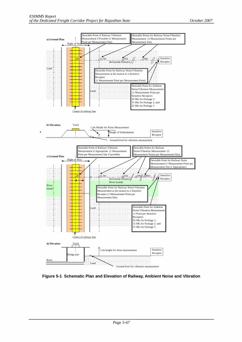
ESIMMS Report of the Dedicated Freight Corridor Project for Rajasthan State October 2007
Page 5-67
Figure 5-1 Schematic Plan and Elevation of Railway, Ambient Noise and Vibration
a) Ground Plan
Right of Way
0m 12.5m 25m 50mHorizontal Distance
Land
Land
Centre of railway line
b) Elevation Track1.2m Height for Noise Measurement
Height of Embankment
Ground level for vibration measurement
c) Ground PlanRight of Way
0m 12.5m 25m 50m 100mHorizontal DistanceRiver (Land)
River(land)
Land
Centre of railway line
d) Elevation Track
1.2m height for noise measurement
Bridge pier
RiverLand
Ground level for vibration measurement
SensitiveReceptor
SensitiveReceptor
Desirable Points for Railway Noise/VibrationMeasurement (3 Measurement Points perMeasurement Site)
Desirable Point for Railway Noise/VibrationMeasurement at the nearest to a SensitiveReceptor (1 Measurement Point per Measurement Point)
Desirable Point for AmbientNoise/Vibration Measurement (1 Measurement Point perSensitive Receptor)20 SRs for Package 1;15 SRs for Package 2; and25 SRs for Package 3
Desirable Point of Railway VibrationMeasurement if Possible (1 MeasurementPoint per Measurement Site)
SensitiveReceptor
Desirable Point for Railway Noise/VibrationMeasurement at the nearest to a SensitiveReceptor (1 Measurement Point perMeasurement Site)
Desirable Point for AmbientNoise/Vibration Measurement (1 Point per SensitiveReceptor)20 SRs for Package 1;15 SRs for Package 2; and25 SRs for Package 3
Desirable Point of Railway VibrationMeasurement if Appropriate (1 MeasurementPoint per Measurement Site if possible)
Desirable Points for RailwayNoise/Vibration Measurement (3Measurement Points per Measurement Site)
Desirable Point for Railway NoiseMeasurement (1 Measurement Point perMeasurement Site if Appropriate)
SensitiveReceptor
ESIMMS Report of the Dedicated Freight Corridor Project for Rajasthan State October 2007
Page 5-68
(3) Noise and Vibration Measurement at Sensitive Receptors
1) Ambient Noise and Vibration Measurement at Sensitive Receptors
Sensitive receptors are identified as educational institutes, hospitals and health centers, courts and religious establishments. Ambient noise and vibration were surveyed at or in near proximity of different identified sensitive receptors located the track or along the proposed diversions in DFC. The readings were taken continuously for 4 hours.
2) Railway Noise and Vibration Survey at Sensitive Receptors
The noise and vibration survey conducted at the sensitive receptor points at the time of any train passing by the track is considered as railway noise and vibration survey at sensitive receptors. In case of railway noise and vibration measurement at SRs, almost the same procedure of ambient noise and vibration measurement at SRs is followed. The measurements were conducted for all the trains passing including crossing trains passing both directions for a time interval of 2 hours. Among the total 25 ambient noise and vibration measurement points along whole of the DFC alignment, railway noise and vibration measurement study was done in 10 points.
Stepwise general methodology of noise and vibration measurement near sensitive receptors is as follows:
- The measurement is done at a point near to the sensitive receptors for the stipulated time span of 4 or 2 hrs.
- The measurement was done in accordance with standardized methods prevailing in India or JIS Z 8731 (Acoustics-Description and Measurement of Environmental Noise).
- The vibration measurements were also been done simultaneously using the standardized methods prevailing in India or JIS Z 8735 (Methods of measurement of vibration level).
- The detailed site conditions, such as land use, urban/rural condition, structures and facilities prevailing around the sampling sites, etc.
- Four photographs of each of the point have been taken to show the area profile of the point.
- Both day time and night time measurements were done in different locations.
3) Questionnaire Survey Methodology and Result
Parallel to the noise and vibration measurement, a questionnaire survey was also run among the local people residing around the Sensitive receptor points. They were asked to answer a few queries related to their perceptions over the disturbances and annoyance caused by railway noise and vibration due to existing railway track.
10 respondents were chosen randomly from each of the sampling sites and interviewed only after making them understand the purpose of the survey.
5.6.3 Results of Railway Noise and Vibration Measurement
As per the agreed terms, results of noise and vibration survey will be put in a district wise pattern. The detailed results and survey questionnaire will be tabulated, analyzed and presented accordingly. The detailed results of noise and vibration survey are shown in Annex-5.1.
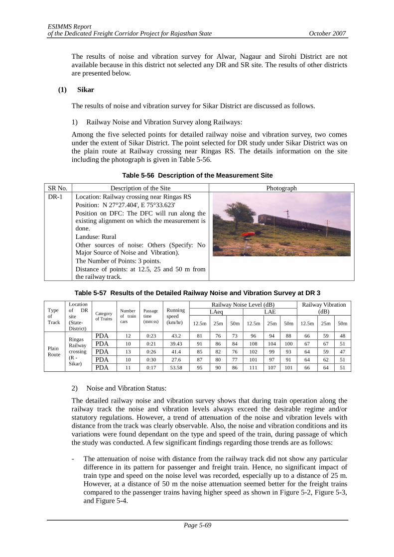
ESIMMS Report of the Dedicated Freight Corridor Project for Rajasthan State October 2007
Page 5-69
The results of noise and vibration survey for Alwar, Nagaur and Sirohi District are not available because in this district not selected any DR and SR site. The results of other districts are presented below.
(1) Sikar
The results of noise and vibration survey for Sikar District are discussed as follows.
1) Railway Noise and Vibration Survey along Railways:
Among the five selected points for detailed railway noise and vibration survey, two comes under the extent of Sikar District. The point selected for DR study under Sikar District was on the plain route at Railway crossing near Ringas RS. The details information on the site including the photograph is given in Table 5-56.
Table 5-56 Description of the Measurement Site
Table 5-57 Results of the Detailed Railway Noise and Vibration Survey at DR 3
Railway Noise Level (dB) LAeq LAE
Railway Vibration (dB) Type
of Track
Location of DR site (State-District)
Category of Trains
Number of train cars
Passage time (mm:ss)
Running speed (km/hr) 12.5m 25m 50m 12.5m 25m 50m 12.5m 25m 50m
PDA 12 0:23 43.2 81 76 73 96 94 88 66 59 48 PDA 10 0:21 39.43 91 86 84 108 104 100 67 67 51 PDA 13 0:26 41.4 85 82 76 102 99 93 64 59 47 PDA 10 0:30 27.6 87 80 77 101 97 91 64 62 51
Plain Route
Ringas Railway crossing (R - Sikar) PDA 11 0:17 53.58 95 90 86 111 107 101 66 64 51
2) Noise and Vibration Status:
The detailed railway noise and vibration survey shows that during train operation along the railway track the noise and vibration levels always exceed the desirable regime and/or statutory regulations. However, a trend of attenuation of the noise and vibration levels with distance from the track was clearly observable. Also, the noise and vibration conditions and its variations were found dependant on the type and speed of the train, during passage of which the study was conducted. A few significant findings regarding those trends are as follows:
- The attenuation of noise with distance from the railway track did not show any particular difference in its pattern for passenger and freight train. Hence, no significant impact of train type and speed on the noise level was recorded, especially up to a distance of 25 m. However, at a distance of 50 m the noise attenuation seemed better for the freight trains compared to the passenger trains having higher speed as shown in Figure 5-2, Figure 5-3, and Figure 5-4.
SR No. Description of the Site Photograph DR-1 Location: Railway crossing near Ringas RS
Position: N 27°27.404', E 75°33.623' Position on DFC: The DFC will run along the existing alignment on which the measurement is done. Landuse: Rural Other sources of noise: Others (Specify: No Major Source of Noise and Vibration). The Number of Points: 3 points. Distance of points: at 12.5, 25 and 50 m from the railway track.
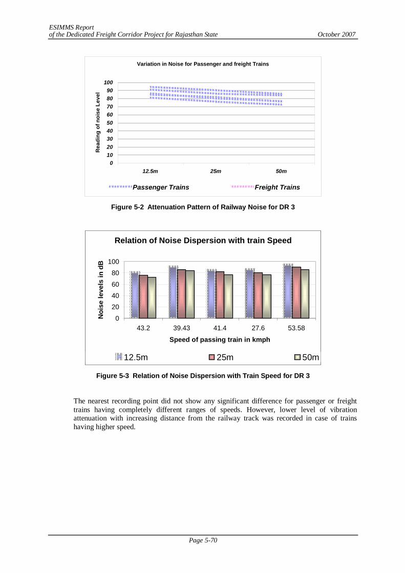
ESIMMS Report of the Dedicated Freight Corridor Project for Rajasthan State October 2007
Page 5-70
Variation in Noise for Passenger and freight Trains
0102030405060708090
100
12.5m 25m 50m
Rea
ding
of n
oise
Lev
el
Passenger Trains Freight Trains
Figure 5-2 Attenuation Pattern of Railway Noise for DR 3
Relation of Noise Dispersion with train Speed
0
204060
80100
43.2 39.43 41.4 27.6 53.58
Speed of passing train in kmph
Noi
se le
vels
in d
B
12.5m 25m 50m
Figure 5-3 Relation of Noise Dispersion with Train Speed for DR 3
The nearest recording point did not show any significant difference for passenger or freight trains having completely different ranges of speeds. However, lower level of vibration attenuation with increasing distance from the railway track was recorded in case of trains having higher speed.
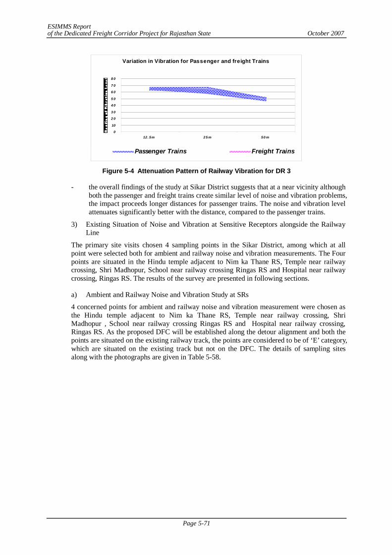
ESIMMS Report of the Dedicated Freight Corridor Project for Rajasthan State October 2007
Page 5-71
Variation in Vibration for Passenger and freight Trains
0
10
2 0
3 0
4 0
5 0
6 0
7 0
8 0
12 . 5m 25 m 50 m
Passenger Trains Freight Trains
Figure 5-4 Attenuation Pattern of Railway Vibration for DR 3
- the overall findings of the study at Sikar District suggests that at a near vicinity although both the passenger and freight trains create similar level of noise and vibration problems, the impact proceeds longer distances for passenger trains. The noise and vibration level attenuates significantly better with the distance, compared to the passenger trains.
3) Existing Situation of Noise and Vibration at Sensitive Receptors alongside the Railway Line
The primary site visits chosen 4 sampling points in the Sikar District, among which at all point were selected both for ambient and railway noise and vibration measurements. The Four points are situated in the Hindu temple adjacent to Nim ka Thane RS, Temple near railway crossing, Shri Madhopur, School near railway crossing Ringas RS and Hospital near railway crossing, Ringas RS. The results of the survey are presented in following sections.
a) Ambient and Railway Noise and Vibration Study at SRs
4 concerned points for ambient and railway noise and vibration measurement were chosen as the Hindu temple adjacent to Nim ka Thane RS, Temple near railway crossing, Shri Madhopur , School near railway crossing Ringas RS and Hospital near railway crossing, Ringas RS. As the proposed DFC will be established along the detour alignment and both the points are situated on the existing railway track, the points are considered to be of ‘E’ category, which are situated on the existing track but not on the DFC. The details of sampling sites along with the photographs are given in Table 5-58.
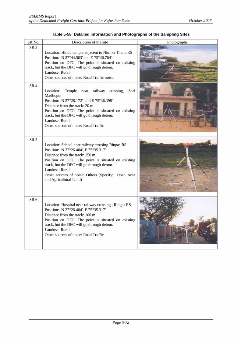
ESIMMS Report of the Dedicated Freight Corridor Project for Rajasthan State October 2007
Page 5-72
Table 5-58 Detailed Information and Photographs of the Sampling Sites
SR No. Description of the site Photographs SR 3
Location: Hindu temple adjacent to Nim ka Thane RS Position: N 27°44.503' and E 75°46.764' Position on DFC: The point is situated on existing track, but the DFC will go through detour. Landuse: Rural Other sources of noise: Road Traffic noise.
SR 4 Location: Temple near railway crossing, Shri Madhopur Position: N 27°28.172' and E 75°36.398' Distance from the track: 20 m Position on DFC: The point is situated on existing track, but the DFC will go through detour. Landuse: Rural Other sources of noise: Road Traffic
SR 5
Location: School near railway crossing Ringas RS Position: N 27°26.404', E 75°35.317' Distance from the track: 150 m Position on DFC: The point is situated on existing track, but the DFC will go through detour. Landuse: Rural Other sources of noise: Others (Specify: Open Area and Agricultural Land)
SR 6
Location: Hospital near railway crossing , Ringas RS Position: N 27°26.404', E 75°35.317' Distance from the track: 100 m Position on DFC: The point is situated on existing track, but the DFC will go through detour. Landuse: Rural Other sources of noise: Road Traffic
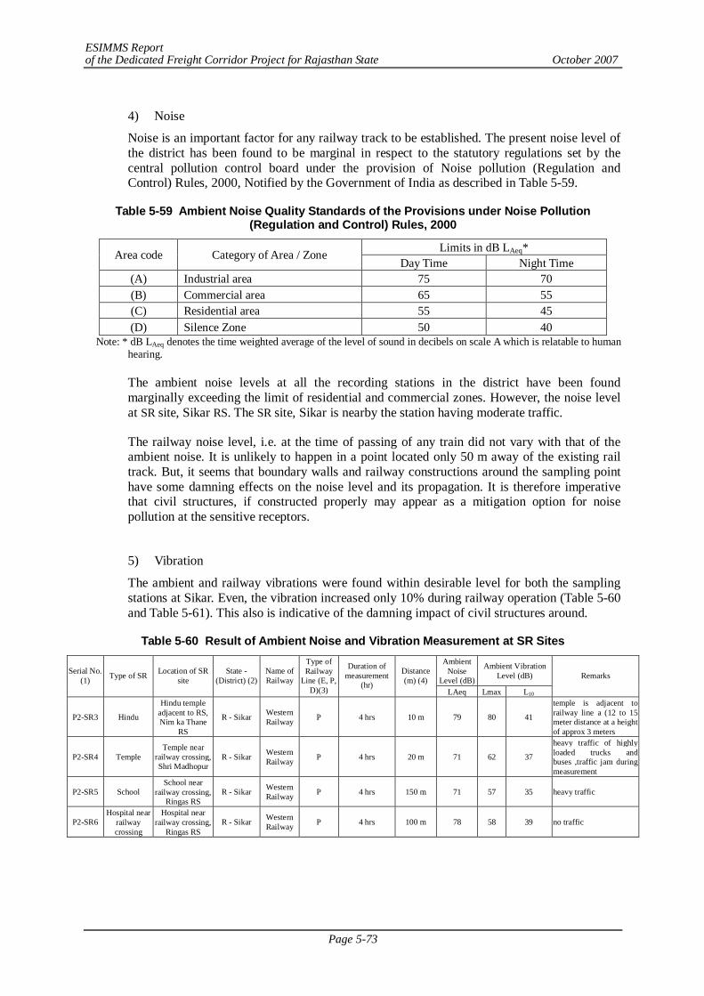
ESIMMS Report of the Dedicated Freight Corridor Project for Rajasthan State October 2007
Page 5-73
4) Noise
Noise is an important factor for any railway track to be established. The present noise level of the district has been found to be marginal in respect to the statutory regulations set by the central pollution control board under the provision of Noise pollution (Regulation and Control) Rules, 2000, Notified by the Government of India as described in Table 5-59.
Table 5-59 Ambient Noise Quality Standards of the Provisions under Noise Pollution (Regulation and Control) Rules, 2000
Limits in dB LAeq* Area code Category of Area / Zone Day Time Night Time
(A) Industrial area 75 70 (B) Commercial area 65 55 (C) Residential area 55 45 (D) Silence Zone 50 40
Note: * dB LAeq denotes the time weighted average of the level of sound in decibels on scale A which is relatable to human hearing.
The ambient noise levels at all the recording stations in the district have been found marginally exceeding the limit of residential and commercial zones. However, the noise level at SR site, Sikar RS. The SR site, Sikar is nearby the station having moderate traffic.
The railway noise level, i.e. at the time of passing of any train did not vary with that of the ambient noise. It is unlikely to happen in a point located only 50 m away of the existing rail track. But, it seems that boundary walls and railway constructions around the sampling point have some damning effects on the noise level and its propagation. It is therefore imperative that civil structures, if constructed properly may appear as a mitigation option for noise pollution at the sensitive receptors.
5) Vibration
The ambient and railway vibrations were found within desirable level for both the sampling stations at Sikar. Even, the vibration increased only 10% during railway operation (Table 5-60 and Table 5-61). This also is indicative of the damning impact of civil structures around.
Table 5-60 Result of Ambient Noise and Vibration Measurement at SR Sites Ambient
Noise Level (dB)
Ambient Vibration Level (dB) Serial No.
(1) Type of SR Location of SR site
State -(District) (2)
Name of Railway
Type of Railway
Line (E, P, D)(3)
Duration of measurement
(hr)
Distance (m) (4)
LAeq Lmax L10
Remarks
P2-SR3 Hindu
Hindu temple adjacent to RS, Nim ka Thane
RS
R - Sikar Western Railway P 4 hrs 10 m 79 80 41
temple is adjacent to railway line a (12 to 15 meter distance at a height of approx 3 meters
P2-SR4 Temple Temple near
railway crossing, Shri Madhopur
R - Sikar Western Railway P 4 hrs 20 m 71 62 37
heavy traffic of highly loaded trucks and buses ,traffic jam during measurement
P2-SR5 School School near
railway crossing, Ringas RS
R - Sikar Western Railway P 4 hrs 150 m 71 57 35 heavy traffic
P2-SR6 Hospital near
railway crossing
Hospital near railway crossing,
Ringas RS R - Sikar Western
Railway P 4 hrs 100 m 78 58 39 no traffic
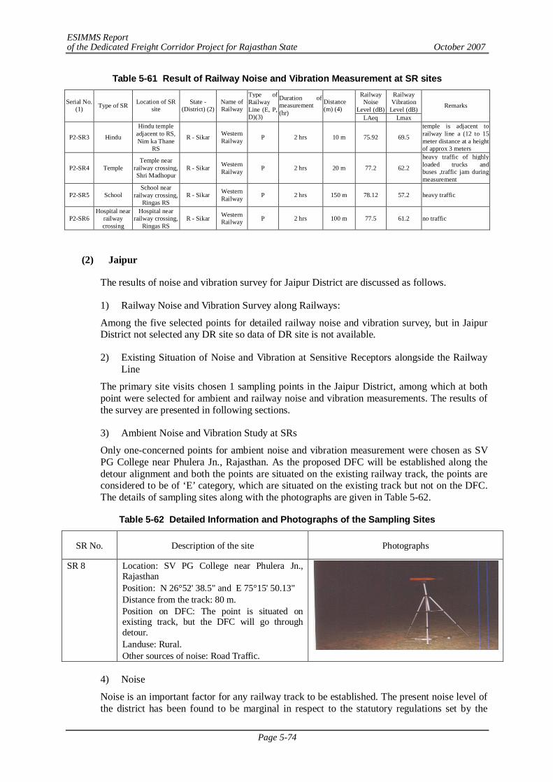
ESIMMS Report of the Dedicated Freight Corridor Project for Rajasthan State October 2007
Page 5-74
Table 5-61 Result of Railway Noise and Vibration Measurement at SR sites Railway
Noise Level (dB)
Railway Vibration
Level (dB) Serial No.
(1) Type of SR Location of SR site
State -(District) (2)
Name of Railway
Type of Railway Line (E, P, D)(3)
Duration of measurement (hr)
Distance (m) (4)
LAeq Lmax
Remarks
P2-SR3 Hindu
Hindu temple adjacent to RS, Nim ka Thane
RS
R - Sikar Western Railway P 2 hrs 10 m 75.92 69.5
temple is adjacent to railway line a (12 to 15 meter distance at a height of approx 3 meters
P2-SR4 Temple Temple near
railway crossing, Shri Madhopur
R - Sikar Western Railway P 2 hrs 20 m 77.2 62.2
heavy traffic of highly loaded trucks and buses ,traffic jam during measurement
P2-SR5 School School near
railway crossing, Ringas RS
R - Sikar Western Railway P 2 hrs 150 m 78.12 57.2 heavy traffic
P2-SR6 Hospital near
railway crossing
Hospital near railway crossing,
Ringas RS R - Sikar Western
Railway P 2 hrs 100 m 77.5 61.2 no traffic
(2) Jaipur
The results of noise and vibration survey for Jaipur District are discussed as follows.
1) Railway Noise and Vibration Survey along Railways:
Among the five selected points for detailed railway noise and vibration survey, but in Jaipur District not selected any DR site so data of DR site is not available.
2) Existing Situation of Noise and Vibration at Sensitive Receptors alongside the Railway Line
The primary site visits chosen 1 sampling points in the Jaipur District, among which at both point were selected for ambient and railway noise and vibration measurements. The results of the survey are presented in following sections.
3) Ambient Noise and Vibration Study at SRs
Only one-concerned points for ambient noise and vibration measurement were chosen as SV PG College near Phulera Jn., Rajasthan. As the proposed DFC will be established along the detour alignment and both the points are situated on the existing railway track, the points are considered to be of ‘E’ category, which are situated on the existing track but not on the DFC. The details of sampling sites along with the photographs are given in Table 5-62.
Table 5-62 Detailed Information and Photographs of the Sampling Sites
SR No. Description of the site Photographs
SR 8 Location: SV PG College near Phulera Jn., Rajasthan Position: N 26°52' 38.5" and E 75°15' 50.13" Distance from the track: 80 m. Position on DFC: The point is situated on existing track, but the DFC will go through detour. Landuse: Rural. Other sources of noise: Road Traffic.
4) Noise
Noise is an important factor for any railway track to be established. The present noise level of the district has been found to be marginal in respect to the statutory regulations set by the
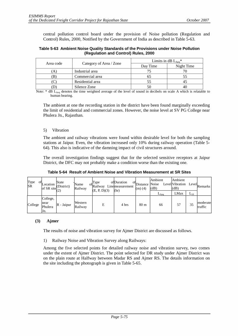
ESIMMS Report of the Dedicated Freight Corridor Project for Rajasthan State October 2007
Page 5-75
central pollution control board under the provision of Noise pollution (Regulation and Control) Rules, 2000, Notified by the Government of India as described in Table 5-63.
Table 5-63 Ambient Noise Quality Standards of the Provisions under Noise Pollution (Regulation and Control) Rules, 2000
Limits in dB LAeq* Area code Category of Area / Zone Day Time Night Time
(A) Industrial area 75 70 (B) Commercial area 65 55 (C) Residential area 55 45 (D) Silence Zone 50 40
Note: * dB LAeq denotes the time weighted average of the level of sound in decibels on scale A which is relatable to human hearing.
The ambient at one the recording station in the district have been found marginally exceeding the limit of residential and commercial zones. However, the noise level at SV PG College near Phulera Jn., Rajasthan.
5) Vibration
The ambient and railway vibrations were found within desirable level for both the sampling stations at Jaipur. Even, the vibration increased only 10% during railway operation (Table 5-64). This also is indicative of the damning impact of civil structures around.
The overall investigation findings suggest that for the selected sensitive receptors at Jaipur District, the DFC may not probably make a condition worse than the existing one.
Table 5-64 Result of Ambient Noise and Vibration Measurement at SR Sites
Ambient Noise Level (dB)
Ambient Vibration Level (dB)
Type of SR
Location of SR site
State -(District) (2)
Name of Railway
Type of Railway Line (E, P, D)(3)
Duration of measurement (hr)
Distance (m) (4)
LAeq LMax L10
Remarks
College
College, near Phulera Jn.
R - Jaipur Western Railway E 4 hrs 80 m 66 57 35 moderate
traffic
(3) Ajmer
The results of noise and vibration survey for Ajmer District are discussed as follows.
1) Railway Noise and Vibration Survey along Railways:
Among the five selected points for detailed railway noise and vibration survey, two comes under the extent of Ajmer District. The point selected for DR study under Ajmer District was on the plain route at Halfway between Madar RS and Ajmer RS. The details information on the site including the photograph is given in Table 5-65.
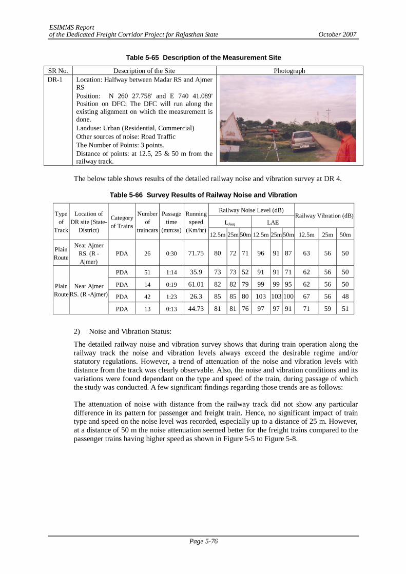
ESIMMS Report of the Dedicated Freight Corridor Project for Rajasthan State October 2007
Page 5-76
Table 5-65 Description of the Measurement Site
SR No. Description of the Site Photograph DR-1 Location: Halfway between Madar RS and Ajmer
RS Position: N 260 27.758' and E 740 41.089' Position on DFC: The DFC will run along the existing alignment on which the measurement is done. Landuse: Urban (Residential, Commercial) Other sources of noise: Road Traffic The Number of Points: 3 points. Distance of points: at 12.5, 25 & 50 m from the railway track.
The below table shows results of the detailed railway noise and vibration survey at DR 4.
Table 5-66 Survey Results of Railway Noise and Vibration
Railway Noise Level (dB)
LAeq LAE Railway Vibration (dB) Type
of Track
Location of DR site (State-
District)
Category of Trains
Number of
traincars
Passage time
(mm:ss)
Running speed
(Km/hr) 12.5m 25m 50m 12.5m 25m 50m 12.5m 25m 50m
Plain Route
Near Ajmer RS. (R -Ajmer)
PDA 26 0:30 71.75 80 72 71 96 91 87 63 56 50
PDA 51 1:14 35.9 73 73 52 91 91 71 62 56 50
PDA 14 0:19 61.01 82 82 79 99 99 95 62 56 50
PDA 42 1:23 26.3 85 85 80 103 103 100 67 56 48 Plain Route
Near Ajmer RS. (R -Ajmer)
PDA 13 0:13 44.73 81 81 76 97 97 91 71 59 51
2) Noise and Vibration Status:
The detailed railway noise and vibration survey shows that during train operation along the railway track the noise and vibration levels always exceed the desirable regime and/or statutory regulations. However, a trend of attenuation of the noise and vibration levels with distance from the track was clearly observable. Also, the noise and vibration conditions and its variations were found dependant on the type and speed of the train, during passage of which the study was conducted. A few significant findings regarding those trends are as follows:
The attenuation of noise with distance from the railway track did not show any particular difference in its pattern for passenger and freight train. Hence, no significant impact of train type and speed on the noise level was recorded, especially up to a distance of 25 m. However, at a distance of 50 m the noise attenuation seemed better for the freight trains compared to the passenger trains having higher speed as shown in Figure 5-5 to Figure 5-8.
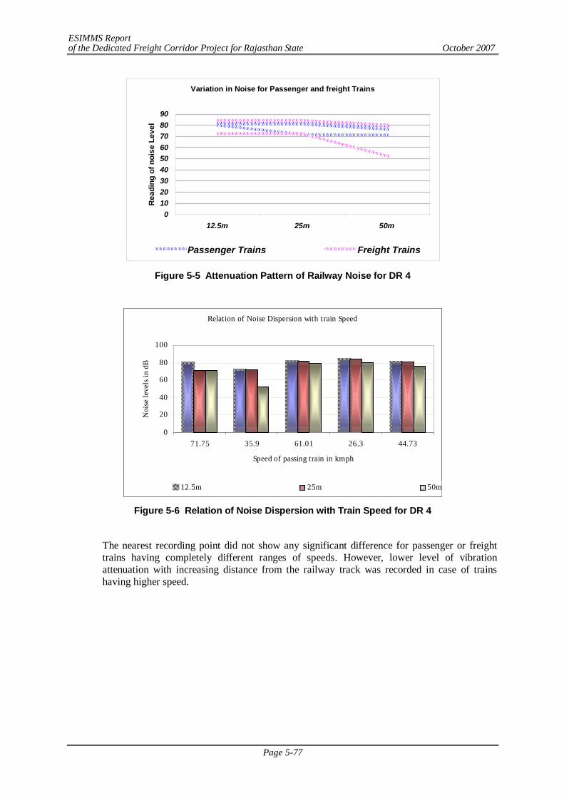
ESIMMS Report of the Dedicated Freight Corridor Project for Rajasthan State October 2007
Page 5-77
Variation in Noise for Passenger and freight Trains
0102030405060708090
12.5m 25m 50m
Rea
ding
of n
oise
Lev
el
Passenger Trains Freight Trains
Figure 5-5 Attenuation Pattern of Railway Noise for DR 4
Relation of Noise Dispersion with t rain Speed
0
20
40
60
80
100
71.75 35.9 61.01 26.3 44.73
Speed of passing t rain in kmph
Noi
se le
vels
in d
B
12.5m 25m 50m
Figure 5-6 Relation of Noise Dispersion with Train Speed for DR 4
The nearest recording point did not show any significant difference for passenger or freight trains having completely different ranges of speeds. However, lower level of vibration attenuation with increasing distance from the railway track was recorded in case of trains having higher speed.
ESIMMS Report of the Dedicated Freight Corridor Project for Rajasthan State October 2007
Page 5-78
Variation in Vibration for Passenger and freight Trains
0
10
20
30
40
50
60
70
80
12.5m 25m 50m
Rea
ding
of V
ibra
tion
leve
ls in
dB
Passenger Trains Freight Trains
Figure 5-7 Attenuation Pattern of Railway Vibration for DR 4
Relation of Vibration with train Speed
0
20
40
60
80
0:30 1:14 0:19 1:23 0:13
Vibr
atio
n le
vels
in d
B
12.5m 25m 50m
Figure 5-8 Relation of Vibration Dispersion with Train Speed for DR 4
The overall findings of the study at Ajmer District suggests that at a near vicinity although both the passenger and freight trains create similar level of noise and vibration problems, the impact proceeds longer distances for passenger trains. The noise and vibration level attenuates significantly better with the distance, compared to the passenger trains.
3) Existing Situation of Noise and Vibration at Sensitive Receptors alongside the Railway Line
The primary site visits chosen 4 sampling points in the Ajmer District, among which at all point were selected both for ambient and railway noise and vibration measurements. The Four points are situated in the Hindu temple adjacent to Nim ka Thane RS, Temple near railway crossing, Shri Madhopur, School near railway crossing Ringas RS and hospital near railway crossing, Ringas RS. The results of the survey are presented in following sections.
a) Ambient and Railway Noise and Vibration Study at SRs the 4 concerned points for ambient and Railway noise and vibration measurement were chosen as Hospital along
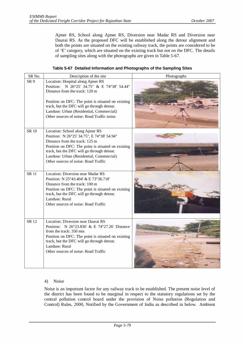
ESIMMS Report of the Dedicated Freight Corridor Project for Rajasthan State October 2007
Page 5-79
Ajmer RS, School along Ajmer RS, Diversion near Madar RS and Diversion near Daurai RS. As the proposed DFC will be established along the detour alignment and both the points are situated on the existing railway track, the points are considered to be of ‘E’ category, which are situated on the existing track but not on the DFC. The details of sampling sites along with the photographs are given in Table 5-67.
Table 5-67 Detailed Information and Photographs of the Sampling Sites
SR No. Description of the site Photographs SR 9
Location: Hospital along Ajmer RS Position: N 26°25' 34.75" & E 74°38' 54.44" Distance from the track: 120 m Position on DFC: The point is situated on existing track, but the DFC will go through detour. Landuse: Urban (Residential, Commercial) Other sources of noise: Road Traffic noise.
SR 10 Location: School along Ajmer RS
Position: N 26°25' 34.75", E 74°38' 54.94" Distance from the track: 125 m Position on DFC: The point is situated on existing track, but the DFC will go through detour. Landuse: Urban (Residential, Commercial) Other sources of noise: Road Traffic
SR 11
Location: Diversion near Madar RS Position: N 25°43.404' & E 73°36.718' Distance from the track: 100 m Position on DFC: The point is situated on existing track, but the DFC will go through detour. Landuse: Rural Other sources of noise: Road Traffic
SR 12 Location: Diversion near Daurai RS Position: N 26°23.836' & E 74°27.26' Distance from the track: 350 mts Position on DFC: The point is situated on existing track, but the DFC will go through detour. Landuse: Rural Other sources of noise: Road Traffic
4) Noise
Noise is an important factor for any railway track to be established. The present noise level of the district has been found to be marginal in respect to the statutory regulations set by the central pollution control board under the provision of Noise pollution (Regulation and Control) Rules, 2000, Notified by the Government of India as described in below. Ambient
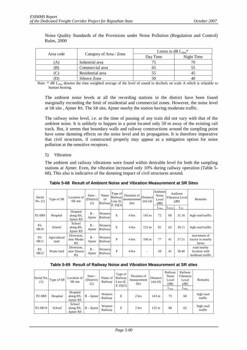
ESIMMS Report of the Dedicated Freight Corridor Project for Rajasthan State October 2007
Page 5-80
Noise Quality Standards of the Provisions under Noise Pollution (Regulation and Control) Rules, 2000
Limits in dB LAeq* Area code Category of Area / Zone Day Time Night Time
(A) Industrial area 75 70 (B) Commercial area 65 55 (C) Residential area 55 45 (D) Silence Zone 50 40
Note: * dB LAeq denotes the time weighted average of the level of sound in decibels on scale A which is relatable to human hearing.
The ambient noise levels at all the recording stations in the district have been found marginally exceeding the limit of residential and commercial zones. However, the noise level at SR site , Ajmer RS. The SR site, Ajmer nearby the station having moderate traffic.
The railway noise level, i.e. at the time of passing of any train did not vary with that of the ambient noise. It is unlikely to happen in a point located only 50 m away of the existing rail track. But, it seems that boundary walls and railway constructions around the sampling point have some damning effects on the noise level and its propagation. It is therefore imperative that civil structures, if constructed properly may appear as a mitigation option for noise pollution at the sensitive receptors.
5) Vibration
The ambient and railway vibrations were found within desirable level for both the sampling stations at Ajmer. Even, the vibration increased only 10% during railway operation (Table 5-68). This also is indicative of the damning impact of civil structures around.
Table 5-68 Result of Ambient Noise and Vibration Measurement at SR Sites
Table 5-69 Result of Railway Noise and Vibration Measurement at SR sites
Railway Noise Level (dB)
Railway Vibration
Level (dB)
Serial No. (1) Type of SR Location of
SR site
State -(District)
(2)
Name of Railway
Type of Railway Line (E, P, D)(3)
Duration of measurement
(hr)
Distance (m) (4)
LAeq LMax
Remarks
P2-SR9 Hospital Hospital
along RS, Ajmer RS
R - Ajmer Western Railway E 2 hrs 143 m 73 60 high road
traffic
P2-SR10 School School
along RS, Ajmer RS
R - Ajmer Western Railway E 2 hrs 125 m 80 62 high road
traffic
Ambient Noise Level (dB)
Ambient Vibration Level
(dB) Serial
No. (1) Type of SR Location of SR site
State -(District)
(2)
Name of
Railway
Type of Railway Line (E, P, D)(3)
Duration of measurement
(hr)
Distance (m) (4)
LAeq LMAX L10
Remarks
P2-SR9 Hospital Hospital
along RS, Ajmer RS
R - Ajmer
Western Railway E 4 hrs 143 m 72 60 31.16 high road traffic
P2-SR10 School
School along RS, Ajmer RS
R - Ajmer
Western Railway E 4 hrs 125 m 81 62 39.11 high road traffic
P2-SR11
Agricultural land
Diversion, near Madar
RS
R - Ajmer
Western Railway P 4 hrs 100 m 77 41 37.51
movement of tractor in nearby
farms
P2-SR12 Waste land
Diversion, near Daurai
RS
R - Ajmer
Western Railway P 4 hrs - 58 41 38.40
road nearby location with
moderate traffic
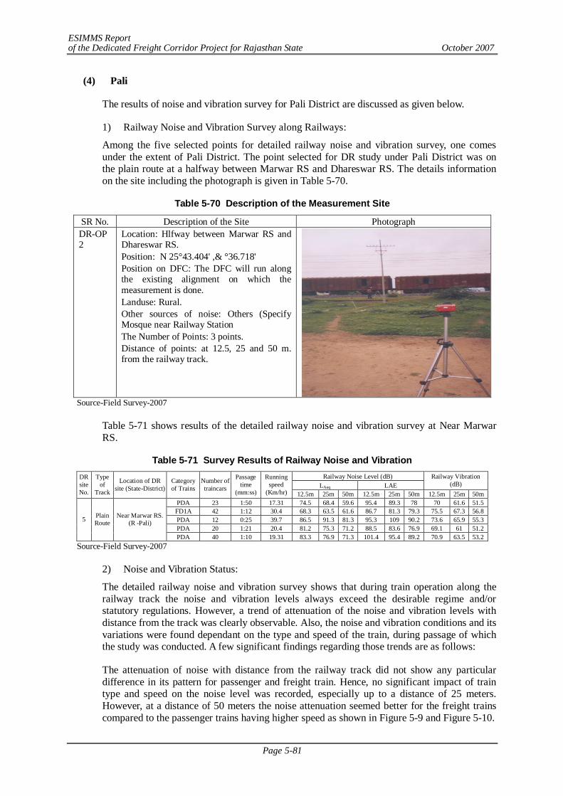
ESIMMS Report of the Dedicated Freight Corridor Project for Rajasthan State October 2007
Page 5-81
(4) Pali
The results of noise and vibration survey for Pali District are discussed as given below.
1) Railway Noise and Vibration Survey along Railways:
Among the five selected points for detailed railway noise and vibration survey, one comes under the extent of Pali District. The point selected for DR study under Pali District was on the plain route at a halfway between Marwar RS and Dhareswar RS. The details information on the site including the photograph is given in Table 5-70.
Table 5-70 Description of the Measurement Site
SR No. Description of the Site Photograph DR-OP 2
Location: Hlfway between Marwar RS and Dhareswar RS. Position: N 25°43.404' ,& °36.718' Position on DFC: The DFC will run along the existing alignment on which the measurement is done. Landuse: Rural. Other sources of noise: Others (Specify Mosque near Railway Station The Number of Points: 3 points. Distance of points: at 12.5, 25 and 50 m. from the railway track.
Source-Field Survey-2007
Table 5-71 shows results of the detailed railway noise and vibration survey at Near Marwar RS.
Table 5-71 Survey Results of Railway Noise and Vibration Railway Noise Level (dB)
LAeq LAE Railway Vibration
(dB) DR site No.
Type of
Track
Location of DR site (State-District)
Category of Trains
Number of traincars
Passage time
(mm:ss)
Running speed
(Km/hr) 12.5m 25m 50m 12.5m 25m 50m 12.5m 25m 50m PDA 23 1:50 17.31 74.5 68.4 59.6 95.4 89.3 78 70 61.6 51.5 FD1A 42 1:12 30.4 68.3 63.5 61.6 86.7 81.3 79.3 75.5 67.3 56.8 PDA 12 0:25 39.7 86.5 91.3 81.3 95.3 109 90.2 73.6 65.9 55.3 PDA 20 1:21 20.4 81.2 75.3 71.2 88.5 83.6 76.9 69.1 61 51.2
5 Plain Route
Near Marwar RS. (R -Pali)
PDA 40 1:10 19.31 83.3 76.9 71.3 101.4 95.4 89.2 70.9 63.5 53.2 Source-Field Survey-2007
2) Noise and Vibration Status:
The detailed railway noise and vibration survey shows that during train operation along the railway track the noise and vibration levels always exceed the desirable regime and/or statutory regulations. However, a trend of attenuation of the noise and vibration levels with distance from the track was clearly observable. Also, the noise and vibration conditions and its variations were found dependant on the type and speed of the train, during passage of which the study was conducted. A few significant findings regarding those trends are as follows:
The attenuation of noise with distance from the railway track did not show any particular difference in its pattern for passenger and freight train. Hence, no significant impact of train type and speed on the noise level was recorded, especially up to a distance of 25 meters. However, at a distance of 50 meters the noise attenuation seemed better for the freight trains compared to the passenger trains having higher speed as shown in Figure 5-9 and Figure 5-10.
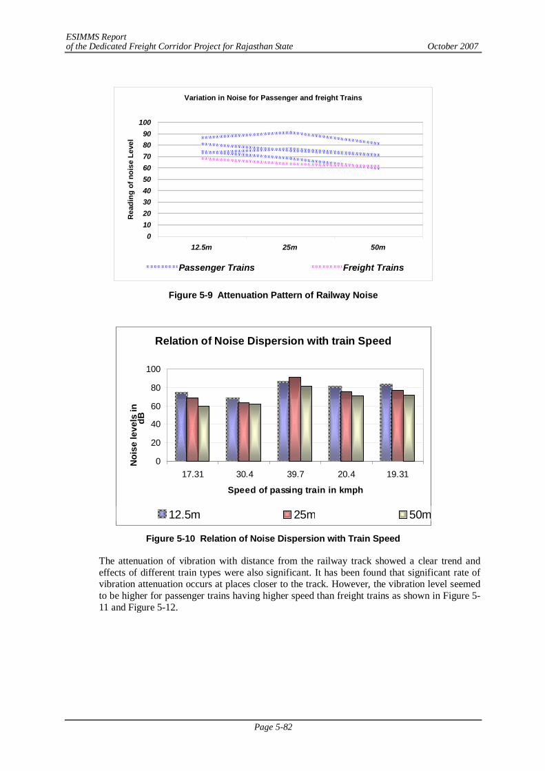
ESIMMS Report of the Dedicated Freight Corridor Project for Rajasthan State October 2007
Page 5-82
Variation in Noise for Passenger and freight Trains
0102030405060708090
100
12.5m 25m 50m
Rea
ding
of n
oise
Lev
el
Passenger Trains Freight Trains
Figure 5-9 Attenuation Pattern of Railway Noise
Relation of Noise Dispersion with train Speed
0
20
40
60
80
100
17.31 30.4 39.7 20.4 19.31
Speed of passing train in kmph
Noi
se le
vels
in
dB
12.5m 25m 50m
Figure 5-10 Relation of Noise Dispersion with Train Speed
The attenuation of vibration with distance from the railway track showed a clear trend and effects of different train types were also significant. It has been found that significant rate of vibration attenuation occurs at places closer to the track. However, the vibration level seemed to be higher for passenger trains having higher speed than freight trains as shown in Figure 5-11 and Figure 5-12.
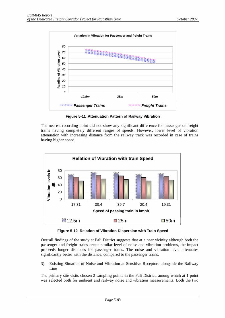
ESIMMS Report of the Dedicated Freight Corridor Project for Rajasthan State October 2007
Page 5-83
Variation in Vibration for Passenger and freight Trains
0
10
20
30
40
50
60
70
80
12.5m 25m 50m
Rea
ding
of V
ibra
tion
Leve
l
Passenger Trains Freight Trains
Figure 5-11 Attenuation Pattern of Railway Vibration
The nearest recording point did not show any significant difference for passenger or freight trains having completely different ranges of speeds. However, lower level of vibration attenuation with increasing distance from the railway track was recorded in case of trains having higher speed.
Relation of Vibration with train Speed
0
20
40
60
80
17.31 30.4 39.7 20.4 19.31
Speed of passing train in kmph
Vibr
atio
n le
vels
in
dB
12.5m 25m 50m
Figure 5-12 Relation of Vibration Dispersion with Train Speed
Overall findings of the study at Pali District suggests that at a near vicinity although both the passenger and freight trains create similar level of noise and vibration problems, the impact proceeds longer distances for passenger trains. The noise and vibration level attenuates significantly better with the distance, compared to the passenger trains.
3) Existing Situation of Noise and Vibration at Sensitive Receptors alongside the Railway Line
The primary site visits chosen 2 sampling points in the Pali District, among which at 1 point was selected both for ambient and railway noise and vibration measurements. Both the two
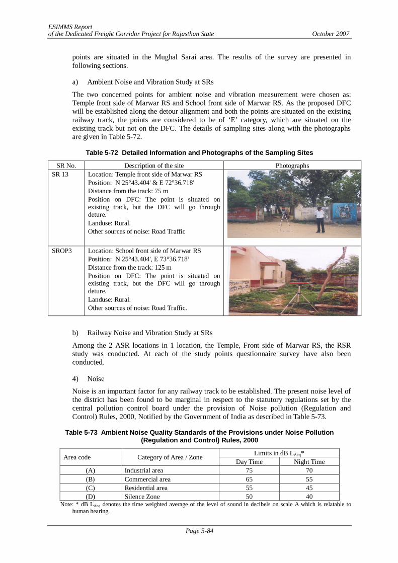
ESIMMS Report of the Dedicated Freight Corridor Project for Rajasthan State October 2007
Page 5-84
points are situated in the Mughal Sarai area. The results of the survey are presented in following sections.
a) Ambient Noise and Vibration Study at SRs
The two concerned points for ambient noise and vibration measurement were chosen as: Temple front side of Marwar RS and School front side of Marwar RS. As the proposed DFC will be established along the detour alignment and both the points are situated on the existing railway track, the points are considered to be of ‘E’ category, which are situated on the existing track but not on the DFC. The details of sampling sites along with the photographs are given in Table 5-72.
Table 5-72 Detailed Information and Photographs of the Sampling Sites
SR No. Description of the site Photographs SR 13
Location: Temple front side of Marwar RS Position: N 25°43.404' & E 72°36.718' Distance from the track: 75 m Position on DFC: The point is situated on existing track, but the DFC will go through deture. Landuse: Rural. Other sources of noise: Road Traffic
SROP3 Location: School front side of Marwar RS
Position: N 25°43.404', E 73°36.718’ Distance from the track: 125 m Position on DFC: The point is situated on existing track, but the DFC will go through deture. Landuse: Rural. Other sources of noise: Road Traffic.
b) Railway Noise and Vibration Study at SRs
Among the 2 ASR locations in 1 location, the Temple, Front side of Marwar RS, the RSR study was conducted. At each of the study points questionnaire survey have also been conducted.
4) Noise
Noise is an important factor for any railway track to be established. The present noise level of the district has been found to be marginal in respect to the statutory regulations set by the central pollution control board under the provision of Noise pollution (Regulation and Control) Rules, 2000, Notified by the Government of India as described in Table 5-73.
Table 5-73 Ambient Noise Quality Standards of the Provisions under Noise Pollution (Regulation and Control) Rules, 2000
Limits in dB LAeq* Area code Category of Area / Zone Day Time Night Time
(A) Industrial area 75 70 (B) Commercial area 65 55 (C) Residential area 55 45 (D) Silence Zone 50 40
Note: * dB LAeq denotes the time weighted average of the level of sound in decibels on scale A which is relatable to human hearing.
ESIMMS Report of the Dedicated Freight Corridor Project for Rajasthan State October 2007
Page 5-85
The ambient noise levels at all the recording stations in the district have been found marginally exceeding the limit of residential and commercial zones. However, the noise level at the front of Railway hospital was comparatively higher than that of the school area. This may be attributed to the regular hospital activities and because of the hospitals position by the side of a road having moderate traffic.
The railway noise level, i.e. at the time of passing of any train did not vary with that of the ambient noise. It is unlikely to happen in a point located only 60 m away of the existing rail track. But, it seems that boundary walls and railway constructions around the sampling point have some damning effects on the noise level and its propagation. It is therefore imperative that civil structures, if constructed properly may appear as a mitigation option for noise pollution at the sensitive receptors.
5) Vibration
The ambient and railway vibrations were found within desirable level for both the sampling stations at Pali. Even, the vibration increased only 10% during railway operation (Table 5-74 and Table 5-75). This also is indicative of the damning impact of civil structures around.
Table 5-74 Results of Ambient Noise and Vibration Measurement at SR Sites Ambient Noise Level
(dB) Ambient Vibration Level
(dB) Type of SR
Location of SR site
State -(District)
(2)
Name of
Railway
Type of Railway Line (E, P, D)(3)
Duration of measurement
(hr)
Distance (m) (4)
LAeq LMAX L10 Remarks
Temple
Temple, Front side of Marwar
RS
R - Pali Western Railway P 4 hrs 75 m 77 70 51 trains running at
high speed
School
School , Front side of Marwar
RS
R - Pali Western Railway P 4 hrs 140 m 76 68 50 trains running at
high speed
Table 5-75 Result of Railway Noise and Vibration Measurement at SR sites
Railway Noise Level
(dB)
Railway Vibration Level (dB)
Type of SR Location of SR site State -
(District) (2) Name of Railway
Type of Railway
Line (E, P, D)(3)
Duration of measurement
(hr)
Distance (m) (4)
LAeq Lmax
Remarks
Temple Temple, Front side of Marwar RS R - Pali Western
Railway P 2 hrs 75 m 85 67 road nearby location with moderate traffic
E - Existing railway line but out of DFC alignment, P - Paralleling railway line to existing one, D - Alongside planned Detour Horizontal distance of measuring point from center of the nearest track (m)
(5) Result of Questionnaire Survey
As it is already discussed, the questionnaire survey was conducted among the local people at all the sensitive receptors, where noise and vibration measurement was done.
1) Sikar
Accordingly, in the Sikar District total 40 people have been interviewed for their perceptions on the existing railway and vibration conditions. The responses were then tabulated and analyzed.
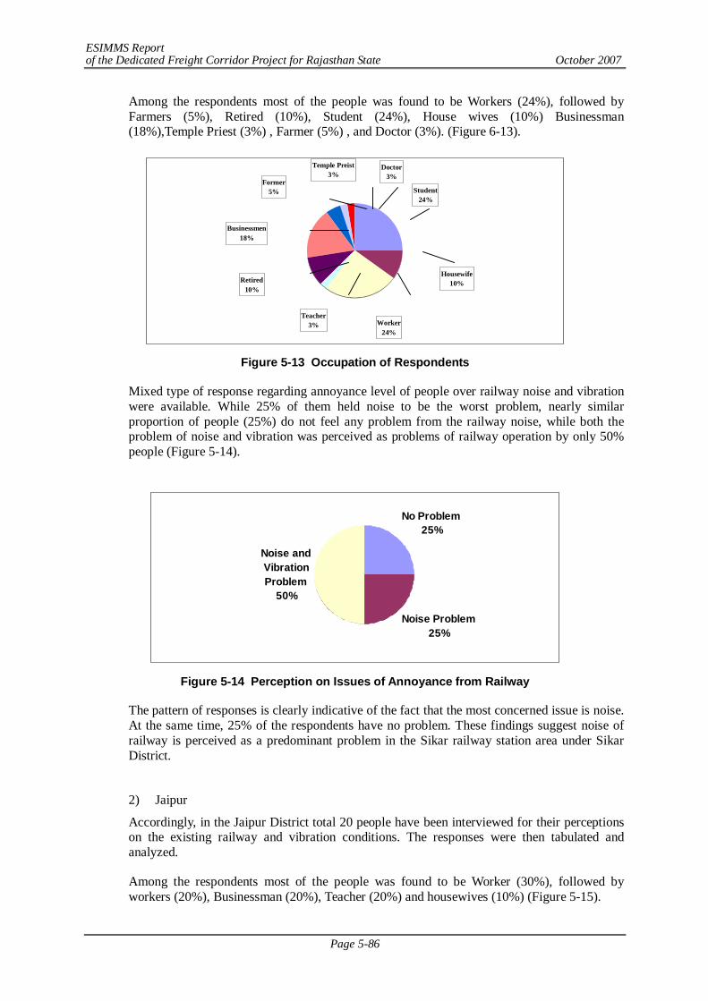
ESIMMS Report of the Dedicated Freight Corridor Project for Rajasthan State October 2007
Page 5-86
Among the respondents most of the people was found to be Workers (24%), followed by Farmers (5%), Retired (10%), Student (24%), House wives (10%) Businessman (18%),Temple Priest (3%) , Farmer (5%) , and Doctor (3%). (Figure 6-13).
Former5%
Temple Preist3%
Doctor3%
Student24%
Housewife10%
Worker24%
Retired10%
Teacher3%
Businessmen18%
Figure 5-13 Occupation of Respondents
Mixed type of response regarding annoyance level of people over railway noise and vibration were available. While 25% of them held noise to be the worst problem, nearly similar proportion of people (25%) do not feel any problem from the railway noise, while both the problem of noise and vibration was perceived as problems of railway operation by only 50% people (Figure 5-14).
No Problem25%
Noise Problem 25%
Noise and Vibration Problem
50%
Figure 5-14 Perception on Issues of Annoyance from Railway
The pattern of responses is clearly indicative of the fact that the most concerned issue is noise. At the same time, 25% of the respondents have no problem. These findings suggest noise of railway is perceived as a predominant problem in the Sikar railway station area under Sikar District.
2) Jaipur
Accordingly, in the Jaipur District total 20 people have been interviewed for their perceptions on the existing railway and vibration conditions. The responses were then tabulated and analyzed.
Among the respondents most of the people was found to be Worker (30%), followed by workers (20%), Businessman (20%), Teacher (20%) and housewives (10%) (Figure 5-15).
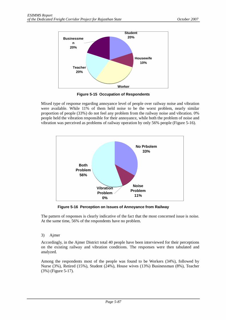
ESIMMS Report of the Dedicated Freight Corridor Project for Rajasthan State October 2007
Page 5-87
Student20%
Housewife10%
Worker30%
Teacher20%
Businessmen
20%
Figure 5-15 Occupation of Respondents
Mixed type of response regarding annoyance level of people over railway noise and vibration were available. While 11% of them held noise to be the worst problem, nearly similar proportion of people (33%) do not feel any problem from the railway noise and vibration. 0% people held the vibration responsible for their annoyance, while both the problem of noise and vibration was perceived as problems of railway operation by only 56% people (Figure 5-16).
No Prbolem33%
Noise Problem
11%
Both Problem
56%
Vibration Problem
0%
Figure 5-16 Perception on Issues of Annoyance from Railway
The pattern of responses is clearly indicative of the fact that the most concerned issue is noise. At the same time, 56% of the respondents have no problem.
3) Ajmer
Accordingly, in the Ajmer District total 40 people have been interviewed for their perceptions on the existing railway and vibration conditions. The responses were then tabulated and analyzed.
Among the respondents most of the people was found to be Workers (34%), followed by Nurse (3%), Retired (15%), Student (24%), House wives (13%) Businessman (8%), Teacher (3%) (Figure 5-17).
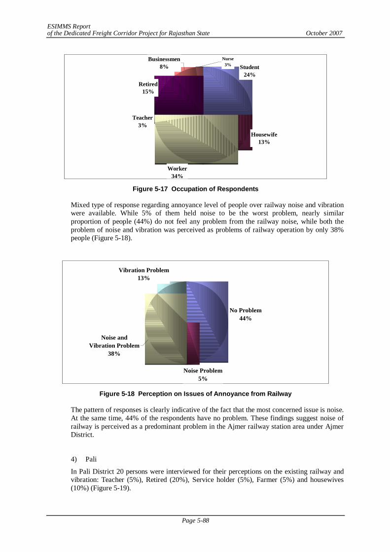
ESIMMS Report of the Dedicated Freight Corridor Project for Rajasthan State October 2007
Page 5-88
Student24%
Housewife13%
Retired15%
Worker34%
Nurse3%
Businessmen8%
Teacher3%
Figure 5-17 Occupation of Respondents
Mixed type of response regarding annoyance level of people over railway noise and vibration were available. While 5% of them held noise to be the worst problem, nearly similar proportion of people (44%) do not feel any problem from the railway noise, while both the problem of noise and vibration was perceived as problems of railway operation by only 38% people (Figure 5-18).
No Problem44%
Noise Problem 5%
Vibration Problem13%
Noise and Vibration Problem
38%
Figure 5-18 Perception on Issues of Annoyance from Railway
The pattern of responses is clearly indicative of the fact that the most concerned issue is noise. At the same time, 44% of the respondents have no problem. These findings suggest noise of railway is perceived as a predominant problem in the Ajmer railway station area under Ajmer District.
4) Pali
In Pali District 20 persons were interviewed for their perceptions on the existing railway and vibration: Teacher (5%), Retired (20%), Service holder (5%), Farmer (5%) and housewives (10%) (Figure 5-19).
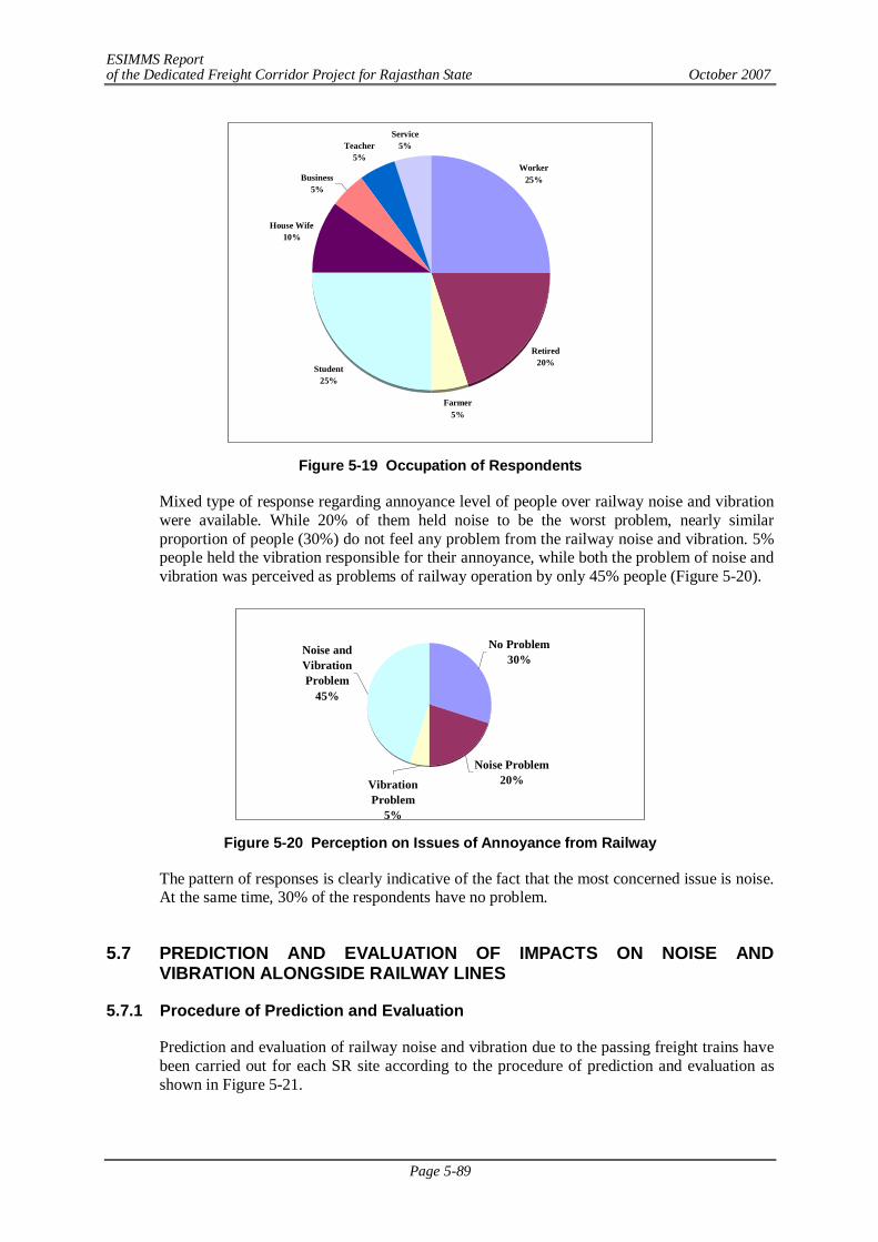
ESIMMS Report of the Dedicated Freight Corridor Project for Rajasthan State October 2007
Page 5-89
Worker25%
Retired20%
Farmer5%
Student25%
House Wife10%
Teacher5%
Service5%
Business5%
Figure 5-19 Occupation of Respondents
Mixed type of response regarding annoyance level of people over railway noise and vibration were available. While 20% of them held noise to be the worst problem, nearly similar proportion of people (30%) do not feel any problem from the railway noise and vibration. 5% people held the vibration responsible for their annoyance, while both the problem of noise and vibration was perceived as problems of railway operation by only 45% people (Figure 5-20).
Noise Problem 20%Vibration
Problem5%
Noise and Vibration Problem
45%
No Problem30%
Figure 5-20 Perception on Issues of Annoyance from Railway
The pattern of responses is clearly indicative of the fact that the most concerned issue is noise. At the same time, 30% of the respondents have no problem.
5.7 PREDICTION AND EVALUATION OF IMPACTS ON NOISE AND
VIBRATION ALONGSIDE RAILWAY LINES
5.7.1 Procedure of Prediction and Evaluation
Prediction and evaluation of railway noise and vibration due to the passing freight trains have been carried out for each SR site according to the procedure of prediction and evaluation as shown in Figure 5-21.
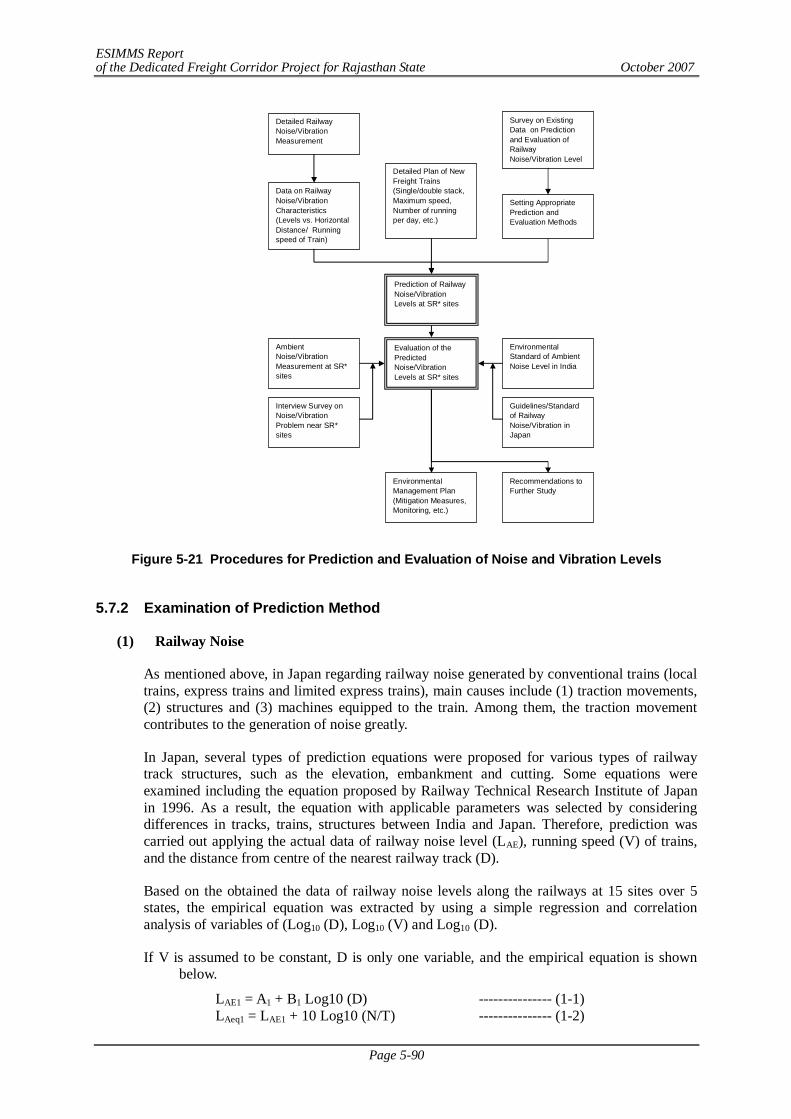
ESIMMS Report of the Dedicated Freight Corridor Project for Rajasthan State October 2007
Page 5-90
Figure 5-21 Procedures for Prediction and Evaluation of Noise and Vibration Levels
5.7.2 Examination of Prediction Method
(1) Railway Noise
As mentioned above, in Japan regarding railway noise generated by conventional trains (local trains, express trains and limited express trains), main causes include (1) traction movements, (2) structures and (3) machines equipped to the train. Among them, the traction movement contributes to the generation of noise greatly.
In Japan, several types of prediction equations were proposed for various types of railway track structures, such as the elevation, embankment and cutting. Some equations were examined including the equation proposed by Railway Technical Research Institute of Japan in 1996. As a result, the equation with applicable parameters was selected by considering differences in tracks, trains, structures between India and Japan. Therefore, prediction was carried out applying the actual data of railway noise level (LAE), running speed (V) of trains, and the distance from centre of the nearest railway track (D).
Based on the obtained the data of railway noise levels along the railways at 15 sites over 5 states, the empirical equation was extracted by using a simple regression and correlation analysis of variables of (Log10 (D), Log10 (V) and Log10 (D).
If V is assumed to be constant, D is only one variable, and the empirical equation is shown below.
LAE1 = A1 + B1 Log10 (D) --------------- (1-1) LAeq1 = LAE1 + 10 Log10 (N/T) --------------- (1-2)
Detailed RailwayNoise/VibrationMeasurement
Data on RailwayNoise/VibrationCharacteristics(Levels vs. HorizontalDistance/ Runningspeed of Train)
Prediction of RailwayNoise/VibrationLevels at SR* sites
Detailed Plan of NewFreight Trains(Single/double stack,Maximum speed,Number of runningper day, etc.)
Evaluation of thePredictedNoise/VibrationLevels at SR* sites
AmbientNoise/VibrationMeasurement at SR*sites
Interview Survey onNoise/VibrationProblem near SR*sites
EnvironmentalManagement Plan(Mitigation Measures,Monitoring, etc.)
EnvironmentalStandard of AmbientNoise Level in India
Guidelines/Standardof RailwayNoise/Vibration inJapan
Recommendations toFurther Study
Setting AppropriatePrediction andEvaluation Methods
Survey on ExistingData on Predictionand Evaluation ofRailwayNoise/Vibration Level
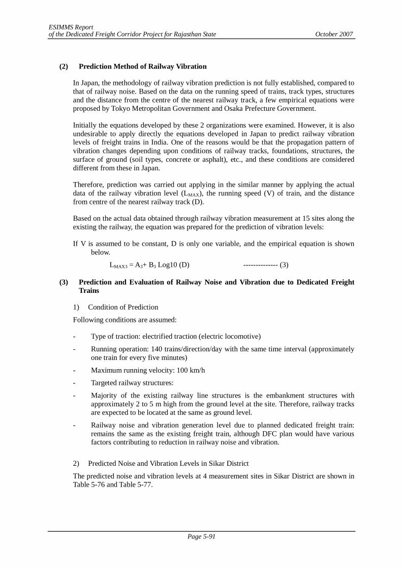
ESIMMS Report of the Dedicated Freight Corridor Project for Rajasthan State October 2007
Page 5-91
(2) Prediction Method of Railway Vibration
In Japan, the methodology of railway vibration prediction is not fully established, compared to that of railway noise. Based on the data on the running speed of trains, track types, structures and the distance from the centre of the nearest railway track, a few empirical equations were proposed by Tokyo Metropolitan Government and Osaka Prefecture Government.
Initially the equations developed by these 2 organizations were examined. However, it is also undesirable to apply directly the equations developed in Japan to predict railway vibration levels of freight trains in India. One of the reasons would be that the propagation pattern of vibration changes depending upon conditions of railway tracks, foundations, structures, the surface of ground (soil types, concrete or asphalt), etc., and these conditions are considered different from these in Japan.
Therefore, prediction was carried out applying in the similar manner by applying the actual data of the railway vibration level (LMAX), the running speed (V) of train, and the distance from centre of the nearest railway track (D).
Based on the actual data obtained through railway vibration measurement at 15 sites along the existing the railway, the equation was prepared for the prediction of vibration levels:
If V is assumed to be constant, D is only one variable, and the empirical equation is shown below.
LMAX3 = A3+ B3 Log10 (D) -------------- (3)
(3) Prediction and Evaluation of Railway Noise and Vibration due to Dedicated Freight Trains
1) Condition of Prediction
Following conditions are assumed:
- Type of traction: electrified traction (electric locomotive)
- Running operation: 140 trains/direction/day with the same time interval (approximately one train for every five minutes)
- Maximum running velocity: 100 km/h
- Targeted railway structures:
- Majority of the existing railway line structures is the embankment structures with approximately 2 to 5 m high from the ground level at the site. Therefore, railway tracks are expected to be located at the same as ground level.
- Railway noise and vibration generation level due to planned dedicated freight train: remains the same as the existing freight train, although DFC plan would have various factors contributing to reduction in railway noise and vibration.
2) Predicted Noise and Vibration Levels in Sikar District
The predicted noise and vibration levels at 4 measurement sites in Sikar District are shown in Table 5-76 and Table 5-77.
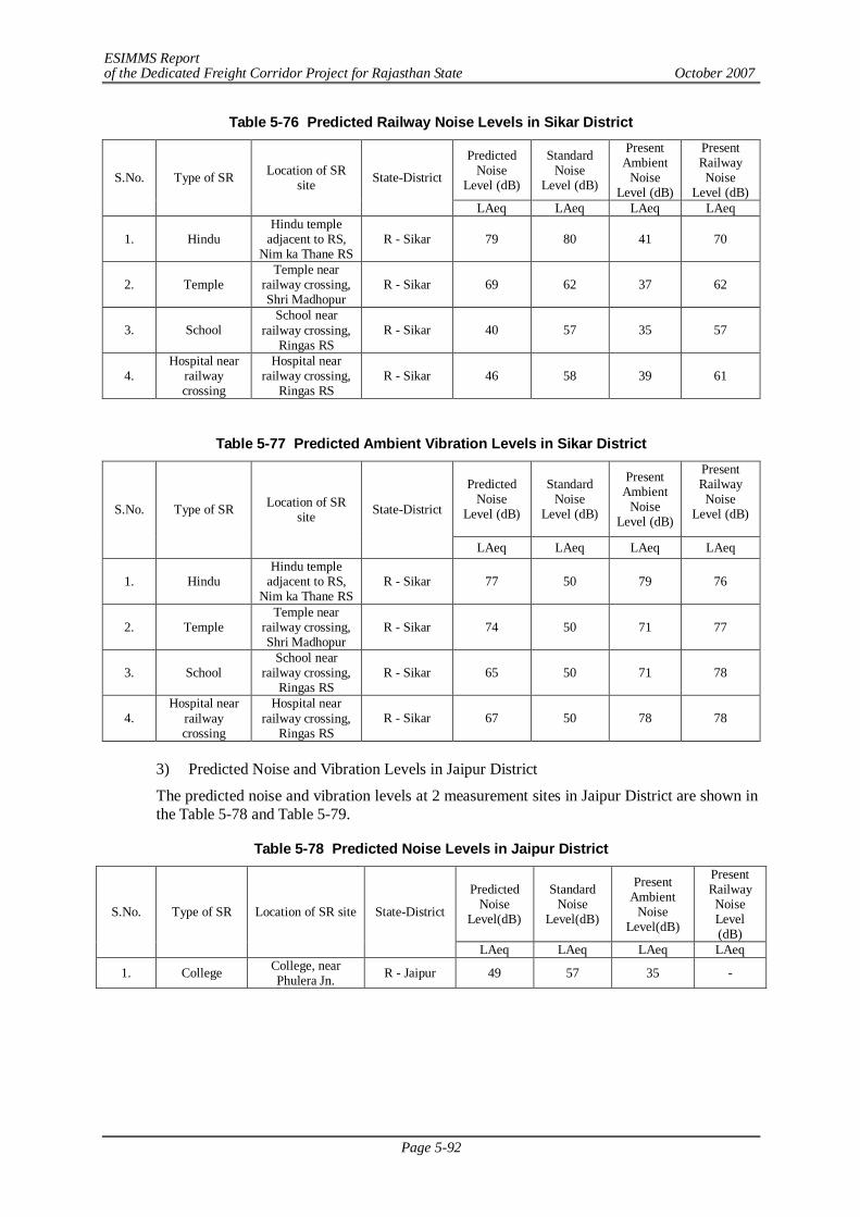
ESIMMS Report of the Dedicated Freight Corridor Project for Rajasthan State October 2007
Page 5-92
Table 5-76 Predicted Railway Noise Levels in Sikar District
Predicted Noise
Level (dB)
Standard Noise
Level (dB)
Present Ambient
Noise Level (dB)
Present Railway Noise
Level (dB) S.No. Type of SR Location of SR
site State-District
LAeq LAeq LAeq LAeq
1. Hindu Hindu temple
adjacent to RS, Nim ka Thane RS
R - Sikar 79 80 41 70
2. Temple Temple near
railway crossing, Shri Madhopur
R - Sikar 69 62 37 62
3. School School near
railway crossing, Ringas RS
R - Sikar 40 57 35 57
4. Hospital near
railway crossing
Hospital near railway crossing,
Ringas RS R - Sikar 46 58 39 61
Table 5-77 Predicted Ambient Vibration Levels in Sikar District
Predicted Noise
Level (dB)
Standard Noise
Level (dB)
Present Ambient
Noise Level (dB)
Present Railway Noise
Level (dB)
S.No. Type of SR Location of SR site State-District
LAeq LAeq LAeq LAeq
1. Hindu Hindu temple
adjacent to RS, Nim ka Thane RS
R - Sikar 77 50 79 76
2. Temple Temple near
railway crossing, Shri Madhopur
R - Sikar 74 50 71 77
3. School School near
railway crossing, Ringas RS
R - Sikar 65 50 71 78
4. Hospital near
railway crossing
Hospital near railway crossing,
Ringas RS R - Sikar 67 50 78 78
3) Predicted Noise and Vibration Levels in Jaipur District
The predicted noise and vibration levels at 2 measurement sites in Jaipur District are shown in the Table 5-78 and Table 5-79.
Table 5-78 Predicted Noise Levels in Jaipur District
Predicted Noise
Level(dB)
Standard Noise
Level(dB)
Present Ambient
Noise Level(dB)
Present Railway Noise Level (dB)
S.No. Type of SR Location of SR site State-District
LAeq LAeq LAeq LAeq
1. College College, near Phulera Jn. R - Jaipur 49 57 35 -
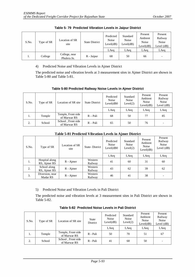
ESIMMS Report of the Dedicated Freight Corridor Project for Rajasthan State October 2007
Page 5-93
Table 5- 79 Predicted Vibration Levels in Jaipur District
Predicted Noise
Level(dB)
Standard Noise
Level(dB)
Present Ambient
Noise Level(dB)
Present Railway Noise
Level (dB) S.No. Type of SR
Location of SR site
State District
LAeq LAeq LAeq LAeq
1. College College, near Phulera Jn.
R - Jaipur 68 50 66 -
4) Predicted Noise and Vibration Levels in Ajmer District
The predicted noise and vibration levels at 3 measurement sites in Ajmer District are shown in Table 5-80 and Table 5-81.
Table 5-80 Predicted Railway Noise Levels in Ajmer District
Predicted Noise
Level(dB0
Standard Noise
Level(2)
Present Ambient
Noise Level(dB)
Present Railway Noise
Level (dB) S.No. Type of SR Location of SR site State District
LAeq LAeq LAeq LAeq
1. Temple Temple, Front side of Marwar RS R – Pali 68 50 77 85
2. School School , Front side of Marwar RS R – Pali 65 50 76 -
Table 5-81 Predicted Vibration Levels in Ajmer District
Predicted Noise
Level(dB0
Standard Noise
Level(2)
Present Ambient
Noise Level(dB)
Present Railway Noise
Level (dB)
S.No. Type of SR Location of SR site State- District
LAeq LAeq LAeq LAeq
1. Hospital along RS, Ajmer RS R - Ajmer Western
Railway 41 60 31 60
2. School along RS, Ajmer RS R - Ajmer Western
Railway 43 62 39 62
3. Diversion, near Madar RS R - Ajmer Western
Railway 46 41 38 -
5) Predicted Noise and Vibration Levels in Pali District
The predicted noise and vibration levels at 3 measurement sites in Pali District are shown in Table 5-82.
Table 5-82 Predicted Noise Levels in Pali District
Predicted Noise
Level(dB)
Standard Noise
Level(2)
Present Ambient
Noise Level(dB)
Present Railway Noise
Level (dB) S.No. Type of SR Location of SR site State
District
LAeq LAeq LAeq LAeq
1. Temple Temple, Front side of Marwar RS R - Pali 50 70 51 67
2. School School , Front side of Marwar RS R - Pali 41 68 50 -
ESIMMS Report of the Dedicated Freight Corridor Project for Rajasthan State October 2007
Page 5-94
Table 5-83 Predicted Vibration Levels in Pali District
Predicted Noise
Level(dB)
Standard Noise
Level(2)
Present Ambient
Noise Level(dB)
Present Railway Noise
Level (dB) S.No. Type of
SR Location of SR site State District
LAeq LAeq LAeq LAeq
1. Temple Temple, Front side of Marwar RS R - Pali 50 70 51 67
2. School School , Front side of Marwar RS R - Pali 41 68 50 -
5.7.3 Overall Findings and Recommendations
(1) Consideration of the Noise and Vibration Measurement at Residences besides SRs
In this study, SRs were selected as noise and vibration measurement sites as the representative or typical sites by considering various factors of the study such as the purpose, the survey period, availability of the measurement methodology, noise and vibration standards and environmental consultants in India. It is suggested that the noise and vibration survey should be conducted at residences along the railway lines where actual affected people live in the Detailed Design stage.
(2) Implementation of Railway Noise and Vibration Mitigation Measures
As this study result shows, at SRs in the urban and city area, the existing ambient noise and vibration tend to be high due to the traffic, people nearby, their own religious activities, etc. Moreover, the interview survey results show that not only railway noise but also road traffic are environmental concerns of the residents. Therefore, the railway noise and vibration mitigation measures should be adopted gradually in accordance with the rise in environmental awareness especially for noise and vibration.
Baseline Data Collection of Railway Noise and Vibration and Establishment of Prediction and Evaluation Methods
1) Establishment of the Methods of Railway Noise Monitoring
For further detailed noise and vibration monitoring, it is necessary to obtain the baseline data as well as the established methodologies of railway noise and vibration measurement. Since there is very limited data on noise and vibration in India, it is considered that extensive railway noise and vibration survey was conducted in ESCS and ESIMMS for the first time in India. Although there are railway noise and vibration survey data and methodologies available in Japan, they are not applicable to India since there are various different conditions such as the railway and train design and operation.
2) Establishment of the Methods of Railway Vibration Monitoring
In Japan, the ambient and railway vibration measurement covers only direct impacts to human beings and vertical movement of vibration. However, in India, the horizontal impacts are considered because the major concern of vibration is impacts on buildings. Therefore, vibration measurement in buildings should be also considered for the further study in the Detailed Design stage.
ESIMMS Report of the Dedicated Freight Corridor Project for Rajasthan State October 2007
Page 6-1
CHAPTER 6 STAKEHOLDER/PUBLIC CONSULTATION MEETING
6.1 PUBLIC CONSULTATION
The public consultation is an important tool of information, dissemination and awareness creation during the planning stage of the project. It provides valuable inputs regarding successful implementation of the project besides ensuring public participation and involvement in the process.
In order to assess feasibility of development of dedicated multimodal high-axle load freight corridor with computerized control for Delhi-Mumbai, stakeholder/public consultation meetings were organized in all three phases of the study.
- Phase I- First Stage (February 2007) - Phase II – Second Stage (June-July 2007) - Phase III – Third Stage (August-September 2007)
1st and 2nd phase public consultation meetings were conducted in the district to disseminate information and make affected people aware about the project and seek their suggestions about proposed DFC respectively. Stakeholders were invited from all the villages, Gram Panchayats and blocks and towns, which were likely to be affected in the parallel section and the detour route due to land acquisition in the proposed DFC project. The stakeholders expressed their views and provided valuable suggestions in respect to rehabilitation and resettlement issues and other social-environmental concerns. It was followed by village feedback meeting organized by field staff in order to know the understanding and opinions of the villagers about the proposed DFC Project. The village meetings were conducted in each affected village of the district. Contents of draft NPR -2006 were discussed with Gram Panchayat and affected persons and their suggestion were taken on R&R issues. In the village meetings, field staff assisted Gram Panchayat to constitute Village Rehabilitation Committee (VRC) in each affected village. Record of the village meetings is attached in Annex-6.1.
In the 3rd phase of Public consultation meeting, primary stakeholders including Panchayat members, members of village rehabilitation committee, directly affected persons and other stakeholders were present. The Gram Panchayat representatives and VRC members proposed mitigation measures for social and environment impacts and presented their views and suggestion in respect to resettlement and rehabilitation measures. Gram Panchayat and VRC members submitted expressed their concerns in writing.
6.2 SELECTION OF STAKEHOLDERS
Various categories of stakeholders ranging from Project Affected Persons to government officials to other opinion leaders such as NGO activist and media persons were selected in order to explore the feasibility of development of “dedicated high axle load multimodal freight corridor” and to discuss social and environmental impacts, including the issue of resettlement and rehabilitation. The various categories of stakeholders were selected to attend the public consultation meeting, which are as follows:
- PAPs: Project Affected Persons - Govt. Officials: local administration, revenue department, land acquisition officer,
forest officers, railway officials, DFCCIL officials, Central and State Pollution Control Boards, etc.
- Elected representatives: Representation from Gram Panchayat, Pradhan, local Municipal bodies, M.P and M.L.A.
- Local NGOs: Actively working on environmental & social issues in the district
ESIMMS Report of the Dedicated Freight Corridor Project for Rajasthan State October 2007
Page 6-2
- Transporters: Local transport operators, freight operators, stevedores - Media: Local press reporters, State level and National Daily reporters, electronic
media (local and National level news channel) - Industries: Local industry owners - Academicians: Academicians in the field of Social and Environment Sciences,
Head of reputed educational institutions - Citizens: Residents, merchants/businessmen, advocates, farmers, senior citizens,
etc. 6.3 METHOD OF SELECTION STAKEHOLDERS
The following steps were taken into account for conducting public consultation meetings:
Ministry of Railways has issued formal letter to Secretary, revenue department, Government of Rajasthan dated May 11, 2007. The letter clearly indicated that public consultation and stakeholder meetings are to be undertaken as part of studies on environmental and social issues. An Inter Ministerial Working group called Environmental Working Group (EWG) has been set up to coordinate this aspect of the study. In response, Secretary, Revenue Department has directed in the official correspondence to District Magistrates of 2 districts of Rajasthan to extend the cooperation to Mantec Consultants Pvt. Ltd. to carry out ESIMMS of Development of Dedicated Freight Corridor
District Magistrate, Additional District Magistrate, Tahsildar, and Block Development officer and district forest officers were formally invited to participate in the Public Consultation Meetings.
The representatives of Panchayat Raj institutions and local Municipal bodies were personally invited.
Invitation letters were issued to the representatives of local media, opinion leaders and members of academics with the request to participate and contribute in the deliberations. The efforts were made to meet likely affected PAPs personally along with the letter of invitation.
Due care was taken to address the issues of the poor, vulnerable groups, landless and other disadvantaged sections of the society likely to be affected by the project. The main objective of the stakeholders/public consultation meeting was to
- Disseminate the information about DFC project to the general public. - Create awareness about the project among the PAPs. - Dispel the appearance of PAPs regarding the positive/adverse impact of the
project. - Present Draft NPR-2006, discuss its norms and provisions before the stakeholders - Seek the suggestion of Gram Panchayat, PAPs and other stakeholders on the
various involved including those related to compensation, resettlement and rehabilitation social and environmental impacts.
- Present and discuss opinion of each village committee compiled by Gram Panchayat and content of RRP
6.4 STAKEHOLDER/PUBLIC CONSULTATION MEETING
Details of 2nd and 3rd stage of the public consultation meetings is given in Annex 6.1.
ESIMMS Report of the Dedicated Freight Corridor Project for Rajasthan State October 2007
Page 6-3
6.4.1 Selection of Meeting Facilitators
Suitable agencies having local presence were identified to carry out stakeholders/public consultation meetings. Preference was given to non-government organization, who had local presence, popularity and experience in social work. The acquaintance with different cross sections of society and the ability to mobilize the stakeholders of the meeting were the major selection criteria. The ability to facilitate the following activities was taken into consideration:
- Venue for the meetings - Arrangements to be made - Assisting in local publicity - Invitations to the stakeholders and motivating them for participation - Maintaining and compilation of the record and feedback organizing media
coverage and - Other local arrangements like transport, hospitality, security and smooth conduct
of the meeting proceedings
In the process, Institute for Spatial Planning and Environmental Research (ISPER) was appointed to facilitate the stakeholders/public consultation meeting in Alwar and Nagaur.
In Sikar and Sirohi Sweet Institute was appointed to facilitate the stakeholders/public consultation meeting.
In Jaipur, Institute for Samaj Vikas Sewa Sanstha was appointed to facilitate the stakeholders/public consultation meeting.
In Ajmer and Pali, Society for Environment and Development was appointed to facilitate the stakeholders/public consultation meeting.
6.4.2 Method of Information Dissemination
The meeting facilitator team had visited nearly all the affected villages and requested Primary and Secondary Stakeholders to attend the meeting. Field Team distributed leaflets highlighting DFC project information and invite those people who will be affected directly by this project.
1) Method of Notifying the Meeting to the Participants
Following methods were used for notifying the meeting to the Participants
a) Date and venue of the stakeholders/Public Consultation Meeting was notified in local newspapers and the stakeholders were invited to attend to the meeting.
b) A handout containing the information about the project was distributed in likely to be affected villages.
c) Face to face meetings were organized to disseminate the information.
d) Efforts were made to publish the summary of stakeholders/public consultation meeting in local newspaper and television with the help of media.
e) The stakeholders were also reminded to attend the meeting through personal phone calls wherever possible.
2) Presentation of the meeting
6.4.3 Venue of Stakeholder/Public Consultation Meeting
The venue where stakeholders/public consultation meeting is mentioned in Annex 6.1.
ESIMMS Report of the Dedicated Freight Corridor Project for Rajasthan State October 2007
Page 6-4
6.4.4 Summary of Stakeholder/Public Consultation Meeting
Agriculture is the main occupation of the people. Therefore implementation of the project would mainly affect livelihood of the people. The economic condition of the people is not very sound. The majority of the participant’s annual income is income less than Rs.2,500. The respondents have moderate family size, i.e. 6 members per family.
The participant’s places are connected with broad gauge and they are likely to be affected by the project. In the meeting it was find out that majority of respondents were well aware about the environmental condition of the area. Most of them opined the proposed project should not disturb present socio-economic conditions and environmental conditions.
Through active participations of the stakeholders, key issues relating to social and environmental impacts, compensation, resettlement and rehabilitation were identified and discussed during the public consultation meetings. Following suggestions were common which were given by the participants in all the districts.
- The compensation for land acquisition on the basis of market price of land
- Compensation in qualitative and quantitative terms i.e. agriculture land of appropriate productive capacity in lieu of similar land acquired including appropriate irrigation facilities, similar dispensation for residential and commercial structures.
- Provision of housing units for resettlement including facilities for education, health, electricity and drinking water
- Provision of employment in project construction works to Project Affected Persons (PAPs)
- Provision of jobs in Indian Railways besides compensation to families whose land, house, shops, etc. are to be taken.
- Provision of skill training to create employability among the displaced/non-employable wards of land oustees /displaced persons/families
- Issues relating to environment protection and pollution control
Besides above suggestions some suggestions were district specific as mentioned below:
Sikar
- The existing track should be shifted as there is about 30m land spare with the railways in the western side along with the existing track the BG (under construction) can also be laid in the western side which in turn would leave ample space for the DFC corridor to be laid. Anyways the eastern side of the track is heavily congested and if not avoided the impact would be severe
- In JALPANI an Inland Container Depot (ICD) is demanded.
Jaipur
- In Naraina, the proposed alignment is curved which should be changed to straight to avoid affected families due to the curved track.
Nagaur
- A ROB should be made at the crossing at Minda Phatak.
Pali
- A ROB should be proposed near Sojat Road railway Station.
ESIMMS Report of the Dedicated Freight Corridor Project for Rajasthan State October 2007
Page 6-5
Sirohi
- In Pindwara near Ajjari Phatak, there is a locality whose service road is falling in the ROW of the project. What are the authorities planning to do, as the entire locality would suffer without a connecting road?
- A Detour should be made from Mawal to Kewarli to avoid Abu Road built-up area
ESIMMS Report of the Dedicated Freight Corridor Project for Rajasthan State October 2007
Page 7-1
CHAPTER 7 ENVIRONMENTAL MANAGEMENT PLAN
7.1 INTRODUCTION
Environmental Management Plan is an implementation plan to mitigate and offset the potential adverse environmental impacts of the project and enhance the positive impacts. Based on the environmental baseline conditions, planned project activities and impacts assessed earlier, this section enumerates the set of measures to be adopted to minimize the adverse impacts. Process of implementing mitigation and compensatory measures, execution, agencies responsible for their implementation and indicative costs is discussed in this chapter.
The project has overall positive impacts by providing a competitive, cost-effective, congestion free reliable mode of dedicated freight service. It will certainly reduce the congestion on the roads and facilitate fast transfer of goods. Railway being an eco-friendly mode will also enhance or at least will not degrade the environmental quality.
The development of DFC entails civil work including excavation, filling, construction of-RUB/ROB, bridge and cross drainage structures, utility shifting etc which are likely to cause adverse impacts on natural and social environment. The impacts cannot be fully avoided; however, appropriate mitigation measures are suggested to minimize and compensate the potential adverse impacts and enhance positive impacts. Most of the impacts are temporary in nature and are limited to construction phase only which can be minimized and managed by proper planning and execution. The environmental management plans includes activities for pre-construction phase, construction phase and operation phase.
7.2 ENVIRONMENTAL MANAGEMENT PROCESS
Environmental management is based on the potential impacts assessed for the project. Assessment of potential impacts is based on the review of secondary data substantiated by site visit – environmental monitoring, public consultation, household survey and discussion with concerned Govt. Dept. The implementation of Environmental Management Plan (EMP) requires the following:
- An organizational structure - Assign responsibilities - Define timing of implementation - Define monitoring responsibilities
7.3 EMP DURING CONSTRUCTION AND OPERATION
The project activities will be executed in phased manner, Pre-construction Phase, Construction Phase and Operation phase. The major activities to be undertaken are described below.
7.3.1 Construction Phase
The environmental issues during construction stage generally involve equity, safety and public health issue. The Contractor is required to comply with the laws with respect to environment protection, pollution prevention, forest conservation, resettlement and safety and any other applicable law. Environmental pollution during the construction phase will be less but control of pollution during this phase is of considerable importance. The EMP is an executable part of Project, and the activities are to be guided, controlled, monitored and managed as per the provision provided. Following activities require attention during construction phase.
ESIMMS Report of the Dedicated Freight Corridor Project for Rajasthan State October 2007
Page 7-2
(1) Land Acquisition/Diversion Plan
Acquisition of land is indispensable for construction of DFC. The proposed alignment traverses through Forest, Settlement and Agricultural Areas. The details of forest area in each district are mentioned below.
Alwar- No forest area is affected through this project.
Sikar - No forest area is affected through this project.
Jaipur - There is no forest land and extensive agricultural land are likely to be acquired for the project.
Nagaur - No forest area is affected through this project.
Ajmer - Approximately 6.5 ha of forest land and extensive agricultural land are likely to be acquired for the project.
Pali- Approximately 8.1 ha of forest land and extensive agricultural land are likely to be acquired for the project.
Sirohi - Approximately 12.9 ha of forest land and extensive agricultural land are likely to be acquired for the project.
- At the outset as a part of the Land Acquisition Plan, the Right of Way (ROW) along the entire DFC alignment has to be established and confirmed from the State Forest, Agriculture and Land Revenue Departments.
- Diversion of Forest land will be carried in compliance to Forest Conservation Act, 1980.
- The acquisition of land and private property shall be carried out in accordance to the Resettlement Action Plan (RAP).
- The list of the PAP along with compensation will be finalized and published in the local newspaper or any other publications. One month’s notice will be served for appealing against the compensation (in kind or cash) to the local Land Revenue Department. If no objection is raised by the PAPs then the compensation amount as per the Land Acquisition Act 1894 (as modified in 1st September 1985 and 2003) may be paid within a period of 2 years from the date of the publication of the declaration.
It has to be ensured that all R&R activities including the payment of the compensation may be reasonably completed before construction activities starts, on any section of the DFC. No construction work will start before total compensation is paid to the PAPs.
(2) Utility Shifting Plan
There are some utility services along the proposed DFC alignment such as electric lines, telephone lines, cable line, pipelines etc which may be shifted in consultation with the concerned department before commencement of construction activity. There are road crossing with the DFC. Construction of bridges will be required to maintain their utility. These structures will be shifted in consultation with the concerned Departments.
(3) Construction/Labour Camp Management
- During construction phase Construction/Labour Camp will be located along the project area. Large numbers of labour population is likely to cause influx in the project area. A proper Construction Camp Development Plan has to be formulated to control degradation of the surrounding landscape due to the location of the proposed construction camp. The contractor
ESIMMS Report of the Dedicated Freight Corridor Project for Rajasthan State October 2007
Page 7-3
must provide, erect and maintain necessary living condition and ancillary facilities that must be included in contract document provided to the Contractor.
- Sufficient supply of potable water may be provided at camps and working sites. If the drinking water is obtained from the intermittent public water supply then storage tanks must be provided. All water supply storage may be at least 15m away from the toilets or drains.
- Adequate washing and bathing facility must be provided in clean and drained condition.
- Adequate sanitary facilities may be provided within every camp. The place must be cleaned daily and kept in strict sanitary condition. Separate latrine must be provided for women. Adequate supply of water must be provided.
- Collection of domestic waste and its suitable disposal may be carried out on timely basis.
- The contractor must ensure that there is proper drainage system to avoid creation of stagnant water bodies.
- Periodic health check ups may be conducted. These activities may be provided by the construction contractor in consultation with State Public Health Department.
- At every Camp first aid facility may be provided Suitable transport must be provided to take injured or ill person to the nearest hospital.
- Adequate supply of fuel in the form of kerosene or LPG may be provided to construction labours to avoid felling of trees for cooking and other household activities. No open fires may be allowed in camps.
- The sites should be secured by fencing and proper lighting
- The construction contractor may ensure that all construction equipments and vehicle machinery is stored at a separate place/yard. Fuel storage and refilling areas may be located 500 m away from the water bodies and from other cross drainage structures.
- All the construction workers should be provided with proper training to handle potential occupational hazards and on safety and health, which include the following:
- Environmental Awareness program - Medical surveillance - Engineering controls, work practices and protective equipment - Handling of raw and processed material - Emergency response
- Construction/labour camps may be located away from forest areas, settlements, cultural
heritage & historical sites and water bodies & dry river beds.
- It should be ensured by the construction contractor that area of the construction camp be cleared of the debris and other wastes deposited on completion of construction. The land should be restored back to its original form and condition as it was prior to the establishment of the construction camps.
(4) Borrow Area Management Plan
An appropriate Borrow Area Management Plan is formulated to control degradation of the surrounding landscape due to the excavation work. The national standard which applies to the manual borrowing of earth is the IRC-10: 1961.
- Borrowing of earth shall be carried out up to depth of 150 cm from existing ground level and shall not be done continuously. Slopes of edges shall be maintained not steeper than 1:4.
- Top soil (15 cm) from all areas shall be preserved in stockpiles and utilized for redevelopment of borrow/quarry areas.
- Borrow pit shall be developed as far as possible from the river side, where the inner edge of
ESIMMS Report of the Dedicated Freight Corridor Project for Rajasthan State October 2007
Page 7-4
any borrow pit should be not less than 15 m away from the toe bank. As far as the borrow pits on the rear or landside are considered, it is to be avoided. Where it is unavoidable a berm, at least 25 m wide should be left between borrow pits and toe bank. The toe of the bank on the rear side should have a cover of 0.75 m to 1.25 m over the saturation line drawn at a slope of 1:6 from the high flood level on the river side.
- Borrowing of earth shall not be carried out on productive land in the event of such an occasion; contractor has to obtain permission of the engineer who is supervising the activity.
- Sources of borrow areas will be identified by the Construction Contractors
- No borrow areas will be opened without the prior permission from the local administrative bodies like Village Panchayats, State Department of Irrigation, Agriculture and State Pollution Control Boards etc.
- Reclamation of borrow area will be mandatory and must be included in the agreement made with the Construction Contractor
- Borrow pits may be located at least 1 km away from the villages and settlements.
- All borrow pits may be reclaimed.
- The quarry and borrow area will be reclaimed back. The pits formed should be backfilled by construction waste and site should be stabilized.
- Spoils may be dumped with an overlay of stocked piled top soil with respect to MoEF/SPCB guidelines.
- Borrow and quarry pits may also be developed as ponds and used for aquaculture as per local requirement and can be also developed as park or picnic spots.
- Landscaping of borrow and quarry area will be done and grasses, shrubs & tree species may be planted around the reclaimed area. Ornamental plants may be planted on the access route.
- Reclamation of borrow area will be included in the agreement of the Construction Contractor
(5) Public Health and Safety
The contractor is required to comply with all the precautions as required for the safety of the workmen. The contractor must comply with all regulation regarding scaffolding, ladders, working platform, excavation, etc.
- The contractor must supply safety goggles, helmets, earplugs and masks etc. to the workers and staff.
- Adequate precaution must be taken to prevent dander from electrical equipments. Necessary light and fencing must be provided to protect the public.
- All machines & equipments used in the construction must conform to relevant Indian Standard (IS) Codes, must be free from patent defects, in good working condition, regularly inspected and properly maintained as per IS provisions.
- All workers employed on mixing of asphaltic material, cement, lime mortars, concrete etc. may be provided with protective footwear and protective goggles. Workers involved in welding work may be provided with welder’s protective eye shields.
- No men below age of 18 years or women should be employed on the work of painting with products containing lead in any form. Face mask may be supplied to for use to the workers when paint is applied in the form of spray or a surface having lead paint dry rubbed and scrapped.
- All reasonable measures must be taken to prevent public from fire, flood etc.
- All necessary steps must be taken to prompt first aid treatment of all injuries likely to sustain during the course of work.
ESIMMS Report of the Dedicated Freight Corridor Project for Rajasthan State October 2007
Page 7-5
- The contractor must conform to all anti malarial instructions, including filling up of borrow pits which may dugged under the project.
- Work that affect the use of side roads and existing accesses must not be taken without providing adequate provision.
- On completion of the works all the temporary structures may be cleared away, all rubbish disposed, excreta and disposal pits or trenches filled in and effectively sealed off and the whole of the site left clean and tidy.
7.3.2 Operation Phase
During Operation phase maintenance of water quality and distribution of water along DFC alignment and command area is most important task besides other activities
7.4 ENVIRONMENTAL MANAGEMENT PLAN & RESPONSIBILITIES
Table 7-1 presents summary of Environmental Management Plan (EMP) with the objective of minimization of adverse environmental impacts as discussed in part III. The table covers all possible environmental issues involved in the project and necessary mitigation measures. Taking appropriate mitigation measures for the construction phase is the responsibility of the construction contractor and the Environmental Engineer of the Construction supervisor would supervise the implementation of EMP.
The mitigation measures during the operation phase will be implemented by Environmental Management Unit (EMU) of Railway Dept., which includes an Environmental In charge who will supervise the implementation of EMP. Thus the overall responsibility for the implementation of mitigation measures will be with the Construction Contractor during the construction phase and Railway Dept during operation phase. The details of Environmental Management Program and Environmental Management Unit (EMU) are discussed in the subsequent paragraphs.
Table 7-1 Environmental Management Plan S.No
Environmental Issue Actions to be Taken Implementation Supervision
Pre- Construction Phase 1. Removal of
Trees Approximately 472 trees in Alwar, 3,533 trees in Sikar, 1,333 trees in Jaipur, 250 trees in Nagaur, 2,538 trees in Ajmer, 3318 trees in Pali and 4,290 trees in Sirohi are likely to be felled in the existing and acquired area for the proposed corridor. The forest land along the railway line is likely to be acquired for the project will be compensated by providing value of land as per Net Present Value (NPV) in Chapter 5. Double area of land may be provided for Forest Dept for carrying Compensatory afforestation. Compensation may be provided for plantation of trees Double area of land may be provided for Forest Dept for carrying Compensatory afforestation. Compensation may be provided for plantation of trees.
Forest Dept. / EMU
EMU
2. Land acquisition/ Diversion
Ownership of land within the ROW and at Junction station should be confirmed Number of Project Affected Persons (PAPs) to be identified Resettlement Action Plan to be prepared for the PAPS and provide compensation in compliance with National Resettlement and Rehabilitation (R&R) policy Information dissemination and community consultation
EMU /NGOs as collaborating agency
Revenue Dept / DFCCI
3. Relocation of Cultural and Religious Properties
Religious structures to be shifted only after public consensus. Relocation should be complete before construction work is taken up.
Construction Contractor
DFCCI
ESIMMS Report of the Dedicated Freight Corridor Project for Rajasthan State October 2007
Page 7-6
S.No
Environmental Issue Actions to be Taken Implementation Supervision
Construction Phase 1. Soil Suitable protection measures consisting of bio-engineering techniques such as
plantation of grasses and shrubs & check dams, may be provided to control erosion. Borrow areas may be finalized in concern with ecological sensitivity of the area. Agriculture land may not be used as borrow areas. Priority may be given to degraded area for excavation of borrow material. Rehabilitation of borrow area may be taken under the project. Construction work may be avoided during rainy season to evade erosion and spreading of loose material. Top soil removed from agricultural land may be stored separately in bunded areas and utilized during plantation or refilling of excavated area.
Construction Contractor /EMU
EMU/CS
2. Water Bodies Provision of temporary drainage arrangement due to construction activities must be made by Contractor and suitable and strict clause must be incorporated in General Conditions of Contract document for its effective implementation. Silt fencing may be provided near water bodies Proper cross drainage structure may be planned at the crossing of the canal in consultation with Irrigation Department Proper drainage may be planned in the area to avoid water logging
Construction Contractor /EMU
EMU/CS
3. Flora Felling of trees must be undertaken only after obtaining clearance from the Forest Dept. -forest areas, Railway Dept and local bodies outside forest areas Trees falling outside the ROW should not be felled. Compensation must be provided before initiating construction activity. Fruit bearing trees may be compensated including 5 years fruit yield. Labour Camps and office site may be located outside & away from Forest area. Green belt development may be undertaken in the wasteland near railway line to enhance aesthetic and ecological value. Social forestry may be practiced for success of the plantation. Local people can be involved in plantation and maintenance of plantation as part of the project in consultation with Forest Department.
Forest Dept./ Construction Contractor / EMU
EMU/CS
4. Fauna Crossing passages must be made for wildlife near forest areas such as under pass followed with some plantation so that it resembles with the habitat of wildlife and facilitate crossing of wildlife in forest area. Ponds may be developed inside forest areas as the birds prefer water bodies. Borrow areas can be also developed as ponds with grasses and shrubs planted around it. Silt fencing may be used near water bodies to avoid runoff into the water bodies Construction activity may be avoided during night hours in forest area. Poaching must be strictly banned in the Forest area. It may be ensured by the Contractor that no hunting or fishing is practiced at the site by any of the worker and that all site personnel are aware of the location, value and sensitivity of the wildlife resources Awareness program on Environment and Wildlife Conservation may be provided to the work force. Forest Act and Wildlife Act may be strictly adhered to.
Forest Dept./ Construction Contractor / EMU
EMU/CS
5. Biodiversity The DFC is not likely to affect the biodiversity as there are no endangered and threatened species of flora and fauna. The Project can support wildlife conservation program to contribute towards biodiversity and sustainable development
Forest Dept./ Construction Contractor / EMU
EMU/CS
POLLUTION MONITORING 1. Air Adequate dust suppression measures such as regular water sprinkling on
construction sites, haul & unpaved roads particularly near habitation must be undertaken to control fugitive dust Plantation activity may be undertaken at the construction sites Workers may be provided with mask to prevent breathing problems Trucks carrying soil, sand and stone may be duly covered to avoid spilling. Low emission construction equipment, vehicles and generator sets may be used Plants, machinery and equipment should be handled so as to minimize generation of dust. All crusher used in construction should confirm to relative dust emission devises Air quality monitoring may be conducted at construction sites.
Construction Contractor / EMU
SPCB / SDOE / EMU/CS
2. Water Silt fencing may be provided near water bodies to avoid spillage of construction material. Discharge of waste from construction/labour camp into water bodies may be strictly prohibited. Construction methodologies with minimum or no impact on water quality may be adopted, disposal of construction wastes at designated sites and adequate drainage system may be provided. Project design may take care of irrigational canal and proper culverts may be provided so that irrigation setup is not disturbed Construction activity may be prohibited during rainy season near water bodies. Water quality monitoring may be conducted during construction phase.
Construction Contractor / EMU
SPCB / SDOE / EMU
ESIMMS Report of the Dedicated Freight Corridor Project for Rajasthan State October 2007
Page 7-7
S.No
Environmental Issue Actions to be Taken Implementation Supervision
3. Soil Asphalt emulsifier must be handled with caution and any leakage detected must be immediately rectified. Construction work should not be done during rainy season to avoid erosion and spreading of loose material Top soil removed during excavation work should be stored separately in bunded area and should be utilized during plantation or refilling of excavated area.
Construction Contractor / EMU
EMU/CS
4. Solid Waste
Construction work must be carried in such a way that minimum or no solid waste is generated at construction site. Extra earth material produced may be utilized for refilling of borrow areas. Rainy season may be avoided to minimize spreading of loose materials. Solid waste management may be framed for camp areas. Dustbins may be provided in the Camps. Proper sanitation facilities must be provided in Camp by the Contractor.
Construction Contractor
SPCB / SDOE / EMU/CS
5. Noise & Vibration
Modern technologies producing low noise may be used during construction. Construction equipment’s and vehicles must be in good working condition, properly lubricated and maintained to keep noise within permissible limit. Temporary noise barriers installed at settlements and forest area, if required. Plantation may be carried at the work site. Head phones, ear plugs to be provided to the workers at construction site. Noise level monitoring must conducted during construction phase. All vehicles, equipment and machinery used in construction should be fitted by exhaust silencers. Equipments should be maintained regularly and soundproof gadgets should be used. Temporary sound barriers should be installed near sensitive locations near settlements and Forest area, if required Provision of ear-plugs to heavy machinery operators Plantation along the DFC should be maintained
Construction Contractor / EMU.
SPCB / SDOE / EMU/CS
6. Land Subsidence
Plantation must be carried to control erosion. Construction Contractor
EMU/CS
7. Bottom Sediment
Silt fencing may be provided to avoid runoff into the river. Construction activity should be taken in dry season to avoid spreading of construction material and minimize impact on water quality.
Construction Contractor
EMU/CS
Operation Phase 1. Maintenance
Plantation Provision for maintenance of plantation must made for at least three years. Plantation may be taken to replace dead sapling. Survey of survival of plants may be taken annually. Lopping of branches may be undertaken to remove obstruction, if any.
EMU DFCCI
2. Air Quality Plantation should be conduct and maintained along DFC. Green belt development with proper species should be undertaken on priority basis. AAQ monitoring, at all Junction station sites and along DFC under the guidance of SPCB.
EMU SPCB / SDOE (State Department of Environment)
3. Water Quality
Waste Collection facility should be provided at all Junction station Proper drainage system should be provided at all Junction stations Water quality monitoring at the Junction station stations under the directives of SPCB.
EMU SPCB / SDOE (State Department of Environment)
4. Noise & Vibration
Noise and Vibration monitoring may be conducted in operation phase at the Sensitive Receptors (SRs) identified.
EMU SPCB / SDOE (State Department of Environment)
7.5 ENVIRONMENTAL BUDGET
The cost of compliance for environmental issues must be included in the Bill of Quantity for the implementation of EMP, although most of the aspects will be covered under engineering head such as are:
Utility shifting
- Embankment - Noise barrier - Shine boards along construction sites - Underpass for animals - Culverts for irrigational canals
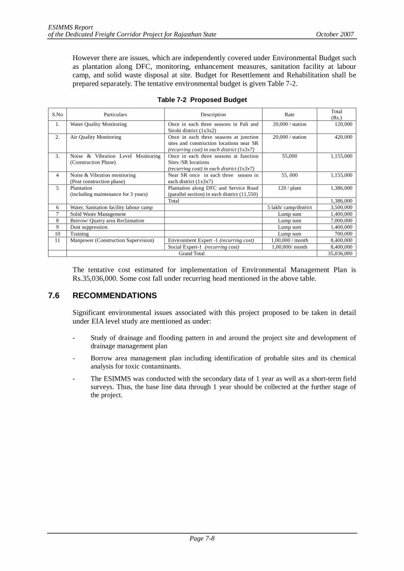
ESIMMS Report of the Dedicated Freight Corridor Project for Rajasthan State October 2007
Page 7-8
However there are issues, which are independently covered under Environmental Budget such as plantation along DFC, monitoring, enhancement measures, sanitation facility at labour camp, and solid waste disposal at site. Budget for Resettlement and Rehabilitation shall be prepared separately. The tentative environmental budget is given Table 7-2.
Table 7-2 Proposed Budget
S.No Particulars Description Rate Total (Rs.)
1. Water Quality Monitoring Once in each three seasons in Pali and Sirohi district (1x3x2)
20,000 / station 120,000
2. Air Quality Monitoring Once in each three seasons at junction sites and construction locations near SR (recurring cost) in each district (1x3x7)
20,000 / station 420,000
3. Noise & Vibration Level Monitoring (Construction Phase)
Once in each three seasons at Junction Sites /SR locations (recurring cost) in each district (1x3x7)
55,000 1,155,000
4 Noise & Vibration monitoring (Post construction phase)
Near SR once in each three season in each district (1x3x7)
55, 000 1,155,000
Plantation along DFC and Service Road (parallel section) in each district (11,550)
120 / plant
1,386,000 5 Plantation (including maintenance for 3 years)
Total 1,386,000 6 Water, Sanitation facility labour camp 5 lakh/ camp/district 3,500,000 7 Solid Waste Management Lump sum 1,400,000 8 Borrow/ Quarry area Reclamation Lump sum 7,000,000 9 Dust suppression Lump sum 1,400,000 10 Training Lump sum 700,000
Environment Expert -1 (recurring cost) 1,00,000 / month 8,400,000 11 Manpower (Construction Supervision) Social Expert-1 (recurring cost) 1,00,000/ month 8,400,000
Grand Total 35,036,000
The tentative cost estimated for implementation of Environmental Management Plan is Rs.35,036,000. Some cost fall under recurring head mentioned in the above table.
7.6 RECOMMENDATIONS
Significant environmental issues associated with this project proposed to be taken in detail under EIA level study are mentioned as under:
- Study of drainage and flooding pattern in and around the project site and development of drainage management plan
- Borrow area management plan including identification of probable sites and its chemical analysis for toxic contaminants.
- The ESIMMS was conducted with the secondary data of 1 year as well as a short-term field surveys. Thus, the base line data through 1 year should be collected at the further stage of the project.
ESIMMS Report of the Dedicated Freight Corridor Project for Rajasthan State October 2007
Page 8-1
CHAPTER 8 RESETTLEMENT AND REHABILITATION PLAN (RRP)
Resettlement and Rehabilitation Policy including "RRP Frame Work" is under consideration with Government of India and will be disclosed as a separate process.
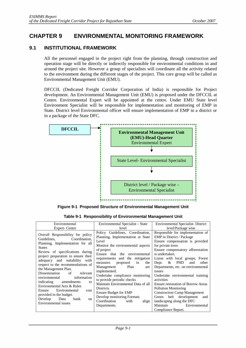
ESIMMS Report of the Dedicated Freight Corridor Project for Rajasthan State October 2007
Page 9-1
CHAPTER 9 ENVIRONMENTAL MONITORING FRAMEWORK
9.1 INSTITUTIONAL FRAMEWORK
All the personnel engaged in the project right from the planning, through construction and operation stage will be directly or indirectly responsible for environmental conditions in and around the project site. However a group of specialists will coordinate all the activity related to the environment during the different stages of the project. This core group will be called as Environmental Management Unit (EMU).
DFCCIL (Dedicated Freight Corridor Corporation of India) is responsible for Project development. An Environmental Management Unit (EMU) is proposed under the DFCCIL at Centre. Environmental Expert will be appointed at the centre. Under EMU State level Environment Specialist will be responsible for implementation and monitoring of EMP in State. District level Environmental officer will ensure implementation of EMP in a district or in a package of the State DFC.
Figure 9-1 Proposed Structure of Environmental Management Unit
Table 9-1 Responsibility of Environmental Management Unit Environmental Expert- Centre
Environmental Specialist – State level
Environmental Specialist- District level/Package wise
Overall Responsibility for policy Guidelines, Coordination, Planning, Implementation for all States Review of specifications during project preparation to ensure their adequacy and suitability with respect to the recommendations of the Management Plan. Dissemination of relevant environmental information indicating amendments to Environmental Acts & Rules Ensure Environmental cost provided in the budget. Develop Data bank on Environmental issues
Policy Guidelines, Coordination, Planning, Implementation at State Level Monitor the environmental aspects of project Ensure that the environmental requirements and the mitigation measures proposed in the Management Plan are implemented. Undertake compliance monitoring to provide periodic checks Maintain Environmental Data of all Districts. Ensure Budget for EMP Develop monitoring Formats Coordination with align Departments.
Responsible for implementation of EMP in District / Package Ensure compensation is provided for private trees Ensure compensatory afforestation is undertaken. Liaise with local groups, Forest Dept. & PHD and other Departments, etc. on environmental issues Undertake environmental training activities Ensure restoration of Borrow Areas Pollution Monitoring Construction Camp Management Green belt development and landscaping along the DFC Maintain Environmental Compliance Report.
Environmental Management Unit (EMU)-Head Quarter Environmental Expert
State Level- Environmental Specialist
District level / Package wise –Environmental Specialist
DFCCIL
ESIMMS Report of the Dedicated Freight Corridor Project for Rajasthan State October 2007
Page 9-2
9.1.1 Construction Phase
The District level Environmental Specialist will look after the implementation of EMP in their respective Districts/Packages and send compliance report to the State environmental specialist. Persons deployed must be familiar with the National Environmental Legislation
1) Construction Supervisor - During Construction phase Construction Supervisor (CS) may be engaged to supervise
Contractor’s activity.
- Environment officer may be appointed by Construction Supervisor for each package to see environmental compliance.
2) Construction Contractor - Contractor has to provide one full time person with background in Environment field.
- Environment specialist engaged by contractor must work in co-ordination with Environment officer of Construction Supervisor.
Environmental officers of Construction Supervisor & Construction Contractor will report to Environmental Specialist, EMU.
9.1.2 Operation Phase
The Environmental personnel deployed in construction phase in EMU may continue in operation phase to implement and supervise activities involved in operation phase.
9.2 ENVIRONMENTAL MONITORING -CONSTRUCTION PHASE
Environmental monitoring is essential to monitor the changes in environmental aspects due to the project activities. Monitoring should be conducted during construction and operation phase. During construction phase monitoring includes:
i. Monitoring of environmental aspects such as water, air, noise & vibration and plantation program. Construction Supervision Consultant would suggest final locations and time for monitoring of suggested parameters within allocated budget in consultation with EMU.
ii. Monitoring of implementation of mitigation measures suggested in EMP
- The Construction Contractor should implement the mitigation measures suggested and Construction Supervisor in co-ordination with EMU should verify the same and provide recommendation, if required.
- An Environmental Management Action Plan (EMAP) for compliance must be prepared by the Construction Supervisor.
- The Environmental Construction Supervisor should conduct on-site verification and should provide documentary proof to EMU on mitigation measures taken by Construction Contractor.
- Construction Supervisor must Provide Monthly Progress report to EMU.
Environmental Monitoring formats required for EMAP is attached as Annex-9.1. These formats may be further amended and improved as per requirement.
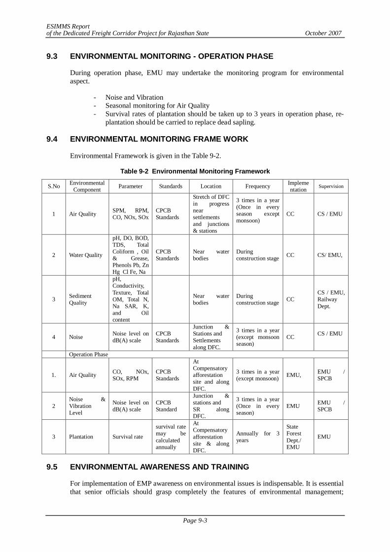
ESIMMS Report of the Dedicated Freight Corridor Project for Rajasthan State October 2007
Page 9-3
9.3 ENVIRONMENTAL MONITORING - OPERATION PHASE
During operation phase, EMU may undertake the monitoring program for environmental aspect.
- Noise and Vibration - Seasonal monitoring for Air Quality - Survival rates of plantation should be taken up to 3 years in operation phase, re-
plantation should be carried to replace dead sapling. 9.4 ENVIRONMENTAL MONITORING FRAME WORK
Environmental Framework is given in the Table 9-2.
Table 9-2 Environmental Monitoring Framework
S.No Environmental Component Parameter Standards Location Frequency Impleme
ntation Supervision
1 Air Quality SPM, RPM, CO, NOx, SOx
CPCB Standards
Stretch of DFC in progress near settlements and junctions & stations
3 times in a year (Once in every season except monsoon)
CC CS / EMU
2 Water Quality
pH, DO, BOD, TDS, Total Coliform , Oil & Grease, Phenols Pb, Zn Hg Cl Fe, Na
CPCB Standards
Near water bodies
During construction stage CC CS/ EMU,
3 Sediment Quality
pH, Conductivity, Texture, Total OM, Total N, Na SAR, K, and Oil content
Near water bodies
During construction stage CC
CS / EMU, Railway Dept.
4 Noise Noise level on dB(A) scale
CPCB Standards
Junction & Stations and Settlements along DFC.
3 times in a year (except monsoon season)
CC CS / EMU
Operation Phase
1. Air Quality CO, NOx, SOx, RPM
CPCB Standards
At Compensatory afforestation site and along DFC.
3 times in a year (except monsoon) EMU, EMU /
SPCB
2 Noise & Vibration Level
Noise level on dB(A) scale
CPCB Standard
Junction & stations and SR along DFC.
3 times in a year (Once in every season)
EMU EMU / SPCB
3 Plantation Survival rate
survival rate may be calculated annually
At Compensatory afforestation site & along DFC.
Annually for 3 years
State Forest Dept./ EMU
EMU
9.5 ENVIRONMENTAL AWARENESS AND TRAINING
For implementation of EMP awareness on environmental issues is indispensable. It is essential that senior officials should grasp completely the features of environmental management;
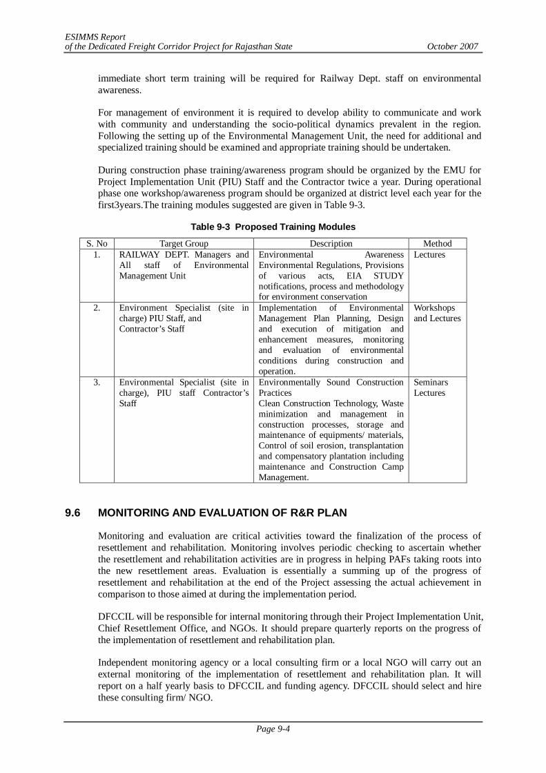
ESIMMS Report of the Dedicated Freight Corridor Project for Rajasthan State October 2007
Page 9-4
immediate short term training will be required for Railway Dept. staff on environmental awareness.
For management of environment it is required to develop ability to communicate and work with community and understanding the socio-political dynamics prevalent in the region. Following the setting up of the Environmental Management Unit, the need for additional and specialized training should be examined and appropriate training should be undertaken.
During construction phase training/awareness program should be organized by the EMU for Project Implementation Unit (PIU) Staff and the Contractor twice a year. During operational phase one workshop/awareness program should be organized at district level each year for the first3years.The training modules suggested are given in Table 9-3.
Table 9-3 Proposed Training Modules
S. No Target Group Description Method 1. RAILWAY DEPT. Managers and
All staff of Environmental Management Unit
Environmental Awareness Environmental Regulations, Provisions of various acts, EIA STUDY notifications, process and methodology for environment conservation
Lectures
2. Environment Specialist (site in charge) PIU Staff, and Contractor’s Staff
Implementation of Environmental Management Plan Planning, Design and execution of mitigation and enhancement measures, monitoring and evaluation of environmental conditions during construction and operation.
Workshops and Lectures
3. Environmental Specialist (site in charge), PIU staff Contractor’s Staff
Environmentally Sound Construction Practices Clean Construction Technology, Waste minimization and management in construction processes, storage and maintenance of equipments/ materials, Control of soil erosion, transplantation and compensatory plantation including maintenance and Construction Camp Management.
Seminars Lectures
9.6 MONITORING AND EVALUATION OF R&R PLAN
Monitoring and evaluation are critical activities toward the finalization of the process of resettlement and rehabilitation. Monitoring involves periodic checking to ascertain whether the resettlement and rehabilitation activities are in progress in helping PAFs taking roots into the new resettlement areas. Evaluation is essentially a summing up of the progress of resettlement and rehabilitation at the end of the Project assessing the actual achievement in comparison to those aimed at during the implementation period.
DFCCIL will be responsible for internal monitoring through their Project Implementation Unit, Chief Resettlement Office, and NGOs. It should prepare quarterly reports on the progress of the implementation of resettlement and rehabilitation plan.
Independent monitoring agency or a local consulting firm or a local NGO will carry out an external monitoring of the implementation of resettlement and rehabilitation plan. It will report on a half yearly basis to DFCCIL and funding agency. DFCCIL should select and hire these consulting firm/ NGO.
ESIMMS Report of the Dedicated Freight Corridor Project for Rajasthan State October 2007
Page 9-5
9.6.1 Internal Monitoring
The resettlement and rehabilitation plan includes indicators and bench marks for achievement of the objectives, which includes as follows:
(1) Process indicators
Process of the resettlement and rehabilitation which includes project inputs, expenditures, staff deployments, etc will be monitored by DFCCIL and its project office. DFCCIL should collect the information from the project site and assimilate in the form of quarterly progress report to assess the progress and results of the implementation of resettlement and rehabilitation plan. In case there was a delay or any obstacles on the implementation works, adjust the work programme. The following is major items of monitoring for process indicators;
- Information campaign and consultation with PAFs; - Status of land acquisition and payments on land compensation; - Resettlement of PAFs
(2) Output indicators
Output indicators are as follows:
- The results in terms of numbers of affected persons compensated and resettle; and - Incomes restored; and - Additional assistance provides
(3) Impact indicators
Impact indicators are the factors related to the long-term effect of the project not only on PAFs but also on those people in the project affected area as a whole. Field level monitoring will be carried out as follows:
- Review of census information for all PAFs; - Consultation and informal interviews with PAFs on the up-to-date feeling of them
on their life in the resettlement areas; - In-depth case studies if there were any particular case worth paying special
attention; - Informal sample survey of PAFs; - Key informant interviews and - Holding a number of community meetings at the resettlement site as well as the
site directly affected by the Project. 9.6.2 External Monitoring
External monitoring body will be hired for the monitoring works. It should identify and select impact indicators, impact assessment through formal and informal surveys with the PAFs, consultation with local government officials and community leaders, assess efficiency of the process of rehabilitation procedures in terms of effectiveness, sustainability of the lives of PAFs, draw attentions for the lessons learned during the period since resettlement and rehabilitation activities commenced and formulate the future rehabilitation policy and planning method.
Major items of monitoring would be as follows:
ESIMMS Report of the Dedicated Freight Corridor Project for Rajasthan State October 2007
Page 9-6
- Review and verification of the internal monitoring reports prepared by Project Implementation Unit and the field offices;
- Review of the socio-economic baseline census information of the PAFs; - Socio-economic conditions of the PAFs in the post-resettlement period; - Opinions of the PAFs on the entitlements, compensations, general assistance,
alternative development programmes to livelihood restoration programmes and their timetable;
- Actual changes of the conditions of housing and income levels of the post-resettlement period;
- Livelihood rehabilitation of non-title settlers; and - Grievance procedures.
After the project implementation, NGOs assisting chief resettlement officer will conduct information and community consultation programme (ICCP) in the project area in respect of resettlement and rehabilitation plan. It is a part of social environment monitoring plan of the resettlement and rehabilitation of PAFs. The following is the tasks of NGOs:
1) Assist chief resettlement officer in implementation of resettlement and rehabilitation plan including mitigation measures for avoiding adverse effects imposed on PAFs by the Project;
2) Prepare information materials in local language explaining resettlement and rehabilitation plan such as project brochures and pamphlets to be used for disclosure of information regarding the project objectives, entitlement, compensation principles and procedures, and implementation schedules;
3) Advise and assist chief resettlement office in the provisions of implementation of resettlement and rehabilitation plan concerning livelihood and income restoration programmes;
4) Work in close cooperation with relevant state and central government departments and district administration involved in the valuation of assets acquired and payment of compensation;
5) Educate the PAFs on their right to entitlements and obligations;
6) Ensure that the PAFs are paid their full entitlements due to them;
7) Facilitate and organize training programmes and provide support and gather information to PAFs for income restoration programme;
8) Assist the PAFs in redressing of their grievances through the grievance redress mechanism set up for the Project;
9) Disseminate information for all the PAFs about the functional aspects of the various district level committees set up for the Project and assist the PAFs in benefiting from such institutional mechanism;
10) Assist the Project Implementation Unit of DFCCIL in ensuring social responsibilities of the Project, such as compliance with the labour laws, safety regulations, prohibition of child labour, HIV/AIDS and gender issues; and
11) Participate in monitoring system and prepare progress reports.
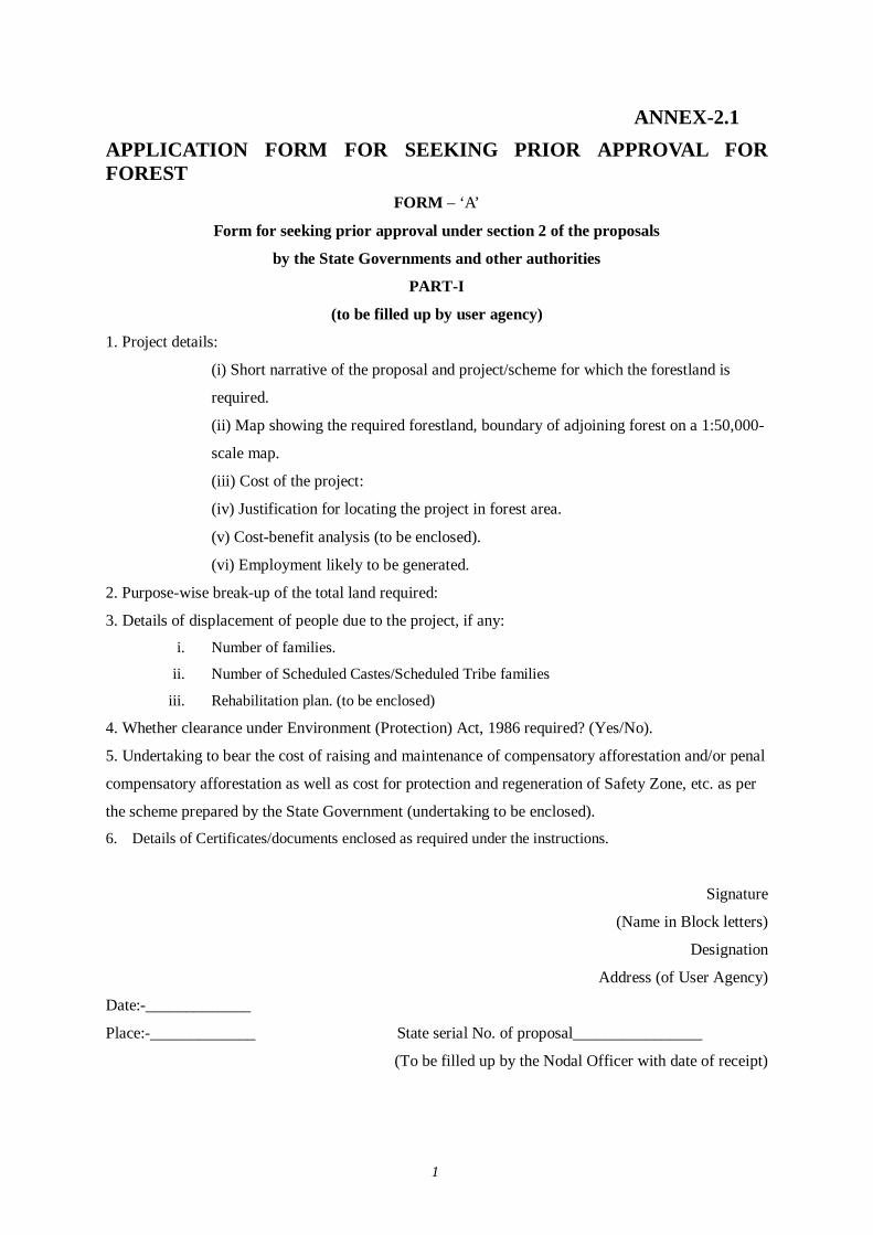
1
ANNEX-2.1 APPLICATION FORM FOR SEEKING PRIOR APPROVAL FOR FOREST
FORM – ‘A’
Form for seeking prior approval under section 2 of the proposals
by the State Governments and other authorities
PART-I
(to be filled up by user agency)
1. Project details:
(i) Short narrative of the proposal and project/scheme for which the forestland is
required.
(ii) Map showing the required forestland, boundary of adjoining forest on a 1:50,000-
scale map.
(iii) Cost of the project:
(iv) Justification for locating the project in forest area.
(v) Cost-benefit analysis (to be enclosed).
(vi) Employment likely to be generated.
2. Purpose-wise break-up of the total land required:
3. Details of displacement of people due to the project, if any:
i. Number of families.
ii. Number of Scheduled Castes/Scheduled Tribe families
iii. Rehabilitation plan. (to be enclosed)
4. Whether clearance under Environment (Protection) Act, 1986 required? (Yes/No).
5. Undertaking to bear the cost of raising and maintenance of compensatory afforestation and/or penal
compensatory afforestation as well as cost for protection and regeneration of Safety Zone, etc. as per
the scheme prepared by the State Government (undertaking to be enclosed).
6. Details of Certificates/documents enclosed as required under the instructions.
Signature
(Name in Block letters)
Designation
Address (of User Agency)
Date:-_____________
Place:-_____________ State serial No. of proposal________________
(To be filled up by the Nodal Officer with date of receipt)
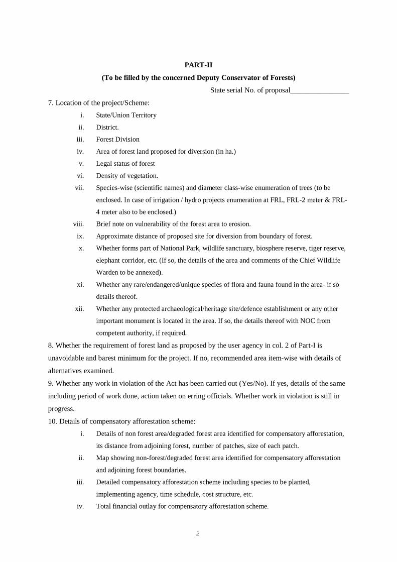
2
PART-II
(To be filled by the concerned Deputy Conservator of Forests)
State serial No. of proposal________________
7. Location of the project/Scheme:
i. State/Union Territory
ii. District.
iii. Forest Division
iv. Area of forest land proposed for diversion (in ha.)
v. Legal status of forest
vi. Density of vegetation.
vii. Species-wise (scientific names) and diameter class-wise enumeration of trees (to be
enclosed. In case of irrigation / hydro projects enumeration at FRL, FRL-2 meter & FRL-
4 meter also to be enclosed.)
viii. Brief note on vulnerability of the forest area to erosion.
ix. Approximate distance of proposed site for diversion from boundary of forest.
x. Whether forms part of National Park, wildlife sanctuary, biosphere reserve, tiger reserve,
elephant corridor, etc. (If so, the details of the area and comments of the Chief Wildlife
Warden to be annexed).
xi. Whether any rare/endangered/unique species of flora and fauna found in the area- if so
details thereof.
xii. Whether any protected archaeological/heritage site/defence establishment or any other
important monument is located in the area. If so, the details thereof with NOC from
competent authority, if required.
8. Whether the requirement of forest land as proposed by the user agency in col. 2 of Part-I is
unavoidable and barest minimum for the project. If no, recommended area item-wise with details of
alternatives examined.
9. Whether any work in violation of the Act has been carried out (Yes/No). If yes, details of the same
including period of work done, action taken on erring officials. Whether work in violation is still in
progress.
10. Details of compensatory afforestation scheme:
i. Details of non forest area/degraded forest area identified for compensatory afforestation,
its distance from adjoining forest, number of patches, size of each patch.
ii. Map showing non-forest/degraded forest area identified for compensatory afforestation
and adjoining forest boundaries.
iii. Detailed compensatory afforestation scheme including species to be planted,
implementing agency, time schedule, cost structure, etc.
iv. Total financial outlay for compensatory afforestation scheme.
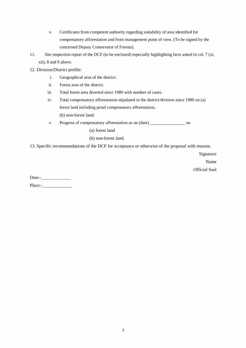
3
v. Certificates from competent authority regarding suitability of area identified for
compensatory afforestation and from management point of view. (To be signed by the
concerned Deputy Conservator of Forests).
11. Site inspection report of the DCF (to be enclosed) especially highlighting facts asked in col. 7 (xi,
xii), 8 and 9 above.
12. Division/District profile:
i. Geographical area of the district.
ii. Forest area of the district.
iii. Total forest area diverted since 1980 with number of cases.
iv. Total compensatory afforestation stipulated in the district/division since 1980 on (a)
forest land including penal compensatory afforestation,
(b) non-forest land.
v. Progress of compensatory afforestation as on (date) ________________ on
(a) forest land
(b) non-forest land.
13. Specific recommendations of the DCF for acceptance or otherwise of the proposal with reasons.
Signature
Name
Official Seal
Date:-_____________
Place:-_____________
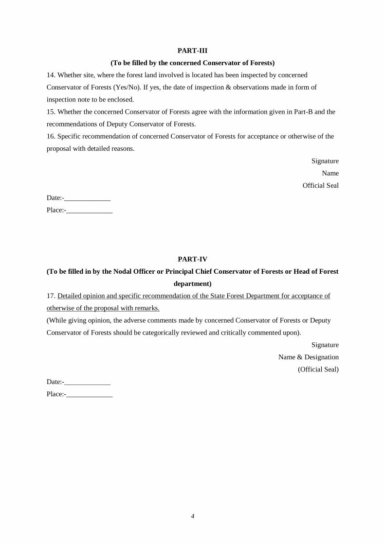
4
PART-III
(To be filled by the concerned Conservator of Forests)
14. Whether site, where the forest land involved is located has been inspected by concerned
Conservator of Forests (Yes/No). If yes, the date of inspection & observations made in form of
inspection note to be enclosed.
15. Whether the concerned Conservator of Forests agree with the information given in Part-B and the
recommendations of Deputy Conservator of Forests.
16. Specific recommendation of concerned Conservator of Forests for acceptance or otherwise of the
proposal with detailed reasons.
Signature
Name
Official Seal
Date:-_____________
Place:-_____________
PART-IV
(To be filled in by the Nodal Officer or Principal Chief Conservator of Forests or Head of Forest
department)
17. Detailed opinion and specific recommendation of the State Forest Department for acceptance of
otherwise of the proposal with remarks.
(While giving opinion, the adverse comments made by concerned Conservator of Forests or Deputy
Conservator of Forests should be categorically reviewed and critically commented upon).
Signature
Name & Designation
(Official Seal)
Date:-_____________
Place:-_____________
5
PART- V
(To be filled in by the Secretary in charge of Forest Department or by any other authorised
officer of the State Government not below the rank of an Under Secretary)
18. Recommendation of the State Government:
(Adverse comments made by any officer or authority in Part-B or Part-C or Part-D
above should be specifically commented upon)
Signature
Name & Designation
(Official Seal)
Date:-_____________
Place:-_____________
ANNEX-3.1 LIST OF RAILWAY STATIONS IN THE EXISTING ALIGNMENT
S.No Station Name Major Land Use Pattern
1 Maval Agricultural Land 2 Abu Road Residential Land, Sensitive Place 3 Morthala Agricultural land 4 Kivaril Hilly area, Agricultural land 5 Bhimana Rocky Area and Agricultural 6 Swarupganj Agricultural and Forest area 7 Banas Sandy and stony soil 8 Keshavganj Sand and stony soil 9 Nana Agricultural land 10 Kothar Agricultural land 11 Mori Bera Agricultural land 12 Jawai Bandh Sandy and Stony Soil, Agricultural land 13 Biroliya Stony Soil, Agricultural land 14 Falna Agricultural land, Residential Land, Sensitive Place 15 Khimel Residential Land, Sensitive Place 16 Rani Residential Land, Sensitive Place 17 Bhagwanpura Residential Land, Agricultural land 18 Jawali Agricultural land, sandy arid land 19 Somesar Agricultural land, agricultural land 20 Bhinwaliya Agricultural land, Arid land 21 Banta Ragunathgarh Agricultural land, Arid land 22 Awua Agricultural land, Sandy land 23 Marwar Jn Residential Land, Sensitive Place 24 Dhareshwar Sandy and Arid Land 25 Bhesana Agricultural land, Arid land 26 Sojat Road Residential Land, Agricultural land 27 Bagrinagar Stony Soil, Agricultural land 28 Bagri Sajjanpur Stony Soil, Agricultural land 29 Chandawal Stony Soil, Agricultural land 30 Guriya Stony Soil, Agricultural land 31 Bar Hilly area, Arid Land 32 Sendra Residential area, Hilly area, Arid Land 33 Amarpura Residential area, Hilly area, Agricultural land 34 Beawar Residential area, Hilly area, Agricultural land 35 Bangurgram Agricultural land, sandy arid land 36 Piplaj Agricultural land, sandy arid land 37 Kharwa Agricultural land, sandy arid land 38 Lamana Agricultural land, sandy arid land 39 Mangaliyawas Agricultural land, sandy arid land 40 Makrera Agricultural land, sandy arid land 41 Saradhna Agricultural land, sandy arid land 42 Daurai Residential Land, Agricultural land 43 Madar Residential Land, Agricultural land 44 Landpura Agricultural land, sandy arid land 45 Gegal Akhri Agricultural land, sandy arid land 46 Mandawariya Agricultural land, sandy arid land 47 Tiloniya Agricultural land, sandy arid land 48 Gehlota Agricultural land, sandy arid land 49 Sali Agricultural land, sandy arid land 50 Sakhun Sandy and Stony Soil, Agricultural Land
S.No Station Name Major Land Use Pattern 51 Dantara Sandy and Stony Soil, Agricultural Land 52 Naraina Sandy and Stony Soil, Agricultural Land 53 Bhanwas Sandy and Stony Soil, Agricultural Land 54 Peeolee-Ka-Bas Sandy and Stony Soil, Agricultural Land 55 Khamdel Sandy and Stony Soil, Agricultural Land 56 Sanodiya Sandy and Stony Soil, Agricultural Land 57 Bheslana Sandy and Stony Soil, Agricultural Land 58 Mindha Sandy and Stony Soil, Agricultural Land 59 Renwal Residential Land, Agricultural land 60 Khalipura Agricultural land, sandy arid land 61 Kanauta Agricultural land, sandy arid land 62 Basslana Agricultural land, sandy arid land 63 Jhiloo Agricultural land, sandy arid land 64 Banskho Agricultural land, sandy arid land 65 Jalwara Agricultural land, sandy arid land 66 Bhandana Agricultural land, sandy arid land 67 Pachar Malikpur Agricultural land, sandy arid land 68 Badhal Sandy and Stony Soil, Agricultural Land 69 Kishan Manpura Residential Land, Agricultural land 70 Ringas Jn Residential Land, Agricultural land 71 Shri Madhopur Residential Land, Agricultural land 72 Kachera Agricultural land, sandy arid land 73 Kanwal Agricultural land, sandy arid land 74 Bagega Agricultural land, sandy arid land 75 Nim-Ka-Thana Residential Land, Agricultural land 76 Maonda Sandy and Stony Soil, Agricultural Land 77 Dabal Rocky land, Agricultural land 78 Nizampura Residential Land, Agricultural land 79 Amarpur Jorasi Residential Land, Agricultural land 80 Mirzapur Bachnod Agricultural land, Forest Area 81 Tajpur Residential Land, Agricultural land 82 Ateli Residential Land, Agricultural land 83 Kund Residential Land, Agricultural land 84 Khori Residential Land, Agricultural land
ANNEX – 3.2
TYPICAL SECTION OF DETOUR ROUTE
Present Groud
2.5 - 3.5m4.5m5.5m
T T TT
9m 9m12.5m4m 4m2m 2m
1m
CommunityRoad
Drainage
Drainage
Drainage/Irrigation Canal
Typical Section of Detour Route
Typical Section of Road-under Bridge(RUB)
5m
3.5m
1.5m
Community Road
3.5m
3.5m
2.5m
Pedestrian/Foot Path
5.5m
National Highway
3.5m
3.5m
Note: At national hughway, height of embankment is raised to 6.5 m
Typical Section of Detour Route
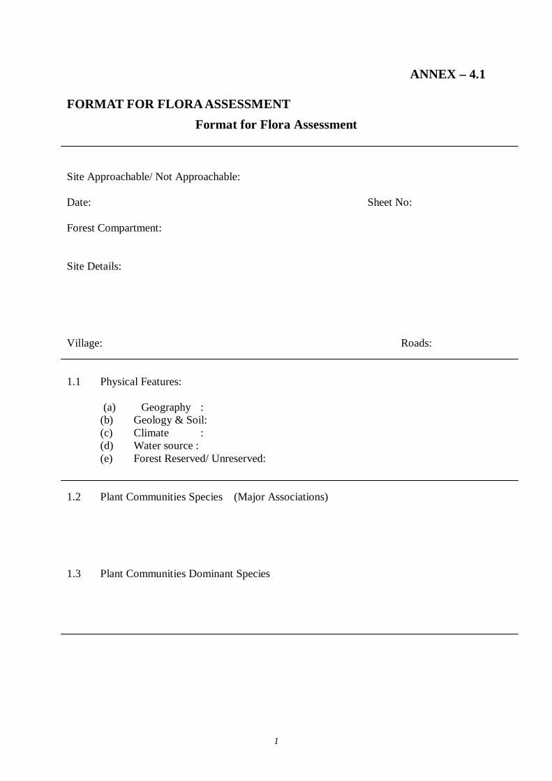
1
ANNEX – 4.1
FORMAT FOR FLORA ASSESSMENT Format for Flora Assessment
Site Approachable/ Not Approachable: Date: Sheet No: Forest Compartment: Site Details: Village: Roads: 1.1 Physical Features:
(a) Geography : (b) Geology & Soil: (c) Climate : (d) Water source : (e) Forest Reserved/ Unreserved:
1.2 Plant Communities Species (Major Associations)
1.3 Plant Communities Dominant Species
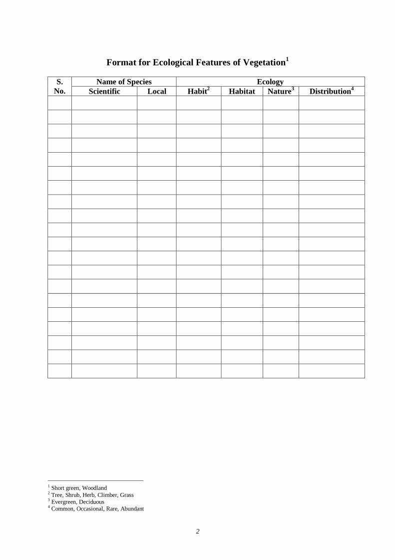
2
Format for Ecological Features of Vegetation1
Name of Species Ecology S.
No. Scientific Local Habit2 Habitat Nature3 Distribution4
1 Short green, Woodland 2 Tree, Shrub, Herb, Climber, Grass 3 Evergreen, Deciduous 4 Common, Occasional, Rare, Abundant
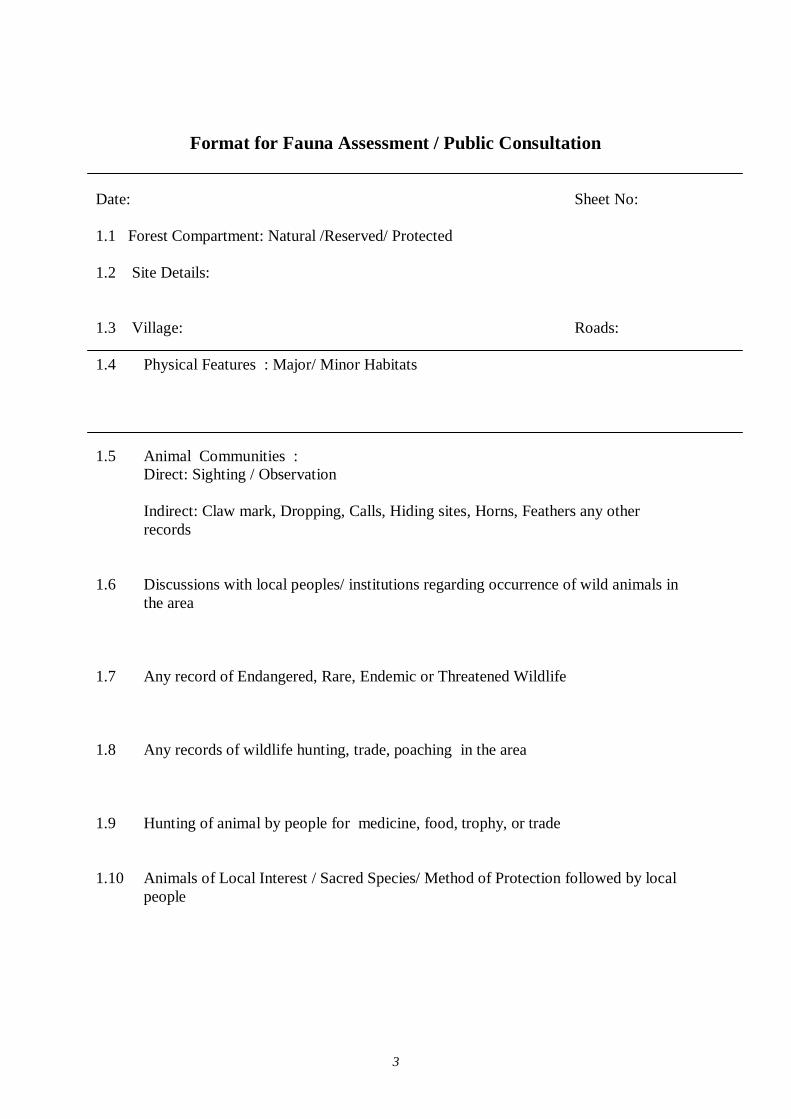
3
Format for Fauna Assessment / Public Consultation
Date: Sheet No: 1.1 Forest Compartment: Natural /Reserved/ Protected 1.2 Site Details: 1.3 Village: Roads: 1.4 Physical Features : Major/ Minor Habitats
1.5 Animal Communities :
Direct: Sighting / Observation Indirect: Claw mark, Dropping, Calls, Hiding sites, Horns, Feathers any other records
1.6 Discussions with local peoples/ institutions regarding occurrence of wild animals in
the area 1.7 Any record of Endangered, Rare, Endemic or Threatened Wildlife 1.8 Any records of wildlife hunting, trade, poaching in the area 1.9 Hunting of animal by people for medicine, food, trophy, or trade 1.10 Animals of Local Interest / Sacred Species/ Method of Protection followed by local
people
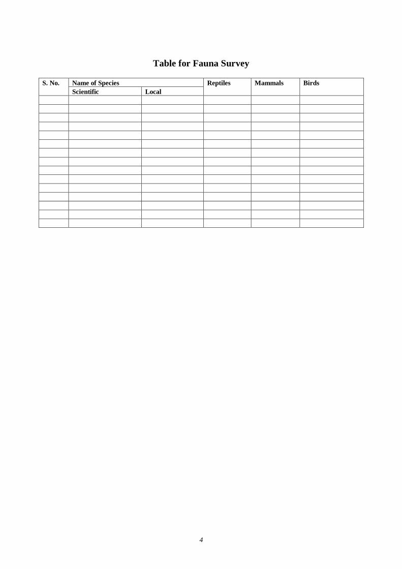
4
Table for Fauna Survey
Name of Species S. No. Scientific Local
Reptiles Mammals Birds

1
ANNEX - 4.2 NATURAL ENVIRONMENT (1) Jaipur Biological Environment
There are Reserved, Protected and Unclassed forests in Jaipur Forest Division. It covers the entire area of civil district of Jaipur, four tehsils namely Bamanvas, Nadoti, Tedabhim and Mahuwa of Sawaimadhopur district and some parts of Alwar and Sikar districts.
The tract lies in the Eastern part of Rajasthan between 75 o 45’ E to 77 o 05 E longitude and 77o 15’ N to 28 o 30’ N latitudes. The approximates stretches of the area from North to South and East to West are 160 kms and 200 kms respectively.
The Jaipur Forest Division is bounded in the North by common border with haryana, in North – East by Alwar district, in the East by Sawai-madhopur district, in the south by Tonl and sawaimadhopur in the west by Ajmer and in the North – West by Nagpur and Sikar districts.
The total land area of the Division is 16,440 sq. kms. Out of which 1,424 sq. kms area is under the possession of Forest Department. Thus, area under the forest is namely 8.66% of the total land area. It is furthermore alarming that only about 20% being blank, depleted, barren hills, and degraded forester.
The Head quarters of the Divisions are located at Jaipur, the pinkcity of India and capital of Rajasthan. It falls under the administrative central of the conservator of Forests, Soil conservation, Jaipur. Other superior officials namely, Additional chief conservator of Forest, are head quartered at van-Bhavan, Jaipur. The office of the Divisional Forest officer is situated at Museum Road, Jaipur.
The Head quarters being State Capital, is easily approachable by Road, Rail and Air. The tract is intersected by three National Highways namely N.H.8, N.H.11 & N.H.12 (recently declared connecting Jaipur-Jabalpur) together with extensive network of State highways and their feeder roads. It is an important Junction and Divisional Head quarters of the Western Railways. With a view to develop its vast tourism potential, two famous trains namely Punk-city Express and Palace on wheels start from here.
Apart from these two trains, there are a number of other trains running through this tract. The aeredrame is located at Sanganer about 13 km. From Jaipur city, A regular air service is available for Delhi, Agra, Udaipur, Bombay, Jodhpur, Kota, Ahmedabad. A proposal for making it an International Airport is under active consideration of the Govt. of India.
THE FORESTS
Most of the forest under the major group of “TROPICAL FORESTS” as per champion and Seth’s revised classification of forest types of India. The special soil peculiarities and biotic factors rather than the climatic ones chiefly control the stability of Plant community in this tract. Therefore, its composition, distribution and quality is detrmined by these factors. As per champion and Seth’s the following groups, subgroups, types and subtypes are recognised in this area:-
GROUP – 5 TROPICAL DRY DECIDOUS FORESTS:
Sub-group 5B- Northern Tropical Dry Decidous Forests.
Type 5B/O2 – Northern Dry mixed decidous Forest.
Edaphic climax formations are:-
5B/E1 – Anogeissus pendula forest
5B/E2 – Boswellia forests
2
5B/E3 – Babul forest
5B/E5 – Butea forest
Degradation stages of Tropical Dry Deciduous Forests:
DS1 – Dry Decidous Scrub
E1/DS1 - Anogeissus pendula Scrub
DS3 - Euphorbia Scrub
DS4 - Dry Grass land
(1) General serial types of dry decidous forests
1S1 - Dry tropical riverain forest
2S2 - Secondary dry decidous forest
Group – 6 – Tropical Thorn Forests
Sub – group – 6B- Northern Tropical Thorn Forets
Type 6B/C1 – Desert thorn forest
Type 6B/C2 – Ravine thorn forets
(2) Degradation stage of Tropical Thorn Forests
DS1 Zizyphus scrub
DS2 Tropical Euphorbia scrub
This type of forests is generally visible in the blocks of Digota, Jamwamata, badiline, Amer, Talwa, khajar, Barmanwati, kalakho, Gol, Kalikhar, Ramgarh of this division. But it has been observed that species like anogeissus pendula, Boswellia serrata, Acacia senegal and Butea monosperma belonging to this type land to form more or less pure consociations under the influence of characterized edaphic conditons prevailing in Aravalli hills. However, this type is confined to valley beds where oil and moisture conditions are realtively better. On per well drained plateaus and stops Bosweillia serrata trends to replace this type where as at other drier slopes anogeissus pendula replaces it in order to form a pure consociation.
This type of forests is generally visible in the blocks of Digota, Jamwamata, badiline, Amer, Talwa, khajar, Barmanwati, kalakho, Gol, Kalikhar, Ramgarh of this division. But it has been observed that species like anogeissus pendula, Boswellia serrata, Acacia senegal and Butea monosperma belonging to this type land to form more or less pure consociations under the influence of characterized edaphic conditions prevailing in Aravalli hills. However, this type is confined to valley beds where oil and moisture conditions are relatively better. On per well drained plateaus and stops Bosweillia serrata trends to replace this type where as at other drier slopes anogeissus pendula replaces it in order to form a pure consociation.
The overhood of these forests consists of Anogeissus pendula, Anogeissus latifolia, Abogeissus sericea, Boswellia serrata, Steroulia urens, moringa oleibera, mitragyna parvifolia ious racimosa, albizzia salvifolium, Grataerea religiosa, Butea monosperma, Holoptelia integrifolia, acacia catechu, Diospyros melanxylon etc. The underwood consists of Wroghtia tinctoria, Wrightia tomentosa, Dichrostachys cineria, Flacourtia indica, Diospyros montana, Cassia fistula, Mallotu phillipinensis, Zizyphus mauritiana, Ehretia laevis, acacia leucophloea, Holarrhena antidysentrica, Bauhinia racemosa, Euphorbia nivulia, Ficus tomentosa etc. The undergrowth includes Adhatoda vasica, Grewia tenax, Grewia flavescens, Grewia damine, Rhus mysurensis, Zizyphus numularia, abrus precatorius etc. The ground cover consists of cassia tora indigofera, Ageratum conyzoides, Hibiscus labatus, Salvia aegyptiaea, Urginea indica, Mimosa pudica, Boerhavia diffus, Argimone mexicana, Dasmodoium species, pedalium murex, Polyonum species etc. The common grasses occuring in the tract are Apluda mutica, Aristida species, Arthraxon species, Brachiaria species, Cnchrus species, Cynodon
3
dactylon, Cymbopogon martinii, Dactyloctenium species, Dichantum annulatum, digitaria species, Eragrostis species, Heteropogon contortus, Imperata sylindrica, Panicum species, Sporobolus species, etc. Dendrocalamus strictus is however confined to moist deep soil sites in Moran Dungar, Gol and Digota blocks. It is characteristic of these forests that they emain foliageless from March to June during whoch time the flowers and fruits are born.
Biological Status
The miscellaneous forets described under last paragraph are climatic climax. Ut most of the species constituting this type tend to form pure consociations under edaphis conditions peculiar to Aravalli hills resulting in differenet edaphio – climax formations.
Anogeissus pendula forests (Type SB/E1) This type is characteristically recognised by the almost pure consociation of anogeissus pendula wherein it gregariously occurs forming more than 80% of the crop. Most of the forests of Jaipur division are representative of this type. The main associates of Anogeissus pendula are Boswelia serrata, Lannes coromandelica, Sterculioa urens, Wrightia tinctoria, Wrightia tomentosa, Flacourtia indica, Butea monosperma, Holoptelia integrifolia, cassia fistula, Diospyros melanxylon, Alangium salvifolium, Aacia caechu, Acacia leucophloea, acacia senegal, Ehretia laevis, Albizzia lebbek , Zizyphus mauritiana, Moriagna cononensis, Crataeva religiosa, anogeissus latifolia, Anogeissus sericia, Mitragyma parvifolia, Ficus racemosa etc. it may be mentioned here that alangium salvifolium is confined to Lalsot Range:Anogeissus sericia and Moringa species to Digota block and mallotus phillipinensis, Mitragyna parvifolia, Ficus racemosa etc. to moist loaclities. The undergrowth is chiefly comprised of Capparis decidua, Grewia tenax tenax, grewia flavesense, Dichrostatachys cinerea, Zizyphus nummularia, Ashatoda vasica, Helicoteres isora, Barlaria suspidata, Dupteracan thus patulus, Rhus mysurensis, Sarcostema acidium, Securfinega leucopyrus, Abrus precatorius etc. The grasses like Apluda mutica, Aristida species, Cynodon dactylon, Cymbopogon martinii, Dicanthium annulatium, Digitaria species, Eragrostis species, Panicum species, and Sporobulus species. Etc. is commonly found in this type of ofrests. Climbers such as Ichnocarpus frutescens, Marsdenia, Volubilis, Oxystelma seemone, Momordia dioice, Asparagus racemosus, Glariosa superba, Mucuna pruria etc. are also found growing in these forests. Dendroptoes falcata is the main parasite growing upon Boswellia serrata.
These forests are infact confined to the sites further from the habitations. They have undergone excessive estrogessions in the vicinity of habitation, resulting in to the formation of different type. The height of Anogeissus pendula varies from 3 m to 15 m. the diameter at breast height varies from 5 cm to 10 cm. But in the felled copus where multiple stem crop is found in majority, the diameter varies from 3 sm to 8 sm with 3 to 6 stemsper stool as shown in the photograph taken by author in Digota block and appended herewith. The heights of main associate species like Boswellia serrata, Lannea coromandelica varies from 10 to 15 m and 5 to 12 m with diameters (b.h) 15.0 to 30 cms and 8 to 30 cms. Respectively. Most of the crop is young top middle aged. Mature stands are rarel found.
The desndity of the crop varies from 0.3 to 0.7 Sensity stocked standa are, however, confined to areas of Digota, Bamanvati & badi Line blocks. The status of regeneration varies from deficient to good. Most of the regeneration is of coppice origin. Seedling regeneration which varies from deficient to fair is however, confined to the interior pockets where biotic influence is minimum.
Ecological Status
Many of the tree species of the mixed decidous forests are capable of forming more or less pure consociations. This tendency is emphasized in the dry forests by the harsher environmental conditions, climatic, eadphic and biotic, to whom the forest is usually subjecte, so that greater demands are made on the specific adaptability of constituent elemnets leading to pure groups and local dominance. Anogeissus pendula, is thus an edaphis climax because although it occurs on various grological formations and different types of soil under complete
4
protection for over 100 years. It has maintained itself and is also regenerating naturally. It is noteworthy that Acacia catechu, whith yan intimate mixture with Anogeissus pendula in Digota block is gradually disappearing probably owing to biotic intervention. Resutls of departmental lumbering in Digota block have revealed that Anogeissus pendula has more inherent strength than Acacia catechu to wrightstand biotic pressure under similar climatic edaphic conditions. But repeated exposure of Anogeissus pendula t excessive grazings browsing and lapping also led to detuermination at many place. A peculiar characteristic of naogeissus pendula has been observed that it occurs in association with Dendrocalamus strictus in moist localities with relatively more deep soils especially in Digota, Moran danger and Gol blocks. It has also been observed that on drier slopes, Acacia senegal forms a gregarious association with Anogeissus pendula under considerable pressure of grazing. It is perticularly in the Liwali block where accai senegal has succeeded to form pure patch on hill top which can be separately categorised as a type of edapho-biotic climaxes peculiar to very dry fascies similar type is also exhibited in Amer block where gregarious occurrence of Acacia senegal is restricted to lower flat portions between the hills where it completely replaces Anogeissus pendula.
This association of Anogeissus pendula – Acacia senegal is confined only to the hilly tract with gravelly reddish loam. On wind blown sand deposits, acacia senegal of tenly forms pure stands in association with other thorny speaks throughout the division.
These forest stake pride of supporting faunal species which have been dwindled from other forest types of this division. Panthera pardus, Cervus unicolor, Axis Boselap hus tragocalamus, Hyaena hyaena, Canis lupus, Caracal, Sus scrofa etc. alongwith may avifaunal species ae found especially in Ramgarh and Virat nagar ranges. A part of Panthera tigris accompanied by their two cubs has recently been reported to have come to the Ramgarh area. It has most probably migrated from the adjoining area of the project Tiger Sariska.
Thus, the existence of these floral and faunal species reveals the ecological viability of this type of forest, which under further prolonged protection may lead to very rich biosphere reserve.
Anogeissus pendula scrub (5/E1-DS1)
Having undergone excessive pressure of reckless illicit felling, lopping grazing and browsing during last three decades, the Anogeissus pendula today stands for biddi long good bye to nearly 70% if its territory . In its last effort to surviue, Anogessus pendula has reduced its elf to spreading and creeping form sometimes farming prostrate cushions looking like topiary work. In the areas where process of degradation has started in the recent past, Anogeissus pendula occurs in low density with bushy and scruby seedling and coppice regeneration .The inferior s-pecies like Rhus mysorensis, Grewia spp., Euphorbi spp.alongwith grasses like Heteropogon contortus. Apluda.mutica Aristide spp. Spcrobolus Spp.,etc start inuading Buch area . This form is confined to the areaas which are within the read of human habitations.
Ecological status
This form is a result of continuous of process of ecological retrogression of the edaphc climax 5/E1 under cute biotic pressures. As indicated in the preceding paragraph, Anogeissus pendulis initially illicitly felled for small timber lopped for fodder and fuel –wood. There after , its seedling and coppice regenerations are browsed and trampled by goats and cattle. At this stage when process of degradation is on, thorny species start inv adding the territory. Of these the ones worth mentioning are Dichrostachys cinerea. Acacia leucophloea, Ziayphus nummularia. Acacia senegal etc. Alongwith other inferior species like Rhus mysorensis, Grewia spp. Securinega spp. Euphorbia nivulia, Barlaria spp. Holoptelia intergrifolia, etc. Gradually, Anogeissus pendula is reduced to shrubby growth 3 to 6m. High including some trees species reduced to similar conditions, usually multi stemmed from base with crooked formations, Euentually, under long continued maltreatment by bictioc factors the Aogeissus pendula is reduced to spp reading and cresping form of degemerate forest which is the last stage of its degradation before it is totally eliminated. There after, it gives way to other
5
degradation stage. The form 5/E1-Ds1 under protection gives rise to secondary sere lending to attain the lost ecological status of the crop.
The Boswellia forest (5/E2)
This type in general is an open forest in which swellia serrata forms an overwood to stunted trees and shrubs of dry deciduous forests. Sometimes almost pure consociations of well grown mature trees or pole crops occur sapling and deeding regeneration were found practically absent. The height varies form 10 m to 20.0 m with diameter from 30.0 cm. to 50.0 cm. Its was in Digota block that Boswellias serrata trees with better dimensions and formations were found where as in Badiline, Jamwamata, Bamanwati, Gol & Moran blocks they were short thick boled, crooked, branchy and dwaft with relativelty more crown diamster. It is characteristically comfined to the higher steeper slopes and well drained top plateau of these blocks. Its main associates in Digota block are Anogeissus latifolia, Anogeissus siricia, Anogeissus pendula, Sterculia urens, Eannea coromandelica, Disopy ros melanoxylon. Acacia catechu whereas at other places the associataes are Anogeissus pendula, Sterculia urens, Lannea coromandelica, Albizzia odaratissima, Fiaus spp. etc. The undergrowth in digota block is of Zizyp hus spp. ,Rhus mysorensis, Grewia Spp. Dendro calamus strictus ( in depressions of commptt. No .38,13,12,11) etc. The main gresses found occurring in the type are Apluda mutica, Heteropogon contortus. Chrysopogon fulous, Sehima norvosum etc. It is the characteristic feature of Boswellia serrate in this area that parasitic plant Dendro-phthoe falcate thrives on it. It remains leafless during the period from February to June.
Ecological Status
This type become very stable on special sites, extended by maltreatment as Boswellia serrate is usually left standing when other trees are felled and it is very much fire resistant. It has been observed that is generally not used either for fodder or fuel by the local people. As an evidence of it, many patches of Boswellia can be seen growing near human hasitations where no other spp. occurs. It does not coppice well as per champion and seth. As per mention made in the preceding paragraph, the seedlings and sapling are practically absent throughout.
Babul Forest (Type 5/E3)
The general appearance of the forest is entirely dominated by one species i.e. Acacia nilotica varindica which is markedly gregarious in habit and forms a denser cover than usual in thorn forests. Its main associates are Acacia nilotica var. cupressiformis. Tecomella undulate (on Goner Road), Prosopis cineraria Acacia leucop-hloea etc. The undergrowth is consisted of Balanites aegyptica, Maytenus emarginata, Calotropisprocera, Zizyphus spp. etc. This type occurs on sandy-to-sandy loam soils. No significant area of forests represents this type; it is mainly the agricultural l-and, which supports it. Farmers provide great protection to this species as it is used for manufacture of agricultural imp-lament furniture making, top feeding and fuel. Its bark is used for tanning.
Ecological status
It is author’s observation that type is an edapho-biotic climax and occur on a very vast stretch of agricultural land with soil texture varying from sandy to sandy loam and loam. The demonstrative area is around Bassi.
Butea Forest (Type 5/E5)
On flat ground this type present a savannah appearance with scattered stunted and very malformed trees or thickets standing over short grass or bare ground. On lower hill slopes almost pure cons-ociations are found on screes and gravel derived from basic rocks and yielding clayey or loamy soils. It is oftenly found in small patches in valley types of forest through the entire division in Anogeissus pendula type. In Jamuea Mata & Lalsot blocks, it is, found as a conspicuous associatio in degraded dhok forest (Photograph taken by author in Jamwa mata block gives clear picture of this type ) esp-ecially on the hill top. In Liwali block it was found in association with Acaia senegal (Photograph by author attached.).
6
Ecological status
This is a promouneed edaphic subtype though sometime it occur due to maltreatment in dry deciduous forests.
Phoenix savannah (Type 5/E8a) Phoenix sylvestris occurs as pure gregarious riparian fringing vegetation on marrow alluvial deposits along streams and water logged canals scattered over the entire division. It is occasionally associated with Suteamonosperma, Salvadora spp. Ficus glomerata and sometimes Albizziz odoratissima Acacia nilotica etc.
Dry bamboo brakes (Type 5/ E9)
Only one spaecies, Dendrocalamus strictus, occur and forms relatively low (rarely over 7.0 m) but often-dense brakes. Where grazed, etc. the bamboo grows in dense patches with the grass and deciduous often shrub between. A scattered overwood of the hardier species of the dry deciduous forest may indicate. The dominance of the bamboo to be only secondary. This type is exhibited in the nallahs of Digot and Gol Main forest blocks. It has been observed that this type is bamishing at a considerable rate owing to excessive biotic pressures and now confined to very small area.
Dry topical riverain forest (Type 5/1S1) An irregular overwood of greater height than the climax dry deciduous forest patches and strips with varying amounts of smaller trees and shrubby under –growth. It occurs in very small areas on light sandy soil in hilly sections of streams e.g. Amer Block L
Desert Thorn Forest (Type 6B/C1)
This type occurs on the low hills, stabilised and reactivated sand dunes. The species forming it have strong tendency to form almost pure gregarious consociations. Acacia senegal and Prosopis cineraria are the best examples. Pure stands of Acacia senegal are found in the block of Liwali, Amer, Lalgarh, Badi line etc, where as almost pure stands of Prosois cineraria are found in the blocks of Jharana Bir,Muhana Bir, Goner Bir, Govindpura Bir, bagrana Bir & Bhainslana, Natural regeneration of Prosopis cineraria from root suckers is commonly mot with through out the area. The main associates of Prosopis cineraria are Acacia leucophloea, Azadirechta indica, Acacia nilotica etc. with Capparis deciduas, Maylenus emarginata,Balanites aegyptica, Calotropis procera undergrowth. The associates of Acacia senegal widely vary in character with the nature of the soil. On hilly tract with soil in situ, Dichrostachys cineria, utea monosperma, Helooptelia integrifolia and sometimes Anogeissus pendula are the associates whereas on fluvial and aeolian sand deposits etc. are the associates with Calotropis procera, Leptadenia pyrotechnica Zizyphus spp. as undergrowth. Cassia tora, Tephrosla purpuria, Xanthium strumarium and grasses like Dactyloctenium scindium, Apluda mutica, Cenchrus spp. Aristida spp. Eragrostis spp. Heteropogon contortus etc. form the ground cover Ravine thorn forest (type 6B/C2):
Ecological status
As per champion and Seth the occurrence of pure consociations of Acacia senegal and Prosopis cineraria has been recognised as climatic climaxes. But to me they seem to be edaphic climaxes because Prosopis cineraria is confined only to the old Aeolian and fluvial send deposits and clayey loam soils whereas Acacia senegal occurs on dry hills, sand dunes & ravinous tract.
Ravine thorn forest (Type 6B/C2) This type occurs on the gullied unconsolidate fluvial and acolian sand deposits along foot hills and nallahs throughout the Morel and Banganga River basins in this division. The growing stock mainly consists of Acacia senegal, Acacia leucophloea, Prosopis cineraria, Maytenus emarginata, balanites aegyptica. Dalbergia Sissoo, holoptelia integrifolia, bauhinea ravcemosa, Acacia nilotica, calygonum polynoides, with Acacia jacquemontil, Laptadenia
7
pyrotechnica, aerva tomentosa, Saccharum benghalensa, Zizyphus spp. Xanthium strumerium, capparis decidua etc. as undergrowth . the main grasses are cenchrus spp. Dactylocteniumj scindium, Aristida spp. , Eragrostis spp., Apluda mutica., Hetreopogon contortus, Dicanthium annulatum, Sporobous morginaus, Sahima nervosum etc. with cassia tora, Tephrosioa prupuria, adhatoda vasica, Crotolaria burhea, Echniops spp. Etc.as ground cover. The crop is of very low density and dominant tree species suually do not attain height more than 5-6 metres.
(3) Eiological status
As per champion and seth, this type has been classified as climatic climax. But due to excessive biotic interference and severe erosion this is under continuous retrogression. As a result of this most of the ravines sreas of this division support scarce tree grow and given way to Saccharum benghalense
Zizyphus scrub (type 6B/DS1)
This type occurs on gravelly soils usually flat ground along foothills which is heavily organozed and browsed. The occurrence of tree is scanty and very few of thorny species viz. Acacia leucophloea, Acacia nilotica etc. are found. it can be identified in small patched throughout the division.
(4) Ecological status
This type is primarily a result of reckless destruction of thorny trees. The climatic climax type of thorn forests if thus reduced to degradation stage under heavy biotic pressure. It appears to have formed biotic climax because because it is browsed, grazed and cut for fodder (locally called cala) every year and still profusely sprout regularly. It is interred mingled with Euphorbia scrub on degraded hills.
Tropical Euphorbia Scrub (Type 6B/DS2) This type occurs on the hills (usually hasitations), which have been under excessive biotic pressure for a long. It has occurred as a result of continous degradation of anogeissus pendula foretss. Euphorbia neritifolia occurs gregariously in association with Rhus mysorensis, Dichrostachys Cineria, Zizyphus spp. And grasses. In Gol block it also occurs on steep to prescipitations rocky slopes forming almost pure crop with height upto 5 m (Photograph taken by author is appended).
(5) Ecological Status Basically, it owes its present form to excessive grazing and felling of tree growth but edaphic factors are also possibly involved. It occupies stony sites in general.
(6) Acacia Senegal forests (Type 6B/E2)
As mentioned under Desert thorn forests (Type 6B/C1) the pure consociations of Acacia senegal can best be classified under this type. This type is typically an open gregarious everwood of pure Acacia senegal with Acacia leucophloea, Acacia nilotica, Dichrostachys cinerea, Holoptelea integrifolia, Prosopis cineraria (on sandy soils) etc. as assoicates. It occurs on unconsolidated (but stationary) fluvial and aeolian sand deposits end on aravalli hills containing quaartizite. Detailed description is given under Type 6 B/C1.
Ecological Status This type is recognized as an edaphic climax as per champion and seth,. It has been further observed by the author that in Liwali block the pure patch of Acacia Senegal on flattop is essentially an example of bio-edaphic type.
8
Salvadora scrub (Type 6/E4)
This type is characteristic of semiarid or arid saline/alkaline soils occuring mainly in the drainage of Sambhar Lake. Salvadora oleoides, Salvadora persics, tamarix aphylla etc. are the main species growing in such areas
Desert dune scrub (Type 6E/E4/DS1/IS1)
A very open and irregular formation of status trees and bushes covering only a small proportion of the soil. The trees are thorny and all vegetation is xerophytic. This type occurs on the sand dunes in Jaipur, Amer, Lalsot, Virat nagar & ramgarh ranges. It can be easily viewed from Jaipur- Delhi N.H. on shadow sand dunes formed on the eastern side of amer 3 blocks from Kupes onward. The main species of this type are Prosopis cineraria, Acacia leucophloea, acacia nilotica, Acacia jacquemont, Zizyphus spp., calotropis procera, Crotolaria urhia, Serve comentosa, saccharum benghalensa, Leptednia
Ecological Status: Brief account of ecological succession on sand dunes is given as follows: (As per champion and seth) Pioneers: On dunes, Calotropis procera, Leptadenia pyrotechnica, Crostolaria burhia, Indigofera argentea, aerva pseudotomentosa, Citrulus coloctynthis, Earsetia jacquemontiana, Lasiurus hirsutus, Pancium turgidum, eleusine spp.
On spread out sand: (In order of appearance)
1) Aerva tomentosa, a pseudo tomentosa.
2) Leptadenia pyrotechnica, Capparisa decidua, Penicum turrgidum.
3) Crotalaria burhia
4) Orotalaria – Le – ptadenia –aerva pseudo tomentosa – Panicum association.
5) Crotalaria (with convovulvaceaea etc.)
Vegeation of stabilised dunes:
1) Foot and lower slopes: aerva – crotalaria , then Aerva
2) Upper Slopes: Panicum turgidum , Cenchrus ciliaris. Indigofera argentea etc.
3) Top: Calligonum polygonoides.
Common grasses: Eragros tis tremula , E. ciliaries cenchrus epp.
But is addition to this , it has been observed by the accthor that Acacia jacquemontii, A. senegal , prosopis cineraria and Saccharum benghalense etc. inhabit the stabilised sand dunes in this division.
Blanks and other debleted areas:
These are highly degraded stages of the different types of forests of this division. They are tree less in genera. Genral, but if at all support any tree growth, its density is always below O 2. The flat hill tops and gentle slopes which suppoe\rt grasses in abundance resemble to the champion and seth’s type Dry grass lands (5DS4) . in such area, the dominant grass cover is Sehima- Dicanthium type with Schima nervosum , Chrysoposgon – fulvus, Themeda triandra, Ermopogon fovelatus, Heteropogon contortus, Cymbopogon Spp. Dicanthium – annulatum, Bothriochloa pertusa, Cynodon dactylon etc. which occur in the immediate neighbourhood of human habitations. Through suchj type occurs all over the division, but Moran, Dungar, liwali and Gol blocks are the typical examples of it where process of degradation is rapidly on by presence of graziers Guadas (Photograph taken by author in Gol block exhibits real position).
9
Besides grassy blanks, there are unproductive blanks, which are devoid of soil cover exg. Heavily guarried area, exposed bare rocks and boundary areas. Owing to long continued hacking of trees and grazing such areas do not support any vegetation.
In order to fascilitate managemen t the forests of this division may be broadly classified into various types tabulated as follows:
S.No. Type Area (ha) Percentage of total area
1 Anogeissus pendula 23,241.2 16.3 2 Degraded A. Pendula 16,774.5 11.8 3 Acacia Senegal 1,888.8 1.3 4 Boswellia serrate 2,520.0 1.8 5 Misc. spp. 6,358.6 4.5 6 Blank 89,780.9 63.1 7 Others (Not considered under any type) 1,822.4 1.3
Total 142,386.4 100.0
Sambhar Lake
This is situated 65 km west of Jaipur at an altitude of 379 m. Above M.S.L. lying between 74 14’ E longitudes and 26o 53’ N to 27 1’ N latitudes. It is an area of inland drainage protected by Aravalli hills against aeolian desert sand deposit. It is also a great source of salt manufacture in Rajasthan.
The plain which is composed of older alluvium, younger alluvium and aeolians is fertile in general. About 60% of the entire area is ploughed every year out of which 70% of the cultivated area is used for growing rainfed crops. The rest 40% uncultivated area is under forests and miscellaneous uses like pastures, abadi etc. There are active and semiestablised sand dunes especially in the Northwestern part of the Division. The hills of high land considerably restrict the movement of the sand.
But at places where hills are low and devoid of vegetal cover with wide gaps between them, the sand is carried over by the high velocity westerly winds and deposited towards East and Southeastern side rendering the fertile land unproductive. Sand hills on the Eastern side of the Amer Forest block which are conspicuously visible from N.H.8 are shadow sand dunes formed as a result of interaction between the high velocity westerly dust storms and Amer block hills as obstruction. Such sand deposits have been seen further Eastward along the Lalsot Forest block of the division and at many other places too. Though the scientists of GAZRI are of the opinion that the Thar Desert is not marching but the occurrence of sand hills like Bhura Tiba just in front of Sisodia Garden, jaipur are clear evidences of sand drifting from desert. There are numerous instances of this kind in the division. The most predominant component of the sand is quartz in well-rounded grains, but feldspar and hornblende grains also occur, with a fair proportion of calcerous miniferal shells, and help to suggest the site of origin of the sand with which they are intimately related. The sand of the area, however, is indistinguishable from the sand of the sesgore. At places where humus layer is absent the sand deposits are greatly prone to erosion both by wind and water. The prevailing winds diversify the shape of surfaces heaping up sand sin a well-marked series of ridges, dunes and hillocks. The rainwater plays havoc with these sand deposits. The historical disaster of July 1981 attained its mosy destructive dimensions owing to the boundless soil erosion, in Jaipur. It was the loose sand deposited along the southwestern corner of Amer block, from where originates the Morel basin, and western part of Jhalana block which aggravated the disaster. It was carried away by rainwater and blocked the regular drainage system leading to exceptional flood hazard. It gave rise to further soil erosion and formation of entirely fresh river courses nallah beds to a great extent. The sand so carried away encroached thousands of hectares of cultivable land in Morel basin. The origin of this disaster is chiefly attributed to the deforestation of the hills and stabilized. Sand dunes around Jaipur city.
10
The hills of high land as well as those of low land are concentrated in the Northern and Eastern part of the division. They belon to the Aravalli and Delhi system of rocks consisting mainly of Quartzite, Schists, Dolomite, Gneiss, Megamite, Phyllite, Ganite, Pegmatite, Marble and Amphibolite etc. most of the hills have degraded ecological status supporting scanty tree growth. It is only th ehills which are away from the human habitations that support dense forest growth comprising Anogeissus pendula, Acacia catechu, Boswellia serrata, Acacia senegal, Butea monospma etc. Digota, Ramgarh, Badeline, Gol, Amer, Talwa-Bihajar, Kali-kho, Kanikhor etc. are the forest blocks, which are thickly covered with vegetation. The rest are degraded or grassy blanks. The arid plains in the vicinity of hills and falling under forests are excessively ravinous in character and support scanty xerophytes vegetation. The various Grass Birs some how can contain tree growth of Prosopis cineraria, Acacia nilotica etc.
The area of division is well drained with an extensive system of seasonal rivers, tributaries and nallahs. Two river basins namely the Ban Ganga and the Morel river basins cover the major part of the division, draining towards East and SSE. The Banganga riginates from a sandy plain near Medh in Viratnagar range where an annual fair is held during summer. The site is considered very holy because it is believed that Arjuna arched an arrow so forcibly that the ground water started oozing out, hence it carries the name Banganga. The famous water reservoir called Ramgarh Dam which cater the demand of drinking water of Jaipur city and irrigate hundreds of hectares of agricultural land is constructed over this uses extends towards owing to flood and excessive soil erosion. Its bed is entirely sandy throughout. At places it changes its course. Adjacent to this towards south lies the Morel basin. In fact Morel originates from Forest Block of Dhula Ravji and travels towards south inflexing with banister Dhund which originates from Dhund valley of Amer block us its tributary. An important bridge of N.H.-11 constructed over this river near Kanota was badly damaged during the recent flood of 1981. th efamous nallah of Amanishah that played great havoc with pink city of Jaipur and claimed numerous human lives and unbound property losses, originates from western aspect of Amer block. It joins with Dhund River after passing through Sanganer. All these traverse thrugh low land part of the division and cause great damage owing to soil erosion. Morel Dam, which is an important irrigation reservoir, is constructed over Morel River near Lalsot. It was also badly damaged during the flood. The third river draining towards south is Bani. It originates from plains near near Bagroo. The Mashi forms the southern boundary of the division which alongwith Bandi River falls into the Banas river near Tonk. The Medha rver drains towards west. The Sabi River in North of the division originates from neighbourhood of Viratnagar and drains towards north. In addition to these, there are a number of small and big nallahs, which make the drainage system of the Division further healthier.
The quarterly or underground water geral is good to moderately Saline-alkaline. The wells situated in the sandy areas possess good quality of water while the wells tapping clayey alluvium have saline alkaline water. By analyzing the data for determining the quality of under ground water it was found that Na is the predominant caption ranging from 0.87 to 108.70 meq./litre followed by magnesium varying in concentration from 0.4 to 30.4 meq/litre which is higher than calcium in all waters. Carbonates and bicarbonates are usually present in all waters. Sulphates and chlorides are dominant anions. The Boron concentration ranges from 0.03 to 2.5 ppm. The depth of the water table varies from 10 to 20 meters with 1 to 3 m. fluctuations between monsoon and summer periods. The recuperative capacity of wells in general is poor as precipitation is the only source of recharging them. 94% of the irrigation is done by wells. The data showing chemical composition of well waters in Jaipur district (Source State soil survey Organisation, rajasthan- Jaipur) is given in append to this chapter shows the “DEPTH TO WATER LEVEL IN BANGANGA RIVER BASIN” and “AQUIFER DISTRIBUTION AND WATER TABLE, BANGANGA RIVER BASIN”.
1) The banks of the rivers and various nallahs are deeply gullied way to the formation of vast ravines. Excessive soil erosion along banks uproots the treegrowth. It also posses a
11
serious threat to the adjoining cultivated land wherein conservation measures are not carried out as per requirement of watershed management.
2) The altitude of the tract varies from 253 m (Chandera mahua) to 886 m above M.S.L.(Samod Hill). The altitude of Jaipur is 451 m above M.S.L.
Floral Study Approximate 83 (Includining detour) km patch of DFC line is passing from Jaipur District and along the railway track Acacia species, Zizypus spp. A.indica, Eucalyptus, Salvedora spp. and Prosopis species are found. No forest area is directly affected by the DFC line in the district. Approximate 1838 trees would be affected by this project. The data on flora was collected from District Forest Working Plan.
List of Folra in Jaipur District (Forest working Plan-1983 to 93)
S.NO Local Name Botanicnl Name Family Type
1 Abosoa Adhatoda vasion, Nees.( Justicia adhatoda, Linn.) AGANTHACEAE Shrub
2 Barleria cuspidata, Heyne. “ “ 3 Bajradanti Barleria prionitis, Linn. “ “
4
Blepharis madera spaten-sis Linn. ( =Acanthus madera-spatensis,Linn) “ “
5 Blepharis repens,Vahl ( =Acanthus reens, Vahl.) “ Herb.
6 Dipteracanthus patulus,Jacq.( = Ruellia pateela, Jacq.) “ Shrub.
7 Dipteracanthus Prostratus, poir. (Ruellia prostate,poir) “ “
8 Elytraria acaulis, Linn. “ Herb. 9 Indoneesiella echioides, Linn. “ “ 10 Justicia heterocarpa, T. Inders. “ “ 11 Justicia trinervia, Vahl. “ “ 12 Unt Knatala. Lepidagathis Cristata,willd. “ “ 13 -Do- Lepidagathis trinervis, wall. “ “ 14 Peristrophe bicaly culata, Retz. “ “ 15 Ruellia tuberosa, Linn. “ Shrub 16 Rostellularia diffusa, Nees. “ Herb. 17 R. Procuribens,Linn. “ “ 18 R. Quinqueangularis,Nees. “ “ 19 Ramba-ns. Agave wightii, J.R.Drumm. Agavaceae Shrub 20 Baloo-ka- Saag. Gisekia pharnaceoides. Linn. Aizoaceae Herb. 21 Glinus lotoides, Linn. “ “ 22 Mollugo nudicaulis, Lank. “ “ 23 Chirioka haniya. Mollugo cerviana, Linn. “ “ 24 Zaleya govindia, Nicj-Ham. “ “ 25 Sagittaria guayanensis, H.B.K. ALISMATACEAE “ 26 Aerva lanata,Linn AMARANTHACEAE “ 27 Bui. Aerva tometnosa, Burm. “ Shrub 28 Apamaarg. Achyranthes aspera, Linn. “ “
29 Andhijhara Alternanthera paronychoides,St. Hill. “ “
30 Altermamtera sessilis,Linn. “ Herb. 31 Amaranthus caudatus, Linn. “ “ 32 Amaranthus gracilis, Desf. “ “ 33 Amaranthus polygonoides Linn. “ “
12
S.NO Local Name Botanicnl Name Family Type 34 Amaranthus sninosus.Linn “ “ 35 Amaranthus tricolor,Linn. AMARANTHACEAE Herb. 36 Digera muricata, Linn. “ “ 37 Pupalia la- ppacea, Linn. “ “ 38 Lannea voromandeliaca, Houtt ANACARDIACEAE Tree. 39 Mangifera indica, Linn. “ “ 40 Rhus mysurensis,Heyne. “ Shrub 41 Annona sauriosa, Linn ANNONACEAE Tree. 42 Miliussa velutinna, Hook. “ “ 43 Miliusa torientosa, Roxb. “ “ 44 Polyalthia longifolia,Benth. “ “ 45 Alstonia scholaris, R.Br. APOCNACEAE “ 46 Carisssa spinarum, A.Dc. “ Shrub 47 Catharanthus pusillus, Murr. “ Herb. 48 Holarrhena antidysenterica, Wall. “ Tree. 49 Ichnocarpus frutescdens, Linn. “ Climber. 50 Rauwolfia serpentina, Linn. “ Shrub
51 Tabernaemontana divaricata, Linn. “ “
52 Vallaris solanacea, Roth. “ “ 53 Wrightia tinctoria. “ Tree. 54 Wrightia tomentosa, Roen. “ “ 55 Aristolochia bracteolata ARISTOLOCHIACEAE. Herb. 56 Calotropis procera,Ait. ASCLEPIADACEAE Shrub 57 Calotropis gigantea, Linn. “ “ 58 Ceropegia bulbosa, Roxb. “ Twiner. 59 Cryptostegia grandiflra, Roxb. “ Shrub 60 Leptadenia pyrotechnica, Forsk. “ 61 Marsdenic volubilis, Linn. 62 Oxystelma Secamone, Linn. ASCLEPIADACEAE 63 Pergularia daemia, Forsr. “ 64 Sarcostemma acidum, Roxb. “ 65 Bhaang. Cannabis sativa, Linn. CANNABACEAE Herb. 66 Kareel. Cappris decidua, Forsk. CAPPARACEAD Tree. 67 Kanther,Jal Capparis scpiaria,Linn. “ Shrub 68 Bagroo. Cleome gynandra,Linn. “ Herb. 69 Cleome viscosa, Linn “ “ 70 Varna. Cratacva religie sa, Forest “ Tree. 71 Papita. Carica papaya, Linn. CARICACEAE “ 72 Caswrina. Casuarina cquisetifolia, Forest. CASUARINACEAE “ 73 Kakeda. Maytenus emarginata, Willd. CELASTRACEAE “ 74 Certophyllum demersum, Linn. CERATOPHYLLACEAE Herb. 75 Bathua. Chenopodium album, Linn. CHENOPODIACEAE “ 76 Palak Beta vulgaris, Linn. “ 77 Dhok (Safed) Ano geissus Latifolia, Wall. COMBRETACEAE Tree. 78 Dhok Ano geissus Latifolia, Wall. “ “ 79 Indok. Anogoissus siricea. “ “ 80 Anogeissus acuminata. “ “ 81 Bo Kba. Commelina benghalenis, Linn. COMMELINACEAE Herb. 82 Chir. Pinus roxourghil. CONIFERAE Tree. 83 Araucaria. Araucaria cookci, R.Br. “ “ 84 Cuprcssus torulosa, Don. “ “ 85 Cuscuta hyalina, Roth. CONVOLVULACEAE Parab-ite.
13
S.NO Local Name Botanicnl Name Family Type 86 Cuscuta chinensis,Lamk. “ “ 87 Amarbel. Cuscuta reflexa, Roxb. “ “ 88 Convolvulus mivrophyllous, Sieb. “ Herb.
89 Jalkumbhi Impomoea aquatica, Forak “ Amphibious
Plant
90 Jes haram Impomoea fistulosa, Mart.(I.Carnea) “ Shurb.
91 Impomiea pescapre, Linn.(I.biloba) “ Twinner.
92 Alangium salvifolium, Linn. CORNACEAE Tree. 93 Brassiea nigra, Linn. CRUCIFERAE Herb. 94 Raphanus sativus, Linn CRUCIFERAE Herb. 95 Citrullus cology, Linn. CUCURBITACEAE Crecper. 96 Corallocarpus epigacus, Rottl. Herb. 98 Momordica balsamina, Kinn. CUCURBITACEAE Climber. 99 Karela Momordica charantic,Linn “ “
100 Kakora Monordica dioiea, Roxb. “ “ 101 Cyperus Cyperus arenarius, Retz. CYPERACEAE Crecper. 102 Dillenia Dillenia indica,Linn. DILLENIACEAE Tree. 103 Ratalu Diescorea bulbifera, Linn. DISCOREACEAE Herb. 104 Tendu Diescorea melanoxylon,Roxb. EBENACEAE Tree. 105 Bistendu Diospyros montana,Roxb. “ “ 106 Thor Euphorbia neriifolia, Linn. EMPHORBIACEAE Shrub 107 Euphorbia orbiculata, Miq. “ Herb.
108 Thor Euphorbia nivulia, Ham, (Caducifolia) “ Tree.
109 Eupharbia tirucalli, Linn. “ “ 110 Aonla. Emblica officinalis, Gaerth. “ “ 111 Ratanjyot. Jatropha curcas, Linn. “ Shrub 112 Rori/ Sinduri Mallotus philippensis,Lamk. “ Tree. 113 Jiyrputa Putranjiva roxburghil, wall “ “ 114 Bhui/ Anwala Phyllanthus asperulatus, Hutch. “ Herb. 115 Salopan Securinega leucopyrus, Willd. Shrub 116 Arand. Ricinus communic, Linn. “ Shrub 117 Kakon. Flacourtia indica, Bwom. FLACOURTIACEAE Tree. 118 Kamrakh Averrhoea carambola GERANIACEAE Tree. 119 Gooma Leucas cephalotes,Roth LAMIACEAE Herb. 120 Ban Tulsi Leucas aspera “ “ 121 Ocimum caun. Sims. “ “ 122 Ocimum Sanctum. “ “ 123 Salvia aegyptiaca, Linn. “ “ 124 Gw- arpatha Aloo barbadensis, Mill. LILIACEAE “ 125 Shatavar. Asparagus raemosus, Willd “ Climber. 126 Gloriosa superba, Linn. “ “ 127 Koli Kanda Urginea indica, Roxb. “ Herb. 128 Banda Dendrophthoe faleata, Linn. LORAANTHACEAE Parasite. 129 Lawsonia incrmis,Linn. LYTHRACEAE Shrub 130 Abutilon bidentatum, Hochst. MALVACEAE Uder sh 131 Abotilon ramosum, Guil “ Shrub 132 Bombax ceiba “ Tree. 133 Shahtoot Morus alba, Linn. MORACEAE ROOT 134 Kathpari Ficus tomentosa,Roxb. “ “ 135 Paras- Pipal Ficus retusa, Linn “ “ 136 Katahal Artocarpus integra, Thunb “ “
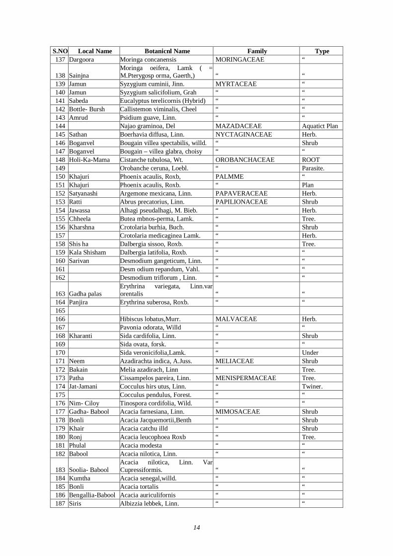
14
S.NO Local Name Botanicnl Name Family Type 137 Dargoora Moringa concanensis MORINGACEAE “
138 Sainjna Moringa oeifera, Lamk ( = M.Pterygosp orma, Gaerth,) “ “
139 Jamun Syzygium cuminii, Jinn. MYRTACEAE “ 140 Jamun Syzygium salicifolium, Grah “ “ 141 Sabeda Eucalyptus terelicornis (Hybrid) “ “ 142 Bottle- Bursh Callistemon viminalis, Cheel “ “ 143 Amrud Psidium guave, Linn. “ “ 144 Najao graminoa, Del MAZADACEAE Aquatict Plan 145 Sathan Boerhavia diffusa, Linn. NYCTAGINACEAE Herb. 146 Boganvel Bougain villea spectabilis, willd. “ Shrub 147 Boganvel Bougain – villea glabra, choisy “ “ 148 Holi-Ka-Mama Cistanche tubulosa, Wt. OROBANCHACEAE ROOT 149 Orobanche ceruna, Loebl. “ Parasite. 150 Khajuri Phoenix acaulis, Roxb, PALMME “ 151 Khajuri Phoenix acaulis, Roxb. “ Plan 152 Satyanashi Argemone mexicana, Linn. PAPAVERACEAE Herb. 153 Ratti Abrus precatorius, Linn. PAPILIONACEAE Shrub 154 Jawassa Alhagi pseudalhagi, M. Bieb. “ Herb. 155 Chheela Butea mbnos-perma, Lamk. “ Tree. 156 Kharshna Crotolaria burhia, Buch. “ Shrub 157 Crotolaria medicaginea Lamk. “ Herb. 158 Shis ha Dalbergia sissoo, Roxb. “ Tree. 159 Kala Shisham Dalbergia latifolia, Roxb. “ “ 160 Sarivan Desmodium gangeticum, Linn. “ “ 161 Desm odium repandum, Vahl. “ “ 162 Desmodium triflorum , Linn. “ “
163 Gadha palas Erythrina variegata, Linn.var orentalis “ “
164 Panjira Erythrina suberosa, Roxb. “ “ 165 166 Hibiscus lobatus,Murr. MALVACEAE Herb. 167 Pavonia odorata, Willd “ “ 168 Kharanti Sida cardifolia, Linn. “ Shrub 169 Sida ovata, forsk. “ “ 170 Sida veronicifolia,Lamk. “ Under 171 Neem Azadirachta indica, A.Juss. MELIACEAE Shrub 172 Bakain Melia azadirach, Linn “ Tree. 173 Patha Cissampelos pareira, Linn. MENISPERMACEAE Tree. 174 Jat-Jamani Cocculus hirs utus, Linn. “ Twiner. 175 Cocculus pendulus, Forest. “ “ 176 Nim- Ciloy Tinospora cordifolia, Wild. “ “ 177 Gadha- Babool Acacia farnesiana, Linn. MIMOSACEAE Shrub 178 Bonli Acacia Jacquemortii,Benth “ Shrub 179 Khair Acacia catchu illd “ Shrub 180 Ronj Acacia leucophoea Roxb “ Tree. 181 Phulal Acacia modesta “ “ 182 Babool Acacia nilotica, Linn. “ “
183 Soolia- Babool Acacia nilotica, Linn. Var Cupressiformis. “ “
184 Kumtha Acacia senegal,willd. “ “ 185 Bonli Acacia tortalis “ “ 186 Bengallia-Babool Acacia auriculifornis “ “ 187 Siris Albizzia lebbek, Linn. “ “
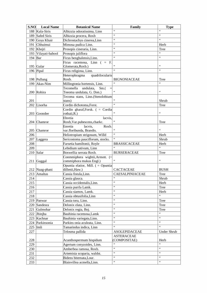
15
S.NO Local Name Botanicnl Name Family Type 188 Kala-Siris Albizzia odoratissima, Linn “ “ 189 Safed Siris Albizzia procera, Roxb “ “ 190 Goya Khair Dichrostachys cinerea,Linn “ “ 191 Chhuimui Mimosa pudica Linn. “ Herb 192 Khejri Prosopis cineraria, Linn. “ Tree 193 Vilayati-babool Prosopis juliflora “ “ 194 Bar Ficus benghalensis,Linn. “ “
195 Gular Ficus racemosa, Linn ( = F. Glomerata,Roxb.) “ “
196 Pipal Ficus religiosa, Linn. “ “
198 Pullung Heterophragma quadrilocularis Roxb. BIGNONIACEAE Tree
199 Akas-Nim Millingtonia hortensis, Linn. “ “
200 Rohira Tecomella undulata, Sm.( = Teeoma undulata, G. Don.) “ “
201 Tecoma stans, Linn.(Stenolobium stans) “ Shrub
202 Lisorha Cordin dichotoma,Forst. “ Tree
203 Goondee Cordin gharaf,Forsk. ( = Cordia rothaii,R.) “ “
204 Chamror Ehretia lacvis, Roxb,Var.pubescens,charkc. “ Tree
205 Chamror Enretia lacvis, Roxb. var.floribunda, Brandis. “ “
206 Heliotropium strigosum, Willd “ Herb 207 Laggera Sericostoma pauciflorum, stocks. “ Shrub 208 Farsetia hamiltonii, Royle BRASSICACEAE Herb 209 Lebidium sativum, Linn “ “ 210 Salar Boswellia serrata Roxb. BURSERACEAE Tree
211 Guggal Conmmiphera wightii,Armott. (= commiphora mukus Engl.) “ “
212 Naag-phani Opuntia elatior, Mill. ( = Opuntia dillenii,Haw.) CACTACEAE BUSH
213 Amaltas Cassia fistula,Linn. CAESALPINIACEAE Tree 214 Cassia glauca. “ Shrub 215 Cassia occidentalis,Linn. “ Herb 216 Cassia purrla Lamk. “ Tree 217 Cassia siamos, Lamk. “ Herb 218 Cassia obtusifolia,Linn “ “ 219 Panwar Cassia tora, Linn. “ Tree 220 Sandesra Delonix elata, Linn. “ Tree 221 Gulmohar Delonix regia, Boj. “ Tree 222 Jhinjha Bauhinia racemosa,Lamk “ “ 223 Kachnar Bauhinia variegata,Linn. “ “ 224 Parkinsonia Parkins onia aculeata, Linn. “ “ 225 Imli Tamarindus indica, Linn “ “ 227 Telosma pallida ASOLEPIDACEAE Under Shrub
228 Acanthospermum hispidum ASTERACEAE
(COMPOSITAE) Herb 229 Agertum conyzoides, Linn. “ “ 230 Amberboa ramosa, Roxb. “ “ 231 Artemisia scoparia, waldst. “ “ 232 Bidens biternata,Lour. “ “ 233 Blainvillea acmella,Linn. “ “
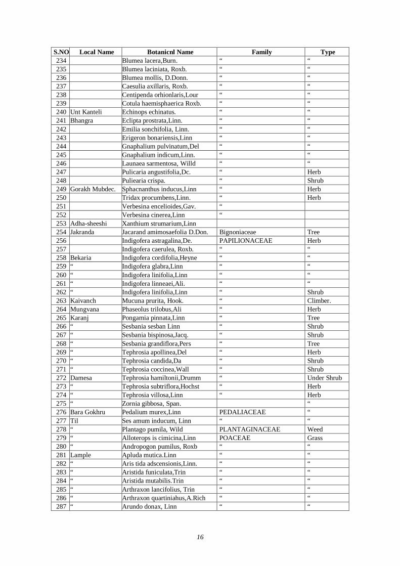
16
S.NO Local Name Botanicnl Name Family Type 234 Blumea lacera,Burn. “ “ 235 Blumea laciniata, Roxb. “ “ 236 Blumea mollis, D.Donn. “ “ 237 Caesulia axillaris, Roxb. “ “ 238 Centipenda orhionlaris,Lour “ “ 239 Cotula haemisphaerica Roxb. “ “ 240 Unt Kanteli Echinops echinatus. “ “ 241 Bhangra Eclipta prostrata,Linn. “ “ 242 Emilia sonchifolia, Linn. “ “ 243 Erigeron bonariensis,Linn “ “ 244 Gnaphalium pulvinatum,Del “ “ 245 Gnaphalium indicum,Linn. “ “ 246 Launaea sarmentosa, Willd “ “ 247 Pulicaria angustifolia,Dc. “ Herb 248 Puliearia crispa. “ Shrub 249 Gorakh Mubdec. Sphacnanthus inducus,Linn “ Herb 250 Tridax procumbens,Linn. “ Herb 251 Verbesina encelioides,Gav. “ 252 Verbesina cinerea,Linn “ 253 Adha-sheeshi Xanthium strumarium,Linn 254 Jakranda Jacarand amimosaefolia D.Don. Bignoniaceae Tree 256 Indigofera astragalina,De. PAPILIONACEAE Herb 257 Indigofera caerulea, Roxb. “ “ 258 Bekaria Indigofera cordifolia,Heyne “ “ 259 “ Indigofera glabra,Linn “ “ 260 “ Indigofera linifolia,Linn “ “ 261 “ Indigofera linneaei,Ali. “ “ 262 “ Indigofera linifolia,Linn “ Shrub 263 Kaivanch Mucuna prurita, Hook. “ Climber. 264 Mungvana Phaseolus trilobus,Ali “ Herb 265 Karanj Pongamia pinnata,Linn “ Tree 266 “ Sesbania sesban Linn “ Shrub 267 “ Sesbania bispinosa,Jacq. “ Shrub 268 “ Sesbania grandiflora,Pers “ Tree 269 “ Tephrosia apollinea,Del “ Herb 270 “ Tephrosia candida,Da “ Shrub 271 “ Tephrosia coccinea,Wall “ Shrub 272 Damesa Tephrosia hamiltonii,Drumm “ Under Shrub 273 “ Tephrosia subtriflora,Hochst “ Herb 274 “ Tephrosia villosa,Linn “ Herb 275 “ Zornia gibbosa, Span. “ 276 Bara Gokhru Pedalium murex,Linn PEDALIACEAE “ 277 Til Ses amum inducum, Linn “ “ 278 “ Plantago pumila, Wild PLANTAGINACEAE Weed 279 “ Alloterops is cimicina,Linn POACEAE Grass 280 “ Andropogon pumilus, Roxb “ “ 281 Lample Apluda mutica.Linn “ “ 282 “ Aris tida adscensionis,Linn. “ “ 283 “ Aristida funiculata,Trin “ “ 284 “ Aristida mutabilis.Trin “ “ 285 “ Arthraxon lancifolius, Trin “ “ 286 “ Arthraxon quartiniahus,A.Rich “ “ 287 “ Arundo donax, Linn “ “
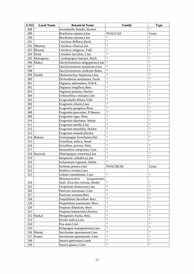
17
S.NO Local Name Botanicnl Name Family Type 288 “ Arundinella Pumila, Hochst. “ 289 Brachiaria reptans,LInn POACEAE Grass 290 Brachiaria ramosa,Linn “ “ 291 Conchrus Biflorus,Boxb. “ “ 292 Dhaman Cenchrus ciliaris,Linn “ “ 293 Bhawat Cenchrus setigerus, Vahl “ “ 294 Doob Cynodon dactylon, Linn “ “ 295 Motiagrass Cymbopogon martinii, Roxb. “ “ 296 Makra Dactyloctemium aebgyptium,Linn “ “ 297 Dactyloctemium aristatium,Linn “ “ 298 Dactyloctemium sindicum Boiss. “ “ 299 Daabh Desmostachya bipinnata,LInn “ “ 300 Dichanthium annulatum, Forsk. “ “ 301 Digitaria adseendens, H.B.K. “ “ 302 Digitaria longiflora,Retz. “ “ 303 Digitaria pennata, Hochst. “ “ 304 Echinochloa colonum,Linn “ “ 305 Eragrostiella bifaria,Vahl “ “ 306 Eragrostis ciliaris,Linn “ “ 307 Eragrostis gangetica.Roxt. “ “ 308 Eragrostis poacoides. P.Beaure. “ “ 309 Eragrostis rigra, Nees. “ “ 310 Eragrostis diarrhena, Sehult “ “ 311 Eragrostis tenella,Linn “ “ 312 Eragrostis tenuifolia, Hochst “ “ 313 Eragrostis tremula,Hochst “ “ 314 Buharu Eremopogon foveolatees.Del. “ “ 315 Eriochloa, nubica, Steud “ “ 316 Eriochloa, procera. Retz. “ “ 317 Hemarthria compressa, Linn “ “ 318 Sonwala Heteropogon contortus,Linn “ “ 319 Inmperata cylindrica,Linn “ “ 320 Ischaemum rugosum, Salisb. “ “ 321 Iscilema prestra.Linn POACHEAE Grass 322 Koeleria cristata,Linn 323 Lolium tomulentum, Linn “ “
324 Melanocenchris Jacquomontii, Jaub. (Gracilea rolcana, Hook) “ “
325 Oropetium thomacum,Linn “ “ 326 Panicum maximum, Linn “ “ 327 Panicum notatum,Retz. “ “ 328 Paspalidium flavidium Retz. “ “ 329 Paspalidium punetatum, Burn. “ “ 330 Pasplum dilatatum, Burn. “ “ 331 Pasplum hohenackeri,Hochst. “ “ 332 Narkat Phragmites Karka, Retz. “ “ 333 Perotis indica,Linn “ “ 334 Poa anun.Linn “ “ 335 Polypogon monspeiiensis,Linn “ “ 336 Moonj Saccharum spontaneum.Linn “ “ 337 Kaans Saccharum spontaneum. Linn “ “ 338 Setaria geniculata.Lamk “ “ 339 Setaria glauca, Linn “ “
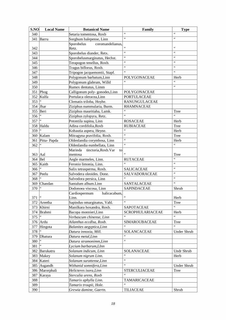
18
S.NO Local Name Botanicnl Name Family Type 340 Setaria tomentosa, Roxb “ “ 341 Barru Sorghum halepense, Linn “ “
342 Sporobelus coromandelianus, Retz. “ “
343 Sporobelus diander, Retx. “ “ 344 Sporobelusmarginatus, Hechst. “ “ 345 Terapogon tenellus, Roxb. “ “ 346 Tragus biflorus, Roxb. “ “ 347 Tripogon jacquemontii, Stapf. “ “ 348 Polygonum barbatum,Linn POLYGONACEAE Herb 349 Polygonum glabrum, Willd “ “ 350 Rumex dentatus, Limm “ 351 Phog Calligonum poly- gonodes,Linn POLYGONACEAE 352 Kulfa Portulaca oleracea,Linn PORTULACEAE 353 “ Clematis triloba, Hoyhe. RANUNGULACEAE 354 Jhar Ziziphus nummularia, Burm. RHAMNACEAE 355 Beri Ziziphus mauritiaha, Lamk. “ Tree 356 “ Ziziphus zylopyra, Retz. “ “ 357 “ Potontila supina, Linn ROSACEAE Herb 358 Haldu Adina cordifolia,Roxb RUBIACEAE Tree 359 “ Kohautia aspera, Heyne. “ Herb 360 Kalam Mitragyna pravifolia, Roxb. “ Tree 361 Pitta- Papda Oldenlandia corymbosa, Linn “ Herb 362 “ Oldenlandia eumbellata, Linn “ “
363 Aal Marinda tinctoria,Roxb.Var to mentosa “ Tree
364 Bel Aegle marmeles, Linn. RUTACEAE “ 365 Kaith Feronio limonia, Linn. “ “ 366 “ Salix tetrasperma, Roxb. SALICACEAE “ 367 Peelu Salvodera oleoides. Done. SALVADORACEAE “ 368 “ Salvodora persica, Linn “ “ 369 Chandan Santalum album.Linn SANTALACEAE “ 370 “ Dodonoea viscosa, Linn SAPINDACEAE Shrub
371 “ Cardiospermum halicacabum, Linn. “ Herb
372 Areetha Sapindus omarginatus, Vahl. “ Tree 373 Khirni Manilkara hoxandra, Roxb. SAPOTACEAE “ 374 Brahmi Bacopa monnieri,Linn SCROPHULARIACEAE Herb 375 “ Verbascum chinense, Linn “ “ 376 Ardu Ailanthus eccdlsa, Roxb. SIMAROUBACEAE Tree 377 Hingota Balanites aegyptica,Linn “ “ 378 “ Datura innoxia, Mill. SOLANCACEAE Under Shrub 379 Dhatura Datura metal,Linn “ 380 “ Datura stramonimm,Linn “ 381 “ Lycium barbarum,LInn 382 Barukatru Solanum indicum, Linn SOLANACEAE Undr Shrub 383 Makey Solanum nigrum Linn. “ Herb 384 Kateri Solanum surattense,Linn “ 385 Asgandh Withanid somnifera,Linn “ Under Shrub 386 Marorphali Helicteres isora,Linn STERCULIACEAE Tree 387 Karaya Sterculia urens, Roxb “ 388 Tamarix aphylla Linn. TAMARICACEAE 389 Tamarix troupii, Hole. “ 390 Grewia damine, Gaertn. TILIACEAE Shrub
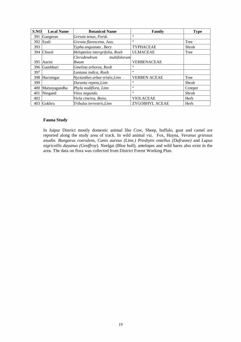
19
S.NO Local Name Botanicnl Name Family Type 391 Gangeran Grewia tenax, Forsk. “ 392 Syali Grewia flavescena, Juss. “ Tree 393 Typha angustata , Bory TYPHACEAE Shrub 394 Churel Heloptelea intergrifolia, Roxb ULMACEAE Tree
395 Aarini Clerodendrum multifolorum Bwum VERBENACEAE
396 Gambhari Gmelina arborea, Roxb “ 397 Lantana indica, Roxb. “ 398 Harisingar Nyctanthes arbar-tristis,Linn VERBEN ACEAE Tree 399 Duranta repens,Linn “ Shrub 400 Matssyagandha Phyla nodiflora, Linn “ Creeper 401 Ningand Vitox negundo. “ Shrub 402 Viela cinerea, Boiss. VIOLACEAE Herb 403 Gokhru Tribulus terrestris,Linn ZYGOBHYL ACEAE Herb
Fauna Study In Jaipur District mostly domestic animal like Cow, Sheep, buffalo, goat and camel are reported along the study area of track. In wild animal viz. Fox, Hayna, Veranus griessus asudin. Bungarus coerulens, Canis aureus (Linn.) Presbytis entellus (Dufrasne) and Lapus nigricollis dayanus (Geoffroy). Neelgai (Blue bull), antelopes and wild hares also exist in the area. The data on flora was collected from District Forest Working Plan.
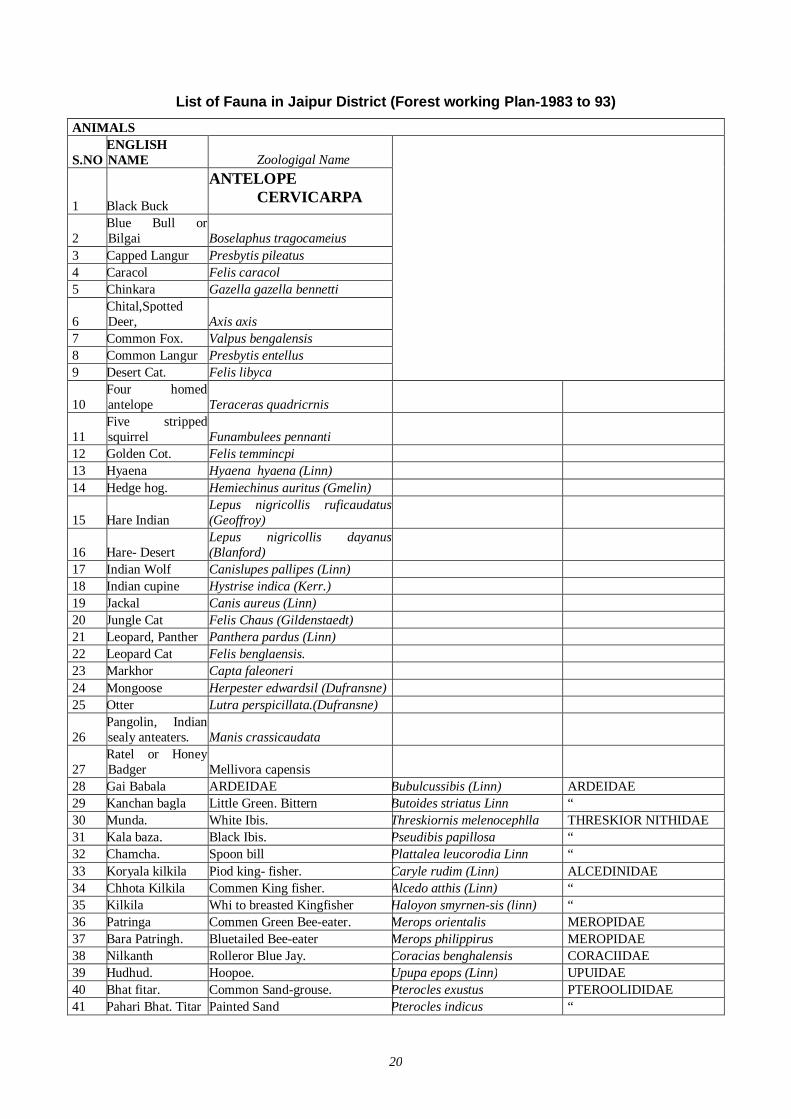
20
List of Fauna in Jaipur District (Forest working Plan-1983 to 93)
ANIMALS
S.NO ENGLISH NAME Zoologigal Name
1 Black Buck
ANTELOPE CERVICARPA
2 Blue Bull or Bilgai Boselaphus tragocameius
3 Capped Langur Presbytis pileatus 4 Caracol Felis caracol 5 Chinkara Gazella gazella bennetti
6 Chital,Spotted Deer, Axis axis
7 Common Fox. Valpus bengalensis 8 Common Langur Presbytis entellus 9 Desert Cat. Felis libyca
10 Four homed antelope Teraceras quadricrnis
11 Five stripped squirrel Funambulees pennanti
12 Golden Cot. Felis temmincpi 13 Hyaena Hyaena hyaena (Linn) 14 Hedge hog. Hemiechinus auritus (Gmelin)
15 Hare Indian Lepus nigricollis ruficaudatus (Geoffroy)
16 Hare- Desert Lepus nigricollis dayanus (Blanford)
17 Indian Wolf Canislupes pallipes (Linn) 18 Indian cupine Hystrise indica (Kerr.) 19 Jackal Canis aureus (Linn) 20 Jungle Cat Felis Chaus (Gildenstaedt) 21 Leopard, Panther Panthera pardus (Linn) 22 Leopard Cat Felis benglaensis. 23 Markhor Capta faleoneri 24 Mongoose Herpester edwardsil (Dufransne) 25 Otter Lutra perspicillata.(Dufransne)
26 Pangolin, Indian sealy anteaters. Manis crassicaudata
27 Ratel or Honey Badger Mellivora capensis
28 Gai Babala ARDEIDAE Bubulcussibis (Linn) ARDEIDAE 29 Kanchan bagla Little Green. Bittern Butoides striatus Linn “ 30 Munda. White Ibis. Threskiornis melenocephlla THRESKIOR NITHIDAE 31 Kala baza. Black Ibis. Pseudibis papillosa “ 32 Chamcha. Spoon bill Plattalea leucorodia Linn “ 33 Koryala kilkila Piod king- fisher. Caryle rudim (Linn) ALCEDINIDAE 34 Chhota Kilkila Commen King fisher. Alcedo atthis (Linn) “ 35 Kilkila Whi to breasted Kingfisher Haloyon smyrnen-sis (linn) “ 36 Patringa Commen Green Bee-eater. Merops orientalis MEROPIDAE 37 Bara Patringh. Bluetailed Bee-eater Merops philippirus MEROPIDAE 38 Nilkanth Rolleror Blue Jay. Coracias benghalensis CORACIIDAE 39 Hudhud. Hoopoe. Upupa epops (Linn) UPUIDAE 40 Bhat fitar. Common Sand-grouse. Pterocles exustus PTEROOLIDIDAE 41 Pahari Bhat. Titar Painted Sand Pterocles indicus “
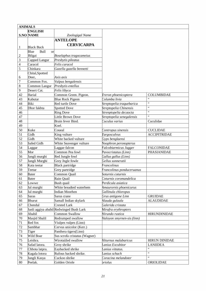
21
ANIMALS
S.NO ENGLISH NAME Zoologigal Name
1 Black Buck
ANTELOPE CERVICARPA
2 Blue Bull or Bilgai Boselaphus tragocameius
3 Capped Langur Presbytis pileatus 4 Caracol Felis caracol 5 Chinkara Gazella gazella bennetti
6 Chital,Spotted Deer, Axis axis
7 Common Fox. Valpus bengalensis 8 Common Langur Presbytis entellus 9 Desert Cat. Felis libyca
42 Harial Common Green. Pigeon. Treron phoenicoptera COLUMBIDAE 43 Kabutar Blue Rock Pigeon Columba livia “ 44 Biki Red turtle Dove Streptopelia traquebarica “ 45 Dhor fakhta Spotted Dove Streptopelia Chinensis “ 46 Ring Dove Strenptopelia decaocta “ 47 Little Brown Dove Streptopelia senegalensis “ 48 Brain fever Bind. Cuculus varius Cuculidae 49 Koel. 50 Kuke Coueal Contropus sinensis CUCLIDAE 51 Gidh King vulture Targoscalvus ACCIPITRIDAE 52 Gidh White backed vulture Gyps benglaensi 53 Safed Gidh White Seavenger vulture Noophron peronopterus 54 Laggar Laggar-falcon Falcobiarmicus Jugger FALCONIDAE 55 Mor Common Pea fowl Pavocristatus (Linn) PHASIANIDAE 56 Jangli murghi Red Jungle fowl Gallus gallus (Linn) 57 Jangli Murghi Grey Jngle fowle Gellus sonneratii 58 Kata teetar Black partridge Francolinus 59 Teetar Grey partridge Francolinus ponduceruanus 60 Bater Common Quail Soturnix coturnix 61 Bater Rain Quail Coturnix coromandelica 62 Lowwe Bush quail Perdicula asiatica 63 Jal murghi White breadted waterhem Amaurornis phoenicurus 64 Jal murghi Indian Moorhen Gallinula chloropus 65 Saras Sarus crane Grus antigone Linn GRUIDAE 66 Bhurut Samall Indian skylark Alauda gulaula ALAUDIDAE 67 Chendul Crested Lark Galerida cristata 68 Janli aggiya ababil Redwinged Bush Lark Mirafra erythropters 69 Ababil Common Swallow Hirundo rustica HIRUNDINIDAE 70 Masjid Sbalil Redrumped swallow Haloyon smyrnen-sis (linn) 71 Red fox Viulpes vulpes (Linn) 72 Sambhar Cervus unicolor (Kerr.) 73 Tiger Panthera tigers(Linn) 74 Wild Boar Sus scrofa cristatus (Wagner) 75 Leishra. Wirotaiiled swallow Hiturnus malabaricus HIRUN DINIDAE 76 Safad latora. Groy shrike Lanius Excubitor LANIIDEA 77 Chhota latpra. Eaybacked shrike Lanius vittatus. “ 78 Kagala lotora Rufous backed shrike. Lanius schach “ 79 Jangli Kasya Cuckoo shrike Coracina melandoter “ 80 Peelak. Golden Oriole oriolus ORIOLIDAE
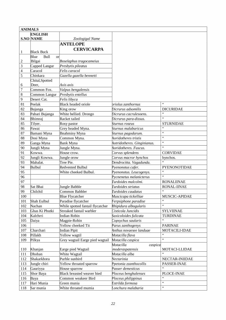
22
ANIMALS
S.NO ENGLISH NAME Zoologigal Name
1 Black Buck
ANTELOPE CERVICARPA
2 Blue Bull or Bilgai Boselaphus tragocameius
3 Capped Langur Presbytis pileatus 4 Caracol Felis caracol 5 Chinkara Gazella gazella bennetti
6 Chital,Spotted Deer, Axis axis
7 Common Fox. Valpus bengalensis 8 Common Langur Presbytis entellus 9 Desert Cat. Felis libyca
81 Peelak Black headed oriole oriolus zanthornus “ 82 Bujanga King orow Dicrurus adsomilis DICURIDAE 83 Pahari Bujanga White bellied. Drongo Dicrurus cacrulesoens. “ 84 Bhimraj Racket tailed Dicrurus para-dissus. “ 85 Tilyer. Rosy pastor Sturnus roseus STURNIDAE 86 Pawai Grey headed Myna. Sturnus malabaricus “ 87 Bamani Myna Bnahminy Myna Sturnus pagodarum. “ 88 Dosi Myna Common Myna. Aoridotheres tristis “ 89 Ganga Myna Bank Myna Aotridotheres. Ginginianus. “ 90 Jungli Myna Jungle Myna. Aoridotheres. Fuscus. “ 91 Kowwa. House crow. Corvus splendens CORVIDAE 92 Jungli Kowwa. Jungle orow Corvus macror hynchos hynchos. 93 Mahalat. Tree Pie. Dendrocitta. Vagadunda. “ 94 Bulbul Redvented Bulbul Pyenonotus cafer. PYENONOTIDAE 95 White cheeked Bulbul. Pyenonotus. Leucogenys. “ 96 Pycnenetus melanicterus “ 97 Turdoides malcolmi. RONALIINAE 98 Sat Bhai Jungle Babble Turdoides striatus RONAL-IINAE 99 Chilchil Common Babbler Turdoides caudatus “ 100 Blue Flycatcher Muscicapa tickelliae MUSCIC-APIDAE 101 Shah Eulbul Paradise flycatcher Ferpsiphone paradise “ 102 Nachan While spotted fantail flycatcher Rhipidura albogularis “ 103 Ghas Ki Phutki Streaked fantail warbler Cisticola Juncidis SYLVIINAE 104 Kalchrri Indian Robin Saxicoloides fulicata TURDINAE 105 Daiya Magpie-Robin Copsychus saularis “ 106 Yellow cheeked Tit Parus zanthogenys PARINAE 107 Charchari Indian Pipit Anthus novaesee landuae MOTACILI-IDAE 108 Pillakh Yellow wagtil Motacilla flava “ 109 Pilkya Grey wagtail Earge pied wagtail Motacilla caspica “
110 Khanjan Earge pied Wagtail Motacilla caspica moderaspatensis MOTACI-LLIDAE
111 Dhoban White Wagtail Motacilla alba “ 112 Shakarkhora Purble sunbird Nectarinia NECTAR-INIIDAE 113 Jungle chiri Yellow throated sparrow Ppetonia zzanthocollis PASSER-INAE 114 Gauriyya House sparrow Passer demesticus “ 115 Shor Baya Black breasted weaver bied Ploceus benghalenses PLOCE-INAE 116 Baya Common weakeer Bird Ploceus philippinus “ 117 Hari Munia Green munia Estrilda formosa “ 118 Sar munia White throated mumia Lonchura malabaria “
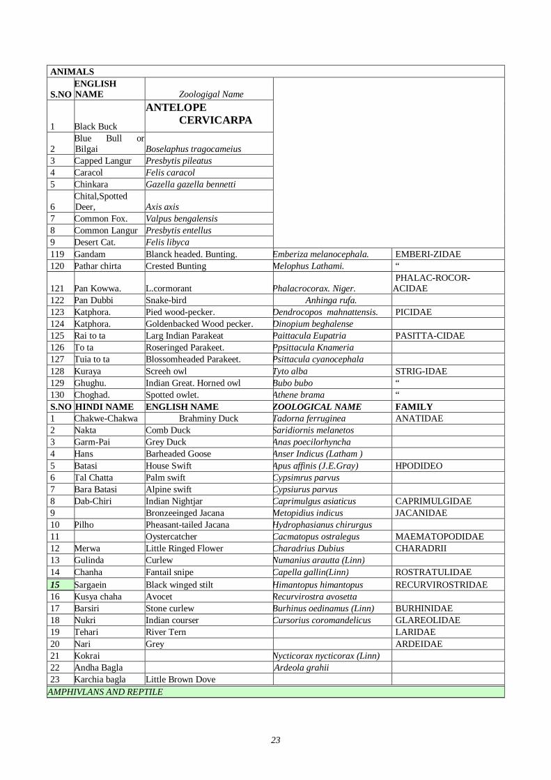
23
ANIMALS
S.NO ENGLISH NAME Zoologigal Name
1 Black Buck
ANTELOPE CERVICARPA
2 Blue Bull or Bilgai Boselaphus tragocameius
3 Capped Langur Presbytis pileatus 4 Caracol Felis caracol 5 Chinkara Gazella gazella bennetti
6 Chital,Spotted Deer, Axis axis
7 Common Fox. Valpus bengalensis 8 Common Langur Presbytis entellus 9 Desert Cat. Felis libyca
119 Gandam Blanck headed. Bunting. Emberiza melanocephala. EMBERI-ZIDAE 120 Pathar chirta Crested Bunting Melophus Lathami. “
121 Pan Kowwa. L.cormorant Phalacrocorax. Niger. PHALAC-ROCOR-
ACIDAE 122 Pan Dubbi Snake-bird Anhinga rufa. 123 Katphora. Pied wood-pecker. Dendrocopos mahnattensis. PICIDAE 124 Katphora. Goldenbacked Wood pecker. Dinopium beghalense 125 Rai to ta Larg Indian Parakeat Paittacula Eupatria PASITTA-CIDAE 126 To ta Roseringed Parakeet. Ppsittacula Knameria 127 Tuia to ta Blossomheaded Parakeet. Psittacula cyanocephala 128 Kuraya Screeh owl Tyto alba STRIG-IDAE 129 Ghughu. Indian Great. Horned owl Bubo bubo “ 130 Choghad. Spotted owlet. Athene brama “ S.NO HINDI NAME ENGLISH NAME ZOOLOGICAL NAME FAMILY 1 Chakwe-Chakwa Brahminy Duck Tadorna ferruginea ANATIDAE 2 Nakta Comb Duck Saridiornis melanetos 3 Garm-Pai Grey Duck Anas poecilorhyncha 4 Hans Barheaded Goose Anser Indicus (Latham ) 5 Batasi House Swift Apus affinis (J.E.Gray) HPODIDEO 6 Tal Chatta Palm swift Cypsimrus parvus 7 Bara Batasi Alpine swift Cypsiurus parvus 8 Dab-Chiri Indian Nightjar Caprimulgus asiaticus CAPRIMULGIDAE 9 Bronzeeinged Jacana Metopidius indicus JACANIDAE 10 Pilho Pheasant-tailed Jacana Hydrophasianus chirurgus 11 Oystercatcher Cacmatopus ostralegus MAEMATOPODIDAE 12 Merwa Little Ringed Flower Charadrius Dubius CHARADRII 13 Gulinda Curlew Numanius arautta (Linn) 14 Chanha Fantail snipe Capella gallin(Linn) ROSTRATULIDAE 15 Sargaein Black winged stilt Himantopus himantopus RECURVIROSTRIDAE 16 Kusya chaha Avocet Recurvirostra avosetta 17 Barsiri Stone curlew Burhinus oedinamus (Linn) BURHINIDAE 18 Nukri Indian courser Cursorius coromandelicus GLAREOLIDAE 19 Tehari River Tern LARIDAE 20 Nari Grey ARDEIDAE 21 Kokrai Nycticorax nycticorax (Linn) 22 Andha Bagla Ardeola grahii 23 Karchia bagla Little Brown Dove
AMPHIVLANS AND REPTILE
24
ANIMALS
S.NO ENGLISH NAME Zoologigal Name
1 Black Buck
ANTELOPE CERVICARPA
2 Blue Bull or Bilgai Boselaphus tragocameius
3 Capped Langur Presbytis pileatus 4 Caracol Felis caracol 5 Chinkara Gazella gazella bennetti
6 Chital,Spotted Deer, Axis axis
7 Common Fox. Valpus bengalensis 8 Common Langur Presbytis entellus 9 Desert Cat. Felis libyca
24 Crocodiles
CROCODILUS PALUSTRIS
25 Monitr lizarrd Varanus griseus Dasudin 26 Python Cenus python 27 Tortoise Naja tripudians 28 Cobra Naja Naja 29 Krait Bungarus Coerulens 30 Viper Vipera russelli 31 Pitviper Anioistrodon Himalayanus
Directly Affected Wild Life & Forest Reserves
Nharghar wild life sanctuary- WLS is approximate 30 Km. away from DFC detouer section in eastern side. No wild life sanctuary is affected by this project. Sambhar Lake- Sambhar lake is appoximate 6 Km. away from Detuor section. Location: Sambhar is a small town, located at a distance of 60kms in the west of Jaipur, on Jaipur-Ajmer Highway. Sambhar is famous for the largest saline lake in India. Due to this fact, Sambhar is also known as Salt Lake City. Coordinates of site center (degrees): 27°00'N 075°00'E, Coordinates of site center (decimal lat long): 27,00 75,00. Some 60 km west of Jaipur in Rajasthan, is India's largest salt lake. The waters of Sambhar have been used for centuries to make salt. There is, however, another distinctive feature of this extensive saline wetland. During winter, it receives tens of thousands of winged visitors, some migrating from as far north as Siberia. For such waterfowl as the flamingo, Sambhar Lake is one of the few habitats that ensure sustenance every year. It is in recognition of the urgency to protect the winter home of these 'distinguished guests' that Sambhar Lake was designated as a Ramsar site in 1990.
Justification for Designation as Ramsar Site Together with neighbouring saline wetlands, Phulera and Deedwana, the lake is probably the most important wintering area for flamingoes (both Phoniconaias minor and Phoenicopterus roseus) in India outside the Rann of Kachchh. It is the largest representative in India of a specialized kind of habitat - salt lakes - which are unique
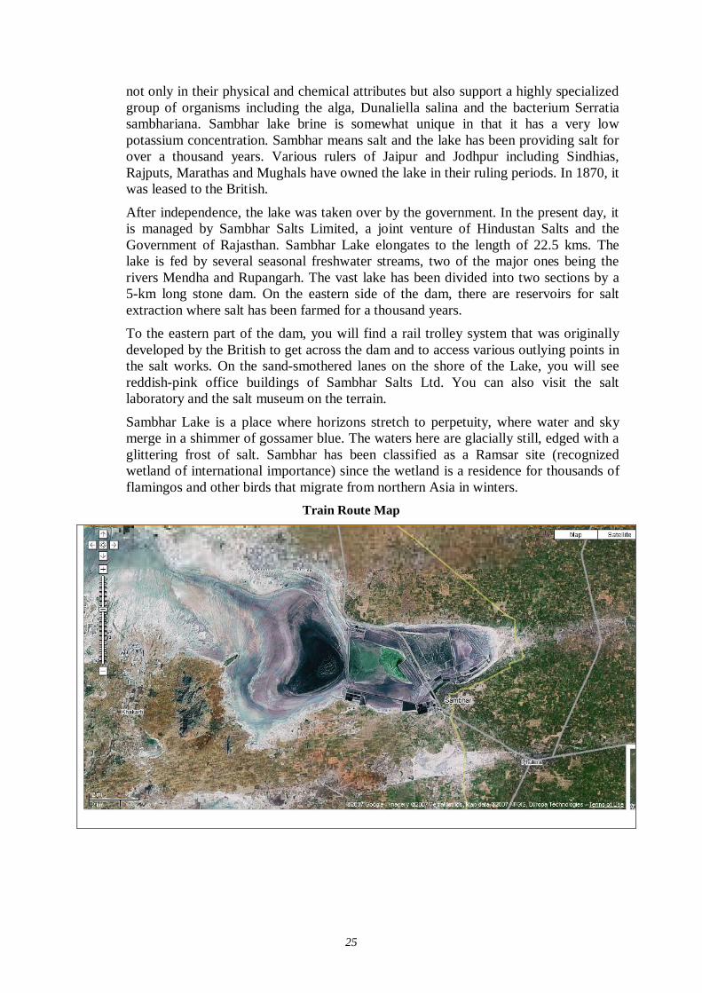
25
not only in their physical and chemical attributes but also support a highly specialized group of organisms including the alga, Dunaliella salina and the bacterium Serratia sambhariana. Sambhar lake brine is somewhat unique in that it has a very low potassium concentration. Sambhar means salt and the lake has been providing salt for over a thousand years. Various rulers of Jaipur and Jodhpur including Sindhias, Rajputs, Marathas and Mughals have owned the lake in their ruling periods. In 1870, it was leased to the British.
After independence, the lake was taken over by the government. In the present day, it is managed by Sambhar Salts Limited, a joint venture of Hindustan Salts and the Government of Rajasthan. Sambhar Lake elongates to the length of 22.5 kms. The lake is fed by several seasonal freshwater streams, two of the major ones being the rivers Mendha and Rupangarh. The vast lake has been divided into two sections by a 5-km long stone dam. On the eastern side of the dam, there are reservoirs for salt extraction where salt has been farmed for a thousand years. To the eastern part of the dam, you will find a rail trolley system that was originally developed by the British to get across the dam and to access various outlying points in the salt works. On the sand-smothered lanes on the shore of the Lake, you will see reddish-pink office buildings of Sambhar Salts Ltd. You can also visit the salt laboratory and the salt museum on the terrain.
Sambhar Lake is a place where horizons stretch to perpetuity, where water and sky merge in a shimmer of gossamer blue. The waters here are glacially still, edged with a glittering frost of salt. Sambhar has been classified as a Ramsar site (recognized wetland of international importance) since the wetland is a residence for thousands of flamingos and other birds that migrate from northern Asia in winters.
Train Route Map
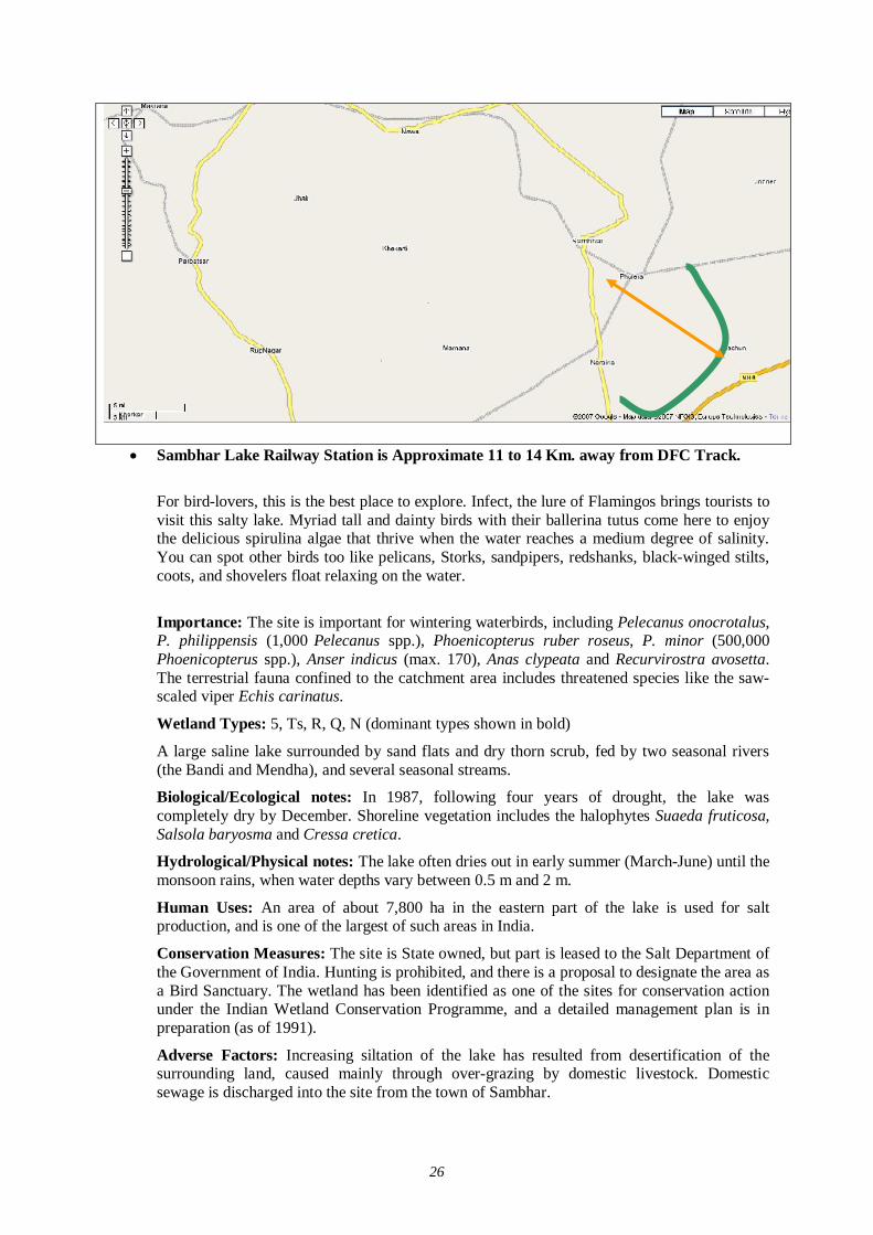
26
Sambhar Lake Railway Station is Approximate 11 to 14 Km. away from DFC Track.
For bird-lovers, this is the best place to explore. Infect, the lure of Flamingos brings tourists to visit this salty lake. Myriad tall and dainty birds with their ballerina tutus come here to enjoy the delicious spirulina algae that thrive when the water reaches a medium degree of salinity. You can spot other birds too like pelicans, Storks, sandpipers, redshanks, black-winged stilts, coots, and shovelers float relaxing on the water.
Importance: The site is important for wintering waterbirds, including Pelecanus onocrotalus, P. philippensis (1,000 Pelecanus spp.), Phoenicopterus ruber roseus, P. minor (500,000 Phoenicopterus spp.), Anser indicus (max. 170), Anas clypeata and Recurvirostra avosetta. The terrestrial fauna confined to the catchment area includes threatened species like the saw-scaled viper Echis carinatus.
Wetland Types: 5, Ts, R, Q, N (dominant types shown in bold)
A large saline lake surrounded by sand flats and dry thorn scrub, fed by two seasonal rivers (the Bandi and Mendha), and several seasonal streams.
Biological/Ecological notes: In 1987, following four years of drought, the lake was completely dry by December. Shoreline vegetation includes the halophytes Suaeda fruticosa, Salsola baryosma and Cressa cretica.
Hydrological/Physical notes: The lake often dries out in early summer (March-June) until the monsoon rains, when water depths vary between 0.5 m and 2 m.
Human Uses: An area of about 7,800 ha in the eastern part of the lake is used for salt production, and is one of the largest of such areas in India.
Conservation Measures: The site is State owned, but part is leased to the Salt Department of the Government of India. Hunting is prohibited, and there is a proposal to designate the area as a Bird Sanctuary. The wetland has been identified as one of the sites for conservation action under the Indian Wetland Conservation Programme, and a detailed management plan is in preparation (as of 1991).
Adverse Factors: Increasing siltation of the lake has resulted from desertification of the surrounding land, caused mainly through over-grazing by domestic livestock. Domestic sewage is discharged into the site from the town of Sambhar.
27
Sambhar Salts Limited (SSL) was incorporated on 30.9.1964 as a subsidiary Company of Hindustan Salts Limited by transferring the salt sources at Sambhar Subsequently, The Sambhar Lake salt Sources were transferred to a newly formed subsidiary company, Sambhar Salts Limited in terms of V. T. Krishnamachari Award. The Equity of Sambhar Salt Limited in owned 60% by the Government of India through Hindustan Salts Limited and 40% by Government of Rajasthan in terms of V. T. Krishnamachari Award. Sambhar Salt Limited has been made a subsidiary Company, which is having over 90 sq. miles of production area at Sambhar and Nawa. SSL has recently diversified the business on many counts and considerable infrastructure has been added to produce various varieties of high quality salt. Therefore depending on the orders, we can process and send any type and quantity of salt
SAMBHAR SALTS LIMITED has introduced Low Sodium Salt, which is something quite different. Entirely natural mineral lake salt, While 60% of the sodium is removed from the salt the high levels of the vital minerals. The specifications of Company’s LOW SODIUM SALT are as under:
S.No Characteristic Contents 1. Sodium 340mg 2. Potassium 61mg 3. Magnesium 1mg 4. Calcium 2mg
Advantages of Low Sodium Salt: No Difference in Taste. Low Sodium Salt is safe for human body. Low Sodium in diets may help in management of high blood pressure. Low Sodium may help in maintaining normal body weight. Low Sodium in diets may help in promoting physical activity. It is high in natural potassium and low in sodium. Enriched with minerals and Iodine. Justification for Designation as Ramsar Site Together with neighbouring saline wetlands, Phulera and Deedwana, the lake is probably the most important wintering area for flamingoes (both Phoniconaias minor and Phoenicopterus roseus) in India outside the Rann of Kachchh. It is the largest representative in India of a specialized kind of habitat - salt lakes - which are unique not only in their physical and chemical attributes but also support a highly specialized group of organisms including the alga, Dunaliella salina and the bacterium Serratia sambhariana. Sambhar lake brine is somewhat unique in that it has a very low potassium concentration.
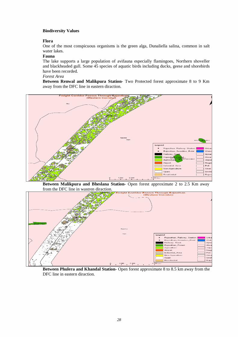
28
Biodiversity Values
Flora One of the most conspicuous organisms is the green alga, Dunaliella salina, common in salt water lakes. Fauna The lake supports a large population of avifauna especially flamingoes, Northern shoveller and blackheaded gull. Some 45 species of aquatic birds including ducks, geese and shorebirds have been recorded. Forest Area Between Renwal and Malikpura Station- Two Protected forest approximate 8 to 9 Km away from the DFC line in eastern diraction.
Between Malikpura and Bheslana Station- Open forest approximate 2 to 2.5 Km away from the DFC line in wastren diraction.
Between Phulera and Khandal Station- Open forest approximate 8 to 8.5 km away from the DFC line in eastern diraction.
29
(2) Ajmer The Ajmer forests lie in five ranges namely, Ajmar, Kishangarh, Beawar, Sarwar and Raoll. These ranges are all with in Ajmar revenue district. Bhim Range of Udaipur district, which used to be in Ajmar Forest Division has been gently transferred to Udaipur Forest Division and has been excluded from this working plan.
The trac lies nearly in the central portion of Rajasthan between 250 38’ and 26052’ North latitude and 73054’ and 75024’East longitude. Nagaur and Jaipur district, in the South by Udaipur and Bhilwara districts, in the East by Jaipur, Tonk and Bhilwara districts and in the West by Nagaur and Pali distircts of Rajasthan, bound Ajmar Forest Division in the North.
The total land area of the Division is 8,479 km2. Out of which 592 km2. Area is under forest, which works out to about 7% of the total land area. The Headquarters of the Division is located at Ajmar. It falls under the administrative control of the Conservator of Forests, Ajmar. Other superior officials, namely Addl. Chief Conservator of Forest is headquarter at Van-Bhawan, Jaipur, The office of the Divisional Forest office is situated at Jaipur Road, Ajmar. The Headquarter is easily approachable by Highway No.8 together with network of State Highway and other district roads. It is an important junction with Division Headquarter of Western Railways. Being nearer to Jaipur and being the Seat of Khwaja Moinuddin Chistee, a holyplace for people of all religions, it has tourism potential and is being developed as such.
THE FORESTS
Most of the forest death with in this working plans falls under the major group II-DRY TROPICAL FORESTS as per champion and Seth’s revised classification of forest types of India. As per champion and Seth’s classification, the following groups, subgroups, types and subtypes are recognized in this area: -
Group-5- TROPICAL DRY DECIDUOUS FORESTS.
Sub- Group-5b-Northern Tropical dry deciduous forest Type 5B/C2- Northern dry mixed deciduous forests.
Degradation tags of Northern tropical dry
Deciduous forest:
DS1 Dry deciduous Scrub.
DS3 (Euphorbia scrub)
DS4 (Dry grassland)
General adaphic types of dry deciduous forest:
5B/E1 Anogeissus pendula forest.
5B/DS1 Anogeussus Pendula scrub.
5B/E2 Boswellia forests.
5B/E3 Babul forest.
5B/E5 Butea forest.
General seral types of dry deciduous forests:
1S1 Dry Tropical riverain forest.
2S2 Secondary dry deciduous forestry.
GROUP-6: TROPICAL THORN FORESTS:
Sub- Group 6B-Northern Tropical thorn forest:
Type 6B/C1 Desert thron forest.
30
6B/C2 Ravine thron forest.
6B/DS1 Zizyphus svrub.
6B/DS2 Tropical Euphornia scrub.
Dr. Mathur C.M. has classified these, forests into the following floristic series along with the degraded and derived ones:
a)-Series :
1) Anogeissus pendula.
2) Degraded Anogeissus pendula.
3) - Anogeissus latifolia.
4) - Boswellia serrata-Lannea coromandelica.
5) - Acacia nilotica.
6) - Grass lands.
(b)- Facies:
1) – Euphorbia nivulia.
2) - Acacia leucophloea.
3) - Ziayphus mumularia.
4) - Dendrooalamus strictus.
The forests occur on a variety of soil and rock formations and thus they very greatly in composite and quality, Edaphic and biotic factors chiefly determine their composition, distribution and quality. About 80% of the area is either occupied by bare rocks or supports a spare growth of scrub-forests. The stocking is poor except in the forest of Arawali Range.
Northern dry mixed deciduous forests:
This type of forest is generally visible in the forest blocks of Bagmaal, Merian, Todgarh and parts of Satukhera, Charplan of this Division. But it has been observed that species like Anogeissus Pendula, Boswellia serrata, and Acacia senegal belonging to this type tend to form more or less pure consociations under the influence of characteristic edalphic conditions prevaling in Aravalli hills. However this type is mostly confined to valleys and Nalla banks where soil and moisture conditions are relatively better. On upper well-drained plateaus and slopes. Boswellia serrata tends to replace this type where-as at other drier slopes Anogeissus pendula forest occur in close proximity with practionally no transition.
The over wood of these forests consists of Anofeissus pendula, Boswellia serrata, Acacia catechu and occasional trees of Sterculia urens, Moringa Aoncarensis, Lannea coromandelica, Crateavia religiosa, Albizzia lebbek and Dispyros malanoxylon. While trees of Mitragyna parvifolia. Ficus racemosa, Albizzia are mostly observed in valleys and on the bank of nallhs. The underwood consists of Wrightea of tinctoria, Dichrostachys cineria, Flacourtia india Mxallotus philipinensis, Zizyphus mauritiana,, Acacia leucophloea, Holarrhena antidysentre Bauhinia racemosa, Euphorbia nivulia, Ficus tomenttosa The undergrowth includes Grewia tenax, Grewia Securinga leucopyrus, Rhus mysorensis, Zizyphus nummularia, Abrus precatorius, etc. The ground cover consists of cassia tora, Indigofora species, Amara species, Conyzoides, Tephrosia purpurea, Mimosa spp.Barleria spp., Commelina benghalensis, Adhatoda spp, Argemone maxicana, Xanthium strumarium, Gcimum spp Salanum Zanthoearpum etc. The common grasses occurs in the tract are Apluda mutiea ,Aristida spp. Bra spp.Cenchrus spp. Cynodon dactylon, Dichanthium annulatum, Digitaria spp. Eragrpstis spp. Heteropo contortus, Panucum spp. Sporobolum spp. etc.
Ecological status
31
The miscellaneous forests described under paragraph are climatic climax. But most of the species constituting this type tend to form pure consol under edaphic conditions peculiar to Aravalli hill resulting in different edaphic climax formations.
Anogeissus pendula Forests (Type 5B/E1)
This type is characteristically recognise by the almost pure consociations of Anogeissue pendula, whereing, it gregariously occurs forming more than 80% of the crop.Most of the forest of Ajmar Division are representative of this type. Anogeissus pendula is generally slow growing on favorable sits conditions as in Merian, Todgari and Baghmaal forest blocks of Raoli Range. In the most of the forest areas, chiefly near the towns, the Anogeissus Pendula has been continuously hacked and grazed as a result of which it is found as a struggling bush, and also root stock is visible on the higher slopes of hill hills as in Madar pahar, Mahua Bir, Naay Pahar, Taragarh forest blocks of Ajmar Range, Kotra Forest block of Sarwar Range. These forest blocks used to support good stands of Anogeissus pendula and asscciates before 1947 but they hays been maltreated in the part leaving them in a degraded condition and in extreme cases, the batches have been rendered completely blank.
These forests are infact confined to the sites away from the habitations. Near the villages and towns it has undergone excessive retrograssion and consists of young bushy coppic shoots as a result of constant hacking and grazing. In the interior part of Baghmal, Mecien and Todgarh forest blocks, where these is minimum of biotic interference by men and his animals, the conditions and quality of Anogeissus pendula forest is far better and also its regeneration is satisfactory. The crop is regularly constituted of proper age gradations in these forests blocks.
Anogeissus pendula is also found mixed with Acacia catechu, Acacia senegal, Acacia leucophloea, Boswellia serrata, Lannea coromandelica, Zizyphus mauritiana,Wrightia tinctoria, Flacourtia indica, Bitea monosperma, Gassia fistula, Dicspyros melanoxylon, Ehretia laevis, Albizzia lebbek,Moringa coneanensis, Crateava religiosa, Mitragyna parvifolia, Ficus racemosa, It may be mentioned hers that Mitragyna parvifolia, Ficus racemosa, and Butea monosperma and Cassia fistula are confined to small patches in moist localities and the banks of nallas and Diospyros melanoxylon is also rarely found in forest block .
Grassy blanks with Euphorbia nivulia occur over large areas where soil conditions are poor and also where biotic interference is maximum. A substantial area is covered by scrub forest Maytenus emarginata, Flacourtia indica, and Euphorbia spp. The grass bir areas of Kishangar Sarwar and Beawar ranges and plain areas along the foot hills generally support Prosopis cineraria , Salvadora clooides, Capparis decidus, Zizyphus spp., Acacia leucoplloea, Prosopis chilensis (P.Juliflora).
In order to facilitate their management, the forests may be broadly distributed as under :-
S.No -------------Type- 1) Well-stocked Anogeissus pendula forests. 2) Degraded Anogeissus pendula forests/ 3) Mixed Miscellaenous forests. 4) Grass Birs. 5) Biswekkua forests. 6) Babul forests. 7) Butea forests. 8) Phoenix savannah. 9) Riverain forest. 10) Desert thorn forests. 11) Ravine thorn forests. 12) Zizyphus scrus. 13) Euphorbia scrub. 14) Acacia senegal forests. 15) Blanks and other depleted areas.
32
Well stocked Anogeissus pendula forests (Types 5B/E1)
This type is characteristically recognised the almost purs consociations of Anogeissus pendula where in it gregariously occurs forming more than 80% of the crop. Most of the forest of Ajmar Division was at one time, representative of this type. But this type is limited to Baghmaal, Tadgarh, Median of Satukhera forest blocks of this division. The main associates of A. Pandula are Boswellia Lannea coromandelica, Wrightia tinctoria, Flaccurt Indica, Butea monosperma, Acacia catechu, Acacia senegal , Ehretia laevis, Albizzia lebbek, Zizyphus mauritiana, Moringa concanensis, Crataeva religiosa and Mitragyna parviolia, Ficus raemosa is also rarely found along the banks of nallas.
Anogeissus pendula sorub (5B/E1-DS1) Large areas of A.Pendula forests have degraded due to continued maltreatment meted during the past. Many of thesr areas are close to towns and villages. These have been recklessly cut and subjected to unrestricted grazing and browsing during the past. The growing stock mainly comprises of root stock of pendula and its scattered tree with its associates like Grewia tenaz, Rhus mysorensis, Dich-rostachys cineraria and Grswia flevescens. Regeneration of A.pendula, the main spp. Is generally absent and the top. Soil has been washed away due to continued exposure to rain in the absence of proper soil cover.
Ecological status
In the revised survey of forest types of India, Champion and Seth have observed, “This association links the Northern and southern forest of the dry deciduous forests and both with the thorn forest. This form is a result of continuous process of ecological retrogression of the edaphic climax 5/E1 under acute biotic pressures”. As indicated previously, Anogeissus pendula is felled for small timber and lopped for fodder and fuel wood. There after, its coppice regeneration and also its natural regeneration are browsed and trampled by goats and cattle. At this stage thorny species invade the area and out-number the scolding shoots of main spp. The inferior thorny species in the area are Dichrostachys cineria, Acacia leucophloea, Zizyphus nummularia, Acacia senegal along with species like Rhus mysoransis, Grewia spp.Anogeissus pendula is reduced is reduced to creeping and bushy growth usually multistemmed from base and reach its last stage before it is totally eliminated. The 5B/E1-DS1 under strict protection from grazing with a little soil and moisture conservation gives rise to a secondary stage leading to regain the lost ecological status.
Boswellia forests (5B/E2) Boswellia serrata is characteristically to the higher steeper slopes and well drained top plateau of these blocks. Its main asspciates are Anogeissus pendula, Lannea coromandelica, Acacia spp, Albizzia lebbek. The undergrl with consists of Rhus mysorensis, Grewia spp. Heteropogon contortus, and Aristida spp.
Ecological status:
Boswellia forests are distinctly aneodaphic climax. The local people due to their high slopes and limited use of salar least disturb these. The ratio of salar and Gol in the Anogeissus pendula forest is progressively increasing due to felling of other species. Boswellia serrata can be seen growing near human habitations where no other spp. could stand the biotic pressure.
Babul forest (Type 5B/E5) This type is often found in small patches on the base of hillsides and in valleys with Anogeissus pendula. It is seen in parts of Aspahar, Bad Kochran, Sheo Nagari and sheoppura ghat forest block of this division. It is a pronounced edaphic subtype though some times it occurs due to maltreatment in dry deciduous forest.
Phoenix savannah (Type 5B/E8a)
Phoenix Sylvestris occurs as pure gregarious riverian fringing vegetation on narrow alluvial deposits along streams and water logged areas. This type is conspicuously seen along Khajooriya naal in
33
Todgarh forest block. It is associated with Acacia leucophloea, Vitex negundo, Capparis and Grewia spp.
Dry tropical Rivera in forest (Types 5B/1S1)
An irregular over wood of greater height than climax dry deciduous forest forming patches with varying amounts of smaller trees and shrubby growth. It occurs in very small areas on light sandy soil along sections of streams as in Baghmaal and garh forest blocks.
Desert Thorn Forest (Type 6B/C1) This type occurs on the low hills, flat hill and stabilised sand dunes as in parts of Makarwali Bela-wat, and karel Nand forest blocks. The species found have strong tend- lency to form almost pure gregarious consociations. Acacia senegal and prosopis cineraria are the main species. These are found in association with Acacia leuco-phloca Capparis deciduas, Maytenus Balanites aegyptica etc.
Ecological status
As per Champion and Seth, the occurrence of consociations of Acacia senegal and prosopis spp has been recognised as climatic climaxes.
Ravine thron forest (Types 6B/C2)
This type occurs on the gullied sand of all deposits along foothills and also along nallahs in parts of Karel naad (comptt. 4-5) Kanas Banse Kanas Nedlia, Bani Doonfri forest blocks of this division. The growing stock mainly consists of acacia senegal, acia leucophloea, Prosopis cineraria, Maytenus emarginata, Balanites aegyptica, Acacia, Calygonum polygonoides, Acacia jacquemontic Zizyphus spp. The under growth consists of Xantphytes spp. Eragrostis sp. Apluda mutica, Heteropogon contortus, Dicanthium annulatum, Sporobolus and Aristida spp. The ground over also consists of Cassia tora, Tephrosia purpuria. The crop is of very low density and dominant tree species usually do not attain height more than 4-5 metres.
Ecological status As per Champion and Seth, this type has been classified as climax. But due to excessive biotic interference and severe erosion this is under continuous retrogression. As a result of this most of the ravinous areas of this Division, which are not big in extent, support scares tree growth.
Zizyphus scrub (Type 6B/DS1)
This type occurs on gravelly soils usually on flat ground along foothills which is heavly grazed and browsed. The occurrence of trees is scanty and tree species like Acacia leucophloea, Prosopis cineraria and Zizyphus spp. are found scattered allover. It can be seen in parts of Dhasuk Bir, Gothiana, Bhamolao, Karel naad, Kharva and Kharwa piplas forest blocks and in small patches through out the division.
Ecological status This type is primarily a result of reckless destruction of thorny trees and thus owes its origin to intense biotic pressure. It appears to have formed biotic climax because Zizyphus spp. is grazed and cut for fodder every year. It is intermingled with Euphorbia scrub on degraded hills.
Tropical Euphorbia scrub (Type 6B/DS2)
This type occurs on the hills and hill base mostly near habitation. These areas have remained under excessive biotic pressure a result of continuous degradation of Anogeissue and other thorny species. Euphobia nenifolia occurs gregariously in association with Rhus mysorensis, Dichrostachys cinera and grasses like Aristida spp in pockets of shallow soil. This type is met with in the parts of Taragarh, Jhak Belawat, Jajota paladi, Chot forest blocks of this division.
Ecological status This type is primarily a result of heavy grass and felling of tree growth in the past. It occupied stony sites in general.
34
Acacia senegal forest (Types 6B/E2)
The puro consociations of Acacia senegal as found in Mandawaria, Kanas Nedilia, Danta Rahesi, Ran Shri Nagar (compartment 15 and parts of comptt. 10 & and Moyna forest blocks of this division can best sifted under this type. This type is typically open gregarious over wood of pure Acacia senegal with Acacia leucophloea, Dichrostachys cinerea, Prosopis cineraria as associates. Undergrowth consists of Com mukul, Mimosa rubicalulis, Barleria spp. Teph purpuria, Securinga spp. etc.
Ecological status This type is recognized as an edaphic climax per champion and Seth,
Desert dune scrub (Type 6/E4/DS1/IS1)
A very open and irregular formation of trees and bushes. The trees are thorny and all xerophytes. This type occurs in parts of Mankarwali, Karelnad and Kanas nedlia forest block this division. The main spp. of this type are Prosopis cineraria, Acacia leucophloea ,Acacia jacquemontii,Zizyphus spp. Calotropis procera, Crotolaaria burhia,Aerva tomentosa, LeptadEIA Study pyrotechnica ,Acacia senegal, etc. Grasses found are Cenchrus, Aristida and Eragrostis spp. This type is found chiyton sand dunes of small dimensions round about Pushkar.
Floral Study
Approximate 101 km patch of DFC line is passing from Ajmer District and along the railway track. Acacia species, A.indica, Eucalyptus and Prosopis species are dominant species. Near Kishangarh 1.5 Km patch of DFC alignment passing Forest area and it acquired approximate 6.55 Ha land of forest area approximate 1838 trees would be affected by this project. The data on flora was collected from District Forest Working Plan.
List of Flora in Ajmer District (Forest working Plan-1983 to 93)
Plants S.No. Local Name Botanical name Family
1 Aam Mangifera Indica Linn. Anacardiaceae 2 Ameltas Cassia fistla Line. Legiminosae 3 Aonla Embica Occicianialis Ceartn Euphorbiaceae 4 Ardua Ailathus excelsa Roxb. Simarubaceae 5 Aritha Sapindus emerginatus Vah,. Sapindaceae 6 Arjun Terminalia arjuna Bedd. Combretaceae 7 Arunj Acacia leucophloea Willd. Leguminosae 8 Ashok Piyalthia longifolia Benth and Hook Anonaoeae 9 Babul Acacia longifolia Benth and Hook Anonaoeae
10 Bad Ficus bengalensis Linn. Urticaceae 11 Bahera Terminalia belerica Roxb. Combretaceae 12 Bakain Melia azedarach Linn. Maliaceae 13 Barna Crataeva religiosa Forest Capparidaceae 14 Bija Pterocarpusmarsupium Roxb. Papilionaceae 15 Bilee Aegle marmolas corr. Rutaceae 16 Bor Zizyphus mauritiana Rhamnaceae 17 Chirmi Abrus pracatorius Papilionaceae 18 Churai Holoptalia integrifolia, Planch Urticaceae 19 Dhak Butea monosperma (Lamk.) Papilionaceae 20 Dhokra Anogeissus pendula, Edgew Combretaceae 21 Dudheli Wrightia tomentosa Roem Apocynaceae
22 Eucalyptus Eucalyptus oitriodora Hook, Eucalyptus globulus Labill, Eucalyptus rostrata, Eucalyptus hybrid Myrtaceae
23 Colia Dhav or safed Dhokra Anogeissus Latifolia wall Combretaceae
24 Gol Lanneacoromandelioa (Houtt) morr. Anacardiaceae
35
Plants S.No. Local Name Botanical name Family
25 Gonds Cordia dichotoma Forest Boraginaceae 26 Gugaul Commiphora mukul 27 Gular Ficus flomerata Roxb. Urticaceae 28 Hingotia Balanits aegyptica, Delite Simarubaceae 29 Imli Tamirindus indica Linn. Caesalpinieae 30 Jal (Pilu) Salvadora oleoides Dene Salvadoraceae 31 Jal (Khara) Salvadora persioa Linn Salvadoraceae 32 Jamun Syzygium cuminil Skeel (linn) Myrtaceae 33 Jungale Jalebi Pitheocolobium duloe Mimosaceae 34 Jhinjha Bauhinia racemosa lamk. Caesalpinineae 35 Kachnar Bauhinia Variegata, Linn. Caesalpinineae 36 Kadam Anthocephalus indicus Rich Rubiaceae 37 Kakon Flacourtia romentohi L.Herit Bixaceae 38 Kanti Flacourtia indica (Burn F.) Merr. Bixaceae 39 Karaiya Steroulia urems Roxb. Sterouliaceae 40 Khajur Phoenix sylvestris Roxb. Sterouliaceae 41 Khair Acacia catechu, wiild Mimosaceae 42 Khejra Prosopis cineraria Linn Mimosaceae 43 Khirini Wrightia tinctoria R.Br. Apocynaceae 44 Kewra Pandauus tectoria sol. Pandanaceae 45 Kolai Dichrostachys cinerea W&A Mimosaceae 46 Kumtha Acacia Senegal Willd Mimosaceae 47 Lamkana Bridelia retusa Euphorbiaceae 48 Lunia Hymenoditylon exelesum Rubiaceae 49 Mokha Schrebera swierenioides, Roxb. Cleaceae 50 Neem Azadirachta indica . A. Juss Meliaceae 51 Neem Chameli Millingtonia hortensis Linn. Bignoniaceae 52 Nimboo Citrus Medica Linn. Rutaceae 53 Padar Stereospernum suaveolens,D.C. Bignoniaceae 54 Pharas Tamarix articulata 55 Pipal Ficus Religiosa Linn. Urticaceae 56 Rain Mimusops hexzandra (Roxb.) Dubara Sapotaceae 57 Ratanjot Jatropha curcus Linn. Euphorbiaceae 58 Rohan Soymida febrifuga Juss. Meliaceae 59 Roheda Tecomella unduleta seem Bignoniaceae 60 salar Boswelia Serrata Roxb. Burseraceae 61 Sanjna Meringa oleifera Lamk. Moringacea 62 Semal Salmalia malabarrica (D.C.) Sch.& Endl. Malvaceae] 63 Shahtoot Morus alba Linn Moraceae 64 Shsiham Dalbergia sissoo Roxb. Papilionaceae 65 Shisham Kala Dalbergia latifolia Roxb. Papilionaceae 66 Siris Kala Albizzia lebbek, Benth Mimosaceae
67 Siris Safed Albizzia odorstissima Benth & Albizzia procera Benth Mimosaceae
68 Tambolia Enretia laevis Rox. Boraginaceae 69 tambru Diospyros melanoxylon Roxb. Ebenaceae 70 Vilayati Kejra Prosopis juliflora Hk. Mimosaceae
SHRUBS AND HERBS 71 Aak Calotropis procers Br. 72 Calotropis gigantia Br,. Asclepiadaceae
36
73 Anwal Cassia auriculata Linn. Cassalpiniaceae 78 Bui Aerva javanica (Burn F.) Amaranthaceae 79 Dhiri Woodfolia fruticosa kurz. Lythraceae 80 Dhatura Datura stramonium Linn. Solanaceae 81 Dasan Rhus mysoransis Heyne Anacardiaceae 82 Dudheli Holarrhen antidysenterica wall Apocynaceae 83 Frangan Grewia flavesoensm,juss Tiliaceae 84 Gangan Grewia tenax (Forsk) Tiliaceae 85 Gundi Cordia rothii , Roem & sch. Boraginaceae 86 Gulab Rosa fultifolia Thumb. Rosaceae 87 Taramati Nyctanthes arbortirrtis Linn. Oleaceae 88 Undakanta chyranthusfaspera Linn. Amaranthaceae 89 Jhau Tamarix dioica Roxb. Tamaricaceae 90 Karaunda Carissa congests wt. Apocynaceae 91 Khinp. Laptedenia pyrotechnica (Frosk) Daone Asolepiaadaceae 92 Lalten Lantana camera Linn. Verbenaceae 93 Maroraphali Helioteres isora Heir Verbenaceae 94 Nagphani Cpuntia Dillenia Heir Cactaceae 95 Negad Vitexnegundo Linn. Verbenaceae 96 Sania Crotelaria burhia hamilt Pailionaceae 97 Thor Euphorbia caduaifalia Linn. Euphorbiaceae 98 Tulsi Coimum americanum Labiatae 99 Untkanta Lepidagathis trinervis Neem Acanthaceae
CLIMBERS 100 Amerbal Cuscutareflexa Roxb. 101 Chameli Jasminum officianalis Linn. 102 Gulab Rosa moschata Mill 103 Malkangni Celastrus paniculata wall 104 Narkanta Asparagus racemosa 105 Askar Mimosa hemata willd 106 Neemgiloy Tinospora cordifolia Misrs. 107 Boganvilea Bouganvillea apeotabilis wild.
BAMBOOS AND GRASSES 108 Bans Dendrocalamus strictus, nees Graminae 109 Anjan Dhaman Cenchrus cilisaris Linn. Graminae 110 Bajra Pennisetum typloides (Burmf.) Stapf Graminae 111 Baru Sorgum halepense Linn. Graminae 112 Bhangti apludammutica Linn. Graminae 113 Bharut Cenchrus setigerus, vahl Graminae 114 Bhurat Cenchrus barbatus, sehum Graminae 115 Chri Bajra Ekragrostiminor hochst Graminae 116 Doob Cynodon dactylon pers Graminae 117 Jhungli jungli Eremopogon Foveolates Del/stap Graminae 118 Kans Saccharum spontaneum Lin. Graminae 119 Karad Dichanthium annulatum (Forst)Stapf Graminae 120 Lampra Arisida quadrivalvis Graminae 121 Rooiya Cymbopogon jwarancusa Graminae 122 Sewan Lasiurus indicus heur Graminae 123 Siran Sehimanervosum,stapf Graminae 124 Soorwal A) Heteropogon contortus (Linn.) P.Beauv Graminae 125 Banana Chloris tenell (Roxb.) , Chloris virgata (S.W.) Graminae
37
Fauna Study In Ajmer District mostly domestic animal like Cow, Sheep, buffalo, goat and camel are reported along the study area of track. In wild animal Fox, Hayna, Veranus griessus asudin. Bungarus coerulens, Canis aureus (Linn.) Presbytis entellus (Dufrasne) and Lapus nigricollis dayanus (Geoffroy). Neelgai (Blue bull), antelopes and wild hares also exist in the area. The data on fauna was collected from District Forest Working Plan.
List of Fauna in Ajmer District (Forest working Plan-1983 to 93)
AVI FAUNA S.NO. Hindi Name English Name Zoological Name
1 Chakwa Chakwe Brahminy Duck Tadora forruginoa 2 Nakta Comb Duck Sarkidiornis Melanotos 3 Garm Pal Grey Duck Anas poecilorhynoha 4 Hans. Barheaded Goose Anser Indicus 5 Batasi House Swift Apus affinis 6 Tal Chatta Palm Swift Cypsinrus Parvus 7 Bara batasi Alpine Swift Cypsinrus Parvus 8 Dab chitri Indian Nightjar Caprimulgus asiaticus 9 - Bronzewinged Jacane Metopidius indicus 10 Piho Pheasanttailed jacana Hydrophasianus chirurgus 11 - Oysteroatoher Cacamatopus ostralegus 12 Merwa Little Rignged plovor Charadrius dubius 13 Bada Gulinda Gurlew Mnumanius aurautta 14 Chaha Fantail Snipe Gapella gallin 15 Sargaein Black winged stilt Himantopus himantopus 16 Kusya Ohaha Avooet Reourvirostra avosetta 17 Barsiri Stone ourlew Furhinus cedinamus 18 Nukri Indian courser Cursorius coromandelious 19 Tohari River Tern sterna aurantia 20 Nari Gray Heron Ardea cinerea (inn) 21 Kokrai Night Heron Nyoticoraxz nycticorax 22 Andha Bagla Pond Heron Ardeola grahil 23 Karohia bagla Little Egret Egretta garzotta 24 Gai Bagla Cattle Egrot Bubuleus ibis 25 Kanoha bagla Little Green Butorides striatus 26 Munda White Ibis Threskionia melanooephlla 27 Kala baza Black Ibis Pasudbis papillosa 28 Chamcha Spoon bill Platalea leucoredia 29 Koryala Kilkila Pied kingfisher Caryle rudis 30 Chhota Kilkila Common Kingfisher Alcedo atthis 31 Kilkila White breasted Kingfisher Haleyon smymenesis 32 Patringa Common Green Bee-eater Merops orientalis 33 Bara patringa Bluetailed Beeter Merops philippinus 34 Nilkanth Rollerer Bluejay Coracias benghalensis 35 Hudhud Hoopoe Upupa epops 36 Bhat Titar Common Sand grouse Peterocles exustrus 37 Pahari Bhat Titar Painted Sand grouse Pterocles indicus 38 Harial Common Green Treron phoeniooptera 39 Kabutar Blue Rock Pigeon Columba livia 40 Biki Red turtle Dove Streptopelia praquebarioa 41 Perki Spotted Dove Streptopelia Cohinensis 42 Dhor fakhta Ring Dove Strenptopelia Secaocta
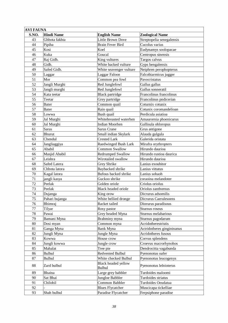
38
AVI FAUNA S.NO. Hindi Name English Name Zoological Name
43 Ghhota fakhta Little Brown Dove Streptopelia senegalensis 44 Pipiha Brain Fever Bird Cucolus varius 45 Kosi Koel Eudynamys soolopacae 46 Kuka Goucal Centropus sinensis 47 Raj Gidh. King vultures Targos calvus 48 Gidh. White backed vulture Gyps bengalensis 49 Safed Gidh. White seavenger vulture Neiphren perophopterus 50 Laggar Laggar Faloon Falcobiarmicus jugger 51 Mor Common pea fowl Pavocristatus 52 Jangli Murghi Red Junglefowl Gallus gallus 53 Jangli murghi Red Junglefowl Gallus sonneratil 54 Kata teetar Black partridge Francolinus francolinus 55 Teetar Grey partridge Francolinus pndicerian 56 Bater Common quail Coturnix cotunix 57 Bater Rain quail Cotunix coromandelioan 58 Lowwa Bush quail Perdicula asiatioa 59 Jal Murghi Whitebreasted waterhen Amaurornia phoenicurus 60 Jal Murghi Indian Moorhen Gallisula ohloropus 61 Saras Sarus Crane Grus antigone 62 Bhurut Small indian Skylark Alauda gulgula 63 Chendul Crested Lark Galerida oristata 64 Jangliaggiya Raedwinged Bush Lark Mirafra orythropters 65 Ababil Common Swallow Hirundo daurioa 66 Masjid Ababil Redrumped Swallow Hirundo rustioa daurica 67 Leishra Wirotailed swallow Hirundo daurioa 68 Safed Latera Grey Shrike Lanius exoubitor 69 Chhota latora Baybacked shrike Lanius vittatus 70 Kagal latora Bufous backed shrike Lanius sohaoh 71 jangli kasya Guckoo shrike coraoina melandoter 72 Peelak Golden oriole Criolus oriolus 73 Peelak Black headed oriole Oriolus zanthornus 74 Dujanga King orow Dicrurus adsomilis 75 Pahari bujanga White bellied dronge Dicrurus Caerulesoens 76 Bhimraj Racket tailed Diorurus paradisous 77 Tilyar Rosy pastor Sturnus roseus 78 Pawai Grey headed Myna Sturnus melabarious 79 Bamani Myna Brahminy myna Sturnus pagodarum 80 Dosi myan Common myna Acridotherestristis 81 Ganga Myna Bank Myna Actridotheres gingininanus 82 Jungli Myna Jungle Myna Acridotheres fusous 83 Kowwa House crow Corvus splendens 84 Jungli kowwa Jungle crow Croevus macrorhynohos 85 Mahalat Tree pie Dendrocitta vagabunda 86 Bulbul Redvented Bulbul Pyenonotus oafer 87 Bulbul White checked Bulbul Pyenonotus leucogenys
88 Zard bulbul Black headed yellow Bulbul Pyenonotus lelnioterus
89 Bhaina Large grey babbler Turdoides maloomi 90 Sat Bhai Jungloe Babbler Turdoides striatus 91 Chilohil Common Babbler Turdoides Oeudatua 92 - Blues Flycatcher Muscicapa tickelliae 93 Shah bulbul Paradise Flycatcher Ferpsiphone paradise
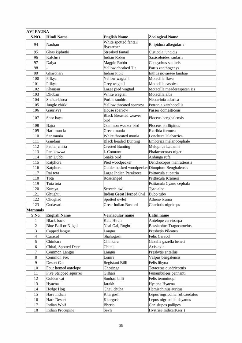
39
AVI FAUNA S.NO. Hindi Name English Name Zoological Name
94 Naohan White spotted fantail flycatcher Rhipidura albegularis
95 Ghas kiphutki Streaked fantail Cisticola juncidis 96 Kalchrri Indian Robin Saxicoloides saularis 97 Daiya Magpie Robin Copsyohus saularis 98 - Yellow cheaked Tit Parus zanthogenys 99 Gharohari Indian Pipit Inthus novaesee landiae
100 Pilkya Yellow wagtail Motacilla flava 101 Pilkya Grey wagtail Motacilla caspica 102 Khanjan Large pied wagtail Motacilla meaderaspaten sis 103 Dhoban White wagtail Motacilla alba 104 Shakarkhora Purble sunbird Nectarinia asiatica 105 Jungle chirki Yellow throated sparrow Petronia xanthocollis 106 Gauriyya House sparrow Passer domesticous
107 Shor baya Black Breasted weaver bird Ploceus benghalensis
108 Bajra Common weaker bird Ploceus phillipinus 109 Hari mun ia Green munia Extrilda formosa 110 Sar munia White throated munia Lonchura lalabarrica 111 Gandam Black headed Bunting Embcriza melanocephale 112 Pathar chirta Crested Bunting Melophus Lathami 113 Pan kowwa L.Comrant Phalacrocorax niger 114 Pan Dubbi Snake bird Anhinga rufa 115 Katphora Pied woodpecker Dendrocopos mahrattensis 116 Katphora Goldenbacked woodpecker Dinopium Benghalensis 117 Rai tota Large Indian Parakreet Psittacula eupatria 118 Tota Roseringed Psittacula Krameri 119 Tuia tota Psittacula Cyano cephala 120 Kuraya Screech owl Tyto alba 121 Ghughui Indian Great Horned Owl Bubo tubo 122 Ohoghad Spotted owlet Athene brama 123 Godavari Great Indian Bustard Choriotis nigriceps
Mammals S.No. English Name Vernacular name Latin name
1 Black buck Kala Hiran Antelope cervioarpa 2 Blue Bull or Nilgai Neal Gai, Roghri Bosslaphus Tragocamelus 3 Capped langur Langur Presbytis Pileatus 4 Caracol Shahogosh Felis Caracol 5 Chinkara Chinkara Gazella gazella beneti 6 Chital, Spotted Deer Chital Axis axia 7 Common Langur Langur Presbytis entellus 8 Common Fox Lomri Valpus bengalensis 9 Desert Cat Registani Billi Felis libyoa 10 Four homed antelope Ghosinga Tetaceras quadricornis 11 Five Stripped squirrel Gilhari Funambulees pennanti 12 Golden cat Sunhari billi Felis temminopi 13 Hyaena Jarakh Hyaena Hyaena 14 Hedge Hog Ghau chuha Hemiechinus auritus 15 Hare Indian Khargosh Lepus nigricollia ruficaudatus 16 Hare Desert Khargosh Lepus nigricollia dayanus 17 Indian Wolf Bheria Canislupos pallipes 18 Indian Procupine Sevli Hystrise Indica(Kerr.)
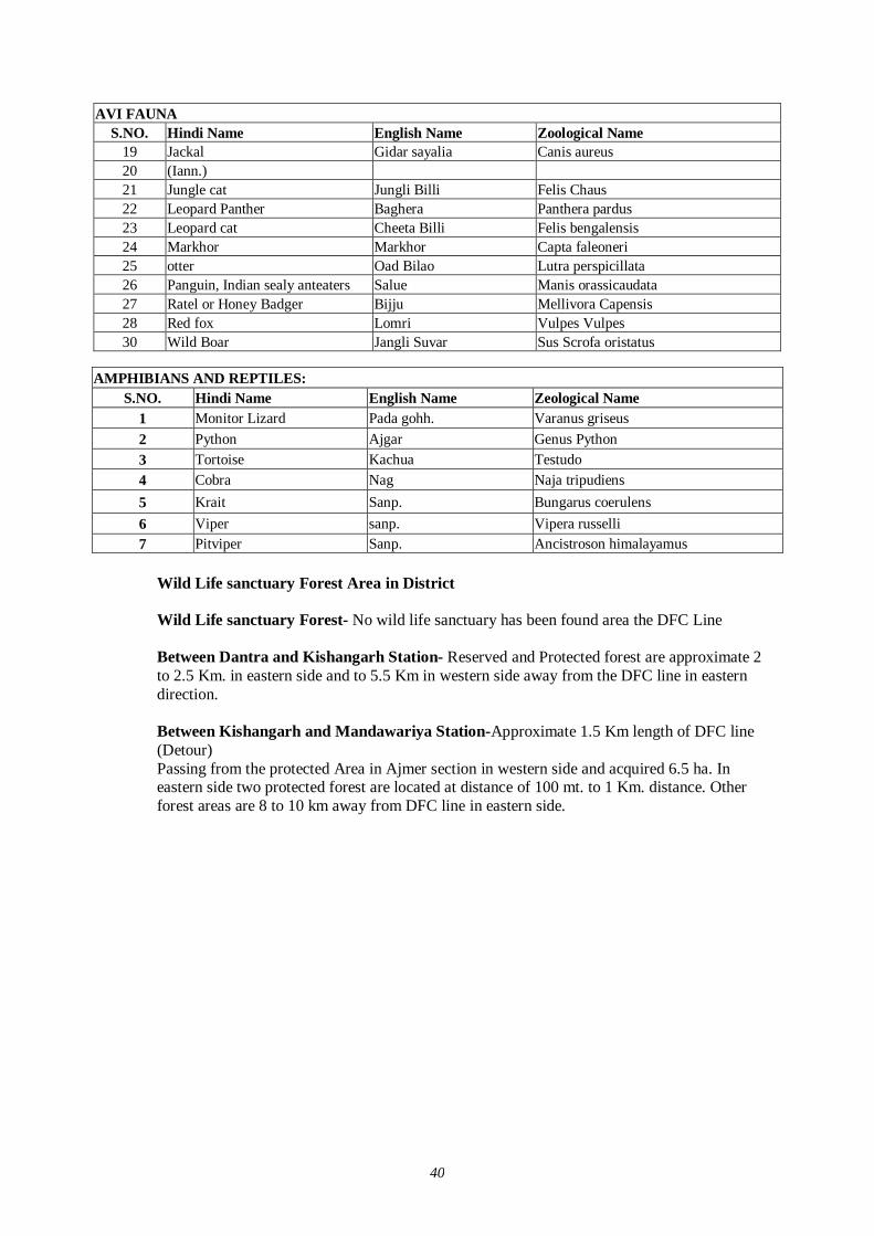
40
AVI FAUNA S.NO. Hindi Name English Name Zoological Name
19 Jackal Gidar sayalia Canis aureus 20 (Iann.) 21 Jungle cat Jungli Billi Felis Chaus 22 Leopard Panther Baghera Panthera pardus 23 Leopard cat Cheeta Billi Felis bengalensis 24 Markhor Markhor Capta faleoneri 25 otter Oad Bilao Lutra perspicillata 26 Panguin, Indian sealy anteaters Salue Manis orassicaudata 27 Ratel or Honey Badger Bijju Mellivora Capensis 28 Red fox Lomri Vulpes Vulpes 30 Wild Boar Jangli Suvar Sus Scrofa oristatus
Wild Life sanctuary Forest Area in District
Wild Life sanctuary Forest- No wild life sanctuary has been found area the DFC Line Between Dantra and Kishangarh Station- Reserved and Protected forest are approximate 2 to 2.5 Km. in eastern side and to 5.5 Km in western side away from the DFC line in eastern direction. Between Kishangarh and Mandawariya Station-Approximate 1.5 Km length of DFC line (Detour) Passing from the protected Area in Ajmer section in western side and acquired 6.5 ha. In eastern side two protected forest are located at distance of 100 mt. to 1 Km. distance. Other forest areas are 8 to 10 km away from DFC line in eastern side.
AMPHIBIANS AND REPTILES: S.NO. Hindi Name English Name Zeological Name
1 Monitor Lizard Pada gohh. Varanus griseus 2 Python Ajgar Genus Python 3 Tortoise Kachua Testudo 4 Cobra Nag Naja tripudiens 5 Krait Sanp. Bungarus coerulens 6 Viper sanp. Vipera russelli 7 Pitviper Sanp. Ancistroson himalayamus
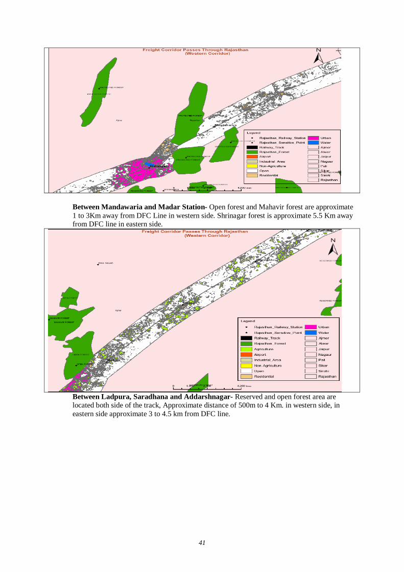
41
Between Mandawaria and Madar Station- Open forest and Mahavir forest are approximate 1 to 3Km away from DFC Line in western side. Shrinagar forest is approximate 5.5 Km away from DFC line in eastern side.
Between Ladpura, Saradhana and Addarshnagar- Reserved and open forest area are located both side of the track, Approximate distance of 500m to 4 Km. in western side, in eastern side approximate 3 to 4.5 km from DFC line.
42
Near Baewar- Protected forest are approximate 500m from DFC line in eastern side.
43
44
(3) PALI The Pali Forest Division are bounded by the various civil district of Rajasthan and Banas Kantha region of Gujrat State in the directions are mentioned below.
In the N/W these are bounded by Jodhpur and Nagaur district.
In the west by Barmer district, in the South by Banas Kantha and sirohi district, in the Norht-East by Ajmer distric and in the South-east by Udaipur district.
The trac lies in the South-Western portion of Rajasthan in Between latitudes 24037’ and 260 29’ north and longitudes 710 11’ and 740 18’ east. Thus the Whole track is covered by 57 G.T. Sheets published by Survey of India.
The total land area of the Division and the area under the forest are as follows: -
Forest Description
District Total Area Area under forest Department (sq.km) % of Forest area.
PALI 12,300 875.8 7.1 JALOR 10,565 305.7 2.9 TOTAL 22,865 1,181.5 10.0
In Sinha’s Plan total Forest area in both Pali and Jalor district was 892.2 km2. The difference of 289.3 km2. is due to following reasons: -
The following Ranges were not included in Sinha’s Plan.
Forest Range Name of Range Area in Sq.km.
a) Bijaji Ka Gura Ranga b) Sendre Range. c) Jaitaran Range
94.25 77.46 16.49
TOTAL 188.20 The above said Forest Range at that time was in Ajmer Forest division, later these were transferred in Pali Forest Division. Similarly in Bali Range 20.2 km2. had been transferred Forest department from Bera Jagir Forest. In Jalor and Pali Districts the Following areas were not included in Sinha’s Plan.
Forest Range Sl.No Name of Forest Area Area
1 Rundmal I 203 2 Rundamal II 71 3 Uchmat 1236 4 Dantwara 1042 5 Bhadrajun 145 6 Rajkiawas 214 7 Dhaneri 202 8 Meda 122 9 Tarwa 30
10 Noon 30 11 Chipparwara 238 12 Dhanpur 138 13 Santhu Chura 90 14 Dhavla 200 15 Kot Kastan 50
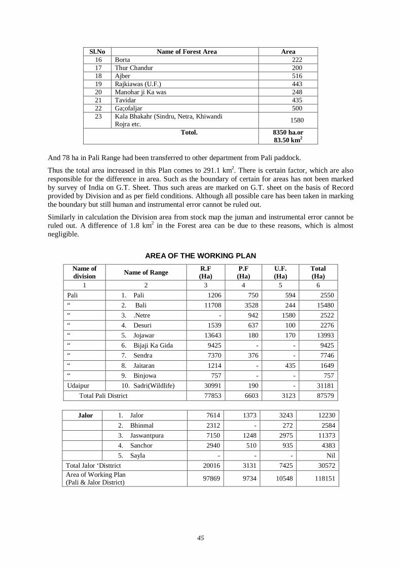
45
Sl.No Name of Forest Area Area 16 Borta 222 17 Thur Chandur 200 18 Ajber 516 19 Rajkiawas (U.F.) 443 20 Manohar ji Ka was 248 21 Tavidar 435 22 Ga;ofaljar 500 23
Kala Bhakahr (Sindru, Netra, Khiwandi Rojra etc. 1580
Totol. 8350 ha.or 83.50 km2
And 78 ha in Pali Range had been transferred to other department from Pali paddock.
Thus the total area increased in this Plan comes to 291.1 km2. There is certain factor, which are also responsible for the difference in area. Such as the boundary of certain for areas has not been marked by survey of India on G.T. Sheet. Thus such areas are marked on G.T. sheet on the basis of Record provided by Division and as per field conditions. Although all possible care has been taken in marking the boundary but still human and instrumental error cannot be ruled out.
Similarly in calculation the Division area from stock map the juman and instrumental error cannot be ruled out. A difference of 1.8 km2 in the Forest area can be due to these reasons, which is almost negligible.
AREA OF THE WORKING PLAN
Name of division Name of Range R.F
(Ha) P.F (Ha)
U.F. (Ha)
Total (Ha)
1 2 3 4 5 6 Pali 1. Pali 1206 750 594 2550 “ 2. Bali 11708 3528 244 15480 “ 3. .Netre - 942 1580 2522 “ 4. Desuri 1539 637 100 2276 “ 5. Jojawar 13643 180 170 13993 “ 6. Bijaji Ka Gida 9425 - - 9425 “ 7. Sendra 7370 376 - 7746 “ 8. Jaitaran 1214 - 435 1649 “ 9. Binjowa 757 - - 757 Udaipur 10. Sadri(Wildlife) 30991 190 - 31181
Total Pali District 77853 6603 3123 87579
Jalor 1. Jalor 7614 1373 3243 12230 2. Bhinmal 2312 - 272 2584 3. Jaswantpura 7150 1248 2975 11373 4. Sanchor 2940 510 935 4383 5. Sayla - - - Nil
Total Jalor ‘Disttrict 20016 3131 7425 30572 Area of Working Plan (Pali & Jalor District) 97869 9734 10548 118151
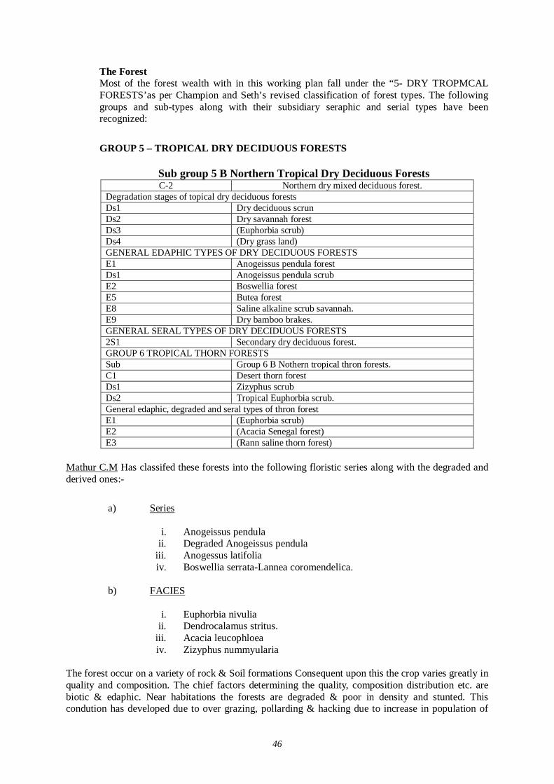
46
The Forest Most of the forest wealth with in this working plan fall under the “5- DRY TROPMCAL FORESTS’as per Champion and Seth’s revised classification of forest types. The following groups and sub-types along with their subsidiary seraphic and serial types have been recognized:
GROUP 5 – TROPICAL DRY DECIDUOUS FORESTS
Sub group 5 B Northern Tropical Dry Deciduous Forests C-2 Northern dry mixed deciduous forest.
Degradation stages of topical dry deciduous forests Ds1 Dry deciduous scrun Ds2 Dry savannah forest Ds3 (Euphorbia scrub) Ds4 (Dry grass land) GENERAL EDAPHIC TYPES OF DRY DECIDUOUS FORESTS E1 Anogeissus pendula forest Ds1 Anogeissus pendula scrub E2 Boswellia forest E5 Butea forest E8 Saline alkaline scrub savannah. E9 Dry bamboo brakes. GENERAL SERAL TYPES OF DRY DECIDUOUS FORESTS 2S1 Secondary dry deciduous forest. GROUP 6 TROPICAL THORN FORESTS Sub Group 6 B Nothern tropical thron forests. C1 Desert thorn forest Ds1 Zizyphus scrub Ds2 Tropical Euphorbia scrub. General edaphic, degraded and seral types of thron forest E1 (Euphorbia scrub) E2 (Acacia Senegal forest) E3 (Rann saline thorn forest)
Mathur C.M Has classifed these forests into the following floristic series along with the degraded and derived ones:-
a) Series
i. Anogeissus pendula ii. Degraded Anogeissus pendula
iii. Anogessus latifolia iv. Boswellia serrata-Lannea coromendelica.
b) FACIES
i. Euphorbia nivulia ii. Dendrocalamus stritus.
iii. Acacia leucophloea iv. Zizyphus nummyularia
The forest occur on a variety of rock & Soil formations Consequent upon this the crop varies greatly in quality and composition. The chief factors determining the quality, composition distribution etc. are biotic & edaphic. Near habitations the forests are degraded & poor in density and stunted. This condution has developed due to over grazing, pollarding & hacking due to increase in population of
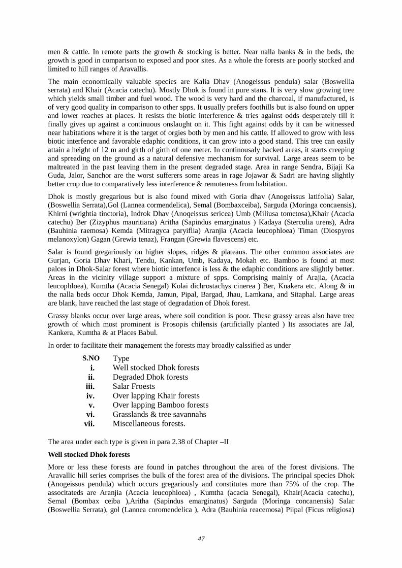
47
men & cattle. In remote parts the growth & stocking is better. Near nalla banks & in the beds, the growth is good in comparison to exposed and poor sites. As a whole the forests are poorly stocked and limited to hill ranges of Aravallis.
The main economically valuable species are Kalia Dhav (Anogeissus pendula) salar (Boswellia serrata) and Khair (Acacia catechu). Mostly Dhok is found in pure stans. It is very slow growing tree which yields small timber and fuel wood. The wood is very hard and the charcoal, if manufactured, is of very good quality in comparison to other spps. It usually prefers foothills but is also found on upper and lower reaches at places. It resists the biotic interference & tries against odds desperately till it finally gives up against a continuous onslaught on it. This fight against odds by it can be witnessed near habitations where it is the target of orgies both by men and his cattle. If allowed to grow with less biotic interfence and favorable edaphic conditions, it can grow into a good stand. This tree can easily attain a height of 12 m and girth of girth of one meter. In continousaly hacked areas, it starts creeping and spreading on the ground as a natural defensive mechanism for survival. Large areas seem to be maltreated in the past leaving them in the present degraded stage. Area in range Sendra, Bijaji Ka Guda, Jalor, Sanchor are the worst sufferers some areas in rage Jojawar & Sadri are having slightly better crop due to comparatively less interference & remoteness from habitation.
Dhok is mostly gregarious but is also found mixed with Goria dhav (Anogeissus latifolia) Salar, (Boswellia Serrata),Gol (Lannea cormendelica), Semal (Bombaxceiba), Sarguda (Moringa concaensis), Khirni (wrightia tinctoria), Indrok Dhav (Anoqeissus sericea) Umb (Miliusa tometosa),Khair (Acacia catechu) Ber (Zizyphus mauritiana) Aritha (Sapindus emarginatus ) Kadaya (Sterculia urens), Adra (Bauhinia raemosa) Kemda (Mitragyca paryiflia) Aranjia (Acacia leucophloea) Timan (Diospyros melanoxylon) Gagan (Grewia tenaz), Frangan (Grewia flavescens) etc.
Salar is found gregariously on higher slopes, ridges & plateaus. The other common associates are Gurjan, Goria Dhav Khari, Tendu, Kankan, Umb, Kadaya, Mokah etc. Bamboo is found at most palces in Dhok-Salar forest where biotic interfence is less & the edaphic conditions are slightly better. Areas in the vicinity village support a mixture of spps. Comprising mainly of Arajia, (Acacia leucophloea), Kumtha (Acacia Senegal) Kolai dichrostachys cinerea ) Ber, Knakera etc. Along & in the nalla beds occur Dhok Kemda, Jamun, Pipal, Bargad, Jhau, Lamkana, and Sitaphal. Large areas are blank, have reached the last stage of degradation of Dhok forest.
Grassy blanks occur over large areas, where soil condition is poor. These grassy areas also have tree growth of which most prominent is Prosopis chilensis (artificially planted ) Its associates are Jal, Kankera, Kumtha & at Places Babul.
In order to facilitate their management the forests may broadly calssified as under
S.NO Type i. Well stocked Dhok forests
ii. Degraded Dhok forests iii. Salar Froests iv. Over lapping Khair forests v. Over lapping Bamboo forests
vi. Grasslands & tree savannahs vii. Miscellaneous forests.
The area under each type is given in para 2.38 of Chapter –II
Well stocked Dhok forests
More or less these forests are found in patches throughout the area of the forest divisions. The Aravallic hill series comprises the bulk of the forest area of the divisions. The principal species Dhok (Anogeissus pendula) which occurs gregariously and constitutes more than 75% of the crop. The associtateds are Aranjia (Acacia leucophloea) , Kumtha (acacia Senegal), Khair(Acacia catechu), Semal (Bombax ceiba ),Aritha (Sapindus emarginatus) Sarguda (Moringa concanensis) Salar (Boswellia Serrata), gol (Lannea coromendelica ), Adra (Bauhinia reacemosa) Piipal (Ficus religiosa)

48
Bargad (Ficus bengalensis ) Kadaya (Sterculia urens), Tamboilia (Ehretia laevis), Tendu (Dicopyros melanoxylon), Bahera (terminlisa belerica) Brana (Crataeva adinsonii), Ber (Zizypus mauritians ) Dhaman (Grewia tiliaefolia), Goria Dhav (Anoqeissus Latifolia), Ghitor (Copparis horrida), Gugal (Commiphora wightii, Kolai (Dichrostachya cinererea), Nim (Azadirachta indica ), Shiordia (Holoptelia integrifolia), Kalia (Albizzia lebbek) etc.
Mesophytic associates which are found in association with Dhok are Kemda (Mitragyna, parvifolia), Jamun (Syzygium cumini), Sewan (Gmelina arhorea), Rohini. (mallotus philippinensis), Dhak (Butea monosperma), Ardub (Ailanthus excelsa), Gular (Umra) (Ficus glomerata), Imli (Tamarindus indica), Khajur (Phoenix sylvestris), Agnia (Bridelia sguamosa), Vilayati babul (Pprosopis chilensis).
The undergrowth mostly consists of Jharber (Zizyphus hummularia), Ardusa (Adhatoda vasica), Adhasisi Xanthium strumarium Dasan Rhus mysurensis), Dari (Woodfordia fruticosa Dholekan (Grewia villosa) Kadda (Holorrhena antidysantrica Gangan (Grewia tenax Frangan (Grewia flavescens), Kanter (Capparis sepiaria, Marorphali (Helicteresisora), Nagad (Vitex negundo), Salepan (Securingea leucopyrus), Sitraval (Plumbago zeylanica Thor Euphorbia nivulia) Bhuringani Solanum surattense Koli Kanda Urginea indica Murali (Lycium bardanum) etc.
The climbers rarely found are Chirmi Abrus precatorius Narkanta Asparagus dumosus Pilwan Coculus pendulus Panibel Cissus repanda Phang Rivea hypocrateriformis Palasbel (Butea superba Kalibel (Ventilago calyculate etc.In fully stocked areas grasses are generally deficient and consists of Dab (Desmostachya bipinnata Dub Cynodon dectylon Kans Saccharum spontaneum etc.
Dhok is a slow growing tree and the height varies from 3.5 to 8 m. In favourable localities like, near the riverbanks, sheltered valley, the height varies from 6 to 11 m but near habitation it is seldom more than 3 m. The diameter varies 5 to 15 cm at breast trees with 3 m clear bole are found.
The regeneration is mainly by coppice Seedling regene ration is generally deficient and on hilly areas it is totally absent. Reproduction from root suckers is also seen at places where the ground is well covered with soil.
Degraded Dhok Forest
In large areas of these divisions Dhok trees are malformed and shunted in growth. Few seattered trees growing at places indicate that the present bushy and creeping growth of Dohk is the result of continous hacking and illicit felling in the area. The trees are illicitly cut by the people and after that the growing shoots are browsed by the cattle repeatedly. This continuous maltreetment has resulted in the conversion of Dhok forests with well grown trees to the forest with Dhok growing in bushy form.
Ex-Jagir areas which were taken over after the resumption of Jagir in 1952 were clear felled by the resumption of Jagir in 1952 were felled by the Jagirdars for the greed of income without giving any thought to silvicultur requirements. All such areas new support a degraded Dhok Forest. Due to continuous exposure the side condition has also deteriorat.
These degraded forest areas of Dhok are still being subjected to continuous grazing and browsing. Some Trees put on Whaterver growth, isc also being illicitly cut by the people. As a result, the areas are getting poorer in site quality. The only solution for revival of pre- existed stage lies in taking effective soil conservation measures followed by artificial regeneration. The areas must be protected from grazing and browsing.
Ecological status: According to Forest type of India described by Champion and Sath. “This association links the Nothern and Southern Form of the day deeiduousb with thron Forest”. It is apparently an edaphic olimax because it occurs on Varioous geological Formation and on different types of soils. Since hundreds of years, it has now maintained itself and is also regenerating naturally. However Dhok has been eliminated due to repeated hacking from the hilly areas whear only bushes ofmiseellaneous spp now exit.
Soil strewn with boulders and rocky out crops may also be a limiting factor for the Dhok to establish itself. Dhokstands are also found in patches of varying extent in depressions, along nallas & on slopes.
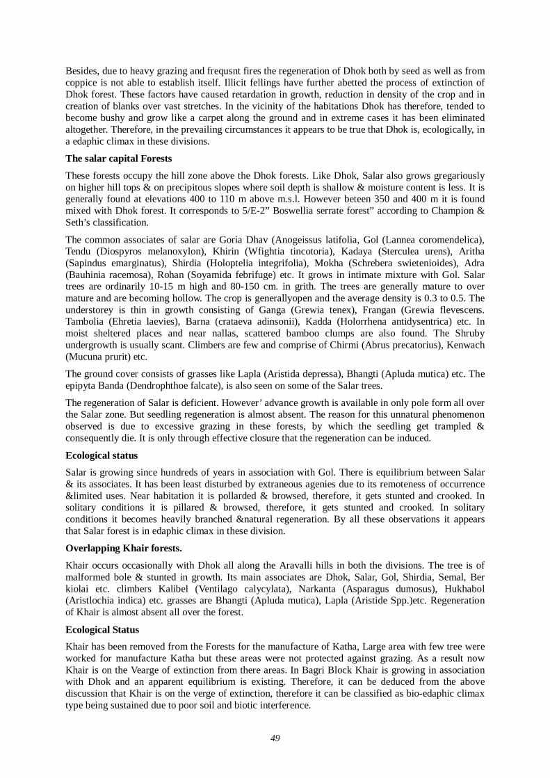
49
Besides, due to heavy grazing and frequsnt fires the regeneration of Dhok both by seed as well as from coppice is not able to establish itself. Illicit fellings have further abetted the process of extinction of Dhok forest. These factors have caused retardation in growth, reduction in density of the crop and in creation of blanks over vast stretches. In the vicinity of the habitations Dhok has therefore, tended to become bushy and grow like a carpet along the ground and in extreme cases it has been eliminated altogether. Therefore, in the prevailing circumstances it appears to be true that Dhok is, ecologically, in a edaphic climax in these divisions.
The salar capital Forests
These forests occupy the hill zone above the Dhok forests. Like Dhok, Salar also grows gregariously on higher hill tops & on precipitous slopes where soil depth is shallow & moisture content is less. It is generally found at elevations 400 to 110 m above m.s.l. However beteen 350 and 400 m it is found mixed with Dhok forest. It corresponds to 5/E-2” Boswellia serrate forest” according to Champion & Seth’s classification.
The common associates of salar are Goria Dhav (Anogeissus latifolia, Gol (Lannea coromendelica), Tendu (Diospyros melanoxylon), Khirin (Wfightia tincotoria), Kadaya (Sterculea urens), Aritha (Sapindus emarginatus), Shirdia (Holoptelia integrifolia), Mokha (Schrebera swietenioides), Adra (Bauhinia racemosa), Rohan (Soyamida febrifuge) etc. It grows in intimate mixture with Gol. Salar trees are ordinarily 10-15 m high and 80-150 cm. in grith. The trees are generally mature to over mature and are becoming hollow. The crop is generallyopen and the average density is 0.3 to 0.5. The understorey is thin in growth consisting of Ganga (Grewia tenex), Frangan (Grewia flevescens. Tambolia (Ehretia laevies), Barna (crataeva adinsonii), Kadda (Holorrhena antidysentrica) etc. In moist sheltered places and near nallas, scattered bamboo clumps are also found. The Shruby undergrowth is usually scant. Climbers are few and comprise of Chirmi (Abrus precatorius), Kenwach (Mucuna prurit) etc.
The ground cover consists of grasses like Lapla (Aristida depressa), Bhangti (Apluda mutica) etc. The epipyta Banda (Dendrophthoe falcate), is also seen on some of the Salar trees.
The regeneration of Salar is deficient. However’ advance growth is available in only pole form all over the Salar zone. But seedling regeneration is almost absent. The reason for this unnatural phenomenon observed is due to excessive grazing in these forests, by which the seedling get trampled & consequently die. It is only through effective closure that the regeneration can be induced.
Ecological status Salar is growing since hundreds of years in association with Gol. There is equilibrium between Salar & its associates. It has been least disturbed by extraneous agenies due to its remoteness of occurrence &limited uses. Near habitation it is pollarded & browsed, therefore, it gets stunted and crooked. In solitary conditions it is pillared & browsed, therefore, it gets stunted and crooked. In solitary conditions it becomes heavily branched &natural regeneration. By all these observations it appears that Salar forest is in edaphic climax in these division.
Overlapping Khair forests.
Khair occurs occasionally with Dhok all along the Aravalli hills in both the divisions. The tree is of malformed bole & stunted in growth. Its main associates are Dhok, Salar, Gol, Shirdia, Semal, Ber kiolai etc. climbers Kalibel (Ventilago calycylata), Narkanta (Asparagus dumosus), Hukhabol (Aristlochia indica) etc. grasses are Bhangti (Apluda mutica), Lapla (Aristide Spp.)etc. Regeneration of Khair is almost absent all over the forest.
Ecological Status Khair has been removed from the Forests for the manufacture of Katha, Large area with few tree were worked for manufacture Katha but these areas were not protected against grazing. As a result now Khair is on the Vearge of extinction from there areas. In Bagri Block Khair is growing in association with Dhok and an apparent equilibrium is existing. Therefore, it can be deduced from the above discussion that Khair is on the verge of extinction, therefore it can be classified as bio-edaphic climax type being sustained due to poor soil and biotic interference.
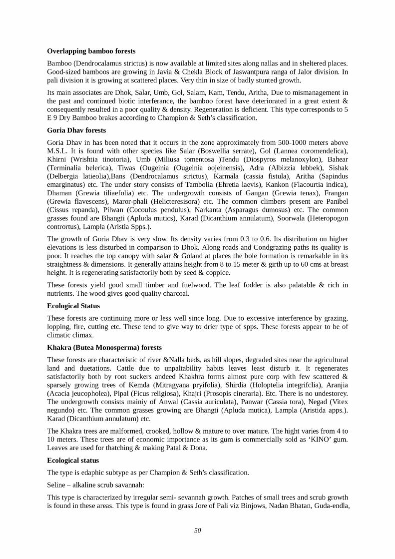
50
Overlapping bamboo forests
Bamboo (Dendrocalamus strictus) is now available at limited sites along nallas and in sheltered places. Good-sized bamboos are growing in Javia & Chekla Block of Jaswantpura ranga of Jalor division. In pali division it is growing at scattered places. Very thin in size of badly stunted growth.
Its main associates are Dhok, Salar, Umb, Gol, Salam, Kam, Tendu, Aritha, Due to mismanagement in the past and continued biotic interferance, the bamboo forest have deteriorated in a great extent & consequently resulted in a poor quality & density. Regeneration is deficient. This type corresponds to 5 E 9 Dry Bamboo brakes according to Champion & Seth’s classification.
Goria Dhav forests
Goria Dhav in has been noted that it occurs in the zone approximately from 500-1000 meters above M.S.L. It is found with other species like Salar (Boswellia serrate), Gol (Lannea coromendelica), Khirni (Wrishtia tinotoria), Umb (Miliusa tomentosa )Tendu (Diospyros melanoxylon), Bahear (Terminalia belerica), Tiwas (Ougeinia (Ougeinia oojeinensis), Adra (Albizzia lebbek), Sishak (Delbergia latieolia),Bans (Dendrocalamus strictus), Karmala (cassia fistula), Aritha (Sapindus emarginatus) etc. The under story consists of Tambolia (Ehretia laevis), Kankon (Flacourtia indica), Dhaman (Grewia tiliaefolia) etc. The undergrowth consists of Gangan (Grewia tenax), Frangan (Grewia flavescens), Maror-phali (Helicteresisora) etc. The common climbers present are Panibel (Cissus repanda), Pilwan (Cocoulus pendulus), Narkanta (Asparagus dumosus) etc. The common grasses found are Bhangti (Apluda mutics), Karad (Dicanthium annulatum), Soorwala (Heteropogon contrortus), Lampla (Aristia Spps.).
The growth of Goria Dhav is very slow. Its density varies from 0.3 to 0.6. Its distribution on higher elevations is less disturbed in comparison to Dhok. Along roads and Condgrazing paths its quality is poor. It reaches the top canopy with salar & Goland at places the bole formation is remarkable in its straightness & dimensions. It generally attains height from 8 to 15 meter & girth up to 60 cms at breast height. It is regenerating satisfactorily both by seed & coppice.
These forests yield good small timber and fuelwood. The leaf fodder is also palatable & rich in nutrients. The wood gives good quality charcoal.
Ecological Status
These forests are continuing more or less well since long. Due to excessive interference by grazing, lopping, fire, cutting etc. These tend to give way to drier type of spps. These forests appear to be of climatic climax.
Khakra (Butea Monosperma) forests
These forests are characteristic of river &Nalla beds, as hill slopes, degraded sites near the agricultural land and duetations. Cattle due to unpaltability habits leaves least disturb it. It regenerates satisfactorily both by root suckers andeed Khakhra forms almost pure corp with few scattered & sparsely growing trees of Kemda (Mitragyana pryifolia), Shirdia (Holoptelia integrifclia), Aranjia (Acacia jeucopholea), Pipal (Ficus religiosa), Khajri (Prosopis cineraria). Etc. There is no undestorey. The undergrowth consists mainiy of Anwal (Cassia auriculata), Panwar (Cassia tora), Negad (Vitex negundo) etc. The common grasses growing are Bhangti (Apluda mutica), Lampla (Aristida apps.). Karad (Dicanthium annulatum) etc.
The Khakra trees are malformed, crooked, hollow & mature to over mature. The hight varies from 4 to 10 meters. These trees are of economic importance as its gum is commercially sold as ‘KINO’ gum. Leaves are used for thatching & making Patal & Dona.
Ecological status The type is edaphic subtype as per Champion & Seth’s classification.
Seline – alkaline scrub savannah:
This type is characterized by irregular semi- sevannah growth. Patches of small trees and scrub growth is found in these areas. This type is found in grass Jore of Pali viz Binjows, Nadan Bhatan, Guda-endla,
51
Hatamitai, Jujani etc. The trees species are Khejri (Prosopid cineraria), Aranjia (Acacia leucophloes), Vilayati babul (Prosopis chilensis), Kumtha (Acacis senegal) etc. Understory consists of Hingota (Balanitus Oegyptica), Jharber (Zizyphus nummularia) etc. The undergrowth consists Jhinijni (Mimosa rubicaulis), Akda (Calotropis procera) Anwal (Cassia auriculata) etc. The climbers found are Markanta (Asperagus dumosus), Amarbel (Cuscuta reflexa), Chirmi (Abrus precatorius), Kalibal (Ventilago oalyculata) etc. The grasses found are Dhaman (Cenchrus ciliaris), Baru (Sorgbum halepense), Bhangti (Apluda mutica), Dab (Desmostachya bipinnata), Ganthia (Dactyloctenium sindium), Kans (Saccharum spontaneum), Lapla (Aricstida spps.) Rois (Cymbopogon martinil) etc.
Scattered trees are mature to over mature. In more saline areas Vilayati babul is commong up e.g. in bhawantra grass Jor.
Desert Uhorn forests
This type occurs on the periphert of Jalor, Ranjanwadi, Puran, blocks. The species growing are Kumthe (Acacia senegal). Khejri (prosopis cineraria), Aranjia (Acacia leucophloea) etc. Understorey consists of Hingota (Balanites aegyptica), Jharber (Zizyphus nummulaeia), Kankeda (Maytenus emerginata) etc. Undergrowth consists of Akda (Calotropia Procera), Kheep (Leptadenia pyrotechnoica) etc. While the ground cover consists of Panwar (Cassia tora), Dhamasa (Fagonia cretica) & (Tephrosia hurpurea) etc. The grasses are Bharut (Cenchrus barbatus) &(Ganchrus setigerus), Lapla (Ariatida spps) etc.
Ecological status
This is recognized edaphi climax as per Champion Seth’s classification of forest types.
Degraded areas
The vegetation of these areas has been discussed under the heading degraded dhok forest. There are some space habitations like Chang and Barward Block of Sendra rahge which are in wrost stage of degradation. Men and his cattle have further aggravated the gravity of Degradation. The species growing are Kumth (Acacin senegal) acacia Jaequenmotii,Jharber (Zizybhus nummularia), Gugal (Commiphora wightii), Siris (Albizzia Lobbek) etc. These areas can be restocked only through strong will, coupled with restreint on demand with respect to forest produce and grazing.
According to Divisional area statement the forest areas are summarized
S.No. 1. 2. 3. 4. 5.
Type Anogeissus pendula
Degraded A, Pendula Boswellia serrata
Miscellaneous spp. Jor Blanks area
Area in Ha. 33556 10537 14426 15074 44558
% of total area. 28.30 8.87 12.15 12.69 37.99
Forest covering Watershed of Luni River:
The forests of the Luni basin are poorly stocked have degraded miscellaneous species of Anogeissue pendula, Acacia catechu, Acacia senegal, Prospis spicigera, Acacia- arabica, and Wrightia – tinctoria. Where the ridges are precipitous, as in the Jalor block, they are bevoid of all vagetayion. On the middle slopes and lower ridges stretching down the rumels (nalas or drainage channels) degraded A. Pendula forests are found but are generally mixed with its associates. On the iower slops, Common species found are Butea monsperma, Prosppis spicigera, Zizyphus mauritiana, selvadora oleoides, S.persica Acacia leucophloea, A.arabica, and Cordia gharf. On slightly higher elevatations other species met with are Acacia senegal, Balanites aegyptica, Flacourtia indica, Ehretia laevis, Wrightia tinctoria, Moringa concanesia, Lannea cormendelica, and Zizyphus nummularia. Occasionally, Grewia sps. Are also met with.
Floral Study
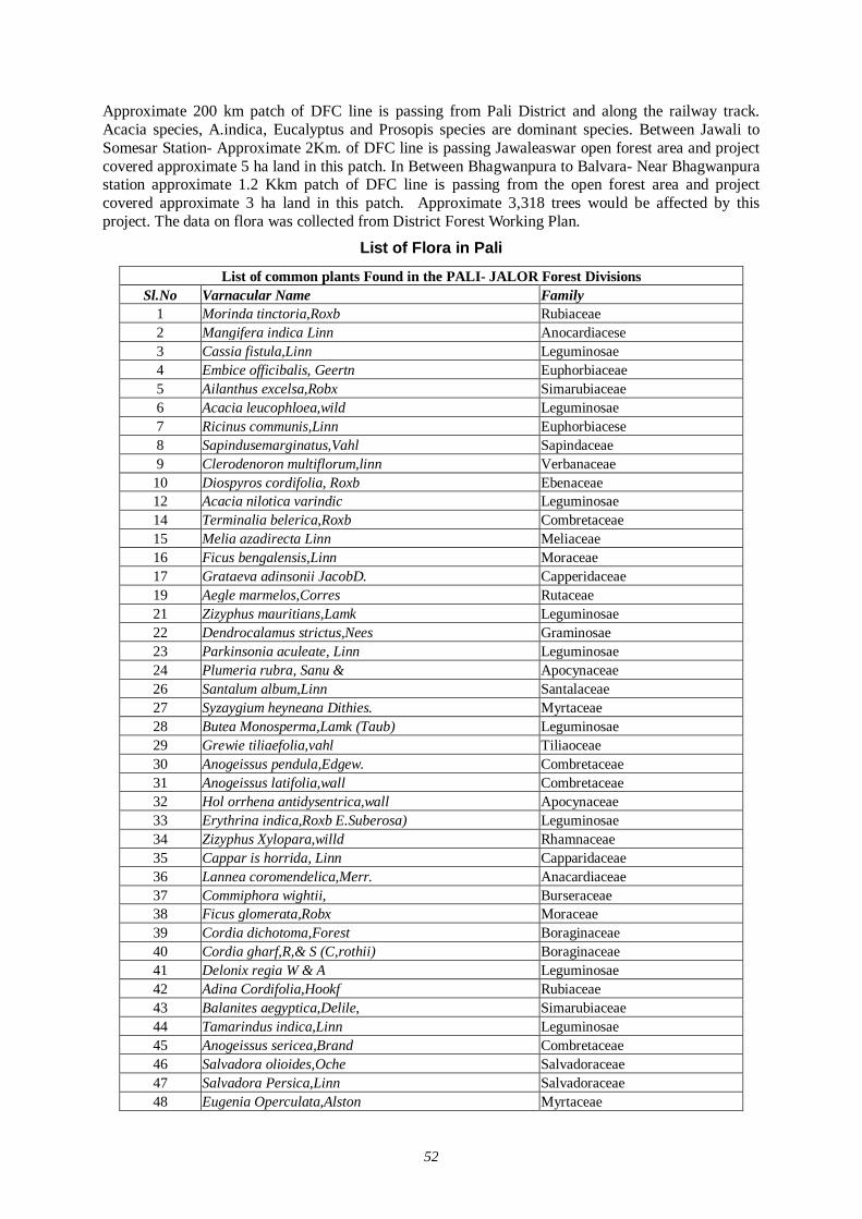
52
Approximate 200 km patch of DFC line is passing from Pali District and along the railway track. Acacia species, A.indica, Eucalyptus and Prosopis species are dominant species. Between Jawali to Somesar Station- Approximate 2Km. of DFC line is passing Jawaleaswar open forest area and project covered approximate 5 ha land in this patch. In Between Bhagwanpura to Balvara- Near Bhagwanpura station approximate 1.2 Kkm patch of DFC line is passing from the open forest area and project covered approximate 3 ha land in this patch. Approximate 3,318 trees would be affected by this project. The data on flora was collected from District Forest Working Plan.
List of Flora in Pali
List of common plants Found in the PALI- JALOR Forest Divisions Sl.No Varnacular Name Family
1 Morinda tinctoria,Roxb Rubiaceae 2 Mangifera indica Linn Anocardiacese 3 Cassia fistula,Linn Leguminosae 4 Embice officibalis, Geertn Euphorbiaceae 5 Ailanthus excelsa,Robx Simarubiaceae 6 Acacia leucophloea,wild Leguminosae 7 Ricinus communis,Linn Euphorbiacese 8 Sapindusemarginatus,Vahl Sapindaceae 9 Clerodenoron multiflorum,linn Verbanaceae 10 Diospyros cordifolia, Roxb Ebenaceae 12 Acacia nilotica varindic Leguminosae 14 Terminalia belerica,Roxb Combretaceae 15 Melia azadirecta Linn Meliaceae 16 Ficus bengalensis,Linn Moraceae 17 Grataeva adinsonii JacobD. Capperidaceae 19 Aegle marmelos,Corres Rutaceae 21 Zizyphus mauritians,Lamk Leguminosae 22 Dendrocalamus strictus,Nees Graminosae 23 Parkinsonia aculeate, Linn Leguminosae 24 Plumeria rubra, Sanu & Apocynaceae 26 Santalum album,Linn Santalaceae 27 Syzaygium heyneana Dithies. Myrtaceae 28 Butea Monosperma,Lamk (Taub) Leguminosae 29 Grewie tiliaefolia,vahl Tiliaoceae 30 Anogeissus pendula,Edgew. Combretaceae 31 Anogeissus latifolia,wall Combretaceae 32 Hol orrhena antidysentrica,wall Apocynaceae 33 Erythrina indica,Roxb E.Suberosa) Leguminosae 34 Zizyphus Xylopara,willd Rhamnaceae 35 Cappar is horrida, Linn Capparidaceae 36 Lannea coromendelica,Merr. Anacardiaceae 37 Commiphora wightii, Burseraceae 38 Ficus glomerata,Robx Moraceae 39 Cordia dichotoma,Forest Boraginaceae 40 Cordia gharf,R,& S (C,rothii) Boraginaceae 41 Delonix regia W & A Leguminosae 42 Adina Cordifolia,Hookf Rubiaceae 43 Balanites aegyptica,Delile, Simarubiaceae 44 Tamarindus indica,Linn Leguminosae 45 Anogeissus sericea,Brand Combretaceae 46 Salvadora olioides,Oche Salvadoraceae 47 Salvadora Persica,Linn Salvadoraceae 48 Eugenia Operculata,Alston Myrtaceae
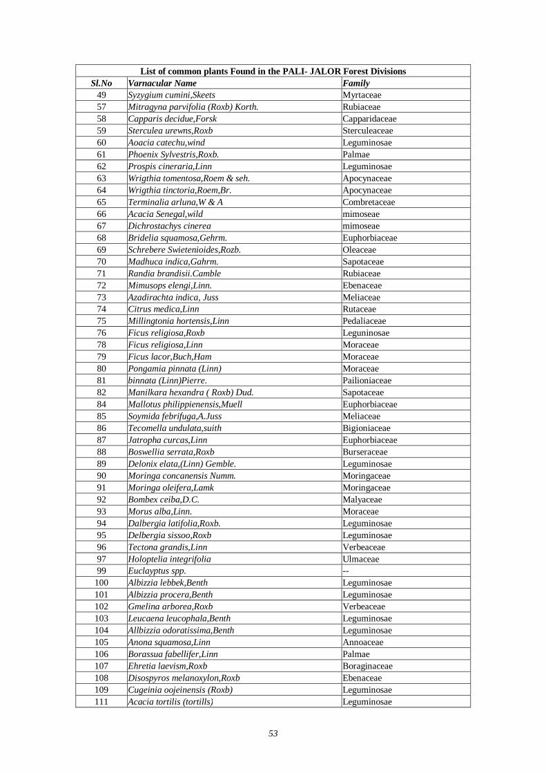
53
List of common plants Found in the PALI- JALOR Forest Divisions Sl.No Varnacular Name Family
49 Syzygium cumini,Skeets Myrtaceae 57 Mitragyna parvifolia (Roxb) Korth. Rubiaceae 58 Capparis decidue,Forsk Capparidaceae 59 Sterculea urewns,Roxb Sterculeaceae 60 Aoacia catechu,wind Leguminosae 61 Phoenix Sylvestris,Roxb. Palmae 62 Prospis cineraria,Linn Leguminosae 63 Wrigthia tomentosa,Roem & seh. Apocynaceae 64 Wrigthia tinctoria,Roem,Br. Apocynaceae 65 Terminalia arluna,W & A Combretaceae 66 Acacia Senegal,wild mimoseae 67 Dichrostachys cinerea mimoseae 68 Bridelia squamosa,Gehrm. Euphorbiaceae 69 Schrebere Swietenioides,Rozb. Oleaceae 70 Madhuca indica,Gahrm. Sapotaceae 71 Randia brandisii.Camble Rubiaceae 72 Mimusops elengi,Linn. Ebenaceae 73 Azadirachta indica, Juss Meliaceae 74 Citrus medica,Linn Rutaceae 75 Millingtonia hortensis,Linn Pedaliaceae 76 Ficus religiosa,Roxb Leguninosae 78 Ficus religiosa,Linn Moraceae 79 Ficus lacor,Buch,Ham Moraceae 80 Pongamia pinnata (Linn) Moraceae 81 binnata (Linn)Pierre. Pailioniaceae 82 Manilkara hexandra ( Roxb) Dud. Sapotaceae 84 Mallotus philippienensis,Muell Euphorbiaceae 85 Soymida febrifuga,A.Juss Meliaceae 86 Tecomella undulata,suith Bigioniaceae 87 Jatropha curcas,Linn Euphorbiaceae 88 Boswellia serrata,Roxb Burseraceae 89 Delonix elata,(Linn) Gemble. Leguminosae 90 Moringa concanensis Numm. Moringaceae 91 Moringa oleifera,Lamk Moringaceae 92 Bombex ceiba,D.C. Malyaceae 93 Morus alba,Linn. Moraceae 94 Dalbergia latifolia,Roxb. Leguminosae 95 Delbergia sissoo,Roxb Leguminosae 96 Tectona grandis,Linn Verbeaceae 97 Holoptelia integrifolia Ulmaceae 99 Euclayptus spp. --
100 Albizzia lebbek,Benth Leguminosae 101 Albizzia procera,Benth Leguminosae 102 Gmelina arborea,Roxb Verbeaceae 103 Leucaena leucophala,Benth Leguminosae 104 Allbizzia odoratissima,Benth Leguminosae 105 Anona squamosa,Linn Annoaceae 106 Borassua fabellifer,Linn Palmae 107 Ehretia laevism,Roxb Boraginaceae 108 Disospyros melanoxylon,Roxb Ebenaceae 109 Cugeinia oojeinensis (Roxb) Leguminosae 111 Acacia tortilis (tortills) Leguminosae
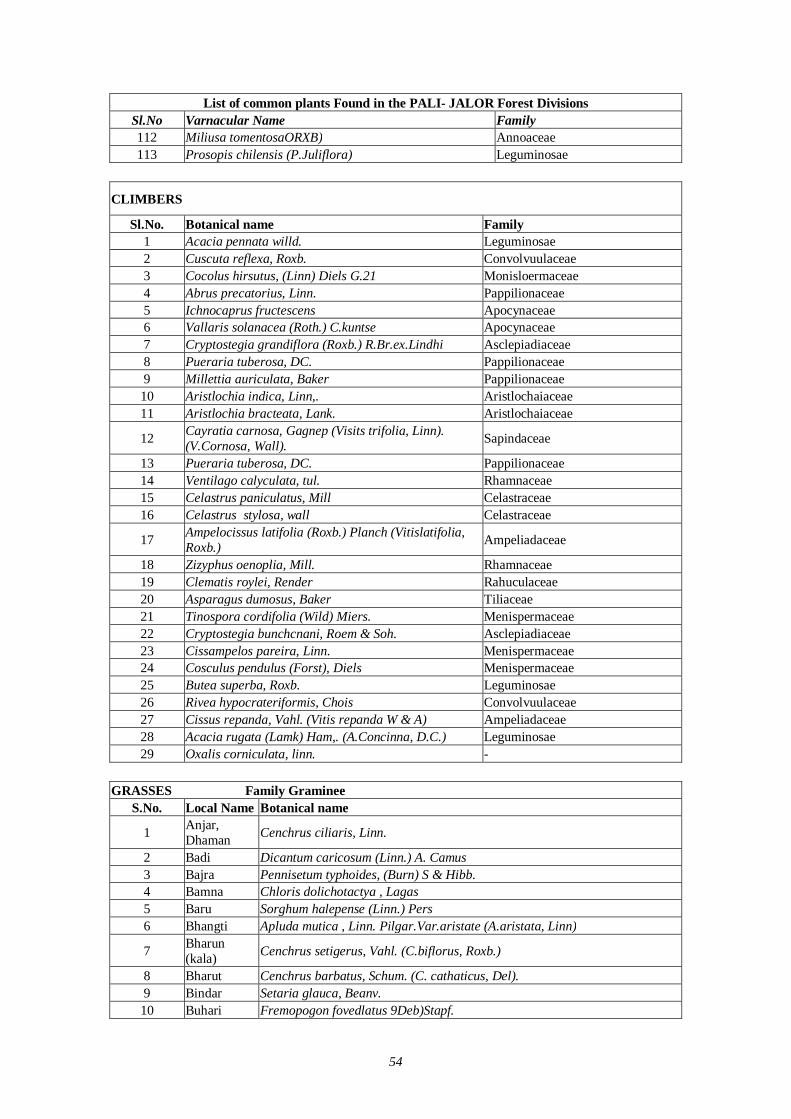
54
List of common plants Found in the PALI- JALOR Forest Divisions Sl.No Varnacular Name Family 112 Miliusa tomentosaORXB) Annoaceae 113 Prosopis chilensis (P.Juliflora) Leguminosae
CLIMBERS
Sl.No. Botanical name Family 1 Acacia pennata willd. Leguminosae 2 Cuscuta reflexa, Roxb. Convolvuulaceae 3 Cocolus hirsutus, (Linn) Diels G.21 Monisloermaceae 4 Abrus precatorius, Linn. Pappilionaceae 5 Ichnocaprus fructescens Apocynaceae 6 Vallaris solanacea (Roth.) C.kuntse Apocynaceae 7 Cryptostegia grandiflora (Roxb.) R.Br.ex.Lindhi Asclepiadiaceae 8 Pueraria tuberosa, DC. Pappilionaceae 9 Millettia auriculata, Baker Pappilionaceae 10 Aristlochia indica, Linn,. Aristlochaiaceae 11 Aristlochia bracteata, Lank. Aristlochaiaceae
12 Cayratia carnosa, Gagnep (Visits trifolia, Linn). (V.Cornosa, Wall). Sapindaceae
13 Pueraria tuberosa, DC. Pappilionaceae 14 Ventilago calyculata, tul. Rhamnaceae 15 Celastrus paniculatus, Mill Celastraceae 16 Celastrus stylosa, wall Celastraceae
17 Ampelocissus latifolia (Roxb.) Planch (Vitislatifolia, Roxb.) Ampeliadaceae
18 Zizyphus oenoplia, Mill. Rhamnaceae 19 Clematis roylei, Render Rahuculaceae 20 Asparagus dumosus, Baker Tiliaceae 21 Tinospora cordifolia (Wild) Miers. Menispermaceae 22 Cryptostegia bunchcnani, Roem & Soh. Asclepiadiaceae 23 Cissampelos pareira, Linn. Menispermaceae 24 Cosculus pendulus (Forst), Diels Menispermaceae 25 Butea superba, Roxb. Leguminosae 26 Rivea hypocrateriformis, Chois Convolvuulaceae 27 Cissus repanda, Vahl. (Vitis repanda W & A) Ampeliadaceae 28 Acacia rugata (Lamk) Ham,. (A.Concinna, D.C.) Leguminosae 29 Oxalis corniculata, linn. -
GRASSES Family Graminee
S.No. Local Name Botanical name
1 Anjar, Dhaman Cenchrus ciliaris, Linn.
2 Badi Dicantum caricosum (Linn.) A. Camus 3 Bajra Pennisetum typhoides, (Burn) S & Hibb. 4 Bamna Chloris dolichotactya , Lagas 5 Baru Sorghum halepense (Linn.) Pers 6 Bhangti Apluda mutica , Linn. Pilgar.Var.aristate (A.aristata, Linn)
7 Bharun (kala) Cenchrus setigerus, Vahl. (C.biflorus, Roxb.)
8 Bharut Cenchrus barbatus, Schum. (C. cathaticus, Del). 9 Bindar Setaria glauca, Beanv. 10 Buhari Fremopogon fovedlatus 9Deb)Stapf.
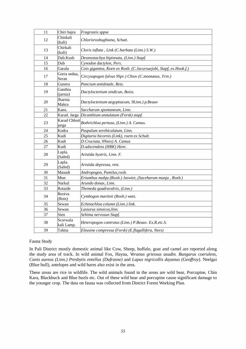
55
11 Chiri bajra Fragrostis sppse
12 Chinkali (kali) Chlorisroxbughiana, Schutt.
13 Chirkali (kali) Cloris inflata , Link (C.barbata (Linn.) S.W.)
14 Dab.Kush Desmostachya bipinnata, (Linn.) Stapf. 15 Dub Cynodon dactylon, Pers. 16 Garalu Coix gigantea, Koen ex Roxb. (C.Jacursuejobi, Stapf, ex.Hook.f.)
17 Goria sedua, Seran Circysopogon fulvus 9Spr.) Chiov (C.montanus, Trin.)
18 Gunera Pancium antidotale, Retz.
19 Ganthia (jarnia) Dactyloctenium sindicun, Boiss.
20 Jharnia Makra Dactyloctenium aegyptiacum, 9Linn.) p.Beauv
21 Kans. Saccharum spontaneum, Linn. 22 Karad. Jarga Dicanthium annulatum (Forsk) stapf.
23 Karad Chhoti jarga Bothrichloa pertusa, (Linn.) A. Camus.
24 Kodra Paspalum serebiculatum, Linn. 25 Kudi Digitaria bicornis (Link), roem ex Schult. 26 Kudi D.Cruciata, 9Nees) A. Camus 27 Kudi D.adscendens (HBK) Henr.
28 Lapla. (Safed) Aristida hystrix, Linn. F.
29 Lapla. (Safed) Aristida depressa, retz.
30 Masudi Andropogon, Pumilus,roxb. 31 Mun Erianthus muhja (Roxb.) Jaswiet, (Saceharum munja , Roxb.) 32 Narkul Arundo donax, Linn. 33 Rotaide Themeda quadravalvis, (Linn.)
34 Reoiva (Rois) Cymbogon martinii (Roxb.) wats.
35 Sewan Echinochloa column (Linn.) link. 36 Sewan Lasiurus sinoicus,linn. 37 Sien Sehima nervosun Stapf.
38 Scorwala kali Lamp. Heteropogon controtus (Linn.) P.Beauv. Ex.R.etc.S.
39 Taktia Eleusine compressa (Forsk) (E.flagallifera, Nees) Fauna Study
In Pali District mostly domestic animal like Cow, Sheep, buffalo, goat and camel are reported along the study area of track. In wild animal Fox, Hayna, Veranus griessus asudin. Bungarus coerulens, Canis aureus (Linn.) Presbytis entellus (Dufrasne) and Lapus nigricollis dayanus (Geoffroy). Neelgai (Blue bull), antelopes and wild hares also exist in the area.
These areas are rice in wildlife. The wild animals found in the areas are wild bear, Porcupine, Chin Kara, Blackbuck and Blue buzls etc. Out of these wild bear and porcupine cause significant damage to the younger crop. The data on fauna was collected from District Forest Working Plan.
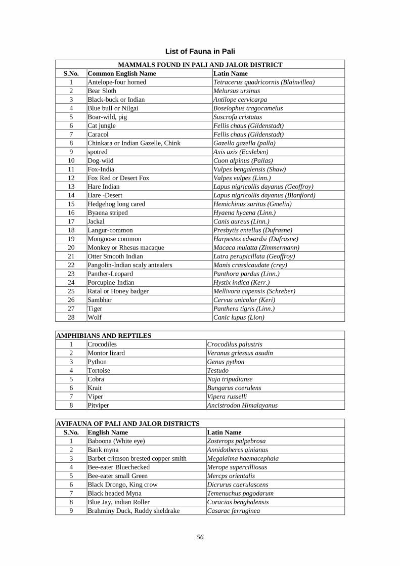
56
List of Fauna in Pali
MAMMALS FOUND IN PALI AND JALOR DISTRICT S.No. Common English Name Latin Name
1 Antelope-four horned Tetracerus quadricornis (Blainvillea) 2 Bear Sloth Melursus ursinus 3 Black-buck or Indian Antilope cervicarpa 4 Blue bull or Nilgai Boselophus tragocamelus 5 Boar-wild, pig Suscrofa cristatus 6 Cat jungle Fellis chaus (Gildenstadt) 7 Caracol Fellis chaus (Gildenstadt) 8 Chinkara or Indian Gazelle, Chink Gazella gazella (palla) 9 spotred Axis axis (Ecxleben)
10 Dog-wild Cuon alpinus (Pallas) 11 Fox-India Vulpes bengalensis (Shaw) 12 Fox Red or Desert Fox Valpes vulpes (Linn.) 13 Hare Indian Lapus nigricollis dayanus (Geoffroy) 14 Hare -Desert Lapus nigricollis dayanus (Blanflord) 15 Hedgehog long cared Hemichinus suritus (Gmelin) 16 Byaena striped Hyaena hyaena (Linn.) 17 Jackal Canis aureus (Linn.) 18 Langur-common Presbytis entellus (Dufrasne) 19 Mongoose common Harpestes edwardsi (Dufrasne) 20 Monkey or Rhesus macaque Macaca mulatta (Zimmermann) 21 Otter Smooth Indian Lutra perupicillata (Geoffroy) 22 Pangolin-Indian scaly antealers Manis crassicaudate (crey) 23 Panther-Leopard Panthora pardus (Linn.) 24 Porcupine-Indian Hystix indica (Kerr.) 25 Ratal or Honey badger Mellivora capensis (Schreber) 26 Sambhar Cervus unicolor (Keri) 27 Tiger Panthera tigris (Linn.) 28 Wolf Canic lupus (Lion)
AMPHIBIANS AND REPTILES
1 Crocodiles Crocodilus palustris 2 Montor lizard Veranus griessus asudin 3 Python Genus python 4 Tortoise Testudo 5 Cobra Naja tripudianse 6 Krait Bungarus coerulens 7 Viper Vipera russelli 8 Pitviper Ancistrodon Himalayanus
AVIFAUNA OF PALI AND JALOR DISTRICTS
S.No. English Name Latin Name 1 Baboona (White eye) Zosterops palpebrosa 2 Bank myna Annidotheres ginianus 3 Barbet crimson brested copper smith Megalaima haemacephala 4 Bee-eater Bluechecked Merope supercilliosus 5 Bee-eater small Green Mercps orientalis 6 Black Drongo, King crow Dicrurus caerulascens 7 Black headed Myna Temenuchus pagodarum 8 Blue Jay, indian Roller Coracias benghalensis 9 Brahminy Duck, Ruddy sheldrake Casarac ferruginea
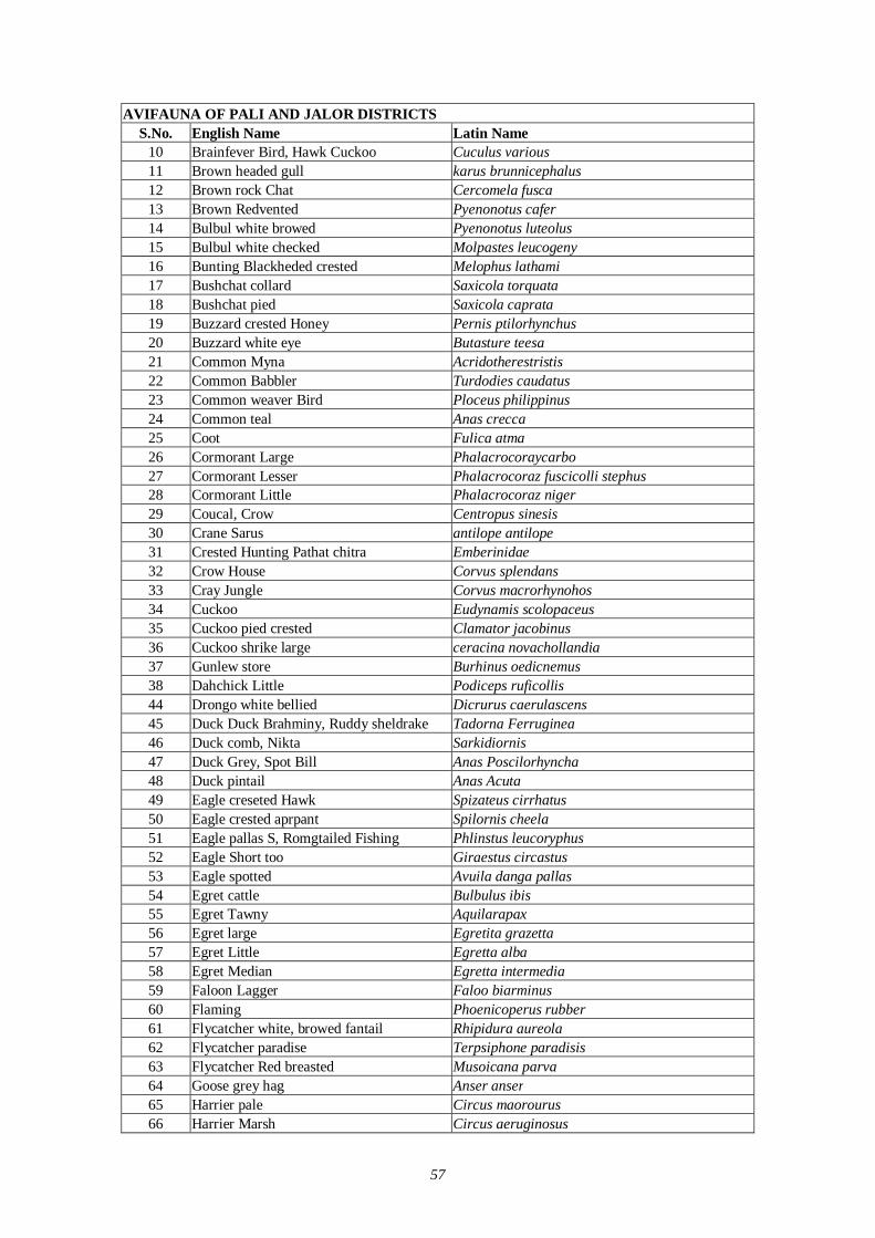
57
AVIFAUNA OF PALI AND JALOR DISTRICTS S.No. English Name Latin Name
10 Brainfever Bird, Hawk Cuckoo Cuculus various 11 Brown headed gull karus brunnicephalus 12 Brown rock Chat Cercomela fusca 13 Brown Redvented Pyenonotus cafer 14 Bulbul white browed Pyenonotus luteolus 15 Bulbul white checked Molpastes leucogeny 16 Bunting Blackheded crested Melophus lathami 17 Bushchat collard Saxicola torquata 18 Bushchat pied Saxicola caprata 19 Buzzard crested Honey Pernis ptilorhynchus 20 Buzzard white eye Butasture teesa 21 Common Myna Acridotherestristis 22 Common Babbler Turdodies caudatus 23 Common weaver Bird Ploceus philippinus 24 Common teal Anas crecca 25 Coot Fulica atma 26 Cormorant Large Phalacrocoraycarbo 27 Cormorant Lesser Phalacrocoraz fuscicolli stephus 28 Cormorant Little Phalacrocoraz niger 29 Coucal, Crow Centropus sinesis 30 Crane Sarus antilope antilope 31 Crested Hunting Pathat chitra Emberinidae 32 Crow House Corvus splendans 33 Cray Jungle Corvus macrorhynohos 34 Cuckoo Eudynamis scolopaceus 35 Cuckoo pied crested Clamator jacobinus 36 Cuckoo shrike large ceracina novachollandia 37 Gunlew store Burhinus oedicnemus 38 Dahchick Little Podiceps ruficollis 44 Drongo white bellied Dicrurus caerulascens 45 Duck Duck Brahminy, Ruddy sheldrake Tadorna Ferruginea 46 Duck comb, Nikta Sarkidiornis 47 Duck Grey, Spot Bill Anas Poscilorhyncha 48 Duck pintail Anas Acuta 49 Eagle creseted Hawk Spizateus cirrhatus 50 Eagle crested aprpant Spilornis cheela 51 Eagle pallas S, Romgtailed Fishing Phlinstus leucoryphus 52 Eagle Short too Giraestus circastus 53 Eagle spotted Avuila danga pallas 54 Egret cattle Bulbulus ibis 55 Egret Tawny Aquilarapax 56 Egret large Egretita grazetta 57 Egret Little Egretta alba 58 Egret Median Egretta intermedia 59 Faloon Lagger Faloo biarminus 60 Flaming Phoenicoperus rubber 61 Flycatcher white, browed fantail Rhipidura aureola 62 Flycatcher paradise Terpsiphone paradisis 63 Flycatcher Red breasted Musoicana parva 64 Goose grey hag Anser anser 65 Harrier pale Circus maorourus 66 Harrier Marsh Circus aeruginosus
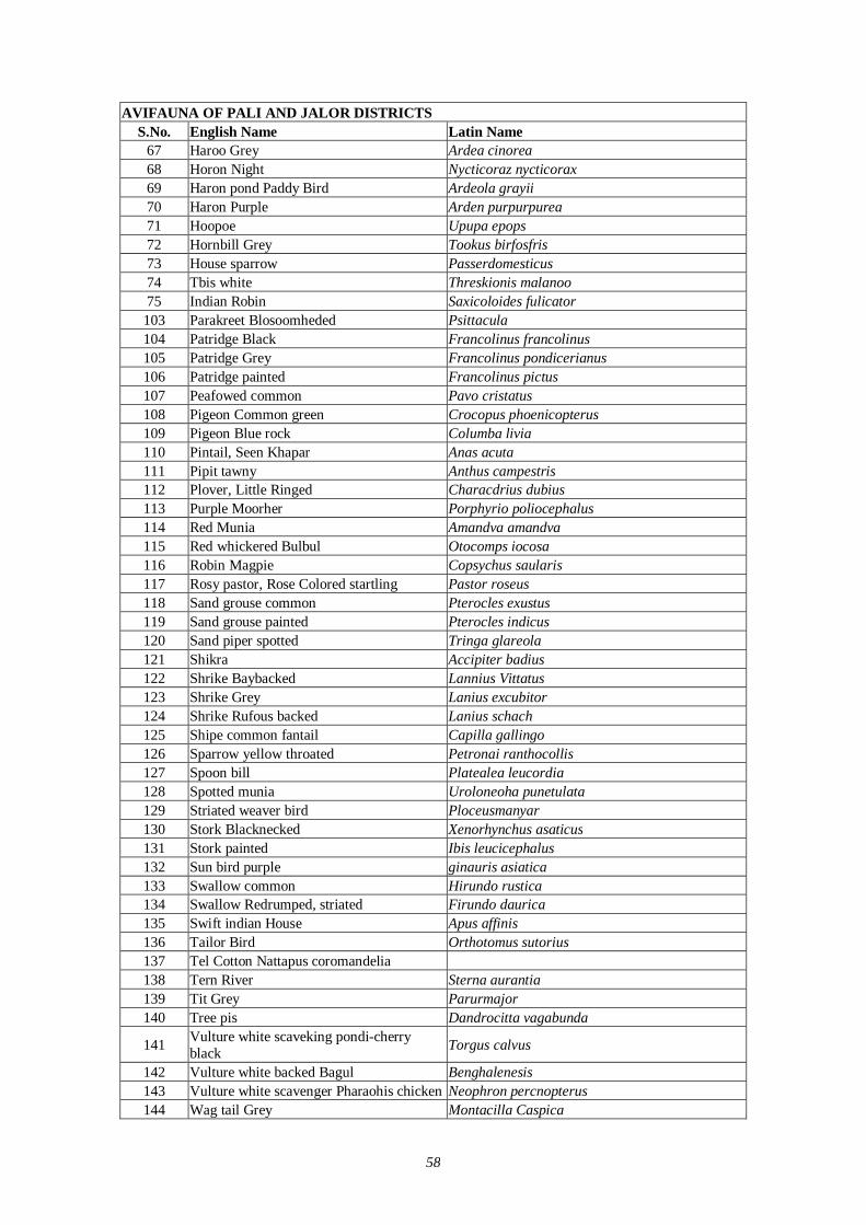
58
AVIFAUNA OF PALI AND JALOR DISTRICTS S.No. English Name Latin Name
67 Haroo Grey Ardea cinorea 68 Horon Night Nycticoraz nycticorax 69 Haron pond Paddy Bird Ardeola grayii 70 Haron Purple Arden purpurpurea 71 Hoopoe Upupa epops 72 Hornbill Grey Tookus birfosfris 73 House sparrow Passerdomesticus 74 Tbis white Threskionis malanoo 75 Indian Robin Saxicoloides fulicator 103 Parakreet Blosoomheded Psittacula 104 Patridge Black Francolinus francolinus 105 Patridge Grey Francolinus pondicerianus 106 Patridge painted Francolinus pictus 107 Peafowed common Pavo cristatus 108 Pigeon Common green Crocopus phoenicopterus 109 Pigeon Blue rock Columba livia 110 Pintail, Seen Khapar Anas acuta 111 Pipit tawny Anthus campestris 112 Plover, Little Ringed Characdrius dubius 113 Purple Moorher Porphyrio poliocephalus 114 Red Munia Amandva amandva 115 Red whickered Bulbul Otocomps iocosa 116 Robin Magpie Copsychus saularis 117 Rosy pastor, Rose Colored startling Pastor roseus 118 Sand grouse common Pterocles exustus 119 Sand grouse painted Pterocles indicus 120 Sand piper spotted Tringa glareola 121 Shikra Accipiter badius 122 Shrike Baybacked Lannius Vittatus 123 Shrike Grey Lanius excubitor 124 Shrike Rufous backed Lanius schach 125 Shipe common fantail Capilla gallingo 126 Sparrow yellow throated Petronai ranthocollis 127 Spoon bill Platealea leucordia 128 Spotted munia Uroloneoha punetulata 129 Striated weaver bird Ploceusmanyar 130 Stork Blacknecked Xenorhynchus asaticus 131 Stork painted Ibis leucicephalus 132 Sun bird purple ginauris asiatica 133 Swallow common Hirundo rustica 134 Swallow Redrumped, striated Firundo daurica 135 Swift indian House Apus affinis 136 Tailor Bird Orthotomus sutorius 137 Tel Cotton Nattapus coromandelia 138 Tern River Sterna aurantia 139 Tit Grey Parurmajor 140 Tree pis Dandrocitta vagabunda
141 Vulture white scaveking pondi-cherry black Torgus calvus
142 Vulture white backed Bagul Benghalenesis 143 Vulture white scavenger Pharaohis chicken Neophron percnopterus 144 Wag tail Grey Montacilla Caspica
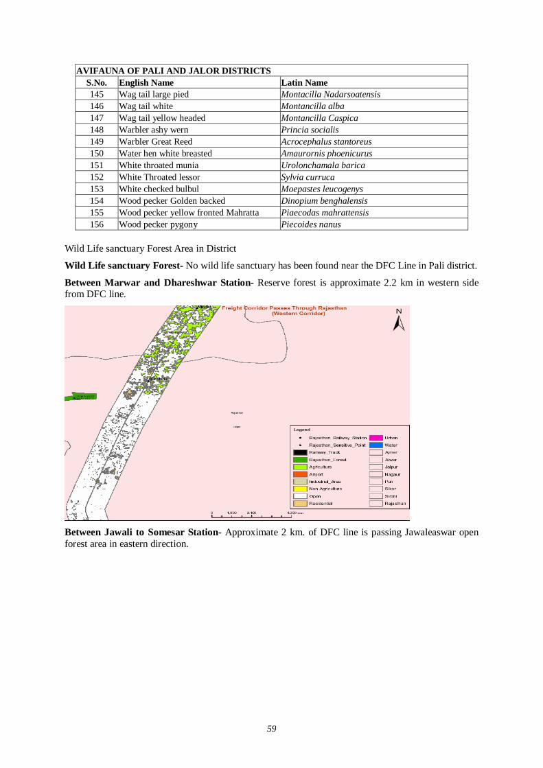
59
AVIFAUNA OF PALI AND JALOR DISTRICTS S.No. English Name Latin Name 145 Wag tail large pied Montacilla Nadarsoatensis 146 Wag tail white Montancilla alba 147 Wag tail yellow headed Montancilla Caspica 148 Warbler ashy wern Princia socialis 149 Warbler Great Reed Acrocephalus stantoreus 150 Water hen white breasted Amaurornis phoenicurus 151 White throated munia Urolonchamala barica 152 White Throated lessor Sylvia curruca 153 White checked bulbul Moepastes leucogenys 154 Wood pecker Golden backed Dinopium benghalensis 155 Wood pecker yellow fronted Mahratta Piaecodas mahrattensis 156 Wood pecker pygony Piecoides nanus
Wild Life sanctuary Forest Area in District
Wild Life sanctuary Forest- No wild life sanctuary has been found near the DFC Line in Pali district.
Between Marwar and Dhareshwar Station- Reserve forest is approximate 2.2 km in western side from DFC line.
Between Jawali to Somesar Station- Approximate 2 km. of DFC line is passing Jawaleaswar open forest area in eastern direction.
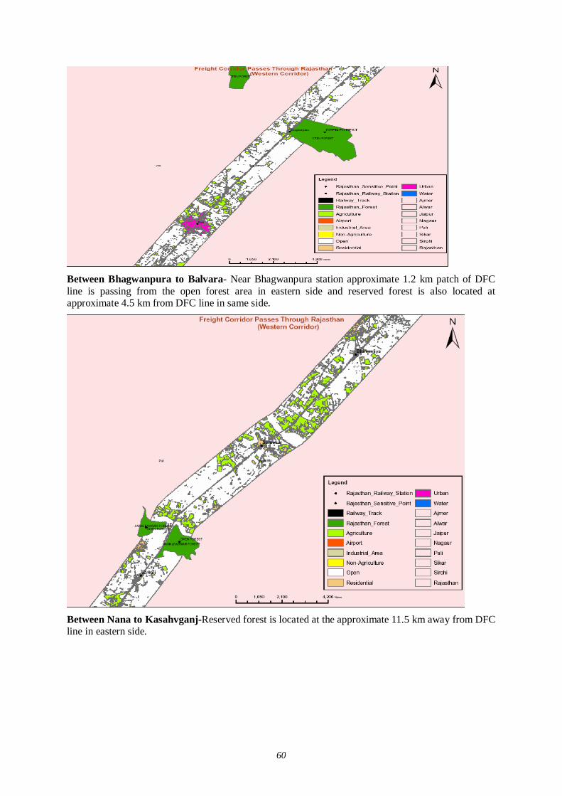
60
Between Bhagwanpura to Balvara- Near Bhagwanpura station approximate 1.2 km patch of DFC line is passing from the open forest area in eastern side and reserved forest is also located at approximate 4.5 km from DFC line in same side.
Between Nana to Kasahvganj-Reserved forest is located at the approximate 11.5 km away from DFC line in eastern side.
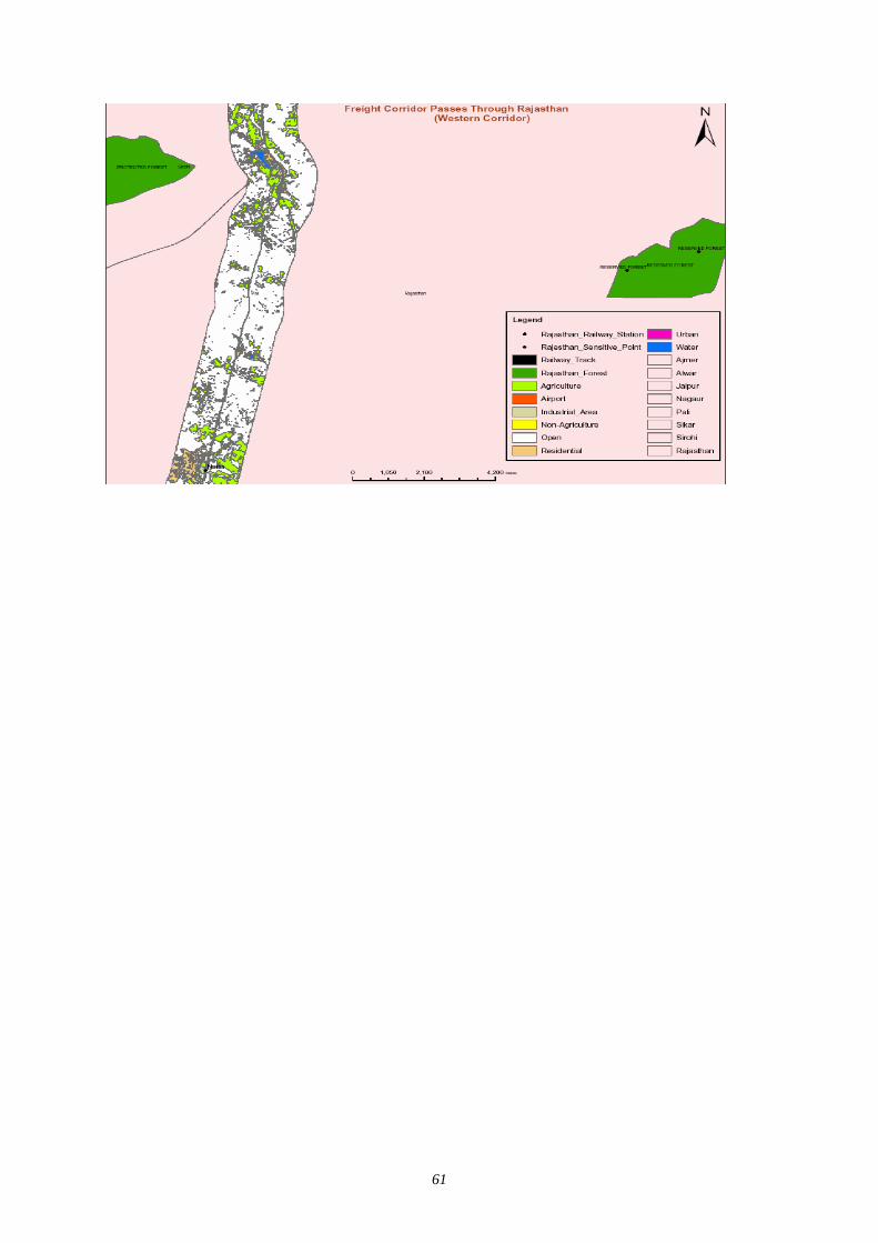
61
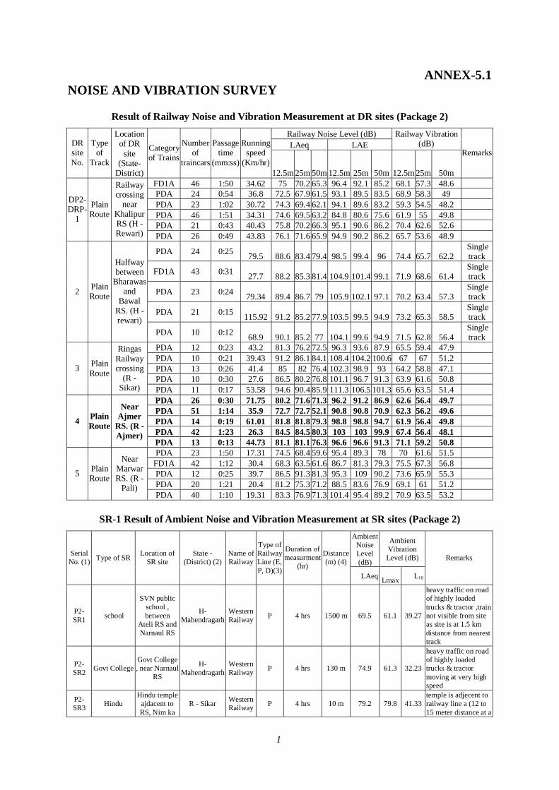
1
ANNEX-5.1 NOISE AND VIBRATION SURVEY
Result of Railway Noise and Vibration Measurement at DR sites (Package 2) Railway Noise Level (dB) LAeq LAE
Railway Vibration (dB) DR
site No.
Type of
Track
Location of DR
site (State-
District)
Category of Trains
Number of
traincars
Passage time
(mm:ss)
Running speed
(Km/hr) 12.5m 25m 50m 12.5m 25m 50m 12.5m 25m 50m
Remarks
FD1A 46 1:50 34.62 75 70.2 65.3 96.4 92.1 85.2 68.1 57.3 48.6 PDA 24 0:54 36.8 72.5 67.9 61.5 93.1 89.5 83.5 68.9 58.3 49 PDA 23 1:02 30.72 74.3 69.4 62.1 94.1 89.6 83.2 59.3 54.5 48.2 PDA 46 1:51 34.31 74.6 69.5 63.2 84.8 80.6 75.6 61.9 55 49.8 PDA 21 0:43 40.43 75.8 70.2 66.3 95.1 90.6 86.2 70.4 62.6 52.6
DP2-DRP-
1
Plain Route
Railway crossing
near Khalipur RS (H -Rewari) PDA 26 0:49 43.83 76.1 71.6 65.9 94.9 90.2 86.2 65.7 53.6 48.9
PDA 24 0:25 79.5 88.6 83.4 79.4 98.5 99.4 96 74.4 65.7 62.2 Single track
FD1A 43 0:31 27.7 88.2 85.3 81.4 104.9 101.4 99.1 71.9 68.6 61.4 Single track
PDA 23 0:24 79.34 89.4 86.7 79 105.9 102.1 97.1 70.2 63.4 57.3 Single track
PDA 21 0:15 115.92 91.2 85.2 77.9 103.5 99.5 94.9 73.2 65.3 58.5 Single track
2 Plain Route
Halfway between
Bharawas and
Bawal RS. (H -rewari)
PDA 10 0:12 68.9 90.1 85.2 77 104.1 99.6 94.9 71.5 62.8 56.4 Single track
PDA 12 0:23 43.2 81.3 76.2 72.5 96.3 93.6 87.9 65.5 59.4 47.9 PDA 10 0:21 39.43 91.2 86.1 84.1 108.4 104.2 100.6 67 67 51.2 PDA 13 0:26 41.4 85 82 76.4 102.3 98.9 93 64.2 58.8 47.1 PDA 10 0:30 27.6 86.5 80.2 76.8 101.1 96.7 91.3 63.9 61.6 50.8
3 Plain Route
Ringas Railway crossing
(R - Sikar) PDA 11 0:17 53.58 94.6 90.4 85.9 111.3 106.5 101.3 65.6 63.5 51.4
PDA 26 0:30 71.75 80.2 71.6 71.3 96.2 91.2 86.9 62.6 56.4 49.7 PDA 51 1:14 35.9 72.7 72.7 52.1 90.8 90.8 70.9 62.3 56.2 49.6 PDA 14 0:19 61.01 81.8 81.8 79.3 98.8 98.8 94.7 61.9 56.4 49.8 PDA 42 1:23 26.3 84.5 84.5 80.3 103 103 99.9 67.4 56.4 48.1
4 Plain Route
Near Ajmer
RS. (R -Ajmer)
PDA 13 0:13 44.73 81.1 81.1 76.3 96.6 96.6 91.3 71.1 59.2 50.8 PDA 23 1:50 17.31 74.5 68.4 59.6 95.4 89.3 78 70 61.6 51.5
FD1A 42 1:12 30.4 68.3 63.5 61.6 86.7 81.3 79.3 75.5 67.3 56.8 PDA 12 0:25 39.7 86.5 91.3 81.3 95.3 109 90.2 73.6 65.9 55.3 PDA 20 1:21 20.4 81.2 75.3 71.2 88.5 83.6 76.9 69.1 61 51.2
5 Plain Route
Near Marwar RS. (R -
Pali) PDA 40 1:10 19.31 83.3 76.9 71.3 101.4 95.4 89.2 70.9 63.5 53.2
SR-1 Result of Ambient Noise and Vibration Measurement at SR sites (Package 2)
Ambient Noise Level (dB)
Ambient Vibration Level (dB) Serial
No. (1) Type of SR Location of SR site
State -(District) (2)
Name of Railway
Type of Railway Line (E, P, D)(3)
Duration of measurment
(hr)
Distance (m) (4)
LAeq Lmax L10
Remarks
P2-SR1 school
SVN public school , between
Ateli RS and Narnaul RS
H-Mahendragarh
Western Railway P 4 hrs 1500 m 69.5 61.1 39.27
heavy traffic on road of highly loaded trucks & tractor ,train not visible from site as site is at 1.5 km distance from nearest track
P2-SR2 Govt College
Govt College , near Narnaul
RS
H-Mahendragarh
Western Railway P 4 hrs 130 m 74.9 61.3 32.23
heavy traffic on road of highly loaded trucks & tractor moving at very high speed
P2-SR3 Hindu
Hindu temple ajdacent to RS, Nim ka
R - Sikar Western Railway P 4 hrs 10 m 79.2 79.8 41.33
temple is adjecent to railway line a (12 to 15 meter distance at a
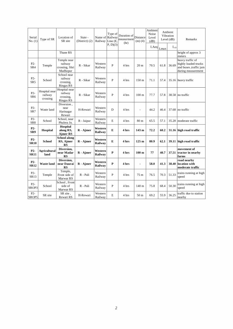
2
Ambient Noise Level (dB)
Ambient Vibration Level (dB) Serial
No. (1) Type of SR Location of SR site
State -(District) (2)
Name of Railway
Type of Railway Line (E, P, D)(3)
Duration of measurment
(hr)
Distance (m) (4)
LAeq Lmax L10
Remarks
Thane RS height of approx 3 meters
P2-SR4 Temple
Temple near railway
crossing, Shri Madhopur
R - Sikar Western Railway P 4 hrs 20 m 70.5 61.8 36.69
heavy traffic of highly loaded trucks and buses ,traffic jam during measurement
P2-SR5 School
School near railway
crossing, Ringas RS
R - Sikar Western Railway P 4 hrs 150 m 71.1 57.4 35.16 heavy traffic
P2-SR6
Hospital near railway crossing
Hospital near railway
crossing, Ringas RS
R - Sikar Western Railway P 4 hrs 100 m 77.7 57.8 38.58 no traffic
P2-SR7 Waste land
Diversion , near
Harinagar Rewari
H-Rewari Western Railway D 4 hrs - 44.2 46.4 37.68 no traffic
P2-SR8 School School, near
Phulera Jn. R - Jaipur Western Railway E 4 hrs 80 m 65.5 57.1 35.28 moderate traffic
P2-SR9 Hospital
Hospital along RS, Ajmer RS
R - Ajmer Western Railway E 4 hrs 143 m 72.2 60.2 31.16 high road traffic
P2-SR10 School
School along RS, Ajmer
RS R - Ajmer Western
Railway E 4 hrs 125 m 80.9 62.1 39.11 high road traffic
P2-SR11
Agricultural land
Diversion, near Madar
RS R - Ajmer Western
Railway P 4 hrs 100 m 77 40.7 37.51 movement of tractor in nearby farms
P2-SR12 Waste land
Diversion, near Daurai
RS R - Ajmer Western
Railway P 4 hrs - 58.0 41.3 38.40 road nearby location with moderate traffic
P2-SR13 Temple
Temple, Front side of Marwar RS
R - Pali Western Railway P 4 hrs 75 m 76.5 70.3 51.33 trains running at high
speed
P2-SROP3 School
School , Front side of
Marwar RS R - Pali Western
Railway P 4 hrs 140 m 75.8 68.4 50.30 trains running at high speed
P2-SROP5 SR site SR site ,
Rewari RS H-Rewari Western Railway E 4 hrs 50 m 69.2 55.9 36.25 traffic due to station
nearby
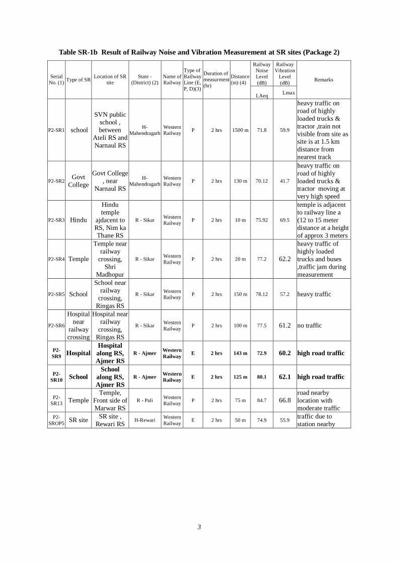
3
Table SR-1b Result of Railway Noise and Vibration Measurement at SR sites (Package 2) Railway
Noise Level (dB)
Railway Vibration
Level (dB)
Serial No. (1) Type of SR Location of SR
site State -
(District) (2) Name of Railway
Type of Railway Line (E, P, D)(3)
Duration of measurment (hr)
Distance (m) (4)
LAeq Lmax
Remarks
P2-SR1 school
SVN public school , between
Ateli RS and Narnaul RS
H-Mahendragarh
Western Railway P 2 hrs 1500 m 71.8 59.9
heavy traffic on road of highly loaded trucks & tractor ,train not visible from site as site is at 1.5 km distance from nearest track
P2-SR2 Govt
College
Govt College , near
Narnaul RS
H-Mahendragarh
Western Railway P 2 hrs 130 m 70.12 41.7
heavy traffic on road of highly loaded trucks & tractor moving at very high speed
P2-SR3 Hindu
Hindu temple
ajdacent to RS, Nim ka Thane RS
R - Sikar Western Railway P 2 hrs 10 m 75.92 69.5
temple is adjacent to railway line a (12 to 15 meter distance at a height of approx 3 meters
P2-SR4 Temple
Temple near railway
crossing, Shri
Madhopur
R - Sikar Western Railway P 2 hrs 20 m 77.2 62.2
heavy traffic of highly loaded trucks and buses ,traffic jam during measurement
P2-SR5 School
School near railway
crossing, Ringas RS
R - Sikar Western Railway P 2 hrs 150 m 78.12 57.2 heavy traffic
P2-SR6
Hospital near
railway crossing
Hospital near railway
crossing, Ringas RS
R - Sikar Western Railway P 2 hrs 100 m 77.5 61.2 no traffic
P2-SR9 Hospital
Hospital along RS, Ajmer RS
R - Ajmer Western Railway E 2 hrs 143 m 72.9 60.2 high road traffic
P2-SR10 School
School along RS, Ajmer RS
R - Ajmer Western Railway E 2 hrs 125 m 80.1 62.1 high road traffic
P2-SR13 Temple
Temple, Front side of Marwar RS
R - Pali Western Railway P 2 hrs 75 m 84.7 66.8
road nearby location with moderate traffic
P2-SROP5 SR site SR site ,
Rewari RS H-Rewari Western Railway E 2 hrs 50 m 74.9 55.9 traffic due to
station nearby

4
Data of Interview Survey on Noise and Vibration Alongside the Railway(SR1) (Package 2) Characteristics of the
Interviewee Characteristics of the Survey Area Question On Pollution Problem Question on Noise from Railway Question on Vibration from Railway
Location of the Survey Area
Sr.No. Gende
r Age Occupation State District Village
Description of Area
Distance of the interview pt. To
the Railway
Conditions of the
Interview Survey Area.
What kind of
pollution problem do you have
If yes,select the worst
three pollution
items
Does noise from
railway
annoy your life
If yes how ?
Does other noise annoy your life ?
What is your
opinion to reduce the
noise problem ?
Does vibration from railway annoy your life
If yes how ?
Does other
vibration annoy
your life ?
What is your
opinion to reduce the vibration problem ?
SR1
1 Man Young Student Haryana Mahendraga
rh
Near SVN Public School,
Neerpur
Rural More than 100m
1 only Noise & Vibratio
n
Train whistle,
Vehicles, Trin
Vibration
yes
When Freight
tain passes by
No Nothing Yes
When Trains passes
by
Yes
Shifting of School to
Other Location
2 Woman Adult Housewife Haryana Mahendraga
rh
Near SVN Public School,
Neerpur
Rural More than 100m
2 Noise & Vibratio
n
Train whistle,
Vehicles, Trin
Vibration
yes Bacause of
Railway Station
No Nothing Yes
When Trains passes
by
Yes
Reduction of Heavy
loaded Trucks
passes by on roads
3 Man Young Worker Haryana Mahendraga
rh
Near SVN Public School,
Neerpur
Rural 50-100 m 1 & 3 Water &
Air
Sewage, Smoke from trains,
Rubbish thrown in
water
yes Bacause of
Railway Station
No
Not to ply the horn in school
area
No NA Yes
Shifting of School to
Other Location
4 Man Adult Teacher Haryana Mahendragarh
Near SVN Public School,
Neerpur
Rural More than 100m
3 Air &Noise
Smoke from trains, Trains,
Vehicles
yes
When Passenger
Train Passenger
Yes
Not to ply the horn in school
area
Yes
When Trains passes
by
Yes
Reduction of Heavy
loaded Trucks
passes by on roads
5 Man Aged Worker Haryana Mahendragarh
Near SVN Public School,
Neerpur
Rural 25 - 50 m 1 & 4 Nothing NA No NA No Nothing No NA No Nothing
6 Female Adult Housewife Haryana Mahendraga
rh
Near SVN Public School,
Neerpur
Rural 25 - 50 m 1 & 4 Air &
Soil
Smoke from trains, Dust,
Yes
When Freight
tain passes by
No Nothing Yes
When Trains passes
by
Yes
Reduction of Heavy
loaded Trucks
passes by on roads
7 Man Aged Farmar Haryana Mahendragarh
Near SVN Public School,
Neerpur
Rural 25 - 50 m 1 & 2 Nothing NA Yes
Bacause of Railway Station
No No Idea Yes Freight
train passes
No No Idea
8 Man Young Student Haryana Mahendraga
rh
Near SVN Public School,
Neerpur
Rural 25 - 50 m 1 & 2 Nothing NA Yes
When Freight
tain passes by
No No Idea No NA No No Idea
9 Man Aged Retired Haryana Mahendragarh
Near SVN Public School,
Neerpur
Rural 25 - 50 m 2 Noise
Train whistle,
Vehicles, Train
Vibration
Yes
When Freight
tain passes by
Yes
Not to ply the horn in school
area
No NA Yes
Shifting of School to
Other Location
10 Man Adult Business Haryana Mahendragarh
Near SVN Public School,
Neerpur
Rural 25 - 50 m 4 Air
Smoke from trains, Dust,
Yes
When Freight
train passes by
Yes Nothing Yes
When Trains passes
by
No nothing
SR2
11 Man Adult Business Haryana Mahendragarh
Govt. College, Narnaul
Rural 25-50m 1 & 4 Noise & Vibratio
n
Train whistle,
Vehicles, Trin
Vibration
yes
When Freight
tain passes by
No
Not to ply the horn in school
area
Yes
When Trains passes
by
Yes
Reduction of Heavy
loaded Trucks
passes by on roads
12 Female
Young Student Haryana Mahendraga
rh
Govt. College, Narnaul
Rural 25-50m 1 & 4 Nothing NA Yes
When Passenger tain passes
by
No No Idea Yes Freight
train passes
Yes
use of traffic
controls that
smooth vehicle flow to reduce braking
and acceleratio
n
13 Female Adult Housewife Haryana Mahendraga
rh
Govt. College, Narnaul
Rural 25-50m 1 & 4 Noise & Vibratio
n
Train whistle,
Vehicles, Trin
Vibration
yes
When Passenger tain passes
by
No Nothing Yes
When Trains passes
by
Yes
Shifting of College to
Other Location
14 Man Adult Worker Haryana Mahendragarh
Govt. College, Narnaul
Rural 50-100m 1 & 4
Noise & Vibratio
n
Train whistle,
Vehicles, Trin
Vibration
yes
When Freight
tain passes by
No
Not to ply the horn in school
area
Yes
When Trains passes
by
Yes
Heavy loaded Trucks
passes by on roads
15 Man Adult Farmer Haryana Mahendragarh
Govt. College, Narnaul
Rural More than 100m
1 & 4 Air & Water
Sewage, Smoke from trains,
yes
When Passenger tain passes
by
No Nothing No NA No Nothing
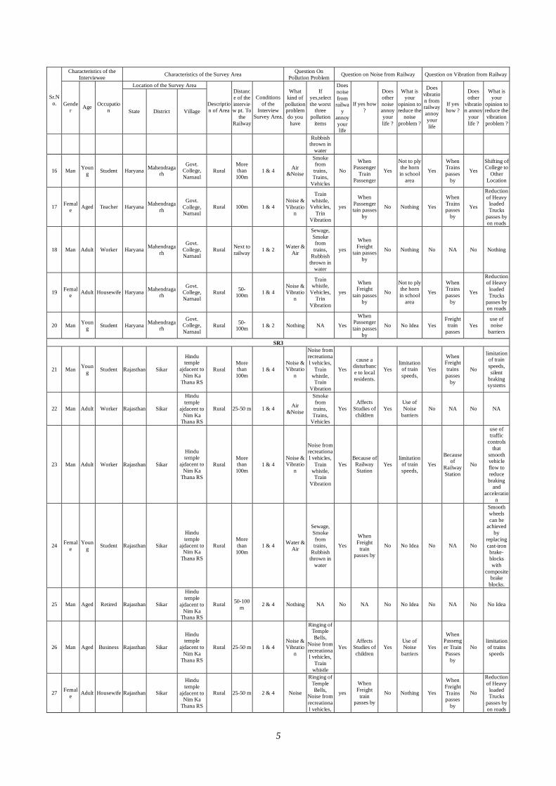
5
Characteristics of the Interviewee Characteristics of the Survey Area Question On
Pollution Problem Question on Noise from Railway Question on Vibration from Railway
Location of the Survey Area
Sr.No. Gende
r Age Occupation State District Village
Description of Area
Distance of the interview pt. To
the Railway
Conditions of the
Interview Survey Area.
What kind of
pollution problem do you have
If yes,select the worst
three pollution
items
Does noise from
railway
annoy your life
If yes how ?
Does other noise annoy your life ?
What is your
opinion to reduce the
noise problem ?
Does vibration from railway annoy your life
If yes how ?
Does other
vibration annoy
your life ?
What is your
opinion to reduce the vibration problem ?
Rubbish thrown in
water
16 Man Young Student Haryana Mahendraga
rh
Govt. College, Narnaul
Rural More than 100m
1 & 4 Air &Noise
Smoke from trains, Trains,
Vehicles
No
When Passenger
Train Passenger
Yes
Not to ply the horn in school
area
Yes
When Trains passes
by
Yes
Shifting of College to
Other Location
17 Female Aged Teacher Haryana Mahendraga
rh
Govt. College, Narnaul
Rural 100m 1 & 4 Noise & Vibratio
n
Train whistle,
Vehicles, Trin
Vibration
yes
When Passenger tain passes
by
No Nothing Yes
When Trains passes
by
Yes
Reduction of Heavy
loaded Trucks
passes by on roads
18 Man Adult Worker Haryana Mahendragarh
Govt. College, Narnaul
Rural Next to railway 1 & 2 Water &
Air
Sewage, Smoke from trains,
Rubbish thrown in
water
yes
When Freight
tain passes by
No Nothing No NA No Nothing
19 Female Adult Housewife Haryana Mahendraga
rh
Govt. College, Narnaul
Rural 50-100m 1 & 4
Noise & Vibratio
n
Train whistle,
Vehicles, Trin
Vibration
yes
When Freight
tain passes by
No
Not to ply the horn in school
area
Yes
When Trains passes
by
Yes
Reduction of Heavy
loaded Trucks
passes by on roads
20 Man Young Student Haryana Mahendraga
rh
Govt. College, Narnaul
Rural 50-100m 1 & 2 Nothing NA Yes
When Passenger tain passes
by
No No Idea Yes Freight
train passes
Yes use of noise
barriers
SR3
21 Man Young Student Rajasthan Sikar
Hindu temple
ajdacent to Nim Ka
Thana RS
Rural More than 100m
1 & 4 Noise & Vibratio
n
Noise from recreational vehicles,
Train whistle, Train
Vibration
Yes
cause a disturbance to local residents.
Yes limitation
of train speeds,
Yes
When Freight trains passes
by
No
limitation of train speeds, silent
braking systems
22 Man Adult Worker Rajasthan Sikar
Hindu temple
ajdacent to Nim Ka
Thana RS
Rural 25-50 m 1 & 4 Air &Noise
Smoke from trains, Trains,
Vehicles
Yes Affects
Studies of children
Yes Use of Noise
barriers No NA No NA
23 Man Adult Worker Rajasthan Sikar
Hindu temple
ajdacent to Nim Ka
Thana RS
Rural More than 100m
1 & 4 Noise & Vibratio
n
Noise from recreational vehicles,
Train whistle, Train
Vibration
Yes Because of
Railway Station
Yes limitation
of train speeds,
Yes
Because of
Railway Station
No
use of traffic
controls that
smooth vehicle flow to reduce braking
and acceleratio
n
24 Female
Young Student Rajasthan Sikar
Hindu temple
ajdacent to Nim Ka
Thana RS
Rural More than 100m
1 & 4 Water & Air
Sewage, Smoke from trains,
Rubbish thrown in
water
Yes
When Freight
train passes by
No No Idea No NA No
Smooth wheels can be
achieved by
replacing cast-iron brake-blocks with
composite brake
blocks.
25 Man Aged Retired Rajasthan Sikar
Hindu temple
ajdacent to Nim Ka
Thana RS
Rural 50-100 m 2 & 4 Nothing NA No NA No No Idea No NA No No Idea
26 Man Aged Business Rajasthan Sikar
Hindu temple
ajdacent to Nim Ka
Thana RS
Rural 25-50 m 1 & 4 Noise & Vibratio
n
Ringing of Temple Bells,
Noise from recreational vehicles,
Train whistle
Yes Affects
Studies of children
Yes Use of Noise
barriers Yes
When Passenger Train Passes
by
No limitation of trains speeds
27 Female Adult Housewife Rajasthan Sikar
Hindu temple
ajdacent to Nim Ka
Thana RS
Rural 25-50 m 2 & 4 Noise
Ringing of Temple Bells,
Noise from recreational vehicles,
yes
When Freight
train passes by
No Nothing Yes
When Freight Trains passes
by
No
Reduction of Heavy
loaded Trucks
passes by on roads
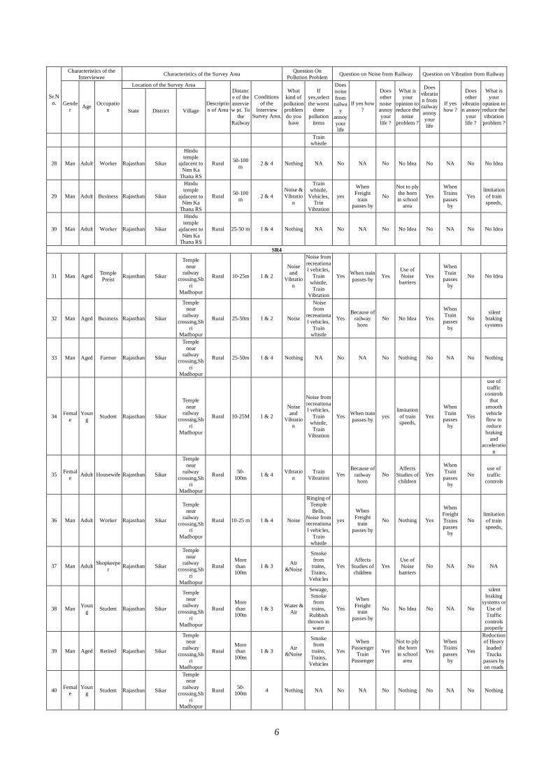
6
Characteristics of the Interviewee Characteristics of the Survey Area Question On
Pollution Problem Question on Noise from Railway Question on Vibration from Railway
Location of the Survey Area
Sr.No. Gende
r Age Occupation State District Village
Description of Area
Distance of the interview pt. To
the Railway
Conditions of the
Interview Survey Area.
What kind of
pollution problem do you have
If yes,select the worst
three pollution
items
Does noise from
railway
annoy your life
If yes how ?
Does other noise annoy your life ?
What is your
opinion to reduce the
noise problem ?
Does vibration from railway annoy your life
If yes how ?
Does other
vibration annoy
your life ?
What is your
opinion to reduce the vibration problem ?
Train whistle
28 Man Adult Worker Rajasthan Sikar
Hindu temple
ajdacent to Nim Ka
Thana RS
Rural 50-100 m 2 & 4 Nothing NA No NA No No Idea No NA No No Idea
29 Man Adult Business Rajasthan Sikar
Hindu temple
ajdacent to Nim Ka
Thana RS
Rural 50-100 m 2 & 4
Noise & Vibratio
n
Train whistle,
Vehicles, Trin
Vibration
yes
When Freight
train passes by
No
Not to ply the horn in school
area
Yes
When Trains passes
by
Yes limitation of train speeds,
30 Man Adult Worker Rajasthan Sikar
Hindu temple
ajdacent to Nim Ka
Thana RS
Rural 25-50 m 1 & 4 Nothing NA No NA No No Idea No NA No No Idea
SR4
31 Man Aged Temple Preist Rajasthan Sikar
Temple near
railway crossing,Sh
ri Madhopur
Rural 10-25m 1 & 2
Noise and
Vibration
Noise from recreational vehicles,
Train whistle, Train
Vibration
Yes When train passes by Yes
Use of Noise
barriers Yes
When Train passes
by
No No Idea
32 Man Aged Business Rajasthan Sikar
Temple near
railway crossing,Sh
ri Madhopur
Rural 25-50m 1 & 2 Noise
Noise from
recreational vehicles,
Train whistle
Yes Because of
railway horn
No No Idea Yes
When Train passes
by
No silent
braking systems
33 Man Aged Farmer Rajasthan Sikar
Temple near
railway crossing,Sh
ri Madhopur
Rural 25-50m 1 & 4 Nothing NA No NA No Nothing No NA No Nothing
34 Female
Young Student Rajasthan Sikar
Temple near
railway crossing,Sh
ri Madhopur
Rural 10-25M 1 & 2
Noise and
Vibration
Noise from recreational vehicles,
Train whistle, Train
Vibration
Yes When train passes by yes
limitation of train speeds,
Yes
When Train passes
by
Yes
use of traffic
controls that
smooth vehicle flow to reduce braking
and acceleratio
n
35 Female Adult Housewife Rajasthan Sikar
Temple near
railway crossing,Sh
ri Madhopur
Rural 50-100m 1 & 4 Vibratio
n Train
Vibration Yes Because of
railway horn
No Affects
Studies of children
Yes
When Train passes
by
No use of traffic
controls
36 Man Adult Worker Rajasthan Sikar
Temple near
railway crossing,Sh
ri Madhopur
Rural 10-25 m 1 & 4 Noise
Ringing of Temple Bells,
Noise from recreational vehicles,
Train whistle
yes
When Freight
train passes by
No Nothing Yes
When Freight Trains passes
by
No limitation of train speeds,
37 Man Adult Shopkeeper Rajasthan Sikar
Temple near
railway crossing,Sh
ri Madhopur
Rural More than 100m
1 & 3 Air &Noise
Smoke from trains, Trains,
Vehicles
Yes Affects
Studies of children
Yes Use of Noise
barriers No NA No NA
38 Man Young Student Rajasthan Sikar
Temple near
railway crossing,Sh
ri Madhopur
Rural More than 100m
1 & 3 Water & Air
Sewage, Smoke from trains,
Rubbish thrown in
water
Yes
When Freight
train passes by
No No Idea No NA No
silent braking
systems or Use of Traffic controls properly
39 Man Aged Retired Rajasthan Sikar
Temple near
railway crossing,Sh
ri Madhopur
Rural More than 100m
1 & 3 Air &Noise
Smoke from trains, Trains,
Vehicles
Yes
When Passenger
Train Passenger
Yes
Not to ply the horn in school
area
Yes
When Trains passes
by
Yes
Reduction of Heavy
loaded Trucks
passes by on roads
40 Female
Young Student Rajasthan Sikar
Temple near
railway crossing,Sh
ri Madhopur
Rural 50-100m 4 Nothing NA No NA No Nothing No NA No Nothing
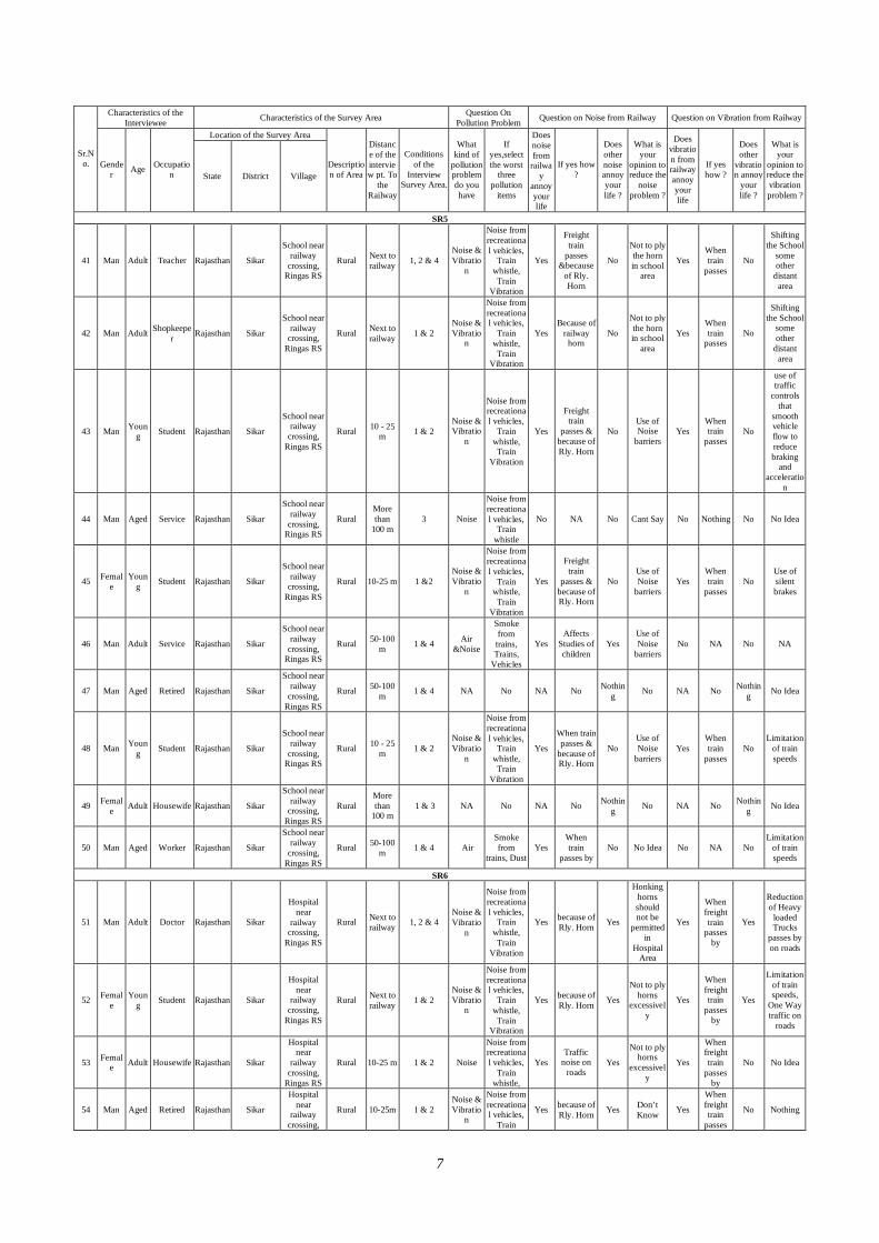
7
Characteristics of the Interviewee Characteristics of the Survey Area Question On
Pollution Problem Question on Noise from Railway Question on Vibration from Railway
Location of the Survey Area
Sr.No. Gende
r Age Occupation State District Village
Description of Area
Distance of the interview pt. To
the Railway
Conditions of the
Interview Survey Area.
What kind of
pollution problem do you have
If yes,select the worst
three pollution
items
Does noise from
railway
annoy your life
If yes how ?
Does other noise annoy your life ?
What is your
opinion to reduce the
noise problem ?
Does vibration from railway annoy your life
If yes how ?
Does other
vibration annoy
your life ?
What is your
opinion to reduce the vibration problem ?
SR5
41 Man Adult Teacher Rajasthan Sikar
School near railway
crossing, Ringas RS
Rural Next to railway 1, 2 & 4
Noise & Vibratio
n
Noise from recreational vehicles,
Train whistle, Train
Vibration
Yes
Freight train
passes &because
of Rly. Horn
No
Not to ply the horn in school
area
Yes When train
passes No
Shifting the School
some other
distant area
42 Man Adult Shopkeeper Rajasthan Sikar
School near railway
crossing, Ringas RS
Rural Next to railway 1 & 2
Noise & Vibratio
n
Noise from recreational vehicles,
Train whistle, Train
Vibration
Yes Because of
railway horn
No
Not to ply the horn in school
area
Yes When train
passes No
Shifting the School
some other
distant area
43 Man Young Student Rajasthan Sikar
School near railway
crossing, Ringas RS
Rural 10 - 25 m 1 & 2
Noise & Vibratio
n
Noise from recreational vehicles,
Train whistle, Train
Vibration
Yes
Freight train
passes & because of Rly. Horn
No Use of Noise
barriers Yes
When train
passes No
use of traffic
controls that
smooth vehicle flow to reduce braking
and acceleratio
n
44 Man Aged Service Rajasthan Sikar
School near railway
crossing, Ringas RS
Rural More than
100 m 3 Noise
Noise from recreational vehicles,
Train whistle
No NA No Cant Say No Nothing No No Idea
45 Female
Young Student Rajasthan Sikar
School near railway
crossing, Ringas RS
Rural 10-25 m 1 &2 Noise & Vibratio
n
Noise from recreational vehicles,
Train whistle, Train
Vibration
Yes
Freight train
passes & because of Rly. Horn
No Use of Noise
barriers Yes
When train
passes No
Use of silent brakes
46 Man Adult Service Rajasthan Sikar
School near railway
crossing, Ringas RS
Rural 50-100 m 1 & 4 Air
&Noise
Smoke from trains, Trains,
Vehicles
Yes Affects
Studies of children
Yes Use of Noise
barriers No NA No NA
47 Man Aged Retired Rajasthan Sikar
School near railway
crossing, Ringas RS
Rural 50-100 m 1 & 4 NA No NA No Nothin
g No NA No Nothing No Idea
48 Man Young Student Rajasthan Sikar
School near railway
crossing, Ringas RS
Rural 10 - 25 m 1 & 2
Noise & Vibratio
n
Noise from recreational vehicles,
Train whistle, Train
Vibration
Yes
When train passes &
because of Rly. Horn
No Use of Noise
barriers Yes
When train
passes No
Limitation of train speeds
49 Female Adult Housewife Rajasthan Sikar
School near railway
crossing, Ringas RS
Rural More than
100 m 1 & 3 NA No NA No Nothin
g No NA No Nothing No Idea
50 Man Aged Worker Rajasthan Sikar
School near railway
crossing, Ringas RS
Rural 50-100 m 1 & 4 Air
Smoke from
trains, Dust Yes
When train
passes by No No Idea No NA No
Limitation of train speeds
SR6
51 Man Adult Doctor Rajasthan Sikar
Hospital near
railway crossing,
Ringas RS
Rural Next to railway 1, 2 & 4
Noise & Vibratio
n
Noise from recreational vehicles,
Train whistle, Train
Vibration
Yes because of Rly. Horn Yes
Honking horns should not be
permitted in
Hospital Area
Yes
When freight train
passes by
Yes
Reduction of Heavy
loaded Trucks
passes by on roads
52 Female
Young Student Rajasthan Sikar
Hospital near
railway crossing,
Ringas RS
Rural Next to railway 1 & 2
Noise & Vibratio
n
Noise from recreational vehicles,
Train whistle, Train
Vibration
Yes because of Rly. Horn Yes
Not to ply horns
excessively
Yes
When freight train
passes by
Yes
Limitation of train speeds,
One Way traffic on
roads
53 Female Adult Housewife Rajasthan Sikar
Hospital near
railway crossing,
Ringas RS
Rural 10-25 m 1 & 2 Noise
Noise from recreational vehicles,
Train whistle,
Yes Traffic
noise on roads
Yes
Not to ply horns
excessively
Yes
When freight train
passes by
No No Idea
54 Man Aged Retired Rajasthan Sikar
Hospital near
railway crossing,
Rural 10-25m 1 & 2 Noise & Vibratio
n
Noise from recreational vehicles,
Train
Yes because of Rly. Horn Yes Don’t
Know Yes
When freight train
passes
No Nothing
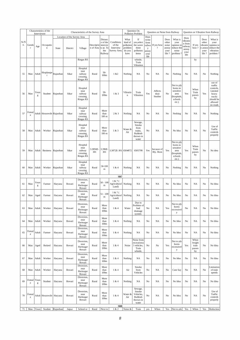
8
Characteristics of the Interviewee Characteristics of the Survey Area Question On
Pollution Problem Question on Noise from Railway Question on Vibration from Railway
Location of the Survey Area
Sr.No. Gende
r Age Occupation State District Village
Description of Area
Distance of the interview pt. To
the Railway
Conditions of the
Interview Survey Area.
What kind of
pollution problem do you have
If yes,select the worst
three pollution
items
Does noise from
railway
annoy your life
If yes how ?
Does other noise annoy your life ?
What is your
opinion to reduce the
noise problem ?
Does vibration from railway annoy your life
If yes how ?
Does other
vibration annoy
your life ?
What is your
opinion to reduce the vibration problem ?
Ringas RS whistle, Train
Vibration
by
55 Man Adult Shopkeeper Rajasthan Sikar
Hospital near
railway crossing,
Ringas RS
Rural 50-100m 1 &2 Nothing NA No NA No Nothing No NA No Nothing
56 Man Young Student Rajasthan Sikar
Hospital near
railway crossing,
Ringas RS
Rural 50-100m 1 & 3 Vibratio
n Train
Vibration Yes Affects
their Studies
No
Not to ply horns in sensitive
area (hospitals,
schools etc.)
Yes
When Train passes
by
Yes
use of traffic
controls, Limited heavy trucks
should be allowed on roads
57 Female Adult Housewife Rajasthan Sikar
Hospital near
railway crossing,
Ringas RS
Rural More than
100 m 2 & 3 Nothing NA No NA No Nothing No NA No Nothing
58 Man Adult Worker Rajasthan Sikar
Hospital near
railway crossing,
Ringas RS
Rural More than
100 m 1 & 3 Water &
Air
Sewage, Smoke from trains,
Rubbish thrown in
water
No NA No No Idea No NA No
Use of Traffic controls properly
59 Man Adult Business Rajasthan Sikar
Hospital near
railway crossing,
Ringas RS
3.3856E-301
3.396E-301 3.3872E-301 6504872 6505799 Yes because of
Rly. Horn Yes
Not to ply horns in sensitive
area (hospitals,
schools etc.)
Yes
When Train passes
by
No No idea
60 Man Adult Worker Rajasthan Sikar
Hospital near
railway crossing,
Ringas RS
Rural 50-100 m 1 & 4 Nothing NA No NA No Nothing No NA No Nothing
SR7
61 Man Young Farmer Haryana Rewari
Diversion, near
Harinagar Rewari
Rural 50 - 100 m
1 & 7 ( Agricultural
Land) Nothing NA No NA No No Idea No NA No No Idea
62 Man Aged Farmer Haryana Rewari
Diversion, near
Harinagar Rewari
Rural 51 - 100 m
1 & 7 ( Agricultural
Land) Nothing NA No NA No No Idea No NA No No Idea
63 Man Adult Worker Haryana Rewari
Diversion, near
Harinagar Rewari
Rural More than 100m
1 & 4 Water
Due to Problem of
bad drainage system.
No NA Yes
Not to ply horns
excessively
No NA No No Idea
64 Man Adult Worker Haryana Rewari
Diversion, near
Harinagar Rewari
Rural More than 100m
1 & 4 Nothing NA No NA No No Idea No NA No No Idea
65 Female Adult Farmer Haryana Rewari
Diversion, near
Harinagar Rewari
Rural More than 100m
1 & 4 Nothing NA No NA No No Idea No NA No No Idea
66 Man Aged Retired Haryana Rewari
Diversion, near
Harinagar Rewari
Rural More than 100m
1 & 4 Noise
Noise from recreational vehicles,
Train whistle,
No Na Yes
Not to ply horns
excessively
Yes
When freight train
passes by
No No Idea
67 Man Adult Worker Haryana Rewari
Diversion, near
Harinagar Rewari
Rural More than 100m
1 & 4 Nothing NA No NA No No Idea No NA No No Idea
68 Man Adult Worker Haryana Rewari
Diversion, near
Harinagar Rewari
Rural More than 100m
1 & 4 Air Smoke from
Vehicles No NA No Cant Say No NA No
Limitation of train speeds
69 Female
Young Student Haryana Rewari
Diversion, near
Harinagar Rewari
Rural More than 100m
1 & 4 Nothing NA No NA No No Idea No NA No No Idea
70 Female Adult Housewife Haryana Rewari
Diversion, near
Harinagar Rewari
Rural More than 100m
1 & 4 Water & Air
Sewage, Smoke
Vehicles, Rubbish
thrown in water
No NA No No Idea No NA No
Use of Traffic controls properly
SR8 71 Man Youn Student Rajasthan Jaipur School or Rural Next to 1 & 2 Noise & Train yes When Yes Not to ply Yes When Yes Reduction
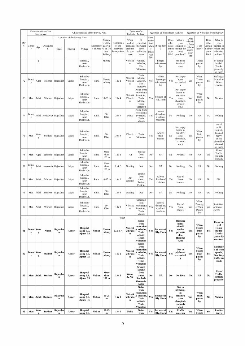
9
Characteristics of the Interviewee Characteristics of the Survey Area Question On
Pollution Problem Question on Noise from Railway Question on Vibration from Railway
Location of the Survey Area
Sr.No. Gende
r Age Occupation State District Village
Description of Area
Distance of the interview pt. To
the Railway
Conditions of the
Interview Survey Area.
What kind of
pollution problem do you have
If yes,select the worst
three pollution
items
Does noise from
railway
annoy your life
If yes how ?
Does other noise annoy your life ?
What is your
opinion to reduce the
noise problem ?
Does vibration from railway annoy your life
If yes how ?
Does other
vibration annoy
your life ?
What is your
opinion to reduce the vibration problem ?
g hospital, near
Phulera Jn.
railway Vibration
whistle, Vehicles,
Trin Vibration
Freight tain passes
by
the horn in school
area
Trains passes
by
of Heavy loaded Trucks
passes by on roads
72 Female Aged Teacher Rajasthan Jaipur
School or hospital,
near Phulera Jn.
Rural Next to railway 1 & 2
Noise & Vibratio
n
Train whistle,
Vehicles, Trin
Vibration
yes
When Passenger tain passes
by
Yes
Not to ply horns
excessively
Yes
When Trains passes
by
Yes
Shifting of School to
Other Location
73 Man Adult Worker Rajasthan Jaipur
School or hospital,
near Phulera Jn.
Rural 10-25 m 1 & 4 Noise & Vibratio
n
Noise from recreational vehicles,
Train whistle, Train
Vibration
Yes because of Rly. Horn Yes
Not to ply horns in sensitive
area (hospitals,
schools etc.)
Yes
When Train passes
by
No No idea
74 Female Adult Housewife Rajasthan Jaipur
School or hospital,
near Phulera Jn.
Rural 50-100m 2 & 4 Noise
Noise from recreational vehicles,
Train whistle
Yes
cause a disturbance to local residents.
No Nothing No NA NO Nothing
75 Man Young Student Rajasthan Jaipur
School or hospital,
near Phulera Jn.
Rural 50-100m 3 & 4 Vibratio
n Train
Vibration Yes Affects
their Studies
No
Not to ply horns in sensitive
area (hospitals,
schools etc.)
Yes
When Train passes
by
Yes
use of traffic
controls, Limited heavy trucks
should be allowed on roads
76 Man Aged Business Rajasthan Jaipur
School or hospital,
near Phulera Jn.
Rural More than
100 m 1 & 3 Air
Smoke from trains,
No NA No No Idea No NA No
Use of Traffic controls properly
77 Female Adult Housewife Rajasthan Jaipur
School or hospital,
near Phulera Jn.
Rural More than
100 m 1 & 3 Nothing NA No NA No Nothing No NA No Nothing
78 Man Adult Worker Rajasthan Jaipur
School or hospital,
near Phulera Jn.
Rural 10-25 m 1 & 2 Air &Noise
Smoke from trains, Trains,
Vehicles
Yes Affects
Studies of children
Yes Use of Noise
barriers No NA No NA
79 Man Adult Business Rajasthan Jaipur
School or hospital,
near Phulera Jn.
Rural 50-100m 1 & 4 Nothing NA No NA No Nothing No NA No Nothing
80 Man Adult Worker Rajasthan Jaipur
School or hospital,
near Phulera Jn.
Rural 50-100m 1 & 2 Vibratio
n
Vibration from
recreational vehicles,
Train whistle
Yes
cause a disturbance to local residents.
Yes Use of Noise
barriers Yes
When Passenger Train Passes
by
yes limitation of trains speeds
SR9
81 Female
Young Nurse Rajastha
n Ajmer Hospital along RS, Ajmer RS
Urban Next to railway 1, 2 & 4
Noise & Vibratio
n
Noise from
recreational vehicles,
Train whistle, Train
Vibration
Yes because of Rly. Horn Yes
Honking horns should not be
permitted in
Hospital Area
Yes
When freight train
passes by
Yes
Reduction of
Heavy loaded Trucks
passes by on roads
82 Female
Young Student Rajastha
n Ajmer Hospital along RS, Ajmer RS
Urban Next to railway 1 & 2
Noise & Vibratio
n
Noise from
recreational vehicles,
Train whistle, Train
Vibration
Yes because of Rly. Horn Yes
Not to ply horns excessivel
y
Yes
When freight train
passes by
Yes
Limitation of train speeds,
One Way traffic on
roads
83 Man Adult Worker Rajasthan Ajmer
Hospital along RS, Ajmer RS
Urban More than
100 m 1 & 3 Water
& Air
Sewage, Smoke from
trains, Rubbish thrown in
water
No NA No No Idea No NA No
Use of Traffic controls properly
84 Man Adult Business Rajasthan Ajmer
Hospital along RS, Ajmer RS
Urban 10-25 m 1 & 2
Noise & Vibratio
n
Noise from
recreational vehicles,
Train whistle, Train
Vibration
Yes because of Rly. Horn Yes
Not to ply horns
in sensitive
area (hospitals, schools
etc.)
Yes
When Train passes
by
No No idea
85 Man Young Student Rajastha
n Ajmer Hospital along RS, Urban 10-25
m 1 & 2 Noise Noise from Yes because of
Rly. Horn Yes Traffic noise on Yes When
freight Yes Limited heavy
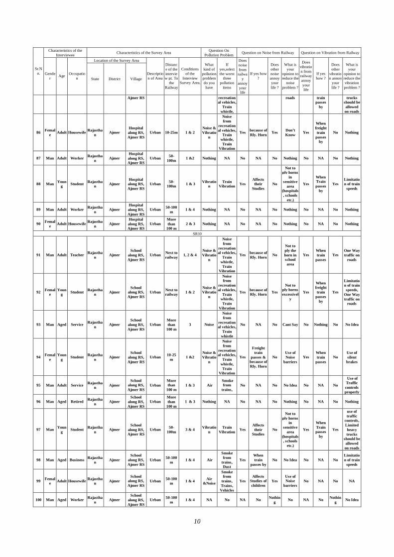
10
Characteristics of the Interviewee Characteristics of the Survey Area Question On
Pollution Problem Question on Noise from Railway Question on Vibration from Railway
Location of the Survey Area
Sr.No. Gende
r Age Occupation State District Village
Description of Area
Distance of the interview pt. To
the Railway
Conditions of the
Interview Survey Area.
What kind of
pollution problem do you have
If yes,select the worst
three pollution
items
Does noise from
railway
annoy your life
If yes how ?
Does other noise annoy your life ?
What is your
opinion to reduce the
noise problem ?
Does vibration from railway annoy your life
If yes how ?
Does other
vibration annoy
your life ?
What is your
opinion to reduce the vibration problem ?
Ajmer RS recreational vehicles,
Train whistle,
roads train passes
by
trucks should be allowed on roads
86 Female Adult Housewife Rajastha
n Ajmer Hospital along RS, Ajmer RS
Urban 10-25m 1 & 2 Noise & Vibratio
n
Noise from
recreational vehicles,
Train whistle, Train
Vibration
Yes because of Rly. Horn Yes Don’t
Know Yes
When freight train
passes by
No Nothing
87 Man Adult Worker Rajasthan Ajmer
Hospital along RS, Ajmer RS
Urban 50-100m 1 &2 Nothing NA No NA No Nothing No NA No Nothing
88 Man Young Student Rajastha
n Ajmer Hospital along RS, Ajmer RS
Urban 50-100m 1 & 3 Vibratio
n Train
Vibration Yes Affects their
Studies No
Not to ply horns
in sensitive
area (hospitals, schools
etc.)
Yes
When Train passes
by
Yes Limitation of train
speeds
89 Man Adult Worker Rajasthan Ajmer
Hospital along RS, Ajmer RS
Urban 50-100 m 1 & 4 Nothing NA No NA No Nothing No NA No Nothing
90 Female Adult Housewife Rajastha
n Ajmer Hospital along RS, Ajmer RS
Urban More than
100 m 2 & 3 Nothing NA No NA No Nothing No NA No Nothing
SR10
91 Man Adult Teacher Rajasthan Ajmer
School along RS, Ajmer RS
Urban Next to railway 1, 2 & 4
Noise & Vibratio
n
Noise from
recreational vehicles,
Train whistle, Train
Vibration
Yes because of Rly. Horn No
Not to ply the horn in school area
Yes When train
passes Yes
One Way traffic on
roads
92 Female
Young Student Rajastha
n Ajmer School
along RS, Ajmer RS
Urban Next to railway 1 & 2
Noise & Vibratio
n
Noise from
recreational vehicles,
Train whistle, Train
Vibration
Yes because of Rly. Horn Yes
Not to ply horns excessivel
y
Yes
When freight train
passes by
Yes
Limitation of train speeds,
One Way traffic on
roads
93 Man Aged Service Rajasthan Ajmer
School along RS, Ajmer RS
Urban More than
100 m 3 Noise
Noise from
recreational vehicles,
Train whistle
No NA No Cant Say No Nothing No No Idea
94 Female
Young Student Rajastha
n Ajmer School
along RS, Ajmer RS
Urban 10-25 m 1 &2
Noise & Vibratio
n
Noise from
recreational vehicles,
Train whistle, Train
Vibration
Yes
Freight train
passes & because of Rly. Horn
No Use of Noise
barriers Yes
When train
passes No
Use of silent
brakes
95 Man Adult Service Rajasthan Ajmer
School along RS, Ajmer RS
Urban More than
100 m 1 & 3 Air
Smoke from
trains, No NA No No Idea No NA No
Use of Traffic controls properly
96 Man Aged Retired Rajasthan Ajmer
School along RS, Ajmer RS
Urban More than
100 m 1 & 3 Nothing NA No NA No Nothing No NA No Nothing
97 Man Young Student Rajastha
n Ajmer School
along RS, Ajmer RS
Urban 50-100m 3 & 4 Vibratio
n Train
Vibration Yes Affects their
Studies No
Not to ply horns
in sensitive
area (hospitals, schools
etc.)
Yes
When Train passes
by
Yes
use of traffic
controls, Limited heavy trucks
should be allowed on roads
98 Man Aged Business Rajasthan Ajmer
School along RS, Ajmer RS
Urban 50-100 m 1 & 4 Air
Smoke from
trains, Dust
Yes When train
passes by No No Idea No NA No
Limitation of train
speeds
99 Female Adult Housewife Rajastha
n Ajmer School
along RS, Ajmer RS
Urban 50-100 m 1 & 4 Air
&Noise
Smoke from
trains, Trains, Vehicles
Yes Affects
Studies of children
Yes Use of Noise
barriers No NA No NA
100 Man Aged Worker Rajasthan Ajmer
School along RS, Ajmer RS
Urban 50-100 m 1 & 4 NA No NA No Nothin
g No NA No Nothing No Idea
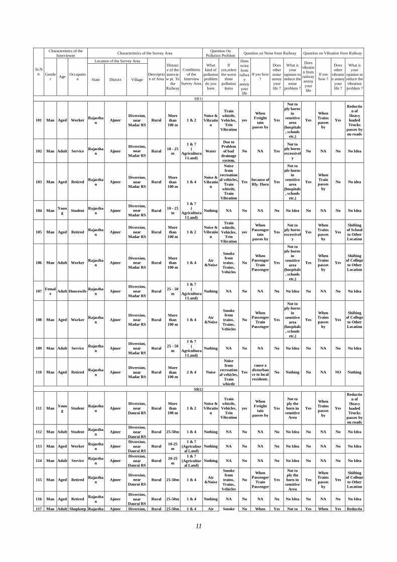
11
Characteristics of the Interviewee Characteristics of the Survey Area Question On
Pollution Problem Question on Noise from Railway Question on Vibration from Railway
Location of the Survey Area
Sr.No. Gende
r Age Occupation State District Village
Description of Area
Distance of the interview pt. To
the Railway
Conditions of the
Interview Survey Area.
What kind of
pollution problem do you have
If yes,select the worst
three pollution
items
Does noise from
railway
annoy your life
If yes how ?
Does other noise annoy your life ?
What is your
opinion to reduce the
noise problem ?
Does vibration from railway annoy your life
If yes how ?
Does other
vibration annoy
your life ?
What is your
opinion to reduce the vibration problem ?
SR11
101 Man Aged Worker Rajasthan Ajmer
Diversion, near
Madar RS Rural
More than
100 m 1 & 2
Noise & Vibratio
n
Train whistle,
Vehicles, Trin
Vibration
yes
When Freight
tain passes by
Yes
Not to ply horns
in sensitive
area (hospitals, schools
etc.)
Yes
When Trains passes
by
Yes
Reduction of
Heavy loaded Trucks
passes by on roads
102 Man Adult Service Rajasthan Ajmer
Diversion, near
Madar RS Rural 10 - 25
m
1 & 7 (
Agricultural Land)
Water
Due to Problem of bad
drainage system.
No NA Yes
Not to ply horns excessivel
y
No NA No No Idea
103 Man Aged Retired Rajasthan Ajmer
Diversion, near
Madar RS Rural
More than
100 m 1 & 4
Noise & Vibratio
n
Noise from
recreational vehicles,
Train whistle, Train
Vibration
Yes because of Rly. Horn Yes
Not to ply horns
in sensitive
area (hospitals, schools
etc.)
Yes
When Train passes
by
No No idea
104 Man Young Student Rajastha
n Ajmer Diversion,
near Madar RS
Rural 10 - 25 m
1 & 7 (
Agricultural Land)
Nothing NA No NA No No Idea No NA No No Idea
105 Man Aged Retired Rajasthan Ajmer
Diversion, near
Madar RS Rural
More than
100 m 1 & 2
Noise & Vibratio
n
Train whistle,
Vehicles, Trin
Vibration
yes
When Passenger
tain passes by
Yes
Not to ply horns excessivel
y
Yes
When Trains passes
by
Yes
Shifting of School to Other Location
106 Man Adult Worker Rajasthan Ajmer
Diversion, near
Madar RS Rural
More than
100 m 1 & 4 Air
&Noise
Smoke from
trains, Trains, Vehicles
No
When Passenger
Train Passenger
Yes
Not to ply horns
in sensitive
area (hospitals, schools
etc.)
Yes
When Trains passes
by
Yes
Shifting of College to Other Location
107 Female Adult Housewife Rajastha
n Ajmer Diversion,
near Madar RS
Rural 25 - 50 m
1 & 7 (
Agricultural Land)
Nothing NA No NA No No Idea No NA No No Idea
108 Man Aged Worker Rajasthan Ajmer
Diversion, near
Madar RS Rural
More than
100 m 1 & 4 Air
&Noise
Smoke from
trains, Trains, Vehicles
No
When Passenger
Train Passenger
Yes
Not to ply horns
in sensitive
area (hospitals, schools
etc.)
Yes
When Trains passes
by
Yes
Shifting of College to Other Location
109 Man Adult Service Rajasthan Ajmer
Diversion, near
Madar RS Rural 25 - 50
m
1 & 7 (
Agricultural Land)
Nothing NA No NA No No Idea No NA No No Idea
110 Man Aged Retired Rajasthan Ajmer
Diversion, near
Madar RS Rural
More than
100 m 2 & 4 Noise
Noise from
recreational vehicles,
Train whistle
Yes
cause a disturbance to local residents.
No Nothing No NA NO Nothing
SR12
111 Man Young Student Rajastha
n Ajmer Diversion,
near Daurai RS
Rural More than
100 m 1 & 2
Noise & Vibratio
n
Train whistle,
Vehicles, Trin
Vibration
yes
When Freight
tain passes by
Yes
Not to ply the horn in
sensitive Area
Yes
When Trains passes
by
Yes
Reduction of
Heavy loaded Trucks
passes by on roads
112 Man Adult Student Rajasthan Ajmer
Diversion, near
Daurai RS Rural 25-50m 1 & 4 Nothing NA No NA No No Idea No NA No No Idea
113 Man Aged Worker Rajasthan Ajmer
Diversion, near
Daurai RS Rural 10-25
m
1 & 7 (Agricultur
al Land) Nothing NA No NA No No Idea No NA No No Idea
114 Man Adult Service Rajasthan Ajmer
Diversion, near
Daurai RS Rural 10-25
m
1 & 7 (Agricultur
al Land) Nothing NA No NA No No Idea No NA No No Idea
115 Man Aged Retired Rajasthan Ajmer
Diversion, near
Daurai RS Rural 25-50m 1 & 4 Air
&Noise
Smoke from
trains, Trains, Vehicles
No
When Passenger
Train Passenger
Yes
Not to ply the horn in
sensitive Area
Yes
When Trains passes
by
Yes
Shifting of College to Other Location
116 Man Aged Retired Rajasthan Ajmer
Diversion, near
Daurai RS Rural 25-50m 1 & 4 Nothing NA No NA No No Idea No NA No No Idea
117 Man Adult Shopkeep Rajastha Ajmer Diversion, Rural 25-50m 1 & 4 Air Smoke No When Yes Not to Yes When Yes Reductio
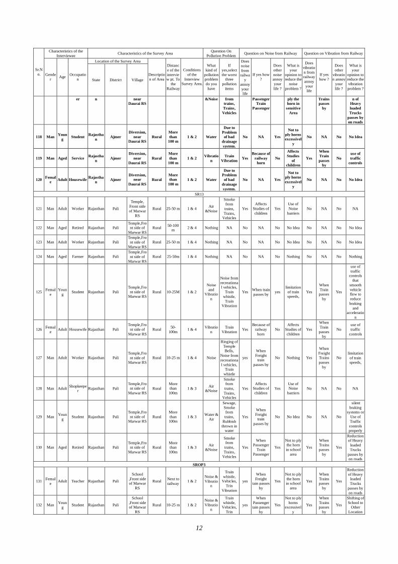
12
Characteristics of the Interviewee Characteristics of the Survey Area Question On
Pollution Problem Question on Noise from Railway Question on Vibration from Railway
Location of the Survey Area
Sr.No. Gende
r Age Occupation State District Village
Description of Area
Distance of the interview pt. To
the Railway
Conditions of the
Interview Survey Area.
What kind of
pollution problem do you have
If yes,select the worst
three pollution
items
Does noise from
railway
annoy your life
If yes how ?
Does other noise annoy your life ?
What is your
opinion to reduce the
noise problem ?
Does vibration from railway annoy your life
If yes how ?
Does other
vibration annoy
your life ?
What is your
opinion to reduce the vibration problem ?
er n near Daurai RS
&Noise from trains, Trains, Vehicles
Passenger Train
Passenger
ply the horn in
sensitive Area
Trains passes
by
n of Heavy loaded Trucks
passes by on roads
118 Man Young Student Rajastha
n Ajmer Diversion,
near Daurai RS
Rural More than
100 m 1 & 2 Water
Due to Problem of bad
drainage system.
No NA Yes
Not to ply horns excessivel
y
No NA No No Idea
119 Man Aged Service Rajasthan Ajmer
Diversion, near
Daurai RS Rural
More than
100 m 1 & 2 Vibratio
n Train
Vibration Yes Because of
railway horn
No
Affects Studies
of children
Yes
When Train passes
by
No use of traffic
controls
120 Female Adult Housewife Rajastha
n Ajmer Diversion,
near Daurai RS
Rural More than
100 m 1 & 2 Water
Due to Problem of bad
drainage system.
No NA Yes
Not to ply horns excessivel
y
No NA No No Idea
SR13
121 Man Adult Worker Rajasthan Pali
Temple, Front side of Marwar
RS
Rural 25-50 m 1 & 4 Air &Noise
Smoke from trains, Trains,
Vehicles
Yes Affects
Studies of children
Yes Use of Noise
barriers No NA No NA
122 Man Aged Retired Rajasthan Pali Temple,Front side of
Marwar RS Rural 50-100
m 2 & 4 Nothing NA No NA No No Idea No NA No No Idea
123 Man Adult Worker Rajasthan Pali Temple,Front side of
Marwar RS Rural 25-50 m 1 & 4 Nothing NA No NA No No Idea No NA No No Idea
124 Man Aged Farmer Rajasthan Pali Temple,Front side of
Marwar RS Rural 25-50m 1 & 4 Nothing NA No NA No Nothing No NA No Nothing
125 Female
Young Student Rajasthan Pali
Temple,Front side of
Marwar RS Rural 10-25M 1 & 2
Noise and
Vibration
Noise from recreational vehicles,
Train whistle, Train
Vibration
Yes When train passes by yes
limitation of train speeds,
Yes
When Train passes
by
Yes
use of traffic
controls that
smooth vehicle flow to reduce braking
and acceleratio
n
126 Female Adult Housewife Rajasthan Pali
Temple,Front side of
Marwar RS Rural 50-
100m 1 & 4 Vibration
Train Vibration Yes
Because of railway
horn No
Affects Studies of children
Yes
When Train passes
by
No use of traffic
controls
127 Man Adult Worker Rajasthan Pali Temple,Front side of
Marwar RS Rural 10-25 m 1 & 4 Noise
Ringing of Temple Bells,
Noise from recreational vehicles,
Train whistle
yes
When Freight
train passes by
No Nothing Yes
When Freight Trains passes
by
No limitation of train speeds,
128 Man Adult Shopkeeper Rajasthan Pali
Temple,Front side of
Marwar RS Rural
More than 100m
1 & 3 Air &Noise
Smoke from trains, Trains,
Vehicles
Yes Affects
Studies of children
Yes Use of Noise
barriers No NA No NA
129 Man Young Student Rajasthan Pali
Temple,Front side of
Marwar RS Rural
More than 100m
1 & 3 Water & Air
Sewage, Smoke from trains,
Rubbish thrown in
water
Yes
When Freight
train passes by
No No Idea No NA No
silent braking
systems or Use of Traffic controls properly
130 Man Aged Retired Rajasthan Pali Temple,Front side of
Marwar RS Rural
More than 100m
1 & 3 Air &Noise
Smoke from trains, Trains,
Vehicles
Yes
When Passenger
Train Passenger
Yes
Not to ply the horn in school
area
Yes
When Trains passes
by
Yes
Reduction of Heavy
loaded Trucks
passes by on roads
SROP3
131 Female Adult Teacher Rajasthan Pali
School ,Front side of Marwar
RS
Rural Next to railway 1 & 2
Noise & Vibratio
n
Train whistle,
Vehicles, Trin
Vibration
yes
When Freight
tain passes by
Yes
Not to ply the horn in school
area
Yes
When Trains passes
by
Yes
Reduction of Heavy
loaded Trucks
passes by on roads
132 Man Young Student Rajasthan Pali
School ,Front side of Marwar
RS
Rural 10-25 m 1 & 2 Noise & Vibratio
n
Train whistle,
Vehicles, Trin
yes
When Passenger tain passes
by
Yes
Not to ply horns
excessively
Yes
When Trains passes
by
Yes
Shifting of School to
Other Location
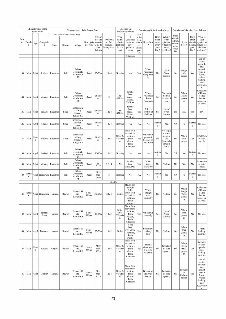
13
Characteristics of the Interviewee Characteristics of the Survey Area Question On
Pollution Problem Question on Noise from Railway Question on Vibration from Railway
Location of the Survey Area
Sr.No. Gende
r Age Occupation State District Village
Description of Area
Distance of the interview pt. To
the Railway
Conditions of the
Interview Survey Area.
What kind of
pollution problem do you have
If yes,select the worst
three pollution
items
Does noise from
railway
annoy your life
If yes how ?
Does other noise annoy your life ?
What is your
opinion to reduce the
noise problem ?
Does vibration from railway annoy your life
If yes how ?
Does other
vibration annoy
your life ?
What is your
opinion to reduce the vibration problem ?
Vibration
133 Man Adult Student Rajasthan Pali
School ,Front side of Marwar
RS
Rural 25-50m 1 & 4 Nothing NA Yes
When Passenger tain passes
by
No Use of Noise
barriers Yes
Freight train
passes Yes
use of traffic
controls that
smooth vehicle flow to reduce braking
and acceleratio
n
134 Man Aged Worker Rajasthan Pali
School ,Front side of Marwar
RS
Rural 50-100 m 3 Air
&Noise
Smoke from trains, Trains,
Vehicles
yes
When Passenger
Train Passenger
Yes
Not to ply the horn in school
area
Yes
When Trains passes
by
Yes
Reduction of Heavy
loaded Trucks
passes by on roads
135 Man Adult Service Rajasthan Sikar
School near railway
crossing, Ringas RS
Rural 50-100 m 1 & 4 Air
&Noise
Smoke from trains, Trains,
Vehicles
Yes Affects
Studies of children
Yes Use of Noise
barriers No NA No NA
136 Man Aged Retired Rajasthan Sikar
School near railway
crossing, Ringas RS
Rural 50-100 m 1 & 4 Nothing NA NA No Nothin
g No NA No Nothing No Idea
137 Man Young Student Rajasthan Sikar
School near railway
crossing, Ringas RS
Rural 10 - 25 m 1 & 2
Noise & Vibratio
n
Noise from recreational vehicles,
Train whistle, Train
Vibration
Yes
When train passes &
because of Rly. Horn
No
Not to ply horns in sensitive
area (hospitals,
schools etc.)
Yes When train
passes No
Limitation of train speeds
138 Man Aged Retired Rajasthan Pali
School ,Front side of Marwar
RS
Rural 10-25m 1 & 2 Nothing No NA No Nothing No NA No Nothin
g No Idea
139 Man Adult Worker Rajasthan Pali
School ,Front side of Marwar
RS
Rural 50-100m 1 & 4 Air
Smoke from
trains, Dust Yes
When train
passes by No No Idea No NA No
Limitation of train speeds
140 Female Adult Housewife Rajasthan Pali
School ,Front side of Marwar
RS
Rural More than
100 m 3 Nothing No NA No Nothin
g No NA No Nothing No Idea
SROP5
141 Female Adult Housewife Haryana Rewari
Temple, SR site ,
Rewari RS
Semi-Urban 25-50 m 2 & 4 Noise
Ringing of Temple Bells,
Noise from recreational vehicles,
Train whistle
yes
When Freight
train passes by
No Nothing Yes
When Freight Trains passes
by
No
Reduction of Heavy
loaded Trucks
passes by on roads
142 Man Aged Temple Preist Haryana Rewari
Temple, SR site ,
Rewari RS
Semi-Urban 10-25m 1 & 2
Noise and
Vibration
Noise from recreational vehicles,
Train whistle, Train
Vibration
Yes When train passes by Yes
Use of Noise
barriers Yes
When Train passes
by
No No Idea
143 Man Aged Business Haryana Rewari Temple, SR
site , Rewari RS
Semi-Urban 25-50m 1 & 2 Noise
Noise from
recreational vehicles,
Train whistle
Yes Because of
railway horn
No No Idea Yes
When Train passes
by
No silent
braking systems
144 Man Young Student Haryana Rewari
Temple, SR site ,
Rewari RS
Semi-Urban
More than 100m
1 & 4 Noise & Vibratio
n
Noise from recreational vehicles,
Train whistle, Train
Vibration
Yes
cause a disturbance to local residents.
Yes limitation
of train speeds,
Yes
When Freight trains passes
by
No
limitation of train speeds, silent
braking systems
145 Man Adult Worker Haryana Rewari Temple, SR
site , Rewari RS
Semi-Urban
More than 100m
1 & 4 Noise & Vibratio
n
Noise from recreational vehicles,
Train whistle, Train
Vibration
Yes Because of
Railway Station
Yes limitation
of train speeds,
Yes
Because of
Railway Station
No
use of traffic
controls that
smooth vehicle flow to reduce braking
and acceleratio
n
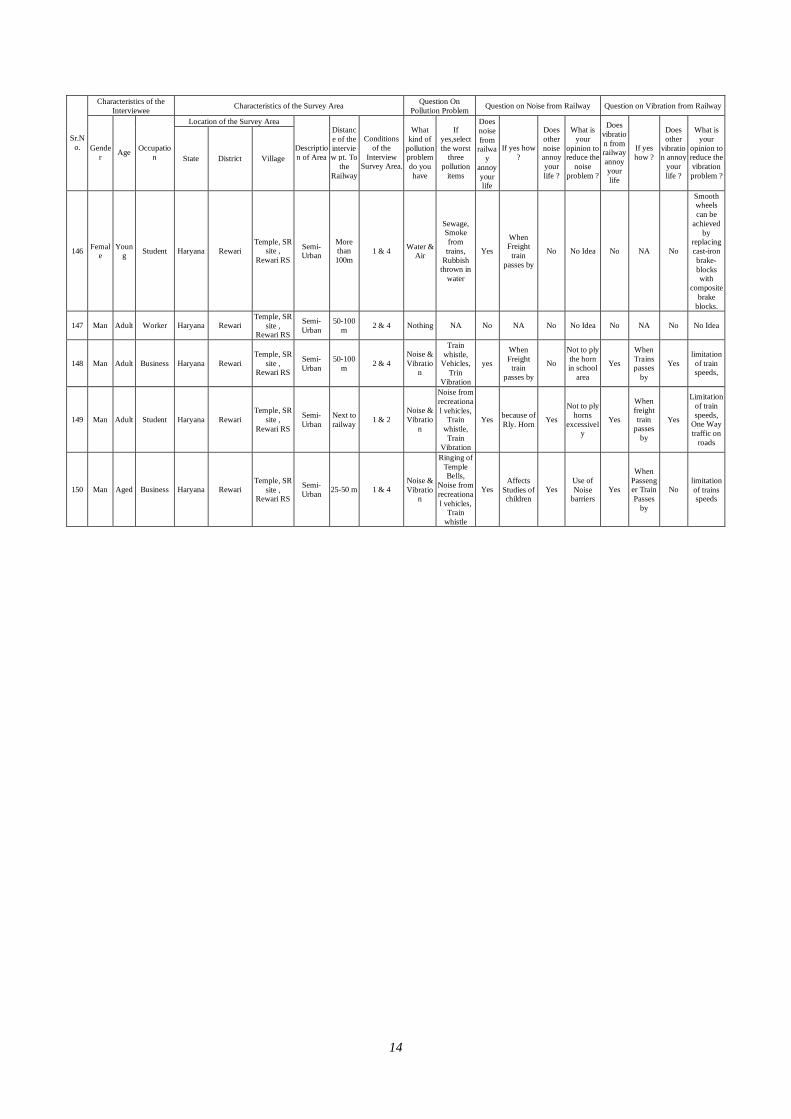
14
Characteristics of the Interviewee Characteristics of the Survey Area Question On
Pollution Problem Question on Noise from Railway Question on Vibration from Railway
Location of the Survey Area
Sr.No. Gende
r Age Occupation State District Village
Description of Area
Distance of the interview pt. To
the Railway
Conditions of the
Interview Survey Area.
What kind of
pollution problem do you have
If yes,select the worst
three pollution
items
Does noise from
railway
annoy your life
If yes how ?
Does other noise annoy your life ?
What is your
opinion to reduce the
noise problem ?
Does vibration from railway annoy your life
If yes how ?
Does other
vibration annoy
your life ?
What is your
opinion to reduce the vibration problem ?
146 Female
Young Student Haryana Rewari
Temple, SR site ,
Rewari RS
Semi-Urban
More than 100m
1 & 4 Water & Air
Sewage, Smoke from trains,
Rubbish thrown in
water
Yes
When Freight
train passes by
No No Idea No NA No
Smooth wheels can be
achieved by
replacing cast-iron brake-blocks with
composite brake
blocks.
147 Man Adult Worker Haryana Rewari Temple, SR
site , Rewari RS
Semi-Urban
50-100 m 2 & 4 Nothing NA No NA No No Idea No NA No No Idea
148 Man Adult Business Haryana Rewari Temple, SR
site , Rewari RS
Semi-Urban
50-100 m 2 & 4
Noise & Vibratio
n
Train whistle,
Vehicles, Trin
Vibration
yes
When Freight
train passes by
No
Not to ply the horn in school
area
Yes
When Trains passes
by
Yes limitation of train speeds,
149 Man Adult Student Haryana Rewari Temple, SR
site , Rewari RS
Semi-Urban
Next to railway 1 & 2
Noise & Vibratio
n
Noise from recreational vehicles,
Train whistle, Train
Vibration
Yes because of Rly. Horn Yes
Not to ply horns
excessively
Yes
When freight train
passes by
Yes
Limitation of train speeds,
One Way traffic on
roads
150 Man Aged Business Haryana Rewari Temple, SR
site , Rewari RS
Semi-Urban 25-50 m 1 & 4
Noise & Vibratio
n
Ringing of Temple Bells,
Noise from recreational vehicles,
Train whistle
Yes Affects
Studies of children
Yes Use of Noise
barriers Yes
When Passenger Train Passes
by
No limitation of trains speeds
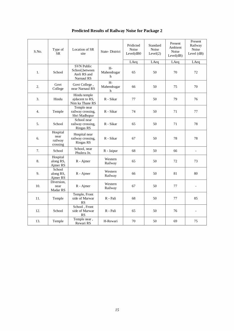
15
Predicted Results of Railway Noise for Package 2
Pridicted Noise
Level(dB0
Standard Noise
Level(2)
Present Ambient
Noise Level(dB)
Present Railway Noise
Level (dB)
S.No. Type of SR
Location of SR site State- District
LAeq LAeq LAeq LAeq
1. School
SVN Public School,between
Ateli RS and Narnaul RS
H-Mahendragar
h 65 50 70 72
2. Govt College
Govt College , near Narnaul RS
H-Mahendragar
h 66 50 75 70
3. Hindu Hindu temple
ajdacent to RS, Nim ka Thane RS
R - Sikar 77 50 79 76
4. Temple Temple near
railway crossing, Shri Madhopur
R - Sikar 74 50 71 77
5. School School near
railway crossing, Ringas RS
R - Sikar 65 50 71 78
6.
Hospital near
railway crossing
Hospital near railway crossing,
Ringas RS R - Sikar 67 50 78 78
7. School School, near Phulera Jn. R - Jaipur 68 50 66 -
8. Hospital
along RS, Ajmer RS
R - Ajmer Western Railway 65 50 72 73
9. School
along RS, Ajmer RS
R - Ajmer Western Railway 66 50 81 80
10. Diversion,
near Madar RS
R - Ajmer Western Railway 67 50 77 -
11. Temple Temple, Front side of Marwar
RS R - Pali 68 50 77 85
12. School School , Front side of Marwar
RS R - Pali 65 50 76 -
13. Temple Temple near , Rewari RS H-Rewari 70 50 69 75
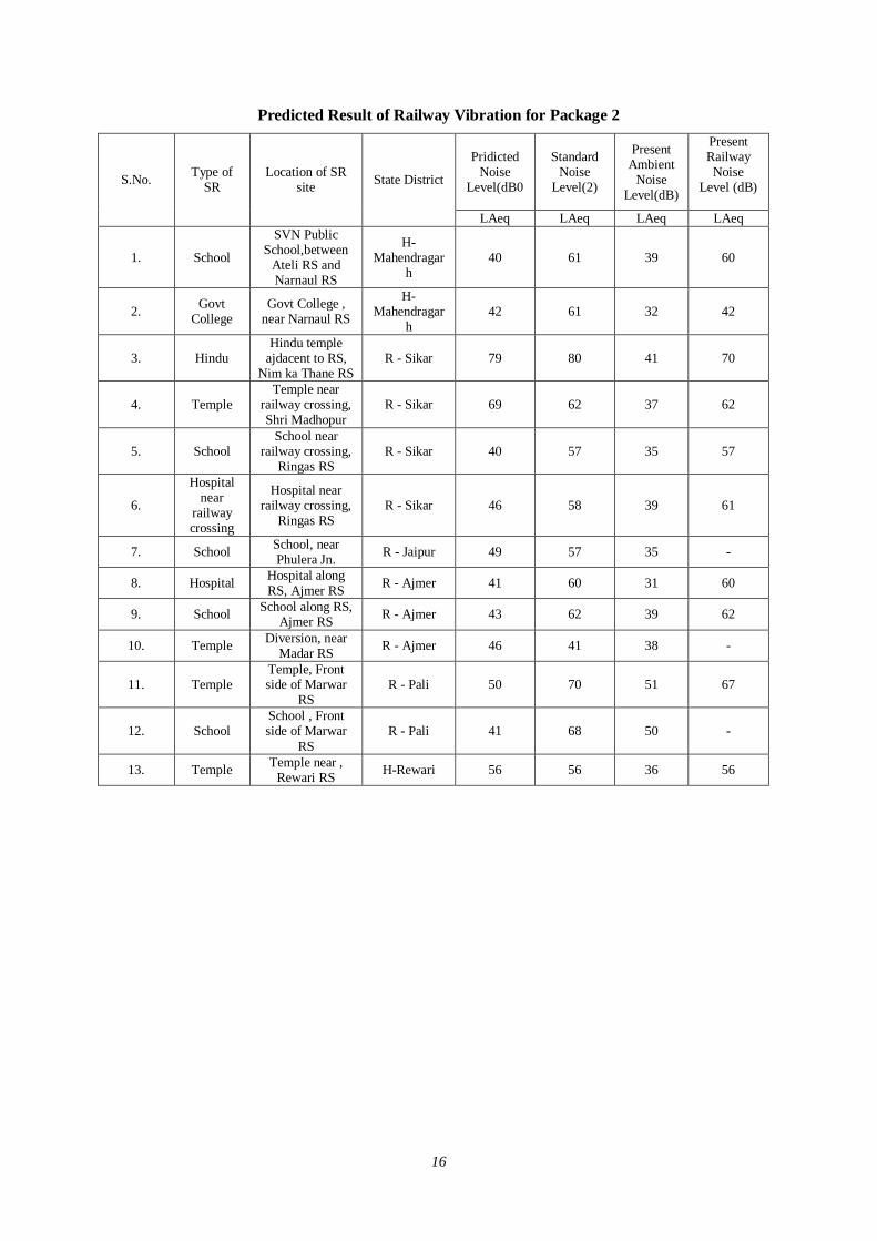
16
Predicted Result of Railway Vibration for Package 2
Pridicted Noise
Level(dB0
Standard Noise
Level(2)
Present Ambient
Noise Level(dB)
Present Railway Noise
Level (dB)
S.No. Type of SR
Location of SR site State District
LAeq LAeq LAeq LAeq
1. School
SVN Public School,between
Ateli RS and Narnaul RS
H-Mahendragar
h 40 61 39 60
2. Govt College
Govt College , near Narnaul RS
H-Mahendragar
h 42 61 32 42
3. Hindu Hindu temple
ajdacent to RS, Nim ka Thane RS
R - Sikar 79 80 41 70
4. Temple Temple near
railway crossing, Shri Madhopur
R - Sikar 69 62 37 62
5. School School near
railway crossing, Ringas RS
R - Sikar 40 57 35 57
6.
Hospital near
railway crossing
Hospital near railway crossing,
Ringas RS R - Sikar 46 58 39 61
7. School School, near Phulera Jn. R - Jaipur 49 57 35 -
8. Hospital Hospital along RS, Ajmer RS R - Ajmer 41 60 31 60
9. School School along RS, Ajmer RS R - Ajmer 43 62 39 62
10. Temple Diversion, near Madar RS R - Ajmer 46 41 38 -
11. Temple Temple, Front side of Marwar
RS R - Pali 50 70 51 67
12. School School , Front side of Marwar
RS R - Pali 41 68 50 -
13. Temple Temple near , Rewari RS H-Rewari 56 56 36 56
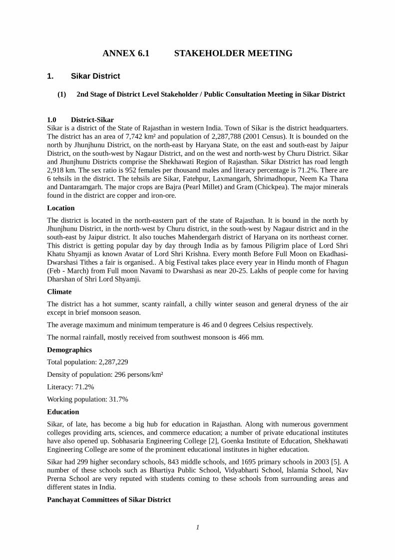
1
ANNEX 6.1 STAKEHOLDER MEETING 1. Sikar District
(1) 2nd Stage of District Level Stakeholder / Public Consultation Meeting in Sikar District
1.0 District-Sikar Sikar is a district of the State of Rajasthan in western India. Town of Sikar is the district headquarters. The district has an area of 7,742 km² and population of 2,287,788 (2001 Census). It is bounded on the north by Jhunjhunu District, on the north-east by Haryana State, on the east and south-east by Jaipur District, on the south-west by Nagaur District, and on the west and north-west by Churu District. Sikar and Jhunjhunu Districts comprise the Shekhawati Region of Rajasthan. Sikar District has road length 2,918 km. The sex ratio is 952 females per thousand males and literacy percentage is 71.2%. There are 6 tehsils in the district. The tehsils are Sikar, Fatehpur, Laxmangarh, Shrimadhopur, Neem Ka Thana and Dantaramgarh. The major crops are Bajra (Pearl Millet) and Gram (Chickpea). The major minerals found in the district are copper and iron-ore.
Location
The district is located in the north-eastern part of the state of Rajasthan. It is bound in the north by Jhunjhunu District, in the north-west by Churu district, in the south-west by Nagaur district and in the south-east by Jaipur district. It also touches Mahendergarh district of Haryana on its northeast corner. This district is getting popular day by day through India as by famous Piligrim place of Lord Shri Khatu Shyamji as known Avatar of Lord Shri Krishna. Every month Before Full Moon on Ekadhasi-Dwarshasi Tithes a fair is organised.. A big Festival takes place every year in Hindu month of Fhagun (Feb - March) from Full moon Navami to Dwarshasi as near 20-25. Lakhs of people come for having Dharshan of Shri Lord Shyamji.
Climate
The district has a hot summer, scanty rainfall, a chilly winter season and general dryness of the air except in brief monsoon season.
The average maximum and minimum temperature is 46 and 0 degrees Celsius respectively.
The normal rainfall, mostly received from southwest monsoon is 466 mm.
Demographics Total population: 2,287,229
Density of population: 296 persons/km²
Literacy: 71.2%
Working population: 31.7%
Education
Sikar, of late, has become a big hub for education in Rajasthan. Along with numerous government colleges providing arts, sciences, and commerce education; a number of private educational institutes have also opened up. Sobhasaria Engineering College [2], Goenka Institute of Education, Shekhawati Engineering College are some of the prominent educational institutes in higher education.
Sikar had 299 higher secondary schools, 843 middle schools, and 1695 primary schools in 2003 [5]. A number of these schools such as Bhartiya Public School, Vidyabharti School, Islamia School, Nav Prerna School are very reputed with students coming to these schools from surrounding areas and different states in India.
Panchayat Committees of Sikar District
2
Sikar has 8 Panchayat Samitis: Danta-ramgarh, Dhod, Fatehpur, Khandela, Laxmangarh, Neem Ka Thana, Piprali, and Srimadhopur. Each of this Panchayat Samiti is in turn made up of a number of villages. Each of the villages has population ranging from 300 to over 1,500.
2.0 Project Summary Sheet
T it le o f the P ro je c t C on d uc ting 3 rd R ou nd F in a l M e e ting o f S ik a r D istric tL e v e l S ta k e h o ld e r/P ub l ic C onsu l ta t ion M e e tin g fo rD e v e lopm e n t S tud y R e g a rd in g the D e d ic a te d M ult im od a lH igh A x le F re ig h t C o rrid o r fo r M in istry o f R a i lw a y G ov t.
D a te a nd P la c e o f M e e ting 0 6 -0 8 -0 7 P a n c h a y a t S a m it i H a l l N e e m K a T h a n a d ist t .S ik a r te h si l N e e m K a T h a n aN a m e o f th e L oc a l C onsu lt a n t: -M a n te c C o nsu lta n t P v t . L td . N e w D e lh i .N a m e o f th e M e e t ing F a c il i ta to r:G .M ., M a n te c a nd R e pre sa n ta t ive o f M a n te cN a m e o f N .G .O . :S W E E T IN S T IT U T E B A N S W A R A1 6 7 M a tra S a d a n C o m m e rc ia l A re a B a nsw a ra P h . N o .9 4 1 4 2 1 9 6 9 8N a m e o f th e M e e t ing F a c il i ta to r:P rog ra m m e O ffic e r, 'S w e e t ' B a n sw a ra
O rg a n iz ing P la c e P .S . N e e m K a T h a n a T e hsil N e e m a K a T h a n a D ist t . S ik a r
N o . Inv ite e s 1 5 0N o . o f P re se nc e 1 0 7
P e rson a l C on ta c t : D isp a tc h ing In v ita t io n L e tt e rs to A ffe c te d V il la g e sP re ss N e w s in N e w sp a p e r:In fo rm a tion a t P a nc ha ya t O ffic e a nd T e h . O ffic eM ik e a nn oun c e m e n t b y Je e pO the rs W ri t ing P a dB a ll P e nQ ue stionn a i reS lid e P re se n ta t ion – L .C .D L e c tu reG roup D isc ussio nQ ue stion /A nsw e r S e ssionS ti l l P ho tog ra ph y by C a m e raA ud io /V id e o R e c ord in gM inu te s o f M e e tin gN e w sp a p e r :- D a n ik B ha nsk e rR a ja sth a n P a trik a a n d O the r L oc a l P a p e rs
S ta t ion a ry S e rve d to th eP a rt ic ip a n ts
M e th od s A d o p te d fo r D i sc ussio n
M e th od s A d o p te d fo r D o c u m e n ta t ion
M e d ia C ov e ra ge
P R O J E C T S U M M A R Y S H E E T
L o c a l C on su lta n t
L o c a l O rga n iz e r
M e th od s U se d fo r In fo rm a t ion D isse m ina tio n
2.1 Selection of Stakeholders (Invitees) and List of Invitees of Stakeholder/Public Consultation Meeting In Sikar district 37 villages suppose to be affected by this proposed alignment near about five persons supposed to be affected by this project. In Sri Madhopur, Hanspura, Bagega, Nim Ka Thana, Makri, Mawanda Kalan villages some structure would be affected and in rest villages no structure will be
3
affected however in this villages land would be acquired. So in giving invitation special consideration was given to those villages that are affected in terms of structures.
Around 150 persons were invited to participate in Stakeholder/Public Consultation Meeting.
2.2 Method of Selection Stakeholder The Mantec Consultants Pvt. Ltd has already organized first stage of Stakeholder/participation meeting. They have authorized "Sweet Institute" to meet the concerned Government authority and collect relevant data for carrying forward social environment and to organize Public Consultation Meeting In continuous efforts second round PCM was held on 19.06.07 at Panchayat Samiti Sabha Bhawan Sri Madhopur, now the third meeting was being held on dated 06.08.07 at Neem Ka Thana Panchayat Samiti Sabha Bhawan to get the final suggestions from the people meeting of third PCM Sikar District.
For III Meeting in July detailed survey was done along the Railway track. We also contacted the affected people Gate wise. This survey was done with the previous information that we had calculated the No. of villages and families 30 Mt. from the Railway boundary in this connection many villages were affected. But now considering the 24 m range from the centre point of the last track the affected villages would be less.
We inform the affected families to attend the meeting on dated 06.08.07 at Neem Ka Thana. Our team leader on Motorbike and Jeep did a survey along the Railway line. We took some photographs of the places.
We also met and requested Panchayat Samiti to help in organizing the public meeting successfully. They assured us. All the stakeholders along the railway line, affected farmer's businessmen; private service and employers were invited to attend the meeting.
Public participation was undertaken to make explicit the social and other factors that affect development impact of dedicated freight corridor and mediate project.
Before starting the III PCM meeting survey forms were filled in by Mantec during field visit and track survey in month of july07. A track-to-track survey was done. It was noted that at every railway Gate, how many persons are affected. Their details were taken. Personal contact was also done. We also informed the affected families to attend the meeting on dated 06.08.07 at 12.00 pm.
The NGO” Sweet Institute” was appointed to conducted the Stakeholder Public Consultation Meetings and Survey
2.3 Selection of Meeting Facilitators Venue of the Meeting Looking to the stakeholders facility and Local Advice, the venue was decided the Hall of P.S. Neem Ka Thana (Village) where stakeholder can sit comfortably.
All the arrangements were made comfortable for sitting, drinking water, Tea and Snack, Photographer, Video Grapher etc by our Santhan.
For local publicity invitation letters through our facilitator were sent in the villages. In Dainik Bhasker and other local news paper & wide massage was given through mike announcement.
Invitation to public representatives and affected stakeholders were sent by hand to ensure the stakeholders participation in the meeting during the field visit & survey work.
Four facilitators were appointed for the participation meeting as follows:
Team leader Programme organizer
4
Record keeper to write the proceeding of the meeting One Translator to assist the Programme Looking to the local situation and weather all necessary arrangements were made by our team 2.4 Method of Information Dissemination 1. Method of Notifying Meeting to the Participants There were three methods adopted for informing the participants about 3rd public consultation meeting. In the First method our Team fixed the meetings at a particular venue with all the Village Sarpanchs of project-affected villages. Village Sarpanchs were also requested to inform other likely to be affected persons and attend the meetings. Our team announced the date and venue of 3rd public consultation meeting in all such villages gatherings congregated in project-affected villages. Hence, meeting facilitator team visited all the villages located along the existing railway line in the district and briefed up about this freight rail link to the villagers and role of Public consultation meeting in the execution of this project. Meeting facilitator team also disseminated the reports of the second public consultation meeting.
In second attempt, our organization also sought the help of government machinery for inviting the project-affected families of all project-affected villages.
In third attempt, our team also made a close correspondence with local media personnel and disseminated a lot of information about the relevance of stakeholders meetings. Our team also displayed banners and relevant handouts showing major features of the project and DFC alignment passing through the Sikar district.
2. Presentation of the Meeting Presentation of meeting material supplied by Mantec Consultants was displayed and distributed among the Stakeholders.
2.5 Venue of the Meeting Panchayat Samiti Neem Ka Thana, Tehsil Neema Ka Thana District. Sikar.
3.0 List of Participants of Stakeholder Public Consultation Meeting Around 107 participants were attended the Stakeholder Public Consultation Meeting.
3.1 Detail of the Stakeholder/Public Consultation Dated 06.08.07 District. Sikar Village Neem Ka Thana Stakeholders/Public consultation Meeting is a bottom up approach in this gigantic Freight Corridor project. It is one of the tools to reflect the views of general public as well as those connected with the project- Central and local Govt. organization to farmers and commercial and industrial sectors of the society. It is an important tool of information dissemination & to get the final suggestions from the villages.
The following persons attended the meeting: Pradhan Team Leader Stage Controller Minutes of Proceeding Recorder Facilitator
5
Time-12.00 Noon to 3.00 PM Firstly introduction Session was held Meeting Facilitator welcomed all the guests of Mantec & JICA, all participants Then inauguration was done by Pradhan of Neem Ka Thana Programme officer 'Sweet' gave the information and details of the working of Sweet Sansthan Banswara and gave details of Railway Survey Programme officer Sweet requested G.M. Mantec Consultants Pvt. Ltd. to give detail information of the DFC project. G.M. Mantec told that because of the ever growing economy of India, improvement of physical ability for moving goods by means of railways within the country is considered urgently needed; he also explained that the railway line starting from Mumbai running all the way up to Delhi is dedicated only for Freight Corridor and nothing to do with the passengers. Growth of major and minor ports of India, the traffic between Northern Hinterland and Western port and huge traffic of coal, steel, and fertilizer is anticipated on Ludhiana-Delhi-Howrah route. He said that there are lots of containers coming into this country from outside and landing at Mumbai and moving by train to Ahmedabad, Jaipur, Delhi upto Ludhiana. On average approximately 9000-loaded trucks move daily over the corridor, i.e. Delhi-Mumbai Western Corridor and Ludhiana-Hawrah Eastern corridor. He added that Freght Corridor is basically constructed alongside existing double track from Mumbai-Delhi, from palanpur up to Ahmedabad routes. From the city Vadodara adjoing the existing areas drawing up from Rajasthan, because of the congested areas, change all the way up to Mehsana the Freight Corridor has to be constructed avoiding the congestion on existing railway lines.
He also told about the Sikar Disst. Maximum 25 meters of land will be taken from the central line of the extreme track (existing/under conversion as BG on eastern side). The existing ROW of railway will be used, if available and Land Acquisition will be done for the balance land. 45 Meters of land strip will be acquired for the detour route as per the drawings shown. 1. Compensation will be made as NRR Policy, 2003. However the draft policy NRR policy, 2006
will also be considered for compensation, if applicable at the time of acquisition. 2. 11 Villages Neem Ka Thana will be affected by the DFC project they are Dabala, Jeelo, Natha Ki
Nangal, Bihar, Biharipur, Natha ki Nangal, Kunwara, Jatala, Mawanda Kalan, Shyamawali Makri Mandoli, Godwas Jassi Ka Bas, Govindpura, Bhegaga, Sirohi, Ranasar, Charanwas,Agawari and Nim Ka Thana In Sri Madhopur Block the following villages are being affected- Hanspur, Sargoth, ShimariaJageer, Kolwa, Jalalpur, Armiya, Mau, Sri, Madhopur, Kancharra, Jaswantpura, Chak JaswantpuraJarawar Nagar,Samota Ka Bas, Shahpura, Theekariya, Malikpura, Boari Madho ka Was, Shiv Colony, Sony Colony, Bhaharni, Malakhani, Maljiwali Dhani, Dairawali Dhani, Deriwali Dhani etc.
He also said about the Benefits of the Project:
1. Economic Riffle Effect 840 x 100Cr. 2. Total Investment 240 x 100 Cr. 3. Jobs Created 68000 4. Household Income 215.2 x 100 Cr. 5. Tax Revenue 17.64 x 100 Cr.
3.2 Statistical Analysis of the Participants
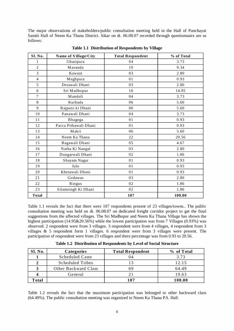
6
The major observations of stakeholders/public consultation meeting held in the Hall of Panchayat Samiti Hall of Neem Ka Thana District. Sikar on dt. 06.08.07 recorded through questionnaire are as follows:
Table 1.1 Distribution of Respondents by Village
Sl. No. Name of Village/City Total Respondent % of Total1 Ghasipura 04 3.732 Mavanda 10 9.343 Kawant 03 2.804 Meghpura 01 0.935 Derawali Dhani 03 2.806 Sri Madhopur 16 14.957 Mandoli 04 3.738 Kurbada 06 5.609 Rajputo ki Dhani 06 5.60
10 Panawali Dhani 04 3.7311 Bhagega 01 0.9312 Pacca Pithawali Dhani 01 0.9313 Makri 06 5.6014 Neem Ka Thana 22 20.5615 Bagawali Dhani 05 4.6716 Natha Ki Nangal 03 2.8017 Dungarwali Dhani 02 1.8618 Shayam Nagar 01 0.9319 Julo 01 0.9320 Khetawali Dhani 01 0.9321 Godawas 03 2.8022 Ringus 02 1.8623 Silamsingh Ki Dhani 02 1.86
Total 107 100.00 Table 1.1 reveals the fact that there were 107 respondents present of 23 villages/towns.. The public consultation meeting was held on dt. 06.08.07 on dedicated freight corridor project to get the final suggestions from the affected villages. The Sri Madhopur and Neem Ka Thana Village has shown the highest participation (14.95&20.56%) while the lowest participation was from 7 Villages (0.93%) was observed. 2 respondent were from 3 villages. 3 respondent were from 4 villages, 4 respondent from 3 villages & 5 respondent form 1 villages. 6 respondent were from 3 villages were present. The participation of respondent were from 23 villages and there percentage was from 0.93 to 20.56.
Table 1.2 Distribution of Respondents by Level of Social Structure
Sl. No. Categories Total Respondent % of Total1 Scheduled Caste 04 3.732 Scheduled Tribes 13 12.153 Other Backward Class 69 64.494 General 21 19.63
Total 107 100.00
Table 1.2 reveals the fact that the maximum participation was belonged to other backward class (64.49%). The public consultation meeting was organized in Neem Ka Thana P.S. Hall.
7
The representation of General listed II (19.63%) and IIIrd listed S.T. (12.15%) and IVth listed S.C. (3.73%). The data shows that less percentage of S.C. was observed. The O.B.C. percentage was the highest (64.49%).
Table 1.3 Distribution of Participants by Family Size
Sl. No. Categories Total Respondent % of Total1 Less then 4 12 11.222 Less then 6 46 42.993 More Less then 6 49 45.79
Total 107 100.00
Table 1.3 brings out that the family size varies from less than four persons to more than six persons in the meeting. The respondents having lowest representation that is less than four persons family size was represented by 11.2%.
The less than 6 members family size was 42.99 % .The maximum respondent having highest family size that was more than 6 persons represented by 45.79 %. It reveals the fact that 42.99+45.79% families have more than 6 Members people is not adopting family planning.
Table 1.4 Distribution of Participants by Origin
Sl. No. Categories Total Respondent % of Total1 Native 103 96.262 Migrated 04 3.74
Total 107 100.00
Table 1.4 points out that majority 103 % of the respondents were original or native inhabitants of Sikar District. Only 4 participants have reported that they are migrated from outside the District. No views were given on majority and minority issues in the III public consultation meeting.
Table 1.5 Distribution of Participants by Literacy Status Sl. No. Categories Total Respondent % of Total
1 Literate 107 100.002 Illiterate 00 0.00
Total 107 100.001 Under Matric 66 61.682 Matric 27 25.233 Graduate 14 13.094 Professional - -
Total 107 100.00
Table 1.5 shows that 100.0% people participating in the III public consultation meeting were literate
It shows that distribution of participant educational attainment is very high, It can be taken as an indicator of social development of any district. The professional category has been 0%, the highest proportion of respondent was observed in under metric 61.7%. They are from labor class or agriculture. The analysis shows that as the educational level increases the proportion of the respondent decreases. The metric pass respondents were 27 only (25.2%) but they are not employed they did not get any job and doing agriculture work. They were interested to get jobs from the DFC project.
8
Table 1.6 Distribution of Participants by Occupation
Sl. No. Categories Total Respondent % of Total1 Agriculture 74 69.162 Private Service 16 14.953 Govt. Service 07 6.544 Business 10 9.35
Total 107 100.00
Table 1.6 shows that the highest proportions of the respondent were engaged in primary activities of agriculture. Agriculture is the main occupation of 69.16% respondents. As per data 16 respondents are engaged in private service and 7 respondents are engaged in Govt. service 10 respondent are from businessmen. The lowest percentage was observed in Govt. service maximum people are poor and depend on agriculture and they wanted some kind of jobs from the railway.
Table 1.7 Distribution of Participants by Level of Yearly Income
Sl. No. Categories Total Respondent % of Total1 5000-10000 13 12.152 10001-25000 38 32.513 25001-50000 33 30.844 50001-100000 23 21.505 100001 and above - -
Total 107 100.00
Table 1.7 Total respondent’s level of yearly income was divided in to 5 categories. The data reveals that the level of annual house hold income 5000-10000 (12.15%) and II 10001-25000 was 35.51%, and III stands in the range 25001-50000 (30.84%). from 50001 to -100000 23 participants work having 21.50%, No respondents were from 1000001 and above. It shows that the people are poor and facing hard ship.
Table 1.8 Distribution of Participants by Impacts of Project
Sl. No. Categories Total Respondent % of Total1 Significant 105 98.132 Relatively Significant 02 1.873 Insignificant Impact4 Negligible Impact
Total 107 100.00
Table 1.8 shows that the 105 respondent (98.13%) told the impact of project would be significant and 2 respondents (1.87%) replied that the impact would be relatively significant. No respondents told that there would be insignificant impact or Negligible Impact because only 24 m. land is acquired from the center of the last track.
Table 1.9 Distribution of Participants by Type of Impacts of Proposed Project
Sl. No. Categories Total Respondent % of Total1 Loss of land 76 71.032 Loss of Occupation 31 28.973 Loss of Livelihood - -4 Others - -
Total 107 100.00
9
Table 1.9 Shows that 76 respondents (71.03%) will have loss of land because it is their primary occupation while 31 respondent (28.97) told that they would have loss of Occupation although none respondents reply about Loss of lively hood & others impact.
Table 10 Distribution of Participants by Type of Compensation by Govt.
Sl. No. Categories Total Respondent % of Total1 Land 72 67.282 Cash 35 32.723 House ---------- -----------4 Others -------- --------
Total 107 100.00
Table 1.10 shows that if Govt. acquires the land what type of compensation they wanted. 72 respondents (67.28%) wanted that they should be given land for land while 35 respondents (32.72%) replied that they wanted cash compensation for land. No body has given choice for the house and other facilities for the compensation.
3.3 Question /Answers during the Meeting Name Villager, Agral
Q.1 Sir, it is a requested to see the map of 1895. The track was constructed in 1905. If you will go according the old record of railway. You will have no problem?
Ans. Good suggestion we shall also go through the map and record. Some people have acquired unauthorized land of railway and they have no documents of land. If they have no record even then they will get 10000 Rs. Interim assistance.
Name Villager, Govindram Mavanda
Q.2 Sir, My well is in the west and land is in the east. Will there be provision for water to go in the East under the track?
Ans. Yes, there was provision earlier also and this time the provision would be given for this No body would be suffered.
Name Villager, Neem Ka Thana
Q.3 Sir We have received information the collector and Govt. that you are going to acquire 200 m Land. Please clarify the matter?
Ans. No. we are not going to acquire 200 m land you can just contact the district administration. It was simply survey work. What will we do with the extra land at present? We need only 24 m land from the center of the last track. There will be 2 tracks, one for up and one for down. 140 trains will pass in a day. This will be double track only for freight corridor. It is nothing to do with the regular track so please doesn't confuse your self and other people in the meeting.
Name Villager, Shiv Colony Sri Madhopur
Q.4 What would be the compensation rate?
Ans. The compensation of land, house and structure would be given from present market rate. They will be given interim assistance of Rs. 10000 and 30% would be given extra from the market rate.
10
Name Villager, Shiv Colony Sri Madhopur
Q.5 How much land would be acquired in Detour?
Ans. Where there will be detour or by pass the land would be taken 45 Mt. from the center of the last track. If there is railway land available, no land would be acquired but land is not available then extra land would be acquired.
Name Villager, Ringus
Q.6 What will be height were there is crossing?
Ans. Where there is crossing the height of the bridge would be 15 feet. At present D.F.C. is studying feasibility estimation.
Name Villager, Jat
Q.7 Sir, You have not informed the railway authority and district administration. There is difference in your statement?
Ans. It is nothing like that we have already discussed at the center and state level meeting. If you get any wrong information you can confirm from the railway department authorities. We have found more confusion in Sikar District so the reactions are coming from you. But this is the last and final meeting. Only 24 m land would be acquired.
Name Villager, Julo
Q.8 Sir, Our Railway station is in the East. Will it be transferred from East to West?
Ans. Any Structure of Govt. or Pvt. In the East will be transferred in the West. The DFC corridor will be constructed in the East.
Name Villager
Q.9 If there is no earning member in the family, will he get service in the railway?
Ans. G.M. Mantec told that your Question is very good. We have note down in the report and suggest the Govt. You can get the jobs according to your experience, ability and qualification. As I have already told that 680000 jobs will be created from the corridor I hope you will be employed.
Name Villager, Neem ka Thana
Q.10 Is there any provision of gate in present corridor?
Ans. G.M. Mantec told that on the DFC 140 trains will go in a day 70 up and 70 down. The speed up the train would be 100 km. per hour. The route would so busy that no body can pass on the track there is provision of ROB / RUB for the facility of the people they will be constructed as and where needed. There is no provision of gate in the present’s corridor.
Name Villager
Q.11 When this Project will start to work and when the compensation would be given?
11
Ans. G.M. Mantec told that the survey work is going to complete and the project will start to work in 2009 and would complete its work in 2014. The compensation would be given in time you need not to worry. You will get good compensation and good amount.
Name Villager, Neem Ka Thana
Q.12 Will there be any more meeting or survey for it?
Ans. G.M. Mantec told that this the last meeting. You have been invited for your good suggestions.
We are here to note down your points and to give report to the higher authorities.
3.4 Suggestions to the Project Owner in Terms of Engineering, Social and Environmental Concern 1. Fair compensation should be given in time at the market rate. 2. They should be settled at proper place for residence. 3. Ghanshyam Jangid Suggested that there is 30 m land behind the Neem Ka Thana Railway
Station. Where the Railway Colony and GRP Thana is situated. If GRP Thana & Railway colony is removed and the railway station of Neem Ka Thana is constructed, we shall get enough space. The present track, which is coming in detour, will be straight. In this situation we shall get enough places and without any lose, this track can be made in the east for the DFC Railway corridor. There are enough places for railway colony in the North and GRP Thana can be on the Railway Station.
4. The rehabilitation plan should be made first and then people should be settled. 5. Those that have land in the East and West. There should be provision for drains to carry the
flow of the water. 3.5 Summary of Stakeholder Public Consultation Meeting There was gathering of 107 people. We have invited 150 stakeholders but reading the news in the newspapers some uninvited persons attended the meeting. 107 stakeholders filled in the forms.107 respondents of 23 village participated in the III public consultation meeting aimed DFC project to get final suggestion from the villagers. The Neem Ka Thana & Sri Madhopur villages have shown the highest participation (20.56 & 14.95%), while the lowest participation was observed from Meghpura, Bhagega, Pakka Pithawali dhani, Shyam Nagar, Julo and Khetawali Dhani (0.93%).
It was noted that there were 64.5% belongs to OBC while 12.2% from S.T. Caste. The lowest percentage was from S.C. Caste (3.7%). The General percentage was 19.6%, From S.C. 3.7%.
The people having more than 6 children percentage were 45.5% and the people having less than 6 children percentage were 43.0%. It is difficult to run their family and belong to poor caste. So they wanted employment for their lively hood.
The analysis reveals those majorities 96.3% of the respondents in the meeting were original in habitants. The literacy percentage was 100% but under metric percentage was 61.7%. & 13.9% were graduates. It reveals the fact that people are less in Govt. Service & Private Service.
The study showed that higher educational level witnesses the decreasing proportion of the respondent because they are less worried about the DFC project.
It was also investigated that the occupational pattern is quite diversified. 69.2% respondents are engaged in agriculture while businessman's percent is 9.4% only. Agriculture is main occupation of the villagers. The level of income reveals the fact that 12.2% respondent were in 5,000 to 10,000 yearly income while 35.5% respondent were from 10001 to 25,000. 30.8% respondent were in the range of 25,001 to 50,000 and 50,001 to 100,000 were 21.5% there is no one in the above range of 100,000 It shows that the area belong to poor people & they have lively hood problems.

12
The table 8 Shows that only 98.2% People have significant effect and 1.9% said that they have relatively significant effect.
The Sikar District. People were very happy. They wanted to start the project work at the earliest. They would get employment and were in favor of DFC Corridor.
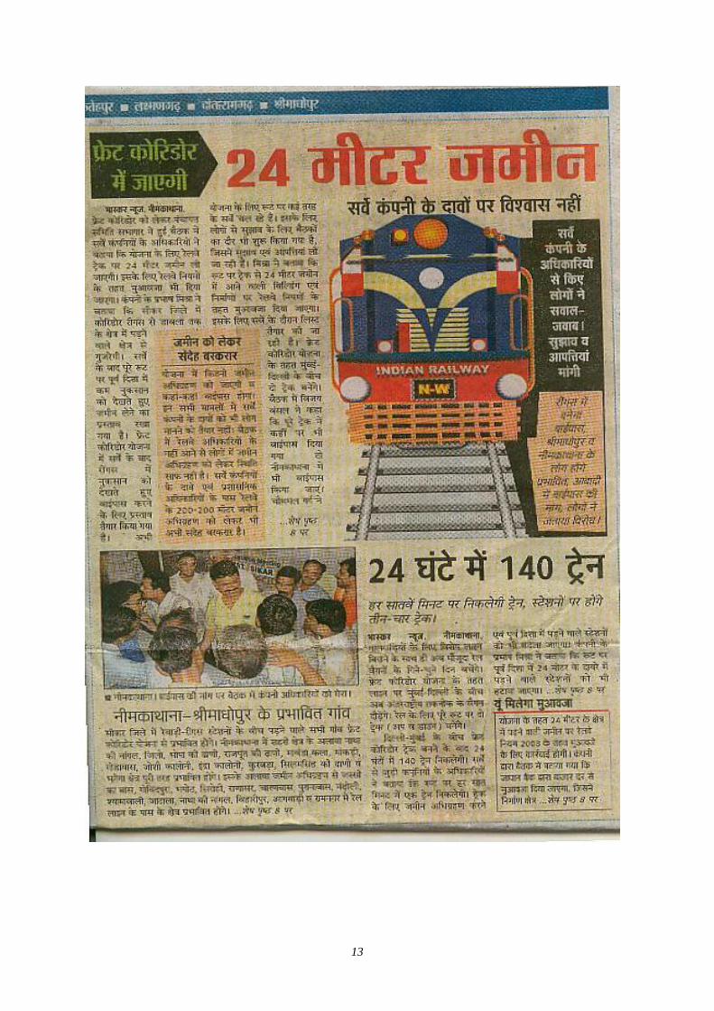
13
14
(2) 3rd stage of Village Level Stakeholder / Public Consultation Meeting in Sikar District
1.0 Brief Description of State and District (Sikar) The Rajasthan State International fronties of 140 km with Pakistan. Arawali Hill Range runs diagonally from south west through its middle. Nearly 61 % area of state lies west of the Arawalies, which is characterized by extremes in temperature and scanty rain fall varying annually from 20 to 40 cm. average.
Areas East of Aravalies has comparatively fertile soil and good annual rainfall varying 40 to 80 cms. The Geographical diversities of the state have made it vulnerable to drought and Scarcity condition. Sikar is situated in Center of Rajasthan. It is bounded on the north by the Jalor and Pali District, on the west by the Jalor and Gujarat state, on the South by the Gujarat state and on the east by the Pali and Udaipur District. It covers the area of 5,136 km2. Marwari is the local language and Hindi is the official language of the District.
1. Tehsil 5
2. Population 850,756,
3. Male/Female Ratio 944
4. Literacy Rate 54.4%
5. Roads 1,196 km
6. Crops maize oilseeds
7. Minerals copper, lead, bauxite and fluoride.
The Stakeholders Public Consultation final and last meeting for the proposed DFC project was conducted in the hall of Panchayat Samiti Neem Ka Thana, District. Sikar Tehsil Neem Ka Thana, on dated 06/08/07 to disseminate general information to public about the proposed project and to get final suggestions. 23 villages are of Sri Madhopur and Neem ka Thana is mostly affected by the proposed Railway corridor in Sikar District.
The Chief Guest was Pradhan Mr. Parmanand Yadav and the Consultant was Mr. Sanjeev Sharma (General Manager) and Mr. Prabash Mishra (Sociologist), Mantec Consultant Pvt. Ltd. The 3rd round meeting was started at 12 Noon and Continued up to 3 PM.
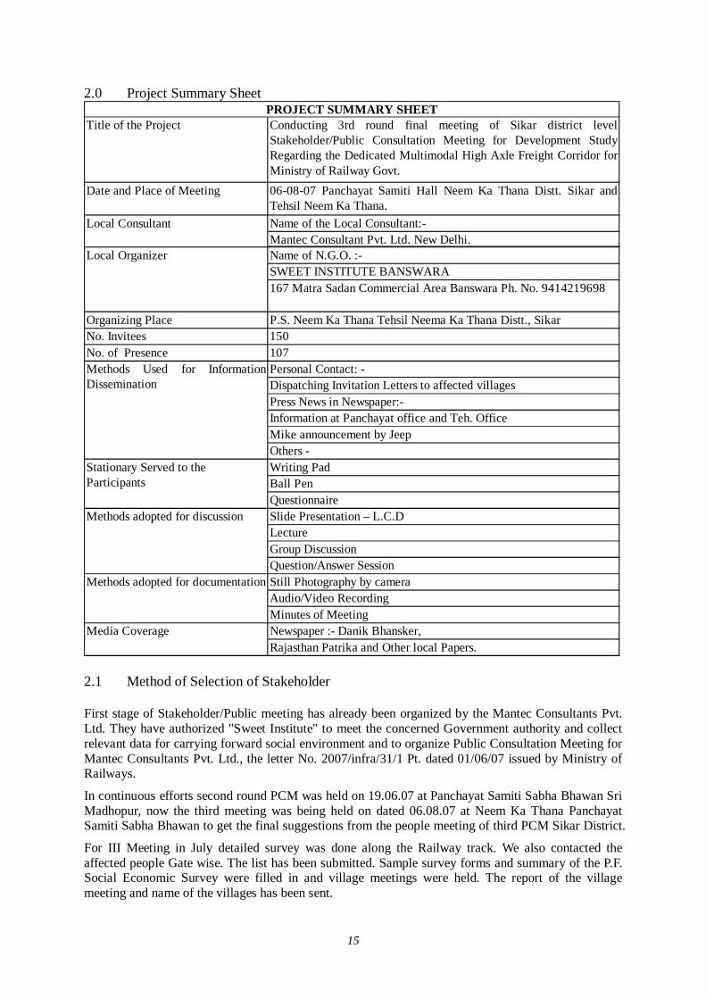
15
2.0 Project Summary Sheet
Title of the Project Conducting 3rd round final meeting of Sikar district levelStakeholder/Public Consultation Meeting for Development StudyRegarding the Dedicated Multimodal High Axle Freight Corridor forMinistry of Railway Govt.
Date and Place of Meeting 06-08-07 Panchayat Samiti Hall Neem Ka Thana Distt. Sikar andTehsil Neem Ka Thana. Name of the Local Consultant:-Mantec Consultant Pvt. Ltd. New Delhi.Name of N.G.O. :-SWEET INSTITUTE BANSWARA167 Matra Sadan Commercial Area Banswara Ph. No. 9414219698
Organizing Place P.S. Neem Ka Thana Tehsil Neema Ka Thana Distt., Sikar No. Invitees 150No. of Presence 107
Personal Contact: -Dispatching Invitation Letters to affected villagesPress News in Newspaper:-Information at Panchayat office and Teh. Office Mike announcement by JeepOthers - Writing PadBall PenQuestionnaireSlide Presentation – L.C.D LectureGroup DiscussionQuestion/Answer SessionStill Photography by camera Audio/Video RecordingMinutes of MeetingNewspaper :- Danik Bhansker,Rajasthan Patrika and Other local Papers.
Stationary Served to the Participants
Methods adopted for discussion
Methods adopted for documentation
Media Coverage
PROJECT SUMMARY SHEET
Local Consultant
Local Organizer
Methods Used for InformationDissemination
2.1 Method of Selection of Stakeholder First stage of Stakeholder/Public meeting has already been organized by the Mantec Consultants Pvt. Ltd. They have authorized "Sweet Institute" to meet the concerned Government authority and collect relevant data for carrying forward social environment and to organize Public Consultation Meeting for Mantec Consultants Pvt. Ltd., the letter No. 2007/infra/31/1 Pt. dated 01/06/07 issued by Ministry of Railways.
In continuous efforts second round PCM was held on 19.06.07 at Panchayat Samiti Sabha Bhawan Sri Madhopur, now the third meeting was being held on dated 06.08.07 at Neem Ka Thana Panchayat Samiti Sabha Bhawan to get the final suggestions from the people meeting of third PCM Sikar District.
For III Meeting in July detailed survey was done along the Railway track. We also contacted the affected people Gate wise. The list has been submitted. Sample survey forms and summary of the P.F. Social Economic Survey were filled in and village meetings were held. The report of the village meeting and name of the villages has been sent.
16
This survey was done with the previous information that we had calculated the No. of villages and families 30 Mt. from the Railway boundary in this connection many villages were affected. But now considering the 24 Mt. ranges from the centre point of the last track the affected villages would be less.
Consultancy informs the affected families to attend the meeting on dated 06.08.07 at Neem Ka Thana. A survey along the Railway line was done by our teem leader on Motor bike & Jeep. We took some photographs of the places.
Members of Consultancy also met and requested Panchayat Samiti to help in organizing the public meeting successfully and they assured. All the affected stakeholders along the railway line like farmer's, businessmen, and employers were invited to attend the meeting.
Public participation was undertaken to make explicit the social and other factors that affect development impact of dedicated freight corridor and mediate project. Consultancy sent volunteers along the railway line to invite the affected public and house holds through letters for attending the meeting.
Before starting the III PCM meeting survey forms were filled by Programme officer 'Sweet' during field visit and track survey in month of july07. A track-to-track survey was done. It was noted that at every railway Gate, how many persons are affected. Their details were taken. Personal contact was also done. All this information has been sent. Consultancy also informed the affected families to attend the meeting on dated 06.08.07 at 12.00 pm.
Results
Through public participation, stakeholders meeting, key social issues were identified and replied by Mantec G.M. There was confusion about the affected area. Programme officer 'Sweet' told that 24 m areas along the Railway line are affected. The main issue was addressed how poor and vulnerable groups may benefit from the project. The facilitator team visited the affected villages of Sikar and requested Primary and Secondary stakeholders to attend the meeting. To invite the most affected stakeholders the limited No. of stake holders has been invited. But by reading the newspapers, uninvited and interested persons attended the public consultation meeting. It was good that the people are interested to know more about the DFC project. It was good sign.
2.2 Selection of Meeting Facilitators 1. Venue of the meeting
Looking to the stakeholders facility and Local Advice, the venue was decided the Hall of P.S. Neem Ka Thana (Village) where stakeholder can sit comfortably.
2. All the arrangement was made by Santhan like drinking water, Tea and Snack, Photographer, Video Grapher etc.
For local publicity invitation letters through facilitator were sent in the villages. In Dainik Bhasker and other local news paper wide massage was given through mike announcement.
3. Invitation to public representatives and affected stake holders were sent by hand to ensure the stake holders participation in the meeting during the field visit and survey work. 4. Four facilitator were appointed for the participation meeting as follows.
Team leader Programme Organizer Record keeper to write the proceeding of the meeting One Translator to assist the Programme
17
Looking to the local situation and weather all necessary arrangements were made by our team. 2.3 Selection of Stakeholders (Invitees) Around 150 persons were invited for attending the Stakeholder/Public Consultation Meeting
2.4 Method of Information Dissemination 1. Local newspapers about the venue and date of meeting.
2. Information of DFC Project to the local stakeholders by face to face during village level meeting.
3. Invitation letters to the affected stake holders during the survey of Railway track. 4. Information to Sarpanch /Public representatives by official letters. 3.0 Participants of Stakeholder/Public Consultation Meeting Around 107 participants were attended the Stakeholder/Public Consultation Meeting.
3.1 Detail of the Stakeholder/Public Consultation Dated 06.08.07 District. Sikar Village Neem Ka Thana Stakeholders/Public Consultation Meeting is a bottom up approach in this gigantic Freight Corridor Project. It is one of the tools to reflect the views of general public as well as those connected with the project. (Central and local Govt. organization to farmers and commercial and industrial sectors of the society). It is an important tool of information dissemination and to get the final suggestions from the villages.
The following persons attended the meeting:
Pradhan. Team Leader. Stage Controller. Proceeding Recorder of Minutes. Facilitator
3.2 Time - 12.00 Noon to 3.00 PM At first Introduction Session was held. facilitator of meeting welcomed all the guests of Mantec and JICA, and all Participants.
Then inauguration was done by Pradhan Neem Ka Thana.
Programme officer 'Sweet' gave the information and details of the working of Sweet Sansthan Banswara and gave details of Railway Survey.
Programme Officer 'Sweet' requested to G.M. Mantec to give detail information of the DFC project.
G.M. Mantec told that because of the ever growing economy of India, improvement of physical ability for moving goods by means of railways within the country is considered urgently needed, he also explained that the railway line starting from Mumbai running all the way up to Delhi is dedicated only for Freight Corridor and nothing to do with the passengers. Growth of major and minor ports of India, the traffic between Northern Hinterland and Western port and huge traffic of coal, steel, and fertilizer is anticipated on Ludhiana-Delhi-Howrah route. He said that there are lots of containers coming into this country from outside and landing at Mumbai and moving by train to Ahmedabad, Jaipur, Delhi upto Ludhiana. On an average approximately 9000 loaded trucks move daily over the corridor, i.e.
18
Delhi-Mumbai Western Corridor and Ludhiana-Hawrah Eastern corridor. He added that Freight Corridor is basically constructed alongside existing double track from Mumbai-Delhi, from palanpur upto Ahmedabad routes. From the city Vadodara adjoining the existing areas drawing up from Rajasthan, because of the congested areas, change all the way up to Mehasana, the Freight Corridor has to be constructed avoiding the congestion on existing railway lines.
G.M. Mantec also told following points about the Sikar Disst. :
Maximum 24 meters of land will be taken from the central line of the extreme track (existing/under conversion as BG on eastern side). The existing ROW of railway will be used, if available and Land Acquisition will be done for the balance land.
45 Meters of land strip will be acquired for the detour route as per the drawings shown.
Compensation will be made as NRR Policy, 2003. However the draft policy NRR policy, 2006 will also be considered for compensation, if applicable at the time of acquisition.
11 Villages Neem Ka Thana will be affected by the DFC project they are Dabala, Jelo, Natha Ki Nangal, Bhopa ki Dhani, Rajput Ki Dhani, Mavanda Kala, Makri, Godawas, Neem Ka Thana, Joshi Colony, Kurbada, Silamsing Ki Dhani.
In Sri Madhopur Block the following villages are being affected- Hanspur, Madho ka Was, Shiv Colony, Sony Colony, Bhaharni, Malakhani, Maljiwali Dhani, Dairawali Dhani, Deriwali Dhani etc.
He also said about the benefits of the project
1. Economic Riffle Effect : 840 x 100Cr. 2. Total Investment : 240 x 100 Cr. 3. Jobs Created : 68000 4. Household Income : 215.2 x 100 Cr. 5. Tax Revenue : 17.64 x 100 Cr.
Along with Rail line, stations, bridges, signals and control system, electricity supply system rehabilitation of cargo handling yards also have to be developed.
Programme officer 'Sweet' thanked to G.M. Mantec for giving the detail information of the project and also thanks to people.
3.3 Question /Answers during the Meeting After listening the lecture of G.M. 'Mantec', Programme officer 'Sweet', invited the participants to ask question one by one to G.M. 'Mantec'.
Name Villager Agral
Q. 1 Sir, Your requested to see the map of 1895. The track was constructed in 1905. If you go through the old record of railway. You will have no problem?
Ans. Good suggestion we shall also go through the map and record. Some people have acquired unauthorized land of railway & they have no documents of land. If they have no record even then they will get 10000 Rs. Of interim assistance. People will be settled led were they would like to go. In this case public will suffer. Additional assistance of Rs. 30000 will be given to them.
Name Villager, Mavanda
Q.2 Sir, My well is in the west and land is in the east. Will there be provision for water to go in the East under the track?
19
Ans. Yes, there was provision earlier also and this time the provision would be given for this. No body would be damaged.
Name Villager, Neem Ka Thana
Q.3 Sir We have received information from the collector and Govt. that you are going to acquire 200 Mt. Land. Please clarify the matter?
Ans. No, we are not going to acquire 200 Mt. lands you can just contact the district administration. It was simply survey work. What will we do with the extra land at present? We need only 24 Mt. lands from the center of the last track. There will be 2 tracks, one for up and one for down. 140 trains will pass in a day. This will be double track only for freight corridor. It is nothing to do with the regular track. So please do not confuse your self and other people in the meeting.
Name Villager, Sri Madhopur
Q.4 What would be the compensation rate?
Ans. The compensation of land, house & structure would be given from present market rate. They will be given interim assistance of Rs. 10000 and 30% would be given extra from the market rate.
Name Villager, Shiv Colony Sri Madhopur
Q.5 How much land would be acquired in Detour?
Ans. Where there will be detour or by pass the land would be taken 45 Mt. from the center of the last track. If there is railway land available, no land would be acquired but land is not available then extra land would be acquired.
Name Villager, Ringus
Q.6 What will be height were there is crossing?
Ans. Where there is crossing the height of the bridge would be 15 feet. At present D.F.C. is studying feasibility estimation.
Name Villager
Q.7 Sir, You have not informed the railway authority & district administration. There is difference in your statement?
Ans. It is nothing like that we have already discussed at the center and state level meeting. If you get any wrong information you can confirm from the railway department authorities. We have found more confusion in Sikar District so the reactions are coming from you. But this is the last and final meeting. Only 24 Mt. lands would be acquired.
Name Villager, Julo
Q.8 Sir, Our Railway station is in the East. Will it be transferred from East to West?
Ans. Any Structure of Govt. or Pvt. In the East will be transferred in the West. The DFC corridor will be constructed in the East.
Name Villager
Q.9 If there is no earning member in the family, will he get service in the railway?
20
Ans. G.M. 'Mantec' told that your Question is very good. We have note down in the report and suggest the Govt. You can get the jobs according to your experience, ability and qualification. As I have already told that 680000 jobs will be created from the corridor I hope you will be employed.
Name Villager, Neem ka Thana
Q.10 Is there any provision of gate in present corridor?
Ans. G.M. 'Mantec' told that on the DFC 140 trains will go in a day 70 up and 70 down. The speed up the train would be 100 km. per hour. The route would so busy that no body can pass on the track there is provision of ROB / RUB for the facility of the people they will be constructed as and where needed. There is no provision of gate in the present's corridor.
Name Villager
Q.11 When this Project will start to work and when the compensation would be given?
Ans. G.M. 'Mantec' told that the survey work is going to complete and the project will start to work in 2009 and would complete its work in 2014. The compensation would be given in time, the process is going on. You need not to worry. You will get good compensation and good amount.
Name Villager, Neem Ka Thana
Q.12 Will there be any more meeting or survey for it?
Ans. G.M. 'Mantec' told that this the last meeting. You have been invited for your good suggestions. We are here to note down your points and to give report to the higher authorities.
Note
There was a good discussion with the participants. They have their on points. Satisfied answers were given by Mr. Sanjeev Sharma. There was good gathering of the people.
Since there was no other point to discuss and stake holders were happy to listen the Mantec presentation. They agreed that the DFC project would be beneficial for villages of Sikar. So the meeting ended with a vote of thanks to the chair
3.4 Profile of Participants The major observations of stakeholders/public consultation meeting held in the Hall of Panchayat Samiti Hall of Neem Ka Thana District. Sikar on Dt. 06.08.07 recorded through questionnaire are as follows:
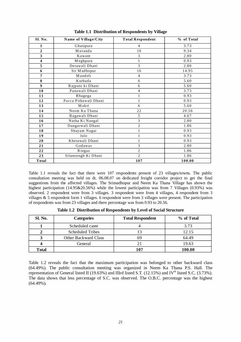
21
Table 1.1 Distribution of Respondents by Village Sl. No. N ame of V illage/C ity T otal R espondent % of Total
1 Ghasipura 4 3.732 M avanda 10 9.343 Kawant 3 2.804 M eghpura 1 0.935 Derawali Dhani 3 2.806 Sri M adhopur 16 14.957 M andoli 4 3.738 K urbada 6 5.609 R ajputo ki D hani 6 5.60
10 Panawali Dhani 4 3.7311 B hagega 1 0.9312 Pacca P ithawali Dhani 1 0.9313 M akri 6 5.6014 Neem Ka Thana 22 20.5615 B agawali Dhani 5 4.6716 Natha K i Nangal 3 2.8017 Dungarwali Dhani 2 1.8618 Shayam Nagar 1 0.9319 Julo 1 0.9320 Khetawali D hani 1 0.9321 Godawas 3 2.8022 R ingus 2 1.8623 Silamsingh Ki D hani 2 1.86
Total 107 100.00
Table 1.1 reveals the fact that there were 107 respondents present of 23 villages/towns. The public consultation meeting was held on dt. 06.08.07 on dedicated freight corridor project to get the final suggestions from the affected villages. The Srimadhopur and Neem Ka Thana Village has shown the highest participation (14.95&20.56%) while the lowest participation was from 7 Villages (0.93%) was observed. 2 respondent were from 3 villages. 3 respondent were from 4 villages, 4 respondent from 3 villages & 5 respondent form 1 villages. 6 respondent were from 3 villages were present. The participation of respondents was from 23 villages and there percentage was from 0.93 to 20.56.
Table 1.2 Distribution of Respondents by Level of Social Structure
Sl. No. Categories Total Respondent % of Total
1 Scheduled caste 4 3.732 Scheduled Tribes 13 12.153 Other Backward Class 69 64.494 General 21 19.63
Total 107 100.00
Table 1.2 reveals the fact that the maximum participation was belonged to other backward class (64.49%). The public consultation meeting was organized in Neem Ka Thana P.S. Hall. The representation of General listed II (19.63%) and IIIrd listed S.T. (12.15%) and IVth listed S.C. (3.73%). The data shows that less percentage of S.C. was observed. The O.B.C. percentage was the highest (64.49%).
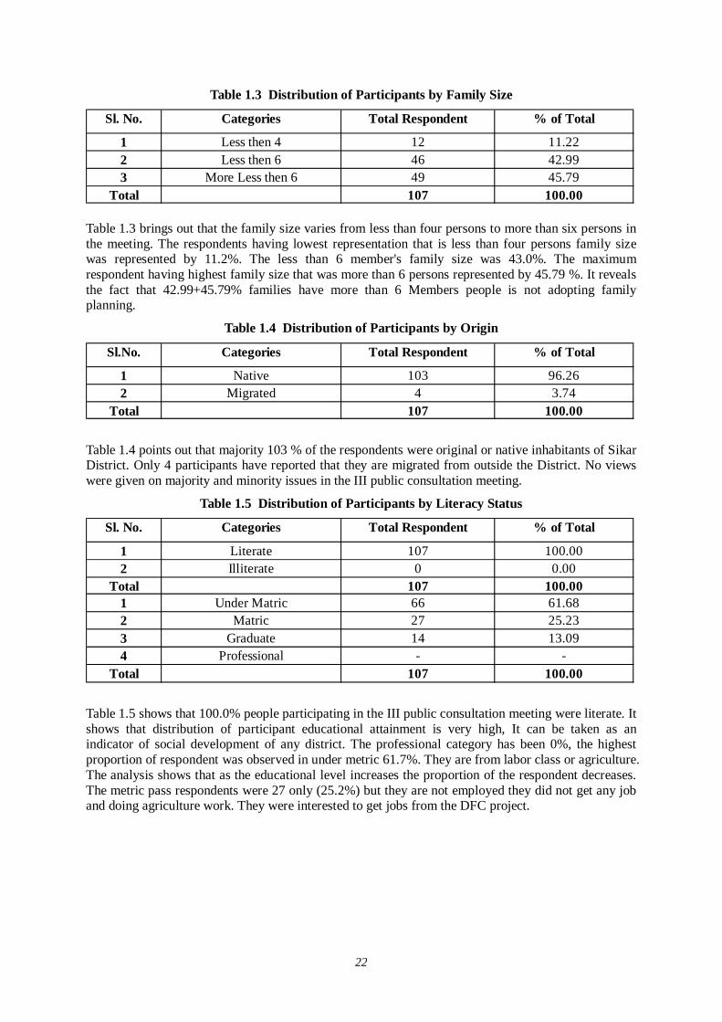
22
Table 1.3 Distribution of Participants by Family Size
Sl. No. Categories Total Respondent % of Total
1 Less then 4 12 11.222 Less then 6 46 42.993 More Less then 6 49 45.79
Total 107 100.00 Table 1.3 brings out that the family size varies from less than four persons to more than six persons in the meeting. The respondents having lowest representation that is less than four persons family size was represented by 11.2%. The less than 6 member's family size was 43.0%. The maximum respondent having highest family size that was more than 6 persons represented by 45.79 %. It reveals the fact that 42.99+45.79% families have more than 6 Members people is not adopting family planning.
Table 1.4 Distribution of Participants by Origin
Sl.No. Categories Total Respondent % of Total
1 Native 103 96.262 Migrated 4 3.74
Total 107 100.00
Table 1.4 points out that majority 103 % of the respondents were original or native inhabitants of Sikar District. Only 4 participants have reported that they are migrated from outside the District. No views were given on majority and minority issues in the III public consultation meeting.
Table 1.5 Distribution of Participants by Literacy Status
Sl. No. Categories Total Respondent % of Total
1 Literate 107 100.002 Illiterate 0 0.00
Total 107 100.001 Under Matric 66 61.682 Matric 27 25.233 Graduate 14 13.094 Professional - -
Total 107 100.00
Table 1.5 shows that 100.0% people participating in the III public consultation meeting were literate. It shows that distribution of participant educational attainment is very high, It can be taken as an indicator of social development of any district. The professional category has been 0%, the highest proportion of respondent was observed in under metric 61.7%. They are from labor class or agriculture. The analysis shows that as the educational level increases the proportion of the respondent decreases. The metric pass respondents were 27 only (25.2%) but they are not employed they did not get any job and doing agriculture work. They were interested to get jobs from the DFC project.
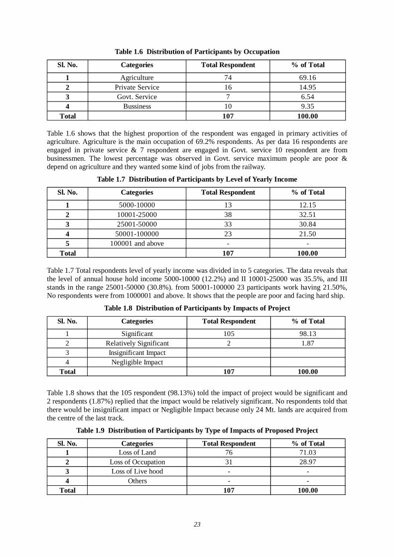
23
Table 1.6 Distribution of Participants by Occupation
Sl. No. Categories Total Respondent % of Total
1 Agriculture 74 69.162 Private Service 16 14.953 Govt. Service 7 6.544 Bussiness 10 9.35
Total 107 100.00 Table 1.6 shows that the highest proportion of the respondent was engaged in primary activities of agriculture. Agriculture is the main occupation of 69.2% respondents. As per data 16 respondents are engaged in private service & 7 respondent are engaged in Govt. service 10 respondent are from businessmen. The lowest percentage was observed in Govt. service maximum people are poor & depend on agriculture and they wanted some kind of jobs from the railway.
Table 1.7 Distribution of Participants by Level of Yearly Income
Sl. No. Categories Total Respondent % of Total
1 5000-10000 13 12.152 10001-25000 38 32.513 25001-50000 33 30.844 50001-100000 23 21.505 100001 and above - -
Total 107 100.00 Table 1.7 Total respondents level of yearly income was divided in to 5 categories. The data reveals that the level of annual house hold income 5000-10000 (12.2%) and II 10001-25000 was 35.5%, and III stands in the range 25001-50000 (30.8%). from 50001-100000 23 participants work having 21.50%, No respondents were from 1000001 and above. It shows that the people are poor and facing hard ship.
Table 1.8 Distribution of Participants by Impacts of Project
Sl. No. Categories Total Respondent % of Total
1 Significant 105 98.132 Relatively Significant 2 1.873 Insignificant Impact4 Negligible Impact
Total 107 100.00
Table 1.8 shows that the 105 respondent (98.13%) told the impact of project would be significant and 2 respondents (1.87%) replied that the impact would be relatively significant. No respondents told that there would be insignificant impact or Negligible Impact because only 24 Mt. lands are acquired from the centre of the last track.
Table 1.9 Distribution of Participants by Type of Impacts of Proposed Project
Sl. No. Categories Total Respondent % of Total1 Loss of Land 76 71.032 Loss of Occupation 31 28.973 Loss of Live hood - -4 Others - -
Total 107 100.00
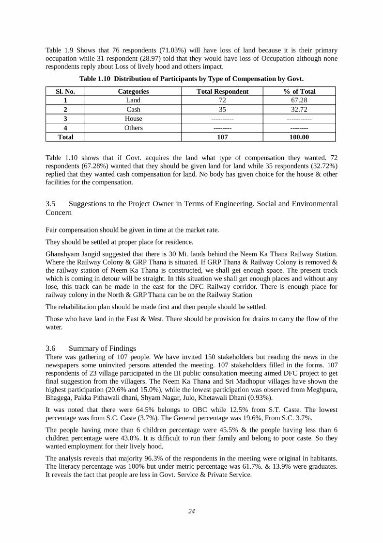
24
Table 1.9 Shows that 76 respondents (71.03%) will have loss of land because it is their primary occupation while 31 respondent (28.97) told that they would have loss of Occupation although none respondents reply about Loss of lively hood and others impact.
Table 1.10 Distribution of Participants by Type of Compensation by Govt.
Sl. No. Categories Total Respondent % of Total1 Land 72 67.282 Cash 35 32.723 House ---------- -----------4 Others -------- --------
Total 107 100.00
Table 1.10 shows that if Govt. acquires the land what type of compensation they wanted. 72 respondents (67.28%) wanted that they should be given land for land while 35 respondents (32.72%) replied that they wanted cash compensation for land. No body has given choice for the house & other facilities for the compensation.
3.5 Suggestions to the Project Owner in Terms of Engineering. Social and Environmental Concern Fair compensation should be given in time at the market rate.
They should be settled at proper place for residence.
Ghanshyam Jangid suggested that there is 30 Mt. lands behind the Neem Ka Thana Railway Station. Where the Railway Colony & GRP Thana is situated. If GRP Thana & Railway Colony is removed & the railway station of Neem Ka Thana is constructed, we shall get enough space. The present track which is coming in detour will be straight. In this situation we shall get enough places and without any lose, this track can be made in the east for the DFC Railway corridor. There is enough place for railway colony in the North & GRP Thana can be on the Railway Station
The rehabilitation plan should be made first and then people should be settled.
Those who have land in the East & West. There should be provision for drains to carry the flow of the water.
3.6 Summary of Findings There was gathering of 107 people. We have invited 150 stakeholders but reading the news in the newspapers some uninvited persons attended the meeting. 107 stakeholders filled in the forms. 107 respondents of 23 village participated in the III public consultation meeting aimed DFC project to get final suggestion from the villagers. The Neem Ka Thana and Sri Madhopur villages have shown the highest participation (20.6% and 15.0%), while the lowest participation was observed from Meghpura, Bhagega, Pakka Pithawali dhani, Shyam Nagar, Julo, Khetawali Dhani (0.93%).
It was noted that there were 64.5% belongs to OBC while 12.5% from S.T. Caste. The lowest percentage was from S.C. Caste (3.7%). The General percentage was 19.6%, From S.C. 3.7%.
The people having more than 6 children percentage were 45.5% & the people having less than 6 children percentage were 43.0%. It is difficult to run their family and belong to poor caste. So they wanted employment for their lively hood.
The analysis reveals that majority 96.3% of the respondents in the meeting were original in habitants. The literacy percentage was 100% but under metric percentage was 61.7%. & 13.9% were graduates. It reveals the fact that people are less in Govt. Service & Private Service.
25
The study showed that higher educational level witnesses the decreasing proportion of the respondent because they are less worried about the DFC project. It was also investigated that the occupational pattern is quite diversified. 69.16% respondents are engaged in agriculture while businessman's percent is 9.35% only. Agriculture is main occupation of the villagers. The level of income reveals the fact that 12.15% respondent were in 5000 to 10000 yearly income while 35.51% respondent were from 10001 to 25000. 30.84% respondent were in the range of 25001 to 50000 & 50001 to 100000 were 21.50% there is no one in the above range of 100000 It shows that the area belong to poor people and they have lively hood problems.
The table 1.8 Shows that only 98.15. % people have significant effect and 1.87% said that they have relatively significant effect. Sikar District people were very happy. They wanted to start the project work at the earliest. They would get employment and were in favor of DFC Corridor.
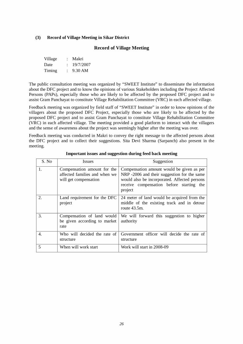
26
(3) Record of Village Meeting in Sikar District
Record of Village Meeting
Village : Makri Date : 19/7/2007 Timing : 9.30 AM
The public consultation meeting was organized by “SWEET Institute” to disseminate the information about the DFC project and to know the opinions of various Stakeholders including the Project Affected Persons (PAPs), especially those who are likely to be affected by the proposed DFC project and to assist Gram Panchayat to constitute Village Rehabilitation Committee (VRC) in each affected village.
Feedback meeting was organized by field staff of “SWEET Institute” in order to know opinions of the villagers about the proposed DFC Project, especially those who are likely to be affected by the proposed DFC project and to assist Gram Panchayat to constitute Village Rehabilitation Committee (VRC) in each affected village. The meeting provided a good platform to interact with the villagers and the sense of awareness about the project was seemingly higher after the meeting was over.
Feedback meeting was conducted in Makri to convey the right message to the affected persons about the DFC project and to collect their suggestions. Sita Devi Sharma (Sarpanch) also present in the meeting.
Important issues and suggestion during feed back meeting
S. No Issues Suggestion
1. Compensation amount for the affected families and when we will get compensation
Compensation amount would be given as per NRP -2006 and their suggestion for the same would also be incorporated. Affected persons receive compensation before starting the project
2.
Land requirement for the DFC project
24 meter of land would be acquired from the middle of the existing track and in detour route 43.5m.
3.
Compensation of land would be given according to market rate
We will forward this suggestion to higher authority
4. Who will decided the rate of structure
Government officer will decide the rate of structure
5 When will work start Work will start in 2008-09
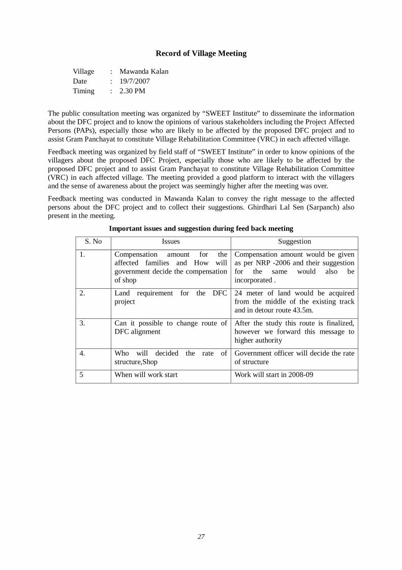
27
Record of Village Meeting
Village : Mawanda Kalan Date : 19/7/2007 Timing : 2.30 PM
The public consultation meeting was organized by “SWEET Institute” to disseminate the information about the DFC project and to know the opinions of various stakeholders including the Project Affected Persons (PAPs), especially those who are likely to be affected by the proposed DFC project and to assist Gram Panchayat to constitute Village Rehabilitation Committee (VRC) in each affected village.
Feedback meeting was organized by field staff of “SWEET Institute” in order to know opinions of the villagers about the proposed DFC Project, especially those who are likely to be affected by the proposed DFC project and to assist Gram Panchayat to constitute Village Rehabilitation Committee (VRC) in each affected village. The meeting provided a good platform to interact with the villagers and the sense of awareness about the project was seemingly higher after the meeting was over.
Feedback meeting was conducted in Mawanda Kalan to convey the right message to the affected persons about the DFC project and to collect their suggestions. Ghirdhari Lal Sen (Sarpanch) also present in the meeting.
Important issues and suggestion during feed back meeting
S. No Issues Suggestion
1.
Compensation amount for the affected families and How will government decide the compensation of shop
Compensation amount would be given as per NRP -2006 and their suggestion for the same would also be incorporated .
2.
Land requirement for the DFC project
24 meter of land would be acquired from the middle of the existing track and in detour route 43.5m.
3.
Can it possible to change route of DFC alignment
After the study this route is finalized, however we forward this message to higher authority
4. Who will decided the rate of structure,Shop
Government officer will decide the rate of structure
5 When will work start Work will start in 2008-09
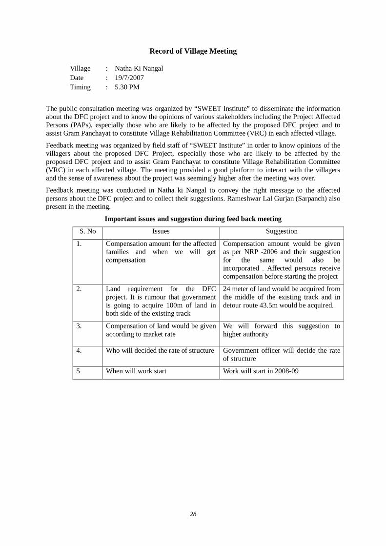
28
Record of Village Meeting
Village : Natha Ki Nangal Date : 19/7/2007 Timing : 5.30 PM
The public consultation meeting was organized by “SWEET Institute” to disseminate the information about the DFC project and to know the opinions of various stakeholders including the Project Affected Persons (PAPs), especially those who are likely to be affected by the proposed DFC project and to assist Gram Panchayat to constitute Village Rehabilitation Committee (VRC) in each affected village.
Feedback meeting was organized by field staff of “SWEET Institute” in order to know opinions of the villagers about the proposed DFC Project, especially those who are likely to be affected by the proposed DFC project and to assist Gram Panchayat to constitute Village Rehabilitation Committee (VRC) in each affected village. The meeting provided a good platform to interact with the villagers and the sense of awareness about the project was seemingly higher after the meeting was over.
Feedback meeting was conducted in Natha ki Nangal to convey the right message to the affected persons about the DFC project and to collect their suggestions. Rameshwar Lal Gurjan (Sarpanch) also present in the meeting.
Important issues and suggestion during feed back meeting
S. No Issues Suggestion
1.
Compensation amount for the affected families and when we will get compensation
Compensation amount would be given as per NRP -2006 and their suggestion for the same would also be incorporated . Affected persons receive compensation before starting the project
2.
Land requirement for the DFC project. It is rumour that government is going to acquire 100m of land in both side of the existing track
24 meter of land would be acquired from the middle of the existing track and in detour route 43.5m would be acquired.
3.
Compensation of land would be given according to market rate
We will forward this suggestion to higher authority
4. Who will decided the rate of structure Government officer will decide the rate of structure
5 When will work start Work will start in 2008-09
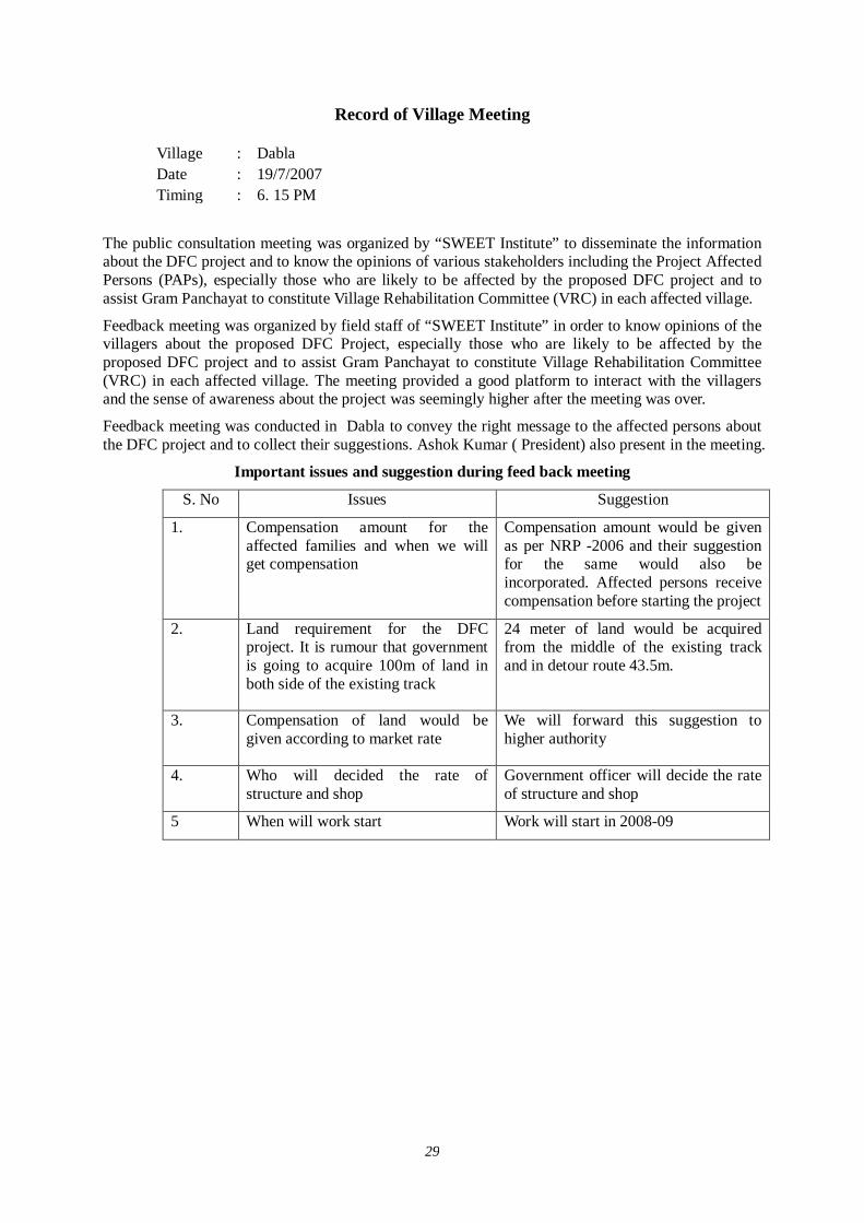
29
Record of Village Meeting
Village : Dabla Date : 19/7/2007 Timing : 6. 15 PM
The public consultation meeting was organized by “SWEET Institute” to disseminate the information about the DFC project and to know the opinions of various stakeholders including the Project Affected Persons (PAPs), especially those who are likely to be affected by the proposed DFC project and to assist Gram Panchayat to constitute Village Rehabilitation Committee (VRC) in each affected village.
Feedback meeting was organized by field staff of “SWEET Institute” in order to know opinions of the villagers about the proposed DFC Project, especially those who are likely to be affected by the proposed DFC project and to assist Gram Panchayat to constitute Village Rehabilitation Committee (VRC) in each affected village. The meeting provided a good platform to interact with the villagers and the sense of awareness about the project was seemingly higher after the meeting was over.
Feedback meeting was conducted in Dabla to convey the right message to the affected persons about the DFC project and to collect their suggestions. Ashok Kumar ( President) also present in the meeting.
Important issues and suggestion during feed back meeting
S. No Issues Suggestion
1.
Compensation amount for the affected families and when we will get compensation
Compensation amount would be given as per NRP -2006 and their suggestion for the same would also be incorporated. Affected persons receive compensation before starting the project
2.
Land requirement for the DFC project. It is rumour that government is going to acquire 100m of land in both side of the existing track
24 meter of land would be acquired from the middle of the existing track and in detour route 43.5m.
3.
Compensation of land would be given according to market rate
We will forward this suggestion to higher authority
4. Who will decided the rate of structure and shop
Government officer will decide the rate of structure and shop
5 When will work start Work will start in 2008-09
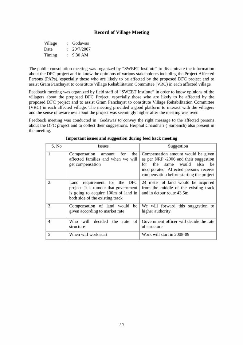
30
Record of Village Meeting
Village : Godawas Date : 20/7/2007 Timing : 9.30 AM
The public consultation meeting was organized by “SWEET Institute” to disseminate the information about the DFC project and to know the opinions of various stakeholders including the Project Affected Persons (PAPs), especially those who are likely to be affected by the proposed DFC project and to assist Gram Panchayat to constitute Village Rehabilitation Committee (VRC) in each affected village.
Feedback meeting was organized by field staff of “SWEET Institute” in order to know opinions of the villagers about the proposed DFC Project, especially those who are likely to be affected by the proposed DFC project and to assist Gram Panchayat to constitute Village Rehabilitation Committee (VRC) in each affected village. The meeting provided a good platform to interact with the villagers and the sense of awareness about the project was seemingly higher after the meeting was over.
Feedback meeting was conducted in Godawas to convey the right message to the affected persons about the DFC project and to collect their suggestions. Herphul Chaudhari ( Sarpanch) also present in the meeting.
Important issues and suggestion during feed back meeting
S. No Issues Suggestion
1.
Compensation amount for the affected families and when we will get compensation
Compensation amount would be given as per NRP -2006 and their suggestion for the same would also be incorporated. Affected persons receive compensation before starting the project
2. Land requirement for the DFC project. It is rumour that government is going to acquire 100m of land in both side of the existing track
24 meter of land would be acquired from the middle of the existing track and in detour route 43.5m.
3.
Compensation of land would be given according to market rate
We will forward this suggestion to higher authority
4. Who will decided the rate of structure
Government officer will decide the rate of structure
5 When will work start Work will start in 2008-09
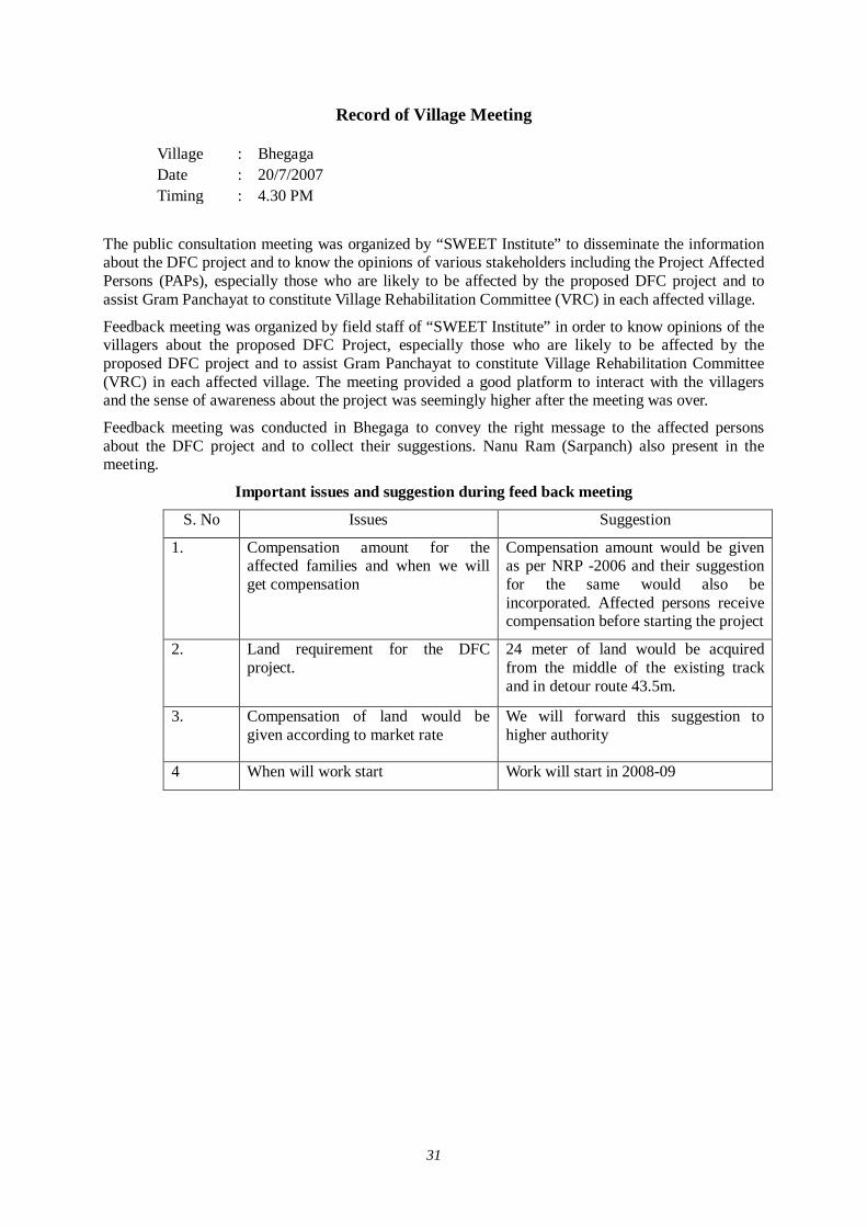
31
Record of Village Meeting
Village : Bhegaga Date : 20/7/2007 Timing : 4.30 PM
The public consultation meeting was organized by “SWEET Institute” to disseminate the information about the DFC project and to know the opinions of various stakeholders including the Project Affected Persons (PAPs), especially those who are likely to be affected by the proposed DFC project and to assist Gram Panchayat to constitute Village Rehabilitation Committee (VRC) in each affected village.
Feedback meeting was organized by field staff of “SWEET Institute” in order to know opinions of the villagers about the proposed DFC Project, especially those who are likely to be affected by the proposed DFC project and to assist Gram Panchayat to constitute Village Rehabilitation Committee (VRC) in each affected village. The meeting provided a good platform to interact with the villagers and the sense of awareness about the project was seemingly higher after the meeting was over.
Feedback meeting was conducted in Bhegaga to convey the right message to the affected persons about the DFC project and to collect their suggestions. Nanu Ram (Sarpanch) also present in the meeting.
Important issues and suggestion during feed back meeting
S. No Issues Suggestion
1.
Compensation amount for the affected families and when we will get compensation
Compensation amount would be given as per NRP -2006 and their suggestion for the same would also be incorporated. Affected persons receive compensation before starting the project
2. Land requirement for the DFC project.
24 meter of land would be acquired from the middle of the existing track and in detour route 43.5m.
3.
Compensation of land would be given according to market rate
We will forward this suggestion to higher authority
4 When will work start Work will start in 2008-09
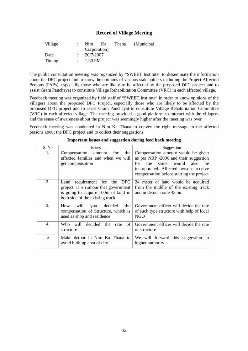
32
Record of Village Meeting
Village : Nim Ka Thana (Municipal Corporation)
Date : 20/7/2007 Timing : 1.30 PM
The public consultation meeting was organized by “SWEET Institute” to disseminate the information about the DFC project and to know the opinions of various stakeholders including the Project Affected Persons (PAPs), especially those who are likely to be affected by the proposed DFC project and to assist Gram Panchayat to constitute Village Rehabilitation Committee (VRC) in each affected village.
Feedback meeting was organized by field staff of “SWEET Institute” in order to know opinions of the villagers about the proposed DFC Project, especially those who are likely to be affected by the proposed DFC project and to assist Gram Panchayat to constitute Village Rehabilitation Committee (VRC) in each affected village. The meeting provided a good platform to interact with the villagers and the sense of awareness about the project was seemingly higher after the meeting was over.
Feedback meeting was conducted in Nim Ka Thana to convey the right message to the affected persons about the DFC project and to collect their suggestions.
Important issues and suggestion during feed back meeting S. No Issues Suggestion
1. Compensation amount for the affected families and when we will get compensation
Compensation amount would be given as per NRP -2006 and their suggestion for the same would also be incorporated. Affected persons receive compensation before starting the project
2. Land requirement for the DFC project. It is rumour that government is going to acquire 100m of land in both side of the existing track
24 meter of land would be acquired from the middle of the existing track and in detour route 43.5m.
3. How will you decided the compensation of Structure, which is used as shop and residence
Government officer will decide the rate of such type structure with help of local NGO
4. Who will decided the rate of structure
Government officer will decide the rate of structure
5 Make detour in Nim Ka Thana to avoid built up area of city
We will forward this suggestion to higher authority
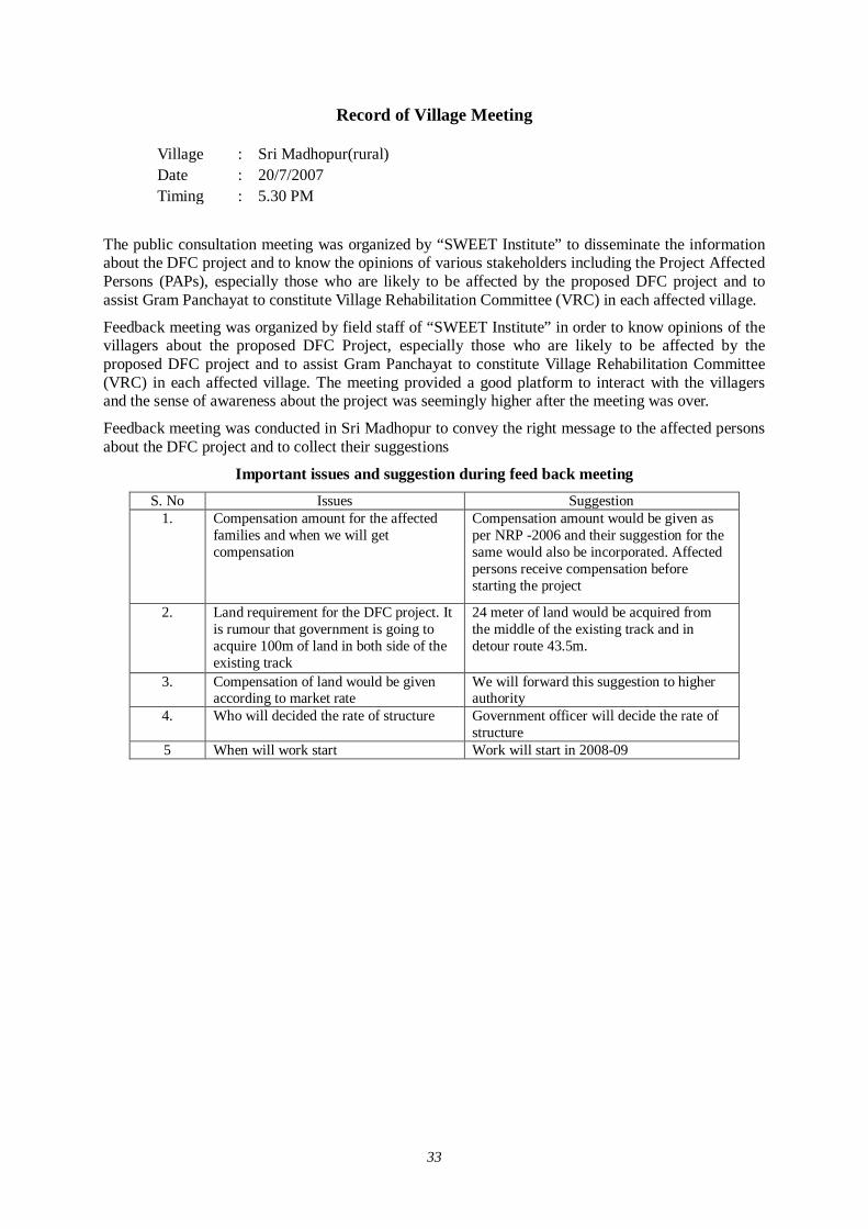
33
Record of Village Meeting
Village : Sri Madhopur(rural) Date : 20/7/2007 Timing : 5.30 PM
The public consultation meeting was organized by “SWEET Institute” to disseminate the information about the DFC project and to know the opinions of various stakeholders including the Project Affected Persons (PAPs), especially those who are likely to be affected by the proposed DFC project and to assist Gram Panchayat to constitute Village Rehabilitation Committee (VRC) in each affected village.
Feedback meeting was organized by field staff of “SWEET Institute” in order to know opinions of the villagers about the proposed DFC Project, especially those who are likely to be affected by the proposed DFC project and to assist Gram Panchayat to constitute Village Rehabilitation Committee (VRC) in each affected village. The meeting provided a good platform to interact with the villagers and the sense of awareness about the project was seemingly higher after the meeting was over.
Feedback meeting was conducted in Sri Madhopur to convey the right message to the affected persons about the DFC project and to collect their suggestions
Important issues and suggestion during feed back meeting S. No Issues Suggestion
1. Compensation amount for the affected families and when we will get compensation
Compensation amount would be given as per NRP -2006 and their suggestion for the same would also be incorporated. Affected persons receive compensation before starting the project
2. Land requirement for the DFC project. It is rumour that government is going to acquire 100m of land in both side of the existing track
24 meter of land would be acquired from the middle of the existing track and in detour route 43.5m.
3. Compensation of land would be given according to market rate
We will forward this suggestion to higher authority
4. Who will decided the rate of structure Government officer will decide the rate of structure
5 When will work start Work will start in 2008-09

34
Record of Village Meeting
Village : Sargoth Date : 18/7/2007 Timing : 9.30 AM
The public consultation meeting was organized by “SWEET Institute” to disseminate the information about the DFC project and to know the opinions of various stakeholders including the Project Affected Persons (PAPs), especially those who are likely to be affected by the proposed DFC project and to assist Gram Panchayat to constitute Village Rehabilitation Committee (VRC) in each affected village.
Feedback meeting was organized by field staff of “SWEET Institute” in order to know opinions of the villagers about the proposed DFC Project, especially those who are likely to be affected by the proposed DFC project and to assist Gram Panchayat to constitute Village Rehabilitation Committee (VRC) in each affected village. The meeting provided a good platform to interact with the villagers and the sense of awareness about the project was seemingly higher after the meeting was over.
Feedback meeting was conducted in Sargoth to convey the right message to the affected persons about the DFC project and to collect their suggestions.
Important issues and suggestion during feed back meeting S. No Issues Suggestion
1. Compensation amount for the affected families and when we will get compensation
Compensation amount would be given as per NRP -2006 and their suggestion for the same would also be incorporated . Affected persons receive compensation before starting the project
2. Land requirement for the DFC project. 24 meter of land would be acquired from the middle of the existing track and in detour route 43.5m.
3. Compensation of land would be given according to market rate
We will forward this suggestion to higher authority
4. Exact location of the detour We will provide you exact location of detour later
5 When will work start Work will start in 2008-09
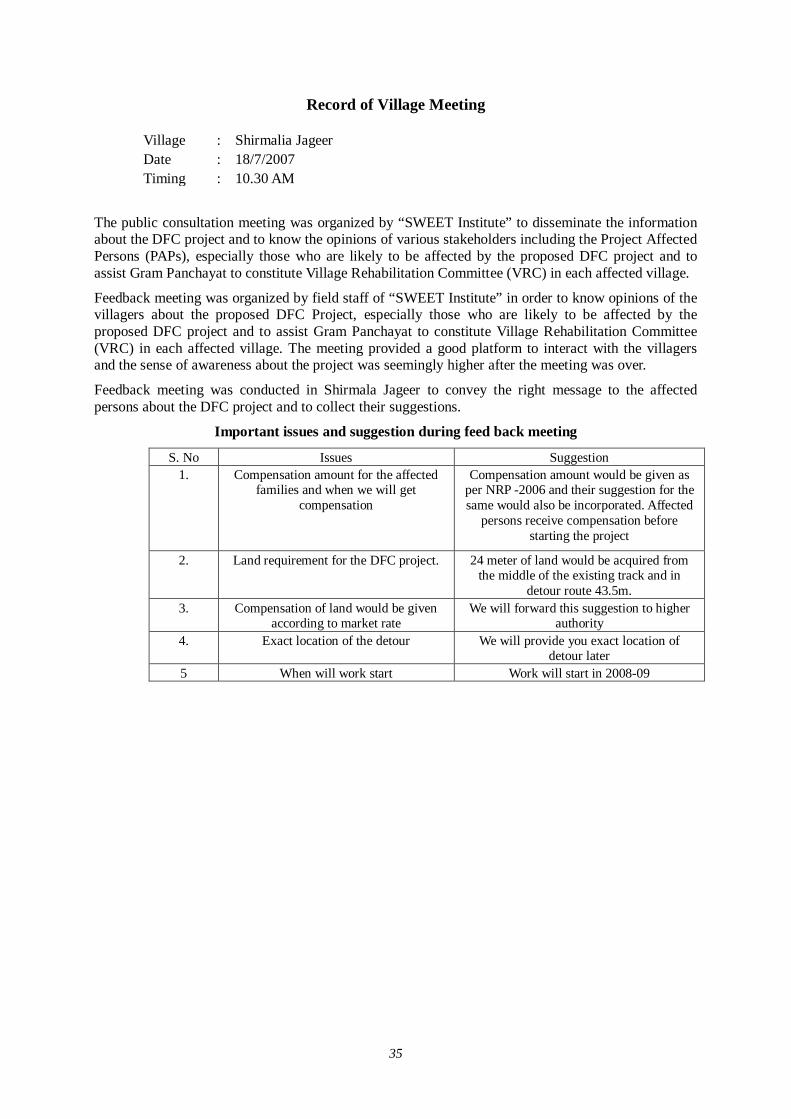
35
Record of Village Meeting
Village : Shirmalia Jageer Date : 18/7/2007 Timing : 10.30 AM
The public consultation meeting was organized by “SWEET Institute” to disseminate the information about the DFC project and to know the opinions of various stakeholders including the Project Affected Persons (PAPs), especially those who are likely to be affected by the proposed DFC project and to assist Gram Panchayat to constitute Village Rehabilitation Committee (VRC) in each affected village.
Feedback meeting was organized by field staff of “SWEET Institute” in order to know opinions of the villagers about the proposed DFC Project, especially those who are likely to be affected by the proposed DFC project and to assist Gram Panchayat to constitute Village Rehabilitation Committee (VRC) in each affected village. The meeting provided a good platform to interact with the villagers and the sense of awareness about the project was seemingly higher after the meeting was over.
Feedback meeting was conducted in Shirmala Jageer to convey the right message to the affected persons about the DFC project and to collect their suggestions.
Important issues and suggestion during feed back meeting
S. No Issues Suggestion 1. Compensation amount for the affected
families and when we will get compensation
Compensation amount would be given as per NRP -2006 and their suggestion for the same would also be incorporated. Affected
persons receive compensation before starting the project
2. Land requirement for the DFC project. 24 meter of land would be acquired from the middle of the existing track and in
detour route 43.5m. 3. Compensation of land would be given
according to market rate We will forward this suggestion to higher
authority 4. Exact location of the detour We will provide you exact location of
detour later 5 When will work start Work will start in 2008-09
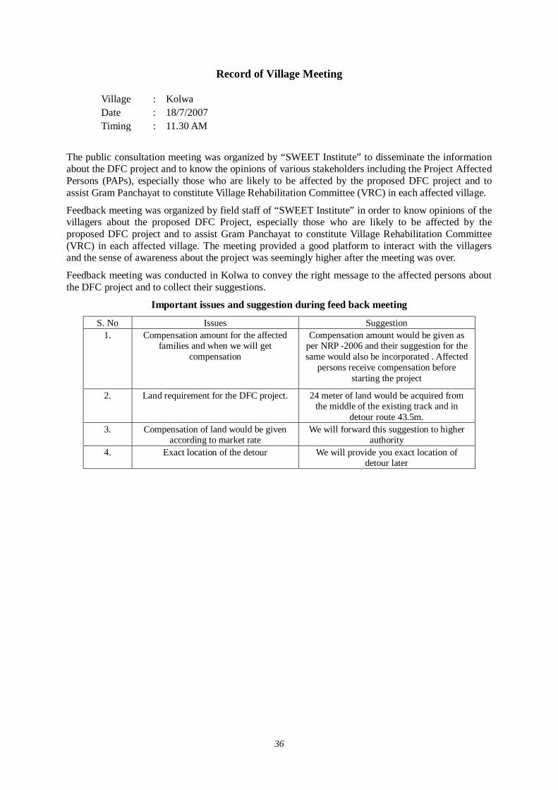
36
Record of Village Meeting
Village : Kolwa Date : 18/7/2007 Timing : 11.30 AM
The public consultation meeting was organized by “SWEET Institute” to disseminate the information about the DFC project and to know the opinions of various stakeholders including the Project Affected Persons (PAPs), especially those who are likely to be affected by the proposed DFC project and to assist Gram Panchayat to constitute Village Rehabilitation Committee (VRC) in each affected village.
Feedback meeting was organized by field staff of “SWEET Institute” in order to know opinions of the villagers about the proposed DFC Project, especially those who are likely to be affected by the proposed DFC project and to assist Gram Panchayat to constitute Village Rehabilitation Committee (VRC) in each affected village. The meeting provided a good platform to interact with the villagers and the sense of awareness about the project was seemingly higher after the meeting was over.
Feedback meeting was conducted in Kolwa to convey the right message to the affected persons about the DFC project and to collect their suggestions.
Important issues and suggestion during feed back meeting
S. No Issues Suggestion 1. Compensation amount for the affected
families and when we will get compensation
Compensation amount would be given as per NRP -2006 and their suggestion for the same would also be incorporated . Affected
persons receive compensation before starting the project
2. Land requirement for the DFC project. 24 meter of land would be acquired from the middle of the existing track and in
detour route 43.5m. 3. Compensation of land would be given
according to market rate We will forward this suggestion to higher
authority 4. Exact location of the detour We will provide you exact location of
detour later
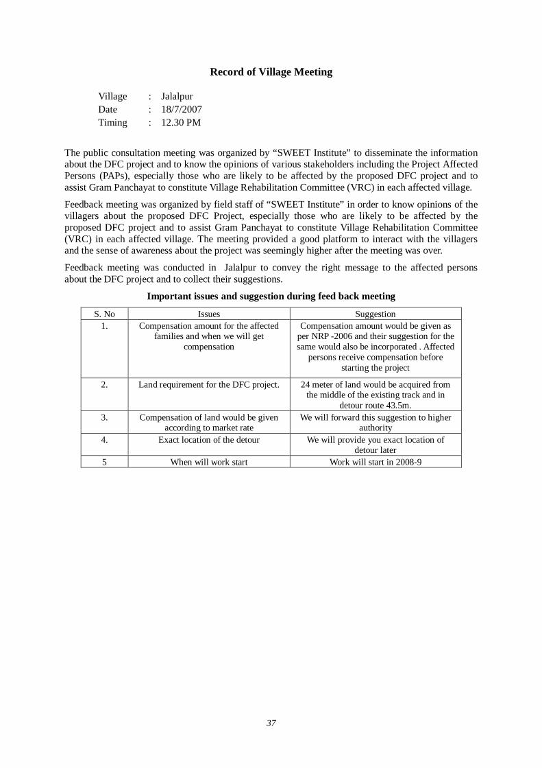
37
Record of Village Meeting
Village : Jalalpur Date : 18/7/2007 Timing : 12.30 PM
The public consultation meeting was organized by “SWEET Institute” to disseminate the information about the DFC project and to know the opinions of various stakeholders including the Project Affected Persons (PAPs), especially those who are likely to be affected by the proposed DFC project and to assist Gram Panchayat to constitute Village Rehabilitation Committee (VRC) in each affected village.
Feedback meeting was organized by field staff of “SWEET Institute” in order to know opinions of the villagers about the proposed DFC Project, especially those who are likely to be affected by the proposed DFC project and to assist Gram Panchayat to constitute Village Rehabilitation Committee (VRC) in each affected village. The meeting provided a good platform to interact with the villagers and the sense of awareness about the project was seemingly higher after the meeting was over.
Feedback meeting was conducted in Jalalpur to convey the right message to the affected persons about the DFC project and to collect their suggestions.
Important issues and suggestion during feed back meeting
S. No Issues Suggestion 1. Compensation amount for the affected
families and when we will get compensation
Compensation amount would be given as per NRP -2006 and their suggestion for the same would also be incorporated . Affected
persons receive compensation before starting the project
2. Land requirement for the DFC project. 24 meter of land would be acquired from the middle of the existing track and in
detour route 43.5m. 3. Compensation of land would be given
according to market rate We will forward this suggestion to higher
authority 4. Exact location of the detour We will provide you exact location of
detour later 5 When will work start Work will start in 2008-9
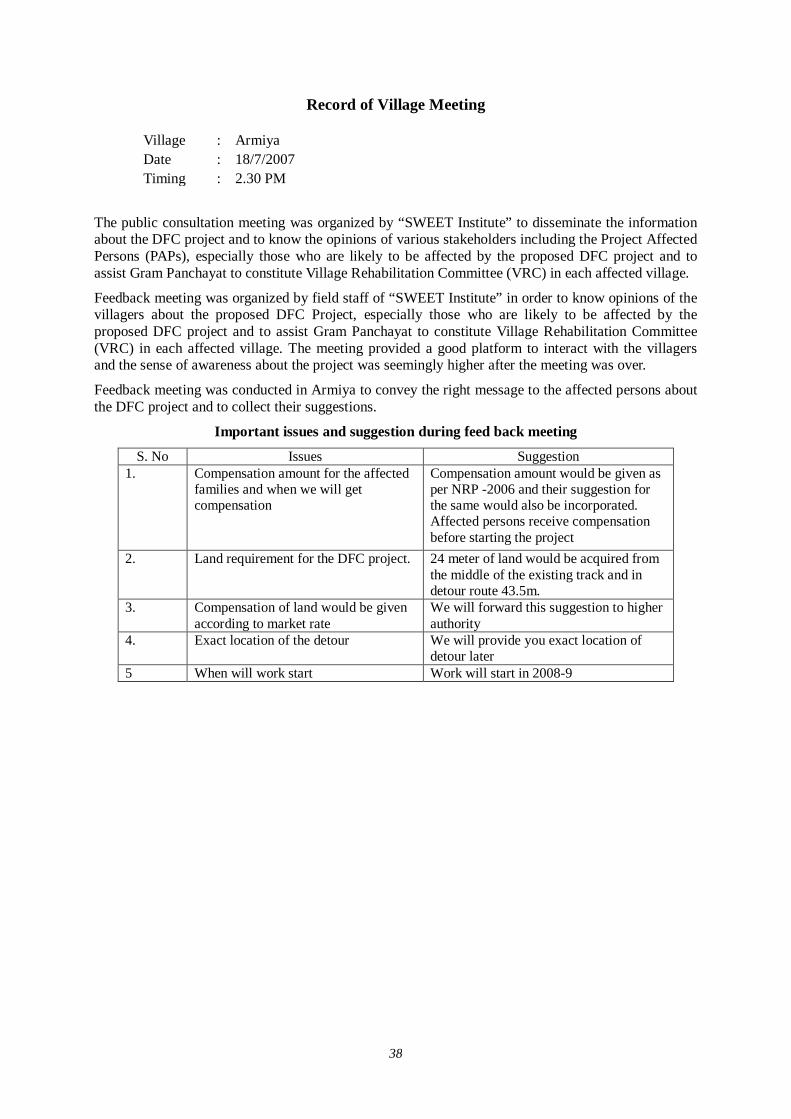
38
Record of Village Meeting
Village : Armiya Date : 18/7/2007 Timing : 2.30 PM
The public consultation meeting was organized by “SWEET Institute” to disseminate the information about the DFC project and to know the opinions of various stakeholders including the Project Affected Persons (PAPs), especially those who are likely to be affected by the proposed DFC project and to assist Gram Panchayat to constitute Village Rehabilitation Committee (VRC) in each affected village.
Feedback meeting was organized by field staff of “SWEET Institute” in order to know opinions of the villagers about the proposed DFC Project, especially those who are likely to be affected by the proposed DFC project and to assist Gram Panchayat to constitute Village Rehabilitation Committee (VRC) in each affected village. The meeting provided a good platform to interact with the villagers and the sense of awareness about the project was seemingly higher after the meeting was over.
Feedback meeting was conducted in Armiya to convey the right message to the affected persons about the DFC project and to collect their suggestions.
Important issues and suggestion during feed back meeting
S. No Issues Suggestion 1. Compensation amount for the affected
families and when we will get compensation
Compensation amount would be given as per NRP -2006 and their suggestion for the same would also be incorporated. Affected persons receive compensation before starting the project
2. Land requirement for the DFC project. 24 meter of land would be acquired from the middle of the existing track and in detour route 43.5m.
3. Compensation of land would be given according to market rate
We will forward this suggestion to higher authority
4. Exact location of the detour We will provide you exact location of detour later
5 When will work start Work will start in 2008-9
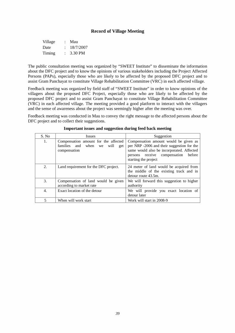
39
Record of Village Meeting
Village : Mau Date : 18/7/2007 Timing : 3.30 PM
The public consultation meeting was organized by “SWEET Institute” to disseminate the information about the DFC project and to know the opinions of various stakeholders including the Project Affected Persons (PAPs), especially those who are likely to be affected by the proposed DFC project and to assist Gram Panchayat to constitute Village Rehabilitation Committee (VRC) in each affected village.
Feedback meeting was organized by field staff of “SWEET Institute” in order to know opinions of the villagers about the proposed DFC Project, especially those who are likely to be affected by the proposed DFC project and to assist Gram Panchayat to constitute Village Rehabilitation Committee (VRC) in each affected village. The meeting provided a good platform to interact with the villagers and the sense of awareness about the project was seemingly higher after the meeting was over.
Feedback meeting was conducted in Mau to convey the right message to the affected persons about the DFC project and to collect their suggestions.
Important issues and suggestion during feed back meeting
S. No Issues Suggestion 1. Compensation amount for the affected
families and when we will get compensation
Compensation amount would be given as per NRP -2006 and their suggestion for the same would also be incorporated. Affected persons receive compensation before starting the project
2. Land requirement for the DFC project. 24 meter of land would be acquired from the middle of the existing track and in detour route 43.5m.
3. Compensation of land would be given according to market rate
We will forward this suggestion to higher authority
4. Exact location of the detour We will provide you exact location of detour later
5 When will work start Work will start in 2008-9
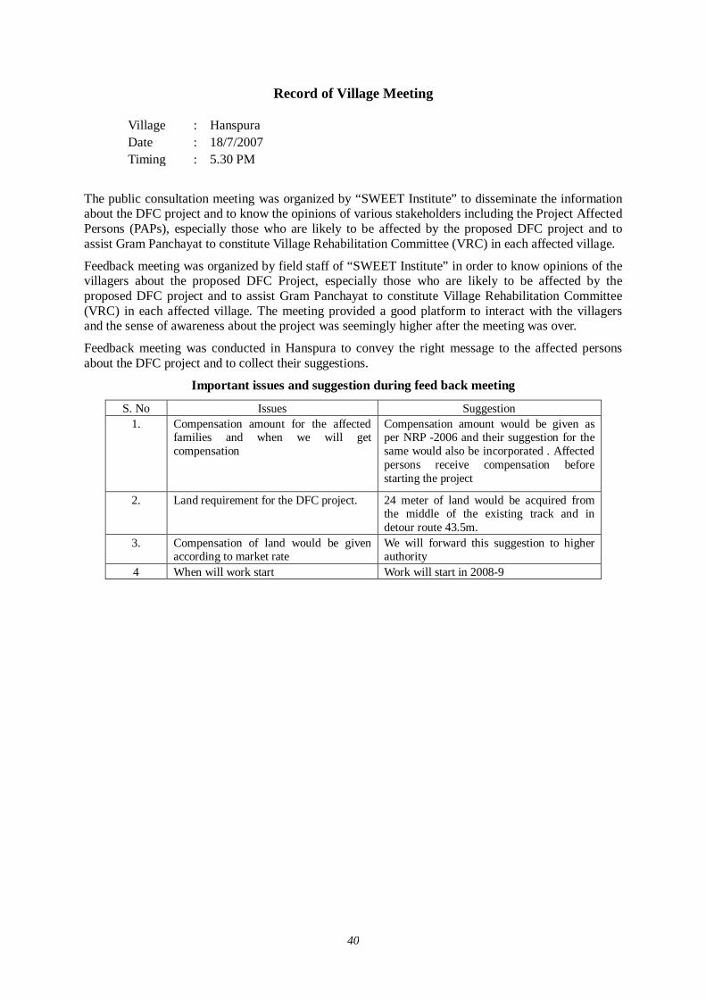
40
Record of Village Meeting
Village : Hanspura Date : 18/7/2007 Timing : 5.30 PM
The public consultation meeting was organized by “SWEET Institute” to disseminate the information about the DFC project and to know the opinions of various stakeholders including the Project Affected Persons (PAPs), especially those who are likely to be affected by the proposed DFC project and to assist Gram Panchayat to constitute Village Rehabilitation Committee (VRC) in each affected village.
Feedback meeting was organized by field staff of “SWEET Institute” in order to know opinions of the villagers about the proposed DFC Project, especially those who are likely to be affected by the proposed DFC project and to assist Gram Panchayat to constitute Village Rehabilitation Committee (VRC) in each affected village. The meeting provided a good platform to interact with the villagers and the sense of awareness about the project was seemingly higher after the meeting was over.
Feedback meeting was conducted in Hanspura to convey the right message to the affected persons about the DFC project and to collect their suggestions.
Important issues and suggestion during feed back meeting
S. No Issues Suggestion 1. Compensation amount for the affected
families and when we will get compensation
Compensation amount would be given as per NRP -2006 and their suggestion for the same would also be incorporated . Affected persons receive compensation before starting the project
2. Land requirement for the DFC project. 24 meter of land would be acquired from the middle of the existing track and in detour route 43.5m.
3. Compensation of land would be given according to market rate
We will forward this suggestion to higher authority
4 When will work start Work will start in 2008-9
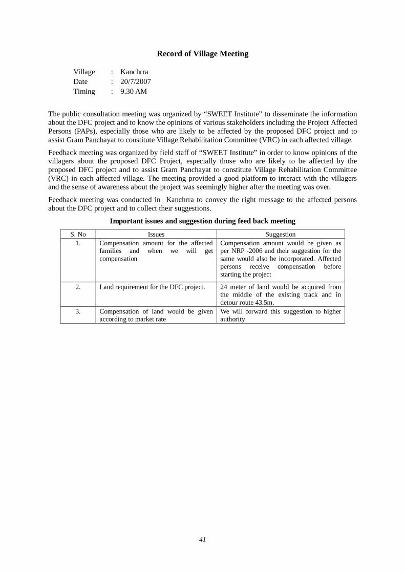
41
Record of Village Meeting
Village : Kanchrra Date : 20/7/2007 Timing : 9.30 AM
The public consultation meeting was organized by “SWEET Institute” to disseminate the information about the DFC project and to know the opinions of various stakeholders including the Project Affected Persons (PAPs), especially those who are likely to be affected by the proposed DFC project and to assist Gram Panchayat to constitute Village Rehabilitation Committee (VRC) in each affected village.
Feedback meeting was organized by field staff of “SWEET Institute” in order to know opinions of the villagers about the proposed DFC Project, especially those who are likely to be affected by the proposed DFC project and to assist Gram Panchayat to constitute Village Rehabilitation Committee (VRC) in each affected village. The meeting provided a good platform to interact with the villagers and the sense of awareness about the project was seemingly higher after the meeting was over.
Feedback meeting was conducted in Kanchrra to convey the right message to the affected persons about the DFC project and to collect their suggestions.
Important issues and suggestion during feed back meeting
S. No Issues Suggestion 1. Compensation amount for the affected
families and when we will get compensation
Compensation amount would be given as per NRP -2006 and their suggestion for the same would also be incorporated. Affected persons receive compensation before starting the project
2. Land requirement for the DFC project. 24 meter of land would be acquired from the middle of the existing track and in detour route 43.5m.
3. Compensation of land would be given according to market rate
We will forward this suggestion to higher authority
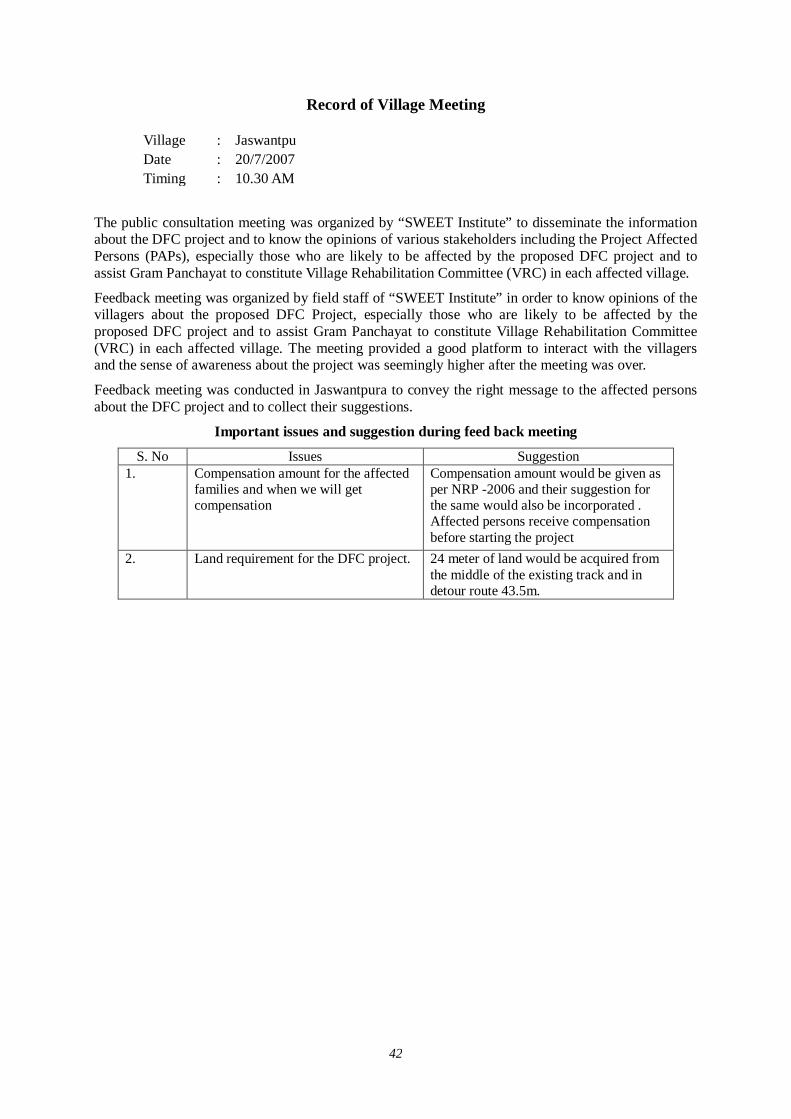
42
Record of Village Meeting
Village : Jaswantpu Date : 20/7/2007 Timing : 10.30 AM
The public consultation meeting was organized by “SWEET Institute” to disseminate the information about the DFC project and to know the opinions of various stakeholders including the Project Affected Persons (PAPs), especially those who are likely to be affected by the proposed DFC project and to assist Gram Panchayat to constitute Village Rehabilitation Committee (VRC) in each affected village.
Feedback meeting was organized by field staff of “SWEET Institute” in order to know opinions of the villagers about the proposed DFC Project, especially those who are likely to be affected by the proposed DFC project and to assist Gram Panchayat to constitute Village Rehabilitation Committee (VRC) in each affected village. The meeting provided a good platform to interact with the villagers and the sense of awareness about the project was seemingly higher after the meeting was over.
Feedback meeting was conducted in Jaswantpura to convey the right message to the affected persons about the DFC project and to collect their suggestions.
Important issues and suggestion during feed back meeting
S. No Issues Suggestion 1. Compensation amount for the affected
families and when we will get compensation
Compensation amount would be given as per NRP -2006 and their suggestion for the same would also be incorporated . Affected persons receive compensation before starting the project
2. Land requirement for the DFC project. 24 meter of land would be acquired from the middle of the existing track and in detour route 43.5m.
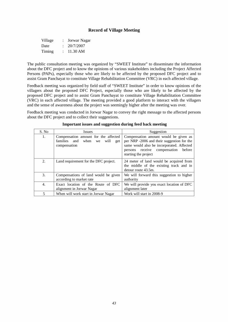
43
Record of Village Meeting
Village : Jorwar Nagar Date : 20/7/2007 Timing : 11.30 AM
The public consultation meeting was organized by “SWEET Institute” to disseminate the information about the DFC project and to know the opinions of various stakeholders including the Project Affected Persons (PAPs), especially those who are likely to be affected by the proposed DFC project and to assist Gram Panchayat to constitute Village Rehabilitation Committee (VRC) in each affected village.
Feedback meeting was organized by field staff of “SWEET Institute” in order to know opinions of the villagers about the proposed DFC Project, especially those who are likely to be affected by the proposed DFC project and to assist Gram Panchayat to constitute Village Rehabilitation Committee (VRC) in each affected village. The meeting provided a good platform to interact with the villagers and the sense of awareness about the project was seemingly higher after the meeting was over.
Feedback meeting was conducted in Jorwar Nagar to convey the right message to the affected persons about the DFC project and to collect their suggestions.
Important issues and suggestion during feed back meeting
S. No Issues Suggestion 1. Compensation amount for the affected
families and when we will get compensation
Compensation amount would be given as per NRP -2006 and their suggestion for the same would also be incorporated. Affected persons receive compensation before starting the project
2. Land requirement for the DFC project. 24 meter of land would be acquired from the middle of the existing track and in detour route 43.5m.
3. Compensations of land would be given according to market rate
We will forward this suggestion to higher authority
4. Exact location of the Route of DFC alignment in Jorwar Nagar
We will provide you exact location of DFC alignment later
5 When will work start in Jorwar Nagar Work will start in 2008-9
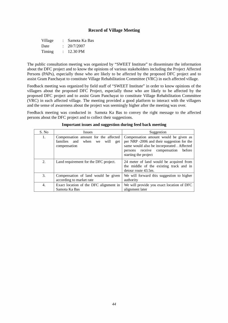
44
Record of Village Meeting
Village : Samota Ka Bas Date : 20/7/2007 Timing : 12.30 PM
The public consultation meeting was organized by “SWEET Institute” to disseminate the information about the DFC project and to know the opinions of various stakeholders including the Project Affected Persons (PAPs), especially those who are likely to be affected by the proposed DFC project and to assist Gram Panchayat to constitute Village Rehabilitation Committee (VRC) in each affected village.
Feedback meeting was organized by field staff of “SWEET Institute” in order to know opinions of the villagers about the proposed DFC Project, especially those who are likely to be affected by the proposed DFC project and to assist Gram Panchayat to constitute Village Rehabilitation Committee (VRC) in each affected village. The meeting provided a good platform to interact with the villagers and the sense of awareness about the project was seemingly higher after the meeting was over.
Feedback meeting was conducted in Samota Ka Bas to convey the right message to the affected persons about the DFC project and to collect their suggestions.
Important issues and suggestion during feed back meeting
S. No Issues Suggestion 1. Compensation amount for the affected
families and when we will get compensation
Compensation amount would be given as per NRP -2006 and their suggestion for the same would also be incorporated . Affected persons receive compensation before starting the project
2. Land requirement for the DFC project. 24 meter of land would be acquired from the middle of the existing track and in detour route 43.5m.
3. Compensation of land would be given according to market rate
We will forward this suggestion to higher authority
4. Exact location of the DFC alignment in Samota Ka Bas
We will provide you exact location of DFC alignment later
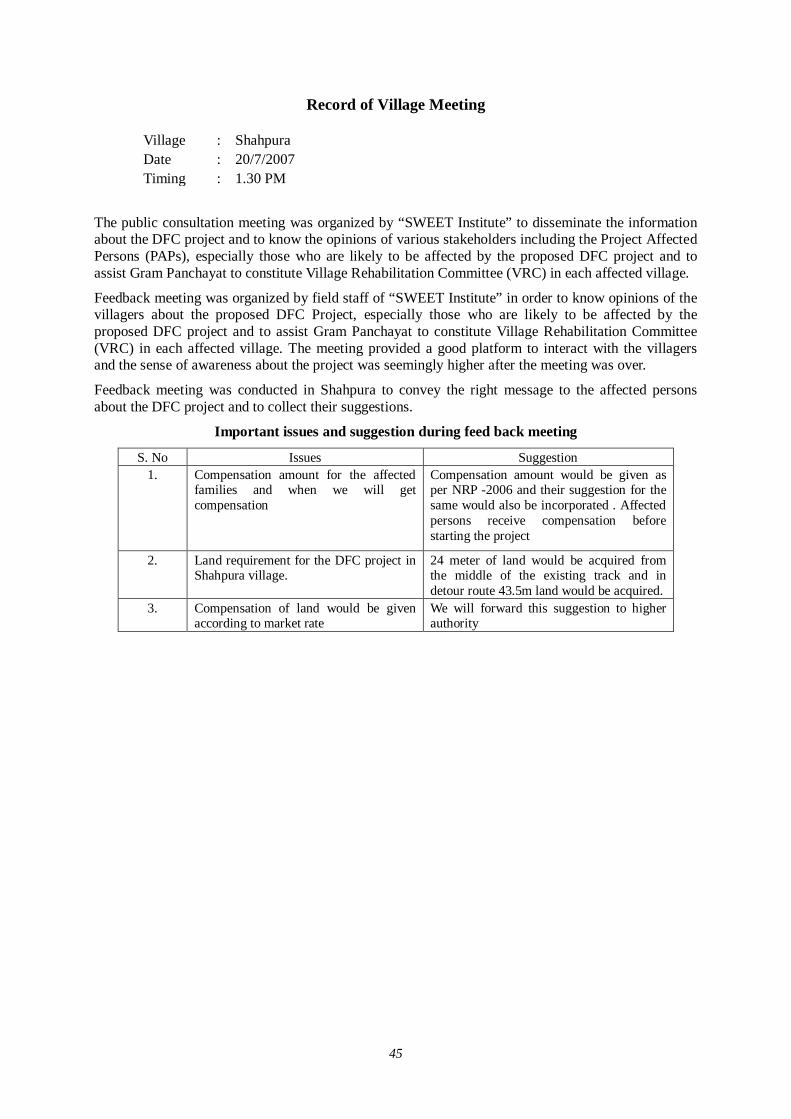
45
Record of Village Meeting
Village : Shahpura Date : 20/7/2007 Timing : 1.30 PM
The public consultation meeting was organized by “SWEET Institute” to disseminate the information about the DFC project and to know the opinions of various stakeholders including the Project Affected Persons (PAPs), especially those who are likely to be affected by the proposed DFC project and to assist Gram Panchayat to constitute Village Rehabilitation Committee (VRC) in each affected village.
Feedback meeting was organized by field staff of “SWEET Institute” in order to know opinions of the villagers about the proposed DFC Project, especially those who are likely to be affected by the proposed DFC project and to assist Gram Panchayat to constitute Village Rehabilitation Committee (VRC) in each affected village. The meeting provided a good platform to interact with the villagers and the sense of awareness about the project was seemingly higher after the meeting was over.
Feedback meeting was conducted in Shahpura to convey the right message to the affected persons about the DFC project and to collect their suggestions.
Important issues and suggestion during feed back meeting
S. No Issues Suggestion 1. Compensation amount for the affected
families and when we will get compensation
Compensation amount would be given as per NRP -2006 and their suggestion for the same would also be incorporated . Affected persons receive compensation before starting the project
2. Land requirement for the DFC project in Shahpura village.
24 meter of land would be acquired from the middle of the existing track and in detour route 43.5m land would be acquired.
3. Compensation of land would be given according to market rate
We will forward this suggestion to higher authority

46
Record of Village Meeting
Village : Malikpura Date : 20/7/2007 Timing : 2.30 PM
The public consultation meeting was organized by “SWEET Institute” to disseminate the information about the DFC project and to know the opinions of various stakeholders including the Project Affected Persons (PAPs), especially those who are likely to be affected by the proposed DFC project and to assist Gram Panchayat to constitute Village Rehabilitation Committee (VRC) in each affected village.
Feedback meeting was organized by field staff of “SWEET Institute” in order to know opinions of the villagers about the proposed DFC Project, especially those who are likely to be affected by the proposed DFC project and to assist Gram Panchayat to constitute Village Rehabilitation Committee (VRC) in each affected village. The meeting provided a good platform to interact with the villagers and the sense of awareness about the project was seemingly higher after the meeting was over.
Feedback meeting was conducted in Malikpura to convey the right message to the affected persons about the DFC project and to collect their suggestions.
Important issues and suggestion during feed back meeting
S. No Issues Suggestion 1. Compensation amount for the affected
families and when we will get compensation
Compensation amount would be given as per NRP -2006 and their suggestion for the same would also be incorporated . Affected persons receive compensation before starting the project
2. Land requirement for the DFC project in Malikpura village.
24 meter of land would be acquired from the middle of the existing track in parrlel section and in detour route 43.5m land would be acquired.
3. Compensation of land would be given according to market rate, not according to Govt. rate
We will forward this suggestion to higher authority
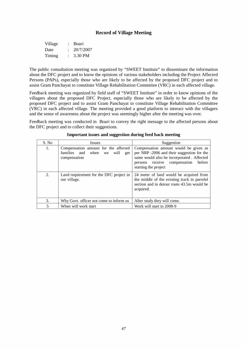
47
Record of Village Meeting
Village : Boari Date : 20/7/2007 Timing : 3.30 PM
The public consultation meeting was organized by “SWEET Institute” to disseminate the information about the DFC project and to know the opinions of various stakeholders including the Project Affected Persons (PAPs), especially those who are likely to be affected by the proposed DFC project and to assist Gram Panchayat to constitute Village Rehabilitation Committee (VRC) in each affected village.
Feedback meeting was organized by field staff of “SWEET Institute” in order to know opinions of the villagers about the proposed DFC Project, especially those who are likely to be affected by the proposed DFC project and to assist Gram Panchayat to constitute Village Rehabilitation Committee (VRC) in each affected village. The meeting provided a good platform to interact with the villagers and the sense of awareness about the project was seemingly higher after the meeting was over.
Feedback meeting was conducted in Boari to convey the right message to the affected persons about the DFC project and to collect their suggestions.
Important issues and suggestion during feed back meeting
S. No Issues Suggestion 1. Compensation amount for the affected
families and when we will get compensation
Compensation amount would be given as per NRP -2006 and their suggestion for the same would also be incorporated . Affected persons receive compensation before starting the project
2. Land requirement for the DFC project in our village.
24 meter of land would be acquired from the middle of the existing track in parrelel section and in detour route 43.5m would be acquired.
3. Why Govt. officer not come to inform us After study they will come. 5 When will work start Work will start in 2008-9
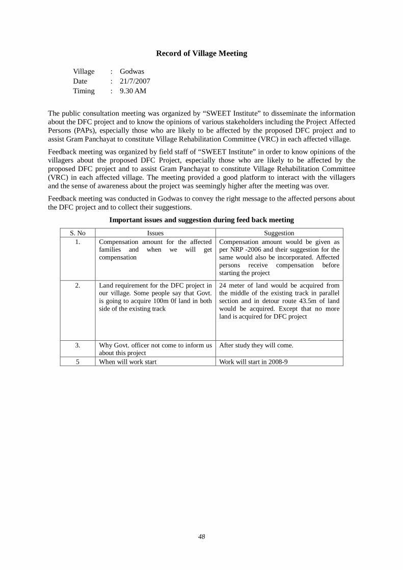
48
Record of Village Meeting
Village : Godwas Date : 21/7/2007 Timing : 9.30 AM
The public consultation meeting was organized by “SWEET Institute” to disseminate the information about the DFC project and to know the opinions of various stakeholders including the Project Affected Persons (PAPs), especially those who are likely to be affected by the proposed DFC project and to assist Gram Panchayat to constitute Village Rehabilitation Committee (VRC) in each affected village.
Feedback meeting was organized by field staff of “SWEET Institute” in order to know opinions of the villagers about the proposed DFC Project, especially those who are likely to be affected by the proposed DFC project and to assist Gram Panchayat to constitute Village Rehabilitation Committee (VRC) in each affected village. The meeting provided a good platform to interact with the villagers and the sense of awareness about the project was seemingly higher after the meeting was over.
Feedback meeting was conducted in Godwas to convey the right message to the affected persons about the DFC project and to collect their suggestions.
Important issues and suggestion during feed back meeting
S. No Issues Suggestion 1. Compensation amount for the affected
families and when we will get compensation
Compensation amount would be given as per NRP -2006 and their suggestion for the same would also be incorporated. Affected persons receive compensation before starting the project
2. Land requirement for the DFC project in our village. Some people say that Govt. is going to acquire 100m 0f land in both side of the existing track
24 meter of land would be acquired from the middle of the existing track in parallel section and in detour route 43.5m of land would be acquired. Except that no more land is acquired for DFC project
3. Why Govt. officer not come to inform us about this project
After study they will come.
5 When will work start Work will start in 2008-9
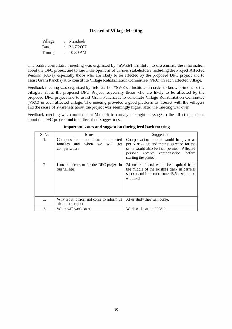
49
Record of Village Meeting
Village : Mandeoli Date : 21/7/2007 Timing : 10.30 AM
The public consultation meeting was organized by “SWEET Institute” to disseminate the information about the DFC project and to know the opinions of various stakeholders including the Project Affected Persons (PAPs), especially those who are likely to be affected by the proposed DFC project and to assist Gram Panchayat to constitute Village Rehabilitation Committee (VRC) in each affected village.
Feedback meeting was organized by field staff of “SWEET Institute” in order to know opinions of the villagers about the proposed DFC Project, especially those who are likely to be affected by the proposed DFC project and to assist Gram Panchayat to constitute Village Rehabilitation Committee (VRC) in each affected village. The meeting provided a good platform to interact with the villagers and the sense of awareness about the project was seemingly higher after the meeting was over.
Feedback meeting was conducted in Mandoli to convey the right message to the affected persons about the DFC project and to collect their suggestions.
Important issues and suggestion during feed back meeting
S. No Issues Suggestion 1. Compensation amount for the affected
families and when we will get compensation
Compensation amount would be given as per NRP -2006 and their suggestion for the same would also be incorporated . Affected persons receive compensation before starting the project
2. Land requirement for the DFC project in our village.
24 meter of land would be acquired from the middle of the existing track in parrelel section and in detour route 43.5m would be acquired.
3. Why Govt. officer not come to inform us about the project
After study they will come.
5 When will work start Work will start in 2008-9
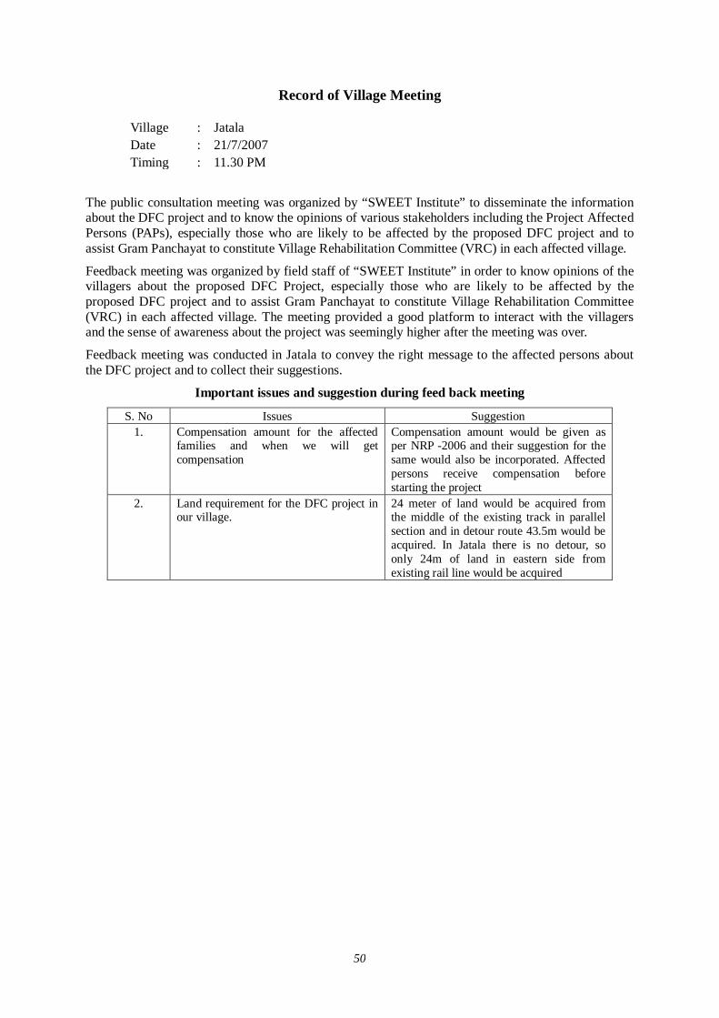
50
Record of Village Meeting
Village : Jatala Date : 21/7/2007 Timing : 11.30 PM
The public consultation meeting was organized by “SWEET Institute” to disseminate the information about the DFC project and to know the opinions of various stakeholders including the Project Affected Persons (PAPs), especially those who are likely to be affected by the proposed DFC project and to assist Gram Panchayat to constitute Village Rehabilitation Committee (VRC) in each affected village.
Feedback meeting was organized by field staff of “SWEET Institute” in order to know opinions of the villagers about the proposed DFC Project, especially those who are likely to be affected by the proposed DFC project and to assist Gram Panchayat to constitute Village Rehabilitation Committee (VRC) in each affected village. The meeting provided a good platform to interact with the villagers and the sense of awareness about the project was seemingly higher after the meeting was over.
Feedback meeting was conducted in Jatala to convey the right message to the affected persons about the DFC project and to collect their suggestions.
Important issues and suggestion during feed back meeting
S. No Issues Suggestion 1. Compensation amount for the affected
families and when we will get compensation
Compensation amount would be given as per NRP -2006 and their suggestion for the same would also be incorporated. Affected persons receive compensation before starting the project
2. Land requirement for the DFC project in our village.
24 meter of land would be acquired from the middle of the existing track in parallel section and in detour route 43.5m would be acquired. In Jatala there is no detour, so only 24m of land in eastern side from existing rail line would be acquired
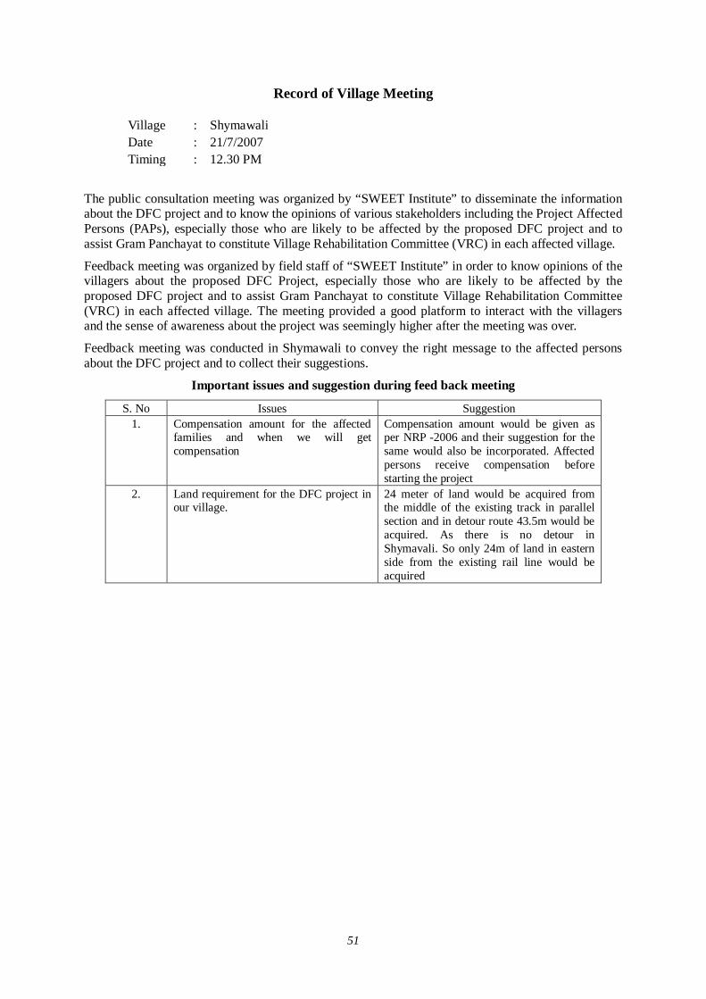
51
Record of Village Meeting
Village : Shymawali Date : 21/7/2007 Timing : 12.30 PM
The public consultation meeting was organized by “SWEET Institute” to disseminate the information about the DFC project and to know the opinions of various stakeholders including the Project Affected Persons (PAPs), especially those who are likely to be affected by the proposed DFC project and to assist Gram Panchayat to constitute Village Rehabilitation Committee (VRC) in each affected village.
Feedback meeting was organized by field staff of “SWEET Institute” in order to know opinions of the villagers about the proposed DFC Project, especially those who are likely to be affected by the proposed DFC project and to assist Gram Panchayat to constitute Village Rehabilitation Committee (VRC) in each affected village. The meeting provided a good platform to interact with the villagers and the sense of awareness about the project was seemingly higher after the meeting was over.
Feedback meeting was conducted in Shymawali to convey the right message to the affected persons about the DFC project and to collect their suggestions.
Important issues and suggestion during feed back meeting
S. No Issues Suggestion 1. Compensation amount for the affected
families and when we will get compensation
Compensation amount would be given as per NRP -2006 and their suggestion for the same would also be incorporated. Affected persons receive compensation before starting the project
2. Land requirement for the DFC project in our village.
24 meter of land would be acquired from the middle of the existing track in parallel section and in detour route 43.5m would be acquired. As there is no detour in Shymavali. So only 24m of land in eastern side from the existing rail line would be acquired

52
Record of Village Meeting
Village : Kunwara Date : 21/7/2007 Timing : 2.30 PM
The public consultation meeting was organized by “SWEET Institute” to disseminate the information about the DFC project and to know the opinions of various stakeholders including the Project Affected Persons (PAPs), especially those who are likely to be affected by the proposed DFC project and to assist Gram Panchayat to constitute Village Rehabilitation Committee (VRC) in each affected village.
Feedback meeting was organized by field staff of “SWEET Institute” in order to know opinions of the villagers about the proposed DFC Project, especially those who are likely to be affected by the proposed DFC project and to assist Gram Panchayat to constitute Village Rehabilitation Committee (VRC) in each affected village. The meeting provided a good platform to interact with the villagers and the sense of awareness about the project was seemingly higher after the meeting was over.
Feedback meeting was conducted in Kunwara to convey the right message to the affected persons about the DFC project and to collect their suggestions.
Important issues and suggestion during feed back meeting
S. No Issues Suggestion 1. Compensation amount for the affected
families and when we will get compensation
Compensation amount would be given as per NRP -2006 and their suggestion for the same would also be incorporated. Affected persons receive compensation before starting the project
2. Land requirement for the DFC project in our village.
24 meter of land would be acquired from the middle of the existing track in parallel section and in detour route 43.5m would be acquired.
3 When will work start Work will start in 2008-9
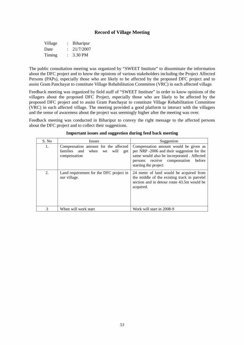
53
Record of Village Meeting
Village : Biharipur Date : 21/7/2007 Timing : 3.30 PM
The public consultation meeting was organized by “SWEET Institute” to disseminate the information about the DFC project and to know the opinions of various stakeholders including the Project Affected Persons (PAPs), especially those who are likely to be affected by the proposed DFC project and to assist Gram Panchayat to constitute Village Rehabilitation Committee (VRC) in each affected village.
Feedback meeting was organized by field staff of “SWEET Institute” in order to know opinions of the villagers about the proposed DFC Project, especially those who are likely to be affected by the proposed DFC project and to assist Gram Panchayat to constitute Village Rehabilitation Committee (VRC) in each affected village. The meeting provided a good platform to interact with the villagers and the sense of awareness about the project was seemingly higher after the meeting was over.
Feedback meeting was conducted in Biharipur to convey the right message to the affected persons about the DFC project and to collect their suggestions.
Important issues and suggestion during feed back meeting
S. No Issues Suggestion 1. Compensation amount for the affected
families and when we will get compensation
Compensation amount would be given as per NRP -2006 and their suggestion for the same would also be incorporated . Affected persons receive compensation before starting the project
2. Land requirement for the DFC project in our village.
24 meter of land would be acquired from the middle of the existing track in parrelel section and in detour route 43.5m would be acquired.
3 When will work start Work will start in 2008-9

54
Record of Village Meeting
Village : Bihar Date : 21/7/2007 Timing : 5.30 PM
The public consultation meeting was organized by “SWEET Institute” to disseminate the information about the DFC project and to know the opinions of various stakeholders including the Project Affected Persons (PAPs), especially those who are likely to be affected by the proposed DFC project and to assist Gram Panchayat to constitute Village Rehabilitation Committee (VRC) in each affected village.
Feedback meeting was organized by field staff of “SWEET Institute” in order to know opinions of the villagers about the proposed DFC Project, especially those who are likely to be affected by the proposed DFC project and to assist Gram Panchayat to constitute Village Rehabilitation Committee (VRC) in each affected village. The meeting provided a good platform to interact with the villagers and the sense of awareness about the project was seemingly higher after the meeting was over.
Feedback meeting was conducted in Bihar to convey the right message to the affected persons about the DFC project and to collect their suggestions.
Important issues and suggestion during feed back meeting
S. No Issues Suggestion 1. Compensation amount for the affected
families and when we will get compensation
Compensation amount would be given as per NRP -2006 and their suggestion for the same would also be incorporated. Affected persons receive compensation before starting the project
2. Land requirement for the DFC project in our village.
24 meter of land would be acquired from the middle of the existing track in parallel section and in detour route 43.5m would be acquired.
3 When will work start Work will start in 2008-9
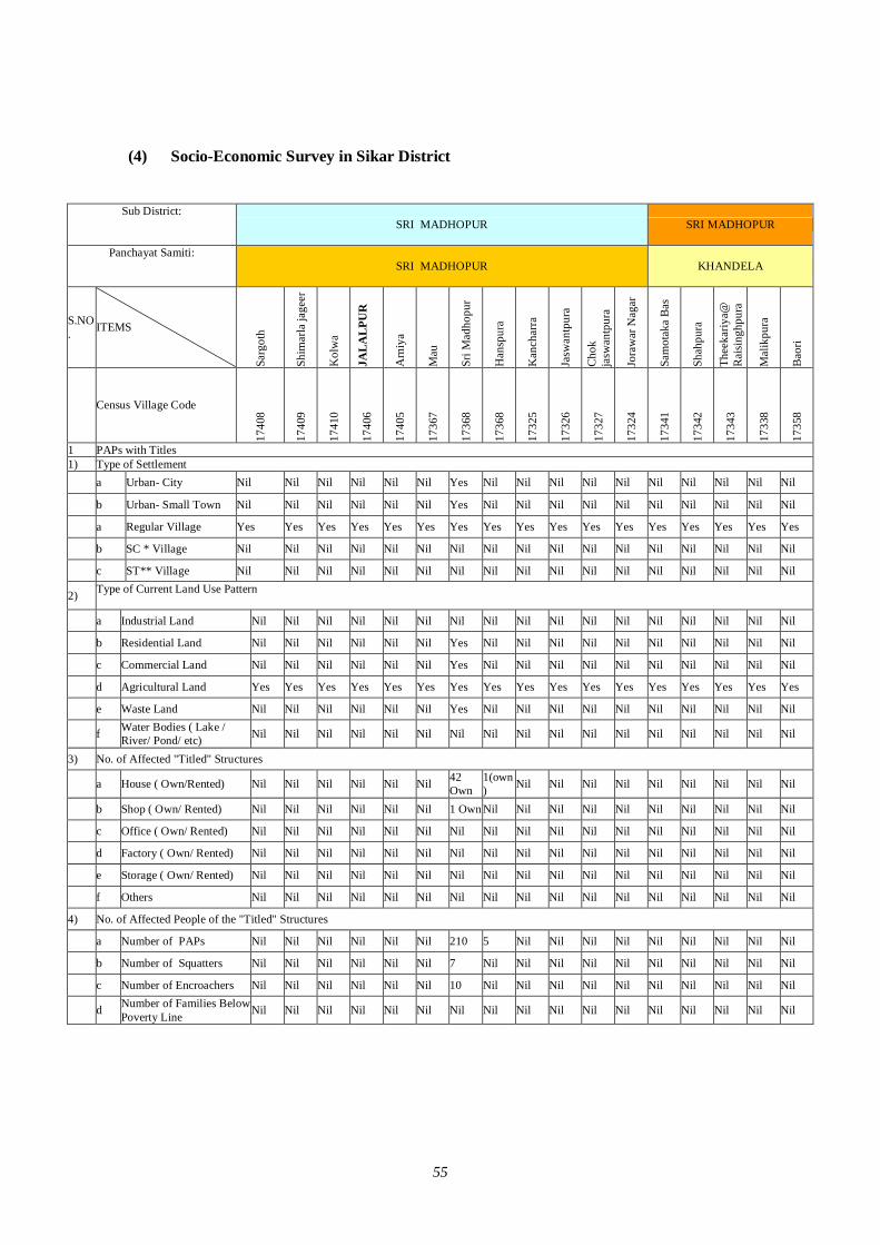
55
(4) Socio-Economic Survey in Sikar District
Sub District:
SRI MADHOPUR SRI MADHOPUR
Panchayat Samiti:
SRI MADHOPUR KHANDELA
S.NO. ITEMS
Sarg
oth
Shim
arla
jage
er
Kol
wa
JAL
AL
PUR
Arn
iya
Mau
Sri M
adho
pur
Han
spur
a
Kan
char
ra
Jasw
antp
ura
Cho
k ja
swan
tpur
a
Jora
war
Nag
ar
Sam
otak
a B
as
Shah
pura
Thee
kariy
a@
Rai
sing
hpur
a
Mal
ikpu
ra
Bao
ri
Census Village Code
1740
8
1740
9
1741
0
1740
6
1740
5
1736
7
1736
8
1736
8
1732
5
1732
6
1732
7
1732
4
1734
1
1734
2
1734
3
1733
8
1735
8
1 PAPs with Titles 1) Type of Settlement a Urban- City Nil Nil Nil Nil Nil Nil Yes Nil Nil Nil Nil Nil Nil Nil Nil Nil Nil
b Urban- Small Town Nil Nil Nil Nil Nil Nil Yes Nil Nil Nil Nil Nil Nil Nil Nil Nil Nil
a Regular Village Yes Yes Yes Yes Yes Yes Yes Yes Yes Yes Yes Yes Yes Yes Yes Yes Yes
b SC * Village Nil Nil Nil Nil Nil Nil Nil Nil Nil Nil Nil Nil Nil Nil Nil Nil Nil
c ST** Village Nil Nil Nil Nil Nil Nil Nil Nil Nil Nil Nil Nil Nil Nil Nil Nil Nil
2) Type of Current Land Use Pattern
a Industrial Land Nil Nil Nil Nil Nil Nil Nil Nil Nil Nil Nil Nil Nil Nil Nil Nil Nil
b Residential Land Nil Nil Nil Nil Nil Nil Yes Nil Nil Nil Nil Nil Nil Nil Nil Nil Nil
c Commercial Land Nil Nil Nil Nil Nil Nil Yes Nil Nil Nil Nil Nil Nil Nil Nil Nil Nil
d Agricultural Land Yes Yes Yes Yes Yes Yes Yes Yes Yes Yes Yes Yes Yes Yes Yes Yes Yes
e Waste Land Nil Nil Nil Nil Nil Nil Yes Nil Nil Nil Nil Nil Nil Nil Nil Nil Nil
f Water Bodies ( Lake / River/ Pond/ etc) Nil Nil Nil Nil Nil Nil Nil Nil Nil Nil Nil Nil Nil Nil Nil Nil Nil
3) No. of Affected "Titled" Structures
a House ( Own/Rented) Nil Nil Nil Nil Nil Nil 42 Own
1(own) Nil Nil Nil Nil Nil Nil Nil Nil Nil
b Shop ( Own/ Rented) Nil Nil Nil Nil Nil Nil 1 Own Nil Nil Nil Nil Nil Nil Nil Nil Nil Nil
c Office ( Own/ Rented) Nil Nil Nil Nil Nil Nil Nil Nil Nil Nil Nil Nil Nil Nil Nil Nil Nil
d Factory ( Own/ Rented) Nil Nil Nil Nil Nil Nil Nil Nil Nil Nil Nil Nil Nil Nil Nil Nil Nil
e Storage ( Own/ Rented) Nil Nil Nil Nil Nil Nil Nil Nil Nil Nil Nil Nil Nil Nil Nil Nil Nil
f Others Nil Nil Nil Nil Nil Nil Nil Nil Nil Nil Nil Nil Nil Nil Nil Nil Nil
4) No. of Affected People of the "Titled" Structures
a Number of PAPs Nil Nil Nil Nil Nil Nil 210 5 Nil Nil Nil Nil Nil Nil Nil Nil Nil
b Number of Squatters Nil Nil Nil Nil Nil Nil 7 Nil Nil Nil Nil Nil Nil Nil Nil Nil Nil
c Number of Encroachers Nil Nil Nil Nil Nil Nil 10 Nil Nil Nil Nil Nil Nil Nil Nil Nil Nil
d Number of Families Below Poverty Line Nil Nil Nil Nil Nil Nil Nil Nil Nil Nil Nil Nil Nil Nil Nil Nil Nil
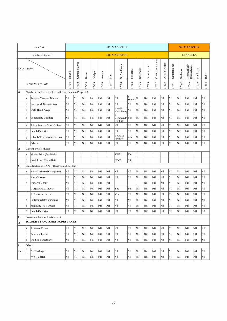
56
Sub District: SRI MADHOPUR SRI MADHOPUR
Panchayat Samiti: SRI MADHOPUR KHANDELA
S.NO. ITEMS Sa
rgot
h
Shim
arla
jage
er
Kol
wa
Jala
lpur
Arn
iya
Mau
Sri M
adho
pur
Han
spur
a
Kan
char
ra
Jasw
antp
ura
Chok
jasw
antp
ura
Jora
war
Nag
ar
Sam
otak
a Ba
s
Shah
pura
Thee
kariy
a@
Raisi
nghp
ura
Mal
ikpu
ra
Baor
i
Census Village Code
1740
8
1740
9
1741
0
1740
6
1740
5
1736
7
1736
8
1736
8
1732
5
1732
6
1732
7
1732
4
1734
1
1734
2
1734
3
1733
8
1735
8
5) Number of Affected Public Facilities/ Common PropertieS
a Temple/ Mosque/ Church Nil Nil Nil Nil Nil Nil Nil 2 Temple Nil Nil Nil Nil Nil Nil Nil Nil Nil
b Graveyard/ Crematorium Nil Nil Nil Nil Nil Nil Nil Nil Nil Nil Nil Nil Nil Nil Nil Nil Nil
c Well/ Hand Pump Nil Nil Nil Nil Nil Nil 1 Well, 1 Hand Pump Nil Nil Nil Nil Nil Nil Nil Nil Nil Nil
d Community Building Nil Nil Nil Nil Nil Nil 1 Community Buiding
Yes Nil Nil Nil Nil Nil Nil Nil Nil Nil
e Police Station/ Govt .Offices Nil Nil Nil Nil Nil Nil Nil Nil Nil Nil Nil Nil Nil Nil Nil Nil Nil
f Health Facilities Nil Nil Nil Nil Nil Nil Nil Nil Nil Nil Nil Nil Nil Nil Nil Nil Nil
g Schools/ Educational Institute Nil Nil Nil Nil Nil Nil 1 Health Facility Yes Nil Nil Nil Nil Nil Nil Nil Nil Nil
h Others Nil Nil Nil Nil Nil Nil Nil Nil Nil Nil Nil Nil Nil Nil Nil Nil Nil
6) Current Price of Land
a Market Price (Per Bigha) 2057.1 600
b Govt. Price/ Circle Rate 765.71 350
2 Classification of PAPs without Titles/Squatters
a Station-oriented Occupation Nil Nil Nil Nil Nil Nil Nil Nil Nil Nil Nil Nil Nil Nil Nil Nil Nil
b Shops/Kiosks Nil Nil Nil Nil Nil Nil Nil Nil Nil Nil Nil Nil Nil Nil Nil Nil Nil
c Seasonal labour Nil Nil Nil Nil Nil Nil Nil Nil Nil Nil Nil Nil Nil Nil
i. Agricultural labour Nil Nil Nil Nil Nil Nil Yes Yes Nil Nil Nil Nil Nil Nil Nil Nil Nil
ii. Industrial labour Nil Nil Nil Nil Nil Nil Yes Nil Nil Nil Nil Nil Nil Nil Nil Nil Nil
d Railway-related gangman Nil Nil Nil Nil Nil Nil Nil Nil Nil Nil Nil Nil Nil Nil Nil Nil Nil
e Migrating tribal people Nil Nil Nil Nil Nil Nil Nil Nil Nil Nil Nil Nil Nil Nil Nil Nil Nil
f Health Facilities Nil Nil Nil Nil Nil Nil Nil Nil Nil Nil Nil Nil Nil Nil Nil Nil Nil
3 Features of Natural Environment
1) WILDLIFE SANCTUARY/FOREST AREA
a Protected Forest Nil Nil Nil Nil Nil Nil Nil Nil Nil Nil Nil Nil Nil Nil Nil Nil Nil
b Reserved Forest Nil Nil Nil Nil Nil Nil Nil Nil Nil Nil Nil Nil Nil Nil Nil Nil Nil
c Wildlife Sancatuary Nil Nil Nil Nil Nil Nil Nil Nil Nil Nil Nil Nil Nil Nil Nil Nil Nil
4 Others
Note: * SC Village Nil Nil Nil Nil Nil Nil Nil Nil Nil Nil Nil Nil Nil Nil Nil Nil Nil
** ST Village Nil Nil Nil Nil Nil Nil Nil Nil Nil Nil Nil Nil Nil Nil Nil Nil Nil
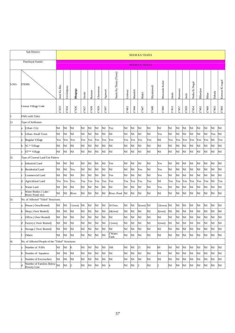
57
Sub District:
NEEM KA THANA
Panchayat Samiti:
NEEM KA THANA
S.NO. ITEMS
Jass
i Ka
Bas
Gov
indp
ura
Bhag
ega
Siro
hi
Rana
sar
Char
anw
as
Aga
war
i
Nee
m K
a Th
ana
(Tow
n)
God
was
Man
doli
Mak
ri
Shya
maw
ali
Maw
anda
Kal
an
Jata
la
Kun
war
a
Jeel
o
Nat
ha K
i Nag
al
Biha
ripur
Biha
r
Dab
ala
Kan
war
Ki n
agal
Census Village Code
1743
3
1743
4
1743
6
1743
7
1743
8
1743
9
1749
7
1748
3
1744
4
1744
7
1744
8
1748
0
1745
3
1745
7
1745
9
1745
4
1746
2
1746
8
1746
3
1746
4
1 PAPs with Titles
1) Type of Settlemen
a Urban- City Nil Nil Nil Nil Nil Nil Nil Yes Nil Nil Nil Nil Nil Nil Nil Nil Nil Nil Nil Nil Nil
b Urban- Small Town Nil Nil Nil Nil Nil Nil Nil Nil Nil Nil Nil Nil Yes Nil Nil Nil Nil Nil Nil Yes Nil
a Regular Village Yes Yes Yes Yes Yes Yes Yes Yes Yes Yes Yes Yes Nil Yes Yes Yes Yes Yes Yes Nil Yes
b SC * Village Nil Nil Nil Nil Nil Nil Nil Nil Nil Nil Nil Nil Nil Nil Nil Nil Nil Nil Nil Nil Nil
c ST** Village Nil Nil Nil Nil Nil Nil Nil Nil Nil Nil Nil Nil Nil Nil Nil Nil Nil Nil Nil Nil Nil
2) Type of Current Land Use Pattern
a Industrial Land Nil Nil Nil Nil Nil Nil Nil Yes Nil Nil Nil Nil Yes Nil Nil Nil Nil Nil Nil Nil Nil
b Residential Land Nil Nil Yes Nil Nil Nil Nil Nil Nil Nil Yes Nil Yes Nil Nil Nil Nil Nil Nil Nil Nil
c Commercial Land Nil Nil Nil Nil Nil Nil Nil Yes Nil Nil Nil Nil Yes Nil Nil Nil Nil Nil Nil Nil Nil
d Agricultural Land Yes Yes Yes Yes Yes Yes Yes Yes Yes Yes Yes Yes Nil Yes Yes Yes Yes Yes Yes Nil Yes
e Waste Land Nil Nil Nil Nil Nil Nil Nil Nil Nil Nil Nil Nil Yes Nil Nil Nil Nil Nil Nil Nil Nil
f Water Bodies ( Lake / River/ Pond/ etc) Nil Nil River Nil Nil Nil Nil River, Pond Nil Nil Nil Nil Nil Nil Nil Nil Nil Nil Nil Nil Nil
3) No. of Affected "Titled" Structures
a House ( Own/Rented) Nil Nil 1 (own) Nil Nil Nil Nil 24 Own Nil Nil 5(own) Nil 12(own) Nil Nil Nil Nil Nil Nil Nil Nil
b Shop ( Own/ Rented) Nil Nil Nil Nil Nil Nil Nil 24(own) Nil Nil Nil Nil 3(own) Nil Nil Nil Nil Nil Nil Nil Nil
c Office ( Own/ Rented) Nil Nil Nil Nil Nil Nil Nil Nil Nil Nil Nil Nil Nil Nil Nil Nil Nil Nil Nil Nil Nil
d Factory ( Own/ Rented) Nil Nil Nil Nil Nil Nil Nil 2 (own) Nil Nil Nil Nil 1(own) Nil Nil Nil Nil Nil Nil Nil Nil
e Storage ( Own/ Rented) Nil Nil Nil Nil Nil Nil Nil Nil Nil Nil Nil Nil Nil Nil Nil Nil Nil Nil Nil Nil Nil
f Others Nil Nil Nil Nil Nil Nil Nil 2 Water Tank Nil Nil Nil Nil Nil Nil Nil Nil Nil Nil Nil Nil Nil
4) No. of Affected People of the "Titled" Structures
a Number of PAPs Nil Nil 6 Nil Nil Nil Nil 168 Nil Nil 25 Nil 60 Nil Nil Nil Nil Nil Nil Nil Nil
b Number of Squatters Nil Nil Nil Nil Nil Nil Nil Nil Nil Nil Nil Nil Nil Nil Nil Nil Nil Nil Nil Nil Nil
c Number of Encroachers Nil Nil Nil Nil Nil Nil Nil Nil Nil Nil Nil Nil Nil Nil Nil Nil Nil Nil Nil Nil Nil
d Number of Families Below Poverty Line Nil Nil 2 Nil Nil Nil Nil 4 Nil Nil 2 Nil 2 Nil Nil Nil Nil Nil Nil Nil Nil
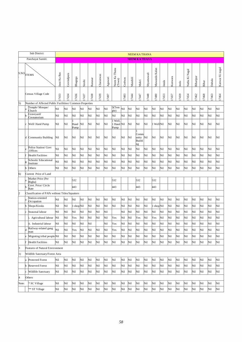
58
Sub District:
NEEM KA THANA
Panchayat Samiti:
NEEM KA THANA
S.NO. ITEMS
Jass
i Ka
Bas
Gov
indp
ura
Bhag
ega
Siro
hi
Rana
sar
Char
anw
as
Aga
war
i
Nee
m K
a Th
ana
(Tow
n)
God
was
Man
doli
Mak
ri
Shya
maw
ali
Maw
anda
Kal
an
Jata
la
Kun
war
a
Jeel
o
Nat
ha K
i Nag
al
Biha
ripur
Biha
r
Dab
ala
Kan
war
Ki n
agal
Census Village Code
1743
3
1743
4
1743
6
1743
7
1743
8
1743
9
1749
7
1748
3
1744
4
1744
7
1744
8
1748
0
1745
3
1745
7
1745
9
1745
4
1746
2
1746
8
1746
3
1746
4
5) Number of Affected Public Facilitites/ Common Properties
a Temple/ Mosque/ Church Nil Nil Nil Nil Nil Nil Nil 3(Tem
ple) Nil Nil Nil Nil Nil Nil Nil Nil Nil Nil Nil Nil Nil
b Graveyard/ Crematorium Nil Nil Nil Nil Nil Nil Nil Nil Nil Nil Nil Nil Nil Nil Nil Nil Nil Nil Nil Nil Nil
c Well/ Hand Pump Nil Nil 1 Hand Pump
Nil Nil Nil Nil 1 Well, 1 Hand Pump
Nil Nil Nil Nil 1 Well Nil Nil Nil Nil Nil Nil Nil Nil
d Community Building Nil Nil Nil Nil Nil Nil Nil Nil Nil Nil
1 Community Building
Nil Nil Nil Nil Nil Nil Nil Nil Nil Nil
e Police Station/ Govt .Offices Nil Nil Nil Nil Nil Nil Nil Nil Nil Nil Nil Nil Nil Nil Nil Nil Nil Nil Nil Nil Nil
f Health Facilities Nil Nil Nil Nil Nil Nil Nil Nil Nil Nil Nil Nil Nil Nil Nil Nil Nil Nil Nil Nil Nil
g Schools/ Educational Institute Nil Nil Nil Nil Nil Nil Nil Nil Nil Nil Nil Nil Nil Nil Nil Nil Nil Nil Nil Nil Nil
h Others Nil Nil Nil Nil Nil Nil Nil Nil Nil Nil Nil Nil Nil Nil Nil Nil Nil Nil Nil Nil Nil
6) Current Price of Land
a Market Price (Per Bigha) 532 532 532 532
b Govt. Price/ Circle Rate 443 443 443 443
2 Classification of PAPs without Titles/Squatters
a Station-oriented Occupation Nil Nil Nil Nil Nil Nil Nil Nil Nil Nil Nil Nil Nil Nil Nil Nil Nil Nil Nil Nil Nil
b Shops/Kiosks Nil Nil 1 shop Nil Nil Nil Nil Nil Nil Nil Nil Nil 1 shop Nil Nil Nil Nil Nil Nil Nil Nil
c Seasonal labour Nil Nil Nil Nil Nil Nil Nil Nil Nil Nil Nil Nil Nil Nil Nil Nil Nil Nil Nil Nil
i. Agricultural labour Nil Nil Yes Nil Nil Nil Nil Yes Nil Nil Yes Nil Yes Nil Nil Nil Nil Nil Nil Nil Nil
ii. Industrial labour Nil Nil Nil Nil Nil Nil Yes Nil Nil Nil Nil Nil Nil Nil Nil Nil Nil Nil Nil Nil
d Railway-related gang man Nil Nil Yes Nil Nil Nil Nil Yes Nil Nil Nil Nil Nil Nil Nil Nil Nil Nil Nil Nil Nil
e Migrating tribal people Nil Nil Nil Nil Nil Nil Nil Nil Nil Nil Nil Nil Nil Nil Nil Nil Nil Nil Nil Nil Nil
f Health Facilities Nil Nil Nil Nil Nil Nil Nil Nil Nil Nil Nil Nil Nil Nil Nil Nil Nil Nil Nil Nil Nil
3 Features of Natural Environment
1) Wildlife Sanctuary/Forest Area
a Protected Forest Nil Nil Nil Nil Nil Nil Nil Nil Nil Nil Nil Nil Nil Nil Nil Nil Nil Nil Nil Nil Nil
b Reserved Forest Nil Nil Nil Nil Nil Nil Nil Nil Nil Nil Nil Nil Nil Nil Nil Nil Nil Nil Nil Nil Nil
c Wildlife Sanctuary Nil Nil Nil Nil Nil Nil Nil Nil Nil Nil Nil Nil Nil Nil Nil Nil Nil Nil Nil Nil Nil
4 Others
Note: * SC Village Nil Nil Nil Nil Nil Nil Nil Nil Nil Nil Nil Nil Nil Nil Nil Nil Nil Nil Nil Nil Nil
** ST Village Nil Nil Nil Nil Nil Nil Nil Nil Nil Nil Nil Nil Nil Nil Nil Nil Nil Nil Nil Nil Nil
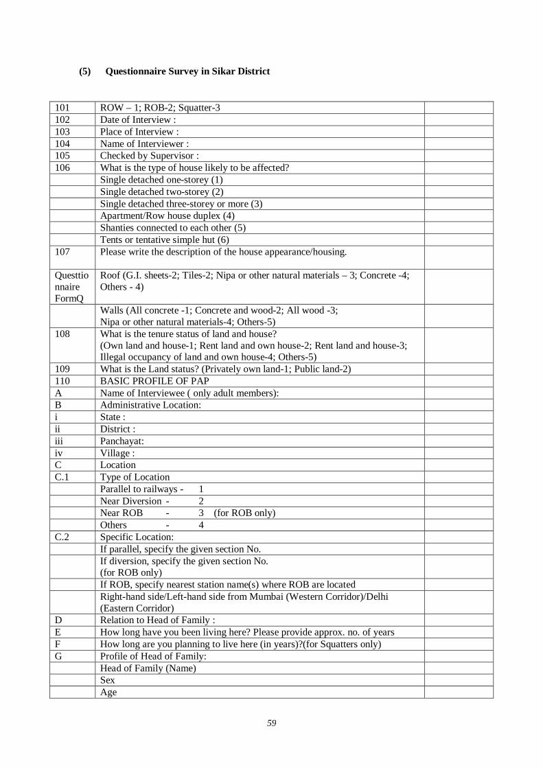
59
(5) Questionnaire Survey in Sikar District
101 ROW – 1; ROB-2; Squatter-3 102 Date of Interview : 103 Place of Interview : 104 Name of Interviewer : 105 Checked by Supervisor : 106 What is the type of house likely to be affected? Single detached one-storey (1) Single detached two-storey (2) Single detached three-storey or more (3) Apartment/Row house duplex (4) Shanties connected to each other (5) Tents or tentative simple hut (6) 107 Please write the description of the house appearance/housing.
Questtionnaire FormQ
Roof (G.I. sheets-2; Tiles-2; Nipa or other natural materials – 3; Concrete -4; Others - 4)
Walls (All concrete -1; Concrete and wood-2; All wood -3; Nipa or other natural materials-4; Others-5)
108 What is the tenure status of land and house? (Own land and house-1; Rent land and own house-2; Rent land and house-3; Illegal occupancy of land and own house-4; Others-5)
109 What is the Land status? (Privately own land-1; Public land-2) 110 BASIC PROFILE OF PAP A Name of Interviewee ( only adult members): B Administrative Location: i State : ii District : iii Panchayat: iv Village : C Location C.1 Type of Location Parallel to railways - 1 Near Diversion - 2 Near ROB - 3 (for ROB only) Others - 4 C.2 Specific Location: If parallel, specify the given section No. If diversion, specify the given section No.
(for ROB only)
If ROB, specify nearest station name(s) where ROB are located Right-hand side/Left-hand side from Mumbai (Western Corridor)/Delhi
(Eastern Corridor)
D Relation to Head of Family : E How long have you been living here? Please provide approx. no. of years F How long are you planning to live here (in years)?(for Squatters only) G Profile of Head of Family: Head of Family (Name) Sex Age
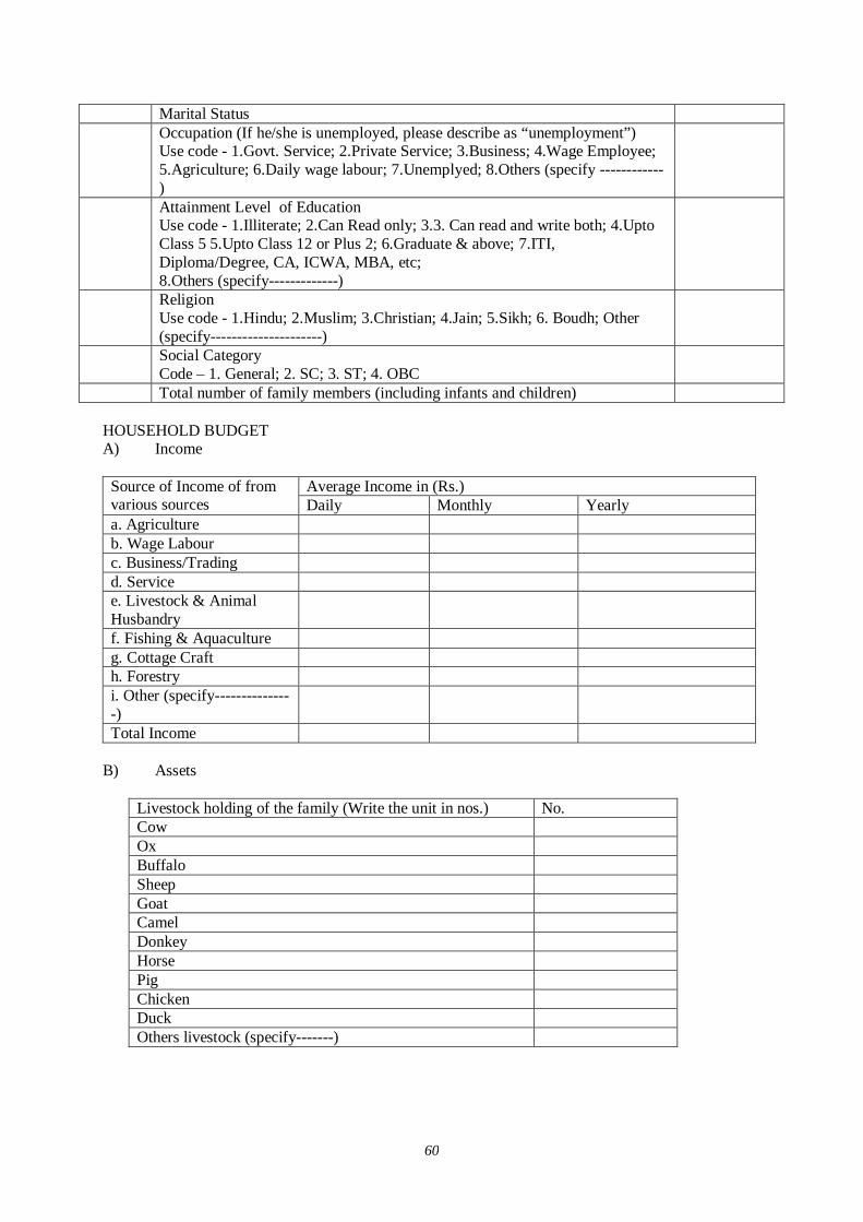
60
Marital Status Occupation (If he/she is unemployed, please describe as “unemployment”)
Use code - 1.Govt. Service; 2.Private Service; 3.Business; 4.Wage Employee; 5.Agriculture; 6.Daily wage labour; 7.Unemplyed; 8.Others (specify ------------)
Attainment Level of Education Use code - 1.Illiterate; 2.Can Read only; 3.3. Can read and write both; 4.Upto Class 5 5.Upto Class 12 or Plus 2; 6.Graduate & above; 7.ITI, Diploma/Degree, CA, ICWA, MBA, etc; 8.Others (specify-------------)
Religion Use code - 1.Hindu; 2.Muslim; 3.Christian; 4.Jain; 5.Sikh; 6. Boudh; Other (specify---------------------)
Social Category Code – 1. General; 2. SC; 3. ST; 4. OBC
Total number of family members (including infants and children) HOUSEHOLD BUDGET A) Income
Average Income in (Rs.) Source of Income of from various sources Daily Monthly Yearly a. Agriculture b. Wage Labour c. Business/Trading d. Service e. Livestock & Animal Husbandry
f. Fishing & Aquaculture g. Cottage Craft h. Forestry i. Other (specify---------------)
Total Income B) Assets
Livestock holding of the family (Write the unit in nos.) No. Cow Ox Buffalo Sheep Goat Camel Donkey Horse Pig Chicken Duck Others livestock (specify-------)
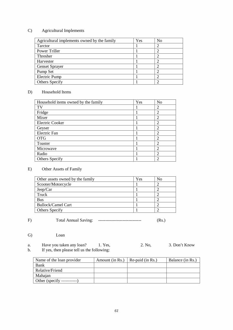
61
C) Agricultural Implements
Agricultural implements owned by the family Yes No Tarctor 1 2 Power Triller 1 2 Thresher 1 2 Harvester 1 2 Genset Sprayer 1 2 Pump Set 1 2 Electric Pump 1 2 Others Specify 1 2
D) Household Items
Household items owned by the family Yes No TV 1 2 Fridge 1 2 Mixer 1 2 Electric Cooker 1 2 Geyser 1 2 Electric Fan 1 2 OTG 1 2 Toaster 1 2 Microwave 1 2 Radio 1 2 Others Specify 1 2
E) Other Assets of Family
Other assets owned by the family Yes No Scooter/Motorcycle 1 2 Jeep/Car 1 2 Truck 1 2 Bus 1 2 Bullock/Camel Cart 1 2 Others Specify 1 2
F) Total Annual Saving: ------------------------------ (Rs.) G) Loan a. Have you taken any loan? 1. Yes, 2. No, 3. Don’t Know b. If yes, then please tell us the following:
Name of the loan provider Amount (in Rs.) Re-paid (in Rs.) Balance (in Rs.) Bank Relative/Friend Mahajan Other (specify -----------)
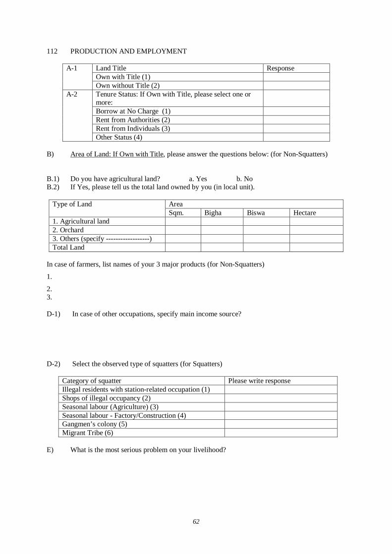
62
112 PRODUCTION AND EMPLOYMENT
Land Title Response Own with Title (1)
A-1
Own without Title (2) Tenure Status: If Own with Title, please select one or more:
Borrow at No Charge (1) Rent from Authorities (2) Rent from Individuals (3)
A-2
Other Status (4) B) Area of Land: If Own with Title, please answer the questions below: (for Non-Squatters)
B.1) Do you have agricultural land? a. Yes b. No B.2) If Yes, please tell us the total land owned by you (in local unit).
Area Type of Land Sqm. Bigha Biswa Hectare
1. Agricultural land 2. Orchard 3. Others (specify ------------------) Total Land
In case of farmers, list names of your 3 major products (for Non-Squatters)
1.
2. 3. D-1) In case of other occupations, specify main income source? D-2) Select the observed type of squatters (for Squatters)
Category of squatter Please write response Illegal residents with station-related occupation (1) Shops of illegal occupancy (2) Seasonal labour (Agriculture) (3) Seasonal labour - Factory/Construction (4) Gangmen’s colony (5) Migrant Tribe (6)
E) What is the most serious problem on your livelihood?
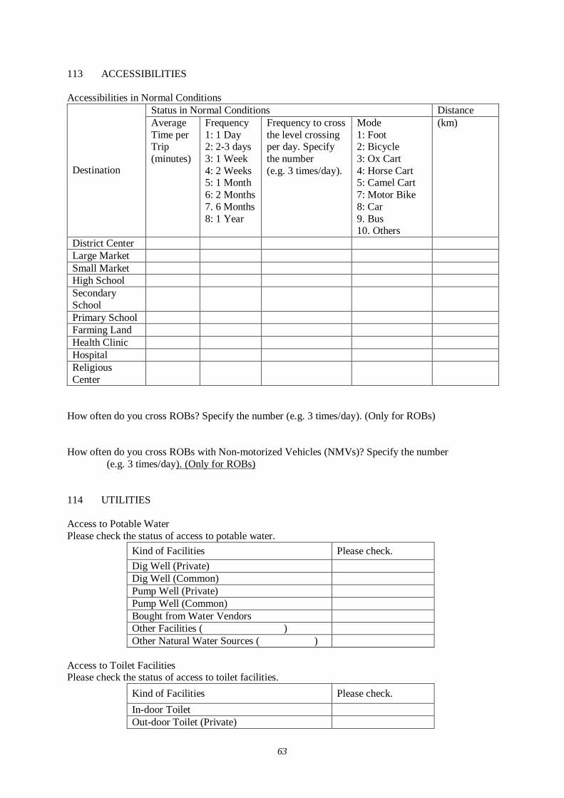
63
113 ACCESSIBILITIES Accessibilities in Normal Conditions
Status in Normal Conditions Distance
Destination
Average Time per Trip (minutes)
Frequency 1: 1 Day 2: 2-3 days 3: 1 Week 4: 2 Weeks 5: 1 Month 6: 2 Months 7. 6 Months 8: 1 Year
Frequency to cross the level crossing per day. Specify the number (e.g. 3 times/day).
Mode 1: Foot 2: Bicycle 3: Ox Cart 4: Horse Cart 5: Camel Cart 7: Motor Bike 8: Car 9. Bus 10. Others
(km)
District Center Large Market Small Market High School Secondary School
Primary School Farming Land Health Clinic Hospital Religious Center
How often do you cross ROBs? Specify the number (e.g. 3 times/day). (Only for ROBs) How often do you cross ROBs with Non-motorized Vehicles (NMVs)? Specify the number (e.g. 3 times/day). (Only for ROBs) 114 UTILITIES Access to Potable Water Please check the status of access to potable water.
Kind of Facilities Please check. Dig Well (Private) Dig Well (Common) Pump Well (Private) Pump Well (Common) Bought from Water Vendors Other Facilities ( ) Other Natural Water Sources ( )
Access to Toilet Facilities Please check the status of access to toilet facilities.
Kind of Facilities Please check. In-door Toilet Out-door Toilet (Private)
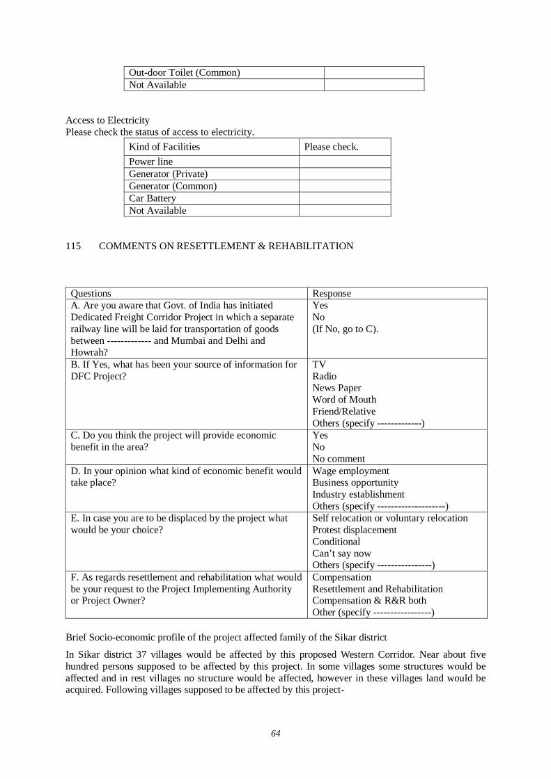
64
Out-door Toilet (Common) Not Available
Access to Electricity Please check the status of access to electricity.
Kind of Facilities Please check. Power line Generator (Private) Generator (Common) Car Battery Not Available
115 COMMENTS ON RESETTLEMENT & REHABILITATION
Questions Response A. Are you aware that Govt. of India has initiated Dedicated Freight Corridor Project in which a separate railway line will be laid for transportation of goods between ------------- and Mumbai and Delhi and Howrah?
Yes No (If No, go to C).
B. If Yes, what has been your source of information for DFC Project?
TV Radio News Paper Word of Mouth Friend/Relative Others (specify -------------)
C. Do you think the project will provide economic benefit in the area?
Yes No No comment
D. In your opinion what kind of economic benefit would take place?
Wage employment Business opportunity Industry establishment Others (specify --------------------)
E. In case you are to be displaced by the project what would be your choice?
Self relocation or voluntary relocation Protest displacement Conditional Can’t say now Others (specify ----------------)
F. As regards resettlement and rehabilitation what would be your request to the Project Implementing Authority or Project Owner?
Compensation Resettlement and Rehabilitation Compensation & R&R both Other (specify -----------------)
Brief Socio-economic profile of the project affected family of the Sikar district
In Sikar district 37 villages would be affected by this proposed Western Corridor. Near about five hundred persons supposed to be affected by this project. In some villages some structures would be affected and in rest villages no structure would be affected, however in these villages land would be acquired. Following villages supposed to be affected by this project-
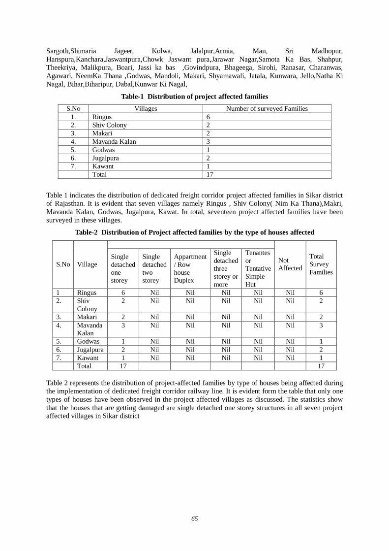
65
Sargoth,Shimaria Jageer, Kolwa, Jalalpur,Armia, Mau, Sri Madhopur, Hanspura,Kanchara,Jaswantpura,Chowk Jaswant pura,Jarawar Nagar,Samota Ka Bas, Shahpur, Theekriya, Malikpura, Boari, Jassi ka bas ,Govindpura, Bhageega, Sirohi, Ranasar, Charanwas, Agawari, NeemKa Thana ,Godwas, Mandoli, Makari, Shyamawali, Jatala, Kunwara, Jello,Natha Ki Nagal, Bihar,Biharipur, Dabal,Kunwar Ki Nagal,
Table-1 Distribution of project affected families S.No Villages Number of surveyed Families
1. Ringus 6 2. Shiv Colony 2 3. Makari 2 4. Mavanda Kalan 3 5. Godwas 1 6. Jugalpura 2 7. Kawant 1 Total 17
Table 1 indicates the distribution of dedicated freight corridor project affected families in Sikar district of Rajasthan. It is evident that seven villages namely Ringus , Shiv Colony( Nim Ka Thana),Makri, Mavanda Kalan, Godwas, Jugalpura, Kawat. In total, seventeen project affected families have been surveyed in these villages.
Table-2 Distribution of Project affected families by the type of houses affected
S.No Village Single detached one storey
Single detached two storey
Appartment / Row house Duplex
Single detached three storey or more
Tenantes or Tentative Simple Hut
Not Affected
Total Survey Families
1 Ringus 6 Nil Nil Nil Nil Nil 6 2. Shiv
Colony 2 Nil Nil Nil Nil Nil 2
3. Makari 2 Nil Nil Nil Nil Nil 2 4. Mavanda
Kalan 3 Nil Nil Nil Nil Nil 3
5. Godwas 1 Nil Nil Nil Nil Nil 1 6. Jugalpura 2 Nil Nil Nil Nil Nil 2 7. Kawant 1 Nil Nil Nil Nil Nil 1 Total 17 17
Table 2 represents the distribution of project-affected families by type of houses being affected during the implementation of dedicated freight corridor railway line. It is evident form the table that only one types of houses have been observed in the project affected villages as discussed. The statistics show that the houses that are getting damaged are single detached one storey structures in all seven project affected villages in Sikar district
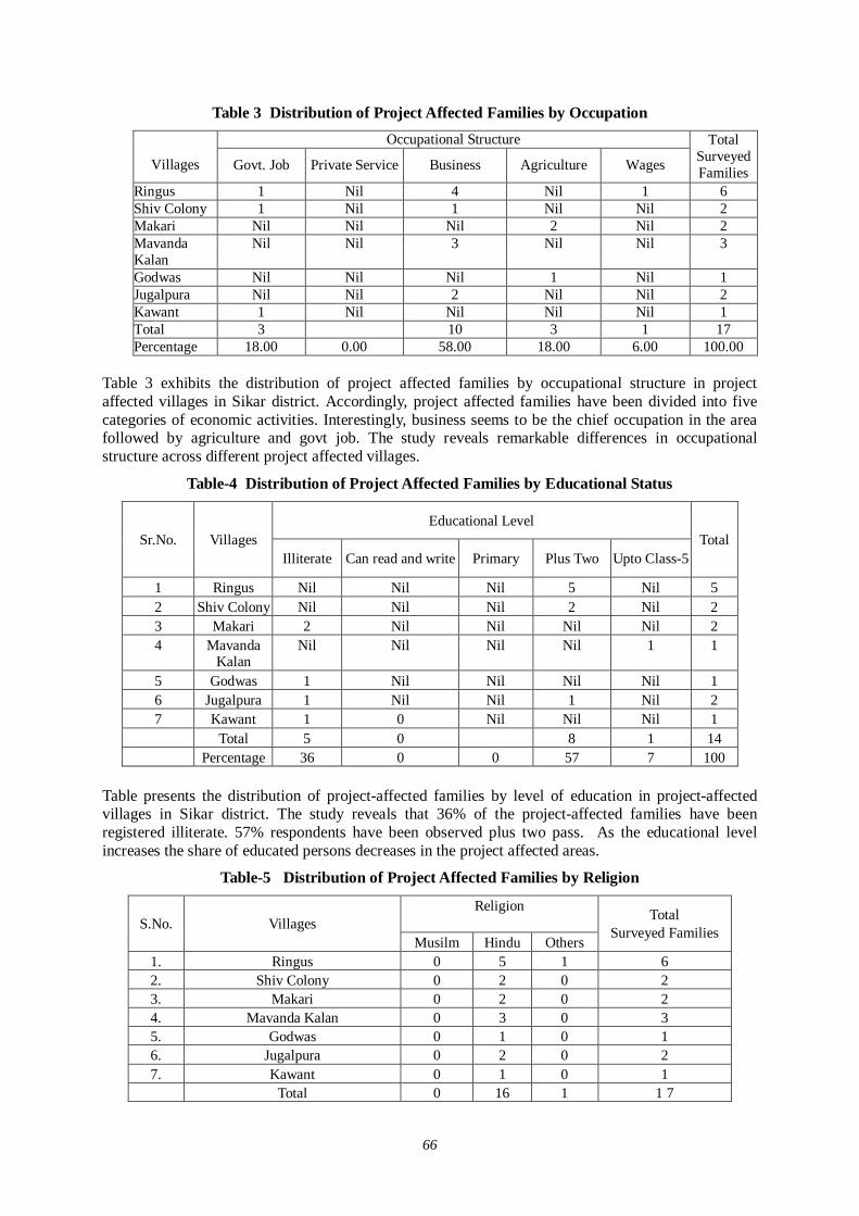
66
Table 3 Distribution of Project Affected Families by Occupation Occupational Structure
Villages Govt. Job Private Service Business Agriculture Wages
Total Surveyed Families
Ringus 1 Nil 4 Nil 1 6 Shiv Colony 1 Nil 1 Nil Nil 2 Makari Nil Nil Nil 2 Nil 2 Mavanda Kalan
Nil Nil 3 Nil Nil 3
Godwas Nil Nil Nil 1 Nil 1 Jugalpura Nil Nil 2 Nil Nil 2 Kawant 1 Nil Nil Nil Nil 1 Total 3 10 3 1 17 Percentage 18.00 0.00 58.00 18.00 6.00 100.00
Table 3 exhibits the distribution of project affected families by occupational structure in project affected villages in Sikar district. Accordingly, project affected families have been divided into five categories of economic activities. Interestingly, business seems to be the chief occupation in the area followed by agriculture and govt job. The study reveals remarkable differences in occupational structure across different project affected villages.
Table-4 Distribution of Project Affected Families by Educational Status
Educational Level Sr.No. Villages
Illiterate Can read and write Primary Plus Two Upto Class-5 Total
1 Ringus Nil Nil Nil 5 Nil 5 2 Shiv Colony Nil Nil Nil 2 Nil 2 3 Makari 2 Nil Nil Nil Nil 2 4 Mavanda
Kalan Nil Nil Nil Nil 1 1
5 Godwas 1 Nil Nil Nil Nil 1 6 Jugalpura 1 Nil Nil 1 Nil 2 7 Kawant 1 0 Nil Nil Nil 1 Total 5 0 8 1 14 Percentage 36 0 0 57 7 100
Table presents the distribution of project-affected families by level of education in project-affected villages in Sikar district. The study reveals that 36% of the project-affected families have been registered illiterate. 57% respondents have been observed plus two pass. As the educational level increases the share of educated persons decreases in the project affected areas.
Table-5 Distribution of Project Affected Families by Religion
Religion S.No. Villages
Musilm Hindu Others
Total Surveyed Families
1. Ringus 0 5 1 6 2. Shiv Colony 0 2 0 2 3. Makari 0 2 0 2 4. Mavanda Kalan 0 3 0 3 5. Godwas 0 1 0 1 6. Jugalpura 0 2 0 2 7. Kawant 0 1 0 1 Total 0 16 1 1 7
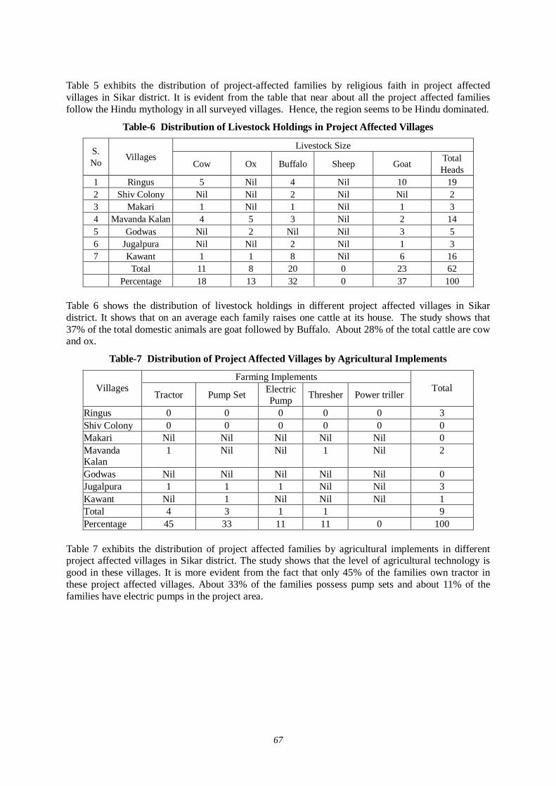
67
Table 5 exhibits the distribution of project-affected families by religious faith in project affected villages in Sikar district. It is evident from the table that near about all the project affected families follow the Hindu mythology in all surveyed villages. Hence, the region seems to be Hindu dominated.
Table-6 Distribution of Livestock Holdings in Project Affected Villages
Livestock Size S. No Villages
Cow Ox Buffalo Sheep Goat Total Heads
1 Ringus 5 Nil 4 Nil 10 19 2 Shiv Colony Nil Nil 2 Nil Nil 2 3 Makari 1 Nil 1 Nil 1 3 4 Mavanda Kalan 4 5 3 Nil 2 14 5 Godwas Nil 2 Nil Nil 3 5 6 Jugalpura Nil Nil 2 Nil 1 3 7 Kawant 1 1 8 Nil 6 16 Total 11 8 20 0 23 62 Percentage 18 13 32 0 37 100
Table 6 shows the distribution of livestock holdings in different project affected villages in Sikar district. It shows that on an average each family raises one cattle at its house. The study shows that 37% of the total domestic animals are goat followed by Buffalo. About 28% of the total cattle are cow and ox.
Table-7 Distribution of Project Affected Villages by Agricultural Implements
Farming Implements Villages
Tractor Pump Set Electric Pump Thresher Power triller
Total
Ringus 0 0 0 0 0 3 Shiv Colony 0 0 0 0 0 0 Makari Nil Nil Nil Nil Nil 0 Mavanda Kalan
1 Nil Nil 1 Nil 2
Godwas Nil Nil Nil Nil Nil 0 Jugalpura 1 1 1 Nil Nil 3 Kawant Nil 1 Nil Nil Nil 1 Total 4 3 1 1 9 Percentage 45 33 11 11 0 100
Table 7 exhibits the distribution of project affected families by agricultural implements in different project affected villages in Sikar district. The study shows that the level of agricultural technology is good in these villages. It is more evident from the fact that only 45% of the families own tractor in these project affected villages. About 33% of the families possess pump sets and about 11% of the families have electric pumps in the project area.
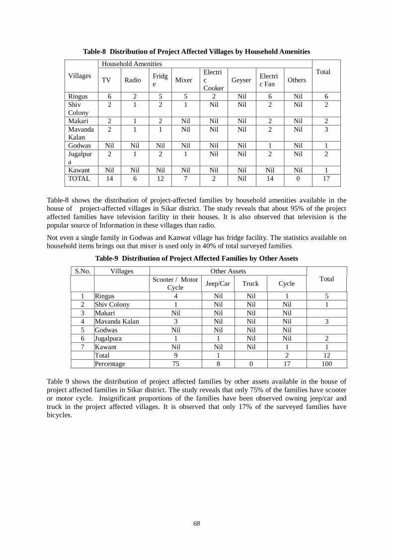
68
Table-8 Distribution of Project Affected Villages by Household Amenities
Household Amenities
Villages TV Radio Fridge Mixer
Electric Cooker
Geyser Electric Fan Others
Total
Ringus 6 2 5 5 2 Nil 6 Nil 6 Shiv Colony
2 1 2 1 Nil Nil 2 Nil 2
Makari 2 1 2 Nil Nil Nil 2 Nil 2 Mavanda Kalan
2 1 1 Nil Nil Nil 2 Nil 3
Godwas Nil Nil Nil Nil Nil Nil 1 Nil 1 Jugalpura
2 1 2 1 Nil Nil 2 Nil 2
Kawant Nil Nil Nil Nil Nil Nil Nil Nil 1 TOTAL 14 6 12 7 2 Nil 14 0 17
Table-8 shows the distribution of project-affected families by household amenities available in the house of project-affected villages in Sikar district. The study reveals that about 95% of the project affected families have television facility in their houses. It is also observed that television is the popular source of Information in these villages than radio.
Not even a single family in Godwas and Kanwat village has fridge facility. The statistics available on household items brings out that mixer is used only in 40% of total surveyed families
Table-9 Distribution of Project Affected Families by Other Assets
S.No. Villages Other Assets
Scooter / Motor Cycle Jeep/Car Truck Cycle
Total
1 Ringus 4 Nil Nil 1 5 2 Shiv Colony 1 Nil Nil Nil 1 3 Makari Nil Nil Nil Nil 4 Mavanda Kalan 3 Nil Nil Nil 3 5 Godwas Nil Nil Nil Nil 6 Jugalpura 1 1 Nil Nil 2 7 Kawant Nil Nil Nil 1 1 Total 9 1 2 12 Percentage 75 8 0 17 100
Table 9 shows the distribution of project affected families by other assets available in the house of project affected families in Sikar district. The study reveals that only 75% of the families have scooter or motor cycle. Insignificant proportions of the families have been observed owning jeep/car and truck in the project affected villages. It is observed that only 17% of the surveyed families have bicycles.
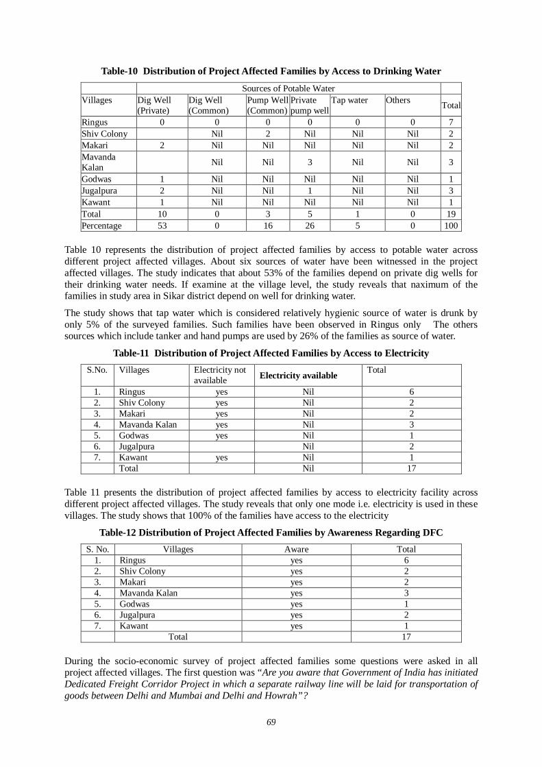
69
Table-10 Distribution of Project Affected Families by Access to Drinking Water
Sources of Potable Water Villages Dig Well
(Private) Dig Well (Common)
Pump Well (Common)
Private pump well
Tap water Others Total
Ringus 0 0 0 0 0 0 7 Shiv Colony Nil 2 Nil Nil Nil 2 Makari 2 Nil Nil Nil Nil Nil 2 Mavanda Kalan Nil Nil 3 Nil Nil 3
Godwas 1 Nil Nil Nil Nil Nil 1 Jugalpura 2 Nil Nil 1 Nil Nil 3 Kawant 1 Nil Nil Nil Nil Nil 1 Total 10 0 3 5 1 0 19 Percentage 53 0 16 26 5 0 100
Table 10 represents the distribution of project affected families by access to potable water across different project affected villages. About six sources of water have been witnessed in the project affected villages. The study indicates that about 53% of the families depend on private dig wells for their drinking water needs. If examine at the village level, the study reveals that naximum of the families in study area in Sikar district depend on well for drinking water.
The study shows that tap water which is considered relatively hygienic source of water is drunk by only 5% of the surveyed families. Such families have been observed in Ringus only The others sources which include tanker and hand pumps are used by 26% of the families as source of water.
Table-11 Distribution of Project Affected Families by Access to Electricity S.No. Villages Electricity not
available Electricity available Total
1. Ringus yes Nil 6 2. Shiv Colony yes Nil 2 3. Makari yes Nil 2 4. Mavanda Kalan yes Nil 3 5. Godwas yes Nil 1 6. Jugalpura Nil 2 7. Kawant yes Nil 1 Total Nil 17
Table 11 presents the distribution of project affected families by access to electricity facility across different project affected villages. The study reveals that only one mode i.e. electricity is used in these villages. The study shows that 100% of the families have access to the electricity
Table-12 Distribution of Project Affected Families by Awareness Regarding DFC S. No. Villages Aware Total
1. Ringus yes 6 2. Shiv Colony yes 2 3. Makari yes 2 4. Mavanda Kalan yes 3 5. Godwas yes 1 6. Jugalpura yes 2 7. Kawant yes 1 Total 17
During the socio-economic survey of project affected families some questions were asked in all project affected villages. The first question was “Are you aware that Government of India has initiated Dedicated Freight Corridor Project in which a separate railway line will be laid for transportation of goods between Delhi and Mumbai and Delhi and Howrah”?

70
Regarding this question about 100% respondents stated they were aware about the proposed dedicated freight corridor railway line. It shows that majority of people of the area were quite aware about the introduction of dedicated freight corridor project in the state.
Table-13 Distribution of PAFs by Type of Economic Benefits Expected
Type of Benefits S.No. Villages Wage
Employment Business
Opportunity Industry
Establishment Comments Declined
Total
1 Ringus 1 1 3 5 2 Shiv Colony 2 1 3 3 Makari Nil Nil Nil 2 2 4 Mavanda
Kalan 2 1 Nil Nil 3
5 Godwas Nil 1 Nil Nil 1 6 Jugalpura Nil 2 Nil Nil 2 7 Kawant 1 Nil Nil Nil 1
Total 6 5 1 5 17 Percentage 36 29 6 29 100
It is evident from the above table that 36 of the respondents stated that dedicated freight corridor project will provide wage employment to the local inhabitants, people think that wages would be available to the local residents after implementation of the dedicated freight corridor project. About 29% of the respondents opined that if the project is implemented, there would be ample trade and business opportunities.
Only 6% of the families feel that there are also chances of industrialization. About 29% of the respondents have been observed comments declined. These families have been found in two villages namely Ringus and Makri.
Table-14 Distribution of PAFs by Preferences Regarding Resettlement and Rehabilitation
Preferences S.No Villages
Compensation Resettlement/Rehabilitation (R&R)
Both Compensation and R&R
Total
1 Ringus 3 2 1 6 2 Shiv Colony 2 Nil 2 3 Makari 2 Nil Nil 2 4 Mavanda Kalan 1 Nil 2 3 5 Godwas 1 Nil Nil 1 6 Jugalpura 2 Nil Nil 2 7 Kawant 1 Nil Nil 1
Total 10 4 3 17 Percentage 58 24 18 100
Table 14 presents the distribution of project-affected families by preferences regarding resettlement and rehabilitation likely to result from proposed dedicated freight corridor across different project affected villages. The study brings out that about 58% of total surveyed families stated they should be properly compensated.. About one-fourth of the families opined they would be requesting to the implementing agency for full rehabilitation and resettlement. The proportion of families demanding both compensation and resettlement and rehabilitation is 18% at the district level. There are remarkable variations in this regard across the project-affected villages.
71
(6) Photographs in Sikar District
Hospital, School & Temple, Location :Neem Ka Thana Railway Station (Sikar), Distance : 100m in eastern side School, Location : Porawali Ki dhani Distance : 14m in western direction PAP’s / PAF’s, Location : Renwal, Distance : App 20 to 25m in eastern side
72
2. Jaipur District
(1) 2nd Stage of District Level Stakeholder / Public Consultation Meeting in Jaipur District
1.0 District - JAIPUR Jaipur is a district of the state of Rajasthan in Western India. Jaipur is the Capital of Rajasthan and district headquarters. It is a largest city.
Jaipur District has an area of 11,152 km² and a population of 5,252,388, with a population density of 471 persons per km². It is bounded by Sikar District on the North, Haryana state on the extreme Northeast, Alwar and Dausa districts on the East, Sawai Madhopur District on the Southeast, Tonk District on the South, Ajmer District on the West, and Nagaur District on the Northwest.
2.0 Project Summary Sheet
T i t l e o f t h e P r o j e c t C o n d u c t i n g 1 s t R o u n d V i l l a g e L e v e l S t a k e h o l d e r / P u b l i c C o n s u l t a t i o n M e e t i n g F o r D e v e l o p m e n t S t u d y R e g a r d i n g t h e D e d i c a t e d M u l t i m o d a l H i g h A x l e F r e i g h t C o r r i d o r F o r M i n i s t r y o f R a i l w a y , G o v t . o f I n d i a
0 2 A g u s t 2 0 0 7B a g a r B h a w a n , D a d u D w a r a V i l l . N a r a y n a , D i s t : -J a i p u r , R a j a s t h a n , I n d i a
L o c a l C o n s u l t a n t M a n t e c C o n s u l t a n t P v t . L t d . , N e w D e l h iS a m a j V i k a s h S e w a S a n s t h aB - 3 3 4 \ D , N e w A s h o k N a g a rD e l h i - 1 1 0 0 9 6C o n t . N o . : - 9 8 6 8 5 7 4 3 5 6
S u p p o r t i n g A g e n c y J a p a n I n t e r n a t i o n a l C o o p e r a t i o n A g e n c y , ( J I C A )C o v e r i n g D i s t r i c t s J a i p u rN u m b e r o f I n v i t e e s 1 4 4N u m b e r o f P r e s e n c e 1 3 7
P e r s o n a l M e e tD i s p a t c h i n g L e t t e r s / I n v i t a t i o nN e w s p a p e r , A d v e r t i s e m e n t s , A n n o u n c e m e n t b yA u t o / R i c k s h a wW r i t i n g P a d - 1 P i e c e .B a l l P e n - 1 P i e c e .P l a s t i c F i l e - 1 P i e c e .Q u e s t i o n n a i r e - 1 P i e c e .L i t e r a t u r e - 2 P i e c e s .S l i d e P r e s e n t a t i o nL e c t u r eG r o u p D i s c u s s i o nQ u e s t i o n / A n s w e rS t i l l P h o t o g r a p h yA u d i o / V i d e o R e c o r d i n gP r e p a r a t i o n o f m i n u t e s o f M e e t i n gN a v - J o y o t iR a j a s t h a n P a t r i k aD a i n i k – B h a s a k a rN e w s T o d a y sA r r i v a l : 5 . 0 0 p . m .W e l c o m e : 5 . 1 5 p . m .D i s c u s s i o n : 7 . 0 0 p . m . t o 7 . 3 0 p . m .
V i d e o g r a p h y E n c l o s e d C D f o r m S e p a r a t e l yP r e s i d e n t o f t h e M e e t i n g S a r p a n c h , N a r a y n aC h i e f G u e s t D i s t r i c t C h i e f
T e a m M e m b e r sM a n t e c a n d J I C A R e p r e s e n t a t i v e
M e d i a C o v e r a g e
T i m e S c h e d u l e o f M e e t i n g
M e t h o d s a d o p t e d f o r d i s c u s s i o n
M e t h o d s A d o p t e d f o r D o c u m e n t a t i o n
M e t h o d s U s e d f o r I n f o r m a t i o n D i s s e m i n a t i o n
S t a t i o n a r y S e r v e d t o t h e P a r t i c i p a n t s
P R O J E C T S U M M A R Y S H E E T
D a t e a n d P l a c e o f M e e t i n g
M e e t i n g F a c i l i t a t o r
73
2.1 Selection of Stakeholders (Invitees) and List of Invitees of Stakeholder/Public Consultation Meeting In Jaipur district 41 villages are supposed to be affected by this proposed alignment and near about 181 persons supposed to be affected by this project Kandeoli, Narayana, Renwal, Badhal villages some structure would be affected and in rest villages no structure will be affected however in this villages land would be acquired. So in giving invitation special consideration was given to those villages, which are affected in terms of structures.
Around 144 persons were invited in Stakeholder/Public Consultation Meeting.
2.2 Method of Selection of Stakeholder As per direction of the guidelines for conducting the 3rd stage of the Stakeholder/ Public Consultation Meetings a formal order of the Ministry of Railways was got issued vide their letter dated 08-01-2007 to facilitate these meetings for III Meeting in July detailed survey was done along the Railway track. We also contacted the affected people Gate wise. This survey was done with the previous information that we had calculated the No. of villages and families 30 Mt. from the Railway boundary in this connection many villages were affected. But now considering the 24 m ranges from the center point of the last track the affected villages would be less.
Local facilitator (Samaj Vikas Sewa Sansthan) also met and requested Panchayat Samiti to help in organizing the public meeting successfully. They assured to our Sansthan. All the stakeholders along the railway line, affected farmers, businessmen, private service and employers were invited to attend the meeting.
Public participation was undertaken to make explicit the social and other factors that affect development impact of dedicated freight corridor and mediate project.
Before starting the III PCM meeting survey forms were filled in by our team during field visit and track survey in month of july07. A track-to-track survey was done. It was noted that at every railway Gate, how many persons are affected. Their details were taken. Personal contact was also done. The representative also informed the affected families to attend the meeting.
Further, continuous efforts were made to keep the Ministry of Railways involved in the project as the major Stakeholder through their local set-up. Rehabilitation Commissioners were also appointed from the state government departments. Similarly Department of Environment and Forestry and State Pollution Control Board were contacted to participate in the Meetings. Other State Government Departments were also apprised and approached and were invited to participate in the Stakeholders / Public Consultation Meetings.
The meeting facilitator team visited all the affected Villages and requested Primary and Secondary Stakeholders to attend the meeting. Our meeting facilitator team preferred to invite the people who will be affected directly by this project.
The Non Governmental Organizations were appointed for facilitation the Stakeholders/Public Consultation meetings for conducting the meetings: SAMAJ VIKASH SEWA SANSTHAN
2.3 Selection of Meeting Facilitator Simultaneously extensive surveys were conducted for the identification of suitable local agencies for the successful organization of the Stakeholders / Public Consultation Meetings. Preference was given to appoint Non Government Organization (NGO’s) who had local presence, popularity and experience of social and public works and is well acquainted with multifarious cross section of society to help in the selection of the right type of the stakeholders for the meetings as well as for facilitating other related activities i.e.
74
1. Venue for the meetings 2. Arrangements to be made 3. Assisting in local Publicity, 4. Invitations to the Stakeholders motivating them for participation. 5. Maintaining and compilation of record and feedback 6. Other local arrangements like transport, hospitality, security and smooth conduct of the
meeting proceedings.
2.4 Method of Information Dissemination METHOD OF NOTIFYING THE MEETING TO THE PARTICIPANTS:
1. Notified the date and venue of the Stakeholder \ Public Consultant Meting in local
Newspaper, radio or T.V and requesting people to attend the meeting. 2. With help of local NGO we try to paste handout the information of the project on the public
places in the area. 3. With help of local NGOs we tried to disseminate the information of the project to the local
people by face-to-face meeting as much as possible. 4. 4With help of local media the summary of Stakeholder \Public Consultation meeting in
newspaper, T.V or radio was published. 2.5 VENUE OF STAKEHOLDER/PUBLIC CONSULTATION MEETING BAGAR BHAVAN, DADU DWARA, Village - NARAINA, District - Jaipur, Rajasthan. Chose this place due to following reasons:
1. It is a Well Known and Famous Place. 2. Central location in the affected area in district Jaipur. 3. It is situated between Kishanman Pura and Gehlota. 4. It is the central point of affected Villages where Public can reach easily by train or by bus.
3.0 List of Participants of Stakeholder/Public Consultation Meeting Around 137 invitees were participated in Stakeholder/Public Consultation Meeting.
3.1 Details of Stakeholder/Public Consultation Meeting
Minutes of Meeting
5.00 PM Arrival of the distance village's public.
5.15 PM Welcome to the Chief Guest, Guard (District. Chief), representative from JICA study team and other honorable guests by Social Worker on Behalf of Samaj Vikas Sewa Sanstha.
5.30 PM Representative of Samaj Vikas Sewa Sanstha made a presentation of DFC Project to the participants and requested to G.M. Mantec Consultants Pvt. Ltd. to deliver his speech and show details presentation on screen through Projector.
6.45 PM Lunch Break - Distribution of Tea, Snacks etc.
7.00 PM Question /Answer and Group Discussion
75
Started among the participants. a member of sansthan was involved in writing question /answer and other members were covering the gathering with mike. Sociologist Mantec was busy in answering the question raised by the participants.
7.30 PM Meeting ended with vote of thanks.
Here are the details of the welcome note and brief description of the project given by Social Worker of Samaj Vikas Sewa Sanstha and G.M. Mantec Consultants Pvt. Ltd.
A very pleasant good evening to all of you. I am and I am a Social Worker welcome all of you on behalf of Samaj Vikas Sewa Sanstha, the NGO. First of all I would seek the honour to the all Japan International Cooperation Agency {JICA} and it’s our immense pleasure and honour to have you here amongst us. Thank you so much for being a part of our endeavour.
We all have gathered here today for a very progressive and futuristic cause as we all know and face the mundane reality of life every single day in the form of complexities, challenges and problem in the way of our psychological, physical and economical growth, we are always in the hunt of solutions to it and ways to grow.
We all are here today to join hands and move from the darkness of problems and complexities to the light of solutions and growth.
Way backing April 2005 Indo Japan High level summit meeting was held between the Prime Ministers of both the countries .The view was mutually shared that Japanese Special Terms of Economic Partnership (STEP) could be an effective medium of forwarding large scale priority projects in infrastructure in India. Both the sides decided to check the feasibility of dedicated multi model high axle load Freight corridors with computerized train control systems on the Delhi- Mumbai and Ludhiana- Howarah routs utilizing STEP with Japanese Technology and their expertise in the field. So a committee on infrastructure was formed chaired by the Prime Minister to prepare a concept paper on (Delhi-Mumbai of Western Railway corridor and Ludhiana-Howarah of Eastern Railway corridor). Dedicated Freight Corridor Project suggesting new organization structure for planning, Financing, construction and operation of these corridors. The task force was constituted and chaired by Mr. Anwarul Hooda member –Planning Commission and included experts and representatives from the Railway board, Planning Commission and Ministry of Finance.
Further ahead recommendations of this report were approved in February 2006 and their implementation has been initiated with numerous benefits to follow the challenging task has began. Our Indian Ministry of railways has taken an initiative in the same direction with the help of JICA (Japanese International Cooperate in Agency) with a project called DFC project for development of multimodal high axle load freight corridors with computerized control.
We all know that Railways is the biggest mode of transport in India we all know equally well that it doesn’t only carry people across it helps us carry goods as well but the unfortunate fact of the day is that in India till date we don’t have dedicated network for freight movement which is a big handicap in the growth of our nation and its economy that is where the agenda of this stakeholder /Public consultation meeting lies. The agenda is that DFC project.
This project forwarded by the Indian Ministry of Railways and funded by JICA is being strengthened by Mantec Consultants Pvt.Ltd. and Samaj Vikas Sewa Sanstha., the NGO that cares
The DFC project is definitely going to be a boon to our nation considering the huge growth of Indian business and economy .Their has been an ever-growing demand and requirement of better services and conveniences in transporting goods which are incessantly growing in quantity. There is an urgent need of capacitating and facilitating our transport network making it capable enough to handle the freight issues.
Saving time and money offering growth and relief, today as well as tomorrow. With this futuristic note I would like to invite GM of Mantec Consultants Pvt. Ltd to help all of us understand the details of the project. I would request to GM of Mantec kindly take over the podium and enlighten the issue.
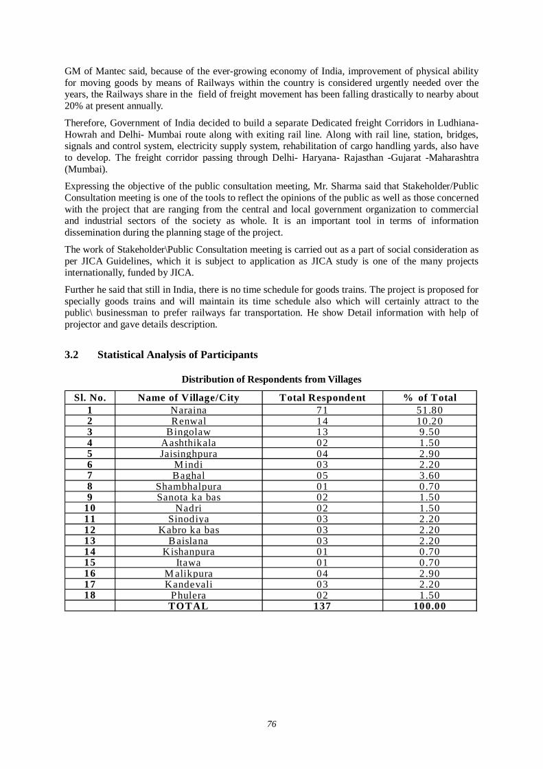
76
GM of Mantec said, because of the ever-growing economy of India, improvement of physical ability for moving goods by means of Railways within the country is considered urgently needed over the years, the Railways share in the field of freight movement has been falling drastically to nearby about 20% at present annually.
Therefore, Government of India decided to build a separate Dedicated freight Corridors in Ludhiana- Howrah and Delhi- Mumbai route along with exiting rail line. Along with rail line, station, bridges, signals and control system, electricity supply system, rehabilitation of cargo handling yards, also have to develop. The freight corridor passing through Delhi- Haryana- Rajasthan -Gujarat -Maharashtra (Mumbai).
Expressing the objective of the public consultation meeting, Mr. Sharma said that Stakeholder/Public Consultation meeting is one of the tools to reflect the opinions of the public as well as those concerned with the project that are ranging from the central and local government organization to commercial and industrial sectors of the society as whole. It is an important tool in terms of information dissemination during the planning stage of the project.
The work of Stakeholder\Public Consultation meeting is carried out as a part of social consideration as per JICA Guidelines, which it is subject to application as JICA study is one of the many projects internationally, funded by JICA.
Further he said that still in India, there is no time schedule for goods trains. The project is proposed for specially goods trains and will maintain its time schedule also which will certainly attract to the public\ businessman to prefer railways far transportation. He show Detail information with help of projector and gave details description.
3.2 Statistical Analysis of Participants
Distribution of Respondents from Villages
Sl. No. Name of Village/City Total Respondent % of Total1 Naraina 71 51.802 Renwal 14 10.203 Bingolaw 13 9.504 Aashthikala 02 1.505 Jaisinghpura 04 2.906 M indi 03 2.207 Baghal 05 3.608 Shambhalpura 01 0.709 Sanota ka bas 02 1.50
10 Nadri 02 1.5011 Sinodiya 03 2.2012 Kabro ka bas 03 2.2013 B aislana 03 2.2014 Kishanpura 01 0.7015 Itawa 01 0.7016 M alikpura 04 2.9017 Kandevali 03 2.2018 Phulera 02 1.50
TOTAL 137 100.00
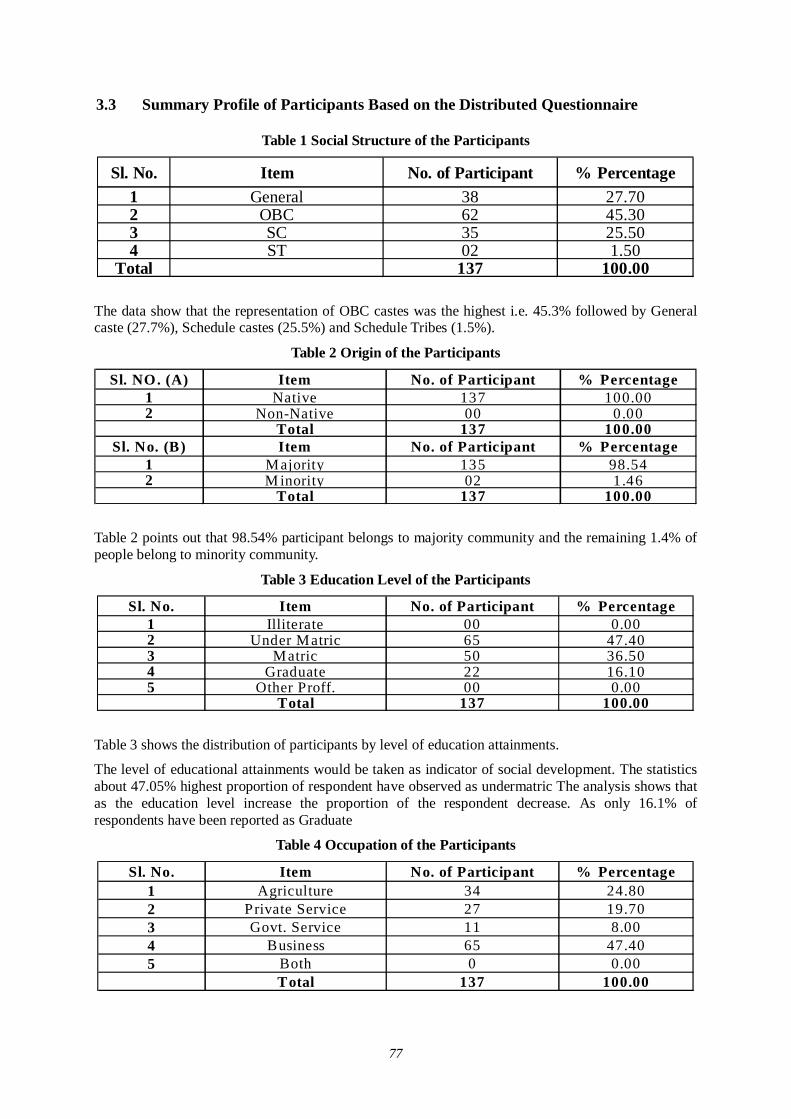
77
3.3 Summary Profile of Participants Based on the Distributed Questionnaire
Table 1 Social Structure of the Participants
Sl. No. Item No. of Participant % Percentage1 General 38 27.702 OBC 62 45.303 SC 35 25.504 ST 02 1.50
Total 137 100.00
The data show that the representation of OBC castes was the highest i.e. 45.3% followed by General caste (27.7%), Schedule castes (25.5%) and Schedule Tribes (1.5%).
Table 2 Origin of the Participants
Sl. NO. (A) Item No. of Participant % Percentage1 Native 137 100.002 Non-Native 00 0.00
Total 137 100.00Sl. No. (B) Item No. of Participant % Percentage
1 Majority 135 98.542 M inority 02 1.46
Total 137 100.00
Table 2 points out that 98.54% participant belongs to majority community and the remaining 1.4% of people belong to minority community.
Table 3 Education Level of the Participants
Sl. No. Item No. of Participant % Percentage1 Illiterate 00 0.002 Under Matric 65 47.403 Matric 50 36.504 Graduate 22 16.105 Other Proff. 00 0.00
Total 137 100.00
Table 3 shows the distribution of participants by level of education attainments.
The level of educational attainments would be taken as indicator of social development. The statistics about 47.05% highest proportion of respondent have observed as undermatric The analysis shows that as the education level increase the proportion of the respondent decrease. As only 16.1% of respondents have been reported as Graduate
Table 4 Occupation of the Participants
Sl. No. Item No. of Participant % Percentage1 Agriculture 34 24.802 Private Service 27 19.703 Govt. Service 11 8.004 Business 65 47.405 Both 0 0.00
Total 137 100.00
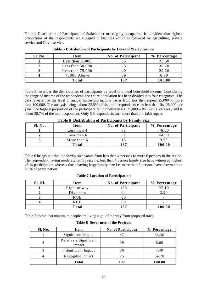
78
Table 4 Distribution of Participants of Stakeholder meeting by occupation. It is evident that highest proportions of the respondents are engaged in business activities followed by agriculture, private service and Govt. service.
Table 5 Distribution of Participants by Level of Yearly Income
Sl. No. Item No. of Participant % Percentage1 Less than 25000 35 25.502 Less than 50,000 53 38.703 Less than 75,000 40 29.204 75000 Above 09 6.60
Total 137 100.00
Table 5 describes the distributaries of participants by level of annual household income. Considering the range of income of the respondents the entire population has been divided into four categories. The data reveals that the level of annual household income varies from less than rupees 25,000 to more than 100,000. The analysis brings about 25.5% of the total respondents earn less than Rs. 25,000 per year. The highest proportion of the participant falling between Rs. 25,000 – Rs. 50,000 category and is about 38.7% of the total respondent. Only 6.6 respondents earn more than one lakh rupees.
Table 6 Distribution of Participants by Family Size Sl. No. Item No. of Participant % Percentage
1 Less than 4 63 46.002 Less than 6 61 44.503 M ore than 6 13 9.50
Total 137 100.00
Table 6 brings out that the family size varies from less than 4 persons to more 6 persons in the region. The respondent having moderate family size i.e. less than 4 person family size have witnessed highest 46 % participation whereas those having large family size i.e. more than 6 persons have shown about 9.5% of participation.
Table 7 Location of Participation
Sl. Nl. Item No. of Participant % Percentage1 Right of way 133 97.102 Diversion 04 2.903 ROB 00 -4 RUB 00 -
Total 137 100.00
Table 7 shows that maximum people are living right of the way from proposed track.
Table 8 Sever ness of the Projects
Sl. No. Item No. of Participant % Percentage1 Significant Impact 47 34.30
2 Relatively Significant Impact 09 6.60
3 Insignificant Impact 06 4.404 Negligible Impact 75 54.70
Total 137 100.00
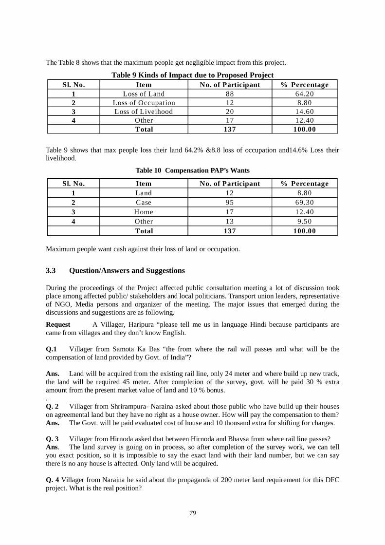
79
The Table 8 shows that the maximum people get negligible impact from this project.
Table 9 Kinds of Impact due to Proposed Project Sl. No. Item No. of Participant % Percentage
1 Loss of Land 88 64.202 Loss of Occupation 12 8.803 Loss of Liveihood 20 14.604 Other 17 12.40
Total 137 100.00
Table 9 shows that max people loss their land 64.2% &8.8 loss of occupation and14.6% Loss their livelihood.
Table 10 Compensation PAP’s Wants
Sl. No. Item No. of Participant % Percentage1 Land 12 8.802 Case 95 69.303 Home 17 12.404 Other 13 9.50
Total 137 100.00
Maximum people want cash against their loss of land or occupation.
3.3 Question/Answers and Suggestions During the proceedings of the Project affected public consultation meeting a lot of discussion took place among affected public/ stakeholders and local politicians. Transport union leaders, representative of NGO, Media persons and organizer of the meeting. The major issues that emerged during the discussions and suggestions are as following.
Request A Villager, Haripura “please tell me us in language Hindi because participants are came from villages and they don’t know English.
Q.1 Villager from Samota Ka Bas “the from where the rail will passes and what will be the compensation of land provided by Govt. of India”?
Ans. Land will be acquired from the existing rail line, only 24 meter and where build up new track, the land will be required 45 meter. After completion of the survey, govt. will be paid 30 % extra amount from the present market value of land and 10 % bonus. . Q. 2 Villager from Shrirampura- Naraina asked about those public who have build up their houses on agreemental land but they have no right as a house owner. How will pay the compensation to them? Ans. The Govt. will be paid evaluated cost of house and 10 thousand extra for shifting for charges. Q. 3 Villager from Hirnoda asked that between Hirnoda and Bhavsa from where rail line passes? Ans. The land survey is going on in process, so after completion of the survey work, we can tell you exact position, so it is impossible to say the exact land with their land number, but we can say there is no any house is affected. Only land will be acquired.
Q. 4 Villager from Naraina he said about the propaganda of 200 meter land requirement for this DFC project. What is the real position?
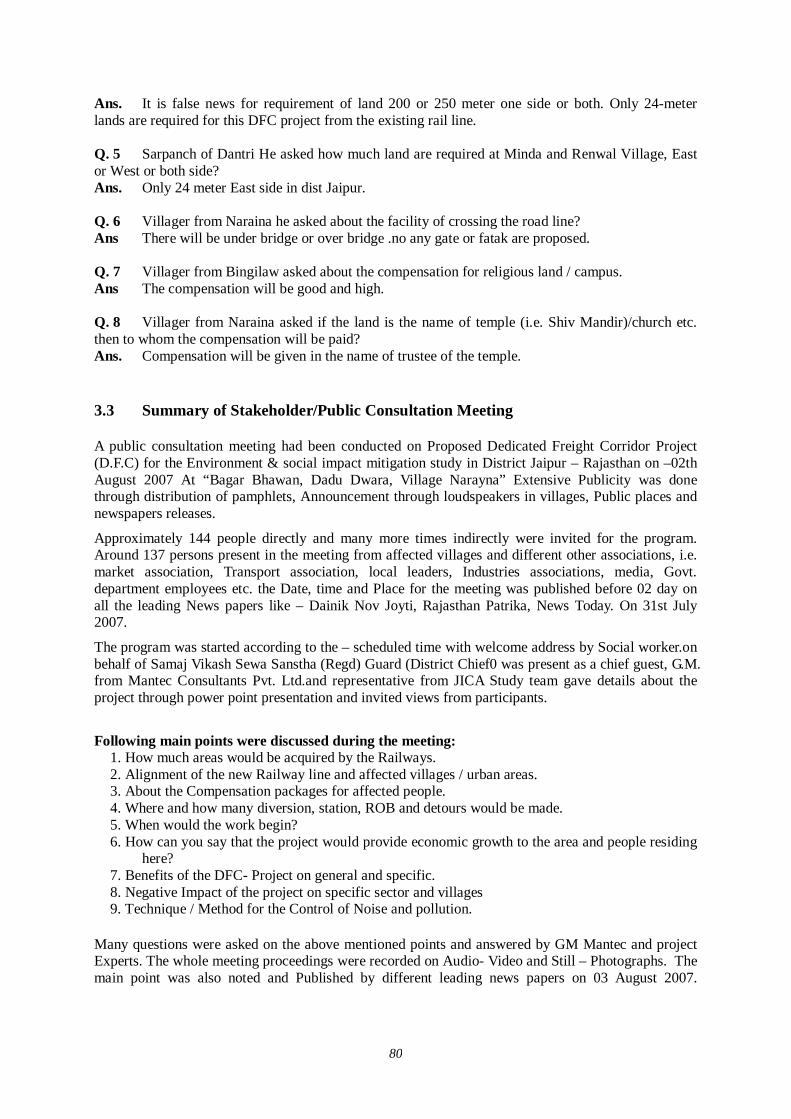
80
Ans. It is false news for requirement of land 200 or 250 meter one side or both. Only 24-meter lands are required for this DFC project from the existing rail line. Q. 5 Sarpanch of Dantri He asked how much land are required at Minda and Renwal Village, East or West or both side? Ans. Only 24 meter East side in dist Jaipur.
Q. 6 Villager from Naraina he asked about the facility of crossing the road line? Ans There will be under bridge or over bridge .no any gate or fatak are proposed. Q. 7 Villager from Bingilaw asked about the compensation for religious land / campus. Ans The compensation will be good and high. Q. 8 Villager from Naraina asked if the land is the name of temple (i.e. Shiv Mandir)/church etc. then to whom the compensation will be paid? Ans. Compensation will be given in the name of trustee of the temple. 3.3 Summary of Stakeholder/Public Consultation Meeting A public consultation meeting had been conducted on Proposed Dedicated Freight Corridor Project (D.F.C) for the Environment & social impact mitigation study in District Jaipur – Rajasthan on –02th August 2007 At “Bagar Bhawan, Dadu Dwara, Village Narayna” Extensive Publicity was done through distribution of pamphlets, Announcement through loudspeakers in villages, Public places and newspapers releases.
Approximately 144 people directly and many more times indirectly were invited for the program. Around 137 persons present in the meeting from affected villages and different other associations, i.e. market association, Transport association, local leaders, Industries associations, media, Govt. department employees etc. the Date, time and Place for the meeting was published before 02 day on all the leading News papers like – Dainik Nov Joyti, Rajasthan Patrika, News Today. On 31st July 2007.
The program was started according to the – scheduled time with welcome address by Social worker.on behalf of Samaj Vikash Sewa Sanstha (Regd) Guard (District Chief0 was present as a chief guest, G.M. from Mantec Consultants Pvt. Ltd.and representative from JICA Study team gave details about the project through power point presentation and invited views from participants.
Following main points were discussed during the meeting:
1. How much areas would be acquired by the Railways. 2. Alignment of the new Railway line and affected villages / urban areas. 3. About the Compensation packages for affected people. 4. Where and how many diversion, station, ROB and detours would be made. 5. When would the work begin? 6. How can you say that the project would provide economic growth to the area and people residing here? 7. Benefits of the DFC- Project on general and specific. 8. Negative Impact of the project on specific sector and villages 9. Technique / Method for the Control of Noise and pollution.
Many questions were asked on the above mentioned points and answered by GM Mantec and project Experts. The whole meeting proceedings were recorded on Audio- Video and Still – Photographs. The main point was also noted and Published by different leading news papers on 03 August 2007.
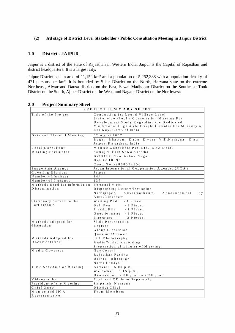
81
(2) 3rd stage of District Level Stakeholder / Public Consultation Meeting in Jaipur District
1.0 District - JAIPUR Jaipur is a district of the state of Rajasthan in Western India. Jaipur is the Capital of Rajasthan and district headquarters. It is a largest city.
Jaipur District has an area of 11,152 km² and a population of 5,252,388 with a population density of 471 persons per km². It is bounded by Sikar District on the North, Haryana state on the extreme Northeast, Alwar and Dausa districts on the East, Sawai Madhopur District on the Southeast, Tonk District on the South, Ajmer District on the West, and Nagaur District on the Northwest.
2.0 Project Summary Sheet
T i t l e o f t h e P r o j e c t C o n d u c t i n g 1 s t R o u n d V i l l a g e L e v e l S t a k e h o l d e r / P u b l i c C o n s u l t a t i o n M e e t i n g F o r D e v e l o p m e n t S t u d y R e g a r d i n g t h e D e d i c a t e d M u l t i m o d a l H i g h A x l e F r e i g h t C o r r i d o r F o r M i n i s t r y o f R a i l w a y , G o v t . o f I n d i a
0 2 A g u s t 2 0 0 7B a g a r B h a w a n , D a d u D w a r a V i l l . N a r a y n a , D i s t : -J a i p u r , R a j a s t h a n , I n d i a
L o c a l C o n s u l t a n t M a n t e c C o n s u l t a n t P v t . L t d . , N e w D e l h iS a m a j V i k a s h S e w a S a n s t h aB - 3 3 4 \ D , N e w A s h o k N a g a rD e l h i - 1 1 0 0 9 6C o n t . N o . : - 9 8 6 8 5 7 4 3 5 6
S u p p o r t i n g A g e n c y J a p a n In t e r n a t i o n a l C o o p e r a t i o n A g e n c y , ( J IC A )C o v e r i n g D i s t r i c t s J a i p u rN u m b e r o f I n v i t e e s 1 4 4N u m b e r o f P r e s e n c e 1 3 7
P e r s o n a l M e e tD i s p a t c h i n g L e t t e r s / In v i t a t i o nN e w s p a p e r , A d v e r t i s e m e n t s , A n n o u n c e m e n t b yA u t o / R i c k s h a wW r i t i n g P a d - 1 P i e c e .B a l l P e n - 1 P i e c e .P l a s t i c F i l e - 1 P i e c e .Q u e s t i o n n a i r e - 1 P i e c e .L i t e r a t u r e - 2 P i e c e s .S l i d e P r e s e n t a t i o nL e c t u r eG r o u p D i s c u s s i o nQ u e s t i o n / A n s w e rS t i l l P h o t o g r a p h yA u d i o /V i d e o R e c o r d i n gP r e p a r a t i o n o f m i n u t e s o f M e e t i n gN a v - J o y o t iR a j a s t h a n P a t r i k aD a i n i k – B h a s a k a rN e w s T o d a y sA r r i v a l : 5 . 0 0 p . m .W e l c o m e : 5 . 1 5 p . m .D i s c u s s i o n : 7 . 0 0 p . m . t o 7 . 3 0 p . m .
V i d e o g r a p h y E n c l o s e d C D f o r m S e p a r a t e l yP r e s i d e n t o f t h e M e e t i n g S a r p a n c h , N a r a y n aC h i e f G u e s t D i s t r i c t C h i e f
T e a m M e m b e r sM a n t e c a n d J IC A R e p r e s e n t a t i v e
M e d i a C o v e r a g e
T i m e S c h e d u l e o f M e e t i n g
M e t h o d s a d o p t e d f o r d i s c u s s i o n
M e t h o d s A d o p t e d f o r D o c u m e n t a t i o n
M e t h o d s U s e d f o r I n f o r m a t i o n D i s s e m i n a t i o n
S t a t i o n a r y S e r v e d t o t h e P a r t i c i p a n t s
P R O J E C T S U M M A R Y S H E E T
D a t e a n d P l a c e o f M e e t i n g
M e e t i n g F a c i l i t a t o r
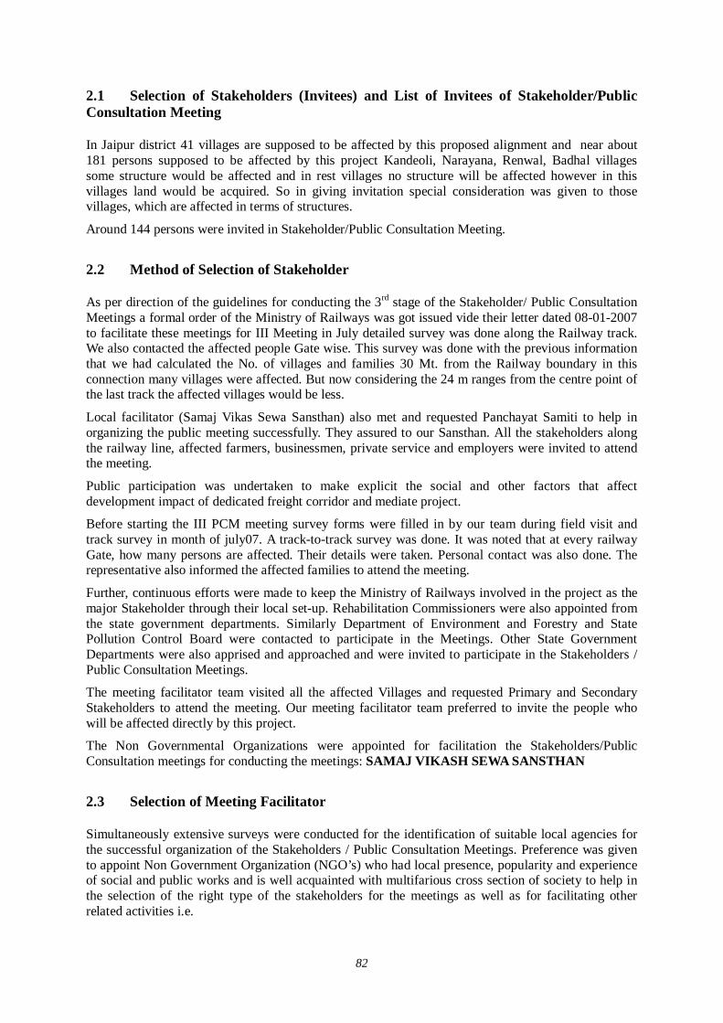
82
2.1 Selection of Stakeholders (Invitees) and List of Invitees of Stakeholder/Public Consultation Meeting In Jaipur district 41 villages are supposed to be affected by this proposed alignment and near about 181 persons supposed to be affected by this project Kandeoli, Narayana, Renwal, Badhal villages some structure would be affected and in rest villages no structure will be affected however in this villages land would be acquired. So in giving invitation special consideration was given to those villages, which are affected in terms of structures.
Around 144 persons were invited in Stakeholder/Public Consultation Meeting.
2.2 Method of Selection of Stakeholder As per direction of the guidelines for conducting the 3rd stage of the Stakeholder/ Public Consultation Meetings a formal order of the Ministry of Railways was got issued vide their letter dated 08-01-2007 to facilitate these meetings for III Meeting in July detailed survey was done along the Railway track. We also contacted the affected people Gate wise. This survey was done with the previous information that we had calculated the No. of villages and families 30 Mt. from the Railway boundary in this connection many villages were affected. But now considering the 24 m ranges from the centre point of the last track the affected villages would be less.
Local facilitator (Samaj Vikas Sewa Sansthan) also met and requested Panchayat Samiti to help in organizing the public meeting successfully. They assured to our Sansthan. All the stakeholders along the railway line, affected farmers, businessmen, private service and employers were invited to attend the meeting.
Public participation was undertaken to make explicit the social and other factors that affect development impact of dedicated freight corridor and mediate project.
Before starting the III PCM meeting survey forms were filled in by our team during field visit and track survey in month of july07. A track-to-track survey was done. It was noted that at every railway Gate, how many persons are affected. Their details were taken. Personal contact was also done. The representative also informed the affected families to attend the meeting.
Further, continuous efforts were made to keep the Ministry of Railways involved in the project as the major Stakeholder through their local set-up. Rehabilitation Commissioners were also appointed from the state government departments. Similarly Department of Environment and Forestry and State Pollution Control Board were contacted to participate in the Meetings. Other State Government Departments were also apprised and approached and were invited to participate in the Stakeholders / Public Consultation Meetings.
The meeting facilitator team visited all the affected Villages and requested Primary and Secondary Stakeholders to attend the meeting. Our meeting facilitator team preferred to invite the people who will be affected directly by this project.
The Non Governmental Organizations were appointed for facilitation the Stakeholders/Public Consultation meetings for conducting the meetings: SAMAJ VIKASH SEWA SANSTHAN
2.3 Selection of Meeting Facilitator Simultaneously extensive surveys were conducted for the identification of suitable local agencies for the successful organization of the Stakeholders / Public Consultation Meetings. Preference was given to appoint Non Government Organization (NGO’s) who had local presence, popularity and experience of social and public works and is well acquainted with multifarious cross section of society to help in the selection of the right type of the stakeholders for the meetings as well as for facilitating other related activities i.e.
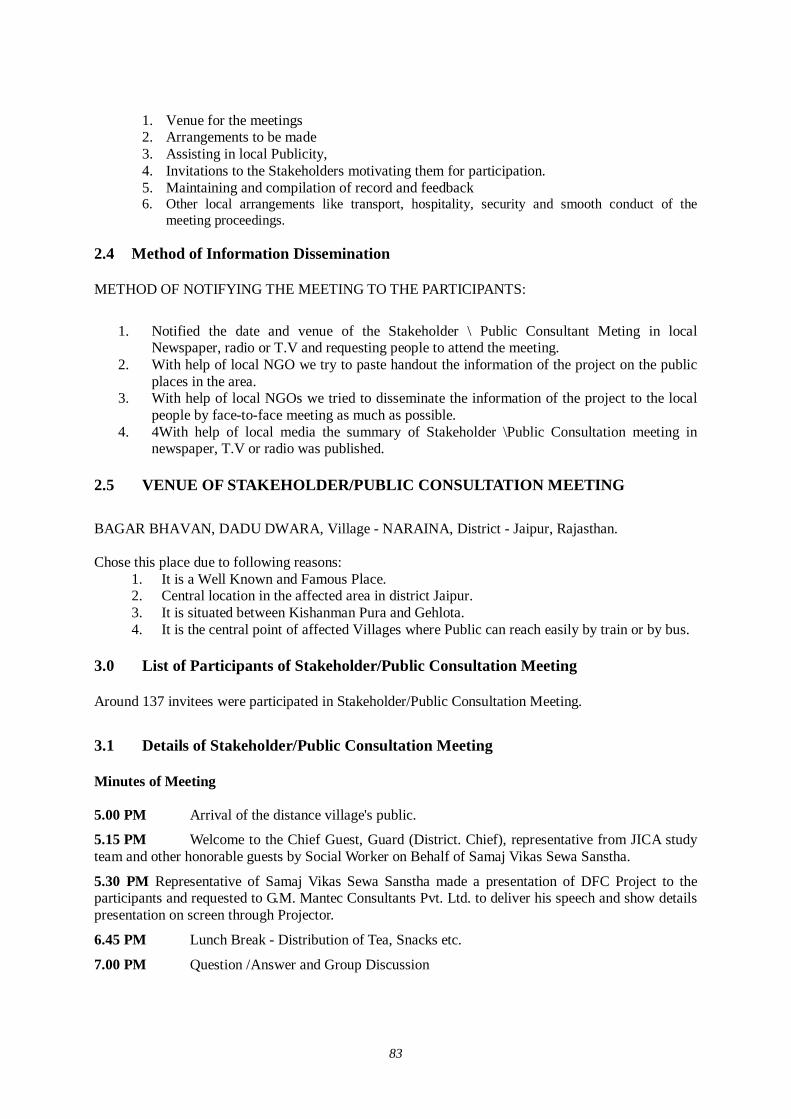
83
1. Venue for the meetings 2. Arrangements to be made 3. Assisting in local Publicity, 4. Invitations to the Stakeholders motivating them for participation. 5. Maintaining and compilation of record and feedback 6. Other local arrangements like transport, hospitality, security and smooth conduct of the
meeting proceedings.
2.4 Method of Information Dissemination METHOD OF NOTIFYING THE MEETING TO THE PARTICIPANTS:
1. Notified the date and venue of the Stakeholder \ Public Consultant Meting in local
Newspaper, radio or T.V and requesting people to attend the meeting. 2. With help of local NGO we try to paste handout the information of the project on the public
places in the area. 3. With help of local NGOs we tried to disseminate the information of the project to the local
people by face-to-face meeting as much as possible. 4. 4With help of local media the summary of Stakeholder \Public Consultation meeting in
newspaper, T.V or radio was published. 2.5 VENUE OF STAKEHOLDER/PUBLIC CONSULTATION MEETING BAGAR BHAVAN, DADU DWARA, Village - NARAINA, District - Jaipur, Rajasthan. Chose this place due to following reasons:
1. It is a Well Known and Famous Place. 2. Central location in the affected area in district Jaipur. 3. It is situated between Kishanman Pura and Gehlota. 4. It is the central point of affected Villages where Public can reach easily by train or by bus.
3.0 List of Participants of Stakeholder/Public Consultation Meeting Around 137 invitees were participated in Stakeholder/Public Consultation Meeting.
3.1 Details of Stakeholder/Public Consultation Meeting
Minutes of Meeting
5.00 PM Arrival of the distance village's public.
5.15 PM Welcome to the Chief Guest, Guard (District. Chief), representative from JICA study team and other honorable guests by Social Worker on Behalf of Samaj Vikas Sewa Sanstha.
5.30 PM Representative of Samaj Vikas Sewa Sanstha made a presentation of DFC Project to the participants and requested to G.M. Mantec Consultants Pvt. Ltd. to deliver his speech and show details presentation on screen through Projector.
6.45 PM Lunch Break - Distribution of Tea, Snacks etc.
7.00 PM Question /Answer and Group Discussion
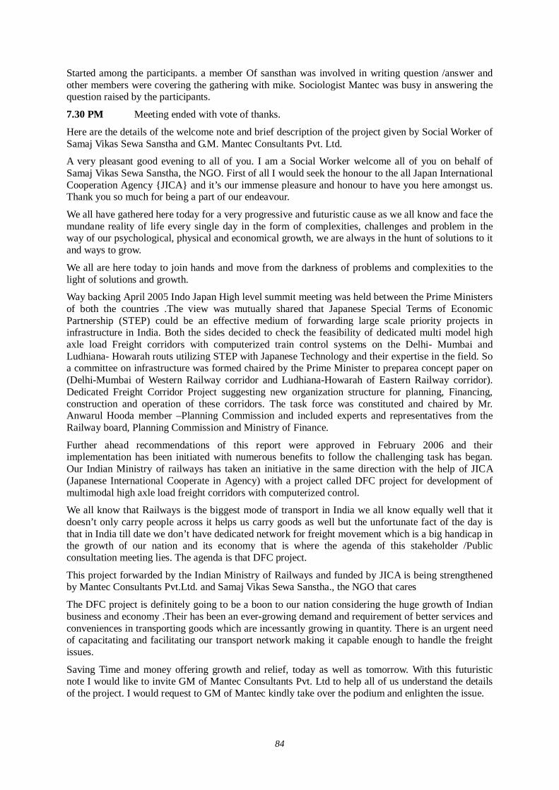
84
Started among the participants. a member Of sansthan was involved in writing question /answer and other members were covering the gathering with mike. Sociologist Mantec was busy in answering the question raised by the participants.
7.30 PM Meeting ended with vote of thanks.
Here are the details of the welcome note and brief description of the project given by Social Worker of Samaj Vikas Sewa Sanstha and G.M. Mantec Consultants Pvt. Ltd.
A very pleasant good evening to all of you. I am a Social Worker welcome all of you on behalf of Samaj Vikas Sewa Sanstha, the NGO. First of all I would seek the honour to the all Japan International Cooperation Agency {JICA} and it’s our immense pleasure and honour to have you here amongst us. Thank you so much for being a part of our endeavour.
We all have gathered here today for a very progressive and futuristic cause as we all know and face the mundane reality of life every single day in the form of complexities, challenges and problem in the way of our psychological, physical and economical growth, we are always in the hunt of solutions to it and ways to grow.
We all are here today to join hands and move from the darkness of problems and complexities to the light of solutions and growth.
Way backing April 2005 Indo Japan High level summit meeting was held between the Prime Ministers of both the countries .The view was mutually shared that Japanese Special Terms of Economic Partnership (STEP) could be an effective medium of forwarding large scale priority projects in infrastructure in India. Both the sides decided to check the feasibility of dedicated multi model high axle load Freight corridors with computerized train control systems on the Delhi- Mumbai and Ludhiana- Howarah routs utilizing STEP with Japanese Technology and their expertise in the field. So a committee on infrastructure was formed chaired by the Prime Minister to preparea concept paper on (Delhi-Mumbai of Western Railway corridor and Ludhiana-Howarah of Eastern Railway corridor). Dedicated Freight Corridor Project suggesting new organization structure for planning, Financing, construction and operation of these corridors. The task force was constituted and chaired by Mr. Anwarul Hooda member –Planning Commission and included experts and representatives from the Railway board, Planning Commission and Ministry of Finance.
Further ahead recommendations of this report were approved in February 2006 and their implementation has been initiated with numerous benefits to follow the challenging task has began. Our Indian Ministry of railways has taken an initiative in the same direction with the help of JICA (Japanese International Cooperate in Agency) with a project called DFC project for development of multimodal high axle load freight corridors with computerized control.
We all know that Railways is the biggest mode of transport in India we all know equally well that it doesn’t only carry people across it helps us carry goods as well but the unfortunate fact of the day is that in India till date we don’t have dedicated network for freight movement which is a big handicap in the growth of our nation and its economy that is where the agenda of this stakeholder /Public consultation meeting lies. The agenda is that DFC project.
This project forwarded by the Indian Ministry of Railways and funded by JICA is being strengthened by Mantec Consultants Pvt.Ltd. and Samaj Vikas Sewa Sanstha., the NGO that cares
The DFC project is definitely going to be a boon to our nation considering the huge growth of Indian business and economy .Their has been an ever-growing demand and requirement of better services and conveniences in transporting goods which are incessantly growing in quantity. There is an urgent need of capacitating and facilitating our transport network making it capable enough to handle the freight issues.
Saving Time and money offering growth and relief, today as well as tomorrow. With this futuristic note I would like to invite GM of Mantec Consultants Pvt. Ltd to help all of us understand the details of the project. I would request to GM of Mantec kindly take over the podium and enlighten the issue.
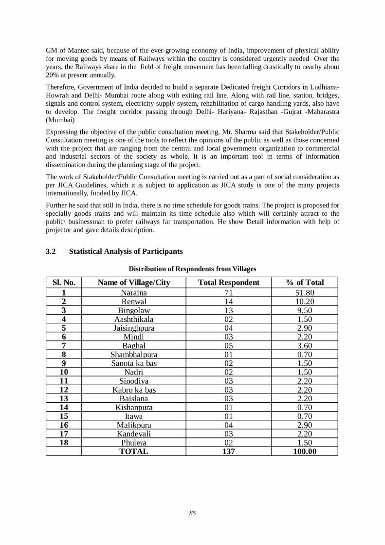
85
GM of Mantec said, because of the ever-growing economy of India, improvement of physical ability for moving goods by means of Railways within the country is considered urgently needed Over the years, the Railways share in the field of freight movement has been falling drastically to nearby about 20% at present annually.
Therefore, Government of India decided to build a separate Dedicated freight Corridors in Ludhiana- Howrah and Delhi- Mumbai route along with exiting rail line. Along with rail line, station, bridges, signals and control system, electricity supply system, rehabilitation of cargo handling yards, also have to develop. The freight corridor passing through Delhi- Hariyana- Rajasthan -Gujrat -Maharastra (Mumbai)
Expressing the objective of the public consultation meeting, Mr. Sharma said that Stakeholder/Public Consultation meeting is one of the tools to reflect the opinions of the public as well as those concerned with the project that are ranging from the central and local government organization to commercial and industrial sectors of the society as whole. It is an important tool in terms of information dissemination during the planning stage of the project.
The work of Stakeholder\Public Consultation meeting is carried out as a part of social consideration as per JICA Guidelines, which it is subject to application as JICA study is one of the many projects internationally, funded by JICA.
Further he said that still in India, there is no time schedule for goods trains. The project is proposed for specially goods trains and will maintain its time schedule also which will certainly attract to the public\ businessman to prefer railways far transportation. He show Detail information with help of projector and gave details description.
3.2 Statistical Analysis of Participants
Distribution of Respondents from Villages
Sl. No. Name of Village/City Total Respondent % of Total1 Naraina 71 51.802 Renwal 14 10.203 Bingolaw 13 9.504 Aashthikala 02 1.505 Jaisinghpura 04 2.906 Mindi 03 2.207 Baghal 05 3.608 Shambhalpura 01 0.709 Sanota ka bas 02 1.50
10 Nadri 02 1.5011 Sinodiya 03 2.2012 Kabro ka bas 03 2.2013 Baislana 03 2.2014 Kishanpura 01 0.7015 Itawa 01 0.7016 Malikpura 04 2.9017 Kandevali 03 2.2018 Phulera 02 1.50
TOTAL 137 100.00
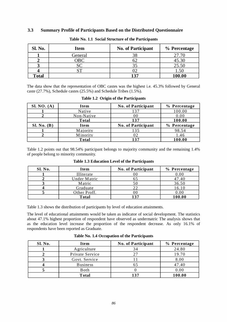
86
3.3 Summary Profile of Participants Based on the Distributed Questionnaire
Table No. 1.1 Social Structure of the Participants
Sl. No. Item No. of Participant % Percentage1 General 38 27.702 OBC 62 45.303 SC 35 25.504 ST 02 1.50
Total 137 100.00
The data show that the representation of OBC castes was the highest i.e. 45.3% followed by General caste (27.7%), Schedule castes (25.5%) and Schedule Tribes (1.5%).
Table 1.2 Origin of the Participants
Sl. NO. (A) Item No. of Participant % Percentage1 Native 137 100.002 Non-Native 00 0.00
Total 137 100.00Sl. No. (B) Item No. of Participant % Percentage
1 Majority 135 98.542 M inority 02 1.46
Total 137 100.00 Table 1.2 points out that 98.54% participant belongs to majority community and the remaining 1.4% of people belong to minority community.
Table 1.3 Education Level of the Participants
Sl. No. Item No. of Participant % Percentage1 Illiterate 00 0.002 Under Matric 65 47.403 Matric 50 36.504 Graduate 22 16.105 Other Proff. 00 0.00
Total 137 100.00
Table 1.3 shows the distribution of participants by level of education attainments.
The level of educational attainments would be taken as indicator of social development. The statistics about 47.1% highest proportion of respondent have observed as undermatric The analysis shows that as the education level increase the proportion of the respondent decrease. As only 16.1% of respondents have been reported as Graduate.
Table No. 1.4 Occupation of the Participants
Sl. No. Item No. of Participant % Percentage1 Agriculture 34 24.802 Private Service 27 19.703 Govt. Service 11 8.004 Business 65 47.405 Both 0 0.00
Total 137 100.00
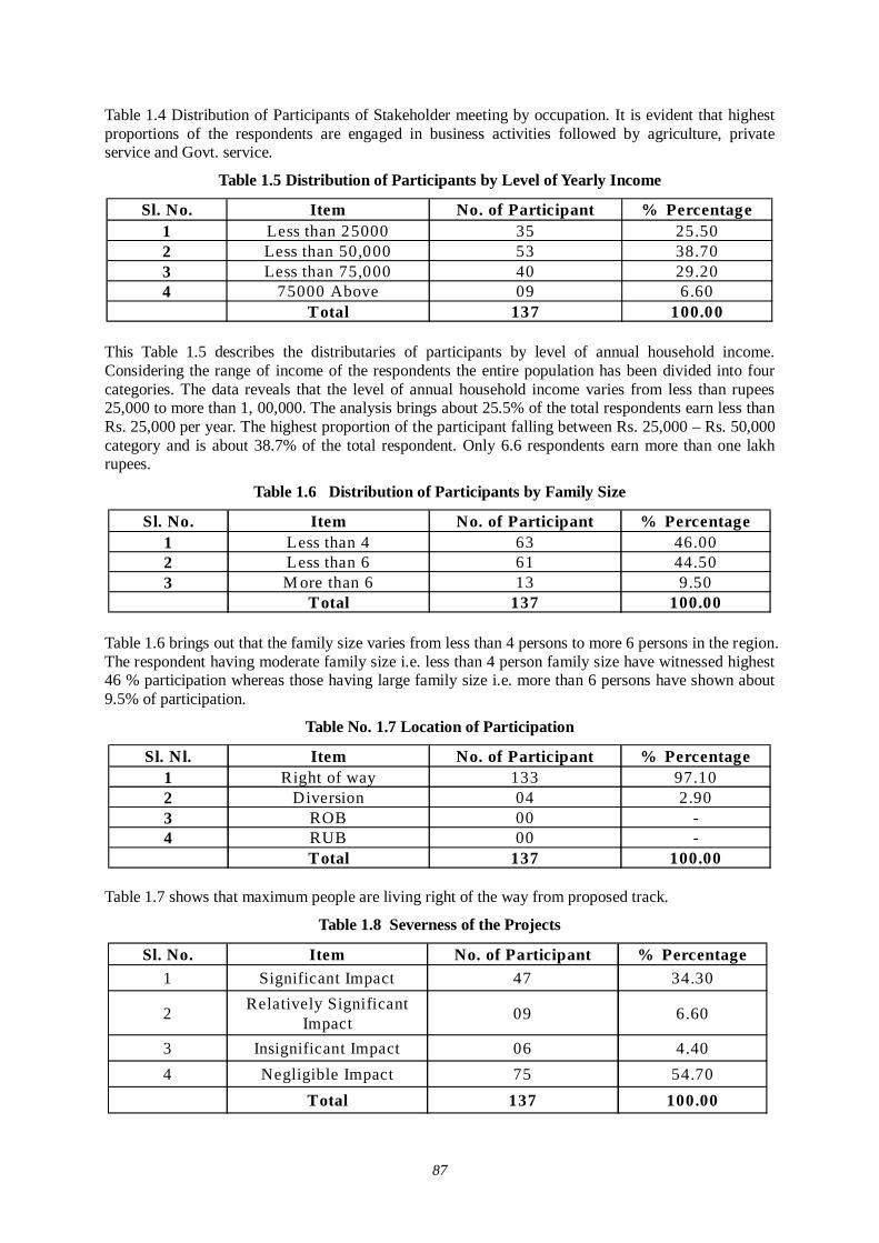
87
Table 1.4 Distribution of Participants of Stakeholder meeting by occupation. It is evident that highest proportions of the respondents are engaged in business activities followed by agriculture, private service and Govt. service.
Table 1.5 Distribution of Participants by Level of Yearly Income
Sl. No. Item No. of Participant % Percentage1 Less than 25000 35 25.502 Less than 50,000 53 38.703 Less than 75,000 40 29.204 75000 Above 09 6.60
Total 137 100.00
This Table 1.5 describes the distributaries of participants by level of annual household income. Considering the range of income of the respondents the entire population has been divided into four categories. The data reveals that the level of annual household income varies from less than rupees 25,000 to more than 1, 00,000. The analysis brings about 25.5% of the total respondents earn less than Rs. 25,000 per year. The highest proportion of the participant falling between Rs. 25,000 – Rs. 50,000 category and is about 38.7% of the total respondent. Only 6.6 respondents earn more than one lakh rupees.
Table 1.6 Distribution of Participants by Family Size
Sl. No. Item No. of Participant % Percentage1 Less than 4 63 46.002 Less than 6 61 44.503 M ore than 6 13 9.50
Total 137 100.00
Table 1.6 brings out that the family size varies from less than 4 persons to more 6 persons in the region. The respondent having moderate family size i.e. less than 4 person family size have witnessed highest 46 % participation whereas those having large family size i.e. more than 6 persons have shown about 9.5% of participation.
Table No. 1.7 Location of Participation
Sl. Nl. Item No. of Participant % Percentage1 Right of way 133 97.102 Diversion 04 2.903 ROB 00 -4 RUB 00 -
Total 137 100.00
Table 1.7 shows that maximum people are living right of the way from proposed track.
Table 1.8 Severness of the Projects
Sl. No. Item No. of Participant % Percentage1 Significant Impact 47 34.30
2 Relatively Significant Impact 09 6.60
3 Insignificant Impact 06 4.404 Negligible Impact 75 54.70
Total 137 100.00
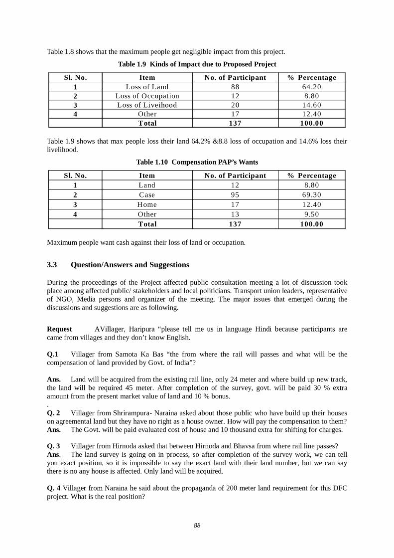
88
Table 1.8 shows that the maximum people get negligible impact from this project.
Table 1.9 Kinds of Impact due to Proposed Project
Sl. No. Item No. of Participant % Percentage1 Loss of Land 88 64.202 Loss of Occupation 12 8.803 Loss of Liveihood 20 14.604 Other 17 12.40
Total 137 100.00
Table 1.9 shows that max people loss their land 64.2% &8.8 loss of occupation and 14.6% loss their livelihood.
Table 1.10 Compensation PAP’s Wants
Sl. No. Item No. of Participant % Percentage1 Land 12 8.802 Case 95 69.303 Home 17 12.404 Other 13 9.50
Total 137 100.00
Maximum people want cash against their loss of land or occupation.
3.3 Question/Answers and Suggestions During the proceedings of the Project affected public consultation meeting a lot of discussion took place among affected public/ stakeholders and local politicians. Transport union leaders, representative of NGO, Media persons and organizer of the meeting. The major issues that emerged during the discussions and suggestions are as following.
Request AVillager, Haripura “please tell me us in language Hindi because participants are came from villages and they don’t know English.
Q.1 Villager from Samota Ka Bas “the from where the rail will passes and what will be the compensation of land provided by Govt. of India”?
Ans. Land will be acquired from the existing rail line, only 24 meter and where build up new track, the land will be required 45 meter. After completion of the survey, govt. will be paid 30 % extra amount from the present market value of land and 10 % bonus. . Q. 2 Villager from Shrirampura- Naraina asked about those public who have build up their houses on agreemental land but they have no right as a house owner. How will pay the compensation to them? Ans. The Govt. will be paid evaluated cost of house and 10 thousand extra for shifting for charges. Q. 3 Villager from Hirnoda asked that between Hirnoda and Bhavsa from where rail line passes? Ans. The land survey is going on in process, so after completion of the survey work, we can tell you exact position, so it is impossible to say the exact land with their land number, but we can say there is no any house is affected. Only land will be acquired.
Q. 4 Villager from Naraina he said about the propaganda of 200 meter land requirement for this DFC project. What is the real position?
89
Ans. It is false news for requirement of land 200 or 250 meter one side or both. Only 24-meter lands are required for this DFC project from the existing rail line. Q. 5 Sarpanch of Dantri He asked how much land are required at Minda and Renwal Village, East or West or both side? Ans. Only 24 meter East side in dist Jaipur. Q. 6 Villager from Naraina asked where central point at Pipli Ka Bas is. Ans.
Q. 7 Villager from Naraina he asked about the facility of crossing the road line? Ans There will be under bridge or over bridge .no any gate or fatak are proposed. Q. 8 Villager from Bingilaw asked about the compensation for religious land / campus. Ans The compensation will be good and high. Q. 9 Villager from Naraina asked if the land is the nameof temple (i.e. Shiv Mandir)/ church etc. then to whom the compensation will be paid? Ans. Compensation will be given in the name of trustee of the temple. 3.3 Summary of Stakeholder/Public Consultation Meeting A public consultation meeting had been conducted on Proposed Dedicated Freight Corridor Project (D.F.C) for the Environment & social impact mitigation study in District Jaipur – Rajasthan on –02th August 2007 At “Bagar Bhawan ,Dadu Dwara, Village Narayna” Extensive Publicity was done through distribution of pamphlets, Announcement through loudspeakers in villages, Public places and newspapers releases.
Approximately 144 people directly and many more times indirectly were invited for the program. Around 137 persons present in the meeting from affected villages and different other associations, i.e. market association, Transport association, local leaders, Industries associations, media, Govt. department employees etc. the Date, time and Place for the meeting was published before 02 day on all the leading News papers like – Dainik Nov Joyti, Rajasthan Patrika, News Today on 31st July 2007.
The program was started according to the – scheduled time with welcome address by Social worker.on behalf of Samaj Vikash Sewa Sanstha (Regd) Guard (District Chief0 was present as a chief guest, G.M. from Mantec Consultants Pvt. Ltd.and representative from JICA Study team gave details about the project through power point presentation and invited views from participants.
Following main points were discussed during the meeting:
1. How much areas would be acquired by the Railways. 2. Alignment of the new Railway line and affected villages / urban areas. 3. About the Compensation packages for affected people. 4. Where and how many diversion, station, ROB and detours would be made. 5. When would the work begin? 6. How can you say that the project would provide economic growth to the area and people residing here? 7. Benefits of the DFC- Project on general and specific. 8. Negative Impact of the project on specific sector and villages 9. Technique / Method for the Control of Noise and pollution.

90
Many questions were asked on the above mentioned points and answered by GM Mantec and project Experts. The whole meeting proceedings were recorded on Audio- Video and Still – Photographs. The main point was also noted and Published by different leading news papers on 03 August 2007.
91
(3) Village Level Meeting in Jaipur District
Record of Meeting Village: Renwal (Town)
Date: 24/7/2007
Timing: 12.30 PM
The public consultation meeting was organized by “Samaj Vikash Sewa Santha to disseminate the information about the DFC project and to know the opinions of various stakeholders including the Project Affected Persons (PAPs), especially those who are likely to be affected by the proposed DFC project and to assist Gram Panchayat to constitute Village Rehabilitation Committee (VRC) in each affected village.
Feedback meeting was organized by field staff of NGO in order to know opinions of the villagers about the proposed DFC Project, especially those who are likely to be affected by the proposed DFC project and to assist Gram Panchayat to constitute Village Rehabilitation Committee (VRC) in each affected village. The meeting provided a good platform to interact with the villagers and the sense of awareness about the project was seemingly higher after the meeting was over.
Feedback meeting was conducted in Renwal to convey the right message to the affected persons about the DFC project and to collect their suggestions
Important issues and suggestion during feed back meeting S. No Issues Suggestion
1.
Compensation amount for the affected families
Compensation amount would be given as per NRP -2006 and their suggestion for the same would also be incorporated
2.
Land requirement for the DFC project
24 meter of land would be acquired from the middle of the existing track and in detour route 43.5m land would be acquired.
3.
Compensation of Structure would be given according to current rate
We will forward this suggestion to higher authority
4. Resettlement scheme for the affected family
It will be according to NRP-2006
5. When will work Start Work will start in 2008-9
92
Record of Meeting
Village: Malikpura
Date: 25/7/2007
Timing: 2.30 PM
The public consultation meeting was organized by “Samaj Vikash Sewa Santha to disseminate the information about the DFC project and to know the opinions of various stakeholders including the Project Affected Persons (PAPs), especially those who are likely to be affected by the proposed DFC project and to assist Gram Panchayat to constitute Village Rehabilitation Committee (VRC) in each affected village.
Feedback meeting was organized by field staff of NGO in order to know opinions of the villagers about the proposed DFC Project, especially those who are likely to be affected by the proposed DFC project and to assist Gram Panchayat to constitute Village Rehabilitation Committee (VRC) in each affected village. The meeting provided a good platform to interact with the villagers and the sense of awareness about the project was seemingly higher after the meeting was over.
Feedback meeting was conducted in Malikpura to convey the right message to the affected persons about the DFC project and to collect their suggestions
Important issues and suggestion during feed back meeting S. No Issues Suggestion
1.
2.
Compensation amount for the affected families Land requirement for the DFC project
Compensation amount would be given as per NRP -2006 and their suggestion for the same would also be incorporated 24 meter of land would be acquired from the middle of the existing track and in detour route 43.5m land would be acquired.
3.
Compensation of land would be given according to market rate
We will forward this suggestion to higher authority
4. Resettlement scheme for the affected family
It will be according to NRP-2006
93
Record of Meeting Village: Badhal
Date: 25\7/2007
Timing: 9.30 AM
The public consultation meeting was organized by “Samaj Vikash Sewa Santha to disseminate the information about the DFC project and to know the opinions of various stakeholders including the Project Affected Persons (PAPs), especially those who are likely to be affected by the proposed DFC project and to assist Gram Panchayat to constitute Village Rehabilitation Committee (VRC) in each affected village.
Feedback meeting was organized by field staff of NGO in order to know opinions of the villagers about the proposed DFC Project, especially those who are likely to be affected by the proposed DFC project and to assist Gram Panchayat to constitute Village Rehabilitation Committee (VRC) in each affected village. The meeting provided a good platform to interact with the villagers and the sense of awareness about the project was seemingly higher after the meeting was over.
Feedback meeting was conducted in Badhal to convey the right message to the affected persons about the DFC project and to collect their suggestions
Important issues and suggestion during feed back meeting S. No Issues Suggestion
1.
2.
Compensation amount for the affected families Land requirement for the DFC project
Compensation amount would be given as per NRP -2006 and their suggestion for the same would also be incorporated 24 meter of land would be acquired from the middle of the existing track and in detour route 43.5m land would be acquired.
3. Resettlement scheme for the affected family
It will be according to NRP-2006
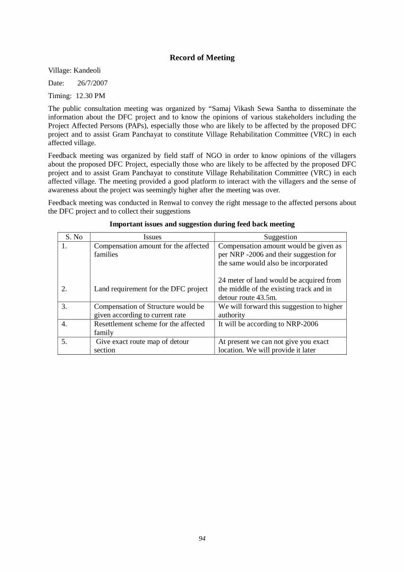
94
Record of Meeting Village: Kandeoli
Date: 26/7/2007
Timing: 12.30 PM
The public consultation meeting was organized by “Samaj Vikash Sewa Santha to disseminate the information about the DFC project and to know the opinions of various stakeholders including the Project Affected Persons (PAPs), especially those who are likely to be affected by the proposed DFC project and to assist Gram Panchayat to constitute Village Rehabilitation Committee (VRC) in each affected village.
Feedback meeting was organized by field staff of NGO in order to know opinions of the villagers about the proposed DFC Project, especially those who are likely to be affected by the proposed DFC project and to assist Gram Panchayat to constitute Village Rehabilitation Committee (VRC) in each affected village. The meeting provided a good platform to interact with the villagers and the sense of awareness about the project was seemingly higher after the meeting was over.
Feedback meeting was conducted in Renwal to convey the right message to the affected persons about the DFC project and to collect their suggestions
Important issues and suggestion during feed back meeting
S. No Issues Suggestion 1. 2.
Compensation amount for the affected families Land requirement for the DFC project
Compensation amount would be given as per NRP -2006 and their suggestion for the same would also be incorporated 24 meter of land would be acquired from the middle of the existing track and in detour route 43.5m.
3.
Compensation of Structure would be given according to current rate
We will forward this suggestion to higher authority
4. Resettlement scheme for the affected family
It will be according to NRP-2006
5. Give exact route map of detour section
At present we can not give you exact location. We will provide it later
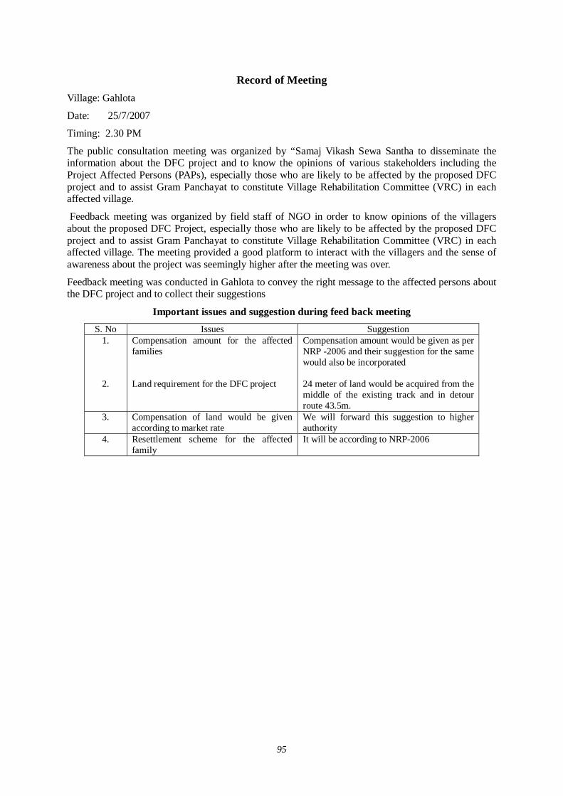
95
Record of Meeting Village: Gahlota
Date: 25/7/2007
Timing: 2.30 PM
The public consultation meeting was organized by “Samaj Vikash Sewa Santha to disseminate the information about the DFC project and to know the opinions of various stakeholders including the Project Affected Persons (PAPs), especially those who are likely to be affected by the proposed DFC project and to assist Gram Panchayat to constitute Village Rehabilitation Committee (VRC) in each affected village.
Feedback meeting was organized by field staff of NGO in order to know opinions of the villagers about the proposed DFC Project, especially those who are likely to be affected by the proposed DFC project and to assist Gram Panchayat to constitute Village Rehabilitation Committee (VRC) in each affected village. The meeting provided a good platform to interact with the villagers and the sense of awareness about the project was seemingly higher after the meeting was over.
Feedback meeting was conducted in Gahlota to convey the right message to the affected persons about the DFC project and to collect their suggestions
Important issues and suggestion during feed back meeting S. No Issues Suggestion
1.
2.
Compensation amount for the affected families Land requirement for the DFC project
Compensation amount would be given as per NRP -2006 and their suggestion for the same would also be incorporated 24 meter of land would be acquired from the middle of the existing track and in detour route 43.5m.
3.
Compensation of land would be given according to market rate
We will forward this suggestion to higher authority
4. Resettlement scheme for the affected family
It will be according to NRP-2006
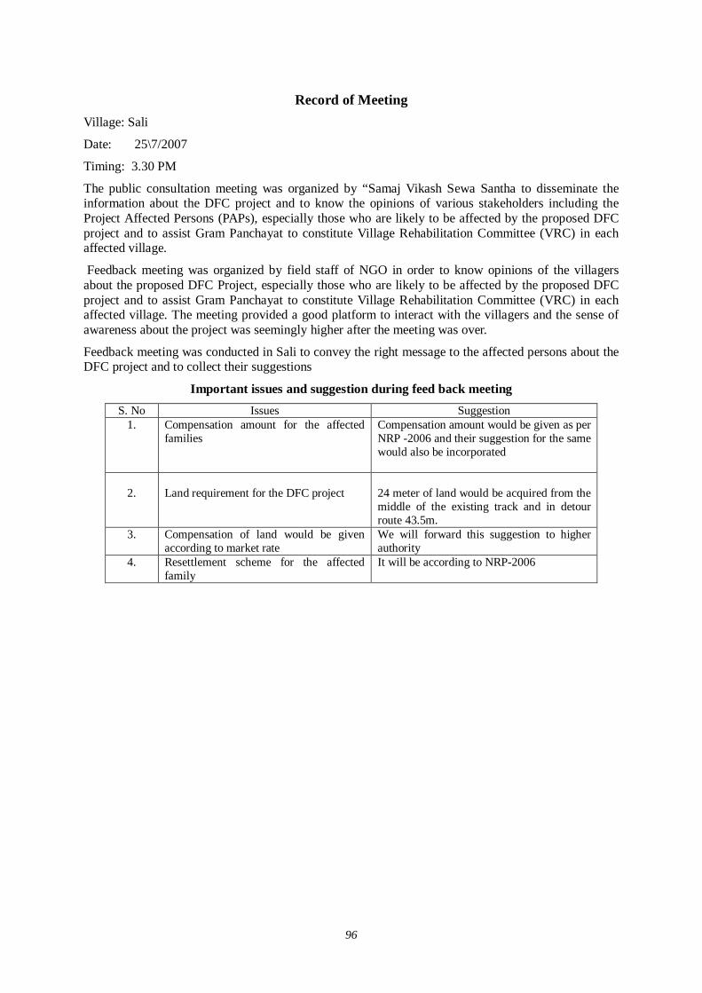
96
Record of Meeting Village: Sali
Date: 25\7/2007
Timing: 3.30 PM
The public consultation meeting was organized by “Samaj Vikash Sewa Santha to disseminate the information about the DFC project and to know the opinions of various stakeholders including the Project Affected Persons (PAPs), especially those who are likely to be affected by the proposed DFC project and to assist Gram Panchayat to constitute Village Rehabilitation Committee (VRC) in each affected village.
Feedback meeting was organized by field staff of NGO in order to know opinions of the villagers about the proposed DFC Project, especially those who are likely to be affected by the proposed DFC project and to assist Gram Panchayat to constitute Village Rehabilitation Committee (VRC) in each affected village. The meeting provided a good platform to interact with the villagers and the sense of awareness about the project was seemingly higher after the meeting was over.
Feedback meeting was conducted in Sali to convey the right message to the affected persons about the DFC project and to collect their suggestions
Important issues and suggestion during feed back meeting S. No Issues Suggestion
1.
Compensation amount for the affected families
Compensation amount would be given as per NRP -2006 and their suggestion for the same would also be incorporated
2.
Land requirement for the DFC project
24 meter of land would be acquired from the middle of the existing track and in detour route 43.5m.
3.
Compensation of land would be given according to market rate
We will forward this suggestion to higher authority
4. Resettlement scheme for the affected family
It will be according to NRP-2006
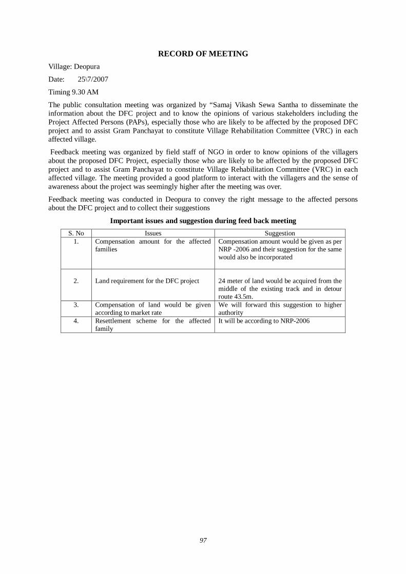
97
RECORD OF MEETING Village: Deopura
Date: 25\7/2007
Timing 9.30 AM
The public consultation meeting was organized by “Samaj Vikash Sewa Santha to disseminate the information about the DFC project and to know the opinions of various stakeholders including the Project Affected Persons (PAPs), especially those who are likely to be affected by the proposed DFC project and to assist Gram Panchayat to constitute Village Rehabilitation Committee (VRC) in each affected village.
Feedback meeting was organized by field staff of NGO in order to know opinions of the villagers about the proposed DFC Project, especially those who are likely to be affected by the proposed DFC project and to assist Gram Panchayat to constitute Village Rehabilitation Committee (VRC) in each affected village. The meeting provided a good platform to interact with the villagers and the sense of awareness about the project was seemingly higher after the meeting was over.
Feedback meeting was conducted in Deopura to convey the right message to the affected persons about the DFC project and to collect their suggestions
Important issues and suggestion during feed back meeting S. No Issues Suggestion
1.
Compensation amount for the affected families
Compensation amount would be given as per NRP -2006 and their suggestion for the same would also be incorporated
2.
Land requirement for the DFC project
24 meter of land would be acquired from the middle of the existing track and in detour route 43.5m.
3.
Compensation of land would be given according to market rate
We will forward this suggestion to higher authority
4. Resettlement scheme for the affected family
It will be according to NRP-2006
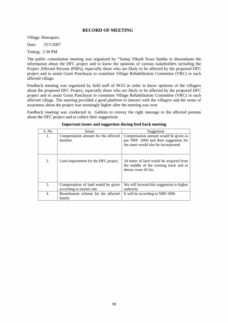
98
RECORD OF MEETING Village: Hatoopura
Date: 25\7/2007
Timing: 2.30 PM
The public consultation meeting was organized by “Samaj Vikash Sewa Santha to disseminate the information about the DFC project and to know the opinions of various stakeholders including the Project Affected Persons (PAPs), especially those who are likely to be affected by the proposed DFC project and to assist Gram Panchayat to constitute Village Rehabilitation Committee (VRC) in each affected village.
Feedback meeting was organized by field staff of NGO in order to know opinions of the villagers about the proposed DFC Project, especially those who are likely to be affected by the proposed DFC project and to assist Gram Panchayat to constitute Village Rehabilitation Committee (VRC) in each affected village. The meeting provided a good platform to interact with the villagers and the sense of awareness about the project was seemingly higher after the meeting was over.
Feedback meeting was conducted in Gahlota to convey the right message to the affected persons about the DFC project and to collect their suggestions
Important issues and suggestion during feed back meeting S. No Issues Suggestion
1.
Compensation amount for the affected families
Compensation amount would be given as per NRP -2006 and their suggestion for the same would also be incorporated
2.
Land requirement for the DFC project
24 meter of land would be acquired from the middle of the existing track and in detour route 43.5m.
3.
Compensation of land would be given according to market rate
We will forward this suggestion to higher authority
4. Resettlement scheme for the affected family
It will be according to NRP-2006

99
Record of Meeting
Village: Bokarawas
Date: 25\7/2007
Timing: 3.30 PM
The public consultation meeting was organized by “Samaj Vikash Sewa Santha to disseminate the information about the DFC project and to know the opinions of various stakeholders including the Project Affected Persons (PAPs), especially those who are likely to be affected by the proposed DFC project and to assist Gram Panchayat to constitute Village Rehabilitation Committee (VRC) in each affected village.
Feedback meeting was organized by field staff of NGO in order to know opinions of the villagers about the proposed DFC Project, especially those who are likely to be affected by the proposed DFC project and to assist Gram Panchayat to constitute Village Rehabilitation Committee (VRC) in each affected village. The meeting provided a good platform to interact with the villagers and the sense of awareness about the project was seemingly higher after the meeting was over.
Feedback meeting was conducted in Bokarawas to convey the right message to the affected persons about the DFC project and to collect their suggestions
Important issues and suggestion during feed back meeting S. No Issues Suggestion
1.
Compensation amount for the affected families
Compensation amount would be given as per NRP -2006 and their suggestion for the same would also be incorporated
2.
Land requirement for the DFC project
24 meter of land would be acquired from the middle of the existing track and in detour route 43.5m.
3.
Compensation of land would be given according to market rate
We will forward this suggestion to higher authority
4. Resettlement scheme for the affected family
It will be according to NRP-2006

100
Record of Meeting
Village: Beegalao
Date: 25\7/2007
Timing: 1 2.30 PM
The public consultation meeting was organized by “Samaj Vikash Sewa Santha to disseminate the information about the DFC project and to know the opinions of various stakeholders including the Project Affected Persons (PAPs), especially those who are likely to be affected by the proposed DFC project and to assist Gram Panchayat to constitute Village Rehabilitation Committee (VRC) in each affected village.
Feedback meeting was organized by field staff of NGO in order to know opinions of the villagers about the proposed DFC Project, especially those who are likely to be affected by the proposed DFC project and to assist Gram Panchayat to constitute Village Rehabilitation Committee (VRC) in each affected village. The meeting provided a good platform to interact with the villagers and the sense of awareness about the project was seemingly higher after the meeting was over.
Feedback meeting was conducted in Beegalao to convey the right message to the affected persons about the DFC project and to collect their suggestions
Important issues and suggestion during feed back meeting S. No Issues Suggestion
1.
Compensation amount for the affected families
Compensation amount would be given as per NRP -2006 and their suggestion for the same would also be incorporated
2.
Land requirement for the DFC project
24 meter of land would be acquired from the middle of the existing track and in detour route 43.5m.
3.
Compensation of land would be given according to market rate
We will forward this suggestion to higher authority
4. Resettlement scheme for the affected family
It will be according to NRP-2006

101
Record of Meeting
Village: Jhalokar
Date: 26\7/2007
Timing: 9.30 AM
The public consultation meeting was organized by “Samaj Vikash Sewa Santha to disseminate the information about the DFC project and to know the opinions of various stakeholders including the Project Affected Persons (PAPs), especially those who are likely to be affected by the proposed DFC project and to assist Gram Panchayat to constitute Village Rehabilitation Committee (VRC) in each affected village.
Feedback meeting was organized by field staff of NGO in order to know opinions of the villagers about the proposed DFC Project, especially those who are likely to be affected by the proposed DFC project and to assist Gram Panchayat to constitute Village Rehabilitation Committee (VRC) in each affected village. The meeting provided a good platform to interact with the villagers and the sense of awareness about the project was seemingly higher after the meeting was over.
Feedback meeting was conducted in Jhalokar to convey the right message to the affected persons about the DFC project and to collect their suggestions
Important issues and suggestion during feed back meeting S. No Issues Suggestion
1.
Compensation amount for the affected families
Compensation amount would be given as per NRP -2006 and their suggestion for the same would also be incorporated
2.
Land requirement for the DFC project
24 meter of land would be acquired from the middle of the existing track and in detour route 43.5m.
3.
Compensation of land would be given according to market rate
We will forward this suggestion to higher authority
4. Resettlement scheme for the affected family
It will be according to NRP-2006
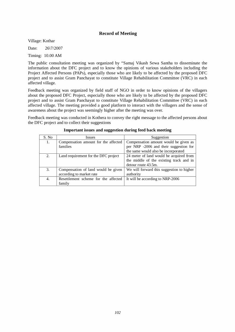
102
Record of Meeting
Village: Kothar
Date: 26\7/2007
Timing: 10.00 AM
The public consultation meeting was organized by “Samaj Vikash Sewa Santha to disseminate the information about the DFC project and to know the opinions of various stakeholders including the Project Affected Persons (PAPs), especially those who are likely to be affected by the proposed DFC project and to assist Gram Panchayat to constitute Village Rehabilitation Committee (VRC) in each affected village.
Feedback meeting was organized by field staff of NGO in order to know opinions of the villagers about the proposed DFC Project, especially those who are likely to be affected by the proposed DFC project and to assist Gram Panchayat to constitute Village Rehabilitation Committee (VRC) in each affected village. The meeting provided a good platform to interact with the villagers and the sense of awareness about the project was seemingly higher after the meeting was over.
Feedback meeting was conducted in Kothera to convey the right message to the affected persons about the DFC project and to collect their suggestions
Important issues and suggestion during feed back meeting S. No Issues Suggestion
1.
Compensation amount for the affected families
Compensation amount would be given as per NRP -2006 and their suggestion for the same would also be incorporated
2.
Land requirement for the DFC project
24 meter of land would be acquired from the middle of the existing track and in detour route 43.5m.
3.
Compensation of land would be given according to market rate
We will forward this suggestion to higher authority
4. Resettlement scheme for the affected family
It will be according to NRP-2006
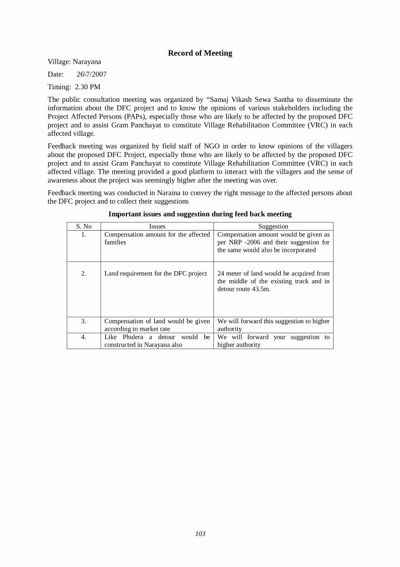
103
Record of Meeting Village: Narayana
Date: 26\7/2007
Timing: 2.30 PM
The public consultation meeting was organized by “Samaj Vikash Sewa Santha to disseminate the information about the DFC project and to know the opinions of various stakeholders including the Project Affected Persons (PAPs), especially those who are likely to be affected by the proposed DFC project and to assist Gram Panchayat to constitute Village Rehabilitation Committee (VRC) in each affected village.
Feedback meeting was organized by field staff of NGO in order to know opinions of the villagers about the proposed DFC Project, especially those who are likely to be affected by the proposed DFC project and to assist Gram Panchayat to constitute Village Rehabilitation Committee (VRC) in each affected village. The meeting provided a good platform to interact with the villagers and the sense of awareness about the project was seemingly higher after the meeting was over.
Feedback meeting was conducted in Naraina to convey the right message to the affected persons about the DFC project and to collect their suggestions
Important issues and suggestion during feed back meeting S. No Issues Suggestion
1.
Compensation amount for the affected families
Compensation amount would be given as per NRP -2006 and their suggestion for the same would also be incorporated
2.
Land requirement for the DFC project
24 meter of land would be acquired from the middle of the existing track and in detour route 43.5m.
3.
Compensation of land would be given according to market rate
We will forward this suggestion to higher authority
4. Like Phulera a detour would be constructed in Narayana also
We will forward your suggestion to higher authority
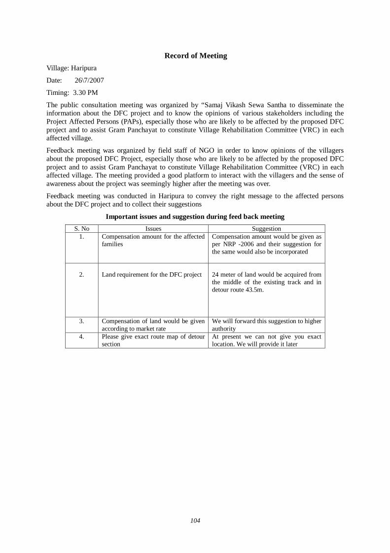
104
Record of Meeting
Village: Haripura
Date: 26\7/2007
Timing: 3.30 PM
The public consultation meeting was organized by “Samaj Vikash Sewa Santha to disseminate the information about the DFC project and to know the opinions of various stakeholders including the Project Affected Persons (PAPs), especially those who are likely to be affected by the proposed DFC project and to assist Gram Panchayat to constitute Village Rehabilitation Committee (VRC) in each affected village.
Feedback meeting was organized by field staff of NGO in order to know opinions of the villagers about the proposed DFC Project, especially those who are likely to be affected by the proposed DFC project and to assist Gram Panchayat to constitute Village Rehabilitation Committee (VRC) in each affected village. The meeting provided a good platform to interact with the villagers and the sense of awareness about the project was seemingly higher after the meeting was over.
Feedback meeting was conducted in Haripura to convey the right message to the affected persons about the DFC project and to collect their suggestions
Important issues and suggestion during feed back meeting S. No Issues Suggestion
1.
Compensation amount for the affected families
Compensation amount would be given as per NRP -2006 and their suggestion for the same would also be incorporated
2.
Land requirement for the DFC project
24 meter of land would be acquired from the middle of the existing track and in detour route 43.5m.
3.
Compensation of land would be given according to market rate
We will forward this suggestion to higher authority
4. Please give exact route map of detour section
At present we can not give you exact location. We will provide it later
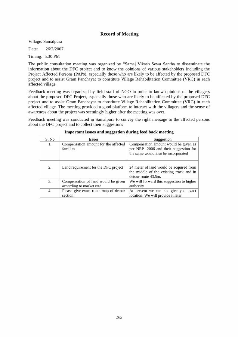
105
Record of Meeting
Village: Samalpura
Date: 26\7/2007
Timing: 5.30 PM
The public consultation meeting was organized by “Samaj Vikash Sewa Santha to disseminate the information about the DFC project and to know the opinions of various stakeholders including the Project Affected Persons (PAPs), especially those who are likely to be affected by the proposed DFC project and to assist Gram Panchayat to constitute Village Rehabilitation Committee (VRC) in each affected village.
Feedback meeting was organized by field staff of NGO in order to know opinions of the villagers about the proposed DFC Project, especially those who are likely to be affected by the proposed DFC project and to assist Gram Panchayat to constitute Village Rehabilitation Committee (VRC) in each affected village. The meeting provided a good platform to interact with the villagers and the sense of awareness about the project was seemingly higher after the meeting was over.
Feedback meeting was conducted in Samalpura to convey the right message to the affected persons about the DFC project and to collect their suggestions
Important issues and suggestion during feed back meeting S. No Issues Suggestion
1.
Compensation amount for the affected families
Compensation amount would be given as per NRP -2006 and their suggestion for the same would also be incorporated
2.
Land requirement for the DFC project
24 meter of land would be acquired from the middle of the existing track and in detour route 43.5m.
3.
Compensation of land would be given according to market rate
We will forward this suggestion to higher authority
4. Please give exact route map of detour section
At present we can not give you exact location. We will provide it later

106
Record of Meeting
Village: Shysinghpura
Date: 27/7/2007
Timing: 9.30 AM
The public consultation meeting was organized by “Samaj Vikash Sewa Santha to disseminate the information about the DFC project and to know the opinions of various stakeholders including the Project Affected Persons (PAPs), especially those who are likely to be affected by the proposed DFC project and to assist Gram Panchayat to constitute Village Rehabilitation Committee (VRC) in each affected village.
Feedback meeting was organized by field staff of NGO in order to know opinions of the villagers about the proposed DFC Project, especially those who are likely to be affected by the proposed DFC project and to assist Gram Panchayat to constitute Village Rehabilitation Committee (VRC) in each affected village. The meeting provided a good platform to interact with the villagers and the sense of awareness about the project was seemingly higher after the meeting was over.
Feedback meeting was conducted in Shysinghpura to convey the right message to the affected persons about the DFC project and to collect their suggestions
Important issues and suggestion during feed back meeting S. No Issues Suggestion
1.
Compensation amount for the affected families
Compensation amount would be given as per NRP -2006 and their suggestion for the same would also be incorporated
2.
Land requirement for the DFC project
24 meter of land would be acquired from the middle of the existing track and in detour route 43.5m.
3.
Compensation of land would be given according to market rate
We will forward this suggestion to higher authority
4. Please give exact route map of detour section
At present we can not give you exact location. We will provide it later

107
Record of Meeting
Village: Shardulpura
Date: 27\7/2007
Timing: 11.00 AM
The public consultation meeting was organized by “Samaj Vikash Sewa Santha to disseminate the information about the DFC project and to know the opinions of various stakeholders including the Project Affected Persons (PAPs), especially those who are likely to be affected by the proposed DFC project and to assist Gram Panchayat to constitute Village Rehabilitation Committee (VRC) in each affected village.
Feedback meeting was organized by field staff of NGO in order to know opinions of the villagers about the proposed DFC Project, especially those who are likely to be affected by the proposed DFC project and to assist Gram Panchayat to constitute Village Rehabilitation Committee (VRC) in each affected village. The meeting provided a good platform to interact with the villagers and the sense of awareness about the project was seemingly higher after the meeting was over.
Feedback meeting was conducted in Shardulpura to convey the right message to the affected persons about the DFC project and to collect their suggestions
Important issues and suggestion during feed back meeting S. No Issues Suggestion
1.
Compensation amount for the affected families
Compensation amount would be given as per NRP -2006 and their suggestion for the same would also be incorporated
2.
Land requirement for the DFC project
24 meter of land would be acquired from the middle of the existing track and in detour route 43.5m.
3.
Compensation of land would be given according to market rate
We will forward this suggestion to higher authority
4. Please give exact route map of detour section
At present we can not give you exact location. We will provide it later

108
Record of Meeting
Village: Samota Ka Bas
Date: 27/7/2007
Timing: 12.30PM
The public consultation meeting was organized by “Samaj Vikash Sewa Santha to disseminate the information about the DFC project and to know the opinions of various stakeholders including the Project Affected Persons (PAPs), especially those who are likely to be affected by the proposed DFC project and to assist Gram Panchayat to constitute Village Rehabilitation Committee (VRC) in each affected village.
Feedback meeting was organized by field staff of NGO in order to know opinions of the villagers about the proposed DFC Project, especially those who are likely to be affected by the proposed DFC project and to assist Gram Panchayat to constitute Village Rehabilitation Committee (VRC) in each affected village. The meeting provided a good platform to interact with the villagers and the sense of awareness about the project was seemingly higher after the meeting was over.
Feedback meeting was conducted in Samota ka Bas to convey the right message to the affected persons about the DFC project and to collect their suggestions
Important issues and suggestion during feed back meeting S. No Issues Suggestion
1.
Compensation amount for the affected families
Compensation amount would be given as per NRP -2006 and their suggestion for the same would also be incorporated
2.
Land requirement for the DFC project
24 meter of land would be acquired from the middle of the existing track and in detour route 43.5m.
3.
Compensation of land would be given according to market rate
We will forward this suggestion to higher authority
4. Please give exact route map of detour section
At present we can not give you exact location. We will provide it later

109
Record of Meeting
Village: Kanchorda
Date: 27/7/2007
Timing: 2.30 PM
The public consultation meeting was organized by “Samaj Vikash Sewa Santha to disseminate the information about the DFC project and to know the opinions of various stakeholders including the Project Affected Persons (PAPs), especially those who are likely to be affected by the proposed DFC project and to assist Gram Panchayat to constitute Village Rehabilitation Committee (VRC) in each affected village.
Feedback meeting was organized by field staff of NGO in order to know opinions of the villagers about the proposed DFC Project, especially those who are likely to be affected by the proposed DFC project and to assist Gram Panchayat to constitute Village Rehabilitation Committee (VRC) in each affected village. The meeting provided a good platform to interact with the villagers and the sense of awareness about the project was seemingly higher after the meeting was over.
Feedback meeting was conducted in Kanchorda to convey the right message to the affected persons about the DFC project and to collect their suggestions
Important issues and suggestion during feed back meeting S. No Issues Suggestion
1.
Compensation amount for the affected families
Compensation amount would be given as per NRP -2006 and their suggestion for the same would also be incorporated
2.
Land requirement for the DFC project
24 meter of land would be acquired from the middle of the existing track and in detour route 43.5m.
3.
Compensation of land would be given according to market rate
We will forward this suggestion to higher authority
4. Please give exact route map of detour section
At present we can not give you exact location. We will provide it later
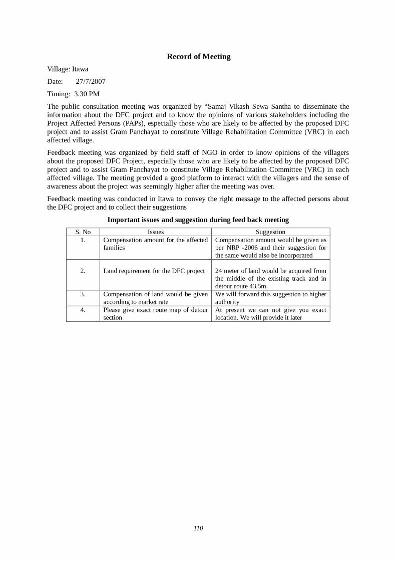
110
Record of Meeting Village: Itawa
Date: 27/7/2007
Timing: 3.30 PM
The public consultation meeting was organized by “Samaj Vikash Sewa Santha to disseminate the information about the DFC project and to know the opinions of various stakeholders including the Project Affected Persons (PAPs), especially those who are likely to be affected by the proposed DFC project and to assist Gram Panchayat to constitute Village Rehabilitation Committee (VRC) in each affected village.
Feedback meeting was organized by field staff of NGO in order to know opinions of the villagers about the proposed DFC Project, especially those who are likely to be affected by the proposed DFC project and to assist Gram Panchayat to constitute Village Rehabilitation Committee (VRC) in each affected village. The meeting provided a good platform to interact with the villagers and the sense of awareness about the project was seemingly higher after the meeting was over.
Feedback meeting was conducted in Itawa to convey the right message to the affected persons about the DFC project and to collect their suggestions
Important issues and suggestion during feed back meeting S. No Issues Suggestion
1.
Compensation amount for the affected families
Compensation amount would be given as per NRP -2006 and their suggestion for the same would also be incorporated
2.
Land requirement for the DFC project
24 meter of land would be acquired from the middle of the existing track and in detour route 43.5m.
3.
Compensation of land would be given according to market rate
We will forward this suggestion to higher authority
4. Please give exact route map of detour section
At present we can not give you exact location. We will provide it later
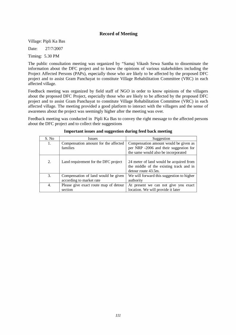
111
Record of Meeting Village: Pipli Ka Bas
Date: 27/7/2007
Timing: 5.30 PM
The public consultation meeting was organized by “Samaj Vikash Sewa Santha to disseminate the information about the DFC project and to know the opinions of various stakeholders including the Project Affected Persons (PAPs), especially those who are likely to be affected by the proposed DFC project and to assist Gram Panchayat to constitute Village Rehabilitation Committee (VRC) in each affected village.
Feedback meeting was organized by field staff of NGO in order to know opinions of the villagers about the proposed DFC Project, especially those who are likely to be affected by the proposed DFC project and to assist Gram Panchayat to constitute Village Rehabilitation Committee (VRC) in each affected village. The meeting provided a good platform to interact with the villagers and the sense of awareness about the project was seemingly higher after the meeting was over.
Feedback meeting was conducted in Pipli Ka Bas to convey the right message to the affected persons about the DFC project and to collect their suggestions
Important issues and suggestion during feed back meeting S. No Issues Suggestion
1.
Compensation amount for the affected families
Compensation amount would be given as per NRP -2006 and their suggestion for the same would also be incorporated
2.
Land requirement for the DFC project
24 meter of land would be acquired from the middle of the existing track and in detour route 43.5m.
3.
Compensation of land would be given according to market rate
We will forward this suggestion to higher authority
4. Please give exact route map of detour section
At present we can not give you exact location. We will provide it later
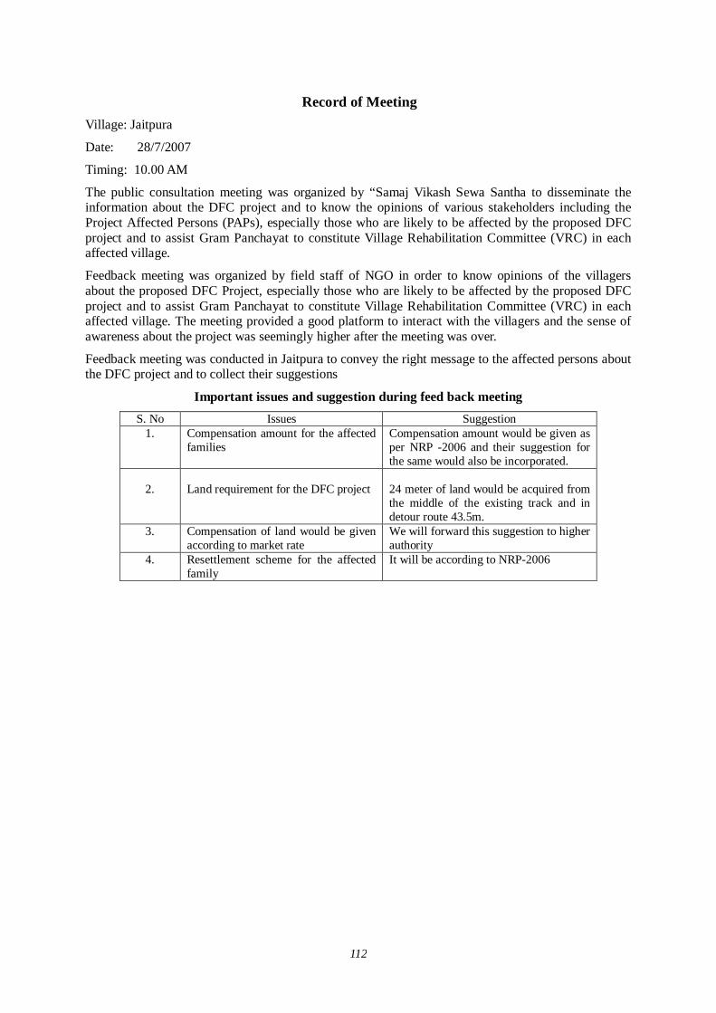
112
Record of Meeting Village: Jaitpura
Date: 28/7/2007
Timing: 10.00 AM
The public consultation meeting was organized by “Samaj Vikash Sewa Santha to disseminate the information about the DFC project and to know the opinions of various stakeholders including the Project Affected Persons (PAPs), especially those who are likely to be affected by the proposed DFC project and to assist Gram Panchayat to constitute Village Rehabilitation Committee (VRC) in each affected village.
Feedback meeting was organized by field staff of NGO in order to know opinions of the villagers about the proposed DFC Project, especially those who are likely to be affected by the proposed DFC project and to assist Gram Panchayat to constitute Village Rehabilitation Committee (VRC) in each affected village. The meeting provided a good platform to interact with the villagers and the sense of awareness about the project was seemingly higher after the meeting was over.
Feedback meeting was conducted in Jaitpura to convey the right message to the affected persons about the DFC project and to collect their suggestions
Important issues and suggestion during feed back meeting S. No Issues Suggestion
1.
Compensation amount for the affected families
Compensation amount would be given as per NRP -2006 and their suggestion for the same would also be incorporated.
2.
Land requirement for the DFC project
24 meter of land would be acquired from the middle of the existing track and in detour route 43.5m.
3.
Compensation of land would be given according to market rate
We will forward this suggestion to higher authority
4. Resettlement scheme for the affected family
It will be according to NRP-2006

113
Record of Meeting Village: Prithivipura
Date: 28/7/2007
Timing: 11.30 AM
The public consultation meeting was organized by “Samaj Vikash Sewa Santha to disseminate the information about the DFC project and to know the opinions of various stakeholders including the Project Affected Persons (PAPs), especially those who are likely to be affected by the proposed DFC project and to assist Gram Panchayat to constitute Village Rehabilitation Committee (VRC) in each affected village.
Feedback meeting was organized by field staff of NGO in order to know opinions of the villagers about the proposed DFC Project, especially those who are likely to be affected by the proposed DFC project and to assist Gram Panchayat to constitute Village Rehabilitation Committee (VRC) in each affected village. The meeting provided a good platform to interact with the villagers and the sense of awareness about the project was seemingly higher after the meeting was over.
Feedback meeting was conducted in Prithivipura to convey the right message to the affected persons about the DFC project and to collect their suggestions
Important issues and suggestion during feed back meeting S. No Issues Suggestion
1.
2.
Compensation amount for the affected families Land requirement for the DFC project
Compensation amount would be given as per NRP -2006 and their suggestion for the same would also be incorporated 24 meter of land would be acquired from the middle of the existing track and in detour route 43.5m.
3.
Compensation of land would be given according to market rate
We will forward this suggestion to higher authority
4. Resettlement scheme for the affected family
It will be according to NRP-2006

114
Record of Meeting Village: Khandel
Date: 28\7/2007
Timing: 12.30 PM
The public consultation meeting was organized by “Samaj Vikash Sewa Santha to disseminate the information about the DFC project and to know the opinions of various stakeholders including the Project Affected Persons (PAPs), especially those who are likely to be affected by the proposed DFC project and to assist Gram Panchayat to constitute Village Rehabilitation Committee (VRC) in each affected village.
Feedback meeting was organized by field staff of NGO in order to know opinions of the villagers about the proposed DFC Project, especially those who are likely to be affected by the proposed DFC project and to assist Gram Panchayat to constitute Village Rehabilitation Committee (VRC) in each affected village. The meeting provided a good platform to interact with the villagers and the sense of awareness about the project was seemingly higher after the meeting was over.
Feedback meeting was conducted in Khandel to convey the right message to the affected persons about the DFC project and to collect their suggestions
Important issues and suggestion during feed back meeting S. No Issues Suggestion
1.
2.
Compensation amount for the affected families Land requirement for the DFC project
Compensation amount would be given as per NRP -2006 and their suggestion for the same would also be incorporated 24 meter of land would be acquired from the middle of the existing track and in detour route 43.5m.
3.
Compensation of land would be given according to market rate
We will forward this suggestion to higher authority
4. Resettlement scheme for the affected family
It will be according to NRP-2006
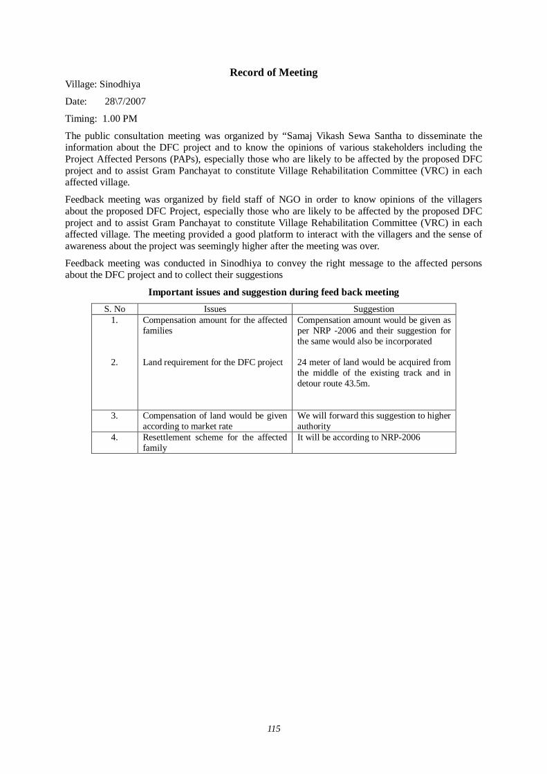
115
Record of Meeting Village: Sinodhiya
Date: 28\7/2007
Timing: 1.00 PM
The public consultation meeting was organized by “Samaj Vikash Sewa Santha to disseminate the information about the DFC project and to know the opinions of various stakeholders including the Project Affected Persons (PAPs), especially those who are likely to be affected by the proposed DFC project and to assist Gram Panchayat to constitute Village Rehabilitation Committee (VRC) in each affected village.
Feedback meeting was organized by field staff of NGO in order to know opinions of the villagers about the proposed DFC Project, especially those who are likely to be affected by the proposed DFC project and to assist Gram Panchayat to constitute Village Rehabilitation Committee (VRC) in each affected village. The meeting provided a good platform to interact with the villagers and the sense of awareness about the project was seemingly higher after the meeting was over.
Feedback meeting was conducted in Sinodhiya to convey the right message to the affected persons about the DFC project and to collect their suggestions
Important issues and suggestion during feed back meeting S. No Issues Suggestion
1.
2.
Compensation amount for the affected families Land requirement for the DFC project
Compensation amount would be given as per NRP -2006 and their suggestion for the same would also be incorporated 24 meter of land would be acquired from the middle of the existing track and in detour route 43.5m.
3.
Compensation of land would be given according to market rate
We will forward this suggestion to higher authority
4. Resettlement scheme for the affected family
It will be according to NRP-2006
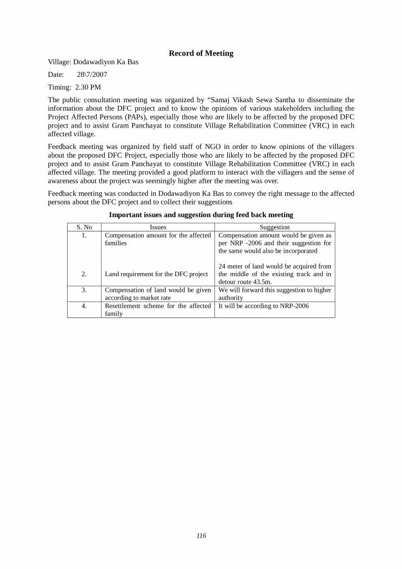
116
Record of Meeting Village: Dodawadiyon Ka Bas
Date: 28\7/2007
Timing: 2.30 PM
The public consultation meeting was organized by “Samaj Vikash Sewa Santha to disseminate the information about the DFC project and to know the opinions of various stakeholders including the Project Affected Persons (PAPs), especially those who are likely to be affected by the proposed DFC project and to assist Gram Panchayat to constitute Village Rehabilitation Committee (VRC) in each affected village.
Feedback meeting was organized by field staff of NGO in order to know opinions of the villagers about the proposed DFC Project, especially those who are likely to be affected by the proposed DFC project and to assist Gram Panchayat to constitute Village Rehabilitation Committee (VRC) in each affected village. The meeting provided a good platform to interact with the villagers and the sense of awareness about the project was seemingly higher after the meeting was over.
Feedback meeting was conducted in Dodawadiyon Ka Bas to convey the right message to the affected persons about the DFC project and to collect their suggestions
Important issues and suggestion during feed back meeting S. No Issues Suggestion
1.
2.
Compensation amount for the affected families Land requirement for the DFC project
Compensation amount would be given as per NRP -2006 and their suggestion for the same would also be incorporated 24 meter of land would be acquired from the middle of the existing track and in detour route 43.5m.
3.
Compensation of land would be given according to market rate
We will forward this suggestion to higher authority
4. Resettlement scheme for the affected family
It will be according to NRP-2006

117
Record of Meeting Village: Bhookhron Ki Dhani
Date: 28\7/2007
Timing: 4.00 PM
The public consultation meeting was organized by “Samaj Vikash Sewa Santha to disseminate the information about the DFC project and to know the opinions of various stakeholders including the Project Affected Persons (PAPs), especially those who are likely to be affected by the proposed DFC project and to assist Gram Panchayat to constitute Village Rehabilitation Committee (VRC) in each affected village.
Feedback meeting was organized by field staff of NGO in order to know opinions of the villagers about the proposed DFC Project, especially those who are likely to be affected by the proposed DFC project and to assist Gram Panchayat to constitute Village Rehabilitation Committee (VRC) in each affected village. The meeting provided a good platform to interact with the villagers and the sense of awareness about the project was seemingly higher after the meeting was over.
Feedback meeting was conducted in Bhookron Ki Dhani to convey the right message to the affected persons about the DFC project and to collect their suggestions
Important issues and suggestion during feed back meeting S. No Issues Suggestion
1.
2.
Compensation amount for the affected families Land requirement for the DFC project
Compensation amount would be given as per NRP -2006 and their suggestion for the same would also be incorporated 24 meter of land would be acquired from the middle of the existing track and in detour route 43.5m.
3.
Compensation of land would be given according to market rate
We will forward this suggestion to higher authority
4. Resettlement scheme for the affected family
It will be according to NRP-2006
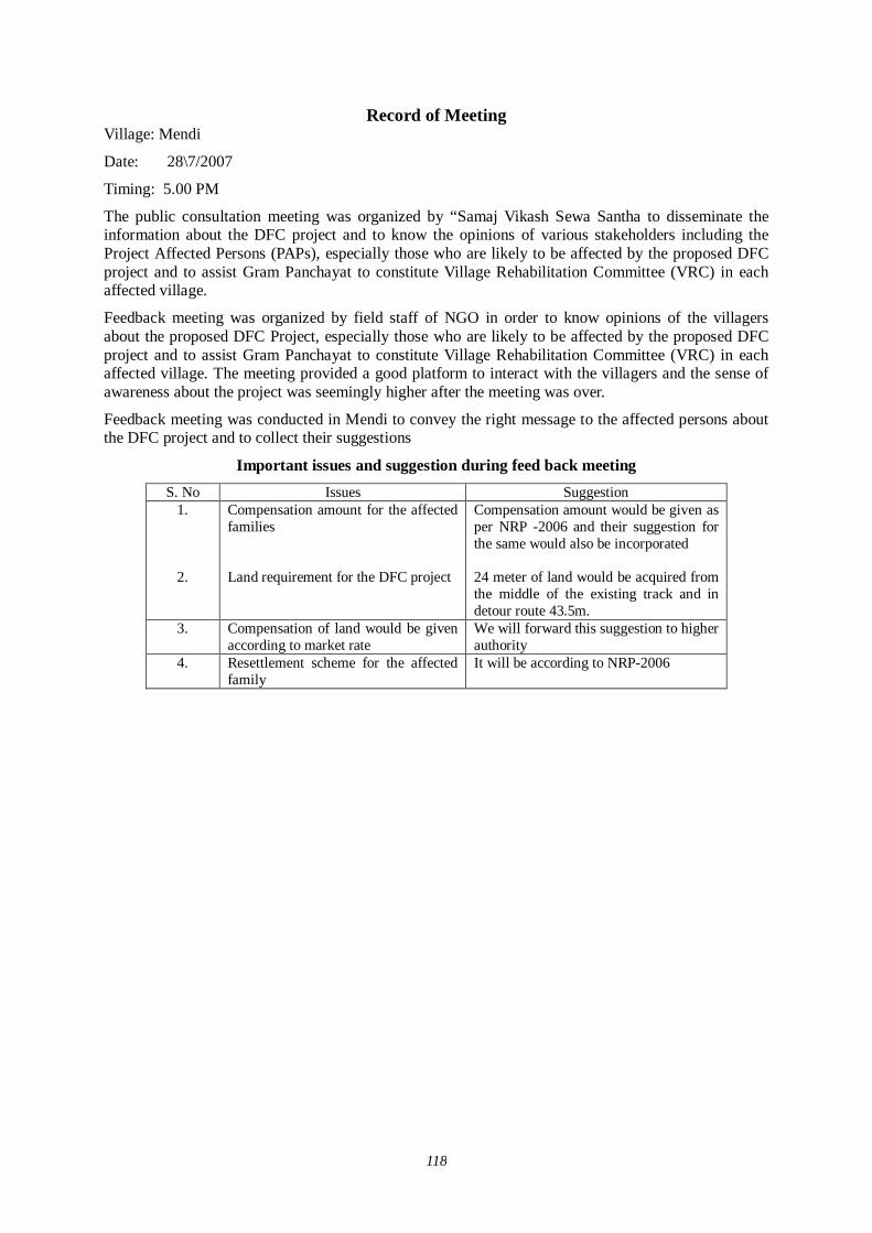
118
Record of Meeting Village: Mendi
Date: 28\7/2007
Timing: 5.00 PM
The public consultation meeting was organized by “Samaj Vikash Sewa Santha to disseminate the information about the DFC project and to know the opinions of various stakeholders including the Project Affected Persons (PAPs), especially those who are likely to be affected by the proposed DFC project and to assist Gram Panchayat to constitute Village Rehabilitation Committee (VRC) in each affected village.
Feedback meeting was organized by field staff of NGO in order to know opinions of the villagers about the proposed DFC Project, especially those who are likely to be affected by the proposed DFC project and to assist Gram Panchayat to constitute Village Rehabilitation Committee (VRC) in each affected village. The meeting provided a good platform to interact with the villagers and the sense of awareness about the project was seemingly higher after the meeting was over.
Feedback meeting was conducted in Mendi to convey the right message to the affected persons about the DFC project and to collect their suggestions
Important issues and suggestion during feed back meeting S. No Issues Suggestion
1.
2.
Compensation amount for the affected families Land requirement for the DFC project
Compensation amount would be given as per NRP -2006 and their suggestion for the same would also be incorporated 24 meter of land would be acquired from the middle of the existing track and in detour route 43.5m.
3.
Compensation of land would be given according to market rate
We will forward this suggestion to higher authority
4. Resettlement scheme for the affected family
It will be according to NRP-2006

119
Record of Meeting Village: Charanwas
Date: 29\7/2007
Timing: 10.00 AM
The public consultation meeting was organized by “Samaj Vikash Sewa Santha to disseminate the information about the DFC project and to know the opinions of various stakeholders including the Project Affected Persons (PAPs), especially those who are likely to be affected by the proposed DFC project and to assist Gram Panchayat to constitute Village Rehabilitation Committee (VRC) in each affected village.
Feedback meeting was organized by field staff of NGO in order to know opinions of the villagers about the proposed DFC Project, especially those who are likely to be affected by the proposed DFC project and to assist Gram Panchayat to constitute Village Rehabilitation Committee (VRC) in each affected village. The meeting provided a good platform to interact with the villagers and the sense of awareness about the project was seemingly higher after the meeting was over.
Feedback meeting was conducted in Charanwas to convey the right message to the affected persons about the DFC project and to collect their suggestions
Important issues and suggestion during feed back meeting S. No Issues Suggestion
1.
2.
Compensation amount for the affected families Land requirement for the DFC project
Compensation amount would be given as per NRP -2006 and their suggestion for the same would also be incorporated 24 meter of land would be acquired from the middle of the existing track and in detour route 43.5m.
3.
Compensation of land would be given according to market rate
We will forward this suggestion to higher authority
4. Resettlement scheme for the affected family
It will be according to NRP-2006
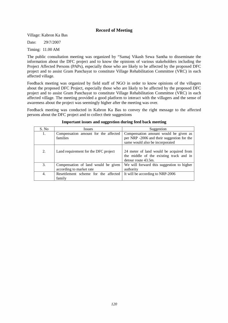
120
Record of Meeting Village: Kabron Ka Bas
Date: 29\7/2007
Timing: 11.00 AM
The public consultation meeting was organized by “Samaj Vikash Sewa Santha to disseminate the information about the DFC project and to know the opinions of various stakeholders including the Project Affected Persons (PAPs), especially those who are likely to be affected by the proposed DFC project and to assist Gram Panchayat to constitute Village Rehabilitation Committee (VRC) in each affected village.
Feedback meeting was organized by field staff of NGO in order to know opinions of the villagers about the proposed DFC Project, especially those who are likely to be affected by the proposed DFC project and to assist Gram Panchayat to constitute Village Rehabilitation Committee (VRC) in each affected village. The meeting provided a good platform to interact with the villagers and the sense of awareness about the project was seemingly higher after the meeting was over.
Feedback meeting was conducted in Kabron Ka Bas to convey the right message to the affected persons about the DFC project and to collect their suggestions
Important issues and suggestion during feed back meeting S. No Issues Suggestion
1.
Compensation amount for the affected families
Compensation amount would be given as per NRP -2006 and their suggestion for the same would also be incorporated
2.
Land requirement for the DFC project
24 meter of land would be acquired from the middle of the existing track and in detour route 43.5m.
3.
Compensation of land would be given according to market rate
We will forward this suggestion to higher authority
4. Resettlement scheme for the affected family
It will be according to NRP-2006
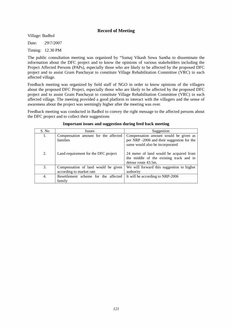
121
Record of Meeting Village: Badhol
Date: 29\7/2007
Timing: 12.30 PM
The public consultation meeting was organized by “Samaj Vikash Sewa Santha to disseminate the information about the DFC project and to know the opinions of various stakeholders including the Project Affected Persons (PAPs), especially those who are likely to be affected by the proposed DFC project and to assist Gram Panchayat to constitute Village Rehabilitation Committee (VRC) in each affected village.
Feedback meeting was organized by field staff of NGO in order to know opinions of the villagers about the proposed DFC Project, especially those who are likely to be affected by the proposed DFC project and to assist Gram Panchayat to constitute Village Rehabilitation Committee (VRC) in each affected village. The meeting provided a good platform to interact with the villagers and the sense of awareness about the project was seemingly higher after the meeting was over.
Feedback meeting was conducted in Badhol to convey the right message to the affected persons about the DFC project and to collect their suggestions
Important issues and suggestion during feed back meeting S. No Issues Suggestion
1.
2.
Compensation amount for the affected families Land requirement for the DFC project
Compensation amount would be given as per NRP -2006 and their suggestion for the same would also be incorporated 24 meter of land would be acquired from the middle of the existing track and in detour route 43.5m.
3.
Compensation of land would be given according to market rate
We will forward this suggestion to higher authority
4. Resettlement scheme for the affected family
It will be according to NRP-2006
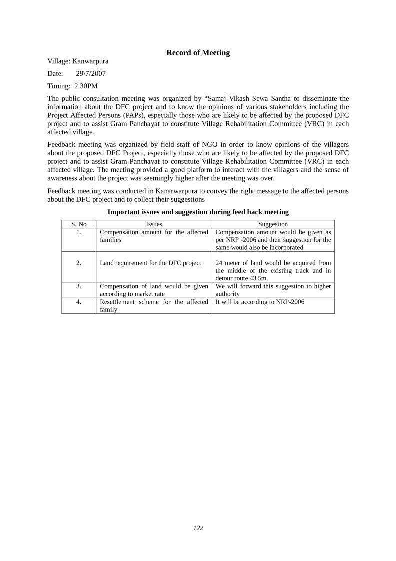
122
Record of Meeting Village: Kanwarpura
Date: 29\7/2007
Timing: 2.30PM
The public consultation meeting was organized by “Samaj Vikash Sewa Santha to disseminate the information about the DFC project and to know the opinions of various stakeholders including the Project Affected Persons (PAPs), especially those who are likely to be affected by the proposed DFC project and to assist Gram Panchayat to constitute Village Rehabilitation Committee (VRC) in each affected village.
Feedback meeting was organized by field staff of NGO in order to know opinions of the villagers about the proposed DFC Project, especially those who are likely to be affected by the proposed DFC project and to assist Gram Panchayat to constitute Village Rehabilitation Committee (VRC) in each affected village. The meeting provided a good platform to interact with the villagers and the sense of awareness about the project was seemingly higher after the meeting was over.
Feedback meeting was conducted in Kanarwarpura to convey the right message to the affected persons about the DFC project and to collect their suggestions
Important issues and suggestion during feed back meeting S. No Issues Suggestion
1.
Compensation amount for the affected families
Compensation amount would be given as per NRP -2006 and their suggestion for the same would also be incorporated
2.
Land requirement for the DFC project
24 meter of land would be acquired from the middle of the existing track and in detour route 43.5m.
3.
Compensation of land would be given according to market rate
We will forward this suggestion to higher authority
4. Resettlement scheme for the affected family
It will be according to NRP-2006

123
Record of Meeting Village: Asti Kalan
Date: 30\7/2007
Timing: 10.00 AM
The public consultation meeting was organized by “Samaj Vikash Sewa Santha to disseminate the information about the DFC project and to know the opinions of various stakeholders including the Project Affected Persons (PAPs), especially those who are likely to be affected by the proposed DFC project and to assist Gram Panchayat to constitute Village Rehabilitation Committee (VRC) in each affected village.
Feedback meeting was organized by field staff of NGO in order to know opinions of the villagers about the proposed DFC Project, especially those who are likely to be affected by the proposed DFC project and to assist Gram Panchayat to constitute Village Rehabilitation Committee (VRC) in each affected village. The meeting provided a good platform to interact with the villagers and the sense of awareness about the project was seemingly higher after the meeting was over.
Feedback meeting was conducted in Asti Kalan to convey the right message to the affected persons about the DFC project and to collect their suggestions
Important issues and suggestion during feed back meeting S. No Issues Suggestion
1.
Compensation amount for the affected families
Compensation amount would be given as per NRP -2006 and their suggestion for the same would also be incorporated
2.
Land requirement for the DFC project
24 meter of land would be acquired from the middle of the existing track and in detour route 43.5m.
3.
Compensation of land would be given according to market rate
We will forward this suggestion to higher authority
4. Resettlement scheme for the affected family
It will be according to NRP-2006
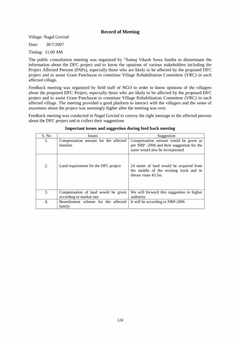
124
Record of Meeting Village: Nagal Govind
Date: 30\7/2007
Timing: 11.00 AM
The public consultation meeting was organized by “Samaj Vikash Sewa Santha to disseminate the information about the DFC project and to know the opinions of various stakeholders including the Project Affected Persons (PAPs), especially those who are likely to be affected by the proposed DFC project and to assist Gram Panchayat to constitute Village Rehabilitation Committee (VRC) in each affected village.
Feedback meeting was organized by field staff of NGO in order to know opinions of the villagers about the proposed DFC Project, especially those who are likely to be affected by the proposed DFC project and to assist Gram Panchayat to constitute Village Rehabilitation Committee (VRC) in each affected village. The meeting provided a good platform to interact with the villagers and the sense of awareness about the project was seemingly higher after the meeting was over.
Feedback meeting was conducted in Nagal Govind to convey the right message to the affected persons about the DFC project and to collect their suggestions
Important issues and suggestion during feed back meeting S. No Issues Suggestion
1.
Compensation amount for the affected families
Compensation amount would be given as per NRP -2006 and their suggestion for the same would also be incorporated
2.
Land requirement for the DFC project
24 meter of land would be acquired from the middle of the existing track and in detour route 43.5m.
3.
Compensation of land would be given according to market rate
We will forward this suggestion to higher authority
4. Resettlement scheme for the affected family
It will be according to NRP-2006
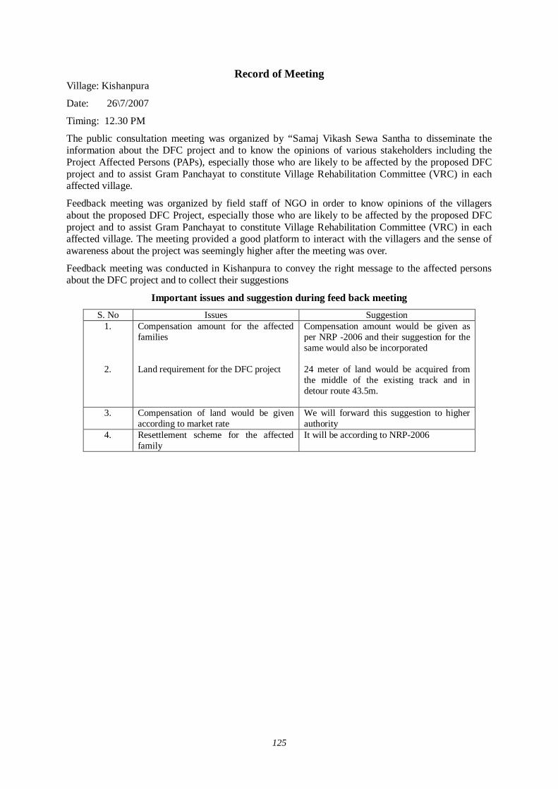
125
Record of Meeting Village: Kishanpura
Date: 26\7/2007
Timing: 12.30 PM
The public consultation meeting was organized by “Samaj Vikash Sewa Santha to disseminate the information about the DFC project and to know the opinions of various stakeholders including the Project Affected Persons (PAPs), especially those who are likely to be affected by the proposed DFC project and to assist Gram Panchayat to constitute Village Rehabilitation Committee (VRC) in each affected village.
Feedback meeting was organized by field staff of NGO in order to know opinions of the villagers about the proposed DFC Project, especially those who are likely to be affected by the proposed DFC project and to assist Gram Panchayat to constitute Village Rehabilitation Committee (VRC) in each affected village. The meeting provided a good platform to interact with the villagers and the sense of awareness about the project was seemingly higher after the meeting was over.
Feedback meeting was conducted in Kishanpura to convey the right message to the affected persons about the DFC project and to collect their suggestions
Important issues and suggestion during feed back meeting S. No Issues Suggestion
1.
2.
Compensation amount for the affected families Land requirement for the DFC project
Compensation amount would be given as per NRP -2006 and their suggestion for the same would also be incorporated 24 meter of land would be acquired from the middle of the existing track and in detour route 43.5m.
3.
Compensation of land would be given according to market rate
We will forward this suggestion to higher authority
4. Resettlement scheme for the affected family
It will be according to NRP-2006
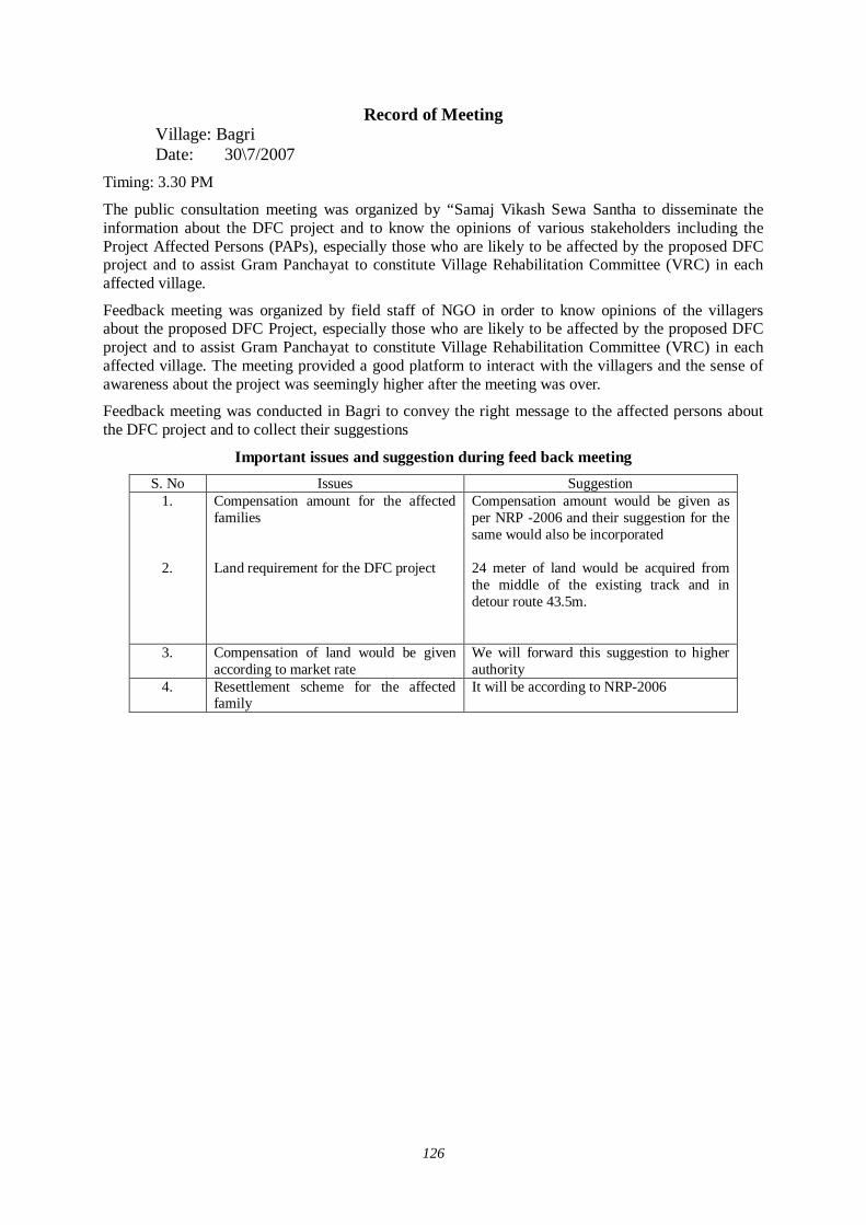
126
Record of Meeting Village: Bagri Date: 30\7/2007
Timing: 3.30 PM
The public consultation meeting was organized by “Samaj Vikash Sewa Santha to disseminate the information about the DFC project and to know the opinions of various stakeholders including the Project Affected Persons (PAPs), especially those who are likely to be affected by the proposed DFC project and to assist Gram Panchayat to constitute Village Rehabilitation Committee (VRC) in each affected village.
Feedback meeting was organized by field staff of NGO in order to know opinions of the villagers about the proposed DFC Project, especially those who are likely to be affected by the proposed DFC project and to assist Gram Panchayat to constitute Village Rehabilitation Committee (VRC) in each affected village. The meeting provided a good platform to interact with the villagers and the sense of awareness about the project was seemingly higher after the meeting was over.
Feedback meeting was conducted in Bagri to convey the right message to the affected persons about the DFC project and to collect their suggestions
Important issues and suggestion during feed back meeting S. No Issues Suggestion
1.
2.
Compensation amount for the affected families Land requirement for the DFC project
Compensation amount would be given as per NRP -2006 and their suggestion for the same would also be incorporated 24 meter of land would be acquired from the middle of the existing track and in detour route 43.5m.
3.
Compensation of land would be given according to market rate
We will forward this suggestion to higher authority
4. Resettlement scheme for the affected family
It will be according to NRP-2006
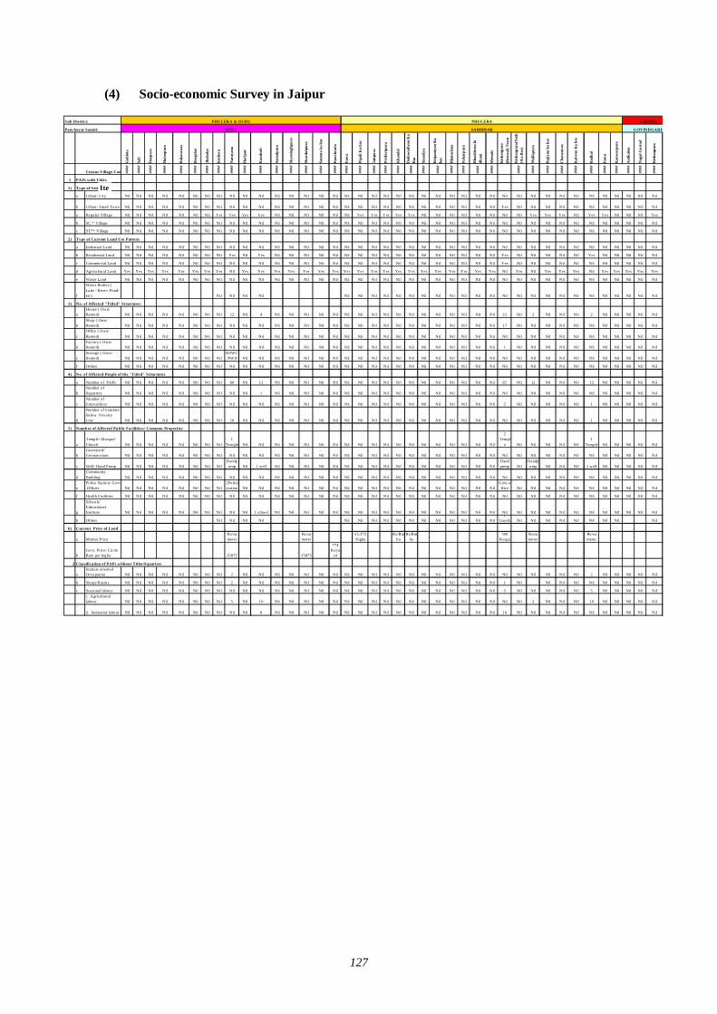
127
(4) Socio-economic Survey in Jaipur
Sub District:
Panchayat Samiti:G
ahlo
ta
Sali
Deo
pura
Hat
oopu
ra
Bok
araw
as
Bee
gola
o
Jhak
olar
Kot
hera
Nar
ayan
a
Har
ipur
Kan
deol
i
Sam
alpu
ra
Shyo
singh
pura
Shar
dulp
ura
Sam
ota
ka b
as
Kan
chro
da
Itaw
a
Pipa
li K
a ba
s
Jait
pura
Prit
hivi
pura
Kha
ndel
Dod
awad
iyon
Ka
Bas
Sino
diya
Bri
jam
iyon
Ka
bas
Bha
insl
ana
Paha
rpur
a
Bho
okhr
on k
idh
ani
Mee
ndi
Kis
hanp
ura
(Ren
wal
) Tow
n
Kis
hanp
ura(
Nat
hi K
a B
as)
Mal
ikpu
ra
Baj
iyon
ka
bas
Cha
ranw
as
Kab
ron
Ka
bas
Bad
hal
Itaw
a
Kan
war
pura
Ast
ikal
an
Nag
al G
ovin
d
Kis
hanp
ura
Census Village Code ####
####
####
####
####
####
####
####
####
####
####
####
####
####
####
####
####
####
####
####
####
####
####
####
####
####
####
####
####
####
####
####
####
####
####
####
####
####
####
1 PAPs with Titles
1) Type of Settlement
a Urban- City Nil Nil Nil Nil Nil Nil Nil Nil Nil Nil Nil Nil Nil Nil Nil Nil Nil Nil Nil Nil Nil Nil Nil Nil Nil Nil Nil Nil Nil Nil Nil Nil Nil Nil Nil Nil Nil Nil Nil Nil
b Urban- Small Town Nil Nil Nil Nil Nil Nil Nil Nil Nil Nil Nil Nil Nil Nil Nil Nil Nil Nil Nil Nil Nil Nil Nil Nil Nil Nil Nil Nil Yes Nil Nil Nil Nil Nil Nil Nil Nil Nil Nil Nil
a Regular Village Nil Nil Nil Nil Nil Nil Nil Yes Yes Yes Yes Nil Nil Nil Nil Nil Nil Yes Yes Yes Yes Yes Nil Nil Nil Nil Nil Nil Nil Nil Yes Yes Yes Nil Yes Yes Nil Nil Nil Yes
b SC * Village Nil Nil Nil Nil Nil Nil Nil Nil Nil Nil Nil Nil Nil Nil Nil Nil Nil Nil Nil Nil Nil Nil Nil Nil Nil Nil Nil Nil Nil Nil Nil Nil Nil Nil Nil Nil Nil Nil Nil Nil
c ST** Village Nil Nil Nil Nil Nil Nil Nil Nil Nil Nil Nil Nil Nil Nil Nil Nil Nil Nil Nil Nil Nil Nil Nil Nil Nil Nil Nil Nil Nil Nil Nil Nil Nil Nil Nil Nil Nil Nil Nil Nil
2) Type of Current Land Use Pattern
a Industrial Land Nil Nil Nil Nil Nil Nil Nil Nil Nil Nil Nil Nil Nil Nil Nil Nil Nil Nil Nil Nil Nil Nil Nil Nil Nil Nil Nil Nil Nil Nil Nil Nil Nil Nil Nil Nil Nil Nil Nil Nil
b Residential Land Nil Nil Nil Nil Nil Nil Nil Nil Yes Nil Yes Nil Nil Nil Nil Nil Nil Nil Nil Nil Nil Nil Nil Nil Nil Nil Nil Nil Yes Nil Nil Nil Nil Nil Yes Nil Nil Nil Nil Nil
c Commercial Land Nil Nil Nil Nil Nil Nil Nil Nil Nil Nil Nil Nil Nil Nil Nil Nil Nil Nil Nil Nil Nil Nil Nil Nil Nil Nil Nil Nil Yes Nil Nil Nil Nil Nil Nil Nil Nil Nil Nil Nil
d Agricultural Land Yes Yes Yes Yes Yes Yes Yes Yes Nil Yes Yes Yes Yes Yes Yes Yes Yes Yes Yes Yes Yes Yes Yes Yes Yes Yes Yes Yes Nil Yes Nil Yes Yes Yes Nil Yes Yes Yes Yes Yes
e Waste Land Nil Nil Nil Nil Nil Nil Nil Nil Nil Nil Nil Nil Nil Nil Nil Nil Nil Nil Nil Nil Nil Nil Nil Nil Nil Nil Nil Nil Nil Nil Nil Nil Nil Nil Nil Nil Nil Nil Nil Nil
f
Water Bodies (Lake / River/ Pond/etc) Nil Nil Nil Nil Nil Nil Nil Nil Nil Nil Nil Nil Nil Nil Nil Nil Nil Nil Nil Nil Nil Nil Nil Nil Nil Nil Nil Nil
3) No. of Affected "Titled" Structures
aHouse ( Own/Rented) Nil Nil Nil Nil Nil Nil Nil Nil 12 Nil 4 Nil Nil Nil Nil Nil Nil Nil Nil Nil Nil Nil Nil Nil Nil Nil Nil Nil 21 Nil 2 Nil Nil Nil 2 Nil Nil Nil Nil Nil
bShop ( Own/Rented) Nil Nil Nil Nil Nil Nil Nil Nil Nil Nil Nil Nil Nil Nil Nil Nil Nil Nil Nil Nil Nil Nil Nil Nil Nil Nil Nil Nil 17 Nil Nil Nil Nil Nil Nil Nil Nil Nil Nil Nil
cOffice ( Own/Rented) Nil Nil Nil Nil Nil Nil Nil Nil Nil Nil Nil Nil Nil Nil Nil Nil Nil Nil Nil Nil Nil Nil Nil Nil Nil Nil Nil Nil Nil Nil Nil Nil Nil Nil Nil Nil Nil Nil Nil Nil
dFactory ( Own/Rented) Nil Nil Nil Nil Nil Nil Nil Nil Nil Nil Nil Nil Nil Nil Nil Nil Nil Nil Nil Nil Nil Nil Nil Nil Nil Nil Nil Nil 1 Nil Nil Nil Nil Nil Nil Nil Nil Nil Nil Nil
eStorage ( Own/Rented) Nil Nil Nil Nil Nil Nil Nil Nil
RSWC/PWD Nil Nil Nil Nil Nil Nil Nil Nil Nil Nil Nil Nil Nil Nil Nil Nil Nil Nil Nil Nil Nil Nil Nil Nil Nil Nil Nil Nil Nil Nil Nil
f Others Nil Nil Nil Nil Nil Nil Nil Nil Nil Nil Nil Nil Nil Nil Nil Nil Nil Nil Nil Nil Nil Nil Nil Nil Nil Nil Nil Nil Nil Nil Nil Nil Nil Nil Nil Nil Nil Nil Nil Nil
4) No. of Affected People of the "Titled" Structures
a Number of PAPs Nil Nil Nil Nil Nil Nil Nil Nil 60 Nil 12 Nil Nil Nil Nil Nil Nil Nil Nil Nil Nil Nil Nil Nil Nil Nil Nil Nil 85 Nil 12 Nil Nil Nil 12 Nil Nil Nil Nil Nil
bNumber ofSquatters Nil Nil Nil Nil Nil Nil Nil Nil Nil Nil 1 Nil Nil Nil Nil Nil Nil Nil Nil Nil Nil Nil Nil Nil Nil Nil Nil Nil Nil Nil Nil Nil Nil Nil Nil Nil Nil Nil Nil Nil
cNumber ofEncroachers Nil Nil Nil Nil Nil Nil Nil Nil Nil Nil Nil Nil Nil Nil Nil Nil Nil Nil Nil Nil Nil Nil Nil Nil Nil Nil Nil Nil 2 Nil Nil Nil Nil Nil 1 Nil Nil Nil Nil Nil
d
Number of FamiliesBelow PovertyLine Nil Nil Nil Nil Nil Nil Nil Nil 10 Nil Nil Nil Nil Nil Nil Nil Nil Nil Nil Nil Nil Nil Nil Nil Nil Nil Nil Nil Nil Nil Nil Nil Nil Nil 1 Nil Nil Nil Nil Nil
5) Number of Affected Public Facilitites/ Common Properties
aTemple/ Mosque/Church Nil Nil Nil Nil Nil Nil Nil Nil
1Temple Nil Nil Nil Nil Nil Nil Nil Nil Nil Nil Nil Nil Nil Nil Nil Nil Nil Nil Nil
2Templ
e Nil Nil Nil Nil Nil1
Temple Nil Nil Nil Nil Nil
bGraveyard/Crematorium Nil Nil Nil Nil Nil Nil Nil Nil Nil Nil Nil Nil Nil Nil Nil Nil Nil Nil Nil Nil Nil Nil Nil Nil Nil Nil Nil Nil Nil Nil Nil Nil Nil Nil Nil Nil Nil Nil Nil Nil
c Well/ Hand Pump Nil Nil Nil Nil Nil Nil Nil NilHandp
ump Nil 1 well Nil Nil Nil Nil Nil Nil Nil Nil Nil Nil Nil Nil Nil Nil Nil Nil NilHandpump Nil
Handpump Nil Nil Nil 1 well Nil Nil Nil Nil Nil
dCommunityBuilding Nil Nil Nil Nil Nil Nil Nil Nil Nil Nil Nil Nil Nil Nil Nil Nil Nil Nil Nil Nil Nil Nil Nil Nil Nil Nil Nil Nil Nil Nil Nil Nil Nil Nil Nil Nil Nil Nil Nil Nil
ePolice Station/ Govt.Offices Nil Nil Nil Nil Nil Nil Nil Nil
1Policestation Nil Nil Nil Nil Nil Nil Nil Nil Nil Nil Nil Nil Nil Nil Nil Nil Nil Nil Nil
Govt.office Nil Nil Nil Nil Nil Nil Nil Nil Nil Nil Nil
f Health Facilities Nil Nil Nil Nil Nil Nil Nil Nil Nil Nil Nil Nil Nil Nil Nil Nil Nil Nil Nil Nil Nil Nil Nil Nil Nil Nil Nil Nil Nil Nil Nil Nil Nil Nil Nil Nil Nil Nil Nil Nil
g
Schools/EducationalInstitute Nil Nil Nil Nil Nil Nil Nil Nil Nil Nil 1 school Nil Nil Nil Nil Nil Nil Nil Nil Nil Nil Nil Nil Nil Nil Nil Nil Nil Nil Nil Nil Nil Nil Nil Nil Nil Nil Nil Nil Nil
h Others Nil Nil Nil Nil Nil Nil Nil Nil Nil Nil Nil Nil Nil Nil Nil Nil1
Gaush Nil Nil Nil Nil Nil Nil Nil Nil Nil
6) Current Price of Land
a Market PriceRs/sqmeter
Rs/sqmeter
55,375/bigha
Rs/Bigha
Rs/Bigha
500Rs/gaj
Rs/sqmeter
Rs/sqmeter
bGovt. Pr ice/ CircleRate per bigha 35875 35875
774Rs/ya
rd
2 Classification of PAPs without Titles/Squatters
aStation-orientedOccupation Nil Nil Nil Nil Nil Nil Nil Nil 2 Nil Nil Nil Nil Nil Nil Nil Nil Nil Nil Nil Nil Nil Nil Nil Nil Nil Nil Nil Nil Nil Nil Nil Nil Nil 2 Nil Nil Nil Nil Nil
b Shops/Kiosks Nil Nil Nil Nil Nil Nil Nil Nil 2 Nil Nil Nil Nil Nil Nil Nil Nil Nil Nil Nil Nil Nil Nil Nil Nil Nil Nil Nil 1 Nil Nil Nil Nil Nil Nil Nil Nil Nil Nil
c Seasonal labour Nil Nil Nil Nil Nil Nil Nil Nil Nil Nil Nil Nil Nil Nil Nil Nil Nil Nil Nil Nil Nil Nil Nil Nil Nil Nil Nil Nil 5 Nil Nil Nil Nil Nil 5 Nil Nil Nil Nil Nili. Agriculturallabour Nil Nil Nil Nil Nil Nil Nil Nil 5 Nil 10 Nil Nil Nil Nil Nil Nil Nil Nil Nil Nil Nil Nil Nil Nil Nil Nil Nil Nil Nil 2 Nil Nil Nil 10 Nil Nil Nil Nil Nil
ii. Industrial labour Nil Nil Nil Nil Nil Nil Nil Nil Nil Nil 8 Nil Nil Nil Nil Nil Nil Nil Nil Nil Nil Nil Nil Nil Nil Nil Nil Nil 10 Nil Nil Nil Nil Nil Nil Nil Nil Nil Nil Nil
DUDU SAMBHAR GOVINDGARH
PHULERA & DUDU PHULERA CHOM U
Item
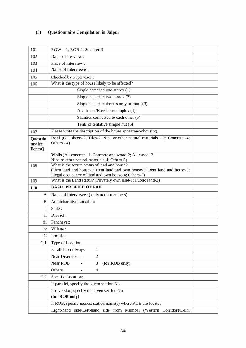
128
(5) Questionnaire Compilation in Jaipur
101 ROW – 1; ROB-2; Squatter-3 102 Date of Interview : 103 Place of Interview : 104 Name of Interviewer : 105 Checked by Supervisor : 106 What is the type of house likely to be affected? Single detached one-storey (1) Single detached two-storey (2) Single detached three-storey or more (3) Apartment/Row house duplex (4) Shanties connected to each other (5) Tents or tentative simple hut (6) 107 Please write the description of the house appearance/housing. Questtionnaire FormQ
Roof (G.I. sheets-2; Tiles-2; Nipa or other natural materials – 3; Concrete -4; Others - 4)
Walls (All concrete -1; Concrete and wood-2; All wood -3; Nipa or other natural materials-4; Others-5)
108 What is the tenure status of land and house? (Own land and house-1; Rent land and own house-2; Rent land and house-3; Illegal occupancy of land and own house-4; Others-5)
109 What is the Land status? (Privately own land-1; Public land-2) 110 BASIC PROFILE OF PAP
A Name of Interviewee ( only adult members): B Administrative Location: i State :
ii District : iii Panchayat: iv Village : C Location
C.1 Type of Location Parallel to railways - 1 Near Diversion - 2 Near ROB - 3 (for ROB only) Others - 4 C.2 Specific Location:
If parallel, specify the given section No. If diversion, specify the given section No.
(for ROB only)
If ROB, specify nearest station name(s) where ROB are located Right-hand side/Left-hand side from Mumbai (Western Corridor)/Delhi
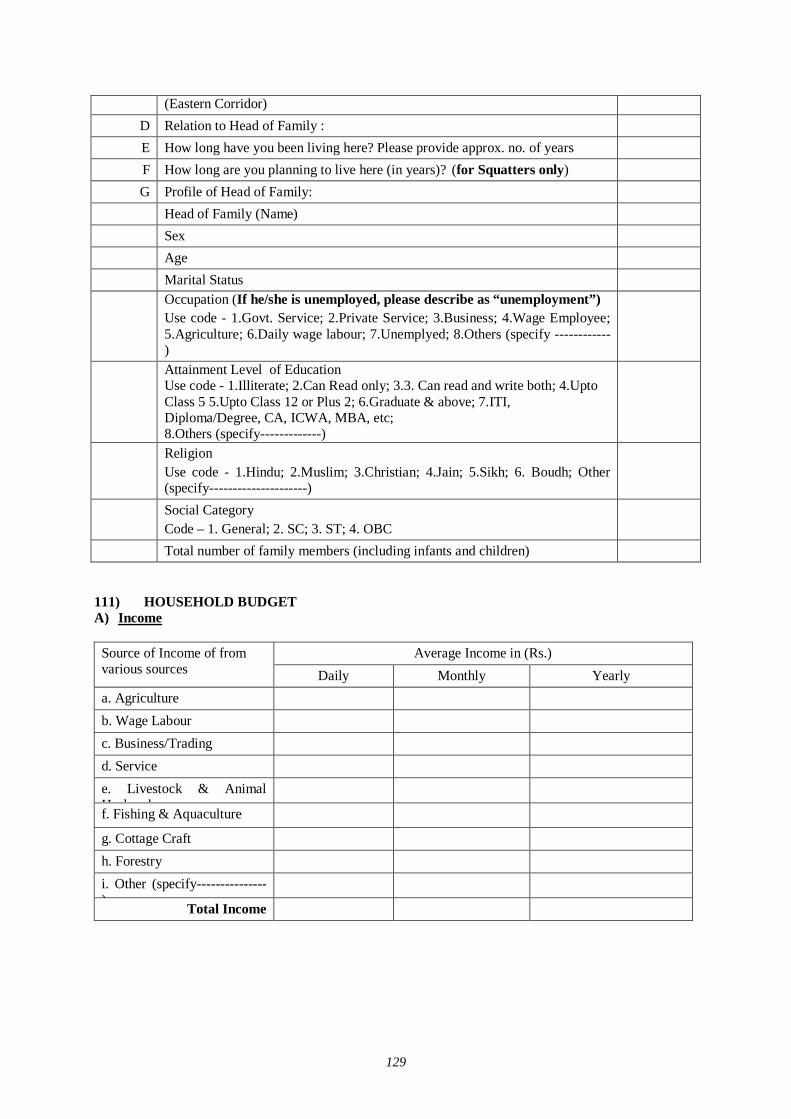
129
(Eastern Corridor) D Relation to Head of Family : E How long have you been living here? Please provide approx. no. of years F How long are you planning to live here (in years)? (for Squatters only) G Profile of Head of Family:
Head of Family (Name) Sex Age Marital Status Occupation (If he/she is unemployed, please describe as “unemployment”)
Use code - 1.Govt. Service; 2.Private Service; 3.Business; 4.Wage Employee; 5.Agriculture; 6.Daily wage labour; 7.Unemplyed; 8.Others (specify ------------)
Attainment Level of Education Use code - 1.Illiterate; 2.Can Read only; 3.3. Can read and write both; 4.Upto Class 5 5.Upto Class 12 or Plus 2; 6.Graduate & above; 7.ITI, Diploma/Degree, CA, ICWA, MBA, etc; 8.Others (specify-------------)
Religion Use code - 1.Hindu; 2.Muslim; 3.Christian; 4.Jain; 5.Sikh; 6. Boudh; Other (specify---------------------)
Social Category Code – 1. General; 2. SC; 3. ST; 4. OBC
Total number of family members (including infants and children) 111) HOUSEHOLD BUDGET A) Income
Average Income in (Rs.) Source of Income of from
various sources Daily Monthly Yearly a. Agriculture b. Wage Labour c. Business/Trading d. Service e. Livestock & Animal Husbandry
f. Fishing & Aquaculture
g. Cottage Craft h. Forestry i. Other (specify---------------)
Total Income
130
B) Assets
Livestock holding of the family (Write the unit in nos.) No. 1. Cow
2. Ox 3. Buffalo
4. Sheep 5. Goat
6. Camel 7. Donkey
8. Horse 9. Pig
10. Chicken 11. Duck
12. Others livestock (specify-------) C) Agricultural Implements
Agricultural implements owned by the family Yes No 1. Tarctor 1 2
2. Power Triller 1 2 3. Thresher 1 2
4. Harvester 1 2 5. Genset Sprayer 1 2
6. Pump Set 1 2 7. Electric Pump 1 2
8. Others Specify 1 2 D) Household Items
Household items owned by the family Yes No 1. TV 1 2
2. Fridge 1 2 3. Mixer 1 2
4. Electric Cooker 1 2 5. Geyser 1 2
6. Electric Fan 1 2 7. OTG 1 2
8. Toaster 1 2 9. Microwave 1 2
10. Radio 1 2 11. Others Specify 1 2
131
E) Other Assets of Family
Other assets owned by the family Yes No 1. Scooter/Motorcycle 1 2
2. Jeep/Car 1 2 3. Truck 1 2
4. Bus 1 2 5. Bullock/Camel Cart 1 2
6. Others Specify 1 2 F) Total Annual Saving: ------------------------------ (Rs.)
G) Loan a. Have you taken any loan? 1. Yes, 2. No, 3. Don’t Know b. If yes, then please tell us the following:
Name of the loan provider Amount (in Rs.) Re-paid (in Rs.) Balance (in Rs.) 1. Bank 2. Relative/Friend 3. Mahajan 4. Other (specify -----------)
112 PRODUCTION AND EMPLOYMENT
Land Title Response
Own with Title (1) A-1
Own without Title (2) Tenure Status: If Own with Title, please select one or more:
Borrow at No Charge (1) Rent from Authorities (2) Rent from Individuals (3)
A-2
Other Status (4) B) Area of Land: If Own with Title, please answer the questions below: (for Non-Squatters) B.1) Do you have agricultural land? a. Yes b. No B.2) If Yes, please tell us the total land owned by you (in local unit).
Area Type of Land Sqm. Bigha Biswa Hectare
1. Agricultural land
2. Orchard
3. Others (specify ------------------)
Total Land
132
In case of farmers, list names of your 3 major products (for Non-Squatters) 1. 2. 3. D-1) In case of other occupations, specify main income source? D-2) Select the observed type of squatters (for Squatters)
Category of squatter Please write response Illegal residents with station-related occupation (1) Shops of illegal occupancy (2) Seasonal labour (Agriculture) (3) Seasonal labour - Factory/Construction (4) Gangmen’s colony (5) Migrant Tribe (6)
E) What is the most serious problem on your livelihood?
113 ACCESSIBILITIES Accessibilities in Normal Conditions
Status in Normal Conditions Distance
Destination
Average Time per Trip (mins)
Frequency 1: 1 Day 2: 2-3 days 3: 1 Week 4: 2 Weeks 5: 1 Month 6: 2 Months 7. 6 Months 8: 1 Year
Frequency to cross the level crossing per day. Specify the number (e.g. 3 times/day).
Mode 1: Foot 2: Bicycle 3: Ox Cart 4: Horse Cart 5: Camel Cart 7: Motor Bike 8: Car 9. Bus 10. Others
(km)
District Center Large Market Small Market High School Secondary School
Primary School Farming Land Health Clinic Hospital Religious Center
A) How often do you cross ROBs? Specify the number (e.g. 3 times/day). (Only for ROBs)
B) How often do you cross ROBs with Non-motorized Vehicles (NMVs)? Specify the number (e.g. 3 times/day). (Only for ROBs)
133
114 UTILITIES A) Access to Potable Water
Please check the status of access to potable water. Kind of Facilities Please check.
Dig Well (Private) Dig Well (Common) Pump Well (Private) Pump Well (Common) Bought from Water Vendors Other Facilities ( ) Other Natural Water Sources ( )
B) Access to Toilet Facilities
Please check the status of access to toilet facilities. Kind of Facilities Please check.
In-door Toilet Out-door Toilet (Private) Out-door Toilet (Common) Not Available
C) Access to Electricity
Please check the status of access to electricity. Kind of Facilities Please check.
Power line Generator (Private) Generator (Common) Car Battery Not Available
115 COMMENTS ON RESETTLEMENT & REHABILITATION
Questions Response A. Are you aware that Govt. of India has initiated Dedicated Freight Corridor Project in which a separate railway line will be laid for transportation of goods between ------------- and Mumbai and Delhi and Howrah?
1. Yes 2. No (If No, go to C).
B. If Yes, what has been your source of information for DFC Project?
1. TV 2. Radio 3. News Paper 4. Word of Mouth 5. Friend/Relative 6. Others (specify -------------)
C. Do you think the project will provide economic benefit in the area?
1. Yes 2. No 3. No comment
D. In your opinion what kind of economic benefit would take place?
1. Wage employment 2. Business opportunity 3. Industry establishment
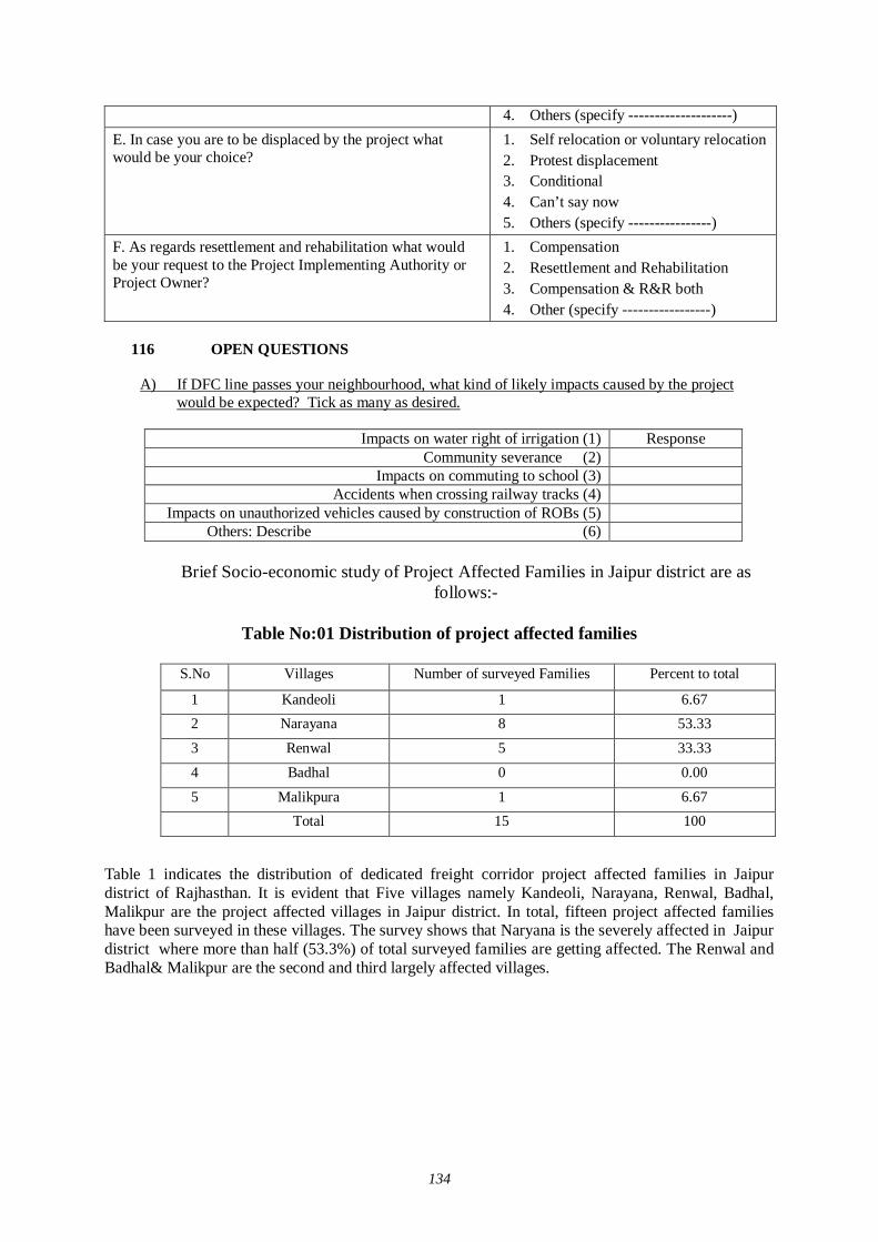
134
4. Others (specify --------------------) E. In case you are to be displaced by the project what would be your choice?
1. Self relocation or voluntary relocation 2. Protest displacement 3. Conditional 4. Can’t say now 5. Others (specify ----------------)
F. As regards resettlement and rehabilitation what would be your request to the Project Implementing Authority or Project Owner?
1. Compensation 2. Resettlement and Rehabilitation 3. Compensation & R&R both 4. Other (specify -----------------)
116 OPEN QUESTIONS
A) If DFC line passes your neighbourhood, what kind of likely impacts caused by the project
would be expected? Tick as many as desired.
Impacts on water right of irrigation (1) Response Community severance (2)
Impacts on commuting to school (3) Accidents when crossing railway tracks (4)
Impacts on unauthorized vehicles caused by construction of ROBs (5) Others: Describe (6)
Brief Socio-economic study of Project Affected Families in Jaipur district are as
follows:-
Table No:01 Distribution of project affected families
S.No Villages Number of surveyed Families Percent to total
1 Kandeoli 1 6.67 2 Narayana 8 53.33
3 Renwal 5 33.33
4 Badhal 0 0.00
5 Malikpura 1 6.67 Total 15 100
Table 1 indicates the distribution of dedicated freight corridor project affected families in Jaipur district of Rajhasthan. It is evident that Five villages namely Kandeoli, Narayana, Renwal, Badhal, Malikpur are the project affected villages in Jaipur district. In total, fifteen project affected families have been surveyed in these villages. The survey shows that Naryana is the severely affected in Jaipur district where more than half (53.3%) of total surveyed families are getting affected. The Renwal and Badhal& Malikpur are the second and third largely affected villages.
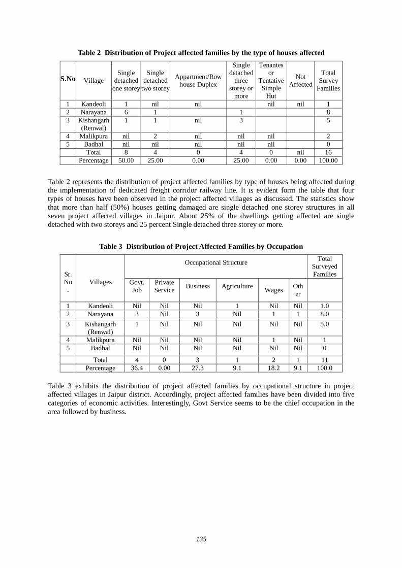
135
Table 2 Distribution of Project affected families by the type of houses affected
S.No Village Single
detached one storey
Single detached
two storey
Appartment/Row house Duplex
Single detached
three storey or
more
Tenantes or
Tentative Simple
Hut
Not Affected
Total Survey
Families
1 Kandeoli 1 nil nil nil nil 1 2 Narayana 6 1 1 8 3 Kishangarh
(Renwal) 1 1 nil 3 5
4 Malikpura nil 2 nil nil nil 2 5 Badhal nil nil nil nil nil 0 Total 8 4 0 4 0 nil 16 Percentage 50.00 25.00 0.00 25.00 0.00 0.00 100.00
Table 2 represents the distribution of project affected families by type of houses being affected during the implementation of dedicated freight corridor railway line. It is evident form the table that four types of houses have been observed in the project affected villages as discussed. The statistics show that more than half (50%) houses getting damaged are single detached one storey structures in all seven project affected villages in Jaipur. About 25% of the dwellings getting affected are single detached with two storeys and 25 percent Single detached three storey or more.
Table 3 Distribution of Project Affected Families by Occupation
Occupational Structure
Total Surveyed Families
Sr.No.
Villages Govt.
Job
Private Service
Business
Agriculture Wages Oth
er
1 Kandeoli Nil Nil Nil 1 Nil Nil 1.0 2 Narayana 3 Nil 3 Nil 1 1 8.0 3 Kishangarh
(Renwal) 1 Nil Nil Nil Nil Nil 5.0
4 Malikpura Nil Nil Nil Nil 1 Nil 1 5 Badhal Nil Nil Nil Nil Nil Nil 0
Total 4 0 3 1 2 1 11 Percentage 36.4 0.00 27.3 9.1 18.2 9.1 100.0
Table 3 exhibits the distribution of project affected families by occupational structure in project affected villages in Jaipur district. Accordingly, project affected families have been divided into five categories of economic activities. Interestingly, Govt Service seems to be the chief occupation in the area followed by business.
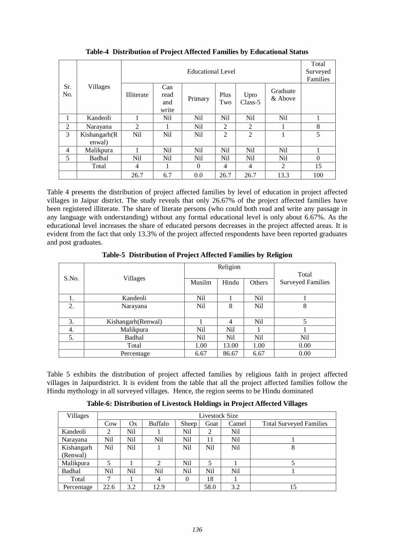
136
Table-4 Distribution of Project Affected Families by Educational Status
Educational Level Total
Surveyed Families
Sr.No.
Villages
Illiterate
Can read and
write
Primary Plus Two
Upto Class-5
Graduate & Above
1 Kandeoli 1 Nil Nil Nil Nil Nil 1 2 Narayana 2 1 Nil 2 2 1 8 3 Kishangarh(R
enwal) Nil Nil Nil 2 2 1 5
4 Malikpura 1 Nil Nil Nil Nil Nil 1 5 Badhal Nil Nil Nil Nil Nil Nil 0 Total 4 1 0 4 4 2 15 26.7 6.7 0.0 26.7 26.7 13.3 100
Table 4 presents the distribution of project affected families by level of education in project affected villages in Jaipur district. The study reveals that only 26.67% of the project affected families have been registered illiterate. The share of literate persons (who could both read and write any passage in any language with understanding) without any formal educational level is only about 6.67%. As the educational level increases the share of educated persons decreases in the project affected areas. It is evident from the fact that only 13.3% of the project affected respondents have been reported graduates and post graduates.
Table-5 Distribution of Project Affected Families by Religion Religion
S.No. Villages Musilm
Hindu
Others
Total Surveyed Families
1. Kandeoli Nil 1 Nil 1 2. Narayana
Nil 8 Nil 8
3. Kishangarh(Renwal) 1 4 Nil 5 4. Malikpura Nil Nil 1 1 5. Badhal Nil Nil Nil Nil Total 1.00 13.00 1.00 0.00 Percentage 6.67 86.67 6.67 0.00
Table 5 exhibits the distribution of project affected families by religious faith in project affected villages in Jaipurdistrict. It is evident from the table that all the project affected families follow the Hindu mythology in all surveyed villages. Hence, the region seems to be Hindu dominated
Table-6: Distribution of Livestock Holdings in Project Affected Villages Livestock Size Villages
Cow Ox Buffalo Sheep Goat Camel Total Surveyed Families Kandeoli 2 Nil 1 Nil 2 Nil Narayana Nil Nil Nil Nil 11 Nil 1 Kishangarh(Renwal)
Nil Nil 1 Nil Nil Nil 8
Malikpura 5 1 2 Nil 5 1 5 Badhal Nil Nil Nil Nil Nil Nil 1
Total 7 1 4 0 18 1 Percentage 22.6 3.2 12.9 58.0 3.2 15
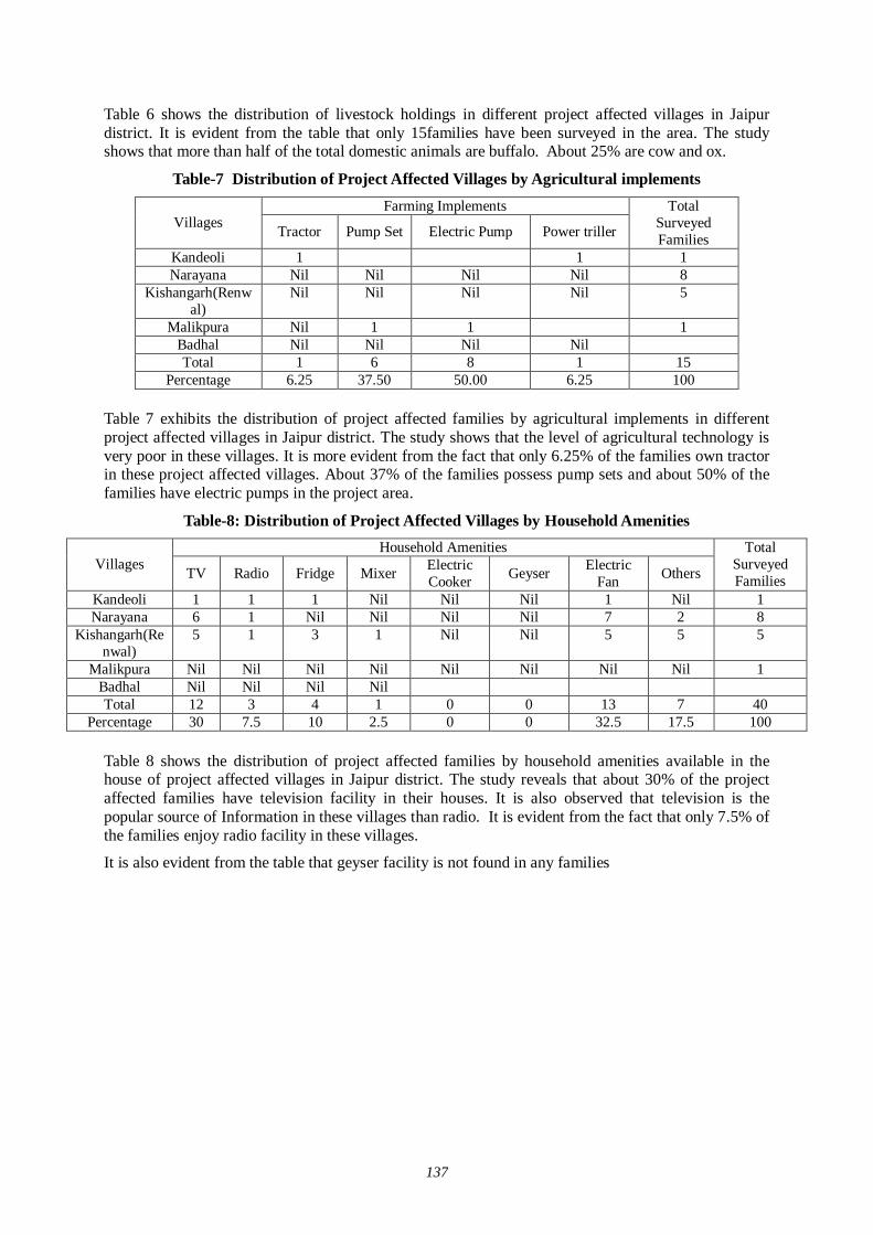
137
Table 6 shows the distribution of livestock holdings in different project affected villages in Jaipur district. It is evident from the table that only 15families have been surveyed in the area. The study shows that more than half of the total domestic animals are buffalo. About 25% are cow and ox.
Table-7 Distribution of Project Affected Villages by Agricultural implements Farming Implements
Villages Tractor Pump Set Electric Pump Power triller
Total Surveyed Families
Kandeoli 1 1 1 Narayana Nil Nil Nil Nil 8
Kishangarh(Renwal)
Nil Nil Nil Nil 5
Malikpura Nil 1 1 1 Badhal Nil Nil Nil Nil Total 1 6 8 1 15
Percentage 6.25 37.50 50.00 6.25 100
Table 7 exhibits the distribution of project affected families by agricultural implements in different project affected villages in Jaipur district. The study shows that the level of agricultural technology is very poor in these villages. It is more evident from the fact that only 6.25% of the families own tractor in these project affected villages. About 37% of the families possess pump sets and about 50% of the families have electric pumps in the project area.
Table-8: Distribution of Project Affected Villages by Household Amenities Household Amenities
Villages TV Radio Fridge Mixer Electric Cooker Geyser Electric
Fan Others
Total Surveyed Families
Kandeoli 1 1 1 Nil Nil Nil 1 Nil 1 Narayana 6 1 Nil Nil Nil Nil 7 2 8
Kishangarh(Renwal)
5 1 3 1 Nil Nil 5 5 5
Malikpura Nil Nil Nil Nil Nil Nil Nil Nil 1 Badhal Nil Nil Nil Nil Total 12 3 4 1 0 0 13 7 40
Percentage 30 7.5 10 2.5 0 0 32.5 17.5 100
Table 8 shows the distribution of project affected families by household amenities available in the house of project affected villages in Jaipur district. The study reveals that about 30% of the project affected families have television facility in their houses. It is also observed that television is the popular source of Information in these villages than radio. It is evident from the fact that only 7.5% of the families enjoy radio facility in these villages.
It is also evident from the table that geyser facility is not found in any families
138
Table 9 Distribution of Project Affected Families by Other Assets Other Assets
S.No. Villages Scooter/ Motor Cycle Jeep/Car Truck Cycle
Total Surveyed Families
1. Kandeoli 1 Nil Nil Nil 1 2. Narayana 3 Nil Nil 5 8 3. Kishangarh(Ren
wal) 2 1 5
4. Malikpura 1 Nil Nil Nil 1 5. Badhal 0 2 Total 7 8 15 Percentage 46.67 0 0 53.333 100
Table 9 shows the distribution of project-affected families by other assets available in the house of project-affected families in Jaipur district. The study reveals that only 46.67 of the families have scooter or motorcycle. Insignificant proportions of the families have been observed owning jeep/car and truck in the project-affected villages.
Table 10 Distribution of Project Affected Families by Access to Drinking Water Sources of Potable Water
Villages Dig Well
(Private)
Dig Well (Common)
Pump Well
(Common)
Private pump well
Tap water
Others
Total Surveyed Families
Kandeoli Nil 1 Nil Nil Nil Nil 1 Narayana Nil 2 2 Nil 2 Nil 8
Kishangarh(Renwal)
Nil Nil 1 4 Nil 5
Malikpura 1 Nil 1 Nil Nil Nil 1 Badhal Nil Nil Nil Nil Nil Nil Nil Total 1 2 4 4 4 Nil 15
Percentage 6.67 13.33 26.67 26.67 26.67 0 100.00
Table 10 represents the distribution of project affected families by access to potable water across different project affected villages. About six sources of water have been witnessed in the project affected villages. The study indicates that about source are used in project area
Table 11 Distribution of Project Affected Families by Access to Electricity
S.No. Villages Electricity not available Electricity available Total Surveyed Families
1. Kandeoli yes 1 2. Narayana yes 8 3. Kishangarh
(Renwal) yes 5
4. Malikpura yes 1 5. Badhal yes 0 Total 15
Table 11 presents the distribution of project affected families by access to electricity facility across different project affected villages
Comments on Resettlement and Rehabilitation:
During the socio-economic survey of project affected families some questions were asked in all project affected villages. The first question was “Are you aware that Government of India has initiated
139
Dedicated Freight Corridor Project in which a separate railway line will be laid for transportation of goods between Delhi and Mumbai and Delhi and Howrah”?
Regarding this question about 96% respondents stated they were aware about the proposed dedicated freight corridor railway line It shows that majority of people of the area were quite aware about the introduction of dedicated freight corridor project in the state.
Table 12 Distribution of Project Affected Families by Awareness Regarding DFC S. No. Villages
Aware Total Surveyed Families
1. Kandeoli yes 1 2. Narayana yes 8 3. Kishangarh(Renwal) yes 5 4. Malikpura yes 1 5. Badhal nil 0 Total 15
Table 13 Distribution of PAFs by Type of Economic Benefits Expected
Type of Benefits S.No. Villages Wage
Employment
Business Opportunity
Industry Establishment
Comments Declined
Total Surveyed Families
1. Kandeoli Nil Nil Nil 1 1 2. Narayana 2 2 Nil 4 8 3. Kishangarh(Renwal) 2 3 Nil Nil 5 4. Malikpura Nil Nil Nil 1 1 5. Badhal Nil Nil Nil Nil 0 Total 4 5 0 6 15 Percentage 26.67 33.33 0.00 40.00 100.00
While examining the economic benefits likely to be accrued from dedicated freight corridor project multiple responses have also been kept in individual key field. Hence, the proportion of each field is not 100.00%. It is evident from the above table that little less than 27 of the respondents stated that dedicated freight corridor project will provide wage employment to the local inhabitants.. About 33% of the respondents opined that if the project is implemented, there would be ample trade and business opportunities.
About 40% of the respondents have been observed comments declined.
Table 14 -Distribution of PAFs by Preferences Regarding Resettlement and Rehabilitation Preferences
S. No. Villages Compensation
Resettlement / Rehabilitation
(R&R)
Both Compensation
and R&R
Total Surveyed Families
1. Kandeoli 1 Nil Nil 1 2. Narayana 6 Nil 2 8 3. Kishangarh(Renwal) 3 Nil 2 5
4. Malikpura 1 Nil Nil 1 5. Badhal Nil Nil Nil 0
Total 11 0 4 15 Percentage 73.33 0.00 26.67 100.00
Table 14 presents the distribution of project affected families by preferences regarding resettlement and rehabilitation likely to result from proposed dedicated freight corridor across different project affected villages. The study brings out that about 73% of total surveyed families stated they should be

140
properly compensated The proportion of families demanding both compensation and resettlement and rehabilitation is 26.67% at the district level. There are remarkable variations in this regard across the project affected villages.
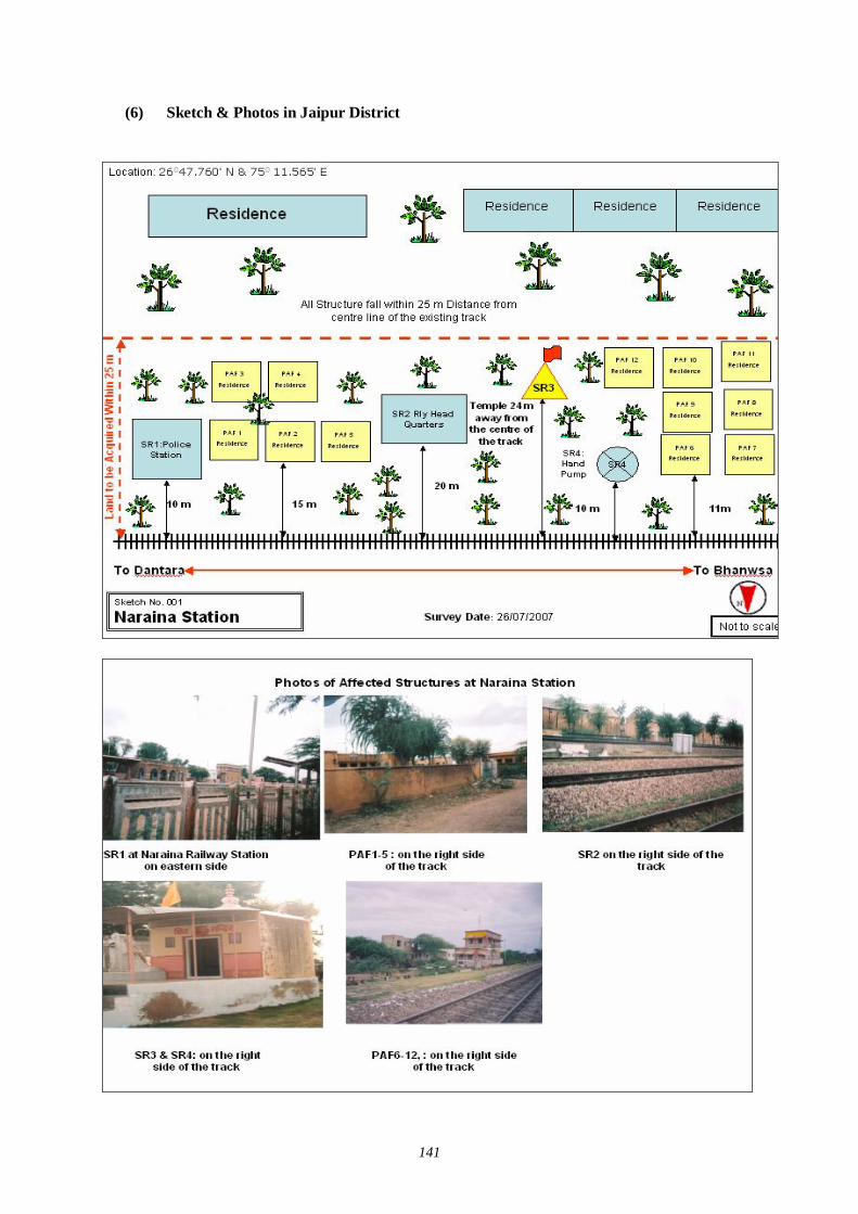
141
(6) Sketch & Photos in Jaipur District
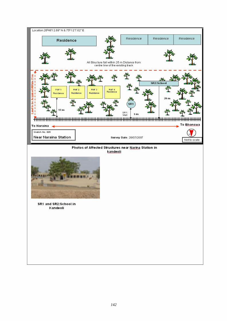
142
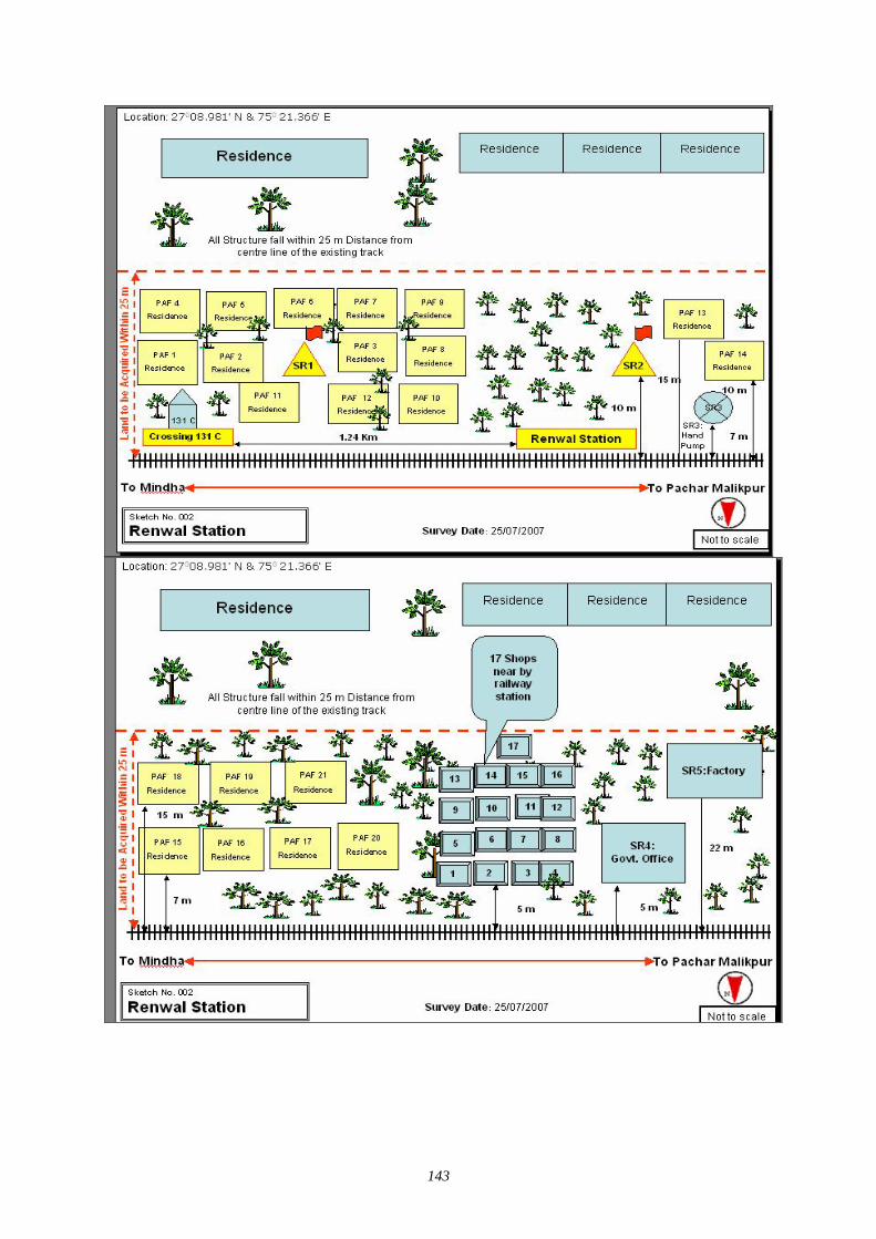
143
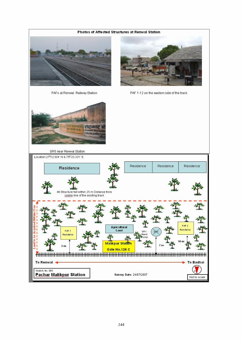
144
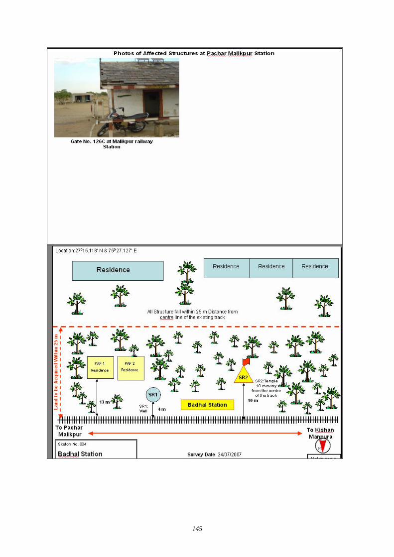
145

146
147
3. Ngaur District
(1) 2nd Stage of District Level Stakeholder / Public Consultation Meeting in Nagaur District
1.0 Brief Description of State Rajasthan Rajasthan is located in the north-western part of the subcontinent. It is bounded on the west and northwest by Pakistan, on the north and northeast by the states of Punjab, Haryana, and Uttar Pradesh, on the east and southeast by the states of Uttar Pradesh and Madhya Pradesh, and on the southwest by the state of Gujarat. The Tropic of Cancer passes through its southern tip in the Banswara district. The state has an area of 132,140 square miles (342,239 km2). The capital city is Jaipur.
In the west, Rajasthan is relatively dry and infertile; this area includes some of the Thar Desert, also known as the Great Indian Desert. In the south-western part of the state, the land is wetter, hilly, and more fertile. The climate varies throughout Rajasthan. On average winter temperatures range from 8° to 28° C (46° to 82° F) and summer temperatures range from 25° to 46° C (77° to 115° F). Average rainfall also varies; the western deserts accumulate about 100 mm (about 4 in) annually, while the south-eastern part of the state receives 650 mm (26 in) annually, most of which falls from July through September during the monsoon season. Rajasthan has a single-chamber legislative assembly with 200 seats. The state sends 35 members to the Indian national parliament: 10 to the Rajya Sabha (Upper House) and 25 to the Lok Sabha (Lower House). Local government is based on 30 administrative districts.
1.1 Brief Description of District Nagaur
Glorified by the bards, the history of Nagaur finds mention even in the Mahabharata. The kingdom of Ahichhatrapur, which Arjun is said to have conquered and subsequently offered to his Guru Dronacharya, was perhaps some of the area of the Nagaur district. The birthplace of Meera and Abul Fazal, Nagaur district has a charbhuja and Parsawanath Temple at Merta and the Dargah of Sufi Saint Tarkin at Nagaur city. Nagaur also witnessed the valour of Great Rao Amar Singh Rathor who challenged the mighty Mughal Empire. The large old Fort has many glorious tales of bravery of the erstwhile rulers of the states.
Nagaur District is situated between 260.25” & 270.40” North Latitude & 730.10” & 750.15” East Longitude. It is situated amidst seven districts namely Bikaner, Churu, Sikar, Jaipur, Ajmer, Pali, Jodhpur. Nagaur is the fifth largest district in Rajasthan with a vast terrain spreading over 17,718 sq. K.M. Its geographical spread is a good combine of plain, hills, sand mounds & as such it is a part of the great Indian Thar Desert.
The present district of Nagaur finds a place in the heart of the Rajasthan state. If we draw a cross over the map of Rajasthan the centre of this cross is bound to fall in the district of Nagaur. Before the merger of the states, Nagaur was a part of the erstwhile Jodhpur State.
After independence, Nagaur had the honour of being selected as the place in the country from where the Democratic Decentralisation process was launched by the late Shri Jawaharlal Nehru, the first Prime Minister of India on the 2nd October 1959.
The town of Ladnu in the district has gained its place on the map of the country being the headquarters of the famous 'Jain Vishwa Bharti' which has become a centre of spiritual learning & knowledge under the leadership of Acharya Tulsi, a great Jain saint, who has propagated the philosophy of "ANUVRAT" in order to enlighten people in this area of the country. Nagaur is in Center of Rajasthan. In north there is Sikar District. , In west Bikaner & Churu District., In South Jodhpur & Pali, In East Jaipur & Ajmer District. Its area is 17718 Sq. km. Marwari is the local language spoken there & Hindi is official language.
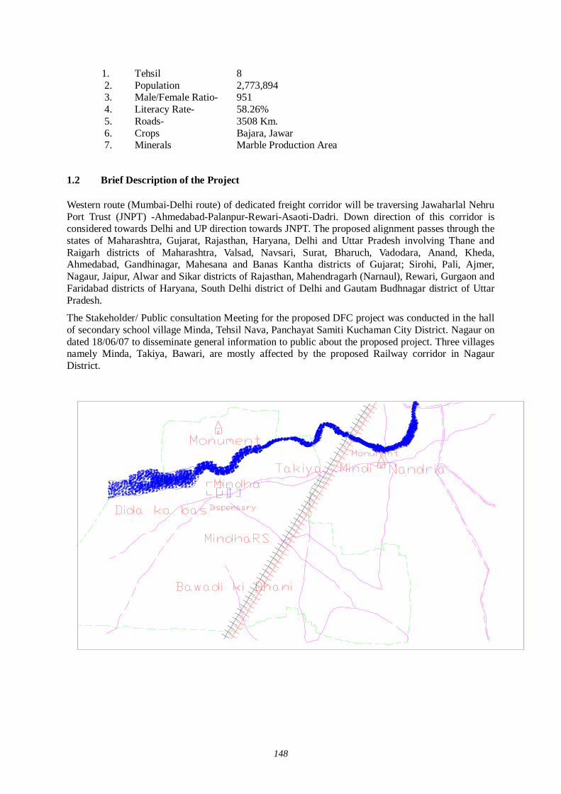
148
1. Tehsil 8 2. Population 2,773,894 3. Male/Female Ratio- 951 4. Literacy Rate- 58.26% 5. Roads- 3508 Km. 6. Crops Bajara, Jawar 7. Minerals Marble Production Area
1.2 Brief Description of the Project
Western route (Mumbai-Delhi route) of dedicated freight corridor will be traversing Jawaharlal Nehru Port Trust (JNPT) -Ahmedabad-Palanpur-Rewari-Asaoti-Dadri. Down direction of this corridor is considered towards Delhi and UP direction towards JNPT. The proposed alignment passes through the states of Maharashtra, Gujarat, Rajasthan, Haryana, Delhi and Uttar Pradesh involving Thane and Raigarh districts of Maharashtra, Valsad, Navsari, Surat, Bharuch, Vadodara, Anand, Kheda, Ahmedabad, Gandhinagar, Mahesana and Banas Kantha districts of Gujarat; Sirohi, Pali, Ajmer, Nagaur, Jaipur, Alwar and Sikar districts of Rajasthan, Mahendragarh (Narnaul), Rewari, Gurgaon and Faridabad districts of Haryana, South Delhi district of Delhi and Gautam Budhnagar district of Uttar Pradesh.
The Stakeholder/ Public consultation Meeting for the proposed DFC project was conducted in the hall of secondary school village Minda, Tehsil Nava, Panchayat Samiti Kuchaman City District. Nagaur on dated 18/06/07 to disseminate general information to public about the proposed project. Three villages namely Minda, Takiya, Bawari, are mostly affected by the proposed Railway corridor in Nagaur District.

149
2.0 Project Summary Sheet
Title of the Project Conducting 2nd Stage of Stakeholder/Public Consultation Meeting (District Level) for Feasibility Study Regarding the Dedicated Multimodal High Axle Freight Corridor for Ministry of Railways.
Date and Place of Meeting 18-06-07 Secondary School Minda distt. Nagaur tehsil Nava P.S. Kuchaman City.Name of the Local Consultant: -Mantec Consultant Pvt. Ltd. New Delhi.SWEET INSTITUTE BANSWARA167 Matra Sadan Commercial Area Banswara Ph. No. 9414219698
Organizing Place Village Minda Teh. Nava Distt. Nagaur
No. Invitees 120No. Of Presence 84
Personal Contact: -Dispatching Invitation Letter:-Information in Newspaper:-Invitation to Distt. Office by LettersInformation at Panchayat office and Teh. Office Others - Press media Writing PadBall PenQuestionnaireSlide Presentation LectureGroup DiscussionQuestion/Answer SessionStill Photography Audio/Video RecordingMinutes of MeetingNewspaper: - Danik BhaskerRajasthan Patrika & Other Local Papers
Stationary Served to the Participants
Methods Adopted for Discussion
Methods Adopted for Documentation
Media Coverage
PROJECT SUMMARY SHEET
Local Consultant
Local Organizer
Methods Used for Information Dissemination
2.1 Selection of Stakeholder Around 120 people were invited for the stakeholder meeting.
2.2 Method of Selection of Stakeholder The latest version of JICA Guidelines for Environment and Social Consideration has been developed in 2004 in order that JICA funded feasibility study incorporates due consideration of the environmental protection and safeguards the sectors of society directly or indirectly affected by the project. Current feasibility study is carried out applying these guidelines.
In order to encourage participation of the local residents, Stakeholder/ Public consultation meeting is considered as a tool that should play an important role during the project design stage. It is designed to:
150
Disclose information on project for open discussion Disseminate information to the lowest possible hierarchy of the social system Obtain interaction of the participants of stakeholder/public consultation meeting Reflect the valid comments elicited from the open discussion to the design of the project Build a consensus on the project implementation and associated
There are three stages of stakeholder and public consultation meeting. The first stage of stakeholder/public consultation is held on state level, followed by second stage of Stakeholder/ Public consultation held in the districts, and the third stage of stakeholder/ public consultation meeting held on the villages directly affected by the project
The Mantec Consultants Pvt. Ltd has already organized first stage of stakeholder / public consultation meeting in state of Rajasthan.
To organized the second stage of Stakeholder/ Public consultation meeting Mantec consultants have authorized "Sweet Institution" to meet the concerned government authority and collect relevant data for carrying forward study of social environment and organize second stage of stakeholder/Public Consultation Meeting for information dissemination about the project As per direction of the guidelines for conducting the 2nd stage of the Stakeholder/ Public Consultation meetings a formal order of the Ministry of Railways was have been issued vide their letter dated 01-06-2007 to facilitate these meetings. Further, continuous efforts were made to keep the Ministry of Railways involved in the project as the major stakeholder through their local set-up. Rehabilitation Commissioners were also appointed from the state government departments. Similarly Department of Environment and Forestry and State Pollution Control Boards were contacted to participate in the Meetings. State Government Department were also apprised and approached and were invited to participate in the Stakeholders/Public Consultation Meetings including the State Public Works Department, Irrigation and Power, Urban Development and Poverty Alleviation Department, industries, telecommunication and Information technology Trade and Commerce, Surface Transport, Tourism, Container/Corporation of India, Port Trusts etc.
Our meeting Facilitator Team visited all the affected villages and requested Primary and Secondary Stakeholders to attend the meeting. In Nagaur district only three villages-Minda, Takiya and Bewari will be directly affected by the proposed DFC project Our meeting facilitator team preferred to invite the people who will be affected directly by this project. Our team also met & informed the distt. Administration and requested to help in organising the public meeting successfully. Local stakeholders along the railway line, affected farmers, businessmen, private service and Govt. service employers were invited in the meeting. Our study team also contacted Tehsildar of affected Tehsil, Panchayat Samiti Pramukh, Gram Pradhan, local MLA and requested them to attend the meeting and also gave necessary support in conducting second stage of stakeholder and public consultation meeting
2.3 Selection of Meeting Facilitators
Simultaneously, extensive surveys were conducted for the identification of suitable local agencies for the
Successful organization of the second stage of Stakeholders/Public Consultation Meeting in Nagaur district of Rajasthan.
Preference was given to appoint Non Government Organisations (NGO’s) who had local presence, popularity and experience of social and public works and is well acquainted with multifarious cross section of society to help in the selection of the right type of the stakeholders for the meetings as well as for facilitating other related activities i.e.
Venue for the meetings; Arrangements to be made;
151
Assisting in local publicity; Invitations to the Stakeholders and motivating them for participation; Maintaining and compilation of record and feed back; and Other local arrangements like transport, hospitality, security and smooth conduct of
the meeting proceedings. The Non Governmental Organizations were appointed for facilitating the Stakeholders/Public Consultation meetings for conducting the meetings:
2.4 Method of Information Dissemination
1. Method of Notifying the Meeting to the Participants
(1) Local newspapers about the venue and date of meeting (2) Information of DFC Project to the local stakeholders by face to face for meeting (3) Invitation letter to the affected stakeholders during the survey of Railway track (4) Information to Sarpanch /Public representatives by official letters. (5) Pasted handout containing the information of the project on the public place of the
affected area.
2.5 Venue of the Meeting The Hall of Secondary School Minda was decided the venue for Stakeholder/Public Consultation meeting in Nagaur district.
3.0 Participant of Stake holder/Public Consultation Meeting Around 84 people participated in the stakeholder meeting.
3.1 Minutes of Meeting Firstly introduction Session was held
Then inauguration was done by local MLA Meeting facilitator gave the information and details of working of Sweet Sansthan
Banswara and the purpose of the meeting Representative from Mantec Consultants gave the detail description of the DFC Project
Mantec representative explained that because of the ever growing economy of India, improvement of physical ability for moving goods by means of railways within the country is considered urgently needed; he also explained that the railway line starting from Mumbai running all the way up to Delhi is dedicated only for Freight Corridor and nothing to do with the passengers. Growth of major and minor ports of India, the traffic between Northern Hinterland and Western port and huge traffic of coal, steel, and fertilizer is anticipated on Ludhiana-Delhi-Howrah route.
He also said that there are lots of containers coming into this country from outside and landing at Mumbai and moving by train to Ahmedabad, Jaipur, Delhi upto Ludhiana. On average approximately 9000-loaded trucks move daily over the corridor, i.e. Delhi-Mumbai Western Corridor and Ludhiana-Howrah eastern corridor. He added that Freight Corridor is basically constructed alongside existing double track from Mumbai-Delhi, from Palanpur upto Ahmedabad routes. From the city Vadodara adjoining the existing areas drawing up from Rajasthan, because of the congested areas, change all the way upto Mahesana the Freight Corridor has to be constructed avoiding the congestion on existing railway lines.
152
Mantec representative cleared the misunderstanding of stakeholders regarding the acquisition of land along the track. He told that the corridor would be laid down in the eastern part of rail line in Nagaur district for which only 20 to 26 m (26 m at Detour) lands would be acquired from the centre of the existing track. He further added that it would save time in the process of transportation of goods, which will be benefited to the people.
With help of projector Mantec representative show the alignment of proposed DFC project of Naguar district. He said that only three revenue villages would be affected by this proposed DFC project in the Nagaur district and also added that it is only feasibility study.
He also told that in Nagaur district there is no junction station or crossing station as well as no detour and ROB/RUB are proposed but he also cleared that it is not final decision. After completion of the study the final picture will come out.
In the last the chief guest (MLA) expressed his view and gave thanks to the JICA study team, Mantec consultants and Sweet institute for providing knowledge about the project. He also gave thanks to the participants for attending the meeting.
3.2 Summary Profile of Participants
The Stakeholder/ Public consultation Meeting for the proposed DFC project was conducted in the hall of secondary school village Minda, Tehsil Nava, Panchayat Samiti Kuchaman City District. Nagaur on dated 18/06/07 to disseminate general information to public about the proposed project. Three villages namely Minda, Takiya, Bawari, are mostly affected by the proposed Railway corridor in Nagaur District.
The major observations of stakeholders/public consultation meeting held at Minda Village distt. Nagaur on date 18.06.07 recorded through questionnaire is as follows:
Table 1.1 Distributions of Respondents by Village
Sl. No. N ame of V illage/City T otal R espondent % of T otal
1 M inda 37 44 .052 Tak iya 29 34 .523 Thikariya 2 2 .384 B awari 15 17 .865 N agaur 1 1 .19
T otal 84 100 .00 Table 1.1 reveals that there were 84 respondents present, natives of 5 villages/towns participated in the public consultation meeting on dedicated frieght corridor, which held on dt. 18.06.07. The Minda Village has shown the highest participation (44.05%) while the lowest participation (1.19%) was observed from Nagaur distt. and from Thikariya village respondent percentage was 2.38. The participation of respondent of other villages hovered between these two extreme values. Two villages Takiya and Bawari were represented well (34.52%) and 17.86% respectively.
Table 1.2 Distributions of Respondents by Level of Social Structure
Sl. No. Categories T otal R espondent % of T otal1 Scheduled C aste 3 3 .572 Scheduled T ribes 1 4 1 6.6 73 Other B ack ward C lass 5 9 7 0.2 44 General 8 9 .52
T otal 8 4 1 00.00
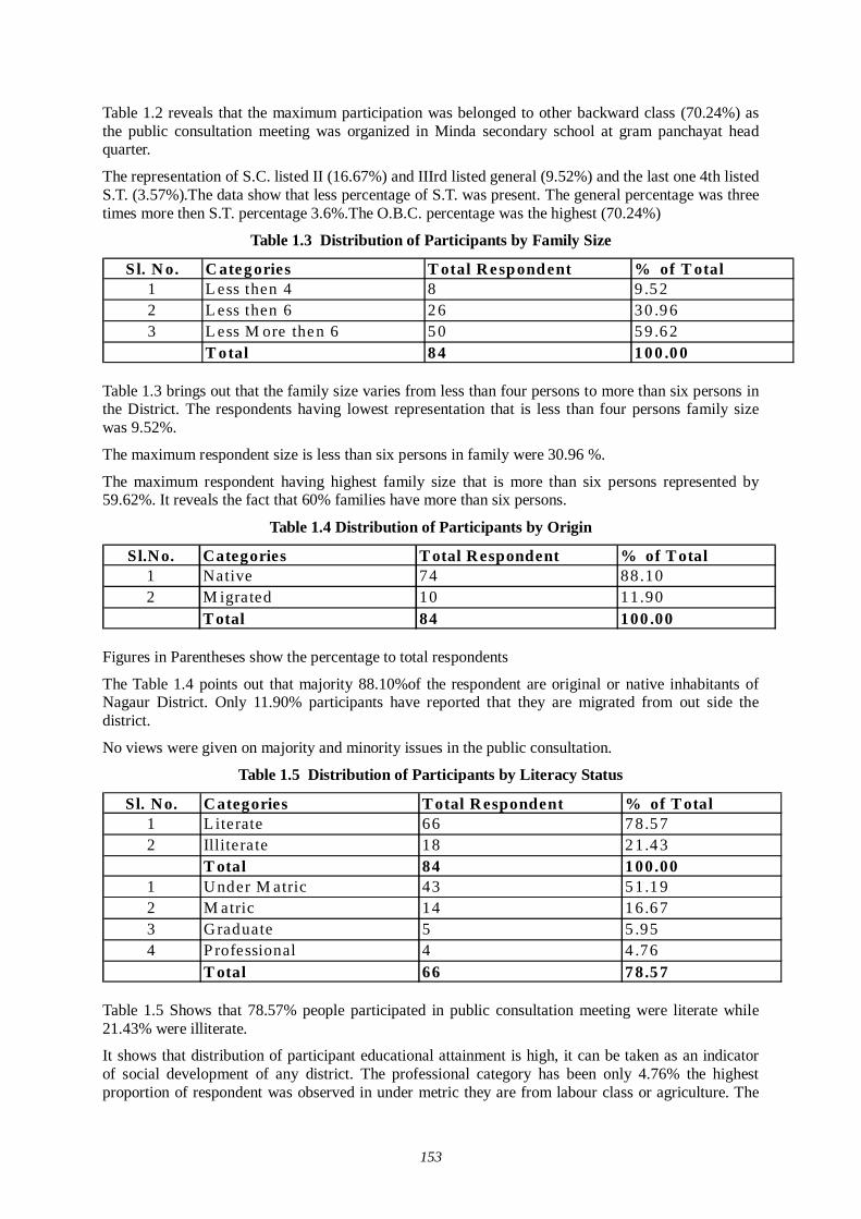
153
Table 1.2 reveals that the maximum participation was belonged to other backward class (70.24%) as the public consultation meeting was organized in Minda secondary school at gram panchayat head quarter.
The representation of S.C. listed II (16.67%) and IIIrd listed general (9.52%) and the last one 4th listed S.T. (3.57%).The data show that less percentage of S.T. was present. The general percentage was three times more then S.T. percentage 3.6%.The O.B.C. percentage was the highest (70.24%)
Table 1.3 Distribution of Participants by Family Size
Sl. N o. C ateg ories T otal Respondent % of T otal1 L ess then 4 8 9 .5 22 L ess then 6 2 6 3 0 .9 63 L ess M ore then 6 5 0 5 9 .6 2
T otal 8 4 1 0 0 .0 0
Table 1.3 brings out that the family size varies from less than four persons to more than six persons in the District. The respondents having lowest representation that is less than four persons family size was 9.52%.
The maximum respondent size is less than six persons in family were 30.96 %.
The maximum respondent having highest family size that is more than six persons represented by 59.62%. It reveals the fact that 60% families have more than six persons.
Table 1.4 Distribution of Participants by Origin
Sl.No. Categories T otal Respondent % of T otal1 Native 74 88.102 M igrated 10 11.90
T otal 84 100 .00
Figures in Parentheses show the percentage to total respondents
The Table 1.4 points out that majority 88.10%of the respondent are original or native inhabitants of Nagaur District. Only 11.90% participants have reported that they are migrated from out side the district.
No views were given on majority and minority issues in the public consultation.
Table 1.5 Distribution of Participants by Literacy Status
Sl. No. Categories T otal Respondent % of T otal1 Literate 66 7 8.5 72 Illiterate 18 2 1.4 3
T otal 84 1 00.001 Under M atric 43 5 1.1 92 M atric 14 1 6.6 73 Graduate 5 5 .954 P rofessional 4 4 .76
T otal 66 7 8.5 7
Table 1.5 Shows that 78.57% people participated in public consultation meeting were literate while 21.43% were illiterate.
It shows that distribution of participant educational attainment is high, it can be taken as an indicator of social development of any district. The professional category has been only 4.76% the highest proportion of respondent was observed in under metric they are from labour class or agriculture. The
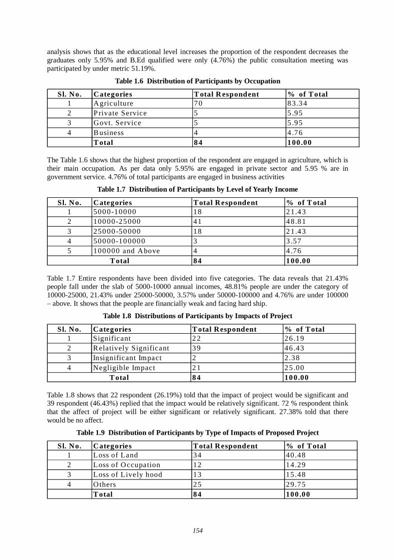
154
analysis shows that as the educational level increases the proportion of the respondent decreases the graduates only 5.95% and B.Ed qualified were only (4.76%) the public consultation meeting was participated by under metric 51.19%.
Table 1.6 Distribution of Participants by Occupation
Sl. No. Categories T otal R espondent % of T otal1 Agriculture 7 0 8 3.3 42 P rivate Service 5 5 .953 Govt. Service 5 5 .954 B usiness 4 4 .76
T otal 8 4 1 00.00
The Table 1.6 shows that the highest proportion of the respondent are engaged in agriculture, which is their main occupation. As per data only 5.95% are engaged in private sector and 5.95 % are in government service. 4.76% of total participants are engaged in business activities
Table 1.7 Distribution of Participants by Level of Yearly Income
Sl. No. Categories T otal Respondent % of T otal1 5000-10000 18 21.432 10000-25000 41 48.813 25000-50000 18 21.434 50000-100000 3 3 .575 100000 and Above 4 4 .76
84 100.00T otal
Table 1.7 Entire respondents have been divided into five categories. The data reveals that 21.43% people fall under the slab of 5000-10000 annual incomes, 48.81% people are under the category of 10000-25000, 21.43% under 25000-50000, 3.57% under 50000-100000 and 4.76% are under 100000 – above. It shows that the people are financially weak and facing hard ship.
Table 1.8 Distributions of Participants by Impacts of Project
Sl. No. Categories T otal Respondent % of Total1 Significant 2 2 26 .192 R elatively Significant 3 9 46 .433 Insignificant Impact 2 2.384 Negligible Impact 2 1 25 .00
8 4 10 0.00T otal
Table 1.8 shows that 22 respondent (26.19%) told that the impact of project would be significant and 39 respondent (46.43%) replied that the impact would be relatively significant. 72 % respondent think that the affect of project will be either significant or relatively significant. 27.38% told that there would be no affect.
Table 1.9 Distribution of Participants by Type of Impacts of Proposed Project
Sl. No. Categories T otal Respondent % of T otal1 Loss of Land 34 40.482 Loss of Occupation 12 14.293 Loss of Lively hood 13 15.484 Others 25 29.75
T otal 84 100 .00
155
Table 1.9 shows that 34 respondents (40.48%) will loss their agriculture land, which is the source of their income, as agriculture is their prime occupation, while 12 respondent (14.29%) reported that they are going to loss their occupation. 13 respondents (15.48%) replied that they will loss livelihood while others 29.75% told that they will face other difficulties.
Table 1.10 Distributions of Participants by Type of Compensation by Govt.
Sl. No. C ateg ories T otal R espondent % of T otal1 Land 2 3 2 7 .3 82 C ash 3 9 4 6 .4 33 H ouse ---------- -----------4 O thers 2 2 2 6 .1 9
T otal 8 4 1 0 0 .0 0
The Table 1.10 shows that if Govt. acquires the land what type of compensation they wanted. 23 respondents (27.38%) wanted that they should be given land for land while 39 respondents (46.43%) replied that they want cash compensation for land. No body has given choice for the house, 22 respondents (26.19%) wanted other facilities for the land.
3.3 Suggestions to the Project Owner in Terms of Engineering Social and Environmental Concern
1. Railway over bridge should be made on Bawari and Minda Station 2. Compensation should be given fairly 3. Goods godown should be made on Minda Station 4. DFC Project should start as early as possible, corridor construction is good for Nagaur distt.
5. The route should not be discontinued during the work. 6. Better infrastructure for Minda station. 7. Allotment of land for land. 8. People want good services from railways 9. Compensation should be 5 lakh per bigha. 10. The local people should be employed. 11 A Station should be constructed in Minda of DFC so that salt industries, onion farmers and Mica industries will be benefited. This proposal eas given by local MLA
3.4 Question /Answer during the Meeting Question 1 Participant from Minda “please tell me, what are the benefits of the project? ’’
Answer 1 Mantec representatives replied “The project would lead to the overall development of the village. People will get the employment, goods will be provided in cheaper rates. The freight Corridor is proposed to be comprising of exclusively reserved railway tracks laid out for the Freight Trains only where the Freight Trains would be moving at a very high speed of over 100 km. an hour. At present it takes almost two days for a container train to make the journey from Mumbai to New Delhi-one of the most saturated corridors in the country. It will take just 24 hours after the completion of the project to do this journey. Further, the Freight Trains will also be carrying much more freight than the present container trains. Besides, this project is also expected to create 680000 new jobs directly and indirectly.
Question 2 Participant from Takia “Sir, I want to know about the remuneration to be paid to land losers, will it be according to market or govt. rates?”
Answer 2 Mantec representatives replied "All affected person of DFC Project would be compensated according to NPRR-2006. Committee consisting of local, M.P., MLA, D.M. and other representatives will decide the structure for land remuneration and according to that payment will be made. All efforts will be made to limit the project within the Railway land. Along most of the length of the corridor, the alignment is parallel to the existing railway track, but diversions are unavoidable in a number of
156
stretches, for reason such as (i) avoiding heavily built up area (ii) other technical or land acquisition constraints. In addition a number of small diversions would be required at station and near major bridges to facilitate construction of new bridges for DFC line in such cases the Govt. will acquire land. Compensation will be given as per the rules and regulations of Govt. of India. There is no diversion proposed in Nagaur district".
Question 3 Participant from Minda “Sir what is the time period for finishing the project work"?
Answer 3 Mantec representatives replied “this corridor project has started working in 2005 and survey work has been in progress. The govt. of India would take up the work in 2009 and will be completed in 2014. Freight Corridor from Son Nagar to Ludhiana, via Khurja with a connection from Khurja to proposed Western Corridor at Dadri Terminal Yard; Son Nagar – Howrah of Eastern Corridor and from Mumbai to Ahmedabad-Jaipur-Ajmer-Delhi of Western Corridor, the Government of India would complete this project within 5 years i.e. the Government would take up the work in 2009 and will be completed in the year 2014.
Question 4 Participant (Sarpanch) “What is the compensation system”?
Answer 4 Mantec representatives replied “All the Stakeholders affected by the DFC Project would be compensated according to NPRR-2006. To ensure adequate rehabilitation package and expeditious implementation of the rehabilitation process with the active participants of displaced persons. Special care is taken for protecting the rights of, and ensuring affirmative State action for weaker segments of society, especially members of SCs and STs and to create obligations on the State for their treatment with concern and sensitivity.
Question 5 Participant from Takiya “Why this track /corridor is being made”?
Answer 5 Mantec representatives replied "As I earlier said this need has been felt due to the growing economy of India requiring improvement in physical movements of goods by means of railways within the country. At present, the high-density Eastern and Western corridors are already saturated in terms of line capacity utilization. Therefore, on an average, approx. 9000 loaded trucks move daily over the corridor, i.e Delhi-Mumbai Western corridor and Ludhiana- Howrah Eastern Corridor and most important matter is that, over the years, the railway’s share in the field of freight movement has been falling drastically to about 20% at present annually”
Question 6 Participant (Sarpanch) “If there is no station in Nagaur district than how people of Nagaur will be benefited from this project. Therefore I requested you that a Station should be constructed in Minda so that salt industries, onion farmers and mica industries will be benefited. Mr. Harish Kunawat local MLA also has same view”?
Answer 6 Mantec representatives replied “Only two Railway stations are proposed in Rajasthan, one is in Phulera and other in Marwar Junction as I mentioned it earlier. However I will mention this point in the report.
Question 7 Participant “Railway over bridge should be made on Bawari and Minda station, so that people of that area could safely cross the railway track?
Answer 7 Mantec representatives replied “At present, there is no provision of ROB or RUB in Bawari and Minda. I will mention this point in the report.
Question 8 Participant “Godown should be made on Minda Station”?
Answer.8 Mantec representatives replied “I will mention also this point in the report.
JICA is studying about the track demands on the railway cargos between Mumbai-Delhi, and, between Son Nagar-Ludhiana, every 5 years starting from 2008 to 2032. In the next 25 years they are trying to work out the railway tracks in demand for sending cargos. The existing railway tracks are having no more capacity to carry cargos. That is why freight corridor system is necessary to construct. The decision in principal has already been taken by the Govt. of India to undertake this project after having high-level discussions with the Govt. of Japan. The Govt. of India has conducted studies at its own level also. It has been accepted that this project will be playing important and essential role in maintaining and adding further to the present economic growth of the country. Considering the
157
importance of this project the government is keen to implement this project at the earliest. The groundwork has, therefore, started and the present meetings are being conducted to create and spread general awareness. These will help in undertaking further studies concerning actual implementation of the project. All efforts are being done to complete these basic studies at the earliest and a time frame has been projected to complete these studies in as short a time as possible.
3.5 Summary of Major Findings There was gathering of about 200 hundred people. We invited 120 stake holders but hearing the news in the news papers some uninvited persons attended the meeting, 84 stake holders fill in the from.
84 respondents of 5 village participated in the public consultation meeting aimed DFC project. The Minda village has shown the highest participation (44.05%), while the lowest participation was observed from Nagaur (1.19%),
It is noted that there are 70.24% belongs to OBC while 3.57% from S.T. Caste. It shows that majority consists of O.B.C. and S.C. Caste (16.67%) The people are villagers and doing agriculture and labour work.
The people having more than 6 children percentage is 59.62 it is difficult to run their family and belongs to poor caste. So they want employment for their lively hood.
The analysis reveals that majority 88.10% of the respondent in the meeting are original inhabitants. The literacy percentage is 78.57% but under metric percentage is 51.19% it reveals the fact that people are less in govt. service.
The study shows that higher educational level witnesses the decreasing proportion of the respondent because they are less worried about the DFC project.
It is also investigated that the occupational pattern is quite diversified. 83.34% respondents are engaged in agriculture while 4.76% is engaged in business; agriculture is main occupation of the villagers. The level of income reveals the fact those 21.43 + 48.81% despondent ranges in the group of 5000 to 25000 Rs. while only 4% respondents have more then 1 lakh income. Which shows that the people of the village lack basic amenities of life?
The table 8 shows that only 26.19% people have significant effect and 27.38 said insignificant. 40.48% would get loss of land and 14.29% said there would be loss of occupation.
In Nagaur District. Only three major villages (Bawri, Minda and Takiya) are mainly affected. Majority people are interested for DFC project because they would get employment and are in favor of DFC Corridor. However they said that if a depot and station will not construct in Minda or any other place in Nagaur than how can the people of Nagaur will be benefited. Therefore a depot and station must be constructed in Nagaur. Everyone wants that ROB or RUB will be constructed on every railway-road crossing to avoid any type of accidents and delay in transportation. They also said that if government acquired only 20-meter land from middle of the existing railway line in eastern side than in Nagaur no one will be directly affected.
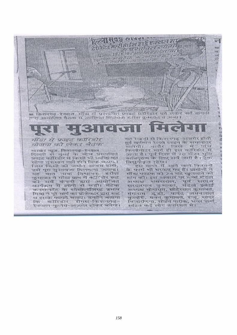
158
159
(2) 3rd stage of Village Level Stakeholder / Public Consultation Meeting in Nagaur District
1.0 Brief Description of State and District (Nagaur) The Rajasthan State International forties of 140 kms with Pakistan. Arawali Hill range runs diagonally from south, west through its middle. Nearly 61 % area of state lies west of the Arawali, which is characterized by extremes in temperature and scanty rain fall varying annually from 20 to 40 cm. average.
Areas East of Aravali has comparatively fertile soil and good annual rainfall varying 40 to 80 cms. The Geographical diversities of the state have made it vulnerable to drought and Scarcity condition.
Nagaur is in Center of Rajasthan. In North there is Sikar District. , In west Bikaner and Churu District. In South Jodhpur and Pali, In East Jaipur and Ajmer District. Its area is 17,718 km2. Marwari is the local language spoken there and Hindi is official language.
1 Tehsil 8 2. Population 2,773,894 3. Male/Female Ratio- 951 4. Literacy Rate- 58.26% 5. Roads- 3,508 km. 6. Crops Bajara, Jwar 7. Minerals Marbel Production Area
The Stakeholders Public Consultation final and last meeting for the proposed DFC project was conducted in the hall of secondary school village Minda, Tehsil Nava, Panchayat Samiti Kuchaman City District. Nagaur on dated 08/08/07 to disseminate general information to public about the proposed project and to get final suggestions. Two villages namely Minda and Bawari, are affected by the proposed Railway corridor in Nagaur District.
There is no affected area in Minda within Seven Kms. People were not interested to attend the meeting because they are not affected. Mr. Prabhash Mishra and Shigeru Sai of Japan dev. Service Co. Ltd. Japan. has also visited the site. They also told that no body is affected. They told that we are taking only 24 m from Meter Gauge. If Broad Gauge work is also started to work. It is considered that 24 m would taken from the center of Broad Gauge even than only 2 to 5 Meter agriculture land would be affected. This was told by Sociologist of Mantec. He also told that we have also seen your area. No house is affected so the participants did not attend & only 40 respondents attended the meeting.
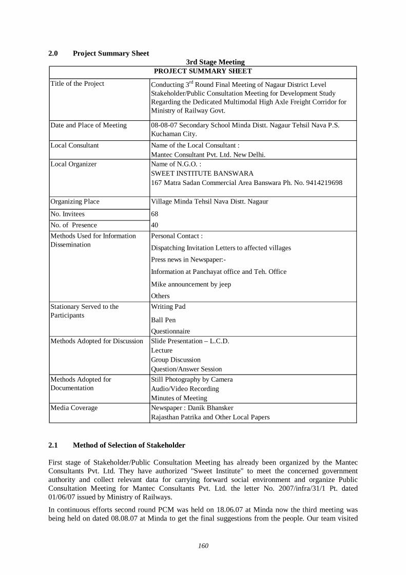
160
2.0 Project Summary Sheet 3rd Stage Meeting
Title of the Project Conducting 3rd Round Final Meeting of Nagaur District Level Stakeholder/Public Consultation Meeting for Development Study Regarding the Dedicated Multimodal High Axle Freight Corridor for Ministry of Railway Govt.
Date and Place of Meeting 08-08-07 Secondary School Minda Distt. Nagaur Tehsil Nava P.S. Kuchaman City.Name of the Local Consultant :Mantec Consultant Pvt. Ltd. New Delhi.Name of N.G.O. :SWEET INSTITUTE BANSWARA167 Matra Sadan Commercial Area Banswara Ph. No. 9414219698
Organizing Place Village Minda Tehsil Nava Distt. Nagaur
No. Invitees 68No. of Presence 40
Personal Contact :
Dispatching Invitation Letters to affected villages
Press news in Newspaper:-
Information at Panchayat office and Teh. Office
Mike announcement by jeep
OthersWriting Pad
Ball PenQuestionnaireSlide Presentation – L.C.D. LectureGroup DiscussionQuestion/Answer SessionStill Photography by Camera Audio/Video RecordingMinutes of MeetingNewspaper : Danik BhanskerRajasthan Patrika and Other Local Papers
Stationary Served to the Participants
Methods Adopted for Discussion
Methods Adopted for Documentation
Media Coverage
PROJECT SUMMARY SHEET
Local Organizer
Methods Used for Information Dissemination
Local Consultant
2.1 Method of Selection of Stakeholder First stage of Stakeholder/Public Consultation Meeting has already been organized by the Mantec Consultants Pvt. Ltd. They have authorized "Sweet Institute" to meet the concerned government authority and collect relevant data for carrying forward social environment and organize Public Consultation Meeting for Mantec Consultants Pvt. Ltd. the letter No. 2007/infra/31/1 Pt. dated 01/06/07 issued by Ministry of Railways.
In continuous efforts second round PCM was held on 18.06.07 at Minda now the third meeting was being held on dated 08.08.07 at Minda to get the final suggestions from the people. Our team visited

161
the affected Tehsil, Panchayat Samiti for organizing the third stage of Stakeholder and Public Consultation Meeting.
Our team also met and requested Panchayat Samiti to help in organizing the public meeting successfully. They assured us. All the Stakeholders along the railway line affected farmers, businessmen, private employee and employers were invited to attend the meeting. Public participation was undertaken to make explicit the social and other factors that affect development impact of dedicated freight corridor and mediate project. We sent our volunteers along the railway line & affected public and house holds to attend the meeting through invitation letters.
Before starting the III PCM meeting survey forms were filled in by Mahesh Sharma during field visit and track survey in month of july07. A track to track survey was done. It was noted that at every railway gate how many persons are affected. Their details were taken. Personal contact was also done. We also informed the affected families to attend the meeting on dated 08.08.07 at 01.00 PM. A survey along the Railway line was done by our team leader on motor bike and jeep and took some photographs and contacted the affected people.
Results
Through public participation, stake holders meeting, key social issues were identified and replied by Mantec consultant Mr. Prabhash Mishra. There was confusion about the affected area. Mr. Mishra told that 24 m areas along the Railway line are affected. The main issue was addressed how poor and vulnerable groups may benefit from the project. Our facilitator team visited the affected villages of Nagaur and requested Primary and Secondary stake holder's to attend the meeting. We have to invite the Limited No. of stake holders. So we invited the most affected stake holders but reading the news papers, uninvited and interested persons attended the public consultation meeting. It was good that the people are interested to know more about the DFC project it was good sign.
2.2 Selection of Meeting Facilitators 1. Venue of the Meeting
Looking to the stakeholders facility and Local Advice, the venue was decided the Hall of Secondary School Minda (Village) where stake holder can sit comfortably.
2. All the arrangement were made comfortable for sitting, drinking water, Tea and Snack, Photographer, Video grapher etc by our santhan. For local publicity invitation letters through our facilitator were sent in three villages. In Dainik Bhasker and other local news paper & wide massage was given through mike announcement.
3. Invitation to public representatives and affected stake holders were sent by hand to ensure the stake holders participation in the meeting during the field visit & survey work.
4. Four facilitator were appointed for the participation meeting as follows:
Team leader Programme organizer Record keeper to write the proceeding of the meeting One Translator to assist the Programme Looking to the local situation and weather all necessary arrangements were made by
our team 2.3 Selection of Stakeholders (Invitees) Around 48 persons were invited for the stakeholder meeting.
2.4 Method of Information Dissemination
162
1. Local news papers about the venue and date of meeting.
2. Information of DFC Project to the local stake holders by face to face during village level meeting.
3. Invitation letter to the affected stake holders during the survey of Railway track.
4. Information to Sarpanch /Public representatives by official letters.
3.0 Participant of Stakeholder/Public Consultation Meeting Around 40 participants attend the Stakeholder/Public Consultation Meeting.
3.1 Detail of the Stakeholder/Public Consultation Dated 08.08.07 District. Nagaur Village
Minda Stake holders/Public consultation Meeting is a bottom up approach in this gigantic Freight Corridor project. It is one of the tools to reflect the views of general public as well as those connected with the project- Central and local Govt. organization to farmers and commercial and industrial sectors of the society. It is an important tool of information dissemination and to get the final suggestions from the villages.
3.2 Time - 3.00PM to 5.00PM
1) Firstly introduction Session was held. Representative of Sweet Sansthan welcomed all the guests of Mantec and JICA Study Team and Participant. 2) Then inauguration was done by (X-Sarpanch Minda). 3) Programme officer Sweet Sansthan Banswara gave the information and details of working of
Railway Survey. 4) Programme officer Sweet requested to Sociologist of Mantec to give detail information of the
DFC project. They told that because of the ever growing economy of India, improvement of physical ability for moving goods by means of railways within the country is considered urgently needed; he also explained that the railway line starting from Mumbai running all the way up to Delhi is dedicated only for Freight Corridor and nothing to do with the passengers. Growth of major and minor ports of India, the traffic between Northern Hinterland and Western port and huge traffic of coal, steel, and fertilizer is anticipated on Ludhiana-Delhi-Howrah route. He said that there are lots of containers coming into this country from outside and landing at Mumbai and moving by train to Ahmedabad, Jaipur, Delhi upto Ludhiana. On an average approximately 9000 loaded trucks move daily over the corridor, i.e. Delhi-Mumbai Western Corridor and Ludhiana-Hawrah Eastern corridor. He added that Freght Corridor is basically constructed alongside existing double track from Mumbai-Delhi, from palanpur up to Ahmedabad routes. From the city Vadodara adjoing the existing areas drawing up from Rajasthan, because of the congested areas, change all the way up to Mehsana the Freight Corridor has to be constructed avoiding the congestion on existing railway lines
. He also told the Project Detail of Naguar District.
1. Dedicated Freight Western Corridor enters in Nagaur in Minda Village from Phulera to Ringus.
2. In Nagaur District. DFC goes along the existing railway line in eastern side. 3. Length of DFC corridor in Nagaur dist. Is approximately 7 kms. 4. DFC alignment will cross the Minda Railway station in Nagaur District.
163
5. Maximum 24 meters of land will be taken from the central line of the extreme track (existing/under conversion as BG on eastern side). The existing ROW of railway will be used, if available and Land Acquisition will be done for the balance land.
6. 45 Meters of land strip will be acquired for the detour route as per the drawings shown. 7. Compensation will be made as NRR Policy, 2003. However the draft policy NRR policy,
2006 will also be considered for compensation, if applicable at the time of acquisition. He also said about the benefits of the project :
1. Economic Riffle Effect : 840 x 100Cr. 2. Total Investment : 240 x 100 Cr. 3. Jobs Created : 68000 4. Household Income : 215.2 x 100 Cr. 5. Tax Revenue : 17.64 x 100 Cr.
Along with Rail line, stations, bridges, signals and control system, electricity supply system rehabilitation of cargo handling yards also have to be developed. Programme Officer (Sweet sansthan) thanked to representative of Mantec for giving the detail information of the project & people work very happy.
3.3 Question /Answer
After Listening the lecture of Sociologist (Mantec), Programme Officer (Sweet Sansthan) invited the participant to ask question one by one.
Name Villager, Minda
Q.1 Sir, you have earlier told that only 26 m would be taken. And you're now telling to acquire 24 m lands. Why it is so?
Ans. As we are studying the possibilities of acquiring the land from the center of the last track. It is technically done. We are not taking the land from the boundary line so in this you will get benefits of land.
Name Villager, Minda
Q.2 Whether ROB or RUB will be built, what is your opinion?
Ans It is technical question. What our is needed it will be decided by the expert. Right decision will be taken as per need of the situation and as per the demand of the villagers. Every condition will be in favour of you.
Name Villager, Thikariya.
Q.3 Will there be railway station at Minda?
Ans. There is provision to construct railway station after 40 km. if it is needed. As per your suggestions we have noted it and forward to the higher authorities in the report. Your suggestion is good.
Name Villager, Thikariya.
Q.4 Will there be ROB at Thikariya khurd?
Ans. Representative of Mantec said that he has cleared all the points. If there is needed and demand of the people, looking to their difficulty it can be considered by the expert we have noted down your point.
Name Villager, Takia.
Q.5 At what rate the compensation of the land /house and shops would be given?
Ans. Representative of Mantec told that compensation will be made as NRR Policy, 2003 however the draft police NRR policy, 2006 will also be considered for compensation, if applicable at the time of
164
acquisition. If you get the compensation amount late, you will be paid @ of 12% interest of the amount. If land is available near by, you will get the land. But if land is not available you will get compensation.
Name Villagers, Thikariya
Q.6 Will there be National highway along the corridor?
Ans. Representative of Mantec said that there is no provision of National Highway.
Name Panchayat Samiti Members Kuchaman City
Q.7 If there is no earning member in the family, will he get service in the railway?
Ans. Representative of Mantec told that your Question is very good. We have note down in the report and suggest the Govt. You can get the jobs according to your experience, ability and qualification. As I have already told that 680000 jobs will be created from the corridor I hope you will be employed.
Name Person from Gram Panchayat, Kiya
Q.8 If Govt. Change will this project continue to work or not?
Ans. Representative of Mantec said that your question is good. If the project is passed in the parliament by the Govt. This project will continue to work as per agreement of the Govt. India and Japan. I don’t think it will affect the project work and you will be benefited.
Name Villager, Bawari.
Q.9 Earlier you have said 20 to 26 m lands will be acquired. Now you are telling 24 m and some where you told 45 m land would be acquired. Why it is so?
Ans. Representative of Mantec told that it is good question on your part but don’t confuse your self and the people. In this meeting we are clearly telling that only 24 m of land will be taken from the central line of the extreme track. 45 m land strip will be acquired for the detour as per the drawing shown. This is the last meeting of the survey. So we have invited you to attend the meeting and to give your valuable suggestions. Thank you.
Name Villager, (Bawari).
Q.10 Will this corridor we made in the Eastern part only, Are there any chances to go in the west? Is 24 meter is sufficient or afterward you may demand some more land
Ans. Representative of Mantec told that the corridor will be made only in Eastern part of the railway track. If B.G. is laid down, from the last track of center point only 24 Mt. land will be acquired.
Name Villager, (Minda).
Q.11 Is there any provision of gate in present corridor?
Ans. Representative of Mantec told that on the DFC 140 trains will go in a day 70 up and 70 down. The speed up the train would be 100 km. per hour. The route would so busy that no body can pass on the track there is provision of ROB / RUB for the facility of the people they will be constructed as and where needed. There is no provision of gate in the present's corridor.
Name Villager, (Minda)
Q.12 When this Project will start to work & when the compensation would be given?
Ans. Representative of Mantec told that the survey work is going to complete and the project will start to work in 2009 and would complete its work in 2014. The compensation would be given in time, the process is going on you need not to worry. You will get good compensation and good amount. Representative of Mantec also told the Sarpanch that why you not asking more question? The people said that we are not affected so why to ask unnecessary question.
Name Villager, (Minda)
165
Q.13 There is Renwal Railway station in the East will it be removed?
Ans. Representative of Mantec aid that any structure whether it is Govt. or Pvt. If it comes within 24 Mt. Area and in the Eastern part, it will be removed & new construction will be made.
Name Villager, Takia
Q.14 If there is well in the west and land is on the east side, what will be done?
Ans. Representative of Mantec told that the facility of both the sites will be kept in mind. If there is needed RUB to passed canal or water flow. There is provision for RBU nothing will damage. You may use your facility in the west as well as in the East.
Name Villager, (Takia)
Q.15 Will there be any more meeting for it?
Ans. Representative of Mantec told that No. This is the last & final meeting. You have been invited for good suggestions. We are here to note down your points and to give report to higher authorities. It will help us also and to you. Since there was no other point to discuss and stake holders were happy to listen the Mantec presentation. They agreed that the DFC project would be beneficial for villages of Nagaur. So the meeting ended with a vote of thanks to the chair.
3.4 Profile of Participants The major observations of Stakeholders/Public consultation meeting held in the Hall of Secondary School Minda Village District. Nagaur on dt. 08.08.07 recorded through questionnaire are as follows:
Table 1.1 Distribution of Respondents by Village
Sl. No. Name of Village/City Total Respondent % of Total
1 Minda 12 30.00
2 Takiya 12 30.00
3 Thikariya 06 15.00
4 Bawari 10 25.00
5 Nagaur - -
Total 40 100.00
Table 1.1 reveals the fact that there were 40 respondents present of 4 villages/towns. Present. The public consultation meeting was held on dt. 08.08.07 on dedicated freight corridor project to get the final suggestions from the affected villages. The Minda and Takia Village has shown the highest participation (30.00 and 30.00%) while the lowest participation was from Thikariya (15.0%) was observed. 10 respondent attended from bawari and the percentage was 25%. The participation of respondents of 4 villages hovered between 15% and 30%. Only Minda and Bawari are affected so the percentage of the respondent was less.
Table 1.2 Distribution of Respondents by Level of Social Structure
Sl. No. Categories Total Respondent % of Total1 Scheduled Caste 01 2.502 Scheduled Tribes 05 12.503 Other Backward Class 31 77.504 General 03 7.50
Total 40 100.00
Table 1.2 reveals the fact that the maximum participation was belonged to other backward class (77.50%). The public consultation meeting was organized in Minda secondary school at Gram
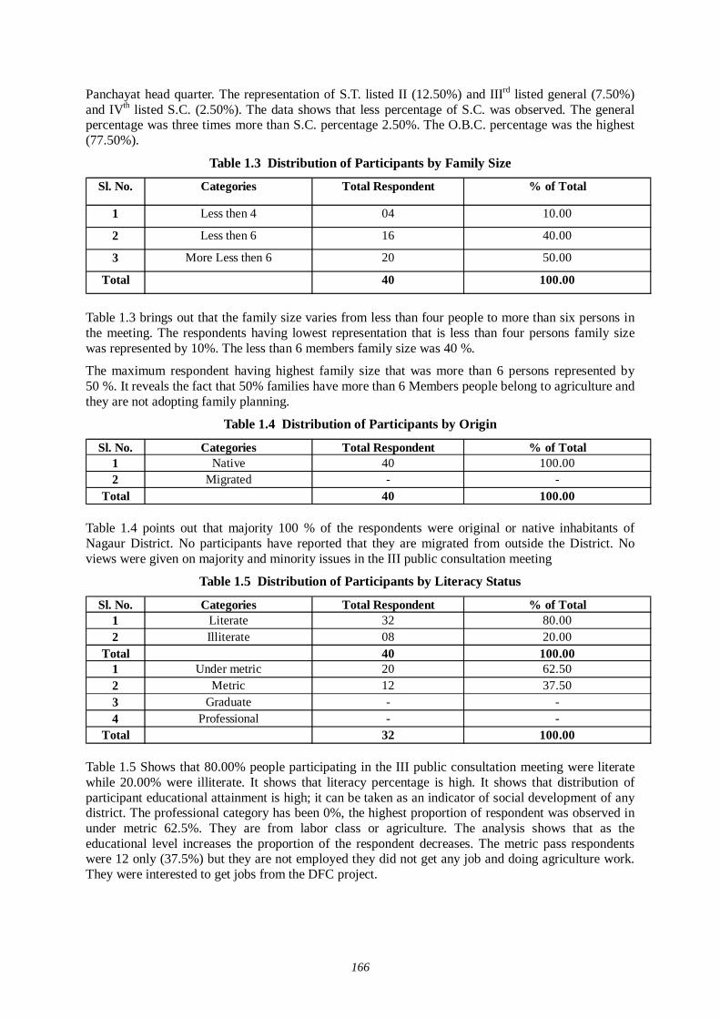
166
Panchayat head quarter. The representation of S.T. listed II (12.50%) and IIIrd listed general (7.50%) and IVth listed S.C. (2.50%). The data shows that less percentage of S.C. was observed. The general percentage was three times more than S.C. percentage 2.50%. The O.B.C. percentage was the highest (77.50%).
Table 1.3 Distribution of Participants by Family Size
Sl. No. Categories Total Respondent % of Total
1 Less then 4 04 10.00
2 Less then 6 16 40.00
3 More Less then 6 20 50.00
Total 40 100.00
Table 1.3 brings out that the family size varies from less than four people to more than six persons in the meeting. The respondents having lowest representation that is less than four persons family size was represented by 10%. The less than 6 members family size was 40 %.
The maximum respondent having highest family size that was more than 6 persons represented by 50 %. It reveals the fact that 50% families have more than 6 Members people belong to agriculture and they are not adopting family planning.
Table 1.4 Distribution of Participants by Origin
Sl. No. Categories Total Respondent % of Total1 Native 40 100.002 Migrated - -
Total 40 100.00
Table 1.4 points out that majority 100 % of the respondents were original or native inhabitants of Nagaur District. No participants have reported that they are migrated from outside the District. No views were given on majority and minority issues in the III public consultation meeting
Table 1.5 Distribution of Participants by Literacy Status
Sl. No. Categories Total Respondent % of Total1 Literate 32 80.002 Illiterate 08 20.00
Total 40 100.001 Under metric 20 62.502 Metric 12 37.503 Graduate - -4 Professional - -
Total 32 100.00
Table 1.5 Shows that 80.00% people participating in the III public consultation meeting were literate while 20.00% were illiterate. It shows that literacy percentage is high. It shows that distribution of participant educational attainment is high; it can be taken as an indicator of social development of any district. The professional category has been 0%, the highest proportion of respondent was observed in under metric 62.5%. They are from labor class or agriculture. The analysis shows that as the educational level increases the proportion of the respondent decreases. The metric pass respondents were 12 only (37.5%) but they are not employed they did not get any job and doing agriculture work. They were interested to get jobs from the DFC project.
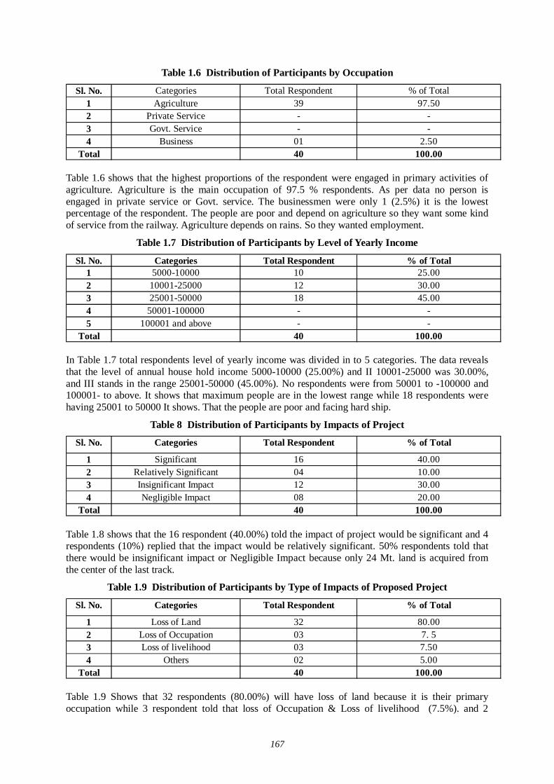
167
Table 1.6 Distribution of Participants by Occupation
Sl. No. Categories Total Respondent % of Total1 Agriculture 39 97.502 Private Service - -3 Govt. Service - -4 Business 01 2.50
Total 40 100.00
Table 1.6 shows that the highest proportions of the respondent were engaged in primary activities of agriculture. Agriculture is the main occupation of 97.5 % respondents. As per data no person is engaged in private service or Govt. service. The businessmen were only 1 (2.5%) it is the lowest percentage of the respondent. The people are poor and depend on agriculture so they want some kind of service from the railway. Agriculture depends on rains. So they wanted employment.
Table 1.7 Distribution of Participants by Level of Yearly Income
Sl. No. Categories Total Respondent % of Total1 5000-10000 10 25.002 10001-25000 12 30.003 25001-50000 18 45.004 50001-100000 - -5 100001 and above - -
Total 40 100.00
In Table 1.7 total respondents level of yearly income was divided in to 5 categories. The data reveals that the level of annual house hold income 5000-10000 (25.00%) and II 10001-25000 was 30.00%, and III stands in the range 25001-50000 (45.00%). No respondents were from 50001 to -100000 and 100001- to above. It shows that maximum people are in the lowest range while 18 respondents were having 25001 to 50000 It shows. That the people are poor and facing hard ship.
Table 8 Distribution of Participants by Impacts of Project
Sl. No. Categories Total Respondent % of Total
1 Significant 16 40.002 Relatively Significant 04 10.003 Insignificant Impact 12 30.004 Negligible Impact 08 20.00
Total 40 100.00
Table 1.8 shows that the 16 respondent (40.00%) told the impact of project would be significant and 4 respondents (10%) replied that the impact would be relatively significant. 50% respondents told that there would be insignificant impact or Negligible Impact because only 24 Mt. land is acquired from the center of the last track.
Table 1.9 Distribution of Participants by Type of Impacts of Proposed Project
Sl. No. Categories Total Respondent % of Total
1 Loss of Land 32 80.002 Loss of Occupation 03 7. 53 Loss of livelihood 03 7.504 Others 02 5.00
Total 40 100.00
Table 1.9 Shows that 32 respondents (80.00%) will have loss of land because it is their primary occupation while 3 respondent told that loss of Occupation & Loss of livelihood (7.5%). and 2
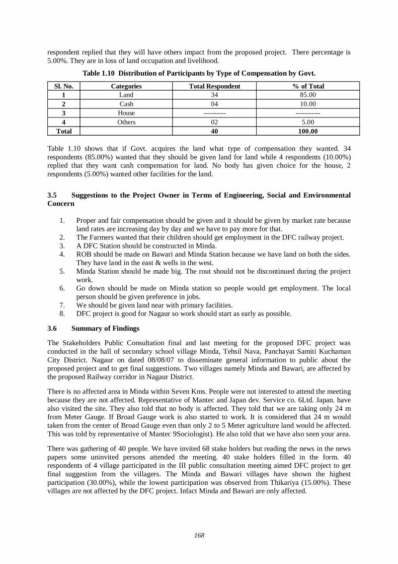
168
respondent replied that they will have others impact from the proposed project. There percentage is 5.00%. They are in loss of land occupation and livelihood.
Table 1.10 Distribution of Participants by Type of Compensation by Govt.
Sl. No. Categories Total Respondent % of Total1 Land 34 85.002 Cash 04 10.003 House ---------- -----------4 Others 02 5.00
Total 40 100.00
Table 1.10 shows that if Govt. acquires the land what type of compensation they wanted. 34 respondents (85.00%) wanted that they should be given land for land while 4 respondents (10.00%) replied that they want cash compensation for land. No body has given choice for the house, 2 respondents (5.00%) wanted other facilities for the land.
3.5 Suggestions to the Project Owner in Terms of Engineering, Social and Environmental Concern
1. Proper and fair compensation should be given and it should be given by market rate because land rates are increasing day by day and we have to pay more for that.
2. The Farmers wanted that their children should get employment in the DFC railway project. 3. A DFC Station should be constructed in Minda. 4. ROB should be made on Bawari and Minda Station because we have land on both the sides.
They have land in the east & wells in the west. 5. Minda Station should be made big. The rout should not be discontinued during the project
work. 6. Go down should be made on Minda station so people would get employment. The local
person should be given preference in jobs. 7. We should be given land near with primary facilities. 8. DFC project is good for Nagaur so work should start as early as possible.
3.6 Summary of Findings The Stakeholders Public Consultation final and last meeting for the proposed DFC project was conducted in the hall of secondary school village Minda, Tehsil Nava, Panchayat Samiti Kuchaman City District. Nagaur on dated 08/08/07 to disseminate general information to public about the proposed project and to get final suggestions. Two villages namely Minda and Bawari, are affected by the proposed Railway corridor in Nagaur District. There is no affected area in Minda within Seven Kms. People were not interested to attend the meeting because they are not affected. Representative of Mantec and Japan dev. Service co. 6Ltd. Japan. have also visited the site. They also told that no body is affected. They told that we are taking only 24 m from Meter Gauge. If Broad Gauge work is also started to work. It is considered that 24 m would taken from the center of Broad Gauge even than only 2 to 5 Meter agriculture land would be affected. This was told by representative of Mantec 9Sociologist). He also told that we have also seen your area.
There was gathering of 40 people. We have invited 68 stake holders but reading the news in the news papers some uninvited persons attended the meeting. 40 stake holders filled in the form. 40 respondents of 4 village participated in the III public consultation meeting aimed DFC project to get final suggestion from the villagers. The Minda and Bawari villages have shown the highest participation (30.00%), while the lowest participation was observed from Thikariya (15.00%). These villages are not affected by the DFC project. Infact Minda and Bawari are only affected.
169
It was noted that there were 77.5% belongs to OBC while 12.5% from S.T. Caste. The lowest percentage was from S.C. Caste (2.5%). The General percentage tree times more 7.5% from S.C. 2.5%. The people are villagers and doing agriculture and labour work. The people having more than 6 children percentage was 50% it is difficult to run their family and belong to poor caste. So they wanted employment for their lively hood. The analysis reveals that majority 100% of the respondent in the meeting were original in habitants. The literacy percentage was 80% but under metric percentage is 62.5%. It reveals the fact that people are less in Govt. Service & Private Service.
The study showed that higher educational level witnesses the decreasing proportion of the respondent because they are less worried about the DFC project. It was also investigated that the occupational pattern is quite diversified. 97.5% respondents are engaged in agriculture while business man's percent is 2.5% only. Agriculture is main occupation of the villagers. The level of income reveals the fact that 25% respondent were in 5000 to 10000 yearly income while 30% respondent were from 10001 to 25000. 45% respondent was in the range of 25001 to 50000. It shows that the area belongs to poor people & they have lively hood problems.
The table 1.8 shows that only 40 % people have significant effect and 10% said that they have relatively significant effect. Exactly 50% People told that they have negligible impact. In Nagaur District, only 2 major villages (Bawri and Minda) are mainly affected, but after considering 24 m land no village is being affected. The Nagaur District. People were very happy. They wanted to start the project work at the earliest. They would get employment and were in favor of DFC Corridor.
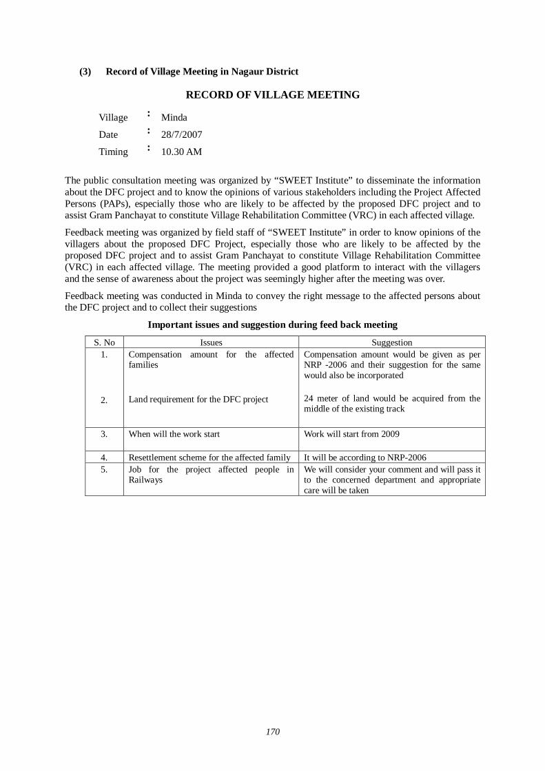
170
(3) Record of Village Meeting in Nagaur District
RECORD OF VILLAGE MEETING
The public consultation meeting was organized by “SWEET Institute” to disseminate the information about the DFC project and to know the opinions of various stakeholders including the Project Affected Persons (PAPs), especially those who are likely to be affected by the proposed DFC project and to assist Gram Panchayat to constitute Village Rehabilitation Committee (VRC) in each affected village.
Feedback meeting was organized by field staff of “SWEET Institute” in order to know opinions of the villagers about the proposed DFC Project, especially those who are likely to be affected by the proposed DFC project and to assist Gram Panchayat to constitute Village Rehabilitation Committee (VRC) in each affected village. The meeting provided a good platform to interact with the villagers and the sense of awareness about the project was seemingly higher after the meeting was over.
Feedback meeting was conducted in Minda to convey the right message to the affected persons about the DFC project and to collect their suggestions
Important issues and suggestion during feed back meeting
S. No Issues Suggestion 1.
2.
Compensation amount for the affected families Land requirement for the DFC project
Compensation amount would be given as per NRP -2006 and their suggestion for the same would also be incorporated 24 meter of land would be acquired from the middle of the existing track
3.
When will the work start Work will start from 2009
4. Resettlement scheme for the affected family It will be according to NRP-2006 5. Job for the project affected people in
Railways We will consider your comment and will pass it to the concerned department and appropriate care will be taken
Village : Minda
Date : 28/7/2007
Timing : 10.30 AM
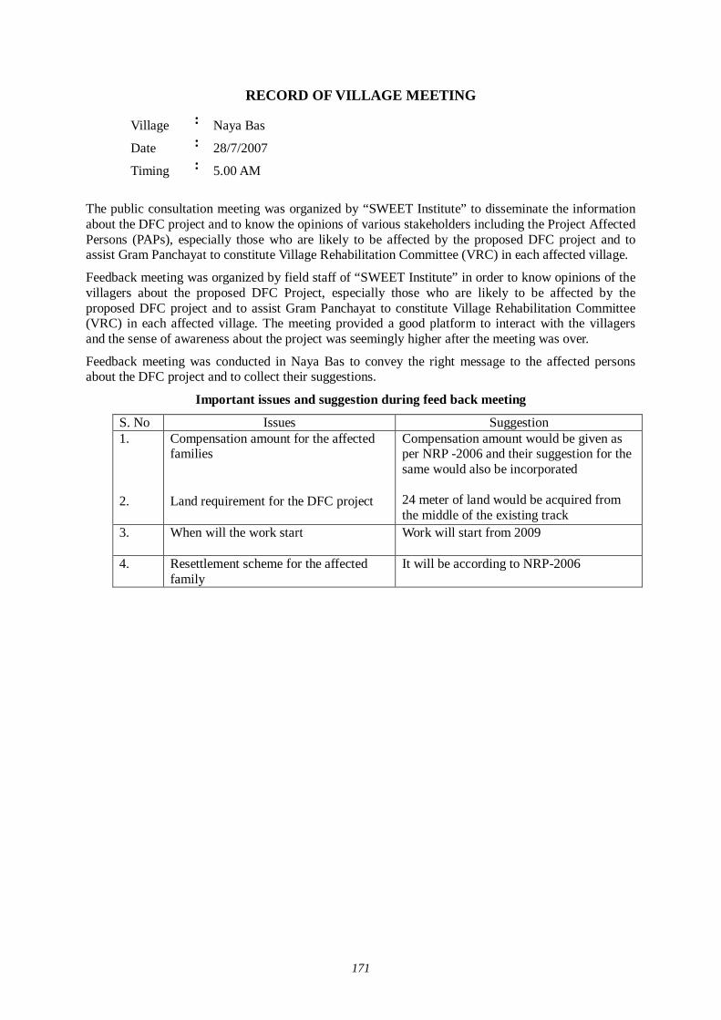
171
RECORD OF VILLAGE MEETING
Village : Naya Bas
Date : 28/7/2007
Timing : 5.00 AM
The public consultation meeting was organized by “SWEET Institute” to disseminate the information about the DFC project and to know the opinions of various stakeholders including the Project Affected Persons (PAPs), especially those who are likely to be affected by the proposed DFC project and to assist Gram Panchayat to constitute Village Rehabilitation Committee (VRC) in each affected village.
Feedback meeting was organized by field staff of “SWEET Institute” in order to know opinions of the villagers about the proposed DFC Project, especially those who are likely to be affected by the proposed DFC project and to assist Gram Panchayat to constitute Village Rehabilitation Committee (VRC) in each affected village. The meeting provided a good platform to interact with the villagers and the sense of awareness about the project was seemingly higher after the meeting was over.
Feedback meeting was conducted in Naya Bas to convey the right message to the affected persons about the DFC project and to collect their suggestions.
Important issues and suggestion during feed back meeting
S. No Issues Suggestion 1. 2.
Compensation amount for the affected families Land requirement for the DFC project
Compensation amount would be given as per NRP -2006 and their suggestion for the same would also be incorporated 24 meter of land would be acquired from the middle of the existing track
3.
When will the work start Work will start from 2009
4. Resettlement scheme for the affected family
It will be according to NRP-2006
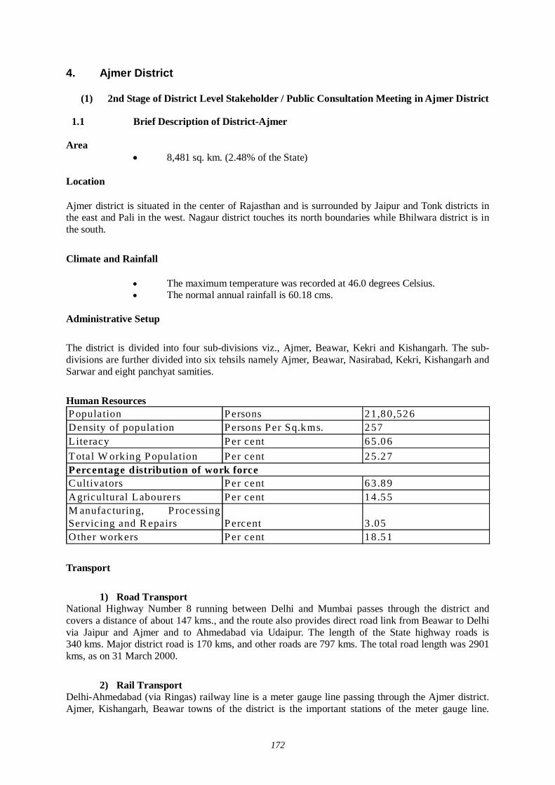
172
4. Ajmer District
(1) 2nd Stage of District Level Stakeholder / Public Consultation Meeting in Ajmer District
1.1 Brief Description of District-Ajmer
Area 8,481 sq. km. (2.48% of the State)
Location
Ajmer district is situated in the center of Rajasthan and is surrounded by Jaipur and Tonk districts in the east and Pali in the west. Nagaur district touches its north boundaries while Bhilwara district is in the south.
Climate and Rainfall
The maximum temperature was recorded at 46.0 degrees Celsius. The normal annual rainfall is 60.18 cms.
Administrative Setup
The district is divided into four sub-divisions viz., Ajmer, Beawar, Kekri and Kishangarh. The sub-divisions are further divided into six tehsils namely Ajmer, Beawar, Nasirabad, Kekri, Kishangarh and Sarwar and eight panchyat samities.
Human Resources P opulation P ersons 21,80,526Density of population P ersons P er Sq.kms. 257Literacy P er cent 65.06Total W orking P opulation P er cent 25.27
C ultivators P er cent 63.89Agricultural Labourers P er cent 14.55M anufacturing, P rocessingServicing and R epairs P ercent 3 .05Other workers P er cent 18.51
Percentage d istribution of work force
Transport
1) Road Transport
National Highway Number 8 running between Delhi and Mumbai passes through the district and covers a distance of about 147 kms., and the route also provides direct road link from Beawar to Delhi via Jaipur and Ajmer and to Ahmedabad via Udaipur. The length of the State highway roads is 340 kms. Major district road is 170 kms, and other roads are 797 kms. The total road length was 2901 kms, as on 31 March 2000.
2) Rail Transport
Delhi-Ahmedabad (via Ringas) railway line is a meter gauge line passing through the Ajmer district. Ajmer, Kishangarh, Beawar towns of the district is the important stations of the meter gauge line.
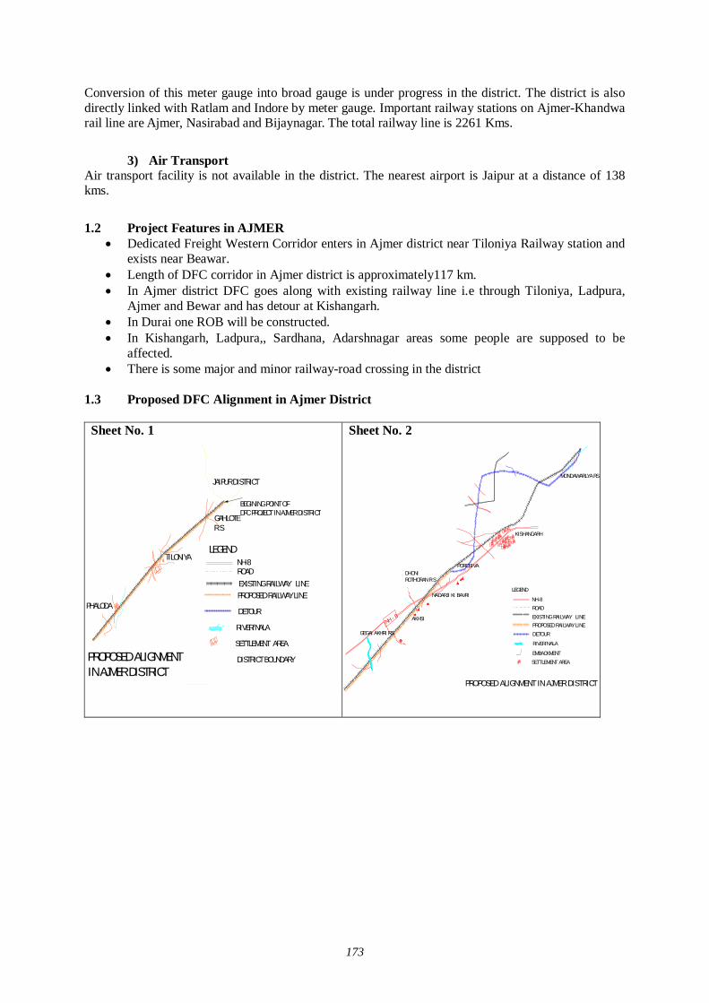
173
Conversion of this meter gauge into broad gauge is under progress in the district. The district is also directly linked with Ratlam and Indore by meter gauge. Important railway stations on Ajmer-Khandwa rail line are Ajmer, Nasirabad and Bijaynagar. The total railway line is 2261 Kms.
3) Air Transport
Air transport facility is not available in the district. The nearest airport is Jaipur at a distance of 138 kms.
1.2 Project Features in AJMER
Dedicated Freight Western Corridor enters in Ajmer district near Tiloniya Railway station and exists near Beawar.
Length of DFC corridor in Ajmer district is approximately117 km. In Ajmer district DFC goes along with existing railway line i.e through Tiloniya, Ladpura,
Ajmer and Bewar and has detour at Kishangarh. In Durai one ROB will be constructed. In Kishangarh, Ladpura,, Sardhana, Adarshnagar areas some people are supposed to be
affected. There is some major and minor railway-road crossing in the district
1.3 Proposed DFC Alignment in Ajmer District
Sheet No. 1
Sheet No. 2
NH - 8
GEGAI AKHRI RS
DHONI ROTHORAN R S
POROSIVA
NADARJI KI BAVRI
AKHSI EXISTING RAILWAY LINEPROPOSED RAILWAY LINE
ROAD
RIVER/NALA
LEGEND
PROPOSED ALIGNMENT IN AJMER DISTRICT
NH-8
DETOUR
EMBACKMENT
MONDAWARLYA RS
KISHANGARH
SETTLEMENT AREA
TILONIYA
PHALODA
GAHLOTE R S
PROPOSED ALIGNMENTIN AJMER DISTRICT
EXISTING RAILWAY LINEPROPOSED RAILWAY LINE
ROAD
RIVER/NALA
NH-8
DETOUR
LEGEND
SETTLEMENT AREA
JAIPUR DISTRICT
DISTRICT BOUNDARY
BEGINING POINT OF DFC PROJECT IN AJMER DISTRICT
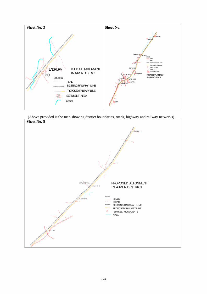
174
Sheet No. 3
Sheet No.
(Above provided is the map showing district boundaries, roads, highway and railway networks)
Sheet No. 5
LADPURAP.O
EXISTING RAILWAY LINE
PROPOSED RAILWAY LINE
ROAD
SETTLMENT AREA
LEGEND
PROPOSED ALIGNMENTIN AJMER DISTRICT
CANAL
ADARSHNAGAR
BALUPURAGARHIMALIYAN
JONESGANJ
BHAJANGANJ
EXISTING RAILWAY LINE
PROPOSED RAILWAY LINE
ROAD
TEMPLES, MONUMENTS
NALA
ROADLEGEND
PROPOSED ALIGNMENTIN AJMER DISTRICT
DORAI
SANATORIUMMEDAR R S
RASULPURA
GULAB BARI
KALYANPURA
GANWARI
SETTLEMENT AREA
EXISTING RAILWAY LINEPROPOSED RAILWAY LINE
ROAD
TEMPLES, MONUMENTSNALA
ROADLEGEND
PROPOSED ALIGNMENTIN AJMER DISTRICT
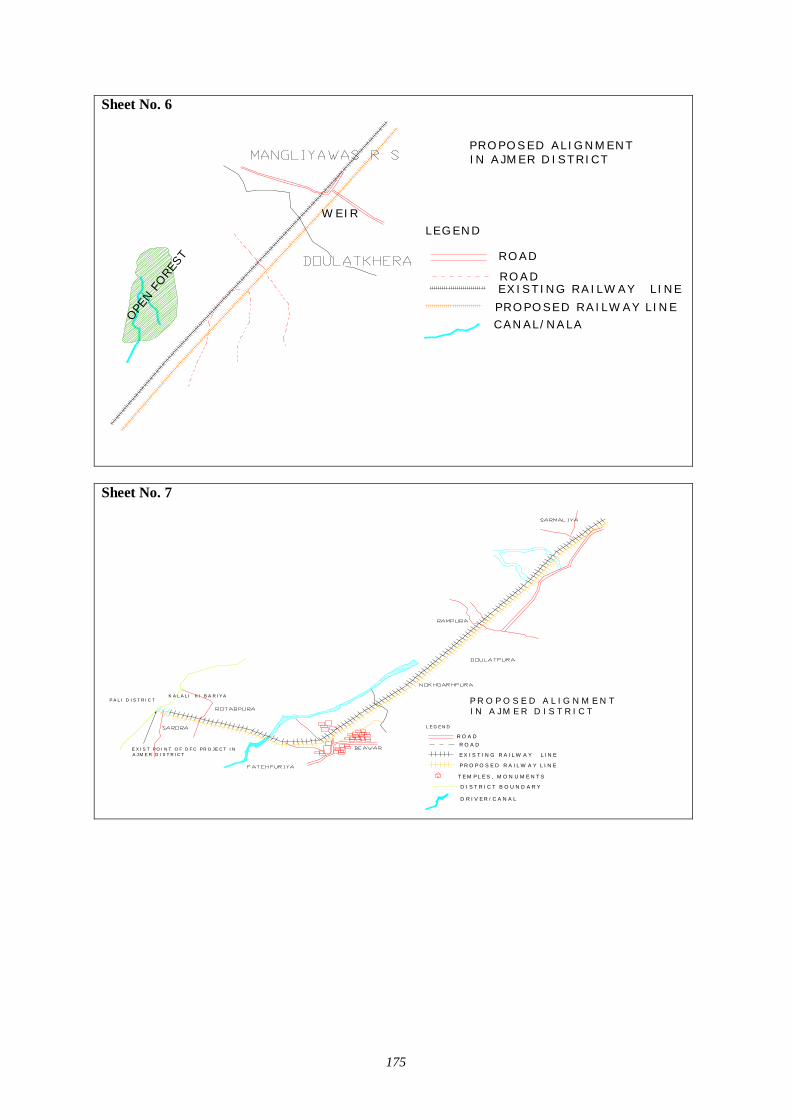
175
Sheet No. 6
Sheet No. 7
PROPOSED ALIGNM ENTIN AJM ER DISTRICT
W EIR
EXISTING RAILW AY LINEPROPOSED RAILW AY LINE
ROAD
ROAD
LEGEND
CANAL/NALAOPEN
FORE
ST
K A L A L I K I B A R IY A
E X I S T I N G R A IL W A Y L I N E
P R O P O S E D R A IL W A Y L I N E
R O A D
T E M P L E S , M O N U M E N T S
D I S T R I C T B O U N D A R Y
R O A D
L E G E N D
P R O P O S E D A L IG N M E N T IN A JM E R D I S T R I C T
D R I V E R / C A N A L
P A L I D IS T R IC T
E X IS T P O I N T O F D F C P R O JE C T IN A J M E R D I S T R IC T
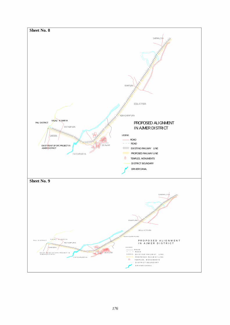
176
Sheet No. 8
Sheet No. 9
KALALI KI BARIYA
EXISTING RAILWAY LINE
PROPOSED RAILWAY LINE
ROAD
TEMPLES, MONUMENTS
DISTRICT BOUNDARY
ROAD
LEGEND
PROPOSED ALIGNMENT IN AJMER DISTRICT
DRIVER/CANAL
PALI DISTRICT
EXIST POINT OF DFC PROJECT IN AJMER DISTRICT
K A L A L I K I B A R I Y A
E X I S T I N G R A I L W A Y L I N E
P R O P O S E D R A I L W A Y L I N E
R O A D
T E M P L E S , M O N U M E N T S
D I S T R I C T B O U N D A R Y
R O A D
L E G E N D
P R O P O S E D A L I G N M E N T I N A J M E R D I S T R I C T
D R I V E R / C A N A L
P A L I D I S T R I C T
E X I S T P O I N T O F D F C P R O J E C T I N A J M E R D I S T R I C T
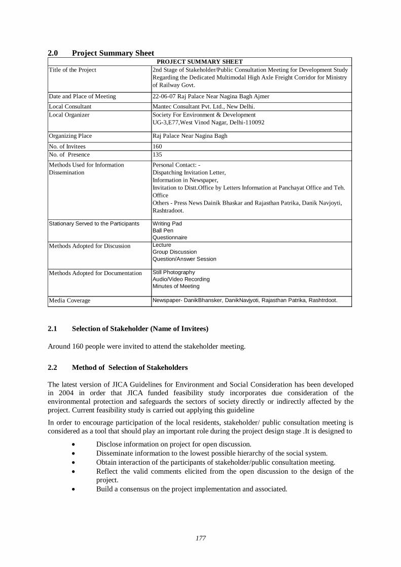
177
2.0 Project Summary Sheet
Title of the Project 2nd Stage of Stakeholder/Public Consultation Meeting for Development Study Regarding the Dedicated Multimodal High Axle Freight Corridor for Ministry of Railway Govt.
Date and Place of Meeting 22-06-07 Raj Palace Near Nagina Bagh AjmerLocal Consultant Mantec Consultant Pvt. Ltd., New Delhi.Local Organizer Society For Environment & Development
UG-3,E77,West Vinod Nagar, Delhi-110092
Organizing Place Raj Palace Near Nagina Bagh
No. of Invitees 160No. of Presence 135
Methods Used for Information Dissemination
Personal Contact: -Dispatching Invitation Letter,Information in Newspaper,Invitation to Distt.Office by Letters Information at Panchayat Office and Teh. Office Others - Press News Dainik Bhaskar and Rajasthan Patrika, Danik Navjoyti, Rashtradoot.
Stationary Served to the Participants Writing PadBall PenQuestionnaire
Methods Adopted for Discussion LectureGroup DiscussionQuestion/Answer Session
Methods Adopted for Documentation Still Photography Audio/Video RecordingMinutes of Meeting
Media Coverage Newspaper- DanikBhansker, DanikNavjyoti, Rajasthan Patrika, Rashtrdoot.
PROJECT SUMMARY SHEET
2.1 Selection of Stakeholder (Name of Invitees) Around 160 people were invited to attend the stakeholder meeting.
2.2 Method of Selection of Stakeholders The latest version of JICA Guidelines for Environment and Social Consideration has been developed in 2004 in order that JICA funded feasibility study incorporates due consideration of the environmental protection and safeguards the sectors of society directly or indirectly affected by the project. Current feasibility study is carried out applying this guideline
In order to encourage participation of the local residents, stakeholder/ public consultation meeting is considered as a tool that should play an important role during the project design stage .It is designed to
Disclose information on project for open discussion. Disseminate information to the lowest possible hierarchy of the social system. Obtain interaction of the participants of stakeholder/public consultation meeting. Reflect the valid comments elicited from the open discussion to the design of the
project. Build a consensus on the project implementation and associated.
178
There are three stages of stakeholder and public consultation meetings.The first stage of stakeholder/public consultation meeting is held on state level, followed by second stage of stakeholder/ public consultation held in the districts, and the third stage of stakeholder/ public consultation meeting will be held on the villages for directly affected people by the project
The Mantec Consultants Pvt. Ltd has already organized first stage of stake holder/public consultation meeting in the state of Rajasthan.
To organize the second stage of stakeholder/ public consultation meeting Mantec consultants has authorized "Society For Environment and Development" to meet the concerned government authorities and collect relevant data for carrying forward study of social environment and organize second stage of Stakeholder/Public Consultation Meeting for information dissemination of the project. As per the directions of the guidelines for conducting 2nd stage stakeholder/ public Consultation Meetings a formal order of the Ministry of Railways was got issued vide their letter dated 01-06-07 to facilitate these meetings.
Further, continuous efforts were made to keep the Ministry of Railways involved in the project as the major stakeholder through their local set-up. Rehabilitation Commissioners were also appointed from the state government departments. Similarly Department of Environment and Forestry and State Pollution Control Boards were contacted to participate in the Meetings. State Government Department were also apprised and approached and were invited to participate in the Stakeholders/Public Consultation Meetings including the State Public Works Department, Irrigation and Power, Urban Development and Poverty Alleviation Department, industries, telecommunication and Information technology Trade and Commerce, Surface Transport, Tourism, Container/Corporation of India, Port Trusts etc.
Our meeting Facilitator Team visited all the affected villages and requested Primary and Secondary Stakeholders to attend the meeting. Our meeting facilitator team preferred to invite the people who will be affected directly by this project. Our team also met & informed the distt. Administration and requested to help in organizing the public meeting successfully. Local stakeholders along the railway line, affected farmers, businessmen, private service and Govt. service employers were invited in the meeting. Our study team also contacted Tehsildar of affected Tehsil, Panchayat Samiti Pramukh, Gram Pradhan, local MLA and requested them to attend the meeting and also gave necessary support in conducting second stage of stakeholder and public consultation meeting. Public Consultation meeting on proposed Dedicated Fright Corridor (DFC) was held in Ajmer district of Rajasthan on 20th June, 2007 at Raj Palace, Near Nagina Bagh, and Ajmer. Extensive propaganda was made one week prior to programme through distribution of pamphlets, one to one meetings, announcement through loudspeakers in villages and newspapers. Around 160 people directly and many more times indirectly invited for the programme. Around 135 persons from affected villages, members of market associations, transport unions, industry associations, media and government departments participated. Press Conference was held on 19th June and News was published in all leading newspapers like Rajasthan Patrika, Dainik Bhaskar, Dainik Navjyoti, and Rastradoot etc. on both 20th & 21st June 2007.
The main objective of the second stage of Stakeholder/public Consultation meeting is to disseminate the information in affected areas. In the State of Rajasthan seven Districts will be affected by this DFC project. Affected districts are Alwar, Sikar, Nagaur, Jaipur, Ajmer, Pali & Sirohi. In the district of Ajmer DFC does follow the existing rail line with one detour of 13 km. at Kishangarh and small diversion in Adarsh Nagar, Ajmer due to congested areas. Therefore new land will be acquired for DFC project especially in Kishangarh. So that in giving invitation our meeting facilitator team takes consideration the people of that area were present in the meeting. Not only that our meeting facilitator team visited all the affected villages and requested primary and secondary stakeholder to attend the meeting, random sampling method was used for the selection of stakeholder because limited persons were to be invite. Our meeting facilitator team also take care in extend invitation so that the vulnerable group of people residising in affected area attend the present in the meeting.
179
2.3 Selection of Meeting Facilitators Simultaneously extensive surveys were conducted for the identification of suitable local agencies for the successful organization of the Stakeholders/Public Consultation Meetings. Preference was given to appoint Non Government Organizations (NGO) who had local presence, popularity and experience of social and public works. It has to be well acquainted with multifarious cross section of society to help in the selection of the right type of stakeholders for the meetings as well as for facilitating other related activities i.e.
Venue for the meetings Arrangement to be made Assisting in local publicity; Invitation to the stakeholders and motivating them for participation; Maintaining and compilation of record and feed back; and Other local arrangements like transport, hospitality, security and smooth conduct of the
meeting proceedings. An NGO Society for Environment & Development was therefore appointed for facilitating the Stakeholders/ Public Consultation meeting.
2.4 Method of Information Dissemination 1) Method of Notifying the meeting to the participants:
Notify the date and venue of the stakeholders/ public consultant meeting in local newspaper, Radio, TV and requesting people to attend the meeting.
With help of local NGO we try to paste handout the information of the project on the public place on the area.
With the help of the local NGOs we try to dissemination the information of the project to the local people by face meeting as much as possible.
With the help of local media we try publish the summary of stakeholders and public consultation meeting in newspaper, TV, Radio.
2.5 Venue of Stakeholder and Public Consultation Meeting
Raj Palace near Nagina Bagh, Ajmer
3.0 Participant of Stakeholder/Public Consultation Meeting Around 135 people participated in the stakeholder meeting.
3.1 Minutes of Meeting The Executive Director, “Society for Environment & Development” Started the programme with welcome Address. Sr. Divisional Engineer (Coordination), Ajmer Zone of Indian Railways was present as Chief Guest. Sociologist from MANTEC Consultants gave details about the project through power point presentation and invited views from participants. Following were the main points of discussion during the programme:
1. Alignment of the new railway line and affected villages/urban areas. 2. Area to be acquired by the Railways. 3. Compensation package for the affected farmers, shop & house Owners etc.
180
4. Diversions, Stations & Detour to be constructed at Kishangarh in the district. 5. When work will start & completion of project. 6. Economic development of area 7. Benefits of the project to general public at large and specific people. 8. Negative impact of the project to specific sector/service.
Many questions were asked on the above-mentioned points and answered by Mantec representatives.
Stakeholders/Public consultation meeting is a bottom up approach in this gigantic freight corridor project. It is one of the tools to reflect the views of the general public as well as those concerned with the project ranging from the central and local government organization to commercial and industrial sectors of the society as a whole. It is an important tool of information dissemination during the planning stage of project.
4:00 pm Representative from Society for Environment & Development, introduced Sr. Chief Engineer (Coordination), DRM, Ajmer, Representatives from Mantec Consultants, New Delhi to the participants. He also gave brief introduction and objectives of organizing the programme.
4:10 pm Mantec representative made brief presentation on DFC project to the participants and showed detailed PowerPoint presentation.
4:20 pm Mantec representative, explained that because of the ever growing economy of India, improvement of physical ability for moving goods by means of railways within the country is considered urgently needed, he also explained that the railway line starting from Mumbai running all the way up to Delhi is dedicated only for freight Corridor and nothing to do with the passengers. Growth of major and minor ports of India, the traffic between Northern Hinterland and Western port and huge traffic of coal, steel and fertilizer is anticipated on Ludhiana- Delhi – Howrah route. He said that there are lots of containers coming into this country from outside and landing at Mumbai and moving by train to Ahmedabad, Jaipur, Delhi upto Ludhiana. On an average approximately 9000-loaded truck move daily over the corridor, i.e. Delhi- Mumbai Western Corridor and Ludhiana – Howrah Eastern Corridor. He added that Freight Corridor is basically constructed alongside existing double track from Mumbai –Delhi, from palanpur upto Ahmedabad routes. From the city Vadodara adjoining the existing areas drawing up from Rajasthan, because of the congested areas, change all the way upto Mehsana the Freight Corridor has to be constructed avoiding the congestion on existing railway lines.
4:50 pm Question/Answer session (Detail of question and answer is given separately)
5.30 pm Distribution of snacks and tea and the meeting ended with vote of thanks by chair.
Profile Description of Participants
The major observations of the stakeholders/public consultation meeting held at Ajmer on 20-06-2007 recorded through questionnaire are as follows:
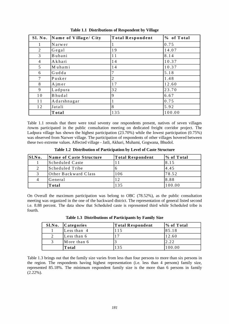
181
Table 1.1 Distributions of Respondent by Village
S l. N o . N am e o f V illag e / C ity T ota l R e s p ond e nt % o f T o ta l1 N a rw e r 1 0 .7 52 G e ga l 1 9 1 4 .0 73 B uba n i 1 1 8 .1 44 A k ha ri 1 4 1 0 .3 75 M uha m i 1 4 1 0 .3 76 G ud d a 7 5 .1 87 P usk e r 2 1 .4 88 A jm e r 1 7 1 2 .6 09 L a d pu ra 3 2 2 3 .7 0
1 0 B hud a l 9 6 .6 71 1 A d a rshna ga r 1 0 .7 51 2 Ja ta li 8 5 .9 2
T ota l 1 3 5 1 0 0 .0 0
Table 1.1 reveals that there were total seventy one respondents present, natives of seven villages /towns participated in the public consultation meeting on dedicated freight corridor project. The Ladpura village has shown the highest participation (23.70%) while the lowest participation (0.75%) was observed from Narwer village. The participation of respondents of other villages hovered between these two extreme values. Affected village - Jatli, Akhari, Muhami, Gogwana, Bhudol.
Table 1.2 Distribution of Participation by Level of Caste Structure
Sl.N o. N ame of C aste Structure T otal R espondent % of T otal1 Sched uled C aste 1 1 8 .1 52 Sched uled T ribe 6 4 .4 53 O ther B ack ward C lass 1 0 6 7 8 .5 24 G enera l 1 2 8 .8 8
T otal 1 3 5 1 0 0 .0 0 On Overall the maximum participation was belong to OBC (78.52%), as the public consultation meeting was organized in the one of the backward district. The representation of general listed second i.e. 8.88 percent. The data show that Scheduled caste is represented third while Scheduled tribe is fourth.
Table 1.3 Distributions of Participants by Family Size
Sl.N o. Categ ories T otal R espondent % of T otal1 L ess than 4 1 1 5 8 5.1 82 L ess than 6 1 7 1 2.6 03 M ore than 6 3 2 .2 2
T otal 1 3 5 1 00 .00
Table 1.3 brings out that the family size varies from less than four persons to more than six persons in the region. The respondents having highest representation (i.e. less than 4 persons) family size, represented 85.18%. The minimum respondent family size is the more than 6 persons in family (2.22%).
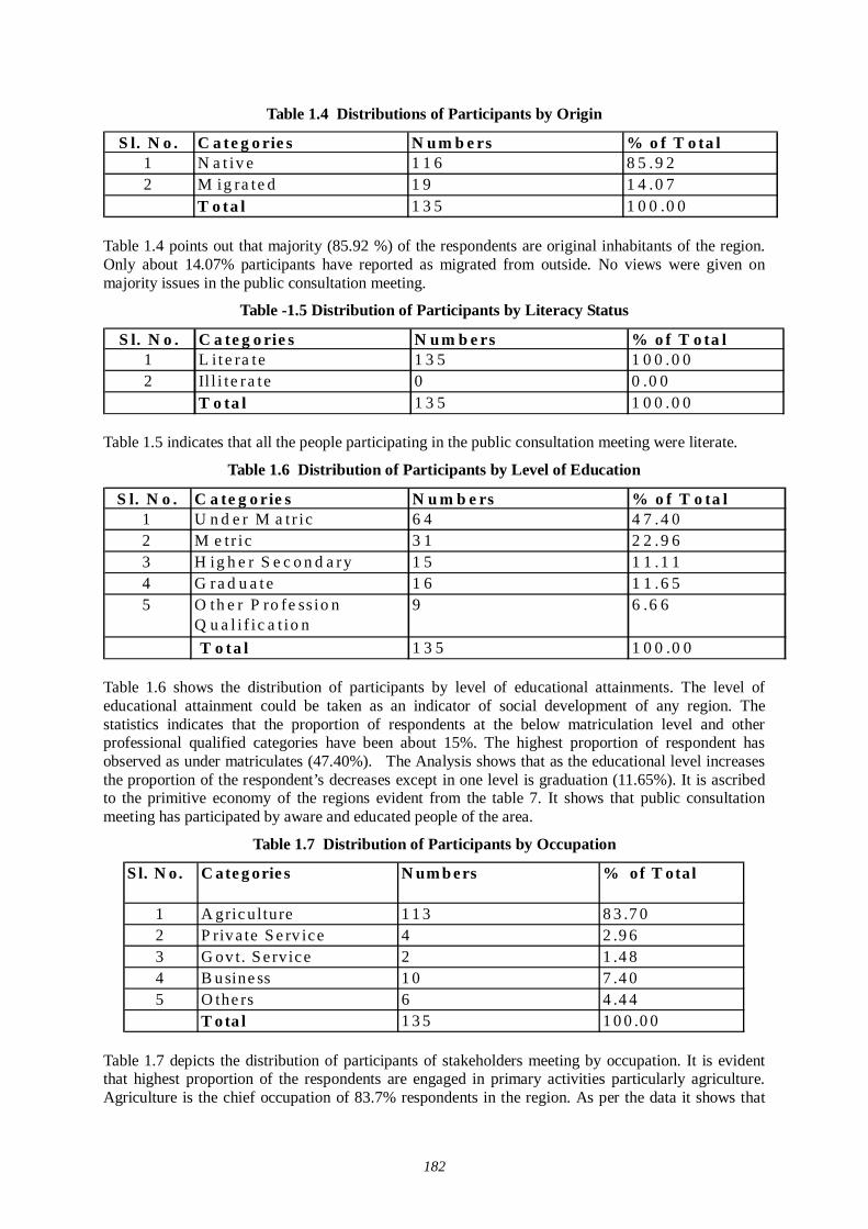
182
Table 1.4 Distributions of Participants by Origin
S l. N o . C a te g o rie s N u m b e rs % o f T o ta l1 N a t iv e 1 1 6 8 5 .9 22 M ig ra te d 1 9 1 4 .0 7
T o ta l 1 3 5 1 0 0 .0 0 Table 1.4 points out that majority (85.92 %) of the respondents are original inhabitants of the region. Only about 14.07% participants have reported as migrated from outside. No views were given on majority issues in the public consultation meeting.
Table -1.5 Distribution of Participants by Literacy Status
S l. N o . C a te g o rie s N u m b e rs % o f T o ta l1 L i t e ra te 1 3 5 1 0 0 .0 02 Il l i te r a te 0 0 .0 0
T o ta l 1 3 5 1 0 0 .0 0 Table 1.5 indicates that all the people participating in the public consultation meeting were literate.
Table 1.6 Distribution of Participants by Level of Education
S l. N o . C a te g o rie s N u m b e rs % o f T o ta l1 U n d e r M a t r ic 6 4 4 7 .4 02 M e tr ic 3 1 2 2 .9 63 H ig h e r S e c o n d a ry 1 5 1 1 .1 14 G ra d u a t e 1 6 1 1 .6 55 O th e r P ro fe ss io n
Q u a l i f ic a t io n9 6 .6 6
T o ta l 1 3 5 1 0 0 .0 0 Table 1.6 shows the distribution of participants by level of educational attainments. The level of educational attainment could be taken as an indicator of social development of any region. The statistics indicates that the proportion of respondents at the below matriculation level and other professional qualified categories have been about 15%. The highest proportion of respondent has observed as under matriculates (47.40%). The Analysis shows that as the educational level increases the proportion of the respondent’s decreases except in one level is graduation (11.65%). It is ascribed to the primitive economy of the regions evident from the table 7. It shows that public consultation meeting has participated by aware and educated people of the area.
Table 1.7 Distribution of Participants by Occupation
S l. N o. C ate g orie s N um b ers % of T otal
1 A gric ulture 1 1 3 8 3 .7 02 P riv a te S e rv ice 4 2 .9 63 G ov t. S e rvice 2 1 .4 84 B u sine ss 1 0 7 .4 05 O the rs 6 4 .4 4
T o ta l 1 3 5 1 0 0 .0 0 Table 1.7 depicts the distribution of participants of stakeholders meeting by occupation. It is evident that highest proportion of the respondents are engaged in primary activities particularly agriculture. Agriculture is the chief occupation of 83.7% respondents in the region. As per the data it shows that
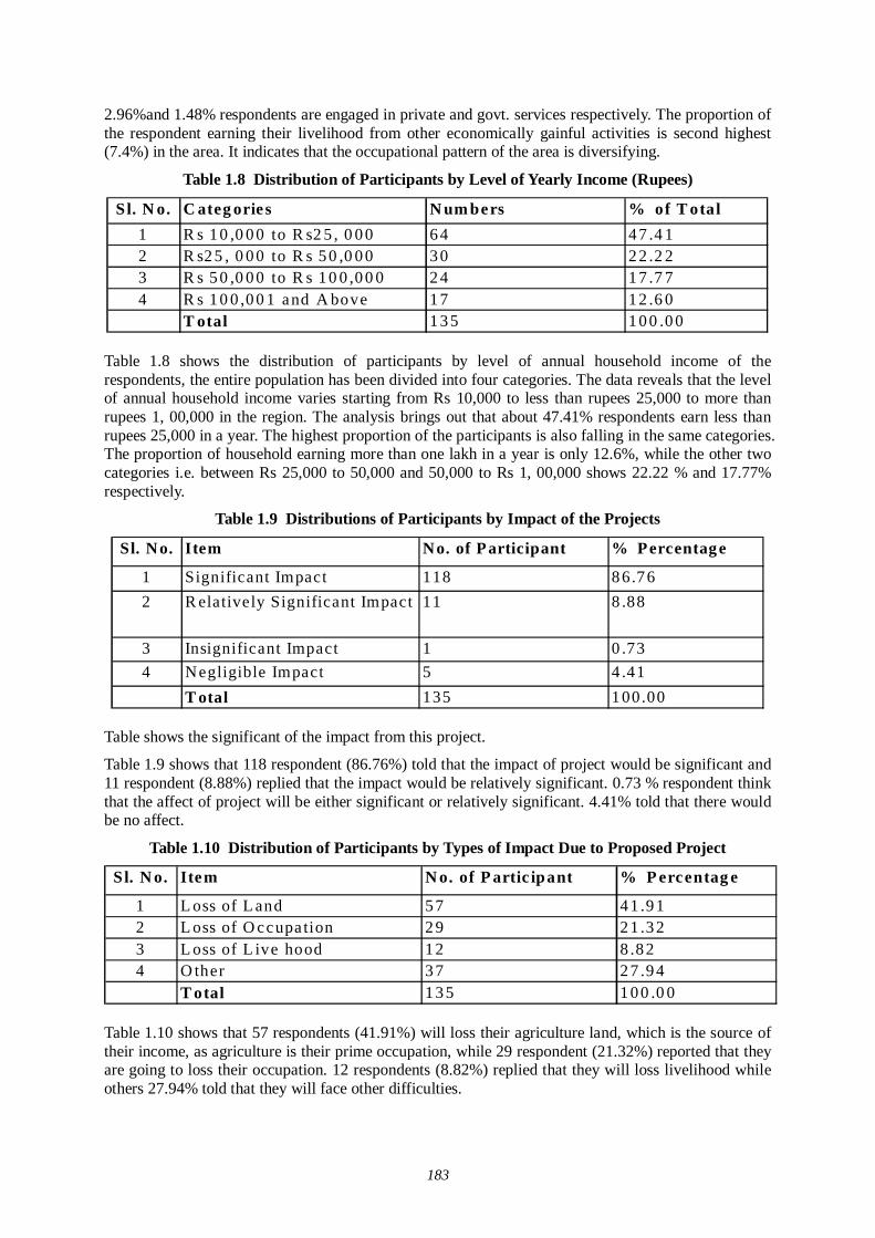
183
2.96%and 1.48% respondents are engaged in private and govt. services respectively. The proportion of the respondent earning their livelihood from other economically gainful activities is second highest (7.4%) in the area. It indicates that the occupational pattern of the area is diversifying.
Table 1.8 Distribution of Participants by Level of Yearly Income (Rupees)
Sl. N o. C ateg ories N um bers % of T otal1 R s 1 0 ,0 0 0 to R s2 5 , 0 0 0 6 4 4 7 .4 12 R s2 5 , 0 0 0 to R s 5 0 ,0 0 0 3 0 2 2 .2 23 R s 5 0 ,0 0 0 to R s 1 0 0 ,0 0 0 2 4 1 7 .7 74 R s 1 0 0 ,0 0 1 and A bove 1 7 1 2 .6 0
T otal 1 3 5 1 0 0 .0 0 Table 1.8 shows the distribution of participants by level of annual household income of the respondents, the entire population has been divided into four categories. The data reveals that the level of annual household income varies starting from Rs 10,000 to less than rupees 25,000 to more than rupees 1, 00,000 in the region. The analysis brings out that about 47.41% respondents earn less than rupees 25,000 in a year. The highest proportion of the participants is also falling in the same categories. The proportion of household earning more than one lakh in a year is only 12.6%, while the other two categories i.e. between Rs 25,000 to 50,000 and 50,000 to Rs 1, 00,000 shows 22.22 % and 17.77% respectively.
Table 1.9 Distributions of Participants by Impact of the Projects
Sl. No. Item No. of Participant % Percentage
1 Significant Impact 118 86.762 R elatively Significant Impact 11 8 .88
3 Insignificant Impact 1 0 .734 Negligible Impact 5 4 .41
T otal 135 100.00
Table shows the significant of the impact from this project.
Table 1.9 shows that 118 respondent (86.76%) told that the impact of project would be significant and 11 respondent (8.88%) replied that the impact would be relatively significant. 0.73 % respondent think that the affect of project will be either significant or relatively significant. 4.41% told that there would be no affect.
Table 1.10 Distribution of Participants by Types of Impact Due to Proposed Project
Sl. N o. Item N o. of P artic ipant % P ercentag e
1 L oss of L and 57 41 .912 L oss of O ccupa tion 29 21 .323 L oss of L ive hood 12 8 .824 O ther 37 27 .94
T otal 135 100 .0 0
Table 1.10 shows that 57 respondents (41.91%) will loss their agriculture land, which is the source of their income, as agriculture is their prime occupation, while 29 respondent (21.32%) reported that they are going to loss their occupation. 12 respondents (8.82%) replied that they will loss livelihood while others 27.94% told that they will face other difficulties.
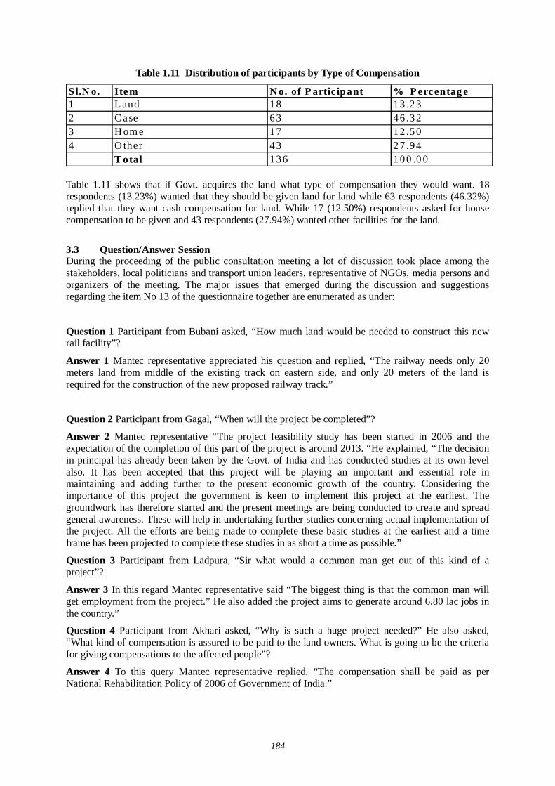
184
Table 1.11 Distribution of participants by Type of Compensation
Sl.N o. Item N o. of P artic ipant % P ercentag e1 L and 1 8 1 3 .2 32 C ase 6 3 4 6 .3 23 H om e 1 7 1 2 .5 04 O ther 4 3 2 7 .9 4
T otal 1 3 6 1 0 0 .0 0
Table 1.11 shows that if Govt. acquires the land what type of compensation they would want. 18 respondents (13.23%) wanted that they should be given land for land while 63 respondents (46.32%) replied that they want cash compensation for land. While 17 (12.50%) respondents asked for house compensation to be given and 43 respondents (27.94%) wanted other facilities for the land.
3.3 Question/Answer Session During the proceeding of the public consultation meeting a lot of discussion took place among the stakeholders, local politicians and transport union leaders, representative of NGOs, media persons and organizers of the meeting. The major issues that emerged during the discussion and suggestions regarding the item No 13 of the questionnaire together are enumerated as under:
Question 1 Participant from Bubani asked, “How much land would be needed to construct this new rail facility”?
Answer 1 Mantec representative appreciated his question and replied, “The railway needs only 20 meters land from middle of the existing track on eastern side, and only 20 meters of the land is required for the construction of the new proposed railway track.”
Question 2 Participant from Gagal, “When will the project be completed”?
Answer 2 Mantec representative “The project feasibility study has been started in 2006 and the expectation of the completion of this part of the project is around 2013. “He explained, “The decision in principal has already been taken by the Govt. of India and has conducted studies at its own level also. It has been accepted that this project will be playing an important and essential role in maintaining and adding further to the present economic growth of the country. Considering the importance of this project the government is keen to implement this project at the earliest. The groundwork has therefore started and the present meetings are being conducted to create and spread general awareness. These will help in undertaking further studies concerning actual implementation of the project. All the efforts are being made to complete these basic studies at the earliest and a time frame has been projected to complete these studies in as short a time as possible.”
Question 3 Participant from Ladpura, “Sir what would a common man get out of this kind of a project”?
Answer 3 In this regard Mantec representative said “The biggest thing is that the common man will get employment from the project.” He also added the project aims to generate around 6.80 lac jobs in the country.”
Question 4 Participant from Akhari asked, “Why is such a huge project needed?” He also asked, “What kind of compensation is assured to be paid to the land owners. What is going to be the criteria for giving compensations to the affected people”?
Answer 4 To this query Mantec representative replied, “The compensation shall be paid as per National Rehabilitation Policy of 2006 of Government of India.”
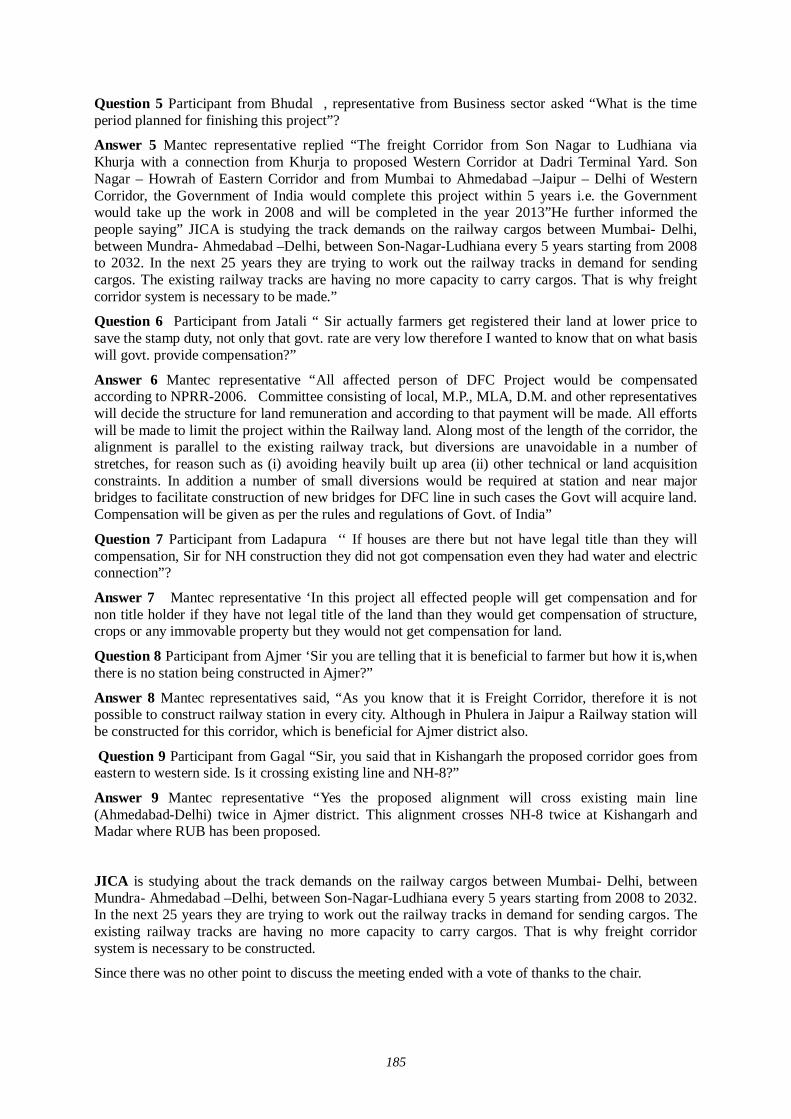
185
Question 5 Participant from Bhudal , representative from Business sector asked “What is the time period planned for finishing this project”?
Answer 5 Mantec representative replied “The freight Corridor from Son Nagar to Ludhiana via Khurja with a connection from Khurja to proposed Western Corridor at Dadri Terminal Yard. Son Nagar – Howrah of Eastern Corridor and from Mumbai to Ahmedabad –Jaipur – Delhi of Western Corridor, the Government of India would complete this project within 5 years i.e. the Government would take up the work in 2008 and will be completed in the year 2013”He further informed the people saying” JICA is studying the track demands on the railway cargos between Mumbai- Delhi, between Mundra- Ahmedabad –Delhi, between Son-Nagar-Ludhiana every 5 years starting from 2008 to 2032. In the next 25 years they are trying to work out the railway tracks in demand for sending cargos. The existing railway tracks are having no more capacity to carry cargos. That is why freight corridor system is necessary to be made.”
Question 6 Participant from Jatali “ Sir actually farmers get registered their land at lower price to save the stamp duty, not only that govt. rate are very low therefore I wanted to know that on what basis will govt. provide compensation?”
Answer 6 Mantec representative “All affected person of DFC Project would be compensated according to NPRR-2006. Committee consisting of local, M.P., MLA, D.M. and other representatives will decide the structure for land remuneration and according to that payment will be made. All efforts will be made to limit the project within the Railway land. Along most of the length of the corridor, the alignment is parallel to the existing railway track, but diversions are unavoidable in a number of stretches, for reason such as (i) avoiding heavily built up area (ii) other technical or land acquisition constraints. In addition a number of small diversions would be required at station and near major bridges to facilitate construction of new bridges for DFC line in such cases the Govt will acquire land. Compensation will be given as per the rules and regulations of Govt. of India”
Question 7 Participant from Ladapura ‘‘ If houses are there but not have legal title than they will compensation, Sir for NH construction they did not got compensation even they had water and electric connection”?
Answer 7 Mantec representative ‘In this project all effected people will get compensation and for non title holder if they have not legal title of the land than they would get compensation of structure, crops or any immovable property but they would not get compensation for land.
Question 8 Participant from Ajmer ‘Sir you are telling that it is beneficial to farmer but how it is,when there is no station being constructed in Ajmer?”
Answer 8 Mantec representatives said, “As you know that it is Freight Corridor, therefore it is not possible to construct railway station in every city. Although in Phulera in Jaipur a Railway station will be constructed for this corridor, which is beneficial for Ajmer district also.
Question 9 Participant from Gagal “Sir, you said that in Kishangarh the proposed corridor goes from eastern to western side. Is it crossing existing line and NH-8?”
Answer 9 Mantec representative “Yes the proposed alignment will cross existing main line (Ahmedabad-Delhi) twice in Ajmer district. This alignment crosses NH-8 twice at Kishangarh and Madar where RUB has been proposed.
JICA is studying about the track demands on the railway cargos between Mumbai- Delhi, between Mundra- Ahmedabad –Delhi, between Son-Nagar-Ludhiana every 5 years starting from 2008 to 2032. In the next 25 years they are trying to work out the railway tracks in demand for sending cargos. The existing railway tracks are having no more capacity to carry cargos. That is why freight corridor system is necessary to be constructed.
Since there was no other point to discuss the meeting ended with a vote of thanks to the chair.
186
3.4 Summary of Major Findings About one hundred thirty five respondents of twelve villages participated in the public consultation meeting aimed at construction of dedicated freight corridor. The Ladpura village has shown the highest participation while the lowest participation was observed from Narwer village. It is noted that there are 4.45% participated belong to scheduled tribes. The scheduled caste (8.15 percent) and OBC (78.52%) is recorded major participation.
It is also investigated that the occupational pattern in the region is quite diversified. People are engaged in various economic activities. However, agriculture is still the main occupation of the people. The examination of the level of annual household income reveals that there is marked difference in this regard. About majority of the respondents reported meager income level i.e. less than rupees 25,000 per year. However, majority of people have earning between Rs 25000 to Rs 50,000. About majority percent respondent reported that they have access to the roads in the area. Majority people are having railway line. Interestingly more than eighty percent of respondents are in favour of this multi modal dedicated freight corridor.
187
(2) 3rd stage of Village Level Stakeholder / Public Consultation Meeting - Ajmer
1.1 Brief Description of District: AJMER
Area 8,481 sq.km. (2.48% of the State)
Location Ajmer district is situated in the center of Rajasthan and is surrounded by Jaipur and Tonk districts in the east and Pali in the west. Nagaur district touches its north boundaries while Bhilwara district is in the south.
Climate and Rainfall
The maximum temperature was recorded at 46.0 degrees Celsius. The normal annual rainfall is 60.18 cms.
Administrative Setup
The district is divided into four sub-divisions viz., Ajmer, Beawar, Kekri and Kishangarh. The sub-divisions are further divided into six tehsils namely Ajmer, Beawar, Nasirabad, Kekri, Kishangarh and Sarwar and eight punchiest samitis.
Table 1.2: Human Resources
Population persons 21,80,526Density of population persons per sq.kms. 257Literacy per cent 65.06Total working population per cent 25.27
Cultivators per cent 63.89Agricultural labourers per cent 14.55Manufacturing, processing, servicing and repair per cent 3.05Other workers per cent 18.51
Indicators of Human Resources
Percentage distribution of work force
Transport
Road Transport
National Highway Number 8 running between Delhi and Mumbai passes through the district and covers a distance of about 147 kms. and the route also provides direct road link from Beawar to Delhi via Jaipur and Ajmer and to Ahmedabad via Udaipur. The length of the State
188
highway roads is 340 kms. major district road is 170 kms. and other roads are 797 kms. The total road length was 2901 kms. as on 31 March 2000.
Rail Transport
Delhi-Ahmedabad (via Ringas) railway line is a meter gauge line passing through the Ajmer district. Ajmer, Kishangarh, Beawar towns of the district and the important stations of the meter gauge line. Conversion of this meter gauge into broad gauge is under progress in the district. The district is also directly linked with Ratlam and Indore by meter gauge. Important railway stations on Ajmer-Khandwa rail line are Ajmer, Nasirabad and Bijaynagar. The total railway line is 2261 Kms.
Air Transport
Air transport facility is not available in the district. The nearest airport is Jaipur at a distance of 138 kms.
1.3 Brief description of the DFC Project Due to the growing economy of India, the need of improvement in physical movement of goods by means of railways within the country has been felt. Henceforth the Ministry of Railways,- Government of India- has planned to develop dedicated multimodal high axle freight corridor project on Eastern (Ludhiana to Hawrah) and Western (Delhi to Mumbai) corridors. The Japan International Cooperation Agency is undertaking a development study of this dedicated freight corridor project for the Indian government. Western route (Mumbai-Delhi route) of dedicated freight corridor will be traversing Jawaharlal Nehru Port Trust (JNPT)-Ahmedabad-Palanpur-Rewari-Asaoti-Dadri. Down direction of this corridor is considered towards Delhi and up direction towards JNPT. The proposed alignment passes through the states of Maharastra, Gujarat, Rajasthan, Haryana, Delhi and Uttar Pradesh involving Thane and Raigarh districts of Maharastra, Valsad, Navsari, Surat, Bharuch, Vadodra, Anand, Kheda, Ahmedabad, Gandhinagar, Mahesana and Banas Kantha districts of Gujarat; Sirohi, Pali, Ajmer, Nagaur, Jaipur, Alwar and Sikar districts of Rajasthan, Mahendragarh (Narnaul), Rewari, Gurgaon and Faridabad districts of Haryana, South Delhi district of Delhi and Gautam Budhnagar district of Uttar Pradesh.
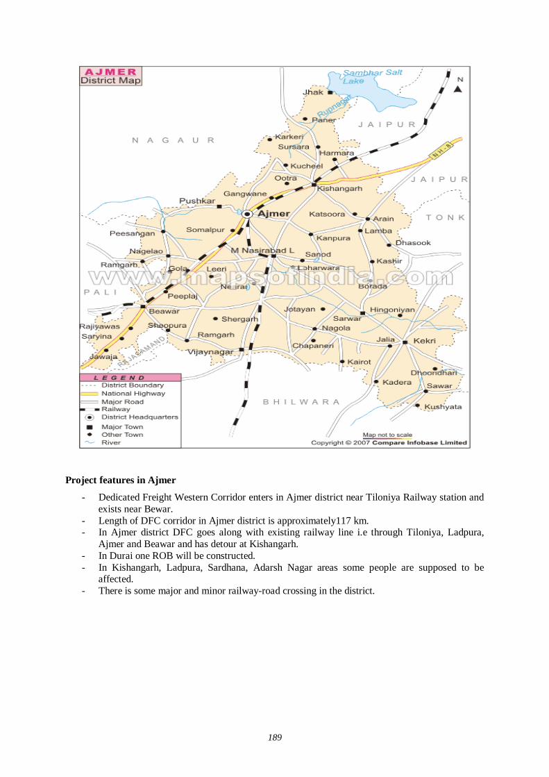
189
Project features in Ajmer
- Dedicated Freight Western Corridor enters in Ajmer district near Tiloniya Railway station and exists near Bewar.
- Length of DFC corridor in Ajmer district is approximately117 km. - In Ajmer district DFC goes along with existing railway line i.e through Tiloniya, Ladpura,
Ajmer and Beawar and has detour at Kishangarh. - In Durai one ROB will be constructed. - In Kishangarh, Ladpura, Sardhana, Adarsh Nagar areas some people are supposed to be
affected. - There is some major and minor railway-road crossing in the district.
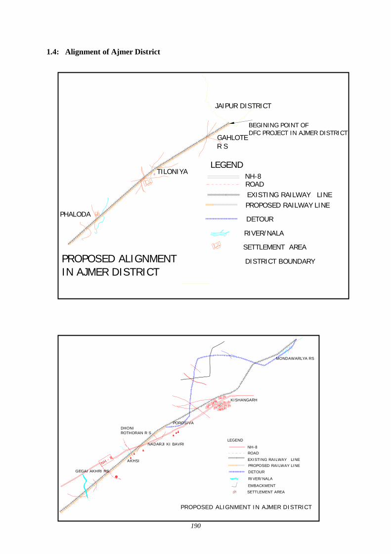
190
1.4: Alignment of Ajmer District
TILONIYA
PHALODA
GAHLOTE R S
PROPOSED ALIGNMENTIN AJMER DISTRICT
EXISTING RAILWAY LINEPROPOSED RAILWAY LINE
ROAD
RIVER/NALA
NH-8
DETOUR
LEGEND
SETTLEMENT AREA
JAIPUR DISTRICT
DISTRICT BOUNDARY
BEGINING POINT OF DFC PROJECT IN AJMER DISTRICT
NH - 8
GEGAI AKHRI RS
DHONI ROTHORAN R S
POROSIVA
NADARJI KI BAVRI
AKHSI EXISTING RAILWAY LINEPROPOSED RAILWAY LINE
ROAD
RIVER/NALA
LEGEND
PROPOSED ALIGNMENT IN AJMER DISTRICT
NH-8
DETOUR
EMBACKMENT
MONDAWARLYA RS
KISHANGARH
SETTLEMENT AREA
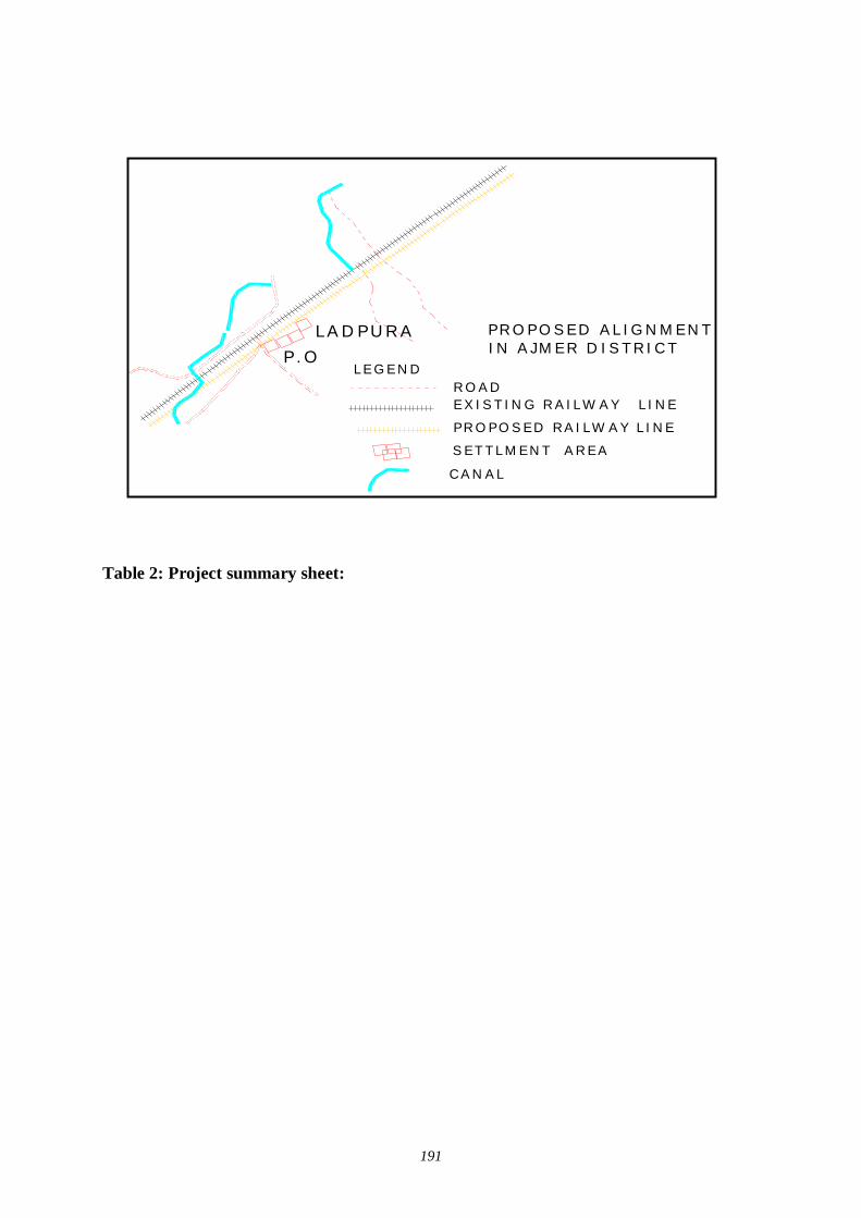
191
Table 2: Project summary sheet:
LA D PU RAP .O
EX IST IN G R A ILW AY L IN E
PR O PO SED RA ILW AY LIN E
R O AD
SETTLM EN T AR EA
LEG EN D
PR O PO SED AL IG N M EN TIN A JM ER D ISTR ICT
CAN AL
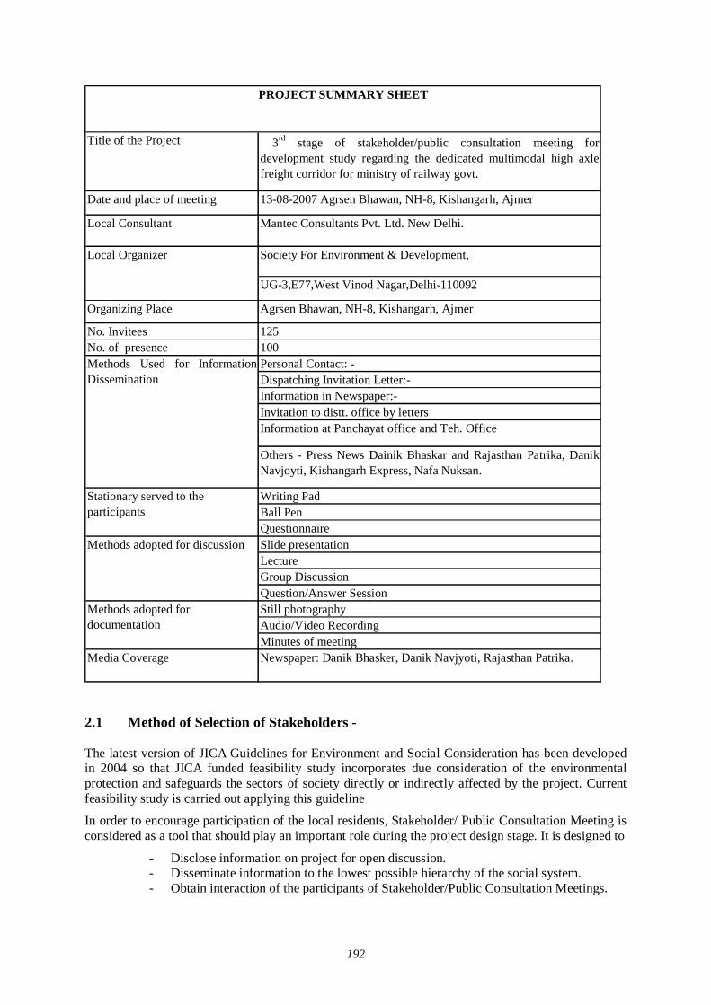
192
Title of the Project 3rd stage of stakeholder/public consultation meeting fordevelopment study regarding the dedicated multimodal high axlefreight corridor for ministry of railway govt.
Local Consultant Mantec Consultants Pvt. Ltd. New Delhi.
Society For Environment & Development,
UG-3,E77,West Vinod Nagar,Delhi-110092
Organizing Place Agrsen Bhawan, NH-8, Kishangarh, Ajmer
No. Invitees 125No. of presence 100
Personal Contact: -Dispatching Invitation Letter:-Information in Newspaper:-Invitation to distt. office by lettersInformation at Panchayat office and Teh. Office
Others - Press News Dainik Bhaskar and Rajasthan Patrika, DanikNavjoyti, Kishangarh Express, Nafa Nuksan.
Writing PadBall PenQuestionnaireSlide presentation LectureGroup DiscussionQuestion/Answer SessionStill photography Audio/Video RecordingMinutes of meeting
Media Coverage Newspaper: Danik Bhasker, Danik Navjyoti, Rajasthan Patrika.
Methods adopted for documentation
Local Organizer
Methods Used for InformationDissemination
Stationary served to the participants
Methods adopted for discussion
PROJECT SUMMARY SHEET
Date and place of meeting 13-08-2007 Agrsen Bhawan, NH-8, Kishangarh, Ajmer
2.1 Method of Selection of Stakeholders - The latest version of JICA Guidelines for Environment and Social Consideration has been developed in 2004 so that JICA funded feasibility study incorporates due consideration of the environmental protection and safeguards the sectors of society directly or indirectly affected by the project. Current feasibility study is carried out applying this guideline
In order to encourage participation of the local residents, Stakeholder/ Public Consultation Meeting is considered as a tool that should play an important role during the project design stage. It is designed to
- Disclose information on project for open discussion. - Disseminate information to the lowest possible hierarchy of the social system. - Obtain interaction of the participants of Stakeholder/Public Consultation Meetings.
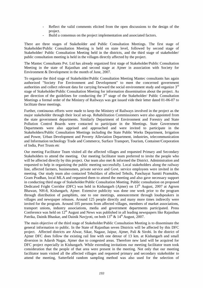
193
- Reflect the valid comments elicited from the open discussions to the design of the project.
- Build a consensus on the project implementation and associated factors.
There are three stages of Stakeholder and Public Consultation Meetings. The first stage of Stakeholder/Public Consultation Meeting is held on state level, followed by second stage of Stakeholder/ Public Consultation Meeting held in the districts, and the third stage of stakeholder/ public consultation meeting is held in the villages directly affected by the project.
The Mantec Consultants Pvt. Ltd has already organized first stage of Stakeholder/Public Consultation Meeting in the state of Rajasthan and second stage at Ajmer in association with Society for Environment & Development in the month of June, 2007.
To organize the third stage of Stakeholder/Public Consultation Meeting Mantec consultants has again authorized "Society For Environment and Development" to meet the concerned government authorities and collect relevant data for carrying forward the social environment study and organize 3rd stage of Stakeholder/Public Consultation Meeting for information dissemination about the project. As per direction of the guidelines for conducting the 3rd stage of the Stakeholder/ Public Consultation Meetings a formal order of the Ministry of Railways was got issued vide their letter dated 01-06-07 to facilitate these meetings.
Further, continuous efforts were made to keep the Ministry of Railways involved in the project as the major stakeholder through their local set-up. Rehabilitation Commissioners were also appointed from the state government departments. Similarly Department of Environment and Forestry and State Pollution Control Boards were contacted to participate in the Meetings. State Government Departments were also apprised and approached and were invited to participate in the Stakeholders/Public Consultation Meetings including the State Public Works Department, Irrigation and Power, Urban Development and Poverty Alleviation Department, industries, telecommunication and Information technology Trade and Commerce, Surface Transport, Tourism, Container/Corporation of India, Port Trusts etc
Our meeting Facilitator Team visited all the affected villages and requested Primary and Secondary Stakeholders to attend the meeting. Our meeting facilitator team preferred to invite the people who will be affected directly by this project. Our team also met & informed the District. Administration and requested to help in organizing the public meeting successfully. Local stakeholders along the railway line, affected farmers, businessmen, private service and Govt. service employees were invited in the meeting. Our study team also contacted Tehsildars of affected Tehsils, Panchayat Samiti Pramukhs, Gram Pradhan, local MLA and requested them to attend the meeting and also gave necessary support in conducting third stage of Stakeholder/Public Consultation Meeting. Public consultation on proposed Dedicated Fright Corridor (DFC) was held in Kishangarh (Ajmer) on 13th August, 2007 at Agrsen Bhawan, NH-8, Kishangarh, Ajmer. Extensive publicity was done one week prior to the program through distribution of pamphlets, one to one meetings, announcement through loudspeakers in villages and newspaper releases. Around 125 people directly and many more times indirectly were invited for the program. Around 105 persons from affected villages, members of market associations, transport unions, industry associations, media and government departments participated. Press Conference was held on 12th August and News was published in all leading newspapers like Rajasthan Patrika, Dainik Bhaskar, and Dainik Navjyoti, on both 13th & 14th August, 2007.
The main objective of the third stage of Stakeholder/Public Consultation Meeting is to disseminate the general information to public. In the State of Rajasthan seven Districts will be affected by this DFC project. Affected districts are Alwar, Sikar, Nagaur, Jaipur, Ajmer, Pali & Sirohi. In the district of Ajmer DFC does follow the existing rail line with one detour of 13 km. at Kishangarh and small diversion in Adarsh Nagar, Ajmer due to congested areas. Therefore new land will be acquired for DFC project especially in Kishangarh. While extending invitations our meeting facilitator team took consideration that the people of that area were present in the meeting. Not only that our meeting facilitator team visited all the affected villages and requested primary and secondary stakeholder to attend the meeting, Satterfield random sampling method was also used for the selection of
194
stakeholders because limited people had to be invited. Our meeting facilitator team also took consideration while extending invitations that vulnerable group of affected area should definitely be present in the meeting.
2.2 Selection of meeting facilitators:- Simultaneously extensive surveys were conducted for the identification of suitable local agencies for the successful organization of the Stakeholders/Public Consultation Meetings.
Preference was given to appoint Non Government Organizations (NGO) who had local presence, popularity and experience of social and public works. The NGO had to be well acquainted with multifarious cross section of society to help in the selection of the right type of stakeholders for the meetings as well as for facilitating other related activities. i.e.
Venue of the meetings Arrangements to be made; Assistance in local publicity; Invitation to the stakeholders and motivating them for participation; Maintenance and compilation of records and feed backs; and Other local arrangements like transport, hospitality, security and smooth conduction
of the meeting proceedings.
An NGO ‘Society for Environment & Development’ was therefore appointed for facilitating the 3rd Stage Stakeholders/ Public Consultation meeting in Ajmer District.
2.3 Method of Information Dissemination A) Method of Notifying the meeting to the participants:-
- Notified the date and venue of the Stakeholders/ Public Consultation meeting in local newspaper, Radio, TV and requesting people to attend the meeting.
- With help of local NGO we tried to put up and handover the information of the project on the public place in the area.
- With the help of the local NGOs we tried to dissemination the information of the project to the local people by face-to-face meetings as much as possible.
- With the help of local media we tried to publish the summary of Stakeholders and Public Consultation Meeting in newspaper, TV, Radio.
2.4 Venue of Stakeholder and Public Consultation Meeting
Agrsen Bhawan, NH-8, Kishangarh, Ajmer 3. Details of Stakeholder/ Public Consultation Meeting The programme was started with Welcome Address by Executive Director, Society for Environment & Development. Ex. M.L.A. Ladpura, Ajmer was present as Chief Guest while the representative from Japan Development Services Co. Ltd. presided over the function. The Sociologist from MANTEC Consultants gave details about the project through power point presentation and invited views from participants. Following were the main points of discussion during the programme –
1. Alignment of the new railway line and affected villages/urban areas. 2. Area to be acquired by the Railways. 3. Compensation package for the affected farmers, shop & house Owners etc. 4. Diversions, Stations & Detour to be constructed at Kishangarh in the district. 5. When work will start & completion of project. 6. Economic development of area 7. Benefits of the project to general public at large and specific people.
195
8. Negative impact of the project to specific sector/service.
Stakeholders/ Public consultation meeting is a bottom up approach in this gigantic freight corridor project. It is one of the tools to reflect the views of the general public as well as those concerned with the project ranging from the central and local government organization to commercial and industrial sectors of the society as a whole. It is an important tool of information dissemination during the planning stage of project.
11:00 AM
Representative of Society for Environment & Development, introduced Ex. M.L.A. Ladpura, Ajmer, representative of Japan Development Services. Co. Ltd. and representative of Mantec Consultants, New Delhi to the participants. He also gave brief introduction and objectives of organizing the programme and made brief presentation on DFC project to the participants and requested Mantec Consultants for detailed PowerPoint presentation.
11:20 AM
Mantec Consulatants explained that because of the ever growing economy of India, improvement of physical ability for moving goods by means of railways within the country is considered urgently needed, he also explained that the railway line starting from Mumbai running all the way up to Delhi is dedicated only for freight Corridor and nothing to do with the passengers. Growth of major and minor ports of India, the traffic between Northern Hinterland and Western port and huge traffic of coal, steel and fertilizer is anticipated on Ludhiana- Delhi – Howrah route. He said that there are lots of containers coming into this country from outside and landing at Mumbai and moving by train to Ahmedabad, Jaipur, Delhi upto Ludhiana. On an average approximately 9000 loaded trucks move daily over the corridor, i.e. Delhi- Mumbai Western Corridor and Ludhiana – Howrah Eastern Corridor. He added that Freight Corridor is basically constructed alongside existing double track from Mumbai –Delhi, from Palanpur upto Ahmedabad routes. From the city Vadodara adjoining the existing areas drawing up from Rajasthan , because of the congested areas, change all the way upto Mahesana the Freight Corridor has to be constructed avoiding the congestion on existing railway lines.
In the district of Ajmer DFC does follow the existing rail line with one detour of 13 km. at Kishangarh and small diversion in Adarsh Nagar, Ajmer due to congested areas. Therefore new land will be acquired for DFC project especially in Kishangarh. Around 30 villages are likely to be affected in the Ajmer district.
11:50 AM
Question/Answer session (Detail of question and answer is given separately)
12.30 AM
Distribution of snacks and tea and the meeting ended with vote of thanks by chair.
3.1 Description of Profile of participants:- The major observations of the stakeholders/public consultation meeting held at Kishangarh (Ajmer) on 13-08-2007 recorded through questionnaire are as follows:
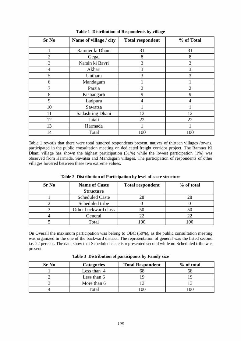
196
Table 1 Distribution of Respondents by village
Sr No Name of village / city Total respondent % of Total
1 Ramner ki Dhani 31 312 Gegal 8 83 Narsin ki Bavri 3 34 Akhari 3 35 Unthara 3 36 Mandagarh 1 17 Parsia 2 28 Kishangarh 9 99 Ladpura 4 410 Sawatsa 1 111 Sadashring Dhani 12 1212 Jatali 22 2213 Harmada 1 114 Total 100 100
Table 1 reveals that there were total hundred respondents present, natives of thirteen villages /towns, participated in the public consultation meeting on dedicated freight corridor project. The Ramner Ki Dhani village has shown the highest participation (31%) while the lowest participation (1%) was observed from Harmada, Sawatsa and Mandagarh villages. The participation of respondents of other villages hovered between these two extreme values.
Table 2 Distribution of Participation by level of caste structure
Sr No Name of Caste Structure
Total respondent % of total
1 Scheduled Caste 28 282 Scheduled tribe 0 03 Other backward class 50 504 General 22 225 Total 100 100
On Overall the maximum participation was belong to OBC (50%), as the public consultation meeting was organized in the one of the backward district. The representation of general was the listed second i.e. 22 percent. The data show that Scheduled caste is represented second while no Scheduled tribe was present.
Table 3 Distribution of participants by Family size
Sr No Categories Total Respondent % of total1 Less than 4 68 682 Less than 6 19 193 More than 6 13 134 Total 100 100
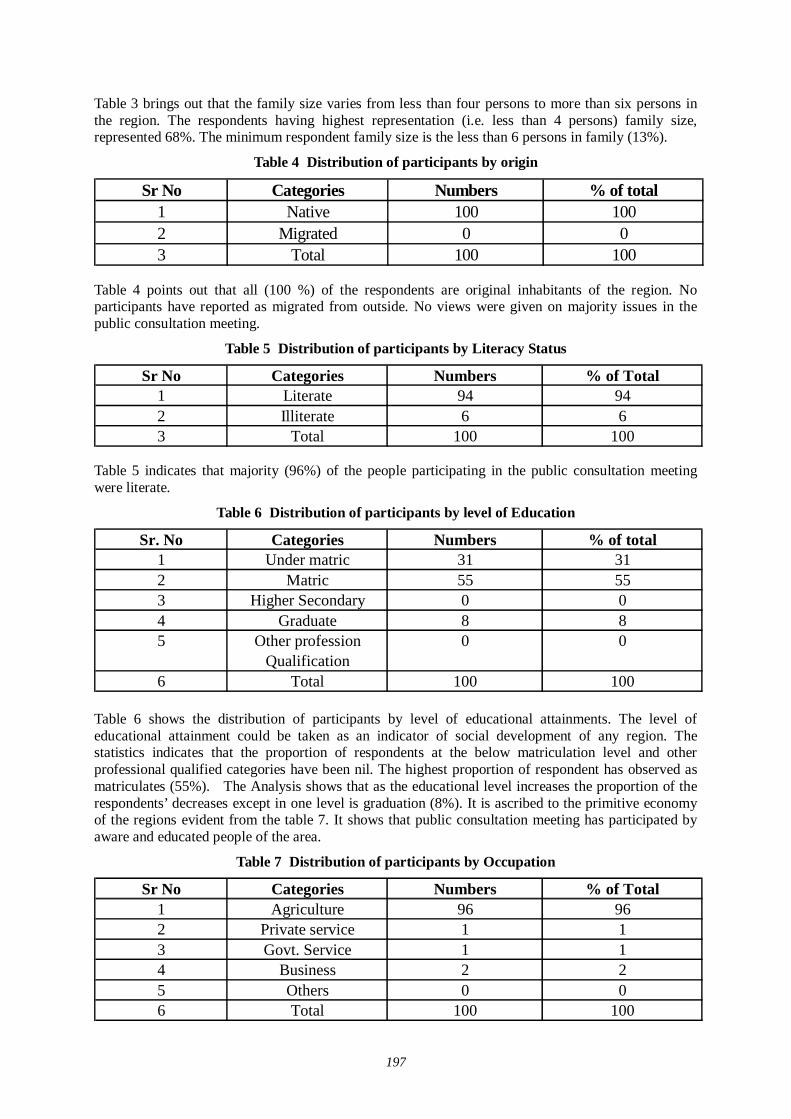
197
Table 3 brings out that the family size varies from less than four persons to more than six persons in the region. The respondents having highest representation (i.e. less than 4 persons) family size, represented 68%. The minimum respondent family size is the less than 6 persons in family (13%).
Table 4 Distribution of participants by origin
Sr No Categories Numbers % of total1 Native 100 1002 Migrated 0 03 Total 100 100
Table 4 points out that all (100 %) of the respondents are original inhabitants of the region. No participants have reported as migrated from outside. No views were given on majority issues in the public consultation meeting.
Table 5 Distribution of participants by Literacy Status
Sr No Categories Numbers % of Total1 Literate 94 942 Illiterate 6 63 Total 100 100
Table 5 indicates that majority (96%) of the people participating in the public consultation meeting were literate.
Table 6 Distribution of participants by level of Education
Sr. No Categories Numbers % of total1 Under matric 31 312 Matric 55 553 Higher Secondary 0 04 Graduate 8 85 Other profession
Qualification0 0
6 Total 100 100 Table 6 shows the distribution of participants by level of educational attainments. The level of educational attainment could be taken as an indicator of social development of any region. The statistics indicates that the proportion of respondents at the below matriculation level and other professional qualified categories have been nil. The highest proportion of respondent has observed as matriculates (55%). The Analysis shows that as the educational level increases the proportion of the respondents’ decreases except in one level is graduation (8%). It is ascribed to the primitive economy of the regions evident from the table 7. It shows that public consultation meeting has participated by aware and educated people of the area.
Table 7 Distribution of participants by Occupation
Sr No Categories Numbers % of Total1 Agriculture 96 962 Private service 1 13 Govt. Service 1 14 Business 2 25 Others 0 06 Total 100 100
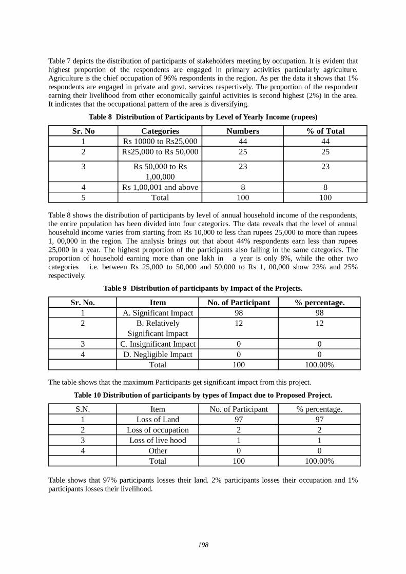
198
Table 7 depicts the distribution of participants of stakeholders meeting by occupation. It is evident that highest proportion of the respondents are engaged in primary activities particularly agriculture. Agriculture is the chief occupation of 96% respondents in the region. As per the data it shows that 1% respondents are engaged in private and govt. services respectively. The proportion of the respondent earning their livelihood from other economically gainful activities is second highest (2%) in the area. It indicates that the occupational pattern of the area is diversifying.
Table 8 Distribution of Participants by Level of Yearly Income (rupees)
Sr. No Categories Numbers % of Total1 Rs 10000 to Rs25,000 44 442 Rs25,000 to Rs 50,000 25 25
3 Rs 50,000 to Rs 1,00,000
23 23
4 Rs 1,00,001 and above 8 85 Total 100 100
Table 8 shows the distribution of participants by level of annual household income of the respondents, the entire population has been divided into four categories. The data reveals that the level of annual household income varies from starting from Rs 10,000 to less than rupees 25,000 to more than rupees 1, 00,000 in the region. The analysis brings out that about 44% respondents earn less than rupees 25,000 in a year. The highest proportion of the participants also falling in the same categories. The proportion of household earning more than one lakh in a year is only 8%, while the other two categories i.e. between Rs 25,000 to 50,000 and 50,000 to Rs 1, 00,000 show 23% and 25% respectively.
Table 9 Distribution of participants by Impact of the Projects.
Sr. No. Item No. of Participant % percentage.1 A. Significant Impact 98 982 B. Relatively
Significant Impact12 12
3 C. Insignificant Impact 0 04 D. Negligible Impact 0 0
Total 100 100.00% The table shows that the maximum Participants get significant impact from this project.
Table 10 Distribution of participants by types of Impact due to Proposed Project.
S.N. Item No. of Participant % percentage.1 Loss of Land 97 972 Loss of occupation 2 23 Loss of live hood 1 14 Other 0 0
Total 100 100.00% Table shows that 97% participants losses their land. 2% participants losses their occupation and 1% participants losses their livelihood.
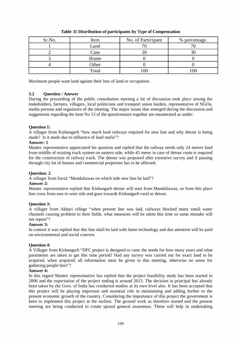
199
Table 11 Distribution of participants by Type of Compensation
Sr.No. Item No. of Participant % percentage.1 Land 70 702 Case 30 303 Home 0 04 Other 0 0
Total 100 100 Maximum people want land against their loss of land or occupation.
3.2 Question / Answer During the proceeding of the public consultation meeting a lot of discussion took place among the stakeholders, farmers, villagers, local politicians and transport union leaders, representative of NGOs, media persons and organizers of the meeting. The major issues that emerged during the discussion and suggestions regarding the item No 13 of the questionnaire together are enumerated as under:
Question 1: A villager from Kishangarh “how much land railways required for new line and why detour is being made? Is it made due to influence of land mafia”? Answer: 1 Mantec representative appreciated his question and replied that the railway needs only 24 meters land from middle of existing track system on eastern side, while 45 meter in case of detour route is required for the construction of railway track. The detour was proposed after extensive survey and if passing through city lot of houses and commercial properties has to be affected. Question: 2 A villager from Saval “Mandaliawas on which side new line be laid”? Answer 2: Mantec representative replied that Kishangarh detour will start from Mandaliawas, so from this place line cross from east to west side and goes towards Kishangarh rural as detour. Question 3: A villager from Akhari village “when present line was laid, railways blocked many small water channels causing problem to their fields, what measures will be taken this time so same mistake will not repeat”? Answer 3: In context it was replied that this line shall be laid with latest technology and due attention will be paid on environmental and social concern. Question 4: A Villager from Kishangarh “DFC project is designed to cater the needs for how many years and what parameters are taken to get this time period? Had any survey was carried out for exact land to be acquired, when acquired, all information must be given in this meeting, otherwise no sense for gathering people here”? Answer 4: In this regard Mantec representative has replied that the project feasibility study has been started in 2006 and the expectation of the project ending is around 2013. The decision in principal has already been taken by the Govt. of India has conducted studies at its own level also. It has been accepted that this project will be playing important and essential role in maintaining and adding further to the present economic growth of the country. Considering the importance of this project the government is keen to implement this project at the earliest. The ground work as therefore started and the present meeting are being conducted to create spread general awareness. These will help in undertaking
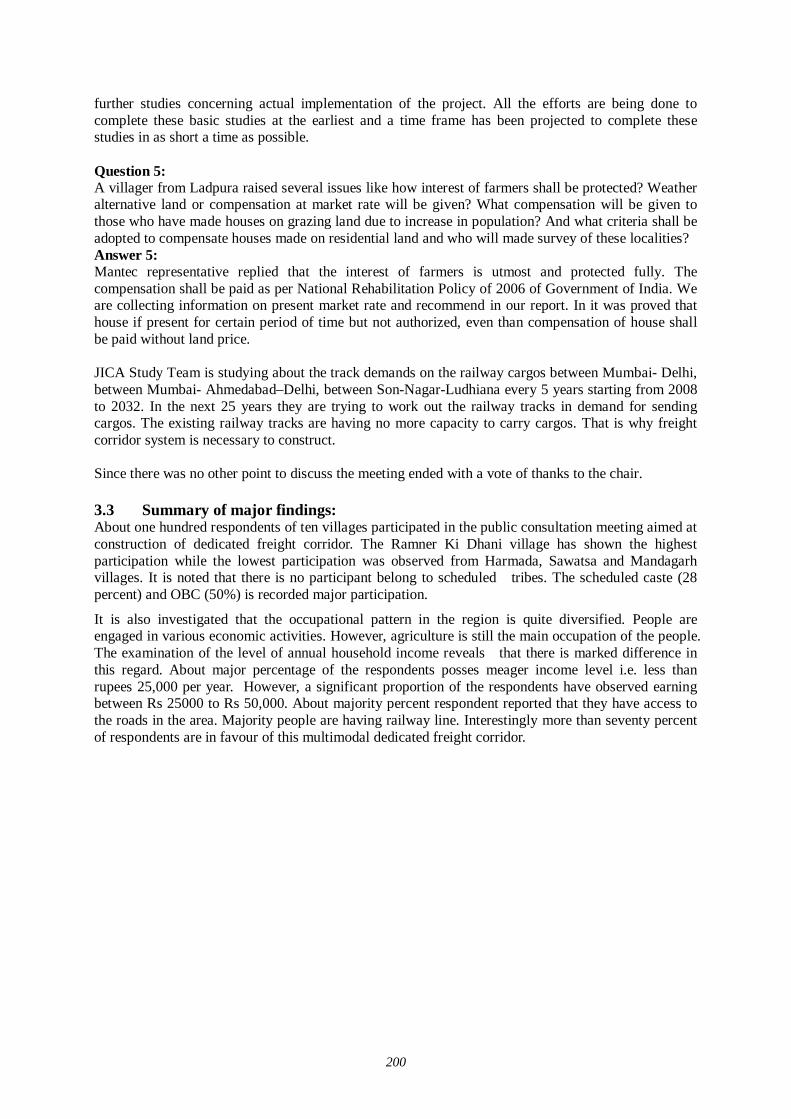
200
further studies concerning actual implementation of the project. All the efforts are being done to complete these basic studies at the earliest and a time frame has been projected to complete these studies in as short a time as possible. Question 5: A villager from Ladpura raised several issues like how interest of farmers shall be protected? Weather alternative land or compensation at market rate will be given? What compensation will be given to those who have made houses on grazing land due to increase in population? And what criteria shall be adopted to compensate houses made on residential land and who will made survey of these localities? Answer 5: Mantec representative replied that the interest of farmers is utmost and protected fully. The compensation shall be paid as per National Rehabilitation Policy of 2006 of Government of India. We are collecting information on present market rate and recommend in our report. In it was proved that house if present for certain period of time but not authorized, even than compensation of house shall be paid without land price. JICA Study Team is studying about the track demands on the railway cargos between Mumbai- Delhi, between Mumbai- Ahmedabad–Delhi, between Son-Nagar-Ludhiana every 5 years starting from 2008 to 2032. In the next 25 years they are trying to work out the railway tracks in demand for sending cargos. The existing railway tracks are having no more capacity to carry cargos. That is why freight corridor system is necessary to construct. Since there was no other point to discuss the meeting ended with a vote of thanks to the chair. 3.3 Summary of major findings: About one hundred respondents of ten villages participated in the public consultation meeting aimed at construction of dedicated freight corridor. The Ramner Ki Dhani village has shown the highest participation while the lowest participation was observed from Harmada, Sawatsa and Mandagarh villages. It is noted that there is no participant belong to scheduled tribes. The scheduled caste (28 percent) and OBC (50%) is recorded major participation.
It is also investigated that the occupational pattern in the region is quite diversified. People are engaged in various economic activities. However, agriculture is still the main occupation of the people. The examination of the level of annual household income reveals that there is marked difference in this regard. About major percentage of the respondents posses meager income level i.e. less than rupees 25,000 per year. However, a significant proportion of the respondents have observed earning between Rs 25000 to Rs 50,000. About majority percent respondent reported that they have access to the roads in the area. Majority people are having railway line. Interestingly more than seventy percent of respondents are in favour of this multimodal dedicated freight corridor.
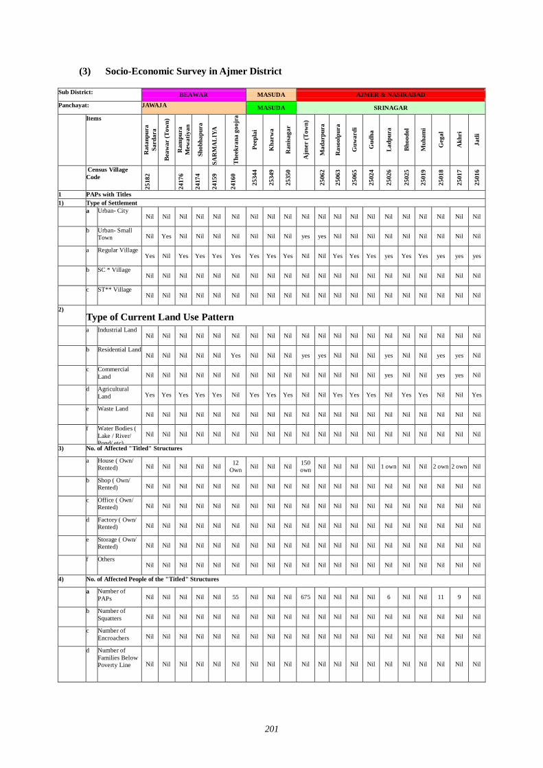
201
(3) Socio-Economic Survey in Ajmer District
Sub District:
BEAWAR MASUDA AJMER & NASIRABAD
Panchayat:
JAWAJA MASUDA SRINAGAR
Items
Rat
anpu
ra
Sard
ara
Beaw
ar (T
own)
Ram
pura
M
ewat
iyan
Shob
hapu
ra
SAR
MA
LIY
A
Thee
kran
a go
ojra
Peep
lai
Kha
rwa
Ran
isaga
r
Ajm
er (T
own)
Mad
arpu
ra
Ras
oolp
ura
Guw
ardi
Gud
ha
Ladp
ura
Bhoo
dol
Muh
ami
Geg
al
Akh
ri
Jatli
Census Village Code
2518
2
2417
6
2417
4
2415
9
2416
0
2534
4
2534
9
2535
0
2506
2
2506
3
2506
5
2502
4
2502
6
2502
5
2501
9
2501
8
2501
7
2501
6
1 PAPs with Titles 1) Type of Settlement a Urban- City
Nil Nil Nil Nil Nil Nil Nil Nil Nil Nil Nil Nil Nil Nil Nil Nil Nil Nil Nil Nil
b Urban- Small Town Nil Yes Nil Nil Nil Nil Nil Nil Nil yes yes Nil Nil Nil Nil Nil Nil Nil Nil Nil
a Regular Village Yes Nil Yes Yes Yes Yes Yes Yes Yes Nil Nil Yes Yes Yes yes Yes Yes yes yes yes
b SC * Village Nil Nil Nil Nil Nil Nil Nil Nil Nil Nil Nil Nil Nil Nil Nil Nil Nil Nil Nil Nil
c ST** Village Nil Nil Nil Nil Nil Nil Nil Nil Nil Nil Nil Nil Nil Nil Nil Nil Nil Nil Nil Nil
2) Type of Current Land Use Pattern
a Industrial Land Nil Nil Nil Nil Nil Nil Nil Nil Nil Nil Nil Nil Nil Nil Nil Nil Nil Nil Nil Nil
b Residential Land Nil Nil Nil Nil Nil Yes Nil Nil Nil yes yes Nil Nil Nil yes Nil Nil yes yes Nil
c Commercial Land Nil Nil Nil Nil Nil Nil Nil Nil Nil Nil Nil Nil Nil Nil yes Nil Nil yes yes Nil
d Agricultural Land Yes Yes Yes Yes Yes Nil Yes Yes Yes Nil Nil Yes Yes Yes Nil Yes Yes Nil Nil Yes
e Waste Land Nil Nil Nil Nil Nil Nil Nil Nil Nil Nil Nil Nil Nil Nil Nil Nil Nil Nil Nil Nil
f Water Bodies ( Lake / River/ Pond/ etc)
Nil Nil Nil Nil Nil Nil Nil Nil Nil Nil Nil Nil Nil Nil Nil Nil Nil Nil Nil Nil
3) No. of Affected "Titled" Structures
a House ( Own/ Rented) Nil Nil Nil Nil Nil 12
Own Nil Nil Nil 150 own Nil Nil Nil Nil 1 own Nil Nil 2 own 2 own Nil
b Shop ( Own/ Rented) Nil Nil Nil Nil Nil Nil Nil Nil Nil Nil Nil Nil Nil Nil Nil Nil Nil Nil Nil Nil
c Office ( Own/ Rented) Nil Nil Nil Nil Nil Nil Nil Nil Nil Nil Nil Nil Nil Nil Nil Nil Nil Nil Nil Nil
d Factory ( Own/ Rented) Nil Nil Nil Nil Nil Nil Nil Nil Nil Nil Nil Nil Nil Nil Nil Nil Nil Nil Nil Nil
e Storage ( Own/ Rented) Nil Nil Nil Nil Nil Nil Nil Nil Nil Nil Nil Nil Nil Nil Nil Nil Nil Nil Nil Nil
f Others Nil Nil Nil Nil Nil Nil Nil Nil Nil Nil Nil Nil Nil Nil Nil Nil Nil Nil Nil Nil
4) No. of Affected People of the "Titled" Structures
a Number of PAPs Nil Nil Nil Nil Nil 55 Nil Nil Nil 675 Nil Nil Nil Nil 6 Nil Nil 11 9 Nil
b Number of Squatters Nil Nil Nil Nil Nil Nil Nil Nil Nil Nil Nil Nil Nil Nil Nil Nil Nil Nil Nil Nil
c Number of Encroachers Nil Nil Nil Nil Nil Nil Nil Nil Nil Nil Nil Nil Nil Nil Nil Nil Nil Nil Nil Nil
d Number of Families Below Poverty Line Nil Nil Nil Nil Nil Nil Nil Nil Nil Nil Nil Nil Nil Nil Nil Nil Nil Nil Nil Nil
I
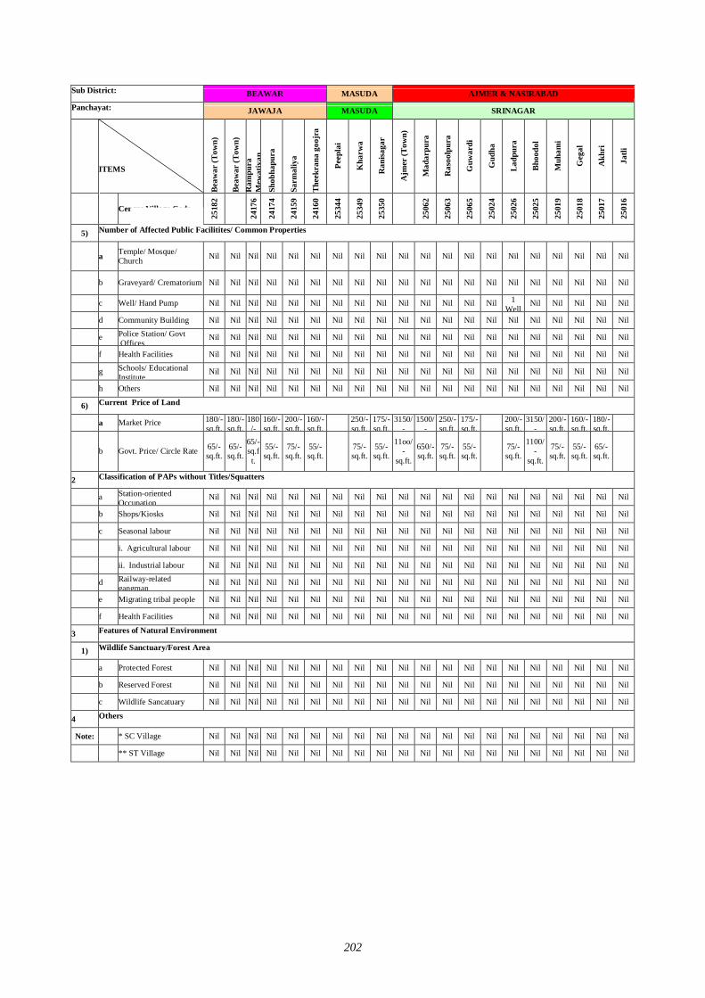
202
Sub District:
BEAWAR MASUDA AJMER & NASIRABAD
Panchayat:
JAWAJA MASUDA SRINAGAR
ITEMS
Beaw
ar (T
own)
Beaw
ar (T
own)
R
ampu
ra
Mew
atiy
an
Shob
hapu
ra
Sarm
aliy
a
Thee
kran
a go
ojra
Peep
lai
Kha
rwa
Ran
isaga
r
Ajm
er (T
own)
Mad
arpu
ra
Ras
oolp
ura
Guw
ardi
Gud
ha
Ladp
ura
Bhoo
dol
Muh
ami
Geg
al
Akh
ri
Jatli
Census Village Code 25
182
2417
6
2417
4
2415
9
2416
0
2534
4
2534
9
2535
0
2506
2
2506
3
2506
5
2502
4
2502
6
2502
5
2501
9
2501
8
2501
7
2501
6
5) Number of Affected Public Facilitites/ Common Properties
a Temple/ Mosque/ Church Nil Nil Nil Nil Nil Nil Nil Nil Nil Nil Nil Nil Nil Nil Nil Nil Nil Nil Nil Nil
b Graveyard/ Crematorium Nil Nil Nil Nil Nil Nil Nil Nil Nil Nil Nil Nil Nil Nil Nil Nil Nil Nil Nil Nil
c Well/ Hand Pump Nil Nil Nil Nil Nil Nil Nil Nil Nil Nil Nil Nil Nil Nil 1 Well
Nil Nil Nil Nil Nil
d Community Building Nil Nil Nil Nil Nil Nil Nil Nil Nil Nil Nil Nil Nil Nil Nil Nil Nil Nil Nil Nil
e Police Station/ Govt .Offices
Nil Nil Nil Nil Nil Nil Nil Nil Nil Nil Nil Nil Nil Nil Nil Nil Nil Nil Nil Nil
f Health Facilities Nil Nil Nil Nil Nil Nil Nil Nil Nil Nil Nil Nil Nil Nil Nil Nil Nil Nil Nil Nil
g Schools/ Educational Institute
Nil Nil Nil Nil Nil Nil Nil Nil Nil Nil Nil Nil Nil Nil Nil Nil Nil Nil Nil Nil
h Others Nil Nil Nil Nil Nil Nil Nil Nil Nil Nil Nil Nil Nil Nil Nil Nil Nil Nil Nil Nil
6) Current Price of Land
a Market Price 180/- sq.ft.
180/- sq.ft.
180/-
160/- sq.ft.
200/- sq.ft.
160/- sq.ft.
250/- sq.ft.
175/- sq.ft.
3150/-
1500/-
250/- sq.ft.
175/- sq.ft.
200/- sq.ft.
3150/-
200/- sq.ft.
160/- sq.ft.
180/- sq.ft.
b Govt. Price/ Circle Rate 65/- sq.ft.
65/- sq.ft.
65/- sq.ft.
55/- sq.ft.
75/- sq.ft.
55/- sq.ft. 75/-
sq.ft. 55/- sq.ft.
11oo/-
sq.ft.
650/- sq.ft.
75/- sq.ft.
55/- sq.ft. 75/-
sq.ft.
1100/-
sq.ft.
75/- sq.ft.
55/- sq.ft.
65/- sq.ft.
2 Classification of PAPs without Titles/Squatters
a Station-oriented Occupation
Nil Nil Nil Nil Nil Nil Nil Nil Nil Nil Nil Nil Nil Nil Nil Nil Nil Nil Nil Nil
b Shops/Kiosks Nil Nil Nil Nil Nil Nil Nil Nil Nil Nil Nil Nil Nil Nil Nil Nil Nil Nil Nil Nil
c Seasonal labour Nil Nil Nil Nil Nil Nil Nil Nil Nil Nil Nil Nil Nil Nil Nil Nil Nil Nil Nil Nil
i. Agricultural labour Nil Nil Nil Nil Nil Nil Nil Nil Nil Nil Nil Nil Nil Nil Nil Nil Nil Nil Nil Nil
ii. Industrial labour Nil Nil Nil Nil Nil Nil Nil Nil Nil Nil Nil Nil Nil Nil Nil Nil Nil Nil Nil Nil
d Railway-related gangman
Nil Nil Nil Nil Nil Nil Nil Nil Nil Nil Nil Nil Nil Nil Nil Nil Nil Nil Nil Nil
e Migrating tribal people Nil Nil Nil Nil Nil Nil Nil Nil Nil Nil Nil Nil Nil Nil Nil Nil Nil Nil Nil Nil
f Health Facilities Nil Nil Nil Nil Nil Nil Nil Nil Nil Nil Nil Nil Nil Nil Nil Nil Nil Nil Nil Nil
3 Features of Natural Environment
1) Wildlife Sanctuary/Forest Area
a Protected Forest Nil Nil Nil Nil Nil Nil Nil Nil Nil Nil Nil Nil Nil Nil Nil Nil Nil Nil Nil Nil
b Reserved Forest Nil Nil Nil Nil Nil Nil Nil Nil Nil Nil Nil Nil Nil Nil Nil Nil Nil Nil Nil Nil
c Wildlife Sancatuary Nil Nil Nil Nil Nil Nil Nil Nil Nil Nil Nil Nil Nil Nil Nil Nil Nil Nil Nil Nil
4 Others
Note: * SC Village Nil Nil Nil Nil Nil Nil Nil Nil Nil Nil Nil Nil Nil Nil Nil Nil Nil Nil Nil Nil
** ST Village Nil Nil Nil Nil Nil Nil Nil Nil Nil Nil Nil Nil Nil Nil Nil Nil Nil Nil Nil Nil
NI
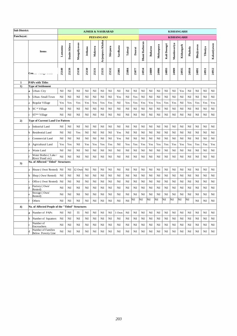
203
Sub District:
AJMER & NASIRABAD KISHANGARH
Panchayat:
PEESANGANJ KISHANGARH
Items
Lam
anna
Dau
let K
hera
Man
galiy
awas
Jeth
ana
Mak
rera
Arj
unpu
ra K
halsa
Shiv
pura
Sard
hana
Tabe
eji
Dau
rai
Dha
ni R
atho
ran
Buha
roo
Moh
anpu
ra
Kal
i Doo
ngri
Man
daw
ariy
a
Kish
anga
rh
Phal
oda
Bhoj
iyaw
as
Tilo
niya
Kak
aniy
awas
Census Village Code 25
140
2513
9
2513
8
2513
0
2513
1
2513
5
2513
2
2508
1
2508
4
2507
7
2493
4
2488
9
2490
6
2489
3
2490
9
2493
5
2491
0
2489
1
2491
1
2491
2
1 PAPs with Titles 1) Type of Settlement
a Urban- City Nil Nil Nil Nil Nil Nil Nil Nil Nil Nil Nil Nil Nil Nil Nil Yes Nil Nil Nil Nil
b Urban- Small Town Nil Nil Nil Nil Nil Nil Nil Yes Nil Yes Nil Nil Nil Nil Nil Nil Nil Nil Nil Nil
a Regular Village Yes Yes Yes Yes Yes Yes Yes Nil Yes Yes Yes Yes Yes Yes Yes Nil Yes Yes Yes Yes
b SC * Village Nil Nil Nil Nil Nil Nil Nil Nil Nil Nil Nil Nil Nil Nil Nil Nil Nil Nil Nil Nil
c ST** Village Nil Nil Nil Nil Nil Nil Nil Nil Nil Nil Nil Nil Nil Nil Nil Nil Nil Nil Nil Nil
2) Type of Current Land Use Pattern
a Industrial Land Nil Nil Nil Nil Nil Nil Nil Nil Nil Nil Nil Nil Nil Nil Nil Nil Nil Nil Nil Nil
b Residential Land Nil Nil Yes Nil Nil Nil Nil Yes Nil Nil Nil Nil Nil Nil Nil Nil Nil Nil Nil Nil
c Commercial Land Nil Nil Nil Nil Nil Nil Nil Yes Nil Nil Nil Nil Nil Nil Nil Nil Nil Nil Nil Nil
d Agricultural Land Yes Yes Nil Yes Yes Yes Yes Nil Yes Yes Yes Yes Yes Yes Yes Yes Yes Yes Yes Yes
e Waste Land Nil Nil Nil Nil Nil Nil Nil Nil Nil Nil Nil Nil Nil Nil Nil Nil Nil Nil Nil Nil
f Water Bodies ( Lake / River/ Pond/ etc) Nil Nil Nil Nil Nil Nil Nil Nil Nil Nil Nil Nil Nil Nil Nil Nil Nil Nil Nil Nil
3) No. of Affected "Titled" Structures
a House ( Own/ Rented) Nil Nil 12 Own Nil Nil Nil Nil Nil Nil Nil Nil Nil Nil Nil Nil Nil Nil Nil Nil Nil
b Shop ( Own/ Rented) Nil Nil Nil Nil Nil Nil Nil Nil Nil Nil Nil Nil Nil Nil Nil Nil Nil Nil Nil Nil
c Office ( Own/ Rented) Nil Nil Nil Nil Nil Nil Nil Nil Nil Nil Nil Nil Nil Nil Nil Nil Nil Nil Nil Nil
d Factory ( Own/ Rented) Nil Nil Nil Nil Nil Nil Nil Nil Nil Nil Nil Nil Nil Nil Nil Nil Nil Nil Nil Nil
e Storage ( Own/ Rented) Nil Nil Nil Nil Nil Nil Nil Nil Nil Nil Nil Nil Nil Nil Nil Nil Nil Nil Nil Nil
f Others Nil Nil Nil Nil Nil Nil Nil Nil Nil Nil Nil Nil Nil Nil Nil Nil Nil Nil Nil Nil
4) No. of Affected People of the "Titled" Structures
a Number of PAPs Nil Nil 55 Nil Nil Nil Nil 1 Own Nil Nil Nil Nil Nil Nil Nil Nil Nil Nil Nil Nil
b Number of Squatters Nil Nil Nil Nil Nil Nil Nil Nil Nil Nil Nil Nil Nil Nil Nil Nil Nil Nil Nil Nil
c Number of Encroachers Nil Nil Nil Nil Nil Nil Nil Nil Nil Nil Nil Nil Nil Nil Nil Nil Nil Nil Nil Nil
d Number of Families Below Poverty Line Nil Nil Nil Nil Nil Nil Nil Nil Nil Nil Nil Nil Nil Nil Nil Nil Nil Nil Nil Nil
NI
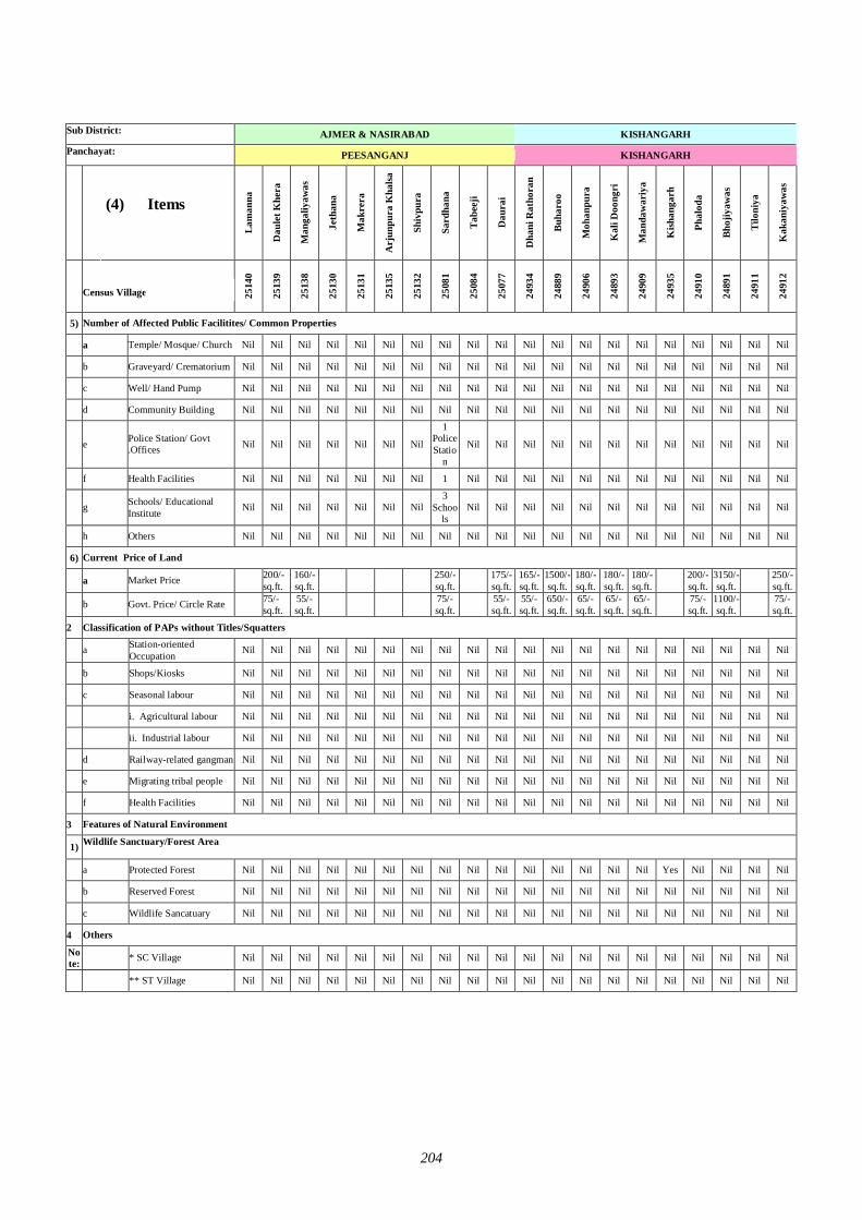
204
Sub District:
AJMER & NASIRABAD KISHANGARH
Panchayat:
PEESANGANJ KISHANGARH
(4) Items
Lam
anna
Dau
let K
hera
Man
galiy
awas
Jeth
ana
Mak
rera
Arj
unpu
ra K
halsa
Shiv
pura
Sard
hana
Tabe
eji
Dau
rai
Dha
ni R
atho
ran
Buha
roo
Moh
anpu
ra
Kal
i Doo
ngri
Man
daw
ariy
a
Kish
anga
rh
Phal
oda
Bhoj
iyaw
as
Tilo
niya
Kak
aniy
awas
Census Village Code 25
140
2513
9
2513
8
2513
0
2513
1
2513
5
2513
2
2508
1
2508
4
2507
7
2493
4
2488
9
2490
6
2489
3
2490
9
2493
5
2491
0
2489
1
2491
1
2491
2
5) Number of Affected Public Facilitites/ Common Properties
a Temple/ Mosque/ Church Nil Nil Nil Nil Nil Nil Nil Nil Nil Nil Nil Nil Nil Nil Nil Nil Nil Nil Nil Nil
b Graveyard/ Crematorium Nil Nil Nil Nil Nil Nil Nil Nil Nil Nil Nil Nil Nil Nil Nil Nil Nil Nil Nil Nil
c Well/ Hand Pump Nil Nil Nil Nil Nil Nil Nil Nil Nil Nil Nil Nil Nil Nil Nil Nil Nil Nil Nil Nil
d Community Building Nil Nil Nil Nil Nil Nil Nil Nil Nil Nil Nil Nil Nil Nil Nil Nil Nil Nil Nil Nil
e Police Station/ Govt .Offices Nil Nil Nil Nil Nil Nil Nil
1 Police Statio
n
Nil Nil Nil Nil Nil Nil Nil Nil Nil Nil Nil Nil
f Health Facilities Nil Nil Nil Nil Nil Nil Nil 1 Nil Nil Nil Nil Nil Nil Nil Nil Nil Nil Nil Nil
g Schools/ Educational Institute Nil Nil Nil Nil Nil Nil Nil
3 Schoo
ls Nil Nil Nil Nil Nil Nil Nil Nil Nil Nil Nil Nil
h Others Nil Nil Nil Nil Nil Nil Nil Nil Nil Nil Nil Nil Nil Nil Nil Nil Nil Nil Nil Nil
6) Current Price of Land
a Market Price 200/- sq.ft.
160/- sq.ft. 250/-
sq.ft. 175/- sq.ft.
165/- sq.ft.
1500/- sq.ft.
180/- sq.ft.
180/- sq.ft.
180/- sq.ft. 200/-
sq.ft. 3150/- sq.ft. 250/-
sq.ft.
b Govt. Price/ Circle Rate 75/- sq.ft.
55/- sq.ft. 75/-
sq.ft. 55/- sq.ft.
55/- sq.ft.
650/- sq.ft.
65/- sq.ft.
65/- sq.ft.
65/- sq.ft. 75/-
sq.ft. 1100/- sq.ft. 75/-
sq.ft.
2 Classification of PAPs without Titles/Squatters
a Station-oriented Occupation Nil Nil Nil Nil Nil Nil Nil Nil Nil Nil Nil Nil Nil Nil Nil Nil Nil Nil Nil Nil
b Shops/Kiosks Nil Nil Nil Nil Nil Nil Nil Nil Nil Nil Nil Nil Nil Nil Nil Nil Nil Nil Nil Nil
c Seasonal labour Nil Nil Nil Nil Nil Nil Nil Nil Nil Nil Nil Nil Nil Nil Nil Nil Nil Nil Nil Nil
i. Agricultural labour Nil Nil Nil Nil Nil Nil Nil Nil Nil Nil Nil Nil Nil Nil Nil Nil Nil Nil Nil Nil
ii. Industrial labour Nil Nil Nil Nil Nil Nil Nil Nil Nil Nil Nil Nil Nil Nil Nil Nil Nil Nil Nil Nil
d Railway-related gangman Nil Nil Nil Nil Nil Nil Nil Nil Nil Nil Nil Nil Nil Nil Nil Nil Nil Nil Nil Nil
e Migrating tribal people Nil Nil Nil Nil Nil Nil Nil Nil Nil Nil Nil Nil Nil Nil Nil Nil Nil Nil Nil Nil
f Health Facilities Nil Nil Nil Nil Nil Nil Nil Nil Nil Nil Nil Nil Nil Nil Nil Nil Nil Nil Nil Nil
3 Features of Natural Environment
1) Wildlife Sanctuary/Forest Area
a Protected Forest Nil Nil Nil Nil Nil Nil Nil Nil Nil Nil Nil Nil Nil Nil Nil Yes Nil Nil Nil Nil
b Reserved Forest Nil Nil Nil Nil Nil Nil Nil Nil Nil Nil Nil Nil Nil Nil Nil Nil Nil Nil Nil Nil
c Wildlife Sancatuary Nil Nil Nil Nil Nil Nil Nil Nil Nil Nil Nil Nil Nil Nil Nil Nil Nil Nil Nil Nil
4 Others
Note: * SC Village Nil Nil Nil Nil Nil Nil Nil Nil Nil Nil Nil Nil Nil Nil Nil Nil Nil Nil Nil Nil
** ST Village Nil Nil Nil Nil Nil Nil Nil Nil Nil Nil Nil Nil Nil Nil Nil Nil Nil Nil Nil Nil
N
I
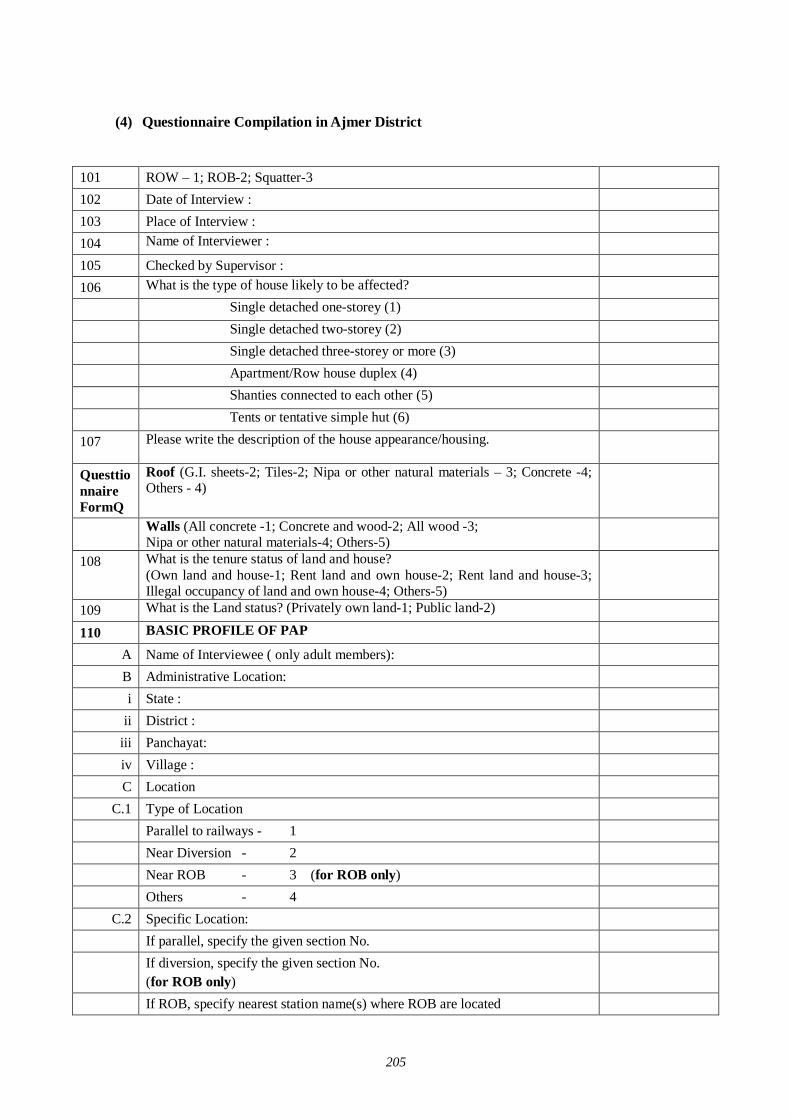
205
(4) Questionnaire Compilation in Ajmer District
101 ROW – 1; ROB-2; Squatter-3 102 Date of Interview : 103 Place of Interview : 104 Name of Interviewer : 105 Checked by Supervisor : 106 What is the type of house likely to be affected? Single detached one-storey (1) Single detached two-storey (2) Single detached three-storey or more (3) Apartment/Row house duplex (4) Shanties connected to each other (5) Tents or tentative simple hut (6) 107 Please write the description of the house appearance/housing.
Questtionnaire FormQ
Roof (G.I. sheets-2; Tiles-2; Nipa or other natural materials – 3; Concrete -4; Others - 4)
Walls (All concrete -1; Concrete and wood-2; All wood -3; Nipa or other natural materials-4; Others-5)
108 What is the tenure status of land and house? (Own land and house-1; Rent land and own house-2; Rent land and house-3; Illegal occupancy of land and own house-4; Others-5)
109 What is the Land status? (Privately own land-1; Public land-2) 110 BASIC PROFILE OF PAP
A Name of Interviewee ( only adult members): B Administrative Location: i State :
ii District : iii Panchayat: iv Village : C Location
C.1 Type of Location Parallel to railways - 1 Near Diversion - 2 Near ROB - 3 (for ROB only) Others - 4 C.2 Specific Location:
If parallel, specify the given section No. If diversion, specify the given section No.
(for ROB only)
If ROB, specify nearest station name(s) where ROB are located
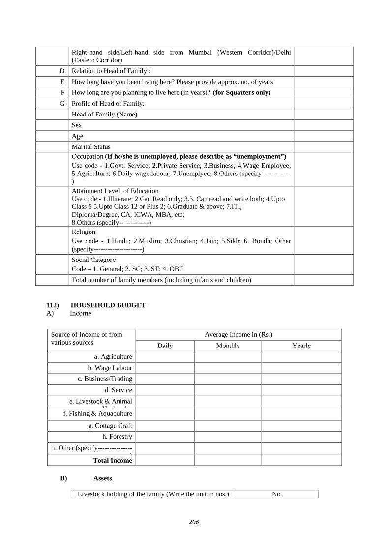
206
Right-hand side/Left-hand side from Mumbai (Western Corridor)/Delhi (Eastern Corridor)
D Relation to Head of Family : E How long have you been living here? Please provide approx. no. of years F How long are you planning to live here (in years)? (for Squatters only) G Profile of Head of Family:
Head of Family (Name) Sex Age Marital Status Occupation (If he/she is unemployed, please describe as “unemployment”)
Use code - 1.Govt. Service; 2.Private Service; 3.Business; 4.Wage Employee; 5.Agriculture; 6.Daily wage labour; 7.Unemplyed; 8.Others (specify ------------)
Attainment Level of Education Use code - 1.Illiterate; 2.Can Read only; 3.3. Can read and write both; 4.Upto Class 5 5.Upto Class 12 or Plus 2; 6.Graduate & above; 7.ITI, Diploma/Degree, CA, ICWA, MBA, etc; 8.Others (specify-------------)
Religion Use code - 1.Hindu; 2.Muslim; 3.Christian; 4.Jain; 5.Sikh; 6. Boudh; Other (specify---------------------)
Social Category Code – 1. General; 2. SC; 3. ST; 4. OBC
Total number of family members (including infants and children) 112) HOUSEHOLD BUDGET A) Income
Average Income in (Rs.) Source of Income of from
various sources Daily Monthly Yearly a. Agriculture
b. Wage Labour c. Business/Trading
d. Service e. Livestock & Animal
Husbandry
f. Fishing & Aquaculture
g. Cottage Craft h. Forestry
i. Other (specify---------------)
Total Income B) Assets
Livestock holding of the family (Write the unit in nos.) No.
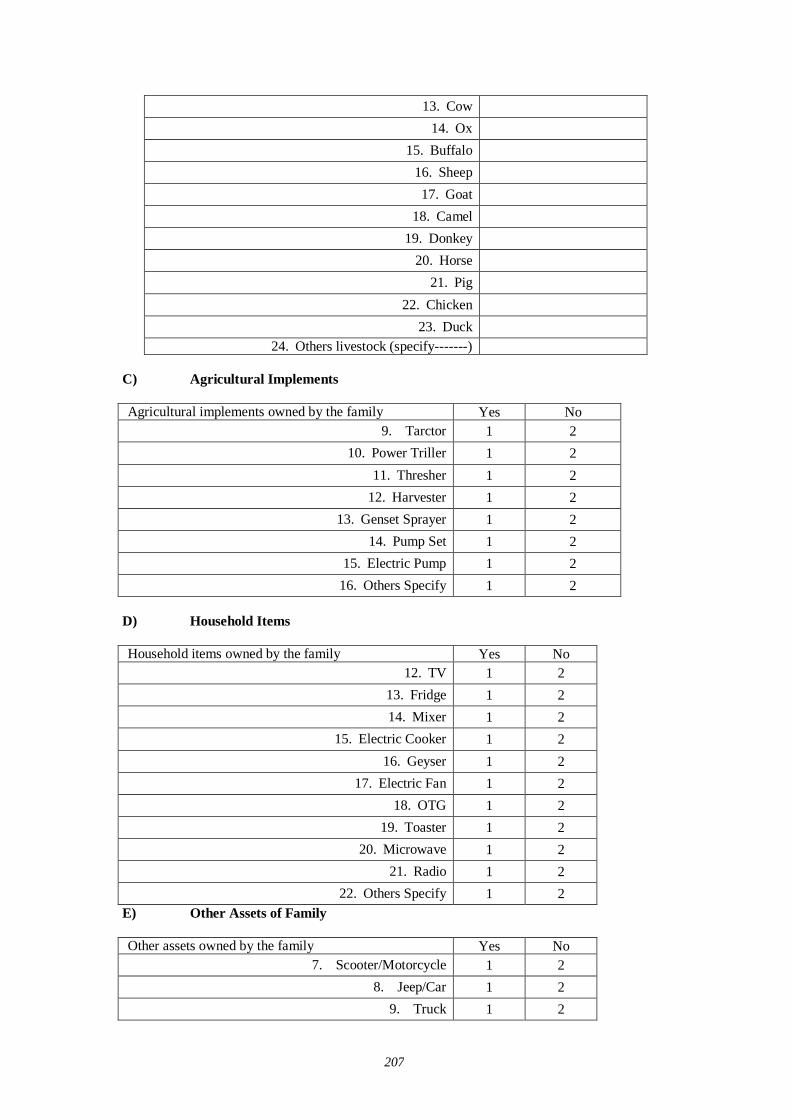
207
13. Cow 14. Ox
15. Buffalo 16. Sheep 17. Goat
18. Camel 19. Donkey
20. Horse 21. Pig
22. Chicken 23. Duck
24. Others livestock (specify-------) C) Agricultural Implements
Agricultural implements owned by the family Yes No 9. Tarctor 1 2
10. Power Triller 1 2 11. Thresher 1 2
12. Harvester 1 2 13. Genset Sprayer 1 2
14. Pump Set 1 2 15. Electric Pump 1 2
16. Others Specify 1 2 D) Household Items
Household items owned by the family Yes No 12. TV 1 2
13. Fridge 1 2 14. Mixer 1 2
15. Electric Cooker 1 2 16. Geyser 1 2
17. Electric Fan 1 2 18. OTG 1 2
19. Toaster 1 2 20. Microwave 1 2
21. Radio 1 2 22. Others Specify 1 2
E) Other Assets of Family
Other assets owned by the family Yes No 7. Scooter/Motorcycle 1 2
8. Jeep/Car 1 2 9. Truck 1 2
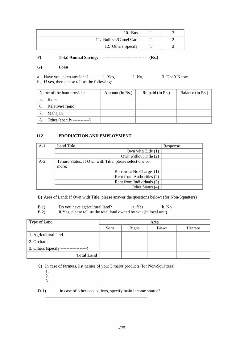
208
10. Bus 1 2 11. Bullock/Camel Cart 1 2
12. Others Specify 1 2 F) Total Annual Saving: ------------------------------ (Rs.)
G) Loan a. Have you taken any loan? 1. Yes, 2. No, 3. Don’t Know b. If yes, then please tell us the following:
Name of the loan provider Amount (in Rs.) Re-paid (in Rs.) Balance (in Rs.) 5. Bank 6. Relative/Friend 7. Mahajan 8. Other (specify -----------)
112 PRODUCTION AND EMPLOYMENT
Land Title Response Own with Title (1)
A-1
Own without Title (2) Tenure Status: If Own with Title, please select one or more:
Borrow at No Charge (1) Rent from Authorities (2) Rent from Individuals (3)
A-2
Other Status (4) B) Area of Land: If Own with Title, please answer the questions below: (for Non-Squatters) B.1) Do you have agricultural land? a. Yes b. No B.2) If Yes, please tell us the total land owned by you (in local unit).
Area Type of Land Sqm. Bigha Biswa Hectare
1. Agricultural land
2. Orchard
3. Others (specify ------------------)
Total Land
C) In case of farmers, list names of your 3 major products (for Non-Squatters) 1. 2. 3.
D-1) In case of other occupations, specify main income source?
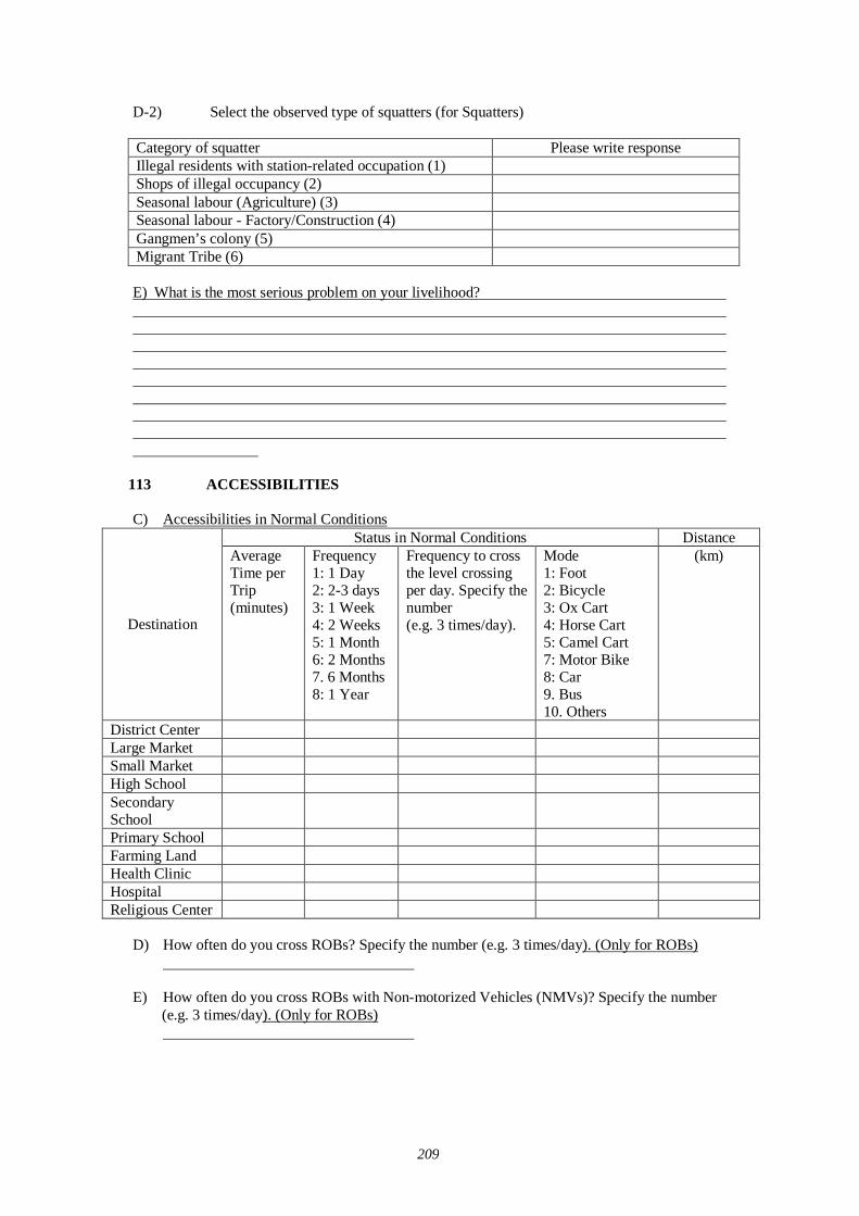
209
D-2) Select the observed type of squatters (for Squatters) Category of squatter Please write response Illegal residents with station-related occupation (1) Shops of illegal occupancy (2) Seasonal labour (Agriculture) (3) Seasonal labour - Factory/Construction (4) Gangmen’s colony (5) Migrant Tribe (6) E) What is the most serious problem on your livelihood?
113 ACCESSIBILITIES C) Accessibilities in Normal Conditions
Status in Normal Conditions Distance
Destination
Average Time per Trip (minutes)
Frequency 1: 1 Day 2: 2-3 days 3: 1 Week 4: 2 Weeks 5: 1 Month 6: 2 Months 7. 6 Months 8: 1 Year
Frequency to cross the level crossing per day. Specify the number (e.g. 3 times/day).
Mode 1: Foot 2: Bicycle 3: Ox Cart 4: Horse Cart 5: Camel Cart 7: Motor Bike 8: Car 9. Bus 10. Others
(km)
District Center Large Market Small Market High School Secondary School
Primary School Farming Land Health Clinic Hospital Religious Center
D) How often do you cross ROBs? Specify the number (e.g. 3 times/day). (Only for ROBs)
E) How often do you cross ROBs with Non-motorized Vehicles (NMVs)? Specify the number (e.g. 3 times/day). (Only for ROBs)
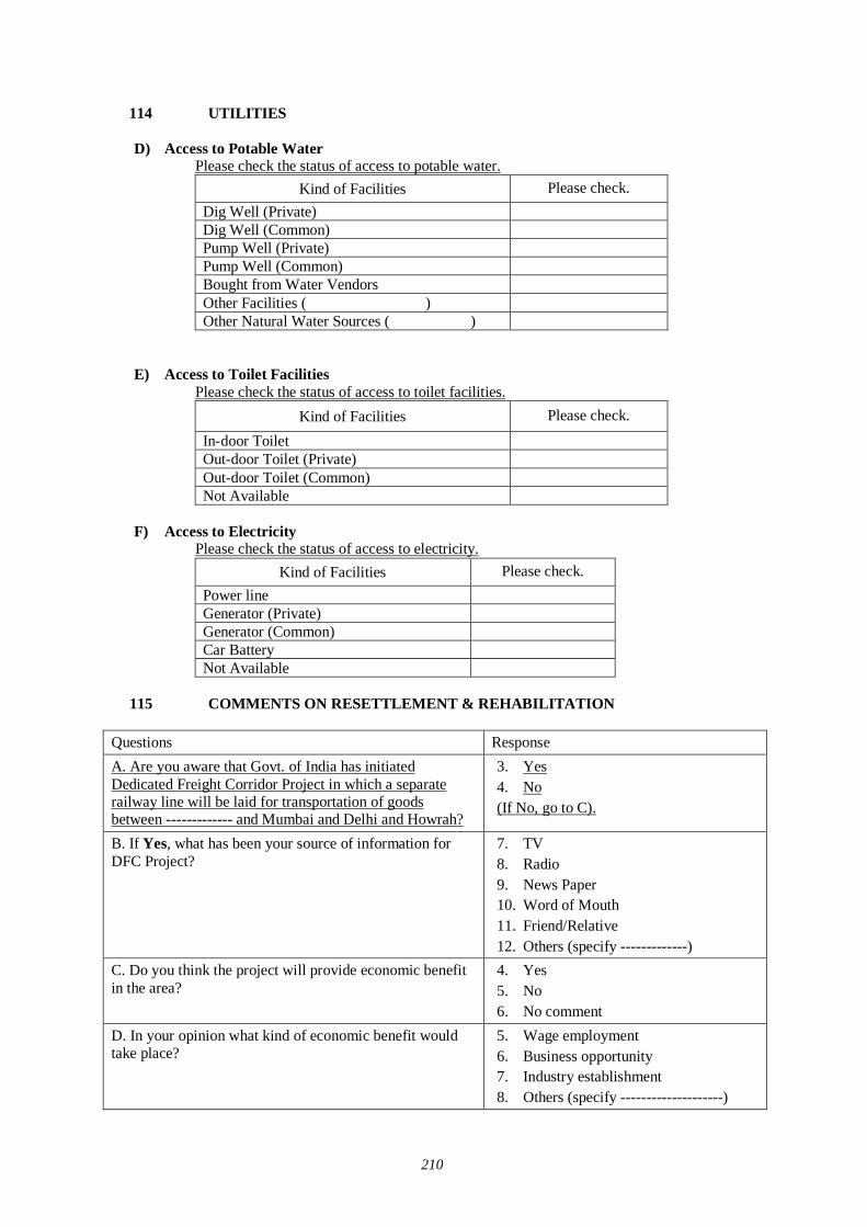
210
114 UTILITIES D) Access to Potable Water
Please check the status of access to potable water. Kind of Facilities Please check.
Dig Well (Private) Dig Well (Common) Pump Well (Private) Pump Well (Common) Bought from Water Vendors Other Facilities ( ) Other Natural Water Sources ( )
E) Access to Toilet Facilities Please check the status of access to toilet facilities.
Kind of Facilities Please check.
In-door Toilet Out-door Toilet (Private) Out-door Toilet (Common) Not Available
F) Access to Electricity
Please check the status of access to electricity. Kind of Facilities Please check.
Power line Generator (Private) Generator (Common) Car Battery Not Available
115 COMMENTS ON RESETTLEMENT & REHABILITATION
Questions Response A. Are you aware that Govt. of India has initiated Dedicated Freight Corridor Project in which a separate railway line will be laid for transportation of goods between ------------- and Mumbai and Delhi and Howrah?
3. Yes 4. No (If No, go to C).
B. If Yes, what has been your source of information for DFC Project?
7. TV 8. Radio 9. News Paper 10. Word of Mouth 11. Friend/Relative 12. Others (specify -------------)
C. Do you think the project will provide economic benefit in the area?
4. Yes 5. No 6. No comment
D. In your opinion what kind of economic benefit would take place?
5. Wage employment 6. Business opportunity 7. Industry establishment 8. Others (specify --------------------)
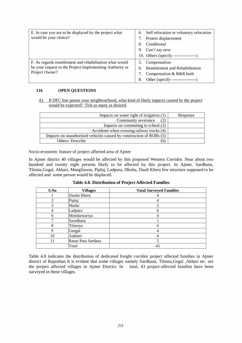
211
E. In case you are to be displaced by the project what would be your choice?
6. Self relocation or voluntary relocation 7. Protest displacement 8. Conditional 9. Can’t say now 10. Others (specify ----------------)
F. As regards resettlement and rehabilitation what would be your request to the Project Implementing Authority or Project Owner?
5. Compensation 6. Resettlement and Rehabilitation 7. Compensation & R&R both 8. Other (specify -----------------)
116 OPEN QUESTIONS
A) If DFC line passes your neighbourhood, what kind of likely impacts caused by the project
would be expected? Tick as many as desired.
Impacts on water right of irrigation (1) Response Community severance (2)
Impacts on commuting to school (3) Accidents when crossing railway tracks (4)
Impacts on unauthorized vehicles caused by construction of ROBs (5) Others: Describe (6)
Socio-economic feature of project affected area of Ajmer
In Ajmer district 40 villages would be affected by this proposed Western Corridor. Near about two hundred and twenty eight persons likely to be affected by this project. In Ajmer, Sardhana, Tilonia,Gegal, Akhari, Mangliawas, Piplaj, Ladpura, Dholia, Dault Khera few structure supposed to be affected and some person would be displaced.
Table 4.8. Distribution of Project Affected Families
S.No Villages Total Surveyed Families 1 Daulat Khera 4 2 Piplaj 4 3 Madar 5 4 Ladpura 6 6 Mondarwariya 4 7 Saradhana 1 8 Tiloniya 6 9 Geegal 4 10 Aakheri 4 11 Ratan Pura Sardana 5
Total 43 Table 4.8 indicates the distribution of dedicated freight corridor project affected families in Ajmer district of Rajasthan It is evident that some villages namely Sardhana, Tilonia,Gegal ,Akhari etc. are the project affected villages in Ajmer District. In total, 43 project-affected families have been surveyed in these villages.
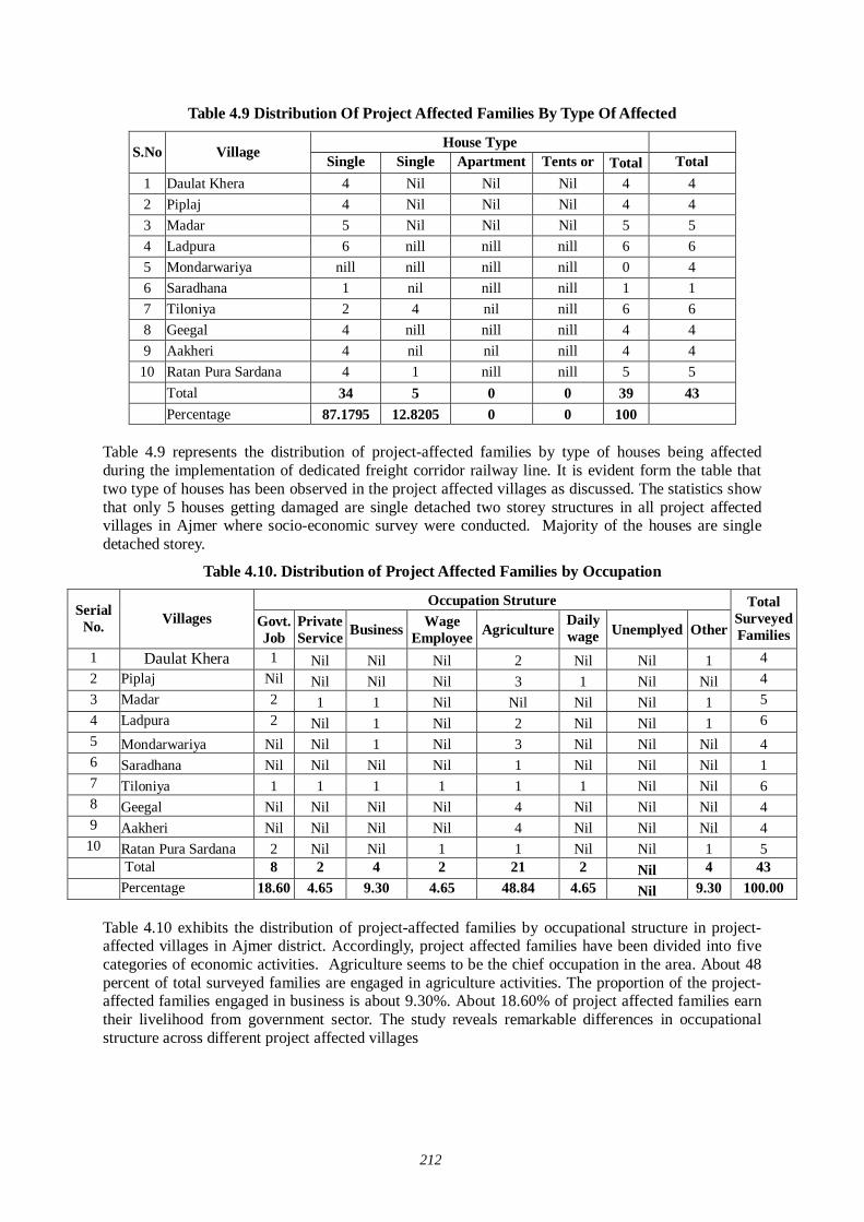
212
Table 4.9 Distribution Of Project Affected Families By Type Of Affected
House Type S.No Village Single
Detached Single
Detached Apartment Row House
Tents or Tentative
Total Total Surveyed 1 Daulat Khera 4 Nil Nil Nil 4 4
2 Piplaj 4 Nil Nil Nil 4 4 3 Madar 5 Nil Nil Nil 5 5 4 Ladpura 6 nill nill nill 6 6 5 Mondarwariya nill nill nill nill 0 4 6 Saradhana 1 nil nill nill 1 1 7 Tiloniya 2 4 nil nill 6 6 8 Geegal 4 nill nill nill 4 4 9 Aakheri 4 nil nil nill 4 4
10 Ratan Pura Sardana 4 1 nill nill 5 5 Total 34 5 0 0 39 43 Percentage 87.1795 12.8205 0 0 100
Table 4.9 represents the distribution of project-affected families by type of houses being affected during the implementation of dedicated freight corridor railway line. It is evident form the table that two type of houses has been observed in the project affected villages as discussed. The statistics show that only 5 houses getting damaged are single detached two storey structures in all project affected villages in Ajmer where socio-economic survey were conducted. Majority of the houses are single detached storey.
Table 4.10. Distribution of Project Affected Families by Occupation
Occupation Struture Serial
No. Villages Govt. Job
Private Service Business Wage
Employee Agriculture Daily wage
labour Unemplyed Other
Total Surveyed Families
1 Daulat Khera 1 Nil Nil Nil 2 Nil Nil 1 4 2 Piplaj Nil Nil Nil Nil 3 1 Nil Nil 4 3 Madar 2 1 1 Nil Nil Nil Nil 1 5 4 Ladpura 2 Nil 1 Nil 2 Nil Nil 1 6 5 Mondarwariya Nil Nil 1 Nil 3 Nil Nil Nil 4 6 Saradhana Nil Nil Nil Nil 1 Nil Nil Nil 1 7 Tiloniya 1 1 1 1 1 1 Nil Nil 6 8 Geegal Nil Nil Nil Nil 4 Nil Nil Nil 4 9 Aakheri Nil Nil Nil Nil 4 Nil Nil Nil 4
10 Ratan Pura Sardana 2 Nil Nil 1 1 Nil Nil 1 5 Total 8 2 4 2 21 2 Nil 4 43 Percentage 18.60 4.65 9.30 4.65 48.84 4.65 Nil 9.30 100.00
Table 4.10 exhibits the distribution of project-affected families by occupational structure in project-affected villages in Ajmer district. Accordingly, project affected families have been divided into five categories of economic activities. Agriculture seems to be the chief occupation in the area. About 48 percent of total surveyed families are engaged in agriculture activities. The proportion of the project-affected families engaged in business is about 9.30%. About 18.60% of project affected families earn their livelihood from government sector. The study reveals remarkable differences in occupational structure across different project affected villages
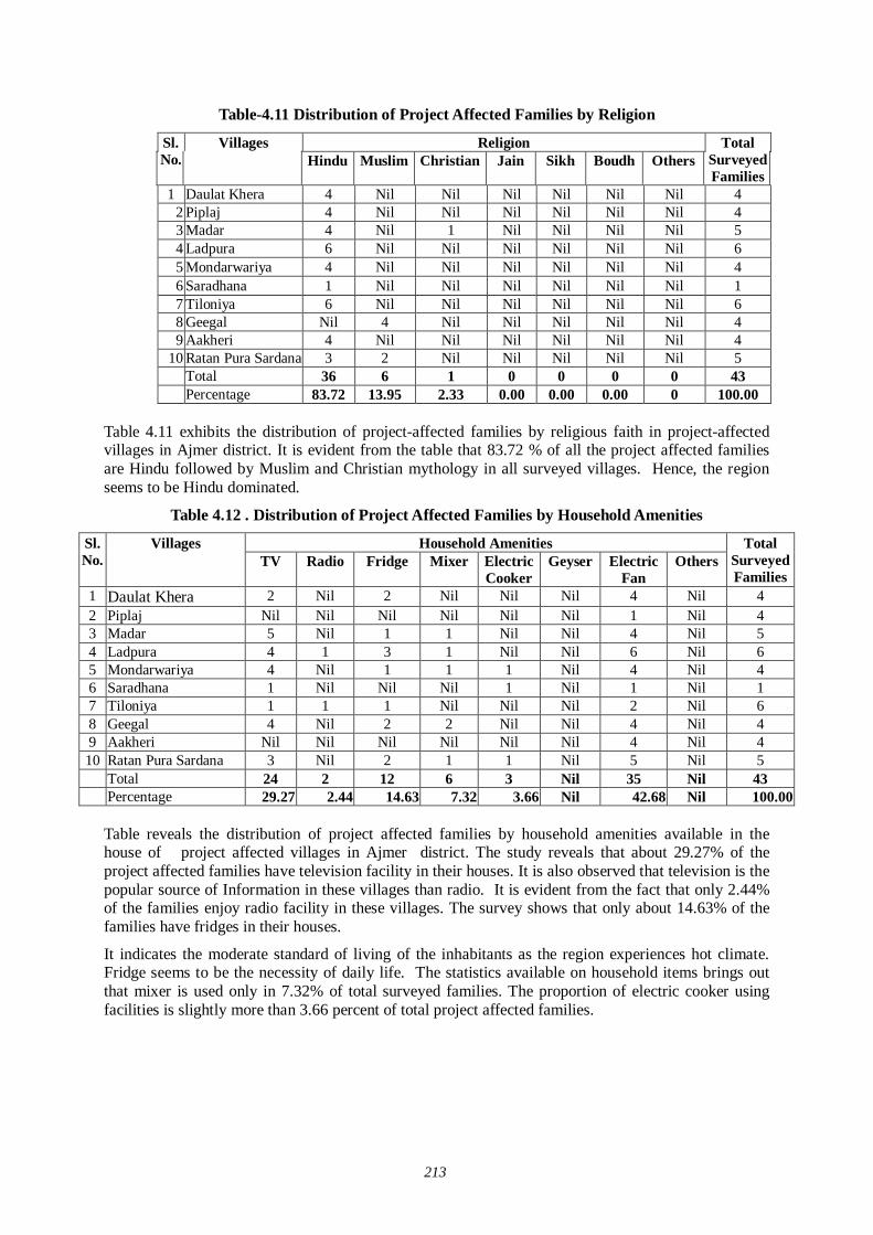
213
Table-4.11 Distribution of Project Affected Families by Religion
Religion Sl. No.
Villages Hindu Muslim Christian Jain Sikh Boudh Others
Total Surveyed Families
1 Daulat Khera 4 Nil Nil Nil Nil Nil Nil 4 2 Piplaj 4 Nil Nil Nil Nil Nil Nil 4 3 Madar 4 Nil 1 Nil Nil Nil Nil 5 4 Ladpura 6 Nil Nil Nil Nil Nil Nil 6 5 Mondarwariya 4 Nil Nil Nil Nil Nil Nil 4 6 Saradhana 1 Nil Nil Nil Nil Nil Nil 1 7 Tiloniya 6 Nil Nil Nil Nil Nil Nil 6 8 Geegal Nil 4 Nil Nil Nil Nil Nil 4 9 Aakheri 4 Nil Nil Nil Nil Nil Nil 4
10 Ratan Pura Sardana 3 2 Nil Nil Nil Nil Nil 5 Total 36 6 1 0 0 0 0 43 Percentage 83.72 13.95 2.33 0.00 0.00 0.00 0 100.00
Table 4.11 exhibits the distribution of project-affected families by religious faith in project-affected villages in Ajmer district. It is evident from the table that 83.72 % of all the project affected families are Hindu followed by Muslim and Christian mythology in all surveyed villages. Hence, the region seems to be Hindu dominated.
Table 4.12 . Distribution of Project Affected Families by Household Amenities
Household Amenities Sl. No.
Villages TV Radio Fridge Mixer Electric
Cooker Geyser Electric
Fan Others
Total Surveyed Families
1 Daulat Khera 2 Nil 2 Nil Nil Nil 4 Nil 4 2 Piplaj Nil Nil Nil Nil Nil Nil 1 Nil 4 3 Madar 5 Nil 1 1 Nil Nil 4 Nil 5 4 Ladpura 4 1 3 1 Nil Nil 6 Nil 6 5 Mondarwariya 4 Nil 1 1 1 Nil 4 Nil 4 6 Saradhana 1 Nil Nil Nil 1 Nil 1 Nil 1 7 Tiloniya 1 1 1 Nil Nil Nil 2 Nil 6 8 Geegal 4 Nil 2 2 Nil Nil 4 Nil 4 9 Aakheri Nil Nil Nil Nil Nil Nil 4 Nil 4 10 Ratan Pura Sardana 3 Nil 2 1 1 Nil 5 Nil 5 Total 24 2 12 6 3 Nil 35 Nil 43
Percentage 29.27 2.44 14.63 7.32 3.66 Nil 42.68 Nil 100.00
Table reveals the distribution of project affected families by household amenities available in the house of project affected villages in Ajmer district. The study reveals that about 29.27% of the project affected families have television facility in their houses. It is also observed that television is the popular source of Information in these villages than radio. It is evident from the fact that only 2.44% of the families enjoy radio facility in these villages. The survey shows that only about 14.63% of the families have fridges in their houses.
It indicates the moderate standard of living of the inhabitants as the region experiences hot climate. Fridge seems to be the necessity of daily life. The statistics available on household items brings out that mixer is used only in 7.32% of total surveyed families. The proportion of electric cooker using facilities is slightly more than 3.66 percent of total project affected families.
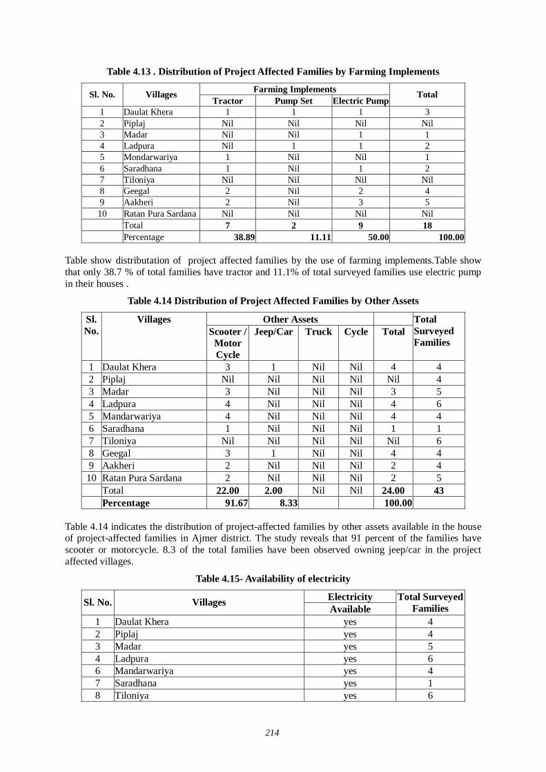
214
Table 4.13 . Distribution of Project Affected Families by Farming Implements
Farming Implements Sl. No. Villages Tractor Pump Set Electric Pump
Total
1 Daulat Khera 1 1 1 3 2 Piplaj Nil Nil Nil Nil 3 Madar Nil Nil 1 1 4 Ladpura Nil 1 1 2 5 Mondarwariya 1 Nil Nil 1 6 Saradhana 1 Nil 1 2 7 Tiloniya Nil Nil Nil Nil 8 Geegal 2 Nil 2 4 9 Aakheri 2 Nil 3 5 10 Ratan Pura Sardana Nil Nil Nil Nil Total 7 2 9 18
Percentage 38.89 11.11 50.00 100.00
Table show distributation of project affected families by the use of farming implements.Table show that only 38.7 % of total families have tractor and 11.1% of total surveyed families use electric pump in their houses .
Table 4.14 Distribution of Project Affected Families by Other Assets
Other Assets Sl. No.
Villages Scooter /
Motor Cycle
Jeep/Car Truck Cycle Total Total Surveyed Families
1 Daulat Khera 3 1 Nil Nil 4 4 2 Piplaj Nil Nil Nil Nil Nil 4 3 Madar 3 Nil Nil Nil 3 5 4 Ladpura 4 Nil Nil Nil 4 6 5 Mandarwariya 4 Nil Nil Nil 4 4 6 Saradhana 1 Nil Nil Nil 1 1 7 Tiloniya Nil Nil Nil Nil Nil 6 8 Geegal 3 1 Nil Nil 4 4 9 Aakheri 2 Nil Nil Nil 2 4 10 Ratan Pura Sardana 2 Nil Nil Nil 2 5 Total 22.00 2.00 Nil Nil 24.00 43
Percentage 91.67 8.33 100.00 Table 4.14 indicates the distribution of project-affected families by other assets available in the house of project-affected families in Ajmer district. The study reveals that 91 percent of the families have scooter or motorcycle. 8.3 of the total families have been observed owning jeep/car in the project affected villages.
Table 4.15- Availability of electricity
Electricity Sl. No. Villages Available
Total Surveyed Families
1 Daulat Khera yes 4 2 Piplaj yes 4 3 Madar yes 5 4 Ladpura yes 6 6 Mandarwariya yes 4 7 Saradhana yes 1 8 Tiloniya yes 6
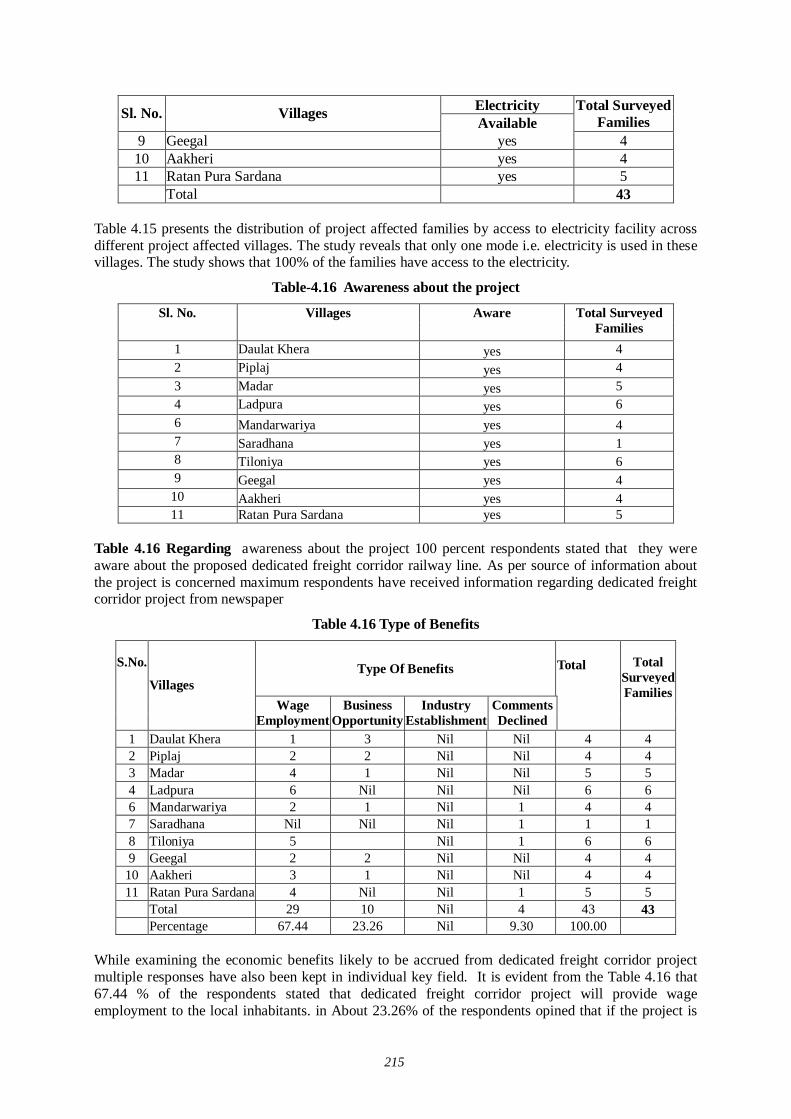
215
Electricity Sl. No. Villages Available
Total Surveyed Families
9 Geegal yes 4 10 Aakheri yes 4 11 Ratan Pura Sardana yes 5 Total 43
Table 4.15 presents the distribution of project affected families by access to electricity facility across different project affected villages. The study reveals that only one mode i.e. electricity is used in these villages. The study shows that 100% of the families have access to the electricity.
Table-4.16 Awareness about the project
Sl. No. Villages Aware Total Surveyed Families
1 Daulat Khera yes 4 2 Piplaj yes 4 3 Madar yes 5 4 Ladpura yes 6 6 Mandarwariya yes 4 7 Saradhana yes 1 8 Tiloniya yes 6 9 Geegal yes 4
10 Aakheri yes 4 11 Ratan Pura Sardana yes 5
Table 4.16 Regarding awareness about the project 100 percent respondents stated that they were aware about the proposed dedicated freight corridor railway line. As per source of information about the project is concerned maximum respondents have received information regarding dedicated freight corridor project from newspaper
Table 4.16 Type of Benefits
Type Of Benefits Total
S.No.
Villages Wage
Employment Business
Opportunity Industry
Establishment Comments Declined
Total Surveyed Families
1 Daulat Khera 1 3 Nil Nil 4 4 2 Piplaj 2 2 Nil Nil 4 4 3 Madar 4 1 Nil Nil 5 5 4 Ladpura 6 Nil Nil Nil 6 6 6 Mandarwariya 2 1 Nil 1 4 4 7 Saradhana Nil Nil Nil 1 1 1 8 Tiloniya 5 Nil 1 6 6 9 Geegal 2 2 Nil Nil 4 4
10 Aakheri 3 1 Nil Nil 4 4 11 Ratan Pura Sardana 4 Nil Nil 1 5 5 Total 29 10 Nil 4 43 43 Percentage 67.44 23.26 Nil 9.30 100.00
While examining the economic benefits likely to be accrued from dedicated freight corridor project multiple responses have also been kept in individual key field. It is evident from the Table 4.16 that 67.44 % of the respondents stated that dedicated freight corridor project will provide wage employment to the local inhabitants. in About 23.26% of the respondents opined that if the project is
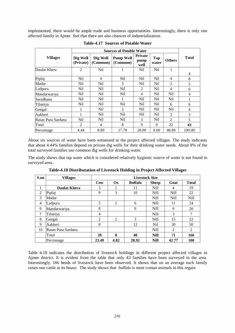
216
implemented, there would be ample trade and business opportunities. Interestingly, there is only one affected family in Ajmer feel that there are also chances of industrialization.
Table-4.17 Sources of Potable Water
Sources of Potable Water
Villages Dig Well (Private)
Dig Well (Common)
Pump Well (Common)
Private pump well
Tap water Others
Total
Daulat Khera 2 Nil 1 Nil Nil 1 4
Piplaj Nil 4 Nil Nil Nil 4 8 Madar Nil Nil 3 Nil Nil 2 5 Ladpura Nil Nil Nil 2 Nil 4 6 Mandarwariya Nil Nil Nil 4 Nil Nil 4 Saradhana Nil Nil 1 Nil Nil Nil 1 Tiloniya Nil Nil Nil Nil Nil 6 6 Geegal 1 Nil 3 Nil Nil Nil 4 Aakheri 1 Nil Nil Nil Nil 3 3 Ratan Pura Sardana Nil Nil Nil 3 Nil 2 5 Total 2 4 8 9 0 22 43 Percentage 4.44 8.89 17.78 20.00 0.00 48.89 100.00
About six sources of water have been witnessed in the project affected villages. The study indicates that about 4.44% families depend on private dig wells for their drinking water needs. About 8% of the total surveyed families use common dig wells for drinking water.
The study shows that tap water which is considered relatively hygienic source of water is not found in surveyed area..
Table-4.18 Distributation of Livestock Holding in Project Affected Villages
Villages Livestock Size S.no Cow Ox Buffalo Sheep Goat Total
1 Daulat Khera 3 1 11 Nill 4 19 2 Piplaj 9 3 10 Nill Nill 22 3 Madar Nill Nill Nill 4 Ladpura 5 2 6 Nill 11 24 6 Mandarwariya 8 6 Nill 6 20 7 Tiloniya 4 Nill 3 7 8 Geegal 2 2 3 Nill 15 22 9 Aakheri 8 12 Nil 30 50
10 Ratan Pura Sardana Nill 2 2 Total 39 8 48 Nill 71 166 Percentage 23.49 4.82 28.92 Nill 42.77 100
Table 4.18 indicates the distribution of livestock holdings in different project affected villages in Ajmer district. It is evident from the table that only 43 families have been surveyed in the area. Interestingly, 166 heads of livestock have been observed. It shows that on an average each family raises one cattle at its house. The study shows that buffalo is most coman animals in this regain
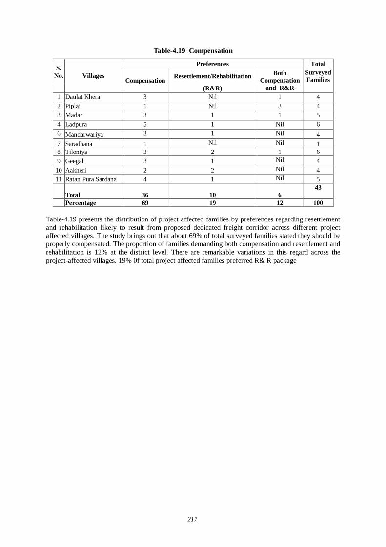
217
Table-4.19 Compensation
Preferences Total
Resettlement/Rehabilitation Surveyed Families
S. No.
Villages
Compensation (R&R)
Both Compensation
and R&R 1 Daulat Khera 3 Nil 1 4 2 Piplaj 1 Nil 3 4 3 Madar 3 1 1 5 4 Ladpura 5 1 Nil 6 6 Mandarwariya 3 1 Nil 4 7 Saradhana 1 Nil Nil 1 8 Tiloniya 3 2 1 6 9 Geegal 3 1 Nil 4
10 Aakheri 2 2 Nil 4 11 Ratan Pura Sardana 4 1 Nil 5
Total 36 10 6 43
Percentage 69 19 12 100
Table-4.19 presents the distribution of project affected families by preferences regarding resettlement and rehabilitation likely to result from proposed dedicated freight corridor across different project affected villages. The study brings out that about 69% of total surveyed families stated they should be properly compensated. The proportion of families demanding both compensation and resettlement and rehabilitation is 12% at the district level. There are remarkable variations in this regard across the project-affected villages. 19% 0f total project affected families preferred R& R package
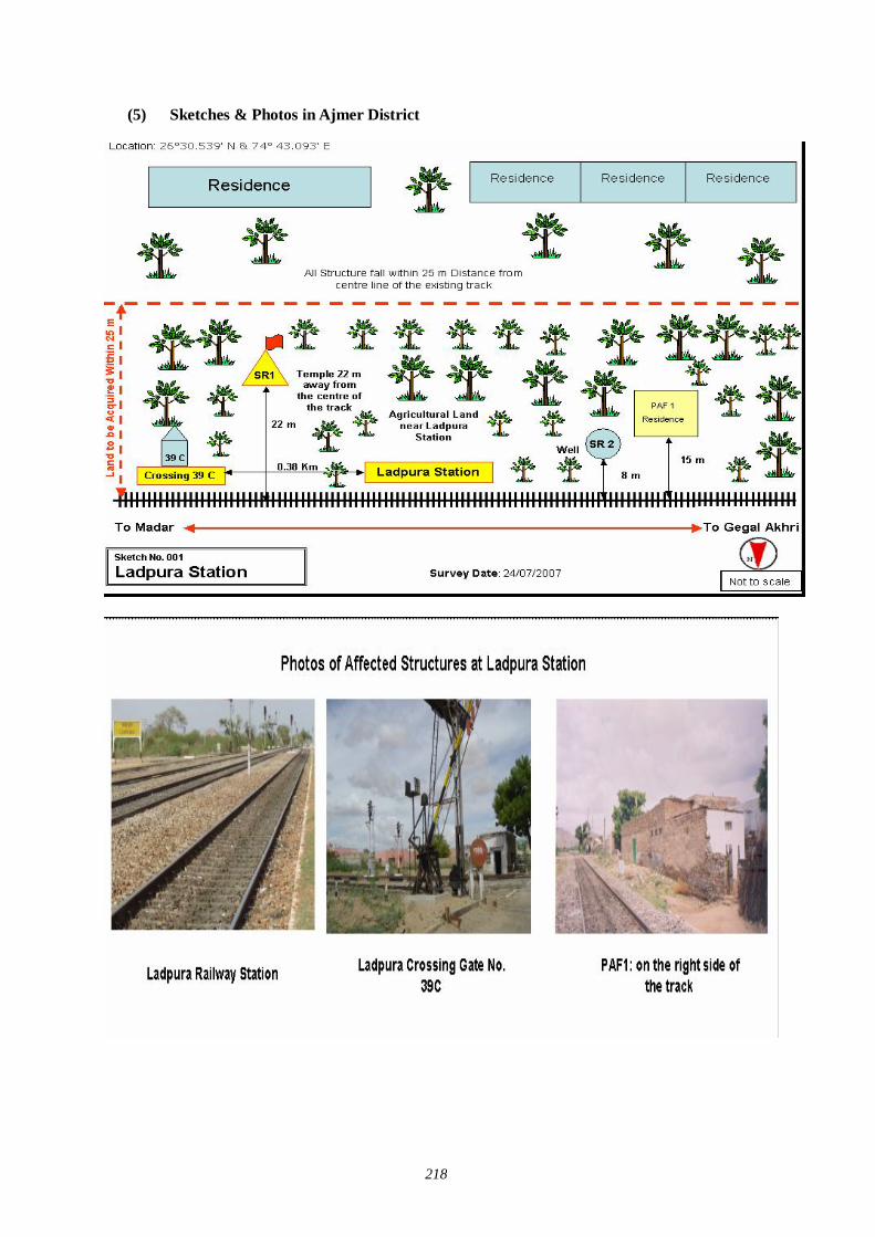
218
(5) Sketches & Photos in Ajmer District
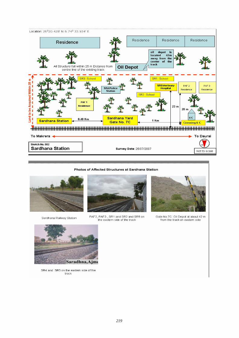
219
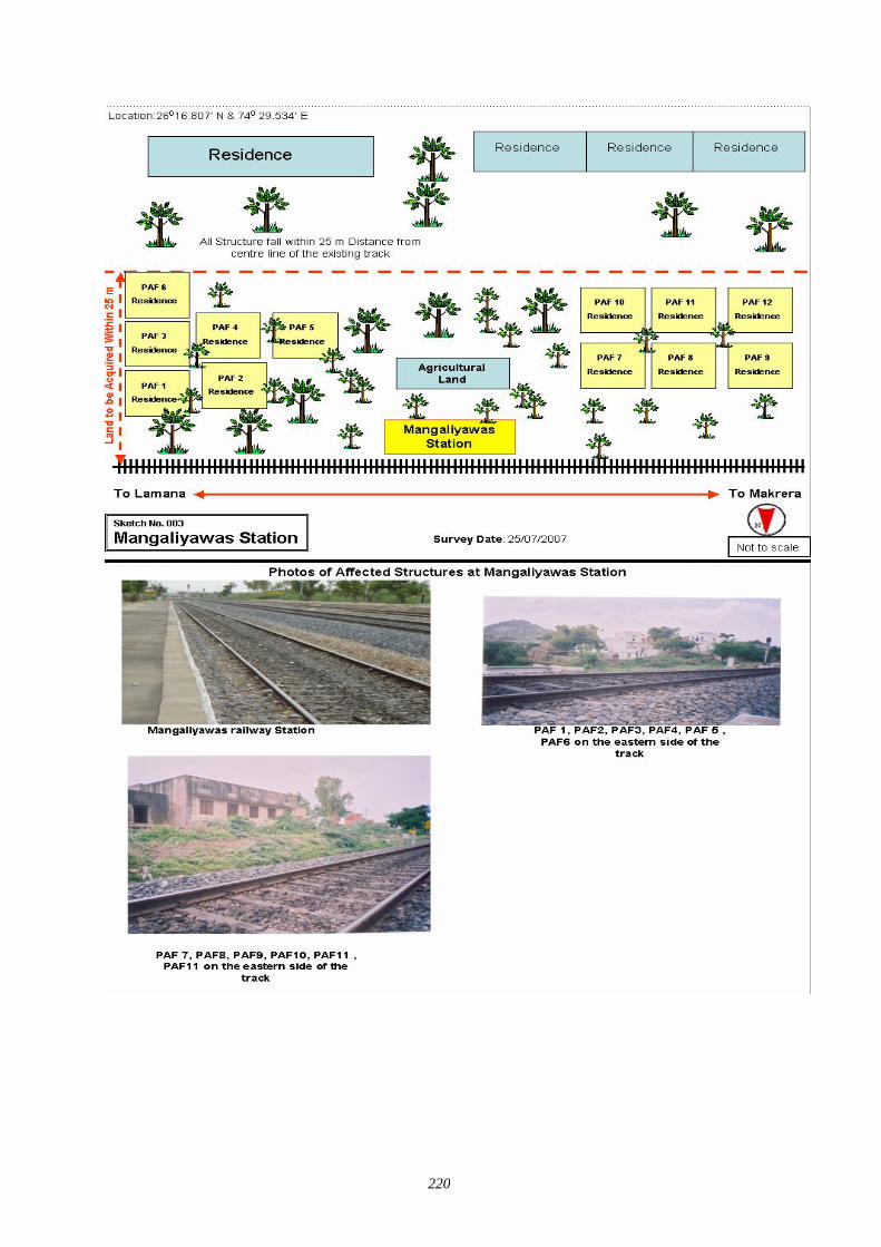
220
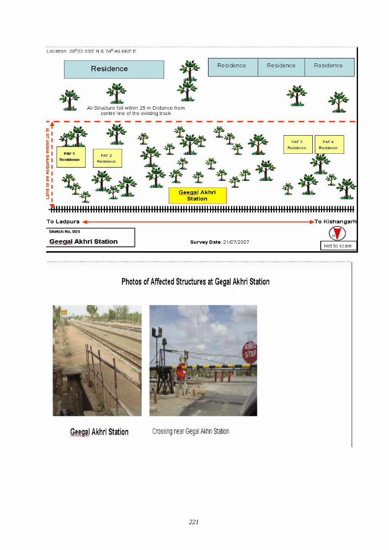
221
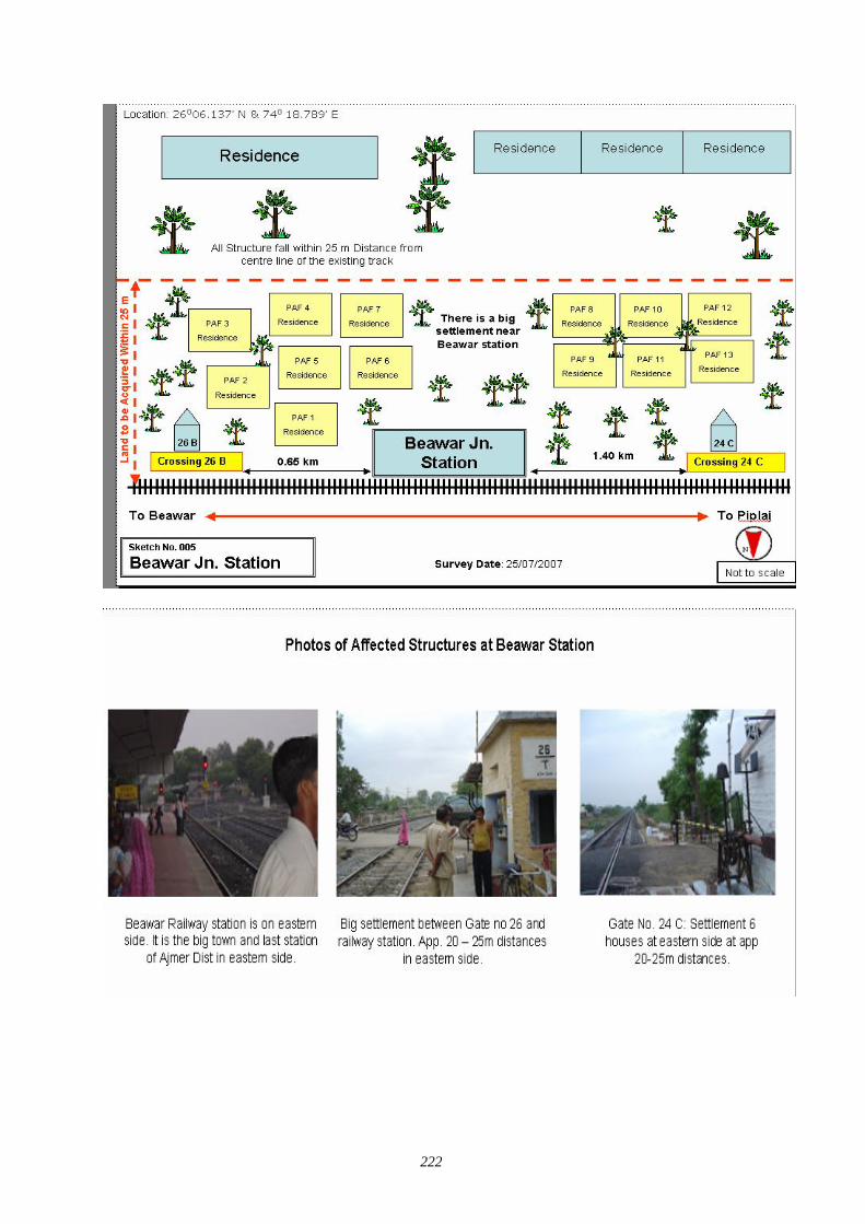
222
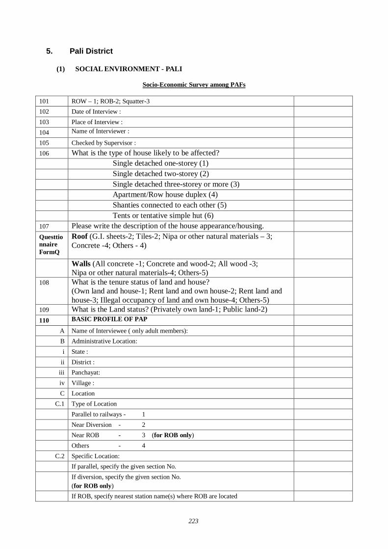
223
5. Pali District
(1) SOCIAL ENVIRONMENT - PALI
Socio-Economic Survey among PAFs
101 ROW – 1; ROB-2; Squatter-3 102 Date of Interview : 103 Place of Interview : 104 Name of Interviewer : 105 Checked by Supervisor : 106 What is the type of house likely to be affected? Single detached one-storey (1) Single detached two-storey (2) Single detached three-storey or more (3) Apartment/Row house duplex (4) Shanties connected to each other (5) Tents or tentative simple hut (6) 107 Please write the description of the house appearance/housing. Questtionnaire FormQ
Roof (G.I. sheets-2; Tiles-2; Nipa or other natural materials – 3; Concrete -4; Others - 4)
Walls (All concrete -1; Concrete and wood-2; All wood -3; Nipa or other natural materials-4; Others-5)
108 What is the tenure status of land and house? (Own land and house-1; Rent land and own house-2; Rent land and house-3; Illegal occupancy of land and own house-4; Others-5)
109 What is the Land status? (Privately own land-1; Public land-2) 110 BASIC PROFILE OF PAP
A Name of Interviewee ( only adult members): B Administrative Location: i State :
ii District : iii Panchayat: iv Village : C Location
C.1 Type of Location Parallel to railways - 1 Near Diversion - 2 Near ROB - 3 (for ROB only) Others - 4
C.2 Specific Location: If parallel, specify the given section No. If diversion, specify the given section No.
(for ROB only)
If ROB, specify nearest station name(s) where ROB are located
224
Right-hand side/Left-hand side from Mumbai (Western Corridor)/Delhi (Eastern Corridor)
D Relation to Head of Family : E How long have you been living here? Please provide approx. no. of years F How long are you planning to live here (in years)? (for Squatters only) G Profile of Head of Family:
Head of Family (Name) Sex Age Marital Status Occupation (If he/she is unemployed, please describe as “unemployment”)
Use code - 1.Govt. Service; 2.Private Service; 3.Business; 4.Wage Employee; 5.Agriculture; 6.Daily wage labour; 7.Unemplyed; 8.Others (specify ------------)
Attainment Level of Education Use code - 1.Illiterate; 2.Can Read only; 3.3. Can read and write both; 4.Upto Class 5 5.Upto Class 12 or Plus 2; 6.Graduate & above; 7.ITI, Diploma/Degree, CA, ICWA, MBA, etc; 8.Others (specify-------------)
Religion Use code - 1.Hindu; 2.Muslim; 3.Christian; 4.Jain; 5.Sikh; 6. Boudh; Other (specify---------------------)
Social Category Code – 1. General; 2. SC; 3. ST; 4. OBC
Total number of family members (including infants and children) 113) HOUSEHOLD BUDGET A) Income
Average Income in (Rs.) Source of Income of from
various sources Daily Monthly Yearly a. Agriculture
b. Wage Labour c. Business/Trading
d. Service e. Livestock & Animal
Husbandry
f. Fishing & Aquaculture
g. Cottage Craft h. Forestry
i. Other (specify---------------)
Total Income D) Assets
Livestock holding of the family (Write the unit in nos.) No. 25. Cow
26. Ox
225
27. Buffalo 28. Sheep 29. Goat
30. Camel 31. Donkey
32. Horse 33. Pig
34. Chicken 35. Duck
36. Others livestock (specify-------) C) Agricultural Implements
Agricultural implements owned by the family Yes No 17. Tarctor 1 2
18. Power Triller 1 2 19. Thresher 1 2
20. Harvester 1 2 21. Genset Sprayer 1 2
22. Pump Set 1 2 23. Electric Pump 1 2
24. Others Specify 1 2 D) Household Items
Household items owned by the family Yes No 23. TV 1 2
24. Fridge 1 2 25. Mixer 1 2
26. Electric Cooker 1 2 27. Geyser 1 2
28. Electric Fan 1 2 29. OTG 1 2
30. Toaster 1 2 31. Microwave 1 2
32. Radio 1 2 33. Others Specify 1 2
E) Other Assets of Family
Other assets owned by the family Yes No 13. Scooter/Motorcycle 1 2
14. Jeep/Car 1 2 15. Truck 1 2
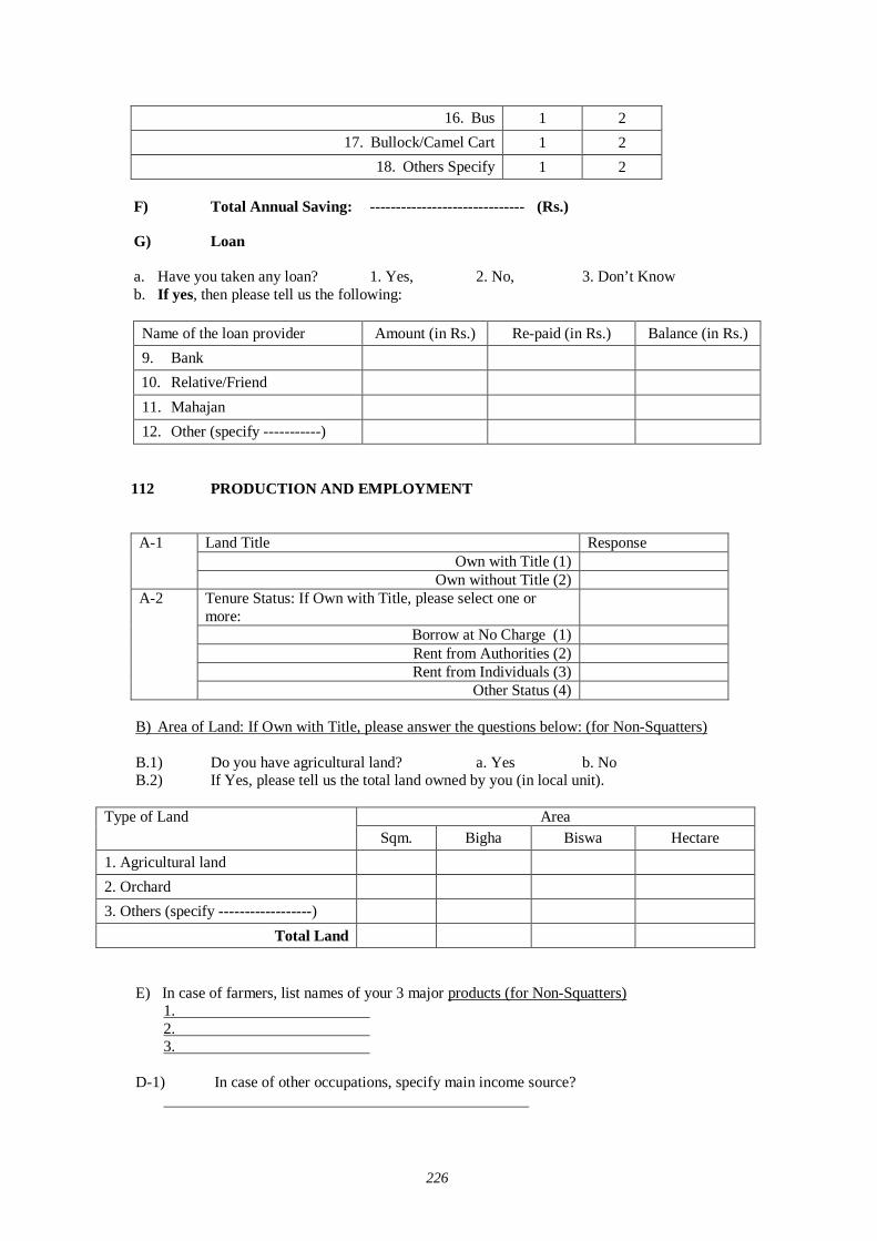
226
16. Bus 1 2 17. Bullock/Camel Cart 1 2
18. Others Specify 1 2 F) Total Annual Saving: ------------------------------ (Rs.)
G) Loan a. Have you taken any loan? 1. Yes, 2. No, 3. Don’t Know b. If yes, then please tell us the following:
Name of the loan provider Amount (in Rs.) Re-paid (in Rs.) Balance (in Rs.) 9. Bank 10. Relative/Friend 11. Mahajan 12. Other (specify -----------)
112 PRODUCTION AND EMPLOYMENT
Land Title Response
Own with Title (1) A-1
Own without Title (2) Tenure Status: If Own with Title, please select one or more:
Borrow at No Charge (1) Rent from Authorities (2) Rent from Individuals (3)
A-2
Other Status (4) B) Area of Land: If Own with Title, please answer the questions below: (for Non-Squatters) B.1) Do you have agricultural land? a. Yes b. No B.2) If Yes, please tell us the total land owned by you (in local unit).
Area Type of Land Sqm. Bigha Biswa Hectare
1. Agricultural land
2. Orchard
3. Others (specify ------------------)
Total Land
E) In case of farmers, list names of your 3 major products (for Non-Squatters) 1. 2. 3.
D-1) In case of other occupations, specify main income source?
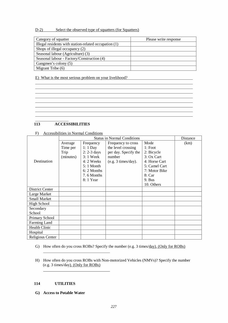
227
D-2) Select the observed type of squatters (for Squatters) Category of squatter Please write response Illegal residents with station-related occupation (1) Shops of illegal occupancy (2) Seasonal labour (Agriculture) (3) Seasonal labour - Factory/Construction (4) Gangmen’s colony (5) Migrant Tribe (6) E) What is the most serious problem on your livelihood?
113 ACCESSIBILITIES F) Accessibilities in Normal Conditions
Status in Normal Conditions Distance
Destination
Average Time per Trip (minutes)
Frequency 1: 1 Day 2: 2-3 days 3: 1 Week 4: 2 Weeks 5: 1 Month 6: 2 Months 7. 6 Months 8: 1 Year
Frequency to cross the level crossing per day. Specify the number (e.g. 3 times/day).
Mode 1: Foot 2: Bicycle 3: Ox Cart 4: Horse Cart 5: Camel Cart 7: Motor Bike 8: Car 9. Bus 10. Others
(km)
District Center Large Market Small Market High School Secondary School
Primary School Farming Land Health Clinic Hospital Religious Center
G) How often do you cross ROBs? Specify the number (e.g. 3 times/day). (Only for ROBs)
H) How often do you cross ROBs with Non-motorized Vehicles (NMVs)? Specify the number (e.g. 3 times/day). (Only for ROBs)
114 UTILITIES G) Access to Potable Water
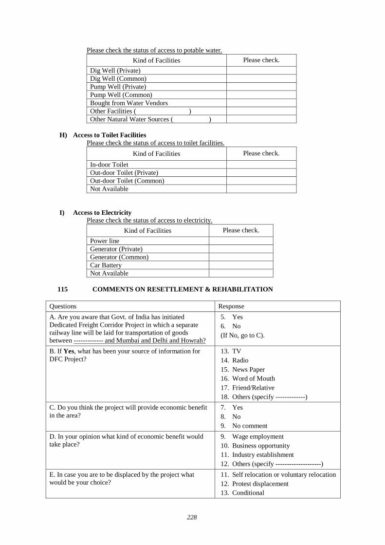
228
Please check the status of access to potable water. Kind of Facilities Please check.
Dig Well (Private) Dig Well (Common) Pump Well (Private) Pump Well (Common) Bought from Water Vendors Other Facilities ( ) Other Natural Water Sources ( )
H) Access to Toilet Facilities
Please check the status of access to toilet facilities. Kind of Facilities Please check.
In-door Toilet Out-door Toilet (Private) Out-door Toilet (Common) Not Available
I) Access to Electricity
Please check the status of access to electricity. Kind of Facilities Please check.
Power line Generator (Private) Generator (Common) Car Battery Not Available
115 COMMENTS ON RESETTLEMENT & REHABILITATION
Questions Response A. Are you aware that Govt. of India has initiated Dedicated Freight Corridor Project in which a separate railway line will be laid for transportation of goods between ------------- and Mumbai and Delhi and Howrah?
5. Yes 6. No (If No, go to C).
B. If Yes, what has been your source of information for DFC Project?
13. TV 14. Radio 15. News Paper 16. Word of Mouth 17. Friend/Relative 18. Others (specify -------------)
C. Do you think the project will provide economic benefit in the area?
7. Yes 8. No 9. No comment
D. In your opinion what kind of economic benefit would take place?
9. Wage employment 10. Business opportunity 11. Industry establishment 12. Others (specify --------------------)
E. In case you are to be displaced by the project what would be your choice?
11. Self relocation or voluntary relocation 12. Protest displacement 13. Conditional
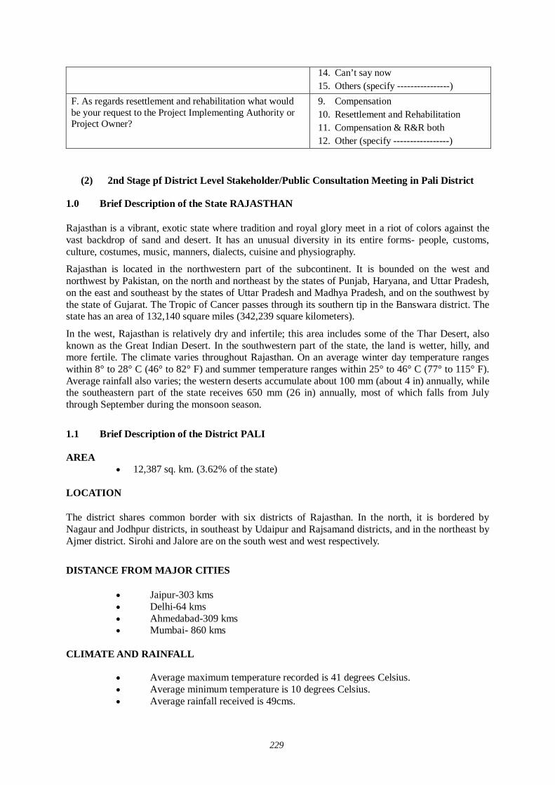
229
14. Can’t say now 15. Others (specify ----------------)
F. As regards resettlement and rehabilitation what would be your request to the Project Implementing Authority or Project Owner?
9. Compensation 10. Resettlement and Rehabilitation 11. Compensation & R&R both 12. Other (specify -----------------)
(2) 2nd Stage pf District Level Stakeholder/Public Consultation Meeting in Pali District
1.0 Brief Description of the State RAJASTHAN Rajasthan is a vibrant, exotic state where tradition and royal glory meet in a riot of colors against the vast backdrop of sand and desert. It has an unusual diversity in its entire forms- people, customs, culture, costumes, music, manners, dialects, cuisine and physiography.
Rajasthan is located in the northwestern part of the subcontinent. It is bounded on the west and northwest by Pakistan, on the north and northeast by the states of Punjab, Haryana, and Uttar Pradesh, on the east and southeast by the states of Uttar Pradesh and Madhya Pradesh, and on the southwest by the state of Gujarat. The Tropic of Cancer passes through its southern tip in the Banswara district. The state has an area of 132,140 square miles (342,239 square kilometers).
In the west, Rajasthan is relatively dry and infertile; this area includes some of the Thar Desert, also known as the Great Indian Desert. In the southwestern part of the state, the land is wetter, hilly, and more fertile. The climate varies throughout Rajasthan. On an average winter day temperature ranges within 8° to 28° C (46° to 82° F) and summer temperature ranges within 25° to 46° C (77° to 115° F). Average rainfall also varies; the western deserts accumulate about 100 mm (about 4 in) annually, while the southeastern part of the state receives 650 mm (26 in) annually, most of which falls from July through September during the monsoon season.
1.1 Brief Description of the District PALI AREA
12,387 sq. km. (3.62% of the state) LOCATION
The district shares common border with six districts of Rajasthan. In the north, it is bordered by Nagaur and Jodhpur districts, in southeast by Udaipur and Rajsamand districts, and in the northeast by Ajmer district. Sirohi and Jalore are on the south west and west respectively.
DISTANCE FROM MAJOR CITIES
Jaipur-303 kms Delhi-64 kms Ahmedabad-309 kms Mumbai- 860 kms
CLIMATE AND RAINFALL
Average maximum temperature recorded is 41 degrees Celsius. Average minimum temperature is 10 degrees Celsius. Average rainfall received is 49cms.
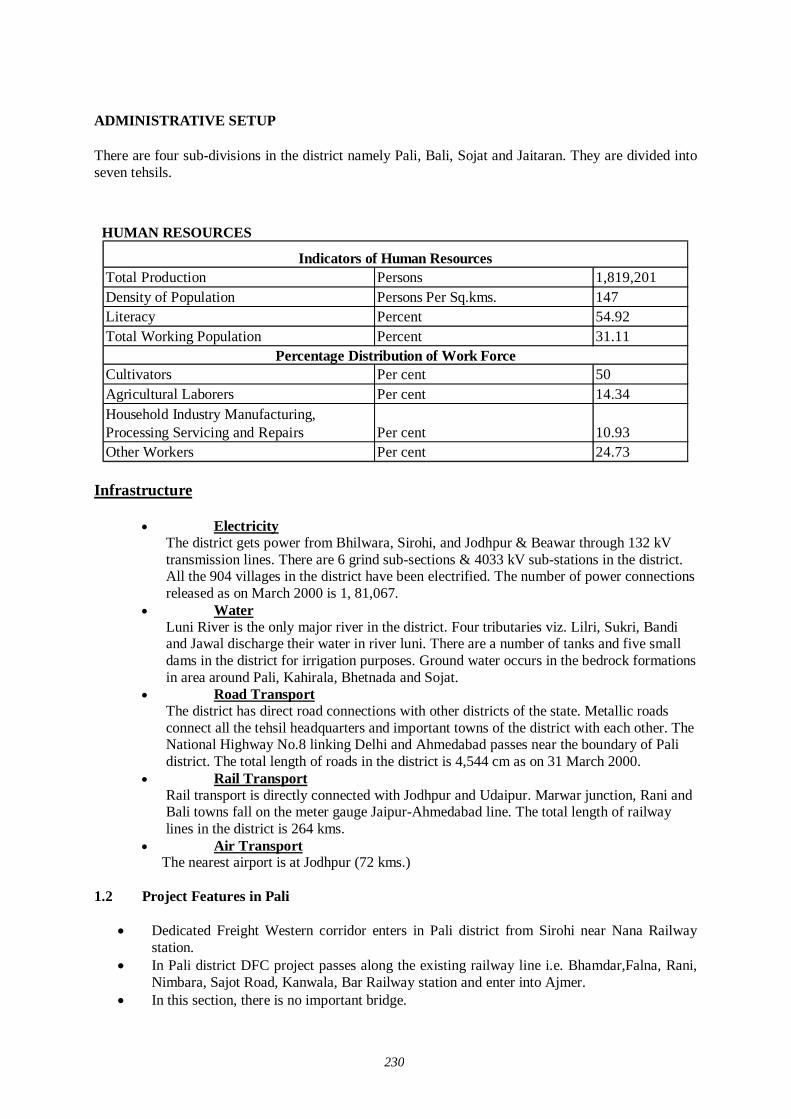
230
ADMINISTRATIVE SETUP There are four sub-divisions in the district namely Pali, Bali, Sojat and Jaitaran. They are divided into seven tehsils.
HUMAN RESOURCES
Total Production Persons 1,819,201Density of Population Persons Per Sq.kms. 147Literacy Percent 54.92Total Working Population Percent 31.11
Cultivators Per cent 50Agricultural Laborers Per cent 14.34Household Industry Manufacturing, Processing Servicing and Repairs Per cent 10.93Other Workers Per cent 24.73
Indicators of Human Resources
Percentage Distribution of Work Force
Infrastructure
Electricity
The district gets power from Bhilwara, Sirohi, and Jodhpur & Beawar through 132 kV transmission lines. There are 6 grind sub-sections & 4033 kV sub-stations in the district. All the 904 villages in the district have been electrified. The number of power connections released as on March 2000 is 1, 81,067.
Water Luni River is the only major river in the district. Four tributaries viz. Lilri, Sukri, Bandi and Jawal discharge their water in river luni. There are a number of tanks and five small dams in the district for irrigation purposes. Ground water occurs in the bedrock formations in area around Pali, Kahirala, Bhetnada and Sojat.
Road Transport The district has direct road connections with other districts of the state. Metallic roads connect all the tehsil headquarters and important towns of the district with each other. The National Highway No.8 linking Delhi and Ahmedabad passes near the boundary of Pali district. The total length of roads in the district is 4,544 cm as on 31 March 2000.
Rail Transport Rail transport is directly connected with Jodhpur and Udaipur. Marwar junction, Rani and Bali towns fall on the meter gauge Jaipur-Ahmedabad line. The total length of railway lines in the district is 264 kms.
Air Transport The nearest airport is at Jodhpur (72 kms.)
1.2 Project Features in Pali
Dedicated Freight Western corridor enters in Pali district from Sirohi near Nana Railway station.
In Pali district DFC project passes along the existing railway line i.e. Bhamdar,Falna, Rani, Nimbara, Sajot Road, Kanwala, Bar Railway station and enter into Ajmer.
In this section, there is no important bridge.
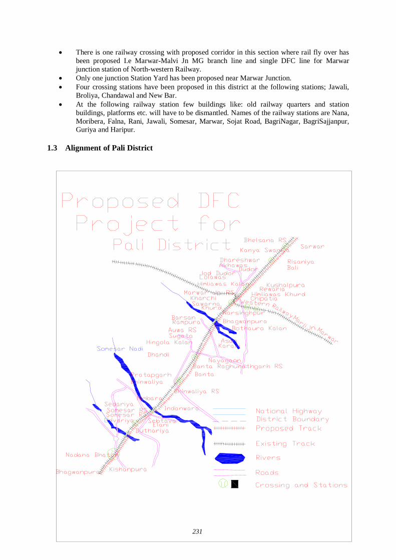
231
There is one railway crossing with proposed corridor in this section where rail fly over has been proposed I.e Marwar-Malvi Jn MG branch line and single DFC line for Marwar junction station of North-western Railway.
Only one junction Station Yard has been proposed near Marwar Junction. Four crossing stations have been proposed in this district at the following stations; Jawali,
Broliya, Chandawal and New Bar. At the following railway station few buildings like: old railway quarters and station
buildings, platforms etc. will have to be dismantled. Names of the railway stations are Nana, Moribera, Falna, Rani, Jawali, Somesar, Marwar, Sojat Road, BagriNagar, BagriSajjanpur, Guriya and Haripur.
1.3 Alignment of Pali District
232
2.0 Project Summary Sheet
Title of the Project 2nd stage of Stakeholder/Public Consultation Meeting for Development Study Regarding the Dedicated Multimodal High Axle Freight Corridor for Ministry Of Railway Govt.
Date and Place of Meeting 28-06-07 Badri Bhawan, Pali Darwaja Road, Sojat City, Pali
Local Consultant Mantec Consultant Pvt. Ltd. New Delhi.Society For Environment & DevelopmentUG-3, E77, West Vinod Nagar,Delhi-110092
Organizing Place Badri Bhawan, Pali Darwaja Road, Sojat City, PaliNo. Invitees 156No. of Participants 125
Personal Contact: -Dispatching Invitation Letter:-Information in Newspaper:-Invitation to Distt. office by lettersInformation at Panchayat Office and Teh. Office Others - Press News Dainik Bhaskar and Rajasthan Patrika, Dainik Navjoyti. Writing PadBall PenQuestionnaireSlide Presentation LectureGroup DiscussionQuestion/Answer SessionStill Photography Audio/Video RecordingMinutes of Meeting
Media Coverage Newspaper: DanikBhansker, DanikNavjyoti, Rajasthan Patrika.
Methods Adopted for Discussion
Methods Adopted for Documentation
PROJECT SUMMARY SHEET
Local Organizer
Methods Used for Information Dissemination
Stationary Served to the Participants
2.1 Method of Selection of Stakeholders The latest version of JICA Guidelines for Environment and Social Consideration has been developed in 2004 so that JICA funded feasibility study incorporates due consideration of the environmental protection and safeguards the sectors of society directly or indirectly affected by the project. Current feasibility study is carried out applying this guideline
In order to encourage participation of the local residents, Stakeholder/ Public Consultation Meeting is considered as a tool that should play an important role during the project design stage. It is designed to
Disclose information on project for open discussion. Disseminate information to the lowest possible hierarchy of the social system. Obtain interaction of the participants of Stakeholder/Public Consultation Meetings. Reflect the valid comments elicited from the open discussions to the design of the project.
233
Build a consensus on the project implementation and associated factors. There are three stages of Stakeholder and Public Consultation Meetings. The first stage of Stakeholder/Public Consultation Meeting is held on state level, followed by second stage of Stakeholder/ Public Consultation Meeting held in the districts, and the third stage of stakeholder/ public consultation meeting is held in the villages directly affected by the project.
The Mantec Consultants Pvt. Ltd has already organized first stage of Stakeholder/Public Consultation Meeting in the state of Rajasthan.
To organize the second stage of Stakeholder/ Public Consultation Meeting Mantec consultants has authorized "Society For Environment and Development" to meet the concerned government authorities and collect relevant data for carrying forward the social environment study and organize second stage of Stakeholder/Public Consultation Meeting for information dissemination about the project As per direction of the guidelines for conducting the 2nd stage of the Stakeholder/ Public Consultation Meetings a formal order of the Ministry of Railways was got issued vide their letter dated 01-06-07 to facilitate these meetings .
Further, continuous efforts were made to keep the Ministry of Railways involved in the project as the major stakeholder through their local set-up. Rehabilitation Commissioners were also appointed from the state government departments. Similarly Department of Environment and Forestry and State Pollution Control Boards were contacted to participate in the Meetings. State Government Departments were also apprised and approached and were invited to participate in the Stakeholders/Public Consultation Meetings including the State Public Works Department, Irrigation and Power, Urban Development and Poverty Alleviation Department, industries, telecommunication and Information technology Trade and Commerce, Surface Transport, Tourism, Container/Corporation of India, Port Trusts etc.
Our meeting Facilitator Team visited all the affected villages and requested Primary and Secondary Stakeholders to attend the meeting. Our meeting facilitator team preferred to invite the people who will be affected directly by this project. Our team also met & informed the distt. Administration and requested to help in organizing the public meeting successfully. Local stakeholders along the railway line, affected farmers, businessmen, private service and Govt. service employees were invited in the meeting. Our study team also contacted Tehsildars of affected Tehsils, Panchayat Samiti Pramukhs, Gram Pradhan, local MLA and requested them to attend the meeting and also gave necessary support in conducting second stage of Stakeholder/Public Consultation Meeting. Public consultation on proposed Dedicated Fright Corridor (DFC) was held in Ajmer district of Rajasthan on 20th June 2007 at Raj Palace, Near Nagina Bagh, Ajmer. Extensive publicity was done one week prior to the program through distribution of pamphlets, one to one meetings, announcement through loudspeakers in villages and newspaper releases.. Around 156 people directly and many more times indirectly were invited for the program. Around 135 persons from affected villages, members of market associations, transport unions, industry associations, media and government departments participated. Press Conference was held on 19th June and News was published in all leading newspapers like Rajasthan Patrika, Dainik Bhaskar, and Dainik Navjyoti, Rastradoot etc. on both 20th & 21st June 2007.
The main objective of the second stage of Stakeholder/Public Consultation Meeting is to disseminate the general information to public. In the State of Rajasthan seven Districts will be affected by this DFC project. Affected districts are Alwar, Sikar, Nagaur, Jaipur, Ajmer, Pali & Sirohi. In the district of Ajmer DFC does follow the existing rail line with one detour of 13 km. at Kishangarh and small diversion in Adarsh Nagar, Ajmer due to congested areas. Therefore new land will be acquired for DFC project especially in Kishangarh. While extending invitations our meeting facilitator team took consideration that the people of that area were present in the meeting. Not only that our meeting facilitator team visited all the affected villages and requested primary and secondary stakeholder to attend the meeting, Satterfield random sampling method was also used for the selection of stakeholders because limited people had to be invited. Our meeting facilitator team also took consideration while extending invitations that vulnerable group of affected area should definitely be present in the meeting.
234
2.2 Selection of Meeting Facilitators Simultaneously extensive surveys were conducted for the identification of suitable local agencies for the successful organization of the Stakeholders/Public Consultation Meetings. Preference was given to appoint Non Government Organizations (NGO) who had local presence, popularity and experience of social and public works. The NGO had to be well acquainted with multifarious cross section of society to help in the selection of the right type of stakeholders for the meetings as well as for facilitating other related activities. i.e.
Venue of the meetings Arrangements to be made Assistance in local publicity Invitation to the stakeholders and motivating them for participation Maintenance and compilation of records and feed backs and Other local arrangements like transport, hospitality, security and smooth conduction of the
meeting proceedings.
An NGO ‘Society for Environment & Development’ was therefore appointed for facilitating the Stakeholders/ Public Consultation meeting in the Pali District.
2.3 Selection of Stakeholders (Invitees) Our meeting facilitator team also invited DRM, Ajmer, Divisional safety Officer, Ajmer, District Industry Officer, Ajmer, Conservator of forests, Ajmer, D.M. Ajmer, Range Forest Officer, Tarasali, Superintendent of Police, Ajmer, President, Ajmer Zila Laghu Udhog Sangh and Sarpanch of Seven panchayats also with general public. Around 156 people were invited to attend the stakeholders/ public consultation meeting.
2.4 Method of Information Dissemination A) Method of Notifying the Meeting to the Participants
1. Notified the date and venue of the Stakeholders/ Public Consultation meeting in local
newspaper, Radio, TV and requesting people to attend the meeting. 2. With help of local NGO we tried to put up and handover the information of the project
on the public place in the area. 3. With the help of the local NGOs we tried to dissemination the information of the project
to the local people by face-to-face meetings as much as possible. 4. With the help of local media we tried to publish the summary of Stakeholders and Public
Consultation Meeting in newspaper, TV, Radio.
2.5 Venue of Stakeholder and Public Consultation Meeting Badri Bhawan, Pali Darwaja Road, Sojat City, Pali
3.0 Participants of the Stakeholder/Public Consultation Meeting Around 125 people participated in the stakeholders/ public consultation meeting.
235
3.1 Details of Stakeholder/ Public Consultation Meeting Stakeholders/ Public consultation meeting is a bottom up approach in this gigantic freight corridor project. It is one of the tools to reflect the views of the general public as well as those concerned with the project ranging from the central and local government organization to commercial and industrial sectors of the society as a whole. It is an important tool of information dissemination during the planning stage of project.
2:00 pm Representative from ‘Society for Environment & Development’, introduced Representative of Mantec Consultants, New Delhi, Sarpanch, Bavadi, Sarpanch, Dundhala, Sarpanch, Sojat Road to the participants. He also gave brief introduction and objectives of organizing the program. Mantec representative gave details about the project through power point presentation and invited views from participants. Following were the main points of discussion during the program
1. Alignment of the new railway line and affected villages/urban areas. 2. Area to be acquired by the Railways. 3. Compensation package for the affected farmers, shop & house Owners etc. 4. Diversions, Stations & Detour to be constructed at Kishangarh in the district. 5. When will the work begin & completion of project. 6. Economic development of the area. 7. Benefits of the project to general public at large and specific people. 8. Negative impact of the project on specific sector/service.
2:20pm Mantec representative, explained that because of the ever growing economy of India, improvement of physical ability for moving goods by means of railways within the country is considered urgently needed, he also explained that the railway line starting from Mumbai running all the way up to Delhi is dedicated only for freight Corridor and nothing to do with the passengers. Growth of major and minor ports of India, the traffic between Northern Hinterland and Western port and huge traffic of coal, steel and fertilizer is anticipated on Ludhiana- Delhi – Howrah route. He said that there are lots of containers coming into this country from outside and landing at Mumbai and moving by train to Ahmedabad, Jaipur, and Delhi upto Ludhiana. On average approximately 9000-loaded trucks move daily over the corridors, i.e. Delhi- Mumbai Western Corridor and Ludhiana – Howrah Eastern Corridor. He added that Freight Corridor is basically constructed alongside existing double track from Mumbai –Delhi, from Palanpur upto Ahmedabad routes. From the city Vadodara adjoining the existing areas drawing up from Rajasthan, because of the congested areas, change all the way upto Mehsana the Freight Corridor has to be constructed avoiding the congestion on existing railway lines.
2:50 pm Question/Answer session (Details of questions and answers is given separately)
3.30 pm The meeting ended with vote of thanks to the chair and snacks and tea was served.
3.2 Description of Profile of Participants The major observations of the Stakeholders/Public Consultation Meeting held at Sojat City, Pali on 28-06-2007 recorded through questionnaires are as follows:
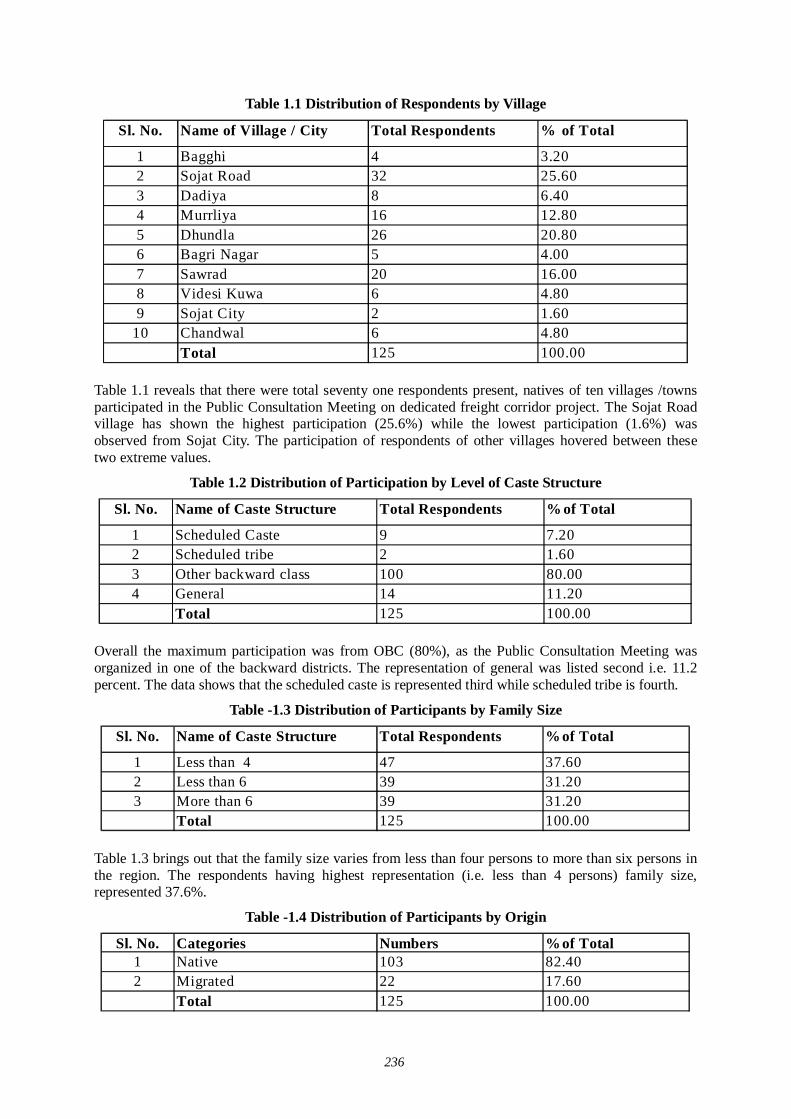
236
Table 1.1 Distribution of Respondents by Village
Sl. No. Name of Village / City Total Respondents % of Total
1 Bagghi 4 3.202 Sojat Road 32 25.603 Dadiya 8 6.404 Murrliya 16 12.805 Dhundla 26 20.806 Bagri Nagar 5 4.007 Sawrad 20 16.008 Videsi Kuwa 6 4.809 Sojat City 2 1.60
10 Chandwal 6 4.80Total 125 100.00
Table 1.1 reveals that there were total seventy one respondents present, natives of ten villages /towns participated in the Public Consultation Meeting on dedicated freight corridor project. The Sojat Road village has shown the highest participation (25.6%) while the lowest participation (1.6%) was observed from Sojat City. The participation of respondents of other villages hovered between these two extreme values.
Table 1.2 Distribution of Participation by Level of Caste Structure
Sl. No. Name of Caste Structure Total Respondents % of Total
1 Scheduled Caste 9 7.202 Scheduled tribe 2 1.603 Other backward class 100 80.004 General 14 11.20
Total 125 100.00 Overall the maximum participation was from OBC (80%), as the Public Consultation Meeting was organized in one of the backward districts. The representation of general was listed second i.e. 11.2 percent. The data shows that the scheduled caste is represented third while scheduled tribe is fourth.
Table -1.3 Distribution of Participants by Family Size
Sl. No. Name of Caste Structure Total Respondents %of Total
1 Less than 4 47 37.602 Less than 6 39 31.203 More than 6 39 31.20
Total 125 100.00 Table 1.3 brings out that the family size varies from less than four persons to more than six persons in the region. The respondents having highest representation (i.e. less than 4 persons) family size, represented 37.6%.
Table -1.4 Distribution of Participants by Origin
Sl. No. Categories Numbers %of Total1 Native 103 82.402 Migrated 22 17.60
Total 125 100.00
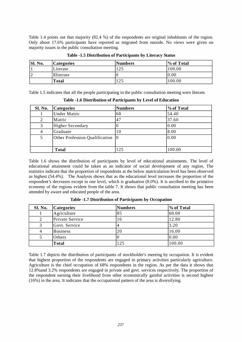
237
Table 1.4 points out that majority (82.4 %) of the respondents are original inhabitants of the region. Only about 17.6% participants have reported as migrated from outside. No views were given on majority issues in the public consultation meeting.
Table -1.5 Distribution of Participants by Literacy Status
Sl. No. Categories Numbers % of Total1 Literate 125 100.002 Illiterate 0 0.00
Total 125 100.00 Table 1.5 indicates that all the people participating in the public consultation meeting were literate.
Table -1.6 Distribution of Participants by Level of Education
Sl. No. Categories Numbers %of Total1 Under Matric 68 54.402 Matric 47 37.603 Higher Secondary 0 0.004 Graduate 10 8.005 Other Profession Qualification 0 0.00
Total 125 100.00 Table 1.6 shows the distribution of participants by level of educational attainments. The level of educational attainment could be taken as an indicator of social development of any region. The statistics indicate that the proportion of respondents at the below matriculation level has been observed as highest (54.4%). The Analysis shows that as the educational level increases the proportion of the respondent’s decreases except in one level, which is graduation (8.0%). It is ascribed to the primitive economy of the regions evident from the table 7. It shows that public consultation meeting has been attended by aware and educated people of the area.
Table -1.7 Distribution of Participants by Occupation
Sl. No. Categories Numbers % of Total1 Agriculture 85 68.002 Private Service 16 12.803 Govt. Service 4 3.204 Business 20 16.005 Others 0 0.00
Total 125 100.00
Table 1.7 depicts the distribution of participants of stockholder's meeting by occupation. It is evident that highest proportion of the respondents are engaged in primary activities particularly agriculture. Agriculture is the chief occupation of 68% respondents in the region. As per the data it shows that 12.8%and 3.2% respondents are engaged in private and govt. services respectively. The proportion of the respondent earning their livelihood from other economically gainful activities is second highest (16%) in the area. It indicates that the occupational pattern of the area is diversifying.
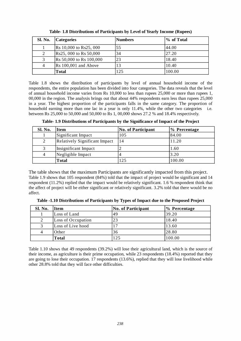
238
Table- 1.8 Distributions of Participants by Level of Yearly Income (Rupees)
Sl. No. Categories Numbers % of Total
1 Rs 10,000 to Rs25, 000 55 44.002 Rs25, 000 to Rs 50,000 34 27.203 Rs 50,000 to Rs 100,000 23 18.404 Rs 100,001 and Above 13 10.40
Total 125 100.00 Table 1.8 shows the distribution of participants by level of annual household income of the respondents, the entire population has been divided into four categories. The data reveals that the level of annual household income varies from Rs 10,000 to less than rupees 25,000 or more than rupees 1, 00,000 in the region. The analysis brings out that about 44% respondents earn less than rupees 25,000 in a year. The highest proportion of the participants falls in the same category. The proportion of household earning more than one lac in a year is only 11.4%, while the other two categories i.e. between Rs 25,000 to 50,000 and 50,000 to Rs 1, 00,000 shows 27.2 % and 18.4% respectively.
Table- 1.9 Distributions of Participants by the Significance of Impact of the Project
Sl. No. Item No. of Participant % Percentage1 Significant Impact 105 84.002 Relatively Significant Impact 14 11.203 Insignificant Impact 2 1.604 Negligible Impact 4 3.20
Total 125 100.00
The table shows that the maximum Participants are significantly impacted from this project. Table 1.9 shows that 105 respondent (84%) told that the impact of project would be significant and 14 respondent (11.2%) replied that the impact would be relatively significant. 1.6 % respondent think that the affect of project will be either significant or relatively significant. 3.2% told that there would be no affect.
Table -1.10 Distributions of Participants by Types of Impact due to the Proposed Project
Sl. No. Item No. of Participant % Percentage1 Loss of Land 49 39.202 Loss of Occupation 23 18.403 Loss of Live hood 17 13.604 Other 36 28.80
Total 125 100.00
Table 1.10 shows that 49 respondents (39.2%) will lose their agricultural land, which is the source of their income, as agriculture is their prime occupation, while 23 respondents (18.4%) reported that they are going to lose their occupation. 17 respondents (13.6%), replied that they will lose livelihood while other 28.8% told that they will face other difficulties.
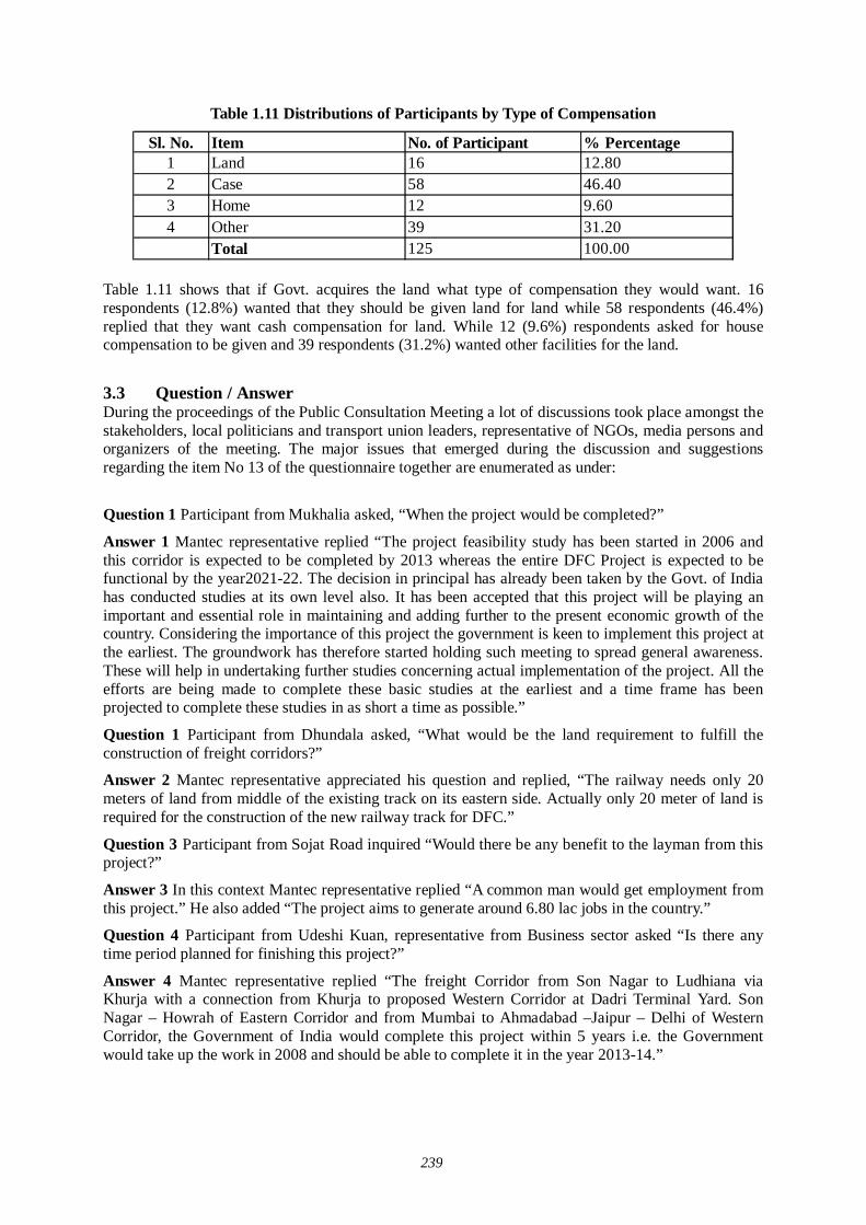
239
Table 1.11 Distributions of Participants by Type of Compensation
Sl. No. Item No. of Participant % Percentage1 Land 16 12.802 Case 58 46.403 Home 12 9.604 Other 39 31.20
Total 125 100.00
Table 1.11 shows that if Govt. acquires the land what type of compensation they would want. 16 respondents (12.8%) wanted that they should be given land for land while 58 respondents (46.4%) replied that they want cash compensation for land. While 12 (9.6%) respondents asked for house compensation to be given and 39 respondents (31.2%) wanted other facilities for the land.
3.3 Question / Answer During the proceedings of the Public Consultation Meeting a lot of discussions took place amongst the stakeholders, local politicians and transport union leaders, representative of NGOs, media persons and organizers of the meeting. The major issues that emerged during the discussion and suggestions regarding the item No 13 of the questionnaire together are enumerated as under:
Question 1 Participant from Mukhalia asked, “When the project would be completed?”
Answer 1 Mantec representative replied “The project feasibility study has been started in 2006 and this corridor is expected to be completed by 2013 whereas the entire DFC Project is expected to be functional by the year2021-22. The decision in principal has already been taken by the Govt. of India has conducted studies at its own level also. It has been accepted that this project will be playing an important and essential role in maintaining and adding further to the present economic growth of the country. Considering the importance of this project the government is keen to implement this project at the earliest. The groundwork has therefore started holding such meeting to spread general awareness. These will help in undertaking further studies concerning actual implementation of the project. All the efforts are being made to complete these basic studies at the earliest and a time frame has been projected to complete these studies in as short a time as possible.”
Question 1 Participant from Dhundala asked, “What would be the land requirement to fulfill the construction of freight corridors?”
Answer 2 Mantec representative appreciated his question and replied, “The railway needs only 20 meters of land from middle of the existing track on its eastern side. Actually only 20 meter of land is required for the construction of the new railway track for DFC.”
Question 3 Participant from Sojat Road inquired “Would there be any benefit to the layman from this project?”
Answer 3 In this context Mantec representative replied “A common man would get employment from this project.” He also added “The project aims to generate around 6.80 lac jobs in the country.”
Question 4 Participant from Udeshi Kuan, representative from Business sector asked “Is there any time period planned for finishing this project?”
Answer 4 Mantec representative replied “The freight Corridor from Son Nagar to Ludhiana via Khurja with a connection from Khurja to proposed Western Corridor at Dadri Terminal Yard. Son Nagar – Howrah of Eastern Corridor and from Mumbai to Ahmadabad –Jaipur – Delhi of Western Corridor, the Government of India would complete this project within 5 years i.e. the Government would take up the work in 2008 and should be able to complete it in the year 2013-14.”
240
Question 5 Participant from Bagadi asked, “What would be the benefits and requirements of the project?” He further asked, “What kind of compensation would be paid to the land owners, will it be according to the market cost or govt. rates?”
Answer 5 In this regard Mantec representative replied, “The compensations shall be paid as per National Rehabilitation Policy of 2006 of Government of India. JICA is studying the track demands on the railway cargos between Mumbai- Delhi, between Mundra- Ahmedabad –Delhi, between Son-Nagar-Ludhiana every 5 years starting from 2008 to 2032. In the next 25 years they are trying to work out the railway tracks in demand for sending cargos. The existing railway tracks have no more capacity to carry cargos. That is why freight corridor system is necessary to be built.”
Question 6Participant from Sojat road is their any provision of station in the district?
Answer 6 Mantec representative “There are two proposed railway station in Rajasthan that are proposed in Marwar and Phulera.
Question 7 Participant from Sojat road “In Sajot road many houses are constructed near Railway line. What will happen?
Answer 7 Mantec representative “Govt. only required 20 meter of land from existing railway line in eastern side, our preliminary study says that no house will be affected in Sajot road.
Question 8 Participant from Sajot road “You said that Govt. will acquire 20 meter of land from existing Railway line .In station there are many railway tracks will you acquire 20 meter in eastern side from last existing line or from main line?
Answer 8 Mantec representative “The land requirement is of 20meter from the middle of the last existing line from eastern side.
Question 9 Participant from Chandwal “How many crossings will be covered with ROB or RUB”?
Answer 9 Mantec representative all the crossing will be covered by ROB or RUB.
Question 10 Participant from Chandawal “In Chandawal on western side hundreds of houses are situated near railway line, how they will be saved”?
Answer 10 Mantec representative said “In Chandawal govt will acquire 20 meter of land in eastern side therefore western side of the track will be remain unaffected by this proposed alignment”.
Question 11 Participant from Sajot road “How valuation of houses will be calculated as house is of different”
Answer 11 Mantec representative said, “A committee headed by civil engineer will decide the actual valuation of the houses”.
Question 12 Participant from Sojat Road “The railway line has sharp turn near Sojat Road, if high speed trains will run than how they will operate?
Answer 12 Mantec representative “I am not an engineer; therefore I can not say that how they will operate. The alignment of proposed corridor has decided by the qualified engineer, therefore I assure you that high speed trains will run in Sojat Road safely.”
JICA is studying the track demands on the railway cargos between Mumbai- Delhi, between Mundra- Ahmedabad –Delhi, between Son-Nagar-Ludhiana every 5 years starting from 2008 to 2032. In the next 25 years they are trying to work out the railway tracks in demand for sending cargos. The existing railway tracks are having no more capacity to carry cargos. That is why freight corridor system is necessary to construct.
Since there was no other point to discuss the meeting ended with a vote of thanks to the chair.
3.4 Summary of Major Findings About one hundred twenty five respondents of ten villages participated in the public consultation meeting aimed at construction of dedicated freight corridor. The Sojat Road village has shown the

241
highest participation while the lowest participation was observed from Sojat City. It is noted that there are 1.6% participants who belonged to scheduled tribes. The scheduled caste (7.2 percent) and OBC (80%) has recorded major participation.
It is also understood that the occupational pattern in the region is quite diversified. People are engaged in various economic activities. However, agriculture is still the predominant occupation for the local people. The examination of the level of annual household income reveals that there is a marked difference in this regard. A major percentage of the respondents fall in meager income level i.e. less than rupees 25,000 per year. However, a significant proportion of the respondents have observed earnings between Rs 25000 to Rs 50,000. A majority of respondents reported that they have access to the roads in the area. Majority of the local people are having an approach to the railway line.
242
(3) 3rd stage of Village Level Stakeholder/Public Consultation Meeting- Pali District
1.1 Brief Description of the District: PALI AREA
12,387 sq. km. (3.62% of the state) LOCATION
The district shares common border with six districts of Rajasthan. In the north, it is bordered by Nagaur and Jodhpur districts, in southeast by Udaipur and Rajsamand districts, and in the northeast by Ajmer district. Sirohi and Jalore are on the south west and west respectively.
DISTANCE FROM MAJOR CITIES
Jaipur-303 kms Delhi-64 kms Ahmedabad-309 kms Mumbai- 860 kms
CLIMATE AND RAINFALL
Average maximum temperature recorded is 41 degrees Celsius. Average minimum temperature is 10 degrees Celsius. Average rainfall received is 49cms.
ADMINISTRATIVE SETUP There are four sub-divisions in the district namely Pali, Bali, Sojat and Jaitaran. They are divided into seven tehsils.
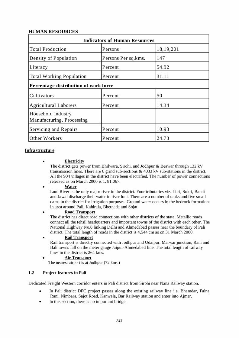
243
HUMAN RESOURCES
Total Production Persons 18,19,201
Density of Population Persons Per sq.kms. 147
Literacy Percent 54.92
Total Working Population Percent 31.11
Cultivators Percent 50
Agricultural Laborers Percent 14.34
Household Industry Manufacturing, Processing
Servicing and Repairs Percent 10.93
Other Workers Percent 24.73
Indicators of Human Resources
Percentage distribution of work force
Infrastructure
Electricity The district gets power from Bhilwara, Sirohi, and Jodhpur & Beawar through 132 kV transmission lines. There are 6 grind sub-sections & 4033 kV sub-stations in the district. All the 904 villages in the district have been electrified. The number of power connections released as on March 2000 is 1, 81,067.
Water Luni River is the only major river in the district. Four tributaries viz. Lilri, Sukri, Bandi and Jawal discharge their water in river luni. There are a number of tanks and five small dams in the district for irrigation purposes. Ground water occurs in the bedrock formations in area around Pali, Kahirala, Bhetnada and Sojat.
Road Transport The district has direct road connections with other districts of the state. Metallic roads connect all the tehsil headquarters and important towns of the district with each other. The National Highway No.8 linking Delhi and Ahmedabad passes near the boundary of Pali district. The total length of roads in the district is 4,544 cm as on 31 March 2000.
Rail Transport Rail transport is directly connected with Jodhpur and Udaipur. Marwar junction, Rani and Bali towns fall on the meter gauge Jaipur-Ahmedabad line. The total length of railway lines in the district is 264 kms.
Air Transport The nearest airport is at Jodhpur (72 kms.)
1.2 Project features in Pali Dedicated Freight Western corridor enters in Pali district from Sirohi near Nana Railway station.
In Pali district DFC project passes along the existing railway line i.e. Bhamdar, Falna, Rani, Nimbara, Sajot Road, Kanwala, Bar Railway station and enter into Ajmer.
In this section, there is no important bridge.
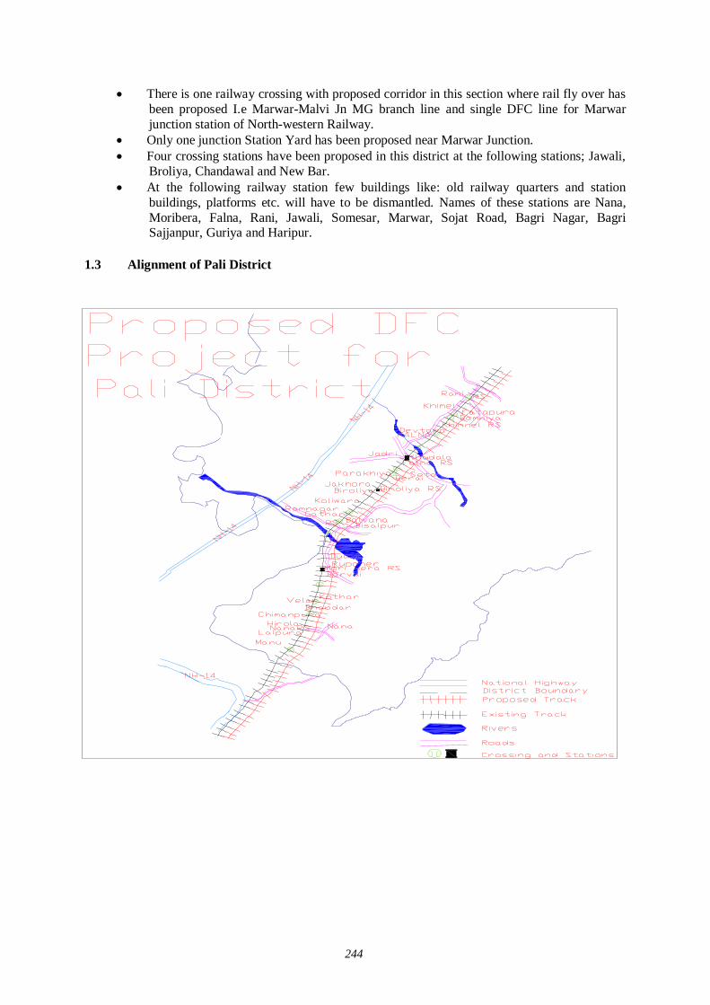
244
There is one railway crossing with proposed corridor in this section where rail fly over has been proposed I.e Marwar-Malvi Jn MG branch line and single DFC line for Marwar junction station of North-western Railway.
Only one junction Station Yard has been proposed near Marwar Junction. Four crossing stations have been proposed in this district at the following stations; Jawali,
Broliya, Chandawal and New Bar. At the following railway station few buildings like: old railway quarters and station
buildings, platforms etc. will have to be dismantled. Names of these stations are Nana, Moribera, Falna, Rani, Jawali, Somesar, Marwar, Sojat Road, Bagri Nagar, Bagri Sajjanpur, Guriya and Haripur.
1.3 Alignment of Pali District
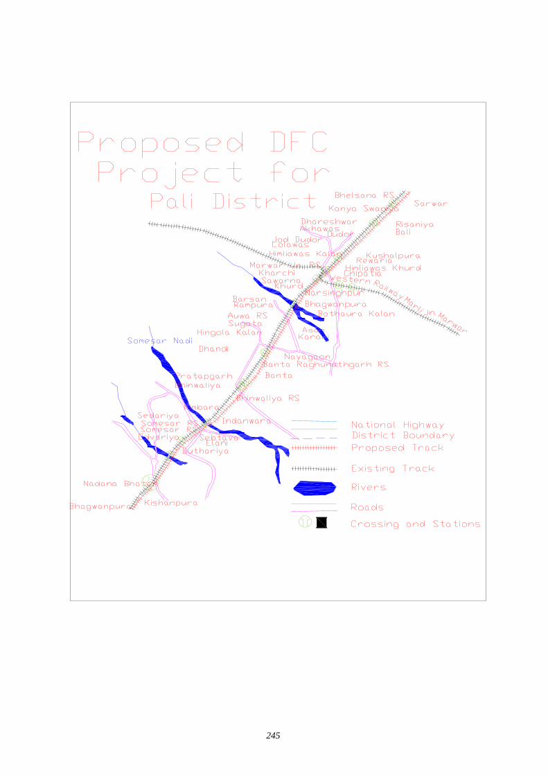
245
246
2.0 Project Summary Sheet
Title of the Project 3rd Stage of Stakeholder/Public Consultation Meeting for Development Study Regarding the Dedicated Multimodal High axle Freight Corridor for Ministry of Railway Govt.
Date and Place of Meeting 14-08-2007 Govt. Middle School No. II, Sojat Road, PaliLocal Consultant Mantec Consultant Pvt. Ltd. New Delhi.
Society For Environment & DevelopmentUG-3, E77, West Vinod Nagar,Delhi-110092
Organizing Place Govt. Middle School No. II, Sojat Road, Pali No. Invitees 110No. of Participants 85
Personal Contact: Dispatching Invitation Letter:Information in Newspaper:Invitation to distt. office by lettersInformation at Panchayat office and Teh. Office Others - Press News Dainik Bhaskar and Rajasthan Patrika,Dainik Navjoyti. Writing PadBall PenQuestionnaireSlide Presentation LectureGroup DiscussionQuestion/Answer SessionStill Photography Audio/Video RecordingMinutes of Meeting
Media Coverage Newspaper: Danik Bhansker
Methods Used for Information Dissemination
Stationary served to theParticipants
Methods adopted for discussion
Methods adopted fordocumentation
Local Organizer
PROJECT SUMMARY SHEET
2.1 Method of Selection of Stakeholders The latest version of JICA Guidelines for Environment and Social Consideration has been developed in 2004 so that JICA funded feasibility study incorporates due consideration of the environmental protection and safeguards the sectors of society directly or indirectly affected by the project. Current feasibility study is carried out applying this guideline.
In order to encourage participation of the local residents, Stakeholder/ Public Consultation Meeting is considered as a tool that should play an important role during the project design stage. It is designed to
Disclose information on project for open discussion. Disseminate information to the lowest possible hierarchy of the social system. Obtain interaction of the participants of Stakeholder/Public Consultation Meetings. Reflect the valid comments elicited from the open discussions to the design of the project. Build a consensus on the project implementation and associated factors.
247
There are three stages of Stakeholder and Public Consultation Meetings. The first stage of Stakeholder/Public Consultation Meeting is held on state level, followed by second stage of Stakeholder/ Public Consultation Meeting held in the districts, and the third stage of stakeholder/ public consultation meeting is held in the villages directly affected by the project.
The Mantec Consultants Pvt. Ltd has already organized first stage of Stakeholder/Public Consultation Meeting in the state of Rajasthan and second stage at Sojat City (Pali) in association with Society for Environment & Development in the month of June, 2007.
To organize the third stage of Stakeholder/ Public Consultation Meeting Mantec consultants has again authorized "Society For Environment and Development" to meet the concerned government authorities and collect relevant data for carrying forward the social environment study and organize 3rd stage of Stakeholder/Public Consultation Meeting for information dissemination about the project As per direction of the guidelines for conducting the 3rd stage of the Stakeholder/ Public Consultation Meetings a formal order of the Ministry of Railways was got issued vide their letter dated 01-06-07 to facilitate these meetings .
Further, continuous efforts were made to keep the Ministry of Railways involved in the project as the major stakeholder through their local set-up. Rehabilitation Commissioners were also appointed from the state government departments. Similarly Department of Environment and Forestry and State Pollution Control Boards were contacted to participate in the Meetings. State Government Departments were also apprised and approached and were invited to participate in the Stakeholders/Public Consultation Meetings including the State Public Works Department, Irrigation and Power, Urban Development and Poverty Alleviation Department, industries, telecommunication and Information technology Trade and Commerce, Surface Transport, Tourism, Container Corporation of India, Port Trusts etc.
Our meeting Facilitator Team visited all the affected villages and requested Primary and Secondary Stakeholders to attend the meeting. Our meeting facilitator team preferred to invite the people who will be affected directly by this project. Our team also met & informed the distrcit. Administration and requested to help in organizing the public meeting successfully. Local stakeholders along the railway line, affected farmers, businessmen, private service and Govt. service employees were invited in the meeting. Our study team also contacted Tehsildars of affected Tehsils, Panchayat Samiti Pramukhs, Gram Pradhan, and local MLA and requested them to attend the meeting and also gave necessary support in conducting 3rd stage of Stakeholder/Public Consultation Meeting. Public consultation on proposed Dedicated Fright Corridor (DFC) was held in Sojat Road of Pali district of Rajasthan on 14th August 2007 at govt. middle School – II, Sojat Road, and Pali. Extensive publicity was done one week prior to the program through distribution of pamphlets, one to one meetings, announcement through loudspeakers in villages and newspaper releases. Around 110 people directly and many more times indirectly were invited for the program. Around 85 persons from affected villages, members of market associations, transport unions, industry associations, media and government departments participated. Press Conference was held on 13th August, 07 and News was published in leading newspapers like Rajasthan Patrika, Dainik Bhaskar on both 13th & 14th August 2007.
The main objective of the third stage of Stakeholder/Public Consultation Meeting is to disseminate the general information to public. In the State of Rajasthan seven Districts will be affected by this DFC project. Affected districts are Alwar, Sikar, Nagaur, Jaipur, Ajmer, Pali and Sirohi. While extending invitations our meeting facilitator team took consideration that the people of that area were present in the meeting. Not only that our meeting facilitator team visited all the affected villages and requested primary and secondary stakeholder to attend the meeting, Satterfield random sampling method was also used for the selection of stakeholders because limited people had to be invited. Our meeting facilitator team also took consideration while extending invitations that vulnerable group of affected area should definitely be present in the meeting.
2.2 Selection of Meeting Facilitators Simultaneously extensive surveys were conducted for the identification of suitable local agencies for the successful organization of the Stakeholders/Public Consultation Meetings. Preference was given to
248
appoint Non Government Organizations (NGO) who had local presence, popularity and experience of social and public works. The NGO had to be well acquainted with multifarious cross section of society to help in the selection of the right type of stakeholders for the meetings as well as for facilitating other related activities. i.e.
Venue of the meetings Arrangements to be made, Assistance in local publicity, Invitation to the stakeholders and motivating them for participation;, Maintenance and compilation of records and feed backs and Other local arrangements like transport, hospitality, security and smooth conduction
of the meeting proceedings.
An NGO ‘Society for Environment and Development’ was therefore appointed for facilitating the 3rd Stage Stakeholders/ Public Consultation meeting in the Pali District.
2.3 Selection of Stakeholders (Invitees) Around 110 persons were invited to attend the stakeholder meeting.
2.4 Method of Information Dissemination
1. Method of Notifying the Meeting to the Participants
Notified the date and venue of the Stakeholders/ Public Consultation meeting in local newspaper, Radio, TV and requesting people to attend the meeting. With help of local NGO we tried to put up and handover the information of the project on the public place in the area. With the help of the local NGOs we tried to dissemination the information of the project to the local people by face-to-face meetings as much as possible. With the help of local media we tried to publish the summary of Stakeholders and Public Consultation Meeting in newspaper, TV, Radio.
2.5 Venue of Stakeholder and Public Consultation Meeting Govt. Middle School No. II, Sojat Road, Pali.
3.0 Participants of the Stakeholder/Public Consultation Meeting
Around 85 participants were attend the Public Consultation Meeting.
3.1 Details of Stakeholder/ Public Consultation Meeting Stakeholders/ Public consultation meeting is a bottom up approach in this gigantic freight corridor project. It is one of the tools to reflect the views of the general public as well as those concerned with the project ranging from the central and local government organization to commercial and industrial sectors of the society as a whole. It is an important tool of information dissemination during the planning stage of project.
4:00 pm Member of Society for Environment and Development, introduced representative from Japan Development Services Co. Ltd, Mantec Consultants, New Delhi and Sarpanch, Dhundala to the participants. He also gave brief introduction and objectives of organizing the program. Sociologist
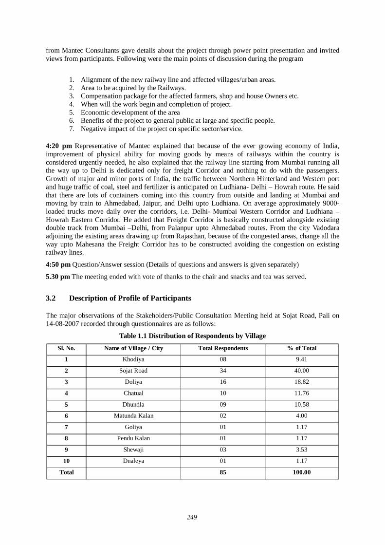
249
from Mantec Consultants gave details about the project through power point presentation and invited views from participants. Following were the main points of discussion during the program
1. Alignment of the new railway line and affected villages/urban areas. 2. Area to be acquired by the Railways. 3. Compensation package for the affected farmers, shop and house Owners etc. 4. When will the work begin and completion of project. 5. Economic development of the area 6. Benefits of the project to general public at large and specific people. 7. Negative impact of the project on specific sector/service.
4:20 pm Representative of Mantec explained that because of the ever growing economy of India, improvement of physical ability for moving goods by means of railways within the country is considered urgently needed, he also explained that the railway line starting from Mumbai running all the way up to Delhi is dedicated only for freight Corridor and nothing to do with the passengers. Growth of major and minor ports of India, the traffic between Northern Hinterland and Western port and huge traffic of coal, steel and fertilizer is anticipated on Ludhiana- Delhi – Howrah route. He said that there are lots of containers coming into this country from outside and landing at Mumbai and moving by train to Ahmedabad, Jaipur, and Delhi upto Ludhiana. On average approximately 9000-loaded trucks move daily over the corridors, i.e. Delhi- Mumbai Western Corridor and Ludhiana – Howrah Eastern Corridor. He added that Freight Corridor is basically constructed alongside existing double track from Mumbai –Delhi, from Palanpur upto Ahmedabad routes. From the city Vadodara adjoining the existing areas drawing up from Rajasthan, because of the congested areas, change all the way upto Mahesana the Freight Corridor has to be constructed avoiding the congestion on existing railway lines.
4:50 pm Question/Answer session (Details of questions and answers is given separately)
5.30 pm The meeting ended with vote of thanks to the chair and snacks and tea was served.
3.2 Description of Profile of Participants
The major observations of the Stakeholders/Public Consultation Meeting held at Sojat Road, Pali on 14-08-2007 recorded through questionnaires are as follows:
Table 1.1 Distribution of Respondents by Village
Sl. No. Name of Village / City Total Respondents % of Total
1 Khodiya 08 9.41
2 Sojat Road 34 40.00
3 Doliya 16 18.82
4 Chatual 10 11.76
5 Dhundla 09 10.58
6 Matunda Kalan 02 4.00
7 Goliya 01 1.17
8 Pendu Kalan 01 1.17
9 Shewaji 03 3.53
10 Dnaleya 01 1.17
Total 85 100.00
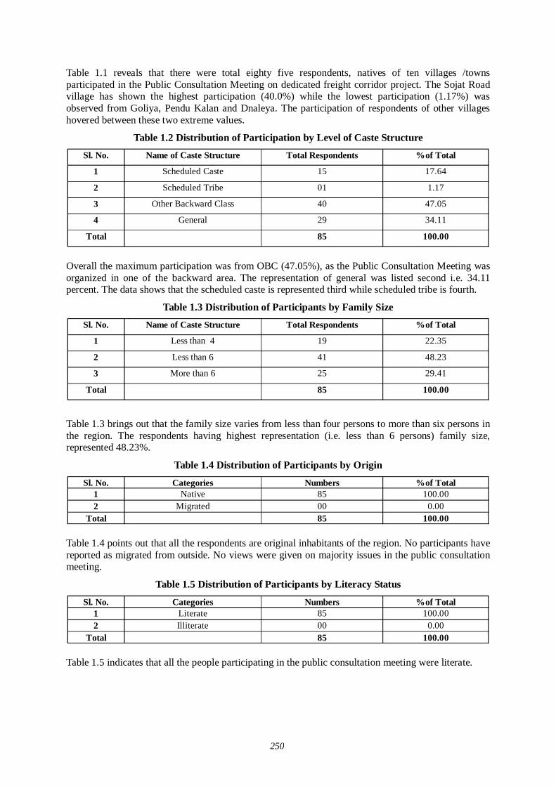
250
Table 1.1 reveals that there were total eighty five respondents, natives of ten villages /towns participated in the Public Consultation Meeting on dedicated freight corridor project. The Sojat Road village has shown the highest participation (40.0%) while the lowest participation (1.17%) was observed from Goliya, Pendu Kalan and Dnaleya. The participation of respondents of other villages hovered between these two extreme values.
Table 1.2 Distribution of Participation by Level of Caste Structure
Sl. No. Name of Caste Structure Total Respondents %of Total
1 Scheduled Caste 15 17.64
2 Scheduled Tribe 01 1.17
3 Other Backward Class 40 47.05
4 General 29 34.11
Total 85 100.00
Overall the maximum participation was from OBC (47.05%), as the Public Consultation Meeting was organized in one of the backward area. The representation of general was listed second i.e. 34.11 percent. The data shows that the scheduled caste is represented third while scheduled tribe is fourth.
Table 1.3 Distribution of Participants by Family Size
Sl. No. Name of Caste Structure Total Respondents %of Total
1 Less than 4 19 22.35
2 Less than 6 41 48.23
3 More than 6 25 29.41
Total 85 100.00
Table 1.3 brings out that the family size varies from less than four persons to more than six persons in the region. The respondents having highest representation (i.e. less than 6 persons) family size, represented 48.23%.
Table 1.4 Distribution of Participants by Origin
Sl. No. Categories Numbers %of Total1 Native 85 100.002 Migrated 00 0.00
Total 85 100.00 Table 1.4 points out that all the respondents are original inhabitants of the region. No participants have reported as migrated from outside. No views were given on majority issues in the public consultation meeting.
Table 1.5 Distribution of Participants by Literacy Status
Sl. No. Categories Numbers %of Total1 Literate 85 100.002 Illiterate 00 0.00
Total 85 100.00 Table 1.5 indicates that all the people participating in the public consultation meeting were literate.
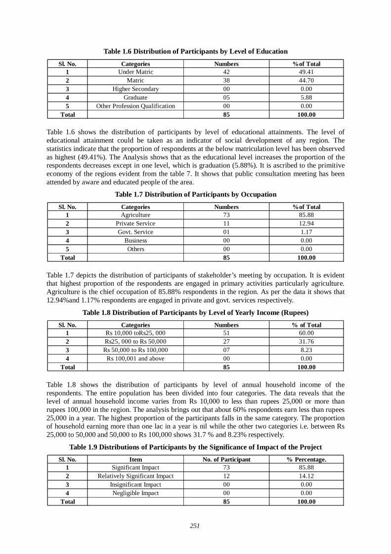
251
Table 1.6 Distribution of Participants by Level of Education
Sl. No. Categories Numbers %of Total1 Under Matric 42 49.412 Matric 38 44.703 Higher Secondary 00 0.004 Graduate 05 5.885 Other Profession Qualification 00 0.00
Total 85 100.00 Table 1.6 shows the distribution of participants by level of educational attainments. The level of educational attainment could be taken as an indicator of social development of any region. The statistics indicate that the proportion of respondents at the below matriculation level has been observed as highest (49.41%). The Analysis shows that as the educational level increases the proportion of the respondents decreases except in one level, which is graduation (5.88%). It is ascribed to the primitive economy of the regions evident from the table 7. It shows that public consultation meeting has been attended by aware and educated people of the area.
Table 1.7 Distribution of Participants by Occupation
Sl. No. Categories Numbers %of Total1 Agriculture 73 85.882 Private Service 11 12.943 Govt. Service 01 1.174 Business 00 0.005 Others 00 0.00
Total 85 100.00
Table 1.7 depicts the distribution of participants of stakeholder’s meeting by occupation. It is evident that highest proportion of the respondents are engaged in primary activities particularly agriculture. Agriculture is the chief occupation of 85.88% respondents in the region. As per the data it shows that 12.94%and 1.17% respondents are engaged in private and govt. services respectively.
Table 1.8 Distribution of Participants by Level of Yearly Income (Rupees)
Sl. No. Categories Numbers % of Total1 Rs 10,000 toRs25, 000 51 60.002 Rs25, 000 to Rs 50,000 27 31.763 Rs 50,000 to Rs 100,000 07 8.234 Rs 100,001 and above 00 0.00
Total 85 100.00
Table 1.8 shows the distribution of participants by level of annual household income of the respondents. The entire population has been divided into four categories. The data reveals that the level of annual household income varies from Rs 10,000 to less than rupees 25,000 or more than rupees 100,000 in the region. The analysis brings out that about 60% respondents earn less than rupees 25,000 in a year. The highest proportion of the participants falls in the same category. The proportion of household earning more than one lac in a year is nil while the other two categories i.e. between Rs 25,000 to 50,000 and 50,000 to Rs 100,000 shows 31.7 % and 8.23% respectively.
Table 1.9 Distributions of Participants by the Significance of Impact of the Project
Sl. No. Item No. of Participant % Percentage.1 Significant Impact 73 85.882 Relatively Significant Impact 12 14.123 Insignificant Impact 00 0.004 Negligible Impact 00 0.00
Total 85 100.00
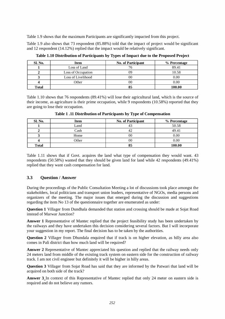
252
Table 1.9 shows that the maximum Participants are significantly impacted from this project.
Table 1.9 also shows that 73 respondent (85.88%) told that the impact of project would be significant and 12 respondent (14.12%) replied that the impact would be relatively significant.
Table 1.10 Distribution of Participants by Types of Impact due to the Proposed Project
Sl. No. Item No. of Participant % Percentage1 Loss of Land 76 89.412 Loss of Occupation 09 10.583 Loss of Livelihood 00 0.004 Other 00 0.00
Total 85 100.00 Table 1.10 shows that 76 respondents (89.41%) will lose their agricultural land, which is the source of their income, as agriculture is their prime occupation, while 9 respondents (10.58%) reported that they are going to lose their occupation.
Table 1 .11 Distribution of Participants by Type of Compensation
Sl. No. Item No. of Participant % Percentage1 Land 43 50.582 Cash 42 49.413 Home 00 0.004 Other 00 0.00
Total 85 100.00
Table 1.11 shows that if Govt. acquires the land what type of compensation they would want. 43 respondents (50.58%) wanted that they should be given land for land while 42 respondents (49.41%) replied that they want cash compensation for land.
3.3 Question / Answer During the proceedings of the Public Consultation Meeting a lot of discussions took place amongst the stakeholders, local politicians and transport union leaders, representative of NGOs, media persons and organizers of the meeting. The major issues that emerged during the discussion and suggestions regarding the item No 13 of the questionnaire together are enumerated as under:
Question 1 Villager from Dundhala demanded that station and crossing should be made at Sojat Road instead of Marwar Junction?
Answer 1 Representative of Mantec replied that the project feasibility study has been undertaken by the railways and they have undertaken this decision considering several factors. But I will incorporate your suggestion in my report. The final decision has to be taken by the authorities.
Question 2 Villager from Dhundala enquired that if track is on higher elevation, as hilly area also comes in Pali district than how much land will be required?
Answer 2 Representative of Mantec appreciated his question and replied that the railway needs only 24 meters land from middle of the existing track system on eastern side for the construction of railway track. I am not civil engineer but definitely it will be higher in hilly areas.
Question 3 Villager from Sojat Road has said that they are informed by the Patwari that land will be acquired on both side of the track?
Answer 3 In context of this Representative of Mantec replied that only 24 meter on eastern side is required and do not believe any rumors.
253
Question 4 Villager from Dholia, asked several questions
i) Earlier also our land was acquired and likely to be this time again, we were not paid properly earlier so compensation of past also be released along with this time?
ii) Alternative houses are constructed for those houses to be demolished?
iii) Market rate criteria are defined?
iv) If whole land of a person is acquired than alternative employment is provided to that person?
Answer 4 Representative of Mantec replied that the compensation shall be paid only for land acquired for this project only and we are taking market rate of all the villages affected through our partner NGO’s and report this to Railways. Other suggestion of alternative houses against demolished houses and alternative employment to the affected people is noted by me and incorporated into our report.
Since there was no other point to discuss the meeting ended with a vote of thanks to the chair.
3.4 Summary of Major Findings About eighty five respondents of ten villages participated in the public consultation meeting aimed at construction of dedicated freight corridor. The Sojat Road village has shown the highest participation while the lowest participation was observed from Goliya, Pendu Kalan and Dnaleya. It is noted that there are 1.17% participants who belonged to scheduled tribes. The scheduled caste (17.64 percent) and OBC (47.05%) has recorded major participation.
It is also understood that the occupational pattern in the region is quite diversified. People are engaged in various economic activities. However, agriculture is still the predominant occupation for the local people. The examination of the level of annual household income reveals that there is a marked difference in this regard. A major percentage of the respondents fall in meager income level i.e. less than rupees 25,000 per year. However, a significant proportion of the respondents have observed earnings between Rs 25000 to Rs 50,000. A majority of respondents reported that they have access to the roads in the area. Majority of the local people are having an approach to the railway line.
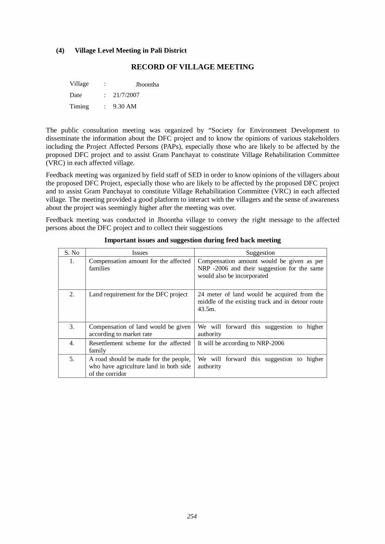
254
(4) Village Level Meeting in Pali District
RECORD OF VILLAGE MEETING
Village : Jhoontha Date : 21/7/2007
Timing : 9.30 AM
The public consultation meeting was organized by “Society for Environment Development to disseminate the information about the DFC project and to know the opinions of various stakeholders including the Project Affected Persons (PAPs), especially those who are likely to be affected by the proposed DFC project and to assist Gram Panchayat to constitute Village Rehabilitation Committee (VRC) in each affected village.
Feedback meeting was organized by field staff of SED in order to know opinions of the villagers about the proposed DFC Project, especially those who are likely to be affected by the proposed DFC project and to assist Gram Panchayat to constitute Village Rehabilitation Committee (VRC) in each affected village. The meeting provided a good platform to interact with the villagers and the sense of awareness about the project was seemingly higher after the meeting was over.
Feedback meeting was conducted in Jhoontha village to convey the right message to the affected persons about the DFC project and to collect their suggestions
Important issues and suggestion during feed back meeting
S. No Issues Suggestion 1.
Compensation amount for the affected families
Compensation amount would be given as per NRP -2006 and their suggestion for the same would also be incorporated
2. Land requirement for the DFC project 24 meter of land would be acquired from the middle of the existing track and in detour route 43.5m.
3.
Compensation of land would be given according to market rate
We will forward this suggestion to higher authority
4. Resettlement scheme for the affected family
It will be according to NRP-2006
5. A road should be made for the people, who have agriculture land in both side of the corridor
We will forward this suggestion to higher authority
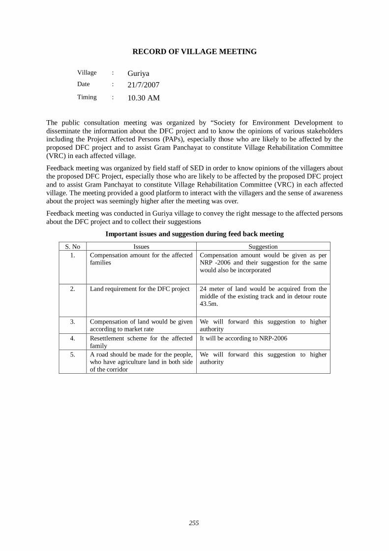
255
RECORD OF VILLAGE MEETING
Village : Guriya Date : 21/7/2007
Timing : 10.30 AM
The public consultation meeting was organized by “Society for Environment Development to disseminate the information about the DFC project and to know the opinions of various stakeholders including the Project Affected Persons (PAPs), especially those who are likely to be affected by the proposed DFC project and to assist Gram Panchayat to constitute Village Rehabilitation Committee (VRC) in each affected village.
Feedback meeting was organized by field staff of SED in order to know opinions of the villagers about the proposed DFC Project, especially those who are likely to be affected by the proposed DFC project and to assist Gram Panchayat to constitute Village Rehabilitation Committee (VRC) in each affected village. The meeting provided a good platform to interact with the villagers and the sense of awareness about the project was seemingly higher after the meeting was over.
Feedback meeting was conducted in Guriya village to convey the right message to the affected persons about the DFC project and to collect their suggestions
Important issues and suggestion during feed back meeting
S. No Issues Suggestion 1.
Compensation amount for the affected families
Compensation amount would be given as per NRP -2006 and their suggestion for the same would also be incorporated
2. Land requirement for the DFC project 24 meter of land would be acquired from the middle of the existing track and in detour route 43.5m.
3.
Compensation of land would be given according to market rate
We will forward this suggestion to higher authority
4. Resettlement scheme for the affected family
It will be according to NRP-2006
5. A road should be made for the people, who have agriculture land in both side of the corridor
We will forward this suggestion to higher authority

256
RECORD OF VILLAGE MEETING
Village : Deepawas Date : 21/7/2007
Timing
: 11.30 AM
The public consultation meeting was organized by “Society for Environment Development to disseminate the information about the DFC project and to know the opinions of various stakeholders including the Project Affected Persons (PAPs), especially those who are likely to be affected by the proposed DFC project and to assist Gram Panchayat to constitute Village Rehabilitation Committee (VRC) in each affected village.
Feedback meeting was organized by field staff of SED in order to know opinions of the villagers about the proposed DFC Project, especially those who are likely to be affected by the proposed DFC project and to assist Gram Panchayat to constitute Village Rehabilitation Committee (VRC) in each affected village. The meeting provided a good platform to interact with the villagers and the sense of awareness about the project was seemingly higher after the meeting was over.
Feedback meeting was conducted in Deepawas village to convey the right message to the affected persons about the DFC project and to collect their suggestions
Important issues and suggestion during feed back meeting
S. No Issues Suggestion 1.
Compensation amount for the affected families
Compensation amount would be given as per NRP -2006 and their suggestion for the same would also be incorporated
2. Land requirement for the DFC project 24 meter of land would be acquired from the middle of the existing track and in detour route 43.5m.
3.
Compensation of land would be given according to market rate
We will forward this suggestion to higher authority
4. Resettlement scheme for the affected family
It will be according to NRP-2006
5. A road should be made for the people, who have agriculture land in both side of the corridor
We will forward this suggestion to higher authority

257
RECORD OF VILLAGE MEETING
Village : Malni Date : 22/7/2007
Timing
: 9.30 AM
The public consultation meeting was organized by “Society for Environment Development to disseminate the information about the DFC project and to know the opinions of various stakeholders including the Project Affected Persons (PAPs), especially those who are likely to be affected by the proposed DFC project and to assist Gram Panchayat to constitute Village Rehabilitation Committee (VRC) in each affected village.
Feedback meeting was organized by field staff of SED in order to know opinions of the villagers about the proposed DFC Project, especially those who are likely to be affected by the proposed DFC project and to assist Gram Panchayat to constitute Village Rehabilitation Committee (VRC) in each affected village. The meeting provided a good platform to interact with the villagers and the sense of awareness about the project was seemingly higher after the meeting was over.
Feedback meeting was conducted in Malini village to convey the right message to the affected persons about the DFC project and to collect their suggestions
Important issues and suggestion during feed back meeting
S. No Issues Suggestion 1.
Compensation amount for the affected families
Compensation amount would be given as per NRP -2006 and their suggestion for the same would also be incorporated
2. Land requirement for the DFC project 24 meter of land would be acquired from the middle of the existing track and in detour route 43.5m.
3.
Compensation of land would be given according to market rate
We will forward this suggestion to higher authority
4. Resettlement scheme for the affected family
It will be according to NRP-2006
5. A road should be made for the people, who have agriculture land in both side of the corridor
We will forward this suggestion to higher authority
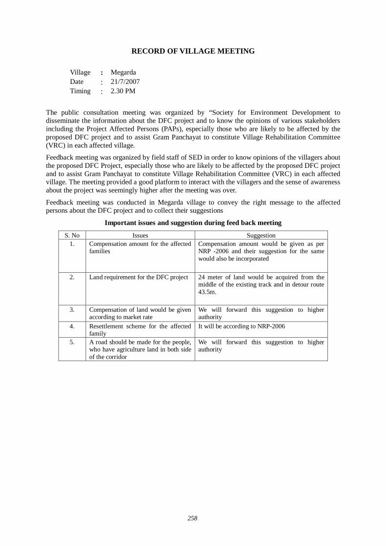
258
RECORD OF VILLAGE MEETING
Village : Megarda Date : 21/7/2007 Timing : 2.30 PM
The public consultation meeting was organized by “Society for Environment Development to disseminate the information about the DFC project and to know the opinions of various stakeholders including the Project Affected Persons (PAPs), especially those who are likely to be affected by the proposed DFC project and to assist Gram Panchayat to constitute Village Rehabilitation Committee (VRC) in each affected village.
Feedback meeting was organized by field staff of SED in order to know opinions of the villagers about the proposed DFC Project, especially those who are likely to be affected by the proposed DFC project and to assist Gram Panchayat to constitute Village Rehabilitation Committee (VRC) in each affected village. The meeting provided a good platform to interact with the villagers and the sense of awareness about the project was seemingly higher after the meeting was over.
Feedback meeting was conducted in Megarda village to convey the right message to the affected persons about the DFC project and to collect their suggestions
Important issues and suggestion during feed back meeting
S. No Issues Suggestion 1.
Compensation amount for the affected families
Compensation amount would be given as per NRP -2006 and their suggestion for the same would also be incorporated
2. Land requirement for the DFC project 24 meter of land would be acquired from the middle of the existing track and in detour route 43.5m.
3.
Compensation of land would be given according to market rate
We will forward this suggestion to higher authority
4. Resettlement scheme for the affected family
It will be according to NRP-2006
5. A road should be made for the people, who have agriculture land in both side of the corridor
We will forward this suggestion to higher authority
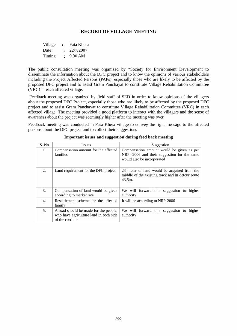
259
RECORD OF VILLAGE MEETING
Village : Fata Khera Date : 22/7/2007 Timing : 9.30 AM
The public consultation meeting was organized by “Society for Environment Development to disseminate the information about the DFC project and to know the opinions of various stakeholders including the Project Affected Persons (PAPs), especially those who are likely to be affected by the proposed DFC project and to assist Gram Panchayat to constitute Village Rehabilitation Committee (VRC) in each affected village.
Feedback meeting was organized by field staff of SED in order to know opinions of the villagers about the proposed DFC Project, especially those who are likely to be affected by the proposed DFC project and to assist Gram Panchayat to constitute Village Rehabilitation Committee (VRC) in each affected village. The meeting provided a good platform to interact with the villagers and the sense of awareness about the project was seemingly higher after the meeting was over.
Feedback meeting was conducted in Fata Khera village to convey the right message to the affected persons about the DFC project and to collect their suggestions
Important issues and suggestion during feed back meeting
S. No Issues Suggestion 1.
Compensation amount for the affected families
Compensation amount would be given as per NRP -2006 and their suggestion for the same would also be incorporated
2. Land requirement for the DFC project 24 meter of land would be acquired from the middle of the existing track and in detour route 43.5m.
3.
Compensation of land would be given according to market rate
We will forward this suggestion to higher authority
4. Resettlement scheme for the affected family
It will be according to NRP-2006
5. A road should be made for the people, who have agriculture land in both side of the corridor
We will forward this suggestion to higher authority
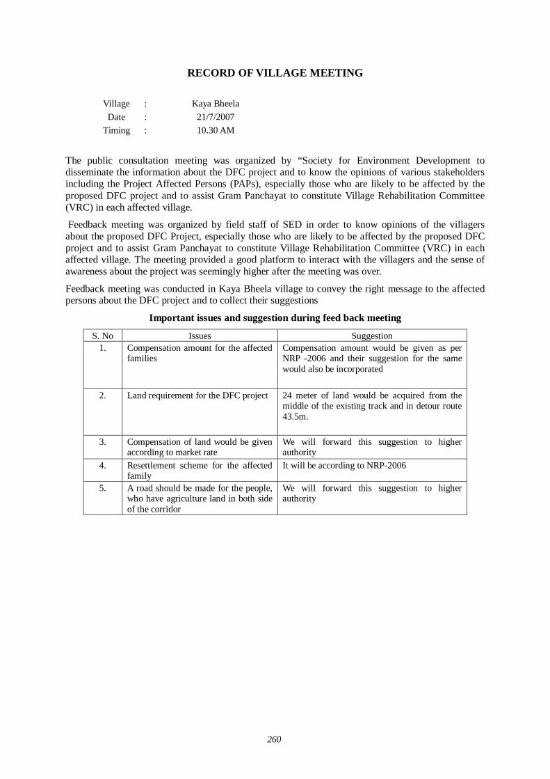
260
RECORD OF VILLAGE MEETING
Village : Kaya Bheela Date : 21/7/2007
Timing
: 10.30 AM
The public consultation meeting was organized by “Society for Environment Development to disseminate the information about the DFC project and to know the opinions of various stakeholders including the Project Affected Persons (PAPs), especially those who are likely to be affected by the proposed DFC project and to assist Gram Panchayat to constitute Village Rehabilitation Committee (VRC) in each affected village.
Feedback meeting was organized by field staff of SED in order to know opinions of the villagers about the proposed DFC Project, especially those who are likely to be affected by the proposed DFC project and to assist Gram Panchayat to constitute Village Rehabilitation Committee (VRC) in each affected village. The meeting provided a good platform to interact with the villagers and the sense of awareness about the project was seemingly higher after the meeting was over.
Feedback meeting was conducted in Kaya Bheela village to convey the right message to the affected persons about the DFC project and to collect their suggestions
Important issues and suggestion during feed back meeting
S. No Issues Suggestion 1.
Compensation amount for the affected families
Compensation amount would be given as per NRP -2006 and their suggestion for the same would also be incorporated
2. Land requirement for the DFC project 24 meter of land would be acquired from the middle of the existing track and in detour route 43.5m.
3.
Compensation of land would be given according to market rate
We will forward this suggestion to higher authority
4. Resettlement scheme for the affected family
It will be according to NRP-2006
5. A road should be made for the people, who have agriculture land in both side of the corridor
We will forward this suggestion to higher authority
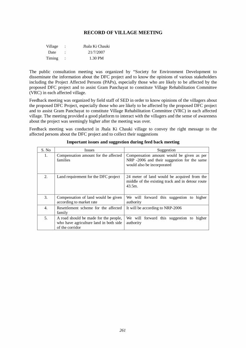
261
RECORD OF VILLAGE MEETING
Village : Jhala Ki Chauki Date : 21/7/2007
Timing
: 1.30 PM
The public consultation meeting was organized by “Society for Environment Development to disseminate the information about the DFC project and to know the opinions of various stakeholders including the Project Affected Persons (PAPs), especially those who are likely to be affected by the proposed DFC project and to assist Gram Panchayat to constitute Village Rehabilitation Committee (VRC) in each affected village.
Feedback meeting was organized by field staff of SED in order to know opinions of the villagers about the proposed DFC Project, especially those who are likely to be affected by the proposed DFC project and to assist Gram Panchayat to constitute Village Rehabilitation Committee (VRC) in each affected village. The meeting provided a good platform to interact with the villagers and the sense of awareness about the project was seemingly higher after the meeting was over.
Feedback meeting was conducted in Jhala Ki Chauki village to convey the right message to the affected persons about the DFC project and to collect their suggestions
Important issues and suggestion during feed back meeting
S. No Issues Suggestion 1.
Compensation amount for the affected families
Compensation amount would be given as per NRP -2006 and their suggestion for the same would also be incorporated
2. Land requirement for the DFC project 24 meter of land would be acquired from the middle of the existing track and in detour route 43.5m.
3.
Compensation of land would be given according to market rate
We will forward this suggestion to higher authority
4. Resettlement scheme for the affected family
It will be according to NRP-2006
5. A road should be made for the people, who have agriculture land in both side of the corridor
We will forward this suggestion to higher authority

262
RECORD OF VILLAGE MEETING
Village : Sendra Date : 22/7/2007
Timing
: 9.30 AM
The public consultation meeting was organized by “Society for Environment Development to disseminate the information about the DFC project and to know the opinions of various stakeholders including the Project Affected Persons (PAPs), especially those who are likely to be affected by the proposed DFC project and to assist Gram Panchayat to constitute Village Rehabilitation Committee (VRC) in each affected village.
Feedback meeting was organized by field staff of SED in order to know opinions of the villagers about the proposed DFC Project, especially those who are likely to be affected by the proposed DFC project and to assist Gram Panchayat to constitute Village Rehabilitation Committee (VRC) in each affected village. The meeting provided a good platform to interact with the villagers and the sense of awareness about the project was seemingly higher after the meeting was over.
Feedback meeting was conducted in Sendra village to convey the right message to the affected persons about the DFC project and to collect their suggestions
Important issues and suggestion during feed back meeting
S. No Issues Suggestion 1.
Compensation amount for the affected families
Compensation amount would be given as per NRP -2006 and their suggestion for the same would also be incorporated
2. Land requirement for the DFC project 24 meter of land would be acquired from the middle of the existing track and in detour route 43.5m.
3.
Compensation of land would be given according to market rate
We will forward this suggestion to higher authority
4. Resettlement scheme for the affected family
It will be according to NRP-2006
5. A road should be made for the people, who have agriculture land in both side of the corridor
We will forward this suggestion to higher authority
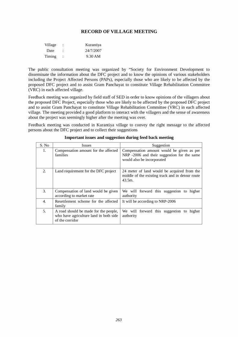
263
RECORD OF VILLAGE MEETING
Village : Kurantiya Date : 24/7/2007
Timing
: 9.30 AM
The public consultation meeting was organized by “Society for Environment Development to disseminate the information about the DFC project and to know the opinions of various stakeholders including the Project Affected Persons (PAPs), especially those who are likely to be affected by the proposed DFC project and to assist Gram Panchayat to constitute Village Rehabilitation Committee (VRC) in each affected village.
Feedback meeting was organized by field staff of SED in order to know opinions of the villagers about the proposed DFC Project, especially those who are likely to be affected by the proposed DFC project and to assist Gram Panchayat to constitute Village Rehabilitation Committee (VRC) in each affected village. The meeting provided a good platform to interact with the villagers and the sense of awareness about the project was seemingly higher after the meeting was over.
Feedback meeting was conducted in Kurantiya village to convey the right message to the affected persons about the DFC project and to collect their suggestions
Important issues and suggestion during feed back meeting
S. No Issues Suggestion 1.
Compensation amount for the affected families
Compensation amount would be given as per NRP -2006 and their suggestion for the same would also be incorporated
2. Land requirement for the DFC project 24 meter of land would be acquired from the middle of the existing track and in detour route 43.5m.
3.
Compensation of land would be given according to market rate
We will forward this suggestion to higher authority
4. Resettlement scheme for the affected family
It will be according to NRP-2006
5. A road should be made for the people, who have agriculture land in both side of the corridor
We will forward this suggestion to higher authority

264
RECORD OF VILLAGE MEETING
Village : Sabalpura Date : 24/7/2007
Timing
: 10.30 AM
The public consultation meeting was organized by “Society for Environment Development to disseminate the information about the DFC project and to know the opinions of various stakeholders including the Project Affected Persons (PAPs), especially those who are likely to be affected by the proposed DFC project and to assist Gram Panchayat to constitute Village Rehabilitation Committee (VRC) in each affected village.
Feedback meeting was organized by field staff of SED in order to know opinions of the villagers about the proposed DFC Project, especially those who are likely to be affected by the proposed DFC project and to assist Gram Panchayat to constitute Village Rehabilitation Committee (VRC) in each affected village. The meeting provided a good platform to interact with the villagers and the sense of awareness about the project was seemingly higher after the meeting was over.
Feedback meeting was conducted in Sabalpura village to convey the right message to the affected persons about the DFC project and to collect their suggestions
Important issues and suggestion during feed back meeting
S. No Issues Suggestion 1.
Compensation amount for the affected families
Compensation amount would be given as per NRP -2006 and their suggestion for the same would also be incorporated
2. Land requirement for the DFC project 24 meter of land would be acquired from the middle of the existing track and in detour route 43.5m.
3.
Compensation of land would be given according to market rate
We will forward this suggestion to higher authority
4. Resettlement scheme for the affected family
It will be according to NRP-2006
5. A road should be made for the people, who have agriculture land in both side of the corridor
We will forward this suggestion to higher authority

265
RECORD OF VILLAGE MEETING
Village : Manpura Date : 24/7/2007
Timing
: 2.30 PM
The public consultation meeting was organized by “Society for Environment Development to disseminate the information about the DFC project and to know the opinions of various stakeholders including the Project Affected Persons (PAPs), especially those who are likely to be affected by the proposed DFC project and to assist Gram Panchayat to constitute Village Rehabilitation Committee (VRC) in each affected village.
Feedback meeting was organized by field staff of SED in order to know opinions of the villagers about the proposed DFC Project, especially those who are likely to be affected by the proposed DFC project and to assist Gram Panchayat to constitute Village Rehabilitation Committee (VRC) in each affected village. The meeting provided a good platform to interact with the villagers and the sense of awareness about the project was seemingly higher after the meeting was over.
Feedback meeting was conducted in Manpura village to convey the right message to the affected persons about the DFC project and to collect their suggestions
Important issues and suggestion during feed back meeting
S. No Issues Suggestion 1.
Compensation amount for the affected families
Compensation amount would be given as per NRP -2006 and their suggestion for the same would also be incorporated
2. Land requirement for the DFC project 24 meter of land would be acquired from the middle of the existing track and in detour route 43.5m.
3.
Compensation of land would be given according to market rate
We will forward this suggestion to higher authority
4. Resettlement scheme for the affected family
It will be according to NRP-2006
5. A road should be made for the people, who have agriculture land in both side of the corridor
We will forward this suggestion to higher authority

266
RECORD OF VILLAGE MEETING
Village : Amarpura Date : 25/7/2007
Timing
: 9.30 AM
The public consultation meeting was organized by “Society for Environment Development to disseminate the information about the DFC project and to know the opinions of various stakeholders including the Project Affected Persons (PAPs), especially those who are likely to be affected by the proposed DFC project and to assist Gram Panchayat to constitute Village Rehabilitation Committee (VRC) in each affected village.
Feedback meeting was organized by field staff of SED in order to know opinions of the villagers about the proposed DFC Project, especially those who are likely to be affected by the proposed DFC project and to assist Gram Panchayat to constitute Village Rehabilitation Committee (VRC) in each affected village. The meeting provided a good platform to interact with the villagers and the sense of awareness about the project was seemingly higher after the meeting was over.
Feedback meeting was conducted in Amarpura village to convey the right message to the affected persons about the DFC project and to collect their suggestions
Important issues and suggestion during feed back meeting
S. No Issues Suggestion 1.
Compensation amount for the affected families
Compensation amount would be given as per NRP -2006 and their suggestion for the same would also be incorporated
2. Land requirement for the DFC project 24 meter of land would be acquired from the middle of the existing track and in detour route 43.5m.
3.
Compensation of land would be given according to market rate
We will forward this suggestion to higher authority
4. Resettlement scheme for the affected family
It will be according to NRP-2006
5. A road should be made for the people, who have agriculture land in both side of the corridor
We will forward this suggestion to higher authority

267
RECORD OF VILLAGE MEETING
Village : Shergarh Date : 25/7/2007
Timing
: 9.30 AM
The public consultation meeting was organized by “Society for Environment Development to disseminate the information about the DFC project and to know the opinions of various stakeholders including the Project Affected Persons (PAPs), especially those who are likely to be affected by the proposed DFC project and to assist Gram Panchayat to constitute Village Rehabilitation Committee (VRC) in each affected village.
Feedback meeting was organized by field staff of SED in order to know opinions of the villagers about the proposed DFC Project, especially those who are likely to be affected by the proposed DFC project and to assist Gram Panchayat to constitute Village Rehabilitation Committee (VRC) in each affected village. The meeting provided a good platform to interact with the villagers and the sense of awareness about the project was seemingly higher after the meeting was over.
Feedback meeting was conducted in Shergarh village to convey the right message to the affected persons about the DFC project and to collect their suggestions
Important issues and suggestion during feed back meeting
S. No Issues Suggestion 1.
Compensation amount for the affected families
Compensation amount would be given as per NRP -2006 and their suggestion for the same would also be incorporated
2. Land requirement for the DFC project 24 meter of land would be acquired from the middle of the existing track and in detour route 43.5m.
3.
Compensation of land would be given according to market rate
We will forward this suggestion to higher authority
4. Resettlement scheme for the affected family
It will be according to NRP-2006
5. A road should be made for the people, who have agriculture land in both side of the corridor
We will forward this suggestion to higher authority

268
RECORD OF VILLAGE MEETING
Village : Sardhana Date : 25/7/2007
Timing
: 10.30 AM
The public consultation meeting was organized by “Society for Environment Development to disseminate the information about the DFC project and to know the opinions of various stakeholders including the Project Affected Persons (PAPs), especially those who are likely to be affected by the proposed DFC project and to assist Gram Panchayat to constitute Village Rehabilitation Committee (VRC) in each affected village.
Feedback meeting was organized by field staff of SED in order to know opinions of the villagers about the proposed DFC Project, especially those who are likely to be affected by the proposed DFC project and to assist Gram Panchayat to constitute Village Rehabilitation Committee (VRC) in each affected village. The meeting provided a good platform to interact with the villagers and the sense of awareness about the project was seemingly higher after the meeting was over.
Feedback meeting was conducted in Sardhana village to convey the right message to the affected persons about the DFC project and to collect their suggestions
Important issues and suggestion during feed back meeting
S. No Issues Suggestion 1.
Compensation amount for the affected families
Compensation amount would be given as per NRP -2006 and their suggestion for the same would also be incorporated
2. Land requirement for the DFC project 24 meter of land would be acquired from the middle of the existing track and in detour route 43.5m.
3.
Compensation of land would be given according to market rate
We will forward this suggestion to higher authority
4. Resettlement scheme for the affected family
It will be according to NRP-2006
5. A road should be made for the people, who have agriculture land in both side of the corridor
We will forward this suggestion to higher authority

269
RECORD OF VILLAGE MEETING
Village : Baripal Date : 25/7/2007
Timing
: 2.30 PM
The public consultation meeting was organized by “Society for Environment Development to disseminate the information about the DFC project and to know the opinions of various stakeholders including the Project Affected Persons (PAPs), especially those who are likely to be affected by the proposed DFC project and to assist Gram Panchayat to constitute Village Rehabilitation Committee (VRC) in each affected village.
Feedback meeting was organized by field staff of SED in order to know opinions of the villagers about the proposed DFC Project, especially those who are likely to be affected by the proposed DFC project and to assist Gram Panchayat to constitute Village Rehabilitation Committee (VRC) in each affected village. The meeting provided a good platform to interact with the villagers and the sense of awareness about the project was seemingly higher after the meeting was over.
Feedback meeting was conducted in Baripal village to convey the right message to the affected persons about the DFC project and to collect their suggestions
Important issues and suggestion during feed back meeting
S. No Issues Suggestion 1.
Compensation amount for the affected families
Compensation amount would be given as per NRP -2006 and their suggestion for the same would also be incorporated
2. Land requirement for the DFC project 24 meter of land would be acquired from the middle of the existing track and in detour route 43.5m.
3.
Compensation of land would be given according to market rate
We will forward this suggestion to higher authority
4. Resettlement scheme for the affected family
It will be according to NRP-2006
5. A road should be made for the people, who have agriculture land in both side of the corridor
We will forward this suggestion to higher authority

270
RECORD OF VILLAGE MEETING
Village : Pachunda Kalan Date : 26/7/2007
Timing
: 9.30 AM
The public consultation meeting was organized by “Society for Environment Development to disseminate the information about the DFC project and to know the opinions of various stakeholders including the Project Affected Persons (PAPs), especially those who are likely to be affected by the proposed DFC project and to assist Gram Panchayat to constitute Village Rehabilitation Committee (VRC) in each affected village.
Feedback meeting was organized by field staff of SED in order to know opinions of the villagers about the proposed DFC Project, especially those who are likely to be affected by the proposed DFC project and to assist Gram Panchayat to constitute Village Rehabilitation Committee (VRC) in each affected village. The meeting provided a good platform to interact with the villagers and the sense of awareness about the project was seemingly higher after the meeting was over.
Feedback meeting was conducted in Pachunda Kalan village to convey the right message to the affected persons about the DFC project and to collect their suggestions
Important issues and suggestion during feed back meeting
S. No Issues Suggestion 1.
Compensation amount for the affected families
Compensation amount would be given as per NRP -2006 and their suggestion for the same would also be incorporated
2. Land requirement for the DFC project 24 meter of land would be acquired from the middle of the existing track and in detour route 43.5m.
3.
Compensation of land would be given according to market rate
We will forward this suggestion to higher authority
4. Resettlement scheme for the affected family
It will be according to NRP-2006
5. A road should be made for the people, who have agriculture land in both side of the corridor
We will forward this suggestion to higher authority

271
RECORD OF VILLAGE MEETING
Village : Bagri Date : 26/7/2007
Timing
: 10.30 AM
The public consultation meeting was organized by “Society for Environment Development to disseminate the information about the DFC project and to know the opinions of various stakeholders including the Project Affected Persons (PAPs), especially those who are likely to be affected by the proposed DFC project and to assist Gram Panchayat to constitute Village Rehabilitation Committee (VRC) in each affected village.
Feedback meeting was organized by field staff of SED in order to know opinions of the villagers about the proposed DFC Project, especially those who are likely to be affected by the proposed DFC project and to assist Gram Panchayat to constitute Village Rehabilitation Committee (VRC) in each affected village. The meeting provided a good platform to interact with the villagers and the sense of awareness about the project was seemingly higher after the meeting was over.
Feedback meeting was conducted in Bagri village to convey the right message to the affected persons about the DFC project and to collect their suggestions
Important issues and suggestion during feed back meeting
S. No Issues Suggestion 1.
Compensation amount for the affected families
Compensation amount would be given as per NRP -2006 and their suggestion for the same would also be incorporated
2. Land requirement for the DFC project 24 meter of land would be acquired from the middle of the existing track and in detour route 43.5m.
3.
Compensation of land would be given according to market rate
We will forward this suggestion to higher authority
4. Resettlement scheme for the affected family
It will be according to NRP-2006
5. A road should be made for the people, who have agriculture land in both side of the corridor
We will forward this suggestion to higher authority

272
RECORD OF VILLAGE MEETING
Village : Murdana Date : 26/7/2007
Timing
: 12.30 PM
The public consultation meeting was organized by “Society for Environment Development to disseminate the information about the DFC project and to know the opinions of various stakeholders including the Project Affected Persons (PAPs), especially those who are likely to be affected by the proposed DFC project and to assist Gram Panchayat to constitute Village Rehabilitation Committee (VRC) in each affected village.
Feedback meeting was organized by field staff of SED in order to know opinions of the villagers about the proposed DFC Project, especially those who are likely to be affected by the proposed DFC project and to assist Gram Panchayat to constitute Village Rehabilitation Committee (VRC) in each affected village. The meeting provided a good platform to interact with the villagers and the sense of awareness about the project was seemingly higher after the meeting was over.
Feedback meeting was conducted in Murdana village to convey the right message to the affected persons about the DFC project and to collect their suggestions
Important issues and suggestion during feed back meeting
S. No Issues Suggestion 1.
Compensation amount for the affected families
Compensation amount would be given as per NRP -2006 and their suggestion for the same would also be incorporated
2. Land requirement for the DFC project 24 meter of land would be acquired from the middle of the existing track and in detour route 43.5m.
3.
Compensation of land would be given according to market rate
We will forward this suggestion to higher authority
4. Resettlement scheme for the affected family
It will be according to NRP-2006
5. A road should be made for the people, who have agriculture land in both side of the corridor
We will forward this suggestion to higher authority
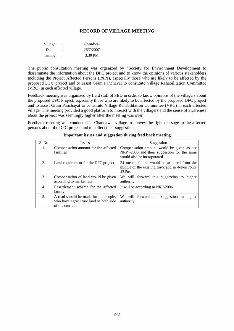
273
RECORD OF VILLAGE MEETING
Village : Chandwal Date : 26/7/2007
Timing
: 3.30 PM
The public consultation meeting was organized by “Society for Environment Development to disseminate the information about the DFC project and to know the opinions of various stakeholders including the Project Affected Persons (PAPs), especially those who are likely to be affected by the proposed DFC project and to assist Gram Panchayat to constitute Village Rehabilitation Committee (VRC) in each affected village.
Feedback meeting was organized by field staff of SED in order to know opinions of the villagers about the proposed DFC Project, especially those who are likely to be affected by the proposed DFC project and to assist Gram Panchayat to constitute Village Rehabilitation Committee (VRC) in each affected village. The meeting provided a good platform to interact with the villagers and the sense of awareness about the project was seemingly higher after the meeting was over.
Feedback meeting was conducted in Chandawal village to convey the right message to the affected persons about the DFC project and to collect their suggestions.
Important issues and suggestion during feed back meeting
S. No Issues Suggestion 1.
Compensation amount for the affected families
Compensation amount would be given as per NRP -2006 and their suggestion for the same would also be incorporated
2. Land requirement for the DFC project 24 meter of land would be acquired from the middle of the existing track and in detour route 43.5m.
3.
Compensation of land would be given according to market rate
We will forward this suggestion to higher authority
4. Resettlement scheme for the affected family
It will be according to NRP-2006
5. A road should be made for the people, who have agriculture land in both side of the corridor
We will forward this suggestion to higher authority
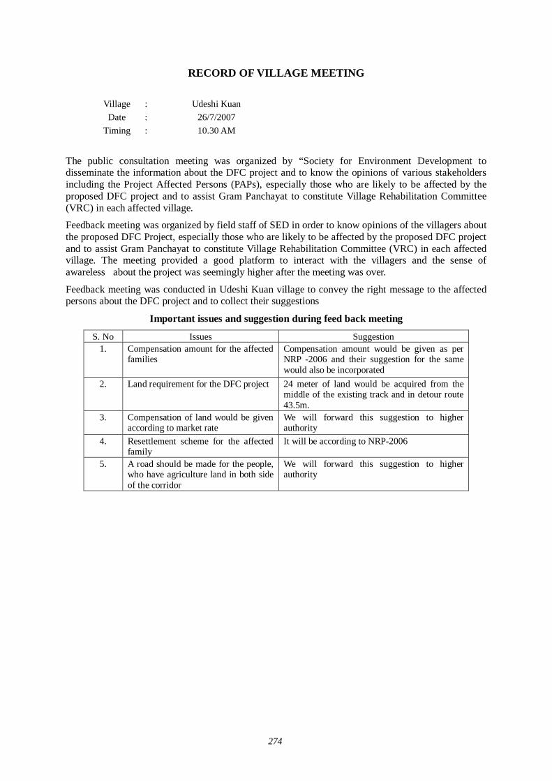
274
RECORD OF VILLAGE MEETING
Village : Udeshi Kuan Date : 26/7/2007
Timing
: 10.30 AM
The public consultation meeting was organized by “Society for Environment Development to disseminate the information about the DFC project and to know the opinions of various stakeholders including the Project Affected Persons (PAPs), especially those who are likely to be affected by the proposed DFC project and to assist Gram Panchayat to constitute Village Rehabilitation Committee (VRC) in each affected village.
Feedback meeting was organized by field staff of SED in order to know opinions of the villagers about the proposed DFC Project, especially those who are likely to be affected by the proposed DFC project and to assist Gram Panchayat to constitute Village Rehabilitation Committee (VRC) in each affected village. The meeting provided a good platform to interact with the villagers and the sense of awareless about the project was seemingly higher after the meeting was over.
Feedback meeting was conducted in Udeshi Kuan village to convey the right message to the affected persons about the DFC project and to collect their suggestions
Important issues and suggestion during feed back meeting
S. No Issues Suggestion 1.
Compensation amount for the affected families
Compensation amount would be given as per NRP -2006 and their suggestion for the same would also be incorporated
2. Land requirement for the DFC project 24 meter of land would be acquired from the middle of the existing track and in detour route 43.5m.
3.
Compensation of land would be given according to market rate
We will forward this suggestion to higher authority
4. Resettlement scheme for the affected family
It will be according to NRP-2006
5. A road should be made for the people, who have agriculture land in both side of the corridor
We will forward this suggestion to higher authority

275
RECORD OF VILLAGE MEETING
Village : Karmawas Date : 26/7/2007
Timing
: 12.30 PM
The public consultation meeting was organized by “Society for Environment Development to disseminate the information about the DFC project and to know the opinions of various stakeholders including the Project Affected Persons (PAPs), especially those who are likely to be affected by the proposed DFC project and to assist Gram Panchayat to constitute Village Rehabilitation Committee (VRC) in each affected village.
Feedback meeting was organized by field staff of SED in order to know opinions of the villagers about the proposed DFC Project, especially those who are likely to be affected by the proposed DFC project and to assist Gram Panchayat to constitute Village Rehabilitation Committee (VRC) in each affected village. The meeting provided a good platform to interact with the villagers and the sense of awareness about the project was seemingly higher after the meeting was over.
Feedback meeting was conducted in Kamarwas village to convey the right message to the affected persons about the DFC project and to collect their suggestions
Important issues and suggestion during feed back meeting
S. No Issues Suggestion 1.
Compensation amount for the affected families
Compensation amount would be given as per NRP -2006 and their suggestion for the same would also be incorporated
2. Land requirement for the DFC project 24 meter of land would be acquired from the middle of the existing track and in detour route 43.5m.
3.
Compensation of land would be given according to market rate
We will forward this suggestion to higher authority
4. Resettlement scheme for the affected family
It will be according to NRP-2006
5. A road should be made for the people, who have agriculture land in both side of the corridor
We will forward this suggestion to higher authority

276
RECORD OF VILLAGE MEETING
Village : Dudor Date : 28/7/2007
Timing
: 12.30 PM
The public consultation meeting was organized by “Society for Environment Development to disseminate the information about the DFC project and to know the opinions of various stakeholders including the Project Affected Persons (PAPs), especially those who are likely to be affected by the proposed DFC project and to assist Gram Panchayat to constitute Village Rehabilitation Committee (VRC) in each affected village.
Feedback meeting was organized by field staff of SED in order to know opinions of the villagers about the proposed DFC Project, especially those who are likely to be affected by the proposed DFC project and to assist Gram Panchayat to constitute Village Rehabilitation Committee (VRC) in each affected village. The meeting provided a good platform to interact with the villagers and the sense of awareness about the project was seemingly higher after the meeting was over.
Feedback meeting was conducted in Dudor village to convey the right message to the affected persons about the DFC project and to collect their suggestions
Important issues and suggestion during feed back meeting
S. No Issues Suggestion 1.
Compensation amount for the affected families
Compensation amount would be given as per NRP -2006 and their suggestion for the same would also be incorporated
2. Land requirement for the DFC project 24 meter of land would be acquired from the middle of the existing track and in detour route 43.5m.
3.
Compensation of land would be given according to market rate
We will forward this suggestion to higher authority
4. Resettlement scheme for the affected family
It will be according to NRP-2006
5. A road should be made for the people, who have agriculture land in both side of the corridor
We will forward this suggestion to higher authority

277
RECORD OF VILLAGE MEETING
Village : Barsa Date : 28/7/2007
Timing
: 2.30 PM
The public consultation meeting was organized by “Society for Environment Development to disseminate the information about the DFC project and to know the opinions of various stakeholders including the Project Affected Persons (PAPs), especially those who are likely to be affected by the proposed DFC project and to assist Gram Panchayat to constitute Village Rehabilitation Committee (VRC) in each affected village.
Feedback meeting was organized by field staff of SED in order to know opinions of the villagers about the proposed DFC Project, especially those who are likely to be affected by the proposed DFC project and to assist Gram Panchayat to constitute Village Rehabilitation Committee (VRC) in each affected village. The meeting provided a good platform to interact with the villagers and the sense of awareness about the project was seemingly higher after the meeting was over.
Feedback meeting was conducted in Barsa village to convey the right message to the affected persons about the DFC project and to collect their suggestions
Important issues and suggestion during feed back meeting
S. No Issues Suggestion 1.
Compensation amount for the affected families
Compensation amount would be given as per NRP -2006 and their suggestion for the same would also be incorporated
2. Land requirement for the DFC project 24 meter of land would be acquired from the middle of the existing track and in detour route 43.5m.
3.
Compensation of land would be given according to market rate
We will forward this suggestion to higher authority
4. Resettlement scheme for the affected family
It will be according to NRP-2006
5. A road should be made for the people, who have agriculture land in both side of the corridor
We will forward this suggestion to higher authority

278
RECORD OF VILLAGE MEETING
Village : Bithara Khurd Date : 28/7/2007
Timing
: 1.30 PM
The public consultation meeting was organized by “Society for Environment Development to disseminate the information about the DFC project and to know the opinions of various stakeholders including the Project Affected Persons (PAPs), especially those who are likely to be affected by the proposed DFC project and to assist Gram Panchayat to constitute Village Rehabilitation Committee (VRC) in each affected village.
Feedback meeting was organized by field staff of SED in order to know opinions of the villagers about the proposed DFC Project, especially those who are likely to be affected by the proposed DFC project and to assist Gram Panchayat to constitute Village Rehabilitation Committee (VRC) in each affected village. The meeting provided a good platform to interact with the villagers and the sense of awareness about the project was seemingly higher after the meeting was over.
Feedback meeting was conducted in Bithara Khurd village to convey the right message to the affected persons about the DFC project and to collect their suggestions
Important issues and suggestion during feed back meeting
S. No Issues Suggestion 1.
Compensation amount for the affected families
Compensation amount would be given as per NRP -2006 and their suggestion for the same would also be incorporated
2. Land requirement for the DFC project 24 meter of land would be acquired from the middle of the existing track and in detour route 43.5m.
3.
Compensation of land would be given according to market rate
We will forward this suggestion to higher authority
4. Resettlement scheme for the affected family
It will be according to NRP-2006
5. A road should be made for the people, who have agriculture land in both side of the corridor
We will forward this suggestion to higher authority

279
RECORD OF VILLAGE MEETING
Village : Himaliyawas Khurd Date : 26/7/2007
Timing
: 12.30 PM
The public consultation meeting was organized by “Society for Environment Development to disseminate the information about the DFC project and to know the opinions of various stakeholders including the Project Affected Persons (PAPs), especially those who are likely to be affected by the proposed DFC project and to assist Gram Panchayat to constitute Village Rehabilitation Committee (VRC) in each affected village.
Feedback meeting was organized by field staff of SED in order to know opinions of the villagers about the proposed DFC Project, especially those who are likely to be affected by the proposed DFC project and to assist Gram Panchayat to constitute Village Rehabilitation Committee (VRC) in each affected village. The meeting provided a good platform to interact with the villagers and the sense of awareness about the project was seemingly higher after the meeting was over.
Feedback meeting was conducted in Himaliyawas Khurd village to convey the right message to the affected persons about the DFC project and to collect their suggestions
Important issues and suggestion during feed back meeting
S. No Issues Suggestion 1.
Compensation amount for the affected families
Compensation amount would be given as per NRP -2006 and their suggestion for the same would also be incorporated
2. Land requirement for the DFC project 24 meter of land would be acquired from the middle of the existing track and in detour route 43.5m.
3.
Compensation of land would be given according to market rate
We will forward this suggestion to higher authority
4. Resettlement scheme for the affected family
It will be according to NRP-2006
5. A road should be made for the people, who have agriculture land in both side of the corridor
We will forward this suggestion to higher authority

280
RECORD OF VILLAGE MEETING
Village : Reesania Date : 26/7/2007
Timing
: 2.30 PM
The public consultation meeting was organized by “Society for Environment Development to disseminate the information about the DFC project and to know the opinions of various stakeholders including the Project Affected Persons (PAPs), especially those who are likely to be affected by the proposed DFC project and to assist Gram Panchayat to constitute Village Rehabilitation Committee (VRC) in each affected village.
Feedback meeting was organized by field staff of SED in order to know opinions of the villagers about the proposed DFC Project, especially those who are likely to be affected by the proposed DFC project and to assist Gram Panchayat to constitute Village Rehabilitation Committee (VRC) in each affected village. The meeting provided a good platform to interact with the villagers and the sense of awareness about the project was seemingly higher after the meeting was over.
Feedback meeting was conducted in Reesaniya village to convey the right message to the affected persons about the DFC project and to collect their suggestions
Important issues and suggestion during feed back meeting
S. No Issues Suggestion 1.
Compensation amount for the affected families
Compensation amount would be given as per NRP -2006 and their suggestion for the same would also be incorporated
2. Land requirement for the DFC project 24 meter of land would be acquired from the middle of the existing track and in detour route 43.5m.
3.
Compensation of land would be given according to market rate
We will forward this suggestion to higher authority
4. Resettlement scheme for the affected family
It will be according to NRP-2006
5. A road should be made for the people, who have agriculture land in both side of the corridor
We will forward this suggestion to higher authority

281
RECORD OF VILLAGE MEETING
Village : Saward Date : 28/7/2007
Timing
: 12.30 PM
The public consultation meeting was organized by “Society for Environment Development to disseminate the information about the DFC project and to know the opinions of various stakeholders including the Project Affected Persons (PAPs), especially those who are likely to be affected by the proposed DFC project and to assist Gram Panchayat to constitute Village Rehabilitation Committee (VRC) in each affected village.
Feedback meeting was organized by field staff of SED in order to know opinions of the villagers about the proposed DFC Project, especially those who are likely to be affected by the proposed DFC project and to assist Gram Panchayat to constitute Village Rehabilitation Committee (VRC) in each affected village. The meeting provided a good platform to interact with the villagers and the sense of awareness about the project was seemingly higher after the meeting was over.
Feedback meeting was conducted in Saward village to convey the right message to the affected persons about the DFC project and to collect their suggestions
Important issues and suggestion during feed back meeting
S. No Issues Suggestion 1.
Compensation amount for the affected families
Compensation amount would be given as per NRP -2006 and their suggestion for the same would also be incorporated
2. Land requirement for the DFC project 24 meter of land would be acquired from the middle of the existing track and in detour route 43.5m.
3.
Compensation of land would be given according to market rate
We will forward this suggestion to higher authority
4. Resettlement scheme for the affected family
It will be according to NRP-2006
5. A road should be made for the people, who have agriculture land in both side of the corridor
We will forward this suggestion to higher authority

282
RECORD OF VILLAGE MEETING
Village : Dhundala Date : 28/7/2007
Timing
: 11.30 AM
The public consultation meeting was organized by “Society for Environment Development to disseminate the information about the DFC project and to know the opinions of various stakeholders including the Project Affected Persons (PAPs), especially those who are likely to be affected by the proposed DFC project and to assist Gram Panchayat to constitute Village Rehabilitation Committee (VRC) in each affected village.
Feedback meeting was organized by field staff of SED in order to know opinions of the villagers about the proposed DFC Project, especially those who are likely to be affected by the proposed DFC project and to assist Gram Panchayat to constitute Village Rehabilitation Committee (VRC) in each affected village. The meeting provided a good platform to interact with the villagers and the sense of awareness about the project was seemingly higher after the meeting was over.
Feedback meeting was conducted in Dhundhala village to convey the right message to the affected persons about the DFC project and to collect their suggestions
Important issues and suggestion during feed back meeting
S. No Issues Suggestion 1.
Compensation amount for the affected families
Compensation amount would be given as per NRP -2006 and their suggestion for the same would also be incorporated
2. Land requirement for the DFC project 24 meter of land would be acquired from the middle of the existing track and in detour route 43.5m.
3.
Compensation of land would be given according to market rate
We will forward this suggestion to higher authority
4. Resettlement scheme for the affected family
It will be according to NRP-2006
5. A road should be made for the people, who have agriculture land in both side of the corridor
We will forward this suggestion to higher authority

283
RECORD OF VILLAGE MEETING
Village : Dadiya Date : 26/7/2007
Timing
: 2.30 PM
The public consultation meeting was organized by “Society for Environment Development to disseminate the information about the DFC project and to know the opinions of various stakeholders including the Project Affected Persons (PAPs), especially those who are likely to be affected by the proposed DFC project and to assist Gram Panchayat to constitute Village Rehabilitation Committee (VRC) in each affected village.
Feedback meeting was organized by field staff of SED in order to know opinions of the villagers about the proposed DFC Project, especially those who are likely to be affected by the proposed DFC project and to assist Gram Panchayat to constitute Village Rehabilitation Committee (VRC) in each affected village. The meeting provided a good platform to interact with the villagers and the sense of awareness about the project was seemingly higher after the meeting was over.
Feedback meeting was conducted in Dadiya village to convey the right message to the affected persons about the DFC project and to collect their suggestions
Important issues and suggestion during feed back meeting
S. No Issues Suggestion 1.
Compensation amount for the affected families
Compensation amount would be given as per NRP -2006 and their suggestion for the same would also be incorporated
2. Land requirement for the DFC project 24 meter of land would be acquired from the middle of the existing track and in detour route 43.5m.
3.
Compensation of land would be given according to market rate
We will forward this suggestion to higher authority
4. Resettlement scheme for the affected family
It will be according to NRP-2006
5. A road should be made for the people, who have agriculture land in both side of the corridor
We will forward this suggestion to higher authority

284
RECORD OF VILLAGE MEETING
Village : Kapri Date : 26/7/2007
Timing
: 12.30 PM
The public consultation meeting was organized by “Society for Environment Development to disseminate the information about the DFC project and to know the opinions of various stakeholders including the Project Affected Persons (PAPs), especially those who are likely to be affected by the proposed DFC project and to assist Gram Panchayat to constitute Village Rehabilitation Committee (VRC) in each affected village.
Feedback meeting was organized by field staff of SED in order to know opinions of the villagers about the proposed DFC Project, especially those who are likely to be affected by the proposed DFC project and to assist Gram Panchayat to constitute Village Rehabilitation Committee (VRC) in each affected village. The meeting provided a good platform to interact with the villagers and the sense of awareness about the project was seemingly higher after the meeting was over.
Feedback meeting was conducted in Kapari village to convey the right message to the affected persons about the DFC project and to collect their suggestions
Important issues and suggestion during feed back meeting
S. No Issues Suggestion 1.
Compensation amount for the affected families
Compensation amount would be given as per NRP -2006 and their suggestion for the same would also be incorporated
2. Land requirement for the DFC project 24 meter of land would be acquired from the middle of the existing track and in detour route 43.5m.
3.
Compensation of land would be given according to market rate
We will forward this suggestion to higher authority
4. Resettlement scheme for the affected family
It will be according to NRP-2006
5. A road should be made for the people, who have agriculture land in both side of the corridor
We will forward this suggestion to higher authority

285
RECORD OF VILLAGE MEETING
Village : Bhimmaliya Date : 26/7/2007
Timing
: 2.30 PM
The public consultation meeting was organized by “Society for Environment Development to disseminate the information about the DFC project and to know the opinions of various stakeholders including the Project Affected Persons (PAPs), especially those who are likely to be affected by the proposed DFC project and to assist Gram Panchayat to constitute Village Rehabilitation Committee (VRC) in each affected village.
Feedback meeting was organized by field staff of SED in order to know opinions of the villagers about the proposed DFC Project, especially those who are likely to be affected by the proposed DFC project and to assist Gram Panchayat to constitute Village Rehabilitation Committee (VRC) in each affected village. The meeting provided a good platform to interact with the villagers and the sense of awareness about the project was seemingly higher after the meeting was over.
Feedback meeting was conducted in Bhimaliya village to convey the right message to the affected persons about the DFC project and to collect their suggestions
Important issues and suggestion during feed back meeting
S. No Issues Suggestion 1.
Compensation amount for the affected families
Compensation amount would be given as per NRP -2006 and their suggestion for the same would also be incorporated
2. Land requirement for the DFC project 24 meter of land would be acquired from the middle of the existing track and in detour route 43.5m.
3.
Compensation of land would be given according to market rate
We will forward this suggestion to higher authority
4. Resettlement scheme for the affected family
It will be according to NRP-2006
5. A road should be made for the people, who have agriculture land in both side of the corridor
We will forward this suggestion to higher authority
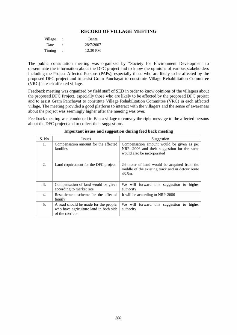
286
RECORD OF VILLAGE MEETING Village : Banta
Date : 28/7/2007 Timing
: 12.30 PM
The public consultation meeting was organized by “Society for Environment Development to disseminate the information about the DFC project and to know the opinions of various stakeholders including the Project Affected Persons (PAPs), especially those who are likely to be affected by the proposed DFC project and to assist Gram Panchayat to constitute Village Rehabilitation Committee (VRC) in each affected village.
Feedback meeting was organized by field staff of SED in order to know opinions of the villagers about the proposed DFC Project, especially those who are likely to be affected by the proposed DFC project and to assist Gram Panchayat to constitute Village Rehabilitation Committee (VRC) in each affected village. The meeting provided a good platform to interact with the villagers and the sense of awareness about the project was seemingly higher after the meeting was over.
Feedback meeting was conducted in Banta village to convey the right message to the affected persons about the DFC project and to collect their suggestions
Important issues and suggestion during feed back meeting
S. No Issues Suggestion 1.
Compensation amount for the affected families
Compensation amount would be given as per NRP -2006 and their suggestion for the same would also be incorporated
2. Land requirement for the DFC project 24 meter of land would be acquired from the middle of the existing track and in detour route 43.5m.
3.
Compensation of land would be given according to market rate
We will forward this suggestion to higher authority
4. Resettlement scheme for the affected family
It will be according to NRP-2006
5. A road should be made for the people, who have agriculture land in both side of the corridor
We will forward this suggestion to higher authority

287
RECORD OF VILLAGE MEETING
Village : Kheemal Date : 26/7/2007
Timing
: 3.30 PM
The public consultation meeting was organized by “Society for Environment Development to disseminate the information about the DFC project and to know the opinions of various stakeholders including the Project Affected Persons (PAPs), especially those who are likely to be affected by the proposed DFC project and to assist Gram Panchayat to constitute Village Rehabilitation Committee (VRC) in each affected village.
Feedback meeting was organized by field staff of SED in order to know opinions of the villagers about the proposed DFC Project, especially those who are likely to be affected by the proposed DFC project and to assist Gram Panchayat to constitute Village Rehabilitation Committee (VRC) in each affected village. The meeting provided a good platform to interact with the villagers and the sense of awareness about the project was seemingly higher after the meeting was over.
Feedback meeting was conducted in Kheemal village to convey the right message to the affected persons about the DFC project and to collect their suggestions
Important issues and suggestion during feed back meeting
S. No Issues Suggestion 1.
Compensation amount for the affected families
Compensation amount would be given as per NRP -2006 and their suggestion for the same would also be incorporated
2. Land requirement for the DFC project 24 meter of land would be acquired from the middle of the existing track and in detour route 43.5m.
3.
Compensation of land would be given according to market rate
We will forward this suggestion to higher authority
4. Resettlement scheme for the affected family
It will be according to NRP-2006
5. A road should be made for the people, who have agriculture land in both side of the corridor
We will forward this suggestion to higher authority

288
RECORD OF VILLAGE MEETING
Village : Sarkhejra Date : 26/7/2007
Timing
: 9.30 AM
The public consultation meeting was organized by “Society for Environment Development to disseminate the information about the DFC project and to know the opinions of various stakeholders including the Project Affected Persons (PAPs), especially those who are likely to be affected by the proposed DFC project and to assist Gram Panchayat to constitute Village Rehabilitation Committee (VRC) in each affected village.
Feedback meeting was organized by field staff of SED in order to know opinions of the villagers about the proposed DFC Project, especially those who are likely to be affected by the proposed DFC project and to assist Gram Panchayat to constitute Village Rehabilitation Committee (VRC) in each affected village. The meeting provided a good platform to interact with the villagers and the sense of awareness about the project was seemingly higher after the meeting was over.
Feedback meeting was conducted in Sarkhrjra village to convey the right message to the affected persons about the DFC project and to collect their suggestions
Important issues and suggestion during feed back meeting
S. No Issues Suggestion 1.
Compensation amount for the affected families
Compensation amount would be given as per NRP -2006 and their suggestion for the same would also be incorporated
2. Land requirement for the DFC project 24 meter of land would be acquired from the middle of the existing track and in detour route 43.5m.
3.
Compensation of land would be given according to market rate
We will forward this suggestion to higher authority
4. Resettlement scheme for the affected family
It will be according to NRP-2006
5. A road should be made for the people, who have agriculture land in both side of the corridor
We will forward this suggestion to higher authority

289
RECORD OF VILLAGE MEETING
Village : Jadri Date : 26/7/2007
Timing
: 12.30 PM
The public consultation meeting was organized by “Society for Environment Development to disseminate the information about the DFC project and to know the opinions of various stakeholders including the Project Affected Persons (PAPs), especially those who are likely to be affected by the proposed DFC project and to assist Gram Panchayat to constitute Village Rehabilitation Committee (VRC) in each affected village.
Feedback meeting was organized by field staff of SED in order to know opinions of the villagers about the proposed DFC Project, especially those who are likely to be affected by the proposed DFC project and to assist Gram Panchayat to constitute Village Rehabilitation Committee (VRC) in each affected village. The meeting provided a good platform to interact with the villagers and the sense of awareness about the project was seemingly higher after the meeting was over.
Feedback meeting was conducted in Jadri village to convey the right message to the affected persons about the DFC project and to collect their suggestions
Important issues and suggestion during feed back meeting
S. No Issues Suggestion 1.
Compensation amount for the affected families
Compensation amount would be given as per NRP -2006 and their suggestion for the same would also be incorporated
2. Land requirement for the DFC project 24 meter of land would be acquired from the middle of the existing track and in detour route 43.5m.
3.
Compensation of land would be given according to market rate
We will forward this suggestion to higher authority
4. Resettlement scheme for the affected family
It will be according to NRP-2006
5. A road should be made for the people, who have agriculture land in both side of the corridor
We will forward this suggestion to higher authority
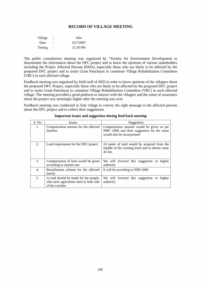
290
RECORD OF VILLAGE MEETING
Village : Sela Date : 25/7/2007
Timing
: 12.30 PM
The public consultation meeting was organized by “Society for Environment Development to disseminate the information about the DFC project and to know the opinions of various stakeholders including the Project Affected Persons (PAPs), especially those who are likely to be affected by the proposed DFC project and to assist Gram Panchayat to constitute Village Rehabilitation Committee (VRC) in each affected village.
Feedback meeting was organized by field staff of SED in order to know opinions of the villagers about the proposed DFC Project, especially those who are likely to be affected by the proposed DFC project and to assist Gram Panchayat to constitute Village Rehabilitation Committee (VRC) in each affected village. The meeting provided a good platform to interact with the villagers and the sense of awareness about the project was seemingly higher after the meeting was over.
Feedback meeting was conducted in Sela village to convey the right message to the affected persons about the DFC project and to collect their suggestions
Important issues and suggestion during feed back meeting
S. No Issues Suggestion 1.
Compensation amount for the affected families
Compensation amount would be given as per NRP -2006 and their suggestion for the same would also be incorporated
2. Land requirement for the DFC project 24 meter of land would be acquired from the middle of the existing track and in detour route 43.5m.
3.
Compensation of land would be given according to market rate
We will forward this suggestion to higher authority
4. Resettlement scheme for the affected family
It will be according to NRP-2006
5. A road should be made for the people, who have agriculture land in both side of the corridor
We will forward this suggestion to higher authority

291
RECORD OF VILLAGE MEETING
Village : Beeraliya Date : 26/7/2007
Timing
: 2.30 PM
The public consultation meeting was organized by “Society for Environment Development to disseminate the information about the DFC project and to know the opinions of various stakeholders including the Project Affected Persons (PAPs), especially those who are likely to be affected by the proposed DFC project and to assist Gram Panchayat to constitute Village Rehabilitation Committee (VRC) in each affected village.
Feedback meeting was organized by field staff of SED in order to know opinions of the villagers about the proposed DFC Project, especially those who are likely to be affected by the proposed DFC project and to assist Gram Panchayat to constitute Village Rehabilitation Committee (VRC) in each affected village. The meeting provided a good platform to interact with the villagers and the sense of awareness about the project was seemingly higher after the meeting was over.
Feedback meeting was conducted in Beeraliya village to convey the right message to the affected persons about the DFC project and to collect their suggestions
Important issues and suggestion during feed back meeting
S. No Issues Suggestion 1.
Compensation amount for the affected families
Compensation amount would be given as per NRP -2006 and their suggestion for the same would also be incorporated
2. Land requirement for the DFC project 24 meter of land would be acquired from the middle of the existing track and in detour route 43.5m.
3.
Compensation of land would be given according to market rate
We will forward this suggestion to higher authority
4. Resettlement scheme for the affected family
It will be according to NRP-2006
5. A road should be made for the people, who have agriculture land in both side of the corridor
We will forward this suggestion to higher authority

292
RECORD OF VILLAGE MEETING
Village : Beesalpur Date : 25/7/2007
Timing
: 12.30 PM
The public consultation meeting was organized by “Society for Environment Development to disseminate the information about the DFC project and to know the opinions of various stakeholders including the Project Affected Persons (PAPs), especially those who are likely to be affected by the proposed DFC project and to assist Gram Panchayat to constitute Village Rehabilitation Committee (VRC) in each affected village.
Feedback meeting was organized by field staff of SED in order to know opinions of the villagers about the proposed DFC Project, especially those who are likely to be affected by the proposed DFC project and to assist Gram Panchayat to constitute Village Rehabilitation Committee (VRC) in each affected village. The meeting provided a good platform to interact with the villagers and the sense of awareness about the project was seemingly higher after the meeting was over.
Feedback meeting was conducted in Beesalpur village to convey the right message to the affected persons about the DFC project and to collect their suggestions
Important issues and suggestion during feed back meeting
S. No Issues Suggestion 1.
Compensation amount for the affected families
Compensation amount would be given as per NRP -2006 and their suggestion for the same would also be incorporated
2. Land requirement for the DFC project 24 meter of land would be acquired from the middle of the existing track and in detour route 43.5m.
3.
Compensation of land would be given according to market rate
We will forward this suggestion to higher authority
4. Resettlement scheme for the affected family
It will be according to NRP-2006
5. A road should be made for the people, who have agriculture land in both side of the corridor
We will forward this suggestion to higher authority

293
RECORD OF VILLAGE MEETING
Village : Doodni Date : 25/7/2007
Timing
: 2.30 PM
The public consultation meeting was organized by “Society for Environment Development to disseminate the information about the DFC project and to know the opinions of various stakeholders including the Project Affected Persons (PAPs), especially those who are likely to be affected by the proposed DFC project and to assist Gram Panchayat to constitute Village Rehabilitation Committee (VRC) in each affected village.
Feedback meeting was organized by field staff of SED in order to know opinions of the villagers about the proposed DFC Project, especially those who are likely to be affected by the proposed DFC project and to assist Gram Panchayat to constitute Village Rehabilitation Committee (VRC) in each affected village. The meeting provided a good platform to interact with the villagers and the sense of awareness about the project was seemingly higher after the meeting was over.
Feedback meeting was conducted in Doondi village to convey the right message to the affected persons about the DFC project and to collect their suggestions
Important issues and suggestion during feed back meeting
S. No Issues Suggestion 1.
Compensation amount for the affected families
Compensation amount would be given as per NRP -2006 and their suggestion for the same would also be incorporated
2. Land requirement for the DFC project 24 meter of land would be acquired from the middle of the existing track and in detour route 43.5m.
3.
Compensation of land would be given according to market rate
We will forward this suggestion to higher authority
4. Resettlement scheme for the affected family
It will be according to NRP-2006
5. A road should be made for the people, who have agriculture land in both side of the corridor
We will forward this suggestion to higher authority

294
RECORD OF VILLAGE MEETING
Village : Raghunathpura Date : 25/7/2007
Timing
: 12.30 PM
The public consultation meeting was organized by “Society for Environment Development to disseminate the information about the DFC project and to know the opinions of various stakeholders including the Project Affected Persons (PAPs), especially those who are likely to be affected by the proposed DFC project and to assist Gram Panchayat to constitute Village Rehabilitation Committee (VRC) in each affected village.
Feedback meeting was organized by field staff of SED in order to know opinions of the villagers about the proposed DFC Project, especially those who are likely to be affected by the proposed DFC project and to assist Gram Panchayat to constitute Village Rehabilitation Committee (VRC) in each affected village. The meeting provided a good platform to interact with the villagers and the sense of awareness about the project was seemingly higher after the meeting was over.
Feedback meeting was conducted in Raghunathpura village to convey the right message to the affected persons about the DFC project and to collect their suggestions
Important issues and suggestion during feed back meeting
S. No Issues Suggestion 1.
Compensation amount for the affected families
Compensation amount would be given as per NRP -2006 and their suggestion for the same would also be incorporated
2. Land requirement for the DFC project 24 meter of land would be acquired from the middle of the existing track and in detour route 43.5m.
3.
Compensation of land would be given according to market rate
We will forward this suggestion to higher authority
4. Resettlement scheme for the affected family
It will be according to NRP-2006
5. A road should be made for the people, who have agriculture land in both side of the corridor
We will forward this suggestion to higher authority

295
RECORD OF VILLAGE MEETING
Village : Bhandar Date : 26/7/2007
Timing
: 9.30 AM
The public consultation meeting was organized by “Society for Environment Development to disseminate the information about the DFC project and to know the opinions of various stakeholders including the Project Affected Persons (PAPs), especially those who are likely to be affected by the proposed DFC project and to assist Gram Panchayat to constitute Village Rehabilitation Committee (VRC) in each affected village.
Feedback meeting was organized by field staff of SED in order to know opinions of the villagers about the proposed DFC Project, especially those who are likely to be affected by the proposed DFC project and to assist Gram Panchayat to constitute Village Rehabilitation Committee (VRC) in each affected village. The meeting provided a good platform to interact with the villagers and the sense of awareness about the project was seemingly higher after the meeting was over.
Feedback meeting was conducted in Bhandar village to convey the right message to the affected persons about the DFC project and to collect their suggestions
Important issues and suggestion during feed back meeting
S. No Issues Suggestion 1.
Compensation amount for the affected families
Compensation amount would be given as per NRP -2006 and their suggestion for the same would also be incorporated
2. Land requirement for the DFC project 24 meter of land would be acquired from the middle of the existing track and in detour route 43.5m.
3.
Compensation of land would be given according to market rate
We will forward this suggestion to higher authority
4. Resettlement scheme for the affected family
It will be according to NRP-2006
5. A road should be made for the people, who have agriculture land in both side of the corridor
We will forward this suggestion to higher authority

296
RECORD OF VILLAGE MEETING
Village : Kothar Date : 26/7/2007
Timing
: 2.30 PM
The public consultation meeting was organized by “Society for Environment Development to disseminate the information about the DFC project and to know the opinions of various stakeholders including the Project Affected Persons (PAPs), especially those who are likely to be affected by the proposed DFC project and to assist Gram Panchayat to constitute Village Rehabilitation Committee (VRC) in each affected village.
Feedback meeting was organized by field staff of SED in order to know opinions of the villagers about the proposed DFC Project, especially those who are likely to be affected by the proposed DFC project and to assist Gram Panchayat to constitute Village Rehabilitation Committee (VRC) in each affected village. The meeting provided a good platform to interact with the villagers and the sense of awareness about the project was seemingly higher after the meeting was over.
Feedback meeting was conducted in Kother village to convey the right message to the affected persons about the DFC project and to collect their suggestions
Important issues and suggestion during feed back meeting
S. No Issues Suggestion 1.
Compensation amount for the affected families
Compensation amount would be given as per NRP -2006 and their suggestion for the same would also be incorporated
2. Land requirement for the DFC project 24 meter of land would be acquired from the middle of the existing track and in detour route 43.5m.
3.
Compensation of land would be given according to market rate
We will forward this suggestion to higher authority
4. Resettlement scheme for the affected family
It will be according to NRP-2006
5. A road should be made for the people, who have agriculture land in both side of the corridor
We will forward this suggestion to higher authority
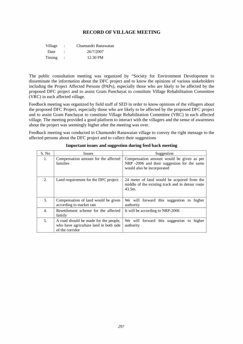
297
RECORD OF VILLAGE MEETING
Village : Chamundri Ranawatan Date : 26/7/2007
Timing
: 12.30 PM
The public consultation meeting was organized by “Society for Environment Development to disseminate the information about the DFC project and to know the opinions of various stakeholders including the Project Affected Persons (PAPs), especially those who are likely to be affected by the proposed DFC project and to assist Gram Panchayat to constitute Village Rehabilitation Committee (VRC) in each affected village.
Feedback meeting was organized by field staff of SED in order to know opinions of the villagers about the proposed DFC Project, especially those who are likely to be affected by the proposed DFC project and to assist Gram Panchayat to constitute Village Rehabilitation Committee (VRC) in each affected village. The meeting provided a good platform to interact with the villagers and the sense of awareness about the project was seemingly higher after the meeting was over.
Feedback meeting was conducted in Chamundri Ranawatan village to convey the right message to the affected persons about the DFC project and to collect their suggestions
Important issues and suggestion during feed back meeting
S. No Issues Suggestion 1.
Compensation amount for the affected families
Compensation amount would be given as per NRP -2006 and their suggestion for the same would also be incorporated
2. Land requirement for the DFC project 24 meter of land would be acquired from the middle of the existing track and in detour route 43.5m.
3.
Compensation of land would be given according to market rate
We will forward this suggestion to higher authority
4. Resettlement scheme for the affected family
It will be according to NRP-2006
5. A road should be made for the people, who have agriculture land in both side of the corridor
We will forward this suggestion to higher authority
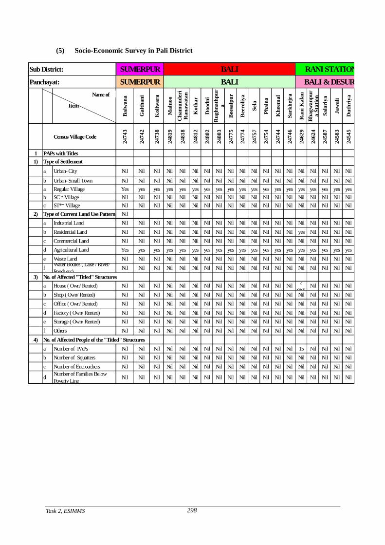
Task 2, ESIMMS
298
(5) Socio-Economic Survey in Pali District
Sub District:
Panchayat:
Bal
wan
a
Gal
than
i
Kol
iwar
a
Mal
noo
Cha
mun
deri
Ran
awat
an
Kot
har
Doo
dni
Rug
hnat
hpur
aB
eesa
lpur
Bee
roliy
a
Sela
Phal
na
Khe
emal
Sark
hejr
a
Ran
i Kal
anB
hagw
anpu
ra
Stat
ion
Sala
riya
Jaw
ali
Dut
hriy
a
Census Village Code
2474
3
2474
2
2473
8
2481
9
2481
8
2481
2
2480
2
2480
3
2477
5
2477
4
2475
7
2475
4
2474
4
2474
6
2462
9
2462
4
2458
7
2458
3
2454
5
1 PAPs with Titles1) Type of Settlement
a Urban- City Nil Nil Nil Nil Nil Nil Nil Nil Nil Nil Nil Nil Nil Nil Nil Nil Nil Nil Nil
b Urban- Small Town Nil Nil Nil Nil Nil Nil Nil Nil Nil Nil Nil Nil Nil Nil Nil Nil Nil Nil Nila Regular Village Yes yes yes yes yes yes yes yes yes yes yes yes yes yes yes yes yes yes yesb SC * Village Nil Nil Nil Nil Nil Nil Nil Nil Nil Nil Nil Nil Nil Nil Nil Nil Nil Nil Nilc ST** Village Nil Nil Nil Nil Nil Nil Nil Nil Nil Nil Nil Nil Nil Nil Nil Nil Nil Nil Nil
2) Type of Current Land Use Pattern Nila Industrial Land Nil Nil Nil Nil Nil Nil Nil Nil Nil Nil Nil Nil Nil Nil Nil Nil Nil Nil Nilb Residential Land Nil Nil Nil Nil Nil Nil Nil Nil Nil Nil Nil Nil Nil Nil yes Nil Nil Nil Nilc Commercial Land Nil Nil Nil Nil Nil Nil Nil Nil Nil Nil Nil Nil Nil Nil Nil Nil Nil Nil Nild Agricultural Land Yes yes yes yes yes yes yes yes yes yes yes yes yes yes yes yes yes yes yese Waste Land Nil Nil Nil Nil Nil Nil Nil Nil Nil Nil Nil Nil Nil Nil Nil Nil Nil Nil Nilf Water Bodies ( Lake / River/
Pond/ etc) Nil Nil Nil Nil Nil Nil Nil Nil Nil Nil Nil Nil Nil Nil Nil Nil Nil Nil Nil3) No. of Affected "Titled" Structures
a House ( Own/ Rented) Nil Nil Nil Nil Nil Nil Nil Nil Nil Nil Nil Nil Nil Nil 3own
Nil Nil Nil Nilb Shop ( Own/ Rented) Nil Nil Nil Nil Nil Nil Nil Nil Nil Nil Nil Nil Nil Nil Nil Nil Nil Nil Nilc Office ( Own/ Rented) Nil Nil Nil Nil Nil Nil Nil Nil Nil Nil Nil Nil Nil Nil Nil Nil Nil Nil Nild Factory ( Own/ Rented) Nil Nil Nil Nil Nil Nil Nil Nil Nil Nil Nil Nil Nil Nil Nil Nil Nil Nil Nile Storage ( Own/ Rented) Nil Nil Nil Nil Nil Nil Nil Nil Nil Nil Nil Nil Nil Nil Nil Nil Nil Nil Nilf Others Nil Nil Nil Nil Nil Nil Nil Nil Nil Nil Nil Nil Nil Nil Nil Nil Nil Nil Nil
4) No. of Affected People of the "Titled" Structuresa Number of PAPs Nil Nil Nil Nil Nil Nil Nil Nil Nil Nil Nil Nil Nil Nil 15 Nil Nil Nil Nilb Number of Squatters Nil Nil Nil Nil Nil Nil Nil Nil Nil Nil Nil Nil Nil Nil Nil Nil Nil Nil Nilc Number of Encroachers Nil Nil Nil Nil Nil Nil Nil Nil Nil Nil Nil Nil Nil Nil Nil Nil Nil Nil Nil
d Number of Families BelowPoverty Line Nil Nil Nil Nil Nil Nil Nil Nil Nil Nil Nil Nil Nil Nil Nil Nil Nil Nil Nil
SUMERPURSUMERPUR
BALIBALI
RANI STATIONBALI & DESURI
Name of
Item
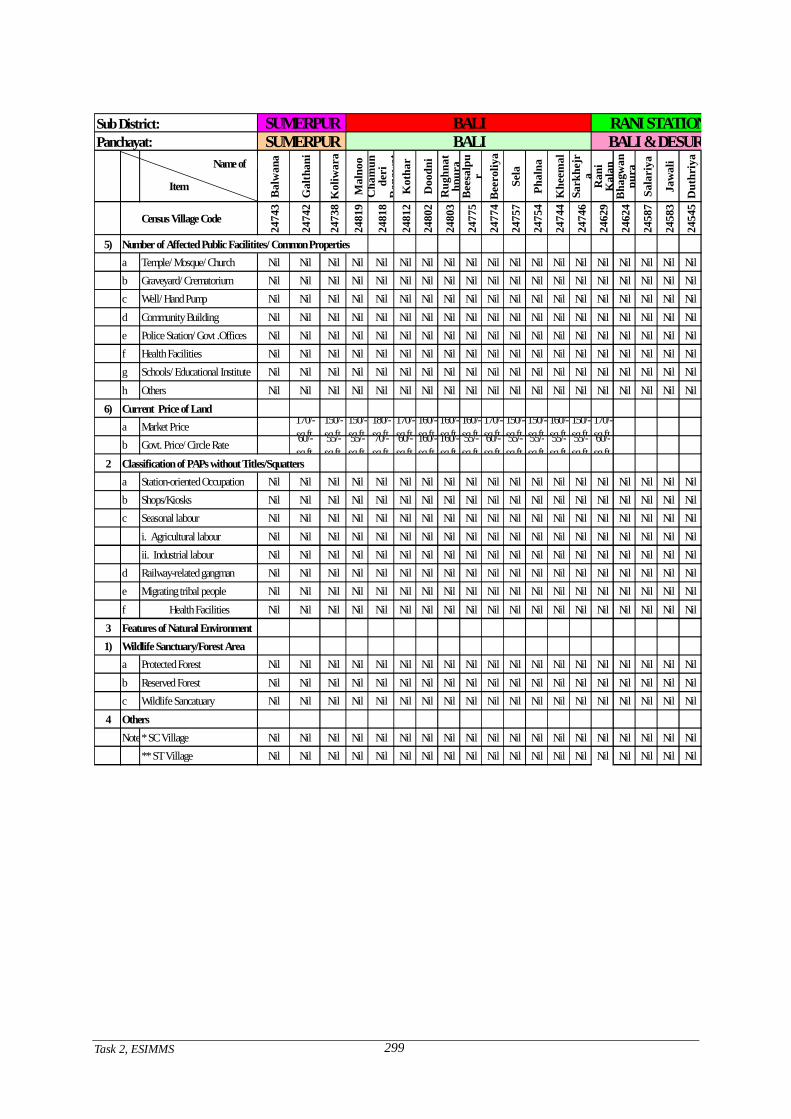
Task 2, ESIMMS
299
Sub District:Panchayat:
Bal
wan
a
Gal
than
i
Kol
iwar
a
Mal
noo
Cha
mun
deri
Ran
awat
Kot
har
Doo
dni
Rug
hnat
hpur
aB
eesa
lpu
rB
eero
liya
Sela
Phal
na
Khe
emal
Sark
hejr
aR
ani
Kal
anB
hagw
anpu
raSa
lari
ya
Jaw
ali
Dut
hriy
a
Census Village Code
2474
3
2474
2
2473
8
2481
9
2481
8
2481
2
2480
2
2480
3
2477
5
2477
4
2475
7
2475
4
2474
4
2474
6
2462
9
2462
4
2458
7
2458
3
2454
5
5) Number of Affected Public Facilitites/ Common Propertiesa Temple/ Mosque/ Church Nil Nil Nil Nil Nil Nil Nil Nil Nil Nil Nil Nil Nil Nil Nil Nil Nil Nil Nilb Graveyard/ Crematorium Nil Nil Nil Nil Nil Nil Nil Nil Nil Nil Nil Nil Nil Nil Nil Nil Nil Nil Nilc Well/ Hand Pump Nil Nil Nil Nil Nil Nil Nil Nil Nil Nil Nil Nil Nil Nil Nil Nil Nil Nil Nild Community Building Nil Nil Nil Nil Nil Nil Nil Nil Nil Nil Nil Nil Nil Nil Nil Nil Nil Nil Nile Police Station/ Govt .Offices Nil Nil Nil Nil Nil Nil Nil Nil Nil Nil Nil Nil Nil Nil Nil Nil Nil Nil Nilf Health Facilities Nil Nil Nil Nil Nil Nil Nil Nil Nil Nil Nil Nil Nil Nil Nil Nil Nil Nil Nilg Schools/ Educational Institute Nil Nil Nil Nil Nil Nil Nil Nil Nil Nil Nil Nil Nil Nil Nil Nil Nil Nil Nilh Others Nil Nil Nil Nil Nil Nil Nil Nil Nil Nil Nil Nil Nil Nil Nil Nil Nil Nil Nil
6) Current Price of Landa Market Price 170/-
sq.ft.150/-sq.ft.
150/-sq.ft.
180/-sq.ft.
170/-sq.ft.
160/-sq.ft.
160/-sq.ft.
160/-sq.ft.
170/-sq.ft.
150/-sq.ft.
150/-sq.ft.
160/-sq.ft.
150/-sq.ft.
170/-sq.ft.
b Govt. Price/ Circle Rate 60/-sq.ft.
55/-sq.ft.
55/-sq.ft.
70/-sq.ft.
60/-sq.ft.
160/-sq.ft.
160/-sq.ft.
55/-sq.ft.
60/-sq.ft.
55/-sq.ft.
55/-sq.ft.
55/-sq.ft.
55/-sq.ft.
60/-sq.ft.
2 Classification of PAPs without Titles/Squattersa Station-oriented Occupation Nil Nil Nil Nil Nil Nil Nil Nil Nil Nil Nil Nil Nil Nil Nil Nil Nil Nil Nilb Shops/Kiosks Nil Nil Nil Nil Nil Nil Nil Nil Nil Nil Nil Nil Nil Nil Nil Nil Nil Nil Nilc Seasonal labour Nil Nil Nil Nil Nil Nil Nil Nil Nil Nil Nil Nil Nil Nil Nil Nil Nil Nil Nil
i. Agricultural labour Nil Nil Nil Nil Nil Nil Nil Nil Nil Nil Nil Nil Nil Nil Nil Nil Nil Nil Nilii. Industrial labour Nil Nil Nil Nil Nil Nil Nil Nil Nil Nil Nil Nil Nil Nil Nil Nil Nil Nil Nil
d Railway-related gangman Nil Nil Nil Nil Nil Nil Nil Nil Nil Nil Nil Nil Nil Nil Nil Nil Nil Nil Nile Migrating tribal people Nil Nil Nil Nil Nil Nil Nil Nil Nil Nil Nil Nil Nil Nil Nil Nil Nil Nil Nilf Health Facilities Nil Nil Nil Nil Nil Nil Nil Nil Nil Nil Nil Nil Nil Nil Nil Nil Nil Nil Nil
3 Features of Natural Environment1) Wildlife Sanctuary/Forest Area a Protected Forest Nil Nil Nil Nil Nil Nil Nil Nil Nil Nil Nil Nil Nil Nil Nil Nil Nil Nil Nil b Reserved Forest Nil Nil Nil Nil Nil Nil Nil Nil Nil Nil Nil Nil Nil Nil Nil Nil Nil Nil Nil
c Wildlife Sancatuary Nil Nil Nil Nil Nil Nil Nil Nil Nil Nil Nil Nil Nil Nil Nil Nil Nil Nil Nil4 Others
Note:* SC Village Nil Nil Nil Nil Nil Nil Nil Nil Nil Nil Nil Nil Nil Nil Nil Nil Nil Nil Nil** ST Village Nil Nil Nil Nil Nil Nil Nil Nil Nil Nil Nil Nil Nil Nil Nil Nil Nil Nil Nil
SUMERPUR BALI BALI & DESURISUMERPUR BALI RANI STATION
Name of
Item
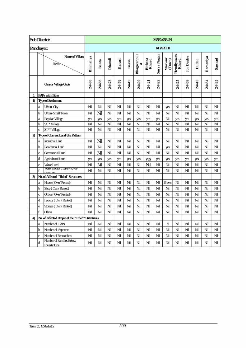
Task 2, ESIMMS
300
Sub District:
Panchayat:
Bhi
mal
iya
Bant
a
Dha
mli
Kar
ari
Bar
sa
Bha
gwan
pur
a
Bith
ora
Khu
rd
Sury
a N
agar
Mar
war
(Tow
n)H
emliy
awas
Khu
rd
Jor
Dud
or
Dud
or
Ree
sani
ya
Saw
rad
Census Village Code24
480
2448
3
2447
8
2447
6
2441
9
2442
0
2442
1
2442
2
2442
5
2440
9
2441
0
2443
4
2443
5
1 PAPs with Titles1) Type of Settlement
a Urban- City Nil Nil Nil Nil Nil Nil Nil Nil yes Nil Nil Nil Nil Nil
b Urban- Small Town Nil Nil Nil Nil Nil Nil Nil Nil Nil Nil Nil Nil Nil Nila Regular Village yes yes yes yes yes yes yes yes Nil yes yes yes yes yesb SC * Village Nil Nil Nil Nil Nil Nil Nil Nil Nil Nil Nil Nil Nil Nilc ST** Village Nil Nil Nil Nil Nil Nil Nil Nil Nil Nil Nil Nil Nil Nil
2) Type of Current Land Use Pattern a Industrial Land Nil Nil Nil Nil Nil Nil Nil Nil Nil Nil Nil Nil Nil Nilb Residential Land Nil Nil Nil Nil Nil Nil Nil Nil yes Nil Nil Nil Nil Nilc Commercial Land Nil Nil Nil Nil Nil Nil Nil Nil Nil Nil Nil Nil Nil Nild Agricultural Land yes yes yes yes yes yes yes yes yes yes yes yes yes yese Waste Land Nil Nil Nil Nil Nil Nil Nil Nil Nil Nil Nil Nil Nil Nilf Water Bodies ( Lake / River/
Pond/ etc) Nil Nil Nil Nil Nil Nil Nil Nil Nil Nil Nil Nil Nil Nil3) No. of Affected "Titled" Structures
a House ( Own/ Rented) Nil Nil Nil Nil Nil Nil Nil Nil 16 own Nil Nil Nil Nil Nilb Shop ( Own/ Rented) Nil Nil Nil Nil Nil Nil Nil Nil Nil Nil Nil Nil Nil Nilc Office ( Own/ Rented) Nil Nil Nil Nil Nil Nil Nil Nil Nil Nil Nil Nil Nil Nild Factory ( Own/ Rented) Nil Nil Nil Nil Nil Nil Nil Nil Nil Nil Nil Nil Nil Nile Storage ( Own/ Rented) Nil Nil Nil Nil Nil Nil Nil Nil Nil Nil Nil Nil Nil Nilf Others Nil Nil Nil Nil Nil Nil Nil Nil Nil Nil Nil Nil Nil Nil
4) No. of Affected People of the "Titled" Structuresa Number of PAPs Nil Nil Nil Nil Nil Nil Nil Nil d Nil Nil Nil Nil Nilb Number of Squatters Nil Nil Nil Nil Nil Nil Nil Nil Nil Nil Nil Nil Nil Nilc Number of Encroachers Nil Nil Nil Nil Nil Nil Nil Nil Nil Nil Nil Nil Nil Nil
d Number of Families BelowPoverty Line Nil Nil Nil Nil Nil Nil Nil Nil Nil Nil Nil Nil Nil Nil
MARWAR JN.
KHARCHI
Name of Village
Item
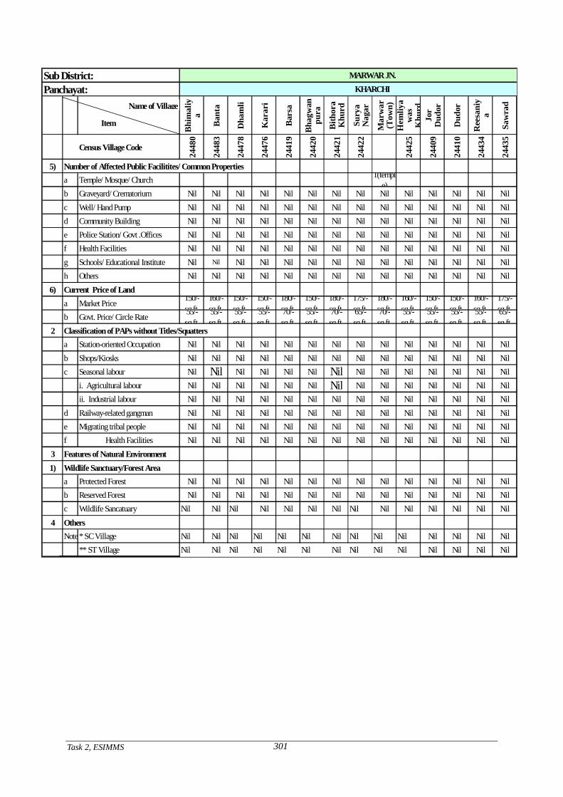
Task 2, ESIMMS
301
Sub District:Panchayat:
Bhi
mal
iya
Ban
ta
Dha
mli
Kar
ari
Bar
sa
Bha
gwan
pura
Bith
ora
Khu
rd
Sury
aN
agar
Mar
war
(Tow
n)H
emliy
aw
asK
hurd
Jor
Dud
or
Dud
or
Ree
sani
ya
Saw
rad
Census Village Code
2448
0
2448
3
2447
8
2447
6
2441
9
2442
0
2442
1
2442
2
2442
5
2440
9
2441
0
2443
4
2443
5
5) Number of Affected Public Facilitites/ Common Propertiesa Temple/ Mosque/ Church 1(templ
e)b Graveyard/ Crematorium Nil Nil Nil Nil Nil Nil Nil Nil Nil Nil Nil Nil Nil Nilc Well/ Hand Pump Nil Nil Nil Nil Nil Nil Nil Nil Nil Nil Nil Nil Nil Nild Community Building Nil Nil Nil Nil Nil Nil Nil Nil Nil Nil Nil Nil Nil Nile Police Station/ Govt .Offices Nil Nil Nil Nil Nil Nil Nil Nil Nil Nil Nil Nil Nil Nilf Health Facilities Nil Nil Nil Nil Nil Nil Nil Nil Nil Nil Nil Nil Nil Nilg Schools/ Educational Institute Nil Nil Nil Nil Nil Nil Nil Nil Nil Nil Nil Nil Nil Nilh Others Nil Nil Nil Nil Nil Nil Nil Nil Nil Nil Nil Nil Nil Nil
6) Current Price of Landa Market Price 150/-
sq.ft.160/-sq.ft.
150/-sq.ft.
150/-sq.ft.
180/-sq.ft.
150/-sq.ft.
180/-sq.ft.
175/-sq.ft.
180/-sq.ft.
160/-sq.ft.
150/-sq.ft.
150/-sq.ft.
160/-sq.ft.
175/-sq.ft.
b Govt. Price/ Circle Rate 55/-sq.ft.
55/-sq.ft.
55/-sq.ft.
55/-sq.ft.
70/-sq.ft.
55/-sq.ft.
70/-sq.ft.
65/-sq.ft.
70/-sq.ft.
55/-sq.ft.
55/-sq.ft.
55/-sq.ft.
55/-sq.ft.
65/-sq.ft.
2 Classification of PAPs without Titles/Squattersa Station-oriented Occupation Nil Nil Nil Nil Nil Nil Nil Nil Nil Nil Nil Nil Nil Nilb Shops/Kiosks Nil Nil Nil Nil Nil Nil Nil Nil Nil Nil Nil Nil Nil Nilc Seasonal labour Nil Nil Nil Nil Nil Nil Nil Nil Nil Nil Nil Nil Nil Nil
i. Agricultural labour Nil Nil Nil Nil Nil Nil Nil Nil Nil Nil Nil Nil Nil Nilii. Industrial labour Nil Nil Nil Nil Nil Nil Nil Nil Nil Nil Nil Nil Nil Nil
d Railway-related gangman Nil Nil Nil Nil Nil Nil Nil Nil Nil Nil Nil Nil Nil Nile Migrating tribal people Nil Nil Nil Nil Nil Nil Nil Nil Nil Nil Nil Nil Nil Nilf Health Facilities Nil Nil Nil Nil Nil Nil Nil Nil Nil Nil Nil Nil Nil Nil
3 Features of Natural Environment1) Wildlife Sanctuary/Forest Area a Protected Forest Nil Nil Nil Nil Nil Nil Nil Nil Nil Nil Nil Nil Nil Nil b Reserved Forest Nil Nil Nil Nil Nil Nil Nil Nil Nil Nil Nil Nil Nil Nil
c Wildlife Sancatuary Nil Nil Nil Nil Nil Nil Nil Nil Nil Nil Nil Nil Nil Nil
4 OthersNote:* SC Village Nil Nil Nil Nil Nil Nil Nil Nil Nil Nil Nil Nil Nil Nil
** ST Village Nil Nil Nil Nil Nil Nil Nil Nil Nil Nil Nil Nil Nil Nil
MARWAR JN.KHARCHI
Name of Village
Item
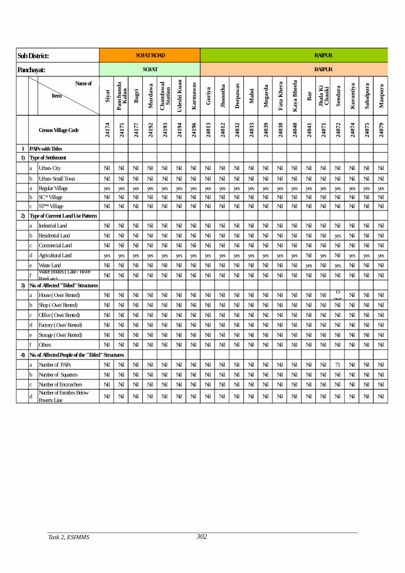
Task 2, ESIMMS
302
Sub District:
Panchayat:
Siya
t
Panc
hund
a K
alan
Bag
ri
Mur
daw
a
Cha
ndaw
al
Stat
ion
Ude
shi K
uan
Kar
maw
as
Gur
iya
Jhoo
ntha
Dee
paw
as
Mal
ni
Meg
arda
Fata
Khe
ra
Kay
a B
heel
a
Bar
Jhal
a K
i C
hauk
i
Send
ara
Kur
antiy
a
Saba
lpur
a
Man
pura
Census Village Code
2417
4
2417
5
2417
7
2419
2
2419
3
2419
4
2419
6
2401
3
2401
2
2403
2
2403
3
2403
9
2403
8
2404
0
2404
1
2407
1
2407
2
2407
4
2407
5
2407
9
1 PAPs with Titles1) Type of Settlement
a Urban- City Nil Nil Nil Nil Nil Nil Nil Nil Nil Nil Nil Nil Nil Nil Nil Nil Nil Nil Nil Nil
b Urban- Small Town Nil Nil Nil Nil Nil Nil Nil Nil Nil Nil Nil Nil Nil Nil Nil Nil Nil Nil Nil Nila Regular Village yes yes yes yes yes yes yes yes yes yes yes yes yes yes yes yes yes yes yes yesb SC * Village Nil Nil Nil Nil Nil Nil Nil Nil Nil Nil Nil Nil Nil Nil Nil Nil Nil Nil Nil Nilc ST** Village Nil Nil Nil Nil Nil Nil Nil Nil Nil Nil Nil Nil Nil Nil Nil Nil Nil Nil Nil Nil
2) Type of Current Land Use Pattern
a Industrial Land Nil Nil Nil Nil Nil Nil Nil Nil Nil Nil Nil Nil Nil Nil Nil Nil Nil Nil Nil Nil
b Residential Land Nil Nil Nil Nil Nil Nil Nil Nil Nil Nil Nil Nil Nil Nil Nil Nil yes Nil Nil Nil
c Commercial Land Nil Nil Nil Nil Nil Nil Nil Nil Nil Nil Nil Nil Nil Nil Nil Nil Nil Nil Nil Nil
d Agricultural Land yes yes yes yes yes yes yes yes yes yes yes yes yes yes Nil yes Nil yes yes yes
e Waste Land Nil Nil Nil Nil Nil Nil Nil Nil Nil Nil Nil Nil Nil Nil yes Nil yes Nil Nil Nil
f Water Bodies ( Lake / River/ Pond/ etc) Nil Nil Nil Nil Nil Nil Nil Nil Nil Nil Nil Nil Nil Nil Nil Nil Nil Nil Nil Nil
3) No. of Affected "Titled" Structuresa House ( Own/ Rented) Nil Nil Nil Nil Nil Nil Nil Nil Nil Nil Nil Nil Nil Nil Nil Nil 15
own Nil Nil Nil
b Shop ( Own/ Rented) Nil Nil Nil Nil Nil Nil Nil Nil Nil Nil Nil Nil Nil Nil Nil Nil Nil Nil Nil Nil
c Office ( Own/ Rented) Nil Nil Nil Nil Nil Nil Nil Nil Nil Nil Nil Nil Nil Nil Nil Nil Nil Nil Nil Nil
d Factory ( Own/ Rented) Nil Nil Nil Nil Nil Nil Nil Nil Nil Nil Nil Nil Nil Nil Nil Nil Nil Nil Nil Nil
e Storage ( Own/ Rented) Nil Nil Nil Nil Nil Nil Nil Nil Nil Nil Nil Nil Nil Nil Nil Nil Nil Nil Nil Nil
f Others Nil Nil Nil Nil Nil Nil Nil Nil Nil Nil Nil Nil Nil Nil Nil Nil Nil Nil Nil Nil
4) No. of Affected People of the "Titled" Structures
a Number of PAPs Nil Nil Nil Nil Nil Nil Nil Nil Nil Nil Nil Nil Nil Nil Nil Nil 71 Nil Nil Nil
b Number of Squatters Nil Nil Nil Nil Nil Nil Nil Nil Nil Nil Nil Nil Nil Nil Nil Nil Nil Nil Nil Nil
c Number of Encroachers Nil Nil Nil Nil Nil Nil Nil Nil Nil Nil Nil Nil Nil Nil Nil Nil Nil Nil Nil Nil
d Number of Families Below Poverty Line Nil Nil Nil Nil Nil Nil Nil Nil Nil Nil Nil Nil Nil Nil Nil Nil Nil Nil Nil Nil
SOJAT
SOJAT ROAD
RAIPUR
RAIPUR
Name of
Item

Task 2, ESIMMS
303
Sub District:Panchayat:
Siya
t
Panc
hund
a K
alan
Bag
ri
Mur
daw
a
Cha
ndaw
al S
tatio
nU
desh
i K
uan
Kar
maw
as
Gur
iya
Jhoo
ntha
Dee
paw
as
Mal
ni
Meg
arda
Fata
K
hera
Kay
a B
heel
a
Bar
Jhal
a K
i C
hauk
i
Send
ara
Kur
antiy
a
Saba
lpur
a
Man
pura
Census Village Code
2417
4
2417
5
2417
7
2419
2
2419
3
2419
4
2419
6
2401
3
2401
2
2403
2
2403
3
2403
9
2403
8
2404
0
2404
1
2407
1
2407
2
2407
4
2407
5
2407
9
5) Number of Affected Public Facilitites/ Common Properties
a Temple/ Mosque/ Church Nil Nil Nil Nil Nil Nil Nil 1(temple) Nil
b Graveyard/ Crematorium Nil Nil Nil Nil Nil Nil Nil Nil Nil Nil Nil Nil Nil Nil Nil Nil Nil Nil Nil Nil
c Well/ Hand Pump Nil Nil Nil Nil Nil Nil Nil Nil Nil Nil Nil Nil Nil Nil Nil Nil Nil Nil Nil Nil
d Community Building Nil Nil Nil Nil Nil Nil Nil Nil Nil Nil Nil Nil Nil Nil Nil Nil Nil Nil Nil Nil
e Police Station/ Govt .Offices Nil Nil Nil Nil Nil Nil Nil Nil Nil Nil Nil Nil Nil Nil Nil Nil Nil Nil Nil Nil
f Health Facilities Nil Nil Nil Nil Nil Nil Nil Nil Nil Nil Nil Nil Nil Nil Nil Nil Nil Nil Nil Nil
g Schools/ Educational Institute Nil Nil Nil Nil Nil Nil Nil Nil Nil Nil Nil Nil Nil Nil Nil Nil Nil Nil Nil Nil
h Others Nil Nil Nil Nil Nil Nil Nil Nil Nil Nil Nil Nil Nil Nil Nil Nil Nil Nil Nil Nil
6) Current Price of Land
a Market Price 160/- sq.ft.
170/- sq.ft.
150/- sq.ft.
175/- sq.ft.
160/- sq.ft.
150/- sq.ft.
160/- sq.ft.
175/- sq.ft.
150/- sq.ft.
160/- sq.ft.
150/- sq.ft.
150/- sq.ft.
150/- sq.ft.
160/- sq.ft.
175/- sq.ft.
175/- sq.ft.
160/- sq.ft.
180/- sq.ft.
150/- sq.ft.
150/- sq.ft.
b Govt. Price/ Circle Rate 55/- sq.ft.
60/- sq.ft.
55/- sq.ft.
65/- sq.ft.
160/- sq.ft.
55/- sq.ft.
55/- sq.ft.
65/- sq.ft.
55/- sq.ft.
55/- sq.ft.
55/- sq.ft.
55/- sq.ft.
55/- sq.ft.
55/- sq.ft.
65/- sq.ft.
65/- sq.ft.
55/- sq.ft.
70/- sq.ft.
55/- sq.ft.
55/- sq.ft.
2 Classification of PAPs without Titles/Squatters
a Station-oriented Occupation Nil Nil Nil Nil Nil Nil Nil Nil Nil Nil Nil Nil Nil Nil Nil Nil Nil Nil Nil Nil
b Shops/Kiosks Nil Nil Nil Nil Nil Nil Nil Nil Nil Nil Nil Nil Nil Nil Nil Nil Nil Nil Nil Nil
c Seasonal labour Nil Nil Nil Nil Nil Nil Nil Nil Nil Nil Nil Nil Nil Nil Nil Nil Nil Nil Nil Nil
i. Agricultural labour Nil Nil Nil Nil Nil Nil Nil Nil Nil Nil Nil Nil Nil Nil Nil Nil Nil Nil Nil Nil
ii. Industrial labour Nil Nil Nil Nil Nil Nil Nil Nil Nil Nil Nil Nil Nil Nil Nil Nil Nil Nil Nil Nil
d Railway-related gangman Nil Nil Nil Nil Nil Nil Nil Nil Nil Nil Nil Nil Nil Nil Nil Nil Nil Nil Nil Nil
e Migrating tribal people Nil Nil Nil Nil Nil Nil Nil Nil Nil Nil Nil Nil Nil Nil Nil Nil Nil Nil Nil Nil
f Health Facilities Nil Nil Nil Nil Nil Nil Nil Nil Nil Nil Nil Nil Nil Nil Nil Nil Nil Nil Nil Nil
3 Features of Natural Environment
1) Wildlife Sanctuary/Forest Area
a Protected Forest Nil Nil Nil Nil Nil Nil Nil Nil Nil Nil Nil Nil Nil Nil Nil Nil Nil Nil Nil Nil
b Reserved Forest Nil Nil Nil Nil Nil Nil Nil Nil Nil Nil Nil Nil Nil Nil Nil Nil Nil Nil Nil Nil
c Wildlife Sancatuary Nil Nil Nil Nil Nil Nil Nil Nil Nil Nil Nil Nil Nil Nil Nil Nil Nil Nil Nil Nil
4 Others
Note:* SC Village Nil Nil Nil Nil Nil Nil Nil Nil Nil Nil Nil Nil Nil Nil Nil Nil Nil Nil Nil Nil
** ST Village Nil Nil Nil Nil Nil Nil Nil Nil Nil Nil Nil Nil Nil Nil Nil Nil Nil Nil Nil Nil
RAIPUR
SOJAT RAIPUR
SOJAT ROAD
Name of
Item
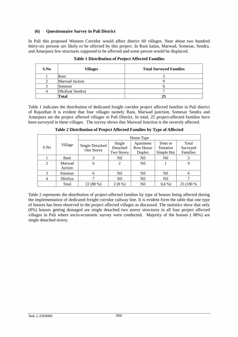
Task 2, ESIMMS
304
(6) Questionnaire Survey in Pali District
In Pali this proposed Western Corridor would affect district 60 villages. Near about two hundred thirty-six persons are likely to be affected by this project. In Rani kalan, Marwad, Somesar, Sendra, and Amarpura few structures supposed to be affected and some person would be displaced.
Table 1 Distribution of Project Affected Families
S.No Villages Total Surveyed Families
1 Rani 3 2 Marwad Juction 9 3 Somesar 6 4 Dholiya( Sendra) 7 Total 25
Table 1 indicates the distribution of dedicated freight corridor project affected families in Pali district of Rajasthan It is evident that four villages namely Rani, Marwad junction, Somesar Sendra and Amarpura are the project affected villages in Pali District. In total, 25 project-affected families have been surveyed in these villages. The survey shows that Marwad Junction is the severely affected.
Table 2 Distribution of Project Affected Families by Type of Affected
House Type
S.No Village Single Detached One Storey
Single Detached
Two Storey
Apartment Row House
Duplex
Tents or Tentative
Simple Hut
Total Surveyed Families
1 Rani 3 Nil Nil Nil 3 2 Marwad
Juction 6 2 Nil 1 9
3 Somesar 6 Nil Nil Nil 6 4 Dholiya 7 Nil Nil Nil 7 Total 22 (88 %) 2 (8 %) Nil 1(4 %) 25 (100 %
Table 2 represents the distribution of project-affected families by type of houses being affected during the implementation of dedicated freight corridor railway line. It is evident form the table that one type of houses has been observed in the project affected villages as discussed. The statistics show that only (8%) houses getting damaged are single detached two storey structures in all four project affected villages in Pali where socio-economic survey were conducted. Majority of the houses ( 88%) are single detached storey.
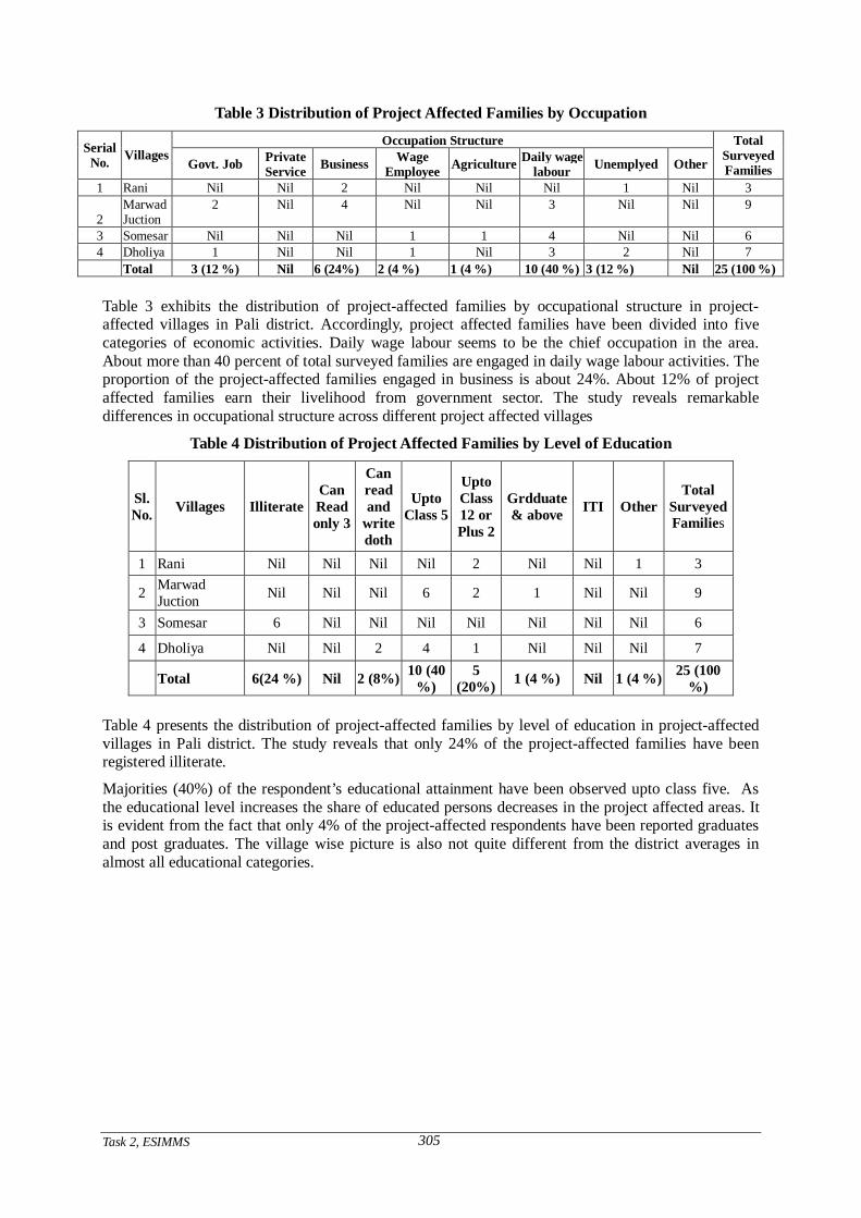
Task 2, ESIMMS
305
Table 3 Distribution of Project Affected Families by Occupation
Occupation Structure Serial No. Villages
Govt. Job Private Service Business Wage
Employee Agriculture Daily wage labour Unemplyed Other
Total Surveyed Families
1 Rani Nil Nil 2 Nil Nil Nil 1 Nil 3
2 Marwad Juction
2 Nil 4 Nil Nil 3 Nil Nil 9
3 Somesar Nil Nil Nil 1 1 4 Nil Nil 6 4 Dholiya 1 Nil Nil 1 Nil 3 2 Nil 7 Total 3 (12 %) Nil 6 (24%) 2 (4 %) 1 (4 %) 10 (40 %) 3 (12 %) Nil 25 (100 %)
Table 3 exhibits the distribution of project-affected families by occupational structure in project-affected villages in Pali district. Accordingly, project affected families have been divided into five categories of economic activities. Daily wage labour seems to be the chief occupation in the area. About more than 40 percent of total surveyed families are engaged in daily wage labour activities. The proportion of the project-affected families engaged in business is about 24%. About 12% of project affected families earn their livelihood from government sector. The study reveals remarkable differences in occupational structure across different project affected villages
Table 4 Distribution of Project Affected Families by Level of Education
Sl. No. Villages Illiterate
Can Read only 3
Can read and
write doth
Upto Class 5
Upto Class 12 or Plus 2
Grdduate & above ITI Other
Total Surveyed Families
1 Rani Nil Nil Nil Nil 2 Nil Nil 1 3
2 Marwad Juction Nil Nil Nil 6 2 1 Nil Nil 9
3 Somesar 6 Nil Nil Nil Nil Nil Nil Nil 6
4 Dholiya Nil Nil 2 4 1 Nil Nil Nil 7
Total 6(24 %) Nil 2 (8%) 10 (40 %)
5 (20%) 1 (4 %) Nil 1 (4 %) 25 (100
%)
Table 4 presents the distribution of project-affected families by level of education in project-affected villages in Pali district. The study reveals that only 24% of the project-affected families have been registered illiterate.
Majorities (40%) of the respondent’s educational attainment have been observed upto class five. As the educational level increases the share of educated persons decreases in the project affected areas. It is evident from the fact that only 4% of the project-affected respondents have been reported graduates and post graduates. The village wise picture is also not quite different from the district averages in almost all educational categories.
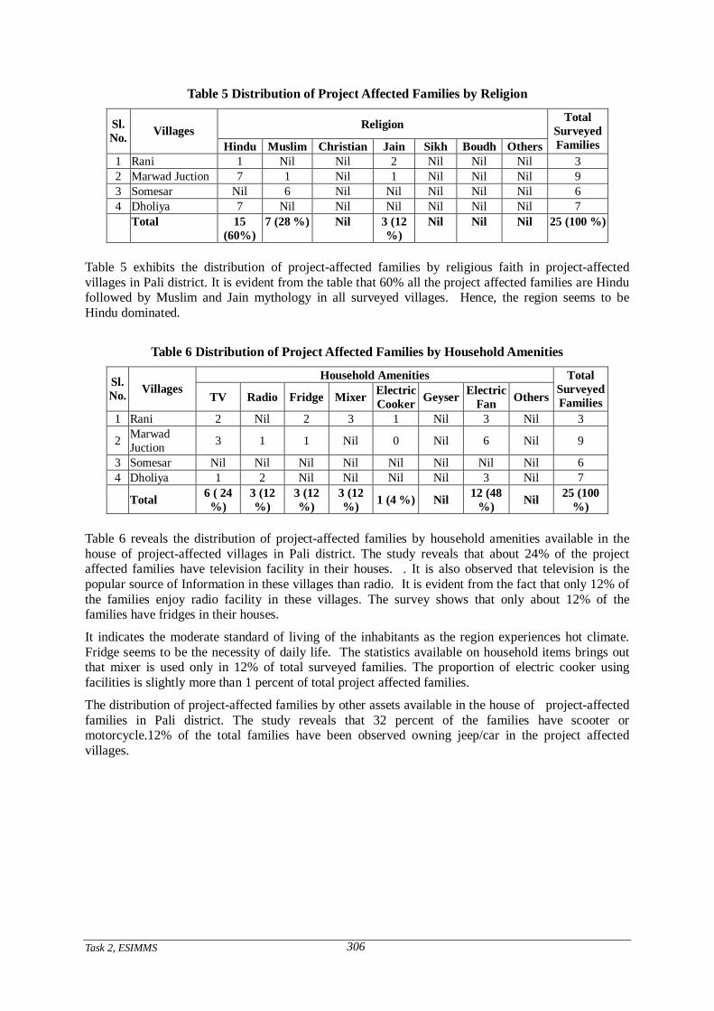
Task 2, ESIMMS
306
Table 5 Distribution of Project Affected Families by Religion
Religion Sl. No. Villages
Hindu Muslim Christian Jain Sikh Boudh Others
Total Surveyed Families
1 Rani 1 Nil Nil 2 Nil Nil Nil 3 2 Marwad Juction 7 1 Nil 1 Nil Nil Nil 9 3 Somesar Nil 6 Nil Nil Nil Nil Nil 6 4 Dholiya 7 Nil Nil Nil Nil Nil Nil 7
Total 15 (60%)
7 (28 %) Nil 3 (12 %)
Nil Nil Nil 25 (100 %)
Table 5 exhibits the distribution of project-affected families by religious faith in project-affected villages in Pali district. It is evident from the table that 60% all the project affected families are Hindu followed by Muslim and Jain mythology in all surveyed villages. Hence, the region seems to be Hindu dominated.
Table 6 Distribution of Project Affected Families by Household Amenities
Household Amenities Sl. No. Villages
TV Radio Fridge Mixer Electric Cooker Geyser Electric
Fan Others
Total Surveyed Families
1 Rani 2 Nil 2 3 1 Nil 3 Nil 3
2 Marwad Juction 3 1 1 Nil 0 Nil 6 Nil 9
3 Somesar Nil Nil Nil Nil Nil Nil Nil Nil 6 4 Dholiya 1 2 Nil Nil Nil Nil 3 Nil 7
Total 6 ( 24 %)
3 (12 %)
3 (12 %)
3 (12 %) 1 (4 %) Nil 12 (48
%) Nil 25 (100 %)
Table 6 reveals the distribution of project-affected families by household amenities available in the house of project-affected villages in Pali district. The study reveals that about 24% of the project affected families have television facility in their houses. . It is also observed that television is the popular source of Information in these villages than radio. It is evident from the fact that only 12% of the families enjoy radio facility in these villages. The survey shows that only about 12% of the families have fridges in their houses.
It indicates the moderate standard of living of the inhabitants as the region experiences hot climate. Fridge seems to be the necessity of daily life. The statistics available on household items brings out that mixer is used only in 12% of total surveyed families. The proportion of electric cooker using facilities is slightly more than 1 percent of total project affected families.
The distribution of project-affected families by other assets available in the house of project-affected families in Pali district. The study reveals that 32 percent of the families have scooter or motorcycle.12% of the total families have been observed owning jeep/car in the project affected villages.
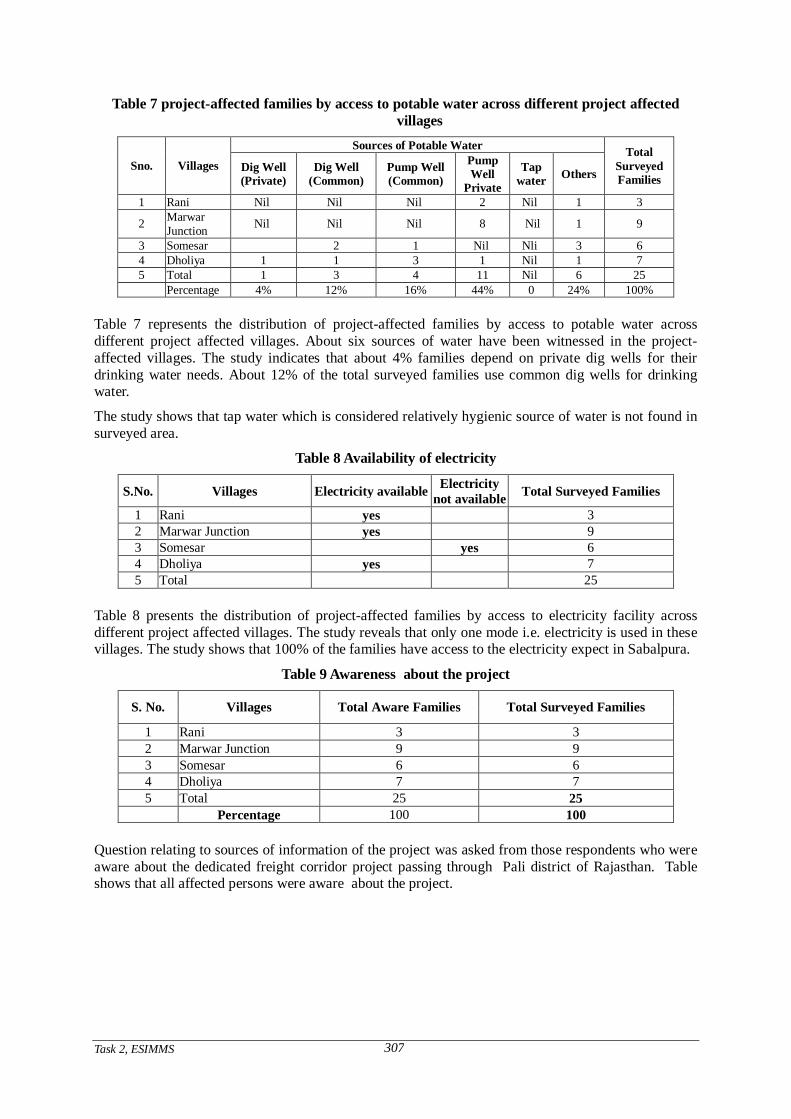
Task 2, ESIMMS
307
Table 7 project-affected families by access to potable water across different project affected villages
Sources of Potable Water
Sno. Villages Dig Well (Private)
Dig Well (Common)
Pump Well (Common)
Pump Well
Private
Tap water Others
Total Surveyed Families
1 Rani Nil Nil Nil 2 Nil 1 3
2 Marwar Junction Nil Nil Nil 8 Nil 1 9
3 Somesar 2 1 Nil Nli 3 6 4 Dholiya 1 1 3 1 Nil 1 7 5 Total 1 3 4 11 Nil 6 25 Percentage 4% 12% 16% 44% 0 24% 100%
Table 7 represents the distribution of project-affected families by access to potable water across different project affected villages. About six sources of water have been witnessed in the project-affected villages. The study indicates that about 4% families depend on private dig wells for their drinking water needs. About 12% of the total surveyed families use common dig wells for drinking water.
The study shows that tap water which is considered relatively hygienic source of water is not found in surveyed area.
Table 8 Availability of electricity
S.No. Villages Electricity available Electricity not available Total Surveyed Families
1 Rani yes 3 2 Marwar Junction yes 9 3 Somesar yes 6 4 Dholiya yes 7 5 Total 25
Table 8 presents the distribution of project-affected families by access to electricity facility across different project affected villages. The study reveals that only one mode i.e. electricity is used in these villages. The study shows that 100% of the families have access to the electricity expect in Sabalpura.
Table 9 Awareness about the project
S. No. Villages Total Aware Families Total Surveyed Families
1 Rani 3 3 2 Marwar Junction 9 9 3 Somesar 6 6 4 Dholiya 7 7 5 Total 25 25 Percentage 100 100
Question relating to sources of information of the project was asked from those respondents who were aware about the dedicated freight corridor project passing through Pali district of Rajasthan. Table shows that all affected persons were aware about the project.
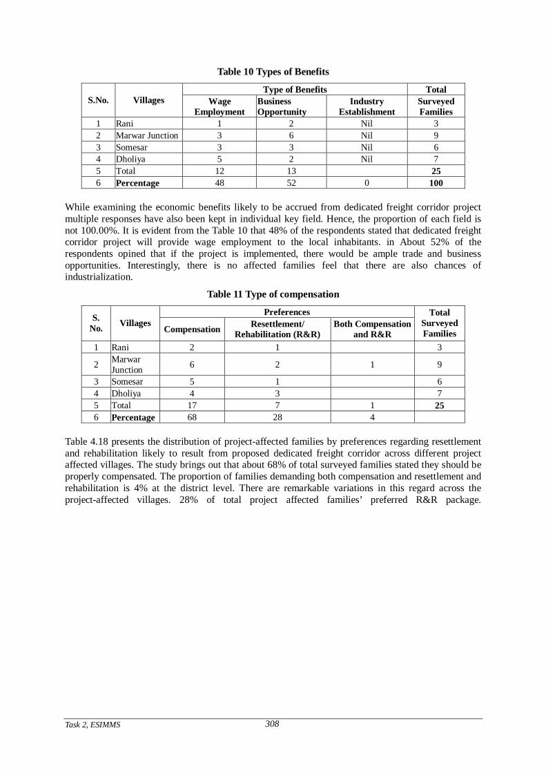
Task 2, ESIMMS
308
Table 10 Types of Benefits
Type of Benefits Total S.No. Villages Wage
Employment Business Opportunity
Industry Establishment
Surveyed Families
1 Rani 1 2 Nil 3 2 Marwar Junction 3 6 Nil 9 3 Somesar 3 3 Nil 6 4 Dholiya 5 2 Nil 7 5 Total 12 13 25 6 Percentage 48 52 0 100
While examining the economic benefits likely to be accrued from dedicated freight corridor project multiple responses have also been kept in individual key field. Hence, the proportion of each field is not 100.00%. It is evident from the Table 10 that 48% of the respondents stated that dedicated freight corridor project will provide wage employment to the local inhabitants. in About 52% of the respondents opined that if the project is implemented, there would be ample trade and business opportunities. Interestingly, there is no affected families feel that there are also chances of industrialization.
Table 11 Type of compensation
Preferences S. No. Villages
Compensation Resettlement/ Rehabilitation (R&R)
Both Compensation and R&R
Total Surveyed Families
1 Rani 2 1 3
2 Marwar Junction 6 2 1 9
3 Somesar 5 1 6 4 Dholiya 4 3 7 5 Total 17 7 1 25 6 Percentage 68 28 4
Table 4.18 presents the distribution of project-affected families by preferences regarding resettlement and rehabilitation likely to result from proposed dedicated freight corridor across different project affected villages. The study brings out that about 68% of total surveyed families stated they should be properly compensated. The proportion of families demanding both compensation and resettlement and rehabilitation is 4% at the district level. There are remarkable variations in this regard across the project-affected villages. 28% of total project affected families’ preferred R&R package.
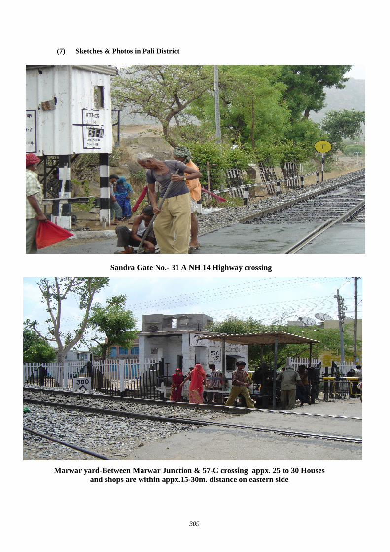
309
(7) Sketches & Photos in Pali District
Sandra Gate No.- 31 A NH 14 Highway crossing
Marwar yard-Between Marwar Junction & 57-C crossing appx. 25 to 30 Houses and shops are within appx.15-30m. distance on eastern side
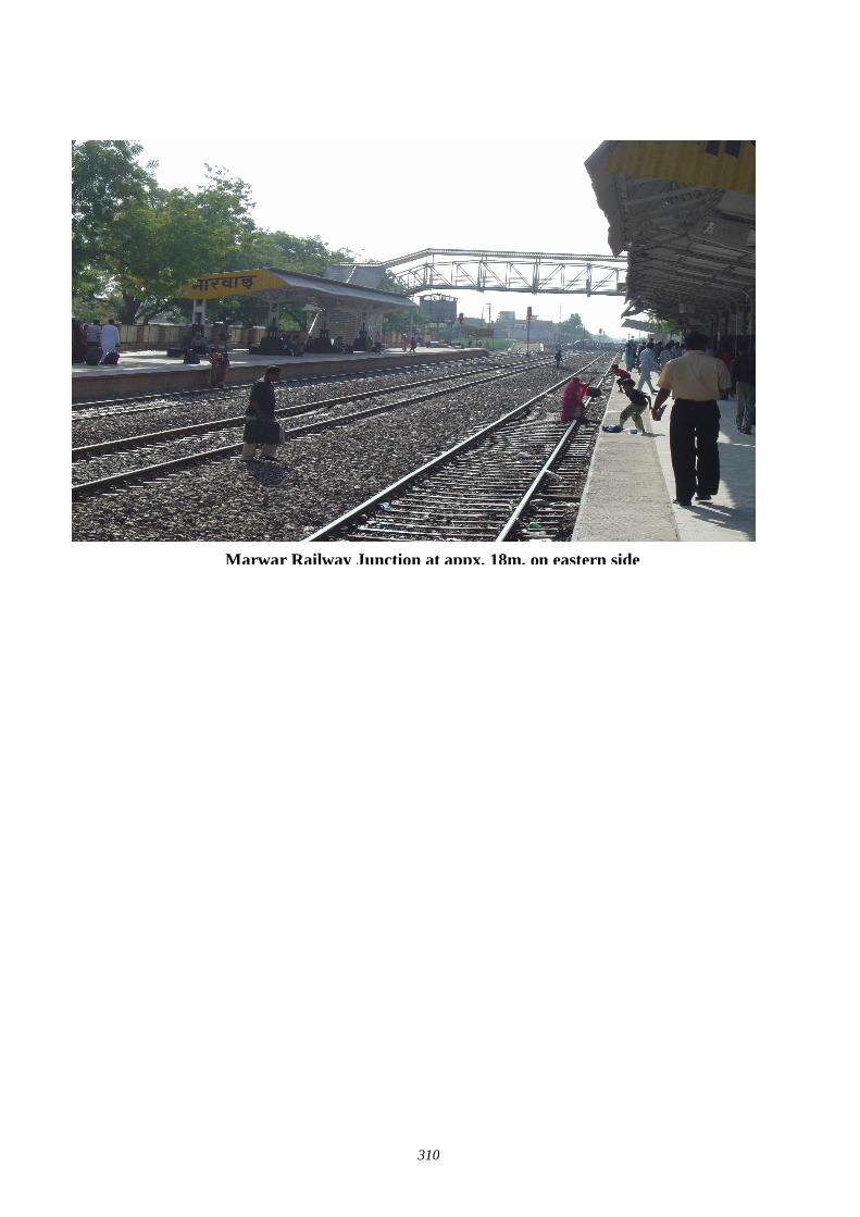
310
Marwar Railway Junction at appx. 18m. on eastern side
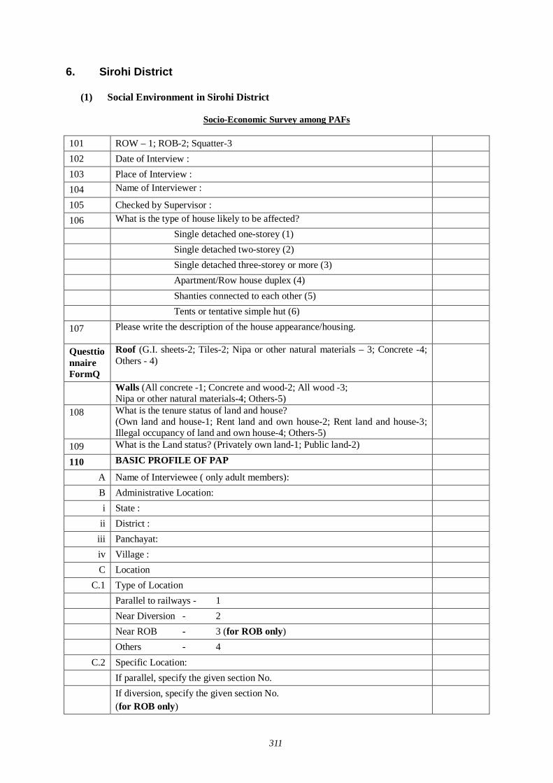
311
6. Sirohi District
(1) Social Environment in Sirohi District
Socio-Economic Survey among PAFs
101 ROW – 1; ROB-2; Squatter-3 102 Date of Interview : 103 Place of Interview : 104 Name of Interviewer : 105 Checked by Supervisor : 106 What is the type of house likely to be affected? Single detached one-storey (1) Single detached two-storey (2) Single detached three-storey or more (3) Apartment/Row house duplex (4) Shanties connected to each other (5) Tents or tentative simple hut (6) 107 Please write the description of the house appearance/housing.
Questtionnaire FormQ
Roof (G.I. sheets-2; Tiles-2; Nipa or other natural materials – 3; Concrete -4; Others - 4)
Walls (All concrete -1; Concrete and wood-2; All wood -3; Nipa or other natural materials-4; Others-5)
108 What is the tenure status of land and house? (Own land and house-1; Rent land and own house-2; Rent land and house-3; Illegal occupancy of land and own house-4; Others-5)
109 What is the Land status? (Privately own land-1; Public land-2) 110 BASIC PROFILE OF PAP
A Name of Interviewee ( only adult members): B Administrative Location: i State :
ii District : iii Panchayat: iv Village : C Location
C.1 Type of Location Parallel to railways - 1 Near Diversion - 2 Near ROB - 3 (for ROB only) Others - 4 C.2 Specific Location:
If parallel, specify the given section No. If diversion, specify the given section No.
(for ROB only)
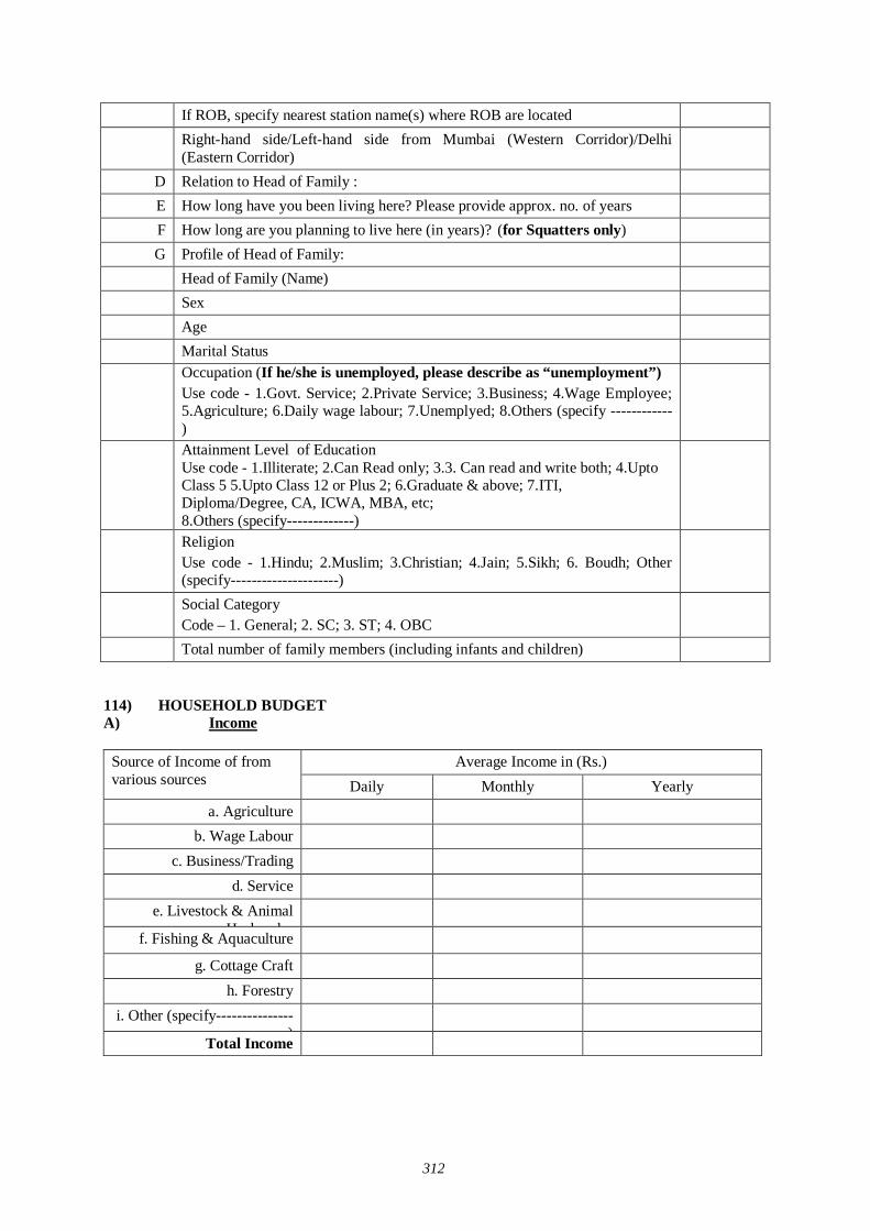
312
If ROB, specify nearest station name(s) where ROB are located Right-hand side/Left-hand side from Mumbai (Western Corridor)/Delhi
(Eastern Corridor)
D Relation to Head of Family : E How long have you been living here? Please provide approx. no. of years F How long are you planning to live here (in years)? (for Squatters only) G Profile of Head of Family:
Head of Family (Name) Sex Age Marital Status Occupation (If he/she is unemployed, please describe as “unemployment”)
Use code - 1.Govt. Service; 2.Private Service; 3.Business; 4.Wage Employee; 5.Agriculture; 6.Daily wage labour; 7.Unemplyed; 8.Others (specify ------------)
Attainment Level of Education Use code - 1.Illiterate; 2.Can Read only; 3.3. Can read and write both; 4.Upto Class 5 5.Upto Class 12 or Plus 2; 6.Graduate & above; 7.ITI, Diploma/Degree, CA, ICWA, MBA, etc; 8.Others (specify-------------)
Religion Use code - 1.Hindu; 2.Muslim; 3.Christian; 4.Jain; 5.Sikh; 6. Boudh; Other (specify---------------------)
Social Category Code – 1. General; 2. SC; 3. ST; 4. OBC
Total number of family members (including infants and children) 114) HOUSEHOLD BUDGET A) Income
Average Income in (Rs.) Source of Income of from
various sources Daily Monthly Yearly a. Agriculture
b. Wage Labour c. Business/Trading
d. Service e. Livestock & Animal
Husbandry
f. Fishing & Aquaculture
g. Cottage Craft h. Forestry
i. Other (specify---------------)
Total Income
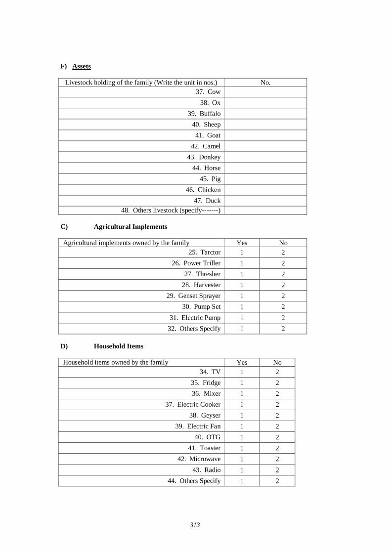
313
F) Assets
Livestock holding of the family (Write the unit in nos.) No. 37. Cow
38. Ox 39. Buffalo
40. Sheep 41. Goat
42. Camel 43. Donkey
44. Horse 45. Pig
46. Chicken 47. Duck
48. Others livestock (specify-------) C) Agricultural Implements
Agricultural implements owned by the family Yes No 25. Tarctor 1 2
26. Power Triller 1 2 27. Thresher 1 2
28. Harvester 1 2 29. Genset Sprayer 1 2
30. Pump Set 1 2 31. Electric Pump 1 2
32. Others Specify 1 2 D) Household Items
Household items owned by the family Yes No 34. TV 1 2
35. Fridge 1 2 36. Mixer 1 2
37. Electric Cooker 1 2 38. Geyser 1 2
39. Electric Fan 1 2 40. OTG 1 2
41. Toaster 1 2 42. Microwave 1 2
43. Radio 1 2 44. Others Specify 1 2

314
E) Other Assets of Family
Other assets owned by the family Yes No 19. Scooter/Motorcycle 1 2
20. Jeep/Car 1 2 21. Truck 1 2
22. Bus 1 2 23. Bullock/Camel Cart 1 2
24. Others Specify 1 2 F) Total Annual Saving: ------------------------------ (Rs.)
G) Loan a. Have you taken any loan? 1. Yes, 2. No, 3. Don’t Know b. If yes, then please tell us the following:
Name of the loan provider Amount (in Rs.) Re-paid (in Rs.) Balance (in Rs.) 13. Bank 14. Relative/Friend 15. Mahajan 16. Other (specify -----------)
112 PRODUCTION AND EMPLOYMENT
Land Title Response
Own with Title (1) A-1
Own without Title (2) Tenure Status: If Own with Title, please select one or more:
Borrow at No Charge (1) Rent from Authorities (2) Rent from Individuals (3)
A-2
Other Status (4) B) Area of Land: If Own with Title, please answer the questions below: (for Non-Squatters) B.1) Do you have agricultural land? a. Yes b. No B.2) If Yes, please tell us the total land owned by you (in local unit).
Area Type of Land Sqm. Bigha Biswa Hectare
1. Agricultural land
2. Orchard
3. Others (specify ------------------)
Total Land
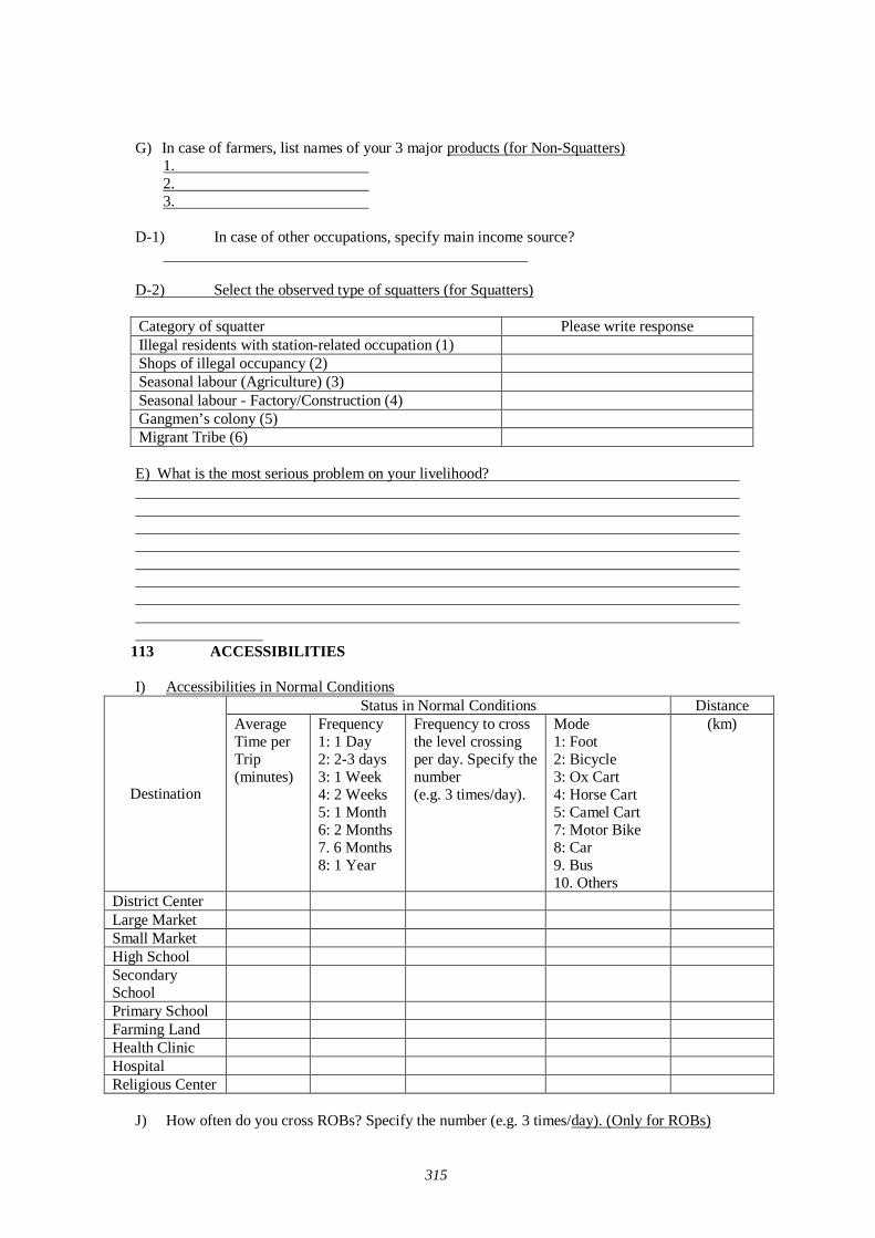
315
G) In case of farmers, list names of your 3 major products (for Non-Squatters)
1. 2. 3.
D-1) In case of other occupations, specify main income source?
D-2) Select the observed type of squatters (for Squatters) Category of squatter Please write response Illegal residents with station-related occupation (1) Shops of illegal occupancy (2) Seasonal labour (Agriculture) (3) Seasonal labour - Factory/Construction (4) Gangmen’s colony (5) Migrant Tribe (6) E) What is the most serious problem on your livelihood?
113 ACCESSIBILITIES I) Accessibilities in Normal Conditions
Status in Normal Conditions Distance
Destination
Average Time per Trip (minutes)
Frequency 1: 1 Day 2: 2-3 days 3: 1 Week 4: 2 Weeks 5: 1 Month 6: 2 Months 7. 6 Months 8: 1 Year
Frequency to cross the level crossing per day. Specify the number (e.g. 3 times/day).
Mode 1: Foot 2: Bicycle 3: Ox Cart 4: Horse Cart 5: Camel Cart 7: Motor Bike 8: Car 9. Bus 10. Others
(km)
District Center Large Market Small Market High School Secondary School
Primary School Farming Land Health Clinic Hospital Religious Center
J) How often do you cross ROBs? Specify the number (e.g. 3 times/day). (Only for ROBs)
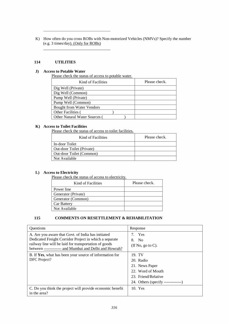
316
K) How often do you cross ROBs with Non-motorized Vehicles (NMVs)? Specify the number (e.g. 3 times/day). (Only for ROBs)
114 UTILITIES J) Access to Potable Water
Please check the status of access to potable water. Kind of Facilities Please check.
Dig Well (Private) Dig Well (Common) Pump Well (Private) Pump Well (Common) Bought from Water Vendors Other Facilities ( ) Other Natural Water Sources ( )
K) Access to Toilet Facilities
Please check the status of access to toilet facilities. Kind of Facilities Please check.
In-door Toilet Out-door Toilet (Private) Out-door Toilet (Common) Not Available
L) Access to Electricity
Please check the status of access to electricity. Kind of Facilities Please check.
Power line Generator (Private) Generator (Common) Car Battery Not Available
115 COMMENTS ON RESETTLEMENT & REHABILITATION
Questions Response A. Are you aware that Govt. of India has initiated Dedicated Freight Corridor Project in which a separate railway line will be laid for transportation of goods between ------------- and Mumbai and Delhi and Howrah?
7. Yes 8. No (If No, go to C).
B. If Yes, what has been your source of information for DFC Project?
19. TV 20. Radio 21. News Paper 22. Word of Mouth 23. Friend/Relative 24. Others (specify -------------)
C. Do you think the project will provide economic benefit in the area?
10. Yes
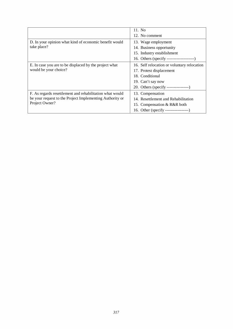
317
11. No 12. No comment
D. In your opinion what kind of economic benefit would take place?
13. Wage employment 14. Business opportunity 15. Industry establishment 16. Others (specify --------------------)
E. In case you are to be displaced by the project what would be your choice?
16. Self relocation or voluntary relocation 17. Protest displacement 18. Conditional 19. Can’t say now 20. Others (specify ----------------)
F. As regards resettlement and rehabilitation what would be your request to the Project Implementing Authority or Project Owner?
13. Compensation 14. Resettlement and Rehabilitation 15. Compensation & R&R both 16. Other (specify -----------------)
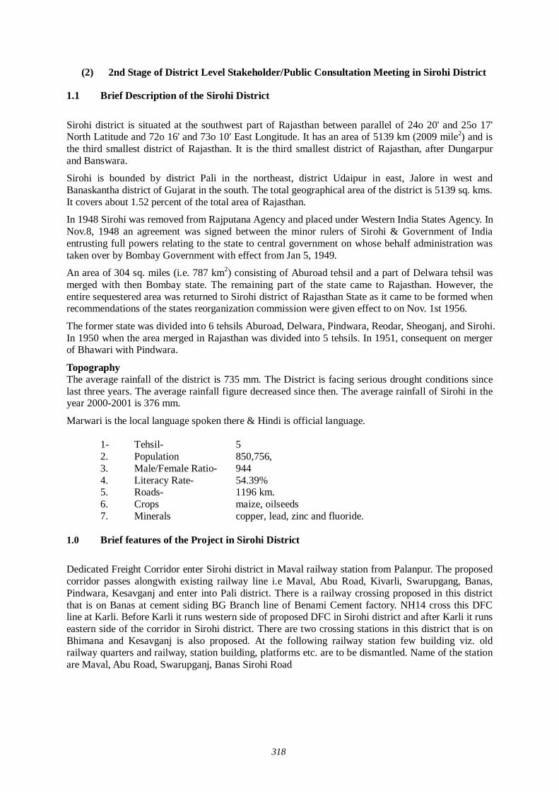
318
(2) 2nd Stage of District Level Stakeholder/Public Consultation Meeting in Sirohi District
1.1 Brief Description of the Sirohi District
Sirohi district is situated at the southwest part of Rajasthan between parallel of 24o 20' and 25o 17' North Latitude and 72o 16' and 73o 10' East Longitude. It has an area of 5139 km (2009 mile2) and is the third smallest district of Rajasthan. It is the third smallest district of Rajasthan, after Dungarpur and Banswara.
Sirohi is bounded by district Pali in the northeast, district Udaipur in east, Jalore in west and Banaskantha district of Gujarat in the south. The total geographical area of the district is 5139 sq. kms. It covers about 1.52 percent of the total area of Rajasthan.
In 1948 Sirohi was removed from Rajputana Agency and placed under Western India States Agency. In Nov.8, 1948 an agreement was signed between the minor rulers of Sirohi & Government of India entrusting full powers relating to the state to central government on whose behalf administration was taken over by Bombay Government with effect from Jan 5, 1949.
An area of 304 sq. miles (i.e. 787 km2) consisting of Aburoad tehsil and a part of Delwara tehsil was merged with then Bombay state. The remaining part of the state came to Rajasthan. However, the entire sequestered area was returned to Sirohi district of Rajasthan State as it came to be formed when recommendations of the states reorganization commission were given effect to on Nov. 1st 1956.
The former state was divided into 6 tehsils Aburoad, Delwara, Pindwara, Reodar, Sheoganj, and Sirohi. In 1950 when the area merged in Rajasthan was divided into 5 tehsils. In 1951, consequent on merger of Bhawari with Pindwara.
Topography The average rainfall of the district is 735 mm. The District is facing serious drought conditions since last three years. The average rainfall figure decreased since then. The average rainfall of Sirohi in the year 2000-2001 is 376 mm.
Marwari is the local language spoken there & Hindi is official language.
1- Tehsil- 5 2. Population 850,756, 3. Male/Female Ratio- 944 4. Literacy Rate- 54.39% 5. Roads- 1196 km. 6. Crops maize, oilseeds 7. Minerals copper, lead, zinc and fluoride.
1.0 Brief features of the Project in Sirohi District
Dedicated Freight Corridor enter Sirohi district in Maval railway station from Palanpur. The proposed corridor passes alongwith existing railway line i.e Maval, Abu Road, Kivarli, Swarupgang, Banas, Pindwara, Kesavganj and enter into Pali district. There is a railway crossing proposed in this district that is on Banas at cement siding BG Branch line of Benami Cement factory. NH14 cross this DFC line at Karli. Before Karli it runs western side of proposed DFC in Sirohi district and after Karli it runs eastern side of the corridor in Sirohi district. There are two crossing stations in this district that is on Bhimana and Kesavganj is also proposed. At the following railway station few building viz. old railway quarters and railway, station building, platforms etc. are to be dismantled. Name of the station are Maval, Abu Road, Swarupganj, Banas Sirohi Road
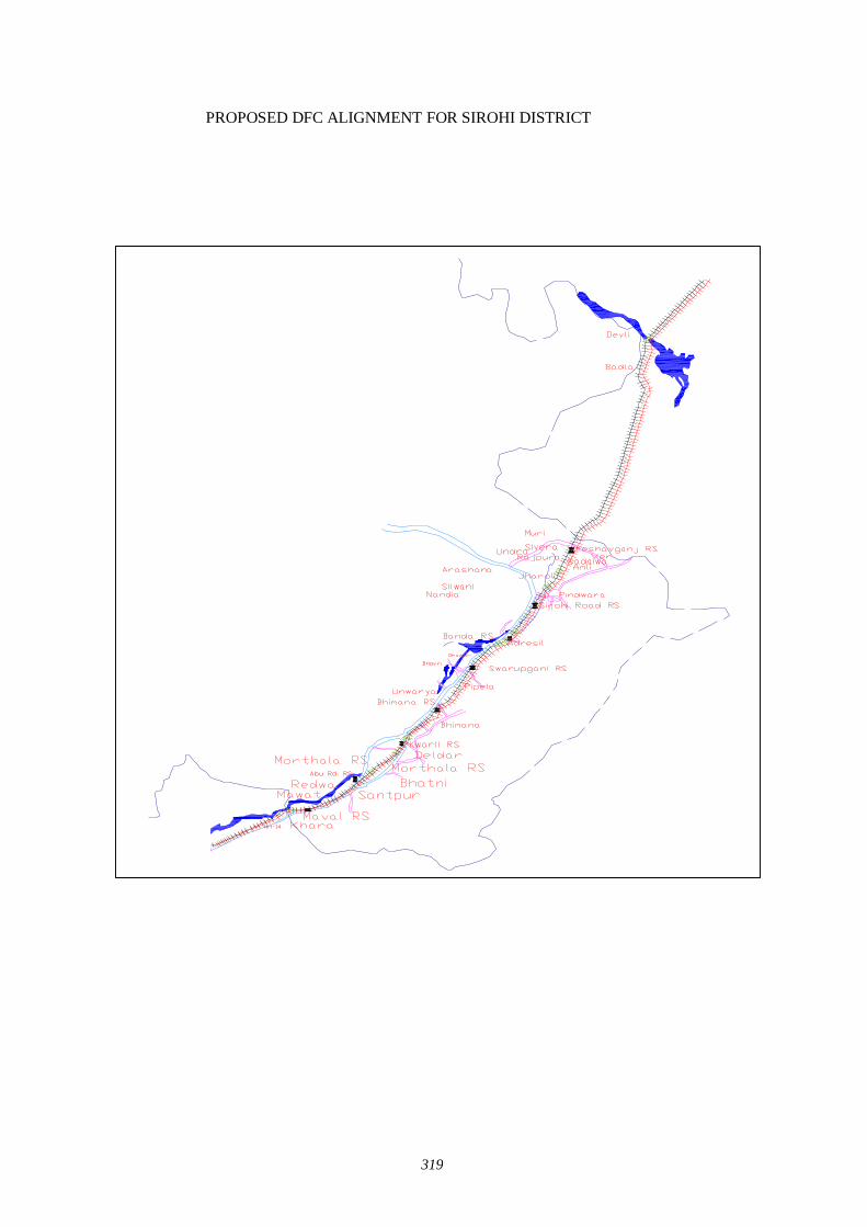
319
PROPOSED DFC ALIGNMENT FOR SIROHI DISTRICT
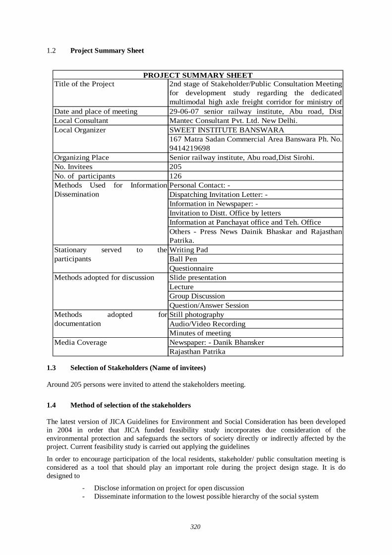
320
1.2 Project Summary Sheet 1.3 Selection of Stakeholders (Name of invitees) Around 205 persons were invited to attend the stakeholders meeting.
1.4 Method of selection of the stakeholders The latest version of JICA Guidelines for Environment and Social Consideration has been developed in 2004 in order that JICA funded feasibility study incorporates due consideration of the environmental protection and safeguards the sectors of society directly or indirectly affected by the project. Current feasibility study is carried out applying the guidelines
In order to encourage participation of the local residents, stakeholder/ public consultation meeting is considered as a tool that should play an important role during the project design stage. It is do designed to
- Disclose information on project for open discussion - Disseminate information to the lowest possible hierarchy of the social system
Title of the Project 2nd stage of Stakeholder/Public Consultation Meetingfor development study regarding the dedicatedmultimodal high axle freight corridor for ministry of
Date and place of meeting 29-06-07 senior railway institute, Abu road, DistLocal Consultant Mantec Consultant Pvt. Ltd. New Delhi.
SWEET INSTITUTE BANSWARA167 Matra Sadan Commercial Area Banswara Ph. No.9414219698
Organizing Place Senior railway institute, Abu road,Dist Sirohi.No. Invitees 205No. of participants 126
Personal Contact: -Dispatching Invitation Letter: -Information in Newspaper: -Invitation to Distt. Office by lettersInformation at Panchayat office and Teh. OfficeOthers - Press News Dainik Bhaskar and RajasthanPatrika.Writing PadBall PenQuestionnaireSlide presentationLectureGroup DiscussionQuestion/Answer SessionStill photographyAudio/Video RecordingMinutes of meetingNewspaper: - Danik BhanskerRajasthan Patrika
PROJECT SUMMARY SHEET
Local Organizer
Methods Used for InformationDissemination
Stationary served to theparticipants
Methods adopted for discussion
Methods adopted fordocumentation
Media Coverage
321
- Obtain interaction of the participants of stakeholder/public consultation meeting - Reflect the valid comments elicited from the open discussion to the design of the
project - Build a consensus on the project implementation and associated
There are three stages of stakeholder and public consultation meeting. The first stage of stakeholder/public consultation is held on state level, followed by second stage of stakeholder/ public consultation held in the districts, and the third stage of stakeholder/ public consultation meeting held on the villages directly affected by the project
The Mantec Consultants Pvt. Ltd has already organized first stage of stake holder/public consultation meeting in state of Rajasthan. To organize the second stage of Stakeholder/ Public Consultation Meting Mantec consultants has authorized "Sweet Institution" to meet the concerned government authorities and collect relevant data for carrying forward study of social economic survey and organize second stage of stakeholder/Public Consultation Meeting for information dissemination about the project As per direction of the guidelines for conducting the 2nd stage of the stakeholder/ public Consultation Meetings a formal order of the Ministry of Railways was got issued vide their letter dated 01-06-07 to facilitate these meetings .
Further, continuous efforts were made to keep the Ministry of Railways involved in the project as the major stakeholder through their local set-up. Rehabilitation Commissioners were also appointed from the state government departments. Similarly Department of Environment and Forestry and State Pollution Control Boards were contacted to participate in the Meetings. State Government Department were also apprised and approached and were invited to participate in the Stakeholders/Public Consultation Meetings including the State Public Works Department, Irrigation and Power, Urban Development and Poverty Alleviation Department, industries, telecommunication and Information technology Trade and Commerce, Surface Transport, Tourism, Container/Corporation of India, Port Trusts etc.
Our meeting Facilitator Team visited all the affected villages and requested Primary and Secondary Stakeholders to attend the meeting. Our meeting facilitator team preferred to invite the people who will be affected directly by this project. Our team also met & informed the district. Administration and requested to help in organizing the public meeting successfully. Local stakeholders along the railway line, affected farmers, businessmen, private service and Govt. service employers were invited in the meeting. Our study team also contacted Tehsildar of affected Tehsil, Panchayat Samiti Pramukh, Gram Pradhan, local MLA and requested them to attend the meeting and also gave necessary support in conducting second stage of stakeholder and public consultation meeting We have to invite the limited No. of stake holders. So we invited the mostly affected stakeholders but after reading the newspapers, uninvited and interested persons attended the public consultation. It was good to know that the peoples are interested to know DFC project .it was a good sign.
1.5 Selection of meeting facilitators
Simultaneously, extensive surveys were conducted for the identification of suitable local agencies for the successful organization of the second stage of Stakeholders/Public Consultation Meeting in Sirohi district of Rajasthan.
Preference was given to appoint Non Government Organizations (NGO’s) who had local presence, popularity and experience of social and public works and are well acquainted with multifarious cross section of society to help in the selection of the right type of the stakeholders for the meetings as well as for facilitating other related activities i.e.
Venue for the meetings; Arrangements to be made; Assisting in local publicity; Invitations to the Stakeholders and motivating them for participation; Maintaining and compilation of record and feed back; and
322
Other local arrangements like transport, hospitality, security and smooth conduct of the meeting proceedings.
The Non Governmental Organizations were appointed for facilitating the Stakeholders/Public Consultation meetings for conducting the meetings:
2.0 Method of information Dissemination
(1) Method of notifying the meeting to the participants
1. Local newspapers about the venue and date of meeting 2. Information of DFC Project to the local stakeholders by face to face for meeting 3. Invitation letter to the affected stakeholders during the survey of Railway track 4. Information to Sarpanch /Public representatives by official letters. 5. Pasted handout containing the information of the project on the public place of the
affected area. 6. Announcement of date and venue of stakeholder and public consultation meeting by
loudspeaker mounted auto in project affected area
(2) Presentation of the meeting
(Presentation material attached)
2.1 Venue of stakeholder and public consultation meeting
Looking to the stakeholders facility and dist. administration advice, the venue was decided in the senior railway institute, Abu road, dist Sirohi, where stakeholder can sit comfortably.
All the arrangements were made comfortable for sitting, drinking water, Tea & Snack, Photographer, Videographer etc by our meeting facilitator team
323
2.2 Participants of Stakeholder and Public Consultation Meeting Around 126 persons participated in the stakeholder/Public Consultation Meeting.
3.0 Details of Stakeholder and Public Consultation Meeting
Stakeholders /Public consultation meeting is a bottom up approach in this gigantic freight corridor project. It is one of the tools to reflect the views of the general public as well as those concerned with the project ranging from the central and local government organizations to commercial and industrial sectors of the society as a whole. It is an important tool of information dissemination during the planning stage of the project.
3.1 Record of meeting Firstly introduction Session was held
- Then chairman of chetak kalyan trust, Ahmedabad, did inauguration. - The meeting facilitator gave the information and details of working of Sweet Sansthan
Banswara
Sociologist, Mantec consultant gave the detail description of the DFC Project with special emphasis on Sirohi district
Mantec consultant explained that because of the ever growing economy of India, improvement of physical ability for moving goods by means of railways within the country is considered urgently needed, he also explained that the railway line starting from Mumbai running all the way up to Delhi is dedicated only for Freight Corridor and nothing to do with the passengers. Growth of major and minor ports of India, the traffic between Northern Hinterland and Western port and huge traffic of coal, steel, and fertilizer is anticipated on Ludhiana-Delhi-Howrah route. On an Average approximately 9000-loaded trucks move daily over the corridor, i.e. Delhi-Mumbai Western Corridor and Ludhiana-Howrah eastern corridor. He added that Freight Corridor is basically constructed alongside existing double track from Mumbai-Delhi, from Palanpur upto Ahmedabad routes. From the city Vadodara adjoining the existing areas drawing up from Rajasthan, because of the congested areas, change all the way upto Mahesana the Freight Corridor has to be constructed avoiding the congestion on existing railway lines.
Mantec consultant cleared the misunderstanding of stakeholders regarding the acquisition of land along the track. He told that the corridor would be laid down in the eastern part of rail line in Sirohi district for which only 20 to 26 m (26 m at Detour) land would be acquired from the center of the existing track. He further added that it would save time in the process of transportation of goods, which will be benefited to the people.
With help of projector Mantec consultant show the alignment of proposed DFC project of Sirohi district。He said that Dedicated Freight Corridor enter Sirohi district in Maval railway station from Palanpur. The proposed corridor passes along with existing railway line i.e. Maval, Abu Road, Kivarli, Swarupgang, Banas, Pindwara, Kesavganj and enter into Pali district. There is a railway crossing proposed in this district that is on Banas at cement siding BG Branch line of Benami Cement factory. NH14 cross this DFC line at Karli. Before Karli it runs western side of proposed DFC in Sirohi district and after Karli it runs eastern side of the corridor in Sirohi district. Mantec consultant said that there are two proposed crossing stations in Bhimana and Kesavgang district. At Maval, Abu Road, Swarupganj, Banas and Sirohi Road few building viz. old railway quarters and railway station building, platforms etc. are to be dismantled.
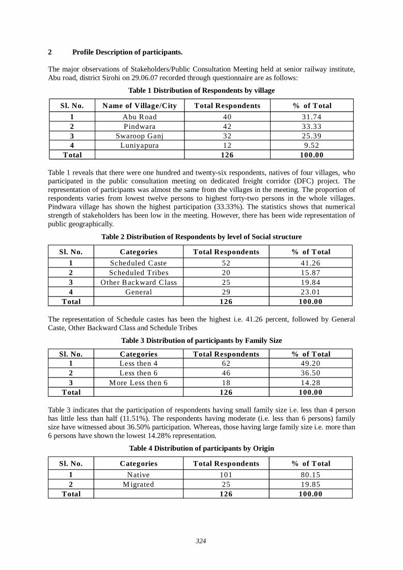
324
2 Profile Description of participants. The major observations of Stakeholders/Public Consultation Meeting held at senior railway institute, Abu road, district Sirohi on 29.06.07 recorded through questionnaire are as follows:
Table 1 Distribution of Respondents by village
Sl. No. Name of Village/City Total Respondents % of Total1 Abu Road 40 31.742 Pindwara 42 33.333 Swaroop Ganj 32 25.394 Luniyapura 12 9.52
Total 126 100.00 Table 1 reveals that there were one hundred and twenty-six respondents, natives of four villages, who participated in the public consultation meeting on dedicated freight corridor (DFC) project. The representation of participants was almost the same from the villages in the meeting. The proportion of respondents varies from lowest twelve persons to highest forty-two persons in the whole villages. Pindwara village has shown the highest participation (33.33%). The statistics shows that numerical strength of stakeholders has been low in the meeting. However, there has been wide representation of public geographically.
Table 2 Distribution of Respondents by level of Social structure
Sl. No. Categories Total Respondents % of Total1 Scheduled Caste 52 41.262 Scheduled Tribes 20 15.873 Other Backward Class 25 19.844 General 29 23.01
Total 126 100.00
The representation of Schedule castes has been the highest i.e. 41.26 percent, followed by General Caste, Other Backward Class and Schedule Tribes
Table 3 Distribution of participants by Family Size
Sl. No. Categories Total Respondents % of Total1 Less then 4 62 49.202 Less then 6 46 36.503 M ore Less then 6 18 14.28
Total 126 100.00
Table 3 indicates that the participation of respondents having small family size i.e. less than 4 person has little less than half (11.51%). The respondents having moderate (i.e. less than 6 persons) family size have witnessed about 36.50% participation. Whereas, those having large family size i.e. more than 6 persons have shown the lowest 14.28% representation.
Table 4 Distribution of participants by Origin
Sl. No. Categories Total Respondents % of Total1 Native 101 80.152 M igrated 25 19.85
Total 126 100.00
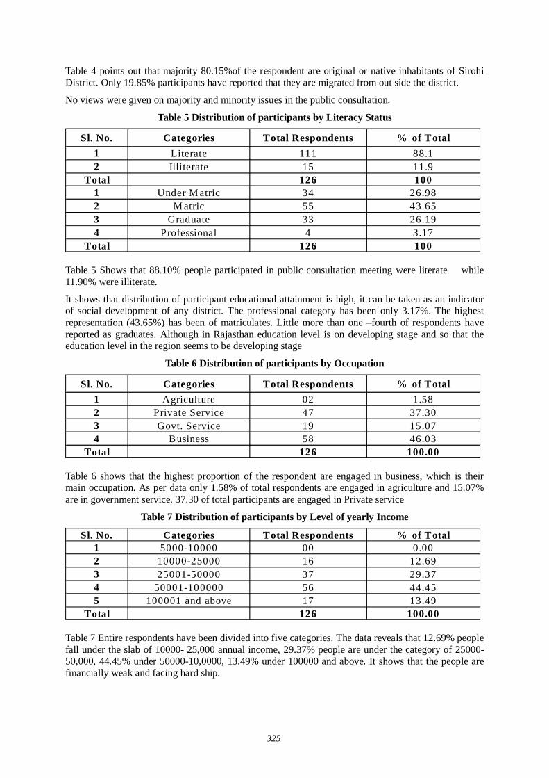
325
Table 4 points out that majority 80.15%of the respondent are original or native inhabitants of Sirohi District. Only 19.85% participants have reported that they are migrated from out side the district.
No views were given on majority and minority issues in the public consultation.
Table 5 Distribution of participants by Literacy Status
Sl. No. Categories Total Respondents % of Total1 Literate 111 88.12 Illiterate 15 11.9
Total 126 1001 Under M atric 34 26.982 M atric 55 43.653 Graduate 33 26.194 Professional 4 3.17
Total 126 100
Table 5 Shows that 88.10% people participated in public consultation meeting were literate while 11.90% were illiterate.
It shows that distribution of participant educational attainment is high, it can be taken as an indicator of social development of any district. The professional category has been only 3.17%. The highest representation (43.65%) has been of matriculates. Little more than one –fourth of respondents have reported as graduates. Although in Rajasthan education level is on developing stage and so that the education level in the region seems to be developing stage
Table 6 Distribution of participants by Occupation
Sl. No. Categories Total Respondents % of Total1 Agriculture 02 1.582 Private Service 47 37.303 Govt. Service 19 15.074 Business 58 46.03
Total 126 100.00
Table 6 shows that the highest proportion of the respondent are engaged in business, which is their main occupation. As per data only 1.58% of total respondents are engaged in agriculture and 15.07% are in government service. 37.30 of total participants are engaged in Private service
Table 7 Distribution of participants by Level of yearly Income
Sl. No. Categories Total Respondents % of Total1 5000-10000 00 0.002 10000-25000 16 12.693 25001-50000 37 29.374 50001-100000 56 44.455 100001 and above 17 13.49
Total 126 100.00
Table 7 Entire respondents have been divided into five categories. The data reveals that 12.69% people fall under the slab of 10000- 25,000 annual income, 29.37% people are under the category of 25000-50,000, 44.45% under 50000-10,0000, 13.49% under 100000 and above. It shows that the people are financially weak and facing hard ship.
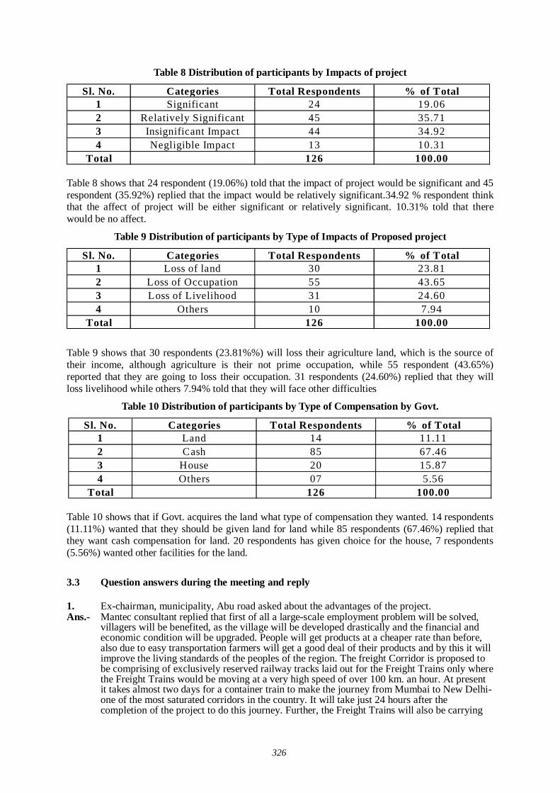
326
Table 8 Distribution of participants by Impacts of project
Sl. No. Categories Total Respondents % of Total1 Significant 24 19.062 Relatively Significant 45 35.713 Insignificant Impact 44 34.924 Negligible Impact 13 10.31
Total 126 100.00
Table 8 shows that 24 respondent (19.06%) told that the impact of project would be significant and 45 respondent (35.92%) replied that the impact would be relatively significant.34.92 % respondent think that the affect of project will be either significant or relatively significant. 10.31% told that there would be no affect.
Table 9 Distribution of participants by Type of Impacts of Proposed project
Sl. No. Categories Total Respondents % of Total1 Loss of land 30 23.812 Loss of Occupation 55 43.653 Loss of Livelihood 31 24.604 Others 10 7.94
Total 126 100.00
Table 9 shows that 30 respondents (23.81%%) will loss their agriculture land, which is the source of their income, although agriculture is their not prime occupation, while 55 respondent (43.65%) reported that they are going to loss their occupation. 31 respondents (24.60%) replied that they will loss livelihood while others 7.94% told that they will face other difficulties
Table 10 Distribution of participants by Type of Compensation by Govt.
Sl. No. Categories Total Respondents % of Total1 Land 14 11.112 Cash 85 67.463 House 20 15.874 Others 07 5.56
Total 126 100.00
Table 10 shows that if Govt. acquires the land what type of compensation they wanted. 14 respondents (11.11%) wanted that they should be given land for land while 85 respondents (67.46%) replied that they want cash compensation for land. 20 respondents has given choice for the house, 7 respondents (5.56%) wanted other facilities for the land.
3.3 Question answers during the meeting and reply 1. Ex-chairman, municipality, Abu road asked about the advantages of the project. Ans.- Mantec consultant replied that first of all a large-scale employment problem will be solved,
villagers will be benefited, as the village will be developed drastically and the financial and economic condition will be upgraded. People will get products at a cheaper rate than before, also due to easy transportation farmers will get a good deal of their products and by this it will improve the living standards of the peoples of the region. The freight Corridor is proposed to be comprising of exclusively reserved railway tracks laid out for the Freight Trains only where the Freight Trains would be moving at a very high speed of over 100 km. an hour. At present it takes almost two days for a container train to make the journey from Mumbai to New Delhi-one of the most saturated corridors in the country. It will take just 24 hours after the completion of the project to do this journey. Further, the Freight Trains will also be carrying
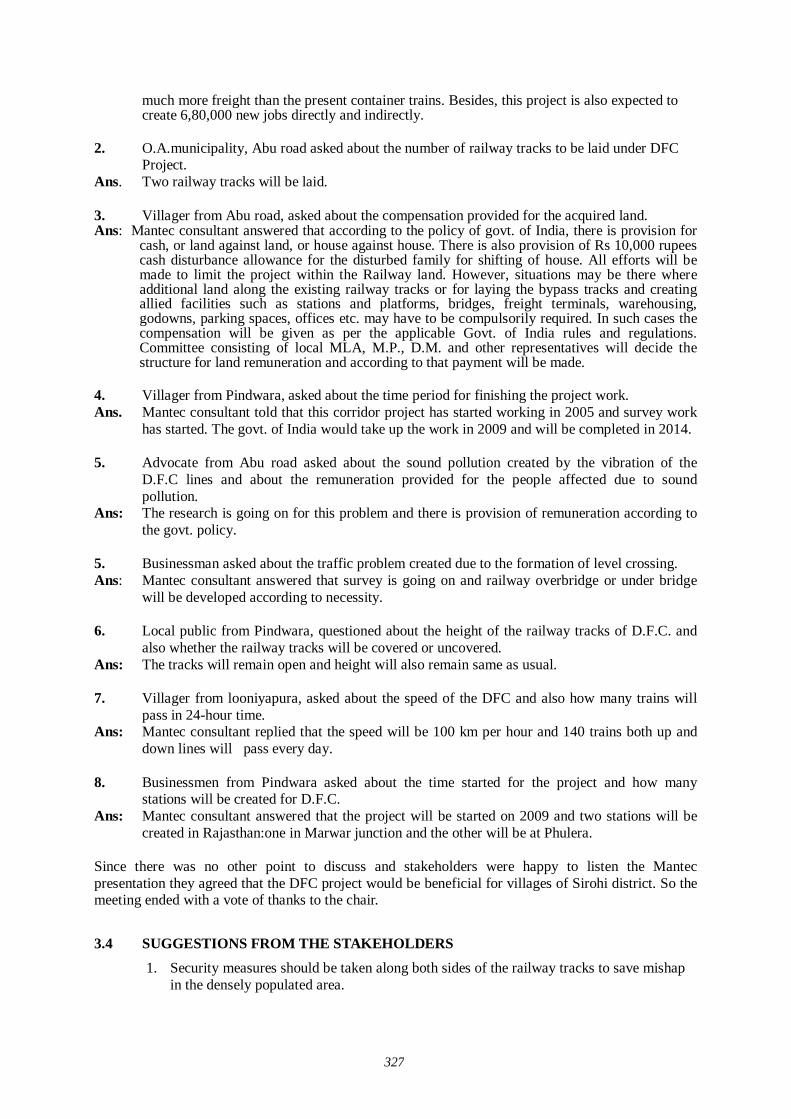
327
much more freight than the present container trains. Besides, this project is also expected to create 6,80,000 new jobs directly and indirectly.
2. O.A.municipality, Abu road asked about the number of railway tracks to be laid under DFC
Project. Ans. Two railway tracks will be laid. 3. Villager from Abu road, asked about the compensation provided for the acquired land. Ans: Mantec consultant answered that according to the policy of govt. of India, there is provision for
cash, or land against land, or house against house. There is also provision of Rs 10,000 rupees cash disturbance allowance for the disturbed family for shifting of house. All efforts will be made to limit the project within the Railway land. However, situations may be there where additional land along the existing railway tracks or for laying the bypass tracks and creating allied facilities such as stations and platforms, bridges, freight terminals, warehousing, godowns, parking spaces, offices etc. may have to be compulsorily required. In such cases the compensation will be given as per the applicable Govt. of India rules and regulations. Committee consisting of local MLA, M.P., D.M. and other representatives will decide the structure for land remuneration and according to that payment will be made.
4. Villager from Pindwara, asked about the time period for finishing the project work. Ans. Mantec consultant told that this corridor project has started working in 2005 and survey work
has started. The govt. of India would take up the work in 2009 and will be completed in 2014. 5. Advocate from Abu road asked about the sound pollution created by the vibration of the
D.F.C lines and about the remuneration provided for the people affected due to sound pollution.
Ans: The research is going on for this problem and there is provision of remuneration according to the govt. policy.
5. Businessman asked about the traffic problem created due to the formation of level crossing. Ans: Mantec consultant answered that survey is going on and railway overbridge or under bridge
will be developed according to necessity. 6. Local public from Pindwara, questioned about the height of the railway tracks of D.F.C. and
also whether the railway tracks will be covered or uncovered. Ans: The tracks will remain open and height will also remain same as usual. 7. Villager from looniyapura, asked about the speed of the DFC and also how many trains will
pass in 24-hour time. Ans: Mantec consultant replied that the speed will be 100 km per hour and 140 trains both up and
down lines will pass every day. 8. Businessmen from Pindwara asked about the time started for the project and how many
stations will be created for D.F.C. Ans: Mantec consultant answered that the project will be started on 2009 and two stations will be
created in Rajasthan:one in Marwar junction and the other will be at Phulera. Since there was no other point to discuss and stakeholders were happy to listen the Mantec presentation they agreed that the DFC project would be beneficial for villages of Sirohi district. So the meeting ended with a vote of thanks to the chair.
3.4 SUGGESTIONS FROM THE STAKEHOLDERS
1. Security measures should be taken along both sides of the railway tracks to save mishap in the densely populated area.
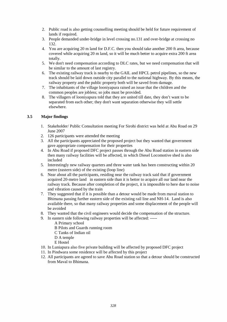
328
2. Public road is also getting counselling meeting should be held for future requirement of lands if required.
3. People demanded under-bridge in level crossing no.131 and over-bridge at crossing no 132.
4. You are acquiring 20 m land for D.F.C. then you should take another 200 ft area, because covered while acquiring 20 m land, so it will be much better to acquire extra 200 ft area totally.
5. We don't need compensation according to DLC rates, but we need compensation that will be similar to the amount of last registry.
6. The existing railway track is nearby to the GAIL and HPCL petrol pipelines, so the new track should be laid down outside city parallel to the national highway. By this means, the railway property and the public property both will be saved from damage.
7. The inhabitants of the village looniyapura raised an issue that the children and the common peoples are jobless; so jobs must be provided.
8. The villagers of looniyapura told that they are united till date, they don’t want to be separated from each other; they don't want separation otherwise they will settle elsewhere.
3.5 Major findings
1. Stakeholder/ Public Consultation meeting For Sirohi district was held at Abu Road on 29
June 2007 2. 126 participants were attended the meeting 3. All the participants appreciated the proposed project but they wanted that government
gave appropriate compensation for their properties 4. In Abu Road if proposed DFC project passes through the Abu Road station in eastern side
then many railway facilities will be affected, in which Diesel Locomotive shed is also included
5. Interestingly new railway quarters and three water tank has been constructing within 20 metre (eastern side) of the existing (loop line)
6. Near about all the participants, residing near the railway track said that if government acquired 20-metre land in eastern side than it is better to acquire all our land near the railway track. Because after completion of the project, it is impossible to here due to noise and vibration caused by the train
7. They suggested that if it is possible than a detour would be made from maval station to Bhimana passing further eastern side of the existing rail line and NH-14. Land is also available there, so that many railway properties and some displacement of the people will be avoided
8. They wanted that the civil engineers would decide the compensation of the structure. 9. In eastern side following railway properties will be affected: -----
A Primary school B Pilots and Guards running room C Tanks of Indian oil D A temple E Hostel
10. In Luniapura also five private building will be affected by proposed DFC project 11. In Pindwara some residence will be affected by this project 12. All participants are agreed to save Abu Road station so that a detour should be constructed
from Maval to Bhimana.
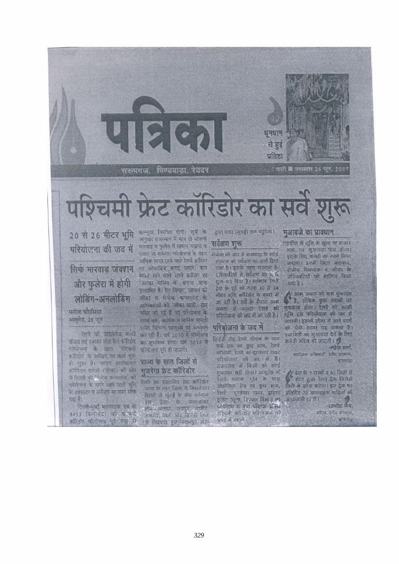
329
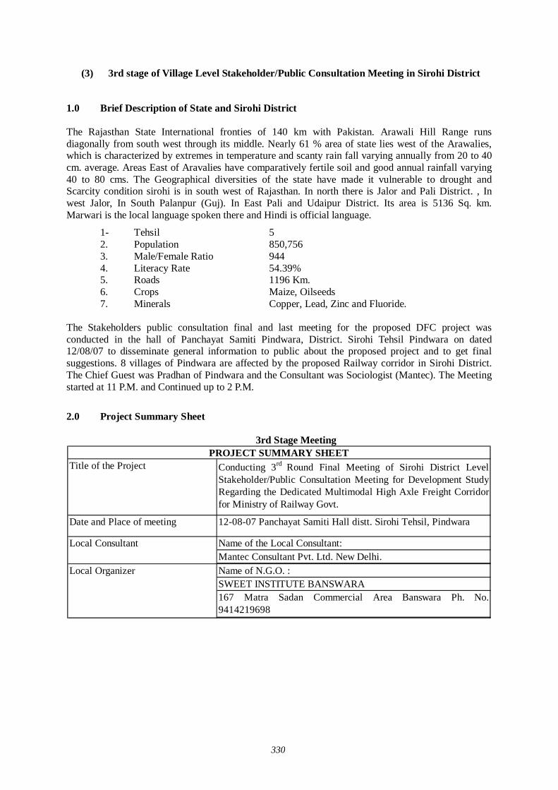
330
(3) 3rd stage of Village Level Stakeholder/Public Consultation Meeting in Sirohi District
1.0 Brief Description of State and Sirohi District The Rajasthan State International fronties of 140 km with Pakistan. Arawali Hill Range runs diagonally from south west through its middle. Nearly 61 % area of state lies west of the Arawalies, which is characterized by extremes in temperature and scanty rain fall varying annually from 20 to 40 cm. average. Areas East of Aravalies have comparatively fertile soil and good annual rainfall varying 40 to 80 cms. The Geographical diversities of the state have made it vulnerable to drought and Scarcity condition sirohi is in south west of Rajasthan. In north there is Jalor and Pali District. , In west Jalor, In South Palanpur (Guj). In East Pali and Udaipur District. Its area is 5136 Sq. km. Marwari is the local language spoken there and Hindi is official language.
1- Tehsil 5 2. Population 850,756 3. Male/Female Ratio 944 4. Literacy Rate 54.39% 5. Roads 1196 Km. 6. Crops Maize, Oilseeds 7. Minerals Copper, Lead, Zinc and Fluoride.
The Stakeholders public consultation final and last meeting for the proposed DFC project was conducted in the hall of Panchayat Samiti Pindwara, District. Sirohi Tehsil Pindwara on dated 12/08/07 to disseminate general information to public about the proposed project and to get final suggestions. 8 villages of Pindwara are affected by the proposed Railway corridor in Sirohi District. The Chief Guest was Pradhan of Pindwara and the Consultant was Sociologist (Mantec). The Meeting started at 11 P.M. and Continued up to 2 P.M.
2.0 Project Summary Sheet
3rd Stage Meeting
Title of the Project Conducting 3rd Round Final Meeting of Sirohi District LevelStakeholder/Public Consultation Meeting for Development StudyRegarding the Dedicated Multimodal High Axle Freight Corridorfor Ministry of Railway Govt.
Date and Place of meeting 12-08-07 Panchayat Samiti Hall distt. Sirohi Tehsil, Pindwara
Name of the Local Consultant: Mantec Consultant Pvt. Ltd. New Delhi.Name of N.G.O. :SWEET INSTITUTE BANSWARA167 Matra Sadan Commercial Area Banswara Ph. No.9414219698
PROJECT SUMMARY SHEET
Local Consultant
Local Organizer
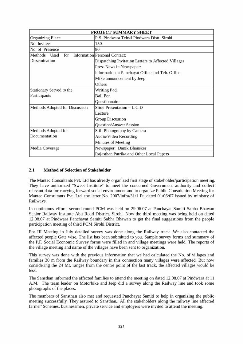
331
Organizing Place P.S. Pindwara Tehsil Pindwara Distt. Sirohi No. Invitees 150No. of Presence 80
Personal Contact: Dispatching Invitation Letters to Affected VillagesPress News in Newspaper:Information at Panchayat Office and Teh. Office Mike announcement by JeepOthers Writing PadBall PenQuestionnaireSlide Presentation – L.C.D LectureGroup DiscussionQuestion/Answer SessionStill Photography by Camera Audio/Video RecordingMinutes of MeetingNewspaper: Danik BhanskerRajasthan Patrika and Other Local Papers
Stationary Served to the Participants
Methods Adopted for Discussion
Methods Adopted for Documentation
Media Coverage
Methods Used for InformationDissemination
PROJECT SUMMARY SHEET
2.1 Method of Selection of Stakeholder The Mantec Consultants Pvt. Ltd has already organized first stage of stakeholder/participation meeting. They have authorized "Sweet Institute" to meet the concerned Government authority and collect relevant data for carrying forward social environment and to organize Public Consultation Meeting for Mantec Consultants Pvt. Ltd. the letter No. 2007/infra/31/1 Pt. dated 01/06/07 issued by ministry of Railways.
In continuous efforts second round PCM was held on 29.06.07 at Panchayat Samiti Sabha Bhawan Senior Railway Institute Abu Road District. Sirohi. Now the third meeting was being held on dated 12.08.07 at Pindwara Panchayat Samiti Sabha Bhawan to get the final suggestions from the people participation meeting of third PCM Sirohi District.
For III Meeting in July detailed survey was done along the Railway track. We also contacted the affected people Gate wise. The list has been submitted to you. Sample survey forms and summary of the P.F. Social Economic Survey forms were filled in and village meetings were held. The reports of the village meeting and name of the villages have been sent to organization.
This survey was done with the previous information that we had calculated the No. of villages and families 30 m from the Railway boundary in this connection many villages were affected. But now considering the 24 Mt. ranges from the centre point of the last track, the affected villages would be less.
The Sansthan informed the affected families to attend the meeting on dated 12.08.07 at Pindwara at 11 A.M. The team leader on Motorbike and Jeep did a survey along the Railway line and took some photographs of the places.
The members of Sansthan also met and requested Panchayat Samiti to help in organizing the public meeting successfully. They assured to Sansthan.. All the stakeholders along the railway line affected farmer' Schemes, businessmen, private service and employers were invited to attend the meeting.
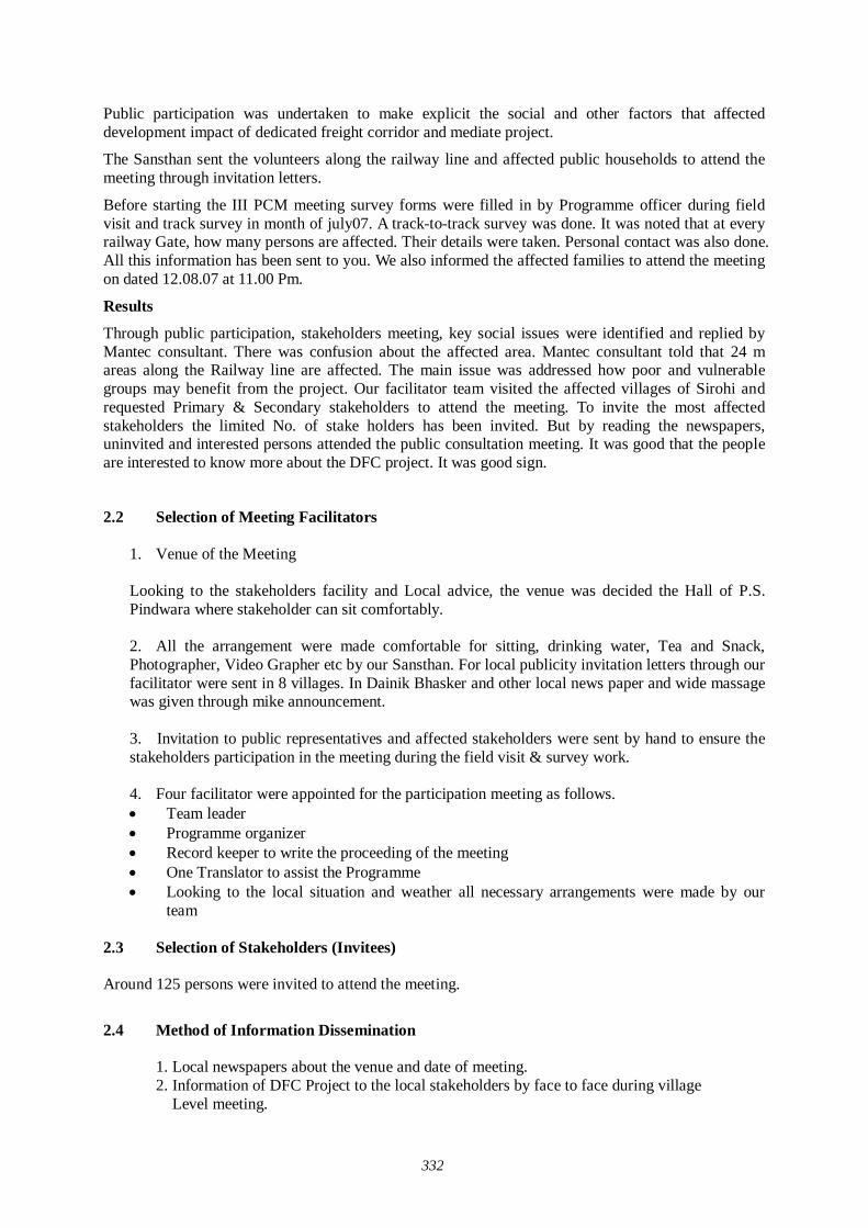
332
Public participation was undertaken to make explicit the social and other factors that affected development impact of dedicated freight corridor and mediate project.
The Sansthan sent the volunteers along the railway line and affected public households to attend the meeting through invitation letters.
Before starting the III PCM meeting survey forms were filled in by Programme officer during field visit and track survey in month of july07. A track-to-track survey was done. It was noted that at every railway Gate, how many persons are affected. Their details were taken. Personal contact was also done. All this information has been sent to you. We also informed the affected families to attend the meeting on dated 12.08.07 at 11.00 Pm.
Results
Through public participation, stakeholders meeting, key social issues were identified and replied by Mantec consultant. There was confusion about the affected area. Mantec consultant told that 24 m areas along the Railway line are affected. The main issue was addressed how poor and vulnerable groups may benefit from the project. Our facilitator team visited the affected villages of Sirohi and requested Primary & Secondary stakeholders to attend the meeting. To invite the most affected stakeholders the limited No. of stake holders has been invited. But by reading the newspapers, uninvited and interested persons attended the public consultation meeting. It was good that the people are interested to know more about the DFC project. It was good sign.
2.2 Selection of Meeting Facilitators
1. Venue of the Meeting
Looking to the stakeholders facility and Local advice, the venue was decided the Hall of P.S. Pindwara where stakeholder can sit comfortably. 2. All the arrangement were made comfortable for sitting, drinking water, Tea and Snack, Photographer, Video Grapher etc by our Sansthan. For local publicity invitation letters through our facilitator were sent in 8 villages. In Dainik Bhasker and other local news paper and wide massage was given through mike announcement.
3. Invitation to public representatives and affected stakeholders were sent by hand to ensure the
stakeholders participation in the meeting during the field visit & survey work.
4. Four facilitator were appointed for the participation meeting as follows. Team leader Programme organizer Record keeper to write the proceeding of the meeting One Translator to assist the Programme Looking to the local situation and weather all necessary arrangements were made by our
team 2.3 Selection of Stakeholders (Invitees) Around 125 persons were invited to attend the meeting.
2.4 Method of Information Dissemination 1. Local newspapers about the venue and date of meeting.
2. Information of DFC Project to the local stakeholders by face to face during village Level meeting.
333
3. Invitation letters to the affected stakeholders during the survey of Railway track. 4. Information to Pradhan /Public representatives by official letters. 3.0 Participants of Stakeholder/Public Consultation Meeting Around 80 participants were attend the Stakeholder/Public Consultation Meeting.
3.1 Detail of the Stakeholder/Public Consultation Dated 12.08.07 District. Sirohi Village
Pindwara
1. Stake holders/Public consultation Meeting is a bottom up approach in this gigantic Freight Corridor project. It is one of the tools to reflect the views of general public as well as those connected with the project- Central and local Govt. organization to farmers and commercial and industrial sectors of the society. It is an important tool of information dissemination & to get the final suggestions from the villages.
Time -11.00PM to 2.00PM
1. Firstly introduction Session was held Programme officer welcomed all the guests of Mantec and all Participants. 2. Then inauguration was done by Pradhan Pindwara. 3. Programme officer gave the information and details of working of Sweet Sansthan Banswara
and gave details of Railway Survey. 4. Programme officer Sweet Requested to Mr. Prabash Mishra to give detail information of the
DFC project.
Consultant of Mantec told that because of the ever growing economy of India, improvement of physical ability for moving goods by means of railways within the country is considered urgently needed. He also explained that the railway line starting from Mumbai running all the way up to Delhi is dedicated only for Freight Corridor and nothing to do with the passengers. Growth of major and minor ports of India, the traffic between Northern Hinterland and Western port and huge traffic of coal, steel, and fertilizer is anticipated on Ludhiana-Delhi-Howrah route. He said that there are lots of containers coming into this country from outside and landing at Mumbai and moving by train to Ahmedabad, Jaipur, Delhi upto Ludhiana. On an average approximately 9000 loaded trucks move daily over the corridor, i.e. Delhi-Mumbai Western Corridor and Ludhiana-Hawrah Eastern corridor. He added that Freght Corridor is basically constructed alongside existing double track from Mumbai-Delhi, from Palanpur up to Ahmedabad routes. From the city Vadodara adjoing the existing areas drawing up from Rajasthan, because of the congested areas, change all the way up to Mahesana the Freight Corridor has to be constructed avoiding the congestion on existing railway lines.
He also told about the Sirohi District.
1. Maximum 24 meters of land will be taken from the central line of the extreme track (existing/under conversion as BG on eastern side). The existing ROW of railway will be used, if available and Land Acquisition will be done for the balance land.
2. 45 Meters of land strip will be acquired for the detour route as per the drawings shown. 3. Compensation will be made as NRR Policy, 2003. However the draft policy NRR policy,
2006 will also be considered for compensation, if applicable at the time of acquisition. 4. 12 Villages of Sub District. Pindwara Named- Keshavganj, Bilad, Madarsa Colony Sirohi
Road, Hajari, Banas, Goliya, Swaroopganj, Bhimana, Bhujela, Kivarly & Murthala affected
5. In Sub distt. Abu Road the following villages named Luniyapur, Gandh nagar Ward No. 9, Ward No. 20, Ward No. 23, Abu Road Industrial Area, Chandrawali Industrial, Chandrawali and Mawal are affected.
334
He also said about the benefits of the project: 1. Economic Riffle Effect : 840 x 100Cr.
2. Total Investment : 240 x 100 Cr. 3. Jobs Created : 68000 4. Household Income : 215.2 x 100 Cr. 5. Tax Revenue : 17.64 x 100 Cr.
Along with Rail line, stations, bridges, signals and control system, electricity supply system rehabilitation of cargo handling yards also have to be developed. Programme officer 'Sweet' thanked to consultant Mantec for giving the detail information of the project and people were very happy.
3.2 Question/Answers After Listening the lecture of Consultant of Mantec the programme officer of 'Sweet' invited the participants to ask question one by one.
Name Villager, Keshavganj
Q.1 What would be the compensation rate?
Ans. The compensation of land, house and structure would be given from present market rate. They will be given interim assistance of Rs. 10000 & 30% would be given extra from the market rate.
Name Villager
Q.2 Is there any provision of gate in present corridor?
Ans. G.M. 'Mantec' told that on the DFC 140 trains would go in a day 70 up and 70 down. The speed up the train would be 100 km. per hour. The route would so busy that no body can pass on the track there is provision of ROB / RUB for the facility of the people they will be constructed as and where needed. There is no provision of gate in the present corridor.
Name Villager, Pindwara
Q.3 There is Binani cement factory 70 trucks pass in one hour. What facilities will be given?
Ans. Your question is good ROB will be made for facilities of the factory and people will be given facilities for transportation.
Name Villager, Pindwara
Q.4 Madarsa Colony ward no. 1 is badly affected. Will it be shifted?
Ans. Yes this ward is completely affected. Houses are also affected they will be given land/shops houses and School facilities at other place and good compensation would be given.
Name Villager, Sirohi Road
Q.5 How much land would be acquired in Detour?
Ans. Where there will be detour or by pass the land would be taken 45 Mt. from the center of the last track. If there is railway land available, no land would be acquired but land is not available then extra land would be acquired. At Sirohi railway station, railway colonies over bridge of railway platforms are affected. It will be shifted in the West.
335
Name Villager, Abu Road
Q.6 Is there any provision of gate in present corridor?
Ans. G.M. 'Mantec' told that on the DFC 140 trains would go in a day 70 up & 70 down. The speed up the train would be 100 km. per hour. The route would so busy that no body can pass on the track there is provision of ROB / RUB for the facility of the people they will be constructed as and where needed. There is no provision of gate in the present’s corridor.
Name Villager, Abu Road
Q.7 Banas village is also affected and it is very busy road which goes to Laxmi Cement Factory. What will be done?
Ans. The Banas railway station, railway colony & railway quarters and temples are also affected they all will be shifted & ROB will be made for the Laxmi Cement Factory.
Name Villager, Luniyapur
Q.8 How much land you're going to take for this project?
Ans. We are going to take only 24 Mt. land from the center of the last track. No more land will be require for this project. Earlier we had taken from the boundary of the railway station but now it is taken only 24 m from the center of the last track.
Name Villager, Morthala
Q.9 If there is no earning member in the family, will he get service in the railway?
Ans. G.M. 'Mantec' told that your Question is very good. We have note down in the report and suggest the Govt. You can get the jobs according to your experience, ability and qualification. As I have already told that 680000 jobs will be created from the corridor I hope you will be employed.
Name Villager
Q.10 When this Project will start to work and when the compensation would be given?
Ans. G.M. 'Mantec' told that the survey work is going to complete and the project will start to work in 2009 and would complete its work in 2014. The compensation would be given in time, the process is going on. You need not to worry. You will get good compensation & good amount.
Name Villager, Morthala
Q.11 IOC Petrol and diesel Pump, Gas pipeline are going under ground from Kandla to Mathura. Will it be removed answer?
Ans. Yes any structure or any under ground pipe line going on the eastern part through the corridor; it will be removed and shifted other place. Every facility will be given for the people and factory.
Name Villager, Gandhi Nagar Sirohi
Q.12 Will there be any more meeting or survey for it?
Ans. G.M. 'Mantec' told that this the last meeting. You have been invited for your good suggestion. We are here to note down your points and to give report to the higher authorities.
336
Note
There was a good discussion with the participants. They have their on points. Consultant Mantec gave satisfied answers. There was good gathering of the people.
Since there was no other point to discuss and stake holders were happy to listen the Mantec presentation. They agreed that the DFC project would be beneficial for villages of Sirohi. So the meeting ended with a vote of thanks to the chair.
3.3 Profile of Participants
The major observations of stakeholders/public consultation meeting were held in the Panchayat Samiti Hall of Pindwara District. Sirohi on dt. 012.08.07 recorded through questionnaire are as follows:
Table 1.1 Distribution of Respondents by Village
Sl. No. Name of Village/City Total Respondent % of Total
1 Abu Road 12 15.002 Pidwara 13 16.203 Keshavganj 09 11.254 Luniyapur 08 10.005 Maval 09 11.256 Sirohi 16 20.007 Morthala 08 10.008 Hajari 05 6.25
Total 80 100.00
Table 1.1 reveals the fact that there were 80 respondents present of 8 villages/towns. III public consultation meeting which was held on dt. 12.08.07 on dedicated freight corridor project to get the final suggestions from the affected villages. The Sirohi Road respondents 16 (20%) has Shown the highest Participation, While the lowest 5 respondent has shown the lowest participants (6.25%) Pindwara stood Second 13(16.25%)., III stood Abu Road 12 respondents (15%). IV stood Keshavaganj and Maval 9 res. (11.25%), V stood Luniyapur and Morthala 8 respondents (10%). It shows that all the affected villages of Pindwara of Sirohi District. attended the meeting. They were interested to attend the meeting and give their suggestions.
Table 1.2 Distribution of Respondents by Level of Social Structure
Sl. No. Categories Total Respondent % of Total
1 Scheduled Caste 05 6.252 Scheduled Tribes 18 22.503 Other Backward Class 33 41.254 General 24 30.00
Total 80 100.00
Table 1.2 reveals the fact that the maximum participation was belonged to other backward class (41.25%). The public consultation meeting was organized in Pindwara P.S. Hall. The representation of General listed Second (30%). They belonged to education a business class. The representation of S.T. was listed 3rd. The data shows that less percentage of S.C. was the lowest 6.25% observed.
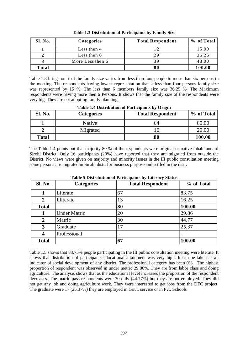
337
Table 1.3 Distribution of Participants by Family Size
Sl. No. Categories Total Respondent % of Total
1 Less then 4 12 15.002 Less then 6 29 36.253 More Less then 6 39 48.00
Total 80 100.00 Table 1.3 brings out that the family size varies from less than four people to more than six persons in the meeting. The respondents having lowest representation that is less than four persons family size was represented by 15 %. The less than 6 members family size was 36.25 %. The Maximum respondents were having more then 6 Persons. It shows that the family size of the respondents were very big. They are not adopting family planning.
Table 1.4 Distribution of Participants by Origin Sl. No. Categories Total Respondent % of Total
1 Native 64 80.002 Migrated 16 20.00
Total 80 100.00
The Table 1.4 points out that majority 80 % of the respondents were original or native inhabitants of Sirohi District. Only 16 participants (20%) have reported that they are migrated from outside the District. No views were given on majority and minority issues in the III public consultation meeting some persons are migrated in Sirohi distt. for business purpose and settled in the distt.
Table 5 Distribution of Participants by Literacy Status
Sl. No. Categories Total Respondent % of Total
1 Literate 67 83.752 Illiterate 13 16.25
Total 80 100.001 Under Matric 20 29.862 Matric 30 44.773 Graduate 17 25.374 Professional - -
Total 67 100.00
Table 1.5 shows that 83.75% people participating in the III public consultation meeting were literate. It shows that distribution of participants educational attainment was very high. It can be taken as an indicator of social development of any district. The professional category has been 0%. The highest proportion of respondent was observed in under metric 29.86%. They are from labor class and doing agriculture. The analysis shows that as the educational level increases the proportion of the respondent decreases. The matric pass respondents were 30 only (44.77%) but they are not employed. They did not get any job and doing agriculture work. They were interested to get jobs from the DFC project. The graduate were 17 (25.37%) they are employed in Govt. service or in Pvt. Schools
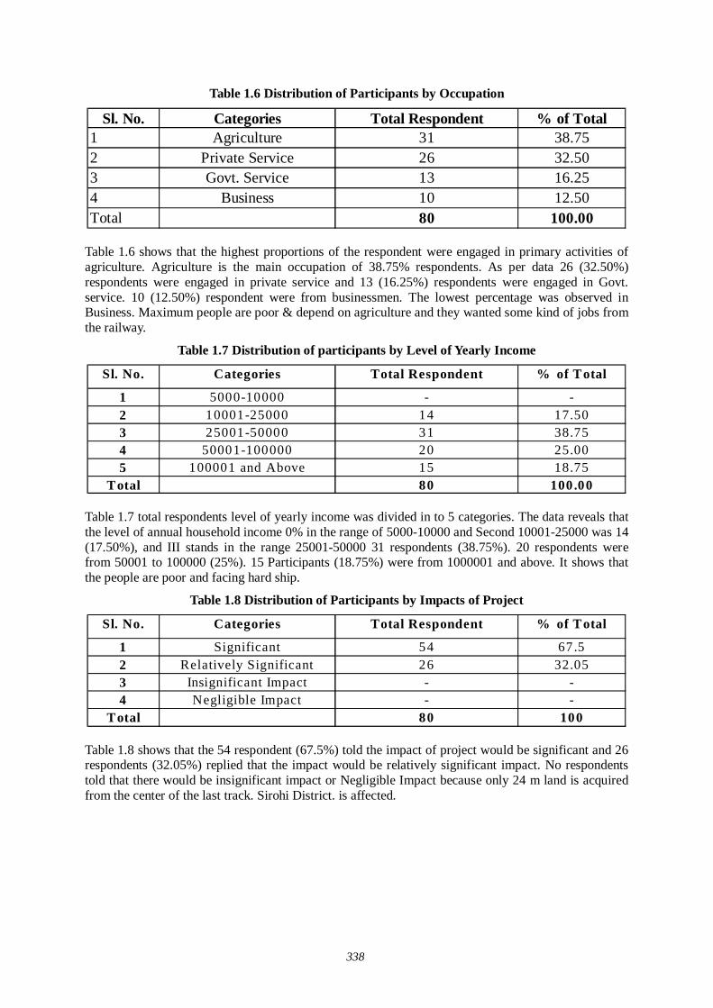
338
Table 1.6 Distribution of Participants by Occupation
Sl. No. Categories Total Respondent % of Total1 Agriculture 31 38.752 Private Service 26 32.503 Govt. Service 13 16.254 Business 10 12.50Total 80 100.00
Table 1.6 shows that the highest proportions of the respondent were engaged in primary activities of agriculture. Agriculture is the main occupation of 38.75% respondents. As per data 26 (32.50%) respondents were engaged in private service and 13 (16.25%) respondents were engaged in Govt. service. 10 (12.50%) respondent were from businessmen. The lowest percentage was observed in Business. Maximum people are poor & depend on agriculture and they wanted some kind of jobs from the railway.
Table 1.7 Distribution of participants by Level of Yearly Income
Sl. No. Categories Total Respondent % of Total
1 5000-10000 - -2 10001-25000 14 17.503 25001-50000 31 38.754 50001-100000 20 25.005 100001 and Above 15 18.75
Total 80 100.00
Table 1.7 total respondents level of yearly income was divided in to 5 categories. The data reveals that the level of annual household income 0% in the range of 5000-10000 and Second 10001-25000 was 14 (17.50%), and III stands in the range 25001-50000 31 respondents (38.75%). 20 respondents were from 50001 to 100000 (25%). 15 Participants (18.75%) were from 1000001 and above. It shows that the people are poor and facing hard ship.
Table 1.8 Distribution of Participants by Impacts of Project
Sl. No. Categories Total Respondent % of Total
1 Significant 54 67.52 Relatively Significant 26 32.053 Insignificant Impact - -4 Negligible Impact - -
Total 80 100
Table 1.8 shows that the 54 respondent (67.5%) told the impact of project would be significant and 26 respondents (32.05%) replied that the impact would be relatively significant impact. No respondents told that there would be insignificant impact or Negligible Impact because only 24 m land is acquired from the center of the last track. Sirohi District. is affected.
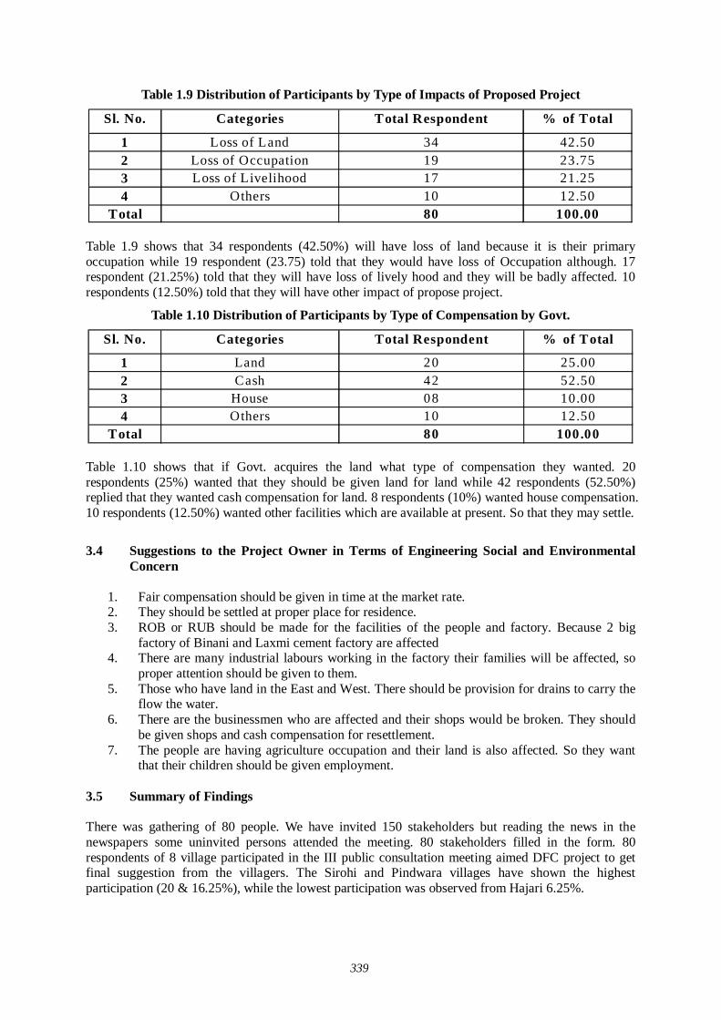
339
Table 1.9 Distribution of Participants by Type of Impacts of Proposed Project
Sl. No. Categories Total Respondent % of Total
1 Loss of Land 34 42.502 Loss of Occupation 19 23.753 Loss of Livelihood 17 21.254 Others 10 12.50
Total 80 100.00
Table 1.9 shows that 34 respondents (42.50%) will have loss of land because it is their primary occupation while 19 respondent (23.75) told that they would have loss of Occupation although. 17 respondent (21.25%) told that they will have loss of lively hood and they will be badly affected. 10 respondents (12.50%) told that they will have other impact of propose project.
Table 1.10 Distribution of Participants by Type of Compensation by Govt.
Sl. No. Categories Total Respondent % of Total
1 Land 20 25.002 Cash 42 52.503 House 08 10.004 Others 10 12.50
Total 80 100.00
Table 1.10 shows that if Govt. acquires the land what type of compensation they wanted. 20 respondents (25%) wanted that they should be given land for land while 42 respondents (52.50%) replied that they wanted cash compensation for land. 8 respondents (10%) wanted house compensation. 10 respondents (12.50%) wanted other facilities which are available at present. So that they may settle.
3.4 Suggestions to the Project Owner in Terms of Engineering Social and Environmental
Concern
1. Fair compensation should be given in time at the market rate. 2. They should be settled at proper place for residence. 3. ROB or RUB should be made for the facilities of the people and factory. Because 2 big
factory of Binani and Laxmi cement factory are affected 4. There are many industrial labours working in the factory their families will be affected, so
proper attention should be given to them. 5. Those who have land in the East and West. There should be provision for drains to carry the
flow the water. 6. There are the businessmen who are affected and their shops would be broken. They should
be given shops and cash compensation for resettlement. 7. The people are having agriculture occupation and their land is also affected. So they want
that their children should be given employment.
3.5 Summary of Findings There was gathering of 80 people. We have invited 150 stakeholders but reading the news in the newspapers some uninvited persons attended the meeting. 80 stakeholders filled in the form. 80 respondents of 8 village participated in the III public consultation meeting aimed DFC project to get final suggestion from the villagers. The Sirohi and Pindwara villages have shown the highest participation (20 & 16.25%), while the lowest participation was observed from Hajari 6.25%.
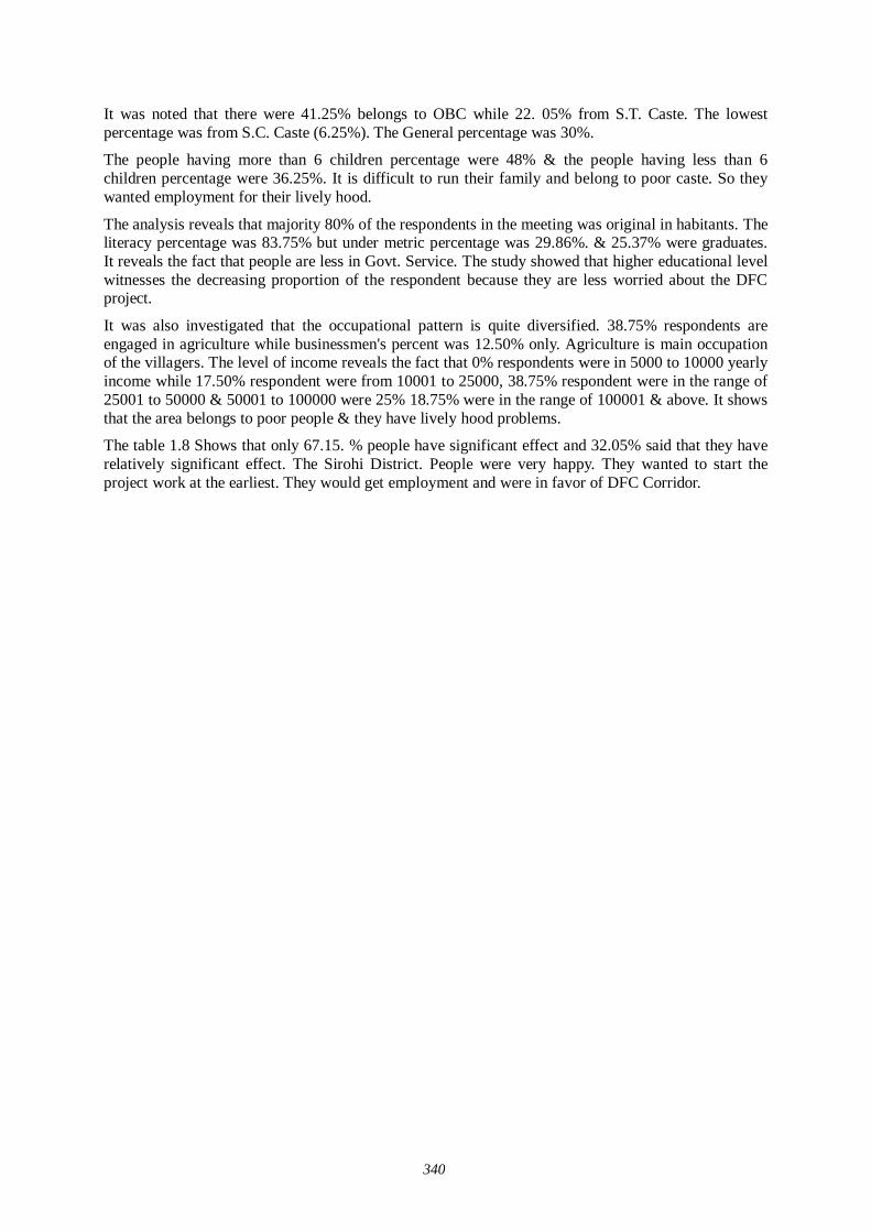
340
It was noted that there were 41.25% belongs to OBC while 22. 05% from S.T. Caste. The lowest percentage was from S.C. Caste (6.25%). The General percentage was 30%.
The people having more than 6 children percentage were 48% & the people having less than 6 children percentage were 36.25%. It is difficult to run their family and belong to poor caste. So they wanted employment for their lively hood.
The analysis reveals that majority 80% of the respondents in the meeting was original in habitants. The literacy percentage was 83.75% but under metric percentage was 29.86%. & 25.37% were graduates. It reveals the fact that people are less in Govt. Service. The study showed that higher educational level witnesses the decreasing proportion of the respondent because they are less worried about the DFC project.
It was also investigated that the occupational pattern is quite diversified. 38.75% respondents are engaged in agriculture while businessmen's percent was 12.50% only. Agriculture is main occupation of the villagers. The level of income reveals the fact that 0% respondents were in 5000 to 10000 yearly income while 17.50% respondent were from 10001 to 25000, 38.75% respondent were in the range of 25001 to 50000 & 50001 to 100000 were 25% 18.75% were in the range of 100001 & above. It shows that the area belongs to poor people & they have lively hood problems.
The table 1.8 Shows that only 67.15. % people have significant effect and 32.05% said that they have relatively significant effect. The Sirohi District. People were very happy. They wanted to start the project work at the earliest. They would get employment and were in favor of DFC Corridor.
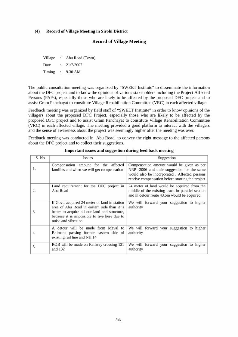
341
(4) Record of Village Meeting in Sirohi District
Record of Village Meeting
The public consultation meeting was organized by “SWEET Institute” to disseminate the information about the DFC project and to know the opinions of various stakeholders including the Project Affected Persons (PAPs), especially those who are likely to be affected by the proposed DFC project and to assist Gram Panchayat to constitute Village Rehabilitation Committee (VRC) in each affected village.
Feedback meeting was organized by field staff of “SWEET Institute” in order to know opinions of the villagers about the proposed DFC Project, especially those who are likely to be affected by the proposed DFC project and to assist Gram Panchayat to constitute Village Rehabilitation Committee (VRC) in each affected village. The meeting provided a good platform to interact with the villagers and the sense of awareness about the project was seemingly higher after the meeting was over.
Feedback meeting was conducted in Abu Road to convey the right message to the affected persons about the DFC project and to collect their suggestions.
Important issues and suggestion during feed back meeting S. No Issues Suggestion
1.
Compensation amount for the affected families and when we will get compensation
Compensation amount would be given as per NRP -2006 and their suggestion for the same would also be incorporated . Affected persons receive compensation before starting the project
2. Land requirement for the DFC project in Abu Road
24 meter of land would be acquired from the middle of the existing track in parallel section and in detour route 43.5m would be acquired.
3
If Govt. acquired 24 meter of land in station area of Abu Road in eastern side than it is better to acquire all our land and structure, because it is impossible to live here due to noise and vibration
We will forward your suggestion to higher authority
4 A detour will be made from Maval to Bhimana passing further eastern side of existing rail line and NH 14
We will forward your suggestion to higher authority
5 ROB will be made on Railway crossing 131 and 132
We will forward your suggestion to higher authority
Village : Abu Road (Town)
Date : 21/7/2007
Timing : 9.30 AM
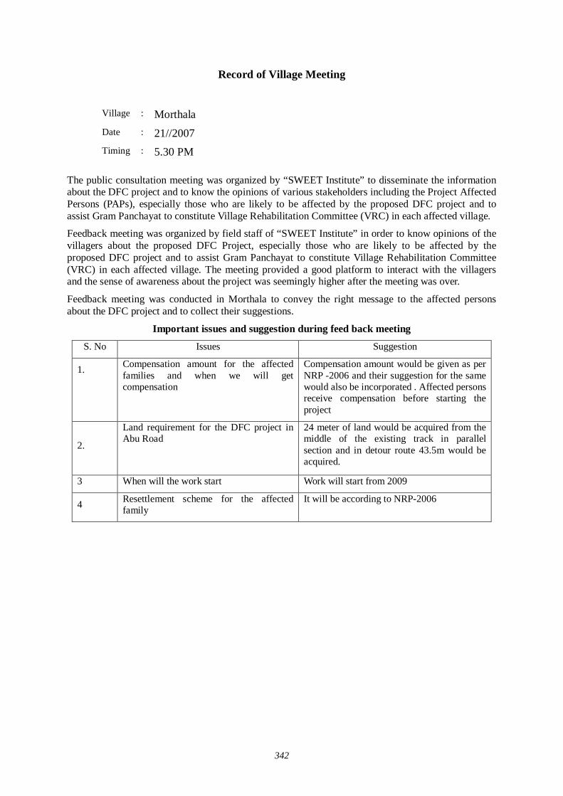
342
Record of Village Meeting
The public consultation meeting was organized by “SWEET Institute” to disseminate the information about the DFC project and to know the opinions of various stakeholders including the Project Affected Persons (PAPs), especially those who are likely to be affected by the proposed DFC project and to assist Gram Panchayat to constitute Village Rehabilitation Committee (VRC) in each affected village.
Feedback meeting was organized by field staff of “SWEET Institute” in order to know opinions of the villagers about the proposed DFC Project, especially those who are likely to be affected by the proposed DFC project and to assist Gram Panchayat to constitute Village Rehabilitation Committee (VRC) in each affected village. The meeting provided a good platform to interact with the villagers and the sense of awareness about the project was seemingly higher after the meeting was over.
Feedback meeting was conducted in Morthala to convey the right message to the affected persons about the DFC project and to collect their suggestions.
Important issues and suggestion during feed back meeting
S. No Issues Suggestion
1.
Compensation amount for the affected families and when we will get compensation
Compensation amount would be given as per NRP -2006 and their suggestion for the same would also be incorporated . Affected persons receive compensation before starting the project
2.
Land requirement for the DFC project in Abu Road
24 meter of land would be acquired from the middle of the existing track in parallel section and in detour route 43.5m would be acquired.
3 When will the work start Work will start from 2009
4 Resettlement scheme for the affected family
It will be according to NRP-2006
Village : Morthala
Date : 21//2007
Timing : 5.30 PM
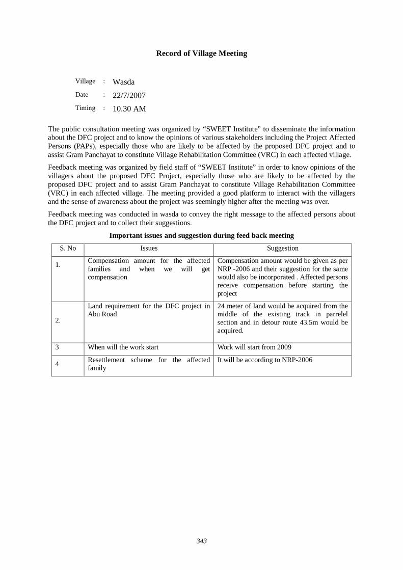
343
Record of Village Meeting
The public consultation meeting was organized by “SWEET Institute” to disseminate the information about the DFC project and to know the opinions of various stakeholders including the Project Affected Persons (PAPs), especially those who are likely to be affected by the proposed DFC project and to assist Gram Panchayat to constitute Village Rehabilitation Committee (VRC) in each affected village.
Feedback meeting was organized by field staff of “SWEET Institute” in order to know opinions of the villagers about the proposed DFC Project, especially those who are likely to be affected by the proposed DFC project and to assist Gram Panchayat to constitute Village Rehabilitation Committee (VRC) in each affected village. The meeting provided a good platform to interact with the villagers and the sense of awareness about the project was seemingly higher after the meeting was over.
Feedback meeting was conducted in wasda to convey the right message to the affected persons about the DFC project and to collect their suggestions.
Important issues and suggestion during feed back meeting
S. No Issues Suggestion
1.
Compensation amount for the affected families and when we will get compensation
Compensation amount would be given as per NRP -2006 and their suggestion for the same would also be incorporated . Affected persons receive compensation before starting the project
2.
Land requirement for the DFC project in Abu Road
24 meter of land would be acquired from the middle of the existing track in parrelel section and in detour route 43.5m would be acquired.
3 When will the work start Work will start from 2009
4 Resettlement scheme for the affected family
It will be according to NRP-2006
Village : Wasda
Date : 22/7/2007
Timing : 10.30 AM
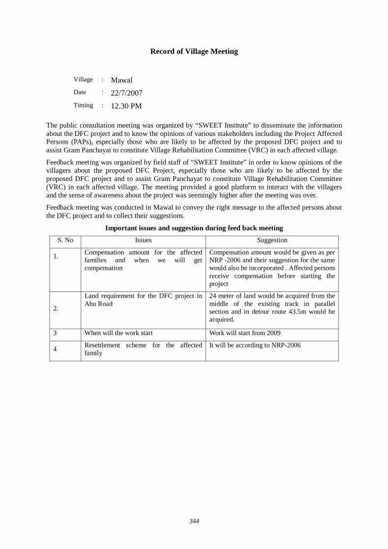
344
Record of Village Meeting
The public consultation meeting was organized by “SWEET Institute” to disseminate the information about the DFC project and to know the opinions of various stakeholders including the Project Affected Persons (PAPs), especially those who are likely to be affected by the proposed DFC project and to assist Gram Panchayat to constitute Village Rehabilitation Committee (VRC) in each affected village.
Feedback meeting was organized by field staff of “SWEET Institute” in order to know opinions of the villagers about the proposed DFC Project, especially those who are likely to be affected by the proposed DFC project and to assist Gram Panchayat to constitute Village Rehabilitation Committee (VRC) in each affected village. The meeting provided a good platform to interact with the villagers and the sense of awareness about the project was seemingly higher after the meeting was over.
Feedback meeting was conducted in Mawal to convey the right message to the affected persons about the DFC project and to collect their suggestions.
Important issues and suggestion during feed back meeting S. No Issues Suggestion
1.
Compensation amount for the affected families and when we will get compensation
Compensation amount would be given as per NRP -2006 and their suggestion for the same would also be incorporated . Affected persons receive compensation before starting the project
2.
Land requirement for the DFC project in Abu Road
24 meter of land would be acquired from the middle of the existing track in parallel section and in detour route 43.5m would be acquired.
3 When will the work start Work will start from 2009
4 Resettlement scheme for the affected family
It will be according to NRP-2006
Village : Mawal Date : 22/7/2007
Timing : 12.30 PM
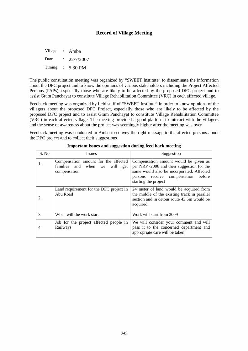
345
Record of Village Meeting
The public consultation meeting was organized by “SWEET Institute” to disseminate the information about the DFC project and to know the opinions of various stakeholders including the Project Affected Persons (PAPs), especially those who are likely to be affected by the proposed DFC project and to assist Gram Panchayat to constitute Village Rehabilitation Committee (VRC) in each affected village.
Feedback meeting was organized by field staff of “SWEET Institute” in order to know opinions of the villagers about the proposed DFC Project, especially those who are likely to be affected by the proposed DFC project and to assist Gram Panchayat to constitute Village Rehabilitation Committee (VRC) in each affected village. The meeting provided a good platform to interact with the villagers and the sense of awareness about the project was seemingly higher after the meeting was over.
Feedback meeting was conducted in Amba to convey the right message to the affected persons about the DFC project and to collect their suggestions
Important issues and suggestion during feed back meeting S. No Issues Suggestion
1.
Compensation amount for the affected families and when we will get compensation
Compensation amount would be given as per NRP -2006 and their suggestion for the same would also be incorporated. Affected persons receive compensation before starting the project
2.
Land requirement for the DFC project in Abu Road
24 meter of land would be acquired from the middle of the existing track in parallel section and in detour route 43.5m would be acquired.
3 When will the work start Work will start from 2009
4 Job for the project affected people in Railways
We will consider your comment and will pass it to the concerned department and appropriate care will be taken
Village : Amba
Date : 22/7/2007
Timing : 5.30 PM
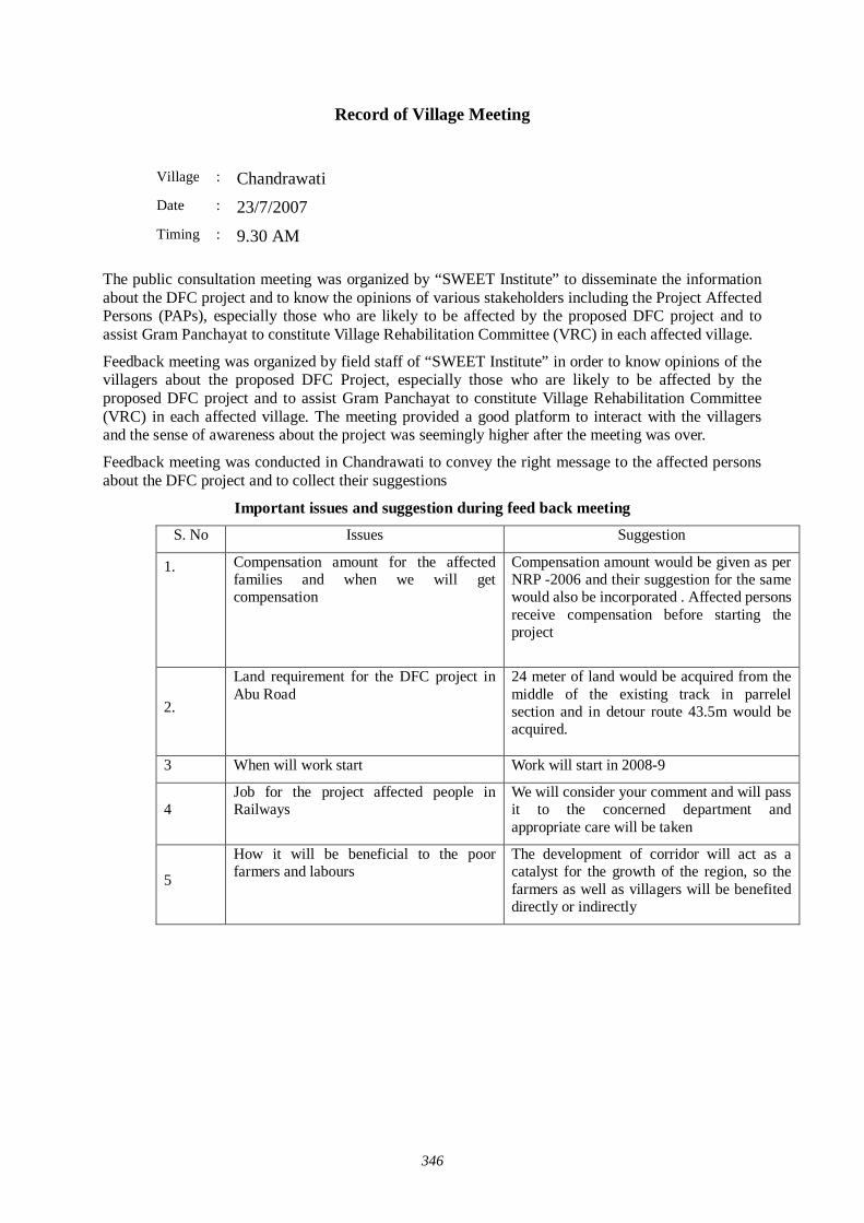
346
Record of Village Meeting
The public consultation meeting was organized by “SWEET Institute” to disseminate the information about the DFC project and to know the opinions of various stakeholders including the Project Affected Persons (PAPs), especially those who are likely to be affected by the proposed DFC project and to assist Gram Panchayat to constitute Village Rehabilitation Committee (VRC) in each affected village.
Feedback meeting was organized by field staff of “SWEET Institute” in order to know opinions of the villagers about the proposed DFC Project, especially those who are likely to be affected by the proposed DFC project and to assist Gram Panchayat to constitute Village Rehabilitation Committee (VRC) in each affected village. The meeting provided a good platform to interact with the villagers and the sense of awareness about the project was seemingly higher after the meeting was over.
Feedback meeting was conducted in Chandrawati to convey the right message to the affected persons about the DFC project and to collect their suggestions
Important issues and suggestion during feed back meeting S. No Issues Suggestion
1.
Compensation amount for the affected families and when we will get compensation
Compensation amount would be given as per NRP -2006 and their suggestion for the same would also be incorporated . Affected persons receive compensation before starting the project
2.
Land requirement for the DFC project in Abu Road
24 meter of land would be acquired from the middle of the existing track in parrelel section and in detour route 43.5m would be acquired.
3 When will work start Work will start in 2008-9
4 Job for the project affected people in Railways
We will consider your comment and will pass it to the concerned department and appropriate care will be taken
5
How it will be beneficial to the poor farmers and labours
The development of corridor will act as a catalyst for the growth of the region, so the farmers as well as villagers will be benefited directly or indirectly
Village : Chandrawati Date : 23/7/2007
Timing : 9.30 AM

347
Record of Village Meeting
The public consultation meeting was organized by “SWEET Institute” to disseminate the information about the DFC project and to know the opinions of various stakeholders including the Project Affected Persons (PAPs), especially those who are likely to be affected by the proposed DFC project and to assist Gram Panchayat to constitute Village Rehabilitation Committee (VRC) in each affected village.
Feedback meeting was organized by field staff of “SWEET Institute” in order to know opinions of the villagers about the proposed DFC Project, especially those who are likely to be affected by the proposed DFC project and to assist Gram Panchayat to constitute Village Rehabilitation Committee (VRC) in each affected village. The meeting provided a good platform to interact with the villagers and the sense of awareness about the project was seemingly higher after the meeting was over.
Feedback meeting was conducted in Kui to convey the right message to the affected persons about the DFC project and to collect their suggestions
Important issues and suggestion during feed back meeting
S. No Issues Suggestion
1.
Compensation amount for the affected families and when we will get compensation
Compensation amount would be given as per NRP -2006 and their suggestion for the same would also be incorporated . Affected persons receive compensation before starting the project
2.
Land requirement for the DFC project in Abu Road
24 meter of land would be acquired from the middle of the existing track in parrelel section and in detour route 43.5m would be acquired.
3 When will the work start Work will start from 2009
4 Resettlement scheme for the affected family
It will be according to NRP-2006
5 Safety measures for noise and vibration
Noise and vibration study is going on and after the predicted study suitable measure will be taken.
Village : Kui
Date : 23/7/2007
Timing : 11.30 AM
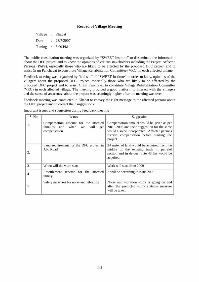
348
Record of Village Meeting
The public consultation meeting was organized by “SWEET Institute” to disseminate the information about the DFC project and to know the opinions of various stakeholders including the Project Affected Persons (PAPs), especially those who are likely to be affected by the proposed DFC project and to assist Gram Panchayat to constitute Village Rehabilitation Committee (VRC) in each affected village.
Feedback meeting was organized by field staff of “SWEET Institute” in order to know opinions of the villagers about the proposed DFC Project, especially those who are likely to be affected by the proposed DFC project and to assist Gram Panchayat to constitute Village Rehabilitation Committee (VRC) in each affected village. The meeting provided a good platform to interact with the villagers and the sense of awareness about the project was seemingly higher after the meeting was over.
Feedback meeting was conducted in Khadat to convey the right message to the affected persons about the DFC project and to collect their suggestions
Important issues and suggestion during feed back meeting
S. No Issues Suggestion
1.
Compensation amount for the affected families and when we will get compensation
Compensation amount would be given as per NRP -2006 and their suggestion for the same would also be incorporated . Affected persons receive compensation before starting the project
2.
Land requirement for the DFC project in Abu Road
24 meter of land would be acquired from the middle of the existing track in parrelel section and in detour route 43.5m would be acquired.
3 When will the work start Work will start from 2009
4 Resettlement scheme for the affected family
It will be according to NRP-2006
5 Safety measures for noise and vibration
Noise and vibration study is going on and after the predicted study suitable measure will be taken.
Village : Khadat
Date : 23/7/2007
Timing : 5.00 PM

349
Record of Village Meeting
The public consultation meeting was organized by “SWEET Institute” to disseminate the information about the DFC project and to know the opinions of various stakeholders including the Project Affected Persons (PAPs), especially those who are likely to be affected by the proposed DFC project and to assist Gram Panchayat to constitute Village Rehabilitation Committee (VRC) in each affected village.
Feedback meeting was organized by field staff of “SWEET Institute” in order to know opinions of the villagers about the proposed DFC Project, especially those who are likely to be affected by the proposed DFC project and to assist Gram Panchayat to constitute Village Rehabilitation Committee (VRC) in each affected village. The meeting provided a good platform to interact with the villagers and the sense of awareness about the project was seemingly higher after the meeting was over.
Feedback meeting was conducted in Santpur to convey the right message to the affected persons about the DFC project and to collect their suggestions
Important issues and suggestion during feed back meeting
S. No Issues Suggestion
1.
Compensation amount for the affected families and when we will get compensation
Compensation amount would be given as per NRP -2006 and their suggestion for the same would also be incorporated . Affected persons receive compensation before starting the project
2.
Land requirement for the DFC project in Abu Road
24 meter of land would be acquired from the middle of the existing track in parallel section and in detour route 43.5m would be acquired.
3 When will the work start Work will start from 2009
4 Resettlement scheme for the affected family
It will be according to NRP-2006
5 Safety measures for noise and vibration
Noise and vibration study is going on and after the predicted study suitable measure will be taken.
Village : Santpur
Date : 23/7/2007
Timing : 6.30 PM
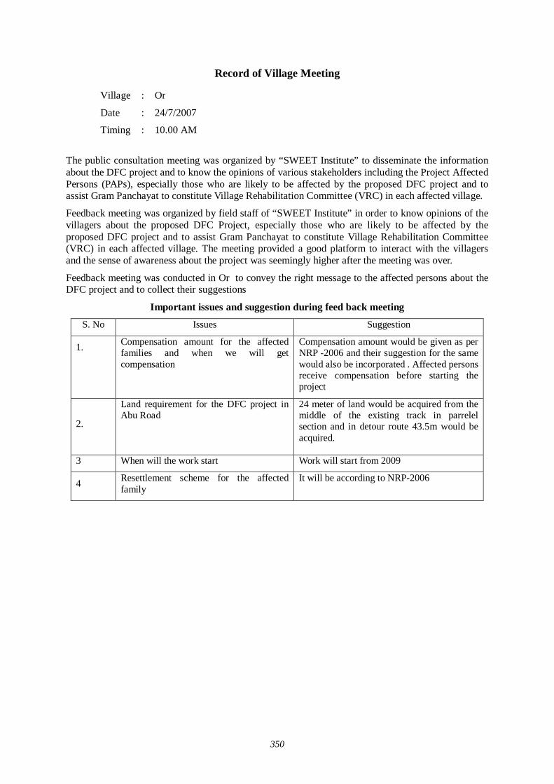
350
Record of Village Meeting
The public consultation meeting was organized by “SWEET Institute” to disseminate the information about the DFC project and to know the opinions of various stakeholders including the Project Affected Persons (PAPs), especially those who are likely to be affected by the proposed DFC project and to assist Gram Panchayat to constitute Village Rehabilitation Committee (VRC) in each affected village.
Feedback meeting was organized by field staff of “SWEET Institute” in order to know opinions of the villagers about the proposed DFC Project, especially those who are likely to be affected by the proposed DFC project and to assist Gram Panchayat to constitute Village Rehabilitation Committee (VRC) in each affected village. The meeting provided a good platform to interact with the villagers and the sense of awareness about the project was seemingly higher after the meeting was over.
Feedback meeting was conducted in Or to convey the right message to the affected persons about the DFC project and to collect their suggestions
Important issues and suggestion during feed back meeting
S. No Issues Suggestion
1.
Compensation amount for the affected families and when we will get compensation
Compensation amount would be given as per NRP -2006 and their suggestion for the same would also be incorporated . Affected persons receive compensation before starting the project
2.
Land requirement for the DFC project in Abu Road
24 meter of land would be acquired from the middle of the existing track in parrelel section and in detour route 43.5m would be acquired.
3 When will the work start Work will start from 2009
4 Resettlement scheme for the affected family
It will be according to NRP-2006
Village : Or
Date : 24/7/2007
Timing : 10.00 AM
351
Record of Village Meeting
The public consultation meeting was organized by “SWEET Institute” to disseminate the information about the DFC project and to know the opinions of various stakeholders including the Project Affected Persons (PAPs), especially those who are likely to be affected by the proposed DFC project and to assist Gram Panchayat to constitute Village Rehabilitation Committee (VRC) in each affected village.
Feedback meeting was organized by field staff of “SWEET Institute” in order to know opinions of the villagers about the proposed DFC Project, especially those who are likely to be affected by the proposed DFC project and to assist Gram Panchayat to constitute Village Rehabilitation Committee (VRC) in each affected village. The meeting provided a good platform to interact with the villagers and the sense of awareness about the project was seemingly higher after the meeting was over.
Feedback meeting was conducted in Derna to convey the right message to the affected persons about the DFC project and to collect their suggestions
Important issues and suggestion during feed back meeting
S. No Issues Suggestion
1.
Compensation amount for the affected families and when we will get compensation
Compensation amount would be given as per NRP -2006 and their suggestion for the same would also be incorporated . Affected persons receive compensation before starting the project
2.
Land requirement for the DFC project in Abu Road
24 meter of land would be acquired from the middle of the existing track in parrelel section and in detour route 43.5m would be acquired.
3 When will the work start Work will start from 2009
4 Resettlement scheme for the affected family
It will be according to NRP-2006
5 Job for the project affected people in Railways
We will consider your comment and will pass it to the concerned department and appropriate care will be taken
Village : Derna
Date : 24/7/2007
Timing : 11.00 AM

352
Record of Village Meeting
The public consultation meeting was organized by “SWEET Institute” to disseminate the information about the DFC project and to know the opinions of various stakeholders including the Project Affected Persons (PAPs), especially those who are likely to be affected by the proposed DFC project and to assist Gram Panchayat to constitute Village Rehabilitation Committee (VRC) in each affected village.
Feedback meeting was organized by field staff of “SWEET Institute” in order to know opinions of the villagers about the proposed DFC Project, especially those who are likely to be affected by the proposed DFC project and to assist Gram Panchayat to constitute Village Rehabilitation Committee (VRC) in each affected village. The meeting provided a good platform to interact with the villagers and the sense of awareness about the project was seemingly higher after the meeting was over.
Feedback meeting was conducted in Toonka to convey the right message to the affected persons about the DFC project and to collect their suggestions
Important issues and suggestion during feed back meeting
S. No Issues Suggestion
1.
Compensation amount for the affected families and when we will get compensation
Compensation amount would be given as per NRP -2006 and their suggestion for the same would also be incorporated. Affected persons receive compensation before starting the project
2.
Land requirement for the DFC project in Abu Road
24 meter of land would be acquired from the middle of the existing track in parallel section and in detour route 43.5 m would be acquired.
3 When will the work start Work will start from 2009
4 Resettlement scheme for the affected family
It will be according to NRP-2006
Village : Toonka
Date : 24/7/2007
Timing : 4.00 PM
353
Record of Village Meeting
The public consultation meeting was organized by “SWEET Institute” to disseminate the information about the DFC project and to know the opinions of various stakeholders including the Project Affected Persons (PAPs), especially those who are likely to be affected by the proposed DFC project and to assist Gram Panchayat to constitute Village Rehabilitation Committee (VRC) in each affected village.
Feedback meeting was organized by field staff of “SWEET Institute” in order to know opinions of the villagers about the proposed DFC Project, especially those who are likely to be affected by the proposed DFC project and to assist Gram Panchayat to constitute Village Rehabilitation Committee (VRC) in each affected village. The meeting provided a good platform to interact with the villagers and the sense of awareness about the project was seemingly higher after the meeting was over.
Feedback meeting was conducted in Kiverli to convey the right message to the affected persons about the DFC project and to collect their suggestions
Important issues and suggestion during feed back meeting
S. No Issues Suggestion
1.
Compensation amount for the affected families and when we will get compensation
Compensation amount would be given as per NRP -2006 and their suggestion for the same would also be incorporated. Affected persons receive compensation before starting the project
2.
Land requirement for the DFC project in Abu Road
24 meter of land would be acquired from the middle of the existing track in parallel section and in detour route 43.5m would be acquired.
3 When will the work start Work will start from 2009
4 Resettlement scheme for the affected family
It will be according to NRP-2006
5 Safety measures for noise and vibration
Noise and vibration study is going on and after the predicted study suitable measure will be taken.
Village : Kiverli
Date : 24/7/2007
Timing : 6.00 PM

354
Record of Village Meeting
The public consultation meeting was organized by “SWEET Institute” to disseminate the information about the DFC project and to know the opinions of various stakeholders including the Project Affected Persons (PAPs), especially those who are likely to be affected by the proposed DFC project and to assist Gram Panchayat to constitute Village Rehabilitation Committee (VRC) in each affected village.
Feedback meeting was organized by field staff of “SWEET Institute” in order to know opinions of the villagers about the proposed DFC Project, especially those who are likely to be affected by the proposed DFC project and to assist Gram Panchayat to constitute Village Rehabilitation Committee (VRC) in each affected village. The meeting provided a good platform to interact with the villagers and the sense of awareness about the project was seemingly higher after the meeting was over.
Feedback meeting was conducted in Wara to convey the right message to the affected persons about the DFC project and to collect their suggestions
Important issues and suggestion during feed back meeting
S. No Issues Suggestion
1.
Compensation amount for the affected families and when we will get compensation
Compensation amount would be given as per NRP -2006 and their suggestion for the same would also be incorporated . Affected persons receive compensation before starting the project
2.
Land requirement for the DFC project in Abu Road
24 meter of land would be acquired from the middle of the existing track in parrelel section and in detour route 43.5m would be acquired.
3 When will the work start Work will start from 2009
4 Resettlement scheme for the affected family
It will be according to NRP-2006
Village : Wara
Date : 24/7/2007
Timing : 10.00 AM

355
Record of Village Meeting
The public consultation meeting was organized by “SWEET Institute” to disseminate the information about the DFC project and to know the opinions of various stakeholders including the Project Affected Persons (PAPs), especially those who are likely to be affected by the proposed DFC project and to assist Gram Panchayat to constitute Village Rehabilitation Committee (VRC) in each affected village.
Feedback meeting was organized by field staff of “SWEET Institute” in order to know opinions of the villagers about the proposed DFC Project, especially those who are likely to be affected by the proposed DFC project and to assist Gram Panchayat to constitute Village Rehabilitation Committee (VRC) in each affected village. The meeting provided a good platform to interact with the villagers and the sense of awareness about the project was seemingly higher after the meeting was over.
Feedback meeting was conducted in Bharia to convey the right message to the affected persons about the DFC project and to collect their suggestions
Important issues and suggestion during feed back meeting
S. No Issues Suggestion
1.
Compensation amount for the affected families and when we will get compensation
Compensation amount would be given as per NRP -2006 and their suggestion for the same would also be incorporated . Affected persons receive compensation before starting the project
2.
Land requirement for the DFC project in Abu Road
24 meter of land would be acquired from the middle of the existing track in parrelel section and in detour route 43.5m would be acquired.
3 When will the work start Work will start from 2009
4 Resettlement scheme for the affected family
It will be according to NRP-2006
5 Job for the project affected people in Railways
We will consider your comment and will pass it to the concerned department and appropriate care will be taken
Village : Bharia
Date : 24/7/2007
Timing : 11.30 AM
356
Record of Village Meeting
The public consultation meeting was organized by “SWEET Institute” to disseminate the information about the DFC project and to know the opinions of various stakeholders including the Project Affected Persons (PAPs), especially those who are likely to be affected by the proposed DFC project and to assist Gram Panchayat to constitute Village Rehabilitation Committee (VRC) in each affected village.
Feedback meeting was organized by field staff of “SWEET Institute” in order to know opinions of the villagers about the proposed DFC Project, especially those who are likely to be affected by the proposed DFC project and to assist Gram Panchayat to constitute Village Rehabilitation Committee (VRC) in each affected village. The meeting provided a good platform to interact with the villagers and the sense of awareness about the project was seemingly higher after the meeting was over.
Feedback meeting was conducted in Bhimana to convey the right message to the affected persons about the DFC project and to collect their suggestions
Important issues and suggestion during feed back meeting
S. No Issues Suggestion
1.
Compensation amount for the affected families and when we will get compensation
Compensation amount would be given as per NRP -2006 and their suggestion for the same would also be incorporated . Affected persons receive compensation before starting the project
2.
Land requirement for the DFC project in Abu Road
24 meter of land would be acquired from the middle of the existing track in parrelel section and in detour route 43.5m would be acquired.
3 When will the work start Work will start from 2009
4 Resettlement scheme for the affected family
It will be according to NRP-2006
5 Job for the project affected people in Railways
We will consider your comment and will pass it to the concerned department and appropriate care will be taken
Village : Bhimana
Date : 24/7/2007
Timing : 4.30 PM

357
Record of Village Meeting
The public consultation meeting was organized by “SWEET Institute” to disseminate the information about the DFC project and to know the opinions of various stakeholders including the Project Affected Persons (PAPs), especially those who are likely to be affected by the proposed DFC project and to assist Gram Panchayat to constitute Village Rehabilitation Committee (VRC) in each affected village.
Feedback meeting was organized by field staff of “SWEET Institute” in order to know opinions of the villagers about the proposed DFC Project, especially those who are likely to be affected by the proposed DFC project and to assist Gram Panchayat to constitute Village Rehabilitation Committee (VRC) in each affected village. The meeting provided a good platform to interact with the villagers and the sense of awareness about the project was seemingly higher after the meeting was over.
Feedback meeting was conducted in Udvariya to convey the right message to the affected persons about the DFC project and to collect their suggestions
Important issues and suggestion during feed back meeting
S. No Issues Suggestion
1.
Compensation amount for the affected families and when we will get compensation
Compensation amount would be given as per NRP -2006 and their suggestion for the same would also be incorporated . Affected persons receive compensation before starting the project
2.
Land requirement for the DFC project in Abu Road
24 meter of land would be acquired from the middle of the existing track in parrelel section and in detour route 43.5m would be acquired.
3 When will the work start Work will start from 2009
4 Resettlement scheme for the affected family
It will be according to NRP-2006
Village : Udvariya
Date : 24/7/2007
Timing : 5.30 PM
358
Record of Village Meeting
The public consultation meeting was organized by “SWEET Institute” to disseminate the information about the DFC project and to know the opinions of various stakeholders including the Project Affected Persons (PAPs), especially those who are likely to be affected by the proposed DFC project and to assist Gram Panchayat to constitute Village Rehabilitation Committee (VRC) in each affected village.
Feedback meeting was organized by field staff of “SWEET Institute” in order to know opinions of the villagers about the proposed DFC Project, especially those who are likely to be affected by the proposed DFC project and to assist Gram Panchayat to constitute Village Rehabilitation Committee (VRC) in each affected village. The meeting provided a good platform to interact with the villagers and the sense of awareness about the project was seemingly higher after the meeting was over.
Feedback meeting was conducted in Vatera to convey the right message to the affected persons about the DFC project and to collect their suggestions
Important issues and suggestion during feed back meeting
S. No Issues Suggestion
1.
Compensation amount for the affected families and when we will get compensation
Compensation amount would be given as per NRP -2006 and their suggestion for the same would also be incorporated . Affected persons receive compensation before starting the project
2.
Land requirement for the DFC project in Abu Road
24 meter of land would be acquired from the middle of the existing track in parrelel section and in detour route 43.5m would be acquired.
3 When will the work start Work will start from 2009
4 Resettlement scheme for the affected family
It will be according to NRP-2006
5 Safety measures for noise and vibration
Noise and vibration study is going on and after the predicted study suitable measure will be taken.
Village : Vatera
Date : 25/7/2007
Timing : 10.00 AM

359
Record of Village Meeting
The public consultation meeting was organized by “SWEET Institute” to disseminate the information about the DFC project and to know the opinions of various stakeholders including the Project Affected Persons (PAPs), especially those who are likely to be affected by the proposed DFC project and to assist Gram Panchayat to constitute Village Rehabilitation Committee (VRC) in each affected village.
Feedback meeting was organized by field staff of “SWEET Institute” in order to know opinions of the villagers about the proposed DFC Project, especially those who are likely to be affected by the proposed DFC project and to assist Gram Panchayat to constitute Village Rehabilitation Committee (VRC) in each affected village. The meeting provided a good platform to interact with the villagers and the sense of awareness about the project was seemingly higher after the meeting was over.
Feedback meeting was conducted in Bharvi to convey the right message to the affected persons about the DFC project and to collect their suggestions
Important issues and suggestion during feed back meeting
S. No Issues Suggestion
1.
Compensation amount for the affected families and when we will get compensation
Compensation amount would be given as per NRP -2006 and their suggestion for the same would also be incorporated . Affected persons receive compensation before starting the project
2.
Land requirement for the DFC project in Abu Road
24 meter of land would be acquired from the middle of the existing track in parallel section and in detour route 43.5 m would be acquired.
3 When will the work start Work will start from 2009
4 Resettlement scheme for the affected family
It will be according to NRP-2006
Village : Bharvi
Date : 25/7/2007
Timing : 2.30 PM

360
Record of Village Meeting
The public consultation meeting was organized by “SWEET Institute” to disseminate the information about the DFC project and to know the opinions of various stakeholders including the Project Affected Persons (PAPs), especially those who are likely to be affected by the proposed DFC project and to assist Gram Panchayat to constitute Village Rehabilitation Committee (VRC) in each affected village.
Feedback meeting was organized by field staff of “SWEET Institute” in order to know opinions of the villagers about the proposed DFC Project, especially those who are likely to be affected by the proposed DFC project and to assist Gram Panchayat to constitute Village Rehabilitation Committee (VRC) in each affected village. The meeting provided a good platform to interact with the villagers and the sense of awareness about the project was seemingly higher after the meeting was over.
Feedback meeting was conducted in Kodaria to convey the right message to the affected persons about the DFC project and to collect their suggestions
Important issues and suggestion during feed back meeting
S. No Issues Suggestion
1.
Compensation amount for the affected families and when we will get compensation
Compensation amount would be given as per NRP -2006 and their suggestion for the same would also be incorporated . Affected persons receive compensation before starting the project
2.
Land requirement for the DFC project in Abu Road
24 meter of land would be acquired from the middle of the existing track in parrelel section and in detour route 43.5m would be acquired.
3 When will the work start Work will start from 2009
4 Resettlement scheme for the affected family
It will be according to NRP-2006
Village : Kodaria
Date : 25/7/2007
Timing : 4.00 PM

361
Record of Village Meeting
The public consultation meeting was organized by “SWEET Institute” to disseminate the information about the DFC project and to know the opinions of various stakeholders including the Project Affected Persons (PAPs), especially those who are likely to be affected by the proposed DFC project and to assist Gram Panchayat to constitute Village Rehabilitation Committee (VRC) in each affected village.
Feedback meeting was organized by field staff of “SWEET Institute” in order to know opinions of the villagers about the proposed DFC Project, especially those who are likely to be affected by the proposed DFC project and to assist Gram Panchayat to constitute Village Rehabilitation Committee (VRC) in each affected village. The meeting provided a good platform to interact with the villagers and the sense of awareness about the project was seemingly higher after the meeting was over.
Feedback meeting was conducted in Peshia to convey the right message to the affected persons about the DFC project and to collect their suggestions
Important issues and suggestion during feed back meeting
S. No Issues Suggestion
1.
Compensation amount for the affected families and when we will get compensation
Compensation amount would be given as per NRP -2006 and their suggestion for the same would also be incorporated . Affected persons receive compensation before starting the project
2.
Land requirement for the DFC project in Abu Road
24 meter of land would be acquired from the middle of the existing track in parrelel section and in detour route 43.5m would be acquired.
3 When will the work start Work will start from 2009
4 Resettlement scheme for the affected family
It will be according to NRP-2006
Village : Peshua
Date : 25/7/2007
Timing : 5.30 PM

362
Record of Village Meeting
The public consultation meeting was organized by “SWEET Institute” to disseminate the information about the DFC project and to know the opinions of various stakeholders including the Project Affected Persons (PAPs), especially those who are likely to be affected by the proposed DFC project and to assist Gram Panchayat to constitute Village Rehabilitation Committee (VRC) in each affected village.
Feedback meeting was organized by field staff of “SWEET Institute” in order to know opinions of the villagers about the proposed DFC Project, especially those who are likely to be affected by the proposed DFC project and to assist Gram Panchayat to constitute Village Rehabilitation Committee (VRC) in each affected village. The meeting provided a good platform to interact with the villagers and the sense of awareness about the project was seemingly higher after the meeting was over.
Feedback meeting was conducted in Banas to convey the right message to the affected persons about the DFC project and to collect their suggestions
Important issues and suggestion during feed back meeting
S. No Issues Suggestion
1.
Compensation amount for the affected families and when we will get compensation
Compensation amount would be given as per NRP -2006 and their suggestion for the same would also be incorporated Affected persons receive compensation before starting the project
2.
Land requirement for the DFC project in Abu Road
24 meter of land would be acquired from the middle of the existing track in parallel section and in detour route 43.5 m would be acquired.
3 When will the work start Work will start from 2009
4 Resettlement scheme for the affected family
It will be according to NRP-2006
5 Safety measures for noise and vibration
Noise and vibration study is going on and after the predicted study suitable measure will be taken.
Village : Banas
Date : 26/7/2007
Timing : 9.00 AM
363
Record of Village Meeting
The public consultation meeting was organized by “SWEET Institute” to disseminate the information about the DFC project and to know the opinions of various stakeholders including the Project Affected Persons (PAPs), especially those who are likely to be affected by the proposed DFC project and to assist Gram Panchayat to constitute Village Rehabilitation Committee (VRC) in each affected village.
Feedback meeting was organized by field staff of “SWEET Institute” in order to know opinions of the villagers about the proposed DFC Project, especially those who are likely to be affected by the proposed DFC project and to assist Gram Panchayat to constitute Village Rehabilitation Committee (VRC) in each affected village. The meeting provided a good platform to interact with the villagers and the sense of awareness about the project was seemingly higher after the meeting was over.
Feedback meeting was conducted in Adarsh Doongri to convey the right message to the affected persons about the DFC project and to collect their suggestions
Important issues and suggestion during feed back meeting
S. No Issues Suggestion
1.
Compensation amount for the affected families and when we will get compensation
Compensation amount would be given as per NRP -2006 and their suggestion for the same would also be incorporated . Affected persons receive compensation before starting the project
2.
Land requirement for the DFC project in Abu Road
24 meter of land would be acquired from the middle of the existing track in parallel section and in detour route 43.5 m would be acquired.
3 When will the work start Work will start from 2009
4 Resettlement scheme for the affected family
It will be according to NRP-2006
Village : Adarsh doorigri
Date : 26/7/2007
Timing : 10.30 AM

364
Record of Village Meeting
The public consultation meeting was organized by “SWEET Institute” to disseminate the information about the DFC project and to know the opinions of various stakeholders including the Project Affected Persons (PAPs), especially those who are likely to be affected by the proposed DFC project and to assist Gram Panchayat to constitute Village Rehabilitation Committee (VRC) in each affected village.
Feedback meeting was organized by field staff of “SWEET Institute” in order to know opinions of the villagers about the proposed DFC Project, especially those who are likely to be affected by the proposed DFC project and to assist Gram Panchayat to constitute Village Rehabilitation Committee (VRC) in each affected village. The meeting provided a good platform to interact with the villagers and the sense of awareness about the project was seemingly higher after the meeting was over.
Feedback meeting was conducted in Godhuivawa to convey the right message to the affected persons about the DFC project and to collect their suggestions
Important issues and suggestion during feed back meeting
S. No Issues Suggestion
1.
Compensation amount for the affected families and when we will get compensation
Compensation amount would be given as per NRP -2006 and their suggestion for the same would also be incorporated . Affected persons receive compensation before starting the project
2.
Land requirement for the DFC project in Abu Road
24 meter of land would be acquired from the middle of the existing track in parrelel section and in detour route 43.5m would be acquired.
3 When will the work start Work will start from 2009
4 Resettlement scheme for the affected family
It will be according to NRP-2006
Village : Godhuivawa
Date : 26/7/2007
Timing : 11.30 PM
365
Record of Village Meeting
The public consultation meeting was organized by “SWEET Institute” to disseminate the information about the DFC project and to know the opinions of various stakeholders including the Project Affected Persons (PAPs), especially those who are likely to be affected by the proposed DFC project and to assist Gram Panchayat to constitute Village Rehabilitation Committee (VRC) in each affected village.
Feedback meeting was organized by field staff of “SWEET Institute” in order to know opinions of the villagers about the proposed DFC Project, especially those who are likely to be affected by the proposed DFC project and to assist Gram Panchayat to constitute Village Rehabilitation Committee (VRC) in each affected village. The meeting provided a good platform to interact with the villagers and the sense of awareness about the project was seemingly higher after the meeting was over.
Feedback meeting was conducted in Reechri to convey the right message to the affected persons about the DFC project and to collect their suggestions
Important issues and suggestion during feed back meeting
S. No Issues Suggestion
1.
Compensation amount for the affected families and when we will get compensation
Compensation amount would be given as per NRP -2006 and their suggestion for the same would also be incorporated . Affected persons receive compensation before starting the project
2.
Land requirement for the DFC project in Abu Road
24 meter of land would be acquired from the middle of the existing track in parallel section and in detour route 43.5 m would be acquired.
3 When will the work start Work will start from 2009
4 Resettlement scheme for the affected family
It will be according to NRP-2006
Village : Reechhri
Date : 26/7/2007
Timing : 3.30 PM

366
Record of Village Meeting
The public consultation meeting was organized by “SWEET Institute” to disseminate the information about the DFC project and to know the opinions of various stakeholders including the Project Affected Persons (PAPs), especially those who are likely to be affected by the proposed DFC project and to assist Gram Panchayat to constitute Village Rehabilitation Committee (VRC) in each affected village.
Feedback meeting was organized by field staff of “SWEET Institute” in order to know opinions of the villagers about the proposed DFC Project, especially those who are likely to be affected by the proposed DFC project and to assist Gram Panchayat to constitute Village Rehabilitation Committee (VRC) in each affected village. The meeting provided a good platform to interact with the villagers and the sense of awareness about the project was seemingly higher after the meeting was over.
Feedback meeting was conducted in Charawli to convey the right message to the affected persons about the DFC project and to collect their suggestions
Important issues and suggestion during feed back meeting
S. No Issues Suggestion
1.
Compensation amount for the affected families and when we will get compensation
Compensation amount would be given as per NRP -2006 and their suggestion for the same would also be incorporated . Affected persons receive compensation before starting the project
2.
Land requirement for the DFC project in Abu Road
24 meter of land would be acquired from the middle of the existing track in parrelel section and in detour route 43.5m would be acquired.
3 When will the work start Work will start from 2009
4 Resettlement scheme for the affected family
It will be according to NRP-2006
Village : Charwali
Date : 26/7/2007
Timing : 5.00 PM
367
Record of Village Meeting
The public consultation meeting was organized by “SWEET Institute” to disseminate the information about the DFC project and to know the opinions of various stakeholders including the Project Affected Persons (PAPs), especially those who are likely to be affected by the proposed DFC project and to assist Gram Panchayat to constitute Village Rehabilitation Committee (VRC) in each affected village.
Feedback meeting was organized by field staff of “SWEET Institute” in order to know opinions of the villagers about the proposed DFC Project, especially those who are likely to be affected by the proposed DFC project and to assist Gram Panchayat to constitute Village Rehabilitation Committee (VRC) in each affected village. The meeting provided a good platform to interact with the villagers and the sense of awareness about the project was seemingly higher after the meeting was over.
Feedback meeting was conducted in Ajari to convey the right message to the affected persons about the DFC project and to collect their suggestions
Important issues and suggestion during feed back meeting
S. No Issues Suggestion
1.
Compensation amount for the affected families and when we will get compensation
Compensation amount would be given as per NRP -2006 and their suggestion for the same would also be incorporated . Affected persons receive compensation before starting the project
2.
Land requirement for the DFC project in Abu Road
24 meter of land would be acquired from the middle of the existing track in parallel section and in detour route 43.5 m would be acquired.
3
If Govt. acquired 24 meter of land in station area of Abu Road in eastern side than it is better to acquire all our land and structure, because it is impossible to live here due to noise and vibration
We will forward your suggestion to higher authority
4 A detour will be made from Maval to Bhimana passing further eastern side of existing rail line and NH 14
We will forward your suggestion to higher authority
5 ROB will be made on Railway crossing 131 and 132
We will forward your suggestion to higher authority
Village : Ajari
Date : 26/7/2007
Timing : 6.30 PM

368
Record of Village Meeting
The public consultation meeting was organized by “SWEET Institute” to disseminate the information about the DFC project and to know the opinions of various stakeholders including the Project Affected Persons (PAPs), especially those who are likely to be affected by the proposed DFC project and to assist Gram Panchayat to constitute Village Rehabilitation Committee (VRC) in each affected village.
Feedback meeting was organized by field staff of “SWEET Institute” in order to know opinions of the villagers about the proposed DFC Project, especially those who are likely to be affected by the proposed DFC project and to assist Gram Panchayat to constitute Village Rehabilitation Committee (VRC) in each affected village. The meeting provided a good platform to interact with the villagers and the sense of awareness about the project was seemingly higher after the meeting was over.
Feedback meeting was conducted in Pindwara (Town) to convey the right message to the affected persons about the DFC project and to collect their suggestions
Important issues and suggestion during feed back meeting
S. No Issues Suggestion
1.
Compensation amount for the affected families and when we will get compensation
Compensation amount would be given as per NRP -2006 and their suggestion for the same would also be incorporated . Affected persons receive compensation before starting the project
2.
Land requirement for the DFC project in Abu Road
24 meter of land would be acquired from the middle of the existing track in parrelel section and in detour route 43.5m would be acquired.
3
If Govt. acquired 24 meter of land in station area of Abu Road in eastern side than it is better to acquire all our land and structure, because it is impossible to live here due to noise and vibration
We will forward your suggestion to higher authority
4 A detour will be made from Maval to Bhimana passing further eastern side of existing rail line and NH 14
We will forward your suggestion to higher authority
5 ROB will be made on Railway crossing 131 and 132
We will forward your suggestion to higher authority
Village : Pindwara (Town)
Date : 27/7/2007
Timing : 10.00 AM
369
Record of Village Meeting
The public consultation meeting was organized by “SWEET Institute” to disseminate the information about the DFC project and to know the opinions of various stakeholders including the Project Affected Persons (PAPs), especially those who are likely to be affected by the proposed DFC project and to assist Gram Panchayat to constitute Village Rehabilitation Committee (VRC) in each affected village.
Feedback meeting was organized by field staff of “SWEET Institute” in order to know opinions of the villagers about the proposed DFC Project, especially those who are likely to be affected by the proposed DFC project and to assist Gram Panchayat to constitute Village Rehabilitation Committee (VRC) in each affected village. The meeting provided a good platform to interact with the villagers and the sense of awareness about the project was seemingly higher after the meeting was over.
Feedback meeting was conducted in Sadalwa to convey the right message to the affected persons about the DFC project and to collect their suggestions
Important issues and suggestion during feed back meeting
S. No Issues Suggestion
1.
Compensation amount for the affected families and when we will get compensation
Compensation amount would be given as per NRP -2006 and their suggestion for the same would also be incorporated . Affected persons receive compensation before starting the project
2.
Land requirement for the DFC project in Abu Road
24 meter of land would be acquired from the middle of the existing track in parallel section and in detour route 43.5m would be acquired.
3
If Govt. acquired 24 meter of land in station area of Abu Road in eastern side than it is better to acquire all our land and structure, because it is impossible to live here due to noise and vibration
We will forward your suggestion to higher authority
4 A detour will be made from Maval to Bhimana passing further eastern side of existing rail line and NH 14
We will forward your suggestion to higher authority
5 ROB will be made on Railway crossing 131 and 132
We will forward your suggestion to higher authority
Village : Sadalwa
Date : 27/7/2007
Timing : 11.3 0 AM

370
Record of Village Meeting
The public consultation meeting was organized by “SWEET Institute” to disseminate the information about the DFC project and to know the opinions of various stakeholders including the Project Affected Persons (PAPs), especially those who are likely to be affected by the proposed DFC project and to assist Gram Panchayat to constitute Village Rehabilitation Committee (VRC) in each affected village.
Feedback meeting was organized by field staff of “SWEET Institute” in order to know opinions of the villagers about the proposed DFC Project, especially those who are likely to be affected by the proposed DFC project and to assist Gram Panchayat to constitute Village Rehabilitation Committee (VRC) in each affected village. The meeting provided a good platform to interact with the villagers and the sense of awareness about the project was seemingly higher after the meeting was over.
Feedback meeting was conducted in Keshavganj to convey the right message to the affected persons about the DFC project and to collect their suggestions
Important issues and suggestion during feed back meeting
S. No Issues Suggestion
1.
Compensation amount for the affected families and when we will get compensation
Compensation amount would be given as per NRP -2006 and their suggestion for the same would also be incorporated . Affected persons receive compensation before starting the project
2.
Land requirement for the DFC project in Abu Road
24 meter of land would be acquired from the middle of the existing track in parallel section and in detour route 43.5m would be acquired.
3
If Govt. acquired 24 meter of land in station area of Abu Road in eastern side than it is better to acquire all our land and structure, because it is impossible to live here due to noise and vibration
We will forward your suggestion to higher authority
4 A detour will be made from Maval to Bhimana passing further eastern side of existing rail line and NH 14
We will forward your suggestion to higher authority
5 ROB will be made on Railway crossing 131 and 132
We will forward your suggestion to higher authority
Village : Keshavganj
Date : 27/7/2007
Timing : 4.0 0 AM
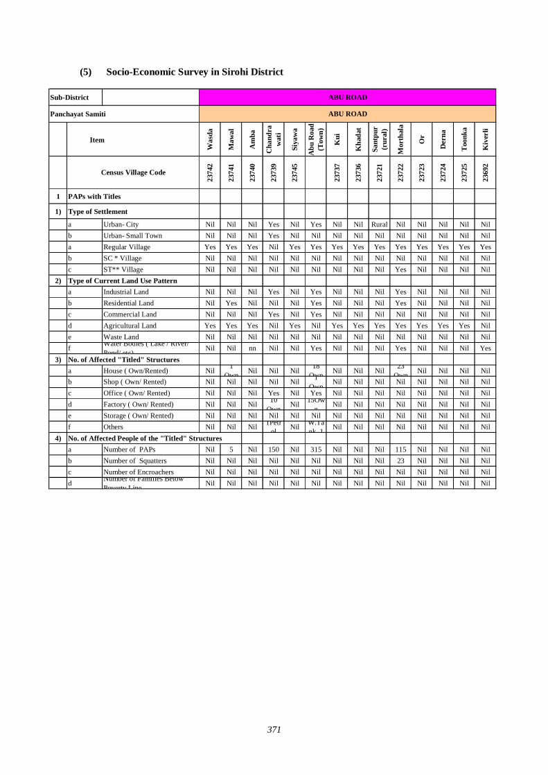
371
(5) Socio-Economic Survey in Sirohi District
Sub-District
Panchayat Samiti
Was
da
Maw
al
Am
ba
Cha
ndra
wat
i
Siya
wa
Abu
Roa
d(T
own)
Kui
Kha
dat
Sant
pur
(rur
al)
Mor
thal
a
Or
Der
na
Too
nka
Kiv
erli
2374
2
2374
1
2374
0
2373
9
2374
5
2373
7
2373
6
2372
1
2372
2
2372
3
2372
4
2372
5
2369
2
1 PAPs with Titles
1) Type of Settlement
a Urban- City Nil Nil Nil Yes Nil Yes Nil Nil Rural Nil Nil Nil Nil Nilb Urban- Small Town Nil Nil Nil Yes Nil Nil Nil Nil Nil Nil Nil Nil Nil Nila Regular Village Yes Yes Yes Nil Yes Yes Yes Yes Yes Yes Yes Yes Yes Yesb SC * Village Nil Nil Nil Nil Nil Nil Nil Nil Nil Nil Nil Nil Nil Nilc ST** Village Nil Nil Nil Nil Nil Nil Nil Nil Nil Yes Nil Nil Nil Nil
2) Type of Current Land Use Pattern a Industrial Land Nil Nil Nil Yes Nil Yes Nil Nil Nil Yes Nil Nil Nil Nilb Residential Land Nil Yes Nil Nil Nil Yes Nil Nil Nil Yes Nil Nil Nil Nilc Commercial Land Nil Nil Nil Yes Nil Yes Nil Nil Nil Nil Nil Nil Nil Nild Agricultural Land Yes Yes Yes Nil Yes Nil Yes Yes Yes Yes Yes Yes Yes Nile Waste Land Nil Nil Nil Nil Nil Nil Nil Nil Nil Nil Nil Nil Nil Nilf Water Bodies ( Lake / River/
Pond/ etc) Nil Nil nn Nil Nil Yes Nil Nil Nil Yes Nil Nil Nil Yes3) No. of Affected "Titled" Structures
a House ( Own/Rented) Nil 1Own Nil Nil Nil 18
Own Nil Nil Nil 23Own Nil Nil Nil Nil
b Shop ( Own/ Rented) Nil Nil Nil Nil Nil 1Own
Nil Nil Nil Nil Nil Nil Nil Nilc Office ( Own/ Rented) Nil Nil Nil Yes Nil Yes Nil Nil Nil Nil Nil Nil Nil Nild Factory ( Own/ Rented) Nil Nil Nil 10
OwnNil 15Ow
nNil Nil Nil Nil Nil Nil Nil Nil
e Storage ( Own/ Rented) Nil Nil Nil Nil Nil Nil Nil Nil Nil Nil Nil Nil Nil Nilf Others Nil Nil Nil 1Petr
ol Nil W.Tank, 1 Nil Nil Nil Nil Nil Nil Nil Nil
4) No. of Affected People of the "Titled" Structuresa Number of PAPs Nil 5 Nil 150 Nil 315 Nil Nil Nil 115 Nil Nil Nil Nilb Number of Squatters Nil Nil Nil Nil Nil Nil Nil Nil Nil 23 Nil Nil Nil Nilc Number of Encroachers Nil Nil Nil Nil Nil Nil Nil Nil Nil Nil Nil Nil Nil Nild Number of Families Below
Poverty Line Nil Nil Nil Nil Nil Nil Nil Nil Nil Nil Nil Nil Nil Nil
ABU ROAD
ABU ROAD
Census Village Code
Item
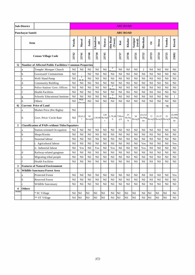
372
Sub-District
Panchayat Samiti
Was
da
Maw
al
Am
ba
Cha
ndra
wat
i
Siya
wa
Abu
Roa
d (T
own)
Kui
Kha
dat
Sant
pur
(rur
al)
Mor
thal
a
Or
Der
na
Too
nka
Kiv
erli
2374
2
2374
1
2374
0
2373
9
2374
5
2373
7
2373
6
2372
1
2372
2
2372
3
2372
4
2372
5
2369
2
5) Number of Affected Public Facilitites/ Common Propertiesa Temple/ Mosque/ Church Nil Nil Nil Nil Nil 2
Temp Nil Nil Nil 2 Nil Nil Nil Nil
b Graveyard/ Crematorium Nil - Nil Nil Nil Nil Nil Nil Nil Nil Nil Nil Nil Nilc Well/ Hand Pump Nil 1
H.P. Nil Nil Nil Nil Nil Nil Nil Nil Nil Nil Nil Nil
d Community Building Nil Nil Nil Nil Nil Nil Nil Nil Nil Nil Nil Nil Nil Nile Police Station/ Govt .Offices Nil Nil Nil Nil Nil 2
Polic Nil Nil Nil Nil Nil Nil Nil Nil
f Health Facilities Nil Nil Nil Nil Nil Nil Nil Nil Nil Nil Nil Nil Nil Nilg Schools/ Educational Institute Nil Nil Nil Nil Nil 3
Educ Nil Nil Nil Nil Nil Nil Nil 1
h Others Nil Rly. Quart Nil Nil Nil Nil Nil Nil Nil Nil Nil Nil Nil Nil
6) Current Price of Land xg
a Market Price (Per Bigha) Nil
b Govt. Price/ Circle Rate Nil 18,41,57
50 Rs/sq'ft 1,50,00
128 Rs/Sq'f
t
1,79,300
72Rs/sq.ft
25 Rs/Sq
'ft
50 Rs/sq'ft
24,212Rs/Big
ha
72 Rs/sq'ft
25.37 Rs/sq'ft
25 Rs/sq'ft
22,000Rs/Big
ha
2 Classification of PAPs without Titles/Squattersa Station-oriented Occupation Nil Nil Nil Nil Nil Nil Nil Nil Nil Nil Nil Nil Nil Nilb Shops/Kiosks Nil Nil Nil Nil Nil Nil Nil Nil Nil Nil Nil Nil Nil Nil
c Seasonal labour Nil Nil Nil Nil Nil Nil Nil Nil Nil Nil Nil Nil Nil Nili. Agricultural labour Nil Nil Nil Nil Nil Nil Nil Nil Nil Yes Nil Nil Nil Yes
ii. Industrial labour Nil Yes Nil Yes Nil Yes Nil Nil Nil Yes Nil Nil Nil Nild Railway-related gangman Nil Nil Nil Nil Nil Nil Nil Nil Nil Nil Nil Nil Nil Nil
e Migrating tribal people Nil Nil Nil Nil Nil Nil Nil Nil Nil Nil Nil Nil Nil Nilf Health Facilities Nil Nil Nil Nil Nil Nil Nil Nil Nil Nil Nil Nil Nil Nil
3 Features of Natural Environment1) Wildlife Sanctuary/Forest Area a Protected Forest Nil Nil Nil Nil Nil Nil Nil Nil Nil Nil Nil Nil Nil Yes
b Reserved Forest Nil Nil Nil Nil Nil Nil Nil Nil Nil Nil Nil Nil Nil Nil c Wildlife Sancatuary Nil Nil Nil Nil Nil Nil Nil Nil Nil Nil Nil Nil Nil Nil
4 OthersNote
: * SC Village Nil Nil Nil Nil Nil Nil Nil Nil Nil Nil Nil Nil Nil Nil
** ST Village Nil Nil Nil Nil Nil Nil Nil Nil Nil Nil Nil Nil Nil Nil
ABU ROAD
Census Village Code
ABU ROAD
Item
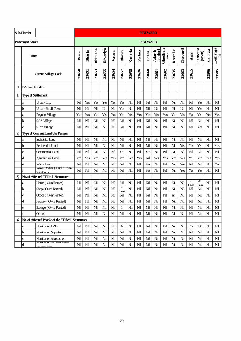
373
Sub-District
Panchayat Samiti
War
a
Bha
rja
Bhi
man
a
Udv
ariy
a
Vat
era
Bha
vri
Kod
aria
Pesh
ua
Ban
as
Ada
rsh
door
igri
Gho
dhui
yaw
a
Ree
chhr
i
Cha
war
li
Aja
ri
Pind
war
a (t
own)
Sada
lwa
Kes
havg
anj
2365
0
2365
1
2365
3
2365
5
2365
4
2365
7
2365
8
2363
6
2366
0
2366
1
2366
2
2363
5
2366
3
2361
5
2359
6
2359
5
1 PAPs with Titles
1) Type of Settlement
a Urban- City Nil Yes Yes Yes Yes Yes Nil Nil Nil Nil Nil Nil Nil Nil Yes Nil Nilb Urban- Small Town Nil Nil Nil Nil Nil Yes Nil Nil Nil Nil Nil Nil Nil Nil Yes Nil Nila Regular Village Yes Yes Yes Yes Yes Yes Yes Yes Yes Yes Yes Yes Yes Yes Yes Yes Yesb SC * Village Nil Nil Nil Nil Nil Nil Nil Nil Nil Nil Nil Nil Nil Nil Nil Nil Nilc ST** Village Nil Nil Nil Nil Nil Nil Nil Nil Nil Nil Nil Nil Nil Nil Yes Nil Nil
2) Type of Current Land Use Pattern a Industrial Land Nil Nil Nil Nil Nil Nil Nil Nil Nil Nil Nil Nil Nil Nil Nil Nil Nilb Residential Land Nil Nil Nil Nil Nil Nil Nil Nil Nil Nil Nil Nil Yes Yes Yes Nil Yesc Commercial Land Nil Nil Nil Nil Nil Yes Nil Nil Yes Nil Nil Nil Nil Nil Nil Nil Nild Agricultural Land Yes Yes Yes Yes Yes Yes Yes Yes Nil Yes Yes Yes Yes Yes Yes Yes Yese Waste Land Nil Nil Nil Nil Nil Nil Nil Nil Yes Nil Nil Nil Yes Nil Nil Nil Yesf Water Bodies ( Lake / River/
Pond/ etc) Nil Nil Nil Nil Nil Nil Nil Nil Yes Nil Nil Nil Yes Yes Yes Nil Nil
3) No. of Affected "Titled" Structuresa House ( Own/Rented) Nil Nil Nil Nil Nil Nil Nil Nil Nil Nil Nil Nil Nil 7
Own34
Own Nil Nilb Shop ( Own/ Rented) Nil Nil Nil Nil Nil 3
Own Nil Nil Nil Nil Nil Nil Nil Nil Nil Nil Nilc Office ( Own/ Rented) Nil Nil Nil Nil Nil Nil Nil Nil Nil Nil Nil nn Nil Nil Nil Nil Nild Factory ( Own/ Rented) Nil Nil Nil Nil Nil Nil Nil Nil Nil Nil Nil Nil Nil Nil Nil Nil Nile Storage ( Own/ Rented) Nil Nil Nil Nil Nil 1 Nil Nil Nil Nil Nil Nil Nil Nil Nil Nil Nilf Others Nil Nil Nil Nil Nil Nil Nil Nil Nil Nil Nil Nil Nil Nil Nil Nil Nil
4) No. of Affected People of the "Titled" Structuresa Number of PAPs Nil Nil Nil Nil Nil 6 Nil Nil Nil Nil Nil Nil Nil 35 170 Nil Nilb Number of Squatters Nil Nil Nil Nil Nil Nil Nil Nil Nil Nil Nil Nil Nil Nil Nil Nil Nilc Number of Encroachers Nil Nil Nil Nil Nil Nil Nil Nil Nil Nil Nil Nil Nil Nil Nil Nil Nild Number of Families Below
Poverty Line Nil Nil Nil Nil Nil Nil Nil Nil Nil Nil Nil Nil Nil Nil Nil Nil Nil
Census Village Code
PINDWARA
PINDWARA
Item
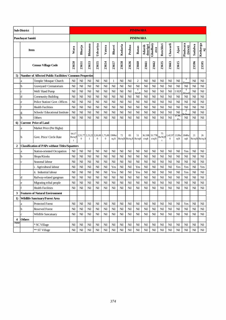
374
Sub-District
Panchayat Samiti
War
a
Bha
rja
Bhi
man
a
Udv
ariy
a
Vat
era
Bha
vri
Kod
aria
Pesh
ua
Ban
as
Ada
rsh
door
igri
Gho
dhui
yaw
a
Ree
chhr
i
Cha
war
li
Aja
ri
Pind
war
a (t
own)
Sada
lwa
Kes
havg
anj
2365
0
2365
1
2365
3
2365
5
2365
4
2365
7
2365
8
2363
6
2366
0
2366
1
2366
2
2363
5
2366
3
2361
5
2359
6
2359
5
5) Number of Affected Public Facilitites/ Common Propertiesa Temple/ Mosque/ Church Nil Nil Nil Nil Nil 1 Nil Nil 2 Nil Nil Nil Nil Nil 1
Temp Nil Nil
b Graveyard/ Crematorium Nil Nil Nil Nil Nil Nil Nil Nil Nil Nil Nil Nil Nil Nil Nil Nil Nilc Well/ Hand Pump Nil Nil Nil Nil Nil Nil Nil Nil 1
Well Nil Nil Nil Nil 1 H.P. 1 Hand Nil Nil
d Community Building Nil Nil Nil Nil Nil Nil Nil Nil Nil Nil Nil Nil Nil Nil Nil Nil Nile Police Station/ Govt .Offices Nil Nil Nil Nil Nil Nil Nil Nil Nil Nil Nil Nil Nil Nil Nil Nil Nil
f Health Facilities Nil Nil Nil Nil Nil Nil Nil Nil Nil Nil Nil Nil Nil Nil Nil Nil Nilg Schools/ Educational Institute Nil Nil Nil Nil Nil Nil Nil Nil Nil Nil Nil Nil Nil Nil 2
Schoo Nil Nil
h Others Nil Nil Nil Nil Nil Nil Nil Nil Nil Nil Nil Nil Nil P.W.D Nil Nil Nil
6) Current Price of Landa Market Price (Per Bigha)
b Govt. Price/ Circle Rate64.17 Rs/sq'f
t
2,55,770
2,23,221
3,50,000
1,75,000
199Rs/sq.ft
72 Rs/sq'ft
83 Rs/sq.ft
51 Rs/sqft
36.33Rs/sqft
33.77Rs/sq'ft
75 Rs/SQ'f
t
1,42,970
132Rs/sq'ft
184Rs/sqft
21 Rs/sq'ft
26 Rs/sq.ft
2 Classification of PAPs without Titles/Squattersa Station-oriented Occupation Nil Nil Nil Nil Nil Nil Nil Nil Nil Nil Nil Nil Nil Nil Yes Nil Nilb Shops/Kiosks Nil Nil Nil Nil Nil Nil Nil Nil Nil Nil Nil Nil Nil Nil Nil Nil Nil
c Seasonal labour Nil Nil Nil Nil Nil Nil Nil Nil Nil Nil Nil Nil Nil Nil Nil Nil Nili. Agricultural labour Nil Nil Nil Nil Nil Yes Nil Nil Yes Nil Nil Nil Nil Yes Yes Nil Yes
ii. Industrial labour Nil Nil Nil Nil Nil Yes Nil Nil Yes Nil Nil Nil Nil Nil Yes Nil Nild Railway-related gangman Nil Nil Nil Nil Nil Nil Nil Nil Nil Nil Nil Nil Nil Nil Nil Nil Nil
e Migrating tribal people Nil Nil Nil Nil Nil Nil Nil Nil Nil Nil Nil Nil Nil Nil Nil Nil Nilf Health Facilities Nil Nil Nil Nil Nil Nil Nil Nil Nil Nil Nil Nil Nil Nil Nil Nil Nil
3 Features of Natural Environment1) Wildlife Sanctuary/Forest Area a Protected Forest Nil Nil Nil Nil Nil Nil Nil Nil Nil Nil Nil Nil Nil Nil Yes Nil Nil
b Reserved Forest Nil Nil Nil Nil Nil Nil Nil Nil Nil Nil Nil Nil Nil Nil Nil Nil Nil c Wildlife Sancatuary Nil Nil Nil Nil Nil Nil Nil Nil Nil Nil Nil Nil Nil Nil Nil Nil Nil
4 OthersNote
: * SC Village Nil Nil Nil Nil Nil Nil Nil Nil Nil Nil Nil Nil Nil Nil Nil Nil Nil
** ST Village Nil Nil Nil Nil Nil Nil Nil Nil Nil Nil Nil Nil Nil Nil Nil Nil Nil
PINDWARA
Census Village Code
PINDWARA
Item
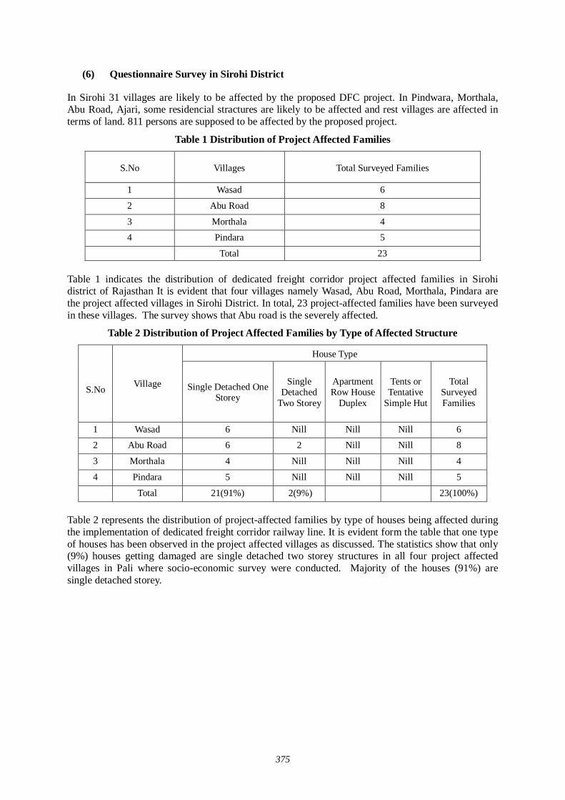
375
(6) Questionnaire Survey in Sirohi District
In Sirohi 31 villages are likely to be affected by the proposed DFC project. In Pindwara, Morthala, Abu Road, Ajari, some residencial stractures are likely to be affected and rest villages are affected in terms of land. 811 persons are supposed to be affected by the proposed project.
Table 1 Distribution of Project Affected Families
S.No Villages Total Surveyed Families
1 Wasad 6
2 Abu Road 8
3 Morthala 4
4 Pindara 5
Total 23 Table 1 indicates the distribution of dedicated freight corridor project affected families in Sirohi district of Rajasthan It is evident that four villages namely Wasad, Abu Road, Morthala, Pindara are the project affected villages in Sirohi District. In total, 23 project-affected families have been surveyed in these villages. The survey shows that Abu road is the severely affected.
Table 2 Distribution of Project Affected Families by Type of Affected Structure
House Type
S.No Village Single Detached One
Storey
Single Detached
Two Storey
Apartment Row House
Duplex
Tents or Tentative
Simple Hut
Total Surveyed Families
1 Wasad 6 Nill Nill Nill 6
2 Abu Road 6 2 Nill Nill 8
3 Morthala 4 Nill Nill Nill 4
4 Pindara 5 Nill Nill Nill 5
Total 21(91%) 2(9%) 23(100%) Table 2 represents the distribution of project-affected families by type of houses being affected during the implementation of dedicated freight corridor railway line. It is evident form the table that one type of houses has been observed in the project affected villages as discussed. The statistics show that only (9%) houses getting damaged are single detached two storey structures in all four project affected villages in Pali where socio-economic survey were conducted. Majority of the houses (91%) are single detached storey.
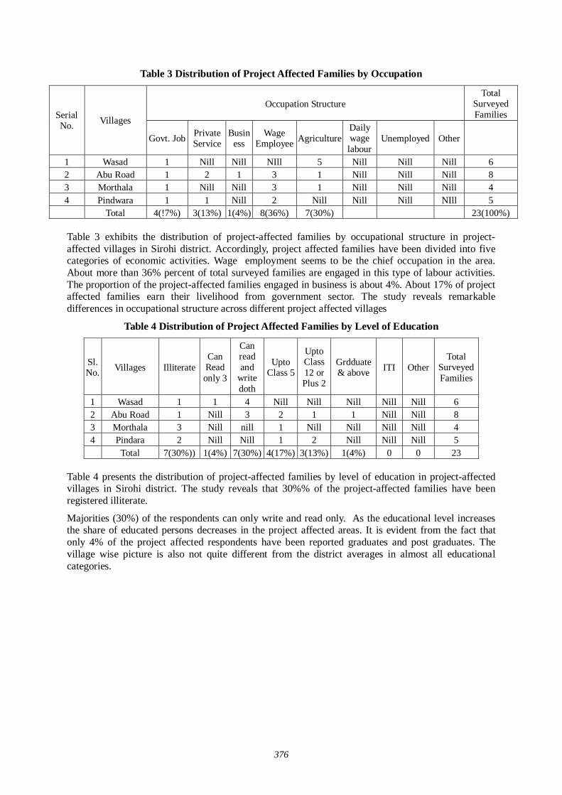
376
Table 3 Distribution of Project Affected Families by Occupation
Occupation Structure Total
Surveyed Families Serial
No. Villages
Govt. Job Private Service
Business
Wage Employee Agriculture
Daily wage labour
Unemployed Other
1 Wasad 1 Nill Nill NIll 5 Nill Nill Nill 6 2 Abu Road 1 2 1 3 1 Nill Nill Nill 8 3 Morthala 1 Nill Nill 3 1 Nill Nill Nill 4 4 Pindwara 1 1 Nill 2 Nill Nill Nill NIll 5 Total 4(!7%) 3(13%) 1(4%) 8(36%) 7(30%) 23(100%) Table 3 exhibits the distribution of project-affected families by occupational structure in project-affected villages in Sirohi district. Accordingly, project affected families have been divided into five categories of economic activities. Wage employment seems to be the chief occupation in the area. About more than 36% percent of total surveyed families are engaged in this type of labour activities. The proportion of the project-affected families engaged in business is about 4%. About 17% of project affected families earn their livelihood from government sector. The study reveals remarkable differences in occupational structure across different project affected villages
Table 4 Distribution of Project Affected Families by Level of Education
Sl. No. Villages Illiterate
Can Read only 3
Can read and
write doth
Upto Class 5
Upto Class 12 or Plus 2
Grdduate & above ITI Other
Total Surveyed Families
1 Wasad 1 1 4 Nill Nill Nill Nill Nill 6 2 Abu Road 1 Nill 3 2 1 1 Nill Nill 8 3 Morthala 3 Nill nill 1 Nill Nill Nill Nill 4 4 Pindara 2 Nill Nill 1 2 Nill Nill Nill 5 Total 7(30%)) 1(4%) 7(30%) 4(17%) 3(13%) 1(4%) 0 0 23
Table 4 presents the distribution of project-affected families by level of education in project-affected villages in Sirohi district. The study reveals that 30%% of the project-affected families have been registered illiterate.
Majorities (30%) of the respondents can only write and read only. As the educational level increases the share of educated persons decreases in the project affected areas. It is evident from the fact that only 4% of the project affected respondents have been reported graduates and post graduates. The village wise picture is also not quite different from the district averages in almost all educational categories.
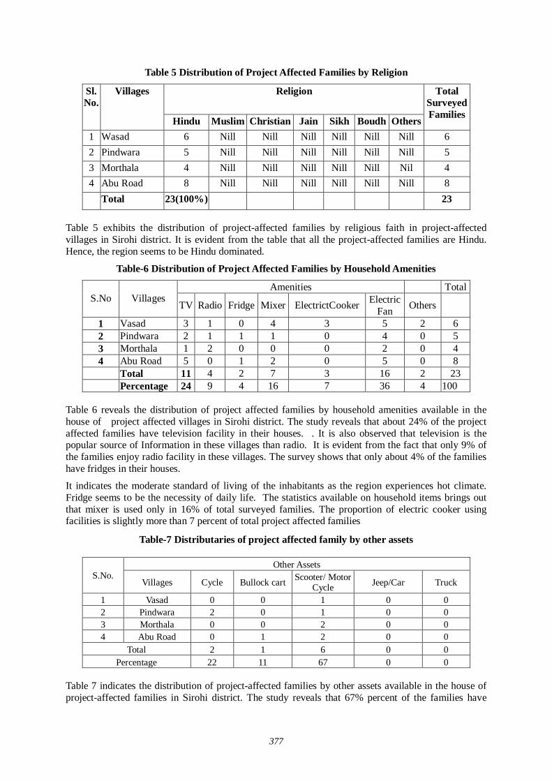
377
Table 5 Distribution of Project Affected Families by Religion
Religion Sl. No.
Villages
Hindu Muslim Christian Jain Sikh Boudh Others
Total Surveyed Families
1 Wasad 6 Nill Nill Nill Nill Nill Nill 6 2 Pindwara 5 Nill Nill Nill Nill Nill Nill 5 3 Morthala 4 Nill Nill Nill Nill Nill Nil 4 4 Abu Road 8 Nill Nill Nill Nill Nill Nill 8
Total 23(100%) 23 Table 5 exhibits the distribution of project-affected families by religious faith in project-affected villages in Sirohi district. It is evident from the table that all the project-affected families are Hindu. Hence, the region seems to be Hindu dominated.
Table-6 Distribution of Project Affected Families by Household Amenities
Amenities Total S.No Villages
TV Radio Fridge Mixer ElectrictCooker Electric Fan Others
1 Vasad 3 1 0 4 3 5 2 6 2 Pindwara 2 1 1 1 0 4 0 5 3 Morthala 1 2 0 0 0 2 0 4 4 Abu Road 5 0 1 2 0 5 0 8 Total 11 4 2 7 3 16 2 23 Percentage 24 9 4 16 7 36 4 100
Table 6 reveals the distribution of project affected families by household amenities available in the house of project affected villages in Sirohi district. The study reveals that about 24% of the project affected families have television facility in their houses. . It is also observed that television is the popular source of Information in these villages than radio. It is evident from the fact that only 9% of the families enjoy radio facility in these villages. The survey shows that only about 4% of the families have fridges in their houses.
It indicates the moderate standard of living of the inhabitants as the region experiences hot climate. Fridge seems to be the necessity of daily life. The statistics available on household items brings out that mixer is used only in 16% of total surveyed families. The proportion of electric cooker using facilities is slightly more than 7 percent of total project affected families
Table-7 Distributaries of project affected family by other assets
Other Assets S.No.
Villages Cycle Bullock cart Scooter/ Motor Cycle Jeep/Car Truck
1 Vasad 0 0 1 0 0 2 Pindwara 2 0 1 0 0 3 Morthala 0 0 2 0 0 4 Abu Road 0 1 2 0 0
Total 2 1 6 0 0 Percentage 22 11 67 0 0
Table 7 indicates the distribution of project-affected families by other assets available in the house of project-affected families in Sirohi district. The study reveals that 67% percent of the families have
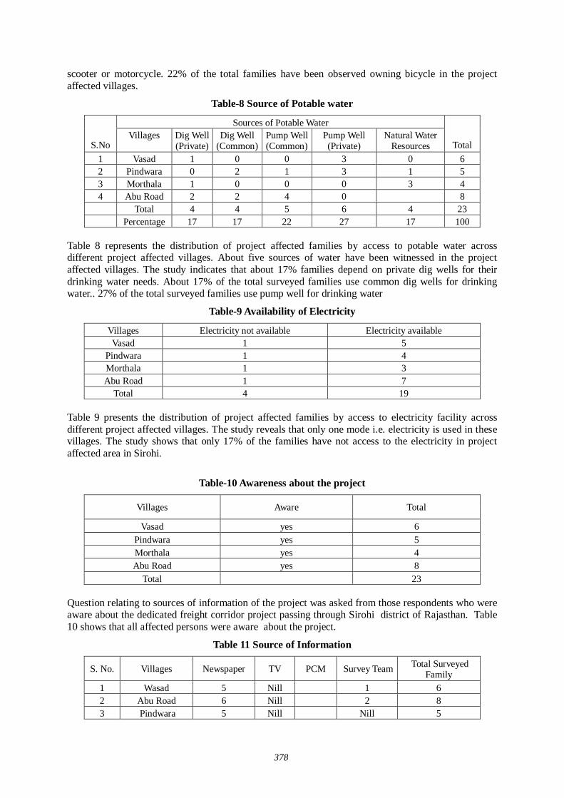
378
scooter or motorcycle. 22% of the total families have been observed owning bicycle in the project affected villages.
Table-8 Source of Potable water
Sources of Potable Water
S.No Villages Dig Well
(Private) Dig Well
(Common) Pump Well (Common)
Pump Well (Private)
Natural Water Resources Total
1 Vasad 1 0 0 3 0 6 2 Pindwara 0 2 1 3 1 5 3 Morthala 1 0 0 0 3 4 4 Abu Road 2 2 4 0 8 Total 4 4 5 6 4 23 Percentage 17 17 22 27 17 100
Table 8 represents the distribution of project affected families by access to potable water across different project affected villages. About five sources of water have been witnessed in the project affected villages. The study indicates that about 17% families depend on private dig wells for their drinking water needs. About 17% of the total surveyed families use common dig wells for drinking water.. 27% of the total surveyed families use pump well for drinking water
Table-9 Availability of Electricity
Villages Electricity not available Electricity available Vasad 1 5
Pindwara 1 4 Morthala 1 3 Abu Road 1 7
Total 4 19 Table 9 presents the distribution of project affected families by access to electricity facility across different project affected villages. The study reveals that only one mode i.e. electricity is used in these villages. The study shows that only 17% of the families have not access to the electricity in project affected area in Sirohi.
Table-10 Awareness about the project
Villages Aware Total
Vasad yes 6 Pindwara yes 5 Morthala yes 4 Abu Road yes 8
Total 23
Question relating to sources of information of the project was asked from those respondents who were aware about the dedicated freight corridor project passing through Sirohi district of Rajasthan. Table 10 shows that all affected persons were aware about the project.
Table 11 Source of Information
S. No. Villages Newspaper TV PCM Survey Team Total Surveyed Family
1 Wasad 5 Nill 1 6 2 Abu Road 6 Nill 2 8 3 Pindwara 5 Nill Nill 5
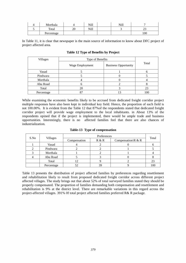
379
4 Morthala 4 Nill Nill 7 5 Total 20 Nill 3 23 Percentage 100
In Table 11, it is clear that newspaper is the main source of information to know about DFC project of project affected area.
Table 12 Type of Benefits by Project
Villages Type of Benefits
Wage Employment Business Opportunity Total
Vasad 5 1 6 Pindwara 5 0 5 Morthala 4 0 4 Abu Road 6 2 8
Total 20 3 23 Percentage 87 13 100
While examining the economic benefits likely to be accrued from dedicated freight corridor project multiple responses have also been kept in individual key field. Hence, the proportion of each field is not 100.00%. It is evident from the Table 12 that 87%of the respondents stated that dedicated freight corridor project will provide wage employment to the local inhabitants. in About 13% of the respondents opined that if the project is implemented, there would be ample trade and business opportunities. Interestingly, there is no affected families feel that there are also chances of industrialization.
Table-13 Type of compensation
Preferences S.No Villages Compensation R & R Compensation\R & R
Total
1 Vasad 4 2 0 6 2 Pindwara 2 2 1 5 3 Morthala 1 2 1 4 4 Abu Road 5 3 0 8 Total 12 9 2 23 Percentage 52 39 9 100
Table 13 presents the distribution of project affected families by preferences regarding resettlement and rehabilitation likely to result from proposed dedicated freight corridor across different project affected villages. The study brings out that about 52% of total surveyed families stated they should be properly compensated. The proportion of families demanding both compensation and resettlement and rehabilitation is 9% at the district level. There are remarkable variations in this regard across the project-affected villages. 391% 0f total project affected families preferred R& R package.
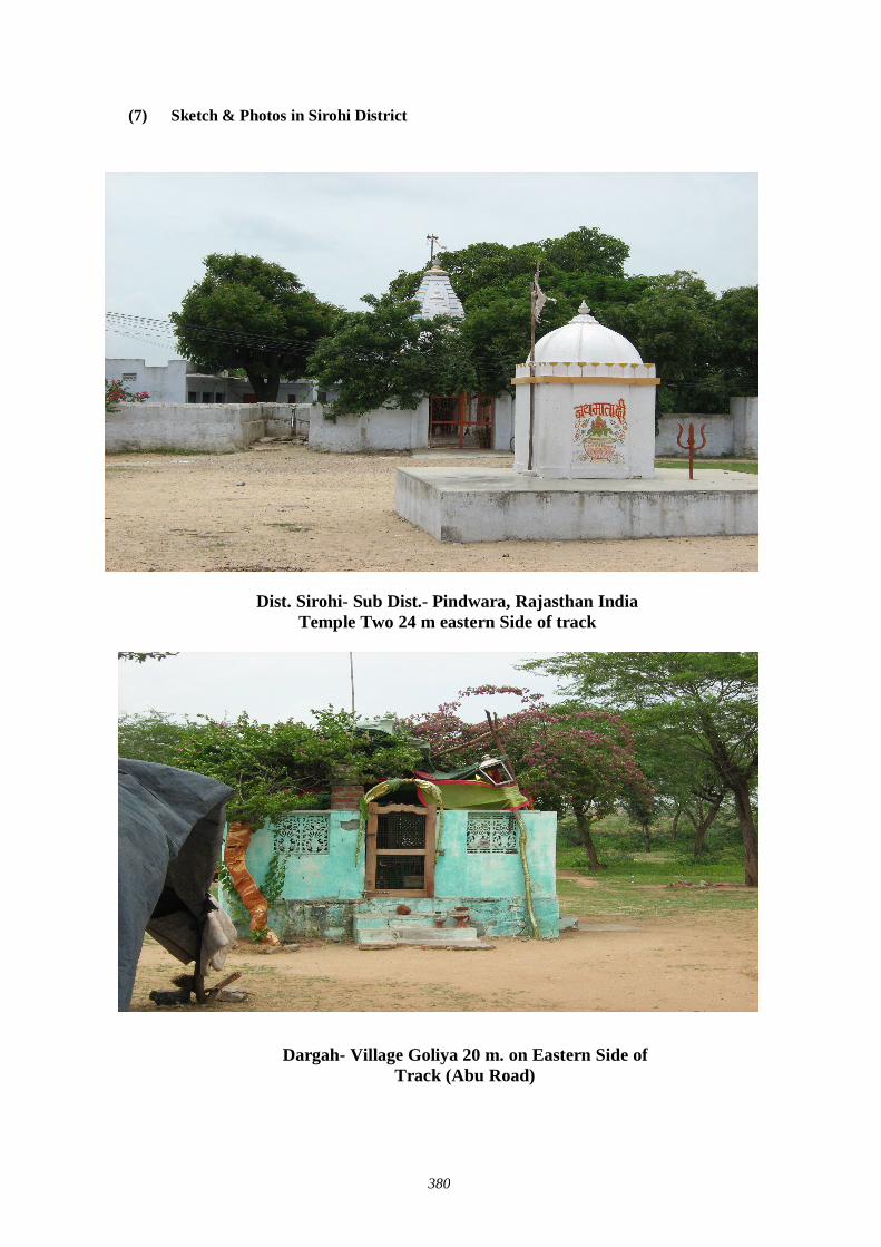
380
(7) Sketch & Photos in Sirohi District
Dist. Sirohi- Sub Dist.- Pindwara, Rajasthan India Temple Two 24 m eastern Side of track
Dargah- Village Goliya 20 m. on Eastern Side of Track (Abu Road)
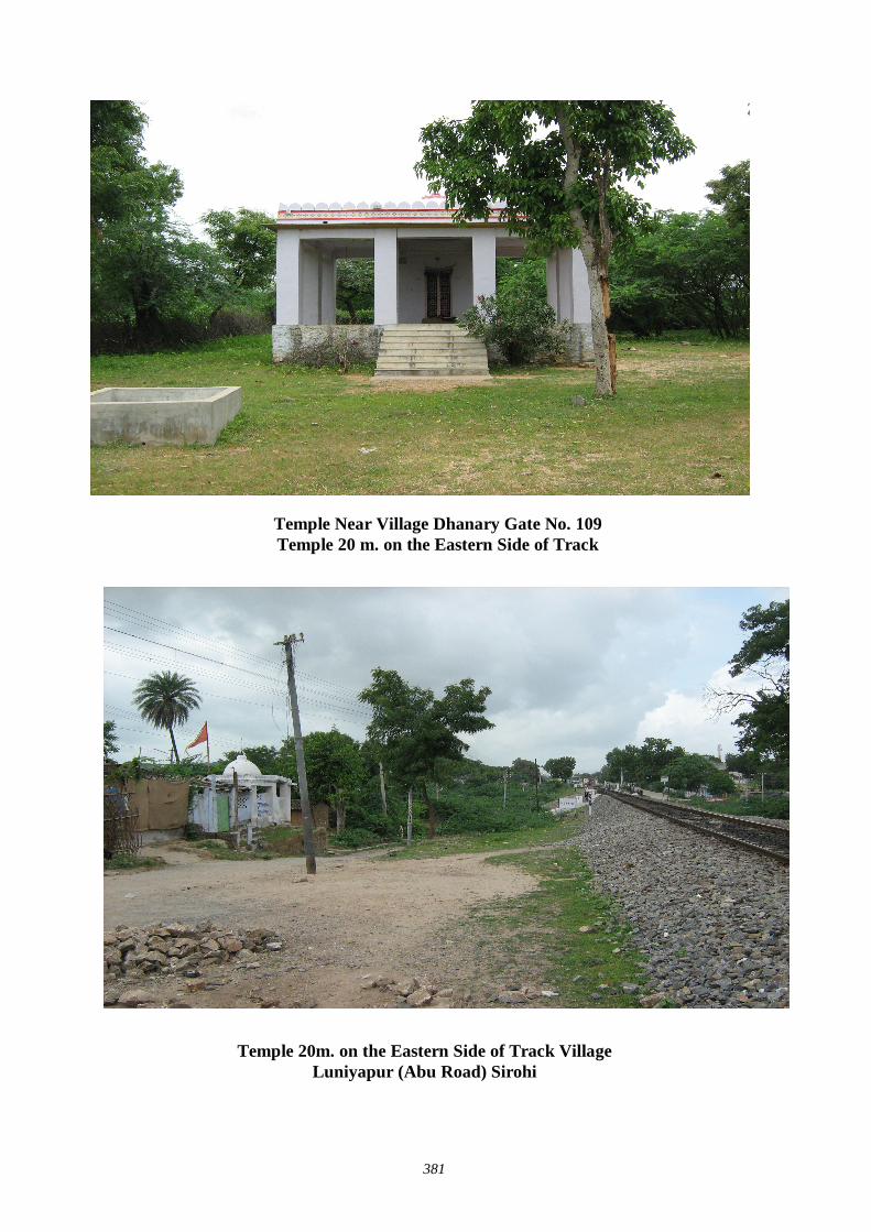
381
Temple Near Village Dhanary Gate No. 109 Temple 20 m. on the Eastern Side of Track
Temple 20m. on the Eastern Side of Track Village Luniyapur (Abu Road) Sirohi
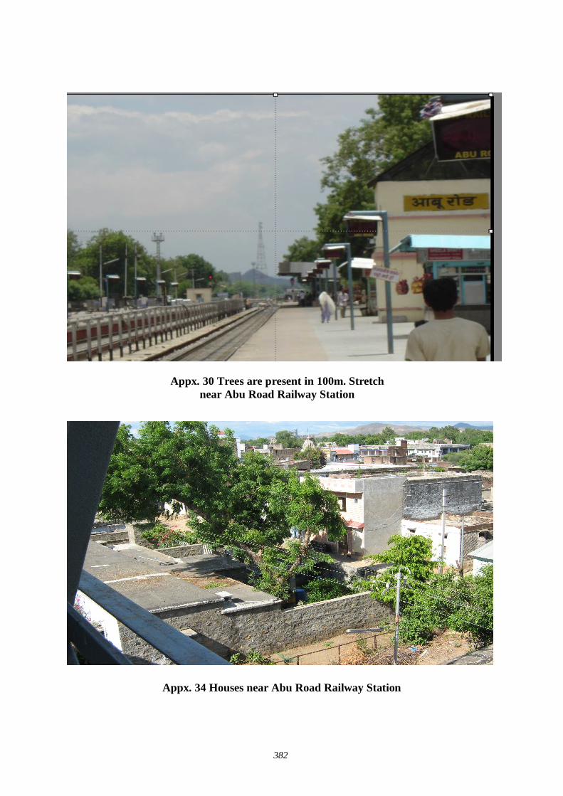
382
Appx. 34 Houses near Abu Road Railway Station
Appx. 30 Trees are present in 100m. Stretch near Abu Road Railway Station
383
7. Alwar District
(1) 2 Stage of District Level Stakeholder / Public Consultation Meeting in Alwar District
1.0 Brief Description of the State: RAJASTHAN Rajasthan is a vibrant and exotic state where tradition and royal glory meet in a riot of colors against the vast backdrop of sand and desert. It has an unusual diversity in its entire forms- people, customs, culture, costumes, music, manners, dialects, cuisine and physiography.
Rajasthan is located in the northwestern part of the subcontinent. It is bounded on the west and northwest by Pakistan, on the north and northeast by the states of Punjab, Haryana, and Uttar Pradesh, on the east and southeast by the states of Uttar Pradesh and Madhya Pradesh, and on the southwest by the state of Gujarat. The Tropic of Cancer passes through its southern tip in the Banswara district. The state has an area of 132,140 square miles (342,239 square kilometers).
In the west, Rajasthan is relatively dry and infertile; this area includes some of the Thar Desert, also known as the Great Indian Desert. In the southwestern part of the state, the land is wetter, hilly, and more fertile. The climate varies throughout Rajasthan. On average winter temperatures range from 8° to 28° C (46° to 82° F) and summer temperatures range from 25° to 46° C (77° to 115° F). Average rainfall also varies; the western deserts accumulate about 100 mm (about 4 in) annually, while the southeastern part of the state receives 650 mm (26 in) annually, most of which falls from July through September during the monsoon season.
1.1 Brief Description of the District: ALWAR Area
8,380 sq.kms. (2.45 per cent of the State)
Location
Alwar district is situated in the Northeastern part of Rajasthan. Gurgaon of Haryana, Bharatpur district on Northeast and Mahendragarh of Haryana, bound it in the North. Jaipur lies in the Southwest and Dausa in the south.
Distance from Major Cities
Jaipur- 143 kms. Delhi- 155 kms. Ahmedabad-768 kms. Mumbai-1319 kms.
Climate and Rainfall
The district has a dry climate with hot summer, a cold winter and a short monsoon season.
During May the maximum temperature is around 41 degrees Celsius and minimum is around 28 degrees Celsius
During January the maximum temperature is around 23 degrees Celsius and minimum around 8 degrees Celsius
The normal annual rainfall in the district is 57.77 cms. The average humidity: 70 per cent
Administrative Set-up
Alwar, Behror, Rajgarh and Kishangarhbas are four sub-divisions in the district. The district consists of ten tehsils, seven sub-tehsils and six Nagar Palikas.
Human Resources
384
Population Persons 29,90,862Density of Population Persons per sq.kms 357Literacy Per cent 62.48Total Working Population Per cent 31.3
Cultivators Per cent 64.07Agricultural Labourers Per cent 7.56
Manufacturing, Processing Servicing and Repairs Per cent 1.5Other Workers Per cent 26.87
Indicators of Human Resources
Percentage distribution of work force
(2) Infrastructure
Electricity
As of March 2000, 1,921 villages have been electrified out of 1,946 villages in the district.
Water The water is generally fresh and potable. Irrigation in the district is mostly done by dug wells, energized tube-wells and canals emanating from irrigation tank, like Jaisamand, Siliserh, Mangulasar, Baleti and Deooti.
Road Transport The National Highway No.8 passes through the district. Behror, an important city of the district is on the route connecting Jaipur with Delhi. A State Highway also runs from Alwar to Bharatpur. The total length of roads in the district is about 3,511 kms. as of March 2000.
Rail Transport Alwar has the biggest railway station in the district, situated on Delhi-Jaipur broad gauge section of Western Railway. There is 158 kms of railway track in the district. The district is well connected by rail to Delhi, Ahmedabad, Mathura and other major towns of Rajasthan like Jaipur, Udaipur, Jodhpur, Ajmer, etc.
Air Transport The nearest airport is Jaipur airport at a distance of 143 kms.
1.2 Brief Description of the DFC Project (In Alwar) Ministry of Railways, Government of India has planned to develop a dedicated multimodal high axle freight corridor project on eastern and western corridors. This need has been felt due to the growing economy of India requiring improvement in physical movement of goods by means of railways within the country. The Japan International Cooperation Agency is undertaking a development study of this dedicated freight corridor project for the Indian government. Western route (Mumbai-Delhi route) of dedicated freight corridor will be traversing Jawaharlal Nehru Port Trust (JNPT) -Ahmedabad-Palanpur-Rewari-Asaoti-Dadri. Down direction of this corridor is considered towards Delhi and Up direction towards JNPT. The proposed alignment passes through the states of Maharastra, Gujarat, Rajasthan, Haryana, Delhi and Uttar Pradesh involving Thane and Raigarh districts of Maharastra, Valsad, Navsari, Surat, Bharuch, Vadodra, Anand, Kheda, Ahmedabad, Gandhinagar, Mahesana and Banas Kantha districts of Gujarat; Sirohi, Pali, Ajmer, Nagaur, Jaipur, Alwar and Sikar districts of Rajasthan, Mahendragarh (Narnaul), Rewari, Gurgaon and Faridabad districts of Haryana, South Delhi district of Delhi and Gautam Budhnagar district of Uttar Pradesh.
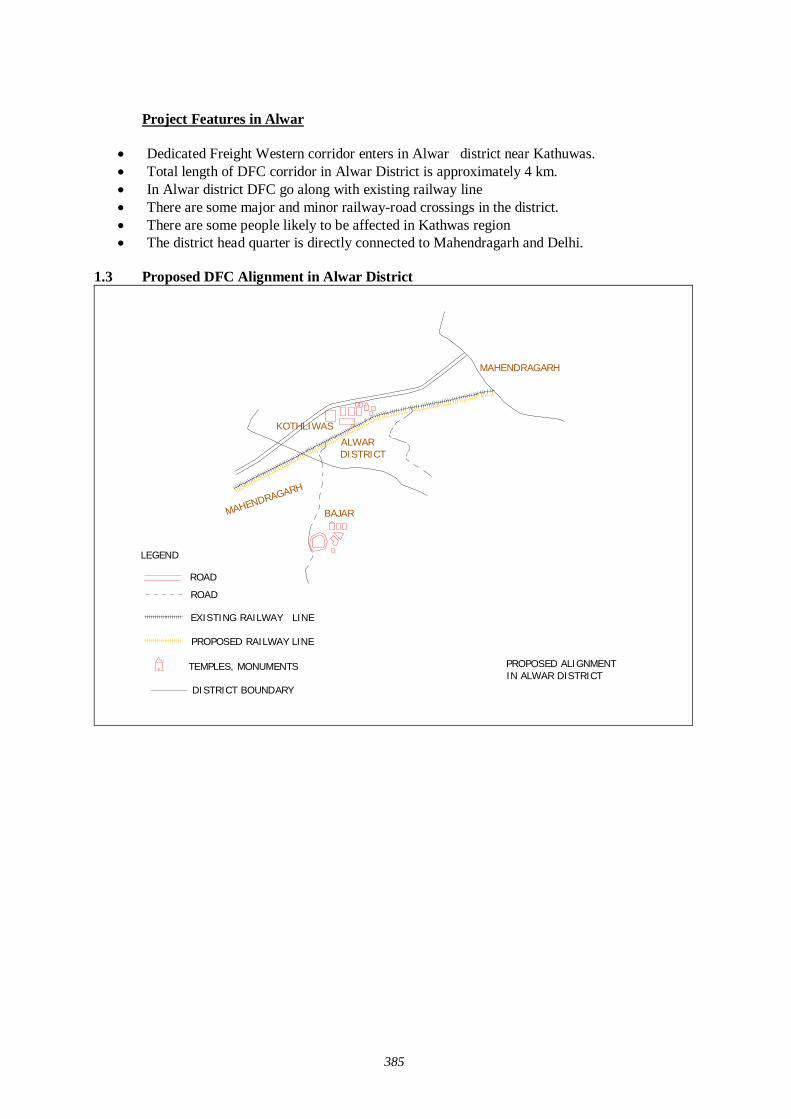
385
Project Features in Alwar
Dedicated Freight Western corridor enters in Alwar district near Kathuwas. Total length of DFC corridor in Alwar District is approximately 4 km. In Alwar district DFC go along with existing railway line There are some major and minor railway-road crossings in the district. There are some people likely to be affected in Kathwas region The district head quarter is directly connected to Mahendragarh and Delhi.
1.3 Proposed DFC Alignment in Alwar District
KOTHLIWAS
BAJAR
EXISTING RAILWAY LINE
PROPOSED RAILWAY LINE
ROAD
TEMPLES, MONUMENTS PROPOSED ALIGNMENTIN ALWAR DISTRICT
MAHENDRAGARH
ALWAR DISTRICT
MAHENDRAGARH
DISTRICT BOUNDARY
ROAD
LEGEND
386
2.0 Project Summary Sheet
Title of the Project 2nd stage of Stakeholder/Public Consultation Meeting forDevelopment Study Regarding the Dedicated MultimodalHigh Axle Freight Corridor for Ministry of Railway Govt.
Date and Place of Meeting 22-06-07 , Shakti Resort, NH – 8, Behror, AlwarLocal Consultant Mantec Consultant Pvt. Ltd. New Delhi.
Society For Environment & DevelopmentUG-3, E77, West Vinod Nagar, Delhi-110092
Organizing Place Shakti Resort, NH – 8, Behror, AlwarNo. Invitees 112No. of Participants 85
Personal Contact: -Dispatching Invitation Letter:-Information in Newspaper:-Invitation to distt. Office by lettersInformation at Panchayat Office and Teh. Office Others - Press News Dainik Bhaskar and Rajasthan Patrika,Danik Navjoyti, Rashtradoot. Writing PadBall PenQuestionnaireSlide Presentation LectureGroup DiscussionQuestion/Answer SessionStill Photography Audio/Video RecordingMinutes of Meeting
Media Coverage Nil
Methods Adopted for Discussion
Methods Adopted forDocumentation
PROJECT SUMMARY SHEET
Local Organizer
Methods Used for InformationDissemination
Stationary Served to theParticipants
2.1 Method of Selection of the Stakeholders The latest version of JICA Guidelines for Environment and Social Consideration has been developed in 2004 so that JICA funded feasibility study incorporates due consideration of the environmental protection and safeguards the sectors of society directly or indirectly affected by the project. Current feasibility study is being carried out applying these guidelines.
In order to encourage participation of the local residents, Stakeholder/ Public Consultation Meeting is considered as a tool that should play an important role during the project design stage. It has been designed to
Disclose information on project for open discussion Disseminate information to the lowest possible hierarchy of the social system Obtain interaction of the participants of Stakeholder/Public Consultation Meeting Reflect the valid comments elicited from the open discussion to the design of the project Build a consensus on the project implementation and associated factors.
There are three stages of Stakeholder and Public Consultation Meeting. The first stage of Stakeholder/Public Consultation Meeting is held on state level, followed by second stage of
387
Stakeholder/Public Consultation Meeting held in the districts, and the third stage of Stakeholder/ Public Consultation Meeting will be held in the villages directly affected by the project.
The Mantec Consultants Pvt. Ltd has already organized the first stage of Stake holder/Public Consultation Meeting in the state of Rajasthan.
To organize the second stage of Stakeholder/ Public Consultation Meeting Mantec consultants have authorized "Society For Environment and Development" to meet the concerned government authorities and collect relevant data for carrying forward study of social environment and organize second stage of Stakeholder/Public Consultation Meeting for information dissemination of the project As per the directions of the guidelines for conducting the 2nd stage of the Stakeholder/Public Consultation Meetings a formal order of the Ministry of Railways was got issued vide their letter dated 01-06-07 to facilitate these meetings .
Further, continuous efforts were made to keep the Ministry of Railways involved in the project as the major stakeholder through their local set-up. Rehabilitation Commissioners were also appointed from the state government departments. Similarly Department of Environment and Forestry and State Pollution Control Boards were contacted to participate in the Meetings. State Government Department were also apprised and approached and were invited to participate in the Stakeholders/Public Consultation Meetings including the State Public Works Department, Irrigation and Power, Urban Development and Poverty Alleviation Department, industries, telecommunication and Information technology Trade and Commerce, Surface Transport, Tourism, Container/Corporation of India, Port Trusts etc.
Our meeting facilitator team visited all the affected villages and requested Primary and Secondary Stakeholders to attend the meeting. Our meeting facilitator team preferred to invite the people who will be affected directly by this project. Our team also met & informed the Distt. Administration and requested to help in organizing the public meeting successfully. Local stakeholders along the railway line, affected farmers, businessmen, private service and Govt. service employers were invited in the meeting. Our study team also contacted Tehsildars of affected Tehsil, Panchayat Samiti Pramukh, Gram Pradhan, and local MLA and requested them to attend the meeting and also gave necessary support in conducting second stage of Stakeholder and Public Consultation Meeting. Public Consultation on proposed Dedicated Fright Corridor (DFC) was held in Ajmer district of Rajasthan on 22nd June 2007 at Shakti Resort, NH-8, Behror, Alwar. Extensive publicity was done one week prior to the program through distribution of pamphlets, one to one meetings, announcement through loudspeakers in villages and newspaper releases. Around 125 people directly and many more times indirectly invited for the program. Around 85 persons from affected villages, members of market associations, transport unions, industry associations, media and government departments participated.
The main objective of the second stage of Stakeholder/Public Consultation Meeting is to disseminate the information to general public. In the State of Rajasthan this DFC Project will affect seven districts. Affected districts are Alwar, Sikar, Nagaur, Jaipur, Ajmer, Pali & Sirohi. In the district of Ajmer DFC does follow the existing rail line with one detour of 13 km. at Kishangarh and small diversion in Adarsh Nagar, Ajmer due to congested areas. Therefore new land will be acquired for DFC project especially in Kishangarh. So that in giving invitation our meeting facilitator team took consideration the people of that area were present in the meeting. Not only that our meeting facilitator team visited all the affected villages and requested primary and secondary stakeholder to attend the meeting, Random sampling method was used for the selection of stakeholder because limited persons had to be invited. Our meeting facilitator team also took consideration in extending invitations that vulnerable group of affected area should be present in the meeting.
2.2 Selection of Meeting Facilitators Simultaneously extensive surveys were conducted for the identification of suitable local agencies for the successful organization of the Stakeholders/Public Consultation Meetings. Preference was given to Non Government Organizations (NGO) who had local presence, popularity and experience of social and public works. It has to be well acquainted with multifarious cross section of the society to help in
388
the selection of the right type of stakeholders for the meetings as well as for facilitating other related activities i.e.
Venue for the meetings. Arrangements to be made. Assisting in local publicity. Invitation to the stakeholders and motivating them for participation. Maintenance and compilation of record and feedbacks. Other local arrangements like transport, hospitality, security and smooth conduction of the
meeting proceedings.
An NGO ‘Society for Environment & Development’ was therefore appointed for facilitating the Stakeholders/ Public Consultation Meeting in Alwar.
2.3 Selection of the Stakeholders (Invitees)
Around 112 people were invited to attend stakeholder meeting.
2.4 Methods of Information Dissemination
1) Method of Notifying the meeting to the Participants:-
1. Notified the date and venue of the stakeholders/ Public consultant meeting in local newspaper, Radio, TV and requesting people to attend the meeting.
2. With help of local NGO we tried to paste the handout and the information of the project on the public place on the area.
3. With the help of the local NGOs we tried to disseminate the information of the project to the local people by face-to-face meeting as much as possible.
4. With the help of local media we tried to publish the Summary of Stakeholders and Public Consultation Meeting in newspaper, TV and Radio.
2.5 Venue of Stakeholder and Public Consultation Meeting
Shakti Resort, NH-8, Brhror, Alwar.
3.0 Participants of the Stakeholder/Public Consultation Meeting Around 85 people participated in the stakeholder meeting.
3.1 Minutes of the Stakeholder/ Public Consultation Meeting The Executive Director, Society started the program with welcome address for Environment & Development. Director, MANTEC Consultants was present as Chief Guest while Advisor (Public Consultation), JICA Study Team presided over the program. SED gave details about the project through power point presentation and invited views from participants. Following were the main points of discussion during the program:
1. Alignment of the new railway line and affected villages/urban areas. 2. Area to be acquired by the Railways. 3. Compensation package for the affected farmers, shop & house Owners etc. 4. Diversions, Stations & Detour to be constructed at Kishangarh in the district. 5. When will the work start & when will it reach completion? 6. Economic development of the area 7. Benefits of the project to general public at large and specific people. 8. Negative impact of the project on specific sector/service.
389
Many questions were asked on the above-mentioned points and answered by Mantec representatives.
Stakeholders/ Public Consultation Meeting is a bottom up approach in this gigantic freight corridor project. It is one of the tools to reflect the views of the general public as well as those concerned with the project ranging from the central and local government organizations to commercial and industrial sectors of the society as a whole. It is an important tool of information dissemination during the planning stage of the project.
4:00 pm Representative from Society for Environment & Development introduced Guests to the
participants. He also gave brief introduction and objectives of organizing the programme.
4:10 pm Mantec representatives made brief presentation on DFC project to the participants and showed detailed PowerPoint presentation.
4:20 pm Representative of Society for Environment & Development explained that because of the
ever growing economy of India, improvement of physical ability for moving goods by means of railways within the country is considered urgently needed, he also explained that the railway line starting from Mumbai running all the way up to Delhi is dedicated only for freight Corridor and nothing to do with the passengers. Growth of major and minor ports of India, the traffic between Northern Hinterland and Western port and huge traffic of coal, steel and fertilizer is anticipated on Ludhiana- Delhi – Howrah route. He said that there are lots of containers coming into this country from outside and landing at Mumbai and moving by train to Ahmedabad, Jaipur, and Delhi up to Ludhiana. On an average approximately 9000-loaded truck move daily over the corridor, i.e. Delhi- Mumbai Western Corridor and Ludhiana – Howrah Eastern Corridor. He added that Freight Corridor is basically constructed alongside existing double track from Mumbai –Delhi, from Palanpur up to Ahmedabad routes. From the city Vadodara adjoining the existing areas drawing up from Rajasthan, because of the congested areas, change all the way up to Mehsana the Freight Corridor has to be constructed avoiding the congestion on existing railway lines.
4:50 pm Question/Answer session (Detail of question and answer is given separately)
5.30 pm The meeting ended with vote of thanks to the chair and snacks and tea were served.
3.2 Description of the Profile of the Participants The major observations of the Stakeholders/Public Consultation Meeting held at Ajmer on 20-06-2007 recorded through questionnaire are as follows:
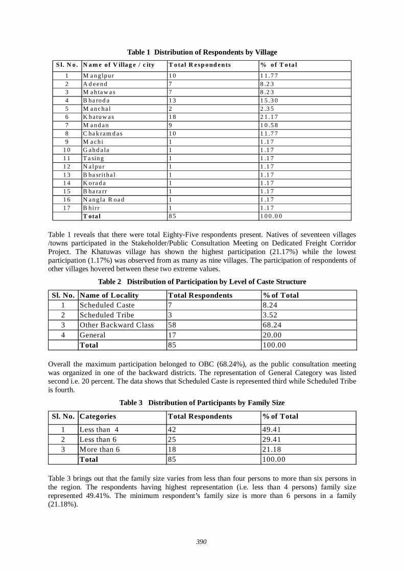
390
Table 1 Distribution of Respondents by Village S l. N o . N am e o f V illag e / c ity T otal R e sp ond e nts % o f T o ta l
1 M a ng lpur 1 0 1 1 .7 72 A d e e nd 7 8 .2 33 M a h ta w a s 7 8 .2 34 B ha rod a 1 3 1 5 .3 05 M a nc ha l 2 2 .3 56 K ha tuw a s 1 8 2 1 .1 77 M a nd a n 9 1 0 .5 88 C ha k ra m d a s 1 0 1 1 .7 79 M a c h i 1 1 .1 7
1 0 G a hd a la 1 1 .1 71 1 T a sing 1 1 .1 71 2 N a lpu r 1 1 .1 71 3 B ha sritha l 1 1 .1 71 4 K ora d a 1 1 .1 71 5 B ha ra rr 1 1 .1 71 6 N a ng la R oa d 1 1 .1 71 7 B hi rr 1 1 .1 7
T ota l 8 5 1 0 0 .0 0
Table 1 reveals that there were total Eighty-Five respondents present. Natives of seventeen villages /towns participated in the Stakeholder/Public Consultation Meeting on Dedicated Freight Corridor Project. The Khatuwas village has shown the highest participation (21.17%) while the lowest participation (1.17%) was observed from as many as nine villages. The participation of respondents of other villages hovered between these two extreme values.
Table 2 Distribution of Participation by Level of Caste Structure
Sl. No. Name of Locality Total Respondents % of Total1 Scheduled Caste 7 8.242 Scheduled Tribe 3 3.523 Other Backward Class 58 68.244 General 17 20.00
Total 85 100.00 Overall the maximum participation belonged to OBC (68.24%), as the public consultation meeting was organized in one of the backward districts. The representation of General Category was listed second i.e. 20 percent. The data shows that Scheduled Caste is represented third while Scheduled Tribe is fourth.
Table 3 Distribution of Participants by Family Size
Sl. No. Categories Total Respondents % of Total
1 Less than 4 42 49.412 Less than 6 25 29.413 More than 6 18 21.18
Total 85 100.00 Table 3 brings out that the family size varies from less than four persons to more than six persons in the region. The respondents having highest representation (i.e. less than 4 persons) family size represented 49.41%. The minimum respondent’s family size is more than 6 persons in a family (21.18%).
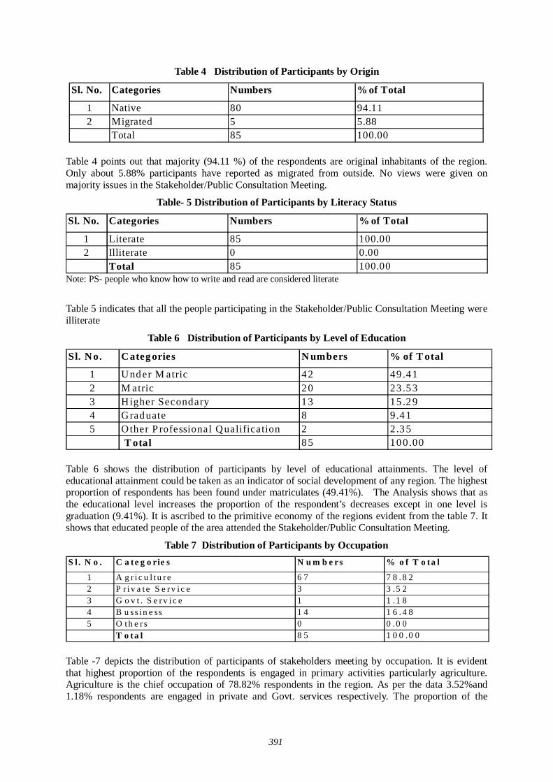
391
Table 4 Distribution of Participants by Origin
Sl. No. Categories Numbers % of Total
1 Native 80 94.112 Migrated 5 5.88
Total 85 100.00 Table 4 points out that majority (94.11 %) of the respondents are original inhabitants of the region. Only about 5.88% participants have reported as migrated from outside. No views were given on majority issues in the Stakeholder/Public Consultation Meeting.
Table- 5 Distribution of Participants by Literacy Status
Sl. No. Categories Numbers % of Total
1 Literate 85 100.002 Illiterate 0 0.00
Total 85 100.00 Note: PS- people who know how to write and read are considered literate
Table 5 indicates that all the people participating in the Stakeholder/Public Consultation Meeting were illiterate
Table 6 Distribution of Participants by Level of Education
Sl. No. Categ ories N umbers % of T otal
1 Und er M atric 4 2 49 .4 12 M atric 2 0 23 .5 33 Higher Secondary 1 3 15 .2 94 Grad uate 8 9.4 15 Other P rofessional Qualification 2 2.3 5
T otal 8 5 10 0.00 Table 6 shows the distribution of participants by level of educational attainments. The level of educational attainment could be taken as an indicator of social development of any region. The highest proportion of respondents has been found under matriculates (49.41%). The Analysis shows that as the educational level increases the proportion of the respondent’s decreases except in one level is graduation (9.41%). It is ascribed to the primitive economy of the regions evident from the table 7. It shows that educated people of the area attended the Stakeholder/Public Consultation Meeting.
Table 7 Distribution of Participants by Occupation S l . N o . C a te g o rie s N u m b e rs % o f T o ta l
1 A g r i c u l t u r e 6 7 7 8 . 8 22 P r i v a t e S e rv i c e 3 3 .5 23 G o v t . S e rv i c e 1 1 .1 84 B u ss i n e ss 1 4 1 6 . 4 85 O t h e r s 0 0 .0 0
T o ta l 8 5 1 0 0 .0 0 Table -7 depicts the distribution of participants of stakeholders meeting by occupation. It is evident that highest proportion of the respondents is engaged in primary activities particularly agriculture. Agriculture is the chief occupation of 78.82% respondents in the region. As per the data 3.52%and 1.18% respondents are engaged in private and Govt. services respectively. The proportion of the
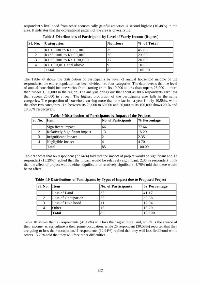
392
respondent’s livelihood from other economically gainful activities is second highest (16.48%) in the area. It indicates that the occupational pattern of the area is diversifying.
Table 8 Distributions of Participants by Level of Yearly Income (Rupees)
Sl. No. Categories Numbers % of Total
1 Rs 10000 to Rs 25, 000 39 45.882 Rs25, 000 to Rs 50,000 20 23.533 Rs 50,000 to Rs 1,00,000 17 20.004 Rs 1,00,001 and above 9 10.58
Total 85 100.00
The Table -8 shows the distribution of participants by level of annual household income of the respondents, the entire population has been divided into four categories. The data reveals that the level of annual household income varies from starting from Rs 10,000 to less than rupees 25,000 to more than rupees 1, 00,000 in the region. The analysis brings out that about 45.88% respondents earn less than rupees 25,000 in a year. The highest proportion of the participants also falls in the same categories. The proportion of household earning more than one lac in a year is only 10.58%, while the other two categories i.e. between Rs 25,000 to 50,000 and 50,000 to Rs 100,000 shows 20 % and 10.58% respectively.
Table -9 Distributions of Participants by Impact of the Projects Sl. No. Item No. of Participants % Percentage.
1 Significant Impact 66 77.642 Relatively Significant Impact 13 15.293 Insignificant Impact 2 2.354 Negligible Impact 4 4.70
Total 85 100.00 Table 9 shows that 66 respondent (77.64%) told that the impact of project would be significant and 13 respondent (15.29%) replied that the impact would be relatively significant. 2.35 % respondent think that the affect of project will be either significant or relatively significant. 4.70% told that there would be no affect.
Table -10 Distributions of Participants by Types of Impact due to Proposed Project
Sl. No. Item No. of Participants % Percentage
1 Loss of Land 35 41.172 Loss of Occupation 26 30.583 Loss of Live hood 11 12.944 Other 13 15.29
Total 85 100.00
Table 10 shows that 35 respondents (41.17%) will loss their agriculture land, which is the source of their income, as agriculture is their prime occupation, while 26 respondent (30.58%) reported that they are going to loss their occupation.11 respondents (12.94%) replied that they will loss livelihood while others 15.29% told that they will face other difficulties.
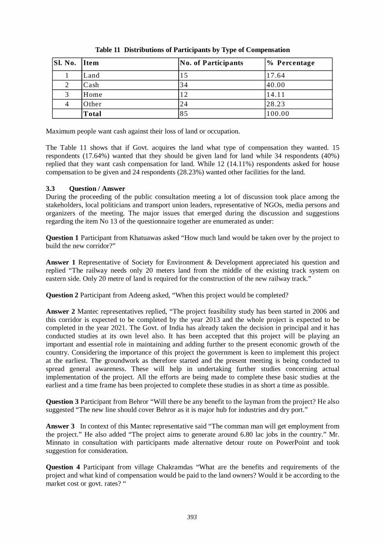
393
Table 11 Distributions of Participants by Type of Compensation
Sl. No. Item No. of Participants % Percentage
1 Land 15 17.642 Cash 34 40.003 Home 12 14.114 Other 24 28.23
Total 85 100.00
Maximum people want cash against their loss of land or occupation. The Table 11 shows that if Govt. acquires the land what type of compensation they wanted. 15 respondents (17.64%) wanted that they should be given land for land while 34 respondents (40%) replied that they want cash compensation for land. While 12 (14.11%) respondents asked for house compensation to be given and 24 respondents (28.23%) wanted other facilities for the land. 3.3 Question / Answer During the proceeding of the public consultation meeting a lot of discussion took place among the stakeholders, local politicians and transport union leaders, representative of NGOs, media persons and organizers of the meeting. The major issues that emerged during the discussion and suggestions regarding the item No 13 of the questionnaire together are enumerated as under: Question 1 Participant from Khatuawas asked “How much land would be taken over by the project to build the new corridor?”
Answer 1 Representative of Society for Environment & Development appreciated his question and replied “The railway needs only 20 meters land from the middle of the existing track system on eastern side. Only 20 metre of land is required for the construction of the new railway track.”
Question 2 Participant from Adeeng asked, “When this project would be completed?
Answer 2 Mantec representatives replied, “The project feasibility study has been started in 2006 and
this corridor is expected to be completed by the year 2013 and the whole project is expected to be completed in the year 2021. The Govt. of India has already taken the decision in principal and it has conducted studies at its own level also. It has been accepted that this project will be playing an important and essential role in maintaining and adding further to the present economic growth of the country. Considering the importance of this project the government is keen to implement this project at the earliest. The groundwork as therefore started and the present meeting is being conducted to spread general awareness. These will help in undertaking further studies concerning actual implementation of the project. All the efforts are being made to complete these basic studies at the earliest and a time frame has been projected to complete these studies in as short a time as possible.
Question 3 Participant from Behror “Will there be any benefit to the layman from the project? He also suggested “The new line should cover Behror as it is major hub for industries and dry port.”
Answer 3 In context of this Mantec representative said “The comman man will get employment from
the project.” He also added “The project aims to generate around 6.80 lac jobs in the country.” Mr. Minnato in consultation with participants made alternative detour route on PowerPoint and took suggestion for consideration.
Question 4 Participant from village Chakramdas “What are the benefits and requirements of the
project and what kind of compensation would be paid to the land owners? Would it be according to the market cost or govt. rates? “
394
Answer 4 In this regard Mantec representative said, “The compensations shall be paid as per National Rehabilitation Policy of 2006 of Government of India.”
Question 5 Participant from Kathuwas said “can it is possible to connect Narnaul-Khori- Neem Ka
Rana to the DFC alignment because Neem Ka Rana is industrial center; it will be beneficial for the particular area?
Answer 5 Representative from JICA Study Team said “However I am not a engineer therefore I can
not say that whether it is possible or not, he showed the alignment and said, “I will forward this proposal to the higher authority.
Question 6 Participant from Behrod “please tell me how many villages will be affected by this
proposed alignmentt?
Answer 6 Mantec representative said, “Very few villages will be affected by this alignment
JICA Study Team is studying about the track demands on the railway cargos between Mumbai- Delhi, between Mundra- Ahmedabad –Delhi, between Son-Nagar-Ludhiana every 5 years starting from 2008 to 2032. In the next 25 years they are trying to work out the railway tracks in demand for sending cargos. The existing railway tracks are having no more capacity to carry cargos. That is why freight corridor system is necessary to construct.
Since there was no other point to discuss the meeting ended with a vote of thanks to the chair. 3.4 Summary of Major Findings About Eighty-five respondents of Seventeen villages participated in the public consultation meeting aimed at construction of dedicated freight corridor. The Katuawas village has shown the highest participation while the lowest participation was observed from as many as five villages.
It is also investigated that the occupational pattern in the region is quite diversified. People are engaged in various economic activities. However, agriculture is still the main occupation of the people. The examination of the level of annual household income reveals that there is marked difference in this regard. Majority of the respondent’s shows meager income level i.e. less than rupees 25,000 per year. However, a significant proportion of the respondents have observed earning between Rs 25000 to Rs 50,000. About majority of the respondent reported that they have access to the roads in the area. Majority people are having railway line. Interestingly more than eighty percent of respondents are in favour of this multi modal dedicated freight corridor.
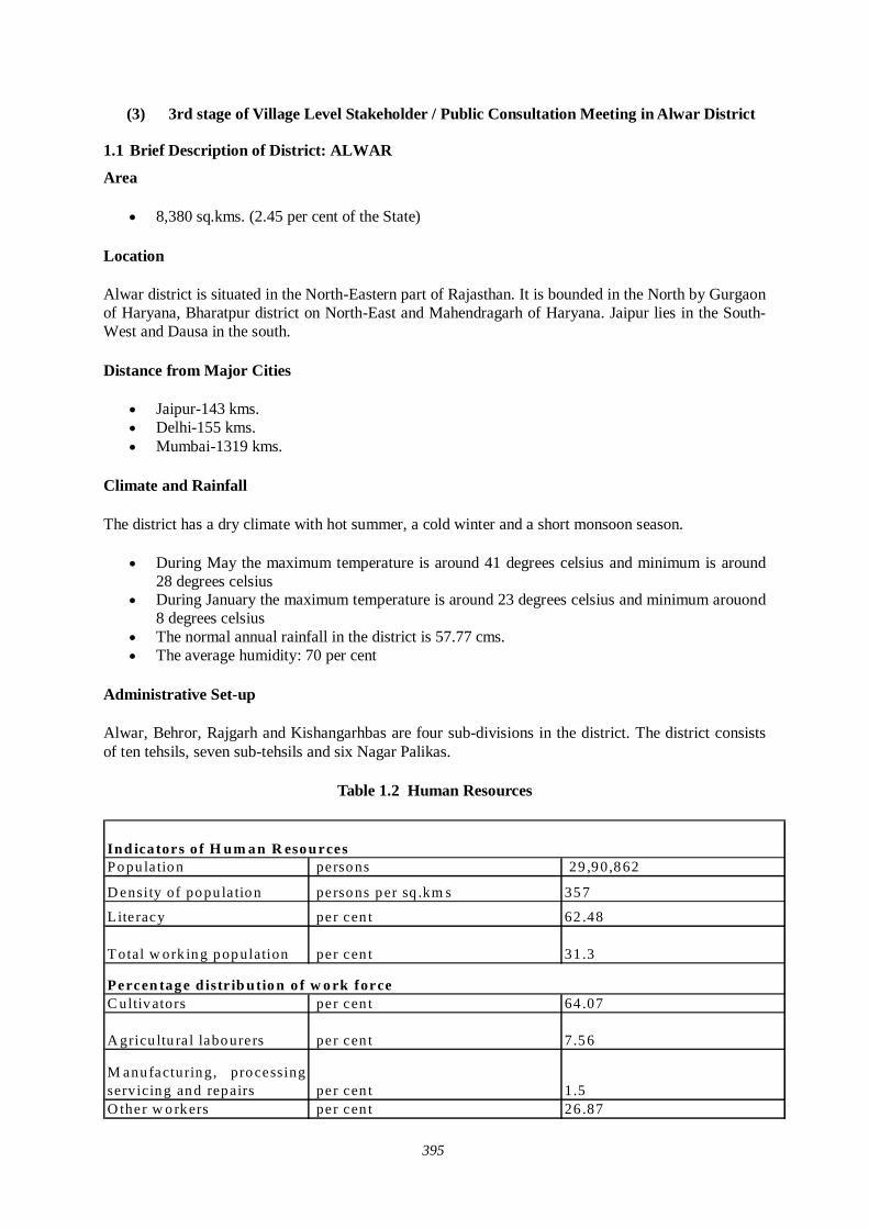
395
(3) 3rd stage of Village Level Stakeholder / Public Consultation Meeting in Alwar District
1.1 Brief Description of District: ALWAR
Area
8,380 sq.kms. (2.45 per cent of the State)
Location
Alwar district is situated in the North-Eastern part of Rajasthan. It is bounded in the North by Gurgaon of Haryana, Bharatpur district on North-East and Mahendragarh of Haryana. Jaipur lies in the South-West and Dausa in the south.
Distance from Major Cities
Jaipur-143 kms. Delhi-155 kms. Mumbai-1319 kms.
Climate and Rainfall
The district has a dry climate with hot summer, a cold winter and a short monsoon season.
During May the maximum temperature is around 41 degrees celsius and minimum is around 28 degrees celsius
During January the maximum temperature is around 23 degrees celsius and minimum arouond 8 degrees celsius
The normal annual rainfall in the district is 57.77 cms. The average humidity: 70 per cent
Administrative Set-up
Alwar, Behror, Rajgarh and Kishangarhbas are four sub-divisions in the district. The district consists of ten tehsils, seven sub-tehsils and six Nagar Palikas.
Table 1.2 Human Resources
Popu la tion persons 29 ,90,862
D ensity of popu la tion persons per sq .km s 357
Literacy per cen t 62 .48
T otal w ork ing population per cen t 31 .3
C ultivators per cen t 64 .07
A gricu ltu ra l labourers per cen t 7.56
M anufacturing, processingservicing and repairs per cen t 1.5O ther w orkers per cen t 26 .87
Ind ica tors o f H um an R esources
Percen tage d istr ib ution o f w ork force
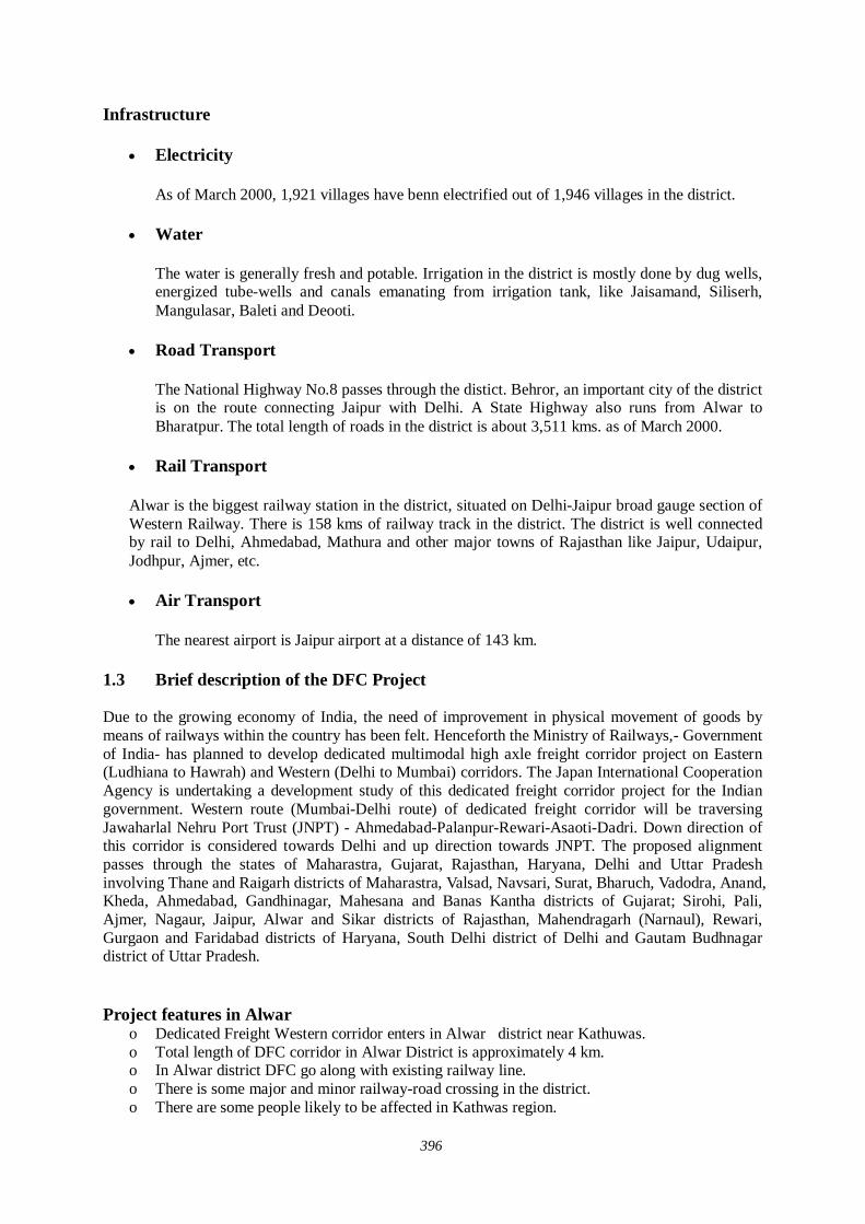
396
Infrastructure
Electricity
As of March 2000, 1,921 villages have benn electrified out of 1,946 villages in the district.
Water
The water is generally fresh and potable. Irrigation in the district is mostly done by dug wells, energized tube-wells and canals emanating from irrigation tank, like Jaisamand, Siliserh, Mangulasar, Baleti and Deooti.
Road Transport
The National Highway No.8 passes through the distict. Behror, an important city of the district is on the route connecting Jaipur with Delhi. A State Highway also runs from Alwar to Bharatpur. The total length of roads in the district is about 3,511 kms. as of March 2000.
Rail Transport
Alwar is the biggest railway station in the district, situated on Delhi-Jaipur broad gauge section of Western Railway. There is 158 kms of railway track in the district. The district is well connected by rail to Delhi, Ahmedabad, Mathura and other major towns of Rajasthan like Jaipur, Udaipur, Jodhpur, Ajmer, etc.
Air Transport
The nearest airport is Jaipur airport at a distance of 143 km.
1.3 Brief description of the DFC Project Due to the growing economy of India, the need of improvement in physical movement of goods by means of railways within the country has been felt. Henceforth the Ministry of Railways,- Government of India- has planned to develop dedicated multimodal high axle freight corridor project on Eastern (Ludhiana to Hawrah) and Western (Delhi to Mumbai) corridors. The Japan International Cooperation Agency is undertaking a development study of this dedicated freight corridor project for the Indian government. Western route (Mumbai-Delhi route) of dedicated freight corridor will be traversing Jawaharlal Nehru Port Trust (JNPT) - Ahmedabad-Palanpur-Rewari-Asaoti-Dadri. Down direction of this corridor is considered towards Delhi and up direction towards JNPT. The proposed alignment passes through the states of Maharastra, Gujarat, Rajasthan, Haryana, Delhi and Uttar Pradesh involving Thane and Raigarh districts of Maharastra, Valsad, Navsari, Surat, Bharuch, Vadodra, Anand, Kheda, Ahmedabad, Gandhinagar, Mahesana and Banas Kantha districts of Gujarat; Sirohi, Pali, Ajmer, Nagaur, Jaipur, Alwar and Sikar districts of Rajasthan, Mahendragarh (Narnaul), Rewari, Gurgaon and Faridabad districts of Haryana, South Delhi district of Delhi and Gautam Budhnagar district of Uttar Pradesh.
Project features in Alwar o Dedicated Freight Western corridor enters in Alwar district near Kathuwas. o Total length of DFC corridor in Alwar District is approximately 4 km. o In Alwar district DFC go along with existing railway line. o There is some major and minor railway-road crossing in the district. o There are some people likely to be affected in Kathwas region.
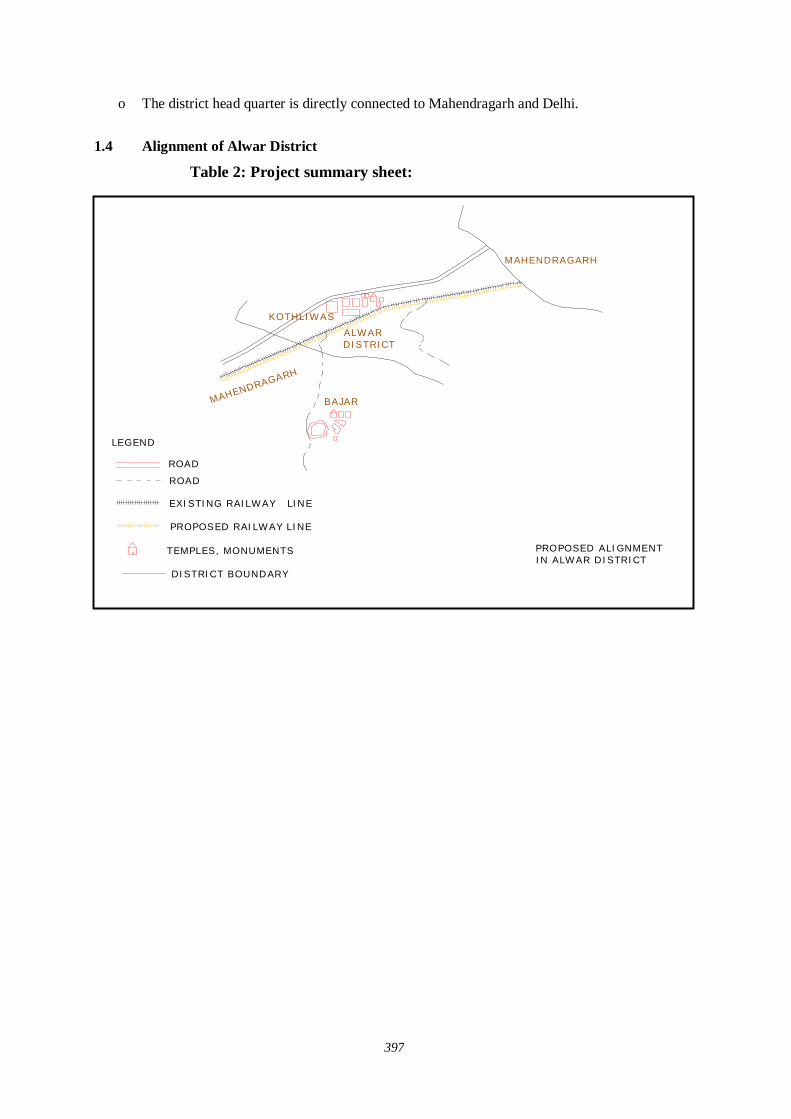
397
o The district head quarter is directly connected to Mahendragarh and Delhi.
1.4 Alignment of Alwar District Table 2: Project summary sheet:
KOTHLIWAS
BAJAR
EXISTING RAILWAY LINE
PROPOSED RAILWAY LINE
ROAD
TEMPLES, MONUMENTS PROPOSED ALIGNMENTIN ALWAR DISTRICT
MAHENDRAGARH
ALWAR DISTRICT
MAHENDRAGARH
DISTRICT BOUNDARY
ROAD
LEGEND
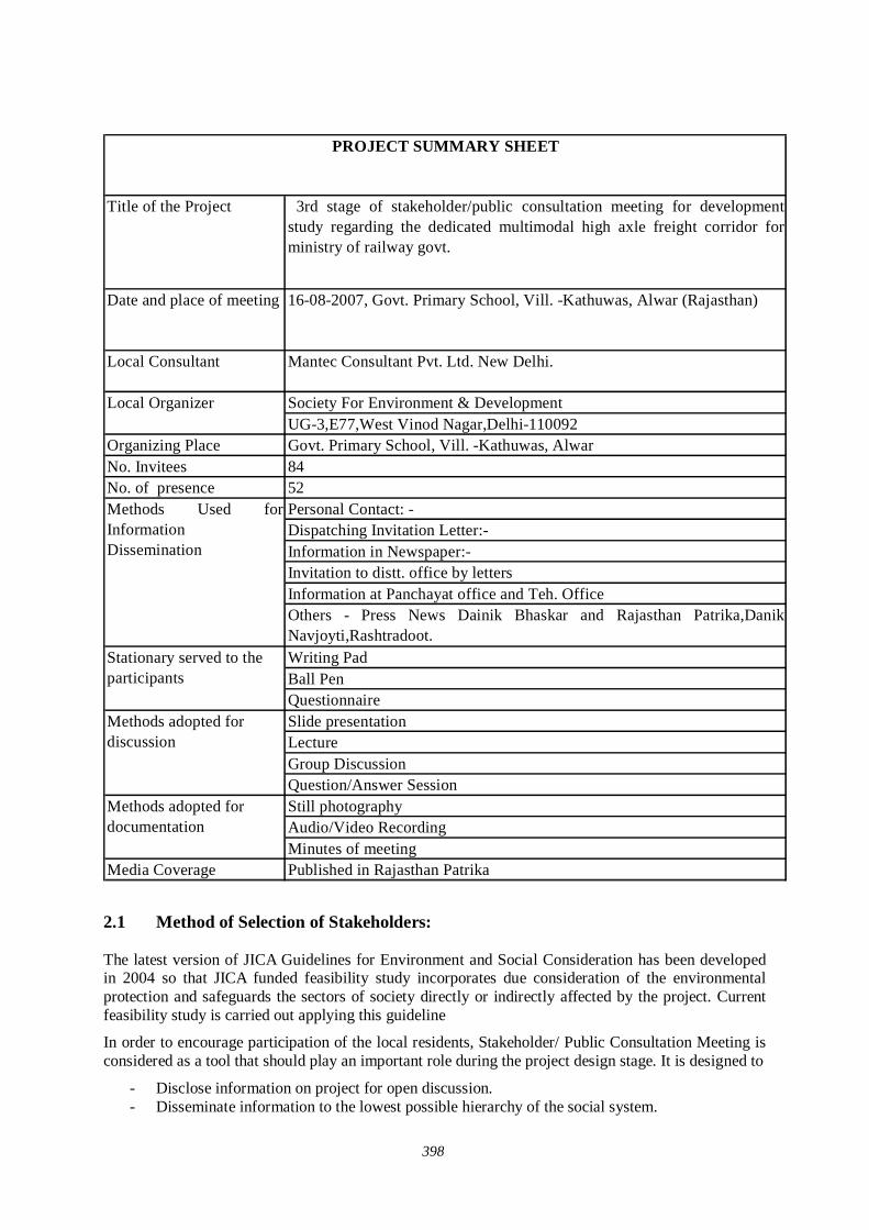
398
Title of the Project 3rd stage of stakeholder/public consultation meeting for developmentstudy regarding the dedicated multimodal high axle freight corridor forministry of railway govt.
Society For Environment & DevelopmentUG-3,E77,West Vinod Nagar,Delhi-110092
Organizing Place Govt. Primary School, Vill. -Kathuwas, AlwarNo. Invitees 84No. of presence 52
Personal Contact: -Dispatching Invitation Letter:-Information in Newspaper:-Invitation to distt. office by lettersInformation at Panchayat office and Teh. Office Others - Press News Dainik Bhaskar and Rajasthan Patrika,DanikNavjoyti,Rashtradoot. Writing PadBall PenQuestionnaireSlide presentation LectureGroup DiscussionQuestion/Answer SessionStill photography Audio/Video RecordingMinutes of meeting
Media Coverage Published in Rajasthan Patrika
Methods adopted for documentation
Local Organizer
Methods Used forInformation Dissemination
Stationary served to the participants
Methods adopted for discussion
PROJECT SUMMARY SHEET
Date and place of meeting 16-08-2007, Govt. Primary School, Vill. -Kathuwas, Alwar (Rajasthan)
Local Consultant Mantec Consultant Pvt. Ltd. New Delhi.
2.1 Method of Selection of Stakeholders: The latest version of JICA Guidelines for Environment and Social Consideration has been developed in 2004 so that JICA funded feasibility study incorporates due consideration of the environmental protection and safeguards the sectors of society directly or indirectly affected by the project. Current feasibility study is carried out applying this guideline
In order to encourage participation of the local residents, Stakeholder/ Public Consultation Meeting is considered as a tool that should play an important role during the project design stage. It is designed to
- Disclose information on project for open discussion. - Disseminate information to the lowest possible hierarchy of the social system.
399
- Obtain interaction of the participants of Stakeholder/Public Consultation Meetings. - Reflect the valid comments elicited from the open discussions to the design of the project. - Build a consensus on the project implementation and associated factors.
There are three stages of Stakeholder and Public Consultation Meetings. The first stage of Stakeholder/Public Consultation Meeting is held on state level, followed by second stage of Stakeholder/ Public Consultation Meeting held in the districts, and the third stage of stakeholder/ public consultation meeting is held in the villages directly affected by the project.
The Mantec Consultants Pvt. Ltd has already organized first stage of Stakeholder/Public Consultation Meeting in the state of Rajasthan and second stage at Behror (Alwar) in association with Society for Environment & Development in the month of June, 2007.
To organize the third stage of Stakeholder/ Public Consultation Meeting, Mantec consultants has authorized "Society For Environment and Development" to meet the concerned government authorities and collect relevant data for carrying forward the social environment study and organize second stage of Stakeholder/Public Consultation Meeting for information dissemination about the project. As per direction of the guidelines for conducting the 3rd stage of the Stakeholder/ Public Consultation Meetings a formal order of the Ministry of Railways was got issued vide their letter dated 01-06-07 to facilitate these meetings .
Further, continuous efforts were made to keep the Ministry of Railways involved in the project as the major stakeholder through their local set-up. Rehabilitation Commissioners were also appointed from the state government departments. Similarly Department of Environment and Forestry and State Pollution Control Boards were contacted to participate in the Meetings. State Government Departments were also apprised and approached and were invited to participate in the Stakeholders/Public Consultation Meetings including the State Public Works Department, Irrigation and Power, Urban Development and Poverty Alleviation Department, industries, telecommunication and Information technology Trade and Commerce, Surface Transport, Tourism, Container/Corporation of India, Port Trusts etc.
Our meeting Facilitator Team visited all the affected villages and requested Primary and Secondary Stakeholders to attend the meeting. Our meeting facilitator team preferred to invite the people who will be affected directly by this project. Our team also met & informed the distt. Administration and requested to help in organizing the public meeting successfully. Local stakeholders along the railway line, affected farmers, businessmen, private service and Govt. service employees were invited in the meeting. Our study team also contacted Tehsildars of affected Tehsils, Panchayat Samiti Pramukhs, Gram Pradhan & local MLA and requested them to attend the meeting and also gave necessary support in conducting second stage of Stakeholder/Public Consultation Meeting. Public consultation on proposed Dedicated Fright Corridor (DFC) was held in village Kathuwas (Alwar) on 16th August, 2007 at Govt. Primary School. Extensive publicity was done one week prior to the program through distribution of pamphlets, one to one meetings, announcement through loudspeakers in villages and newspaper releases. Around 84 people directly and many more times indirectly were invited for the program. Around 52 persons from affected villages, members of market associations, transport unions, industry associations, media and government departments participated. Press Conference was held on 15th August and News was published in leading newspapers like Rajasthan Patrika on 18th August, 2007.
The main objective of the third stage of Stakeholder/Public Consultation Meeting is to disseminate the general information to public. In the State of Rajasthan seven Districts will be affected by this DFC project. Affected districts are Alwar, Sikar, Nagaur, Jaipur, Ajmer, Pali & Sirohi. In the district of Ajmer DFC does follow the existing rail line with one detour of 13 km. at Kishangarh and small diversion in Adarsh Nagar, Ajmer due to congested areas. Therefore new land will be acquired for DFC project especially in Kishangarh. While extending invitations our meeting facilitator team took consideration that the people of that area were present in the meeting. Not only that our meeting facilitator team visited all the affected villages and requested primary and secondary stakeholder to attend the meeting, Satterfield random sampling method was also used for the selection of
400
stakeholders because limited people had to be invited. Our meeting facilitator team also took consideration while extending invitations that vulnerable group of affected area should definitely be present in the meeting.
2.2 Selection of meeting facilitators:- Simultaneously extensive surveys were conducted for the identification of suitable local agencies for the successful organization of the Stakeholders/Public Consultation Meetings.
Preference was given to appoint Non Government Organizations (NGO) who had local presence, popularity and experience of social and public works. The NGO had to be well acquainted with multifarious cross section of society to help in the selection of the right type of stakeholders for the meetings as well as for facilitating other related activities. i.e.
Venue of the meetings Arrangements to be made; Assistance in local publicity; Invitation to the stakeholders and motivating them for participation; Maintenance and compilation of records and feed backs; and Other local arrangements like transport, hospitality, security and smooth conduction of
the meeting proceedings. An NGO ‘Society for Environment & Development’ was therefore appointed for facilitating the Stakeholders/ Public Consultation meeting in the Alwar District.
2.3 Method of Information Dissemination A) Method of Notifying the meeting to the participants:-
1. Notified the date and venue of the Stakeholders/ Public Consultation meeting in local newspaper, Radio, TV and requesting people to attend the meeting.
2. With help of local NGO we tried to put up and handover the information of the project on the public place in the area.
3. With the help of the local NGOs we tried to dissemination the information of the project to the local people by face-to-face meetings as much as possible.
4. With the help of local media we tried to publish the summary of Stakeholders and Public Consultation Meeting in newspaper, TV, Radio.
2.4 Venue of Stakeholder and Public Consultation Meeting Govt. Primary School, Village. -Kathuwas, Alwar
3. Details of Stakeholder/ Public Consultation Meeting The programme was started with Welcome Address by Executive Director, Society for Environment & Development. Sarpanch was present as Chief Guest while the Head Master Presided over the programme. Representative from MANTEC Consultants gave details about the project through power point presentation and invited views from participants. Following were the main points of discussion during the programme –
1. Alignment of the new railway line and affected villages/urban areas. 2. Area to be acquired by the Railways. 3. Compensation package for the affected farmers, shop & house Owners etc. 4. When work will start & completion of project. 5. Economic development of area
401
6. Benefits of the project to general public at large and specific people. 7. Negative impact of the project to specific sector/service.
Stakeholders/ Public consultation meeting is a bottom up approach in this gigantic freight corridor project. It is one of the tools to reflect the views of the general public as well as those concerned with the project ranging from the central and local government organization to commercial and industrial sectors of the society as a whole. It is an important tool of information dissemination during the planning stage of project.
4:00 pm
Representative of Society for Environment & Development introduced Guests to the participants. He also gave brief introduction and objectives of organizing the programme and made brief presentation on DFC project to the participants and requested Mantec representative for detailed PowerPoint presentation.
4:20 pm
Mantec representative explained that because of the ever growing economy of India, improvement of physical ability for moving goods by means of railways within the country is considered urgently needed; he also explained that the railway line starting from Mumbai running all the way up to Delhi is dedicated only for freight Corridor and nothing to do with the passengers. Growth of major and minor ports of India, the traffic between Northern Hinterland and Western port and huge traffic of coal, steel and fertilizer is anticipated on Ludhiana- Delhi – Howrah route. He said that there are lots of containers coming into this country from outside and landing at Mumbai and moving by train to Ahmedabad, Jaipur, Delhi upto Ludhiana. On an average approximately 9000 loaded trucks move daily over the corridor, i.e. Delhi- Mumbai Western Corridor and Ludhiana – Howrah Eastern Corridor. He added that Freight Corridor is basically constructed alongside existing double track from Mumbai –Delhi, from palanpur upto Ahmedabad routes. From the city Vadodara adjoining the existing areas drawing up from Rajasthan , because of the congested areas, change all the way upto Mehsana the Freight Corridor has to be constructed avoiding the congestion on existing railway lines.
4:50 pm - Question/Answer session (Detail of question and answer is given separately)
5.30 pm - Distribution of snacks and tea and the meeting ended with vote of thanks by chair.
3.1 Description of Profile of participants: The major observations of the stakeholders/public consultation meeting held at Kathuwas on 16-08-2007 recorded through questionnaire are as follows:
Table -1 Distribution of Respondents by village
Sr. No Name of village / city Total respondent % of Total
1 Khatuwas 52 1002 Total 52 100
The table 1 reveals that there were total fifty two respondents, all natives of village Khatuwas participated in the public consultation meeting on dedicated freight corridor project as this is the only district likely to be affected by DFC.
402
Table -2 Distribution of Participation by level of caste structure
Sr. No Name of Village Total respondent %of total1 Scheduled Caste 5 9.612 Scheduled tribe 0 03 Other backward class 28 53.844 General 19 36.535 Total 52 100
On overall the maximum participation was belong to OBC (53.84%), while the representation of general was the listed second i.e. 36.5%. The data show that Scheduled caste is represented third while Scheduled tribe is nil.
Table 3 Distribution of participants by Family size
Sr. No Categories Total Respondent %of total1 Less than 4 16 30.772 Less than 6 32 61.533 More than 6 4 7.694 Total 52 100
Table 3 brings out that the family size varies from less than four persons to more than six persons in the region. The respondents having highest representation (i.e. less than 6 persons) family size, represented 61.53%. The minimum respondent family size is the more than 6 persons in family (7.69%).
Table 4 Distribution of participants by origin
Sr. No Categories Numbers % of total1 Native 50 96.152 Migrated 2 3.843 Total 52 100
Table 4 points out that majority (96.15 %) of the respondents are original inhabitants of the region. Only about 3.84% participants have reported as migrated from outside. No views were given on majority issues in the public consultation meeting.
Table 5 Distribution of participants by Literacy Status
Sr. No Categories Numbers % of Total1 Literate 52 1002 Illiterate 0 03 Total 52 100
Table 5 indicates that all the people participating in the public consultation meeting were literate.
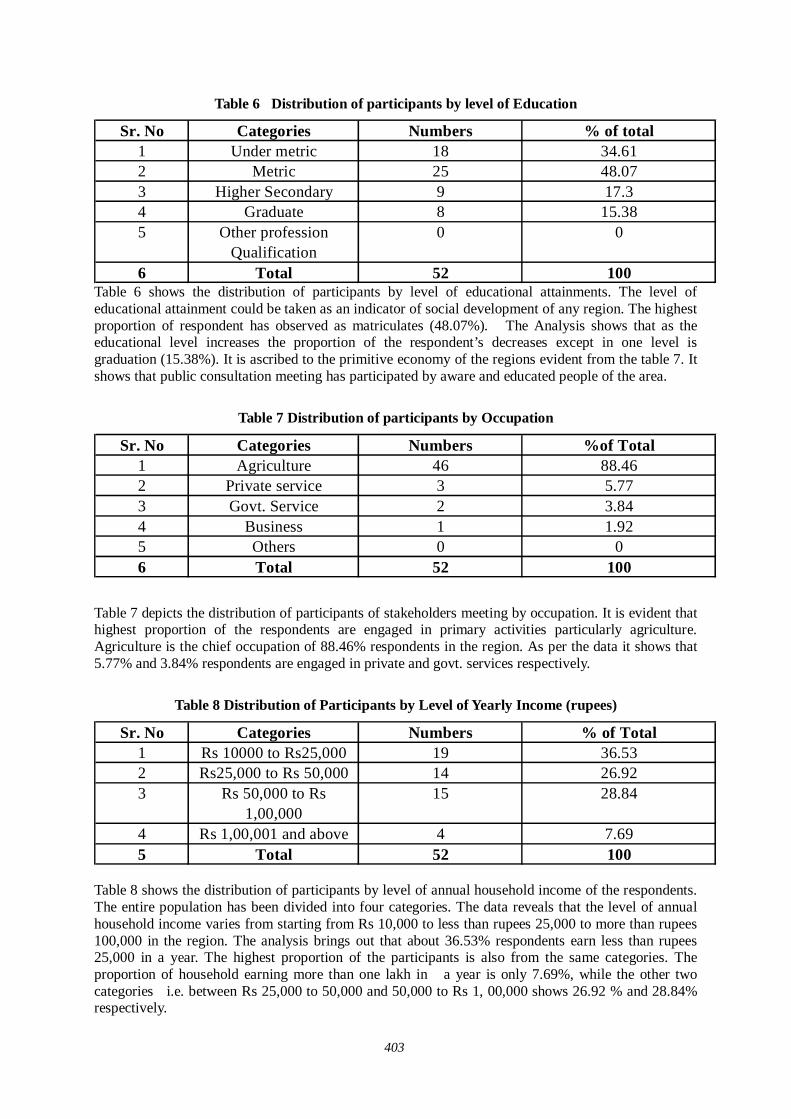
403
Table 6 Distribution of participants by level of Education
Sr. No Categories Numbers % of total1 Under metric 18 34.612 Metric 25 48.073 Higher Secondary 9 17.34 Graduate 8 15.385 Other profession
Qualification0 0
6 Total 52 100 Table 6 shows the distribution of participants by level of educational attainments. The level of educational attainment could be taken as an indicator of social development of any region. The highest proportion of respondent has observed as matriculates (48.07%). The Analysis shows that as the educational level increases the proportion of the respondent’s decreases except in one level is graduation (15.38%). It is ascribed to the primitive economy of the regions evident from the table 7. It shows that public consultation meeting has participated by aware and educated people of the area.
Table 7 Distribution of participants by Occupation
Sr. No Categories Numbers %of Total1 Agriculture 46 88.462 Private service 3 5.773 Govt. Service 2 3.844 Business 1 1.925 Others 0 06 Total 52 100
Table 7 depicts the distribution of participants of stakeholders meeting by occupation. It is evident that highest proportion of the respondents are engaged in primary activities particularly agriculture. Agriculture is the chief occupation of 88.46% respondents in the region. As per the data it shows that 5.77% and 3.84% respondents are engaged in private and govt. services respectively.
Table 8 Distribution of Participants by Level of Yearly Income (rupees)
Sr. No Categories Numbers % of Total1 Rs 10000 to Rs25,000 19 36.532 Rs25,000 to Rs 50,000 14 26.923 Rs 50,000 to Rs
1,00,00015 28.84
4 Rs 1,00,001 and above 4 7.695 Total 52 100
Table 8 shows the distribution of participants by level of annual household income of the respondents. The entire population has been divided into four categories. The data reveals that the level of annual household income varies from starting from Rs 10,000 to less than rupees 25,000 to more than rupees 100,000 in the region. The analysis brings out that about 36.53% respondents earn less than rupees 25,000 in a year. The highest proportion of the participants is also from the same categories. The proportion of household earning more than one lakh in a year is only 7.69%, while the other two categories i.e. between Rs 25,000 to 50,000 and 50,000 to Rs 1, 00,000 shows 26.92 % and 28.84% respectively.
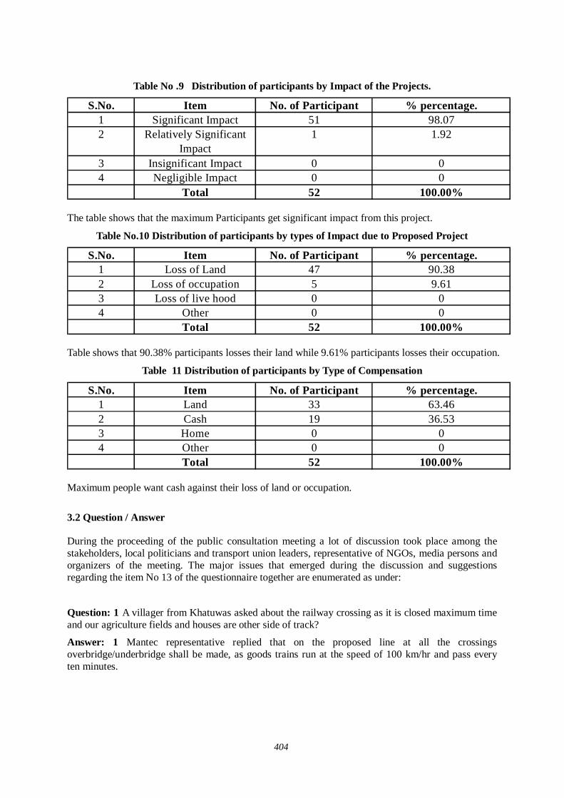
404
Table No .9 Distribution of participants by Impact of the Projects.
S.No. Item No. of Participant % percentage.1 Significant Impact 51 98.072 Relatively Significant
Impact1 1.92
3 Insignificant Impact 0 04 Negligible Impact 0 0
Total 52 100.00% The table shows that the maximum Participants get significant impact from this project.
Table No.10 Distribution of participants by types of Impact due to Proposed Project
S.No. Item No. of Participant % percentage.1 Loss of Land 47 90.382 Loss of occupation 5 9.613 Loss of live hood 0 04 Other 0 0
Total 52 100.00% Table shows that 90.38% participants losses their land while 9.61% participants losses their occupation.
Table 11 Distribution of participants by Type of Compensation
S.No. Item No. of Participant % percentage.1 Land 33 63.462 Cash 19 36.533 Home 0 04 Other 0 0
Total 52 100.00% Maximum people want cash against their loss of land or occupation.
3.2 Question / Answer During the proceeding of the public consultation meeting a lot of discussion took place among the stakeholders, local politicians and transport union leaders, representative of NGOs, media persons and organizers of the meeting. The major issues that emerged during the discussion and suggestions regarding the item No 13 of the questionnaire together are enumerated as under:
Question: 1 A villager from Khatuwas asked about the railway crossing as it is closed maximum time and our agriculture fields and houses are other side of track?
Answer: 1 Mantec representative replied that on the proposed line at all the crossings overbridge/underbridge shall be made, as goods trains run at the speed of 100 km/hr and pass every ten minutes.
405
Question: 2 A villager from Khatuwas asked about the rate of compensation of land. He said that we are very close to Haryana and our land is same as of Rewari then we should be compensated at par with the farmers of Haryana?
Answer: 2 In this regard Mantec representative has replied that compensation shall be paid as per National Rehabilitation Policy of 2003 of Government of India. If state government wants they can pay more as NRP is for minimum rate.
Question: 3 A villager from Kathuwas has asked that our lands are being sold equal to the rate of Nimbarana then we should be compensated on same rate by railways? At present Govt. rate is Rs. 3 to 3.5 lakh/bigha while in market rate is Rs. 10-12 lakh/bigha. Thus we should be compensated accordingly.
Answer: 3 In context of this Mantec representative has replied that compensation will be decided after taking into consideration of market rate and we are taking market rate of all the villages affected through our partner NGO’s and report this to Railways.
Question: 4 A villager from village Khatuwas asked that maximum compensation be paid to the villagers of our village and they should also be engaged in construction work as labour?
Answer: 4 Mantec representative replied that your suggestions shall be incorporated into the report large number of persons will get employment from the project; he also added that project aims to generate around 6.80 lakhs jobs in the country.
Question: 5 A villager said that compensation should be given at par with the farmers of Rewari and Narnaul; otherwise we will not give land and go for agitation. His other suggestion is to make small passage for villagers to go other side of railway track as schools and other houses are their. So in addition to overbridge/underbridge, as this is far from village, this passage is very necessary and was existed earlier but closed by the railways.
Answer: 5 Mantec representatives replied that in Narnaul officials of district administration has just mentioned market rate of the area and we will also suggest this in our report. The suggestion of small passage will also be forwarded to the DFC Corporation for consideration.
Since there was no other point to discuss the meeting ended with a vote of thanks to the chair.
3.3 Summary of major findings About fifty two respondents of Khatuwas village participated in the public consultation meeting aimed at construction of dedicated freight corridor.
It is also investigated that the occupational pattern in the region is quite diversified. People are engaged in various economic activities. However, agriculture is still the main occupation of the people. The examination of the level of annual household income reveals that there is marked difference in this regard. About major percentage of the respondents posses meager income level i.e. less than rupees 25,000 per year. However, a significant proportion of the respondents have observed earning between Rs 25000 to Rs 50,000. About majority percent respondent reported that they have access to the roads in the area. Majority people are having railway line. Interestingly more than eighty five percent of respondents are in favour of this multi modal dedicated freight corridor.
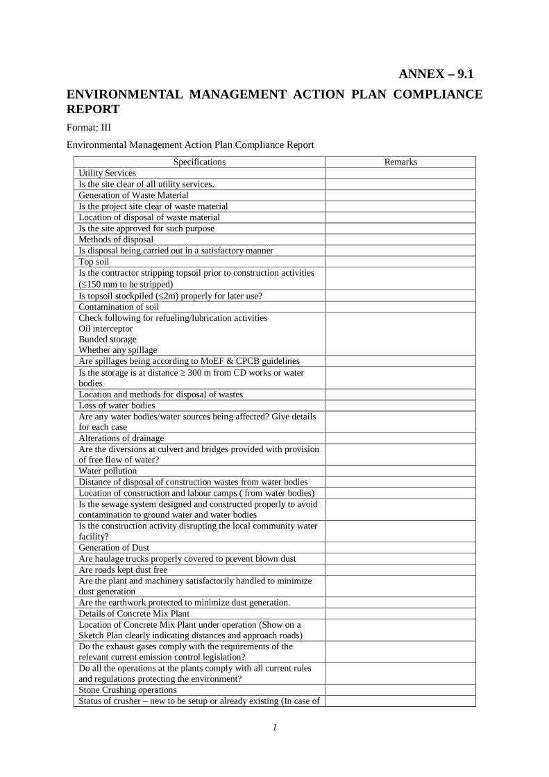
1
ANNEX – 9.1 ENVIRONMENTAL MANAGEMENT ACTION PLAN COMPLIANCE REPORT Format: III
Environmental Management Action Plan Compliance Report
Specifications Remarks Utility Services Is the site clear of all utility services. Generation of Waste Material Is the project site clear of waste material Location of disposal of waste material Is the site approved for such purpose Methods of disposal Is disposal being carried out in a satisfactory manner Top soil Is the contractor stripping topsoil prior to construction activities (150 mm to be stripped)
Is topsoil stockpiled (2m) properly for later use? Contamination of soil Check following for refueling/lubrication activities Oil interceptor Bunded storage Whether any spillage
Are spillages being according to MoEF & CPCB guidelines Is the storage is at distance 300 m from CD works or water bodies
Location and methods for disposal of wastes Loss of water bodies Are any water bodies/water sources being affected? Give details for each case
Alterations of drainage Are the diversions at culvert and bridges provided with provision of free flow of water?
Water pollution Distance of disposal of construction wastes from water bodies Location of construction and labour camps ( from water bodies) Is the sewage system designed and constructed properly to avoid contamination to ground water and water bodies
Is the construction activity disrupting the local community water facility?
Generation of Dust Are haulage trucks properly covered to prevent blown dust Are roads kept dust free Are the plant and machinery satisfactorily handled to minimize dust generation
Are the earthwork protected to minimize dust generation. Details of Concrete Mix Plant Location of Concrete Mix Plant under operation (Show on a Sketch Plan clearly indicating distances and approach roads)
Do the exhaust gases comply with the requirements of the relevant current emission control legislation?
Do all the operations at the plants comply with all current rules and regulations protecting the environment?
Stone Crushing operations Status of crusher – new to be setup or already existing (In case of
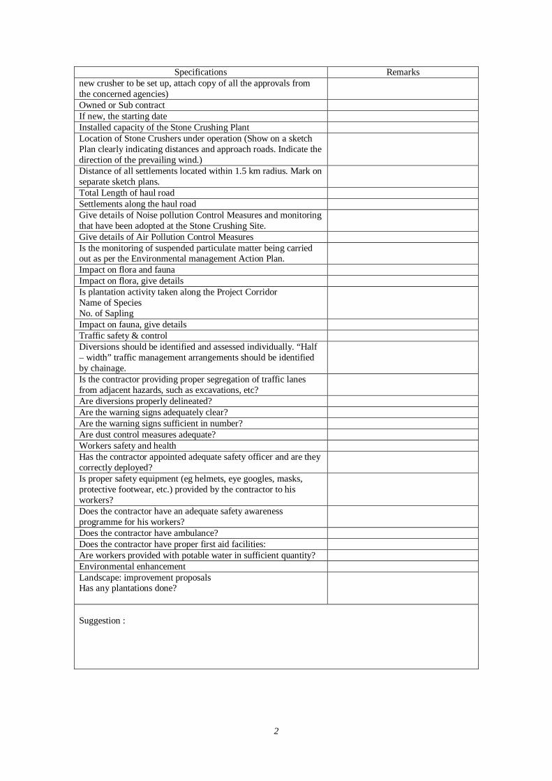
2
Specifications Remarks new crusher to be set up, attach copy of all the approvals from the concerned agencies) Owned or Sub contract If new, the starting date Installed capacity of the Stone Crushing Plant Location of Stone Crushers under operation (Show on a sketch Plan clearly indicating distances and approach roads. Indicate the direction of the prevailing wind.)
Distance of all settlements located within 1.5 km radius. Mark on separate sketch plans.
Total Length of haul road Settlements along the haul road Give details of Noise pollution Control Measures and monitoring that have been adopted at the Stone Crushing Site.
Give details of Air Pollution Control Measures Is the monitoring of suspended particulate matter being carried out as per the Environmental management Action Plan.
Impact on flora and fauna Impact on flora, give details Is plantation activity taken along the Project Corridor Name of Species No. of Sapling
Impact on fauna, give details Traffic safety & control Diversions should be identified and assessed individually. “Half – width” traffic management arrangements should be identified by chainage.
Is the contractor providing proper segregation of traffic lanes from adjacent hazards, such as excavations, etc?
Are diversions properly delineated? Are the warning signs adequately clear? Are the warning signs sufficient in number? Are dust control measures adequate? Workers safety and health Has the contractor appointed adequate safety officer and are they correctly deployed?
Is proper safety equipment (eg helmets, eye googles, masks, protective footwear, etc.) provided by the contractor to his workers?
Does the contractor have an adequate safety awareness programme for his workers?
Does the contractor have ambulance? Does the contractor have proper first aid facilities: Are workers provided with potable water in sufficient quantity? Environmental enhancement Landscape: improvement proposals Has any plantations done?
Suggestion :