Water Level Observing Technologies Overview - Mitigation ...
31
1 Sutron Corporation Hydrological, Meteorological, Oceanic, Geotechnical, Aviation, and Air Quality sutron.com Water Level Observing Technologies Overview June 3, 2014 Presented By: Dan Farrell Sutron R&D
-
Upload
khangminh22 -
Category
Documents
-
view
2 -
download
0
Transcript of Water Level Observing Technologies Overview - Mitigation ...
1Sutron Corporation Hydrological, Meteorological, Oceanic, Geotechnical, Aviation, and Air Quality sutron.com
Water Level Observing Technologies Overview
June 3, 2014
Presented By:Dan FarrellSutron R&D
2Sutron Corporation Hydrological, Meteorological, Oceanic, Geotechnical, Aviation, and Air Quality sutron.com
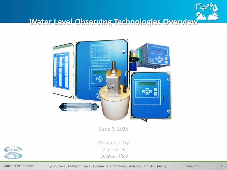
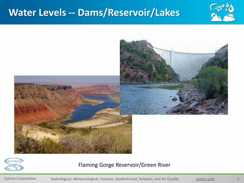
Water Levels -- Dams/Reservoir/Lakes
Flaming Gorge Reservoir/Green River

3Sutron Corporation Hydrological, Meteorological, Oceanic, Geotechnical, Aviation, and Air Quality sutron.com
Water Levels -- Oceans/Ports/Tidal Areas
MARINEMET Radar Tide Station in Praia, Cape Verde
4Sutron Corporation Hydrological, Meteorological, Oceanic, Geotechnical, Aviation, and Air Quality sutron.com
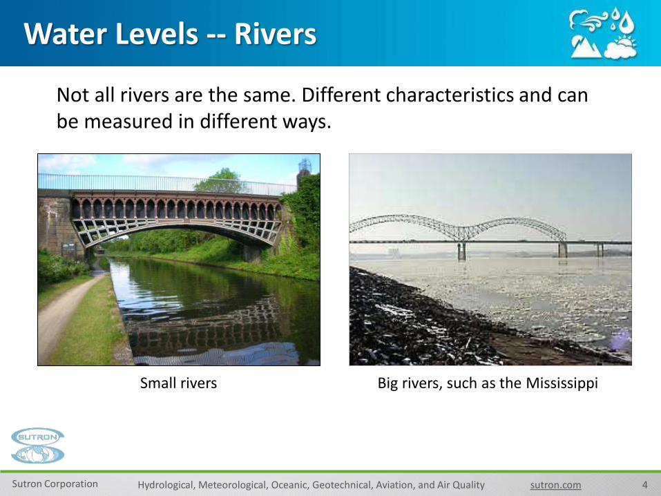
Water Levels -- Rivers
Big rivers, such as the MississippiSmall rivers
Not all rivers are the same. Different characteristics and can be measured in different ways.

5Sutron Corporation Hydrological, Meteorological, Oceanic, Geotechnical, Aviation, and Air Quality sutron.com
Water Levels -- Streams/Creeks
Stilling well measuring a small stream Automatic Weather Station (AWS)also measuring a creek
Small streams and creeks can also be very different

6Sutron Corporation Hydrological, Meteorological, Oceanic, Geotechnical, Aviation, and Air Quality sutron.com
Water Levels -- Dry/Flashy Sites
Dry Channels may rise quickly during a major rain event. What type of sensor would be the correct choice?

7Sutron Corporation Hydrological, Meteorological, Oceanic, Geotechnical, Aviation, and Air Quality sutron.com
Water Levels -- Groundwater
Real-Time Ground Water Monitoring

8Sutron Corporation Hydrological, Meteorological, Oceanic, Geotechnical, Aviation, and Air Quality sutron.com
Water Levels -- Sensors Types
Stilling Well (Shaft Encoder)
Bubbler
Radar (non-contact)
Submersible Pressure Transducer

9Sutron Corporation Hydrological, Meteorological, Oceanic, Geotechnical, Aviation, and Air Quality sutron.com
Submersible Pressure Transducer

10Sutron Corporation Hydrological, Meteorological, Oceanic, Geotechnical, Aviation, and Air Quality sutron.com
Submersible Pressure Transducer cont.
When to Use Submersible PT:• Groundwater Application
• Cost effective
• Quick Deployment

11Sutron Corporation Hydrological, Meteorological, Oceanic, Geotechnical, Aviation, and Air Quality sutron.com
Bubbler
Snake River, below Jackson Lake
12Sutron Corporation Hydrological, Meteorological, Oceanic, Geotechnical, Aviation, and Air Quality sutron.com
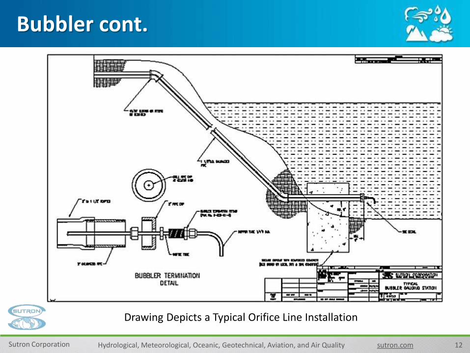
Bubbler cont.
Drawing Depicts a Typical Orifice Line Installation

13Sutron Corporation Hydrological, Meteorological, Oceanic, Geotechnical, Aviation, and Air Quality sutron.com
Bubbler cont.
Dual orifice bubblers offer the following advantages:• Two dedicated water level readings• Density calculations using fixed known vertical orifice separation• Salinity calculations using optional temp sensor• Sedimentation calculations using the density and salinity
Dual Orifice Bubbler
14Sutron Corporation Hydrological, Meteorological, Oceanic, Geotechnical, Aviation, and Air Quality sutron.com
Bubbler cont.
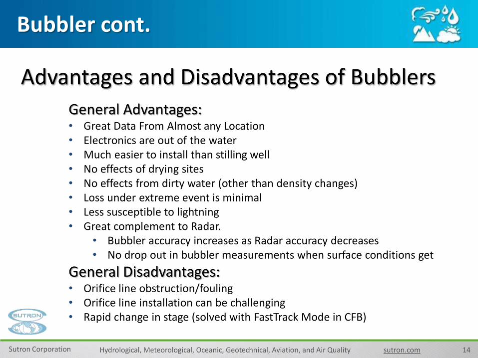
Advantages and Disadvantages of Bubblers
General Advantages:• Great Data From Almost any Location• Electronics are out of the water• Much easier to install than stilling well• No effects of drying sites• No effects from dirty water (other than density changes)• Loss under extreme event is minimal• Less susceptible to lightning• Great complement to Radar.
• Bubbler accuracy increases as Radar accuracy decreases• No drop out in bubbler measurements when surface conditions get
General Disadvantages:• Orifice line obstruction/fouling• Orifice line installation can be challenging• Rapid change in stage (solved with FastTrack Mode in CFB)

15Sutron Corporation Hydrological, Meteorological, Oceanic, Geotechnical, Aviation, and Air Quality sutron.com
Installation Examples
Bridge Monitoring Station with Rain Gauge
Orifice Line
16Sutron Corporation Hydrological, Meteorological, Oceanic, Geotechnical, Aviation, and Air Quality sutron.com
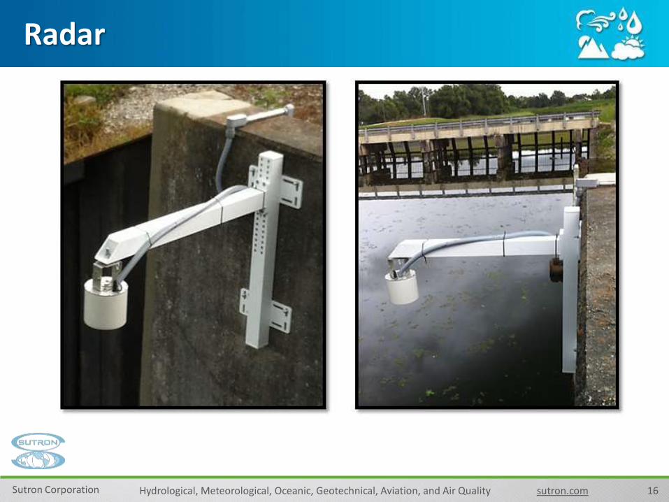
Radar
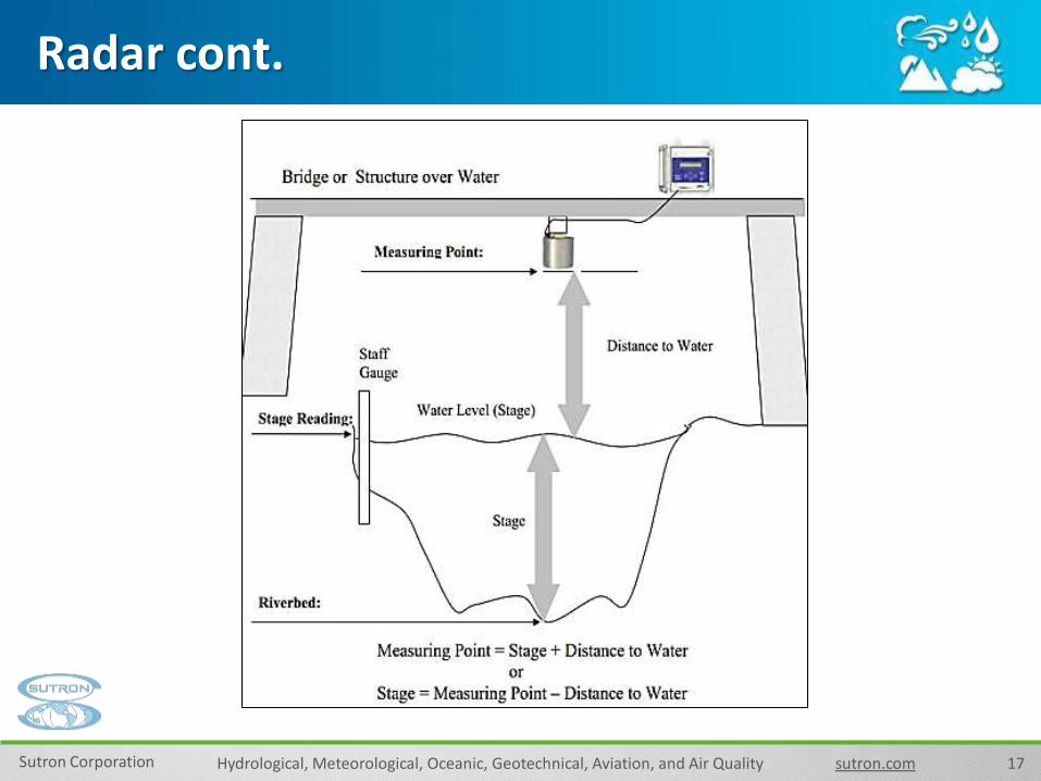
17Sutron Corporation Hydrological, Meteorological, Oceanic, Geotechnical, Aviation, and Air Quality sutron.com
Radar cont.

18Sutron Corporation Radar Level Recorder (RLR) sutron.com
• Some radars estimate distance to water using time-of-flight principle
• Other radars use FMCW (Frequency Modulated Continuous Wave).
• Radar transmits a RF pulse or CW.
• When it hits water surface, a reflected pulse is sent back towards the radar.
• Radar analyzes the pulse and constructs range profile.
Radar cont.

19Sutron Corporation Hydrological, Meteorological, Oceanic, Geotechnical, Aviation, and Air Quality sutron.com
Radar cont.
When to Use Radars:• Existing Structure
• Surface Water Application
• Rapid Deployment
20Sutron Corporation Hydrological, Meteorological, Oceanic, Geotechnical, Aviation, and Air Quality sutron.com
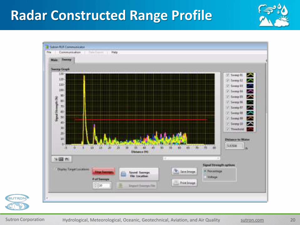
(In Slide Show View click for animated demonstration of the Profiler.)
Radar Constructed Range Profile
21Sutron Corporation Hydrological, Meteorological, Oceanic, Geotechnical, Aviation, and Air Quality sutron.com
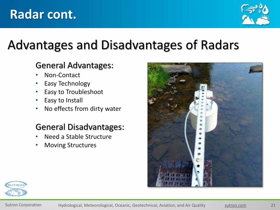
Radar cont.
Advantages and Disadvantages of Radars
General Advantages:• Non-Contact• Easy Technology• Easy to Troubleshoot• Easy to Install• No effects from dirty water
General Disadvantages:• Need a Stable Structure• Moving Structures

22Sutron Corporation Hydrological, Meteorological, Oceanic, Geotechnical, Aviation, and Air Quality sutron.com
[Caption]
RLR Performance
Internal study by Sutron showing RLR as a reliable alternative to bubbler systemSutron Radar stage measurements track Sutron Bubbler measurements closely
Comparing Sutron Accubar and Sutron Radar in stage measurements

23Sutron Corporation Hydrological, Meteorological, Oceanic, Geotechnical, Aviation, and Air Quality sutron.com
RLR Wave Height Estimation
Hm0 is Significant wave height data
Sutron Radar closely follows the reference underwater 6m AWAC sensors.
Tp is peak wave period
Data are provided by the Field Research Facility, Field Data Collections and Analysis Branch,
US Army Corps of Engineers, Duck, North Carolina and NOS Chesapeake, Virginia.

24Sutron Corporation Hydrological, Meteorological, Oceanic, Geotechnical, Aviation, and Air Quality sutron.com
New Mesh Networks Eliminate Wiring and work with all type sensors

25Sutron Corporation Hydrological, Meteorological, Oceanic, Geotechnical, Aviation, and Air Quality sutron.com
Network Sensor using wireless link
• Multiple Sutron Radar Level Recorders can be connected to the same network.
• A single datalogger can acquire stage values without the cost of complex wiring.

26Sutron Corporation Hydrological, Meteorological, Oceanic, Geotechnical, Aviation, and Air Quality sutron.com
Installation Examples
Pivot Bridge Mounting for Easier Access & Maintenance - Tennessee

27Sutron Corporation Hydrological, Meteorological, Oceanic, Geotechnical, Aviation, and Air Quality sutron.com
Installation Examples
Omo River, Ethiopia

28Sutron Corporation Hydrological, Meteorological, Oceanic, Geotechnical, Aviation, and Air Quality sutron.com
Wells with solar Panel

29Sutron Corporation Hydrological, Meteorological, Oceanic, Geotechnical, Aviation, and Air Quality sutron.com29
•Display Bulletins from NHC and NWS
•Display actual and forecast tides and weather
• Forecast Models
• Precipitation Amounts
• Flooding
•Wind Speeds and Gusts
•Wave Heights
Do Something More with your Data!
Integrate your data with Satellite Imagery, Forecasts, Predictions and data from USGS, USACE, NOAA, NWS
30Sutron Corporation Hydrological, Meteorological, Oceanic, Geotechnical, Aviation, and Air Quality sutron.com
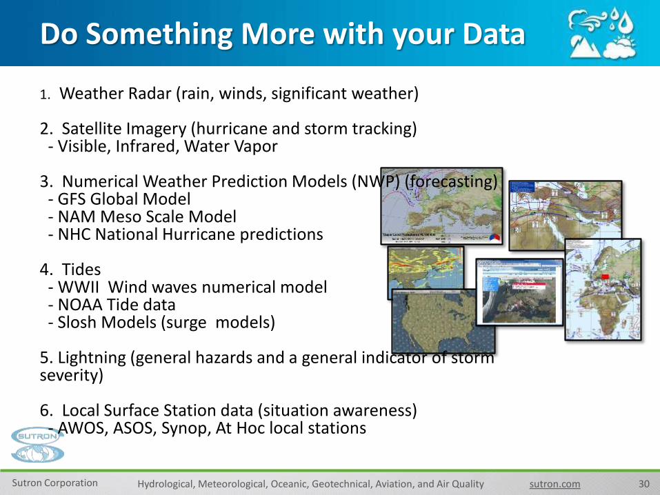
Do Something More with your Data
1. Weather Radar (rain, winds, significant weather)
2. Satellite Imagery (hurricane and storm tracking)- Visible, Infrared, Water Vapor
3. Numerical Weather Prediction Models (NWP) (forecasting)- GFS Global Model- NAM Meso Scale Model- NHC National Hurricane predictions
4. Tides- WWII Wind waves numerical model- NOAA Tide data- Slosh Models (surge models)
5. Lightning (general hazards and a general indicator of storm severity)
6. Local Surface Station data (situation awareness)- AWOS, ASOS, Synop, At Hoc local stations

31Sutron Corporation Hydrological, Meteorological, Oceanic, Geotechnical, Aviation, and Air Quality sutron.com
Do Something Great with your Data!
• Risk Mitigation
• Improved Decision Making
• Heightened Situational Awareness
• Resource Protection
• Resource Conservation
• Alerting