WILDLIFE MANAGEMENT & MITIGATION PLAN FOR ...
79
WILDLIFE MANAGEMENT & MITIGATION PLAN FOR TUMKUR BRANCH CANAL, UPPER BHADRA PROJECT KARNATAKA FOREST DEPARTMENT GOVERNMENT OF KARNATAKA Environmental Health & Safety Consultants Pvt. Ltd., #174/New No.13/2, 14th E Cross, Industrial Town, Agrahara Dasarahalli, Bangalore - 560 044, Karnataka Office of the Executive Engineer, Visvesvaraya Jala Nigam Limited, UBP Division No. 9, Anjaneya Seva Samiti Building, Manangi Thanda, Manangi Post, N.H.04, Sira, Tumkuru District -572137, KA AUGUST 2019
-
Upload
khangminh22 -
Category
Documents
-
view
4 -
download
0
Transcript of WILDLIFE MANAGEMENT & MITIGATION PLAN FOR ...

WILDLIFE MANAGEMENT & MITIGATION PLAN
FOR
TUMKUR BRANCH CANAL, UPPER BHADRA PROJECT
KARNATAKA FOREST DEPARTMENT GOVERNMENT OF KARNATAKA
Environmental Health & Safety Consultants Pvt. Ltd.,
#174/New No.13/2, 14th E Cross, Industrial Town, Agrahara Dasarahalli,
Bangalore - 560 044, Karnataka
Office of the Executive Engineer, Visvesvaraya Jala Nigam Limited,
UBP Division No. 9, Anjaneya Seva Samiti Building, Manangi Thanda, Manangi Post, N.H.04, Sira,
Tumkuru District -572137, KA
AUGUST 2019

i
ABBREVIATIONS
BPL Below Poverty Line
CA Compensatory Afforestation
CH Chainage
ESZ Eco-Sensitive Zone
GoI Government of India
GoK Government of Karnataka
KSNDMC Karnataka State Natural Disaster Monitoring Centre
MoEF&CC Ministry of Environment, Forest & Climate Change
NBWL National Board for Wildlife
RF Reserve Forest
SBWL State Board for Wildlife
TBC Tumkur Branch Canal
WLS Wild Life Sanctuary

ii
TABLE OF CONTENTS
INTRODUCTION ............................................................................................................................................................. 1
1.1 Preamble ......................................................................................................................................................... 1
1.2 Need for the Project ......................................................................................................................................... 1
1.3 Need for Wildlife Management Plan .......................................................................................................... 2
TUMKUR BRANCH CANAL ......................................................................................................................................... 1
2.1 TUMKUR BRANCH CANAL............................................................................................................................. 1
FLORA IN BUKKAPATNA CHINKARA WLS ......................................................................................................... 1
3.1 Flora in Bukkapatna Chinkara WLS ........................................................................................................... 1
3.2 Demand & timber and non timber forest produce .............................................................................. 2
FAUNA IN BUKKAPATNA CHINKARA WLS ......................................................................................................... 3
4.1 Fauna in thorn and scrub forests of Tumkur Division ....................................................................... 3
4.2 Fauna in Bukkapatna Chinkara WLS ......................................................................................................... 3
4.2.1 Conservation status of mega-faunal species in Bukkapatna Chinkara WLS ................ 4
ANTICIPATED IMPACTS ............................................................................................................................................. 8
5.1 Habitat Fragmentation .................................................................................................................................... 8
5.2 Loss of Habitat .................................................................................................................................................... 8
5.3 Disturbance during project implementation ......................................................................................... 8
5.4 Road kills/accidental fall into canal ........................................................................................................... 9
WILDLIFE MANAGEMENT PLAN ......................................................................................................................... 10
6.1 Provision of wildlife crossings .................................................................................................................. 10
6.1.1 Single Lane (over pass) bridges ....................................................................................................... 12
6.1.2 Underpasses (culverts) ....................................................................................................................... 12

iii
6.3 Super passages ........................................................................................................................................... 13
6.4 Foot bridges ................................................................................................................................................. 13
6.2 Mitigation of impacts during project implementation phase ....................................................... 13
6.3 Provision for chain link mesh.................................................................................................................... 14
6.4 Augmenting the factors of habitat ........................................................................................................... 14
6.4.1 Creation of water holes ....................................................................................................................... 14
6.4.2 Plantation along canal banks and single lane (overpass) bridge ........................................ 15
6.5 Provision of animal guides ......................................................................................................................... 17
6.6 Provision of ramps ........................................................................................................................................ 17
6.7 Impact monitoring ......................................................................................................................................... 17
6.8 Compensatory afforestation ...................................................................................................................... 18
COST ESTIMATE ......................................................................................................................................................... 20
REFERENCES ............................................................................................................................................................... 21

iv
TABLE OF FIGURES
Figure 1 Map showing the location and alignment of Tumkur Branch Canal in Bukkapatna
Chinkara WLS. ............................................................................................................................................. 1
Figure 2: Typical view of culvert ......................................................................................................................... 12
Figure 3: Typical view of water holes ............................................................................................................... 15
Figure 4: Typical design of water holes ............................................................................................................. 15
Figure 5: Typical view of ramps ........................................................................................................................... 17

v
LIST OF TABLES
Table 1 Forest land required for diversion to construct Tumkur Branch Canal, Bukkapatna
WLS. .................................................................................................................................................................. 2
Table 2: GPRS Coordinates of Forest land to be diverted for the construction of Tumkur Branch
Canal in Bukkapatna Chinkara WLS..................................................................................................... 3
Table 3: IUCN conservation status, 2019 and Wildlife (Protection) Act, 1972 of the mega-faunal
species recorded in Bukkapatna Chinkara WLS ............................................................................. 4
Table 4: Conservation aspects of mega-faunal species recorded in Bukkapatna Chinkara WLS .. 4
Table 5: Checklist of native tree species proposed for plantation alongside canals and
throughout overpass bridges .............................................................................................................. 16
Table 6 : Details of Forest land required and CA land provided to Karnataka Forest Department
......................................................................................................................................................................... 18
Table 7: Additional Forest Land Required for construction of Tumkur Branch Canal ................... 18
Table 8 : Compensatory Afforestation Land utilization .............................................................................. 19
Table 9 : Cost estimate for implementation of Wildlife Management & mitigation Plan............... 20

vi
ANNEXURES
Annexure-I Command area map of Upper Bhadra Project & Administrative approval
accorded for the project
Annexure-II Map showing alternative analysis of the proposed alignment of TBC in
Bukkapatna Chinkara WLS
Annexure-III SoI Toposheet showing the alignment of TBC in Bukkapatna Chinkara
WLS and mitigation measures
Annexure-IV Geo-referenced village maps showing the alignment of TBC in
Bukkapatna Chinkara WLS
Annexure-V Village maps showing TBC and mitigation measures
Annexure-VI Compensatory Afforestation land suitability certificate, RTC mutation
copy, SoI toposheet and village map showing CA land.

1
INTRODUCTION
1.1 Preamble
Upper Bhadra lift irrigation Scheme envisages lifting of 17.40 TMC of water in first
stage from Tunga River to existing Bhadra reservoir and lifting of 29.90 TMC of
water in second stage from Bhadra reservoir to Tunnel near Ajjampura in
Tungabhadra sub-basin of Krishna basin. After Tunnel, through Chitradurga Branch
Canal and Tumkur Branch Canal, it is planned to irrigate an extent of 2,25,515 ha by
drip irrigation in districts of Chikmagalur, Chitradurga, Tumkur and Davangere. Out
of 29.90 TMC of water, 19.04 TMC of water is earmarked for irrigation and
remaining 10.86 TMC is allocated for filling of MI tanks. Ministry of Environment,
Forests and Climate Change (MoEF&CC), Govt. of India accorded Environmental Clearance
for the proposed project vide letter nos. J-12011/7/2009-IA.I dated 05.01.2010 and J-
12011/7/2009-IA.I (Vol-II) dated 10.07.2017. The map showing the command area of the
project is enclosed as Annexure-I.
Earlier, the proposed project involves diversion of 318.62 Ha of forest land for the
construction of main canal from Tunga River to Bhadra Reservoir (96.95 Ha) for
which the process for obtaining Stage-II Forest Clearance is under process; Bhadra
Reservoir to Ajjampura tunnel (110.10 Ha) and Chitradurga Branch Canal (111.57
Ha) for which Stage II Forest Clearance has been obtained from MoEF&CC, GoI.
However, in case of Chitradurga Branch Canal, the Forest Land requirement has
been reduced to 91.89 Ha and the same has been communicated to Forest
Department for onward submission to MoEF&CC.
The project components of Package-I of Upper Bhadra Project were proposed at a
distance of 1 Km from the Bhadra Tiger Reserve and it falls within the ESZ of Bhadra
Wildlife Sanctuary. In view of this, recommendation from NBWL was obtained vide
Ltr. No. F. No. 6-119/2107 WL; dt: 21.07.2017.
1

2
Further, an additional forest land of 60.10 Ha belonging to Udugere RF (9.28 ha) in
Kadur Taluk, Chikkamagalur District and Bukkapatna RF (50.82 Ha) of Sira Taluk,
Tumkur District is required for construction of Tumkur Branch Canal. Of which the
proposed forest land to be diverted within Bukkapatna RF i.e., 50.82 Ha falls within
the “Bukkapatna Chinkara Wildlife Sanctuary”. Hence, the proposal requires
recommendation of NBWL through SBWL. The map showing the alignment of TBC
in Bukkapatna Chinkara WLS is as given below;

1
Figure 1 Map showing the location and alignment of Tumkur Branch Canal in Bukkapatna Chinkara WLS.

1
1.2 Need for the Project
Challakere, Hiriyur, Holalkere, Molakalmuru and Hosadurga Taluks in Chitradurga
district, Jagalur Taluk in Davanagere district and Chicknayakanahalli, Pavagada and
Sira Taluks are declared as severely drought affected Taluks by Karnataka State
Natural Disaster Monitoring Centre (KSNDMC). Most of the families in the district
are Below Poverty Line (BPL) and the agriculture is dwindling due to the unusual
rainfall. Agriculture is the main economic source of income coupled with low annual
rainfall of the order of 574 mm is posing threat to the livelihood and income of the
people. Large variance in annual rainfall and uncertainty within a year causes the
agriculture a risky venture. The people of the region have no other employment
opportunities except agriculture. Hence providing irrigation and stabilizing the
agricultural production, provides a much needed relief to the people. It improves
the per capita income and standard of living of the people.
Excessive use of nitrate based fertilizers in the aforesaid Taluks, as well as presence
of fluoride underground has resulted in contamination of ground water. This has
made water unpalatable and unhealthy for human consumption. Hence, there is a
need to provide the drinking water for human and domestic consumption and
recharging the existing tanks to dilute the excess salts is of primary concern.
In this context, the project aims at providing sustainable irrigation facilities in Kharif
season, recharge the ground water table and provide drinking water by filling 367
tanks in drought-prone taluks of the above said districts.
The benefits of Tumkur Branch Canal (TBC) under Upper Bhadra Project are as
follows;
1. The area under TBC is dry facing erratic rainfall and droughts that are
common in the region and the TBC runs for about 158 Km from Ajjampura
Tunnel thereby helps in mitigating drought conditions of the region.
2. A total of 375 villages will be benefitted upon implementation of TBC.

2
3. TBC is planning to irrigate 84,900 Ha of command area in Chikkamagalur
District (22130 Ha), Chitradurga District (43555 Ha) and Tumkur District
(19215 Ha).
4. The objectives of TBC include providing drinking water supply and
underground recharge along with filling up of 131 MI tanks in 3 districts.
1.3 Need for Wildlife Management Plan
Out of 60.1 Ha of forest land required for construction of Tumkur Branch Canal (TBC),
50.82 Ha of forest land belongs to Bukkapatna RF which has been notified as “Bukkapatna
Chinkara Wildlife Sanctuary” vide GoK Notification No: FEE 63 FWL 2019; dt:
16.05.2019. The total area of the sanctuary is 13611.47 Ha which acts as a unique habitat
for all 3 types of Antelopes viz., Four horned antelope, Black buck and Chinkara along with
other Scheduled species such as Bear, Leopard, Hyena, Indian Wolf, etc. About 25
mammals, 12 amphibians, 28 reptiles, 54 butterflies and 160 avifaunal species are found in
general in this forest.
Wildlife habitat is considered as the environment used by an animal and is essential for
food, mating, cover and other requirements for survival. Any disturbance or loss of such
habitat will have adverse effect on the overall population of the animals which live in that
area. Whereas, linear projects such as irrigation canal is important to the country for
economic growth and to meet the demands of basic needs of the people. Hence,
incorporating the ecological considerations into modern design techniques will result in
favorable win to win approach to safeguard the interests of both wildlife and people.
In this context, the objectives of the present Wildlife Management & Mitigation plan are as
follows;
To provide a plan to mitigate the impacts due to construction of canal inside the forest
areas.
To provide wildlife-crossings at suitable places, which are comfortable and conducive
for wildlife movement across the proposed canal.

3
There are no sources of water for the wildlife of the Bukkapatna Chinkara WLS except
Boranakanive Lake located about 6 Km from the sanctuary and 2 non perennial lakes
located within the sanctuary.
To provide structures such as crossings, overpass bridges, culverts, water holes, etc so
as not to disrupt the wildlife behaviour and its activities.
To improve the habitat factors by augmenting the availability of water to wildlife
during pinch period and by carrying out plantation of suitable species.
To ensure the safety of wildlife by erecting chain link mesh fence along the canal
abutting the NH-234 for about 4.5 Km to prevent road kills and accidental falls into
the canal.
There are no existing Wildlife structures proposed as part of NH-234 which is further
proposed to be converted into a four lane highway. The Wildlife Management &
Mitigation plan under TBC provides necessary wildlife crossings and structures
essential for the wildlife activities and movements along the canal which abuts the
NH-234 for about 4.5 Km length.
Monitor of wildlife crossings and study the long-term impacts.

1
TUMKUR BRANCH CANAL
2.1 TUMKUR BRANCH CANAL
The Tumkur Branch canal involves diversion of 60.1 Ha of Forest land belonging to
Udugere RF (9.28 Ha) in Kadur Taluk, Chikmagalur District and Bukkapatna RF /
Bukkapatna Chinkara WLS (50.82 Ha) of Sira Taluk, Tumkur District. The total length of
Tumkur Branch Canal is 1,59,684 m; out of which, 7,547 m from CH 150.735 Km to
CH.158.282 Km falls within the Bukkapatna Chinkara WLS. The proposed Tumkur Branch
Canal abuts the NH-234 for about 4.5 Km from CH.153.785 to 156.875 Km within
Bukkapatna Chinkara Wildlife Sanctuary. The proposed TBC passes along the middle of the
Bukkapatna Chinkara WLS thereby avoiding creation of isolated fragments of the WLS. The
proposed alignment of Tumkur Branch Canal was considered after carrying out detailed
studies involving 4 alternatives at Bukkapatna RF. The proposed alignment was found to be
techno-economically feasible since it was finalized based on the irrigation contours and is
also considered to involve the barest minimum forest area compared to the other
alternatives. The map showing alternative analysis for the proposed alignment of TBC is
given as Annexure - II
The project attracts provisions of Forest (Conservation) Act, 1980 and Wildlife (Protection)
Act, 1972 and requires approval from Regional Office, MoEF&CC and NBWL through SBWL
respectively for diversion of Forest and Wildlife land. The application seeking prior
approval of Central Government under Section 2 of Forest (Conservation) Act, 1980 has
been submitted to the Deputy Conservator of Forest and District Commissioner of Tumkur
and Chikmagalur Districts respectively on 18.07.2019 for onward site visits and Stage – I
approval.
The SoI map and Geo-referenced maps showing the alignment of TBC in Bukkapatna
Chinkara WLS are annexed as Annexure- III & IV respectively. The chainage wise details of
forest land required for the construction of TBC along with GPRS Coordinates in
Bukkapatna Chinkara Wildlife Sanctuary are as given below;
2

2
Table 1 Forest land required for diversion to construct Tumkur Branch Canal, Bukkapatna WLS.
Sr. No Village Limits Survey
No
Chainage Length of canal in Mtrs.
Canal width
in Mtrs.
Land Required
in ha From To
1
BELLARA
38 150735 150773 38 70 0.27
2 38 150773 150944 171 35 0.6
3 38 150944 151299 355 70 2.49
4 38 151299 151357 58
31 0.18
5 37 4 0.02
6 38 151357 151483 126
3 0.04
7 37 32 0.4
8 37 151483 151533 50
60 0.3
9 33 10 0.05
10 37 151533 151574 41
10 0.04
11 33 60 0.25
12 33 151574 151710 136 70 0.95
13 37 151710 151852 142
20 0.28
14 33 50 0.71
15 37 151852 152034 182
60 1.09
16 33 10 0.18
17 35 152034 152423 389 70 2.72
18 33 152423 152570 147
20 0.29
19 35 50 0.74
20 35 152570 152604 34
15 0.05
21 33 15 0.05
22 33 152604 152629 25 30 0.08
23 33 152629 152819 190 70 1.33
24 33 152819 152949 130 40 0.52
25 32 152949 153078 129 40 0.52
26 32 153078 153973 895 70 6.27
27 32 153973 154000 27 30 0.08
28 32 154000 154225 225 80 1.8
29 32 154225 154240 15
75 0.11
30 Road 5 0.01
31 32
154240 154267 27
4 0.01
32 31 5 0.01
33 Road 71 0.19
34 31 154267 154277 10
75 0.08
35 Road 5 0.01

3
Sr. No Village Limits Survey
No Chainage
Length of canal in Mtrs.
Canal width
in Mtrs.
Land Required
in ha 36 31 154277 154573 296 80 2.37
TOTAL 3838 25.08
1 KANAVIRAMPURA 1 154573 156743 2170 80 17.36
TOTAL 2170 17.36
1
BUDDIGUDDADAKAVALU
22 156743 157022 279 80 2.23
2 22 157022 157044 22
60 0.13
3 23 20 0.04
4 22 157044 157068 24
10 0.02
5 23 70 0.17
6 23 157068 157453 385 80 3.08
7 23 157453 157543 90 40 0.36
8 23 157543 158123 580 25 1.45
9 23 158123 158195 72 35 0.25
10 23 158195 158228 33 70 0.23
11 23 158228 158282 54 75 0.41
TOTAL 1539 8.38
TOTAL EXTENT IN BUKKAPATNA CHINKARA WLS 7547 50.81
Table 2: GPRS Coordinates of Forest land to be diverted for the construction of Tumkur Branch Canal in Bukkapatna Chinkara WLS.
Sl.No GPRS Point
Latitude Longitude
Sl.No GPRS Point
Latitude Longitude
1 Sp 1 13.600100° 76.687075° 39 Dp 56 13.615620° 76.689325°
2 Dp 3 13.600209° 76.687292° 40 Dp 56 13.615620° 76.689325°
3 DP 4 13.600582° 76.687401° 41 Dp 58 13.615536° 76.689417°
4 Dp 5 13.600629° 76.687255° 42 Dp 60 13.615455° 76.689492°
5 Sp 3 13.601042° 76.687374° 43 Dp 62 13.615156° 76.689811°
6 Sp 6 13.601545° 76.687523° 44 Dp 64 13.615040° 76.689967°
7 Dp 5 13.602108° 76.687685° 45 Dp 66 13.614968° 76.690222°
8 Dp 7 13.602073° 76.687843° 46 Dp 68 13.614965° 76.690534°
9 Sp 7 13.602828° 76.688063° 47 Dp 69 13.615093° 76.690537°
10 SP 9 13.603684° 76.688312° 48 Sp 20 13.615105° 76.691049°
11 SP 11 13.604525° 76.688558° 49 Sp 22 13.615092° 76.691756°
12 Dp 9 13.605090° 76.688806° 50 Sp 24 13.615080° 76.692252°
13 Dp 10 13.605158° 76.688646° 51 Sp 26 13.615092° 76.692557°
14 Sp 14 13.605832° 76.688940° 52 Dp 72 13.615209° 76.692922°
15 DP 13 13.606683° 76.689314° 53 Dp 73 13.615078° 76.692922°
16 DP 15 13.606630° 76.689470° 54 Dp 76 13.615199° 76.693123°
17 DP 17 13.607191° 76.689693° 55 Dp 77 13.615340° 76.693280°

4
Sl.No GPRS Point
Latitude Longitude
Sl.No GPRS Point
Latitude Longitude
18 Dp 19 13.607645° 76.689745° 56 Dp 78 13.615597° 76.693476°
19 Dp 21 13.608150° 76.689684° 57 Sp 27 13.616142° 76.693750°
20 Dp 23 13.608744° 76.689458° 58 Sp 29 13.616692° 76.694031°
21 Dp 25 13.609258° 76.689106° 59 Sp 31 13.616892° 76.694119°
22 Dp 27 13.609838° 76.688728° 60 Sp33 13.617040° 76.694171°
23 DP 29 13.610354° 76.688382° 61 Sp 35 13.617208° 76.694193°
24 Dp 31 13.611658° 76.687910° 62 Sp 37 13.617374° 76.694194°
25 Dp 33 13.612014° 76.687824° 63 Sp 39 13.618318° 76.694211°
26 Dp 35 13.612318° 76.687809° 64 Sp 40 13.619401° 76.694231°
27 Dp 37 13.612622° 76.687892° 65 Sp 43 13.619554° 76.694280°
28 SP 13A 13.613301° 76.688186° 66 Sp 45 13.620946° 76.695029°
29 Sp 15 13.614044° 76.688448° 67 Sp 47 13.621495° 76.695753°
30 Sp 17 13.614676° 76.688706° 68 Dp 80 13.621841° 76.696245°
31 Dp 41 13.615353° 76.688980° 69 Dp 81 13.621977° 76.696147°
32 Dp 39 13.615428° 76.688819° 70 Dp 83 13.622125° 76.696358°
33 Dp 43 13.615618° 76.688901° 71 Dp 86 13.621954° 76.696496°
34 Dp 45 13.615724° 76.688969° 72 Dp 87 13.622114° 76.696715°
35 Dp 47 13.615744° 76.689000° 73 Dp 88 13.622286° 76.696840°
36 Dp 49 13.615557° 76.689070° 74 Sp 49 13.622797° 76.696971°
37 Dp 51 13.615656° 76.689158° 75 Sp 51 13.623586° 76.697132°
38 Dp 53 13.615702° 76.689248° 76 Sp 53 13.624534° 76.697267°
82 Sp 55 13.624703° 76.697314° 125 Sp 86 13.632395° 76.717745°
83 Sp 57 13.624891° 76.697430° 126 Sp 83 13.632797° 76.717123°
84 Sp 59 13.625138° 76.697665° 127 Sp 81 13.633118° 76.716238°
85 Sp 63 13.625267° 76.697985° 128 Sp79 13.632970° 76.715365°
86 Sp 64 13.625643° 76.699684° 129 Sp 77 13.630996° 76.712010°
87 Sp 66 13.626112° 76.701661° 130 Sp 75 13.630924° 76.711546°
88 Sp 68 13.627911° 76.705903° 131 Sp 73 13.630635° 76.707867°
89 Sp 70 13.629669° 76.707592° 132 Sp 71 13.630280° 76.707199°
90 Sp 72 13.629987° 76.708201° 133 Sp 69 13.628582° 76.705623°
91 Sp 74 13.630188° 76.711517° 134 Sp 67 13.626813° 76.701458°
92 Sp 76 13.630283° 76.712153° 135 Sp 65 13.626357° 76.699545°
93 Sp 78 13.632299° 76.715625° 136 Sp 64 13.625947° 76.697713°
94 Sp 80 13.632355° 76.716325° 137 Sp 62 13.625799° 76.697381°
95 Sp 82 13.632043° 76.716913° 138 Sp 61 13.625628° 76.697127°
96 Sp 85 13.631669° 76.717611° 139 Sp 60 13.625455° 76.696955°
97 Sp 87 13.631588° 76.718397° 140 Sp 58 13.625183° 76.696740°
98 Sp 89 13.631641° 76.719212° 141 Sp 56 13.624936° 76.696615°
99 Sp 91 13.631690° 76.719998° 142 Sp 54 13.624607° 76.696525°

5
Sl.No GPRS Point
Latitude Longitude
Sl.No GPRS Point
Latitude Longitude
100 Sp 93 13.631196° 76.723012° 143 Sp 52 13.623789° 76.696432°
101 Sp 95 13.631373° 76.723059° 144 Sp 50 13.623181° 76.696312°
102 Sp 97 13.631260° 76.723878° 145 Dp 89 13.622623° 76.696177°
103 Sp 99 13.631330° 76.723900° 146 Dp 85 13.622537° 76.696055°
104 Sp 101 13.630534° 76.729191° 147 Dp 84 13.622351° 76.696183°
105 Sp 102 13.630489° 76.729189° 148 Dp 82 13.622220° 76.695989°
106 Sp 105 13.630383° 76.729839° 149 Dp 79 13.622362° 76.695876°
107 Sp 107 13.630265° 76.729828° 150 Sp 48 13.622006° 76.695383°
108 Sp 109 13.630217° 76.730115° 151 Sp 46 13.621336° 76.694528°
109 Sp 111 13.630167° 76.730122° 152 Sp 44 13.619852° 76.693708°
110 Sp 113 13.630093° 76.730607° 153 Sp 42 13.619726° 76.693654°
111 Sp 114 13.630756° 76.730702° 154 Sp 41 13.619508° 76.693603°
112 Sp 112 13.630834° 76.730225° 155 Sp 38 13.618336° 76.693564°
113 Sp 110 13.630817° 76.730216° 156 Sp 36 13.617509° 76.693548°
114 Sp 108 13.630856° 76.729922° 157 Sp 34 13.617352° 76.693551°
115 Sp 106 13.630702° 76.729889° 158 Sp 32 13.617209° 76.693540°
116 Sp 104 13.630802° 76.729237° 159 Sp 30 13.616997° 76.693469°
117 Sp 103 13.630765° 76.729234° 160 Sp 28 13.616532° 76.693233°
118 Sp 100 13.631565° 76.723939° 161 Sp 28 13.616532° 76.693233°
119 Sp 98 13.631613° 76.723937° 162 Dp 75 13.615969° 76.692938°
120 Sp 96 13.631733° 76.723124° 163 Dp 74 13.615686° 76.692928°
121 Sp 94 13.631917° 76.723136° 157 Dp 71 13.615564° 76.692778°
122 Sp 92 13.632402° 76.719957° 158 Sp 25 13.615461° 76.692559°
123 Sp 90 13.632356° 76.719286° 159 Sp 23 13.615446° 76.692312°
124 Sp 88 13.632308° 76.718476° 160 Sp 21 13.615443° 76.691768°
161 Sp 19 13.615447° 76.691094° 185 Dp 28 13.609587° 76.688123°
162 Dp 70 13.615462° 76.690541° 186 Dp 26 13.609038° 76.688476°
163 Dp 67 13.615597° 76.690527° 187 Dp 24 13.608594° 76.688780°
164 Dp 65 13.615612° 76.690258° 188 Dp 22 13.608187° 76.689004°
165 Dp 63 13.615751° 76.690106° 189 Dp 20 13.607735° 76.689098°
166 Dp 61 13.616031° 76.689816° 190 Dp 18 13.607313° 76.689051°
167 Dp 59 13.616205° 76.689646° 191 DP 16 13.606876° 76.688881°
168 Dp 57 13.616322° 76.689465° 192 Dp 14 13.606794° 76.689055°
169 Dp 54 13.616352° 76.689212° 193 Sp 13 13.605953° 76.688695°
170 Sp 52 13.616298° 76.689020° 194 Dp 11 13.605273° 76.688394°
171 DP 50 13.616212° 76.688848° 195 DP 12 13.605337° 76.688214°
172 Dp 48 13.616026° 76.688909° 196 SP 12 13.604733° 76.687950°
173 Dp 46 13.615947° 76.688820° 197 Sp 10 13.603928° 76.687716°
174 Dp 44 13.615810° 76.688703° 198 SP 8 13.603065° 76.687460°

6
Sl.No GPRS Point
Latitude Longitude
Sl.No GPRS Point
Latitude Longitude
175 Dp 40 13.615533° 76.688562° 199 Dp 8 13.602247° 76.687220°
176 Dp 42 13.615601° 76.688384° 200 Dp 6 13.602203° 76.687379°
177 Sp 18 13.614918° 76.688111° 201 Sp 5 13.601654° 76.687221°
178 Sp 16 13.614330° 76.687882° 202 Sp 4 13.601137° 76.687064°
179 Sp 14 13.613611° 76.687607° 203 Dp 2 13.600718° 76.686941°
180 Dp 38 13.612795° 76.687260° 204 Dp 1 13.600743° 76.686823°
181 Dp 36 13.612402° 76.687175° 205 Sp 2 13.600353° 76.686971°
182 Dp 34 13.612005° 76.687165°
183 DP 32 13.611591° 76.687248°
184 Dp 30 13.610132° 76.687770°

1
FLORA IN BUKKAPATNA CHINKARA WLS
The forests of Tumkur Division consist of a wealth of deciduous species topping a thorny
undergrowth typical of maidan areas of Karnataka. According to Champion & Seth (1968),
Tumkur Forest Division falls under group five of Southern tropical dry deciduous forests.
Low, stunted, brandy poles, and diffuse crown contribute to make up a patchy forest
canopy. The tree growth is poor on account of many unfavorable factors such as inadequate
rainfall, poor shallow soils and biotic factors.
3.1 Flora in Bukkapatna Chinkara WLS
The forest area (Bukkapatna Chinkara WLS) proposed for diversion belongs to
Bukkapatna Range of Tumkur Division.
According to Champion & Seth (1968), the forest land of Bukkapatna Chinkara WLS
belongs to the category “Dry thorny scrub forests”.
Due to biotic factors like lopping, felling, excessive grazing, recurrent fires, poor and
unevenly distributed rainfall and hilly nature, large areas of dry deciduous forests
have degraded to poorer forest types.
The trees tends to be bushy and stunted and do not grow more than five meters tall.
The tree components are almost same as in dry deciduous forests but are
distributed sparsely and vary very much in frequency of their occurrence.
The main tree species includes Acacia sp., Albizia amara, Anogeissus latifolia,
Bauhinia racemosa, Butea monosperma, Dalbergia paniculata, Ixora arborea,
Semecarpus anacardium, Strychnos potatorum, Wrightia tinctoria, Tectona grandis,
Grewia hirsuta, Morinda pubescens, Hardwickia binata, Phyllanthus emblica, Cassia
fistula, Eucalyptus citriodor and Albizia lebbeck.
The undergrowth has Canthium parviflora, Erythroxylum monogynum, Randia
dumetorum, Pterolobium hexapetalum, Lantana camara, Dodonaea viscose, Cassia
auriculata and others.
3

2
3.2 Demand & timber and non timber forest produce
The important forest products of utility in the division are timber, small timber, non-timber
forest products like tamarind, seethaphala, maradi seeds, honey wax, thatching grass,
medicinal plants, myrobolams, Eucalyptus and Casuarina poles. In general the following are
the species identified in the forests of division which cater to the needs of timber, small
timber, non-timber forest products, fruits, fodder and other cultural needs. Industrial
requirement of mineral is also met to some extent. The cement factory at Ammasandra is
the principal consumer of limestone quarried from nearby forests.
Timber and small timber: Acacia nilotica, Acacia auriculiformis, Albizia spp,
Azadirachta indica, Eucalyptus and Casuarina poles.
Bamboo: Dendrocalamus strictus, Bambusa bambos.
Non-timber forest products: Tamarindus indica, Diospyros sp, Annona squamosa,
Buchanania spp, myrobolams, honey and medicinal plants.
Trees considered culturally important: Aegle marmelos, Azadirachta indica, Ficus
bengalensis, Ficus religiosa, Madhuca indica etc.
Minerals: Iron, manganese and limestone.
Bukkapatna Chinkara WLS

3
FAUNA IN BUKKAPATNA CHINKARA WLS
4.1 Fauna in thorn and scrub forests of Tumkur Division
Though the forest cover is not substantial, the forests are inhabited by a variety of animal
life. However, larger animals are scarce in the district. The predominant fauna of the thorn
and shrub forests of Tumkur Division includes Sloth bears, Black bucks, Wild sheeps,
panthers and hares. Some of the other fauna in the Division includes;
Mammals: Common langur, Common fox, Fruit bat, Hyena, Indian porcupine,
Indian wolf, Jackal, Jungle cat, Mice, Mongoose, Rat, Squirrel, Spotted deer,
Wild boar.
Birds: Ashy wren warbler, Black drongo, Black winged kite, Blossom headed
parakeet, Blue Jay, Black headed oriole, Common weaver bird, Crow
pheasant, Chestnut bellied nut hatch, Common myna, Common hawk, Cattle
egret, Common peafowl, Common kingfisher, Grey babbler, Grey wagtail,
Grey jungle fowl, Great horned owl, Gray partridge, Golden backed
woodpecker, House sparrow, Indian robin, Jungle Babbler, Jungle myna,
Jungle crow, Koel, Luggar falcon, Munia, Pied wagtail, Pariah kite, Red vented
bulbul, Red turtledove, Rose ringed parakeet, Whistling thrush.
Reptiles: Cobra, Chameleon, Garden lizard, Krait, Monitor lizard, Python,
Viper.
4.2 Fauna in Bukkapatna Chinkara WLS
The total area of the sanctuary is 13611.47 Ha which acts as a unique habitat for all 3 types
of Antelopes viz., Four horned antelope, Black buck and Chinkara along with other
Scheduled species such as sloth bear, Leopard, Hyena, Indian Wolf, etc. About 25 mammals,
12 amphibians, 28 reptiles, 54 butterflies and 160 avifaunal species are found in general in
this forest.
4

4
4.2.1 Conservation status of mega-faunal species in Bukkapatna Chinkara WLS
Table 3: IUCN conservation status, 2019 and Wildlife (Protection) Act, 1972 of the mega-faunal species recorded in Bukkapatna Chinkara WLS
Sl. No. Common Name Scientific Name IUCN
Conservation status, 2019
Wildlife (Protection) Act,
1972 Schedule 1 Four horned antelope Tetracerus quadricornis (Blainville, 1816) Vulnerable I 2 Black buck Antilope cervicapra (Linnaeus, 1758) Least Concern I 3 Chinkara Gazella bennettii (Sykes, 1831) Least Concern I 4 Sloth bear Melursus ursinus (Shaw, 1791) Vulnerable I 5 Leopard Panthera pardus (Linnaeus, 1758) Vulnerable I 6 Striped Hyena Hyaena hyaena (Linnaeus, 1758) Near Threatened III 7 Indian Wolf Canis lupus pallipes (Sykes, 1831) Not Assessed I
The conservation aspects for the preparation of Wildlife Management & Mitigation Plan of the above mega-fauna are arrived
based on their behaviour, preferable habitats, breeding sites, food and water availability in the region. The details are as given
below;
Table 4: Conservation aspects of mega-faunal species recorded in Bukkapatna Chinkara WLS
Species Behavior Habitat & breeding site Food Conservation aspects to be
considered
Black buck
Primarily grazers, but browse when lack of grasses.
Mainly sedentary, but in summer may move longer distances in search of water and forage.
Require water every day.
Open grassland, dry thorn scrub, scrubland and lightly-wooded country as well as agricultural margins.
Grasses, leaf litter, flowers and fruits
Wildlife crossings to provide accessibility to the resources on the other side of the canal.
Water holes for drinking purpose.
Plantation of flower and fruit bearing species along

5
Species Behavior Habitat & breeding site Food Conservation aspects to be
considered
the canal banks and overpass bridges.
Chinkara
Shy and avoid human habitation.
Nocturnal feeding habits and are most active just prior to sunset and throughout the night.
They are facultative drinkers, and so can live in very arid areas without water for long periods.
They sometimes raid fields cultivated with rape seed and sorghum in desert regions
Arid plains and hills, deserts, dry scrub and light forests.
Their diet typically consists of grasses, herbs, various leaves, crops and fruits.
Herbs preferred includes; Crotalaria burhia (42% of diet), Ziziphus nummularia (15%), Maytenus emerginata (11%), and Prosopis cineraria (9%).
Wildlife crossings to provide accessibility to the resources on the other side of the canal.
Plantation of fruit bearing trees along with preferred herbs along the canal banks and overpass bridges.
Four horned antelope
Primarily grazers, but browse when lack of grasses.
Diurnal and solitary by nature.
Open grassland, dry thorn scrub, scrubland and lightly-wooded country as well as agricultural margins.
Habitats close to water bodies.
Grasses, herbs, shrubs, foliage, flowers and fruits.
Wildlife crossings to provide accessibility to the resources on the other side of the canal.
Water holes for drinking purpose. Plantation of flower and fruit bearing trees along the canal banks and overpass bridges.
Plantation of flower and fruit bearing species along the canal banks and overpass bridges.

6
Species Behavior Habitat & breeding site Food Conservation aspects to be
considered
Indian wolf
Social animal and live in small packs.
Territorial. Nocturnal
Ubiquitous where there is suitable food and prey biomass is highest.
Extremely variable food including moose, caribou, deer, wild boar, smaller prey items, livestock, carrion, garbage, etc.
Wildlife crossings to provide accessibility to the resources on the other side of the canal.
Water holes for drinking purpose.
Leopard
Solitary and nocturnal carnivores.
Less diurnal in areas close to human habitats.
Most comfortable in the lower forest canopy, where they often feed, and descend from the canopy head-first.
Comfortable in water and are adequate swimmers.
Carries the carcass to a secluded feeding location, typically in a nearby tree.
Rest in the branches of trees with dense canopies in order to escape the heat of the day and increase their sense of safety.
Leopards inhabit a variety of terrain.
Also occupies mountainous, scrub, and desert habitats.
Favor trees throughout their entire geographic distribution.
Mid-sized ungulates, which includes small antelopes (Bovidae), gazelles (Gazella), deer (Cervidae), pigs (Sus), primates (Primates) and domestic livestock.
Also feeds on birds (Aves), reptiles (Reptilia), rodents (Rodentia), arthropods (Arthropoda), and carrion when available.
Facultative drinkers and obtain much of their water requirements from ingested prey.
Wildlife crossings to provide accessibility to the resources on the other side of the canal.
Plantation of trees with dense canopies along the canal banks.
Sloth bear Nocturnal or crepuscular
Wide range of habitats including wet and dry tropical forests, savannahs, scrublands, and grasslands. It shelters in rock outcrops,
Termites, ants, and fruits
Wildlife crossings and culvert boxes to provide accessibility to the resources on the other side of the canal.

7
Species Behavior Habitat & breeding site Food Conservation aspects to be
considered
thickets, and tree cavities.
Water holes for drinking purpose.
Plantation of fruit bearing trees along the canal banks and overpass bridges.
Striped Hyena
Generally considered solitary, but has some social organization.
Forages individually principally at night and is rarely seen in groups.
Water is consumed every night if it is available, but can survive without water for long periods and live under desert conditions.
Arid, mountainous regions with scrub woodland. It dens in rocky hills, ravines, and crevices.
Predominantly a scavenger.
Diet consists mainly of carrion and human refuse.
Scavenges large and medium-sized mammals, such as zebras, wildebeests, gazelles, and impalas, even eating bones from carcasses if the meat has been picked off.
Supplements its diet with fruit, insects, and occasionally by killing small animals like hare, rodents, reptiles, and birds.
Wildlife crossings to provide accessibility to the resources on the other side of the canal.
Water holes for drinking purpose.

8
ANTICIPATED IMPACTS
5.1 Habitat Fragmentation
Habitat fragmentation is defined as a process during which 'a large area of habitat is
transformed into a number of smaller patches of smaller total area, isolated from each
other by a matrix of habitats unlike the original' (Wilcove et al. 1986).
Out of 1,59,684 m of the TBC, 7,547 m (CH 150.735 Km to CH.158.282 Km) of the canal falls
within the Bukkapatna Chinkara WLS. Construction of the canal acts as a physical barrier
for wildlife. The species belonging to the area proposed for canal construction will lose
their habitat and fragmentation will take place. Animal movement will be blocked and
chances of animals fall into the canal result in death or injury.
Bukkapatna Chinkara WLS is a unique habitat for antelopes, sloth bears, leopards, wolves,
etc. However these mammals are not confined to a particular place and move across and
between the nearby Reserve Forests. Therefore, the construction of the canal may cause
habitat fragmentation but with suitable mitigation measures such as, wildlife crossings,
overpasses, underpasses, bridges, etc can be constructed to minimize the effect of habitat
fragmentation.
5.2 Loss of Habitat
The area proposed for diversion is a habitat for antelopes and sloth bears along with other
species. Habitat loss has direct negative effect on genetic diversity and population growth
rate. Habitat loss occurs when an area of suitable habitat is altered and becomes unsuitable
leading to displacement of resident species. However, landscape as a whole, the area
proposed for diversion is small (0.37 % of the total area) and any changes occurred would
be recoverable with appropriate mitigation measures.
5.3 Disturbance during project implementation
Impacts due to labour force for construction activities will lead to establishment of
campsites, generation of sewage, waste water and solid waste. Further, they may engage in
activities that are detrimental to natural habitat such as hunting, illegal extraction of timber
for fuel wood and non timber forest products.
5

9
Air and noise pollution will arise due to activities such as excavation, cutting, drilling and
filling and compaction work, as well as operation of construction related vehicles during
the construction phase will cause disturbance to the wild animals. This can be avoided by
following appropriate mitigative measures.
5.4 Road kills/accidental fall into canal
The alignment of TBC for a stretch of 4.5 km abuts the NH-234 which may lead to road kills
of wildlife during its movement to the other side of the canal. Drowning or accidental fall of
animal’s especially small and medium sized animals into the canal will result in death or
injury to these animals. This can be avoided with erection of chain link mesh based fencing
on either sides of the canal.

10
WILDLIFE MANAGEMENT PLAN
The impacts stated in Chapter 5 can be minimized through several mitigation measures
which are a part of the Wildlife Management Plan. The mitigation measures are as follows;
6.1 Provision of wildlife crossings
Wildlife, like any other living species require the primary needs of food, shelter, water and
territory to roam, hunt, search for food etc. The construction of canal in the WLS may pose
as a barrier restricting the movement of animals. Daily, weelky or seasonal movments
across lanscape is neccesary for the most terristrial species.
It may not be a serious threat for the smaller mammal and other terrestial species but the
large mammals may get highly affected. This leads to habitat fragmentation and the major
impacts are as follows (Jaeger et. al., 2005);
Limits the availability of habitat for any wild species
Prevents access to water and other resources on the other side of the canal
Subdivide wildlife populations into smaller and more vulnerable sub-
populations
Affects the regular movement path of the wildlife
Hence it is necessary to construct wildlife crossings in order to facilitate the smooth
movement of animals all through its natural habitat. The crossing over construction is
necsesary for the following elments:
To restore pre-development wildlife movement pattern
To reduce wild life physical barrier due to canals
These structures allow animals to cross human-made barriers safely. These crossings may
include: underpass tunnels, viaducts, and overpasses (mainly for large or herd-type
animals); amphibian tunnels; tunnels and culverts (for small mammals); green roofs (for
butterflies and birds) (Bank et al. 2002). All of these structures are designed to provide
semi-natural corridors above and below human constructed barriers like canals so that
animals can safely cross without endangering themselves.
6

11
Wildlife crossings are a practice in habitat conservation, allowing connections or
reconnections between habitats, combating habitat fragmentation. They also assist in
avoiding falling and drowning of animals in the canals. Some of the examples of the wildlife
crossing across the world are given below;
Site selection for the construction of the wild life crossing (Overpass or Underpass)
construction has to consider the following factor;
Multiple crossing structures should be constructed keeping in view of the water
bodies within the WLS and at a crossing point to provide connectivity for all species
likely to use a given area with water availability (Little, 2003). Different species prefer
different types of structures (Clevenger et al. 2001; McDonald & St Clair 2004;
Clevenger & Waltho 2005; Mata et al. 2005). For deer or other ungulates, bridge is
preferable and for black bear, large box culverts with natural earthen substrate
flooring are optimal (Evink, 2002).
At least one crossing structure should be located within an individual’s home range.
Because most reptiles, small mammals, and amphibians have small home ranges,
metal or cement box culverts should be installed at intervals of 150-300m (Clevenger
et al. 2001). For ungulates and large carnivores, larger crossing structures should be
located no more than 1.5 km apart (Mata et al. 2005; Clevenger and Wierzchowski
2006).
Suitable habitat for species should occur on both sides of the crossing structure
(Ruediger 2001; Barnum 2003; Cain et al. 2003; Ng et al. 2004).
Considering the above points and views of animals using the location, topography and
observations of forest officials, following wildlife crossings were suggested;
Sl. No. Proposed Structure Criteria No of
structures proposed
1 Single lane (Over pass) bridges One for every 1500 m 5 Nos.
2 Under passes/ culverts One for every 150 m 50 Nos.
3 Super passages One for every 1500 m 5 Nos.
4 Foot bridges One for every 1500 m 5 Nos.
5 Water holes One for every 500 m 15 Nos.
6 Animal Guide One for every 300 m 25 Nos.

12
Sl. No. Proposed Structure Criteria No of
structures proposed
7 Ramps One for every 300 m 25 Nos.
8 Chain link mesh on either sides of canal
CH.153.785 to 156.875 Km near NH-234
For approximately
4.5 Km
6.1.1 Single Lane (over pass) bridges
Single lane bridges are structures built across the canal for easy movement of mega faunal
species such as, Blackbuck, Hyena, Jackal, Panther, Sloth bear, Spotted deer, Four horned
antelope, Chinkara, Indian fox, Indian wolf, etc. The floor of these bridges of 15 m width will
be covered with soil and vegetation to make the movement more comfortable. These
structures will be built at 5 places for every 1500 m along Tumkur Branch Canal within the
WLS. Construction of single lane bridge near this linkage help the mega fauna to crossover
to the other side of the canal for the accessibility of water and other resources.
6.1.2 Underpasses (culverts)
Underpasses (Box culverts) are structures meant for flow of water under the canal. Fifty
underpass bridges/culverts of 2 m width will be constructed for every 150 m of Tumkur
Branch Canal within WLS as it will help in the movement of vast population of sloth bears
along with other small, medium animals and reptiles. There might be a regular wildlife
movement near to this chain linkage due to available water source. Construction of the
passage in this area help the easy movement of the wildlife without disturb in their regular
movement.
Figure 2: Typical view of culvert

13
6.3 Super passages Super passage is an hydraulic structure in which the natural drainage is passing over the
irrigation canal. The drainage is taken through a rectangular or trapezoidal trough of
channel which is constructed on the deck supported by piers. Smaller mammals and
reptiles such as porcupine, hare, mangoose, snakes, etc can make use of this structure for
their movement easily. Five super passages of 3 m width will be constructed for every 1500
m of Tumkur Branch Canal within WLS.
6.4 Foot bridges Foot bridge is a structure designed for low mobile mammals and reptiles and lower order
animals and provides safe and sustainable crossings. These structures are provided with
RC railings for safe movement. Five foot bridges will be constructed for every 1500 m along
Tumkur Branch Canal within WLS.
6.2 Mitigation of impacts during project implementation phase
Water shall be sprayed by high-pressure water hoses during dust generating
construction activities e.g. excavation, crushing/demolishing, concrete mixing,
material handling etc. to suppress dust; and vehicles delivering loose and fine
materials like sand and fine aggregates shall be covered by tarpaulin to reduce
spills on roads.
All roads (internal and external) to be used by the project authorities should be
made ‘pucca’ (Sprinkled with water) to mitigate the dust generation along the
roads.
Exhausts of other equipment used for construction (e.g. generators), if any shall be
positioned at a sufficient height to ensure dispersal of exhaust emissions and meet
the standards set by CPCB. Idle running of vehicles will be minimized during
transport and handling activities.
The noise pollution will be checked and maintained by installing sound barricades
around crushing plants and by taking up regular maintenance of heavy earth
moving vehicles. Selection of equipment with less noise generation will be used.

14
On site workers near the noise generating equipment shall be provided with noise
protection devices like earmuffs/earplugs. Controlled blasting and drilling will be
undertaken to avoid the noise pollution.
No labor camps are allowed inside the forest areas.
Labors will be trained for protection of trees and conservation and importance of
wildlife. Smoking is prohibited in the forest areas and regular monitoring will be
undertaken to avoid forest fires.
Labor camps will be provided with LPG for cooking and hence illegal felling of trees
will be avoided.
During construction phase, forest department will depute staff to monitor the
activities.
6.3 Provision for chain link mesh
Erection of chain link mesh based fencing on either side of the canal (4.5 Km length from
CH.153.785 to 156.875 Km near NH-234) to secure wild animals from road kills and
accidental fall leading to drowning in the canal. The fence type is metal with high gauge and
more durable. Habitat improvement through raising of plantations and providing water
holes is increased in the density of animals in that area.
6.4 Augmenting the factors of habitat
6.4.1 Creation of water holes
Generally during summer, drowning of animals into the canal will be anticipated to access
the drinking water. In order to avoid the drowning of animals due to drinking water,
artificial water holes will be created with continuous water supply from the canal
throughout the year. Water holes of not less than 700 Sq. m. area will be proposed at every
500 m and the water and will be supplied with the canal water through piped conveyance
system. A total of 15 water holes are proposed to cater the drinking water needs of wildlife.

15
Figure 3: Typical view of water holes
Figure 4: Typical design of water holes
6.4.2 Plantation along canal banks
In order to enhance greenery along the barriers across canal so as create a natural and
comfortable environment to the wildlife, plantation of tall, greater crown, broad leaved,

16
fruit bearing, shade providing trees shall be planted. The plantation will be taken up in due
consultation with KFD and species proposed for plantation is given below.
Table 5: Checklist of native tree species proposed for plantation alongside canals
A. Canal Bank Plantation Sl.No Scientific Name Common Name Family Uses
1 Aegle marmelos (L.) Corrêa Bilvapatre Rutaceae Edible 2 Alangium salvifolium (Lam.) Ankole Cornaceae Fruit 3 Anacardium occidentale L. Gerubeeja Anacardiaceae Fruit 4 Swietenia mahagoni (L.) Jacq. Mahogany Meliaceae Shade 5 Azadirachta indica A.Juss. Bevu Meliaceae Shade 6 Terminalia chebula Retz. Alale kaayi Combertaceae Shade 7 Ficus benghalensis L. Aladamara Moraceae Fruit 8 Ficus racemosa L. Attimara Moraceae Fruit 9 Annona squamosa L. Seetaaphal Annonaceae Fruit
10 Lagerstroemia speciosa Deepu & Pandur. Nandi mara Lytharaceae Flowering 11 Hardwickia binata Roxb. Kamara Fabaceae Edible 12 Neolamarckia cadamba (Roxb.) Bosser Kaduavalatige Rubiaceae Broad Leaf 13 Dalbergia sissoo Roxb. Beete Fabaceae Shade 14 Pithecellobium dulce (Roxb.)Benth. Seeme hunase Fabaceae Fruit 15 Pongamia pinnata (L.) Pierre Honge mara Fabaceae Shade 16 Tectona grandis L.f. Tega Verbenaceae Timber 17 Mangifera indica L. Mavu Anacardiaceae Fruit 18 Syzygium cumini (L.) Skeels. Nerale Myrtaceae Fruit 19 Artocarpus heterophyllus Lam. Halasu Moraceae Fruit 20 Bambusa bambos (L.) Voss. Biduru Poaceae Edible 21 Terminalia bellirica (Gaertn.) Roxb. Thare mara Combertaceae Fruit 22 Mallotus philippensis (Lam.) Müll.Arg. Kunkuma mara Euphorbiaceae Shade 23 Bridelia retusa (L.) A.Juss Mullu Honne Phyllanthaceae Fruit 24 Bauhinia purpurea L. Basavana pada Magnoliaceae Flower
B. Plantation at Single lane (overpass) bridges 1 Asparagus racemosus Willd. Shatawari Asparagaceae Edible 2 Phyllanthus emblica L. Bettada Nelli Phyllanthaceae Fruit 3 Wrightia tinctoria (Roxb.) R.Br. Hale mara Apocynaceae Edible
4 Cymbopogon flexuosus (Nees ex Steud.) W.Watson
Lemon Grass Poaceae Edible
5 Vitex alata Willd. Naviladi Lamiaceae Shade 6 Rauvolfia serpentine (L.) Benth. ex Kurz Sarphagandha Apocynaceae Medicinal 7 Cassia fistula L. Kakke mara Fabaceae Edible 8 Erythroxylum monogynum Roxb. Jeevadaali Erythroxylaceae Edible 9 Gardenia gummifera L.F. Bikkegidha Rubiaceae Edible
10 Zizyphus mauritiana LAM. Bore hannu Rhamnaceae Fruit 11 Dodonaea viscosa Jacq. Barlu Sapindaceae Edible

17
12 Dendrocalamus strictus NEES Bidiru Poaceae Edible 13 Catharanthus roseus (L.) G.DON Nithya Pushpa Apocynaceae Medicinal
6.5 Provision of animal guides
The possibility of wild animals drown into the canal is expected and to avoid the same and
rescue the wild animals, provision for animal guides (25 Nos.) at every 300 m will be
provided for the entire length of the canal. "An animal guide is a combination of two pillar
posts at a certain longitudinal distance on the opposite bed ends of canal joined by steel
chains that helps guide the drowning animals towards a bank and saves life. Such animal
Guides should have alternately opposite layout configuration (Govt. of Nepal, 2011)". This
experiment was successfully implemented in Rani Jamara Kulariya Irrigation Scheme -
Phase I, Nepal. Typical design and view of the animal guide is given below;
6.6 Provision of ramps
Whenever the wild animals fall into the canal, it is proposed to construct ramps with rough
surface of 5 m at every 300 m. This will enable the animals to easy access the ground
immediately. About 25 ramps are proposed.
Figure 5: Typical view of ramps
6.7 Impact monitoring
Changes in movement of wild animals shall be closely observed by monitoring the
movement by establishing a separate monitoring wing at Kaniverampura village. This wing
also acts as wildlife rescue team if necessary. The success of the proposed mitigation
measures depends on how well the implementing staff has been trained on wildlife aspects

18
by subject experts. Hence, adequate training will be provided to the staff working at ground
level.
6.8 Compensatory afforestation
The most significant impact that will arise due to the project includes loss of habitats due to
establishment of the proposed canal and temporary access roads. As part of compensatory
afforestation for the proposed diversion, 364.50 ha of non forest land had been identified
for raising Compensatory Afforestation (CA) in Sy.No 343 of Varavu Kaval village,
Nayakanahatti Hobli, Chalkere Tq, Chitradurga District and transferred to Karnataka Forest
Department. The CA land suitability certificate and RTC mutation copy are enclosed as
Annexure V. The details of the utilization of the compensatory afforestation land for Upper
Bhadra Project Package I&II are as given below;
Table 6 : Details of Forest land required and CA land provided to Karnataka Forest Department
Sl.No Project Components Forest land Utilization
(Ha)
Stage-I Forest Clearance Reference No.
CA Land provided in (Ha)
1 Package – I (Canal from Tunga River to Bhadra Reservoir)
96.95 F.No.4-KRA 1037/2014-
BAN/8002 Dt: 11.02.2016 96.95
2. Package – II (Canal from Bhadra Reservoir to Ajjampura Tunnel)
110.10 F.No.4-KRA 1036/2014-
BAN/7710 Dt: 12.11.2015 110.10
3. Construction of Chitradurga Branch Canal
91.89 F.No.4-KRA 1035/2014-
BAN/8084 Dt: 04.03.2016 111.57
Total 298.94 318.62
Table 7: Additional Forest Land Required for construction of Tumkur Branch Canal
Sl.No. Name of the
project component
Chainage (km) Name of the RF Name of the Taluk and
District
Forest Land required in (Ha)
1 Tumkur
Branch Canal
65.479 to 66.423 Udugere RF Kadur Taluk of Chikmagalur
district 9.28 Ha
2 150.735 to 158.282 Bukkapattana RF Sira taluk of
Tumkur District. 50.82 Ha
Total 60.10 Ha

19
Table 8 : Compensatory Afforestation Land utilization
Sl.No Name of the Project Component Forest Land
utilized/Required Ha CA Land
Provided in Ha
1 Package I, II and III of Upper Bhadra Project
298.94 359.04 364.50
2 Construction of proposed Tumkur Branch Canal
60.10
Balance CA Land 5.46
Once the project activities are completed, degraded areas along the canal could be restored
by carrying out a reforestation/ restoration programmes. Trees can be planted along the
access roads and across the canal.

20
COST ESTIMATE
Detailed cost estimates and designs of these structures will be finalized after due consultation Forest Department and for
providing site specific activity plan. However, based on the initial studies, a total of Rs. Twenty Six Crores Twenty Two Lakhs is
earmarked for implementation of wildlife management plan. The abstract showing the cost estimates for different components
and along with detailed estimates are given below;
Table 9 : Cost estimate for implementation of Wildlife Management & mitigation Plan
Sl. No.
Proposed Structure Criteria No. of proposed
structures for canal of 7547 m length
Cost per structure (Rs./-)
Total Cost (Rs./-)
1 Single lane (Over pass) bridges
One for every 1500 m 5 Nos. 1,00,00,000/- 5,00,00,000/-
2 Under passes/ culverts One for every 150 m 50 Nos. 33,00,000/- 16,50,00,000/-
3 Super passages One for every 1500 m 5 Nos. 63,00,000/- 3,15,00,000/-
4 Foot bridges One for every 1500 m 5 Nos. 10,00,000/- 50,00,000/-
5 Water holes One for every 500 m 15 Nos. 1,00,000/- 15,00,000/-
6 Animal Guide One for every 300 m 25 Nos. 50,000/- 12,50,000/-
7 Ramps One for every 300 m 25 Nos. 3,00,000/- 75,00,000/-
8 Chain link mesh on either sides of canal
CH.153.785 to 156.875 Km near NH-234
For 4.5 Km 1,00,000/- 4,50,000/-
9 Canal bank plantations All along canal banks 6000 saplings
(Rs. 250/- per sapling) 15,00,000/- 1,12,50,000/-
10 Maintenance of canal bank plantation for 3 years
- - - 25,92,000/-
Total Estimated Cost (Rs./-) 27,60,42,000/- (In words: Twenty Seven Crores Sixty Lakhs Forty Two Thousand only)
7

21
REFERENCES
Bank, F. G.; C. L. Irwin, G. L. Evink, M. E. Gray, S. Hagood, J. R. Kinar, A. Levy, D. Paulson,
B. Ruediger, R. M. Sauvajot, D. J. Scott, and P. White (2002). Wildlife habitat
connectivity across European highways (Report). U. S. Department of Transportation:
Federal Highway Administration. p. 1-45. Retrieved 19 July 2012.
Barnum, S.A (2003), Identifying the best locations along highways to provide safe
crossing opportunities or wildlife: a handbook for highway planners and designers.
Colorado Department of Transportation.
Bhaskar, V. & Kushalappa, C. G. (2017). Flora of Tumkur District Karnataka. Centre for
Plant Taxonomic Studies, Bangalore. P.1-284.
Bhaskaran N. and Sukumar, R. (2011). Karnataka Elephant Census; Technical report to
the Karnataka Forest Department – 2010. Asian Nature Conservation Foundation and
Centre for Ecological Sciences, Indian Institute of Science, Bangalore - 560 012,
Karnataka.
Cain, A.T., V.R. Tuovila, D.G. Hewitt, and M.E. Tewes (2003), Effects of a highway and
mitigation projects on bobcats in Southern Texas. Biological Conservation 114: 189-
197.
Clevenger, A. P., and J. Wierzchowski. (2006). Maintaining and Restoring Connectivity
in Landscapes Fragmented by Roads. In K.R. Crooks and M. Sanjayan (Eds.),
Maintaining Connections for Nature, Cambridge University Press: 502-35.
Clevenger, A.P., and N. Waltho (2005), Performance indices to identify attributes of
highway crossing tructures facilitating movement of large mammals. Biological
Conservation 121: 453-464.
Clevenger, A.P., B. Chruszcz, and K. Gunson (2001), Drainage culverts as habitat
linkages and factors affecting passage by mammals. Journal of Applied Ecology 38:
1340-1349.
8

22
Environmental Impact Assessment Report of Modifications to Configurations of
Moragahakanda-Kaluganga Projects (2014). Ministry of Irrigation & Water Resources,
Govt. of Srilanka.
Environmental Management Plan - Final Report of Modernization of Rani Jamara
Kulariya Irrigation Scheme Phase - I (2011). Ministry of Irrigation, Nepal
Evink, G.L (2002), Interaction between roadways and wildlife ecology. National
Academy Press, Washington, D.C.
http://environment.fhwa.dot.gov/ecosystems/wvc/ch4.asp
http://environment.fhwa.dot.gov/ecosystems/wvc/ch4.asp
http://environmentclearance.nic.in/writereaddata/Online/TOR/0_0_17_Mar_2015_17
01254401ProposedToR.pdf
http://tricountycountryproperty.com/category/buyer-tips/
http://www.aboutcivil.org/cross-drainage-works.html
http://www.conservationindia.org/news/conservationists-win-legal-battles-in-
bhadra-tiger-reserve
http://www.glogster.com/mcqgeography/2122156-so/g-6jqntf30qod33pj365l272f
http://www.indianetzone.com/71/shettihalli_wildlife_sanctuary.htm
http://www.johnweeks.com/river_mississippi/pages01/larsonculvert.html
http://www.sanctuariesindia.com/animals/animal-sanctuaries-in-karnataka/
http://www.theguardian.com/travel/2013/dec/05/guide-to-indias-tiger-reserves-
conservation
https://www.bchydro.com/bcrp/projects/docs/bridge_river/01W08.pdf
https://www.iucnredlist.org/
Jaremiah Pate Purdam (2013). Acceptance of Wildlife Crossing Structures on US
Highway 93, Missoula, Montana, University of Montana, Missoula, US
Jhala Y.V., Qureshi Q., Gopal R., and Sinha P.R. (eds) 2015. The status of tigers in India
2014. National Tiger Conservation Authority, New Delhi & The Wildlife Institute of
India, Dehradun.

23
Jhala Y.V., Qureshi Q., Gopal R., and Sinha P.R. (Eds.) 2011. Status of the Tigers, Co-
predators, and Prey in India, 2010. National Tiger Conservation Authority, Govt. of
India, New Delhi, and Wildlife Institute of India, Dehradun. TR 2011/003 pp-302
Jochen A.G. Jaeger, Jeff Bowman, Julie Brennan, Lenore Fahrig, Dan Bert, Julie
Bouchard, Neil Charbonneau, Karin Frank, Bernd Gruber, Katharina Tluk von
Toschanowitz (2005), Predicting when animal populations are at risk from roads: an
interactive model of road avoidance behavior, Ecological Modeling, 185: 325-348.
Joe Materi, R.P.Bio., Charlene Forrest, M.Sc.,Salmon River Diversion Wildlife overpass
Pilot Project, Final report, November 30, 2014,
Kunwar, A., R. Gaire, K.P. Pokharel, S. Baral & T.B. Thapa (2016). Diet of the Four-
horned Antelope Tetracerus quadricornis (De Blainville, 1816) in the Churia Hills of
Nepal. Journal of Threatened Taxa 8(5): 8745–8755;
http://dx.doi.org/10.11609/jott.1818.8.5.8745-8755.
Little, S.J. (2003), The influence of predator-prey relationships on wildlife passage
evaluation. ICOET, 2003.
Mata, C., I. Hervas, J. Herranz, F. Suarez, and J.E. Malo (2005), Complementary use by
vertebrates of crossing structures along a fences Spanish motorway. Biological
Conservation 124: 397-405.
McDonald, W., and C.C. St Clair (2004), Elements that promote highway crossing
structure use by small mammals in Banff National Park. Journal of Applied Ecology 41:
82-93.
Mishra S. K. and Mohanty S. K, Site Specific Conservation Plan for Thermal Power Plant
in Naraj of Cuttack District, Orissa, Tata Power Company Ltd.
Narendra Prasad S., Vijayakumaran Nair P., Sharatchandra H C. and Madav Gadgil
(1978). Distribution of Wild Mammals in Karnataka, Journal of Bombay Natural
History Society, Vol. 75, Pg 718-743
Ng, S.J., J.W. Dole, R.M. Sauvajot, S.P.D. Riley, and T.J. Valone (2004), Use of highway
under crossings by wildlife in southern California. Biological Conservation 115:499-
507.

24
Paul Beier, Dan Majka, Shawn Newell, Emily Garding (2008), Northern Arizona
University, US
Paul Beier, Dan Majka, Shawn Newell, Emily Garding, Northern Arizona University
January 2008 Best Management Practices for Wildlife Corridors (Page 3 to Page 4)
Revised Management Plan for Kudremukh National Park (2003). Deputy Conservator
of Forests, Kudremukh Wildlife Division, Karkala, Karnataka Forest Department.
Revised Management Plan for Upper Bhadra Lift Irrigation Scheme (Packagae I&II)
(2016). Karnataka Forest Department, GoK.
Ruediger, B. (2001), High, wide, and handsome: designing more effective wildlife and
fish crossings for roads and highways. ICOET 2001.
Salmon River Diversion Wildlife Overpass Pilot Project (2004), Joe Materi R.P.Bio,
Charlene Forrest, Columbia.
Species and planting technique models, General Guidelines by Karnataka Forest
department. https://aranya.gov.in/downloads/Planting-Techniques.pdf
Srivastava D.S., Easa P.S and Jauher J. B. (2013). Integrated Wildlife Management Plan
for West Singhbhum, Jharkhand; Report submitted to Dept., of Forest and
Environment, Govt. of Jharkhand.
Sukumar, R. (1986). The elephant populations of India - Strategies for conservation,
Proceedings of Indian Academy of Sciences (Animal Science /Plant Science),
Supplementary, Pg. 59-71.
Varma, S. and Sukumar, R. (2012). Synchronized Population Estimation of the Asian
Elephant in Forest Divisions of Karnataka -2012; Final report submitted to Karnataka
Forest Department – December 2012. Asian Nature Conservation Foundation and
Centre for Ecological Sciences, Indian Institute of Science, Bangalore - 560 012,
Karnataka.
Wilcove DS, McLellan CH, Dobson AP. 1986. Habitat fragmentation in the temperate
zone. In Conservation Biology, ed. ME Soul6, pp. 237-56. Sunderland, MA: Sinauer.
Wildlife crossings - Wild animals and roads, The Humane Society of the United States.
Archived from the original on 27 September 2007.

25
Wildlife Management Plan for Bhadra Wildlife Sanctuary (2005). Deputy Conservator
of Forests, Bhadra Wildlife Division, Chickmagalur, Karnataka Forest Department.
Wildlife Management Plan for Mookambika Wildlife Sanctuary (2010). Deputy
Conservator of Forests, Kudremukh Wildlife Division, Karkala, Karnataka Forest
Department.
Wildlife Management Plan for Someshwara Wildlife Sanctuary (2003). Deputy
Conservator of Forests, Kudremukh Wildlife Division, Karkala, Karnataka Forest
Department.
Wildlife Management Plan for Someshwara Wildlife Sanctuary (2005). Deputy
Conservator of Forests, Wildlife Division, Shimoga, Karnataka Forest Department.
Working Plan for Tumkur Forest Division (2015). Conservator of Forests & Deputy
Conservator of Forests, Working Plan & Survey, Chikmagalur, Karnataka Forest
Department.

ANNEXURE – 1 Command area map of Upper Bhadra Project and Administrative approval accorded for the project

DIVERSION OF 50.82 HA OF FOREST LAND BELONGING TO BUKKAPATNA CHINKARA
WILDLIFE SANCTUARY FOR THE CONSTRUCTION OF TUMKUR BRANCH
CANAL, UPPER BHADRA PROJECT.
INDEX MAP SHOWING THE ENTIRE UPPERBHADRA PROJECT
AUTHORIZED SIGNATURE:
Sl. No Project Components Forest Land Utilization (Ha) Stage I Forest Clearance Reference No.1 Package I( Canal from Tunga river to Bhadra Reservoir) 96.95 F.No.4-KRA 1037/2014-BAN8002 Dt:11.02.2016
2 Package II( Canal from Bhadra Resrvoitr to Ajjampura Tunnel) 110.1 F.No.4-KRA 1036/2014-BAN7710 Dt:12.11.2015
3 Construction of Chitradurga Branch Canal 91.89 F.No.4-KRA 1036/2014-BAN7710 Dt:12.11.2015
4 Construction of Tumkuru Branch Canal 60.1 FDP. No: FP/KA/Canal/37818/201810 0 10 20 30 40 km
[QCI-NABET Accredited & ISO 9001:2015 Certified Organization]#174/New No.13/2,
14th E Cross, Industrial Town, Agrahara Dasarahalli,Bangalore - 560 044,
KarnatakaTele: 080-23016200
Prepared By:
BASE MAP: SURVEY OF INDIA
TOPOSHEET
Scale1:250000
12
3
4
Prabha
Rectangle
Prabha
EE


Government of Karnataka
Sub: Administrative approval for work estimates of Rs. 12,340 Crores for Upper Bhadra Project
Ref: (1) Government Order No. WRD 63 VBT 2000, dated 23.08.2003
(2) Government Order No. WRD 152 VBE 2001, Part-1, dated 15.09.2008
(3) The Managing Director, Karnataka Neeravari Nigam Ltd, Letter No: KNNL/UPBs A&B/2013-14/4496 dated 07.02.2014
PROPOSAL:-
Based on the above reference (1), under scheme –A, Upper Bhadra project phase-1 (including Ubrani Lift Irrigation Scheme) is granted administrative approval with Rs. 2813 Crores for utilizing 23 TMC water (10 TMC water from Bhadra River and remaining 13 TMC of water saved due to modernization of Vijayanagara, Tunga and Bhadra canals) and is been handed over to Karnataka Neeravari Nigam Ltd for project implementation.
With respect to above reference (2), Upper Bhadra project phase-1 is given in-principle approval for revised estimate of Rs. 5985 Crores. With the view of immediate implementation of irrigation works of Upper Bhadra project stage–1, Government has accorded revised administrative approval subject to fulfillment of conditions stated by the Board of Directors, Technical Sub Committee and Karnataka Neeravari Nigam Ltd from time to time.
Vide reference (3), above the Managing Director, Karnataka Neeravari Nigam Ltd has prepared a scheme for overall implementation of upper Bhadra project at a cost of Rs.12, 340 crores. The same has been revised during 2 and 3 estimates review committee meeting held on 5/12/13 and 8/1/14. The committee has recommended to the board of directors to submit the same to the government towards obtaining administrative approval, hence the DPR for the Upper Bhadra Project was placed at the board of directors’ 62nd meeting held on 24.01.2014. In the said meeting, as per the recommended action of the estimates review committee, the DPR for Rs 12340 Crores for integrated Upper Bhadra Project has been approved by the Nigam and the same has been submitted to the government for the administrative approval.
....2..
Prabha
Text Box
TRANSLATED COPY

-2-
In the light of same Managing Director, Karnataka Neeravari Nigam Ltd has proposed to irrigate 2,25,215Ha of land using micro irrigation in Chikamagalur, Chitradurga, Davangere and Chitradurga branch canals, Jagalur branch canal, Tarikere lift as well as gravity canal and Tumkur branch canals. The detailed project report for the Upper Bhadra Project, involving total water utilization of 29.9 TMC at the cost of Rs. 12, 340 Crores (2012-13 estimates). The project proposes micro irrigation scheme for 2,25,215 Ha of land in Chikamagalur, Chitradurga, Davangere and Tumkur, utilizing 19.04 TMC water and construction of Chitradurga branch canals, Jagalur branch canal, Tarikere lift, Gravity canal and Tumkur branch canals. In addition Under this project, along with proposed irrigation facility, filling up of 367 Minor Irrigation tanks using 8.86 TMC water in the above mentioned districts as well as supplying 2 TMC water to Vanivilas Sagar has been proposed. The said DPR has been submitted to the Government by the Managing Director, Karnataka Neeravari Nigam Ltd seeking administrative approval.
Examining the proposal submitted by the Managing Director, Karnataka Neeravari Nigam Ltd, the following order is issued.
Govt. Order No: WRD 53 VBE 2014, Bangalore Date: 06.03.2015
The Government hereby accords revised administrative approval to the Upper Bhadra Project, which proposes to irrigate 2,25,215Ha Land using micro irrigation, filling up of 367 MI tanks to 50% of their capacity and supplying 2 TMC of water to Vanivilas Sagar through the Tumkur branch canal.
In continuation, it is also hereby ordered to submit a proposal to have this project declared a ‘National Project’ to the Central Government as well as take steps to commence any emergency works at the earliest.
This order has been issued with the approval of Finance Department vide circular No. FD 596 FC-1/2014 dated 22.11.2014 and F.D/PS/1974/2015 dated 24.01.2015.
By and order in the name of Governor of Karnataka
Sd/- (K. S. Nagaraja)
Under Secretary to the Government (Technical-4) Water Resource Department
To
1. The Chief Principal Accountant General (G and S.S.A), Karnataka, new building, audit bhavan, Post box No.5398, Bangalore-560001.
...3...

- 3- 2. The Principal Accountant General, Karnataka, Bangalore. 3. The Personal Secretary to the Chief Secretary ,Vidhana Soudha Bangalore, 4. The Personal Secretary to the Chief Secretary (Cabinet Committee),Vidhana Soudha
Bangalore, (Subject no: C.04/2014, dated 08.01.2015 regarding and as approved by the Cabinet Committee meeting dated 21.01.2015).
5. The Personal Secretary to the Additional Chief Secretary ,Vidhana Soudha Bangalore 6. The Personal Secretary to the Additional Chief Secretary and Development Commissioner
Vidhana Soudha Bangalore, 7. The Personal Secretary to the Additional Chief Secretary Water Resource Department.
Vikasa Soudha Bangalore 8. The Personal Secretary to the Principal Secretary. Environment, Forest and Ecology
department. M.S building Bangalore. 9. The Personal Secretary to the Principal Secretary, Finance Department Vidhana Soudha
Bangalore 10. The Personal Secretary to the Secretary Water Resource Department. Vikasa Soudha
Bangalore 11. The Personal Secretary to the Hon’ble minister for Water Resource Department, Vidhana
Soudha Bangalore. 12. The Special Officer and Deputy Secretary to the Government, Finance Department (PWD,
Treasury), Vidhana Soudha, Bangalore. 13. All Deputy Secretary / Special Duty Officer/ Under Secretary, Water Resource
Department. Vikasa Soudha Bangalore 14. The Chief Engineer, Water Resource Development Board. Anandrao Circle, Bangalore. 15. The Managing Director, Karnataka Neeravari Nigam Ltd, Coffee Board, Bangalore 16. The Chief Engineer, Karnataka Neeravari Nigam Ltd, Upper Bhadra Project, Chitradurga. 17. The Director, State Gazette Department, Bangalore. 18. The Director. Centre for Geometric, Anandrao Circle, Bangalore. 19. Guard file / additional copies.

ANNEXURE – 2 Map showing alternative analysis of the proposed
alignment of TBC in Bukkapatna Chinkara WLS

UDUGERESTATE FOREST
UDUGERE
FOREST=1.162 Km
BUKKAPATNA STATE FOREST
BUKKAPATNA
FOREST=7.547 Km
TUMKUR BRANCH CANAL
TUMKURBRANCH CANAL
TUMKUR BRANCH CANAL
TUMKUR BRANCH CANAL TUNNEL
0.714 Km
BUKKAPATNA STATE FOREST
ALTERNATE-1
ALTERNATE-2
ALTERNATE-3
AP-416
109+217
AP-417
109+498
AP-418111+046
AP-419111+813
AP-42
011
2+55
9
AP-4
2111
3+55
3
AP-422114+568
AP-424
115+8
69
AP-425
116+2
31AP
-426
116+
547 AP-427
117+195
AP-430118+932
AP-431
120+433
AP-432
122+866
AP-433
123+648
AP-434
124+244 AP-435
124+648
AP-436124+888
AP-437125+366
AP-438125+913
AP-439
126+144AP-440
126+588
AP-441
127+131 AP-442127+723
AP-443129+036
AP-444
129+614
AP-44
513
0+03
6
AP-44
613
1+68
4
AP-447
132+476
AP-448
132+970
AP-449
133+420AP-450135+294
AP-451135+859
AP-452136+480
AP-45
313
6+94
0AP
-454
137+
364
AP-429
117+573
AP-429118+163
AP-456
140+506
AP-457
141+590 AP-45
814
1+75
9
AP-459
141+992AP-460
142+144 AP-461
142+314
AP-46
214
2+60
6
AP-463
142+749
AP-464
143+15
6
AP-465
143+497
AP-466144+925
AP-468146+865
AP-467145+952
AP-469147+630
AP-470148+109
AP-471148+646
AP-472
149+18
0
AP-473
149+605
AP-474150+372AP-475150+744
AP-476151+227
AP-477151+617
AP-478151+931
AP-479152+164
AP-481
152+601AP-480152+436
AP-482
152+652
AP-48
315
2+77
5
AP-484
153+080
AP-485153+305
AP-486153+578
AP-487153+785AP-488
154+012
AP-489154+161
AP-490
154+350 AP-491154+851
AP-492
155+366AP-493
155+675 AP-494
156+143AP-495
156+657AP
-496
156+
875
AP-49
715
7+11
8AP
-498
157+
362 AP
-499
158+
306
AP-5
0015
8+83
4
AP-50
115
9+32
7
TAIL END
159+684
AP-455
137+890
154+562
AP-41
510
9+21
7
AP-42
311
5+34
8
108+406
AP-350
84+595
AP-35487+739
AP-35589+083
AP-35689+290AP-357
89+625
AP-35889+944
AP-35990+108
AP-361
90+550
AP-36291+155
84+707
AP-35185+647
AP-35286+590
AP-35387+204
AP-36090+422
AP-36
391
+521
AP-364
92+1
03AP-36
592
+780
AP-366
93+2
27
AP-367
93+673
AP-368
94+141
AP-369
94+359 AP-371
95+956
AP-406
104+00
4
AP-407
104+513
AP-40
810
4+95
0
AP-409
105+109
AP-410
105+43
3 AP-411
105+968
AP-412
106+25
1
AP-413
106+99
5
AP-414
107+95
2
AP-372
96+254
AP-37
396
+709
AP-401
100+6
60
AP-402100+849
AP-3
7094
+767
AP-40
510
1+93
5
AP-404101+769
AP-403101+514
AP-4
0010
0+46
2
AP-3
9910
0+21
0
AP-395
99+459
AP-396
99+563
AP-39799+706
AP-3
9899
+956
AP-39
498
+813
AP-38
597
+962
AP-380
97+509
AP-39398+754AP-39298+668
AP-38
197
+541
AP-38898+318
AP-387
98+200
AP-37697+294
AP-3
7497
+032
AP-37597+219
AP-34
277
+611
AP-34378+434
AP-34681+480
AP-34781+923
AP-348
82+767
AP-349
83+661
AP-34
478
+778
AP-34581+079
AP-3
4176
+582
74+4
35AP
-340
73+8
65
AP-33
9
AP-338
71+946
69+3
70
AP-33
5
AP-33
468
+654
63+407AP-327
62+952
AP-326
62+074AP-325AP-324
61+395
AP-32361+036
70+356AP-33664+484
AP-328
65+479
AP-329
66+060AP-330
67+953AP-333
67+530AP-332
66+891AP-331
AP-337
71+307ALTERNATE-3
ALTE
RNAT
E-2
ALTERNATE-1
Length=4.67 Km
Leng
th=5.3
1 Km
Length=10.84 Km
Length=11.54 Km
Length=20.35 Km
Length=20.35 Km TBC TAILEND TO
KALLAMBELLA TANK
UPPER BHADRA PROJECT
BANGALORE-560 066SECON PRIVATE LIMITED
STATE FOREST TUMKUR BRANCH CANALTM
SECON
(A GOVERNMENT OF KARNATAKA UNDERTAKING) VISVESVARAYA JALA NIGAM LIMITED
VISVES
VARAYA JALA
NIG
AMLTD
x‡®±ï
±ïýµý®æ°æŠ®‡
®±ãc©xS®î®±
q®
INDEX MAP OF UDUGERE & BUKKAPATNA
Diversion of 50.82 Ha of forest land belonging to Bukkapatna Chinkara Wildlife Sanctuary for the
construction of Tumkur Branch Canal, Upper Bhadra Project in Tumkur District, Karnataka
Map Showing the three alternatives alighments for the proposed project
AutoCAD SHX Text
CONSULTANT
AutoCAD SHX Text
VJNL/UBP/TBC/RF/INDEX MAP-01
AutoCAD SHX Text
SHEET NO 01 OF 01
AutoCAD SHX Text
DRAWING NO.
AutoCAD SHX Text
PROJECT
AutoCAD SHX Text
TITLE
AutoCAD SHX Text
500
AutoCAD SHX Text
2500m
AutoCAD SHX Text
1500
AutoCAD SHX Text
1000
AutoCAD SHX Text
2500m
AutoCAD SHX Text
0
AutoCAD SHX Text
2000
AutoCAD SHX Text
1:50000 OR 2CM=1KM
AutoCAD SHX Text
CONTOUR INTERVAL 5 METRES (Contours are approximate)
AutoCAD SHX Text
S C A L E
AutoCAD SHX Text
REV.
AutoCAD SHX Text
00
AutoCAD SHX Text
CLIENT
AutoCAD SHX Text
N
Prabha
EE

ANNEXURE – 3 SoI Toposheet showing the alignment of TBC in
Bukkapatna Chinkara WLS and mitigation measures

Prabha
EE

Prabha
EE

ANNEXURE – 4 Geo-referenced village maps showing the alignment of
TBC in Bukkapatna Chinkara WLS


ANNEXURE – 5 Village maps showing TBC and mitigation measures

150+372AP-477
151+617AP-480
151+931AP-481
AP-482
152+436
151+931AP-481
153+019
153+785
AP-490
154+851AP-494
154+562
149+864
AP-494
154+851
AP-489153+578
AP-488153+305
AP-481
151+931
AP-483
AP-481
151+931
AP-480151+617
150+317
151+299
151+483
152+
819
150+744A
P-478
149+983
150+848
ANIMAL OVER PASS
ANIMAL OVER PASS
152+348
153+936
ANIMAL OVER PASS
Under Pass/ Culverts 151+094
Under Pass/ Culverts 151+244
Under Pass/ Culverts 151+394
Under Pass/ Culverts 151+544
Under Pass/ Culverts
151+694Under P
ass/ C
ulverts151+844
Under Pass/ Culverts 151+994
Under Pass/ Culverts 152+164
Under Pass/ Culverts 152+282
Under Pass/ Culverts 152+466
Under Pass/ Culverts
152+655
Unde
r Pas
s/ Cu
lver
ts15
2+80
5
Under Pass/ C
ulverts152+955
Under Pass/ C
ulverts
Under Pass/ Culverts 153+255
Under Pass/ Culverts 153+405
Under Pass/ Culverts 153+555
Under Pass/ Culverts153+705
Under Pass/ Culverts153+855
Under Pass/ Culverts154+086
Under Pass/ Culverts 154+236
Under Pass/ Culverts154+386
Under Pass/ Culverts154+536
Under Pass/ Culverts 150+944
Under Pass/ Culverts 150+794
Water Hole
Water Hole
Water Hole
Water Hole
Water Hole
Super Passage
Super Passage
154+326
153+900
153+667
153+493
153+354
152+420
152+115
151+782
151+531
151+351
151+189
150+893
151+021
Foot Bridge
Foot Bridge
152+521
154+021Foot Bridge
CHAIN MESH
LEGENDUnder Pass/Culvert
Over pass/single laneBridge
Water hole
Super passage
Ramp
Chain Mesh
Animal Guide
Foot Bridge
Project NameDiversion of 50.82 Ha of forest landbelonging to Bukkapatna ChinkaraWildlife Sanctuary for the construction ofTumkur Branch Canal, Upper BhadraProject in Tumkur District, Karnataka
Village Map Showing the ProposedStructures for Wild Life Management and
Mitigation Plan.Village: Bellara
Taluka: ChikkanayakanahalliDitsrict: Tumkuru
153+105
AutoCAD SHX Text
Gantainahalli
AutoCAD SHX Text
Bellara
AutoCAD SHX Text
40
AutoCAD SHX Text
43
AutoCAD SHX Text
41
AutoCAD SHX Text
Road
AutoCAD SHX Text
39
AutoCAD SHX Text
45
AutoCAD SHX Text
38
AutoCAD SHX Text
37
AutoCAD SHX Text
33
AutoCAD SHX Text
36
AutoCAD SHX Text
35
AutoCAD SHX Text
34
AutoCAD SHX Text
32
AutoCAD SHX Text
31
AutoCAD SHX Text
33
AutoCAD SHX Text
32
AutoCAD SHX Text
44
AutoCAD SHX Text
Bellara
AutoCAD SHX Text
Budhiguddadakavalu
AutoCAD SHX Text
Bellara
AutoCAD SHX Text
Canaveramapura
AutoCAD SHX Text
95
AutoCAD SHX Text
94
AutoCAD SHX Text
66
AutoCAD SHX Text
245
AutoCAD SHX Text
63
AutoCAD SHX Text
246
AutoCAD SHX Text
247
AutoCAD SHX Text
63
AutoCAD SHX Text
64
AutoCAD SHX Text
65
AutoCAD SHX Text
Village
AutoCAD SHX Text
32
AutoCAD SHX Text
32
AutoCAD SHX Text
46
AutoCAD SHX Text
47
AutoCAD SHX Text
48
AutoCAD SHX Text
49
AutoCAD SHX Text
50
AutoCAD SHX Text
51
AutoCAD SHX Text
26
AutoCAD SHX Text
27
AutoCAD SHX Text
28
AutoCAD SHX Text
30
AutoCAD SHX Text
29
AutoCAD SHX Text
62
AutoCAD SHX Text
60
AutoCAD SHX Text
226
AutoCAD SHX Text
61
AutoCAD SHX Text
221
AutoCAD SHX Text
220
AutoCAD SHX Text
219
AutoCAD SHX Text
218
AutoCAD SHX Text
217
AutoCAD SHX Text
216
AutoCAD SHX Text
70
AutoCAD SHX Text
59
AutoCAD SHX Text
231
AutoCAD SHX Text
71
AutoCAD SHX Text
58
AutoCAD SHX Text
55
AutoCAD SHX Text
56
AutoCAD SHX Text
53
AutoCAD SHX Text
54
AutoCAD SHX Text
32
AutoCAD SHX Text
214
AutoCAD SHX Text
2
AutoCAD SHX Text
3
AutoCAD SHX Text
32
AutoCAD SHX Text
72
AutoCAD SHX Text
73
AutoCAD SHX Text
8
AutoCAD SHX Text
25
AutoCAD SHX Text
13
AutoCAD SHX Text
68
AutoCAD SHX Text
232
AutoCAD SHX Text
67
AutoCAD SHX Text
57
AutoCAD SHX Text
Muthukadahalli
AutoCAD SHX Text
Bellara
AutoCAD SHX Text
33
AutoCAD SHX Text
Road
AutoCAD SHX Text
River
AutoCAD SHX Text
River
AutoCAD SHX Text
63
AutoCAD SHX Text
LAND WIDTH = 40m
AutoCAD SHX Text
LAND WIDTH = 90m
AutoCAD SHX Text
LAND WIDTH = 35m
AutoCAD SHX Text
LAND WIDTH = 90m
AutoCAD SHX Text
LAND WIDTH = 30m
AutoCAD SHX Text
LAND WIDTH = 90m
AutoCAD SHX Text
LAND WIDTH = 40m
AutoCAD SHX Text
LAND WIDTH = 90m
AutoCAD SHX Text
LAND WIDTH = 30m
AutoCAD SHX Text
LAND WIDTH = 105m
AutoCAD SHX Text
TUMKUR BRANCH CANAL
AutoCAD SHX Text
42
AutoCAD SHX Text
LAND WIDTH = 90m
AutoCAD SHX Text
LAND WIDTH = 90m
AutoCAD SHX Text
LAND WIDTH = 35m
Prabha
EE

156+143AP-497
AP-4
98
156+
875
AP-4
99
157+
317
157+
524
158+
834
AP-5
03
159+
327
AP-504
159+
684
TAIL END
156+
743
157+
615
157+
773
158+
228
159+
180
Under Pass/ C
ulverts
156+
657
Under Pass/ C
ulverts
Under Pass/ C
ulverts
Under Pass/ C
ulverts
Under Pass/ C
ulverts
Under Pass/ C
ulverts
Under Pass/ C
ulverts
Under Pass/ C
ulverts
Under Pass/ C
ulverts
Under Pass/ C
ulverts
ANIMAL OVER PASS
ANIMAL OVER PASS
Super Passage
Foot Bridge
CHAIN MESH
Water Hole
Water Hole
Water Hole
Water Hole
157+
118
LEGENDUnder Pass/Culvert
Over pass/single laneBridge
Water hole
Super passage
Ramp
Chain Mesh
Animal Guide
Foot Bridge
Project NameDiversion of 50.82 Ha of forest landbelonging to Bukkapatna ChinkaraWildlife Sanctuary for the construction ofTumkur Branch Canal, Upper BhadraProject in Tumkur District, Karnataka
Village Map Showing the ProposedStructures for Wild Life Management
and Mitigation Plan.Village: Budhiguddada Kavalu
Taluka: SiraDitsrict: Tumkuru
157+
221
157+
252
157+
358
157+
358
157+
391
157+
507
157+
656
157+
679
157+
803
157+
990
158+
022
158+
113
157+
963
158+
282
AutoCAD SHX Text
23
AutoCAD SHX Text
39
AutoCAD SHX Text
42
AutoCAD SHX Text
40
AutoCAD SHX Text
41
AutoCAD SHX Text
37
AutoCAD SHX Text
38
AutoCAD SHX Text
35
AutoCAD SHX Text
46
AutoCAD SHX Text
47
AutoCAD SHX Text
45
AutoCAD SHX Text
44
AutoCAD SHX Text
4
AutoCAD SHX Text
5
AutoCAD SHX Text
34
AutoCAD SHX Text
31
AutoCAD SHX Text
32
AutoCAD SHX Text
22
AutoCAD SHX Text
36
AutoCAD SHX Text
33
AutoCAD SHX Text
43
AutoCAD SHX Text
Road
AutoCAD SHX Text
23
AutoCAD SHX Text
LAND WIDTH = 105m
AutoCAD SHX Text
LAND WIDTH = 40m
AutoCAD SHX Text
LAND WIDTH = 25m
AutoCAD SHX Text
LAND WIDTH = 35m
AutoCAD SHX Text
LAND WIDTH = 90m
AutoCAD SHX Text
LAND WIDTH = 95m
AutoCAD SHX Text
TUMKUR BRANCH CANAL
AutoCAD SHX Text
22
Prabha
EE

BUDHIGUDDADAKAVALU VILLAGE BOUNDARY
155+675AP-496 AP-497
AP-4
98
156+
875
AP-4
99
157+
118
AP-5
00
157+
362
AP-5
01
154+851AP-494
155+366AP-495
156+143
156+
657
156+
875
AP-4
99
157+
118
AP-5
00
157+
362
AP-5
01154+350
AP-494
154+573
Under Pass/ C
ulverts
Water Hole
Water Hole
Water Hole
Water Hole
Super PassageU
nder Pass/ Culverts
Under Pass/ C
ulverts
Under Pass/ C
ulverts
Under Pass/ C
ulverts
Under Pass/ Culverts
Under Pass/ Culverts
Under Pass/ C
ulverts
Under Pass/ C
ulverts
Under Pass/ C
ulverts
Under Pass/ Culverts
Under Pass/ Culverts
Under Pass/ Culverts
Super Passage
154+623
154+697
154+807
154+922
TUMKUR BRANCH CANAL
155+001
155+150155+218
155+302
155+461
155+500
155+610
155+520
156+068
155+983
155+915
155+762
156+
607
156+
537
156+389
156+354
156+309
156+243
156+
743
BELLARA VILLAG
E BOU
ND
ARY
ANIMAL OVER PASS
CHAIN MESH
CHAIN MESH
CHAIN MESH
155+558
Foot Bridge
LEGENDUnder Pass/Culvert
Over pass/single laneBridge
Water hole
Super passage
Ramp
Chain Mesh
Animal Guide
Foot Bridge
Project NameDiversion of 50.82 Ha of forest landbelonging to Bukkapatna ChinkaraWildlife Sanctuary for the construction ofTumkur Branch Canal, Upper BhadraProject in Tumkur District, Karnataka
Village Map Showing the ProposedStructures for Wild Life Management
and Mitigation Plan.Village: Kanavirampura
Taluka: SiraDitsrict: Tumkuru
AutoCAD SHX Text
Road
AutoCAD SHX Text
157453
AutoCAD SHX Text
TUMKUR BRANCH CANAL
AutoCAD SHX Text
1
AutoCAD SHX Text
LAND WIDTH = 105m
AutoCAD SHX Text
LAND WIDTH = 105m
AutoCAD SHX Text
1
AutoCAD SHX Text
1
Prabha
EE

ANNEXURE – 6 Compensatory Afforestation land suitability certificate,
RTC mutation copy, SoI toposheet and village map showing CA land.


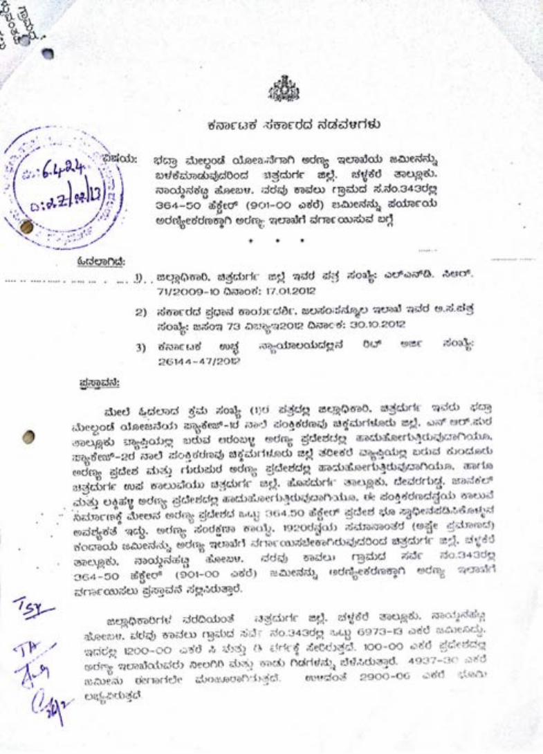


Prabha
EE

Prabha
EE