
FLOOD MITIGATION KOCHI - Kerala Irrigation Department
319
irrigation department irrigation department ernakulam 2021 r e p o r t o n
-
Upload
khangminh22 -
Category
Documents
-
view
4 -
download
0
Transcript of FLOOD MITIGATION KOCHI - Kerala Irrigation Department
irrigation department
irrigation departmenternakulam
2021
FLOOD
MITIGATION
KOCHI
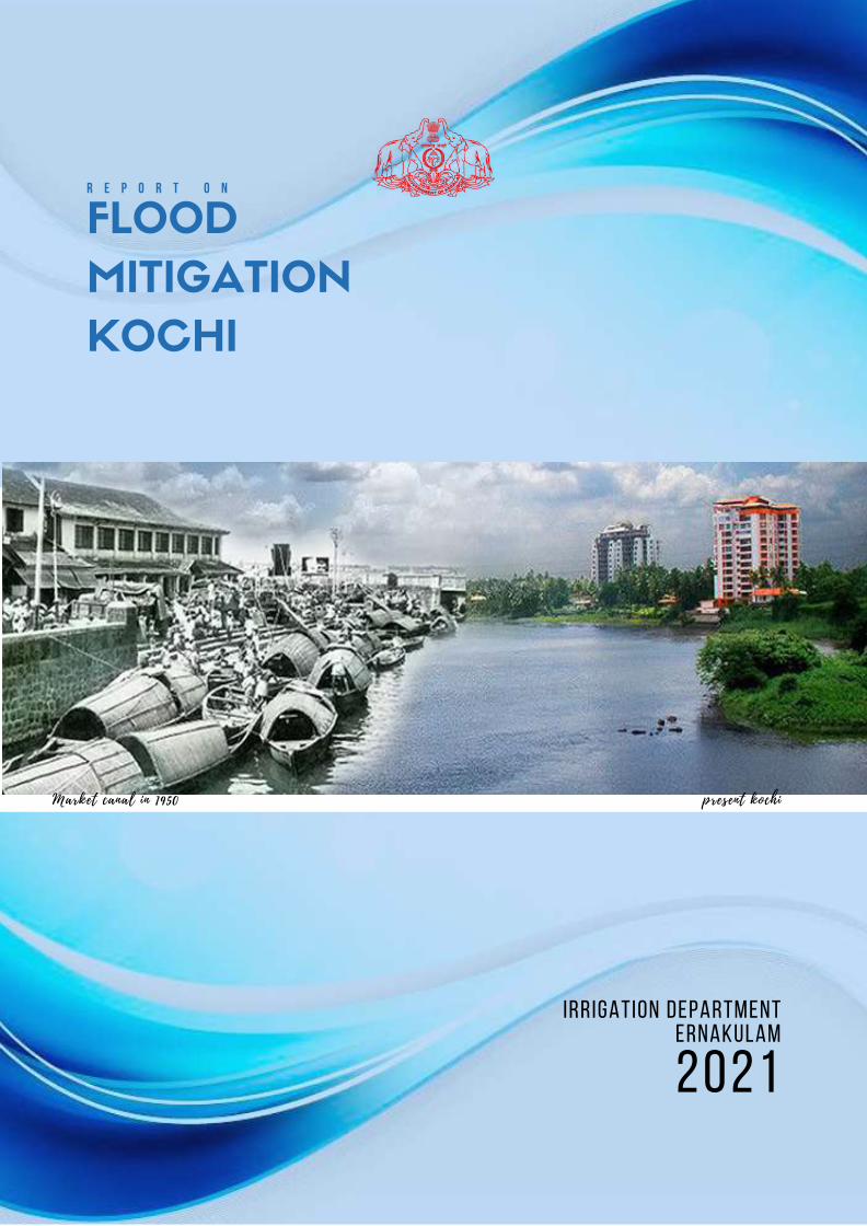
present kochiMarket canal in 1950
r e p o r t o n
AACKNOWLEDGEMENT
I respectfully appreciate and thank Sri. Roshy Augustine , Minister of Water Resources, Kerala, for the leadership and valuable suggestions given throughout this project work.
I sincerely express deep sense of gratitude to Sri. TK Jose (IAS) Additional Chief
Secretary (Home & Water Resources) as the success and outcome of this project were possible by his leadership, guidance and support which also included interactive weekly reviews. Our team is incredibly privileged to have got this all along the project preparation. It required a lot of effort from each individual involved in this project with me and I would like to thank them.
I am also thankful to Sri. Alex Varghese, Chief Engineer, Irrigation and Administration, for providing us with all support which made us finish this project duly.
I also deeply appreciate and thank Sri. M Anilkumar, Mayor Kochi Corporation, Sri. TJ Vinod ,MLA Ernakulam and all the Councilors for presenting such excellent support and guidance, despite having a busy schedule .
I am thankful to get consistent encouragement and support from my team members which helped us to complete the project work. I submit this project with great humility and utmost regard.
Er. BAJI CHANDRAN R Superintending Engineer Minor Irrigation Central Circle Ernakulam
EXECUTIVE SUMMARY
his report is a study of the canal systems in Kochi city of Ernakulam District. Here
we identified 39 main canals which passes through the Kochi corporation .These
canals mainly functions as the storm water drainage of the city which takes the
storm water from the small drains to the back waters. Here the ground level is almost
same or below the mean sea level and hence the tidal variations also affects the flow of
water into the back waters.The study was conducted by a team of irrigation engineers
from the field study collection of datas including history of each canals, made maps of
the canal network,analysed the present position of the canals and presented here for
easy identification of problems and solutions. Earlier the canals were used for
transportation and proper drainage was not a problem since not much hindrances were
present in the canals. This study reveals that waste water including septic tank
drainages are opened into the canal. Public is using this canals for waste dumping at
various portions even though this is a punishable offence under water conservation act.
Another important change noticed is the unauthorized encroachments and covering the
canals with RCC slabs which will reduce its capacity and cleaning of the deposited silts
in the future made difficult. Present position of the canals are shown with the help of a
line diagram from start to end including obstructing structures such as small culverts
,silted up portions ,waste dumped areas etc. for each canal. The complete
reinstatement of the canal system to its original state involves a huge amount. Apart
from cleaning of the existing canals the kayal mouth to which the water drains into are
silted up, dredging and clearing of these area is absolute necessary .The
encroachments and covering slabs and including siltation reduced the holding capacity
of the canal system which in turn causes flooding in the Kochi city.
All the canals in Western kochi were navigable in early days and now they are
covered with RCC slabs and silted up. Instances like entire vanishing of a canal stretch
of about 400mt is identified at Kazhuthumuttam in Rameswaram canal of
Thoppumpady. Another instance is the encroachment at Kumaranasan nagar in
Punchathodu was regularised by revenue department and fixed the boundary into the
canal and 6meter wide water course is shrunken to about 2meters of width. There are
other instances also for legalizing encroachments which in turn reduces the water
holding capacities of the canal system .The concerned departments has to re-look into
this matters and start re capturing the waterways which were converted in the past .If
this scenario continues even the present conditions of the canal system will disappear in
near future and the flooding of the city during rainy season is inevitable. The revamping
of canal system could be achieved with the co- operation of various government
agencies and public. Cleaning and desilting and removal of obstuctions and
encroachments are the basic requirement. Merging of different government schemes
and utilizing funds like CSR of organizations etc will make the revamping and
maintaining the canal system cost effective
T
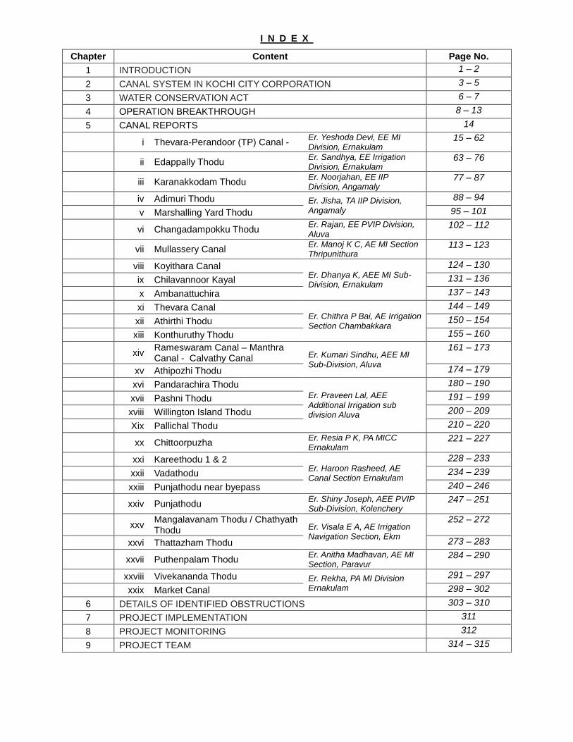
I N D E X
Chapter Content Page No.
1 INTRODUCTION 1 – 2
2 CANAL SYSTEM IN KOCHI CITY CORPORATION 3 – 5
3 WATER CONSERVATION ACT 6 – 7
4 OPERATION BREAKTHROUGH 8 – 13
5 CANAL REPORTS 14
i Thevara-Perandoor (TP) Canal - Er. Yeshoda Devi, EE MI Division, Ernakulam
15 – 62
ii Edappally Thodu Er. Sandhya, EE Irrigation Division, Ernakulam
63 – 76
iii Karanakkodam Thodu Er. Noorjahan, EE IIP Division, Angamaly
77 – 87
iv Adimuri Thodu Er. Jisha, TA IIP Division, Angamaly
88 – 94
v Marshalling Yard Thodu 95 – 101
vi Changadampokku Thodu Er. Rajan, EE PVIP Division, Aluva
102 – 112
vii Mullassery Canal Er. Manoj K C, AE MI Section Thripunithura
113 – 123
viii Koyithara Canal Er. Dhanya K, AEE MI Sub- Division, Ernakulam
124 – 130
ix Chilavannoor Kayal 131 – 136
x Ambanattuchira 137 – 143
xi Thevara Canal Er. Chithra P Bai, AE Irrigation Section Chambakkara
144 – 149
xii Athirthi Thodu 150 – 154
xiii Konthuruthy Thodu 155 – 160
xiv Rameswaram Canal – Manthra Canal - Calvathy Canal Er. Kumari Sindhu, AEE MI
Sub-Division, Aluva
161 – 173
xv Athipozhi Thodu 174 – 179
xvi Pandarachira Thodu Er. Praveen Lal, AEE Additional Irrigation sub division Aluva
180 – 190
xvii Pashni Thodu 191 – 199
xviii Willington Island Thodu 200 – 209
Xix Pallichal Thodu 210 – 220
xx Chittoorpuzha Er. Resia P K, PA MICC Ernakulam
221 – 227
xxi Kareethodu 1 & 2 Er. Haroon Rasheed, AE Canal Section Ernakulam
228 – 233
xxii Vadathodu 234 – 239
xxiii Punjathodu near byepass 240 – 246
xxiv Punjathodu Er. Shiny Joseph, AEE PVIP Sub-Division, Kolenchery
247 – 251
xxv Mangalavanam Thodu / Chathyath Thodu Er. Visala E A, AE Irrigation
Navigation Section, Ekm
252 – 272
xxvi Thattazham Thodu 273 – 283
xxvii Puthenpalam Thodu Er. Anitha Madhavan, AE MI Section, Paravur
284 – 290
xxviii Vivekananda Thodu Er. Rekha, PA MI Division Ernakulam
291 – 297
xxix Market Canal 298 – 302
6 DETAILS OF IDENTIFIED OBSTRUCTIONS 303 – 310
7 PROJECT IMPLEMENTATION 311
8 PROJECT MONITORING 312
9 PROJECT TEAM 314 – 315
CHAPTER 1 INTRODUCTION
Introduction:
ochi is one of the fastest growing
second-tier metros in India forming part
of Ernakulam district in Kerala. In fact ,
Kochi is the economic and financial
capital of Kerala. Kochi is a renowned spice
trading centre on the Arabian Sea coast since
the 14th century, popularly referred to as the
'Queen of Arabian sea'. Kochi is also a growing
centre of information technology, tourism and
international trade and is in fact the commercial
hub of Kerala. Kochi has a diverse, multicultural,
and secular community consisting of a mix of
people from all parts of Kerala and most parts of
India.The city retains its distinct colonial heritage
and a blend of tradition and modernity.
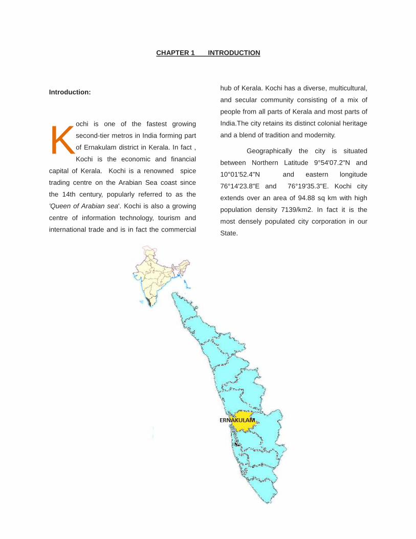
Geographically the city is situated
between Northern Latitude 9°54'07.2"N and
10°01'52.4"N and eastern longitude
76°14'23.8"E and 76°19'35.3"E. Kochi city
extends over an area of 94.88 sq km with high
population density 7139/km2. In fact it is the
most densely populated city corporation in our
State.
K
Page 1
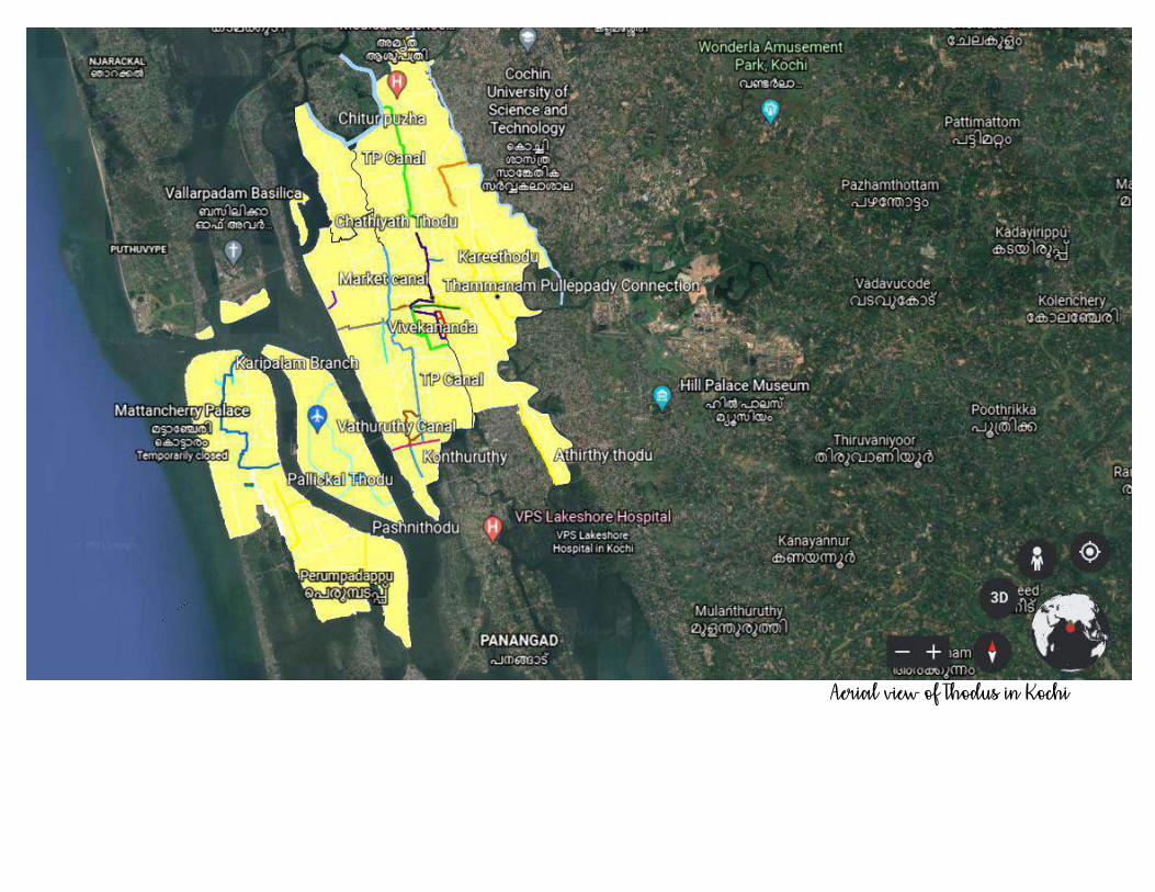
Aerial view of Thodus in Kochi
Page 2
CHAPTER 2 CANAL SYSTEM IN KOCHI CITY CORPORATION
ochi City had a well defined canal
system . Owing to its proximity to sea,
the canals were subjected to regular
tidal inflow and outflow which kept the water in
the canals naturally clean . However the
urbanisation and need for road development
paved way to diminishing canals and water
bodies . As a result of urban encroachment of
habitate and to increasing urbanization needs,
decreasing trend in the width of canal which led
to reduction in its water carrying capacity is
being observed. Many open canals in the past
are constructed concrete drains. As a part of
road development, many unscientific
constructions were done across these canals.
The bed of many natural canals were
concreted thus making infiltration of flood
water through canal bed impossible.
Kochi city can be divided into Central
and West Kochi.
Central Kochi
Major canals passing in Central Kochi
are TP canal, Changadampokku,
Karanakkodam, Mullassery, Edappallythodu
and other tributaries. All major and minor
canals paly an important role in Kochi town
area. Since the land area is at MSL, all the
drainage systems can contribute to flood. Due
to perpetual encroachment and siltation, the
holding capacity of entire drainage system has
been reduced which results in flooding in the
urban areas. Frequent increase in
encroachments and other illegal constructions
will create uncontrollable situations which can
often lead to flood management failure. Most
of the navigable canal systems used for
transportation in the past are now subjected to
reduction in width. About 10% of the water-
spread area of Chilavannoorkayal has been
reclaimed and this led to a crucial situation in
the city to control flood. Some of the other
identified important points are –
1. TP canal has been divided into two at
chainage 4512m by constructing a small
culvert by Indian railway for the railway
track and now this culvert is fully clogged
with waste and blocked the continuity.
2. The canal Changadampokku, was named
in such a way to represent it as a
navigable drain. But now it is narrowed
down to 1.5m from Kaloor Metro Station to
Keerthinagar (approx 1.5km).
Karanakkodam thodu and
Changadampokku were in a single stream
and broken at Kaloor Metro Station. To
balance the drainage water system, the
recently mentioned canals must be
connected properly.
One of the major problems identified in the
city is that the effluent from railway
marshalling yard is disposed directly to the
drainage system without making any effluent
treatment and thereby polluting water in the
nearby area. Marshalling yard drain which is
connected to Karanakkodam leading to
Chilavannoor are also thereby polluted and
K
Page 3
the ecosystem surrounding this is disturbed.
Major problems identified are elaborated in
the sections.
West Kochi
Major thodus are Calvathy canal, Manthra
canal, Rameswaram canal, Pandarachira
thodu, Pashnithodu, Pallichal thodu.
Earlier all the above said canals were
well-maintained and navigable. Due to
urbanisation, many of these canals were
encroached for forming new roads. As water
transport lost its shine, these canals were
neglected and became points of deposition of
liquid and solid wastes. Presently this is the
main cause of oxygen depletion in the canals,
which led to deterioration of the water quality.
This has badly affected the marine flora and
fauna. All the canals are at sea level and natural
flow is sluggish or non- existent in non-rainy
days. Tidal oscillation alone infuses some life
into the system. But intervention by bunds, loss
of depth by siltation and bottlenecks created in
the channel by civil structures and dumping of
solid waste isolate the canals into stagnant wet
patches.
The tidal canals in this region do not any
more carry out the natural functions expected of
them because of the solid and liquid wastes
ending up in these canals and due to vast
encroachments that are continuously happening.
If the tidal water is allowed to sweep past the
canals, they will remain clean and lively all
through the year.
Due to lack of proper waste
management system in the city, the canals have
become places of waste deposition. In many
places in the city limits , sewage from nearby
housing colonies are seen directly discharging
into the canals. The canals which were carrying
clean water in the past are now carrying putrid
water. Apart from deteriorating water quality, the
waste deposition is also a major factor causing
blockage to free flow. The clogged canals and
road drains are unable to effect speedy drainage
of storm water which causes flash flooding in
Kochi city.
HYDROLOGY OF TIDAL EFFECTS ON WEST
KOCHI AREA
Tidal difference occurs approximately
every eight hours. The water flows from south
most Vembanadkayal and back. Since the
Calvathy canal is the first opening from outer
sea mouth the water gushes out first and gushes
in every eight hours during the tidal differences.
This was working fine earlier, keeping the waters
clean and navigable, even in the 1970s. But now
it is not possible due to these blocks and missing
links.
The entire water from Muvattupuzha River basin
and a part of Meenachil river is draining to the
Vembanadkayal and finally to the Arabian sea.
A major portion of this flows through Aroorbridge
and reaches Arabian sea at Fort Kochi, where it
merges with a part of Periyar River basin also.
During Monsoon, the water level in the kayal is
on the rising and flow of water from the west
Kochi canals is minimum. Even
thoughAndhakaranazhiwill also be opened at
that time, the incoming storm water is not
drained completely.On the otherhand,in dry
seasons the Thanneermukkam bund and
Thottappallyspilways are closed which prevent
Page 4
the free flow of water into the sea. Also the time
of travel of water around the mainland through
Aroorbridge is higher compared to the flow from
backwaters through Rameswaram and
Calavthycanals.This increases the importance of
the canal system.
Small kayals in the western side of Aroor
bridge arePandarachirakayal, Kalatharakayal,
Kochuchirakalkayal, Kannamalykayal,
Kumbalanghikayal, Anjitharakayal,
Kallancherykayal, Perumpadupukayal,
Velluthulykayal, Ezupunnakayal, Chakarathode,
Vijayan canal uptoChellaanam.
All these backwaters of these lakes and
canals will be associated with the tidal
differences happening every 8 hours
approximately.This tidal flow helps in washing
away all the waste and stagnant waters early.
Now these lakes are nearing stagnancy
because the water flow to these kayals is
coming through Aroorbridge and Pashnithodu,
which is only 10m wide.
Now the water has to travel from Fort Cochin
port mouth via Willington island, to reach Aroor
bridge, approximately 30km. Fisher men have
been complaining about the polluted waters and
stagnancy of lakes for years. This happens
because of the highly saline water about 44 ppt
entering the canals and to lakes. Salinity of
these lakes is very less because by the time the
water reaches Aroor, Kannamaly, Chelanam, the
tidal difference happens, as it occurs every eight
hours. Moreover a new construction is in
progress right at the mouth of Calvathy canal
causing reduction to the width of the canal at the
mouth. This is definitely going to have a great
impact on the in-flow and out-flow of water.
Changes in climatic conditions:
Kerala has been receiving excess
rainfall for the past few years. The percentage of
excess being 23.34% in the year 2018, 12.72%
in 2019 and 9% in 2020. Due to global climatic
changes, Kerala coast is now getting prone to
cyclonic storms also. The heavy rains received
in a short duration is found to cause inundation
in the Kochi city area. Experts have evidences of
phenomenon like cloud bursting happening in
and around Kochi which also contribute to
release of large amount of storm water in a
relatively smaller area causing flooding situation.
Prominent areas of flooding:
The major areas subjected to flash
flooding in Kochi city are KSRTC Bus stand
area, South railway station, Karshaka road, P&T
colony area, Kammattipadam, Judges Avenue,
Panampilly Nagar ,Kaloor KSEB substation etc.
Page 5
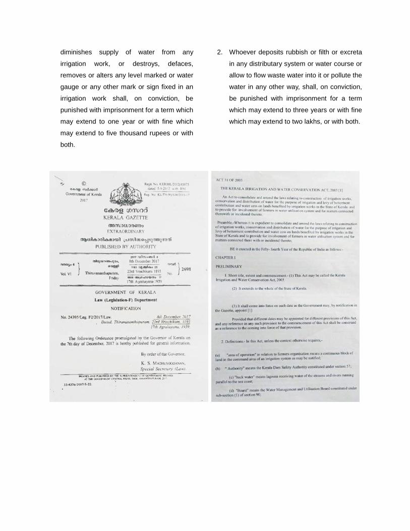
CHAPTER 3 WATER CONSERVATION ACT
THE KERALA IRRIGATION AND WATER CONSERVATION ACT, 2003(1) & ORDINANCE NO. 27 OF 2017, THE
KERALA IRRIGATION AND WATER CONSERVATION (AMENDMENT) ORDINANCE 2017
n Act to consolidate and amend the
laws relating to construction of irrigation
works, conservation and distribution of
water for the purpose of irrigation and levy of
betterment contribution and water cess on lands
benefited by irrigation works in the State of
Kerala and to provide for involvement of farmers
in water utilization system and for matters
connected therewith or incidental thereto.
a) Irrigation work includes all drainage works
such as canals, channels, escape channels
from a canal or channel, reservoirs or tanks,
dams, weirs, embankments, sluices,
groynes, field channels, and other works for
the protection or benefit of agricultural lands
or for the reclamation or dewatering of kole
lands, kayal lands, kari lands or such other
lands. Water course means a river, stream,
springs, channel, lake or any natural
collection of water other than in a private
land and includes any tributary or branch of
any river, stream, springs or channel.
b) Consequences of construction of Irrigation
works : - Where the government construct
an irrigation work for utilizing the water in a
water course - No person or agency shall ,
without the sanction of the Government or
such authority as may be authorized by the
Government in that behalf, do anything
which obstructs, interferes with , diminishes
or is likely to obstruct , interfere with or
diminish, the flow of water in such water
course.
c) Safeguards for Irrigation works :
1. No encroachment shall be allowed in the
irrigation land . No person shall occupy any
irrigation land for cultivation or for any other
purpose and the irrigation officer shall take
all necessary steps to remove
encroachments on such lands.
2. No person shall let out any industrial effluent
or domestic effluent to nay water course
without proper treatment.
3. No person shall deposit rubbish or filth or
excreta in any distributary system or water
course or allow to flow waste water into it or
pollute the water in any other way.
d) Interference with functioning of cross
drainage works :
1. No person shall except with the written
permission of the Irrigation Officer, Obstruct
the proper functioning of the various cross
drainage works, such as culverts,
aqueducts, super passages, siphons, weirs
and allied works constructed by or with the
aid of Government for the safety of canals or
channels.
PENALTIES
1. Whoever without proper authority –injures,
alters, enlarges, or obstructs any irrigation
work or interferes with, increases or
A
Page 6
diminishes supply of water from any
irrigation work, or destroys, defaces,
removes or alters any level marked or water
gauge or any other mark or sign fixed in an
irrigation work shall, on conviction, be
punished with imprisonment for a term which
may extend to one year or with fine which
may extend to five thousand rupees or with
both.
2. Whoever deposits rubbish or filth or excreta
in any distributary system or water course or
allow to flow waste water into it or pollute the
water in any other way, shall, on conviction,
be punished with imprisonment for a term
which may extend to three years or with fine
which may extend to two lakhs, or with both.
Page 7
CHAPTER 4 OPERATION BREAKTHROUGH
Operation Breakthrough 2019:
he flagship programme 'Operation
Breakthrough' was launched in Kochi City
by the Hon' Chief Minister following the
flash flooding which happened during October 2019.
During the incessant rains on October 20 and
21st 2019, the major roads in Kochi city such as
MG road, Shanmugham road, Banerjee road,
Bypass road along with prominent locations like
South Railway Station, North Railway Station,
KSRTC bus stand premises etc were fully flooded
and normal public life was disrupted. Several
polling booths of bye election held on these dates
had to be shifted. Following these incidents, Hon.
Chief Minister decided to implement Operation
Breakthrough Project and to formulate projects to
avoid such a situation in future. Division wise
study was carried out in all the 74 divisions in Kochi
Corporation by teams constituted of technical
personnel from Kochi Corporation LSGD wing,
PWD, Irrigation, GCDA etc to assess the causes
and remedies to avoid such a flooding situation in
future. Technical committee of Operation
Breakthrough comprising of Executive Engineers
from all major work execution departments such as
PWD, Irrigation,LSGD, GCDA etc in the district
prioritised the remedies suggested by various teams
and arranged the prioritised works under Phase 1 of
the Project on a war footing basis.
The Phase 2 of Operation Breakthrough
Program was led by Irrigation department under the
Chairmanship of Sri. Baji Chandran R, the then
Executive Engineer, Minor Irrigation Division,
Ernakulam. In Phase 2 , the desilting and
rejuvenation major canals and Kayal mouths in the
city were taken up . After the completion of Phase 1
and Phase 2 of Operation Breakthrough program,
much relief was observed in the flooding situation
in Kochi. The areas which are still subjected to
flooding include the KSRTC bus station and South
railway station area where the renovation work of
Mullassery canal is yet to be taken up. The details
of each work in Phase 2 Operation Breakthrough
are explained below.
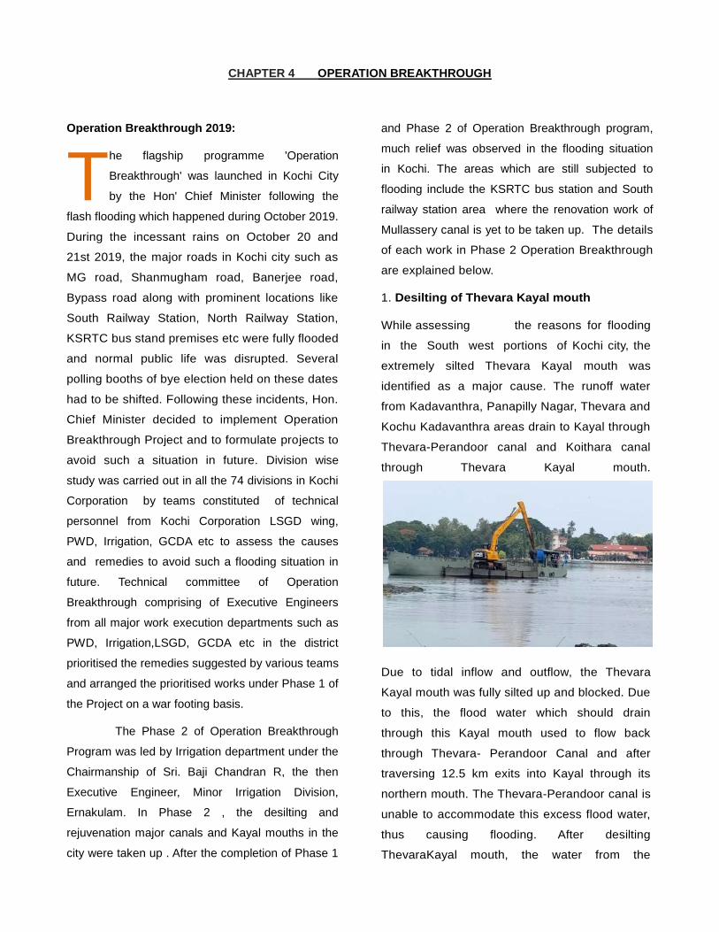
1. Desilting of Thevara Kayal mouth
While assessing the reasons for flooding
in the South west portions of Kochi city, the
extremely silted Thevara Kayal mouth was
identified as a major cause. The runoff water
from Kadavanthra, Panapilly Nagar, Thevara and
Kochu Kadavanthra areas drain to Kayal through
Thevara-Perandoor canal and Koithara canal
through Thevara Kayal mouth.
Due to tidal inflow and outflow, the Thevara
Kayal mouth was fully silted up and blocked. Due
to this, the flood water which should drain
through this Kayal mouth used to flow back
through Thevara- Perandoor Canal and after
traversing 12.5 km exits into Kayal through its
northern mouth. The Thevara-Perandoor canal is
unable to accommodate this excess flood water,
thus causing flooding. After desilting
ThevaraKayal mouth, the water from the
T
Page 8
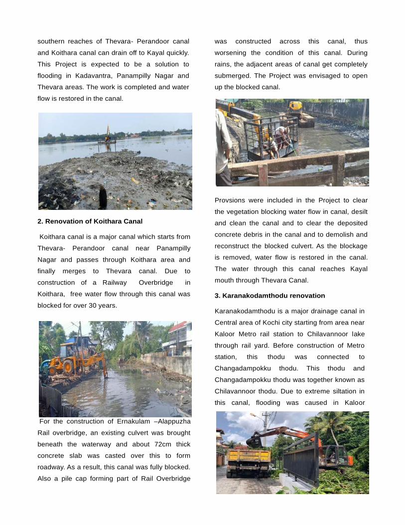
southern reaches of Thevara- Perandoor canal
and Koithara canal can drain off to Kayal quickly.
This Project is expected to be a solution to
flooding in Kadavantra, Panampilly Nagar and
Thevara areas. The work is completed and water
flow is restored in the canal.
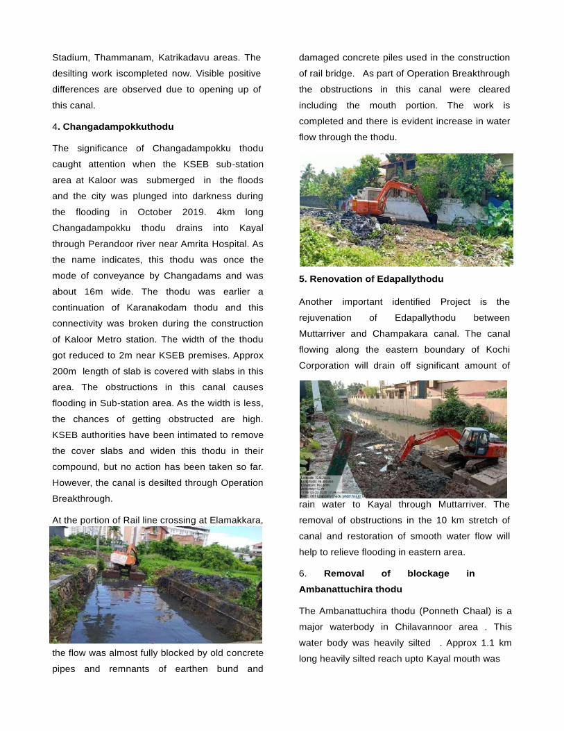
2. Renovation of Koithara Canal
Koithara canal is a major canal which starts from
Thevara- Perandoor canal near Panampilly
Nagar and passes through Koithara area and
finally merges to Thevara canal. Due to
construction of a Railway Overbridge in
Koithara, free water flow through this canal was
blocked for over 30 years.
For the construction of Ernakulam –Alappuzha
Rail overbridge, an existing culvert was brought
beneath the waterway and about 72cm thick
concrete slab was casted over this to form
roadway. As a result, this canal was fully blocked.
Also a pile cap forming part of Rail Overbridge
was constructed across this canal, thus
worsening the condition of this canal. During
rains, the adjacent areas of canal get completely
submerged. The Project was envisaged to open
up the blocked canal.
Provsions were included in the Project to clear
the vegetation blocking water flow in canal, desilt
and clean the canal and to clear the deposited
concrete debris in the canal and to demolish and
reconstruct the blocked culvert. As the blockage
is removed, water flow is restored in the canal.
The water through this canal reaches Kayal
mouth through Thevara Canal.
3. Karanakodamthodu renovation
Karanakodamthodu is a major drainage canal in
Central area of Kochi city starting from area near
Kaloor Metro rail station to Chilavannoor lake
through rail yard. Before construction of Metro
station, this thodu was connected to
Changadampokku thodu. This thodu and
Changadampokku thodu was together known as
Chilavannoor thodu. Due to extreme siltation in
this canal, flooding was caused in Kaloor
Page 9
Stadium, Thammanam, Katrikadavu areas. The
desilting work iscompleted now. Visible positive
differences are observed due to opening up of
this canal.
4. Changadampokkuthodu
The significance of Changadampokku thodu
caught attention when the KSEB sub-station
area at Kaloor was submerged in the floods
and the city was plunged into darkness during
the flooding in October 2019. 4km long
Changadampokku thodu drains into Kayal
through Perandoor river near Amrita Hospital. As
the name indicates, this thodu was once the
mode of conveyance by Changadams and was
about 16m wide. The thodu was earlier a
continuation of Karanakodam thodu and this
connectivity was broken during the construction
of Kaloor Metro station. The width of the thodu
got reduced to 2m near KSEB premises. Approx
200m length of slab is covered with slabs in this
area. The obstructions in this canal causes
flooding in Sub-station area. As the width is less,
the chances of getting obstructed are high.
KSEB authorities have been intimated to remove
the cover slabs and widen this thodu in their
compound, but no action has been taken so far.
However, the canal is desilted through Operation
Breakthrough.
At the portion of Rail line crossing at Elamakkara,
the flow was almost fully blocked by old concrete
pipes and remnants of earthen bund and
damaged concrete piles used in the construction
of rail bridge. As part of Operation Breakthrough
the obstructions in this canal were cleared
including the mouth portion. The work is
completed and there is evident increase in water
flow through the thodu.
5. Renovation of Edapallythodu
Another important identified Project is the
rejuvenation of Edapallythodu between
Muttarriver and Champakara canal. The canal
flowing along the eastern boundary of Kochi
Corporation will drain off significant amount of
rain water to Kayal through Muttarriver. The
removal of obstructions in the 10 km stretch of
canal and restoration of smooth water flow will
help to relieve flooding in eastern area.
6. Removal of blockage in
Ambanattuchira thodu
The Ambanattuchira thodu (Ponneth Chaal) is a
major waterbody in Chilavannoor area . This
water body was heavily silted . Approx 1.1 km
long heavily silted reach upto Kayal mouth was
Page 10
desilted under Phase 2 of Operation
Breakthrough ensuring smooth unobstructed flow
through the thodu.
PROJECTS YET TO BE TAKEN UP
1. Mullassery Canal renovation
The worst flood affected area in Kochi
Corporation i.e the area near KSRTC bus stand
is a natural depression and hence the runoff
water from a large area gets collected in this area
thus causing flooding . Presently, the flood water
accumulating in this location tends to flow
towards Kayal mouth through the already
overloaded Perandoor canal . This causes
flooding in the area along the banks of Perandoor
canal . Effecting natural drainage by gravity to the
nearest outlet is the most viable solution for
preventing flooding up of water in KSRTC/South
Railway station area. Modifying the existing
raised bed of Mullassery canal near KSRTC bus
station area and by effecting proper gradient
towards Kayal , flooding in this area can be
avoided. This Project is estimated to cost Rs.10
crores.
2. Thevara- Perandoor Canal
About 12.5 km long Perandoor canal starts
from Thevara Canal and drains into Kayal
through Chittur river near Perandoor. At the
middle stretch of this canal near CBI quarters,
the canal is passing through 3 pipe culverts of
1m dia. As this portion is completely blocked ,
flooding is experienced in nearby areas.Kochi
Corporation is executing the rejuvenation work of
TP Canal under AMRUT Scheme. Operation
Breakthrough has not undertaken any works
connected to this canal.
Kochi Corporation is concreting the bed of many
natural canals and has been covering it with
concrete slabs under AMRUT Scheme.
Presently, a similar work is being carried out in
Changadampokkuthodu near Ammu Sahib road.
These type of works will cause flooding in
adjacent areas. This is also a clear violation of
Central Water Commission orders. Such works
undertaken by Corporation need to be
controlled.
Renovation of m ajor streams like Kareethodu
near Byepass Vennala and Puncha thodu in
Kathrikadavu being taken up under Phase3 of
Operation Breakthrough Project.
Operation Break Through has been a success as
the places which has been identified and worked
upon have not faced any issues unlike the last
year. If the roadside drainages are properly
maintained and at some particular place eg.
Judges Avenue the drainages are rearranged
then it will be a relief the existing identified
issues.
On completion of Projects such as Rejuvenation
of Mullassery canal under Phase3, the Mission
undertaken by Government is expected to finish
successfully.
This Mission could be accomplished under the
leadership of Irrigation department with the whole
hearted cooperation of officials under Irrigation,
PWD, GCDA and LSGD wings. All steps have
been taken under Operation Breakthrough to
Page 11
ensure that in the upcoming rainy season rain
water reaches Kayal. The Mission was finished
successfully in 30 days by the full support of
Monitoring Committee (Appointed by Hon’ble
High Court), MPs, MLAs and Corporation Council
members.
The Mission started by Hon. Chief Minister,
Kerala under the leadership of Hon District
Collector Sri.S.Suhas IAS is being successfully
completed through Irrigation department. Rs 25
crores fund has been allotted for this Mission
under Phase 1 and 2 through Disaster
Management Authority by Kerala State Govt.
Page 12
Page 13
CHAPTER 5 CANAL REPORTS
Page 14
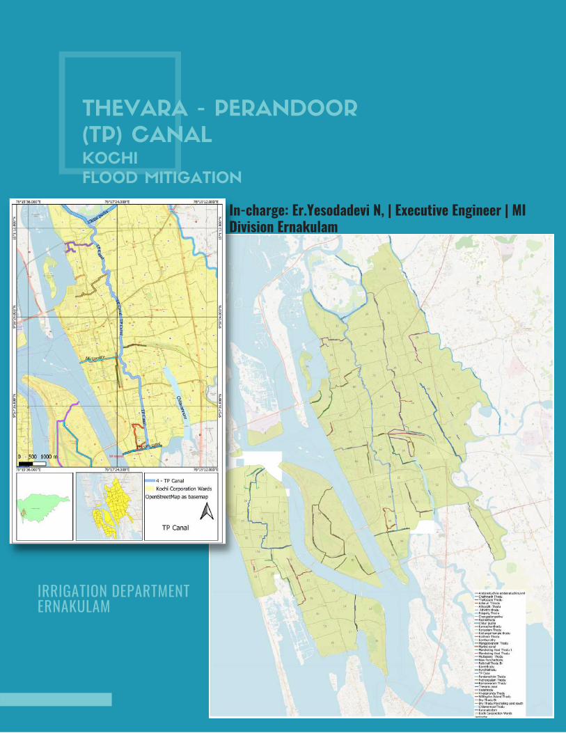
THEVARA - PERANDOOR
(TP) CANALKOCHI
FLOOD MITIGATION
In-charge: Er.Yesodadevi N, | Executive Engineer | MIDivision Ernakulam
IRRIGATION DEPARTMENT ERNAKULAM
AMBANATTUCHIRA THODU (PONNETH
CHAAL ) IN CHILAVANNOORER .DHANYA K . , | MI SUB DIVISION | ERNAKULAM
INITIAL STUDY REPORT
AMBANATTUCHIRA THODU (PONNETH
CHAAL ) IN CHILAVANNOORER .DHANYA K . , | MI SUB DIVISION | ERNAKULAM
INITIAL STUDY REPORT
Google Map- Ambanattuchira thodu
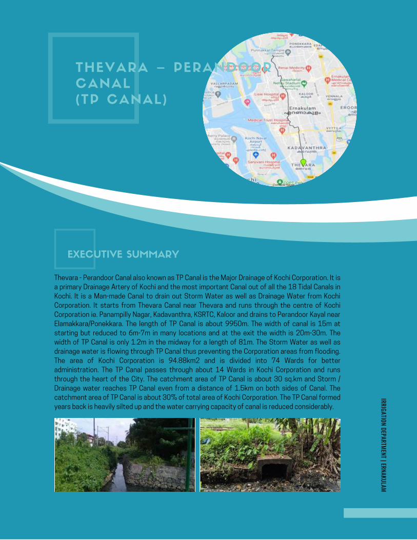
THEVARA – PERANDOOR
CANAL
(TP CANAL)
Comrade Nagar
IRRIGATION DEPARTMENT | ERNAKULAM
Thevara - Perandoor Canal also known as TP Canal is the Major Drainage of Kochi Corporation. It is
a primary Drainage Artery of Kochi and the most important Canal out of all the 18 Tidal Canals in
Kochi. It is a Man-made Canal to drain out Storm Water as well as Drainage Water from Kochi
Corporation. It starts from Thevara Canal near Thevara and runs through the centre of Kochi
Corporation ie. Panampilly Nagar, Kadavanthra, KSRTC, Kaloor and drains to Perandoor Kayal near
Elamakkara/Ponekkara. The length of TP Canal is about 9950m. The width of canal is 15m at
starting but reduced to 6m-7m in many locations and at the exit the width is 20m-30m. The
width of TP Canal is only 1.2m in the midway for a length of 81m. The Storm Water as well as
drainage water is flowing through TP Canal thus preventing the Corporation areas from flooding.
The area of Kochi Corporation is 94.88km2 and is divided into 74 Wards for better
administration. The TP Canal passes through about 14 Wards in Kochi Corporation and runs
through the heart of the City. The catchment area of TP Canal is about 30 sq.km and Storm /
Drainage water reaches TP Canal even from a distance of 1.5km on both sides of Canal. The
catchment area of TP Canal is about 30% of total area of Kochi Corporation. The TP Canal formed
years back is heavily silted up and the water carrying capacity of canal is reduced considerably.
EXECUTIVE SUMMARY
Page 16
IRRIGATION DEPARTMENT | ERNAKULAMKOCHI FLOOD MITIGATION
Cont...
The rapid increase in population and urbanization has
degraded the quality of this sensitive backwater lagoon
environment. The backwater system has played an
important role in the socio – economic and cultural history
of central Kerala. It has significant importance in fish
production and providing breeding and nursery grounds for
fishes. Considerable changes occurred to the
geomorphology of this sensitive backwater system
through dredging and channelization. The estuary receives
substantial quantities of effluent from industry and also
enormous amount of organic and sewage waste. As a
result of urbanization, the low lying areas of Kochi
Corporation are being inundated in a continuous rain of
about half an hour. The continuous rain happened during
October 2019 inundated more than 80% of Corporation
areas for about 24 Hrs. This occurred due to the low
carrying capacity of various Canals in Kochi Corporation.
The TP Canal also played a vital role in worsening the
drainage of Kochi Corporation. The different types of
structures constructed across canal, pipe lines,
encroachments, wastes are obstructing the normal/flood
flow of water. Most of the house
drainages/sewage is draining into the canal thus making
canal water dark grey. The encroachments have to be
evicted and the width of the canal has to be reinstated.
The canal can be brought to its original shape only after
removing the obstruction, encroachments and also by
preventing garbage disposal into the canal.
Page 17
IRRIGATION DEPARTMENT | ERNAKULAMKOCHI FLOOD MITIGATION
Anamthuruthy Sluice is obstructing the normal flow of water to Thevara Canal.
Koyithara Canal discharging its storm / drainage water into TP Canal. It increases the load on TP canal and has
to be addressed.
The storm / drainage water from MG Road also find its way to TP Canal through Panampilly Nagar and Ravipuram
area. As a result, the entire area of Panampilly Nagar & Ravipuram is getting flooded and necessary measures
are to be taken to divert water from MG Road area.
In the mid-way Mullassery Canal joins with TP Canal at Chainage 4100m. As there is reverse slope in Mullassery
Canal, the water that has to be drained through Mullassery Canal is flowing into TP Canal increasing water load
in TP Canal at the critical reach. The storm / drainage water through Mullassery Canal to TP Canal should be
reduced and to be kept minimum. It is creating flood like situation in KSRTC and South Railway Station area.
The Branch Canal from Marshalling Yard / Kammattippadom area meets TP Canal near Mullassery Canal
Junction. The Canal Mouth is being encroached on right side and Petroleum / Gas Pipe Lines (BPCL/IOCL) are
laid in Canal and filled with earth making the width of canal to about 1/5th of its original width.
High Pressure KWA Pipe Lines are crossing TP Canal near culvert leading to Kammattippadom area. These pipe
lines are laid just above the bed level of
Canal. These pipes obstruct the flow of water to a great extent and contribute to flood like situation even for a
small intensity rain in and around Ernakulam South Railway Station / KSRTC.
The main obstruction for free flow of water through the Canal is at the Railway Crossing portion. The TP Canal
at Ch.4512m is crossing the Ernakulam - Kottayam railway line (Triangular Junction) with a mere width of 1.2m.
The length of railway track crossing is 81m with a width of 1.2m. The width of canal on U/S and D/S side of
railway track is about 6m. The 360 degree turn of water to cross railway track is the major cause of flooding in
Ernakulam City during heavy rain. The railway line virtually divides the canal into two parts. The flow in this part
is completely blocked. The railway culvert is not sufficiently wide enough to have continuous flow of the canal.
Only an underpass is joining the 2 parts of the canal. The Canal is split into two by Ernakulam – Kottayam railway
track.
The low lying Cross Drainage Works between Pulleppady Bridge and Chirakkal Sastha Road Bridge is inundating
the areas in and around Kaloor for small intensity rain. The Foot Bridges and Culverts constructed by LSGIs and
Private Parties are a major concern for the free flow of water through Canal. The Canal width is reduced and
converted into bund road from Pulleppady Bridge to Kaloor Chirakkal Sastha Bridge.
The reach between Chirakkal Sastha Bridge and Perandoor Bridge is having an average width of 6m to 25m and
there is no Canal Bund Road running parallel to the canal. The water carrying capacity of the canal is less and
considerable silt and debris is deposited in canal bed. Garbage & Effluent discharge from Individual House Hold
premises, Villas, Convention Centres and Commercial Establishments is seen to have diverted into TP Canal
making water Dark Grey. The Canal is seen to have encroached by Individuals and Commercial Establishments
making it into a narrow strip at certain locations.
The Depth on Mouth of TP Canal where the Canal meets Chitturpuzha is very less. Considerable silt and debris
are deposited on mouth of canal and it prevents
discharge of City Storm Water into Kayal/Puzha, There are 3 Railway Bridge situated on mouth of TP Canal. The
girder of one bridge is low and flood water touched the bottom of girder during 2018 flood. The deposition of
silt and debris on mouth of canal creates Afflux and City area will get flooded even for a small intensity rain.
There are some damaged remains of concrete structures which also obstructs the normal flow of water. The
Water Flushing Mechanism of TP Canal is possible only after the removal of Delta on mouth of TP Canal.
1.1.1 Critical Scenario
1.1 PRESENT SCENARIO
Page 18
IRRIGATION DEPARTMENT | ERNAKULAMKOCHI FLOOD MITIGATION
The TP canal is now totally degraded, primarily due to
unregulated solid waste dumping and untreated sewage inflows
at numerous locations along its course through the urban space.
It is a chief repository of urban liquid and solid waste. Since it is
running through the most urbanized parts of Kochi its quality
indirectly reflects the civic sense and social attitude of the
people living here.
The width of Thevara-Perandoor Canal (TP Canal) is reduced in
most of the reaches due to encroachments at many locations.
The boundary structures like compound wall, toilets etc. are
constructed in the canal. At some locations, canal is encroached
as a part of beautification reducing canal width to a great extent
thereby leading to clogging and hindering free flow of water.
There are reports about the spread of contagious diseases in
the nearby areas of this canal.
The once pure water is now stagnant, silted and putrid. Water is
almost anoxic in many regions due to the inflow of domestic
sewage from the nearby areas through which canal flows. At
present, the TP canal contains no fish at all. Levels of siltation
make the canal virtually non-flowing thereby contributing to the
infiltration of contaminated water into ground water regions. It is
also contaminating the water in the nearby wells.
It is observed that man-made constructions and cross
structures at many places are obstructing the flow through the
canal. The low lying bridges in terms of clear span and height are
great obstructions to the free flow of flood water to the Kayal.
The above structures reduce the flow through canal and thus
flooding occurs in Kochi Corporation Area mainly at South
Railway Station and KSRTC Bus Stand. A large number of
encroachments are seen along both sides of the canal which act
not only as sources of contamination but result in decreasing
the width of the canal, thereby leading to clogging and hindering
free flow of water.
The TP Canal bed is filled with bio degradable and non-bio degradable
wastes and sufficient quantity of silt is deposited on bed. The depth
of silt to be removed is about 0.6m-0.8m considering the safety of
constructed structures on both sides of canal.
1.1.2 General Scenario
Page 19
IRRIGATION DEPARTMENT | ERNAKULAMKOCHI FLOOD MITIGATION
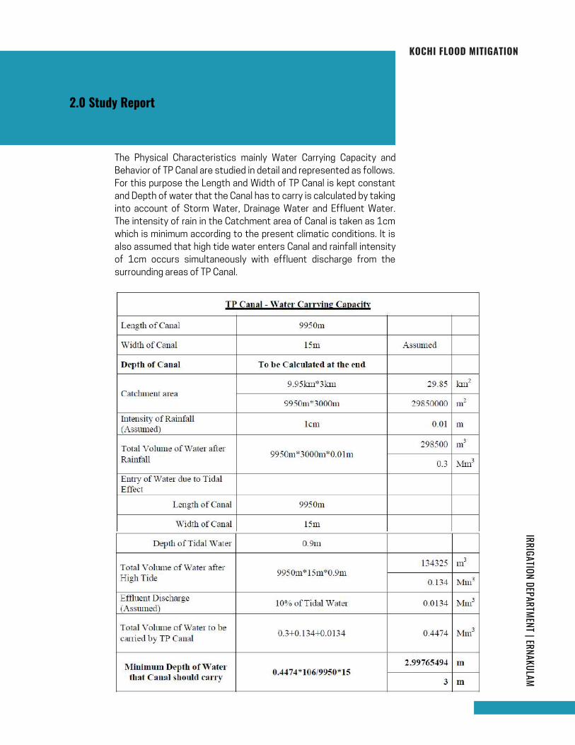
For this purpose the Length and Width of TP Canal is kept constant
and Depth of water that the Canal has to carry is calculated by taking
into account of Storm Water, Drainage Water and Effluent Water.
The intensity of rain in the Catchment area of Canal is taken as 1cm
which is minimum according to the present climatic conditions. It is
also assumed that high tide water enters Canal and rainfall intensity
of 1cm occurs simultaneously with effluent discharge from the
surrounding areas of TP Canal.
The Physical Characteristics mainly Water Carrying Capacity and
Behavior of TP Canal are studied in detail and represented as follows.
2.0 Study Report
Page 20
IRRIGATION DEPARTMENT | ERNAKULAMKOCHI FLOOD MITIGATION
Reach I Starts From Ch. 0 to 2320m
Reach II Starts From Ch.2320m to 5000m
Reach III Starts From Ch.5000m to 6400m
Reach IV starts from Ch.6400m to 9950m
From the above table it is clear that the water depth of Canal should
be 3m (Minimum). There should be sufficient Vertical and Horizontal
clearance to the CD Works constructed across Canal. The Canal
should have a Free Board of at least 2m to carry severe flood
discharge during high intensity rain.
The Canal is divided into 4 reaches for the purpose of survey work
namely;
Reach I, Reach II, Reach III and Reach IV
From Thevara Canal Mouth to Bridge at Kadavanthara near
GCDA),
(From Kadavanthara Bridge near GCDA to Pulleppady Bridge),
(From Pulleppady Bridge to Sastha Temple Road Bridge)
(From Chirakkal Sastha Temple Road Bridge to Perandoor Kayal
Mouth).
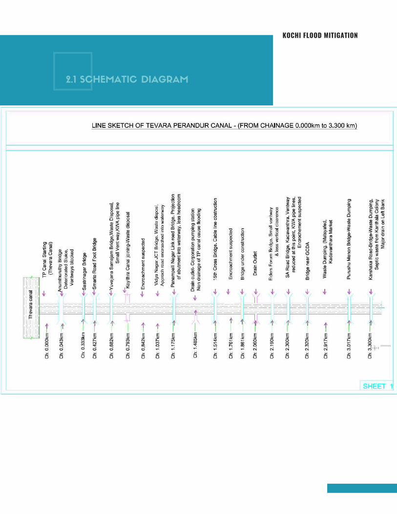
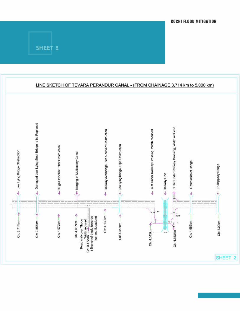
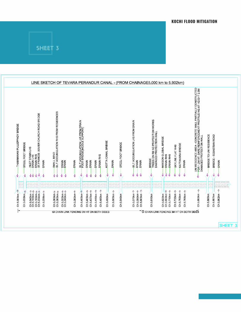
The field survey was conducted on 2nd July 2021 by Minor Irrigation
Department, Ernakulam District Officials. The Schematic Diagram of
TP Canal and the Salient Features of each reach are represented in
the following pages. The observations and immediate measures to
be taken on Short Term and Long Term basis are also explained in
this report.
Page 21
KOCHI FLOOD MITIGATION
2.1 SCHEMATIC DIAGRAM
Page 22
KOCHI FLOOD MITIGATION
SHEET 2
Page 23
KOCHI FLOOD MITIGATION
SHEET 3
Page 24

KOCHI FLOOD MITIGATION
SHEET 4
Page 25
IRRIGATION DEPARTMENT | ERNAKULAMKOCHI FLOOD MITIGATION
The length of this reach is 2320m with a varying width of 15m to 10m. The
average depth of water at the time of field survey was 0.8m (2nd July 2021)
and the silt deposited is about 0.8m from existing bed level.
Ave
rage
Wid
th - 1
2m
Re
ach
Be
twe
en
Th
evara
Can
al an
d
An
amm
thu
ruth
y Brid
ge
TP Canal - Starting Point Anamthuruthy Sluice – To be Demolished and Bridge to
be Reconstructed as Single Span
U/S side of TP Canal and as a result, Heart of Corporation areas got inundated
during Flood and High Tide times that may occur simultaneously. The sluice has
to be dismantled fully to pave the way to discharge storm/drain water into the
Kayal. The damaged Sluice and Anamthuruthy Bridge with starting point of TP
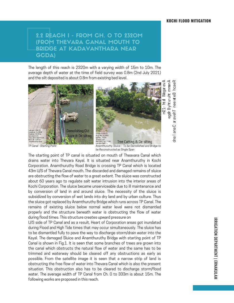
Canal is shown in Fig.1. It is seen that some branches of trees are grown into
the canal which obstructs the natural flow of water and the same has to be
trimmed and waterway should be cleared off any obstructions as early as
possible. From the satellite image it is seen that a narrow strip of land is
obstructing the free flow of water into Thevara Canal which is also the present
situation. This obstruction also has to be cleared to discharge storm/flood
water. The average width of TP Canal from Ch. 0 to 333m is about 15m. The
following works are proposed in this reach.
The starting point of TP canal is situated on mouth of Theavara Canal which
drains water into Thevara Kayal. It is situated near Anamthuruthy in Kochi
Corporation. Anamthuruthy Road Bridge is crossing TP Canal which is located
43m U/S of Thevara Canal mouth. The discarded and damaged remains of sluice
are obstructing the flow of water to a great extent. The sluice was constructed
about 60 years ago to regulate salt water intrusion into the interior areas of
Kochi Corporation. The sluice became unserviceable due to ill maintenance and
by conversion of land in and around sluice. The necessity of the sluice is
subsidized by conversion of wet lands into dry land and by urban culture. Thus
the sluice got replaced by Anamthuruthy Bridge which runs across TP Canal. The
remains of existing sluice below normal water level were not dismantled
properly and the structure beneath water is obstructing the flow of water
during flood times. This structure creates upward pressure on
2.2 REACH I - FROM CH. 0 TO 2320M
(FROM THEVARA CANAL MOUTH TO
BRIDGE AT KADAVANTHARA NEAR
GCDA)
Page 26
IRRIGATION DEPARTMENT | ERNAKULAMKOCHI FLOOD MITIGATION
Clearing light, thick and thorny jungle
Trimming branches of trees
De-silting and removal of debris
Shifting of cables, ducts and pipes
Eviction of encroachment which is visible on both sides of canal
6 Major drains (storm water) and small pipe drains discharging effluent into
TP canal which have to be relocated
Dismantling of Old sluice which is obstructing the natural flow of water
Re-construction of Anamthuruthy Bridge
Reach Between Anamthuruthy Bridge and Sasthrinagar Bridge
Clearing light, thick and thorny jungle
Trimming branches of trees
De-silting and removal of debris
Shifting of cables, ducts and pipes
Eviction of encroachment which is visible on both sides of canal
8 major drains (storm water) and small pipe drains discharging effluent into
TP canal which have to be relocated
Average Width - 15m
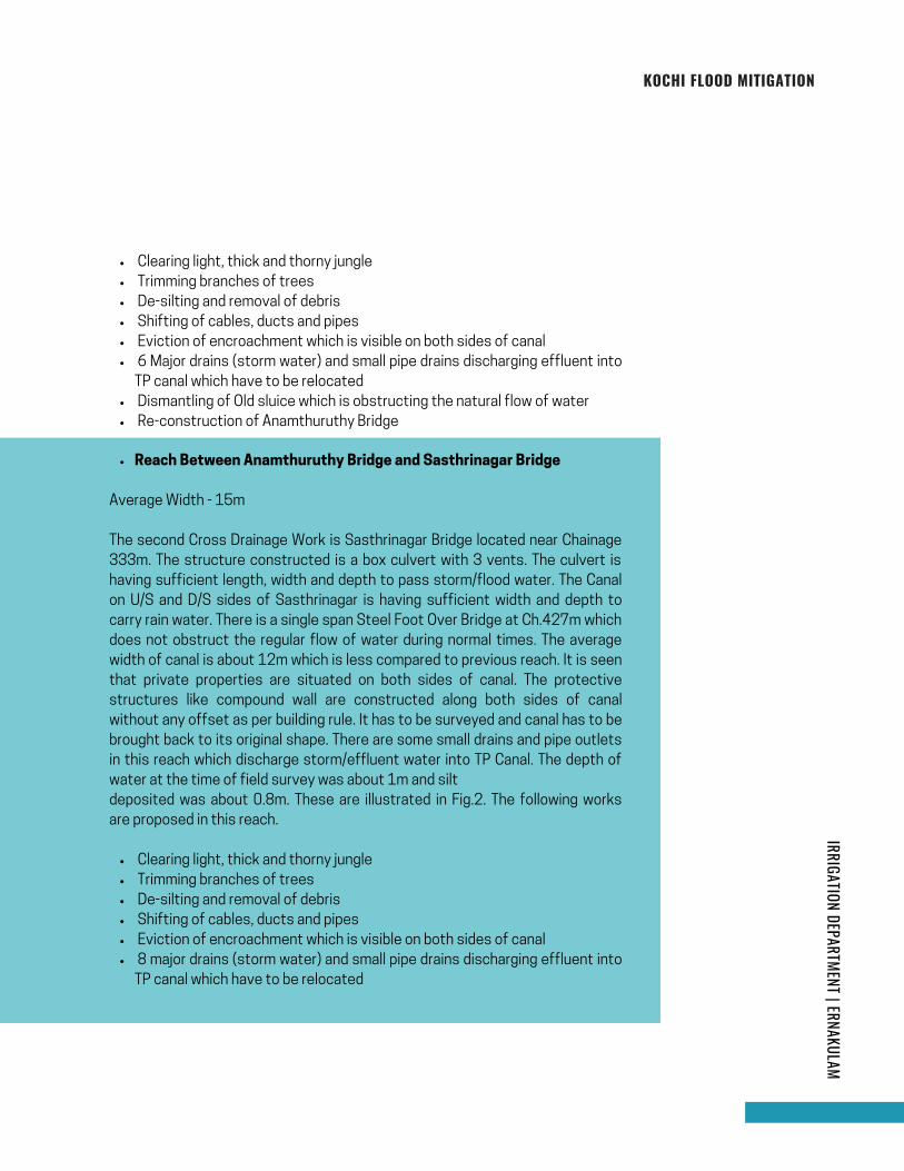
The second Cross Drainage Work is Sasthrinagar Bridge located near Chainage
333m. The structure constructed is a box culvert with 3 vents. The culvert is
having sufficient length, width and depth to pass storm/flood water. The Canal
on U/S and D/S sides of Sasthrinagar is having sufficient width and depth to
carry rain water. There is a single span Steel Foot Over Bridge at Ch.427m which
does not obstruct the regular flow of water during normal times. The average
width of canal is about 12m which is less compared to previous reach. It is seen
that private properties are situated on both sides of canal. The protective
structures like compound wall are constructed along both sides of canal
without any offset as per building rule. It has to be surveyed and canal has to be
brought back to its original shape. There are some small drains and pipe outlets
in this reach which discharge storm/effluent water into TP Canal. The depth of
water at the time of field survey was about 1m and silt
deposited was about 0.8m. These are illustrated in Fig.2. The following works
are proposed in this reach.
Page 27
IRRIGATION DEPARTMENT | ERNAKULAMKOCHI FLOOD MITIGATION
The works proposed in this reach are
Clearing light, thick and thorny jungle
Trimming branches of trees
De-silting and removal of debris
Shifting of cables, ducts and pipes
Eviction of encroachment which is visible on both sides of canal
8 major drains (storm water) and small pipe drains discharging effluent into
TP canal which have to be relocated
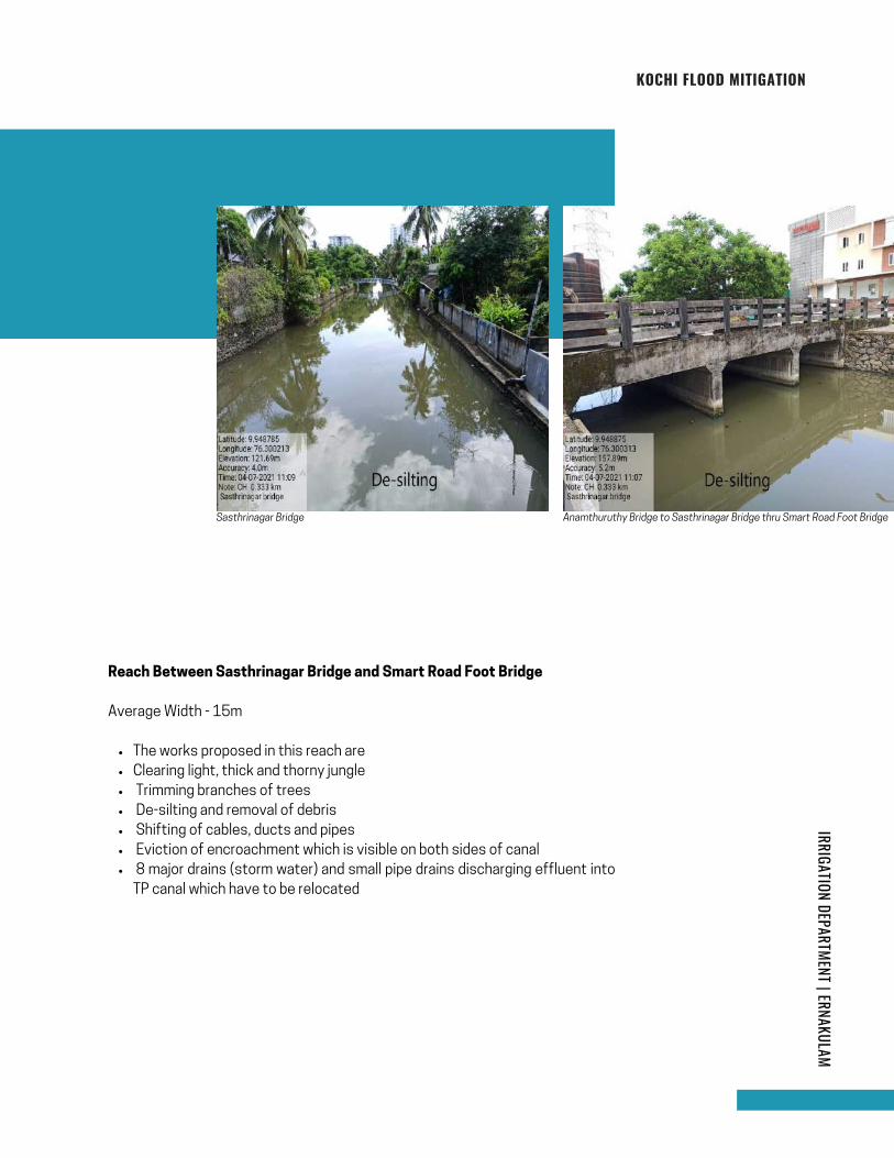
Reach Between Sasthrinagar Bridge and Smart Road Foot Bridge
Average Width - 15m
Sasthrinagar Bridge Anamthuruthy Bridge to Sasthrinagar Bridge thru Smart Road Foot Bridge
Page 28
IRRIGATION DEPARTMENT | ERNAKULAMKOCHI FLOOD MITIGATION
Clearing light, thick and thorny jungle
Trimming branches of trees
De-silting and removal of debris
Shifting of cables, ducts and pipes
Eviction of encroachment which is visible on both sides of canal
Span and Height (Horizontal & Vertical clearance) of Yuvajanasamajam Bridge to be
increased
8 major drains (storm water) and small pipe drains discharging effluent into TP canal
which have to be relocated
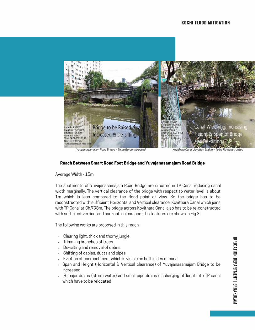
� Reach Between Smart Road Foot Bridge and Yuvajanasamajam Road Bridge
Average Width - 15m
The abutments of Yuvajanasamajam Road Bridge are situated in TP Canal reducing canal
width marginally. The vertical clearance of the bridge with respect to water level is about
1m which is less compared to the flood point of view. So the bridge has to be
reconstructed with sufficient Horizontal and Vertical clearance. Koyithara Canal which joins
with TP Canal at Ch.793m. The bridge across Koyithara Canal also has to be re-constructed
with sufficient vertical and horizontal clearance. The features are shown in Fig.3
The following works are proposed in this reach
Yuvajanasamajam Road Bridge – To be Re-constructed Koyithara Canal Junction Bridge – To be Re-constructed
Page 29

IRRIGATION DEPARTMENT | ERNAKULAMKOCHI FLOOD MITIGATION
Clearing light, thick and thorny jungle
Trimming branches of trees
De-silting and removal of debris
Shifting of cables, ducts and pipes
Eviction of encroachment which is visible on both sides of canal
Span and Height (Horizontal & Vertical clearance) of Koyithara Jn Bridge to be increased
8 major drains (storm water) and small pipe drains discharging effluent into TP canal
which have to be relocated
� Reach Between Yuvajanasamajam Road Bridge and Koyithara Canal Jn.
Average Width - 15m
The following works have to be carried out in this reach
The aim of re-construction of Koyithara Canal Bridge is to reduce water load of TP Canal
during peak monsoon season. Thus the storm water collected in Koyithara Canal will not
flow into TP Canal and a part of TP Canal water will pass through Koyithara Canal reducing
the water pressure of TP Canal.
page | 15
� Reach Between Koyithara Canal Junction Bridge and Vidya Nagar Bridge
Average Width - 15m
The abutments of Vidya Nagar Road Bridge are situated in TP Canal reducing canal width
marginally. The vertical clearance of the bridge with respect to water level is about 1m
which is less compared to the flood point of view. So the bridge has to be reconstructed
with sufficient Horizontal and Vertical clearance. The view from Koyithara Canal Junction
shows that there is large scale encroachment on both sides of canal. The encroachment
has to be evicted and TP Canal has to be brought back to its original shape. The features
are shown in Fig.4.
Koyithara Canal Junction View – Encroachments to be
evicted Re-constructed
Vidya Nagar Road Bridge – To be
Page 30

IRRIGATION DEPARTMENT | ERNAKULAMKOCHI FLOOD MITIGATION
Clearing light, thick and thorny jungle
Trimming branches of trees
De-silting and removal of debris
Shifting of cables, ducts and pipes
Eviction of encroachment which is visible on both sides of canal
Span and Height (Vertical & Horizontal clearance) of Vidya Nagar Bridge to be increased
6 major drains (storm water) and small pipe drains discharging effluent into TP canal
which have to be relocated
The following works are proposed in this reach
Reach Between Vidya Nagar Bridge and Panampilly Nagar Link Road Bridge
Average Width - 15m
The abutments of Panampilly Nagar Link Road Bridge are situated in TP Canal reducing canal
width marginally. The vertical clearance of the bridge with respect to water level is about
0.7m which is less compared to the flood point of view. So the bridge has to be reconstructed
with sufficient Horizontal and Vertical clearance. The view from Koyithara Canal Junction
shows that there is large scale encroachment on both sides of canal. The
encroachment has to be evicted and TP Canal has to be brought back to its original shape.
The features are shown in Fig.5.
Panampilly Nagar Link Road Bridge View – Encroachments
to be evicted
Panampilly Nagar Link Road Bridge – To be Re-
constructed
Clearing light, thick and thorny jungle
Trimming branches of trees
De-silting and removal of debris
Shifting of cables, ducts and pipes
Eviction of encroachment which is visible on both sides of canal
Span and Height (Vertical and Horizontal clearance) of Panampilly Nagar Link Road
Bridge to be increased
6 major drains (storm water) and small pipe drains discharging effluent into TP canal
which have to be relocated
The following works are proposed in this reach
Page 31
KOCHI FLOOD MITIGATION
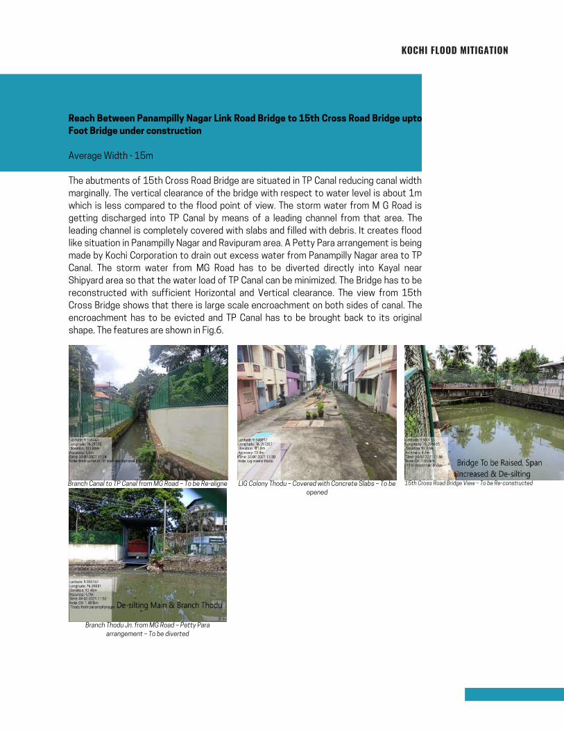
Reach Between Panampilly Nagar Link Road Bridge to 15th Cross Road Bridge upto
Foot Bridge under construction
Average Width - 15m
The abutments of 15th Cross Road Bridge are situated in TP Canal reducing canal width
marginally. The vertical clearance of the bridge with respect to water level is about 1m
which is less compared to the flood point of view. The storm water from M G Road is
getting discharged into TP Canal by means of a leading channel from that area. The
leading channel is completely covered with slabs and filled with debris. It creates flood
like situation in Panampilly Nagar and Ravipuram area. A Petty Para arrangement is being
made by Kochi Corporation to drain out excess water from Panampilly Nagar area to TP
Canal. The storm water from MG Road has to be diverted directly into Kayal near
Shipyard area so that the water load of TP Canal can be minimized. The Bridge has to be
reconstructed with sufficient Horizontal and Vertical clearance. The view from 15th
Cross Bridge shows that there is large scale encroachment on both sides of canal. The
encroachment has to be evicted and TP Canal has to be brought back to its original
shape. The features are shown in Fig.6.
Branch Canal to TP Canal from MG Road – To be Re-aligne
Branch Thodu Jn. from MG Road – Petty Para
arrangement – To be diverted
LIG Colony Thodu – Covered with Concrete Slabs – To be
opened
15th Cross Road Bridge View – To be Re-constructed
Page 32
KOCHI FLOOD MITIGATION
Clearing light, thick and thorny jungle
Trimming branches of trees
De-silting and removal of debris
Shifting of cables, ducts and pipes
Leading Channel diversion into Kayal to discharge storm water from MG Road
Encroachment is visible on both sides of canal reducing canal width
Span and height (vertical clearance) of 15th Cross Road Bridge to be increased
Re-alignment of Leading Channel to TP Canal from M G Road
6 major drains (storm water) and small pipe drains discharging effluent into TP canal
which have to be relocated
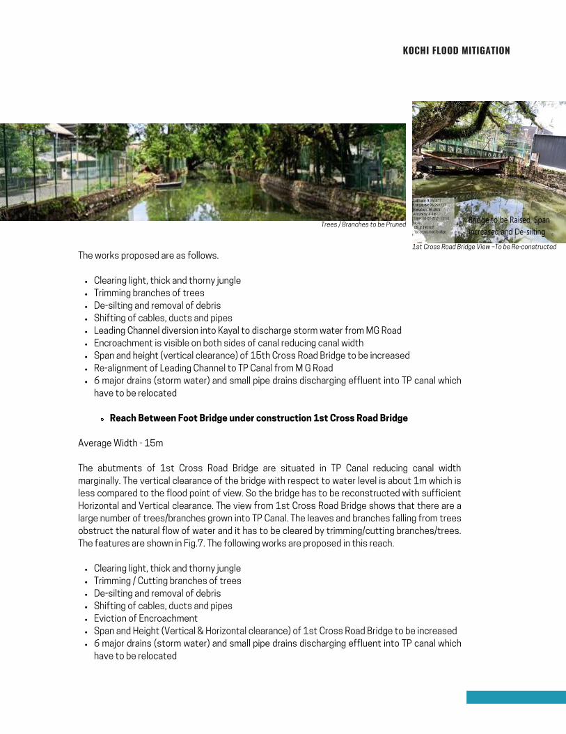
Reach Between Foot Bridge under construction 1st Cross Road Bridge
Clearing light, thick and thorny jungle
Trimming / Cutting branches of trees
De-silting and removal of debris
Shifting of cables, ducts and pipes
Eviction of Encroachment
Span and Height (Vertical & Horizontal clearance) of 1st Cross Road Bridge to be
increased
6 major drains (storm water) and small pipe drains discharging effluent into TP canal
which have to be relocated
The works proposed are as follows.
Average Width - 15m
The abutments of 1st Cross Road Bridge are situated in TP Canal reducing canal width
marginally. The vertical clearance of the bridge with respect to water level is about 1m
which is less compared to the flood point of view. So the bridge has to be reconstructed
with sufficient Horizontal and Vertical clearance. The view from 1st Cross Road Bridge
shows that there are a large number of trees/branches grown into TP Canal. The leaves
and branches falling from trees obstruct the natural flow of water and it has to be
cleared by trimming/cutting branches/trees. The features are shown in Fig.7. The
following works are proposed in this reach.
Page 33
Clearing light, thick and thorny jungle
Trimming branches of trees
De-silting and removal of debris
Shifting of cables, ducts and pipes
Leading Channel diversion into Kayal to discharge storm water from MG Road
Encroachment is visible on both sides of canal reducing canal width
Span and height (vertical clearance) of 15th Cross Road Bridge to be increased
Re-alignment of Leading Channel to TP Canal from M G Road
6 major drains (storm water) and small pipe drains discharging effluent into TP canal which
have to be relocated
Reach Between Foot Bridge under construction 1st Cross Road Bridge
Clearing light, thick and thorny jungle
Trimming / Cutting branches of trees
De-silting and removal of debris
Shifting of cables, ducts and pipes
Eviction of Encroachment
Span and Height (Vertical & Horizontal clearance) of 1st Cross Road Bridge to be increased
6 major drains (storm water) and small pipe drains discharging effluent into TP canal which
have to be relocated
The works proposed are as follows.
Average Width - 15m
The abutments of 1st Cross Road Bridge are situated in TP Canal reducing canal width
marginally. The vertical clearance of the bridge with respect to water level is about 1m which is
less compared to the flood point of view. So the bridge has to be reconstructed with sufficient
Horizontal and Vertical clearance. The view from 1st Cross Road Bridge shows that there are a
large number of trees/branches grown into TP Canal. The leaves and branches falling from trees
obstruct the natural flow of water and it has to be cleared by trimming/cutting branches/trees.
The features are shown in Fig.7. The following works are proposed in this reach.
KOCHI FLOOD MITIGATION
Trees / Branches to be Pruned
1st Cross Road Bridge View –To be Re-constructed
Page 34

The horizontal and vertical clearance of Bridge on SA Road is very less and it has to be re-
constructed to pave the way for smooth discharge of storm water through canal. The
Figure 8 shows that there is large scale encroachment on both sides of canal and trees are
grown on the banks preventing natural flow of water. It has to be removed as early as
possible. The cables, KWA pipe lines and ducts also have to be shifted during the re-
construction of SA Road Bridge. The U/S and D/S of SA Road Bridge is shown in Fig.8.
Clearing light, thick and thorny jungle
Trimming branches of trees
De-silting and removal of debris
Shifting of cables, ducts and pipes
Eviction encroachment which is visible on both sides of canal
Span and Height (vertical clearance) of Bridge on SA road to be increased
6 major drains (storm water) and small pipe drains discharging effluent into TP canal which
have to be relocated
Reach Between 1st Cross Road Bridge and SA Road Bridge
Average Width - 15m
The following works are proposed in this reach
KOCHI FLOOD MITIGATION
Trees / Branches to be Pruned
1st Cross Road Bridge View –To be Re-constructed
Page 35

Clearing light, thick and thorny jungle
Trimming branches of trees
De-silting and removal of debris
Shifting of cables, ducts and pipes
Making Canal Bund Road on RHS
Eviction of encroachment which is visible on both sides
of canal
Re-construction of Purushu Menon Road Bridge
8 major drains (storm water) and small pipe drains
discharging effluent into TP canal and have to be
relocated
Install local Sewage Treatment Plants
The length of this reach is 2680m with a varying width of
15m to 7m excluding the railway track crossing reach which
is having a reduced width of 1.2m. The average depth of
water at the time of field survey was 0.5m (2nd July 2021)
and the silt deposited is about 0.8m from existing bed level.
Reach Between Bridge on SA Road near GCDA and
Purushu Menon Road Bridge
Average Width - 12m
The canal reach in this location is seen to have large scale
encroachments. Most of the Government funded
establishments like GCDA, Indoor Stadium, HPCL, IOCL and
Kadavanthara Market is situated on banks of canal. The
compound walls of these establishments are situated in the
canal with their effluent discharge directly into the canal.
The direct discharge of effluent into TP Canal should be
strictly prohibited by installing local Sewage Treatment
Plants. The Garbage from Kadavanthara Fish / Meat /
Vegetable Market is getting directly discharged into TP
Canal which should be prevented at any cost. This reach
should be made accessible by providing canal road on right
side of TP Canal. It is also seen that the horizontal/vertical
clearance of Purushu Menon Road Bridge is less and has to
be re-constructed in order to discharge storm water without
any hindrance during flood times. These are shown in Fig.9
above. The following works are proposed in this reach
KOCHI FLOOD MITIGATION
Kadavanthara Market – Waste dumping & Eviction of Encroachments
Purushu Menon Road Bridge – To Be Re-constructed
BPCL Effluent Outlet – To be Closed
Encroachments to be Evicted
2.3 REACH II - FROM CH.2320M TO 5000M
(FROM KADAVANTHARA BRIDGE
NEAR GCDA TO PULLEPPADY BRIDGE)
Page 36
Clearing light, thick and thorny jungle,
Trimming and cutting away trees & branches of trees
De-silting and removal of debris
Shifting of cables, ducts and pipes
Making Canal Bund Road on RHS
Eviction of encroachment which is visible on both sides of canal
6 major drains (storm water) and small pipe drains discharging
effluent into TP canal and have to be relocated
Install local Sewage Treatment Plants
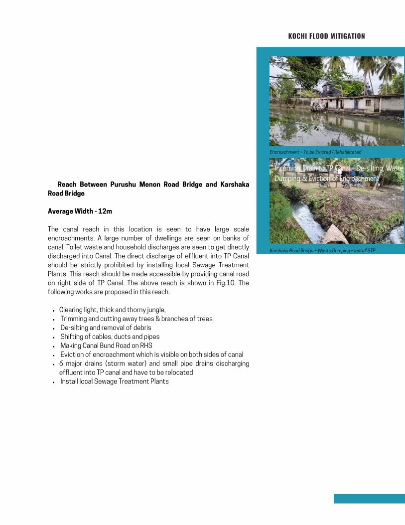
� Reach Between Purushu Menon Road Bridge and Karshaka
Road Bridge
Average Width - 12m
The canal reach in this location is seen to have large scale
encroachments. A large number of dwellings are seen on banks of
canal. Toilet waste and household discharges are seen to get directly
discharged into Canal. The direct discharge of effluent into TP Canal
should be strictly prohibited by installing local Sewage Treatment
Plants. This reach should be made accessible by providing canal road
on right side of TP Canal. The above reach is shown in Fig.10. The
following works are proposed in this reach.
KOCHI FLOOD MITIGATION
Encroachment – To be Evicted / Rehabilitated
Karshaka Road Bridge – Waste Dumping – Install STP
Page 37
Clearing light, thick and thorny jungle
Trimming and cutting away trees & branches of trees
De-silting and removal of debris
Shifting of cables, ducts and pipes
Making Canal Bund Road on RHS
Eviction of Encroachment is which is visible on both sides of canal. Snehanagar and Kareethala
Colony situated on right side of TP Canal – To be rehabilitated
10 major drains (storm water) and small pipe drains discharging effluent into TP canal
Install local Sewage Treatment Plants.
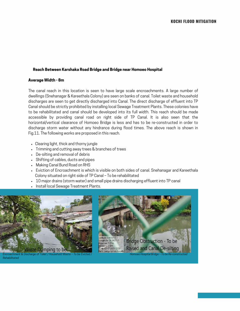
� Reach Between Karshaka Road Bridge and Bridge near Homoeo Hospital
Average Width - 8m
The canal reach in this location is seen to have large scale encroachments. A large number of
dwellings (Snehanagar & Kareethala Colony) are seen on banks of canal. Toilet waste and household
discharges are seen to get directly discharged into Canal. The direct discharge of effluent into TP
Canal should be strictly prohibited by installing local Sewage Treatment Plants. These colonies have
to be rehabilitated and canal should be developed into its full width. This reach should be made
accessible by providing canal road on right side of TP Canal. It is also seen that the
horizontal/vertical clearance of Homoeo Bridge is less and has to be re-constructed in order to
discharge storm water without any hindrance during flood times. The above reach is shown in
Fig.11. The following works are proposed in this reach.
KOCHI FLOOD MITIGATION
Homoeo Hospital Bridge – To be Re-constructedEncroachment & Discharge of Toilet / Household Waste – To be Evicted /
Rehabilitated
Page 38
Clearing light, thick and thorny jungle
Trimming and cutting away trees & branches of trees
De-silting and removal of debris
Shifting of cables, ducts and pipes
Making Canal Bund Road on RHS
Eviction of encroachment which is visible on both sides of canal. Udayanagar Colony
situated on right side of TP Canal and has to be rehabilitated
10 major drains (storm water) and small pipe drains discharging effluent into TP canal
Install local Sewage Treatment Plants
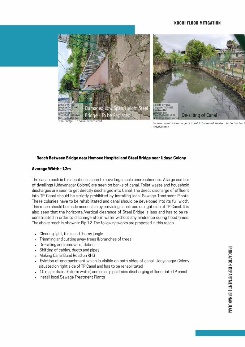
� Reach Between Bridge near Homoeo Hospital and Steel Bridge near Udaya Colony
Average Width - 12m
The canal reach in this location is seen to have large scale encroachments. A large number
of dwellings (Udayanagar Colony) are seen on banks of canal. Toilet waste and household
discharges are seen to get directly discharged into Canal. The direct discharge of effluent
into TP Canal should be strictly prohibited by installing local Sewage Treatment Plants.
These colonies have to be rehabilitated and canal should be developed into its full width.
This reach should be made accessible by providing canal road on right side of TP Canal. It is
also seen that the horizontal/vertical clearance of Steel Bridge is less and has to be re-
constructed in order to discharge storm water without any hindrance during flood times.
The above reach is shown in Fig.12. The following works are proposed in this reach.
KOCHI FLOOD MITIGATION
Encroachment & Discharge of Toilet / Household Waste – To be Evicted /
Rehabilitated
Steel Bridge – To be Re-constructed
IRRIGATION DEPARTMENT | ERNAKULAM
Page 39
Clearing light, thick and thorny jungle
Trimming and cutting away trees & branches of trees
De-silting and removal of debris
Shifting cables, ducts and pipes
Eviction of encroachment which is visible on both sides of canal
Development of Canal Bund Road on RHS
High pressure Oil/Gas pipe lines crossing TP Canal in different levels. Low lying pipe
lines have to be shifted up and Piers to be relocated
Re-Construction of Mullassery Canal Junction Bridge
Widening mouth of Branch Canal
8 major drains (storm water) and small pipe drains discharging effluent into TP
canal which have to be relocated.
Install local Sewage Treatment Plants
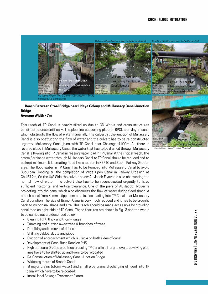
� Reach Between Steel Bridge near Udaya Colony and Mullassery Canal Junction
Bridge
Average Width - 7m
This reach of TP Canal is heavily silted up due to CD Works and cross structures
constructed unscientifically. The pipe line supporting piers of BPCL are lying in canal
which obstructs the flow of water marginally. The culvert at the junction of Mullassery
Canal is also obstructing the flow of water and the culvert has to be re-constructed
urgently. Mullassery Canal joins with TP Canal near Chainage 4100m. As there is
reverse slope in Mullassery Canal, the water that has to be drained through Mullassery
Canal is flowing into TP Canal increasing water load in TP Canal at the critical reach. The
storm / drainage water through Mullassery Canal to TP Canal should be reduced and to
be kept minimum. It is creating flood like situation in KSRTC and South Railway Station
area. The flood water in TP Canal has to be Pumped into Mullasssery Canal to avoid
Suburban Flooding till the completion of Wide Open Canal in Railway Crossing at
Ch.4512m, On the U/S Side the culvert below AL Jacob Flyover is also obstructing the
normal flow of water. This culvert also has to be reconstructed urgently to have
sufficient horizontal and vertical clearance. One of the piers of AL Jacob Flyover is
projecting into the canal which also obstructs the flow of water during flood times. A
branch canal from Kammattippadom area is also leading into TP Canal near Mullassery
Canal Junction. The size of Branch Canal is very much reduced and it has to be brought
back to its original shape and size. This reach should be made accessible by providing
canal road on right side of TP Canal. These features are shown in Fig13 and the works
to be carried out are described below.
KOCHI FLOOD MITIGATION
Pipe Line Pier Obstruction – To be Re-located
AL Jacob Flyover Pier / Culvert Obstruction – To be
Removed / Re-constructed
Branch Canal – Mouth to be Widened
Mullassery Canal Junction Bridge – To Be Re-constructed
IRRIGATION DEPARTMENT | ERNAKULAM
Page 40
De-silting and removal of debris
Shifting cables, ducts and pipes
4 major drains (storm water) and small pipe drains discharging effluent into TP canal and have to be
relocated
The bottom slab of culvert is obstructing the flow of water during flood. It has to be reconstructed to higher
level.
3 Nos of high capacity KWA pipe lines are obstructing the flow of water and has to be shifted.
Install local Sewage Treatment Plants
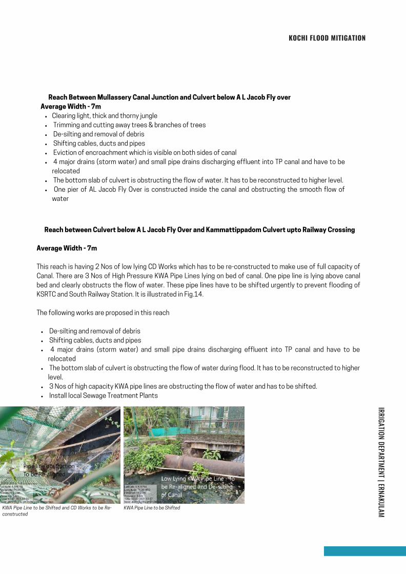
� Reach between Culvert below A L Jacob Fly Over and Kammattippadom Culvert upto Railway Crossing
Average Width - 7m
This reach is having 2 Nos of low lying CD Works which has to be re-constructed to make use of full capacity of
Canal. There are 3 Nos of High Pressure KWA Pipe Lines lying on bed of canal. One pipe line is lying above canal
bed and clearly obstructs the flow of water. These pipe lines have to be shifted urgently to prevent flooding of
KSRTC and South Railway Station. It is illustrated in Fig.14.
The following works are proposed in this reach
Clearing light, thick and thorny jungle
Trimming and cutting away trees & branches of trees
De-silting and removal of debris
Shifting cables, ducts and pipes
Eviction of encroachment which is visible on both sides of canal
4 major drains (storm water) and small pipe drains discharging effluent into TP canal and have to be
relocated
The bottom slab of culvert is obstructing the flow of water. It has to be reconstructed to higher level.
One pier of AL Jacob Fly Over is constructed inside the canal and obstructing the smooth flow of
water
� Reach Between Mullassery Canal Junction and Culvert below A L Jacob Fly over
Average Width - 7m
KOCHI FLOOD MITIGATION
KWA Pipe Line to be Shifted and CD Works to be Re-
constructed
KWA Pipe Line to be Shifted
IRRIGATION DEPARTMENT | ERNAKULAM
Page 41
Clearing light, thick and thorny jungle.
De-silting and removal of debris
Shifting of cables, pipes and ducts
TP Canal is crossing 4 Lane Main Railway track with sharp bends. The canal is taking 360 degree turn
to cross railway track and joins with original canal. The width of canal is only 1.2m. TP Canal is taking a
U Turn to cover a length of 41m. The existing box culvert has to be replaced and canal has to be made
straight across railway track to discharge flood water.
Construction of New Canal by Push Through Technique for a length of 41m.
4 Major Drains discharging storm/effluent water into TP Canal – To be relocated and re-constructed
scientifically.
Install Sewage Treatment Plants
� Railway crossing
Average Width - 1.2m
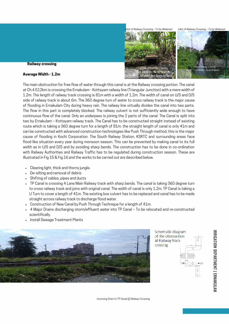
The main obstruction for free flow of water through this canal is at the Railway crossing portion. The canal
at Ch.4.512km is crossing the Ernakulam - Kottayam railway line (Triangular Junction) with a mere width of
1.2m. The length of railway track crossing is 81m with a width of 1.2m. The width of canal on U/S and D/S
side of railway track is about 6m. The 360 degree turn of water to cross railway track is the major cause
of flooding in Ernakulam City during heavy rain. The railway line virtually divides the canal into two parts.
The flow in this part is completely blocked. The railway culvert is not sufficiently wide enough to have
continuous flow of the canal. Only an underpass is joining the 2 parts of the canal. The Canal is split into
two by Ernakulam – Kottayam railway track. The Canal has to be constructed straight instead of existing
route which is taking a 360 degree turn for a length of 81m. the straight length of canal is only 41m and
can be constructed with advanced construction technologies like Push Through method, this is the major
cause of flooding in Kochi Corporation. The South Railway Station, KSRTC and surrounding areas face
flood like situation every year during monsoon season. This can be prevented by making canal to its full
width as in U/S and D/S and by avoiding sharp bends. The construction has to be done in co-ordination
with Railway Authorities and Railway Traffic has to be regulated during construction season. These are
illustrated in Fig 15 & Fig.16 and the works to be carried out are described below.
Incoming Drain to TP Canal @ Railway Crossing
Inlet of Railway Crossing – To be Widened Inlet of Railway Crossing – To be Widened
IRRIGATION DEPARTMENT | ERNAKULAM
Page 42

Clearing light, thick and thorny jungle
De-silting and removal of debris
Shifting of cables, ducts and pipes
Eviction of encroachment which is visible on both sides of canal
7 major drains (storm water) and small pipe drains discharging effluent into TP canal – To be relocated
The bottom slab and abutment of Foot Bridge is obstructing the flow of water during flood. It has to
be reconstructed to higher level.
Install local Sewage Treatment Plants
� Reach between Railway crossing D/S and Pulleppady Road Bridge
Average Width - 7m
The reach from Railway Crossing to Pulleppady Bridge is having sufficient width and depth for the free
flow of water except at Foot Bridge location immediately D/S of railway tracks. Some ducted cables and
pipe lines are also seen to obstruct the flood flow of water. Thse have to be relocated to higher level
during renovation of TP Canal. The FB has to be reconstructed to clear off steps leading into canal. The
features of this reach are shown in Fig.17 and the works to be carried out are as follows.
De-silting of Canal Foot Bridge to be Re-constructed
KOCHI FLOOD MITIGATION
The length of this reach is 1400m
with a varying width of 7m to 5m.
The average depth of water at
the time of field survey was 0.7m
(2nd July 2021) and the silt
deposited is about 0.8m from
existing bed level.
2.4 REACH III - FROM CH.5000M TO
6400M (FROM PULLEPPADY BRIDGE TO
CHIRAKKAL SASTHA ROAD BRIDGE AT
KALOOR)
IRRIGATION DEPARTMENT | ERNAKULAM
Page 43
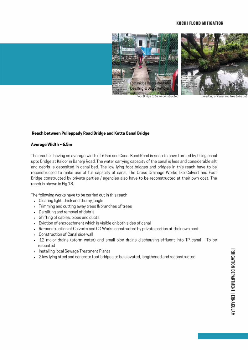
Clearing light, thick and thorny jungle
Trimming and cutting away trees & branches of trees
De-silting and removal of debris
Shifting of cables, pipes and ducts
Eviction of encroachment which is visible on both sides of canal
Re-construction of Culverts and CD Works constructed by private parties at their own cost
Construction of Canal side wall
12 major drains (storm water) and small pipe drains discharging effluent into TP canal – To be
relocated
Installing local Sewage Treatment Plants
2 low lying steel and concrete foot bridges to be elevated, lengthened and reconstructed
Reach between Pulleppady Road Bridge and Kotta Canal Bridge
Average Width – 6.5m
The reach is having an average width of 6.5m and Canal Bund Road is seen to have formed by filling canal
upto Bridge at Kaloor in Banerji Road. The water carrying capacity of the canal is less and considerable silt
and debris is deposited in canal bed. The low lying foot bridges and bridges in this reach have to be
reconstructed to make use of full capacity of canal. The Cross Drainage Works like Culvert and Foot
Bridge constructed by private parties / agencies also have to be reconstructed at their own cost. The
reach is shown in Fig.18.
The following works have to be carried out in this reach
Foot Bridge to be Re-constructed De-silting of Canal and Tree to be cut
KOCHI FLOOD MITIGATION
IRRIGATION DEPARTMENT | ERNAKULAM
Page 44
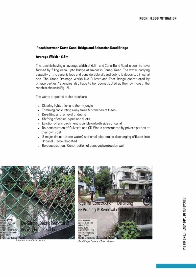
Clearing light, thick and thorny jungle
Trimming and cutting away trees & branches of trees
De-silting and removal of debris
Shifting of cables, pipes and ducts
Eviction of encroachment is visible on both sides of canal
Re-construction of Culverts and CD Works constructed by private parties at
their own cost
8 major drains (storm water) and small pipe drains discharging effluent into
TP canal - To be relocated
Re-construction / Construction of damaged protection wall
Reach between Kotta Canal Bridge and Sebastian Road Bridge
Average Width – 6.5m
The reach is having an average width of 6.5m and Canal Bund Road is seen to have
formed by filling canal upto Bridge at Kaloor in Banerji Road. The water carrying
capacity of the canal is less and considerable silt and debris is deposited in canal
bed. The Cross Drainage Works like Culvert and Foot Bridge constructed by
private parties / agencies also have to be reconstructed at their own cost. The
reach is shown in Fig.19.
The works proposed in this reach are
Encroachment – To be evicted De-silting of Canal and Tree to be cut
KOCHI FLOOD MITIGATION
IRRIGATION DEPARTMENT | ERNAKULAM
Page 45
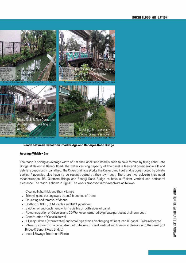
Clearing light, thick and thorny jungle
Trimming and cutting away trees & branches of trees
De-silting and removal of debris
Shifting of KSEB, BSNL cables and KWA pipe lines
Eviction of Encroachment which is visible on both sides of canal
Re-construction of Culverts and CD Works constructed by private parties at their own cost
Construction of Canal side wall
11 major drains (storm water) and small pipe drains discharging effluent into TP canal – To be relocated
2 Nos. of culvert to be reconstructed to have sufficient vertical and horizontal clearance to the canal (RBI
Bridge & Banerji Road Bridge)
Install Sewage Treatment Plants
� Reach between Sebastian Road Bridge and Banerjee Road Bridge
Average Width – 5m
The reach is having an average width of 5m and Canal Bund Road is seen to have formed by filling canal upto
Bridge at Kaloor in Banerji Road. The water carrying capacity of the canal is less and considerable silt and
debris is deposited in canal bed. The Cross Drainage Works like Culvert and Foot Bridge constructed by private
parties / agencies also have to be reconstructed at their own cost. There are two culverts that need
reconstruction, RBI Quarters Bridge and Banerji Road Bridge to have sufficient vertical and horizontal
clearance. The reach is shown in Fig.20. The works proposed in this reach are as follows.
Re-construction of Bridge and shifting of Service Lines - Kaloor
KOCHI FLOOD MITIGATION
Damaged Retaining Wall – To be Re-constructed - Kaloor
Damaged Retaining Wall – To be Re-constructed – Kaloor Re-construction of Bridge and shifting of Service Lines
IRRIGATION DEPARTMENT | ERNAKULAM
Page 46
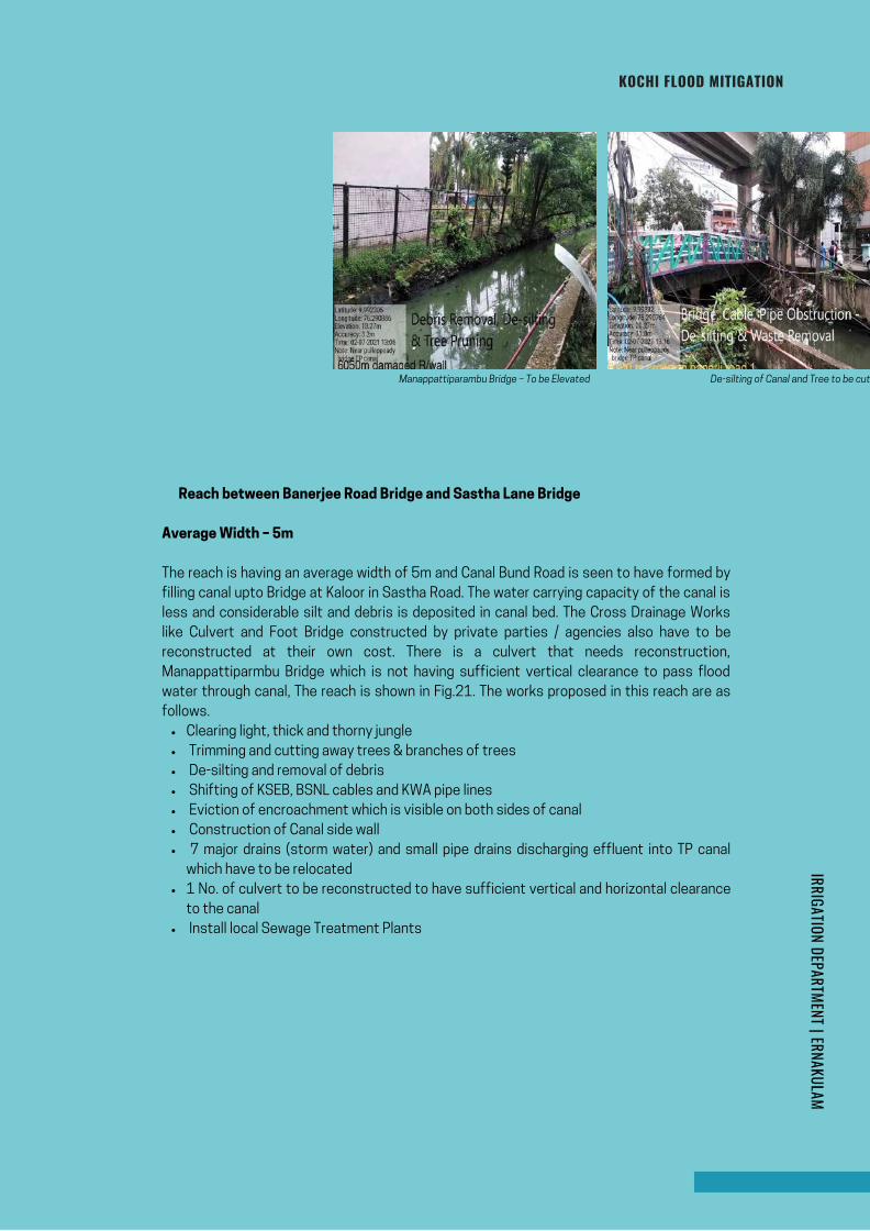
Clearing light, thick and thorny jungle
Trimming and cutting away trees & branches of trees
De-silting and removal of debris
Shifting of KSEB, BSNL cables and KWA pipe lines
Eviction of encroachment which is visible on both sides of canal
Construction of Canal side wall
7 major drains (storm water) and small pipe drains discharging effluent into TP canal
which have to be relocated
1 No. of culvert to be reconstructed to have sufficient vertical and horizontal clearance
to the canal
Install local Sewage Treatment Plants
� Reach between Banerjee Road Bridge and Sastha Lane Bridge
Average Width – 5m
The reach is having an average width of 5m and Canal Bund Road is seen to have formed by
filling canal upto Bridge at Kaloor in Sastha Road. The water carrying capacity of the canal is
less and considerable silt and debris is deposited in canal bed. The Cross Drainage Works
like Culvert and Foot Bridge constructed by private parties / agencies also have to be
reconstructed at their own cost. There is a culvert that needs reconstruction,
Manappattiparmbu Bridge which is not having sufficient vertical clearance to pass flood
water through canal, The reach is shown in Fig.21. The works proposed in this reach are as
follows.
KOCHI FLOOD MITIGATION
Manappattiparambu Bridge – To be Elevated De-silting of Canal and Tree to be cut
IRRIGATION DEPARTMENT | ERNAKULAM
Page 47
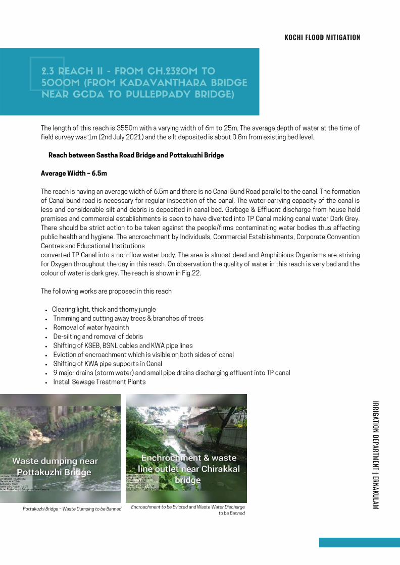
Clearing light, thick and thorny jungle
Trimming and cutting away trees & branches of trees
Removal of water hyacinth
De-silting and removal of debris
Shifting of KSEB, BSNL cables and KWA pipe lines
Eviction of encroachment which is visible on both sides of canal
Shifting of KWA pipe supports in Canal
9 major drains (storm water) and small pipe drains discharging effluent into TP canal
Install Sewage Treatment Plants
The length of this reach is 3550m with a varying width of 6m to 25m. The average depth of water at the time of
field survey was 1m (2nd July 2021) and the silt deposited is about 0.8m from existing bed level.
� Reach between Sastha Road Bridge and Pottakuzhi Bridge
Average Width – 6.5m
The reach is having an average width of 6.5m and there is no Canal Bund Road parallel to the canal. The formation
of Canal bund road is necessary for regular inspection of the canal. The water carrying capacity of the canal is
less and considerable silt and debris is deposited in canal bed. Garbage & Effluent discharge from house hold
premises and commercial establishments is seen to have diverted into TP Canal making canal water Dark Grey.
There should be strict action to be taken against the people/firms contaminating water bodies thus affecting
public health and hygiene. The encroachment by Individuals, Commercial Establishments, Corporate Convention
Centres and Educational Institutions
converted TP Canal into a non-flow water body. The area is almost dead and Amphibious Organisms are striving
for Oxygen throughout the day in this reach. On observation the quality of water in this reach is very bad and the
colour of water is dark grey. The reach is shown in Fig.22.
The following works are proposed in this reach
KOCHI FLOOD MITIGATION
Pottakuzhi Bridge – Waste Dumping to be Banned Encroachment to be Evicted and Waste Water Discharge
to be Banned
2.3 REACH II - FROM CH.2320M TO
5000M (FROM KADAVANTHARA BRIDGE
NEAR GCDA TO PULLEPPADY BRIDGE)
IRRIGATION DEPARTMENT | ERNAKULAM
Page 48
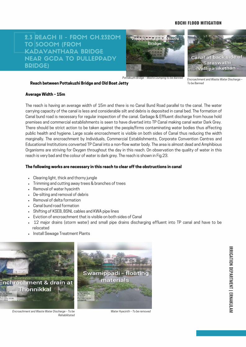
Clearing light, thick and thorny jungle
Trimming and cutting away trees & branches of trees
Removal of water hyacinth
De-silting and removal of debris
Removal of delta formation
Canal bund road formation
Shifting of KSEB, BSNL cables and KWA pipe lines
Eviction of encroachment that is visible on both sides of Canal
12 major drains (storm water) and small pipe drains discharging effluent into TP canal and have to be
relocated
Install Sewage Treatment Plants
� Reach between Pottakuzhi Bridge and Old Boat Jetty
Average Width – 15m
The reach is having an average width of 15m and there is no Canal Bund Road parallel to the canal. The water
carrying capacity of the canal is less and considerable silt and debris is deposited in canal bed. The formation of
Canal bund road is necessary for regular inspection of the canal. Garbage & Effluent discharge from house hold
premises and commercial establishments is seen to have diverted into TP Canal making canal water Dark Grey.
There should be strict action to be taken against the people/firms contaminating water bodies thus affecting
public health and hygiene. Large scale encroachment is visible on both sides of Canal thus reducing the width
marginally. The encroachment by Individuals, Commercial Establishments, Corporate Convention Centres and
Educational Institutions converted TP Canal into a non-flow water body. The area is almost dead and Amphibious
Organisms are striving for Oxygen throughout the day in this reach. On observation the quality of water in this
reach is very bad and the colour of water is dark grey. The reach is shown in Fig.23.
The following works are necessary in this reach to clear off the obstructions in canal
KOCHI FLOOD MITIGATION
Encroachment and Waste Water Discharge – To be
Rehabilitated
Water Hyacinth – To be removed
Encroachment and Waste Water Discharge –
To be Banned
Pottakuzhi Bridge – Waste Dumping to be Banned
2.3 REACH II - FROM CH.2320M
TO 5000M (FROM
KADAVANTHARA BRIDGE
NEAR GCDA TO PULLEPPADY
BRIDGE)
IRRIGATION DEPARTMENT | ERNAKULAM
Page 49
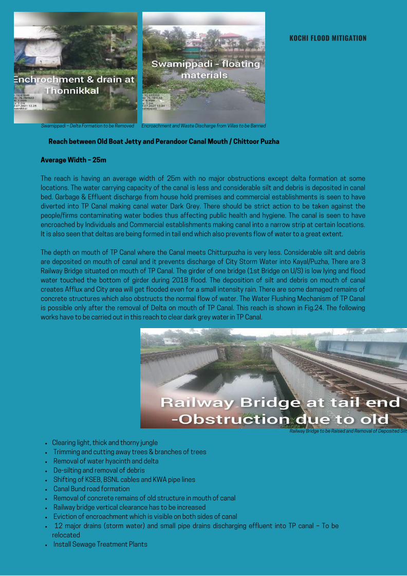
� Reach between Old Boat Jetty and Perandoor Canal Mouth / Chittoor Puzha
Average Width – 25m
The reach is having an average width of 25m with no major obstructions except delta formation at some
locations. The water carrying capacity of the canal is less and considerable silt and debris is deposited in canal
bed. Garbage & Effluent discharge from house hold premises and commercial establishments is seen to have
diverted into TP Canal making canal water Dark Grey. There should be strict action to be taken against the
people/firms contaminating water bodies thus affecting public health and hygiene. The canal is seen to have
encroached by Individuals and Commercial establishments making canal into a narrow strip at certain locations.
It is also seen that deltas are being formed in tail end which also prevents flow of water to a great extent.
The depth on mouth of TP Canal where the Canal meets Chitturpuzha is very less. Considerable silt and debris
are deposited on mouth of canal and it prevents discharge of City Storm Water into Kayal/Puzha, There are 3
Railway Bridge situated on mouth of TP Canal. The girder of one bridge (1st Bridge on U/S) is low lying and flood
water touched the bottom of girder during 2018 flood. The deposition of silt and debris on mouth of canal
creates Afflux and City area will get flooded even for a small intensity rain. There are some damaged remains of
concrete structures which also obstructs the normal flow of water. The Water Flushing Mechanism of TP Canal
is possible only after the removal of Delta on mouth of TP Canal. This reach is shown in Fig.24. The following
works have to be carried out in this reach to clear dark grey water in TP Canal.
KOCHI FLOOD MITIGATION
Swamippadi – Delta Formation to be Removed Encroachment and Waste Discharge from Villas to be Banned
Railway Bridge to be Raised and Removal of Deposited Silt
Clearing light, thick and thorny jungle
Trimming and cutting away trees & branches of trees
Removal of water hyacinth and delta
De-silting and removal of debris
Shifting of KSEB, BSNL cables and KWA pipe lines
Canal Bund road formation
Removal of concrete remains of old structure in mouth of canal
Railway bridge vertical clearance has to be increased
Eviction of encroachment which is visible on both sides of canal
12 major drains (storm water) and small pipe drains discharging effluent into TP canal – To be
relocated
Install Sewage Treatment Plants
Page 50

KOCHI FLOOD MITIGATION
In the light of our investigation and survey of Thevara Perandoor canal, we put forward the following
recommendations for its restoration.
The water load of TP Canal has to be reduced by diverting water through Branch Canals & Leading Channels
and other Critical Activities that has to be done on war footing are described below.
The structures that obstruct the normal flow of water is identified and our suggestions are appended in this
report. The list of Structures that has to be Re-constructed / Shifted is as follows.
3.0 RECOMMENDATIONS
3.1 CRITICAL ACTIVITIES
IRRIGATION DEPARTMENT | ERNAKULAM
Page 51
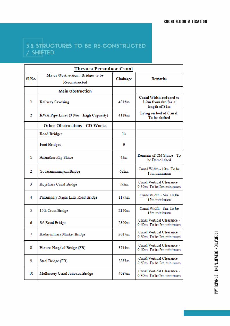
KOCHI FLOOD MITIGATION
3.2 STRUCTURES TO BE RE-CONSTRUCTED
/ SHIFTED
IRRIGATION DEPARTMENT | ERNAKULAM
Page 52
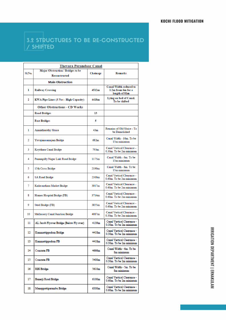
KOCHI FLOOD MITIGATION
3.2 STRUCTURES TO BE RE-CONSTRUCTED
/ SHIFTED
IRRIGATION DEPARTMENT | ERNAKULAM
Page 53
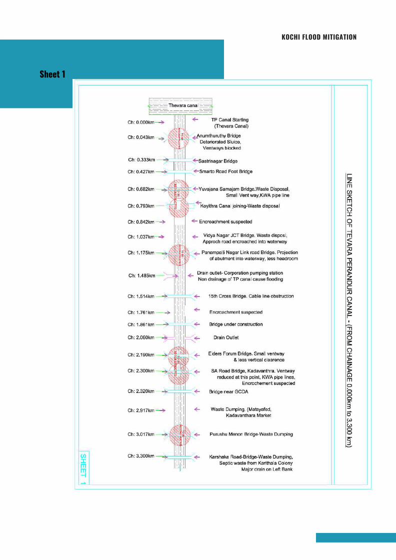
KOCHI FLOOD MITIGATION
Sheet 1
Page 54
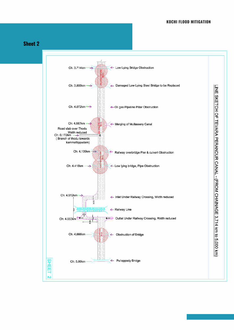
KOCHI FLOOD MITIGATION
Sheet 2
Page 55
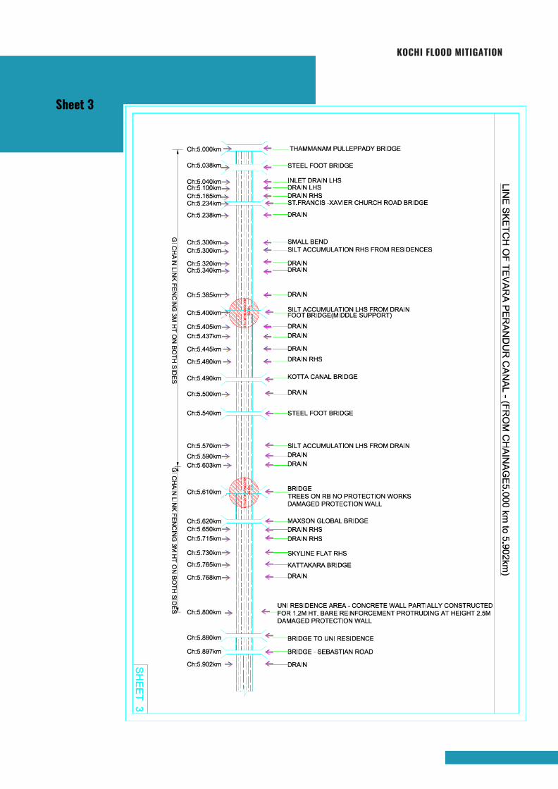
KOCHI FLOOD MITIGATION
Sheet 3
Page 56
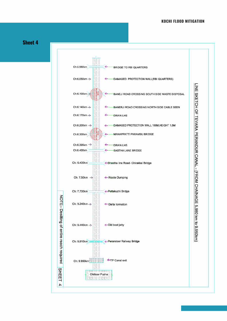
KOCHI FLOOD MITIGATION
Sheet 4
Page 57

KOCHI FLOOD MITIGATION
Based on our study, Thevara-Perandoor Canal is classified into 4 Categories as
shown below.
Reach I
Reach II
Reach III
Reach IV
Semi Critical
Extremely Critical
Critical
Critical
The classification of the reach is according to the present status of Canal like
Storm/Effluent Water flow, Silt/Garbage deposit and Blockage no the normal water
flow. The reach with Extremely Critical condition has to be attended as early as
possible. The remaining reaches also have to be attended on priority basis. Emphasis
should be given to clear off obstructions in Reach II & Reach III and to Straighten
Canal below Ernakulam-Kottayam Railway Track.
The Thevara-Perandoor Canal (TP Canal) can be brought back to its original shape by
carrying out the above works on war footing. Thus the flooding of Kochi Corporation
can be effectively managed by the District Administration and Corporation
Authorities.
4.0 CONCLUSION
IRRIGATION DEPARTMENT | ERNAKULAM
Page 58

Ch
: 2
.3
20
km
Ch
: 2
.9
17
km
Ch
: 3
.0
17
km
Ch
: 3
.3
00
km
Ch
: 3
.7
14
km
Ch
: 3
.8
55
km
Ch
: 4
.0
72
km
Ch
: 4
.0
87
km
Ch
: 4
.1
39
km
Ch
: 4
.4
18
km
Ch
: 4
.5
12
km
Ch
: 4
.5
53
km
Ch
: 4
.6
66
km
Ch
: 5
.0
0km
Brid
ge
n
ea
r G
CD
A
Wa
ste
D
um
pin
g. (M
atsya
fe
d,
Ka
da
va
nth
ara
M
arke
t
Pu
ru
sh
u M
en
on
B
rid
ge
-W
aste
D
um
pin
g
Ka
rsh
aka
R
oa
d-B
rid
ge
-W
aste
D
um
pin
g,
Se
ptic w
aste
fro
m K
arith
ala
C
olo
ny
Ma
jo
r d
ra
in
o
n L
eft B
an
k
Lo
w L
yin
g B
rid
ge
O
bstru
ctio
n
Da
ma
ge
d L
ow
L
yin
g S
te
el B
rid
ge
to
b
e R
ep
la
ce
d
Oitg
an
P
ip
elin
e P
ille
r O
bstru
ctio
n
Me
rg
in
g o
f M
ulla
sse
ry C
an
al
Ra
ilw
ay o
ve
rb
rid
ge
P
ie
r &
cu
lve
rt O
bstru
ctio
n
Lo
w lyin
g b
rid
ge
, P
ip
e O
bstru
ctio
n
In
le
t U
nd
er R
ailw
ay C
ro
ssin
g, W
id
th
re
du
ce
d
O
bstru
ctio
n o
f B
rid
ge
Ou
tle
t U
nd
er R
ailw
ay C
ro
ssin
g, W
id
th
re
du
ce
d
Ch
: 0
.1
72
km
Road slab over Thodu
Width reduced
P
ulle
pp
ad
y B
rid
ge
TEVARA PERANDUR CANAL - REACH 2
NOTE:- Desilting of entire reach required
0
Page 59
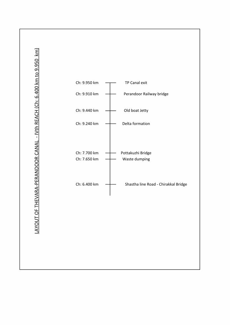
Ch: 7.700 km Pottakuzhi Bridge
Ch: 6.400 km Shastha line Road - Chirakkal Bridge
Waste dumpingCh: 7.650 km
LAYO
UT
OF
THEV
AR
A-P
ERA
ND
OO
R C
AN
AL
- IV
th R
EAC
H (
Ch
: 6.4
00
km
to
9.9
50
km
)
Ch: 9.950 km TP Canal exit
Perandoor Railway bridge
Old boat Jetty
Delta formation
Ch: 9.440 km
Ch: 9.240 km
Ch: 9.910 km
Page 60

T
HA
MM
AN
AM
P
UL
LE
PP
AD
Y B
RID
GE
IN
LE
T D
RA
IN
L
HS
ST
EE
L F
OO
T B
RID
GE
DR
AIN
L
HS
SM
AL
L B
EN
D
SIL
T A
CC
UM
UL
AT
IO
N R
HS
F
RO
M R
ES
ID
EN
CE
S
SIL
T A
CC
UM
UL
AT
IO
N L
HS
F
RO
M D
RA
IN
FO
OT
B
RID
GE
(M
ID
DL
E S
UP
PO
RT
)
DR
AIN
R
HS
KO
TT
A C
AN
AL
B
RID
GE
ST
EE
L F
OO
T B
RID
GE
MA
XS
ON
G
LO
BA
L B
RID
GE
SIL
T A
CC
UM
UL
AT
IO
N L
HS
F
RO
M D
RA
IN
SK
YL
IN
E F
LA
T R
HS
BR
ID
GE
TR
EE
S O
N R
B N
O P
RO
TE
CT
IO
N W
OR
KS
DA
MA
GE
D P
RO
TE
CT
IO
N W
AL
L
DR
AIN
R
HS
KA
TT
AK
AR
A B
RID
GE
UN
I R
ES
ID
EN
CE
A
RE
A - C
ON
CR
ET
E W
AL
L P
AR
TIA
LL
Y C
ON
ST
RU
CT
ED
FO
R 1
.2
M H
T. B
AR
E R
EIN
FO
RC
EM
EN
T P
RO
TR
UD
IN
G A
T H
EIG
HT
2
.5
M
DA
MA
GE
D P
RO
TE
CT
IO
N W
AL
L
BR
ID
GE
T
O U
NI R
ES
ID
EN
CE
DR
AIN
BR
ID
GE
T
O R
BI Q
UA
RT
ER
S
DA
MA
GE
D P
RO
TE
CT
IO
N W
AL
L(R
BI Q
UA
RT
ER
S)
BA
NE
JI R
OA
D C
RO
SS
IN
G S
OU
TH
S
ID
E W
AS
TE
D
IS
PO
SA
L
DR
AIN
L
HS
BA
NE
RJI R
OA
D C
RO
SS
IN
G N
OR
TH
S
ID
E C
AB
LE
S
EE
N
SA
ST
HA
L
AN
E B
RID
GE
MA
NA
PP
AT
TI P
AR
AM
BU
B
RID
GE
DA
MA
GE
D P
RO
TE
CT
IO
N W
AL
L 1
00
M,H
EIG
HT
1
.5
M
DR
AIN
L
HS
Ch
:6
40
0m
Ch
:6
39
5m
Ch
:6
30
0m
Ch
:6
20
0m
Ch
:6
17
0m
Ch
:6
14
0m
Ch
:6
10
0m
Ch
:6
05
0m
Ch
:5
98
0m
Ch
:5
90
2m
Ch
:5
88
0m
Ch
:5
80
0m
Ch
:5
76
5m
Ch
:5
73
0m
Ch
:5
65
0m
Ch
:5
61
0m
Ch
:5
62
0m
Ch
:5
57
0m
Ch
:5
54
0m
Ch
:5
49
0m
Ch
:5
48
0m
Ch
:5
40
0m
Ch
:5
30
0m
Ch
:5
30
0m
Ch
:5
10
0m
Ch
:5
04
0m
Ch
:5
03
8m
Ch
:5
00
0m
GI CHAIN LINK FENCING 3M HT ON BOTH SIDES GI CHAIN LINK FENCING 3M HT ON LHS
LAYOUT OF THEVARA-PERANDOOR CANAL : IIIRD REACH (CH:5000 TO 6400M)
ST
.F
RA
NC
IS
-X
AV
IE
R C
HU
RC
H R
OA
D B
RID
GE
Ch
:5
23
4m
DR
AIN
Ch
:5
23
8m
DR
AIN
Ch
:5
34
0m
DR
AIN
Ch
:5
38
5m
DR
AIN
Ch
:5
40
5m
DR
AIN
Ch
:5
44
5m
DR
AIN
R
HS
Ch
:5
16
5m
DR
AIN
Ch
:5
32
0m
DR
AIN
Ch
:5
43
7m
DR
AIN
Ch
:5
50
0m
DR
AIN
Ch
:5
59
0m
DR
AIN
Ch
:5
60
3m
DR
AIN
R
HS
Ch
:5
71
5m
DR
AIN
Ch
:5
76
8m
BR
ID
GE
- S
EB
AS
TIA
N R
OA
DC
h:5
89
7m
Page 61
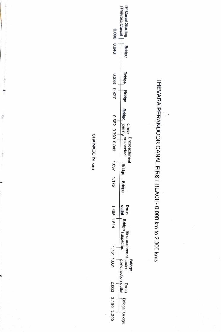
TH
EV
AR
A PER
AN
DO
OR
CA
NA
L F
IRS
T R
EA
CH
-0.000k
m to
2.3
00
km
s
Bridge E
ncroachment
under C
an
at
En
cro
ach
men
t
Bridge joining SU
SpectedD
rain D
rain TP Canal Starting (Thevara C
anal-
Bridge suspectedBridge Bridge
Bridge Bridge
Bridge B
ridge B
ridge construction
outlet 0
.68
2
0.7
93
0.8
42
1.037
1.175 1.485
1.5
14
1
.76
1
1.8
61
2
.06
0
2.1
90
2
.30
0
0.0
00
0
.04
3
0.3
33
0
.42
7
CH
AIN
AG
E IN
km
s
Page 62
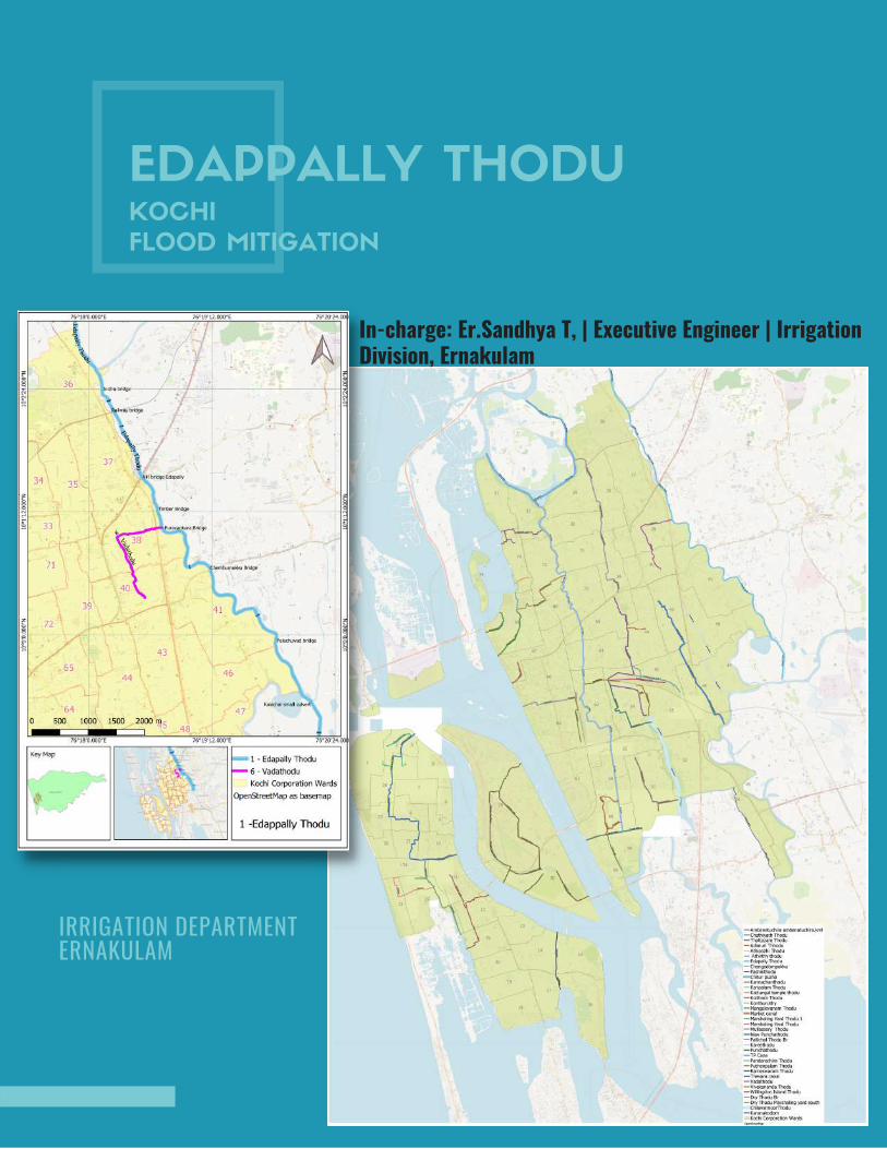
EDAPPALLY THODUKOCHI
FLOOD MITIGATION
In-charge: Er.Sandhya T, | Executive Engineer | IrrigationDivision, Ernakulam
IRRIGATION DEPARTMENT ERNAKULAM
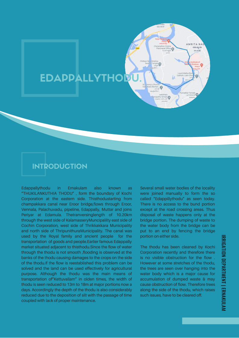
Edappallythodu in Ernakulam also known as
“THUKILANKUTHIA THODU” , form the boundary of Kochi
Corporation at the eastern side. Thisthodustarting from
champakkara canal near Eroor bridge,flows through Eroor,
Vennala, Palachuvadu, pipeline, Edappally, Muttar and joins
Periyar at Edamula. Thetranversinglength of 10.20km
through the west side of KalamasseryMuncipalilty east side of
Cochin Corporation, west side of Thrikkakkara Municipality
and north side of ThripunithuraMunicipality. The canal was
used by the Royal family and ancient people for the
transportation of goods and people.Earlier famous Edappally
market situated adjacent to thisthodu.Since the flow of water
through the thodu is not smooth ,flooding is observed at the
banks of the thodu causing damages to the crops on the side
of the thodu.If the flow is reestablished this problem can be
solved and the land can be used effectively for agricultural
purpose. Although the thodu was the main means of
transportation of”Kettuvallam” in olden times, the width of
thodu is seen reduced to 13m to 18m at major portions now a
days. Accordingly the depth of the thodu is also considerably
reduced due to the deposition of silt with the passage of time
coupled with lack of proper maintenance.
EDAPPALLYTHODU.
INTRODUCTION
IRRIGATION DEPARTMENT | ERNAKULAM
Several small water bodies of the locality
were joined manually to form the so
called “Edappillythodu” as seen today.
There is no access to the bund portion
except at the road crossing areas. Thus
disposal of waste happens only at the
bridge portion. The dumping of waste to
the water body from the bridge can be
put to an end by fencing the bridge
portion on either side.
The thodu has been cleaned by Kochi
Corporation recently and therefore there
is no visible obstruction for the flow .
However at some stretches of the thodu,
the trees are seen over hanging into the
water body which is a major cause for
accumulation of dumped waste & may
cause obstruction of flow. Therefore trees
along the side of the thodu, which raises
such issues, have to be cleared off.
Page 64
9 bridges and 3private culverts and a metro sky bridge exists
within the entire stretch of thodu.Paruthelithodu, Vadathodu,
Kadamakkerythodu, Kallikuzhywaterbody and Kalachal are
water sources connected to Edappallythodu.
There is no doubt in the fact that there is encroachment
in the width of thodu on either side, as is made clear from the
picture of conveyance of Kettuvallam during ancient time to
that of the present width of 13.50 – 18 m.Edappallythodu
being connected to two main water bodies on either side,
experience drastic low tide, high tide and therefore the
central portion of the thodu is seen to be almost stagnant.
The desiltation of the thodu not only facilitates the flow of
water through the canal but also puts forward an opportunity
to convey passengers and goods at minimum cost and least
pollution status.
Because of its alignment through the outskirts of Cochin
city, it also acts as a drainage canal. Since the canal
discharges at Muttar in the Edamula Branch of Periyar , this
can be connected to Udyogamandal Canal. Thus we can
connect the two fertilizer plants of FACT,
ieUdyogamandal&Ambalamedu.
CONT...
IRRIGATION DEPARTMENT | ERNAKULAM
Page 65
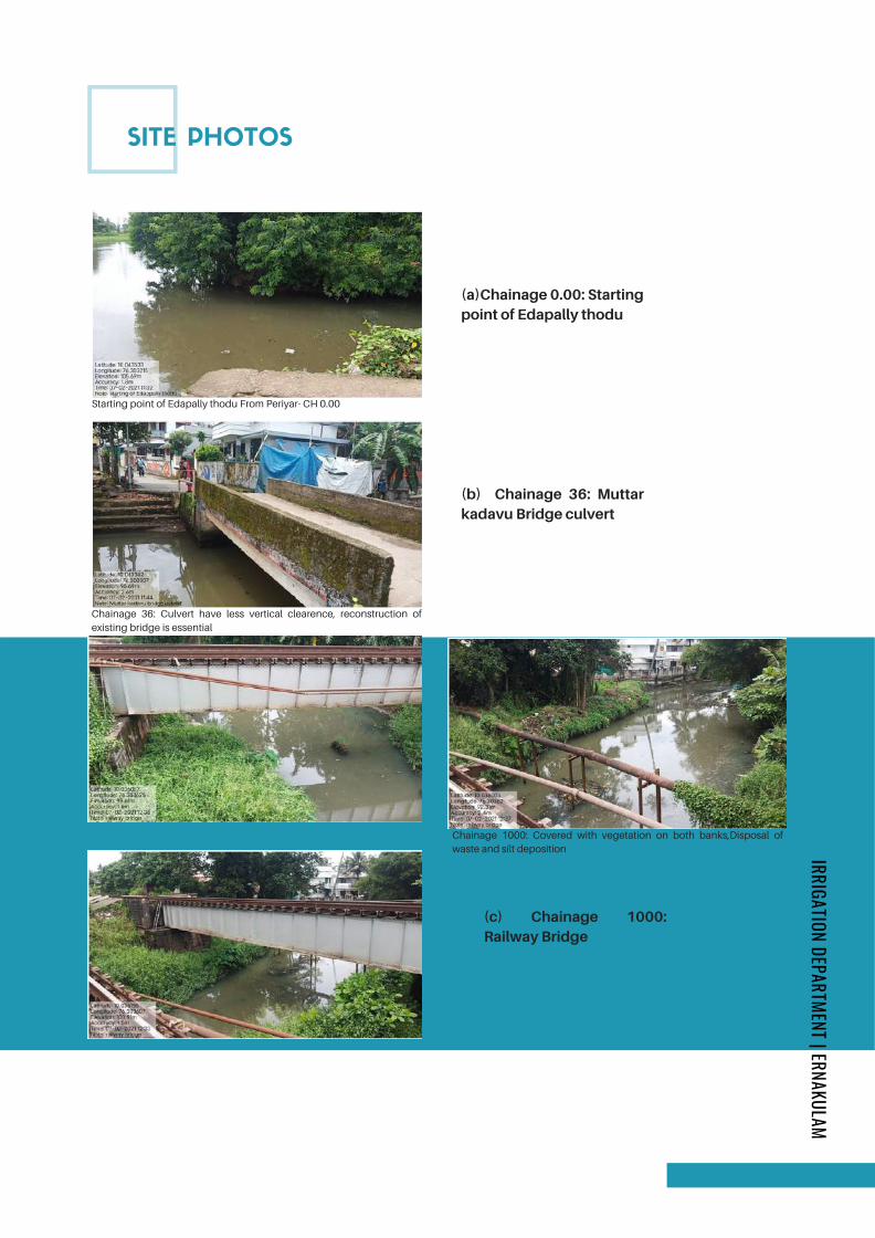
SITE PHOTOS
IRRIGATION DEPARTMENT | ERNAKULAM
Starting point of Edapally thodu From Periyar- CH 0.00
(a)Chainage 0.00: Startingpoint of Edapally thodu
Chainage 36: Culvert have less vertical clearence, reconstruction of
existing bridge is essential
(b) Chainage 36: Muttarkadavu Bridge culvert
(c) Chainage 1000:Railway Bridge
Chainage 1000: Covered with vegetation on both banks,Disposal of
waste and silt deposition
Page 66
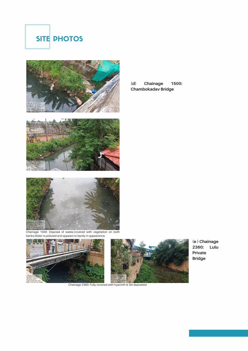
SITE PHOTOS
(d) Chainage 1500:Chambokadav Bridge
Chainage 1500: Disposal of waste,Covered with vegetation on both
banks,Water is polluted and appears to beoily in appearance.
(e ) Chainage2360: LuluPrivateBridge
Chainage 2360: Fully covered with hyacinth & Silt deposited
Page 67
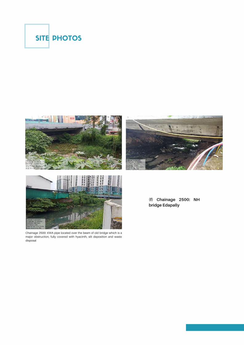
SITE PHOTOS
(f) Chainage 2500: NHbridge Edapally
Chainage 2500: KWA pipe located over the beam of old bridge which is a
major obstruction, fully covered with hyacinth, silt deposition and waste
disposal
Page 68

SITE PHOTOS
(g) Chainage 2850:Marotty chodu palam
1" water line pipe laid across the thodu is found to obstruct
the flow ,deposition of silt is noticed.
(h) Chainage 3230 :Timber Bridge
Chainage 2850: Trees grown to the bank of thodu,the disposal of waste is noticed
Page 69
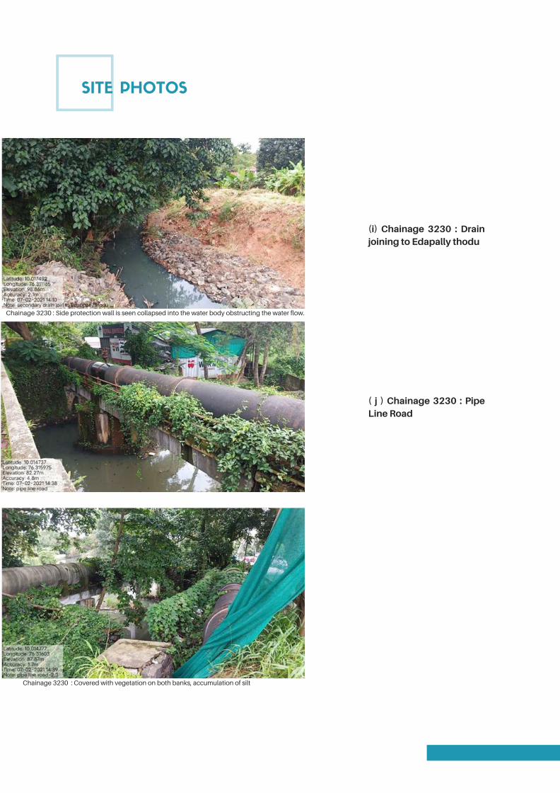
SITE PHOTOS
(i) Chainage 3230 : Drainjoining to Edapally thodu
Chainage 3230 : Covered with vegetation on both banks, accumulation of silt
( j ) Chainage 3230 : PipeLine Road
Chainage 3230 : Side protection wall is seen collapsed into the water body obstructing the water flow.
Page 70
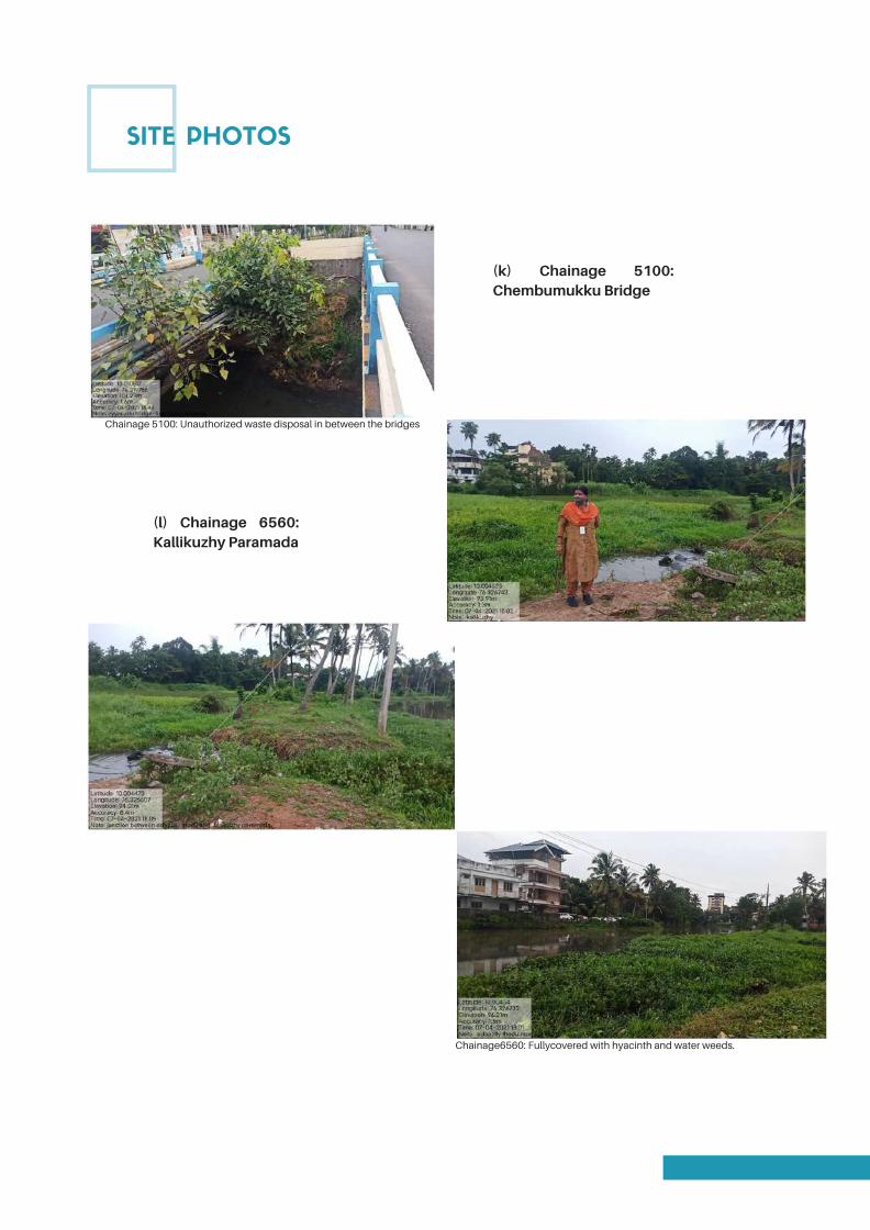
SITE PHOTOS
(k) Chainage 5100:Chembumukku Bridge
Chainage6560: Fullycovered with hyacinth and water weeds.
(l) Chainage 6560:Kallikuzhy Paramada
Chainage 5100: Unauthorized waste disposal in between the bridges
Page 71
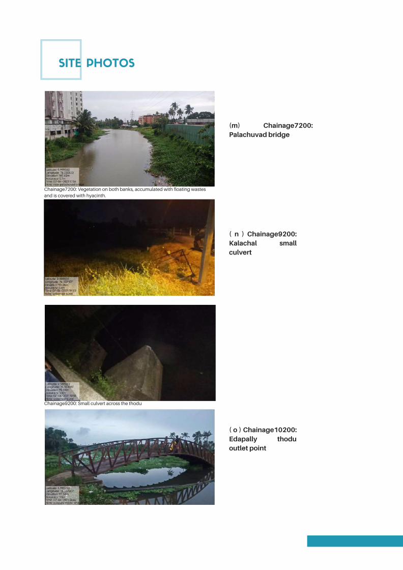
SITE PHOTOS
(m) Chainage7200:Palachuvad bridge
Chainage9200: Small culvert across the thodu
( n ) Chainage9200:Kalachal smallculvert
Chainage7200: Vegetation on both banks, accumulated with floating wastes
and is covered with hyacinth.
( o ) Chainage10200:Edapally thoduoutlet point
Page 72
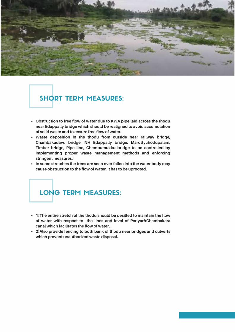
SHORT TERM MEASURES:
Obstruction to free flow of water due to KWA pipe laid across the thodunear Edappally bridge which should be realigned to avoid accumulationof solid waste and to ensure free flow of water.Waste deposition in the thodu from outside near railway bridge,Chambakadavu bridge, NH Edappally bridge, Marottychodupalam,Timber bridge, Pipe line, Chembumukku bridge to be controlled byimplementing proper waste management methods and enforcingstringent measures.In some stretches the trees are seen over fallen into the water body maycause obstruction to the flow of water. It has to be uprooted.
LONG TERM MEASURES:
1)The entire stretch of the thodu should be desilted to maintain the flowof water with respect to the lines and level of Periyar&Chambakaracanal which facilitates the flow of water.2)Also provide fencing to both bank of thodu near bridges and culvertswhich prevent unauthorized waste disposal.
Page 73

SWOT ANALYSIS
The thodu can beconnected to almostall waterbodies ofErnakulam district
Strength:Low level bridgesto be reconstructed
Weakness:Tourism potential isvery high.It can be a part ofNWIII connectingChambakara canal&Chithrapuzhathere byKadambrayar.It can be made as anavigable canalconnecting Periyarand Chambakkaracanal therebyfacilitates bargeoperations.Completerejuvenation ofEdappallythoduundertaken byKUWRTS aided byKIFB.Also walkabledistance toEdappally church,Amirta hospitalLulu Metro station
Opportunities:Minimal width ofthe thodu in somestretches.KWA pipe laidacross the thodunear NHEdappallybridgeshould berealigned.
Threats:
Page 74

SALIENT FEATURE OF EDAPPALLYTHODU
Location
Village
Place
Taluk
District
Area Beneficiaries
Starting Point
Ending Point
Length
Width
Crossing
Panchayath/Muncipality/Corporation
Mutar, Edappally, Pipe line, Palachuvadu, Vennala, and Eroor
Edappally North & South, Vazhakkala, Nadama.
Mutar, Edappally, pipe line, Palachuvadu, Vennala, and Eroor.
KalamasseryMuncipality, Cochin Corporation, Thrikkakkara
Muncipality
Kanayannoor
Ernakulam
West side of KalamasseryMuncipality, East side of Cochin
corporation, West side of Thrikkakkara municipality, North side of
ThrippornithuraMuncipality.
From Periyar – Muttar branch
Chithrapuzha – Chambakkara canal near Eroor.
10200 m
Varying from 13.5 m to 18m
9 bridges and 3 Private culverts
Page 75
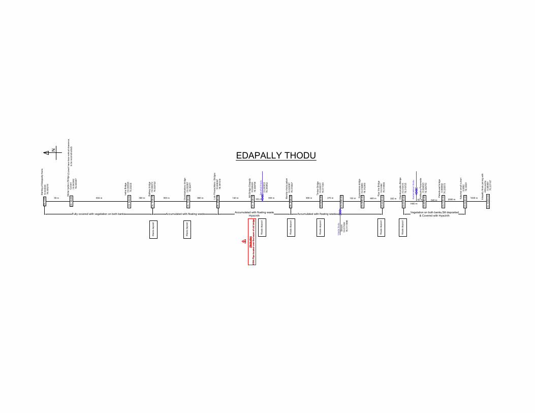
10.043533
76.303215
Muttar kadavu B
ridge
Culvert
:10.043342
76.303307
Starting of E
dappally thodu
(C
ulvert have less vertical clearence,
to be reconstructed)
Indira B
ridge
:10.039538
76.30235
Railw
ay bridge
:10.036072
76.303722
Cham
bokadavu bridge
:10.032957
76.30477
Lulu P
rivate,M
etro B
ridges
:10.026367
76.307418
NH
B
ridge E
dapally
:10.025223
76.308795
Marotty chodu palam
:10.023087
76.310547
Tim
ber B
ridge
:10.020017
76.311333
Stream
10.017432
76.3111898
Puravankara bridge
:10.016893
76.312353
Pipe line B
ridge
:10.01482
76.315993
Chem
bum
ukku B
ridge
:10.010415
76.319725
Kallikuzhy P
aram
ada
: 10.004523
76.326743
Kalachal sm
all culvert
: 9.9892
76.33601
Edapally thodu joining w
ith
chitra puzha
: 9.980897
76.337167
604 m 360 m 500 m 860 m 140 m 350 m 380 m 270 m
100 m600 m
900 m
1460 m
2000 m
1000 m36 m
Ch: 0.00
Ch: 36.00
Ch: 640.00
Ch: 1000.00
Ch: 1500.00
Ch: 2360.00
Ch: 2500.00
Ch: 2850.00
Ch:3230.00
Ch:3500.00
Ch:3600.00
Ch:4200.00
Ch:5100.00
Ch:6560.00
Palachuvad bridge
: 9.999582
76.330573
640 m
Ch:7200.00
Ch:9200.00
Ch:10200.00
Fully covered with vegetation on both banks Accumulated with floating waste
Accumulated with floating waste
Hyacinth
Accumulated with floating waste
Vegetation on both banks,Silt deposited
& Covered with Hyacinth
KW
A P
ipe located over the beam
of old bridge
Obstruction
Waste deposit
Waste deposit
Waste deposit
Waste deposit
Waste deposit
Waste deposit
Waste deposit
EDAPALLY THODU
KW
A P
ipe located over the beam
of old bridge
Obstruction
Parutheli thodu
10.243033
76.309952
160 m
Kadam
akkeri thodu
82 m
Vaada thodu
N
Page 76
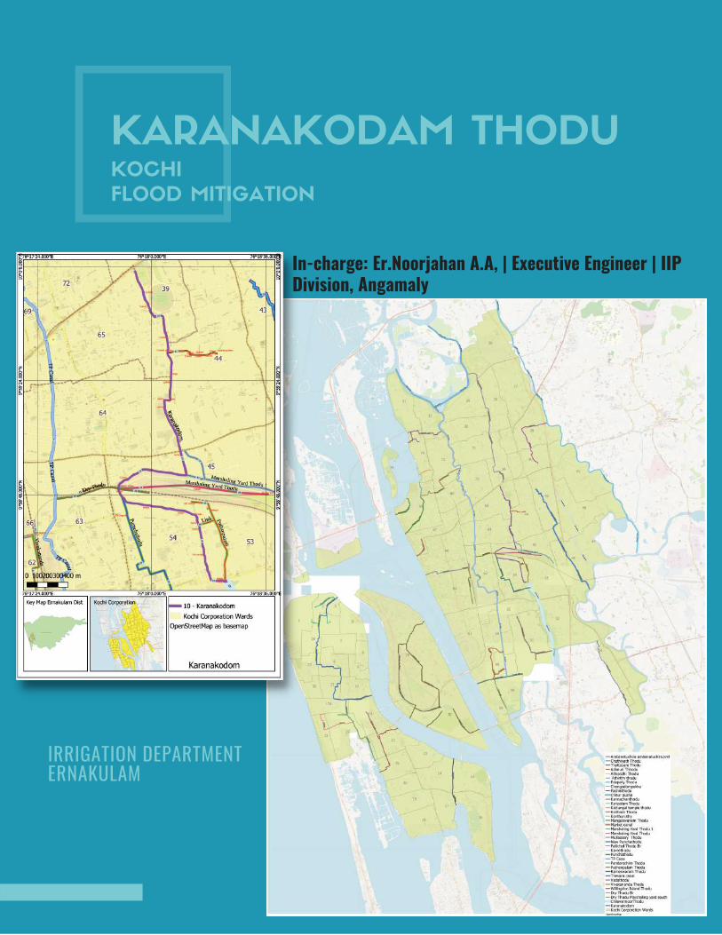
KARANAKODAM THODUKOCHI
FLOOD MITIGATION
In-charge: Er.Noorjahan A.A, | Executive Engineer | IIPDivision, Angamaly
IRRIGATION DEPARTMENT ERNAKULAM
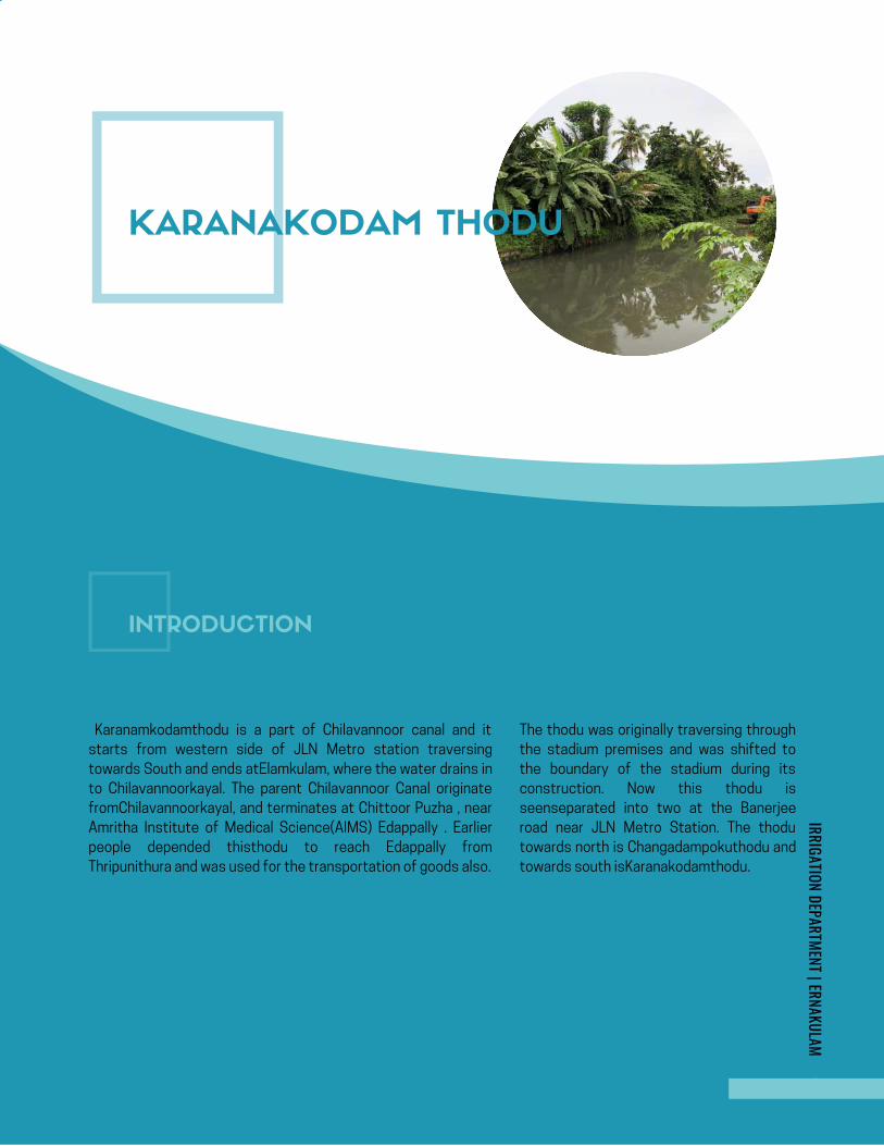
KOCHI FLOOD MITIGATION
page | 1
AdimurithoduKOCHI FLOOD MITIGATION
In-charge: Er.Jisha A, IIP Division, Angamaly
IRRIGATION DEPARTMENT | ERNAKULAM
Karanamkodamthodu is a part of Chilavannoor canal and it
starts from western side of JLN Metro station traversing
towards South and ends atElamkulam, where the water drains in
to Chilavannoorkayal. The parent Chilavannoor Canal originate
fromChilavannoorkayal, and terminates at Chittoor Puzha , near
Amritha Institute of Medical Science(AIMS) Edappally . Earlier
people depended thisthodu to reach Edappally from
Thripunithura and was used for the transportation of goods also.
The thodu was originally traversing through
the stadium premises and was shifted to
the boundary of the stadium during its
construction. Now this thodu is
seenseparated into two at the Banerjee
road near JLN Metro Station. The thodu
towards north is Changadampokuthodu and
towards south isKaranakodamthodu.
IRRIGATION DEPARTMENT | ERNAKULAMIRRIGATION DEPARTMENT | ERNAKULAM
KARANAKODAM THODU
INTRODUCTION
Page 78
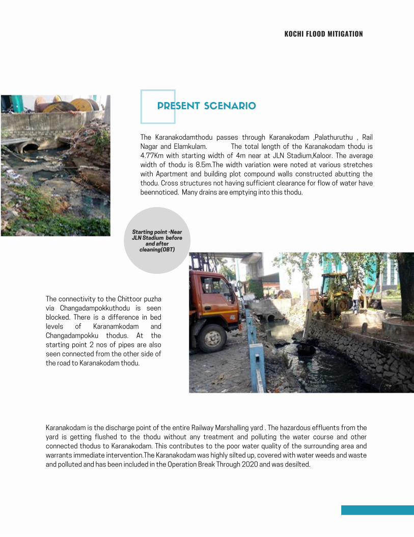
KOCHI FLOOD MITIGATION
The Karanakodamthodu passes through Karanakodam ,Palathuruthu , Rail
Nagar and Elamkulam. The total length of the Karanakodam thodu is
4.77Km with starting width of 4m near at JLN Stadium,Kaloor. The average
width of thodu is 8.5m.The width variation were noted at various stretches
with Apartment and building plot compound walls constructed abutting the
thodu. Cross structures not having sufficient clearance for flow of water have
beennoticed. Many drains are emptying into this thodu.
The connectivity to the Chittoor puzha
via Changadampokkuthodu is seen
blocked. There is a difference in bed
levels of Karanamkodam and
Changadampokku thodus. At the
starting point 2 nos of pipes are also
seen connected from the other side of
the road to Karanakodam thodu.
Karanakodam is the discharge point of the entire Railway Marshalling yard . The hazardous effluents from the
yard is getting flushed to the thodu without any treatment and polluting the water course and other
connected thodus to Karanakodam. This contributes to the poor water quality of the surrounding area and
warrants immediate intervention.The Karanakodam was highly silted up, covered with water weeds and waste
and polluted and has been included in the Operation Break Through 2020 and was desilted.
Starting point -NearJLN Stadium before
and aftercleaning(OBT)
PRESENT SCENARIO
Page 79
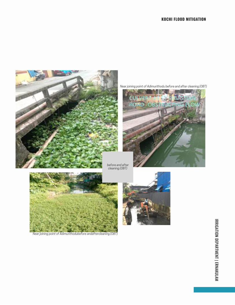
KOCHI FLOOD MITIGATIONIRRIGATION DEPARTMENT | ERNAKULAM
Near joining point of Adimurithodubefore andaftercleaning.(OBT)
Near joining point of Adimurithodu before and after cleaning.(OBT)
before and aftercleaning.(OBT)
Page 80
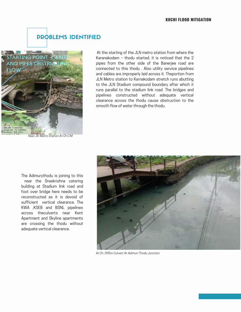
KOCHI FLOOD MITIGATION
At the starting of the JLN metro station from where the
Karanakodam – thodu started, it is noticed that the 2
pipes from the other side of the Banerjee road are
connected to this thodu . Also utility service pipelines
and cables are improperly laid across it. Theportion from
JLN Metro station to Karnakodam stretch runs abutting
to the JLN Stadium compound boundary after which it
runs parallel to the stadium link road. The bridges and
pipelines constructed without adequate vertical
clearance across the thodu cause obstruction to the
smooth flow of water through the thodu.
The Adimurythodu is joining to this
near the Sreekrishna catering
building at Stadium link road and
foot over bridge here needs to be
reconstructed as it is devoid of
sufficient vertical clearance. The
KWA ,KSEB and BSNL pipelines
across theculverts near Kent
Apartment and Skyline apartments
are crossing the thodu without
adequate vertical clearance.
At Ch :995m Culvert At Adimuri Thodu Junction
Near Jln Metro Station At Ch 0 M
PROBLEMS IDENTIFIED
Page 81
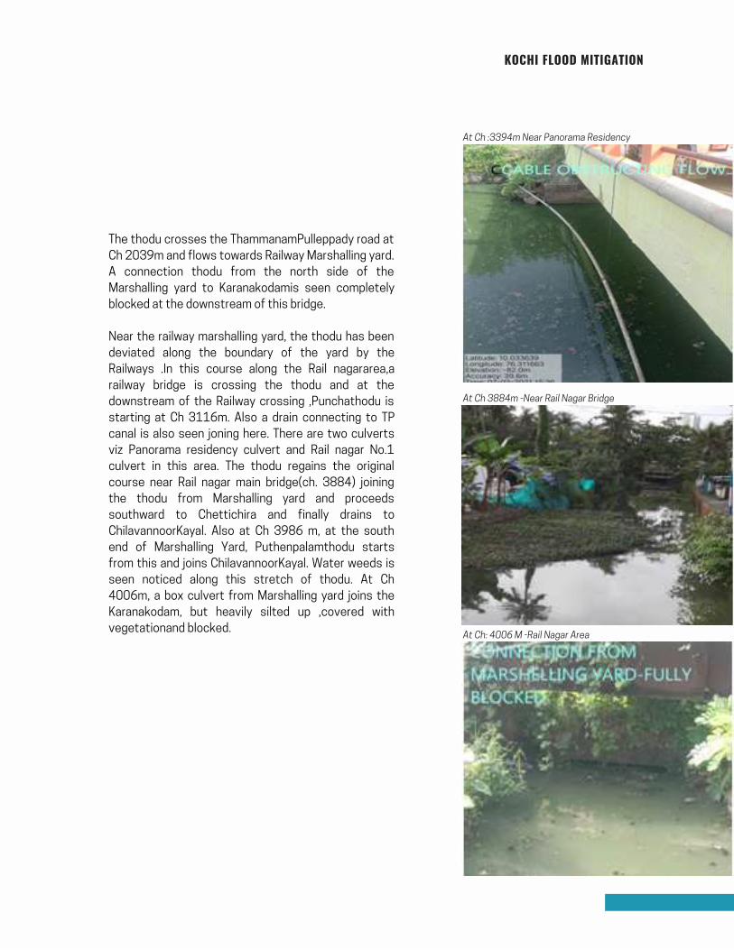
KOCHI FLOOD MITIGATION
The thodu crosses the ThammanamPulleppady road at
Ch 2039m and flows towards Railway Marshalling yard.
A connection thodu from the north side of the
Marshalling yard to Karanakodamis seen completely
blocked at the downstream of this bridge.
Near the railway marshalling yard, the thodu has been
deviated along the boundary of the yard by the
Railways .In this course along the Rail nagararea,a
railway bridge is crossing the thodu and at the
downstream of the Railway crossing ,Punchathodu is
starting at Ch 3116m. Also a drain connecting to TP
canal is also seen joning here. There are two culverts
viz Panorama residency culvert and Rail nagar No.1
culvert in this area. The thodu regains the original
course near Rail nagar main bridge(ch. 3884) joining
the thodu from Marshalling yard and proceeds
southward to Chettichira and finally drains to
ChilavannoorKayal. Also at Ch 3986 m, at the south
end of Marshalling Yard, Puthenpalamthodu starts
from this and joins ChilavannoorKayal. Water weeds is
seen noticed along this stretch of thodu. At Ch
4006m, a box culvert from Marshalling yard joins the
Karanakodam, but heavily silted up ,covered with
vegetationand blocked.
At Ch :3394m Near Panorama Residency
At Ch 3884m -Near Rail Nagar Bridge
At Ch: 4006 M -Rail Nagar Area
Page 82
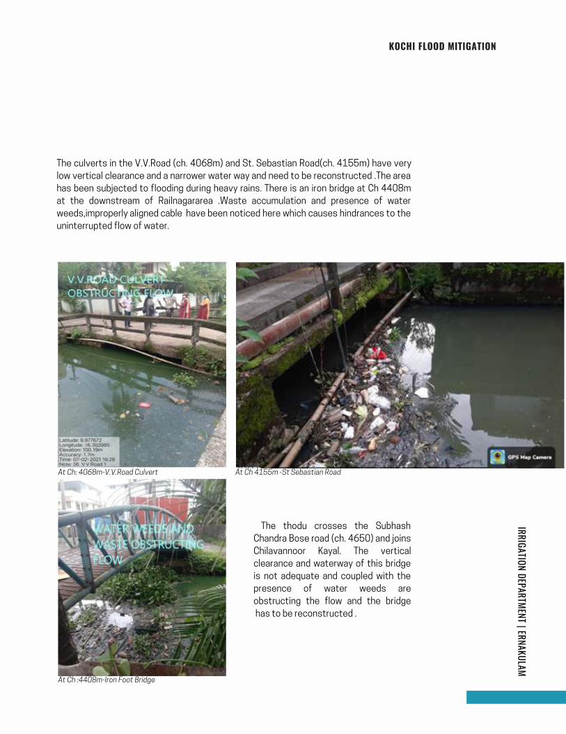
KOCHI FLOOD MITIGATIONIRRIGATION DEPARTMENT | ERNAKULAM
The culverts in the V.V.Road (ch. 4068m) and St. Sebastian Road(ch. 4155m) have very
low vertical clearance and a narrower water way and need to be reconstructed .The area
has been subjected to flooding during heavy rains. There is an iron bridge at Ch 4408m
at the downstream of Railnagararea .Waste accumulation and presence of water
weeds,improperly aligned cable have been noticed here which causes hindrances to the
uninterrupted flow of water.
At Ch: 4068m-V.V.Road Culvert At Ch 4155m -St Sebastian Road
The thodu crosses the Subhash
Chandra Bose road (ch. 4650) and joins
Chilavannoor Kayal. The vertical
clearance and waterway of this bridge
is not adequate and coupled with the
presence of water weeds are
obstructing the flow and the bridge
has to be reconstructed .
At Ch :4408m-Iron Foot Bridge
83
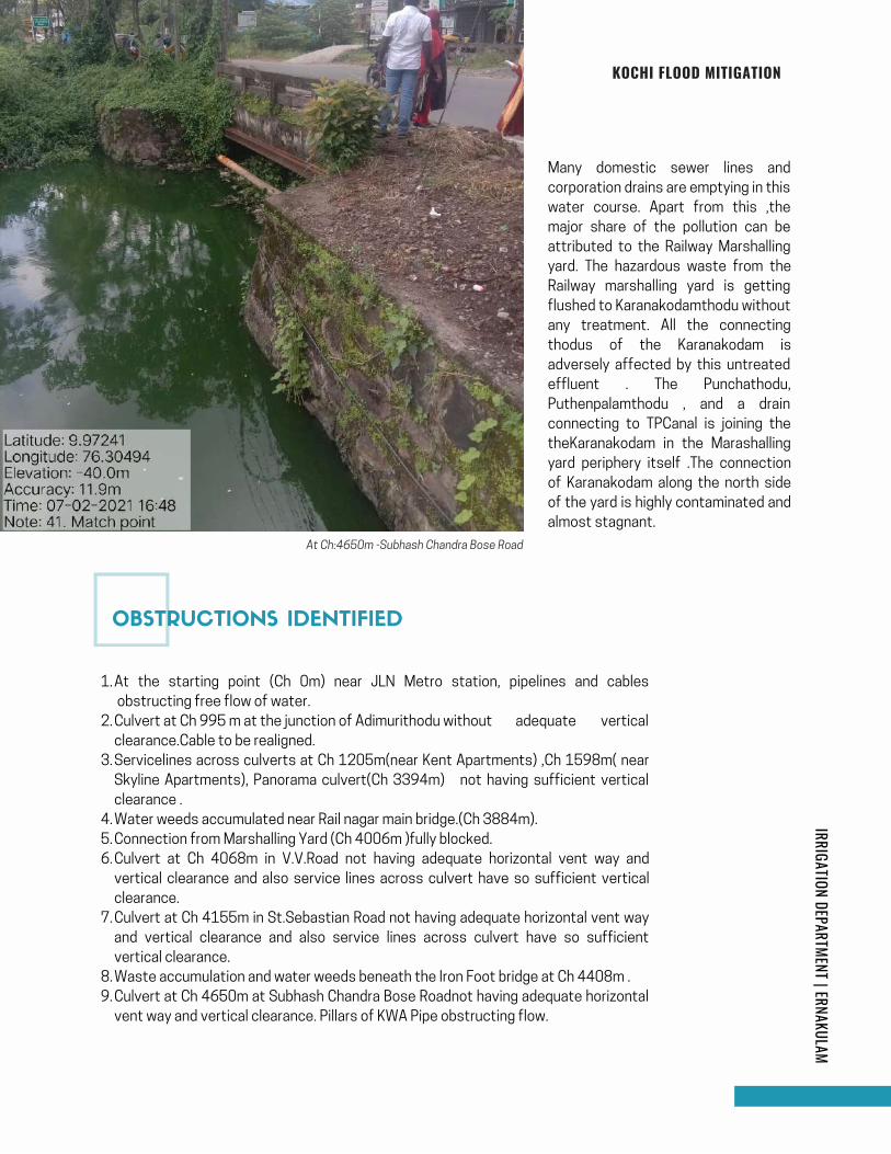
At Ch:4650m -Subhash Chandra Bose Road
OBSTRUCTIONS IDENTIFIED
KOCHI FLOOD MITIGATIONIRRIGATION DEPARTMENT | ERNAKULAM
Many domestic sewer lines and
corporation drains are emptying in this
water course. Apart from this ,the
major share of the pollution can be
attributed to the Railway Marshalling
yard. The hazardous waste from the
Railway marshalling yard is getting
flushed to Karanakodamthodu without
any treatment. All the connecting
thodus of the Karanakodam is
adversely affected by this untreated
effluent . The Punchathodu,
Puthenpalamthodu , and a drain
connecting to TPCanal is joining the
theKaranakodam in the Marashalling
yard periphery itself .The connection
of Karanakodam along the north side
of the yard is highly contaminated and
almost stagnant.
At the starting point (Ch 0m) near JLN Metro station, pipelines and cables
obstructing free flow of water.
Culvert at Ch 995 m at the junction of Adimurithodu without adequate vertical
clearance.Cable to be realigned.
Servicelines across culverts at Ch 1205m(near Kent Apartments) ,Ch 1598m( near
Skyline Apartments), Panorama culvert(Ch 3394m) not having sufficient vertical
clearance .
Water weeds accumulated near Rail nagar main bridge.(Ch 3884m).
Connection from Marshalling Yard (Ch 4006m )fully blocked.
Culvert at Ch 4068m in V.V.Road not having adequate horizontal vent way and
vertical clearance and also service lines across culvert have so sufficient vertical
clearance.
Culvert at Ch 4155m in St.Sebastian Road not having adequate horizontal vent way
and vertical clearance and also service lines across culvert have so sufficient
vertical clearance.
Waste accumulation and water weeds beneath the Iron Foot bridge at Ch 4408m .
Culvert at Ch 4650m at Subhash Chandra Bose Roadnot having adequate horizontal
vent way and vertical clearance. Pillars of KWA Pipe obstructing flow.
1.
2.
3.
4.
5.
6.
7.
8.
9.
84
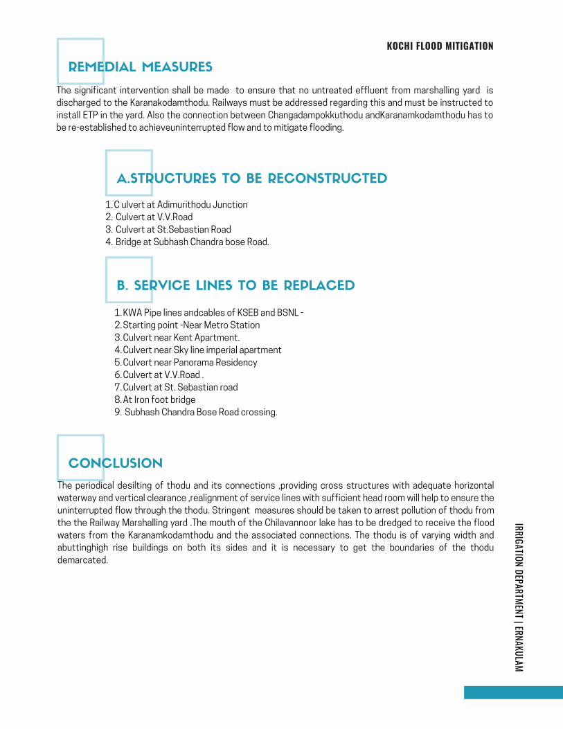
KOCHI FLOOD MITIGATIONIRRIGATION DEPARTMENT | ERNAKULAM
The significant intervention shall be made to ensure that no untreated effluent from marshalling yard is
discharged to the Karanakodamthodu. Railways must be addressed regarding this and must be instructed to
install ETP in the yard. Also the connection between Changadampokkuthodu andKaranamkodamthodu has to
be re-established to achieveuninterrupted flow and to mitigate flooding.
C ulvert at Adimurithodu Junction
Culvert at V.V.Road
Culvert at St.Sebastian Road
Bridge at Subhash Chandra bose Road.
1.
2.
3.
4.
KWA Pipe lines andcables of KSEB and BSNL -
Starting point -Near Metro Station
Culvert near Kent Apartment.
Culvert near Sky line imperial apartment
Culvert near Panorama Residency
Culvert at V.V.Road .
Culvert at St. Sebastian road
At Iron foot bridge
Subhash Chandra Bose Road crossing.
1.
2.
3.
4.
5.
6.
7.
8.
9.
The periodical desilting of thodu and its connections ,providing cross structures with adequate horizontal
waterway and vertical clearance ,realignment of service lines with sufficient head room will help to ensure the
uninterrupted flow through the thodu. Stringent measures should be taken to arrest pollution of thodu from
the the Railway Marshalling yard .The mouth of the Chilavannoor lake has to be dredged to receive the flood
waters from the Karanamkodamthodu and the associated connections. The thodu is of varying width and
abuttinghigh rise buildings on both its sides and it is necessary to get the boundaries of the thodu
demarcated.
REMEDIAL MEASURES
A.STRUCTURES TO BE RECONSTRUCTED
B. SERVICE LINES TO BE REPLACED
CONCLUSION
Page 85
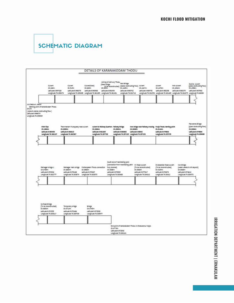
KOCHI FLOOD MITIGATIONIRRIGATION DEPARTMENT | ERNAKULAM
SCHEMATIC DIAGRAM
Page 86
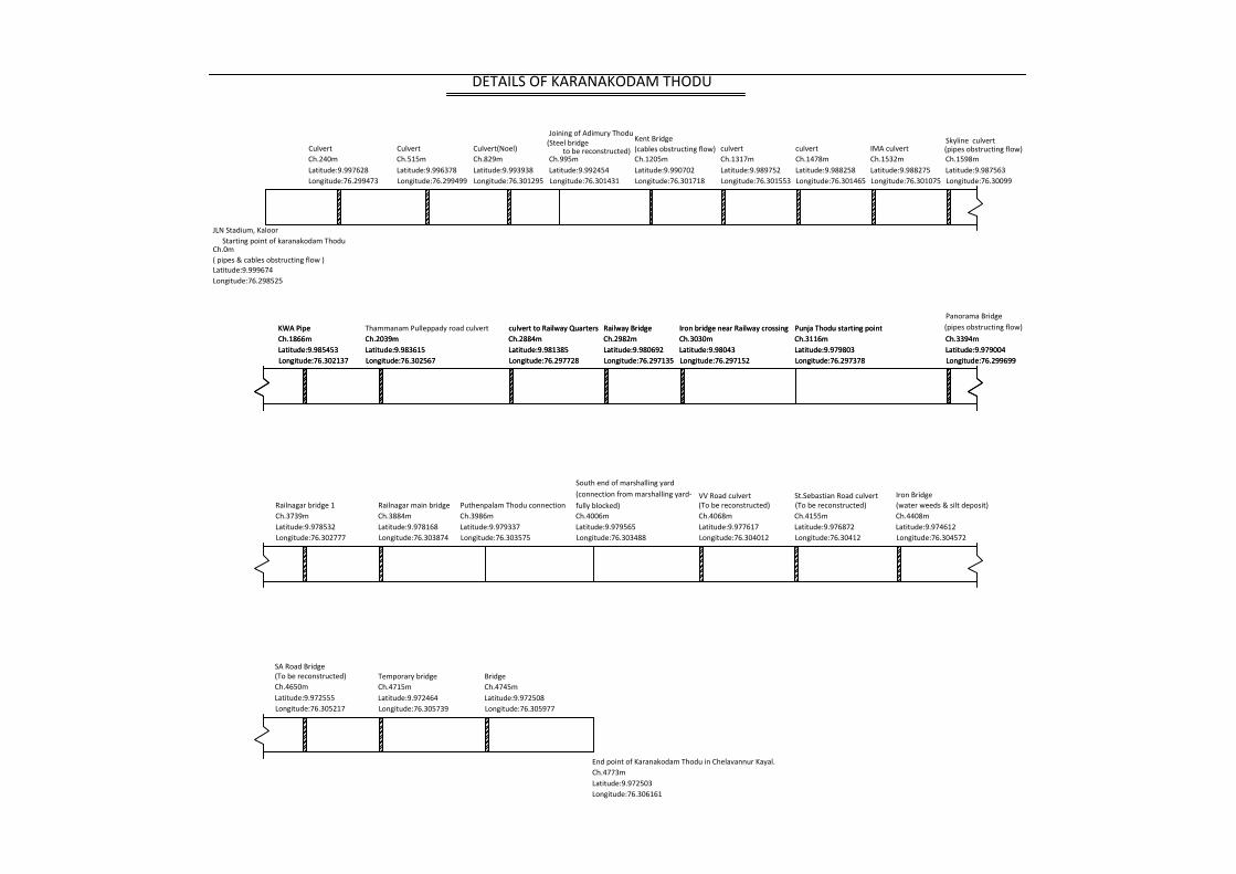
Ch.0m
Latitude:9.999674Longitude:76.298525
CulvertCh.240mLatitude:9.997628Longitude:76.299473
CulvertCh.515mLatitude:9.996378Longitude:76.299499
Culvert(Noel)Ch.829mLatitude:9.993938Longitude:76.301295
Joining of Adimury Thodu
Ch.995mLatitude:9.992454Longitude:76.301431
Kent Bridge
Ch.1205mLatitude:9.990702Longitude:76.301718
culvertCh.1317mLatitude:9.989752Longitude:76.301553
culvertCh.1478mLatitude:9.988258Longitude:76.301465
IMA culvertCh.1532mLatitude:9.988275Longitude:76.301075
Skyline culvert
Ch.1598mLatitude:9.987563Longitude:76.30099
KWA PipeCh.1866mLatitude:9.985453Longitude:76.302137
Thammanam Pulleppady road culvertCh.2039mLatitude:9.983615Longitude:76.302567
culvert to Railway QuartersCh.2884mLatitude:9.981385Longitude:76.297728
Railway BridgeCh.2982mLatitude:9.980692Longitude:76.297135
Iron bridge near Railway crossingCh.3030mLatitude:9.98043Longitude:76.297152
Punja Thodu starting pointCh.3116mLatitude:9.979803Longitude:76.297378
Ch.3394mLatitude:9.979004Longitude:76.299699
KWA PipeCh.1866mLatitude:9.985453Longitude:76.302137
Ch.2039mLatitude:9.983615Longitude:76.302567
culvert to Railway QuartersCh.2884mLatitude:9.981385Longitude:76.297728
Railway BridgeCh.2982mLatitude:9.980692Longitude:76.297135
Iron bridge near Railway crossingCh.3030mLatitude:9.98043Longitude:76.297152
Punja Thodu starting pointCh.3116mLatitude:9.979803Longitude:76.297378
Panorama Bridge
Ch.3394mLatitude:9.979004Longitude:76.299699
Railnagar bridge 1Ch.3739mLatitude:9.978532Longitude:76.302777
Railnagar main bridgeCh.3884mLatitude:9.978168Longitude:76.303874
Puthenpalam Thodu connection Ch.3986mLatitude:9.979337Longitude:76.303575
South end of marshalling yard
Ch.4006mLatitude:9.979565Longitude:76.303488
(To be reconstructed)Ch.4068mLatitude:9.977617Longitude:76.304012
Iron Bridge
Ch.4408mLatitude:9.974612Longitude:76.304572
VV Road culvert(water weeds & silt deposit)
Ch.4155mLatitude:9.976872Longitude:76.30412
St.Sebastian Road culvert
Temporary bridgeCh.4715mLatitude:9.972464Longitude:76.305739
BridgeCh.4745mLatitude:9.972508Longitude:76.305977
(To be reconstructed)Ch.4650mLatitude:9.972555Longitude:76.305217
SA Road Bridge
End point of Karanakodam Thodu in Chelavannur Kayal.Ch.4773mLatitude:9.972503Longitude:76.306161
DETAILS OF KARANAKODAM THODU
( pipes & cables obstructing flow )
(cables obstructing flow) (pipes obstructing flow)
(pipes obstructing flow)
fully blocked)(connection from marshalling yard-
(To be reconstructed)
(Steel bridgeto be reconstructed)
JLN Stadium, Kaloor Starting point of karanakodam Thodu
Page 87
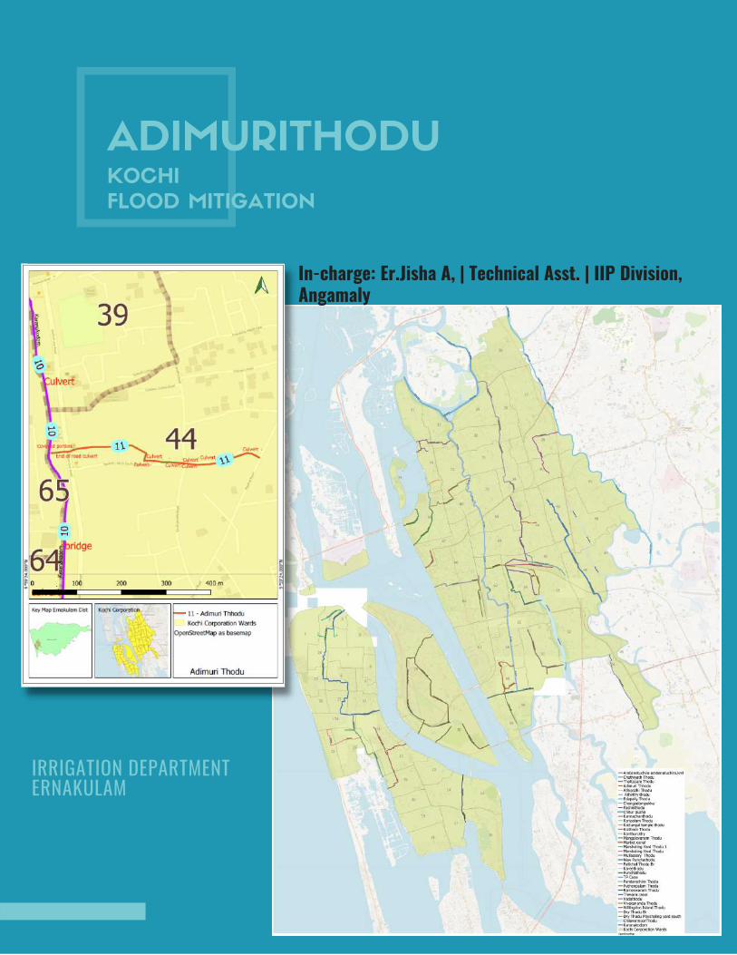
ADIMURITHODUKOCHI
FLOOD MITIGATION
In-charge: Er.Jisha A, | Technical Asst. | IIP Division,Angamaly
IRRIGATION DEPARTMENT ERNAKULAM
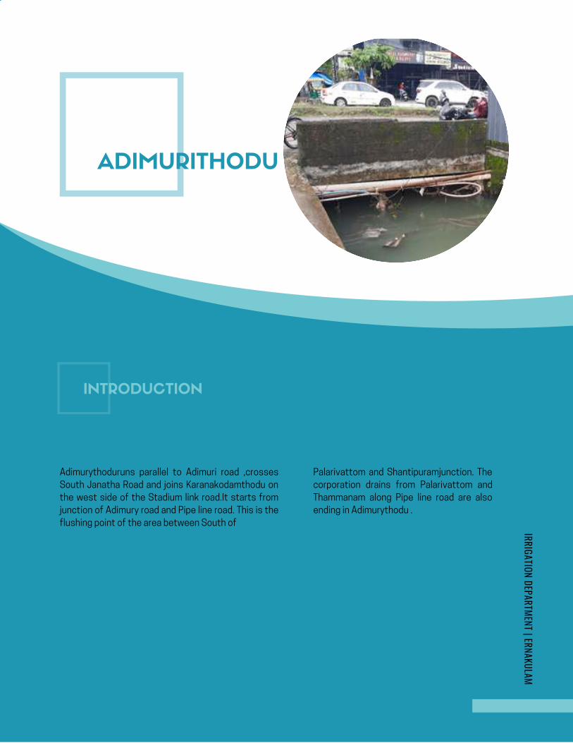
page | 1
IRRIGATION DEPARTMENT | ERNAKULAM
Adimurythoduruns parallel to Adimuri road ,crosses
South Janatha Road and joins Karanakodamthodu on
the west side of the Stadium link road.It starts from
junction of Adimury road and Pipe line road. This is the
flushing point of the area between South of
Palarivattom and Shantipuramjunction. The
corporation drains from Palarivattom and
Thammanam along Pipe line road are also
ending in Adimurythodu .
AdimurithoduKOCHI FLOOD MITIGATION
IRRIGATION DEPARTMENT | ERNAKULAM
In-charge: Er.Jisha A, IIP Division, Angamaly
ADIMURITHODU
INTRODUCTION
Page 89
KOCHI FLOOD MITIGATIONIRRIGATION DEPARTMENT | ERNAKULAM
This thoduhas499 m length and an average width of
2.5m .The starting portion of this thodu is completely
covered for a length of 40m and is being used as a
road.The width of this portion is 2.7m .
There are many culverts in this for facilitating access
to the plots and buildings on the side of thodu..It
crosses the South Janatha road and traverses
towards stadium linkroad and joins Karanakodam
thodu. The thodu isseen covered for a length of 36m
on the east side of the culvert at Stadium link road
and encroachments are noticed in this portion. In the
starting portion of thodu,a drain from St Martin road is
joining and the width at the transition portion of the
thodu after covered portion is reduces.The drains
from Santhipuram junction and South Janatha road
reachAdimurithodu.The width of the thoduwas
reduced during the construction of road.
PRESENT SCENARIO
Page 90

KOCHI FLOOD MITIGATIONIRRIGATION DEPARTMENT | ERNAKULAM
During heavy rains , the area gets water logged
.Eventhough the annual desilting is being carried out in
the thodu,the obstructions in the covered
portionscannot be identified and cleared diligently. The
drop beam of the culvert at Ch 249 m leads to the
reducedvertical clearance . The culvert at Ch 338m is
having insufficient vertical and horizontal
clearance.causing flooding. The waters from
Adimurithodu get interrupted also in Stadium link
road culvert at Ch 452 m due to the inadequate
waterway.The haphazardly placed cables and
utility service lines in the culverts are making the
situationmore worse.The culverts, the covered
portions and the improperly laid cables are
causing obstruction to the smooth flow of water.
PROBLEMS IDENTIFIED
Page 91
KOCHI FLOOD MITIGATIONIRRIGATION DEPARTMENT | ERNAKULAM
Due to this blockade, water logging in
the area along the side of the thodu
occurs .The drainage from
Shanthipuram area gets critically
affected .During heavy rains,almost 20
houses in Shanthipuram colony faces
the ill effects of this.
The cross structures without sufficient
vertical and horizontal clearance have to be
reconstructed. The covered portions shall
be made open. Theavgwidth of the thodu
must be made 3.5 m to receive the flood
waters.The utility service lines must be
properly aligned.
REMEDIAL MEASURES
Page 92
KOCHI FLOOD MITIGATIONIRRIGATION DEPARTMENT | ERNAKULAM
a. Culvert at Ch 338m
b. Culvert at Ch 249m
c. Culvert at Ch452m in Stadium link road.
At Ch 467 m- Stadium link road culvert.
Between culverts at Ch. 256m and Ch 266m Culvert
in Adimury road.
KWA Pipe lines and cables of KSEB and BSNL -
Adimurithodu caters to the drainage of a large area and has to be properly maintained with sufficient width
and depth and The covered portions must be made open so as to make the flood mitigation easier.It has to be
ensured that all cross structures are having adequate horizontal and vertical clearance. The boundaries of
the thodu has to be demarcated to regain the original course of the thodu.
STRUCTURES TO BE RECONSTRUCTED
SERVICE LINES TO BE REPLACED
CONCLUSION
SCHEMATIC DIAGRAM
Page 93

Ch.0mLatitude:9.992533Longitude:76.305745
Culvert, end of covered portionCh.40mLatitude:9.992488Longitude:76.30536
CulvertCh.104mLatitude:9.99232Longitude:76.304797
CulvertCh.124mLatitude:9.992315Longitude:76.30459
culvertCh.179mLatitude:9.992262Longitude:76.304105
culvertCh.210mLatitude:9.992353Longitude:76.303857
end of covered portion & starting of road culvertCh.452mLatitude:9.99252Longitude:76.301968
starting of covered portionCh.416mLatitude:9.992553Longitude:76.301893
DETAILS OF ADIMURY THODU
Starting of Adimuri Thodu, covered portion starting
CulvertCh.145mLatitude:9.992278Longitude:76.3448
CulvertCh.157mLatitude:9.992378Longitude:76.304445
culvertCh.220mLatitude:9.992283Longitude:76.30377
culvertCh.233mLatitude:9.992343Longitude:76.303702
Ch.249mLatitude:9.992287Longitude:76.303533
CulvertCh.256mLatitude:9.992295Longitude:76.303405
**pipe obstructing flowCh.467mLatitude:9.992471Longitude:76.301537
End of Adimuri Thodu joining with karanakodam ThoduCh.499mLatitude:9.992453Longitude:76.301424
** To be reconstructedCh.338mLatitude:9.9926Longitude:76.302872
culvertCulvert** To be reconstructed
Ch.266mLatitude:9.992287Longitude:76.303335
Pipe obstructing flowend of road culvert
Page 94
MARSHALLING YARD
THODUKOCHI
FLOOD MITIGATION
In-charge: Er.Jisha A, | Technical Asst. | IIP Division,Angamaly
IRRIGATION DEPARTMENT ERNAKULAM
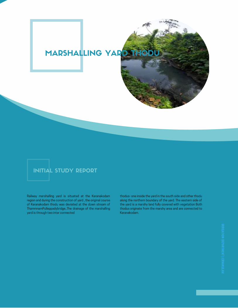
AMBANATTUCHIRA THODU (PONNETH
CHAAL ) IN CHILAVANNOORER .DHANYA K . , | MI SUB DIVISION | ERNAKULAM
KOCHI FLOOD MITIGATION
INITIAL STUDY REPORT
AMBANATTUCHIRA THODU (PONNETH
CHAAL ) IN CHILAVANNOORER .DHANYA K . , | MI SUB DIVISION | ERNAKULAM
KOCHI FLOOD MITIGATION
INITIAL STUDY REPORT
Google Map- Ambanattuchira thodu
MARSHALLING YARD THODU
Comrade Nagar
INITIAL STUDY REPORT
Railway marshalling yard is situated at the Karanakodam
region and during the construction of yard , the original course
of Karanakodam thodu was deviated at the down stream of
ThammnamPulleppadybridge..The drainage of the marshalling
yard is through two inter connected
thodus- one inside the yard in the south side and other thodu
along the northern boundary of the yard. The eastern side of
the yard is a marshy land fully covered with vegetation Both
thodus originate from the marshy area and are connected to
Karanakodam.
IRRIGATION DEPARTMENT | ERNAKULAM
Page 96
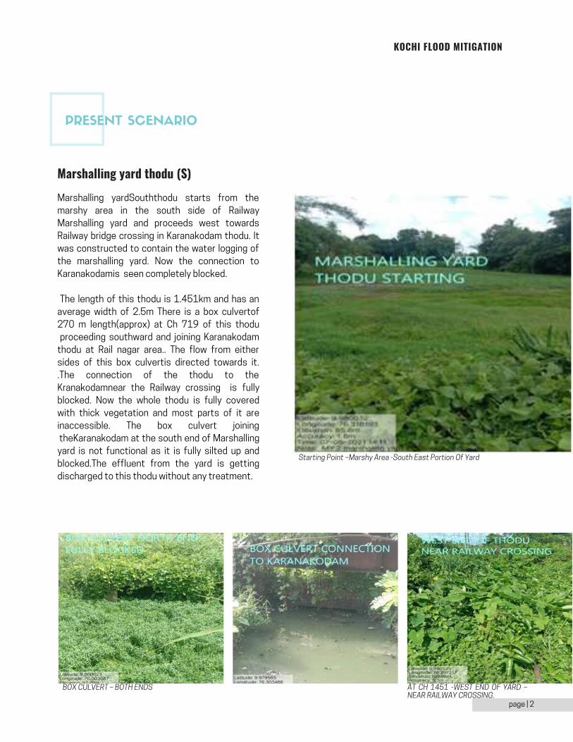
KOCHI FLOOD MITIGATION
page | 2
Marshalling yardSouththodu starts from the
marshy area in the south side of Railway
Marshalling yard and proceeds west towards
Railway bridge crossing in Karanakodam thodu. It
was constructed to contain the water logging of
the marshalling yard. Now the connection to
Karanakodamis seen completely blocked.
The length of this thodu is 1.451km and has an
average width of 2.5m There is a box culvertof
270 m length(approx) at Ch 719 of this thodu
proceeding southward and joining Karanakodam
thodu at Rail nagar area.. The flow from either
sides of this box culvertis directed towards it.
.The connection of the thodu to the
Kranakodamnear the Railway crossing is fully
blocked. Now the whole thodu is fully covered
with thick vegetation and most parts of it are
inaccessible. The box culvert joining
theKaranakodam at the south end of Marshalling
yard is not functional as it is fully silted up and
blocked.The effluent from the yard is getting
discharged to this thodu without any treatment.
Marshalling yard thodu (S)
Starting Point –Marshy Area -South East Portion Of Yard
BOX CULVERT – BOTH ENDS AT CH 1451 -WEST END OF YARD –NEAR RAILWAY CROSSING.
PRESENT SCENARIO
Page 97
KOCHI FLOOD MITIGATION
The untreated effluent from the yard is getting discharged to this thodu. Also, corporation drains are flushing
into thisthodu. The thodu is silted up, covered with thick vegetation and inaccessible at many stretches. Most of
the part ,the flow is stagnated and contaminated. The residences along the northern boundary of the yard
issubjected to water logging during heavy rains.The marshalling yard is draining to the Kranakodam thodu and the
untreated effluent from yard , discharging to Karanakodam is badly affecting the water quality of the surrounding
area. Besides this,other thodusconnected toKaranakodam are affected. Also the storm water in this yard
reaches the Karanakodamthodu along the Railnagar area and leads to water logging during heavy rains.
Installation of Effluent treatment plant –Railways must be addressed and instructed to install ETP in the yard.
Strict measures should be taken to arrest the untreated effluent discharge from the yard to the thodus.
Desilting and Removal of vegetation in thodu.-The entire length of both the thodus must be cleaned and desilted
so as to make the flow uninterrupted . The box culvert from the marshalling yard to the Karanakodam has to be
desilted and cleared of vegetation.
The reestablishment of flow in both thodu by desilting can mitigate the water logging in the adjacent plots in the
boundary of the yard .
Installation of Effluent treatment plant –Railways must be addressed and instructed to install ETP in the yard.
Strict measures should be taken to arrest the untreated effluent discharge from the yard to the thodus.
Desilting and Removal of vegetation in thodu.-The entire length of both the thodus must be cleaned and desilted
so as to make the flow uninterrupted . The box culvert from the marshalling yard to the Karanakodam has to be
desilted and cleared of vegetation.
The reestablishment of flow in both thodu by desilting can mitigate the water logging in the adjacent plots
in the boundary of the yard .
The unchecked hazardous effluent discharge from the yard to the Karanakodamhas adversely affected the
water quality of the surrounding area .As many water courses are connected to the Karanakodam, the pollution is
effected in these thodusalso. Stringent directions should be given to Railways to install ETP in yard and to arrest
further pollution to the water courses. Thetwo thodus in the Marshalling yard have to be desilted so that the flow
can be regained .
PROBLEMS IDENTIFIED
REMEDIAL MEASURES
REMEDIAL MEASURES
CONCLUSION
Page 98
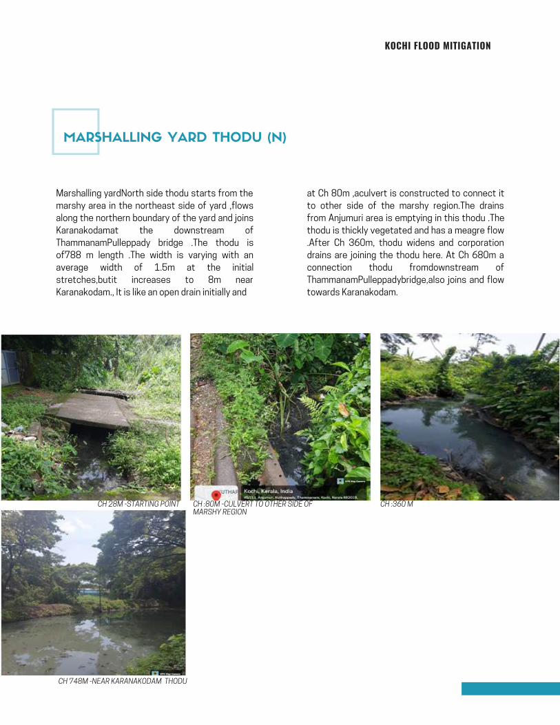
KOCHI FLOOD MITIGATION
Marshalling yardNorth side thodu starts from the
marshy area in the northeast side of yard ,flows
along the northern boundary of the yard and joins
Karanakodamat the downstream of
ThammanamPulleppady bridge .The thodu is
of788 m length .The width is varying with an
average width of 1.5m at the initial
stretches,butit increases to 8m near
Karanakodam., It is like an open drain initially and
CH :360 M
CH 748M -NEAR KARANAKODAM THODU
at Ch 80m ,aculvert is constructed to connect it
to other side of the marshy region.The drains
from Anjumuri area is emptying in this thodu .The
thodu is thickly vegetated and has a meagre flow
.After Ch 360m, thodu widens and corporation
drains are joining the thodu here. At Ch 680m a
connection thodu fromdownstream of
ThammanamPulleppadybridge,also joins and flow
towards Karanakodam.
CH :80M -CULVERT TO OTHER SIDE OF MARSHY REGION
CH 28M -STARTING POINT
MARSHALLING YARD THODU (N)
Page 99
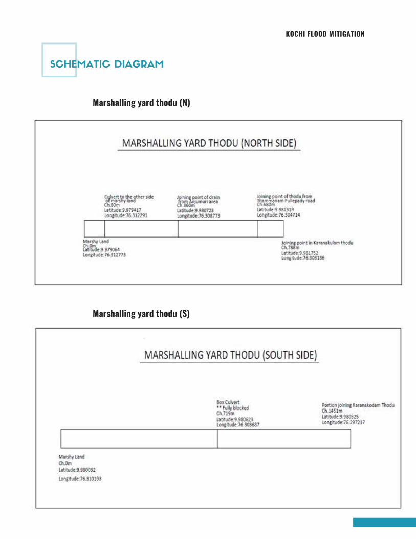
KOCHI FLOOD MITIGATION
Marshalling yard thodu (N)
Marshalling yard thodu (S)
SCHEMATIC DIAGRAM
Page 100
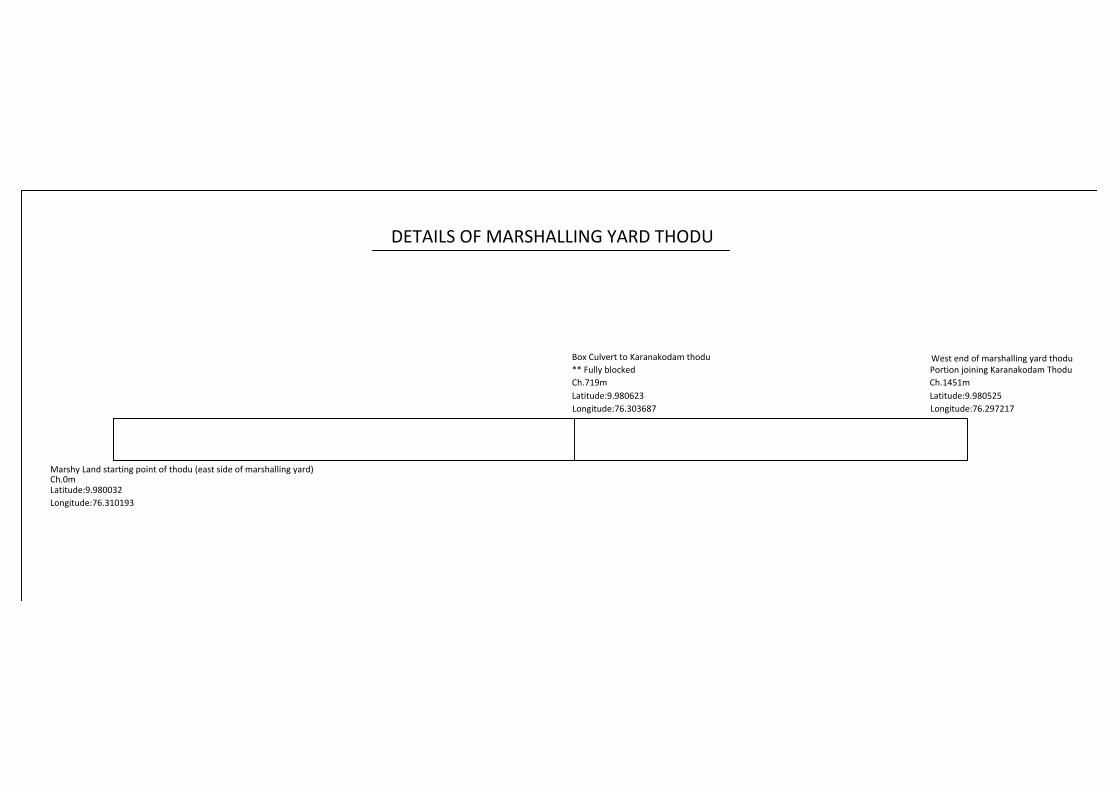
Ch.0mLatitude:9.980032Longitude:76.310193
DETAILS OF KARANAKODAM THODU 2021-22
DETAILS OF MARSHALLING YARD THODU
** Fully blockedCh.719mLatitude:9.980623Longitude:76.303687
Portion joining Karanakodam ThoduCh.1451mLatitude:9.980525Longitude:76.297217
Marshy Land starting point of thodu (east side of marshalling yard)
Box Culvert to Karanakodam thodu West end of marshalling yard thodu
Page 101
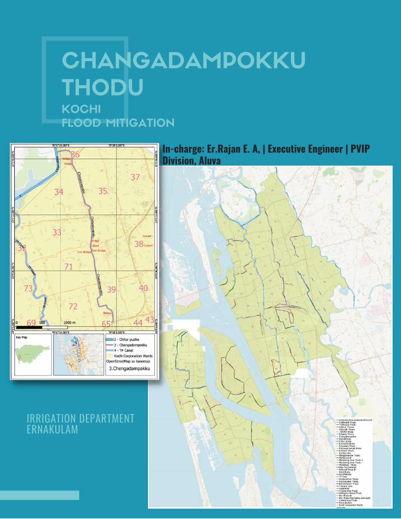
CHANGADAMPOKKU
THODUKOCHI
FLOOD MITIGATION
In-charge: Er.Rajan E. A, | Executive Engineer | PVIPDivision, Aluva
IRRIGATION DEPARTMENT ERNAKULAM

AMBANATTUCHIRA THODU (PONNETH
CHAAL ) IN CHILAVANNOORER .DHANYA K . , | MI SUB DIVISION | ERNAKULAM
KOCHI FLOOD MITIGATION
INITIAL STUDY REPORT
AMBANATTUCHIRA THODU (PONNETH
CHAAL ) IN CHILAVANNOORER .DHANYA K . , | MI SUB DIVISION | ERNAKULAM
KOCHI FLOOD MITIGATION
INITIAL STUDY REPORT
Google Map- Ambanattuchira thodu
CHANGADOMPOKKU THODU
Comrade Nagar
INTRODUCTION
Kochi city lies almost par with the Sea level and hence the
drainage in Kochi deserves much importance as well as more
sensitive also. The average altitude of Kochi ranges from +7.50m
to +1.00m above MSL from east to west. A number of main and
secondary canals criss - cross the area, some were used for
transportation in the past and now subjected to severe
environmental degradation due to waste dumping. The canals are
exhausted withdrastic reduction in water carrying capacity due to
rampant encroachment.
IRRIGATION DEPARTMENT | ERNAKULAM
Page 103
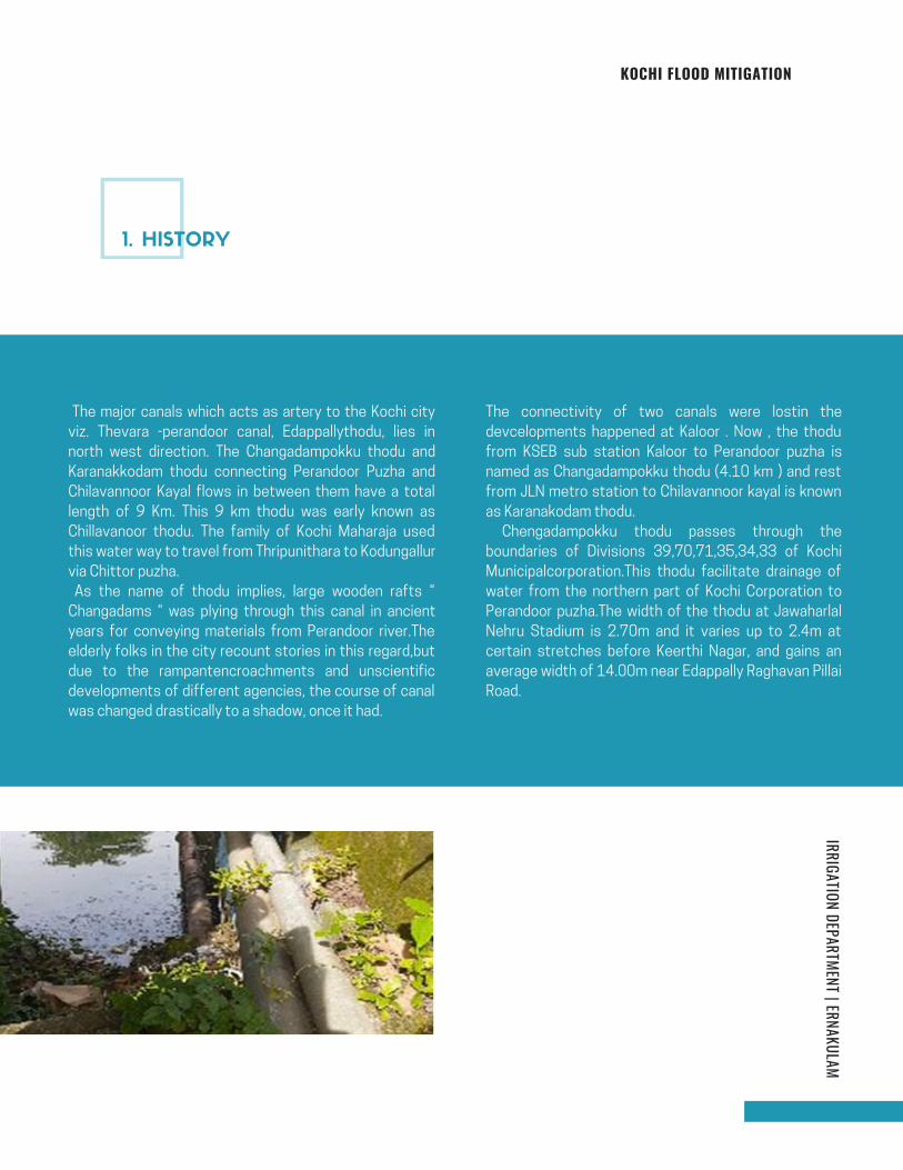
KOCHI FLOOD MITIGATION
The major canals which acts as artery to the Kochi city
viz. Thevara -perandoor canal, Edappallythodu, lies in
north west direction. The Changadampokku thodu and
Karanakkodam thodu connecting Perandoor Puzha and
Chilavannoor Kayal flows in between them have a total
length of 9 Km. This 9 km thodu was early known as
Chillavanoor thodu. The family of Kochi Maharaja used
this water way to travel from Thripunithara to Kodungallur
via Chittor puzha.
As the name of thodu implies, large wooden rafts “
Changadams “ was plying through this canal in ancient
years for conveying materials from Perandoor river.The
elderly folks in the city recount stories in this regard,but
due to the rampantencroachments and unscientific
developments of different agencies, the course of canal
was changed drastically to a shadow, once it had.
The connectivity of two canals were lostin the
devcelopments happened at Kaloor . Now , the thodu
from KSEB sub station Kaloor to Perandoor puzha is
named as Changadampokku thodu (4.10 km ) and rest
from JLN metro station to Chilavannoor kayal is known
as Karanakodam thodu.
Chengadampokku thodu passes through the
boundaries of Divisions 39,70,71,35,34,33 of Kochi
Municipalcorporation.This thodu facilitate drainage of
water from the northern part of Kochi Corporation to
Perandoor puzha.The width of the thodu at Jawaharlal
Nehru Stadium is 2.70m and it varies up to 2.4m at
certain stretches before Keerthi Nagar, and gains an
average width of 14.00m near Edappally Raghavan Pillai
Road.
IRRIGATION DEPARTMENT | ERNAKULAM
1. HISTORY
Page 104
KOCHI FLOOD MITIGATION
The flood affected regions during the high intensity rain
occurred on Oct 21st , 2019 (19cm rainfall) are
ascertained from the discussion made with the residents
are the following.
KSEB sub station , Kallamparambil road, George Eden
road, Tagore st., Nalukandam lane, Ammu sahib colony,
NPS road, Pottakuzhi Mamangalam road, Karukappilly
lane, Vellakkadaparambu lane, South Keerthi Nagar,
Keerthi nagar ,South Bhavans road, Edappally Raghavan
road, Rajeev nagar, Karama road , Mulakkil ,Mercy
lane,Prashanthi lane,Makkaparambu lane .
Flood threat regions adjacent to the thodu and that are
mostly affected are KSEB substation compound,
National Public School road and Pottakuzhi -
Mamangalam road.
IRRIGATION DEPARTMENT | ERNAKULAM
The vast area of marshy land once available at the Sub
station area, JLN stadium and on either sides of the
thodu was vanished as part of development. These areas
were act as flood absorbing pockets and the run off from
high intensity rain could not be drained easily to the
Perandoor river through the Changadampokkuthodu for a
distanceof 4km due to the impediments,
discussedbelow. If the rain is occurred during spring tide
the recession of flood water will take more time, naturally
the low lying area will easily get inundated.
2. PROBLEMS
3. REASONS
Page 105
KOCHI FLOOD MITIGATION
The catchment area of the Chengadampokkuthodu is about
9.50 Sq. Km. The run off from the entire area has to be
drained to the Perandoor lake through the Changadampokku
thodu. The canals, Changadampokku & Karanakkodam were
the north and south part of a single canal having flow in
either direction due to tidal variation. During the
construction of JLN stadium, the alignment of
Karanakkodam thodu was shifted towards west direction,
adjacent to the VIP road. The connectivity of the two canals
were lost, near KSEB sub station Kaloor.The water from
drains parallel to the Banerjee road from east and west
direction and the drains from Vasanth Nagar and
Kollamparambu road empties in to the Changadampokku
thodu at KSEB compound. The entire quantity of water has
to be drained through the Changadampokku thodu .
Last year (2020) Kochi Metro Rail Limited (KMRL) has laid
two pipes of 900mm dia to connect the Karanakkodam and
Changadompokku Thodu. But this was not effective and
during May 2021 rains ,the sub station compound was
flooded again and flooding was controlled by pumping the
water to Karanakodom thodu .
The thodu have four numbers of sharp deviations with in 350m between Ch. 265mand ch.615m .The width of
thodu reduced to 2.40 m between Greenz Villa and Comrade Nagar. Frequent deposit of silt is formed at
these turnings.
Choked leading drain outside the entrance of substation thatsupposed to lead water from Changadompokku to Karanakodam
Rear side of substation U/s of George Eden Road D/s of George Eden Road
3.1 LOST CONNECTIVITY BETWEEN
KARANAKODAM AND
CHANGADOMPOKKU THODU
3.2SHARP DEVIATIONS DUE TO CHANGE
IN ALIGNMENT AND ENCROACHMENT
Page 106

KOCHI FLOOD MITIGATION
The utility pipes belongs to KSEB/ KWA/ BSNL etc.crossing
the drain at different locations obstructing the free flow of
water, especially during flood season. The pipes laying
through the water surface of the thodu has to be lifted,
leaving a clear headroom to accommodate flood water. The
following locations are prone to flooding due to the
obstruction of utility pipes.
The utility pipes belongs to KSEB/ KWA/ BSNL etc. crossing
the drain at different locations obstructing the free flow of
water, especially during flood season. The pipes laying
through the water surface of the thodu has to be lifted,
leaving a clear headroom to accommodate flood water. The
following locations are prone to flooding due to the
obstructionof utility pipes
Bhagyadhara culvert Keerthi nagar Culvert Bhagyadhara culvert 1
Bhagyadhara culvert 1 Keerthi nagar Culvert Edapally Raghavan Pillai road culvert
3.3UTILITY PIPES CROSSING THODU
3.3 UTILITY PIPES CROSSING THODU
Page 107
KOCHI FLOOD MITIGATION
Ventway of the thodu is narrowed at the existing culverts
viz. Keerthy Nagar culvert, Slabs laid across the thodu for
private entry at Brush lane, Elamakkara railway bridge etc.,
which causes accumulation of wastes and finally blocking
the flow of water.
Encroachments of the thodu is suspected at several
locations.There is a drastic reduction in water carrying
capacity of thodu due to rampant encroachment . Slabs are
constructed indiscriminately by the public over the thodu at
several locations belongs to their premises without enough
head room and utility pipes crossing under the slabs. It will
be a bottle neck to the cleaning process. There are eight
private entries across the thodu within 200m at Brush lane.
Private entry at Brush lane Keerthi nagar Culvert Elamakkara Railway Bridge
Keerthi Nagar Brush Lane
3.4 EXISTING CULVERTS HAVING NO
HEAD ROOM AND VENT WAY
3.5 ENCROACHMENTS
Page 108
KOCHI FLOOD MITIGATION
The present practice of the LSGD wing to convert the thodu to road by covering
with concrete slab. This will accelerate clogging of drain, which will prevent the
free flow of water. Future cleaning of thodu will be cumbersome on account of
this. The concreting of bed of natural thodu is not advisable.Nearly 400m of
thodu has converted to covered concrete thodu between ch.350 m and
Ch.1045m. Concreting the natural bed of thodu will prevent the seepage of water
through ground thus increasing the risk of flooding.
The catchment area of this thodu is densely populated and
hence the thodu is subjected to variety of pollutants such
as municipal sewage, organic , plastic wastes etc. The thodu
is observed to receive household sewage along its entire
length. Stringent measures need to be taken to prevent
discharge of such wastes and sewage to the thodu .
60m covered thodu at Comrade nagar 350m covered thodu ( Amruth Project )fromcomrade nagar to Pottakuzhi Mamangalam road
Comrade Nagar
3.6 CONVERSION OF THODU TO ROAD
3.7 DISPOSAL OF WASTE WATER
TO THE NATURAL DRAIN
Page 109
KOCHI FLOOD MITIGATIONIRRIGATION DEPARTMENT | ERNAKULAM
Connectivity to the two canals,
Changadampokku & Karanakkodam shall be
restored by constructing a drain having a
minimum width of 4.00 m from the sub station
compound by crossing Banerjee road adjacent
to the Metro station so as to facilitate the flow
in either direction.
The thodu has to be rejuvenated to its original
shape after demarcating boundaries and
evicting encroachments. The width of thodu
upto ch.1700m (BTS road) varies from 2.4m to
4.5m . The average runoff during a 10cm
rainfall upto ch.1700m is about 8.7m3 /sec.
Hence the minimum inside width required from
ch.0m to 1700m is 7m. The present carrying
capacity of the thodu is insufficient and has to
be increased by eviction/ acquisition of land. By
increasing the width , sharp deviations will be
streamlined .
Reconstruct the existing culverts having no
head room and vent way .
Long term measurePrivate entries at Brush lane across the thodu to each
plot shall be removed and form road/foot path along
the right bund of the thodu for their entry to their plot
.Guidelines shall be formed for constructions along
and across the thodu and shall be strictly complied.
All covered thodu portions shall be opened as the
concreting the bed of natural thodu is not
recommended.
Provide high capacity pumps with shutter
arrangements to drain out flood water to the lake so
as to combat the tidal variations, ensuring its periodic
maintenance.
Inter linking of parallel canals by widening the existing
natural stream for easy drainage.
The rivers & lakes encompassing the main lands have
to be desilted regularly in order to accommodate the
flood water.Water storage capacity of puzha
receiving thodu ( Perendoor canal and Chittor puzha)
shall be increased by desilting so as to reduce the
travelling time of runoff water to kayal and to reduce
the tidal inflow of water towards the thodu.
Periodic desilting and cleaning of
Changadampokkuthodu at the entire stretch
to drain the flood water more effectively.
Corporation shall not encourage the
conversion of natural thodu to concrete
thodus
Remove the pipe lines of KWA,KSEB & BSNL
which passes through the water surface of
the canal.
Short term measure
4. REMEDIES PROPOSED AS
LONG TERM AND SHORT TERM
MEASURE.
Page 110
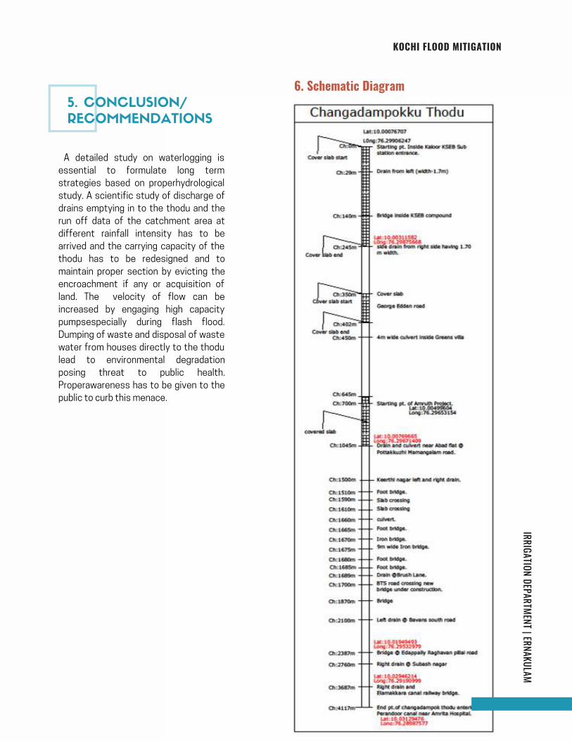
KOCHI FLOOD MITIGATION
page | 18
IRRIGATION DEPARTMENT | ERNAKULAM
A detailed study on waterlogging is
essential to formulate long term
strategies based on properhydrological
study. A scientific study of discharge of
drains emptying in to the thodu and the
run off data of the catchment area at
different rainfall intensity has to be
arrived and the carrying capacity of the
thodu has to be redesigned and to
maintain proper section by evicting the
encroachment if any or acquisition of
land. The velocity of flow can be
increased by engaging high capacity
pumpsespecially during flash flood.
Dumping of waste and disposal of waste
water from houses directly to the thodu
lead to environmental degradation
posing threat to public health.
Properawareness has to be given to the
public to curb this menace.
6. Schematic Diagram
5. CONCLUSION/
RECOMMENDATIONS
Page 111
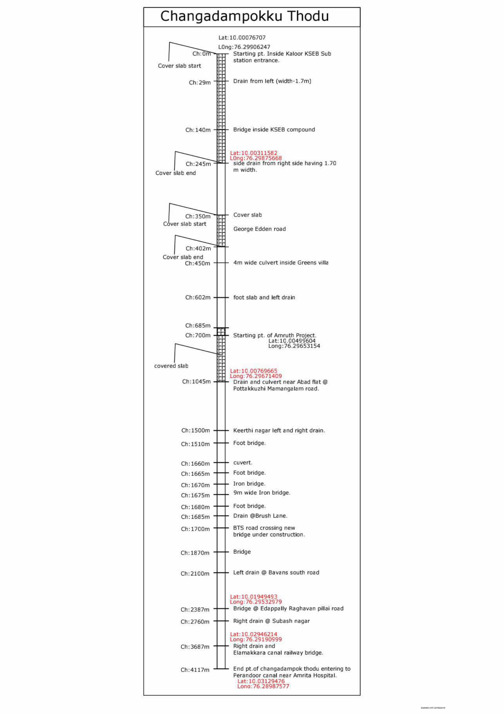
Page 112
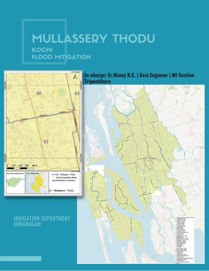
MULLASSERY THODUKOCHI
FLOOD MITIGATION
In-charge: Er.Manoj K.C. | Asst.Engineer | MI SectionTripunithura
IRRIGATION DEPARTMENT ERNAKULAM
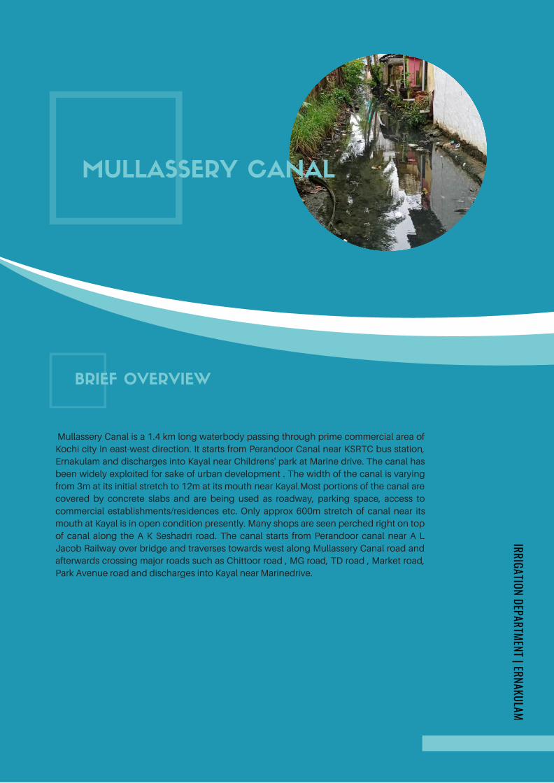
Mullassery Canal is a 1.4 km long waterbody passing through prime commercial area of
Kochi city in east-west direction. It starts from Perandoor Canal near KSRTC bus station,
Ernakulam and discharges into Kayal near Childrens' park at Marine drive. The canal has
been widely exploited for sake of urban development . The width of the canal is varying
from 3m at its initial stretch to 12m at its mouth near Kayal.Most portions of the canal are
covered by concrete slabs and are being used as roadway, parking space, access to
commercial establishments/residences etc. Only approx 600m stretch of canal near its
mouth at Kayal is in open condition presently. Many shops are seen perched right on top
of canal along the A K Seshadri road. The canal starts from Perandoor canal near A L
Jacob Railway over bridge and traverses towards west along Mullassery Canal road and
afterwards crossing major roads such as Chittoor road , MG road, TD road , Market road,
Park Avenue road and discharges into Kayal near Marinedrive.
MULLASSERY CANAL
BRIEF OVERVIEW
IRRIGATION DEPARTMENT | ERNAKULAM
Page 114
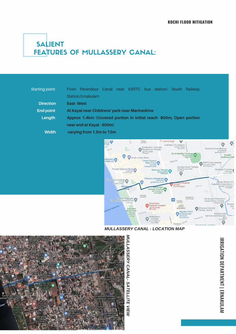
MULLASSERY CANAL - LOCATION MAP
SALIENT
FEATURES OF MULLASSERY CANAL:
KOCHI FLOOD MITIGATION
Starting point
Direction
End point
Length
Width
From Perandoor Canal near KSRTC bus station/ South Railway
Station,Ernakulam
East- West
At Kayal near Childrens' park near Marinedrive
Approx 1.4km (Covered portion in initial reach -800m, Open portion
near end at Kayal - 600m)
varying from 1.5m to 12m
MU
LL
AS
SE
RY
CA
NA
L- S
AT
EL
LIT
E V
IEW
IRRIGATION DEPARTMENT | ERNAKULAM
Page 115
Mouth of Mullassery Canal at Kayal near Childrens' Park, Marine drive( 1.4km)Southern Mouth of Perandoor Canal near Thevara Kayal (5.14 km)Through Karanakodam thodu near Mouth at Chilavannoor Lake near TankBund road (4.7 km)
Runoff water from a large drainage area in central area of Ernakulam city getsaccumulated in the naturally low lying area near KSRTC bus station. Moreover,this is a junction point of Perandoor Canal, Mullassery canal, branch ofKaranakodam thodu, Vivekananda thodu and KSRTC thodu. The wateraccumulating in this area has to exit to Kayal through the following three exitpoints. Respective distances of following exit points from KSRTC bus station isgiven in brackets.
1.
2.3.
As the mouth of Mullassery Canal is the nearest outlet to Kayal from KSRTC busstation area, this canal is expected to relieve the low lying area near KSRTC busstation from flooding by discharging the rainwater runoff in this area through itsnearest outlet . However , the bed of Mullassery canal in its initial reach nearSwami Vivekananda road is found to be approx 1.1 m above the bed at its startingpoint near rail line. Also the present bed slope of the Mullassery canal in the initialreach of 337m is found to be towards east side i.e. towards KSRTC bus stationand hence this results in accumulation of flood water in the bus station and SouthRailway station premises during rainy season. This also results in increaseddischarge into Perandoor canal thereby causing flooding in Kammattipadam areaand along the stretch of Perandoor canal .
The existing pumping mechanism at the starting point of Mullasssery canal nearKSRTC bus station has not proven effective in preventing flooding in this area.
Heavy accumulation of wastes is observed in the area where Perandoor canalcrosses rail line near KSRTC bus station. The clogged rail culvert aggravates theflooding problem in this area.
Most reaches of Mullassery canal are covered by concrete slabs. Hence entry ofrainwater runoff from adjacent streets into the canal is found to be minimal. Therunoff water from streets get collected in the low lying area near KSRTC busstation causing waterlogging and also increasing the load on Perandoor canalwhich is incapable of receiving this excess drainage.
Many shops are seen constructed over the covered portion of Mullassery canalalong A K Seshadri road completely blocking entry of runoff rain water fromadjacent areas into the canal.
The open reach of thodu from TD road at ch 800m upto end at Kayal is found tobe silted up .
The site sketch of the canal showing prominent landmarks and features at variouschainages along the canal and the longitudinal section of the canal is as follows.
PROBLEMS IDENTIFIED
IRRIGATION DEPARTMENT | ERNAKULAMKOCHI FLOOD MITIGATION
Page 116
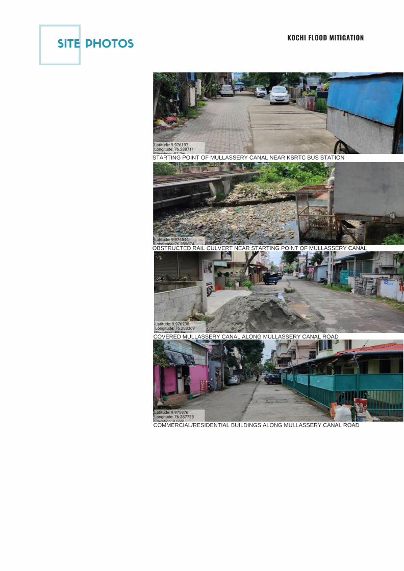
STARTING POINT OF MULLASSERY CANAL NEAR KSRTC BUS STATION
SITE PHOTOS
OBSTRUCTED RAIL CULVERT NEAR STARTING POINT OF MULLASSERY CANAL
COVERED MULLASSERY CANAL ALONG MULLASSERY CANAL ROAD
COMMERCIAL/RESIDENTIAL BUILDINGS ALONG MULLASSERY CANAL ROAD
KOCHI FLOOD MITIGATION
Page 117
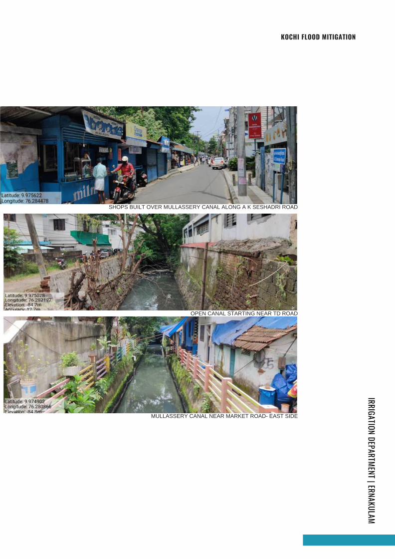
SHOPS BUILT OVER MULLASSERY CANAL ALONG A K SESHADRI ROAD
OPEN CANAL STARTING NEAR TD ROAD
MULLASSERY CANAL NEAR MARKET ROAD- EAST SIDE
IRRIGATION DEPARTMENT | ERNAKULAMKOCHI FLOOD MITIGATION
Page 118
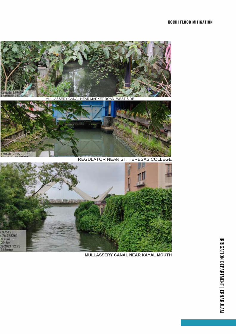
MULLASSERY CANAL NEAR MARKET ROAD- WEST SIDE
REGULATOR NEAR ST. TERESAS COLLEGE
MULLASSERY CANAL NEAR KAYAL MOUTH
IRRIGATION DEPARTMENT | ERNAKULAMKOCHI FLOOD MITIGATION
Page 119
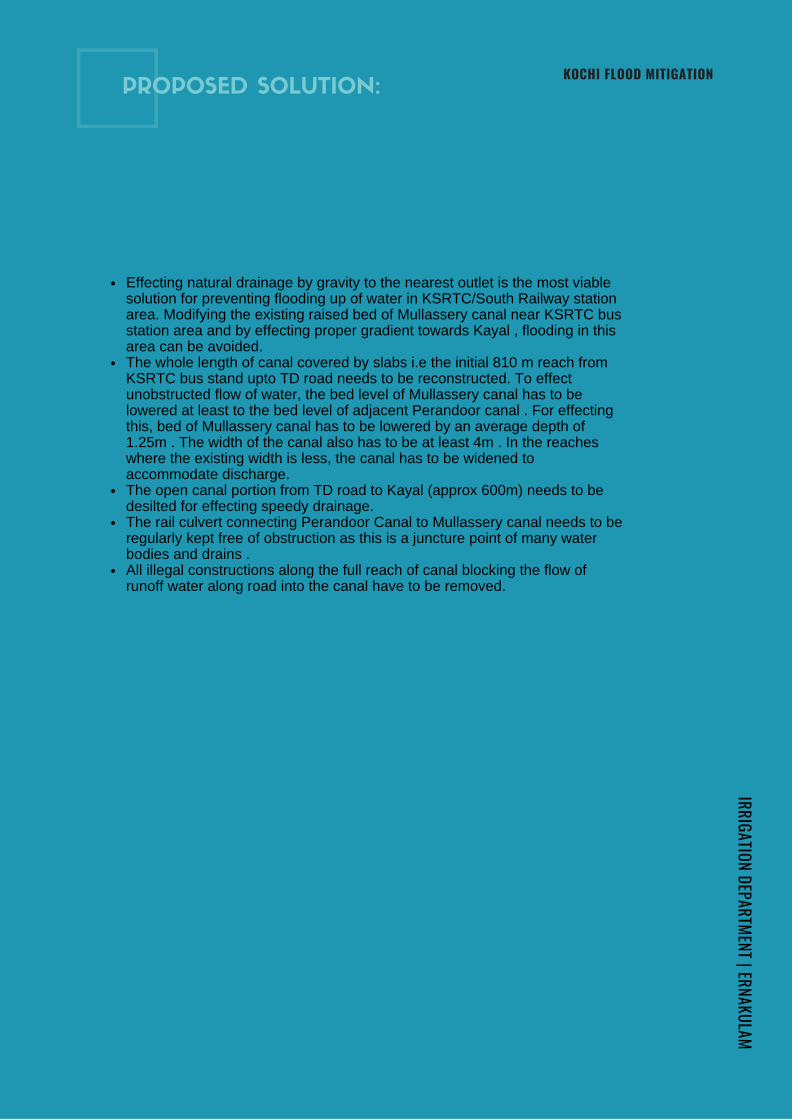
Effecting natural drainage by gravity to the nearest outlet is the most viablesolution for preventing flooding up of water in KSRTC/South Railway stationarea. Modifying the existing raised bed of Mullassery canal near KSRTC busstation area and by effecting proper gradient towards Kayal , flooding in thisarea can be avoided.The whole length of canal covered by slabs i.e the initial 810 m reach fromKSRTC bus stand upto TD road needs to be reconstructed. To effectunobstructed flow of water, the bed level of Mullassery canal has to belowered at least to the bed level of adjacent Perandoor canal . For effectingthis, bed of Mullassery canal has to be lowered by an average depth of1.25m . The width of the canal also has to be at least 4m . In the reacheswhere the existing width is less, the canal has to be widened toaccommodate discharge.The open canal portion from TD road to Kayal (approx 600m) needs to bedesilted for effecting speedy drainage.The rail culvert connecting Perandoor Canal to Mullassery canal needs to beregularly kept free of obstruction as this is a juncture point of many waterbodies and drains .All illegal constructions along the full reach of canal blocking the flow ofrunoff water along road into the canal have to be removed.
PROPOSED SOLUTION:
IRRIGATION DEPARTMENT | ERNAKULAMKOCHI FLOOD MITIGATION
Page 120
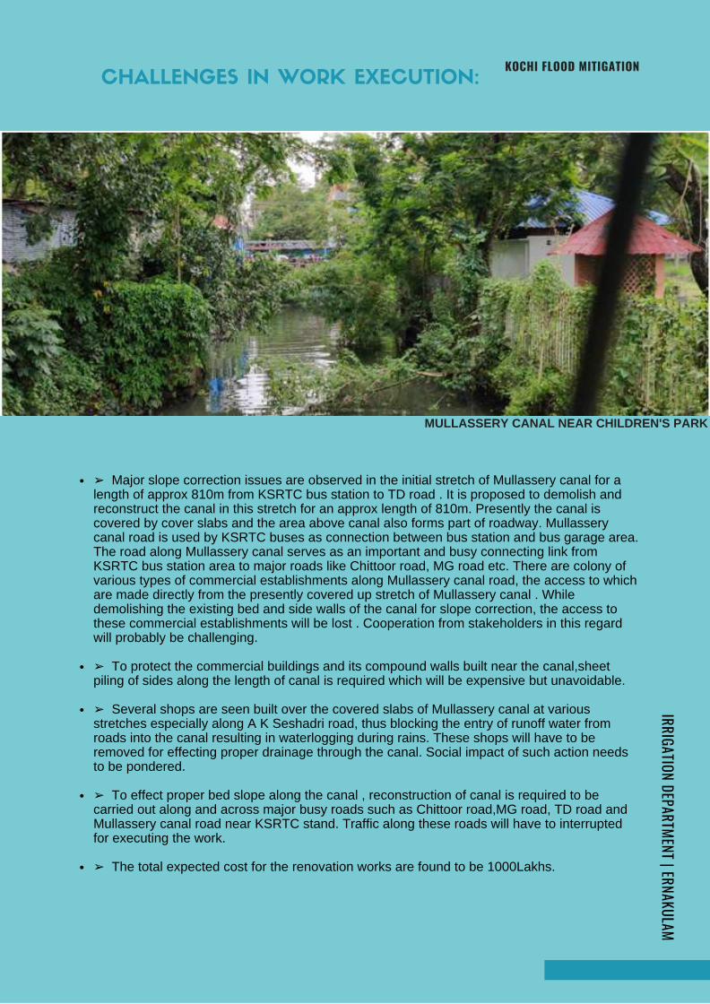
MULLASSERY CANAL NEAR CHILDREN'S PARK
➢ Major slope correction issues are observed in the initial stretch of Mullassery canal for alength of approx 810m from KSRTC bus station to TD road . It is proposed to demolish andreconstruct the canal in this stretch for an approx length of 810m. Presently the canal iscovered by cover slabs and the area above canal also forms part of roadway. Mullasserycanal road is used by KSRTC buses as connection between bus station and bus garage area.The road along Mullassery canal serves as an important and busy connecting link fromKSRTC bus station area to major roads like Chittoor road, MG road etc. There are colony ofvarious types of commercial establishments along Mullassery canal road, the access to whichare made directly from the presently covered up stretch of Mullassery canal . Whiledemolishing the existing bed and side walls of the canal for slope correction, the access tothese commercial establishments will be lost . Cooperation from stakeholders in this regardwill probably be challenging.
➢ To protect the commercial buildings and its compound walls built near the canal,sheetpiling of sides along the length of canal is required which will be expensive but unavoidable.
➢ Several shops are seen built over the covered slabs of Mullassery canal at variousstretches especially along A K Seshadri road, thus blocking the entry of runoff water fromroads into the canal resulting in waterlogging during rains. These shops will have to beremoved for effecting proper drainage through the canal. Social impact of such action needsto be pondered.
➢ To effect proper bed slope along the canal , reconstruction of canal is required to becarried out along and across major busy roads such as Chittoor road,MG road, TD road andMullassery canal road near KSRTC stand. Traffic along these roads will have to interruptedfor executing the work.
➢ The total expected cost for the renovation works are found to be 1000Lakhs.
CHALLENGES IN WORK EXECUTION:
IRRIGATION DEPARTMENT | ERNAKULAMKOCHI FLOOD MITIGATION
Page 121
LAYOUT
OF MULLASSERY CANAL:
IRRIGATION DEPARTMENT | ERNAKULAM
KOCHI FLOOD MITIGATION
Page 122
Mullassery canal
Mulla
ssery canal
Uniyattil Karunakaran Road
Market Road
Good willCollections
Mulla
ssery canal C
anal R
egulator
Park Avenue Road
Indira P
riyadersini C
hild P
ark
Marin
e Drive
Mulla
ssery canal
Mullassery ca
nal
St. T
here
sa's C
olleage
Open canal StartingOpen canal StartingT D Road
Mah
araja'sC
olleage
Gro
und
RO
AD
Clo
th b
azar
canal
Mu
llasse
ry canal
MG ROAD
En
din
g P
ortion
KA
YA
L
South RailwayStation
Ch.0.00
Ch.470
Ch.490
Ch.555
Ch.590
Ch.810
Ch.820
Ch.970
Ch.990
Ch.1260
Ch.1277
Ch.1400
Vivekan
andh
a Ro
ad
Peran
door
canal
Road
Ca
nal
KS
RT
Cw
orkshop
KS
RT
Ccanal
Ra
ilway
culvert
S
EW
N
LA
YO
UT
OF
MU
LLA
SS
ER
RY
CA
NA
LN
OT
IN S
CA
LE
Chittoor Road
Ho
me
s & shopes
Ho
me
s & shopes
Ho
me
s & shopes
Ho
me
s & shopes
Ho
me
s & shopes
12
7.00
Road
Inspire T
utioncen
ter
6.00
12
.003
.503
.503
.502
.204
.40
4.00
6.00
10
.501
0.50
10
.50
12
.801
2.00
Page 123
KOITHARA THODUKOCHI
FLOOD MITIGATION
IRRIGATION DEPARTMENT ERNAKULAM
In-charge: Er.Dhanya K. | Asst. Executive Engineer | MISub Division Ernakulam
Koithara canal is a major canal passing
through Panampilly Nagar in Kochi
Corporation. The canal is 1.55 km long
with an average width of 8m. It starts from
Perandoor canal near Panampilly Nagar
and discharges into Thevara canal. The
width of canal varies from 3.5 m to 12m.
The canal has four road crossings along its
course which includes the Shihab Thangal
road, road in front of IOC (Panampilly
Nagar Park Ave), Varghese Thittayil road
and Anamthuruth road.
There are housing colonies and other
residential buildings situated on the banks
of the canal. Waste water pipes from the
houses of colonies are discharged directly
in to the canal. The accumulation of
KOITHARA CANAL
INITIAL STUDY REPORT
IRRIGATION DEPARTMENT | ERNAKULAM
organic and plastic has made the canal
polluted. The width of canal reduces
considerably at certain locations. It is seen that
pipes and cables are laid across the canal in
front of IOC, Varghese Thittayil Road culvert
and Ananthuruth road culvert. This causes
accumulation of waste materials at these
locations and creates obstruction to the free
flow of water.
A link canal starts from Ch. 1380 m of Koithara
canal and discharges into Perandoor canal near
KSEB substation. The link canal is having a
length of 388m and width varying from 2.5m
and 2m. The link canal is also having heavy silt
deposit and the outlet of the canal towards
Perandoor Canal is covered with thick
vegetation.
Page 125
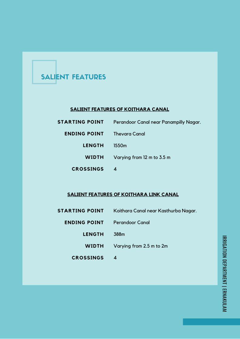
Perandoor Canal near Panampilly Nagar.
Thevara Canal
1550m
Varying from 12 m to 3.5 m
4
STARTING POINT
ENDING POINT
LENGTH
WIDTH
CROSSINGS
SALIENT FEATURES OF KOITHARA CANAL
STARTING POINT
ENDING POINT
LENGTH
WIDTH
CROSSINGS
Koithara Canal near Kasthurba Nagar.
Perandoor Canal
388m
Varying from 2.5 m to 2m
4
SALIENT FEATURES OF KOITHARA LINK CANAL
SALIENT FEATURES
IRRIGATION DEPARTMENT | ERNAKULAM
Page 126
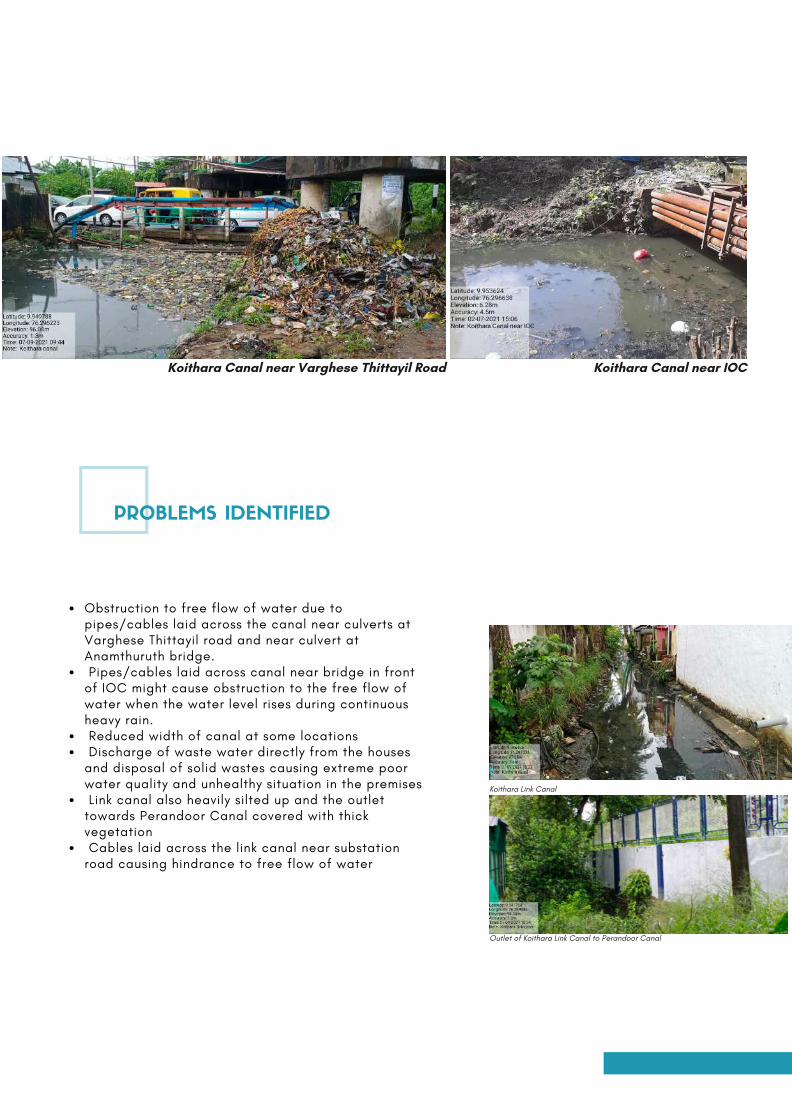
Obstruction to free flow of water due topipes/cables laid across the canal near culverts atVarghese Thittayil road and near culvert atAnamthuruth bridge. Pipes/cables laid across canal near bridge in frontof IOC might cause obstruction to the free flow ofwater when the water level rises during continuousheavy rain. Reduced width of canal at some locations Discharge of waste water directly from the housesand disposal of solid wastes causing extreme poorwater quality and unhealthy situation in the premises Link canal also heavily silted up and the outlettowards Perandoor Canal covered with thickvegetation Cables laid across the link canal near substationroad causing hindrance to free flow of water
Koithara Canal near Varghese Thittayil Road
Koithara Link Canal
Outlet of Koithara Link Canal to Perandoor Canal
PROBLEMS IDENTIFIED
Koithara Canal near IOC
Page 127
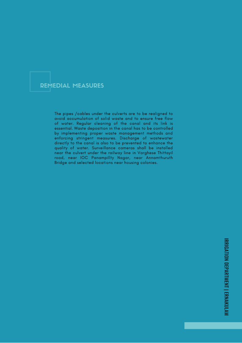
The pipes /cables under the culverts are to be realigned toavoid accumulation of solid waste and to ensure free flowof water. Regular cleaning of the canal and its link isessential. Waste deposition in the canal has to be controlledby implementing proper waste management methods andenforcing stringent measures. Discharge of wastewaterdirectly to the canal is also to be prevented to enhance thequality of water. Surveillance cameras shall be installednear the culvert under the railway line in Varghese Thittayilroad, near IOC Panampillty Nagar, near AnnamthuruthBridge and selected locations near housing colonies.
REMEDIAL MEASURES
IRRIGATION DEPARTMENT | ERNAKULAM
Page 128
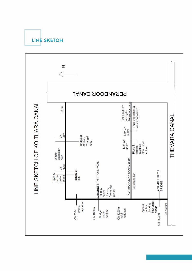
WWW.THERUSTICBRIDES.COM | SEPTEMBER ISSUE 15 | $5.99
LINE SKETCH
Page 129
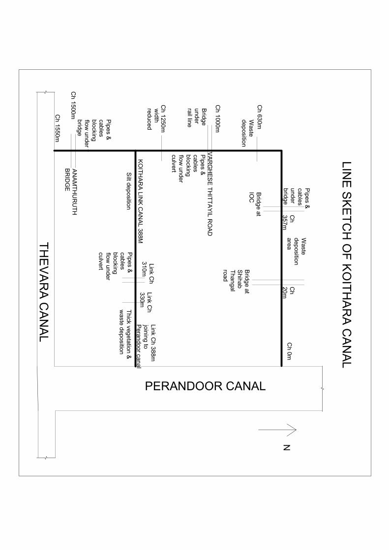
Ch
20
m
Bridg
e atS
hihabT
hangal
road
Ch
35
7m
Bridg
e atIO
C
Ch
1000m
Bridge
und
errail line
VA
RG
HE
SE
TH
ITT
AY
IL RO
AD
KO
ITH
AR
A LIN
K C
AN
AL 388M
Link Ch
31
0mL
ink Ch
33
0m
Pipe
s &cab
lesb
locking
flow un
derculvert
Thick veg
etation &w
aste d
eposition
Lin
k Ch
388m
joining
toP
erando
or canal
PERANDOOR CANAL
Ch
1500mC
h 1
550m
AN
AM
TH
UR
UT
HB
RID
GE
TH
EV
AR
A C
AN
AL
Pipe
s &cab
lesu
nder
bridge
Ch 0m
Pipe
s &cab
lesb
locking
flow un
derculvert
LIN
E S
KE
TC
H O
F K
OIT
HA
RA
CA
NA
L
Pipe
s &cab
lesb
locking
flow un
derb
ridge
Waste
dep
ositiona
rea
Ch 63
0mW
asted
eposition
N
Ch
1250m
width
reduced
Silt de
position
Page 130

CHILAVANNOOR KAYALKOCHI
FLOOD MITIGATION
IRRIGATION DEPARTMENT ERNAKULAM
In-charge: Er.Dhanya K. | Asst. Executive Engineer | MISub Division Ernakulam
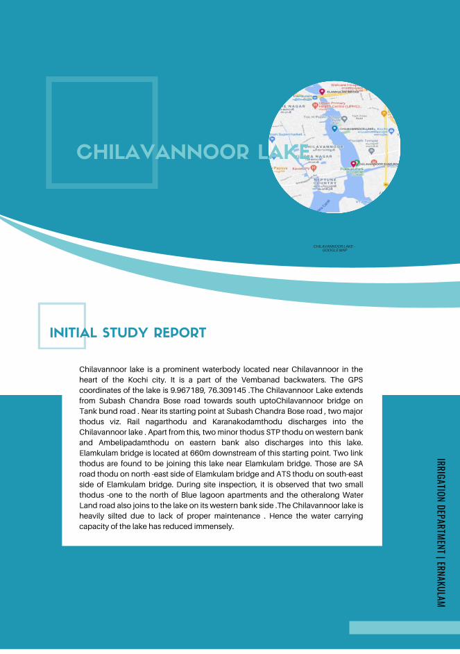
INITIAL STUDY REPORT
Chilavannoor lake is a prominent waterbody located near Chilavannoor in the
heart of the Kochi city. It is a part of the Vembanad backwaters. The GPS
coordinates of the lake is 9.967189, 76.309145 .The Chilavannoor Lake extends
from Subash Chandra Bose road towards south uptoChilavannoor bridge on
Tank bund road . Near its starting point at Subash Chandra Bose road , two major
thodus viz. Rail nagarthodu and Karanakodamthodu discharges into the
Chilavannoor lake . Apart from this, two minor thodus STP thodu on western bank
and Ambelipadamthodu on eastern bank also discharges into this lake.
Elamkulam bridge is located at 660m downstream of this starting point. Two link
thodus are found to be joining this lake near Elamkulam bridge. Those are SA
road thodu on north -east side of Elamkulam bridge and ATS thodu on south-east
side of Elamkulam bridge. During site inspection, it is observed that two small
thodus -one to the north of Blue lagoon apartments and the otheralong Water
Land road also joins to the lake on its western bank side .The Chilavannoor lake is
heavily silted due to lack of proper maintenance . Hence the water carrying
capacity of the lake has reduced immensely.
CHILAVANNOOR LAKE
CHILAVANNOOR LAKE – GOOGLE MAP
IRRIGATION DEPARTMENT | ERNAKULAM
Page 132
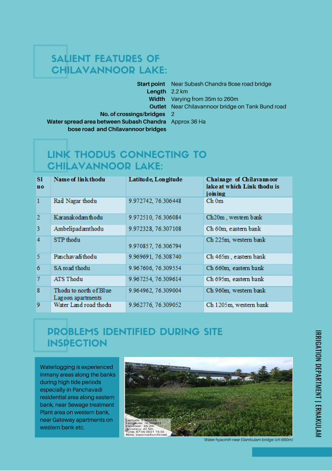
Start point LengthWidth Outlet
No. of crossings/bridges Water spread area between Subash Chandra
bose road and Chilavannoor bridges
LINK THODUS CONNECTING TO
CHILAVANNOOR LAKE:
PROBLEMS IDENTIFIED DURING SITE
INSPECTION
Near Subash Chandra Bose road bridge
2.2 km
Varying from 35m to 260m
Near Chilavannoor bridge on Tank Bund road
2
Approx 36 Ha
SALIENT FEATURES OF
CHILAVANNOOR LAKE:
Water hyacinth near Elamkulam bridge (ch 660m)
Waterlogging is experienced
inmany areas along the banks
during high tide periods
especially in Panchavadi
residential area along eastern
bank, near Sewage treatment
Plant area on western bank,
near Gateway apartments on
western bank etc.
IRRIGATION DEPARTMENT | ERNAKULAM
Page 133
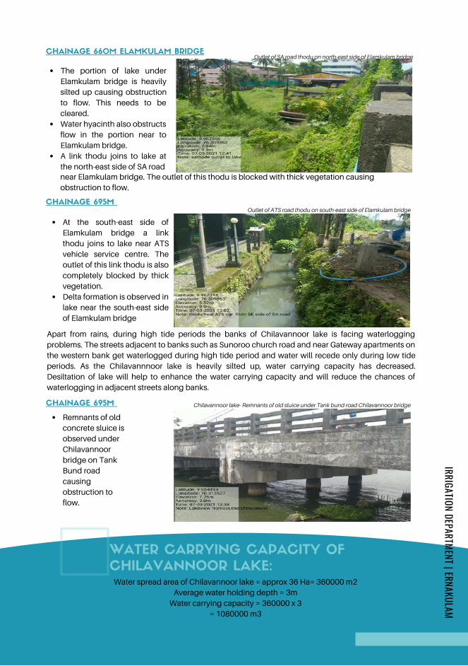
The portion of lake under
Elamkulam bridge is heavily
silted up causing obstruction
to flow. This needs to be
cleared.
Water hyacinth also obstructs
flow in the portion near to
Elamkulam bridge.
A link thodu joins to lake at
the north-east side of SA road
CHAINAGE 660M ELAMKULAM BRIDGE
near Elamkulam bridge. The outlet of this thodu is blocked with thick vegetation causing
obstruction to flow.
Outlet of SA road thodu on north-east side of Elamkulam bridge
CHAINAGE 695M
At the south-east side of
Elamkulam bridge a link
thodu joins to lake near ATS
vehicle service centre. The
outlet of this link thodu is also
completely blocked by thick
vegetation.
Delta formation is observed in
lake near the south-east side
of Elamkulam bridge
Outlet of ATS road thodu on south-east side of Elamkulam bridge
Apart from rains, during high tide periods the banks of Chilavannoor lake is facing waterlogging
problems. The streets adjacent to banks such as Sunoroo church road and near Gateway apartments on
the western bank get waterlogged during high tide period and water will recede only during low tide
periods. As the Chilavannnoor lake is heavily silted up, water carrying capacity has decreased.
Desiltation of lake will help to enhance the water carrying capacity and will reduce the chances of
waterlogging in adjacent streets along banks.
CHAINAGE 695M
Remnants of old
concrete sluice is
observed under
Chilavannoor
bridge on Tank
Bund road
causing
obstruction to
flow.
Chilavannoor lake- Remnants of old sluice under Tank bund road Chilavannoor bridge
WATER CARRYING CAPACITY OF
CHILAVANNOOR LAKE:
= 1080000 m3
Water spread area of Chilavannoor lake = approx 36 Ha= 360000 m2
Average water holding depth = 3m
Water carrying capacity = 360000 x 3
IRRIGATION DEPARTMENT | ERNAKULAM
Page 134

REMEDIAL MEASURES:
The obstructions under Elamkulam bridge and Chilavannoor bridge needs to be
cleared to ensure free flow of water. The remnants of bund for formation of cycle
track along western bank of Chilavannoor lake under Padmasarovaram project
between Elamkulam bridge and Subash Chandra Bose bridge needs to be
cleared.Desiltation of lake to be done to improve its water carrying capacity and
also to effect speedy outflow. Waterlogging is experienced in certain areas adjacent
to the lake especially near Gateway apartments on western bank even during high
tide periods. A regulating mechanism can be provided at the outlet of the lake at
Chilavannoor Tank bund road for regulating the inflow and outflow. Also the outlets
of linkthodus to the lake are to be cleared to ensure speedy drainage of storm water.
LINE SKETCH
IRRIGATION DEPARTMENT | ERNAKULAM
Page 135
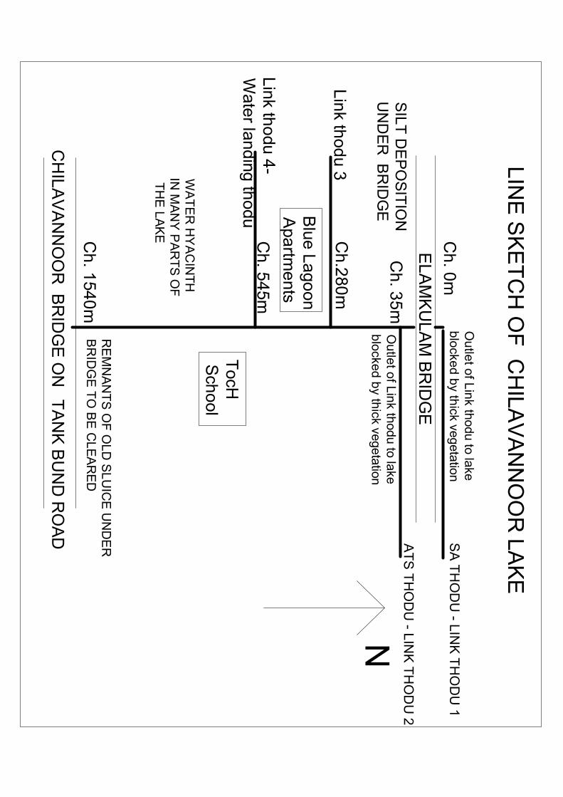
EL
AM
KU
LA
M B
RID
GE
N
CH
ILA
VA
NN
OO
R B
RID
GE
ON
TA
NK
BU
ND
RO
AD S
A T
HO
DU
- LINK
TH
OD
U 1
AT
S T
HO
DU
- LIN
K T
HO
DU
2
Ch
. 0m
Ch
. 35
m
Ch
. 1540
m
Ch
.280
m
Ch
. 545m
Lin
k thod
u 3
Blue L
ago
onA
partm
ents
Link th
odu
4-
Wate
r landing
thodu
SILT
DE
PO
SIT
ION
UN
DE
R B
RID
GE
RE
MN
AN
TS
OF
OL
D S
LU
ICE
UN
DE
RB
RID
GE
TO
BE
CLE
AR
ED
Ou
tlet o
f Lin
k thodu to lakeb
locke
d b
y thick vegetation
TocH
Sch
ool
LIN
E S
KE
TC
H O
F C
HILA
VA
NN
OO
R LA
KE
WA
TE
R H
YA
CIN
TH
IN M
AN
Y P
AR
TS
OF
TH
E L
AK
E
Ou
tlet o
f Lin
k thodu to lakeb
locke
d b
y thick vegetation
Page 136
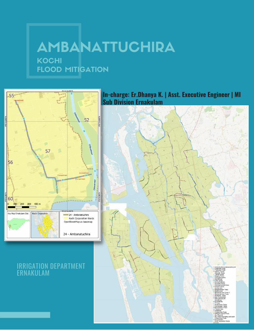
AMBANATTUCHIRAKOCHI
FLOOD MITIGATION
In-charge: Er.Dhanya K. | Asst. Executive Engineer | MISub Division Ernakulam
IRRIGATION DEPARTMENT ERNAKULAM
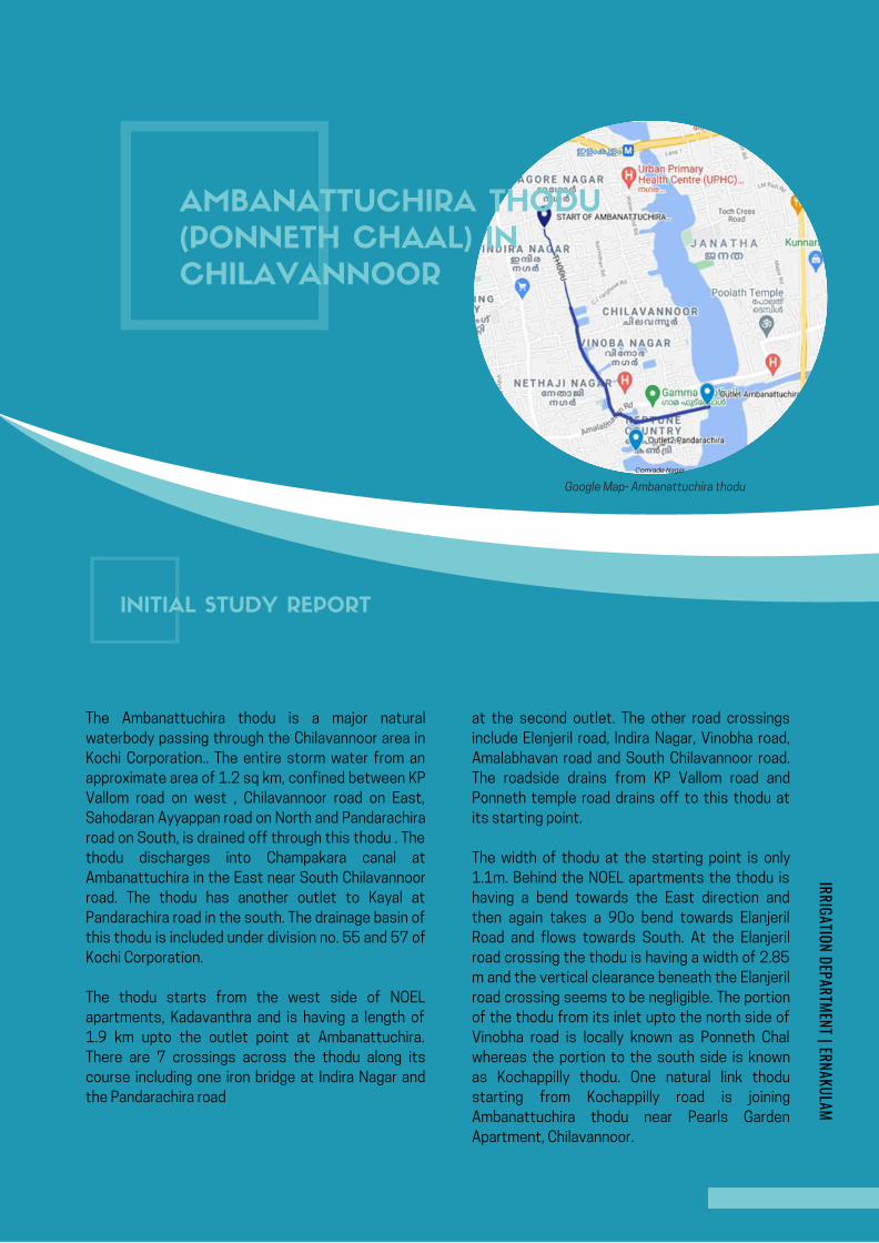
AMBANATTUCHIRA THODU (PONNETH
CHAAL ) IN CHILAVANNOORER .DHANYA K . , | MI SUB DIVISION | ERNAKULAM
KOCHI FLOOD MITIGATION
INITIAL STUDY REPORT
page | 1
AMBANATTUCHIRA THODU (PONNETH
CHAAL ) IN CHILAVANNOORER .DHANYA K . , | MI SUB DIVISION | ERNAKULAM
KOCHI FLOOD MITIGATION
INITIAL STUDY REPORT
The Ambanattuchira thodu is a major natural
waterbody passing through the Chilavannoor area in
Kochi Corporation.. The entire storm water from an
approximate area of 1.2 sq km, confined between KP
Vallom road on west , Chilavannoor road on East,
Sahodaran Ayyappan road on North and Pandarachira
road on South, is drained off through this thodu . The
thodu discharges into Champakara canal at
Ambanattuchira in the East near South Chilavannoor
road. The thodu has another outlet to Kayal at
Pandarachira road in the south. The drainage basin of
this thodu is included under division no. 55 and 57 of
Kochi Corporation.
The thodu starts from the west side of NOEL
apartments, Kadavanthra and is having a length of
1.9 km upto the outlet point at Ambanattuchira.
There are 7 crossings across the thodu along its
course including one iron bridge at Indira Nagar and
the Pandarachira road
Google Map- Ambanattuchira thodu
at the second outlet. The other road crossings
include Elenjeril road, Indira Nagar, Vinobha road,
Amalabhavan road and South Chilavannoor road.
The roadside drains from KP Vallom road and
Ponneth temple road drains off to this thodu at
its starting point.
The width of thodu at the starting point is only
1.1m. Behind the NOEL apartments the thodu is
having a bend towards the East direction and
then again takes a 90o bend towards Elanjeril
Road and flows towards South. At the Elanjeril
road crossing the thodu is having a width of 2.85
m and the vertical clearance beneath the Elanjeril
road crossing seems to be negligible. The portion
of the thodu from its inlet upto the north side of
Vinobha road is locally known as Ponneth Chal
whereas the portion to the south side is known
as Kochappilly thodu. One natural link thodu
starting from Kochappilly road is joining
Ambanattuchira thodu near Pearls Garden
Apartment, Chilavannoor.
AMBANATTUCHIRA THODU
(PONNETH CHAAL) IN
CHILAVANNOOR
Comrade Nagar
Google Map- Ambanattuchira thodu
INITIAL STUDY REPORT
IRRIGATION DEPARTMENT | ERNAKULAM
Page 138
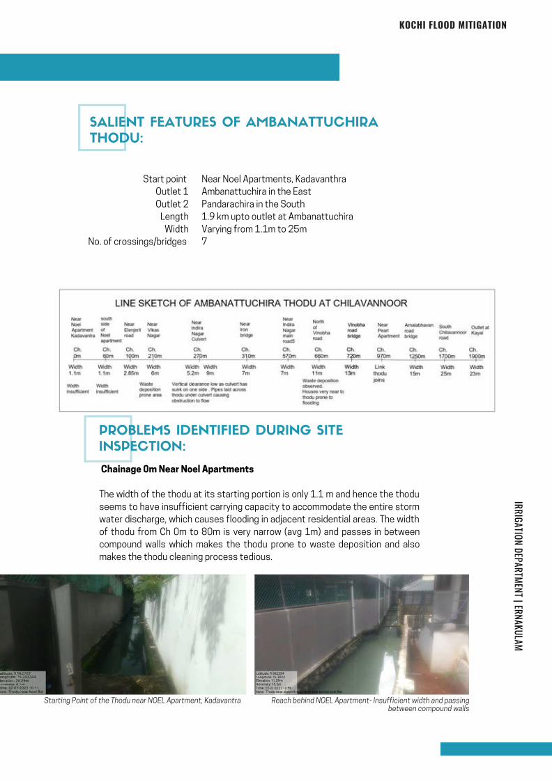
IRRIGATION DEPARTMENT | ERNAKULAMKOCHI FLOOD MITIGATION
Start point
Outlet 1
Outlet 2
Length
Width
No. of crossings/bridges
Near Noel Apartments, Kadavanthra
Ambanattuchira in the East
Pandarachira in the South
1.9 km upto outlet at Ambanattuchira
Varying from 1.1m to 25m
7
Chainage 0m Near Noel Apartments
The width of the thodu at its starting portion is only 1.1 m and hence the thodu
seems to have insufficient carrying capacity to accommodate the entire storm
water discharge, which causes flooding in adjacent residential areas. The width
of thodu from Ch 0m to 80m is very narrow (avg 1m) and passes in between
compound walls which makes the thodu prone to waste deposition and also
makes the thodu cleaning process tedious.
Starting Point of the Thodu near NOEL Apartment, Kadavantra Reach behind NOEL Apartment- Insufficient width and passingbetween compound walls
SALIENT FEATURES OF AMBANATTUCHIRA
THODU:
PROBLEMS IDENTIFIED DURING SITE
INSPECTION:
Page 139
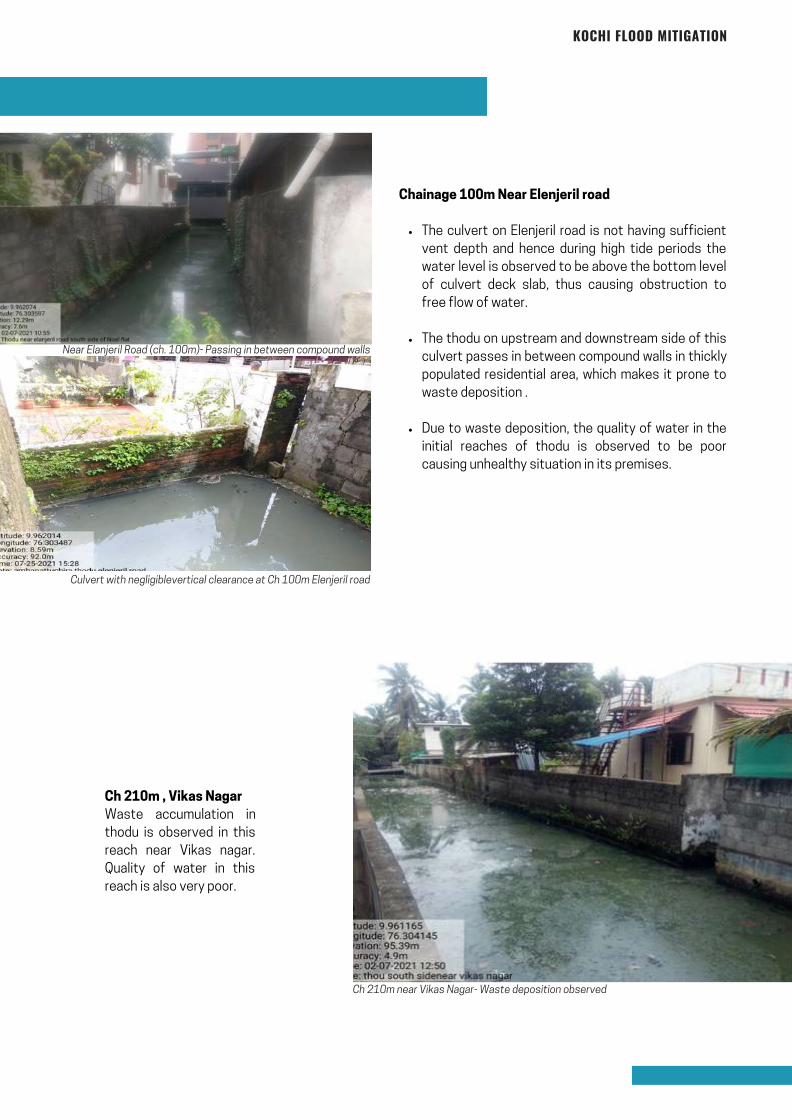
KOCHI FLOOD MITIGATION
The culvert on Elenjeril road is not having sufficient
vent depth and hence during high tide periods the
water level is observed to be above the bottom level
of culvert deck slab, thus causing obstruction to
free flow of water.
The thodu on upstream and downstream side of this
culvert passes in between compound walls in thickly
populated residential area, which makes it prone to
waste deposition .
Due to waste deposition, the quality of water in the
initial reaches of thodu is observed to be poor
causing unhealthy situation in its premises.
Chainage 100m Near Elenjeril road
Near Elanjeril Road (ch. 100m)- Passing in between compound walls
Culvert with negligiblevertical clearance at Ch 100m Elenjeril road
Ch 210m near Vikas Nagar- Waste deposition observed
Ch 210m , Vikas Nagar
Waste accumulation in
thodu is observed in this
reach near Vikas nagar.
Quality of water in this
reach is also very poor.
Page 140
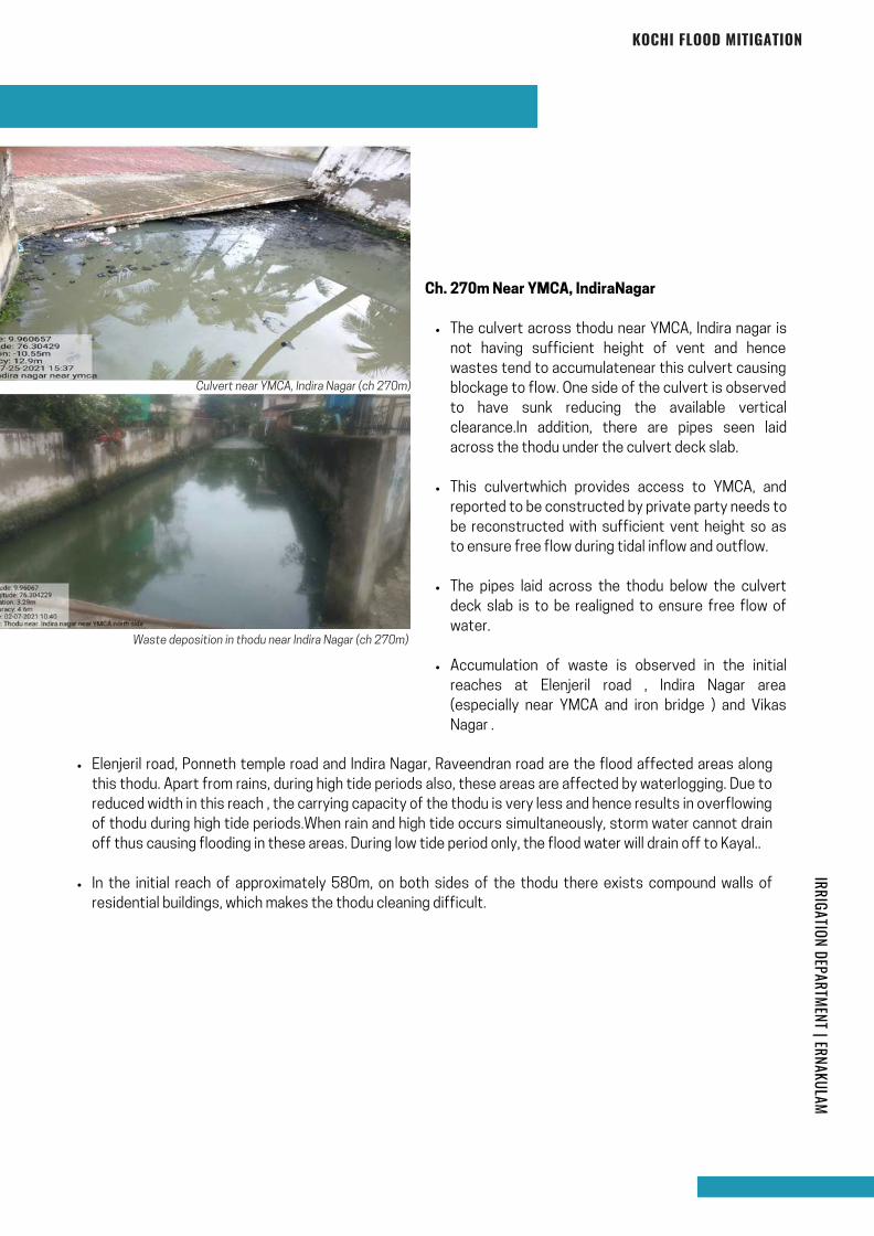
KOCHI FLOOD MITIGATION
The culvert across thodu near YMCA, Indira nagar is
not having sufficient height of vent and hence
wastes tend to accumulatenear this culvert causing
blockage to flow. One side of the culvert is observed
to have sunk reducing the available vertical
clearance.In addition, there are pipes seen laid
across the thodu under the culvert deck slab.
This culvertwhich provides access to YMCA, and
reported to be constructed by private party needs to
be reconstructed with sufficient vent height so as
to ensure free flow during tidal inflow and outflow.
The pipes laid across the thodu below the culvert
deck slab is to be realigned to ensure free flow of
water.
Accumulation of waste is observed in the initial
reaches at Elenjeril road , Indira Nagar area
(especially near YMCA and iron bridge ) and Vikas
Nagar .
Ch. 270m Near YMCA, IndiraNagar
Culvert near YMCA, Indira Nagar (ch 270m)
Waste deposition in thodu near Indira Nagar (ch 270m)
Elenjeril road, Ponneth temple road and Indira Nagar, Raveendran road are the flood affected areas along
this thodu. Apart from rains, during high tide periods also, these areas are affected by waterlogging. Due to
reduced width in this reach , the carrying capacity of the thodu is very less and hence results in overflowing
of thodu during high tide periods.When rain and high tide occurs simultaneously, storm water cannot drain
off thus causing flooding in these areas. During low tide period only, the flood water will drain off to Kayal..
In the initial reach of approximately 580m, on both sides of the thodu there exists compound walls of
residential buildings, which makes the thodu cleaning difficult.
IRRIGATION DEPARTMENT | ERNAKULAM
Page 141
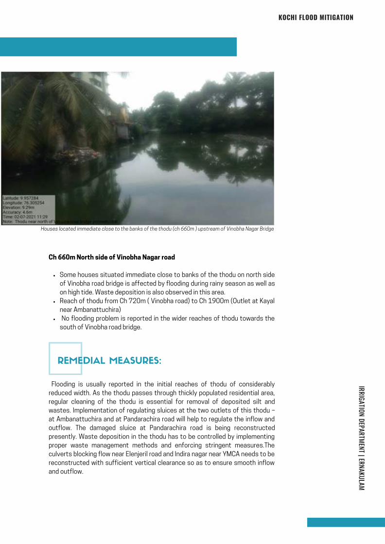
KOCHI FLOOD MITIGATION
Houses located immediate close to the banks of the thodu (ch 660m ) upstream of Vinobha Nagar Bridge
Some houses situated immediate close to banks of the thodu on north side
of Vinobha road bridge is affected by flooding during rainy season as well as
on high tide. Waste deposition is also observed in this area.
Reach of thodu from Ch 720m ( Vinobha road) to Ch 1900m (Outlet at Kayal
near Ambanattuchira)
No flooding problem is reported in the wider reaches of thodu towards the
south of Vinobha road bridge.
Ch 660m North side of Vinobha Nagar road
Flooding is usually reported in the initial reaches of thodu of considerably
reduced width. As the thodu passes through thickly populated residential area,
regular cleaning of the thodu is essential for removal of deposited silt and
wastes. Implementation of regulating sluices at the two outlets of this thodu –
at Ambanattuchira and at Pandarachira road will help to regulate the inflow and
outflow. The damaged sluice at Pandarachira road is being reconstructed
presently. Waste deposition in the thodu has to be controlled by implementing
proper waste management methods and enforcing stringent measures.The
culverts blocking flow near Elenjeril road and Indira nagar near YMCA needs to be
reconstructed with sufficient vertical clearance so as to ensure smooth inflow
and outflow.
REMEDIAL MEASURES:
IRRIGATION DEPARTMENT | ERNAKULAM
Page 142
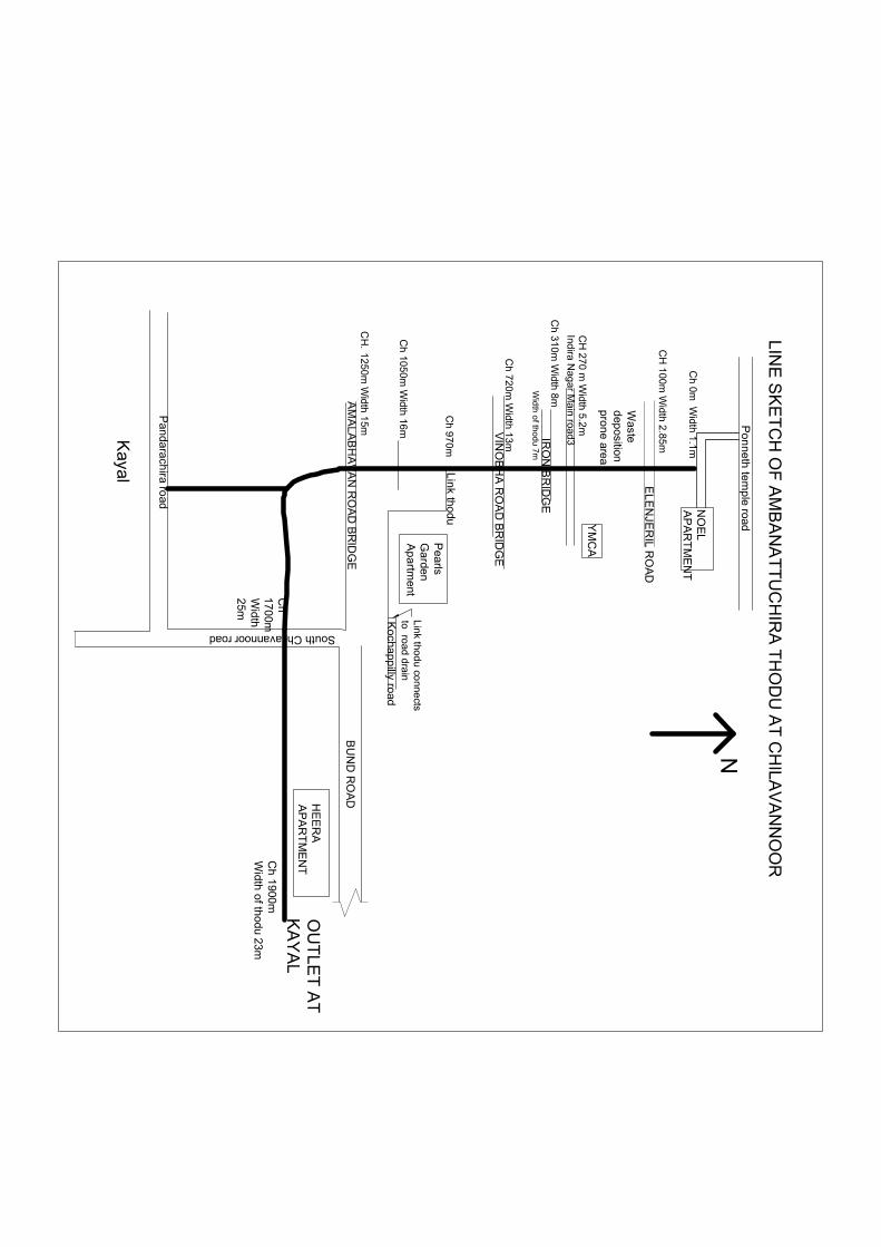
NO
EL
AP
AR
TM
EN
T
EL
EN
JER
IL RO
AD
CH
100m W
idth 2.85m
Ch
0m W
idth 1.1m
CH
270 m W
idth 5.2m
YM
CA
Indira N
agar M
ain
road3IR
ON
BR
IDG
EC
h 31
0m W
idth 8m
VIN
OB
HA
RO
AD
BR
IDG
EC
h 72
0m W
idth 13m
Pea
rlsG
arden
Ap
artm
ent
Kocha
ppilly road
Lin
k thodu
Link thod
u conne
ctsto ro
ad drain
AM
AL
AB
HA
VA
N R
OA
D B
RID
GE
CH
.1
250m W
idth 15m
HE
ER
AA
PA
RT
ME
NT
BU
ND
RO
AD
South Chilavannoor road
Pan
dara
chira ro
ad
OU
TL
ET
AT
KA
YA
LC
h 1
900mW
idth
of th
odu 23m
Ch
170
0mW
idth
25m
Kayal
Ch 9
70m
Po
nn
eth
tem
ple road
LIN
E S
KE
TC
H O
F A
MB
AN
AT
TU
CH
IRA
TH
OD
U A
T C
HILA
VA
NN
OO
R
N
Waste
dep
ositionp
ron
e area
Wid
th o
f thod
u 7m
Ch
1050m
Width
16m
Page 143
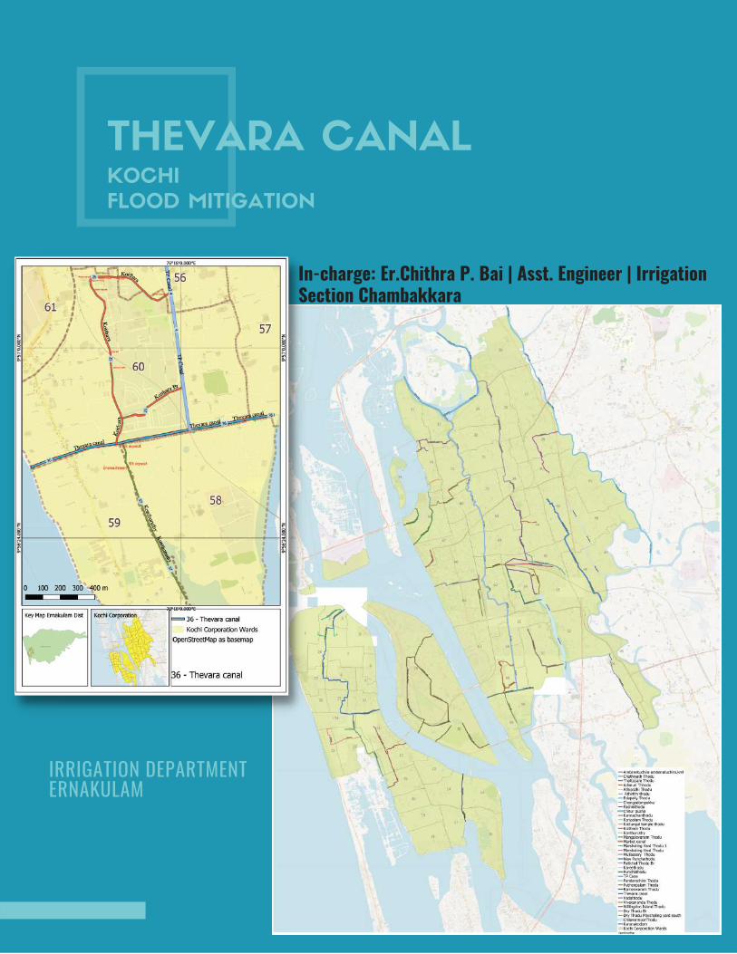
THEVARA CANALKOCHI
FLOOD MITIGATION
In-charge: Er.Chithra P. Bai | Asst. Engineer | IrrigationSection Chambakkara
IRRIGATION DEPARTMENT ERNAKULAM

INTRODUCTION
Kochi is a land of canals and backwater. The Canals Network in Kochi is very
much intertwined with rivers and backwaters. Most of the traditional areas and
heritage zones are connected by such canal system. Thevara canal is one of the
canal in this network. It is starting from vembanadu kayal and ends at
Chilavannur kayal. Thevara canal having length of 1.40 Km and average width of
20m. The average depth of canal is 1.30m. Thevara canal passes through the
ward numbers of 58, 60 and 57 of Kochi Corporation. Koithara canal, Konthuruthy
thodu and Thevara perandoor canal are connected to Thevara canal. Also there
is an another small connecting thodu At ch; 1000m, having a length of 291m and
average width of 2m and average depth of 1m. Through Thevara canal water
from these canals can reach into backwater.
THEVARA CANAL
Starting point of Thevara canal, ch: 0m
IRRIGATION DEPARTMENT | ERNAKULAM
Page 145
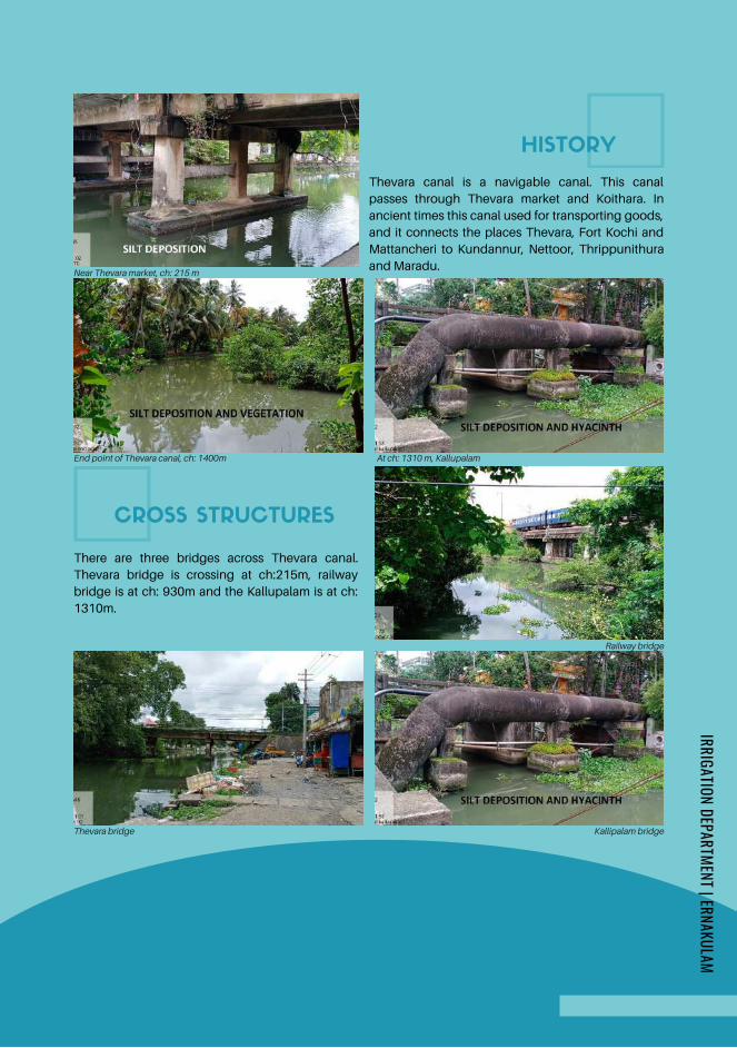
End point of Thevara canal, ch: 1400m At ch: 1310 m, Kallupalam
CROSS STRUCTURES
HISTORY
Near Thevara market, ch: 215 m
Thevara canal is a navigable canal. This canal
passes through Thevara market and Koithara. In
ancient times this canal used for transporting goods,
and it connects the places Thevara, Fort Kochi and
Mattancheri to Kundannur, Nettoor, Thrippunithura
and Maradu.
There are three bridges across Thevara canal.
Thevara bridge is crossing at ch:215m, railway
bridge is at ch: 930m and the Kallupalam is at ch:
1310m.
Railway bridge
Kallipalam bridgeThevara bridge
IRRIGATION DEPARTMENT | ERNAKULAM
Page 146
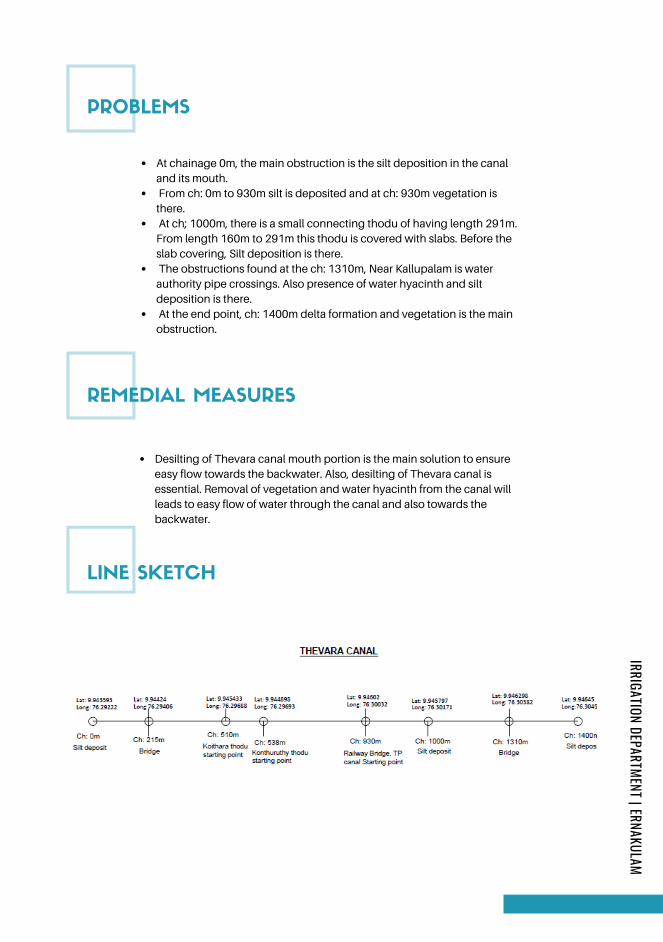
REMEDIAL MEASURES
Desilting of Thevara canal mouth portion is the main solution to ensure
easy flow towards the backwater. Also, desilting of Thevara canal is
essential. Removal of vegetation and water hyacinth from the canal will
leads to easy flow of water through the canal and also towards the
backwater.
LINE SKETCH
PROBLEMS
At chainage 0m, the main obstruction is the silt deposition in the canal
and its mouth.
From ch: 0m to 930m silt is deposited and at ch: 930m vegetation is
there.
At ch; 1000m, there is a small connecting thodu of having length 291m.
From length 160m to 291m this thodu is covered with slabs. Before the
slab covering, Silt deposition is there.
The obstructions found at the ch: 1310m, Near Kallupalam is water
authority pipe crossings. Also presence of water hyacinth and silt
deposition is there.
At the end point, ch: 1400m delta formation and vegetation is the main
obstruction.
IRRIGATION DEPARTMENT | ERNAKULAM
Page 147
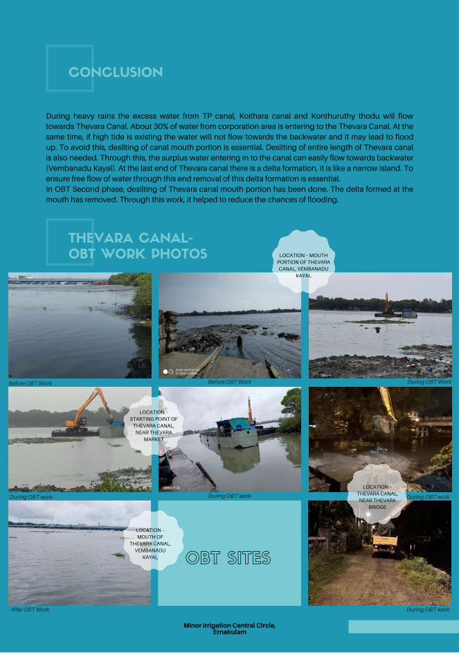
During OBT work
CONCLUSION
In OBT Second phase, desilting of Thevara canal mouth portion has been done. The delta formed at the
mouth has removed. Through this work, it helped to reduce the chances of flooding.
During heavy rains the excess water from TP canal, Koithara canal and Konthuruthy thodu will flow
towards Thevara Canal. About 30% of water from corporation area is entering to the Thevara Canal. At the
same time, if high tide is existing the water will not flow towards the backwater and it may lead to flood
up. To avoid this, desilting of canal mouth portion is essential. Desilting of entire length of Thevara canal
is also needed. Through this, the surplus water entering in to the canal can easily flow towards backwater
(Vembanadu Kayal). At the last end of Thevara canal there is a delta formation, it is like a narrow island. To
ensure free flow of water through this end removal of this delta formation is essential.
THEVARA CANAL-
OBT WORK PHOTOS
During OBT Work
During OBT workAfter OBT Work
During OBT work
Before OBT Work
During OBT work
Before OBT Work
LOCATION – MOUTH
PORTION OF THEVARA
CANAL, VEMBANADU
KAYAL
LOCATION –
STARTING POINT OF
THEVARA CANAL,
NEAR THEVARA
MARKET
LOCATION –
THEVARA CANAL,
NEAR THEVARA
BRIDGE
LOCATION –
MOUTH OF
THEVARA CANAL,
VEMBANADU
KAYAL OBT SITES
Minor irrigation Central Circle,Ernakulam Page 148
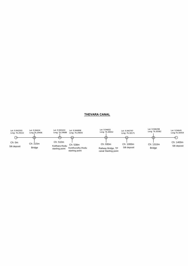
Ch: 0m
Ch: 215m
Ch: 510m
Ch: 538m
Ch: 930m Ch: 1000mCh: 1310m
Ch: 1400m
Bridge
Railway Bridge, TP
canal Starting point
BridgeKonthuruthy thodu
starting point
Koithara thodu
starting point
THEVARA CANAL
Silt deposit
Silt deposit
Lat: 9.943593Long: 76.29222
Lat: 9.94424Long 76.29406
Lat: 9.945433Long: 76.29688
Lat: 9.944898Long: 76.29693
Lat: 9.94602Long: 76.30032
Silt deposit
Lat: 9.945797Long: 76.30171
Lat: 9.946298Long: 76.30382 Lat: 9.94645
Long:76.30459
Page 149
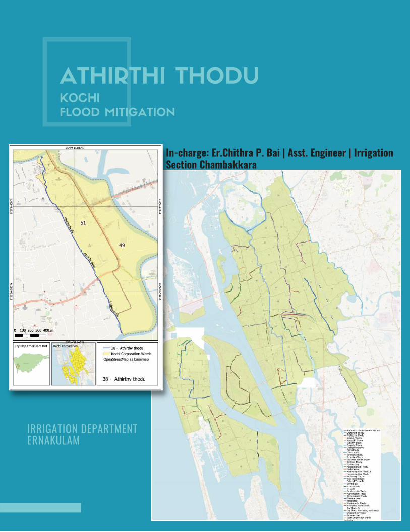
ATHIRTHI THODUKOCHI
FLOOD MITIGATION
IRRIGATION DEPARTMENT ERNAKULAM
In-charge: Er.Chithra P. Bai | Asst. Engineer | IrrigationSection Chambakkara
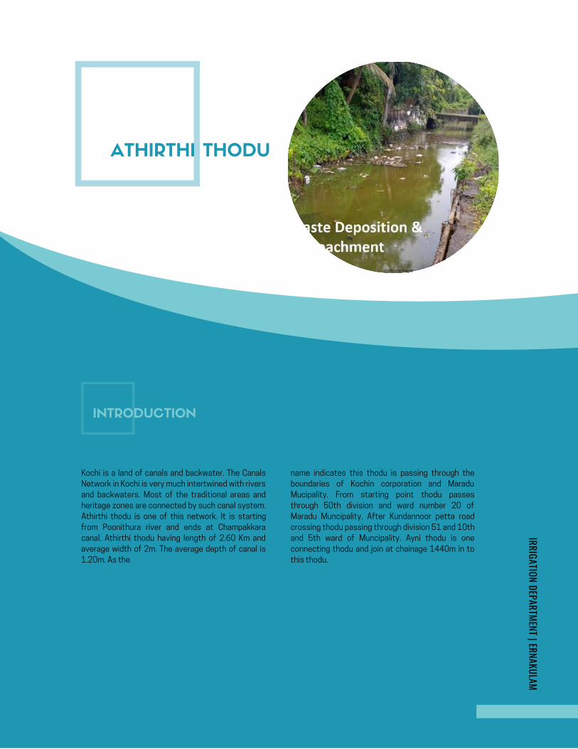
AMBANATTUCHIRA THODU (PONNETH
CHAAL ) IN CHILAVANNOORER .DHANYA K . , | MI SUB DIVISION | ERNAKULAM
KOCHI FLOOD MITIGATION
INITIAL STUDY REPORT
AMBANATTUCHIRA THODU (PONNETH
CHAAL ) IN CHILAVANNOORER .DHANYA K . , | MI SUB DIVISION | ERNAKULAM
KOCHI FLOOD MITIGATION
INITIAL STUDY REPORT
Google Map- Ambanattuchira thodu
ATHIRTHI THODU
Comrade Nagar
INTRODUCTION
Kochi is a land of canals and backwater. The Canals
Network in Kochi is very much intertwined with rivers
and backwaters. Most of the traditional areas and
heritage zones are connected by such canal system.
Athirthi thodu is one of this network. It is starting
from Poonithura river and ends at Champakkara
canal. Athirthi thodu having length of 2.60 Km and
average width of 2m. The average depth of canal is
1.20m. As the
name indicates this thodu is passing through the
boundaries of Kochin corporation and Maradu
Mucipality. From starting point thodu passes
through 50th division and ward number 20 of
Maradu Muncipality. After Kundannoor petta road
crossing thodu passing through division 51 and 10th
and 5th ward of Muncipality. Ayni thodu is one
connecting thodu and join at chainage 1440m in to
this thodu.
IRRIGATION DEPARTMENT | ERNAKULAM
Page 151
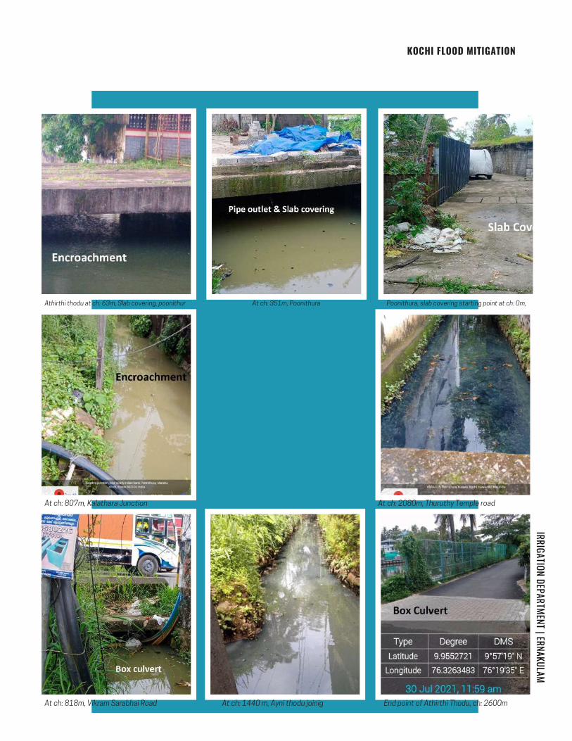
Athirthi thodu at ch: 63m, Slab covering, poonithur
At ch: 807m, Kalathara Junction
At ch: 818m, Vikram Sarabhai Road
At ch: 351m, Poonithura Poonithura, slab covering starting point at ch: 0m,
At ch: 2080m, Thuruthy Temple road
At ch: 1440 m, Ayni thodu joinig End point of Athirthi Thodu, ch: 2600m
IRRIGATION DEPARTMENT | ERNAKULAM
KOCHI FLOOD MITIGATION
Page 152
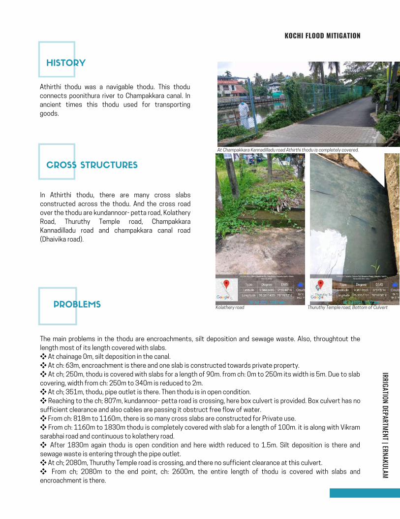
KOCHI FLOOD MITIGATION
IRRIGATION DEPARTMENT | ERNAKULAM
Athirthi thodu was a navigable thodu. This thodu
connects poonithura river to Champakkara canal. In
ancient times this thodu used for transporting
goods.
In Athirthi thodu, there are many cross slabs
constructed across the thodu. And the cross road
over the thodu are kundannoor- petta road, Kolathery
Road, Thuruthy Temple road, Champakkara
Kannadilladu road and champakkara canal road
(Dhaivika road).
At Champakkara Kannadilladu road Athirthi thodu is completely covered.
Kolathery road Thuruthy Temple road, Bottom of Culvert
The main problems in the thodu are encroachments, silt deposition and sewage waste. Also, throughtout the
length most of its length covered with slabs.
❖ At chainage 0m, silt deposition in the canal.
❖ At ch: 63m, encroachment is there and one slab is constructed towards private property.
❖ At ch; 250m, thodu is covered with slabs for a length of 90m. from ch: 0m to 250m its width is 5m. Due to slab
covering, width from ch: 250m to 340m is reduced to 2m.
❖ At ch; 351m, thodu, pipe outlet is there. Then thodu is in open condition.
❖ Reaching to the ch; 807m, kundannoor- petta road is crossing, here box culvert is provided. Box culvert has no
sufficient clearance and also cables are passing it obstruct free flow of water.
❖ From ch: 818m to 1160m, there is so many cross slabs are constructed for Private use.
❖ From ch: 1160m to 1830m thodu is completely covered with slab for a length of 100m. it is along with Vikram
sarabhai road and continuous to kolathery road.
❖ After 1830m again thodu is open condition and here width reduced to 1.5m. Silt deposition is there and
sewage waste is entering through the pipe outlet.
❖ At ch; 2080m, Thuruthy Temple road is crossing, and there no sufficient clearance at this culvert.
❖ From ch; 2080m to the end point, ch: 2600m, the entire length of thodu is covered with slabs and
encroachment is there.
HISTORY
CROSS STRUCTURES
PROBLEMS
Page 153
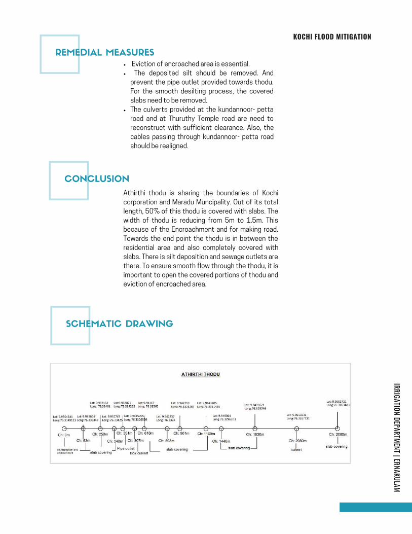
KOCHI FLOOD MITIGATION
IRRIGATION DEPARTMENT | ERNAKULAM
Eviction of encroached area is essential.
The deposited silt should be removed. And
prevent the pipe outlet provided towards thodu.
For the smooth desilting process, the covered
slabs need to be removed.
The culverts provided at the kundannoor- petta
road and at Thuruthy Temple road are need to
reconstruct with sufficient clearance. Also, the
cables passing through kundannoor- petta road
should be realigned.
Athirthi thodu is sharing the boundaries of Kochi
corporation and Maradu Muncipality. Out of its total
length, 50% of this thodu is covered with slabs. The
width of thodu is reducing from 5m to 1.5m. This
because of the Encroachment and for making road.
Towards the end point the thodu is in between the
residential area and also completely covered with
slabs. There is silt deposition and sewage outlets are
there. To ensure smooth flow through the thodu, it is
important to open the covered portions of thodu and
eviction of encroached area.
REMEDIAL MEASURES
CONCLUSION
SCHEMATIC DRAWING
Page 154

KONTHURUTHY THODUKOCHI
FLOOD MITIGATION
In-charge: Er.Chithra P. Bai | Asst. Engineer | IrrigationSection Chambakkara
IRRIGATION DEPARTMENT ERNAKULAM
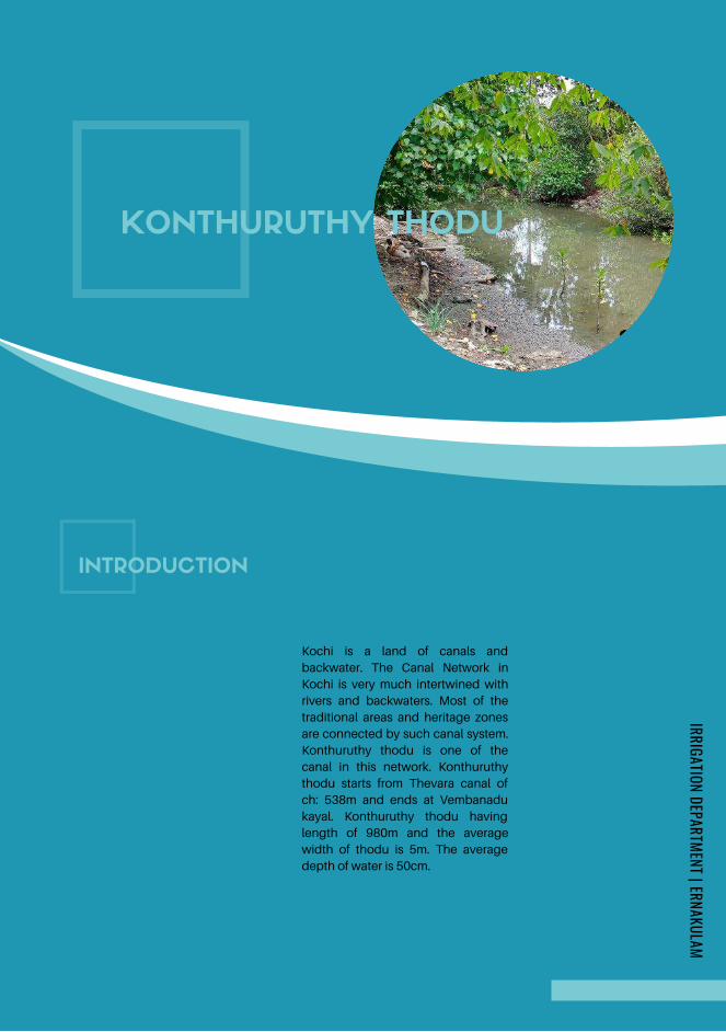
INTRODUCTION
Kochi is a land of canals and
backwater. The Canal Network in
Kochi is very much intertwined with
rivers and backwaters. Most of the
traditional areas and heritage zones
are connected by such canal system.
Konthuruthy thodu is one of the
canal in this network. Konthuruthy
thodu starts from Thevara canal of
ch: 538m and ends at Vembanadu
kayal. Konthuruthy thodu having
length of 980m and the average
width of thodu is 5m. The average
depth of water is 50cm.
KONTHURUTHY THODU
IRRIGATION DEPARTMENT | ERNAKULAM
Page 156
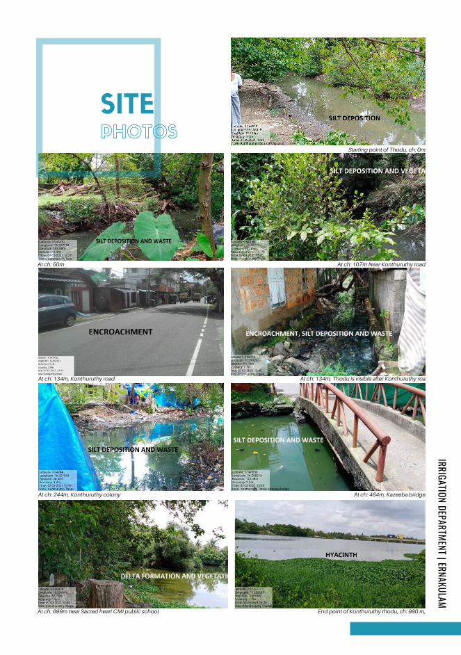
PHOTOS
SITE
At ch: 50m
At ch: 134m, Konthuruthy road
At ch: 244m, Konthuruthy colony
At ch: 699m near Sacred heart CMI public school
At ch: 464m, Kazeeba bridge
End point of Konthuruthy thodu, ch: 980 m,
At ch: 134m, Thodu is visible after Konthuruthy roa
At ch: 107m Near Konthuruthy road
Starting point of Thodu, ch: 0m
IRRIGATION DEPARTMENT | ERNAKULAM
Page 157
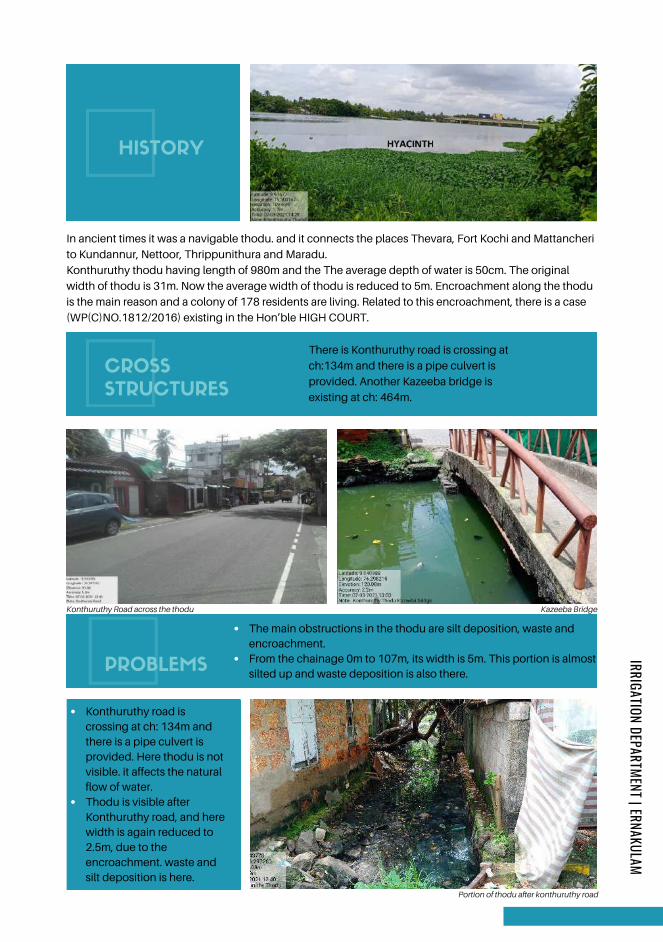
HISTORY
CROSS
STRUCTURES
Konthuruthy thodu having length of 980m and the The average depth of water is 50cm. The original
width of thodu is 31m. Now the average width of thodu is reduced to 5m. Encroachment along the thodu
is the main reason and a colony of 178 residents are living. Related to this encroachment, there is a case
(WP(C)NO.1812/2016) existing in the Hon’ble HIGH COURT.
In ancient times it was a navigable thodu. and it connects the places Thevara, Fort Kochi and Mattancheri
to Kundannur, Nettoor, Thrippunithura and Maradu.
There is Konthuruthy road is crossing at
ch:134m and there is a pipe culvert is
provided. Another Kazeeba bridge is
existing at ch: 464m.
Kazeeba BridgeKonthuruthy Road across the thodu
PROBLEMS
Konthuruthy road is
crossing at ch: 134m and
there is a pipe culvert is
provided. Here thodu is not
visible. it affects the natural
flow of water.
Thodu is visible after
Konthuruthy road, and here
width is again reduced to
2.5m, due to the
encroachment. waste and
silt deposition is here.
The main obstructions in the thodu are silt deposition, waste and
encroachment.
From the chainage 0m to 107m, its width is 5m. This portion is almost
silted up and waste deposition is also there.
Portion of thodu after konthuruthy road
IRRIGATION DEPARTMENT | ERNAKULAM
Page 158
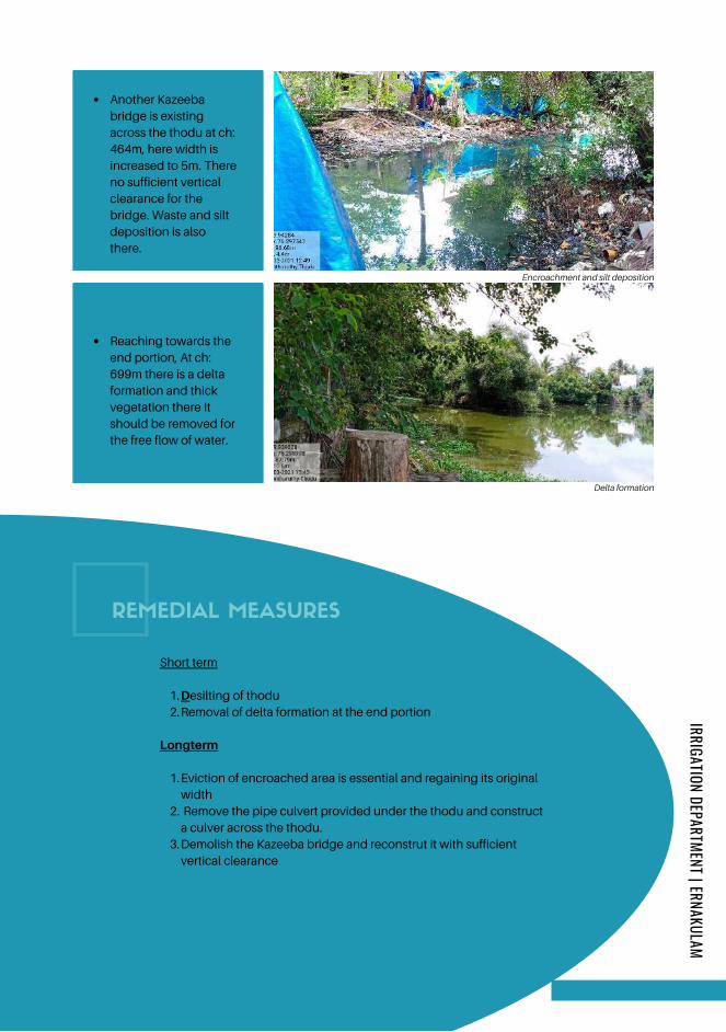
Desilting of thodu
Removal of delta formation at the end portion
Eviction of encroached area is essential and regaining its original
width
Remove the pipe culvert provided under the thodu and construct
a culver across the thodu.
Demolish the Kazeeba bridge and reconstrut it with sufficient
vertical clearance
Short term
1.
2.
Longterm
1.
2.
3.
Another Kazeeba
bridge is existing
across the thodu at ch:
464m, here width is
increased to 5m. There
no sufficient vertical
clearance for the
bridge. Waste and silt
deposition is also
there.
Reaching towards the
end portion, At ch:
699m there is a delta
formation and thick
vegetation there It
should be removed for
the free flow of water.
Encroachment and silt deposition
Delta formation
REMEDIAL MEASURES
IRRIGATION DEPARTMENT | ERNAKULAM
Page 159
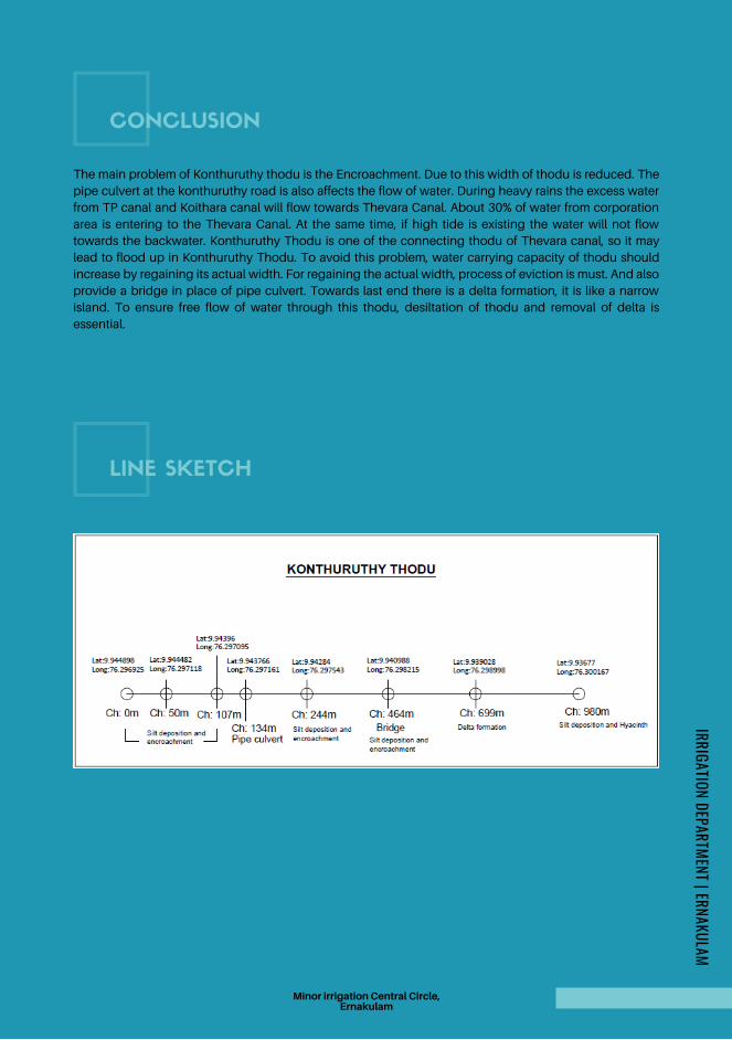
CONCLUSION
The main problem of Konthuruthy thodu is the Encroachment. Due to this width of thodu is reduced. The
pipe culvert at the konthuruthy road is also affects the flow of water. During heavy rains the excess water
from TP canal and Koithara canal will flow towards Thevara Canal. About 30% of water from corporation
area is entering to the Thevara Canal. At the same time, if high tide is existing the water will not flow
towards the backwater. Konthuruthy Thodu is one of the connecting thodu of Thevara canal, so it may
lead to flood up in Konthuruthy Thodu. To avoid this problem, water carrying capacity of thodu should
increase by regaining its actual width. For regaining the actual width, process of eviction is must. And also
provide a bridge in place of pipe culvert. Towards last end there is a delta formation, it is like a narrow
island. To ensure free flow of water through this thodu, desiltation of thodu and removal of delta is
essential.
LINE SKETCH
Minor irrigation Central Circle,Ernakulam
IRRIGATION DEPARTMENT | ERNAKULAM
Page 160
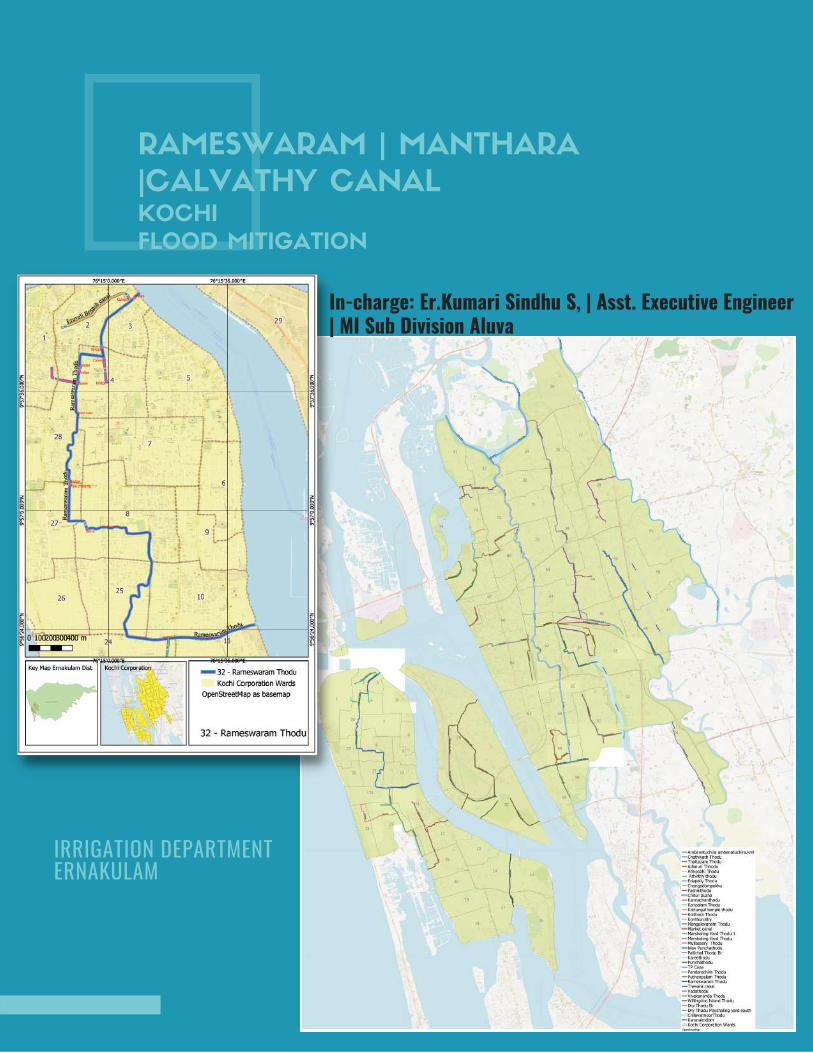
RAMESWARAM | MANTHARA
|CALVATHY CANAL KOCHI
FLOOD MITIGATION
IRRIGATION DEPARTMENT ERNAKULAM
In-charge: Er.Kumari Sindhu S, | Asst. Executive Engineer| MI Sub Division Aluva
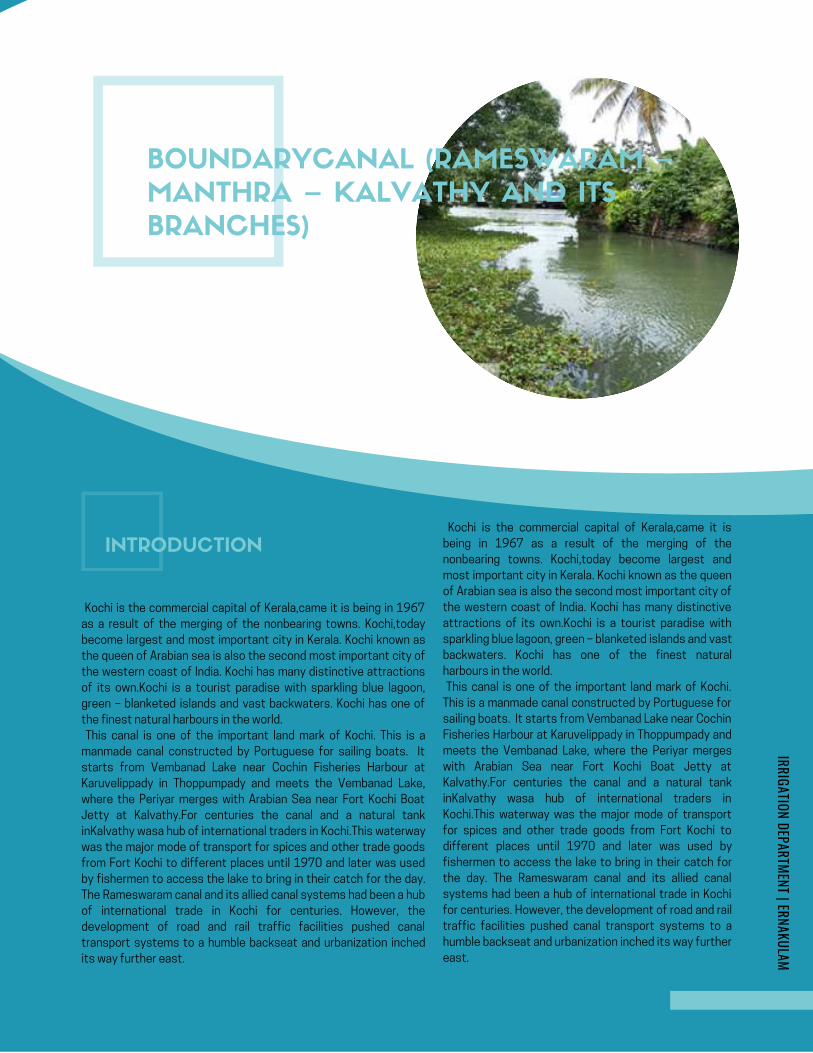
AMBANATTUCHIRA THODU (PONNETH
CHAAL ) IN CHILAVANNOORER .DHANYA K . , | MI SUB DIVISION | ERNAKULAM
KOCHI FLOOD MITIGATION
INITIAL STUDY REPORT
AMBANATTUCHIRA THODU (PONNETH
CHAAL ) IN CHILAVANNOORER .DHANYA K . , | MI SUB DIVISION | ERNAKULAM
KOCHI FLOOD MITIGATION
INITIAL STUDY REPORT
Google Map- Ambanattuchira thodu
BOUNDARYCANAL (RAMESWARAM –
MANTHRA – KALVATHY AND ITS
BRANCHES)
INTRODUCTION
Kochi is the commercial capital of Kerala,came it is being in 1967
as a result of the merging of the nonbearing towns. Kochi,today
become largest and most important city in Kerala. Kochi known as
the queen of Arabian sea is also the second most important city of
the western coast of India. Kochi has many distinctive attractions
of its own.Kochi is a tourist paradise with sparkling blue lagoon,
green – blanketed islands and vast backwaters. Kochi has one of
the finest natural harbours in the world.
This canal is one of the important land mark of Kochi. This is a
manmade canal constructed by Portuguese for sailing boats. It
starts from Vembanad Lake near Cochin Fisheries Harbour at
Karuvelippady in Thoppumpady and meets the Vembanad Lake,
where the Periyar merges with Arabian Sea near Fort Kochi Boat
Jetty at Kalvathy.For centuries the canal and a natural tank
inKalvathy wasa hub of international traders in Kochi.This waterway
was the major mode of transport for spices and other trade goods
from Fort Kochi to different places until 1970 and later was used
by fishermen to access the lake to bring in their catch for the day.
The Rameswaram canal and its allied canal systems had been a hub
of international trade in Kochi for centuries. However, the
development of road and rail traffic facilities pushed canal
transport systems to a humble backseat and urbanization inched
its way further east.
Kochi is the commercial capital of Kerala,came it is
being in 1967 as a result of the merging of the
nonbearing towns. Kochi,today become largest and
most important city in Kerala. Kochi known as the queen
of Arabian sea is also the second most important city of
the western coast of India. Kochi has many distinctive
attractions of its own.Kochi is a tourist paradise with
sparkling blue lagoon, green – blanketed islands and vast
backwaters. Kochi has one of the finest natural
harbours in the world.
This canal is one of the important land mark of Kochi.
This is a manmade canal constructed by Portuguese for
sailing boats. It starts from Vembanad Lake near Cochin
Fisheries Harbour at Karuvelippady in Thoppumpady and
meets the Vembanad Lake, where the Periyar merges
with Arabian Sea near Fort Kochi Boat Jetty at
Kalvathy.For centuries the canal and a natural tank
inKalvathy wasa hub of international traders in
Kochi.This waterway was the major mode of transport
for spices and other trade goods from Fort Kochi to
different places until 1970 and later was used by
fishermen to access the lake to bring in their catch for
the day. The Rameswaram canal and its allied canal
systems had been a hub of international trade in Kochi
for centuries. However, the development of road and rail
traffic facilities pushed canal transport systems to a
humble backseat and urbanization inched its way further
east.
IRRIGATION DEPARTMENT | ERNAKULAM
Page 162
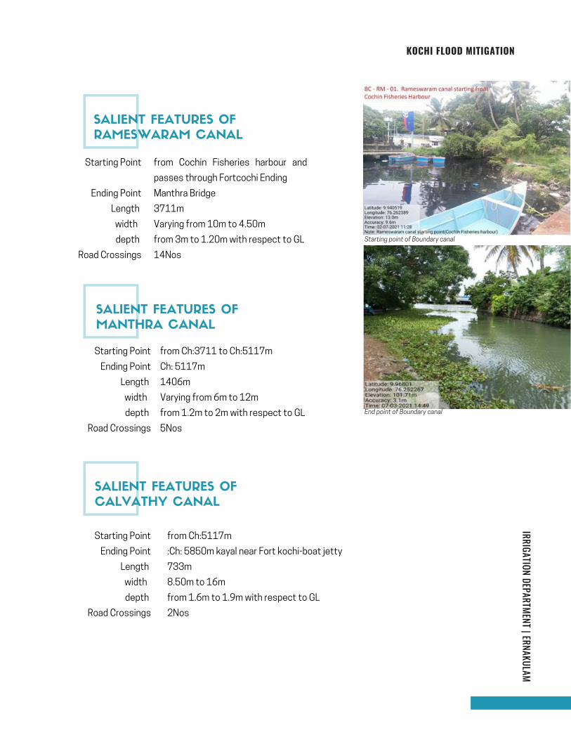
IRRIGATION DEPARTMENT | ERNAKULAMKOCHI FLOOD MITIGATION
Starting Point
Ending Point
Length
width
depth
Road Crossings
Starting point of Boundary canal
End point of Boundary canal
from Cochin Fisheries harbour and
passes through Fortcochi Ending
Manthra Bridge
3711m
Varying from 10m to 4.50m
from 3m to 1.20m with respect to GL
14Nos
from Ch:3711 to Ch:5117m
Ch: 5117m
1406m
Varying from 6m to 12m
from 1.2m to 2m with respect to GL
5Nos
Starting Point
Ending Point
Length
width
depth
Road Crossings
from Ch:5117m
:Ch: 5850m kayal near Fort kochi-boat jetty
733m
8.50m to 16m
from 1.6m to 1.9m with respect to GL
2Nos
Starting Point
Ending Point
Length
width
depth
Road Crossings
SALIENT FEATURES OF
RAMESWARAM CANAL
SALIENT FEATURES OF
MANTHRA CANAL
SALIENT FEATURES OF
CALVATHY CANAL
Page 163
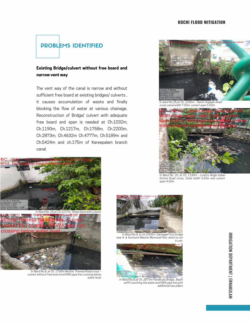
IRRIGATION DEPARTMENT | ERNAKULAMKOCHI FLOOD MITIGATION
In ward No.25,at Ch. 1032m – Santo Gopalan Roadcross canal width 7.50m, culvert span 5.50m
In Ward No. 25, at Ch. 1190m – Loretto Anglo IndianSchool Road cross, Canal width 6.50m and culvertspan 4.50m
Existing Bridge/culvert without free board and
narrow vent way
The vent way of the canal is narrow and without
sufficient free board at existing bridges/ culverts ,
it causes accumulation of waste and finally
blocking the flow of water at various chainage.
Reconstruction of Bridge/ culvert with adequate
free board and span is needed at Ch.1032m,
Ch.1190m, Ch.1217m, Ch.1758m, Ch.2200m,
Ch.2873m, Ch.4632m Ch.4777m, Ch.5189m and
Ch.5424m and ch.175m of Kareepalam branch
canal.
In Ward No. 25,at Ch.1217m- Sharp bend with culvert
In Ward No.8, at Ch. 1758m Mother Theresa Road cross –culvert without free board and KWA pipe line crossing below
water level
In Ward No.8, at ch.2200m- Damaged Foot bridgenear A .A. Kochunni Master Memorial Park, which is not
in use.
In Ward No.8,at Ch. 2873m Pandikudy Bridge , Beamsoffit touching the water and KWA pipe line with
additional two pillars
PROBLEMS IDENTIFIED
Page 164
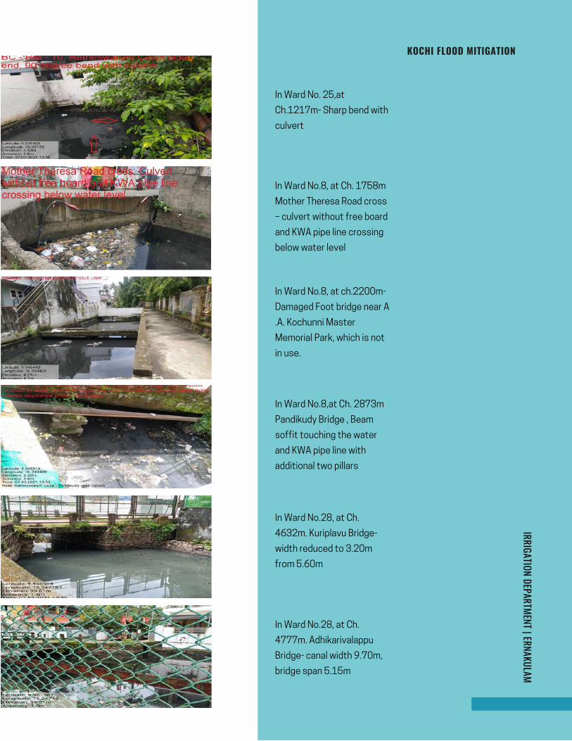
page | 4
IRRIGATION DEPARTMENT | ERNAKULAMKOCHI FLOOD MITIGATION
In Ward No. 25,at
Ch.1217m- Sharp bend with
culvert
In Ward No.8, at Ch. 1758m
Mother Theresa Road cross
– culvert without free board
and KWA pipe line crossing
below water level
In Ward No.8, at ch.2200m-
Damaged Foot bridge near A
.A. Kochunni Master
Memorial Park, which is not
in use.
In Ward No.8,at Ch. 2873m
Pandikudy Bridge , Beam
soffit touching the water
and KWA pipe line with
additional two pillars
In Ward No.28, at Ch.
4632m. Kuriplavu Bridge-
width reduced to 3.20m
from 5.60m
In Ward No.28, at Ch.
4777m. Adhikarivalappu
Bridge- canal width 9.70m,
bridge span 5.15m
Page 165
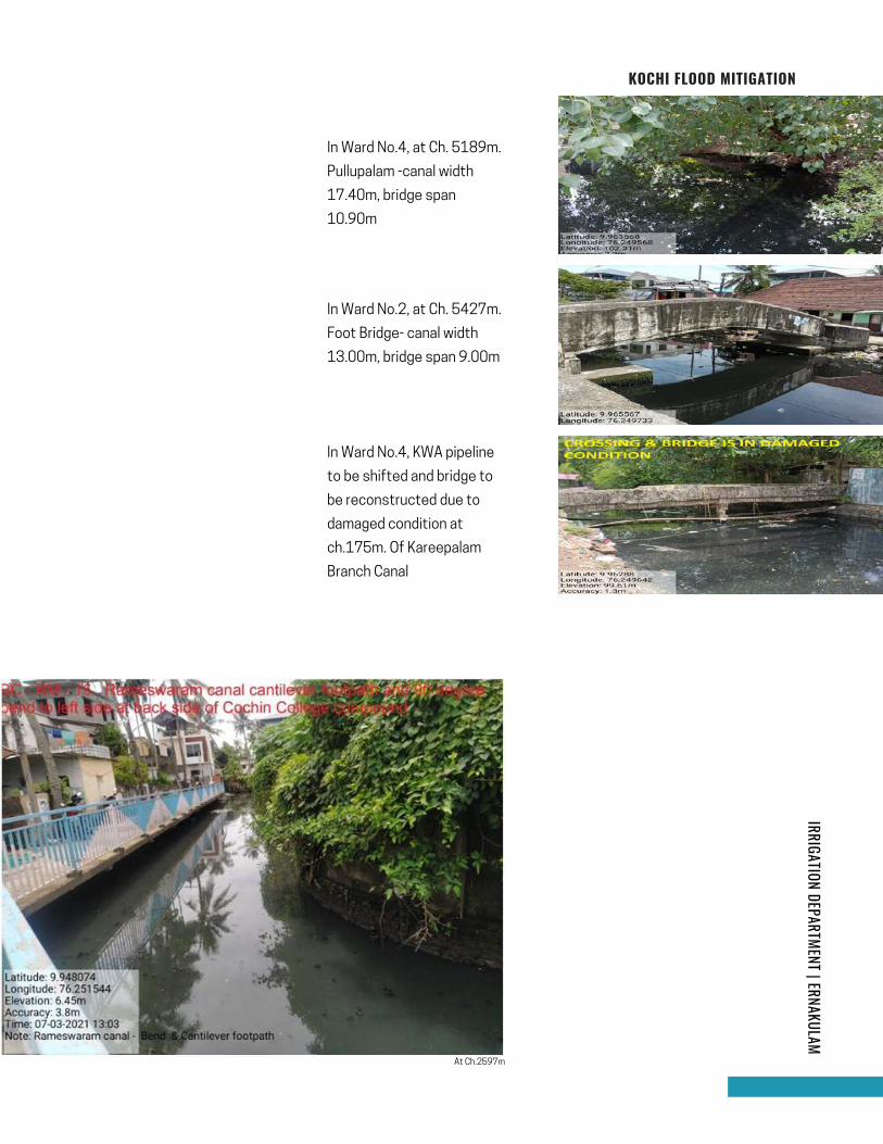
IRRIGATION DEPARTMENT | ERNAKULAMKOCHI FLOOD MITIGATION
In Ward No.4, at Ch. 5189m.
Pullupalam -canal width
17.40m, bridge span
10.90m
In Ward No.2, at Ch. 5427m.
Foot Bridge- canal width
13.00m, bridge span 9.00m
In Ward No.4, KWA pipeline
to be shifted and bridge to
be reconstructed due to
damaged condition at
ch.175m. Of Kareepalam
Branch Canal
At Ch.2597m
Page 166
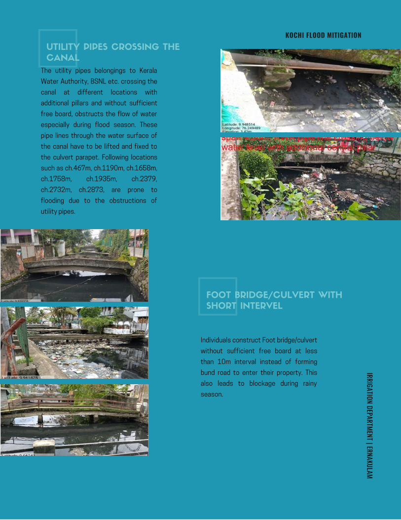
IRRIGATION DEPARTMENT | ERNAKULAMKOCHI FLOOD MITIGATION
The utility pipes belongings to Kerala
Water Authority, BSNL etc. crossing the
canal at different locations with
additional pillars and without sufficient
free board, obstructs the flow of water
especially during flood season. These
pipe lines through the water surface of
the canal have to be lifted and fixed to
the culvert parapet. Following locations
such as ch.467m, ch.1190m, ch.1658m,
ch.1758m, ch.1935m, ch.2379,
ch.2732m, ch.2873, are prone to
flooding due to the obstructions of
utility pipes.
Individuals construct Foot bridge/culvert
without sufficient free board at less
than 10m interval instead of forming
bund road to enter their property. This
also leads to blockage during rainy
season.
UTILITY PIPES CROSSING THE
CANAL
FOOT BRIDGE/CULVERT WITH
SHORT INTERVEL
Page 167
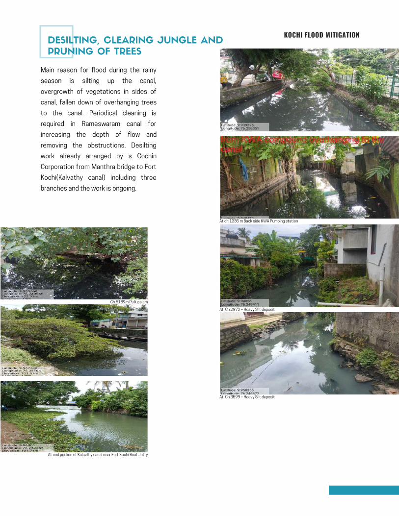
KOCHI FLOOD MITIGATION
Main reason for flood during the rainy
season is silting up the canal,
overgrowth of vegetations in sides of
canal, fallen down of overhanging trees
to the canal. Periodical cleaning is
required in Rameswaram canal for
increasing the depth of flow and
removing the obstructions. Desilting
work already arranged by s Cochin
Corporation from Manthra bridge to Fort
Kochi(Kalvathy canal) including three
branches and the work is ongoing.
At.ch.1335 m Back side KWA Pumping station
Ch.5189m Pullupalam
At end portion of Kalavthy canal near Fort Kochi Boat Jetty
At. Ch.3599 – Heavy Silt deposit
At. Ch.2972 – Heavy Silt deposit
DESILTING, CLEARING JUNGLE AND
PRUNING OF TREES
Page 168

KOCHI FLOOD MITIGATION
Disposal of solid waste into the canal causes pollution of
waterbody due to waste accumulated the flow of the canal
has been reduced drastically. The catchment area of the
canal is densely populated and hence the canal is subjected
to variety of pollutants such as municipal sewage, organic,
plastic waste, etc. Waste pipe lines from houses is given
directly in to the canal also causes pollution of water.
Stringent measures need to be taken to prevent discharge
of such waste and sewerage to canal.
In Ward No.8, at Ch.
1758m Mother
Theresa Road cross –
culvert
In Ward No.8, at.ch.
2100m of
Rameswaram canal
at Statue Road
crossing waste
accumulation
identified
In Ward No.8,at
Ch.2379m-of
Rameswaram canal
crosses
M.A. Ragavan road
heavy waste
accumulation
In Ward No.8,at Ch. 2873m Pandikudy Bridge , Waste depositedIn Ward No.8, at Koovappadam branch thodu joins to Rameswaram canal near ch.2392m
In Ward No.28, at Ch. 4390m of Zebra palam ,Waste Deposited In Ward No.28, at Ch. 4777m.Adhikarivalappu Bridge- Waste deposited
Koovappadam branch canal starting point ch.0.00m Koovappadam branch canal joins to Rameswaram canal near ch.2392m
The Boundary canal has 4
branches namely Koovappadam
branch, Kuriplavu Branch,
Kareeppalam Branch and Eruvely
Branch.
Koovappadam branch canal
visible from Cochin College
Junction, upstream portion of the
canal is fully covered with slab,
having length of 161m, starting
width 2.6m and ending width 6m
joins near ch:2392m of
Rameswaram canal.
DISPOSAL OF SOLID WASTE AND WASTE
WATER INTO NATURAL DRAIN
Page 169
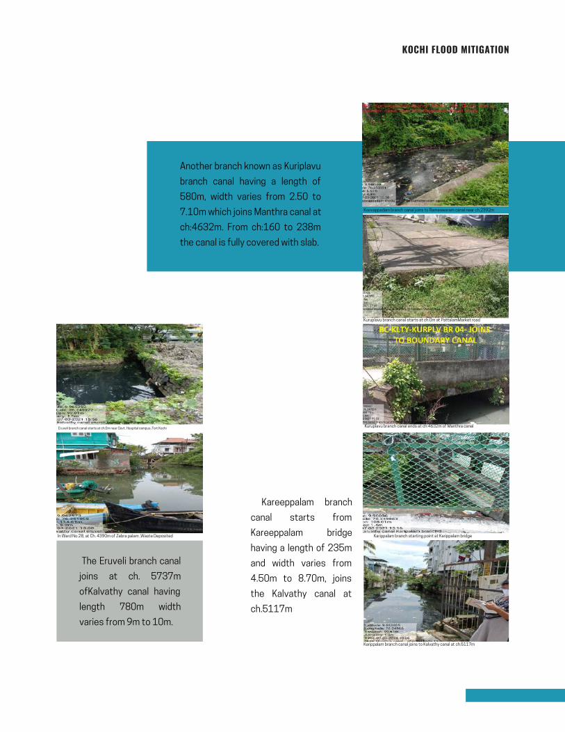
KOCHI FLOOD MITIGATION
Another branch known as Kuriplavu
branch canal having a length of
580m, width varies from 2.50 to
7.10m which joins Manthra canal at
ch:4632m. From ch:160 to 238m
the canal is fully covered with slab.
Koovappadam branch canal joins to Rameswaram canal near ch.2392m
Kuruplavu branch canal starts at ch:0m at PattalamMarket road
Kuruplavu branch canal ends at ch:4632m of Manthra canal Eruveli branch canal starts at ch:0m near Govt. Hospital campus, Fort Kochi
In Ward No.28, at Ch. 4390m of Zebra palam ,Waste Deposited Karippalam branch starting point at Karippalam bridge
Karippalam branch canal joins to Kalvathy canal at ch.5117m
Kareeppalam branch
canal starts from
Kareeppalam bridge
having a length of 235m
and width varies from
4.50m to 8.70m, joins
the Kalvathy canal at
ch.5117m
The Eruveli branch canal
joins at ch. 5737m
ofKalvathy canal having
length 780m width
varies from 9m to 10m.
Page 170
KOCHI FLOOD MITIGATION
Boundary canal begins and ends at Vembanad Kayal . But during high and low tide, water does not flow
through the canals. This happens because the bed level of the canal has silted up significantly over the
years as result of not desilting the thodu. If it is to be deepened according to the present bed level, there is
a chance that the side walls might collapse, because both the sides of the canal have walls. In various
reaches, it’s even difficult to reach the canal due to these sidewalls. But in the past, this canal was a route
for several houseboats for trading. Then this canal would have been at least 15m wide back then. But now
it has been reduced to 4m in many places. Moreover, sewage waste is also being discharged directly into
this canal at many places. A number of bridges with reduced widths and clearance has been built close to
each other. These bridges were constructed either by government agency or private people according to
their own needs and wishes.
It is necessary to desilting the mouth of Kayal from which the thodu starts and ends which must be lower
than the bed level of the thodu for the easy inflow and out flow of the thodu.
1. Coast guard is constructing a berth in
front of the Calvathy canal mouth near Fort
Kochi Boat Jetty. This is even dangerous for
the ships coming in, as there is a good
chance for accidents to occur and also
prevents tidal flow into the canal system
and its outflow. This is definitely going to
have a great impact on the inflow and
outflow of water. To have a proper inflow and
outflow there should not be any sort of
obstruction at the mouth of the canal.So
there is aprobability of reverse flow of water
and it may cause flood up on either side of
thodu.
2. The dock they are building near old
Harbour bridge at Willingdon Island also
obstructs the free flow of low tide and high
tide. These two constructions are
obstructing the flow of water.
MORE PROBLEMS IDENTIFIED
NEW CONSTRUCTIONS COMING UP
OBSTRUCTING FLOW
Page 171
KOCHI FLOOD MITIGATION
For avoiding blockage / flood during rainy season the following measures are required. Cleaning of
canal, encroachment eviction, widening of canal at narrow places and maintaining same cross -section,
reconsruction of culvert with sufficient span and free board, replacing the KWA pipe lines to parapet,
forming side roads and removingunnecessary culverts/FB constructed by individuals, removing waste pipe
line/soil pipe from house hold directly discharging into the canal etc.
1.Cleaning of canal including clearing jungle&tree pruning for improving the flow of water.
2.Replacing the KWA pipe lines to parapet
3.Removing all waste lines directly to the canal including sewage waste strictly.
Short term
Longterm
1.Reconstruction of the bridges/culverts which causing obstruction.
2.Widening of canal at narrow places and maintaining same cross –section.
3. Removingunnecessary culverts/FB constructed by individuals.
4.Desilting of the thodu and mouth of Kayal at starting portion and end portion, for improving the easy flow
of water and storage capacity of the thodu.
5. In the starting portion, near Cochin fisheries Harbour, the width of the thodu is 12m. Gradually it is
decreased to 4 to 7m for an approximate length of 4.00km. During the rainy season, it is expected that
that the water enters in to the thodu from the catchment area of 800 Hectare. If the precipitation of storm
is 10cm/day. Then the discharge through canal is about 19m³/s. For this discharge, the required width of
the thodu is 12m for the easy flow water. Hence it is necessary to maintain width of the thodu from 4m to
10m is 12m.
The proposals for ensuring the free flow of water through the canal will revive the entire canal system. This
will definitely control the flooding of the area during rainy season .The mosquito menace will be controlled
due to the tidal water flow. Tourism sector will also be benefitted with the revamped clean canal. Hence the
proposal will help to improve the overall living conditions of the entire West Kochi.
REMEDIAL MEASURES
CONCLUSION
Page 172
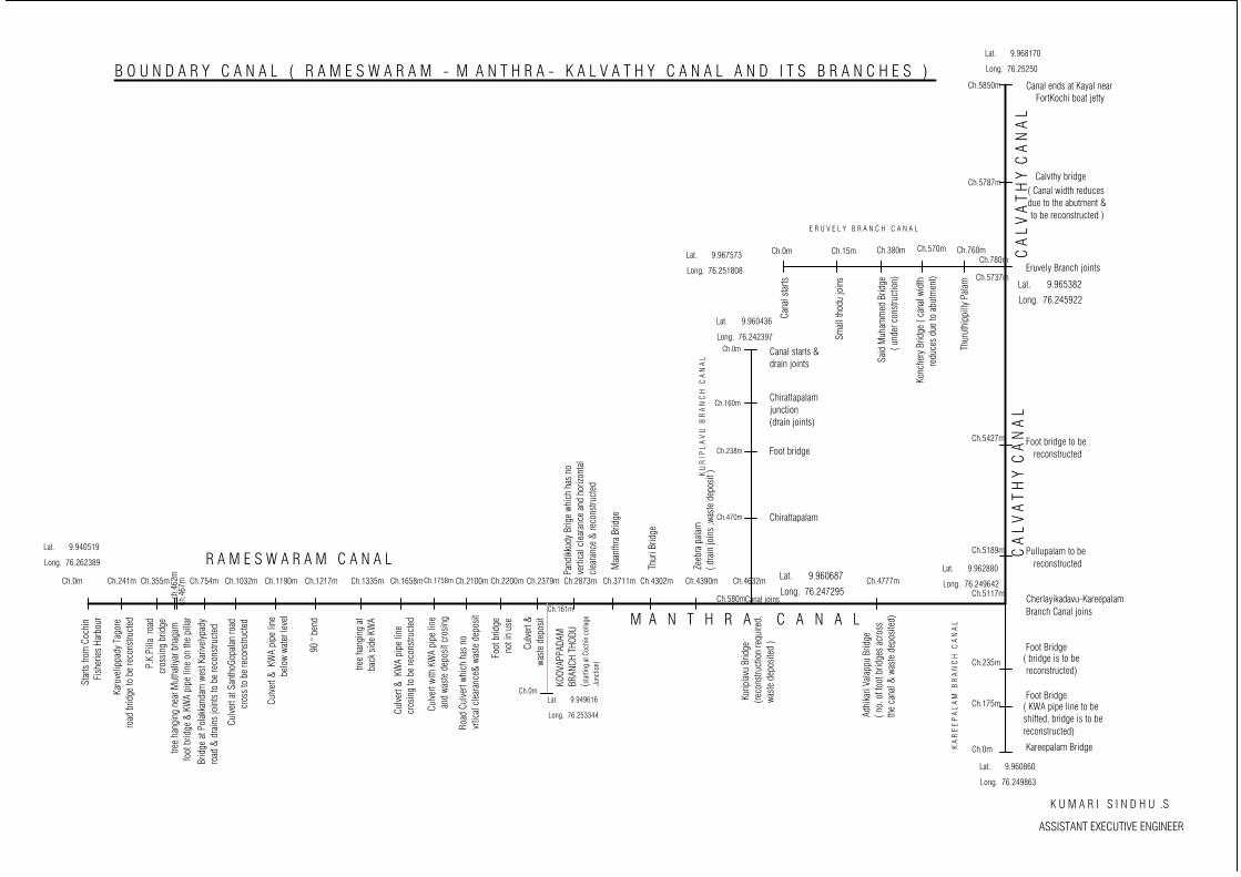
Ch.0m
Lat. 9.940519
Long. 76.262389
Ch.241m Ch.355m Ch.754m Ch.3711mCh.2873mCh.2379mCh.2200mCh.2100mCh.1032m Ch.1335m Ch.1758mCh.1658m Ch.4632mCh.4302m Ch.4390m Ch.4777mCh.5117m
Ch.0m
Ch.175m
Ch.235m
Ch.0m
Ch.160m
Ch.470m
Ch.5189m
Ch.5427m
Ch.5850m
Ch.0m Ch.15m Ch.380m Ch.570m Ch.760m
Ch.5737m
Ch.5787m
Canal starts &drain joints
Ch.780m
Ch.0m
KOOV
APPA
DAM
BRAN
CH T
HODU
(sta
rting
at C
ochi
n co
llage
Junc
tion)
K A
R E
E P
A L
A M
B
R A
N C
H C
A N
A L
B O U N D A R Y C A N A L ( R A M E S W A R A M - M A N T H R A - K A L V A T H Y C A N A L A N D I T S B R A N C H E S )Canal ends at Kayal near FortKochi boat jetty
Calvthy bridge( Canal width reducesdue to the abutment & to be reconstructed )
Eruvely Branch joints
Foot bridge to be reconstructed
Pullupalam to be reconstructed
Kareepalam Bridge
Foot Bridge( KWA pipe line to beshifted, bridge is to bereconstructed)
Foot Bridge( bridge is to be reconstructed)
Cherlayikadavu-KareepalamBranch Canal joins
C A
L V
A T
H Y
C A
N A
L
R A M E S W A R A M C A N A L
K U
R I P
L A
V U
B
R A
N C
H C
A N
A L
E R U V E L Y B R A N C H C A N A L
Star
ts fr
om C
ochi
n F
ishe
ries
Harb
our
Kar
uvel
ippa
dy T
agor
ero
ad b
ridge
to b
e re
cons
truct
ed
P.K
.Pill
a ro
adcr
ossi
ng b
ridge
ch.4
62m
ch.4
67m
tre
e ha
ngin
g ne
ar M
utha
liyar
bha
gam
foot
brid
ge &
KW
A pi
pe li
ne o
n th
e pi
llar
Brid
ge a
t Pol
akka
ndam
wes
t Kar
ivel
ypad
yro
ad &
dra
ins
join
ts to
be
reco
nstru
cted
Culv
ert a
t San
thoG
opal
an ro
ad
c
ross
to b
e re
cons
truct
ed
Ch.1190m
Culv
ert &
KW
A pi
pe li
ne
be
low
wate
r lev
el
Ch.1217m
tree
hang
ing
atba
ck s
ide
KWA
Culv
ert &
KW
A pi
pe li
necr
osin
g to
be
reco
nstru
cted
Culv
ert w
ith K
WA
pipe
line
and
was
te d
epos
it cr
osin
g
Road
Cul
vert
whic
h ha
s no
vrtic
al c
lear
ance
& w
aste
dep
osit
Foot
brid
ge n
ot in
use
Cu
lver
t & w
aste
dep
osit
Ch.161m
Pand
ikkud
y Br
ige
whic
h ha
s no
verti
cal c
lear
ance
and
hor
izont
alcl
eara
nce
& re
cons
truct
ed
Maa
nthr
a Br
idge
Thur
i Brid
ge
Zeeb
ra p
alam
( dra
in jo
ins
,was
te d
epos
it )
Kur
ipla
vu B
ridge
(reco
nstru
ctio
n re
quire
d,wa
ste
depo
site
d )
Adhi
kari
Vala
ppu
Brid
ge( n
o. o
f foo
t brid
ges
acro
ssth
e ca
nal &
was
te d
epos
ited)
Cana
l sta
rts
Smal
l tho
du jo
ins
Said
Muh
amm
ed B
ridge
(
und
er c
onst
ruct
ion)
Konc
hery
Brid
ge (
cana
l wid
th
re
duce
s du
e to
abu
tmen
t)
Thur
uthi
ppill
y Pa
lam
Chirattapalamjunction(drain joints)
Ch.238m Foot bridge
Chirattapalam
Ch.580mCanal joins
K U M A R I S I N D H U .S
ASSISTANT EXECUTIVE ENGINEER
M A N T H R A C A N A L
C A
L V
A T
H Y
C A
N A
L
Lat. 9.949616
Long. 76.253344
Lat. 9.960436
Long. 76.242397
Lat. 9.960687
Long. 76.247295
Lat. 9.960860
Long. 76.249863
Lat. 9.962880
Long. 76.249642
Lat. 9.967573
Long. 76.251808
Lat. 9.965382
Long. 76.245922
Lat. 9.968170
Long. 76.25250
Page 173
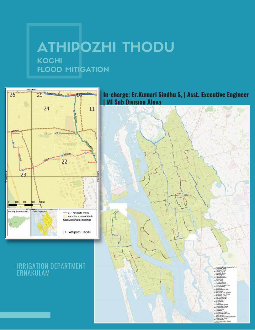
ATHIPOZHI THODUKOCHI
FLOOD MITIGATION
In-charge: Er.Kumari Sindhu S, | Asst. Executive Engineer| MI Sub Division Aluva
IRRIGATION DEPARTMENT ERNAKULAM
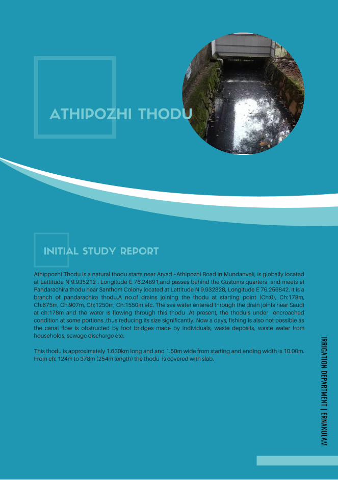
INITIAL STUDY REPORT
ATHIPOZHI THODU
Athippozhi Thodu is a natural thodu starts near Aryad –Athipozhi Road in Mundanveli, is globally located
at Lattitude N 9.935212 . Longitude E 76.24891,and passes behind the Customs quarters and meets at
Pandarachira thodu near Santhom Colony located at Lattitude N 9.932828, Longitude E 76.256842. It is a
branch of pandarachira thodu.A no.of drains joining the thodu at starting point (Ch:0), Ch:178m,
Ch:675m, Ch:907m, Ch;1250m, Ch:1550m etc. The sea water entered through the drain joints near Saudi
at ch:178m and the water is flowing through this thodu .At present, the thoduis under encroached
condition at some portions ,thus reducing its size significantly. Now a days, fishing is also not possible as
the canal flow is obstructed by foot bridges made by individuals, waste deposits, waste water from
households, sewage discharge etc.
This thodu is approximately 1.630km long and and 1.50m wide from starting and ending width is 10.00m.
From ch: 124m to 378m (254m length) the thodu is covered with slab.
IRRIGATION DEPARTMENT | ERNAKULAM
Page 175
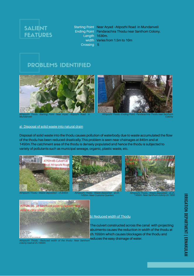
PROBLEMS IDENTIFIED
SALIENT
FEATURES
Athipozhi Thodu -Starting Point -Near Aryad –Atipozhi Road inMundanveli
Athipozhi Thodu -Ending Point:- Pandarachira Thodu near SanthomColony
a) Disposal of solid waste into natural drain
Disposal of solid waste into the thodu causes pollution of waterbody due to waste accumulated the flow
of the thodu has been reduced drastically.This problem is seen near chainages at 845m and at
1450m.The catchment area of the thodu is densely populated and hence the thodu is subjected to
variety of pollutants such as municipal sewage, organic, plastic waste, etc.
Athipozhi Thodu –Waste deposited – ch.845m Athipozhi Thodu –Waste deposited – at ch.1450m- Near Customs Quarters
Near Aryad –Atipozhi Road in Mundanveli
Pandarachira Thodu near Santhom Colony.
1630m.
Varies from 1.5m to 10m
5
Starting Point
Ending Point
Length
width
Crossing
Athipozhi Thodu –Waste deposited – at ch.1450m- Near Santhom colony ch.1600
b) Reduced width of Thodu
The culvert constructed across the canal with projecting
abutments causes the reduction in width of the thodu at
ch.1550m which causes blockages of the thodu and
reduces the easy drainage of water.Athipozhi Thodu –Reduced width of the thodu- Near Santhomcolony road at ch.1550m
IRRIGATION DEPARTMENT | ERNAKULAM
Page 176
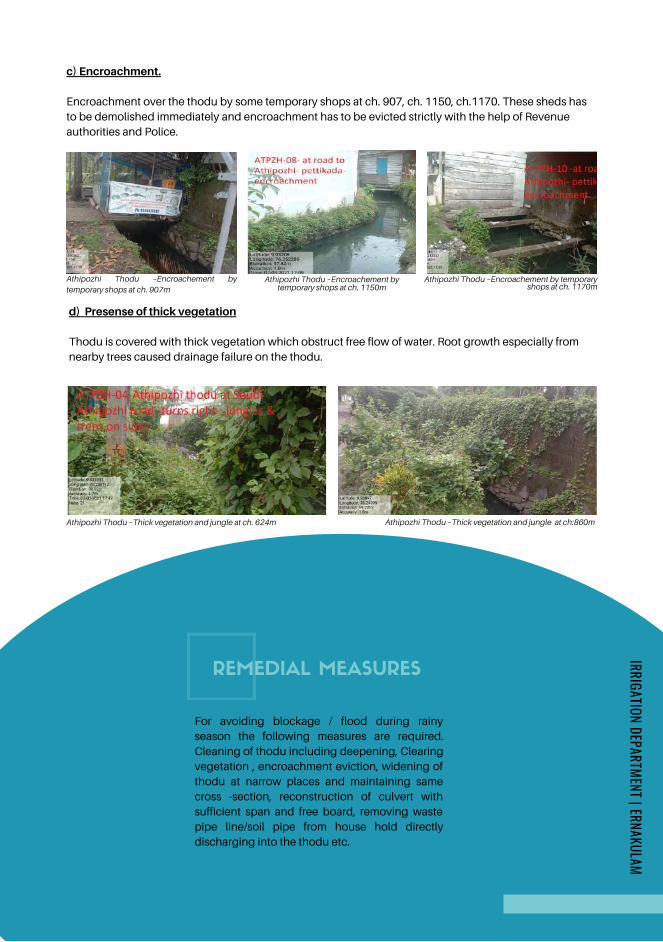
Athipozhi Thodu –Thick vegetation and jungle at ch. 624m Athipozhi Thodu –Thick vegetation and jungle at ch:860m
c) Encroachment.
Encroachment over the thodu by some temporary shops at ch. 907, ch. 1150, ch.1170. These sheds has
to be demolished immediately and encroachment has to be evicted strictly with the help of Revenue
authorities and Police.
Athipozhi Thodu –Encroachement bytemporary shops at ch. 907m
Athipozhi Thodu –Encroachement bytemporary shops at ch. 1150m
Athipozhi Thodu –Encroachement by temporaryshops at ch. 1170m
d) Presense of thick vegetation
Thodu is covered with thick vegetation which obstruct free flow of water. Root growth especially from
nearby trees caused drainage failure on the thodu.
REMEDIAL MEASURES
For avoiding blockage / flood during rainy
season the following measures are required.
Cleaning of thodu including deepening, Clearing
vegetation , encroachment eviction, widening of
thodu at narrow places and maintaining same
cross -section, reconstruction of culvert with
sufficient span and free board, removing waste
pipe line/soil pipe from house hold directly
discharging into the thodu etc.
IRRIGATION DEPARTMENT | ERNAKULAM
Page 177
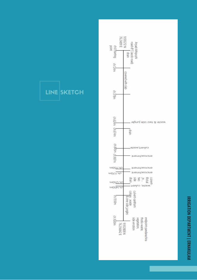
LINE SKETCH
IRRIGATION DEPARTMENT | ERNAKULAM
Page 178
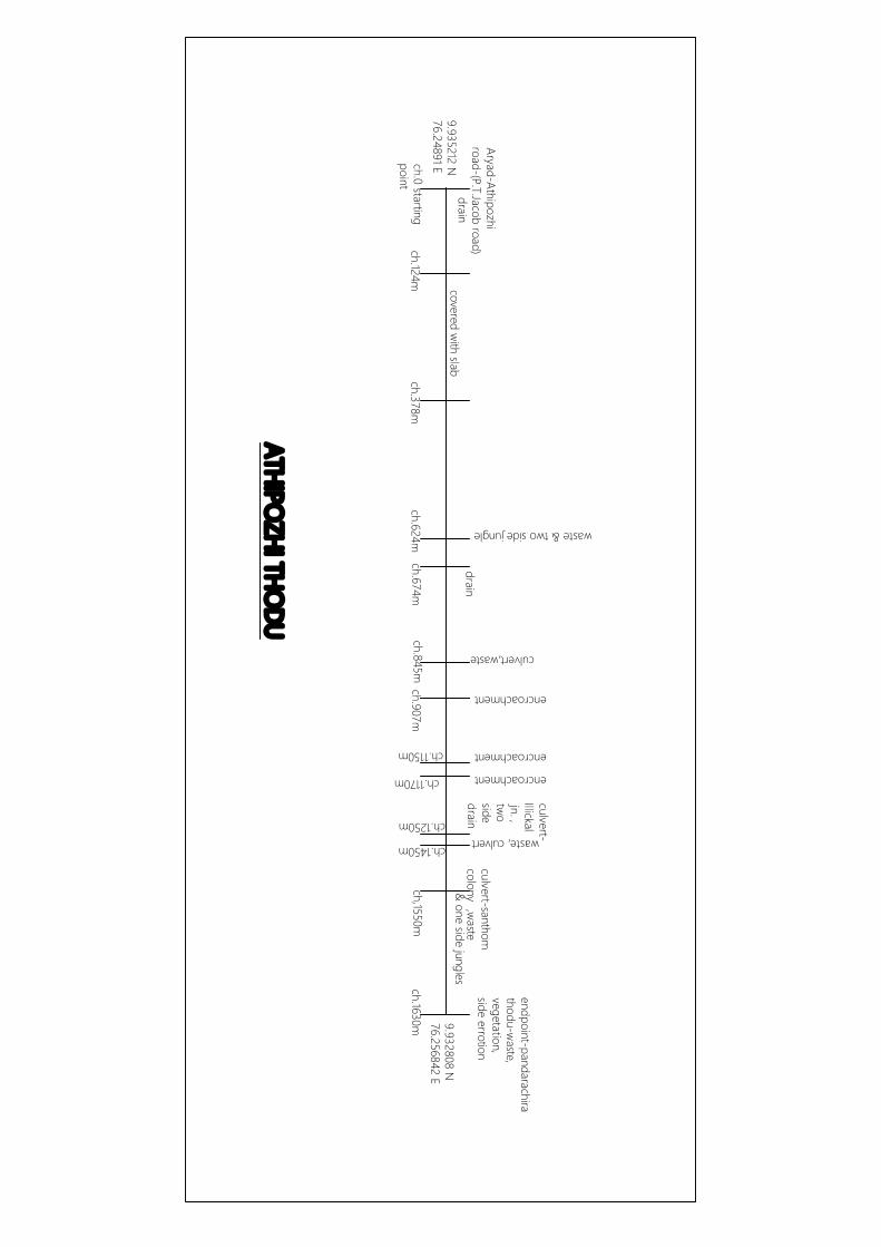
endpoint-pandarachirathodu-w
aste,vegetation,side errotion
ch,1550m
culvert-santhomcolony
ch.1450m
& one side jungles
ch.1250m
culvert-Illickaljn. ,tw
osidedrain
ch.845mch.907m
ch.1170m
ch.1150m
encroachment
encroachment
encroachmentch.674m
ch.624mch.378m
ch.124mch.0 startingpoint
Aryad-Athipozhiroad-(P.T.Jacob road)
covered with slab
waste & two side jungle
drain
ATHIPOZHI THO
DU
drain
culvert,waste
,waste
waste, culvert
ch.1630m
9.935212 N76.24891 E
9.932808 N76.256842 E
Page 179
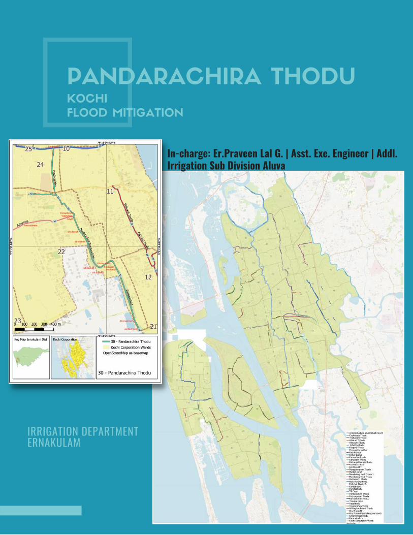
PANDARACHIRA THODUKOCHI
FLOOD MITIGATION
IRRIGATION DEPARTMENT ERNAKULAM
In-charge: Er.Praveen Lal G. | Asst. Exe. Engineer | Addl.Irrigation Sub Division Aluva
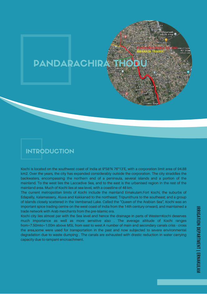
INTRODUCTION
Kochi is located on the southwest coast of India at 9°58′N 76°13′E, with a corporation limit area of 94.88
km2. Over the years, the city has expanded considerably outside the corporation. The city straddles the
backwaters, encompassing the northern end of a peninsula, several islands and a portion of the
mainland. To the west lies the Laccadive Sea, and to the east is the urbanised region in the rest of the
mainland area. Much of Kochi lies at sea level, with a coastline of 48 km.
The current metropolitan limits of Kochi include the mainland Ernakulam.Fort Kochi, the suburbs of
Edapally, Kalamassery, Aluva and Kakkanad to the northeast; Tripunithura to the southeast; and a group
of islands closely scattered in the Vembanad Lake. Called the "Queen of the Arabian Sea", Kochi was an
important spice trading centre on the west coast of India from the 14th century onward, and maintained a
trade network with Arab merchants from the pre-Islamic era.
Kochi city lies almost par with the Sea level and hence the drainage in parts of WesternKochi deserves
much importance as well as more sensitive also . The average altitude of Kochi ranges
from+7.50mto+1.00m above MSL from east to west.A number of main and secondary canals criss - cross
the area,some were used for transportation in the past and now subjected to severe environmental
degradation due to waste dumping . The canals are exhausted with drastic reduction in water carrying
capacity due to rampant encroachment.
PANDARACHIRA THODU
IRRIGATION DEPARTMENT | ERNAKULAM
Page 181

HISTORY
Pandarachira thodu is situated near Palluruthy in Kochi taluk
of Ernakulam district. The thodu passes through divisions 22 &
24 of Kochi Municipal corporation. This thodu facilitate
drainage of water to Chirakal river and Rameswaram canal
and viceversa.The thodu is 2.9371km long and consists of
three branches namely Kazhuthumuttu thodu, Athipuzha
thodu and Pandara parambu thodu which flows to the
Rameswaram canal at East & Chirakal river at the west side.
The branches of Pandarachirathodu Athipuzhathodu is
1.63Km long with average width of 4m which starts from
Thoppumpady Chellanam Road (Aryad Athipuzha cross road)
and meets Pandarachirathodu near Ch.787.50m near
Santhom Colony. Another branch is Kazhuthumuttu thodu
which is 520m is long meets at Ch.478.50m of
Pandarachirathodu near Kazhuthumuttu junction. Another
branch is Pandaraparambu thodu which has got a length of
400m, 1.20m average width meets at 633.5m chainage of
Pandarachira thodu The thodu starts from Rameswaram canal
near Polakandam market and ends in Chirakkal river near the
fish farm owned by GCDA. The Pandarachirathodu divides at
Ch:0.4785km of the main Pandarachirathodu and the branch
continues for a length of 0.520km towards the south side.. The
family of Kochi Maharaja used this waterway to travel from
Thripunithara to Perumpadappu, Mundamveli, Karuvelipady,
Chullikal, Chellanam and other areas in Western kochi..This
project was envisaged by the Kochi Maharaja for the
betterment of the people in west kochi near Chirakkal,
Mundamvely, Kazhuthumuttu, Perumbadappu and Palluruthy
areas.The Kochi Maharaja used to visit the Pandarachirathodu
area with the Samoothiri from Kozhikode and used to rest in
the NALUKETTU at Pallichalbridge.The Maharaja used to take
rest at Pallichal and his entire itenirary was taken care of by the
Vadakumthodu and Pallivathukkal family residing in
Pallichal.He would spend time with the people there and used
to visit the Azhakiyakavu temple for darsana of
goddessBhadra at Palluruthy.The Maharaja would participate
in the PULAVANIBHAM near the premises of the
temple,.People used to come for PULAVANIBHAM near the
temple premises to sell materials made up of coconut palm
trees,bamboo, arecanut,cadjanetc which was made in there
home itself.These materials were also transported to
Ernakulam and places like Kollam Chenganaserry,Alleppey
etc. This thodu was earlier used for transporting goods to
places like Mattanchery, Mundamveli, Kattiparambu,
Perumpadappu Kannamaly and chellanam in west Kochi also.
They also used to transport materials like
sand,bricks,stones,lime etc in big country boats.
Lot of boats used to stay anchored near the banks of
the Pashnithodu, and the people used to make food
and stay in the boat yard for quite some time.Then they
travelled to Pandarachirathodu which leads to the
Rameshwaram canal ending in the Vembanadkayal
itself. There was a connection to pandarachira from
pashnithodu from the east side through the
perumpadappukayal. Transportation of goods was
done mostly through these three thodus viz
Pashnithodu, pallichalthodu and Pandarachirathodu
which was interconnected leading to the
Rameshwaram canal. The lands adjoining the
Pandarachirathodu was highly fertile and agriculture
was vastly done in this area. About 600 acres of
agricultural land was well maintained in earlier times
from chirakkal to Kazhuthumuttu area. The
Pandarachirathodu itself was a manmade thodu
constructed to irrigate these agricultural lands. In 1965
the Irrigation Department built side protection walls
using rubble to protect the Pandarachirathodu.Later in
1980, Greater Cochin Development Authority (GCDA)
took up these lands to build a mini city. But the project
didn’t come out well. The land owned by GCDAwas left
out for a long time and these land was filled up with
mangroves. Later on some portion of these lands were
sold to private parties and as a result agriculture in that
land came to an end and the left over land was turned
into a barren land. People living in and around
Pandarachirathodu moved to different places making
use of the side bund road along the thodu. People also
moved to different places through the thodu using
country boats. The boats were rented for different
purposes like marriage functions etc. near the starting
point of Pandarachira thodu.
The elderly folks in the city, recount stories in this
regard,but due to the rampant encroachments and
unscientific developments of different agencies and
people on the banks of the Pandarachirathodu,the
course of canal has changed drastically to a
shadow,once it had.
Page 182
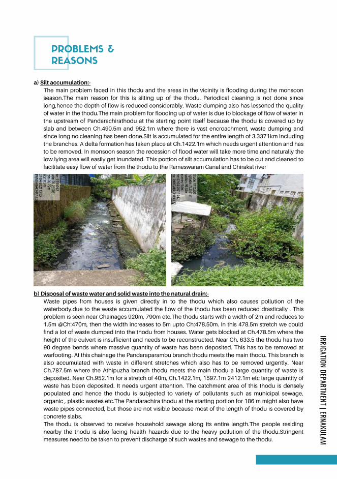
PROBLEMS &
REASONS
a) Silt accumulation:-The main problem faced in this thodu and the areas in the vicinity is flooding during the monsoon
season.The main reason for this is silting up of the thodu. Periodical cleaning is not done since
long,hence the depth of flow is reduced considerably. Waste dumping also has lessened the quality
of water in the thodu.The main problem for flooding up of water is due to blockage of flow of water in
the upstream of Pandarachirathodu at the starting point itself because the thodu is covered up by
slab and between Ch.490.5m and 952.1m where there is vast encroachment, waste dumping and
since long no cleaning has been done.Silt is accumulated for the entire length of 3.3371km including
the branches. A delta formation has taken place at Ch.1422.1m which needs urgent attention and has
to be removed. In monsoon season the recession of flood water will take more time and naturally the
low lying area will easily get inundated. This portion of silt accumulation has to be cut and cleaned to
facilitate easy flow of water from the thodu to the Rameswaram Canal and Chirakal river
b) Disposal of waste water and solid waste into the natural drain:-Waste pipes from houses is given directly in to the thodu which also causes pollution of the
waterbody.due to the waste accumulated the flow of the thodu has been reduced drastically . This
problem is seen near Chainages 920m, 790m etc.The thodu starts with a width of 2m and reduces to
1.5m @Ch:470m, then the width increases to 5m upto Ch:478.50m. In this 478.5m stretch we could
find a lot of waste dumped into the thodu from houses. Water gets blocked at Ch.478.5m where the
height of the culvert is insufficient and needs to be reconstructed. Near Ch. 633.5 the thodu has two
90 degree bends where massive quantity of waste has been deposited. This has to be removed at
warfooting. At this chainage the Pandaraparambu branch thodu meets the main thodu. This branch is
also accumulated with waste in different stretches which also has to be removed urgently. Near
Ch.787.5m where the Athipuzha branch thodu meets the main thodu a large quantity of waste is
deposited. Near Ch.952.1m for a stretch of 40m, Ch.1422.1m, 1597.1m 2412.1m etc large quantity of
waste has been deposited. It needs urgent attention. The catchment area of this thodu is densely
populated and hence the thodu is subjected to variety of pollutants such as municipal sewage,
organic , plastic wastes etc.The Pandarachira thodu at the starting portion for 186 m might also have
waste pipes connected, but those are not visible because most of the length of thodu is covered by
concrete slabs.
The thodu is observed to receive household sewage along its entire length.The people residing
nearby the thodu is also facing health hazards due to the heavy pollution of the thodu.Stringent
measures need to be taken to prevent discharge of such wastes and sewage to the thodu.
IRRIGATION DEPARTMENT | ERNAKULAM
Page 183
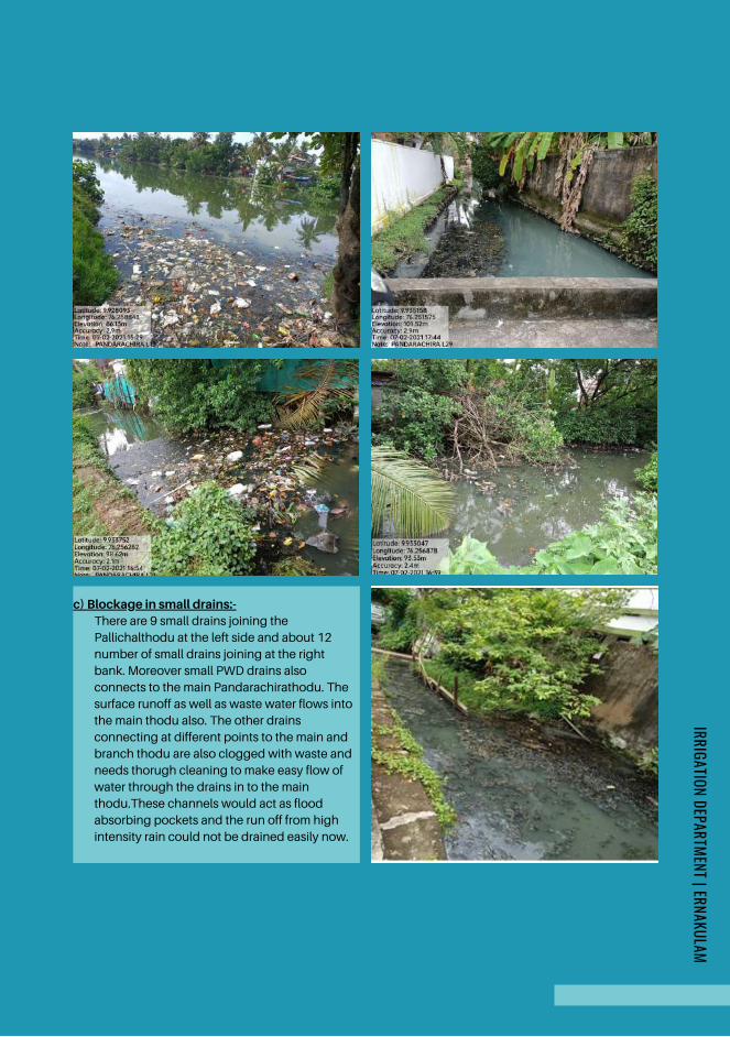
c) Blockage in small drains:-There are 9 small drains joining the
Pallichalthodu at the left side and about 12
number of small drains joining at the right
bank. Moreover small PWD drains also
connects to the main Pandarachirathodu. The
surface runoff as well as waste water flows into
the main thodu also. The other drains
connecting at different points to the main and
branch thodu are also clogged with waste and
needs thorugh cleaning to make easy flow of
water through the drains in to the main
thodu.These channels would act as flood
absorbing pockets and the run off from high
intensity rain could not be drained easily now.
IRRIGATION DEPARTMENT | ERNAKULAM
Page 184

d) Reduced width of ThoduThe width of thodu is reduced at different points which causes blockages of the thodu and
reduces the easy drainage of water to the Chirakal river.In the main Pandarachirathodu at
Ch:0.00m the width of thodu is 2m, the width reduces to 1.5m at Ch 378m,means the thodu
reduces further. This portion of thodu continues for a length of 100.5m,which finally reduces the
discharge drastically. Widening of thodu in this stretch of thodu is inevitable and should be
intervened urgently. The width of thodu reduces from Ch.501.50m ie from 8m to 5.5m upto
Ch.633.5m which finally reduces the discharge drastically for a length of 132m. At Ch.112.5m the
thodu has got 40m width. But this reduces to 12.4m at Ch.937.5m. That is for 187.6m length of
thodu the width reduces gradually (27.6m). Near Santhom Colony the thodu has got 18m width
at Ch.1422.1m. But at Ch.1502.10m the width of thodu reduces to only 23m and further it reduces
to 8m at Ch.1637.10m. Near Neerul Iman Masjid the thodu has got 20m width only at
Ch.2277.10m. But at the end Ch.2417.10m the width of thodu is 57m. As the width of thodu
reduces the area of cross section of flow get reduced and drainage of water becomes blocked
and wont serve the entire purpose intended.
e) Encroachment:-Encroachments of the thodu is suspected from Ch:726.5m upto Ch.787.50m where there are two
sharp 90 degree bends. This encroachment continues upto Ch.937.50m where the existing width
of thodu 18.4m reduces to 12.4m and in order to facilitate the water flow there is only two pipes of
1.5m dia installed which is very much insufficient for the existing width of 12.4m. The
encroachment is further found from Ch.937.50m to 1125.1m and from 1552.1m to 1597.1m.
Towards the end portion near Ch.2277.10m and Ch.2237.1m the encroachment is visible where
the public has constructed houses into the thodu and planted small trees also. These
encroachments has to be evicted strictly with the help of higher authorities and police.
IRRIGATION DEPARTMENT | ERNAKULAM
Page 185
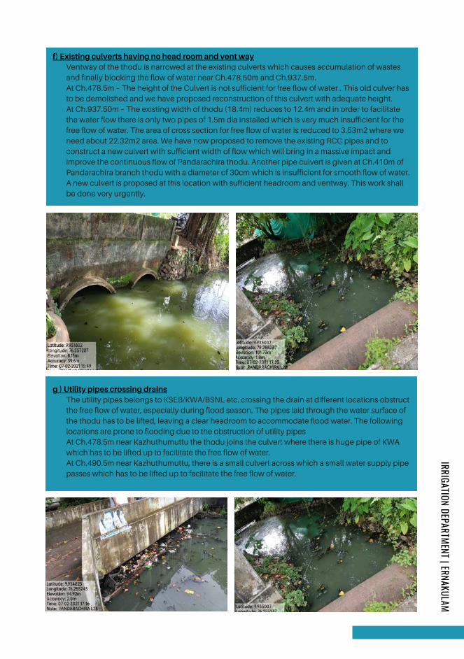
f) Existing culverts having no head room and vent wayVentway of the thodu is narrowed at the existing culverts which causes accumulation of wastes
and finally blocking the flow of water near Ch.478.50m and Ch.937.5m.
At Ch.478.5m – The height of the Culvert is not sufficient for free flow of water . This old culver has
to be demolished and we have proposed reconstruction of this culvert with adequate height.
At Ch.937.50m – The existing width of thodu (18.4m) reduces to 12.4m and in order to facilitate
the water flow there is only two pipes of 1.5m dia installed which is very much insufficient for the
free flow of water. The area of cross section for free flow of water is reduced to 3.53m2 where we
need about 22.32m2 area. We have now proposed to remove the existing RCC pipes and to
construct a new culvert with sufficient width of flow which will bring in a massive impact and
improve the continuous flow of Pandarachira thodu. Another pipe culvert is given at Ch.410m of
Pandarachira branch thodu with a diameter of 30cm which is insufficient for smooth flow of water.
A new culvert is proposed at this location with sufficient headroom and ventway. This work shall
be done very urgently.
g ) Utility pipes crossing drainsThe utility pipes belongs to KSEB/KWA/BSNL etc. crossing the drain at different locations obstruct
the free flow of water, especially during flood season. The pipes laid through the water surface of
the thodu has to be lifted, leaving a clear headroom to accommodate flood water. The following
locations are prone to flooding due to the obstruction of utility pipes
At Ch.478.5m near Kazhuthumuttu the thodu joins the culvert where there is huge pipe of KWA
which has to be lifted up to facilitate the free flow of water.
At Ch.490.5m near Kazhuthumuttu, there is a small culvert across which a small water supply pipe
passes which has to be lifted up to facilitate the free flow of water.
IRRIGATION DEPARTMENT | ERNAKULAM
Page 186
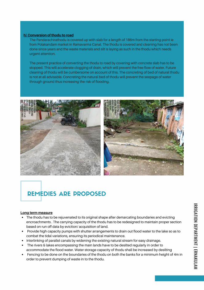
h) Conversion of thodu to roadThe Pandarachirathodu is covered up with slab for a length of 186m from the starting point ie
from Polakandam market in Ramavarma Canal. The thodu is covered and cleaning has not been
done since years and the waste materials and silt is laying as such in the thodu which needs
urgent attention.
The present practice of converting the thodu to road by covering with concrete slab has to be
stopped. This will accelerate clogging of drain, which will prevent the free flow of water. Future
cleaning of thodu will be cumbersome on account of this. The concreting of bed of natural thodu
is not at all advisable. Concreting the natural bed of thodu will prevent the seepage of water
through ground thus increasing the risk of flooding.
REMEDIES ARE PROPOSED
The thodu has to be rejuvenated to its original shape after demarcating boundaries and evicting
encroachments . The carrying capacity of the thodu has to be redesigned to maintain proper section
based on run off data by eviction/ acquisition of land.
Provide high capacity pumps with shutter arrangements to drain out flood water to the lake so as to
combat the tidal variations, ensuring its periodical maintenance.
Interlinking of parallel canals by widening the existing natural stream for easy drainage.
The rivers & lakes encompassing the main lands have to be desilted regularly in order to
accommodate the flood water. Water storage capacity of thodu shall be increased by desilting
Fencing to be done on the boundaries of the thodu on both the banks for a minimum height of 4m in
order to prevent dumping of waste in to the thodu.
Long term measure
IRRIGATION DEPARTMENT | ERNAKULAM
Page 187
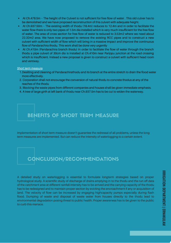
BENEFITS OF SHORT TERM MEASURE
At Ch.478.5m – The height of the Culvert is not sufficient for free flow of water . This old culver has to
be demolished and we have proposed reconstruction of this culvert with adequate height.
At Ch.937.50m – The existing width of thodu (18.4m) reduces to 12.4m and in order to facilitate the
water flow there is only two pipes of 1.5m dia installed which is very much insufficient for the free flow
of water. The area of cross section for free flow of water is reduced to 3.53m2 where we need about
22.32m2 area. We have now proposed to remove the existing RCC pipes and to construct a new
culvert with sufficient width of flow which will bring in a massive impact and improve the continuous
flow of Pandarachira thodu. This work shall be done very urgently
At Ch.410m (Pandarachira branch thodu) In order to facilitate the flow of water through the branch
thodu a pipe culvert of 30cm dia is installed at Ch.410m near Parippu junction at the road crossing
which is insufficient. Instead a new proposal is given to construct a culvert with sufficient head room
and ventway.
Desilting and cleaning of Pandarachirathodu and its branch at the entire stretch to drain the flood water
more effectively.
Corporation shall not encourage the conversion of natural thodu to concrete thodus at any of the
reaches of the thodu
Blocking the waste pipes from different companies and houses shall be given immediate emphasis.
A tree of large girth at left bank of thodu near Ch.937.5m has to be cut to widen the waterway.
Short term measure
1.
2.
3.
4.
Implementation of short term measure doesn’t guarantee the redressal of all problems, unless the long
term measures are implemented. But can reduce the intensity of waterlogging to a certain extent.
CONCLUSION/RECOMMENDATIONS
A detailed study on waterlogging is essential to formulate longterm strategies based on proper
hydrological study. A scientific study of discharge of drains emptying in to the thodu and the run off data
of the catchment area at different rainfall intensity has to be arrived and the carrying capacity of the thodu
has to be redesigned and to maintain proper section by evicting the encroachment if any or acquisition of
land. The velocity of flow can be increased by engaging highcapacity pumps especially during flash
flood. Dumping of waste and disposal of waste water from houses directly to the thodu lead to
environmental degradation posing threat to public health. Proper awareness has to be given to the public
to curb this menace.
IRRIGATION DEPARTMENT | ERNAKULAM
Page 188
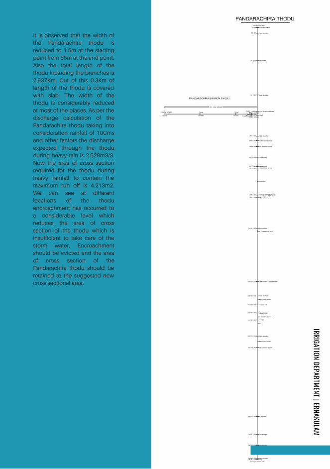
It is observed that the width of
the Pandarachira thodu is
reduced to 1.5m at the starting
point from 55m at the end point.
Also the total length of the
thodu including the branches is
2.937Km. Out of this 0.3Km of
length of the thodu is covered
with slab. The width of the
thodu is considerably reduced
at most of the places. As per the
discharge calculation of the
Pandarachira thodu taking into
consideration rainfall of 10Cms
and other factors the discharge
expected through the thodu
during heavy rain is 2.528m3/S.
Now the area of cross section
required for the thodu during
heavy rainfall to contain the
maximum run off is 4.213m2.
We can see at different
locations of the thodu
encroachment has occurred to
a considerable level which
reduces the area of cross
section of the thodu which is
insufficient to take care of the
storm water. Encroachment
should be evicted and the area
of cross section of the
Pandarachira thodu should be
retained to the suggested new
cross sectional area.
IRRIGATION DEPARTMENT | ERNAKULAM
Page 189
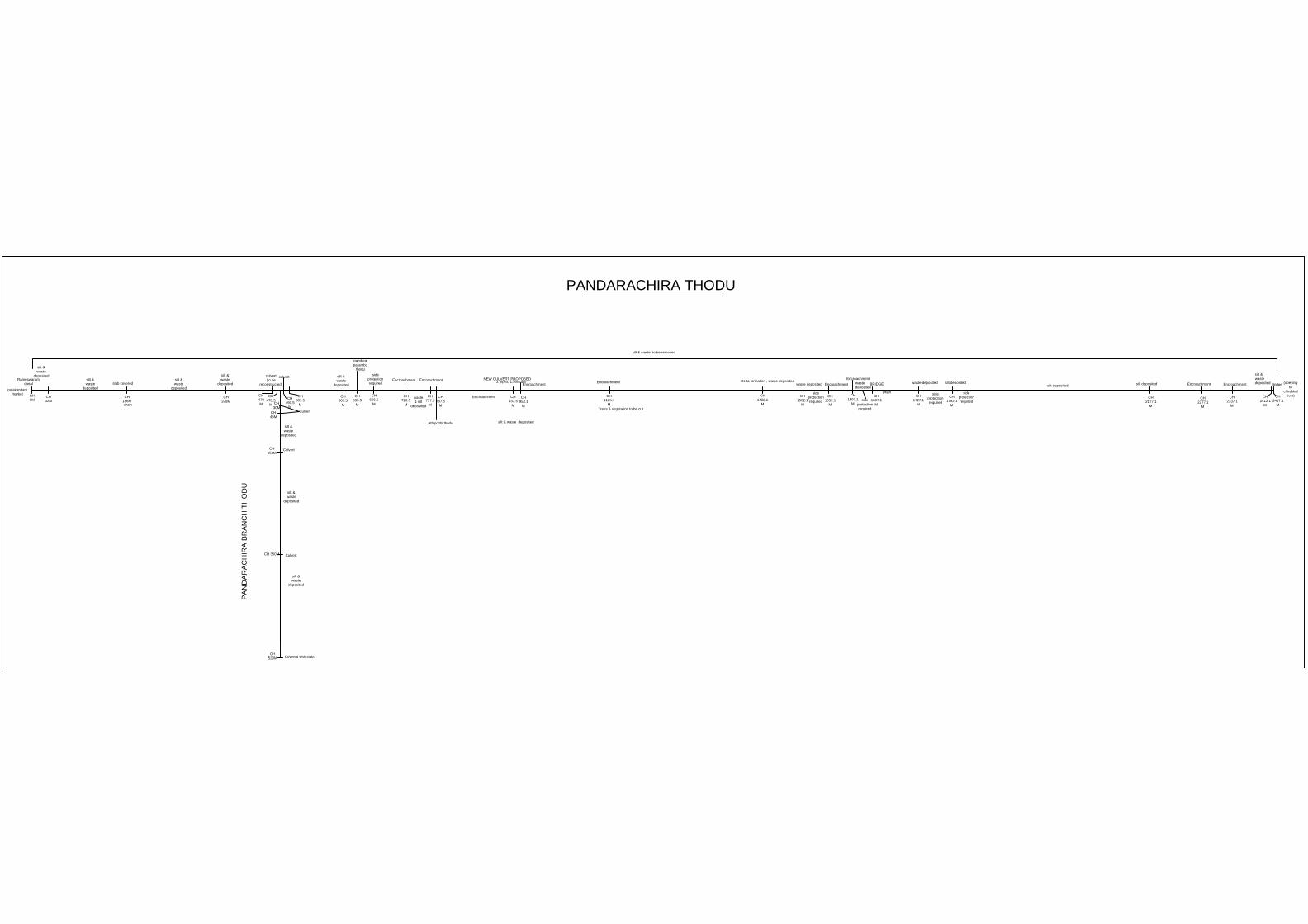
PANDARACHIRA THODU
CH
0M
CH
32M
Rameswaram
canal
silt &
waste
deposited
polakandam
market
CH
186M
slab covered
drain
CH
378M
silt &
waste
deposited
silt &
waste
deposited
silt &
waste
deposited
CH
470
M
CH
478.5
M
culvert
(to be
reconstructed)
CH
490.5
M
CH
501.5
M
culvert
CH
607.5
M
silt &
waste
deposited
CH
633.5
M
pandara
parambu
thodu
CH
666.5
M
side
protection
required
CH
726.5
M
Encroachment
CH
777.5
M
Encroachment
waste
& silt
deposited
CH
787.5
M
CH
937.5
M
2 pipes, 1.50m dia
NEW CULVERT PROPOSED
Encroachment
CH
952.1
M
Encroachment
CH
1125.1
M
Encroachment
Trees & vegetation to be cut
CH
1422.1
M
Delta formation , waste deposited
CH
1502.1
M
waste deposited
side
protection
required
CH
1552.1
M
Encroachment
CH
1597.1
M
Encroachment
waste
deposited
side
protection
required
CH
1637.1
M
BRIDGE
Drain
CH
1727.1
M
side
protection
required
waste deposited
CH
1792.1
M
side
protection
required
silt deposited
CH
2177.1
M
silt deposited
silt deposited
CH
2277.1
M
Encroachment
CH
2337.1
M
Encroachment
CH
2412.1
M
silt &
waste
deposited
CH
2417.1
M
(opening
to
chirakkal
river)
silt & waste deposited
Bridge
CH
30M
CH
45M
CH
150M
CH 350M
CH
520M
Culvert
Culvert
Culvert
Covered with slabt
silt &
waste
deposited
silt &
waste
deposited
silt &
waste
deposited
silt & waste to be removed
Athipozhi thodu
PA
ND
AR
AC
HIR
A B
RA
NC
H T
HO
DU
Page 190

PASHNITHODUKOCHI
FLOOD MITIGATION
IRRIGATION DEPARTMENT ERNAKULAM
In-charge: Er.Praveen Lal G. | Asst. Exe. Engineer | Addl.Irrigation Sub Division Aluva
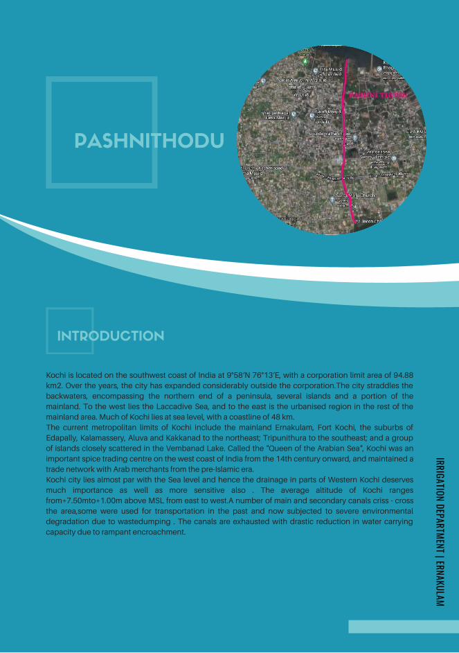
INTRODUCTION
Kochi is located on the southwest coast of India at 9°58′N 76°13′E, with a corporation limit area of 94.88
km2. Over the years, the city has expanded considerably outside the corporation.The city straddles the
backwaters, encompassing the northern end of a peninsula, several islands and a portion of the
mainland. To the west lies the Laccadive Sea, and to the east is the urbanised region in the rest of the
mainland area. Much of Kochi lies at sea level, with a coastline of 48 km.
The current metropolitan limits of Kochi include the mainland Ernakulam, Fort Kochi, the suburbs of
Edapally, Kalamassery, Aluva and Kakkanad to the northeast; Tripunithura to the southeast; and a group
of islands closely scattered in the Vembanad Lake. Called the "Queen of the Arabian Sea", Kochi was an
important spice trading centre on the west coast of India from the 14th century onward, and maintained a
trade network with Arab merchants from the pre-Islamic era.
Kochi city lies almost par with the Sea level and hence the drainage in parts of Western Kochi deserves
much importance as well as more sensitive also . The average altitude of Kochi ranges
from+7.50mto+1.00m above MSL from east to west.A number of main and secondary canals criss - cross
the area,some were used for transportation in the past and now subjected to severe environmental
degradation due to wastedumping . The canals are exhausted with drastic reduction in water carrying
capacity due to rampant encroachment.
PASHNITHODU
IRRIGATION DEPARTMENT | ERNAKULAM
Page 192
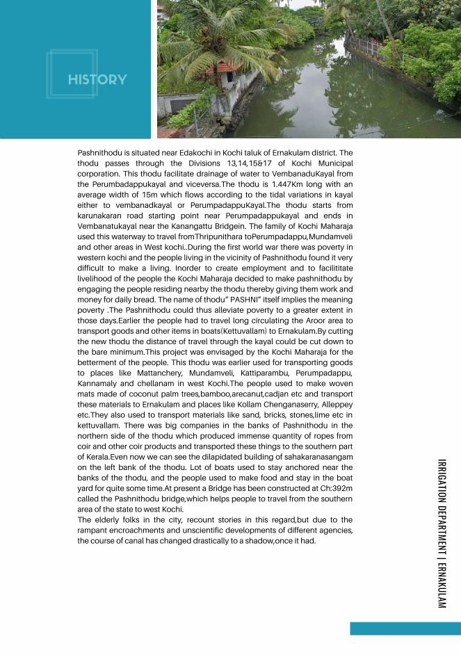
HISTORY
The elderly folks in the city, recount stories in this regard,but due to the
rampant encroachments and unscientific developments of different agencies,
the course of canal has changed drastically to a shadow,once it had.
Pashnithodu is situated near Edakochi in Kochi taluk of Ernakulam district. The
thodu passes through the Divisions 13,14,15&17 of Kochi Municipal
corporation. This thodu facilitate drainage of water to VembanaduKayal from
the Perumbadappukayal and viceversa.The thodu is 1.447Km long with an
average width of 15m which flows according to the tidal variations in kayal
either to vembanadkayal or PerumpadappuKayal.The thodu starts from
karunakaran road starting point near Perumpadappukayal and ends in
Vembanatukayal near the Kanangattu Bridgein. The family of Kochi Maharaja
used this waterway to travel fromThripunithara toPerumpadappu,Mundamveli
and other areas in West kochi..During the first world war there was poverty in
western kochi and the people living in the vicinity of Pashnithodu found it very
difficult to make a living. Inorder to create employment and to facilititate
livelihood of the people the Kochi Maharaja decided to make pashnithodu by
engaging the people residing nearby the thodu thereby giving them work and
money for daily bread. The name of thodu“ PASHNI” itself implies the meaning
poverty .The Pashnithodu could thus alleviate poverty to a greater extent in
those days.Earlier the people had to travel long circulating the Aroor area to
transport goods and other items in boats(Kettuvallam) to Ernakulam.By cutting
the new thodu the distance of travel through the kayal could be cut down to
the bare minimum.This project was envisaged by the Kochi Maharaja for the
betterment of the people. This thodu was earlier used for transporting goods
to places like Mattanchery, Mundamveli, Kattiparambu, Perumpadappu,
Kannamaly and chellanam in west Kochi.The people used to make woven
mats made of coconut palm trees,bamboo,arecanut,cadjan etc and transport
these materials to Ernakulam and places like Kollam Chenganaserry, Alleppey
etc.They also used to transport materials like sand, bricks, stones,lime etc in
kettuvallam. There was big companies in the banks of Pashnithodu in the
northern side of the thodu which produced immense quantity of ropes from
coir and other coir products and transported these things to the southern part
of Kerala.Even now we can see the dilapidated building of sahakaranasangam
on the left bank of the thodu. Lot of boats used to stay anchored near the
banks of the thodu, and the people used to make food and stay in the boat
yard for quite some time.At present a Bridge has been constructed at Ch:392m
called the Pashnithodu bridge,which helps people to travel from the southern
area of the state to west Kochi.
IRRIGATION DEPARTMENT | ERNAKULAM
Page 193
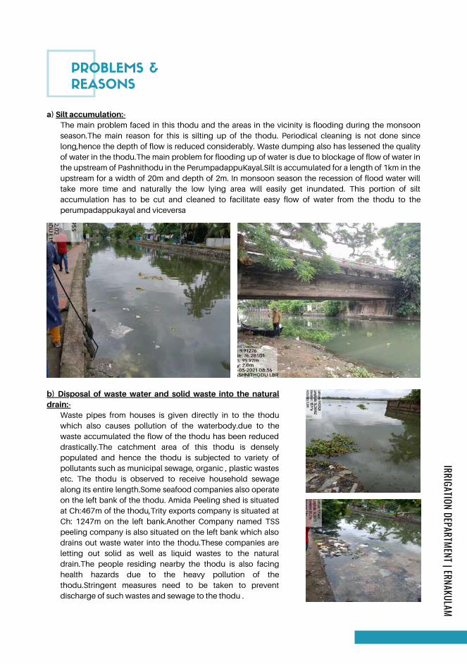
PROBLEMS &
REASONS
a) Silt accumulation:-The main problem faced in this thodu and the areas in the vicinity is flooding during the monsoon
season.The main reason for this is silting up of the thodu. Periodical cleaning is not done since
long,hence the depth of flow is reduced considerably. Waste dumping also has lessened the quality
of water in the thodu.The main problem for flooding up of water is due to blockage of flow of water in
the upstream of Pashnithodu in the PerumpadappuKayal.Silt is accumulated for a length of 1km in the
upstream for a width of 20m and depth of 2m. In monsoon season the recession of flood water will
take more time and naturally the low lying area will easily get inundated. This portion of silt
accumulation has to be cut and cleaned to facilitate easy flow of water from the thodu to the
perumpadappukayal and viceversa
b) Disposal of waste water and solid waste into the naturaldrain:-
Waste pipes from houses is given directly in to the thodu
which also causes pollution of the waterbody.due to the
waste accumulated the flow of the thodu has been reduced
drastically.The catchment area of this thodu is densely
populated and hence the thodu is subjected to variety of
pollutants such as municipal sewage, organic , plastic wastes
etc. The thodu is observed to receive household sewage
along its entire length.Some seafood companies also operate
on the left bank of the thodu. Amida Peeling shed is situated
at Ch:467m of the thodu,Trity exports company is situated at
Ch: 1247m on the left bank.Another Company named TSS
peeling company is also situated on the left bank which also
drains out waste water into the thodu.These companies are
letting out solid as well as liquid wastes to the natural
drain.The people residing nearby the thodu is also facing
health hazards due to the heavy pollution of the
thodu.Stringent measures need to be taken to prevent
discharge of such wastes and sewage to the thodu .
IRRIGATION DEPARTMENT | ERNAKULAM
Page 194
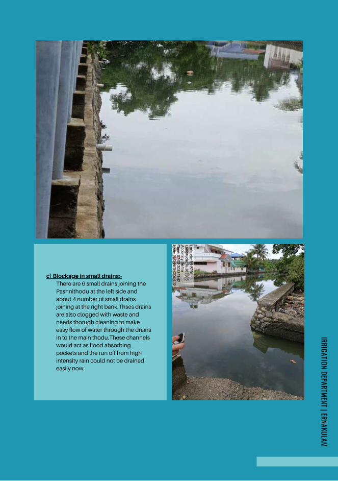
c) Blockage in small drains:-There are 6 small drains joining the
Pashnithodu at the left side and
about 4 number of small drains
joining at the right bank.Thses drains
are also clogged with waste and
needs thorugh cleaning to make
easy flow of water through the drains
in to the main thodu.These channels
would act as flood absorbing
pockets and the run off from high
intensity rain could not be drained
easily now.
IRRIGATION DEPARTMENT | ERNAKULAM
Page 195

d) EncroachmentEncroachments of the thodu is suspected in between locations Ch:271mand Ch:296m.The width
of thodu is seen decreasing to 12 m from 18 m in this area.These encroachments has to be
evicted strictly with the help of higher authorities and police.
REMEDIES ARE PROPOSED
The thodu has to be rejuvenated to its original shape after demarcating boundaries and evicting
encroachments . The carrying capacity of the thodu has to be redesigned to maintain proper section
based on run off data by eviction/ acquisition of land
Provide high capacity pumps with shutter arrangements to drain out flood water to the lake so as to
combat the tidal variations, ensuring its periodic maintenance.
Interlinking of parallel canals by widening the existing natural stream for easy drainage.
The rivers & lakes encompassing the main lands have to be desilted regularly in order to
accommodate the flood water. Water storage capacity of thodu shall be increased by desilting
Fencing to be done on the boundaries of the thodu on both the banks for a minimum height of 4m in
order to prevent dumping of waste in to the thodu.
Urgent construction of protection walls at required places (near Ch:1400mR/B,nearCh: 380m
R/B,near Ch:1150m R/B)
Long term measure
IRRIGATION DEPARTMENT | ERNAKULAM
Page 196
BENEFITS OF SHORT TERM MEASURE
Desilting and cleaning of Pashnithodu at the entire stretch to drain the flood water more effectively.
Desilting and cleaning of upstream stretch of pashnithodu in Perumpadappukayal for a length of
1km,20m width and depth of 2m at the entire stretch to drain the flood water more effectively.
Corporation shall not encourage the conversion of natural thodu to concrete thodus at any of the
reaches of the thodu
Blocking the waste pipes from different companies and houses shall be given immediate emphasis.
Short term measure
Implementation of short term measure doesn’t guarantee the redressal of all problems, unless the long
term measures are implemented. But can reduce the intensity of water logging to ascertain extent.
CONCLUSION/RECOMMENDATIONS
A detailed study on waterlogging is essential to formulate longterm strategies based on proper
hydrological study. A scientific study of discharge of drains emptying in to the thoduand the run off data
of the catchmentarea at different rainfall intensity has to be arrived andthe carrying capacity of the thodu
has to be redesigned and to maintain proper section by evicting the encroachment if any or acquisition of
land. The velocity of flow can be increased by engaging high capacity pumps especially during flash
flood. Dumping of waste and disposal of waste water from houses directly to the thodu lead to
environmental degradation posing threat to public health. Proper awareness has to be given to the public
to curb this menace.
It is proposed to construct a drain from the Kumbalangi vazhi junction towards the Pashnithodu for a
length of 400m to get rid of the flooding in the flood stricken areas in Ward 17. It is also proposed to
construct a new drain from Eranatt Temple premises which will pass through Ward 17 along the side of
the National High way to facilitate easy drainage of flood water from Eranatt Temple area to Pashnithodu.
IRRIGATION DEPARTMENT | ERNAKULAM
Page 197
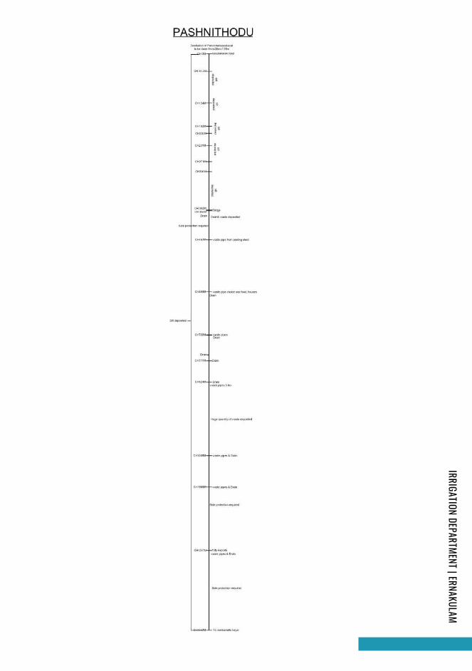
IRRIGATION DEPARTMENT | ERNAKULAM
Page 198
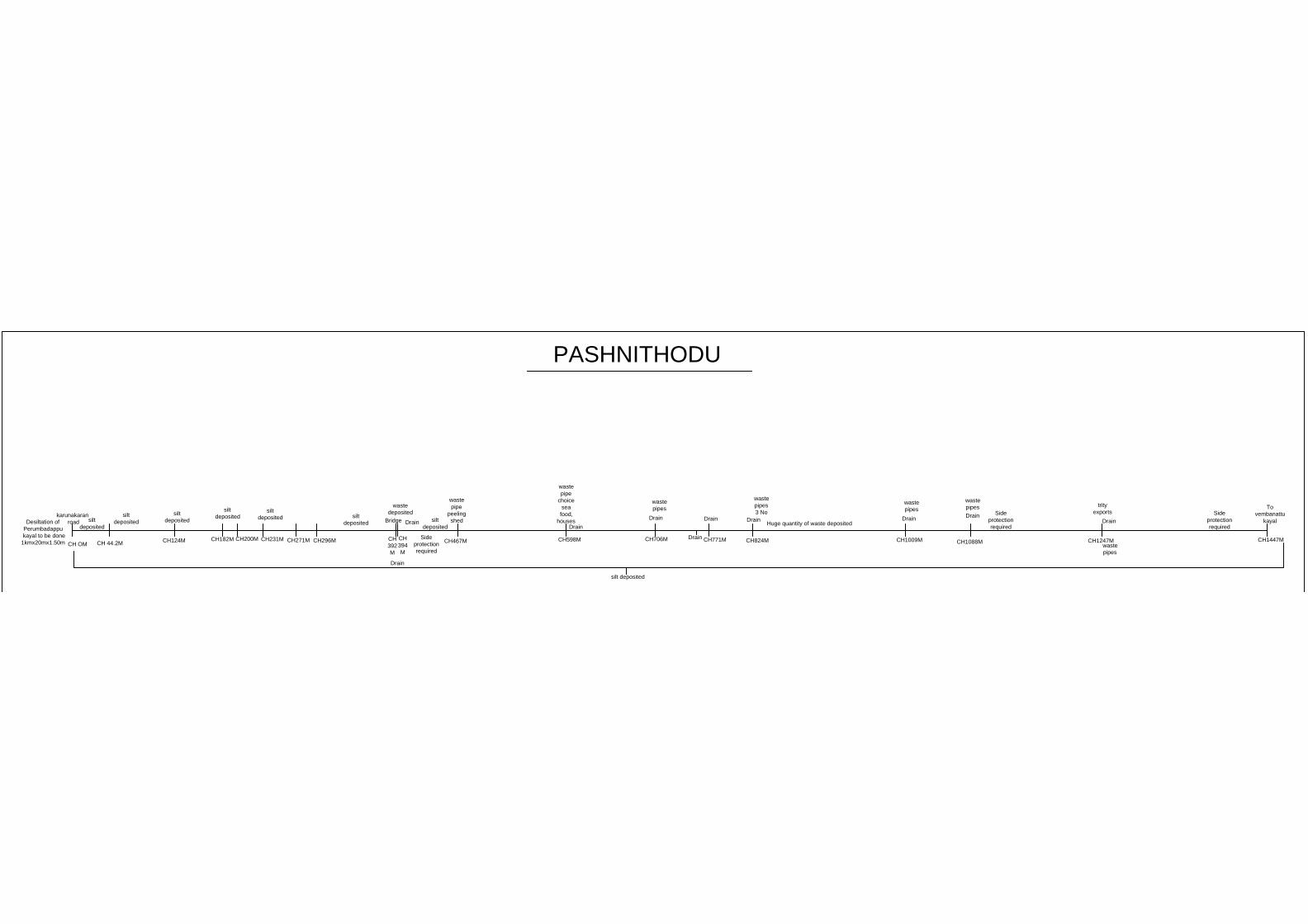
PASHNITHODU
CH OM
karunakaran
road
CH 44.2M
Desiltation of
Perumbadappu
kayal to be done
1kmx20mx1.50m
silt
deposited
silt
deposited
CH124M
silt
deposited
CH182M
silt
deposited
silt
deposited
CH200MCH231M
CH271MCH296M
CH
392
M
CH467M
Bridge
CH
394
M
waste
deposited
Drain
Drain
Side
protection
required
waste
pipe
peeling
shed
CH598M
waste
pipe
choice
sea
food,
houses
silt
deposited
silt
deposited
CH706M
Drain
Drain
Drain
waste
pipes
CH771M
Drain
CH824M
Drain
waste
pipes
3 No
CH1009M
Huge quantity of waste deposited
Drain
waste
pipes
CH1088M
Drain
waste
pipes
Side
protection
required
CH1247M
trity
exports
Drain
waste
pipes
CH1447M
To
vembanattu
kayal
Side
protection
required
silt deposited
Page 199
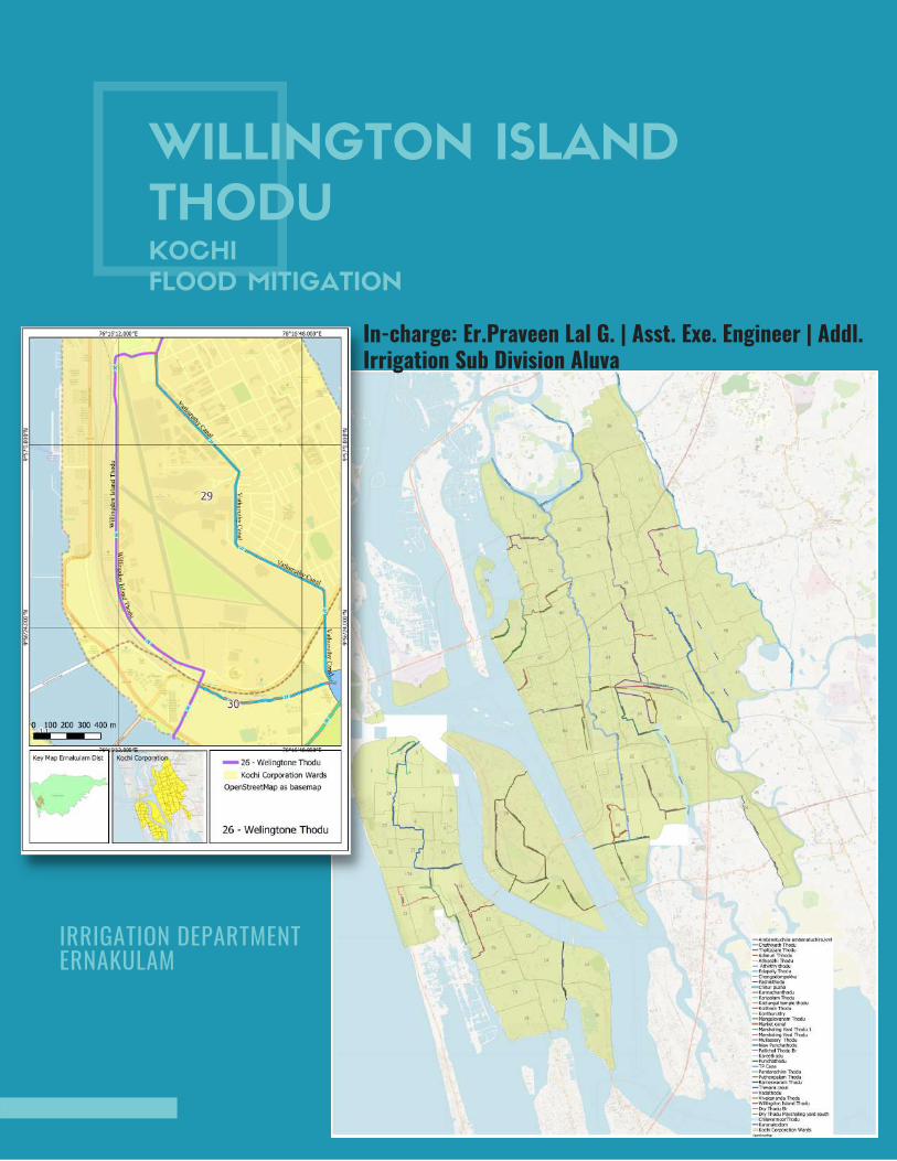
WILLINGTON ISLAND
THODUKOCHI
FLOOD MITIGATION
In-charge: Er.Praveen Lal G. | Asst. Exe. Engineer | Addl.Irrigation Sub Division Aluva
IRRIGATION DEPARTMENT ERNAKULAM
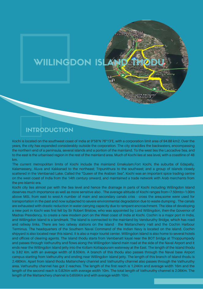
INTRODUCTION
Kochi is located on the southwest coast of India at 9°58′N 76°13′E, with a corporation limit area of 94.88 km2. Over the
years, the city has expanded considerably outside the corporation. The city straddles the backwaters, encompassing
the northern end of a peninsula, several islands and a portion of the mainland. To the west lies the Laccadive Sea, and
to the east is the urbanised region in the rest of the mainland area. Much of Kochi lies at sea level, with a coastline of 48
km.
The current metropolitan limits of Kochi include the mainland Ernakulam.Fort Kochi, the suburbs of Edapally,
Kalamassery, Aluva and Kakkanad to the northeast; Tripunithura to the southeast; and a group of islands closely
scattered in the Vembanad Lake. Called the "Queen of the Arabian Sea", Kochi was an important spice trading centre
on the west coast of India from the 14th century onward, and maintained a trade network with Arab merchants from
the pre-Islamic era.
Kochi city lies almost par with the Sea level and hence the drainage in parts of Kochi including Willingdon Island
deserves much importance as well as more sensitive also . The average altitude of Kochi ranges from+7.50mto+1.00m
above MSL from east to west.A number of main and secondary canals criss - cross the area,some were used for
transportation in the past and now subjected to severe environmental degradation due to waste dumping . The canals
are exhausted with drastic reduction in water carrying capacity due to rampant encroachment. The idea of developing
a new port in Kochi was first felt by Sir Robert Bristow, who was appointed by Lord Willingdon, then-the Governor of
Madras Presidency, to create a new modern port on the West coast of India at Kochi. Cochin is a major port in India,
and Willingdon Island is a landmark. The Island is connected to the mainland by Venduruthy Bridge, which has road
and railway links. There are two railway stations on the Island - the Mattancherry Halt and the Cochin Harbour
Terminus. The headquarters of the Southern Naval Command of the Indian Navy is located on the island. Cochin
shipyard is also located near this island. It is also a major tourist center. Willingdon Island is also home to several hotels
and offices of clearing agents. The Island thodu starts from Vembanatt kayal near the BOT bridge at Thoppumpady
and passes through Vathuruthy and flows along the Willingdon Island main road at the side of the Naval Airport and it
ends near the Willingdon Island jetty into the Kollam Kottappuram waterway at the East. The length of the Island thodu
is 3.82 Km. with an average width of 8.50Km. A branch of this thodu also passes through the Naval base Airport
campus starting from Vathuruthy and ending near Willingdon Island jetty. The length of this branch of Island thodu is
2.480Km. Apart from Island thodu Mattanchery channel and Vathuruthy channel also passes through the Vathuruthy
area. Vathuruthy channel has got 2 reaches. The length of the first reach is 1.24Km and average width 16m and the
length of the second reach is 0.82Km with average width 10m. The total length of Vathuruthy channel is 2.06Km. The
length of the Mattanchery channel is 0.655Km and with average width 10m.
WIILINGDON ISLAND THODU
Page 201
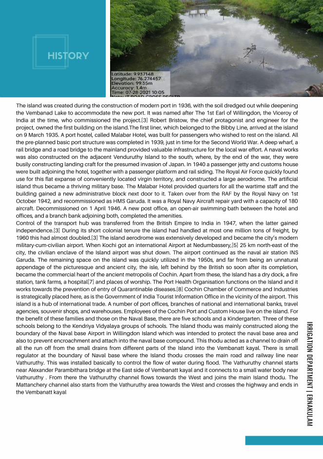
HISTORY
Control of the transport hub was transferred from the British Empire to India in 1947, when the latter gained
independence.[3] During its short colonial tenure the island had handled at most one million tons of freight, by
1960 this had almost doubled.[3] The island aerodrome was extensively developed and became the city’s modern
military-cum-civilian airport. When Kochi got an international Airport at Nedumbassery,[5] 25 km north-east of the
city, the civilian enclave of the Island airport was shut down. The airport continued as the naval air station INS
Garuda. The remaining space on the island was quickly utilized in the 1950s, and far from being an unnatural
appendage of the picturesque and ancient city, the isle, left behind by the British so soon after its completion,
became the commercial heart of the ancient metropolis of Cochin. Apart from these, the Island has a dry dock, a fire
station, tank farms, a hospital[7] and places of worship. The Port Health Organisation functions on the Island and it
works towards the prevention of entry of Quarantinable diseases.[8] Cochin Chamber of Commerce and Industries
is strategically placed here, as is the Government of India Tourist Information Office in the vicinity of the airport. This
island is a hub of international trade. A number of port offices, branches of national and international banks, travel
agencies, souvenir shops, and warehouses. Employees of the Cochin Port and Custom House live on the island. For
the benefit of these families and those on the Naval Base, there are five schools and a Kindergarten. Three of these
schools belong to the Kendriya Vidyalaya groups of schools. The Island thodu was mainly constructed along the
boundary of the Naval base Airport in Willingdon Island which was intended to protect the naval base area and
also to prevent encroachment and attach into the naval base compound. This thodu acted as a channel to drain off
all the run off from the small drains from different parts of the Island into the Vembanatt kayal. There is small
regulator at the boundary of Naval base where the Island thodu crosses the main road and railway line near
Vathuruthy. This was installed basically to control the flow of water during flood. The Vathuruthy channel starts
near Alexander Parambithara bridge at the East side of Vembanatt kayal and it connects to a small water body near
Vathuruthy . From there the Vathuruthy channel flows towards the West and joins the main Island thodu. The
Mattanchery channel also starts from the Vathuruthy area towards the West and crosses the highway and ends in
the Vembanatt kayal
The island was created during the construction of modern port in 1936, with the soil dredged out while deepening
the Vembanad Lake to accommodate the new port. It was named after The 1st Earl of Willingdon, the Viceroy of
India at the time, who commissioned the project.[3] Robert Bristow, the chief protagonist and engineer for the
project, owned the first building on the island.The first liner, which belonged to the Bibby Line, arrived at the island
on 9 March 1935. A port hostel, called Malabar Hotel, was built for passengers who wished to rest on the island. All
the pre-planned basic port structure was completed in 1939, just in time for the Second World War. A deep wharf, a
rail bridge and a road bridge to the mainland provided valuable infrastructure for the local war effort. A naval works
was also constructed on the adjacent Venduruthy Island to the south, where, by the end of the war, they were
busily constructing landing craft for the presumed invasion of Japan. In 1940 a passenger jetty and customs house
were built adjoining the hotel, together with a passenger platform and rail siding. The Royal Air Force quickly found
use for this flat expanse of conveniently located virgin territory, and constructed a large aerodrome. The artificial
island thus became a thriving military base. The Malabar Hotel provided quarters for all the wartime staff and the
building gained a new administrative block next door to it. Taken over from the RAF by the Royal Navy on 1st
October 1942, and recommissioned as HMS Garuda. It was a Royal Navy Aircraft repair yard with a capacity of 180
aircraft. Decommissioned on 1 April 1946. A new post office, an open-air swimming-bath between the hotel and
offices, and a branch bank adjoining both, completed the amenities.
IRRIGATION DEPARTMENT | ERNAKULAM
Page 202

PROBLEMS &
REASONS
a) Silt accumulation:-The main problem faced in the Island thodu, Vathuruthy channel
and Mattanchery channel and the areas in the vicinity is flooding
during the monsoon season.The main reason for this is silting up
of the thodu. Periodical cleaning is not done since long,hence th
.The Kochi Maharaja used to visit the Vathuruthy area and travelled through the Vathuruthy channel and
Mattanchery channel which had a width of 40m and crossed the Vembanatt kayal to reach Palluruthy
through the Pallichal thodu and Kochi Maharaja used to rest in the Nalukettu at Pallichal bridge.The
Maharaja used to take rest at Pallichal and his entire itenirary was taken care of by the Vadakumthodu and
Pallivathukkal family residing in Pallichal.He would spend time with the people there and used to visit the
Azhakiyakavu temple for darsana of goddessBhadra at Palluruthy.The Maharaja would participate in the
Pulavanibham near the premises of the temple,.People used to come for Pulavanibham near the temple
premises to sell materials made up ofcoconut palm trees,bamboo, arecanut,cadjanetc which was made in
there home itself. These materials were also transported to Ernakulam and places like Kollam
Chenganaserry,Alleppey etc.
This Vathuruthy channel and Mattanchery channel was earlier used as a means for transporting people
and materials to places like Mattanchery, Mundamveli, Kattiparambu, Perumpadappu Kannamaly and
chellanam in west Kochi also. They also used to transport materials like sand,bricks,stones,lime etc in big
country boats. Later in 1985, the Cochin Port Authority filled up the Vathuruthy channel and Mattanchery
channel at most of the places and made the main road from Thevara to Willingdon Island upto
Mattanchery halt. As a result the width of the said channels was reduced considerably which hindered
easy flow of water through the thodu which also reduced trade through these channels in the future. The
drainages from the Naval base were earlier connected to the Vathuruthy channel which facilitated easy
drainage of stormwater.
The elderly folks in the city,recount stories in this regard,but due to the rampant encroachments and
unscientific developments of different agencies and people on the banks of the Island thodu,the course
of canal has changed drastically to a shadow,once it had.
e depth of flow is reduced considerably. Waste dumping also has lessened the quality of water in the
thodu..Silt is accumulated for the entire length of 9.015km of Island thodu including the Vathruthy
channel and Mattanchery channel. In monsoon season the recession of flood water will take more time
and naturally the low lying area will easily get inundated. This portion of silt accumulation has to be cut
and cleaned to facilitate easy flow of water from the thodu to the Vembanadukayal and Thevara kayal.
IRRIGATION DEPARTMENT | ERNAKULAM
Page 203
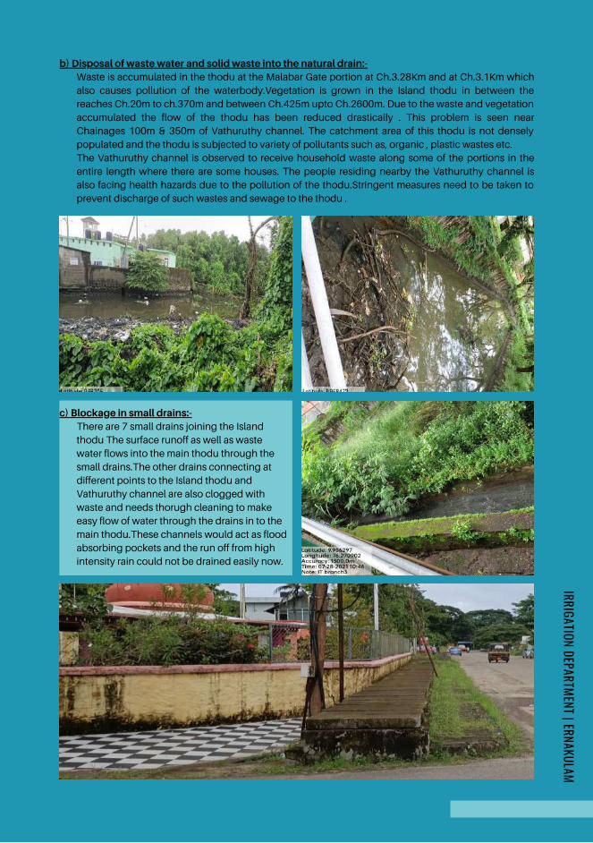
c) Blockage in small drains:-There are 7 small drains joining the Island
thodu The surface runoff as well as waste
water flows into the main thodu through the
small drains.The other drains connecting at
different points to the Island thodu and
Vathuruthy channel are also clogged with
waste and needs thorugh cleaning to make
easy flow of water through the drains in to the
main thodu.These channels would act as flood
absorbing pockets and the run off from high
intensity rain could not be drained easily now.
b) Disposal of waste water and solid waste into the natural drain:-Waste is accumulated in the thodu at the Malabar Gate portion at Ch.3.28Km and at Ch.3.1Km which
also causes pollution of the waterbody.Vegetation is grown in the Island thodu in between the
reaches Ch.20m to ch.370m and between Ch.425m upto Ch.2600m. Due to the waste and vegetation
accumulated the flow of the thodu has been reduced drastically . This problem is seen near
Chainages 100m & 350m of Vathuruthy channel. The catchment area of this thodu is not densely
populated and the thodu is subjected to variety of pollutants such as, organic , plastic wastes etc.
The Vathuruthy channel is observed to receive household waste along some of the portions in the
entire length where there are some houses. The people residing nearby the Vathuruthy channel is
also facing health hazards due to the pollution of the thodu.Stringent measures need to be taken to
prevent discharge of such wastes and sewage to the thodu .
IRRIGATION DEPARTMENT | ERNAKULAM
Page 204
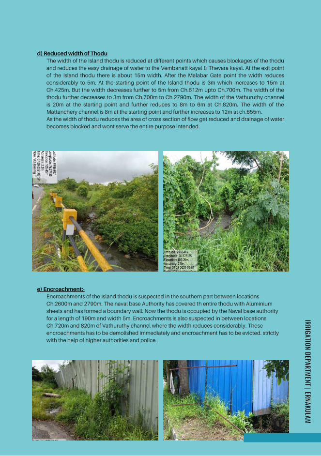
d) Reduced width of ThoduThe width of the Island thodu is reduced at different points which causes blockages of the thodu
and reduces the easy drainage of water to the Vembanatt kayal & Thevara kayal. At the exit point
of the Island thodu there is about 15m width. After the Malabar Gate point the width reduces
considerably to 5m. At the starting point of the Island thodu is 3m which increases to 15m at
Ch.425m. But the width decreases further to 5m from Ch.612m upto Ch.700m. The width of the
thodu further decreases to 3m from Ch.700m to Ch.2790m. The width of the Vathuruthy channel
is 20m at the starting point and further reduces to 8m to 6m at Ch.820m. The width of the
Mattanchery channel is 8m at the starting point and further increases to 12m at ch.655m.
As the width of thodu reduces the area of cross section of flow get reduced and drainage of water
becomes blocked and wont serve the entire purpose intended.
e) Encroachment:-Encroachments of the Island thodu is suspected in the southern part between locations
Ch:2600m and 2790m. The naval base Authority has covered th entire thodu with Aluminium
sheets and has formed a boundary wall. Now the thodu is occupied by the Naval base authority
for a length of 190m and width 5m. Encroachments is also suspected in between locations
Ch:720m and 820m of Vathuruthy channel where the width reduces considerably. These
encroachments has to be demolished immediately and encroachment has to be evicted. strictly
with the help of higher authorities and police.
IRRIGATION DEPARTMENT | ERNAKULAM
Page 205

f) Existing culverts having no head room and vent wayVentway of the thodu is narrowed at the existing railway culvert near Vathuruthy junction which
causes accumulation of wastes and finally blocking the flow of water near Ch.350m, The existing
culvert at this chainages has to be demolished and new culverts with sufficient vent way and
head room has to be rebuilt.
g ) Utility pipes crossing drainsThe utility pipes of KWA is crossing the Island thodu at Ch350m at Vathuruthy at railway crossing
which obstructs the free flow of water, especially during flood season. The pipes laid through the
water surface of the thodu has to be lifted, leaving a clear headroom to accommodate flood
water. The following locations are prone to flooding due to the obstruction of utility pipes
IRRIGATION DEPARTMENT | ERNAKULAM
Page 206
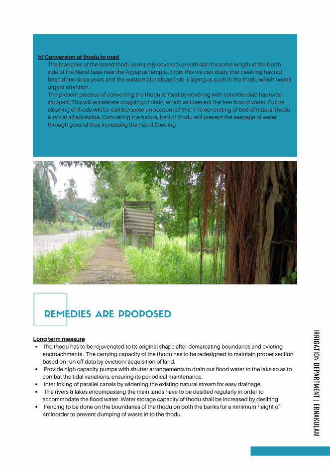
REMEDIES ARE PROPOSED
h) Conversion of thodu to roadThe branches of the Island thodu is entirely covered up with slab for some length at the North
side of the Naval base near the Ayyappa temple.. From this we can study that cleaning has not
been done since years and the waste materials and silt is laying as such in the thodu which needs
urgent attention.
The present practice of converting the thodu to road by covering with concrete slab has to be
stopped. This will accelerate clogging of drain, which will prevent the free flow of water. Future
cleaning of thodu will be cumbersome on account of this. The concreting of bed of natural thodu
is not at all advisable. Concreting the natural bed of thodu will prevent the seepage of water
through ground thus increasing the risk of flooding
The thodu has to be rejuvenated to its original shape after demarcating boundaries and evicting
encroachments . The carrying capacity of the thodu has to be redesigned to maintain proper section
based on run off data by eviction/ acquisition of land.
Provide high capacity pumps with shutter arrangements to drain out flood water to the lake so as to
combat the tidal variations, ensuring its periodical maintenance.
Interlinking of parallel canals by widening the existing natural stream for easy drainage.
The rivers & lakes encompassing the main lands have to be desilted regularly in order to
accommodate the flood water. Water storage capacity of thodu shall be increased by desilting
Fencing to be done on the boundaries of the thodu on both the banks for a minimum height of
4minorder to prevent dumping of waste in to the thodu.
Long term measure
IRRIGATION DEPARTMENT | ERNAKULAM
Page 207
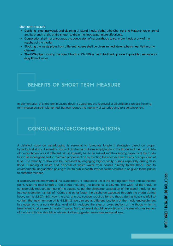
BENEFITS OF SHORT TERM MEASURE
Desilting , clearing weeds and cleaning of Island thodu, Vathuruthy Channel and Mattanchery channel
and its branch at the entire stretch to drain the flood water more effectively.
Corporation shall not encourage the conversion of natural thodu to concrete thods at any of the
reaches of the thodu
Blocking the waste pipes from different houses shall be given immediate emphasis near Vathuruthy
channel
The KWA pipe crossing the Island thodu at Ch.350.m has to be lifted up so as to provide clearance for
easy flow of water.
Short term measure
Implementation of short term measure doesn’t guarantee the redressal of all problems, unless the long
term measures are implemented. But can reduce the intensity of waterlogging to a certain extent.
CONCLUSION/RECOMMENDATIONS
A detailed study on waterlogging is essential to formulate longterm strategies based on proper
hydrological study. A scientific study of discharge of drains emptying in to the thodu and the run off data
of the catchment area at different rainfall intensity has to be arrived and the carrying capacity of the thodu
has to be redesigned and to maintain proper section by evicting the encroachment if any or acquisition of
land. The velocity of flow can be increased by engaging highcapacity pumps especially during flash
flood. Dumping of waste and disposal of waste water from houses directly to the thodu lead to
environmental degradation posing threat to public health. Proper awareness has to be given to the public
to curb this menace.
It is observed that the width of the Island thodu is reduced to 3m at the starting point from 15m at the end
point. Also the total length of the thodu including the branches is 3.82Km. The width of the thodu is
considerably reduced at most of the places. As per the discharge calculation of the Island thodu taking
into consideration rainfall of 10Cms and other factor the discharge expected through the thodu during
heavy rain is 2.897m3/S. Now the area of cross section required for the thodu during heavy rainfall to
contain the maximum run off is 4.828m2. We can see at different locations of the thodu encroachment
has occurred to a considerable level which reduces the area of cross section of the thodu which is
insufficient to take care of the storm water. Encroachment should be evicted and the area of cross section
of the Island thodu should be retained to the suggested new cross sectional area.
IRRIGATION DEPARTMENT | ERNAKULAM
Page 208
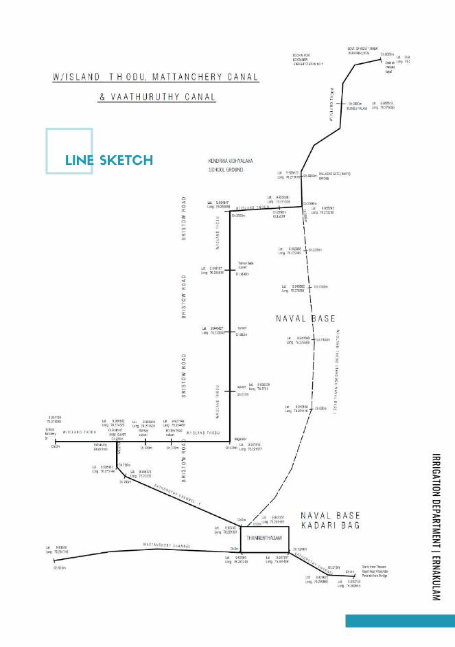
LINE SKETCH
IRRIGATION DEPARTMENT | ERNAKULAM
Page 209
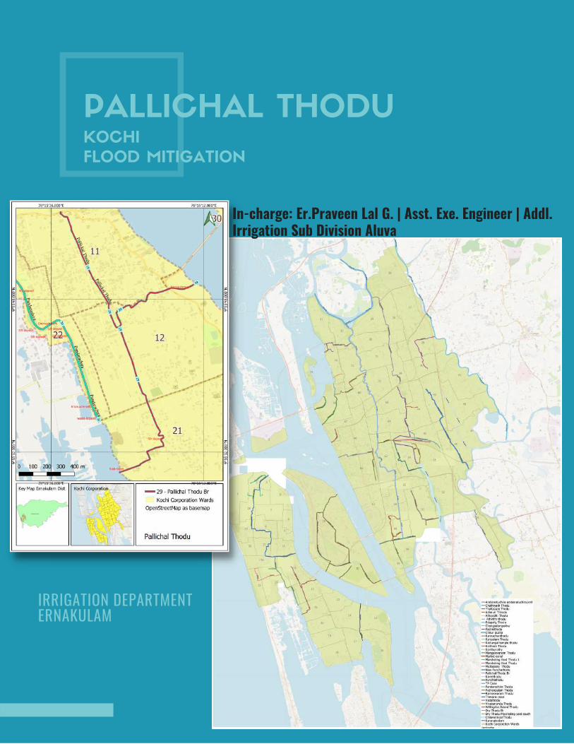
PALLICHAL THODUKOCHI
FLOOD MITIGATION
IRRIGATION DEPARTMENT ERNAKULAM
In-charge: Er.Praveen Lal G. | Asst. Exe. Engineer | Addl.Irrigation Sub Division Aluva

INTRODUCTION
Kochi is located on the southwest coast of India at 9°58′N 76°13′E, with a corporation limit area of 94.88
km2. Over the years, the city has expanded considerably outside the corporation. The city straddles the
backwaters, encompassing the northern end of a peninsula, several islands and a portion of the
mainland. To the west lies the Laccadive Sea, and to the east is the urbanised region in the rest of the
mainland area. Much of Kochi lies at sea level, with a coastline of 48 km.
The current metropolitan limits of Kochi include the mainland Ernakulam.Fort Kochi, the suburbs of
Edapally, Kalamassery, Aluva and Kakkanad to the northeast; Tripunithura to the southeast; and a group
of islands closely scattered in the Vembanad Lake. Called the "Queen of the Arabian Sea", Kochi was an
important spice trading centre on the west coast of India from the 14th century onward, and maintained a
trade network with Arab merchants from the pre-Islamic era.
Kochi city lies almost par with the Sea level and hence the drainage in parts of Kochi including Willingdon
Island deserves much importance as well as more sensitive also . The average altitude of Kochi ranges
from+7.50mto+1.00m above MSL from east to west.A number of main and secondary canals criss - cross
the area,some were used for transportation in the past and now subjected to severe environmental
degradation due to waste dumping . The canals are exhausted with drastic reduction in water carrying
capacity due to rampant encroachment. The idea of developing a new port in Kochi was first felt by Sir
Robert Bristow, who was appointed by Lord Willingdon, then-the Governor of Madras Presidency, to
create a new modern port on the West coast of India at Kochi.
Cochin is a major port in India, and Willingdon Island is a landmark. The Island is connected to the
mainland by Venduruthy Bridge, which has road and railway links. There are two railway stations on the
Island - the Mattancherry Halt and the Cochin Harbour Terminus. The headquarters of the Southern Naval
Command of the Indian Navy is located on the island. Cochin shipyard is also located near this island. It is
also a major tourist center. Willingdon Island is also home to several hotels and offices of clearing agents.
PALLICHAL THODU
IRRIGATION DEPARTMENT | ERNAKULAM
Page 211
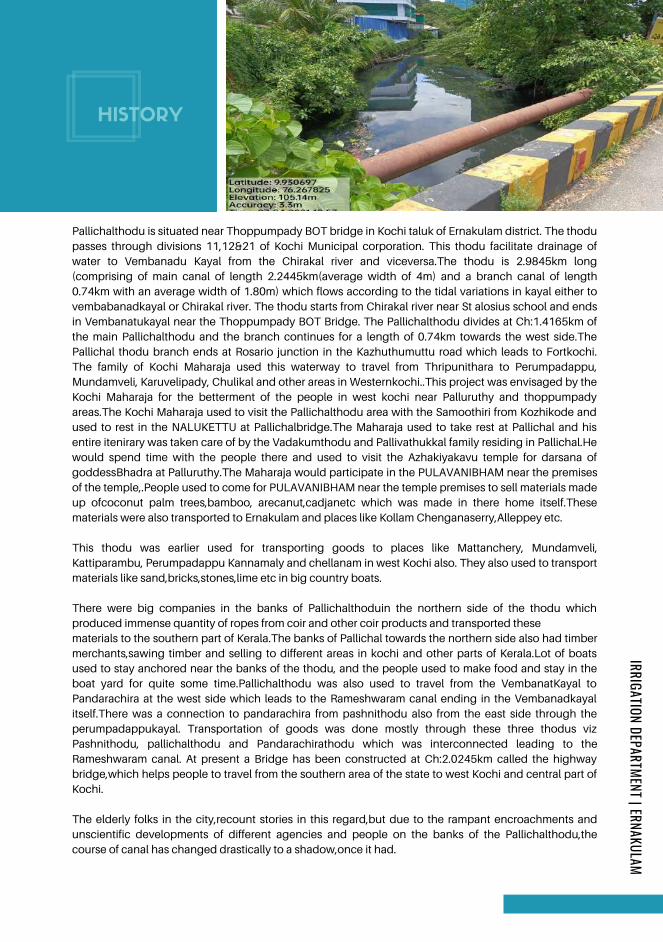
HISTORY
The elderly folks in the city,recount stories in this regard,but due to the rampant encroachments and
unscientific developments of different agencies and people on the banks of the Pallichalthodu,the
course of canal has changed drastically to a shadow,once it had.
Pallichalthodu is situated near Thoppumpady BOT bridge in Kochi taluk of Ernakulam district. The thodu
passes through divisions 11,12&21 of Kochi Municipal corporation. This thodu facilitate drainage of
water to Vembanadu Kayal from the Chirakal river and viceversa.The thodu is 2.9845km long
(comprising of main canal of length 2.2445km(average width of 4m) and a branch canal of length
0.74km with an average width of 1.80m) which flows according to the tidal variations in kayal either to
vembabanadkayal or Chirakal river. The thodu starts from Chirakal river near St alosius school and ends
in Vembanatukayal near the Thoppumpady BOT Bridge. The Pallichalthodu divides at Ch:1.4165km of
the main Pallichalthodu and the branch continues for a length of 0.74km towards the west side.The
Pallichal thodu branch ends at Rosario junction in the Kazhuthumuttu road which leads to Fortkochi.
The family of Kochi Maharaja used this waterway to travel from Thripunithara to Perumpadappu,
Mundamveli, Karuvelipady, Chulikal and other areas in Westernkochi..This project was envisaged by the
Kochi Maharaja for the betterment of the people in west kochi near Palluruthy and thoppumpady
areas.The Kochi Maharaja used to visit the Pallichalthodu area with the Samoothiri from Kozhikode and
used to rest in the NALUKETTU at Pallichalbridge.The Maharaja used to take rest at Pallichal and his
entire itenirary was taken care of by the Vadakumthodu and Pallivathukkal family residing in Pallichal.He
would spend time with the people there and used to visit the Azhakiyakavu temple for darsana of
goddessBhadra at Palluruthy.The Maharaja would participate in the PULAVANIBHAM near the premises
of the temple,.People used to come for PULAVANIBHAM near the temple premises to sell materials made
up ofcoconut palm trees,bamboo, arecanut,cadjanetc which was made in there home itself.These
materials were also transported to Ernakulam and places like Kollam Chenganaserry,Alleppey etc.
This thodu was earlier used for transporting goods to places like Mattanchery, Mundamveli,
Kattiparambu, Perumpadappu Kannamaly and chellanam in west Kochi also. They also used to transport
materials like sand,bricks,stones,lime etc in big country boats.
There were big companies in the banks of Pallichalthoduin the northern side of the thodu which
produced immense quantity of ropes from coir and other coir products and transported these
materials to the southern part of Kerala.The banks of Pallichal towards the northern side also had timber
merchants,sawing timber and selling to different areas in kochi and other parts of Kerala.Lot of boats
used to stay anchored near the banks of the thodu, and the people used to make food and stay in the
boat yard for quite some time.Pallichalthodu was also used to travel from the VembanatKayal to
Pandarachira at the west side which leads to the Rameshwaram canal ending in the Vembanadkayal
itself.There was a connection to pandarachira from pashnithodu also from the east side through the
perumpadappukayal. Transportation of goods was done mostly through these three thodus viz
Pashnithodu, pallichalthodu and Pandarachirathodu which was interconnected leading to the
Rameshwaram canal. At present a Bridge has been constructed at Ch:2.0245km called the highway
bridge,which helps people to travel from the southern area of the state to west Kochi and central part of
Kochi.
IRRIGATION DEPARTMENT | ERNAKULAM
Page 212
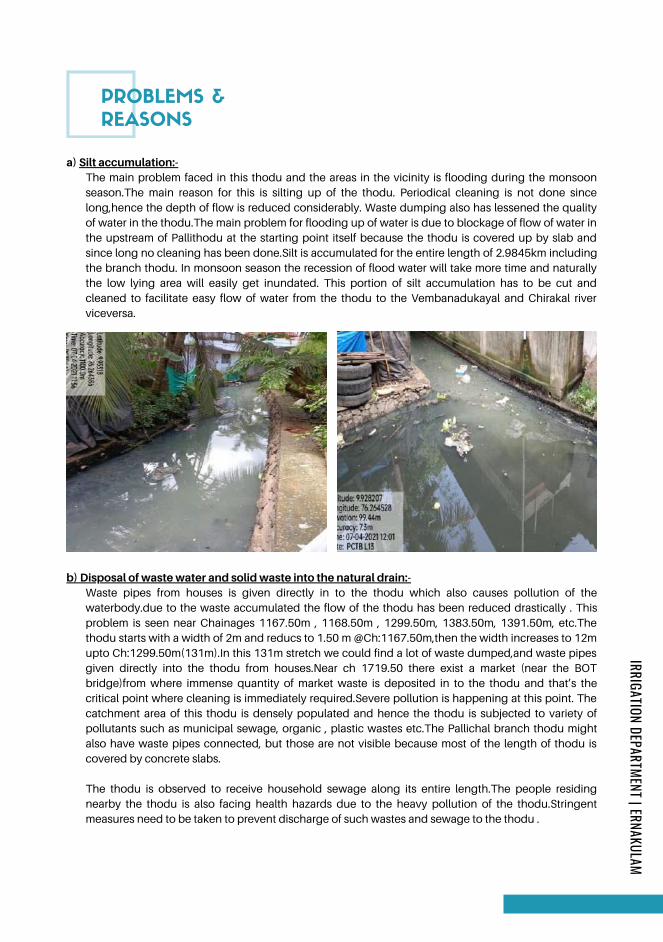
PROBLEMS &
REASONS
a) Silt accumulation:-The main problem faced in this thodu and the areas in the vicinity is flooding during the monsoon
season.The main reason for this is silting up of the thodu. Periodical cleaning is not done since
long,hence the depth of flow is reduced considerably. Waste dumping also has lessened the quality
of water in the thodu.The main problem for flooding up of water is due to blockage of flow of water in
the upstream of Pallithodu at the starting point itself because the thodu is covered up by slab and
since long no cleaning has been done.Silt is accumulated for the entire length of 2.9845km including
the branch thodu. In monsoon season the recession of flood water will take more time and naturally
the low lying area will easily get inundated. This portion of silt accumulation has to be cut and
cleaned to facilitate easy flow of water from the thodu to the Vembanadukayal and Chirakal river
viceversa.
b) Disposal of waste water and solid waste into the natural drain:-Waste pipes from houses is given directly in to the thodu which also causes pollution of the
waterbody.due to the waste accumulated the flow of the thodu has been reduced drastically . This
problem is seen near Chainages 1167.50m , 1168.50m , 1299.50m, 1383.50m, 1391.50m, etc.The
thodu starts with a width of 2m and reducs to 1.50 m @Ch:1167.50m,then the width increases to 12m
upto Ch:1299.50m(131m).In this 131m stretch we could find a lot of waste dumped,and waste pipes
given directly into the thodu from houses.Near ch 1719.50 there exist a market (near the BOT
bridge)from where immense quantity of market waste is deposited in to the thodu and that’s the
critical point where cleaning is immediately required.Severe pollution is happening at this point. The
catchment area of this thodu is densely populated and hence the thodu is subjected to variety of
pollutants such as municipal sewage, organic , plastic wastes etc.The Pallichal branch thodu might
also have waste pipes connected, but those are not visible because most of the length of thodu is
covered by concrete slabs.
The thodu is observed to receive household sewage along its entire length.The people residing
nearby the thodu is also facing health hazards due to the heavy pollution of the thodu.Stringent
measures need to be taken to prevent discharge of such wastes and sewage to the thodu .
IRRIGATION DEPARTMENT | ERNAKULAM
Page 213
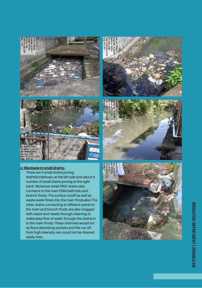
c) Blockage in small drains:-There are 6 small drains joining
thePallichalthodu at the left side and about 9
number of small drains joining at the right
bank. Moreover small PWD drains also
connects to the main Pallichalthodu and
branch thodu The surface runoff as well as
waste water flows into the main thodualso.The
other drains connecting at different points to
the main and branch thodu are also clogged
with waste and needs thorugh cleaning to
make easy flow of water through the drains in
to the main thodu.These channels would act
as flood absorbing pockets and the run off
from high intensity rain could not be drained
easily now..
IRRIGATION DEPARTMENT | ERNAKULAM
Page 214
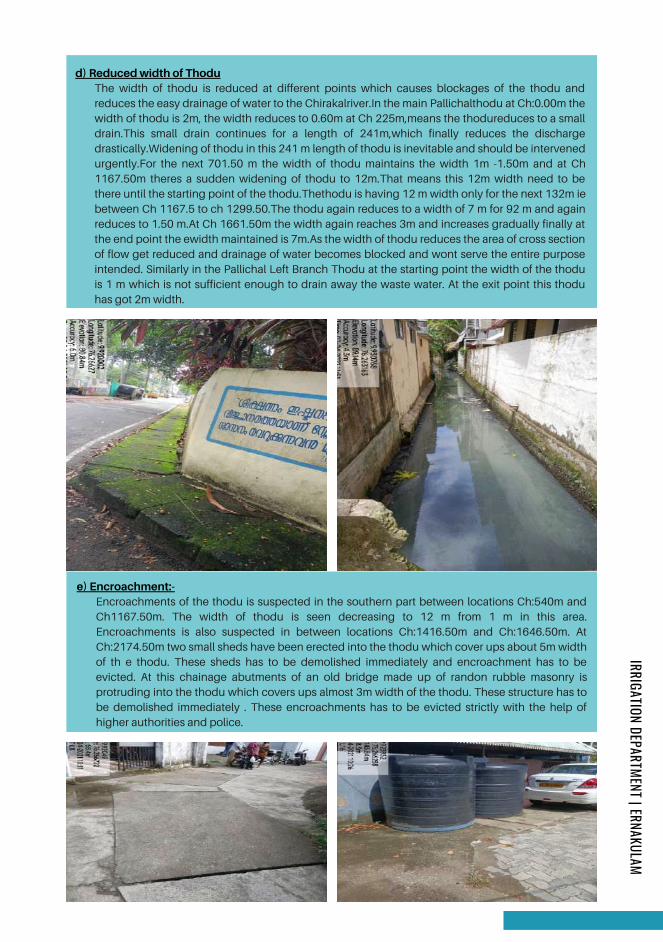
d) Reduced width of ThoduThe width of thodu is reduced at different points which causes blockages of the thodu and
reduces the easy drainage of water to the Chirakalriver.In the main Pallichalthodu at Ch:0.00m the
width of thodu is 2m, the width reduces to 0.60m at Ch 225m,means the thodureduces to a small
drain.This small drain continues for a length of 241m,which finally reduces the discharge
drastically.Widening of thodu in this 241 m length of thodu is inevitable and should be intervened
urgently.For the next 701.50 m the width of thodu maintains the width 1m -1.50m and at Ch
1167.50m theres a sudden widening of thodu to 12m.That means this 12m width need to be
there until the starting point of the thodu.Thethodu is having 12 m width only for the next 132m ie
between Ch 1167.5 to ch 1299.50.The thodu again reduces to a width of 7 m for 92 m and again
reduces to 1.50 m.At Ch 1661.50m the width again reaches 3m and increases gradually finally at
the end point the ewidth maintained is 7m.As the width of thodu reduces the area of cross section
of flow get reduced and drainage of water becomes blocked and wont serve the entire purpose
intended. Similarly in the Pallichal Left Branch Thodu at the starting point the width of the thodu
is 1 m which is not sufficient enough to drain away the waste water. At the exit point this thodu
has got 2m width.
e) Encroachment:-Encroachments of the thodu is suspected in the southern part between locations Ch:540m and
Ch1167.50m. The width of thodu is seen decreasing to 12 m from 1 m in this area.
Encroachments is also suspected in between locations Ch:1416.50m and Ch:1646.50m. At
Ch:2174.50m two small sheds have been erected into the thodu which cover ups about 5m width
of th e thodu. These sheds has to be demolished immediately and encroachment has to be
evicted. At this chainage abutments of an old bridge made up of randon rubble masonry is
protruding into the thodu which covers ups almost 3m width of the thodu. These structure has to
be demolished immediately . These encroachments has to be evicted strictly with the help of
higher authorities and police.
IRRIGATION DEPARTMENT | ERNAKULAM
Page 215
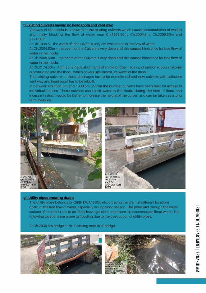
f) Existing culverts having no head room and vent wayVentway of the thodu is narrowed at the existing culverts which causes accumulation of wastes
and finally blocking the flow of water near Ch.1938.50m, Ch.2004.5m, Ch.2009.50m and
2174.50m
At Ch.1938.5 – the width of the Culvert is only 3m which blocks the flow of water.
At Ch.2004.50m – the beam of the Culvert is very deep and this causes hindrance for free flow of
water in the thodu.
At Ch.2009.50m – the beam of the Culvert is very deep and this causes hindrance for free flow of
water in the thodu.
At Ch.2174.50m - At this chainage abutments of an old bridge made up of randon rubble masonry
is protruding into the thodu which covers ups almost 3m width of the thodu
The existing culverts at these chainages has to be demolished and new culverts with sufficient
vent way and head room has to be rebuilt.
In between Ch.1661.5m and 1938.5m (277m) the number culverts have been built for access to
individual houses. These culverts can block water in the thodu during the time of flood and
incessant rains.It would be better to increase the height of the culvert and can be taken as a long
term measure.
g ) Utility pipes crossing drainsThe utility pipes belongs to KSEB/ KWA/ BSNL etc. crossing the drain at different locations
obstruct the free flow of water, especially during flood season. The pipes laid through the water
surface of the thodu has to be lifted, leaving a clear headroom to accommodate flood water. The
following locations are prone to flooding due to the obstruction of utility pipes.
At Ch.2036.5m bridge at NH Crossing near BOT bridge
IRRIGATION DEPARTMENT | ERNAKULAM
Page 216
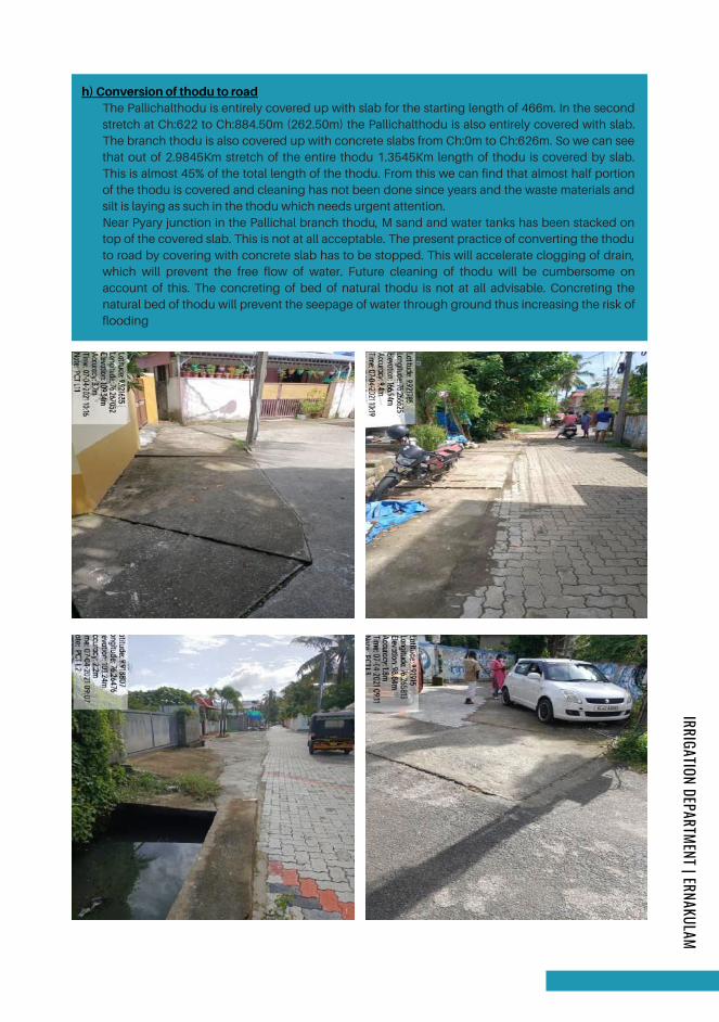
h) Conversion of thodu to roadThe Pallichalthodu is entirely covered up with slab for the starting length of 466m. In the second
stretch at Ch:622 to Ch:884.50m (262.50m) the Pallichalthodu is also entirely covered with slab.
The branch thodu is also covered up with concrete slabs from Ch:0m to Ch:626m. So we can see
that out of 2.9845Km stretch of the entire thodu 1.3545Km length of thodu is covered by slab.
This is almost 45% of the total length of the thodu. From this we can find that almost half portion
of the thodu is covered and cleaning has not been done since years and the waste materials and
silt is laying as such in the thodu which needs urgent attention.
Near Pyary junction in the Pallichal branch thodu, M sand and water tanks has been stacked on
top of the covered slab. This is not at all acceptable. The present practice of converting the thodu
to road by covering with concrete slab has to be stopped. This will accelerate clogging of drain,
which will prevent the free flow of water. Future cleaning of thodu will be cumbersome on
account of this. The concreting of bed of natural thodu is not at all advisable. Concreting the
natural bed of thodu will prevent the seepage of water through ground thus increasing the risk of
flooding
IRRIGATION DEPARTMENT | ERNAKULAM
Page 217
BENEFITS OF SHORT TERM MEASURE
The thodu has to be rejuvenated to its original shape after demarcating boundaries and evicting
encroachments . The carrying capacity of the thodu has to be redesigned to maintain proper section
based on run off data by eviction/ acquisition of land.
Provide high capacity pumps with shutter arrangements to drain out flood water to the lake so as to
combat the tidal variations, ensuring its periodical maintenance.
Interlinking of parallel canals by widening the existing natural stream for easy drainage.
The rivers & lakes encompassing the main lands have to be desilted regularly in order to
accommodate the flood water. Water storage capacity of thodu shall be increased by desilting
Fencing to be done on the boundaries of the thodu on both the banks for a minimum height of
4minorder to prevent dumping of waste in to the thodu.
Reconstruction of new culvert at Ch.2004.5m to provide vent way and headroom for water flow.
Reconstruction of new culvert at Ch.2009.5m to provide vent way and headroom for water flow.
Construction of a sluice at the bellmouth at Ch.2244.5m with shutter arrangements to control flood
waters.
Long term measure
1.
2.
3.
4.
5.
6.
7.
8.
REMEDIES ARE PROPOSED
Desilting and cleaning of Pallichalthodu and its branch at the entire stretch to drain the flood water
more effectively.
Corporation shall not encourage the conversion of natural thodu to concrete thods at any of the
reaches of the thodu
Blocking the waste pipes from different companies and houses shall be given immediate emphasis.
Demolishing of existing abutment made of RR Masonry at Ch.2174.5m protruding into the thodu
A banyan tree of large girth at right bank of thodu near Ch.2174.5m has to be cut to widen the
waterway.
Short term measure
1.
2.
3.
4.
5.
Implementation of short term measure doesn’t guarantee the redressal of all problems, unless the long
term measures are implemented. But can reduce the intensity of waterlogging to a certain extent.
IRRIGATION DEPARTMENT | ERNAKULAM
Page 218
CONCLUSION/
RECOMMENDATIONS
A detailed study on waterlogging is
essential to formulate longterm strategies
based on proper hydrological study. A
scientific study of discharge of drains
emptying in to the thodu and the run off
data of the catchment area at different
rainfall intensity has to be arrived and the
carrying capacity of the thodu has to be
redesigned and to maintain proper
section by evicting the encroachment if
any or acquisition of land. The velocity of
flow can be increased by engaging
highcapacity pumps especially during
flash flood. Dumping of waste and
disposal of waste water from houses
directly to the thodu lead to
environmental degradation posing threat
to public health. Proper awareness has to
be given to the public to curb this
menace.
It is observed that the width of the
Pallichal thodu is reduced to 0.6m at the
starting point from 7m at the end point.
Also the total length of the thodu
including the branches is 2.984Km. Out of
this 1.86Km of length of the thodu is
covered with slab. The width of the thodu
is considerably reduced at most of the
places. As per the discharge calculation
of the Pallichal thodu taking into
consideration rainfall of 10Cms and other
factor the discharge expected through
the thodu during heavy rain is 2.015m3/S.
Now the area of cross section required for
the thodu during heavy rainfall to contain
the maximum run off is 3.358m2. We can
see at different locations of the thodu
encroachment has occurred to a
considerable level which reduces the
area of cross section of the thodu which is
insufficient to take care of the storm
water. Encroachment should be evicted
and the area of cross section of the
Pallichal thodu should be retained to the
suggested new cross sectional area.
IRRIGATION DEPARTMENT | ERNAKULAM
Page 219
CH 0.00 M
Starting
point
chirackal
river
CH 40 M
covered
with
slab
silt
deposited
CH 162 M
covered
with
slabsilt
deposited
CH 225 M
covered
with
slab.
width
reduced
silt
deposited
CH 308 M
silt
deposited
silt
deposited
CH 466 M
covered
with
slab.
covered
with
slab.
silt
deposited
CH 540 MCH
563
M
CH
573
M
CH
588
M
CH
622
M
silt
deposited
covered
with
slab.
CH
626.5
M
CH
689.5
M
silt
deposited
CH
810.5
M
covered
with
slab.small
culert
CH
876.5
M
silt
deposited
silt
deposited
CH
884.5
M
covered
with
slab.
CH
1139.5
M
covered
with
slab.
culvert
CH
1167.5
M
silt
waste
deposited
CH
1168.5
M
silt
deposited
silt
deposited
CH
1299.5
M
draindrain
drain
waste
pipes
& silt
deposited
drain drain
CH
1383.5
M
pallichal
bridge
silt
deposited
CH
1391.5
M
silt
waste
deposited
CH
1416.5
M
CH
1424.5
M
CH
1504.5
M
waste
deposited
CH
1534.5
M
CH
1539.5
M
culvert
culvert
CH
1646.5
M
Road
bend
CH
1661.5
M
culvert
CH
1672.5
M
silt
deposited
culvert
end
CH
1689.5
M
CH
1719.5
M
CH
1769.5
M
silt
deposited
culvert
culvert
CH
1799.5
M
CH
1827.5
M
CH
1849.5
M
CH
1864.5
M
CH
1871.5
M
CH
1899.5
M
CH
1938.5
M
CH
1945.5
M
CH
2004.5
M
CH
2009.5
M
CH
2024.5
M
CH
2036.5
M
culvert
drain
culvert
culvert
culvert
culvertculvert
(To
be
reconstructed)
waste
deposited
two
culverts
(To
be
reconstructed)
Bridge
(KWA
pipes
&
KSEB
cables
blocking
flow)
CH
2174.5
M
CH
2224.5
M
CH
2244.5
M
waste
& silt
deposited
Enchroachment
-2
shops
(New
bridge
proposed
Sluice
proposed
Bell
mouth
to
vembanattu
kayal
silt
deposited
silt
deposited
silt
deposited
silt
deposited
PA
LLIC
HA
L T
HO
DU
LE
FT
B
RA
NC
H
CH
710M
CH 124M
CH 274M
CH 370 M
CH 528M
CH
557M
CH
626M
CH
630M
CH
740
M
PALLICHAL THODU
covered
slab
.silt
deposited
CH 377 M
Culvert
waste
& silt
deposited
covered
slab
.silt
deposited
covered
slab
.silt
deposited
Culvert
Culvert
covered
slab
.silt
deposited
.silt
deposited
Culvert
drain
Culvert
CH 69M
CH 34M
CH 0M
Rosario
Junction
Page 220
CHITTOORPUZHAKOCHI
FLOOD MITIGATION
In-charge: Er.Resia P.K. | Personal Asst. | MICCErnakulam
IRRIGATION DEPARTMENT ERNAKULAM
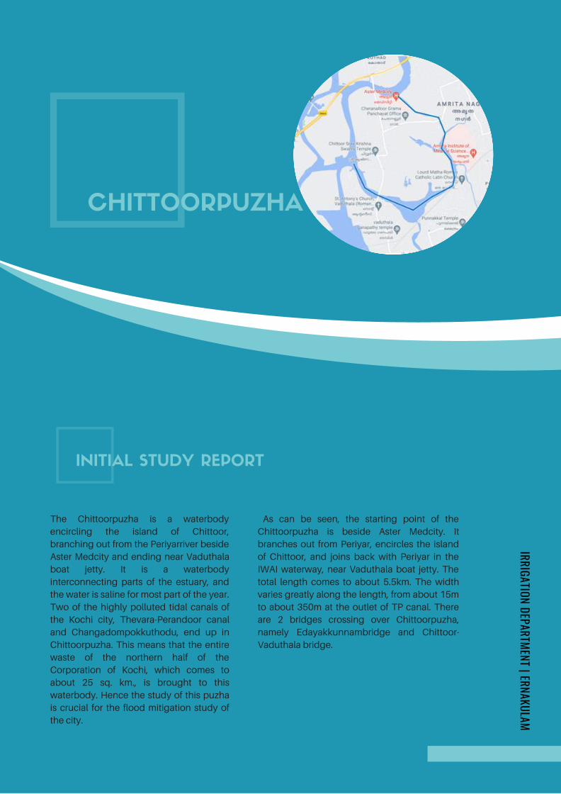
The Chittoorpuzha is a waterbody
encircling the island of Chittoor,
branching out from the Periyarriver beside
Aster Medcity and ending near Vaduthala
boat jetty. It is a waterbody
interconnecting parts of the estuary, and
the water is saline for most part of the year.
Two of the highly polluted tidal canals of
the Kochi city, Thevara-Perandoor canal
and Changadompokkuthodu, end up in
Chittoorpuzha. This means that the entire
waste of the northern half of the
Corporation of Kochi, which comes to
about 25 sq. km., is brought to this
waterbody. Hence the study of this puzha
is crucial for the flood mitigation study of
the city.
CHITTOORPUZHA
INITIAL STUDY REPORT
IRRIGATION DEPARTMENT | ERNAKULAM
As can be seen, the starting point of the
Chittoorpuzha is beside Aster Medcity. It
branches out from Periyar, encircles the island
of Chittoor, and joins back with Periyar in the
IWAI waterway, near Vaduthala boat jetty. The
total length comes to about 5.5km. The width
varies greatly along the length, from about 15m
to about 350m at the outlet of TP canal. There
are 2 bridges crossing over Chittoorpuzha,
namely Edayakkunnambridge and Chittoor-
Vaduthala bridge.
Page 222
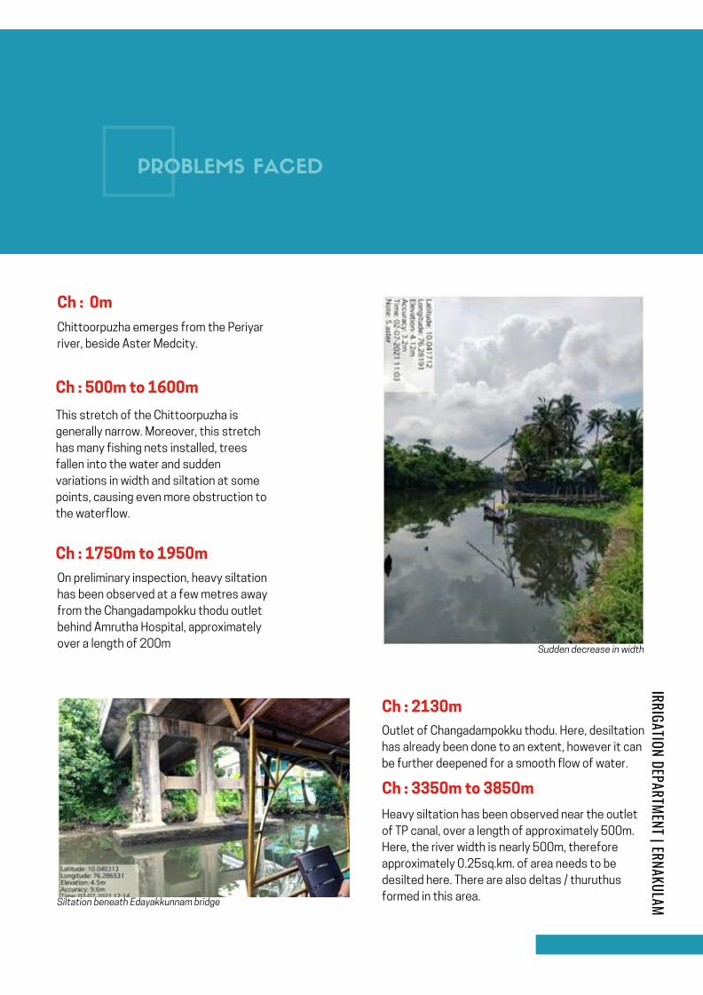
Chittoorpuzha emerges from the Periyar
river, beside Aster Medcity.
Ch : 0m
Outlet of Changadampokku thodu. Here, desiltation
has already been done to an extent, however it can
be further deepened for a smooth flow of water.
Ch : 500m to 1600m
This stretch of the Chittoorpuzha is
generally narrow. Moreover, this stretch
has many fishing nets installed, trees
fallen into the water and sudden
variations in width and siltation at some
points, causing even more obstruction to
the waterflow.
Sudden decrease in width
Siltation beneath Edayakkunnam bridge
Ch : 1750m to 1950m
On preliminary inspection, heavy siltation
has been observed at a few metres away
from the Changadampokku thodu outlet
behind Amrutha Hospital, approximately
over a length of 200m
Ch : 2130m
Ch : 3350m to 3850m
Heavy siltation has been observed near the outlet
of TP canal, over a length of approximately 500m.
Here, the river width is nearly 500m, therefore
approximately 0.25sq.km. of area needs to be
desilted here. There are also deltas / thuruthus
formed in this area.
PROBLEMS FACED
IRRIGATION DEPARTMENT | ERNAKULAM
Page 223
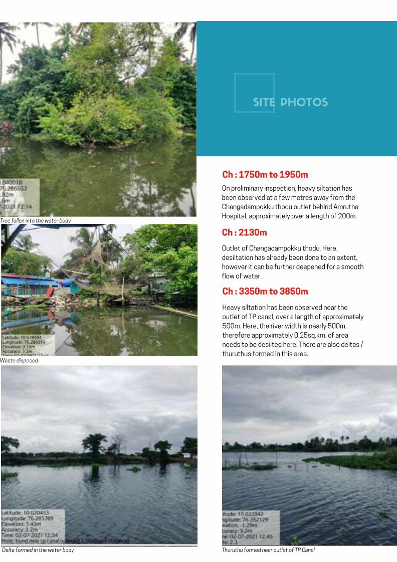
On preliminary inspection, heavy siltation has
been observed at a few metres away from the
Changadampokku thodu outlet behind Amrutha
Hospital, approximately over a length of 200m.Tree fallen into the water body
Waste disposed
Delta formed in the water body Thuruthu formed near outlet of TP Canal
Ch : 1750m to 1950m
Ch : 2130m
Outlet of Changadampokku thodu. Here,
desiltation has already been done to an extent,
however it can be further deepened for a smooth
flow of water.
Ch : 3350m to 3850m
Heavy siltation has been observed near the
outlet of TP canal, over a length of approximately
500m. Here, the river width is nearly 500m,
therefore approximately 0.25sq.km. of area
needs to be desilted here. There are also deltas /
thuruthus formed in this area.
SITE PHOTOS
Page 224
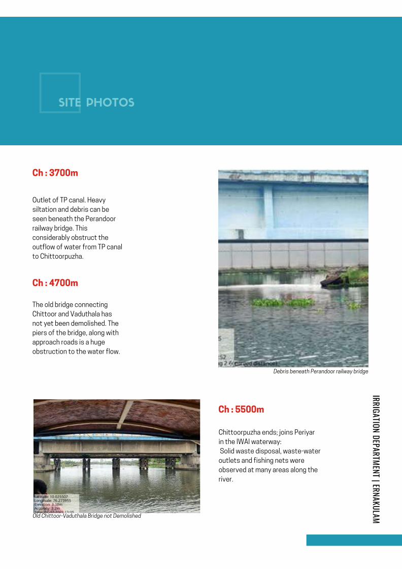
Outlet of TP canal. Heavy
siltation and debris can be
seen beneath the Perandoor
railway bridge. This
considerably obstruct the
outflow of water from TP canal
to Chittoorpuzha.
Chittoorpuzha ends; joins Periyar
in the IWAI waterway:
Solid waste disposal, waste-water
outlets and fishing nets were
observed at many areas along the
river.
Ch : 3700m
Debris beneath Perandoor railway bridge
Old Chittoor-Vaduthala Bridge not Demolished
Ch : 4700m
The old bridge connecting
Chittoor and Vaduthala has
not yet been demolished. The
piers of the bridge, along with
approach roads is a huge
obstruction to the water flow.
Ch : 5500m
SITE PHOTOS
IRRIGATION DEPARTMENT | ERNAKULAM
Page 225
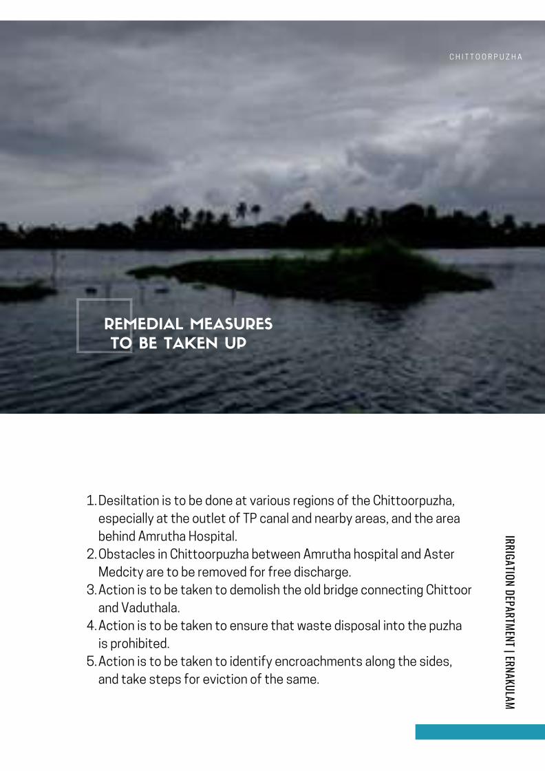
C H I T T O O R P U Z H A
Desiltation is to be done at various regions of the Chittoorpuzha,
especially at the outlet of TP canal and nearby areas, and the area
behind Amrutha Hospital.
Obstacles in Chittoorpuzha between Amrutha hospital and Aster
Medcity are to be removed for free discharge.
Action is to be taken to demolish the old bridge connecting Chittoor
and Vaduthala.
Action is to be taken to ensure that waste disposal into the puzha
is prohibited.
Action is to be taken to identify encroachments along the sides,
and take steps for eviction of the same.
1.
2.
3.
4.
5.
IRRIGATION DEPARTMENT | ERNAKULAM
REMEDIAL MEASURES
TO BE TAKEN UP
Page 226

Chitoor Puzha
Ch
: 0
km
Ch
:1
.1
km
Ch
: 1
.7
5km
Ch
:3
.3
5km
Ch
: 3
.7
km
Ch: 3.85km
Silted
Ch
:2
.2
km
Ch: 4.70km
Ch: 5.5km
Ch
: 1
.9
5km
Silted
TP
ca
na
l
Ed
aya
ku
nn
am
b
rid
ge
Ch
an
ga
do
mp
okk T
ho
du
Ch
itto
or b
rid
ge
Page 227
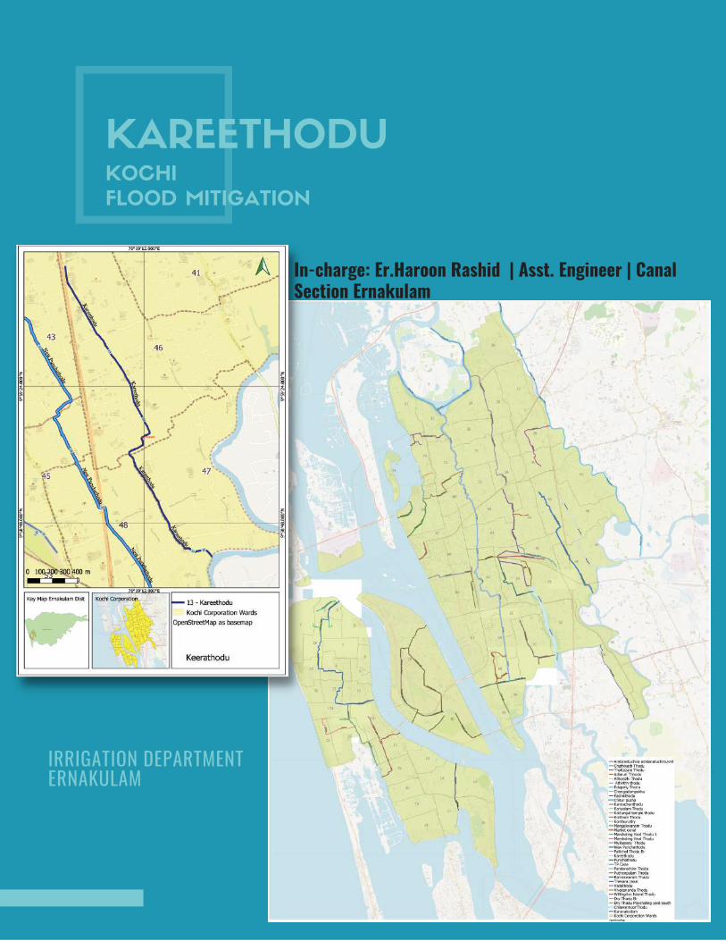
KAREETHODUKOCHI
FLOOD MITIGATION
In-charge: Er.Haroon Rashid | Asst. Engineer | CanalSection Ernakulam
IRRIGATION DEPARTMENT ERNAKULAM
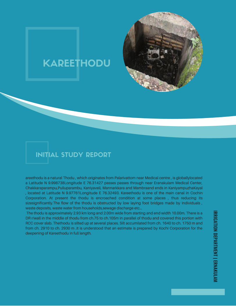
KAREETHODU
areethodu is a natural Thodu , which originates from Palarivattom near Medical centre , is globallylocated
a Latitude N 9.998738Longitude E 76.31427 passes passes through near Eranakulam Medical Center,
Chakkaraparampu,Pulluparambu, Kaniyaveli, Mannarkkara and Mambraand ends in KaniyampuzhaKayal
, located at Latitude N 9.97761Longitude E 76.32493. Kareethodu is one of the main canal in Cochin
Corporation. At present the thodu is encroached condition at some places , thus reducing its
sizesignificantly.The flow of the thodu is obstructed by low laying foot bridges made by Individuals ,
waste deposits, waste water from households,sewage discharge etc…
The thodu is approximately 2.93 km long and 2.00m wide from starting and end width 10.00m. There is a
DR r/wall in the middle of thodu from ch.75 to ch.105m in parallel of thodu and covered this portion with
RCC cover slab. Thethodu is silted up at several places. Silt accumilated from ch. 1640 to ch. 1750 m and
from ch. 2910 to ch. 2930 m .It is understood that an estimate is prepared by Kochi Corporation for the
deepening of Kareethodu in full length.
INITIAL STUDY REPORT
IRRIGATION DEPARTMENT | ERNAKULAM
Page 229
KDue to the dumping of wastes free flow through this canal is obstructed and
causes stagnation of dirty water and flooding which leads to unhealthy condition
and epidemic. The tidal effects also affect the flow of water in the canal. During
rainy season the flood water cannot discharge immediately at high tide period and
the nearby houses are being flooded up. The flood water entered into the houses
located on the banks of the canal. Now it is observed that the canal has become a
waste dumping yard at several places and water flow has been obstructed. As a
result the canal has become breeding place of mosquitoes which in turn causes
epidemics such as Malaria, various viral infections etc. in nearby areas. Flow is
obstructed at several locations. Various organic, inorganic and plastic wastes are
freely dumped in to this canal causing hindrance to the free flow of water.
Dumping of waste is a serious problem to be tackled. As a remedial measure, the
foul and chocking materials in the canal have to be removed for the free flow of
water and protect the canal from dumping the waste and flooding up of the canal.
So paramount importance to realign, deepen and protection of side of the canal is
absolutely essential. There are numerous foot bridges being constructed across
this thodu for road connectivity. Theses low lying foot bridges are also obstruct
the flow of water.
For improving the thodu there were already reconstructed recently two bridges at
Mannarakkara and Kaniyavely. Due to this construction the flood water problems
could be resolved in that area. At present a new reconstruction work of existing
bridge is going on at Pulluparambu. Besides this another work is going to tender
procedure for the reconstruction of existing bridge at Mambra .
CONT...
IRRIGATION DEPARTMENT | ERNAKULAM
Page 230

Some areas are seen that
encroached on conducting the
survey on the thodu.The details of
encroachment can be ascertained
only after conducting survey by
the Revanue department.
The sides off the thodu are seen
presently protected all
mostlength. Wherever the
protection works are seen partially
damaged and it should be rectified
by dismantling and reconstructed.
The thodu has need to be
deepened for the proper flow of
water in the rainy season
1.ENCROACHMENT
2.SIDE PROTECTION
3.DEEPENING
Page 231
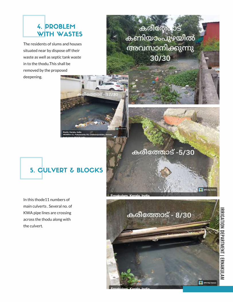
The residents of slums and houses
situated near by dispose off their
waste as well as septic tank waste
in to the thodu.This shall be
removed by the proposed
deepening.
In this thode11 numbers of
main culverts . Several no. of
KWA pipe lines are crossing
across the thodu along with
the culvert.
4. PROBLEM
WITH WASTES
5. CULVERT & BLOCKS
IRRIGATION DEPARTMENT | ERNAKULAM
Page 232
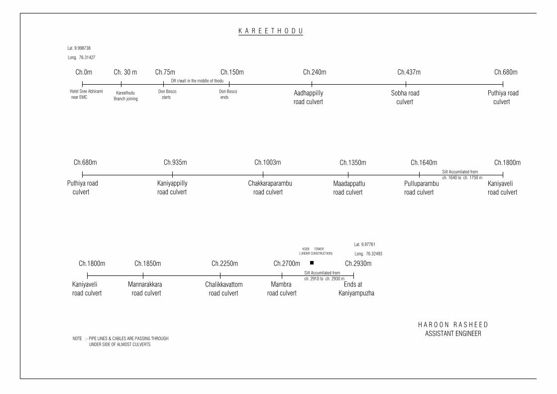
Ch.0m Ch. 30 m
KareethoduBranch joining
Ch.75m
Hotel Sree Abhirami near EMC
Ch.150m
Don Bosco starts
Don Bosco ends
DR r/wall in the middle of thodu
Ch.240m
Aadhappillyroad culvert
Ch.437m
Sobha road culvert
Ch.680m
Puthiya road culvert
Ch.680m
Puthiya road culvert
Ch.935m
Kaniyappillyroad culvert
Ch.1003m
Chakkaraparambu road culvert
Ch.1350m
Maadappatturoad culvert
Ch.1640m
Pulluparamburoad culvert
Ch.1800m
Kaniyaveliroad culvert
Ch.1850m
Mannarakkara road culvert
Ch.2250m
Chalikkavattom road culvert
Ch.2700m
Mambraroad culvert
Ch.2930m
Ends atKaniyampuzha
K A R E E T H O D U
Silt Accumilated fromch. 2910 to ch. 2930 m
Silt Accumilated fromch. 1640 to ch. 1750 m
Ch.1800m
Kaniyaveliroad culvert
Lat. 9.998738
Long. 76.31427
Lat. 9.97761
Long. 76.32493
NOTE :- PIPE LINES & CABLES ARE PASSING THROUGH UNDER SIDE OF ALMOST CULVERTS
KSEB TOWER( UNDER CONSTRUCTION)
H A R O O N R A S H E E D ASSISTANT ENGINEER
Page 233
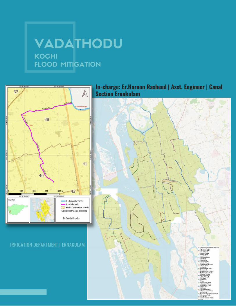
VADATHODUKOCHI
FLOOD MITIGATION
In-charge: Er.Haroon Rasheed | Asst. Engineer | CanalSection Ernakulam
IRRIGATION DEPARTMENT | ERNAKULAM

VADATHODU
This is the main drainage in the southern part of Edappally area in Cochin Corporation. It has a length of
2.20km and width varies from 1.5m to 3.30m. The main purpose of this thodu is drainage of water. There
are a number o smaller drains discharging in to this thodu. The thodu is silted up at several places .This
results in stagnation of water .And practically this thode is not for much use because it is silted up.
Moreover this thodu is filled with aquatic plants and grasess at some places.
Proper maintanance and clearing of the canal are required as a corrective measure along with cleaning
the silt and debris. The drainage outlets are urgently need to remove which is coming from houses to the
thodu have also to be cleaned by removing blockages and easy flow of water. Deepening the thode
throughout the whole length is inevitable for maintaining smooth flow
INITIAL STUDY REPORT
IRRIGATION DEPARTMENT | ERNAKULAM
Page 235
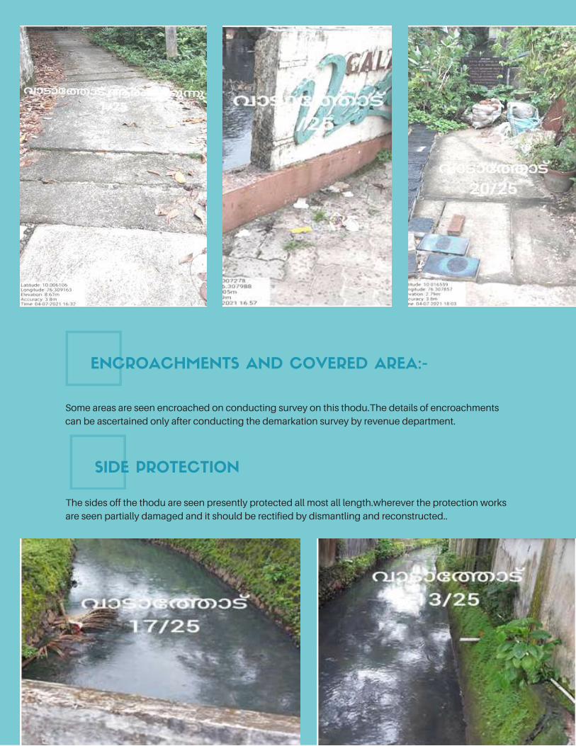
Some areas are seen encroached on conducting survey on this thodu.The details of encroachments
can be ascertained only after conducting the demarkation survey by revenue department.
The sides off the thodu are seen presently protected all most all length.wherever the protection works
are seen partially damaged and it should be rectified by dismantling and reconstructed..
ENCROACHMENTS AND COVERED AREA:-
SIDE PROTECTION
Page 236
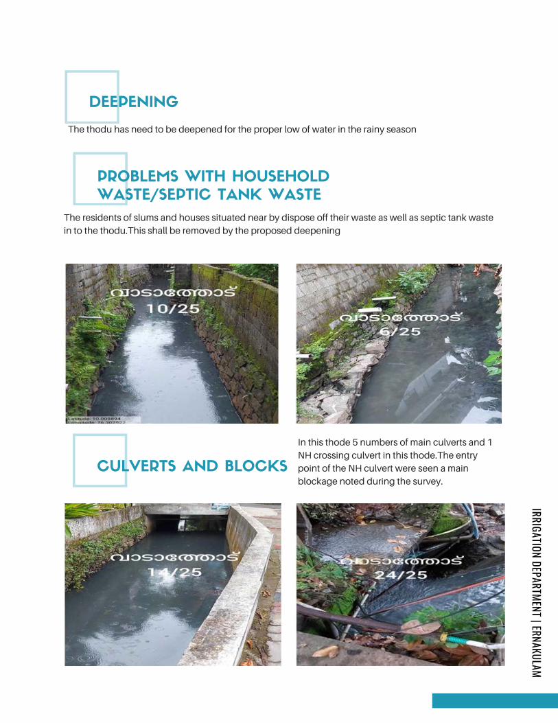
The thodu has need to be deepened for the proper low of water in the rainy season
The residents of slums and houses situated near by dispose off their waste as well as septic tank waste
in to the thodu.This shall be removed by the proposed deepening
In this thode 5 numbers of main culverts and 1
NH crossing culvert in this thode.The entry
point of the NH culvert were seen a main
blockage noted during the survey.
DEEPENING
PROBLEMS WITH HOUSEHOLD
WASTE/SEPTIC TANK WASTE
CULVERTS AND BLOCKS
IRRIGATION DEPARTMENT | ERNAKULAM
Page 237
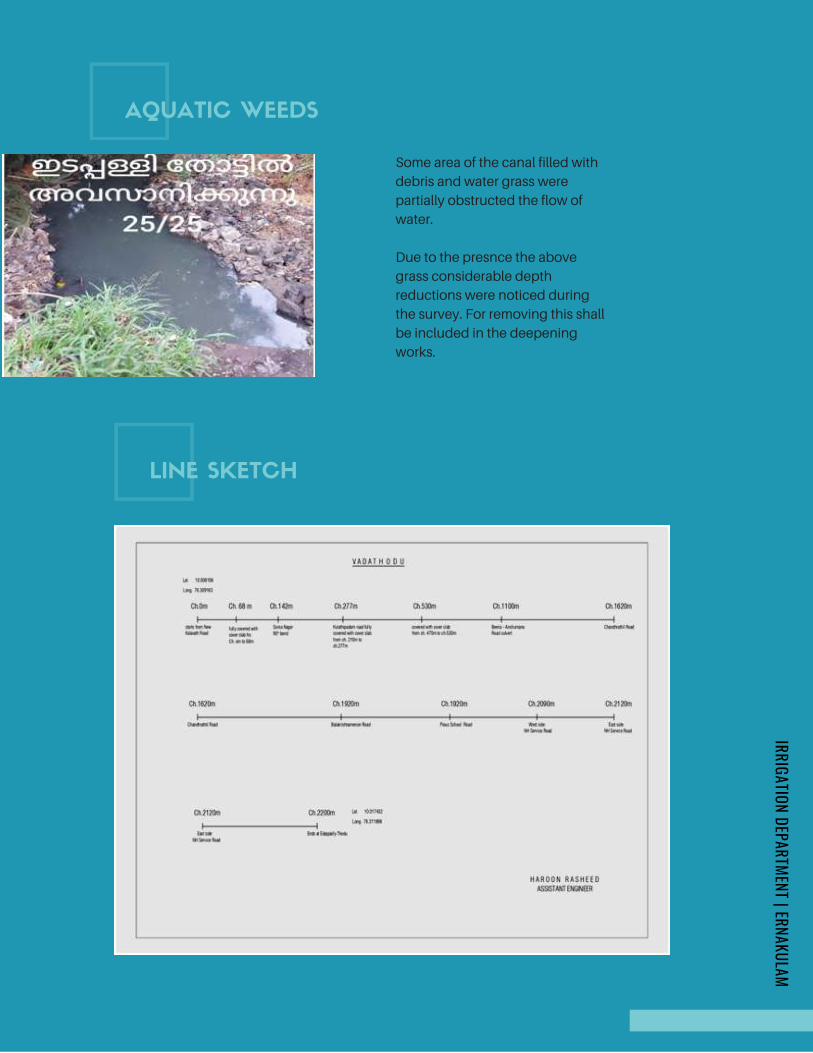
Some area of the canal filled with
debris and water grass were
partially obstructed the flow of
water.
Due to the presnce the above
grass considerable depth
reductions were noticed during
the survey. For removing this shall
be included in the deepening
works.
AQUATIC WEEDS
LINE SKETCH
IRRIGATION DEPARTMENT | ERNAKULAM
Page 238
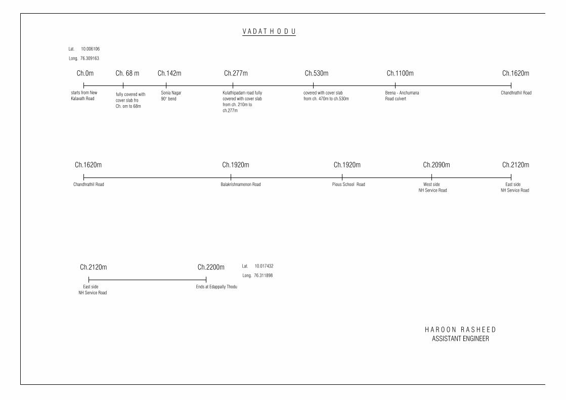
Ch.0m Ch. 68 m
fully covered withcover slab froCh. om to 68m
Ch.142m
starts from NewKalavath Road
Ch.277m
Sonia Nagar Kulathipadam road fullycovered with cover slabfrom ch. 210m toch.277m
V A D A T H O D U
Lat. 10.006106
Long. 76.309163
H A R O O N R A S H E E D ASSISTANT ENGINEER
Ch.530m
covered with cover slabfrom ch. 470m to ch.530m
Ch.1100m
Beena - AnchumanaRoad culvert
Ch.1620m
Chandhrathil Road
Ch.1620m
Chandhrathil Road
Ch.1920m
Balakrishnamenon Road
Ch.1920m
Pious School Road
Ch.2090m Ch.2120m
East sideNH Service Road
West sideNH Service Road
Ch.2120m
East sideNH Service Road
Ch.2200m
Ends at Edappally Thodu
Lat. 10.017432
Long. 76.311898
Page 239
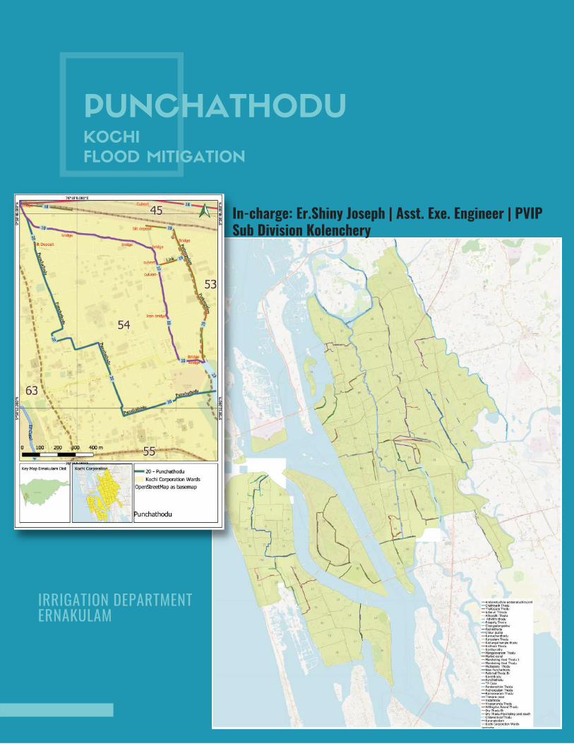
PUNCHATHODUKOCHI
FLOOD MITIGATION
In-charge: Er.Shiny Joseph | Asst. Exe. Engineer | PVIPSub Division Kolenchery
IRRIGATION DEPARTMENT ERNAKULAM
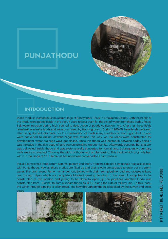
PUNJATHODU
Punja thodu is located in Elamkulam village of Kanayannor Taluk in Ernakulam District. Both the banks of
the thodu were paddy fields in the past. It used to be a drain for the exit of water from these paddy fields.
Salt water intrusion during high tide led to destruction of paddy cultivation here. After that, these fields
remained as marshy lands and were purchased by Housing board. During 1960-65 these lands were sold
after being divided into plots. For the construction of roads many stretches of thodu got filled up and
were converted to drains. Jawaharnagar was formed this way. As the roads were constructed for
development, water drainage ways got closed. Since this thodu was located in between paddy fields it
was included in the title deed of land owners dwelling on both banks. Afterwards coconut, banana etc.
was cultivated inside thodu and was systematically converted to normal land. Subsequently boundary
walls were also erected. This way the width of thodu kept on decreasing. This thodu which originally had
width in the range of 10 to14metres has now been converted to a narrow drain.
Initially some small thodus from Kammatipadam and thodu from the side of Fr. Immanuel road also joined
with Punja thodu. Now all these thodus are filled up and drains were constructed to drain out the storm
water. The drain along Father Immanuel road joined with drain from pipeline road and crosses railway
line through pipes which are completely blocked causing flooding in that area. A sump has to be
constructed at this portion and jetting to be done to open up the pipelines. Another thodu was
constructed from TP canal to Karnakkodam thodu by BPCL along the side of railway line. To this thodu
the water through pipeline is discharged. The flow through dry thodu is blocked by the culvert and cross
pipes.
INTRODUCTION
IRRIGATION DEPARTMENT | ERNAKULAM
Page 241
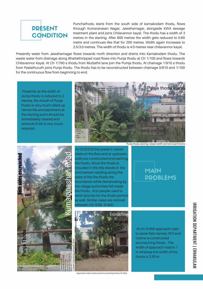
PRESENT
MAIN
PROBLEMS
PRESENT
CONDITION
Punchathodu starts from the south side of karnakodam thodu, flows
through Kumaranasan Nagar, Jawaharnagar, alongside KWA sewage
treatment plant and joins Chilavannor kayal. The thodu has a width of 3
metres in the starting. After 800 metres the width gets reduced to 0.60
metre and continues like that for 200 metres. Width again increases to
2.5/3.0 metres. The width of thodu is 4.0 metres near chilavannor kayal.
Presently water from Jawaharnagar flows towards north direction and drains into Karnakodam thodu. The
waste water from drainage along Bhattathirippad road flows into Punja thodu at Ch 1/100 and flows towards
Chilavannor Kayal. At Ch 1/760 a thodu from Muttathil lane join the Pumja thodu. At chainage 1/910 a thodu
from Paalathuruth joins Punja thodu. The thodu has to be reconstructed between chainage 0/810 and 1/100
for the continuous flow from beginning to end.
Presently as the width of
punja thodu is reduced to 3
metres, the mouth of Punja
thodu is very much silted up.
Hence the encroachment at
the starting point should be
immediately cleared and
removal of slit is very much
required.
Punja thodu starting- lesser width and encroachments
At Ch:0/220 the present culvert
obstruct the flow and at upstream,
walls are constructed encroaching
the thodu. Since the thodu is
included in the title deeds of the
land owners residing along the
sides of the the thodu the
boundaries while demarcating by
the village authorities fall inside
the thodu . And people used to
remit land tax for the thodu portion
as well .Similar cases are noticed
between Ch: 0/00- 0/400 .
Cu
lver
t blo
ckin
g s
mo
oth
flo
w
At ch: 0/450 approach road
to some flats namely SFS and
Casino is constructed
encroaching thodu . The
width of approach road is 7
m whereas the width of the
thodu is 2.50 m .
Approach road constructed encroaching thodu for flats
IRRIGATION DEPARTMENT | ERNAKULAM
Page 242
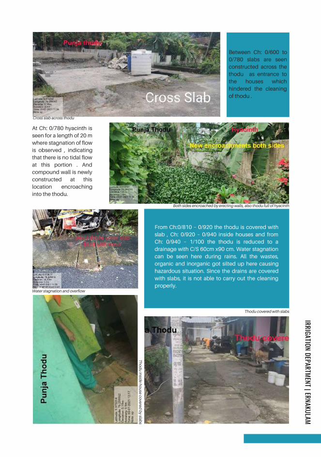
Between Ch: 0/600 to
0/780 slabs are seen
constructed across the
thodu as entrance to
the houses which
hindered the cleaning
of thodu .
From Ch:0/810 – 0/920 the thodu is covered with
slab , Ch: 0/920 – 0/940 inside houses and from
Ch: 0/940 – 1/100 the thodu is reduced to a
drainage with C/S 60cm x90 cm. Water stagnation
can be seen here during rains. All the wastes,
organic and inorganic got silted up here causing
hazardous situation. Since the drains are covered
with slabs, it is not able to carry out the cleaning
properly.
Both sides encroached by erecting walls, also thodu full of hyacinth
Thodu covered with slabs
Cross slab across thodu
At Ch: 0/780 hyacinth is
seen for a length of 20 m
where stagnation of flow
is observed , indicating
that there is no tidal flow
at this portion . And
compound wall is newly
constructed at this
location encroaching
into the thodu.
Water stagnation and overflow
Th
od
u in
side h
ou
se covered
by slab
s
IRRIGATION DEPARTMENT | ERNAKULAM
Page 243

At the end of the
covered slab portion
there is a road crossing
of width 9 metre, which
has to be reconstructed
as a box culvert.
After crossing the
Subash Chandra Bose
road at Ch:1/230 , SBI
building has made
some constructions
encroaching the thodu.
At Ch: 1/910 the present
culvert across
FathimaMatha church
road is obstructing the
flow of water ,while waste
dumping is also noticed
near the culvert . The
sewage pipe of KWA is
laid across the thodu
without sufficient vertical
clearance . Here a thodu
Old is Gold road
Encroachment by SBI building
At Ch: 1/760 thodu
from Muttathil Lane
is drained into
Punjathodu.
Between Ch: 1/790
and 1/910a
walkway is
constructed (old is
gold road ) by the
corporation ,
encroaching the
thodu.
Thodu blocked by culvert and pipelines
from palathuruthu also drains into punja thodu increasing the quantity of water and may cause flooding
near culvert. The crossing pipes are to be removed and culvert is to be reconstructed.
The thodu flows also through the side of KWA sewage treatment plant compound and then merges with
ChilavannoorKayal .
IRRIGATION DEPARTMENT | ERNAKULAM
Page 244
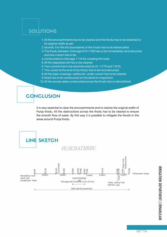
LINE SKETCH
All the encroachments has to be cleared and the thodu has to be widened to
its original width as per
records. For this the boundaries of the thodu has to be demarcated.
The thodu between chainage 810-1100 has to be immediately reconstructed
and box culvert has to be
constructed at chainage 1110 for crossing the road.
All the deposited silt has to be cleared.
Two culverts has to be reconstructed at ch. 1/770 and 1/910.
The culvert at the end of dry thodu has to be reconstructed.
All the pipe crossings, cables etc. under culvert has to be cleared.
Road has to be constructed on the bank for inspection.
All the access slabs constructed across the thodu has to demolished.
1.
2.
3.
4.
5.
6.
7.
8.
9.
10.
CONCLUSION
SOLUTIONS
Minor irrigation Central Circle,Ernakulam
It is very essential to clear the encroachments and to restore the original width of
Punja thodu. All the obstructions across the thodu has to be cleared to ensure
the smooth flow of water. By this way it is possible to mitigate the floods in the
areas around Punja thodu.
IRRIGATION DEPARTMENT | ERNAKULAM
Page 245
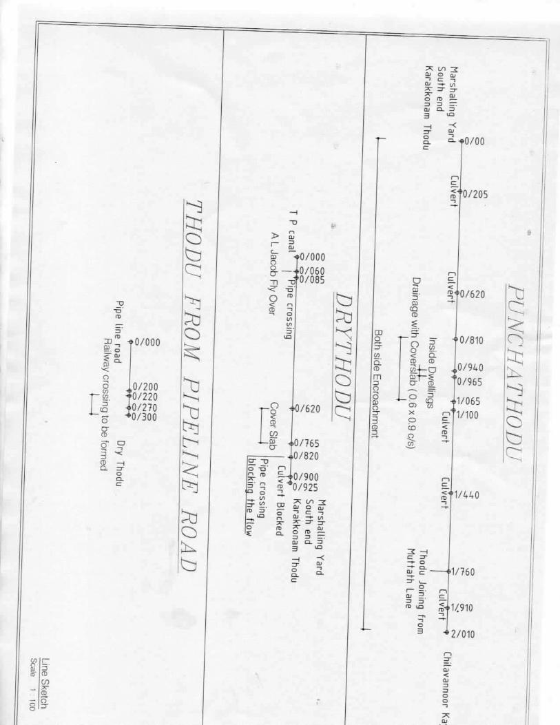
Page 246
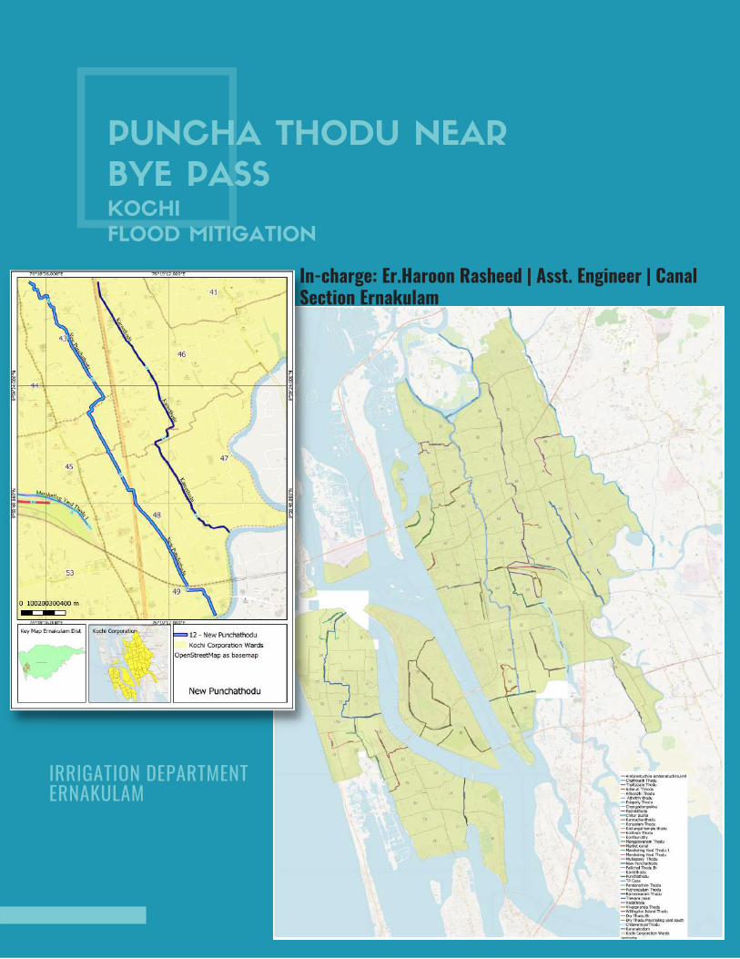
PUNCHA THODU NEAR
BYE PASSKOCHI
FLOOD MITIGATION
In-charge: Er.Haroon Rasheed | Asst. Engineer | CanalSection Ernakulam
IRRIGATION DEPARTMENT ERNAKULAM
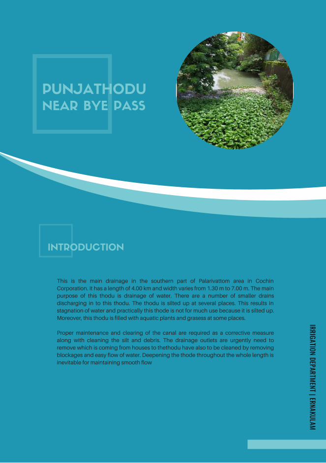
PUNJATHODU
NEAR BYE PASS
This is the main drainage in the southern part of Palarivattom area in Cochin
Corporation. It has a length of 4.00 km and width varies from 1.30 m to 7.00 m. The main
purpose of this thodu is drainage of water. There are a number of smaller drains
discharging in to this thodu. The thodu is silted up at several places. This results in
stagnation of water and practically this thode is not for much use because it is silted up.
Moreover, this thodu is filled with aquatic plants and grasess at some places.
Proper maintenance and clearing of the canal are required as a corrective measure
along with cleaning the silt and debris. The drainage outlets are urgently need to
remove which is coming from houses to thethodu have also to be cleaned by removing
blockages and easy flow of water. Deepening the thode throughout the whole length is
inevitable for maintaining smooth flow
INTRODUCTION
IRRIGATION DEPARTMENT | ERNAKULAM
Page 248
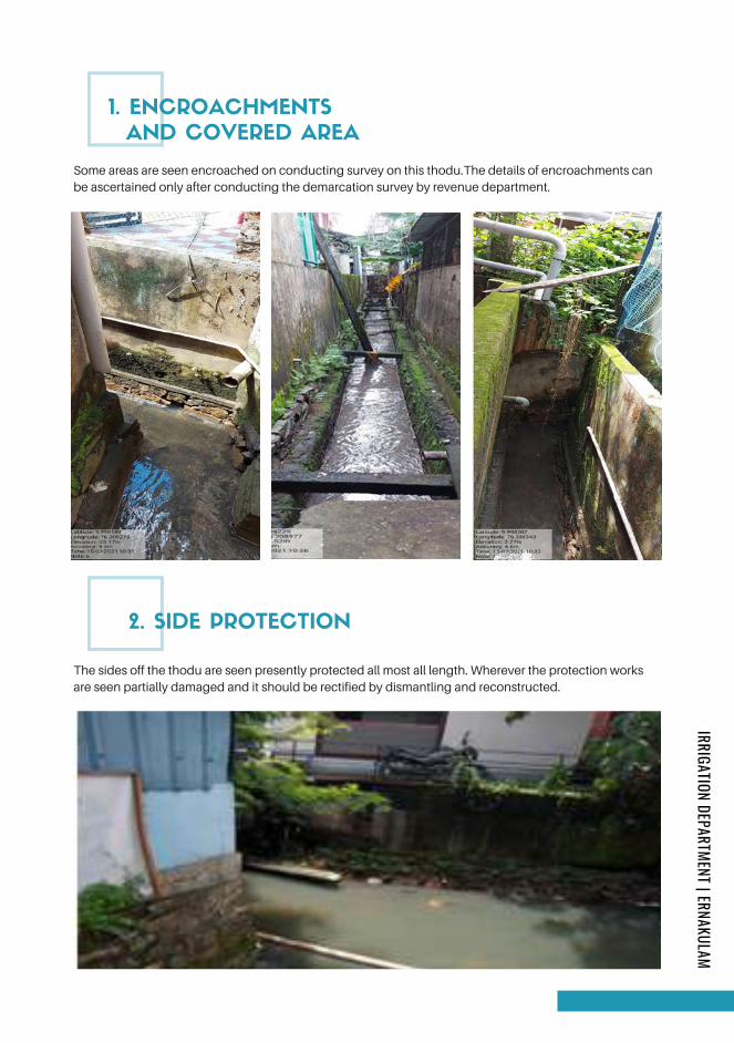
1. ENCROACHMENTS
AND COVERED AREA
2. SIDE PROTECTION
Some areas are seen encroached on conducting survey on this thodu.The details of encroachments can
be ascertained only after conducting the demarcation survey by revenue department.
The sides off the thodu are seen presently protected all most all length. Wherever the protection works
are seen partially damaged and it should be rectified by dismantling and reconstructed.
IRRIGATION DEPARTMENT | ERNAKULAM
Page 249
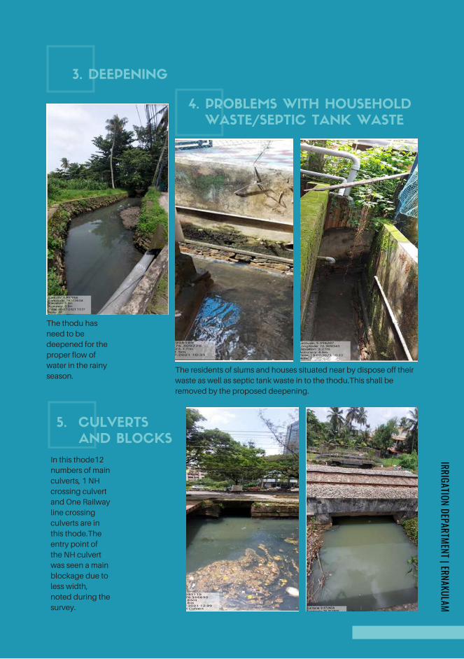
3. DEEPENING
4. PROBLEMS WITH HOUSEHOLD
WASTE/SEPTIC TANK WASTE
The thodu has
need to be
deepened for the
proper flow of
water in the rainy
season.The residents of slums and houses situated near by dispose off their
waste as well as septic tank waste in to the thodu.This shall be
removed by the proposed deepening.
5. CULVERTS
AND BLOCKS
In this thode12
numbers of main
culverts, 1 NH
crossing culvert
and One Railway
line crossing
culverts are in
this thode.The
entry point of
the NH culvert
was seen a main
blockage due to
less width,
noted during the
survey.
IRRIGATION DEPARTMENT | ERNAKULAM
Page 250
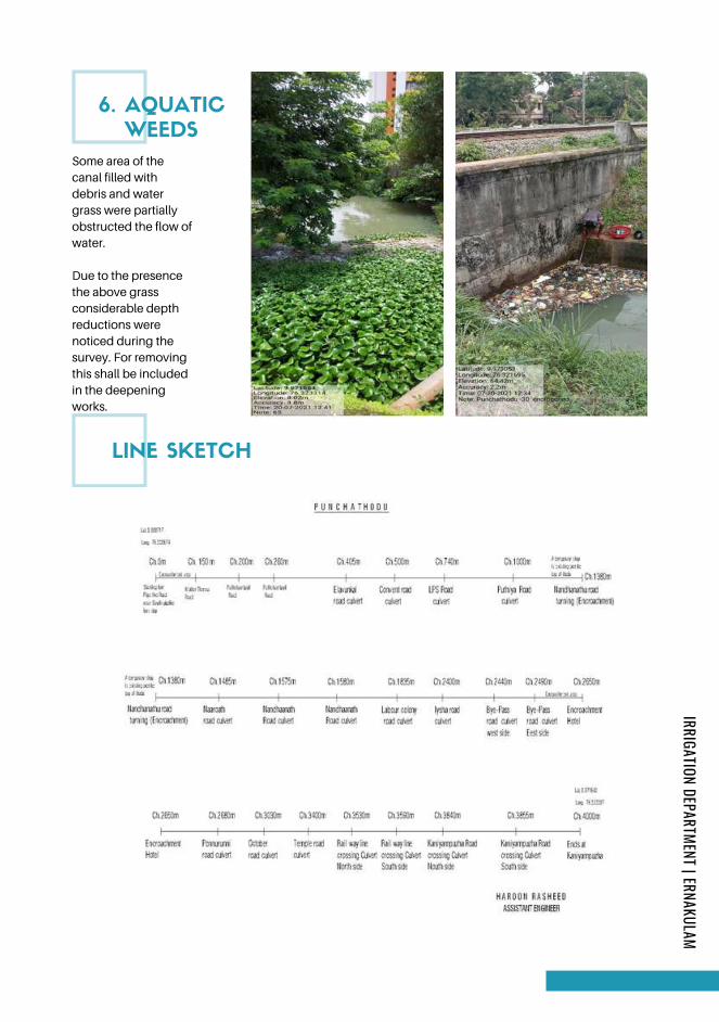
Some area of the
canal filled with
debris and water
grass were partially
obstructed the flow of
water.
Due to the presence
the above grass
considerable depth
reductions were
noticed during the
survey. For removing
this shall be included
in the deepening
works.
6. AQUATIC
WEEDS
LINE SKETCH
IRRIGATION DEPARTMENT | ERNAKULAM
Page 251
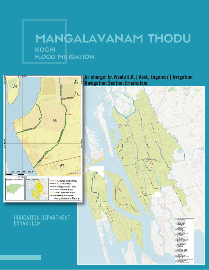
MANGALAVANAM THODUKOCHI
FLOOD MITIGATION
IRRIGATION DEPARTMENT ERNAKULAM
In-charge: Er.Visala E.A, | Asst. Engineer | IrrigationNavigation Section Ernakulam
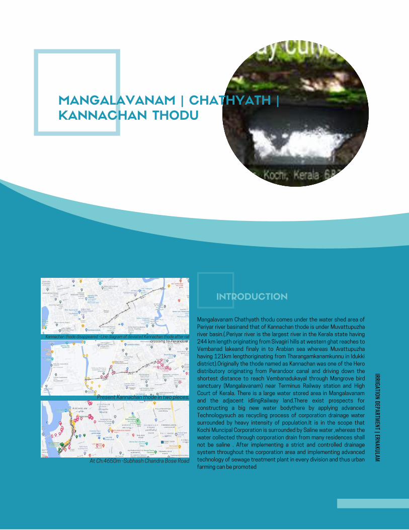
AMBANATTUCHIRA THODU (PONNETH
CHAAL ) IN CHILAVANNOORER .DHANYA K . , | MI SUB DIVISION | ERNAKULAM
KOCHI FLOOD MITIGATION
INITIAL STUDY REPORT
AMBANATTUCHIRA THODU (PONNETH
CHAAL ) IN CHILAVANNOORER .DHANYA K . , | MI SUB DIVISION | ERNAKULAM
KOCHI FLOOD MITIGATION
INITIAL STUDY REPORT
Google Map- Ambanattuchira thodu
MANGALAVANAM | CHATHYATH |
KANNACHAN THODU
INTRODUCTION
Mangalavanam Chathyath thodu comes under the water shed area of
Periyar river basinand that of Kannachan thode is under Muvattupuzha
river basin.(.Periyar river is the largest river in the Kerala state having
244 km length originating from Sivagiri hills at western ghat reaches to
Vembanad lakeand finaly in to Arabian sea whereas Muvattupuzha
having 121km lengthoriginating from Tharangamkanamkunnu in Idukki
district).Originally the thode named as Kannachan was one of the Hero
distributory originating from Perandoor canal and driving down the
shortest distance to reach Vembanadukayal through Mangrove bird
sanctuary (Mangalavanam) near Terminus Railway station and High
Court of Kerala. There is a large water stored area in Mangalavanam
and the adjacent idlingRailway land.There exist prospects for
constructing a big new water bodythere by applying advanced
Technologysuch as recycling process of corporation drainage water
surrounded by heavy intensity of population.It is in the scope that
Kochi Muncipal Corporation is surrounded by Saline water ,whereas the
water collected through corporation drain from many residences shall
not be saline . After implementing a strict and controlled drainage
system throughout the corporation area and implementing advanced
technology of sewage treatment plant in every division and thus urban
farming can be promoted
IRRIGATION DEPARTMENT | ERNAKULAM
Kannachan thode disappeared –Line diagram of deviated Kannachan thode after railcrossing to Perandoor.
Present Kannachan thode in two pieces.
At Ch:4650m -Subhash Chandra Bose Road
Page 253
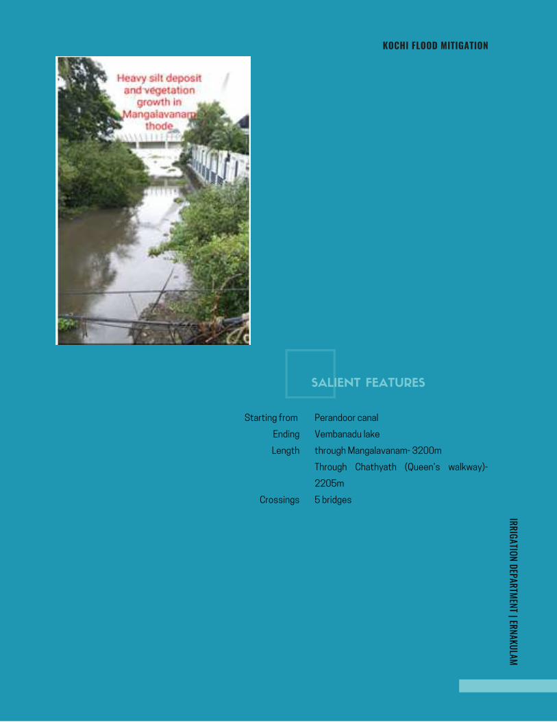
KOCHI FLOOD MITIGATIONIRRIGATION DEPARTMENT | ERNAKULAM
5 bridges
Perandoor canal
Vembanadu lake
through Mangalavanam- 3200m
Through Chathyath (Queen’s walkway)-
2205m
Crossings
Starting from
Ending
Length
SALIENT FEATURES
Page 254
KOCHI FLOOD MITIGATION
Present day Mangalavanam bird sanctuary was
previously used as timber depot for stacking the
timber through through ferry boats.The depot was
under Malayattoor division till 1970. And from 1970 to
1981, it was under the Timber Sales of Kalady. From
1981 it was under the control of Social Forestry
Division Ernakulam.After the declaration of this area as
Bird Sanctuary (on 31st August 2004) was done by
Wildlife Division Peechi and from July 2009 onwards
the management of the sanctuary is done by Nature
Study Centre Kalady. Mangalavanam is now a
mangrove bird sanctuary of Ernakulam near High court
of Kerala . Mangalavanam is a site where migratotory
avian species seasonally, nesting places for hundreds
of colonial nesters. This Sanctuary is having an area of
2.74 ha and 2/3 rd of this area is of water stagnated or
marshy land.. Ernakulam terminus railway station is
situated on south side, Arabian sea on west side.Area
of Mangalavanam and the terminus railway land is
surrounded by thickly populated town ship area of
Kochi corporation on north, east and south side.There
is a shallow tidal pond guarded by dense growth of man
grove vegetation along the periphery and is connected
with kochi backwater by feeder canal named as
Mangalavanathodu. Area of present thode near
Chathyath Church was originally a part of Periyar
riveron east side of Thanthonni Thuruth just before
reaching to Vembanadu lake.This was a kadavu for
conveying goods to then famous companies like Tata
Oil Mills,Burma shell etc.. through Large ferry
boats.Both the Railway and water way conveyance
facilities at this location were very useful for then
people.For a long run heavy deposit of silt was
accumulated at this area and formed many thuruth like
Originally as stated above Kannachan thode was one
of the very important Hero drain of Kochi Muncipal
Corporation originating from Perandoor Canal, and
flowing through the area of present Justice KK
Mathew road,Tagore lane welcome road Then
Tatapuram and finaly to Vembanadukayal flowing
through Mangalavanam sharing the boundary of
Terminus Railway property near High Court of Kerala..In
olden days many small drains were flowing towards
Kannachan thode and it played an important role for
conveyance through water way by then people using
ferry.There were a ferry yard In the initial reach of this
stream named Madavana ferry yard..
Run off water from Pachalam area SRM Road, ST
Theressa road, Pottakuzhi , North Railway station
etc.were draining out to Vembanattu Kayal by the Hero
distributory Kannachan thode by driving down through
the ideal location of Mangalavanam- the boundary of
terminus railway station near High court of Kerala. .This
natural flow of drain and a proper drainage system of
this area is now noticed as totally destroyed. The
Railway Authority cutKannachan thode in to two pieces
at north Railway station. Gradually eastern portion of
Kannachan thode is disappeared and many small drains
towards this thode from the surrounding area have
been encroached or converted to roadway. ,Also the
connectivity of Kannachan thode towards east side of
railway line with Perandoor canal is disappeared.This
resulted the main reason for flooding of rain fall at
Kalezhath road to SRM road and north side of north
railway station 2nd platform.More over runoff water at
this area have to travel nearly 10km distance to reach
Vembanattu kayal.Whereas Kannachan thode was
driving an excellent shortest distance of about 2.50km
to reach Vembanattu Kayal when it was flowing through
Mangalavanam..All the drains in this area is covered and
drainage system is seen as not functioning
properly.Surrounding area of Pachalam market is in
lower level and is blocked here and there.
.Mangalavanam and terminus Railway land is an ideal
location for maintaining a proper drainage system
especially for thickly populated corporation area
Thanthonni thuruth, Kadamakkudy, Vallarpadam,
Bolgatty-Mulavukad Island,etc. As a part of
development of the infrastructure facilities of
scattered islands in and around the Kochi city the silt
accumulated area of Kochi corporation near Tatapuram
is converted to land by filling..Further this filled up area
is aunctioned and thus many bulding constructions took
place.,At last a very small portion of encroached river is
left on back side for draining out water and this is the
present Chathyath thode leading from Kannachan thode
sharing boundary of Present Unilever and Hindustan
Petroleum Corporation at Mathai Manjooran road, in
Division no.69 of Kochi Municipal Corporation.Now this
thode is filled with thick vegetation and is converted to
waste disposal place.Now this place is also converted
to shelter for many kind of snakes like Python.Hence it
is too difficult to reach there.
HISTORY
Page 255
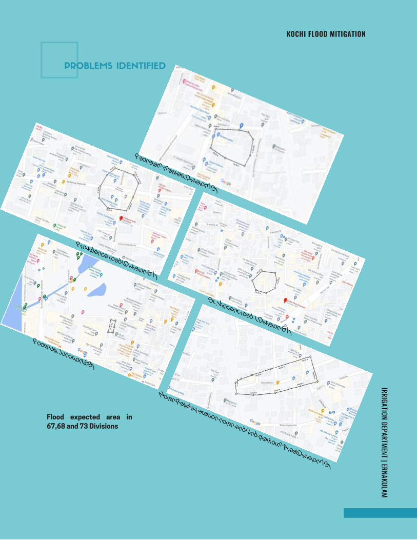
KOCHI FLOOD MITIGATIONIRRIGATION DEPARTMENT | ERNAKULAM
Flood expected area in
67,68 and 73 Divisions
Pachalam market( Division73)
Providence road (Division 67)
St. Vincent road ( Division 67) Poothulli Junction(68)
North Railway station north end 2nd platform Area(Division 73)
PROBLEMS IDENTIFIED
Page 256
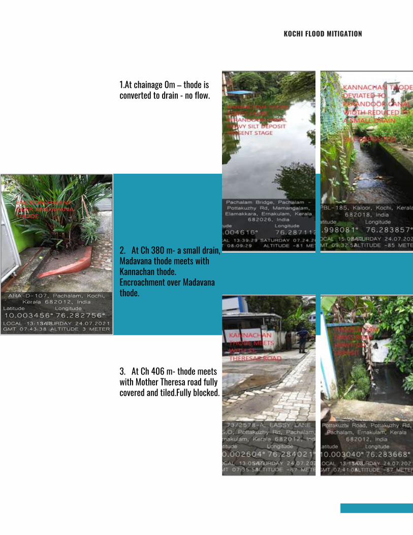
KOCHI FLOOD MITIGATION
1.At chainage 0m – thode isconverted to drain - no flow.
2. At Ch 380 m- a small drain,Madavana thode meets withKannachan thode.Encroachment over Madavanathode.
3. At Ch 406 m- thode meetswith Mother Theresa road fullycovered and tiled.Fully blocked.
Page 257
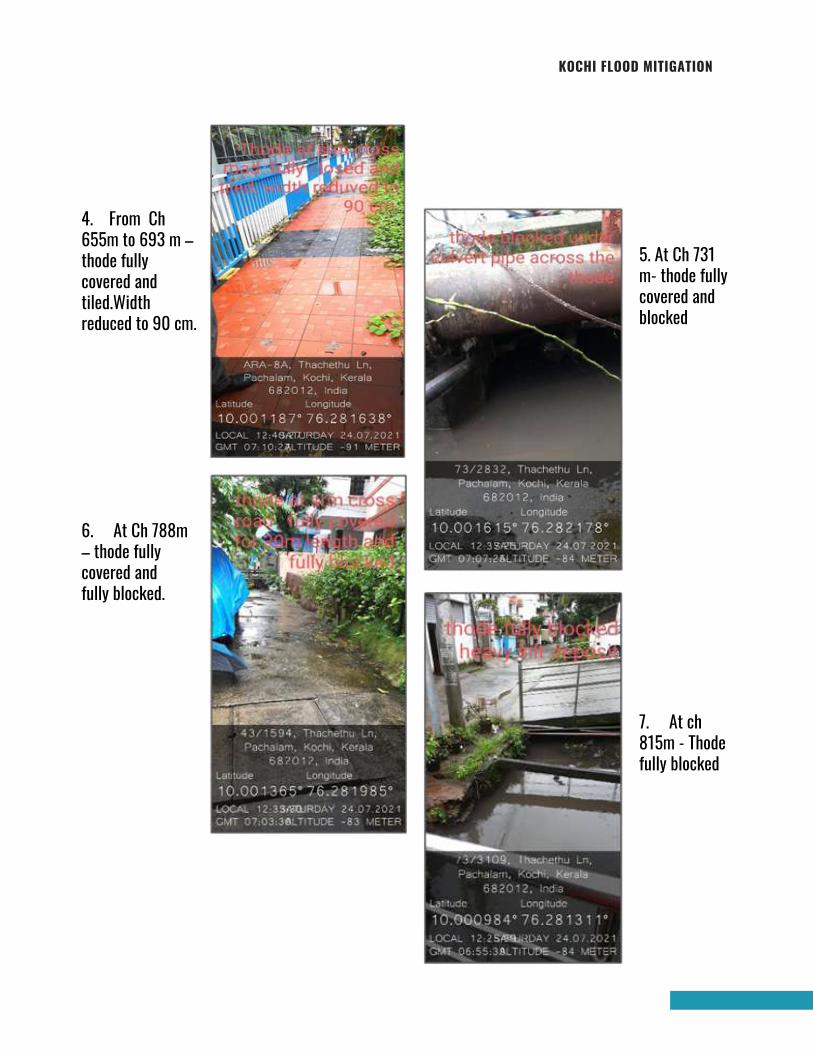
KOCHI FLOOD MITIGATION
4. From Ch655m to 693 m –thode fullycovered andtiled.Widthreduced to 90 cm.
5. At Ch 731m- thode fullycovered andblocked
6. At Ch 788m– thode fullycovered andfully blocked.
7. At ch815m - Thodefully blocked
Page 258
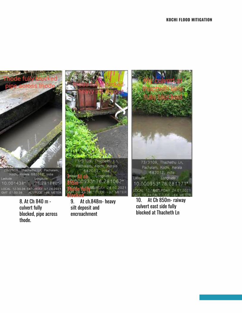
KOCHI FLOOD MITIGATION
10. At Ch 850m- raiwayculvert east side fullyblocked at Thacheth Ln
9. At ch.848m- heavysilt deposit andencroachment
8. At Ch 840 m -culvert fullyblocked, pipe acrossthode.
7. At ch815m -Thode fullyblocked
Page 259
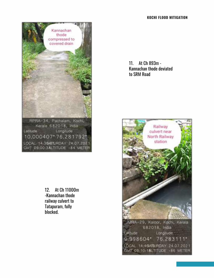
KOCHI FLOOD MITIGATION
11. At Ch 893m -Kannachan thode deviatedto SRM Road
12. At Ch 11000m-Kannachan thoderailway culvert toTatapuram, fullyblocked.
Page 260
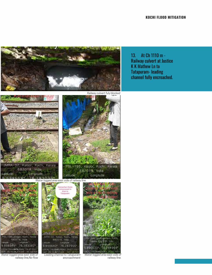
KOCHI FLOOD MITIGATION
13. At Ch 1110 m -Railway culvert at JusticeK K Mathew Ln toTatapuram- leadingchannel fully encroached.
Railway culvert fuly blocked
Water logged area east side of railway line.
Water logged area east side ofrailway line,No flow
Leading channel to Tatapuram-encroachment
Water logged area east side ofrailway line.
Page 261
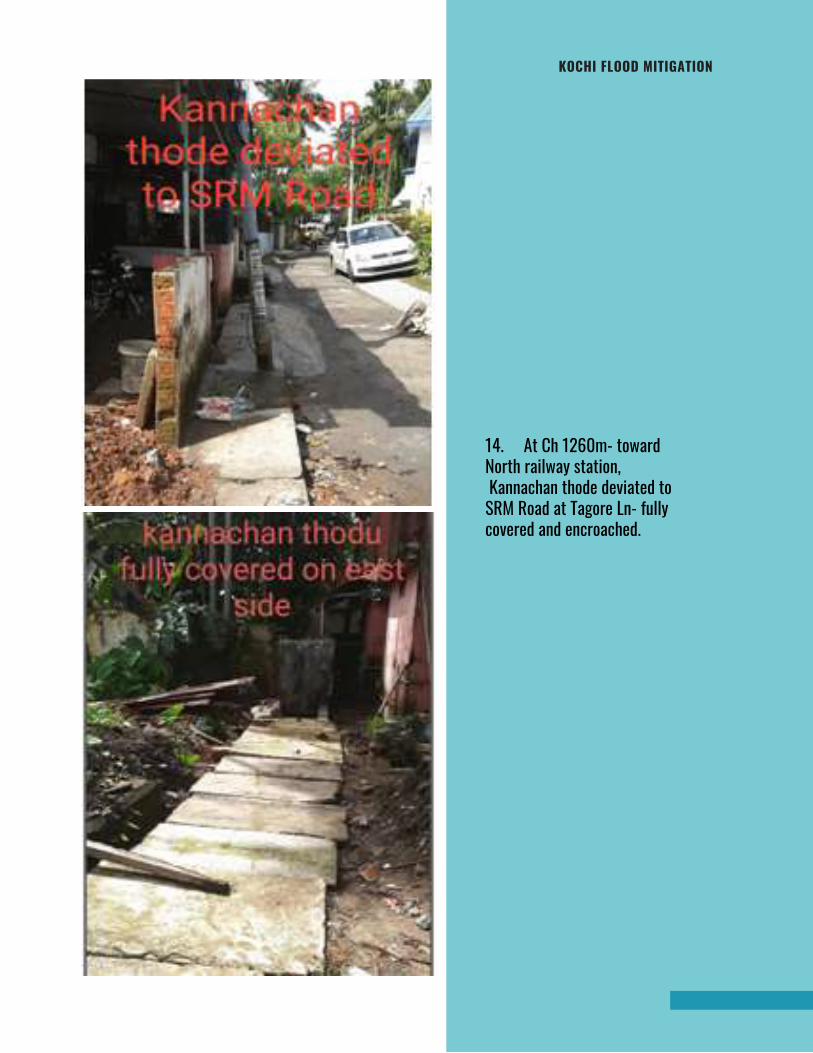
KOCHI FLOOD MITIGATION
14. At Ch 1260m- towardNorth railway station, Kannachan thode deviated toSRM Road at Tagore Ln- fullycovered and encroached.
Page 262
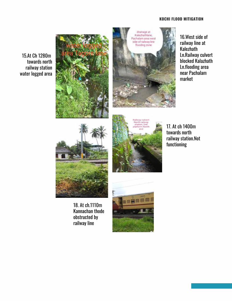
KOCHI FLOOD MITIGATION
15.At Ch 1280m towards northrailway station
water logged area
17. At ch 1400mtowards northrailway station.Notfunctioning
16.West side ofrailway line atKalezhathLn.Railway culvertblocked KalazhathLn.flooding areanear Pachalammarket
18. At ch.1110mKannachan thodeobstructed byrailway line
Page 263
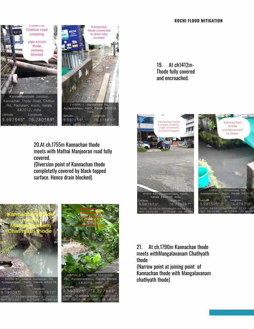
KOCHI FLOOD MITIGATION
19. At ch1412m-Thode fully coveredand encroached.
20.At ch.1755m Kannachan thodemeets with Mathai Manjooran road fullycovered.(Diversion point of Kannachan thodecompletetly covered by black toppedsurface. Hence drain blocked)
21. At ch.1790m Kannachan thodemeets withMangalavanam Chathyaththode (Narrow point at joining point ofKannachan thode with Mangalavanamchathyath thode)
Page 264
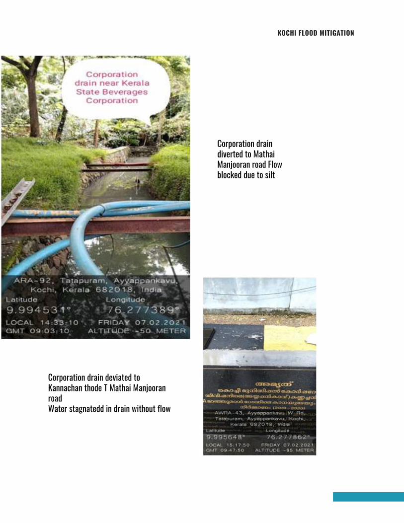
KOCHI FLOOD MITIGATION
Corporation draindiverted to MathaiManjooran road Flowblocked due to silt
Corporation drain deviated toKannachan thode T Mathai ManjooranroadWater stagnatedd in drain without flow
Page 265
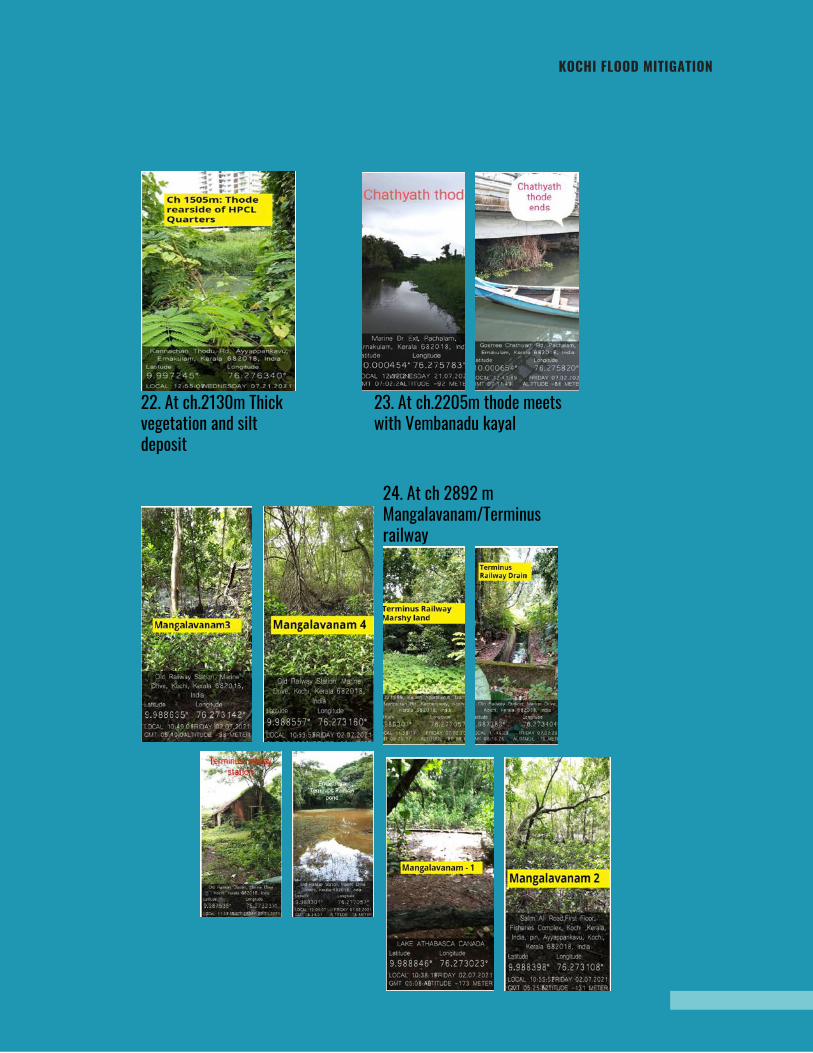
KOCHI FLOOD MITIGATION
22. At ch.2130m Thickvegetation and siltdeposit
24. At ch 2892 mMangalavanam/Terminusrailway
23. At ch.2205m thode meetswith Vembanadu kayal
Page 266
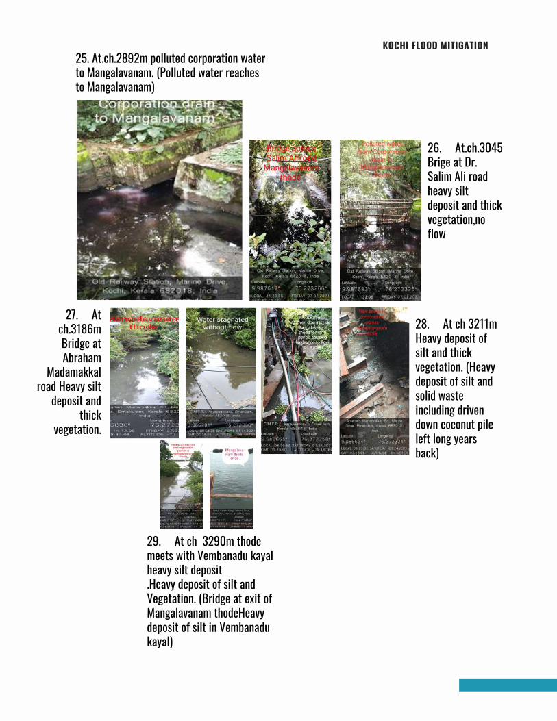
KOCHI FLOOD MITIGATION25. At.ch.2892m polluted corporation waterto Mangalavanam. (Polluted water reachesto Mangalavanam)
27. Atch.3186mBridge atAbraham
Madamakkalroad Heavy silt
deposit andthick
vegetation.
26. At.ch.3045Brige at Dr.Salim Ali roadheavy siltdeposit and thickvegetation,noflow
28. At ch 3211mHeavy deposit ofsilt and thickvegetation. (Heavydeposit of silt andsolid wasteincluding drivendown coconut pileleft long yearsback)
29. At ch 3290m thodemeets with Vembanadu kayalheavy silt deposit.Heavy deposit of silt andVegetation. (Bridge at exit ofMangalavanam thodeHeavydeposit of silt in Vembanadukayal)
Page 267
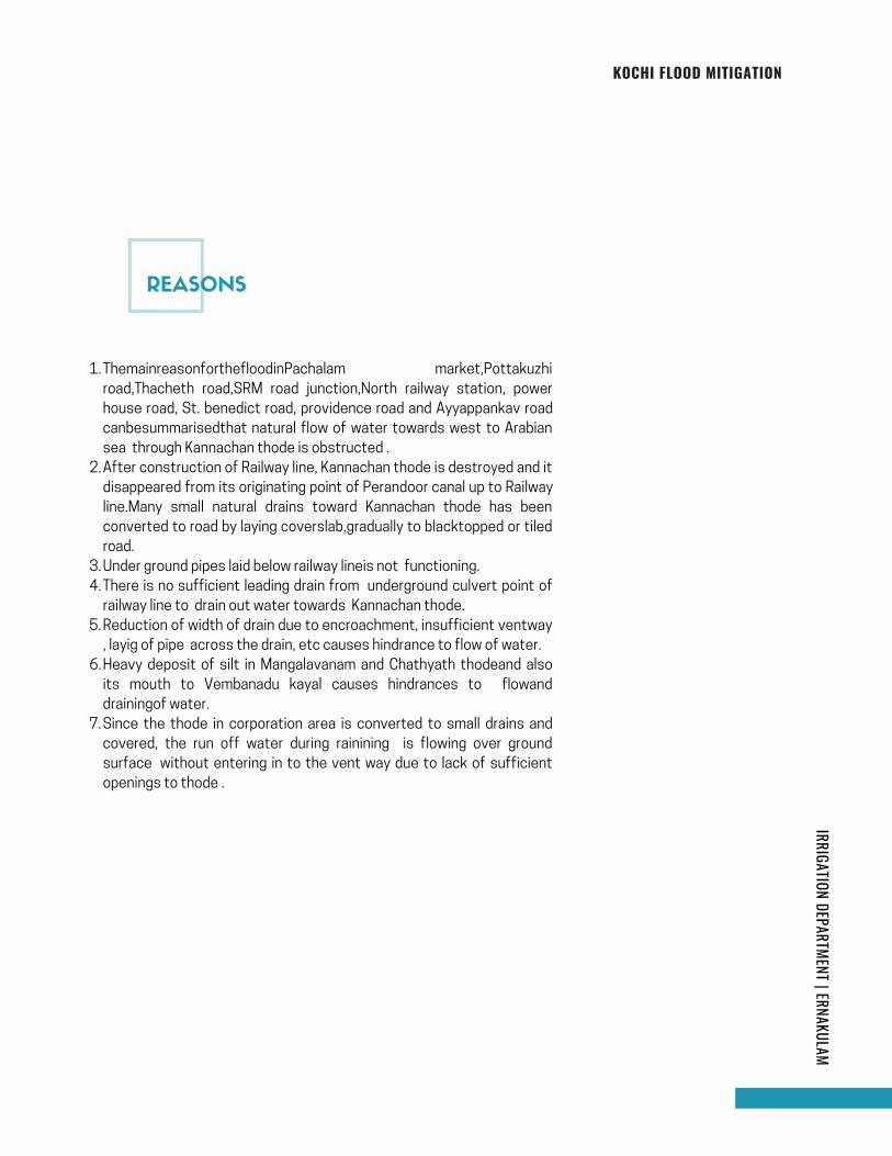
KOCHI FLOOD MITIGATIONIRRIGATION DEPARTMENT | ERNAKULAM
ThemainreasonforthefloodinPachalam market,Pottakuzhi
road,Thacheth road,SRM road junction,North railway station, power
house road, St. benedict road, providence road and Ayyappankav road
canbesummarisedthat natural flow of water towards west to Arabian
sea through Kannachan thode is obstructed .
After construction of Railway line, Kannachan thode is destroyed and it
disappeared from its originating point of Perandoor canal up to Railway
line.Many small natural drains toward Kannachan thode has been
converted to road by laying coverslab,gradually to blacktopped or tiled
road.
Under ground pipes laid below railway lineis not functioning.
There is no sufficient leading drain from underground culvert point of
railway line to drain out water towards Kannachan thode.
Reduction of width of drain due to encroachment, insufficient ventway
, layig of pipe across the drain, etc causes hindrance to flow of water.
Heavy deposit of silt in Mangalavanam and Chathyath thodeand also
its mouth to Vembanadu kayal causes hindrances to flowand
drainingof water.
Since the thode in corporation area is converted to small drains and
covered, the run off water during rainining is flowing over ground
surface without entering in to the vent way due to lack of sufficient
openings to thode .
1.
2.
3.
4.
5.
6.
7.
REASONS
Page 268
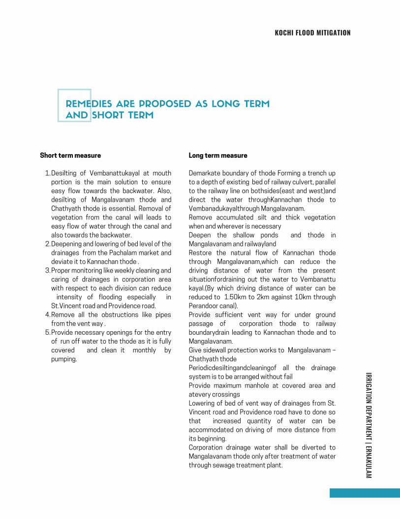
KOCHI FLOOD MITIGATIONIRRIGATION DEPARTMENT | ERNAKULAM
Desilting of Vembanattukayal at mouth
portion is the main solution to ensure
easy flow towards the backwater. Also,
desilting of Mangalavanam thode and
Chathyath thode is essential. Removal of
vegetation from the canal will leads to
easy flow of water through the canal and
also towards the backwater.
Deepening and lowering of bed level of the
drainages from the Pachalam market and
deviate it to Kannachan thode .
Proper monitoring like weekly cleaning and
caring of drainages in corporation area
with respect to each division can reduce
intensity of flooding especially in
St.Vincent road and Providence road.
Remove all the obstructions like pipes
from the vent way .
Provide necessary openings for the entry
of run off water to the thode as it is fully
covered and clean it monthly by
pumping.
Short term measure
1.
2.
3.
4.
5.
Long term measure
Demarkate boundary of thode Forming a trench up
to a depth of existing bed of railway culvert, parallel
to the railway line on bothsides(east and west)and
direct the water throughKannachan thode to
Vembanadukayalthrough Mangalavanam.
Remove accumulated silt and thick vegetation
when and wherever is necessary
Deepen the shallow ponds and thode in
Mangalavanam and railwayland
Restore the natural flow of Kannachan thode
through Mangalavanam,which can reduce the
driving distance of water from the present
situationfordraining out the water to Vembanattu
kayal.(By which driving distance of water can be
reduced to 1.50km to 2km against 10km through
Perandoor canal).
Provide sufficient vent way for under ground
passage of corporation thode to railway
boundarydrain leading to Kannachan thode and to
Mangalavanam.
Give sidewall protection works to Mangalavanam –
Chathyath thode
Periodicdesiltingandcleaningof all the drainage
system is to be arranged without fail
Provide maximum manhole at covered area and
atevery crossings
Lowering of bed of vent way of drainages from St.
Vincent road and Providence road have to done so
that increased quantity of water can be
accommodated on driving of more distance from
its beginning.
Corporation drainage water shall be diverted to
Mangalavanam thode only after treatment of water
through sewage treatment plant.
REMEDIES ARE PROPOSED AS LONG TERM
AND SHORT TERM
Page 269
KOCHI FLOOD MITIGATIONIRRIGATION DEPARTMENT | ERNAKULAM
Mangalavanam and Chathyath thode are tidal
affectingarea.. Water entered during high tide
will not flow towards backwater if the bed and
mouth of thode has heavysilt deposit.To
avoid this desilting ofthode and mouth
portion is essential.
There is great possibility of deposition of
waste materials in the thode everyday. Hence
cleaning it subsequently can reduce intensity
of flooding.
1.
2.
Catchment area coming under Kannachan thode
is arrived to about 2.87 sqm.
Restoration of the main drainage system through
Kannachan thode from Perandoor canal to
Vembanadu kayal by constructing a collection
trench parallel to Railway line on both side and
allow water to drain out by Kannachan thode
throughMangalavanam and to Vembanadu kayalis
to be done .inorder to maintain free flow of water
from Mangalavanam and Chathyath mouth
portionto Vembanadu kayal, Desilting and
removal of waste deposited for long years has to
be done. Rejenuation of Kannachan thode is the
best solution to prevent floods at above
mentioned areas.
BENEFITSOFSHORT TERM MEASURE
CONCLUSION/RECOMMENDATIONS
Page 270
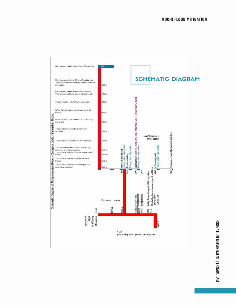
KOCHI FLOOD MITIGATIONIRRIGATION DEPARTMENT | ERNAKULAM
SCHEMATIC DIAGRAM
Page 271
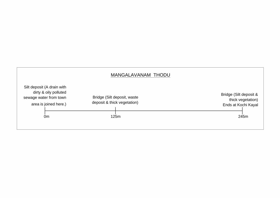
Silt deposit (A drain with
dirty & oily polluted
sewage water from town
area is joined here.)
Bridge (Silt deposit, waste
deposit & thick vegetation)
Bridge (Silt deposit &
thick vegetation)
Ends at Kochi Kayal
245m125m0m
MANGALAVANAM THODU
Page 272
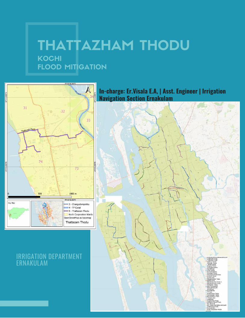
THATTAZHAM THODUKOCHI
FLOOD MITIGATION
In-charge: Er.Visala E.A, | Asst. Engineer | IrrigationNavigation Section Ernakulam
IRRIGATION DEPARTMENT ERNAKULAM
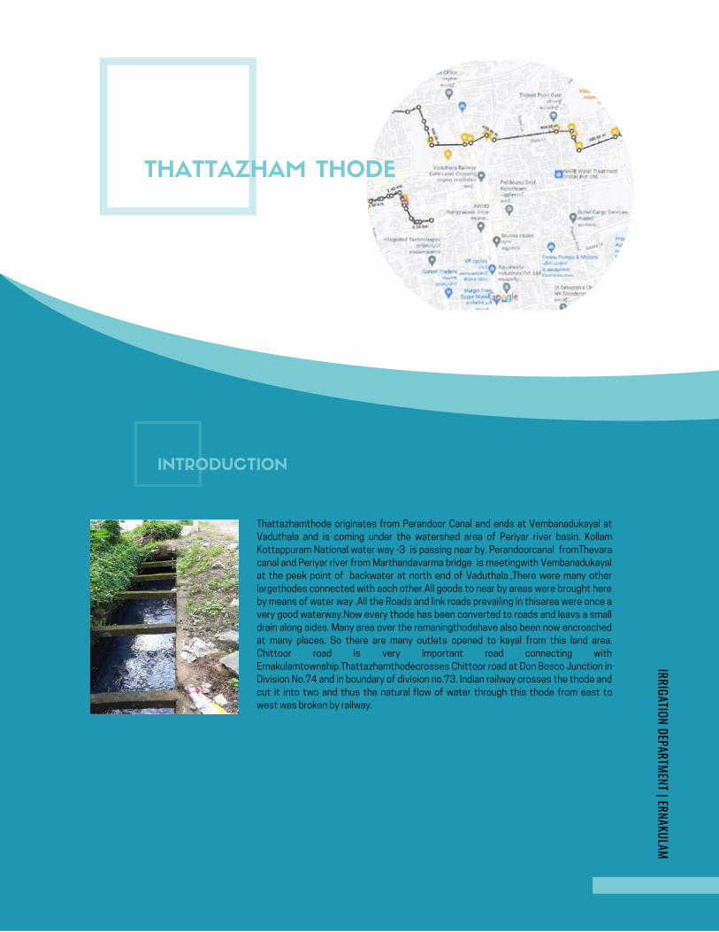
AMBANATTUCHIRA THODU (PONNETH
CHAAL ) IN CHILAVANNOORER .DHANYA K . , | MI SUB DIVISION | ERNAKULAM
KOCHI FLOOD MITIGATION
INITIAL STUDY REPORT
AMBANATTUCHIRA THODU (PONNETH
CHAAL ) IN CHILAVANNOORER .DHANYA K . , | MI SUB DIVISION | ERNAKULAM
KOCHI FLOOD MITIGATION
INITIAL STUDY REPORT
Google Map- Ambanattuchira thodu
THATTAZHAM THODE
INTRODUCTION
Thattazhamthode originates from Perandoor Canal and ends at Vembanadukayal at
Vaduthala and is coming under the watershed area of Periyar river basin. Kollam
Kottappuram National water way -3 is passing near by. Perandoorcanal fromThevara
canal and Periyar river from Marthandavarma bridge is meetingwith Vembanadukayal
at the peek point of backwater at north end of Vaduthala.,There were many other
largethodes connected with each other.All goods to near by areas were brought here
by means of water way .All the Roads and link roads prevailing in thisarea were once a
very good waterway.Now every thode has been converted to roads and leavs a small
drain along sides. Many area over the remaningthodehave also been now encroached
at many places. So there are many outlets opened to kayal from this land area.
Chittoor road is very important road connecting with
Ernakulamtownship.Thattazhamthodecrosses Chittoor road at Don Bosco Junction in
Division No.74 and in boundary of division no.73. Indian railway crosses the thode and
cut it into two and thus the natural flow of water through this thode from east to
west was broken by railway.
IRRIGATION DEPARTMENT | ERNAKULAM
Page 274
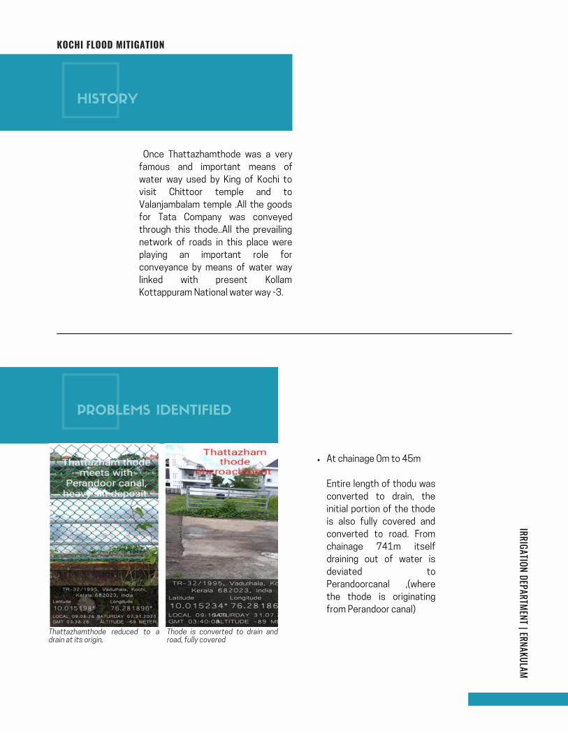
IRRIGATION DEPARTMENT | ERNAKULAMKOCHI FLOOD MITIGATION
Once Thattazhamthode was a very
famous and important means of
water way used by King of Kochi to
visit Chittoor temple and to
Valanjambalam temple .All the goods
for Tata Company was conveyed
through this thode..All the prevailing
network of roads in this place were
playing an important role for
conveyance by means of water way
linked with present Kollam
Kottappuram National water way -3.
At chainage 0m to 45m
Entire length of thodu was
converted to drain, the
initial portion of the thode
is also fully covered and
converted to road. From
chainage 741m itself
draining out of water is
deviated to
Perandoorcanal ,(where
the thode is originating
from Perandoor canal)
Thattazhamthode reduced to adrain at its origin.
Thode is converted to drain androad, fully covered
HISTORY
PROBLEMS IDENTIFIED
Page 275
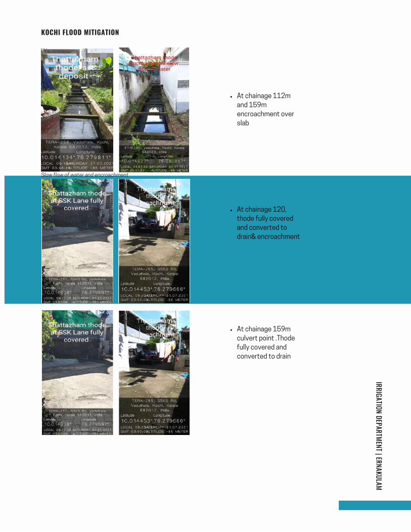
Slow flow of water and encroachment
IRRIGATION DEPARTMENT | ERNAKULAMKOCHI FLOOD MITIGATION
At chainage 112m
and 159m
encroachment over
slab
At chainage 120,
thode fully covered
and converted to
drain& encroachment
At chainage 159m
culvert point .Thode
fully covered and
converted to drain
Page 276
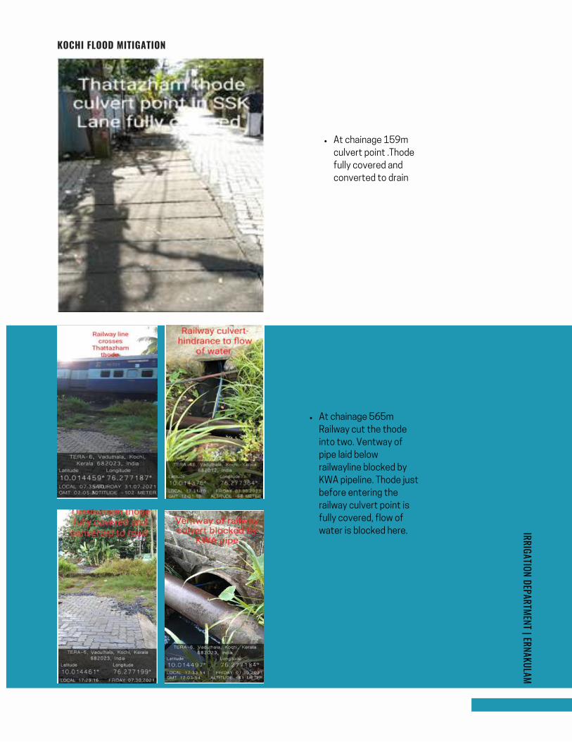
IRRIGATION DEPARTMENT | ERNAKULAMKOCHI FLOOD MITIGATION
At chainage 159m
culvert point .Thode
fully covered and
converted to drain
At chainage 565m
Railway cut the thode
into two. Ventway of
pipe laid below
railwayline blocked by
KWA pipeline. Thode just
before entering the
railway culvert point is
fully covered, flow of
water is blocked here.
Page 277
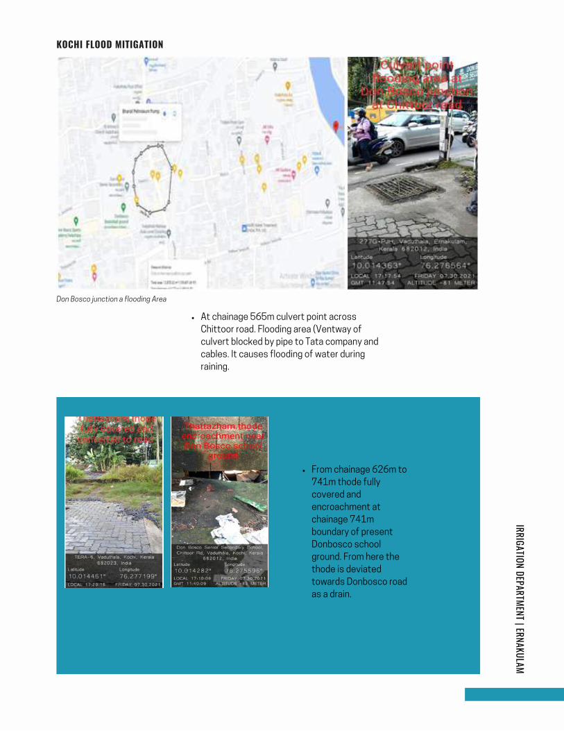
IRRIGATION DEPARTMENT | ERNAKULAMKOCHI FLOOD MITIGATION
At chainage 565m culvert point across
Chittoor road. Flooding area (Ventway of
culvert blocked by pipe to Tata company and
cables. It causes flooding of water during
raining.
From chainage 626m to
741m thode fully
covered and
encroachment at
chainage 741m
boundary of present
Donbosco school
ground. From here the
thode is deviated
towards Donbosco road
as a drain.
Don Bosco junction a flooding Area
Page 278
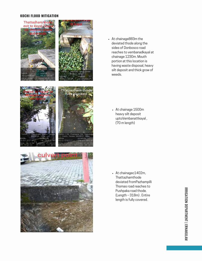
IRRIGATION DEPARTMENT | ERNAKULAMKOCHI FLOOD MITIGATION
At chainage883m the
deviated thode along the
sides of Donbosco road
reaches to vembanadkayal at
chainage 1230m. Mouth
portion at this location is
having waste disposal, heavy
silt deposit and thick grow of
weeds.
At chainage 1500m
heavy silt deposit
uptoVembanattkayal ,
(70 m length)
At chainagec1402m,
Thattazhamthode
deviated fromPazhampilli
Thomas road reaches to
Pushpaka road thode.
(Length – 318m) . Entire
length is fully covered.
Page 279
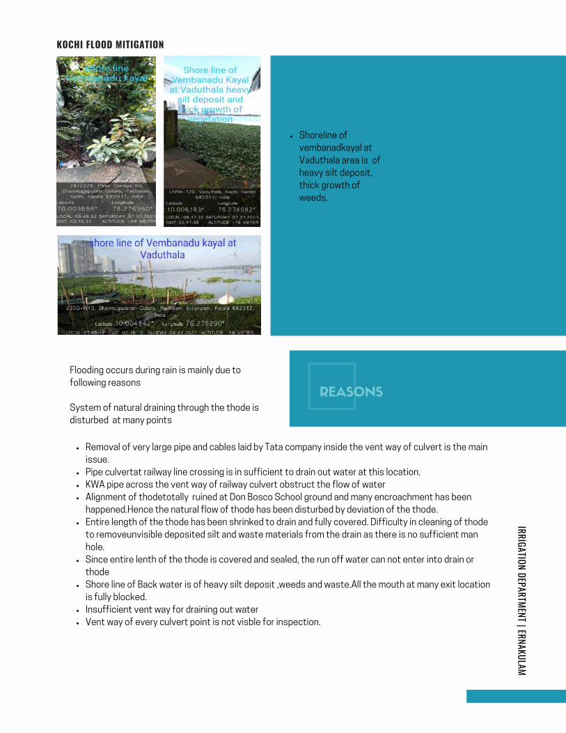
IRRIGATION DEPARTMENT | ERNAKULAMKOCHI FLOOD MITIGATION
Shoreline of
vembanadkayal at
Vaduthala area is of
heavy silt deposit,
thick growth of
weeds.
Flooding occurs during rain is mainly due to
following reasons
System of natural draining through the thode is
disturbed at many points
Removal of very large pipe and cables laid by Tata company inside the vent way of culvert is the main
issue.
Pipe culvertat railway line crossing is in sufficient to drain out water at this location.
KWA pipe across the vent way of railway culvert obstruct the flow of water
Alignment of thodetotally ruined at Don Bosco School ground and many encroachment has been
happened.Hence the natural flow of thode has been disturbed by deviation of the thode.
Entire length of the thode has been shrinked to drain and fully covered. Difficulty in cleaning of thode
to removeunvisible deposited silt and waste materials from the drain as there is no sufficient man
hole.
Since entire lenth of the thode is covered and sealed, the run off water can not enter into drain or
thode
Shore line of Back water is of heavy silt deposit ,weeds and waste.All the mouth at many exit location
is fully blocked.
Insufficient vent way for draining out water
Vent way of every culvert point is not visble for inspection.
REASONS
Page 280
IRRIGATION DEPARTMENT | ERNAKULAMKOCHI FLOOD MITIGATION
Desilting of Vembanattukayal at mouth portion of every thode and removal of waste
andweeds are the main solution to ensure easy flow towards the backwater.
Proper monitoring like weekly Cleaning and caring of drainages in corporation areawith
respect to each division can reduce intensity of flooding .
Remove all the obstructions like pipesfrom the vent way .
Provide necessaryopenings to collect run off water to the thode
clean it weekly by pumping.
Demarkate boundary of thode and restore the alignment of the thode and allow the thode
free from encroachment.
Remove the cables and pipe from the vent way of culvert.
Do protection works toshoreline.
Provide maximum manholes/ openings to allow waterto enter in to the drains
Periodicdesiltingandcleaningof all the drainage system is to be arranged without fail.
Vent way of every culvert point should be easily visible.
Short term measure
Long term measure
There is great possibility of deposition of waste materials in the thode/ drains
every day. Hence cleaning it subsequently can reduce intensity of flooding.
REMEDIES ARE PROPOSED AS LONG TERM
AND SHORT TERM MEASURE
BENEFITS OF SHORT TERM MEASURE
Page 281
IRRIGATION DEPARTMENT | ERNAKULAMKOCHI FLOOD MITIGATION
Total Catchment area of this thode arrived to about 1.66 sq.kmEntire length of
theThattazhamthode is fully covered and converted to drain. Since the thode is
encroached at Ch.741m by Don Bosco school ground, flow of waterto its
downstream is blocked and flow is redirected to it’s originating
point,Perandoor canal as a small drain. Along with that encroachment at
ch134m, Railway line crossing atch 565m and blocked culvert at ch 626m at
Chittoorroadcreated four major obstruction to the flow of water within 741m
length of this thode.Catchment area coming under Thattazhamthode is arrived
to about 1.66sqkm..As the entire length of thode is fully covered.Since
necessary provision for entering rain water into fully covered thode is not
given, water is getting flooding up in this area ..In addition to the above entire
lenth of shore line at Vaduthala portion isfilled with heavy silt depositand
weeds.
If high tide is existing the water will not flow towards the backwater and it may
lead to flooding up as this place is of low lying area. To avoid this desilting of
shore line of backwater and mouth portion of every outlets to Vembanadukayal
isessential.Clearing obstruction of entire length of Thattazhamthodeand
making necessary openings for rain water to enter the thodeareto be done for
ensuring free flow of water. Through this, the surplus water entering in to the
canal can easily flow towards backwater (Vembanadukayal).
Flooding up of rain water at DonBosco junction can be solved only by removal
of fourobstructions noticed above.. Restoration of Thattazhamthodeto its
original form is the effective way to eliminate flooding up in this area.
CONCLUSION/ RECOMMENDATIONS
Page 282

IRRIGATION DEPARTMENT | ERNAKULAMKOCHI FLOOD MITIGATION
SCHEMATIC DIAGRAM
Page 283
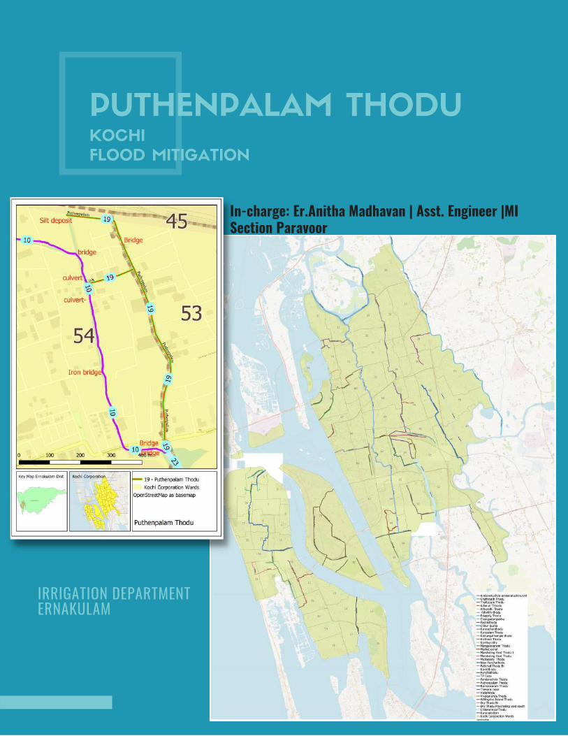
PUTHENPALAM THODUKOCHI
FLOOD MITIGATION
In-charge: Er.Anitha Madhavan | Asst. Engineer |MISection Paravoor
IRRIGATION DEPARTMENT ERNAKULAM
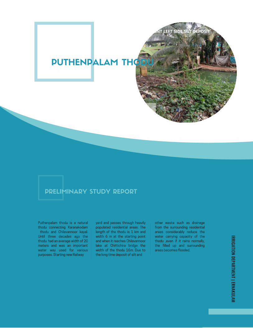
AMBANATTUCHIRA THODU (PONNETH
CHAAL ) IN CHILAVANNOORER .DHANYA K . , | MI SUB DIVISION | ERNAKULAM
KOCHI FLOOD MITIGATION
INITIAL STUDY REPORT
AMBANATTUCHIRA THODU (PONNETH
CHAAL ) IN CHILAVANNOORER .DHANYA K . , | MI SUB DIVISION | ERNAKULAM
KOCHI FLOOD MITIGATION
INITIAL STUDY REPORT
Google Map- Ambanattuchira thodu
PUTHENPALAM THODU
PRELIMINARY STUDY REPORT
Puthenpalam thodu is a natural
thodu connecting Karanakodam
thodu and Chilavannoor kayal.
Until three decades ago the
thodu had an average width of 20
meters and was an important
water way used for various
purposes. Starting new Railway
yard and passes through heavily
populated residential areas. The
length of the thodu is 1 km and
width 6 m at the starting point
and when it reaches Chilavannoor
lake at Chittichira bridge the
width of the thodu 16m. Due to
the long time deposit of silt and
other waste such as drainage
from the surrounding residential
areas considerably reduce the
water carrying capacity of the
thodu ,even if it rains normally,
the filled up and surrounding
areas becomes flooded.
IRRIGATION DEPARTMENT | ERNAKULAM
Page 285
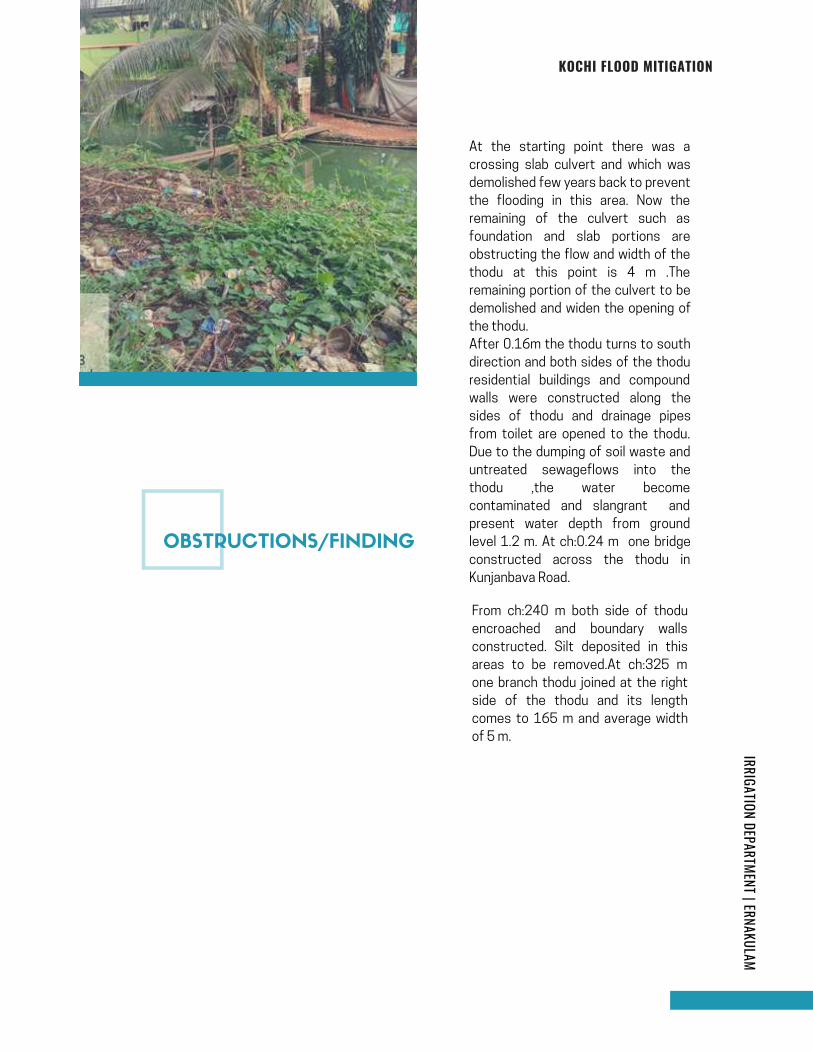
At the starting point there was a
crossing slab culvert and which was
demolished few years back to prevent
the flooding in this area. Now the
remaining of the culvert such as
foundation and slab portions are
obstructing the flow and width of the
thodu at this point is 4 m .The
remaining portion of the culvert to be
demolished and widen the opening of
the thodu.
After 0.16m the thodu turns to south
direction and both sides of the thodu
residential buildings and compound
walls were constructed along the
sides of thodu and drainage pipes
from toilet are opened to the thodu.
Due to the dumping of soil waste and
untreated sewageflows into the
thodu ,the water become
contaminated and slangrant and
present water depth from ground
level 1.2 m. At ch:0.24 m one bridge
constructed across the thodu in
Kunjanbava Road.
From ch:240 m both side of thodu
encroached and boundary walls
constructed. Silt deposited in this
areas to be removed.At ch:325 m
one branch thodu joined at the right
side of the thodu and its length
comes to 165 m and average width
of 5 m.
IRRIGATION DEPARTMENT | ERNAKULAMKOCHI FLOOD MITIGATION
OBSTRUCTIONS/FINDING
Page 286
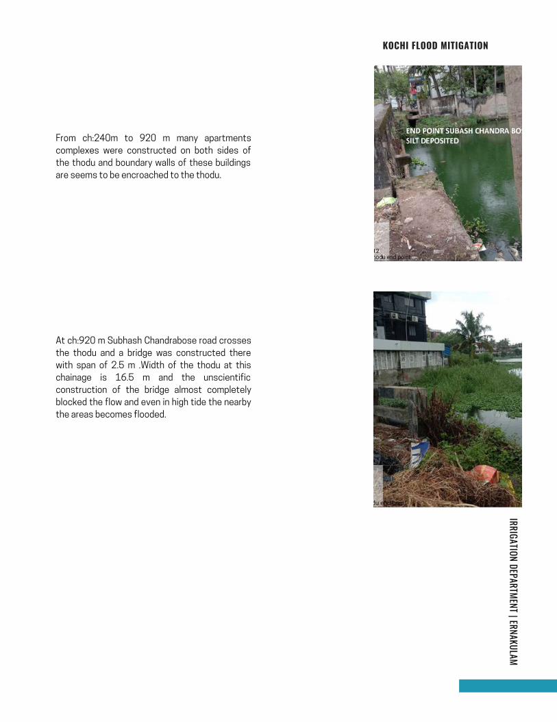
From ch:240m to 920 m many apartments
complexes were constructed on both sides of
the thodu and boundary walls of these buildings
are seems to be encroached to the thodu.
page | 18
IRRIGATION DEPARTMENT | ERNAKULAMKOCHI FLOOD MITIGATION
At ch:920 m Subhash Chandrabose road crosses
the thodu and a bridge was constructed there
with span of 2.5 m .Width of the thodu at this
chainage is 16.5 m and the unscientific
construction of the bridge almost completely
blocked the flow and even in high tide the nearby
the areas becomes flooded.
Page 287
Flow of thodu restricted at the 0 m chainage due to
remainings of the old culvert and insufficient width.
Accumulation of silt in the bed of thodu.
Reduced width of canal due to the encroachment.
Difficulty of silt removal from the thodu because of the illegal
construction of boundary walls on both sides of the thodu.
Huge quantity of waste disposal and sewage pipe lines.
Obstruction due to bridge having less vertical and horizontal
clearance.
1.
2.
3.
4.
5.
6.
Demolishing and removing the remaining parts of the culvert and widening of the
opening portion.
De silting and removal of silt and other floating debris for the entire stretch.
Stringent monitoring and enforcement for preventing waste dumping into the canal.
Committees to be formed with participation of residence association, Kudumbasree
workers, cooperation officials and law enforcement officials for watching and take
action against to waste and sewage disposal to the thodu.
The entire canal encroached on both sides should be evicted and the sides of the canal
to the protected through proper fencing with openings intermittent for clearing the
waste and silt.
Bridge at the end of Puthenpalam thodu to be demolished and construct a new bridge
with adequate width and height .
Short Term Measures
1.
2.
3.
4.
Long term measures
1.
2.
IRRIGATION DEPARTMENT | ERNAKULAMKOCHI FLOOD MITIGATION
SUMMARY OF PROBLEMS IDENTIFIED
REMEDIES
Page 288

IRRIGATION DEPARTMENT | ERNAKULAMKOCHI FLOOD MITIGATION
SCHEMATIC DIAGRAM
Page 289
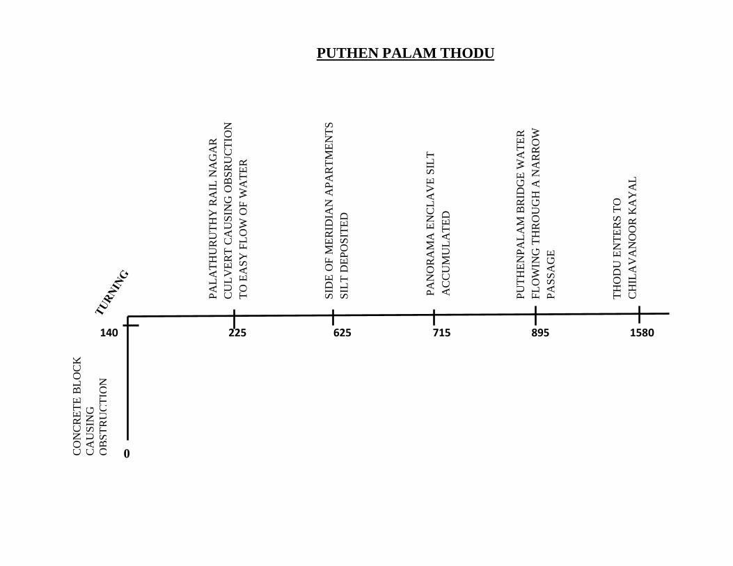
140 225 625 715 895 1580
0
PA
LA
TH
UR
UT
HY
RA
IL N
AG
AR
CU
LV
ER
T C
AU
SIN
G O
BS
RU
CT
ION
TO
EA
SY
FL
OW
OF
WA
TE
R
SID
E O
F M
ER
IDIA
N A
PA
RT
ME
NT
S
SIL
T D
EP
OS
ITE
D
PU
TH
EN
PA
LA
M B
RID
GE
WA
TE
R
FL
OW
ING
TH
RO
UG
H A
NA
RR
OW
PA
SS
AG
E
PA
NO
RA
MA
EN
CL
AV
E S
ILT
AC
CU
MU
LA
TE
D
TH
OD
U E
NT
ER
S T
O
CH
ILA
VA
NO
OR
KA
YA
L
CO
NC
RE
TE
BL
OC
K
CA
US
ING
OB
ST
RU
CT
ION
TO
TH
E F
LO
W
PUTHEN PALAM THODU
Page 290
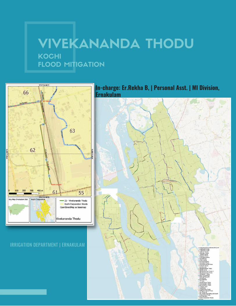
VIVEKANANDA THODUKOCHI
FLOOD MITIGATION
In-charge: Er.Rekha B, | Personal Asst. | MI Division,Ernakulam
IRRIGATION DEPARTMENT | ERNAKULAM

INTRODUCTION
Vivekananda Thodu for a length of 1162m and an
average width of 1.70 m is starting from the vicinity of
the railway quarters of the south railway station and
meets at the Mullassery canal and Karithalathodu
which is merging to Perandoor canal near the KSRTC
garage. As far as this thodu is concerned the serious
bottlenecks have been cleared in Operation Break
Through for a length of 300m and no continued flood
situation occurred in those locations as was
experienced in the past years.
VIVEKANANDA
THODU
Apart from this, the bottlenecks are listed below.
IRRIGATION DEPARTMENT | ERNAKULAM
Page 292
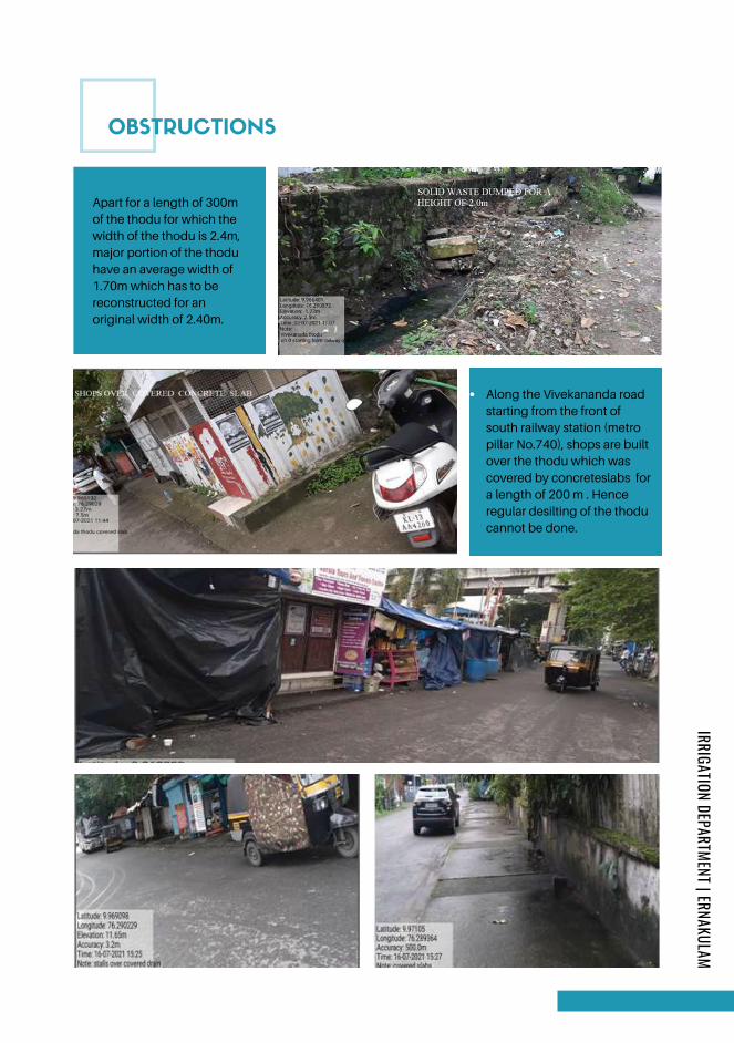
OBSTRUCTIONS
Apart for a length of 300m
of the thodu for which the
width of the thodu is 2.4m,
major portion of the thodu
have an average width of
1.70m which has to be
reconstructed for an
original width of 2.40m.
Along the Vivekananda road
starting from the front of
south railway station (metro
pillar No.740), shops are built
over the thodu which was
covered by concreteslabs for
a length of 200 m . Hence
regular desilting of the thodu
cannot be done.
IRRIGATION DEPARTMENT | ERNAKULAM
Page 293
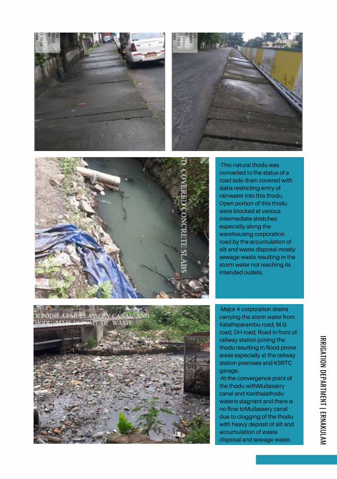
·This natural thodu was
converted to the status of a
road side drain covered with
slabs restricting entry of
rainwater into this thodu.
Open portion of this thodu
were blocked at various
intermediate stretches
especially along the
warehousing corporation
road by the accumulation of
silt and waste disposal mostly
sewage waste resulting in the
storm water not reaching its
intended outlets.
·Major 4 corporation drains
carrying the storm water from
Kalathiparambu road, M.G
road, DH road, Road in front of
railway station joining the
thodu resulting in flood prone
areas especially at the railway
station premises and KSRTC
garage.
·At the convergence point of
the thodu withMullassery
canal and Karithalathodu
wateris stagnant and there is
no flow toMullassery canal
due to clogging of the thodu
with heavy deposit of silt and
accumulation of waste
disposal and sewage waste.
IRRIGATION DEPARTMENT | ERNAKULAM
Page 294
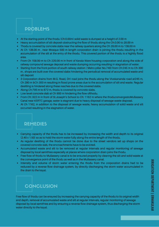
Carrying capacity of the thodu has to be increased by increasing the width and depth to its original
(2.40 x 1.50) so as to hold the storm water fully along the entire length of the thodu.
As regular desilting of the thodu cannot be done due to the street vendors set up shops on the
covered concrete slab, the encroachments have to be evicted.
Accumulated waste and silt to be removed at regular intervals and regular monitoring of sewage
disposal by local samithies especially at places where corporation drain joins the thodu.
Free flow of thodu to Mullassery canal is to be ensured properly by clearing the silt and solid waste at
the convergence point of the thodu as well as in the Mullassery canal.
Intensity and volume of storm water entering the thodu from the corporation drains had to be
reduced by a reverse flow drainage system, by directly discharging the storm water accumulated in
the drain to the kayal.
REMEDIES
PROBLEMS IDENTIFIED
At the starting point of the thodu (Ch:0.00m) solid waste is dumped at a height of 2.00 m
Heavy accumulation of silt deposit obstructing the flow of thodu along the Ch:0.00 to 28.00 m
Thodu is covered by concrete slabs near the railway quarters along the Ch 28.00 m to 138.00 m
At Ch 138.00 m , near Mosque 500 m length corporation drain is joining the thodu resulting in the
accumulation of the silt at the entry of the thodu. This covered portion of the thodu is a hightly flood
area.
From Ch 158.00 m to Ch 220.00 m in front of Kerala Ware housing corporation and along the side of
railway compound sewage deposal and waste dumping occurring resulting in stagnation of water.
Starting from the front portion of south railway station ( Metro pillar No.740) from Ch:245 m to Ch 300
m , shops are built over the covered slabs hindering the periodical removal of accumulated waste and
silt deposit
3 Corporation drains from M.G. Road, DH road joins the thodu along the Vivekananda road at245 m,
Ch 280 m &Ch 300 m resulting in flood prone areas due to the accumulation of silt and waste. Regular
desilting is hindered along these reaches due to the covered slabs.
Along Ch:795 m to 872 m, thodu is covered by concrete slabs.
Low level concrete slab at Ch 900 m hindering the flow ofthodu.
From Ch: 922 m in front of St.Joseph’s School to Ch: 1162 m where the thoduconvergestoMullassery
Canal near KSRTC garage, water is stagnant due to heavy disposal of sewage waste disposal.
At Ch 1162, in addition to the disposal of sewage waste, heavy accumulation of solid waste and silt
occurred resulting in the stagnation of water.
Free flow of thodu can be ensured by increasing the carrying capacity of the thodu to its original width
and depth, removal of accumulated waste and silt at regular intervals, regular monitoring of sewage
disposal by local samithies and by ensuring a reverse flow drainage system, thus discharging the storm
water directly to the kayal.
CONCLUSION
IRRIGATION DEPARTMENT | ERNAKULAM
Page 295
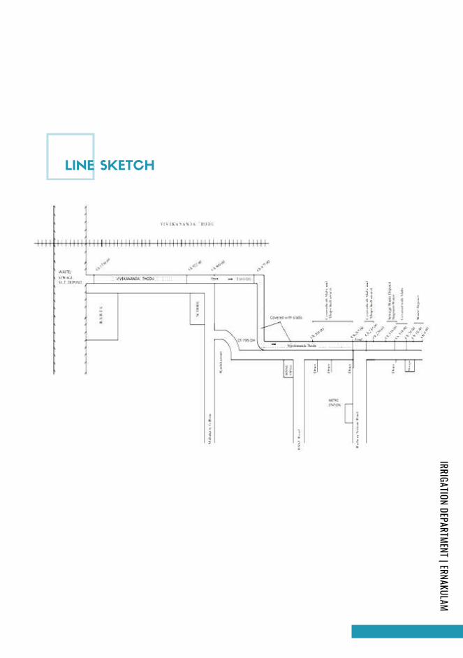
LINE SKETCH
IRRIGATION DEPARTMENT | ERNAKULAM
Page 296
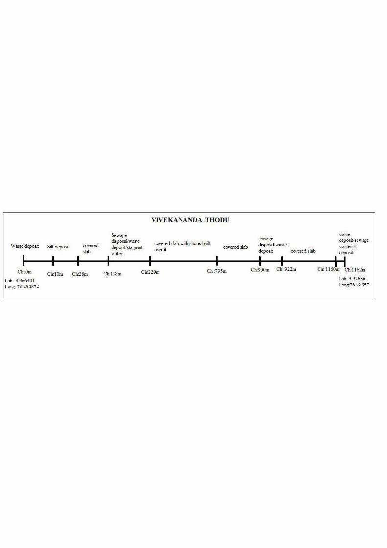
Page 297
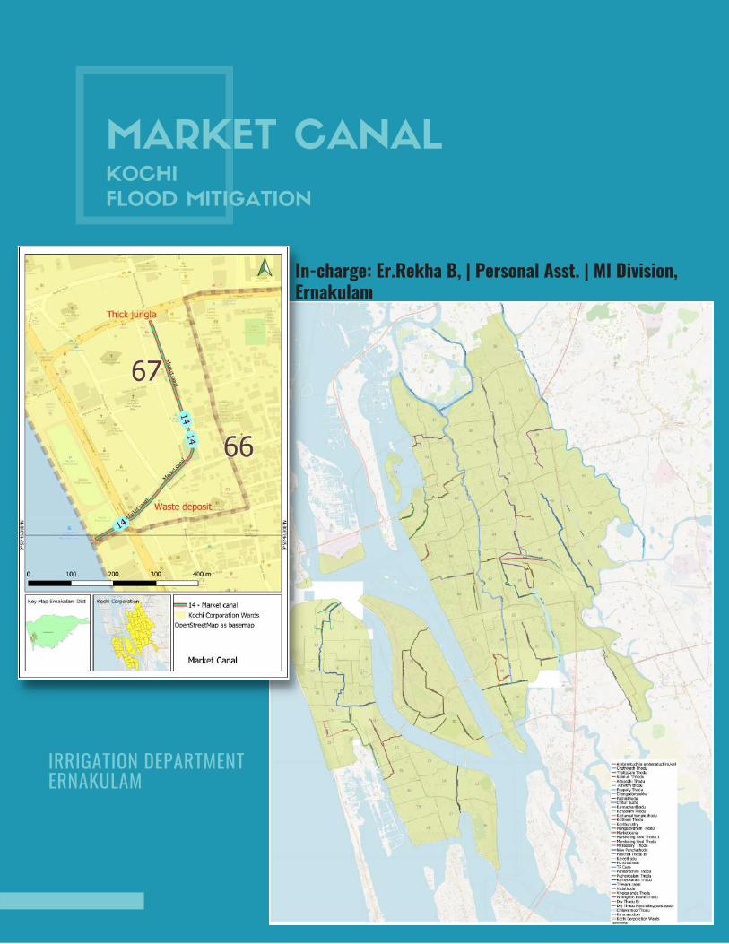
MARKET CANALKOCHI
FLOOD MITIGATION
In-charge: Er.Rekha B, | Personal Asst. | MI Division,Ernakulam
IRRIGATION DEPARTMENT ERNAKULAM

INTRODUCTION
Market canal starting from Ernakulam market at Bannerji road for a length of 730m
discharges into the Kayal at the rainbow bridge having an average width of 9.60
m.History of Market canal starts at the era of “ The Maharaja of Cochin” about 150
years back who gave the Market area to Jewish traders for business. The northern
end of Broadway, Basin Road and Jew street together forms the Ernakulam market
with a row of temporary shacks come up on the side of Basin road with their back
to the canal. Hence the canal also known as Basin Road Canal. Market canal used
to be the lifeline of business in the market with the country boats bringing in goods
until the 90’s as it is directly linked to the Vembanad lake. As such the centre had
trade connections from as far as Ponnani and Chavakkad in North and Kollam,
Changanassery, Kottayam in south. The wide platform that protrudes the canal is
the jetty where hundreds of large canoes carrying goods used to arrive from these
places.
Market canal in 1950
MARKET CANAL
IRRIGATION DEPARTMENT | ERNAKULAM
Page 299
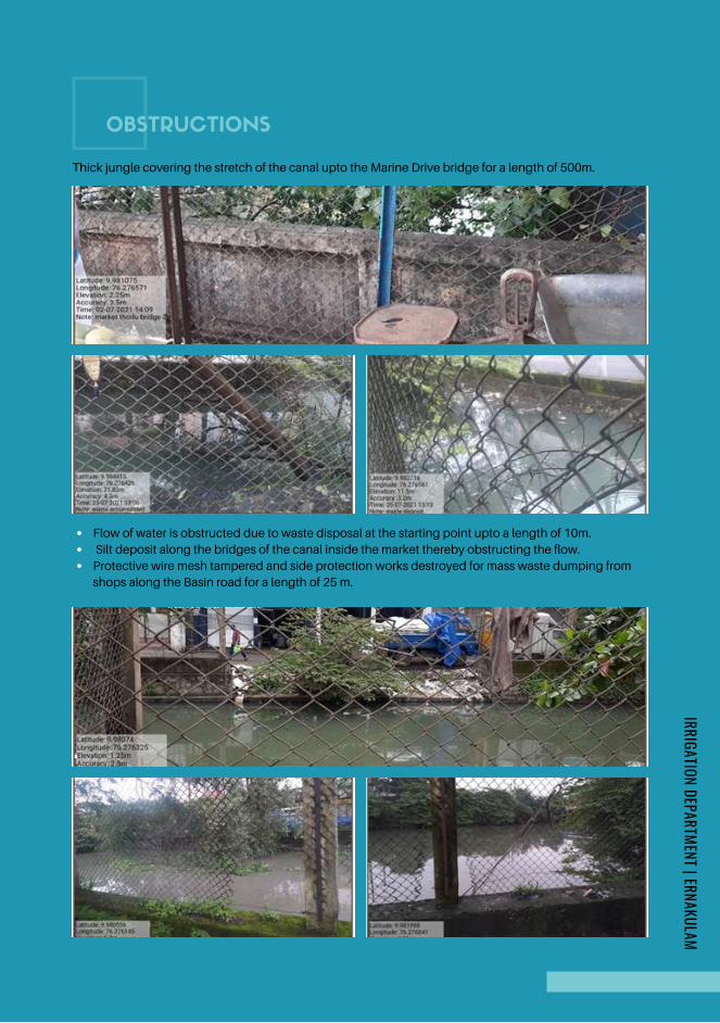
OBSTRUCTIONS
Thick jungle covering the stretch of the canal upto the Marine Drive bridge for a length of 500m.
Flow of water is obstructed due to waste disposal at the starting point upto a length of 10m.
Silt deposit along the bridges of the canal inside the market thereby obstructing the flow.
Protective wire mesh tampered and side protection works destroyed for mass waste dumping from
shops along the Basin road for a length of 25 m.
IRRIGATION DEPARTMENT | ERNAKULAM
Page 300
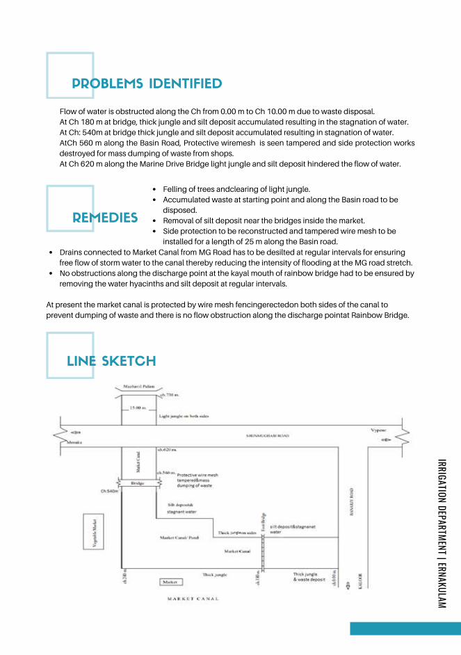
Felling of trees andclearing of light jungle.
Accumulated waste at starting point and along the Basin road to be
disposed.
Removal of silt deposit near the bridges inside the market.
Side protection to be reconstructed and tampered wire mesh to be
installed for a length of 25 m along the Basin road.
REMEDIES
PROBLEMS IDENTIFIED
Flow of water is obstructed along the Ch from 0.00 m to Ch 10.00 m due to waste disposal.
At Ch 180 m at bridge, thick jungle and silt deposit accumulated resulting in the stagnation of water.
At Ch: 540m at bridge thick jungle and silt deposit accumulated resulting in stagnation of water.
AtCh 560 m along the Basin Road, Protective wiremesh is seen tampered and side protection works
destroyed for mass dumping of waste from shops.
At Ch 620 m along the Marine Drive Bridge light jungle and silt deposit hindered the flow of water.
Drains connected to Market Canal from MG Road has to be desilted at regular intervals for ensuring
free flow of storm water to the canal thereby reducing the intensity of flooding at the MG road stretch.
No obstructions along the discharge point at the kayal mouth of rainbow bridge had to be ensured by
removing the water hyacinths and silt deposit at regular intervals.
At present the market canal is protected by wire mesh fencingerectedon both sides of the canal to
prevent dumping of waste and there is no flow obstruction along the discharge pointat Rainbow Bridge.
LINE SKETCH
IRRIGATION DEPARTMENT | ERNAKULAM
Page 301
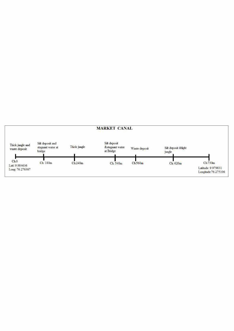
Page 302
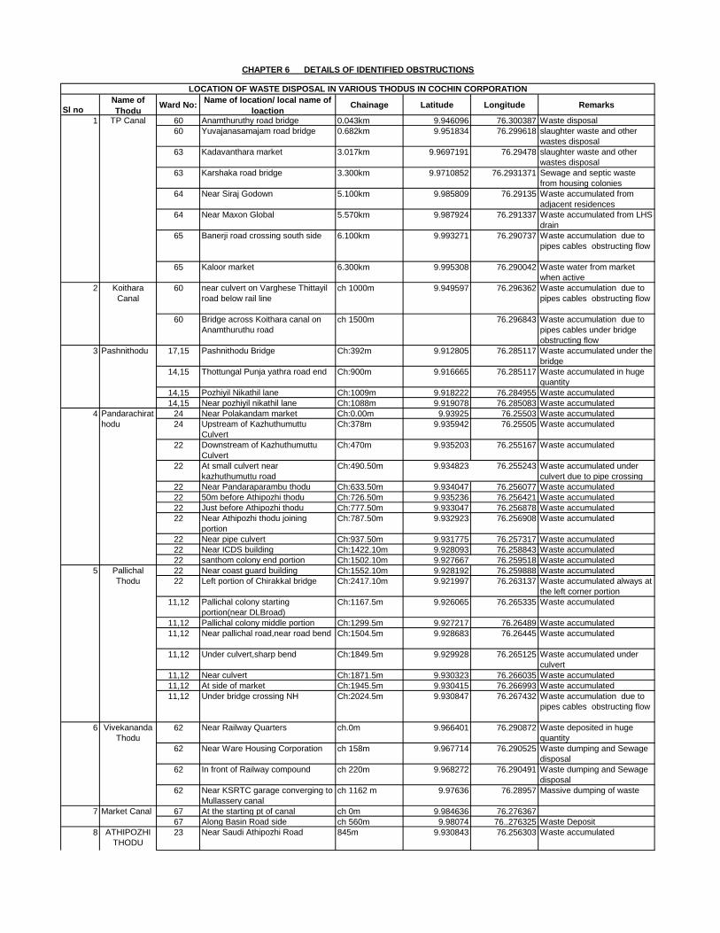
Sl noName of
ThoduWard No:
Name of location/ local name of
loactionChainage Latitude Longitude Remarks
60 Anamthuruthy road bridge 0.043km 9.946096 76.300387 Waste disposal
60 Yuvajanasamajam road bridge 0.682km 9.951834 76.299618 slaughter waste and other
wastes disposal
63 Kadavanthara market 3.017km 9.9697191 76.29478 slaughter waste and other
wastes disposal
63 Karshaka road bridge 3.300km 9.9710852 76.2931371 Sewage and septic waste
from housing colonies
64 Near Siraj Godown 5.100km 9.985809 76.29135 Waste accumulated from
adjacent residences
64 Near Maxon Global 5.570km 9.987924 76.291337 Waste accumulated from LHS
drain
65 Banerji road crossing south side 6.100km 9.993271 76.290737 Waste accumulation due to
pipes cables obstructing flow
65 Kaloor market 6.300km 9.995308 76.290042 Waste water from market
when active
60 near culvert on Varghese Thittayil
road below rail line
ch 1000m 9.949597 76.296362 Waste accumulation due to
pipes cables obstructing flow
60 Bridge across Koithara canal on
Anamthuruthu road
ch 1500m 76.296843 Waste accumulation due to
pipes cables under bridge
obstructing flow
17,15 Pashnithodu Bridge Ch:392m 9.912805 76.285117 Waste accumulated under the
bridge
14,15 Thottungal Punja yathra road end Ch:900m 9.916665 76.285117 Waste accumulated in huge
quantity
14,15 Pozhiyil Nikathil lane Ch:1009m 9.918222 76.284955 Waste accumulated
14,15 Near pozhiyil nikathil lane Ch:1088m 9.919078 76.285083 Waste accumulated
24 Near Polakandam market Ch:0.00m 9.93925 76.25503 Waste accumulated
24 Upstream of Kazhuthumuttu
Culvert
Ch:378m 9.935942 76.25505 Waste accumulated
22 Downstream of Kazhuthumuttu
Culvert
Ch:470m 9.935203 76.255167 Waste accumulated
22 At small culvert near
kazhuthumuttu road
Ch:490.50m 9.934823 76.255243 Waste accumulated under
culvert due to pipe crossing
22 Near Pandaraparambu thodu Ch:633.50m 9.934047 76.256077 Waste accumulated
22 50m before Athipozhi thodu Ch:726.50m 9.935236 76.256421 Waste accumulated
22 Just before Athipozhi thodu Ch:777.50m 9.933047 76.256878 Waste accumulated
22 Near Athipozhi thodu joining
portion
Ch:787.50m 9.932923 76.256908 Waste accumulated
22 Near pipe culvert Ch:937.50m 9.931775 76.257317 Waste accumulated
22 Near ICDS building Ch:1422.10m 9.928093 76.258843 Waste accumulated
22 santhom colony end portion Ch:1502.10m 9.927667 76.259518 Waste accumulated
22 Near coast guard building Ch:1552.10m 9.928192 76.259888 Waste accumulated
22 Left portion of Chirakkal bridge Ch:2417.10m 9.921997 76.263137 Waste accumulated always at
the left corner portion
11,12 Pallichal colony starting
portion(near DLBroad)
Ch:1167.5m 9.926065 76.265335 Waste accumulated
11,12 Pallichal colony middle portion Ch:1299.5m 9.927217 76.26489 Waste accumulated
11,12 Near pallichal road,near road bend Ch:1504.5m 9.928683 76.26445 Waste accumulated
11,12 Under culvert,sharp bend Ch:1849.5m 9.929928 76.265125 Waste accumulated under
culvert
11,12 Near culvert Ch:1871.5m 9.930323 76.266035 Waste accumulated
11,12 At side of market Ch:1945.5m 9.930415 76.266993 Waste accumulated
11,12 Under bridge crossing NH Ch:2024.5m 9.930847 76.267432 Waste accumulation due to
pipes cables obstructing flow
62 Near Railway Quarters ch.0m 9.966401 76.290872 Waste deposited in huge
quantity
62 Near Ware Housing Corporation ch 158m 9.967714 76.290525 Waste dumping and Sewage
disposal
62 In front of Railway compound ch 220m 9.968272 76.290491 Waste dumping and Sewage
disposal
62 Near KSRTC garage converging to
Mullassery canal
ch 1162 m 9.97636 76.28957 Massive dumping of waste
67 At the starting pt of canal ch 0m 9.984636 76.276367
67 Along Basin Road side ch 560m 9.98074 76..276325 Waste Deposit
23 Near Saudi Athipozhi Road 845m 9.930843 76.256303 Waste accumulated
CHAPTER 6 DETAILS OF IDENTIFIED OBSTRUCTIONS
LOCATION OF WASTE DISPOSAL IN VARIOUS THODUS IN COCHIN CORPORATION
1 TP Canal
2 Koithara
Canal
3 Pashnithodu
4 Pandarachirat
hodu
5 Pallichal
Thodu
6 Vivekananda
Thodu
Market Canal7
8 ATHIPOZHI
THODU
Page 303
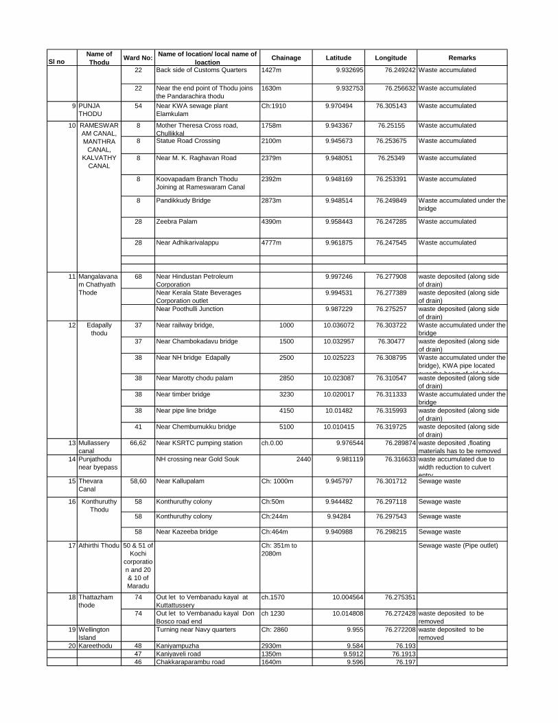
Sl noName of
ThoduWard No:
Name of location/ local name of
loactionChainage Latitude Longitude Remarks
22 Back side of Customs Quarters 1427m 9.932695 76.249242 Waste accumulated
22 Near the end point of Thodu joins
the Pandarachira thodu
1630m 9.932753 76.256632 Waste accumulated
9 PUNJA
THODU
54 Near KWA sewage plant
Elamkulam
Ch:1910 9.970494 76.305143 Waste accumulated
8 Mother Theresa Cross road,
Chullikkal
1758m 9.943367 76.25155 Waste accumulated
8 Statue Road Crossing 2100m 9.945673 76.253675 Waste accumulated
8 Near M. K. Raghavan Road 2379m 9.948051 76.25349 Waste accumulated
8 Koovapadam Branch Thodu
Joining at Rameswaram Canal
2392m 9.948169 76.253391 Waste accumulated
8 Pandikkudy Bridge 2873m 9.948514 76.249849 Waste accumulated under the
bridge
28 Zeebra Palam 4390m 9.958443 76.247285 Waste accumulated
28 Near Adhikarivalappu 4777m 9.961875 76.247545 Waste accumulated
68 Near Hindustan Petroleum
Corporation
9.997246 76.277908 waste deposited (along side
of drain)
Near Kerala State Beverages
Corporation outlet
9.994531 76.277389 waste deposited (along side
of drain)
Near Poothulli Junction 9.987229 76.275257 waste deposited (along side
of drain)
37 Near railway bridge, 1000 10.036072 76.303722 Waste accumulated under the
bridge
37 Near Chambokadavu bridge 1500 10.032957 76.30477 waste deposited (along side
of drain)
38 Near NH bridge Edapally 2500 10.025223 76.308795 Waste accumulated under the
bridge), KWA pipe located
over the beam of old bridge 38 Near Marotty chodu palam 2850 10.023087 76.310547 waste deposited (along side
of drain)
38 Near timber bridge 3230 10.020017 76.311333 Waste accumulated under the
bridge
38 Near pipe line bridge 4150 10.01482 76.315993 waste deposited (along side
of drain)
41 Near Chembumukku bridge 5100 10.010415 76.319725 waste deposited (along side
of drain)
13 Mullassery
canal
66,62 Near KSRTC pumping station ch.0.00 9.976544 76.289874 waste deposited ,floating
materials has to be removed
14 Punjathodu
near byepass
NH crossing near Gold Souk 2440 9.981119 76.316633 waste accumulated due to
width reduction to culvert
entry15 Thevara
Canal
58,60 Near Kallupalam Ch: 1000m 9.945797 76.301712 Sewage waste
58 Konthuruthy colony Ch:50m 9.944482 76.297118 Sewage waste
58 Konthuruthy colony Ch:244m 9.94284 76.297543 Sewage waste
58 Near Kazeeba bridge Ch:464m 9.940988 76.298215 Sewage waste
17 Athirthi Thodu 50 & 51 of
Kochi
corporatio
n and 20
& 10 of
Maradu
Muncipalit
Ch: 351m to
2080m
Sewage waste (Pipe outlet)
74 Out let to Vembanadu kayal at
Kuttattussery
ch.1570 10.004564 76.275351
74 Out let to Vembanadu kayal Don
Bosco road end
ch 1230 10.014808 76.272428 waste deposited to be
removed
19 Wellington
Island
Turning near Navy quarters Ch: 2860 9.955 76.272208 waste deposited to be
removed
20 Kareethodu 48 Kaniyampuzha 2930m 9.584 76.193
47 Kaniyaveli road 1350m 9.5912 76.1913
46 Chakkaraparambu road 1640m 9.596 76.197
12 Edapally
thodu
16 Konthuruthy
Thodu
18 Thattazham
thode
8 ATHIPOZHI
THODU
10 RAMESWAR
AM CANAL,
MANTHRA
CANAL,
KALVATHY
CANAL
11 Mangalavana
m Chathyath
Thode
Page 304
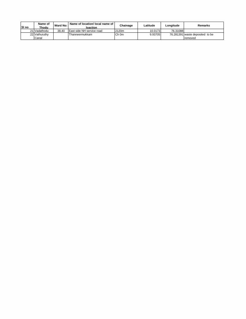
Sl noName of
ThoduWard No:
Name of location/ local name of
loactionChainage Latitude Longitude Remarks
21 Vadathodu 38,40 East side NH service road 2120m 10.0173 76.31088
22 Vathuruthy
Canal
Thanneermukkam Ch 0m 9.93705 76.281391 waste deposited to be
removed
Page 305
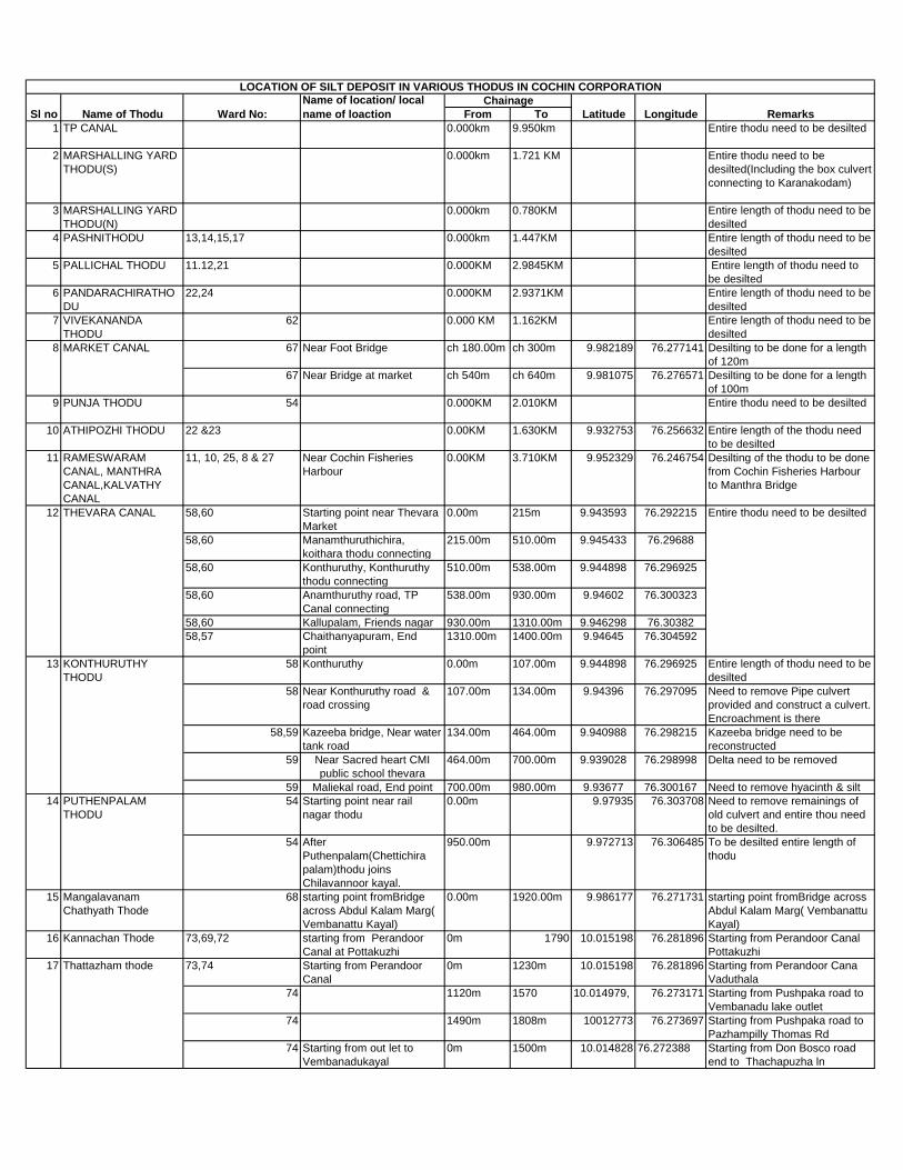
From To
1 TP CANAL 0.000km 9.950km Entire thodu need to be desilted
2 MARSHALLING YARD
THODU(S)
0.000km 1.721 KM Entire thodu need to be
desilted(Including the box culvert
connecting to Karanakodam)
3 MARSHALLING YARD
THODU(N)
0.000km 0.780KM Entire length of thodu need to be
desilted
4 PASHNITHODU 13,14,15,17 0.000km 1.447KM Entire length of thodu need to be
desilted
5 PALLICHAL THODU 11.12,21 0.000KM 2.9845KM Entire length of thodu need to
be desilted
6 PANDARACHIRATHO
DU
22,24 0.000KM 2.9371KM Entire length of thodu need to be
desilted
7 VIVEKANANDA
THODU
62 0.000 KM 1.162KM Entire length of thodu need to be
desilted
67 Near Foot Bridge ch 180.00m ch 300m 9.982189 76.277141 Desilting to be done for a length
of 120m
67 Near Bridge at market ch 540m ch 640m 9.981075 76.276571 Desilting to be done for a length
of 100m
9 PUNJA THODU 54 0.000KM 2.010KM Entire thodu need to be desilted
10 ATHIPOZHI THODU 22 &23 0.00KM 1.630KM 9.932753 76.256632 Entire length of the thodu need
to be desilted
11 RAMESWARAM
CANAL, MANTHRA
CANAL,KALVATHY
CANAL
11, 10, 25, 8 & 27 Near Cochin Fisheries
Harbour
0.00KM 3.710KM 9.952329 76.246754 Desilting of the thodu to be done
from Cochin Fisheries Harbour
to Manthra Bridge
58,60 Starting point near Thevara
Market
0.00m 215m 9.943593 76.292215
58,60 Manamthuruthichira,
koithara thodu connecting
215.00m 510.00m 9.945433 76.29688
58,60 Konthuruthy, Konthuruthy
thodu connecting
510.00m 538.00m 9.944898 76.296925
58,60 Anamthuruthy road, TP
Canal connecting
538.00m 930.00m 9.94602 76.300323
58,60 Kallupalam, Friends nagar 930.00m 1310.00m 9.946298 76.30382
58,57 Chaithanyapuram, End
point
1310.00m 1400.00m 9.94645 76.304592
58 Konthuruthy 0.00m 107.00m 9.944898 76.296925 Entire length of thodu need to be
desilted
58 Near Konthuruthy road &
road crossing
107.00m 134.00m 9.94396 76.297095 Need to remove Pipe culvert
provided and construct a culvert.
Encroachment is there
58,59 Kazeeba bridge, Near water
tank road
134.00m 464.00m 9.940988 76.298215 Kazeeba bridge need to be
reconstructed
59 Near Sacred heart CMI
public school thevara
464.00m 700.00m 9.939028 76.298998 Delta need to be removed
59 Maliekal road, End point 700.00m 980.00m 9.93677 76.300167 Need to remove hyacinth & silt
54 Starting point near rail
nagar thodu
0.00m 9.97935 76.303708 Need to remove remainings of
old culvert and entire thou need
to be desilted.
54 After
Puthenpalam(Chettichira
palam)thodu joins
Chilavannoor kayal.
950.00m 9.972713 76.306485 To be desilted entire length of
thodu
15 Mangalavanam
Chathyath Thode
68 starting point fromBridge
across Abdul Kalam Marg(
Vembanattu Kayal)
0.00m 1920.00m 9.986177 76.271731 starting point fromBridge across
Abdul Kalam Marg( Vembanattu
Kayal)
16 Kannachan Thode 73,69,72 starting from Perandoor
Canal at Pottakuzhi
0m 1790 10.015198 76.281896 Starting from Perandoor Canal
Pottakuzhi
73,74 Starting from Perandoor
Canal
0m 1230m 10.015198 76.281896 Starting from Perandoor Cana
Vaduthala
74 1120m 1570 10.014979, 76.273171 Starting from Pushpaka road to
Vembanadu lake outlet
74 1490m 1808m 10012773 76.273697 Starting from Pushpaka road to
Pazhampilly Thomas Rd
74 Starting from out let to
Vembanadukayal
0m 1500m 10.014828 76.272388 Starting from Don Bosco road
end to Thachapuzha ln
Longitude Remarks
Entire thodu need to be desilted
LOCATION OF SILT DEPOSIT IN VARIOUS THODUS IN COCHIN CORPORATION
Sl no Name of Thodu Ward No:
Name of location/ local
name of loaction
Chainage
Latitude
8 MARKET CANAL
12 THEVARA CANAL
13 KONTHURUTHY
THODU
PUTHENPALAM
THODU
14
17 Thattazham thode
Page 306
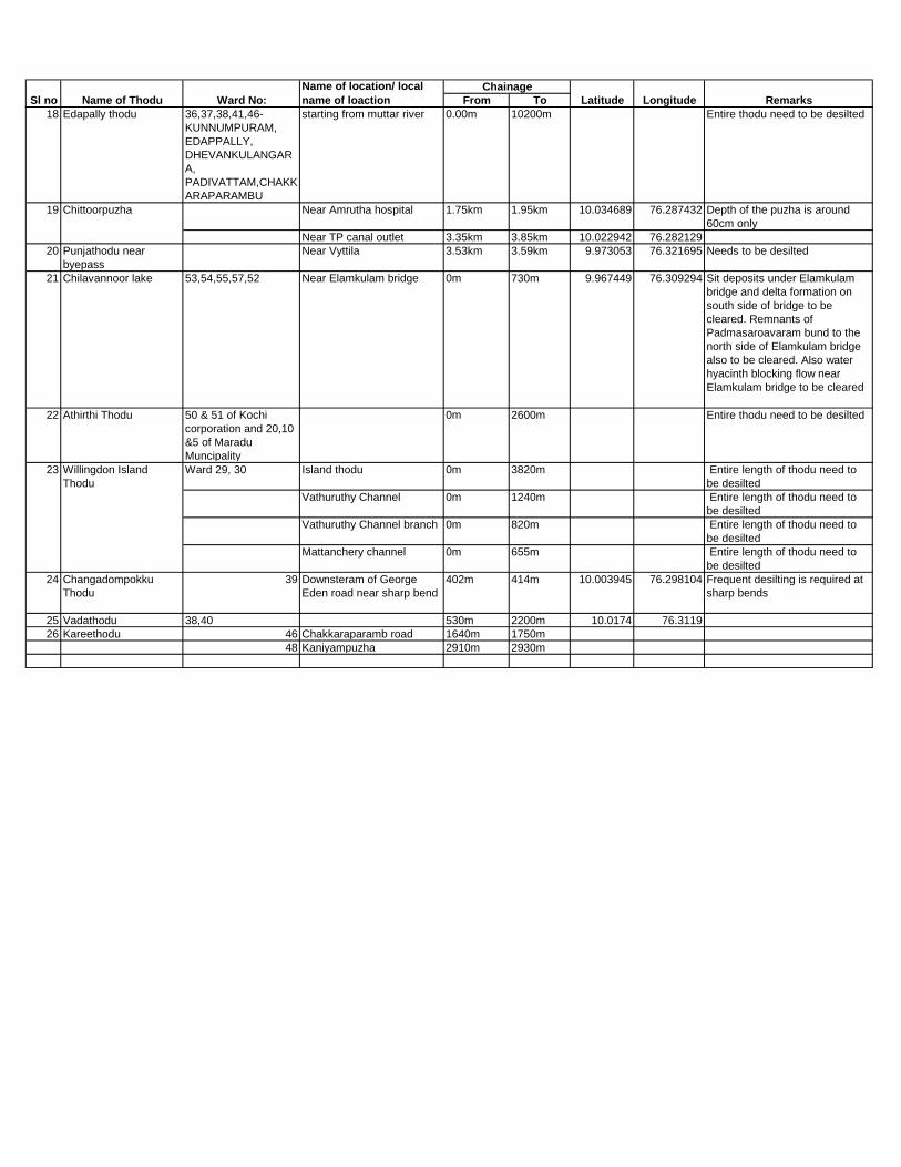
From To Longitude RemarksSl no Name of Thodu Ward No:
Name of location/ local
name of loaction
Chainage
Latitude
18 Edapally thodu 36,37,38,41,46-
KUNNUMPURAM,
EDAPPALLY,
DHEVANKULANGAR
A,
PADIVATTAM,CHAKK
ARAPARAMBU
starting from muttar river 0.00m 10200m Entire thodu need to be desilted
Near Amrutha hospital 1.75km 1.95km 10.034689 76.287432 Depth of the puzha is around
60cm only
Near TP canal outlet 3.35km 3.85km 10.022942 76.282129
20 Punjathodu near
byepass
Near Vyttila 3.53km 3.59km 9.973053 76.321695 Needs to be desilted
21 Chilavannoor lake 53,54,55,57,52 Near Elamkulam bridge 0m 730m 9.967449 76.309294 Sit deposits under Elamkulam
bridge and delta formation on
south side of bridge to be
cleared. Remnants of
Padmasaroavaram bund to the
north side of Elamkulam bridge
also to be cleared. Also water
hyacinth blocking flow near
Elamkulam bridge to be cleared
22 Athirthi Thodu 50 & 51 of Kochi
corporation and 20,10
&5 of Maradu
Muncipality
0m 2600m Entire thodu need to be desilted
Ward 29, 30 Island thodu 0m 3820m Entire length of thodu need to
be desilted
Vathuruthy Channel 0m 1240m Entire length of thodu need to
be desilted
Vathuruthy Channel branch 0m 820m Entire length of thodu need to
be desilted
Mattanchery channel 0m 655m Entire length of thodu need to
be desilted
24 Changadompokku
Thodu
39 Downsteram of George
Eden road near sharp bend
402m 414m 10.003945 76.298104 Frequent desilting is required at
sharp bends
25 Vadathodu 38,40 530m 2200m 10.0174 76.3119
26 Kareethodu 46 Chakkaraparamb road 1640m 1750m
48 Kaniyampuzha 2910m 2930m
23 Willingdon Island
Thodu
19 Chittoorpuzha
Page 307
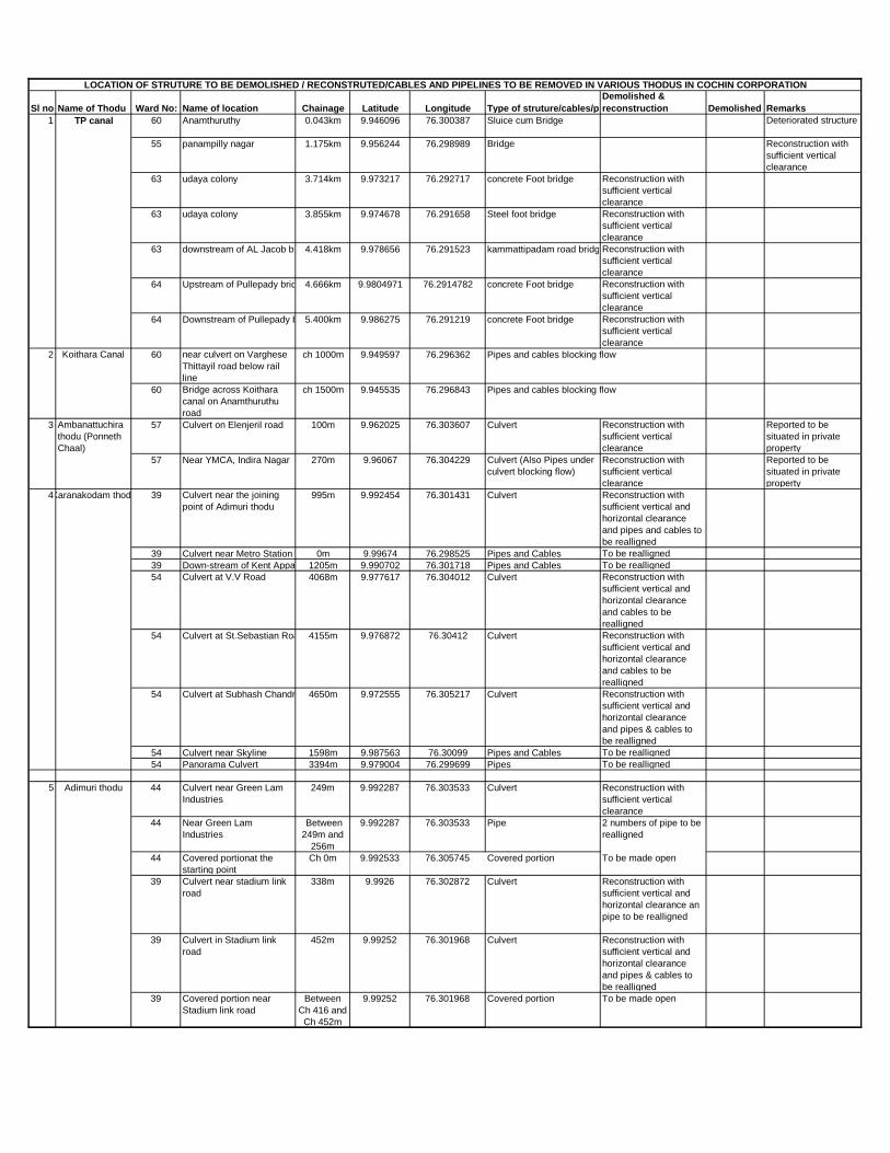
Sl no Name of Thodu Ward No: Name of location Chainage Latitude Longitude Type of struture/cables/pipes
Demolished &
reconstruction Demolished Remarks
60 Anamthuruthy 0.043km 9.946096 76.300387 Sluice cum Bridge Deteriorated structure
55 panampilly nagar 1.175km 9.956244 76.298989 Bridge Reconstruction with
sufficient vertical
clearance
63 udaya colony 3.714km 9.973217 76.292717 concrete Foot bridge Reconstruction with
sufficient vertical
clearance
63 udaya colony 3.855km 9.974678 76.291658 Steel foot bridge Reconstruction with
sufficient vertical
clearance
63 downstream of AL Jacob bridge4.418km 9.978656 76.291523 kammattipadam road bridgeReconstruction with
sufficient vertical
clearance
64 Upstream of Pullepady bridge4.666km 9.9804971 76.2914782 concrete Foot bridge Reconstruction with
sufficient vertical
clearance
64 Downstream of Pullepady bridge5.400km 9.986275 76.291219 concrete Foot bridge Reconstruction with
sufficient vertical
clearance
60 near culvert on Varghese
Thittayil road below rail
line
ch 1000m 9.949597 76.296362 Pipes and cables blocking flow
60 Bridge across Koithara
canal on Anamthuruthu
road
ch 1500m 9.945535 76.296843 Pipes and cables blocking flow
57 Culvert on Elenjeril road 100m 9.962025 76.303607 Culvert Reconstruction with
sufficient vertical
clearance
Reported to be
situated in private
property
57 Near YMCA, Indira Nagar 270m 9.96067 76.304229 Culvert (Also Pipes under
culvert blocking flow)
Reconstruction with
sufficient vertical
clearance
Reported to be
situated in private
property
39 Culvert near the joining
point of Adimuri thodu
995m 9.992454 76.301431 Culvert Reconstruction with
sufficient vertical and
horizontal clearance
and pipes and cables to
be realligned
39 Culvert near Metro Station starting point0m 9.99674 76.298525 Pipes and Cables To be realligned
39 Down-stream of Kent Appartment1205m 9.990702 76.301718 Pipes and Cables To be realligned
54 Culvert at V.V Road 4068m 9.977617 76.304012 Culvert Reconstruction with
sufficient vertical and
horizontal clearance
and cables to be
realligned
54 Culvert at St.Sebastian Road 4155m 9.976872 76.30412 Culvert Reconstruction with
sufficient vertical and
horizontal clearance
and cables to be
realligned
54 Culvert at Subhash Chandra Bose Road4650m 9.972555 76.305217 Culvert Reconstruction with
sufficient vertical and
horizontal clearance
and pipes & cables to
be realligned
54 Culvert near Skyline 1598m 9.987563 76.30099 Pipes and Cables To be realligned
54 Panorama Culvert 3394m 9.979004 76.299699 Pipes To be realligned
44 Culvert near Green Lam
Industries
249m 9.992287 76.303533 Culvert Reconstruction with
sufficient vertical
clearance
44 Near Green Lam
Industries
Between
249m and
256m
9.992287 76.303533 Pipe 2 numbers of pipe to be
realligned
44 Covered portionat the
starting point
Ch 0m 9.992533 76.305745 Covered portion To be made open
39 Culvert near stadium link
road
338m 9.9926 76.302872 Culvert Reconstruction with
sufficient vertical and
horizontal clearance an
pipe to be realligned
39 Culvert in Stadium link
road
452m 9.99252 76.301968 Culvert Reconstruction with
sufficient vertical and
horizontal clearance
and pipes & cables to
be realligned
39 Covered portion near
Stadium link road
Between
Ch 416 and
Ch 452m
9.99252 76.301968 Covered portion To be made open
LOCATION OF STRUTURE TO BE DEMOLISHED / RECONSTRUTED/CABLES AND PIPELINES TO BE REMOVED IN VARIOUS THODUS IN COCHIN CORPORATION
1 TP canal
2 Koithara Canal
3 Ambanattuchira
thodu (Ponneth
Chaal)
4Karanakodam thodu
5 Adimuri thodu
Page 308

Sl no Name of Thodu Ward No: Name of location Chainage Latitude Longitude Type of struture/cables/pipes
Demolished &
reconstruction Demolished Remarks
23 Encroachment on the
Thodu near South
Moolankuzhi- Aryad
Athipozhi cross road
907m 9.931018 76.250262 Fish stall To be evacuated and
demolished
22 Encroachment on the
Thodu near
Naduvathumuri Road
1150m 9.93206 76.252285 Pettikada To be evacuated and
demolished
22 Encroachment on the
Thodu at Illickal junction
near St. Maria Bakery
1165m 9.932202 76.252632 Temperary Building To be evacuated and
demolished
22 Encroachment on the
Thodu at Illickal junction
near St. Maria Bakery
1170m 9.93212
&9.93224
76.252637 &
76.252717
Pettikada & Bus stop To be evacuated and
demolished
22 Culvert near Santhom
Colony
1557m 9.932695 76.256303 Culvert Reconstruction with
sufficient vertical
clearance
54 Near Jawaharnagar 1065m 9.973 76.3 Culvert Reconstruction with
sufficient vertical
clearance
54 Near KWA sewage plant
Elamkulam
1770m 9.969957 76.307321 Culvert Reconstruction with
sufficient vertical
clearance
54 Near KWA sewage plant
Elamkulam
1910m 9.9705 76.3051 Culvert Reconstruction with
sufficient vertical
clearance
25 Santho Gopalan Cross
Road
1032m 9.939268 76.253225 Culvert Reconstruction with
sufficient Horizontal
clearance
25 Loretto Anglo Indian
School Cross road
1190m 9.939367 76.251794 Culvert Reconstruction with
sufficient vertical and
horizontal clearance
25 Near KWA 1217m 9.939426 76.252501 90 degree bend Change 90 degree bend
to curved nature
including reconstruction
of Culvert
8 Mother Theresa Cross
road, Chullikkal
1758m 9.943367 76.25155 Culvert Reconstruction with
sufficient vertical
clearance
8 Near A. A. Kochunni
Master Memorial Park
2200m 9.946445 76.253401 Foot Bridge Not in use and to be
demolished
8 Pandikkudy Bridge 2873m 9.948514 76.249849 Bridge Beam Soffit touched in
water and
reconstruction with
sufficient Vertical
clearance
28 Kuriplavu Bridge 4632m 9.960598 76.247383 Bridge Reconstruction with
sufficient Horizontal
clearance
28 Adhikarivalappu Bridge 4742m 9.961587 76.24745 Bridge Reconstruction with
sufficient Horizontal
clearance
4 Pullupalam 5189m 9.963568 76.249568 Bridge Reconstruction with
sufficient vertical and
horizontal clearance
2 Foot bridge 5427m 9.965567 76.249733 Foot bridge Reconstruction with
sufficient Horizontal
clearance
9 KAREEPALAM
BRANCH
CANAL
4 Foot bridge 175m 9.96288 76.249642 Foot bridge Reconstruction with
sufficient vertical and
horizontal clearance
22 Culvert@kazhuthumuttu
road
470m 9.935203 76.255167 Culvert Reconstruction with
sufficient vertical and
horizontal clearance
KWA pipe of 50cm
dia has to be
realigned
22 Pipe culvert near Navy
building(SRA
Rameshwaram)
937.5m 9.931775 76.257317 Pipe culvert Reconstruction with
sufficient vertical and
horizontal clearance
12 Culvert near market 2004.5m 9.931701 76.269816 Culvert Reconstruction with
sufficient vertical
clearance
12 Culvert near market 2009.50m 9.931482 76.267555 Small culvert Reconstruction with
sufficient vertical
clearance
12 Near saw mill 2174.50m 9.930697 76.267825 Two small shops
(Encroachment)
To be evacuated and
demolished
2174.50m 9.930697 76.267825 Existing Abutment wall on
both
banks(encroachement)
To be demolished
2174.50m 9.930697 76.267825 Big Banyan tree (Growing
inside thodu)
to be cut
12 Thevara canal 58,60 Kallupalam, Friends nagar 1310.00m 9.946298 76.30382 Wtaer authority pipes
crossing
To be realigned
6 ATHIPOZHI
THODU
PUNJA THODU7
8 RAMESWARAM
CANAL,
MANTHRA
CANAL,
KALVATHY
CANAL
10 PANDARACHIR
A THODU
11 PALLICHAL
THODU
Page 309
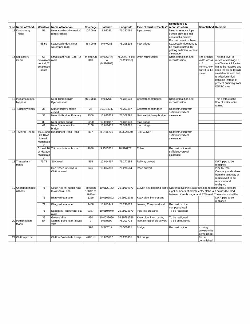
Sl no Name of Thodu Ward No: Name of location Chainage Latitude Longitude Type of struture/cables/pipes
Demolished &
reconstruction Demolished Remarks
58 Near Konthuruthy road &
road crossing
107.00m 9.94396 76.297095 Pipe culvert Need to remove Pipe
culvert provided and
construct a culvert.
Encroachment is there
58,59 Kazeeba bridge, Near
water tank road
464.00m 9.940988 76.298215 Foot bridge Kazeeba bridge need to
be reconstructed, for
getting sufficient vertical
clearance
14 Mullassery
Canal
66
ernakulam
central,62
ernakulam
south
Ernakulam KSRTC to TD
road
ch 0 to Ch
810
(9.976544)
to
(9.974968)
(76.289874 ) to
(76.282338)
Drain rennovation Drain demolition and
reconstruction
The original
width was 4
to 8
meters.now
only 3 to 1.5
meter
The bed level is
raised at chainage 0
to 400 about 1.1 mtre
has to be lowered and
keep the slope towrds
west direction so that
gravitational flow
possible instead of
present pumping from
KSRTC area
15 Punjathodu near
byepass
Near Thammanam
Byepass road
ch 1835m 9.985433 76.314523 Concrete footbridges Drain demolition and
reconstruction
This obstructs the
flow of water while
raining
36 Muttar kadavu bridge
culvert
36 10.04.3342 76.303307 Concrete foot bridges
38 Near NH bridge Edapally 2500 10.025223 76.308795 National Highway bridge
38 Near timber bridge 3230 10.020017 76.311333 road bridge
41 Near Chembumukku
bridge
5100 10.010415 76.319725 road bridge
50,51 and
20,10 of
Maradu
Muncipalit
y
kundannoor Petta Road 807 9.9415705 76.3326569 Box Culvert Reconstruction with
sufficient vertical
clearance
51 and 10
of Maradu
Muncipalit
y
Thirumurthi temple road 2080 9.9513531 76.3267731 Culvet Reconstruction with
sufficient vertical
clearance
73,74 SSK road 565 10.014497 76.277184 Railway culvert KWA pipe to be
realigned
Don Bosco junction in
Chittoor road
626 10.014363 76.276564 Road culvert Pipe to Tata
Company and cables
from the vent way of
road culvert to be
removed and
realigned
71 South Keerthi Nagar road
to Akshara Lane
between
1500m to
1695m
10.0122162 76.29594073 Culvert and crossing slabs
71 Bhagyadhara lane 1380 10.0105892 76.29622086 KWA pipe line crossing KWA pipe to be
realigned
71 Bhagyadhara lane 1400 10.011449 76.296019 Leaning Compound wall Reconstruct the
compound wall
71 Edappally Raghavan Pillai
road
2387 10.0194949 76.29532979 Pipe line crossing To be realigned
39 Greenz Villa 450 10.0037656 76.29781756 KWA pipe line crossing To be realigned
54 Starting point near railway
yard
0 9.979392 76.303728 Remainings of old culvert To be demolished
920 9.972612 76.306415 Bridge Reconstruction existing
culvert to be
demolished
21 Chittoorpuzha Chittoor-Vaduthala bridge 4700 m 10.025507 76.273955 Old bridge To be
demolished
18 Thattazham
thodu
20 Puthenpalam
thodu
13 Konthuruthy
Thodu
16 Edapally thodu Reconstruction with
sufficient vertical
clearance
17 Athirthi Thodu
Culvert at Keerthi Nagar shall be reconstructed.There are
eight numbers of private entry slabs laid across the thodu
between Keerthi nagar and BTS road .These slabs shall be
19 Changadompokk
u thodu
Page 310

CHAPTER 7 PROJECT IMPLEMENTATION
or the prevention of flood occurrences, certain effective measures must be taken to
prevent encroachment, waste disposal and illegal construction along the canals. Department such as Irrigation, Local Self Government (LSGD), Revenue ,Police will play a major role in tackling the above mentioned obstacles. In detail, LSGD will handle issues regarding waste disposal .From our field investigations, around 70 waste disposals along the canals have been identified. LSGD will be clearing these sites for a cleaner environment and is further maintenance by installing cameras and setting up banners so as to prevent these ongoing malpractices in the future .According to Water Conservation Act; penalty will be imposed on any person pressed charges for improper disposal of waste along these canals by the Police Department. Separate ward committees under the control of their respective ward counselor must be formed to ensure the further maintenance of this clean environment .The original width of the canals must be restored by fixing boundaries by the Revenue Department.
Any encroachments within these boundaries must be evacuated for the proper flow of water upto its water carrying capacity. From our investigations,poorly constructed structures across the canals have been observed. These structures are constructed in such a way that it obstructs the flow of water through the canal. Therefore, to overcome this issue, these structures have to be reconstructed by state fund or central fund or any other sectors. LSGD can utilize Ayyankali Thozhilurapu Scheme to carry out minor works like removal of silt deposits, floating vegetation and plastic materials. In order to minimize the total project cost of desiltation, purchase of heavy desilting machineries would be a one-time investment made by any of the agencies. In addition to this, the operation and maintenance cost can be handled by any sponsorship or any other source of fund. In order to achieve a cleaner environment and proper functioning of the canals, all the stock holders, public and private sectors, residential associations and the public must join forces to make this goal a success.
F
Page 311

CHAPTER 8 PROJECT MONITORING
Regular Monitoring of canals :
he flash flooding in Kochi corporation
area owes mainly to the insufficient
drainage system in the city. Most of the
drains -both natural and storm water drains- are
not having sufficient width and depth to
accommodate the excess rain water obtained in
short period.In most cases, the drains are
covered by coverslabs with almost no provision
for the entry of storm water into these drains.
Inefficient waste collection and disposal system
in Kochi has resulted in waste deposition on
streets. These wastes mainly plastic wastes end
up in the road side drains thus clogging the
storm water drainage network.The waste
management system in the city has to undergo a
thorough revamping to ensure that waste do not
get deposited in storm water drains.
Regular monitoring of the canals was
found necessary to curb waste deposition and
encroachments and to ensure free flow and
good quality of water . As per direction from
Addl. Chief Secretary (WR) dept , monitoring of
each canal in the city was assigned to an
Engineer in Irrigation department. During site
inspection conducted by concerned engineers,
locations prone to waste dumping and the
problems causing obstruction to flow were noted
. The information collected regarding the canal
system in Kochi and possible measures to avoid
obstruction to flow were brought to the notice of
Kochi Corporation authorities by a detailed
presentation by Sri. Baji Chandran R ,
Superintending Engineer, Minor Irrigation
Central Circle, Ernakulam during the Special
Council convened by Mayor , Kochi Corporation
on 26.07.2021 . During site inspection of flood
prone areas, the following observations require
immediate attention.
Renovation of Mullassery canal to be
executed for preventing flooding near
KSRTC Bus Stand, Karikkamuri,
Kammattipadam and South Railway
Station
In the flood prone Kaloor Sub station area,
the connectivity between Karanakodam and
Chengadampokku thodus have to be re-
established by constructing box culvert of
sufficient vent width and depth across
Banerjee road.
The waste after cleaning railway coaches
including oil remnants is found to be
discharging directly into marshalling yard
thodu without any effluent treament . This is
polluting the marshalling yard thodu and the
Karanakodam thodu as they are interlinked.
Railways should set up an effluent treatment
plant at their yard and avoid polluting
waterbodies.
At locations where canals are crossing rail
lines, the box culvert/pipes provided beneath
the rail line is not having sufficient vent width
and depth. This is found to cause
obstruction to flow. Railways should take
immediate steps to ensure sufficient vent
width and depth by reconstructing culverts
beneath rail lines in flood prone water
bodies.
T
Page 312
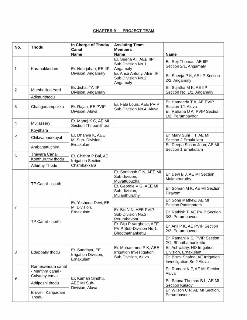
CHAPTER 9 PROJECT TEAM
No. Thodu In Charge of Thodu/ Canal
Assisting Team Members
Name Name Name
1
Karanakkodam
Er. Noorjahan, EE IIP Division, Angamaly
Er. Seena A I, AEE IIP Sub-Division No.1, Angamaly
Er. Reji Thomas, AE IIP Section 2/1, Angamaly
Er. Ansa Antony, AEE IIP Sub-Division No.2, Angamaly
Er. Sheeja P K, AE IIP Section 2/2, Angamaly
2
Marshalling Yard Er. Jisha, TA IIP Division, Angamaly
Er. Sujatha M K, AE IIP Section No. 1/1, Angamaly
Adimurithodu
3
Changadampokku
Er. Rajan, EE PVIP Division, Aluva
Er. Fabi Louis, AEE PVIP Sub-Division No.4, Aluva
Er. Hameeda T A, AE PVIP Section 1/4 Aluva
Er. Rahana U A, PVIP Section 1/2, Perumbavoor
4 Mullassery Er. Manoj K C, AE MI Section Thripunithura
5
Koyithara
Er. Dhanya K, AEE MI Sub- Division, Ernakulam
Chilavannurkayal Er. Mary Suni T T, AE MI Section 2 Ernakulam
Ambanattuchira Er. Deepa Susan John, AE MI Section 1 Ernakulam
6
Thevara Canal Er. Chithra P Bai, AE Irrigation Section Chambakkara
Konthuruthy thodu
Athirthy Thodu
7
TP Canal - south
Er. Yeshoda Devi, EE MI Division, Ernakulam
Er. Santhosh C N, AEE MI Sub-division, Muvattupuzha
Er. Devi B J, AE MI Section Mulanthuruthy
Er. Geordie V G, AEE MI Sub-division, Mulanthuruthy
Er. Soman M K, AE MI Section Piravom
Er. Sonu Mathew, AE MI Section Pattimattom
TP Canal - north
Er. Biji N N, AEE PVIP Sub-Division No.2, Perumbavoor
Er. Rathish T, AE PVIP Section 3/2, Perumbavoor
Er. Biju P Varghese, AEE PVIP Sub-Division No.1, Bhoothathankettu
Er. Anil P K, AE PVIP Section 2/2, Perumbavoor
Er. Ramani K S, PVIP Section 2/1, Bhoothathankettu
8
Edappally thodu
Er. Sandhya, EE Irrigation Division, Ernakulam
Er. Mohammed P K, AEE Irrigation Investigation Sub-Division, Aluva
Er. Ashwathy, HD Irrigation Division, Ernakulam
Er. Bismi Shafna, AE Irrigation Investigation Sn 2 Aluva
9
Rameswaram canal - Manthra canal - Calvathy canal
Er. Kumari Sindhu, AEE MI Sub-Division, Aluva
Er. Ramani K P, AE MI Section Aluva
Athipozhi thodu Er. Sabna Thomas B L, AE MI Section Kalady
Eruveli, Karipadam Thodu
Er. Wilson C P, AE MI Section, Perumbavoor
Page 313
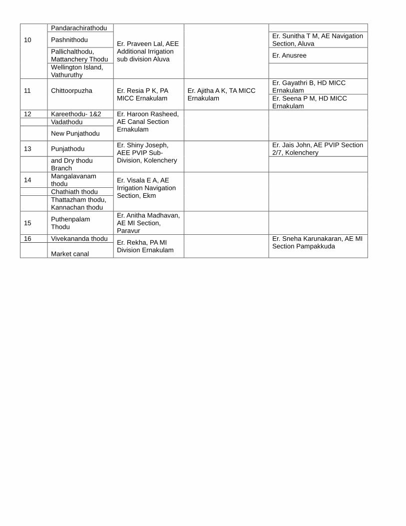
10
Pandarachirathodu
Er. Praveen Lal, AEE Additional Irrigation sub division Aluva
Pashnithodu Er. Sunitha T M, AE Navigation Section, Aluva
Pallichalthodu, Mattanchery Thodu
Er. Anusree
Wellington Island, Vathuruthy
11
Chittoorpuzha
Er. Resia P K, PA MICC Ernakulam
Er. Ajitha A K, TA MICC Ernakulam
Er. Gayathri B, HD MICC Ernakulam
Er. Seena P M, HD MICC Ernakulam
12 Kareethodu- 1&2 Er. Haroon Rasheed, AE Canal Section Ernakulam
Vadathodu
New Punjathodu
13 Punjathodu Er. Shiny Joseph, AEE PVIP Sub-Division, Kolenchery
Er. Jais John, AE PVIP Section 2/7, Kolenchery
and Dry thodu Branch
14 Mangalavanam thodu
Er. Visala E A, AE Irrigation Navigation Section, Ekm
Chathiath thodu
Thattazham thodu, Kannachan thodu
15 Puthenpalam Thodu
Er. Anitha Madhavan, AE MI Section, Paravur
16 Vivekananda thodu Er. Rekha, PA MI Division Ernakulam
Er. Sneha Karunakaran, AE MI Section Pampakkuda
Market canal
Page 314
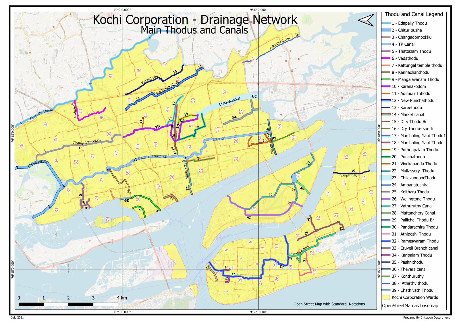
9°57′0.000″
9°57′0.000″
10°0′0.000″
10°0′0.000″76
°15′
0.00
0″
76°1
5′0.
000″
76°1
8′0.
000″
76°1
8′0.
000″
1 - Edapally Thodu
2 - Chitur puzha
3 - Changadompokku
4 - TP Canal
5 - Thattazam Thodu
6 - Vadathodu
7 - Kattungal temple thodu
8 - Kannachanthodu
9 - Mangalavanam Thodu
10 - Karanakodom
11 - Adimuri Thhodu
12 - New Punchathodu
13 - Kareethodu
14 - Market canal
15 - D ry Thodu Br
16 - Dry Thodu- south
17 - Marshaling Yard Thodu1
18 - Marshaling Yard Thodu
19 - Puthenpalam Thodu
20 - Punchathodu
21 - Vivekananda Thodu
22 - Mullassery Thodu
23 - ChilavannoorThodu
24 - Ambanatuchira
25 - Koithara Thodu
26 - Welingtone Thodu
27 - Vathuruthy Canal
28 - Mattanchery Canal
29 - Pallichal Thodu Br
30 - Pandarachira Thodu
31 - Athipozhi Thodu
32 - Rameswaram Thodu
33 - Eruveli Branch canal
34 - Karipalam Thodu
35 - Pashnithodu
36 - Thevara canal
37 - Konthuruthy
38 - Athirthy thodu
39 - Chathiyath Thodu
Kochi Corporation Wards
OpenStreetMap as basemap
Thodu and Canal LegendKochi Corporation - Drainage Network
Main Thodus and Canals
Prepared By Irrigation DepartmentJuly 2021
Open Street Map with Standard Notations
Page 315


![national university of advanced legal studies - [nuals], kochi](https://static.fdokumen.com/doc/165x107/6324ac0acedd78c2b50c392d/national-university-of-advanced-legal-studies-nuals-kochi.jpg)


