THE ARCHAEOLOGICAL SURVEY FOR THE REGION OF Udhruh, 2003 (PRELIMINARY REPORT)
18
TUE HASHEMITE KINGDOM OF JORDAN ANNUAL OF THE DEPARTMENT OF ANTIQUITIES OF JORDAN Volume48 Memorial Volume Hamad Qatameen and Taysir 'Atiat 'AMMAN 2004
Transcript of THE ARCHAEOLOGICAL SURVEY FOR THE REGION OF Udhruh, 2003 (PRELIMINARY REPORT)
TUE HASHEMITE KINGDOM OF JORDAN
ANNUAL OF THE DEPARTMENT OF ANTIQUITIES OF JORDAN
Volume48
Memorial Volume
Hamad Qatameen and Taysir 'Atiat
'AMMAN 2004
THE ARCHAEOLOGICAL SURVEY FOR THE REGION OF UDHRUJ.I, 2003 (PRELIMINARY REPORT)
Fawzi Abudanh
lntroduction The author is currently a second-year PhO stu
dent in the University of Newcastle Upon Tyne, England. The survey was conducted to reveal the archaeological data, which is necessarily required to support the author's thesis. The settlement patterns and the military arrangements in the region of UdhruJ.! (L~~I) during the Roman and Byzantine periods is the key subject of my thesis.
Having obtained the official permission from the Oepartment of Antiquities of Jordan, the fieldwork continued from the 15th of October till tbe 15tb of Oecember. Unfortunately, due 10 tbe limited resources and lack of financial support, the team consisted only of the autbor and the bired car driver. Sometimes two or three volunteers joined the team; bowever, tbougb none of tbem an arcbaeologist. Mucb appreciated logistic support was offered by tbe Ma' än Antiquities Office.
Previous Studies Tbe bistory of fieldwork in the region of Udh
ruJ.! is very sbort and poor. In other words. largescale projects are very rare in the region of UdbruJ.!. Most of tbe projects are undertaken in Petra; the most important site in soutbern Jordan. Alistair Killick's study (1983; 1986; and 1987) and this study are the only fie ld researcb which systematically covered tbe wbole region. Otber studies considered tbe importance of tbe region through the process of in vestigating certain questions such as the Roman fron tier in Arabia (Parker 1979; 1986; Bowersock, 1971; 1976) and the Via Nova Traiana in Arabia Petraea (Graf 1995). Nonetheless, a bandful of sites, especially these whicb are relevant to botb fields , such as UdhruJ.!, ~adaqa, al-Jarba and Ayl , received closer investigations. The region was first considered by Brünow and Domaszewski in their work Die Provincia Arabia (1904, 1905, and 1909). In addition LO valuable information, including pbotographs and plans, about arcbaeological sites in the region, the study recounts the earlier explorers who per-
-51 -
sonall y visited the area (Brünow and Domaszewski 1904: 433-479). Travelers like Ooughty (1888: 35-38) visited and described Udhrui).
Tbe following studies bave revealed fairly important data from the region under investigation: Gl ueck 1935; Stein 1940; Parker 1979, 1986; Graf 1979, 1995; Fiema 1991, 2002; Kennedy 2000; 'Amr el al 200 I, 1998 and Tbolbecq 2001. Tbe last two studies bave investigated sites recorded and studied by the present autbor. Dr. Khairieh 'Amr (2001, 1998) recorded about thirty sites in tbe area during ber survey whicb was associated witb the process of constructing pipelines in three sectors in the district of Ma'än (uL........) . The three sectors: al-Qä' (t~I), Ayl (...kU and al-Jitbtha (~I) lie within tbe study area.
The Area of Survey (Fig. 1) According to the recent administrative changes
in the distriet of Ma'an, tbe area of survey lies within the borders of four governmental and admini strative regions: the Municipality of alAsh'ari, Ma'an, the Petra Regional Authority and the Municipality of Ayl. Archaeologically, the survey area is better known as tbe region of UdlnuJ.! (Killiek 1987: 175), bowever, we migbt tentatively refer to it as UdhruJ.! and its environs.
The modern road network in the regions mentioned above was used as border lines, whicb means that in many cases we did not go beyond the asphalt roads to find out wbat is there. Although this strategy might seem weak in terms of losing the geographical cobesion and the similarity in arcbaeological data, it was virtually the sole way to firnsb tbe work according to tbe scbedule. Moreover, same areas were previously surveyed, especially tbe area west of tbe Shawbak-Wädi Müsä road and the Wädi Müsa-Basla road (Graf 1995) and the area nortb of Udbru J:! (Findlater 2002). However, in same cases we bad no choice but to cross a road either to record ruins not recorded or visited before, or to fmd tbe end (start) of an ancient road, or to keep a straight border line.

ADAJ 48 (2004)
\ \ ,;
/ o 20kM
A modern road, vertically (E-W) connecting the Shawbak-UdhruJ:l-Ma'än road with the ShawbakWadi Müsä road, represents the north-western line of the survey area. This road starts at the southern cdge 01' al-Jarba al-Jadida and has a length of roughly IOkm. An imaginary (E-W) line which stalts just a few meters to the north of al-Jarba's Firc Station and heads eastward along a desert road for IOkm deep into the desert representing the north-eastern line. From the wells of al-Burayka (~~I) another imaginary line was drawn to be part of the eastern bordering !ine, and it extends southlsouthwest from al- Burayka until it intersects with the Shawbak-UdhruJ:l-Ma'an raad at the permanent loeation of al-Hussein bin Talal University. From there down lO Ma' an the modern road completes the rest of the eastern !ine. Most of the area (eastward) beyond our line and road is occupied by modern quarries, the buildings of al-Hussein Bin Talal University, and the city ofMa'än.
The western border line is represented by the Shawbak-Wädi Musa road ( I) and the Wädi MusäBas!a road (2). From a point where the Wädi Müsa-Bas!a significantly turns southeast to Bas!a,
-52-
/ I
/ "~
I. Map shows the area of SUfvey (encircled by the contiguous black li nes) (ref. map Ma'an 1:250000 A GH 5. in Arabic).
an imaginary line was drawn to form the remaining part of this border !ine south/southwest until it reaches $adaqa (,,-"-'---'.0). This line crosses the a!Tayba-Ayl raad and runs horizontally to the west of Bas!a, Ayl and al-Fardhakh (t>.".....>ll). Thc southern border line of the survey area extends vertically from $adaqa and it runs along a recently constructed raad down to the village of al-Wahida ('~"JI), the Ma'än- 'Aqaba road ; from Ma'an to al-Wahida interchange is the south-eastern end of this line.
Methodological Approaches Due to the relatively huge area the survey in
tended [0 cover, it was highly unlikely to cover the region as one geographi cal unil. Therefore, divi ding the region into small areas was very necessary to finish tbe work according to the schedule, and to systematicall y cover each area by looking at small geographical units. The survey area is horizontally and vertically divided by modern raad networks. These raads were utili zed 10 identify the borders of each area and within each area there are too many vertical and horizontal agricultural 01'

Fawzi Abudanh: The Archaeological Surveyfor the Region ofUdhruh, 2003
desert roads. The frequency of the latter differs from area to area. However, they were employed practieaIJy and made a vehicular survey very effeetive. In other words, there was a relatively easy access to every hili, mountain and valley.
In terms of the topography factor, it is worth pointing out that the survey region can be noticeably divided into two zones. Each zone has roughly the same topographie and climatic features from north to south. A demarcation line can be easily drawn due to the significant change when we move from west to east in the survey area. However, most of the survey area is part of the Jabal ashSharä (a series of mountains). The common topographie feature is aseries of contiguous hills that run N-S; most of them are at least fourteen hundred metres above sea level. Hundreds 01' small valleys running vertically, west-east and southeast interrupt these hills. Thousands of square metres of agricultural fields seem 10 have been cultivated in antiquity; today barley and wheat and other cereals are the cOnllnon crops grown in those regions.
The rest of the survey area, particularly the areas on other side of the Shawbak-Udhrul)-Ma'än road and the south-eastern part around al-Wahida with tbe elevation of !ess than 14 hundred metres have a relatively different topography. The presence 01' separate hills is the prominent element of this area; moreover, it is the area where large valleys are formed by the gathering of many small valleys. And due to the roughly flat landscape of this part, the visibility is enough to observe any sizable arehaeological material.
Having divided the survey region into eight areas, interviewing some of the elderly people in each area was a necessity to visit and record as many archaeologieal sites as we could. This strategy was an attempt to compensate for the lack of the 10,000 seale aerial photographs taken in 1978 for most of the country; unfortunately, the 1978 survey did not cover the region of Udhrul), or the survey area (according to the RJGC archives). The 30,000 scale aerial photographs taken in 1992 are available but not effeetively useful due to the difficulty in identifying any arehaeological site through the photographs. However, more than twenty people were interviewed during the survey period; some of them kindly and voluntarily joined and guided us to important arehaeologieal material.
Due to the signifieant similarity in the topography of the survey region, the same strategy was applied in most of the areas. The topography was a key factor in changing the survey methodological approaehes. The intensive presenee of horizontal and vertical agricultural road networks
-53-
made the work much easier since exploring any hili and valley was a matter of time. Aceordingly, we have been vertieally surveying each hili and valley starting from the eastern horizontal border line up to the western border line, and then going down towards the eastern border line, and so on until we finished the whole area. This proeess was very suecessful due to the fact that most of the sites were located on hilltops or on upper and lower slopes of hills from west to east, moreover, the gradual increase of elevation, from east to west, made any archaeological site easily recognizable from a distanee. In some cases, we had to survey horizontally, partieularly when there were aneient tracks and raads heading north to south. Many sites were recorded along ancient tracks and raads.
Surveying horizontally into transects, identified by certain landmarks, and was the strategy applied to the easternmost areas of the survey region. This approach was preferred due to the nature of the terrain there. Shallow, nat and smooth hills in addition to wide val!eys are the common features of that landscape. This was praetieally vital in tbe areas to the east and southlsoutheast of Udhrul) in the light of the high visibility one ean get in that area. What is finally worth mentioning is the fact that the surveyor, as one of the loeal people, has a good experience in the survey region.
Onee an archaeological site was found the following steps were taken: I. Taking GPS reading for every site. 2. Producing sketch plan if possible. 3. Measuring the architectural remains at eaeh site. 4. Measuring the ci sterns and reservoirs. S. Collecting pottery sherds from every site
if available. 6. Describing the arehaeological components of
the site. 7. Taking photographs by compact and digital
cameras. 8. Investigating the whole area around the site.
The Archaeological Finds Two hundred ninety-one sites were recorded in
the region under investigation. And because there is not enough raom in this report to mention every single site recorded during the survey, the more significant finds will be briefly cited in each area.
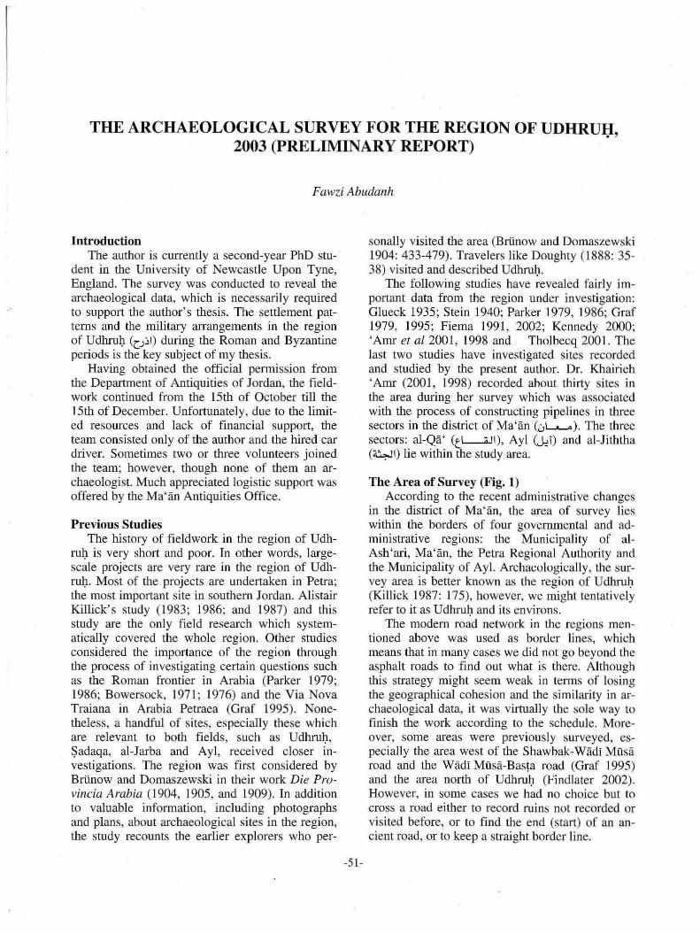
Area I (Fig. 2) This area is enclosed by four modern roads;
three of them are major whereas the fourth road is secondary. The latter is the northern line of this area that vertieally conneets the Sbawbak-Wädi Müsä road to the west with the Shawbak-Udhrul)-
ADAJ 48 (2004)
.. g J7 ~
• • i ~ St,D
~4 ,§3 • r2 ~ , "-• ~ • • ~ S8 ~ 11 0
o
Ma' an road 10 the east. It Sla'1s al the south-eastern corner of the al-Jarba (the new) and heads westwards for almost ten kilometres in a zigzag direclion. The southern li ne is represented by part of the Wadi Müsa-Shawbak road. The western and eastern lines are respectively parts of the Wadi MOsäShawbak road and the Shawbak-Udhru~-Ma'än road. Both roads are roughly aligned north-south.
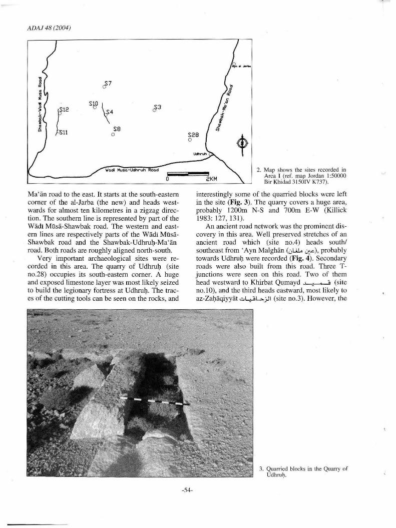
Very important archaeological sites were recorded in this area. The quarry of Udhrul) (site no.28) occupies its south-eastern corner. A huge and exposed limestone layer was most likely seized 10 build the legionary fortress at Udhrul). The traces of the cutting tools can be seen on the rocks, and
S28 0
-54-
.........
2KM 2. Map shows the siles rccorded in
Area I (ref. map Jordan 1:50000 Bir Khidad 3150IV K737).
interestingly some of the quarried blocks were left in the site (Fig. 3). The quarry covers a huge area, probably 1200m N-S and 700m E-W (KiUick 1983: 127,13 1).
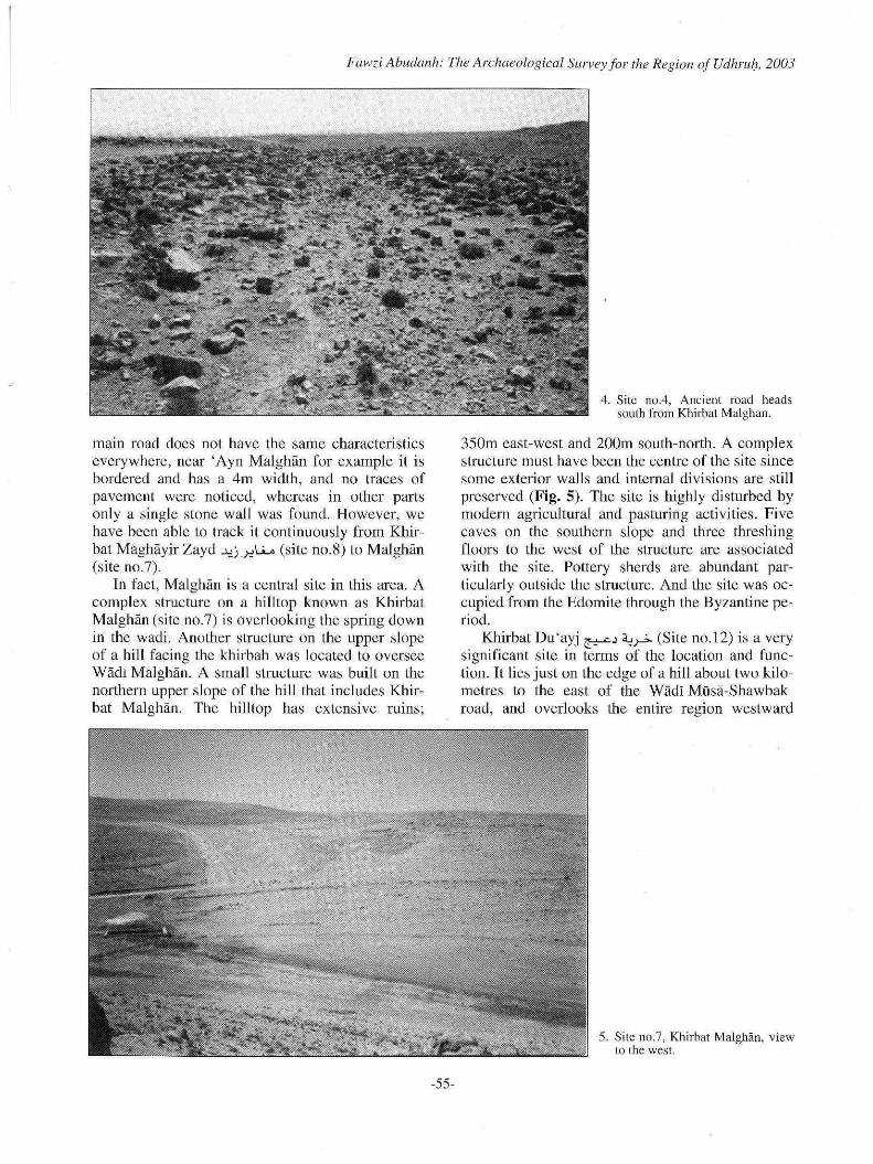
An ancient road network was the prominent discovery in this area. Weil preserved stretches of an anci ent road which (site noA) heads south/ southeast from 'Ayn Malghän ("l.i1.o ~), probabl y towards Udhru\1 were recorded (Fig. 4). Secondary roads were also built from this road. Three Tjunctions were seen on this road. Two of tbem head westward to Khirbat Qumayd ' _ • ;, (site no.10), and the third heads eastward, most likely to az-Zabaqiyyät .;:,L..;.:oL.. jJl (si te no.3). However, the
3. Quarricd blocks in the Quarry of Udhruh.
Fawzi Abudanh: The Archaeological Survey Jor [he Region of Udhrub, 2003
main road does not have the same characteristics everywhere, near 'Ayn Malghan far example it is bordered and has a 4m width, and no traees 01' pavement were noticed, whereas in Olher parts only a single stone wall was found . However, we have been able to track it continuously from Kbirbat Maghayir Zayd ""',j.>=l.i.A (site no.S) to Malghan (site Do.7).
In fact, Malghan is a eentral site in this area. A complex structure on a hilltop known as Khirbat Malghan (site no.7) is overlooking the spring down in the wadi. Another strueture on the upper slope 01' a hili faeing the khirbah was located to oversee WadI Malghan. A small structure was built on the northern upper slope of the hill that includes Khirbat Malghan. The hilltop has extensive rums;
-55-
4. Site no.4, Ancienl road heads south from Khirbat Malghan.
350m east-west and 200m south-north . A eomplex structure must have been the centre 01' the site sinee some exterior walls and internal divisions are still preserved (Fig. 5). The site is highly disturbed by modern agrieultural and pasturing acti vities. Fi ve caves on the southern slope and three tltreshing floors to the west of the structure are associated with the site. Pottery sherds are abundant partieularly outside the strueture. And the site was occupied from the Edomite through the Byzantine period.
Kbirbat Du 'ayj ~j ~~ (Site no.12) is a very signil'icant site in terms of the loeation and lunction. 1t lies just on the edge of a hill about two kilometres to the east of the WadI MOsa-Shawbak road, and overlooks the entire region westward
5. Site 110.7, Khirhat Malghan, view to the west.
A DA.! 48 (2004)
down to the mountains of Petra and Wädi Du'ayj to the east. The main feature atthe site is desn'oyed to the extent that no architecllIral elements could be recognized. lt is merely a huge circular mound of stones standing +2m above exposed bedrock. Accordingly , a high building probably circular was standing there, and it ntight have collapsed due to natural causes. A well-preserved structure beside two caves or eisterns was found just about sixty metres to the south of the main feature . Tbe structure is raughly square (19x18m) and seems LO have been connected with the main feature from the south-eastern corner by a short walkway, 66m lang.
An ancient raad (Site no.ll ) passes the western edge of Khirbat Du 'yaj, and it could be traeked over the bills down to the Wadi Musa-Udhrul) raad to the south. Neverthcless, it does not bave tbe same characteristics everywhere, it is very elear, well-preserved and bordered by stone wa lls near Khirbat Du 'ayj (Fig_ 6), e lsewhere only stone walls (not curbstones) and traces of the raad itself without curbstones were seen. According to thc loeal people, th is raad heads also north from Kh.irbat Du 'ayj up to NijiJ at ash-Shawbak. Tt is noteworthy that this road is prabably part of the raad (site no.(54) recorded on tbe hills to the west and southwest of Bir Abu Dannah (a::~ ~1.r=!)'
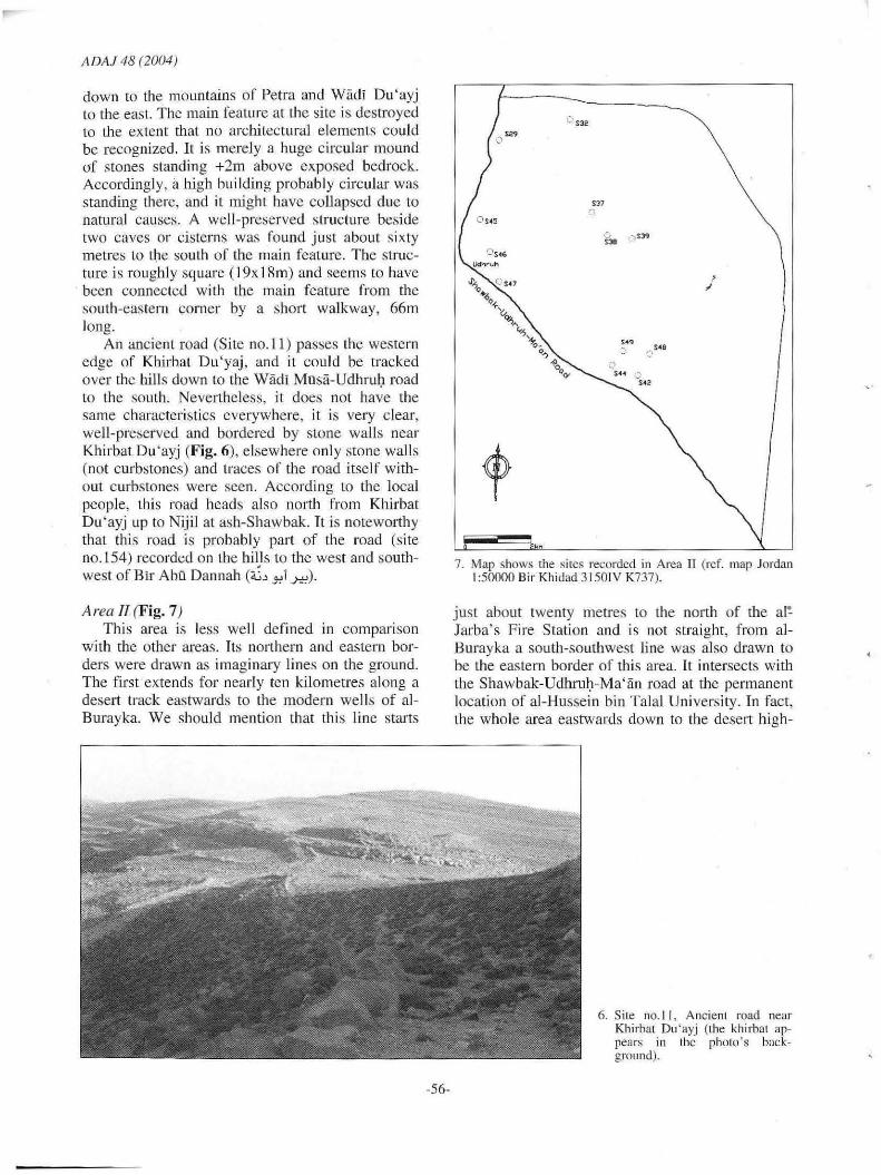
A rea TI (Fig. 7) This area is 1ess weil del1ned in comparison
with the other areas. Tts northern and eastern borders were drawn as imaginary lines on the graund. The firstextends for nearly ten kilometres along a desert track eastwards to the modern wells of alBurayka. We should mention that thi s line starts
-56-
V S32
'" a
". , .. ('
, "
7. Map shows (he sires recordcd in Area 11 (rcf. map Jordan 1:50000 Bir Khidad 3150lV K737).
just about twenty metres to the north of the a l~
Jarba's Fire Station and is not straight, from alBurayka a south-soutbwest line was also drawn to be the eastern border of tbis area . It intersects with the Shawbak-Udhrnl)-Ma'an raad at the permanent location of al-Hussein bin Talal University. Tn fact, the whole area eastwards down 10 the desert high-
6. SiLe nO. l l, AncienL road neaf Khirhal Du 'ayj (the khirbat appears in thc photo 's background).

Fawzi Abudanh: The Archaeological Survey Jor fhe Region oJ Udhru!l, 2003
way, was intended to be investigated but the presence of industrial activities, mainly modern quarries, was a real obstacle. The Shawbak-Udhru~Ma' an mad forms its western fringe.
Khirbat al-larba (~I '-!~) is a unique site in tbis area (s ite no.29). Massive ruins oceupy a hilltop for approximately 700m N-S and 300m E-W (Fig. 8). Most of the ruin s are tbe remains of a complex strueture consisting of many contiguous moms. The spring of al-larba lies just on the western base of the hilI. The spring provided the khirbah with water and many agricultural fields or farms seem to have been irrigated by the spring. Many field wall s are still visible in Wädi al-Jarba below the spring. The pottery sherds col! ected from the site reflect a continuous settlement at alJarba; NabataeanlRoman (first-second century AO), Late Roman, Late Byzantine, Early Islamic, AyyubidIMamluk and Ottoman sherds confirm the importance of the site. Al-larba as weil as Udhru~ and Aila (' Aqaba) submitted to Propbet Muhammad and paid. the poil tax in 630 AO, the three towns must have f10urished during the Late Byzantine and Early Islamic period (Sch ick, 1994: 149).
Not far south of Khirbat al-Jarba lies another important site known as labal at-Ta~kim (~I ~) or al-Ash'ari (<,f.J-* .... ,!,'il) (site no.45). Two wel! -preserved and contiguous structures built 01' large blocks occupy the hilltop with a clear view in all directions. Both structures have the same length (40m) and width (10m), and no internal divisions were observed. Oue to the eonsiderable width 01' the walls, they have been reused as graves. Nabataean, Roman , Late ByzantineIE. Islamic and Ottoman sherds were eollected from the site. The strategie loeation of tbe site and the thick-
-57-
ness of the walls leave no doubt that it was used for defensi ve purposes.
Moving to the south towards Udhruh there are two bills; the first is known as Tal! lurayda .-'-'..? J; (site no.46) and the seeond is Tal! Dubays (~-' J;) or Udhru~ (site no.47). Many natural caves with archaeological deposits occupy most of the area of Tal! lurayda, and a structure was built on its southeastern edge. Tal! Dubays was excavated by Alistair Killick (1983: 127). Although most of this area is within the desert zone, many archaeolog ical sites were recorded, and same dated to the prehistoric periods. From Tal! ar-Ru z »11 J; (site 110 .37) for instance, Upper Palaeolithic pottery sherds were collected, and Chalcolithic pottery sherds were also found at ~ufr al-Burayka ~...r;ll ~ (site no.39).
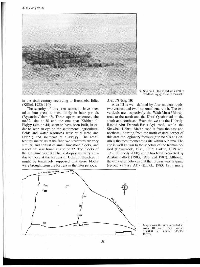
Finally, is the site of Khirbat al-Fiqiyy ~I ~ (site no.44), a few kilometers southeast öf Udhru~. The site seems to have been a centralized agricultural complex, an aqueduct conneets the sire with Birkat Udhrui) (reservoir) (site no.48) about kil ometre northeast 01' the site. A waU was built to carry the aqueduct (site llo.49) in Wadi alFiqiyy , and wel!-preserved parts 01' it are still standing for a considerable height (Fig. 9). Another reservoir was found about five hundred metres southeast of Khirbat al-Fiqiyy. Many vertical and horizontal field walls were seen in the wadi below this reservoir. Therefore, the people who cultivated the fields , operated the water system and protected this important area must have occupied the site. The pottery sherds retlect the long history of the area (al-Fiqiyy) from the Nabataean/Roman period up to the late Islamic period. It is attested that the area between Ma'an and Udhru~ f10urished dming the Byzantine period. Udhrul) itself paid the second largest tax among tbe towns of southern Palestine
8. Silc 110.29, Khirbal al~Jarha, view 10 lhe west.
ADAJ 48 (2004)
in the sixth century according to Beersheba Edict (Killick 1983: 110).
The secu rity of this area seems to have been taken into account, most like ly in later periods (Byzantine/lslamic?). Three square structures, si te no.32, sire nO.38 and the one near Khirbat alFiqiyy (site no.44) seem to have been built, in order 10 keep an eye on the settlements, agricullural fj elds and water resources west at al-Jarba and UdhruJ:l and southeast at al-Fiqiyy. The architectural materials at the first two structures are very similar, and consist of small limestone blocks, and a roof til e was fo und at site nO.32. The blocks or the structure Ilear Khirbat al-Figiyy are very similar to those at the fortress of UdhruJ:l; therefore it might be tentatively supposed that these blocks were brought from the forlress in the later periods.
"" J
C.
"50
tw-a' 01'0.10 Roo-d
-58-
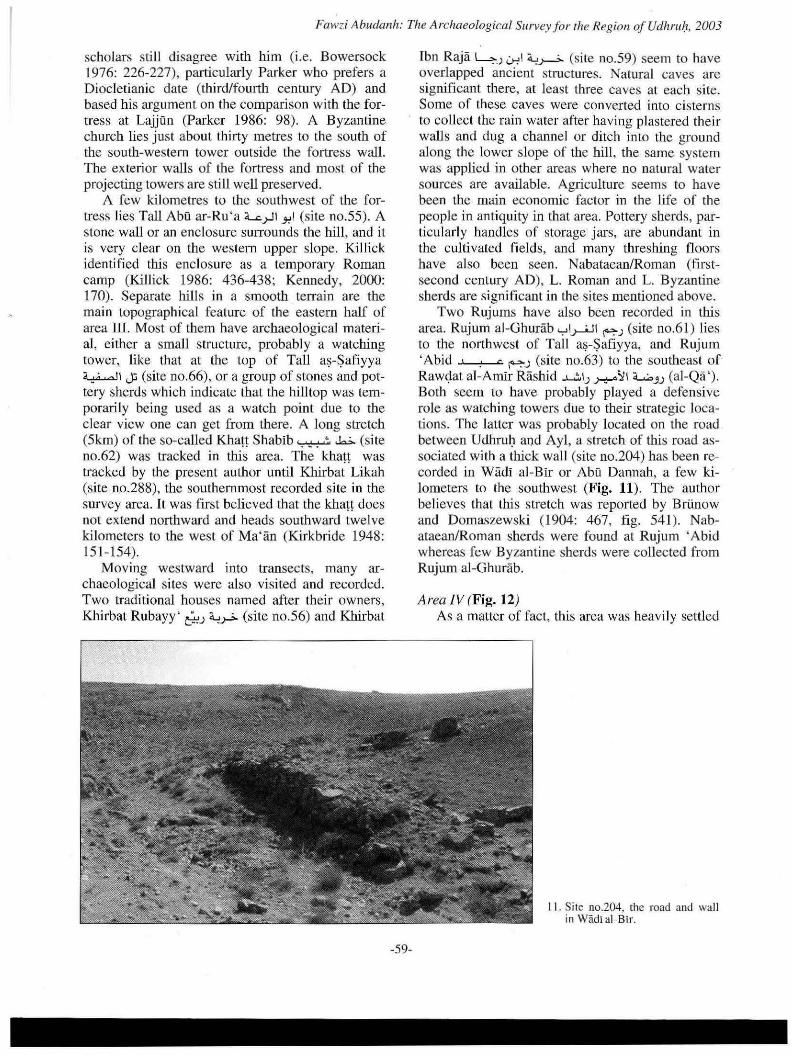
Area /Il (Fig. 10)
9. Sire no.49, the aqucduct's wall in Wädi al-Fiqiyy, vicw to lhe eaSL
Area rrr is weil defined by four modern roads, two vertical and two horizontal encircle it. The two vert icals are respecti vely the Wadi Musa-UdhruJ:l road to the north and the Ohrä' Qa~ib road to the south and southeast. From the west is the UdhruJ:lRashid-Abo Oannah-Basla-Ayl road, while the Shawbak-Udhru '-Ma'än road is from the east and northeast. Starting from the north-eastern corner of this area the legionary fortress (site no.50) at UdhruJ:l is the most momentous site within our area. The site is weil known to the scholars of the Roman period (Bowersock, 197 1, 1983; Parker, 1979 and 1986; Kennedy 2000). and it has been excavated by Alistair Killick (1983, 1986, and 1987) . Althougb the excavator be lieves that the fortress was Trajanic (second century AO) (Ki llick, 1983: 125), many
t,
10. Map shows lhe sires recorded in Area III (ref. map Jordan 1:50000 Bir Khidad 3 1501V K737),
Fawzi Abudanh: The Archaeological Sl/rvey Jor fhe Region of Udhrub, 2003
scholars still disagree wirh hirn (i.e. Bowersoek 1976: 226-227), partieularly Parker who prefers a Diocletianie date (third/fourth eentury AD) and based his argument on the comparison with the fortress at Lajjün (Parker 1986: 98) . A Byzantine ehurch lies just about thirty metres to the south of the south-western tower outside the fortress wall. The exterior walls of the fortress and most of the projecting towers are still weil preserved .
A few kilometres to the southwest of the fortress lies Tall Abü ar-Ru 'a ~.rll y-I (si te no.55). A stone wall or an enclosure sUITounds the hili, and it is very clear on the western upper slope. Killick identified this enclosure as a temporary Roman eamp (Killiek 1986: 436-438; Kennedy, 2000: 170). Separate hills in a smooth terrain are the main topographiea l feature of the eastern half of area 111. Most of them have archaeologieal material, either a small strueture, probably a watehing tower, like that at the top of TaU a~-$afiyya
~I J:; (site no.66), or a group of stones and pottery sherds whi eh indicate that the hili top was temporarily being used as a wateh point due to the clear view one ean get from there. A long stretch (5 km) of the so-called Khatt Shabib ~ .b. (si te no.62) was traeked in this area. The khan was traeked by the present author until Khirbat Likah (site no.288), the southernmost reeorded site in tbe survey area. It was first believed that the khan does not extend northward and heads southward twel ve kilometers to the west of Ma'än (Kirkbride 1948: 151- 154).
Moving westward into transeets, many arehaeological sites were also visited and recorded. Two traditi onal houses named after their owners, Khirbat Rubayy' t"u '-'..r> (sire no.56) and Khirbat
-59-
Ibn Raja 4~ 0-0'1 a..,.>-->- (site no.59) seem to have overlapped aneient struetures. Natural caves are significant there, at least three eaves at each site. Some of these caves were converted into ei stenlS to eoUect the rain water after having plastered their waUs and dug a channel or ditch iota tbe ground along the lower slope of the hilI, the same system was applied in olher areas where no natural water sources are available. Agriculture seems to have been the main eeonomic factor in the I ife of the people in antiq uity in that area. Pottery sherds, particu larly handles of storage· jars, are abundant in the cultivated fi elds, and many threshing floors have also been seen. Nabataean/Roman (firstseeond century AD), L. Roman and L. Byzantine sherds are significant in the sites mentioned above.
Two Rujnms have also been recorded in this area. Rujum al-Ghurab .,.,1.>--'-11 F"~ (site no.61 ) lies to the northwest of Tall a~-$afiyya, and Rujum 'Abid , . c ~~ (site no.63) to the southeast of Raw<;lat al-Amir Räshid .......;, I~ .r-=--\l1 =<....;, .. v (al-Qa '). 80th seem to bave probably played a defensive role as watching towers due to their strategie loeations. The latter was probably located on the road between Udhrui) and Ayl, a stretch of this road associaled with a thick wall (site no.204) has been reeorded in Wadi al-Bir or Abu Dannab , a few kilometers to the sou tb west (Fig. 11). The author believes that this stretch was reported by Brünow and Domaszewsk.i (1904: 467, fig. 54 1). Nabataean/Roman sherds were found at Rujum ' Abid whereas few Byzantine sherds were collected from Rujurn al-Ghurab.
Area IV (Fig. 12) As a matter of fact, this area was heav il y settled
I I . Sitc no.204, the road and wall in Wädi al-Bir.
ADAl48 (2004)
\lodl MI;SQ-Udhr uh Roo,eI
o S69
S102 S95 0 o
('Sl06
from the first century AD onwards. Many structures were recorded in the area; however, only some of them were recorded by Dr. Khairieh ' Amr ('Amr el al 2001 , 1998) during the survey which accompanied the process of constructing the water pipeline between al-Qa' and Wadi Musa via Bir alBitär. Therefore, those sites will not be mentioned here. The modern settl ements at Rashid (al-Qä ') and Abu Dannah lie within this area. This area is encircled by four roads; the Wädi Musa-Udhrul) road to the north, the Wädi Musa-Basta road to the west and northwest, the Udhrul)-al-Qä' -AbU Dannah-Basta-Ayl road to the east and southeast, and the Umm Hilal road (J)U 1'1) to the south. The latter heads west to northwest from Abu Dannah and intersects with the Wädi Musa-Basra road.
Stretches of an ancient road (si te no. 123) running north to south , over the hill s just parallel to the Wadi Müsa-Basta road, are still amazingly well preserved. The road does not have the same features in all the stretches; its width, for examp1e, ranges from four to eight meters, in same places there are no curbstones at all due to the hard terrain ex isting there. Many struetures were bu ilt on the slopes to the east 01' the road, same of them just on the edge of the road, and seeondary routes eonneet these struetures with the main road. A good example is site nO. I22 where the main road is intersected by a secondary one eonnecting the site with
o
-60-
2kM
12. Map shows the sites recordcd in Area IV (rer. map Jordan 1:50000 Bir Khidad 3150lV K737).
the road, and it is interesting enough to know that the modem road betweeo Basta and Wadi Müsa probably overlapped parts of this road.
Apart from the abundant presence of structures in this area, the ex istenee of many rock-cut cisterns is the most signifieant phenomenon at this area. Most of them were origi nally natural caves converted into eisterns after they were improved and plastered. About thirty ci sterns were recorded there. The lack 01' natural water sources must have been the reason behind this technique. A good case is the site of 'Abdät .;:,I~ (sire no.69), four cistems were located there roughlyon a line, a ground-ditch channel is conducting the rain water into them. They also have the same depth of 6m, and probably the same diameter (3-4m).
Another case is the cistern at Umm al- ' Awsaj tl 1,'-'~1 (site no.95) . It was located on the upper slope of a hilI. A rectangular settling basin was connected to a small channel to run the water inside the cistem. A small door enables a slim person to enter the cistern , and seventeen rock-cut steps lead to the floor of the eistern (Fig. 13). The measurement 01' its interior is 9.4m-8.5m, and the di ameter of its floar is 7m, and finall y its depth is 6.5m. No structure was built c1 0se to this site but a cave exists down on the lower slope of the opposite hili. Two important Rujums, Rujum al-Bitär~.J .J~I (sire no.l02) (Fig. 14) and Rujum al-Kha-

Fawzi Abudanh: The Archaeological Su rvey Jor rite Region. of Udhruh, 2003
ibiyya', . ,6;'11 ~J (si te no.134) must have had a defensive role to play. Both bave strategie loeations on very high hili tops, I SOOm at least above sea level, and this evidently means that they have a very cJear view over the sUITounding landscape in all directions. In terms of the dimensions and arehiteeture material, Rujum al-Bilär is 19m SN and 17m EW whereas Rujum al-Khatibiyya is SrnxSm, both were builr of large and very large blocks of flint stones, the walls at Rujum al-Bilär cannot be easily traced due to the considerable stones covering the structure. At Rujum al-Kha(jbiyya the plan is very clear, as a single row of walls still stand for a considerable height, buttress walls however, were bujJt on the extern al sides of the walls.
-61 -
13. Site no.95, interior of rock-cut eistern . Umm al-'Awsaj.
14. Site no.i02, Rujurn al-Bitar, view to the wesl.
The remains of two complex struetures with internal di visions are worth mentioning. The first is known as Khirbat al-Hazähza 'j.A>Ij.-4J1 ...,..".....>. (site no.106), and the second is Kbirbat Umm al-Jaräd .l1~1 t1 ~ (site no. I 33). The former rests on a hilltop about 500m to the west of al-Qä' Pump Station. The archaeological remains incJuding the structure cover an area of I SOm EW and 70m NS, although the strucrure was affected by later agricultural activities, some of the original walls are in situ .
Many exposed and wal led bedrocks and paved f100rs occupy the western and south-western part of the site, a cistern lies outside the north-western corner. Nabataean (first centnry BC-second cen-
ADAJ 48 (2004)
OS222
o $197
° S233
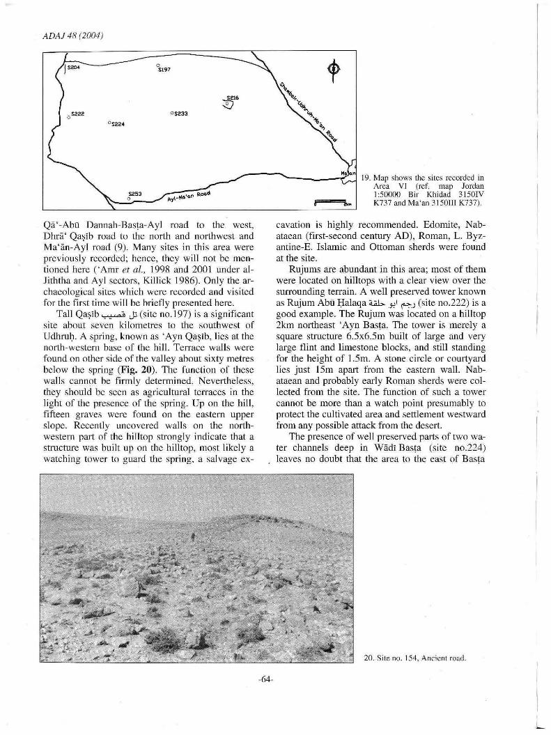
19. Map shows the sites recorded in Area VI (ref. map Jordan
L _____ ~t:=J2:::5:::3=::::~.~y':-... = .. n~.oa_d _________ ~~~~J 1:50000 Sir Khidad 3150IV ... K737 and Ma'an 3150111 K737).
Qä '-Abu Dannah-Basta-Ayl raad to the west, Dhrä' Qa~ib raad to the north and northwest and Ma' iin-Ayl raad (9). Many sites in this area were previously reeorded; henee, they will not be mentioned here ('Amr et al., 1998 and 2001 under alJiththa and Ayl seetors, Killick 1986). Only the arehaeological sites which were reeorded and visited far the first time will be briefly presented here.
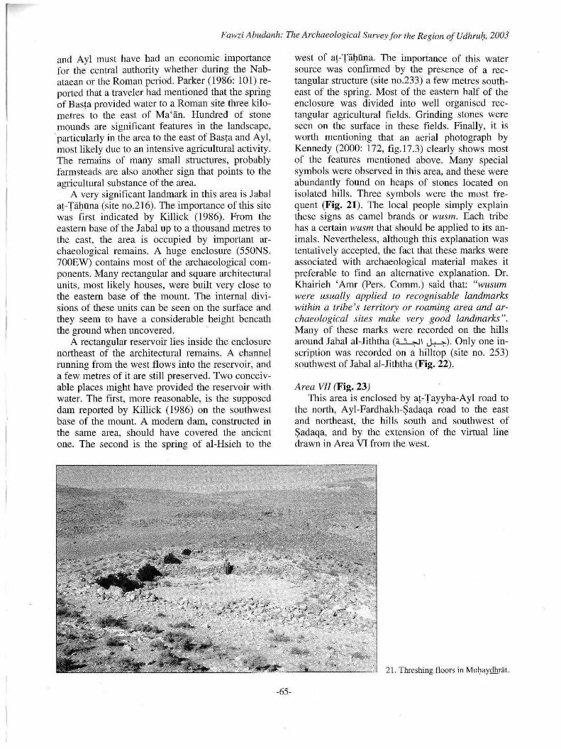
Tall Qa~ib ~ J:; (site no.197) is a significant site about seven kilometres to the southwest of Udhrul). Aspring, known as 'Ayn Qa~ib, lies at the north-western base of the hilI. Terraee walls were found on other side of the valley about sixty metres below the spring (Fig. 20). The function of these wall s cannot be firmly determined. Nevertheless, they should be seen as agricultural terraces in the light oI the presence of the spring. Up on the hili. fifteen graves were found on the eastern upper slope. Recently uncovered walls on the northwestern part of the hilltop strangly indicate that a structure was built up on the hilltop, most likely a watehing tower to guard the spring, a salvage ex-
-64-
cavation is highly recommended. Edomite, Nabataean (first-second century AD), Roman, L. Byzantine-E. Islamic and Ottoman sherds were found at the site.
Rujums are abundant in this area; most of them were located on hili tops with a clear view over the surrounding terrain. A weil preserved tower known as Rujum Abu l;Ialaqa a.;;b,..J!1 ~.J (site no.222) is a good example. The Rujum was located on a hiUtop 2km northeast 'Ayn Bas!a. The tower is merely a square structure 6.5x6.5m built of large and very large flint and limestone blocks, and still standing for the height of 1.5m. A stone circle or court yard lies just 15m apart from the eastern wall. Nabataean and probably early Roman sherds were collected from the site. The function of such a tower cannot be more than a watch point presumably to protect the cultivated area and settlement westward from any possible attack from the deser!.
The presence of weil preserved parts of two water channels deep in Wiidi Bas!a (site no.224) leaves no doubt that the area to the east of Bas!a
20. Site no. 154, Ancicnt road.
L
Fawzi Ahudanh: The Archaeological Surveyfor fhe Region of Udhru,". 2003
and Ayl must have had an eeonomie importance for the central authority whether during the Nabataean or the Roman period. Parker (1986: 101) reported that a traveler had mentioned that the spring of Bas(a provided water to a Roman site three kilometres to the east of M a' an. Hundred of stone mounds are signifieant features in the landseape,
'particularly in the area to the east of Basra and Ayl, most likely due to an intensive agricultural activity. The remains of many small struetures, probably farmsteads are also another sign that points to the agricultural substance of the area.
A very significant landmark in this area is Jabal a!-TäI)üna (site no.216). The importance of this site was first indicated by Killick (1986). From the eastern base of the Jabal up to a thousand metres to the east, the area is oeeupied by important archaeological remains. A huge enelosure (550NS. 700EW) contains most of the archaeological eomponents. Many rectangular and square architectural units, most likely houses, were built very elose to the eastern base of the mount. The internal divisions of these units can be seen on the surface and they seem to have a considerable height beneath the ground when uncovered.
A rectangular reservoir lies inside the enc10sure northeast of the architeetural remains. A channel running from the west flows into the reservoir, and a few metres of it are still preserved. Two conceivable places might have provided the reservoir with water. The first, more reasonable, is the supposed dam reported by Killick (1986) on the southwest base of the mount. A modern dam, constructed in the same area, should have covered the ancient one. The second is the spring of al-Hsieh to the
-65-
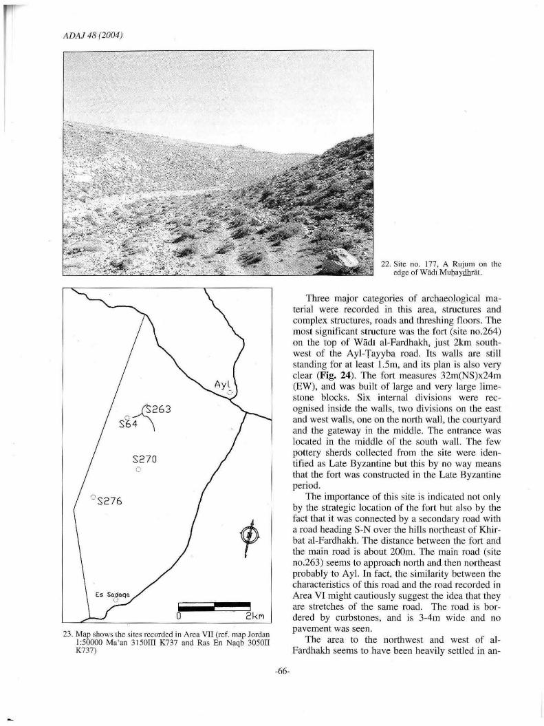
west of a! -TäI)üna. The importance of this water source was confirmed by the presence of a rectangular sttueture (site no.233) a few metres southeast of the spring. Most of the eastern half of the enelosure was divided into well organised reetangular agricultural fields. Grinding stones were seen on the surface in these fields. Finally, it is worth mentioning that an aerial photo graph by Kennedy (2000: 172, fig.17.3) elearly shows most of the features mentioned above. Many special symbols were observed in this area, and these were abundantly found on heaps of stones loeated on isolated hills. Three symbols were the most frequent (Fig, 21). The local people simply explain these signs as eamel brands or wusm. Each tribe has a certain wusm that should be applied to its animals. Nevertheless, although this explanation was tentatively accepted, the fact that these marks were associated with archaeological material makes it preferable to find an alternative explanation. Dr. Khairieh 'Arm (Pers. Comm.) said that: "wusum were usually applied to recognisable landmarks within a tribe's terri/ory or roaming area and archaeological sites make very good landmarks". Many of these marks were recorded on the hills around Jabal al-Jiththa (~I ~). Only one inscription was reeorded on a hilltop (site no. 253) southwest oI Jabal al-Jiththa (Fig, 22).
Area VII (Fig, 23) This area is enelosed by a!-Tayyba-Ayl road to
the north, Ayl-Fardhakh-Sadaqa road to the east and northeast, the hills south and southwest of Sadaqa, and by the extension of the virtual line drawn in Area VI from the west.
21. Threshing tloors in Mul)aydhrat.
ADAJ 48 (2004)
" ß 263 St. 4 \
C S276
Es SQ~Qqo. (j
S27 0 .-. c
o 2k",
23. Map shows the sites rccorded in Arca VII (ref. map Jordan 1:50000 Ma 'an 3150III K737 and Ras En Naqb 305011 K737)
-66-
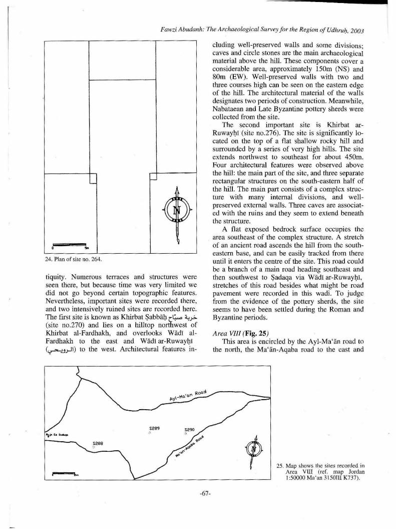
22. Site no. 177, A Rujum on the edge of Wädi Mulpl.yQhräl.
Three major categories of archaeological material were recorded in this area, structures and complex structures, roads and threshing floors. The most significant structure was the fort (site no.264) on the top of Wädl al-Fardhakh, just 2km southwest of the Ayl-Tayyba road. Hs walls are still standing for at least J.5m, and its plan is also very cJear (Fig. 24). The fort measures 32m(NS)x24m (EW), and was built of large and very large Iimestone blocks. Six internal divisions were recognised inside the walls, two divisions on the east and west walls, one on the north wall , the court yard and the gateway in the middle. The entranee was loeated in the middle of the south wall. The few pottery sherds colleeted from the sile were identified as Late Byzantine but this by no way means that the fort was construeted in the Late Byzantine period.
The importanee of this sile is indicated not only by the strategie loeation of the fort but also by the fact that it was eonneeted by a secondary road with a road heading S-N over the hill s northeast of Khirbat al-Fardhakh. The distanee between the fort and the main road is about 200m. The main road (si te no.263) seems to approach north and then northeast probably to Ayl. In fact, the similarity between the characteristics of Ihis road and the road recorded in Area VI might cautiously suggest the idea that they are stretches of the same road. The road is bordered by curbstones, and is 3-4m wide and no pavement was seen.
The area to the northwest and west of alFardhakh seems to have been heavily settled in an-
Fawzi Ablldanh: The Archaeological Survey Jor fhe Region oJ Udhru!l, 2003
L -
"'" .... ~ , ~
'.lJ ~
• ... 24. Plan of site no. 264.
tiquity. Numerous terraces and structures were seen there, but because time was very limited we did not go beyond certain topographie features. Nevertheless, important sites were reeorded there, and two iotensively ruined sites are recorded here. The first site is known as Khirbat $abbäi) er,...., ~ (site no.270) and lies on a hill top northwest of Khirbat al-Fardhakh, and overlooks Wädi alFardhakh to the east and WädJ ar-Ruwayi)J (<"r"'-'Jrll) to the west. Architeetural features in-
5289
S"8 "
--"' ... -67-
cluding well-preserved walls and some divisions; caves and circle stones are the main archaeological material above the hill. These components cOver a eonsiderable area, approximately 150m (NS) and SOm (EW). Well-preserved walls witb two and three courses high can be seen on the eastern edge of the hill. The architectural material of the walls designates two periods of construction. Meanwhile, Nabataean and Late Byzantine pottery sherds were collected from the site.
The second important site is Khirbat arRuwayi)i (site no.276). The site is significantly 10-cated on the top of a flat sball ow rocky hill and surrounded by aseries of very high hills. The site extends northwest to southeast far about 450m. Four architectural features were observed above the hili: the main part of the site, and three separate rectangular structures on the south-eastem half of the hill. The main part consists of a complex structure with many internaJ divisions, and wellpreserved externaJ walls. Three caves are associated with the ruins and they seem to extend beneath the structure.
A flat exposed bedrock surface occupies the area southeast of the complex structure. A stretch of an ancient road ascends the hill from the southeastern base, and can be easily tracked from there unti l it enters the centre of tbe site. This road could be a branch of a main road heading southeast and then southwest to $adaqa via Wädi ar-Ruwayi)i, stretches of this road besides what might be road pavement were recorded in this wadi. To judge from the evidence of the pottery sherds, the site seems to have been settled during the Roman and Byzantine periods.
Area VllI (Fig. 25) This area is encircled by the Ayl-Ma'än road to
the north, the Ma' än-Aqaba road to the east and
25 . Map shows the sites recorded in Area VUI (reL map Jordan 1:50000 Ma'an 3 I 501 1I K737).
ADAI 48 (2004)
southeast, the Ayl-Fardhakh-Sadaqa road to the west, and the newly constructed road between the Ayl-Fardhakh-Sadaqa road and the Ayl-Wahida road to the south. Not too many archaeological sites were recorded there. However, same of them are worth mentioning.
A few kilometres to the east of Rujum Sadaqa (U..........JI F.) and on the edge of the Khan Shabib lies Khirbat Layka ~ ~ (site no.288). The site eonsists of a small eollapsed structure surrounded by many stone cireles . No internal divisions were noticed in the main structure, the outer walls can hardly be seen, particularly the western one. Tt is highly likely that the structure was originally one uni t, a room or tower. This is very possible since the presence of simple structures in remote areas or on ancient roads is very common in the region. Moreover, at least one of the site's components whether the structure itself or the walls should have been coineidently built with the road. Pottery sherds of the Nabataean (first century Be onward), Roman (third century AD) and Ottoman periods were collected from the site.
By crossing the road between Ayl and alWahida we came to a ruined hili known as Khirbat al-Wahida (s ite no.289). A modern quarry at the hill top disturbed the site. However, archaeological remains still exisl on the hili . A wall which eneloses the hili top and many small and simple reetangular structures on the southwest half of the hill are still in good eondition. The latter were most Ii kely part of apre-historie settlement 10 judge from the presence of some lithics ' and pottery sherds. Well-preserved parts c f tradition al ha uses oeeupy the north-eastern edge 01' the hill , 'and there is a possibility that it was built above a Nabataean or Roman strueture if the pottery sherds of both periods reflect the existence of such structure. The spring at the north-western base of the hili must have been very attraetive at least for the Nabataean.
About 3km east of al-Wahida we came to the site of Khirbat Wahdän "1..lA,, 4.;,r>. (site no.290), it was a big surprise to find an archaeological site in sueh a remote area. The fact that aspring is a few hundred metres southwest of the site has explained our surprise. Also, tltree features were identi fied in the site, remains of ilTegular structure, enelosures or walls and many caims. The strueture was deliberately located on the edge of Wädi al-Wahlda and extended further southwest to incorporate a natural cave. Unfortunately, the structure's plan is not preserved weil enough to understand its function. Remains of walls and an enclosure were strangely located in the gull y. However, a very ob-
-68-
vious wall seems to have been built to proteet the structure from any possible !load from the wadi. Many cairns or simple stone cireles were seen in the plain to the west of the structure. Within the cireIes the ground is massively eovered with very small pebbles.
Conclusion Although the main purpose behind the survey of
the region of UdhruJ:! was to support the present author' s thesis, the dara that was eollected from the region is enormaus and can be considered in many aeademic papers. The 291 sites recorded in the survey not only show intensity in settlement but divel'sity in the funetio n and date of these sires . Arehaeological remains dating from the prehistorie periods up to the Ottoman period were found in the area.
The outcomes of thi s project are many. Firstly, in addition to reeording a large number of sites, plotting these sites on maps wbich has nevel' been on before, apart from the sites which were recorded by 'Amr (200 l and 1998), will be very useful. Second.ly, identifyi ng eertain sites for future investigations partieularly exeavations, espeeially these which are al ready disturbed or might be affected by human activities and natural factors. Thirdly, analysing the accumulared data, in the author' s thesis, will offer a c1earer picture about the hi story of human activity in the region of Udhrulj, particularly in the first millennium AD. Finally, it is important to assert that thi s is just a preli minary report, fmal results and conc1usions would be available in the future.
Acknowledgement I would Iike to express my thanks to Dr. Khai
rieh 'Amr for her help in reading the pottery sherds and the comments she made on this report. Many thanks also to Dr. Hamzeh Mabasneh from the Department of Archaeology in Mu ' tah University far bis generaus hel p in reading pottery sherds. T also highly apprec iate rhe help I reeeived from Mr. Ahmed a1-Momani and 'Adnan Rafay'ah in the Department of Antiquities of Jordan. Many thanks to Mr. Muharnmad al-Marahleh, the head of the Ma'än Antiquities Office fo r his continuous 10-gistic support. And many thanks to Saleh Nawafleh who helped in preparing the maps. I would like also to say thanks to those who voluntarily joined the survey during the weekends namely Zaid Abu Dannah, Qais Abu Dannah , Noor addin Abu Dannah, Walid Abu Dannah, Mabmoud and Ahmed Abu Dannah and Madalleh al-Nu'aymat. Finally, the work would not have been finished on time
Fawzi Abudanh: The ArchaeoLogical Survey for the Region of Udhruh, 2003
without the sincere contribution of the vehicle ' s driver Mr, Muhammad Dhahi al-Sbou'.
Bibliograpby
41 St.Keverne Square Newcastle upon Tyne NES3YF England Email address [email protected]
'Amr, K. and al-Momani, A. 2001 Preliminary report on the An.:haeological Com
ponent of the Wadi Musa Water Supply and Wastcwater Project (1998-2000). ADAJ 45: 253-285.
'Amr, K., a1-Momani, A. , Farajat, S. and Falahat, H. 1998 Arehaeologieal Survey of the Wadi Musa Wate!"
Supply and Wastewater Project Area. ADAJ 42: 503-548.
Bowersoek, G.W. 1976 Limes Arabicus. Harvard Studie ... in Classical Phi
lology 80: 219-229. 1971
,,{\
ARcport on Arabia Provincia. Journal oI Roman Studies 61: 219-242.
Brunow, R. and von Domaszewski, A. 1~1W9 Die Provincia Arabia. 3 vo1s. (Strassburg).
Doughty, C.M. a... 1888 Arabi De5erta Vol I. The Cambridge Univcrsity
Prcss~ .. FindlaLer, G.
2002 Limes Arabicus, via militatis and rcsourcc control in southern Jordan. Pp. 137-152 in P. Freeman, J. Bennet, Z. Fiema and B. Hoffmann (eds.), Proceedings oI the XVlflth ln/emational Conference oI [he Roman Frontier Stlldies, Amman, Jordan (Sep. 2000). VoILBAR International Series 1084.
Glueck N. 1935 Explorations in Baslern Palestine, II. AASOR 15: 62-
79.
-69-
Graf, D.F. 1979 A Preliminary Report on A Survey of Nabataean
Roman Military Sites in SouLhern Jordan. ADAJ 23: 121-127.
1995 The via nova Traiana in Arabia Pctraca. in 1. Humphrey (cd. ), thc Roman and Byzantine N~ar East. Some recent archaeological research. Journal oI Roman Archaeolog)' Supplementary Series 14: 241-267.
Kennedy, D.L. 2000 The Roman arlny in Jordan. (London).
Killick, A. 1987 Udruh and the Tr~de Route through Southern Jordan.
SHAJ 3: 173-179. Kirkbride, S.M
1986 UJf:Jn and thc southern frontier. Pp. 44-57 in P. Freeman and D. Kennedy (eds.) The Dejence oI the Roman and Byzantine east. British Archaeological Repirts International Scrics. 297 (Oxford).
1983 U/pPLJ:l. The frontier or an empire. 1980 and 1981 seasons, a preliminary report. Levant 15: 110-131.
1948 Shebib's Wall in Transjordan. Antiquity 22: 151-154. Parker S.T.
1976 Archaeological Survey of thc Li rnes Arahicus: A Preliminary Report. ADAJ 21: 19-31.
1986 Romans (md Saracens. A history oI the ArabianIrontier. (Winona Lake, Ind.).
Schick, R. 1994 The settlement pattern of southern Jordan: thc nature
of the evidence. Pp. 133- 1 S4 in G.R.D King and A. Cameron (eds. ), The B)'zantine and earl)' lslamic Near East 1I. Land IIse (md settlement patterns. (Princeton).
Stein, Sir Aurel. 1940 Survcys on the Roman Frontier in '!rag and Trans
Jordan. GeORraphical Journa/95: 428-438. Tho1becq, L.
2001 Thc Hinterland of Petra from thc Edomite to the Islamic Periods: the Jabal ash-Sharah Survey (1996-1997). SHAJ7: 399-405.