surface and groundwater resources monitoring ... - UNOOSA
36
1 SURFACE AND GROUNDWATER RESOURCES MONITORING AND MANAGEMENT IN NIGERIA A PRESENTATION BY CHRIS. M. MADUABUCHI ASSISTANT DIRECTOR, DEPARTMENT OF HYDROLOGY AND HYDROGEOLOGY FEDERAL MINISTRY OF WATER RESOURCES, ABUJA, NIGERIA AT THE UNITED NATIONS/AUSTRIA/ESA SYMPOSIUM ON SPACE APPLICATIONS FOR SUSTAINABLE DEVELOPMENT TO SUPPORT THE PLAN OF IMPLEMENTATION OF THE WORLD SUMMIT ON SUSTAINABLE DEVELOPMENT “ WATER FOR THE WORLD: SPACE SOLUTIONS FOR WATER MANAGEMENT” GRAZ, AUSTRIA, 13-16 SEPTEMBER, 2004.
-
Upload
khangminh22 -
Category
Documents
-
view
5 -
download
0
Transcript of surface and groundwater resources monitoring ... - UNOOSA
1
SURFACE AND GROUNDWATER RESOURCES MONITORING AND MANAGEMENT IN NIGERIA
A PRESENTATION BY
CHRIS. M. MADUABUCHIASSISTANT DIRECTOR, DEPARTMENT OF HYDROLOGY AND HYDROGEOLOGY
FEDERAL MINISTRY OF WATER RESOURCES, ABUJA, NIGERIA
AT THE
UNITED NATIONS/AUSTRIA/ESA SYMPOSIUM ON SPACE APPLICATIONS FOR SUSTAINABLE DEVELOPMENT TO SUPPORT THE PLAN OF IMPLEMENTATION OF THE
WORLD SUMMIT ON SUSTAINABLE DEVELOPMENT “ WATER FOR THE WORLD: SPACE SOLUTIONS FOR WATER MANAGEMENT”
GRAZ, AUSTRIA, 13-16 SEPTEMBER, 2004.
2
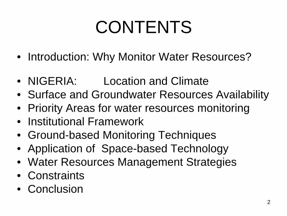
CONTENTS• Introduction: Why Monitor Water Resources?
• NIGERIA: Location and Climate• Surface and Groundwater Resources Availability• Priority Areas for water resources monitoring• Institutional Framework• Ground-based Monitoring Techniques • Application of Space-based Technology• Water Resources Management Strategies• Constraints• Conclusion
3
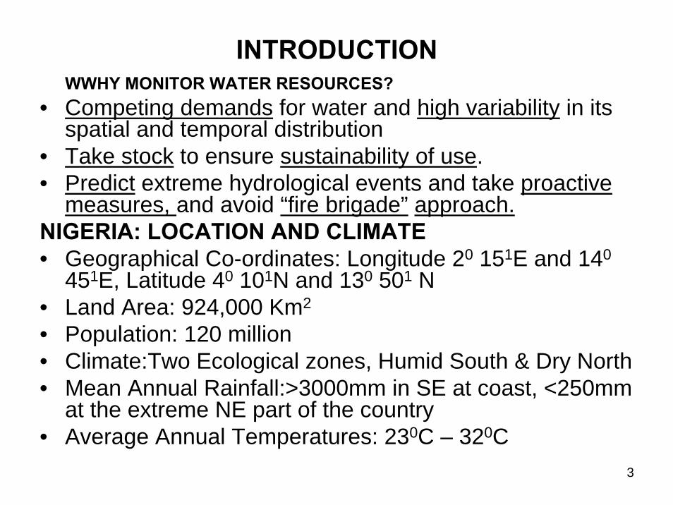
INTRODUCTIONWWHY MONITOR WATER RESOURCES?
• Competing demands for water and high variability in its spatial and temporal distribution
• Take stock to ensure sustainability of use.• Predict extreme hydrological events and take proactive
measures, and avoid “fire brigade” approach.NIGERIA: LOCATION AND CLIMATE • Geographical Co-ordinates: Longitude 20 151E and 140
451E, Latitude 40 101N and 130 501 N• Land Area: 924,000 Km2
• Population: 120 million• Climate:Two Ecological zones, Humid South & Dry North• Mean Annual Rainfall:>3000mm in SE at coast, <250mm
at the extreme NE part of the country• Average Annual Temperatures: 230C – 320C

4
Fig. 1 Hydro-meteorological Map of Nigeria
5
SURFACE AND GROUNDWATER RESOURCES AVAILABILITY
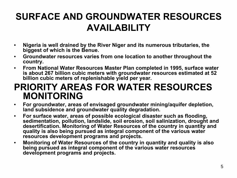
• Nigeria is well drained by the River Niger and its numerous tributaries, the biggest of which is the Benue.
• Groundwater resources varies from one location to another throughout the country.
• From National Water Resources Master Plan completed in 1995, surface water is about 267 billion cubic meters with groundwater resources estimated at 52 billion cubic meters of replenishable yield per year.
PRIORITY AREAS FOR WATER RESOURCES MONITORING
• For groundwater, areas of envisaged groundwater mining/aquifer depletion, land subsidence and groundwater quality degradation.
• For surface water, areas of possible ecological disaster such as flooding, sedimentation, pollution, landslide, soil erosion, soil salinization, drought and desertification. Monitoring of Water Resources of the country in quantity and quality is also being pursued as integral component of the various water resources development programs and projects.
• Monitoring of Water Resources of the country in quantity and quality is also being pursued as integral component of the various water resources development programs and projects.

6
Figure2: Groundwater Provinces of Nigeria

7
INSTITUTIONAL FRAMEWORK FOR MONITORING AND MANAGEMENT OF WATER RESOURCES• The Federal Ministry of Water Resources is constitutionally
empowered to oversee the development and management of Nigeria’s surface and groundwater resources including international waters.
• FEDERAL LEVEL:- Federal Ministry of Water Resources – implementing and
coordinating capacity- River Basin Development Authorities (RBDAs) 12 Nos.- National Water Resources Institute (NWRI)–training & research - Nigerian Meteorological Agency (NMA) – meteorological data- National Inland Waterways Authority (NIWA) – for Navigation
and river ports - National Electric Power Authority (NEPA) – for Hydro-power - Universities and Research Institutions in water related fields.
8
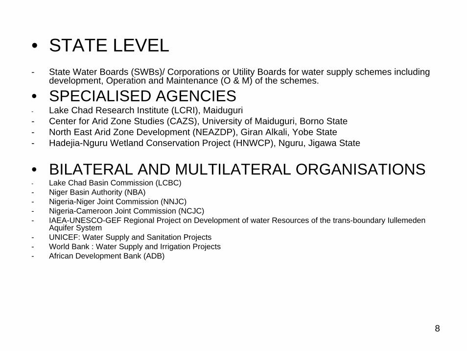
• STATE LEVEL- State Water Boards (SWBs)/ Corporations or Utility Boards for water supply schemes including
development, Operation and Maintenance (O & M) of the schemes.
• SPECIALISED AGENCIES- Lake Chad Research Institute (LCRI), Maiduguri- Center for Arid Zone Studies (CAZS), University of Maiduguri, Borno State- North East Arid Zone Development (NEAZDP), Giran Alkali, Yobe State- Hadejia-Nguru Wetland Conservation Project (HNWCP), Nguru, Jigawa State
• BILATERAL AND MULTILATERAL ORGANISATIONS- Lake Chad Basin Commission (LCBC)- Niger Basin Authority (NBA)- Nigeria-Niger Joint Commission (NNJC)- Nigeria-Cameroon Joint Commission (NCJC)- IAEA-UNESCO-GEF Regional Project on Development of water Resources of the trans-boundary Iullemeden
Aquifer System- UNICEF: Water Supply and Sanitation Projects- World Bank : Water Supply and Irrigation Projects- African Development Bank (ADB)

9
GROUND-BASED MONITORING TECHNIQUES
The conventional methods applied in the monitoring of water resources in Nigeria consists of periodic measurement of the following parameters at established stations/locations using standard instruments:-Meteorological Data:- Precipitation, Air and Soil Temperatures, Evaporation, Relative Humidity, Wind Velocity &
Direction, Sunshine Hours and Radiation.- NMA operates synoptic stations at all the nation’s airports in addition to those maintained
by the respective RBDAs and the State ADPs. Hydrological Data:- River stage and discharge measurements at 163 stations in the national network including
50 stations in 7 States in the semi-arid north constructed in 1998 under NFDP-IGroundwater levels in wells and boreholes:- 150 monitoring wells were established in 7 States in the north under NFDP-I and are run
by the respective State ADPs.
Both hydrological stations and monitoring wells are equipped mostly with solid state pressure loggers (Orphimedes OTT Brand) for automatic measurement.
All the above data are correlated with groundwater recharge and abstraction estimates for relevant trend analysis and determination of aquifer response characteristics, local and regional flow systems and the overall water balance.

10
FIG.3 MEAN MONTHLY TEMPERATURE, RELATIVE HUMIDITY AND RAINFALL IN PART OF SOKOTO-RIMA BASIN, NW NIGERIA (1996-1999)
11
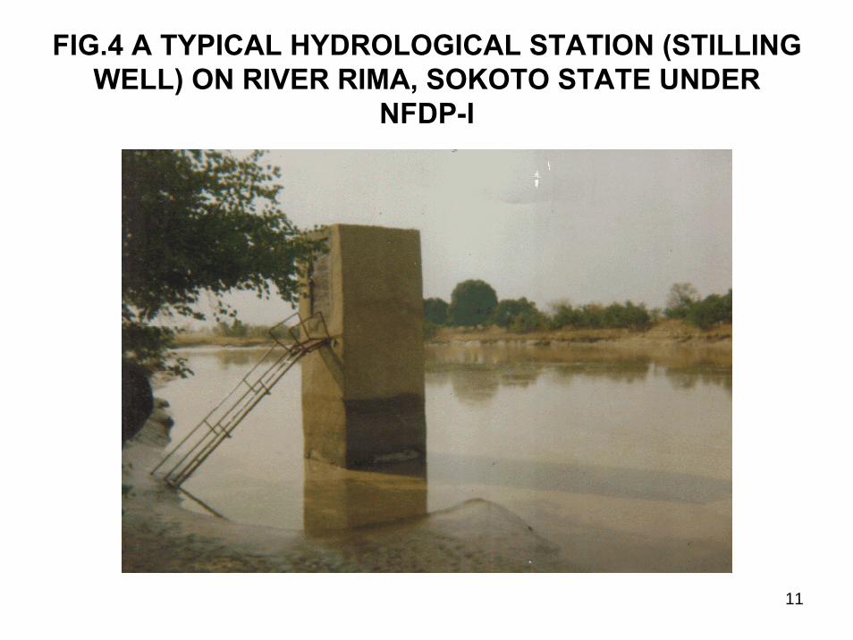
FIG.4 A TYPICAL HYDROLOGICAL STATION (STILLING WELL) ON RIVER RIMA, SOKOTO STATE UNDER
NFDP-I
12
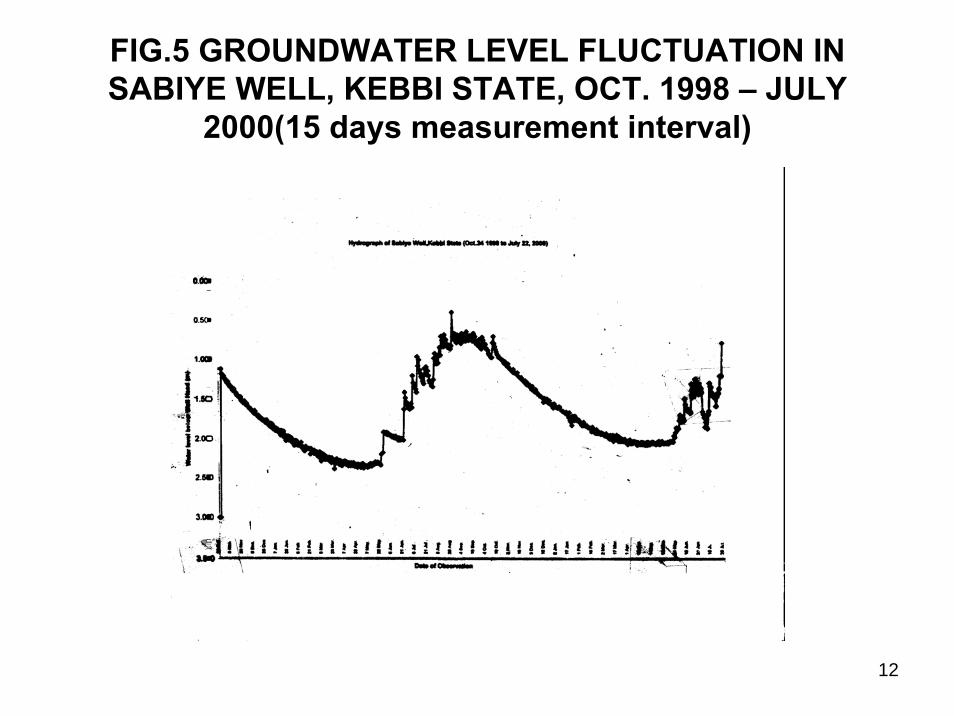
FIG.5 GROUNDWATER LEVEL FLUCTUATION IN SABIYE WELL, KEBBI STATE, OCT. 1998 – JULY
2000(15 days measurement interval)
13
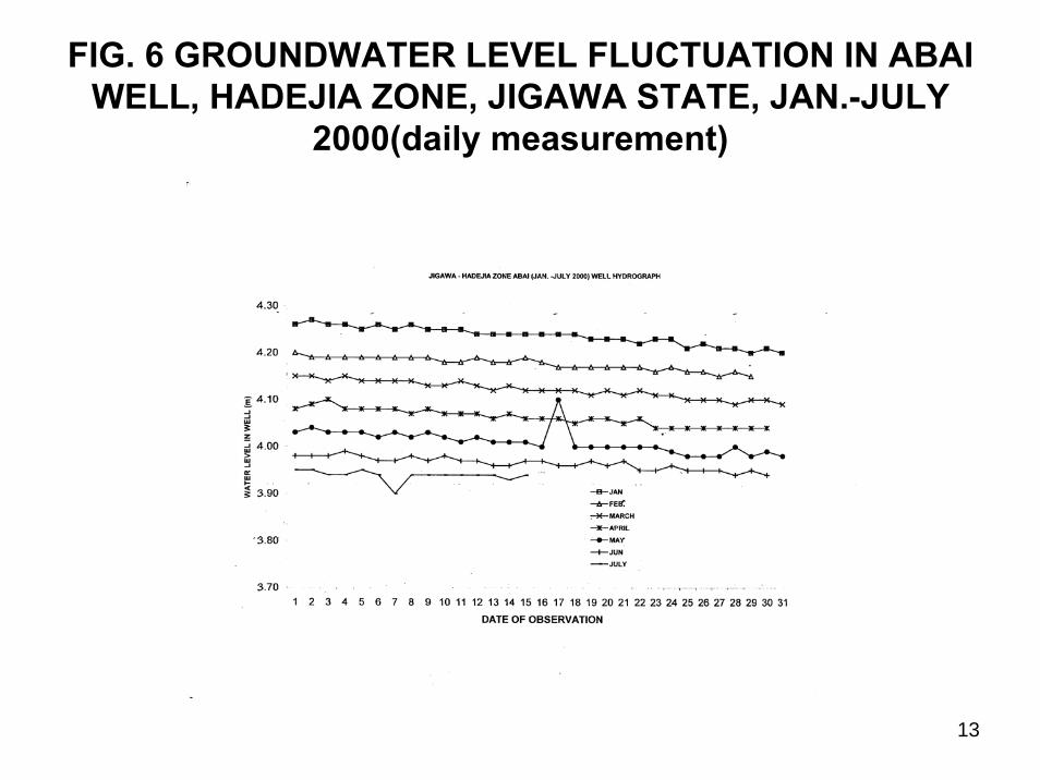
FIG. 6 GROUNDWATER LEVEL FLUCTUATION IN ABAI WELL, HADEJIA ZONE, JIGAWA STATE, JAN.-JULY
2000(daily measurement)
14
GROUND-BASED TECHNIQUES CONT’D
MEASUREMENT OF HYDRO-CHEMICAL PARAMETERS
- Water samples are collected from monitoring wells and hydrological stations for physical and chemical analysis under NFDP-I and IAEA sponsored Isotope-based projects.
- Physical parameters of pH, Temperature (T), Electrical Conductivity (EC) and Salinity (S)ppm are measured in-situ in the field with portable equipment followed by laboratory-based analysis of the common chemical constituents-Na, K, Ca, and Mg (cations) and Cl, NO3, SO4, H2CO3 and PO4(anions).
MEASUREMENT OF ISOTOPIC COMPOSITION- Water samples collected under the Isotope-based projects were analysed for
stable isotopes namely Oxygen-18 (18O) and Deuterium(2H) and radioisotopes-Tritium(3H) and Carbon-14(14C)
- Isotopic data provide information on origin, recharge and discharge of groundwater systems and thus assist in identifying appropriate management strategies.

15
FIG. 7 Scholler Diagram for Major Ions in Surface and G/Water in Rima Basin- Wurno Project (1999)
16
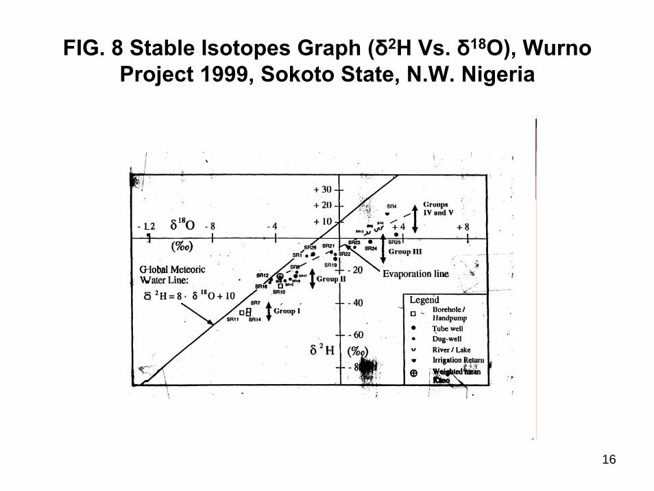
FIG. 8 Stable Isotopes Graph (δ2H Vs. δ18O), WurnoProject 1999, Sokoto State, N.W. Nigeria

17
FIG. 9 δ2H Vs. δ18O for Middle & Lower Aquifers of Chad Basin N.E. Nigeria (Nov. 2002)

18
APPLICATION OF SPACE-BASED TECHNOLOGY
• Space-based Technology is the state-of-the –art technique for monitoring and management of environmental resources such as water as it provides data in real time.It also has the special advantage of repetitive coverage of particular locations including remote and inaccessible areas.
• In spite of the vast potentials which Space Technology offers, application of Satellite Remote Sensing in the water sector in Nigeria focuses in the meantime on the following areas:
Weather Forecasting
Flood Inundation and Flood Plain mapping
Hydro-geological Mapping/Groundwater targeting
Inventory and Monitoring of water bodies
Reservoir/Dam site selection
Flood Monitoring and Forecasting
19
WEATHER FORECASTING
- The Nigerian Meteorological Agency (NMA) utilizes ground satellite/computerized data system for weather forecasting in the country on daily basis.
- Wind and cloud movements/profiles are captured by satellite and zones of high and low pressure belts delineated with consequent forecast on temperature variations and impending rainfall/thunderstorm.
FLOOD INUNDATION AND FLOOD PLAIN MAPPING- Under N FDP-I, some benefiting States like Sokoto and
Kebbi conducted feasibility survey for groundwater in the shallow alluvial aquifers of the fadamas (floodplains of major rivers) using aerial photos to produce base maps which facilitated the extensive field work that followed.

20
Fig.10 Map showing the Flood plain of River Rima, at Lema, Kebbi State
21
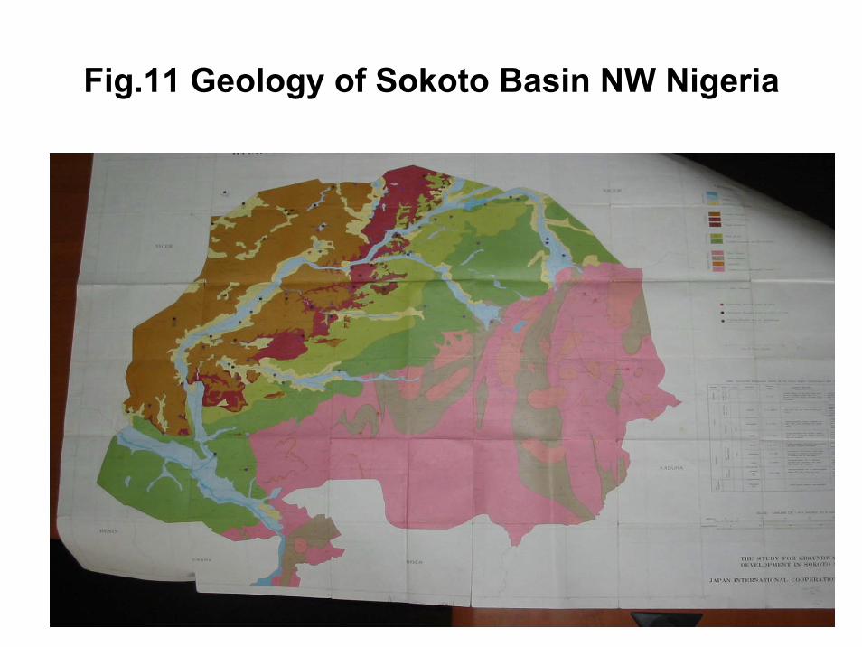
GROUNDWATER TARGETING
In many water supply schemes, major geological structures (rock types and stratigraphy) were interpreted from satellite imageries and related to groundwater occurrence following subsequent confirmation through ground-truth, surface geophysics and inventory of baseline data.
A good example is the Groundwater Resources Availability Survey in the old Sokoto State (now Sokoto, Kebbi and Zamfara) from March 1988 to Feb. 1990.
22
Fig.11 Geology of Sokoto Basin NW Nigeria
23
RESERVOIR/DAM SITE SELECTION
• The Gurara Dam and Water Transfer Project which is in progress involves construction of a dam at the upper reaches of River Gurara in Kaduna State and laying of 3.3m diameter pipes over a distance of 75km for conveyance of raw water to the treatment plants located near the Lower Usuman Dam.
• The purpose is to boost supply of potable water to the rapidly growing population of FCT for the next 50 years.
• Air craft was flown on 13 May 2001 across the 75km distance between the proposed intake and discharge areas over a corridor of 9km.
• The aerial photogrammetric survey facilitated the determination of the exact alignment of the pipeline to avoid the hills and most of the towns and villages, as well as the determination of right-of-way and socio-economic and environmental factors.

24
Fig.12 An Aerial Photographic Survey of Part of the Area along Upper Gurara River in Kaduna State and Lower
Usuma Dam in FCT
25
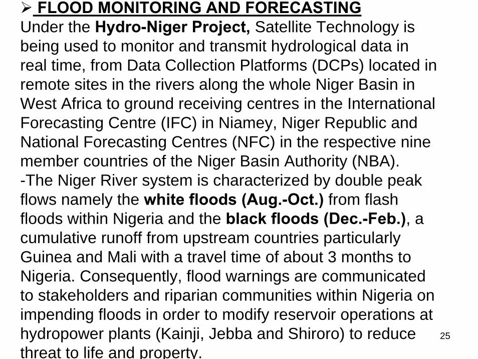
FLOOD MONITORING AND FORECASTING Under the Hydro-Niger Project, Satellite Technology is being used to monitor and transmit hydrological data in real time, from Data Collection Platforms (DCPs) located in remote sites in the rivers along the whole Niger Basin in West Africa to ground receiving centres in the International Forecasting Centre (IFC) in Niamey, Niger Republic and National Forecasting Centres (NFC) in the respective nine member countries of the Niger Basin Authority (NBA).-The Niger River system is characterized by double peak flows namely the white floods (Aug.-Oct.) from flash floods within Nigeria and the black floods (Dec.-Feb.), a cumulative runoff from upstream countries particularly Guinea and Mali with a travel time of about 3 months to Nigeria. Consequently, flood warnings are communicated to stakeholders and riparian communities within Nigeria on impending floods in order to modify reservoir operations at hydropower plants (Kainji, Jebba and Shiroro) to reduce threat to life and property.

26
Fig.13 Location of Data Collection Platforms (DCPs) of Hydro-Niger Project in the Niger River Basin.
18Nos. are within Nigeria.
27
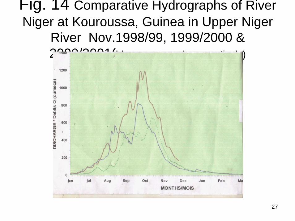
Fig. 14 Comparative Hydrographs of River Niger at Kouroussa, Guinea in Upper Niger
River Nov.1998/99, 1999/2000 & 2000/2001(blue, green, red, respectively)
28
INVENTORY AND MONITORING OF WATER BODIES
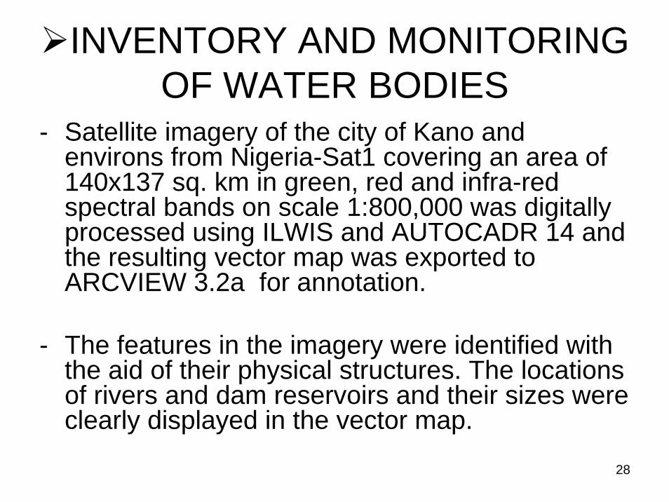
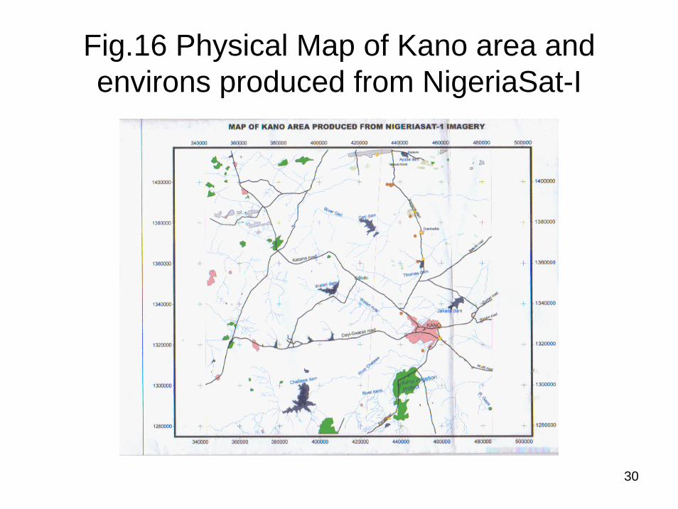
- Satellite imagery of the city of Kano and environs from Nigeria-Sat1 covering an area of 140x137 sq. km in green, red and infra-red spectral bands on scale 1:800,000 was digitally processed using ILWIS and AUTOCADR 14 and the resulting vector map was exported to ARCVIEW 3.2a for annotation.
- The features in the imagery were identified with the aid of their physical structures. The locations of rivers and dam reservoirs and their sizes were clearly displayed in the vector map.

29
Fig.15 Satellite Imagery of Kanoand environs from NigeriaSat-I
30
Fig.16 Physical Map of Kano area and environs produced from NigeriaSat-I
31
WATER RESOURCES MANAGEMENT STRATEGIES
A number of strategies both on-going and proposed are being pursued in order to ensure sustainable development and management of the nation’s water resources. They include among others the following:-STAKEHOLDERS’ WORKSHOPSCentral to our management strategies is effective feedback mechanism to stakeholders through periodic national workshops (highly interactive) for information dissemination. They are usually related to review of projects or Hydrological Database. There is also an annual meeting of the National Council on Water Resources (NCWR) consisting of decision-makers in the water sector during which issues in the sector are reviewed including new policy thrusts.

32
WATER CONSERVATION- Nigeria has about 200 dams of various capacities holding more than
12 billion cubic meters of water for regulated use in water supply, irrigation and hydro-power generation where applicable. About 85% of the large-scale dam projects are concentrated in the northern and central areas of the country that are prone to periodic drought.
- Control of pollution of our natural sources of water is being pursued through establishment of six quality laboratories at strategic centresthroughout the country.
DEMAND MANAGEMENT- The Water Resources Act 101 0f 1993 provides for preparation of
comprehensive National Water Resources Master Plan which was completed in 1995. Necessary guidelines for appropriate regulations and sanctions have been prepared with the objective of enforcement of provisions of the Act.
- Adoption of effective, appropriate and affordable technology in the water sector like solar energy including the philosophy of “water wisdom” are also being propagated.
33
WATER SUPPLY AUGMENTATION
- There are inter-basin water transfer schemes in which water is transferred from basin of plenty to basin of need. An internal inter-basin water transfer scheme is the Gurara Dam Water Transfer project for transfer of water from Gurara River in Kaduna State to the Lower UsumaDam Reservoir in FCT over a distance of 75km.
- There is also a proposed external inter basin water transfer project in which water would be transferred from River Ubanji in Central African Republic into Lake Chad under the co-ordination of the Lake Chad Basin Commission.
- Artificial recharge of aquifers on local scale through infiltration galleries and artificial ponds are also being practiced in parts of the Northern states.
34
CONSTRAINTS
• Inadequate access to Satellite data/imageries prior to NigeriaSat-1;
• Acquisition of the data, where available, was costly;
• Shortage of trained personnel in Digital Image Processing (DIP), Interpretation and Mapping;
• Inadequate infrastructural facilities--equipment/tools/materials
• Irrigation Planning & Management and Assessment & Monitoring of Water Pollution are other areas in which space-based technology is yet to be applied in Nigeria.

35
CONCLUSION
- Nigeria applies a combination of ground-based and space-based technology in the monitoring and management of her water resources with success.
- However, more capacity building is required to facilitate attainment in Nigeria of the wide opportunities which space technology offers in management of environment resources particularly water.

36
THANKS FOR YOUR ATTENTIONTHE END!