Handbook of. - NASA Technical Reports Server
220
(NASA-TM-I07810) SOLAR-TERRESTRIAL (NASA) I76 p HANDBOOK OF DATA SYSTEMS, VERSION I G3192 Handbook of. solar-Terrestrlal Data Systems N92-26191 Unclas 0088546 Version 1 November 1991 Prepared for the inter-Agency Consultative Group (LACG} for Space Science by the National Space Science Data Center NASA Goddard Space Flight Center Greenbelt, Maryland 20771, USA
-
Upload
khangminh22 -
Category
Documents
-
view
0 -
download
0
Transcript of Handbook of. - NASA Technical Reports Server

(NASA-TM-I07810)SOLAR-TERRESTRIAL(NASA) I76 p
HANDBOOK OF
DATA SYSTEMS, VERSION I
G3192
Handbook of.solar-Terrestrlal
Data Systems
N92-26191
Unclas
0088546
Version 1
November 1991
Prepared for the
inter-Agency Consultative Group (LACG}for Space Science
by the
National Space Science Data CenterNASA Goddard Space Flight CenterGreenbelt, Maryland 20771, USA


Errata
Section IV. Network-to-Network Commllnlcations
Since the original text's preparation, a number of changes have occured in the gateways andinformaUon nodes. The following notes should be marked in the text.
Section IV.I.a, page 133:
The SPAN_DB and ESNET_DECNET_NODES tables are now found as:
NSINIC:'J_SI_DECNET.COMNSINIC: :ESNET_DECNET_NODES. DAT
Section Iv.rr.a, page 138:
Most of the references to SPAN should now read DECnet or NSI/DECnet, although the gatewayaddress 8PAN-RELAY,AC,UK remairm as noted.
NSI/DECnet and NSI/TCP-IP networks that help in DACSII authorizations and variousquestions are now obtainable at the NSI Network Information Center (NIC) (the U. S. telephoneremains the same as the former SPAN, 301-286-7251, but the network addresses are nowN_INIC:'.NETMGR or ne1_q[rOmdlmle_.nssa.f_d.
Section IV.II.c, pages 140-141:
To reach NASA users, the gateway to TELEMAIL from Interact has changed from thecommercial @sprlnt,com to the NASA-oimmted @x__AO__:--,__ ----,_ov. When go/ng to a NASATELEMAIL address (GSFCMAIL, _, JPL, etc.), users should try to use the NASAoperated gateway service. It is expected that access to NASA ser_-es through the commercialsprint.corn gateway will be blocked in the future.
NASA TELEMAIL users who wish to send messages to the Internet should use an alternativesyntax which will route messages through the NASA gateway. For exzmpk, for _ addresseson the Internet, please use:
(site:smtpman, ld:<Interaet_ACCOUNTOlnternet_HOOT._)
instead of
(c:ITSA,s.'TEZJIUAIL, IX_, "rfc-822":<Internet_ACCOUNT(a)Internet_HOST.DOMAm>)
as described in the text. This note applies to all "rfc-822" addresses noted/11 the text.
Section IV.HI, page 143:
Please note the SPAN_NIC service is no longer be/r_ maintained with current records. Usersshould use the newer NSINIC services now online.


N_JI)C/WDC-A-R&S 91-26
Handbook ofSolar-Terrestrial
Data Systems
Version 1November 1991
Prepared for theInter-Agency Consultative Group (IACG)
for Space Science
by
National Space Science Data CenterNASA Goddard Space Flight Center
Greenbelt, Maryland 20771, USA

The interaction between the solar wind and the earth's magnetic field creates a large magneticcavity which is termed the magnetosphere. Energy derived from the solar wlnd is ultimatelydissipated by particle acceleration-precipitation and Joule heating In the magnetosphere-ionosphere. The rate of energy dissipation is highly variable, wlth peak levels duringgeomagnetic storms and substorms. The degree to which solar wind and magnetosphericconditions control the energy dissipation processes remains one of the major outstandingquestions in magnetospheric physics. An AGU Chapman Conference on Solar Wind-Magnetospheric Coupling was convened by Y. Kamlde and J. Slavin to discuss these issues onFebruary 12-15, 1985 at the Jet Propulsion Laboratory in Pasadena, California (Artwork by K.Endo, ©Nikkel Science, Inc., Japan).
Ii

L
Contents
Page
Introduction .................................................................................................................... 1
IL IACG Coordinated Missions
A° Early Phase (1989-1991)1. CRRES ............................................................. ;........................................................ 92. DE ........................................................................................................................... II3. EXOS-D .................................................................................................................. 154. UARS .... :................................................................................................................. 175. ACTSDS ................................................................................................................. 21
Bo Middle Phase (1992-1994)I. GEOTAIL ................................................................................................................ 272. ISTP ....................................................................................................................... 293. INTSDS .................................................................................................................. 33
C. Late Phase ( 1995-1997)1. CSDS ...................................................................................................................... 392. SOHO ...................................................................................................................... 45
mo Data Systems, Information Services, and National/InternationalArchive Centers
A. Applied Physics Laboratory (APL), Johns Hopkins UniversityDMSP Auroral Oval Data Base .................................................................................... 51
13. European Space Agency {ESA)European Space Information System (F_,SIS) .............................................................. 53
C. Max Planck Institute (MPI)Extraterrestrial Physics ............................................................................................. 59
Do National Space Science Data Center (NSSDC}I. Coordinated Data Analysis Workshops (CDAW) .................................................. 612. Master Directory (MD) ........................................................................................... 673. NSSDC Online Data and Information System (NODIS) ....................................... 714. Satellite Situation Center (SSC) ........................................................................... 75
E. Planetary Data System (PDS)1. Overview ................................................................................................................ 79
2. Geosciences Node Image Retrieval and Pl"ocesslr_ System (IRPS) ....................... 833. Navigation Ancillary Information Facility (NAIF) Node .................................... 874. Planetary Atmospheres Node Data Analysis Software (PANDA) ........................ 915. Planetary Plasma Interactions (PPI) Node ........................................................... 956. Planetary Rings Node ............................................................................................ 997. Small Bodies Node ............................................................................................... I01
iii

F. Rutherford Appleton Laboratory {RAL)Geophysical Data Facility ......................................................................................... 103
C_ Solar Maximum Mission Data Analysis Center (SMM DAC} .................................. 105
lye
V.
VI.
VII.
VIII@
H. NOAA Space Environment Laboratory (SEL)1. MAX_JI ................................................................................................................ 1092. SEL Data Acquisition and Display System (SELDADS) II ................................. 1133. SEL Solar Imaging System (SELSIS) .................................................................. 121
I. Space Science Center, University of California at Los AngelesUCLASSC Data System ............................................................................................. 125
Network to Network Conununications ............................................................. 131
Summary of Purposes of the Various Data Systems ..................................... 151
GIoIwary of Acronylms ............................................................................................... 159
Appendix ...................................................................................................................... 165
A. Introduction .............................................................................................................. 167
BL Commands ................................................................................................................. 168
C. Service Messages/Clear Codes from the PSPDN ...................................................... 169
D. Annex: General Information and Login and Logout Procedures ............................. 1711. Austria ............................................................................................................. 1712. Belgium ............................................................................................................ 1733. Denmark ......................................................................................................... 1754. Germany .......................................................................................................... 1775. Finland ............................................................................................................ 1796. France .............................................................................................................. 1817. Ireland ............................................................................................................. 1838. Italy ................................................................................................................. 1859. The Netherlands .............................................................................................. 187
10. Norway ............................................................................................................ 1891 I. Spain ............................................................................................................... 19112. Sweden ............................................................................................................. 19313. Switzerland ..................................................................................................... 195
14. United Kingdom (British Telecom) ................................................................. 19715. United Kingdom (Mercury) .............................................................................. 199
Indices
A. Missions, Systems, and Centers ............................................................................... 203
B. Systems and Networks .............................................................................................. 205
C. Networks and Systems .............................................................................................. 207
iv

Acknowledgments
IACG thanks the respondents from the various solar-terrestrial data centers for providing theinformation about their data systems. We also thank Robert McGuire, Glen Blair, Tamye Lyles,and Len Blasso for their asslstance in preparing the manuscript.
v


]: Introduction


L Introduction
Th_ handbook of Solar-Terrestrlal Data Systems has been prepared by the National SpaceScience Data Center in response to a request from the Inter-Agency Consultative Group. Theprimary purpose of this handbook is as a source of information to facilitate electronic accessto and the exchange of solar-terrestrial data and metadata by the members of the internationalscientific community.
We need a handbook on Solar-Terrestrial Data Systems because:
• A major problem facing researchers is determining what data exist or are planned thatsupport their research efforts.
• Each satellite has its own organization that produces data sets.
• Data sets are released many months after the satellite is launched.
• Researchers must use personal contacts to find out what data are available.
• Researchers need to know what data systems are available to manipulate the data.
The information presented here is derived from the responses to a questionnaire sent to thesolar-terrestrial data systems as known to the NSSDC staff and the IACG Working Group-2,with follow-up contacts and verification of the information provided as possible. The ques-tionnaire and the entries resulting in this handbook are intended to define the basic informa-tion needed for a user:
• to assess the relevance of a given system to his/her requirements
• to enable an interested user to access a given system
• to identify points of contact where further information or other procedures requiredmay be requested
• to summarize some high-level information about system architectures and availablesoftware components that may be useful to anyone designing or developing a new datasystem for solar-terrestrial science studies
The handbook entries are intended to summarize the key characteristics of the variousnetwork-accessible solar-terrestrial data systems worldwide that are operating or underdevelopment. Specific points of information are to include:
• a system's location, purpose, and status
• the name, address, and phone number of the person to contact for questions andadditional system documentation
• access procedures
• the type of information and data available
• the system services provided
• the design or system architecture plus the public domain software availability
An outline is provided in this section that gives the headings and the order of the information.

Questionsabout the form and content of this handbook as well as corrections or Informationabout data systems not now referenced in the handbook should be addressed to:
Dr. James L. GreenHead, National Space Science Data CenterCode 930.2NASA/Goddard Space Flight CenterGreenbelt, MD 20771, USA
Telephone: (301) 286-7354NSI/DECnet: NSSDCA::GREEN, NSSDCB::GREENIntemet: [email protected]: JLGREEN
2
Outline for the Handbook of Solar-Terrestrial Data Systems
1. Data system identification
a. Name of the data system
b. Fun name and address of the organization operating it, and of the agencies funding theoperation and/or development of the data system
Purpose of the operating organization (e.g., research areas sponsored)
& Purpose of the data system (user community and disciplines served)
Current status (under development, operational, etc.)
2. System contact information
a. Name, address (postal and electronic), and phone number for user support
b. Name, address (postal and electronic), and phone number for person providing thisinformation
3. Access procedures
& Description of how to reach the system online
b. Primary network(s) for access
c. List of terminal or graphics equipment supported
d. Description of how to obtain an account, if needed, including any restrictions on whocan use the system
4. System services provided
& Brief description/characterization of the kinds of information, and the types of dataavailable (e.g., mission/instrument descriptions, data set catalogs, ST-relevant datasets, magnetic field or other models), including whether these are available online oroffline
b. Brief description/characterization of specific ST data sets available
Brief description of online services, such as bulletin board, electronic conference, dataprocessing/analysis (browse, data reduction and analysis, graphics, other)
d. Brief description of procedures and services if facility is available for use by visitingscientists
List of media available for data distribution (where media distributions are supported)
5. Ordering and pricing policy
Provide request procedure, cost information, and any data restrictions
3

& If possible and where appropriate, a brief overview of the system hardware/softwaresxeh_ecture and brief descriptions or references noting the subsystems or softwarepackages that compose the system.
b. Brief description or identification wlth references of any specific data format(s)(e.g., a relational data base) on which the system Is based.
c Brief note on the portab_ty (proven or expected) of the system or any subsystems toother hardware/soflware environments.
7. So/tware ava/lable for d/strlbution
& Brief description of each such software package, including the environment{s) in whichit can be installed.
b. Commercial products if and where required for use of each software package.
8. System references and documentation
A I/st of the appropriate documents and, if possible, an outline or description of the system.
9. Other Systems
Other systems related to the project, their purpose, and a contact for further information.
4

IL IACG Coordinated Missions


A. Early Phase: 1989-1991
alll (___.._INTENTIONALLYBLAN,K 1 PR'ECEDING PAG_E BLANK NOT FILMED


CRRF_
November 25, 1991
1. Data system identification
a. Combined Release and Radiation Effects Satellite (CRRES)
b. PL/GPDHanseom AFB, MA 01731
c. Research
d. The purpose of the CRRES data system is to provide CRRES researchers with Level- 1data in the form of agency tapes and GL researchers with access to the CRRES TimeHistory Data Base (THDB) which contains science data from all CRRES sensors.
e. The CRRES data system began operating in August 1990.
2. System contact information
a. Mr. Allen l_ GrlEinPL/GPDHanseom AFB, MA 01731 USATelephone: (617) 377-3711
b. Mr. Dennis E. DeloreyBoston CollegeInstitute for Space ResearchBarry Pavilion885 Centre StreetNewton, MA 02159 USATelephone: (617) 377-3753NSI/DECnet: AFGL: :DELOREY
3. Access procedures
There is no outside access to the CRRES data system at this time.
4. System services provided
a. Agency tape data (Level-1} will be provided to PIs associated with the various sensorpackages. There is no outside access to the CRRES Time History Data Base at this time.
b. The Level- 1 data provided to the PIs consists of time-tagged, raw telemetry along withassociated attitude and ephemeris data.
5. Ordering and pricing policy
The ordering and pricing policy will be determined.
9 CRRESl_,.r_ rli3rl/_LL_' _{ _N'_
F_CED!,",',G PAr'_E EaLAt,_._ NOT FtLM'ED

6. Design and system architecture
The CRRES data system for the generat/on of agency tapes and the CRRES THDB isCYBER/NOSVE hosted. The me structures are byte oriented w/th/n 32 bit positive integerwords. Agency tape consists of raw telemetry along with magnetic field, attitude, andephemeris. The THDB is generated from the agency tape data and consists of structureddata sets on an instrument by/nstrument basis. Cal/braflon files for each sensor areavailable to convert the THDB parameters to science units.
7. Software available for distribution
The CRRES data system so/lware is not available to outside users.
8. System references and documentation
Griffin, Alan R., Dennis E. Delorey, and Robert E. Mclnemey. 1989. CRRES Agency TapeGenerat/on, GL Technical Memorandum 174.
CRRES I0
DESDDAS Data System
May 24, 1990
I. Data system identification
a. Southwest Data Display and Archival System (SDDAS)
b. Southwest Research Institute
Instrumentation and Space Research InstituteP.O. Drawer 285106220 Culebra RoadSan Antonio, Texas 78228-0510USA
NASA {software), SwRI (hardware)
C. SwRI is a non-profit research organization performing research in the hard sciences.The Instrumentation and Space Research Division is dedicated primarily to PlasmaPhysics and Electronic Instrumentation as well as scientific hardware and soilwaresystems.
do
eo
The purpose of SDDAS is to allow space physics researchers easy access to theDynamics Explorer 1 and 2 data sets for display and analysis. Presently, it is beingupgraded to handle UARS PEM (Upper Atmospheric Research Satenite ParticleEnvironment Monitor) data and the complete TSS-1 (Tethered Satellite System)mission data set.
SDDAS is operating and continually improving.
2. System contact information
So Dr. J. David WinninghamSouthwest Research InstituteInstrumentation and Space Research InstituteP.O. Drawer 285106220 Culebra RoadSan Antonio, Texas 78228-0510USATelephone: (512) 522-3075NSI/DECnet: NSSDCA::CDHFI::PEM::DAVIDInternet: [email protected]
bo Karen BirkelbachSouthwest Research Institute
Instrumentation and Space Research InstituteP.O. Drawer 285106220 Culebra RoadSan Antonio, Texas 78228-0510USATelephone: (512) 522-5322NSI/DECnet: SWRI::KARENInternet: karen@pemrac, space, swri.edu
11 DE

Access procedures
a. To access the SDDAS through the NODIS system at the NSSDC:
• Select option I for Master Directory
• Select option 2 for Data System/Archive Descriptions
• Enter SDDAS for the archive acronym
• Enter LINK command to access SDDAS
For access directly via NSI/DECnet:
• At the "$" prompt, enter SET HOST SWRI
• Logon with username SDDAS, no password.
For access via Intemet (preferred access method):
• Issue the command: rlogin espsun.space.swri.edu-I sddas (there is no password).For those hosts without a name server, the Intemet address is 129.162.150.99.
For access via Intemet (use only/f you do not have rlogin):
• If your TELNET software supports alternate port numbers,enter. TELNET espsun.space.swri.edu 540Port 540 accesses a special SDDAS TELNET server.
• If your TELNET client does not support alternate portnumbers, enter: TELNET espsun.space.swri.eduThe username is "sddas."
Rlogin is preferred over TELNET because the latter protocol is deficient in handlingflow control, and this may cause abnormalities in graphical output.
b. The primary networks for access are NSI/DECnet and Internet.
c. Selanar Hi-Rez, GraphOn Hi-Rez (Tektronix 4113, 256 colors), Modgraph (Tektronix4113, 16 colors), Tektronix 4107, and X-wlndows
No account is needed to access SDDAS. Access instructions are given in section 3a.
4. System services provided
a. Data analysis and display of data from particle field and neutral instruments on boardthe Dynamics Explorer spacecraft. All data are located oflline on optical disk,although no operator interaction is required to retrieve data. Data are automaticallybrought to magnetic disk when implicitly requested via a user program.
DE 12

bo High Altitude DE-1 Data
Magnetometer
Plasma waveinstrumentDE Electric fields
High altitudeplasma instrument
Vector magnetic field
Electromagnetic wavesElectrostatic waves
Low Altitude DE-2 Data
Ion and electron fluxes to 30 keY
Magnetometer
Vector electricfield instrument
Neutral atmospherecompositionspectrometer
Vector magnetic field
Vector electric fieldVariational electric field
Wind and temperaturespectrometer
Fabry-Perotinterferometer
Ion drift meter
Neutral composition and density
Vertical. zonal, and meridionalcomponents of neutral wind
Drift and temperature of neutraland ionic atomic oxygen
Retarding potentialanalyzer
Components of ion drift normalto spacecraft velocity
Thermal ion density, temperature,irregularities; RAM componentof ion drift
Langmuir probe Electron temperature and density.ion density, irregularities
Low altitude plasmainstrument
Ion and electron distributionsto 30 keV; High energy monitors
c. Graphic display services (analysis programs)
d°
• Spectrograms and Histograms• Energy Angle• Energy Spectra• Wave Spectra• Contours• Moments Calculations• Catalogue Services• Data Export Services
There is space available for a limited number of visitors to do on-site data analysis atany given time. Visitors should notify the contact prior to arrival so that arrangementscan be made for equipment availability. The staff can provide technical assistance touse the system.
13 DE

e. Magnetic tape at 1600 and 6250 bpi, DC 6150.25-inch tape cartridge, 8ram helical scantapes, and anonymous FTP via the Internet after using the export option. For largerequests, the requestor must provide the media.
5. Ordering and pricing policy
To use a general user SDDAS account, there is no request, cost, or data restriction. It ispublic domain data. Normal DE rules of the road should be followed.
6. Design and system architecture
a. Hardware:
SUN-4 330 computer system running SUN OS 4.0.3 (UNIX), 70ptimem 1000 optical diskdrives, 1 helical scan tape drive.
Software:
All SDDAS code is written in C.
b. All data sets are stored in an SwRI developed paradigm called an Instrument Data FileSet (IDFS). A future project will attach SFDUs to the data as well.
The data base, used to manage the data sets on the optical disks, was developed by SwRIspecifically to support this system.
C. Currently, SDDAS resides on a Sun Microsystems SPARCstation/330 and Convex C- 1supercomputer. It is presently being prepared for simple installation on other UNIXbased machines. There are no plans to port SDDAS to other operating systems at thistime. A few sites have agreed to serve as beta sites to test of the SDDAS package.
7. Software available for distribution
ao This system must run on a platform running the UNIX operating system, either SystemV or BSD4.x derivatives. The complete SDDAS package can be (and has been) installedat remote sites. Data are retrieved automatically from the SwRI file server when neededat the remote site. An install procedure allows us to install the package from SwRI overthe Intemet.
b. None.
8. System references and documentation
Data Display and Archival System, by Carrie Gonzalez, David Anderson, StephanieCarpenter, and Sandee Jeffers is the complete user's guide and system description. Itincludes detailed examples of displays the system can produce.
DE 14

EXOS-D
SIRIUS Data System
May 25, 1990
1. Data system identification
a. Scientific Information Retrieval and Integrated UtflizaUon System (SIRIUS)
bo
C.
Data Handling SectionThe Institute of Space and Astronautical Science (ISAS)3-I-1, Yoshinodai, Sagamihara, Kanagawa 229, Japan
The data handling section was established in ISAS in order to preserve the satellitetelemetry data as well as the ephemeris data, which covers all the satellites launched byISAS.
d. The purpose of SIRIUS is to provide satellite telemetry and ephemeris data to the users.
e. The data system is operating and continually evolving.
2. System contact information
Mr. Teruo KatoThe Institute of Space and Astronautical Science3-I-1, Yoshinodai, Sagamihara, Kanagawa 229, Japan+81-427-51-3911 ext. 2936
3. Access procedures
ao The SIRIUS data base is constructed under the ISAS's main frame computer system(FACOM M-series). ISAS's main frame computer is linked with the inter-universitynetwork, the N-1 network. Through this network, users from the universities can gainonline access. An account number is required to enter the ISAS's computer system, Inaddition to the N-l network, access through the public telephone line is supported for alimited number of users.
b. The primary network is the N-I network, a domestic network that does not link to theinternational networks.
c. GI50, F6242, and others.
d. At the present time, only the members of the EXOS-D science team have accounts.
4. System services provided
a. The SIRIUS data base has mainly two types of data, ephemeris and satellite telemetrydata.
b. There is no specific data set.
c. A user who has an account in ISAS's computer can use the browse facility and analyzethe satellite data through the network.
15 EXOS-D

do No special online services are available to the users outside the project. However, a databook, Summary Plots, will be sent to the scientists who are interested in collaboratingwith the EXOS-D science team after approval at an EXOS-D meeting.
5. Ordering and pricing policy
Before the EXOS-D science data are placed in the public domain, the use of the EXOS-D datais restricted to the project team.
6. Design and system architecture
a. The SIRIUS data base is made under ISAS's computer systems (FACOM M-series), andcontrolled by the operation system (OS), MSP.
b. There is a special format for SIRIUS data. It consists of frames; one frame consists of144 bytes.
c. Not portable.
7. Software available for distribution
Not available.
8. System references and documentation
Obara, T., et al. 1990. A New System for Operation and Data Handling of the Akebono(EXOS-D) Satellite, Journal of Geomagnetism and Geoelectrlcity 42:565-577.
Copies are available on request.
EXOS-D 16

UARS
November 25, 1991
1. Data system identification
a. Upper Atmosphere Research Satellite Central Data Handling Facility (UARS CDHF)
bo UARS ProjectCode 430
Goddard Space Flight CenterGreenbelt, MD 20771USA
C. The UARS Project is responsible for the design and implementaUon of the UARS thatwill carry out a systematic comprehensive study of the stratosphere and furnishimportant new data on the mesosphere and thermosphere.
d. The UARS CDHF is the focal point for the collecting and scientific processing of theUARS data. It also ensures the UARS Science Team access to the data.
e. The CDHF is currently under development.
2. System contact information
a. Ellen L. HerringUARS Project, Code 430NASA Goddard Space Flight CenterGreenbelt, MD 20771USATelephone: (301) 286-2228NSI/DECnet: NSSDCA::CDHFI::EHERRINGIntemet: NSSDCA.NSI/DECnet.NASA.GOV::CDHFI::EHERRINGGSFCMAIL: EHERRING
b. Sameas 2a.
3. Access procedures
a° To access the UARS CDHF from a computer within the UARSnet, the user should enterthe command SET HOST CDHF1 at the $ prompt. Dial-in users can call (301) 286-9000or (FTS) 888-9000. Enter UARS at the "enter number prompt." Access through boththese procedures requires a valid account and a pre-deflned password to sign on to thesystem.
b. The UARSnet is primarily a DECnet supported network.
C.
Under certain circumstances, transfer under a TCP/IP protocol is supported.
All VTXXX terminals are supported and most CDHF capabilities can be supportedthrough a wide range of other terminals.
d. Accounts are limited to those individuals that have a well-defined role in theimplementation of the UARS ground system and require access to the CDHF to supporttheir activities. Contact the individual specified in section 2a.
17 UARS

4. System services provided
a. Once operational, the UARS CDHF will contain scientific data collected during theUARS mission and complementary correlative data. All data will either be availableonline on magnetic or optical disk. An INGRES maintained catalog will track all data,Metadata objects will be maintained describing the format and contents of the higherlevel data sets.
b. UARS test data sets are currently resident on the CDHF from instrument simulationsand from the UARS thermal/vacuum test. During the mission atmospheric, solar,wind, and particle measurements taken during flight as well as correlative measure-ments (e.g., balloon flights, radiosonde data) that support the evaluation of the missiondata will be maintained at the CDHF.
C. Utilities are available on the CDHF that display the internal and external meetingschedules, preventive maintenance schedule, test data set availability, softwareavailability, helpful hints, etc. A Forms Management System is on the CDHF tosupport problem reporting and tracking, system account requests, metadata objectregistration and access, etc. A menu system will be available to aid a user in locatingdata of interest and in transferring that data out of system managed space. Interactiveorbit/attitude services will be supported via the CDHF menu system.
d. Use of the facility by visiting non-UARS scientists is not specifically planned. Use ofUARS data by non-Science Team personnel is addressed in the UARS Rules of the Roadavailable from the Project Scientist, Carl Reber, Code 910, Goddard Space Flight Center,Greenbelt, MD 20771.
e. Baseline mode of data transfer for the UARS mission is via electronic transfer over theUARSnet. Backup modes of data transfer include 6250 bpi magnetic tape, 8 mm cassettetapes, and 12 inch optical disk platter.
5. Ordering and pricing policy
UARS team members order UARS data sets via the menu system maintained on theCDHF. Data availability to the non-UARS scientific community is defined in the Rulesof the Road described in 4d.
6. Design and system architecture
So The UARS CDHF is being implemented on a VAX cluster under the VMS operationsystem. The cluster will ultimately consist ofa VAX 8800, a VAX 6440, a VAX 9410, anda VAX 9420. A FILETEK optical disk mass store Jukebox system will be integrated intothe CDHF. System software will provide a user interface to query the data catalog andaccess science data and will provide interface to the mass store. Some graphicscapability is provided through IDL and NCAR software and mathematical packagessuch as IMSL and NAG are available.
b.
C.
The UARS data catalog, query system, and many operations function are supportedthrough the INGRES relational data base system. User interface with system softwareis provided through an interactive menu driven system developed for the Hubble SpaceTelescope Project. All menu functions are also available through a command interface.
There were no portability requirements placed upon software developed for the CDHFand, in fact, much of the developed software takes advantage of VMS extensions onFORTRAN. There is no expectation that the system software will be ported to otherenvironments.
UARS 18

7.
&
Software available for d/strlbution
a. An orbit/attltude simulator and support so/lware to asslgn/deassign and access datawere provided to the instrument investigator software development teams to aid inimplementing the data processLng soilware. These software were developed to be run ina VMS environment. These soltware, sightly enhanced, will be re-dellvered to be runpost-mission at UARS investigator remote sites to aid in the data analysis process.
b. None.
System refermlces and documentation
UARS - A Program to Study G/oba/Ozone Change (Brochure).
Upper Atmosphere Research Satellite (UARS) Mission, GSFC 430-I003-001, May 1985.
UARS Ground Data Processing Capability and Requirements Doaunent, GSFC430-1401-00, February 1985.
UARS Ground Data Processing Descr/ption Document, UARS Project, July 1989.
UARS CDHF Software System (UCSS) Programmer's Guide to Production Support Services,CSC/SD-86/6704/UD3, February 1990.
UARS CDHF User's Guide, CSC/SD-87/6725, February 1990.
UARS Programmer's Guide to Orbit and Attitude Services, February 1990.
19 UARS


ACTSDS
April 22, 1991
I. Data system identification
a. ACTIVE Science Data System (ACTSDS)
The ACTIVE project is a magnetospheric system of two spacecra/1.
b. Space Research Institute USSR Academy of SciencesProfsoyuznaya St., 84/32117810, Moscow, USSR
INTERCOSMOS USSR Academy of Sciences funds ACTSDS.
Participating agencies/institutes are from Bulgaria, Hungary. Poland, Germany,Czechoslovakia, Rumania. and the USSR.
Co
cL
Brazil, Canada, Cuba, USA. Finland, and Japan take part in earthly observations.
Space Research Institute USSR Academy of Sciences (IKI) is a non-profit researchorganization performing research in solar-terrestrial physics.
The primary purpose of the ACTSDS is to ensure fast data acquisition, to performLevel-0 data processing and to distribute aU the appropriate data to the ACTIVEscientific community.
2. System contact information
ao V.D. Maslov
ACTIVE ProjectSpace Research Institute USSR Academy of SciencesProfsoyuznaya St.. 84/32117810 Moscow GSP-7USSR
Telephone: +7-095-230-25-85FAX: +7-095-310-70-23TELEX: 411498 STAR SU
b. Same as 2a.
3. Access procedures
There is no outside online access to the ACTSDS at this time.
4. System services provided
a. The ACTSDS receives spacecraft-related data (e.g., telemetry, orbit, attitude, commandhistory) from two ACTIVE spacecraft, both scientific and operational. It also performsLevel-0 data to create related instrument data sets and distributes this data to thescientific community.
21 ACTSD S
PRECEDING PAGE BLANK NOT FILMED

b. Main Spacecraft
Co
&
e.
Plasma experiments:
Complex investigation of principal parameters ofimperturbable ionosphere along orbit of satellite
Dimension of ionic and neutral composition of plasma
KM6
NAM-5
Complex of influence apparatus:
Wave influence of generator of low frequency ONCH-G
Influence of plasma complex:
Power charge of complex of influence apparatus AIP ZU
Waves apparatus:
VLF electromagnetic wavesVLF electromagnetic wavesVLF electromagnetic wavesVLF electromagnetic waves
I Hz - 20"10 kHzI Hz - 20* I0 kHz1 Hz - 20* I0 kHz0.7 Hz - I0"I0 mHz
Dimension of impedance of magnetic antenna:
VLF electromagnetic wavesVLF electromagnetic waves
9 kHz- 11kHz1.5 kHz - 19.5 kHz
Electron and proton distribution,Ee=18 - 400 keV, Ep=15 - 800 keV
NVK-ONCHONCH-2SHASHPRS-2
BIM=ABII
SPE
Magnetic experiments:
Magnetometer (3 components) +60000 nT (resolution 1 nT),DCto 10Hz
MAG
8ubsatellite:
Equipment for measurements of electric and magneticfields, VLF waves, plasma and energetic particles
The auxiliary information is available on the spacecraft location (SolarEcliptic, Solar Magnetic, coordinate system, interspacecrsft separation,local time) for every 1-3 hours.
The final llst of these parameters may slightly be. changed.
C2-AK
Not available at this time.
No special online services are made to the users outside the project.
Magnetic tape at 800, 1600, and 6250 bpi 0.5-inch magnetic tapes; IBM PC/AT 5.25 inchfloppy diskettes.
ACTSDS 22

5. Ordering and pricing policy
Usage of the ACTIVE data will be restricted to the project team a few years afteracquisition.
6. Design and system architecture
a. The ACTSDS runs on a ma/r_rame compatible wlth the IBM 370 and net PC/AT.PL/1 and TURBO PASCAL languages are used.
b. There are the special formats of ACTIVE data. They consist of frames; one frameconsists of 270 bytes.
c. Not portable.
7. Soi_mu_e available for distribution
Not available.
23 ACTSDS


B. Middle Phase: 1992-1994
/
_ I_:_; r)_ALL_ BLANJt ol,b FR_,F.DING PAGaE BLA_|K NO I- FILMED


GE(YYAIL81R1-08 l_ta System
May 25, 1990
L Da_ system M_tlflca_
a. Scientific Information Retrieval and Integrated Utilization System (SIRIUS)
b° Data Handling SectionThe Institute of Space and Astronautical Science (ISAS)3-1-1. Yoshinodai. Sagamihara, Kanagawa 229, Japan
C°
d°
ISAS established the data handling section to preserve the satellite telemetry data andephemeris data. which covers all the satellites that ISAS launches.
The purpose of SIRIUS is to provide the satellite telemetry data and ephemeris data tothe users.
e. Not yet running for GEOTAIL.
2. System contact information
Mr. Teruo KatoThe Institute of Space and Astronautical Science3-I-1. Yoshinodai. Sagamihara. Kanagawa 229, Japan+81-427-51-3911 ext. 2936
3. Access procedures
a° The SIRIUS data base is constructed under the ISAS's main frame computer system(FACOM M-series). ISAS's main frame computer is linked with the Inter-universitynetwork, the N-I network. Through this network, users from the universities can gainonline access. An account number is needed to enter the ISAS's computer system.Another network to run the TCP/IP protocol, allowing easier access to the SIRIUS database, is planned.
b. The primary network is the N-I network, which is a domestic network and does not linkinternationally. A TCP/IP network is planned.
Co At this time, terminals such as G150, F6242 which are made by FACOM are used. In thefuture, M-series computers will support the TCP/IP protocol; some Unlx work stationswill be used as terminals.
d Only the members of the GEOTAIL project team will have accounts.
4. System services provided
a. The SIRIUS data base has mainly two types of data: ephemeris and satellite telemetrydata. Users can look at the list of the data acquisition and access a large amount ofdigital data.
b. There is no specific data set.
c. A user who has an account in ISAS's computer can use the browse facility and analyzethe satellite data through the network.
27
PI:_CEDqlNG PAGE BLANK NOT FILMED
GEOTAXL

d. No special onlLne services are available to the users outside the project.
5. Ordering and prlcL_ policy
Use of the GEOTAIL data wlll be restricted to the project team. However a few years ailer
acquis/tlon, the GEOTAIL science data wlll be placed tn the public domain.
6. Design and system architecture
a. The SIRIUS data base system Is made under the ISAS's computer systems (FACOM M-series), and/s controlled by the operat/on system (OS) named MSP.
b. There/s a spec/al format for SIRIUS data. It consists of frames; one frame consists of144 bytes.
c. Presently, SIRIUS/s not ported.
7. Software available for distribution
Software to analyze the satell/te data wlll belong to each Prs group. There will be no publicsoftware package.
8. System references and documentation
None.
9. Other systems
It Is also planned to create a data base cons/st/ng of the processed data (calibrated data).Details of th/s data base are beW.g defined.
GEOTAIL 28

ISTPGGS Data System
June 4, 1990
lo
2L
Data system identification
a. International Solar-Terrestrial Physics (ISTP) Program Central Data HandlingFacility (CDHF) and Data Distribution Facility (DDF)
b. Information Processing Division (IPD}Code 560NASA Goddard Space Flight Center (GSFC)Greenbelt, MD 20771USA
Co
IPD is funded by NASA
The IPD is part of the Mission Operations and Data Systems Directorate at GSFC andfacilitates on behalf of the ISTP Project the acquisition, development/upgrade, andsubsequent maintenance and operations of the CDHF and DDF.
d. The primary purposes of the CDHF are:
• to support the major data processing requirements of the GEOTAIL, WIND, POLAR,and SOHO spacecraft as far as performing Level-0 data processing, generating keyparameter data sets for the principal investigators (PIs), and distributing all theappropriate data to the ISTP scientific community in a timely and accuratemanner.
• to provide a central repository for key parameter data and related instrument datasets that can be electronically accessed and shared by the ISTP scientificcommunity for the lifetime of the ISTP program.
The purpose of the DDF is to organize and distribute the products of the CDHF to theNSSDC, Japanese Institute of Space and Astronautical Science (ISAS). and thePIs/Co-ls.
e. The CDHF and DDF are currently under development.
System contact information
a. System contact information will be determined.
b. Richard Schneider
ISTP Project. Code 407NASA Goddard Space Flight CenterGreenbelt, MD 20771USATelephone: (301) 286-5543NSI/DECnet: NSSDCA::SCHNEIDER
29 I STP

3. Access procedures
a. How to reach the system online will be determined.
b. The primary network for CDHF access is NSI/DECnet; DDF is not available online tousers.
c. 320 Monochromatic Video Terminals on the CDHFVAXstation 3100 Graphics Workstations (Diskless) _n the DDF
No terminal/graphics equipment supported.
d. How to obtain account and any restrictions will be determined.
4. System services provided
a. The CDHF system is to serve both as a pipeline for transferring ISTP satellite-relateddata and as a processing facility to generate key parameter data. The CDHF receivesspacecraft-related data (e.g., telemetry, orbit, attitude, command history) from variousdisjoint components of the ISTP community, both scientific and operaUonal, andtransfers this data to the DDF for distribution to the scientific community. In additionto pipelining, the CDHF will process Level-0 data to create a major data product-the keyparameters.
The science instrument data for each experiment on the ISTP satellites is to be evalu-ated within the CDHF with software provided by the PIs. The key parameters will pro-vide a means of quick analysis for both instrument performance and geospace phe-nomena. The parameters, specifically chosen for each experiment, are produced bysampling and processing the telemetry data. The key parameters will be stored onlineat the CDHF for 90 days. The data available for online access at the CDHF will includethe Level-0 data, orbit data, attitude data, key parameter data, command history data,and data attribute information. The data received by the CDHF will be cataloged,stored, and verified. The goal is to have this data available within four hours of when itis received. The goal for the generated data (key parameter data) is to have it ready foronline access within six hours of cataloging.
The DDF will organize, write to distribution media (e.g., optical disk), and distribute theproducts of the CDHF to the NSSDC, ISAS, and science investigators.
b. See section 4a for a general description of data sets available on the CDHF and DDF.
C. The interactive interface will provide display management and interface managementcapabilities needed to support online interactive input and output with the users of theCDHF system. The interactive interface provides the CDHF with window managementcapabilities to aid in data transfer, data receipt and initiating, and monitoring andcontrolling the data processing function.
The interactive interface will provide the link between the remote users on theNSI/DECnet network and the CDHF functions that support the remote users. Thepresentation menus and data entry panels will provide an intelligent interface to theCDHF. The interactive interface will control the menus and entry panels and providethe user with access to the CDHF online data.
The CDHF will support electronic marl internally and over the NSI/DECnet network.Users may send mail to the CDHF and will have a mailbox on the CDHF for receivingmarl. Mail is to be used by the CDHF operations staff to make certain announcements.The CDHF will also support an electronic bulletin board, which will contain messagesand announcements of general interest.
ISTP 30

TheDDFinteractivemodeis under the complete control of the DDF support personneland is not available to users.
d. The services of the CDHF will be available to visiting scientists from all countries. Thedescription of the procedures and services win be determined.
eo The data will temporarily reside at the CDHF and will be available online for a limitedtime. The data will be subsequently transferred electronically to the DDF anddistributed on hardcopy media to the science community. The DDF media availablewill be nine-track magnetic tape and a form of optical disk.
5. Ordering and pricing policy
ao A user of the CDHF system will be able to transfer online data from the CDHF to aRemote Data Analysis Facility (RDAF). Normally, only online data may be requested.When the data are not online in the CDHF, the CDHF will be capable of retrieving itfrom the DDF. The user will enter the selection information to specify the data to betransferred and may request that the transfer occur immediately or be scheduled tooccur at a future time. The user may also request that a standing transfer request beestablished. A standing transfer request is a request for a data transfer that is alwaysactive. For instance, a user may request that a portion of the latest Level-0 data betransferred daily to his/her RDAF.
Transferring data from the CDHF to the RDAFs will be subject to two condiUons: theuser's access rights to the data and the user's llne usage quota. If a user does not haveaccess rights to a particular set of data, he/she will not be able to access that data. Lineusage quotas are established to control the amount of data that a user can request for aparticular time period. If a user requests a data transfer that exceeds his/her quota, thetransfer will not take place.
A user will be able to transfer data from a remote site to the CDHF. These transfers willtypically be updates to key parameter software or ground-based key parameter fries.
b. Level-0 and key parameter (all organized by spacecraft instrument), command history,orbit, and attitude data (organized by spacecraft) will be written to the distributionmedia for distribution to PIs/Co-ls. Each PI/Co-I will receive a set of orbit and attitudedata, all key parameters, and the Level-O data for the experiment for which he or she isresponsible. The frequency of distribution (the marling cycle) and the amount of datadistributed are variable and dependent on the instrument.
Distribution of data from the DDF will be supported in four different ways: normaldistribution, redistribution, forced distribution, and ad hoc distribution.
Normal distribution of data for a specified time period and a specified requester will beiniUated by DDF personnel when all of the required fries have been received by theDDF. The files will be written to the distribution media on the write cycle, and themedia will be mailed to the requester during the distribution write cycle.
Whenever distributed data is unreadable at the PI's RDAF or is not received, the PI/Co-Imay request redistribution from the DDF. The DDF personnel will retrieve theappropriate files from storage, create a copy of the original data, and redistribute thedata on hard media. A PI/Co-I may request redistribution at any time.
Forced distribution will be necessary whenever an incomplete set of data is to bedistributed. For example, if two days of data are required immediately and normallysix days of data are distributed, the operator can initiate the forced distribution andmailing of the two days of data. The next normal distribution of data will then occur at
31 ISTP

the expiration of the normal interval. The data will consist of the normal distributiondata for the writing and marling cycles.
Occasionally a PI/Co-I may need a file that he or she would not generally receive vianormal distribution. The ad hoe distribution function will allow the PI/Co-I to requestand obtain additional data.
All data requested and approved is delivered to the NSSDC as well as to theinvestigators, although the schedule may differ. All GEOTAIL data are distributed toISAS and the investigators.
6. Design and system architecture
The design and system architecture will be determined.
7. Software available for distribution
Software distribution will be determined.
8. System references and documentation
IS'IF CDHF System Requirements Specification, Revision 1. April 1990, GSFC.
Hardware and System Level Software Functional and Performance Specification for theISTP CDHF GSFC. March 1990.
ISTP CDHF Operations Concept, Revision 1. May 1990.
System Requirements Specification for Data Distribution Facility (DDF) Support of theInternational Solar-Terrestrial Physics (ISTP) Program. January 1990.
Operations Concept for Data Distribution Facility (DDF) Support to the InternationalSolar-Terrestrial Physics (ISTP) Program. January 1990.
This documentation will be available in the ISTP library after July 1990.
ISTP 32

INTSDS
November 25, 1991
I. Data system identification
a. INTERBALL Science Data System (INTSDS)
The INTERBALL project is a magnetospheric system of four spacecrail. Two of the satellitespacecraft system of the Prognoz series is used (Taft probe and Auroral probe); each of thespacecraft is supplied by the subsatellite (Taft C2-X and Auroral C2-A).
bo Space Research Institute USSR Academy of SciencesProfsoyuznaya St., 84/32117810, Moscow, USSR
INTSDS is funded by INTERCOSMOS USSR Academy of Sciences.
Participating agencies/institutes are from Austria, Bulgaria, Canada, Cuba,Czechoslovakia, France (CNES), Netherlands (ESA/ESTEC), Italy, Poland, Sweden, and theUSSR.
c. Space Research Institute USSR Academy of Sciences (IKI) is a non-profit researchorganization performing research in solar-terrestrial physics.
d. The primary purposes of the INTSDS are:
• to ensure fast data acquisition, performing Level-0 data processing, generating keyphysical parameter data sets and distributing all the appropriate data to theINTERBALL scientific community.
• to provide a central repository for key physical parameter data and related instrumentdata sets.
e. The INTSDS is under development. The expected operating date is the second part of 1992.
2. System contact information
a° Elena A. GavrilovaINTERBALL ProjectSpace Research Institute USSR Academy of SciencesProfsoyuznaya St., 84/32117810, Moscow, USSR
Telephone: +7-095-230-25-85FAX: +7-095-310-70-23TELEX: 411498 STAR SU
b. Same as 2a.
3. Access procedures
At present there are no online capabilities available.
33 INTSDS

4. System services provided
a. The INTSDS will receive spacecrail-related data {e.g.. telemetry, orbit, attitude, commandhistmy) from four INTERBALL spacecrails, both scientific and operational. It will performLevel-0 data to create the key parameters and related instrument data sets, and dlstrlbutethis data to the scientific community.
b* Auroral Probe:
Aurunl plasma experiments
Electron and proton distribution, E=0.03-15 keY;Electron and ion anisotropy, (M=1,4,16), E=30-500 keV/Q
Ion spectra and anisotropy, (M=I,2,4,16), E---0.005-20 keV/Q
Electron and proton spectrometer, E--0.02-25 keV;
Ion composition, (M=1-32), E < I00 keV/Q
Magnetic, electric fields, and wave experiments
Magnetometer (3 components) +60000 nT {resolution 1 nT), DCto 10Hz
Electric field intensity 0-50 Hz
VLF electromagnetic waves 20 Hz - 20 kHz
Analyzer of magnetic waves < 20 MHz
Auroral kilometrlcal radio radiation 20 kHz-2 MHz
Thermal plasma experiments
Ion mass-analyzer, E=0- I00 eV, V=0.1-20 km/s,(H+, He+, O+, 04-+, N+, N2+, NO+, 02+)
Temperature of cold plasma electrons, T < 10 eV
Ion trap, N> I cm-3, E <25 eV
Ion emitter (N2+, In+), current 1-10 m/k
Electron and proton anlsotropy, Ee= 10-400 keV,Ep=15-1000 keV
_ o_ml Image
Emission measurement in the lines 1304/_ 1356_ 1493A
UV Auroral imager (1400A- 1600/_
SKA-3
ION
ANEPE-2
PROMICS-3
IMAP-3 DC
IESP-2
NVK-ONCH
MEMO
POLRAD
HYPERBOLOII
KM-7
AP-3
RON
DOK-2A
UFSIPS
UVAI
INTSDS 34

8ubsatellite
Equipment for measurements of electric and magneticfields, VLF waves, plasma and energetic particles
Taft Probe:
Plasma experiments
3D ion distribution, E=0.1-5 keV/Q
Energy spectrum of H+, He++, He+, O+; E=5-100 keV
3D sectorial ion Faraday cup, Ei > 0 eV
3D electron distribution function, E=0.01-30 keV
Wide-range 3D ion spectrometer, E--0.1-30 keV/Q
Energy-mass analyzer, (M= 1 - 16), E=0.1 - 10 keV/Q
Solar wind analyzer, E=0.4-15 keV/Q
Ion composition 3D spectrometer, E=I eV/Q-I00 keV/Q
Thermal plasma experiment
Ion trap, N > 1 cm-3, E < 25 eV/Q
Energetic particles and X-ray experiments
Low and energetic charged particle composition andanisotropy. Ee=40-200 keV, Ei=50 keV-150 MeV
Electron and proton fluxes and anlsotropy,Ee= 10-400 keV, Ep= 15-1000 keV
Solar X-ray, E=2-200 keV
Wave complex ASPI
Measurements of electric field in frequency range0- 250 kHz
Measurements of magnetic field in frequency rangeO- 40 kHz
Measurements of ion flux and electron flux
fluctuations in frequency range 0.1 - 1000 Hz
Multichannel spectrum analyzer in frequency range0.25 Hz - 40 kHz and measurement of current density
in frequency range 0.1 Hz - 40 kHz
Adaptive processing of wave informationand X-ray information
Magnetometer +-200 nT (resolution +-0.05 nT)
C2-A
SKA- 1
VDP
ELECTRON
CORALL
AMEI-2
MONITOR-3
PROMIX-3
AP-3
SKA-2
DOK-2X
RF-15
OPERA
MIF-M
IFPE
ADS
PRAM
IMAP-2
35 INTSDS

Kilometric radio emission 100 kHz - 1.5 MHz AKR-2
8ubsatelllte
Equipment for measurements of electric and magneticfields, waves, plasma and energetic particles
C2-X
A suggested llst of the key physical parameters includes ion bulk velocity, ion temperature,ion flux, ion flow polar and azimuth angles, electron temperature, electron density, averageenergy of O+ ions, electrons flux, components of magnetic field, module magnetic field,electric and magnetic field fluctuations, spacecraft potential for every two minutes, andsome auroral oval images.
The auxiliary information will be available on the spacecraft location (Solar Ecliptic,Solar Magnetic, coordinate system, interspacecraft separation, local time) for every I-3hours.
The final list of these parameters may be slightly changed.
c° Not available at this time.
d. No special online services are available to the users outside the project.
e. Magnetic tape at 800, 1600, and 6250 bpi 0.5 inch magnetic tapes; IBM PC/AT 5.25 inchfloppy diskettes
5. Ordering and pricing policy
Use of the INTERBALL data will be restricted to the project team for a few years afteracquisition.
6. Design and system architecture
a. The INTSDS will be run on mainframe compatible with an IBM 370 and net of PC/ATs.
PL/1 and TURBO PASCAL languages are used.
b. There are special formats of INTERBALL data. They consist of frames; one frame consistsof 128 or 512 bytes.
c. Not portable.
7. Software available for distribution
Not available.
8. System references and documentation
Gavrilova, E. A., G, N. Zastenker, R. A. Kovrazhkin, et al. 1990. BrtefDescrtption ofINTERBALL Project Data Support System.
INTSDS 36

C. Late Phase: 1995-1997
PRECEDING PAGE BLANK NOT FILMED


CSDS
November 25, 1991
1. Data system identification
a. Cluster Science Data System (CSDS)
bo
The provision of the European Cluster Science Data System is currently in theimplementation stage following an Announcement of Opportunity by ES_ Theresponses were evaluated in a competitive manner. The most up-to-date informationon the CSDS can be found in the final report of the Cluster Science Data SystemWorking Group and the CSDS Announcement of Opportunity. Both documentsdescribe in detail the concept that is quite dose to the current implementation plans.All information given below is based on this report.
The CSDS will be distributed in Europe and electronically linked by ESA's backbonenetwork. Major naUonal institutions as well as university tnsUtutes are expected toplay an act/ve role.
Partlc/paUng institutes/insUtutions will be from France, Germany, Scandinav/a.United K/ngdom, and Austria. InsUtutes in Hungary and China have expressed interestin parUc/pating. NSSDC could become the interface point for the U. S. Clustercommunity.
Co CSDS will pr/mar/ly serve the Cluster community to ensure fast scientific dataanalysis by coordinating and opt/mlz/ng the dedicated resources in the ind/v/dual ESAmember states.
cL The user community will primarily be the Cluster Science Team comprising allprincipal and co-investigators. It is also planned to make low-resolution data {SPDBplots [Sect/on 4] ) available to outs/de communities.
2. System Contact Point
I_ Schm/dtCluster Project Sc/entistSpace Sc/ence Department of ESAKeplerlaan 1NL-2200 AG NoordwlJkThe NetherlandsTel- (0)1719-83603NSI/DECnet: ESTCS 1: :RSCHMIDT
3. Access procedures
So It Is planned to use the European Space Information System (ESIS} as an access tool forthe users. Depending on the pr/vtleges, users may be allocated restrlcted/unrestrlctedaccess to CSDS.
b. See 3s.
c. The list of terminal or graphics equ/pment supported is be/ng determined.
cL Authorization to access and retrieve data will be granted based on recommendations bythe Cluster Science Work/rig Team.
39
F .t_:CE_i.I'-_G PA',_E I_LAf'_IK NOI" F_LMED
CSDS

4. System services provided (concept)
Summary Parameter Data Base (SPDB) and SPDB Plots:
The 1-mlnute averaged Summary Parameters form the basis of the Summary Plots to beroutinely produced. The Summary Parameters contain only data from one out of the fourCluster spacecraR. A suggested list of possible parameters is given below. However, the finalllst may be much shorter.
Magnetic Field (FGM)
Four panels contalntng:
Magnetic field amplitudeMagnetic field azimuth angleMagnetic field elevation angleModulus of magnetic field (A B/B}
Electric Field (EDI)
Three panels containing:
Electric field amplitudeElectric field azimuthElectric field elevation angle
Electric Field (EFW)
Three panels containing the same as EDI with the same ordinate ranges, plus twoadditional panels with density fluctuations and spacecraft potenttal:
Electric field X-componentElectric field Y-componentDensity fluctuationsSpacecraft potential
Wave Experiment Data {WEC)
Total electron density (from WHISPER sounder}0.I-I0 Hz, E and B power (from Wave Form)10-170 Hz, E and B power {from Wave Form in high bit and Spectral Analyzer inlow bit rate)0.17-4 kHz, E and B power (from Spectral Analyzer)4-80 kHz, electric power {from WHISPER)
Electron Plasma Data (PEACE)
Electron densityElectron bulk speedElectron temperatureElectron heat flux
CSDS 4O

Ion Plasma Data (CIS)
Proton and oxygen densityHe++ and He+ densityProton and oxygen bulk speedProton and oxygen bulk flow azimuthProton and oxygen bulk flow elevationProton and oxygen temperature
Energetic Ions {RAPID)
Electron intensity, anisotropy, spectral indexProton intensity, anisotropy, spectral indexHelium intensity, anisotropy, spectral indexM > 4 ions intensity, anisotropy, spectral index
Differences of proton intensities as follows:
IN - 11
IN + 11
Ion Current (Instrument ASPOC)
4-s/c Separation and slc Velocity
Three panels containing the GSE X, Y, Z vector position of spacecraft 2-4, relative to s/c1, in kin. An additional panel may contain the velocity (magnitude} of s/c 1.
A X2-1, A X3--1, AX4-1A Y2--1, A Y3-1, A Y4--IA Z2-- I, a Z3_ I, a Z4-1velocity of s/c 1
4-s/c Parameter Differences
or
A B2-1, A 83-1, A B4-1A N2-1, A N3-1,A N4-1A V2-1, A V3-1, A V4.-1
AT_I, AT_I, AT_I
B2 - B1(F_ch of these differences are to be normalized to the sum; thus A 82-1 means B2 + BI"
In thls way, the numbers are in the range -I.0 to +I.0)
Auxiliary Information
Information on the GSE spacecraft location.Local time (in hh:mm), and latitude (in Deg) for every full hour.
Prime Parameter Data Base (PPDB)
The PPDB will be the main data base for the CST. R will include spin averages of at least the 60physical parameters contained in the SPDB (preliminary or calibration and in physical units),but for each of the four spacecraft. Additionally, there should be full information onspacecraft location, interspacecrafl separation, and other auxiliary data.
41 CSDS

This databaseshouldbeaccessiblebythe wholeCST,but not normallyby the outside world(using these data In publications must be discussed with the respective PIs). It will be the basisfor most of the correlative studies and fulfill any needs arising from cross-calibration betweendifferent Cluster experiments. The data base will contain about 3,000,000 data points per 12-hour pass and thus, about I0 GB for the two-year mission (assuming four bytes per data point).The distribution of these data to the CST will take place either by Raw Data Processing or byaccess to the DCs.
Online services and access to CSDS:
ESIS Communication Services
ESIS Communication Services will include a number of functions that are designed to simplifythe exchange of information among users, starting from standard network applications {e.g.,electronic mail, data, software and documentation transfer, remote Iogin, white and yellowpages dLrectory services). Value added functions (e.g., electronic bulletin boards, electronicnewsletters, electronic conferencing systems, etc.) will be included also.
The communication services, based on the transport services primarily provided by ESANETwill also allow communication with users of other networks, in particular the EuropeanResearch Academic Network (EARN), the Joint Academic Network (JANET) in the UK, and theNASA Science Internet (NSI) in the USA.
Electronic Conferencing
An electronic conference is effectively the use of a collective mall account by registeredmembers. Any registered member can submit mail to the conference, and the conference marlcan be read by any other member of the conference. To avoid disorder, a moderator, isnominated to manage the electronic mail (in particular, he/she can delete irrelevantcorrespondence}. Even with a satellite-commandlng electronic conference, it is the PI {or hisnominated representative} who ultimately decides what commands should be sent to hisexperiment.
STSP Satellite Situation Center
It is proposed that a Satellite Situation Center (SSC) be established to provide up-to-date andpredicted information on Cluster and Regatta, and possibly other related missions. The centerwould provide online information on satellite orbits and their relation to the currentmagnetospheric environment (e.g., bow shock and magnetopause) for the PI's operationsplanning. For Cluster, specific attention should be paid to the position and separation of thefour spacecraft and this information will be based on data contained within the SHF.
Each DC should establish network access and provide adequate hardware to make full use ofthis facility (e.g., via ESIS).
Scientific Data Long-Term Archive
The concept of a remotely accessible archive that holds, among other data sets, all routinelyproduced scientific and auxfllary mission products may be implemented. The lifetime of thearchive should clearly exceed the tlfetlme of the mission operations.
CSDS 42
5. Ordering and pricing policy
The pricing and ordering policy will be determined.
6. Design and System architecture
The design and system architecture will be determined.
7. Software available for distribution
Software distribution will be determined.
8. System References and documentation
The design of CSDS is described in detail in the Cluster Science Data System: Final Reportof the WorkLng Group. This report can be obtained from the address identified in section 2.
43 CSDS


SOHO
August 23, 1990
I. Data system identification
a. SOHO Data System (Solar and Hdiospheric Observatory)
b.
and
C°
d.
ESA/ESTECScience Directorate
2200AG NoordwiJkThe Netherlands
NASAGoddard Space Flight CenterGreenbelt, MD 20771, USA
Space Science Research
The purpose of the SOHO data system is to ensure maximum retum for the scientificcommunity of the data produced by the SOHO spacecraft by:
• providir_ a facility to operate the imaging instruments of SOHO in real-time in asort of observatory mode.
• providing the infrastructure necessary (data bases, electronic links, etc.) tocoordinate the operation of the SOHO investigations among themselves and withother ground and space observatories.
* providing the necessary infrastructure for data analysis by the SOHO investigators,guest investigators, and the scientific community at large.
e. Under development (definition phase). The definition phase will be completed in 1991.SOHO's launch is currently planned for July 1995.
2. System contact information
or
ao Vicente DomingoSpace Science DepartmentPostbus 2992200AG NoordwiJ kThe Netherlands
BITNEI_. vdomingo@estec, span estcs l:._dornir_o
Art PolandCode 682.1GSFCGreenbelt, MD 20771USANSI/DECnet: pal::poland
45
PRECEDING PAGE 8kAh_ NOT
SOHO
FILMED

bo V/cente DomingoSpace Science DepartmentPostbus 299
2200AG NoordwiJkThe Netherlands
BITNE_. vdomlngo@estec, span estcsl:._domingo
3. Access procedures
Access procedures will be determined.
4. System services provided
a. Data sets:
1. Science, Housekeeping, and Auxfl/ary Data
SOHO investigations telemetry data and spacecraft ancillary data.
ii. Processed Science Data
Data flies of the scientific data in a form ready for analysis, or the suitable softwarewill be created by each PI, either at the Experiment Operations Facility (EOF) or attheir institute.
lil. Summary Data
A summary data file (equivalent to the key parameters file in other spacecraft) willbe generated with inputs from the PIs containing: a I/mited number of solar imagesper day (at selected wavelengths), synoptic information from selected channels(particles, radiometers etc.), information on the observed areas, events andoperating modes of the coronal instruments (with limited area scanning), etc.
iv. Event Tlme File
A t/me-unique data file will be generated and kept up to date, electronicallyreachable, where each investigaUon team wlll register the events that may berelevant to more than one instrument. It will also contain events registered byobservatories external to SOHO that may be relevant to the SQHO observations.
b. Data set descriptions:
L Data Sets Dissemination and Archiving
The data products of SOHO (Level-0 science data, housekeeping data, auxiliary dataand processed data) will be archived for a minimum of I0 years. Although theNSSDC has been shown as the long-term data archive facility, other options arebeing studied by GSFC for long-term SOHO data archival. One option would be to usethe Solar Activity Research Center (now being assembled with the Solar MaximumMission data as the core), which may provide potential support for SOHO.
II. Science, Housekeeping, and Auxiliary Data
NASA will mall a hard copy of respective science, housekeeping, and auxiliary datato each PI within three weeks of when it is received at GSFC. The PI is thenresponsible to further distribute such data to any Co-ls or support insUtuUons. In
SOHO 46

addition, telemetry data will be available in the form of "snapshots" for limited callup to approved participating organizations. These data, available electronicallyfrom the CDHF, would represent the most recent eight days of information.
iii. Processed Science Data
A number of SOHO institutes (PIs and others) will hold archives of the science andprocessed science data corresponding to the experiment of their responsibility. Thedevelopment of a central archiving facility (NSSDC. EOF) for processed data is beingdetermined. The EOF will hold archives of processed data to some extent.
iv. Summary Data and Event Time Fries
The EOF win hold an online copy of the summary data and event time fries.
c. Data Catalogs
All the participating SOHO data archives will maintain data catalogs of their own friesaccording to standards agreed by the SOHO SWT. The catalogs will be accessibleelectronically, according to agreed protocols. Whether it is convenient to develop acentralized SOHO data catalog or not is being determined. New network techniques arebeing introduced that could cope with a distributed catalog if its adoption is agreed(F__IS in Europe, unknown in the USA). The Summary Data Set and the Event Time Filewill be online data flies at the EOF with copies at the NSSDC and at the ESA/ESTEC.
d. Data format and data access win be determined.
5. Ordering and pricing policy
Not Applicable.
6. Design and system architecture
ao The following is a list of the maln facilities that form part of the SOHO data systemfrom the scientific data analysis point of view. More appropriate details will beavailable in 1991.
i. Experiment Operations Facility (EOF):
provides the means with which the PI teams participating in theSOHO program can monitor and, via the SOHO PayloadOperations Control Center, control their instruments on-boardthe spacecraft.
is the center where the SOHO solar atmosphere investigators will coordinateand plan the real-time operation of their instnmmnts, and will be the focalpoint for the overall SOHO science operations planning and for coordinatingscience studies through campaigns and workshops.
provides electronic interfaces with the appropriate data basesand networks to support the WS's activities and to provide thenecessary input from ground stations and other spacecrail datafor the planning of the SOHO science operations.
47 SOHO

ii. Central Data Handling Facility (CDHF):
• Is an element m the SOHO Ground Segment, providing a short-term archive forLevel-0 data, command history data, and definitive predicted orbit and attitudedata.
• provides an online repository for file access by the EOF workstations and remoteSOHO PI Institutes to perform higher order data processing.
iii.National Space Data Center (NSSDC):
Will, In principle, provide the long term archiving of the complete set of SOHO dataproducts (with the exception of the SOI/MDI helloseIsmology data).
iv. Principal Investigator and Co-Investlgator Institutes:
Some of the Institutes of the SOHO principal investigators and co-investlgators wlllprocess mad keep archives of the processed and unprocessed data.
v. MDI/SOI Data Reduction and Analysis Center.
The MDI/SOI Investigation will create a Data Reduction and Analysis Center(DRAC) at Stanford University, specifically for the helloselsmology data.
vl. European Extension of the EOF (EEEOF):
A European Extension of the Experiment Operations Facility (EEEOF) may beprovided at a location by a European Institution, following an Announcement ofOpportunity. The EEEOF will repeat In Europe the facilities available at the EOF. Ifoperated simultaneously, the EEEOF will be subsidiary to the EOF. The Interacttonbetween the EOF and the EEEOF will be defined at a later stage, coordinating withthe SOHO SWT. Possible ways of operating are:
• at different hours (during the two months of continuous real-time operation peryear)
• by campaigns• In parallel, but coordinated
7. So/_ware available for distribution
8,
Software distribution will be determined.
System references and documentation
The documentation for the different components of the SOHO Data System is beingcompleted; the first versions will be avatlable during 1991.
SOHO 48

m. Data Systems, InformationServices, and National/International Archive Centers
PRECEDfNG PAGE [__._NK NOT FILMED


DMSP Auroral Oval Data Base
November 25, 1991
1. Data system identification
a. DMSP Auroral Oval Position, Structure, and Fluxes
bo Operated by the Johns Hopkins University Applied Physics Laboratory.
Funded by grants from the Air Force Office of Scientific Research and the NationalScience Foundation.
c. JI-IU/APL is a non-profit, government-sponsored, university-owned researchlaboratory.
do The data system is intended to serve those members of the solar-terrestrial relationscommunity who study magnetospheric phenomena; particularly to aid low altitude andground-based researchers.
e. The data base is operating for DMSP F7 and F9 satellites (pre-noon to pre-midnight)and under development for DMSP F6 and F8 (in dawn/dusk meridians}.
2. System contact information
So Patrick T. NeweU
The Johns Hopkins University Applied Physics LaboratoryJohns Hopkins Rd.Laurel, MD 20723USA(301) 953-5000 x8402APLSP:: NEWELL
b. Same as 2a.
3. Access procedures
a° Refer to Newel] et al., Journal of Geophyslcal Research, 1990 for further details. Dataare requested by sending a rigidly formatted NSI/DECnet message to APLSP::OVAL;requests are automatically processed three times daily. The subject of the message mustbe:
DATA_REQUEST. FormatStarting; 19xx.mm.dd.hhEnding; 19xx.mm.dd.hh(Retum NSI/DECnet address)
b. NSI/DECnet
c. All responses are in ASCII.
d. No account is required to use the data base, but only 48 hours of data will be providedper request.
51
FR'_CEDING PA_ BLANK NOT FILMED
DMSP

4. System services provided
a. Information provided is based on the precipitation measured by the DMSP SSJ/4electrostatic analyzers In the 32 eV to 30 keV range. All high latitude regions ofpreclpitaUon observed are identified (e.g., CPS, cusp proper, etc.) the fluxes, averageenergies, and coordinates (geographic and magneUc) are given. The data base is online,but is not available to non-APL users except through the message system.
b. Refer to 4a.
C°
d.
The only online service routInely available to the community is automaticallyprocessed marl messages. A data base search program does exist (e.g., to search forcoincidences or overflights of ground-based observers), but it is not routinely available.Requests for the data base search program will be handled on a case-by-case basis.
Visiting scientists would ordinarily be given direct access to the online data base, whichprovides immediate response and Includes the search program.
e. Distribution is through ASCII text on NSI/DECnet.
5. Ordering and pricing policy
There is no charge for using the data base.
6. Design and system architecture
a. A cluster of VAXsystems 3200. The identifications of regions of precipitation is doneusIng a neural network.
b. The data base format is chronological with some fairly simple compactIng. Theresponse to users always is provided In a decompacted (ASCII) format.
c. Not applicable.
7. Software available for distribution
Not available.
8. System references and documentation
Newen, P. T., S. Wing, C.- I. Meng, and V. Sigfllito. 1990. The Auroral Oval Position,Structure, and Intensity of Precipitation from 1984 Onwards: An Automated On Line DataBase. Submitted to Journal of Geophysical Research.
NeweR, P. T., S. WIng, C.- I. Meng, V. Sigillito, and J. M. Lee. 1990. A Neural Network BasedSystem for MonitorIng the Aurora. Submitted to The Johns Hopkins University AppliedPhysics Laboratory Technical Digest.
Any marl message sent to APLSP::OVAL with subject DATA_REQUEST will generate a helpmessage In response.
DMSP 52

ESIS
November 21, 1990
I. Data system identification
a. European Space Information System (ESIS)
bo Developed inESRINVia Galileo Galflel,1-00044 Frascati, Italy
C.
ESRIN is an establishment of the European Space Agency.
The main activities in ESRIN are data and information handling.
The European Space Information System is being des/gned to serve the informationrequirements of the space science community;, space science includes astronomy,astrophysics, interplanetary space physics, etc. The main goals of ESIS are tocoordinate the information contained in the European science data systems and toprovide users with a uniform interface to these systems. This will make it possible toobtain, compare, analyze, and exchange information in an efficient and homogeneousway.
e. A pilot implementation of this system is under development; full implementation to bedecided in 1993 on the basis of the pilot project results. In the interim, a prototypesystem is available that provides limited services.
_tem contact information
ao Dr. Paola TorrenteESRINVia Galileo Galilei,1-00044 Frascati, ItalyNSI/DECnet: ESIS: :PAOLAEARN: PAOLA@IFRESA51Telephone: 39-6-94180275FAX: 39-6-94180361
b. See 2a.
3. Access procedures
a. The access to the final system will be determ/ned.
To access the ESIS prototype from:
NSI/DECnetJANETPublic Networks callIntemet
$ set host ESIS (29671)call UK.AC.NSI/DECnet-RELAY(0222) 265001473800telnet east.gsfc.nasa.gov(then type esis:: at Iogin prompt)
Username - ESIS, no password required.
53 ESIS
b. The primary network to access the ESIS prototype is NSI/DECnet.
C. The prototype supports VT compatibles and emulations; the graphic displaycapabilities are designed for Tetronik 4010 compatibles and emulations; the finalsystem will support a wider range of terminals and graphic equipment.
d. The security procedures for the final system are under development; the current accessto the prototype does not require any registration.
4. System services provided
So The ESIS final system shall provide a uniform interface to several data bases related tospace sciences. During the pilot phase only the following data bases wiU be involved inthe integrated system implementation.
I. SIMBAD
The SIMBAD data base, located at the Strasbourg Observatory in France, containsabout 600,000 stars and I00,000 non-stellar objects (the only astronomical objectsspecifically excluded from SIMBAD are solar system bodies).
For each object, the following data are included:
• basic data (stars): coordinates, principal identification, spectral types, blue andvisual magnitudes, proper motions
• basic data (galaxies): coordinates, blue and visual integrated magnitudes,morphological types, dimensions
• cross identifications for stars• observational data for 21 data types defined in SIMBAD• a general bibliography for the object
ii. EXOSAT
The EXOSAT data base is an online astronomical facility to access and analyze thedata products and results obtained by the European X-ray AstrOnomy Satellite. It islocated at ESTEC (NoordwiJk, The Netherlands).
The data base contains:
• data products, (i.e., spectra, light curves, and mmges)• data bases containing the principal results from each EXOSAT instrument for
every observation• application programs for further analysis of the data products• observations log containlr_ a record of the dates, targets, and pointing directions
of all observations• a bibliography containing a record of all EXOSAT publications in refereed
Journals, archive requests, and principle investigators
iii. STARCAT
The Space Telescope ARchive and CATalog has been implemented by ST-ECF(Space Telescope European Coordinating Facility) and ESO (European SouthernObservatory, Oarchlng, West Germany).
ESIS 54

STARCATprovidesthree major features:
queries on astronomical catalogs: the most frequently used catalogues have beencollected from CDS, ASTRONET, and STARLINK, and are now online for querying;some important observing logs, IUE and EXOSAT as space-borne, and UKS, ESO,PALOMAR sky survey as ground-based, have also been included; the GTO catalog, areference for all HST observations, is present as well.
• retrieval of files from archives: although data is not yet available, an opticaldisk archive is ready to receive data and images from a few different sources:
• access to remote data bases.
iv. VILSPA IUE DB
The International Ultraviolet Explorer Data Base is located in the ViUafrancaSatellite Tracking Station (near Madrid, Spain).
The data base conta_s:
• detailed descriptions of IUE images taken at VILSPA and at GSFC (Goddard SpaceFlight Center]
• references to publications of IUE observations• information on the IUE data tapes
v. GDF
The Geophysical Data Facility has been developed at RAL (Rutherford AppletonLaboratory, Chflton, UK) to serve the Solar-Terrestrial Physics, Upper Atmosphereand Earth Observation research communities. The GDF data bases are at presentdivided into two solar-terrestrial (ST) data bases and an Atmospheric Science database.
The AMPTE (Active Magnetospheric Particle Trace Explorers} ST data basecontains:
• summary data records from the AMPTE-UKS Spacecraft (the United KingdomsubsateUite)
• AMPTE UKS/IRM separation data, absolute and relative position, and velocitiesof AMPTE-UKS and AMPTE-IRM (the Ion Release Module)
• AMPTE catalog data
The WDC (World Data Center) C- 1 ST data base permits the access to:
• catalogues of ionospheric vertical sounding data held in the WDC• solar activityindices• geomagnetic indices• hourly values of scaled ionospheric characteristics from various ionospheric
observatories• MSIS-86 model of temperature and composition In the upper atmosphere• catalog of incoherent scatter radar data
vl. ESA-IRS
ESA-IRS is the Information Retrieval Service of the European Space Agency. ESA-IRS has more than 100 data collections in a broad range of Subjects, permits theaccess to data sets hosted on other systems, and provides a number of informationand support services.
55 ESIS

At presenttheESISprototypeallowsnativeaccessto all the described data basesand to the following information systems:
vii. HST-Info
Bulletin board of the Hubble Space Telescope run by the Space Telescope EuropeanCoordination Facility (ST-ECF) at Garching and Munich, Germany.
viii. Astronews
Information about Astronomical Space projects.
ix. Space-Environment
The Space Environment Information System provides a set of numerical modelsand associated tools in order to perform analysis on:
• the terrestrial radiation environment (geomagnetlcally trapped particles,solar flare, and cosmic ray energetic particles)
• the geomagnetic field (e.g. IGRF, Tsyganenko)• the upper atmosphere (MSIS-86) including atomic oxygen• space debris and micrometeoroid fluxes• the _charglng" plasma environment (IRI, MatChg)• solar activity
x. Solar Flares
Information on Solar Flare events compiled by the NOAA°s Space EnvironmentLaboratory.
xi. ESA_PID
The Prototype International Directory is an international network of computer-based information systems sponsored by the Committee on Earth ObservationSatellites, Working Group on Data. The three main nodes of the PID are hosted bythe U. S. National Aeronautics and Space Administration (NASA), the EuropeanSpace Agency (_ and the Japanese National Space Development Agency(NASDA). Each of these directories is a free, online service based on NASA MasterDirectory software. In common with other PID nodes, the ESA_PID:
• describes space and earth science data sets available in Europe and throughout theworld including in-situ data as well as remotely sensed data
• provides brief information about data centers and archives, coordinated dataanalysis projects, satellites, and instruments
provides automatic native connections to more than forty online data systems(e.g., the ESA-Earthnet Programme Office Online Earthnet Data Availability[LEDA] Catalog and the JPL Synthetic Aperture Radar Data Catalog System)
The connection to two data bases of extragalactic source information, the National
Extragalactic Data Base (NED) at IPAC/JPL, USA, and the data base of ExtragalacticSources at Meudon, France, is under development.
b. See subsections v, ix, x, and xi of 4a for ST data sets and information systems.
ESIS 56

Co ESIS will provide an'integrated access to the informaUon of the data sets/informationservices connected to the system: There will be no difference in browsing and queryingfor scientific data, models, software, satellite schedules, or user's addresses. The
user/system interaction shall be discipline oriented: Together with the general queryprimitives, discipline specific functions and a conceptual data model of the reality ofinterest to the specific community will be provided.
ESIS online services shall also include a number of functions designed to simplify theexchange of information among users:
• electronic marl*• data, software, and documentation transfer• remote login*• white and yellow pages directory services*• electronic conferencing systems*• electronic bulletin boards• electronic newsletters• other services will be determined
* already provided, with limited functionality, by the prototype.
5. Ordering and pricing policy
The access to the prototype is free; the data request procedures depend on the actual database's policies. The access to the final system will be free. The ordering and pricing policyfor the actual data requests will depend, as for the prototype, on the data base that owns thedata.
6. Design and system architecture
The design and system architecture will be determined.
7. So/_u_ available for distribution
None.
8. System references or documentation
Albrecht, M. _ 1991. ESIS - A Science Information System. Data Bases and Online Data inAstrorwmy. M.A. Albrecht and D. Egret, ed. Kluwer Academic Publications., Amsterdam,The Netherlands. (in preparation).
57 ESIS


MPI Extraterrestrial Physics
September 2 I, 1990
I. Data system identification
a. AMPTE/IRM Data System
b. MPI fuer extraterrestische PhysikD-8046 Garching, Germany
c. To do research in space plasma physics and astrophysics
d. The purpose of MPI is to serve the AMPTE Investigator community.
e. Operational
2. System contact information
a. Dr. W. BaumJoha_uMPI fuer extraterrestische PhysikD-8046 Garching, Germany+49-89-32993539NSI/DECnet: MPE: :BJ
b. Same as 2a.
3. Access procedures
a. Via NSI/DECnet (set host mpe}
b. NSI/DECnet
c. VT-type, Tektronix 4010
d. Access is restricted to AMPTE investigators or persons with an establishedcollaboration.
4. System services provided
a. AllAMPTE/IRM data
b. IRM magnetic field dataIRM 3-dim plasma dataIRM wave dataIRM energetic ion data
5. Ordering and pricing policy
Not Applicable.
6. Design and system architecture
Not Applicable.
PRECEDING PAr._ BLANK NOT FILMED
MPI


CDAW
November 25, 1991
1. Data system identification,
a. Coordinated Data Analysis Workshop (CDAW)
The current data base is CDAW 9. The CDAW 8 data base is also accessible.
b° National Space Science Data Center (NSSDC)NASA Goddard Space Flight CenterGreenbelt, MD 20771USA
NSSDC is funded by NASA.
C, The purpose of NSSDC is to further the use of reduced data obtained from space andearth science investigations, maintain an active data repository, and support scientificresearch, including creation of value-added data products. The NSSDC supplies themeans for widespread dissemination and analysis of data beyond that provided by theoriginal investigators. These services are provided to foreign requesters through theWorld Data Center A for Rockets and Satellites (WDC-A-R&S), which is located withinthe NSSDC. The primary responsibility of NSSDC is to ensure the access and use ofNASA spaceflight mission data; however, data provided by non-NASA sources also aremaintained.
NSSDC actively collects, organizes, stores, announces, disseminates, exchanges, andrefers to a large variety of scientific data that are obtained from spacecraft and ground-based observations. Disciplines represented include: astronomy, astrophysics,atmospheric sciences, ionospheric physics, land sciences, magnetospheric physics,ocean sciences, planetary sciences, and solar-terrestrial physics.
d. The CDAW system is intended to further the conduct of large-scale collaborativescientific research, using data from many investigators to address significant global-scale physical problems that otherwise may not be addressed. The CDAW programcombines a traditional workshop format with the assembly of a data base frommultiple spacecraft and ground sources, where the data and relevant models have beencast into a common format, with supporting software and computer access to allowparticipants direct interactive graphic display and manipulation of the data. Duringthe interval between workshops, access to the data base at NSSDC is allowed via theNSI/DECnet network. To date, all data bases have been in magnetospheric physics.The current system includes only CDAW 8 and CDAW 9; previous data bases wereaccessed under a different system that is being phased out.
e. The CDAW system is operating and continually developing.
2. System contact information
ao Dr. Robert McGulrcCode 933NASA Goddard Space Flight CenterGreenbelt, MD 20771USA
NSI/DECnet: NSSDCA::MCGUIRETelephone: 301-286-7794FAX: 301-286-4952
IL__0 I_ _.....
BLAi'IK NO-_ _.iLMED
CDAW

bo Dr. H. Kent HillsHughes STX Corporation7601 Ora Glen Drive, Suite 300Greenbelt, MD 20770USA
NSI/DECnet: NSSDCA_ :HILLSTelephone: 301-513-1670FAX: 301-513-1608
3. Access procedures
A personal account on the NSSDC computer is required. The contact for obtaining anaccount is given in section 2.
ao
bo
C.
TO
i.
reach the system online
On the NSI/DECnet network:
Enter SET HOST NSSDCALogin to user's personal accountAt the $ prompt, enter CDAW
il. Via telephone:
Dial the phone number for the Rolm modem pool (baud rate isautomatically seE-adjusting): for odd/no parity (8 bits, 1 stop bit)===> (301) 286-9500; for even parity (7 bits, 1 stop bit) ===>(301) 286-9000
sy_a l_eml_
ENTER NUMBER7DIALING nnnnnCALL COMPLEIE <CR>
At the USERNAME: prompt, login to user's personal accountAt the $ prompt, enter CDAW
iii. From TCP/IP nodes {i.e., Intemet):
you enter._zm izzeal_
$ or % TELNET NSSDC/kGSFC.NASA.GOV <CR>
At the USERNAME: prompt, login to user's personal accountAt the $ prompt, enter CDAW
The primary network supported is NSI/DECnet. Intemet is also available.
A wide range of terminals is supported, including VT100, Tektronix 4105, and 4107(also software emulators of these running on Macintosh and other PCs). The terminalshould support ANSI standard text characters and commands. The CDAW software willask you to identify the terminal type from a brief list of common ones, but if HELP isrequested at that time, a complete list will be shown.
CDAW 62

t_ To obtain an account, refer to the contact named in section 2. An account name (userid)and initial password will be established, for participants in the CDAW 9 analysis effort,subject to certain rules regarding the proprietary nature of much of the data base.Special arrangements may be required for some foreign users.
4. System services provided
a. The CDAW system supports a range of data display and data analysis/manipulationfunctions for the CDAW 8 and CDAW 9 data bases. These include various graphics andlisting capabilities, as well as the ability to combine and recast data as appropriate tosupport analysis work. The CDAW system includes brief descriptions of platforms,instruments, and data sets as the user moves through interactive screen menus andenters keystrokes to get help. The user can obtain a list of data values, written to theterminal screen, to disk file, or to magnetic tape. A hard copy of the user's guide(approxi-mately 125 pages) to the system is available.
The CDAW 9 data base contains data from 12 spacecraR (particles, fields, auroralimages) and many ground stations (magnetometers, riometers, photometers, radars),for five different intervals (approximately 16 hours each) during early 1986, selectedfrom the period of enhanced data collection activity known as the PROMIS period(PROMIS = Polar Regions Outer Magnetosphere International Study). A hard copycatalog (approximately 70 pages) of data parameters in the data base is available to bemarled to users.
b. See section 4a for a general description of ST data sets available.
C. CDAW capabilities include the display of multiple parameters, versus time or anotherparameter, 2- and 3-dimensional plots, color-coded images calculations involvingmultiple parameters, and listing of data values for extraction from the system.Additional image display and analysis capabilities exist for the SUN workstation andthe Macintosh computers.
NSSDC provides a bulletin board relevant to its purposes. This can be reached in amanner similar to that for CDAW, except enter BB at the $ prompt instead of CDAW.Messages are accessible under various topics, and new topics can be defined.
cL
NSSDC's main function is as a long-term archival data center, and in conjunction withthis function, it can also provide certain reformatting and other services.
CDAW workshops are organized on specific topics, and announcements are widelycirculated, asking for contributions of appropriate data. Anyone may respond to theseannouncements. The participants normally convene in a several-day meeting toJointly study the data, after the data base has been built up from the submitted data.Visitors may contact NSSDC as in section 2 for visits at other times and to arrangeaccess to appropriate terminals and workspace.
Visits for non-CDAW purposes may be arranged in the same manner, but the contactshould be addressed to the Director of NSSDC, Dr. James L. Green, Code 930.2, GoddardSpace Flight Center, Greenbelt, Maryland 20771.
eo CDAW is mainly for correlative analysis of multiple parameters, and the display plotsare on standard size paper, either color or black and white. Data values can be retrievedfrom the system and made available on magnetic tapes, or via network transfer of diskfiles.
63 CDAW

5. Ordering and pricing policy
ao Investigators should contact NSSDC as in section 2 to discuss their interests. There isno charge for access to the CDAW system. There is a set of rules for participants becausedata from many investigators resides in the data base and the suppliers' interests in thedata are to be properly acknowledged.
For other NSSDC requests, charges are normally waived for duplication of reasonableamounts of research data, although there is a charge for the cost of the magnetic tapesand CD-ROMs used.
6. Design and system architecture
a. The CDAW system is currently implemented under the VMS operating system andinstalled on the NSSDC VAX 8650. The system architecture consists of:
i° An applications executive and primary/standard user interface, which is theTransportable Applications Executive (TAE), developed at GSFC and distributedthrough the Computer Software Management and Information Center (COSMIC).COSMIC is a non-profit organization operated by the University of Georgia undercontract to NASA to act as agent for the licensing and distrbution of NASAdeveloped software.
Address:
ii.
iii.
iv.
V.
Computer Software Management and Information Center382 East Broad Street
University of GeorgiaAthens, GA 30602USATelephone: (404) 542-3265
Specialized full-screen user interfaces using the VMS screen manager facility (DECproduct).
The primary graphics are implemented through software based on the Templategraphics subroutines library package (a commercial product from Template, Inc.).Use of Template has allowed implementation of largely device-independent localsoftware, interfacing through the Template software to a library of specific devicedrivers. Thus a large number of different terminals and plotters may be used.
For data manipulation (interactive creation of new parameters by calculationsinvolving existing parameters) and some additional graphics, the CDAW software islinked to IDL (Interactive Data Language) software (commercial) with specialbinding to the underlying CDAW common format (see below).
The CDAW software uses various CDF-related Standard caUable subroutines toobtain information as needed from the data base, which is maintained in CDF form
as multiple files. See the discussion under section 6b.
b° The CDAW software system for data retrieval, display, and manipulation is builtaround a data base consisting of multiple data sets all in the Common Data Format(CDF), which is described in publications referenced in section 8. The CDF format is amulti-file structure that allows efficient storage and retrieval of single- or multi-dimensional data, together with parameter label descriptions, units, and othermetadata attributes as needed. Participants in CDAW workshops may submit data inalmost any machine-readable format, and the NSSDC staff will convert it into CDF.
CDAW 64

Eventually, it is intended to have portable software packages that will enable the datasuppliers to readily prepare their data in CDF form, thus minimizing the NSSDCresources required to build a data base in a reasonably short period of time.
Co The CDAW system has not been ported to other systems, and is not expected to beportable now, except possibly to other similar VAX installations with appropriatesoftware licensing. The CDF structure and subroutine library is a distributed productfrom NSSDC.
7. Software available for distribution
See section 6c.
8. System references or documentation
CDAW system reference:
CDAW-9.2 User's Guide, November 30, 1989.
CDF references:
NSSDC CDF Implementer" s Guide, NSSDC 88-17.
Treinish, L. A. and G.W. Goucher 1989. NSSDC Enhances the Common Data Format.
"IYeinlsh, Lloyd and Michael L. Gough. 1989. A Software Package for theData-lndependent Management of Multi-Dimensional Data.
General NSSDC references:
The National Space Science Data Center, NSSDC 90-07.
NSSDC Data Listing, NSSDC 90-06.
9. Other NSSDC systems:
NODIS, NSSDC's Online Data and Information Service, is a public online account thatallows access to multiple services: NASA Master Directory, an online search system forspace and earth science data; a personnel information service pertaining to those who useNSSDC services; Nimbus-7 TOMS ozone data; interplanetary medium data with hourlyaveraged solar wind, magnetic field and plasma data, and a limited number of solar andgeomagnetic activity indices; request service for offline data and information; geophysicalmodels related to the ionosphere, upper atmosphere, magnetospherlc fields, and trappedelectron and proton fluxes; CANOPUS Newsletter, a service of the American Institute of
Aeronautics and Astronautics; IUE (International Ultraviolet Explorer) data requestservice; Nimbus 7 Coastal Zone Color Scanner (CZCS) browse-and-order system. Forfurther information contact Nathan James at NSSDC, Code 933.
NCDS, NASA Climate Data System, uses a system similar to the CDAW system, but tailoredto and emphasizing climate data from both surface and spacecraft observations. Forfurther information contact Lola Olsen at NSSDC, Code 934.
65 CDAW


MD
November 25, 1991
1. Data system identification
a. Master Directory (MD)
b° National Space Science Data Center (NSSDC)NASA Goddard Space Flight CenterGreenbelt, MD 20771, USA
NSSDC is funded by NASA.
C° The purpose of NSSDC is to further the use of reduced data obtained from space andearth science investigations, maintain an active data repository, and support scientificresearch, including creation of value-added data products. The NSSDC supplies themeans for widespread dissemination and analysis of data beyond that provided by theoriginal investigators. These services are provided to foreign requestors through theWorld Data Center A for Rockets and Satellites (WDC-A-R&S), which is located withinthe NSSDC. The primary responsibility of NSSDC is to ensure the access and use ofNASA spaceflight mission data; however, data provided by non-NASA sources also aremaintained.
NSSDC actively collects, organizes, stores, announces, disseminates, exchanges, andrefers to a large variety of scientific data that are obtained from spacecraft and ground-based observations. Disciplines represented include: astronomy, astrophysics,atmospheric sciences, ionospheric physics, land sciences, magnetospheric physics,ocean sciences, planetary sciences, and solar-terrestrial physics.
d° The purpose of the MD is to provide researchers a system to efficiently identify, locateand obtain access to space and earth science data sets. The MD is a free. multi-disciplinary, online information system containing data from NASA, U.S. federalagencies, universities, and international agencies that are of potential interest to theworldwide science community. The MD contains high-level descriptions of data setsand provides mechanisms for searching for data sets by important criteria such asparameters measured, temporal and spatial coverage, source (e. g., spacecraft ), andsensor. In addition, the MD offers automatic connections to over twenty online infor-mation systems providing more detailed information and other data services. The MDalso provides general information about selected data systems, data centers,coordinated data analysis projects, sources, and sensors. The MD has increased itsaccessibility with the recent implementations in Japan, Italy, and Canada.
e. The MD is operational, with continuing development.
2. System contact information
a° Dr. James ThiemanCode 933
NASA Goddard Space Flight CenterGreenbelt, MD 20771NSI/DECnet > NCF::THIEMANTelephone: (301) 286-9790
PRECEDING PAGE BLANK NOT FILMED

b. Dr. David Irvtne
Hughes STX Corporation7601 Ora Glen Drive. Suite 300Greenbelt. MD 20770NSI/DECnet > NCF::IRVINETelephone: {301) 513-1677FAX: (301) 513-1608
3, Access procedures
a. To reach the system via NSI/DECnet (the old SPAN) network:
Enter SET HOST NSSDCA from the $ promptEnter NSSDC at the USERNAME: prompt(there is no password).
i. Via telephone:
Set your terminal to full duplex, eight bits, no parity, one stop bit and 300, 1200, or 2400baud. Dial 301-286-9000 or FTS 888-9000.
system prompt: you enter:.
ENTER NUMBER:CALL COMPLETEUSERNAME:
MD <CR><CR>NSSDC <CR>
ii. Via Intemet:
Enter TELNET NSSDCA, GSFC.NASA. GOV orTELNET 128. 183.36.23 at the system prompt.Enter NSSDC at the USERNAME: prompt.
b. The primary network supported is NSI/DECnet. Intemet is also available.
C. VT compatiblesTektronix 4014 or betterHP compatibles
d. No account is necessary. There are no restrictions on who can use the system.
4. System services provided
a. The following services are listed as options on the MD main menu.
i. Data Set Information Search
Each entry displays data set information including title, summary, keywords,temporal and spatial coverage, archive information, data set personnel, andbibliographic references. The MD possess the capability of searching for datasets by any combination of keywords (discipline, location, parametermeasured), start and stop dates, spacecraft or data source, sensor, geographiccoverage, scientific project or investigator; HELP is available from every MDscreen. The MD currently holds over 1,000 descriptions of earth and spacescience data sets from NASA, the National Oceanic and AtmosphericAdministration (NOAA), the U.S. Geological Survey (USGS), the Carbon DioxideInformation Analysis Center (CDIAC), and many other agencies and
MD 68

institutions. In manycasesduring the search session, the MD will provide theopportunity to automatically LINK to online information systems where moredetailed information may be obtained. New data set descrip-tions are added tothe system regularly.
ii. Data System/Archive Descriptions
Each entry displays data center/system information including data centerservices, contacts, access procedures, available distribution media, and costs.Currently, eighty-six data centers/systems are described in the MD withautomatic connections to selected data systems/catalogs through a simple LINKcommand. These systems include NASA's Climate Data System {NCDS). NASA'sOcean Data System {NODS}, SAR Data Catalog System (SDCS}, Goddard Institutefor Space Studies (GISS), and the Planetary Data System (PDS).
iii. Campaign/Projects Descriptions
Each entry displays science project information such as scientific objectives.project description, data characteristics, and contacts. Past and presentprojects are described.
iv. Source, Spacecraft. Platform Descriptions
Each entry displays source/spacecraft/platform information such as orbitalcharacteristics, attached instrumentation, experiments conducted, and dates ofoperation.
v. Sensor (Instrument) Descriptions
Each entry displays sensor/instrument information such as dates of operation.wavelength range, and spacial and spectral resolution.
b. The MD is a directory to data sets.
c. Online services, in addition to the directory itself, include electronic links to a varietyof information systems.
d. The services of the MD are available to visiting scientists from all countries.
e. The distribution media depends upon the data archive center.
5. Ordering and pricing policy
Data can be ordered by contacting data archive centers.
6. Design or system architecture
a. The MD employs a simple menu-driven interface which anows users to construct a ba-sic query for DIFs and supplementary information. The interface is written in C anduses the C curses library for screen displays and input. In addition, the interface sup-ports a TrY terminal mode for input and output. The MD system design allows for anySQL-based relational data base management system. Currently. the MD is operating inboth the SmartStar and Oracle environments. Future developments will includeINGRES and Sybase support.
b° The MD is a direct implementation of the Directory Interchange Format (DIF). Allentries to the data base are submitted in DIF form and ingested into the data base viaDIF parsing software.
69 MD

c. The MD is designed for both flexibility and portability. This system uses standard Cand SQL with no extensions. The MD is currently operating under multiple versions ofUNIX and VMS.
7. Software available for distribution
Contact James Thieman (section 2) for further information.
8. System references and documentation
The Directory Interchange Format (DIF) Manual.
The MD Brochure. NSSDC 90-27.
Other systems
NASA's Climate Data System (NCDS)NASA's Pilot Land Data System (PLDS)
MD 7O

NODIS
November 25, 1991
1. Data system identification
a. NSSDC°s Online Data and Information Service-formerly known as the NSSDC account(NODIS)
bo National Space Science Data Center (NSSDC)NASA Goddard Space Flight CenterGreenbelt, MD 20771USA
NSSDC is funded by NASA.
Co
d.
The National Space Science Data Center was established by NASA in 1966 to maintainan active data repository obtained from space and earth science observations, tofurther the use of this data, and to support scientific research involving this data.
The purpose of NODIS is to provide a number of NASA and non-NASA data sets andinformation services online to facilitate rapid access over networks and dial-up lines.
e. NODIS is operating and continually evolving.
2. System contact information
So Nathan JamesNSSDC, Code 933
NASA Goddard Space Flight CenterGreenbelt, MD 20771USA
Telephone: (301) 286-7355NSI/DECnet: ncf::jamesInternet: [email protected], nasa.gov
b. Same as 2a.
3. Access procedures
So To access NODIS from a computer connected to NSI/DECnet, the user should enter thecommand SET HOST NSSDC at the $ prompt, and enter NSSDC at the "username"prompt. No password is necessary. Entry to NODIS, as well as other online servicesprovided by NSSDC, is in the initial menu.
Dial-in users of NODIS can call (301) 286-9000 or (FTS) 888-9000. Enter NSSDCA at the"enter number" prompt and enter NSSDC at the "usemame" prompt. No password isnecessary. Then, proceed as above.
b. The primary network supported is NSI/DECnet.
71 NODIS
Co VT compatiblesTektronix 4025 compatible
d. No account is necessary. There are no restrictions on who can use the system.
4. System services provided
a. The following services relevant to space physics are listed as options on the NODISaccount menu:
i° NASA Master Directory (MD)
The NASA Master Directory is an online search system providing brief overviewinformation about NASA and important non-NASA space and earth sciencedata, and data information systems. More importantly, in many cases thedirectory offers automatic network connections to catalogs or informationsystems where more detailed information about data of interest may beobtained. The directory is easily accessed via network or dial-in line and can beused by an inexperienced person without the need to consult a user's manual(online help is available).
Contact: J. Thieman
it. NSSDC's Personnel Information Management System (PIMS)
The Personnel Information Management System is designed to electronicallyaid the science user in locating and accessing personnel/user iv.formationpertaining to colleagues. PIMS also acts as a populating/updating tool to theNSSDC personnel/user data base and will assist NSSDC in keeping the database current. Within PIMS, the following information items are displayed:
• the person's full name and title• workplace mailing address• phone number• geographical location• electronic addresses
Contact: N. James
iii. Interplanetary Medium Data (OMNI)
This service enables the user to access hourly-averaged, near-earth solar wind
magnetic field and plasma data and a limited number of solar and geomagneticactivity indices. The file currently spans the period 1973 to 1990 and is occa-sionally updated. The user is able to choose any subset of the 37 words perhourly record for any time span, and to either list the selected data to a terminalscreen or create an ASCII or binary file for downloading to a computer.
Contact: J. King
iv. Request Offline Data and Information
The Data Request Service allows users to request NSSDC-held offline data sets.General queries or comments may also be made to the data center within thisservice. Messages referring to a particular NSSDC service will be forwarded tothe responsible personnel.
Contact: C. Ng
NODIS 72

h°
C.
c_
v. NSSDC Geophysical Models
Geophysical models allow users to advance from monitoring the environmentto forecasting it. NSSDC maintains a large archive of models and relatedsoftware for the ionosphere, atmosphere, and magnetosphere. The mostimportant models are available online via the NODIS account. They include:
• IRI model (ionosphere)• MSIS model (upper atmosphere)• Magnetospheric Field models and programs• Trapped Proton and Electron models, AP8 and AE8
Contact: D. Bilitza
vi. CANOPUS Newsletter
The CANOPUS Newsletter is a free service of the American Institute of
Aeronautics and Astronautics (AIAA) and its Technical Committee on SpaceScience and Astronomy. This service allows its users to read articles publishedover the past year, view the calendar of events for the upcoming year, viewNASA's launch schedule, submit letters to the editor, and read letters to theeditor.
vii. STEP Bulletin Board
STEP is the Solar-Terrestrial Energy Program, an international effort tocoordinate space and ground data acquisition and analysis. The purpose ofSTEP is to uncouple the complex flow of energy from the sun through theinterplanetary medium and the geomagnetosphere to Earth. The buUetin boarddescribes the several STEP working groups, projects, acUvities, and meetings ofeach.
Contact: J. King
viii. Standards and Technologies
This NODIS option enables users to identify documents describing various datasystem-relevant standards and technologies.
Contact: D. Sawyer
The online services include the browse facility and the request services.
The services of NSSDC are available to visiting scientists from all countries. However.advance notice is recommended.
The data held by NSSDC is available online and in hard copy, CD-ROM, tape, and floppydisk for use on PCs.
73 NODIS

5. Ordering and pricing policy
Requests for off'line data and informaUon is option 5 m NODIS.be made b_.
Telephone: (301) 286-2864Telex 89675 NASCOM GBLT
NSI/DECnet: ncf::requestInternet: [email protected]
In addition, requests may
There is no charge for these services.
6. Design and system architecture
a. The NODIS system is a menu-driven user interface to each of the individual subsystemsaccessible through it. NODIS itself is written in the VMS/VAX command language andreferences command files controlling additional software specific to each of thesesubsystems Those potentially relevant to ST research are referenced in 4a by name andfunction. The NODIS interface incorporates software to access the NSSDC personneldata base for identification of users and data management records for statistical andsecurity purposes.
b. There is no specific data format for NODIS. Each subsystem has its own format.
c. The NSSDC is developing modular software with well defined interfaces. This designmay allow the software to be portable so that it can be shared with the NSSDC and othercomputer facilities that use VMS. At this time, NODIS has not been ported.
7. Software available for distribution
See section 5 and option 5 m NODIS.
6. System references and ,documentation
The National Space Science Data Center, NSSDC 88-26.
Copies are available on request.
9. Other systems
CDAW - Coordinated Data Analysis WorkshopNCDS - NASA Climate Data System
NODIS 74

8SC
November 25, 1991
1. Data _ Idea_
a. Satellite Situation Center (SSC}
bl National Space Science Data Center (NSSDC)NASA Goddard Space Flight CenterGreenbelt, MD 20771, USA
NSSDC is funded by NASA.
C. The purpose of NSSDC is to further the use of reduced data obtained from space andearth science investigations, maintain an active data repository, and support scientificresearch, including the creation of value-added data products. The NSSDC supplies themeans for widespread dissemination and analysis of data beyond that provided by theoriginal investigators. These services are provided to foreign requesters through theWorld Data Center A for Rockets and Satellites (WDC-A-R&S), which is located withinthe NSSDC. The primary reSPOnsibility of NSSDC is to ensure the access and use ofNASA spaceflight mission data; however, data provided by non-NASA sources are alsomaintained.
cL
NSSDC actively collects, organizes, stores, announces, disseminates, exchanges, andrefers to a large variety of scientific data that are obtained from spacecrall and ground-based observations. Disciplines represented include: astronomy, astrophysics,atmospheric sciences, ionospheric physics, land sciences, magnetospheric physics.ocean sciences, planetary sciences, and solar-terrestrial physics.
The SSC is designed to serve the planning needs of investigators and project offices. Itcoordinates data acquisition and collaborative efforts pertaining to spacecrall scienceoperations, including single- and multiple-spacecraft activities with related ground-based observations.
eo Version 1.4 of the SSC software system was released in August 1990. This releaseconsisted of a set of sixteen report and graphics programs on a VAX/VMS cluster and ona SUN/UNIX workstation. It is available also on QIC-24 formatted cartridge tape andvia Intemet or NSI/DECnet. Remote access to this version of the software can beprovided in special cases. The system is installed and currently used at the NSSDC'sSSC Operations office and the ISTP/GGS Science Planning Operations Facility (SPOF).
The next release of the SSC software system, version 2.0, will include new capabilitiessuch as PHIGS based 3-dimensional ephemeris and magnetospheric region displayand a new user-frlendly interface to report generating capabilities such as space-cralt position, region, and magnetic conjunction listings.
2. System contact information
So I_. H. Kent Htlls
Hughes STX Corporation7601 Ora Glen DriveGreenbelt, MD 20770, USA
75 SSC

NSIIDECnet: NSSDC_:HILLSInternet: H_NSSDCA.GSFC.NASA.GOVGFSCMAIL:KHILLSTELEMAIL: (X.400}-(C:USA,ADMD:TELEMAIL, PI_MD:GSFC,O-GSFCMAIL,UN:KHILLS)Telephone: (301) 513-1670FAX: (301) 513-1608
b. Same as in 2a.
3. Access _edm_s
So Currently, the system is not open to public access. However, exceptions can be made tothose with special requests. Also, certain Inf.ormation about spacecraft ephemeris datapredicttons is available in public access files.
b. NSSDC is on NSI/DECnet, Interact, and BrINEr.
c. Not Applicable.
d. Not Applicable.
4. System services provided
a. The SSC currently supports a data base contain/ng a wide range of definitive andpredictive ephemeris data for more than 25 IACG spacecraft, and provides spacecraftephemeris predictions and trajectory plots for science operaUons planning and for datacorrelaUon: tt does not provide spacecraft tracking information. Plots can be producedshowing trajectories of spacecraft, comets, and planets in a sun-centered coordinatesystem. Plots can also be produced in a variety of earth-centered systems, showingspacecraft trajectories, sub-satelllte points, end-points of magnetic field lines passingthrough the spacecraft, etc., and also showing the bow shock, the magnetopause, and theboundaries of various msgnetospherlc regions. Time marks can be included. Othernon-graphlcal programs follow a spacecrall trajectory and trace magnetic field lines tothe surface of the earth to determine when a spacecraft is in magnetic conjunction witha specified ground location, or to determine when two or more spacecraft are on thesame magnetic field line. A variety of magnetic field models are ava/lable to the user.Listings can be produced, including various additional magnetic parameters, L-value,_herlc region, and the location in GEI, GSE, GSM, and SM coordinate systems.For heliocentric spacecraft, llst outputs can be generated providing ecliptic laUtude,longitude, range, heliographic latitude and longitude, as well as radial al/gnment ofsuch spacecraft.
b. Any current spacecraft can be supported. Any other actual or planned spacecraft can besupported if orbital elements are available. For many applications, minute-by-minuteCartesian coordinates are first computed in inert/al coordinates, using other GoddardSpace Flight Center resources. These results comprise a port/on of the inputs for theSSC pmgrams.
c. See secUon 4a.
cL Vis/ts may be arranged by contacting NSSDC as in section 2. Staff scientists familiarw/th the programs are avatlable for discussion to help determine the appropriateso/lware to use.
e. Non-graphical outputs can be transmitted to requesters via networks; plots are sent bya/rmatl. IAst outputs for some spacecraft can be accessed as files in the globallyaccessible account ANON_DIll[ACTIVE].
SSC 76

5. Ordering and pricing policy
Requestersshouldcontact NSSDC as in section 2.reasonable amounts of data for research purposes.
Charges are normally waived for
6. Design and system 8rchltecture
ao The system software currently operates on the NSSDC VAX/VMS system and on aSUN/UNIX workstation. Fortran and C languages are used. The graphics displayscurrently use the Tektronix AGII graphics package, which supports Tektronix 4100series terminals and emulators. New 3-dlmenslonal PHIGS-based graphics programsare becoming available which can be run on X-window capable workstations andterminals. Release 2.0 of the SSC software system, which is due in January 1992, willcontain the first of these new graphics programs.
b. The ephemeris information is stored in the system data base as a series of data sets inthe CDF format (see section 8).
C. The software is in the process of being made portable to other VAX/VMS and UNIXmachines. Enhancements to the user interface are in progress, to facilitate appropriateuse by persons not familiar with the internal complexities of the programs.
7. Software available for distribution
Programs are now available on a test/evaluation basis, for SUN workstations andVAX/VMS. Release 1.4 of the SSC software system and the accompanying user's guide arecurrently available. For the UNIX version, a QIC-24 cartridge data tape is available. Theseprograms can also be distributed over the computer network.
8. System references and documentation
ssc references:
Blair, G. 1991. SSC User's Guide.
Sanderson, T. R., et al. 1990. World-Wide Interactive Access to Scientific Databases viaSatellite and Terrestrial Data Network, ESA Bu//et/n No. 6 I.
This paper contains examples of three different commonly-used SSC plots and otherinformation relating to the SSC.
General NSSDC references:
The Natkma/Space Sc/ence Data Center, NSSDC 90-07.
NSSDC Data L/stlng, NSSDC 90-06.
CDF ref_enees:
NSSDC CDF lmplementer's Guide, NSSDC 88-17.
NSSDC CDF User's Gulde for UNIX Systems, Version 2. I. NSSDC 91-30.
NSSDC User's Gulde for VMS Systems, Version 2.1. NSSDC 91-31.
77 SSC

Trelnlsh, I_ and M. L. Gough. 1989. A Software Package for the Data-IndependentManagement of l_ultf-Dfmens_onal Data.
TrelnJsh, L. and G. W. Goucher. 1989. NSSDC Enhances the Common Data Formal
SSC 78

PDS Overview
May 27, 1990
1. Data system identification
a. Planetary Data System (PDS)
b. Planetary Data System ProjectJet Propulsion Laboratory4800 Oak Grove DrivePasadena, CA 91109USA
PDS is sponsored by NASA.
c. The purpose of the Jet Propulsion Laboratory is to serve as a principal agency inexploring the planetary system for NASA.
d, The purpose of the Planetary Data System is to develop cost effective mechanisms foringesting, curating, distributing, and using digital planetary science data.
e. PDS is operating and continually evolving.
System contact information
So Dr. Tom Renfrow, Manager, Planetary Data SystemJet Propulsion Laboratory4800 Oak Grove DrivePasadena, CA 91109USATelephone: (818) 354-6347NSI/DECnet: Jplpds::trenfrowInternet: trenfrow@j pl-pds.j pl. nasa.gov
b. Dr. Tom Renfrow
Jet Propulsion Laboratory4800 Oak Grove DrivePasadena, CA 91109USA
Telephone: (818) 354-6347NSI/DECnet: jplpds::trenfrowInternet: trenfrow@j pl-pds.J pl.nasa.gov
3. Access procedures
ao To access PDS via NSI/DECnet, the user can use the command SET HOST JPLPDS at the$ prompt, and then enter the ID assigned by the PDS for the particular user. The systemcan also be accessed using the Telnet protocol on Internet. The address isJPL-PDS.JPL.NASA.GOV. After the user has signed on the system he/she should givethe command PDS at the $ prompt.
Dial-ln users can call (818) 354-8430 for a 1200 baud connection. Other lines areavailable but the user should contact the PDS Hot Line for these numbers, (818) 354-7587.
79 PDS

A guest account is also available, but has very limited capabilities. The ID on the PDSVAX for this account is PDSGUEST; there is no password.
b. Originally the principal network was NSI/DECnet; however, much better performancehas been obtained by using Internet.
Co The system is designed to work with the VTI00. Many of the escape sequences specificto the VTI00 are used, and it is very difficult to use the system if one cannot at leastemulate a VT100.
do The PDS is intended to be used by planetary scientists who are sponsored by the SolarSystem Exploration Division of NASA. To obtain an account, call the PDS Hot Line at(818) 354-7587.
4. System services provided
a. The user can obtain information about the planetary science data sets that arecontained within the PDS system. A high-level catalog contains information abouteach data set, the various planetary targets, the various spacecraft, and the attachedinstruments. The user can get information about the various planetary scientistshaving data in the system and much information about the six PDS Discipline Nodeswhich provide the scientific expertise in understanding the data sets. There are alsodetailed level catalogs (one for each discipllne-only two have been developed to date)which provide detailed information for the data sets.
b. The data sets that are on the system currently include Voyager image data sets andfields and particles data. There are a number of data sets related to atmosphericstudies. There are also ground-based and space-based spectroscopic measurements.
Currently, all data on the system is from past missions. Soon, there will be data fromthe Magellan project.
c. When the user accesses the PDS Catalog, he/she can examine the catalog to determinethe data sets that are available. Once these sets are identified, the user can place anorder for the data sets. The user can also connect to the Discipline Node systems via theCentral Node. The user can also send comments and/or questions to the PDS Operator.Textual information about the system itself can also be obtained from one menuoption.
d. The PDS can be used by visiting scientists. The scientists should contact the DisciplineNode Manager in the discipline in which the scientist specializes.
e. There are three principal media for distribution: magnetic tapes, electronically viaNSI/DECnet or Internet, and CD-ROMs.
5. Ordering and pricing policy
"Ordinary-sized" orders are filled automatically and at no cost to the scientist. The PDSdoes not have a good definition of "ordinary-sized" yet. For large orders that are filleddirectly by NSSDC, the person ordering the data from NSSDC wiU negotiate directly withNSSDC to cover the charges. For specialized orders requiring extensive processing,Discipline Nodes funds will be transferred from the requestor°s NASA funding to the PDS tocover the cost of the order.
PDS 80

6. Design and system architecture
a. The system is menu based. The menu system is controlled by the TAE system developedat NASA Goddard. For each choice the user can make in conducting a search, help isavailable regarding the definition of terms and values that can be selected. The queriesare formulated by the system into an SQL (relational) query which is sent to aSharebase 500 hardware data management system. The results of the query are dis-played on the terminal.
The computer being used for this system is a VAX 11/780.
bo The system uses a relational model for the data base. PDS labels in the ODL languageare attached to all distributed data sets. These labels are intended to com-pletelydescribe the format and content of the data sets.
C_ The software can be transported to other systems. The introductory menu system hasalready been transported to all the Discipline Nodes. All the data base queries arewritten in the SQL language which has become a standard. There is some code which isdependent on having a VT100 and also the VMS operating system.
7. Software available for d/stflbution
a. The Discipline Nodes have data examination software av_ilable for distribution. TheCentral Node has software that can be used to display images that are found on the CD-ROMs that the PDS produces.
b. In most cases, no commercial software is needed to use the software.
8. System references and documentation
When a user signs up, a PDS User's Guide is sent to him/her. There is also a data dictionaryand catalog design document that may be useful to designers of similar systems. There aremany system development documents which completely describe all phases and aspects ofthe system, but these documents are not usually sent to the users.
9. Other systems
Each of the six Discipline Nodes have software systems that the users should be familiarwith. There is also useful software for computing geometry parameters available from theNAIF Node at JPL.
81 PDS

PDS Geosciences Node
IRPS
August 9, 1990
1. Data system identification
a. Image Retrieval and Processing System (IRPS)
b. Washington UniversityEarth and Planetary Remote Sensing LaboratoryCampus Box 1169St. Louis. MO 63130USA
IRPS is funded by NASA,
C. The Earth and Planetary Remote Sensing Laboratory is part of the McDonnell Centerfor the Space Sciences at Washington University. The laboratory supports research onthe geology and geophysics of planetary surfaces, including the Earth's surface. Thelaboratory is the lead Geosciences Node for NASA's Planetary Data System (PDS}.
cL IRPS provides access to planetary Image data and related information via electroniccatalog searching and digital image processing. IRPS is used by local research staff andvisitors, as well as remote users who access the system through the PDS CentralCatalog. IRPS is also used by the NASA Regional Planetary Image Facilities (RPIFs).Some RPIFs maintain copies of IRPS at their home institutions; others use NSI/DECnetfor network access to IRPS at Washington University.
e. IRPS is operating.
2. System contact information
Dr. Edward A. Guinness or Ms. Susan SlavneyWashington UniversityCampus Box 1169St. Louis, MO 63130USATelephone: (314) 935-5493NSI/DECnet: WURST::GUINNESS or WURST::SLAVNEY
b. Susan Slavney (see 2a).
3. Access procedures
a. The system may be accessed three ways:
• locally at Washington University, using a user or guest account• via automatic Iogin from the PDS Central Catalog• and through one of the RPIFs that has access to IRPS, using the RPIF's account
IRPS is not available for general access over NSI/DECnet.
b. NSI/DECnet is used for remote logins from PDS and the RPIFs.
c. IRPS operates on a WIR20-type terminal. Local users may use an analog videodiskplayer for browsing the Image data base and a monitor for displaying digital images.
_______ 1_v'i "''_!_:_ ,_ 83
PRECEDING PAGE BLANK NOT F!LMED
IRPS
¢k Use of IRPS is restricted to local staff, students, visitors, RPIF personnel and visitors,and PDS Catalog users. Accounts are usually not issued to individual remote users,except for those working with laboratory personnel on a particular project. Personswishing to use IRPS may arrange a visit to the laboratory or to another RPIF, or theymay contact the PDS for access to the PDS Catalog. RPIFs in the United States arelocated at the Jet Propulsion Laboratory, USGS Flagstaff, Arizona State University,University of Arizona, the Lunar and Planetary Institute, Comell University, BrownUniversity, and the University of Hawaii. In addition, there are RPIFs in London,Paris, Rome, Germany, and Japan.
4. System services provided
ao IRPS provides access to a catalog of planetary image data and related informationabout instruments, spacecraft, and missions. The catalog includes specificinformation about individual images that can be used to constrain a search, such asimage latitude and longitude, resolution, time of acquisition, lighting and viewinggeometry information, etc. The catalog also includes an inventory of the location ofdigital images on magnetic tape and compact disk. The actual images are not keptonline, but can be retrieved from the storage media for processing.
b. The catalog contains detailed information for the Viking Orbiter image collection, andfor images from the Voyager encounters of Jupiter, Saturn, and Uranus.
C. Remote and local users may search the IRPS catalog, display the results of a search onthe terminal screen, and create a summary report of the search results. The report maybe printed locally or copied to a remote node. Local users may use the videodisk playerwhen displaying records from the image data set, so an analog version of an imageappears on the videodisk monitor when its record appears on the terminal. Thisfeature is useful for selecting individual images to study. Local users may also restoredigital images from tape or CD-ROM and use the PICS (Planetary Image CartographySystem) software package to process and display the data.
d. Visiting scientists are welcome to use the facility. Advance notice is required.
e. 9-track magnetic tape, TK50 tape cartridge, and 8 mm helical-scan tape, all forVAX/VMS machines.
5. Ordering and pricing policy
Not applicable.
6. Design and system architecture
a. Software: IRPS runs under TAE {the Transportable Applications Executive), an easy-to-learn, menu-driven interface that can be used from a VT100- or VT200-type terminal.The data base management system used for IRPS is System 1032 by Compuserve.Software developed at the laboratory, in FORTRAN and in the System 1032 querylanguage, manages communication between the user interface and the DBMS. Theimage processing software used is PICS (the Planetary Image Cartography System),developed and maintained by the U.S. Geological Survey, Flagstaff, Arizona.
Hardware: IRPS runs on a MicroVAX II computer from Digital Equipment Corporation.The MicroVAX II uses the VMS operating system, version 5.x.
b. Data base information is stored online in System 1032 proprietary format files.Images are stored offline in EDR format.
IRPS 84

C* IRPS has been installed on other VAX/VMS computers without difficulty. No attempthas been made, nor is any planned, to port to other hardware or software environ-ments.
7. Software available for distribution
IRPS is not available for distribution to the general public, due to limited resources fordistributing and maintaining the software.
8. System references and documentation
Arvidson, Raymond E., Susan H. Slavney, and Edward A. Guinness. 1987. Image Retrievaland Processing System (IRPS) Software Requirements Document, Washington University.
Slavney, Susan H., and Edward A. Guinness. 1989. Image Retrle_.l and Processing System(IRPS) Software Specification Document, Washington University.
Slavney, Susan H., and Edward A. Guinness. 1989. Image Retrieval and Processing System(IRPS) User's Guide, Washington University.
85 IRPS

PDS NAIF Node
November 25, 1991
1. Data system identification
a. Navigation Ancillary Information Facility (NAIF)
Note: The word "facility" is misleading, NAIF is much less a data facility than it is adata system development organization.
b* Navigation Systems Section (314)Jet Propulsion LaboratoryMarl Stop 301-125L4800 Oak Grove DrivePasadena, CA 91109USA
NAIF is funded by several sources within NASA.
c. JPL's Navigation Systems Section provides ephemeris development, spacecraft orbitdetermination, and allied services for'a wide assortment of NASA, national, andinternational flight projects and research activities.
d° NAIF is developing the SPICE concept, a system for assembling, archiving, distributing,and providing easy user access to those fundamental ancillary (supplemental) dataneeded by scientists who are planning or reducing space science observations.Examples of ancillary data are:
• spacecraft ephemeris• planet, satellite, comet, or asteroid ephemeris• planet, satellite, comet, or asteroid physical and cartographic constants• science instrument platform pointing direction (as a function of time)• instrument mounting alignment and selected additional instrument
information
• spacecraft command logs, supplemented with ground data systemand experimenter notebook logs
e°
The principal intended use is by the planetary science community. However, NAIF isalso supporting the Hubble Space Telescope Project (Moving Object Support System) andanticipates further expansion into the space physics, astrophysics, and earth sciencedisciplines.
As a node of the Planetary Data System (PDS), NAIF is officially operating, althoughthere are very limited data sets available which have been peer reviewed and formallyregistered in the PDS catalog.
On an informal basts, NAIF has delivered a wide assortment of trajectory, ephemeris.and Voyager instrument pointing data sets. Allied NA/F Toolkit software (FORTRANsubroutines source code, plus related documentation and utility programs) also hasbeen delivered to scientists and engineers interested in integrating the SPICEmethodology into their own data systems. Elements of the SPICE system are in variousstages of maturity; ranging from fairly mature third generation trajectory andephemeris data products (S- and P- kernels) and allied Toolkit software to a verypreliminary set of" functional requirements for the spacecraft command log (E-kernel).
87
PRECEDING PAGE BLA_'q_ _.O'i F_LM_D
NAIF

As a supplier of SPICE kernel me specifications, NAIF is actively supporting theVoyager, Magellan, Mars Observer, Galileo, and CRAF flight projects so that thesoftware is able to calculate instrument observation geometry patterns. Work has Juststarted on the CRAFand Cassini projects. After one year of evaluation, the Soviet spaceprogram has decided to use the SPICE system on the MARS 94 project, and isconsidering its use to support additional projects such as RADIOASTRON andINTERBOL.
NAIF has built, and is currently extending the functionallty of, the Hubble SpaceTelescope Moving Object Support System which is used for detailed planning andgenerating tracking files for HSTs solar system (moving target) observations.
2. System contact information
a NAIF OperatorMail Stop 301-125LJet Propulsion Laboratory4800 Oak Grove DrivePasadena, CA 91109 USANSI/DECnet: NAIF:: PDS_OPERATOR or 5122: :PDS_OPERATORInternet: [email protected] (128.149.16.3)
Mr. Charles H. Acton (Chuck)
NAIF Task ManagerMail Stop 30 I- 125LJet Propulsion Laboratory4800 Oak Grove DrivePasadena, CA 91109 USATelephone: (818) 354-3869 (FTS) 792-3869NSI/DECnet: NAIF::CHA or 5122::CHAInternet: [email protected] (128.149.16.3)NASAMAIL: CACTON
3. Access procedures
At present there are no online capabilities available. Orders for SPICE kernel data and/orNAIF Toolkit software may be placed through the user support contact in 2a, or through the
Planetary Data System.
4. System services provided
a. Data (SPICE kernel files) provided are:
• Ephemeris data (S- and P- ephemeris) for planets, satellites, comets, and asteroids inthe NAIF SPK kernel file format with ANSI FORTRAN 77 subroutines needed to readthese files.
• Spacecraft trajectory and planet/satellite ephemeris data for the Voyager 1 andVoyager 2 spacecraft for each planet flyby (Jupiter, Saturn, Uranus, Neptune) withANSI FORTRAN 77 "reader`' as above.
• Selected planet and satellite physical and cartographic constants (PcK kernel).
• Camera pointing data (C-kernels) for Voyager 2 pictures taken during the Uranus andNeptune encounters with ANSI FORTRAN 77 "reader" as above.
• LEAPSECONDS and SCLK Coefficients files, needed for time conversions among UTC(GMT). Ephemeris Time (ET), and several JPL spacecraft clocks (SCLK).
NAIF 88

Softwareprovided:
NAIF has built a library of portable ANSI FORTRAN 77 modules used to read theSPICE kernel files, and to use the data thus extracted from kernel files to computemost useful instrument observation geometry parameters. The source code for thesemodules, which is highly documented, is available as "SPICELIB"-the principalcomponent of the NAIF Toolkit. Other elements of the Toolkit are severalmiscellaneous data fries, several related utility programs, porting instructions, testprograms, SPICELIB demonstration programs (called "cookbook programs"), andadditional documentation for several families of subroutines.
b. Trajectory and ephemeris data from the Galileo flyby of Earth in December 1990 isavailable, although these data have not been peer reviewed.
c. None at present. A product catalog or inventory may be developed during FY92.
d. None.
eo COPY from the NAIF VAX via NSI/DECnetCOPY from the NAIF SUN using anonymous ftp (available Winter 1991)'_ushed" to your computer's guest account via Internet (ftp)One-half inch industry standard magnetic tape* VAX/VMS BACKUP format* ANSI labeled tape (VAX/VMS COPY command)UNIX tar tape (SUN 0.25 inch cartridge tape drive)IBM PC/AT 1.44 MB 5.25 inch floppiesMAC high density 3.25 inch diskettes
5. Ordering and pricing policy
Support is given to NASA-funded scientists and programs. Best efforts basis support isgiven to other non-commercial requestors. No charges are made. Requests should be madeto the user support contact noted in section 2a.
6. Design and system architecture
a. Not Applicable.
b. Data sets, called SPICE kernel files, are formatted per NAIF kernel specificationdocuments. In the future, these may be further formatted as Standard Format DataUnits (SFDUs). NAIF provides FORTRAN 77 subroutines to read these SPICE kernelfiles; users integrate these subroutines into their data analysis system at their homesite.
C. The NAIF Toolkit was implemented with portability as a key design element.Environment dependencies have been isolated to less than twenty modules, whichcontain clear instructions on needed changes to adapt to your own hardware/soilware.In addition, the NAIF Toolkit has been pre-ported to and tested on several popularcomputer/operating system environments:
VAX/VMS 4.7 or 5.x with VAX FORTRAN Vers. 4.8SUN OS 4.1 with SUN FORTRAN Vers. 1.3
89 NAIF

7.
8.
IBM PC or clone:
Microsoft FORTRAN Vers. 5.0 (need about 600 Kbytes of memory}
Earlier versions of the Microsoft FORTRAN compiler are not fully ANSIFORTRAN 77 compliant and will not properly compile NAIF's SPICELIBsoftware.
PC with 386 or 486 CPU:
Lahey FORTRAN F77LEM/32 Version 2.01
Macintosh with Language Systems FORTRAN Vers. 1.2.1 or higher
Software available for distribution
a. The NAIF Toolkit, the principal component being the SPICELIB FORTRAN 77subroutine library, is the available software (see 4a}.
b. A fully ANSI FORTRAN 77 compliant compiler is required on the user's host computer.Recommended useable memory is >600 Kbytes.
System references and documentation
A brochure, Kernel Knowledge, provides a substantial overview of the SPICE system from a
user's perspective.
NAIF 90

PDS Planetary Atmospheres NodePANDA
November 25, 1991
I. Data system identification
a. Planetary Atmospheres Node Data Analysis software (PANDA }
bo Planetary Data System Planetary Atmospheres Discipline NodeLaboratory for Atmospheric and Space PhysicsUniversity of ColoradoBoulder, CO 80309USA
The Discipline Node is funded by NASA.
Co The purpose of the PDS Atmospheres Node Is to curate and to provide access toplanetary atmospheres data sets from NASA's planetary exploration missions, and toprovide researchers expertise in using the available data sets.
d° PANDA Is intended to provide easy access to the data sets resident at the DisciplineNode. Data subsets can be created with user-specified constraints, written to ASCII fileswith PDS labels, and copied over a network to the user's host computer. PANDA alsoprovides a variety of display and analysis capabilities.
e. PANDA is operating and continually developing.
2. System contact information
a. Dr. Steven W. Lee
Laboratory for Atmospheric and Space PhysicsCampus Box 392University of ColoradoBoulder, CO 80309USATelephone: (303) 492-5348NSI/DECnet: ORION::LEEBITNE_. [email protected]: [email protected], edu
b. Same as 2a.
3. Access procedures
a° To obtain a demonstration of PANDA from a computer connected to NSl/DECnet, enterthe command SET HOST ORION and enter PDSDEMO at the "username" prompt. Nopassword is necessary; however, only a demonstration of the system is availablethrough this account. Individual user accounts are necessary to access PANDA'sretrieval and analysis capabilities.
Dial-in users may access PANDA by connecting to (303} 492-2728, -3708, or -571 I.Enter PDSDEMO at the "usemame" prompt, then proceed as above.
b. The primary network supported is NSI/DECnet.
91 PANDA

Co The PANDA user interface is designed to run with VT100-compaUble terminals andemulators. The graphic display capabilities are designed to use a variety of graphicsterminals (Tektronix 4014, 4025, 4105, 4107, GraphOn, etc.) and emulators (VersaTerm,PC Plot, etc.).
d. To obtain an account, contact Dr. Steven W. Lee at the address listed in 2a.
The user community supported by the PDS are those researchers funded through NASAplanetary exploration programs. The Atmospheres Node is intended to supportresearchers in planetary atmospheres.
4. System services provided
a. A variety of data sets related to planetary atmospheres are stored both online andoffiine. Users may request that an offline data set be moved online. Users can browseany online data set, and are given text descripUons of each data set and every parameterin the data set. User-specified constraints can be supplied to retrieve data subsets. Suchsubsets can be copied to the user's host computer, or may be analyzed and/or displayedwith the capabilities provided by PANDA.
b. The data sets currently available through the Atmospheres Node all relate to theatmosphere of Mars. These include cloud catalogs derived from Mariner 9 and VikingOrbiter imaging and Infrared Thermal Mapper (IRTM) data, meteorology data from theViking Landers, atmospheric opacity data derived from Viking Lander imaging, anddata from the Viking Mars Atmospheric Water Detector (MAWD). The data holdingswill expand regularly to include data from past and future planetary explorationmissions such as Voyager, Pioneer Venus, Galileo, and Mars Observer.
C. The PANDA software is a menu-driven system, eliminating the need for users to becomefamiliar with high-level languages for accessing and manipulating the data. To re-trieve data from the data base, the system provides a series of menus that prompt theuser for the construction of SQL (Structured Query Language - a standard language forquerying relational data bases) queries used to constrain any data set resident on thedata base. Data records meeting the constraints applied by the query are written tolabelled ASCII data files. Subsequent menus allow data to be loaded from flies into dataanalysis objects such as real vectors. The analysis objects can be manipulated(numerous arithmetic and trigonometric functions, binning, smoothing, etc., areavailable) and plotted interactively by the user; the appearance of the plots can be easilycustomized using the provided menus. Plots can be displayed directly on the user'sterminal or saved as files that can be transferred to the user's host system and printedon a local printer. A uniform user interface is provided for all of the above capabilities;once familiar with the system, the user continues to employ the same procedures, evenas new data sets are added to the data base or new capabilities are added to PANDA.Other services provided are online tutorials for instructing novice users, a bulletinboard system, online information about the PDS and the Atmospheres Node, adirectory of files stored in the user's workspace, and a means of reporting problems orcomments to Node personnel.
ck By prior arrangement, visitors to the University of Colorado may use PANDA's and theAtmospheres Node's capabilities. Temporary office space and access to computerfacilities is available to visitors. Visits should be arranged by contacting Dr. Steven W.Lee at the address listed in 2a.
PANDA

eo The primary method of data distribution that the Atmospheres Node supports is directfile transfers that the user initiates. If the files are too large to transfer over a computernetwork, then the files may be written to magnetic tape through special arrangementswith the Node manager (see contact information in 2a).
5. Ordering and pricing policy
The use of the PDS Atmospheres Node is provided at no cost. It is expected that most userswill want to obtain relatively small subsets of the larger data sets available throughPANDA. Requests for large quantities of data (requiring more than one magnetic tape} willbe considered on a case-by-case basis and may be referred to the National Space ScienceData Center.
6. Design and system architecture
So PANDA uses the data analysis and display capabilities of IDL (the Interactive DataLanguage), runs on a VAX 11/785 under VMS, and communicates with aShareBase/Britton Lee IDM500 Relational Data Base Management System (RDBMS),where the data base itself resides.
b. The online data sets reside on a ShareBase/Britton Lee IDM500 Relational Data BaseManagement System (RDBMS).
C. The system should be portable to other hardware environments running under VMSand on which IDL (the Interactive Data Language) is installed. With minor modifica-t.ion to the software, the ShareBase/Britton Lee IDM500 RDBMS should be replaceableby any relational data. base system compatible with SQL (Structured Query Language).
7. Software available for distribution
PANDA is not intended for general distribution. Given the environment outlined in 6c, thesoftware and associated documentation may be provided to other installations.
8. System references and documentation
Planetary Atmospheres Node Data Analysis Software User's Guide, Draft 12. July 1989.(current revision in preparation).
Copies are provided to registered users of the PDS Atmospheres Node (see 3d).
93 PANDA


PDS Planetary Plasma Interactive Node
May 15, 1990
2.
or
1. Data system identification
a. Planetary Plasma Interactive Node (PPI) of the Planetary Data System (PDS)
bo Institute of Geophysics and Planetary PhysicsUniversity of California, Los AngelesLos Angeles, CA 90024-1567USA
The Planetary Plasma Interactive Node is sponsored by the Planetary Data System atthe Jet Propulsion Laboratory.
Co The Institute of Geophysics and Planetary Physics (IGPP) is an organized research unitof the University of California. Scientific members of IGPP are engaged in research invariety of fields of geophysics. IGPP also has a staff of professional engineers andprogrammers who support the research activities of institute scientists.
do The Planetary Data System (PDS) was established by NASA to make high qualityplanetary data readily accessible to the planetary science community. The PlanetaryPlasma Interactive (PPI) Node of PDS helps planetary scientists solve problemsassociated with locating and acquiring data for planetary plasma and magnetosphericinvestigations. PPI provides the science community with access to catalog andinventory information about fields and particles data as well as a system with which tobrowse the data and carry out preliminary scientific investigations. There is a systemfor researchers to order the data and ship it to their home institutions. We also provideusers with access to data analysis tools and access to empirical and theoretical models.The PPI Node has a distributed architecture with subnodes at the University of Iowa,Goddard Space Flight Center, and UCI.A.
e. The Planetary Data System and the Planetary Plasma Interactive Node are operating.
System contact information
ao Dr. Raymond J. WalkerInstitute of Geophysics and Planetary PhysicsUCLA
Los Angeles, CA 90024-1567USATelephone: (213) 825-7685NSI/DECnet: pdsppi: :rwalker (node number 5.766 also uclasp::rwalker)Internet: [email protected] (128.97.64.222)Bltnet: rwalker@uclasp
Mr. Steven P. JoyInstitute of Geophysics and Planetary PhysicsUCLA
Los Angeles, CA 90024-1567USA
Telephone: (213) 206-6073NSI/DECnet: pdsppi::sJoy (node number 5.766 also uclasp::sJoy)Intemet: [email protected] (128.97.64.222)Bitnet: sjoy@uclasp
all 95_|.-f!_. I_TEHTIONA[I._ 8LAN_
PPI

b. Dr. Raymond J. WalkerInstitute of Geophysics and Planetary PhysicsUCLA
Los Angeles, CA 90024-1567USA
Telephone: (213) 825-7685NSI/DECnet: pdsppl::rwalker (node number 5.766 also uclasp::rwalker)Internet: [email protected] (128.97.64.222)Bitnet: rwalker@uclasp
3. Access procedures
So To reach the Planetary Plasma Interactive Node of PDS from NSI/DECnet, set host toPDSPPI (node number 5.766) (also UCLASP) and sign in as PDSGUEST (no password isnecessary). To reach PPI from the Intemet the address is pdsppi.lgpp.ucla.edu(128.97.64.222).
b. PDSPPI is available from either NSI/DECnet or Intemet.
c. Any computer terminal which emulates a DEC VT-100 and Tektronix 401x terminalcan access PPI.
d. No account is necessary.
4. System services provided
a. The PPI Node will maintain access to catalog information from all planetary missionswith instrumentation for planetary plasma physics investigations. The catalog con-tains detailed descriptions of the mission, the target (i.e., the planet, magnetosphere, orionosphere) and the instruments on the mission. In addition, there is an inventory ofall of the available data products from the mission. The inventory has a one hourgranularity and contains information about data availability and its quality. The dataquality entries include information about the types of contamination found in thedata. The system also allows users to graphically browse through subsets of the data.The subsets are usually formed by averaging the data. Users may also order any part orall of the data from a given planetary encounter. The data will be delivered either elec-tronically, on tape, or on CD-ROM (when available).
bo
In addition to spacecraft data, the PPI Node provides users with models of planetarymagnetic fields and results from computer simulations of planetary magnetospheres.Finally, the PPI Node provides users with state-of-the-art data analysis tools.
The PPI Node contains data from planetary fields and particles experiments. Theseinclude but are not limited to magnetic field observations, plasma wave observations(electric and magnetic), plasma observations, energetic particle observations, radioastronomy observations, and radio occultaUon observations. Images of planetaryaurora are also included. The first data in PDS were from the Voyager encounters atJupiter, Saturn, and Uranus.
C. All PPI services are available online. This includes using the facilities to browse dataand to perform simple data analysis. Data ordering and delivery also can be doneelectronically.
PPI 96

d.
e.
The PPI facilities are available to visiting scientists. In addition to the PPI onlinecapabilities described, visiting scientists have access to a full suite of data analysissoftware. They also have access to SUN Microsystems SPARC workstations andfacilities for making hard copies of their results (pen plotters, laser printers, etc.}.
Data can be delivered electronically, on magnetic tape, or on CD-ROM (for some datasets). All data deliveries are labelled by using PDS Labels which fully describe thecontents of the data order. The browse system provides tabular as well as graphicaloutput which may be captured from the terminal screen.
5. Ordering and pricing policy
Presently, all orders are filled free of charge. Large data orders are filled by the NationalSpace Science Data Center (NSSDC), and those orders are subject to their pricing policy.The NSSDC maintains a copy of all PPI data holdings. Users are informed in advance iftheir order is too large for the PPI Node to fill directly.
6. Design and system architecture
a°
bo
Co
The PPI software suite consists of three major components. All are available aslibraries. The first is a user interface library called SMAK (screens, menus, andkeyboards). The second is a system to generate queries to a relational data basemanagement system called create query (CQ). The third is an adaption to DEC VMS ofthe UCLA Data Flow System (DFS). DFS is a system used to analyze time series data andis used for the browse system. The entire system is described in The SoftwareSpecifications Document for the Fields and Particles Discipline Node.
The system is based on a relational data base model. The code generated by CQ is in theStructured Query Language (SQL). Output data is available in two formats which bothprovide data tables (the UCLA Flat File System and the Interactive Data Language, IDL).
The system will run on any DEC VAX VMS system with a relational data base manage-ment system which uses SQL. The system uses a client-server architecture in which theuser interface and browse subsystem are detached from the data base. The clientsoftware can be moved to any VAX system that is networked to the data base. Thisgreatly increases the response time of the system by using the network resources moreefficiently.
7. Software available for distribution
a. As noted above, the client part of the software can be moved to any networked VAX. Inaddition, the DFS system is available to users and can be run on any UNIX basedworkstation (see 9).
b. The system requires a commercial data base management system. However, any sys-tem which supports SQL can be supported. One module in the system uses the Templategraphics system. However, executable code for this module can be transferred freely.
8. System references and documentation
Software Specifications Document for the Fields and Particles Discipline Node.
Fields and Particles Node User's Guide.
97 PPI

9, Other systems
The Data Flow System (DFS) is a tool used to analyze time series data, which uses a dataflow model. DFS, developed for UNIX workstations, is currently available for SUN SPARCworkstations. DFS includes routines for most time series data analysis operations anddisplays. It also includes user interfaces for interacUvely combinJng analysis routines anda tool kit for generating new routines. DFS is available through the PPI Node of thePlanetary Data System.
PPI 98

PDS Rings Node
November25. 1991
I. Data system identification
a.
b.
Planetary Data System (PDS) Rings Node
Space Sciences DivisionNASA/Ames Research CenterMoffett Field, CA 94035USA
Co
The PDS Rings Node is funded by NASA through JPL.
The Rings Node was Initiated as part of the PDS in 1990 to archive, catalog, and dis-tribute all spacecraft-based data on planetary ring systems, along with many earth-based sets.
d. When operational, the PDS Rings Node will provide data and cataloging services online,so that users may rapidly browse, select, and order data sets.
e. Currently under development.
2. System contact information
a. Dr. Mark R. ShowalterMarl Stop 245-3NASA/Ames Research CenterMoffett Field, CA 94035USATelephone: (415) 604-3382NSI/DECnet: gal::showalterInternet: showalt er@galileo, arc.nasa.gov
b. Same as 2a.
At present, no online system is available and no services are provided. ContactDr. Showalter for further information.
3. Access procedures
None.
4. System services provided
None.
5. Ordering and pricing policy
None.
6. Design and system architecture
None.
99 PDS RINGS

7. Ek)/tware available for distribution
The first component of a planetary rings software library is now available. The "Kepler"library consists of C functions for calculating the orbital motion of moons and ringswithin a planet's gravitational field. These routines may be incorporated into any C orFORTRAN program.
PDS RINGS 100

PDS Small Bodies Node
August 3, 1990
1. Data system identification
a. Planetary Data System (PDS) Small Bodies Node (SBN)
b. University of MarylandCollege Park, MD 20742
PDS is funded by NASA through JPL.
c. UMCP is a broadly-based state university emphasizing research and teaching in a widevariety of fields.
ck To provide a live archive of data from spacecraft operated by the NASA Solar SystemExploration Division and other data of interest to scientists studying the bodies of ourplanetary system.
e. Under development.
2. System contact information
ao Dr. Ed GrayzeckAstronomy ProgramUniversity of MarylandCollege Park, MD 20742USA
Telephone: (301) 405-6076HALLEY::GRAYZECK (or 6535: :GRAYZECK)Internet: grayzeck@ astro.umd, edu
b. Same as 2a.
At present, the node is under development. There are no online services, but datarequests will be logged and filled for future reference.
3. Access procedures
ao
bo
C.
The system is a NSI/DECnet node (6535). The only funcUon available is a utility forfile copy, DNICP. After a data request is filled, the files can be electronically accessedvia this procedure. For an explanation, contact the Node.
Internet is the primary network.
There is an anonymous account (PDS) available for the outside user.
4. System services provided
No system services provided.
101 SBN

5. Ordering and pricing policy
Data requests are accepted for future data products (e.g., the Comet Halley Archive on CD-ROM}. Electronic or printed requests are logged using a standard PDS Request Form. Somelarge requests may be forwarded to the User Support Office of the NSSDC at NASA/GSFC.
6. Design and system architecture
Not operational.
7. Software available for distribution
No software available for distribution.
SBN 102

RALGeophysical Data Facility
May 23, 1990
1. I_ta system identification
ao
b.
Rutherford Appleton Laboratory Geophysical Data Facility (RAL)
Space Science DepartmentRutherford Appleton LaboratoryChiltonDidcot
Oxfordshire. OXI 1 0QXUnited Kingdom
The Science and Engineering Research Council funds RAL.
c. Space research and allied research.
ck The purpose of Rutherford Appleton Laboratory Geophysical Facility is to provideinformation and data to support research in atmospheric science, space plasmascience, and earth observation.
e. RAL is operating and developing.
2. System contact information
or
a. Dr. Lesley J. Graye-marl: AGVAX::LESLEY
Mr. D. R. (Chunkey) Lepinee-mail: AGVAX::DRL
Space Science DepartmentRutherford Appleton LaboratoryChiltonDidcotOxfordshire, OX11 0QXUnited Kingdom
b. Dr. Paul H. G. Dickinsone-marl: [email protected] or AGVAX::PHGDThe address is the same as 2a.
3. Access procedures
a. Through personal accounts on the GDF computer, or on another of the computers in themicroVAX cluster.
b. JANET (UK Joint Academic NETwork).
Co Terminals supported need to be antl-standard, (e.g.. VT100. 200, etc.). Online supportedgraphics devices include Tektronics 4010/4014 and VAX workstations. Offline(hardcopy] is available as postscript fries.
103 RAL

d. Apply to Dr. Lesley Gray or D. I_ Lepine (see 2a).
Currently, RAL is restricted to non-commercial users.
4. System services provided
a. Data set catalogs, atmospheric science and STP data, space measurements, data frommodels, access to World Data Center C- 1 (STP data).
b. AMPTE-UKS, UCL 3DTD model, and WDC C- 1.
c. Online data retrieval, data transport, and data display (browse, graphics). Onlinerelational data base handling using REXEC.
d. Visitors welcome. Building R25 at RAL. Contact Dr. Gray or D. R. Lepine (see 2a).
e. CCT, CD-ROM, optical disc, and tape cassette.
5. Ordering and pricing policy
No charges for data to academic users (please provide replacement discs, etc.)
Data restrictions are determined by the data set.
6. Design and system architecture
a. Hardware: MicroVAX 3900 primary node with 20 platter, optical-disk jukebox servingas the main archive (40Gb).
Software: small, self-contained programs, written in VAX extended FORTRAN. Table-driven system operating in two stages: data retrieval and data processing to generateuser output.
Data is archived in REXEC, CDF, native (e.g., binary), and text formats.
b. R-EXEC (Rutherford Appleton Laboratory) Relational DBMS
c. R-EXEC is implemented on IBM 3090-600E and MicroVAX.
7. Software available for distribution
None as yet.
8. System references and documentation
GDF User Guide.
9. Other systems
WDC C-I Contact Dr. D. M. Willis at the address in section lb.
RAL 104

SMM DAC
july 20, 1990
I. Data system information
a. Solar Maximum Mission Data Analysis Center (SMM DAC)
b, SMM Project (Orbiting Satellites Project)Code 602
NASA Goddard Space Flight CenterGreenbelt MD 20771USA
The SMM project is funded by NAS_
c. The Orbiting Satellites Project manages science an'd operations support for operatingspacecraR, and continues to provide management support for missions funded in thepost-operations analysis phase.
d. The SMM DAC acts as a distributed data center for the NSSDC by providing onlineaccess to SMM science data, ancillary ground-based data sets, software for reducing andanalyzing these data, and catalogs of SMM and related data sets.
e. The SMM DAC is operating, but complete archiving of the SMM science data will not becomplete until the end of 1990; ancillary ground-based data sets will be archived ir_1991. PI group members at the DAC continue to refine SMM software for easier use andportability. It is hoped that continued funding will allow the DAC to become a solarphysics discipline data center (DDC).
2. System contact information
a. Dr. Joseph B. Gurman, Facility ScientistSMM Data Analysis Center7474 Greenway Center DriveSuite 500Greenbelt, MD 20770USA
NSI/DECnet: SOLMAX::GURMAN
b Same as 2a.
3, Access procedures
a. Onlme access
io Via NSI/DECnet:$ set host solmaxLog in to individual user or SMM experiment account.
ii. Via phone:Dial in to SMM DAC 2400 baud modem lines (numbers available by request).Proceed as above.
b. Primary network: NSI/DECnet. A TCP/IP Intemet node will be available in the lastquarter of 1990.
105 SMM-DAC

Co VT compatibles (including PC and Mac emulators)Tektronix 4010/4014 compatibles {including emulations}X windows
d. Contact the facility scientist at the address or phone number in 2a. Users will beprovided with individual accounts if needed, or sufficient network proxy capability toaccess data remotely if that is the extent of their use. The SMM data set Is available toany qualified solar physicist or researcher in a related area.
4. System services provided
a. Available data:
i. SMM Science Data
By the end of 1990, the final data archives for each of the seven SMM scienceexperiments will be available on archive storage media (WORM disks, 8 mm tapecassettes, and 4 mm DAT cassettes). User requests for online access to any of thesedata will generally be met within a one-hour period during normal working hours(8 AM-6 PM local time); larger requests will be shipped to the investigator's homeinstitution after the copy media is provided. Transfer of smaller data sets todifferent media also can be performed.
ii. Ground-based Data
National Solar Observatory magnetograms for the periods of pointed observation ofSMM (February 14, 1980 - November 22, 1980, and April 21, 1984 - November 27,1989) will be available on the same basis as SMM science data. USAF Solar OpticalObserving Network (SOON) Hc_ and magnetic field data for selected active regionswill be available offline.
Ill. Catalogs
The SMM Event Listing, including SMM and ground-based optical and radiollstings, for 1980-1989 will be available online, as will be instrument-specificcatalog of observations for several of the SMM experiments (currently, HXRBS,UVSP, and C/P). Menu-driven software will be available for interrogating thesecatalogs.
bo
Co
In addition to those catalogs desrcibed in 4a.Ui, the SMM data analysis center data setconsists of SMM observations of total solar irradiance (ACRIM), Y-ray continua andnuclear line transitions (GRS), continuous, hard X-ray Bremsstrahlung emission(HXRBS), thermal hard X-ray continuum emission (HXIS), soft X-ray line and contin-uum emission (XRP), ultraviolet (uv) absorption and emission line, continuum ra-diation (UVSP), and white-light electron scattering (C/P). The great majority, but notall, of this electromagnetic radiation is from the sun; small but important parts of theSMM data set represent cosmic bursters, galactic-plane ray line sources, supemovae,comets, and other stars. In addition, a large fraction of the UVSP data set consists ofmeasurements of occultaUons of the sun by the Earth's atmosphere that can be used toderive ozone concentrations in the terrestrial mesosphere. The ACRIM data are a timeseries; GRS, HXRBS, XRP, and UVSP observations include spectrally resolved data (inthe case of the last two instruments, of very high resolution), and the HXIS, XRP, UVSP,and C/P data sets include images.
Online services currently include catalog browse and interrogation, as well as a widevariety of instrument-specific spectrum and image display and analysis software.
SMM-DAC 106

d°
Plans for FY91 include the implementation of an AI-based data access package forinexperienced users.
All qualified users are welcome at :the DAC, which does not require special handling forforeign visitors in its current location. All visitors, however, should contact thefacility scientist before planning their trips.
e. Supported media include, but are not necessarily limited to:
14-inch Optimem WORM disks800, 1600, and 6250 bpi 0.5-inch magnetic tapes8 mm, 2.3 Gbyte Exabyte tape cassettes4 mm, DDS format DAT tape cassettes5.25-inch Sony eraseable optical disks for Macintosh5.25-inch floppy diskettes for PCs3.5-inch floppy diskettes for PC and MacintoshVAXstation systems
5. Ordering and pricing policy
All data requests will be handled on a case-by-case basis. Based on past experience (i.e.,while SMM was still operating), most data will come to the PI groups. Starting in 1991,we will copy moderate amounts of data to the supported medium of the user's choicewhen the user provides the media. ("Moderate" will be determined by the capacity,manpower, and resources required for supporting the particular medium.) Largerrequests will be referred to the NSSDC, pending approval of the MOU currently underdiscussion.
6. Design and system architecture
a. The SMM DAC does not represent a single integrated software system, but most PIteams have written extensive data display and analysis libraries in the InteractiveData Language (IDL) from Research Systems, Inc. IDL runs on the following systems onthe DAC tAN:
• VAX 8350
• VlX 11/750 (to be upgraded to a MicroVAX 3400)• MicroVAX 3400, a VAXstation II/GPX (to be upgraded to a VAXstation III)• VAXstation 2000, three VAXstation 3100s• UNIX compatible, RISC workstation on order
b°
IDL V2 allows portability of code between VAX and RISC-based systems. A smaller bodyof PI provided code (written in VAX FORTRAN) runs only under VMS.
Each data set has an individual format, although some of the IDL software makes theseformats transparent for the user who is uninterested in such details.
C° Current plans call for porting all of IDL Vl (VMS-speciflc) software to IDL V2, whichshould by then be available for VMS, Ultrlx, and a variety of RISC platforms (UNIX,SUN, HP, Silicon Graphics, etc.). VMS-specific executable code will be ported to aPOSIX-compatible platform as time and personnel availability allows in FY91.
107 SMM-DAC
7. Software available for distribution
a. See 6a. Users should contact the facility scientist or SMM PIs for more details.
b. See 6a. IDL can be licensed directly from RSI or from Precision Visuals (also of Boulder,Colorado).
8. References and documentation
Scientists interested in using SMM observations, and who have not done so before, shouldconsult the series of articles in So/or Physics, 65 (1980) that describe the individualinstruments. Characteristic samples of data and their use are described in themanagement document NASA's Solar Maxfmum Mfssforu A Look at a New Sun, J. B.Gurman, ed. (NASA Goddard Space Flight Center, 1987]. The DAC Users' Guide published in1983 is now almost completely obsolete. We currently plan to have a new User's Guideavailable by the end of FY91.
SMM-DAC 108

MAX '91
August 10, 1990
1. Data system identification
a. Max '91 Solar Information System
b. INOAA Space Environment LaboratoryR/ElSE325 BroadwayBoulder, CO 80303USA
This data system is supported by NOAA. The Max '91 program for coordinatedobservations of solar activity is funded by NASA and NSF.
Co The purpose of the system is to provide observatories and scientists with reports of so-lar activity, active regions and plots of solar x-ray fluxes to aid in planning solar flareobservations worldwide. The information is updated daffy and is used for coordinatedflare observing campaigns as well as daily routine observations of solar active regions.In addition to flare and region reports, copies of campaign announcements, newslet-ters, and campaign action notices are stored on the account.
NOAA's Space Environment Laboratory (SEL) actively collects, organizes, stores, andredistributes over 1,400 different types of solar-terrestrial data continuously. The Max'91 Solar Information System receives a small fraction of that data (some of the datahas been especially reformatted for the Max '91 account) and renders it available overthe NSI/DECnet, Intemet, and telephone systems.
do The Max '91 Solar Information System is intended to enhance and simplifyobservatory planning of large-scale collaborative research campaigns. However, it isused by a variety of scientists for other purposes than solar flare observations.
e. The system is operating with continuing development.
2. System contact information
a. Mr. Jim WinkelmanNOAA/SELR/E/SE325 BroadwayBoulder, CO 80303USATelephone: (303) 497-3283NSI/DECnet: 9555::SYSTEM
109 MAX

b. Dr. Alan L. Kiplinger (Max '91 Coordinator)NOAA/SELR/ElSE325 BroadwayBoulder, CO 80303USA
Telephone: (303) 497-5892NSI/DECnet: 9555::AKIPLINGER
3. Access procedures
A personal account on the NOAA computer SELVAX is not required since the data base isopen to outside reading.
a. To reach the system
i. On the NSI/DECnet network:
enter SET DEFAULT 9555: :SYS$USERROOT: [MAX91]
Type READ.ME for file information (a special file maintained to explain the filesstored on the account.)
II. On Intemet:
Users may login to the MAXT account (a memonic for MAX '91 and Telnet}. Nopassword is required. This is a highly restrictive account that only allows thereading of fries.
To access the account type:
telnet 132.'163.224.10
The system should respond with a USERNAME: request. When this occurs, typeMAXT. To terminate the session type LOGOFF.
Once logged in, the user is using VAX-VMS but may type HELP or type theREAD.ME file for further information.
iii. On the telephone:
Users may dial 303-497-3215 at 1200/2400 baud and login to the MAXT accountthe same account used for Intemet. NSI/DECnet users should not use the MAXTaccount.
b. The primary access networks are NSI/DECnet and Internet.
c. Terminals supported include VTI00, VT200, and Tektronix 4010. To receive plots,Tektronix 4010 capability is required.
d. No special account is needed.
4. System services provided
a. Daffy event listings are available online (flare reports compiled by NOAA solarforecasters on a daily basis), solar activity reports (which include particle events aswell as flares), region reports (which describe solar active regions), GOES soft x-rayplots (4 six-hour plots per day), and a solar coronal report (when available).
MAX I I0
e. Media distribution is not supported.copied at the user's terminal.
5. Ordering and pricing policy
There are no costs for using the system.
8,
b. More information on the data sets is presented In the READ.ME file on the account.
c. Since this is a read only account, no services are provided. The ability to execute files isnot provided.
d. The use of the data base is currently unrestricted and is open to scientists worldwide.
It is assumed that any data set desired can be
Design or system architecture
a. The Max '91 Solar Information System runs on a MicroVAX-II under VAX-VMS version5.2.
b. There is no specific data format except for the GOES plots that are formatted forTektronix terminals. All data is ASCII.
c. All files may be easily copied and transported.
7. Software available for distribution
a. A special file for automatically copying files daffy may be copied to operate under VAX-VMS. The file is called MAX91.COM and is described In the READ.ME file.
i
b. No commercial software is available or needed by this system.
8. System references and documentation
The system is described in the READ.ME file and upgrades to the system are published Inthe Max '91 Newsletter, Maxfacts, available from the coordinator.
9. Other systems
A parallel account (SESC) has recently been developed by NOAA/SEL. The account holds avariety of other solar as well as geophysical and interplanetary data sets. Its use andoperation is entirely analogous to the Max '91 account.
Contact:
Mr. Bill O'ClockNOAA/SELR/E/SE325 BroadwayBoulder, CO 80303USATelephone: (303) 497-6498NSI/DECnet: ::SYSTEM
Ii I MAX

SELDADS
July 19. 1990
I. Data system identification
so
b.
Space Environment Laboratory Data Acquisition and Display System II (SELDADS}
National Oceanic Atmospheric Administration (NOAA) through theSpace Environment Laboratory Space Environment Services Center and theUnited States Air Force
R/E/SE2325 BroadwayBoulder, CO 80303USA
Co The purpose of the Space Environment Services Center is to provide summaries,indices, alerts, and forecasts to users whose activities are affected by variations in thesolar-terrestrial environment. The Space Environment Lab. in addition, is to conductresearch in solar-terrestrial physics and develop techniques to improve the monitoringand forecasting of the space environment.
d. SELDADS is dedicated to acquiring, processing, and displaying solar-geophysical datain real-time, primarily in support of The Space Environment Services Center (SESC)and the U.S. Air Force Global Weather Central (AFGWC). Data and products areprovided to a user community engaging in national defense, satellite operations,aviation, electric power distribution, communications, geophysical exploration,pipeline operations, and a variety of scientific studies.
e. Operational, maintained 24 hours a day.
2. System contact information
ao J. D. Schroeder III (Dean)System ManagerNOAA/ERL R/E/SE2325 BroadwayBoulder, CO 80303USA
Telephone: (303) 497-3780 (FT5) 320-3780
bo Rita BrownNOAA/ERL R/E/SE2325 BroadwayBoulder, CO 80303USATelephone: (303) 497-5828 (FT5) 320-5828
113 SELDADS
PRECE ...._G _A_E p!./_r_ NOT FILMED

3. Access procedures
a-d. Accessing SELDADS
Users need a terminal and modem set up with the,following configuration:
• 300 or 1200 baud (bits per second)• 8 bits/character• No parity• Full Duplex
Space Environment Services Center (SESC)Space Environment LaboratoryNational Oceanic and Atmospheric Administration (NOAA)(SESC is a Joint operation of NOAA and the United States Air Force Weather Service.)
Dial the appropriate number
1200 303-497-5800303-497-5623
300 303-497-5624303-497-5616
for your baud rate:
(FTS 320-5800)(FTS 320-5623)
(FTS 320-5624)(FTS 320-5616)
When the connection is made, the following should appear on your terminal.
**NOAA SELDADS II-ADS/VS X.XX.XX/Press NEW-LINE to begin logging on**
e. This message may be garbled, particularly at 1200 baud.
To obtain a username and password, contact the System Manager.
4. System services provided
a. The SELDADS outside User System is a menu driven display which lists and slots userselected data and products.
01) ENVIRONMENT.MENU03) UTILITIESxMENU05) DATA_LISTS.MENU
(Execute/Help/Quick/Maln) (Menu entry)
b. SESC Text Products
GWC Text Products
Other Text Reports
SESC Forecasts
Events Data Sets
X-rays
USER-MENU
02) FCSTS ALERTS.MENU04) SUMMARIES.MENU06) DATA_PLOTS.MENU
Five daily products created and issued by SESC.
Six daffy products created and issued by GWC.
14 daily worldwide reports and other codedmessages containing events, data, and indices.
Daily forecasts issued by SESC.
X-ray and solar radio burst events.
One and five minute values from GOES 6 and 7for two channels 0.5-4 and 1-8 angstroms.
SELDADS 114
Co
Radio Flux
Proton data
Alpha data
Electron data
Ionospheric TotalElection Content
Magnetometer data
Riometer and NeuronMonitor
Ionosphere
Miscellaneous
Online Services
i. Satellite Broadcast
Description:
Begin/EndDates:
Maintenance:
Medium:
Data Quality:
Furtherinformation:
Daffy radio flux values at 19 frequencies from I Istations around the world.
Proton data from GOES and NOAA satellitesat a wide range of energies and time intervals.
Alpha particle data from GOES satellites.
Electron data from GOES and NOAA satellites.
Total Electron Content data from 10 stations.
A- and K-Indices, plus one and five minute magnetometerreadings from as many as 30 stations and satellites.
One and five minute Riometer data from 20stations, plus other riometer and neutronmonitor data.
foF2, FMIN, FOES, M3000, and HF data from as many as40 stations around the world.
Miscellaneous data such as station locations
The SESC Satellite Broadcast allows customers to receive solarand geophysical data via a small satellite receiving station.This enables customers to collect SESC data on a printer, videotermInal, or any microcomputer for individual use. TheSatellite Broadcast provides real-time data on a contInuingbasis throughout the continental U. S., Canada, Alaska, andHawaii. SESC also has IBM-style PC software to display the datain eight different formats.
The Satellite Broadcast contains the most recent data from
SELDADS. The data types and the length of time that thedata are available varies.
This is an operational system maIntained 24 hours a day,seven days a week.
The satellite receiving station is a microstation consisting ofa small (two ft diameter) antenna and portable controller.The controller can be connected to a printer, video termInal,or any micro-computer of choice. Customers must purchaseor lease their own equipment. The receiving station is cur-rently available for $2,600.
This is a subset of SELDADS data.
Contact SESC for more information about the dataand receiving the Satellite Broadcast. The PC software isavailable at no cost.
115 SELDAD S
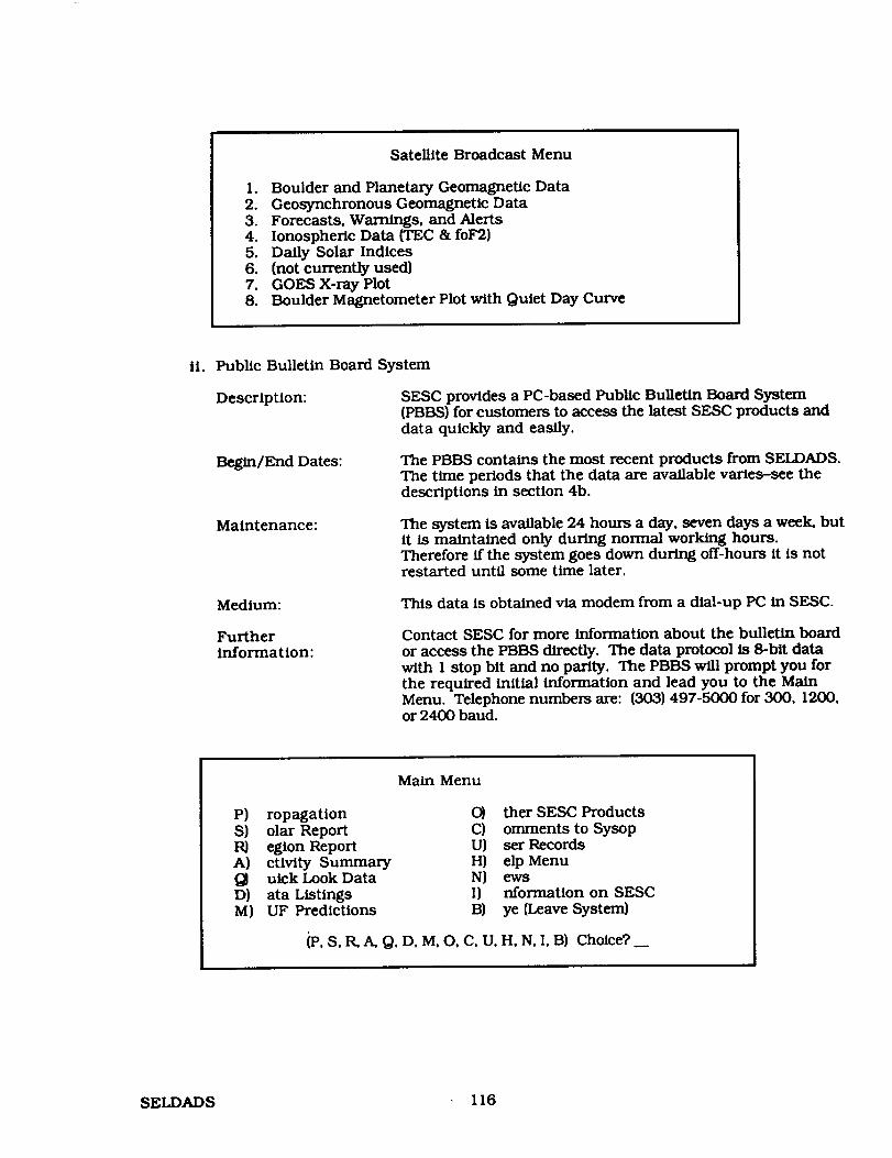
Satellite Broadcast Menu
1. Boulder and Planetary Geomagnetic Data2. Geosynchronous Geomagnetic Data3. Forecasts, Warnings, and Alerts4. Ionospheric Data (TEC & foF2)5. Daily Solar Indices6. (not currently used)7. GOES X-ray Plot8. Boulder Magnetometer Plot with Quiet Day Curve
li. Public Bulletin Board System
Description: SESC provides a PC-based Public Bulletin Board System(PBBS) for customers to access the latest SESC products anddata quickly and easily.
Begin/End Dates: The PBBS contains the most recent products from SELDADS.The time periods that the data are available varies-see thedescriptions in section 4b.
Maintenance: The system is available 24 hours a day, seven days a week, butit is maintained only during normal working hours.Therefore if the system goes down during off-hours it is notrestarted until some time later.
Medium: This data is obtained via modem from a dial-up PC in SESC.
Furtherinformation:
Contact SESC for more information about the bulletin board
or access the PBBS directly. The data protocol is 8-blt datawith 1 stop bit and no parity. The PBBS will prompt you forthe required initial information and lead you to the MainMenu. Telephone numbers are: (303) 497-5000 for 300, 1200,or 2400 baud.
Main Menu
P) ropagation 0) ther SESC ProductsS) olar Report C) omments to SysopR) egion Report U) ser RecordsA) ctivity Summary H) elp MenuQJ uick Look Data N) ewsD) ata Listings I) nformation on SESCM) UF Predictions 13) ye (Leave System)
_, S, R,A, Q, D, M, O, C, U, H, N, I, B) Choice?
SELDADS 116

iii. Electronic File Transfer
Description: SESCmaintains files of the daily products, flare listings, andx-ray data plots that are accessible through our VAX computersystem. SESC does not transmit data to users; rather, the usercan logon and transfer data via various network file transfertechniques.
Update time: The messages and data are updated daily at 0300 local timefrom the SELDADS.
Period covered: Text products are kept online for five days. Plots and flarelists are kept for the previous 30 days.
Maintenance: The system is available 24 hours a day, seven days a week, butis maintained only during normal working hours.
Medium: NSI/DECnet-two ways to access files. Note: SELVAX:: is thesame as 9555::
1. SET HOST SELVAX
Iogin with username SEL (no password required}TYPE filename_desired
2. COPY SELVAX::SEL$SEL:fllename_desired *.*
Internet-two ways to access files.
1. telnet selvaxxsel.bldrdocxgov or telnet 132.163.224.10
login with username SEL (no password required)NMS commands must be used)TYPE filename_desired
2. ftp selvax.sel.bldrdoc.gov or ftp 132.163x224.10
Iogin: usemame SEL {no password required) get filenamedesired
Telephone {303} 497-3215 (1200 or 2400 baud}Iogin with usemame SEL (no password required}TYPE filename desired
Furtherinformation:
There is a READ.ME file in these accounts that describes the
fries available and gives complete instructions for trans-ferring data and products. Please contact SESC for furtherassistance or information.
d. Scientists invited as visitors by the Space Environment Laboratory may use laboratoryfacilities to get data from SELDADS.
e. Data is archived with the National Geophysical Data Center (NGDC} in Boulder,Colorado, Telephone: [303) 497-6136.
5. Ordering and pricing policy
Users pay the communications costs necessary to reach the data base.
117 SELDADS

6. Design and system architecture
PREPROCESSORSWicat WS150
(7 Total)
Data Collection,Processing.Transmission
EXTERNAL SYSTEMS
GOES
NOAA
TMO
RGON
Satellite Broadcast
COMEDS
GWCMCS TELEX MCS
AUTODIN
WICORE WlCORE
Data Co4lection,Processing,Transmission
NE'I"
CLO£
MAIN SYSTEMMVl0000 SX DATA
MANAGEMENT DisksSYSTEM
Tapes
_lJ_ User Ports
Data MonitoringData DisplayData Analysis AOSNS ApolIo/SELSISAlert Generation
Product Generation CRT DisplaysArchive
HardcopyDevices
a. SELDADS II system design and functions (see figure}.
b. The data management system is a custom system designed specifically for SELDADS.
c. Not Applicable.
SELDADS 118

7. Software available for distribution
Not available.
System references and documentation
Space Environment Laboratory Data Acquisition and Display System II, NOAA TechnicalMemorandum ERL SEL-76.
SELDADS User Manual-available from the System Manager.
119 SELDADS


SELSIS
July 19, 199o
I. Data system identification
a°
b.
The Space Environment Laboratory Solar Imaging System (SELSIS)
The NaUonal Oceanic Atmospheric Administration (NOAA) through the SpaceEnvironment Laboratory Space Environment Laboratory Space Environment ServicesCenter and the United States Air Force
R/ElSE2325 BroadwayBoulder, CO 80303USA
C° Understand and protect against the detrimental effects of disturbances in the solar-terrestrial environment. SESC now functions like a weather service, but is concernedwith space environment.
do SELSIS provides near real-time solar images to SEL and the USAF Space ForecastCenter (SFC) for use in their operational solar forecast centers, the Space EnvironmentLab (SEL) research group, and the National Geophysical Data Center (NGDC) forarchival and distribution to other potential users.
e. Operational.
2. System contact information
So Larry Combs, System ManagerNOAA/ERL/R/E/5E2325 BroadwayBoulder, CO 80303USATelephone: (303) 497-5299
bo Rita BrownNOAA/ERL R/E/SE2325 BroadwayBoulder, CO 80303USATelephone: (303) 497-5828 (FTS) 320-5828
3. Access procedures
SELSIS images are available on the SELVAX computer over the NSI/DECnet or Internetnetworks.
NSI/DECnet address: SELVAX:: OR 9555::COPY SELVAX::SEL$1MAGE: filename.
121
PRECE_.!NG PAGE BLArJK NOT FILMED
SELSIS

Internet:
telnet selvax.sel.bldrdoc.govor telnet 132.163.244.10
or
ftp selvax.sel.bldrdoc.gov or ftp 132.163.224.10
login with usemame IMAGE (no password required).get filename.
4. System services provided
a-c. SELSIS is the Space Environment Laboratory Solar Image System. SELSIS is a database of solar images in digital format which are used by the SESC forecasters and alsoare made available to SESC customers via a computer network. SESC receives,processes, and stores solar images from five observatories. Images are full-disk andlarge-scale, Hydrogen-alpha white-light, Calcium II, Helium 10830, and magnetograms.
SELSIS observing stations:
SESC Solar Observatory, Boulder, Colorado, USAHolloman AFB, New Mexico, USAKitt Peak National Observatory, Tucson, Arizona, USALearmouth Solar Observatory, North Cape, AustraliaSacramento Peak Solar Observatory, Sunspot, New Mexico, USA
Period Covered: Images are received throughout the day and are available on the VAX atroughly these times:
LearmonthHollomanBoulder H-alphaKitt Peak
Sacramento peak
O930 UT0200, 1430, & 2000 UT1600 [Jr1900 In"2100 i_r["
d. Scientists invited as visitors by the Space Environment Laboratory may use laboratoryfacilities to get data from SELSIS.
5. Ordering and pricing policy
Users pay the communications costs necessary to reach the data base.
6. Design and system architecture
SELSIS images are 512 x 512 bytes, where the first line is 128 bytes of ASCII headerinformation plus 384 bytes of blank fill.
The IMAGE account has a text file, directory.lis, with a list of the images currentlyavailable.
SELSIS 122

Theimagefilenameis madeup of the image'sdate/time andobservatory.Theformat is:
iyymmddhhmmssobx span or iyymmddhhmmsob-span-z
where y y 2 digit yearmm 2 digit monthdd 2 digit dayhh 2 digit hourmm 2 digit minutess 2 digit secondob 2 digit observatorycode
•spanindicatesfilesarethe 512x512bytefiles• span_zindicates files in compressedformat.
Contact Jim Winkelman (SELVAX: : SYSTEM) for the VAX decompression algorithm.
7. Software available for distribution
Not available.
123 SELSIS


UCLASSC
November 25, 1991
1. Data system identification
a. University of California at Los Angeles, Space Science Center (UCLASSC)
b, University of California at Los AngelesInsUtute of Geophysics and Planetary Physics3845 Slichter Hall
Los Angeles, CA 90024-1567USA
The UCLASSC is funded primarily by NASA. NSF and the State of California alsoprovide funding.
c. The UCLASSC was established in 1962 to study the physics of planets with an emphasison the Earth's magnetic field and on solar-terrestrial interactions.
d° The UCLASSC maintains a catalog of magnetic field sensor records from severalspacecraft to facilitate research by scientists within UCLA and throughout thescientific community.
e. The UCLASSC data access and analysis systems are operating and continuallyevolving.
2. System contact information
a° Mr. Harry HerbertBRUNET: :HARRYHARRY@BRUNET
herbert@igpp, ucla. edu(310) 825-9030
or
(NSI/DECnet)(BITNET)(INTERNET)(TELEPHONE)
Ms. Muriel KniffinBRUNET:: MURIELMURIEL@BRUNET
[email protected](310) 206-9955
UCLA - Institute of Geophysics and Planetary Physics5833 Slichter Hall
Los Angeles, CA 90024-1567
b. Harry Herbert (see section 2a).
3. Access procedures
a. The UCLASSC may be accessed via the NSI/DECnet and INTERNET networks orthrough direct dial. The host computer is a MicroVAX II with the node name BRUNET.
NSI/DECnet access: SET HOST BRUNET
Intemet access: telnet brunet.igpp.ucla.edu
Modem access: (310) 825-0229 (1200/2400 baud, 7 bits, no parity)
Users may make data requests by logging into the REQUEST account (password
REQUEST) and answering the questions. Interactive users may log into the GUEST ac-count (password UCLA) to review various online data sets. It is strongly recommendedthat new interactive users first contact one of the user support contacts before loggingon to learn what data sets are currently available and what facilities are available toexamine these data sets.
125P_//'._-_9,J.',?_ P_ BLAi:K NOT FILMED UCLASSC

b. The primary networks for access are NSI/DECnet and Internet.
C. The REQUEST account's interface will function properly with any text terminal. TheGUEST account is a complete VMS user account where many facilities work best withVT compatible terminals. Graphics programs support DEC graphics terminals, HPgraphics terminals, and Tektronix 4014.
¢_ No individual accounts are necessary because the GUEST account gives full access to thesystem.
4. System services provided
a. The foUowing types of data are available from the UCLASSC:
i. ISEE-1 and ISEE-2 magnetic field and ephemeris data
The UCLASSC performed the primary data processing for the fluxgate magnetome-ter aboard these spacecraft and thus has data available in a variety of time resolu-tions and coordinate systems from launch on October 22, 1977 through re-entry onSeptember 26, 1987. Most data are stored on magnetic tapes and may be restored tomagnetic disk for requested time intervals.
ii. AMPTE-UKS magnetic field and ephemeris data
The UCLASSC has a complete catalog of data from the fluxgate magnetometer onboard this spacecraft. The time intervals covered are from August 1984 throughJanuary 1985. These data are also stored on magnetic tape and selected intervalsmay be restored to magnetic disk upon request.
iii. IMP-8 magnetic field, plasma, and ephemeris data
The UCLASSC has acquired from the NSSDC a large amount of data from the IMP-8spacecraft which outside researchers may access. Higher resolution data are storedon magnetic tape and may be retrieved for requested time intervals. Low resolutiondata is available online. Currently, data are available from October 30, 1973through February 7, 1986.
iv. ISEE-3 magnetic field, plasma, and ephemeris data
The UCLASSC has acquired ISEE-3 data pool magnetic field and ephemeris datafrom August 1978 through November 1985. Also, available are plasma parametersfrom August 1978 through February 1980. Most data are stored on magnetic tapesand may be retrieved for selected time intervals; however, low resolution data fromthe interval August 1978 through February 1980 is available online.
b. The following ST-relevant data sets are available from the UCLASSC:
i. ISEE-1 and ISEE-2 magnetic field and ephemeris data
Magnetic field data for the entire mission of both spacecraft is available onmagnetic tape at resolutions of 64 seconds, 4 seconds (12 second averages), and highresolution (0.25 or 0.0625 seconds). The data may be averaged to other timeresolutions upon request. Standard deviations of the averaging process are alsoavailable. Data are stored in spacecraft coordinates but may be rotated into GSE,GSM, or dipole coordinates. Model field data are also available for the ISEE timeperiod. Additionally, ephemeris data, taken every 60 seconds, are available onmagnetic tape.
UCLASSC 126

ii. AMPTE-UKS magnetic field and ephemeris data
Magnetic field and ephemeris data for this spacecraft are stored on magnetic tape inthe same manner as for the ISEE- 1 and ISEE-2 data described in section 4b.i.
iii. IMP-8 magnetic field, plasma, and ephemeris data
Magnetic field and position data are stored on magnetic tape for the higherresolution 15.36 second data. Magnetic field, plasma, and ephemeris data areavailable online at five minute resolution in the file DISKSDATA:[IMP]IMP8.FFH
iv. ISEE-3 magnetic field, plasma, and ephemeris data
Magnetic field and position data are stored on magnetic tape for the 64-second datapool data. Magnetic field, plasma, and ephemeris data are available online at fiveminute resolution in the file DISKSDAT_=[ISEE]ISEE3SW.FFH.
c. Services are available for requesting data (the REQUEST account) and software isavailable to review and analyze the data:
i. The FL (FOe Lister) program permits browsing through time series data flies. Itfunctions much like an editor to allow the user to move freely through a file and toview the data both numerically and graphically. This program may be used tobrowse all time series data files created at the UCLASSC.
ii. The BANAL (B-fieldANALysis) program provides graphicaldisplay and analysis oftime seriesmagnetic fielddata includingfiltering,detrcnding,power spectra,andhodograms.
iii. The TANAL {TrajectoryANALysis) program provides graphical display andanalysisoftime seriesmagnetic data thattakes intoaccount spacecraR positionand allowscomparisons with model fielddata.
iv. The ICIMPSW {ISEE-31IMP-8 Solar Wind) program permits browsing through theISEE-3 and IMP-8 five minute resolution flies described in section 4a and 4b.
V. There are a number of additional programs to manipulate data files that have beenstored in the UCLA-IGPP flat file data format (see section 6a for a description of thisformat). These include programs to average data, rotate data, perform algebraiccalculations on data, filter out bad points from data and to convert data betweenVAX/VMS format and UNIX format.
d. Information concerning availability of facilities for visiting scientists is availablethrough the main office of the UCLA Institute of Geophysics and Planetary Physics: seesection lb for its address.
e. Data sets smaller than two megabytes may be transmitted via electronic networks(NSI/DECnet, BrINET, or Intemet) if a requester so desires. Otherwise, data aretypically supplied on nine-track magnetic tape. Some data plots and numeric listingsare also available on microfiche; please see the REQUEST account information files fordetails.
a Orderh and pricing poUcy
The UCIASSC supports the general space physics and geophysics research community,but does not provide data or services for commercial use. There is currently no chargefor data requests.
127 UCLASSC

6. Design and system architecture
a, The UCLASSC currently operates from a DEC MicroVAX II which runs the VMSoperating system, The REQUEST account uses a menu interface command file writtenin the VMS command language. The GUEST account is a full service VMS account thatprovides access to the UCLASSC data review and analysis software. To view a list ofavailable programs and what they do, enter the command PRUN at the system prompt.To execute a program, enter the command PRUN PROGRAM_NAME at the systemprompt.
There are two main software packages used by the UCLASSC. The first is the UCLA-IGPP flat file subroutine library, which consists of two companion files. First, anASCII header file, called *.FFH, which describes the data, includL_ the name of the datacolumn, coordinate system, source, resolution start and stop time of the data set, and anabstract, which provides any additional information needed to describe the data set.Second, a BINARY data file, called *.FFD, containing the data values described in theheader file.
bo
The second software package is the graphics package Template, a commercialsubroutine library from the company TGS, Inc. Template allows the development ofdevice-independent graphics programs that interface with a variety of graphical devicedrivers also developed by TGS.
The UCLASSC stores its data using the UCLA-IGPP fiat file format described in section6a.
C. The UCLASSC software may be run on any DEC VAX/VMS system with a Templatesoftware license. Additionally, the UCLA-IGPP fiat file system and the UCLASSCreview and analysis programs have been ported to Hewlett-Packard's HP-UX UNIXoperating system and to SUN Microsystem's SunOS UNIX operating system. Both UNIXsystems also require a Template software license.
7, Software available for distribution
a.
bo
The UCLA-IGPP flat file subroutine library and the programs for data review andanalysis described in section 4c are available for distribution for the followingoperating systems: DEC's VAX/VMS, Hewlett-Packard's HP-UX, and SUNMicrosystem's SunOS.
The Template graphics subroutine library from TGS, Inc. is required to use anyprogram with graphical capabilities.
8. System references and documentation
Online help for the UCLASSC programs and subroutine libraries is available via theVMS HELP utility on the host computer (BRUNET) by entering the command HELPFLAT. Also, a list of available programs with a one line description of their functionsmay be viewed by entering the command PRUN.
9. Other systems
A project has been completed to port aU software and a number of data bases to anetwork of SUN SPARCstations. These systems provide considerably faster computerthroughput for all data review and analysis programs. Graphical output support willcontinue to be provided by the Template subroutine library, but with the addition ofSUNVIEW and X windows. GUEST and REQUEST accounts will be provided for thesesystems during the first half of 1992.
UCLASSC 128

IV. Network to NetworkCommunications
PRECEDING PAGE BLANK NOI F_LMED


Network-to-Network Communications
As electronic communications networks and gateways among the different networks havebecome more common, it is increasingly feasible literally to reach around the world toexchange electronic mail or to access relevant solar-terrestrial data systems.
For each of the data systems referenced previously in this handbook, only the address andaccess information for those networks to which a given system is directly connected have beenshown. Users with direct access to an appropriate network would then use the ordinaryprocedures and syntax of that network to access the desired system.
The purpose of this section is to outline the primary (current) procedures by which systemaccess and file/mail transfers can be achieved across network boundaries where such directconnections do not exist, using existing gateway and other facilities. The discussion is asummary and simplified overview only: the various Network Information Centers, networkpublications, and the networking references cited all contain substantially more complete andpossibly more current information on these topics.
This section is divided into four parts:
I. A Summaryof Networks
A brief summary of the major networks worldwide that carry solar-terrestrial sciencerelated communications traffic, including summary annotations of the various subnetstransparently connected within these larger frameworks.
The groupings herein and the subsequent detailed information are organized from a userperspective, rather than from any sponsoring agency or other political oradministrative model.
II. Network-to-network paths for:
• data system access (remote logins)• file transfers• exchange of electronic mail
Ill. Network Information Centers
IV. Networking References
131
PRECEDING PALI,E 8LAI'_IKNOel t"'....,..r.,_D

L A Summary of Networks
Electron/c networks are distinguished by a variety of features, including their underlyingcommun/caUons protocol(s), addressing schema, and the physical connections amongnetwork nodes. Some relevant networks to the solar-terrestrial research commumty include:
& DECnet Internet:
A worldw/de internetwork based on the Digital Equipment Corporation's DECnet protocols.The various networks that are a part of the DECnet Intemet include:
• (former) SPAN (Space Physics Analysis Network)NSI/DECnetE-SPAN (European SPAN)DAN (Data Acquisition Network-Canada}
• (former) HEPnet (High-Energy Physics network)ESnet/DECnet (DOE Energy Science network}E-HEPnet (European HEPnet)
• THEnet (Texas Higher Educational network)
• other project-dedicated and private networks (e.g., UARSnet)
DECnet addresses (for mall, file transfers/copy or remote logons/set host) are generally of theform:
DECnet_HOST: :DECnet ACCOUNT
where DECnet_HOST may be either a node name of <6 alphanumeric characters or an "integer"address of <5 digits. The underlying DECnet node addressing (Phase IV) is ultimatelynumerical and in a "decimal" form contructed from an "Area_Number" (range 1-64) and'_Node_Number" (range 1-1024) as:
Area_Number. Node_Number
The integer address is formed from the decimal address by the formula:
(Area_Number * 1024) + Node_Number
Local and distributed routing tables and/or nameservers are typically used to translateto/from numerical to mnemonic forms of addresses. For example, the DECnet_HOST nameN88DCA is defined in the NSI/DECnet routing tables to be associated with the decimal address75,188 which is rendered in integer form as 15548. For example, an account/user "XSmith"(i. e., example Smith), on NSSDCA might be reached via DECNET with any of:
NSSDCA: :XSMITH15.188:'.XSMITH15548:'.XSMITH
(set host, copy, or e-mail)(e-mail only)(set host, copy, or e-mail)
Within each of the above DECnet network groups, transparent global access is possible betweennodes in areas 1-46. The use of poor man's routing (PMR) to access a node may be required ingiven cases, i.e., nodes in areas 47-63 are only "locally" rather than globally defined. WithPMR, the user defines in the address the specific intermediate or gateway nodes that must beexplicitly used to make an ultimately correct connection. PMR addresses take a form such as:
132

GATEWAYI::GATEWAY2::DECnet_HOST::DECnet_ACCOUNT
where the routing will then be forced to go through GATEWAY1 to GATEWAY2 beforeattempt/ng connection to DECnet_HOST.
In the DECnet internet, global addresses among NSI/DECnet and ESnet are coordinated so that'transparent" access (non-specified routing) will work for all addresses in DECnet areas 1-46.However, the mapping between numerical addresses and host "names" are defined only withineach of these networks (because their authorized uses are for distinct program objectives), soaddressing between these networks must use numerical addresses. For reference, currenttables of the mappings between host names and numerical addresses are maintained atGoddard Space Flight Center (GSFC) on NSSDCA as:
(NSI)(ESnet)
NSSDCA:: [SPANDB]SPAN_DB.COMNSSDCA:: [SPANDB]ESNET_DECNET_NODES.DAT
A less desirable but usable alternative is PMR through the site on one network (NSSDCA toreach NSI from ESnet or FNAL to reach ESnet from NSI in the United States) defined as anamed site on the other network:
FNAL: :NSSDCA: :NSI_HOST: :NSI_ACCOUNTNSSDCA::FNAL: :ESNET_HOST: :ESNET_ACCOUNT
(ESnet to NSI)(NSI to ESnet)
THEnet uses an independent assignment of DECnet addresses from NSI/DECnet and ESnet,such that connection to/from THEnet requires PMR through address translation gateways inTexas:
UTSPAN::UTADNX: :THEnet_HOST::THEnet_ACCOUNT{NSI/ESnet to THEnet)
UTADNX: :UTSPAN: :NSI-ESnet_HOST: :NSI-ESnet_ACCOUNT(THEnet to NSI/ESnet)
A listing of THENET'nodes can be found in
UTSPAN::THENIC: :[ROOT.DECNET]THENET_NODES_FULL.COM
As one example of a project-dedicated network, UARSnet is defined in a high DECnet area, withauthorized access from sites outside the UARS program only by PMR through the node atNSSDCA and other selected UARS/NSI sites:
NSSDCA: :UARS_HOST: :UARS_ACCOUNTNSI/ES_HOST::NSI-ES_ACCOUNT
(NSI to UARS)(UARS to NSI/ESnet)
b. X.25 Packet-Switch Interconnect (PSI) DECnet
Additional DECnet systems are accessible using so-called X.25 connections and explicit/unique DTE (...) addresses from gateway computers on NSI/DECnet. System Iogicals on thesegateways are sometimes defined to translate mnemonic forms of these addresses into theneeded numerical DTE invisibly. Only certain addresses may be enabled on any given gateway;some of the addresses may also be restricted to specific users or users with special privileges. APSI marl address might look like:
GATEWAY: :PSI%HOST_DTE Number ::ACCOUNT
X.25 system access is possible (where authorized) via the command:
set host�x29 HOST_DTE_Number,
133

e. Internet:
The Internet is a set of interconnected TCP/IP (Transmission Control Protocol/InternetProtocol) networks sharing a common address space. The term intemet (lowercase i) is a moregeneral term referring to any set of connecting networks using a common protocol.
The Internet is composed of a variety of specific TCP/IP networks, some of which are:
• NSI/IP (NASA Science Internet/IP)• NSFnet (National Science Foundation network and various subsidiary regional
networks)• ESnet (Energy Sciences network)• MFEnet (Magnetic Fusion Energy network)• DDN/MILnet (Defense Data Network and Military network)• JUNET (Japanese University Network)
TCP/IP Internet addresses are generally of the form:
Internet_ACCOUNT@Internet_HOST.Internet_DOMAIN
The DOMAIN address is an expression of how the given Intemet_Host fits into the overallInternet Domain Name System (DNS) hierarchical/tree structure. The absolute addressIntemet_HOST.Internet_DOMAIN is simply the trace of that tree structure, proceeding left toright from specific to general, with nodes associated with each of the tree levels separated bydots. A government agency address might look like:
Internet_ACCOUNT@Internet_HOST.CENTERJ_GENCY.GOV
while an account/user at a university might look like
Internet_ACCOUNT@Int ernet_HOST.INSTITUTION.EDUor Interne t_ACCOUNT@ Interne t_H OST.D EP ARTMENT.INSTITUTI ON.ED U
Examples (with our fictitious account/user XSMITH) might look like:
XS]_[[email protected] X_)_TH @ELECTRON.PHYSICS.CAL TECH.EDU
For reference, the highest level Internet domains are:
Generic:
{main only}MIL US MilitaryGOV Other US governmentEDU EducationalCOM CommercialNET Network centersOl_ Nonprofit organizations
Country: By ISO-3166 two-letter acroynym
The underlying Intemet TCP/IP addressing is numerical. The data base to map names intonumbers is distributed and resolved by successive unfolding of the address to an appropriatename service. The use of nameservers and various local tables sometimes allows the use ofaddresses (at local sites) without an explicit DOMAIN, but they will exist even if the address isinvisible to the user.
134

Direct numerical addressing is also allowed (4 numbers separated by dots, read left to rightfrom general to specific). For example, NSSDCS has the numerical address 128.183.10.164, soXSMITH might be reached via:
XSMITH@ 128.183.10.164
Name or numerical addresses may be used to connect for file transfers (using the File TransferProtocol or FTP) or for TELNET remote logons.
Via the Internet, these various TCP/IP networks noted above are generally transparentlyinterconnected. However, poor man's routing (PMR) is possible where still necessary, takingthe general form:
Internet_ACCOUNT%Internet_HOST.DOMAIN%Gateway2@Gateway I
This address is resolved right to left, with the rightmost address always separated by the "@"symbol. Each of the Gateway addresses should be in a full HOST.DOMAIN form. TCP/IP PMRmay be valid only for mail.
d. JANET:
The Joint Academic Network (JANET) in the United Kingdom interconnects a range of localnetworks in the UK research community. The JANET protocols are generally unique to JANET(ColourBook software), therfore access typically requires the use of a gateway machine.
JANET addresses (inside the UK) look generally similar to Internet addresses except that thedomain hierarchies are read from left to right (general to specific) rather than right to left aswith Intemet. Some gateway services support automatic domain reordering.
e. BITNET-EARN:
BITNET (Because It's Time Network-US) and EARN (European Academic Research Network) areworldwide academic and research networks that connect many universities, colleges, andresearch centers. Addressing is transparent between BITNET and EARN.
BITNET-EARN supports electronic mail/messages and sending/receiving files. Remote' Ioginsare not supported, because the underlying architecture is store-and-forward as opposed to adirect connection. BITNET-EARN address syntax is similar to the Internet except that theDOMAIN-style hierarchical addressing structure is not a required attribute.
£ UUCP:
UUCP (UNIX-to-UNIX Copy Program) is a transport protocol for remote command executionand file/mail transfers on UNIX systems. It works in a store-and-forward mode, and hencecannot support remote Iogins nor real time file transfers. Error handling and return ofundelivered messages is more primitive than in the other networks mentioned.
UUCP uses a form of PMR where successive addresses are separated by '"oangs" or "!"s, where anaddress might take a form like:
HOSTI IHOST2 [UUCP_HOST@UUCP_ACCOUNT
and the routing is from HOST1 to HOST2 to the target UUCP_HOST.
135

Public Packet Network / TELENET:
Sometimes electronic access and mail to remote systems and users also is possible via thepublic/commercial packet switched networks where appropriate interconnections (TELENET}and/or marl accounts (TELEMAIL) exist. Various gateways between the public packet networkand the other systems previously described exist.
All TELENET access to NASA computer facilities from outside the NASA Packet SwitchNetwork (NPSS) must now flow through DACS II access control computer at MSFC. Accessthrough DACS II requires an individual user account and password. Non-NASA systemsallowing direct TELENET access are noted in the system description texts.
Public Packet mail (TELEMAIL) is different from most of the other network marl proceduresdescribed here in that mail is sent to and read from central computers rather than sent toindividual sites. Public packet mail addresses under the X.400 standard are organized in ahierarchical structure of mail location/organization:
C(ountry}:ADMD (Administration):O(rganization):
PRMD (Private ADMD):
e.g., USA, CANADA, JAPANe.g., TELEMAIL, ATI [Japan], TELECOM.CANADAe.g., OMNET, KOSMOS, ESA, INTEC, NASA, GSFCMAIL,
J.P.L.e.g., NASAMAIL, GSFC, JSCPROFS, RESTON.SSFP
and user/account identification:
UN:or FN:
MI:SN:
or PN:
User_Name/user_IDFirst_NameMiddlelnitialSurnamePersonal_Name = FN.MI.SN
Various combinations of the above are supported/required for various systems. X.400 mail toan address on GSFCMAIL might be expressed as:
|c._s,admd:telemail, o:gsfcmail, prmd:gsfc,un:XSMITH)or |cms,admd:telemai_o:gsfcmail,prmd:gsfc,pn:Xarnple.X.Smith)
h. N-I:
N-1 is an internal Japanese research network centered at ISAS. It is not presently accessibleoutside the immediate research community served.
136

H. Network-to-Network Gateways
For purposes of the following section, the address of a given system within a given network isassumed to be of the following form (within the network to which that system is directlyconnected):
NSI/DECnet: DECnet_HOST: :DECnet_ACCOUNT.
(from other DECnet Internet networks, as necessary, useGATEWAY::DECnet_HOST in place of DECnet_HOST)
Internet: Internet_ACCOUNT@Internet_HOST.Internet_DOMAIN
(from other TCP/IP networks, as necessary, use%Internet_HOST.Internet_DOMAIN@GATEWAYin place of @Internet_HOST.Internet_DOMA/N)
JANET: JANET_ACCOUNT@JANET_DOMAIN.JANET_HOST
BITNET: BITNET_AC COUNT@BITNET_HOST
TELENET:
TELEMAIL:
C_.400}
Not Applicable-reference in this discussion for access to other systems only.
(C:TMAIL_Cntry, ADMD:TMAIL_Admin, ORG:TMAIL_Organz,PRMD: TMAIL_PrivAdmin. UN:TMAIL_Account)
UUCP: HOST 1!HOST2 [UUCP_HOST@UUCP_ACCOUNT
For intemetwork access, it should also be noted that many host systems now have locallyinstalled software that allows them to access or be accessed under several different protocols.An example would be a VAX/VMS system running MultiNet software, where such a system canthen be defined simultaneously as a DECnet and TCP/IP Intemet node. Users on a system withMultiNet can use a syntax in DECmail such as:
smtp%"Internet_ACCOUNT@Interne t_HOST.Internet_DOMAIN"
and may have direct access to TCP/IP FTP for file transfers and TELNET for remote TCP/IPIogons. Access to such a node from the TCP/IP Intemet will look essentially like any other
Internet node. In general, direct access where possible will work better than indirect/gatewayaccess.
& For Data System Access (Remote Logins):
User on NSI/DECnet to system on:
Internet: $ set host EAST o r$ set hoet 6913
Iogin (*): Internet_HOST.Internet_DOMAINl orxxx.xx.xxJ_xl (TCP/IP numerical address)
login: Internet_ACCOUNT (at Internet_HOST)
JANET: $ set host ESIS o r$ set h_t 42007
]ogin: JANETpassword: ANIMOtINservice: JANET HOSTIogin: JANET_ACCOUNT (at JANET_HOST)
137

BITNET: Not supportedUUCP: Not supported
User on Intemet to system or_
DECnet: telnet ]tJJT,(]M_C,NASA.GOV ortehmt 128.188.104.4login ('): IN_Cnet_H08_.: or
XXXXX:: (DECh_ integer Node Number)UserName: DECnet_ACCOU-_FI' (at DECnet_HOST)
I
Requires individual account on NSFNET-REI_T.AC.UKJANET:
BITNET: Not supported
UUCP: Not supported
* N. B. Pass-thru must be correctly specEled on first Iogln prompt from EAST. Any error willnecessitate breaking/re-initiating the connection to EAST. Note the mandatory 'T' fornumerical TCP/IP addresses and "::" for all DECnet addresses (mnemonic and numerical).
User on JANEt to system on:
DECnet: X.29 connection to SPAN-RELAY,AC.UK
Node name? SPAN_HOSTUsername: SPAN_USER (at SPAN_HOST}
Internet: Requires individual account on NSFNET-RELAY,AC.UK
BITNET: Not supported
UUCP: Not supported
User with _ access to system on:
SPAN: Access to SPAN is possible through the SPAN gateway at NSSDCA, whichmay be accessed via NASA DACSII gateway to the NASA Packet SwitchSystem (NPSS). A DACSII User ID and Password is required, plus autho-rization for the specific service access needed and authorization/password to use the SPAN gateway itself.
Users with appropriate requirements should contact the SPAN NIC forfurther information and procedures to obtain the needed authorizations(US telephone, 301-286-7251, SPAN address NSSDCA::NETMGR,Internet address is [email protected].
Individual systems may also be directly accessible via InternationalX.25 circuits. The DIE of the des/red system must be known by theperson initiating the connection. NASA X.25 addresses are not docu-mented in publicly-accessible form/locations.
Internet: Procedures to access NASA systems accessible through the Internet aresimilar to those described under SPAN. The contact for Intemet is beingdetermined.
138

jANET: TBD
BITNET: Not supported
UUCP: Not supported
Ix For File Transfers:
User on NSI/DECnet (VMS) for fries:
From Intemet (*):$ copy EAST"Internet_HOST.Internet_DOMAIN
llnternet_User password"::'Internet_F/le" DECnet_FileTo Intemet ('):
$ copy DECnet_File EAST"Internet_HOST.Internet_DOMAINIInternet_User Passworcr'::"Internet_FIle"
From/to JANET: Not currently supported
From/to BITNET: TBD
User on Internet for files to/from:
NSI/DECnet (VMS) (*):FTP east.gsfc.nasa.gov or FTP 128.183.104.4login: SPAN_HOST::SPAN_Userpassword: [enter SPAN_User password] (at SPAN_HOST)
Then use normal FTP commands for file transfer.
JANET: Requires individual account on NSFNET-RELAY.AC.UK
BITNET: TBD
* N. B. Note that file transfers between UNIX and VMS machines can have numerous subtleissues and problems due to dissimilarities in the underlying file systems and word represen-tations. See Mason. et.al for some relevant notes and procedures.
User on JANET for files to/from:
SPAN: Not currently supported
Internet: Requires individual account on NSFNET-RELAY.AC.UK
BITNET: TBD
User on TEI_NET for: TBD
139

c. For Electronic Mail (primary gateways only):
NSl/DECnet to:
Internet: EAST::"Internet_ACCOUNT@Internet_HOST.DOMAIN"
JANET: EAST: :"JANET_ACCOUNT%[email protected]" (with JANET_DOMAIN Ln Internet order)
BITNET: EAST: :'_BITNET_ACCOUNT@BITNET_HOST.BITNET" (or)DFTNIC: :"JNET%'_B ITNET_ACCOUNT@BITNET_HOST"
UUCP: EAST: :"GW_HOSTIUUCP_HOST [email protected]_ET"
TELEMAIL: EAST::"/C=TMAIL_Cntry/ADMD=TMAIL_Admln/ORG=TMAIL_Organ/0C400) PRMD=TMAIL_PrivAdmin/DD.UN=TMAIL_Account / @SPRINT .COM"
Internet to:
DECnet:
jANET:
BITNET:
UUCP:
TELEMA/L:
_4oo)
DECnet_ACCOUNT%DECnet_HOST.dnet.nasa.gov(DECnet_HOST may be in integer form ff NSl-reg/stered node)
JANET_ACCOUNT%JANET_DOMAIN. [email protected] (with jANETDOMAIN in JANET order)
BITNET_ACCOUNT@BITNET_HOST.BITNET
GW_HOST IUUCP_HOST IUUCP_AC [email protected]
/C=TMAIL_Cntry/ADMD=TMAIL Admin/ORG=-TMAIL_Organz/PRMD=TMAIL_PrivAdmln/DD .UN=TMAIL_Account / @SPRINT.COM
JANET to:
DECnet:
Internet:
BITNET:
UUCP:
TELEMAIL:
_400)
"DECnet_HOST: :DEC net_ACCOUNT"@UK.AC .SPAN-RELAY
Internet_User%[email protected] (with Internet_DOMAIN in Intemet order}
BITNET_ACCOUNT%[email protected]
GW_HOSTIUUC P_HOSTIUUCP_User%IT[[email protected]
, /C =TMAIL_Cntry/ADMD=TMAIL_Admln/ORG=TMAIL_Organs/PRMD=TMAIL_PrivAdmin/DD.UN=TMAIL Account/%[email protected]
BITNET to:
DEC'net:
Internet:
DECnet_ACCOUNT@DECnet_HOST.dnet.nasa.gov
Internet_ACCOUNT@Internet_HOST.Internet_DOMAIN
140

JANET: JANET_AC C OUNT@ JANET_DOMAIN.JANET_HOST(with JANET_DOMAIN in JANET order)
UUCP: [email protected]
TELEMAIL: /C=TMAIL_Cnt ry/ADMDfTMAIL_Admin/ORGffiTMAIL_Org/(_C400) PRMDfTMAIL_PrivAdmin / DD.UNfTMA/L_Account / @SPRINT.COM
to:
DECnet:
Internet:
JANET:
BITNET:
UUCP;
(c:USA, admd:TELEMAIL, p:INTERNET,"rfc-822":<DECnet_ACCOUNT(a)DECnet_HOST.DNET.NASA.GOV>)
(c:USA, a:TELEMA/L,p:INTERNET,'rfc-822":<Internet_ACCOUNT(a)Int ernet_HOST.DOMAIN>)
(c:USA, a:TELEMAIL, p :INTERNET,"rfc-822" :<JANET_ACCOUNT(p)JANET_DOMAIN.HOST(a)NSFNET-RELAY._C.UK>)(with JANET_DOMAIN in JANET order)
(c:USA, a:TELEMAIL, p:INTERNET,"rfc-822":<BITNET_ACCOUNT(a)BITNET_HOST.BITNET>)
(c:USA.a:TELEMAIL, p:INTERNET,"rfc-822":
<GW_HOST(b) UUC P_HOSTCD)UUCP_AC COUNT(a)UUNET.UU.NET>)
141


HI. Online Network Information Centers
SPAN_NIC (SPAN Network Information Center):
SPAN did maintain online network information via a menu-driven data base and aninformation system encapsulated in a no-password environment hosted on machinesat the National Space Science Data Center. The information now is becoming some-what out of date.
To access:
from DECnet: $ set host l_Klca or $ set host 15548
Usemame: SPAN_NIC (with no password)
from Internet: % telnet nssdca.gsfc.nasa.gov or% telnet 128.183.36.23Username: SPAN_NIC (with no password)
DFTNIC (Data Flow Technology Office Network Information Center):
The Advanced Data Flow Technology's NICHOLAS system is an online menu-driveninformation service intended for NASA or NASA-associated users to obtain variouskinds of network mail. address connection information, and to aid in making certaincross-system terminal connections (DECnet to Goddard IBM/MVS, for example). Itincludes Internet 'yellow pages" type services for both addresses/locations and sitesmaintaining anonymous accounts.
To access:
from DECnet: $ set host dltxdc or $ set host 15365Username: DFTNIC (with no password)
from Intemet: % telnet dftnic.gsfc.nasa.gov or% telnet 128.183.10.3
Usemame: DFTNIC (with no password)
NSINIC (NASA Science Internet Network Information Center): TBD
To access:
from DECnet" $ set host d/tnic or $ set hast 15365Usemarne: NSINIC (with no password)
from Internet: % telnet dilnlc.gsfc.nasa.gov or% telnet 128,183.10.3Usemame: NSINIC (with no password)
THENIC (Texas Higher Education Network Information Center)
Information files are maintained accessible either via default DECnet file access from
the DECnet Internet in UTSPAN::THENIC:: via anonymous FTP from nic.the.net(TCP/IP address 128.83.151.15) on the Intemet or as LISTSERV file copies fromInfo@thenic on BITNET, See the file THENET.INDEX for a current list of documentsmaintained in the INFO account.
_.LL_ _"- :_!_7......... _"_143
PRECED!t,;G PA_E BLANK NOT FILMED

ESNIC [Energy Sciences Network Information Center):
Information files are maintained accessible either via default DECnet file access fromthe DECnet Internet in ESNIC:: (node 42158} or via anonymous FTP fromesnlc4_ale.es_et (node 128.55.32.3) on the Intemet. See the file $index.txt for a currentlist of documents.
Internet Information:
Various information files are available via anonymous FTP at:
• nis.nsf.net/35. I. 1.48 (NSFnet/MERIT information)• nnsc.nsf.net/192.31.103.6 (NSFnet information)• sh.cs.net/192.31.103.3 (CSnet information)• n/c.ddn.mil/192.67.67.20 (SRI/Internet Domain Information Center)
BITNIC (BITNET Network Information Center):
Within BITNET, retrieve online network information and an index of available onlinefiles from the file NETINFO FILELIST. For users outside BITNET, send an electronicmessage with the appropriate command as the only line in the body of the message tothe BI'rNEI' address LISTSERV@BITNIC. Other files that may be of interest and toretrieve include USER HELP and BrINET USERHELP.
JANET:
From the UK, make X.29 connection to UK.AC.JANET.NEWS and logon with usemameof news.
& Directory L/stings and File Copies from the NIC.:
DECnet Default File Access:
$ dlr DECnet..NIC_HO@T::$ copy DECnet_NIC_HOST::FIIe_Name
Anonymous FTP:
% ltp Internet_HOST.luternet_DOMAIN or% _p x_nE_x_xxx_xx frCP/IP numerical address)
FTP> Iogill.Username: anonymousPassword: guest or [your_name]
I
At the next FTP prompt, you are connected to the anonymous account on that host. "?" will givea list of valid FTP commands at that point in your FTP session, "help speclfic_command" willgive you help on that command. "di_' will do a directory listing; "get" will retrieve a specifiedfile to your local directory; "cd" can be used to change default directories on the fore/gn host,"quit" closes the connection and quits FTP.
144

BITNET Listservice:
From IBM/VM system:TELL LISTSERV AT BITNIC SENDME File_Name File_Type
From VAX/VMS or UNIX system:SEND LISTSERV @BITNIC SENDME File_Name FileType
145


IV. Networking References
Hapgood, Michael. 1989. Accessing SPAN from non-SPAN Nodes: A Guide for JANET Users,Rutherford Appleton Laboratory Technical Publication.
LaQuey, Tracy L., ed. 1990. The User's Directory of Corrlputer Networks.
Mason, Stephanie, R. Tencati, K. Capps, D. Stem, G. Dorman, and D. Peters. 1990. The SPANCookbook: A Practical Guide to Accessing SPAN, NSSDC/WDC-A-R&S, 90-14.
Peters, David J., P. L. Sisson, J. L. Green, and V. L. Thomas. 1989. Space Physics AnalystsNetwork Node Directory (The Yellow Pages): Fourth Edition, NSSDC/WDC-A-R&S, 89-14.
Quarterman, John S. 1990. The Matrix: Computer Networks and Conferencing SystemsWorldwide.


V. Summary of Purposes of theVarious Data Systems
PR"ECEDING PAGE BL.A_,IK NOT F!LMED


V. S.rnmnry of Purposes of the Various Data Systems
ACTSDS
The primary purposes of the ACTSDS are to ensure fast data acquisition, to perform Level-0data processing, and to distribute all the appropriate data to the ACTIVE scientific community.
C_W
The CDAW system is intended to further the conduct of large-scale collaborative scientificresearch using data from many investigators to address significant global-scale physicalproblems that may not otherwise be addressable. The CDAW program combines a traditionalworkshop format with the assembly of a data base from multiple spacecraft and groundsources, where the data and relevant models have been cast into a common format withsupporting software and computer access to allow participants direct interactive graphicdisplay and manipulation of the data. During the interval between workshops, access to thedata base at NSSDC is allowed via the NSI/DECnet network. To date, all data bases have beenin magnetospheric physics. The current system includes only CDAW 8 and CDAW 9; previousdata bases were accessed under a different system that is being phased out.
C_
The purpose of the CRRES Data System is to provide CRRES researchers with Level- 1 data inthe form of agency tapes and GL researchers with access to the CRRES Time History Data Base_I'I-IDB), which contains science data from all CRRES sensors.
The user community will primarily be the Cluster Science Team comprising all principal andco-investlgators. It is also planned to make low-resolution data (SPDB plots) available tooutside communities.
DE
The purpose of SDDAS is to allow space physics researchers easy access to the DynamicsExplorer 1 and 2 data sets for display and analysis. Presently. it is being upgraded to handleUARS PEM (Upper Atmospheric Research Satellite Particle Environment Monitor) data andthe complete TSS- 1 (Tethered Satellite System) mission data set.
DMSP
The data system is intended to serve those members of the solar-terrestrial relationscommunity who study magnetospheric phenomena, particularly to aid low altitude andground-based researchers.
ESIS
The European Space Information System is being designed to serve the information require-ments of the space science community; space science includes astronomy, astrophysics.interplanetary space physics, etc. The main goals of ESIS are to coordinate the informationcontained in the European science data systems and to provide users with a uniform interfaceto these systems. This will allow users to obtain, compare, analy_ze, and exchange informationin an efficient and homogeneous way.
_N]INTlt_:'_:_ : PRECEDID_G PAF./E B_R.,_ NOT151
, ,_,%ED

EXOS-D
The purpose of SIRIUS is to provide satellite telemetry data as well as ephemeris data to theusers.
GEOTAIL
The purpose of SIRIUS is to provide satellite telemetry data as wen as ephemeris data to theusers.
INTSD$
The primary purposes of the INTSDS are:
• to ensure fast data acquisition, perform Level-0 data processing, generate keyphysical parameter data sets, and distribute all the appropriate data to the INTERBALLscientific community.
• to provide a central repository for key physical parameter data and related instrumentdata sets.
IRPS
IRPS provides access to planetary image data and related information via electronic catalogsearching and digital image processing. IRPS is used by local research staff and visitors as wellas remote users who access the system through the PDS Central Catalog. IRPS is also used bythe NASA Regional Planetary Image Facilities (RPIFs).
ISTP
The primary purposes of the CDHF are:
• to support the major data processing requirements of the GEOTAIL, WIND, POLAR,and SOHO spacecraft as far as performing Level-0 data processing, generating keyparameter data sets for the principal investigators (PIs}, and distributing all theappropriate data to the ISTP scientific community in a timely and accurate manner.
• to provide a central repository for key parameter data and related instrument datasets that can be electronically accessed and shared by the ISTP scientific community forthe lifetime of the ISTP program.
The purpose of the DDF is to organize and distribute the products of the CDHF to the NSSDC,Japanese Institute of Space and Astronautical Science (ISAS), and the PIs/Co-ls.
MAX '91
The Max '91 Information System is intended to enhance and simplify observatory planning oflarge-scale collaborative research campaigns. However, it is used by a variety of scientists forother purposes than solar flare observations.
MD
The purpose of the MD is to provide researchers with a system to efficiently identify, locate,and obtain access to space and earth science data sets. The MD is a free, multidisciplinary,online information system containing data from NASA, U.S. federal agencies, universities,and international agencies that are of potential interest to the worldwide science community.The MD contains high-level descriptions of data sets and provides mechanisms for searching
152

for data sets by important criteria such as parameters measured, temporal and spatialcoverage, spacecraft, and sensor. In addition, the MD offers automatic connections to overtwenty online information systems providing more detailed information and other dataservices. The MD also provides general information about many data systems, data centers,and coordinated data analysis projects. The MD has increased its accessibility with the recentimplementations in Japan, Italy, and Canada.
MPI
The purpose of MPI is to serve the AMPTE Investigator community.
NAIF
NAIF is developing the SPICE concept-a system for assembling, archiving, distributing, andproviding easy user access to those fundamental ancillary (supplemental) data needed byscientists who are planning or reducing space science observations. Examples of ancillarydata are:
• spacecraft ephemeris• planet, satellite, comet, or asteroid ephemeris• planet, satellite, comet, or asteroid physical and cartographic constants• science instrument platform pointing direction (as a function of time)• instrument mounting alignment and selected additional instrument information• spacecraft command logs, supplemented with ground data system and experimenter
notebook logs
NODIS
The purpose of NODIS is to provide a number of NASA and non-NASA data sets andinformation services online to facilitate rapid access over networks and dial-up lines.
PANDA
PANDA is intended to provide easy access to the data sets resident at the Discipline Node. Datasubsets can be created with user-specified constraints, written in ASCII files with PDS labelsand copied over a network to the user's host computer. PANDA also provides a variety ofdisplay and analysis capabilities.
PDS
The purpose of the Planetary Data System is to develop cost effective mechanisms foringesting, curating, distributing, and using digital planetary science data.
PDS-PPI
The Planetary Data System (PDS) was established by NASA to make high quality planetarydata readily accessible to the planetary science community. The Planetary Plasma Interactive(PPI) Node of PDS helps planetary scientists solve problems associated with locating andacquiring data for planetary plasma and magnetospheric investigations. PPI provides thescience community with access to catalog and inventory information about fields and par-ticles data as well as to a system with which to browse the data and carry out preliminary sci-entific investigations. There is a system for researchers to order the data and ship it to theirhome institutions. Users also have access to data analysis tools and to empirical and theoreti-cal models. The PPI Node has a distributed architecture with subnodes at the University ofIowa, Goddard Space Flight Center, and UCI_
153
PDS-SBN
The purpose of PDS-SBN is to provide a live archive of data from spacecraft operated by the SolarSystem Exploration Division and other data of interest to scientists studying the bodies of ourplanetary system.
PDS RINGS
When operational, the PDS Rings Node will provide data and cataloging services online, so thatusers may rapidly browse, select, and order data sets.
_F
The purpose of the Geophysical Data Facility is to provide data to researchers in the areas ofatmospheric science, space plasma science, and earth observation.
SELDADS
SELDADS is dedicated to acquiring, processing and displaying solar-geophysical data in real-time, primarily in support of the Space Environment Services Center (SESC) and the U. S. AirForce Global Weather Central (AFGWC). Data and products are provided to a user communityengaging in national defense, satellite operations, aviation, electric power distribution, com-munications, geophysical exploration, pipeline operations, and a variety of scientific studies.
SELSlS
SELSIS provides near real-time solar images to SEL and the USAF Space Forecast Center (SFC}for use in their operational solar forecast centers, the Space Environment Lab (SEL) researchgroup, and the National Geophysical Data Center (NGDC} for archival and distribution to otherpotential users.
SMMDAC
The SMM DAC acts as a distributed data center for the NSSDC by providing online acce"_ toSMM science data, ancillary ground based data sets, software for reducing and analyzir_ thesedata, and catalogs of SMM and related data sets.
SOHO
The purpose of the SOHO data system is to ensure maximum return for the scientificcommunity of the data produced by the SOHO spacecraft by:
• providing a facility to operate the imaging instruments of SOHO in real-time in a sort ofobservatory mode.
providing the infrastructure necessary (data bases, electronic links, etc.) to coordinatethe operation of the SOHO investigations among themselves and with other ground andspace observatories.
• providing the necessary infrastructure for data analysis by the SOHO investigators,guest investigators, and the scientific community at large.
154

88C
The SSC is designed to serve the planning needs of invesUgators and project offices. Itcoordinates data acquisition and collaborative efforts pertaining to spacecraft scienceoperations, including single- and multiple-spacecraft activities with related ground-basedobservations.
UARS
The UARS CDHF is the focal point for the collaborating and scientific processing of the UARSdata. It also ensures the UARS Science Team access to the data.
UCIASSC
The UCLASSC maintains a catalog of magnetic field sensor records from several spacecraft tofacilitate research by scientists within UCLA and throughout the scientific communlty.
155


VI. Glossary of Acronyms


VI. Glossary of Acronyms
ACRIMAFBAFGWCAIAAAMPTEAMPTE-IRMAMPTE-UKS
ANSIARPAASPOCBANALBITNICBITNETCANOPUSCCTCDFCDIACCDHFCD-ROMCDSCISCOlCOMCOSMICC/PCQCRAFCRRESCRTCSDSCSTCZCSDATDBDBMSDDCDDFDDN/MILNETDDSDEDFTNICDFSDIFDMSPDNSDNICPDOMAIN
DRACDSNDSTSEDUEEEOFEFWELV
Active Cavity Radiometer Irradiance MonitorAir Force BaseU. S. Air Force Global Weather ControlAmerican Institute of Aeronautics and Astronautics
Active Magnetospheric Particle Trace ExplorersActive Magnetospheric Particle Trace Explorers-lon Release ModuleActive Magnetospheric Particle Trace Explorers-United KingdomSub-SatelliteAmerican National Standards InstituteAdvanced Research Projects AgencyAn instrument that measures ion currentB Field AnalysisBITNET Information CenterBecause It's Time Network
An electronic newsletter published by the AIAAComputer Compatible TapeCommon Data Format
Carbon Dioxide Information Analysis CenterCentral Data Handling FacilityCompact Disk-Read Only MemoryCentral Data ServicesIon Plasma DataCo-lnvestigatorCommercialComputer Software Management Information CenterCoronagraph/PolarimeterCreate QueryComet Rendezvous Asteroid FlybyCombined Release and Radiation Effects SatelliteCathode Ray TubeCluster Science Data SystemCluster Science TeamCoastal Ozone Color Scanner
Digital Audio Tape (4 ram)Data BaseData Base Management SystemDiscipline Data CenterData Distribution FacilityDefense Data Network and Military NetworkData Distribution SystemDynamics ExplorerData Flow Technology Office Network Information CenterData Flow SystemDirectory Interchange FacilityDefense Meteorological Satellite ProgramDomain Name System(PDS Small Bodies Node)An expression of how the Intemet address fits into the Domain NameSystemData Reduction and Analysis CenterDeep Space NetworkDeep Space Tracking SystemEducational
European Extension of the EOFA group of summary parameters in the CSDS ClusterExpendable Launch Vehicle
159
PRECEDING PAGE BLANK NOT FiLME_

EOFEOLEOMESISESAESA-IRAESANETESISESNETESNICESOESOCESR/NESTECETREXOS-DEXOSATFACOMFILETERFGMFL
GDFGEOTAILGISSGGSGOGOESGOVGRSGSEGSFCGSTDNHGAHPHSTHXISHXRBSIACGICIMPSWIDFSIDLIGPPIGRFIMPIMSLINGRESINTSDSIPACIPDIRIIRPSIRTMISASISEEISTPIUEJANET
Experiment Operations FacilityEnd of LifeEnd of MissionEuropean Space Information SystemEuropean Space AgencyEuropean Space Agency-lnformation Retrieval ServiceEuropean Space Agency NetworkEuropean Space Information SystemEnergy Sciences NetworkEnergy Sciences Network Information CenterEuropean Southern Observatory (Garching. Germany)European Space Operations CenterEstablishment of the European Space AgencyEuropean Space Research and Technology CenterEastern Test RangeA Japanese satellite also known as AkebonoEuropean X-Ray Astronomy SatelliteThe main frame computer at ISASFeature IdentificationMagnetic Field and Location ExperimentFile ListerGiga ByteGeophysical Data FacilityA satellite in the ISTP programGoddard Institute for Space StudiesGlobal Geospace ScienceGuest ObserverGeostationary Operational Environmental SatelliteOther U.S. GovernmentGamma Ray SpectrometerGeocentric Solar Ecliptic (Coordinate System)Goddard Space Flight CenterGround Spaceflight Tracking and Data NetworkHigh Gain AntennaeHewlett PackardHubble Space TelescopeHard X-Ray Imaging SpectrometerHard X-Ray Burst SpectrometerInter-Agency Consultative Group (for Space Science)ISEE-3/IMP-8/Solar WindInstrument Data File Set
Interactive Data LanguageInstitute of Geophysics and Planetary PhysicsInternational Geomagnetic Reference FieldInterplanetary Monitoring PlatformMathematical LanguageA specific commercial data baseInterball Science Data SystemIntegrated Power/Attitude ControlInformation Processing DivisionIon Release Module (AMPTE spacecraft)Image Retrieval and Processing SystemInfrared Thermal MapperInstitute of Space and Astronautical ScienceInternational Sun-Earth ExplorerInternational Solar-Terrestrial PhysicsInternational Ultraviolet ExplorerJoint Academic Network in the United Kingdom
160

JGRJHUJPLJUNETMAWDMAXTMDIMFENETMILMOUMPIMSFCMSISNAIFNASANASDANCARNCDSNEDNETNICNGDCNOAANODISNODSNORADNPSSNSFNSFnetNSNNSINSI/DECnetNSSDCNUAODLOMNIC_GOSPANDAPDS-SBNPBBSPDSPEACEPIsPICSPIDPIMSPMRPOLARPPDBPPIPPIPROMISRAPIDRALRAL-SSDRDAFRDBMS
Journal of Geophysical ResearchJohns Hopkins UniversityJet Propulsion LaboratoryJapanese University NetworkMars Atmospheric Water DetectorA mnemonic for MAX '91 and'Telnet
Michaelson Doppler ImagerMagnetic Fusion Energy NetworkMilitaryMemorandum of UnderstandingMax Planck Institute
Marshall Space Flight CenterMass Spectrometer Incoherent Scatter (atmosphere model)Navigation Ancillary Information FacilityNational Aeronautics and Space AdministrationJapanese National Space Development AgencyNational Center for Atmospheric ResearchNASA's Climate Data CenterNational Extragalactic Data BaseNetwork CentersNetwork Information Center
National Geophysical Data CenterNational Oceanic and Atmospheric AdministrationNSSDC's Online Data Information SystemNASA's Ocean Data SystemNorth American Air Defense CommandNASA Packet Switch NetworkNational Science FoundationNational Science Foundation NetworkNASA Science NetworkNASA Science IntemetNASA Science Internet DEC Network (formerly SPAN)National Space Science Data CenterNetwork User AddressObject Definition Language used by PDS(Interplanetary Medium Data)Non-profit OrganizationOperating SystemPlanetary Atmospheres Node Data AnalysisPlanetary Data System-Small Bodies NodePublic Bulletin Board SystemPlanetary Data SystemElectron Plasma DataPrinciple InvestigatorsPlanetary Image Cartography SystemPrototype Intemational DirectoryPersonnel Information Management SystemPoor Man's RoutingA satellite in the ISTP programPrime Parameter Data BaseParticles Per InchPlanetary Plasma InteractionsPolar Regions Outer Magnetosphere International StudyEnergetic IonsRutherford Appleton Laboratory, United KingdomRutherford Appleton Laboratory-Space Science DepartmentsRemote Data Analysis FacilityRelational Data Base Management System
161

R-EXECRGONRISCROLMRPIFSBNSDCSSDDASSELSELVAXSELDADSSELSISSESCSFCSFDUSIMBAD
SIRIUSSMSMAKSMMSMM DACSOHOSOONSPARCSPDBSPICESPICELIB
SQLSQLSSCSSLSTSTARCATSTARLINKSTECFSTPSTSSTSSRISWTTAETANALTBDTCP/IPTDRSSTELNETTI-IENETTHENICTHDBTOMSTSS-ITTYUARSUARSPEMUCLAUCLASSCUCSS
The executive program at RAL GDFGround Magnetometer NetworkReduced Instuctor's Set ChipThe Goddard Space Flight Center phone systemRegional Planetary Image FacilitiesSmall Bodies NodeSAR Data Catalog SystemSouthwest Data Display and Archival SystemSpace Environment LaboratorySpace Environment Laboratory VAXSpace Environment Laboratory Data Acquisition and Display System IISpace Environment Laboratory Solar Imaging SystemSpace Environment Services CenterSpace Forecast Center (NOAA)Standard Format Data Unit
Set of Identifications, Measurements, and Bibliography forAstronomical Data
Scientific Information Retrieval and Integrated Utilization SystemSan Marco (satellite, Italian)Screens, Menus. and KeyboardsSolar Maximum Mission
Solar Maximum Mission Data Analysis CenterSolar and Heliospheric ObservatorySolar Optical Observing Network (USAF)A work station manufactured by SUN ComputersSummary Parameter Data BaseA computer language used at the PDS NAIF nodeSPICE LibraryStandard Query LanguageStructured Query LanguageSatellite Situation Center
Small Space LaboratorySolar-Terrestrial
Space Telescope Archive and CatalogueA network in the United KingdomSpace Telescope European Coordinating FacilitySolar Terrestrial ProbeSpace Transportation SystemSolar-Terrestrial ScienceSouthwest Research Institute
Science Working TeamTransportable Applications ExecutiveTrajectory AnalysisTo Be DeterminedTransmission Control Protocol/Intemet ProtocolTracking and Data Relay Satellite SystemA public packet switched network owned by GTETexas Higher Educational NetworkTexas Higher Education Network Information CenterTime History Data BaseTotal Ozone Mapping SpectrometerTethered Satellite SystemTeletypeUpper Atmosphere Research SatelliteUpper Atmospheric Research Satellite Particle Environment MonitorUniversity of Califomia. Los AngelesUniversity of California, Los Angeles Space Science CenterUARS CDHF Software System
162

UKUMCPUSAFUSGSUUCPUVSPVAXVILSPAVMSWDCWDC-A-R&SWECWHISPERWINDWORMWSWTRXRP
United KingdomUniversity of Maryland at College ParkUnited States Air Force
U. S. Geological SurveyUNIX to UNIX Copy ProgramUltraviolet SpectrometerVirtual Address Extension
Villafranca Satellite Tracking Stations (near Madrid Spain)Virtual Memory SystemWorld Data CenterWorld Data Center A for Rockets and SatellitesWave Experiment DataThe sounder instrument aboard the Cluster satellitesA satellite in the ISTP programWrite One Read ManyWork SpaceWestern Test RangeX-Ray Polarimeter
163


VII. Appendix
PRECEDING PAGE BLANK NOT FIY.MEB


Dial-Up Access to/nterchange Electronic Marl and to Reach
Communications Networks from Public European Switched Networks
I. Introduction
The main purpose of this guide is to help users to interchange electronic marl or to accesscommunications networks from public European networks using the dial-up (X.28) procedure.
Users can dial the electronic marl or network access point, the NUA (Network User Address}, ina particular country and after a security clearance the requested service can be reached.
Basic requirements for the dial-up access are:
• a terminal or a personal computer with serial communications interface according toIEEE RS 232-C, cCrIT v.24/28. X.21
• a CCITr standard modem
• a connection to the public switched telephone network
• a subscription to the packet switched public data network (NUI)
The subscriptions to the national public switched data networks (Network User Identification=NUI) is the user's responsibility. Users must request an NUI from the national FIT of thecountry the where the call originates. The FIT contact points are included in the annex bycountry.
ESANET, the European Space Agency Communications Network already has NUAs in manyEuropean countries and the United States. Users should access ESANET through the NUAavailable in the country that they are located. If no ESANET NUA is available in that country,please dial the nearest foreign ESANET NUA. Most of ESANET NUAs have subaddressing thatallows for different services within ESA. To subscribe to the additional services, the user sends
a request to the service provider. When the request is approved, the subaddressing is sent to theuser.
This guide contains two parts: a general one, which applies to most countries (i.e., commandsfrom the useUs terminal to the public PAD and service messages from the public network). Thesecond part describes the different country dial-up procedures and relevant information forthat country (i.e., login and logout procedures). This issue includes only fifteen ESA Europeancountries. In future issues, other countries (i.e., the United States and Japan) will be added.
Although all efforts were made to include accurate information, please take into account thatsmall deviations are possible. If you encounter difficulties, please do not hesitate to contact thenational PTT Administration contact points.
167 PI_CEDI,_.IG PAGE BLANK NOT FILMED

II. Commands from the User's Terminal to the Public Pad
This section is a representative list of the most common commands that users may send fromtheft terminal to the public pad.
Command
CLR or CLEAR
CON
INT
INTD
LANGUAGE?
PAR?
PROFn
PROF?
RESET
SET
SET?
STAT or STATUS
Description
Request to disconnect.
Request to connect.
Request to send interrupt packet.
Request to send interrupt packet anddiscard output.
Request to show command and servicemessage language.
Request to list all or selected PADparameter values.
Selection of existing PAD profile n.
Selection of existing PAD profile.
Request to reset.
Change selected parameter values.
Change selected parameter values.Show new values.
Show status on virtual call connected to theDTE.
168

HI. Service Messages/Clear Codes from the PSPDN
This section is a representative list of the messages or clear codes that can be received from thePSPDNs.
_mge
CLR
CLR CONF
C,LR DER
CLR DTE
CLR ERR
CLR INV
CLR NA
CLR NC
CLRNP
CLROCC
CLR PAD
CLR RNA
CLR RPE
ERR
NUI
Description
Clearing has been made.
Confirmation of clearing.
Called number out of order.
Called subscriber has cleared the call.
Procedure error at your terminal.
Invalid facility selected or faulty NUI.
Not admitted.
Congestion/failure in network.
Called subscriber number does not exist.
Called subscriber number is busy.
Called subscriber has cleared the call.
Called subscriber refuses reverse charges.
Procedure error at the called subscriber.
Erroneous command.
Erroneous NUI.
Note: For Spain, Sweden, and the United Kingdom the service messages appear without theprompt CLR (i.e., the message CLR DTE appears as DTE).
169

This tableexplainshow toproperlyinterpretthe Logln and Logout procedures:
(c_
(c,n_)
<>
[I
<space>
TBA
Carriage return key.
Control key simultaneously.
The data within these brackets is required by the network.
Optional data may be input in the area within thesebrackets.
Linefeed key.
Data between quotation marks is required.
Space key,
To Be Added in a later issue.
Sources to compile this section: CEPT Commercial Action Committee, European PTTAdministrations.
170

IV. Annex: General Information and Login and Logout Procedures
Austria
PTT Administration:
PSPDN:
PTT Contact:
Address:
Telephone:FAX:TELEX:
Logln Procedure:Logout Procedure:
Post Und Telegraphen Verwaltung
Datex-P
General Direktion der Post und
TelegraphenverwaltungPostgasse 81011 Wien
+43-222-51555+43-222-51288414112300 GENT A
TBATBA
171


PTT Administration:
PSPDN: DCS
Fir Contact:
Address:
Telephone:
FAX:TELEX:
Belgium
RTT {Regie des Telegraphes et des Telephones}
RTr - DCS Technical SupportService CommercialRue des Palais 421210 Bruxelles
+32-2-1251 (Dutch language)+32-2-1351 (French language}+32-2-2134111+31-2-218820924990 GENT B
Telephone numbers to Access the PSPDN:
clty:.
ESANET NUA:
+2062-6 I0163xxxx
Login Procedure:
User:
Call DCS.
Prefix/Number:
172117221723
Enter:
N<nui>-<DTE address>
STAT(CR) for status ofcommunication
PAR? 1,3,5 (CR) to checkthe value of parameters.
PAR? check for value
SET?3:126(CR)
Application:
ESAPAC
SpeedOr@s):
300120075/1200
Des:
DCS will answer: RTT-PAD 2XXX (2XXX = access port)when the modem line is established {see numbers above}.
DCS will answer: <DTE address> COM
The PAD will answer PAR1:1,3:126,5:1or whatever the values are.
The PAD will list the values of all parameters -SET3:126,(CR) to change parameter 3. The changeis executed without a confirmation of the action.
The PAD will confirm that the change has beenexecuted.
173
PRECEDING PAGE BLALiK NOT FILMED

PROF4(CI_ All PAD parameters will change to a preset valueaccording to Profile 4.
Now the data exchange phase may commence. The user may proceed according to hostinstructions.
Logout Procedure:
User:. Des:
To end the call enter:(CTRL]PRTT-PAD 2XXX
DCS will answer: CLR CONF
The call is cleared. The user may choose to either disconnect the physical circuit, or to log intoanother host.
174

Denmark
PTr Administration: G.D. for Post-og TelegrafvaesenetGeneral Direktoratet for Post-ogTelegrafvaesenetTelegade 22630 TrastrupKobenhavn
PSPDN: Datapak
FIT Contact:
Address: Datapak Customer Support
Telephone:
FAX:TELEX:
+45-1-993665 (KTAS)+45-6-196388 (JT]+45-9-0025 (FT)
+45-4-620145 (TS)+45-2-529111 (Ext: 2477)+45-4-252934122999 TELCOM DK
Telephone Numbers to Access the PSPDN:
City:. PreflxlNumber. Speed (bps):
0071007100710072
30012002400
75/1200
Login Procedure:
Uscr" Datapak:
Call Datapak.When the connection is
established (see numbers above),
a high tone is transmitted.
Then Datapak prompts "Enter NUI"
Connect your modem, thenenter. (CR) GO <NUI> Datapak will answer: Datapakx28 "PAD-ID:"
"PAD-identification" PMC "Port Number"
CON<Subscriber number>
[<facilities>] [<User: data>] (CR)Datapak will answer: "COM"
Now the data exchange phase may commence. The ut -r may proceed according to hostinstructions.
175

Logout Procedure:
User:
End the call with the followingcommands: (CTRL)P
C_CPJ
The user may choose to either disconnect the physical circuit, or to log into another host.
Datapak:
Datapak will answer: "CLR CONF"
176

Germany
FIT Administration: DEUTSCHE BUNDESPOST TELEKOM
PSPDN: Datex-P
PTT Contact:
Address: Fernmeldetechnisches Zentralamt (FTZ)
Ref. Kundenberatung fuer DateldiensteAm KavalliersandPostfach 50006 I00 Darmstadt
Telephone:FAX:
TELEX:
+49-6151-834641+49-6151-834639+49-6151-8344791419511FTZD
Telephone Numbers to Access the PSPDN: Access numbers are different depending on the city.These numbers are supplied to you with the NUI.
ESANET NUA: Application:
+2624-5615124xxx+2624-5615140044+2624-5615140054
ESAPAC
NSI/DECnetDATU S
Login Procedure:
Use_. Datex-P:
Call Datex-P access
number of the citywhich you are located orthat of the nearest node.
At the sound of the tone, placethe data set in data mode.
Enter one full stop and (CR) Datex-P will answer: DATEX-P: Port address
Enter your NUI by typing "NUI"{Cl_
Datex-P will prompt you for your space, yourassigned <NUI>, and a password.
Type your NUI password and {CR) Datex-Pwill respond: DATEX-P: passwordxxxxxxlc_
DATEX-P network user identifier DXXXXXX active
Enter the call request mode toaccess the required host.
Datex-P will answer:DATEX-P call connected to
Now the data exchange phase may commence. The user may proceed according to hostinstructions.
177

Logout Procedure:
Use_r:
To clear the call. enter:[CTRL) PCLEARtCI_
Datex-P:
Datex-P will answer:
DATEX-P: call cleared-local directive (XXY)followed by a Datex-P herald
The user may choose to either disconnect the physical circuit, or to log into another host.
178

Finland
PIT Administration: FINTELCOM
PSPDN: Datapak
PTT Conrad::
PTT-FinlandData Customer ServiceP. O. Box 104SF-000511, Helsinki, Finland
Telephone:
FAX:TELEX:
98007555 (National)+358-0-70981 (International)+358-0-704 1+358-0-7042659123434
Telephone Numbers to Access the PSPDN:
City:. Prefix/Number: Speed (bps):
92911929129291392914
Login Procedure:
UI@,_.
Enter from the terminalH(CI_
Datapak:
Then you have 60 secondsto type in your NUI and thecalled subscriber address(or network COM user address).
300 (V.21)1200 (V.22)2400 (V.22bis)75/1200 (V.23)
CLR XXX YYY
Datapak answers: YDV DATAPAK
If the connection is successfulDatapak will answer.
If unsuccessful Datapak will answer:
Now the data exchange phase may commence. The user may proceed according to hostinstructions.
LogoutProcedure:
User: Datapak:
Enter (CTRL)P from yourterminal
Then type CLR(CR) Datapak will answer: CLR CONF
The user may choose to either disconnect the physical circuit, or to log into another host.
179


Franoe
FIT AdministraUon: FRANCE TELECOM Minister des PIT
PSPDN: Transpac
Frr coataet:
Address: NUI subscription and help services IntelcomfranceTour Franklin, Cedex 1190281-Paris la Defense
TranspacDirection Commerciale
Tour Maine-Montpamasse33 Avenue du Maine75682 Paris
Telephone:
FAX:+TELEX:
+33-1-47627960 (NUI)+33-1-45388888 (Transpac)33-1-45387147610586 CPTI F (NUI)260676 TPC F x (Transpac)
Telephone Numbers to Access the PSPDN:
City:. Prefix/Number: Speed (bps):
36013600
3OO1200
ESANET NUA: Application:
2080-75092535xx ESAPAC
Login Procedure:
User:
Call Transpac. Whenconnection is established,(see numbers above) a highpitched tone is transmitted.
Transpac:
Connect your modem.
Make the call:
Transpac will answer:TRANSPAC XXXXXXXXX {port number}
• Natlonal-Tl'anspac will answer:<subscriber number> [p/d user data](CR)"COMM'(successful call}"UB XXX 999" [unsuccessful)
• International: <subscriber number> <p/dnui>[user data] (CR)
Since the NUI is six characters long, user data should not exceed six characters.
__._}ffltll_T__ _=_,, 181 PRECEDING PAGE BLANK NOT FILMED

Now the data exchange phase may commence. The user may proceed according to hostinstructions.
Ix>gout Procedure:
User:
By caning terminal:Enter (CR)P then LIB(CR)
By called terminal:
The user may choose to either disconnect the physical circuit, or to log into another host.
Transpac:
Transpac will answer:LIB CONF
Transpac displays LIB DTE 999 or LIB PAD
182
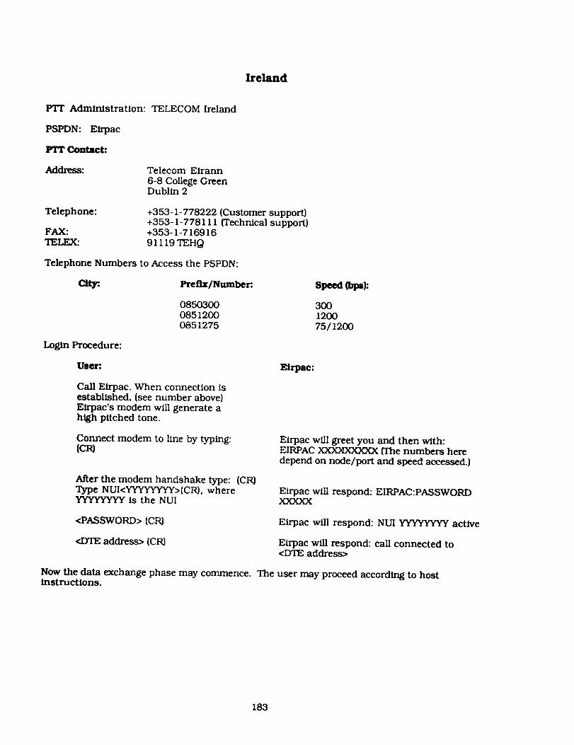
Ireland
PTT Administration: TELECOM Ireland
PSPDN: Eirpac
PTT Contact:
Address: Telecom Eirann
6-8 College GreenDublin 2
Telephone:
FAX:TELEX:
+353-1-778222(Cu_omersupport)+353-1-778111{Technicalsupport)+353-1-71691691119TEHQ
Telephone Numbers to Access the PSPDN:
City:. Prefix/Number. Speed {bps):
Login Procedure:
085030008512000851275
300120075/1200
User:.
Call Eirpac. When connection isestablished, (see number above)Eirpac's modem will generate ahigh pitched tone.
Eirpac:
Connect modem to line by typing:{ca
After the modem handshake type: (CR)Type NUI<YYYYYYYY>(CR), whereYYYYYYYY is the NUI
Eirpac will greet you and then with:EIRPAC XX:SCE_OC3CXX{The numbers heredepend on node/port and speed accessed.)
Eirpac wiU respond: EIRPAC:PASSWORDXXXXX
<PASSWORD> (CR)
<DTE address> {CR)
Eirpac will respond: NUI YYYYYYYY active
Eirpac 'will respond: call connected to<DTE address>
Now the data exchange phase may commence. The user may proceed according to hostinstructions.
183

Iz_out Procedure:
Ule_. Eirpac:
To end the can enter:(CTRL)P, and then: EIRPAC:CLR{C_
Eirpac will respond:call cleared-local directive
The user may choose to either disconnect the physical circuit, or to log into another host.
184

Italy
PTF Administration: Minlstero delle Poste e delle Telecommunicazlonl
PSPDN: Itapac
Frr conrad:
Address: Direzione Centrale Servizi Telegraf iciViale America00100 Roma
Telephone:FAX:TELEX:
+39-6-54601 {Ext. 4969}+39-6-546049616100700 GEENTEL I
Login Procedure:
User;
Call Itapac access number of thecity in which you are located orthat of the nearest node.
Itapae:
Itapac will send back a high pitched tone.
On hearing the high pitched tone,press the data button on modemwithin 10 seconds.
Send 2(CR) characters within30 seconds.
Itapac will send the network identification,the PAD {ACP) identifier and the PSTNaccess point identifier Example: ITAPAC<ROMA>PORTA:<5>
Send the can request, specifyingthe NUI and the address identificationthe (NUA) of the user data field:where YYYYYY = NUI and ZZZZZZ = NUA.
Itapac sends the established virtual call:N<YYYYYY>-<ZZZZZZ>D(or P) [<ABC>] ofACP:COM
Note: If the letter P is used instead of D, data will not be displayed on your terminal.
Now the data exchange phase may commence. The user may proceed according to hostinstructions.
_out Procedure:
User: Itapac:
To end the call enter: Itapac will answer: CLR and then send the(CTRL)P disconnection request CLR CONF
The user may choose to either disconnect the physical circuit, or to log into another host.
185


The Netherlands
PTT Administration:
PSPDN: Datanet 1
PTT Contact:
Address:
Telephone:FAX:TELEX:
ESANET NUA:
+2041-17117 lxxxx+204 1-171075xxxx+204 1-171003xxxx
Login Procedure:
User:.
Call Datanet 1
(see numbers above)
Type:
A(CR) for ASCII terminal0(CR) for Prestel terminal5(CR) for Teletel terminal
PTI" TELECOM
PTr DatacommunicatiePostbus 30000
2500 GA, Den Haag
+31-70-438544+31-70-433794312551TELNL
Type the NUI: YYYYYY(CR)
Type thepassword:PPPPPPPP(C_
Send the call requestspecifying the NUA (CR)
Application:
ESAPACNSI/DECnetDATUS
Datanet 1:
Datanet 1 will ask for terminal identifier:
Basic menu appears.
TER
Datanet 1 will ask for NUI: Gebruikersnummer:
Datanet 1 will ask for password:
The password is echoed as dashes.After validation, the 8 alphanumeric characters
the following message appears: WELKOM TODATANET I
Now the data exchange phase may commence. The user may proceed according to hostinstructions.
Logout Procedure:
To end the call enter:<CTRL>P
The user may choose to either disconnect the physical circuit, or to log into another host.
Datanet 1:
Datanet I will answer: CLR[CR) and then send thedisconnection request CLR CONF
18_I:_CEDING PAGE BLANK NOT FILMED


Norway
PTr Administration: PTT-N
PSPDN: Datapak
FIT Contact:
Address: PTT-NTeleverketPostboks 6701St Olavs Plass0131 Oslo
Telephone: +47-2-488990FAX: +47-2-488720TELEX: 71203 GENTL N
Telephone Numbers to Access the PSPDN:
City:. Prefix/Number: Speed (bps):
016501650165
3OO120075/1290
Login Procedure:
Us_-:. Datapak:
Call Datapak(see numbers above).
Datapak will answer:(PSE/A(MACHINE)-PORT Address)
Enter service request signal:(CR) (terminal type) (CR)
Enter the SELECT command:N(ID AND PSWD)-A(X. 121Address)
Datapak will respond: (X> 121Address)+COMDatapak will display the values of the requestedparameters. For example: (CR)DI(CR)OSL/A02-9090003346123456-A0311090900029311090900029+COM
Now the data exchange phase may commence. The user may proceed according to hostinstructions.
LogoutProcedure:
User: Datapak:
To end the call enter:(CTRL}P and then sendaccounting data.
Datapak provides the clear the disconnectionrequest with CLR CONF (i.e., CLR[CR)CLR message: CONF(00)dd:hh:mm; ss rr ss)
The user may choose to either disconnect the physical circuit, or to log into another host.
189_ll_J_hl;l,jt_LLf _',.A_'_K PRECEDING PAGE BLANK NOT FILMED


Spain
PTY Administration:
PSPDN: Iberpac
PTT Contact:
Address:
TELEFONICA-CTNE
TELEFONICA-CTNE
Departamento de TelematicaAvenida del Brasfl 17Madrid 20
Telephone:FAX:TELEX:
ESANET NUA:
+2145-213021332x
Login Procedure:
User:.
Call Iberpac(see numbers above).
Entel:... (CR)
+34-1-4105460+34-1-419484047786CTNEE
Enter (in capital letters):N<NUI-0DATEaddress>[data][CR)
Application:
ESAPAC
Iberpac:
Iberpac will send a high pitched tone.
Iberpac provides the simple profile and greets youwith IBERPAC
Iberpac will answer: COM call connected
Now the data exchange phase may commence. The user may proceed according to hostinstructions.
Logout Procedure:
User:.
To end the call enter:cI_Cl_
The user may choose to either disconnect the physical circuit, or to log into another host.
Iberpac:
Iberpac will answer: CLR CONF
191NTIONAL{'_'_:_,::, PR_CEDII',IGPAGE BLAI'_ NOT FILMED


Sweden
FIT Administration: PTT-S
PSPDN: Datapak
PI"I" Contact: PTT- S
Address: Televerket
Marbackagatan 1112386 Farsta
Telephone:
FAX:TELF__
020-910025 (National)+46-8-7806228 (International)+48-8-7006181
12020 DATASTH S
Telephone Numbers to Access the PSPDN:
aW. Prefix/Number. Speed tt_):
0209-100260209-100280209 - 100280209-10027
3OO12002400
75/1200
Login Procedure:
User:
Call Datapak.(see above numbers)
Datapak
When modem line is established, Datapak willanswer: PLEASE TYPE YOUR TERMINALIDENTIFIER
Enter A or the terminal
identifier valid for yourequipment.
Datapak greets you with: ***DATAPAK PADSERVICE***2020:01-007-PAD READY
Enter the sequence:
Cu N<usemame>password-<DTE address> (CR)
Datapak will answer: COM: CALL CONNECTED
Now the data exchange phase can commence. The user may proceed according to hostinstructions.
Logout Procedure:
User: Datapak:
To end the call enter:
(CTRL) PCLR{CR)
Datapak will answer and then send thedisconnection request: CLR CONF: CALLCLEARED BY REQUEST
The user may choose to either disconnect the physical circuit, or to log into another host.
193
PRECEDINGPAGEBLANKNOTFILMED


Switzerland
PTT Administration:
PSPDN: Telepac
PTT Contact:
Address:
Telephone:FAX:TELEX:
Login Procedure:
User:
Call Telepac.
Enter D(T) (CR)
BETRIEBE
Generaldirektion der PTT BetriebeViktoriastrasse 213030 Berne
+41-31-621111+41-31-622549911010PTTCH
Enter: NUI(space)YYYYY
Enter: 4ZZZZZZ (national)0ZZZZZZ (international)
Telepac:
Telepac will send back a high pitched tone.
Telepac will answer: 4 XXX XXX (Telepac accessport number to communicate if trouble.)
Telepac asks for password: PASSWORD PPPPP
Telepac will answer: CALL CONNECTED TOZZZZZZ
Now the data exchange phase may commence. The user may proceed according to hostinstructions.
Logout Procedure:
User: Telepac:
To end the call enter:{OTRL) PCt.R(CR)
Telepac will answer and then send thedisconnection request: CALL CLEAREDREMOTE/LOCAL DIREC'ITVE
The user may choose to either disconnect the physical circuit, or to log into another host.
195
_.iL_, r. j


United Kingdom 1
PTT Administration:
PSPDN: PSS
Pl"r Contact:
Address:
Telephone:
FAX:TELEX:
BRITISH TELECOM
PSS
Angel Centre403 St John's StreetLondon EC 1V 4PL
+44-71-2391313 (London area)+44-61-2366702 (Outside London)+44-71-2390943883O4O
Telephone Numbers to Access the PSPDN: The access telephone numbers are ordy valid for thePacket Switching Exchange [PSE) where your NUI is validated. Users receive a list of thosenumbers with the NUI.
ESANET NUA:
+2342-84400205xx
Logln Procedure:
User:
Call PSS.
Connect your terminal on line.
Enter. (CR) (CR)XX(CR) whereXX = D I for VDUs and A7 forteletype terminals.
Enter: N[Y](CR} where Y = 12character NUI.
Enter:. A[Z](CR)
Application:
ESAPAC
PSS:
The PSS will send back a high pitched tone.
The PSS will respond with the exchangeidentification code. The last six characters andthe port number are not echoed to the terminalthat has been connected.
The PSS will ask: ADD?
The PAD shows that the call has beenestablished: [NUA}+COM
For UK calls, the NUA should be (CR) (IF) used. lessthe prefix 234.
For international calls, the NUA should be
prefixed by 9.
Now the data exchange phase may commence. The user may proceed according to hostinstructions.
197 FRECED!,_G PA,"._E Bi.A._._ _'_ F_LMED

Logout Procedure:
User:
To end the call enter:[c'rRL)P
CLR
The user may choose to either disconnect the physical circuit, or to log into another host.
PSS:
PSS will answer and then send the disconnection
request CLR DTE
198

United Kingdom 2
PT'r Administration:
PSPDN: PDS
Contact:
Address:
Telephone:FAX:TELEX:
MERC URY
PDSNew Mercury House26 Red Lion SquareLondon WC IR 4HQ
+44-71-5282000+44-71-5288121910000 MERCOM G
Telephone Numbers to Access the PSPDN:
City:. Prefix/Number:
United Kingdom 71-847591571-8476040
Speed (bps):
3OO1200
Login Procedure:
Us4_r:
Ca]] PDS(see numbers above).
Connect your terminal online.
Enter your terminal identifier.
Now you may require a controlcharacter. Then, enter your username followed by a (CR)
Enter. <P> (CR)If password is not required,(duplex terminals) type: ",",<P>(CP0
PDS:
The PDS will send back a high pitched tone.
PDS will request for your terminal identifier.
The PDS will display MERCURY DATA SERVICEfollowed by the number of the node to which youare connected and the port. Then, it will requestyou to Iogon.
The PDS will ask for your password.
The password is not echoed in full.
The PDS will ask for host address.
Enter <Z>(CR), where P = NUIand Z = NUA
Now the data exchange phase can commence. The user may proceed according to hostinstructions.
After the user has logged off from the host computer, he/she may choose to either disconnectthe physical circuit, or to log into another host.
199


VIII. Indices


VIII. Indices Page
A. Missions, Systems. and Centers
ACTSDSCDAWCSDSCRRESDEDMSP Auroral Oval Data BaseESISEXOS-DGEOTAILGGSINTSDSISTPMAX '91MDMPINODISPDS OverviewPDS Geosciences Node (IRPS)PDS NAIF Node
PDS Planetary Atmospheres Node (PANDA)PDS PPI Node
PDS Planetary Rings NodePDS Small Bodies NodeRAL GDFSODASSELDADSSELSISSMM DACSOHOSSCUARSUCLASSC
216139
91151531527393329
I09675971798387919599
I01103
II113121105
457517
125
_NTIC 203mAtt_ .....'pIRE,LE_!i'0G PA.'-_. BLAN_ NO'_
F!LME_


13. Systems and Networks
Data System
CDAWCSDSCRRESDMSP Auroral Oval Data BaseEXOS-D
GGS (ISTP)GEOTAILMAX '91MD
MPI Extraterrestrial PhysicsNODIS
PDS Central Node
PDS Geoscience Node (IRPS)PDS NAIF Node
PDS Planetary Atmospheres NodePDS Planetary Plasma Interactions NodePDS Rings NodePDS Small Bodies NodeRAL GDFSDDAS (DE)SELDADSSELSISSMM DAC
SOHOSSCUARS
UCLASSC
Direct Networks
NSI/DECnet, IntemetESIS, NSI/DECnetNSI/DECnetNSI/DECnetN-1NSI/DECnetN-1
NSI/DECnet, IntemetNSI/DECnetNSI/DECnet, IntemetNSI/DECnet. IntemetNSI/DECnet. IntemetNSI/DECnetNSI/DECnet, IntemetNSI/DECnetNSI/DECnet, IntemetNSI/DECnet, IntemetNSI/DECnetJANETNSI/DECnet, Intemet
None, dial up onlyNSI/DECnet, TelnetNSI/DECnet. Intemet(available last quarter of 1990)NSI/DECnetNSI/DECnetUARSnet. NSI/DECnet,Internet
NSI/DECnet, Intemet
'__mi_N .'T.]OI_ALU: _::L"_"_- 205


C_ Networks and Systems
Direct Networks
ESISInternet
JANETN-1
NSI/DECnet
Telnet
UARSnet
Data Systems
CSDSCDAWMAX '91MPINODISPDSPDS NAIF Node
PDS Planetary Plasma Interactions NodePDS Rings NodeSSDAS
SMM DAC (available last quarter of 1990)UARSUCLASSCRAL GDFEXOS-DGEOTAILCSDSCDAWCRRESDMSP
GGS (ISTP)MAX '91MDMPINODISPDS Central NodePDS Geosciences NodePDS NAIF Node
PDS Planetary Atmosphere NodePDS Planetary Plasma Interactions NodePDS Rings NodePDS Small Bodies NodeSSDAS (DE)SMM DACSELSISSOHOSSC
UARSUCLASSCSELSISUARS
207