CMEMS Sea Level Satellite Products
20
Marine Monitoring Implemented by This slideshow gives an overview of the CMEMS Sea Level Satellite Products LEVEL1 – For Beginners- Slides have been prepared in Nov 2016 CMEMS Sea Level Satellite Products
-
Upload
khangminh22 -
Category
Documents
-
view
1 -
download
0
Transcript of CMEMS Sea Level Satellite Products
Marine Monitoring
Imp
lem
ente
d b
y
This slideshow gives an overview of the CMEMS Sea Level Satellite Products
LEVEL1 – For Beginners- Slides have been prepared in Nov 2016
C M E M S S e a L e v e l S a t e l l i t e P r o d u c t s

Marine Monitoring
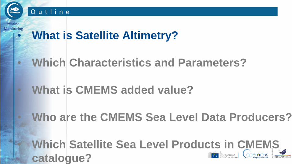
O u t l i n e
• What is Satellite Altimetry?
• Which Characteristics and Parameters?
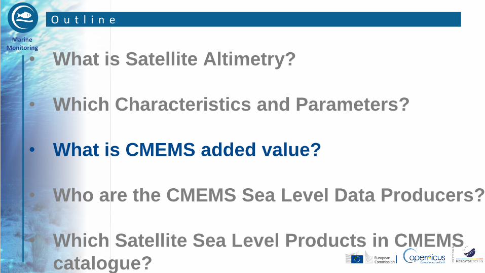
• What is CMEMS added value?
• Who are the CMEMS Sea Level Data Producers?
• Which Satellite Sea Level Products in CMEMS
catalogue?
Marine Monitoring
O u t l i n e
• What is Satellite Altimetry?
• Which Characteristics and Parameters?
• What is CMEMS added value?
• Who are the CMEMS Sea Level Data Producers?
• Which Satellite Sea Level Products in CMEMS
catalogue?

Marine Monitoring
W H A T I S S A T E L L I T E A L T I M E T R Y ? ( 1 / 3 )
• SATELLITE SEA LEVEL is measured
by a sensor called « altimeter or SAR
altimeter » on board of several
satellites.
• The altimeter measures the sea
surface height at the surface of the
ocean with respect to a reference
level.

Marine Monitoring
W H A T I S S A T E L L I T E A L T I M E T R Y ? ( 2 / 3 )
• Altimeters determine the distance between the satellite
and the ocean surface by measuring the time it takes a
radar pulse to travel from the satellite to the ocean
surface and back.
• The systems for determining the satellite precise location
in orbit (« DORIS », GPS and laser) are also a critical
element for obtaining accurate sea surface height, since
it gives the reference.
Marine Monitoring
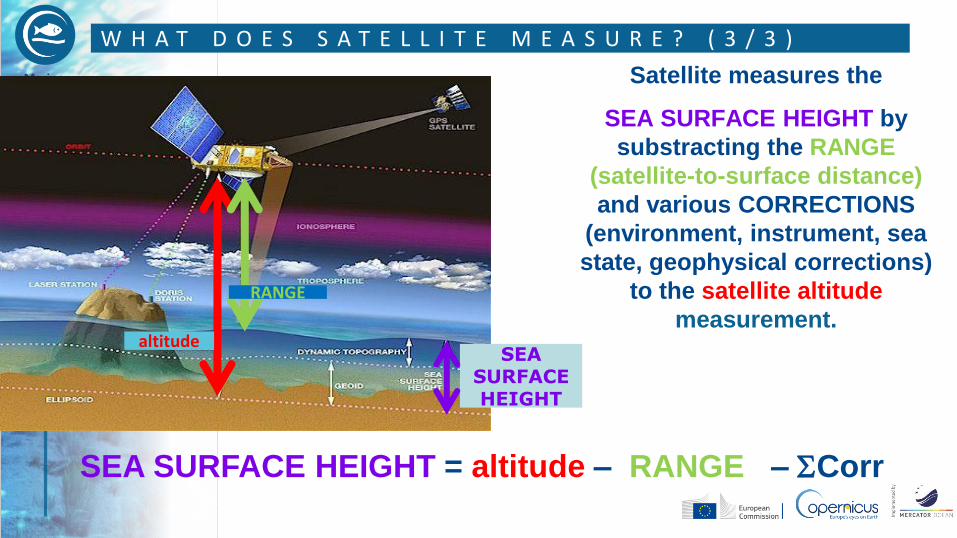
W H A T D O E S S A T E L L I T E M E A S U R E ? ( 3 / 3 )
SEA SURFACE HEIGHT
RANGE
altitude
SEA SURFACE HEIGHT = altitude – RANGE – Corr
Satellite measures the
SEA SURFACE HEIGHT by
substracting the RANGE
(satellite-to-surface distance)
and various CORRECTIONS
(environment, instrument, sea
state, geophysical corrections)
to the satellite altitude
measurement.

Marine Monitoring
O u t l i n e
• What is Satellite Altimetry?
• Which Characteristics and Parameters?
• What is CMEMS added value?
• Who are the CMEMS Sea Level Data Producers?
• Which Satellite Sea Level Products in CMEMS
catalogue?

Marine Monitoring
A l t i m e t r y i s n o t i m a g e r y … ( f o r n o w )
NB. basically altimetry data
are “along-track”, i.e. a
narrow thread of
measurements just beneath
the satellite
Sea Level Anomaly on May , 12-14th (cm) From Jason-2, Altika, Cryosat-2 and HY2A
Marine Monitoring
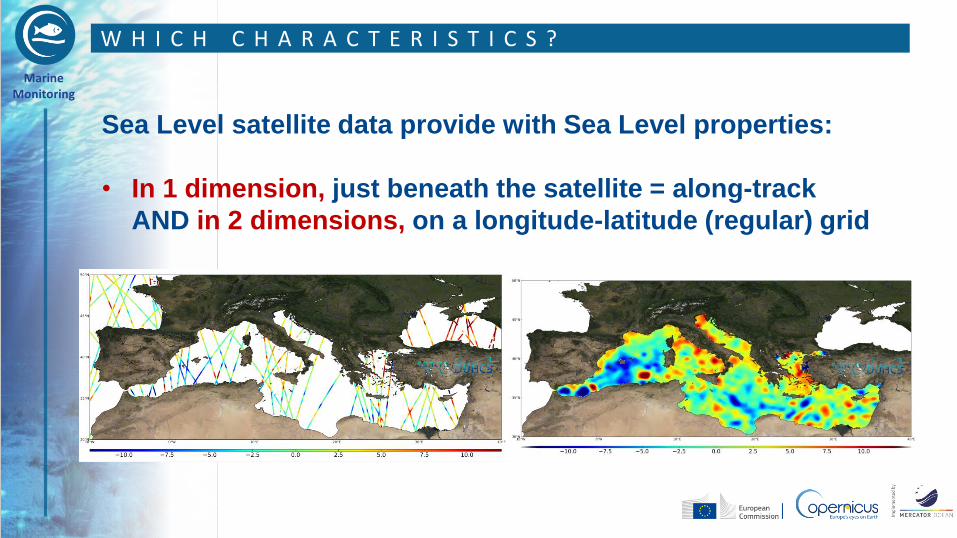
W H I C H C H A R A C T E R I S T I C S ?
Sea Level satellite data provide with Sea Level properties:
• In 1 dimension, just beneath the satellite = along-track
AND in 2 dimensions, on a longitude-latitude (regular) grid
Marine Monitoring
W H I C H C H A R A C T E R I S T I C S ?
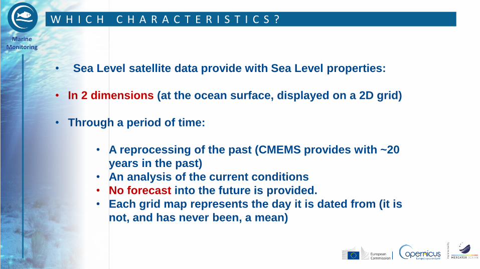
• Sea Level satellite data provide with Sea Level properties:
• In 2 dimensions (at the ocean surface, displayed on a 2D grid)
• Through a period of time:
• A reprocessing of the past (CMEMS provides with ~20
years in the past)
• An analysis of the current conditions
• No forecast into the future is provided.
• Each grid map represents the day it is dated from (it is
not, and has never been, a mean)

Marine Monitoring
W H I C H P A R A M E T E R S ?
CMEMS SEA LEVEL Satellite products provide with the following information:
• SEA SURFACE HEIGHT ANOMALY, i.e. sea surface height with respect to a
several-year mean (ssh variability)
• & derived geostrophic current velocities
computed from surface slopes ; include “only” current variability
• SEA SURFACE ABSOLUTE HEIGHT, i.e. sea surface height with respect to the
geoid (absolute dynamic topography)
• & derived geostrophic current velocities
computed from surface slopes ; includes mean currents’ flow (Gulf Stream,
Kuroshio…)
Those data were formerly distributed through the Aviso center
Marine Monitoring
O u t l i n e
• What is Satellite Altimetry?
• Which Characteristics and Parameters?
• What is CMEMS added value?
• Who are the CMEMS Sea Level Data Producers?
• Which Satellite Sea Level Products in CMEMS
catalogue?
Marine Monitoring
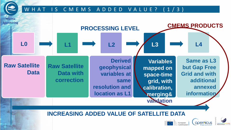
W H A T I S C M E M S A D D E D V A L U E ? ( 1 / 3 )
L0 L1 L2 L3 L4
CMEMS PRODUCTS PROCESSING LEVEL
Raw Satellite
Data Raw Satellite
Data with
correction
Derived
geophysical
variables at
same
resolution and
location as L1
Variables
mapped on
space-time
grid, with
calibration,
merging&
validation
Same as L3
but Gap Free
Grid and with
additional
annexed
information
INCREASING ADDED VALUE OF SATELLITE DATA
Marine Monitoring
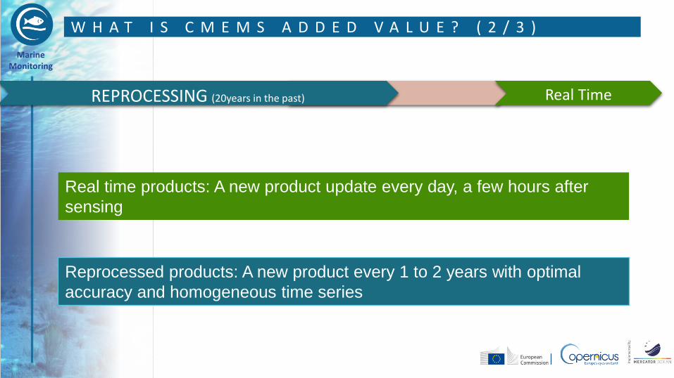
W H A T I S C M E M S A D D E D V A L U E ? ( 2 / 3 )
Reprocessed products: A new product every 1 to 2 years with optimal
accuracy and homogeneous time series
Real time products: A new product update every day, a few hours after
sensing
REPROCESSING (20years in the past) Real Time
Marine Monitoring
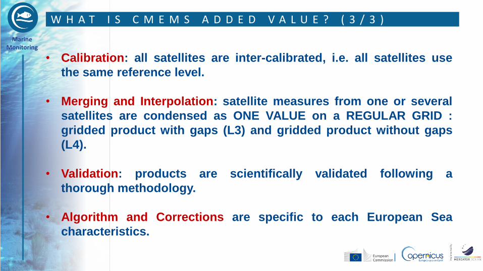
W H A T I S C M E M S A D D E D V A L U E ? ( 3 / 3 )
• Calibration: all satellites are inter-calibrated, i.e. all satellites use
the same reference level.
• Merging and Interpolation: satellite measures from one or several
satellites are condensed as ONE VALUE on a REGULAR GRID :
gridded product with gaps (L3) and gridded product without gaps
(L4).
• Validation: products are scientifically validated following a
thorough methodology.
• Algorithm and Corrections are specific to each European Sea
characteristics.
Marine Monitoring
O u t l i n e
• What is Satellite Altimetry?
• Which Characteristics and Parameters?
• What is CMEMS added value?
• Who are the CMEMS Sea Level Data Producers?
• Which Satellite Sea Level Products in CMEMS
catalogue?
Marine Monitoring
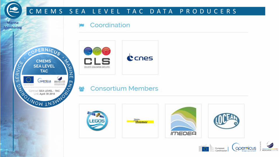
C M E M S S E A L E V E L T A C D A T A P R O D U C E R S

Marine Monitoring
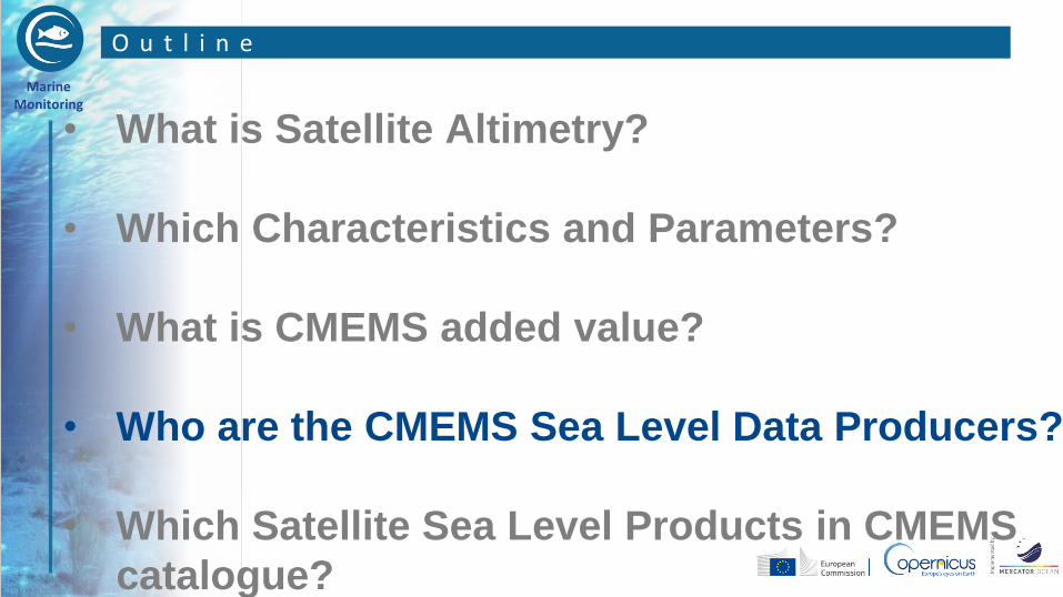
O u t l i n e
• What is Satellite Altimetry?
• Which Characteristics and Parameters?
• What is CMEMS added value?
• Who are the CMEMS Sea Level Data Producers?
• Which Satellite Sea Level Products in CMEMS
catalogue?

Marine Monitoring
SEA LEVEL Satellite products over the GLOBAL Ocean and all European
Seas are sorted into 2 categories:
• Along Track Sea Level Anomaly L3 Along Track- Real Time and Reprocessed SEALEVEL_(AREA)_SLA_L3_(NRT)or(REP)_OBSERVATIONS_008_XXX
• Gridded Sea Level Anomaly Maps
L4 gridded - Real Time and Reprocessed
SEALEVEL_(AREA)_SLA_MAP_L4_(NRT )or (REP)_OBSERVATIONS_008_XXX
W H I C H P R O D U C T S I N C M E M S C A T A L O G U E ?
Marine Monitoring
A n y q u e s t i o n , a n y t i m e : s e r v i c e d e s k . c m e m s @ m e r c a t o r - o c e a n . e u