
natural cataclysms and global problems of the modern ...
761
-
Upload
khangminh22 -
Category
Documents
-
view
0 -
download
0
Transcript of natural cataclysms and global problems of the modern ...
International Council For Scientific DevelopmentINTERNATIONAL ACADEMY OF SCIENCE
H&E
NATURAL CATACLYSMS AND GLOBAL PROBLEMS
OF THE MODERN CIVILIZATION
Special edition of Transactions of the International Academy of Science
H&E
Baku – Innsbruck - 2007
EDITORIAL BOARD
CHAIRMAN OF THE EDITORIAL BOARD:
Prof., Dr. Walter Kofler - President of International Academy of Science H&E. (Innsbruck, Austria).
CO-CHAIRMEN
Dr. Ishfag Ahmad – President of Pakistan Academy of Sciences – Special Advisor to the Prime Minister of Pakistan. Prof., Dr. Makhmud Kerimov – President of National Academy
of Sciences.
EXECUTIVE SECRETARY
Prof., Dr. Elchin Khalilov - Vice-President of International Academy of Science, President of Azerbaijan Section of IAS, Chairman of Expert Council of Higher Certifying Commission
at the President of Republic of Azerbaijan.
MEMBERS OF EDITORIAL BOARD:
I.Malik (biology) Pakistan; A.Abbasov (information science) Azerbaijan; K. Sudakov (medicine) Russia; R.Steinacker (meteorology) Austria; G.Fumarolla (environment) Italy; G.Mammadov (soil science) Azerbaijan; G.Tellnes ( medicine ) Norway; D. Schnaiter (medicine) Austria; K. Hecht (medicine) Germany; Z. Samedzade (economy) Azerbaijan; T.Aliyev ( cybernetics ) Azerbaijan; F. Halberg ( medicine ) USA; H.Gökcekus (ecology) Nicosia; V. Khain (geology ) Russia; O. Glazachev ( medicine ) Russia; A. Meliala ( medicine ) Indonesia; P.Gulkan ( construction ) Turkey; J.Sartohadi (geography) Indonesia; G. Georgiyev ( geology ) Bulgaria; A. Simpson ( geophysics ) USA; R. Lobato ( journalism ) Brazil; P. Keshavan (biology) India; Y.Nusipov ( geophysics ) Kazakhstan; C. do Valle (environment) Brazil;
NATURAL CATACLYSMS AND GLOBAL PROBLEMS OF THE MODERN CIVILIZATION. Spesial edition of Transaction of the International Academy of Science. H&E. ICSD/IAS, Baku-Innsbruck, 2007.
The book includes articles presented at International Interdisciplinary Workshop titled as “NATURAL CATACLYSMS AND GLOBAL PROBLEMS OF THE MODERN CIVILIZATION” (Baku, September 24-27, 2007).
© International Academy of Science. H&E Sponsor is the Ministry of Communication and Informational technologies of Azerbaijan.
ISBN
ICSD/IAS Áàêû — Innsbruck - 2007
M
Машинописный текст
978-9952-81-15-2-0
M
Записка
MigrationConfirmed установлено M
NATURAL CATACLYSMS AND GLOBAL PROBLEMS OF THE MODERN CIVILIZATION. Special edition of Transaction of the International Academy of Science. H&E. ICSD/IAS, Baku-Innsbruck, 2007.
3
C O N T E N T S
INTRODUCTION……………………………………………………………………... 20
PLENARY TALKS
Walter Kofler, David Schnaiter, Ronald Weinberger NON-LOCAL REALISM AND EVOLUTION UP TO HUMAN HEALTH……………………………………………………………........ 23
Abbasov Ali. M. SOCIO-HUMANITARIAN PROBLEMS OF THE INFORMATION SOCIETY………………….………………….……….….... 25
Mehdiyev A.Sh. INTEGRATED SYSTEM OF MONITORING OF NATURAL PERILS AND OBJECTS OF OCIAL SPHERE …….……………………………………………………………………. 30
Dr. Rudolf Koll HOW TO DEAL WITH DISASTERS: A CASE FOR INTERNATIONAL COLLABORATION………………………………………... 34
Mammadov G.Sh. ECOETHICAL PROBLEMS OF TECHNOGEN DISORDERED SOILS ………………..……………………...………………………..… 37
Aliev T.A., Mammadova G.H., Aliev E.R.DIGITAL TECHNOLOGY AND SYSTEM OF NOISE MONITORING OF FAILURE ORIGIN. ………………………………….…………… 41
Khalilov E.N. ABOUT POSSIBILITY OF CREATION OF INTERNATIONAL GLOBAL SYSTEM OF FORECASTING THE EARTHQUAKES “ATROPATENA” (Baku-Yogyakarta-Islamabad)………………………………………..……….……….... 51
SPECIAL SECTION
Khalilov E.N., Mammadova G.H., Khalilova T. Sh. NEW TRACES OF THE CASPIAN ATLANTIS…………….……………………...… 70
Mekhtiev A.Sh., Badalova A., Ismatova Kh.R. AN APPROACH TO SURVEY OF POLLUTION OF THE CASPIAN SEA……………….…….…………………………………………………… 77
NATURAL CATACLYSMS AND GLOBAL PROBLEMS OF THE MODERN CIVILIZATION. Special edition of Transaction of the International Academy of Science. H&E. ICSD/IAS, Baku-Innsbruck, 2007.
4
Rashidov T., Kuzmina E., Turdukulov A., Khudaybergenov A., Rashidov I.SEISMIC HAZARD ASSESSMENT FOR THE CITY OF TASHKENT.…..……………………………………………………… 86
Iftikhar Ahmad Malik, Waheed uz Zamaan Tariq THE SPECTRUM OF HEPATITIS –E IN PAKISTAN…………..…………………… 93
Reinhold Steinacker DOES THE FLOODING HAZARD IN MID LATITUDE MOUNTAINOUS AREAS INCREASE DUE TO GLOBAL WARMING?.................. 100
Gunnar Tellnes, Johan Lund COMMUNITY BASED INJURY PREVENTION……………...…………………..…. 101
Khain V.Y., Khalilov E.N. RHYTHMS OF NATURAL CATACLYSMS AND SUPER-LONG GRAVITATIONAL WAVES……………..……………………. 105
Cornelissen G., Halberg F., Khalilov E., Hillman D. Wendt H.W., Nolley E.S., Beaty L.A., Schwartzkopff O., Holte J., Otsuka K., Singh R.B. CAN CHRONOMICS HELP BUILD A UNIFIED SCIENCE?...............…………….. 119
Mavrodiev S. Cht., Rusov V.D., Mihalys .INSOLATION AND GALACTIC COSMIC RAYS AS RULING PARAMETERS (VARIABLES) IN CLIMATE STATES HEXARCHY AT DIFFERENT TIME SCALES – THE CLIMATE AS FUNDAMENTAL PHYSICS PROBLEM…….………..…………………………….... 123
Karl Hecht, E. N. Savoley DISTRESS AND POST-TRAUMATIC STRESS DISORDER (PTSD) IN NATURAL DISASTER PREVENTION AND THERAPY .………………………………………………….… 125
Giuseppe Fumarola DESERTIFICATION UNDER THREAT OF CLIMATE CHANGE AND HUMAN ACTIVITY …….…………………..…… 132
Georgiev G.V., Rempel H.AVAILABILITY OF OIL AND NATURAL GASAND ENERGY SUPPLY IN THE 21ST CENTURY …….……………………..… 137
Figovsky O., Magarshak Yu. NON-WASTE CIVILIZATION: UTOPIA OR REALITY? …………………….…... 149
Glazachev O.S., Platonenko V.I., Glazko N.B. NEW METHOD BASED ON MULTIFACTOR DEVICE ALFA OXY SPA FOR COMPLEX REHABILITATION OF SA PATIENTS …………………………………..……...… 156

NATURAL CATACLYSMS AND GLOBAL PROBLEMS OF THE MODERN CIVILIZATION. Special edition of Transaction of the International Academy of Science. H&E. ICSD/IAS, Baku-Innsbruck, 2007.
5
S.M. Chibisov, V.A. Frolov, K. Agarwal Rajesh, Franz. HalbergSPACE AND BIOSPHERE: PHYSIOLOGICAL DATA VARIATION IN RABBITS UNDER EXTREME ENVIRONMENTAL CONDITIONS (MAGNETIC STORM).………….………………………….…………………………. 161
Franz Halberg CHALLENGES FROM "60 YEARS OF [NOT YET] TRANSLATIONAL CHRONOBIOLOGY"…………………………………………… 165
Huseyin Gokcekush, Umut Turker, Hatice Gokcekush, Temel Rızza, Mustafa SıdalTHE MANAGEMENT OF POLLUTED COASTAL MINING ACTIVITIES AT MORPHOU BAY, NORTHERN CYPRUS………...………………………………….. 179
I PART: GEOSPHERE AND SPACE
Budag Budagov SOME ASPECTS OF FORECASTING THE ECOLOGICAL SITUATION(BY THE EXAMPLE OF AZERBAIJAN)………….….………………………………. 188
Hasanov A.B., Alizade Z.M,. Allahverdiyeva. S.S. INTELLECTUALLY INFORMATION EXPERT SYSTEMS AND COMPLEXES OF THE FORECAST AND MATHEMATICAL MODELING OF NATURAL GEOLOGICAL ACCIDENTS…………..…..………..… 190
Christoph J. Blasi NEW TECHNOLOGY TO MEASURE THE WATER LEVEL AND THE SEA STATE ……….……………………………………..……… 193
Nusipov Y. SEISMOTECTONIC AND GEODYNAMIC MODELLING IN KAZAKHSTAN: CONDITION, PRIORITIES AND TENDENCIES ……………………..…………………….… 201
Bertan Goger O., Jemal ErtashHIGH RESOLUTION SATELLITE IMAGERY SHEDS LIGHT ON NATURAL DISASTER ASSESSMENTS ……………………… 206
Hafeez M. A. IMPACT OF THE RECENT EARTHQUAKE (OCTOBER 8, 2005) IN PAKISTAN ON THE BIODIVERSITY AND NATURAL RESOURCES OF THE AFFECTED AREAS AND MITIGATION EFFORTS: A REPORT …….…………………………………..…… 209
NATURAL CATACLYSMS AND GLOBAL PROBLEMS OF THE MODERN CIVILIZATION. Special edition of Transaction of the International Academy of Science. H&E. ICSD/IAS, Baku-Innsbruck, 2007.
6
Veliyev H.O., Muradova H.R. MUD VOLCANOES AND MUD VOLCANO RELATEDHAZARDS IN OIL WELLS ……………...……………………………………….…… 217
Imanov F., Kuliyeva A., Rajabov R. HYDROLOGICAL DROUGHT IN AZERBAIJAN……………..…………………….. 220
Rashidov T., Turdukulov A., Erdik M., Safak E. ASSESSMENT AND MITIGATION OF SEISMIC RISK IN TASHKENT, UZBEKISTAN AND BISHKEK, KYRGYZSTAN………..……..… 224
Hasanov A.B., Huseynov N.N., Tahirov T.S., Babacanova V.B.APPLYING OF MATHEMATICAL METHODS TO A SOLUTION OF A PROBLEM SEISMIC MICRO ZONING ….………………………..…………… 238
Nader Jalali INVESTIGATION OF THERMAL PROPERTIES OF CARBONATE FORMATIONS IN A KARSTIC REGION OF IRAN, BY USING SATELLITE IMAGE…………………………………...……… 241
Anisimov L.A., Deliya S.V. NATURAL HAZARDS AND RISKS IN THE NORTH CASPIAN BASIN……..………………………………………………………. 246
Polat Gulkan, Elchin KhalilovPERSPECTIVES OF APPLICATION THE NEW TECHNOLOGY OF SEISMIC STABLE CONSTRUCTION (PROJECT NATO ESP.EAP.SFP 982167)……………………………………………. 250
Vlasov A., Volkov-Bogorodsky D.B., Kurochkina V.A.,Mnushkin A., Blasi C.J. APPROXIMATION OF SEA SURFACE TO OPTIMIZE TIDE GAUGE NETWORK ………………….…………………………………………. 255
Krivonosov R.I., Khvostantsev S.V.,Nikolaev E.B., Gratchev V.G. RUSSIAN NATIONAL SYSTEM OF MONITORING GEOPHYSICAL PROCESSES AND REAL TIME VARIATIONS THEREOF……………………….……………………………………… 260
Muhammad Qaisar, Muhammad Daud Shah, Tariq Mahmood,Zahid Ali MUZAFFARABAD EARTHQUAKE OF OCTOBER 8, 2005:SEISMOLOGICAL ASPECTS……………….…………………………………………. 264
NATURAL CATACLYSMS AND GLOBAL PROBLEMS OF THE MODERN CIVILIZATION. Special edition of Transaction of the International Academy of Science. H&E. ICSD/IAS, Baku-Innsbruck, 2007.
7
Muhammad Daud Shah STRONG MOTION DATA FROM THE MUZAFARABAD EARTH QUAKE OF OCT, 8 2005………………….………………………………….. 264
Gasanov A.G., Keramova R.A. TECHNOLOGY OF FORECASTING OF STRONG AND CATASTROPHIC EARTHQUAKES BY SEISMOGEOCHEMICAL METHOD IN AZERBAIJAN.………………………….…. 265
Nader Jalali AUTOMATIC EXTRACTION OF HYDROLOGICAL DATA USING RADAR BASED DIGITAL ELEVATION MODEL (SRTM DATA) FOR AN AREA IN BAKU REGION ……………..……..…. 267
Idarmachev Sh., Abdulaev Sh., Aliev M. VARIATIONS OF GEOELECTRIC RESISTANCE AND WATER LEVEL IN A BOREHOLE AT THE WESTERN COAST OF CASPIAN SEA BEFORE SUMATRA EARTHQUAKE ON DECEMBER, 26, 2004 …………………….….…………………………………… 272
Maghidov S.Kh.THE LARGEST EARTHQUAKES, THEIR DETERMINATION AND ATTEMPT OF CLASSIFICATION…………….………………………………… 275
Allegrini, R. Bellagotti, M. Biscotto, Ciuchini C.,Colella P., Fino A., Leonardi C., Moroni E., Radetic Z., Vichi F.PRELIMINARY ASSESSMENT OF AIR QUALITY IN PANCEVO……….………… 284
Shahid A. Khan EARTHQUAKES IN PAKISTAN: EFFORTS FOR RESEARCH IN EARTHQUAKE FORECASTING………………………..…………………………….. 290
Gojamanov M.H. THE DEVELOPMENT OF THE SYSTEM OF NORMAL HEIGHTS IN AZERBAIJAN BY THE SATELLITE METHODS…………………..… 290
Subandriyo, Wahyudi, Junun SartohadiMERAPI VOLCANO ERUPTIONS 2006............................………………………..…. 294
Gabibov F.G., Safarova N.A., Amrakhov A.T. GEOMETRY OF SEISMIC STABLNESS OF MULTISTOREYED BUILDINGS …………………….……………………………….. 303
Sultanov V.Z., Huseynov N.Sh. THE PROBLEMS OF GLOBAL CLIMATE’S WARMING AND ITS CONSEQUENCES ………………………………………………………….. 310
NATURAL CATACLYSMS AND GLOBAL PROBLEMS OF THE MODERN CIVILIZATION. Special edition of Transaction of the International Academy of Science. H&E. ICSD/IAS, Baku-Innsbruck, 2007.
8
Jimsheladze T., Machaidze Z., Melikadze G.,Kapanadze N., Kobzev G. MULTI-PARAMETRICAL MONITORING FOR STUDY EARTH CRUST DEFORMATION PROCESSES……………….…………….………. 313
Mavrodiev S. Cht., Pekevski L., Melikadze G., Jimseladze T.,Rusov V.D., Pavlovich V.N., Vachtenko V.N. ON THE COMPLEX REGIONAL AND GLOBAL NETWORK SETS FOR RESEARCHING THE POSSIBILITIES FORRELIABLE NATURAL RISKS ESTIMATION INCLUDING “WHEN, WHERE AND HOW” EARTHQUAKE PREDICTION……………….…… 314
Kerimov K.M., Novruzov E.S., Hamidov M.H. DESTRUCTIVE EARTHQUAKES AND POSSIBLE WAYS OF THEIR PREDICTION........................…………………………………………….… 316
Sultanov V.Z., Huseynov N.Sh. THE ISOLATION OF GREENHOUSE GASES IN AN ATMOSPHERE FROM COMBUSTION OF JET ENGINE FUEL IN THE TERRITORY OF AZERBAIJAN REPUBLIC……………………….... 316
Mehbaliyev M.M. THE USING OF THE RESULTS OF MORPHOMETRICRESEARCHES OF SLOPES IN STRUGGLING AGAINST SNOW-SLIPS AND LANDSLIPS………………………………………………………………………. 320
Mansimov M.R. CONSEQUENCES OF GLOBAL CLIMATE CHANGING IN AZERBAIJAN AND MITIGATION MEASURES OF NEGATIVE INFLUENCES………………..……………………….. 322
Rustamov N.H., Keramova R.A., Keramova A.A. ANOMALY CHANGES OF FERRUM CONCENTRATION IN THE UNDERGROUND WATERS – A HYDROCHEMICAL FORERUNNER OF HARD EARTHQUAKES……………..………………………….. 327
Muhammad Qaisar, Muhammad Daud Shah, Zahid Ali, Tariq MahmoodMUZAFFARABAD EARTHQUAKE OF OCTOBER 8, 2005:SEISMOLOGICAL ASPECTS …………………………….… 332
Arshad Muhammad Khan CLIMATE CHANGE RESEARCH IN PAKISTAN……………...……………………. 337
Guliyev A.S., Mustafa F.R., Babayev E.S., Shustarev P.N. SOLAR ACTIVITY AND BRIGHTNESS CURVES OF COMETS 29P/SCHWASSMANN-WACHMANN AND 1P/HALLEY…………….…………….. 339
NATURAL CATACLYSMS AND GLOBAL PROBLEMS OF THE MODERN CIVILIZATION. Special edition of Transaction of the International Academy of Science. H&E. ICSD/IAS, Baku-Innsbruck, 2007.
9
Mahmudov R.N., Abbasov R.Kh., Fanelli R.M. ANALYSES OF SOME FACTORS CONTRIBUTING TO FLOODING IN THE MOUTH PART OF THE KURA……………....…………… 347
Mehbaliyev M.M. METHODS OF DRAWING UP MORPHOMETRIC TENSITY MAP OF SLOPES AND ITS NECESSITY IN STRUGGLE WITH NATURAL CATACLYSM……………..…………………………………….……….. 353
Hasanov A.B., Alizade Z.M., Allahverdiyeva S.S. INTELLECTUAL INFORMATION EXPERT SYSTEMS AND COMPLEXES OF THE FORECAST AND MATHEMATICAL MODELING of NATURAL GEOLOGICAL ACCIDENTS…………..……………………………………………… 357
Safarov S.H.THE RADAR-TRACKING FORECAST OF HIGH WATERS AND MUDFLOWS OF STORM ORIGIN…………...…………………….. 361
Glavcheva R., Matova M. FIELD WORKS AFTER EARTHQUAKES IN BULGARIA………….………………. 365
Matova M., Glavcheva R. ABOUT TECHNOGENIC-TECTONIC EARTHQUAKES…………....……………… 369
Kocharli Sh. S., Salmanova T.A. CONCERNING CADASTER SYSTEM NECESSARY TO INTRODUCE TO DOKUMENT GEOLOGIC PHENOMENA IN AZERBAIJAN………….……… 375
Albarello D., Gulyev I., Martinelli G., Panahi B., Tramutoli V.STRAIN FIELD VARIATIONS FROM GROUND-BASED AND REMOTE SENSING MONITORING OF MUD VOLCANIC GASEOUS EMISSIONS: A PILOT NATO C.L.G. PROJECT………….. 377
Mahmudov R.N. GLOBAL CLIMATE CHANGES AND THEIR APPEARANCES IN AZERBAIJAN …………..………………………………………. 382
Babaev N.I., Aslanov B.S. INFLUENCE OF SOLAR ACTIVITY ON GENERAL DYNAMICS OF THE EARTH………….……………………………………………… 387
Shabanov A.L., Ramazanova E.E., Zamanov P.B., Rzayeva A.K., Atayev M.Sh., Seidov M.D. «SOIL SELENTIST AND AGROCHEMICAL CHEMISTRY» NATIONAL ACADEMY OF SCIENCES OF AZERBAIJAN …………….....……………………………………. 390
NATURAL CATACLYSMS AND GLOBAL PROBLEMS OF THE MODERN CIVILIZATION. Special edition of Transaction of the International Academy of Science. H&E. ICSD/IAS, Baku-Innsbruck, 2007.
10
Kuharuk E., Stegarescu V., Liogchii N., Crivova O. SOILS’ ECOLOGICAL FUNCTIONS DEGRADATION AND ITS INFLUENCE OVER ENVIRONMENT ……….…..…………………………………………………. 394
Verdiyev R. INTEGRATED WATER RESOURCES MANAGEMENT AS BASIS FOR FLOOD PREVENTION IN THE KURA RIVER BASIN ……….………………………………………………………… 398
Suleymanov G.M. ON THE APPLYING OF THE GLOBAL CLIMATE CHANGE SCENARIOS IN THE AZERBAIJAN…………....………………………… 402
II PART: BIOSPHERE
Aliyev J.A., Mammadov G.Sh., Abdullayev M.A. SOME REGULARITIES MIGRATION OF LONG-LIVING NATURAL RADIONUCLIDES (238U and 232Th) INSOIL-PLANT COVER OF AZERBAIJAN REPUBLIC.…………...………………….. 408
Aliyev J.A., Mammadov G.Sh., Abdullayev M.A.IMPACT OF MINERAL FERTILIZERS ON ACCUMULATIONOF RADIONUCLIDES 90Sr, 137Cs, 238U and 232Th IN HARVEST OF WHEAT AND LEGUMINOUS CROPS IN AZERBAIJAN….…………………… 411
Ahmadov R. FREEZING. ITS DIAQNOSTICS, TREATMENT. ……….…………………………… 415
Aslanov B.S., Babayev N.I., Ismaylov S. A. INFLUENCE OF THE MAGNETIC STORM ON GEODYNAMICS OF THE EARTH AND ON THE CONDITION OF PERSON………..…………… 416
Glazko N.B., Platonenko V.I., Glazachev O.S.,Dudnik E.N., Yartseva L.A. SUBSTANTIATION FOR THE APPLICATION OF MULTIMODAL OXYHYPERTERMIC COMPLEXES “ALFA OXY SPA” IN PROPHYLAXIS AND CORRECTION OF “CIVILIZATION DISEASES”……………………………… 419
Platonenko V.I., Glazachev O.S., Glazko N.B.,Dudnik E.N., Yartseva L.A. NEW APPROACHES TO REHABILITATION OF PSYCHOPHYSIOLOGICAL STATUS AND CORRECTION OF STRESS-RELATED DISORDERS IN PERSONS OF DANGEROUS PROFESSIONS………….………………………….. 424
Allahverdiyeva A.A., Allahverdiyev A.R., Babayev E.S. HUMAN BRAIN AND GEOMAGNETIC STORMS …………………………………. 428
NATURAL CATACLYSMS AND GLOBAL PROBLEMS OF THE MODERN CIVILIZATION. Special edition of Transaction of the International Academy of Science. H&E. ICSD/IAS, Baku-Innsbruck, 2007.
11
Khalilov R.I., Sharifzadeh G.F. DESTRUCTIVE INFLUENCE of CADMIUM ON BIOSTRUCTURES…………...….. 432
Khalimbetova N.Yu., Khaitova N.M., Kazimova L.F., Ashrapov Kh.A. STATE OF A LIPIDE SPECTRUM OF A BLOOD AND HEMOSTASIS FOR ILL WITH A STABLE STENOCARDIA UNDER INFLUENCING OF LOW INTENSIVE OF A LASER RADIATION………...…………………………. 435
Mahmudov H. I., Samadova K.F. POETIC EXPRESSION OF ECOLOGICAL PROBLEMS………...………………….. 437
Hecht K.,. Savoley E OVERLOADING OF TOWNS AND CITIES WITH RADIO TRANSMITTERS (CELLULAR TRANSMITTER):A HAZARD FOR THE HUMAN HEALTH AND A DISTURBANCE OF ECO-ETHICS………..………………………………………… 442
Gasymov Ch.Y, Huseynova S.I. COMPARATIVE ANALYSIS OF LONGEVITY INDEX BETWEEN THE NORTHWESTERN REGION, LOCATED IN THE AZERI MAJOR CAUCASUS AND THE TALYSH MOUNTAINS AND THE SOUTHERN REGION……….. …………………………… 447
Cornélissen G., Halberg F., Khalilov E., Hillman D., Wendt H.W., Nolley E.S., Beaty L.A., Schwartzkopff O., Holte J.,Otsuka K., Singh R.B. CAN CHRONOMICS HELP BUILD A UNIFIED SCIENCE?.....…………………….. 452
Yumatov E.A. INNOVATIVE MEDICAL MICROPROCESSOR TECHNOLOGIES FOR THE CONTROL OF HEALTH OVER NORMAL AND EXTREME CONDITIONS OF A LIFE ………………..……. 456
Ismayilov ., Ismayilov N. FORECAST OF EMERGENCY CASES IN SOIL-ECOLOGY SYSTEM BASED ON GIS …………………………………………………..…………..461
Chobanov R.E., Mammadli G.M., Guseinzade Sh.N.THE INFLUENCE OF MASS OUTCOME OF THE POPULATION FROM OCCUPIED LANDS TO EPIDEMIOLOGY TENSITY OF SAFE TERRITORIES (AN AXAMPLE OF ECHINOCOCCOSIS) …………………………………………… 465
Mammadov G.Sh, Mammadov G.M., Bagirova B.J., Samadova U.F. ECOLOGICAL AND AGRO-CHEMICAL STATE OF SOIL AS BASE COMPONENT OF NATURAL ENVIRONMENT……………………..…………………………………………………. 470
NATURAL CATACLYSMS AND GLOBAL PROBLEMS OF THE MODERN CIVILIZATION. Special edition of Transaction of the International Academy of Science. H&E. ICSD/IAS, Baku-Innsbruck, 2007.
12
Garayev S.F, Talybov G.M. STIMULATION OF WHEAT GROWTH BY HYDROXYACETYLENE COMPOUNDS ………………………………………………………………………….. 473
Mamedov G.SH., Gojamanov M.H. THE STATE OF SGN OF AZERBAIJANIAN REPUBLIC AND THE MODERN TECHNOLOGIES OF ITS RECONSTRUCTION AND DEVELOPMENTS..… ………………………….. 475
Ilyicheva T.N., Zaikovskaya A.V., Katz J.M., Shestopalov A.M.,Drozdov I.G. MONITORING OF SEROLOGIC ANTIBODY RESPONSE TO THE AVIAN H5N1 VIRUS BEFORE FLU PANDEMIA………..……………………………………………………. 478
Mohammadreza Pournasrollah INVESTIGATION PERRENNIAL PROVENDER PLANTING IN THE SOILCONSERVATION AND REDUCE SEDIMENT RODUCTION IN COUNTRY REGIONS OF SYHACHAL……………………………………….………. 483
Ismibeyli E.G., Gaziyev Y.G. ELECTROMAGNET SAFETY OF AZERBAIJAN POPULATION………..….…………………………………………. 484
Kakhramanova Kh.T. INFLUENCE OF MODIFYING OF ZEOLITE ON ADSORPTION OF THE MALIGNANT CELLULAR POPULATION……………………………………………..……………… 486
S.K. Musayev, T.G. Huseynova OSTEOARTHROPATIES AT INTERMEDIATE
-THALASSEMIA………………………………………………………………………. 490
Samonin V.V., Nikonova V.U., Podvyaznikov M.L. SORPTIVE-CATALYTIC PURIFICATION OF SOILS FROM HERBICIDES ……………….………………………………………. 492
Sh.T. ShikhaliyevaTO THE PROBLEM OF FLU VIRUS A/H5N1 TRANSMISSION THROUGHOUT THE WORLD …………………………………….. 496
Khalilov T.A. ARIDIZATION AND DESERTIFICATION AS THE FACTOR DECREASING FERTILITY OF SOILS ………….…………………………………….. 498
NATURAL CATACLYSMS AND GLOBAL PROBLEMS OF THE MODERN CIVILIZATION. Special edition of Transaction of the International Academy of Science. H&E. ICSD/IAS, Baku-Innsbruck, 2007.
13
Nader Jalali DETERMINATION OF CRITICAL DROUGHT ZONES AND DROUGHT IMPACT ON FORESTS AND RANGELANDS OF IRAN, USING SATELLITE IMAGES AND RAINFALL STATISTICS ………….………………………………….. 501
Khalilov R.I., Nasibova A.N. STRUCTURALLY FUNCTIONAL CHANGES OF PHOTOSYSTEM 2 AT UV – IRRADIATION ………………..…………..………….. 507
Sadikhova F.E., Imamaliyev S. BIOCENOTIC RELATIONSHIP OF FLU VIRUS A AND SPECIES-SPECIFIC PROBLEMS ……………….…………………………………….. 511
Samedova A.A., Sultanova G.H., Kasumov KH.M., Kurbanov O.H., Huseynova K.F. MECHANISM OF TRANSPORT SYSTEM OF IONS ANDORGANIC SUBSTANCES INTO MUSCLE CELLBY POLYENE ANTIBIOTIC LEVORIN AND ITS DERIVATIVES …………...………………………………….. 514
Zilov V.G., Minenko I.A. NON-DRUG THERAPIES OF POST-TRAUMATIC STRESS DISORDERS WITH VARIOUS GENESIS …………..………………………………... 517
Rustamova L.I,. Tagizadeh F.D, Aliyev K.N.,Kuliyeva Z.M, Yunusova T.A. THE MIX -VIRAL DIARRHEAS AS PROBLEM OF MODERN CIVILIZATION OF EPIDEMIOLOGICAL SIGNIFICANC ……………….…………. 518
Ilyazov R.G. THE PROBLEMS OF TECHNOGENESIS AND AGROECOSPHERE ADAPTATION ………………………………………………….. 520
Jalil Vahabi INVESTIGATING CHANGES ARISING FROM INFLUENCE OF THE EFFICIENT FACTORS ON RUNOFF RATE BY USING RAINFALL SIMULATOR ……..…..……………………………………... 524
Agayev F.F., Abdullayev V.A., Mustafayeva S.I., Mursalova G.Kh SRI OF LUNGE DISEASE OF THE HEALTH MINISTRY OF AZERBAIJAN REPUBLIC ………...…………………………………………….… 528
Tasch Christoph TRIGGERS OF ACUTE CORONARY SYNDROMES AND UNEXPLAINED QUESTIONS OF MEDICINE………..……..………………………………………………………….. 532
NATURAL CATACLYSMS AND GLOBAL PROBLEMS OF THE MODERN CIVILIZATION. Special edition of Transaction of the International Academy of Science. H&E. ICSD/IAS, Baku-Innsbruck, 2007.
14
David Schnaiter PERSONAL LIFE EVENTS AS INDIVIDUALCATACLYSMS AND OUR NEED FOR VARIABLE LOOP CONTROL MECHANISMS….…………………………………………………. 533
Mamedli S.A. ANTIOXIDANT PROPERTIES OF THE EXTRACT OF SOPHORA ................................................................................................ 534
Khoshgadam I.CLINICAL ASPECTS OF USING AZEOMED.……...………………………………… 538
Kakhramanova Kh. T ZEOLITE-THE BIOLOGICALLY ACTIVE MATERIAL………..…………………… 539
Sadikhova F.E. STUDYING ADSORPTION PROPERTIES OF THE MODIFIED ZEOLITES AND TABLETS "AZEOMED" RATHER MALIGNANT A CELLULAR POPULATION FROM BACTERIAAND VIRUSES…………….……………………………………………………………. 541
Allahverdiyev A.R.RESULTS PSYCHOPHYSIOLOGICAL AND NEUROPHYSIOLOGICAL RESEARCHES OF EFFICIENCY OF THE FOOD ADDITIVE "AZEOMED"……………………………………………………………….. 542
Turdibekov Kh.I., Khaitova N.M., Ziyadullaev Sh. Kh. CORRELATION OF THE BIAS OF ANINTERFERON - AND IMMUNOGLOBULIN WITH THE DIFFERENT FORMS OF A BRONCHIAL ASTHMA OF HEAVY CURRENT………..…………………………. 544
Gorlenko Michael V. NEW MICROBIOLOGICAL ASSAY TO ESTIMATE THE SOIL HEALTH…..…….……………………………………………. 546
Senesi N., Yakimenko O.S. SOIL HUMUS AS THE FACTOR OF ECOSYSTEMS’ SUSTAINABILITY IN NATURAL CATACLYSMS…………………………………………………………….. 550
III PART: TECHNOSPHERE
Agaev F.Q., Tatarayev T.M., Faradjeva L.N., Ragimov E.R.,Tatarayev M.T. OIL POLLUTION CONTROL OF THE CASPIAN SEA WITH HELP OF SPACE RADIOLOCATION……...………………………………………… 555
NATURAL CATACLYSMS AND GLOBAL PROBLEMS OF THE MODERN CIVILIZATION. Special edition of Transaction of the International Academy of Science. H&E. ICSD/IAS, Baku-Innsbruck, 2007.
15
Salvatore Sciacca, Agatino Gambadoro, Rosario Carta, Aurelio GambadoroCONTROL AND MANAGEMENT OF THE AIR QUALITY IN A PETRO-CHEMICAL INDUSTRIAL AREA………..…………………………..……………………………… 558
Aliyev N.S., Aliyev E.N.MONITORING OF STEADINESS OF BUILDINGS AND CONSTRUCTION WITHIN A COMPLEX SYSTEM OF SAFETY OF FACILITIES………………...……………………………………………. 559
Felice A. Di, Innamorati D., Nardini A., Villa P.L., Viparelli P. HIGH PERFORMANCE CATALYSTS FOR HYDROGEN PRODUCTION, GENERATION OF ELECTRIC ENERGYAND TRANSFORMATION OF GAS INTO LIQUIDS (GTL)……..….……………… 562
Endre Hegedus GEO-ENERGY POLICY AND TECHNOLOGY IN HUNGARY: A REVIEW ON THE CONTRIBUTION OF THE GEOSCIENCES………..……………………………………………………… 567
Samonina O. I.CHROMATOGRAPHIC METHOD OF DETECTION OF OIL PRODUCTS IN WATER……………….………………………. 570
Feyziyev G.K., Jalilov M.F. TREATMENT OF MAKEUP WATER FOR HEAT-AND-POWER ENGINEERING FACTORIES WITH ENVIRONMENTALLY APPROPRIATE AND RESOURCE-SAVING TECHNOLOGY…………...………… 573
Garibov A.A.,. Khudaverdieva S.R,. Samedov A.N, Kasimov R.D.,. Mirzoev Sh.A,. Naghiev D.A, Khalilov R.I. RESEARCH OF RADIATION CONDITION AND ECOLOGICAL MONITORING OF THE RADIONUCLIDE CONTENTS IN THE NATURAL ENVIRONMENT ON SOUTHEAST APPROACH OF THE SUMGAIT CITY…….…………………………. 576
Kakhramanov N.T. INFLUENCE OF EXTRACTION AND TRANSPORTATION OF OIL ECOLOGY OF THE WATER AND TERRESTRIAL SURFACE ……………………………………………………………. 579
Kakhramanov N.T., Salimova N.A., Guseinov E.Y. PROSPECT OF USE OF POLYMERIC MATERIALS AS SORBENTS OF MINERAL OIL………..….………………………………………. 582
Podvyaznikov M.L., Samonin V.V., Shevkina A.U. THE DEVELOPMENT OF DEVICES AND PROCESSES FOR CONTROLLABLE ADSORPTION……....………………………………………. 586
NATURAL CATACLYSMS AND GLOBAL PROBLEMS OF THE MODERN CIVILIZATION. Special edition of Transaction of the International Academy of Science. H&E. ICSD/IAS, Baku-Innsbruck, 2007.
16
Salakhov M.S., Baghmanov B.T., Aliyeva G.R, Pashayev F.G., Ashurova N.D. GLOBAL ENVIRONMENTAL PROBLEM AND QUANTUM-CHEMICAL METHODS OF CALCULATION TO ESTABLISH CORRELATION BETWEENSTRUCTURE AND TOXICITY OF MOLECULES OF DIBENXO-PARA-DIOXINS……………………………………………………….. 592
Mamedova S.Sh., Gadjieva S.R.,. Khanlarov T.G, Khanlarova J.O. TREATING OF WATER FROM LEAD IONS WITH POLYMERIC SORBENTS. ……….…...………………………………………. 595
Salimova N.A., Sultanova F.M. ELABORATION OF METHOD UTILIZATION OF MINERALIZED SEWAGE WATERS ………..…………………………………… 598
Musaeva N.F., Aliev E.R., Mastaliyeva D.I., Rzayeva U.E. CORRELATION INDICATORS OF FAILURES ORIGIN……….…………………… 600
Nguyen Thanh Long, K.S. Karimov, I.M. Petrunyak,Le Dang Tam SOME TECHNICAL AND ORGANIZATIONAL ASPECTS OF RATIONAL MANAGEMENT OF OIL AND GAS RESOURCES (by an example of JV “Vietsovpetro”)………..…………………… 604
Aghazadeh R. SOME ISSUES RELATED WITH URBAN-PLANNING SAFETY IN CONSTRUCTION OF RESIDENTIAL BUILDINGS IN AZERBAIJAN…….………………………………………………..… 608
Rustamov N. Kh,. Hajiyeva S.R, Rustamova U. N. DEFINITION OF GERMANIUM IN ENVIRONMENTAL OBJECTS…….…….……………………………………………………………………. 611
Samonin V.V., Podvyaznikov M.L., Nikonova V.U. PURIFICATION OF ENGINE FUEL FROM AROMATIC COMPOUNDS WITH ADSORBENTS MODIFIED WITH FULLERENES………………………………………………….…. 615
Veliyeva E.B., Afandiyeva I.M. THE ENVIRONMENTAL STATUS OF THE ABSHERON PENINSULA OIL FIELDS. ………..……………………………………………….…. 620
Bayramov Sh.P., Mahmudov R.N. THE RESEARCH OF ACID RAINS IN THE TERRITORY OF AZERBAIJAN……...………………………………………………………………. 623
Ojagov H.O. PROBLEMS ON PREVENTION AND REMOVAL OF EMERGENCY SITUATIONS IN AZERBAIJAN REPUBLIC …..…………………………………… 626
NATURAL CATACLYSMS AND GLOBAL PROBLEMS OF THE MODERN CIVILIZATION. Special edition of Transaction of the International Academy of Science. H&E. ICSD/IAS, Baku-Innsbruck, 2007.
17
Gulkan P., Kazaz I., Yakut A. NONLINEAR RESPONSE ASSESSMENT OF SHEAR WALL STRUCTURES……….……………………………………….……….. 630
Slaveykov P., Naydenov Kl. ECOLOGICAL PROBLEMS OF BULGARIA AND SOME BALKAN STATES DURING THE TRANSITION PERIOD……..……………………………………………………. 653
Chankselini Z., Mindashvili N., Cnankselani K., Mikeladze M. RADIOPROTECTOR “DJVARI” – AGAINST RADIATION THREAT……………….………………………………………………… 658
Hameed Ahmed Khan BRIDGING KNOWLEDGE GAP: IMPERATIVE FOR SUSTAINABLE DEVELOPMENT….………………………….…………………………………………. 661
IV PART: NOOSPHERE
Do Valle, C.E. SOLUTIONS FOR CHALLENGES OF THE MODERN CIVILIZATION ASSOCIATED WITH NATURAL CATACLYSMS……………………………………………………………….………… 662
Gabibov F.G., Huseinov H.M., Ojagov H.O. ABOUT THE PHILOSOPHICAL ESSENCE OF SAFETY OF NATURAL AND TECHNICAL OBJECTS (SYSTEMS)……….………….………….. 667
Glazachev S.N., Glazachev O.S.ETHNOCULTURAL DIVERSITY AND ECOLOGICAL CULTURE:ON THE WAY TO SUSTAINABILITY …..…..………………………….. 669
Hasanov A., Guliyev A. SUN ENERGY RESERVES AND ECONOMICAL VALUE OF NAKHICHIVAN AUTONOMIC REPUBLIC…..………………………. 672
Guseynova N.I., Guseynov G.I. PROBLEMS OF MODERN CIVILIZATION CONNECTED WITH CO2 INDUSTRIAL EMISSIONS INTO ATMOSPHERE………………………. 675
Ahmadov I.S.,. Muradov M.B,. Khalilov R.I ENVIRONMENTAL RISKS RELATED TO NANOTECHNOLOGY ….,,,…………………………………………………………… 676
NATURAL CATACLYSMS AND GLOBAL PROBLEMS OF THE MODERN CIVILIZATION. Special edition of Transaction of the International Academy of Science. H&E. ICSD/IAS, Baku-Innsbruck, 2007.
18
Ibragimova V. Kh. THE CREATION OF MONITORING METHOD AND ESTIMATION OF ECOLOGICAL SITUATION IN AZERBAIJAN REPUBLIC……..……………………………………………………… 684
Imanov F.A., Abbasov R.Kh. ENVIRONMENTAL FLOW AND RECOMMENDATIONS FOR THEIR ESTIMATIONS………………………………………………………….... 688
Bravy K. L.EXPERIENCE IN OPTIMAL SOLUTION OF GLOBAL CONTROL PROBLEMS IN MODERN CIVILIZATION……………………………………………………..….. 693
Muradkhanli L. ECONOMICS AND SUSTAINABLE DEVELOPMENT……...……………………… 700
Figovsky O.L., Ioelovich M., Isakova V.G. NEW TYPE OF ARTIFICIAL SOIL AND ITS ECO-TECHNOLOGICAL MANUFACTURING …….………………………………. 701
Mata Zerbo, Frank Slootman, Xavier Drago AIR LIQUIDE INDUSTRIAL MANAGEMENT SYSTEM “ECONOMICS AND SUSTAINABLE DEVELOPMENT”…..………………………. 704
Geychayli Sh.Y., Metin Huseynli A. STUDIES OF THE CASPIANSIDE ZONESOF AZERBAIJAN AND PROBLEMS OF RATIONAL UTILIZATION OF NATURAL RESOURCES….….……………………. 719
Ibragimova V. Kh. THE CREATION OF MONITORINGS METHOD AND ESTIMATION OF ECOLOGICAL SITUATION IN AZERBAIJAN REPUBLIC……………………………………….………………… 724
Ragulskaya M.V., Chibisov S.M. MAIN STAGES OF DEVELOPMENT THE NOTION OF INFLUENCE OF THE SPACE ON BIOSPHERE AND NOOSPHERE…………………………………………………. 729
Khalilov G. INTERNATIONAL PROTECTION OF ENVIRONMENT……….. ………………….. 734
GeorgieV G.V., Larsen M., Christensen N.,Scholtz, P., Falus G., Hladik V., Kolejka L.,Kotulova J., Kucharic L., Wojcicki A., Saftic B., Goricnik B., Car M., Sava C.S., Bentham M., Smith N. CO2 STORAGE OPPORTUNITIES IN CENTRAL-EASTERN EUROPE….…………………………………………………… 736
NATURAL CATACLYSMS AND GLOBAL PROBLEMS OF THE MODERN CIVILIZATION. Special edition of Transaction of the International Academy of Science. H&E. ICSD/IAS, Baku-Innsbruck, 2007.
19
Andreasta Meliala LEADERSHIP STYLE IN THE DISASTER MANAGEMENT: A NOTE FROM THE FIELD ….……………..……………………. 741
Alireza Ghodrati THE STUDY OF EROSION AND SEDIMENT OF THE GUILAN PROVINCE'S COASTLINES CHANGES GEOMORPHOLOGY ……………………………………………..……… 747
Alieva R.A., Gadzieva S.R., Chyragov F.M.,Mamedova S.Sh., Alieva T.I., Rafieva H.L. CHEMICAL PROBLEMS OF ECOLOGY …………………………………………… 750
Chankselini, N. Mindashvili, K. Cnankselani, M. MikeladzeRADIOPROTECTOR “DJVARI” – AGAINSTRADIATION THREAT ……………………………………………..……………….… 753
U. Zviadadze, T.Tsutsunava, M. Mardashova, INFLUENCE OF SHIP-CANAL OF THE BLACK SEA TERMINAL ON HYDROCHEMISTRY OF THE R. KHOBISTSKALI ESTUARY …………………………………………..… 756
NATURAL CATACLYSMS AND GLOBAL PROBLEMS OF THE MODERN CIVILIZATION. Special edition of Transaction of the International Academy of Science. H&E. ICSD/IAS, Baku-Innsbruck, 2007.
20
NATURAL CATACLYSMS AND GLOBAL PROBLEMS OF THE MODERN CIVILIZATION
INTRODUCTION
This book represents a special edition of Transactions of the INTERNATIONAL COUNCIL FOR SCIENTIFIC DEVELOPMENT (ICSD)/INTERNATIONAL ACADEMY OF SCIENCE (IAS)-H&E.
The book includes articles and abstracts of contributions presented at the International Interdisciplinary Workshop titled as “NATURAL CATACLYSMS AND GLOBAL PROBLEMS OF THE MODERN CIVI-LIZATION” (Baku, September 24-27, 2007).
Natural calamities exert significant influence on sustainability of development of human civilization, and simultaneously can have more global consequences for the whole animate nature of our planet.
Undoubtedly it is hard to forecast all deleterious consequences of natural calamities because such consequences are mostly identified in accordance with geographical and geo-morphological peculiarities, engineering infrastructure, density of population, and level of economic and industrial development of af-fected regions. Meanwhile undoubtedly there are common problems arising from all natural calamities irre-spective of type and nature of a disaster. The conceptual foundation of INTERNATIONAL COORDI-NATION OF ACTIVITIES DURING NATURAL CALAMITIES shall be developed just on the basis of such common problems and tasks.
Leading scientists and specialists of various countries shall unite their efforts in order to fulfill the above-mentioned task.
The key goal of this workshop consists in integrating efforts of scientists and specialists, promi-nent public figures, and representatives of governmental, international and public agencies of vari-ous countries in order to identify the most difficult problems resulting from severe natural calamities and the possible ways of joint elimination of such problems.
Prominent scientists, principals of prestigious international agencies, officials and principals of supe-rior governmental agencies of various countries, principals of National Academies of Sciences and scien-tific research institutions, rectors of worldwide reputated universities, prominent public figures and spe-cialists from 35 countries of the world including Azerbaijan, Austria, Germany, USA, Russia, Italy, Paki-stan, Brazil, Indonesia, Bulgaria, Turkey, Iran, Japan, Norway, France, Uzbekistan, Kyrgyzstan, Kazakh-stan, Georgia, China, Hungary, Moldova, Macedonia, Ukraine, Israel, Vietnam, Denmark, Czech Repub-lic, Slovakia, Poland, Croatia, Slovenia, Romania, UK and India participate in this international work-shop.
Totally more than 300 participants have been registered in this workshop and have submitted more than 200 presentations.
The following international and national public agencies specialized in the above-mentioned prob-lems are represented in this workshop:
- ICSD/IAS H&E - INTERNATIONAL COUNCIL FOR SCIENTIFIC DEVELOPMENT-International Academy of Science, Health and Ecology, Innsbruck, Austria
- IUAPPA - The International Union of Air Pollution Prevention and Environmental Protection As-sociations, Brighton, England;
- EFCA - European Federation of Clean Air and Environmental Protection Associations, Nether-lands;
- UNESCO - "Green Chemistry"; - ABEPPOLAR – the Brasilia Association of Ecology and Preservation of the Environment,
Brazil, Sao Paolo; - FOVGAL – Association of Specialists on Emergency Situations and Security of Human Life Ac-
tivity, Baku, Azerbaijan; - INCSAP - Italian National Committee of Studying Atmosphere Pollution, Rome, Italy; - ARPA - Environmental Protection Agency of Emilia Romagna Region, Reggio Emilia, Italy;
NATURAL CATACLYSMS AND GLOBAL PROBLEMS OF THE MODERN CIVILIZATION. Special edition of Transaction of the International Academy of Science. H&E. ICSD/IAS, Baku-Innsbruck, 2007.
21
- AMS - Austrian Meteorological Society, Austria, Vienna; - NAH - Norwegian Association of Health, Oslo, Norway; - GAK - Geophysical Association of Kazakhstan, Almaty, Kazakhstan.
Among international participants of the workshop there are His Royal Highness Sri Paku Alam IX, the Vice-Governor of Special Province of Yogyakarta, Indonesia; Dr. Zhelyu Zhelev –Former President of the Republic of Bulgaria (1990-1997), President of the Balkan Political Club and “Dr. Zhelyu Zhelev” Foundation; Dr. Ishfag Ahmad, N.I., H.I., S.I., - President of Academy of Sciences of Pakistan, Special Advisor to the Prime Minister of Pakistan; Prof. Dr. Walter Kofler – President of International Council of Scientific Development/“Health and Environment”, International Academy of Science, Academician of Russian Academy of Medical Science (Austria, Innsbruck); Dr. Randolpho Lobato – Vice-President of IUAPPA (International Union of Air Pollution Prevention and Environmental Protection Associations) and President of ABEPPOLAR - the Brazil Association of Ecology and Preservation of the Environ-ment); Prof. Dr. Giuseppe Zerbo – Vice-President of IUAPPA; Prof. Dr. Giuseppe Fumarola – President of EFCA (European Federation of Clean Air and Environmental Protection Associations) and Italian National Committee of Studying Atmosphere Pollution; Prof. Dr. Iftikhar Ahmad Malik – Secretary General of Academy of Sciences of Pakistan; Dr. Rudolph Koll – Attorney-General of the Tyrol, Austria; Prof. Dr. Gunnar Tellnes – President of Norwegian Health Association, Ex-President of European Health Organiza-tion; Prof. Dr. Reinhold Steinacker – Vice-President of International Academy of Science, President of Austrian Meteorological Union; Prof. Dr. Sudjarwadi – Rector of Gajah Mada University, Yogyakarta, In-donesia; Prof. Dr. Sudakov K.V. Academician, member of Russian Academy of Medical Sciences,– Vice-President of International Academy of Science (IAS), President of Russian Section of IAS, Director of In-stitute of Normal Physiology named after Anokhin; Prof. Dr. Franz Halberg – Leader of International BIOKOS Program, USA; Prof. Dr. Hüseyin Gökcekus– Vice-President of International Academy of Science, Vice-Rector of Middle East University, ICSD/IAS-H&E; Prof. Dr. S. Cht. Mavrodiev – Director General of Institute of Nuclear Researches and Nuclear Energy of Bulgarian Academy of Sciences; Prof. Dr. Oleg L.Figovsky – Director of International Research Center of Nanotechnologies, President of Israel Association of Inventors, Chairman of "Green Chemistry" division of UNESCO: Dr. Victor Yefimovich Khain;- Academician, member of AS of USSR, RAS, National Academy of Sciences of Ukraine, Internation-al and European Academies of Sciences, Honored Professor of Moscow State University; Dr. Nikolay Koro-novskiy – Honored Professor of Moscow State University Head of Department of Dynamic Geology under Moscow State University named after M.V. Lomonosov; Academician, member of Russian Academy of Sciences, Prof. Dr. Vadim Zilov – Head of Department under Moscow Medical Academy named after Seche-nov and other prominent scientists and specialists, public figures and officials.
All presentations of the workshop participants are classified into four sections: 1. Geo-sphere and space; 2. Bio-sphere;3. Techno-sphere; 4. Anthropo-sphere Problematic and most interesting presentations are included in special section.
Presentations that cover almost all the above-mentioned problems including the below-listed ones have been submitted to the workshop:
- Forecasting and studying of natural calamities; - Problems associated with epidemic of bird influenza and other especially dangerous infectious dis-
eases in natural disaster sites and ways of efficient control, diagnostics and treatment of such dis-eases;
- Medical and psychological rehabilitation of victims of natural calamities; - Issues of study, control and prevention of environmental pollution of soils, waters and atmosphere;
NATURAL CATACLYSMS AND GLOBAL PROBLEMS OF THE MODERN CIVILIZATION. Special edition of Transaction of the International Academy of Science. H&E. ICSD/IAS, Baku-Innsbruck, 2007.
22
- Issues of development of nuclear energy and its impact in environment, development of alternative energy sources, eco-energy issues;
- Ways of control and prevention of chemical pollution in natural disaster sites; - Impact of sun activity and other space factors on human life, bio-sphere and natural phenomena; - Psychological, philosophical and economical aspects of natural calamities; - Use of up-to-date technologies in fulfillment of tasks aimed at ensuring of environmental safety and
reduction of number of victims and quantity of material damage resulting from natural calamities.
Competency of the workshop participants is the evidence of special topicality of the problems con-sidered during this workshop.
The workshop has united scientists and specialists of various branches of science and human activity from many countries of the world and allowed for more comprehensive consideration of the problems re-sulting from natural calamities. The submitted presentations testify to existence of many unaddressed prob-lems in this sphere that could be eliminated by joint efforts using interdisciplinary approach.
The key task in the area of elimination of the above-mentioned problems consists in elaboration of conceptual basis for more efficient INTERNATIONAL COORDINATION OF ACTIVITIES DURING AND AFTER NATURAL CALAMITIES.
EDITORIAL BOARD
THE SPECIAL ANNOUNCEMENT
Articles of participants addressing to Plenary Session (the list is resulted below), presented directly during a symposium are not published in the given book and will be published in the book: Science With-out Borders. Transactions of the International Academy of Science. Health and Ecology. Volume 3, 2007/2008, Innsbruck, 2008.
The list: - His Royal Highness Sri Paku Alam IX, the Vice-Governor of Special Province of Yoguakarta, In-
donesia. A theme of the report: Prospects of application in Indonesia technologies of forecasting of earthquakes «ATROPATENA» and new technology of aseismic construction (DBT) – developed in the International Academy of sciences H&E.
- Dr. Zhelyu Zhelev - Former President of the Republic of Bulgaria (1990-1997). A theme the re-port: The Role of Prevention in Neutralizing the Negative Effects of Earthquakes.
- Dr. Ishfag Ahmad - President of Academy of Sciences of Pakistan, Special Advisor to the Prime-Minister of Pakistan. A theme of the report: World in 21st Century: Science and Technology to face Disasters.
- Prof., Dr. Victor Yefimovich Khain, Academician, - Honored Professor of Moscow State - University. A theme of the report: the Role of catastrophic events in history of the Earth. - Dr. Randolpho Lobato – Vice-President of IUAPPA (International Union of Air Pollution Prevention
and Environmental Protection Associations) and President of ABEPPOLAR. - Prof. Dr. Sudjarwadi – Rector of Gajah Mada University, Yogyakarta, Indonesia; - Prof. Dr. Giuseppe Zerbo – Vice-President of IUAPPA; - Prof. Dr. Sudakov K.V. Academician, – Vice-President of International Academy of Science (IAS –
H&E), President of Russian Section of IAS, Director of Institute of Normal Physiology named after Anokhin.
- Prof. Dr. Nikolay Koronovskiy - Honored Professor of Moscow State University–Head of - Department of Dynamic Geology under Moscow Public University named after - M.V.Lomonosov. A theme the report: Eruption of Santarin and Destruction of Minoan culture.
NATURAL CATACLYSMS AND GLOBAL PROBLEMS OF THE MODERN CIVILIZATION. Special edition of Transaction of the International Academy of Science. H&E. ICSD/IAS, Baku-Innsbruck, 2007.
23
PLENARY TALLS
NON-LOCAL REALISM AND EVOLUTION UP TO HUMAN HEALTH
Walter Kofler*, David Schnaiter**, Ronald Weinberger***
Innsbruck Medical University IAS H&E
The highly interesting latest contributions in the field of quantum physics of the team of Aspelmeyer and Zeilinger1 as well as of Aspect2 seem like a new edition of the Einstein-Bohr discussion about the nature of the basic modules of our world. Both still include our ‘realities’ and the question of the observer into their considerations: Zeilinger seems to suggest that the question “Is the moon really existing if nobody looks at him?”3 may be kept nevertheless open, while Alain Aspect does not question the findings confirming “non-locality”, but seems to favour the conception that our picture of quantum realities does not cover all characteristics, so that there can nevertheless be an analogy to reality. He quotes parallels between two particles in an entangled state and the sets of chromosomes in siblings correlating with their eye colours or other features2.
For application-orientated scientists like physicians it is substantial that theoretical physicists submit models about the nature of the basic modules, which allow to trace all phenomena of the 21st
century based on quanta, and do not only target on the predictability of physical experiments, which can be practically designed. There are no designs to test experimentally “evolutionary processes” in quantum physics. But for every non-creationist it should be obvious that the reality of the 21st century has a history and is therefore fundamentally differing from the reality in the Cambrium or „after the first three minutes“4 and that this history is assumed to be based on actions of entities existing in the related stage of evolution.
‘Reality’ actually is – as the experiments e.g. of Gröblacher et al.1 show – also depending on the evolutionary level of the observer: The observers of entangled photons however are not persons, but physical objects. Thus from an evolutionary point of view it should not surprise, if differences occur between what one has to suppose as an external observer about entangled photons and their possible reality – and what one can experience oneself as ‘real’. The same characteristics of quanta should have the power to explain the nature of a 63 kg marble statue of Venus as well as the nature of Brigitte Bardot when she weighed 63 kg and decided to fight for the survival of seals. As long as such an extended theory is not offered – and does not include the various evolutionary stages from long before marble existed up to nowadays, it should be kept open, if the ‘reality’ of the moon depends on the fact that B.B. (or any other observer) turns his/her eyes to it.
For a physician it would be desirable, if physicists could suggest how these different aspects/understandings can be made comprehensible as an expression of a process, since all objects consist of the same basic components and their processes including their emergent increases should be derived from their basic characteristics. These assumptions about the nature of the most basic entities should be empirically examined.
The evolutionary view makes necessary not only a connective ability of physical models to the auto-formation of life, spirit etc., but also to those phases in the formation and evolution of our universe, which are not accessible by Einstein’s theories – especially the phase of the very early beginning itself and the subsequent cosmic inflation of the universe: For non-creationists, among other things, the latter is a phase of an “abrupt” (lasting ca. 10-33 seconds) exponential expansion by a factor
NATURAL CATACLYSMS AND GLOBAL PROBLEMS OF THE MODERN CIVILIZATION. Special edition of Transaction of the International Academy of Science. H&E. ICSD/IAS, Baku-Innsbruck, 2007.
24
of 1030 to 1050 at superluminal speed (however not representing “true” superluminal velocity) – and both phases possibly are a domain of the autopoiesis of quanta (and „dark energy“). This evolutionary stage could play a key-role in the discussion about „non-local realism” because the seemingly co-ordinated movements (otherwise no cosmological principle!) among the causally-connected quanta or their possible “ancestors” point to common ancestry.
In this stage “non-locality” is obvious, but as a physical question not yet comparable to 10-43 seconds4 ‘later’. Again: Through Big Bang all quanta have the same origin. To their ‘history’ belong the inflationary universe, the “common speed reduction” and the quantum consent just like it does for the used photons in the experiments – with the difference that these photons share also the consequences of their entanglement due to their laser origin. Following the principles of entanglement it would be expectable in this regard that an entanglement of all quanta and therefore also the photons examined in the experiments could be stated. If one does not share this conclusion, it may be necessary to declare why not and how it is to be explained that entanglement arose as emergent enhancement into the quantum world.
Einstein’s relativity theories do not and cannot claim to provide statements about the beginning of our universe. This becomes clear already from the fact that the curvature of the universe on basis of Einstein computations differs many orders of magnitude from the observed one.
Neither did Einstein stress to have explained how our world is “objectively”. He understood his theories – like also all other natural scientific theories – as free inventions of the human mind, whose authority arises only from the fact that they allow to deal better with given realities (= less contradictory and allowing better prognosis)5. For Einstein theories and ontologies, but also his epistemological techniques (like e.g. his ‘theory of genuine theories’) are only tools for a better handling of our world. Each of them has its limits and possibilities. That is why for Einstein’s position no problem results from the fact that it turned out that his theories reached limits like the ones from Newton and Maxwell did – without doubting their usefulness.
The aspired connective ability of a physics model to the world of nowadays would also presuppose that scientific- and everyday life-aspects, which can not be seized with a material monism sufficiently, can be included appropriately: If economists discuss influences on the exchange rate between euro and dollar, they can neglect loss-free the – in a philosophical sense of the word – “material” aspects of money (e.g. the paper quality of dollar notes). They can represent therefore an idealistic monism. In such discussions it makes no sense to systemize the influencing variables into a classification system spanning also localism, masses etc. as relevant values. The question „how heavy is yellow?“ is only a grammatically correct question – concerning the contents however empty. Also time concepts get another meaning here.
Independently of the question about ’locality’ in cosmological and quantum discussions – whether the speed of light is the given maximum speed for handling information – it seems to be thinkable that particles/entities are qualified to experience differences, to create information and to „deal“ with it. If this is the case, it is however conceivable that the classification system necessary for informational contents gets along also without time as the measuring basis for speed. This would be valid however as long as the information is not obtained by an ‘information particle’: In this case the – originally timeless information – is delivered as a function of the distance between A and B and the speed of the deliverer, thus the information arrives with the speed of a carrier pigeon or even a ray of light. This form of information transfer appears valid for the phases which developed from the Einstein universe, but looses its relevance again in the age of the quantum computer. Therefore an idealistic monism in general seems to be just as little useful as a material monism of scientific imprinting. – One could try with a neutral evolutionary monism.
Unfortunately we cannot ask Heisenberg anymore whether this was his position, when he made the suggestion to grant to particles a ‘Potentia’ according to Aristotle6. This was already during his
NATURAL CATACLYSMS AND GLOBAL PROBLEMS OF THE MODERN CIVILIZATION. Special edition of Transaction of the International Academy of Science. H&E. ICSD/IAS, Baku-Innsbruck, 2007.
25
life-time interpreted in a way that he in fact made the suggestion one might assign a certain ‘freedom of choice’ to particles. But this idea was not picked up by academic physicists. Not because it was logically incompatible, but because – if we believe Dirac and Bohr – it is not a task of physics to find out how nature is constituted, but to predict exact physical results only.
The demand for absolute predictability and/or the predictability of all application possibilities contradicts the concept of a not-determined evolution. Also this seems to be more compatible with the basic approach to assign particles a ‘Potentia’ than with the ontology which can be assigned to present physics: The fact that the question „to be or not to be local“ constitutes a philosophical question, is recognized in both contributions cited above. Therefore the request for a clarification of the ontological positions should not be classified as inadmissible.
REFERENCES
1. Groblacher, S. et al. Nature 446, 871-875 (2007). 2. Aspect, A. Nature 446, 866-867 (2007). 3. Gerber, U. 18-4-2007. 8-6-2007. Ref Type: Internet Communication 4. Weinberg, S. Basic Books, New York (1977). 5. Einstein, A. Cambridge University Press, London (1949). 6. Heisenberg, W. Ullstein, Ulm (1959).
SOCIO-HUMANITARIAN PROBLEMS OF THE INFORMATION SOCIETY
Prof. Dr. Ali. M. Abbasov Minister of Communications and Information Technologies
of the Republic of Azerbaijan
Nowadays the world experiences transition from the industrial society to the sixth in sequence social-economic formation-information society in the process of the development of human society and it is resulted by the information revolution occurred as a logical consequence of the fantastic development of high technologies in a short span of time. We all feel and live out the positive and negative impacts of these processes on life, education, work, culture of people and also the relations between government-society and between various states, thus once again assuring us how strong factors information and knowledge are in the social-economic development.
Therefore, human civilization builds up the information society, the major elements being information and intellectual economy. Approach to the activities of states, organizations and individuals have a completely different character. Thus, in the period when a new economy evolves, where knowledge turns into a dominant factor in connection with the transition into the information society, any member of the society undergoes transformation from the physical carrier of the capital of the respective state and the organization he works for into a human capital, which is a carrier of skills and knowledge. Besides, horizontal links in the interrelations between the people and state obviously supersede vertical links. Unlike other societies, all the participants of social-political and social-economic processes have the same statuses. In such circumstances, the information, fact, argument of a state or an individual has more significance rather than the status held. It is not coincidental that the declarations and conventions on human rights adopted over some years consider an individual’s right to obtain and spread information irrespective of his nationality, race, sex, age, social status, religion, mother tongue, geographical location, political view, and citizenship as a major component of the information society.
NATURAL CATACLYSMS AND GLOBAL PROBLEMS OF THE MODERN CIVILIZATION. Special edition of Transaction of the International Academy of Science. H&E. ICSD/IAS, Baku-Innsbruck, 2007.
26
The information security of states and information supply to individuals has already turned into the main topic of discussion in mass media, leading TV channels, international enterprises, scientific conferences, summits, the top meetings of the leaders of leading states. There has been much attention and interest to this question by all the layers of the society of late (state, business and individual). This attention and interest is also great in the countries that lag behind for the number of computer users. The information society has specific contrasts and problems; it is in the first place developing, and underdeveloped countries that suffer from that.
One of the most significant problems here is the speedy quantitative increase of information, and due to the insufficiency of the capacity of the modern technical facilities to manage the information flow by human beings and limited human capital the countries with underdeveloped technologies face crisis. It need to be mentioned that the information-communication technologies extended over all the spheres of human beings-cultural, moral, racial, social-economic and social-political spheres and makes them digital and electronic. Consequently, a new economy-information industry evolves and develops in the developed countries. Today majority of employed population of the developed countries work in the information production. The state authorities and private sector have applied the latest technologies in management, education, health, business, bank service and created civilized living possibilities for each member of the society. In such information context, future forecasting and preservation of the past cultural-moral heritage becomes a problem.
This problem, also known as a digital divide, is characterized by the variety of possibilities of obtaining, operating, and using the information by individuals. This inequality in access to the information resources and high technologies became an overriding issue at the Geneva and Tunisia Summits on information society. Depending on the difference in the overall development between various countries some group of people have more access to the information resources, while others use them either with some limits or are virtually deprived of such possibility. Such a social inequality exists both between states and within every country between various social groups. This difference is seen as likely to create even greater problems in future.
Today 25-30% of the world population lives in poverty having no normal access to healthcare, education, communication, and potable water, and a certain group of people are entirely deprived of the mentioned provisions. 30-35% of the world population has no normal access to information resources, they can not obtain knowledge. Today high technologies are produced in the countries populated by 15% of the world and only the developed countries have full possibility to use them. Under these circumstances, it is not hard to imagine that the information difference is likely to create situations even more disastrous than the situation borne by lack of water, healthcare, illiteracy, and poverty.
In this respect, the countries with transitional economies require special regard. The problems created by social-economic and social-political aspects of the state-society relations in the field of human rights protection are more than that. They might be categorized as below for the countries with transitional economies:
Corruption and shadow economy;
The bureaucratic obstructions in the service sector; Preference for private interests in official-citizen relations; Fabricated confidentiality about the activity of the state structures; Poor use of electronic Mass Media; Lack of comprehensive use possibilities with modern technologies.
What problems may be created by existing inequalities, information differences in the use of modern information and communication technologies accepted as a complex application component in
NATURAL CATACLYSMS AND GLOBAL PROBLEMS OF THE MODERN CIVILIZATION. Special edition of Transaction of the International Academy of Science. H&E. ICSD/IAS, Baku-Innsbruck, 2007.
27
the solution of these problems and human development and serving supreme goals of the information society?
The first, such a problem may emerge in the social-economic development. Thus, the role of information in the economic development and the key role of knowledge are invariably accepted by all the states and people. It is a known fact that information and communication technologies form a sector of the economy along with their role an infrastructure. They are chief factors in the development of the society and the one, which directly influence productivity. Experience shows that the countries and people improve and develop their economic conditions appropriate to the efficiency of the obtained information and knowledge. It proves itself both locally and globally.
The second is a humanitarian problem. The principles of protection of human rights in the information society vary from the same principles in other societies. It is thought that if the information difference fails to change for the better even more serious problems may emerge in the sphere of protection and provision of such rights as obtaining and spreading information. Thus if a person has access to information and there is transparency, possibility for him to obtain broad and unobstructed information about his rights, express his opinions in independent media, then he would be likely to have more possibilities of protecting his rights. The role of modern information and communication technologies in its provision is critical. If the digital difference were to become greater and failure to ensure equality of rights on use of information and technologies, it may bring about major disasters and undesirable events.
The third is the rapid increase of the quantity of information. Thus, individuals urgently need analysis, processing, and using the information flow and the present capacity of computers, calculation devices are not in line with the present information increase. Even the fastest super computers don’t allow for modeling the adoption process by analyzing the video information on the environment of an individual. These two issues remain as a major problem in the information society as obstructing full implementation of information provision.
The fourth is the problem of protecting cultural-moral and national heritage. Today information culture is being formed under the influence of the developing high technologies and information. Thus, musical and art works are created and passed on to the future generation in a digital form. Under such circumstances, groups of persons or even countries are deprived of such possibility, thus creating a gap between the cultures and traditions of the world nations. Distant education leaves far behind all other types of education. The establishment of Virtual Universities allowed for the passage from the traditional academic buildings to cyber space and they ensure limitless and interminable possibility to gain knowledge. The virtual conferences, concerts, and orchestras and the performance by musical bands are everyday realities of our modern worlds. And there is a wide gap between the “information elite” having broad access to benefit from the” electronic achievements” and those “in need of information”. Such sharp differences in their turn, entail certain imbalance in the development and psychology of persons and cause social turmoil, extremism, nationalism and xenophobia.
The fifth problem is that the development of information society is likely to lead to information wars along with information security. As a result of the convulsion of the rapidly increasing information flow by a group of persons and countries “information giants” appear and in the event when people and states are deprived of this information “information poors” are to be emerging. Last
NATURAL CATACLYSMS AND GLOBAL PROBLEMS OF THE MODERN CIVILIZATION. Special edition of Transaction of the International Academy of Science. H&E. ICSD/IAS, Baku-Innsbruck, 2007.
28
but not least, it may call forth some political conflicts and military interventions. Where only technical means of high technologies were used in military conflicts in the first years of the development of information technologies, it takes on a conceivably new character in the information society. Thus, states, transnational companies and people at large intervene in their knowledge-based resources and create virtual confrontations. Besides, we are all witnesses of going on conflicts between internet users, mutual “attacks” on sites, cyber crimes committed by hackers. These processes continue even today and there no effective remedies against them. Lack of legislation base in majority of countries in this sphere is still a problem. It may entail “information stratification” and bring about even more serious problems if not curbed by certain rules and regulation, and international conventions.
The sixth; due to higher prices for the use of communication lines, the costs for the information products sharply vary over the geographical zones. Consequently, being a very cheap in the West, the same type of information product is an expensive in the East. Given the increase of special weight of information products in the information society, there will be a cheap commodity accumulated in one part of the world, while in another part there will be consumers “having no access” to that cheap commodity many decades passed. That would mean economic crisis having in view that the share of the special weight of the second part is higher in the overall number of information users.
The seventh; information technologies are a key factor of the economic development and democracy at present. In this regard, its significance may well be compared to the transport sector that deemed to be a key infrastructure in the economy and culture of the 50s. Imagine the roads of the whole world or a small country having been destroyed all of a sudden; then it is not hard to imagine what global problems it would likely produce as a result. Now let’s imagine what problems and economic damage might be produced by the destruction of the info-communication infrastructure that serves as the headways of the information world. Perhaps it suffices just a few hours to commit provocations at the information infrastructure that has reached a high level of technical development, where atomic bombs wouldn’t have been sufficient to destroy all the roads in the world. Therefore, the study of the human society and provision of security have to be key concerns in order to prevent various cataclysms taking place in future.
The eighth global problem is that, according to the law of Moor that has asserted itself over the times, the power and the capacity of the technical facilities are twice as big approximately two years regardless of the economic development. Moreover, analyses show that growth rate of the information is appropriate to the quadrant of the indicator of economic development. Such inappropriateness to the information growth rate and the technical capacities of the existing electronic devices for its processing brings about a new crisis presumption of the loss of information and values in the time when electronification is expanding. This problem is especially dangerous in the developed countries. Since in this case, in the countries where economic development is higher and information society is being formed, there would appear a new “digital divide” between collecting information and its processing and eventually asymmetric distribution of information may lead to the violation of human rights.
Like other countries, Azerbaijan government is also concerned about this situation. The chief principle of the Azerbaijan government is the elaboration and development of the legislative basis for establishing information society. In 2003 and for the first in the region a “national strategy on information communication technologies for the development of the Republic of Azerbaijan” (2003-
NATURAL CATACLYSMS AND GLOBAL PROBLEMS OF THE MODERN CIVILIZATION. Special edition of Transaction of the International Academy of Science. H&E. ICSD/IAS, Baku-Innsbruck, 2007.
29
2012) was adopted. Over the last two years, the laws of the Republic Azerbaijan such as “on electronic signature and electronic document”, “on Mail”, and “on the legal protection of information database”, “on Telecommunication” have been adopted. The plan of actions has been given start after the “Adoption of the State Program (E-Azerbaijan) on the development of the communication and information technologies in the Republic of Azerbaijan covering the years of 2005-2008” was adopted.
The second part of the political acts to be taken in Azerbaijan is the provision of consistent economic development in the information society. Some works are underway at the moment. The State Program and other approved state documents envisage to develop ICT as a second priority sphere after the oil and gas sector. Presently, efforts are being made directed to the creation of special economic zone on high technologies aimed at attracting investments in the communication technologies sector. A tender has been announced for the selection of advisory company. The creation of special economic zones will be carried out along five directions. The first is the creation of techno parks; second, manufacturing and exporting electronic products; third, creation of transit information area; fourth, expansion of info-telecommunication infrastructure; fifth, preparation and development of the most important asset of the society-human resources.
The third aspect of the policy of Azerbaijan is its humanitarian aspect. The most important of the mentioned problems is the matter of protection of human rights. The major policy pursued by Azerbaijan is the establishment of “electronic government”. This project has already been launched in Azerbaijan. Some of the components of the project such as customs, tax, finance, pension fund and etc., covering state sector are already underway. The following measures are planned to be taken: first, automation of the information exchange between all the state authorities of Azerbaijan; second, provision of the transparency of the works of the state authorities; third, publicity of the information resources for the civil society. It will make it possible to normalize official-citizen relations and diminish their physical contact by way of developing virtual relations.
Despite the lack of definite policy plan aimed at protecting our cultural, national and heritage in the information society, this problem is being discussed in respective entities; and it is thought that collection, analysis and preserving information for future generations must be addressed in the shortest time possible. I am very hopeful that Azerbaijan government will be able to accomplish these tasks successfully. Reforms are being realized for expanding telecommunication and information infrastructure. Implementation of these reforms is accompanied by privatization, liberalization in the market and independent regulation and it is planed to realize a big investment. All the countries positively approve of Azerbaijan’s participation in the international organizations on this matter. Our country was acknowledged with an exclusive gratitude at Tunisia Summit for the implemented projects. The carried out works once again prove that human resources in the information society are very highly valued by the Azerbaijan government. Azerbaijan government relies not only to the state, but also to two other driving forces of the society-business and public when pursing this policy.
NATURAL CATACLYSMS AND GLOBAL PROBLEMS OF THE MODERN CIVILIZATION. Special edition of Transaction of the International Academy of Science. H&E. ICSD/IAS, Baku-Innsbruck, 2007.
30
INTEGRATED SYSTEM OF MONITORING OF NATURAL PERILS AND OBJECTS OF SOCIAL SPHERE
A.Sh. Mehdiyev
Academician of National Academy of Sciences of the Republic of Azerbaijan,National Academy of Aviation
Environment protection is the objective of contemporary era that has gradually developed into a social problem. Nowadays the human influence on environment has reached dangerous rate. Review of data on natural disasters that occurred on the Earth planet in the late XX century and the early XXI century allows to identify certain trends in development of natural perils both countrywide and worldwide. Such trends are expressed as follows:
growth in number of natural disasters;growth of social and material losses; dependence of protection of people and techno-sphere on level of social and economic development of countries
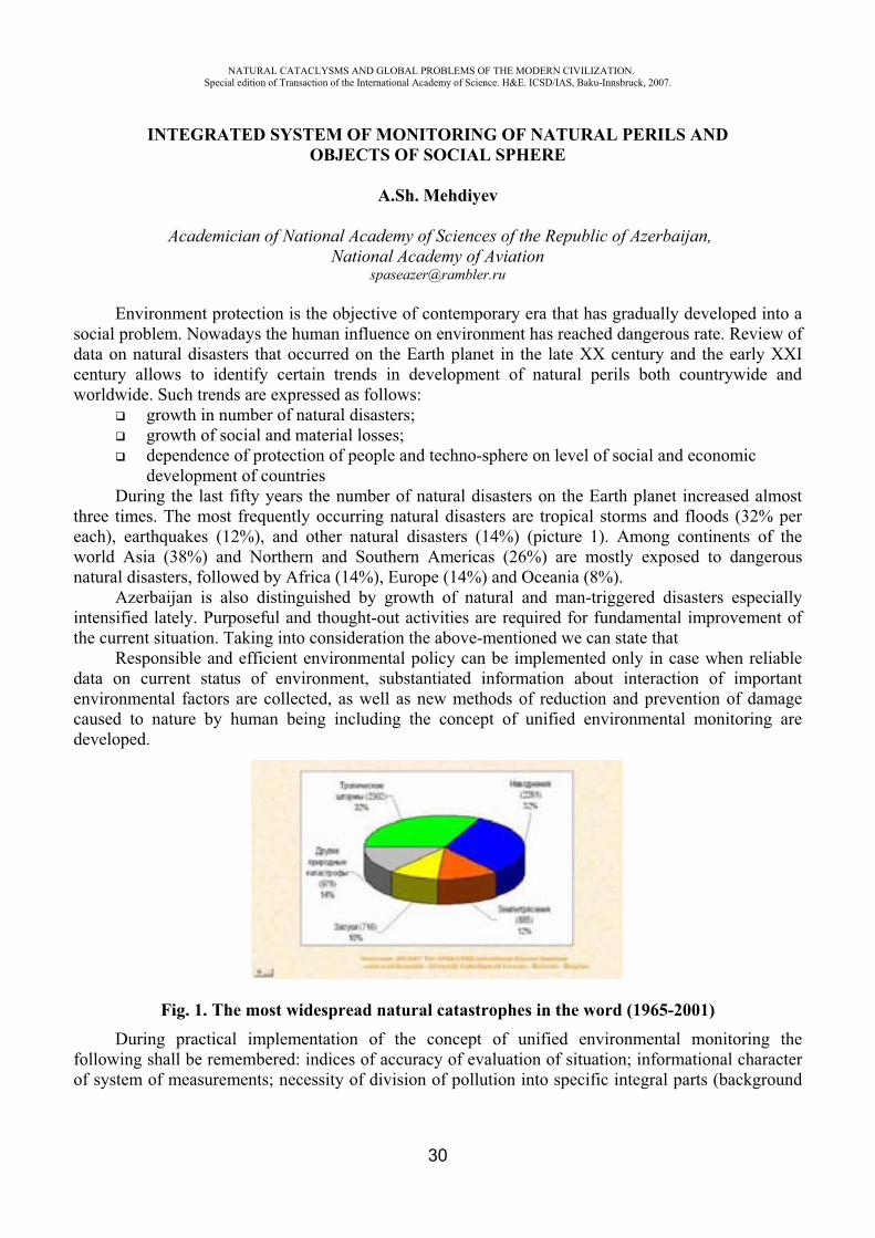
During the last fifty years the number of natural disasters on the Earth planet increased almost three times. The most frequently occurring natural disasters are tropical storms and floods (32% per each), earthquakes (12%), and other natural disasters (14%) (picture 1). Among continents of the world Asia (38%) and Northern and Southern Americas (26%) are mostly exposed to dangerous natural disasters, followed by Africa (14%), Europe (14%) and Oceania (8%).
Azerbaijan is also distinguished by growth of natural and man-triggered disasters especially intensified lately. Purposeful and thought-out activities are required for fundamental improvement of the current situation. Taking into consideration the above-mentioned we can state that
Responsible and efficient environmental policy can be implemented only in case when reliable data on current status of environment, substantiated information about interaction of important environmental factors are collected, as well as new methods of reduction and prevention of damage caused to nature by human being including the concept of unified environmental monitoring are developed.
Fig. 1. The most widespread natural catastrophes in the word (1965-2001) During practical implementation of the concept of unified environmental monitoring the
following shall be remembered: indices of accuracy of evaluation of situation; informational character of system of measurements; necessity of division of pollution into specific integral parts (background
NATURAL CATACLYSMS AND GLOBAL PROBLEMS OF THE MODERN CIVILIZATION. Special edition of Transaction of the International Academy of Science. H&E. ICSD/IAS, Baku-Innsbruck, 2007.
31
pollution, and pollution caused by various sources) accompanied with quantitative evaluation; possibility of registration of objective and subjective indices, etc.
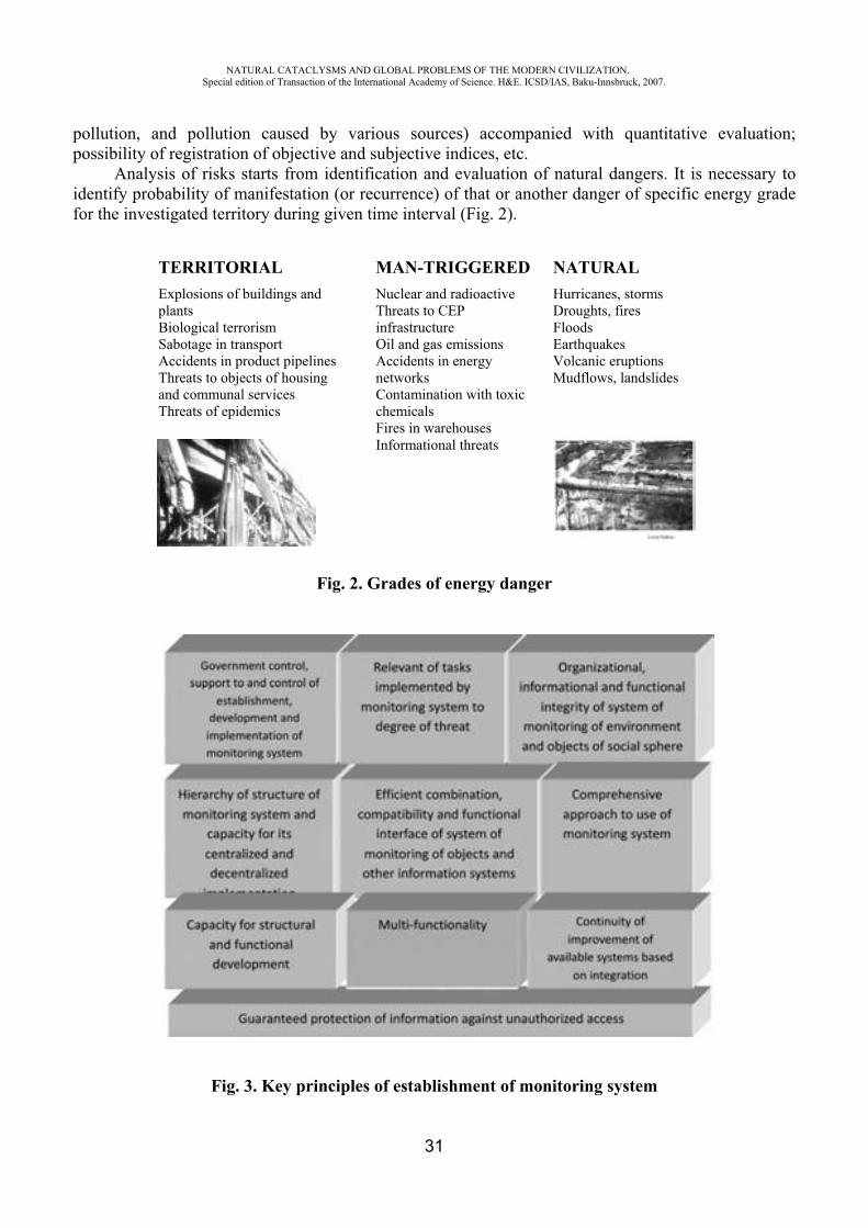
Analysis of risks starts from identification and evaluation of natural dangers. It is necessary to identify probability of manifestation (or recurrence) of that or another danger of specific energy grade for the investigated territory during given time interval (Fig. 2).
Fig. 2. Grades of energy danger
Fig. 3. Key principles of establishment of monitoring system
TERRITORIAL Explosions of buildings and plants Biological terrorism Sabotage in transport Accidents in product pipelines Threats to objects of housing and communal services Threats of epidemics
MAN-TRIGGERED Nuclear and radioactive Threats to CEP infrastructure Oil and gas emissions Accidents in energy networks Contamination with toxic chemicals Fires in warehouses Informational threats
NATURAL Hurricanes, storms Droughts, fires Floods Earthquakes Volcanic eruptions Mudflows, landslides

NATURAL CATACLYSMS AND GLOBAL PROBLEMS OF THE MODERN CIVILIZATION. Special edition of Transaction of the International Academy of Science. H&E. ICSD/IAS, Baku-Innsbruck, 2007.
32
Such necessity pre-conditions development of principles of public policy in the area of establishment of systems of monitoring of environment and objects of social sphere, and comprehensive approach to integration of various types of information, and fulfillment of the following provisions (Fig. 3):
Systems of aerospace monitoring are also based on the above-mentioned principles. Tools and methods of processing of satellite data as a system of acquisition of space data have great potential capacity for joining the integrated monitoring system.
The advantage of aerospace monitoring consists in effectiveness, reliability and space and time character of distance sensing data including spatial information about processes and events that occur on the Earth surface as an integral part of distance sensing data. Any data that describe geographical position and properties of objects is spatial information. Nor integrity of description of objects and systems of the material world neither adequate response to extraordinary situations including natural disasters or armed conflicts is impossible without spatial information. In general such information includes description of geometry and spatial relations, or topology of objects (location, relationship, form and orientation), as well as descriptive data titled as attributes (title, nationality, temporary parameters, etc.).
Therefore integration of aerospace monitoring and geographical information analysis component into the unified public monitoring system is very important and undoubtedly a thought-out program of activities including the following is required in this context:
1 Development of concept of use of aerospace methods and geographical information technologies in identification of zones of high risk for accident cases in objects of natural and social sphere;
2 Development of automated technology of design of synthesized maps of dynamics of environmental systems aimed at informational support to regional, target, branch and municipality environmental programs;
3 Development of the concept of establishment and improvement of international system of monitoring of potentially dangerous objects, natural phenomena and processes that represent a source of trans-boundary risk for people and territory;
4 Development of methods and software for implementation of distance monitoring of traffic streams;
5 Development of scientific foundations and methods of multi-parameter analysis of status of geographical systems and processes occurring on the Earth planet based on comprehensive use of earth-based, aero-space and cartographical information and geographical information technologies;
6 Development of scientific foundations and methods of multi-parameter analysis of status and dynamics of environmental systems through design and interpretation of synthesized maps based on geographical information technologies;
7 Automated expert system of forecasting of accident spots and environmental stresses on geographical and technological pipeline systems based on aerospace methods and geographic information technologies.
Consequently the ways of further improvement of technologies of processing and interpreting of distance sensing data shall be developed as a well thought-out scientific program in the context of sustainable development of territories. A key component of this issue consists in design of multi-level geographical information models of environment and development of social objects aimed at forecasting and preventing of extreme situations based on unified methodological approach using up-to-date technological achievements in the area of satellite navigation and aerospace methods of investigation, integration of achievements of various branches of science into the unified monitoring system.
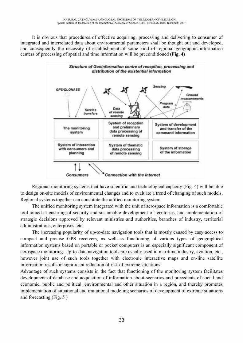
NATURAL CATACLYSMS AND GLOBAL PROBLEMS OF THE MODERN CIVILIZATION. Special edition of Transaction of the International Academy of Science. H&E. ICSD/IAS, Baku-Innsbruck, 2007.
33
It is obvious that procedures of effective acquiring, processing and delivering to consumer of integrated and interrelated data about environmental parameters shall be thought out and developed, and consequently the necessity of establishment of some kind of regional geographic information centers of processing of spatial and time information will be preconditioned (Fig. 4)
Regional monitoring systems that have scientific and technological capacity (Fig. 4) will be able to design on-site models of environmental changes and to evaluate a trend of changing of such models. Regional systems together can constitute the unified monitoring system.
The unified monitoring system integrated with the unit of aerospace information is a comfortable tool aimed at ensuring of security and sustainable development of territories, and implementation of strategic decisions approved by relevant ministries and authorities, branches of industry, territorial administrations, enterprises, etc.
The increasing popularity of up-to-date navigation tools that is mostly caused by easy access to compact and precise GPS receivers, as well as functioning of various types of geographical information systems based on portable or pocket computers is an especially significant component of aerospace monitoring. Up-to-date navigation tools are usually used in maritime industry, aviation, etc., however joint use of such tools together with electronic interactive maps and on-line satellite information results in significant reduction of risk of extreme situations. Advantage of such systems consists in the fact that functioning of the monitoring system facilitates development of database and acquisition of information about scenarios and precedents of social and economic, public and political, environmental and other situation in a region, and thereby promotes implementation of situational and imitational modeling scenarios of development of extreme situations and forecasting (Fig. 5 )
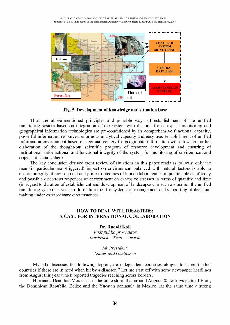
NATURAL CATACLYSMS AND GLOBAL PROBLEMS OF THE MODERN CIVILIZATION. Special edition of Transaction of the International Academy of Science. H&E. ICSD/IAS, Baku-Innsbruck, 2007.
34
Fig. 5. Development of knowledge and situation base
Thus the above-mentioned principles and possible ways of establishment of the unified monitoring system based on integration of the system with the unit for aerospace monitoring and geographical information technologies are pre-conditioned by its comprehensive functional capacity, powerful information resources, enormous analytical capacity and easy use. Establishment of unified information environment based on regional centers for geographic information will allow for further elaboration of the thought-out scientific program of resource development and ensuring of institutional, informational and functional integrity of the system for monitoring of environment and objects of social sphere.
The key conclusion derived from review of situations in this paper reads as follows: only the man (in particular man-triggered) impact on environment balanced with natural factors is able to ensure integrity of environment and protect outcomes of human labor against unpredictable as of today and possible disastrous responses of environment on excessive stresses in terms of quantity and time (in regard to duration of establishment and development of landscapes). In such a situation the unified monitoring system serves as information tool for systems of management and supporting of decision-making under extraordinary circumstances.
HOW TO DEAL WITH DISASTERS: A CASE FOR INTERNATIONAL COLLABORATION
Dr. Rudolf Koll First public prosecutor
Innsbruck – Tirol – Austria
Mr President, Ladies and Gentlemen
My talk discusses the following topic: „are independent countries obliged to support other countries if these are in need when hit by a disaster?” Let me start off with some newspaper headlines from August this year which reported tragedies reaching across borders.
Hurricane Dean hits Mexico. It is the same storm that around August 20 destroys parts of Haiti, the Dominican Republic, Belize and the Yucatan peninsula in Mexico. At the same time a strong
Forest fine
Vylcan
Flods of oil
CENTRAL DATA BASE
CENTRE OF SYSTEM
MONITORING
ACCEPTANCE OF DECISION
NATURAL CATACLYSMS AND GLOBAL PROBLEMS OF THE MODERN CIVILIZATION. Special edition of Transaction of the International Academy of Science. H&E. ICSD/IAS, Baku-Innsbruck, 2007.
35
earthquake in Peru caused many deaths and huge damage. The typhoon Sepat destroys parts of China and causes major floodings. Just before, monsoon rains cause thousands of fatalities in Bangladesh, China, Nepal and North Korea. Some 30 million people were affected, twenty thousand square miles of agricultural land destroyed. At the same time in other countries, foreigners are captured by terrorists to blackmail the domestic government or that of other countries. In Germany, six Italians were executed in the middle of a city, most likely by a powerful Mafia organisation from Italy. Not too long ago we remember the effect of a huge tsunami leaving hundred thousands dead.
These reports show that many calamities affect multiple countries and that often a single country cannot handle the situation alone. Ladies and gentlemen, this is an issue that is relatively new for mankind. In earlier times the earth appeared much larger, distances took more time to cover and frequently news in other parts of the world went unnoticed. Thousands of years ago self-sufficient villages dominated social life, with hardly any need and interest to establish contact with others. Population numbers were low, space was not a scarce resource, environmental problems nonexistent, and humans did not live in high concentration in high-risk coastal areas. Therefore the human toll caused by environmental disasters was much lower and without the news industry information about such disasters was unlikely to spread widely and quickly. Later, when streets, vehicles and population growth forced human communities to become more interconnected, many villages agreed to help each other in case of fire, natural disasters or when under attack. The same occurred between sovereign nations that started to become less autonomous, and started cooperation in economic and military matters. In many instances, such cooperation was necessary for survival. In the end, many formerly independent nations decided to establish much closer ties. Think of the United States of America, Australia, the Soviet Union or the European Union. The example of the European Union shows how sovereign states aim to build much closer ties and collaborate in a number of areas. Let me mention the treaty of Prum which has really started to be implemented this year: Several countries have agreed to allow foreign police officers to operate in their own countries. These officers may support the other country’s forces if they think this is necessary without the country officially asking for support. However, once they cross the border, these officers are under command of the receiving country. During the past months more countries entered this agreement. I expect that soon police forces from all EU member states have the right and the obligation to support each other. Such developments are not limited to Europe. On the twenty first of December in 1991, the Community of Independent States was established in the Kazakhstan capital Alma Ata. Allow me to recite some parts of the declaration:
The commonwealth of independent states, Azerbaijan, Armenia, Belarus, Georgia, Kazakhstan, Kyrgyzstan, Moldova, Russia, Tajikistan, Turkmenistan, Ukraine and Uzbekistan, shall build their relations in accordance with the following interconnected and equal principles:
• the territorial integrity of states and the rejection of any actions directed towards breaking up alien territory;
• rejection of force or the threat of force against the political independence of a member state; • resolution of disputes by peaceful means in such a way that international peace, security and
fairness are not threatened; • account of each other's interests and the Commonwealth as a whole, rendering of assistance
on the basis of mutual consent in all spheres of their relations; • uniting of efforts and rendering of assisting to each other for the purposes of establishing
peaceful conditions for the life of the peoples of the member states of the Commonwealth, ensuring their political, economic and social progress;
Besides these examples there are numerous other treaties between countries promising mutual support. Consider for example, the United Nations, founded in 1945, which today encompasses 192
NATURAL CATACLYSMS AND GLOBAL PROBLEMS OF THE MODERN CIVILIZATION. Special edition of Transaction of the International Academy of Science. H&E. ICSD/IAS, Baku-Innsbruck, 2007.
36
members. The objective then was to overcome the egotistic interests of nations and to provide an instrument to further their peaceful coexistence. Clearly, there is still a long way to cover before this goal is reached. Still, a lot of progress has been made, nations have moved much closer: A large number of organizations were formed to guarantee help quickly and without bureaucratic hurdles. Humanitarian aid has become one of the success stories of the United nations in the past 60 years, billions of dollars are spent to reduce the impact of disasters. This clearly is a step to wards a „oneworld- mindset“.
We also know of many other forms of support which function without formal agreements. For example, an endangered ship can count on the help of ships in the area, an astronaut in need can trust that other nations capable of helping will put his safety above their own (research) interests. In summary, one can conclude that many forms of cross-border support are the result of treaties that make such support obligatory.
But let’s ignore these treaties for a minute, ladies and gentlemen and turn towards another major international concern: Mankind has changed this planet in many ways, and the destruction of large parts of our environment is incontestable. But we feel the results. Because of the destruction of forests in large parts of the world the soil is not capable to absorb the rain. At the same time, rivers that we have changed often do not manage to contain the water flowing through. We know that industries pour huge amounts of carbo-dioxide and other toxic gases into the air. This contributes to changes in our climate and global warming. If the melting of the polar caps causes the water level of our oceans to rise by half a meter only, millions of people would lose their homes. Global warming will also cause glaciers to melt and mountains currently stabilized by glaciers will crumble and destroy huge areas. Ocean streams are affected possibly leading to an increase in the number and intensity of tropical storms. Such results are by definition not limited to single countries.
Social issues also reach across borders, for example: Crime gangs do not count ten or hundred persons like they did before, but often consist of thousands of well-armed and professionally organized members that are often based and operating in a number of countries. These are just a few examples that disasters ignore national borders and nations will not be able to manage their effects without outside help. Often nations will be helpless in the face of such problems. This is why countries need to continue moving closer together.
This involves several steps: Solidarity is the first Step to move closer. It is the mutual understanding between humans or
organizations that „we depend on each other and we need each other to reach our goals“. Che Guevara, Latin American revolutionary and thinker even said: solidarity is the tenderness of nations.
The second step is cooperation. Cooperation is the deliberate collaboration of multiple humans or nations. Cooperation should be beneficial for all parties involved, and is possible without formal rules. But effective cooperation only works if each partner trusts the other to act in the expected way.
As a final step, positive experience in such cooperation will then often result in contracts with formal rights and obligations. The world has become smaller, we can reach any point within a matter of days, single states cannot exist self-sufficiently anymore. The dangers we face from natural disasters or organized crime are big enough to endanger the existence or at least the well-being of a nation. Only through collaboration and mutual support are we strong enough to master the dangers and problems we are to face.
If we strive to survive, we need others – on our own we are too weak. I would like to conclude with an answer to the question I posed in the beginning: If nations want to survive, self-interest alone should be enough to support each other when facing a disaster.
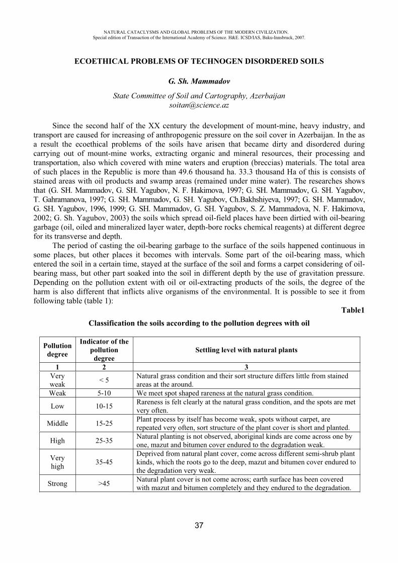
NATURAL CATACLYSMS AND GLOBAL PROBLEMS OF THE MODERN CIVILIZATION. Special edition of Transaction of the International Academy of Science. H&E. ICSD/IAS, Baku-Innsbruck, 2007.
37
ECOETHICAL PROBLEMS OF TECHNOGEN DISORDERED SOILS
G. Sh. Mammadov
State Committee of Soil and Cartography, Azerbaijan [email protected]
Since the second half of the XX century the development of mount-mine, heavy industry, and transport are caused for increasing of anthropogenic pressure on the soil cover in Azerbaijan. In the as a result the ecoethical problems of the soils have arisen that became dirty and disordered during carrying out of mount-mine works, extracting organic and mineral resources, their processing and transportation, also which covered with mine waters and eruption (breccias) materials. The total area of such places in the Republic is more than 49.6 thousand ha. 33.3 thousand Ha of this is consists of stained areas with oil products and swamp areas (remained under mine water). The researches shows that (G. SH. Mammadov, G. SH. Yagubov, N. F. Hakimova, 1997; G. SH. Mammadov, G. SH. Yagubov, T. Gahramanova, 1997; G. SH. Mammadov, G. SH. Yagubov, Ch.Bakhshiyeva, 1997; G. SH. Mammadov, G. SH. Yagubov, 1996, 1999; G. SH. Mammadov, G. SH. Yagubov, S. Z. Mammadova, N. F. Hakimova, 2002; G. Sh. Yagubov, 2003) the soils which spread oil-field places have been dirtied with oil-bearing garbage (oil, oiled and mineralized layer water, depth-bore rocks chemical reagents) at different degree for its transverse and depth.
The period of casting the oil-bearing garbage to the surface of the soils happened continuous in some places, but other places it becomes with intervals. Some part of the oil-bearing mass, which entered the soil in a certain time, stayed at the surface of the soil and forms a carpet considering of oil-bearing mass, but other part soaked into the soil in different depth by the use of gravitation pressure. Depending on the pollution extent with oil or oil-extracting products of the soils, the degree of the harm is also different that inflicts alive organisms of the environmental. It is possible to see it from following table (table 1):
Table1Classification the soils according to the pollution degrees with oil
Pollutiondegree
Indicator of the pollution
degreeSettling level with natural plants
1 2 3Very weak < 5 Natural grass condition and their sort structure differs little from stained
areas at the around.Weak 5-10 We meet spot shaped rareness at the natural grass condition.
Low 10-15 Rareness is felt clearly at the natural grass condition, and the spots are met very often.
Middle 15-25 Plant process by itself has become weak, spots without carpet, are repeated very often, sort structure of the plant cover is short and planted.
High 25-35 Natural planting is not observed, aboriginal kinds are come across one by one, mazut and bitumen cover endured to the degradation weak.
Very high 35-45
Deprived from natural plant cover, come across different semi-shrub plant kinds, which the roots go to the deep, mazut and bitumen cover endured to the degradation very weak.
Strong >45 Natural plant cover is not come across; earth surface has been covered with mazut and bitumen completely and they endured to the degradation.
NATURAL CATACLYSMS AND GLOBAL PROBLEMS OF THE MODERN CIVILIZATION. Special edition of Transaction of the International Academy of Science. H&E. ICSD/IAS, Baku-Innsbruck, 2007.
38
Together stained degree for implementing recultivation works at the dirtied soils with oil it has a great importance to define its type, semi-type sorts. Investigations (G.Sh. Mammadov, 2003) give chance to define the following type and semi-type sorts of dirtied with oil and oil-extracting products in our Republic, especially in Absheron Peninsula. These soils are divided to a type, 6 semi-types and 20 sorts.
Type: A – Dirtied and covered places with oil-bearing garbageSemi-type: A-I. Black-oiled soils Sort: A-I-1. Black-oiled places upper from surface; A-I-2. Middle thicknesses black-oiled soils; A-I-3. Thicknesses black-oiled soils; A-I-4. Periodic damping very thicknesses black-oiled places. Semi-type: A-II. Bituminoid soils Sort: A-II-5. Bituminoid places from surface; A-II-6. Middle thicknesses and cleft bituminoid places from half-dry surface; A-II-7. Periodic damping middle thicknesses bituminoid places; A-II-8. Periodic damping thick bituminoid places; Semi-type: A-III. Bituminoid places planting by itself; Sort: A-III-9. Thin bituminoid places planting by itself; A-III-10. Middle thicknesses bituminoid places planting by itself; Semi-type: C-I. Dirtied and covered places with depth-boring rocks; Sort: B-I-1. Soaked with thin oil, dirtied and covered places with depth-boring rocks; B-I-2. Soaked with middle thicknesses oil, dirtied and covered places with depth-boring rocks; B-I-3. Dirtied and covered places with depth-boring rocks that soaked with thick oil; B-I-4. Dirtied and covered places with depth-boring rocks that soaked with very thick oil; Semi-type: C-II. Kidney-orled places soaked with oil-bearing garbage; Sort: C-II-5. Thin kidney-orled places soaked with oil; C-II-6. Middle thicknesses soft kidney-orled places soaked with oil; C-II-7. Damp, thicknesses kidney-orled places soaked with oil; Semi-type: C-III. The places, which covered with eruption (breccia) materials of mud volcanoes
soaked with oil; Sort: C-III-9. The places covered with thin breccia materials soaked with oil: C-III-10. The places covered with middle thicknesses breccia materials soaked with oil. Together oil and gas resources other mineral resources have been extracted for long years in our
Republic. Up to 360 sort of mineral product deposits are exist in our Republic. Although 63 of them consider perspective for exploitation, only 30 kinds of mineral have been extracted. Because of these deposits are situated mainly at foothills or mountains just give chance to exploit with open method. In as a result it leads the plant and soil cover to perish at the deposits and nearby places. Investigations shows that as a result of extracting mineral resources from deposits, its processing, and also drawing up overhead and subsoil communication layers, the fertile layer of 21.5 thousand ha fit soil for rural economy have been disordered and have been taken out use circulation.
Technogen disordered soils diffused widely mainly in Absheron, Gobustan, Siyazan, Davachi, Ganja-Gazakh zone of our Republic connected with extracting building materials – clay, sand, stone, gravel, limestone, and in Nakhchivan, Dashkasan, Gadabay ferrous and non-ferrous materials. The garbage considering of slag and ash that arisen during the processing and production of ferrous and non-ferrous materials spread up widely around Baku, Sumgayit, Ali-Bayramli, Ganja cities.
The recultivation of the technogenetic-disordered soils in Azerbaijan has greater importance at solving of the ecoethic problems of soil and guarding of environment.
Researches prove that at the moment and previous ten years after extracting the mineral products (mainly building materials – clay, lime powder, limestone in Baku sides) by producers the area released to
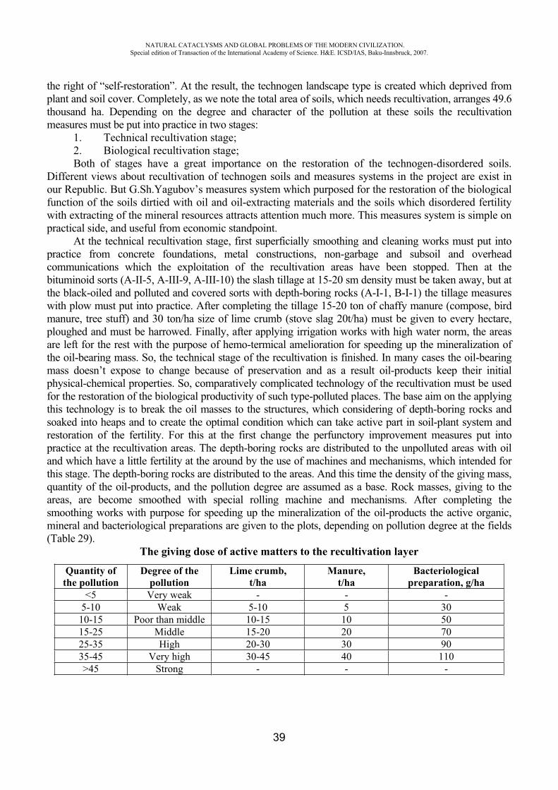
NATURAL CATACLYSMS AND GLOBAL PROBLEMS OF THE MODERN CIVILIZATION. Special edition of Transaction of the International Academy of Science. H&E. ICSD/IAS, Baku-Innsbruck, 2007.
39
the right of “self-restoration”. At the result, the technogen landscape type is created which deprived from plant and soil cover. Completely, as we note the total area of soils, which needs recultivation, arranges 49.6 thousand ha. Depending on the degree and character of the pollution at these soils the recultivationmeasures must be put into practice in two stages:
1. Technical recultivation stage; 2. Biological recultivation stage; Both of stages have a great importance on the restoration of the technogen-disordered soils.
Different views about recultivation of technogen soils and measures systems in the project are exist in our Republic. But G.Sh.Yagubov’s measures system which purposed for the restoration of the biological function of the soils dirtied with oil and oil-extracting materials and the soils which disordered fertility with extracting of the mineral resources attracts attention much more. This measures system is simple on practical side, and useful from economic standpoint.
At the technical recultivation stage, first superficially smoothing and cleaning works must put into practice from concrete foundations, metal constructions, non-garbage and subsoil and overhead communications which the exploitation of the recultivation areas have been stopped. Then at the bituminoid sorts (A-II-5, A-III-9, A-III-10) the slash tillage at 15-20 sm density must be taken away, but at the black-oiled and polluted and covered sorts with depth-boring rocks (A-I-1, B-I-1) the tillage measures with plow must put into practice. After completing the tillage 15-20 ton of chaffy manure (compose, bird manure, tree stuff) and 30 ton/ha size of lime crumb (stove slag 20t/ha) must be given to every hectare, ploughed and must be harrowed. Finally, after applying irrigation works with high water norm, the areas are left for the rest with the purpose of hemo-termical amelioration for speeding up the mineralization of the oil-bearing mass. So, the technical stage of the recultivation is finished. In many cases the oil-bearing mass doesn’t expose to change because of preservation and as a result oil-products keep their initial physical-chemical properties. So, comparatively complicated technology of the recultivation must be used for the restoration of the biological productivity of such type-polluted places. The base aim on the applying this technology is to break the oil masses to the structures, which considering of depth-boring rocks and soaked into heaps and to create the optimal condition which can take active part in soil-plant system and restoration of the fertility. For this at the first change the perfunctory improvement measures put into practice at the recultivation areas. The depth-boring rocks are distributed to the unpolluted areas with oil and which have a little fertility at the around by the use of machines and mechanisms, which intended for this stage. The depth-boring rocks are distributed to the areas. And this time the density of the giving mass, quantity of the oil-products, and the pollution degree are assumed as a base. Rock masses, giving to the areas, are become smoothed with special rolling machine and mechanisms. After completing the smoothing works with purpose for speeding up the mineralization of the oil-products the active organic, mineral and bacteriological preparations are given to the plots, depending on pollution degree at the fields (Table 29).
The giving dose of active matters to the recultivation layer
Quantity of the pollution
Degree of the pollution
Lime crumb, t/ha
Manure,t/ha
Bacteriologicalpreparation, g/ha
<5 Very weak - - -5-10 Weak 5-10 5 30
10-15 Poor than middle 10-15 10 5015-25 Middle 15-20 20 7025-35 High 20-30 30 9035-45 Very high 30-45 40 110>45 Strong - - -
NATURAL CATACLYSMS AND GLOBAL PROBLEMS OF THE MODERN CIVILIZATION. Special edition of Transaction of the International Academy of Science. H&E. ICSD/IAS, Baku-Innsbruck, 2007.
40
The places, which polluted strongly and need complicated recultivation technology are measured whith thousand of hectares in the Absheron peninsula.
According to the technological scheme, the main measure consists of breaking the oil-products soaked into soil up to the structure parts and to neutralize them. For that the dislocation of soil-ground mass, soaked with oil at 0-50 and 0-100 sm density, has been intended. The soil layer, absorbed with oil, is extracted by the use of special machine and mechanisms, piled to the sides of the fields which needs recultivation, and depending on the rest of oiled layers and their amount (%), two or three stony recultivation layer is created at the hollow. These operations are put into practice like the following. Extracting depth at the two stony is intended 50-70 sm, but at the three layer 70-100 sm. At the first moment at the density of 40-50 sm lime crumbs, gathered at quarries, fall to the bottom of the hollow and smoothed. And then the soil-ground mass polluted with oil, is given above it.
But three stony recultivation layer is created at the places where the extracting depth is 100 sm or more than that. And this time lime crumb at the 50 sm density is given to the bottom part of the hollow, then clay-sand mixture at the 30 sm density, which is the garbage of steel mills. In two situations the smoothing works must be hold with accuracy, and finally depending on the pollution degree the soil-ground masses polluted with oil are given to the same fields at the different density. After conducting the suitable smoothing works the stove slag or zeolite, manure bacteriological preparations, which speed up mineralization oil-products, are given to the fields. After these measures with purpose of speeding up the mineralization of oil-products the areas are irrigated with high water norm (1500-1700 m3/ha) and are left for rest with purpose of heliothermal amelioration for three years. If the areas, which left for rest, are ploughed with plow and irrigated every year in autumn, the mineralization of the oil-products quickens much more.
As a result of the irrigation fermentization rises at the 3 sm layer, activity of aerobe bacteria becomes stronger and oil-productions mineralized, and are caused for increasing of food elements and changing some part of oil-products to the organic substances.
It is not efficient on economic side to do technical recultivation at the polluted oil fields with top methods at strong degree (>45%).
Let’s note the other methods of the recultivation of technogen soils exist. But the ecoethics of the use of subsoil resources demands to keep following principles during their exploitation:
1. During the exploitation of the subsoil resources (during holding of output with open method) the output field must localized, the soil and plant cover of the around areas must be damaged little.
2. During the exploitation of the deposits with open methods, the upper soil layer must be drilled and extracted from designed fields, after completing the technical recultivation must be given to the fields. Together with exploitation of the fields, at the areas which output is finished, technical and if needs biological recultivation works must be held parallel, and the end of the exploitation must be waited.
PEFERENCES
1. Mammadov G.SH., Yagubov G.SH. Recultivation methods of polluted soils with oil. Conference, Sumgayit, 15-16 December 1999 (In Azeri and English).
2. Mammadov G.Sh., Yagubov G.Sh., Hakimova N.F. Technogenic solutions of oil solution soils of Apsheron peninsuela and the method of their recultivation. IV Intern. Congress, Baku, Azerb.1997.
3. Mammadov G.Sh., Yagubov G, Sh. Gahramanova T. Transportation of oil and guarding the environment. Baku, 8-10 July 1997.
NATURAL CATACLYSMS AND GLOBAL PROBLEMS OF THE MODERN CIVILIZATION. Special edition of Transaction of the International Academy of Science. H&E. ICSD/IAS, Baku-Innsbruck, 2007.
41
4. Mammadov G.Sh., Yagubov G, Sh. Bakhshiyeva Ch. The North direction of oil strepe on ecological condition. Baku, 8-10 July 1997.
5. Mammadov G.Sh., Yagubov G.Sh., Hakimova N.F, Mammadova S.Z. Influence rating of oilindustrial soils on the ecological environment medium of Apsheron. VI International Congress energy, ecology, economy. 30 May-3 June 2002, Baku, 2002.
6. Yagubov G.Sh. The investigations of the technogen-disordered soils, their genetic features, and recultivation ways. Baku, Vatan, 2003.
DIGITAL TECHNOLOGY AND SYSTEM OF NOISEMONITORING OF FAILURE ORIGIN
Aliev T.A.*, Mammadova G.H. **, Aliev E.R. ***
*Institute of Cybernetics of National Academy of Sciences of Azerbaijan **The Azerbaijan University of Architecture and Construction,
***Institute of Cybernetics of National Academy of Sciences of Azerbaijan [email protected]
Traditionally the supervision of the safety of the strategic objects and the high-rise buildings as a rule is performed by systematic visual inspections. In some cases the geophysical and the seismic research are performed. The conclusions and the reports represented on a paper are the results of these inspections. It is very difficult to analyze them for many years of the exploitation of the constructions. However it is more difficult to diagnose the behavior of the constructions and the structures and to give the recommendations about their future exploitation. In this connection lately for such kind of objects the systems of monitoring by the methods of the system analysis of the signals obtained from the measuring instruments located on the controlled constructions were created [1]. In this case current state of the object is collected, stored, processed and compared with the limit permissible values given into the system forehand and the diagnosis is performed on the base of these operations. However in this case monitoring the origin of microchanges caused by the micro damages or the micro cracks is not provided for the controlled object. Besides, it is necessary to perform monitoring the origin of anomalous seismic processes and short-term forecasting of the earthquakes for the regions. In the previous section the common principles of creating the system of seismically active regions. Combining the solutions of the mentioned problems in the single system has the great importance for providing the safety of the population of big cities, located in the seismically active monitoring the technical state of the building objects in the seismically active regions are offered. The technology and the monitoring system of the origin of anomalous seismic processes on the base of receiving the information about seismic processes from the deep beds of the earth, the working principles of the local systems of monitoring the technical state of the building objects by considering the noise as a data carrier are offered below. Besides, the principle of building and describing the work of the distributed hybrid intellectual city system created on their base is also attached.
The performed analysis shows that the basic reasons causing the change of the technical state of the socially important objects and the hydraulic structures in the seismically active regions are:
1) the faults made in the design, laying the foundation, and the deviations from the seismic requirements during building and assembling;
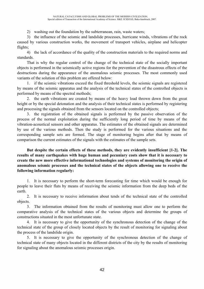
NATURAL CATACLYSMS AND GLOBAL PROBLEMS OF THE MODERN CIVILIZATION. Special edition of Transaction of the International Academy of Science. H&E. ICSD/IAS, Baku-Innsbruck, 2007.
42
2) washing out the foundation by the subterranean, rain, waste waters; 3) the influence of the seismic and landslide processes, hurricane winds, vibrations of the rock
caused by various construction works, the movement of transport vehicles, airplane and helicopter flights;
4) the lack of accordance of the quality of the construction materials to the required norms and standards.
That is why the regular control of the change of the technical state of the socially important objects is performed in the seismically active regions for the prevention of the disastrous effects of the destructions during the appearance of the anomalous seismic processes. The most commonly used variants of the solution of this problem are offered below:
1. if the seismic vibrations exceed the fixed threshold levels, the seismic signals are registered by means of the seismic apparatus and the analysis of the technical states of the controlled objects is performed by means of the spectral methods;
2. the earth vibrations are created by means of the heavy load thrown down from the great height or by the special detonation and the analysis of their technical states is performed by registering and processing the signals obtained from the sensors located on the controlled objects;
3. the registration of the obtained signals is performed by the passive observation of the process of the normal exploitation during the sufficiently long period of time by means of the vibration-acoustical sensors and other apparatus. The estimates of the obtained signals are determined by use of the various methods. Then the study is performed for the various situations and the corresponding sample sets are formed. The stage of monitoring begins after that by means of comparison the current estimates of the signals with the estimates of the sample sets.
But despite the certain effects of these methods, they are evidently insufficient [1-2]. The results of many earthquakes with huge human and pecuniary costs show that it is necessary to create the new more effective informational technologies and systems of monitoring the origin of anomalous seismic processes and the technical states of the objects allowing one to receive the following information regularly:
1. It is necessary to perform the short-term forecasting for time which would be enough for people to leave their flats by means of receiving the seismic information from the deep beds of the earth.
2. It is necessary to receive information about tends of the technical state of the controlled objects.
3. The information obtained from the results of monitoring must allow one to perform the comparative analysis of the technical states of the various objects and determine the groups of constructions situated in the most unfortunate state.
4. It is necessary to give the opportunity of the synchronous detection of the change of the technical state of the group of closely located objects by the result of monitoring for signaling about the process of the landslide origin.
5. It is necessary to give the opportunity of the synchronous detection of the change of technical state of many objects located in the different districts of the city by the results of monitoring for signaling about the anomalous seismic processes origin.
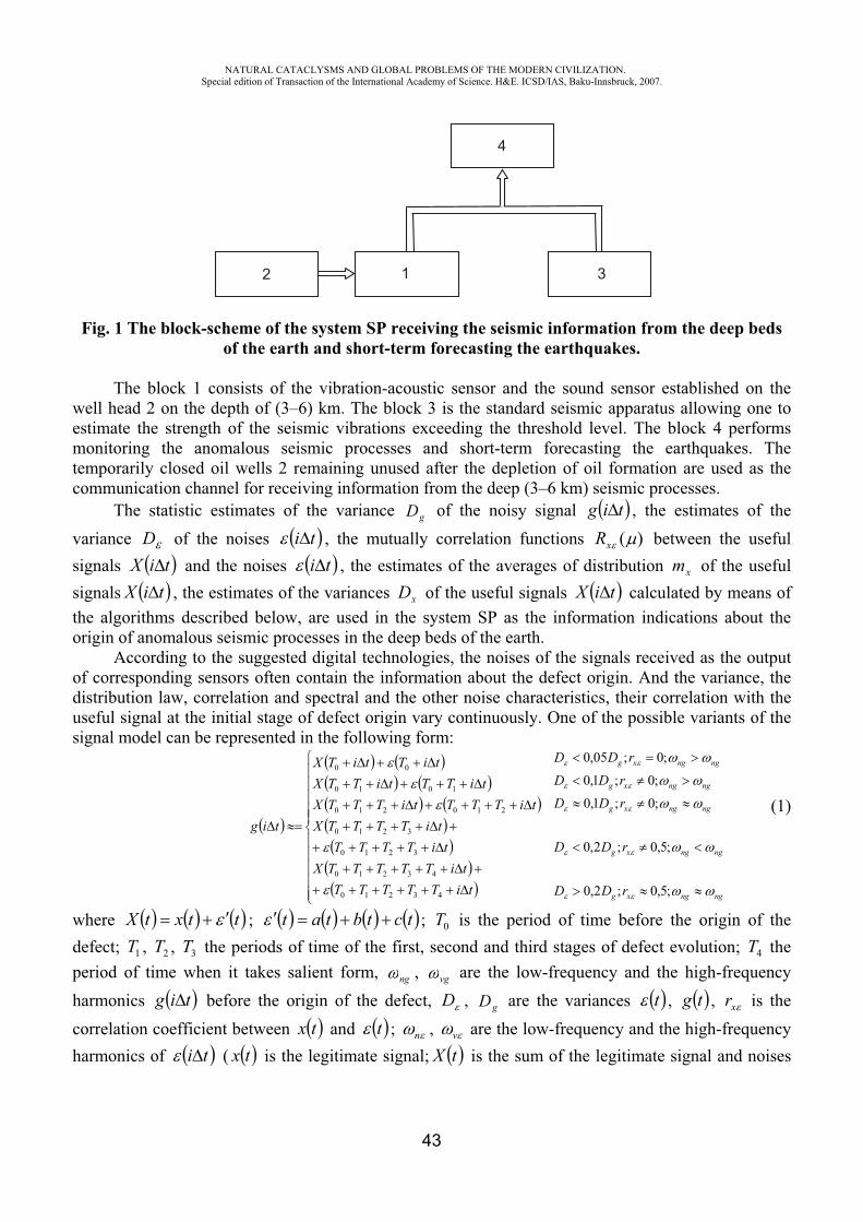
NATURAL CATACLYSMS AND GLOBAL PROBLEMS OF THE MODERN CIVILIZATION. Special edition of Transaction of the International Academy of Science. H&E. ICSD/IAS, Baku-Innsbruck, 2007.
43
Fig. 1 The block-scheme of the system SP receiving the seismic information from the deep beds of the earth and short-term forecasting the earthquakes.
The block 1 consists of the vibration-acoustic sensor and the sound sensor established on the well head 2 on the depth of (3–6) km. The block 3 is the standard seismic apparatus allowing one to estimate the strength of the seismic vibrations exceeding the threshold level. The block 4 performs monitoring the anomalous seismic processes and short-term forecasting the earthquakes. The temporarily closed oil wells 2 remaining unused after the depletion of oil formation are used as the communication channel for receiving information from the deep (3–6 km) seismic processes.
The statistic estimates of the variance gD of the noisy signal tig , the estimates of the variance D of the noises ti , the mutually correlation functions )(xR between the useful signals tiX and the noises ti , the estimates of the averages of distribution xm of the useful signals tiX , the estimates of the variances xD of the useful signals tiX calculated by means of the algorithms described below, are used in the system SP as the information indications about the origin of anomalous seismic processes in the deep beds of the earth.
According to the suggested digital technologies, the noises of the signals received as the output of corresponding sensors often contain the information about the defect origin. And the variance, the distribution law, correlation and spectral and the other noise characteristics, their correlation with the useful signal at the initial stage of defect origin vary continuously. One of the possible variants of the signal model can be represented in the following form:
ngngxg
ngngxg
ngngxg
ngngxg
ngngxg
rDD
rDD
rDDrDD
rDD
tiTTTTTtiTTTTTX
tiTTTTtiTTTTX
tiTTTtiTTTXtiTTtiTTX
tiTtiTX
tig
;5,0;2,0
;5,0;2,0
;0;1,0;0;1,0
;0;05,0
43210
43210
3210
3210
210210
1010
00
(1)
where ttxtX ; tctbtat ; 0T is the period of time before the origin of the defect; 1T , 2T , 3T the periods of time of the first, second and third stages of defect evolution; 4T the period of time when it takes salient form, ng , vg are the low-frequency and the high-frequency harmonics tig before the origin of the defect, D , gD are the variances t , tg , xr is the correlation coefficient between tx and t ; n , v are the low-frequency and the high-frequency harmonics of ti ( tx is the legitimate signal; tX is the sum of the legitimate signal and noises
2 1 3
4
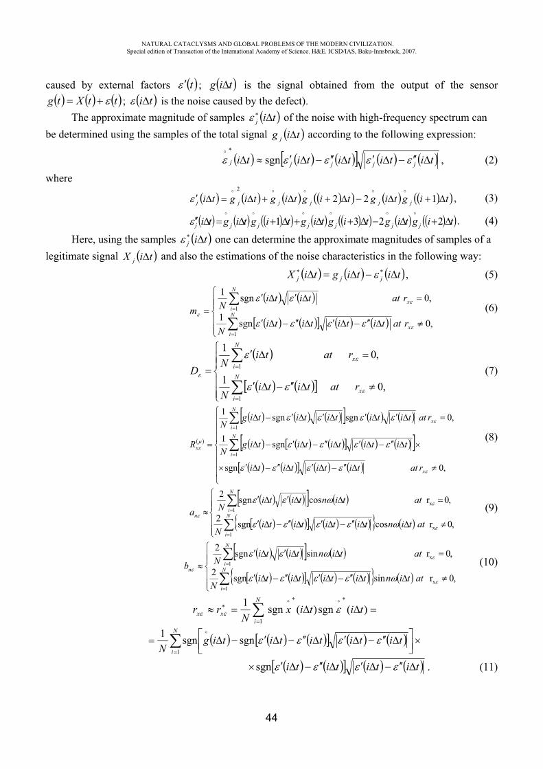
NATURAL CATACLYSMS AND GLOBAL PROBLEMS OF THE MODERN CIVILIZATION. Special edition of Transaction of the International Academy of Science. H&E. ICSD/IAS, Baku-Innsbruck, 2007.
44
caused by external factors t ; tig is the signal obtained from the output of the sensor ttXtg ; ti is the noise caused by the defect).
The approximate magnitude of samples tij of the noise with high-frequency spectrum can be determined using the samples of the total signal tig j according to the following expression:
tititititi jjjjj sgn , (2)
where
tigtigtigtigtigti jjjjjj 1222
, (3)
tigtigtigtigtigtigti jjjjjjj 2231 . (4)
Here, using the samples tij one can determine the approximate magnitudes of samples of a legitimate signal tiX j and also the estimations of the noise characteristics in the following way:
titigtiX jjj , (5)
,0sgn1
,0sgn1
1
1
x
N
i
x
N
i
rattitititiN
rattitiNm (6)
,01
,01
1
1
x
N
i
x
N
i
rattitiN
rattiN
D (7)
,0sgn
sgn1
,0sgnsgn1
1
1
x
N
i
x
N
i
x
rattitititi
tititititigN
rattititititigN
R (8)
,0rcossgn2
,0rcossgn2
x1
x1
attintitititiN
attintitiNa N
i
N
in
(9)
,0rsinsgn2
,0rsinsgn2
x1
x1
attintitititiN
attintitiNb N
i
N
in
(10)
)(sgn)(sgn11
titixN
rrN
ixx
N
itititititig
N 1sgnsgn1
titititisgn . (11)
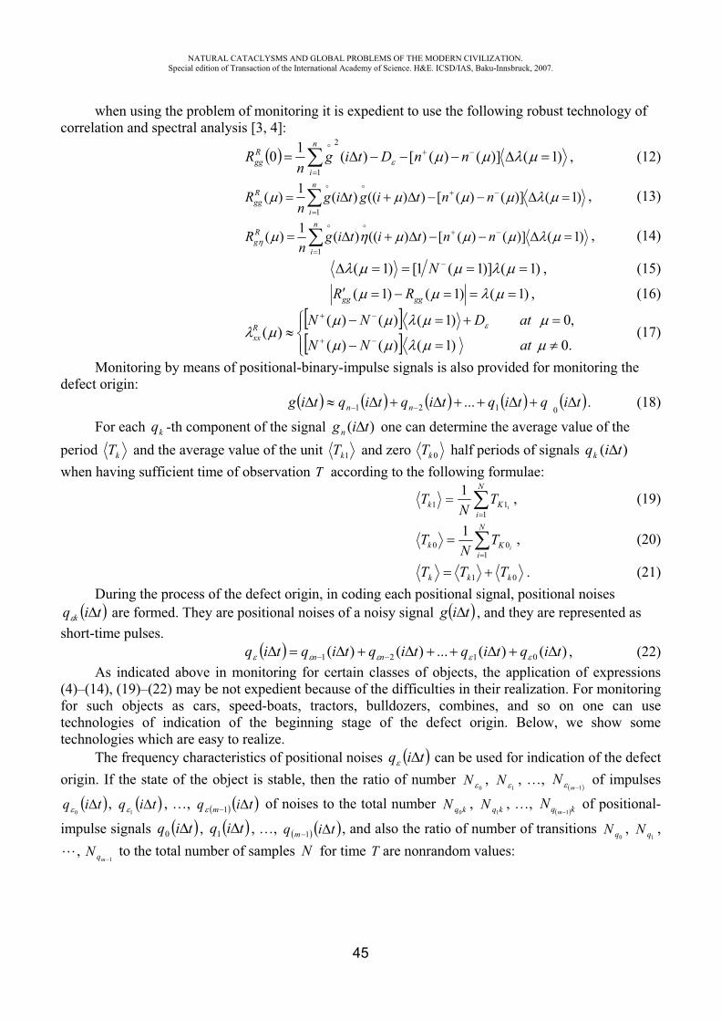
NATURAL CATACLYSMS AND GLOBAL PROBLEMS OF THE MODERN CIVILIZATION. Special edition of Transaction of the International Academy of Science. H&E. ICSD/IAS, Baku-Innsbruck, 2007.
45
when using the problem of monitoring it is expedient to use the following robust technology of correlation and spectral analysis [3, 4]:
n
i
Rgg nnDtig
nR
1
2
)1()]()([)(10 , (12)
n
i
Rgg nntigtig
nR
1)1()]()([))(()(1)( , (13)
n
i
Rg nntitig
nR
1)1()]()([))(()(1)( , (14)
)1()]1(1[)1( N , (15)
)1()1()1( gggg RR , (16)
.0)1()()(
,0)1()()()(
atNN
atDNNRxx (17)
Monitoring by means of positional-binary-impulse signals is also provided for monitoring the defect origin:
tiqtiqtiqtiqtig nn 0121 ... . (18)
For each kq -th component of the signal )( tign one can determine the average value of the period kT and the average value of the unit 1kT and zero 0kT half periods of signals )( tiqk
when having sufficient time of observation T according to the following formulae: N
iKk i
TN
T1
111 , (19)
N
iKk i
TN
T1
001 , (20)
01 kkk TTT . (21) During the process of the defect origin, in coding each positional signal, positional noises tiq k are formed. They are positional noises of a noisy signal tig , and they are represented as
short-time pulses. )()(...)()( 0121 tiqtiqtiqtiqtiq nn , (22)
As indicated above in monitoring for certain classes of objects, the application of expressions (4)–(14), (19)–(22) may be not expedient because of the difficulties in their realization. For monitoring for such objects as cars, speed-boats, tractors, bulldozers, combines, and so on one can use technologies of indication of the beginning stage of the defect origin. Below, we show some technologies which are easy to realize.
The frequency characteristics of positional noises tiq can be used for indication of the defect origin. If the state of the object is stable, then the ratio of number
0N ,
1N , …,
1mN of impulses
tiq0
, tiq1
, …, tiq m 1 of noises to the total number kqN0
, kqN1
, …, kq mN
1 of positional-
impulse signals tiq0 , tiq1 , …, tiq m 1 , and also the ratio of number of transitions 0qN ,
1qN ,,
1mqN to the total number of samples N for time T are nonrandom values:
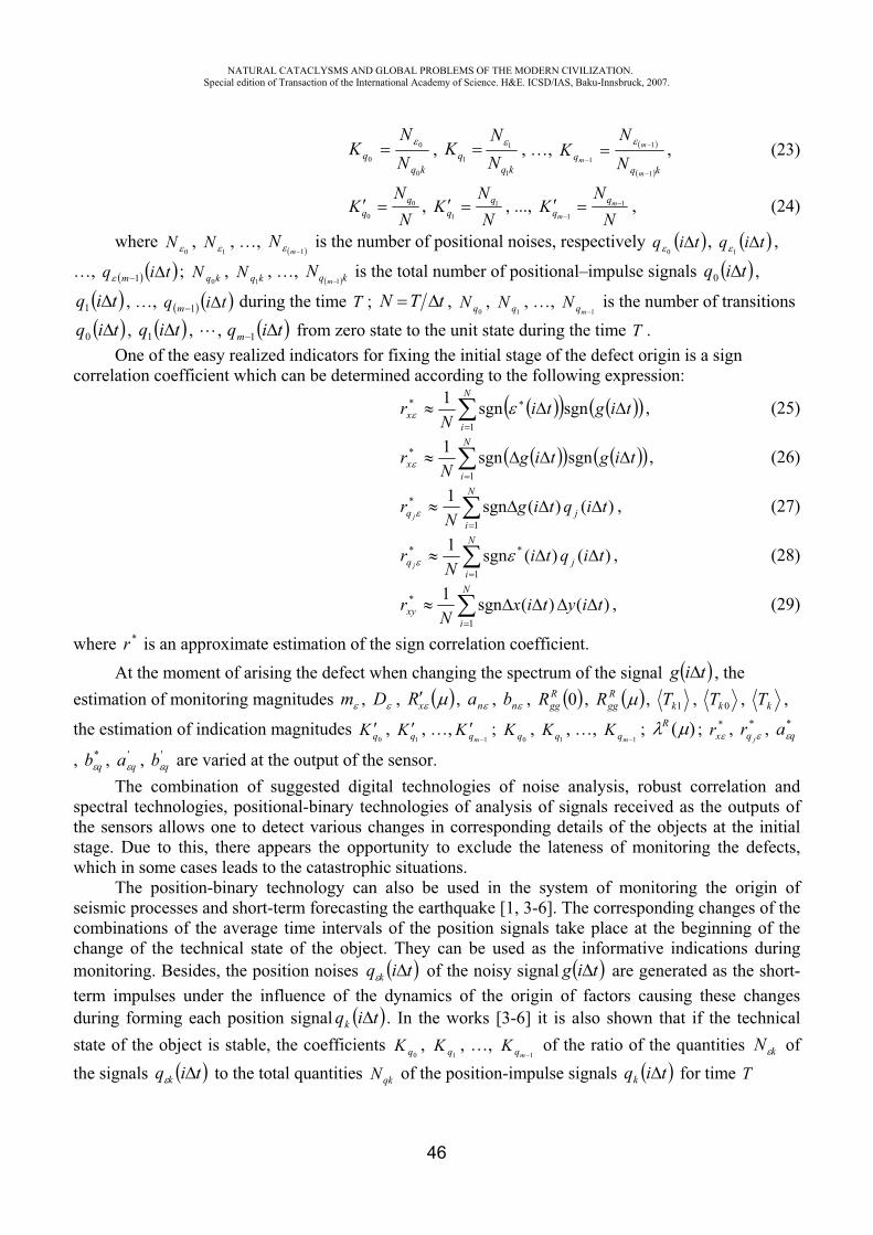
NATURAL CATACLYSMS AND GLOBAL PROBLEMS OF THE MODERN CIVILIZATION. Special edition of Transaction of the International Academy of Science. H&E. ICSD/IAS, Baku-Innsbruck, 2007.
46
kqq N
NK
0
0
0,
kqq N
NK
1
1
1, …,
kqq
m
m
m N
NK
1
1
1, (23)
NN
K qq
0
0,
NN
K qq
1
1, ...,
NN
K m
m
1
1, (24)
where0
N ,1
N , …, 1m
N is the number of positional noises, respectively tiq0
, tiq1
,
…, tiq m 1 ; kqN0
, kqN1
, …, kq mN
1 is the total number of positional–impulse signals tiq0 ,
tiq1 , …, tiq m 1 during the time T ; tTN ,0qN ,
1qN , …, 1mqN is the number of transitions
tiq0 , tiq1 , , tiqm 1 from zero state to the unit state during the time T .One of the easy realized indicators for fixing the initial stage of the defect origin is a sign
correlation coefficient which can be determined according to the following expression:
tigtiN
rN
ix sgnsgn1
1
* , (25)
tigtigN
rN
ix sgnsgn1
1
* , (26)
)()(sgn11
* tiqtigN
r j
N
iq j
, (27)
)()(sgn1 *
1
* tiqtiN
r j
N
iq j
, (28)
)()(sgn11
* tiytixN
rN
ixy , (29)
where *r is an approximate estimation of the sign correlation coefficient. At the moment of arising the defect when changing the spectrum of the signal tig , the
estimation of monitoring magnitudes m , D , xR , na , nb , 0RggR , R
ggR , 1kT , 0kT , kT ,
the estimation of indication magnitudes 0qK ,
1qK , …,1mqK ;
0qK ,1qK , …,
1mqK ; )(R ; *xr , *
jqr , *qa
, *qb , '
qa , 'qb are varied at the output of the sensor.
The combination of suggested digital technologies of noise analysis, robust correlation and spectral technologies, positional-binary technologies of analysis of signals received as the outputs of the sensors allows one to detect various changes in corresponding details of the objects at the initial stage. Due to this, there appears the opportunity to exclude the lateness of monitoring the defects, which in some cases leads to the catastrophic situations.
The position-binary technology can also be used in the system of monitoring the origin of seismic processes and short-term forecasting the earthquake [1, 3-6]. The corresponding changes of the combinations of the average time intervals of the position signals take place at the beginning of the change of the technical state of the object. They can be used as the informative indications during monitoring. Besides, the position noises tiq k of the noisy signal tig are generated as the short-term impulses under the influence of the dynamics of the origin of factors causing these changes during forming each position signal tiqk . In the works [3-6] it is also shown that if the technical state of the object is stable, the coefficients
0qK ,1qK , …,
1mqK of the ratio of the quantities kN of the signals tiq k to the total quantities qkN of the position-impulse signals tiqk for time T
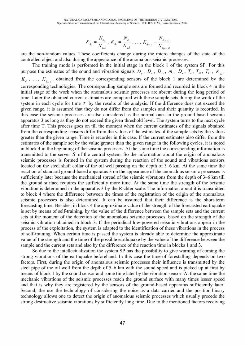
NATURAL CATACLYSMS AND GLOBAL PROBLEMS OF THE MODERN CIVILIZATION. Special edition of Transaction of the International Academy of Science. H&E. ICSD/IAS, Baku-Innsbruck, 2007.
47
kqq N
NK
0
0
0,
kqq N
NK
1
1
1, …,
kqq
m
m
m NN
K1
1
1
are the non-random values. These coefficients change during the micro changes of the state of the controlled object and also during the appearance of the anomalous seismic processes.
The training mode is performed in the initial stage in the block 1 of the system SP. For this purpose the estimates of the sound and vibration signals gD , D , xD , xm , xD , kT , 1kT , 0kT ,
0qK ,
1qK , …, 1mqK , obtained from the corresponding sensors of the block 1 are determined by the
corresponding technologies. The corresponding sample sets are formed and recorded in block 4 in the initial stage of the work when the anomalous seismic processes are absent during the long period of time. Later the obtained current estimates are compared with these sample sets during the work of the system in each cycle for time T by the results of the analysis. If the difference does not exceed the given range, it is assumed that they do not differ from the samples and their quantity is recorded. In this case the seismic processes are also considered as the normal ones in the ground-based seismic apparatus 3 as long as they do not exceed the given threshold level. The system turns to the next cycle after time T. This process goes on till the moment when the current estimates of the signals obtained from the corresponding sensors differ from the values of the estimates of the sample sets by the values greater than the given range. Time is recorder in this case. If the current estimates also differ from the estimates of the sample set by the value greater than the given range in the following cycles, it is noted in block 4 in the beginning of the seismic processes. At the same time the corresponding information is transmitted to the server S of the central system. So the information about the origin of anomalous seismic processes is formed in the system during the reaction of the sound and vibrations sensors located on the steel shaft collar of the oil well passing on the depth of 3–6 km. At the same time the reaction of standard ground-based apparatus 3 on the appearance of the anomalous seismic processes is sufficiently later because the mechanical spread of the seismic vibrations from the depth of 3–6 km till the ground surface requires the sufficiently more time. At the same time the strength of the seismic vibration is determined in the apparatus 3 by the Richter scale. The information about it is transmitted to block 4 where the difference between the times of the registration of the origin of the anomalous seismic processes is also determined. It can be assumed that their difference is the short-term forecasting time. Besides, in block 4 the approximate value of the strength of the forecasted earthquake is set by means of self-training, by the value of the difference between the sample sets and the current sets at the moment of the detection of the anomalous seismic processes, based on the strength of the seismic vibration obtained in block 3. If the periodical low-powered seismic vibrations appear in the process of the exploitation, the system is adapted to the identification of these vibrations in the process of self-training. When certain time is passed the system is already able to determine the approximate value of the strength and the time of the possible earthquake by the value of the difference between the sample and the current sets and also by the difference of the reaction time in blocks 1 and 3.
So due to the intellectualization the system SP has the possibility to give warning of coming the strong vibrations of the earthquake beforehand. In this case the time of forestalling depends on two factors. First, during the origin of anomalous seismic processes their influence is transmitted by the steel pipe of the oil well from the depth of 5–6 km with the sound speed and is picked up at first by means of block 1 by the sound sensor and some time later by the vibration sensor. At the same time the mechanic vibrations of the seismic processes reach the ground surface with many times lesser speed and that is why they are registered by the sensors of the ground-based apparatus sufficiently later. Second, the use the technology of considering the noise as a data carrier and the position-binary technology allows one to detect the origin of anomalous seismic processes which usually precede the strong destructive seismic vibrations by sufficiently long time. Due to the mentioned factors receiving
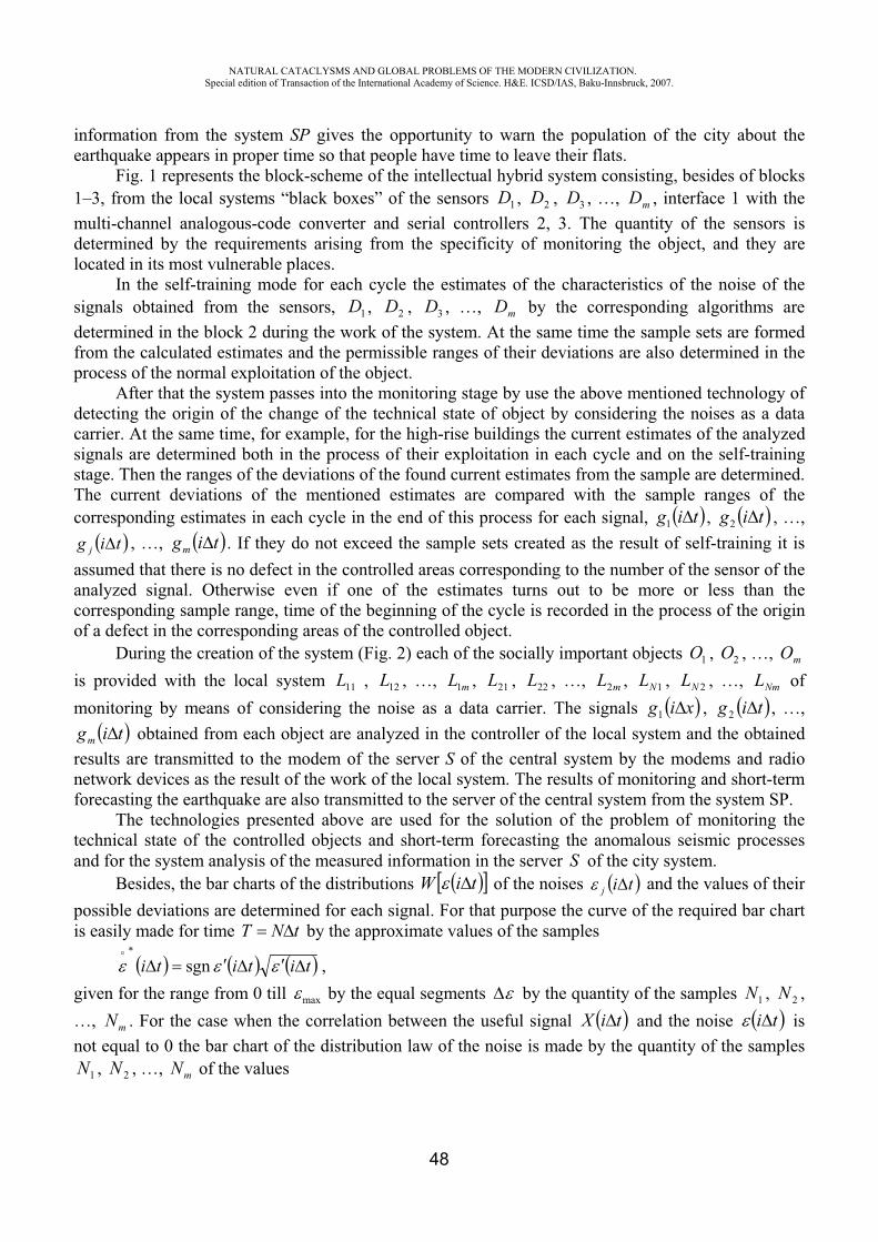
NATURAL CATACLYSMS AND GLOBAL PROBLEMS OF THE MODERN CIVILIZATION. Special edition of Transaction of the International Academy of Science. H&E. ICSD/IAS, Baku-Innsbruck, 2007.
48
information from the system SP gives the opportunity to warn the population of the city about the earthquake appears in proper time so that people have time to leave their flats.
Fig. 1 represents the block-scheme of the intellectual hybrid system consisting, besides of blocks 1–3, from the local systems “black boxes” of the sensors 1D , 2D , 3D , …, mD , interface 1 with the multi-channel analogous-code converter and serial controllers 2, 3. The quantity of the sensors is determined by the requirements arising from the specificity of monitoring the object, and they are located in its most vulnerable places.
In the self-training mode for each cycle the estimates of the characteristics of the noise of the signals obtained from the sensors, 1D , 2D , 3D , …, mD by the corresponding algorithms are determined in the block 2 during the work of the system. At the same time the sample sets are formed from the calculated estimates and the permissible ranges of their deviations are also determined in the process of the normal exploitation of the object.
After that the system passes into the monitoring stage by use the above mentioned technology of detecting the origin of the change of the technical state of object by considering the noises as a data carrier. At the same time, for example, for the high-rise buildings the current estimates of the analyzed signals are determined both in the process of their exploitation in each cycle and on the self-training stage. Then the ranges of the deviations of the found current estimates from the sample are determined. The current deviations of the mentioned estimates are compared with the sample ranges of the corresponding estimates in each cycle in the end of this process for each signal, tig1 , tig2 , …,
tig j , …, tigm . If they do not exceed the sample sets created as the result of self-training it is assumed that there is no defect in the controlled areas corresponding to the number of the sensor of the analyzed signal. Otherwise even if one of the estimates turns out to be more or less than the corresponding sample range, time of the beginning of the cycle is recorded in the process of the origin of a defect in the corresponding areas of the controlled object.
During the creation of the system (Fig. 2) each of the socially important objects 1O , 2O , …, mOis provided with the local system 11L , 12L , …, mL1 , 21L , 22L , …, mL2 , 1NL , 2NL , …, NmL of monitoring by means of considering the noise as a data carrier. The signals xig1 , tig2 , …,
tigm obtained from each object are analyzed in the controller of the local system and the obtained results are transmitted to the modem of the server S of the central system by the modems and radio network devices as the result of the work of the local system. The results of monitoring and short-term forecasting the earthquake are also transmitted to the server of the central system from the system SP.
The technologies presented above are used for the solution of the problem of monitoring the technical state of the controlled objects and short-term forecasting the anomalous seismic processes and for the system analysis of the measured information in the server S of the city system.
Besides, the bar charts of the distributions tiW of the noises tij and the values of their possible deviations are determined for each signal. For that purpose the curve of the required bar chart is easily made for time tNT by the approximate values of the samples
tititi sgn ,given for the range from 0 till max by the equal segments by the quantity of the samples 1N , 2N ,…, mN . For the case when the correlation between the useful signal tiX and the noise ti is not equal to 0 the bar chart of the distribution law of the noise is made by the quantity of the samples
1N , 2N , …, mN of the values
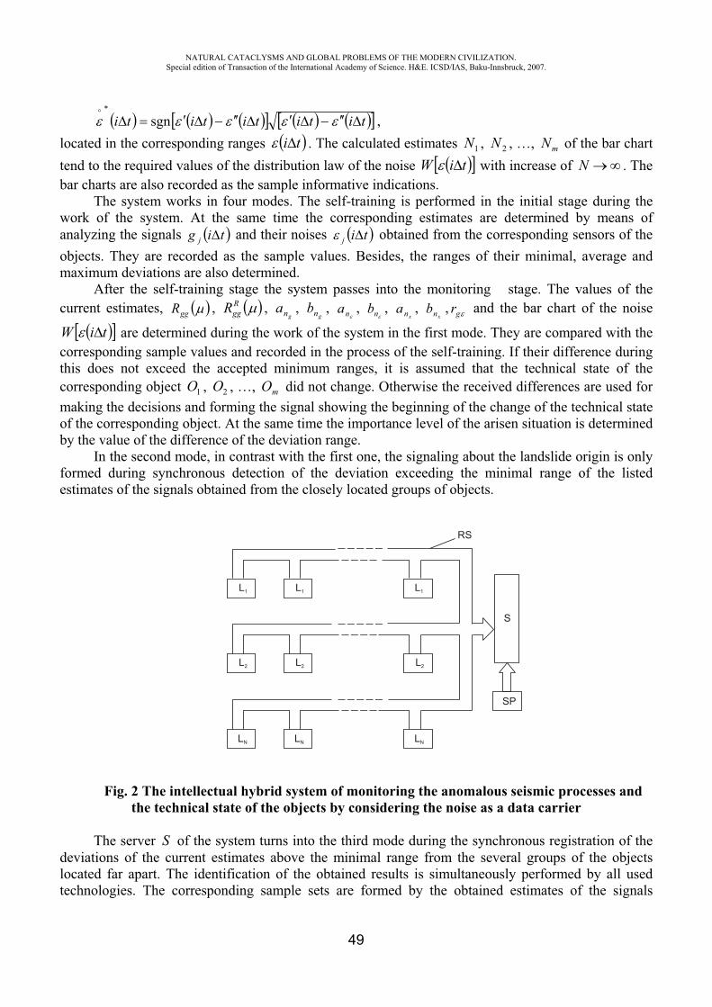
NATURAL CATACLYSMS AND GLOBAL PROBLEMS OF THE MODERN CIVILIZATION. Special edition of Transaction of the International Academy of Science. H&E. ICSD/IAS, Baku-Innsbruck, 2007.
49
tititititi sgn ,located in the corresponding ranges ti . The calculated estimates 1N , 2N , …, mN of the bar chart tend to the required values of the distribution law of the noise tiW with increase of N . The bar charts are also recorded as the sample informative indications.
The system works in four modes. The self-training is performed in the initial stage during the work of the system. At the same time the corresponding estimates are determined by means of analyzing the signals tig j and their noises tij obtained from the corresponding sensors of the objects. They are recorded as the sample values. Besides, the ranges of their minimal, average and maximum deviations are also determined.
After the self-training stage the system passes into the monitoring stage. The values of the current estimates, ggR , R
ggR ,gna ,
gnb , na , nb ,xna ,
xnb , gr and the bar chart of the noise
tiW are determined during the work of the system in the first mode. They are compared with the corresponding sample values and recorded in the process of the self-training. If their difference during this does not exceed the accepted minimum ranges, it is assumed that the technical state of the corresponding object 1O , 2O , …, mO did not change. Otherwise the received differences are used for making the decisions and forming the signal showing the beginning of the change of the technical state of the corresponding object. At the same time the importance level of the arisen situation is determined by the value of the difference of the deviation range.
In the second mode, in contrast with the first one, the signaling about the landslide origin is only formed during synchronous detection of the deviation exceeding the minimal range of the listed estimates of the signals obtained from the closely located groups of objects.
Fig. 2 The intellectual hybrid system of monitoring the anomalous seismic processes and the technical state of the objects by considering the noise as a data carrier
The server S of the system turns into the third mode during the synchronous registration of the deviations of the current estimates above the minimal range from the several groups of the objects located far apart. The identification of the obtained results is simultaneously performed by all used technologies. The corresponding sample sets are formed by the obtained estimates of the signals
L1
L1
L1
S
SP
RS
L2
L2
L2
LN
LN
LN
NATURAL CATACLYSMS AND GLOBAL PROBLEMS OF THE MODERN CIVILIZATION. Special edition of Transaction of the International Academy of Science. H&E. ICSD/IAS, Baku-Innsbruck, 2007.
50
tig j as well as in the first and second modes in the initial stage similar to above mentioned in the self-training process. Their difference from the sample situations is recorded as the alarming state. At the same time the level of the danger of the seismic situation is estimated by the quantity of the groups, especially, by the value of the ranges of the deviations. For the cases when the values of the deviations exceed the maximum threshold levels the server signals about the precarious situation of the origin of anomalous processes.
At last the system passes into the forth mode by receiving the alarming information from SP. At the same time the system works similar as in the third mode. Besides, the identification of the seismic situation is simultaneously performed in the server S and in the system SP for increase the reliability of the final results. All technologies of processing and analyzing the signals are also used for that purpose.
Besides, the control of breaking the rules of the accident prevention on the objects 1O , 2O , …,
mO is performed both in the local systems (black boxes) 11L , 12L , …, 1NL , 2NL , …, NmL , and in the server S. For example, during the breakdown of the lift, the gas escape, the short circuit in the power supply, the conflagration, etc the corresponding signal specifying the nature of the failure and the number of the object is formed both in the objects of monitoring and in the corresponding services.
The technology used in the system, the technology of receiving the information from the deep beds of the earth by means of the “seismic informative oil well” in combination with monitoring by considering the noise as a data carrier gives opportunity to perform short-term forecasting the anomalous seismic processes and the earthquakes origin. The system has the higher sensibility to the seismic processes, due to the measured information arrive to it from the black boxes of all high-rise buildings located far apart each other. In also allows one to combine the function of monitoring the technical state of the building with the alerts about all possible emergency states. Due to these features it is possible to perform the series of the important actions for preventing the unexpected fatal disastrous processes by the obtained results of the work of the considered system. So the stems of the temporarily closed down oil wells of the depleted oil fields are used as the “phonendoscope” in the offered system for receiving the sound signals from the deep beds of the earth. The informative indications of the anomalous seismic processes registered by the standard ground-based seismic apparatus some time later are determined by the analysis of the noise. They are compared, and the intellectual technology of their identification is formed by means of self-training. This process goes on during the exploitation of the system and the necessary degree of the adequacy of forecasting the strength and time of the dangerous seismic vibrations is provided. The offered system allows one the following:
1. To determine the origin of anomalous seismic processes and the level of the danger of the forecasted earthquake, and in the case of the necessity, to warn the corresponding services of the state as the result of the use the technology of considering the noise as a data carrier and the position-binary technology by the obtained signals from the “seismic informative oil well”.
2. To give the information to the corresponding services of the city about the landslide or the origin of anomalous seismic processes during the synchronous signaling from the black boxes about the changes of the technical state of many socially important objects.
3. To change the direction of the subterranean waters changing the technical state of the object by washing out of the foundation.
4. To stop the leak of the rain and waste waters under the foundation, to remove the reasons of making worse the technical state of the object by means of the major repairs of the asphalt coats, the hatches and the sewerage system.
5. To stop the evolution of the landslide processes by means of building the special anti-landslide installations.
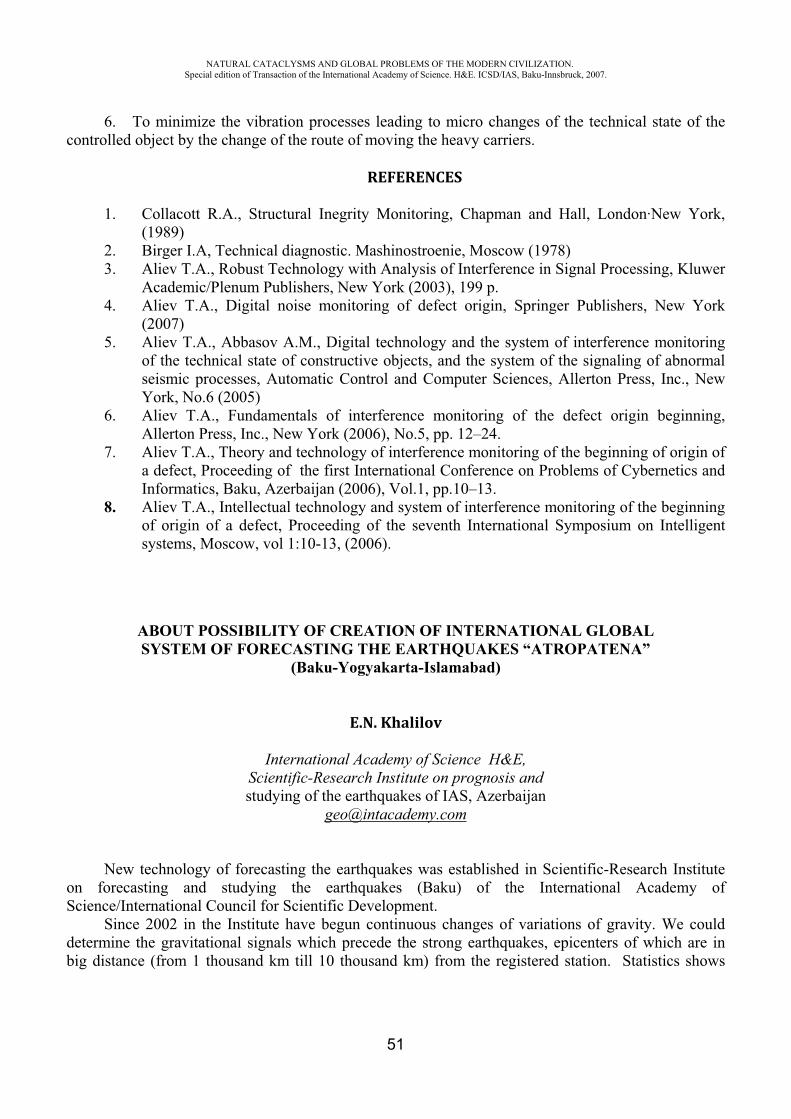
NATURAL CATACLYSMS AND GLOBAL PROBLEMS OF THE MODERN CIVILIZATION. Special edition of Transaction of the International Academy of Science. H&E. ICSD/IAS, Baku-Innsbruck, 2007.
51
6. To minimize the vibration processes leading to micro changes of the technical state of the controlled object by the change of the route of moving the heavy carriers.
REFERENCES
1. Collacott R.A., Structural Inegrity Monitoring, Chapman and Hall, London·New York, (1989)
2. Birger I.A, Technical diagnostic. Mashinostroenie, Moscow (1978) 3. Aliev T.A., Robust Technology with Analysis of Interference in Signal Processing, Kluwer
Academic/Plenum Publishers, New York (2003), 199 p. 4. Aliev T.A., Digital noise monitoring of defect origin, Springer Publishers, New York
(2007)5. Aliev T.A., Abbasov A.M., Digital technology and the system of interference monitoring
of the technical state of constructive objects, and the system of the signaling of abnormal seismic processes, Automatic Control and Computer Sciences, Allerton Press, Inc., New York, No.6 (2005)
6. Aliev T.A., Fundamentals of interference monitoring of the defect origin beginning, Allerton Press, Inc., New York (2006), No.5, pp. 12–24.
7. Aliev T.A., Theory and technology of interference monitoring of the beginning of origin of a defect, Proceeding of the first International Conference on Problems of Cybernetics and Informatics, Baku, Azerbaijan (2006), Vol.1, pp.10–13.
8. Aliev T.A., Intellectual technology and system of interference monitoring of the beginning of origin of a defect, Proceeding of the seventh International Symposium on Intelligent systems, Moscow, vol 1:10-13, (2006).
ABOUT POSSIBILITY OF CREATION OF INTERNATIONAL GLOBAL SYSTEM OF FORECASTING THE EARTHQUAKES “ATROPATENA”
(Baku-Yogyakarta-Islamabad)
E.N. Khalilov
International Academy of Science H&E, Scientific-Research Institute on prognosis and studying of the earthquakes of IAS, Azerbaijan
New technology of forecasting the earthquakes was established in Scientific-Research Institute on forecasting and studying the earthquakes (Baku) of the International Academy of Science/International Council for Scientific Development.
Since 2002 in the Institute have begun continuous changes of variations of gravity. We could determine the gravitational signals which precede the strong earthquakes, epicenters of which are in big distance (from 1 thousand km till 10 thousand km) from the registered station. Statistics shows
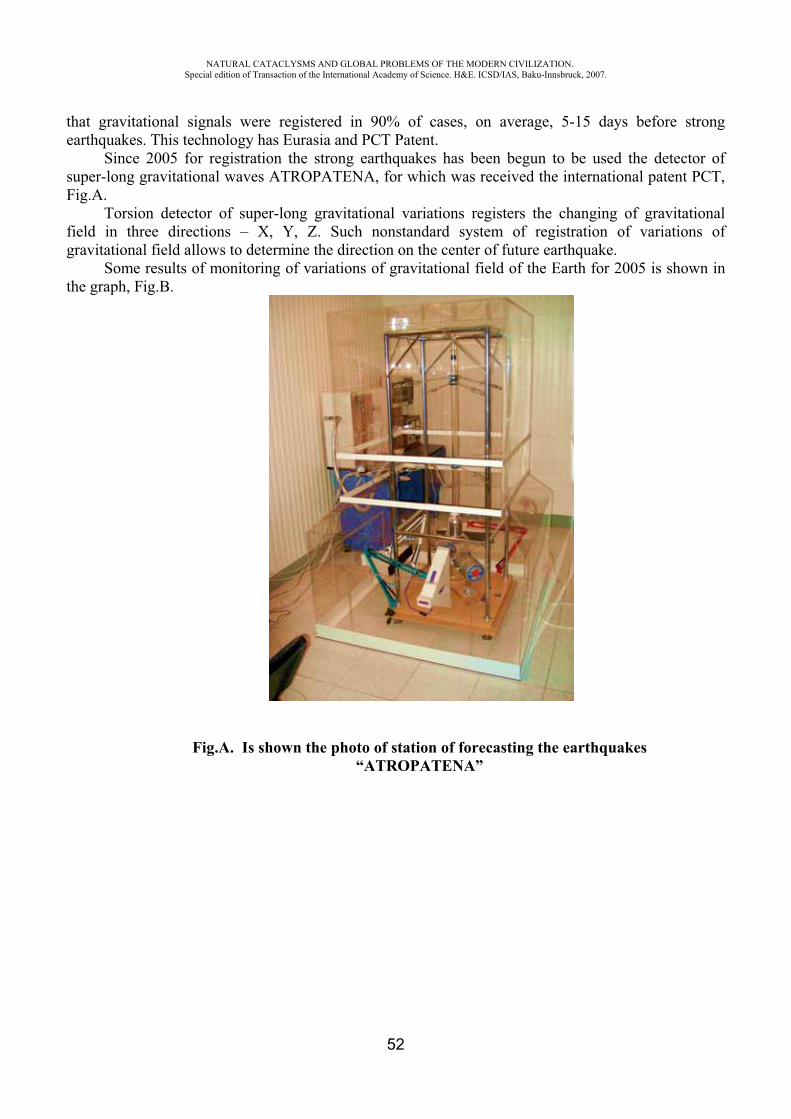
NATURAL CATACLYSMS AND GLOBAL PROBLEMS OF THE MODERN CIVILIZATION. Special edition of Transaction of the International Academy of Science. H&E. ICSD/IAS, Baku-Innsbruck, 2007.
52
that gravitational signals were registered in 90% of cases, on average, 5-15 days before strong earthquakes. This technology has Eurasia and PCT Patent.
Since 2005 for registration the strong earthquakes has been begun to be used the detector of super-long gravitational waves ATROPATENA, for which was received the international patent PCT, Fig.A.
Torsion detector of super-long gravitational variations registers the changing of gravitational field in three directions – X, Y, Z. Such nonstandard system of registration of variations of gravitational field allows to determine the direction on the center of future earthquake.
Some results of monitoring of variations of gravitational field of the Earth for 2005 is shown in the graph, Fig.B.
Fig.A. Is shown the photo of station of forecasting the earthquakes “ATROPATENA”
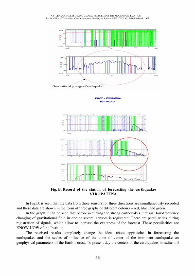
NATURAL CATACLYSMS AND GLOBAL PROBLEMS OF THE MODERN CIVILIZATION. Special edition of Transaction of the International Academy of Science. H&E. ICSD/IAS, Baku-Innsbruck, 2007.
53
Fig. B. Record of the station of forecasting the earthquakes ATROPATENA.
In Fig.B. is seen that the data from three sensors for three directions are simultaneously recorded and these data are shown in the form of three graphs of different colours – red, blue, and green.
In the graph it can be seen that before occurring the strong earthquakes, unusual low-frequency changing of gravitational field in one or several sensors is registered. There are peculiarities during registration of signals, which allow to increase the exactness of the forecast. These peculiarities are KNOW-HOW of the Institute.
The received results completely change the ideas about approaches in forecasting the earthquakes and the scales of influence of the zone of center of the imminent earthquake on geophysical parameters of the Earth’s crust. To present day the centers of the earthquakes in radius till
NATURAL CATACLYSMS AND GLOBAL PROBLEMS OF THE MODERN CIVILIZATION. Special edition of Transaction of the International Academy of Science. H&E. ICSD/IAS, Baku-Innsbruck, 2007.
54
200-300 km from the center of the earthquake were forecasted. However, as it was ascertained, the gravitational signals are registered from much distanced centers.
Therefore, the attempts to forecast the strong earthquakes on basis of standard ideas about revealing the physical presage of earthquakes not far from the center of the earthquake was not crowned with success.
Putting into operation the detector of SGW allows to considerably increase the exactness of the forecast. At the same time, in order to increase the reliability of determining the coordinates of future center of the earthquake, it is necessary to have, at the least, three forecasting stations with detectors of SGW, situated in the distance no less than 1000 km from each other.
Detector of SGW registers the variations of gravitation field in three perpendicular directions – X, Y, Z. Sensitive system of the detector is completely isolated from the environment, is in the deep vacuum, at that even very weak displacements of sensitive elements of the system are registered by means of the laser beams and optical matrix. After it the signals in digital form are transferred to the computer and simultaneously recorded. On basis of these records are registered not only the variations of gravitational field of the Earth, but also its vector characterizations.
On basis of confirmed memorandums about cooperation, is planned the creation of global system of forecasting the earthquakes with placing the stations ATROPATENA in Baku (Azerbaijan), Yogyakarta (Indonesia) and Islamabad (Pakistan).
Simultaneously with the station ATROPATENA in the Institute on forecasting and studying the earthquakes is functioning during many years the station for forecasting the earthquakes “Binagadi”. This station registers only vertical constituents of gravity and allows to forecast the time and power of distanced earthquakes 5-20 days before the tremor.
In this article we’ll consider several results of forecasting the strong distanced earthquakes on basis of the data of stations “Binagadi”.
Studying the tideless variations of gravity is the most important aspect of researches of modern geodynamics. This problem is at the heart of one of the most perspective directions of short-term forecasting of the earthquakes.
Professor Bart in many of his works gave his theoretical proves of possible changes of gravity of global character. These variations were substantiated by possible movement of the Earth core relative to its mantles, what, according to the scientist’s opinion, should have brought to the changes of gravity about 0,5 mGal/year. Afterwards, these results didn’t find their confirmation. Meanwhile, the calculations made by N.N.Pariisky show that if the variations of gravity were connected with the processes, made an influence on inequality of rotation of the Earth, then they can reach the first tens of mcGal/year (Pariisky, 1984). This conclusion is coordinated with the results of researches, made by E.Linder (1979). Influence of deformations, taking place inside the Earth, on the changes of gravity on its surface was theoretically calculate by Walsh (Walsh, Rice, 1979), and a number of other researchers (Tarakanov, Shleynikov, 1977; Bursha, 1972) and it turned out very little, within some mcGal.
Displacement of masses, caused by geodynamical processes, according to the opinion of Stolz, can bring to moving of the centre of the masses of the Earth on the value about 10 km, what must arouse the change of gravity on the surface of the Earth 2-3 mcGal/year (Stolz, 1976).
In his works R.Adams notes that before and after Heichen earthquake in Cina with M=7,3 in 1975 were recorded the changes of gravitational field up to 350 mcGal, a little fewer variations of
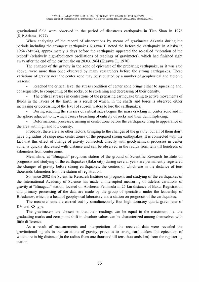
NATURAL CATACLYSMS AND GLOBAL PROBLEMS OF THE MODERN CIVILIZATION. Special edition of Transaction of the International Academy of Science. H&E. ICSD/IAS, Baku-Innsbruck, 2007.
55
gravitational field were observed in the period of disastrous earthquake in Tien Shan in 1976 (R.P.Adams, 1977).
When analyzing of the record of observations by means of gravimeter Askania during the periods including the strongest earthquakes Kizawa T. noted the before the earthquake in Alaska in 1964 (M=64), approximately 3 days before the earthquake appeared the so-called “vibration of the record” (relatively high-frequency oscillations of readings of gravimeter), which had finished right away after the end of the earthquake on 28.03.1964 (Kizawa T., 1970).
The changes of the gravity in the zone of epicenter of the preparing earthquake, as it was said above, were more than once observed by many researchers before the strong earthquakes. These variations of gravity near the center zone may be stipulated by a number of geophysical and tectonic reasons:
- Reached the critical level the stress condition of center zone brings either to squeezing and, consequently, to compacting of the rocks, or to stretching and decreasing of their density.
- The critical stresses in center zone of the preparing earthquake bring to active movements of fluids in the layers of the Earth, as a result of which, in the shafts and bores is observed either increasing or decreasing of the level of subsoil waters before the earthquakes;
- During reaching the stresses of critical sizes begins the mass cracking in center zone and in the sphere adjacent to it, which causes breaching of entirety of rocks and their demultiplexing;
- Deformational processes, arising in center zone before the earthquake bring to appearance of the area with high and low density.
Probably, there are also other factors, bringing to the changes of the gravity, but all of them don’t have big radius of range near center zones of the prepared strong earthquakes. It is connected with the fact that this effect of change of gravity connected, directly with geodynamical processes in center zone, is quickly decreased with distance and can be observed in the radius from tens till hundreds of kilometers from center zone.
Meanwhile, at “Binagadi” prognosis station of the ground of Scientific Research Institute on prognosis and studying of the earthquakes (Baku city) during several years are permanently registered the changes of gravity before strong earthquakes, the centers of which are in the distance of tens thousands kilometers from the station of registration.
So, since 2002 the Scientific-Research Institute on prognosis and studying of the earthquakes of the International Academy of Science has made uninterrupted measuring of tideless variations of gravity at “Binagadi” station, located on Absheron Peninsula in 25 km distance of Baku. Registration and primary processing of the data are made by the group of specialists under the leadership of B.Aslanov, which is a head of geophysical laboratory and a station on prognosis of the earthquakes.
The measurements are carried out by simultaneously four high-accuracy quartz gravimeter of KV and KS type.
The gravimeters are chosen so that their readings can be equal to the maximum, i.e. the graduating marks and zero-point shift in absolute values can be characterized among themselves with little difference.
As a result of measurements and interpretation of the received data were revealed the gravitational signals in the variations of gravity, previous to strong earthquakes, the epicenters of which are in big distance (in the radius from one thousand till tens thousands km) from the registering station.
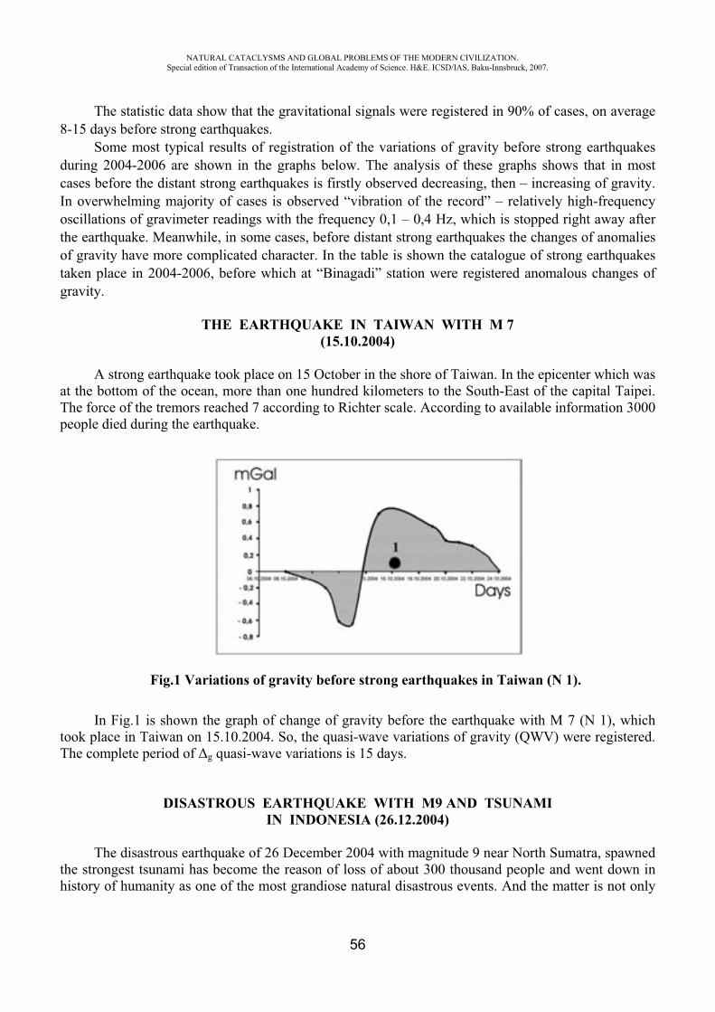
NATURAL CATACLYSMS AND GLOBAL PROBLEMS OF THE MODERN CIVILIZATION. Special edition of Transaction of the International Academy of Science. H&E. ICSD/IAS, Baku-Innsbruck, 2007.
56
The statistic data show that the gravitational signals were registered in 90% of cases, on average 8-15 days before strong earthquakes.
Some most typical results of registration of the variations of gravity before strong earthquakes during 2004-2006 are shown in the graphs below. The analysis of these graphs shows that in most cases before the distant strong earthquakes is firstly observed decreasing, then – increasing of gravity. In overwhelming majority of cases is observed “vibration of the record” – relatively high-frequency oscillations of gravimeter readings with the frequency 0,1 – 0,4 Hz, which is stopped right away after the earthquake. Meanwhile, in some cases, before distant strong earthquakes the changes of anomalies of gravity have more complicated character. In the table is shown the catalogue of strong earthquakes taken place in 2004-2006, before which at “Binagadi” station were registered anomalous changes of gravity.
THE EARTHQUAKE IN TAIWAN WITH M 7 (15.10.2004)
A strong earthquake took place on 15 October in the shore of Taiwan. In the epicenter which was at the bottom of the ocean, more than one hundred kilometers to the South-East of the capital Taipei. The force of the tremors reached 7 according to Richter scale. According to available information 3000 people died during the earthquake.
Fig.1 Variations of gravity before strong earthquakes in Taiwan (N 1).
In Fig.1 is shown the graph of change of gravity before the earthquake with M 7 (N 1), which took place in Taiwan on 15.10.2004. So, the quasi-wave variations of gravity (QWV) were registered. The complete period of g quasi-wave variations is 15 days.
DISASTROUS EARTHQUAKE WITH M9 AND TSUNAMI IN INDONESIA (26.12.2004)
The disastrous earthquake of 26 December 2004 with magnitude 9 near North Sumatra, spawned the strongest tsunami has become the reason of loss of about 300 thousand people and went down in history of humanity as one of the most grandiose natural disastrous events. And the matter is not only

NATURAL CATACLYSMS AND GLOBAL PROBLEMS OF THE MODERN CIVILIZATION. Special edition of Transaction of the International Academy of Science. H&E. ICSD/IAS, Baku-Innsbruck, 2007.
57
in the monstrous number of victims of the earthquake and tsunami made from it (Fig.2). The matter is, first of all, in astonishing geological event, the scales of which are so big, that they influenced on planetary processes in the Earth.
This event is described in details in fundamental article of V.I. Starostenko and others (V.I.Starostenko and others, 2005). The disastrous earthquake on South-East Asia has changed the geophysical characteristic of the Earth. As it is said in the site Spaceflight Now, the scientists from NASA determined that earthquake tremors had influenced on the speed of rotation of the planet, had decreased the duration of days and a little changed a shape of the planet. Besides, as a result of the earthquakes the location of North geographical pole shifted. It shifted on 2,5 cm in the direction of 145 degrees of east longitude. The change of the speed of rotation of the planet aroused increasing of duration of days on 2,68 microsecond, and shift of masses brought to change of form of the planet. As a result of the earthquake the proportions of the planet have changed on one ten milliards, that is the Earth has become less flattened out and more compact.
Fig.2. The scheme of spreading of tsunami from epicenter of catastrophic earthquake in Indonesia on 26 December 2004. The image is from site www.wikipedia.org
According to the data given in the work of V.I. Starostenko and others, the catastrophic earthquake of 26 December 2004 took place in the form of thrust-fault at the turn of Indo-Australian and Eurasian plates in the zone of North Sumatra. Approximately 2 minutes before the break realized the elastic deformation, which had been gathered in this center zone during hundreds of years as a result of continuing subduction (underthrust) of Indo-Australian plate under the Eurasian one. The zone of aftershocks on 26 December had the length of about 1300 km. Even if we suppose that only a part of aftershocks reflected the surface of the break of the main tremor, then, to the opinions of a number of researchers (2005) the geodesic observations and computer modelling allowed the scientists to come to the conclusion that the maximum underthrust during the given earthquake in the depth of 18 km, made approximately 20m. At that the bottom of the sea has moved considerably less: in vertical direction – approximately 5m, and in horizontal – 11m.
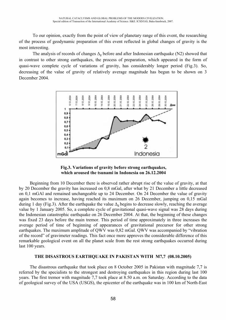
NATURAL CATACLYSMS AND GLOBAL PROBLEMS OF THE MODERN CIVILIZATION. Special edition of Transaction of the International Academy of Science. H&E. ICSD/IAS, Baku-Innsbruck, 2007.
58
To our opinion, exactly from the point of view of planetary range of this event, the researching of the process of geodynamic preparation of this event reflected in global changes of gravity is the most interesting.
The analysis of records of changes g before and after Indonesian earthquake (N2) showed that in contrast to other strong earthquakes, the process of preparation, which appeared in the form of quasi-wave complete cycle of variations of gravity, has considerably longer period (Fig.3). So, decreasing of the value of gravity of relatively average magnitude has begun to be shown on 3 December 2004.
Fig.3. Variations of gravity before strong earthquakes,which aroused the tsunami in Indonesia on 26.12.2004
Beginning from 10 December there is observed rather abrupt rise of the value of gravity, at that by 20 December the gravity has increased on 0,8 mGal, after what by 21 December a little decreased on 0,1 mGAl and remained unchangeable up to 24 December. On 24 December the value of gravity again becomes to increase, having reached its maximum on 26 December, jumping on 0,15 mGal during 1 day (Fig.3). After the earthquake the value g begins to decrease slowly, reaching the average value by 1 January 2005. So, a complete cycle of gravitational quasi-wave signal was 28 days during the Indonesian catastrophic earthquake on 26 December 2004. At that, the beginning of these changes was fixed 23 days before the main tremor. This period of time approximately in three increases the average period of time of beginning of appearances of gravitational precursor for other strong earthquakes. The maximum amplitude of QWV was 0,82 mGal. QWV was accompanied by “vibration of the record” of gravimeter readings. This fact once more approves the considerable difference of this remarkable geological event on all the planet scale from the rest strong earthquakes occurred during last 100 years.
THE DISASTROUS EARTHQUAKE IN PAKISTAN WITH M7,7 (08.10.2005)
The disastrous earthquake that took place on 8 October 2005 in Pakistan with magnitude 7,7 is referred by the specialists to the strongest and destroying earthquakes in this region during last 100 years. The first tremor with magnitude 7,7 took place at 8.50 a.m. on Saturday. According to the data of geological survey of the USA (USGS), the epicenter of the earthquake was in 100 km of North-East
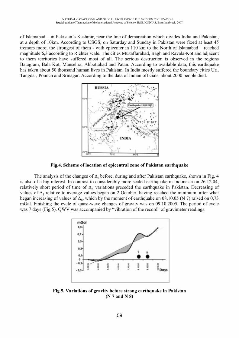
NATURAL CATACLYSMS AND GLOBAL PROBLEMS OF THE MODERN CIVILIZATION. Special edition of Transaction of the International Academy of Science. H&E. ICSD/IAS, Baku-Innsbruck, 2007.
59
of Islamabad – in Pakistan’s Kashmir, near the line of demarcation which divides India and Pakistan, at a depth of 10km. According to USGS, on Saturday and Sunday in Pakistan were fixed at least 45 tremors more; the strongest of them - with epicenter in 110 km to the North of Islamabad – reached magnitude 6,3 according to Richter scale. The cities Muzaffarabad, Bagh and Ravala-Kot and adjacent to them territories have suffered most of all. The serious destruction is observed in the regions Batagram, Bala-Kot, Mansehra, Abbottabad and Patan. According to available data, this earthquake has taken about 50 thousand human lives in Pakistan. In India mostly suffered the boundary cities Uri, Tangdar, Pounch and Srinagar. According to the data of Indian officials, about 2000 people died.
Fig.4. Scheme of location of epicentral zone of Pakistan earthquake
The analysis of the changes of g before, during and after Pakistan earthquake, shown in Fig. 4 is also of a big interest. In contrast to considerably more scaled earthquake in Indonesia on 26.12.04, relatively short period of time of g variations preceded the earthquake in Pakistan. Decreasing of values of g relative to average values began on 2 October, having reached the minimum, after what began increasing of values of g, which by the moment of earthquake on 08.10.05 (N 7) raised on 0,73 mGal. Finishing the cycle of quasi-wave changes of gravity was on 09.10.2005. The period of cycle was 7 days (Fig.5). QWV was accompanied by “vibration of the record” of gravimeter readings.
Fig.5. Variations of gravity before strong earthquake in Pakistan (N 7 and N 8)
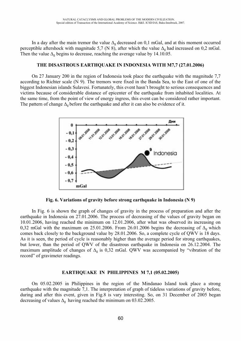
NATURAL CATACLYSMS AND GLOBAL PROBLEMS OF THE MODERN CIVILIZATION. Special edition of Transaction of the International Academy of Science. H&E. ICSD/IAS, Baku-Innsbruck, 2007.
60
In a day after the main tremor the value g decreased on 0,1 mGal, and at this moment occurred perceptible aftershock with magnitude 5,7 (N 8), after which the value g had increased on 0,2 mGal. Then the value g begins to decrease, reaching the average value by 14.10.05.
THE DISASTROUS EARTHQUAKE IN INDONESIA WITH M7,7 (27.01.2006)
On 27 January 200 in the region of Indonesia took place the earthquake with the magnitude 7,7 according to Richter scale (N 9). The tremors were fixed in the Banda Sea, to the East of one of the biggest Indonesian islands Sulavesi. Fortunately, this event hasn’t brought to serious consequences and victims because of considerable distance of epicenter of the earthquake from inhabited localities. At the same time, from the point of view of energy ingress, this event can be considered rather important. The pattern of change g before the earthquake and after it can also be evidence of it.
Fig. 6. Variations of gravity before strong earthquake in Indonesia (N 9)
In Fig. 6 is shown the graph of changes of gravity in the process of preparation and after the earthquake in Indonesia on 27.01.2006. The process of decreasing of the values of gravity began on 10.01.2006, having reached the minimum on 12.01.2006, after what was observed its increasing on 0,32 mGal with the maximum on 25.01.2006. From 26.01.2006 begins the decreasing of g which comes back closely to the background value by 28.01.2006. So, a complete cycle of QWV is 18 days. As it is seen, the period of cycle is reasonably higher than the average period for strong earthquakes, but lower, than the period of QWV of the disastrous earthquake in Indonesia on 26.12.2004. The maximum amplitude of changes of g is 0,32 mGal. QWV was accompanied by “vibration of the record” of gravimeter readings.
EARTHQUAKE IN PHILIPPINES M 7,1 (05.02.2005)
On 05.02.2005 in Philippines in the region of the Mindanao Island took place a strong earthquake with the magnitude 7,1. The interpretation of graph of tideless variations of gravity before, during and after this event, given in Fig.8 is vary interesting. So, on 31 December of 2005 began decreasing of values g having reached the minimum on 03.02.2005.
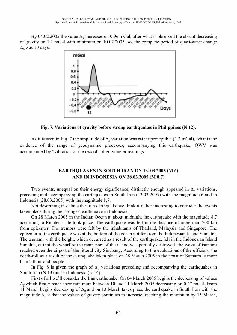
NATURAL CATACLYSMS AND GLOBAL PROBLEMS OF THE MODERN CIVILIZATION. Special edition of Transaction of the International Academy of Science. H&E. ICSD/IAS, Baku-Innsbruck, 2007.
61
By 04.02.2005 the value g increases on 0,96 mGal, after what is observed the abrupt decreasing of gravity on 1,2 mGal with minimum on 10.02.2005. so, the complete period of quasi-wave change
g was 10 days.
Fig. 7. Variations of gravity before strong earthquakes in Philippines (N 12).
As it is seen in Fig. 7 the amplitude of g variation was rather perceptible (1,2 mGal), what is the evidence of the range of geodynamic processes, accompanying this earthquake. QWV was accompanied by “vibration of the record” of gravimeter readings.
EARTHQUAKES IN SOUTH IRAN ON 13..03.2005 (M 6) AND IN INDONESIA ON 28.03.2005 (M 8,7)
Two events, unequal on their energy significance, distinctly enough appeared in g variations, preceding and accompanying the earthquakes in South Iran (13.03.2005) with the magnitude 6 and in Indonesia (28.03.2005) with the magnitude 8,7.
Not describing in details the Iran earthquake we think it rather interesting to consider the events taken place during the strongest earthquake in Indonesia.
On 28 March 2005 in the Indian Ocean at about midnight the earthquake with the magnitude 8,7 according to Richter scale took place. The earthquake was felt in the distance of more than 700 km from epicenter. The tremors were felt by the inhabitants of Thailand, Malaysia and Singapore. The epicenter of the earthquake was at the bottom of the ocean not far from the Indonesian Island Sumatra. The tsunami with the height, which occurred as a result of the earthquake, fell in the Indonesian Island Simelue, at that the wharf of the main port of the island was partially destroyed, the wave of tsunami reached even the airport of the littoral city Sinabang. According to the evaluations of the officials, the death-roll as a result of the earthquake taken place on 28 March 2005 in the coast of Sumatra is more than 2 thousand people.
In Fig. 8 is given the graph of g variations preceding and accompanying the earthquakes in South Iran (N 13) and in Indonesia (N 14).
First of all we’ll consider the Iran earthquake. On 04 March 2005 begins the decreasing of values g which firstly reach their minimum between 10 and 11 March 2005 decreasing on 0,27 mGal. From
11 March begins decreasing of g and on 13 March takes place the earthquake in South Iran with the magnitude 6, at that the values of gravity continues to increase, reaching the maximum by 15 March,
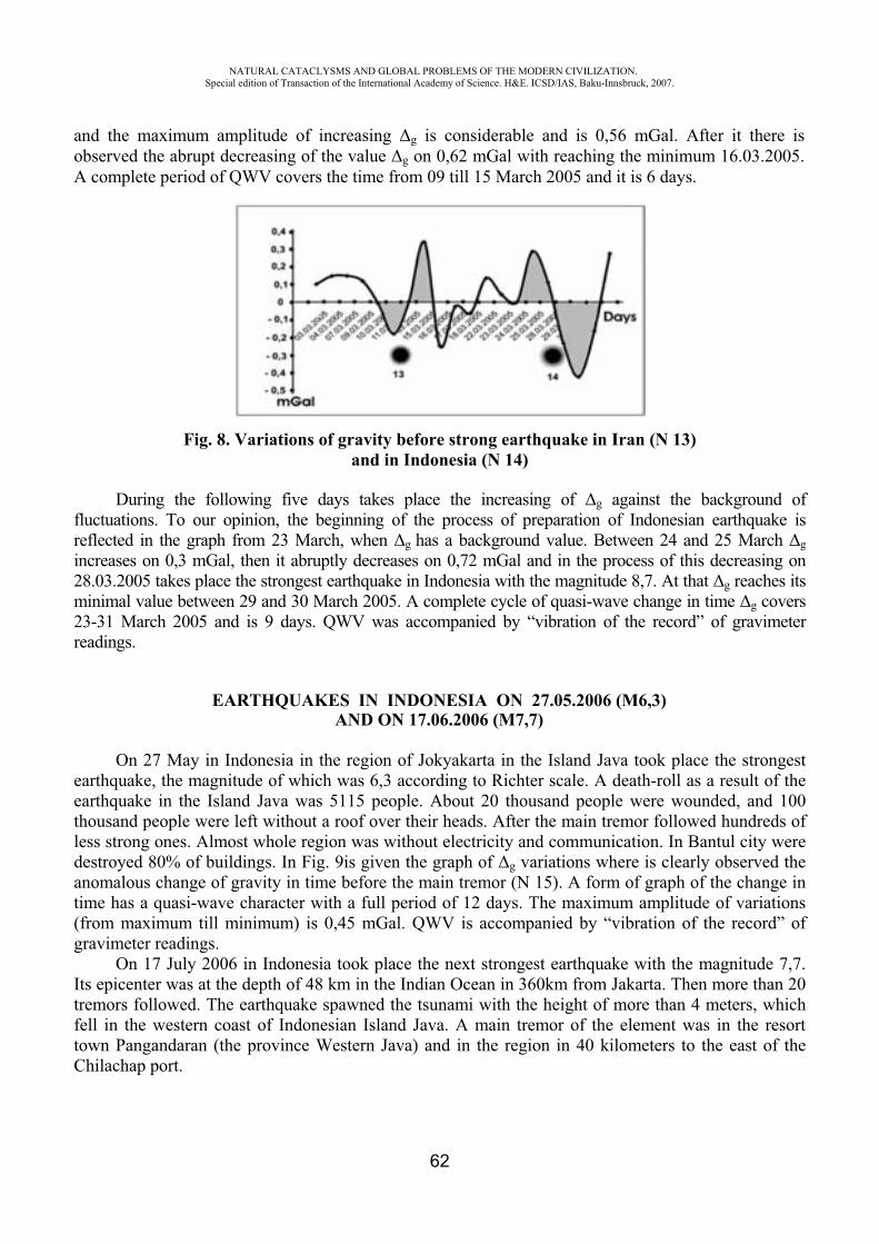
NATURAL CATACLYSMS AND GLOBAL PROBLEMS OF THE MODERN CIVILIZATION. Special edition of Transaction of the International Academy of Science. H&E. ICSD/IAS, Baku-Innsbruck, 2007.
62
and the maximum amplitude of increasing g is considerable and is 0,56 mGal. After it there is observed the abrupt decreasing of the value g on 0,62 mGal with reaching the minimum 16.03.2005. A complete period of QWV covers the time from 09 till 15 March 2005 and it is 6 days.
Fig. 8. Variations of gravity before strong earthquake in Iran (N 13) and in Indonesia (N 14)
During the following five days takes place the increasing of g against the background of fluctuations. To our opinion, the beginning of the process of preparation of Indonesian earthquake is reflected in the graph from 23 March, when g has a background value. Between 24 and 25 March gincreases on 0,3 mGal, then it abruptly decreases on 0,72 mGal and in the process of this decreasing on 28.03.2005 takes place the strongest earthquake in Indonesia with the magnitude 8,7. At that g reaches its minimal value between 29 and 30 March 2005. A complete cycle of quasi-wave change in time g covers 23-31 March 2005 and is 9 days. QWV was accompanied by “vibration of the record” of gravimeter readings.
EARTHQUAKES IN INDONESIA ON 27.05.2006 (M6,3) AND ON 17.06.2006 (M7,7)
On 27 May in Indonesia in the region of Jokyakarta in the Island Java took place the strongest earthquake, the magnitude of which was 6,3 according to Richter scale. A death-roll as a result of the earthquake in the Island Java was 5115 people. About 20 thousand people were wounded, and 100 thousand people were left without a roof over their heads. After the main tremor followed hundreds of less strong ones. Almost whole region was without electricity and communication. In Bantul city were destroyed 80% of buildings. In Fig. 9is given the graph of g variations where is clearly observed the anomalous change of gravity in time before the main tremor (N 15). A form of graph of the change in time has a quasi-wave character with a full period of 12 days. The maximum amplitude of variations (from maximum till minimum) is 0,45 mGal. QWV is accompanied by “vibration of the record” of gravimeter readings.
On 17 July 2006 in Indonesia took place the next strongest earthquake with the magnitude 7,7. Its epicenter was at the depth of 48 km in the Indian Ocean in 360km from Jakarta. Then more than 20 tremors followed. The earthquake spawned the tsunami with the height of more than 4 meters, which fell in the western coast of Indonesian Island Java. A main tremor of the element was in the resort town Pangandaran (the province Western Java) and in the region in 40 kilometers to the east of the Chilachap port.

NATURAL CATACLYSMS AND GLOBAL PROBLEMS OF THE MODERN CIVILIZATION. Special edition of Transaction of the International Academy of Science. H&E. ICSD/IAS, Baku-Innsbruck, 2007.
63
Approximately in the 300km area at the coast of Java the tsunami destroyed and washed thousands of people into the ocean. Energy supply and telephone communications was broken. Jokyakarta also suffered because of the earthquake and tsunami. As a result of the earthquake and tsunami about 1000 people died and 500 people were wounded.
Fig. 9. Variations of gravity before strong earthquakes in Indonesia(N 15 and N 16).
In the graph appeared the pronounced anomaly of g variation, which considerably increases the anomaly during the earthquake on 27.05.2006. To our opinion it can be explained with a big magnitude of the earthquake on 17.07.2006. A form of anomaly g preceding the earthquake, also has a quasi-wave character with the period of 13 days. The maximal amplitude of g variation is 0,92 mGal. QWV was accompanied by “vibration of the record” of gravimeter readings.
Below are given the photos of the author near the destroyed chouses in Yogyakarta as a result of strong earthquakes and tsunami, occurred in Indonesia on 27.05.2006 and on 17.07.2006.
THE EARTHQUAKES IN JAPAN ON 10.10.2006 (M 6)AND IN THE KURILES ON 15.11.2006 (M 8,3)
On 10 October 2006 in the northern part of Japan took place the earthquake with magnitude 6 according to Richter scale. The epicenter of the earthquake was in the sea near the Fukusima city which is in 240km to the north-east from Tokyo.
The earthquake didn’t cause the big destruction, but its preparation was accompanied by the pronounced anomaly of variation of gravity. The period of quasi-wave variation was 7 days. The maximal amplitude of changes of g was 0,8 mGal. QWV wasn’t accompanied by “vibration of the records” of gravimeter readings. Fig.10.
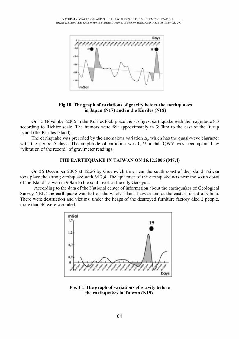
NATURAL CATACLYSMS AND GLOBAL PROBLEMS OF THE MODERN CIVILIZATION. Special edition of Transaction of the International Academy of Science. H&E. ICSD/IAS, Baku-Innsbruck, 2007.
64
Fig.10. The graph of variations of gravity before the earthquakes in Japan (N17) and in the Kuriles (N18)
On 15 November 2006 in the Kuriles took place the strongest earthquake with the magnitude 8,3 according to Richter scale. The tremors were felt approximately in 390km to the east of the Iturup Island (the Kuriles Island).
The earthquake was preceded by the anomalous variation g which has the quasi-wave character with the period 5 days. The amplitude of variation was 0,72 mGal. QWV was accompanied by “vibration of the record” of gravimeter readings.
THE EARTHQUAKE IN TAIWAN ON 26.12.2006 (M7,4)
On 26 December 2006 at 12:26 by Greenwich time near the south coast of the Island Taiwan took place the strong earthquake with M 7,4. The epicenter of the earthquake was near the south coast of the Island Taiwan in 90km to the south-east of the city Gaosyun.
According to the data of the National center of information about the earthquakes of Geological Survey NEIC the earthquake was felt on the whole island Taiwan and at the eastern coast of China. There were destruction and victims: under the heaps of the destroyed furniture factory died 2 people, more than 30 were wounded.
Fig. 11. The graph of variations of gravity before the earthquakes in Taiwan (N19).
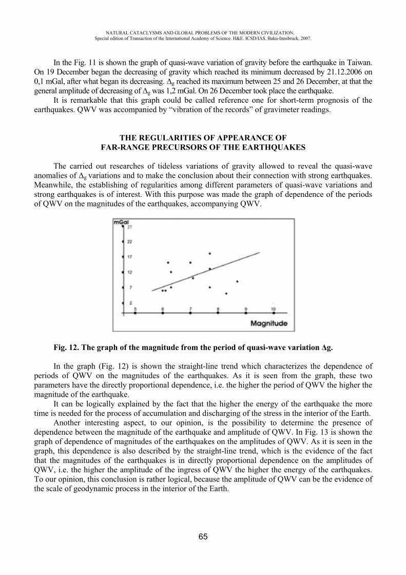
NATURAL CATACLYSMS AND GLOBAL PROBLEMS OF THE MODERN CIVILIZATION. Special edition of Transaction of the International Academy of Science. H&E. ICSD/IAS, Baku-Innsbruck, 2007.
65
In the Fig. 11 is shown the graph of quasi-wave variation of gravity before the earthquake in Taiwan. On 19 December began the decreasing of gravity which reached its minimum decreased by 21.12.2006 on 0,1 mGal, after what began its decreasing. g reached its maximum between 25 and 26 December, at that the general amplitude of decreasing of g was 1,2 mGal. On 26 December took place the earthquake.
It is remarkable that this graph could be called reference one for short-term prognosis of the earthquakes. QWV was accompanied by “vibration of the records” of gravimeter readings.
THE REGULARITIES OF APPEARANCE OF FAR-RANGE PRECURSORS OF THE EARTHQUAKES
The carried out researches of tideless variations of gravity allowed to reveal the quasi-wave anomalies of g variations and to make the conclusion about their connection with strong earthquakes. Meanwhile, the establishing of regularities among different parameters of quasi-wave variations and strong earthquakes is of interest. With this purpose was made the graph of dependence of the periods of QWV on the magnitudes of the earthquakes, accompanying QWV.
Fig. 12. The graph of the magnitude from the period of quasi-wave variation g.
In the graph (Fig. 12) is shown the straight-line trend which characterizes the dependence of periods of QWV on the magnitudes of the earthquakes. As it is seen from the graph, these two parameters have the directly proportional dependence, i.e. the higher the period of QWV the higher the magnitude of the earthquake.
It can be logically explained by the fact that the higher the energy of the earthquake the more time is needed for the process of accumulation and discharging of the stress in the interior of the Earth.
Another interesting aspect, to our opinion, is the possibility to determine the presence of dependence between the magnitude of the earthquake and amplitude of QWV. In Fig. 13 is shown the graph of dependence of magnitudes of the earthquakes on the amplitudes of QWV. As it is seen in the graph, this dependence is also described by the straight-line trend, which is the evidence of the fact that the magnitudes of the earthquakes is in directly proportional dependence on the amplitudes of QWV, i.e. the higher the amplitude of the ingress of QWV the higher the energy of the earthquakes. To our opinion, this conclusion is rather logical, because the amplitude of QWV can be the evidence of the scale of geodynamic process in the interior of the Earth.
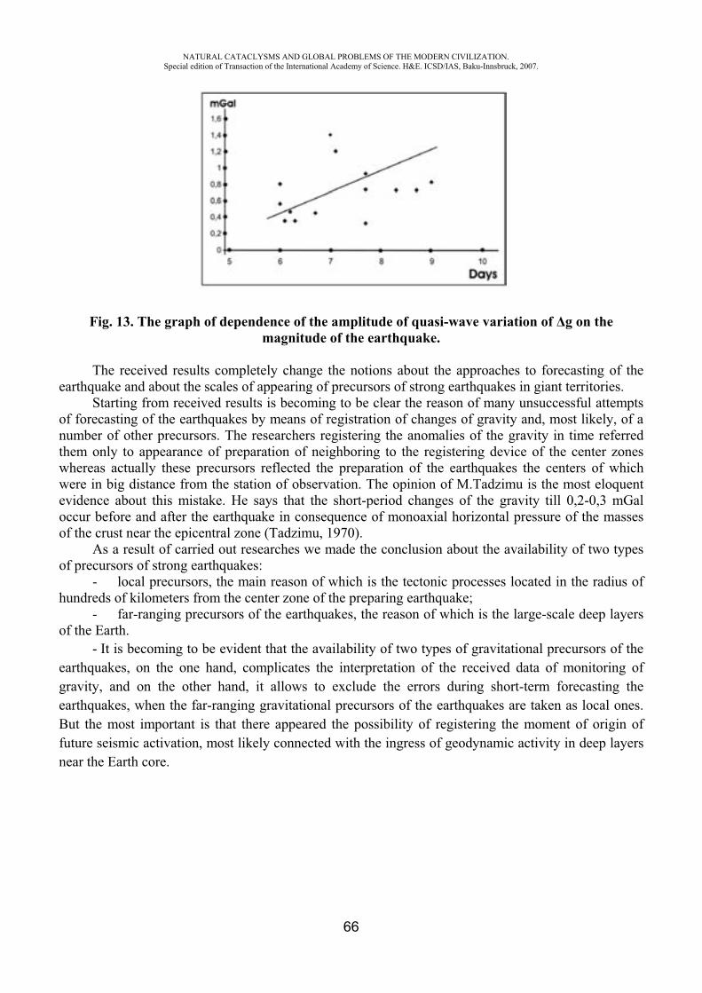
NATURAL CATACLYSMS AND GLOBAL PROBLEMS OF THE MODERN CIVILIZATION. Special edition of Transaction of the International Academy of Science. H&E. ICSD/IAS, Baku-Innsbruck, 2007.
66
Fig. 13. The graph of dependence of the amplitude of quasi-wave variation of g on the magnitude of the earthquake.
The received results completely change the notions about the approaches to forecasting of the earthquake and about the scales of appearing of precursors of strong earthquakes in giant territories.
Starting from received results is becoming to be clear the reason of many unsuccessful attempts of forecasting of the earthquakes by means of registration of changes of gravity and, most likely, of a number of other precursors. The researchers registering the anomalies of the gravity in time referred them only to appearance of preparation of neighboring to the registering device of the center zones whereas actually these precursors reflected the preparation of the earthquakes the centers of which were in big distance from the station of observation. The opinion of M.Tadzimu is the most eloquent evidence about this mistake. He says that the short-period changes of the gravity till 0,2-0,3 mGal occur before and after the earthquake in consequence of monoaxial horizontal pressure of the masses of the crust near the epicentral zone (Tadzimu, 1970).
As a result of carried out researches we made the conclusion about the availability of two types of precursors of strong earthquakes:
- local precursors, the main reason of which is the tectonic processes located in the radius of hundreds of kilometers from the center zone of the preparing earthquake;
- far-ranging precursors of the earthquakes, the reason of which is the large-scale deep layers of the Earth.
- It is becoming to be evident that the availability of two types of gravitational precursors of the earthquakes, on the one hand, complicates the interpretation of the received data of monitoring of gravity, and on the other hand, it allows to exclude the errors during short-term forecasting the earthquakes, when the far-ranging gravitational precursors of the earthquakes are taken as local ones. But the most important is that there appeared the possibility of registering the moment of origin of future seismic activation, most likely connected with the ingress of geodynamic activity in deep layers near the Earth core.
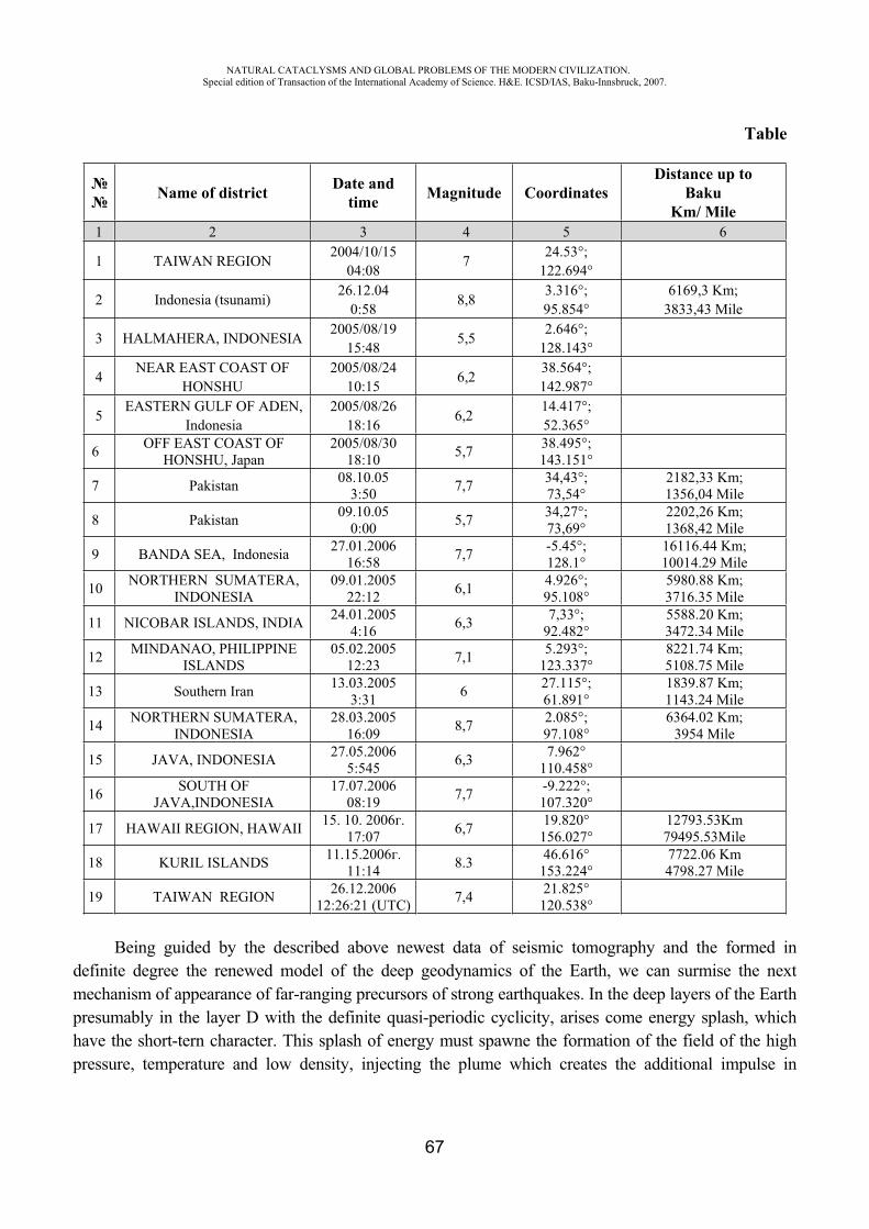
NATURAL CATACLYSMS AND GLOBAL PROBLEMS OF THE MODERN CIVILIZATION. Special edition of Transaction of the International Academy of Science. H&E. ICSD/IAS, Baku-Innsbruck, 2007.
67
Table
Name of district Date and time Magnitude Coordinates
Distance up toBaku
Km/ Mile1 2 3 4 5 6
1 TAIWAN REGION 2004/10/15 04:08 7 24.53°;
122.694°
2 Indonesia (tsunami) 26.12.04 0:58 8,8 3.316°;
95.854° 6169,3 Km;
3833,43 Mile
3 HALMAHERA, INDONESIA 2005/08/19 15:48 5,5 2.646°;
128.143°
4 NEAR EAST COAST OF HONSHU
2005/08/24 10:15 6,2 38.564°;
142.987°
5 EASTERN GULF OF ADEN, Indonesia
2005/08/26 18:16 6,2 14.417°;
52.365°
6 OFF EAST COAST OF HONSHU, Japan
2005/08/30 18:10 5,7 38.495°;
143.151°
7 Pakistan 08.10.05 3:50 7,7 34,43°;
73,54° 2182,33 Km; 1356,04 Mile
8 Pakistan 09.10.05 0:00 5,7 34,27°;
73,69° 2202,26 Km; 1368,42 Mile
9 BANDA SEA, Indonesia 27.01.2006 16:58 7,7 -5.45°;
128.1° 16116.44 Km; 10014.29 Mile
10 NORTHERN SUMATERA, INDONESIA
09.01.2005 22:12 6,1 4.926°;
95.108° 5980.88 Km; 3716.35 Mile
11 NICOBAR ISLANDS, INDIA 24.01.2005 4:16 6,3 7,33°;
92.482° 5588.20 Km; 3472.34 Mile
12 MINDANAO, PHILIPPINE ISLANDS
05.02.2005 12:23 7,1 5.293°;
123.337° 8221.74 Km; 5108.75 Mile
13 Southern Iran 13.03.2005 3:31 6 27.115°;
61.891° 1839.87 Km; 1143.24 Mile
14 NORTHERN SUMATERA, INDONESIA
28.03.2005 16:09 8,7 2.085°;
97.108° 6364.02 Km;
3954 Mile
15 JAVA, INDONESIA 27.05.2006 5:545 6,3 7.962°
110.458°
16 SOUTH OF JAVA,INDONESIA
17.07.2006 08:19 7,7 -9.222°;
107.320°
17 HAWAII REGION, HAWAII 15. 10. 2006 .17:07 6,7 19.820°
156.027° 12793.53Km 79495.53Mile
18 KURIL ISLANDS 11.15.2006 .11:14 8.3 46.616°
153.224° 7722.06 Km 4798.27 Mile
19 TAIWAN REGION 26.12.2006 12:26:21 (UTC) 7,4 21.825°
120.538°
Being guided by the described above newest data of seismic tomography and the formed in definite degree the renewed model of the deep geodynamics of the Earth, we can surmise the next mechanism of appearance of far-ranging precursors of strong earthquakes. In the deep layers of the Earth presumably in the layer D with the definite quasi-periodic cyclicity, arises come energy splash, which have the short-tern character. This splash of energy must spawne the formation of the field of the high pressure, temperature and low density, injecting the plume which creates the additional impulse in
NATURAL CATACLYSMS AND GLOBAL PROBLEMS OF THE MODERN CIVILIZATION. Special edition of Transaction of the International Academy of Science. H&E. ICSD/IAS, Baku-Innsbruck, 2007.
68
convection current and in the mantle. In some period this impulse brings to acceleration of convection currents in asthenosphere what brings to activation of moving of definite lithospheric plates, depending on the fact in what part of the layer D is taking place the energy splash. There is no doubt that definite time passes from the moment of energetic impulse in the layer D before the beginning of seismic activation in the borders of lithospheric plates. Most likely, namely this period of time (8-20 days) has passed from the start time of registration of variations of gravity before strong earthquakes. And in this case can be two reasons of arising the registered anomalies of gravity: 1. Forming of giant fields of anomalous density, aroused by energy splash, in the layer D; 2. Radiation of tectonic waves in the zone of energy splash in the layer D. The nature of tectonic waves is different from seismic ones and they reflect not only the alternate interchange and moving from the emission source of the fields of increased and decreased density, but also a partial moving of substance of the mantle.
From physical point of view the observed anomalies can be explained more likely namely by registration of super-long tectonic waves, radiated in the layer D and alternately changing the density of the rocks during its moving, what, in its turn, registered by gravimeters in the form of variations of gravity. The tectonic waves cause the abrupt increasing of stress in center zones, where the stress have reached the critical values, what brings to the earthquake.
The registered in Scientific-Research Institute of prognosis and studying of the earthquakes the variations of gravity before strong earthquakes, the epicenters of which are in the distance of 4-7 kilometers from the registered station can shed the light on the spatio-temporal character of the process of rise of deep geodynamic activity. The main question during interpretation of gravitational anomalies before strong distant earthquakes is in the fact whether these anomalies are directly connected with preparation of center zone of the earthquake or reflect the zone of rise of geodynamic activity in the deep layers of mantle.
The calculations carried out by us show, that if the source of gravitational anomalies, registered before strong earthquakes in Pakistan, Indonesia and other earthquakes, 4-7 kilometers distant from “Binagadi” station, then in them should have been formed improbable giant fields of decreased density with a diameter of 100 kilometers. In this case near the center zones were registered the gravitational anomalies in hundreds of milligals, what actually aren’t observed. Consequently the source of gravitational anomaly is at the big depth and is distant from the center zone of the earthquake the same way as from the registered station.
So, we offered fundamentally new conception, explaining the observation of variations of gravity before distant strong earthquakes.
REFERENCES
1. Antonov Y.V., Slusarev S.V., Chirkov V.N. Possible reasons of temporary changes of vertical gradient of gravity. Geophysics, 2000, N 4, 45-51.
2. Bulatova N.P. Latitudinal distribution of seismicity of the Earth depending on location of the Sun and Moon. Volcanology and seismology. 2005, N 2, pp. 57-58.
NATURAL CATACLYSMS AND GLOBAL PROBLEMS OF THE MODERN CIVILIZATION. Special edition of Transaction of the International Academy of Science. H&E. ICSD/IAS, Baku-Innsbruck, 2007.
69
3. Volodichev N.N., Podorolskiy A.N., Levin B.V., Podorolskiy Vl.A. Correlation of appearance of big series of earthquakes with the time of phases of new moon and full moon. Volcanology and seismology. 2001, N 1, pp. 60-67.
4. Dobrovolskiy I.L, Gravitational precursors of tectonic earthquake. Physics of the Earth, 2005, N 4, pp. 23-28.
5. Levin B.V. Is the Earth core the conductor of seismic activity? The Earth and the Universe. 2001, N 3, pp. 12-19.
6. Mikhaylov V.O., Tikhotskiy S.A., Diaman M., Pane I.. Researching of the possibility of finding out and studying of variations of gravity of geodynamic origin on modern satellite gravimetric data. Physics of the Earth. 2005. N3, pp. 18-32.
7. Parriskiy N.N. About irregular changes of the speed of rotation of the Earth and their possible connection with the deformations of the Earth and changes of gravity. In the book: The problems of widening and pulsation of the Earth. Science, 1984, pp. 84-93.
8. Pertsev B.P. Tidal deformations of the surface of geoid. Physics of the Earth, N 8, pp. 3-5. 9. Starostenko V.I., Geiko V.S. Kendzera A.V. and others. The disastrous earthquake of 26
December 2004 near the shores of Sumatra: reasons, consequences, lessons. Geophysical journal. 2005, v.27. N 6, pp.940-961.
10. Fedorov V.M. Chronological structure and possibility of volcanic activity in connection with tidal deformation of lithosphere. Volcanology and seismology. 2005, N 1, pp.44-50.
11. Chen Ji. Computer Simulation of Earth Movement that Spawned the Tsunami. California Institute of Technology. 2005;
12. http:/earthobservatory.nasa.gov/NaturalHazards/shownh.php3?img_id=12646
NATURAL CATACLYSMS AND GLOBAL PROBLEMS OF THE MODERN CIVILIZATION. Special edition of Transaction of the International Academy of Science. H&E. ICSD/IAS, Baku-Innsbruck, 2007.
70
SPECIAL SECTION
NEW TRACES OF THE CASPIAN ATLANTIS
Khalilov E.N.*, Mammadova G.H**, Khalilova T. Sh.***
*International Academy of Science H&E **Azerbaijan University of Architecture and Construction
*** International Scientific and Technical Complex “Intergeo-Tethys”
Development of human society in the course of the whole history of mankind significantly depended on a lot of natural factors such as climatic conditions, soil fertility, and availability of water sources, the vegetable world and the animal world. However perhaps only natural calamities distinguished by its unpredictability and scope exerted fatal impact on development of civilizations. There are many examples in the history of mankind that evidence destruction and dark oblivion for many centuries and sometimes millenniums of the whole civilizations as a result of natural calamities. It is enough to remember Pompeii, the ancient city that was destructed as a result of eruption of Vesuvius volcano during two days, i.e. August 24-25, 79 A.D. and had remained under thick layer of volcanic ashes for many centuries. And this city was found and revealed for future civilizations in 1594.
Meanwhile the legendary Atlantis firstly mentioned by Plato, the great philosopher doesn’t leave indifferent the minds of many scientists. How many other cities like “Atlantis” are buried under water? Ruins of ancient and legendary Sabail castle look out of sea water near Baku City and these ruins are sometimes called a Caspian Atlantis /1/. This site is known to Baku citizens as “Sabail”, “Bayil stones”, “Caravanserai” or “Bayil Gesri”. Some scientists think that Sabail was a most impregnable fortress of the Southern Caucasus region that couldn’t be taken by storm even by the army of Genghis Khan. When describing the fortress the scientists mention that the fortress has the shape of extremely oblong rectangular with uneven lines of lateral walls /2/. Investigations conducted using the space photograph of high resolution allowed the authors to acquire accurate outlines of “Sabail” fortress (fig.1). It is supposed that this shape repeated outlines of the rock that serves as foundation for almost the whole fortress. The masonry walls of about 1.5 m in thickness connect 15 towers. Maybe the fortress submerged under sea waters after the most powerful earthquake occurred in 1306.
Investigations show that the level of water in the Caspian Sea was exposed to periodical fluctuations and resulted in significant change of coastline of the Caspian Sea and area of water surface of the Sea /4/.
However is Sabail fortress the only ancient structure swallowed by the deep of waters of the wild Caspian Sea?
Investigation of shelf of Absheron peninsula using space photographs allowed scientists to find an extraordinary structure on the bottom of sea, near the eastern boundaries of Absheron peninsula i.e. Shikhov bay-bar and the shape of this structure reminded the ruins of an ancient fortress (fig.2). Authors temporarily titled this structure as “Zyrinskaya fortress”.
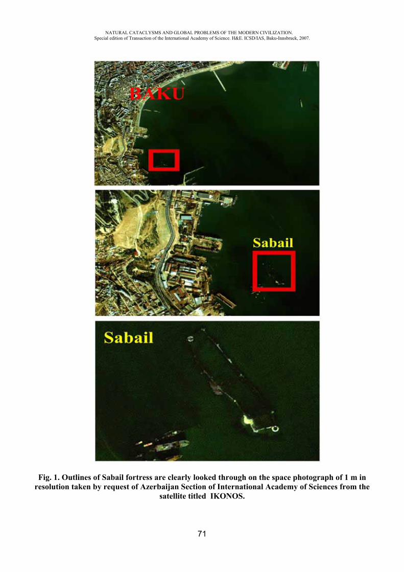
NATURAL CATACLYSMS AND GLOBAL PROBLEMS OF THE MODERN CIVILIZATION. Special edition of Transaction of the International Academy of Science. H&E. ICSD/IAS, Baku-Innsbruck, 2007.
71
Fig. 1. Outlines of Sabail fortress are clearly looked through on the space photograph of 1 m in resolution taken by request of Azerbaijan Section of International Academy of Sciences from the
satellite titled IKONOS.
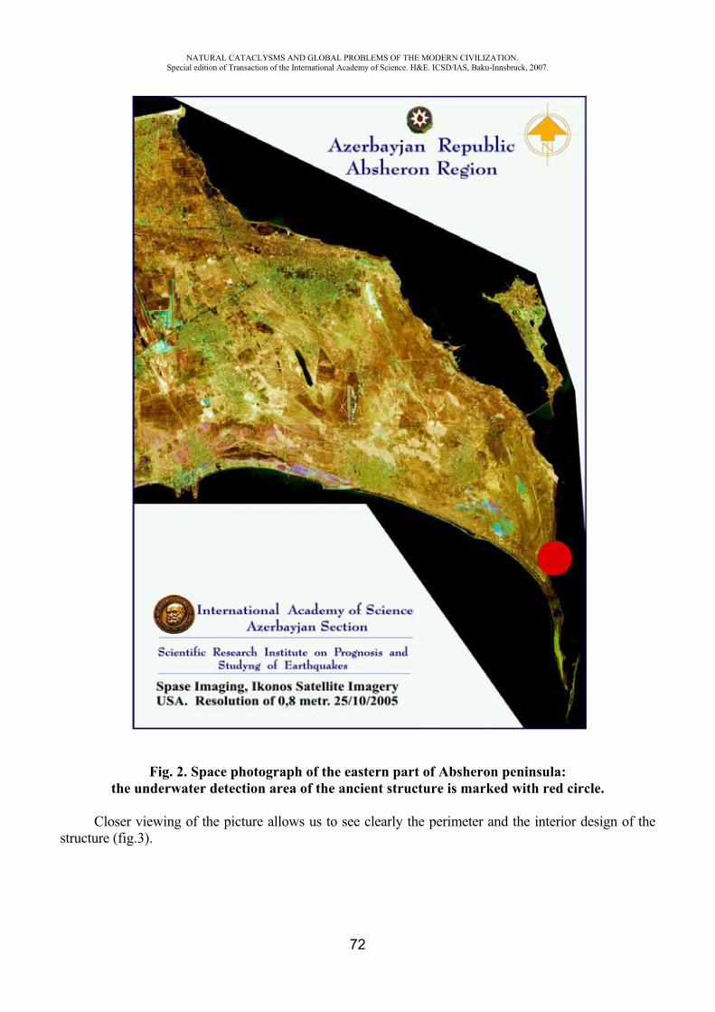
NATURAL CATACLYSMS AND GLOBAL PROBLEMS OF THE MODERN CIVILIZATION. Special edition of Transaction of the International Academy of Science. H&E. ICSD/IAS, Baku-Innsbruck, 2007.
72
Fig. 2. Space photograph of the eastern part of Absheron peninsula:the underwater detection area of the ancient structure is marked with red circle.
Closer viewing of the picture allows us to see clearly the perimeter and the interior design of the structure (fig.3).
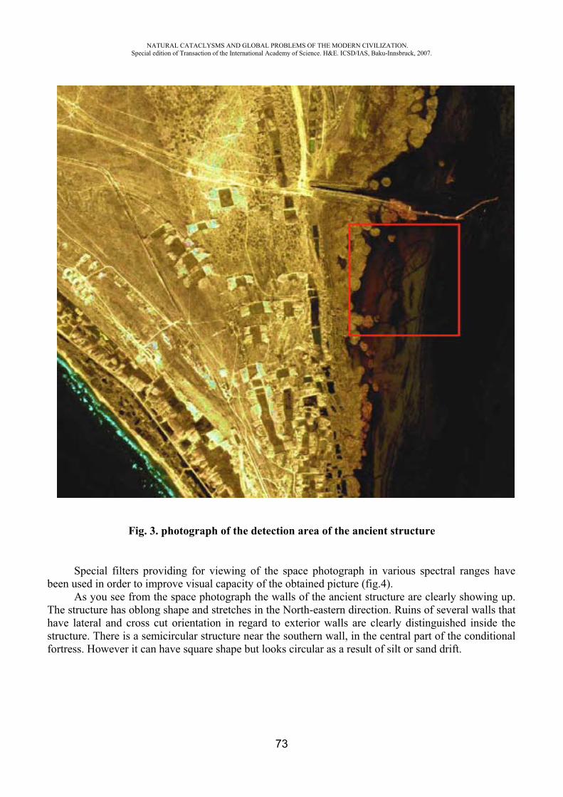
NATURAL CATACLYSMS AND GLOBAL PROBLEMS OF THE MODERN CIVILIZATION. Special edition of Transaction of the International Academy of Science. H&E. ICSD/IAS, Baku-Innsbruck, 2007.
73
Fig. 3. photograph of the detection area of the ancient structure
Special filters providing for viewing of the space photograph in various spectral ranges have been used in order to improve visual capacity of the obtained picture (fig.4).
As you see from the space photograph the walls of the ancient structure are clearly showing up. The structure has oblong shape and stretches in the North-eastern direction. Ruins of several walls that have lateral and cross cut orientation in regard to exterior walls are clearly distinguished inside the structure. There is a semicircular structure near the southern wall, in the central part of the conditional fortress. However it can have square shape but looks circular as a result of silt or sand drift.
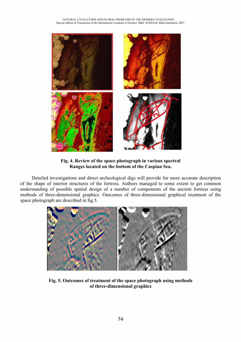
NATURAL CATACLYSMS AND GLOBAL PROBLEMS OF THE MODERN CIVILIZATION. Special edition of Transaction of the International Academy of Science. H&E. ICSD/IAS, Baku-Innsbruck, 2007.
74
Fig. 4. Review of the space photograph in various spectral Ranges located on the bottom of the Caspian Sea.
Detailed investigations and direct archeological digs will provide for more accurate description of the shape of interior structures of the fortress. Authors managed to some extent to get common understanding of possible spatial design of a number of components of the ancient fortress using methods of three-dimensional graphics. Outcomes of three-dimensional graphical treatment of the space photograph are described in fig.5.
Fig. 5. Outcomes of treatment of the space photograph using methods of three-dimensional graphics
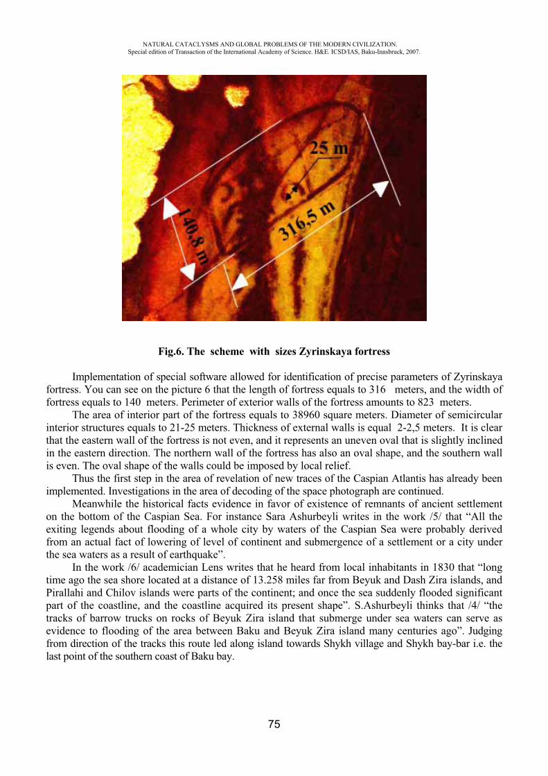
NATURAL CATACLYSMS AND GLOBAL PROBLEMS OF THE MODERN CIVILIZATION. Special edition of Transaction of the International Academy of Science. H&E. ICSD/IAS, Baku-Innsbruck, 2007.
75
Fig.6. The scheme with sizes Zyrinskaya fortress
Implementation of special software allowed for identification of precise parameters of Zyrinskaya fortress. You can see on the picture 6 that the length of fortress equals to 316 meters, and the width of fortress equals to 140 meters. Perimeter of exterior walls of the fortress amounts to 823 meters.
The area of interior part of the fortress equals to 38960 square meters. Diameter of semicircular interior structures equals to 21-25 meters. Thickness of external walls is equal 2-2,5 meters. It is clear that the eastern wall of the fortress is not even, and it represents an uneven oval that is slightly inclined in the eastern direction. The northern wall of the fortress has also an oval shape, and the southern wall is even. The oval shape of the walls could be imposed by local relief.
Thus the first step in the area of revelation of new traces of the Caspian Atlantis has already been implemented. Investigations in the area of decoding of the space photograph are continued.
Meanwhile the historical facts evidence in favor of existence of remnants of ancient settlement on the bottom of the Caspian Sea. For instance Sara Ashurbeyli writes in the work /5/ that “All the exiting legends about flooding of a whole city by waters of the Caspian Sea were probably derived from an actual fact of lowering of level of continent and submergence of a settlement or a city under the sea waters as a result of earthquake”.
In the work /6/ academician Lens writes that he heard from local inhabitants in 1830 that “long time ago the sea shore located at a distance of 13.258 miles far from Beyuk and Dash Zira islands, and Pirallahi and Chilov islands were parts of the continent; and once the sea suddenly flooded significant part of the coastline, and the coastline acquired its present shape”. S.Ashurbeyli thinks that /4/ “the tracks of barrow trucks on rocks of Beyuk Zira island that submerge under sea waters can serve as evidence to flooding of the area between Baku and Beyuk Zira island many centuries ago”. Judging from direction of the tracks this route led along island towards Shykh village and Shykh bay-bar i.e. the last point of the southern coast of Baku bay.
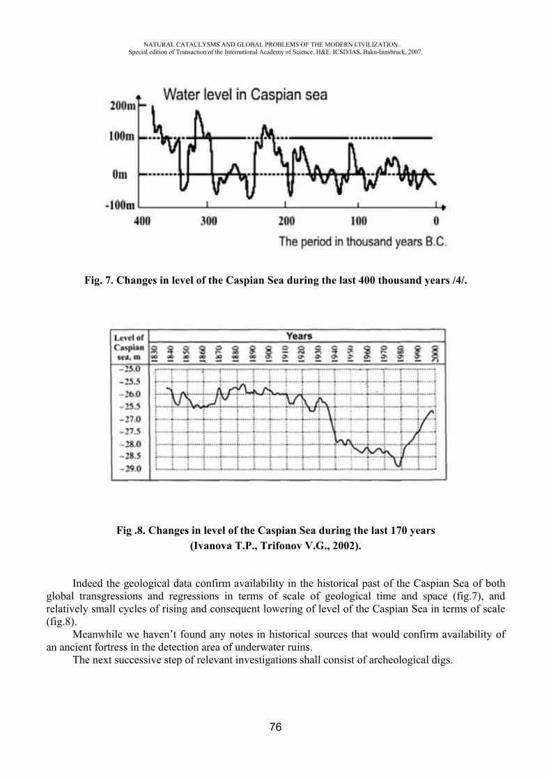
NATURAL CATACLYSMS AND GLOBAL PROBLEMS OF THE MODERN CIVILIZATION. Special edition of Transaction of the International Academy of Science. H&E. ICSD/IAS, Baku-Innsbruck, 2007.
76
Fig. 7. Changes in level of the Caspian Sea during the last 400 thousand years /4/.
Fig .8. Changes in level of the Caspian Sea during the last 170 years(Ivanova T.P., Trifonov V.G., 2002).
Indeed the geological data confirm availability in the historical past of the Caspian Sea of both global transgressions and regressions in terms of scale of geological time and space (fig.7), and relatively small cycles of rising and consequent lowering of level of the Caspian Sea in terms of scale (fig.8).
Meanwhile we haven’t found any notes in historical sources that would confirm availability of an ancient fortress in the detection area of underwater ruins.
The next successive step of relevant investigations shall consist of archeological digs.

NATURAL CATACLYSMS AND GLOBAL PROBLEMS OF THE MODERN CIVILIZATION. Special edition of Transaction of the International Academy of Science. H&E. ICSD/IAS, Baku-Innsbruck, 2007.
77
REFERENCES
1. Victor Kvachidze. Traces under water. Of history and archeological researches on Caspian sea. J., Caspian, Baku, 2002.
2. Gul K. Caspian Atlantis. The newspaper: Youth of Azerbaijan. N115, Baku, 1967. 3. Vasiliy Dyatlov. The Caspian Atlantis. www.itogi.ru. Weekly magazine,
issue N36(326) dated September 02, 2007. 4. Magomedov M.G. and others. The Caspian Atlantis. Scientific thought of Caucasus. Issue N4,
1997, p.51-60. 5. Sara Ashurbeyli. History of Baku City. Azerneshr Publishing House, 1992, p.34-36. 6. Lenz .Ueber die veranderungen der h welche die oberflache des Kaspischen Meeres biz
zum April des Jahres 1830 erlitten hat.( Memoires de I'academie des sciences de St.Petersb.6 serie.tome II) St.Petersb.1883,s.78-82.
7. Kasymov A.G. The Caspian Sea. Leningrad, 1987. 8. Muravyov S.N. Five ancient evidences in favor of Ptolemaic transgression of the Caspian
Sea (IV-II centuries B.C.). The ancient states on the territory of present USSR. Moscow, 1986, p.238-247.
AN APPROACH TO SURVEY OF POLLUTION OF THE CASPIAN SEA
Mekhtiev A.Sh.*, Badalova A.**, Ismatova Kh.R.***
National Academy of Aviation, National Aerospace Agency Azerbaijan
Introduction: Consideration and investigation of man-triggered factors in evolution of the contemporary world is a topical issue because it lays informational foundation of implementation of environmental monitoring and timely prevention of environmental risks including man-triggered ones.
The Azerbaijani territory of the coastal regions of Caspian Sea suffers great man-triggered stress at present time. Consequently natural and territorial systems are exposed to irreversible changes of environmental, natural, material and territorial nature. Natural and territorial systems are replaced with man-triggered natural and territorial systems: cities, industrial zones, mining operation sites, etc. The key source of inflow of contaminants into the Caspian Sea includes carry-over of contaminants via river flow, sea burial of unpurified industrial and agricultural effluent, and sanitary sewage of cities and settlements, located on the sea coast, shipping industry, operation of oil and gas wells, and oil transportation via seaway.
Pollution of the Caspian Sea with oil products has grown into one of the serious problems of Caspian Sea. While on-shore oil-fields represented key sources of pollution formerly, nowadays significant amount of oil products arrive in the Caspian Sea along with river waters. Quality of sea waters is deteriorated year by year mostly because of increase of volume of effluent produced by human settlements, insufficient purification rate at available sewage disposal plants, and removal of pesticide and toxic chemicals from irrigated lands by collector and drainage waters.
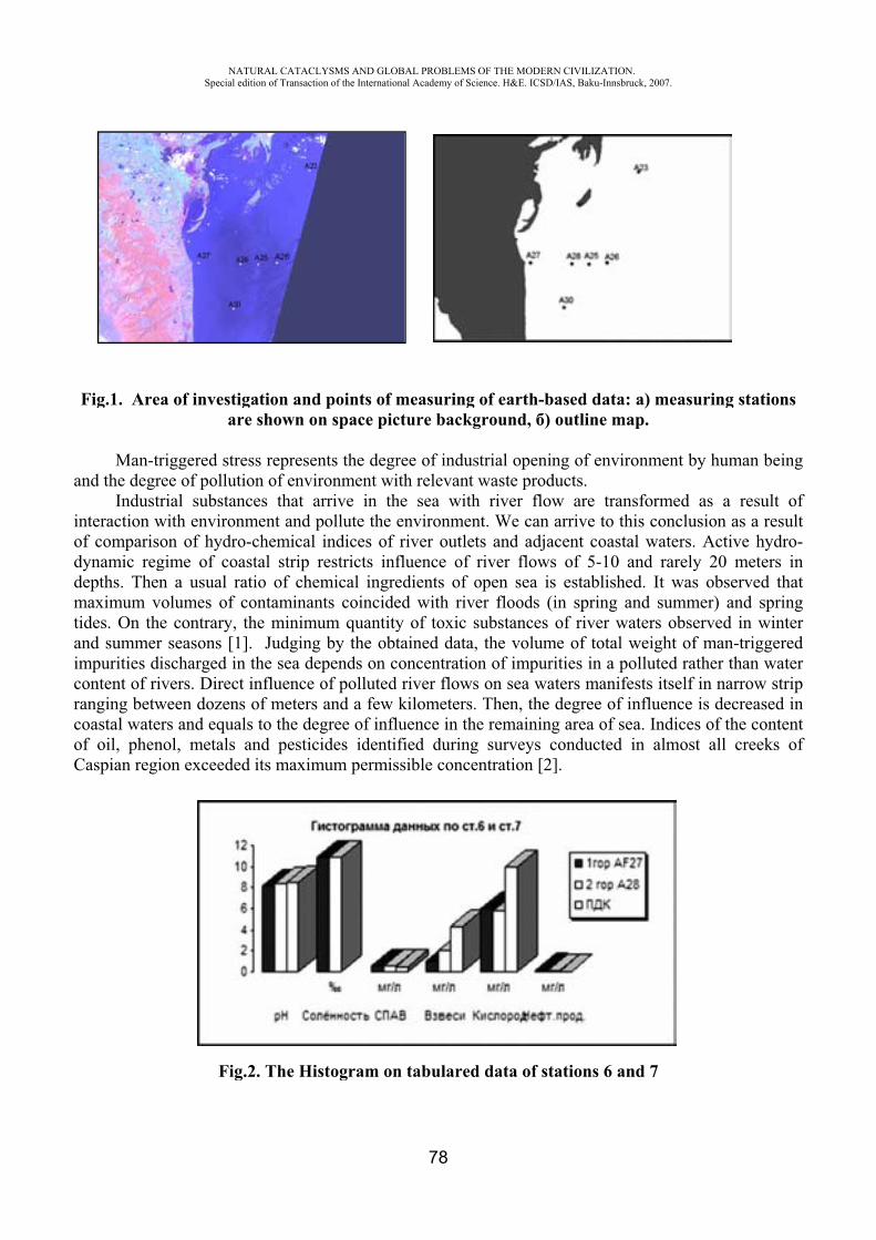
a
inoddmtiaimcrcoC
Fig.1. Are
Man-trand the degr
Industnteraction w
of comparisdynamic regdepths. Themaximum vides. On th
and summermpurities d
content of rianging betw
coastal wateof oil, phenCaspian regi
NASpecial
ea of investiar
riggered strree of polluttrial substanwith environson of hydrogime of con a usual r
volumes of he contrary, r seasons [1
discharged inivers. Direcween dozeners and equanol, metals ion exceede
Fig
ATURAL CATACLedition of Transacti
igation andre shown o
ress represetion of envinces that anment and po-chemical astal strip ratio of checontaminanthe minim
1]. Judgingn the sea de
ct influence ns of metersals to the de
and pesticed its maxim
g.2. The Hi
LYSMS AND GLOion of the Internatio
d points of on space pic
ents the degrironment wiarrive in thpollute the indices of
restricts infemical ingrents coincide
mum quantityg by the obtepends on cof polluted
s and a few egree of inflcides identimum permis
istogram on
OBAL PROBLEMSonal Academy of Sc
78
measuringcture backg
ree of indusith relevant he sea withenvironmenriver outlet
fluence of edients of oed with rivy of toxic stained data,
concentratiod river flows
kilometers.luence in thified duringssible conce
n tabulared
OF THE MODERNcience. H&E. ICSD/
of earth-bground, )
strial openinwaste prod
h river flownt. We can ts and adjariver flowsopen sea is
ver floods (isubstances, the volum
on of impuris on sea wa. Then, the
he remainingg surveys centration [2]
d data of st
N CIVILIZATION/IAS, Baku-Innsbru
ased data: outline ma
ng of enviroducts.w are transarrive to th
acent coastas of 5-10 as establishein spring anof river wa
me of total wities in a po
aters manifedegree of ing area of seconducted i].
ations 6 an
.uck, 2007.
) measuriap.
onment by h
sformed asis conclusio
al waters. Aand rarely 2d. It was ond summeraters observweight of molluted ratheests itself in nfluence is a. Indices oin almost a
nd 7
ing stations
human bein
s a result oon as a resu
Active hydro20 meters iobserved thar) and sprinved in winteman-triggereer than watenarrow stridecreased i
of the contenall creeks o
s
ng
ofulto-inat
ngerederipinntof
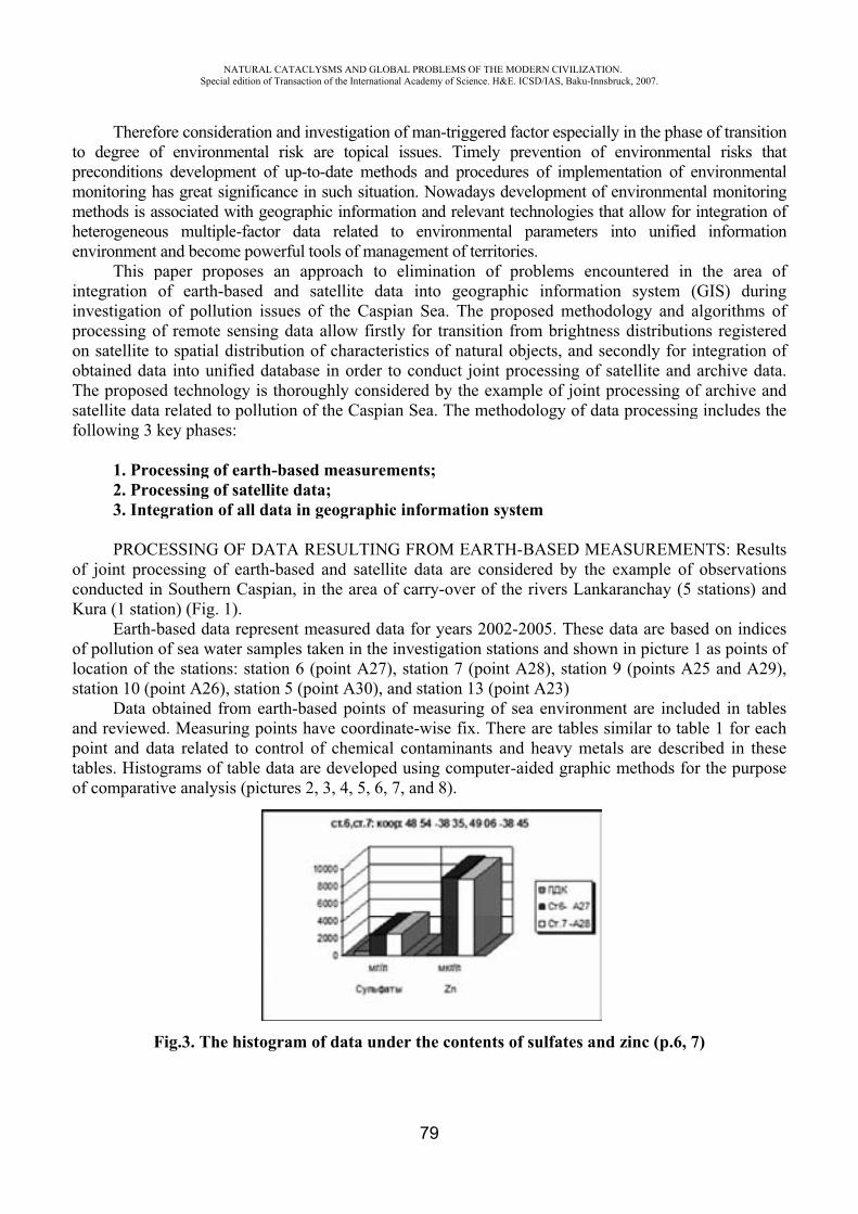
topmmhe
ininpooTsf
ocK
olos
aptao
Therefo degree o
preconditionmonitoring hmethods is aheterogeneouenvironment
This pntegration nvestigation
processing oon satellite tobtained datThe proposesatellite datafollowing 3
1. Pro2. Pro3. Inte
PROCof joint proconducted inKura (1 stati
Earth-of pollution ocation of t
station 10 (pData o
and reviewepoint and daables. Histo
of comparat
F
NASpecial
fore consideof environmns developmhas great sigassociated wus multiplet and becompaper propof earth-b
n of pollutiof remote sto spatial dta into unifed technoloa related to key phases
ocessing of eocessing of segration of
CESSING Ocessing of n Southern ion) (Fig. 1)-based data of sea wate
the stationspoint 26),obtained froed. Measurinata related ograms of taive analysis
Fig.3. The h
ATURAL CATACLedition of Transacti
eration and inmental risk ment of up-tgnificance in
with geogrape-factor dat
me powerful tposes an apased and ion issues oensing data
distribution fied databasgy is thoroupollution o:
earth-basesatellite da
f all data in
OF DATA Rearth-basedCaspian, in
).represent m
er samples t: station 6 station 5 (p
om earth-bang points hto control able data ars (pictures 2
histogram
LYSMS AND GLOion of the Internatio
nvestigationare topical
to-date methn such situaphic informata related tools of manpproach to satellite daof the Caspa allow firstof characte
se in order ughly consi
of the Caspi
d measuremata;n geographi
RESULTINd and satelln the area o
measured dataken in the(point 27)
point 30),ased points have coordinof chemicare develope2, 3, 4, 5, 6,
of data und
OBAL PROBLEMSonal Academy of Sc
79
n of man-trigl issues. Tihods and pration. Nowadation and relto environ
nagement ofeliminatio
ata into gepian Sea. Ttly for tranristics of nato conduct idered by than Sea. The
ments;
ic informat
G FROM Elite data areof carry-ove
ata for year investigatio), station 7 and station of measuri
nate-wise fial contamined using com
7, and 8).
der the con
OF THE MODERNcience. H&E. ICSD/
ggered factoimely preverocedures odays develolevant techn
nmental parf territories. on of probleographic iThe proposesition fromatural objecjoint proce
he examplee methodolo
tion system
EARTH-BAe considereer of the riv
rs 2002-200on stations (point 2813 (point ing of sea eix. There arants and hemputer-aide
ntents of su
N CIVILIZATION/IAS, Baku-Innsbru
or especially ention of eof implemenopment of ennologies thatrameters in
lems encouinformationed methodo
m brightness cts, and secessing of sa of joint progy of data
m
ASED MEAed by the evers Lankar
05. These daand shown
8), station 923)
environmenre tables simeavy metalsed graphic m
ulfates and z
.uck, 2007.
in the phaseenvironmentntation of environmentat allow for into unified
untered in n system (ology and a distribution
condly for inatellite and rocessing of
processing
ASUREMENxample of ranchay (5
ata are basein picture 1
9 (points 2
nt are includmilar to tabs are descrimethods for
zinc (p.6, 7
e of transitiotal risks thenvironmental monitorinintegration o
informatio
the area oGIS) durin
algorithms ons registerentegration oarchive datf archive an
g includes th
NTS: Resulobservationstations) an
ed on indice1 as points o25 and 29
ded in tablele 1 for eacibed in thesr the purpos
7)
onhattalngofon
ofngofedofa.
ndhe
tsnsnd
esof
9),
eschsese
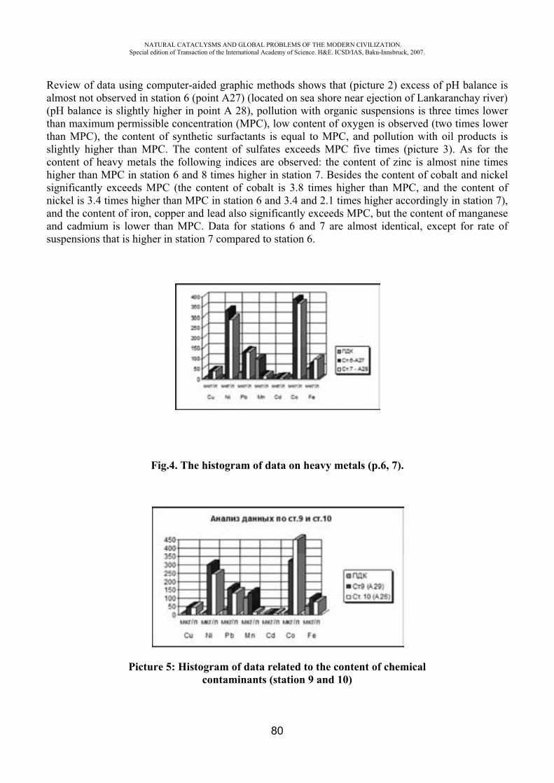
NATURAL CATACLYSMS AND GLOBAL PROBLEMS OF THE MODERN CIVILIZATION. Special edition of Transaction of the International Academy of Science. H&E. ICSD/IAS, Baku-Innsbruck, 2007.
80
Review of data using computer-aided graphic methods shows that (picture 2) excess of pH balance is almost not observed in station 6 (point 27) (located on sea shore near ejection of Lankaranchay river) (pH balance is slightly higher in point 28), pollution with organic suspensions is three times lower than maximum permissible concentration (MPC), low content of oxygen is observed (two times lower than MPC), the content of synthetic surfactants is equal to MPC, and pollution with oil products is slightly higher than MPC. The content of sulfates exceeds MPC five times (picture 3). As for the content of heavy metals the following indices are observed: the content of zinc is almost nine times higher than MPC in station 6 and 8 times higher in station 7. Besides the content of cobalt and nickel significantly exceeds MPC (the content of cobalt is 3.8 times higher than MPC, and the content of nickel is 3.4 times higher than MPC in station 6 and 3.4 and 2.1 times higher accordingly in station 7), and the content of iron, copper and lead also significantly exceeds MPC, but the content of manganese and cadmium is lower than MPC. Data for stations 6 and 7 are almost identical, except for rate of suspensions that is higher in station 7 compared to station 6.
Fig.4. The histogram of data on heavy metals (p.6, 7).
Picture 5: Histogram of data related to the content of chemical contaminants (station 9 and 10)

NATURAL CATACLYSMS AND GLOBAL PROBLEMS OF THE MODERN CIVILIZATION. Special edition of Transaction of the International Academy of Science. H&E. ICSD/IAS, Baku-Innsbruck, 2007.
81
Fig.6. To the contents of sulfates and zinc (p.8)
Fig.7. To the contents of sulfates and zinc (p.9 and 10)
Fig.8. The histogram of data under the contents of heavy metals (p.9. and 10).

NATURAL CATACLYSMS AND GLOBAL PROBLEMS OF THE MODERN CIVILIZATION. Special edition of Transaction of the International Academy of Science. H&E. ICSD/IAS, Baku-Innsbruck, 2007.
82
Table 1
Name Unit of measyrement MPC
Art. 638045’-48054’1 point A27
Art. 738045’-49006’2 point A28
pH 8.5 8,16 8,4
Saltiness ‰ 10,9 10,9
SYNTHETIC SURFACTANTS mg/l 0,5 0,6 0,6
Weighs mg/l 4,25 1 2
Oxygen mg/l 10 6 5,8
Oil products mg/l 0,05 0,16 0,109
Sulfates mg/l 500 2440,78 2531,34
Zn mkg/l 10 8984,25 8778,5
u mkg/l 10 39 38,75
Ni mkg/l 10 334 291,5
Pb mkg/l 30 134 132,75
Mn mkg/l 100 18 16,25
Cd mkg/l 5 6,2 7,3
Co mkg/l 10 388 367,5
Fe mkg/l 50 78,25 96,75
Besides, we observe almost the same indices for the content of heavy metals. Then the data on measurements implemented at stations follow horizontally.
Review of data obtained at station 9 confirms strong concentration of sulfates. The content of oil products and the degree of pH balance is equal to MPC, the content of oxygen is lower than MPC, and the remaining indices are lower than or equal to MPC. As for heavy metals, strong concentration of cobalt is observed (three times higher than MPC), and comparatively greater concentration of cobalt is observed in station 10. High content of nickel (three times higher than MPC) and zinc is observed. The content of iron is also higher than MPC at station 9 and higher than the relevant index at station 10, as well as the content of lead exceeds MPC three times. It is worth mentioning that the content of manganese is slightly higher than MPC at station 9, and significant drop in the content of manganese is observed at station 10 where it is lower than MPC
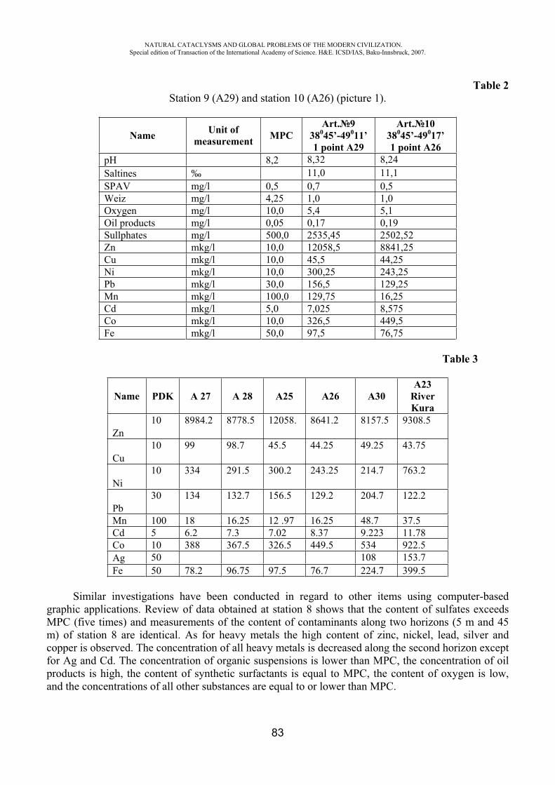
NATURAL CATACLYSMS AND GLOBAL PROBLEMS OF THE MODERN CIVILIZATION. Special edition of Transaction of the International Academy of Science. H&E. ICSD/IAS, Baku-Innsbruck, 2007.
83
Table 2 Station 9 ( 29) and station 10 ( 26) (picture 1).
Name Unit of measurement MPC
Art. 938045’-49011’ 1 point A29
Art. 1038045’-49017’1 point A26
pH 8,2 8,32 8,24Saltines ‰ 11,0 11,1SPAV mg/l 0,5 0,7 0,5Weiz mg/l 4,25 1,0 1,0Oxygen mg/l 10,0 5,4 5,1Oil products mg/l 0,05 0,17 0,19Sullphates mg/l 500,0 2535,45 2502,52Zn mkg/l 10,0 12058,5 8841,25Cu mkg/l 10,0 45,5 44,25Ni mkg/l 10,0 300,25 243,25Pb mkg/l 30,0 156,5 129,25Mn mkg/l 100,0 129,75 16,25Cd mkg/l 5,0 7,025 8,575Co mkg/l 10,0 326,5 449,5Fe mkg/l 50,0 97,5 76,75
Table 3
Name PDK 27 28 25 26 30A23
RiverKura
Zn10 8984.2 8778.5 12058. 8641.2 8157.5 9308.5
Cu10 99 98.7 45.5 44.25 49.25 43.75
Ni10 334 291.5 300.2 243.25 214.7 763.2
Pb30 134 132.7 156.5 129.2 204.7 122.2
Mn 100 18 16.25 12 .97 16.25 48.7 37.5Cd 5 6.2 7.3 7.02 8.37 9.223 11.78Co 10 388 367.5 326.5 449.5 534 922.5Ag 50 108 153.7Fe 50 78.2 96.75 97.5 76.7 224.7 399.5
Similar investigations have been conducted in regard to other items using computer-based graphic applications. Review of data obtained at station 8 shows that the content of sulfates exceeds MPC (five times) and measurements of the content of contaminants along two horizons (5 m and 45 m) of station 8 are identical. As for heavy metals the high content of zinc, nickel, lead, silver and copper is observed. The concentration of all heavy metals is decreased along the second horizon except for Ag and Cd. The concentration of organic suspensions is lower than MPC, the concentration of oil products is high, the content of synthetic surfactants is equal to MPC, the content of oxygen is low, and the concentrations of all other substances are equal to or lower than MPC.
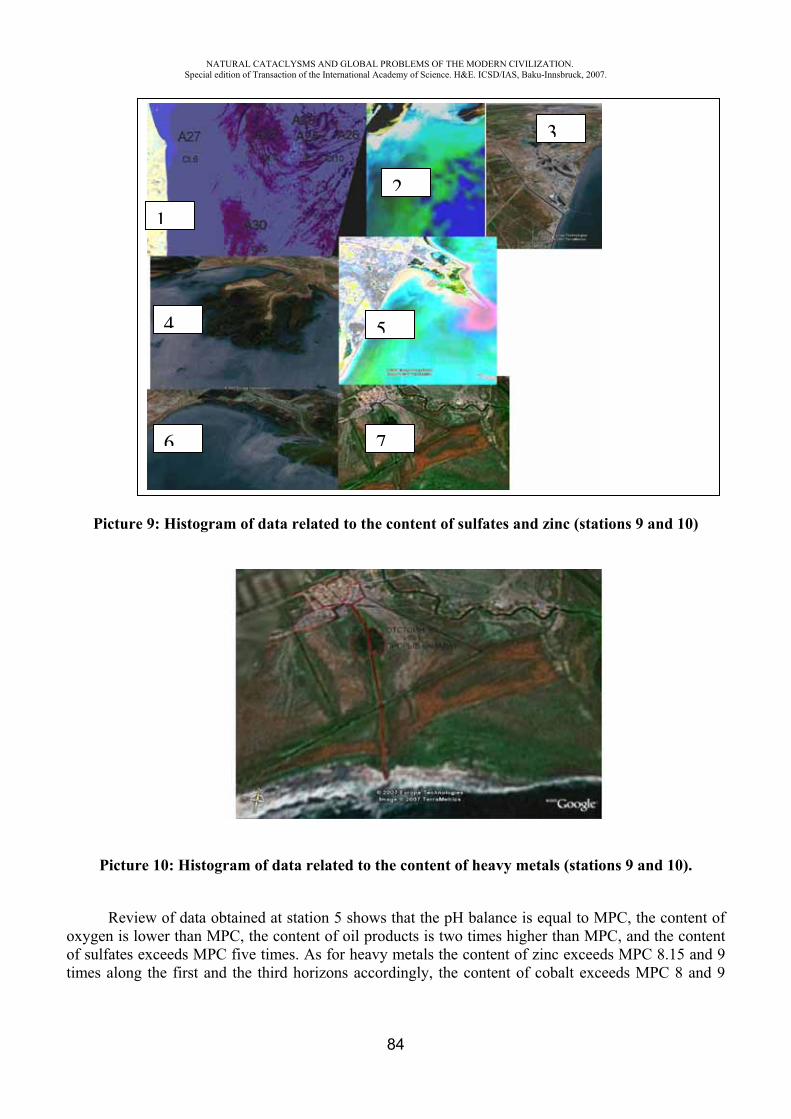
NATURAL CATACLYSMS AND GLOBAL PROBLEMS OF THE MODERN CIVILIZATION. Special edition of Transaction of the International Academy of Science. H&E. ICSD/IAS, Baku-Innsbruck, 2007.
84
Picture 9: Histogram of data related to the content of sulfates and zinc (stations 9 and 10)
Picture 10: Histogram of data related to the content of heavy metals (stations 9 and 10).
Review of data obtained at station 5 shows that the pH balance is equal to MPC, the content of oxygen is lower than MPC, the content of oil products is two times higher than MPC, and the content of sulfates exceeds MPC five times. As for heavy metals the content of zinc exceeds MPC 8.15 and 9 times along the first and the third horizons accordingly, the content of cobalt exceeds MPC 8 and 9
76
2
54
3
1
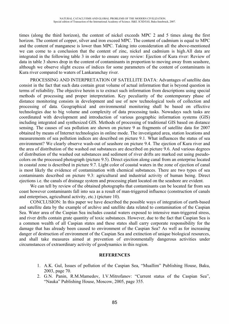
NATURAL CATACLYSMS AND GLOBAL PROBLEMS OF THE MODERN CIVILIZATION. Special edition of Transaction of the International Academy of Science. H&E. ICSD/IAS, Baku-Innsbruck, 2007.
85
times (along the third horizon), the content of nickel exceeds MPC 2 and 5 times along the first horizon. The content of copper, silver and iron exceed MPC. The content of cadmium is equal to MPC and the content of manganese is lower than MPC. Taking into consideration all the above-mentioned we can come to a conclusion that the content of zinc, nickel and cadmium is high.All data are integrated in the following table 3 in order to ensure easy review: Ejection of Kura river: Review of data in table 3 shows drop in the content of contaminants in proportion to moving away from seashore, although we observe slight excess of indices for some parameters of the content of contaminants in Kura river compared to waters of Lankaranchay river.
PROCESSING AND INTERPRETATION OF SATELLITE DATA: Advantages of satellite data consist in the fact that such data contain great volume of actual information that is beyond question in terms of reliability. The objective herein is to extract such information from descriptions using special methods of processing and proper interpretation. Key peculiarity of the contemporary phase of distance monitoring consists in development and use of new technological tools of collection and processing of data. Geographical and environmental monitoring shall be based on effective technologies due to big volume and complexity of data processing tasks. Nowadays such tasks are coordinated with development and introduction of various geographic information systems (GIS) including integrated and synthesized GIS. Methods of processing of traditional GIS based on distance sensing. The causes of sea pollution are shown on picture 9 as fragments of satellite data for 2007 obtained by means of Internet technologies in online mode. The investigated area, station locations and measurements of sea pollution indices are described on picture 9.1. What influences the status of sea environment? We clearly observe wash-out of seashore on picture 9.4. The ejection of Kura river and the area of distribution of the washed out substances are described on picture 9.6. And various degrees of distribution of the washed out substances and sediment of river drifts are marked out using pseudo-colors on the processed photograph (picture 9.5). Direct ejection along canal from an enterprise located in coastal zone is described in picture 9.7. Light color of coastal waters in the zone of ejection of canal is most likely the evidence of contamination with chemical substances. There are two types of sea contaminants described on picture 9.3: agricultural and industrial activity of human being. Direct ejections i.e. the canals of drainage system and processing plant located on the seashore are evident.
We can tell by review of the obtained photographs that contaminants can be located far from sea coast however contaminants fall into sea as a result of man-triggered influence (construction of canals and enterprises, agricultural activity, etc.) (picture 10).
CONCLUSION: In this paper we have described the possible ways of integration of earth-based and satellite data by the example of archive and satellite data related to contamination of the Caspian Sea. Water area of the Caspian Sea includes coastal waters exposed to intensive man-triggered stress, and river drifts contain grate quantity of toxic substances. However, due to the fact that Caspian Sea is a common wealth of all Caspian states and these states shall carry corporate responsibility for the damage that has already been caused to environment of the Caspian Sea? As well as for increasing danger of destruction of environment of the Caspian Sea and extinction of unique biological resources, and shall take measures aimed at prevention of environmentally dangerous activities under circumstances of extraordinary activity of geodynamics in this region.
REFERENCES
1. A.K. Gul, Issues of pollution of the Caspian Sea, “Muallim” Publishing House, Baku, 2003, page 70.
2. G.N. Panin, R.M.Mamedov, I.V.Mitrofanov: “Current status of the Caspian Sea”, “Nauka” Publishing House, Moscow, 2005, page 355.
NATURAL CATACLYSMS AND GLOBAL PROBLEMS OF THE MODERN CIVILIZATION. Special edition of Transaction of the International Academy of Science. H&E. ICSD/IAS, Baku-Innsbruck, 2007.
86
SEISMIC HAZARD ASSESSMENT FOR THE CITY OF TASHKENT
T. Rashidov*, E. Kuzmina**, A. Khudaybergenov ***, I. Rashidov****
*Inst. of Mechanics and Seismic Stability of Structures of Uzbek Academy of sciences, Tashkent, Uzbekistan.
**Inst. of Mechanics and Seismic Stability of Structures of Uzbek Academy of Sciences, Tashkent, Uzbekistan.
*** Inst. of Seismology of Uzbek Academy of Sciences, Tashkent, Uzbekistan. ****Inst. of Mechanics and Seismic Stability of Structures of Uzbek Academy of Sciences, Tashkent,
Uzbekistan
Abstract The Uzbek capital - city of Tashkent, where population exceeds two million persons, is located in region with high level of seismicity. Some active faults that can cause strong ground shaking are situated in this region. The estimation of seismic hazard was obtained for city of Tashkent within the framework of the NATO SfP project «Assessment and Mitigation of Seismic Risk in Tashkent, Uzbekistan and Bishkek, Kyrgyzstan».
The maps of both PGA and spectral accelerations distribution with probability 10 % and 2 % during 50 years were obtained using the U.S. Geological Survey methodology. The site effects are taken into account on the territory of city. For this purpose the map of ground relief, geology map, hydrogeology map, map of loess deposits thickness on the territory of city were used. The implemented maps of seismic hazard have formed the basis for an consideration of residential buildings damages and assessment of the possible population casualty. Keywords casualty, loss assessment, seismic hazard INTRODUCTION
Tashkent one of the largest ancient cities in Central Asia is the capital of Uzbekistan. The city is located in the northeastern part of Uzbekistan. It is situated at an elevation of 450-480 m in the Chirchik River valley west of Chatkal Mountains. The forming and progressing of city in an antiquity, apart from natural environments, was promoted by a position it on "Great Silk Road" branch. The city of Tashkent probably dates from the 2nd or the 1st century BC and was variously known as Dzhadzh, Chachkent, Shashkent, and Binkent; the name Tashkent, which means "stone village" in Uzbek, was first mentioned in the 1 lth century.
Modern Tashkent is city whose population is more than 2 millions and area is about 450 sq.km. Though last years the city are developed according to general plan of developing, buildings, structures and lifeline systems are very vulnerable in some parts, especially in old part of city. Unexpectedly increase of population in 40th years because of evacuation of people from occupied areas of Soviet Union during World War Two entailed the erection a lot of discernable buildings and structures on the sites with unfavorable soil conditions.
Earthquakes are not rare in this region of Continental Asia and Tashkent was subjected to their impact repeatedly in past. In particular in 1966 epicenter of earthquake = 5,3 was disposed on territory of Tashkent city. Seismic intensity was evaluated as VI-VIII for various parts of city. The lot of adobe buildings and ones from unburned brick was destroyed. After 1966 the territory of Tashkent has increased twice, and the total living area became 5 times wider.
According to present Building Codes legal in Uzbekistan, the possible seismic intensity for Tashkent area was increased till IX of MSK-81 Seismic Intensity Scale. The researches of the program GSHAP [1J also gave high level of seismic hazard for this region (PGA > 4 m/s2 with probability 10 % within 50 years).
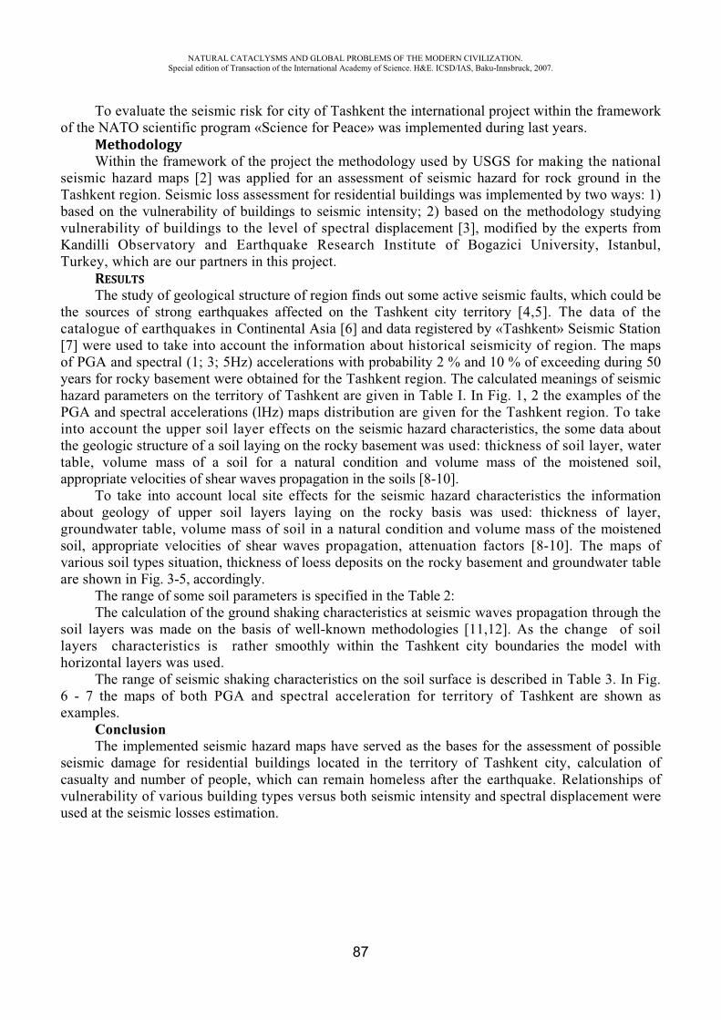
NATURAL CATACLYSMS AND GLOBAL PROBLEMS OF THE MODERN CIVILIZATION. Special edition of Transaction of the International Academy of Science. H&E. ICSD/IAS, Baku-Innsbruck, 2007.
87
To evaluate the seismic risk for city of Tashkent the international project within the framework of the NATO scientific program «Science for Peace» was implemented during last years.
MethodologyWithin the framework of the project the methodology used by USGS for making the national
seismic hazard maps [2] was applied for an assessment of seismic hazard for rock ground in the Tashkent region. Seismic loss assessment for residential buildings was implemented by two ways: 1) based on the vulnerability of buildings to seismic intensity; 2) based on the methodology studying vulnerability of buildings to the level of spectral displacement [3], modified by the experts from Kandilli Observatory and Earthquake Research Institute of Bogazici University, Istanbul, Turkey, which are our partners in this project.
RESULTSThe study of geological structure of region finds out some active seismic faults, which could be
the sources of strong earthquakes affected on the Tashkent city territory [4,5]. The data of the catalogue of earthquakes in Continental Asia [6] and data registered by «Tashkent» Seismic Station [7] were used to take into account the information about historical seismicity of region. The maps of PGA and spectral (1; 3; 5Hz) accelerations with probability 2 % and 10 % of exceeding during 50 years for rocky basement were obtained for the Tashkent region. The calculated meanings of seismic hazard parameters on the territory of Tashkent are given in Table I. In Fig. 1, 2 the examples of the PGA and spectral accelerations (lHz) maps distribution are given for the Tashkent region. To take into account the upper soil layer effects on the seismic hazard characteristics, the some data about the geologic structure of a soil laying on the rocky basement was used: thickness of soil layer, water table, volume mass of a soil for a natural condition and volume mass of the moistened soil, appropriate velocities of shear waves propagation in the soils [8-10].
To take into account local site effects for the seismic hazard characteristics the information about geology of upper soil layers laying on the rocky basis was used: thickness of layer, groundwater table, volume mass of soil in a natural condition and volume mass of the moistened soil, appropriate velocities of shear waves propagation, attenuation factors [8-10]. The maps of various soil types situation, thickness of loess deposits on the rocky basement and groundwater table are shown in Fig. 3-5, accordingly.
The range of some soil parameters is specified in the Table 2: The calculation of the ground shaking characteristics at seismic waves propagation through the
soil layers was made on the basis of well-known methodologies [11,12]. As the change of soil layers characteristics is rather smoothly within the Tashkent city boundaries the model with horizontal layers was used.
The range of seismic shaking characteristics on the soil surface is described in Table 3. In Fig. 6 - 7 the maps of both PGA and spectral acceleration for territory of Tashkent are shown as examples.
ConclusionThe implemented seismic hazard maps have served as the bases for the assessment of possible
seismic damage for residential buildings located in the territory of Tashkent city, calculation of casualty and number of people, which can remain homeless after the earthquake. Relationships of vulnerability of various building types versus both seismic intensity and spectral displacement were used at the seismic losses estimation.
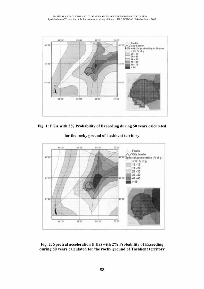
NATURAL CATACLYSMS AND GLOBAL PROBLEMS OF THE MODERN CIVILIZATION. Special edition of Transaction of the International Academy of Science. H&E. ICSD/IAS, Baku-Innsbruck, 2007.
88
Fig. 1: PGA with 2% Probability of Exceeding during 50 years calculated
for the rocky ground of Tashkent territory
Fig. 2: Spectral acceleration (l Hz) with 2% Probability of Exceeding during 50 years calculated for the rocky ground of Tashkent territory
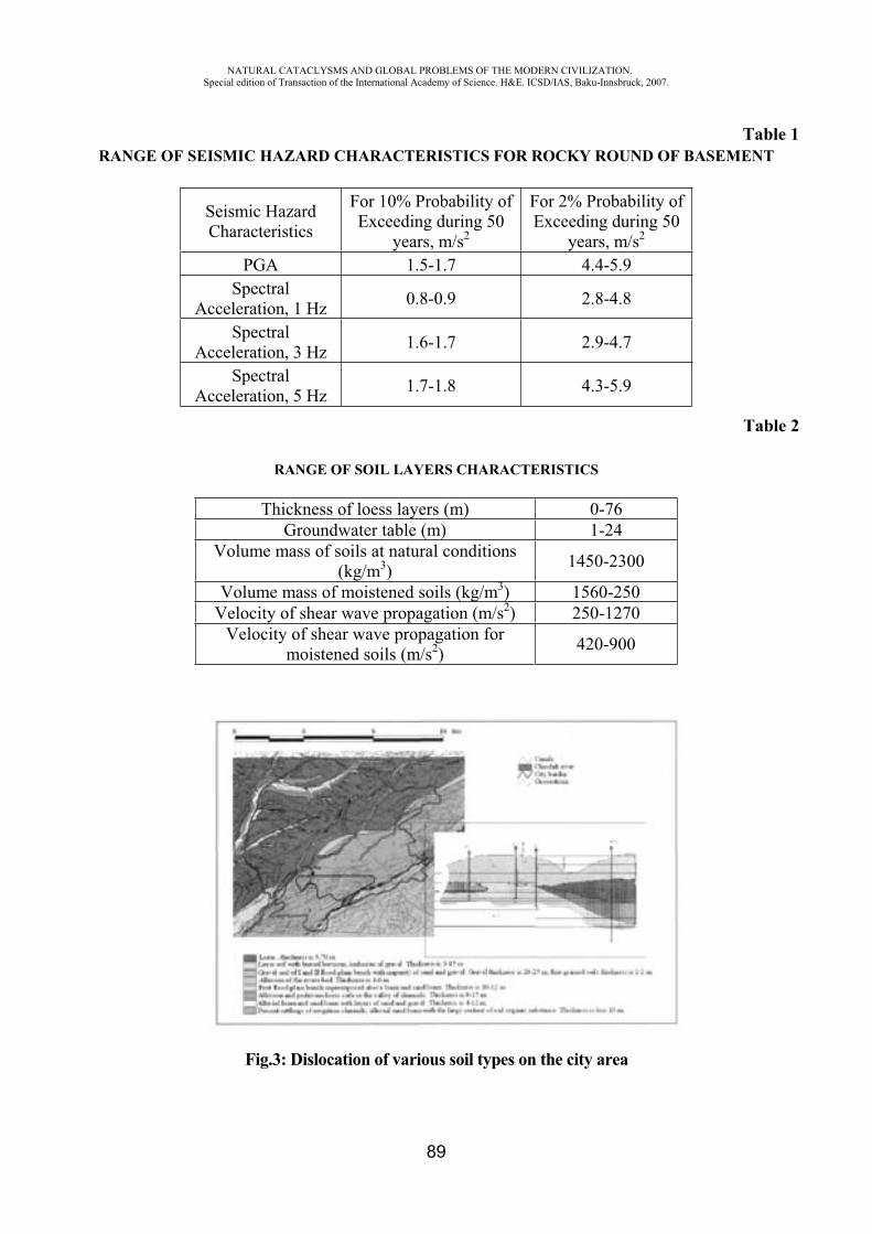
NATURAL CATACLYSMS AND GLOBAL PROBLEMS OF THE MODERN CIVILIZATION. Special edition of Transaction of the International Academy of Science. H&E. ICSD/IAS, Baku-Innsbruck, 2007.
89
Table 1 RANGE OF SEISMIC HAZARD CHARACTERISTICS FOR ROCKY ROUND OF BASEMENT
Seismic Hazard Characteristics
For 10% Probability of Exceeding during 50
years, m/s2
For 2% Probability of Exceeding during 50
years, m/s2
PGA 1.5-1.7 4.4-5.9 Spectral
Acceleration, 1 Hz 0.8-0.9 2.8-4.8
SpectralAcceleration, 3 Hz 1.6-1.7 2.9-4.7
SpectralAcceleration, 5 Hz 1.7-1.8 4.3-5.9
Table 2
RANGE OF SOIL LAYERS CHARACTERISTICS
Thickness of loess layers (m) 0-76 Groundwater table (m) 1-24
Volume mass of soils at natural conditions (kg/m3) 1450-2300
Volume mass of moistened soils (kg/m3) 1560-250 Velocity of shear wave propagation (m/s2) 250-1270
Velocity of shear wave propagation for moistened soils (m/s2) 420-900
Fig.3: Dislocation of various soil types on the city area
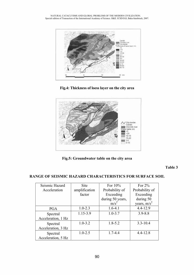
NATURAL CATACLYSMS AND GLOBAL PROBLEMS OF THE MODERN CIVILIZATION. Special edition of Transaction of the International Academy of Science. H&E. ICSD/IAS, Baku-Innsbruck, 2007.
90
Fig.4: Thickness of loess layer on the city area
Fig.5: Groundwater table on the city area
Table 3
RANGE OF SEISMIC HAZARD CHARACTERISTICS FOR SURFACE SOIL
Seismic Hazard Acceleration
Siteamplification
factor
For 10% Probability of
Exceedingduring 50 years,
m/s2
For 2% Probability of
Exceedingduring 50
years, m/s2
PGA 1.0-2.3 1.6-4.1 4.4-12.9 Spectral
Acceleration, 1 Hz 1.15-3.9 1.0-3.7 3.9-8.8
SpectralAcceleration, 3 Hz
1.0-3.2 1.8-5.2 3.3-10.4
SpectralAcceleration, 5 Hz
1.0-2.5 1.7-4.4 4.4-12.8
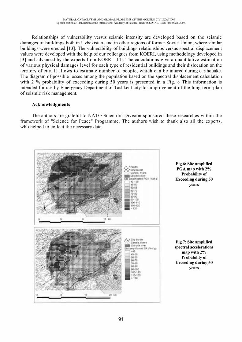
NATURAL CATACLYSMS AND GLOBAL PROBLEMS OF THE MODERN CIVILIZATION. Special edition of Transaction of the International Academy of Science. H&E. ICSD/IAS, Baku-Innsbruck, 2007.
91
Relationships of vulnerability versus seismic intensity are developed based on the seismic damages of buildings both in Uzbekistan, and in other regions of former Soviet Union, where similar buildings were erected [13]. The vulnerability of buildings relationships versus spectral displacement values were developed with the help of our colleagues from KOERI, using methodology developed in [3] and advanced by the experts from KOERI [14]. The calculations give a quantitative estimation of various physical damages level for each type of residential buildings and their dislocation on the territory of city. It allows to estimate number of people, which can be injured during earthquake. The diagram of possible losses among the population based on the spectral displacement calculation with 2 % probability of exceeding during 50 years is presented in a Fig. 8 This information is intended for use by Emergency Department of Tashkent city for improvement of the long-term plan of seismic risk management.
Acknowledgments
The authors are grateful to NATO Scientific Division sponsored these researches within the framework of "Science for Peace" Programme. The authors wish to thank also all the experts, who helped to collect the necessary data.
Fig.6: Site amplified PGA map with 2%
Probability of Exceeding during 50
years
Fig.7: Site amplified spectral accelerations
map with 2% Probability of
Exceeding during 50 years
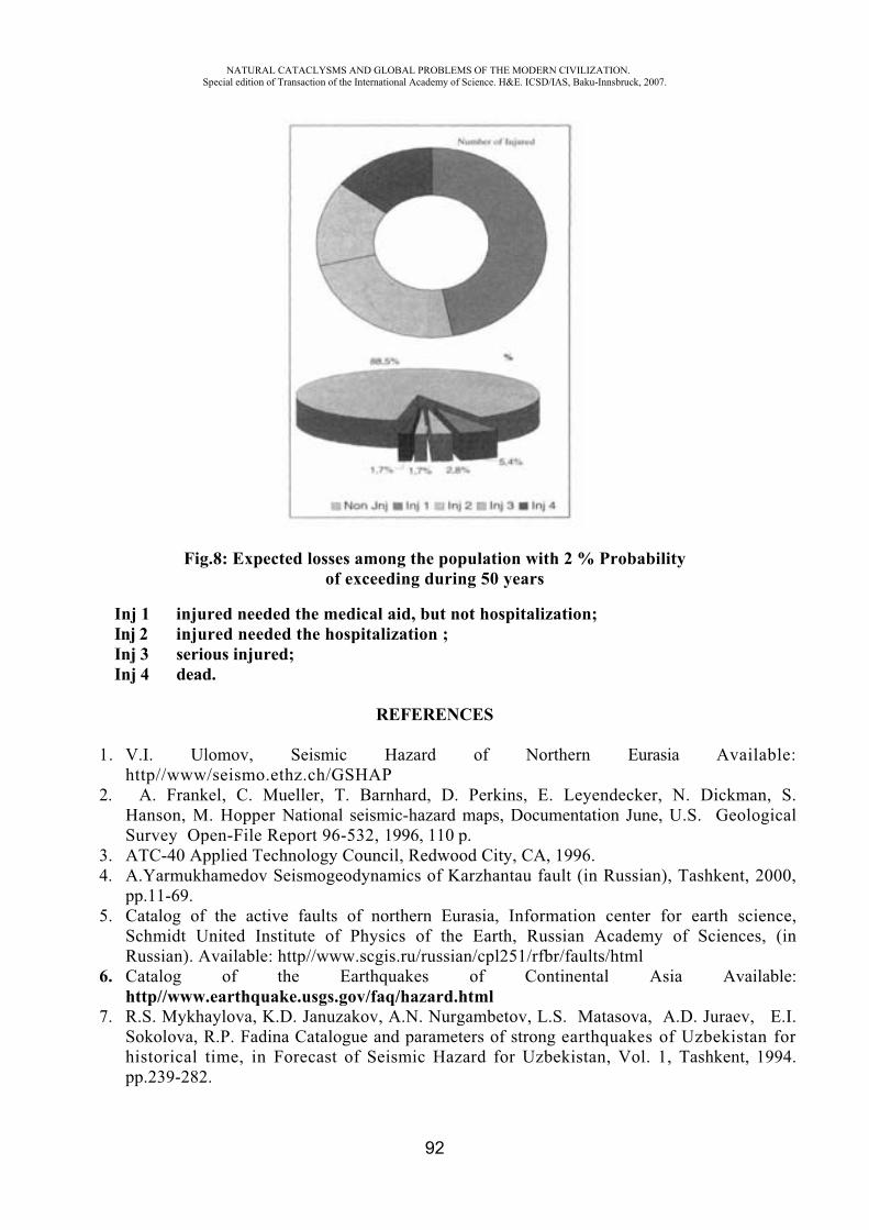
NATURAL CATACLYSMS AND GLOBAL PROBLEMS OF THE MODERN CIVILIZATION. Special edition of Transaction of the International Academy of Science. H&E. ICSD/IAS, Baku-Innsbruck, 2007.
92
Fig.8: Expected losses among the population with 2 % Probability of exceeding during 50 years
Inj 1 injured needed the medical aid, but not hospitalization; Inj 2 injured needed the hospitalization ; Inj 3 serious injured; Inj 4 dead.
REFERENCES
1. V.I. Ulomov, Seismic Hazard of Northern Eurasia Available: http//www/seismo.ethz.ch/GSHAP
2. A. Frankel, C. Mueller, T. Barnhard, D. Perkins, E. Leyendecker, N. Dickman, S. Hanson, M. Hopper National seismic-hazard maps, Documentation June, U.S. Geological Survey Open-File Report 96-532, 1996, 110 p.
3. ATC-40 Applied Technology Council, Redwood City, CA, 1996. 4. A.Yarmukhamedov Seismogeodynamics of Karzhantau fault (in Russian), Tashkent, 2000,
pp.11-69.5. Catalog of the active faults of northern Eurasia, Information center for earth science,
Schmidt United Institute of Physics of the Earth, Russian Academy of Sciences, (in Russian). Available: http//www.scgis.ru/russian/cpl251/rfbr/faults/html
6. Catalog of the Earthquakes of Continental Asia Available: http//www.earthquake.usgs.gov/faq/hazard.html
7. R.S. Mykhaylova, K.D. Januzakov, A.N. Nurgambetov, L.S. Matasova, A.D. Juraev, E.I. Sokolova, R.P. Fadina Catalogue and parameters of strong earthquakes of Uzbekistan for historical time, in Forecast of Seismic Hazard for Uzbekistan, Vol. 1, Tashkent, 1994. pp.239-282.
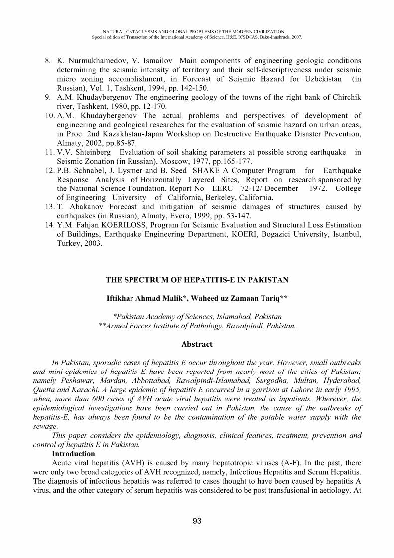
NATURAL CATACLYSMS AND GLOBAL PROBLEMS OF THE MODERN CIVILIZATION. Special edition of Transaction of the International Academy of Science. H&E. ICSD/IAS, Baku-Innsbruck, 2007.
93
8. K. Nurmukhamedov, V. Ismailov Main components of engineering geologic conditions determining the seismic intensity of territory and their self-descriptiveness under seismic micro zoning accomplishment, in Forecast of Seismic Hazard for Uzbekistan (in Russian), Vol. 1, Tashkent, 1994, pp. 142-150.
9. A.M. Khudaybergenov The engineering geology of the towns of the right bank of Chirchik river, Tashkent, 1980, pp. 12-170.
10. A.M. Khudaybergenov The actual problems and perspectives of development of engineering and geological researches for the evaluation of seismic hazard on urban areas, in Proc. 2nd Kazakhstan-Japan Workshop on Destructive Earthquake Disaster Prevention, Almaty, 2002, pp.85-87.
11. V.V. Shteinberg Evaluation of soil shaking parameters at possible strong earthquake in Seismic Zonation (in Russian), Moscow, 1977, pp.165-177.
12. P.B. Schnabel, J. Lysmer and B. Seed SHAKE A Computer Program for Earthquake Response Analysis of Horizontally Layered Sites, Report on research sponsored by the National Science Foundation. Report No EERC 72-12/ December 1972. College of Engineering University of California, Berkeley, California.
13. T. Abakanov Forecast and mitigation of seismic damages of structures caused by earthquakes (in Russian), Almaty, Evero, 1999, pp. 53-147.
14. Y.M. Fahjan KOERILOSS, Program for Seismic Evaluation and Structural Loss Estimation of Buildings, Earthquake Engineering Department, KOERI, Bogazici University, Istanbul, Turkey, 2003.
THE SPECTRUM OF HEPATITIS-E IN PAKISTAN
Iftikhar Ahmad Malik*, Waheed uz Zamaan Tariq**
*Pakistan Academy of Sciences, Islamabad, Pakistan **Armed Forces Institute of Pathology. Rawalpindi, Pakistan.
Abstract
In Pakistan, sporadic cases of hepatitis E occur throughout the year. However, small outbreaks and mini-epidemics of hepatitis E have been reported from nearly most of the cities of Pakistan; namely Peshawar, Mardan, Abbottabad, Rawalpindi-Islamabad, Surgodha, Multan, Hyderabad, Quetta and Karachi. A large epidemic of hepatitis E occurred in a garrison at Lahore in early 1995, when, more than 600 cases of AVH acute viral hepatitis were treated as inpatients. Wherever, the epidemiological investigations have been carried out in Pakistan, the cause of the outbreaks of hepatitis-E, has always been found to be the contamination of the potable water supply with the sewage.
This paper considers the epidemiology, diagnosis, clinical features, treatment, prevention and control of hepatitis E in Pakistan.
Introduction Acute viral hepatitis (AVH) is caused by many hepatotropic viruses (A-F). In the past, there
were only two broad categories of AVH recognized, namely, Infectious Hepatitis and Serum Hepatitis. The diagnosis of infectious hepatitis was referred to cases thought to have been caused by hepatitis A virus, and the other category of serum hepatitis was considered to be post transfusional in aetiology. At
NATURAL CATACLYSMS AND GLOBAL PROBLEMS OF THE MODERN CIVILIZATION. Special edition of Transaction of the International Academy of Science. H&E. ICSD/IAS, Baku-Innsbruck, 2007.
94
present, most adult cases of infectious hepatitis in Pakistan are due to hepatitis E virus (HEV), which was previously known as enterically transmitted non-A, non-B hepatitis.
It was in 1988 that the causative agent of hepatitis E was characterized.1 The first massive outbreak of HEV in indo-Pakistan subcontinent can be traced back to 1955, when drinking water was contaminated by the overflow of an open sewer in Delhi, India. The number of clinical cases of the AVH was 29,300, who mainly developed benign course of viral hepatitis of self-limiting nature.2
During Delhi outbreak, 10 per cent of the females affected by AVH in their last trimester of pregnancy died of hepatic failure.3 It was later discovered that a virus, other than hepatitis-A virus (HAV) was the cause of such epidemics; as the stored sera, collected from these AVH outbreaks did not react to the newly developed anti-Hep A, IgM (Immunoglobulin M) in the 1970s. This clearly excluded the involvement of the HAV as an aetologial factor in these outbreaks of viral hepatitis in the subcontinent.4
It took many years to identify and characterize the causative viral agent. In 1983, virus-like particles (27-32 nanometers) were demonstrated by immune electron microscopy (IEM) in the stools of three of the nine cases, of what turned out to be HEV infection, in Tashkent, Uzbekistan. The virus was passed orally to a volunteer, and the virus was subsequently isolated from his stool; thus the faeco-oral transmission was proved.5
Hepatitis E Virus The causative agent of hepatitis E is an RNA virus and is 27-34 nanometers in diameter. The
virus is faeco-orally transmitted and initially affects the intestines, later causing viraemia, with the virus attacking the liver. The causative virus is excreted through the gut in the faecal material.
The virus is extremely sensitive to freezing and thawing. If it is held at a temperature of 4-8 °C for more than five days, it undergoes a spontaneous degradation process. It can, however, be preserved in liquid nitrogen for five months or more. So far, HEV has been passed between nonhuman primates like cynomolgus monkeys, etc., by many workers.5
Epidemiology Hepatitis E virus passes into the sewage, and wherever there are chances of contamination of
potable water with sewage containing HEV, outbreaks of HEV infection are likely to occur. The incubation period of the disease is on average 40 days, and the highest attack rate is seen in young adults (15-39 years of age), equally affecting both the sexes. The disease is usually mild in nature and is self-limiting, without any long—term sequel. However, if it affects females during the third trimester of pregnancy, it can lead to high maternal mortality and frequent fetal loss.4
Epidemiologically, there may be frequent explosive epidemics of HEV infection, but sporadic cases of hepatitis E may also occur throughout the year, especially in endemic areas. Sporadic cases may be seen in developed countries in the visitors coming from endemic countries and in the individuals, who may have recently returned from a visit to the developing and third world countries.
It is not known whether the immunity against HEV is short-lived or there are more than one serological types (without cross-protection against the other HEV serovars).6,7
Hepatitis E infection in Pakistan
In Pakistan, epidemics of acute viral hepatitis (AVH) were reported as early as the 1950s and l960s. In 1972, an outbreak of AVH was observed in an army battalion during the field exercises. In three weeks, about 250 cases of acute viral hepatitis were reported, and all of the infected persons had a common source of drinking water (untreated river water). In the past, many similar outbreaks of hepatitis E had been wrongly labeled to have been caused by HAV (so called infectious hepatitis). However, subsequently, on serological testing of the stored sera, it became clear that all the outbreaks
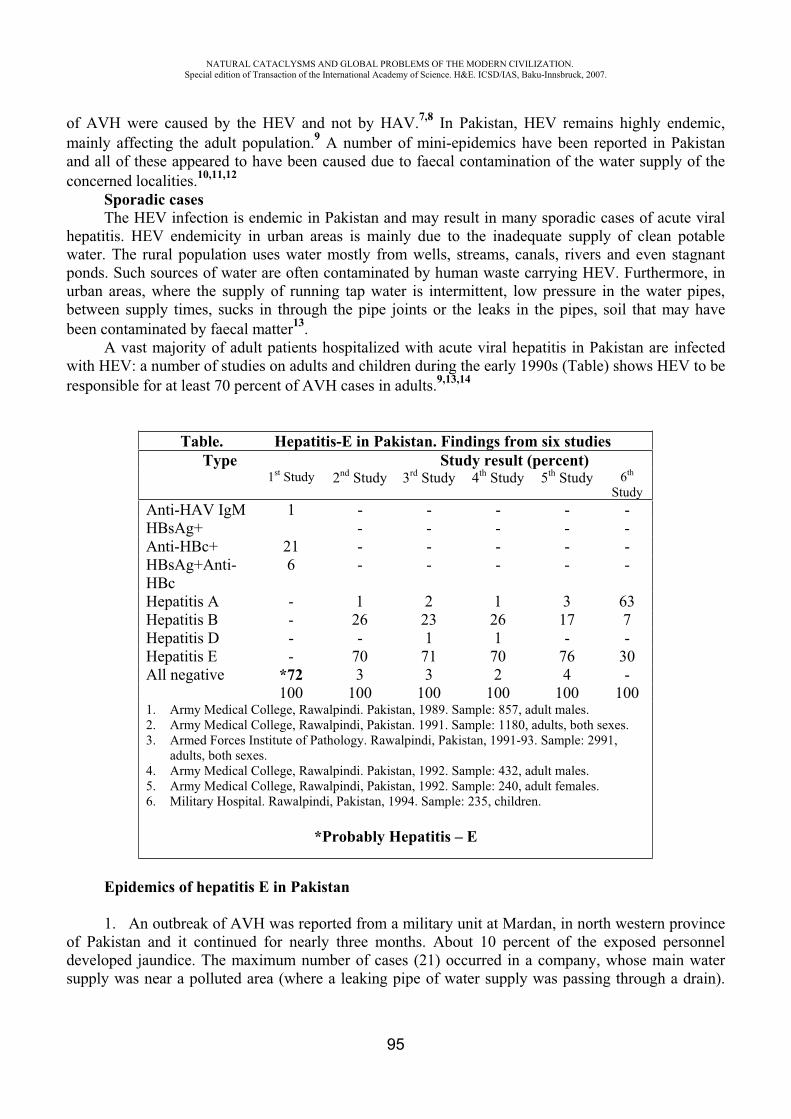
NATURAL CATACLYSMS AND GLOBAL PROBLEMS OF THE MODERN CIVILIZATION. Special edition of Transaction of the International Academy of Science. H&E. ICSD/IAS, Baku-Innsbruck, 2007.
95
of AVH were caused by the HEV and not by HAV.7,8 In Pakistan, HEV remains highly endemic, mainly affecting the adult population.9 A number of mini-epidemics have been reported in Pakistan and all of these appeared to have been caused due to faecal contamination of the water supply of the concerned localities.10,11,12
Sporadic cases The HEV infection is endemic in Pakistan and may result in many sporadic cases of acute viral
hepatitis. HEV endemicity in urban areas is mainly due to the inadequate supply of clean potable water. The rural population uses water mostly from wells, streams, canals, rivers and even stagnant ponds. Such sources of water are often contaminated by human waste carrying HEV. Furthermore, in urban areas, where the supply of running tap water is intermittent, low pressure in the water pipes, between supply times, sucks in through the pipe joints or the leaks in the pipes, soil that may have been contaminated by faecal matter13.
A vast majority of adult patients hospitalized with acute viral hepatitis in Pakistan are infected with HEV: a number of studies on adults and children during the early 1990s (Table) shows HEV to be responsible for at least 70 percent of AVH cases in adults.9,13,14
Table. Hepatitis-E in Pakistan. Findings from six studiesType Study result (percent)
1st Study 2nd Study 3rd Study 4th Study 5th Study 6th
Study Anti-HAV IgM 1 - - - - - HBsAg+ - - - - - Anti-HBc+ 21 - - - - - HBsAg+Anti-HBc
6 - - - - -
Hepatitis A - 1 2 1 3 63 Hepatitis B - 26 23 26 17 7 Hepatitis D - - 1 1 - - Hepatitis E - 70 71 70 76 30 All negative *72 3 3 2 4 -
100 100 100 100 100 100 1. Army Medical College, Rawalpindi. Pakistan, 1989. Sample: 857, adult males. 2. Army Medical College, Rawalpindi, Pakistan. 1991. Sample: 1180, adults, both sexes. 3. Armed Forces Institute of Pathology. Rawalpindi, Pakistan, 1991-93. Sample: 2991,
adults, both sexes. 4. Army Medical College, Rawalpindi. Pakistan, 1992. Sample: 432, adult males. 5. Army Medical College, Rawalpindi, Pakistan, 1992. Sample: 240, adult females. 6. Military Hospital. Rawalpindi, Pakistan, 1994. Sample: 235, children.
*Probably Hepatitis – E
Epidemics of hepatitis E in Pakistan
1. An outbreak of AVH was reported from a military unit at Mardan, in north western province of Pakistan and it continued for nearly three months. About 10 percent of the exposed personnel developed jaundice. The maximum number of cases (21) occurred in a company, whose main water supply was near a polluted area (where a leaking pipe of water supply was passing through a drain).
NATURAL CATACLYSMS AND GLOBAL PROBLEMS OF THE MODERN CIVILIZATION. Special edition of Transaction of the International Academy of Science. H&E. ICSD/IAS, Baku-Innsbruck, 2007.
96
None of the patients of AVH showed any residual symptoms or raised transaminase levels on follow-up examination. The serum markers of HAV and HBV were done in all cases, and none of these cases was found to be due to recent infection with these viruses. This AVH epidemic was controlled, when the water supply pipeline was repaired and the contamination of the water with sewage was stopped.14
2. A number of outbreaks of AVH were reported from Karachi in 1985 and 1986, with several peaks.15 The HEV infection was diagnosed in five cases, who returned from Karachi to California and fell ill with jaundice in the United States.
3. In the central region of Punjab, a college campus that suffered outbreaks of AVH due to HEV at Sargodha was reported by Iqbal M, et al. in 198916 with 133 clinical cases of AVH (an attack rate of approximately 20 percent). All these cases required hospitalization and had a prolonged period of convalescence. The affected students used a common water source. The AVH epidemic ended as a result of an improvement in the water supply. On testing the sera of these patients, HAV and HBV infections were excluded serologically). In this outbreak of AVH, virological evidence was sought for HEV infection. Paired sera from two patients were tested by immune electron microscopy (IEM), and these cases of AVH were confirmed to be due to HEV infection. Ten out of 85 patients showed the presence of HEV particles. These were serologically identified by IEM using reference serum obtained from HEV infected chimpanzees. The faecal concentration of HEV appeared to be lower than that observed with many other enteric viruses.17
4. Islamabad has an ample supply of potable water and a good drainage system. In the past there had been no recorded outbreak of HEV in this city. However, between December 1993 and March 1994, a massive outbreak of AVH due to HEV affected the city and created a lot of concern in the general population.13 The main reason was the change in the demographic features of Islamabad created by the establishment of shanty towns along “Lai-Nullah”, the stream that is the main water source of the city. The inhabitants of these localities had no civic amenities, and the excreta from these shanty towns around Islamabad polluted the tributaries of “Lai Nullah”. The common water supply of G/9, G/l0 and H/11 sectors of Islamabad was badly affected by faecal pollution from these shanty towns. At the same time, because of modifications to the water treatment system for these sectors, the quality of the water reaching them was substandard. An increasing load of organic waste and defects in the water treatment plant functioning were the most probable causes of improper chlorination of the water supply. Consequently, during the outbreaks. 3,827 cases of AVH (associated with HEV) were recorded in these sectors. The nearby residential areas with independent water supplied were largely spared. The overall incidence of AVH in the affected areas was 10 percent of the total population (varying from 1 percent to 16 percent in various sub-sectors). The disease mostly affected those people, who were in their second (31.4 percent), third (31.8 percent) and fourth (16.6 percent) decades of life. The hepatitis E epidemic subsided quickly, after the rectification of the suspected water purification plant.18
5. HEV is gradually becoming a threat to Pakistan armed forces personnel, because of the pressure of increasing population on the existing sewerage system and the rusting of pipelines of old water supply systems. In December 1994, the Lahore garrison was badly affected by an outbreak of AVH due to HEV, with 283 cases being admitted to the army hospital at one time.
On investigation, the pipes of the water supply, rusted with holes, were found to be practically submerged in the open drains. As a short-term measure, the troops were provided with boiled water until the total replacement of the existing water supply system could be undertaken, along with the modification of the drainage system in the cantonment. Besides, the food and water discipline was also enforced, and the epidemic was finally controlled with these measures. However, after three months, hundreds of fresh cases of AVH due to HEV were reported. The probable reason for this increase in AVH cases was due to a relaxation in water and food discipline, which occurred as a result of the
NATURAL CATACLYSMS AND GLOBAL PROBLEMS OF THE MODERN CIVILIZATION. Special edition of Transaction of the International Academy of Science. H&E. ICSD/IAS, Baku-Innsbruck, 2007.
97
influx of fresh troops from other stations, who were not accustomed to the strict water and food discipline enforced previously in the garrison. The problem was gradually brought under control, and the outcome of efforts to supply pure water to troops was soon obvious to all concerned9.
All the above epidemics of HEV infection was caused by consumption of water that was polluted with faeces containing HEV. These epidemics could have been avoided if proper measures had been followed. Investigations of possible sources of spread have always led to the same conclusion: that someone’s faeces finds its way to someone’s mouth, the seed (virus) is present, the soil is fertile and the environment is conducive to epidemics of hepatitis E in much of the developing world.
There is no vaccine available for HEV infection. There is no specific iminunoglobulin that can act prophylactically. This means that the existing civil amenities need improvement, the chlorination and supply of water must be consistent and uninterrupted. Medical inspections of kitchens and water sources must be carried out regularly and inspection reports should be acted upon without hesitation.
It is obvious that HEV has been and is an important cause of acute viral hepatitis in Pakistan, particularly in adults from lower socioeconomic groups. The problem is more serious for those living in military camps, hostels, residential institutions and in segregated areas, who consume untreated water from a common source. Fortunately, awareness of the problem has increased, and efforts are being made to prevent water contamination.10,13,14
DiagnosisAs seen in the case of other type of acute viral hepatitis, the biochemical changes in patients with
HEV infection are not typical of the disease. It is not possible to make a specific diagnosis of the type of acute viral hepatitis on the basis of biochemistry. The definitive diagnosis can be made only when tests for virological markers are done on sera from the patients.
Within two days of the onset of jaundice, it was found that the serum bilirubin and alkaline phosphates levels were elevated to three times that of normal, and serum alanine transferase (ALT) was elevated to 35 times that of normal.19 It is worthwhile to do the tests for hepatitis B surface antigen (HBsAg), antibody against hepatitis B core IgM (AntiHBc IgM) and hepatitis A IgM antibody to exclude diagnosis of both hepatitis B and hepatitis A. Specific assays for HEV infection have recently been introduced. Testing for anti-HEV IgM has been mentioned by various workers in their studies,20,21 yet the diagnostic value of such a test is still controversial, as the currently available commercial kits for anti-HEV IgM testing have not shown consistent results.
On the other hand, a test for anti- HEV IgG antibodies is reliable and has been used for diagnostic purposes. Two serum samples have to be taken, one during the acute phase and one after two weeks from onset of the disease. The prior absence of the antibody and its appearance after two weeks may reveal the specific diagnosis. Anti-HEV IgG persists for some years in the sera of patients, and its presence in a single specimen should be interpreted with care, at least in endemic areas.22
The use of immune electron microscopy has been suggested for the diagnosis of HEV.23,24 Thefaecal specimens of acutely ill patients were treated with the convalescent sera of hepatitis E patients, and the clumps of the virus particles were observed under the electron microscope. Subsequently, it was observed that in many specimens, enough virus particles were not present (especially during the later stages of the disease). This lack of sensitivity and the need for the procurement and maintenance of such costly apparatus has discouraged the routine use of this methodology as a diagnostic technique.24
Other diagnostic tools based on the polymerase chain reaction (PCR) for the detection of HEV-RNA (with a reverse transcription step) have been introduced recently and may become popular in future for the detection of HEV from the stools of acute hepatitis E patients.25,26
NATURAL CATACLYSMS AND GLOBAL PROBLEMS OF THE MODERN CIVILIZATION. Special edition of Transaction of the International Academy of Science. H&E. ICSD/IAS, Baku-Innsbruck, 2007.
98
Clinical features The incubation period is three to nine weeks (21-63 days) and on average 40 days. The attack
rate of HEV is higher in young adults than in children and those older than 40 years. There is a brief prodromal phase of anorexia, nausea, vomiting and abdominal pain, followed by jaundice. The disease is benign and self-limiting in nature.13
TreatmentTreatment is purely supportive there is no special antiviral drug available for HEV. Patients may
be managed at home. However, in case of more serious cases with persistent vomiting, hospitalization maybe necessary, and it is indicated mostly when there is marked disturbance in prothrombin time (at least 2 seconds more than the normal control) and the patient shows severe lethargy. There is usually no need for strict restriction on food or physical activity.14
Prevention and Control Prevention and control purely depend upon the improvement of the sanitary conditions of society
--proper disposal of waste, avoidance of contamination of food and the provision of pure water. Health education of the general public on personal hygiene is very important.9,14
There is, so far, no protective vaccine available against the HEV infection.27 Studies on human serum immunoglobulin for passive prophylaxis have, so far, proved of no worth.28
Some of the data/material of this article have been presented/published earlier by the authors.9,13,14
REFERENCES
1. Purcell R.H. Ticehurst J.R. Enterically transmitted non-A, non-B hepatitis: epidemiology and clinical characteristics. In: Zuckerrnan A.J., ed. Viral hepatitis and liver disease. New York, Alan R Lisa Inc., 1988:131.7.
2. Viswanath R. Infectious hepatitis in Delhi (1955-1965): a critical study; epidemiology. Indian journal of medical research, 1957,45 (suppl): 1-30.
3. Nidu S.S. Viswanath R. Infectious hepatitis in Delhi (1955-1956): a critical study; observations in pregnant women. Indian journal of medical research, 1957,45 (suppl): 71-6.
4. Maynard J.E. Epidemic non-A, non-B hepatitis. Seminars in liver diseases, 1984,4:336-9. 5. Balayan M.S. et al. Evidence for a virus in non-A, non-B hepatitis transmitted via the
fecal-oral route, Intervirology. 1983,20:23-31. 6. American Social Health Association: Learn about STDs / STIs [Electronic] 2007 [cited
2007 April 1] Available from: URL: http//www.ashastd.org / learn hepatitis E. 7. Wong DC et al. Epidemic and endemic hepatitis in India: evidence for a non-A. non-H
hepatitis virus etiology. Lancet, I 980,ii: 876-9. 8. Akram M. A. study of epidemic infectious hepatitis in the field. CENTO (Central Treaty
Organization) Medical Conference papers, 1975. 9. Malik I.A., Tariq WUZ. The prevalence and pattern of viral hepatitis in Pakistan
[editorial]. Journal of the College of Physicians and Surgeons of Pakistan, 1995, 5(1): 2-3.
10. Nasrullah Malik, Muhammad Farooq, Karamat Ahmed Karamat, Tariq Butt, Maqsood ul Hassan, Shakeel Qasim. An outbreak f Viral Hepatitis E. Pak Armed Forces Med J 2001: 51(2): 78-81
NATURAL CATACLYSMS AND GLOBAL PROBLEMS OF THE MODERN CIVILIZATION. Special edition of Transaction of the International Academy of Science. H&E. ICSD/IAS, Baku-Innsbruck, 2007.
99
11. Khuroo M.S. Study on the epidemic of non-A, non-B hepatitis:possibility of another hepatitis virus distinct from post-transfusion non-A, non-B type. Am J Med 1980; 68: 818-24
12. Khuroo M.S. Hepatitis E virus: Another addition to the existing alphabet of human hepatitis viruses. Ann of Saudi Med 1996; 16: 308-32.
13. Malik I.A. et al. Epidemics of non-A, non-B hepatitis in Pakistan. Tropical doctor, 1988, 18:99-101.
14. Malik I.A. et al. A clinico- pathological study of viral hepatitis. Pakistan journal of medical research, 1987, 26(I) 4-I1.
15. Qureshi M et al. Hepatitis non-A, non-B: report of a water borne outbreak Journal of the Pakistan Medical Association. 1988,38:203-4.
16. lqbal M et al. An outbreak of enterically transmitted non-A, non-B hepatitis in Pakistan. American journal of tropical medicine and hygiene, 1989,40(4): 438-43.
17. Ticehurst JR et al. Association of hepatitis E virus with an outbreak of hepatitis in Pakistan. Serological response and pattern of virus excretion. Journal of medical virology, l992; 36:84-92.
18. Rab MA, Bile MK, Mubarik MM, Asghar H, Sami Z, Siddiqi S, Dil AS et al. Water born hepatitis E virus epidemic in Islamabad, Pakistan. a common source of outbreak traced to the malfunction of a modern water treatment plant. Am J Trop Med Hyg 1997; 57(2): 151-7
19. Smego R.A., Khaliq A.A. Epidemic non-A, non-B hepatitis in urban Karachi, Pakistan. American journal of tropical medicine and hygiene. 1988, 38(3) 628-32.
20. Hamid M., Qazi S.A., Khan M.A. Hepatitis E. Journal of the College of Physicians and Surgeons of Pakistan, 1995, 5(1): 38-40.
21. Rab M.A., Mubarik M.M. Report on the hepatitis E epidemics in Islamabad, Feb-Mar 1994. Unpublished report, 1994.
22. Dawson GP et al. Solid phase enzyme linked immunosorbent assay for hepatitis E IgG and IgM antibodies using recombinant antigens and synthetic peptides. Journal of virological methods. 1992, 38:175-86.
23. Favoro M.O. et al. Serological identification of hepatitis E virus infection in epidemic and epidemic settings. Journal of medical virology, 1993, 40:334-8.
24. Sreevansan M.A. et al. Non-A, non-B epidemic hepatitis: visualization of virus like particles in the stool by immune electron microscopy. Journal of general virology. 1984,65:1005-7.
25. Dawson J.P. et al. Detection of long lasting antibody to hepatitis virus in serum samples from patients with hepatitis E virus infection. Journal of medical virology, 1993, 40:334-8.
26. Bradley D.W. Enterically transmitted non-A, non-B hepatitis. British medical bulletin, 1990, 46: 442-61.
27. National Research Program for Universities: Vaccine development against hepatitis E virus (HEV) [Electronic] 2007 [cited 2007 April1] Available from: URL: http//www.hec.gov.pk
28. Cao X.Y., Zhaungw L.IF. Immunoprophylaxis of enterically transmitted non-A, non-B hepatitis with immune serum globulin. Chinese journal of epidemiology l989; 10(special): 141-3.
NATURAL CATACLYSMS AND GLOBAL PROBLEMS OF THE MODERN CIVILIZATION. Special edition of Transaction of the International Academy of Science. H&E. ICSD/IAS, Baku-Innsbruck, 2007.
100
DOES THE FLOODING HAZARD IN MID LATITUDE MOUNTAINOUS AREAS INCREASE DUE TO GLOBAL WARMING?
Reinhold Steinacker
Department of Meteorology and Geophysics University of Vienna, Austria
A significant change of the temperature has been taken place since the last few decades in the mid and high latitudes of the Northern hemisphere in the framework of the global warming. The signal in the precipitation amount and its temporal distribution, however, was not uniform at all on the Northern hemisphere. Therefore it is not easily possible to estimate a trend in the flooding frequency with its consequences for our society. Climate models so far are not able to give a clear answer concerning rare events like flooding. Hence we want to detect an eventual trend by evaluating observational data. So far, most scientific investigations have concentrated on trends of (air-)temperature and separately on precipitation amounts.
Many of the European flooding events have their origin in mountainous areas. Mountains may on the one hand produce enhanced amounts of precipitation due to upslope air flows, on the other hand reduce runoff, if part of the precipitation at higher elevations is falling in solid state. To investigate possible decadal changes of these two processes, we must evaluate high resolution time series of meteorological observations on an event basis. Then we do not need to look at extreme events solely but can detect eventual trends in e. g. precipitation events in connexion to fronts and convection, stratified by the snow level and learn by that means about a longer term change of flood risks.
From the VERACLIM data set, a high resolution reanalysis of the Alpine Atmosphere for the last 25 years, the wet bulb temperature with a 3 hourly resolution has been used to investigate the level of snow during precipitation and melting conditions. The high temporal resolution is necessary as a majority of precipitation events are related to fronts, with a significant short term air mass change. Some trends in the change of the snow level have been found very large, on the order of several 100 Meters during the last quarter century. Even under a constant precipitation climate this would give a considerably higher risk of flooding, caused by precipitation and a somewhat lower risk of flooding by melting snow. It has to be noted, that this result is different for cold and warm seasons. The presentation will give an overview of the trends for an Alpine site.
NATURAL CATACLYSMS AND GLOBAL PROBLEMS OF THE MODERN CIVILIZATION. Special edition of Transaction of the International Academy of Science. H&E. ICSD/IAS, Baku-Innsbruck, 2007.
101
COMMUNITY BASED INJURY PREVENTION
Gunnar Tellnes*, Johan Lund**
Department of General Practice and Community Medicine,University of Oslo, Norway
AbstractAim: A multifactorial injury prevention programme started in 1981 and ran for about 10 years in
an island community in Norway with a population of about 1000. A study was undertaken to evaluate effects of the programme over a period of 20 years. Methods:
Injuries were recorded by the one medical doctor on the island several years during the period 1970-2001. The programme was carried out with high intensity from 1981 to 1987. The intensity gradually decreased to a medium level that lasted until about 1994, when it was further reduced to a low level. Results: The injury incidence rate was reduced from 17.7% in 1980 (N=188) to 9.7% in 1987 (N=97) with relative risk reduced to 0.55 (95% CI: 0.44-0.70, p<0.0001). In 2001, an incidence rate of 9.6% was observed (N=91). An even higher reduction was observed for serious injuries. The age groups 15-24 and 65+ showed the most distinct reductions from 1980-2001 while minor reduction was observed in children (0-14 years). The incidence rate of traffic injuries was reduced by 77% in spite of an increase in the number of motor vehicles. Occupational, home and other injuries were reduced by 38%, 35%, and 49% respectively. The incidence rates were 2.6-3.0 times higher for men than for women through the 20 years observation period. Conclusion: This study indicates that a long-lasting multifactorial community-based intervention in a small community with defined aims may lead to a considerable and long-lasting reduction in injuries.
BackgroundInjuries are one of the most serious public health problems facing both high-income and low-
income countries. Throughout the world, injuries are now a leading cause of death during the first half of the human life span and have grown in relative importance as many diseases have been controlled [1]. In 1990, they were responsible for 10% of world mortality, predicted to increase to 12% by 2020 [2]. Various preventive measures have been used to reduce this part of the global burden of disease. Community based intervention is a promising concept for injury prevention. Some studies have reported significant reductions between 69 to 14% in targeted injury types [3-5]. Other studies have reported significant reductions of overall injury rates [6-8]. However, an Australian study reported no injury rate reductions, even after years of community based interventions [9].
The preventive strategies employed in community-based interventions are described in the literature [10-11]. Lund and Aarø have provided a model for injury prevention programmes which includes three main categories: attitude, behaviour and structural modifications [12]. A community is defined as a limited geographical area or in a certain social system with common goals and interests, e.g. a work place, large company, school or ethnic group. The interventions are directed towards the whole population, not only high-risk groups or individuals. Primary health care, hospitals, local authorities, media and organisations (voluntary, private and public) are involved in the interventions. In addition, many different interventions are implemented, and all types of accidents may be targeted. These multifactorial programmes normally last from one to five years.
Reports on community based injury prevention generally fail to identify, through careful analysis, the dominant workable influencing factor(s) or process(es). The following, however, seem to be important for succeeding with interventions: a) long duration – most of the programmes last several years, b) use of many communication channels simultaneously, c) a combination of preventive
NATURAL CATACLYSMS AND GLOBAL PROBLEMS OF THE MODERN CIVILIZATION. Special edition of Transaction of the International Academy of Science. H&E. ICSD/IAS, Baku-Innsbruck, 2007.
102
measures are utilised simultaneously, such as information, training, environmental changes, regulation and enforcement, and price incentives [13].
During 1970-73, a community diagnosis of Værøy and the similar neighbouring island community of Røst, located in Lofoten, Norway was elaborated by the only physician, being responsible for both general practice and public health on the two islands. Rural primary health care in Norway has for more than 100 years been organised in such combined positions. The community diagnosis showed a large burden of injury, defined as one serious enough to be treated by the physician. Inspired by this diagnosis and interested in prevention activities, one of the authors (GT) initiated a community based injury prevention programme. This programme lasted with high and moderate intensity during the 1980-ies, while more reduced in the 1990-ies. After a prevention period of two years (1981-83), the incidence rate of injuries was reduced by 19% [6]. During the 1980-ies this study on injury prevention and safety promotion at Værøy inspired many other municipalities to start similar community-based interventions.
AimThe aim of this study is to evaluate the effects of community based injury prevention 20 years
after the initiation of the programme. MethodsThe island of Værøy had a population of 1060 inhabitants in 1980, reduced to 778 in 2001. This
is a typical reduction of population from rural to central areas in most countries in the world [14]. The island is located just north of the Arctic Circle in the Lofoten archipelago, approximately 80 kilometres from the Norwegian mainland. In 1980, about 50 % of the adult men were fishermen or worked in fish processing plants, activities with high accident risks.
A registration of Værøy injuries was conducted during a 12-month period in 1979-80. Analysis of the collected data provided a basis for finding high risk groups and injury aetiology in order to make the prevention programme as effective as possible. A follow up registration was conducted in 1982 and 1983. After 1984 different physicians worked on the island. These were, however, instructed and supervised by their predecessor in order to make reliable, representative and valid registrations. More details of the material and methods are described elsewhere (15).
ResultsThe first year before the campaign started, 188 injuries among the residents at Værøy were
recorded by the local physician. This gives an incidence rate of 177 injuries per 1,000 inhabitants per year. After the prevention campaign started in 1981, there was no reduction in incidence rate for the inhabitants of Værøy until the second year of the programme (1983). The incidence rate was then reduced to 144, a reduction by 19 % from 1980-level. By the year of 1987, the incidence rate had been reduced to 97 (reduced by 45%). The relative risk of injuries in 1987 compared with 1980 was 0.56 (95% CI: 0.44-0.70, p<0.0001). In 2001, an incidence rate of 96 injuries per 1000 inhabitants was observed (See figure).
The incidence rate of the serious injuries was reduced considerably and more than the minor injuries, from 57 in 1980 to 28 in 2001, a reduction by 51% (95% CI: 18%-71%). All types of injuries among the residents of Værøy treated by the physician were reduced. Traffic accidents were reduced by 77% in 2001, occupational accidents by 38%, home accident by 35% and other accidents by 49%.
The incidence rates are 2.6-3.0 times higher for men than for women. The incidence rate for injuries in men was reduced by 42% and in women by 50% from 1980 to 2001. The reductions were highest in the age groups 65+ and 15-24 years with 65% and 54% respectively, while for children 0-14 years the reduction was 17%.
NATURAL CATACLYSMS AND GLOBAL PROBLEMS OF THE MODERN CIVILIZATION. Special edition of Transaction of the International Academy of Science. H&E. ICSD/IAS, Baku-Innsbruck, 2007.
103
Discussion It has been shown that the injury incidence rate in 1980 for the population at Værøy was similar
to the rate found in 1970-73 for the population in Værøy and Røst. A marked reduction in injury incidence rates at Værøy appeared from 1983 to 1987, while in 2001, the incidence rate was similar to the rate in 1987.
The possibility of underreporting of injuries can not be excluded. However, for the years 1979/80, 1982-83, 1985-87 and 2001 the registration is assumed to have a high level of completeness and validity. This is supported by the higher decrease of serious injuries, less likely to be underreported than the minor injuries.
Exposure changes in terms of person years in the denominator could bias the findings e.g. if an increasing number of Værøy inhabitants travelled away from the island for long periods during the study period. While the number of fishermen fishing in other areas was assumed to be constant, there may have been increase in the number of persons travelling from Værøy for recreational purposes, particularly during the 1990-ies. This travel may have accounted for a small part of the recorded injury rate reduction during the 90-ies. However, it is not considered plausible that this mechanism contributed much to the 45% reduction observed in the 1980-ies.
The decrease in injury incidence rate in the age group 15-24 years from 282 in 1980 to 183 per 1000 inhabitants in 1985 can not be explained by the relative number of students away from home in this period, which was constant. In 2001 however, this proportion was increased and might explain some of the low incidence rate.
The observed injury rate reductions are similar for both genders. This may be an argument for the rate reduction being real, as women are considered to be more stationary on the island than their fishing husbands.
Reductions in injury rates might be explained by changes in the age distribution. Although the population was reduced by 27% during these 20 years, the age distribution was rather constant.
Because of the potential for kinetic energy release at high sea with heavy machinery involved, injuries at sea have higher degree of severity than all other occupational injuries in terms of places of occurrence. Thus, it could be that this fishing community had a very large injury burden in terms of both rate and severity and hence a high potential for prevention which was released when the injury prevention campaign started in 1981. In 1987, the Værøy community attained the same level as other communities in Norway at about 10% [16].
The reduction in traffic injury rates can not be explained by changes in motor vehicle ownership rates on the island. On the contrary, while the number of vehicles increased by 55%, the rate of traffic injuries decreased by 77%.
Occupational injury rates among the population of Værøy were compared with the following exposure confounders: a) the amount of fish landed, b) the number of fishermen registered, and b) the man-labour-years in the fish processing plants at the island. The trends in these three exposure factors are not unequivocal. The downward trend in occupational accidents seemed to follow a steeper slope than the less pronounced downward trend of these three exposure factors.
The relation between the incidence rates for men compared to women are in an average community between 1.5 and 2.0 [16]. In Værøy, this proportion was 2.6 in 1980, increasing to 3.0 in 2001, probably reflecting that Værøy is a fishing society, where the men have been and still are exposed to more dangers than in an average community.
While the interventions directed towards the fishermen seem to have given rather high positive effects, the interventions targeting children seemed less effective. A reason for this discrepancy could be that more structural (passive) modifications were directed towards fishermen and more behaviour-related (active) interventions were directed against children, the former being considered more
NATURAL CATACLYSMS AND GLOBAL PROBLEMS OF THE MODERN CIVILIZATION. Special edition of Transaction of the International Academy of Science. H&E. ICSD/IAS, Baku-Innsbruck, 2007.
104
effective than the latter [12]. Another explanation might be the vacancy of the public health nurse position at the mother and child health clinic during the late part of the 1990-ies.
The reasons for having more or less the same overall incidence rate in 2001 as in 1987 might be due to establishing some structural and lasting prevention measures in the community (See figure). Værøy obtained this level in 1987 and have since probably been influenced by the general preventive activities in Norway in the occupational, traffic, home, school, elderly and kindergarten areas. Værøy is a fishing community that had a high amount of injuries. A specially designed and active prevention programme was launched which contributed in reducing the injuries to the same level as in the rest of Norway, even if the exposure to dangers probably are higher at Værøy than in an average community in Norway. For future studies, qualitative methods could be utilised to better understand the attitudes and behaviour of the people and how they were changed in undertaking prevention measures.
ConclusionsThe results of this study indicate that a long-lasting community-based intervention with defined
aims can lead to a considerable and long-lasting reduction in injuries, at least in communities with high incidence rates. The factors associated with the reductions might be the small size of the community, enhancing synergetic effects of a multifactorial prevention method in the local community, and preventive measures tailor-made to the relevant risks.
REFERENCES
1. Baker SP, O’Neil B, Karpf RS. The injury fact book. 1st ed. Lexington: Lexington Books, 1984.
2. Murray CJL., Lopez AD. Alternative projections of mortality and disability by cause 1990-2020: Global Burden of Disease Study. The Lancet 1997; 349:1490-504.
3. Hingson R, McGovern T., Howland J., Heeren T., Winter M., Zakocs R. Reducing alcohol -impaired driving in Massachusetts: the saving lives program. Am J. Pub Health 1996; 86:791-7.
4. Lindqvist K., Timka T., Schelp L., Risto O. Evaluation of a child safety program based on the WHO Safe Community Model. Inj Prev 2002; 8:23-6
5. Ytterstad B., Smith GS., Coggan C.A. Harstad injury prevention study: prevention of burns in young children by community based intervention. Injury Prev 1998; 4:176-80.
6. Tellnes G. An evaluation of an injury prevention campaign in general practice in Norway. Fam Pract 1985; 2:91-3.
7. Schelp L. Epidemiology as a basis for evaluation of a community intervention programme on accidents [dissertation]. Sundbyberg: Karolinska Institute, 1987.
8. Svanstrom L., Schelp L., Ekman R., Lindström A. Falköping, Sweden, ten years after: still a safe community?
9. Ozanne-Smith J., Day L., Stathakis V., Sherrard J. Controlled evaluation of a community based injury prevention program in Australia. Inj Prev 2002; 8:18-22.
10. Gielen AC., Collins B. Community-based interventions for injury prevention. Fam Community Health 1993; 15:1-11.
11. Hawe P. Capturing the meaning of ‘community’ in community intervention evaluation: some contributions from community psychology. Health Promotion Int 1994; 9:199-210.
12. Lund J., Aaro L.E. Accident prevention. Presentation of a model placing emphasis on human, structural and cultural factors. Safety Science 2004; 42:271-324.
NATURAL CATACLYSMS AND GLOBAL PROBLEMS OF THE MODERN CIVILIZATION. Special edition of Transaction of the International Academy of Science. H&E. ICSD/IAS, Baku-Innsbruck, 2007.
105
13. Lund J. Epidemiology, registration and prevention of accidental injuries [dissertation]. Oslo: University of Oslo, Department of General Practice and Community Medicine, 2004.
14. Tellnes G. (editor). Urbanisation and Health. New Challenges in Health Promotion and Prevention. Oslo: Oslo Academic Press; 2005.
15. Tellnes G., Lund J., Sandvik L., Klouman E., Ytterstad B. Long-term effects of community based injury prevention on the island Vaeroy in Norway: A 20-year follow up. Scan J Public Health 2006; 34: 312-319.
16. Grimsmo A., Johnsen K. Data-assisted review of medically treated injuries in general practice. Eur J. Gen Pract 1999; 5:59-65.
RHYTHMS OF NATURAL CATACLYSMS AND SUPER-LONG GRAVITATIONAL WAVES
V.Y. Khain*, E.N. Khalilov**
*Moscow State University after M.V. Lomonosov, Moscow,Russia **Scientific-Research Institute on forecasting and studying of earthquakes, Baku, Azerbaijan, [email protected]
By increasing of precision of measurements of values of gravitational constant G, differences between them increase in peculiar way.
For the first time, possibility of variations of gravitational constant was admitted by P.Dirak /1-2/. Consequently, many scientific researches of different scientists were devoted to this problem /3-11/.
Thus, in 1999 team of Russian scientists-Izmaylov V.P., Karagioz O.V. and Parkhomov A.G. published their researches on variations of results of measurements of gravitational constant /5/, insignificantly modernizing classical experience of Kavendish.
Authors /5/ obtained the variations of results of measured G values, significantly exceeding errors of measuring instrument.
Meantime, summing up researches, above mentioned scientists came to the following conclusion: “Analysis of variations of results of measurements of gravitational constant indicates, that they are connected with whole series of cosmic and geophysical phenomena. It is reasonable to suppose that this analysis does not detect variation of value of physical constant-gravitational constant, but action of some factors, not considered by scientists, directly or indirectly influencing on results of measurements. Long-term searches of these factors were not successful. Conducted researches indicated that variations of geomagnetic field, instability of temperature and atmospheric pressure, flows of residual gas in vacuum chamber, variations of inclination of installation can not lead to observed effects. Variations of gravitational field, connected with change of mutual position of the Earth, the Moon and the Sun are too small for direct sensitive influence on results of measurements.”
Thus, hitherto two more precious G measurements were obtained by team of scientists from Washington University in Seattle and from International Bureau of Measures and Scales near Paris, and in both cases errors of experiment were 1/10000, however difference of obtained values significantly exceeds possible errors. Value /12/ was obtained in Seattle:
NATURAL CATACLYSMS AND GLOBAL PROBLEMS OF THE MODERN CIVILIZATION. Special edition of Transaction of the International Academy of Science. H&E. ICSD/IAS, Baku-Innsbruck, 2007.
106
G = (6.674215±0.000092) ·10 11 m3·kg 1 · s 2
Jean-Paul Mbelek and Mark Lachieze-Ray from French commission on atomic energy stated that they managed understanding the reason of such divergence between experimental values. For this point they had to take into account geographical position of laboratories, where these experiments were conducted. Researchers supposed that interference of gravity and magnetic fields is in the basis of observed divergences.
In their works they presented calculations of expected values of gravitational constant in different regions of planet. As the basis of their calculations, theories suggesting availability of concealed dimensions at space (particularly, theory of strings within which electric magnetic and gravity fields are merging) /13-14/.
It is seen from calculations, that terrestrial gravity will be stronger at those places, where magnetic field is stronger, i.e. maximal values may be expected at regions of Northern and Southern magnetic poles. In their opinion, available experimental data agree with theory rather well, however, conducting of precision measurements is required as at regions of poles itself, so at equatorial regions.
Scientists consider that Sun studies also confirm their suggestions. If one applies the model, where minor value of gravitational constant is applied, then better agreement with experimental data takes place.
Mbelek informed that according to their calculations, during high temperatures, influence of magnetic field on force of gravity is weakening. Thus, in their opinion it is possible to expect that constant G inside the Sun has minor value /13/. Meantime, many scientists do not share conceptions of above mentioned scientists.
It is mentioned in work /15/, that for the last years deviations of measured gravitational constant reached 0,7%. New experiment of team of Swiss physicists from Zurich University allowed obtaining the result differing from French one. Thus, in special cemented cellar near Villigen, Switzerland by means of sensitive laboratory scales they measured differences in mass of two small weights above or under which two gigantic mercury containers with weight of 13 tons /15/ were located. Calculating by supersensitive weights variations of weight of sample masses, researchers measured values of gravitational constant, which is equal:
G = (6.6754±0.0005) ·10 11 m3·kg 1 · s 2
Their data differ from results obtained by team in Seattle and by French scientists. By that Stephan Schlamminger, chief of Zurich team, considers Paris result, as refuted. In any case, attempts to specify measurements of G value meantime lead to strengthening of data deviations obtained by different scientists of World. This intensifies some confusion of scientists, as G variations do not agree with main positions of general relativity theory
One may state about errors connected with errors of measurements or with not considered noises, if it were individual cases. Meantime, non-coordination of measured G values is observed in wide scale during last decades, increasing proportionally to increase of precision of measurement systems.
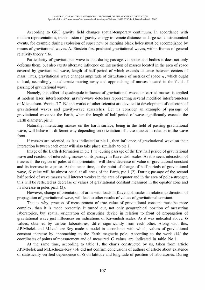
NATURAL CATACLYSMS AND GLOBAL PROBLEMS OF THE MODERN CIVILIZATION. Special edition of Transaction of the International Academy of Science. H&E. ICSD/IAS, Baku-Innsbruck, 2007.
107
According to GRT gravity field changes spatial-temporary continuum. In accordance with modern representations, transmission of gravity energy to remote distances at large-scale astronomical events, for example during explosion of super new or merging black holes must be accomplished by means of gravitational waves. A. Einstein first predicted gravitational waves, within frames of general relativity theory /16/.
Particularity of gravitational wave is that during passage via space and bodies it does not only deforms them, but also exerts alternate influence on interaction of masses located in the area of space covered by gravitational wave, length of half period of which exceeds distance between centers of mass. Thus, gravitational wave changes amplitude of disturbance of metrics of space , which ought to lead, accordingly, to alternate moving away and approaching of masses located in the field of passing of gravitational wave.
Namely, this effect of quadrupole influence of gravitational waves on carried masses is applied at modern laser, interferometer, gravity-wave detectors representing several modified interferometers of Michaelson. Works /17-19/ and works of other scientist are devoted to development of detectors of gravitational waves and gravity-wave researches. Let us consider an example of passage of gravitational wave via the Earth, when the length of half-period of wave significantly exceeds the Earth diameter, pic .1
Naturally, interacting masses on the Earth surface, being in the field of passing gravitational wave, will behave in different way depending on orientation of these masses in relation to the wave front.
If masses are oriented, as it is indicated at pic.1., then influence of gravitational wave on their interaction between each other will also take place similarly to pic.1.
Image of the Earth deformation in pic.1 (1) during passage of the first half period of gravitational wave and reaction of interacting masses on its passage in Kavendish scales. As it is seen, interaction of masses in the region of poles at this orientation will show decrease of value of gravitational constant and its increase in equator. At the same time, at the point of change of half periods of gravitational wave, G value will be almost equal at all areas of the Earth, pic.1 (2). During passage of the second half period of wave masses will interact weaker in the area of equator and in the area of poles-stronger, this will be reflected as decrease of values of gravitational constant measured in the equator zone and its increase in poles pic.1 (3).
However, change of orientation of arms with loads in Kavendish scales in relation to direction of propagation of gravitational wave, will lead to other results of values of gravitational constant.
That is why, process of measurement of true value of gravitational constant must be more complex, than it is made presently. It turned out, not only geographical position of measuring laboratories, but spatial orientation of measuring device in relation to front of propagation of gravitational wave just influences on indications of Kavendish scales. As it was indicated above, Gvalues, obtained by various laboratories, differ significantly from each other. Along with this, J.P.Mbelek and M.Lachieze-Rey made a model in accordance with which, values of gravitational constant increase by approaching to the Earth magnetic pole. According to the work /14/ the coordinates of points of measurement and of measured G values are indicated in table No.1.
At the same time, according to table 1, the charts constructed by us, taken from article J.P.Mbelek and M.Lachieze-Rey /14/ did not confirm conclusions of authors of article about existence of statistically verified dependence of G on latitude and longitude of position of laboratories. During
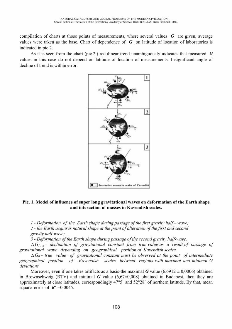
NATURAL CATACLYSMS AND GLOBAL PROBLEMS OF THE MODERN CIVILIZATION. Special edition of Transaction of the International Academy of Science. H&E. ICSD/IAS, Baku-Innsbruck, 2007.
108
compilation of charts at those points of measurements, where several values G are given, average values were taken as the base. Chart of dependence of G on latitude of location of laboratories is indicated in pic 2.
As it is seen from the chart (pic.2.) rectilinear trend unambiguously indicates that measured Gvalues in this case do not depend on latitude of location of measurements. Insignificant angle of decline of trend is within error.
Pic. 1. Model of influence of super long gravitational waves on deformation of the Earth shape and interaction of masses in Kavendish scales.
1 - Deformation of the Earth shape during passage of the first gravity half – wave; 2 - the Earth acquires natural shape at the point of alteration of the first and second gravity half-wave; 3 - Deformation of the Earth shape during passage of the second gravity half-wave.
G1…n - declination of gravitational constant from true value as a result of passage of gravitational wave depending on geographical position of Kavendish scales.
G0 - true value of gravitational constant must be observed at the point of intermediategeographical position of Kavendish scales between regions with maximal and minimal G deviations.
Moreover, even if one takes artifacts as a basis-the maximal G value (6.6912 ± 0,0006) obtained in Brownschweig (RTV) and minimal G value (6,67±0,008) obtained in Budapest, then they are approximately at close latitudes, correspondingly 47°5` and 52°28` of northern latitude. By that, mean square error of R2 =0,0045.
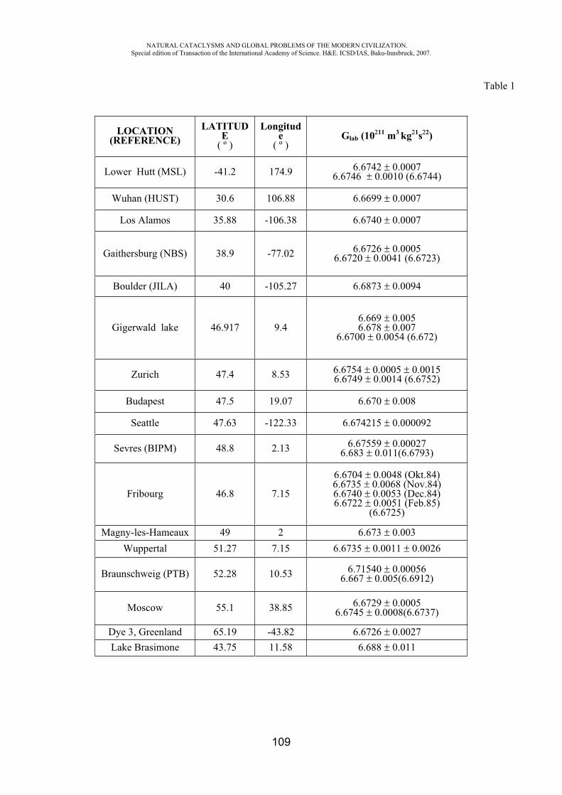
NATURAL CATACLYSMS AND GLOBAL PROBLEMS OF THE MODERN CIVILIZATION. Special edition of Transaction of the International Academy of Science. H&E. ICSD/IAS, Baku-Innsbruck, 2007.
109
Table 1
LOCATION(REFERENCE)
LATITUDE
( º )
Longitude
( º )Glab (10 11 m3 kg 1s 2)
Lower Hutt (MSL) -41.2 174.9 6.6742 0.00076.6746 0.0010 (6.6744)
Wuhan (HUST) 30.6 106.88 6.6699 0.0007
Los Alamos 35.88 -106.38 6.6740 0.0007
Gaithersburg (NBS) 38.9 -77.02 6.6726 0.00056.6720 0.0041 (6.6723)
Boulder (JILA) 40 -105.27 6.6873 0.0094
Gigerwald lake 46.917 9.46.669 0.0056.678 0.007
6.6700 0.0054 (6.672)
Zurich 47.4 8.53 6.6754 0.0005 0.00156.6749 0.0014 (6.6752)
Budapest 47.5 19.07 6.670 0.008
Seattle 47.63 -122.33 6.674215 0.000092
Sevres (BIPM) 48.8 2.13 6.67559 0.000276.683 0.011(6.6793)
Fribourg 46.8 7.15
6.6704 0.0048 (Okt.84)6.6735 0.0068 (Nov.84)6.6740 0.0053 (Dec.84)6.6722 0.0051 (Feb.85)
(6.6725)
Magny-les-Hameaux 49 2 6.673 0.003Wuppertal 51.27 7.15 6.6735 0.0011 0.0026
Braunschweig ( ) 52.28 10.53 6.71540 0.000566.667 0.005(6.6912)
Moscow 55.1 38.85 6.6729 0.00056.6745 0.0008(6.6737)
Dye 3, Greenland 65.19 -43.82 6.6726 0.0027Lake Brasimone 43.75 11.58 6.688 0.011
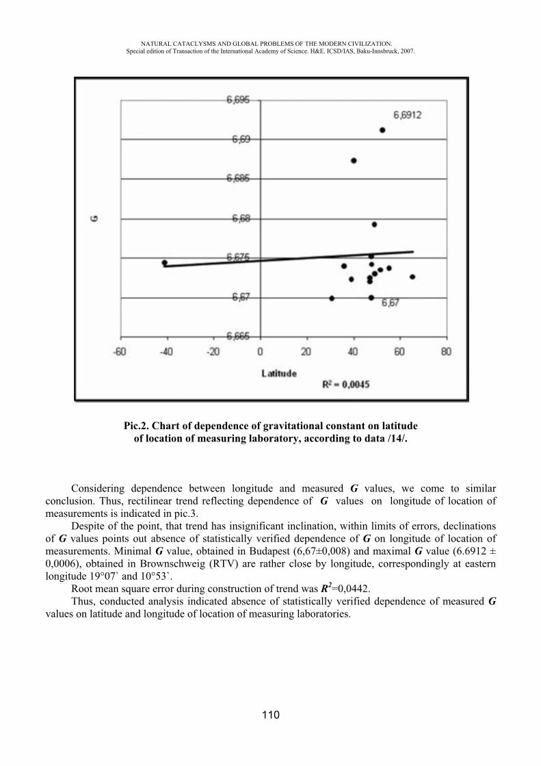
NATURAL CATACLYSMS AND GLOBAL PROBLEMS OF THE MODERN CIVILIZATION. Special edition of Transaction of the International Academy of Science. H&E. ICSD/IAS, Baku-Innsbruck, 2007.
110
Pic.2. Chart of dependence of gravitational constant on latitude of location of measuring laboratory, according to data /14/.
Considering dependence between longitude and measured G values, we come to similar conclusion. Thus, rectilinear trend reflecting dependence of G values on longitude of location of measurements is indicated in pic.3.
Despite of the point, that trend has insignificant inclination, within limits of errors, declinations of G values points out absence of statistically verified dependence of G on longitude of location of measurements. Minimal G value, obtained in Budapest (6,67±0,008) and maximal G value (6.6912 ± 0,0006), obtained in Brownschweig (RTV) are rather close by longitude, correspondingly at eastern longitude 19°07` and 10°53`.
Root mean square error during construction of trend was R2=0,0442.Thus, conducted analysis indicated absence of statistically verified dependence of measured G
values on latitude and longitude of location of measuring laboratories.
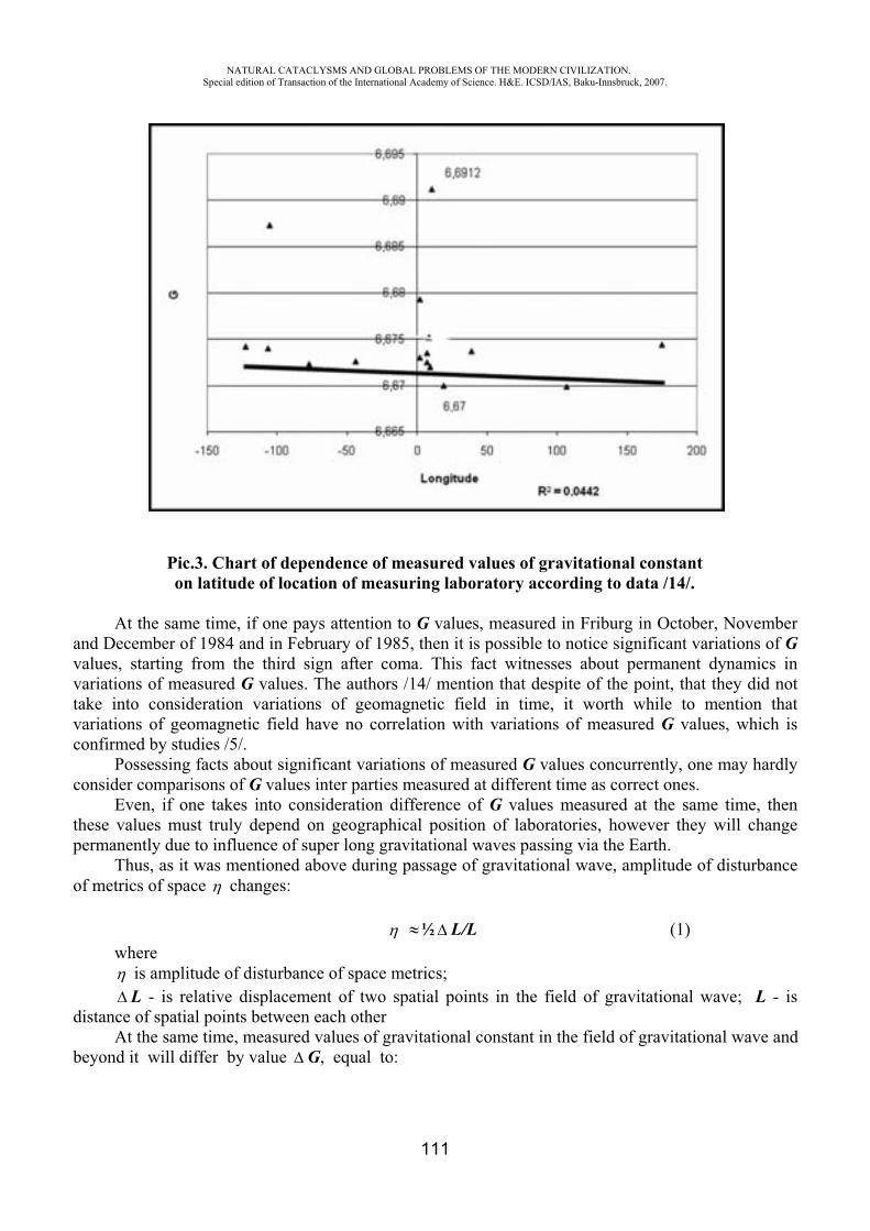
NATURAL CATACLYSMS AND GLOBAL PROBLEMS OF THE MODERN CIVILIZATION. Special edition of Transaction of the International Academy of Science. H&E. ICSD/IAS, Baku-Innsbruck, 2007.
111
Pic.3. Chart of dependence of measured values of gravitational constant on latitude of location of measuring laboratory according to data /14/.
At the same time, if one pays attention to G values, measured in Friburg in October, November and December of 1984 and in February of 1985, then it is possible to notice significant variations of Gvalues, starting from the third sign after coma. This fact witnesses about permanent dynamics in variations of measured G values. The authors /14/ mention that despite of the point, that they did not take into consideration variations of geomagnetic field in time, it worth while to mention that variations of geomagnetic field have no correlation with variations of measured G values, which is confirmed by studies /5/.
Possessing facts about significant variations of measured G values concurrently, one may hardly consider comparisons of G values inter parties measured at different time as correct ones.
Even, if one takes into consideration difference of G values measured at the same time, then these values must truly depend on geographical position of laboratories, however they will change permanently due to influence of super long gravitational waves passing via the Earth.
Thus, as it was mentioned above during passage of gravitational wave, amplitude of disturbance of metrics of space changes:
½ L/L (1) where
is amplitude of disturbance of space metrics; L - is relative displacement of two spatial points in the field of gravitational wave; L - is
distance of spatial points between each other At the same time, measured values of gravitational constant in the field of gravitational wave and
beyond it will differ by value G, equal to:

NATURAL CATACLYSMS AND GLOBAL PROBLEMS OF THE MODERN CIVILIZATION. Special edition of Transaction of the International Academy of Science. H&E. ICSD/IAS, Baku-Innsbruck, 2007.
112
G = Gw G, (2)
where Gw - is gravitational constant, measured in the field of gravitational wave and G - is gravitational constant, measured beyond the field of gravitational wave (true value).
In connection with above mentioned, we introduce coefficient of variation of gravitational constant in the field of passing gravitational wave, defined by formula:
= Gw /G, (3)
whereis coefficient of variation of gravitational constant in the field of passing gravitational wave;
Gw - is gravitational constant, measured in the field of passing gravitational wave;G - is gravitational constant measured beyond the field of passing gravitational wave (true G
value).Therefore, value of gravitational constant G measured in the Earth by means of Kavendish scales
in the field of passing gravitational wave will differ from true G value in accordance with coefficient. Magnitude and sign of change of measured value of gravitational constant G under influence of
gravitational wave will depend on amplitude of gravitational wave and orientation of interacting masses in relation to front of passing wave.
Christopher Cox and Benjamin Chao published articles /26,27/, where it is informed about new and absolutely unexpected result, concerning variations in gravity field of the Earth. They applied data of satellite laser ranging collected during last 25 years for determination of long term variations in zonal coefficient of spherical harmonics of the Earth of second degree, of the so-called coefficient J2.As it is accepted to consider, coefficient J2 reflects dynamics of ratio of equatorial and polar radii of the Earth. For many years coefficient J2 was decreasing, due to release of water from melted snow from mantle since times of glacial epoch. Meantime, new data indicate, that since 1988 coefficient J2began to increase.
Data of satellite laser ranging (SLR) given at pic.4 indicate after some time shifts in change of the Earth oblateness. By this, if since 1980 up to 1997 magnitude of coefficient J2 was kept approximately permanent at –2.8·10 11 per year, then it is evident, that starting from 1998 opposite change of J2 (t) accelerated in accordance with some unknown mechanism.
Pic. 4. Chart of long term variations of zonal coefficient of spherical harmonics of the Earth of the second degree J2 /26, 27/.
Values of Coefficient J2 are given by axis of ordinate.
Years are indicated by axis of abscissa.
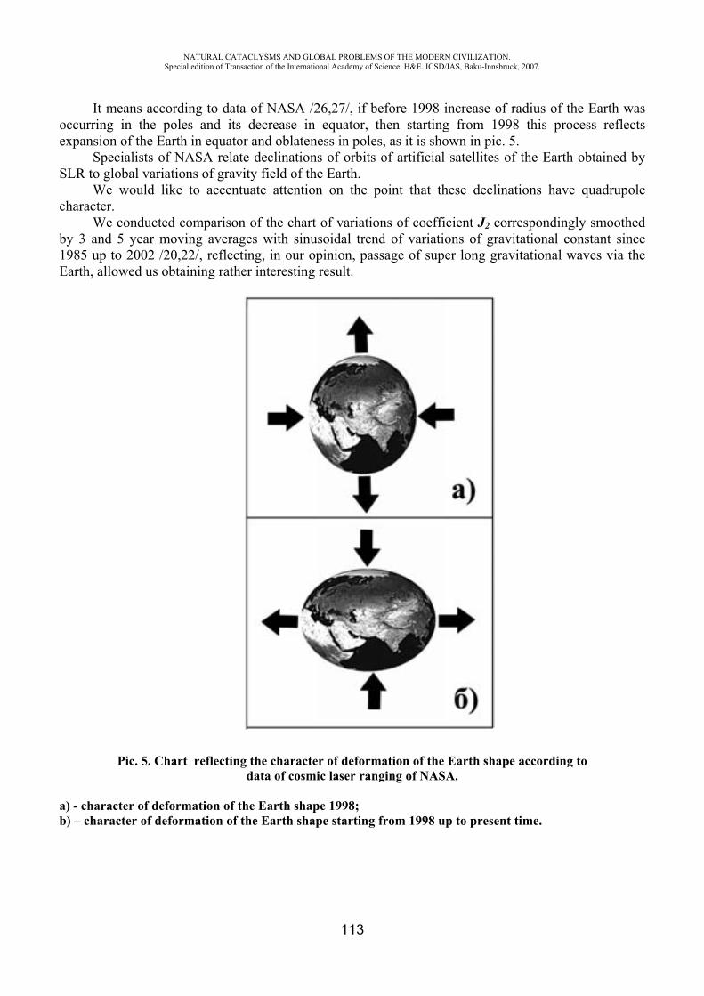
oe
S
c
b1E
ab
It meaoccurring inexpansion o
SpeciaSLR to glob
We wcharacter.
We coby 3 and 5 1985 up to 2Earth, allow
Pi
a) - characteb) – characte
NASpecial
ans accordinn the polesf the Earth alists of NAbal variationwould like t
onducted coyear movin2002 /20,22
wed us obtain
ic. 5. Chart
er of deformer of deform
ATURAL CATACLedition of Transacti
ng to data os and its din equator a
ASA relate dns of gravityto accentua
omparison ong averages2/, reflectinning rather
reflecting tda
mation of themation of the
LYSMS AND GLOion of the Internatio
of NASA /2decrease in and oblatenedeclinations
y field of theate attention
of the chart s with sinusg, in our opinteresting
he characteata of cosmi
Earth shape Earth shap
OBAL PROBLEMSonal Academy of Sc
113
26,27/, if beequator, th
ess in poless of orbits oe Earth. n on the po
of variationsoidal trendpinion, passresult.
r of deformic laser rang
pe 1998; pe starting f
OF THE MODERNcience. H&E. ICSD/
efore 1998 ihen startings, as it is shoof artificial
oint that th
ns of coeffid of variatiosage of sup
ation of the ging of NAS
from 1998 u
N CIVILIZATION/IAS, Baku-Innsbru
increase of g from 199own in pic.
satellites o
hese declina
icient J2 corons of graver long grav
Earth shapA.
p to present
.uck, 2007.
radius of th98 this pro5.
of the Earth
ations have
rrespondingvitational covitational w
pe according
t time.
he Earth waocess reflec
h obtained b
e quadrupol
gly smootheonstant sinc
waves via th
g to
asts
by
le
edcehe
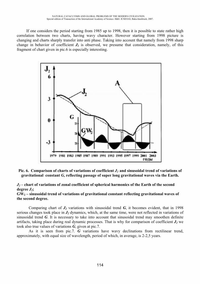
NATURAL CATACLYSMS AND GLOBAL PROBLEMS OF THE MODERN CIVILIZATION. Special edition of Transaction of the International Academy of Science. H&E. ICSD/IAS, Baku-Innsbruck, 2007.
114
If one considers the period starting from 1985 up to 1998, then it is possible to state rather high correlation between two charts, having wavy character. However starting from 1998 picture is changing and charts sharply transfer into anti phase. Taking into account that namely from 1998 sharp change in behavior of coefficient J2 is observed, we presume that consideration, namely, of this fragment of chart given in pic.6 is especially interesting.
Pic. 6. Comparison of charts of variations of coefficient J2 and sinusoidal trend of variations of gravitational constant G, reflecting passage of super long gravitational waves via the Earth.
J2 – chart of variations of zonal coefficient of spherical harmonics of the Earth of the second degree J2;GW2 – sinusoidal trend of variations of gravitational constant reflecting gravitational waves of the second degree.
Comparing chart of J2 variations with sinusoidal trend G, it becomes evident, that in 1998 serious changes took place in J2 dynamics, which, at the same time, were not reflected in variations of sinusoidal trend G. It is necessary to take into account that sinusoidal trend may smoothen definite artifacts, taking place during real dynamic processes. That is why for comparison of coefficient J2 we took also true values of variations G, given at pic.7.
As it is seen from pic.7. G variations have wavy declinations from rectilinear trend, approximately, with equal size of wavelength, period of which, in average, is 2-2,5 years.

NATURAL CATACLYSMS AND GLOBAL PROBLEMS OF THE MODERN CIVILIZATION. Special edition of Transaction of the International Academy of Science. H&E. ICSD/IAS, Baku-Innsbruck, 2007.
115
Pic. 7. Chart of variations of gravitational constant Gstarting from 1985 up to 2000 averaged by years according to data /6/. By axis of ordinates,
value of gravitational constant starting from the second sign after coma is shown. W1….Wn-are periods of G wave changes.
Comparison of charts of variations of G and J2 is indicated at pic.8. Situation is cleared a little bit during attentive consideration of pic.8. Change in character of
variations of G values is also observed, starting from 1998, which is reflected in stabilization of Gwithout visible declinations in comparison with previous years. This fact, in our opinion, may be explained by two main causes. The first cause may be passage of other gravitational waves via the Earth, which, as a result of interference with observed wave, compensated amplitude of the first one.
The second cause is probably connected with completion of passage of gravitational-wave impulse, which also led to change of the Earth shape and stabilization G. However, the conclusion is evident- definite correlation is existing between coefficient J2 and temporary G variations.
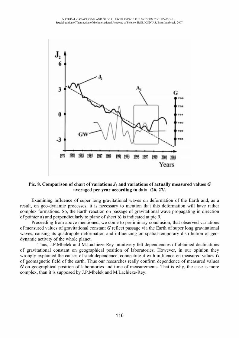
NATURAL CATACLYSMS AND GLOBAL PROBLEMS OF THE MODERN CIVILIZATION. Special edition of Transaction of the International Academy of Science. H&E. ICSD/IAS, Baku-Innsbruck, 2007.
116
Pic. 8. Comparison of chart of variations J2 and variations of actually measured values Gaveraged per year according to data /26, 27/.
Examining influence of super long gravitational waves on deformation of the Earth and, as a result, on geo-dynamic processes, it is necessary to mention that this deformation will have rather complex formations. So, the Earth reaction on passage of gravitational wave propagating in direction of pointer a) and perpendicularly to plane of sheet b) is indicated at pic.9.
Proceeding from above mentioned, we come to preliminary conclusion, that observed variations of measured values of gravitational constant G reflect passage via the Earth of super long gravitational waves, causing its quadrupole deformation and influencing on spatial-temporary distribution of geo-dynamic activity of the whole planet.
Thus, J.P.Mbelek and M.Lachieze-Rey intuitively felt dependencies of obtained declinations of gravitational constant on geographical position of laboratories. However, in our opinion they wrongly explained the causes of such dependence, connecting it with influence on measured values Gof geomagnetic field of the earth. Thus our researches really confirm dependence of measured values G on geographical position of laboratories and time of measurements. That is why, the case is more complex, than it is supposed by J.P.Mbelek and M.Lachieze-Rey.
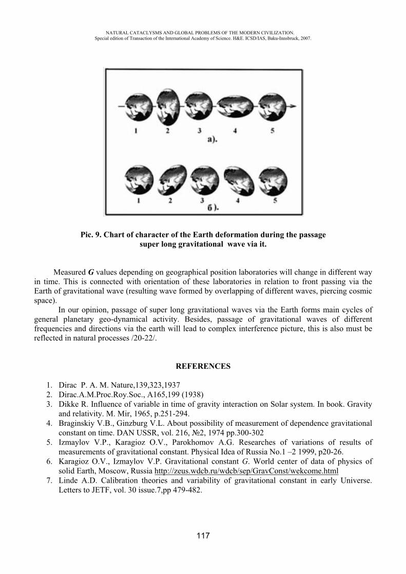
NATURAL CATACLYSMS AND GLOBAL PROBLEMS OF THE MODERN CIVILIZATION. Special edition of Transaction of the International Academy of Science. H&E. ICSD/IAS, Baku-Innsbruck, 2007.
117
Pic. 9. Chart of character of the Earth deformation during the passagesuper long gravitational wave via it.
Measured G values depending on geographical position laboratories will change in different way in time. This is connected with orientation of these laboratories in relation to front passing via the Earth of gravitational wave (resulting wave formed by overlapping of different waves, piercing cosmic space).
In our opinion, passage of super long gravitational waves via the Earth forms main cycles of general planetary geo-dynamical activity. Besides, passage of gravitational waves of different frequencies and directions via the earth will lead to complex interference picture, this is also must be reflected in natural processes /20-22/.
REFERENCES
1. Dirac P. A. M. Nature,139,323,1937 2. Dirac.A.M.Proc.Roy.Soc., A165,199 (1938) 3. Dikke R. Influence of variable in time of gravity interaction on Solar system. In book. Gravity
and relativity. M. Mir, 1965, p.251-294. 4. Braginskiy V.B., Ginzburg V.L. About possibility of measurement of dependence gravitational
constant on time. DAN USSR, vol. 216, 2, 1974 pp.300-302 5. Izmaylov V.P., Karagioz O.V., Parokhomov A.G. Researches of variations of results of
measurements of gravitational constant. Physical Idea of Russia No.1 –2 1999, p20-26. 6. Karagioz O.V., Izmaylov V.P. Gravitational constant G. World center of data of physics of
solid Earth, Moscow, Russia http://zeus.wdcb.ru/wdcb/sep/GravConst/wekcome.html7. Linde A.D. Calibration theories and variability of gravitational constant in early Universe.
Letters to JETF, vol. 30 issue.7,pp 479-482.
NATURAL CATACLYSMS AND GLOBAL PROBLEMS OF THE MODERN CIVILIZATION. Special edition of Transaction of the International Academy of Science. H&E. ICSD/IAS, Baku-Innsbruck, 2007.
118
8. Lyakhovets V.D. Problems of metrological provision of measurements of gravitational constant. Problems of modern physics, Alma-Ata, Gylim, 1995, 136 p.
9. Stanyukovich K.P. To the question of possible changing of gravitational constant. DAN USSR 1962, vol.147, No.6, p. 1348-1351.
10. Morganstern R. Cosmological Upper Limit on Time Variation of G. “Nature”, 1971,v.232, p.109.
11. Morganstern R. Curved Space Cosmological Bounds on the Time Variation of G. “Nature Phys.’Sci, 1972,v 237, No74, 70.
12. Jens H.Gundlach and Stephen M. Merkowitz. Measurement of Newton’s Constant Using a Torsion Balance with Angular Acceleration Feedback Department of Physics, Nuclear Physics Laboratory, University of Washington, Seattle, Washington 98195, (December 10, 2001).
13. Mbelek J.P. and Lachieze-Rey M. A five dimensional model of varying effective gravitational and fine structure constants. WS VFC - The Cosmology of Extra Dimensions and Varying Fundamental Constants. Porto-Portugal, 2002 September 2-7.
14. Mbelec J.P. and Lachieze-Rey M . Possible evidence from laboratory measurements for a latitude and longitude dependence of G. WS VFC- The Cosmology of Extra Dimensions and Varying Fundamental Constants. Porto-Portugal, 2002, September 2-7.
15. Nolting F., Schurr J., Schlamminger St., and Kindig W. Determination of the gravitational constant G by means of a beam balance. Physics Institute, University of Zurich, Switzerland. Europhysics News (2000) Vol.31 No.4.
16. Einstein A. Sitzungsber.Preuss.Akad.Wiss.,1917,142. 17. Braginskiy V.B. Gravitational-wave astronomy: New methods of measurements UFN, vol.170
No.7 2000 p.743-752. 18. Kip Thorn. Black holes and gravitational waves. Vestnik of Russian Academy of Sciences
2001, vol. 71 No.7 p 587-590 19. Grishuk L.P. Lipunov V.M., Postnov K.A., Prokhoroov M.E., Satiaprakash B.S. Gravity-wave
astronomy: in expectation of first registered source of.UFN, vol. 171, No.1 2001 p3-58. 20. Khalilov E.N. The earth is universal detector of gravitational waves. Proceedings of
International Symposium: Cyclicity and cosmological Problems, 2-4 may 2003, Pirgulu, Y. Mamedaliyev settlement, pp.10-30.
21. Khalilov E.N. About possible influence of super long gravitational waves on duration of terrestrial day. Proceedings of International Symposium:
22. Khalilov E.N. About possible influence of gravitational waves on deformation and of the Earth seismicity. Circular letter of Shemakha Astrophysical Observatory No.105, 2003, p13-21
23. Pariyskiy N.N. Irregular variations of gravity and of the Earth rotation. Letter to Astron. Journal 1982, vol. 8 No.6 p378-380
24. Bulange Y.D. Some results of study of non-tidal variations of gravity. Reports of AS of USSR, 1981 vol.256, No.6 p.1330-1331
25. Ivanenko D.D. , Frolov B.N. The Earth deformation and modern theory of gravity. In book Problems of expansion and the Earth pulsation. M. Nauka, 1984 pp. 93-97
26. Cox C. Chao B.F., Detection of large-scale mass redistribution in the terrestrial system since 1998, Science, vol 297 ,pp 831, 2 August 2002.
27.Chao, B.F., Dehant V., Gross R.S., Ray R.D., Salstein D.A., Watkins M.M., Wilson C.R. Space Geodesy Monitors Mass Transport in Global Geophysical Fluids, in press, EOS, Trans.Amer. Geophys. Union, 2002b
NATURAL CATACLYSMS AND GLOBAL PROBLEMS OF THE MODERN CIVILIZATION. Special edition of Transaction of the International Academy of Science. H&E. ICSD/IAS, Baku-Innsbruck, 2007.
119
CAN CHRONOMICS HELP BUILD A UNIFIED SCIENCE?
Cornelissen G.*, Halberg F.*, Khalilov E.‡, Hillman D.*, Wendt H.W.*, Nolley E.S.•, Beaty L.A.•, Schwartzkopff O.*, Holte J.*, Otsuka K.¶ ,
Singh R.B.
*University of Minnesota, Minneapolis, MN, USA ‡Intergeo-Tethys, International Scientific and Technical Complex, Baku, Azerbaijan
•Phoenix Group, Institute of Electrical and Electronics Engineers, Minneapolis, MN, USA ¶Tokyo Women's Medical University, Medical Center East, Tokyo, Japan
Halberg Hospital and Research Institute, Moradabad, India
Aim. Associations between biological and environmental variables are sought by examining their time structure for any congruence between their respective spectral components (with overlapping or overlying uncertainty estimates of their periods) and by following the time course of their characteristics to check for any coincidental changes by a remove-and-replace approach (the subtraction and addition of a given environmental spectral component happening naturally). To look on that basis, when opportunity arises, for any associated time-varying biological and environmental changes by a subtraction-addition (removal and preferably also replacement of a given environmental spectral component) approach done by the sun.
Background. With pertinence to Walter Kofler's extended view of health and ecology (1), differential congruence has been found among the cyclic components of biomedical and related time structures (also consisting of trends and of deterministic and other chaos) and a variety of helioseismic, heliomagnetic, solar-wind-related and geomagnetic variables and further, as here reported, between cycles in solar UV irradiation (2) vs. the Hale cycle of sunspot bipolarity and vs. putative cycles in the gravitational constant (3).
Method. Data of the gravitational constant G, covering the span from 1985 to 2000, from the web of the World Data Center for Solid Earth Physics (HTP table) were analyzed by methods described elsewhere (4-6), along with the original data averaged over consecutive years by one of us (EK). Results are aligned with those of solar UV irradiation from 1893 to 2002 recorded in Potsdam, Germany, as modeled by an artificial neural network, in a publication by Junk et al. (2).
Results. Components with periods of about 5.7 and 2.2 years were found to characterize G, Table 1, with particular emphasis on the detail in a footnote to this table. The major results, however, concern solar UV radiation, focusing on the reconstruction from meta-analyzed records of the daily UV-A (315-400 nm) and erythemal UV irradiation (ER), and their anomalies (A) (2), Table 2. A linear analysis reveals for all 4 highly correlated variables (UV-A, ER, and the % of anomalies of each; see 2) a spectral peak at the same frequency of one cycle in 20.4 years, extensively documented in biomedicine and ecology (7) as quasi-ubiquitous signatures of the Hale cycle in sunspot bipolarity. The circadecadal component is statistically significant in 2 cases and of borderline statistical significance in the other 2 series (P values for ER [A], ER, UV-A [A], and UV-A are 0.040, 0.064, 0.053, and 0.048, respectively, not corrected for multiple testing). A major component, also seen in all 4 variables has a common period of 5.85 years (P-values of 0.006, 0.022, 0.009, and 0.012). Two other components are seen for all variables, with periods of about 3.6 and 3.2 years. With the qualification that the 4 variables do not constitute independent data series, combined statistical estimation for data
NATURAL CATACLYSMS AND GLOBAL PROBLEMS OF THE MODERN CIVILIZATION. Special edition of Transaction of the International Academy of Science. H&E. ICSD/IAS, Baku-Innsbruck, 2007.
120
from all 4 variables at each of the 4 common trial periods detected in the frequency range of one cycle in 23 years to one cycle in 3.1 years (30 independent tests) yields P-values adjusted for multiple testing according to Bonferroni of 0.072, <0.001, 0.006 and 0.035 for the about 20.4-, 5.9-, 3.6- and 3.2-year components, respectively, but the reader is invited to view the separate results in view of the correlation of the variables analyzed. A component with a period between 75 and 95 years, statistically significant for UV-A but not for ER, is beyond our scope herein, albeit it corresponds to a wobbly period reported for Wolf's relative sunspot numbers.
Conclusions. Congruence in itself cannot prove any causal relations, but common transdisciplinary cycles, the more variables they involve, the more they constitute a basis for looking at pervasive time-varying associations (8), which are steps toward a unified transdisciplinary science.
Table 1
Inferentially statistically validated about 2.2- and about 5.7-yearly components in a spectrum of 16 years of yearly data from a Cavendish balance used to measure the gravitational "constant"*
A. Linear results
Period, �(years)
PR P Acrophase± SE
5.7 35.8 0.056 -29 ± 222.2 43.9 0.023 -272 ± 16
B. Nonlinear results
Period, � (y)Trial
�� (95%
CI)Amplitude (A) (95% CI) MESOR (M)
(95% CI)5.7 5.91 (4.48,
7.34)0.0000834
(-0.0000013, 0.0001681) 6.67292
(6.67286, 6.67299)
2.2 2.18 (2.06, 2.29)
0.0001032(0.0000062, 0.0002002)
*Analyses of the original denser-than-yearly series allow scrutiny of periods below the Nyquist frequency of the yearly average series and confirm the 5.7-year component linearly with a percentage rhythm (PR) of 14% (P=0.038), revealing in addition a 1.2-year (transyear) component (PR=11.5; P=0.068), an about 0.9-year (cisyear) component (PR=10.5; P=0.083) and an about 2.1-year component (PR=9.7; P=0.104).
The concomitant fit of all 4 candidate components converges toward a 2-component model (overall P=0.008) consisting of cosine curves with periods of 5.7 years (P=0.017) and 1.2 years (P=0.032).

NATURAL CATACLYSMS AND GLOBAL PROBLEMS OF THE MODERN CIVILIZATION. Special edition of Transaction of the International Academy of Science. H&E. ICSD/IAS, Baku-Innsbruck, 2007.
121
Table 2
Period estimates found in four correlated variables reported by Junk et al. for solar UV irradiation by Marquardt's conservative approach, with his more liberal 1-parameter (1-P)
confidence interval given in [ ]*
Trial peri-od
Period (y) Amplitude (95% CI) [1-P] Period (y) Amplitude (95%
CI) [1-P]
(y)
ER (A) ER
20.5 20.50 (18.03, 22.96)
1.59 (-0.35, 3.53)
[0.36, 2.82]
20.52 (18.04, 22.99)
0.07 (-0.02, 0.16) [0.02, 0.13]
5.9 5.86 (5.69, 6.02)
1.96 (0.80, 3.84)
[0.77, 3.15]
5.86 (5.69, 6.03) 0.09 (0.00, 0.18) [0.03, 0.14]
3.6 3.58 (3.50, 3.65)
1.64 (-0.26, 3.55)
[0.44, 2.85]
3.58 (3.51, 3.65)
0.08 (-0.00, 0.17) [0.03, 0.14]
3.2 3.21 (3.15, 3.27)
1.56 (-0.36, 3.49)
[0.34, 2.78]
3.21 (3.15, 3.28)
0.07 (-0.02, 0.16) [0.01, 0.13]
UV (A) UV
20.5 20.64 (18.05, 23.22)
1.38 (-0.37, 3.13)
[0.27, 2.49]
20.63 (18.10, 23.17)
0.03 (-0.00, 0.07) [0.00, 0.06]
5.9 5.85 (5.68, 6.03)
1.69 (-0.01, 3.38)
[0.61, 2.76]
5.85 (5.67, 6.03)
0.04 (-0.00, 0.07) [0.01, 0.06]
3.6 3.58 (3.51, 3.65)
1.52 (-0.19, 3.24)
[0.44, 2.61]
3.58 (3.51, 3.65)
0.04 (-0.00, 0.07) [0.01, 0.06]
3.2 3.21 (3.14, 3.28)
1.29 (-0.46, 3.03)
[0.18, 2.39]
3.21 (3.14, 3.27)
0.03 (-0.00, 0.07) [0.00, 0.05]
NATURAL CATACLYSMS AND GLOBAL PROBLEMS OF THE MODERN CIVILIZATION. Special edition of Transaction of the International Academy of Science. H&E. ICSD/IAS, Baku-Innsbruck, 2007.
122
*Didecadal component could be a signature of the Hale cycle in sunspot bipolarity; 5.9-year component could be a harmonic signature of the Hale or of the Schwabe cycle, in view of the uncertainties shown by 95% confidence intervals .
Note remarkable agreement and consistent statistical significance with the 1-parameter limits without resorting to questionable pooling of probabilities.
ER (A): erythemal radiation (% anomalies); ER: erythemal radiation; UV (A): ultraviolet radiation (% anomalies); UV: ultraviolet radiation.
Data taken off graphs published by Junk J et al (Int J Biometeorol 2007; 51: 505-512). Trial periods correspond to spectral periods in linear cosinor analysis.
REFERENCES
1. Kofler W.W. The need on a "critical extended evolution related view" of reality as a basis for an "extended view" of health. Science without Borders, Transactions of the International Academy of Science H&E, 2003/2004; 1: 27-54.
2. Junk J., Feister U., Helbig A. Reconstruction of daily solar UV irradiation from 1893 to 2002 in Potsdam, Germany. Int J Biometeorol 2007; 51: 505-512.
3. International Council for Scientific Development, International Academy of Science (Kerimov M.K., Kofler W., honorary chairmen), Azerbaijan National Academy of Science, N. Tusi Shamakhy Astrophysical Observatory. Proceedings "Cyclicity and Cosmological Problems" (2-4 May 2003, Pirgulu, Y. Mamedaliyev Settlement, Azerbaijan Republic). Baku: Ojag; 2003. 225 pp.
4. Halberg F. Chronobiology: methodological problems. Acta med rom 1980; 18: 399-440. 5. Cornélissen G., Halberg F. Chronomedicine. In: Armitage P, Colton T, editors. Encyclopedia
of Biostatistics, 2nd ed. Chichester, UK: John Wiley & Sons Ltd; 2005. p. 796-812.6. Refinetti R., Cornélissen G., Halberg F. Procedures for numerical analysis of circadian
rhythms. Biological Rhythm Research 2007; 38 (4): 275-325.http://dx.doi.org/10.1080/09291010600903692.
7. Halberg F., Cornélissen G., Schack B., Wendt H.W., Minne H., Sothern R.B., Watanabe Y., Katinas G., Otsuka K., Bakken E.E. Blood pressure self-surveillance for health also reflects 1.3-year Richardson solar wind variation: spin-off from chronomics. Biomedicine & Pharmacotherapy 2003; 57 (Suppl 1): 58s-76s.
8. Halberg F., Cornélissen G., Bingham C., Witte H., Ribary U., Hesse W., Petsche H., Engebretson M., Geissler H.G., Weiss S., Klimesch W., Rappelsberger P., Katinas G., Schwartzkopff O. Chronomics: Imaging in time by phase synchronization reveals wide spectral-biospheric resonances beyond short rhythms. ("Wenn man über kurze Rhythmen hinausgeht") In memoriam – lost future: Dr.-Ing. habil. Dr. rer. nat. Barbara Schack: 1952-2003. Neuroendocrinol Lett 2003; 24: 355-380.
NATURAL CATACLYSMS AND GLOBAL PROBLEMS OF THE MODERN CIVILIZATION. Special edition of Transaction of the International Academy of Science. H&E. ICSD/IAS, Baku-Innsbruck, 2007.
123
INSOLATION AND GALACTIC COSMIC RAYS AS RULING PARAMETERS (VARIABLES) IN CLIMATE STATES HEXARCHY AT DIFFERENT TIME
SCALES – THE CLIMATE AS FUNDAMENTAL PHYSICS PROBLEM
Mavrodiev S. Cht.,* Rusov V. D., **Mihalys .,***
*INRNE, BAS, Sofia,**, *** NPU, Odessa, Ukraine
Abstract
There are two possibilities for the climate (weather) development. First one is the Global warming as consequences of non-controlled anthropogenic production of green gases as CO2 and others, the Sun and cosmic rays influence on clouds formation processes or Global cooling because of the incoming minimal (for the last two centuries) Sun activity in 2020.
Obviously, the answer has to be based on the well known physics of processes and interactions which form the climate and weather variations in short time scale such as 10- 20 years.
One can state that till now we have not yet such a multizonal weather model based on clear physics and tested experimentally. All balance models of global climate and weather models don’t perform the important principle of structural invariance of its equations. Simply speaking, the multizonal equations system of weather model must have the possibility to be transformed, with conservation of structures and physical sense of ruling parameters, to intermediate (millennial) or long time scale (million years) global climate models.
Therefore, the structural invariance principle of climate and weather models defines a unique holistic strategy for researching the global climate changes evolution at different time scale from years to thousand and millions of years.
The sense of strategy is simple. At first one has to research two or three ruling variables from which depends the balance equation of global climate model at middle (millennial) time scale. Afterwards one has to verify the model by comparison with experimental paleo-temperature data (for example from EPICA Dome C and Vostok ice core projects). The establishment of the good agreement between theory and experiment means that the physics in the model and the hypothesis for choosing variables is adequate. For example, the ruling variables can be the insolation, galactic cosmic rays and the Earth’s own heat. For different time scale one has to use the changes of conditions at Sun system Galactic orbit and of Earth interior changes.
The condition for creating the adequate multizonal weather model is the existence of the time scale consequence of adequate (tested experimentally) global climate and weather models.
Following such a strategy we have to research the dependences between all variables (temperature, ice cover) from which can depend the parameters of global climate as well as the years
NATURAL CATACLYSMS AND GLOBAL PROBLEMS OF THE MODERN CIVILIZATION. Special edition of Transaction of the International Academy of Science. H&E. ICSD/IAS, Baku-Innsbruck, 2007.
124
behavior of Sun spots, insolation (Sun heat budget) anthropogenic and natural production of CO2 and others green gases, CO2 atmosphere concentration, Earth temperature, number and energy of hurricanes, Ocean level and the trends of shelf Ocean tidal amplitudes and so on..
The balance climate model which includes the anthropogenic gases and cosmic ray influence is presented.
The years CO2 atmosphere concentration, Earth mean temperature, Ocean mean level and World number of earthquakes with magnitude greater then 4 were analyzed and the corresponding mathematical models was created:
• Model for anthropogenic CO2 production: CO2Anthro(Year), • Model for Sun irradiation: SunIrrad(Year), • Model for Sun Spots number: SunSpots(Year), • Model for CO2 atmosphere concentration as a function of CO2Anthro, SunIrrad(Year)
and SunSpots(Year): CO2Atm(Year), • Model for Earth and some local stations year mean temperature as a function of
CO2Atm(Year) and Earth ecosystem (Ocean- El Nino) response: TempEarth(Year), • Model of Ocean level as function of Earth temperature, • Model for earthquake magnitude spectral numbers as function of Earth temperature, • Model of Kp index.
From such a model independent analysis and the functions presentation follow that the increase in the Earth’s temperature is a straight consequence of CO2 anthropogenic production as well as the Ocean mean level and earthquakes number.
A way for estimation of regional ecological CO2 responsibility using the atmospheric CO2 concentration time series (Mauna Loa, Schauinsland and Monte Cimone) and its fit functions (Mauna Loa, Schauinsland and Monte Cimone) is proposed. Such a model can be used for better scientific based definition of the source contribution for CO2, other greenhouse gases and aerosols.
A model for the local and Earth mean year temperature is presented on the basis of station and global CO2 data which allow predicting the next year temperature with an accuracy of about 0.5-0.7 degrees Celsius. Such a technique has been tested with the data of Schauinsland, Hohenpeissenberg and Monte Cimone observatories and for the Earth as well.
Shortly is described the creation of a real time system for analyzing the experimental data, testing the accuracy of the different physical models solutions and reliability of their predictions.
It is proposed to include in the Stern report for estimation of Climate Change economical costs and the increased seismicity costs.
NATURAL CATACLYSMS AND GLOBAL PROBLEMS OF THE MODERN CIVILIZATION. Special edition of Transaction of the International Academy of Science. H&E. ICSD/IAS, Baku-Innsbruck, 2007.
125
DISTRESS AND POST-TRAUMATIC STRESS DISORDER (PTSD) IN NATURAL DISASTER PREVENTION AND THERAPY
Karl Hecht*, E.N. Savoley**
IRCHET International Research Centre of Healthy and Ecological Technology Berlin – Germany
Disasters from the Aspect of the Psychophysiology and Pathopsychophysiology of the Person Natural disasters (as well as technical disasters) are characterized by the intensive suddenness of their occurrence. In a few seconds, a succession of destructive events takes place until the unleashed energy is used up.
The perception of the intensive, unexpected energy surge takes place in those affected more emotionally and intuitively than consciously (also in a matter of seconds) in the form of physical and psychosocial emergency reactions. All psychophysiological adaptation reserves are mobilized, which in some people are completely used up and can leave behind functional and structural defects.
These appearances are described as “burn-out syndrome” or in chronification as posttraumatic stress disorder (PTSD). During the disaster impact, the following processes occur in the behavior of a person:
Crash Fright and shock Being overwhelmed (inability to act) Paralysis reaction Dysfunctional reactions (horror, wailing, screaming) Emotional helplessness, apathy, panic.
In this process, all psychophysiologic function systems are included and in many cases overstrained. The behavior and the action of the person in this situation depend on the intensity of the overstraining. Such a course is represented simplified in Figure 1.
If a person has psychophysiological regulation stability, which is referred to as “resilience” [Seligmann 1994], he or she is able to remain healthy in extreme impacts. Any instability of the psychophysiology can lead to overstraining and thereby to sickness of various intensity.
2. Injury of the Mental Processes of the Person Must be Treated
Every disastrous event can lead to substantial traumatization of the psychosocial status of the person [Hecht und Balzer 2000].
In general, current disaster medicine is oriented primarily towards the care of physical injuries. In every disaster so far worldwide, gaps and failures have been observed again and again in
regard to the mental-emotional and social care of those affected by the disaster. The circle of those affected who require mental care is though in every disaster much larger than
that of the physically injured. This group includes, among others: the physically injured those who remained physically uninjured (with shock, panic, helplessness) the wide circle of relatives of the dead and injured those coincidentally present at the disaster, and finally
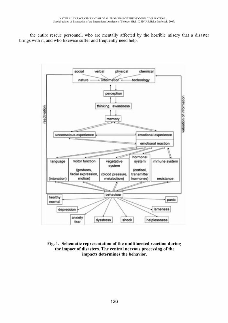
NATURAL CATACLYSMS AND GLOBAL PROBLEMS OF THE MODERN CIVILIZATION. Special edition of Transaction of the International Academy of Science. H&E. ICSD/IAS, Baku-Innsbruck, 2007.
126
the entire rescue personnel, who are mentally affected by the horrible misery that a disaster brings with it, and who likewise suffer and frequently need help.
Fig. 1. Schematic representation of the multifaceted reaction during the impact of disasters. The central nervous processing of the
impacts determines the behavior.
NATURAL CATACLYSMS AND GLOBAL PROBLEMS OF THE MODERN CIVILIZATION. Special edition of Transaction of the International Academy of Science. H&E. ICSD/IAS, Baku-Innsbruck, 2007.
127
3.Various Behaviors of People in Disasters
Besides acute distress, disasters also cause oxydative stress (inundation of the body tissues with free radicals) and Post-Traumatic Stress Disorder (PTSD).
In a disaster situation, not all people react the same way, but rather very differently. The following phase courses are to be observed until the appearance of PTSD [Domres and Manger 2000; Hodgin and Stewart 1995]:
1. The acute phase has a duration of seconds to days; it includes the time in which a person is exposed to the event and represents a sort of initial shock in which people react very differently:
1.1 10-30% of those affected react calmly and are capable of helping. They remain healthy after the event.
1.2 50-70% react apathetically or confusedly from over-activity to panic. 1.3 10-25% show such severe reactions that they require medical-psychological help. 1-3% of
them show signs of a serious breakdown of the physical and mental processes. 2. The interim phase (only for groups 1.2 and 1.3). This phase begins directly after the event and its
immediate consequences, when the person grasps what has happened and what it means for him or her. In this phase, which can last up to six months, there are again diverse reactions. For some, this is
a healing phase, and they will not be affected by chronic PTSD. For others, there is a non-coping and PTSD development phase. These affected persons cannot process the disastrous events.
3. The post-event phase about six months after the event. It can last for an undetermined amount of time. It is frequently identified as a post-traumatic phase that persists latently after the event, even when a supposedly successful treatment has taken place. The breadth of post-traumatic reaction varies, but typically shows such manifestations as:
4.
re-experiencing of the event feelings of guilt nightmares loss of concentration loss of interest memory loss, etc. sleeplessness
Futhermore, PTSD can appear with the following symptoms:
apathy anxiety attacks confusion feelings of guilt helplessness sleeplessness headache paralytic phenomena. Overactivity to the point of a feeling of sickness
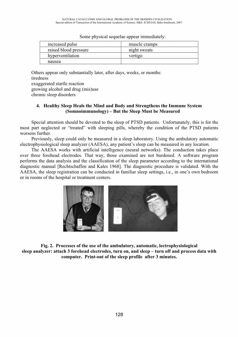
mw
e
opdAo
Otherstiredneexaggegrowinchroni
4.
Speciamost part nworsens furt
Previoelectrophysi
The Aover three fperforms thediagnostic mAAESA, theor in rooms
Fsleep analy
NASpecial
increasedraised blohypervennausea
s appear onlesserated startlng alcohol aic sleep diso
Healthy Sl
al attention neglected orther. ously, sleep iological sle
AAESA woforehead ele data analymanual [Rece sleep regiof the hosp
Fig. 2. Procyzer: attach
co
ATURAL CATACLedition of Transacti
Somd pulse ood pressurntilation
ly substanti
le reaction and drug (morders
leep Heals t(Somnoim
should be dr “treated”
could onlyeep analyzerrks with arlectrodes. Tysis and thechtschaffenstration canital or treatm
cesses of thh 3 foreheaomputer. P
LYSMS AND GLOion of the Internatio
me physical
re
ally later, a
mis)use
the Mind ammunology)
devoted to twith sleep
y be measurr (AAESA)rtificial inteThat way, te classificatn and Kalesn be conducment center
e use of thead electrodePrint-out of
OBAL PROBLEMSonal Academy of Sc
128
l sequelae apmnv
fter days, w
and Body a) – But the
the sleep ofping pills, w
red in a slee, any patien
elligence (nthose examtion of the ss 1968]. Thcted in famirs.
e ambulatoes, turn on,f the sleep p
OF THE MODERNcience. H&E. ICSD/
ppear immemuscle cramnight sweatvertigo
weeks, or mo
nd StrengtSleep Mus
f PTSD patiwhereby th
ep laboratornt’s sleep caneural netw
mined are nsleep param
he diagnostiiliar sleep s
ory, automa, and sleep profile aft
N CIVILIZATION/IAS, Baku-Innsbru
ediately:mpsts
onths:
thens the Imt be Measu
ients. Unfoe condition
ry. Using than be measuorks). The ot burdened
meter accordc procedureettings, i.e.
atic, lectrop– turn off er 3 minute
.uck, 2007.
mmune Sysured
ortunately, tn of the PT
he ambulatoured in any l
conductiond. A softwding to the e is validat, in one’s o
physiologicand proceses.
stem
this is for thTSD patien
ory automatilocation.
n takes placware program
internationted. With thown bedroom
calss data with
hents
ic
cemalhem
h
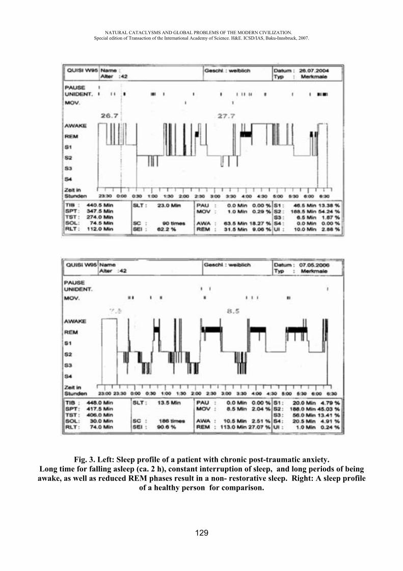
NATURAL CATACLYSMS AND GLOBAL PROBLEMS OF THE MODERN CIVILIZATION. Special edition of Transaction of the International Academy of Science. H&E. ICSD/IAS, Baku-Innsbruck, 2007.
129
Fig. 3. Left: Sleep profile of a patient with chronic post-traumatic anxiety. Long time for falling asleep (ca. 2 h), constant interruption of sleep, and long periods of being awake, as well as reduced REM phases result in a non- restorative sleep. Right: A sleep profile
of a healthy person for comparison.
NATURAL CATACLYSMS AND GLOBAL PROBLEMS OF THE MODERN CIVILIZATION. Special edition of Transaction of the International Academy of Science. H&E. ICSD/IAS, Baku-Innsbruck, 2007.
130
5. Definition of PTSD
PTSD was officially defined only about 27 years ago. In 1980, the American Psychiatric Association entered this syndrome into its disease
classification system (the DSM III). There are five main criteria of Post-Traumatic Stress Disorder: experience of a trauma intrusions (= involuntary and stressful memories of the trauma) avoidance behaviors and general state of emotional numbness persistent physiological hyperarousal the symptoms last longer than a month. In the ICD-10 of the International Disease Classification System of Mental Disorders,
psychological traumas are defined as “short or long lasting occurrences or events of extraordinary threat with disastrous dimension that would trigger deep-reaching desperation in nearly anyone” [World Health Organization 1994]. The definition of the American DSM System reads as follows: “Potential or real mortal threats, serious injury, or a threat of the physical integrity of oneself or others that is reacted to with intense fear, helplessness, or fright” [DSM-IV: American Psychiatric Association 1994].
Chronic helplessness, anxiety, and depression are the main symptoms that burden a PTSD patient. When help does not arrive punctually and sufficiently, PTSD can become incurable. The cause is among others the inundation of the brain with self-produced opioid peptides. Furthermore, a reduction of the volume of the hippocampus (up to 10%), the brain region that is responsible for the person’s memory and emotions, is observed [Rüegg 2006].
1. Symptoms of PTSD Can Be Conditioned and Reactivated
Symptoms of PTSD can be conditioned, i.e. manifested and imprinted in memory. Previously experienced and conditioned stressful events can be reactivated during a new event and provoke severe state changes. The following example illustrates this.
A 23-year-old man considered healthy and capable discovers in the evening a fire in the cellar of his house, which the fire department is able to extinguish without great difficulties. The man suffered no smoke poisoning and no other harm. The next morning, it was found that he no longer knew who he was or where he was: memory loss. “Retrograde amnesia,” read the diagnosis. A riddle for doctors and psychologists. After four weeks, the man is again able to access to his memory. He told the psychotherapist that as a four-year-old he saw how a driver of a car burned alive with intense screams.
This horrible experience was exponentially reactivated by the harmless cellar fire. In this case, the connection between the cause and the experience that occurred 19 years later was uncovered. But in thousands of cases, such a causality is not found. As a result, the illness becomes chronic and ultimately incurable.
2. What Can be Done to Prevent the Occurrence of PTSD?
As already mentioned, the mental and physical health of 10-30% of people in disasters is not affected, depending on the situation. They should be the benchmark for preventive measures. Although this group has not yet been researched much, the following can be recommended for prevention, according to the current state of knowledge:
1. In principle, practice dealing with stress daily, for which above all emotional intelligence [Coleman 1996] should be learned.
2. In close connection with the acquisition of emotional intelligence, training of resilience is important [Seligmann 1990]. Anyone who preserves his or her mental health in disasters has resilience.

NATURAL CATACLYSMS AND GLOBAL PROBLEMS OF THE MODERN CIVILIZATION. Special edition of Transaction of the International Academy of Science. H&E. ICSD/IAS, Baku-Innsbruck, 2007.
131
Resilience is the ability to develop a high resistance capability of the psychosocial processes against external and internal influences.
A few essential characteristics of resilience are: good physical fitness, optimistic attitude, willpower, self-mastery, perspectivist thinking and acting, finding solution variations in complicated situations, accepting life crises and thereby acting out feelings that arise, finding the positive in any critical situation, not developing victim-guilt or feeling sorry for oneself, mastering intuition, learning flexible thinking and acting, being able to practice abstaining (spoiled people who know only “good times” are especially susceptible to PTSD).
3. In areas at risk for natural disasters, regular information and training courses should be conducted. In earthquake areas in which such drills take place regularly, the situation in a true occurrence has been mastered well and health damages have been reduced to a minimum.
4. Disaster medicine must establish stress management as a permanent part of education and continuing education.
5. Physical resistance strength can be increased through regular athletic training. 6. As a basic prophylactic, take SiO2-containing minerals (antioxidants and immune
strengthening effect). Clinoptilite zeolite and montmorillonite have beneficial effects.
3. Which Therapies are Necessary for PTSD Patients? 1. It is important to recognize the symptoms as early as possible, which often develop latently
and insidiously. Therefore, the prophylactic measures mentioned should begin immediately after the event.
2. The EMDR (Eye Movement Desensitization and Reprocessing) method of Francine Shapiro [1998] has been established its validity for the treatment of PTSD. This method provokes the nightly Rapid Eye Movement (REM) sleep phase function during the day. The REM sleep phases serves to perform restorations on conflicts. It is therefore referred to as cleaning cloth of the mind.
3. Guarantee of a regular sleep-waking rhythm with the aim of mobilizing the REM sleep phases and making them rhythmic.
4. Application of glycine (Biotiki). Glycine is an amino acid. No brain functions take place without glycine.
This important inhibiting neurotransmitter can regulate the cerebral metabolism, reduce distress, and induce the REM sleep phase and make it rhythmic. The combined application of glycine and clinoptilite zeolite is especially effective.
5. Body movement in open air; Nordic walking is especially effective. 6. Breath-rhythm relaxation. 7. The use of various psychotherapeutic procedures (individually adapted). Endowed with reason, human beings can, if they want, master and even prevent natural disasters.
Through correspondingly healthy ways of living, one can prepare oneself for psychophysiological integrity during disaster impacts.
REFERENCES
1. Coleman, D. (1995): Emotionale Intelligenz. München. Hanser Verlag 2. Domres, B.; A. Manger (2000): Belastung von medizinischem Personal im humanitären
Auslandseinsatz. In: K. Hecht, H.-U. Balzer (Hrsg.): Stressmanagement, Katastrophenmedizin, Regulationsmedizin, Prävention. Pabst. Science Publishers, Lengerich u. a., S. 53-61
NATURAL CATACLYSMS AND GLOBAL PROBLEMS OF THE MODERN CIVILIZATION. Special edition of Transaction of the International Academy of Science. H&E. ICSD/IAS, Baku-Innsbruck, 2007.
132
3. Hecht, K.; H.-U. Balzer (2000): Stressmanagement, Katastrophenmedizin, Regulationsmedizin, Prävention. Pabst-Verlag, Lengerich, Berlin, Riga, Rom, Wien, Zagreb, S. 5-217
4. Hodginson, P.; M. Stewart (1995): Coping with catastrophe. Routledge, London 5. Seligman, M. E. P. (1994): The Optimistic Child. Harper Perenial. A Division of
Harpercollin Publisher 6. Shapiro, F. (1998): EMDR. Grundlagen und Praxis. Jungferman Verlag
DESERTIFICATION UNDER THREAT OF CLIMATE CHANGE AND HUMAN ACTIVITY
Giuseppe Fumarola
Faculty of Engineering, University of L’Aquila, Italy [email protected]
Foreword Desertification is under threat on both sides of Climate Change and Human Activity. In 1994
United Nations adopted a Convention to Combat Desertification which has been ratified by 191 Countries. In that Convention desertification is defined as “.. land degradation in arid, semi-arid and dry sub-humid areas resulting from various factors, including climatic variations and human activities”. On its turn, to “land degradation” it has been given a very wide meaning being defined as “..reduction or loss of the biological or economic productivity and complexity of rainfed cropland, irrigated cropland, or range, pasture, forest and woodlands resulting from land uses or from a process or combination of processes, including processes arising from human activities and habitation patterns”. Soil erosion caused by wind and/or water, deterioration of physical, chemical, biological or economic properties of soil, long-term loss of natural vegetation are examples of desertification processes.
Notwithstanding the Convention underlines the circumstance that desertification is a complex process due to interactions of physical, biological, political, social, cultural and economic factors, public opinion believes that desertification is only strictly related to climate change since communication delivered through the mass media leads to that reading way.
Even the 2007 World Day to Combat Desertification, which is celebrated every year on June 17
th, has been addressed to the year’s topic “Desertification and Climate Change – One Global
Challenge”. The message is that human behaviour causes climate change which, among other consequences, causes desertification.
The attempt of this paper is to outline some reasonable correlations among desertification, climate change and human activity. The hearth of the matter is whether the human behaviour is firstly responsible of climate change which then causes desertification or it directly causes desertification and the last somehow interacts with climate. Certainly both processes play a role, but they need to be analysed, understood and “weighted”, without prejudice, in order to give a reliable communication and above all to take effective strategies, programs and projects to combat desertification along the Convention’s principles and objectives.
From Air Pollution to Desertification
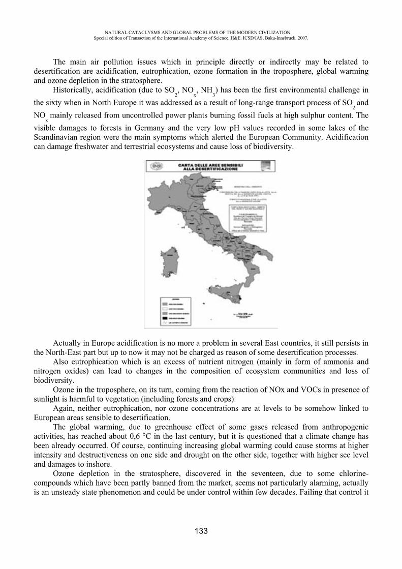
NATURAL CATACLYSMS AND GLOBAL PROBLEMS OF THE MODERN CIVILIZATION. Special edition of Transaction of the International Academy of Science. H&E. ICSD/IAS, Baku-Innsbruck, 2007.
133
The main air pollution issues which in principle directly or indirectly may be related to desertification are acidification, eutrophication, ozone formation in the troposphere, global warming and ozone depletion in the stratosphere.
Historically, acidification (due to SO2, NO
x, NH
3) has been the first environmental challenge in
the sixty when in North Europe it was addressed as a result of long-range transport process of SO2
andNO
xmainly released from uncontrolled power plants burning fossil fuels at high sulphur content. The
visible damages to forests in Germany and the very low pH values recorded in some lakes of the Scandinavian region were the main symptoms which alerted the European Community. Acidification can damage freshwater and terrestrial ecosystems and cause loss of biodiversity.
Actually in Europe acidification is no more a problem in several East countries, it still persists in the North-East part but up to now it may not be charged as reason of some desertification processes.
Also eutrophication which is an excess of nutrient nitrogen (mainly in form of ammonia and nitrogen oxides) can lead to changes in the composition of ecosystem communities and loss of biodiversity.
Ozone in the troposphere, on its turn, coming from the reaction of NOx and VOCs in presence of sunlight is harmful to vegetation (including forests and crops).
Again, neither eutrophication, nor ozone concentrations are at levels to be somehow linked to European areas sensible to desertification.
The global warming, due to greenhouse effect of some gases released from anthropogenic activities, has reached about 0,6 °C in the last century, but it is questioned that a climate change has been already occurred. Of course, continuing increasing global warming could cause storms at higher intensity and destructiveness on one side and drought on the other side, together with higher see level and damages to inshore.
Ozone depletion in the stratosphere, discovered in the seventeen, due to some chlorine-compounds which have been partly banned from the market, seems not particularly alarming, actually is an unsteady state phenomenon and could be under control within few decades. Failing that control it
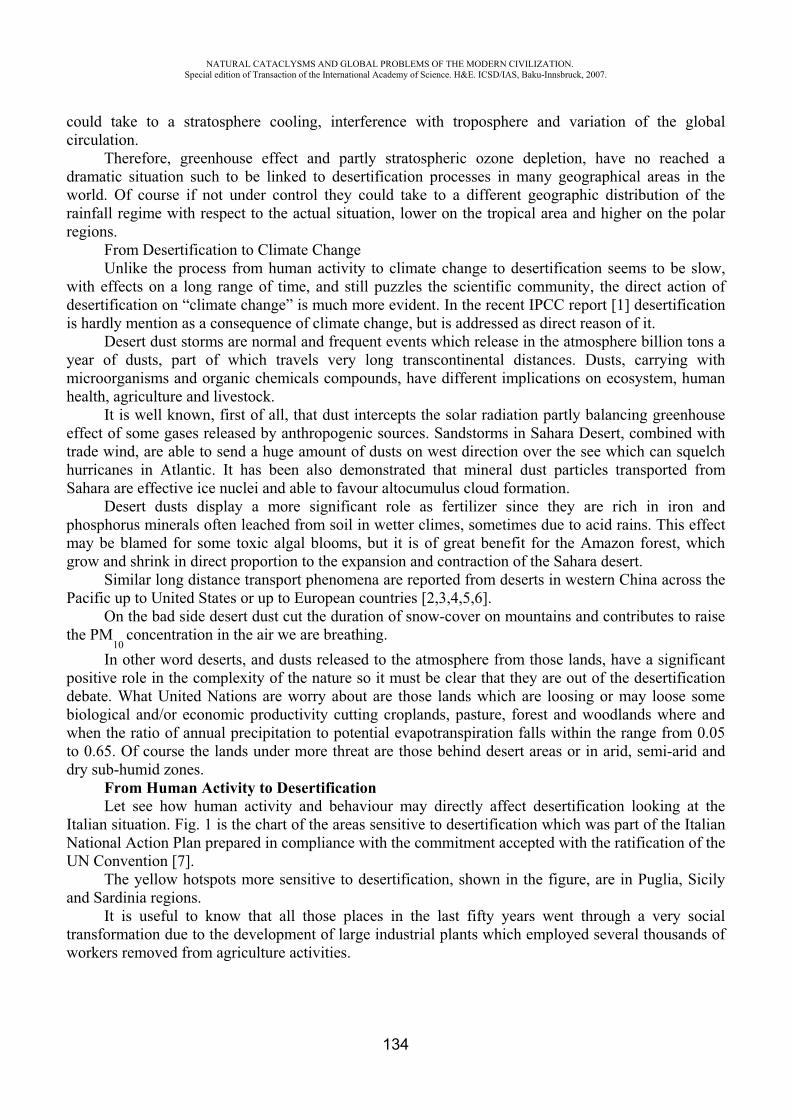
NATURAL CATACLYSMS AND GLOBAL PROBLEMS OF THE MODERN CIVILIZATION. Special edition of Transaction of the International Academy of Science. H&E. ICSD/IAS, Baku-Innsbruck, 2007.
134
could take to a stratosphere cooling, interference with troposphere and variation of the global circulation.
Therefore, greenhouse effect and partly stratospheric ozone depletion, have no reached a dramatic situation such to be linked to desertification processes in many geographical areas in the world. Of course if not under control they could take to a different geographic distribution of the rainfall regime with respect to the actual situation, lower on the tropical area and higher on the polar regions.
From Desertification to Climate Change Unlike the process from human activity to climate change to desertification seems to be slow,
with effects on a long range of time, and still puzzles the scientific community, the direct action of desertification on “climate change” is much more evident. In the recent IPCC report [1] desertification is hardly mention as a consequence of climate change, but is addressed as direct reason of it.
Desert dust storms are normal and frequent events which release in the atmosphere billion tons a year of dusts, part of which travels very long transcontinental distances. Dusts, carrying with microorganisms and organic chemicals compounds, have different implications on ecosystem, human health, agriculture and livestock.
It is well known, first of all, that dust intercepts the solar radiation partly balancing greenhouse effect of some gases released by anthropogenic sources. Sandstorms in Sahara Desert, combined with trade wind, are able to send a huge amount of dusts on west direction over the see which can squelch hurricanes in Atlantic. It has been also demonstrated that mineral dust particles transported from Sahara are effective ice nuclei and able to favour altocumulus cloud formation.
Desert dusts display a more significant role as fertilizer since they are rich in iron and phosphorus minerals often leached from soil in wetter climes, sometimes due to acid rains. This effect may be blamed for some toxic algal blooms, but it is of great benefit for the Amazon forest, which grow and shrink in direct proportion to the expansion and contraction of the Sahara desert.
Similar long distance transport phenomena are reported from deserts in western China across the Pacific up to United States or up to European countries [2,3,4,5,6].
On the bad side desert dust cut the duration of snow-cover on mountains and contributes to raise the PM
10concentration in the air we are breathing.
In other word deserts, and dusts released to the atmosphere from those lands, have a significant positive role in the complexity of the nature so it must be clear that they are out of the desertification debate. What United Nations are worry about are those lands which are loosing or may loose some biological and/or economic productivity cutting croplands, pasture, forest and woodlands where and when the ratio of annual precipitation to potential evapotranspiration falls within the range from 0.05 to 0.65. Of course the lands under more threat are those behind desert areas or in arid, semi-arid and dry sub-humid zones.
From Human Activity to DesertificationLet see how human activity and behaviour may directly affect desertification looking at the
Italian situation. Fig. 1 is the chart of the areas sensitive to desertification which was part of the Italian National Action Plan prepared in compliance with the commitment accepted with the ratification of the UN Convention [7].
The yellow hotspots more sensitive to desertification, shown in the figure, are in Puglia, Sicily and Sardinia regions.
It is useful to know that all those places in the last fifty years went through a very social transformation due to the development of large industrial plants which employed several thousands of workers removed from agriculture activities.
NATURAL CATACLYSMS AND GLOBAL PROBLEMS OF THE MODERN CIVILIZATION. Special edition of Transaction of the International Academy of Science. H&E. ICSD/IAS, Baku-Innsbruck, 2007.
135
An expectable more stable and economically more favourable job in industry than in agriculturepersuaded many farmers to abandon low fertile soils together with livestock which growing in the coppice wild forest helped to keep clean the underwood end prevent bushfire.
Those places, historically have been suffering for centuries low rainfall, like in several other Southern parts of Europe overlooking the Mediterranean See, but in the past they were still organized to exploit the even poor natural resources and the even scarce rainfall.
In some of those places covered by clayey ground (red clay) in the past was diffused the formation of temporary stagnations, protected by shade provided by tall tree all around. Rain water even scarce was commonly preserved in dolines and wells, and was sufficient to supply the agriculture practices requirements [8]. The mentioned migration phenomenon towards industrialised and urbanised areas and the abandonment of agricultural activities vanished those natural resources and caused degradation of the lands favouring soil erosion and modification of the water cycle.
On more fertile soils, mostly along the see coast, an industrialised agriculture and farming had been developing, which needed higher amounts of water. Than groundwater has been used for decades so that now it is everywhere contaminated by salt due to the seawater intrusion and the soil has an high salt degree which is one more sign driving to desertification.
Looking at the preparation studies within the CAFÉ (Clean Air for Europe) process one may note that the Italian areas threatened by desertification shown in the map do not correspond to areas which receive acid or nitrogen deposition above the critical loads or are exposed to particular high levels of tropospheric ozone [9].
In other words for the Italian areas which are recognised to be sensitive to desertification there is no evidence of any reason which may link them to climate change, while there are several of social type which characterized the industrial development in the last fifty years.
The migration phenomenon is not much different in North Africa where in the last few decades a massive mobility towards the Mediterranean coast has been recorded and attempts to cross the see to reach European countries are always on the agenda.
This happens not only in the North Africa countries such as Morocco, Algeria and Tunisia, but also in sub-Saharan countries contributing to increasing trans-Saharan migration which started in the mid-1990s.
The trend of abandonment of agricultural zones is particularly worrying for the whole Mediterranean basin not only and not mainly for desertification processes [10].
In Africa and in many other geographical areas in the world (central America, Asia) socio-economic reasons which play a role for forced or voluntary migration may be different from place to place as lack of opportunities, persecution, violence, civil wars, country’s instability, economic ecline, etc.d
ConclusionsDesertification has been worrying United Nations since the beginning of the ninety so that in
1994 a Convention has been adopted. In the last decade many projects have been financed to combat desertification, regarding sustainable land use management, sustainable agricultural and ranching production systems, reforestation/afforestation programmes, drought forecasting, desertification monitoring and assessment. However, desertification seems faced mainly as an environmental problem threat rather than as a social issue. In any case it is misunderstood by the public opinion which is leaded to believe that desertification is strictly related to climate change and not to human behaviour.
Actually, migration toward urbanised and industrialised areas is the main driver of the abandonment of agriculture area, which cause desertification and biodiversity loss. Furthermore migration seems to occur preferably at the boundaries of unstable natural environments: humid and dry lands, flat to sloping lands, close to forest zones, etc.
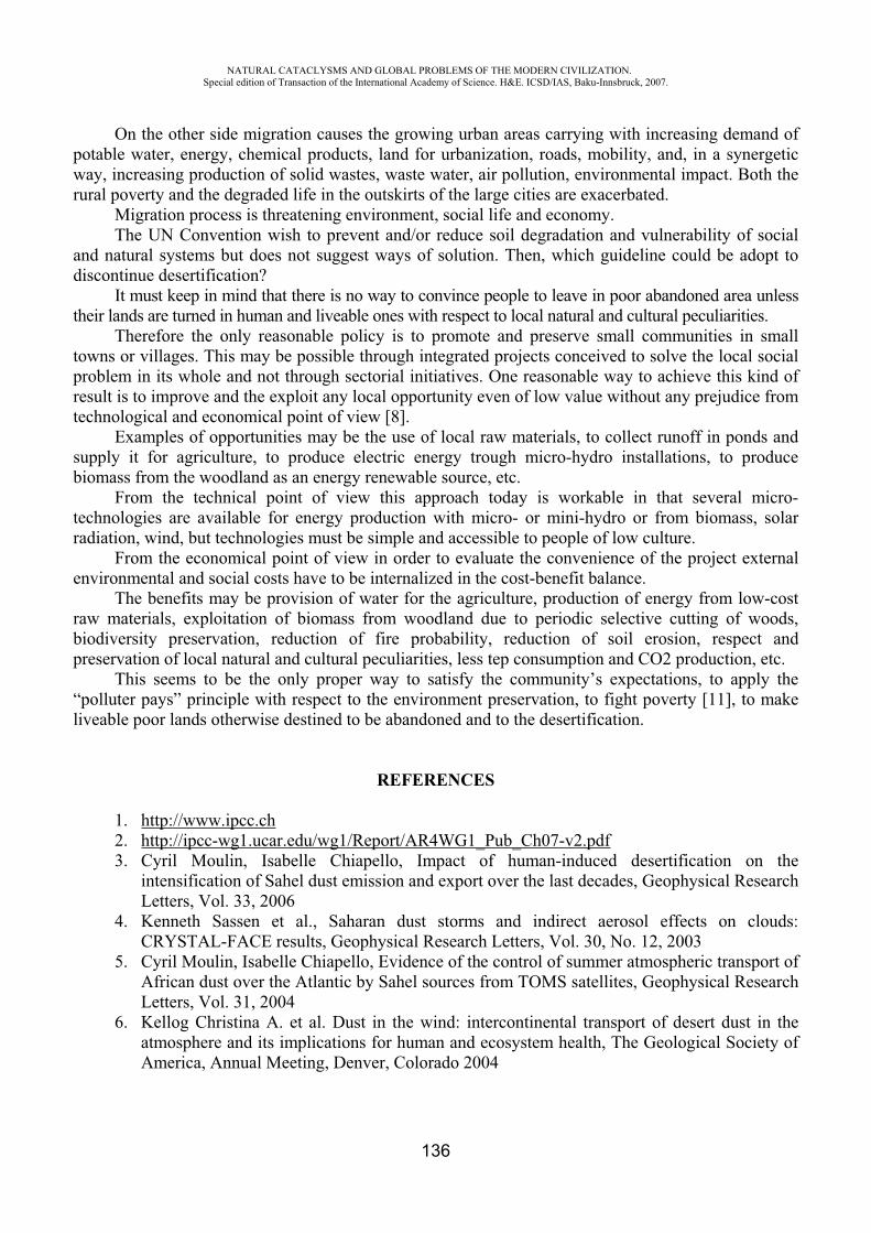
NATURAL CATACLYSMS AND GLOBAL PROBLEMS OF THE MODERN CIVILIZATION. Special edition of Transaction of the International Academy of Science. H&E. ICSD/IAS, Baku-Innsbruck, 2007.
136
On the other side migration causes the growing urban areas carrying with increasing demand of potable water, energy, chemical products, land for urbanization, roads, mobility, and, in a synergetic way, increasing production of solid wastes, waste water, air pollution, environmental impact. Both the rural poverty and the degraded life in the outskirts of the large cities are exacerbated.
Migration process is threatening environment, social life and economy. The UN Convention wish to prevent and/or reduce soil degradation and vulnerability of social
and natural systems but does not suggest ways of solution. Then, which guideline could be adopt to discontinue desertification?
It must keep in mind that there is no way to convince people to leave in poor abandoned area unless their lands are turned in human and liveable ones with respect to local natural and cultural peculiarities.
Therefore the only reasonable policy is to promote and preserve small communities in small towns or villages. This may be possible through integrated projects conceived to solve the local social problem in its whole and not through sectorial initiatives. One reasonable way to achieve this kind of result is to improve and the exploit any local opportunity even of low value without any prejudice from technological and economical point of view [8].
Examples of opportunities may be the use of local raw materials, to collect runoff in ponds and supply it for agriculture, to produce electric energy trough micro-hydro installations, to produce biomass from the woodland as an energy renewable source, etc.
From the technical point of view this approach today is workable in that several micro-technologies are available for energy production with micro- or mini-hydro or from biomass, solar radiation, wind, but technologies must be simple and accessible to people of low culture.
From the economical point of view in order to evaluate the convenience of the project external environmental and social costs have to be internalized in the cost-benefit balance.
The benefits may be provision of water for the agriculture, production of energy from low-cost raw materials, exploitation of biomass from woodland due to periodic selective cutting of woods, biodiversity preservation, reduction of fire probability, reduction of soil erosion, respect and preservation of local natural and cultural peculiarities, less tep consumption and CO2 production, etc.
This seems to be the only proper way to satisfy the community’s expectations, to apply the “polluter pays” principle with respect to the environment preservation, to fight poverty [11], to make liveable poor lands otherwise destined to be abandoned and to the desertification.
REFERENCES
1. http://www.ipcc.ch2. http://ipcc-wg1.ucar.edu/wg1/Report/AR4WG1_Pub_Ch07-v2.pdf 3. Cyril Moulin, Isabelle Chiapello, Impact of human-induced desertification on the
intensification of Sahel dust emission and export over the last decades, Geophysical Research Letters, Vol. 33, 2006
4. Kenneth Sassen et al., Saharan dust storms and indirect aerosol effects on clouds: CRYSTAL-FACE results, Geophysical Research Letters, Vol. 30, No. 12, 2003
5. Cyril Moulin, Isabelle Chiapello, Evidence of the control of summer atmospheric transport of African dust over the Atlantic by Sahel sources from TOMS satellites, Geophysical Research Letters, Vol. 31, 2004
6. Kellog Christina A. et al. Dust in the wind: intercontinental transport of desert dust in the atmosphere and its implications for human and ecosystem health, The Geological Society of America, Annual Meeting, Denver, Colorado 2004
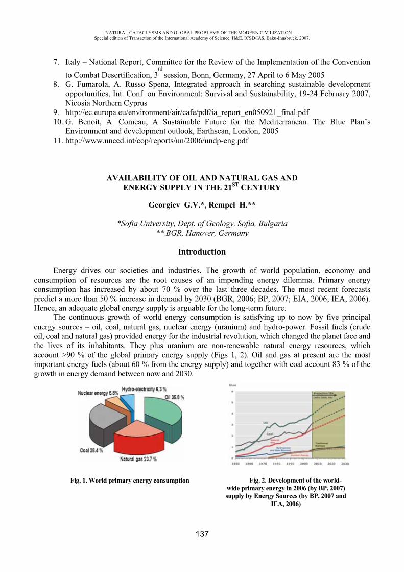
NATURAL CATACLYSMS AND GLOBAL PROBLEMS OF THE MODERN CIVILIZATION. Special edition of Transaction of the International Academy of Science. H&E. ICSD/IAS, Baku-Innsbruck, 2007.
137
7. Italy – National Report, Committee for the Review of the Implementation of the Convention to Combat Desertification, 3
rd session, Bonn, Germany, 27 April to 6 May 2005
8. G. Fumarola, A. Russo Spena, Integrated approach in searching sustainable development opportunities, Int. Conf. on Environment: Survival and Sustainability, 19-24 February 2007, Nicosia Northern Cyprus
9. http://ec.europa.eu/environment/air/cafe/pdf/ia_report_en050921_final.pdf10. G. Benoit, A. Comeau, A Sustainable Future for the Mediterranean. The Blue Plan’s
Environment and development outlook, Earthscan, London, 200511. http://www.unccd.int/cop/reports/un/2006/undp-eng.pdf
AVAILABILITY OF OIL AND NATURAL GAS AND ENERGY SUPPLY IN THE 21ST CENTURY
Georgiev G.V.*, Rempel H.**
*Sofia University, Dept. of Geology, Sofia, Bulgaria ** BGR, Hanover, Germany
Introduction
Energy drives our societies and industries. The growth of world population, economy and consumption of resources are the root causes of an impending energy dilemma. Primary energy consumption has increased by about 70 % over the last three decades. The most recent forecasts predict a more than 50 % increase in demand by 2030 (BGR, 2006; BP, 2007; EIA, 2006; IEA, 2006). Hence, an adequate global energy supply is arguable for the long-term future.
The continuous growth of world energy consumption is satisfying up to now by five principal energy sources – oil, coal, natural gas, nuclear energy (uranium) and hydro-power. Fossil fuels (crude oil, coal and natural gas) provided energy for the industrial revolution, which changed the planet face and the lives of its inhabitants. They plus uranium are non-renewable natural energy resources, which account >90 % of the global primary energy supply (Figs 1, 2). Oil and gas at present are the most important energy fuels (about 60 % from the energy supply) and together with coal account 83 % of the growth in energy demand between now and 2030.
Fig. 1. World primary energy consumption Fig. 2. Development of the world-wide primary energy in 2006 (by BP, 2007) supply by Energy Sources (by BP, 2007 and
IEA, 2006)
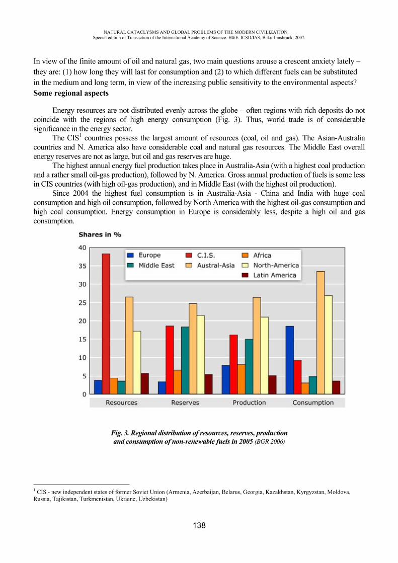
NATURAL CATACLYSMS AND GLOBAL PROBLEMS OF THE MODERN CIVILIZATION. Special edition of Transaction of the International Academy of Science. H&E. ICSD/IAS, Baku-Innsbruck, 2007.
138
In view of the finite amount of oil and natural gas, two main questions arouse a crescent anxiety lately – they are: (1) how long they will last for consumption and (2) to which different fuels can be substituted in the medium and long term, in view of the increasing public sensitivity to the environmental aspects? Some regional aspects
Energy resources are not distributed evenly across the globe – often regions with rich deposits do not coincide with the regions of high energy consumption (Fig. 3). Thus, world trade is of considerable significance in the energy sector.
The CIS1 countries possess the largest amount of resources (coal, oil and gas). The Asian-Australia countries and N. America also have considerable coal and natural gas resources. The Middle East overall energy reserves are not as large, but oil and gas reserves are huge.
The highest annual energy fuel production takes place in Australia-Asia (with a highest coal production and a rather small oil-gas production), followed by N. America. Gross annual production of fuels is some less in CIS countries (with high oil-gas production), and in Middle East (with the highest oil production).
Since 2004 the highest fuel consumption is in Australia-Asia - China and India with huge coal consumption and high oil consumption, followed by North America with the highest oil-gas consumption and high coal consumption. Energy consumption in Europe is considerably less, despite a high oil and gas consumption.
Fig. 3. Regional distribution of resources, reserves, productionand consumption of non-renewable fuels in 2005 (BGR 2006)
1 CIS - new independent states of former Soviet Union (Armenia, Azerbaijan, Belarus, Georgia, Kazakhstan, Kyrgyzstan, Moldova, Russia, Tajikistan, Turkmenistan, Ukraine, Uzbekistan)
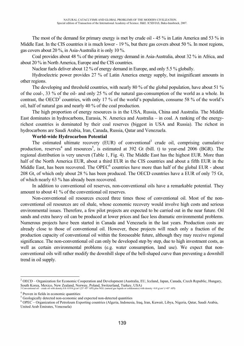
NATURAL CATACLYSMS AND GLOBAL PROBLEMS OF THE MODERN CIVILIZATION. Special edition of Transaction of the International Academy of Science. H&E. ICSD/IAS, Baku-Innsbruck, 2007.
139
The most of the demand for primary energy is met by crude oil - 45 % in Latin America and 53 % in Middle East. In the CIS countries it is much lower - 19 %, but there gas covers about 50 %. In most regions, gas covers about 20 %, in Asia-Australia it is only 10 %.
Coal provides about 48 % of the primary energy demand in Asia-Australia, about 32 % in Africa, and about 20 % in North America, Europe and the CIS countries.
Nuclear fuels deliver about 12 % of energy demand in Europe, and only 5.5 % globally.Hydroelectric power provides 27 % of Latin America energy supply, but insignificant amounts in
other regions. The developing and threshold countries, with nearly 80 % of the global population, have about 51 %
of the coal-, 33 % of the oil- and only 25 % of the natural gas-consumption of the world as a whole. In contrast, the OECD2 countries, with only 17 % of the world’s population, consume 58 % of the world’s oil, half of natural gas and nearly 40 % of the coal production.
The high proportion of energy resources is in the USA, Russia, China and Australia. The Middle East dominates in hydrocarbons, Eurasia, N. America and Australia – in coal. A ranking of the energy-richest countries is dominated by their coal reserves (biggest in USA and Russia). The richest in hydrocarbons are Saudi Arabia, Iran, Canada, Russia, Qatar and Venezuela.
World-wide Hydrocarbon Potential The estimated ultimate recovery (EUR) of conventional3 crude oil, comprising cumulative
production, reserves4 and resources5, is estimated at 392 Gt (bill. t) to year-end 2006 (BGR). The regional distribution is very uneven (Table 1, Fig. 4). The Middle East has the highest EUR. More than half of the North America EUR, about a third EUR in the CIS countries and about a fifth EUR in the Middle East, has been recovered. The OPEC6 countries have more than half of the global EUR - about 208 Gt, of which only about 28 % has been produced. The OECD countries have a EUR of only 75 Gt, of which nearly 63 % has already been recovered.
In addition to conventional oil reserves, non-conventional oils have a remarkable potential. They amount to about 41 % of the conventional oil reserves.
Non-conventional oil resources exceed three times those of conventional oil. Most of the non-conventional oil resources are oil shale, whose economic recovery would involve high costs and serious environmental issues. Therefore, a few pilot projects are expected to be carried out in the near future. Oil sands and extra heavy oil can be produced at lower prices and face less dramatic environmental problems. Numerous projects have been started in Canada and Venezuela in the last years. Production costs are already close to those of conventional oil. However, these projects will reach only a fraction of the production capacity of conventional oil within the foreseeable future, although they may receive regional significance. The non-conventional oil can only be developed step by step, due to high investment costs, as well as certain environmental problems (e.g. water consumption, land use). We expect that non-conventional oils will rather modify the downhill slope of the bell-shaped curve than preventing a downhill trend in oil supply.
2 OECD – Organization for Economic Cooperation and Development (Australia, EU, Iceland, Japan, Canada, Czech Republic, Hungary, South Korea, Mexico, New Zealand, Norway, Poland, Switzerland, Turkey, USA) 3 Conventional oil – crude oil with density 0.8–0.934 g/cm³ (25°-45° API) plus NGL (natural gas liquids or condensates) with density <0.8 g/cm³ (>45° API)
4 Proven in fields in economic quantities 5 Geologically detected non-economic and expected non-detected quantities 6 OPEC – Organization of Petroleum Exporting countries (Algeria, Indonesia, Iraq, Iran, Kuwait, Libya, Nigeria, Qatar, Saudi Arabia,United Arab Emirates, Venezuela)

NATURAL CATACLYSMS AND GLOBAL PROBLEMS OF THE MODERN CIVILIZATION. Special edition of Transaction of the International Academy of Science. H&E. ICSD/IAS, Baku-Innsbruck, 2007.
140
Table 1 World-wide production, reserves, resources and consumption of conventional
oil (Mt) in 2006
Region/Group
Cumulative production
Production in 2006 Reserves Resources EUR Consumption
in 2006 Europe 8,290.9 242.8 2,423 3,625 14,339 765.1 CIS 22,389.6 597.5 16,802 21,080 60,271 187.5 Africa 12,853.9 476.1 16,001 9,878 38,733 130.5 Middle East 40,014.1 1,227.9 100,399 20,510 160,923 283.9
Austral-Asia 11,464.0 382.5 6,225 6,395 24,084 1,147.5
NorthAmerica 38,400.9 646.2 6,618 13,400 58,419 1,146.2
LatinAmerica 13,563.8 345.2 14,102 7,168 34,834 236.5
WORLD 146,977.1 3,918.1 162,571 82,056 391,604 3,897.1
OPEC 58,588.3 1,632.6 112,600 27,300 208,488 346.4 OPEC-Gulf 37,776.4 1,144.6 98,885 18,800 155,462 235.8
OECD 46,718.3 910.0 9,976 17,835 74,529 2,258.5 EU-25 4,422.4 104.2 1,145 1,460 7,027 686.5 Others 41,670.6 1,375.5 29,995 36,921 108,587 1,292.7
Fig. 4. Global distribution of the conventional crude oil EUR (392 Gt) in 2006
The global EUR for conventional natural gas7 is about 472 T.m³ (trill. m³). The regional EUR distribution is very uneven, like for the crude oil (Table 2, Fig. 5). The CIS countries, particularly Russia, have the largest EUR. The Middle East value is also considerable. Although North America has a substantial EUR, the remaining potential is less significant, since nearly half has already been produced (particularly in USA). The Europe EUR (not including the CIS countries) of about 5 % is of little importance. However, the European gas market has access to about 45 % of the global natural gas EUR, due to the accessibility to Russian fields. If the Middle East is considered a potential supplier,
7 Conventional natural gas – non-associated gas plus associated gas in oil fields

NATURAL CATACLYSMS AND GLOBAL PROBLEMS OF THE MODERN CIVILIZATION. Special edition of Transaction of the International Academy of Science. H&E. ICSD/IAS, Baku-Innsbruck, 2007.
141
this figure rises to 68 %. Therefore, the European gas market is in a comfortable position compared to other gas markets.
Table 2 World-wide production, reserves, resources and consumption of
natural gas (G.m³) in 2006
Region/Group
Cumulative production
Production in 2006 Reserves Resources EUR Consumpti
on in 2006Europe 10,098.5 309.2 5,946 7,126 23,170 563.8 CIS 23,143.1 839.9 58,204 96,060 177,407 615.8 Africa 2,545.2 179.8 14,108 11,196 27,849 78.0 Middle East 4,347.4 320.6 73,231 32,540 110,119 273.6 Austral-Asia 5,899.3 379.6 14,814 22,690 43,403 433.0
NorthAmerica 35,104.8 754.5 7,975 27,300 70,380 770.4
LatinAmerica 2,620.1 142.6 7,042 9,858 19,520 126.6
WORLD 83,758.4 2,926.2 181,319 206,770 471,848 2,862.8OPEC 8,321.0 506.5 89,689 42,600 140,610 349.2 OECD 44,833.9 1,102.0 15,898 35,986 96,768 1,446.7 EU-25 9,886.0 201.6 2,916 3.361 16.163 500.3 Others 30,603.0 1,317.7 75,732 128,184 234,469 1,067.0
Fig. 5. Global distribution of the conventional natural gas EUR (472 Tm³) in 2006
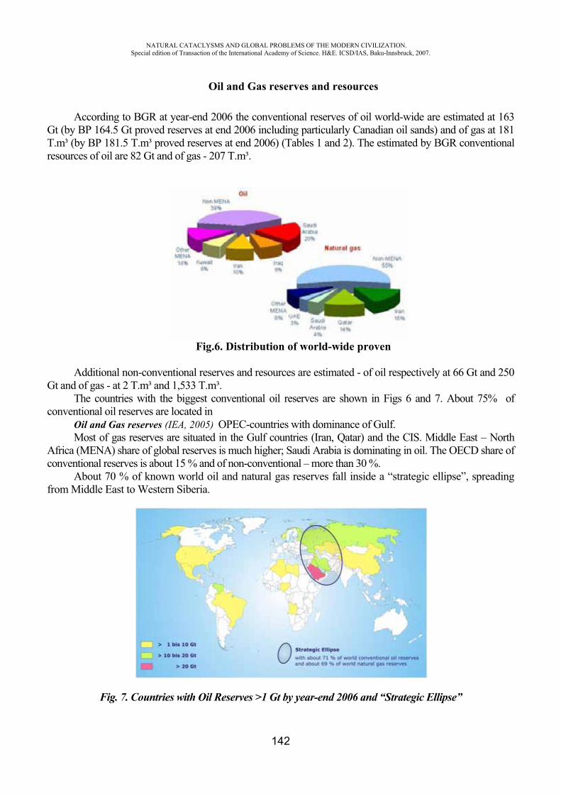
NATURAL CATACLYSMS AND GLOBAL PROBLEMS OF THE MODERN CIVILIZATION. Special edition of Transaction of the International Academy of Science. H&E. ICSD/IAS, Baku-Innsbruck, 2007.
142
Oil and Gas reserves and resources
According to BGR at year-end 2006 the conventional reserves of oil world-wide are estimated at 163 Gt (by BP 164.5 Gt proved reserves at end 2006 including particularly Canadian oil sands) and of gas at 181 T.m³ (by BP 181.5 T.m³ proved reserves at end 2006) (Tables 1 and 2). The estimated by BGR conventional resources of oil are 82 Gt and of gas - 207 T.m³.
Fig.6. Distribution of world-wide proven
Additional non-conventional reserves and resources are estimated - of oil respectively at 66 Gt and 250 Gt and of gas - at 2 T.m³ and 1,533 T.m³.
The countries with the biggest conventional oil reserves are shown in Figs 6 and 7. About 75% of conventional oil reserves are located in
Oil and Gas reserves (IEA, 2005) OPEC-countries with dominance of Gulf.Most of gas reserves are situated in the Gulf countries (Iran, Qatar) and the CIS. Middle East – North
Africa (MENA) share of global reserves is much higher; Saudi Arabia is dominating in oil. The OECD share of conventional reserves is about 15 % and of non-conventional – more than 30 %.
About 70 % of known world oil and natural gas reserves fall inside a “strategic ellipse”, spreading from Middle East to Western Siberia.
Fig. 7. Countries with Oil Reserves >1 Gt by year-end 2006 and “Strategic Ellipse”
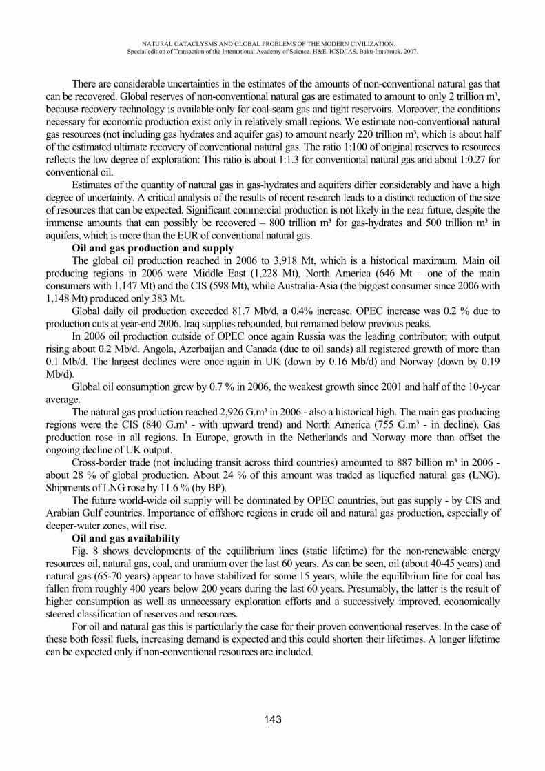
NATURAL CATACLYSMS AND GLOBAL PROBLEMS OF THE MODERN CIVILIZATION. Special edition of Transaction of the International Academy of Science. H&E. ICSD/IAS, Baku-Innsbruck, 2007.
143
There are considerable uncertainties in the estimates of the amounts of non-conventional natural gas that can be recovered. Global reserves of non-conventional natural gas are estimated to amount to only 2 trillion m³, because recovery technology is available only for coal-seam gas and tight reservoirs. Moreover, the conditions necessary for economic production exist only in relatively small regions. We estimate non-conventional natural gas resources (not including gas hydrates and aquifer gas) to amount nearly 220 trillion m³, which is about half of the estimated ultimate recovery of conventional natural gas. The ratio 1:100 of original reserves to resources reflects the low degree of exploration: This ratio is about 1:1.3 for conventional natural gas and about 1:0.27 for conventional oil.
Estimates of the quantity of natural gas in gas-hydrates and aquifers differ considerably and have a high degree of uncertainty. A critical analysis of the results of recent research leads to a distinct reduction of the size of resources that can be expected. Significant commercial production is not likely in the near future, despite the immense amounts that can possibly be recovered – 800 trillion m³ for gas-hydrates and 500 trillion m³ in aquifers, which is more than the EUR of conventional natural gas.
Oil and gas production and supply The global oil production reached in 2006 to 3,918 Mt, which is a historical maximum. Main oil
producing regions in 2006 were Middle East (1,228 Mt), North America (646 Mt – one of the main consumers with 1,147 Mt) and the CIS (598 Mt), while Australia-Asia (the biggest consumer since 2006 with 1,148 Mt) produced only 383 Mt.
Global daily oil production exceeded 81.7 Mb/d, a 0.4% increase. OPEC increase was 0.2 % due to production cuts at year-end 2006. Iraq supplies rebounded, but remained below previous peaks.
In 2006 oil production outside of OPEC once again Russia was the leading contributor; with output rising about 0.2 Mb/d. Angola, Azerbaijan and Canada (due to oil sands) all registered growth of more than 0.1 Mb/d. The largest declines were once again in UK (down by 0.16 Mb/d) and Norway (down by 0.19 Mb/d).
Global oil consumption grew by 0.7 % in 2006, the weakest growth since 2001 and half of the 10-year average.
The natural gas production reached 2,926 G.m³ in 2006 - also a historical high. The main gas producing regions were the CIS (840 G.m³ - with upward trend) and North America (755 G.m³ - in decline). Gas production rose in all regions. In Europe, growth in the Netherlands and Norway more than offset the ongoing decline of UK output.
Cross-border trade (not including transit across third countries) amounted to 887 billion m³ in 2006 - about 28 % of global production. About 24 % of this amount was traded as liquefied natural gas (LNG). Shipments of LNG rose by 11.6 % (by BP).
The future world-wide oil supply will be dominated by OPEC countries, but gas supply - by CIS and Arabian Gulf countries. Importance of offshore regions in crude oil and natural gas production, especially of deeper-water zones, will rise.
Oil and gas availability Fig. 8 shows developments of the equilibrium lines (static lifetime) for the non-renewable energy
resources oil, natural gas, coal, and uranium over the last 60 years. As can be seen, oil (about 40-45 years) and natural gas (65-70 years) appear to have stabilized for some 15 years, while the equilibrium line for coal has fallen from roughly 400 years below 200 years during the last 60 years. Presumably, the latter is the result of higher consumption as well as unnecessary exploration efforts and a successively improved, economically steered classification of reserves and resources.
For oil and natural gas this is particularly the case for their proven conventional reserves. In the case of these both fossil fuels, increasing demand is expected and this could shorten their lifetimes. A longer lifetime can be expected only if non-conventional resources are included.

NATURAL CATACLYSMS AND GLOBAL PROBLEMS OF THE MODERN CIVILIZATION. Special edition of Transaction of the International Academy of Science. H&E. ICSD/IAS, Baku-Innsbruck, 2007.
144
Fig. 9 gives an impression of the availability of crude oil and natural gas considering different growth scenarios. Starting point is the EUR-estimate for conventional oil and gas at year-end 2006. The expected cumulative production until
2030 is shown at different growth rates (from -2 to 3 % per year for oil and from 0 to 6 % per year for gas).
The situation for conventional oil is increasingly critical. The production peak will be reached in the near future with the depletion mid-point in period 2010 to 2020.
Fig.8. Energy resources equilibrium lines from 1945 to 2005 (BGR, 2006)
Fig. 9. World availability of conventional oil and natural gas (BGR, 2006)
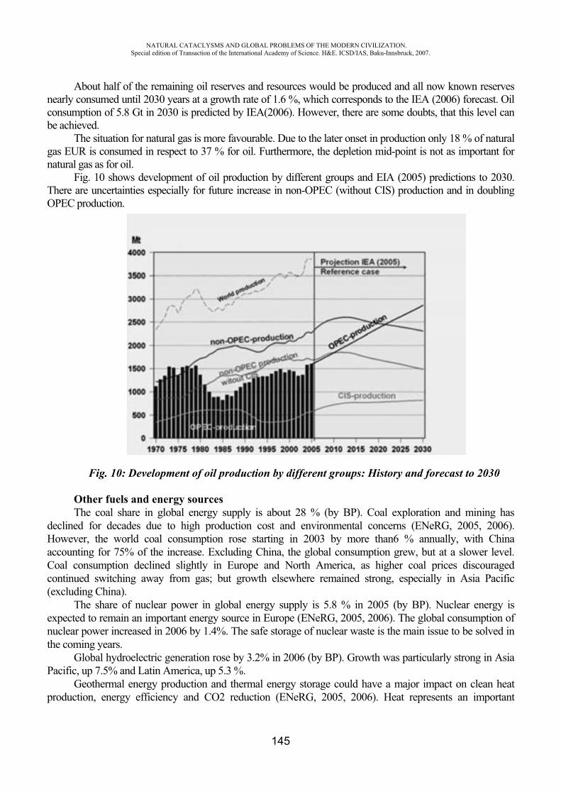
NATURAL CATACLYSMS AND GLOBAL PROBLEMS OF THE MODERN CIVILIZATION. Special edition of Transaction of the International Academy of Science. H&E. ICSD/IAS, Baku-Innsbruck, 2007.
145
About half of the remaining oil reserves and resources would be produced and all now known reserves nearly consumed until 2030 years at a growth rate of 1.6 %, which corresponds to the IEA (2006) forecast. Oil consumption of 5.8 Gt in 2030 is predicted by IEA(2006). However, there are some doubts, that this level can be achieved.
The situation for natural gas is more favourable. Due to the later onset in production only 18 % of natural gas EUR is consumed in respect to 37 % for oil. Furthermore, the depletion mid-point is not as important for natural gas as for oil.
Fig. 10 shows development of oil production by different groups and EIA (2005) predictions to 2030. There are uncertainties especially for future increase in non-OPEC (without CIS) production and in doubling OPEC production.
Fig. 10: Development of oil production by different groups: History and forecast to 2030
Other fuels and energy sources The coal share in global energy supply is about 28 % (by BP). Coal exploration and mining has
declined for decades due to high production cost and environmental concerns (ENeRG, 2005, 2006). However, the world coal consumption rose starting in 2003 by more than6 % annually, with China accounting for 75% of the increase. Excluding China, the global consumption grew, but at a slower level. Coal consumption declined slightly in Europe and North America, as higher coal prices discouraged continued switching away from gas; but growth elsewhere remained strong, especially in Asia Pacific (excluding China).
The share of nuclear power in global energy supply is 5.8 % in 2005 (by BP). Nuclear energy is expected to remain an important energy source in Europe (ENeRG, 2005, 2006). The global consumption of nuclear power increased in 2006 by 1.4%. The safe storage of nuclear waste is the main issue to be solved in the coming years.
Global hydroelectric generation rose by 3.2% in 2006 (by BP). Growth was particularly strong in Asia Pacific, up 7.5% and Latin America, up 5.3 %.
Geothermal energy production and thermal energy storage could have a major impact on clean heat production, energy efficiency and CO2 reduction (ENeRG, 2005, 2006). Heat represents an important
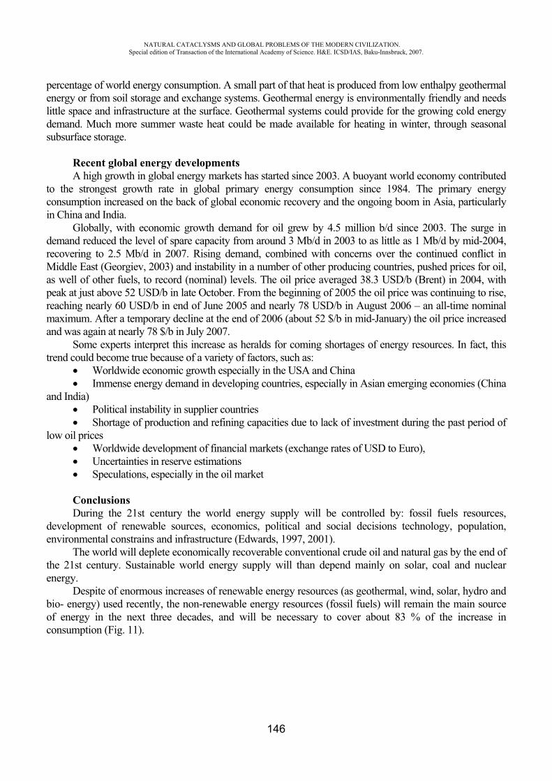
NATURAL CATACLYSMS AND GLOBAL PROBLEMS OF THE MODERN CIVILIZATION. Special edition of Transaction of the International Academy of Science. H&E. ICSD/IAS, Baku-Innsbruck, 2007.
146
percentage of world energy consumption. A small part of that heat is produced from low enthalpy geothermal energy or from soil storage and exchange systems. Geothermal energy is environmentally friendly and needs little space and infrastructure at the surface. Geothermal systems could provide for the growing cold energy demand. Much more summer waste heat could be made available for heating in winter, through seasonal subsurface storage.
Recent global energy developments A high growth in global energy markets has started since 2003. A buoyant world economy contributed
to the strongest growth rate in global primary energy consumption since 1984. The primary energy consumption increased on the back of global economic recovery and the ongoing boom in Asia, particularly in China and India.
Globally, with economic growth demand for oil grew by 4.5 million b/d since 2003. The surge in demand reduced the level of spare capacity from around 3 Mb/d in 2003 to as little as 1 Mb/d by mid-2004, recovering to 2.5 Mb/d in 2007. Rising demand, combined with concerns over the continued conflict in Middle East (Georgiev, 2003) and instability in a number of other producing countries, pushed prices for oil, as well of other fuels, to record (nominal) levels. The oil price averaged 38.3 USD/b (Brent) in 2004, with peak at just above 52 USD/b in late October. From the beginning of 2005 the oil price was continuing to rise, reaching nearly 60 USD/b in end of June 2005 and nearly 78 USD/b in August 2006 – an all-time nominal maximum. After a temporary decline at the end of 2006 (about 52 $/b in mid-January) the oil price increased and was again at nearly 78 $/b in July 2007.
Some experts interpret this increase as heralds for coming shortages of energy resources. In fact, this trend could become true because of a variety of factors, such as:
Worldwide economic growth especially in the USA and China Immense energy demand in developing countries, especially in Asian emerging economies (China
and India) Political instability in supplier countries Shortage of production and refining capacities due to lack of investment during the past period of
low oil prices Worldwide development of financial markets (exchange rates of USD to Euro), Uncertainties in reserve estimations Speculations, especially in the oil market
ConclusionsDuring the 21st century the world energy supply will be controlled by: fossil fuels resources,
development of renewable sources, economics, political and social decisions technology, population,environmental constrains and infrastructure (Edwards, 1997, 2001).
The world will deplete economically recoverable conventional crude oil and natural gas by the end of the 21st century. Sustainable world energy supply will than depend mainly on solar, coal and nuclear energy.
Despite of enormous increases of renewable energy resources (as geothermal, wind, solar, hydro and bio- energy) used recently, the non-renewable energy resources (fossil fuels) will remain the main source of energy in the next three decades, and will be necessary to cover about 83 % of the increase in consumption (Fig. 11).
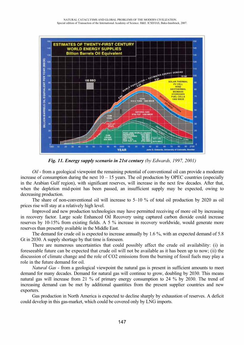
NATURAL CATACLYSMS AND GLOBAL PROBLEMS OF THE MODERN CIVILIZATION. Special edition of Transaction of the International Academy of Science. H&E. ICSD/IAS, Baku-Innsbruck, 2007.
147
Fig. 11. Energy supply scenario in 21st century (by Edwards, 1997, 2001)
Oil - from a geological viewpoint the remaining potential of conventional oil can provide a moderate increase of consumption during the next 10 – 15 years. The oil production by OPEC countries (especially in the Arabian Gulf region), with significant reserves, will increase in the next few decades. After that, when the depletion mid-point has been passed, an insufficient supply may be expected, owing to decreasing production.
The share of non-conventional oil will increase to 5–10 % of total oil production by 2020 as oil prices rise will stay at a relatively high level.
Improved and new production technologies may have permitted receiving of more oil by increasing in recovery factor. Large scale Enhanced Oil Recovery using captured carbon dioxide could increase reserves by 10-15% from existing fields. A 5 % increase in recovery worldwide, would generate more reserves than presently available in the Middle East.
The demand for crude oil is expected to increase annually by 1.6 %, with an expected demand of 5.8 Gt in 2030. A supply shortage by that time is foreseen.
There are numerous uncertainties that could possibly affect the crude oil availability: (i) in foreseeable future can be expected that crude oil will not be available as it has been up to now; (ii) the discussion of climate change and the role of CO2 emissions from the burning of fossil fuels may play a role in the future demand for oil.
Natural Gas - from a geological viewpoint the natural gas is present in sufficient amounts to meet demand for many decades. Demand for natural gas will continue to grow, doubling by 2030. This means natural gas will increase from 21 % of primary energy consumption to 24 % by 2030. The trend of increasing demand can be met by additional quantities from the present supplier countries and new exporters.
Gas production in North America is expected to decline sharply by exhaustion of reserves. A deficit could develop in this gas-market, which could be covered only by LNG imports.
NATURAL CATACLYSMS AND GLOBAL PROBLEMS OF THE MODERN CIVILIZATION. Special edition of Transaction of the International Academy of Science. H&E. ICSD/IAS, Baku-Innsbruck, 2007.
148
Estimates of the quantity of natural gas in gas-hydrates and aquifers (totally about 220 T.m³) differ considerably and have a high degree of uncertainty. Significant commercial production is not probable in foreseeable future – if at all.
Prices for natural gas are influenced by transport costs that are significantly higher than for crude oil and coal. Transport of natural gas will continue to be mainly by pipelines, but the portion of LNG will increase and a spot market may be expected to develop.
Coal - growth in demand for coal is expected to be less. Easily accessible coal resources have largely been mined out in Europe. Deeply buried coal resources remain to be developed using surface drilling techniques – in-situ gasification and coal bed methane. If climate relevant disadvantage of coal cam be removed in the next one to two decades, it is foreseeable that coal in middle to long term will be in the spotlight of the traditional energy resources, because:
Existing reserves obtain more than 140 annual productions, The resource to reserve ration of more than 5.1 to 1 is much higher than respectively ratios of
conventional oil (0.5 to 1) and natural gas (1.2 to 1), Through conversion of resources to reserves can be realized a considerable additional potential.
So, future energy supply can be realized in significant amounts by hard coal. In addition hard coal can be used in a certain amount for substitution of other fossil energy resources.
A renewed growth of coal usage can be expected to balance possible shortage in oil and gas. In-situ gasification, coal bed methane and CO2-enhanced coal bed methane benefit from synergies between traditional coal and innovative hydrocarbon industries.
A rapid increase in the volume traded on the energy market, particularly for crude oil and natural gas, which will more than double, and an increasing dependence of the OECD countries on energy imports, is expected (IEA 2005). Thus, security of supply becomes a main aspect of consideration for future supplies.
The transportation sector will show the most growth of all end-use sectors, with annual increases of 2.1 %.
More than 20 % of the world’s population has no access to electricity and traditional biomass fuels provide the energy needs of 40 % of humanity. Thus, provision of a sufficient, affordable supply of energy that is also environmentally compatible will be important for future energy policy.
In the second half of the 21st century the quick enlarge of energy demand gap, caused by the decline of oil and gas production (Fig. 11), can be fill by: solar thermal electric, photo-electric cells, wind, geo-thermal, hydroelectric, nuclear and hydrogen power. Nuclear power could become a major source of electricity, however, high plant construction costs, reactor safety, waste disposal, decommissioning costs, proliferation for military use and lack of public acceptance must all be overcome. If nuclear power is unable to expand, solar and coal are the most likely fuels to fill the energy gap.
REFERENCES
1. BGR (2006): Reserves, Resources and Availability of Energy Resources 2005 (http://www.bgr.bund.de/cln_006/nn_335074/EN/Themen/Energie/energie__node__en.html?__nnn=true)
2. BP (2007): BP Statistical Review of World Energy –2007 in review. (http://www.bp.com/productlanding.do?categoryId=6848&contentId=7033471)
3. Edwards J.D. (1997): Grude oil and alternate energy production forecasts for the twenty-first century: the end of the Hydrocarbon era. AAPG Bulletin, 81/8, 1292-1305.
4. Edwards J.D. (2001): Twenty-first-century Energy: decline of Fossil Fuel, Increase of Renewable Nonpolluting Energy Sources. In: Downey, M.W., Threet, J.C., Morgan, W.A. (Eds.): Petroleum Provinces of the Twenty-first Century. - AAPG Memoir 74: p. 21-34.
NATURAL CATACLYSMS AND GLOBAL PROBLEMS OF THE MODERN CIVILIZATION. Special edition of Transaction of the International Academy of Science. H&E. ICSD/IAS, Baku-Innsbruck, 2007.
149
5. EIA (2006): International Energy Outlook 2006. (http://www.eia.doe.gov/oiaf/ieo/index.html)
6. ENeRG (2005): position paper: Energy is not for free. In: Geo ENeRGY - newsletter of the ENeRG network, issue 11, April 2005.
7. ENeRG (2006): position paper: Energy from the Earth (new research opportunities for Europe) and Is there a shortage of oil and gas? – the story of peak-oil. In: Geo ENeRGY - newsletter of the ENeRG network, issue 13, June 2006.
8. Georgiev G. (2003): World Energy problem and the war in Iraq. In: Kapital newspaper, 15, year XI, p. 6 –Analyses (in Bulgarian).
9. Georgiev G., Rempel H.(2005): The world energy problem. In: Proceedings of Second International Conference. “Global Changes and New Challenges of 21st century”, 22-23 April 2005, Sofia University “St. Kl. Ohridski”, Faculty of Geology and Geography, 25-31.
10. IEA (2005): World Energy Outlook 2005: Middle East and North Africa Insights. 629 p. International Energy Agency, Paris.
11. IEA (2006): World Energy Outlook 2006. 596 p. – International Energy Agency, Paris.12. Rempel H. (2004): Future supply of oil and natural gas – will be a shortage in the next
time. In: Proceedings of International Conference “Oil and Gas problems”, 6-8 September 2004, Varna 347-352.
NON-WASTE CIVILIZATION: Utopia or Reality?
O. Figovsky*, Yu. Magarshak**
*International Nanotechnology Research Center “Polymate”,Migdal Ha’Emek, Israel
**MathTech, Inc., NewYork, USA
Mankind is disposing to environment 2000 more biological wastes that the rest of biosphere. 10 billion tons of natural raw materials are excavated annually from our planet entrails.Geomechanical resistance limit has been already achieved in some regions due to Earth exposure to resource consumption. Currently one biological species is put to extinction every two hours.
UNO data
Be fruitful, and multiply, and replenish the earth, and subdue it: and have dominion over the fish of the sea, and over the fowl of the air, and over every living thing that move upon the earth.
Gen. 1:28
NATURAL CATACLYSMS AND GLOBAL PROBLEMS OF THE MODERN CIVILIZATION. Special edition of Transaction of the International Academy of Science. H&E. ICSD/IAS, Baku-Innsbruck, 2007.
150
INTRODUCTION
One may think that human civilization went astray after the First World War. In 19th century everybody believed that the technology progress ought to serve general weal. Regretfully, the situation has changed significantly over the last 90 years. The feeling is spreading that human society is governed not by Homo Sapiens, but by completely different species: Homo agressivus, Homo insanus and Homo chilloutus. Differences not alliances more and more come to foreground. In the context of 20th century devastating wars and 21th century terrorism a statement of growing affect of reason on civilization calls in the best case a skeptical smile. Regretfully there is not much to say on world ethic basis concert; contrariwise, globalization in communication and broader everyday ethnic contacts lead to deeper cleavage of the mankind in religious, cultural and so called patriotic issues.
And it is difficult to name an area where civilization’s bias from its destination is seen to such an extent as in Man’s attitude against his environment, the planet given to Man to subdue and against living nature given to Homo Sapience to have dominion upon. Replenish the Earth can be scarcely interpreted as replenishing it with garbage. However, the mankind is rapidly replenishing the Earth, as well as water and air, just with its activity wastes already threatening the mankind itself with irreversible habitat change. Natural resources are taken our so quickly that some of them will peter out in few dozen years. Thousands of species - species, not individuals - are extinct from Earth every year. Is it having dominion, and is it possible to have dominion upon something, which is no more, is a question of philosophy, but the answer both in economical and social sense is obvious. “Today the phenomenon called “ecology” is comprised by two problems melted together: devastating of Earth and devastating of Human. Modern ecology is neither scholarly subject nor way of thinking; it’s our destiny, the event bringing us to eventlessness”. (F.Girenok). “Mankind has not fulfilled its mission.” (Andrey Bitov). Human civilization took really dangerous route, which is to be dramatically changed, at least for the survival sake of mankind itself. But can it still be done? The question is not “Is it not too late to do it?”; it is a different problem needing comprehensive study; what we ask is “Can it be done even in principle?” Is it possible for a civilization to develop but not generate or almost not generate any waste, keeping its environment untouched or, desirably, optimizing it? Is it possible at least in theory, let it be not today but in fifty, five hundred or five thousand years? And is it possible to our human civilization to switch to stationary non-waste mode before we cross the line of no return? This is an attempt to resolve those problems.
I. CONSTRUCTIVE DESTRUCTION
We traditionally believe that construction is much more important kind of human activity, than destruction. Moreover, destruction is understood as something bad. Such an approach was justified until certain stage of civilization development. All funds and resources are invested to TV set development, but 0.0000% is invested to their recycling. When new generation computer or cellular phone appears, the old ones do not evolve, they are thrown out. Nobody, except for villains, terrorists and janitors, does not specialize in destruction of something constructed or in destruction as such. Plane or car creators are not interested what will be done with outdated products; those are simply thrown on the scrap-heap. However, in our era when product and technology generations come and go so quickly (as generations of living creatures come and go in Nature), it is not simply a short-sighted approach but a deadly menace to human civilization to produce goods just for consumption not giving a second thought to what will become of them upon consumption or what and when has to be destroyed. This was not important yet one hundred years ago. Civilization wastes were so negligible in hundreds or thousands years, that archeologists can hardly find the remnants being at least suitable for any decoding. Similarly, the effect of humans on biogeocenosis was infinitesimal. Even extinction of
NATURAL CATACLYSMS AND GLOBAL PROBLEMS OF THE MODERN CIVILIZATION. Special edition of Transaction of the International Academy of Science. H&E. ICSD/IAS, Baku-Innsbruck, 2007.
151
mammoths and sable-tooth tigers by man is no more than an assumption. Just one century ago the Man was not any threat to his habitat.
The situation has changed dramatically in 20th century. Homobiocenosis and homogeocenosis have started to play tremendous and constantly growing role turning “binary” living-nonliving interaction to “ternary”. The day when garbage weight exceeds the weight matter in Earth crust, which can be eventually turned to human activity products, is closing rapidly, and even now those two weights are comparable. We have to think about what to do when there is no more resources in Earth crust before our civilization goes over the point of no return. Destruction of anything created merits no less attention than creation itself. Destruction technologies have to an integral part of creation process. Destruction has to be included to any product design. Else it will be the end of human civilization. When exactly the end may come? Unfortunately, this is the question of not only scholarly interest; and even the most optimistic forecasts tell us that in current situation there will be none to celebrate the third Millennium when it comes.
But is it possible? Is there any precedent of non-waste civilization? Absolutely. If we apply a little broader definition and number with civilizations all living organisms, including Homo sapiens not as creator or destroyer, but as a living thing whose body makes part of biosphere.
II. CREATION AND DESTRUCTION IN VIVO.
One hardly realizes that all things and whole species living on Earth are non-waste, contrary to human civilization. It is seldom possible to find relics of ancient animals, and finding dinosaur or mammoth bones is an extremely rare case. Living turns to living. Even Man, despite producing garbage so painstakingly, is 99.999% “disposable” as a species in terms of substance comprised in him during his life. Our biological life disposes of wastes only in the form of carbon dioxide we exhale and stuffs we leave in the toilet, both latter being so life-giving, that harder product is used as fertilizer, and more fluent is sought, for instance, by polar dears and licked from upon snow to keep the necessary balance in their organisms. The bones? Unfortunately for Man, but fortunately for biogeocenosis, those return to the world too as chemical elements able to turn into life again. From biogeocenosis point of view, any man and even the whole mankind is almost ideal non-waste system. To our much regret, we cannot apply the above to products made by the Man.
The realm of living things is a perfect example of reversible civilization. It makes much sense to mankind to learn how it is achieved to try to copy this unique biogeocenosis achievement (having come into existence “just” as a result of evolution and selection). The Man is obliged to do his best to create non-waste habitat for his activity, similar to natural habitat comprising himself as a creature of flesh and blood, and also of DNA, proteins, lipids and so on.
III. SOME DESTRUCTION MECHANISMS IN VIVO
It is generally accepted that creation and functioning mechanisms prevail both in living cell and in Metazoa organisms. It could seem so at the first blush. DNA and RNA, biosynthesis mechanisms (ribosomal complex) and action of most enzymes undoubtedly serve creation. Controlling genes in operons and human brain control dynamics of current processes and apparently serve mainly the same constructive goal. True. And destruction mechanisms are apparently of small account. But this opinion on creation dominating destruction is actually false. In vivo those are two sides of one process, as proteins and nucleic acids are able of begetting life together but never separately. It is just natural that at early stage of molecular biology development attention was mostly paid to macromolecule synthesis and cell structure creation in vivo. However, last years show more and more clearly to what an extent the mechanisms controlling destruction of anything created are subtle, sophisticated and filigree-like adjusted.
NATURAL CATACLYSMS AND GLOBAL PROBLEMS OF THE MODERN CIVILIZATION. Special edition of Transaction of the International Academy of Science. H&E. ICSD/IAS, Baku-Innsbruck, 2007.
152
Biogeocenosis level. All living things (except for plants) eat living things. Leaving practically nothing. When they die, they become (almost completely) somebody else’s food. Plants, in their turn, are either eaten, or decompose to components used for creation of next living thing generations. How has it been achieved by the Nature? There was evidently many life arrangement options to choose from, mostly leading to irreversible accumulation of waste. How did evolution select those very molecules and mechanisms that provide for life reversibility in the sense of using of practically everything comprised in living body by other creatures? Was, so to say, the first attempt successful? Was there any struggle between reversible and irreversible forms of life at early stage of this life development? 8 Can any material evidences of such a struggle be found? If DNA and aminoacids was different, could biogeocenosis have been reversible, or the choice made by Nature is unique in this sense as well? These questions are of not only theoretical interest, as human civilization goes farther on its way of endless accumulation of wastes not being processed to new products as the result of organic revolution, i.e. in the direction reverse to that chosen in vivo in evolution process.
Physiological level. Every day millions of cells are synthesized in any animal (including human) organism. It happens on the levels of so-called stem cells, immune system, dermal cells etc. But, the fact that the weight of grown-up individual does not change means that approximately the same number of cells die every day. How is it determined which cells
have to be substituted, and when? The answers are still unknown. But it is clear already that destruction processes have to be controlled very precisely to enable normal organism functioning.
Pre-programmed cell death. About twenty years ago a phenomenon of pre-programmed cell death was discovered. As such, it is of no wonder, as it is necessary to distract exhausted or out-of-control cells to enable tissues functioning. But how this process goes, what is it governed by? The mechanisms controlling cell birth and death in tissues are being aggressively studied. But it can be considered verified fact that both birth and death of cells make part of normal tissue functioning. The same applies to the fact that pre-programmed death (at least at cell level) makes part of normal vital activity of most organisms, which can also be considered certain.
Protein Destruction Control. It was found out several years ago that the cell system for used protein destruction and its renewal is extremely sophisticated. Recently, so-called ubiquitins, the molecules regulating controlled destruction of macromolecules, as well as proteosomes, protein complexes controlling protein degrading, were discovered. On the other hand, the mechanisms exist for “mass destruction” of biomolecule batches. For example, LYSOSOMES, membrane-bound vesicles having mostly spherical form which are sometimes been likened to "The Police Force of the Cell", contain proteolithic enzymes. If their shells are broken (which could be both under control and spontaneous), the cell is quickly destroyed. The mechanisms for vesicle interaction with other organelles, control over substances penetration into vesicles, their topology and geometry transformation are now under comprehensive investigation.
To summarize this exceedingly brief review, we can conclude as follows: 1. Destruction and creation mechanisms make part of the same process in living nature. 2. Destruction control is an integral part of normal functioning of living cells and organisms.
8 This seems to be incomprehensible at all, as complete usage of organisms lost competitive struggle and absence of biogeocenosis activity waste apparently could not grant any evolutionary advantages for quite a long time.
NATURAL CATACLYSMS AND GLOBAL PROBLEMS OF THE MODERN CIVILIZATION. Special edition of Transaction of the International Academy of Science. H&E. ICSD/IAS, Baku-Innsbruck, 2007.
153
3. In vivo study of controlled destruction mechanisms seems to be advisable from the point of view of development of the technologies functioning in a similar way.
4. The question, whether the areas of human activity exist where irreversibility is inadvertent and no destruction can be constructive, is a key issue for civilization future.
IV. PRACTICAL ISSUES OF CIVILIZATION MOVEMENT TO REVERSIBLE TECHNOLOGIES.
Let us consider the possibility of movement to the technologies corresponding to the above principles. First and the simplest is to switch to biodegrading materials. Such polymer materials are already developed but still expensive. Here we can foresee different inventive approaches, e.g. polymer packing materials can be readily replaced by composite materials having paper as the main layer and biodegrading aqueous dispersion polymer as water- and oil-resistant coating. “Long-living” polymer sausage skin is already being replaced by “edible” protein skin. Ecologically unsound technologies should be swapped to alternative technologies as soon as possible and without any hesitation. If we need polyuretanes (porous plastics, coatings etc.) we should replace current technologies based on use of extremely toxic isocyanates (made in their turn with the use of phosgene being a chemical warfare agent) by non-isocyanate processes based on cyclocarbonate oligomers and aliphatic amines that can be obtained by means of efficient and non-waste biosynthesis. It should be remembered here that tiny silkworm obtains silk thread using cybernetical “bioassembly” and spending millions times less energy for thread extrusion that is spent in synthetic fiber (nylon) production.
In the last 100 years the mankind switched to synthetic materials in many areas. However, currently we return to technical use of renewable bioresources (alcohol as fuel in Brazil, plant oil use for lacquers and paints, biosynthesis of water-resistant adhesives from wood-processing wastes etc.). Even a special science called “Green Chemistry” came into being. But those are still single-point breakthroughs. A real progress will be achieved only on global switch to new technologies.
High-temperature technologies using plasma, high-energy lasers, autopropagating high-temperature continuous synthesis are the most promising for inorganic materials. Ecologically more sound physical and biological separation methods should substitute for chemical methods. It will enable processing separately all materials of an annual volume of cars thrown out to numberless throw-heaps while spending energy produced by only one middle-range power station.
It should be noted that biological methods are efficient for inorganic materials as well. For instance, high consumer value of Chinese china is achieved due to nanoparticles of clay raw materials in their turn generated in the soil owing to vital activity of certain species of worms.
Another example: reinforced concrete, the principal construction material in modern world, can be recycled completely: upon fragmentation and separation metal is remelted and silicate component founds various usage, e.g. as chips for road building or even as raw material for stone molding.
Now to organics. Practically every organic material can be processed to gas (biogas) by bacteria or to liquid carbohydrates (like fuel oil) by high temperature (like cracking). It is interesting to remember recent studies showing that in natural conditions crude oil is (or at least may be) generated by brief thermal process in organics-containing rocks. This explains for instance oil traces in geysers.
V. NON-WASTE POWER ENGINEERING.
If, as it was shown above, material revolution is possible even with current technologies, the problem still to be solved is power essential both for modern society vital activity and for material
NATURAL CATACLYSMS AND GLOBAL PROBLEMS OF THE MODERN CIVILIZATION. Special edition of Transaction of the International Academy of Science. H&E. ICSD/IAS, Baku-Innsbruck, 2007.
154
revolution itself. Much has been done already here. Power production will more and more wind, water and sun emission energy-based. Even menacing nuclear power engineering will be transformed to fusion power engineering, and nuclear wastes will be gradually processed and their quantity minimized. The solution will be found alternative to transmission lines. Energy distribution among local and global sources is necessary at least to prevent global power system disasters like one happened in North-Eastern USA. Let us recall that in living world the energy is accumulated and transferred locally and only locally 9. Local energy sources (sunlight and literally each other) suffice to provide vital activity of all organisms within a habitat. Human civilization will undoubtedly make more and more use of local energy sources along with global electric power nets. In particular, development of hydrogen motors may lead to next generation systems where power is not transmitted by high voltage lines but “shipped” in containers or produced on site, whereas consumption of energy is not accompanied by hazardous discharges as on fuel burning in combustion motors (when hydrogen is burned only very pure water is generated). Vehicles will be propelled by electric energy or use combined propulsion systems based on accumulators and other alternative fuels. Further generation technologies may see the systems based on reversible molecular energy depositories (similar to glucose as the universal energy transmitter in vivo, and ATP being a versatile depository and reversible “coins of energy”, which is able both to deliver energy turning to ADP and to accumulate it during reverse reaction very efficiently and without any hazardous side effects).
VI. ALTERVITAL CIVILIZATION: UTOPIA OR FUTURE OF THE MANKIND?
As soon as equilibrium between the Man and his environment is restored, new problems will appear, but it will go without saying that:
(a) everything must be non-waste,(b) resource excavation must be decreased to possible minimum, and (c) all products must be recycled on their service life expiry. Let us assume for a time being that non-waste civilization has turned to reality. What next? This
very moment (maybe earlier) the problem will arise of self-improving products (similar to changes in infant organism when it grows). Elements of such technologies already exist. For instance, automatic download (in the background) of anti-virus programs online. The end-user continues to run the apparently the same program without any idea that it has been gotten better (evloved, self-improved). On the other hand, mutant bacteria are discovered in urban soil (in particular, in Moscow) able to process any civilization side-product (or almost any) that gets onto and farther into soil. If bacteria (or synthesized “enzymes) are able to dissociate quickly concrete or, say, computer chips to components (not necessarily to elements) fit to be used in next generation technologies, such “vesicles” could be envisioned as altervital product organs. As far as nano-technological scale is achieved, the difference between chemistry and human made device little by little will disappear, like it takes place in the molecular biology. It is still a way to go to self-developing and self-improving products (TV sets, computers, cars) able to change like growing organism, but it does not mean that it is impossible in principle to create such products. When our civilization sets such tasks, it will encounter the problem of constructive destruction (already solved in vivo) on a completely new level.
How could we ensure that an artificial altervital “bacteria” or “enzyme” able to “devour” a computer of its part when it gets “a word of command” would not break from under control and devour the user at the same time? Or that it would not mutate and eat everything in a row - from cars in the streets to scyscrapers? Apprently, if altervital (from Latin words alter - different and vita - life) 9 Energy transfer to big distances during migrations of birds, antelope etc. being kind of “migrating bearers of biological energy” is infinitesimal as compared to total mass in vivo.
NATURAL CATACLYSMS AND GLOBAL PROBLEMS OF THE MODERN CIVILIZATION. Special edition of Transaction of the International Academy of Science. H&E. ICSD/IAS, Baku-Innsbruck, 2007.
155
civilization is ever to be created, it should be necessarily built of molecules not used in living nature, in order to prevent destroying life by altervital “bacteria” by the very physical principles of their “corner stones” structure. How is it possible to solve this problem? One option is: destruction by altervital mechanisms should be performed under conditions never achieved in natural environment (e.g. over 80o C). The question, if it is possible in general to create an altervital world, based on the molecules that differ from organic ones but operating (in the broadest sense) on the same principles that life, is justified. Is it enough to create “anti-organics” based on the molecules with chirality contrary to that of biomolecules or are more profound changes indispensable? Can alter vita be built, at least in theory, on some other basic element, or existing set of aminoacids, nucleotides and lipids iw unique and has no alternative?
Those are the fundamental questions, at present not to be answered by anybody in justifiable manner. We can just state that concurrent fulfillment in vivo of two completely different requirements, namely, life functionality and reversibility, would be extremely improbable should the life as such be able to satisfy only one of those.
CONCLUSION.
Under condition of purposeful consistent efforts made by all developed countries, the civilization may move within next dozens of years to the status, marked by the following:
1) minimized wastes; 2) excavation of new minerals and other resources reduced to minimum; 3) almost everything produced is almost recyclable. Development of new technologies, and only this task, should become a new standard, similar to
issues currently regulated by the State, e.g. car exhaust. Such a strategic program could be for mankind not only a huge stimulant for new technology development in all sectors, but also a “highway” for development, different from all roads taken up to now by all technology revolutions. It could change people life completely.
Why the “Reversible Civilization” program is not being implemented already? Apparently, not only because this is a long-term and expensive way of radically changing all sectors of industry and economy, but also because it is generally considered impossible by default to create a reversible civilization. Another reason is the domination of military-oriented development of science and technology in 20th centruty.
Incomparably exceeding the arms race in late 20th century that stimulated development and transformation in many sectors far from military. In that process, the main course of the human civilization was lost.
Reversible civilization is possible. Moreover, it is absolutely necessary, as there is no alternative. And we should start its extensive implementing as soon as possible, while the Man’s environment has not gotten over the point so well known from nonlinear system theory, i.e. the point of no return.
NATURAL CATACLYSMS AND GLOBAL PROBLEMS OF THE MODERN CIVILIZATION. Special edition of Transaction of the International Academy of Science. H&E. ICSD/IAS, Baku-Innsbruck, 2007.
156
NEW METHOD BASED ON MULTIFACTOR DEVICE ALFA OXY SPA FOR COMPLEX REHABILITATION OF SA PATIENTS
Glazachev O.S.*, Platonenko V.I.**, Glazko N.B***
“VNIIMI” Group of Companies,P.K.Anokhin Research Institute of Normal Physiology, RAMS, Moscow, Russia
Introduction
Rehabilitation of SA patients is an actual complicated psycho-social and medical problem of a modern civilization. It is, undoubtedly, a systematic, multi-stage process that should include a complex of recovery, rehabilitation and anti-relapse measures. The recovery and build-up of adequate moral and psychological guidelines to psychoactive substances (PS) rejection obviously plays the key part in rehabilitation of such patients, as well as their re-socialization. At the same time, it is impossible to achieve this objective without the recovery of mental health and autonomic status and the removal of abstinent and post-withdrawal disorders, detoxification, etc. However, the range of methods of SA patients’ therapeutic rehabilitation in in-patient and day-care clinics is rather limited and regulated.
In order to broaden the range of high-performance recovery therapeutic techniques in narcology practice we performed a study of applicability and efficiency of poly-modal complex physiotherapeutic exposures implemented in Alfa Oxy SPA capsules used to rehabilitation and recovery acceleration of drug and alcohol abuse patients’ functional condition.
RESEARCH DESIGN AND METHODS
26 narcologic dispensary patients, 22-35 years, males, took part in complex dynamic research with clinical, psycho-physiological and psychological methods included. 16 people made up the basic group that undergone the course of procedures in a physiotherapeutic unit, Alpha OxySpa capsule (Sybaritic Inc., USA) during the abstinent period additionally to the traditional therapy. The capsule provides a complex health-improving rehabilitation. We used the combination of temperature-adjustable (up to 85º ) dry sauna methods, aromatherapy system, vibratory back and leg massage, music, hypoallergenic inhalation (ionic shower) and additional oxygenation of the patient’s whole body with 60% 2 gas mixture during the session. Every patient took 14 to 16 procedures of physiotherapeutic treatments and underwent three examinations (before and after the session each time): on the first day of reference to the clinics upon the informed consent, on the 7th and 21st-25th
days of recovery. Each procedure lasted 35-40 min using the standard programs “Detoxification” and “Relaxation” with a selection of individual exposures’ parameters.
The control group (10 patients) only underwent the traditional course of symptomatic pharmacotherapy of abstinent and post-abstinent disorders. In the event of alcohol or drug craving exacerbation and other psychopathological symptoms observed during the post-withdrawal period and at the stage of rehabilitation, tranquilizers, neuroleptics, anticonvulsants and antidepressants were applied.
The clinical test defined the rehabilitation potential levels (RPL, 3), the intensity of psychopathological, neurological and autonomic symptoms during the abstinent (withdrawal), post-withdrawal and rehabilitation periods, and also somatovegetative pathology. The patients of both basic and control were admitted to treatment in the state of medium withdrawal syndrome; no essential deviations between the groups were registered.
To objectify the patients’ condition, along with the dynamic clinical monitoring we registered
NATURAL CATACLYSMS AND GLOBAL PROBLEMS OF THE MODERN CIVILIZATION. Special edition of Transaction of the International Academy of Science. H&E. ICSD/IAS, Baku-Innsbruck, 2007.
157
blood pressure (BP), heart rate (HR), performed psychophysiological testing – the temping test, static tremorometry, and complex sensomotor reaction to light stimuli (CSMR) test.
The autonomic balance in patients was assessed by the application of the method of heart rate variability (HRV) analysis. A 5-minute digital ECG was recorded in a comfortable sitting position (VNS-Spectr, Neurosoft, Ivanovo, Russia). The epoch gained from the ECG (RR intervals) was edited by visual inspection to exclude the irregular beats and registration’s abnormalities. Time (CV, SDNN, RMCCD etc) and frequency-domain analysis (fast Fourier transform, - parameters of TP, VLF, LF, HF, LFn, HFn, LF/HF, %VLF, %LF, %HF) was obtained after computer processing of the digital electrophysiological signals for the assessment of patient’s autonomic balance in dynamics of rehabilitation. All the parameters of HRV were designated and calculated according to international recommendations (11).
The estimation of psychological parameters of emotional reactions was performed: the indices of levels of state anger (SAN), depression (SD) and anxiety (SA) levels, and the manifestations of negative emotions (MNE) (Ch.Spielberger scales and others, adapted by Prof. A.B.Leonova and co-authors (7).
The numerical data obtained were statistically processed with the Statistica for Windows 6.0 software package. Student’s T-test for matched and unmatched samples was used to perform intragroup and intergroup comparison. Statistical significance of difference was established by one-way ANOVA.
RESULTS AND DISCUSSION
It is found that the complex poly-modal physiotherapeutic treatment exposures in Alpha OxySPA capsule intensify rehabilitation processes of drug and alcohol abuse patients during the withdrawal and post-withdrawal syndromes, which showed in the disease pattern dynamics, at psychophysiological and autonomic levels.
The clinical studies show that in the basic group vs. the control one, 62% of drug addicts and 70% of alcoholics demonstrated the reduction of the duration (by 2-3 days) and severity of opium or alcoholic withdrawal syndrome due to: a) night sleep improvement; b) diminished level of affective disorders (anxiety, depression, dysphoria, emotional lability); c) behavior disorders alleviation (more normalized behavior, intention to continue the course of treatment); d) algetic and asteno-neurotic disorders leveled down, as experienced by all SA patients. At the same period, hyperhidrosis and hyperthermia were also reduced; nausea, abdominal pains and diarrhea were removed.
It was also noted that the application of Alpha OxySpa capsule also promoted patients’ longer participation in rehabilitation programs, the reduction of soporifics dose and the frequency of analgesic injections; the improvement of patients’ tolerance to neuroleptics and antidepressants. No side-effects or after-troubles were registered against the application of the capsule.
When the capsule was used during the withdrawal period, 56% of the patients pointed out its positive effect on their physical and mental condition and, staying in, asked for extra sessions – several times a day. Patients explained it by the reduction of “the shakes”, shiver, tremor it caused, and also their relaxation and distraction from thoughts about drugs and alcohol, improvement of sleep and mood, ease of muscle tension. Sometimes patients had a fit of energy after the procedure and tried to start doing physical exercises at once. The attitude towards the procedures was also determined by SA patients’ character features. Patients with low RPL, with inadequate affectability, aggressiveness, explosive reactions, therapy regimen intolerance and tendency to asocial acts prevailing reacted to the capsule in the negative. At the later stage of the withdrawal period, on 5th-8th day upon drug discontinuation and treatment the abovementioned deviations were leveled down.
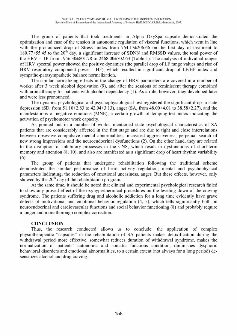
NATURAL CATACLYSMS AND GLOBAL PROBLEMS OF THE MODERN CIVILIZATION. Special edition of Transaction of the International Academy of Science. H&E. ICSD/IAS, Baku-Innsbruck, 2007.
158
The group of patients that took treatments in Alpha OxySpa capsule demonstrated the optimization and ease of the tension in autonomic regulation of visceral functions, which went in line with the pronounced drop of Stress- index from 764.17±206.66 on the first day of treatment to 180.77±55.45 to the 20th day, a significant increase of SDNN and RMSSD values, the total power of the HRV – from 1956.30±801.78 to 2468.00±702.63 (Table 1). The analysis of individual ranges of HRV spectral power showed the positive dynamics (the parallel drop of LF range values and rise of HRV respiratory component power - HF), which resulted in significant drop of LF/HF index and sympatho-parasympathetic balance normalization.
The similar normalizing effects in the change of HRV parameters are covered in a number of works: after 3 week alcohol deprivation (9), and after the sessions of reminiscent therapy combined with aromatherapy for patients with alcohol dependency (1). As a rule, however, they developed later and were less pronounced.
The dynamic psychological and psychophysiological test registered the significant drop in state depression (SD, from 51.10±2.83 to 42.94±3.13), anger (SA, from 48.00±4.01 to 38.58±2.27), and the manifestations of negative emotions (MNE), a certain growth of temping-test index indicating the activation of psychomotor work capacity.
As pointed out in a number of works, mentioned state psychological characteristics of SA patients that are considerably affected in the first stage and are due to tight and close interrelations between obsessive-compulsive mental abnormalities, increased aggressiveness, perpetual search of new strong impressions and the neuroendocrinal dysfunctions (2). On the other hand, they are related to the disruption of inhibitory processes in the CNS, which result in dysfunctions of short-term memory and attention (8, 10), and also are manifested as a significant drop of heart rhythm variability (6).
The group of patients that undergone rehabilitation following the traditional scheme demonstrated the similar performance of heart activity regulation, mental and psychophysical parameters indicating, the reduction of emotional uneasiness, anger. But these effects, however, only showed by the 20th day of the rehabilitation program.
At the same time, it should be noted that clinical and experimental psychological research failed to show any proved effect of the oxyhyperthermical procedures on the leveling down of the craving syndrome. The patients suffering drug and alcoholic addiction for a long time evidently have grave defects of motivational and emotional behavior regulation (4, 5), which tells significantly both on neuroendocrinal and cardiovascular functions and social behavior functioning (8) and probably require a longer and more thorough complex correction.
CONCLUSION Thus, the research conducted allows us to conclude: the application of complex
physiotherapeutic “capsules” in the rehabilitation of SA patients makes detoxification during the withdrawal period more effective, somewhat reduces duration of withdrawal syndrome, makes the normalization of patients’ autonomic and somatic functions condition, diminishes dysphoric behavioral disorders and emotional abnormalities, to a certain extent (not always for a long period) de-sensitizes alcohol and drug craving.
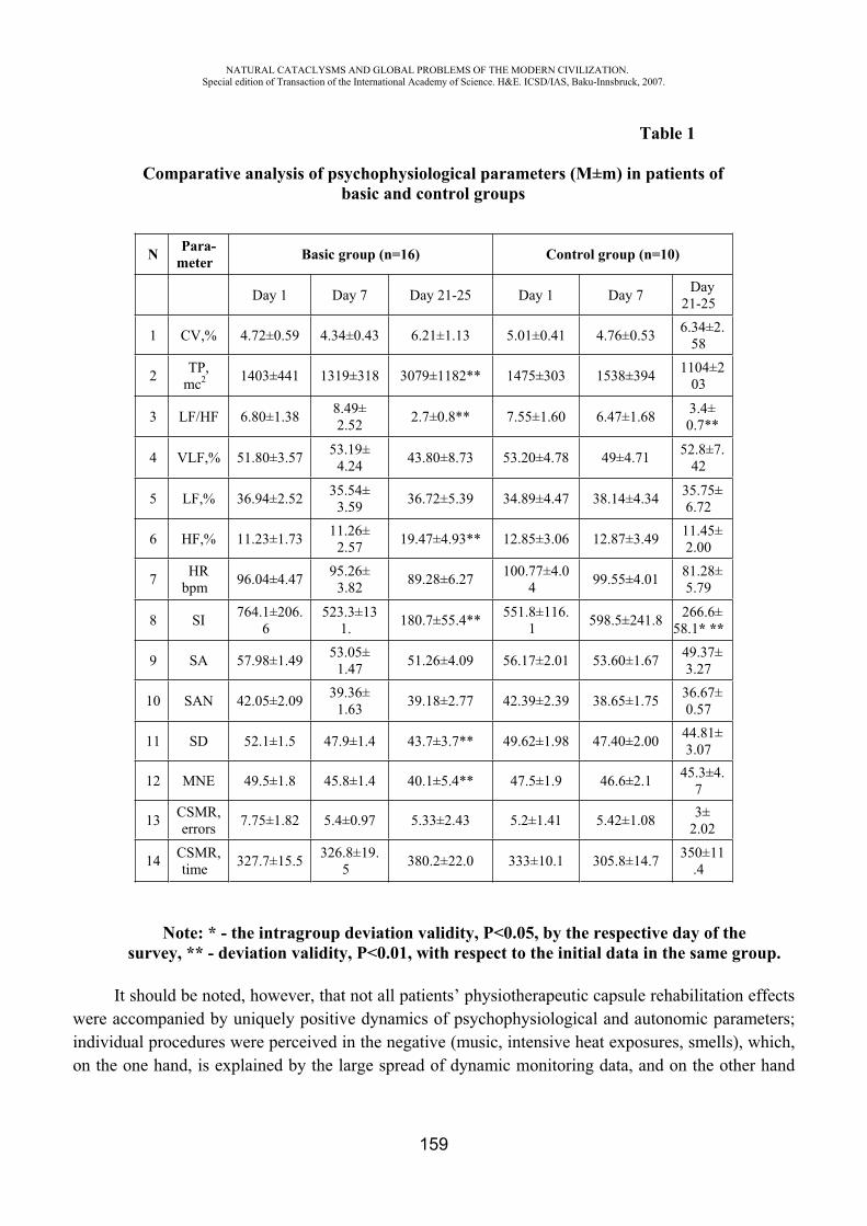
NATURAL CATACLYSMS AND GLOBAL PROBLEMS OF THE MODERN CIVILIZATION. Special edition of Transaction of the International Academy of Science. H&E. ICSD/IAS, Baku-Innsbruck, 2007.
159
Table 1
Comparative analysis of psychophysiological parameters (M±m) in patients of basic and control groups
N Para-meter Basic group (n=16) Control group (n=10)
Day 1 Day 7 Day 21-25 Day 1 Day 7 Day 21-25
1 CV,% 4.72±0.59 4.34±0.43 6.21±1.13 5.01±0.41 4.76±0.53 6.34±2.58
2 TP,mc2 1403±441 1319±318 3079±1182** 1475±303 1538±394 1104±2
03
3 LF/HF 6.80±1.38 8.49± 2.52 2.7±0.8** 7.55±1.60 6.47±1.68 3.4±
0.7**
4 VLF,% 51.80±3.57 53.19± 4.24 43.80±8.73 53.20±4.78 49±4.71 52.8±7.
42
5 LF,% 36.94±2.52 35.54± 3.59 36.72±5.39 34.89±4.47 38.14±4.34 35.75±
6.72
6 HF,% 11.23±1.73 11.26± 2.57 19.47±4.93** 12.85±3.06 12.87±3.49 11.45±
2.00
7 HRbpm 96.04±4.47 95.26±
3.82 89.28±6.27 100.77±4.04 99.55±4.01 81.28±
5.79
8 SI 764.1±206.6
523.3±131. 180.7±55.4** 551.8±116.
1 598.5±241.8 266.6±58.1* **
9 SA 57.98±1.49 53.05± 1.47 51.26±4.09 56.17±2.01 53.60±1.67 49.37±
3.27
10 SAN 42.05±2.09 39.36± 1.63 39.18±2.77 42.39±2.39 38.65±1.75 36.67±
0.57
11 SD 52.1±1.5 47.9±1.4 43.7±3.7** 49.62±1.98 47.40±2.00 44.81±3.07
12 MNE 49.5±1.8 45.8±1.4 40.1±5.4** 47.5±1.9 46.6±2.1 45.3±4.7
13 CSMR,errors 7.75±1.82 5.4±0.97 5.33±2.43 5.2±1.41 5.42±1.08 3±
2.02
14 CSMR,time 327.7±15.5 326.8±19.
5 380.2±22.0 333±10.1 305.8±14.7 350±11.4
Note: * - the intragroup deviation validity, <0.05, by the respective day of thesurvey, ** - deviation validity, <0.01, with respect to the initial data in the same group.
It should be noted, however, that not all patients’ physiotherapeutic capsule rehabilitation effects were accompanied by uniquely positive dynamics of psychophysiological and autonomic parameters; individual procedures were perceived in the negative (music, intensive heat exposures, smells), which, on the one hand, is explained by the large spread of dynamic monitoring data, and on the other hand
NATURAL CATACLYSMS AND GLOBAL PROBLEMS OF THE MODERN CIVILIZATION. Special edition of Transaction of the International Academy of Science. H&E. ICSD/IAS, Baku-Innsbruck, 2007.
160
grounds the need of individual approach to the build-up of the structure of Alpha OxySpa multi-modal procedures.
An appealing design and good ergonomic properties of oxyhyperthermic physiotherapeutic capsules make them and the complex poly-modal procedures themselves appealing to SA patients, making an additional driver of “the change of mental motivation priorities”, which allows us to recommend their application at all stages of SA patients’ programs. Such an approach might be rather promising and efficient in medical solving of very sharp social, economic and humanitarian problem of a modern world – addiction.
REFERENCES
1. Arizono H.; Morita N.; Iizuka S.; Satoh S.; Nakatani Y. Reminiscence therapy using odor in alcohol-dependent patients - psychophysiological evaluation and psychological evaluation; power spectral analysis of heart rate variability//Neuropsychobiology 2000; 35(6): 373-87.
2. Brunelle C.; Assaad J.M.; Barrett S.P.; Avila C.; Conrod P.J.; Tremblay R.E.; Pihl R.O. Heightened heart rate response to alcohol intoxication is associated with a reward-seeking personality profile// Alcohol Clin. Exp. Res. – 2004. 28(3): 394-401.
3. Dudko T.N., Puzienko V.A., Kotelnikova L.A. The Differentiated Rehabiliation System in Narcology. Guidelines. – ., 2001. – P. 38. (In Russian)
4. Gerra G.; Baldaro B.; Zaimovic A. et al. Neuroendocrine responses to experimentally-induced emotions among abstinent opioid-dependent subjects // Drug Alcohol Depend 2003. 20; 71(1): 25-35.
5. Hoaken P.N.; Campbell T.; Stewart S.H.; Pihl R.O. Effects of alcohol on cardiovascular reactivity and the mediation of aggressive behavior in adult men and women// Alcohol Alcohol. - 2003; 38(1): 84-92.
6. Ingjaldsson J.T.; Laberg J.C.; Thayer J.F. Reduced heart rate variability in chronic alcohol abuse: relationship with negative mood, chronic thought suppression, and compulsive drinking// Biol. Psychiatry. - 2003, 15; 54(12): 1427-36.
7. Leonova A.B., Kapitsa M.C. Methods of Subjective Evaluation of Man’s Functional States // J.K. Strelkov (Edit.). Workshop on Engineering Psychology and Ergonomics, M, 2003.
8. Lee T.M.; Pau C.W. Impulse control differences between abstinent heroin users and matched controls // Brain Inj. 2002; 16(10): 885-9.
9. Minami J.; Yoshii M.; Todoroki M.; Nishikimi T.; Ishimitsu T.; Fukunaga T. Effects of alcohol restriction on ambulatory blood pressure, heart rate, and heart rate variability in Japanese men //Am. J. Hypertens., 2002, 15(2 Pt 1): 125-9.
10. Papageorgiou C.; Rabavilas A.; Liappas I.; Stefanis C. Do obsessive-compulsive patients and abstinent heroin addicts share a common psychophysiological mechanism? // Neuropsychobiology 2003; 47(1): 1-11.
11. Task Force of the European Society of Cardiology and the North American Society of Pacing and Electrophysiology. Heart Rate Variability. Standards of measurement, physiological interpretation and clinical use// European Heart Journal 1996; 17: 354-81.
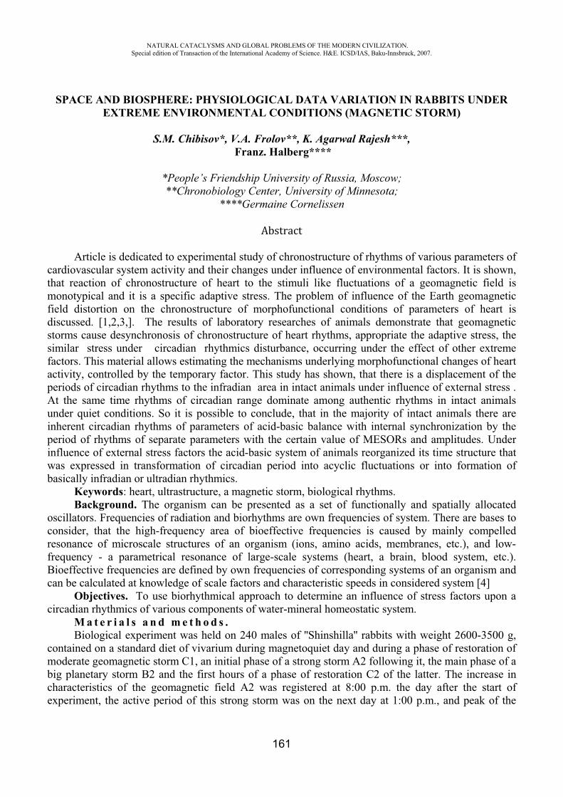
NATURAL CATACLYSMS AND GLOBAL PROBLEMS OF THE MODERN CIVILIZATION. Special edition of Transaction of the International Academy of Science. H&E. ICSD/IAS, Baku-Innsbruck, 2007.
161
SPACE AND BIOSPHERE: PHYSIOLOGICAL DATA VARIATION IN RABBITS UNDER EXTREME ENVIRONMENTAL CONDITIONS (MAGNETIC STORM)
S.M. Chibisov*, V.A. Frolov**, K. Agarwal Rajesh***, Franz. Halberg****
*People’s Friendship University of Russia, Moscow; **Chronobiology Center, University of Minnesota;
****Germaine Cornelissen
Article is dedicated to experimental study of chronostructure of rhythms of various parameters of cardiovascular system activity and their changes under influence of environmental factors. It is shown, that reaction of chronostructure of heart to the stimuli like fluctuations of a geomagnetic field is monotypical and it is a specific adaptive stress. The problem of influence of the Earth geomagnetic field distortion on the chronostructure of morphofunctional conditions of parameters of heart is discussed. [1,2,3,]. The results of laboratory researches of animals demonstrate that geomagnetic storms cause desynchronosis of chronostructure of heart rhythms, appropriate the adaptive stress, the similar stress under circadian rhythmics disturbance, occurring under the effect of other extreme factors. This material allows estimating the mechanisms underlying morphofunctional changes of heart activity, controlled by the temporary factor. This study has shown, that there is a displacement of the periods of circadian rhythms to the infradian area in intact animals under influence of external stress . At the same time rhythms of circadian range dominate among authentic rhythms in intact animals under quiet conditions. So it is possible to conclude, that in the majority of intact animals there are inherent circadian rhythms of parameters of acid-basic balance with internal synchronization by the period of rhythms of separate parameters with the certain value of MESORs and amplitudes. Under influence of external stress factors the acid-basic system of animals reorganized its time structure that was expressed in transformation of circadian period into acyclic fluctuations or into formation of basically infradian or ultradian rhythmics.
Keywords: heart, ultrastructure, a magnetic storm, biological rhythms. Background. The organism can be presented as a set of functionally and spatially allocated
oscillators. Frequencies of radiation and biorhythms are own frequencies of system. There are bases to consider, that the high-frequency area of bioeffective frequencies is caused by mainly compelled resonance of microscale structures of an organism (ions, amino acids, membranes, etc.), and low-frequency - a parametrical resonance of large-scale systems (heart, a brain, blood system, etc.). Bioeffective frequencies are defined by own frequencies of corresponding systems of an organism and can be calculated at knowledge of scale factors and characteristic speeds in considered system [4]
Objectives. To use biorhythmical approach to determine an influence of stress factors upon a circadian rhythmics of various components of water-mineral homeostatic system.
M a t e r i a l s a n d m e t h o d s .Biological experiment was held on 240 males of ''Shinshilla'' rabbits with weight 2600-3500 g,
contained on a standard diet of vivarium during magnetoquiet day and during a phase of restoration of moderate geomagnetic storm 1, an initial phase of a strong storm 2 following it, the main phase of a big planetary storm 2 and the first hours of a phase of restoration 2 of the latter. The increase in characteristics of the geomagnetic field 2 was registered at 8:00 p.m. the day after the start of experiment, the active period of this strong storm was on the next day at 1:00 p.m., and peak of the
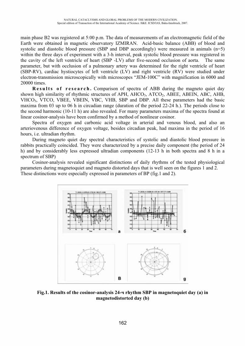
NATURAL CATACLYSMS AND GLOBAL PROBLEMS OF THE MODERN CIVILIZATION. Special edition of Transaction of the International Academy of Science. H&E. ICSD/IAS, Baku-Innsbruck, 2007.
162
main phase 2 was registered at 5:00 p.m. The data of measurements of an electromagnetic field of the Earth were obtained in magnetic observatory IZMIRAN. Acid-basic balance (ABB) of blood and systolic and diastolic blood pressure (SBP and DBP accordingly) were measured in animals (n=5) within the three days of experiment with a 3-h interval, peak systolic blood pressure was registered in the cavity of the left ventricle of heart (SBP -LV) after five-second occlusion of aorta. The same parameter, but with occlusion of a pulmonary artery was determined for the right ventricle of heart (SBP-RV), cardiac hystiocytes of left ventricle (LV) and right ventricle (RV) were studied under electron-transmission microscopically with microscopes “JEM-100C” with magnification in 6000 and 20000 times.
R e s u l t s o f r e s e a r c h . Comparison of spectra of ABB during the magneto quiet day shown high similarity of rhythmic structures of APH, AHCO3, ATCO2, ABEE, ABEIN, ABC, AHB, VHCO3, VTCO, VBEE, VBEIN, VBC, VHB, SBP and DBP. All these parameters had the basic maxima from 03 up to 06 h in circadian range (duration of the period 22-24 h.). The periods close to the second harmonic (10-11 h) are also revealed. For many parameters maxima of the spectra found at linear cosinor-analysis have been confirmed by a method of nonlinear cosinor.
Spectra of oxygen and carbonic acid voltage in arterial and venous blood, and also an arteriovenous difference of oxygen voltage, besides circadian peak, had maxima in the period of 16 hours, i.e. ultradian rhythm.
During magneto quiet day spectral characteristics of systolic and diastolic blood pressure in rabbits practically coincided. They were characterized by a precise daily component (the period of 24 h) and by considerably less expressed ultradian components (12-13 h in both spectra and 8 h in a spectrum of SBP)
Cosinor-analysis revealed significant distinctions of daily rhythms of the tested physiological parameters during magnetoquiet and magneto distorted days that is well seen on the figures 1 and 2. These distinctions were especially expressed in parameters of BP (fig.1 and 2).
Fig.1. Results of the cosinor-analysis 24- rhythm SBP in magnetoquiet day (a) in magnetodistorted day (b)
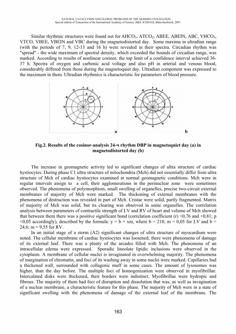
NATURAL CATACLYSMS AND GLOBAL PROBLEMS OF THE MODERN CIVILIZATION. Special edition of Transaction of the International Academy of Science. H&E. ICSD/IAS, Baku-Innsbruck, 2007.
163
Similar rhythmic structures were found out for AHCO3, ATCO2, ABEE, ABEIN, ABC, VHCO3,VTCO, VBEE, VBEIN and VBC during the magnetodistorted day. Some maxima in ultradian range (with the periods of 7, 9, 12-13 and 16 h) were revealed in their spectra. Circadian rhythm was "spread" - the wide maximum of spectral density, which exceeded the bounds of circadian range, was marked. According to results of nonlinear cosinor, the top limit of a confidence interval achieved 36-37 h. Spectra of oxygen and carbonic acid voltage and also pH in arterial and venous blood, considerably differed from those during the magnetoquiet day. Ultradian component was expressed to the maximum in them. Ultradian rhythmics is characteristic for parameters of blood pressure.
b
Fig.2. Results of the cosinor-analysis 24- rhythm DBP in magnetoquiet day (a) in magnetodistorted day (b)
The increase in geomagnetic activity led to significant changes of ultra structure of cardiac hystiocytes. During phase 1 ultra structure of mitochondria (Mch) did not essentially differ from ultra structure of Mch of cardiac hystiocytes examined at normal geomagnetic conditions. ch were in regular intervals assign to a cell, their agglomerations in the perinuclear zone were sometimes observed. The phenomena of polymorphism, small swelling of organelles, precise two-circuit external membranes of majority of ch were marked. The thickening of external membranes with the phenomena of destruction was revealed in part of Mch. Cristae were solid, partly fragmented. Matrix of majority of ch was solid, but its clearing was observed in some organelles. The correlation analysis between parameters of contractile strength of LV and RV of heart and volume of ch showed that between them there was a positive significant bond (correlation coefficient (r) +0,76 and +0,81; <0,05 accordingly), described by the formula: y = b + xm, where b = 218; m = 0,05 for LV and b = 24,6; m = 9,55 for RV.
In an initial stage of a storm ( 2) significant changes of ultra structure of myocardium were noted. The cellular membrane of cardiac hystiocytes was loosened; there were phenomena of damage of its external leaf. There was a plenty of the arcades filled with ch. The phenomena of an intracellular edema were expressed. Sporadic lineolate lipidic inclusions were observed in the cytoplasm. A membrane of cellular nuclei is invaginated in overwhelming majority. The phenomena of margination of chromatin, and foci of its washing away in some nuclei were marked. Capillaries had a thickened wall, surrounded with collagenic muff in some cases. The amount of lysosomes was higher, than the day before. The multiple foci of homogenization were observed in myofibrillae. Intercalated disks were thickened, their borders were indistinct. Myofibrillae were hydropic and fibrous. The majority of them had foci of disruption and dissolution that was, as well as invagination of a nuclear membrane, a characteristic feature for this phase. The majority of ch were in a state of significant swelling with the phenomena of damage of the external leaf of the membrane. The
NATURAL CATACLYSMS AND GLOBAL PROBLEMS OF THE MODERN CIVILIZATION. Special edition of Transaction of the International Academy of Science. H&E. ICSD/IAS, Baku-Innsbruck, 2007.
164
phenomena of vacuolization of matrix were observed in Mch. Many ch were in a state of destruction and degradation. Swelling of ch, fragmentation of cristae, reduction of their amount, vacuolization of matrix, destruction and degradation of ch were characteristic features for an initial phase of a storm. Volume of ch became much more, than during 1, and the character of correlation bond between volume of ch and the parameter of contractile strength of LV and RV of heart sharply changed. The bond became negative, being valid and reliability (r-0,73 and-0,81 accordingly), that testified to the further increase in volume of organelles and falling of contractile strength of heart. In experiment it was established, that amplitude of daily fluctuations of contractile strength of heart was considerably below during geomagnetic disturbance (Table 1).
Table 1
Circadian rhythms of a parameter of peak systolic blood pressure (SBP) in left (LV) and in right (RV) ventricles of hearts of rabbits during quiet geomagnetic conditions
and during geomagnetic storms
Variable Parameters of the cosinor-analysisPR P M±SE 2A±SE Phi (95% CI)
magnetoquiet daySBR-LV 26 0.002 67.6±3.0 31.9±8.4 -48 (-154; -79)SBR-RV 39 <0.001 29.1±0.9 13.5±2.6 -78 (-57; -99)
magnetodistorted daySBR-LV 10 0.002 07.6±2.1 21.3±5.9 212 (-179; -246)SBR-RV 5 0.046 40.3± .7 5.0±2.0 288 (-236; -340)
The note: PR-percent of a rhythm: percent of presence of the rhythm, determined by a trial and error method of model (24-hour cosine curve); P-probability: =0; -MESOR (mean value of a rhythm); 2 -the double amplitude; phi - acrophase expressed in degrees, and 360 degrees correspond to 24 hours - 00:00; I-a confidence interval.
Conclusion. Thus, during the magnetoquiet day in spectra of haemodinamic variables, as well as in spectra of parameters of ABB, circadian components dominated; alongside ultradian components - close to the second harmonics of circadian rhythm - were revealed. The increase in geomagnetic activity led to significant changes of chronostructure of rhythms of ABB. It was revealed, that during magnetic storms phenomena of desynchronosis appeared. Cosinor-analysis revealed significant distinctions of structure of circadian rhythms of the examined physiological parameters in various magnetic conditions. At magnetoquiet state daily rhythms were well expressed and during a magnetic storm they either were absent or were "smoothed", ultradian components among which rhythms with the periods of 15-16 hours were basical. Especially brightly these distinctions were shown in parameters of BP and PO2 in venous blood.
It was revealed, that during magnetic storms there are phenomena of desynchronosis of cardio- vascular system - one of the first attributes of which were changes of amplitude and the period of biological rhythms contractile strength of heart. There was a phenomenon of fading of amplitude of a rhythm under the influence of information stress factor, which is an ultralow frequency magnetic radiation.
NATURAL CATACLYSMS AND GLOBAL PROBLEMS OF THE MODERN CIVILIZATION. Special edition of Transaction of the International Academy of Science. H&E. ICSD/IAS, Baku-Innsbruck, 2007.
165
REFERENCES
1. Halberg F., Chibisov S.M., Radysh I.V., Cornelissen G, Bakulin A. Time structures (chronomes) in us and around us. Monography, Moscow: PFUR, 2005, 186 p
2. Chibisov S.M., Cornelissen G, Halberg F. Magnetic storm effect on the circulation of rabbits. Biomed Pharmacother. 2004 Oct; 58 Suppl 1:S15-9.
3. Chibisov SM, Breus TK, Illarionova TS. Morphological and functional state of the heart during magnetic storm. Bull Exp Biol Med. 2001 Dec; 132(6):1150-3.
4. Chabarova O.V., Parametrical a resonance as the possible mechanism of influence of space weather on bioobjects. Matirials jf International seminar «Biological effects of solar activity»-Pustchino-on-Oka -2004. - .14-15.
CHALLENGES FROM "60 YEARS OF TRANSLATIONAL CHRONOBIOLOGY"
Franz Halberg
Germane Cornelissen
Health care could change from the current, mostly spotcheck-based approach ("flying blind" [1] between visits to a care provider's office) to a relatively inexpensive since largely self-implemented continuous surveillance.
This paradox of "more for less" (2, 3) (Figure 1) could be aided by a website (Figure 2 and Appendix) that automatically analyzes and interprets data with the double purpose of the long-term health surveillance of the individual participant who plans to use it for a lifetime and of medical research serving for ever-improving health care, preventively recognizing (and lowering) high disease risks (Figure 3). As a dividend, basic transdisciplinary research on the accumulating database would find numerous applications. Notable among these aims is the implicit biologic monitoring of solar variability with focus on physical mechanisms underlying the physiology and pathology of individuals and of populations, including events such as criminality, suicide and sudden cardiac death (Figure 4) (4).
I. High blood pressure: diagnosis and treatment For everyone in 2007, "exclusive reliance on office measurement should be discouraged" (5), as
suggested in 1904 (6, cf. 4) and in the interim (6-9). A timely and time structure-based (chronomic) diagnosis and treatment of high blood pressure, affecting as many as 50 million Americans, gain from (preferably but not necessarily [10] automatic) computer-aided selfsurveillance. Thereby, we minimize false diagnoses, i.e., maximize the number of those brought to treatment who were previously false-negatively diagnosed (masked hypertension, 5) and minimize those diagnosed false-positively (white-coat effect, 5), while optimizing treatment in kind, dosing, and timing, as warranted based on the monitoring (11). A combination of a time-structural or chronomic diagnosis and chronomically timed treatment (under frequent or preferably continuous surveillance, at least at therapy initiation) could benefit a very large segment of populations in areas like the USA where most families have 2 computer-savvy members; where these are missing, support groups can be set up and data can be analyzed on a website, as they are now analyzed worldwide within the context of an international project on the BIOsphere and the COSmos (BIOCOS) (12-15).
NATURAL CATACLYSMS AND GLOBAL PROBLEMS OF THE MODERN CIVILIZATION. Special edition of Transaction of the International Academy of Science. H&E. ICSD/IAS, Baku-Innsbruck, 2007.
166
II. A vascular variability syndrome, starting in the physiological range: detection for stroke and other severe disease prevention 1) Vascular variability abnormalities (VVAs) involve, at their outset, circadian alterations in the
normal range, detected by computer comparison with reference standards from age- and gender-matched peers. These are an overswing of blood pressure or CHAT (brief for circadian hyper-amplitude-tension), an above-threshold pulse pressure, an odd timing of the blood pressure but not of the heart rate rhythm and a deficient heart rate variability. These conditions, assessed by monitoring along the scale of a week, are associated with risks of ischemic stroke, myocardial infarction or nephropathy greater than the risk associated with a high blood pressure (Figure 3) (4). (Yet-to-be-recognized alterations of now-documented cycles of the length of a week, a year or decades, or of other mapped spectral components of intermediate lengths, are also documented to have signatures in human pathology, Figure 4 [4], their relatively small amplitude notwithstanding.)
2) VVA-associated risks are also great in the absence of a high blood pressure (13; cf. 14, 15).3) Often these VVA-risks can be treated, sometimes by an intervention as simple as changing
only the timing of treatment (13). 4) VVA-risks can be detected by comparing a given time series' variability structure with that of
infradian-circadian reference standards obtained from presumably clinically healthy peers matched by age and gender. Day, night- and 24-hour mean values and their ratios constitute, not invariably (16), pertinent information. Sometimes the standard deviation discriminates better than the circadian amplitude, as in the case of a circadian-circaseptan deficiency in heart rate variability (13; cf. 4); a chronomic combination of parametric and non-parametric endpoints is most useful for dealing with VVAs and also with hypertension (9, 12, 13). In exchange for a copy of the data and a promise of follow-up, as a minimum, with a yearly note on health status (and, as an optimum, by added data at intervals dependent upon results of monitoring for a lifetime):
5) Analyses are done free of charge at BIOCOS 6) BIOCOS provides an opportunity to purchase automatic blood pressure and heart rate
monitors for ambulatory use with an 80% reduction in cost of acquisition. 7) Soon a website will be freely available for all comers for such analyses, to lead to a chronomic
diagnosis of risk elevation and its timely treatment, so that eventually the reference data base can be improved and new harbingers can be added to a refined diagnosis of elevated risk.
8) BIOCOS is already analyzing data sets with outcomes of hard events and/or proxy outcomes to compare the use of chronomic methods with that of conventional ones (16), and invites the submittal of data sets for more comparisons, notably on projects already completed that were government-supported.
9) At least one VVA, blood pressure overswing, is now documented to occur worldwide and to represent a risk greater than hypertension (12-15). CHAT constitutes a gauge of both prehypertension (9, 12, 17) and prediabetes (18) and should be treated as part of a premetabolic syndrome (19).
10) Benefit from looking for a vascular variability syndrome (VVS) could be immediately available on a broad scale if the public, including preferably the health care profession and its teachers (read, among others, physiologists) can be made to review and act on the available evidence.
III. Cancer therapy 1) Timed cancer treatment by radiation (guided by the peak in perioral tumor temperature as
marker) doubled 2-year disease-free survival rate -- as compared to treatment as usual, not timed, or to treatment at times 4 or 8 hours before or after peak tumor temperature (20), Figure 5.
2) Cancer chemotherapy. A patient with a 10% chance of survival in 2 years (with this prognosis, at the start of triangulated, several marker rhythms-guided timed chemotherapy) is alive and well 30 years later (21). Again, a very poor prognosis notwithstanding, cancer-marker-guided chronochemotherapy has added years to another patient’s life span, according to the founder of the
NATURAL CATACLYSMS AND GLOBAL PROBLEMS OF THE MODERN CIVILIZATION. Special edition of Transaction of the International Academy of Science. H&E. ICSD/IAS, Baku-Innsbruck, 2007.
167
specialty of oncology (22). There are limitations: Kits for specific cancer markers are costly and any marker-rhythm-guided treatment is viewed as complex, cumbersome research while time-ofday specified therapy may fail (23).
IV. Drug and instrumentation development Under highly standardized conditions, but not invariably, studies with one subject per timepoint,
each treated at one of 5 or 6 equidistant timepoints (N-of-5 and N-of-6) covering a rhythm's period, e.g., 24 hours, have proved their use in testing a new ACTH-analogue (24) or low-dose aspirin (25), Figure 6. Such protocols could precede the current 3 stages of drug testing as a Phase-0 test (before Phases 1-3), preferably with groups of 5 or 6 subjects, again one per timepoint, added when needed.
To available devices for monitoring vascular or other variables and to devices yet to be developed, individualized sequential testing of all pertinent rhythm parameters could be added, thereby to pick-up harbingers of elevated risk (2, 3).
V. Control information, complementary to any endeavor in biomedicine and beyond A budding atlas serves as an introduction to chronobiology on our website (26). Chronomics is
also being mapped (27-29; cf. 30-34). This control information serves to avoid blunders that may occur without information on rhythms that may differ in phase or also in frequency among two groups being compared, Figure 7. More information is available in publications on our website
VI. Transdisciplinary science New is a system of non-photic oscillations with common congruent periods in and around the
biosphere. Congruence is defined by overlying or overlapping 95% confidence intervals of their periods covering a wide range of frequencies, including drifting, waxing and waning cycles of about 5 months, others shorter or longer than a year, e.g., of about 15 months length, among others, in mental function, blood pressure and heart rate and in archival variables such as natality, morbidity and mortality. These magnetoperiodisms, coexist and compete with photoperiodism, the signature of the calendar year, in the incidence pattern of sudden cardiac death; magnetoperiodisms replace photoperiodisms in Minnesota (4; Figure 4), harsh winters notwithstanding, and can also do so in the systolic blood pressure of an elderly man, Figure 8 (4). Some of these magnetoperiodisms are signatures of cycles found earlier by physicists at MIT in solar wind speed (35; cf. 36). These and other non-photic signatures characterize human time estimates, mood and vigor have very low amplitudes, so that they represent more environmental information than energy, yet their importance stems from the possibility that they may reveal, in individuals, mechanisms underlying signatures of nonphotics not only in sudden cardiac death (4), but also in suicide (37), criminality and international battles (28, 38). A new medical, or rather transdisciplinary specialty concerned with the ills of society could then emerge, based on longitudinal as well as transverse (cross-sectional) and hybrid (linked crosssectional) (39) physiological data aligned for analysis with those from concomitant ongoing monitoring of space weather (40) for scrutiny of any associations by superposed epochs and the effects of the subtraction and replacement of previously documented environmental spectral components on the cycles in pertinent affairs involving death in peace (4, 27, 28, 38) triggering those in war.
VII. Task for today via BIOCOS and this year via a website Those concerned with the future of children (2, 3) could start monitoring and saving the data
detecting and treating prehypertension, prediabetes and a premetabolic syndrome (9). Those concerned about universal health care could invest into early and adult education in self-help by self-surveillanceat all ages, immediately in the elderly hypertensives.
NATURAL CATACLYSMS AND GLOBAL PROBLEMS OF THE MODERN CIVILIZATION. Special edition of Transaction of the International Academy of Science. H&E. ICSD/IAS, Baku-Innsbruck, 2007.
168
REFERENCES
1. Fossel M. Editor's Note (to Halberg F., Cornélissen G., Halberg J., Fink H., Chen C-H, Otsuka K, Watanabe Y., Kumagai Y., Syutkina E.V., Kawasaki T., Uezono K., Zhao Z.Y., Schwartzkopff O. Circadian Hyper-Amplitude-Tension, CHAT: a disease risk syndrome of anti-aging medicine. J. Anti-Aging Med 1998; 1: 239-259). J. Anti-Aging Med 1998; 1: 239.
2. Halberg F., Cornélissen G., Carandente A., Bakken E., Young E. Chronobiologic perspectives of international health care reform for the future of children. Chronobiologia 1993; 20: 269-275.
3. Cornélissen G., Delmore P., Bingham C., Rutledge G., Kumagai Y., Kuwajima I., Suzuki Y., Kuramoto K., Otsuka K., Scarpelli P.T., Tarquini B., Cagnoni M., Garcia L., Zaslavskaya R.M., Syutkina E., Carandente F., Rapoport S.I., Romanov Y.A., Tamura K., Bakken E., Halberg F. A response to the health care crisis: a "health start" from "womb to tomb". Chronobiologia 1993; 20: 277-291.
4. Halberg F., Cornélissen G., Katinas G., Tvildiani L., Gigolashvili M., Janashia K., Toba T., Revilla M., Regal P., Sothern RB., Wendt H.W., Wang Z.R., Zeman M., Jozsa R., Singh R.B., Mitsutake G., Chibisov S.M., Lee J., Holley D., Holte J.E., Sonkowsky R.P., Schwartzkopff O., Delmore P., Otsuka K, Bakken E.E., Czaplicki J., International BIOCOS Group. Chronobiology's progress: season's appreciations 2004-2005. Time-, frequency-, phase-,variable-, individual-, age- and site-specific chronomics. J Applied Biomedicine 2006; 4: 1-38. http://www.zsf.jcu.cz/vyzkum/jab/4_1/halberg.pdf.
5. Pickering T.G. Masked hypertension and white-coat hypertension. In: Proceedings, 59th Annual Meeting, Japan Society of Neurovegetative Research, Tokyo, November 1-3, 2006. p. 32. "For the routine diagnosis and management of hypertension, exclusive reliance on office measurement should be discouraged."
6. Janeway T.C. The clinical study of blood pressure. New York: D. Appleton & Co.; 1904. 300 pp.
7. Bartter F.C. Periodicity and medicine. In: Scheving L.E., Halberg F., Pauly J.E., eds. Chronobiology. Tokyo: Igaku Shoin Ltd.; 1974. p. 6-13.
8. Halberg F., Johnson E.A., Nelson W., Runge W., Sothern R. Autorhythmometry-procedures for physiologic self-measurements and their analysis. Physiol Tchr 1972; 1: 1-11.
9. Halberg F., Cornélissen G., Halberg J., Schwartzkopff O. Pre-hypertensive and other variabilities also await treatment. Am J. Medicine 2007; doi:10.1016/j.amjmed.2006.02.045.
10. Stinson S.M., Cornélissen G., Scarpelli P.T., Halberg F. Self-measurement and ambulatory monitoring of blood pressure: a subject's chronobiological perspective. Biomedicine & Pharmacotherapy 2002; 56 (Suppl 2): 333s-338s.
11. Little J., Sanchez de la Peña S., Cornélissen G., Abramowitz P., Tuna N., Halberg F. Longitudinal chronobiologic blood pressure monitoring for assessing the need and timing of antihypertensive treatment. Progress in Clinical and Biological Research 1990; 341B: 601-611.
12. Cornélissen G., Delcourt A., Toussaint G., Otsuka K., Watanabe Y., Siegelova J., Fiser B., Dusek J., Homolka P., Singh R.B., Kumar A., Singh R.K., Sanchez S., Gonzalez C., Holley D., Sundaram B., Zhao Z., Tomlinson B., Fok B., Zeman M., Dulkova K., Halberg F. Opportunity of detecting pre-hypertension: worldwide data on blood pressure overswinging. Biomedicine &Pharmacotherapy 2005; 59 (Suppl 1): S152-S157.
13. Halberg F., Cornélissen G., International Womb-to-Tomb Chronome Initiative Group: Resolution from a meeting of the International Society for Research on Civilization Diseases and the Environment (New SIRMCE Confederation), Brussels, Belgium, March 17-18, 1995:
NATURAL CATACLYSMS AND GLOBAL PROBLEMS OF THE MODERN CIVILIZATION. Special edition of Transaction of the International Academy of Science. H&E. ICSD/IAS, Baku-Innsbruck, 2007.
169
Fairy tale or reality ? Medtronic Chronobiology Seminar N8, April 1995. Minneapolis: Medtronic Inc.; 1995. 12 pp. text, 18 figures. URL http://www.msi.umn.edu/~halberg/resol.html
14. Otsuka K., Cornélissen G., Halberg F. Predictive value of blood pressure dipping and swinging with regard to vascular disease risk. Clinical Drug Investigation 1996; 11: 20-31.
15. Otsuka K., Cornélissen G., Halberg F. Circadian rhythmic fractal scaling of heart rate variability in health and coronary artery disease. Clinical Cardiology 1997; 20: 631-638.
16. Cornélissen G., Halberg F., Otsuka K., Singh R.B., Chen CH. Chronobiology predicts actual and proxy outcomes when dipping fails. Hypertension 2007; 49: 237-239. doi:10.1161/01.HYP.0000250392.51418.64.
17. Halberg F., Cornélissen G., Wall D., Otsuka K., Halberg J., Katinas G., Watanabe Y., Halhuber M., Müller-Bohn T., Delmore P., Siegelova J., Homolka P., Fiser B., Dusek J., Sanchez de la Peña S., Maggioni C., Delyukov A., Gorgo Y., Gubin D., Carandente F., Schaffer E., Rhodus N., Borer K., Sonkowsky R.P., Schwartzkopff O. Engineering and governmental challenge: 7- day/24-hour chronobiologic blood pressure and heart rate screening. Biomedical Instrumentation & Technology 2002: Part I, 36: 89-122; Part II, 36: 183-197.
18. Sanchez de la Pena S., Gonzalez C., Cornélissen G., Halberg F. Blood pressure (BP), heart rate (HR) and non-insulin-dependent diabetes mellitus (NIDDM) chronobiology. Abstract S8-06, 3rd Int Congress on Cardiovascular Disease, Taipei, Taiwan, 26-28 Nov 2004. Int J Cardiol 2004; 97 (Suppl 2): S14.
19. Gupta A., Greenway F., Halberg F., Cornélissen-Guillaume G. Cardiovascular disease risk is increased in pre-diabetes. 2007 Annual Scientific Meeting, NAASO: The Obesity Society, New Orleans, Louisiana, October 20-24, 2007.
20. Halberg F., Cornélissen G., Wang Z.R., Wan C., Ulmer W., Katinas G., Singh Ranjana, Singh R.K., Singh Rajesh, Gupta B.D., Singh R.B., Kumar A., Kanabrocki E., Sothern R.B., Rao G., Bhatt MLBD, Srivastava M., Rai G., Singh S., Pati A.K., Nath P., Halberg Francine, Halberg J., Schwartzkopff O., Bakken E., Shastri V.K. Chronomics: circadian and circaseptan timing of radiotherapy, drugs, calories, perhaps nutriceuticals and beyond. J. Exp Therapeutics Oncol 2003; 3: 223-260.
21. Halberg F., Prem K., Halberg F., Norman C., Cornélissen G. Cancer Chronomics I: Origins of timed cancer treatment: early marker rhythm-guided individualized chronochemotherapy. J Exp Ther Oncol 2006; 6: 55-61.
22. Kennedy B.J. A lady and chronobiology. Chronobiologia 1993; 20: 139-144. 23. Hrushesky W., Wood P., Levi F., Roemeling R. v, Bjarnason G., Focan C., Meier K.,
Cornélissen G., Halberg F. A recent illustration of some essentials of circadian chronotherapy study design [letter]. J Clin Oncol 2004; 22: 2971-2972.
24. Günther R., Herold M., Halberg E., Halberg F. Circadian placebo and ACTH effects on urinary cortisol in arthritics. Peptides 1980; 1: 387-390.
25. Cornélissen G., Halberg F., Prikryl P., Dankova E., Siegelova J., Dusek J., International Wombto-Tomb Chronome Study Group: Prophylactic aspirin treatment: the merits of timing. JAMA 1991; 266: 3128-3129.
26. Cornélissen G., Halberg F. Introduction to Chronobiology. Medtronic Chronobiology Seminar N7, April 1994, 52 pp. (Library of Congress Catalog Card N94-060580; URL
27. http://www.msi.umn.edu/~halberg/) 28. Halberg F., Cornélissen G., Otsuka K., Schwartzkopff O., Halberg J., Bakken E.E.
Chronomics. Biomedicine & Pharmacotherapy 2001; 55 (Suppl 1): 153s-190s.
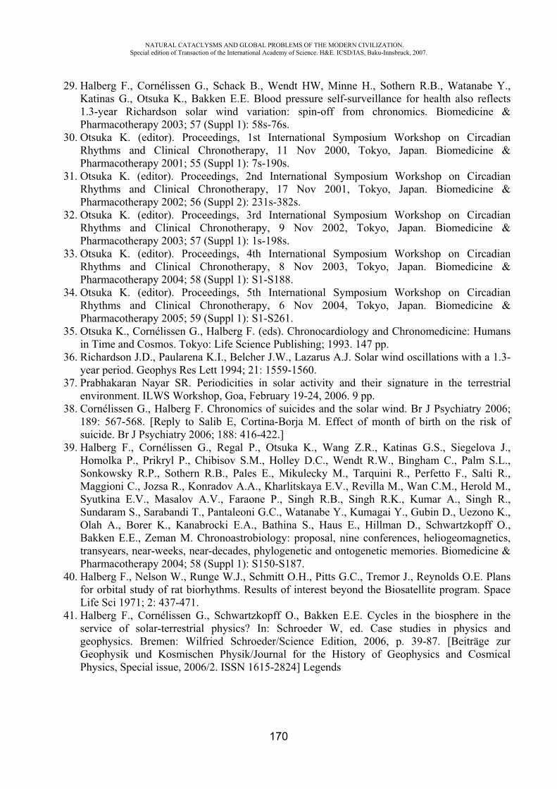
NATURAL CATACLYSMS AND GLOBAL PROBLEMS OF THE MODERN CIVILIZATION. Special edition of Transaction of the International Academy of Science. H&E. ICSD/IAS, Baku-Innsbruck, 2007.
170
29. Halberg F., Cornélissen G., Schack B., Wendt HW, Minne H., Sothern R.B., Watanabe Y., Katinas G., Otsuka K., Bakken E.E. Blood pressure self-surveillance for health also reflects 1.3-year Richardson solar wind variation: spin-off from chronomics. Biomedicine & Pharmacotherapy 2003; 57 (Suppl 1): 58s-76s.
30. Otsuka K. (editor). Proceedings, 1st International Symposium Workshop on Circadian Rhythms and Clinical Chronotherapy, 11 Nov 2000, Tokyo, Japan. Biomedicine & Pharmacotherapy 2001; 55 (Suppl 1): 7s-190s.
31. Otsuka K. (editor). Proceedings, 2nd International Symposium Workshop on Circadian Rhythms and Clinical Chronotherapy, 17 Nov 2001, Tokyo, Japan. Biomedicine & Pharmacotherapy 2002; 56 (Suppl 2): 231s-382s.
32. Otsuka K. (editor). Proceedings, 3rd International Symposium Workshop on Circadian Rhythms and Clinical Chronotherapy, 9 Nov 2002, Tokyo, Japan. Biomedicine & Pharmacotherapy 2003; 57 (Suppl 1): 1s-198s.
33. Otsuka K. (editor). Proceedings, 4th International Symposium Workshop on Circadian Rhythms and Clinical Chronotherapy, 8 Nov 2003, Tokyo, Japan. Biomedicine & Pharmacotherapy 2004; 58 (Suppl 1): S1-S188.
34. Otsuka K. (editor). Proceedings, 5th International Symposium Workshop on Circadian Rhythms and Clinical Chronotherapy, 6 Nov 2004, Tokyo, Japan. Biomedicine & Pharmacotherapy 2005; 59 (Suppl 1): S1-S261.
35. Otsuka K., Cornélissen G., Halberg F. (eds). Chronocardiology and Chronomedicine: Humans in Time and Cosmos. Tokyo: Life Science Publishing; 1993. 147 pp.
36. Richardson J.D., Paularena K.I., Belcher J.W., Lazarus A.J. Solar wind oscillations with a 1.3-year period. Geophys Res Lett 1994; 21: 1559-1560.
37. Prabhakaran Nayar SR. Periodicities in solar activity and their signature in the terrestrial environment. ILWS Workshop, Goa, February 19-24, 2006. 9 pp.
38. Cornélissen G., Halberg F. Chronomics of suicides and the solar wind. Br J Psychiatry 2006; 189: 567-568. [Reply to Salib E, Cortina-Borja M. Effect of month of birth on the risk of suicide. Br J Psychiatry 2006; 188: 416-422.]
39. Halberg F., Cornélissen G., Regal P., Otsuka K., Wang Z.R., Katinas G.S., Siegelova J., Homolka P., Prikryl P., Chibisov S.M., Holley D.C., Wendt R.W., Bingham C., Palm S.L., Sonkowsky R.P., Sothern R.B., Pales E., Mikulecky M., Tarquini R., Perfetto F., Salti R., Maggioni C., Jozsa R., Konradov A.A., Kharlitskaya E.V., Revilla M., Wan C.M., Herold M., Syutkina E.V., Masalov A.V., Faraone P., Singh R.B., Singh R.K., Kumar A., Singh R., Sundaram S., Sarabandi T., Pantaleoni G.C., Watanabe Y., Kumagai Y., Gubin D., Uezono K., Olah A., Borer K., Kanabrocki E.A., Bathina S., Haus E., Hillman D., Schwartzkopff O., Bakken E.E., Zeman M. Chronoastrobiology: proposal, nine conferences, heliogeomagnetics, transyears, near-weeks, near-decades, phylogenetic and ontogenetic memories. Biomedicine & Pharmacotherapy 2004; 58 (Suppl 1): S150-S187.
40. Halberg F., Nelson W., Runge W.J., Schmitt O.H., Pitts G.C., Tremor J., Reynolds O.E. Plans for orbital study of rat biorhythms. Results of interest beyond the Biosatellite program. Space Life Sci 1971; 2: 437-471.
41. Halberg F., Cornélissen G., Schwartzkopff O., Bakken E.E. Cycles in the biosphere in the service of solar-terrestrial physics? In: Schroeder W, ed. Case studies in physics and geophysics. Bremen: Wilfried Schroeder/Science Edition, 2006, p. 39-87. [Beiträge zur Geophysik und Kosmischen Physik/Journal for the History of Geophysics and Cosmical Physics, Special issue, 2006/2. ISSN 1615-2824] Legends
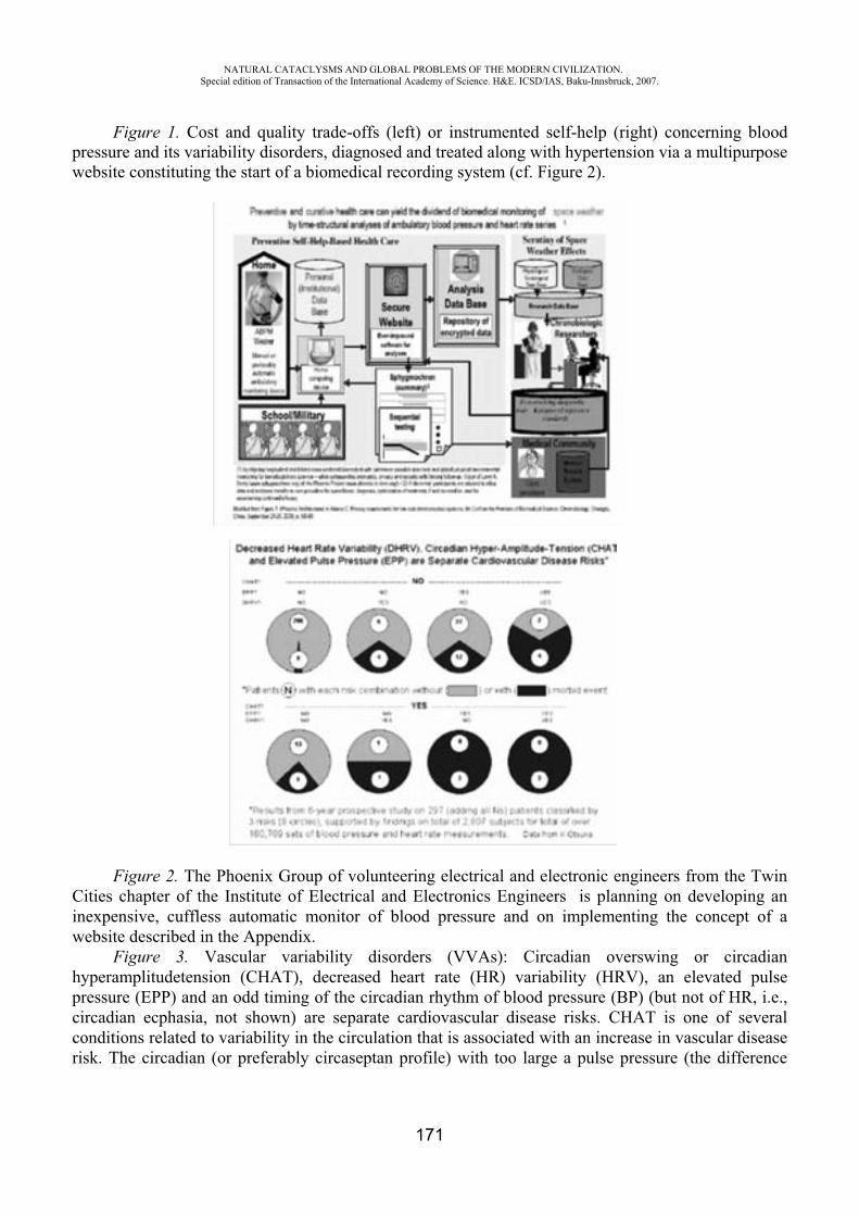
NATURAL CATACLYSMS AND GLOBAL PROBLEMS OF THE MODERN CIVILIZATION. Special edition of Transaction of the International Academy of Science. H&E. ICSD/IAS, Baku-Innsbruck, 2007.
171
Figure 1. Cost and quality trade-offs (left) or instrumented self-help (right) concerning blood pressure and its variability disorders, diagnosed and treated along with hypertension via a multipurpose website constituting the start of a biomedical recording system (cf. Figure 2).
Figure 2. The Phoenix Group of volunteering electrical and electronic engineers from the Twin Cities chapter of the Institute of Electrical and Electronics Engineers is planning on developing an inexpensive, cuffless automatic monitor of blood pressure and on implementing the concept of a website described in the Appendix.
Figure 3. Vascular variability disorders (VVAs): Circadian overswing or circadian hyperamplitudetension (CHAT), decreased heart rate (HR) variability (HRV), an elevated pulse pressure (EPP) and an odd timing of the circadian rhythm of blood pressure (BP) (but not of HR, i.e., circadian ecphasia, not shown) are separate cardiovascular disease risks. CHAT is one of several conditions related to variability in the circulation that is associated with an increase in vascular disease risk. The circadian (or preferably circaseptan profile) with too large a pulse pressure (the difference

NATURAL CATACLYSMS AND GLOBAL PROBLEMS OF THE MODERN CIVILIZATION. Special edition of Transaction of the International Academy of Science. H&E. ICSD/IAS, Baku-Innsbruck, 2007.
172
between systolic [S] BP and diastolic [D] BP, i.e., between the heart's contraction or relaxation, or the extent of change in pressure during a cardiac cycle) and a decreased HR variability (gauged by the standard deviation of HR) in relation to a threshold, eventually derived from gender and age-matched peers, among other risk conditions (as is an abnormal circadian timing of BP but not of HR, not shown) that separates this condition from a phase shift during shift-work that may involve HR as well. Vascular disease risk is elevated in the presence of any one of these risk factors, and is elevated further when more than a single risk factor is present, suggesting that these abnormalities in variability of BP and HR are mostly independent and additive features of a premetabolic syndrome. Abnormalities in the variability of BP and HR, impossible to find in a conventional office visit (the latter aiming at the fiction of a “true” BP), can raise cardiovascular disease risk (gauged by the occurrence of a morbid event like a stroke in the next six years) from 4% to 100%. By comparison to subjects with acceptable BP and HR variability, the relative cardiovascular disease risk associated with a decreased heart rate variability (DHRV), an elevated pulse pressure (EPP) and/or circadian hyper-amplitude-tension (CHAT) is greatly and statistically significantly increased. Some of these risks, silent to the person involved and to the care provider, notably the risk of CHAT, can be reversed by chronobiologic self-help, also with a non-pharmacologic approach in the absence of an elevated BP (MESOR-hypertension).
Figure 4. In Minnesota and Tokyo, the incidence pattern of sudden cardiac death reveals about (~) 5- and ~15-month patterns, A curtain of uncertainty, because of limited available data, hides any time- and geographic (geomagnetic or dip-magnetic) site-specificity of various spectral aspects of sudden cardiac death in many other locations, with some exceptions. Thus, as compared to a transyear of about 15 months in Minnesota and in Tokyo, with a cis-half-year of about 5 months (cY/2), but no calendar year, we find both a calendar year and a transyear in Arkansas and in the Czech Republic. At the latter site a cis-half-year is detected after but not before 1999. A cishalfyear is also found in Hungary and Austria and corresponds in length to an average period of hard solar flares. Some other

NATURAL CATACLYSMS AND GLOBAL PROBLEMS OF THE MODERN CIVILIZATION. Special edition of Transaction of the International Academy of Science. H&E. ICSD/IAS, Baku-Innsbruck, 2007.
173
sites have only a calendar-year pattern. A winter peak is not surprising and has also been found in Minnesota, before cardiac arrest in association with a myocardial infarction was removed from the classification of sudden cardiac death by the 10th revision of the International Classification of Diseases (ICD10), on which this figure is based. The challenge is to detect mechanisms (magnetoperiodisms) that can override any effect of Minnesota's harsh winters, also in some mental and other body functions, and even in elderly human circulation.
Figure 5. Strikingly different results of radiation treatment at the peak of tumor temperature: doubling of the 2-year disease-free survival rate, as compared to treatment as usual or to treatment 4 or 8 hours before or after peak tumor temperature.
Figure 6. Anti-clotting effect of aspirin gauged by lipoperoxides (LPs) in platelet-rich plasma and lymphocyte -adrenergic receptors (B-Rs) may be predictably present or absent as a function of timing (present after awakening, absent at bedtime). Changes are expressed as a percentage of overall pretreatment average).
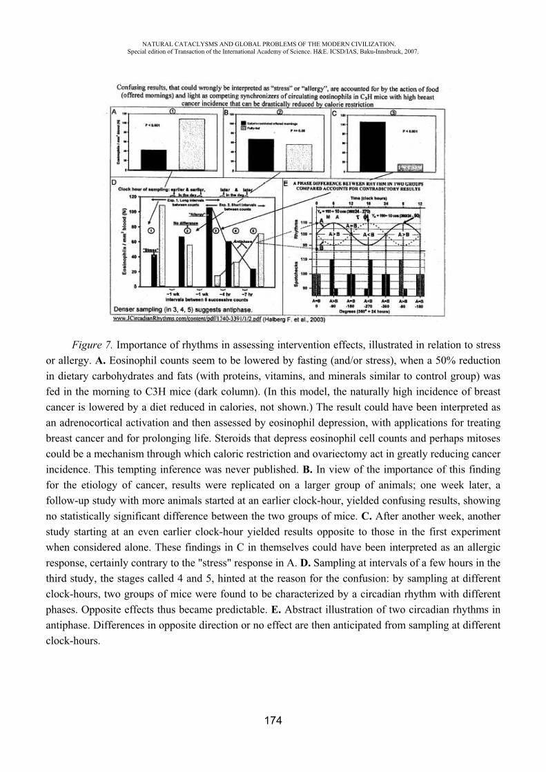
NATURAL CATACLYSMS AND GLOBAL PROBLEMS OF THE MODERN CIVILIZATION. Special edition of Transaction of the International Academy of Science. H&E. ICSD/IAS, Baku-Innsbruck, 2007.
174
Figure 7. Importance of rhythms in assessing intervention effects, illustrated in relation to stress or allergy. A. Eosinophil counts seem to be lowered by fasting (and/or stress), when a 50% reduction in dietary carbohydrates and fats (with proteins, vitamins, and minerals similar to control group) was fed in the morning to C3H mice (dark column). (In this model, the naturally high incidence of breast cancer is lowered by a diet reduced in calories, not shown.) The result could have been interpreted as an adrenocortical activation and then assessed by eosinophil depression, with applications for treating breast cancer and for prolonging life. Steroids that depress eosinophil cell counts and perhaps mitoses could be a mechanism through which caloric restriction and ovariectomy act in greatly reducing cancer incidence. This tempting inference was never published. B. In view of the importance of this finding for the etiology of cancer, results were replicated on a larger group of animals; one week later, a follow-up study with more animals started at an earlier clock-hour, yielded confusing results, showing no statistically significant difference between the two groups of mice. C. After another week, another study starting at an even earlier clock-hour yielded results opposite to those in the first experiment when considered alone. These findings in C in themselves could have been interpreted as an allergic response, certainly contrary to the "stress" response in A. D. Sampling at intervals of a few hours in the third study, the stages called 4 and 5, hinted at the reason for the confusion: by sampling at different clock-hours, two groups of mice were found to be characterized by a circadian rhythm with different phases. Opposite effects thus became predictable. E. Abstract illustration of two circadian rhythms in antiphase. Differences in opposite direction or no effect are then anticipated from sampling at different clock-hours.
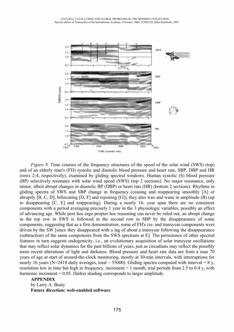
NATURAL CATACLYSMS AND GLOBAL PROBLEMS OF THE MODERN CIVILIZATION. Special edition of Transaction of the International Academy of Science. H&E. ICSD/IAS, Baku-Innsbruck, 2007.
175
Figure 8. Time courses of the frequency structures of the speed of the solar wind (SWS) (top) and of an elderly man's (FH) systolic and diastolic blood pressure and heart rate, SBP, DBP and HR (rows 2-4, respectively), examined by gliding spectral windows. Human systolic (S) blood pressure (BP) selectively resonates with solar wind speed (SWS) (top 2 sections). No major resonance, only minor, albeit abrupt changes in diastolic BP (DBP) or heart rate (HR) (bottom 2 sections). Rhythms in gliding spectra of SWS and SBP change in frequency (ceasing and reappearing smoothly [A] or abruptly [B, C, D]; bifurcating [D, F] and rejoining [G]); they also wax and wane in amplitude (B) (up to disappearing [C, E] and reappearing). During a nearly 16- year span there are no consistent components with a period averaging precisely 1 year in the 3 physiologic variables, possibly an effect of advancing age. While post hoc ergo propter hoc reasoning can never be ruled out, an abrupt change in the top row in SWS is followed in the second row in SBP by the disappearance of some components, suggesting that as a first demonstration, some of FH's cis- and transyear components were driven by the SW [since they disappeared with a lag of about a transyear following the disappearance (subtraction) of the same components from the SWS spectrum at E]. The persistence of other spectral features in turn suggests endogenicity, i.e., an evolutionary acquisition of solar transyear oscillations that may reflect solar dynamics for the past billions of years, just as circadians may reflect the possibly more recent alterations of light and darkness. Blood pressure and heart rate data are from a man 70 years of age at start of around-the-clock monitoring, mostly at 30-min intervals, with interruptions for nearly 16 years (N=2418 daily averages, total ~ 55000). Gliding spectra computed with interval = 8 y, resolution low in time but high in frequency, increment = 1 month, trial periods from 2.5 to 0.4 y, with harmonic increment = 0.05. Darker shading corresponds to larger amplitude.
APPENDIX by Larry A. Beaty Future direction: web-enabled software

NATURAL CATACLYSMS AND GLOBAL PROBLEMS OF THE MODERN CIVILIZATION. Special edition of Transaction of the International Academy of Science. H&E. ICSD/IAS, Baku-Innsbruck, 2007.
176
As hardware and software technologies advance, we expect to see improvements in the convenience, cost, sensitivity of sensors, and network connectivity of blood pressure monitors that will affect how 7-day/24-hour monitoring, or preferably surveillance for much longer, is done. Making use of the analysis software available to home users interested in self-help-based, preventive health care is the subject of a recently-started website and software project, operating under the project name "sphygmochron.org" (where a summary of around-the-clock and along-the-week blood pressure and heart rate dynamics is dubbed a "sphygmochron"). We visualize, and are beginning implementation of, a website that could serve the multiple purposes of 1) persuading subjects for life-long self-help in surveilled health care by providing analyses that detect risk or disease, and guide treatment, and 2) continuing research on improving reference standards and refining the procedures that now detect treatable conditions with risks greater than hypertension. This website implements user scenarios along the lines of those documented in (1). Specific components of the website design address:
� making the sphygmochron analysis available to home users, and their health care providers, � making blood pressure data from home users available to researchers, � updating the analysis software with the results of new research as time progresses, � providing a library of educational materials for home users and health care providers,� building a community of self-helping users consisting of those engaged in preventive health
care as well as those being treated by health care providers.
The website would contribute advanced transdisciplinary basic biological as well as medical research data bases, with the biological data base aiming at a clarification of biological associations of solar and terrestrial effects in human physiology. The medical data base would serve to gradually improve the service rendered by the website to selfcare recipients by a refinement of the reference standards and of the harbingers of elevated risk of severe disease. A series of updates to the existing sphygmochron software and additional analysis programs is planned for use by those who repeat monitoring sessions (annually, on some other schedule, or as warranted by analysis. To support users retrieving data directly from blood pressure monitors, the website will accept files as produced by many commercially-available devices and manufacturersupplied analysis software. The user of the website must be computer-literate, but can perform analyses for multiple people, including those who need help with tasks involving computers. The first major scenario to be supported includes a family member accessing the website for his spouse, children, aged parents, people with disabilities, or others who fall within the member's guardianship. The second scenario is for health care professionals or their staff members to log in and submit data for patients. In the near term, the website supports running the sphygmochron analysis. In the long term, comparative analysis programs currently used at the Halberg Chronobiology Center at the University of Minnesota can also be run (2). The comparative analysis programs need two or more files of blood pressure data taken at different times in the person's life, or preferably a more or less continuous record, such as that taken by hypertensive opinion leaders from the time of diagnosis to their life's end. For instance, a former head of the then Hypertension/Endocrinology section of the U.S. National Institutes of Health who thereafter became director of that institution's Clinical Center believed that when hypertension is involved, one should not "fly blind" (3) (without continued surveillance by monitoring) (4). A small, well-focused library of materials related to sphygmochron analysis, heart and blood vessel physiology, cardiac diseases, and treatments will be kept on the website. The library will contain sections for different types of users, including children, high school and college students, adult home users, and medical and health care
NATURAL CATACLYSMS AND GLOBAL PROBLEMS OF THE MODERN CIVILIZATION. Special edition of Transaction of the International Academy of Science. H&E. ICSD/IAS, Baku-Innsbruck, 2007.
177
students and professionals. The most important section might be the one for adult home users. It supports the desires of users with different backgrounds and levels of education to:
� learn advanced interpretation of sphygmochron reports, and � research medical conditions, diseases, and treatments beyond the level of everyday
"household" words.
To support building a community of self-helped home users interested in preventive and curative health care, a popular web mechanism currently employed by some internet users in self-help or self-directed educational situations is "forum" software, which lets users communicate with each other via leaving publicly available messages directly on the website. The envisioned website will have such forums available early in its lifetime. The concept of community-building on the internet still seems to be undergoing considerable change; we expect to watch for new trends in this area and adapt the website accordingly to accommodate desires of the users. The website will make available information about obtaining a blood pressure monitor for ambulatory use (often called an Ambulatory Blood Pressure Monitor, ABPM), since many home users, especially those interested in the self-help style of medical care, might not know how to obtain ABPMs at reasonable cost, and will have questions about ABPM quality, testing and calibration, data off-loading software, and the logistics of wearing an ABPM around the clock for a week or longer. A common question will be along the lines of "This is different from current practice. How can this information help me, and how can my doctor use it?" We plan to encourage home users to monitor themselves for longer and longer time spans to get more and more basic and applied information from the analyses available on the website. ABPMs of varying quality and robustness are available and will be documented:
� professional models costing a few thousand dollars � discounted professional models available to BIOCOS project participants � home ABPM kits or projects for hobbyists
As additional models and categories of ABPMs become available over the next few years, the website will be updated with descriptions and other appropriate information, to help its users capitalize on those improvements in the convenience, cost, sensitivity of sensors, and connectivity of blood pressure monitors that will affect how 7-day/24-hour monitoring, or preferably much longer surveillance, analyzed as one goes, is done. By 1880, Ignaz Zadek (5) had sufficient data to allow the demonstration in a metaanalysis of about-24-hour and about-7-day changes in blood pressure. By 1904, Janeway at Johns Hopkins Hospital insisted, before seeing a patient, on having enough data to evaluate periodic variations (note: variations is plural) (6). He could do so on the basis of Zadek's record. In 2007, signatures of both the about-10.5-year Schwabe cycle and 21-year Hale cycle are demonstrated in the human circulation (7), along with many other nonphotic cycles, probably magnetoperiodisms, some of which also have signatures in sudden cardiac death, an association speaking for their importance. Assessment of these different periodicities in long populations' and individual's records will be a dividend in basic science and space weather monitoring from self-help in health care that continuously assesses variability. This longitudinal surveillance could start for many hypertensives at the time of a chronomic diagnosis (8,9) of abnormality to the time of life's end. The benefit for the individual involved would be a reduction in the number of episodes of variability disorders, by their prompt detection and treatment (while otherwise an anti-hypertensive treatment might constitute the trade of a lesser risk such as hypertension for greater risk such as a circadian blood pressure overswing). Control of a silent disease (hypertension) without bringing about a yet greater also silent risk (overswing) cannot be achieved without continuous surveillance in some cases, a
NATURAL CATACLYSMS AND GLOBAL PROBLEMS OF THE MODERN CIVILIZATION. Special edition of Transaction of the International Academy of Science. H&E. ICSD/IAS, Baku-Innsbruck, 2007.
178
critical remaining research problem awaiting studies on populations. Every person with alterations in variability of blood pressure and heart rate should continuously monitor and analyze, and thus serve his or her own health care as well as science. The website could, in combination with existing and improved blood pressure monitors, enable the public at large to determine the need for surveillance, and then implement continuous monitoring, individual-by-individual.
REFERENCES
1. Adams C. Privacy requirements for low-cost chronomedical systems. International Conference on the Frontiers of Biomedical Science: Chronobiology, Chengdu, China, September 24-26, 206, p. 64-69.
2. Cornélissen G., Halberg F., Hawkins D., Otsuka K., Henke W. Individual assessment of antihypertensive response by self-starting cumulative sums. J Medical Engineering & Technology 1997; 21: 111-120.
3. Halberg F., Cornélissen G., Halberg J., Fink H., Chen C-H, Otsuka K., Watanabe Y., Kumagai Y., Syutkina E.V., Kawasaki T., Uezono K., Zhao Z.Y., Schwartzkopff O. Circadian Hyper-Amplitude-Tension, CHAT: a disease risk syndrome of anti-aging medicine. J Anti-Aging Med 1998; 1: 239-259. (Editor's Note by Fossel M, p. 239.)
4. Bartter F.C. Periodicity and medicine. In: Scheving L.E., Halberg F., Pauly J.E., eds. Chronobiology. Tokyo: Igaku Shoin Ltd.; 1974. p. 6-13. another patient."
5. Zadek I. Die Messung des Blutdrucks am Menschen mittelst des Basch'chen Apparates. Berlin, med. F., Diss., 25. Nov 1880. Berlin: Schumacher; 1880. 48 p.
6. Janeway T.C. The clinical study of blood pressure. New York: D. Appleton & Co.; 1904. 300 pp. 7. Halberg F., Cornélissen G., Katinas G, Chibisov S., Holley D., Czaplicki J., Otsuka K., Wang Z.R., Bakken E.E. Cycles in the biosphere in the service of solar-terrestrial physics and vice versa. Proceedings, International Conference on the Frontiers of Biomedical Science: Chronobiology, Chengdu, China, September 24-26, 2006, p. 36-39.
7. Halberg F., Cornélissen G., International Womb-to-Tomb Chronome Initiative Group: Resolution from a meeting of the International Society for Research on Civilization Diseases and the Environment (New SIRMCE Confederation), Brussels, Belgium, March 17-18, 1995: Fairy tale or reality ? Medtronic Chronobiology Seminar #8, April 1995, 12 pp. text, 18 figures. URL http://www.msi.umn.edu/~halberg/
8. Cornélissen G., Halberg F., Otsuka K., Singh R.B., Chen C.H. Chronobiology predicts actual and proxy outcomes when dipping fails. Hypertension 2007; 49: 237-239. doi:10.1161/01.HYP.0000250392.51418.64.
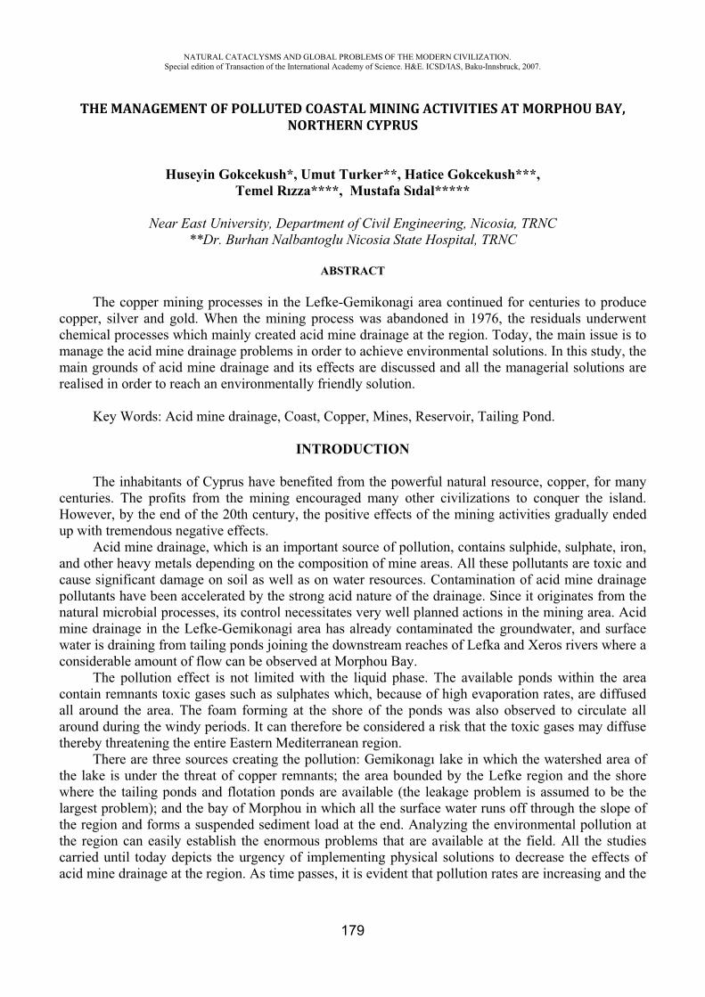
NATURAL CATACLYSMS AND GLOBAL PROBLEMS OF THE MODERN CIVILIZATION. Special edition of Transaction of the International Academy of Science. H&E. ICSD/IAS, Baku-Innsbruck, 2007.
179
THE MANAGEMENT OF POLLUTED COASTAL MINING ACTIVITIES AT MORPHOU BAY,NORTHERN CYPRUS
Huseyin Gokcekush*, Umut Turker**, Hatice Gokcekush***,Temel Rızza****, Mustafa Sıdal*****
Near East University, Department of Civil Engineering, Nicosia, TRNC **Dr. Burhan Nalbantoglu Nicosia State Hospital, TRNC
ABSTRACT
The copper mining processes in the Lefke-Gemikonagi area continued for centuries to produce copper, silver and gold. When the mining process was abandoned in 1976, the residuals underwent chemical processes which mainly created acid mine drainage at the region. Today, the main issue is to manage the acid mine drainage problems in order to achieve environmental solutions. In this study, the main grounds of acid mine drainage and its effects are discussed and all the managerial solutions are realised in order to reach an environmentally friendly solution.
Key Words: Acid mine drainage, Coast, Copper, Mines, Reservoir, Tailing Pond.
INTRODUCTION
The inhabitants of Cyprus have benefited from the powerful natural resource, copper, for many centuries. The profits from the mining encouraged many other civilizations to conquer the island. However, by the end of the 20th century, the positive effects of the mining activities gradually ended up with tremendous negative effects.
Acid mine drainage, which is an important source of pollution, contains sulphide, sulphate, iron, and other heavy metals depending on the composition of mine areas. All these pollutants are toxic and cause significant damage on soil as well as on water resources. Contamination of acid mine drainage pollutants have been accelerated by the strong acid nature of the drainage. Since it originates from the natural microbial processes, its control necessitates very well planned actions in the mining area. Acid mine drainage in the Lefke-Gemikonagi area has already contaminated the groundwater, and surface water is draining from tailing ponds joining the downstream reaches of Lefka and Xeros rivers where a considerable amount of flow can be observed at Morphou Bay.
The pollution effect is not limited with the liquid phase. The available ponds within the area contain remnants toxic gases such as sulphates which, because of high evaporation rates, are diffused all around the area. The foam forming at the shore of the ponds was also observed to circulate all around during the windy periods. It can therefore be considered a risk that the toxic gases may diffuse thereby threatening the entire Eastern Mediterranean region.
There are three sources creating the pollution: Gemikonagı lake in which the watershed area of the lake is under the threat of copper remnants; the area bounded by the Lefke region and the shore where the tailing ponds and flotation ponds are available (the leakage problem is assumed to be the largest problem); and the bay of Morphou in which all the surface water runs off through the slope of the region and forms a suspended sediment load at the end. Analyzing the environmental pollution at the region can easily establish the enormous problems that are available at the field. All the studies carried until today depicts the urgency of implementing physical solutions to decrease the effects of acid mine drainage at the region. As time passes, it is evident that pollution rates are increasing and the
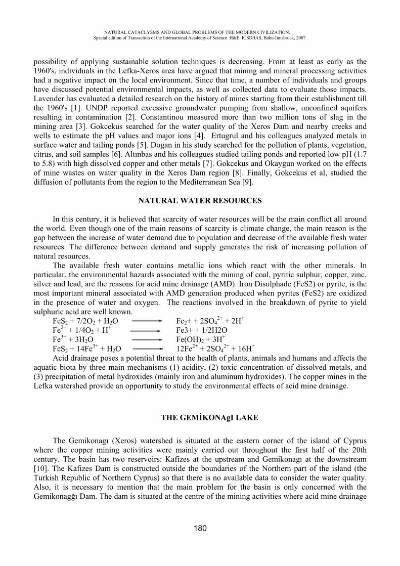
NATURAL CATACLYSMS AND GLOBAL PROBLEMS OF THE MODERN CIVILIZATION. Special edition of Transaction of the International Academy of Science. H&E. ICSD/IAS, Baku-Innsbruck, 2007.
180
possibility of applying sustainable solution techniques is decreasing. From at least as early as the 1960's, individuals in the Lefka-Xeros area have argued that mining and mineral processing activities had a negative impact on the local environment. Since that time, a number of individuals and groups have discussed potential environmental impacts, as well as collected data to evaluate those impacts. Lavender has evaluated a detailed research on the history of mines starting from their establishment till the 1960's [1]. UNDP reported excessive groundwater pumping from shallow, unconfined aquifers resulting in contamination [2]. Constantinou measured more than two million tons of slag in the mining area [3]. Gokcekus searched for the water quality of the Xeros Dam and nearby creeks and wells to estimate the pH values and major ions [4]. Ertugrul and his colleagues analyzed metals in surface water and tailing ponds [5]. Dogan in his study searched for the pollution of plants, vegetation, citrus, and soil samples [6]. Altınbas and his colleagues studied tailing ponds and reported low pH (1.7 to 5.8) with high dissolved copper and other metals [7]. Gokcekus and Okaygun worked on the effects of mine wastes on water quality in the Xeros Dam region [8]. Finally, Gokcekus et al, studied the diffusion of pollutants from the region to the Mediterranean Sea [9].
NATURAL WATER RESOURCES
In this century, it is believed that scarcity of water resources will be the main conflict all around the world. Even though one of the main reasons of scarcity is climate change, the main reason is the gap between the increase of water demand due to population and decrease of the available fresh water resources. The difference between demand and supply generates the risk of increasing pollution of natural resources.
The available fresh water contains metallic ions which react with the other minerals. In particular, the environmental hazards associated with the mining of coal, pyritic sulphur, copper, zinc, silver and lead, are the reasons for acid mine drainage (AMD). Iron Disulphade (FeS2) or pyrite, is the most important mineral associated with AMD generation produced when pyrites (FeS2) are oxidized in the presence of water and oxygen. The reactions involved in the breakdown of pyrite to yield sulphuric acid are well known.
FeS2 + 7/2O2 + H2O Fe2+ + 2SO42+ + 2H+
Fe2+ + 1/4O2 + H+ Fe3+ + 1/2H2O Fe3+ + 3H2O Fe(OH)2 + 3H+
FeS2 + 14Fe3+ + H2O 12Fe2+ + 2SO42+ + 16H+
Acid drainage poses a potential threat to the health of plants, animals and humans and affects the aquatic biota by three main mechanisms (1) acidity, (2) toxic concentration of dissolved metals, and (3) precipitation of metal hydroxides (mainly iron and aluminum hydroxides). The copper mines in the Lefka watershed provide an opportunity to study the environmental effects of acid mine drainage.
THE GEM KONAgI LAKE
The Gemikonagı (Xeros) watershed is situated at the eastern corner of the island of Cyprus where the copper mining activities were mainly carried out throughout the first half of the 20th century. The basin has two reservoirs: Kafizes at the upstream and Gemikonagı at the downstream [10]. The Kafizes Dam is constructed outside the boundaries of the Northern part of the island (the Turkish Republic of Northern Cyprus) so that there is no available data to consider the water quality. Also, it is necessary to mention that the main problem for the basin is only concerned with the Gemikonag ı Dam. The dam is situated at the centre of the mining activities where acid mine drainage
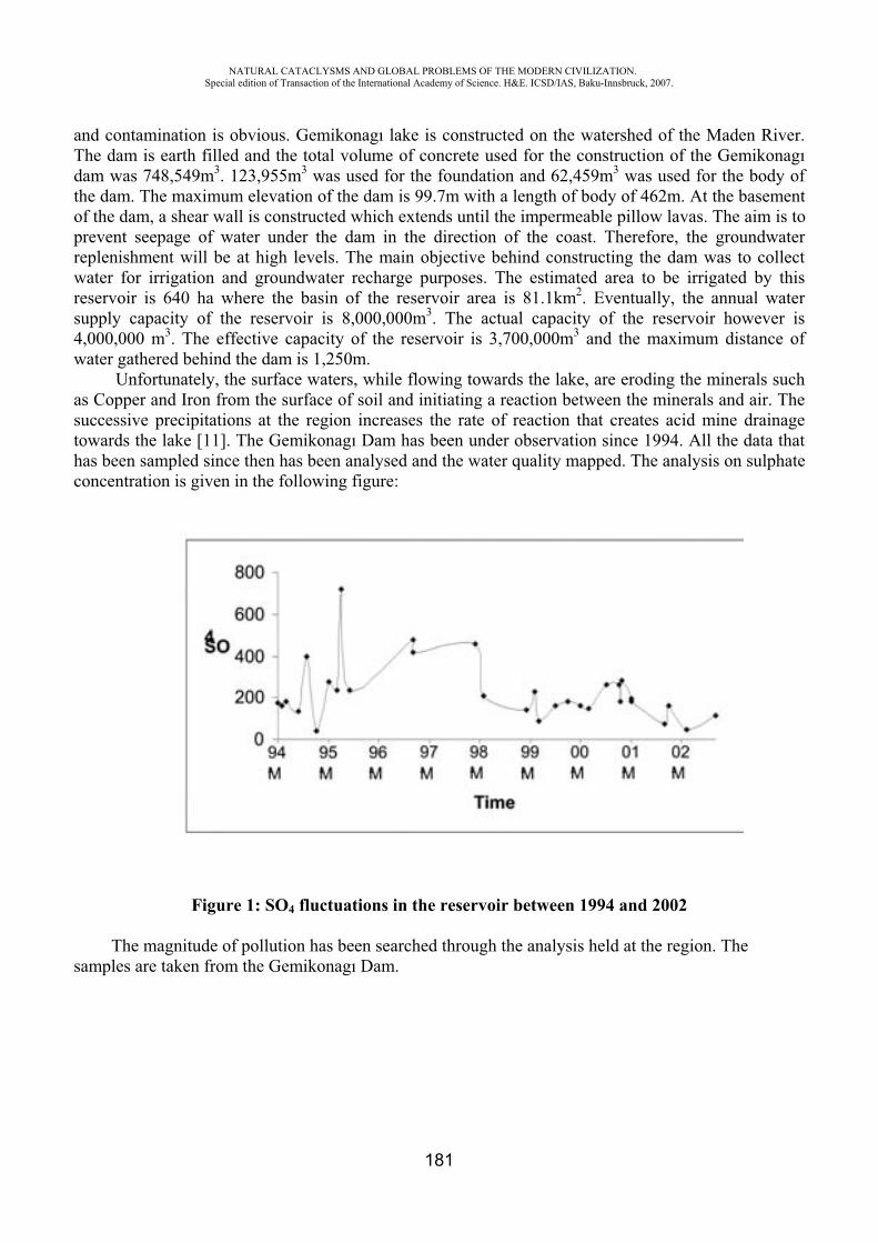
NATURAL CATACLYSMS AND GLOBAL PROBLEMS OF THE MODERN CIVILIZATION. Special edition of Transaction of the International Academy of Science. H&E. ICSD/IAS, Baku-Innsbruck, 2007.
181
and contamination is obvious. Gemikonagı lake is constructed on the watershed of the Maden River. The dam is earth filled and the total volume of concrete used for the construction of the Gemikonagıdam was 748,549m3. 123,955m3 was used for the foundation and 62,459m3 was used for the body of the dam. The maximum elevation of the dam is 99.7m with a length of body of 462m. At the basement of the dam, a shear wall is constructed which extends until the impermeable pillow lavas. The aim is to prevent seepage of water under the dam in the direction of the coast. Therefore, the groundwater replenishment will be at high levels. The main objective behind constructing the dam was to collect water for irrigation and groundwater recharge purposes. The estimated area to be irrigated by this reservoir is 640 ha where the basin of the reservoir area is 81.1km2. Eventually, the annual water supply capacity of the reservoir is 8,000,000m3. The actual capacity of the reservoir however is 4,000,000 m3. The effective capacity of the reservoir is 3,700,000m3 and the maximum distance of water gathered behind the dam is 1,250m.
Unfortunately, the surface waters, while flowing towards the lake, are eroding the minerals such as Copper and Iron from the surface of soil and initiating a reaction between the minerals and air. The successive precipitations at the region increases the rate of reaction that creates acid mine drainage towards the lake [11]. The Gemikonagı Dam has been under observation since 1994. All the data that has been sampled since then has been analysed and the water quality mapped. The analysis on sulphate concentration is given in the following figure:
Figure 1: SO4 fluctuations in the reservoir between 1994 and 2002
The magnitude of pollution has been searched through the analysis held at the region. The samples are taken from the Gemikonagı Dam.
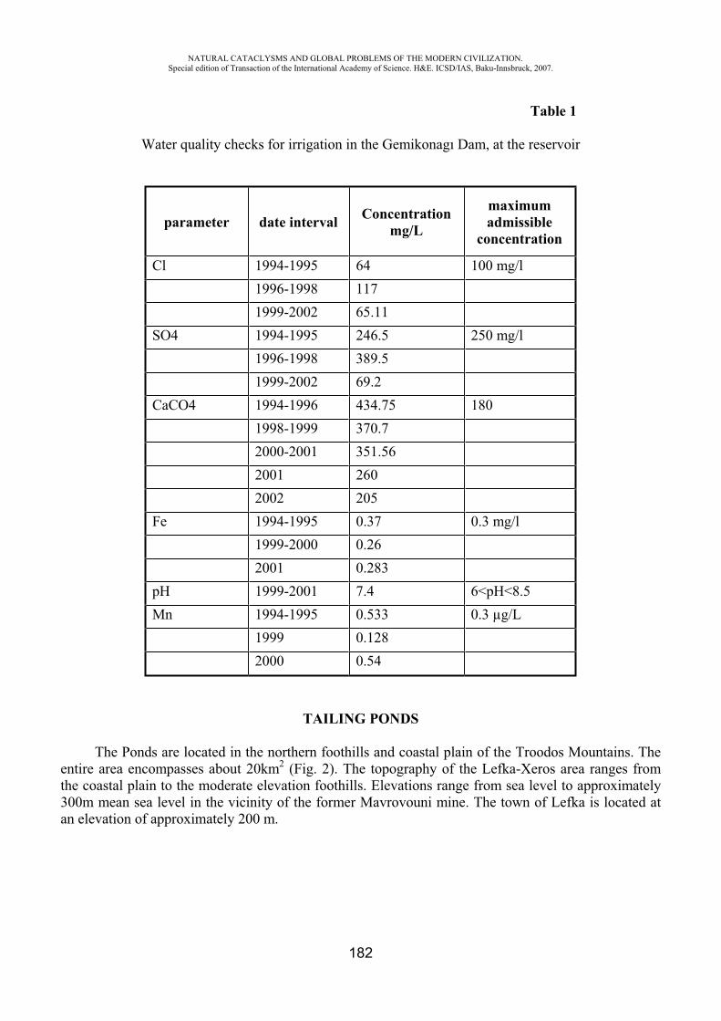
NATURAL CATACLYSMS AND GLOBAL PROBLEMS OF THE MODERN CIVILIZATION. Special edition of Transaction of the International Academy of Science. H&E. ICSD/IAS, Baku-Innsbruck, 2007.
182
Table 1
Water quality checks for irrigation in the Gemikonagı Dam, at the reservoir
parameter date interval Concentrationmg/L
maximumadmissible
concentration
Cl 1994-1995 64 100 mg/l 1996-1998 117 1999-2002 65.11 SO4 1994-1995 246.5 250 mg/l 1996-1998 389.5 1999-2002 69.2 CaCO4 1994-1996 434.75 180 1998-1999 370.7 2000-2001 351.56 2001 260 2002 205 Fe 1994-1995 0.37 0.3 mg/l 1999-2000 0.26 2001 0.283 pH 1999-2001 7.4 6<pH<8.5 Mn 1994-1995 0.533 0.3 μg/L 1999 0.128 2000 0.54
TAILING PONDS
The Ponds are located in the northern foothills and coastal plain of the Troodos Mountains. The entire area encompasses about 20km2 (Fig. 2). The topography of the Lefka-Xeros area ranges from the coastal plain to the moderate elevation foothills. Elevations range from sea level to approximately 300m mean sea level in the vicinity of the former Mavrovouni mine. The town of Lefka is located at an elevation of approximately 200 m.
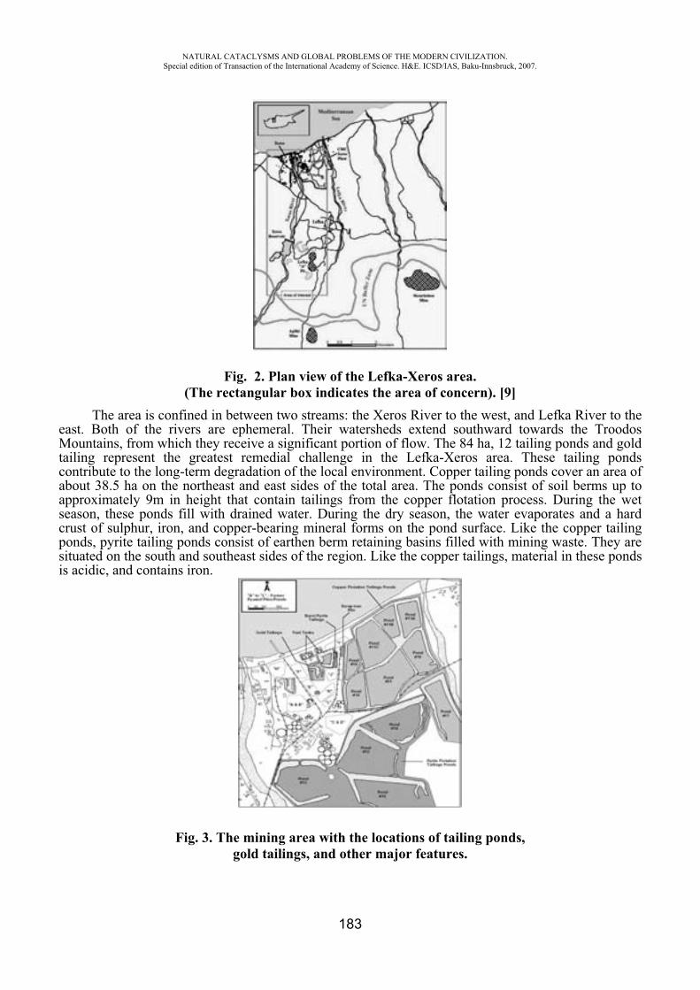
NATURAL CATACLYSMS AND GLOBAL PROBLEMS OF THE MODERN CIVILIZATION. Special edition of Transaction of the International Academy of Science. H&E. ICSD/IAS, Baku-Innsbruck, 2007.
183
Fig. 2. Plan view of the Lefka-Xeros area. (The rectangular box indicates the area of concern). [9]
The area is confined in between two streams: the Xeros River to the west, and Lefka River to the east. Both of the rivers are ephemeral. Their watersheds extend southward towards the Troodos Mountains, from which they receive a significant portion of flow. The 84 ha, 12 tailing ponds and gold tailing represent the greatest remedial challenge in the Lefka-Xeros area. These tailing ponds contribute to the long-term degradation of the local environment. Copper tailing ponds cover an area of about 38.5 ha on the northeast and east sides of the total area. The ponds consist of soil berms up to approximately 9m in height that contain tailings from the copper flotation process. During the wet season, these ponds fill with drained water. During the dry season, the water evaporates and a hard crust of sulphur, iron, and copper-bearing mineral forms on the pond surface. Like the copper tailing ponds, pyrite tailing ponds consist of earthen berm retaining basins filled with mining waste. They are situated on the south and southeast sides of the region. Like the copper tailings, material in these ponds is acidic, and contains iron.
Fig. 3. The mining area with the locations of tailing ponds, gold tailings, and other major features.
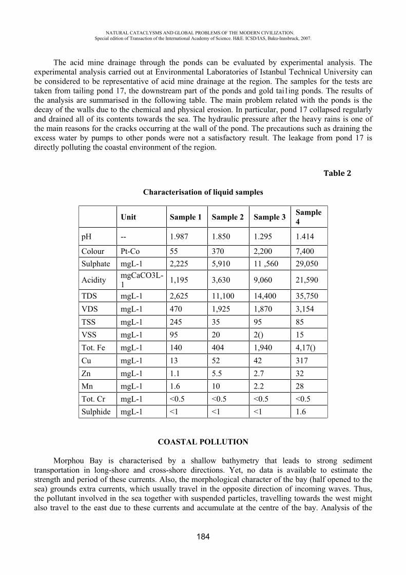
NATURAL CATACLYSMS AND GLOBAL PROBLEMS OF THE MODERN CIVILIZATION. Special edition of Transaction of the International Academy of Science. H&E. ICSD/IAS, Baku-Innsbruck, 2007.
184
The acid mine drainage through the ponds can be evaluated by experimental analysis. The experimental analysis carried out at Environmental Laboratories of Istanbul Technical University can be considered to be representative of acid mine drainage at the region. The samples for the tests are taken from tailing pond 17, the downstream part of the ponds and gold tai1ing ponds. The results of the analysis are summarised in the following table. The main problem related with the ponds is the decay of the walls due to the chemical and physical erosion. In particular, pond 17 collapsed regularly and drained all of its contents towards the sea. The hydraulic pressure after the heavy rains is one of the main reasons for the cracks occurring at the wall of the pond. The precautions such as draining the excess water by pumps to other ponds were not a satisfactory result. The leakage from pond 17 is directly polluting the coastal environment of the region.
Table 2
Characterisation of liquid samples
Unit Sample 1 Sample 2 Sample 3 Sample4
pH -- 1.987 1.850 1.295 1.414
Colour Pt-Co 55 370 2,200 7,400 Sulphate mgL-1 2,225 5,910 11 ,560 29,050
Acidity mgCaCO3L-1 1,195 3,630 9,060 21,590
TDS mgL-1 2,625 11,100 14,400 35,750 VDS mgL-1 470 1,925 1,870 3,154 TSS mgL-1 245 35 95 85 VSS mgL-1 95 20 2() 15 Tot. Fe mgL-1 140 404 1,940 4,17() Cu mgL-1 13 52 42 317 Zn mgL-1 1.1 5.5 2.7 32 Mn mgL-1 1.6 10 2.2 28 Tot. Cr mgL-1 <0.5 <0.5 <0.5 <0.5 Sulphide mgL-1 <1 <1 <1 1.6
COASTAL POLLUTION
Morphou Bay is characterised by a shallow bathymetry that leads to strong sediment transportation in long-shore and cross-shore directions. Yet, no data is available to estimate the strength and period of these currents. Also, the morphological character of the bay (half opened to the sea) grounds extra currents, which usually travel in the opposite direction of incoming waves. Thus, the pollutant involved in the sea together with suspended particles, travelling towards the west might also travel to the east due to these currents and accumulate at the centre of the bay. Analysis of the
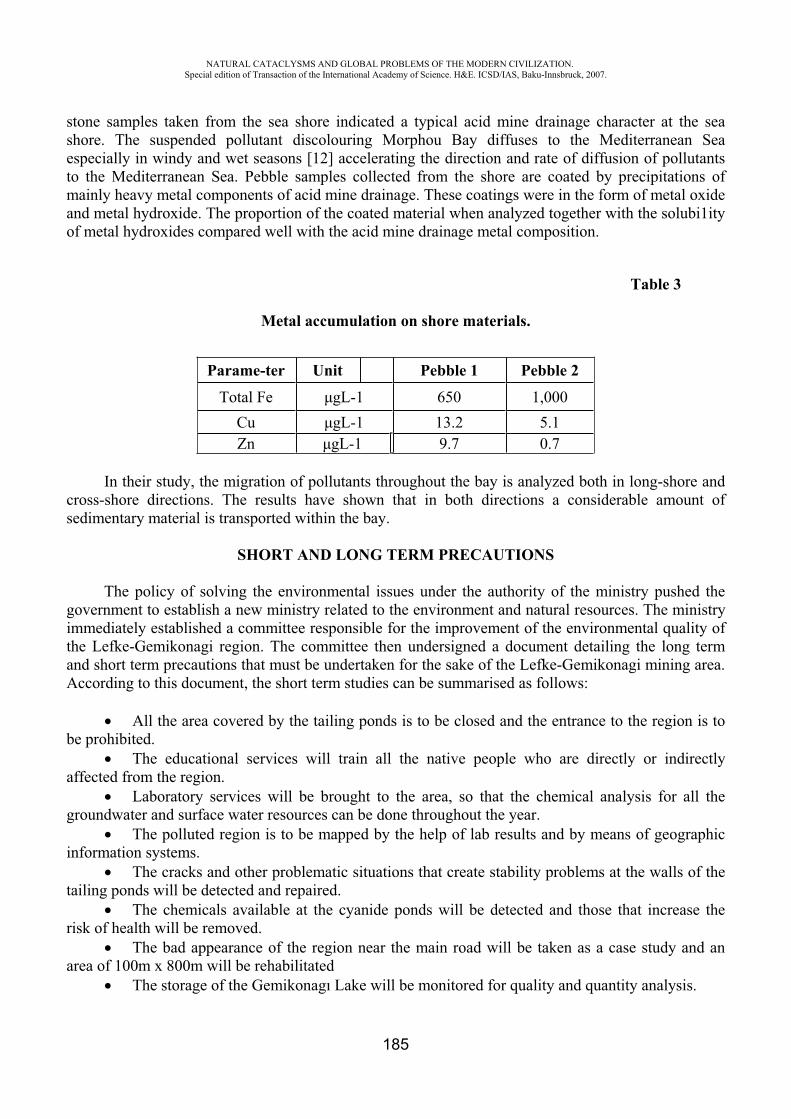
NATURAL CATACLYSMS AND GLOBAL PROBLEMS OF THE MODERN CIVILIZATION. Special edition of Transaction of the International Academy of Science. H&E. ICSD/IAS, Baku-Innsbruck, 2007.
185
stone samples taken from the sea shore indicated a typical acid mine drainage character at the sea shore. The suspended pollutant discolouring Morphou Bay diffuses to the Mediterranean Sea especially in windy and wet seasons [12] accelerating the direction and rate of diffusion of pollutants to the Mediterranean Sea. Pebble samples collected from the shore are coated by precipitations of mainly heavy metal components of acid mine drainage. These coatings were in the form of metal oxide and metal hydroxide. The proportion of the coated material when analyzed together with the solubi1ity of metal hydroxides compared well with the acid mine drainage metal composition.
Table 3
Metal accumulation on shore materials.
Parame-ter Unit Pebble 1 Pebble 2
Total Fe gL-1 650 1,000 Cu gL-1 13.2 5.1 Zn gL-1 9.7 0.7
In their study, the migration of pollutants throughout the bay is analyzed both in long-shore and cross-shore directions. The results have shown that in both directions a considerable amount of sedimentary material is transported within the bay.
SHORT AND LONG TERM PRECAUTIONS
The policy of solving the environmental issues under the authority of the ministry pushed the government to establish a new ministry related to the environment and natural resources. The ministry immediately established a committee responsible for the improvement of the environmental quality of the Lefke-Gemikonagi region. The committee then undersigned a document detailing the long term and short term precautions that must be undertaken for the sake of the Lefke-Gemikonagi mining area. According to this document, the short term studies can be summarised as follows:
All the area covered by the tailing ponds is to be closed and the entrance to the region is to be prohibited.
The educational services will train all the native people who are directly or indirectly affected from the region.
Laboratory services will be brought to the area, so that the chemical analysis for all the groundwater and surface water resources can be done throughout the year.
The polluted region is to be mapped by the help of lab results and by means of geographic information systems.
The cracks and other problematic situations that create stability problems at the walls of the tailing ponds will be detected and repaired.
The chemicals available at the cyanide ponds will be detected and those that increase the risk of health will be removed.
The bad appearance of the region near the main road will be taken as a case study and an area of 100m x 800m will be rehabilitated
The storage of the Gemikonagı Lake will be monitored for quality and quantity analysis.
NATURAL CATACLYSMS AND GLOBAL PROBLEMS OF THE MODERN CIVILIZATION. Special edition of Transaction of the International Academy of Science. H&E. ICSD/IAS, Baku-Innsbruck, 2007.
186
The area will be reinforced with dense vegetal cover. All the drainage network system of the Lefke urban area will be reconsidered and
rehabilitated.
The long term studies, however, can be defined as follows:
All the waste available at the region will be removed and dumped to another area where the soil will be impermeable, or by means of membranes, impermeability will be provided.
The design and implementation of the rehabilitation of Lefke creek. Construction of observation wells, especially all along the shoreline to observe leakage from
land towards the coast. All the studies followed from the beginning of the mining till today must be gathered and
collected within a library that will serve anybody who is interested in studying the problem.
RESULTS AND RECOMMENDATIONS
All the analysis carried out until today has proven that in the Lefke-Gemikona ı region, there is a pollution problem which is not only bounded by surface and underground levels but also air is affected. The pollution can be mapped within three regions which are the reservoir site, tailing ponds and mining area, and the coastal region. The cultural and historical importance of the region urges the immediate rehabilitation of the region. The short term precautions for the region must be directly related with the risk of the heath of all the flora and fauna at the region. While analysing the long and short term studies, the economical analysis should also be considered. The economical analysis might define weather and the waste might be treated with technological systems so that profit can be obtained after treating. Otherwise, no profit is to be considered and all the waste from the region immediately demolished. If no profit is expected from the waste, the best solution will be to confine all waste by impermeable layers. This can cease both infiltration and evaporation of toxic materials. The confined layer can be maintained either by industrial products such as membranes or by natural resources such as marl or clay. The stability of the pools is important and must be analysed statically and hydrodynamically.
For the Gemikonagi Reservoir, it is important to remove the waste material from the surface of the watershed of the reservoir. This can be achieved especially in the dry seasons when the reservoir itself can sometimes be dried so that the bottom of the lake can also be cleaned. The coast and the sea are expected to clean themselves as the cross-shore and long-shore currents wash the coast. However, this can only be achieved if the incoming acid mine drainage can be stopped. It is also necessary to stop fishing at the region until the living flora and fauna in the sea are analysed chemically and biologically.
CONCLUSION
As mentioned previously, heavy efforts have been spent for rehabilitation and containment of the area. However, until today, there is no concrete development for the rehabilitation of the area. The results of the present study show that the principle source of the pollution is acid mine drainage which causes contamination of ground and surface waters and also pollution of the sea. It is compulsory to mention that all these pollution problems can be handled if cooperation between the relevant interdisciplinary can be achieved.
NATURAL CATACLYSMS AND GLOBAL PROBLEMS OF THE MODERN CIVILIZATION. Special edition of Transaction of the International Academy of Science. H&E. ICSD/IAS, Baku-Innsbruck, 2007.
187
REFERENCES
1. Lavender D. The Story of Cyprus Mines Corporation; Huntington Library and Art Gallery Press: San Marino, California, 1962; 387 pp.
2. United Nations Development Program (UNDP). Survey of Groundwater and Mineral Resources, Cyprus, Technical Report DP/SF/UN/50; New York, 1970.
3. Constantinou G. Ancient Copper Mining in Cyprus, In Proceedings of the Conference on Cyprus, Copper, and the Sea, Seville, 1992; Marangou A., Ed.; Seville, 1992.
4. Gokcekus H. Surface and Groundwater Contamination from Mining Reserves and their Effect on Human Health, In Proceedings of Water Congress. Nicosia, Cyprus, Feb 23-24, 1995; Association of Cyprus Turkish Engineers and Architects Press: Nicosia, 1995.
5. Ertugrul A.M.; Ertugrul T.M.; Taner I. Site Investigation, Sampling, Evaluation and Remedial Recomendations.-Gemikona ı, Processing and Mining Area. A&M Engineering and Environmental Service: Northern Cyprus. 1998.
6. Dogan F. Environmental Effects of Copper Mining Waste in the Lefka Area, Preliminary Report; Ege University, Research Center of Environment: zmir, Turkey, 1999.
7. Altınbas U.; Erdem, U.; and Veryeri N.O. Effects of CMC mining on natural resources in Lefka, Proceedings of the International Conference on European Environmental Policy and the Case of Cyprus Mines, Lefke, North Cyprus, Feb 15-16, 2001; Gokcekus, H., Ed.; Lefke, 2001.
8. Gokcekus H.; Okaygun M. Mining Contamination: A case study from northern Cyprus – Gemikonagi (Xeros) area, Proceedings of the International Conference on European Environmental Policy and the Case of Cyprus Mines, Lefke, North Cyprus, Feb 15-16, 2001; Gokcekus, H., Ed.; Lefke, 2001.
9. Cohen A. H., Preliminary Report for Environmental Assessment of the Lefka-Xeros Area of Northern Cyprus, United Nations Office for Project Services Programme Management Unit- Cyprus, 2002.
10. Konteatis C.A.C., (1974). “Dams of Cyprus” Nicosia Cyprus. 11. Turker U., Basyouni O. A. and Gokcekus H., (2005) “Monitoring and Analysing small
reservoirs under the threat of Copper Mine Remains in Xeros Watershed”. Proceedings of 2nd Mediterranean Conference on Water Resources in Mediterranen Basin. November 14-17 2005, Marrakesh, Morocco.
12. Gokcekus H., Kabda lı, S., Kabda lı I., Turker U., Olmez, T. and Olcay K. (2003). “Pollution of coastal region impacted by acid mine drainage in Morphou Bay, Northern Cyprus” Journal of Environmental Science and Health, Part A. Vol. A38, No.8, p1445-1457
NATURAL CATACLYSMS AND GLOBAL PROBLEMS OF THE MODERN CIVILIZATION. Special edition of Transaction of the International Academy of Science. H&E. ICSD/IAS, Baku-Innsbruck, 2007.
188
I PART:GEOSPHERE AND SPACE
SOME ASPECTS OF FORECASTING THE ECOLOGICAL SITUATION(BY THE EXAMPLE OF AZERBAIJAN)
Academician Budag Budagov
In the territory of Azerbaijan are observed 9 climate types of the 11 available in the world. On this purpose the landscape of Azerbaijan area is various, and the internal structure is different.
Azerbaijan nature is protected by the government. Now there are several state reserves, biosphere reserves in Azerbaijan Republic. In addition to it, the government carries on a campaign drive to plant trees.
In spite of all these attempts, Azerbaijan landscapes (natural complexes) generally need very serious protection. Flat part of Azerbaijan, in particular, Kur-Araz lowland (Central lowland) is the biggest agriculture irrigative region of our Republic.
Besides naturally going salinization of the soil, in the result of influence of antropogenic aspects, salinization is occurring very intensively here.
The fight actions of government against salinization don’t give the expected positive results.Another reason of not very positive result of the carried out actions against salinization in the
Central Lowland, is that in the area of more than 200 km the inclination of the relief is 28 m. Besides, when the construction of Mingechevir water canal was finished, there happened the
masking of the concrete of even the parent drains of many water canals. It was the fault of Armenian hydraulic engineers working both in Azerbaijan and in Moscow. That time the head of the department of Kur-Araz water construction was Bagramyan.
To partially prevent the desertification which is going from West to East –center of the country, the Chinese people decided to lay the forest line from North to South in the distance of 2500 km in central part of the country. The width of the forest (from East to West) was planned to be several hundreds kilometers. When the Chinese people were laying the forest zone, they planned to make farming there too.
To fight against the drought in Kur-Araz lowland with the help of specialist-scientists, the plan for plantations should be prepared, and after it has been confirmed by state structures, here should be laid the forest protection line against desertification. I think, the line of forest protection here should be laid at least in two-three regions.
Besides, the tugai forests in Kur-Araz lowland and the natural area of Sultanbud forest should be fully restored.
In the area of Nakhchivan AR also should be done the serious works of laying the forest protection line. We can say that in the area of Nakhchivan AR there is not wood cover at all. From the bank of the Araz River till the upper part of middle height, to make afforestation in the areas without wood would have been possible to protect the nature from erosion, denudation, defilation, to improve the micro-climate, to develop fruit-growing. To increase the area of forests in Nakhchivan AR will improve the financial prosperity of people. The villagers, businessmen and state organs jointly must lay the forest protect zones in Nakhchivan AR.
Afforestation in Azerbaijan must be on the agenda and it must never be forgotten and stopped. Because the successful fight against negative properties of Azerbaijan nature depends on planting of greenery in the country.
NATURAL CATACLYSMS AND GLOBAL PROBLEMS OF THE MODERN CIVILIZATION. Special edition of Transaction of the International Academy of Science. H&E. ICSD/IAS, Baku-Innsbruck, 2007.
189
Most part of lower mountain area of Azerbaijan is the area of arid climate. Here are included front-mountain area of Ajinohur, Jeyrangol, Langabiz mountain chain, Gobustan and other regions. As these areas have semi-desert and dry climate, in these areas it is possible to plant on a substantial scale the gardens steady for aridity – olive-trees, almond-trees, pistachio-trees. And in this way it would planted trees and gardens in most part of the arid lower mountainous area. Using temperate climate conditions and carbonate soil in Central Low-land it is important to plant grapes. The level of grapes plantations in Azerbaijan should rise till the level of 80-s, and, as far as possible, it should be widened.
The Caspian regions of Azerbaijan are suitable for resort-recreation works. But in these regions the serious attention aren’t paid to increasing works of esthetic beauty of nature. So, planting of greenery in the regions of the Caspian Sea shore zone must be on the agenda. The above-mentioned works would serve purifying the nature in Azerbaijan, increasing the natural resources, improving the nature of the zone, and at the same time protecting the nature.
In 1980-s First Secretary of Azerbaijan CP NC Heydar Aliyev suggested to turn the region of the shore of the Caspian Sea of Azerbaijan into the All-Union resort. At the suggestion of Heydar Aliyev Shollar, Absheron Peninsula and Lenkeran low-land, Nabran woods should have turned into All-Union resort. After my expedition along the Caspian Sea in 1983 I suggested the area Nabran- (Shollar) woods to turn into National Park. The area of Absheron Peninsula should stay (at weekend) the short-period rest region for Baku people.
It wouldn’t be right to create resort complexes from yellow soil which was formed during hundred thousand years in conditions of Yellow subtropical climate.
I suggested that it would be more expedient to build resort complexes in the areas of Khachmaz-Sumgayit mouth and Shikhov-Kur mouth. In this case, in the same places should have been planted trees and gardens in conditions of semi-desert.
The social-political events happened at the end of XX century, failing of Soviet period, has stopped for a while building resorts in the zone of the Caspian Sea of Azerbaijan.
In 1981 together with several geographers, according to scientific-research works “Alps - Caucasus” in France, we, Soviet Geographers, got acquainted with fighting work against the mudflows carried out by the French people in one of the mountainous areas of the Alps of France.
Beginning from the end of XIX century the French people wore the mudflow river basin in green dress, and in this way they fought against mudflow. The Frenchmen cultivated in earthenware crockery the seeds of wood trees, which were peculiar to that mountainous area. Those crockeries were buried by digging the hollow on the slopes of the basin. After some period the wood trees planted in those crockeries took the roots and having broken the crockeries joined the land. The wood trees grown in the mountains prevented from erosion and denudation, the natural condition, which created the mudflows, disappeared at all.
We think that if we would do the works, which the Frenchmen did in the strongest river basins, in Azerbaijan, we would have struggled against the mudflow. Here, in the first place, can be included the Kish, Kirdiman, Shin, Damiraparan, Ordubad mudflow river basins.
It is possible to save Azerbaijan nature from mudflow disaster by using the world practice available in the struggle against mudflows.
As in the whole world, the mountainous forests in Azerbaijan must be protected very much, the areas of woods must be restored, and ungrafted fruit-trees grown in the woods must be engrafted. In the places where the mountainous woods were felled, the erosion developed in intensively grazed places, the landslides occurred, the productivity of summer pastures increased very much.
Felling the woods in mountainous areas creates new ecological problems. The matter is that, several villages (Ilisu, Saribash, Dag Suvagil, Zagatala) in mountainous areas declared their areas as reserves.
NATURAL CATACLYSMS AND GLOBAL PROBLEMS OF THE MODERN CIVILIZATION. Special edition of Transaction of the International Academy of Science. H&E. ICSD/IAS, Baku-Innsbruck, 2007.
190
Arising of new social-political formation, and in connection with it, spreading the lands among the private owners, leaving the large lands under the settlements, in future will bring to the fact that these regions will stay without subtropical plants (lemon, orange, feijoa, tea, etc.).
The work for protection the subtropical yellow lands must be brought to the forefront while it is not late.
In Azerbaijan there are ecological disasters which are invisible today, and which can come out tomorrow. One of them must be the fate of Shollar ground water basin.
The flat area of lower regions of Guba, Gusar and Khachmaz lower regions is shollar ground water basin. During the last one century this water basin is intensively used. But during the last half-century thus intensity will increase. In Baku, Sumgayit and in the regions near the Caspian Sea, the increasing of density of population very much increased the exploitation of shollar grand waters.
Shollar grand waters basin was fed, mainly, on the Samur, the Gudyal, the Valvala river waters (in natural way).
After the main part of these waters goes to Absheron Peninsula by means of Samur-Absheron canal, shollar grand waters basin lost the normal feeding on natural water. So, in future, to keep the level of shollar grand waters basin in stable from, the water of the above-mentioned rivers must go to the same (Shollar) low-land all year round.
Only one case can save Azerbaijan nature from disasters – afforestation works must be done in the plan form.
INTELLECTUALLY INFORMATION EXPERT SYSTEMS AND COMPLEXES OF THE FORECAST AND MATHEMATICAL MODELING OF NATURAL
GEOLOGICAL ACCIDENTS
A.B. Hasanov*, Z.M. Alizade**, S.S. Allahverdiyeva***
Institute of Cybernetics of ANAS, Regional Centre of Science in Sheki
Development of mathematical models and computer programs for information – prognostics of system of a water -ecological status of pool of the mountain rivers of southern Caucasus.
The activization natural and techno genesis of accidents in the beginning I of century is marked worldwide. Many catastrophic phenomena, despite of a high level of technological development, have no for today approved of unequivocal methods of modeling and decision.
One of such problems is flows. The catastrophic phenomena flows have no an exact method of forecasting, therefore, study of a nature of flows, interaction them with artificial structures, development anti- flows of measures and scientifically proved methods of forecasting are a urgent task.
The decision of this problem the special value gets for mountain areas of the country, where passage catastrophic of flows frequently is observed.
There was a necessity of the constant control for exogenous by processes of areas, behind interaction of an environment and technical structures. For this purpose it is necessary to estimate a modern gynecological status of area and to develop the program of monitoring flows of processes, on the basis of which it is necessary to search for productive ways of forecasting
The general technological circuit of drawing up of the long-term regional forecasts consists in the following. On the basis of the analysis of long-term researches of display exogenous of geological
NATURAL CATACLYSMS AND GLOBAL PROBLEMS OF THE MODERN CIVILIZATION. Special edition of Transaction of the International Academy of Science. H&E. ICSD/IAS, Baku-Innsbruck, 2007.
191
processes and factors, their causing, the laws of development flows in time and space come to light. Then will be carried out zoning of territory on a mode of activization flows processes with allocation of potentially dangerous zones i.e. territories, which are characterized by different modes of change high-speed traverse of the factors determining development of flows processes.
One of lacks of long-term forecasting is the absence of binding to concrete seledanger to pools. Therefore we will address to opportunities of the empiric-regional approach, which is based on the expert analysis of the items of information received by monitoring of changes of an environment of the central part Southern Caucasian range in territory of the Azerbaijan Republic - high-mountainous pools r. Kishchay, Shinchay, Kurmuxchay and etc. The purpose of the forecast - revealing of the period’s mud flows of activity for concrete pool, that has practical value at development of flows risk territory.
On features of geomorphologic conditions the regions are subdivided into engineering –geological areas, and area on features of a geological structure, on a engineering-geological areas. In a final map will be shown potential flows files. The technique of drawing up of such maps chooses
-technologies, with which help imposing one information layer on another is made, at the account of the geological and geomorphologic factors.
For each engineering -geological site in a temporary zone the long-term forecast of flows processes is given. The long-term forecasts mud flows are made for pool as a whole, or for separate mud flows of the centers. At the long-term forecasts flows can be used interflows an interval, which is understood as time between passage in flows same stream.
On the basis of cartographical mode avalanche zoning, the short-term or operative forecasts are made. At drawing up of such forecasts the large role is played with the analysis of a status of components determining development of flow process, hydro meteorological conditions. The basic attributes of formation of flows in the centers connected to modern glaciers, are the steady long increases of temperature in high-mountainous areas and high rule zero isotherms. In a high-mountainous zone Southern Caucasian mountain ridge, the complex glacially and storm factors supplying with water, usual to the present time works in connection with warming of a climate and long glacier contraction of glaciers.
The basic tasks: Theoretical researches of processes forming a liquid, firm and chemical drain in pools of the
mountain rivers: - the mathematical description of processes of formation thawed, rain clouds, mixed, flows and
having dug the maximal charges; - development of the theory of the mechanics both thermodynamics of multiphase and
multicomponent environments with reference to mathematical modeling of flows; - study of casual sequences and processes in hydrometeorology; Significant results: - a method of account of the maximal charges of thawed waters of the mountain rivers; - a method of account mixed maximal charges of the mountain rivers; - mathematical modeling the hydro column of a drain of the mountain rivers; - a method of account of receipt of solar radiation on the variously focused and inclined slopes; - stochastic - the determined models of a drain of the rivers; - communication of factor turbulence with a high-speed field of a flow; - structure of factor of dynamic interaction of phases for multiphase environmental the
constrained and not constrained movement; - density sating pair and temperature of phase balance of system water - ice for multiphase
environment; - problems of a soil hydrology and artificial irrigation of grounds.
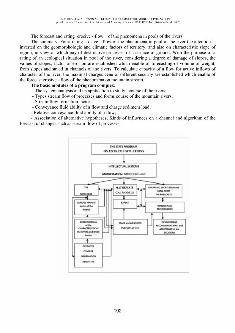
NATURAL CATACLYSMS AND GLOBAL PROBLEMS OF THE MODERN CIVILIZATION. Special edition of Transaction of the International Academy of Science. H&E. ICSD/IAS, Baku-Innsbruck, 2007.
192
The forecast and rating erosive - flow of the phenomena in pools of the rivers The summary: For a rating erosive - flow of the phenomena in pool of the river the attention is
inverted on the geomorphologic and climatic factors of territory, and also on characteristic slope of region, in view of which pay of destructive processes of a surface of ground. With the purpose of a rating of an ecological situation in pool of the river, considering a degree of damage of slopes, the values of slopes, factor of erosion are established which enable of forecasting of volume of weight, from slopes and saved in channels of the rivers. To calculate capacity of a flow for active inflows of character of the river, the maximal charges of different security are established which enable of the forecast erosive - flow of the phenomena on mountain stream.
The basic modules of a program complex: - The system analysis and its application to study course of the rivers; - Types stream flow of processes and forms course of the mountain rivers; - Stream flow formation factor; - Conveyance fluid ability of a flow and charge sediment load; - Relative conveyance fluid ability of a flow; - Association of alternative hypotheses; Kinds of influences on a channel and algorithm of the
forecast of changes such as stream flow of processes.
NATURAL CATACLYSMS AND GLOBAL PROBLEMS OF THE MODERN CIVILIZATION. Special edition of Transaction of the International Academy of Science. H&E. ICSD/IAS, Baku-Innsbruck, 2007.
193
REFERENCES
1. Aliev T.A. The robast technology of the computer analysis. - ., Mechanical engineering, 1999, 195 p.
2. Hasanov A.B. Reaction of mechanical systems to non-stationary external influences. Baku, ELM, 2004, 247p.
3. Clackin V.I. The stochastic equations and waves in casual - non-uniform environments Wednesdays. ., Science, 1980, 335p.
NEW TECHNOLOGY TO MEASURE THE WATER LEVEL AND THE SEA STATE
Christoph J. Blasi
Federal Institute of Hydrology Koblenz, Germany
ABSTRACT
A considerable proportion of the world population lives and works on the coast or near the coast. Therefore, the knowledge of the physical processes which interact on the coast is very important. The physical processes are driven by several factors like tidal forces, hydrological and meteorological phenomena. As result of these processes, the variations of water level and waves can be observed very easily. Water level is measured by gauging stations, and the waves by special devices. In the late 1990s radar devices, which were mainly used in process technology, were introduced in hydrometry. This paper presents results from a field test to give the reader help and support by choosing the right radar gauge to measure water level and the sea state. The physical background and the application of radar in distance measurements are not discussed here.
Introduction Nearly any kind of engineering activity in coastal area relies on information about water level.
The classical way of reading the water level is by a staff gauge and a float. These measuring systems have been used for very long time and have been upgraded in various ways to store the recorded data. Measuring the water level in this way it is reliable and widely used. But this system requires some construction work and a building to protect the instruments. Furthermore, the site and the instrumentation have to maintained, what is time- and cost-intensive. As the sea level is one of the environmental parameters that are easily recognised and widely used in both scientific and non-scientific applications it needs to be observed in a simple and reliable way. Radar sensors are widely used in process technology and were introduced in hydrometry in the late 1990s. The Federal Institute of Hydrology (BfG) made the first investigation in this regard in the beginning of 2000 [1]. As technology of these devices was rapidly advancing additional tests were made. These tests were part of a research project [2] with the aim of finding the best methods for measurements of waves, sea state, water level, and the thickness of ice. One of the main parts of the project was the measurement of waves in a broader sense. Therefore much attention was paid to the theory of the detection and measurement of water level as part of waves under different conditions. Different tests were undertaken under both laboratory and field conditions to assess the measurement. This aim of this paper is to show the results from the field test to give the reader help and support in choosing the right radar gauge to measure water level. The physical background and the application of radar in distance

NATURAL CATACLYSMS AND GLOBAL PROBLEMS OF THE MODERN CIVILIZATION. Special edition of Transaction of the International Academy of Science. H&E. ICSD/IAS, Baku-Innsbruck, 2007.
194
measurements are not discussed here. As mentioned before, there were both tests in the hydraulic 2 laboratory and as well in the field. The laboratory tests, investigated the back-scatter from different radar devices for various wave types and water surfaces to assess the suitability to measure waves and water levels.
The Field Test of Radar-Sensors With this information from the laboratory tests, four different devices were selected for the field test.
The gauging station ‘Borkum Südstrand’ was chosen as the testing site. This gauging station is located on the island of Borkum and is very close to the border of the Netherlands. This location has all required conditions such as tidal range, different types of waves, the sea state, change of salinity, rough sea, saline air, and annual temperature variation. Furthermore the gauging station ‘Borkum Südstrand’ is an official gauge of the Federal Waterways and Shipping Administration (WSV). The location of the gauging station and the setting up of the radar sensors are shown in Figure 1 and Figure 2.
Fig. 1. Location of the testing site and general view of the gauging station «Borkum Sudstrand» during high water
Fig. 2. The gauging station and the installation of the radar-sensors The devices are designated as Rad_A to Rad_D under an agreement with the manufacturers. If
detailed information is required, the reader may contact the author. For reference of the four radar sensors, the official and calibrated gauging-station data 3 were used. The calibration was done after a national directive. In addition a magnetostrictive-sensor (a special kind of float gauge) was installed for reference. It is worth to mention that the magneto-strictive sensor is the only sensor officially authorised for the calibration of water-level measuring devices. In general, all radar gauges work after the same principle. A radar signal with a frequency of approximately 1- 30 GHz is sent from the antenna to the water surface. After reflection on the water surface the signal is received again with a certain time lag. The characteristic of the radar devices are given in Table 1.
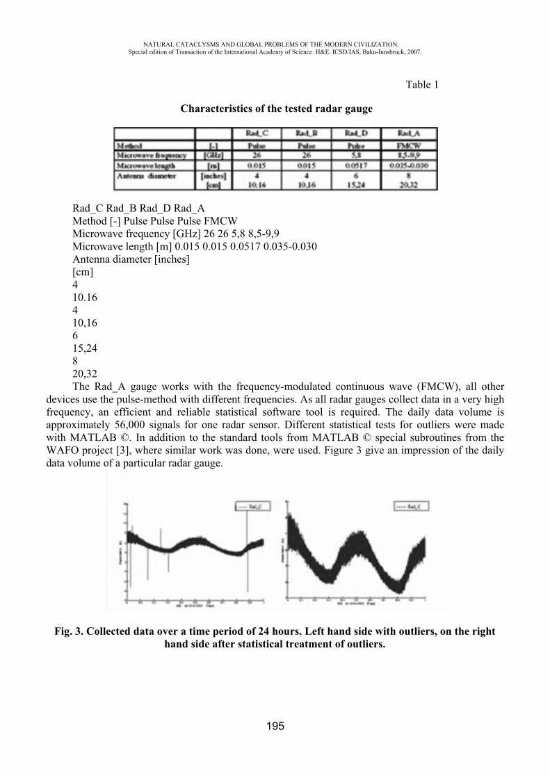
NATURAL CATACLYSMS AND GLOBAL PROBLEMS OF THE MODERN CIVILIZATION. Special edition of Transaction of the International Academy of Science. H&E. ICSD/IAS, Baku-Innsbruck, 2007.
195
Table 1
Characteristics of the tested radar gauge
Rad_C Rad_B Rad_D Rad_A Method [-] Pulse Pulse Pulse FMCW Microwave frequency [GHz] 26 26 5,8 8,5-9,9 Microwave length [m] 0.015 0.015 0.0517 0.035-0.030 Antenna diameter [inches] [cm] 410.16410,16615,24820,32The Rad_A gauge works with the frequency-modulated continuous wave (FMCW), all other
devices use the pulse-method with different frequencies. As all radar gauges collect data in a very high frequency, an efficient and reliable statistical software tool is required. The daily data volume is approximately 56,000 signals for one radar sensor. Different statistical tests for outliers were made with MATLAB ©. In addition to the standard tools from MATLAB © special subroutines from the WAFO project [3], where similar work was done, were used. Figure 3 give an impression of the daily data volume of a particular radar gauge.
Fig. 3. Collected data over a time period of 24 hours. Left hand side with outliers, on the right hand side after statistical treatment of outliers.
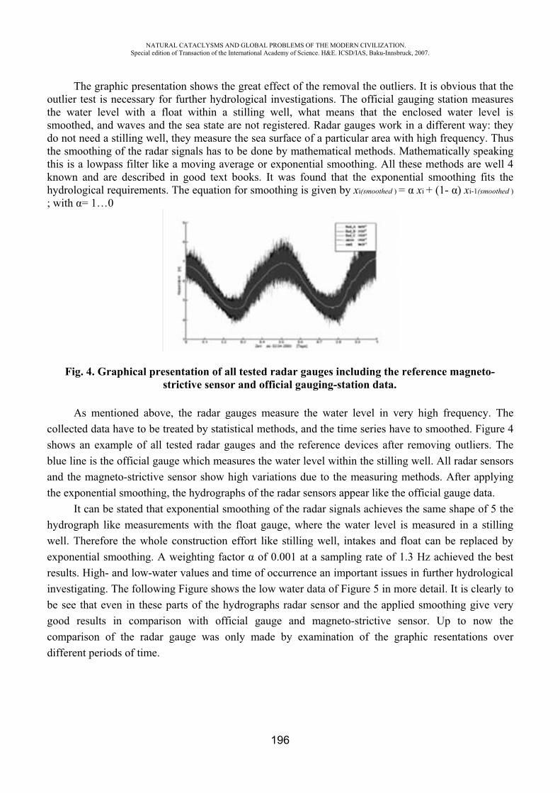
NATURAL CATACLYSMS AND GLOBAL PROBLEMS OF THE MODERN CIVILIZATION. Special edition of Transaction of the International Academy of Science. H&E. ICSD/IAS, Baku-Innsbruck, 2007.
196
The graphic presentation shows the great effect of the removal the outliers. It is obvious that the outlier test is necessary for further hydrological investigations. The official gauging station measures the water level with a float within a stilling well, what means that the enclosed water level is smoothed, and waves and the sea state are not registered. Radar gauges work in a different way: they do not need a stilling well, they measure the sea surface of a particular area with high frequency. Thus the smoothing of the radar signals has to be done by mathematical methods. Mathematically speaking this is a lowpass filter like a moving average or exponential smoothing. All these methods are well 4 known and are described in good text books. It was found that the exponential smoothing fits the hydrological requirements. The equation for smoothing is given by xi(smoothed ) = xi + (1- ) xi-1(smoothed )
; with = 1…0
Fig. 4. Graphical presentation of all tested radar gauges including the reference magneto-strictive sensor and official gauging-station data.
As mentioned above, the radar gauges measure the water level in very high frequency. The collected data have to be treated by statistical methods, and the time series have to smoothed. Figure 4 shows an example of all tested radar gauges and the reference devices after removing outliers. The blue line is the official gauge which measures the water level within the stilling well. All radar sensors and the magneto-strictive sensor show high variations due to the measuring methods. After applying the exponential smoothing, the hydrographs of the radar sensors appear like the official gauge data.
It can be stated that exponential smoothing of the radar signals achieves the same shape of 5 the hydrograph like measurements with the float gauge, where the water level is measured in a stilling well. Therefore the whole construction effort like stilling well, intakes and float can be replaced by exponential smoothing. A weighting factor of 0.001 at a sampling rate of 1.3 Hz achieved the best results. High- and low-water values and time of occurrence an important issues in further hydrological investigating. The following Figure shows the low water data of Figure 5 in more detail. It is clearly to be see that even in these parts of the hydrographs radar sensor and the applied smoothing give very good results in comparison with official gauge and magneto-strictive sensor. Up to now the comparison of the radar gauge was only made by examination of the graphic resentations over different periods of time.

NATURAL CATACLYSMS AND GLOBAL PROBLEMS OF THE MODERN CIVILIZATION. Special edition of Transaction of the International Academy of Science. H&E. ICSD/IAS, Baku-Innsbruck, 2007.
197
Fig. 6. Comparison of the radar gauge RAD_C with official gauge data and the magneto-strictive sensor in the low- water part
Figure 7 shows the error distribution of the official gauging station and of the radar gauges in relation to the reference
-10 0 10 00.511.522.5x 10 4�= -0.0 cm �= 2.1 cm RadA in cm error probability -10 0 10 00.511.522.5x 10 4�= -0.0 cm �= 1.3 cm RadB in cm error probability -10 0 10 0

NATURAL CATACLYSMS AND GLOBAL PROBLEMS OF THE MODERN CIVILIZATION. Special edition of Transaction of the International Academy of Science. H&E. ICSD/IAS, Baku-Innsbruck, 2007.
198
0.511.522.5x 10 4�= -0.0 cm �= 0.9 cm RadC in cm error probability -10 0 10 01234x 10 5reference in cm error probability -10 0 10 00.511.52x 10 4�= -0.0 cm �= 1.0 cm official gauge in cm error probability
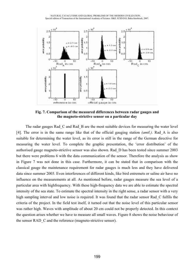
NATURAL CATACLYSMS AND GLOBAL PROBLEMS OF THE MODERN CIVILIZATION. Special edition of Transaction of the International Academy of Science. H&E. ICSD/IAS, Baku-Innsbruck, 2007.
199
Fig. 7. Comparison of the measured differences between radar gauges and the magneto-strictive sensor on a particular day
The radar gauges Rad_C and Rad_B are the most suitable devices for measuring the water level [4]. The error is in the same range like that of the official gauging station (amtl.). Rad_A is also suitable for determining the water level, as its error is still in the range of the German directive for measuring the water level. To complete the graphic presentation, the ‘error distribution’ of the authorised gauge magneto-strictive sensor was also shown. Rad_D has been tested since summer 2003 but there were problems 6 with the data communication of the sensor. Therefore the analysis as show in Figure 7 was not done in this case. Furthermore, it can be stated that in comparison with the classical gauge the maintenance requirement for radar gauges is much less and they have delivered data since summer 2003. Even interferences of different kinds, like bird entremets or saline air have no influence on the measurements at all. As mentioned before, radar gauges measure the sea level of a particular area with highfrequency. With these high-frequency data we are able to estimate the spectral intensity of the sea state. To estimate the spectral intensity in the right sense, a radar sensor with a very high sampling interval and low noise is required. It was found that the radar sensor Rad_C fulfils the criteria of the project. In the field test itself, it turned out that the noise level of this particular sensor was rather high. Waves with amplitude of about 20 cm could not be properly detected. In this context the question arises whether we have to measure all small waves. Figure 8 shows the noise behaviour of the sensor RAD_C and the reference (magneto-strictive sensor).

NATURAL CATACLYSMS AND GLOBAL PROBLEMS OF THE MODERN CIVILIZATION. Special edition of Transaction of the International Academy of Science. H&E. ICSD/IAS, Baku-Innsbruck, 2007.
200
Fig. 8. Spectrogram of the sea state and the reference (Magneto-strictive-Sensor)
The spectral intensity of the sea state is represented by different colour dots in 15-minute intervals over a time period of five days. The frequency of sea state is in the range of 0 to 1.4 Hz. The upper picture shows the spectrogram of the sea state obtained by the use of the RAD_C sensor. The spectral intensity is easy to detect, and the noise behaviour can also be observed as the yellow dots over the whole period of time. In the lower part of the picture the sea state of the reference can be clearly seen by the red dots in the frequency range from 0.2 to 0.6 Hz. Dots in deeper red colour indicate that the sea state is more intensive. 7
Conclusion and Outlook The field test showed that the radar gauge is an efficient and reliable device to measure the water
level. It is worth to mention that the radar gauge measures the water level in a completely different way than the traditional float gauge. At the moment, the Federal Institute of Hydrology (BfG) isundertaking more field tests. Another test site is in the Baltic Sea on the island of Rügen. Together with the Federal Agency for Cartography and Geodesy (BKG) we are investigating the combination of radar gauges with GPS. To this end, the radar gauge is installed in the usual way, and on the top of the radar device the GPS-device is mounted. With the combination of both these devices we are able to measure the movement of the water level and have permanent control of the gauge zero. Up to now it is usual to get the tide-gauge zero control from levelling.
REFERENCES
1. BfG, 2002: Bundesanstalt für Gewasserkunde, Test von Radarsensoren im Kusten- und Binnenbereich, interner Bericht, BfG-1276 (in German)
2. http://www.bafg.de/servlet/is/7833/ 3. P. BRODTKROB, P.JOHANNESSSON, and G: LINDGREN, I: RYCHLIK, J. RJYDÉN,
ANDE. SJÖ. WAFO toolbox – wave analysis for fatigue and oceanography, tech. rep., Dept of Mathematical Statistics, Lund, (1999)
4. 4.C.J. BLASI, U. BARJENBRUCH: Comparison of Radar Devices in Germany, German contribution to the revised IOC Manual on Tide Gauge UNESCO, Paris 2005 (in print)
NATURAL CATACLYSMS AND GLOBAL PROBLEMS OF THE MODERN CIVILIZATION. Special edition of Transaction of the International Academy of Science. H&E. ICSD/IAS, Baku-Innsbruck, 2007.
201
SEISMOTECTONIC AND GEODYNAMIC MODELLING IN KAZAKHSTAN: CONDITION, PRIORITIES AND TENDENCIES
Y. Nusipov
Republic Kazakhstan
For inhabitants of seismically dangerous regions of Kazakhstan the problem of an estimation of seismic danger and forecasting of earthquakes is vital. It is the large complex problem, which includes basic researches on a deep structure and dynamics of the Earth, physics of a seismic center, a seismic mode of all planet and separate regions, geological and physical conditions for earthquakes. The role and the place of the modern geodynamic phenomena, opportunities of satellite technologies of monitoring have been radically revised. Methods of geodynamic monitoring are in the process of improvement and methods of modelling of deformation and seismic processes are being developed.
Structure and Seismic Mode of Lithosphere, Seismotectonic Modelling. The regional seismic methods are dominating among the geophysical methods of studying of a
structure of an earth's crust and the upper mantle. These methods include a correlation method of the refracted waves (CMRW), deep seismic sounding (DSS) and its combinations with a method of exchange waves of earthquakes ( EWE), a method of the general depth point (MGDP) and 2D and 3D seismic tomography for the last decades.
The Institute of Seismology has developed and implemented the technique of a profile seismic tomography on the basis of experimental data of regional seismology. All materials of DSS on the territories of Kazakhstan have been recognized as informative and have been processed from the uniform methodical positions, and, also, have been generalized and presented in the form of volumetric P-speed models of an earth's crust for a southeast of Kazakhstan, lithosphere of the Central Asia and the Caspian region. The basic experimental and methodical components of the created information base are: structures DSS and DSS-MEWE for the historical and last years processed on the basis of a technique of formation of high-speed models; a profile seismic tomography of an earth's crust and the upper mantle on the longitudinal and cross-section waves, combined and coordinated with “GSZ”; the volumetric seismic tomography of tectonosphere of Tyan-Shan and adjoining Kazakhstan, Kirghiz and Chinese territories up to the depth of 500 km; volumetric seismic tomography of lithosphere of the East Europe with inclusion of the Caspian region; seismogravity modelling providing for designing of high-speed, density, isostatic and geometrical models of tectonosphere and their interpretation from positions of new global tectonics [8] and plumtectonic[1]; joint processing and interpretation of materials orogenes and platform territories; a modern level of a computerization of processing of geophysical data.
During volumetric P-speed modelling an earth's crust and the upper mantle of the highly seismic regions of Kazakhstan and the comparative analysis of its results with distribution in the geological environment of strong earthquakes it has been established that:
It is characteristic of geosynclinal (subduction) orogenes that its oceanic segment of a crust moves under the subduction (transitive) orogene. This process is accompanied by the immersing of the high-speed (cold) crustal plates in asthenosphere. The complex picture heat-mass flows, reflected in high-speed structure by alternation of high-speed ledges and low-velocity deflections is observed in the subcrustal space above the subduction zone. The greatest quantity of centrums is observed in the depth up to130 km and less often in the depth exceeding 200 km. The crustal seismicity is connected with sialitic layer that reacts sensitively on to the shift pressure on border with basic layer being the result of influence the mantle ledges.
NATURAL CATACLYSMS AND GLOBAL PROBLEMS OF THE MODERN CIVILIZATION. Special edition of Transaction of the International Academy of Science. H&E. ICSD/IAS, Baku-Innsbruck, 2007.
202
High-speed subductive weights and low-speed funneled structures are established in a zone of interaction epogeosynclynal conflict and epi-platform teleconflict orogens. Deep subcrustal seismicity is connected with the pressure in the zone of counter heat-mass flows subductive slabs and ascending plums.
In the Caucasus and Caspian region epi-geosynclinal orogeny the active mantle has no local deep roots, and seismicity is connected with the moving of the orogenic block of the crust under uran plate in a zone of increase of its subcrustal power.
The upper mantle is differentiated on the high-speed (cooled labs) and low-speed in the form of hot plums that split up on their way upwards and spread in subcrustal space under the epi-platform orogenes of the Northern Tyan-Shan. Seismicity ( 8.2) is connected with the regional faultings and oversteps of blocks of an earth's crust over the active mantle.
The crustal and subcrustal structure of the slab boundary epi-platfrom Ural orogene is caused by rapproachement of the East-European and West-Siberian platforms. The crustal seismicity is connected with zones of destructions of the oversteped kind over the "swellings" of the active mantle.
The seismicity of the peri-rift Baikalsk orogene is connected with the asymmetric block and waste structures located over the active mantle.
As a whole, as a result of deep geophysical researches, for the first time within the limits of Northern Eurasia the technique of formation of a high-grade deep geophysical basis for the geodynamic modelling of lithosphere, estimations of the seismic danger and the forecast of the earthquakes has been developed and, basically, implemented.
Seismicity and Seismic mode. On the basis of the analysis of the regional instrumental supervision that has been carried out
since 1927, the following [2,9] has been made: The uniform unified catalogue of earthquakes of territory of Republic Kazakhstan has been
completed. The basic seismically active regions, zones have been determined and their seismological parameterization has been completed. The prevailing type of deformation in the territory of the Dzhungar-Nothern-Tyan-Shanski region has been determined. It is the monoaxial compression in N-S trending horizontal direction is revealed; prevailing type of motions in the centers is thrusting and shifting and the most probable azimuths of planes of center breaks extending is northeast and northwest.
The seismological criteria of the seismic danger consisting in confinedness of the centers of the majority of strong earthquakes to the linear zones have been determined to be the high capacity seismically active layers of an earth's crust and a high level of seismic activity, density of epicenters and specific power-weight ratio of sources of seismic energy, and also their gravitation to contrast borders of sites with various values of the divisibility coefficient and types seismotectonic deformations.
The technique of the integrated analysis of a complex of seismological and geophysical data has been developed for the purposes of an estimation of Kmax value, which served as a basis for the physical and mathematical model of interrelation Kmax having the initial seismic and geophysical attributes is created. It is established, that parameters of the excessive geodynamic activity of the environment is the temperature on border of Mokhorovichich, capacity of an earth's crust, height of a relief of a terrestrial surface, capacity of sources of seismic energy, thickness of the seismically active layer and the seismic activity of the weak earthquakes. The received results served as the methodical basis for the prepared map of zones of the centers of earthquakes (ZSE) in the south and a southeast of Kazakhstan
It has been established that the spacio-temporal distribution of earthquakes in yan-Shan has the block and cyclic character. Numerical values of parameters of a seismic cycle, and also the sizes of blocks (seismically active structures) increase with growth of the magnitude of earthquakes. The
NATURAL CATACLYSMS AND GLOBAL PROBLEMS OF THE MODERN CIVILIZATION. Special edition of Transaction of the International Academy of Science. H&E. ICSD/IAS, Baku-Innsbruck, 2007.
203
probable reason of quasicyclicity is a seismic mode are the long-period deformative waves migrating along the core seismically active zones.
Analysis of the spatio-temporal features of distribution of seismic prognostic characteristics in the periods of preparation of strong earthquakes on an example of the Dzhungaro-Tjan-Shanski region and their informational benefit for the seismic forecast has been demonstrated. The generalized image of behavior of the complex of parameters of the seismic mode has been prepared and the physical model of formation of the source zones of strong earthquakes has been developed. The physical and mathematical model on the interrelation of the seismic mode complexes of parameters calculated as to the size of expected earthquake has been developed.
The system of the long-term forecast based on the established models of the seismic mode and process of preparation of earthquakes, and also on interrelation of the seismic process with the global geophysical factors has been developed and introduced. The results of researches are used in development of the various maps of seismic districts, the long-term and intermediate term forecasts of strong earthquakes in the Almaty prognostic zone.
Development of Ideas of Mobilism in Connection with the Seismotectonic. On an example of the Central Asia and Northern yan-Shan the paragenesis of the newest
structures, which have formed in conditions submeridional, tangential compression has been established [10], as a result of which there the movement of the litho-plates of the upper part of an earth's crust in the form of the conveyor between subtransform shifts takes place and the formation of the asymmetric (vergent) thrusting and overstepping folded and clumpy orogene morphostructure happens. The subtransform breaks extend to subparallel in step of 170-180 km in the area of a young platform thereby influencing formation of folds of the craton basis and “con-cediment” folds of the platform complex. The further development of this hypothesis has allowed to state that the global and regional newest morphostructures create the paragenesis [7; 11] within the frames of the mobilise concept. As consequence of this paragensis, the newest orogenes are subdivided into some geodynamic types, each of which is characterized by the corresponding tectonic position, geomorphological expression, a deep structure and localization of the centers of earthquakes. The important criterion of geodynamic activity lithosphere is the presence of an active mantle. It is established, that the centers of strong earthquakes ( 6.0) appear under orogenes, with a layer of an active mantle with the capacity more than 10 km. On the non-seismic territories the active mantle is absent, and in transitive zones, i.e. from the non-seismic to the highly seismic zones it appears again (0= 10 km). The upper mantle structure under the various types of orogenes is not the homonymic.
The practical value of the seismotectonic models is that they allow to make maps of active breaks at the first stage and then to estimate their seismic potential both by various criteria, and with respect to it as the complex. The last version of the seismically active zones of territory of Kazakhstan was prepared in 2002 [10] and on its basis the Map of the general seismic zoning of Republic Kazakhstan [3] has been developed. These maps helped to prepare maps of the seismic zoning of some administrative areas ( tyrauski, Kyzylordinski, Mangistauski, Aktyubinsk), and also evaluations of seismic danger of the oil-and-gas objects [5,6]. Results of the seismic and tectonic researches of the Institute of Seismology of the Ministry of Subsurface Protection of the Republic of Kazakhstan were used to prepare for the international projects on preparation of the map of active breaks of Northern Eurasia, the map of the newest tectonics of Eurasia and the map of a global evaluation of seismic danger.
Priority scientific researches1 - Studying of the deep structure of an earth's crust and the top mantle according to Kazakhstani
geotraverses with the help of the complex of geophysical works. 2 - construction of 3D models of lithosphere of Kazakhstan with viscoelastic rheology for the numerical modeling of the fields of deformations and pressure. 3 - identification and parametrization of active faults, studying paleo-
NATURAL CATACLYSMS AND GLOBAL PROBLEMS OF THE MODERN CIVILIZATION. Special edition of Transaction of the International Academy of Science. H&E. ICSD/IAS, Baku-Innsbruck, 2007.
204
seismic. 4 - Creation of parametrical models inter-plate tectonic blocks. 5 - development of kinematic model of the newest yan-Shan orogene on the basis of the system analysis of geomorphological structures and explosive forms. 6 - Creation of physical and mathematical models of the seismic mode and the processes of occurance of strong earthquakes on the basis of deformation characteristics of the lythosphere, dynamic and kinematic parameters of the source.
Modern Geodynamics, Modelling of Deformative and Seismic Processes. Modern geodynamics of the lythosphere of Kazakhstan is a component of geodynamics of the
Central Asia. The following complex researches on the interconnected problems have been carried out: · specification of the deep structure of the lithosphere on the basis of modern tomographic methods; · finding-out of structural laws and the organization of a fragile part of the lythosphere, thus, the special attention has been paid to fault and block tectonics, its kinematics and evolution of the intense condition;· Physical and mathematical modelling of developments of the lithosphere.
By present time the three-dimensional model of Kazakhstan with viscoelastic rheology, that is prepared to carry out numerical experiments with use of a method of final elements is constructed. Rheological features of layers of an earth's crust and the upper mantle are reflected in detail in the model. There have been completed the first calculations of the displacement caused by movement of Hyndostan plate with speed of 55 mm/year and the role of the viscous component in the change in due course of the initial displacement has been estimated. The integrated analysis of all actual data has allowed to allocate in the elastic lithosphere of the Earth six prevailing types of the intense state. The
main of them are as follows: neutral ( yxz ), stretching ( yxz ), compressive (zyx ), shifting ( yzx ) and intermediate, i.e. stretching with shift ( xyz ) and
compression with shift ( zyx ).Structures Tyan-Shan, Dzungaria and Altai relate to the zone of hummocking of the lithosphere,
that is genetically connected with the Hyndo-Euroasian collision. The researches of the international group of scientists have shown, that modern deformations yan-Shan are result of the movement of Tarim block with a speed up to 20 mm/year to the north. Horizontal displacements of separate breaks do not exceed several millimeters a year and correspond to the available geodetic estimations. Speed of deformation increases in time. Characteristic structures of the field of vertical movement spatially coincide with structures of a base of an earth's crust, and according to the GPS data sites of modern background seismicity (weak earthquakes) coincide with areas of all-round compression.
Transition of seismology from mainly observant to a mature science with precisely certain object of research and with the method based on the firmly substantiated physical laws, is impossible without constant search and perfection of methods of geodynamic monitoring and modelling of deformation and seismic processes. The basic progress of seismology, including the objective forecast of seismological events is possible only in this direction. The certain results have been received in this direction. The discovery of new proofs of objectivity of existence in an earth's crust of slow deformative wave movements which can be described as the flat deformative fronts or deformative solitons with progress can be considered as of general scientific value. The family of such slow deformative fronts established as a result of solution of the inverse problems, with a satisfactory as of today time accuracy, describes all data on direct methods of monitoring of deformations in the region, including global and local networks GPS, data on continuous monitoring by the quartz deformographs, repeated levellings, and also data on the indirect monitoring of a sea level (PSML/PSWL) and a level of underground waters in wells. It confirms that the created formalized 4D-model of family of deformative fronts not only formally describes the process, but also adequately enough displays the basic properties of the given natural phenomenon. Considering objective complexities in studying the
NATURAL CATACLYSMS AND GLOBAL PROBLEMS OF THE MODERN CIVILIZATION. Special edition of Transaction of the International Academy of Science. H&E. ICSD/IAS, Baku-Innsbruck, 2007.
205
characteristic dynamics soliton deformative movements of an earth's crust, some additional requirements to networks of monitoring and methods of the analysis of the data, which will provide fuller studying of the so important scientific question have been prepared.
Therefore: The experimental data of complex geodynamic monitoring can be classified as to the natural
property of the direct and indirect description deformative tensor. In view of it, the base of the basic and auxiliary data on Kazakhstan and its adjoining territories (35-55N, 45-95E) has been collected, and their preliminary and basic target processing for use in the modeling of the modern deformations and seismicity has been completed. The dividing of the data on geodynamic monitoring in the direct and indirect and introduction of the corresponding formalization of the various monitoring types, for the first time has allowed to include practically all the isolated data in the uniform process of quantitative modelling.
The created and analysed approximative 4D-model of deformation process in the earth's crust of Kazakhstan can be used with respect to the medium-term and long-term seismological forecasting, and also with respect to the estimation of speeds of the deformation phenomena in the separate points and at the local sites. The 4D model is based on the description of deformative process by the family of the flat dynamic deformative fronts. The effective decomposition of a problem of two stages, i.e. of consecutive definition of kinematic and of peak parameters has been proposed and implemented with respect to determination of free parameters of the model. During search for the kinematic parameters of model the following elements were used: the composite seismological catalogue for the period of 1800-2006, the composite timing row of displacements and of the speeds of displacements for the period of 1992-2005, timing rows of monitoring of deformations as to networks of geophysical observatories, and also separate timing rows on monitoring of a sea level for the period of 1900-1999. The various computer animation films representing process of deformation of the various deep surfaces, sections and complex composit surfaces have been prepared on the basis of the received model. The realized dynamic visualization is now the most adequate method for representation and studying of the complex natural processes.
4D-models possess the necessary system completeness and include all minimally necessary components of the completely formalized models. For this reason, they allow to study the modelled processes in time and space for the future and retrospectively. The formalized records of models are universal and are not connected with the concrete region, i.e. verificationof their local adequacy can be carried out in the various seismic regions.
The Priority Scientific Researches1 – Development of the fundamental and applied researches on studying the deformations of an
earth's crust and soil, as the phenomenon and system process on the basis of the multidisciplinary approach. 2 - Creation and the analysis of uniform global dynamic model for the globe. 3 - researches of thermodynamics of the lithosphere of Kazakhstan and modeling of the convective currents. 4 – Creation of 4D-models of modern movements according to continuous space monitoring and GIS -TECHNOLOGIES. 5 - creation of local geodynamic zones and detailed researches of deformation processes of the zones of compression, shifting and stretching in plates. 6 - Construction of the 4D dynamic deformative models of the lithosphere of Kazakhstan, Northern yan-Shan, the Caspian region that are adequate to the natural process. 7. Calculation and the analysis of the theoretical prognostic seismological catalogues for up to 2050, solution of the problems of seismic division into districts and an estimation of the seismic danger. 8 - Creation of global databases, development of GIS-TECHNOLOGIES, technologies of modelling and forecasting which compile data in the form of the scientific information products.
NATURAL CATACLYSMS AND GLOBAL PROBLEMS OF THE MODERN CIVILIZATION. Special edition of Transaction of the International Academy of Science. H&E. ICSD/IAS, Baku-Innsbruck, 2007.
206
REFERENCES
1. Maruyama Sh. Plume Tectonics./Jour. Geol. Soc. Japan, 1994, Vol. 100, 1. P. 24-49.295 pages.
2. Nusipov, A.V. vcharenko Seismicity and Geodynamics of the Intensive and Deformed Condition of the Earth's Crust in the Northern Tyan-Shan. Almaty, “Galym”, 2004.
3. Nusipov, M.M.Rahymbaev, N. . Uzbekov, A.V.Timush, V.I.Shatsilov, A.Sydykov, V.V. Kazakov, A.B.Sadykov. Seismic Zoning of Territory of the Aktyubinsk Area. Almaty: Institute of Seismology of the Ministry of Subsurface Protection, 2006, 99 pages.
4. Nusipov, A.B. Ospanov, A.V. Timush, V.I. Shatsilov, M.M. Rahymbaev, Sydykov, A.B. Sadykova, V.V. Kazakov Seismic Zoning of Territory of ngistauski Area. Almaty. 2004, 88 pages.
5. E.N. Nusipov, A.B. Ospanov, A.V. Timush, V.I. Shatsilov, Sydykov, Sadykova A.B., Cossacks . , P.N.Gorbunov Seismic Zoning of Kyzylordi Area. Almaty: Gylym. 2003. 84 pages.
6. Nusipov, A.B. Ospanov, A.V. Timush, V.I. Shatsilov, Sydykov, A.B. Sadykova, A.E. Ergali, D.N. spanov Seismic Danger of Oil Pipeline of t su- lashankou. Almaty. 2004.105 pages
7. Nusipov, A.V.Ovcharenko Control of the Theoretical Seismological Catalogue and Dynamic Models of Deformation of the Earth's Crust of the Central-Asian Region for the Period of 2003-2004 «Geodynamic, Seismological and Geophysical Bases for the Forecast of earthquakes and Estimations of Seismic Risk». Reports of the Kazakh and Russian International Conference Devoted to the year of Russia in Kazakhstan held in June 22-24 2004, Almaty, 2005, 200-208 pages.
8. Y.M. Pusharovski, Sejsmotomography and Structure of the Mantle: Tectonic Foreshortening./Geology, 1996, V. 351. 6. 806-809 pages.
A. Sydykov Seismic Mode of Territory of Kazakhstan. Almaty: Gylym. 2004. 270 pages. 9. A.V.Timush Orogeny is a Key Problem of Seismotectonic // Geology of Kazakhstan (Reports
for the XXXII Geol. Congress). Almaty: Gylym, 2004. 394-402 pages. 10. A.V.Timush, V.I. Shatsilov, N.P. Stepanenko, T.M. Kaydash, N.P. Belousova Features of the
Lythosphere Structure of Tyan-Shan and its Adjoining Territories. // Geodynamic, seismological and geophysical bases for the forecast of earthquakes and estimations of seismic risk. Report of the Kazakh and Russian Conference of June 22-24, 2004 Almaty. 2005. 118-129 pages.
HIGH RESOLUTION SATELLITE IMAGERY SHEDS LIGHT ON NATURAL DISASTER ASSESSMENTS
O. Bertan Goger, Jemal Ertash
NTA Space Systems Communication Systems Inc., Turkey
Today, disasters still constitute a phenomenon which cannot be prevented by human effort or technology, sometimes leaving us all in total despair. Various recent studies of post-natural disasterdamage caused by floods, fires, earthquakes, hurricanes and landslides clearly illustrate the potential of optical and radar satellite imagery In recent years, post-disaster damage assessment can be made easily via satellite images; however, it has come to be understood that the main issue here is not damage assessment but being prepared for disasters and taking adequate and necessary measures in disaster-
NATURAL CATACLYSMS AND GLOBAL PROBLEMS OF THE MODERN CIVILIZATION. Special edition of Transaction of the International Academy of Science. H&E. ICSD/IAS, Baku-Innsbruck, 2007.
207
prone areas. Infrastructural systems which are capable of providing for these are also a significant element of post-disaster crisis management.
Disaster management is a system which includes the following stages:
1. Pre-disaster planning, establishment of inventories and data bases 2. Transactions related to damage assessment during disaster 3. Post-disaster planning, improvement and rehabilitation studies
Establishing an inventory and a data base is the first and most important step towards benefiting from this system, since all other proceedings during and after the disaster are carried out in the light of the data obtained from this first step. Overlaying the attribute and graphic data collected from land with satellite images and the geographical data produced as a result of this process makes it possible to construct disaster and risk management scenarios and take scenario-based decisions. On the other hand, the satellite images taken before a disaster in a disaster-prone area are analyzed on computer and compared to images taken immediately after the disaster, and in this way, damage assessment can be made easily.
Digitalization of existing buildings and roads via up-to-date images Data link for all critical facilities and building Preparation of disaster scenarios through interactive query of all data together with
geological and soil data Preparation of “Emergency Plans” according to disaster scenarios Can be used as a data bank for crisis reporting during disaster and thematic map printing
processesRapid determination of loss of lives and property by matching new images with the images
taken before the disaster Update of the database with status information collected from the field Designation of locations for post-crisis temporary the residential ones and new settlement
areas
Within the scope of risk assessment, emergency evacuation and response operations very high resolution and geographically accurate satellite imagery shall provide cost effective and to the point planning and assessment aids as elaborated below.
The ability to quickly isolate and map damage zones is a valuable tool for crisis planners. It aids in developing a strategy for reconstruction aimed at minimizing risk of future hazards. IKONOS satellite imagery products offer exceptional details for planning, property insurance and evaluation of special risk areas.
The high resolution satellite images can provide a different and valuable perspective on the earthquakes to identify and mapping the problematic areas, evaluate the property loss, accomplish the damage assessments and annotate damage for relief operations. The damaged area was analyzed in terms of surface, and the results were integrated into a GIS database. Using a simplified approach, human casualty estimates were quickly made and compared with official statistics. Near real-time assessments of damage and spatial distribution could enhance rescue operations immediately after disasters. Optical image analysis utilizes mono-temporal techniques, based on a single image taken after an event, or multi-temporal techniques that compare pre- and post-event scenes. The mono-
NATURAL CATACLYSMS AND GLOBAL PROBLEMS OF THE MODERN CIVILIZATION. Special edition of Transaction of the International Academy of Science. H&E. ICSD/IAS, Baku-Innsbruck, 2007.
208
temporal procedure consists of visual recognition of damaged elements and is directly correlated with image resolution. With medium-resolution imagery (around 10 meters), only large, completely destroyed areas can be observed. IKONOS 1-meter resolution images allow detection of individual damaged buildings, with building size being considerably greater than pixel size.
Using IKONOS Imagery, planners are able to identify high flood risk areas in an attempt to reduce further damage and escalating insurance claims. A comparison between the pre- and post event images immediately illustrated the size of the disaster areas to be accurately measured. Image collected after severe flooding can be used during a crisis to assist emergency response agencies with planning evacuations, organizing recovery operations, establishing relief centers and overall damage assessment.
World will experience increased impacts on the environment, human health, and various sectors of society, which includes an a rise in sea levels of two to four times, more frequent droughts, heavy rain and hail, economic and agricultural losses from droughts, floods, storms and heatwaves, and substantial decreases in snow cover and glaciers. The resolution, accuracy and coverage of high-resolution commercial satellite imagery makes it a perfect fit for documenting changes in the Earth for many different applications, from coastal monitoring to glacier melting to wildlife habitat mapping.
Satellite imagery can also help to support crop production estimates, automatic crop identification and mapping, detect problems before farmers see it and rapidly provide broad perspectives on region affected, improve yields at field level (precision farming) and quickly locate and quantify the area most affected by the drought.
The response phase includes large numbers of actions such as processing emergency calls, mobilization and demobilization of resources, preparing regular information about the disaster and effects on the community for the public and the media, damage assessment, applying evacuation and sheltering procedures, preventing secondary damages. Almost all of these activities can be accomplished faster by the help of satellite imagery.
High resolution satellite images and Geographic Information Systems can help the exact latitudinal and longitudinal locations of refugee camps, buildings or even individual store houses, track the movement of the refugees and the environmental impact on the surrounding areas caused by their presence. Reliable and up-to-date IKONOS imagery provides effective solution at national, regional and international levels for the preparation of the operational and logistical planning and advanced maps to support the humanitarian assistance operations.
Inta Space Systems Communicatins Inc.
Inta Space Systems Inc., Space Imaging Eurasia (SIEA), is the pre-eminent worldwide supplier of high-resolution IKONOS satellite imagery data and derived information products. The SIEA communications cone, or satellite footprint covers the majority of continental Europe, Middle East, North Africa, Caucasus and Central Asia. SIEA was established in February 2001 when the ground station became operational in Ankara, Turkey. As an independent regional affiliate of GEOEYE, USA, SIEA’s ground station is capable of directly tasking the IKONOS satellite, communicating and commanding it directly for assignments, and receiving the full download of raw data for further processing.

NATURAL CATACLYSMS AND GLOBAL PROBLEMS OF THE MODERN CIVILIZATION. Special edition of Transaction of the International Academy of Science. H&E. ICSD/IAS, Baku-Innsbruck, 2007.
209
IMPACT OF THE RECENT EARTHQUAKE (OCTOBER 8, 2005) IN PAKISTAN ON THE BIODIVERSITY AND NATURAL RESOURCES OF THE AFFECTED AREAS AND
MITIGATION EFFORTS: A REPORT
M. A. Hafeez
Pakistan Academy of Sciences, Islamabad, Pakistan
Abstract: The paper deals with impact of earthquake of October 8, 2005 (~7.6 magnitude) in Pakistan on the biodiversity and ecology, in general, in the affected areas. Major areas of Azad Jammu & Kashmir (AJK) and North West Frontier Province (NWFP) were jolted and even Islamabad experienced its effect. The devastation covered an area of 30,000 Sq. km. These areas belonged to moist temperate and subtropical zone with plenty of forest cover and rich biodiversity. Springs, streams, rivers and their tributaries have all along have been patent feature of ecological make up of AJK and NWFP. However, the debris resulting from collapse of buildings, landslides and land cracking has caused massive damage to the biodiversity and natural resources of both urban and rural localities. Massive expanses of forest cover were wiped out due to landslides, and land cracking caused instability of soil, particularly on hill slopes. The damage to National Parks and Game Reserves, providing protection and a sanctuary to forests and the wildlife, has been of equal concern. Land cracking has threatened further landslides, increasing chances of further loss of vegetation and hence the habitat of wildlife and other fauna. There have been visible changes in the flow and direction of water bodies, chemistry of water and this has had adverse impact on the habitat of aquatic life. The government of Pakistan, in collaboration with national and international agencies has taken urgent steps for assessment of environmental damage and its mitigation.
Introduction October 8, 2005 was a sad day in the recent history of Pakistan. An earthquake of ~7.6
magnitude struck the northern reaches of Pakistan that included Muzaffarabad, Poonch and Bagh in Azad Jammu & Kashmir (AJK and adjoining areas), Mansehra, Abbotabad and Batgram Districts (adjoining areas) of North West Frontier Province (NWFP) and even extended to Islamabad, where the only calamity was collapse of part of Margalla Towers (a residential high rise building). The devastation covered an area of nearly 30,000 Sq km. An estimated 80,000 people died, twice as many were injured and nearly 3 million lost their homes. Almost 70% of Muzaffarabad, the capital of AJK, was destroyed. Balakot nearby was completely levelled. Mansehra, Abbotabad and Batgram Districts of NWFP were equally adversely affected. Damage to buildings that still remained standing in these areas left them inhabitable. Fig. 1 shows the extent of the affected region. This aside, the damage to roads, agriculture, livestock, biodiversity and particularly the ecology of these areas was unprecedented. The damage to the biodiversity was difficult to fully assess in the immediate aftermath of the calamity owing to the urgency of immediate and rescue operations.
The affected areas belonged mostly to the moist temperate and subtropical zone with plenty of forest cover and rich biodiversity. Here precipitation rate is high, climate is cold to mild, habitats are diverse. A network of springs, streams, rivers, ponds and nullahs in the region normally provide sustenance to its biodiversity. Following the quake, collapse of buildings created untold amount of rubble and debris. While the amount of this debris in the rural setting of the hilly areas was low and scattered over distances, it was the urban locale of cities and towns that experienced the worst scenario. All debris in these areas required removal and dumping elsewhere and ended up in nearby ditches, "nullahs" streams and rivers under the immediate compulsion of rescue operations. The water bodies near the cities of Muzaffarabad, Bagh, Batgram, Balakot, Rawlakot and other towns received massive loads of this debris. The ecological implications of this were of serious concern. For detailed
NATURAL CATACLYSMS AND GLOBAL PROBLEMS OF THE MODERN CIVILIZATION. Special edition of Transaction of the International Academy of Science. H&E. ICSD/IAS, Baku-Innsbruck, 2007.
210
information, the reader is referred to several reports published in the aftermath of the earthquake by IUCN (2005), CARE International (2005), Bloesch et al. (2005), Asian Development Bank and World Bank (2005).
The present report is a summary of the efforts made by various Government organizations and international agencies that aimed at assessing the environmental damage caused by the earthquake and its mitigation. A major part of this report is derived from a survey made of a 20-50 km wide stretch of the affected zone by a team of experts from Pakistan Museum of Natural History with excerpts from such sources as IUCN Mission Report (2005), CARE International (2005), and the ongoing Ministry of Economic Affairs (EAD) and UNDP project "Environmental Recovery Program”.
Natural Resources of the Affected Areas Fauna Published accounts of faunal diversity have been well known even prior to the catastrophic event
of October 8 (Baig, 1998, 2001; Hasan 2001-2004; Rafique, 1996, 2000). The area has been known to carry 50 species of butterflies, 23 species of fish, 8 species of frogs, 8 species of lizards, 13 species of snakes, 134 species of birds and 41 species of mammals. Several species among fish, lizards, and particularly birds and mammals have been listed as rare, endangered and threatened (Tables 1 and 2). Of the birds, all species of pheasants are known to be endangered or threatened. Among the mammals, voles (Hyperacarius sp, Alticola sp), Himalayan musk deer (Moschus sp), leopards (Panthera and Uncia spp), Himalayan Goral (Naemorhedus sp), grey langur (Semnopithecus sp) Rhesus macaque (Macaca mulatta) and Himalayan black bear (Ursus tibetanus) fall in the rare/endangered category.
ForestsAlmost 50% of the earthquake-hit area had been forested (bearing almost 476 species of plants)
with dominance of conifers, rich undergrowth of herbs, shrubs and grasses. Several categories of broad-leaved trees, many of commercial value, have been a characteristic of the affected region.
Belonging to the Lesser Himalayan region with a width of 60-80 km and the monsoon belt, plenty of rain and snowfall is a normal feature here. Little wonder that the mountains have enjoyed lush green character and a cover of herbs, shrubs, grasses and trees. Numerous, streams, rivers, lakes and ponds have been a patent feature of the region. The habitat for aquatic life and wildlife has been highly varied and hence the immense diversity of wildlife and plants in the northern reaches of Pakistan.
Natural water bodies The water bodies of the affected area include Jhelum River, Neelam River, Mahal River, and
their tributaries in AJK. Indus River, Kunhar River, Siren River, Allai Nullah, Batgram Nullah and their tributaries run through NWFP. Several lakes also exist in AJK and NWFP.
Wildlife protected areas The affected region contains several areas that have enjoyed the status of National Parks and
Game Reserves in view of their rich biodiversity. Noteworthy among these include Machiara National Park in AJK and Ayubia National Park in NWFP. The Game Reserves are Qazi Nag Reserve, Moji Reserve, Salkhala Reserve, Banjosa and Sudhan Gali in AJK and Kaghan and Palas Valleys in NWFP.
Hazards Caused by the Earthquake Hazards of Debris An unprecedented amount of debris comprising wood, concrete, glass and metal from buildings
and other structures impacted the quake-hit areas. The load was massive in the urban locales (Figs. 2). In the immediate aftermath of the quake, this debris ended up in ditches, deep trenches and and low lying areas along streams and rivers or even directly into river beds. The most affected rivers due to such disposal have been Kunhar River, Mahl River (from Balakot and Bagh) and tributaries of Rivers Jhelum and Neelam (from Muzaffarabad). The threat to the habitat of aquatic animals, their breeding and feeding grounds, particularly of fish, and to the quality of water has been of concern ever since.
NATURAL CATACLYSMS AND GLOBAL PROBLEMS OF THE MODERN CIVILIZATION. Special edition of Transaction of the International Academy of Science. H&E. ICSD/IAS, Baku-Innsbruck, 2007.
211
The river bed constitutes feeding, breeding and nursery ground for several resident bottom dwelling fish (Triplophysa sp. Schistura sp. and Glyptothorax sp.). Together with this, drastic alteration in quality of water owing to deposition of silicates and hydroxides of calcium has been of additional concern in regard to the breeding potential of commercial fish such as trout and mahaseer and, primary and secondary productivity of these water bodies.
Hazards of Landslies and land cracking Landslides and land cracking of catastrophic magnitude occurred throughout the quake-hit hilly
areas and caused blockage of rivers, streams and nullahs. Land cracking makes the ground unstable and renders it prone to soil erosion and land displacement. The adverse impact of these events was evident in the form of extensive blockage of streams, rivers and nullahs, thus impeding free movement of fish to and from feeding and breeding grounds. Landslides, carrying parts of roads and dwellings, impeded water flow with directional changes and silt load became heavy in water bodies. Muzaffarabad was the worst hit due to this massive load of gravel, sediment and sand from mountain slopes. New lakes and ponds resulting from huge landslides and consequent damming of water threatened flash floods and emergence of a changed ecological scenario. In Allai, two black bears were recorded dead and there has been constant fear of threat to wildlife due to hunting for sustaining livelihood. An orphaned snow leopard faced danger to its life due to absence of the mother and lack of adequate nursery facilities
The damage to forest cover has been equally alarming. Falling boulders carried with them large portions of forest cover and land cracking caused uprooting of trees (Figs. 2 & 3) over vast areas of the affected regions. Standing forests were destroyed in the core quake area (Table 2). Those left standing have been threatened ever since by felling for fuel for heating/cooking and claiming timber for reconstruction. The damage to National Parks and Game Reserves has been of special concern because these have served as sanctuaries for endangered animal and plant life. During the survey of the defined quake-hit area, already there was ample evidence of loss of wildlife, cattle, burrowing animals (lizards, snakes, small mammals) and of the natural habitat of nesting birds (Rafique et al., 2005).
Environmental mitigation efforts 1. Within 24 hrs of the quake, Ministry of Environment, Government of Pakistan, requested
UNEP to make preliminary assessment of damage. UNEP and UN offices immediately deployed experts for this purpose and made recommendations for alleviating (a) damage due to massive load of debris from buildings and from landslides, (b) disposal of solid and medical waste posing threat to the water bodies and the catchment area of Indus in general, (c) proper management of exploitation of woodland and vegetation for reconstruction activity, heating and cooking, (d) erosion of land and mountain slopes with consequent loss of forest cover, and (e) eventual restoration of critical habitats and protected areas (Parks, Game Reserves).
2. A workshop and training program was initiated in 2006 at Islamabad under the Rapid Environment Assessment (REA) scheme that aimed to train individuals for critical environmental concerns. The workshop and training program was conducted in collaboration with IUCN, Church World Service (CWS), Benfield Hazard Research Center, UK and CARE international.
3. The Government of Pakistan signed a Memorandum of Understanding with Wildlife Conservation Society, USA, for export of an orphaned snow leopard (Uncia uncia, a highly endangered species) for its safe custody at Bronx, N.Y. in view of lack of capability to protect it under the given circumstances of the catastrophic event.
4. The Economic Affairs Division (EAD), Government of Pakistan, approved a "UNDP Environment Recovery Program" for the quake-affected areas at a cost of Rs 12.8 million to mitigate environmental impact of the quake. UNDP has been coordinating this activity with Earthquake Relief and Rehabilitation Agency (ERRA), Ministry of Environment, AJK and NWFP. The focus of the program has been on plans for slope stabilization, recycling of debris, landslides, forest conservation
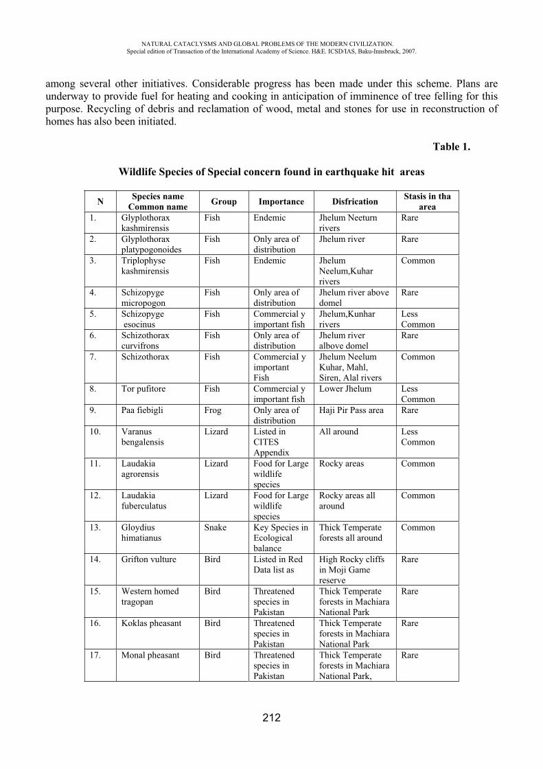
NATURAL CATACLYSMS AND GLOBAL PROBLEMS OF THE MODERN CIVILIZATION. Special edition of Transaction of the International Academy of Science. H&E. ICSD/IAS, Baku-Innsbruck, 2007.
212
among several other initiatives. Considerable progress has been made under this scheme. Plans are underway to provide fuel for heating and cooking in anticipation of imminence of tree felling for this purpose. Recycling of debris and reclamation of wood, metal and stones for use in reconstruction of homes has also been initiated.
Table 1.
Wildlife Species of Special concern found in earthquake hit areas
N Species name Common name Group Importance Disfrication Stasis in tha
area1. Glyplothorax
kashmirensis Fish Endemic Jhelum Neeturn
rivers Rare
2. Glyplothorax platypogonoides
Fish Only area of distribution
Jhelum river Rare
3. Triplophyse kashmirensis
Fish Endemic Jhelum Neelum,Kuhar rivers
Common
4. Schizopyge micropogon
Fish Only area of distribution
Jhelum river above domel
Rare
5. Schizopyge esocinus
Fish Commercial y important fish
Jhelum,Kunhar rivers
LessCommon
6. Schizothorax curvifrons
Fish Only area of distribution
Jhelum river albove domel
Rare
7. Schizothorax Fish CommerciaI y important Fish
Jhelum Neelum Kuhar, Mahl, Siren, Alal rivers
Common
8. Tor pufitore Fish Commercial y important fish
Lower Jhelum Less Common
9. Paa fiebigli Frog Only area of distribution
Haji Pir Pass area Rare
10. Varanus bengalensis
Lizard Listed in CITES Appendix
All around Less Common
11. Laudakiaagrorensis
Lizard Food for Large wildlife species
Rocky areas Common
12. Laudakiafuberculatus
Lizard Food for Large wildlife species
Rocky areas all around
Common
13. Gloydius himatianus
Snake Key Species in Ecologicalbalance
Thick Temperate forests all around
Common
14. Grifton vulture Bird Listed in Red Data list as
High Rocky cliffs in Moji Game reserve
Rare
15. Western homed tragopan
Bird Threatened species in Pakistan
Thick Temperate forests in Machiara National Park
Rare
16. Koklas pheasant Bird Threatened species in Pakistan
Thick Temperate forests in Machiara National Park
Rare
17. Monal pheasant Bird Threatened species in Pakistan
Thick Temperate forests in Machiara National Park,
Rare
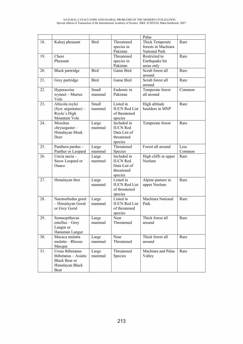
NATURAL CATACLYSMS AND GLOBAL PROBLEMS OF THE MODERN CIVILIZATION. Special edition of Transaction of the International Academy of Science. H&E. ICSD/IAS, Baku-Innsbruck, 2007.
213
Palas18. Kaleej pheasant Bird Threatened
species in Pakistan
Thick Temperate forests in Machiara National Park
Rare
19. CheerPheasant
Threatened species in Pakistan
Restricted to Earthquake hit areas only
Rare
20. Black partridge Bird Game Bird Scrub forest all around
Rare
21. Grey partridge Bird Game Bird Scrub forest all around
Rare
22. Hyperacrius wynnei – Murree Vole
Small mammal
Endemic in Pakistan
Temperate forest all around
Common
23. Alticola roylei (Syn: argentatus) – Royle`s High Mountain Vole
Small mammal
Listed in IUCN Red List of threatened species
High altitude boulders in MNP
Rare
24. Moschuschrysogaster – Himalayan Musk Deer
Large mammal
Included in IUCN Red Data List of threatened species
Temperate forest Rare
25. Panthera pardus – Panther or Leopard
Large mammal
Threatened Species
Forest all around Less Common
26. Uncia uncia – Snow Leopard or Ounce
Large mammal
Included in IUCN Red Data List of threatened species
High cliffs in upper Neelum
Rare
27. Himalayan ibex Large mammal
Listed in IUCN Red List of threatened species
Alpine pasture in upper Neelum
Rare
28. Naemorhedus goral – Himalayan Goral or Grey Goral
Large mammal
Listed in IUCN Red List of threatened species
Machiara National Park
Rare
29. Semnopithecus entellus – Grey Langur or Hanuman Langur
Large mammal
NearThreatened
Thick forest all around
Rare
30. Macaca mulatta mulatta – Rhesus Macque
Large mammal
NearThreatened
Thick forest all around
Rare
31. Ursus thibetanus thibetanus – Asiatic Black Bear or Himalayan Black Bear
Large mammal
Threatened Species
Machiara and Palas Valley
Rare
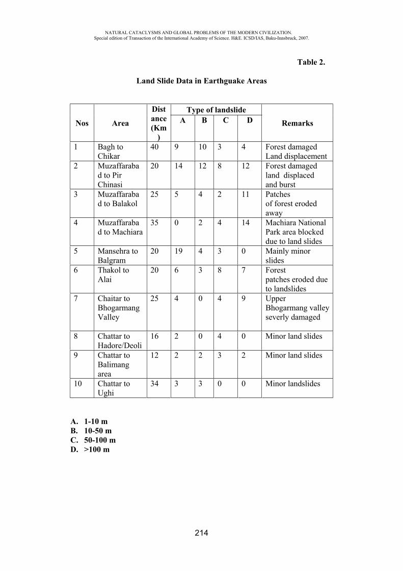
NATURAL CATACLYSMS AND GLOBAL PROBLEMS OF THE MODERN CIVILIZATION. Special edition of Transaction of the International Academy of Science. H&E. ICSD/IAS, Baku-Innsbruck, 2007.
214
Table 2.
Land Slide Data in Earthguake Areas
Nos Area
Distance(Km
)
Type of landslide Remarks A B C D
1 Bagh to Chikar
40 9 10 3 4 Forest damaged Land displacement
2 Muzaffarabad to Pir Chinasi
20 14 12 8 12 Forest damaged land displaced and burst
3 Muzaffarabad to Balakol
25 5 4 2 11 Patches of forest eroded away
4 Muzaffarabad to Machiara
35 0 2 4 14 Machiara National Park area blocked due to land slides
5 Mansehra to Balgram
20 19 4 3 0 Mainly minor slides
6 Thakol to Alai
20 6 3 8 7 Forest patches eroded due to landslides
7 Chaitar to Bhogarmang Valley
25 4 0 4 9 Upper Bhogarmang valley severly damaged
8 Chattar to Hadore/Deoli
16 2 0 4 0 Minor land slides
9 Chattar to Balimang area
12 2 2 3 2 Minor land slides
10 Chattar to Ughi
34 3 3 0 0 Minor landslides
A. 1-10 m B. 10-50 m C. 50-100 m D. >100 m
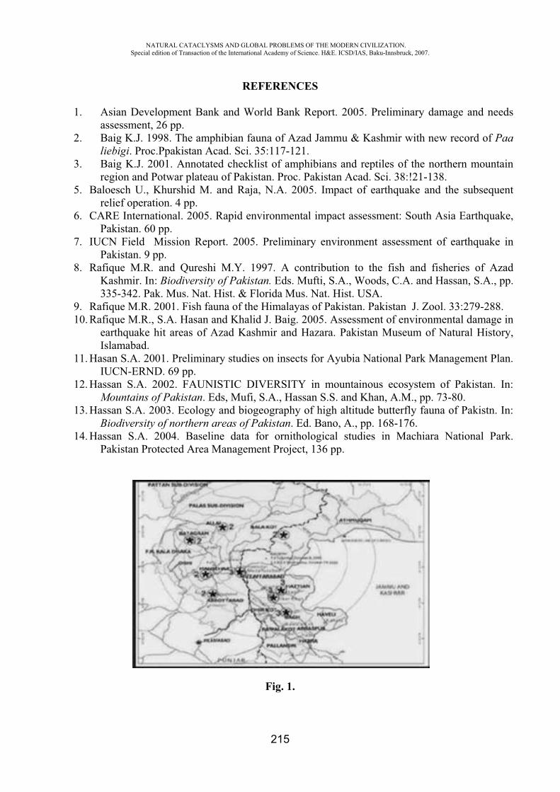
NATURAL CATACLYSMS AND GLOBAL PROBLEMS OF THE MODERN CIVILIZATION. Special edition of Transaction of the International Academy of Science. H&E. ICSD/IAS, Baku-Innsbruck, 2007.
215
REFERENCES
1. Asian Development Bank and World Bank Report. 2005. Preliminary damage and needs assessment, 26 pp.
2. Baig K.J. 1998. The amphibian fauna of Azad Jammu & Kashmir with new record of Paa liebigi. Proc.Ppakistan Acad. Sci. 35:117-121.
3. Baig K.J. 2001. Annotated checklist of amphibians and reptiles of the northern mountain region and Potwar plateau of Pakistan. Proc. Pakistan Acad. Sci. 38:!21-138.
5. Baloesch U., Khurshid M. and Raja, N.A. 2005. Impact of earthquake and the subsequent relief operation. 4 pp.
6. CARE International. 2005. Rapid environmental impact assessment: South Asia Earthquake, Pakistan. 60 pp.
7. IUCN Field Mission Report. 2005. Preliminary environment assessment of earthquake in Pakistan. 9 pp.
8. Rafique M.R. and Qureshi M.Y. 1997. A contribution to the fish and fisheries of Azad Kashmir. In: Biodiversity of Pakistan. Eds. Mufti, S.A., Woods, C.A. and Hassan, S.A., pp. 335-342. Pak. Mus. Nat. Hist. & Florida Mus. Nat. Hist. USA.
9. Rafique M.R. 2001. Fish fauna of the Himalayas of Pakistan. Pakistan J. Zool. 33:279-288. 10. Rafique M.R., S.A. Hasan and Khalid J. Baig. 2005. Assessment of environmental damage in
earthquake hit areas of Azad Kashmir and Hazara. Pakistan Museum of Natural History, Islamabad.
11. Hasan S.A. 2001. Preliminary studies on insects for Ayubia National Park Management Plan. IUCN-ERND. 69 pp.
12. Hassan S.A. 2002. FAUNISTIC DIVERSITY in mountainous ecosystem of Pakistan. In: Mountains of Pakistan. Eds, Mufi, S.A., Hassan S.S. and Khan, A.M., pp. 73-80.
13. Hassan S.A. 2003. Ecology and biogeography of high altitude butterfly fauna of Pakistn. In: Biodiversity of northern areas of Pakistan. Ed. Bano, A., pp. 168-176.
14. Hassan S.A. 2004. Baseline data for ornithological studies in Machiara National Park. Pakistan Protected Area Management Project, 136 pp.
Fig. 1.
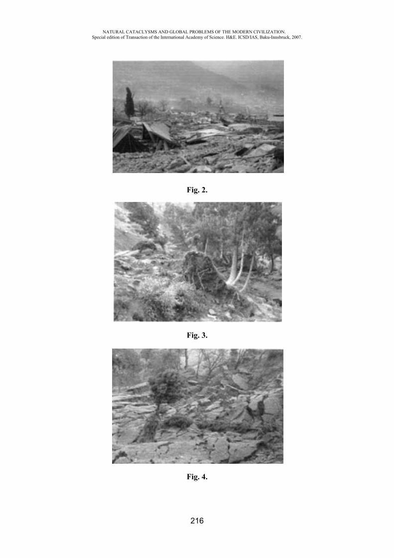
NATURAL CATACLYSMS AND GLOBAL PROBLEMS OF THE MODERN CIVILIZATION. Special edition of Transaction of the International Academy of Science. H&E. ICSD/IAS, Baku-Innsbruck, 2007.
216
Fig. 2.
Fig. 3.
Fig. 4.
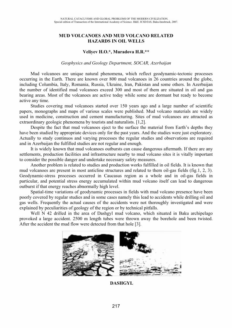
NATURAL CATACLYSMS AND GLOBAL PROBLEMS OF THE MODERN CIVILIZATION. Special edition of Transaction of the International Academy of Science. H&E. ICSD/IAS, Baku-Innsbruck, 2007.
217
MUD VOLCANOES AND MUD VOLCANO RELATED HAZARDS IN OIL WELLS
Veliyev H.O.*, Muradova H.R.**
Geophysics and Geology Department, SOCAR, Azerbaijan
Mud volcanoes are unique natural phenomena, which reflect geodynamic-tectonic processes occurring in the Earth. There are known over 800 mud volcanoes in 26 countries around the globe, including Columbia, Italy, Romania, Russia, Ukraine, Iran, Pakistan and some others. In Azerbaijan the number of identified mud volcanoes exceed 300 and most of them are situated in oil and gas bearing areas. Most of the volcanoes are active today while some are dormant but ready to become active any time.
Studies covering mud volcanoes started over 150 years ago and a large number of scientific papers, monographs and maps of various scales were published. Mud volcano materials are widely used in medicine, construction and cement manufacturing. Sites of mud volcanoes are attracted as extraordinary geologic phenomena by tourists and naturalists. [1,2].
Despite the fact that mud volcanoes eject to the surface the material from Earth’s depths they have been studied by appropriate devices only for the past years. And the studies were just exploratory. Actually to study continuos and varying processes the regular studies and observations are required and in Azerbaijan the fulfilled studies are not regular and enough.
It is widely known that mud volcanoes outbursts can cause dangerous aftermath. If there are any settlements, production facilities and infrastructure nearby to mud volcano sites it is vitally important to consider the possible danger and undertake necessary safety measures.
Another problem is related to studies and production works fulfilled in oil fields. It is known that mud volcanoes are present in most anticline structures and related to them oil-gas fields (fig.1, 2, 3). Geodynamic-stress processes occurred in Caucasus region as a whole and in oil-gas fields in particular, and potential stress energy accumulated within mud volcano itself can lead to dangerous outburst if that energy reaches abnormally high level.
Spatial-time variations of geodynamic processes in fields with mud volcano presence have been poorly covered by regular studies and in some cases namely this lead to accidents while drilling oil and gas wells. Frequently the actual causes of the accidents were not thoroughly investigated and were explained by peculiarities of geology of the region or by technical pitfalls.
Well N 42 drilled in the area of Dashgyl mud volcano, which situated in Baku archipelago provoked a large accident. 2500 m length tubes were thrown away the borehole and been twisted. After the accident the mud flow were detected from that hole [3].
DASHGYL
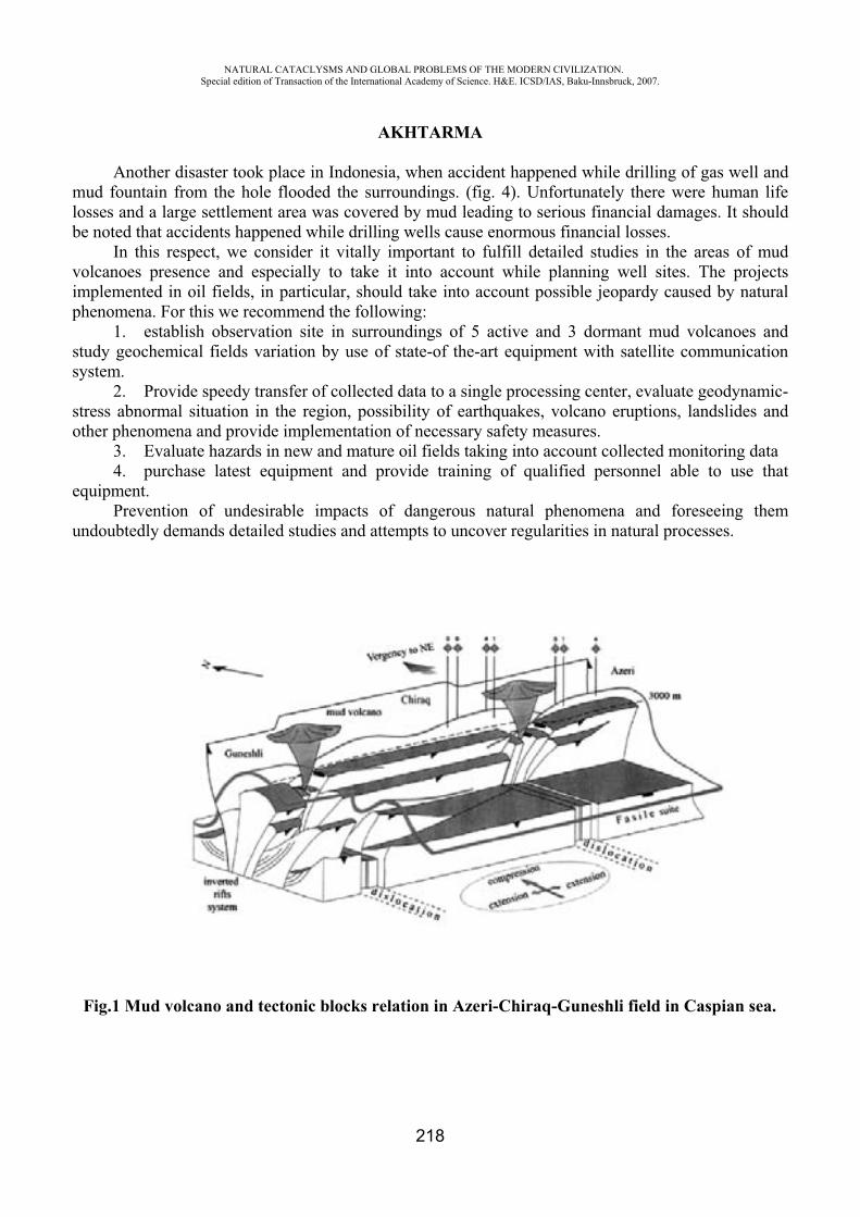
NATURAL CATACLYSMS AND GLOBAL PROBLEMS OF THE MODERN CIVILIZATION. Special edition of Transaction of the International Academy of Science. H&E. ICSD/IAS, Baku-Innsbruck, 2007.
218
AKHTARMA
Another disaster took place in Indonesia, when accident happened while drilling of gas well and mud fountain from the hole flooded the surroundings. (fig. 4). Unfortunately there were human life losses and a large settlement area was covered by mud leading to serious financial damages. It should be noted that accidents happened while drilling wells cause enormous financial losses.
In this respect, we consider it vitally important to fulfill detailed studies in the areas of mud volcanoes presence and especially to take it into account while planning well sites. The projects implemented in oil fields, in particular, should take into account possible jeopardy caused by natural phenomena. For this we recommend the following:
1. establish observation site in surroundings of 5 active and 3 dormant mud volcanoes and study geochemical fields variation by use of state-of the-art equipment with satellite communication system.
2. Provide speedy transfer of collected data to a single processing center, evaluate geodynamic-stress abnormal situation in the region, possibility of earthquakes, volcano eruptions, landslides and other phenomena and provide implementation of necessary safety measures.
3. Evaluate hazards in new and mature oil fields taking into account collected monitoring data 4. purchase latest equipment and provide training of qualified personnel able to use that
equipment. Prevention of undesirable impacts of dangerous natural phenomena and foreseeing them
undoubtedly demands detailed studies and attempts to uncover regularities in natural processes.
Fig.1 Mud volcano and tectonic blocks relation in Azeri-Chiraq-Guneshli field in Caspian sea.
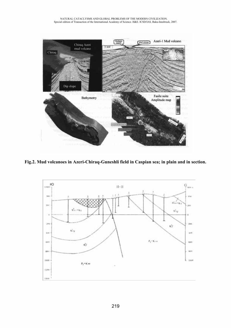
NATURAL CATACLYSMS AND GLOBAL PROBLEMS OF THE MODERN CIVILIZATION. Special edition of Transaction of the International Academy of Science. H&E. ICSD/IAS, Baku-Innsbruck, 2007.
219
Fig.2. Mud volcanoes in Azeri-Chiraq-Guneshli field in Caspian sea; in plain and in section.
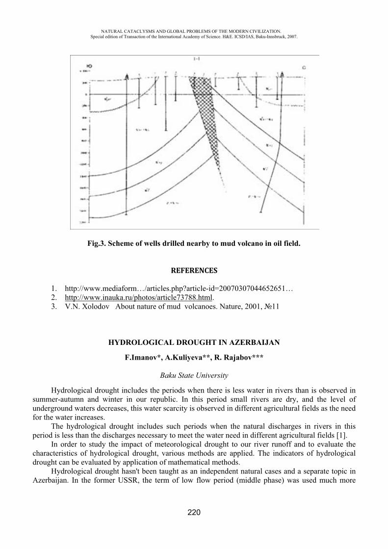
NATURAL CATACLYSMS AND GLOBAL PROBLEMS OF THE MODERN CIVILIZATION. Special edition of Transaction of the International Academy of Science. H&E. ICSD/IAS, Baku-Innsbruck, 2007.
220
Fig.3. Scheme of wells drilled nearby to mud volcano in oil field.
REFERENCES
1. http://www.mediaform…/articles.php?article-id=20070307044652651… 2. http://www.inauka.ru/photos/article73788.html.3. V.N. Xolodov About nature of mud volcanoes. Nature, 2001, 11
HYDROLOGICAL DROUGHT IN AZERBAIJAN
F.Imanov*, A.Kuliyeva**, R. Rajabov***
Baku State University
Hydrological drought includes the periods when there is less water in rivers than is observed in summer-autumn and winter in our republic. In this period small rivers are dry, and the level of underground waters decreases, this water scarcity is observed in different agricultural fields as the need for the water increases.
The hydrological drought includes such periods when the natural discharges in rivers in this period is less than the discharges necessary to meet the water need in different agricultural fields [1].
In order to study the impact of meteorological drought to our river runoff and to evaluate the characteristics of hydrological drought, various methods are applied. The indicators of hydrological drought can be evaluated by application of mathematical methods.
Hydrological drought hasn't been taught as an independent natural cases and a separate topic in Azerbaijan. In the former USSR, the term of low flow period (middle phase) was used much more
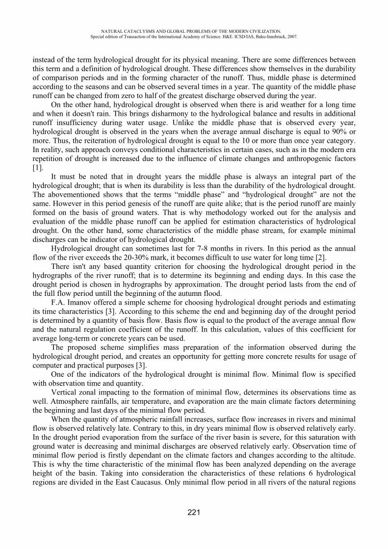
NATURAL CATACLYSMS AND GLOBAL PROBLEMS OF THE MODERN CIVILIZATION. Special edition of Transaction of the International Academy of Science. H&E. ICSD/IAS, Baku-Innsbruck, 2007.
221
instead of the term hydrological drought for its physical meaning. There are some differences between this term and a definition of hydrological drought. These differences show themselves in the durability of comparison periods and in the forming character of the runoff. Thus, middle phase is determined according to the seasons and can be observed several times in a year. The quantity of the middle phase runoff can be changed from zero to half of the greatest discharge observed during the year.
On the other hand, hydrological drought is observed when there is arid weather for a long time and when it doesn't rain. This brings disharmony to the hydrological balance and results in additional runoff insufficiency during water usage. Unlike the middle phase that is observed every year, hydrological drought is observed in the years when the average annual discharge is equal to 90% or more. Thus, the reiteration of hydrological drought is equal to the 10 or more than once year category. In reality, such approach conveys conditional characteristics in certain cases, such as in the modern era repetition of drought is increased due to the influence of climate changes and anthropogenic factors [1].
It must be noted that in drought years the middle phase is always an integral part of the hydrological drought; that is when its durability is less than the durability of the hydrological drought. The abovementioned shows that the terms “middle phase” and “hydrological drought” are not the same. However in this period genesis of the runoff are quite alike; that is the period runoff are mainly formed on the basis of ground waters. That is why methodology worked out for the analysis and evaluation of the middle phase runoff can be applied for estimation characteristics of hydrological drought. On the other hand, some characteristics of the middle phase stream, for example minimal discharges can be indicator of hydrological drought.
Hydrological drought can sometimes last for 7-8 months in rivers. In this period as the annual flow of the river exceeds the 20-30% mark, it becomes difficult to use water for long time [2].
There isn't any based quantity criterion for choosing the hydrological drought period in the hydrographs of the river runoff; that is to determine its beginning and ending days. In this case the drought period is chosen in hydrographs by approximation. The drought period lasts from the end of the full flow period untill the beginning of the autumn flood.
F.A. Imanov offered a simple scheme for choosing hydrological drought periods and estimating its time characteristics [3]. According to this scheme the end and beginning day of the drought period is determined by a quantity of basis flow. Basis flow is equal to the product of the average annual flow and the natural regulation coefficient of the runoff. In this calculation, values of this coefficient for average long-term or concrete years can be used.
The proposed scheme simplifies mass preparation of the information observed during the hydrological drought period, and creates an opportunity for getting more concrete results for usage of computer and practical purposes [3].
One of the indicators of the hydrological drought is minimal flow. Minimal flow is specified with observation time and quantity.
Vertical zonal impacting to the formation of minimal flow, determines its observations time as well. Atmosphere rainfalls, air temperature, and evaporation are the main climate factors determining the beginning and last days of the minimal flow period.
When the quantity of atmospheric rainfall increases, surface flow increases in rivers and minimal flow is observed relatively late. Contrary to this, in dry years minimal flow is observed relatively early. In the drought period evaporation from the surface of the river basin is severe, for this saturation with ground water is decreasing and minimal discharges are observed relatively early. Observation time of minimal flow period is firstly dependant on the climate factors and changes according to the altitude. This is why the time characteristic of the minimal flow has been analyzed depending on the average height of the basin. Taking into consideration the characteristics of these relations 6 hydrological regions are divided in the East Caucasus. Only minimal flow period in all rivers of the natural regions
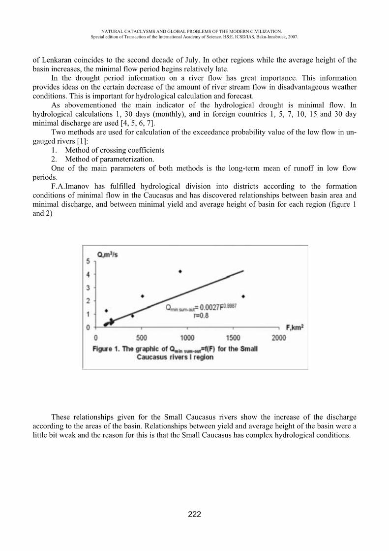
NATURAL CATACLYSMS AND GLOBAL PROBLEMS OF THE MODERN CIVILIZATION. Special edition of Transaction of the International Academy of Science. H&E. ICSD/IAS, Baku-Innsbruck, 2007.
222
of Lenkaran coincides to the second decade of July. In other regions while the average height of the basin increases, the minimal flow period begins relatively late.
In the drought period information on a river flow has great importance. This information provides ideas on the certain decrease of the amount of river stream flow in disadvantageous weather conditions. This is important for hydrological calculation and forecast.
As abovementioned the main indicator of the hydrological drought is minimal flow. In hydrological calculations 1, 30 days (monthly), and in foreign countries 1, 5, 7, 10, 15 and 30 day minimal discharge are used [4, 5, 6, 7].
Two methods are used for calculation of the exceedance probability value of the low flow in un-gauged rivers [1]:
1. Method of crossing coefficients 2. Method of parameterization. One of the main parameters of both methods is the long-term mean of runoff in low flow
periods.F.A.Imanov has fulfilled hydrological division into districts according to the formation
conditions of minimal flow in the Caucasus and has discovered relationships between basin area and minimal discharge, and between minimal yield and average height of basin for each region (figure 1 and 2)
These relationships given for the Small Caucasus rivers show the increase of the discharge according to the areas of the basin. Relationships between yield and average height of the basin were a little bit weak and the reason for this is that the Small Caucasus has complex hydrological conditions.

NATURAL CATACLYSMS AND GLOBAL PROBLEMS OF THE MODERN CIVILIZATION. Special edition of Transaction of the International Academy of Science. H&E. ICSD/IAS, Baku-Innsbruck, 2007.
223
The minimal flow has been formed as a result of the mutual impact of the physical and geographical factors, taking only one factor (height of the basin or area etc) in calculation doesn't give satisfactory results. That is why, in order to calculate average long-term quantity of the flow in hydrological drought period, formula considering the area of the basin and average height is offered.
The result of the calculation shows that taking into consideration the impact of these two factors increases the accuracy of the calculation of long-term mean of the flow in hydrological drought period to a considerable extent.
REFERENCES
1. Mammadov M.A., Imanov F.A., Mammadov A.S., Huseynov N.Sh. Meteorological Basis of Drought and Hydrological processes. Baku. “Aghridagh” publishing house. 2000-177p (in Azerbaijan language).
2. Imanov F.A. River runoff. Baku. “BSU” publishing house. 2002-208p. (in Azerbaijan language).
3. Imanov F.A. Minimal flow of rivers in Caucasus. Baku. “Nafta-Press” 2000-298p (in Russian language).
4. Cecilia Svensson, Zbigniew W.Kundzewicz and Thomas Maurer. (2004) Trends in flood and low flow hydrological time series. World Meteorological Organization, WCASP-66, WMO/TD-No.1241. July 2004, 26
5. Douglas, E.M., Vogel, R.M. and Kroll. C.N. (2000) Trends in floods and low flows in the United States: impact of spatial correlation. J.Hydrol, 240, 90-105.
6. Gustard A., Bullock A. and Dixon, J.M. (1992) Low flow estimation in the United Kingdom. Report No.108, Institute of Hydrology, Wallingford. December 1992, 88 pp.+ appendixes
7. Hisdal H., Stahl K., Tallaksen L.M. and Demuth S. (2001) Have stream flow droughts in Europe become more severe or frequent? Int. J. Climatol, 21. 317-333.
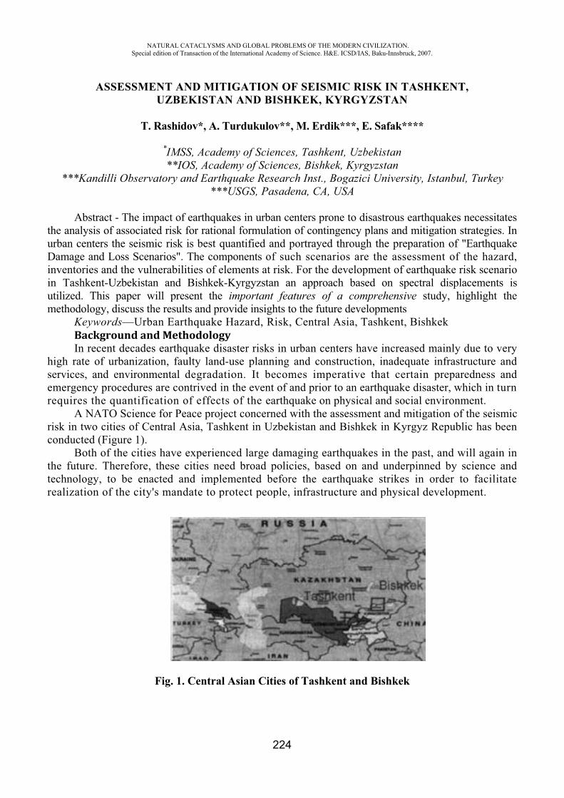
NATURAL CATACLYSMS AND GLOBAL PROBLEMS OF THE MODERN CIVILIZATION. Special edition of Transaction of the International Academy of Science. H&E. ICSD/IAS, Baku-Innsbruck, 2007.
224
ASSESSMENT AND MITIGATION OF SEISMIC RISK IN TASHKENT, UZBEKISTAN AND BISHKEK, KYRGYZSTAN
T. Rashidov*, A. Turdukulov**, M. Erdik***, E. Safak****
*IMSS, Academy of Sciences, Tashkent, Uzbekistan **IOS, Academy of Sciences, Bishkek, Kyrgyzstan
***Kandilli Observatory and Earthquake Research Inst., Bogazici University, Istanbul, Turkey ***USGS, Pasadena, CA, USA
Abstract - The impact of earthquakes in urban centers prone to disastrous earthquakes necessitates the analysis of associated risk for rational formulation of contingency plans and mitigation strategies. In urban centers the seismic risk is best quantified and portrayed through the preparation of "Earthquake Damage and Loss Scenarios". The components of such scenarios are the assessment of the hazard, inventories and the vulnerabilities of elements at risk. For the development of earthquake risk scenario in Tashkent-Uzbekistan and Bishkek-Kyrgyzstan an approach based on spectral displacements is utilized. This paper will present the important features of a comprehensive study, highlight the methodology, discuss the results and provide insights to the future developments
Keywords—Urban Earthquake Hazard, Risk, Central Asia, Tashkent, Bishkek Background and MethodologyIn recent decades earthquake disaster risks in urban centers have increased mainly due to very
high rate of urbanization, faulty land-use planning and construction, inadequate infrastructure and services, and environmental degradation. It becomes imperative that certain preparedness and emergency procedures are contrived in the event of and prior to an earthquake disaster, which in turn requires the quantification of effects of the earthquake on physical and social environment.
A NATO Science for Peace project concerned with the assessment and mitigation of the seismic risk in two cities of Central Asia, Tashkent in Uzbekistan and Bishkek in Kyrgyz Republic has been conducted (Figure 1).
Both of the cities have experienced large damaging earthquakes in the past, and will again in the future. Therefore, these cities need broad policies, based on and underpinned by science and technology, to be enacted and implemented before the earthquake strikes in order to facilitate realization of the city's mandate to protect people, infrastructure and physical development.
Fig. 1. Central Asian Cities of Tashkent and Bishkek
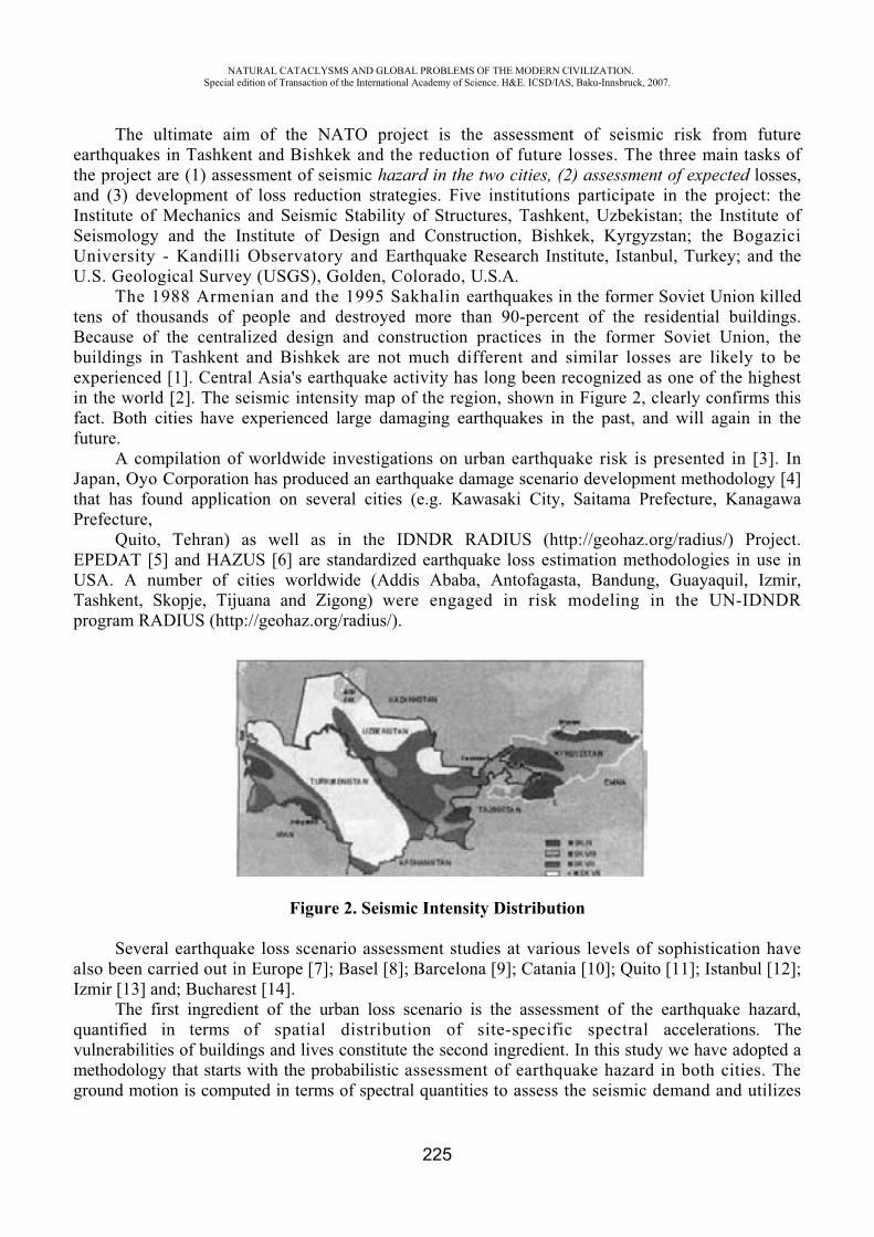
NATURAL CATACLYSMS AND GLOBAL PROBLEMS OF THE MODERN CIVILIZATION. Special edition of Transaction of the International Academy of Science. H&E. ICSD/IAS, Baku-Innsbruck, 2007.
225
The ultimate aim of the NATO project is the assessment of seismic risk from future earthquakes in Tashkent and Bishkek and the reduction of future losses. The three main tasks of the project are (1) assessment of seismic hazard in the two cities, (2) assessment of expected losses, and (3) development of loss reduction strategies. Five institutions participate in the project: the Institute of Mechanics and Seismic Stability of Structures, Tashkent, Uzbekistan; the Institute of Seismology and the Institute of Design and Construction, Bishkek, Kyrgyzstan; the Bogazici University - Kandilli Observatory and Earthquake Research Institute, Istanbul, Turkey; and the U.S. Geological Survey (USGS), Golden, Colorado, U.S.A.
The 1988 Armenian and the 1995 Sakhalin earthquakes in the former Soviet Union killed tens of thousands of people and destroyed more than 90-percent of the residential buildings. Because of the centralized design and construction practices in the former Soviet Union, the buildings in Tashkent and Bishkek are not much different and similar losses are likely to be experienced [1]. Central Asia's earthquake activity has long been recognized as one of the highest in the world [2]. The seismic intensity map of the region, shown in Figure 2, clearly confirms this fact. Both cities have experienced large damaging earthquakes in the past, and will again in the future.
A compilation of worldwide investigations on urban earthquake risk is presented in [3]. In Japan, Oyo Corporation has produced an earthquake damage scenario development methodology [4] that has found application on several cities (e.g. Kawasaki City, Saitama Prefecture, Kanagawa Prefecture,
Quito, Tehran) as well as in the IDNDR RADIUS (http://geohaz.org/radius/) Project. EPEDAT [5] and HAZUS [6] are standardized earthquake loss estimation methodologies in use in USA. A number of cities worldwide (Addis Ababa, Antofagasta, Bandung, Guayaquil, Izmir, Tashkent, Skopje, Tijuana and Zigong) were engaged in risk modeling in the UN-IDNDR program RADIUS (http://geohaz.org/radius/).
Figure 2. Seismic Intensity Distribution
Several earthquake loss scenario assessment studies at various levels of sophistication have also been carried out in Europe [7]; Basel [8]; Barcelona [9]; Catania [10]; Quito [11]; Istanbul [12]; Izmir [13] and; Bucharest [14].
The first ingredient of the urban loss scenario is the assessment of the earthquake hazard, quantified in terms of spatial distribution of site-specific spectral accelerations. The vulnerabilities of buildings and lives constitute the second ingredient. In this study we have adopted a methodology that starts with the probabilistic assessment of earthquake hazard in both cities. The ground motion is computed in terms of spectral quantities to assess the seismic demand and utilizes

NATURAL CATACLYSMS AND GLOBAL PROBLEMS OF THE MODERN CIVILIZATION. Special edition of Transaction of the International Academy of Science. H&E. ICSD/IAS, Baku-Innsbruck, 2007.
226
spectral-displacement based theoretical vulnerability relationships to arrive at losses. The ground motion (hazard) and the physical and demographic inventories (elements at risk) are aggregated in grid system (geo-cells). We have utilized the open software (KOERILoss) developed by Department of Earthquake Engineering of Bogazici University. The level of analysis corresponds to Level 2 type analysis in HAZUS-1999 Earthquake Hazard.
The cities of Tashkent and Bishkek are both located in Central Asia, long recognized as one of the most active areas of continental seismicity (Figure 2). Generally this seismicity is associated with a complex of faults resulting from the collision of the Indian subcontinent with Eurasia. The city of Tashkent was significantly damaged by an earthquake in 1966, and by several earlier earthquakes. The city of Bishkek was developed for the most part in the 20th century, and has not experienced significantly damaging earthquakes in its lifetime. The probabilistic assessment of the earthquake hazard for both cities have been prepared under the guidance of Dr. Rob Wesson of USGS (Assessment and mitigation of seismic risk in Tashkent, Uzbekistan, and Bishkek, Kyrgyz Republic: Progress Report on the Probabilistic Estimation of Seismic Hazard in Tashkent and Bishkek, NATO Science for Peace Project, October, 2001). The methodology used for these analyses is that developed by [15] for the U.S. National Seismic Hazard Map. The underlying method is that developed by [16]. Another description of the overall approach is given by [17]. The USGS methodology considers seismic hazard from both known fault sources and unknown sources. Earthquake frequency for fault sources is determined from geologic slip rates and "characteristic" and "Gutenberg-Richter" frequency models. Magnitudes for characteristic earthquakes are estimated from the length of faults using the relationships of [18]. Earthquake frequency for unknown sources is estimated from "smoothing" historic seismicity. The aim of the smoothed seismicity is to capture the seismic hazard from sources other than the characterized faults, that is the hazard from unknown faults and other unknown sources. The methodology is that used by Frankel and others (1996) and is composed of three basic steps. First, the available earthquake catalogs are reviewed by magnitude bin and by decade to determine for which magnitude bins and decades the catalog can be considered complete. Second, the maximum likelihood technique of [19] is used to determine, for each point on a geographic grid, the value in the Gutenberg-Richter frequency-magnitude relationship, log N=a-bM. Third, the values of 10a are spatially smoothed with a Gaussian operator with a characteristic distance of 100 km. More details on the spatial smoothing can be found in [20].
Earthquake ground motions, given the occurrence of an event, are estimated from empirical regression relationships that characterize the ground motion as a lognormal distribution with the mean in the distribution determined as a function of distance and magnitude. Both the mean and the standard deviation have been determined for a variety of regions and data sets by several authors. Hazard curves are prepared for peak ground acceleration, and spectral components with periods of 0.2 and 1.0 sec corresponding to probability levels of 2% or 10% in 50 years. In essence, at each geographic point, the frequencies of exceedances are summed according to the earthquake occurrence model and the attenuation relations. Frequencies of exceedance determined from the smoothed seismicity for earthquakes in the magnitude range of 5.0 to 7.0 are summed with the weight of one. Frequencies of exceedance from characteristic earthquakes with magnitudes above 7.0, and from Gutenberg-Richter earthquakes in the magnitude range from 7.0 to the characteristic magnitude, are summed with the weight of 0.5. An essential element in a probabilistic seismic hazard analysis is the relation between the dependent variables of strong ground motion parameters and the independent parameters of distance and magnitude, the so-called attenuation relationship. Due lack of region-specific strong ground motion attenuation data, attenuation relationships used for the western United States in the preparation of the U.S. national seismic hazard maps were employed in the preparation of these hazard maps. Because the attenuation relationship plays such a strong role in the resulting maps, this issue should be analyzed further.
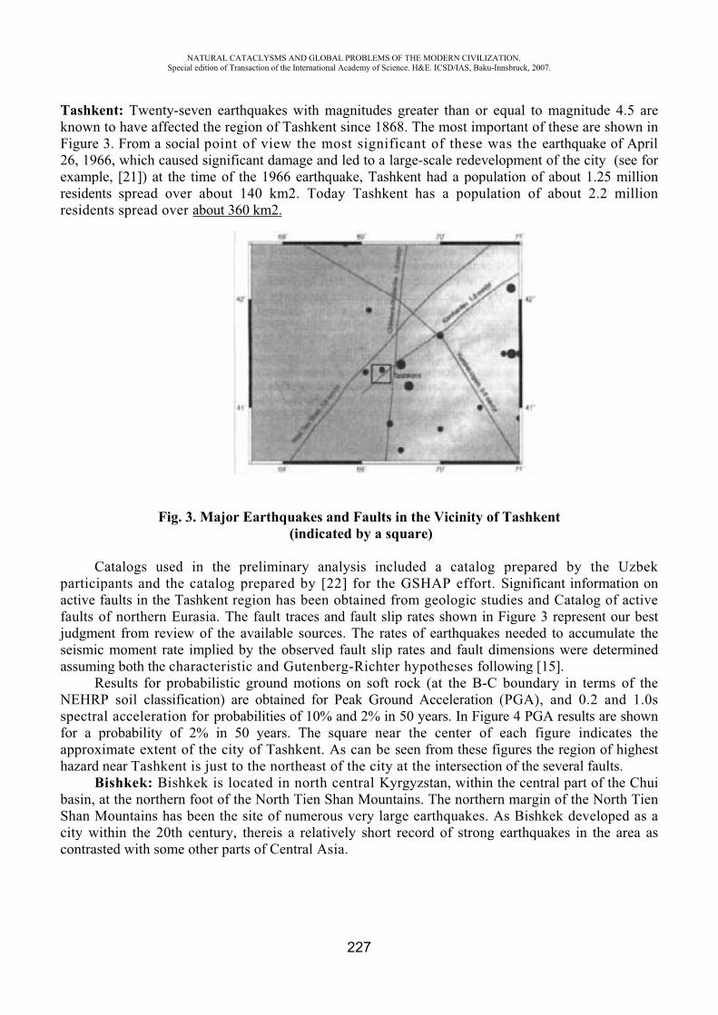
NATURAL CATACLYSMS AND GLOBAL PROBLEMS OF THE MODERN CIVILIZATION. Special edition of Transaction of the International Academy of Science. H&E. ICSD/IAS, Baku-Innsbruck, 2007.
227
Tashkent: Twenty-seven earthquakes with magnitudes greater than or equal to magnitude 4.5 are known to have affected the region of Tashkent since 1868. The most important of these are shown in Figure 3. From a social point of view the most significant of these was the earthquake of April 26, 1966, which caused significant damage and led to a large-scale redevelopment of the city (see for example, [21]) at the time of the 1966 earthquake, Tashkent had a population of about 1.25 million residents spread over about 140 km2. Today Tashkent has a population of about 2.2 million residents spread over about 360 km2.
Fig. 3. Major Earthquakes and Faults in the Vicinity of Tashkent (indicated by a square)
Catalogs used in the preliminary analysis included a catalog prepared by the Uzbek participants and the catalog prepared by [22] for the GSHAP effort. Significant information on active faults in the Tashkent region has been obtained from geologic studies and Catalog of active faults of northern Eurasia. The fault traces and fault slip rates shown in Figure 3 represent our best judgment from review of the available sources. The rates of earthquakes needed to accumulate the seismic moment rate implied by the observed fault slip rates and fault dimensions were determined assuming both the characteristic and Gutenberg-Richter hypotheses following [15].
Results for probabilistic ground motions on soft rock (at the B-C boundary in terms of the NEHRP soil classification) are obtained for Peak Ground Acceleration (PGA), and 0.2 and 1.0s spectral acceleration for probabilities of 10% and 2% in 50 years. In Figure 4 PGA results are shown for a probability of 2% in 50 years. The square near the center of each figure indicates the approximate extent of the city of Tashkent. As can be seen from these figures the region of highest hazard near Tashkent is just to the northeast of the city at the intersection of the several faults.
Bishkek: Bishkek is located in north central Kyrgyzstan, within the central part of the Chui basin, at the northern foot of the North Tien Shan Mountains. The northern margin of the North Tien Shan Mountains has been the site of numerous very large earthquakes. As Bishkek developed as a city within the 20th century, thereis a relatively short record of strong earthquakes in the area as contrasted with some other parts of Central Asia.
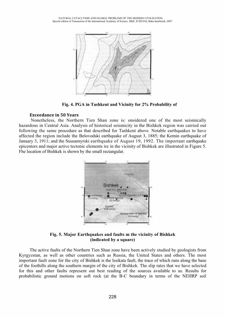
NATURAL CATACLYSMS AND GLOBAL PROBLEMS OF THE MODERN CIVILIZATION. Special edition of Transaction of the International Academy of Science. H&E. ICSD/IAS, Baku-Innsbruck, 2007.
228
Fig. 4. PGA in Tashkent and Vicinity for 2% Probability of
Exceedance in 50 Years Nonetheless, the Northern Tien Shan zone is: onsidered one of the most seismically
hazardous in Central Asia. Analysis of historical seismicity in the Bishkek region was carried out following the same procedure as that described for Tashkent above. Notable earthquakes to have affected the region include the Belovodski earthquake of August 3, 1885; the Kemin earthquake of January 3, 1911; and the Suusamyrski earthquake of August 19, 1992. The important earthquake epicenters and major active tectonic elements ire in the vicinity of Bishkek are illustrated in Figure 5. Fhe location of Bishkek is shown by the small rectangular.
Fig. 5. Major Earthquakes and faults m the vicinity of Bishkek (indicated by a square)
The active faults of the Northern Tien Shan zone have been actively studied by geologists from Kyrgyzstan, as well as other countries such as Russia, the United States and others. The most important fault zone for the city of Bishkek is the Issikata fault, the trace of which runs along the base of the foothills along the southern margin of the city of Bishkek. The slip rates that we have selected for this and other faults represent out best reading of the sources available to us. Results for probabilistic ground motions on soft rock (at the B-C boundary in terms of the NEHRP soil
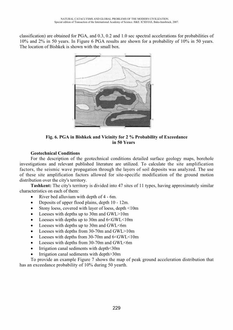
NATURAL CATACLYSMS AND GLOBAL PROBLEMS OF THE MODERN CIVILIZATION. Special edition of Transaction of the International Academy of Science. H&E. ICSD/IAS, Baku-Innsbruck, 2007.
229
classification) are obtained for PGA, and 0.3, 0.2 and 1.0 sec spectral accelerations for probabilities of 10% and 2% in 50 years. In Figure 6 PGA results are shown for a probability of 10% in 50 years. The location of Bishkek is shown with the small box.
Fig. 6. PGA in Bishkek and Vicinity for 2 % Probability of Exceedance in 50 Years
Geotechnical Conditions For the description of the geotechnical conditions detailed surface geology maps, borehole
investigations and relevant published literature are utilized. To calculate the site amplification factors, the seismic wave propagation through the layers of soil deposits was analyzed. The use of these site amplification factors allowed for site-specific modification of the ground motion distribution over the city's territory.
Tashkent: The city's territory is divided into 47 sites of 11 types, having approximately similar characteristics on each of them:
River bed alluvium with depth of 4 - 6m. Deposits of upper flood plains, depth 10 - 12m. Stony loess, covered with layer of loess, depth <10m Loesses with depths up to 30m and GWL>10m Loesses with depths up to 30m and 6<GWL<10m Loesses with depths up to 30m and GWL<6m Loesses with depths from 30-70m and GWL>10m Loesses with depths from 30-70m and 6<GWL<10m Loesses with depths from 30-70m and GWL<6m Irrigation canal sediments with depth<30m Irrigation canal sediments with depth>30m
To provide an example Figure 7 shows the map of peak ground acceleration distribution that has an exceedance probability of 10% during 50 yearth.
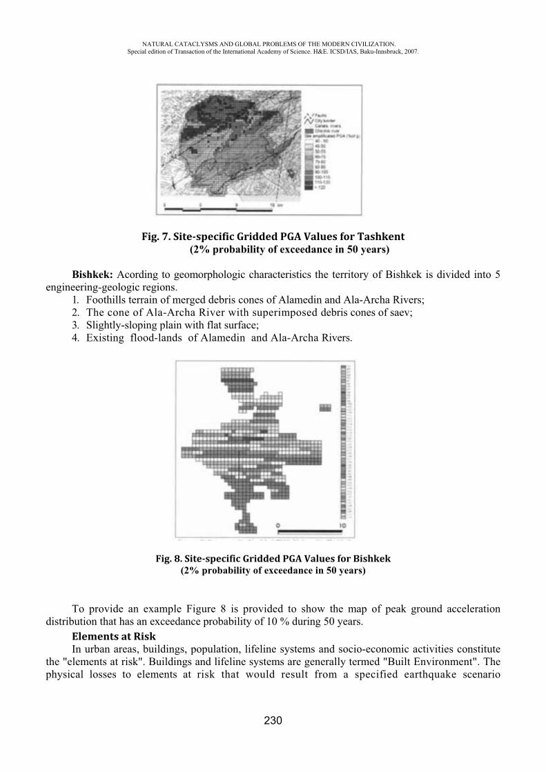
NATURAL CATACLYSMS AND GLOBAL PROBLEMS OF THE MODERN CIVILIZATION. Special edition of Transaction of the International Academy of Science. H&E. ICSD/IAS, Baku-Innsbruck, 2007.
230
Fig. 7. Site specific Gridded PGA Values for Tashkent(2% probability of exceedance in 50 years)
Bishkek: Acording to geomorphologic characteristics the territory of Bishkek is divided into 5 engineering-geologic regions.
1. Foothills terrain of merged debris cones of Alamedin and Ala-Archa Rivers; 2. The cone of Ala-Archa River with superimposed debris cones of saev; 3. Slightly-sloping plain with flat surface; 4. Existing flood-lands of Alamedin and Ala-Archa Rivers.
Fig. 8. Site specific Gridded PGA Values for Bishkek(2% probability of exceedance in 50 years)
To provide an example Figure 8 is provided to show the map of peak ground acceleration distribution that has an exceedance probability of 10 % during 50 years.
Elements at RiskIn urban areas, buildings, population, lifeline systems and socio-economic activities constitute
the "elements at risk". Buildings and lifeline systems are generally termed "Built Environment". The physical losses to elements at risk that would result from a specified earthquake scenario
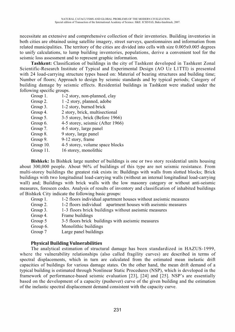
NATURAL CATACLYSMS AND GLOBAL PROBLEMS OF THE MODERN CIVILIZATION. Special edition of Transaction of the International Academy of Science. H&E. ICSD/IAS, Baku-Innsbruck, 2007.
231
necessitate an extensive and comprehensive collection of their inventories. Building inventories in both cities are obtained using satellite imagery, street surveys, questionnaires and information from related municipalities. The territory of the cities are divided into cells with size 0.005x0.005 degrees to unify calculations, to lump building inventories, populations, derive a convenient tool for the seismic loss assessment and to represent graphic information.
Tashkent: Classification of buildings in the city of Tashkent developed in Tashkent Zonal Scientific-Research Institute of Typical and Experimental Design ( Uz L1TTI) is presented with 24 load-carrying structure types based on: Material of bearing structures and building time; Number of floors; Approach to design by seismic standards and by typical periods; Category of building damage by seismic effects. Residential buildings in Tashkent were studied under the following specific groups.
Group 1. 1-2 story, non-planned, clay Group 2. 1 -2 story, planned, adobe Group 3. 1-2 story, burned brick Group 4. 2 story, brick, multisectional Group 5. 3-5 storey, brick (Before 1966) Group 6. 4-5 storey, seismic (After 1966) Group 7. 4-5 story, large panel Group 8. 9 story, large panel Group 9. 9-12 story, frame Group 10. 4-5 storey, volume space blocks Group 11. 16 storey, monolithic
Bishkek: In Bishkek large number of buildings is one or two story residential units housing about 300,000 people. About 96% of buildings of this type are not seismic resistance. From multi-storey buildings the greatest risk exists in: Buildings with walls from slotted blocks; Brick buildings with two longitudinal load-carrying walls (without an internal longitudinal load-carrying wall) and; Buildings with brick walls with the low masonry category or without anti-seismic measures, foreseen codes. Analysis of results of inventory and classification of inhabited buildings of Bishkek City indicate the following basic groups:
Group 1. 1-2 floors individual apartment houses without aseismic measures Group 2. 1-2 floors individual apartment houses with aseismic measures Group 3. 1-3 floors brick buildings without aseismic measures Group 4. Frame buildings Group 5 3-5 floors brick buildings with aseismic measures Group 6. Monolithic buildings Group 7 Large panel buildings
Physical Building VulnerabilitiesThe analytical estimation of structural damage has been standardized in HAZUS-1999,
where the vulnerability relationships (also called fragility curves) are described in terms of spectral displacements, which in turn are calculated from the estimated mean inelastic drift capacities of buildings for various damage states. On the other hand, the mean drift demand of a typical building is estimated through Nonlinear Static Procedures (NSP), which is developed in the framework of performance-based seismic evaluation [23], [24] and [25]. NSP’s are essentially based on the development of a capacity (pushover) curve of the given building and the estimation of the inelastic spectral displacement demand consistent with the capacity curve.
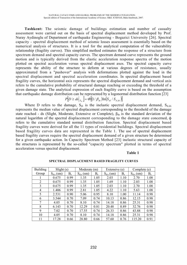
NATURAL CATACLYSMS AND GLOBAL PROBLEMS OF THE MODERN CIVILIZATION. Special edition of Transaction of the International Academy of Science. H&E. ICSD/IAS, Baku-Innsbruck, 2007.
232
Tashkent: The seismic damage of buildings estimation and number of casualty assessment were carried out on the basis of spectral displacement method developed by Prof. Nuray Aydinoglu of Department of earthquake Engineering - Bogazici University [26]. Spectral capacity - spectral displacement method of seismic losses assessment is essentially based on the numerical analysis of structures. It is a tool for the analytical computation of the vulnerability relationship (fragility curves). This simplified method estimates the response of a structure from spectrum demand and spectral capacity curves. The spectrum demand curve represents the ground motion and is typically derived from the elastic acceleration response spectra of the motion plotted on spectral acceleration versus spectral displacement axes. The spectral capacity curve represents the ability of the structure to deform at various degrees of resistance, usually approximated from a "pushover" analysis with deformations plotted against the load in the spectral displacement and spectral acceleration coordinates. In spectral displacement based fragility curves, the horizontal axis represents the spectral displacement demand and vertical axis refers to the cumulative probability of structural damage reaching or exceeding the threshold of a given damage state. The analytical expression of each fragility curve is based on the assumption that earthquake damage distribution can be represented by a logonormal distribution function [23]
dsddidsS SSdsDPdi ,/ln/1
Where D refers to the damage, Sdi is the inelastic spectral displacement demand, Sd,ds represents the median value of spectral displacement corresponding to the threshold of the damage state reached - ds (Slight, Moderate, Extensive or Complete), ds is the standard deviation of the natural logarithm of the spectral displacement corresponding to the damage state concerned, refers to the cumulative standard normal distribution function. Spectral displacement based fragility curves were derived for all the 11 types of residential buildings. Spectral displacement based fragility curves data are represented in the Table 1. The use of spectral displacement based fragility curves require the spectral displacement demand of a given structure be determined for a given earthquake action. In Capacity Spectrum Method [23] inelastic structural capacity of the structures is represented by the so-called "capacity spectrum" plotted in terms of spectral acceleration versus spectral displacement.
Table 1
SPECTRAL DISPLACEMENT BASED FRAGILITY CURVES
BuildingGroup
Slight (s) Moderate (m) Extensive (e) Complete (e)Sd,s (sm) s Sd,s (sm) s Sd,s (sm) s Sd,s (sm) s
1 0.675 0.99 1.35 1.05 2.03 1.10 2.70 1.082 0.675 0.99 1.35 1.05 1.69 1.10 2.03 1.083 0.675 0.99 1.35 1.05 2.03 1.10 2.70 1.084 1.406 0.99 2.81 1.05 4.22 1.10 5.63 1.085 2.531 0.90 5.06 0.95 8.10 1.00 11.14 0.986 3.544 0.70 7.09 0.74 10.13 0.86 12.15 0.987 4.05 0.70 8.10 0.74 14.18 0.86 25.31 0.988 6.143 0.70 12.29 0.81 20.48 0.89 32.76 0.989 7.02 0.70 17.55 0.74 26.33 0.86 43.88 0.9810 4.05 0.70 8.10 0.74 14.18 0.86 25.31 0.9811 17.28 0.66 28.80 0.66 57.60 0.76 115.20 0.91
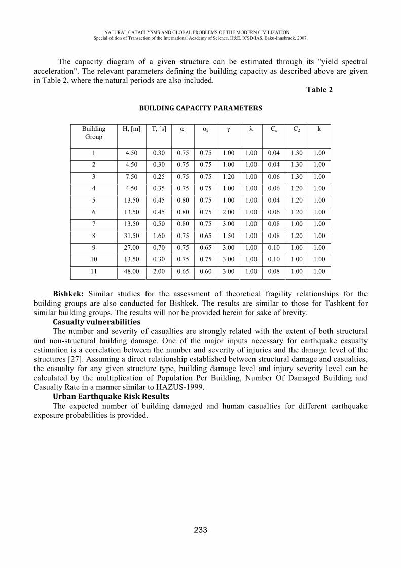
NATURAL CATACLYSMS AND GLOBAL PROBLEMS OF THE MODERN CIVILIZATION. Special edition of Transaction of the International Academy of Science. H&E. ICSD/IAS, Baku-Innsbruck, 2007.
233
The capacity diagram of a given structure can be estimated through its "yield spectral acceleration". The relevant parameters defining the building capacity as described above are given in Table 2, where the natural periods are also included.
Table 2
BUILDING CAPACITY PARAMETERS
Building Group
H, [m] T, [s] 1 2 Cs C2 k
1 4.50 0.30 0.75 0.75 1.00 1.00 0.04 1.30 1.00
2 4.50 0.30 0.75 0.75 1.00 1.00 0.04 1.30 1.00
3 7.50 0.25 0.75 0.75 1.20 1.00 0.06 1.30 1.00
4 4.50 0.35 0.75 0.75 1.00 1.00 0.06 1.20 1.00
5 13.50 0.45 0.80 0.75 1.00 1.00 0.04 1.20 1.00
6 13.50 0.45 0.80 0.75 2.00 1.00 0.06 1.20 1.00
7 13.50 0.50 0.80 0.75 3.00 1.00 0.08 1.00 1.00
8 31.50 1.60 0.75 0.65 1.50 1.00 0.08 1.20 1.00
9 27.00 0.70 0.75 0.65 3.00 1.00 0.10 1.00 1.00
10 13.50 0.30 0.75 0.75 3.00 1.00 0.10 1.00 1.00
11 48.00 2.00 0.65 0.60 3.00 1.00 0.08 1.00 1.00
Bishkek: Similar studies for the assessment of theoretical fragility relationships for the building groups are also conducted for Bishkek. The results are similar to those for Tashkent for similar building groups. The results will nor be provided herein for sake of brevity.
Casualty vulnerabilitiesThe number and severity of casualties are strongly related with the extent of both structural
and non-structural building damage. One of the major inputs necessary for earthquake casualty estimation is a correlation between the number and severity of injuries and the damage level of the structures [27]. Assuming a direct relationship established between structural damage and casualties, the casualty for any given structure type, building damage level and injury severity level can be calculated by the multiplication of Population Per Building, Number Of Damaged Building and Casualty Rate in a manner similar to HAZUS-1999.
Urban Earthquake Risk ResultsThe expected number of building damaged and human casualties for different earthquake
exposure probabilities is provided.
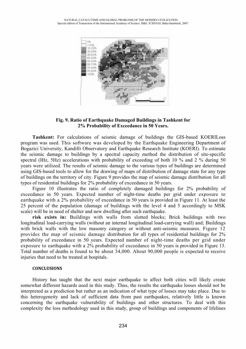
NATURAL CATACLYSMS AND GLOBAL PROBLEMS OF THE MODERN CIVILIZATION. Special edition of Transaction of the International Academy of Science. H&E. ICSD/IAS, Baku-Innsbruck, 2007.
234
Fig. 9. Ratio of Earthquake Damaged Buildings in Tashkent for 2% Probability of Exceedance in 50 Years.
Tashkent: For calculations of seismic damage of buildings the GIS-based KOERILoss program was used. This software was developed by the Earthquake Engineering Department of Bogazici University, Kandilli Observatory and Earthquake Research Institute (KOERI). To estimate the seismic damage to buildings by a spectral capacity method the distribution of site-specific spectral (lHz, 5Hz) accelerations with probability of exceeding of both 10 % and 2 % during 50 years were utilized. The results of seismic damage to the various types of buildings are determined using GIS-based tools to allow for the drawing of maps of distribution of damage state for any type of buildings on the territory of city. Figure 9 provides the map of seismic damage distribution for all types of residential buildings for 2% probability of exceedance in 50 years.
Figure 10 illustrates the ratio of completely damaged buildings for 2% probability of exceedance in 50 years. Expected number of night-time deaths per grid under exposure to earthquake with a 2% probability of exceedance in 50 years is provided in Figure 11. At least the 25 percent of the population (damage of buildings with the level 4 and 5 accordingly to MSK scale) will be in need of shelter and new dwelling after such earthquake.
risk exists in: Buildings with walls from slotted blocks; Brick buildings with two longitudinal load-carrying walls (without an internal longitudinal load-carrying wall) and; Buildings with brick walls with the low masonry category or without anti-seismic measures. Figure 12 provides the map of seismic damage distribution for all types of residential buildings for 2% probability of exceedance in 50 years. Expected number of night-time deaths per grid under exposure to earthquake with a 2% probability of exceedance in 50 years is provided in Figure 13. Total number of deaths is found to be about 34,000. About 90,000 people is expected to receive injuries that need to be treated at hospitals.
CONCLUSIONS
History has taught that the next major earthquake to affect both cities will likely create somewhat different hazards used in this study. Thus, the results the earthquake losses should not be interpreted as a prediction but rather as an indication of what type of losses may take place. Due to this heterogeneity and lack of sufficient data from past earthquakes, relatively little is known concerning the earthquake vulnerability of buildings and other structures. To deal with this complexity the loss methodology used in this study, group of buildings and components of lifelines
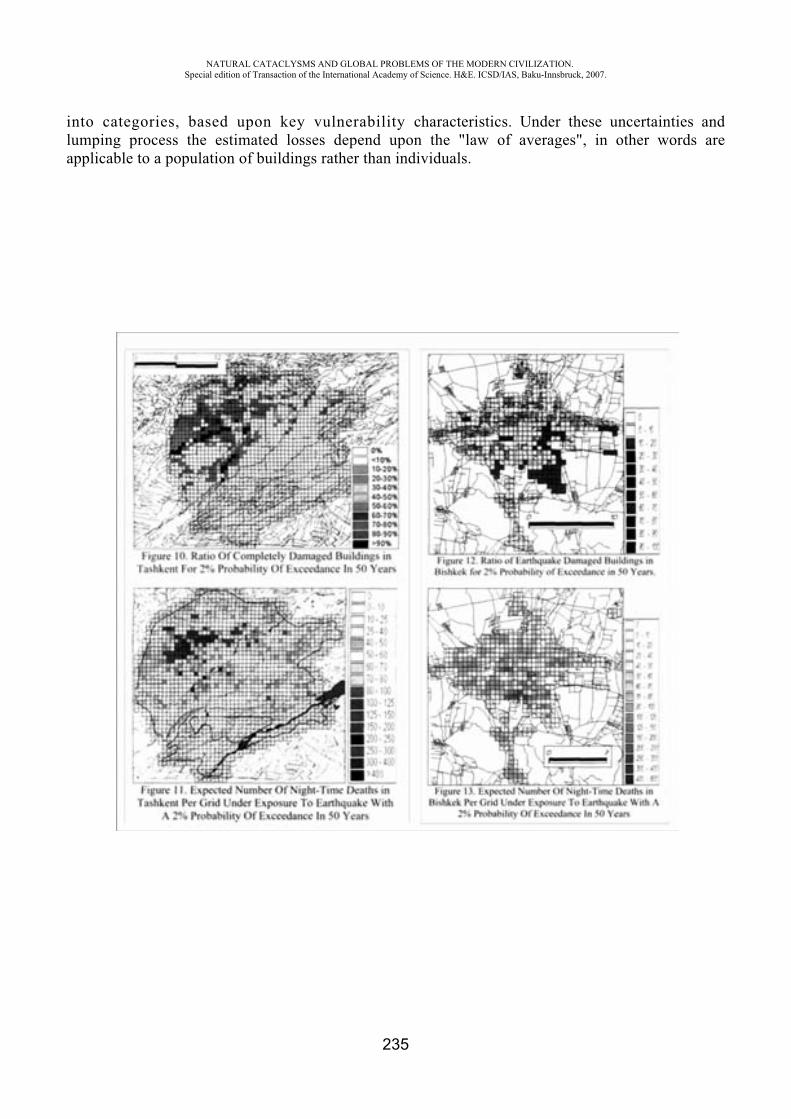
NATURAL CATACLYSMS AND GLOBAL PROBLEMS OF THE MODERN CIVILIZATION. Special edition of Transaction of the International Academy of Science. H&E. ICSD/IAS, Baku-Innsbruck, 2007.
235
into categories, based upon key vulnerability characteristics. Under these uncertainties and lumping process the estimated losses depend upon the "law of averages", in other words are applicable to a population of buildings rather than individuals.
NATURAL CATACLYSMS AND GLOBAL PROBLEMS OF THE MODERN CIVILIZATION. Special edition of Transaction of the International Academy of Science. H&E. ICSD/IAS, Baku-Innsbruck, 2007.
236
Bishkek: In Bishkek at the present moment there are 50 monolithic, about 100 frame, approximately 1000 -brick, 1000 - large-panel and about 75,000 private apartment houses. Large number of buildings is one or two story residential units housing about 300,000 people. About 96% of buildings of this type do not possess adequate seismic resistance. For multi-storey buildings the greatest While building related losses serve as a reasonable indicator of relative urban earthquake risk, it is important to recognize that these estimates are not absolute determinations of the total risk from earthquakes. The loss parameters used in this study address direct economic losses to the building inventory. Seismic risk also depends on other parameters, which have not been comprehensively included in this study, such as consequential physical losses (fire etc.) and indirect economic losses. What will be needed, in the context of planning for or mitigation of these indicated losses, is the dissemination of this urban earthquake loss data in understandable formats to increase the awareness of the general public, to inform technical personnel in charge of disaster planning and mitigation and to sensitize the top-level decision makers. We are afraid that, if this dissemination activity is not properly and adequately conducted, the return of this study will only be marginal. The results of this study strongly support the need for strategies to reduce the current seismic risk by focusing on rehabilitation of the existing building stock in the most vulnerable communities of Tashkent and Bishkek.
REFERENCES
1. T.Rashidov, L.Plotnikova, Sh.Chakimov Seismic Hazard and Building Vulnerability in Uzbekistan. Seismic Hazard and Building Vulnerability in Post-Soviet Central Asian Republics. Ed. By S.King, V.Chalturin and B.King. Kluwer AP. 1999.
2. Zhang P., Z. Yang, H.K. Gupta, S.C. Bhatia, and K.M. Shedlock (1999). Global seismic hazard assessment program (GSHAP) in continental Asia, Annali di Geofisica, 42, 6, 1167-1190.
3. Tucker B. and M.Erdik (1994), Issues in Urban Earthquake Risk, Kluwer Academic Publishers, 1994.
4. Komaru Y., T.Yamada, S.Segawa and C.Villacis (1995), Development of an Earthquake Damage Estimation System, Proc.ofthe lOthECEE, Vienna, 1994.
5. Eguchi R. ., J. D. Goltz, H.A. Seligson, P.J. Flores, . . Heaton, and E. Bortugno (1997). Real-time loss estimation as an emergency response descision support system: The Early Post-Earthquake Damage Assessment Tool (EPEDAT), Earthquake Spectra, 13, 815-832.
6. Whitman R.V. and H.J. Lagorio (1999), The FEMA-NIBS Methodology For Earthquake Loss Estimation, (http://www.fema.gov/hazus/hazus4a.htm)
7. ENSeRVES (2000), European Network on Seismic Risk, Vulnerability and Earthquake Scenarios, Proc. International Workshop on Seismic Risk and Earthquake Scenarios of Potenza, University of Basilicata.
8. Faeh D., Kind F., Lang K. and Giardini D. (2001). Earthquake scenarios for the city of Basel. Soil Dynamics and Earthquake Engineering, 21,405-413.
9. Barbat A.H., Moya F.Y. and J.A. Canas (1996). Damage scenarios 1& zones." Earthquake Spectra 12, No.3, 371-394.
10. Faccioli E. (Coordinatore) et al. (1997). Scenari di danno da terremoto per il comune di Catania. Gruppe Nazionale per la Difesa dei Terremoti, Italy.
NATURAL CATACLYSMS AND GLOBAL PROBLEMS OF THE MODERN CIVILIZATION. Special edition of Transaction of the International Academy of Science. H&E. ICSD/IAS, Baku-Innsbruck, 2007.
237
11. Fernandez J., Valverde, J., Yepes H., Tucker, . Bustamante G., Chatelain J.- L., Kaneko F., Villacis C, Yamada T. (1994). The Quito, Equador, earthquake risk management project, an overview. Published by Geohazards International, 34 pages.
12. Erdik M., J. Avci, E. Durukal, Developing an Earthquake Damage Scenario for Istanbul, Proceedings of the Fifth International Conference on Seismic Zonation, 17-19 October 1995, Nice, 1297-1304.
13. Erdik M., A.Ansal, N.Aydinoglu, A.Barka, O.Yuzugullu, G.Birgoren, J.Swift, Y.Alpay, K.Sesetyan (2000), Development of Earthquake Masterplan for the Municipality of Izmir, Proc, Sixth International Conference on Seismic Zonation, Palm Springs, November 12-15, 2000, EERI, San Francisco.
14. Wenzel F., Lungu D. and Novak O. (eds.) (1998) Vrancea Earthquakes: Tectonics, Hazard and Risk Mitigation. Selected papers of the First International Workshop on Vrancea Earthquakes, Bucharest, November 1-4, 1997, Kluwer Academic Publishers, Dordrecht, Netherlands, 374pp
15. Frankel A., C. Mueller, T. Barnhard D. Perkins, E. Leyendecker, N. Dickman, S. Hanson, and M. Hopper (1996). National seismic-hazard maps: Documentation June 1996, U.S. Geological Survey Open-File Report 96-532, 110 pages.
16. Cornell A. (1968). Engineering seismic risk analysis, Bull. Seism. Soc. Am., v. 58, pp. 1583-1606.
17. Reiter L. (1990). Earthquake Hazard Analysis: Issues and Insights, Columbia University Press, New York, 254 p.
18. Wells D.L., and K.J. Coppersmith (1994). New empirical relations among magnitude, rupture length, rupture width, rapture area, and surface displacement, Bull. Seism. Soc. Am., 84, 974-1002.
19. Weichert, Dieter H. (1980). Estimation of the earthquake recurrence parameters for unequal observation periods for different magnitudes, Bull. Seis. Soc. Am., 70, 1337-1346.
20. Frankel A. (1995). Mapping seismic hazard in the Central and Eastern United States, Seism. Res. Letts, v. 66, no. 4, pp. 8-21.
21. Akramkhodzhaev A.M. and others (1971). The Tashkent Earthquake, 26 April 1966, Fan Press, Tashkent, 672 p. (in Russian).
22. Zhang P., Z. Yang, H.K. Gupta, S.C. Bhatia, and K.M. Shedlock (1999). Global seismic hazard assessment program (GSHAP) in continental Asia, Annali di Geofisica, 42, 6, 1167-1190.
23. ATC-40 (1996), Seismic Evaluation and Retrofit of Concrete Buildings, Report ATC-40, Applied TechnologyCouncil, Redwood City, California.
24. FEMA 273 (1997), Federal Emergency Management Agency, NEHRP Guidelines for the Seismic Rehabilitation of Buildings (FEMA Publication 273), Washington DC.
25. FEMA 356 (2000), Federal Emergency Management Agency, Prestandard and Commentary for the Seismic Rehabilitation of Buildings (FEMA Publication 356), Washington DC.
26. Aydinoglu N. and U. Kacmaz (2002), Displacement Modification Factor for Seismic Inelastic Evaluation, Submitted for publication in Earthquake Engineering and structural Dynamics.
27. Coburn A. and R. Spence, 1992. Earthquake Protection. John Wiley&Sons, 1992.
NATURAL CATACLYSMS AND GLOBAL PROBLEMS OF THE MODERN CIVILIZATION. Special edition of Transaction of the International Academy of Science. H&E. ICSD/IAS, Baku-Innsbruck, 2007.
238
APPLYING OF MATHEMATICAL METHODS TO A SOLUTION OF A PROBLEM SEISMIC MICRO ZONING
A.B. Hasanov*, N.N. Huseynov**, T.S. Tahirov***, V.B. Babacanova****
Institute of Cybernetics of [email protected]
Mathematical modeling and study the behavior of anisotropic viscoelastic environments at impulsive dynamic loading uncovers new possibilities for idealized analysis of a problem of seismic micro zoning. At seismic micro zoning of cities, industrial plants and hydraulic engineering buildings it is necessary to allow for local seismic effects conditioned by a geological feature of region. The surface ground strata can essentially influence the shape and oscillation strength conditioned by seismic affecting, and the substantial surface waves essentially differ from standard oscillating accepted in the acting normative payable (SHY and P). Applying of mathematical methods can render the large help and economical favorably. The estimation, (rate) proposed a method, of spectral reflectance allows for reology of each stratum stratified no uniform mediums essentially (much) distinguished physics - to the mechanical performances.
Major factors, defining shape, spectrum and amplitude of seismic waves, are the dodge of the center and killing of property of environment, bound with occluding and availability of laminas. Preceding from this the spectrum of close earthquakes of a considered focal zone can be introduced by the way.
,,, 0 RvRLRL
Where ,RL - spectrum of the center; ,Rv - spectral reflectance of occluding viscoelastic environments on paths from the center up to post of registration of the seismograms. If the fixit station is not disposed on standard - rocky ground (Paleozoic the foundation), a spectrum of recorded oscillating we can will express by a proportion:
,,, RvRLRLWhere ,Rv - function, defining spectral reflectance of a system of strata occurring (lining)
Paleozoic on the foundation. The function ,Rv has a composite aspect and depends on many
factors, which one are fractionally reviewed in txR ,,1 - function depicting reology of environment.
The study under the proposed method of application can be sectioned into three stages: in the maiden stage the seismogram of the previous earthquakes obtained on fixit stations a spectrum of the center» conditionally is accepted as «which one can be received by following paths:
) Utilizing records of separate earthquakes recorded on a rocky ground on Paleozoic; )utilizing of separate earthquakes of investigated (studied) region, deciding reveries problems; ) setting by the way of analytical functions results of experimental operations.
The second stage definition (determination) of spectral reflectance of porous strata, introduced thick liquid or gas. All substantial environments basically porous also contain definite fillers. The wave processes in these environments are close to seismic affecting happening in grounds during earthquake. Usage of the pattern of porous mediums are conditioned by properties of the viscoelastic pattern, except for them are allowed porosity, qasoylsaturation, permeability, viscosity of fluid
NATURAL CATACLYSMS AND GLOBAL PROBLEMS OF THE MODERN CIVILIZATION. Special edition of Transaction of the International Academy of Science. H&E. ICSD/IAS, Baku-Innsbruck, 2007.
239
(relative moves a reluctant), the extent of an adhesion of granulated fragments of environment etc. By results of micro seismic studies the epicenter of regions of killer quakes is retuned a maximal amount of breaking downs recorded in grounds high-level of ground waters (Baku, Sumqait and over, industrial regions of Azerbaijan). The basic reason of breaking downs - high water saturation, which one in result caused irreversible viscoelastic of a strain of foundations. More detailed and comprehensive account (record-keeping) of a complex physics - mechanical characteristics of grounds is possible (probable) only by the specification statement of a ground as inhomogeneous multiphase environment with composite reology (viscoelastic, viscoplastic and etc.) also will promote more precise definition (determination) of happening non-steady wave processes.
The third stage - expression of seismic intensity through design frequency spectrums of oscillating of a ground on the basis of the information on spectral reflectance of a ground and spectrum of the center, simulated by a crust.
Spectral reflectance of considered strata we can will determine by the way
2,1,/1
//1
i
vvv
jjjji
jijjjjijjiij
Where j - porosity of strata; j and j - gravity a solid and pool reluctant separately;
jiv and jiv
- spectral reflectance of strata, solid and pool reluctant.
For deriving value of offset on time (synthetic seismograms) on a free surface, where is
determinedv , it is necessary to apply a revertive Fourier transform in an infinite interval
; .
In a considered case is used
dtivLtvi
12
0expRe1
dttitLLt
t
0
0
exp
Where - pitch on frequency at account of spectral reflectance; - pulse duration; 0t -
time of advent; tL - shape of an incident wave. tL in particular accounts, as is retuned in [1] can
be preset in an analytical aspect
ttttL n0sinexp
NATURAL CATACLYSMS AND GLOBAL PROBLEMS OF THE MODERN CIVILIZATION. Special edition of Transaction of the International Academy of Science. H&E. ICSD/IAS, Baku-Innsbruck, 2007.
240
In this shape will be on nature, close to affecting earthquakes. The arguments 0,n are set as input dates of particular impulse. On a foundation of the depicted above solution the algorithm and programs of account of seismic intensity on free of a surface thin layer of an occluding porous medium can be designed. Increment numbers of investigated territories after the theorist - design method of seismic micro zoning is tendered to compute under the formula
ijKJ maxmax /lg
2lg/1K
Where jmax and imax transformation ratios of a unknown quantity and standard ground.
At estimation of ground effects frequently is vague, what part of a section is necessary for learning and with what extent correctly to determine resonance vibration periods on a surface.
As an example is resulted in a conditional problem for conditional city N. We use dates m of pieces of deep wells (for large cities m = 30? 75) geologic discharges,
sound logging and other engineerinq of geologic and seismological materials. Having dates seismometers we can compare obtained results. We augmenting can receive number of pitches of account adequate accuracy of account. As a result of an intrusion the given method of application can receive large economic benefit.
The proposed method of application of idealized account of a state of environments with composite reology is possible to apply to study of organic variations in a human brain at brain jolting owing to shock on dates of the applicable plot information. The strains of cerebral environment accompanying applicable to the movements are irreversible can influence functional properties of a brain. Only at studies it is necessary to utilize a restricted retentive Fourier transform.
REFERENCES
1. T.A. Aliev The robast technology of the computer analysis. - ., Mechanical engineering, 1999, 195 p.
2. A.B.Hasanov Reaction of mechanical systems to non-stationary external influences. Baku, ELM, 2004 , 247p.
3. V.I. Clackin The stochastic equations and waves in casual - non-uniform environments, Wednesdays. ., Science, 1980, 335p.
NATURAL CATACLYSMS AND GLOBAL PROBLEMS OF THE MODERN CIVILIZATION. Special edition of Transaction of the International Academy of Science. H&E. ICSD/IAS, Baku-Innsbruck, 2007.
241
INVESTIGATION OF THERMAL PROPERTIES OF CARBONATE FORMATIONS IN A KARSTIC REGION OF IRAN, BY USING
SATELLITE IMAGE
Nader Jalali*, M. A. Museyibov**
Soil Conservation and Watershed Management Research Center,Tehran, Iran
Abstract:By the time the general conditions of land surface in carbonate rocks to be the same in terms of
vegetation cover, antecedent soil moisture, illumination and altitude, any variations and anomalies of temperature in these rock masses may be attributed to hydrogeologycal conditions of carbonate formations. In order to verify this hypothesis, the carbonate rocks of an area in karstic region were investigated. Investigation on thermal infrared (ETM+) image of the area of Evoghli in NW of Iran and field investigations showed that some parts of carbonate rocks that are bearing karst water and have almost the same slope facing (aspect), vegetation cover and altitude are relatively cooler than the other parts due to coolness conduction. This property of carbonate rocks can be used as a primary indicator for exploration of karst water resources by using remotely sensed data before applying expensive geophysical methods.
Keywords: Carbonate rocks, Karst water resources, Thermal Infrared Image, Iran 1. Introduction Many factors like vegetation cover, rainfall, altitude, lithology and physical properties of rock
masses, beside their hydrological conditions may cause reduction of land surface temperature in karst regions. When the general conditions of land surfaces in different adjacent carbonate rocks remain the same, the effect of hydrologic conditions of these geological formations become the most important factor in lowering land surface temperature.
Investigations within three recent decades indicate the importance of application of thermal infrared images in exploration purposes. J. N. Rinker (1975) used the infrared thermal scanner to investigate the Greenland glacier and the karst of Purto Rico in order to identify the location of fractures and caves underground. The author drew a conclusion that this method could be used only under specific conditions. First of all, the temperature in underground karst features has to be quite different from the outside temperature and the difference must produce a specific effect on the land surface [6].
An airborne thermal camera was used to locate springs and caves in a karst watershed. The detector was an imaging infrared camera with a temperature sensitivity of approximately 0.10°C. The resolution on the ground was a fraction of a meter with a total field of view of one hectare [3].
Dale A. Quattrochi (2004), used ETM+ images for mapping of relative temperature on land and water surfaces and showed how these data are important for discrimination of cool and relatively warm water bodies. He extrapolated his experiences to identification of other phenomenon like alteration zone, basalt rocks and agricultural fields with different health condition and came to reasonable conclusion on advantages of thermal remote sensing [4].
According to the literature, particularly considering the above-mentioned statements thermal remote sensing has received special attentions in recent decades. Although high resolution airborne
NATURAL CATACLYSMS AND GLOBAL PROBLEMS OF THE MODERN CIVILIZATION. Special edition of Transaction of the International Academy of Science. H&E. ICSD/IAS, Baku-Innsbruck, 2007.
242
thermal imaging is found suitable method for thermal surveying but it seems to be very expensive. Moreover its field of view covers very small area and such images are rarely available for the areas of interest. Therefore low cost and frequently available thermal images for entire world become very important in variety of applications.
2. Basis conceptHeat transfer in a form of conduction is one of the important characteristics of rock masses. It
implies that rock mass can transfer both heat and coolness. This property of rocks allows heat or coolness to flow when their source(s) exist. Existence of water bodies in carbonate formations provides favorable condition for coolness flow to take place. Near surface and land surface temperatures can be influenced by either climatic changes or heat/coolness transfers [1].
2.1. Temporal variation of land temperature Incident radiation of sun heats land surface including soils and rocks. This causes variation on
land surface temperature along the seasons. Variation of land surface temperature due to this reason is valid only up to certain depth. According to temporal variation of temperature, the air temperature even can influence temperature in depths of 15 to 40 meters. Temperature of this zone is annually variable and is a function of seasonal variation of temperature. Depth of this zone is slightly more for argilic and sandy materials rather than limestone and granite [1]. Therefore the conclusion can be drawn that any phenomena like cool water bodies within the carbonate rocks in the depth of less than 40 meters can influence land surface temperature. Without any doubt the temperature in underground karst features has to be quite different from the outside temperature [6].
2.2. Thermal characteristics of land typesTwo main factors determine thermal characteristics of an object. These are specific heat and heat
conductivity. Heat conductivity is a factor that shows how heat flows and propagates in an object.Heat conductivity of very prose lands increase with degree of saturation by water. Degree of heat
conductivity of different land type varies very slightly from one land type to another. Lands consist of clayey materials and carbonate rocks have lower and higher rate of heat conductivities, respectively. Heat conductivity for clayey materials and dry sands is about 0.002 to 0.003 cal/cm/sec and for limestone and granite is 0.005 to 0.008 cal/cm/sec[1]. Considering these rates, carbonate rocks have relatively more heat conductivity. Therefore heat or coolness flow can take place much faster in rock masses than clayey materials. Heat flow and its base rules are explained by Fourier as well.
3. Method and the materials Temperature of land surface varies between -50 to +50 degree Celsius. Considering this reality
and the Wein displacement law and atmospheric windows, the most proper detector for detecting this range of temperature is the sensor which is sensitive to wavelengths of 8 to 14 micrometers [2 and 5]. Band 6 of ETM+ sensor of Landsat is an image which is acquired using wavelengths of 10 to 12.5 micrometers. Since this image is enhanced from the spatial resolution point of view to 60 meters and provides thermal behavior of objects and phenomena, therefore this thermal image and other required data layers were used in this study.
Time of thermometery, antecedent soil moisture (rainfall, irrigation), lithology, aspect, hydrogeological properties of rocks and land cover are the most effective factors influencing land surface temperature. Estimation of land surface temperature requires emissivity of land types, vegetation and soil. Since none of these data are available, therefore conversion of thermal image to temperature is limitted only to brightness temperature. Brightness temperature (Tb) is computed by applying the inverse of the Plank function to thermal radiance values. The small part of thermal infrared image for an area of Khoy (Evoghli, NW of Iran) as presented by figure 1, NDVI, geology map, the SRTM image (DEM) and its derivatives like slope facing map and field observations were used as well in this research. Since differences of temperature of rock masses is high during nights in winters and days in summers, therefore both type of images acquired in such conditions (depends on their

NATURAL CATACLYSMS AND GLOBAL PROBLEMS OF THE MODERN CIVILIZATION. Special edition of Transaction of the International Academy of Science. H&E. ICSD/IAS, Baku-Innsbruck, 2007.
243
availability) can be used for investigation of thermal anomalies. Although it is recommended to convert thermal image to Land Surface Temperature (LST), but due to unavailability of required parameters as recommended by Sobrino et al, 2004, only Brightness Temperature or the original thermal image are used. Converting the thermal image values to brightness temperature can be done using following equations [8].
BBandDNGCVr )6_(Equation 1Equation 2
)11(
2
CVrKLn
KTb
Where:CVr: is the cell value as Radiance B: is the offset (0.1238 for TM, Band_6 and 0.3200 for ETM+ Band_6) G: is the gain (0.005632156 for TM and 0.003705882 for ETM) Tb: Brightness Temperature in degrees Kelvin K1: is calibration constant 1 (607.76 for TM and 666.09 for ETM+)K2: is calibration constant 2 (1260.56 for TM and 1282.71 for ETM+)
Investigation showed that brightness temperatures and thermal image values are highly correlated therefore for this reason and for having better discrimination of original digital numbers of thermal image and also for simplicity use of thermal image itself is strongly recommended. Considerable advantage of converting original thermal image to brightness temperature in such studies is having temperature at sensor in degrees of Kelvin.
4. Data Analysis Preliminary interpretation of single band and original thermal image (figure 1) shows that the
temperature on some dry and vegetation-free parts of land surface in the polygons of massive limestone (labeled by letters A, B and C) is low. Note that dark and light tones represent cool and warm objects respectively. Making a false color composite image with contribution of thermal infrared band (see figure2), provides an informative image representing either cool and warm areas as well as other spatial information. Cooler areas were appeared in blue colors.
Marly limestone (polygon labeled by “E”) is generally appeared warmer. This might be due to marl content or hydrogeological property of this rock unit. According to field investigation no karst evidence is evident on this rock type. On the other hand the red conglomerate (area labeled by “D”) is appeared cold, while expectation is different about it because of its red color and more capability of absorption of sun light. This evidence could be attributed to hydrogeological properties of this conglomerate. Since the other terrain conditions are almost the same, so warmness of marly limestone and coolness of red conglomerate may highly be correlated with hydrogeological conditions of these lithological units.
As it mentioned before, land surface temperature may be attributed to vegetation cover, antecedent soil moisture, illumination and altitude and also may be affected by hydrogeologycal conditions of carbonate formations. In order to enhance the impact of hydrogeological conditions on land surface temperature an attempt was made to eliminate the roles of other factors.
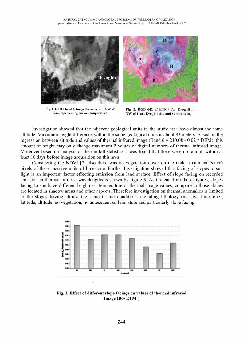
NATURAL CATACLYSMS AND GLOBAL PROBLEMS OF THE MODERN CIVILIZATION. Special edition of Transaction of the International Academy of Science. H&E. ICSD/IAS, Baku-Innsbruck, 2007.
244
Investigation showed that the adjacent geological units in the study area have almost the same altitude. Maximum height difference within the same geological units is about 83 meters. Based on the regression between altitude and values of thermal infrared image (Band 6 = 210.08 - 0.02 * DEM), this amount of height may only change maximum 2 values of digital numbers of thermal infrared image. Moreover based on analysis of the rainfall statistics it was found that there were no rainfall within at least 10 days before image acquisition on this area.
Considering the NDVI [7] also there was no vegetation cover on the under treatment (slave) pixels of these massive units of limestone. Further Investigation showed that facing of slopes to sun light is an important factor effecting emission from land surface. Effect of slope facing on recorded emission in thermal infrared wavelengths is shown by figure 3. As it clear from these figures, slopes facing to sun have different brightness temperature or thermal image values, compare to those slopes are located in shadow areas and other aspects. Therefore investigation on thermal anomalies is limited to the slopes having almost the same terrain conditions including lithology (massive limestone), latitude, altitude, no vegetation, no antecedent soil moisture and particularly slope facing.
Fig. 3. Effect of different slope facings on values of thermal infrared Image (B6- ETM+)
Fig. 1. ETM+ band 6, image for an area in NW of Iran, representing surface temperature
Fig. 2. RGB 642 of ETM+ for Evoghli in NW of Iran, Evoghli city and surrounding
Evoghli
AC
B
D
E
s
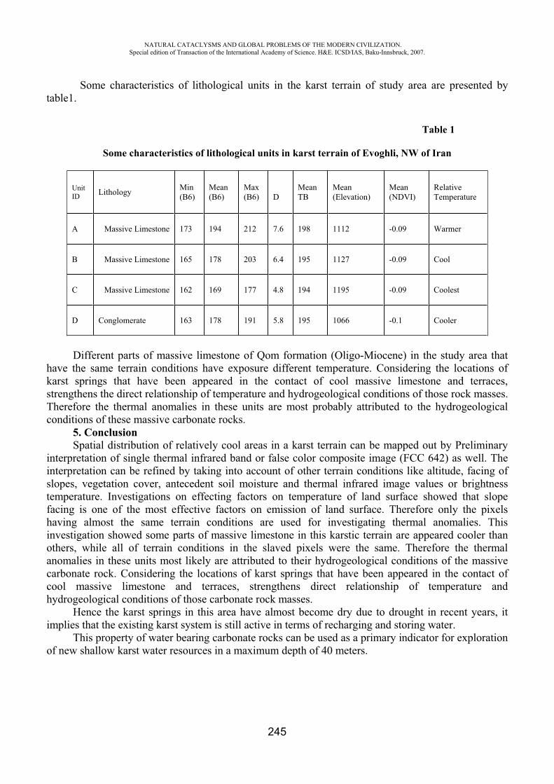
NATURAL CATACLYSMS AND GLOBAL PROBLEMS OF THE MODERN CIVILIZATION. Special edition of Transaction of the International Academy of Science. H&E. ICSD/IAS, Baku-Innsbruck, 2007.
245
Some characteristics of lithological units in the karst terrain of study area are presented by table1.
Table 1
Some characteristics of lithological units in karst terrain of Evoghli, NW of Iran
UnitID Lithology Min
(B6)Mean (B6)
Max (B6) D
Mean TB
Mean (Elevation)
Mean (NDVI)
RelativeTemperature
A Massive Limestone 173 194 212 7.6 198 1112 -0.09 Warmer
B Massive Limestone 165 178 203 6.4 195 1127 -0.09 Cool
C Massive Limestone 162 169 177 4.8 194 1195 -0.09 Coolest
D Conglomerate 163 178 191 5.8 195 1066 -0.1 Cooler
Different parts of massive limestone of Qom formation (Oligo-Miocene) in the study area that have the same terrain conditions have exposure different temperature. Considering the locations of karst springs that have been appeared in the contact of cool massive limestone and terraces, strengthens the direct relationship of temperature and hydrogeological conditions of those rock masses. Therefore the thermal anomalies in these units are most probably attributed to the hydrogeological conditions of these massive carbonate rocks.
5. ConclusionSpatial distribution of relatively cool areas in a karst terrain can be mapped out by Preliminary
interpretation of single thermal infrared band or false color composite image (FCC 642) as well. The interpretation can be refined by taking into account of other terrain conditions like altitude, facing of slopes, vegetation cover, antecedent soil moisture and thermal infrared image values or brightness temperature. Investigations on effecting factors on temperature of land surface showed that slope facing is one of the most effective factors on emission of land surface. Therefore only the pixels having almost the same terrain conditions are used for investigating thermal anomalies. This investigation showed some parts of massive limestone in this karstic terrain are appeared cooler than others, while all of terrain conditions in the slaved pixels were the same. Therefore the thermal anomalies in these units most likely are attributed to their hydrogeological conditions of the massive carbonate rock. Considering the locations of karst springs that have been appeared in the contact of cool massive limestone and terraces, strengthens direct relationship of temperature and hydrogeological conditions of those carbonate rock masses.
Hence the karst springs in this area have almost become dry due to drought in recent years, it implies that the existing karst system is still active in terms of recharging and storing water.
This property of water bearing carbonate rocks can be used as a primary indicator for exploration of new shallow karst water resources in a maximum depth of 40 meters.
NATURAL CATACLYSMS AND GLOBAL PROBLEMS OF THE MODERN CIVILIZATION. Special edition of Transaction of the International Academy of Science. H&E. ICSD/IAS, Baku-Innsbruck, 2007.
246
REFERENCES
1. Astier, 1974. Geophysique appliqué Al’ Hydrogeologie, 120 Bd Saint-Germain, Paris.2. Alavi Panah S. K. (2007), thermal remote sensing and its application in the Earth Science,
University of Tehran press, no.2782. 3. C. Warren Campbell, Joseph W. Foster, and Mohamed Abd El Latif, 1996, pp. 3910-3914 4. http://www.pubs.asce.org/wwwdisplay.cgi5. Dale A. Quattrochi (2004) Thermal Remote sensing, Jhan Wiley publication 6. Japan Assosiation on Remote Sensing (JARS), 1993, Remote sensing notes, Translated by
Iranian Remote sensing Center. 7. Petar. T. Milanovic, 1979, Karst hydrogeology, Colorado, 80161, USA 8. Rouse, J.W., R.H.Haas, J.A.Schell, and D.W.Deering, 1973: Monitoring vegetation systems
in the great plains with ERTS, Third ERTS Symposium, NASA SP-351 I: 309-317. 9. Sobrino, et al, 2000, toward remote sensing methods for land cover dynamic monitoring
application to Morocco. International journal of remote sensing. 21: 353-366.
NATURAL HAZARDS AND RISKS IN THE NORTH CASPIAN BASIN
Anisimov L.A. LUKOIL-VolgogradNIPImorneft, Russia Deliya S.V. LUKOIL-Nizhnevolzhskneft, Russia
Introduction
Natural hazards can play a distinctive role in determination of well-siting choices, in sea operations, well completions, in pipeline locations, and in storage and refinement operations on land. These hazards need to be understood for the their frequencies of occurrence, likely locations, and severity of damage potential to hydrocarbon endeavors. The North Caspian Basin is the most urgent target now for these investigations on which to effect such a hazard and risk analysis because of the already known impressive fields such as Astrakhan, Tengiz, Kashagan and the sensible areas of Volga and Ural Deltas. To provide safety of technological operations and risk mitigation extended offshore investigations have been carried out. They include:
Study of the geology, geochemistry and hydrology of the Basin and related natural hazards; Assessment the different types of risks during offshore operations; Present a methodology to plan strategies and tactics for minimizing the influence of hazards.
Natural Hazards For a better understanding of natural hazards and consequent risks the basin evolution, marine
geology, hydrology and engineering problems have been taken into consideration. The North Caspian Basin comprises the southern part of the Pricaspian Basin as a part of the Russian Platform and the northern part of the Hersynian Scythian-Turan Platform. Pricaspian Basin contains a sedimentary column up to 20 km thick comprising Paleozoic subsalt formations, Permian salt and Mesozoic and Cenozoic suprasalt terrigeneous formations. Scythian-Turan Platform consists of transgressive Mesozoic-Cenozoic sedimentary section on the Hersynian basement. Some large oil and gas fields
NATURAL CATACLYSMS AND GLOBAL PROBLEMS OF THE MODERN CIVILIZATION. Special edition of Transaction of the International Academy of Science. H&E. ICSD/IAS, Baku-Innsbruck, 2007.
247
have been discovered in the North Caspian offshore, including the giant Kashagan oilfield in the Kazakh sector of the Caspian Sea. The bulk of the work program will be centered around information about the principal risk elements of the North Caspian Basin in connection with its geological setting. The next subsections provide overviews of the dominant problems of concern, so that the general need to provide hazard assessments is more clearly focused.
1. OVERPRESSURE The North Caspian Basin comprises the southern part of the Pricaspian Basin as a part of the
Russian Platform and transition zone between the Russian and Scythian-Turanian platforms. Overpressure has been studied for the Pricaspian Basin. The overpressured zones are located mainly in the Paleozoic subsalt formations, in the permeable zones of salt deposits and in the deepest parts of Mesozoic rocks in the interdiapiric depressions. Overpressure has not been discovered in the Mesozoic rocks at a depth 3200 m on the Khvalynskoye oilfield.
Overpressure phenomena have been studied mainly in Tertiary Basins where overpressure generation is very active. Burial histories play a very important role in determining the natural rock properties and the distribution of the overpressure zones. Some authors note that ovepressuring is more common in Tertiary sequences than in Paleozoic successions, suggesting that the amount of overpressure might have diminished through time. Overpressure zones in the Neogene and Paleogene sediments of Tertiary Basins commence at typical depths ranges of 1000-1500 m; in contrast, the onset depths in the Mesozoic and Paleozoic strata are 3500-4000 m.
2. H2S AND MERCAPTANES There is always an element of risk with any technological operation in the petroleum industry but
the presence of H2S can increase significantly the difficulties. The situation can be more dangerous if H2S is in an overpressured zone. The natural gas industry encounters raw sour gas in the deep deposits of many sedimentary basins but four basins contain the largest reserves of the reduced sulfur species: Western Canada, Gulf Coast, Middle East and Pricaspian. In these region we have to use all predictive methods, create control and safety systems to prevent accidents and to plan emergency measures. All these operations have to be under considerations that take into account the conditions of the Caspian Region where reduced sulfur species are the principal components of oils and gases.
Mapping of carbonate reservoirs with anhydrite layers, inclusions and H2S traces can indicate possible sour gas zones in the deep carbonate reservoirs in other areas around the Caspian Sea, i.e. to predict undiscovered resources. The most favorable formations that can produce H2S gases are the Upper Paleozoic carbonates in the Pricaspian Basin, Upper Jurassic – Lower Cretaceous on the Scythian – Turanian Platform, and the Paleogene of the Alpine Uplifts of Caucasus. Basin analysis and the database of reduced sulfur species form the principal basis for zonation of the Caspian Region according to the rate of geological risk in different parts of the study area.
3. EARTHQUAKE HAZARDS The seismicity of the North Caspian Basin is more moderate than the Central Caspian Basin and
considerably more moderate than the South Caspian zone. Nevertheless, one seismic zone is identified with Mangyshlac fault zone, crossing the Caspian Sea and continuing to the Karpinsky Ridge. A major Mangyshlac earthquake has been recorded in historic documents. It occurred in 1310 and with intensity reaching 7 balls. Another major earthquake (M=6.2) was recorded on 27 January 1963 in Apsheron (Oil Rocks). The focal zone of the earthquake lay within the deepest part of the Central Caspian (water depth about 200m), and is associated with the junction between the zone of Alpine folding in Kopetdag-Caucasus area and the epihercynian Turan plate. Geophysical investigations along the Nakhichevan-Ufa geotraverse can provide a basis for the correlation between seismicity and geological setting of the principal structures.
NATURAL CATACLYSMS AND GLOBAL PROBLEMS OF THE MODERN CIVILIZATION. Special edition of Transaction of the International Academy of Science. H&E. ICSD/IAS, Baku-Innsbruck, 2007.
248
4. GAS HAZARDS North Caspian Basin contains sediments from Devonian to Quaternary in age. Discovered oil
and gas deposts are sited in reservoir traps ranging in age from Carboniferous to Lower Cretaceous. The presence of secondary gas pockets, or gas accumulations in shallow sediments, is one of the hazards that drillers can face in the North Caspian Basin. This phenomenon is usual in the South Caspian Basin as well as in area to the north from the Caspian Sea. Seismic cross-sections show “bright spots” that correspond to these gas accumulations in the Quaternary sediments on some areas of the North Caspian Basin. Sonic logging and seismic research of an area are necessary in order to detect such hazardous zones of low seismic velocity and high gas saturation.
5. BOTTOM SEDIMENTS The recent shelf of the North Caspian region was formed during the Quaternary Period under
repeated transgressive – regressive stages of the sea. This sea–level variation is found in the overburden sediments that make up the accumulative clinoform, with thickness increasing in the Mangyshlak threshold direction up to more than 100m. Outward from the shore, sediment mass delaminates, reflecting horizons increasing in number and having a gentle dip towards the Central Caspian depression.
To the north of the Mangyshlak threshold, in the depth range of 30 to 50 m, there is a meridionally stretched valley complex connected with deltas and representing an old buried valley complicated with erosional downcuttings. Valley width decreases from 10 to 4 km in the north – south direction while valley bottom depth increases up to 80 – 90 m below sea level.
A peculiarity of sedimentation in the north part of the sea is predetermined by the shallow water of the North Caspian region, delivery of large amounts of sediment, and transit of a significant part of the sediments to the Central Caspian region. Bottomset beds are various and represented by coquina, sands (terrigenous and chemogenic), aleurites and pelit of various genesis. All these aspects must be taking into consideration during offshore operations.
6. HYDROLOGICAL CONDITIONS The problems of the Caspian Sea level changes are very complex and include many aspects of
tectonics, sedimentology, hydrology and climatology. Engineering problems have been created after almost a hundred years of sea level dropping, the sea-level started to rise rapidly beginning from the end of the 1970’s and, during the last 20 years, has increased by almost 2 meters. That rise has brought many problems to the coastal and delta zones. This zone is the most biologically productive region of the Caspian Sea with the quantity of river runoff entering the area and supplying dissolved nutrients and organic matter.Large coastal belts of reed beds and submerged aquatic vegetation along the northern shores provide a rich habitat and feeding ground for fish and birds. Reed beds and marsh areas along the shoreline are the most sensitive coastal habitats to oil pollution.
Maximum wave height in the North Caspian Sea is about 4.4 m. In shallow-water conditions the effect of such waves upon offshore structures is nearing that in surf-zone conditions. Forward and back movement of waves with a low-level coast is a real danger for coastal structures. Average height of waves near Tyuleny Island is 1 m and the known maximum is 2.1 m. In cases where sea waves are comparable to the water depthemergency response equipment will not be able to reach the place of the accident. In such flat shores flooded coastal area in the North Caspian Sea may reach 20-30 km inland during strong winds.
7. ICE DRIFTING Each winter the greater part of the North Caspian Sea is covered with ice. This is a real danger
for ships and offshore structures. Ice conditions in the Caspian Sea water area differ every year. They are determined not only by ice volume and ice covered area, but also by the boundaries of ice covered areas, by domination of particular ice forms, type and age, ice distribution in water area and ice preservation with time. The process of ice formation consists of autumn-time ice formation (first ice
NATURAL CATACLYSMS AND GLOBAL PROBLEMS OF THE MODERN CIVILIZATION. Special edition of Transaction of the International Academy of Science. H&E. ICSD/IAS, Baku-Innsbruck, 2007.
249
appearance), complete freezing of water area surface (stable ice), destruction of ice cover and cleaning of water area in spring.
Ice drift is the greatest challenge and danger. Ice drift velocity may reach 0.1-0.3 m/sec. Stable wind direction, seawater currents and the presence of considerably thick floating ice bodies are reasons for ice drift. With strong winds and fast shore ice, ice bodies are broken apart and start moving. When fast shore ice thickness is 10-15 cm, ice is arranged in layers generating ice-hummocks. Hummocky ice fields are intensively generated in very cold and moderately cold winters. The so-called “stamykha” – the North Caspian iceberg –is a very thick structure in the form of separate ice-hummocks or even barriers (about a mile in length, tens of meters in width and ten and more meters in height) seen in shallow-water areas. These structures are mainly formed at the depth of about 5 meters. There are also cases of such structures appearance at greater depths (up to 10 m). Stamykhas and ice-hummocks may cause tracks (50-100 m wide and 50-100 m long) on the sea bottom surface oriented in the direction of dominating winds.
From natural hazards to technological operations To provide drilling operations high resolution shallow seismic and sonic surveys are performed.
These surveys are useful in terms of sea-bottom investigations. The sonic survey shows the positions of shallow gas zones, gryphons, previous and paleo mud flows, ground topography, etc. Meteorological and hydrological previous data have been used to estimate hazards for offshore structures. Finally, key risk elements are presented as follow:
Natural hazards Technical Risks Overpressure Uncontrolled blowout H2S and mercaptanes Pollution Faults and salt diapirs Casing damage Earthquakes Platform and casing damage Shallow gas Gryphons Weak sediments Platform damage Sea level and flooding Sea contamination Ice conditions and drifting Platform damage
Risk assessment applied to such hazard substances as overpressure, H2S gas, earthquakes, gas gryphons, and other geological events, risk assessment includes four principal elements: (1) quantification of the environmental impacts and financial losses on the site; (2) prediction of the movement of hazard substances away from the source (dispersion); (3) an estimate of the number of people and technological units likely to suffer adverse consequences. In addition risk assessment includes (4) the determination of uncertainty. Accidents during technological operations are linked to the relevant natural hazards by “transmission function”. It means that the natural hazards impact on operational processes with a different severity: high (+++), medium (++), low (+) or without impact (-). Expert assessment of this impact can give a base for qualitative risk ranking and later we can chose the risks of high degree for quantitative assessment.
Statistical database Risk analysis is based on the past history and we can integrate a great knowledge of oil industry
development, especially, of the offshore oil industry. Following this approach risk analysis procedures rely on precedents – the past history of relevant operations and events in the similar natural environment. Three regions with extended database have been taken into consideration: Gulf of Mexico, North Sea, South Caspian.
Probability parameters for accidents in the Gulf of Mexico and North Sea while technological operations have been taken from available publications.
NATURAL CATACLYSMS AND GLOBAL PROBLEMS OF THE MODERN CIVILIZATION. Special edition of Transaction of the International Academy of Science. H&E. ICSD/IAS, Baku-Innsbruck, 2007.
250
PERSPECTIVES OF APPLICATION THE NEW TECHNOLOGY OF SEISMIC STABLE CONSTRUCTION
(PROJECT NATO ESP.EAP.SFP 982167)
*Polat Gulkan, **Elchin Khalilov
* Middle East Technical University, Turkey ** Scientific Research Institute for Prognosis and Study of Earthquakes, IAS-AS, Baku, Azerbaijan
The problem of safe and inexpensive dwelling easy for construction is one of most important issues in this part of the world. Majority of people residing in Azerbaijan, Turkey, Kazakhstan and other countries of the region located in seismically active zones live in non-seismic resistant buildings. In all districts of Azerbaijan excluding urban areas of Baku, Gandja and Sumgayit, 90% of buildings are 2-3-storeyed masonry buildings. Plus, 15% of buildings in Baku, 35% in Gandja and 20% in Sumgayit are masonry buildings as well. They are built from bricks, natural stones or construction blocks made of clay and hay and therefore, are not earthquake-proof. This is because of high cost of up-to-date seismic resistant constructions and their inaccessibility for the majority of local people.
Another type of construction widely used in Azerbaijan, Turkey and Kazakhstan is frame-house construction technology. This technology is as follows: first, concrete frame-house of the building as supports and coverings of concrete between floors is constructed. Then, brick walls in spans between supports are erected.
Neither of the mentioned construction types has proved quite effective during strong earthquakes which took place all over the world.
During the earthquake with magnitude of 7,2 in Kobe, Japan 17 January 1995, more than 5500 people died. Over 90 percent of the earthquake victims resided in wooden 1-2 storey houses which were seismically unstable (Ayzenberg). The December 2003 Bam earthquake in Iran with magnitude of 6,3 resulted in death of 35 000 people. Likewise, 90 percent of the houses were 1-3 storey masonry buildings made of bricks and clay. These buildings were not earthquake-proof and therefore almost 100 percent of them were destroyed. The similar situation was witnessed during the earthquake in Pakistan, November 2005, when death toll exceeded 25 thousand people. The city of Muzaffarabad where over 90 percent of the houses were 1-3 storey masonry buildings of bricks and clay suffered most. All those buildings were destroyed.
The main reason for construction of such unstable buildings is lack of cheap and simple ACT for common construction. In many countries of Middle East, South, Southeast and Central Asia, Africa and Latin America majority of population have a low level of life. That is why they have to build cheapest houses of available materials. Masonry buildings of bricks, clay or wood, inexpensive but seismically unstable, are very popular there.
This project is targeted to create a new, cheap and simple ACT of mass seismic resistant construction enabling creation of seismically resistant buildings up to several floors with the same or lower price than standard masonry buildings, for great masses of population in cities and rural areas.
This application for support is made to investigate the feasibility of building low-cost masonry dwellings that are resistant against strong earthquakes. The concept of building interlocked load bearing walls for increased in- or out-of-plane resistance is not particularly new. The novelty contained in this proposal is the enhanced damping capacity of these walls achieved through the application of
NATURAL CATACLYSMS AND GLOBAL PROBLEMS OF THE MODERN CIVILIZATION. Special edition of Transaction of the International Academy of Science. H&E. ICSD/IAS, Baku-Innsbruck, 2007.
251
affordable binding material used in the joints of the masonry elements. Thus, mechanical interlocking that prevents sliding or dislodgement of the units coupled with energy-absorbing layers is capable of increasing the earthquake resistance of the structure. No splittering occurs in the walls of such buildings. Verification of the proposed ACT will be achieved by conducting dynamic tests on a shaking SSP with harmonic and random motions applied to model components or mock-ups.
In many modern cities of industrially advanced countries such as USA, Japan, Canada and others, present day ACTs are applied intensively in the process of erecting high-rise buildings. It has been proven that developments in the art and science of earthquake engineering have enhanced the seismic safety of such structures. These ACTs prevent buildings from destruction during high magnitude earthquakes, as a result of which human victims are minimal. In most developing countries human losses and physical destruction occurs in dwellings and simpler types of construction. In many cases these dwellings are self-built, and rely on traditional techniques that do not reflect sophistication required for seismic safety.
Modern seismic resistant building constructions can be classified into several general types. 1. Buildings with steel framed structures and light multilayer synthetic slabs used as internal and
external walls. They are capable of elastic deformation without collapsing at high magnitude earthquakes.
2. Buildings where steel structures, for example central bearing column and special elastic tension elements are used. The elements are connected with the base at the bottom and with the upper part of the flexible column at the top, and are under constant tension. During an earthquake, the steel pillar and elastic cables let the building bend but not collapse.
3. Buildings with floors connected to each other with flexible mechanisms allowing the floors to make certain shifts relative to each other. Such buildings can also change their form when a seismic wave passes through joints of the floors.
4. Seismic isolation systems. The system uses special sliding units that isolate the building from the Earth’s surface. When a seismic wave passes through, the building’s base firmly attached to the Earth’s surface makes oscillatory movements relative to the upper part of the building. Due to inertia, the building on special units slides on special platforms fixed in certain points of the base. This system allows reducing vibration of the building to the minimum during an earthquake preventing the building from collapsing.
5. Damping system of bearings. In the base of the building, special damping mechanisms such as shock-absorbers, springs, rubber layers etc. are placed. These bearings partly absorb seismic vibrations and reduce seismic impact on the building.
6. Active control units of seismic vibration. Special mechanisms in the form of flywheels and counterbalances system are placed on the building roof. During an earthquake, these counterbalances are set in motion with a frequency equal to the frequency of a seismic wave but being out of phase. As a result, the seismic oscillations are compensated and the building is not subjected to intense vibration and destruction.
Common for all these construction types of seismic resistant buildings is their high cost and technological complexity of construction that requires use of special construction materials as well as special skills and equipment. They also require training of the builder. Besides, these technologies are planned to withstand only earthquakes, not explosions or other abnormal loadings.
Construction/operation of SSPs is another issue of importance. Known SSPs are designed for simulating seismic vibrations and thereby testing seismic stability of buildings and various facilities. As an example of such a platform, 35-ton SSP by IHI Company, Japan can be mentioned here /1/. The SSPs can also be used for testing pipelines (oil, gas, etc.). Among the known platforms, there is a SSP produced and used by “CKTI-Vibroseism” Structural-mechanical consulting engineering firm. The SP10-100 M CBC SSP is intended for 20 tons of weight and 1 to 50 Hz of seismic vibration frequency.
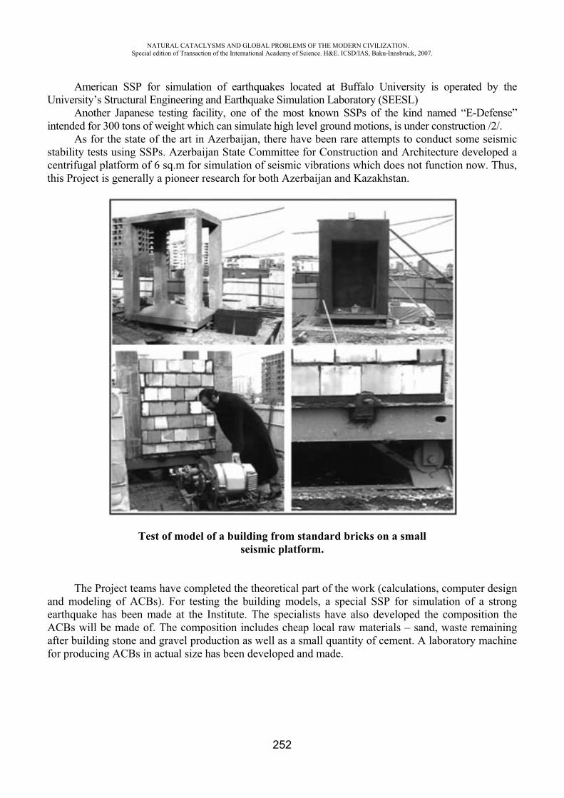
NATURAL CATACLYSMS AND GLOBAL PROBLEMS OF THE MODERN CIVILIZATION. Special edition of Transaction of the International Academy of Science. H&E. ICSD/IAS, Baku-Innsbruck, 2007.
252
American SSP for simulation of earthquakes located at Buffalo University is operated by the University’s Structural Engineering and Earthquake Simulation Laboratory (SEESL)
Another Japanese testing facility, one of the most known SSPs of the kind named “E-Defense” intended for 300 tons of weight which can simulate high level ground motions, is under construction /2/.
As for the state of the art in Azerbaijan, there have been rare attempts to conduct some seismic stability tests using SSPs. Azerbaijan State Committee for Construction and Architecture developed a centrifugal platform of 6 sq.m for simulation of seismic vibrations which does not function now. Thus, this Project is generally a pioneer research for both Azerbaijan and Kazakhstan.
Test of model of a building from standard bricks on a small seismic platform.
The Project teams have completed the theoretical part of the work (calculations, computer design and modeling of ACBs). For testing the building models, a special SSP for simulation of a strong earthquake has been made at the Institute. The specialists have also developed the composition the ACBs will be made of. The composition includes cheap local raw materials – sand, waste remaining after building stone and gravel production as well as a small quantity of cement. A laboratory machine for producing ACBs in actual size has been developed and made.
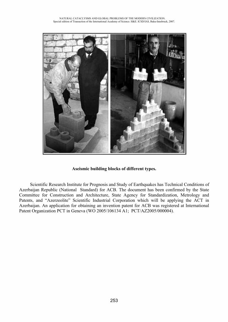
NATURAL CATACLYSMS AND GLOBAL PROBLEMS OF THE MODERN CIVILIZATION. Special edition of Transaction of the International Academy of Science. H&E. ICSD/IAS, Baku-Innsbruck, 2007.
253
Aseismic building blocks of different types.
Scientific Research Institute for Prognosis and Study of Earthquakes has Technical Conditions of Azerbaijan Republic (National Standard) for ACB. The document has been confirmed by the State Committee for Construction and Architecture, State Agency for Standardization, Metrology and Patents, and “Azerzeolite” Scientific Industrial Corporation which will be applying the ACT in Azerbaijan. An application for obtaining an invention patent for ACB was registered at International Patent Organization PCT in Geneva (WO 2005/106134 A1; PCT/AZ2005/000004).
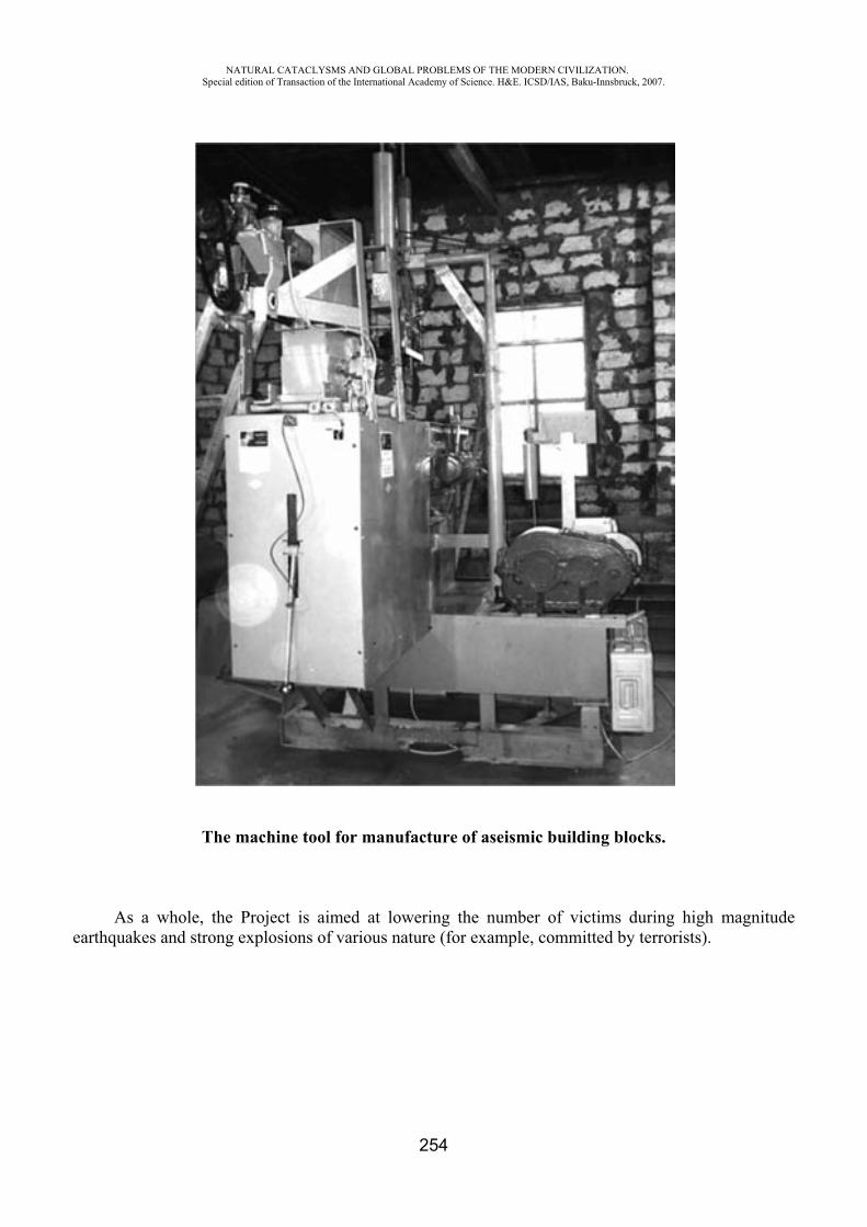
NATURAL CATACLYSMS AND GLOBAL PROBLEMS OF THE MODERN CIVILIZATION. Special edition of Transaction of the International Academy of Science. H&E. ICSD/IAS, Baku-Innsbruck, 2007.
254
The machine tool for manufacture of aseismic building blocks.
As a whole, the Project is aimed at lowering the number of victims during high magnitude earthquakes and strong explosions of various nature (for example, committed by terrorists).
NATURAL CATACLYSMS AND GLOBAL PROBLEMS OF THE MODERN CIVILIZATION. Special edition of Transaction of the International Academy of Science. H&E. ICSD/IAS, Baku-Innsbruck, 2007.
255
The main objectives of the Project is as follows:
Simplification of the technology allowing construction of small (1-2 floor) seismically stable houses capable of withstanding earthquakes and explosions.
Reducing the prime cost of seismic resistant buildings that will make construction of earthquake-proof houses available for majority of local people Theoretical and experimental research and comparative analysis of seismic stability of buildings in Azerbaijan, Kazakhstan and Turkey compared with seismic resistant buildings on base of the new ACT. The new ACT is planned to be applied during construction works of settlements for refugees the number of which in Azerbaijan exceeds 1 million. The priority will be given to schools and other child institutions. Azerzeolite Scientific Industrial Corporation as a local company experienced in rural constructing will be playing the most active part in sales/distribution of the end product among buyers/contractors. The project objectives are in line with NATO policy based on providing people’s security and reducing human victims and damage at earthquakes and strong explosions committed by terrorists.
REFERENCES
http://www.cvs.spb.su/dptest_r.htmhttp://www.bosai.go.jp/hyogo/ehyogo/index.html
APPROXIMATION OF SEA SURFACE TO OPTIMIZE TIDE GAUGE NETWORK
Vlasov A.N.*, Volkov-Bogorodsky D.B**, Kurochkina V.A***,A. Mnushkin****, Blasi C.J.*****
*Institute of Applied Mechanics, RAS, Moscow, Russia **Moscow State University of Civil Engineering, Moscow, Russia
*****Federal Institute of Hydrology, Koblenz, Germany
INTRODUCTION
Nearly any activity in coastal areas needs water related data. These data are mostly provided by water authorities who are also responsible for the tide gauges. These gauges are located at selected positions and serve for different purposes. Despite today’s possibility of remote-control systems, tide gauges have to inspected and maintained by technicians; what means a time and cost effect. Therefore investigations have been undertaken to find methods and tools which can optimize the network without loss of information.
NATURAL CATACLYSMS AND GLOBAL PROBLEMS OF THE MODERN CIVILIZATION. Special edition of Transaction of the International Academy of Science. H&E. ICSD/IAS, Baku-Innsbruck, 2007.
256
There are various methods that can be used to find the best network. Most methods meet the required accuracy of the network purpose, and the installation and maintenance costs to find the optimized network under the given constrains. The methods are have been quite well tested on networks on inland waters. Established methods for coastal waters and especially those with tidal influence, are only few. The allocation of tide gauges in coastal areas depends mainly on the behaviour of the water surface. The physical processes which are involved can be described and harnessed by numerical models. But numerical models are not available at every authority.
Therefore a new method was required which uses only water-level data. This new method is based on the Meshless Method. The area of investigation is divided into sub-domains where the tide gauges are the associated with nodes.
METHODOLOGY As the allocation of the tide gauges depends mainly on the physical processes of the particular
region, a method had to be developed which is able to reconstruct the sea surface in the given area by using the water-level readings of stations within the region. To optimize the location of the tide gauges presents the problem of a limited number of gauges in a huge area. In the area of investigation, gauges appear in linear position (along the coastline). Each tide gauge collects water-levels in 1-minute intervals, which is a huge amount of data. The above mentioned special conditions determine the mathematical methods to solve the problem.
Probability theory and mathematical statistics methods were used for statistical data processing. Data concerning each tide gauge were considered as realization of a random variable. Correlation- and regression-analyses were performed to optimally position the gauges. Approximation-theory methods were applied for data approximation in the whole region of investigation and for illustratively representing the water-surface level along with differential- geometry methods (curvature determination) to optimize the positioning of the tide gauges in the observed area.
A new methodology was suggested that uses radial-basis functions. The approximation method being developed for the region can be classified as the "Meshless Method” (Belytschko, T., et al, 1996), based on the idea of local approximations in sub-domain blocks, i.e. areas of influence.
For each tide gauge with its abundance of minute-by-minute measurement data, an analysis and a one-dimensional approximation were performed in order to considerably reduce the volume of stored information without loss of accuracy. The accuracy of the applied methodology is in the same range as the accuracy of tide gauge itself.
To solve the problem of optimally positioning tide gauges, an approach based on differential geometry methods was offered which allowed determining the most critical locations in the sea area through analyzing the curvature of the constructed surface of the value being approximated (Pogorelov A.V., 1974).
If the surface is defined by equation ( , )x y , the first and second quadratic form coefficients will be respectively determined as follows:
2 2
2 2 2 2 2 2
1 , F , G 1 ,
, , .1 1 1
x x y y
xy yyxx
x y x y x y
E
L M N (1)
Principal curvatures 1 and 2 are determined as roots of quadratic equation:
2 2 2( ) ( 2 ) ( ) 0EG F LG MF NE LN M (2)
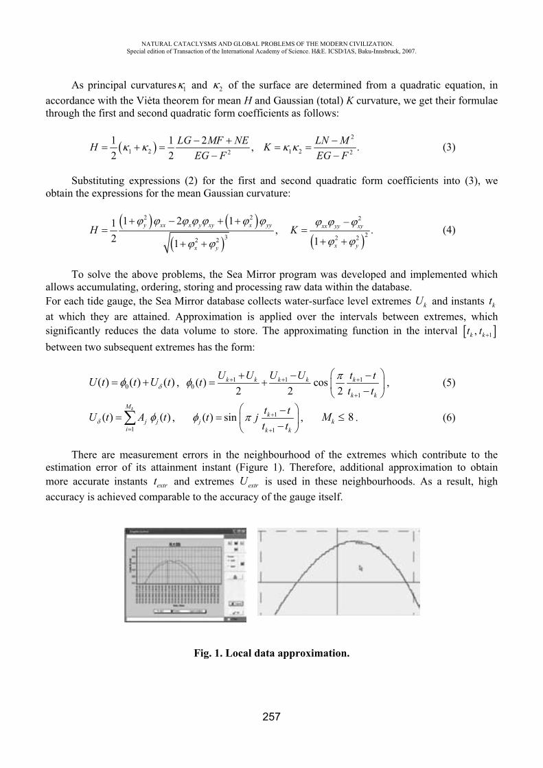
NATURAL CATACLYSMS AND GLOBAL PROBLEMS OF THE MODERN CIVILIZATION. Special edition of Transaction of the International Academy of Science. H&E. ICSD/IAS, Baku-Innsbruck, 2007.
257
As principal curvatures 1 and 2 of the surface are determined from a quadratic equation, in accordance with the Vi ta theorem for mean H and Gaussian (total) K curvature, we get their formulae through the first and second quadratic form coefficients as follows:
2
1 2 1 22 2
1 1 2 , .2 2
LG MF NE LN MH KEG F EG F
(3)
Substituting expressions (2) for the first and second quadratic form coefficients into (3), we obtain the expressions for the mean Gaussian curvature:
2 2 2
23 2 22 2
1 2 11 , .2 11
y xx x y xy x yy xx yy xy
x yx y
H K (4)
To solve the above problems, the Sea Mirror program was developed and implemented which allows accumulating, ordering, storing and processing raw data within the database. For each tide gauge, the Sea Mirror database collects water-surface level extremes kU and instants ktat which they are attained. Approximation is applied over the intervals between extremes, which significantly reduces the data volume to store. The approximating function in the interval 1,k kt tbetween two subsequent extremes has the form:
0( ) ( ) ( )U t t U t , 1 1 10
1
( ) cos2 2 2
k k k k k
k k
U U U U t ttt t
, (5)
1
( ) ( )kM
j ji
U t A t , 1
1
( ) sin kj
k k
t tt jt t
, 8kM . (6)
There are measurement errors in the neighbourhood of the extremes which contribute to the estimation error of its attainment instant (Figure 1). Therefore, additional approximation to obtain more accurate instants extrt and extremes extrU is used in these neighbourhoods. As a result, high accuracy is achieved comparable to the accuracy of the gauge itself.
Fig. 1. Local data approximation.
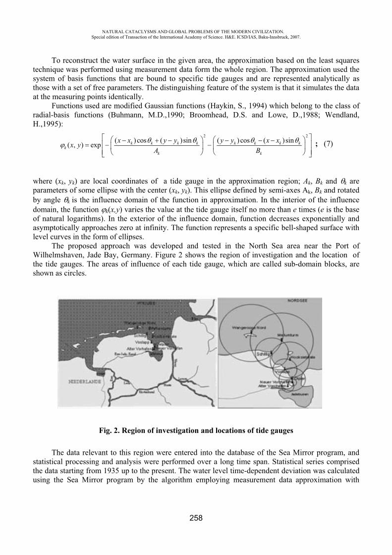
NATURAL CATACLYSMS AND GLOBAL PROBLEMS OF THE MODERN CIVILIZATION. Special edition of Transaction of the International Academy of Science. H&E. ICSD/IAS, Baku-Innsbruck, 2007.
258
To reconstruct the water surface in the given area, the approximation based on the least squares technique was performed using measurement data form the whole region. The approximation used the system of basis functions that are bound to specific tide gauges and are represented analytically as those with a set of free parameters. The distinguishing feature of the system is that it simulates the data at the measuring points identically.
Functions used are modified Gaussian functions (Haykin, S., 1994) which belong to the class of radial-basis functions (Buhmann, M.D.,1990; Broomhead, D.S. and Lowe, D.,1988; Wendland, H.,1995):
2 2( )cos ( )sin ( ) cos ( )sin( , ) exp k k k k k k k k
kk k
x x y y y y x xx yA B
; (7)
where (xk, yk) are local coordinates of a tide gauge in the approximation region; Ak, Bk and k are parameters of some ellipse with the center (xk, yk). This ellipse defined by semi-axes Ak, Bk and rotated by angle k is the influence domain of the function in approximation. In the interior of the influence domain, the function k(x,y) varies the value at the tide gauge itself no more than e times (e is the base of natural logarithms). In the exterior of the influence domain, function decreases exponentially and asymptotically approaches zero at infinity. The function represents a specific bell-shaped surface with level curves in the form of ellipses.
The proposed approach was developed and tested in the North Sea area near the Port of Wilhelmshaven, Jade Bay, Germany. Figure 2 shows the region of investigation and the location of the tide gauges. The areas of influence of each tide gauge, which are called sub-domain blocks, are shown as circles.
Fig. 2. Region of investigation and locations of tide gauges
The data relevant to this region were entered into the database of the Sea Mirror program, and statistical processing and analysis were performed over a long time span. Statistical series comprised the data starting from 1935 up to the present. The water level time-dependent deviation was calculated using the Sea Mirror program by the algorithm employing measurement data approximation with
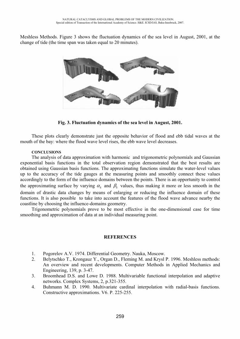
NATURAL CATACLYSMS AND GLOBAL PROBLEMS OF THE MODERN CIVILIZATION. Special edition of Transaction of the International Academy of Science. H&E. ICSD/IAS, Baku-Innsbruck, 2007.
259
Meshless Methods. Figure 3 shows the fluctuation dynamics of the sea level in August, 2001, at the change of tide (the time span was taken equal to 20 minutes).
Fig. 3. Fluctuation dynamics of the sea level in August, 2001.
These plots clearly demonstrate just the opposite behavior of flood and ebb tidal waves at the mouth of the bay: where the flood wave level rises, the ebb wave level decreases.
CONCLUSIONS The analysis of data approximation with harmonic and trigonometric polynomials and Gaussian
exponential basis functions in the total observation region demonstrated that the best results are obtained using Gaussian basis functions. The approximating functions simulate the water-level values up to the accuracy of the tide gauges at the measuring points and smoothly connect these values accordingly to the form of the influence domains between the points. There is an opportunity to control the approximating surface by varying k and k values, thus making it more or less smooth in the domain of drastic data changes by means of enlarging or reducing the influence domain of these functions. It is also possible to take into account the features of the flood wave advance nearby the coastline by choosing the influence-domains geometry.
Trigonometric polynomials prove to be most effective in the one-dimensional case for time smoothing and approximation of data at an individual measuring point.
REFERENCES
1. Pogorelov A.V. 1974. Differential Geometry. Nauka, Moscow. 2. Belytschko T., Krongauz Y., Organ D., Fleming M. and Krysl P. 1996. Meshless methods:
An overview and recent developments. Computer Methods in Applied Mechanics and Engineering, 139, p. 3-47.
3. Broomhead D.S. and Lowe D. 1988. Multivariable functional interpolation and adaptive networks. Complex Systems, 2, p.321-355.
4. Buhmann M. D. 1990. Multivariate cardinal interpolation with radial-basis functions. Constructive approximations. V6. P. 225-255.
NATURAL CATACLYSMS AND GLOBAL PROBLEMS OF THE MODERN CIVILIZATION. Special edition of Transaction of the International Academy of Science. H&E. ICSD/IAS, Baku-Innsbruck, 2007.
260
5. Haykin S. 1994. Neural Networks: A Comprehensive Foundation. Macmillian College Publishing Company, Inc.
6. Wendland H. 1995. Piecewise polynomial, positive definite and compactly supported radial basis functions of minimal degree. Advances in Computational Mathematics, 4, p 389-396.
RUSSIAN NATIONAL SYSTEM OF MONITORING GEOPHYSICAL PROCESSES AND REAL TIME VARIATIONS THEREOF
R.I. Krivonosov*, S.V. Khvostantsev**, V.G. Gratchev***, E.B. Nikolaev****
*,** NPP GT «Geofizika» LLC ***,****OKB MAI «Poskosmos», Russia
NPP GT «Geofizika» LLC (Pyatigorsk) has designed high-output geophone-hydrophone sensors GH-3 (patents [1, 2]) able to determine parameters of gravity and wave fields in boreholes, underground openings, seas, on surface, flying or moving objects. The sensors may be used for hydrodynamic test of wells, gravity and seismic survey, in meteorology, seismology, navigation, for earth-quake prediction. They are capable of sensing slightest variations of hydrodynamic pressure field in wide range of frequencies 0 to 2000 Hz with sensitivity higher than that of modern seismographs.
Substantial Earth deformation resulting from gravity waves acting upon earth surface and water medium, appearance of low-frequency noise (less than 0.001 Hz) in rocks are signs of forthcoming earthquake. There are correlations between variations of gravity, geohydrodynamic pressure and Earth magnetic fields which are to be used for prediction of coming earthquakes location. At the Russian National Exhibition in Azerbaijan (February 2006) the Scientific Manager of NPP GT «Geofizika» LLC Krivonosov Rostislav Ivanovich proposed designing Russian National and International Systems of advance warning people about oncoming earth-quake (RNS AWP) based on the Geophone-hydrophone sensor GH-3 and Real Time Space-time System (RT STS). Creation of RT STS on the Eurasia continent is dictated by the need of designing high-accuracy forward-looking systems of geophysics, geodynamics and higher geodesy for remote Earth sensing from outer space, systems of positioning, navigation and synchronization, alternative to global space GPS, Galileo, GLONASS systems. Experience of space navigation GPS system use, in spite of its wide application range, has shown its week aspects. For example GPS-technology in principal does not allow provide measurements of axial orientation of objects in geocentric or geodesy WGS 84 system of coordinates, insure frequency and phase coherence of user’s spaced-apart radio systems. That is why since 2004 the USA actively develops new systems of positioning, navigation and timing (PNT) solving the tasks. According to the program “Coherent radio-frequency operations (actions)” directed by Ministry of Defense DARPA Agency PNT systems are being designed able to work under ground, under water, in tunnels, with multiple reflection of signals. PNT radio systems combined with inertial systems are being designed to solve the problems of objects real time kinematics (RTK). All the systems are related to so-called functional expansions of space navigation GPS system. However they exceed many times GPS itself in the volume of technical, financial and organizational facilities involved.
NATURAL CATACLYSMS AND GLOBAL PROBLEMS OF THE MODERN CIVILIZATION. Special edition of Transaction of the International Academy of Science. H&E. ICSD/IAS, Baku-Innsbruck, 2007.
261
Creation of RT STS [3] is an alternative decision allowing change the topping role of the space navigation GPS system, complete GLONASS and solve the tasks with highest accuracy, reliability and least costs. Distinction in kind of RT STS from space navigation systems is complex using range-difference measurement method in radio systems at the earth ground and geophysical measuring assistant with HG-3. Realization and introduction RT STD with common using of radio technical and geophysical funds of measuring is a technological break in area of high technology, which provides with minimal costs with using Russian, European and Asia countries advantages, which having territories, which are unique for its geophysical extension and location. President of RF V. V. Putin have shown his interest to the project presented at the Exhibition and gave directive to the Government to support the project. The whole system was called «Russian National System of Monitoring Geophysical Processes and Real Time Variations thereof» (RNS MGP). During the Exhibition joint operation agreements were concluded with International Seismic Risk and Earthquake Resistant Construction Commission of International Academy of Sciences, the International EUTRASIA PACIFIC UNINET Organization (Austria) and Research Institute for Earthquake Prediction and Study of the International Academy of Sciences (Azerbaijan).
RT STS and RNS MGP projects are to be carried out, from Russia side, by Federal State Unitary Enterprise “Moscow Energetic Institute Special Design Office” (FGUP OKB MEI, Moscow) and NPP GT “Geofizika” LLC (Pyatigorsk). Further, scientists and specialized organizations of other countries located in the zone of Alpic-Himalayan seismic belt will be involved into the work. To this end, “Geofizika” Research Centre (“Geofizika” RC) shall be established on the territory of Caucasian Mineral Waters (CMW) (Pyatigorsk). “Geofizika” RC tasks are: formation of RNS MGP regional sub-system on Stavropol territory, carrying out international researches and experimental development to supply the above countries with high-accuracy space-time measurements and technical support of the wide range of tasks of synchronization, geodynamics, geophysics, seismology, earthquake prediction, positioning and navigation, medicine.
Within the new direction of works it is proposed to improve and complete equipment of full-circled antennas of 3 to 64 meters in diameter and systems of maintenance thereof to create basic RT STS operating in real-time mode with high-accuracy magnetic, gravimetric and accelerometer systems. As the first stage regional RT STS subsystem will be projected and realized on Stavropol and Azerbaijan territories, international research and experimental development works will be carried out. Regional observation centers (ROC) in Russia and abroad will be interconnected with each other in the system of Global radio telescope. RT STS will be used simultaneously for various information acquisition and transmission for centralized processing in real time. Within RNS MGP project Research Centre “Geofizika” will be designed and built in the health-resort zone of Pyatigorsk; regional RT STS is to be built with radio telescope on the top and subsurface seismologic stations round Mashuk mountain; “Rest House for Scientists and Specialists of Foreign Countries” is to be constructed. The project of the “House” contemplates creating according to European standards therapeutic-and-sanative, prophylactic, education and sport centers for servicing scientists and specialists from Russia and abroad.
To monitor development of oil and gas deposits RNS MGP project is also supposed to accomplish the following tasks.
1. Determination of formation oil and gas saturation factor S, accurate location of water-oil contact (WOC) or of gas-oil contact (GOC) in production and observation wells of oil and gas fields using Electric Logging through Steel Casing ECOS-31-7 technology [4].
2. Control of running wells production (differential production rate, behind-the-casing cross-flow) under Influx Profile Locator technology (IPL-31).
3. Control of hydrocarbon accumulation pattern efficiency, tracing of formation hydraulic breakdown and injection frontal advance in horizontal plane.

NATURAL CATACLYSMS AND GLOBAL PROBLEMS OF THE MODERN CIVILIZATION. Special edition of Transaction of the International Academy of Science. H&E. ICSD/IAS, Baku-Innsbruck, 2007.
262
The total cost of RNS MGP project of Stavropol territory is estimated to be 110 000 068 (One hundred and ten million sixty eight) USD.
For financing the problem it is proposed to involve international funds and funds of businessmen-investors, both Russian and foreign.
RUSSIAN FEDERATION REAL-TIME SPACE-TIME SYSTEM Real-Time Space-Time System is a synthesized coherent measurement system for measuring
state vector parameters in physical fields of all kinds including gravity, wave and magnetic fields in real-time mode at global, local and user measurement levels.
Space-Time Radio Metering SystemGlobal synthesized coherent space-time radio metering system is a global radio telescope with
unfilled aperture which is equivalent to synthesized phased array antenna and a central synchronizer of RT STS.
Global Radio Telescope
Geophysical Subsystem
• It serves to determine parameters of gravity and wave fields on the Earth surface, in aero space, sea, boreholes, when set on stationary, flying or movable objects.
• At every functional level of RT STS the elements of the radio system and of the geophysical subsystem are interconnected at mechanical and electric interfaces level.
NATURAL CATACLYSMS AND GLOBAL PROBLEMS OF THE MODERN CIVILIZATION. Special edition of Transaction of the International Academy of Science. H&E. ICSD/IAS, Baku-Innsbruck, 2007.
263
• Radio system is a geometric frame and a synchronized time and space atomic scale for geophysical subsystem.
Collocation is carried out at measurement data level in unified space-time basis.
RT STS Functionality - creation, maintenance and distribution: of the reference global network for real-time measuring parameters of physical and wave fields and determining sources thereof including gravity, magnetic and electric fields; of the reference ground-space high-accuracy time-and-frequency synchronization network based on associated universal-time scales (UT1), coordinated atomic-time scale (UTC) and global atomic-time scale of highest-accuracy RT STS.
RT STS Radio System Contribution: global time and frequency scale data (global time-and-frequency synchronization and time-and-frequency scale transmission); unified ground-space time-and-frequency scale; geodesic coordinates of stations and speed; global distance scale: stable and absolute; reference geometrical frame for geophysical subsystem; International Celestial Reference Frame (ICRF), extragalaxy sources coordinates; full set of Earth orientation parameters (EOP: pole coordinates, UT1/LOD, nutation); atmospheric data (troposphere, ionosphere).
Geophysical Subsystem Contribution and Fields of Application: geophysical investigations; seismic prospecting (ground, sea); gravity prospecting (ground, sea, aerial); seismology (registration of earthquakes, landslides, avalanches); meteorology; navigation motor, aeronautical and missile equipment; devices for determination of flying vehicle orientation in the Earth gravity field, devices for guidance to moving surface, subsurface, underwater and flying objects, in guided underwater and ground mines and shells, devices for recognition by oscillation spectrum of moving objects (a man, a dog, a motor car, a tank, a submarine, etc.) when protecting military and civil units (buildings, airports, frontiers); civil defense: earthquake alerting devices (including those of individual type), intrusion protection devices.
OKB MEI (Special Designing Office of Moscow Energetic Institute) has developed antennas for use in Pyatigorsk and in South-West regions of Russia.
REFERENCES
1. Lisov V.N. (UA), Krivonosov R.I. (RU), Deinega G. . (UA) “Working fluid of electrolytic resistive sensor”. RF Patent for invention No. 2172932, priority date 14.09.2000.
2. Krivonosov R.I., Deinega G. ., Kashik .S. “Method and Device for Determination of Gravity and Wave Fields Parameters”. RF Patent No. 2260199, priority date 04.08.2003.
3. Grachev V.G., Nikolaev E.I. «Real-Time Space-Time System». RF Patent No. 2274953, priority date 04.03.2005.
4. Krivonosov R.I., ashik .S. “Method and Device for Electric Logging Cased Wells”. Application No. 2005136031, filed 21.11.05. RF Patent issue declaration - 23.01.2007. International application No. PCT/RU2006000348, 03.07.2006, priority date 21.11.2005, international filing date 03.07.2006, publication date 24.05.2007, publication No. WO/2007/058563.
NATURAL CATACLYSMS AND GLOBAL PROBLEMS OF THE MODERN CIVILIZATION. Special edition of Transaction of the International Academy of Science. H&E. ICSD/IAS, Baku-Innsbruck, 2007.
264
MUZAFFARABAD EARTHQUAKE OF OCTOBER 8, 2005:SEISMOLOGICAL ASPECTS
Muhammad Qaisar*, Muhammad Daud Shah**, Tariq Mahmood***,Zahid Ali****
Micro Seismic Studies Programme, Ishfaq Ahmed Research LaboratoriesPakistan Atomic Energy Commission
Abstract
A devastating Earthquake of magnitude (ML) 7.0 (USGS mb=6.8, Mw = 7.6 Ms=7.7) occurred on Oct. 8, 2005, about 10 km north-west of Muzaffarabad at a depth of about 13km. The Earthquake was generated by the movement along the thrust fault structure and named subsequently Kashmir Thrust (KT). The earthquake caused a huge loss of life and property due to the near fault strong motion effects. The surface evidences of thrusting along Kashmir Thrust are observed at a number of places. Based on the records obtained by local seismic network, focal mechanism solution of the main shock coincides with Kashmir Thrust orientation striking NNW-SSE and dipping in NE direction. Maximum intensity XI on the Modified Mercalli Intensity (MMI) scale was observed along the strike of the KT, mainly due to near-fault strong motion and rupture directivity effects. The horizontal peak ground acceleration at Abbotabad about 40 km south-west of main shock was 0.231g. The aftershocks recorded per day during first month follow Omori’s law. In the course of the field survey, the maximum vertical displacement (4.2 m ± 0.5 m) was observed in between the regions of Muzaffarabad and Balakot cities while the total observed rupture length was about 112 km. It seems that the earthquake has ended a seismic gap where present tectonic movements and release of high seismic energy along Kashmir Thrust caused tectonic stress stability. However, it is not unlikely for any future seismic activity to occur in the area due to reactivation of the Kashmir Thrust.
STRONG MOTION DATA FROM THEMUZAFARABADEARTHQUAKE OF OCT, 8 2005.
Muhammad Daud Shah
Micro Seismic Studies Programme, P.O Nilore, Pakistan
Strong motion recording in Pakistan started in 1974 when three strong motion recorder were installed at Tarbella Dam and latter on a few more at Mangla Dam. There was no serious effort in Pakistan to have a strong motion network. The instruments were installed only at big dams and nuclear power plants and these instruments did not produce any data due to the obvious reason of non existent large earth quakes close to these installations. In 2004 a programme to have a national strong motion network was started and to start with ten accelerometers were installed in the free field at different places. The distribution of these instruments was done with the objective to gather some data as quickly as possible.On 8th Oct. 2005 the biggest earth quake in the history of Pakistan occurred near Muzaffarabad (Ms 7.6). This earthquake not only killed thousands of people, destroyed buildings and
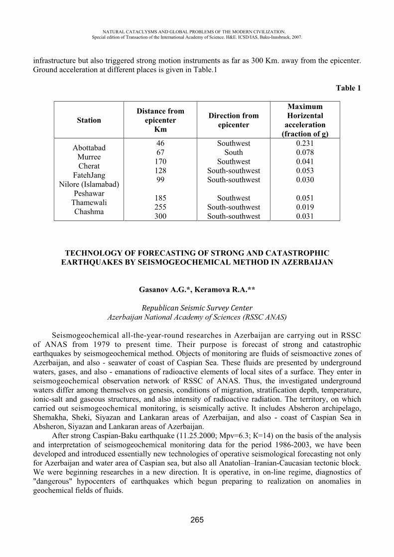
NATURAL CATACLYSMS AND GLOBAL PROBLEMS OF THE MODERN CIVILIZATION. Special edition of Transaction of the International Academy of Science. H&E. ICSD/IAS, Baku-Innsbruck, 2007.
265
infrastructure but also triggered strong motion instruments as far as 300 Km. away from the epicenter. Ground acceleration at different places is given in Table.1
Table 1
StationDistance from
epicenterKm
Direction from epicenter
MaximumHorizental
acceleration (fraction of g)
AbottabadMurree Cherat
FatehJang Nilore (Islamabad)
PeshawarThamewali Chashma
466717012899
185255300
SouthwestSouth
SouthwestSouth-southwestSouth-southwest
SouthwestSouth-southwestSouth-southwest
0.2310.0780.0410.0530.030
0.0510.0190.031
TECHNOLOGY OF FORECASTING OF STRONG AND CATASTROPHIC EARTHQUAKES BY SEISMOGEOCHEMICAL METHOD IN AZERBAIJAN
Gasanov A.G.*, Keramova R.A.**
Republican Seismic Survey CenterAzerbaijan National Academy of Sciences (RSSC ANAS)
Seismogeochemical all-the-year-round researches in Azerbaijan are carrying out in RSSC of ANAS from 1979 to present time. Their purpose is forecast of strong and catastrophic earthquakes by seismogeochemical method. Objects of monitoring are fluids of seismoactive zones of Azerbaijan, and also - seawater of coast of Caspian Sea. These fluids are presented by underground waters, gases, and also - emanations of radioactive elements of local sites of a surface. They enter in seismogeochemical observation network of RSSC of ANAS. Thus, the investigated underground waters differ among themselves on genesis, conditions of migration, stratification depth, temperature, ionic-salt and gaseous structures, and also intensity of radioactive radiation. The territory, on which carried out seismogeochemical monitoring, is seismically active. It includes Absheron archipelago, Shemakha, Sheki, Siyazan and Lankaran areas of Azerbaijan, and also - coast of Caspian Sea in Absheron, Siyazan and Lankaran areas of Azerbaijan.
After strong Caspian-Baku earthquake (11.25.2000; pv=6.3; =14) on the basis of the analysis and interpretation of seismogeochemical monitoring data for the period 1986-2003, we have been developed and introduced essentially new technologies of operative seismological forecasting not only for Azerbaijan and water area of Caspian sea, but also all Anatolian–Iranian-Caucasian tectonic block. We were beginning researches in a new direction. It is operative, in on-line regime, diagnostics of "dangerous" hypocenters of earthquakes which begun preparing to realization on anomalies in geochemical fields of fluids.
NATURAL CATACLYSMS AND GLOBAL PROBLEMS OF THE MODERN CIVILIZATION. Special edition of Transaction of the International Academy of Science. H&E. ICSD/IAS, Baku-Innsbruck, 2007.
266
Scientific novelty of seismogeochemical researches in Azerbaijan, consist of, that for fluids of observant RSCC NASA network, the epicenters of strong and catastrophic earthquakes Anatolian-Iranian-Caucasian tectonic block and water area of Caspian sea seismological and geochemical materials are in a complex systematized, generalized and analyzed.
For the first time in world practice on seismoforecasting operations are created new technologies of interpretation actual seismogeochemical material in on-line regime. They include the following the express-methods: a) developing and testing of formulas for identification of anomalies in geochemical fields of fluids which arise during preparation of seismic events of various power; b) preparation of algorithms and software for automatic revealing and formatting of geochemical anomalies under the developed and tested formulas “auto filter of seismogeochemical anomalies”; c) developing and testing of formulas for calculation of magnitude of preparing earthquake; d) for the concrete seismic hypocenters prepared “Atlases of identification of the hypocenters of strong and catastrophic earthquakes on geochemical fields of fluids”.
They represent geochemical "portraits" of the seismic epicenters, before realized within the limits of Great Caucasus meganticlinoriy, partially-Kura depressions, Northern Caspian Sea, Southern Caspian Sea, Middle Caspian Sea, and also in territories, adjacent with Azerbaijan, the states (Russia-Dagestan, Georgia, Armenia, Turkey, Iran) (fig.1-2). All specified region concerns to the Anatolian-Iranian-Caucasian tectonic block. In this territory there were many strong and catastrophic earthquakes (1990-NW Iran, Rudbar; 1999-Turkey, Izmit; 2000-Caspian-Baku; 2003-SE Iran, Bam, etc.). Seismogeochemical data daily enter to department of urgent reports of Seismogeochemical expedition. Here are used all listed express-methods and made operative estimation of seismic conditions in Caspian Sea, Azerbaijan and the adjacent states (Russia-Dagestan, Georgia, Armenia, Turkey, Iran) 1-20 days prior to realization of earthquakes. About 70-75 percent of these forecasts is correct.
Mistakes, which arise for today at an estimation of seismic conditions in real time, are connected to the following main reasons:
1.) is necessary the extensive regional seismogeochemical network of stations covering all seismogen zones in the countries, adjacent with Azerbaijan (Russia-Dagestan,Georgia, Armenia, Iran, Turkey);
2.) is necessary the statistic of the geochemical information, which will reflect the period of preparation of the seismic epicenters of the specified region.
Clearly, that the decision of the present questions – it is a challenge demanding the complex analysis of laws of seismic, tectonic, geophysical and geochemical processes with attraction of experts, living in the territory of Anatolian-Iranian-Caucasus tectonic block.
REFERENCES
1. Keramova R.A. Abstract of a thesis for a Doctor's degree. Seismogeochemical regime of fluids of Azerbaijan. Moscow, 2004.
2. Keramova R.A. Influencing of strong and catastrophic earthquakes of the Anatolian-Iranian-Caucasian tectonic block on a hydrogeochemical regime of fluids of Azerbaijan. The catalog of seismoforecasting observations in territory of Azerbaijan (1983-2001years). Baku, ”Elm”, 2003year. pp. 179-195.
3. Gasanov A.G., Keramova R.A. Operative diagnostics of seismic hypocenters of strong and catastrophic earthquakes of the Anatolian-Iranian-Caucasus tectonic’s block by the geochemical anomalies of fluids of Azerbaijan. 5th International Conference on Seismology and Earthquake Engineering. Tehran, Iran, 13-17 May, 2007.
NATURAL CATACLYSMS AND GLOBAL PROBLEMS OF THE MODERN CIVILIZATION. Special edition of Transaction of the International Academy of Science. H&E. ICSD/IAS, Baku-Innsbruck, 2007.
267
AUTOMATIC EXTRACTION OF HYDROLOGICAL DATA USING RADAR BASED DIGITAL ELEVATION MODEL (SRTM DATA) FOR AN AREA IN BAKU REGION
Nader Jalali
Soil Conservation and Watershed Management Research Center,Tehran, Iran
Key words: SRTM. DEM, Baku Drainage Network, Stream Ordering and basin
Abstract:Modern civilization needs accurate and updated information. The article introduces one of
applications of SRTM based DEM data for stream network extraction and ordering as well as evaluation of quality of this data. For doing this a part of the hydro-processing module of the ILWIS-GIS package is applied. Data for East of Azerbaijan, particularly Baku region is used. First of all some modifications and pre processing were applied for estimating undefined elevation values and filling sinks for providing flow connection. Flow direction, flow accumulation and modified DEM are used for drainage network extraction and ordering. It is found that although minimum of 100 pixels of flow accumulation provides acceptable drainage network but increasing this threshold increase accuracy of drainage network, particularly in flat terrains.
Introduction Modern civilization and management require accurate and novel information about the
environment. Hydrological basins are always providing vital requirements of human life such as water and food. In site and off site effects of the conditions of watershed in terms of management, sediment production and conservation measures are well known. Therefore having proper access to accurate and updated information helps decision makers to take proper action in the living environment. In this paper a method of extraction of information from raw SRTM data is introduced.
Digital Elevation Model (DEM) and its derivatives are well known products that are being used in different field of researches and investigations. Some applications of these data in producing of derivatives of DEM and evaluation of different algorithms for stream network extraction were qualitatively treated in terms of their capability to extract accurate stream locations from this challenging type of elevation data (David Kinner et al, 2006). Having an accurate and high resolution DEM is very important for whom are dealing with geo referenced data and Geographic Information Systems (GIS). Unfortunately such data are not available for everywhere. Recently about 80% of earth surface the earth surface is mapped out by Shuttle Radar Topographic Mission (SRTM). These data have been provided by using L-band and C-band RADAR wavelengths. Imaging by these range of wavelengths provide images with spatial resolution of 90 meters and 30 meters respectively. Homogeneity, spatial resolution improvement to 90 * 90 meters and vertical accuracy less about1 meters are the advantages of the SRTM data.
Although these data are unique and very useful in variety of applications but they are still have some weakness points like blank areas. Blank areas are data voids due to shadowing, phase unwrapping anomalies, other radar specific and environment causes such as the low backscatter especially over open water. Moreover elevation is the elevation of the top surface, no elevation is given below the water surface, elevation is given for relatively large area and problems with backscatter and data voids. Therefore SRTM data need some modification because of above-mentioned problems.
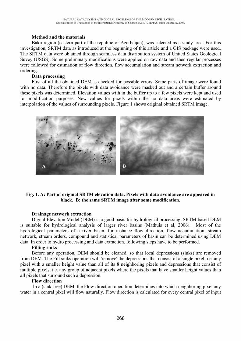
NATURAL CATACLYSMS AND GLOBAL PROBLEMS OF THE MODERN CIVILIZATION. Special edition of Transaction of the International Academy of Science. H&E. ICSD/IAS, Baku-Innsbruck, 2007.
268
A B
Method and the materialsBaku region (eastern part of the republic of Azerbaijan), was selected as a study area. For this
investigation, SRTM data as introduced at the beginning of this article and a GIS package were used. The SRTM data were obtained through seamless data distribution system of United States Geological Suvey (USGS). Some preliminary modifications were applied on raw data and then regular processes were followed for estimation of flow direction, flow accumulation and stream network extraction and ordering.
Data processing First of all the obtained DEM is checked for possible errors. Some parts of image were found
with no data. Therefore the pixels with data avoidance were masked out and a certain buffer around these pixels was determined. Elevation values with in the buffer up to a few pixels were kept and used for modification purposes. New values for pixels within the no data areas were estimated by interpolation of the values of surrounding pixels. Figure 1 shows original obtained SRTM image.
Fig. 1. A: Part of original SRTM elevation data. Pixels with data avoidance are appeared in black. B: the same SRTM image after some modification.
Drainage network extraction Digital Elevation Model (DEM) is a good basis for hydrological processing. SRTM-based DEM
is suitable for hydrological analysis of larger river basins (Mathuis et al, 2006). Most of the hydrological parameters of a river basin, for instance flow direction, flow accumulation, stream network, stream orders, compound and statistical parameters of basin can be determined using DEM data. In order to hydro processing and data extraction, following steps have to be performed.
Filling sinks Before any operation, DEM should be cleaned, so that local depressions (sinks) are removed
from DEM. The Fill sinks operation will 'remove' the depressions that consist of a single pixel, i.e. any pixel with a smaller height value than all of its 8 neighboring pixels and depressions that consist of multiple pixels, i.e. any group of adjacent pixels where the pixels that have smaller height values than all pixels that surround such a depression.
Flow direction In a (sink-free) DEM, the Flow direction operation determines into which neighboring pixel any
water in a central pixel will flow naturally. Flow direction is calculated for every central pixel of input
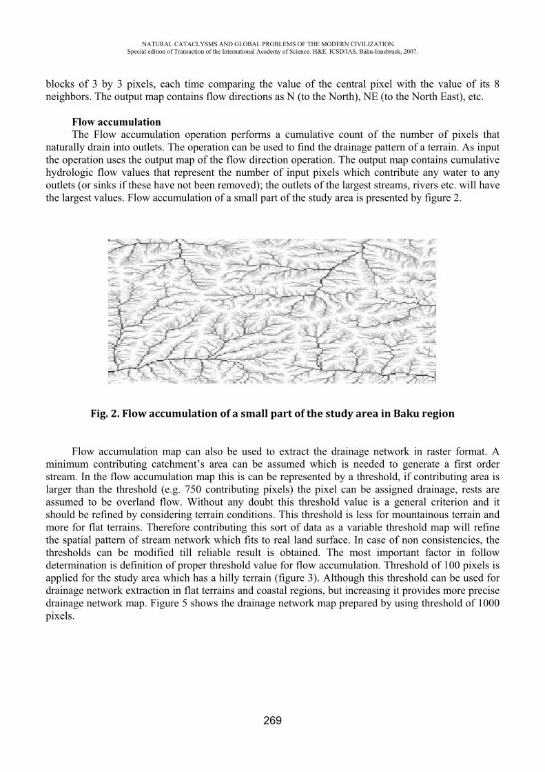
NATURAL CATACLYSMS AND GLOBAL PROBLEMS OF THE MODERN CIVILIZATION. Special edition of Transaction of the International Academy of Science. H&E. ICSD/IAS, Baku-Innsbruck, 2007.
269
blocks of 3 by 3 pixels, each time comparing the value of the central pixel with the value of its 8 neighbors. The output map contains flow directions as N (to the North), NE (to the North East), etc.
Flow accumulation The Flow accumulation operation performs a cumulative count of the number of pixels that
naturally drain into outlets. The operation can be used to find the drainage pattern of a terrain. As input the operation uses the output map of the flow direction operation. The output map contains cumulative hydrologic flow values that represent the number of input pixels which contribute any water to any outlets (or sinks if these have not been removed); the outlets of the largest streams, rivers etc. will have the largest values. Flow accumulation of a small part of the study area is presented by figure 2.
Fig. 2. Flow accumulation of a small part of the study area in Baku region
Flow accumulation map can also be used to extract the drainage network in raster format. A minimum contributing catchment’s area can be assumed which is needed to generate a first order stream. In the flow accumulation map this is can be represented by a threshold, if contributing area is larger than the threshold (e.g. 750 contributing pixels) the pixel can be assigned drainage, rests are assumed to be overland flow. Without any doubt this threshold value is a general criterion and it should be refined by considering terrain conditions. This threshold is less for mountainous terrain and more for flat terrains. Therefore contributing this sort of data as a variable threshold map will refine the spatial pattern of stream network which fits to real land surface. In case of non consistencies, the thresholds can be modified till reliable result is obtained. The most important factor in follow determination is definition of proper threshold value for flow accumulation. Threshold of 100 pixels is applied for the study area which has a hilly terrain (figure 3). Although this threshold can be used for drainage network extraction in flat terrains and coastal regions, but increasing it provides more precise drainage network map. Figure 5 shows the drainage network map prepared by using threshold of 1000 pixels.

NATURAL CATACLYSMS AND GLOBAL PROBLEMS OF THE MODERN CIVILIZATION. Special edition of Transaction of the International Academy of Science. H&E. ICSD/IAS, Baku-Innsbruck, 2007.
270
Fig. 3. Drainage map prepared using threshold value of 100 in both hilly and flat terrains in Sumgayit, Azerbaijan.
Fig. 4. a) Three dimensional view of an area including both hilly and flat terrains in Khachmaz (Xaçmaz) and Qudialchay areas.
Fig. 4.b) drainage map prepared using threshold value of 1000 in both hilly and flat terrains in Khachmaz (Xaçmaz) and Qudialchay areas, Azerbaijan.
Caspian Sea
Sumgayit
1:350 000
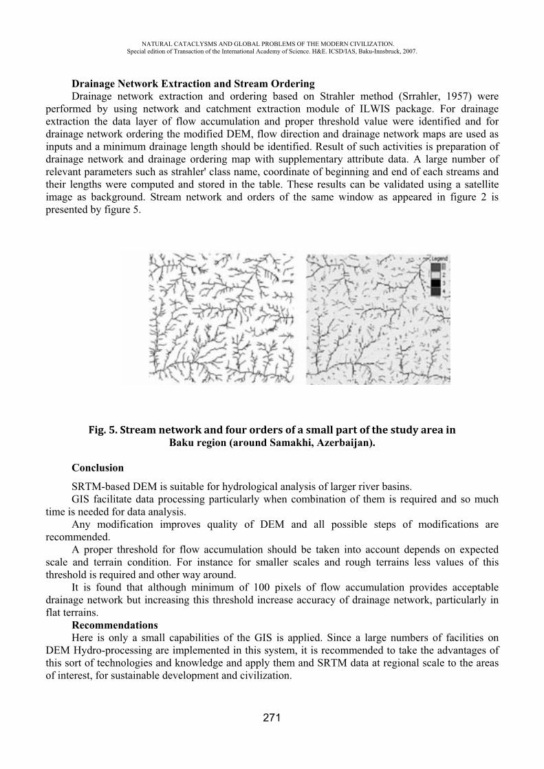
NATURAL CATACLYSMS AND GLOBAL PROBLEMS OF THE MODERN CIVILIZATION. Special edition of Transaction of the International Academy of Science. H&E. ICSD/IAS, Baku-Innsbruck, 2007.
271
Drainage Network Extraction and Stream Ordering Drainage network extraction and ordering based on Strahler method (Srrahler, 1957) were
performed by using network and catchment extraction module of ILWIS package. For drainage extraction the data layer of flow accumulation and proper threshold value were identified and for drainage network ordering the modified DEM, flow direction and drainage network maps are used as inputs and a minimum drainage length should be identified. Result of such activities is preparation of drainage network and drainage ordering map with supplementary attribute data. A large number of relevant parameters such as strahler' class name, coordinate of beginning and end of each streams and their lengths were computed and stored in the table. These results can be validated using a satellite image as background. Stream network and orders of the same window as appeared in figure 2 is presented by figure 5.
Fig. 5. Stream network and four orders of a small part of the study area inBaku region (around Samakhi, Azerbaijan).
Conclusion
SRTM-based DEM is suitable for hydrological analysis of larger river basins.GIS facilitate data processing particularly when combination of them is required and so much
time is needed for data analysis. Any modification improves quality of DEM and all possible steps of modifications are
recommended. A proper threshold for flow accumulation should be taken into account depends on expected
scale and terrain condition. For instance for smaller scales and rough terrains less values of this threshold is required and other way around.
It is found that although minimum of 100 pixels of flow accumulation provides acceptable drainage network but increasing this threshold increase accuracy of drainage network, particularly in flat terrains.
Recommendations Here is only a small capabilities of the GIS is applied. Since a large numbers of facilities on
DEM Hydro-processing are implemented in this system, it is recommended to take the advantages of this sort of technologies and knowledge and apply them and SRTM data at regional scale to the areas of interest, for sustainable development and civilization.
NATURAL CATACLYSMS AND GLOBAL PROBLEMS OF THE MODERN CIVILIZATION. Special edition of Transaction of the International Academy of Science. H&E. ICSD/IAS, Baku-Innsbruck, 2007.
272
REFERENCES
1. B.H.P. Maathuis & L. Wang, Digital Elevation Model based Hydro-processing. International Institute for Geo-information Sciences and Earth Observation (ITC).
2. PO Box 6, 7500 AA Enschede, the Netherlands; Accepted for publication Geocarto-International (for 2nd issue 2006).
3. David Kinner, Helena Mitasova, Robert Stallard et al, 2006. The Río Chagres, Panama A Multidisciplinary Profile of a Tropical Watershed
4. Strahler, A.N., 1957. Quantitative Analysis of Watershed Geomorphology. American Geophysical Union Transactions 38:913-920.
VARIATIONS OF GEOELECTRIC RESISTANCE AND WATER LEVEL IN A BOREHOLE AT THE WESTERN COAST OF CASPIAN SEA BEFORE SUMATRA EARTHQUAKE
ON DECEMBER, 26, 2004
Idarmachev Sh.*, Abdulaev Sh.**, Aliev M.***
Daghestan scientific center Russia Academy of Sciences
The precursors of earthquakes which can be registered on the Earth surface at the final stage of the process of preparation of earthquake are caused by creep movements in focal area which finally result in a fracture the sizes of which are defined by the accumulated elastic energy [1-3]. The development of creep movements before earthquake enables as to identify the starting point of the irreversible process in the seismic center by abnormal changes of geophysical fields at various distances from the seismic center. According to different authors [4-6] limiting distances where precursors are to be found, make 20-30 sizes of a seismic center. For the strongest earthquake which has taken place on the Earth 26.12.2004 near to Sumatra with magnitude =9.3, the lengths of fracture are 630 kms and 239 kms calculated under formulas kmL M 29.144.010 [7];
kmL M 27.25.010 [8] according by. And the limiting radiuses under formula R=20 L [4] are equal to12600 kms and 4780 kms. It is obvious from these estimations, that deformations of the superstrong earthquake can be registered at large distances from the seismic center. As an example on fig. 1 the data of regime supervision over variations of geoelectric resistance of rocks are resulted in three different points and a water level in borehole, received on the western coast of Caspian Sea on the territory of Dagestan. One can see on the schedules that maxima of anomalies in three cases synchronize with Sumatra earthquake. All anomalies are connected with the process of earth's crust stretching.
The most interesting are the data of geoelectric resistance received on a gas field (fig. 1, ). Noise increase is observed within 4 months from the beginning of anomaly of geoelectric resistance before earthquake. The amplitude of noise exceeds size of background value of geoelectric resistance
NATURAL CATACLYSMS AND GLOBAL PROBLEMS OF THE MODERN CIVILIZATION. Special edition of Transaction of the International Academy of Science. H&E. ICSD/IAS, Baku-Innsbruck, 2007.
273
several times. Noise disappears before earthquake. It is supposed, that noise is connected with the emissions of gas field on the surface.
Anomalies of geophysical parameters before the earthquake, exceeding the level of relative deformations 810 can be considered as its precursors. For an estimation of deformation from preparation of Sumatra earthquake the formula [4] as used which connectet size of deformation ( / ) with magnitude of the earthquakes ( ), taken place at distance (R):
3
19,83,110R
M
Substituting in the formula the magnitude data =9,3 and distances from the seismic centre of the earthquake up to the point of supervision receive / =6,3 · 810 (for R=5000 km); / = 4,8 ·
810 (for R=5500 km). The estimation / for two different radiuses has been made because the sizes of a seismic center received under formulas kmL M 29.144.010 and kmL M 27.25.010(600-400 kms), do not allow to define precise distance R.
Numerical calculations show, that abnormal deformations on the earth’s surface at the above-stated distances from superstrong earthquake can exceed 5-6 times the size of background deformations. According to [4] the size of background deformations for precursors of earthquakes is
810 .The given fact demands further research with application of other kinds of measurements of
deformation of the earth's crust: GPS, Radar in SAR and dilatometers. Borehole dilatometers can be used for these purposes. So, for example, sensitivity of modern borehole dilatometers exceeds two times sensitivity necessary for registration of precursors of superstrong earthquakes at the large distances.
There are more than 87 high-sensitivity borehole dilatometers located in various parts of the Earth [9]. In Southeast Asia are: Japan 35; China 9. The analysis of the given abnormal deformations registered on the Earth’s surface before Sumatra earthquake on November, 26, 2004 will allow to receive existential distribution of deformation within and outside.
The establishment of the regularities of distribution of deformation from the focal zone, informing about the beginning of creep movements at final stage of strong earthquake, will probably enables to realize new technical solution of the problem, the problem of prediction.
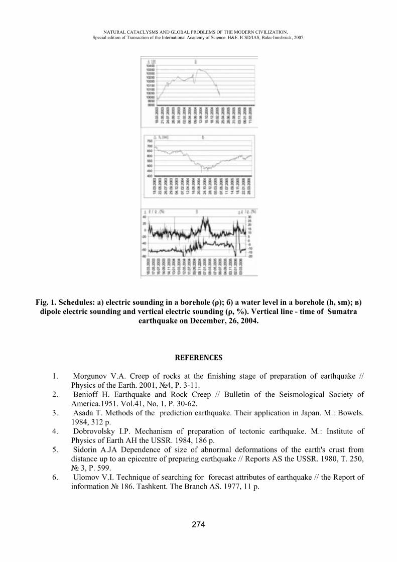
NATURAL CATACLYSMS AND GLOBAL PROBLEMS OF THE MODERN CIVILIZATION. Special edition of Transaction of the International Academy of Science. H&E. ICSD/IAS, Baku-Innsbruck, 2007.
274
Fig. 1. Schedules: ) electric sounding in a borehole ( ); ) a water level in a borehole (h, sm); )dipole electric sounding and vertical electric sounding ( , %). Vertical line - time of Sumatra
earthquake on December, 26, 2004.
REFERENCES
1. Morgunov V.A. Creep of rocks at the finishing stage of preparation of earthquake // Physics of the Earth. 2001, 4, P. 3-11.
2. Benioff H. Earthquake and Rock Creep // Bulletin of the Seismological Society of America.1951. Vol.41, No, 1, P. 30-62.
3. Asada T. Methods of the prediction earthquake. Their application in Japan. M.: Bowels. 1984, 312 p.
4. Dobrovolsky I.P. Mechanism of preparation of tectonic earthquake. M.: Institute of Physics of Earth the USSR. 1984, 186 p.
5. Sidorin A.JA Dependence of size of abnormal deformations of the earth's crust from distance up to an epicentre of preparing earthquake // Reports AS the USSR. 1980, . 250,
3, P. 599.6. Ulomov V.I. Technique of searching for forecast attributes of earthquake // the Report of
information 186. Tashkent. The Branch AS. 1977, 11 p.
NATURAL CATACLYSMS AND GLOBAL PROBLEMS OF THE MODERN CIVILIZATION. Special edition of Transaction of the International Academy of Science. H&E. ICSD/IAS, Baku-Innsbruck, 2007.
275
6. Ulomov V.I. Technique of searching for forecast attributes of earthquake // the Report of information 186. Tashkent. The Branch AS. 1977, 11 p.
7. Reznichenko N.JU. Size of the seismic center earthquakes and the seismic moment // Researches on physics of earthquakes. M.: the Science. 1975, P. 9-27.
8. Dambara T. Vertical movements of the earth's crust in the relation to the Matsushiro earthquake // Geod. Soc. Japan. 1966. Vol. 12, P. 18-45.
9. Qiu Z., Shi Y. Developments of borehole strain observation outside China Acta Seismologica sinica. 2004, vol. 17, p.172-178.
THE LARGEST EARTHQUAKES, THEIR DETERMINATION AND ATTEMPT OF CLASSIFICATION
S.KH. Maghidov
Institute of Geology, Daghestan Science Centre, RAS
At present time there are different types of classification of earthquakes. Rather detailed classification of the earthquakes gives Ch.Rihter in his monograph [1]. He makes the main division by time of influence: continuous and single perturbations. They are based on natural or artificial reasons, which are subdivided into smaller taxonomic groups, such as microseisms, industrial explosions and others. The variety of the seismic manifestations causes the necessity of development of different systems of classification , which let us make wider coverage of seismic events and get more clear representation about nature of seismic processes. Conditionally their may be divided into several directions, which are based on different factors: mechanism of earthquakes manifestation, power of their influence, depth of focus location, distance to the epicenter and others. The first direction includes several main types of earthquakes: tectonic, volcanic, shock and technogenic. In the given classification the type of earthquakes is indicated by primary process, which is defining reason, causing seismic event. But that was a direct reason and mechanism started the earthquake itself, may be unknown for us. According to this classification the complete knowledge of the mechanism is not required; the specification of the main stage is enough. Really, relating the earthquake to tectonic category, we just mean that in the result of tectonic motions on separate areas in terrestrial depths stresses are formed, which can discharge in the form of earthquakes. So, the direct reason, starting earthquake in tectonic stressed zone may be different processes: moon-solar and cosmic influences, meteorological and technogenic influences and others. The whole this class of the earthquakes we can conditionally name tectonic. But some of tectonic earthquakes we can call by name of factor provoking the seismic events. For the first time it concerns of technogenic earthquakes.
For indication of meteoritic earthquakes German seismologist Tams in 1931 has offered the name “shock”. This term also may be used for identification of earthquakes, occurring from mountain
NATURAL CATACLYSMS AND GLOBAL PROBLEMS OF THE MODERN CIVILIZATION. Special edition of Transaction of the International Academy of Science. H&E. ICSD/IAS, Baku-Innsbruck, 2007.
276
shocks, rock falls and landslips. Technogenic earthquakes, in its turn, can be split divided into the main types in the following way: water reservoir (dam), oil and gas, explosive.
To speak about the mechanism, we may mean different models of seismogenesis, by which the development of seismic process proceeds: the model of the elastic recoil, avalanche unstable crack-formation (AUC), diffusion-dilatable and others.
All these models describe the processes of seismogenesis, which can be realized in conditions of geodeforming changes. The main factors, which will influence the destruction mechanism, are: thermo-barometric conditions, velocity of deforming factors influence, elastoplastic characteristics of rocks. In conditions of compression of relatively brittle rocks the substrate destruction can occur by AUC mechanism. The more brittle is an examined material, the greater stress is necessary in conditions of thorough compression for destruction occur. Test of samples, with high degree of plasticity shows that destruction by means of thorough compression becomes practically impossible. In tension test the picture of destructions greatly differs from compression destruction, and occurs basically by the main fracture. In this case, the more brittle and plastic a material is, the smaller stress is necessary for its destruction.
The power of earthquakes may be subdivided by quantity of given out energy or by destructive consequences of influence on people, natural and artificial objects. The first type of classification estimates power of earthquakes by magnitude or by energy class of earthquake. Usually class is determined for comparatively weak local or regional earthquakes. Magnitude is more convenient for determination of remote strong earthquakes. The class of earthquake presents itself a decimal logarithm from quantity of given out seismic energy. Magnitude determines the power of earthquake manifestation. There are different methods of magnitude calculation, the value of given factor determined by different methods can differ in two units; the data in table 1 show this. At present time under intensity of earthquake we mean the factor, which characterizes the degree of influence on people and objects and is measured in marks. Different systems for determination of intensity were used in different times; Rossi-Forel scale, modified scale Merkalli of 1931, system MSK-64 (Medvedev – Shponhoer - Karnik) and some others. It is necessary to note that at present in Russia the most wide-spread scale is MSK- 64.
Classification by depth of focus disposition earthquakes are divided into three groups: superficial, intermediate and deep.
Till the last time many modern seismologists discussing the maximal earthquake force supposed that there is the upper limit of magnitude, which can’t exceed the value - 9.
In 1940 Tsuboi, on the basis of strength of the mountain rocks data, using some numerical suggestions calculated the maximal possible energy of earthquake - 5,6 · 1024 erg or 5,6 · 1017 joule [2]. Having made recalculation according with well known formula of Markus Bat, we’ll get the maximal possible energy of earthquake 8,7. But in last age, according to published bulletins several earthquakes has already occurred with magnitude 8,7 and with greater power, that means that the limit fixed by Tsuboi can be exceeded.
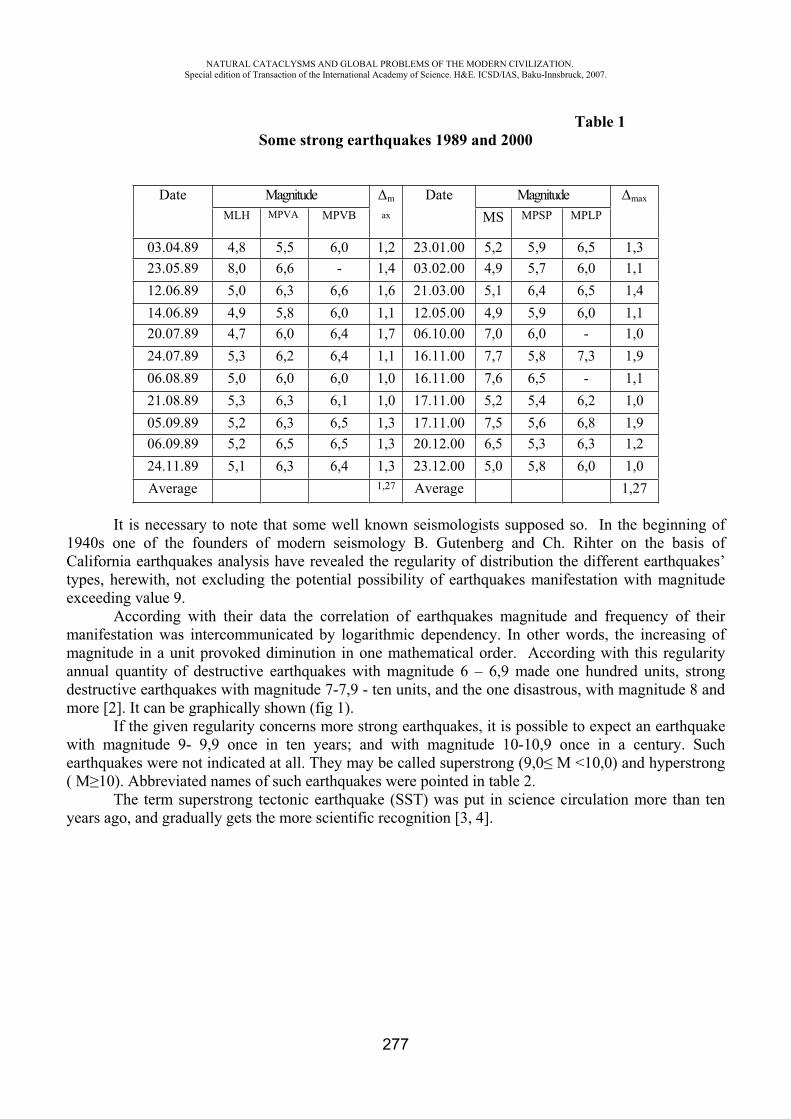
NATURAL CATACLYSMS AND GLOBAL PROBLEMS OF THE MODERN CIVILIZATION. Special edition of Transaction of the International Academy of Science. H&E. ICSD/IAS, Baku-Innsbruck, 2007.
277
Table 1Some strong earthquakes 1989 and 2000
It is necessary to note that some well known seismologists supposed so. In the beginning of 1940s one of the founders of modern seismology B. Gutenberg and Ch. Rihter on the basis of California earthquakes analysis have revealed the regularity of distribution the different earthquakes’ types, herewith, not excluding the potential possibility of earthquakes manifestation with magnitude exceeding value 9.
According with their data the correlation of earthquakes magnitude and frequency of their manifestation was intercommunicated by logarithmic dependency. In other words, the increasing of magnitude in a unit provoked diminution in one mathematical order. According with this regularity annual quantity of destructive earthquakes with magnitude 6 – 6,9 made one hundred units, strong destructive earthquakes with magnitude 7-7,9 - ten units, and the one disastrous, with magnitude 8 and more [2]. It can be graphically shown (fig 1).
If the given regularity concerns more strong earthquakes, it is possible to expect an earthquake with magnitude 9- 9,9 once in ten years; and with magnitude 10-10,9 once in a century. Such earthquakes were not indicated at all. They may be called superstrong (9,0 M <10,0) and hyperstrong ( M 10). Abbreviated names of such earthquakes were pointed in table 2.
The term superstrong tectonic earthquake (SST) was put in science circulation more than ten years ago, and gradually gets the more scientific recognition [3, 4].
Date Magnitude m
ax
Date Magnitude max
MLH MPVA MPVB MS MPSP MPLP
03.04.89 4,8 5,5 6,0 1,2 23.01.00 5,2 5,9 6,5 1,323.05.89 8,0 6,6 - 1,4 03.02.00 4,9 5,7 6,0 1,112.06.89 5,0 6,3 6,6 1,6 21.03.00 5,1 6,4 6,5 1,414.06.89 4,9 5,8 6,0 1,1 12.05.00 4,9 5,9 6,0 1,120.07.89 4,7 6,0 6,4 1,7 06.10.00 7,0 6,0 - 1,024.07.89 5,3 6,2 6,4 1,1 16.11.00 7,7 5,8 7,3 1,906.08.89 5,0 6,0 6,0 1,0 16.11.00 7,6 6,5 - 1,121.08.89 5,3 6,3 6,1 1,0 17.11.00 5,2 5,4 6,2 1,005.09.89 5,2 6,3 6,5 1,3 17.11.00 7,5 5,6 6,8 1,906.09.89 5,2 6,5 6,5 1,3 20.12.00 6,5 5,3 6,3 1,224.11.89 5,1 6,3 6,4 1,3 23.12.00 5,0 5,8 6,0 1,0Average 1,27 Average 1,27
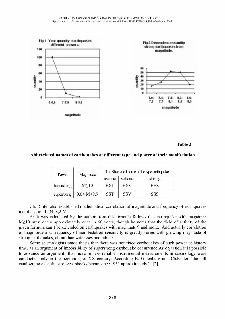
NATURAL CATACLYSMS AND GLOBAL PROBLEMS OF THE MODERN CIVILIZATION. Special edition of Transaction of the International Academy of Science. H&E. ICSD/IAS, Baku-Innsbruck, 2007.
278
Table 2
Abbreviated names of earthquakes of different type and power of their manifestation
Power Magnitude The Shortened name of the type earthquakes tectonic volcanic striking
huperstrong 10 HST HSV HSS
superstrong 9.0 <9.9 SST SSV SSS
Ch. Rihter also established mathematical correlation of magnitude and frequency of earthquakes manifestation LgN=8,2-M.
As it was calculated by the author from this formula follows that earthquake with magnitudeM 10 must occur approximately once in 60 years, though he notes that the field of activity of the given formula can’t be extended on earthquakes with magnitude 9 and more. And actually correlation of magnitude and frequency of manifestation seismicity is greatly varies with growing magnitude of strong earthquakes, about than witnesses and table 3.
Some seismologists made thesis that there was not fixed earthquakes of such power at history time, as an argument of impossibility of superstrong earthquake occurrence As objection it is possible to advance an argument that more or less reliable instrumental measurements in seismology were conducted only in the beginning of XX century. According B. Gutenberg and Ch.Rihter “the full cataloguing even the strongest shocks began since 1931 approximately.” [2].
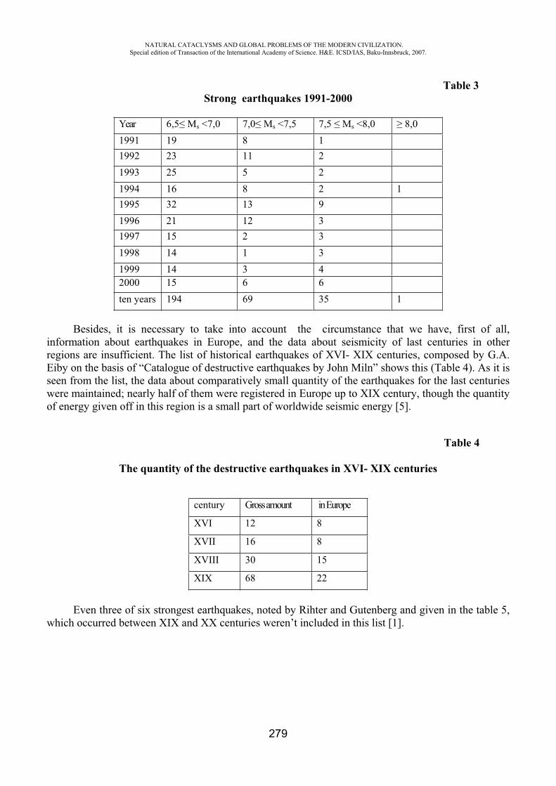
NATURAL CATACLYSMS AND GLOBAL PROBLEMS OF THE MODERN CIVILIZATION. Special edition of Transaction of the International Academy of Science. H&E. ICSD/IAS, Baku-Innsbruck, 2007.
279
Table 3 Strong earthquakes 1991-2000
Year 6,5 s <7,0 7,0 s <7,5 7,5 s <8,0 8,01991 19 8 11992 23 11 21993 25 5 21994 16 8 2 11995 32 13 91996 21 12 31997 15 2 31998 14 1 31999 14 3 42000 15 6 6ten years 194 69 35 1
Besides, it is necessary to take into account the circumstance that we have, first of all, information about earthquakes in Europe, and the data about seismicity of last centuries in other regions are insufficient. The list of historical earthquakes of XVI- XIX centuries, composed by G.A. Eiby on the basis of “Catalogue of destructive earthquakes by John Miln” shows this (Table 4). As it is seen from the list, the data about comparatively small quantity of the earthquakes for the last centuries were maintained; nearly half of them were registered in Europe up to XIX century, though the quantity of energy given off in this region is a small part of worldwide seismic energy [5].
Table 4
The quantity of the destructive earthquakes in XVI- XIX centuries
century Gross amount in Europe
XVI 12 8
XVII 16 8
XVIII 30 15
XIX 68 22
Even three of six strongest earthquakes, noted by Rihter and Gutenberg and given in the table 5, which occurred between XIX and XX centuries weren’t included in this list [1].
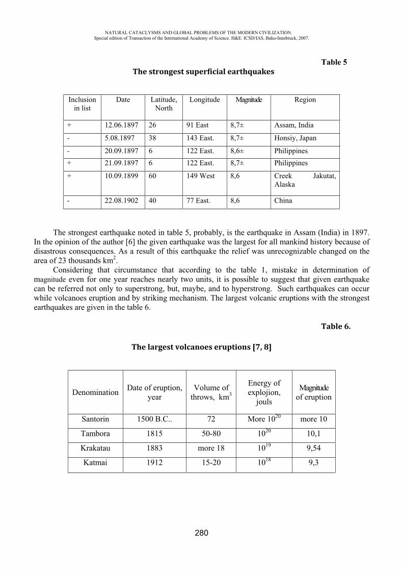
NATURAL CATACLYSMS AND GLOBAL PROBLEMS OF THE MODERN CIVILIZATION. Special edition of Transaction of the International Academy of Science. H&E. ICSD/IAS, Baku-Innsbruck, 2007.
280
Table 5 The strongest superficial earthquakes
Inclusionin list
Date Latitude,North
Longitude Magnitude Region
+ 12.06.1897 26 91 East 8,7± Assam, India
- 5.08.1897 38 143 East. 8,7± Honsiy, Japan
- 20.09.1897 6 122 East. 8,6± Philippines+ 21.09.1897 6 122 East. 8,7± Philippines
+ 10.09.1899 60 149 West 8,6 Creek Jakutat, Alaska
- 22.08.1902 40 77 East. 8,6 China
The strongest earthquake noted in table 5, probably, is the earthquake in Assam (India) in 1897. In the opinion of the author [6] the given earthquake was the largest for all mankind history because of disastrous consequences. As a result of this earthquake the relief was unrecognizable changed on the area of 23 thousands km2.
Considering that circumstance that according to the table 1, mistake in determination of magnitude even for one year reaches nearly two units, it is possible to suggest that given earthquake can be referred not only to superstrong, but, maybe, and to hyperstrong. Such earthquakes can occur while volcanoes eruption and by striking mechanism. The largest volcanic eruptions with the strongest earthquakes are given in the table 6.
Table 6.
The largest volcanoes eruptions [7, 8]
Denomination Date of eruption, year
Volume of throws, km3
Energy of explojion,
jouls
Magnitude of eruption
Santorin 1500 B.C.. 72 More 1020 more 10
Tambora 1815 50-80 1020 10,1
Krakatau 1883 more 18 1019 9,54
Katmai 1912 15-20 1018 9,3
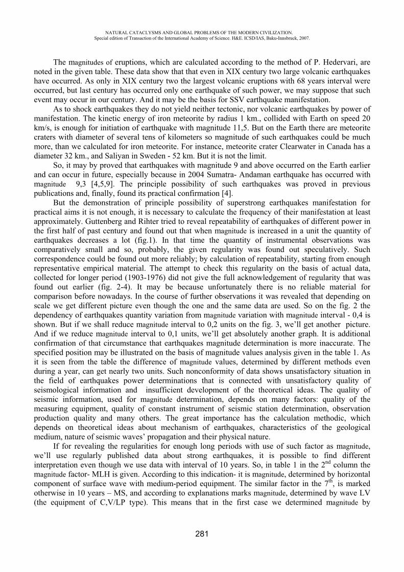
NATURAL CATACLYSMS AND GLOBAL PROBLEMS OF THE MODERN CIVILIZATION. Special edition of Transaction of the International Academy of Science. H&E. ICSD/IAS, Baku-Innsbruck, 2007.
281
The magnitudes of eruptions, which are calculated according to the method of P. Hedervari, are noted in the given table. These data show that that even in XIX century two large volcanic earthquakes have occurred. As only in XIX century two the largest volcanic eruptions with 68 years interval were occurred, but last century has occurred only one earthquake of such power, we may suppose that such event may occur in our century. And it may be the basis for SSV earthquake manifestation.
As to shock earthquakes they do not yield neither tectonic, nor volcanic earthquakes by power of manifestation. The kinetic energy of iron meteorite by radius 1 km., collided with Earth on speed 20 km/s, is enough for initiation of earthquake with magnitude 11,5. But on the Earth there are meteorite craters with diameter of several tens of kilometers so magnitude of such earthquakes could be much more, than we calculated for iron meteorite. For instance, meteorite crater Clearwater in Canada has a diameter 32 km., and Saliyan in Sweden - 52 km. But it is not the limit.
So, it may by proved that earthquakes with magnitude 9 and above occurred on the Earth earlier and can occur in future, especially because in 2004 Sumatra- Andaman earthquake has occurred with magnitude 9,3 [4,5,9]. The principle possibility of such earthquakes was proved in previous publications and, finally, found its practical confirmation [4].
But the demonstration of principle possibility of superstrong earthquakes manifestation for practical aims it is not enough, it is necessary to calculate the frequency of their manifestation at least approximately. Guttenberg and Rihter tried to reveal repeatability of earthquakes of different power in the first half of past century and found out that when magnitude is increased in a unit the quantity of earthquakes decreases a lot (fig.1). In that time the quantity of instrumental observations was comparatively small and so, probably, the given regularity was found out speculatively. Such correspondence could be found out more reliably; by calculation of repeatability, starting from enough representative empirical material. The attempt to check this regularity on the basis of actual data, collected for longer period (1903-1976) did not give the full acknowledgement of regularity that was found out earlier (fig. 2-4). It may be because unfortunately there is no reliable material for comparison before nowadays. In the course of further observations it was revealed that depending on scale we get different picture even though the one and the same data are used. So on the fig. 2 the dependency of earthquakes quantity variation from magnitude variation with magnitude interval - 0,4 is shown. But if we shall reduce magnitude interval to 0,2 units on the fig. 3, we’ll get another picture. And if we reduce magnitude interval to 0,1 units, we’ll get absolutely another graph. It is additional confirmation of that circumstance that earthquakes magnitude determination is more inaccurate. The specified position may be illustrated on the basis of magnitude values analysis given in the table 1. As it is seen from the table the difference of magnitude values, determined by different methods even during a year, can get nearly two units. Such nonconformity of data shows unsatisfactory situation in the field of earthquakes power determinations that is connected with unsatisfactory quality of seismological information and insufficient development of the theoretical ideas. The quality of seismic information, used for magnitude determination, depends on many factors: quality of the measuring equipment, quality of constant instrument of seismic station determination, observation production quality and many others. The great importance has the calculation methodic, which depends on theoretical ideas about mechanism of earthquakes, characteristics of the geological medium, nature of seismic waves’ propagation and their physical nature.
If for revealing the regularities for enough long periods with use of such factor as magnitude,we’ll use regularly published data about strong earthquakes, it is possible to find different interpretation even though we use data with interval of 10 years. So, in table 1 in the 2nd column the magnitude factor- MLH is given. According to this indication- it is magnitude, determined by horizontal component of surface wave with medium-period equipment. The similar factor in the 7th, is marked otherwise in 10 years – MS, and according to explanations marks magnitude, determined by wave LV (the equipment of ,V/LP type). This means that in the first case we determined magnitude by
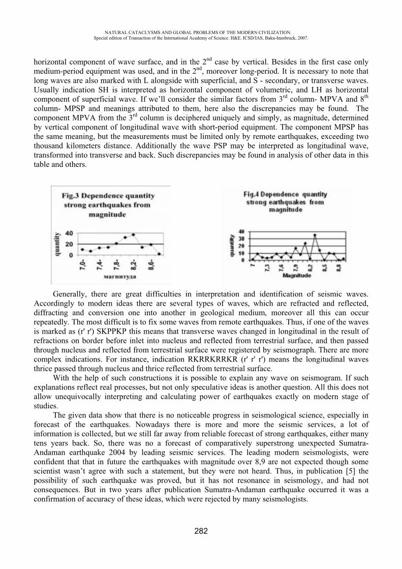
NATURAL CATACLYSMS AND GLOBAL PROBLEMS OF THE MODERN CIVILIZATION. Special edition of Transaction of the International Academy of Science. H&E. ICSD/IAS, Baku-Innsbruck, 2007.
282
horizontal component of wave surface, and in the 2nd case by vertical. Besides in the first case only medium-period equipment was used, and in the 2nd, moreover long-period. It is necessary to note that long waves are also marked with L alongside with superficial, and S - secondary, or transverse waves. Usually indication SH is interpreted as horizontal component of volumetric, and LH as horizontal component of superficial wave. If we’ll consider the similar factors from 3rd column- MPVA and 8th
column- MPSP and meanings attributed to them, here also the discrepancies may be found. The component MPVA from the 3rd column is deciphered uniquely and simply, as magnitude, determined by vertical component of longitudinal wave with short-period equipment. The component MPSP has the same meaning, but the measurements must be limited only by remote earthquakes, exceeding two thousand kilometers distance. Additionally the wave PSP may be interpreted as longitudinal wave, transformed into transverse and back. Such discrepancies may be found in analysis of other data in this table and others.
Generally, there are great difficulties in interpretation and identification of seismic waves. Accordingly to modern ideas there are several types of waves, which are refracted and reflected, diffracting and conversion one into another in geological medium, moreover all this can occur repeatedly. The most difficult is to fix some waves from remote earthquakes. Thus, if one of the waves is marked as (r' r') SKPPKP this means that transverse waves changed in longitudinal in the result of refractions on border before inlet into nucleus and reflected from terrestrial surface, and then passed through nucleus and reflected from terrestrial surface were registered by seismograph. There are more complex indications. For instance, indication RKRRKRRKR (r' r' r') means the longitudinal waves thrice passed through nucleus and thrice reflected from terrestrial surface.
With the help of such constructions it is possible to explain any wave on seismogram. If such explanations reflect real processes, but not only speculative ideas is another question. All this does not allow unequivocally interpreting and calculating power of earthquakes exactly on modern stage of studies.
The given data show that there is no noticeable progress in seismological science, especially in forecast of the earthquakes. Nowadays there is more and more the seismic services, a lot of information is collected, but we still far away from reliable forecast of strong earthquakes, either many tens years back. So, there was no a forecast of comparatively superstrong unexpected Sumatra- Andaman earthquake 2004 by leading seismic services. The leading modern seismologists, were confident that that in future the earthquakes with magnitude over 8,9 are not expected though some scientist wasn’t agree with such a statement, but they were not heard. Thus, in publication [5] the possibility of such earthquake was proved, but it has not resonance in seismology, and had not consequences. But in two years after publication Sumatra-Andaman earthquake occurred it was a confirmation of accuracy of these ideas, which were rejected by many seismologists.
NATURAL CATACLYSMS AND GLOBAL PROBLEMS OF THE MODERN CIVILIZATION. Special edition of Transaction of the International Academy of Science. H&E. ICSD/IAS, Baku-Innsbruck, 2007.
283
The specified difficulties do not allow reducing the mistake of magnitude determination to minimum, but accuracy of its determination is very important for values obtained by empirical way corresponded to reality. But these data have defining importance for increasing of accuracy of earthquakes forecast. If we manage to reduce a mistake in magnitude determination to value less than 0,1 then on the basis of the particular actual material we could exactly indicate the quantity of superstrong earthquakes with magnitude M 9, that were occurred during last hundred years, and which approximately varies from one to three. This means that repeatability of superstrong earthquakes varies from 30 to one hundred years. More accurate values of strong and superstrong earthquakes repeatability could let us to conduct more qualitative estimation of risks and prepare to dangerous seismic events beforehand.
CONCLUSIONS
1. The collected data show that in history of the Earth the superstrong and hyperstrong earthquakes of different nature occurred many times, which seismic energy exceed 1018 joules.
2. It is possible to assume that such earthquakes repeat approximately 2-3 events for a century. 3. There is possibility of earthquakes of such power in our age, so it is necessary to be prepared
for this.
REFERENCES
1. Rihter CH.F. The Elementary Seismology. M. 1963. p. 144, 145, 647, 648. 2. Guttenberg B., Rihter CH. Seismicity of the Earth. M., 1948. p. 130, 134-136. 3. Magidov S.H. The seismic Danger and Possible Geoecological Consequences of Caspian
Oil-gas Deposits Development // Influence of Seismic Danger on pipeline systems in Transcaucasia and Caspian regions. M., 2000. p. 274-275.
4. Rebetsky YU.L., Marinin A.V. Stressed Field before Sumatra-Andaman Earthquake 26.12.2004. The Model of Metastable Condition of Rocks// Geology and Geophysics, 2006, vol. 47, 11. p.1192-1206.
5. Magidov S.H. Possibility of Superstrong Tectonic Earthquakes// Geodynamics s and Seismicity of Eastern Caucasus. Makhachkala, 2002, p.86-88.
6. Kondrashov A. Reference Book of Necessary Data. M., 2000. p.129. 7. Vlodavec V.I. The Earth Volcanoes. M., Science, 1973. p. 16-25; 55. 8. The Latest Reference Book of necessary data. M., Ripol classic, 2006. p.106-107. 9. Gulielimi A.V, Cegmed B., Potapov A.S., Kulitima Y., Rayta T. Seismomagnetic Signals
from Large earthquake on Sumatra//Physics of Earth, 2006, 11. p.63-69.
NATURAL CATACLYSMS AND GLOBAL PROBLEMS OF THE MODERN CIVILIZATION. Special edition of Transaction of the International Academy of Science. H&E. ICSD/IAS, Baku-Innsbruck, 2007.
284
PRELIMINARY ASSESSMENT OF AIR QUALITY IN PANSEVO
Allegrini I., R. Bellagotti, M. Biscotto**, C. Ciuchini***, P. Colella****, A. Fino*****, C. Leonardi******, E.Moroni*******,
B. Z. Radetic*******, F. Vichi********
Institute for Atmospheric Pollution, Italian Research Council, Rome, Italy
Abstract
The Republic of Serbia is trying to harmonize the draft law on Air Protection with relevant EU Directives. The Italian Ministry for the Environment, Land and Sea (IMELS) is supporting Serbia in this process. In this framework the Institute for Atmospheric Pollution of the National Research Council (IIA-CNR) carried out the preliminary assessment of air quality in Pan evo, in accordance with the EU legislation with the aim to:
Preliminarily assess air quality and thus obtain a clearer picture of the actual situation; Assess the population exposure to the monitored pollutants; Assess the relative contribution of different pollution sources; Design the permanent monitoring network; Provide the basis for further action.
The overall objective was to support Local Institutions in the development of an air quality management system including monitoring, environmental policies and specific instruments to implement these policies.
Eight two-week campaigns (two for each season) were carried out in 2005-2006, by using passive samplers for NO2, NOx, SO2, NH3, BTX, O3 and Total Non Methanic Hydrocarbons. The results coming from the passive samplers were interpolated to create distribution maps. The study showed that benzene represents the most significant pollutant and furthermore that the city of Pan evomay be divided into two parts affected by different sources: the industrial zone, including the residential area of Vojlovica, strongly influenced by the facility emissions and the urban area influenced by local emissions, such as traffic and domestic heating and also to a lesser extent by the industrial emissions. Taking into account such results, the air quality monitoring network was designed.
Keywords: air quality monitoring system, preliminary assessment, pollutant distribution maps, passive samplers.
Introduction
The existing EU Directives define the strategy for air quality monitoring for the Member States to demonstrate compliance, or to show non-compliance, with the limit values of the directives. The Directive on air quality assessment and management, the Framework Directive (FWD) [1] and the
NATURAL CATACLYSMS AND GLOBAL PROBLEMS OF THE MODERN CIVILIZATION. Special edition of Transaction of the International Academy of Science. H&E. ICSD/IAS, Baku-Innsbruck, 2007.
285
relative Daughter Directives (DD) [2, 3, 4, 5] likewise define such strategies on which to base the design and operation of the compliance networks of the Member States. Since the Republic of Serbia aspires to enter the European Community it must start to consider the EC strategies for network design, QA/QC and data availability. FWD sets a general framework for air quality measurement and assessment in the European Union; it also requires air quality limit values to be set in DDs. According to the FWD, measurement will be mandatory in the following cases:
1. Agglomerations with more than 250,000 inhabitants, or where the population concentration is 250,000 inhabitants or less, a population density per km2 which for the Member States justifies the need for ambient air quality to be assessed and managed.
2. In areas where the concentrations are above the limit value. The measurements should be taken at fixed sites, continuously or by random sampling, and the
number is to be sufficiently large to determine pollution levels. For air pollution approaching the limit value, combinations of measurements and other
assessment techniques (modelling, objective estimation) are accepted. At low concentrations, assessment techniques may be used solely.
It appears clear that the preliminary assessment of air quality becomes very important and useful in order to decide the monitoring strategy and to design the air quality monitoring network if needed. Such procedure is not intended to control compliance of limit values under FWD, but rather is intended as a screening technique used to, among the others [6, 7]:
Assess the distribution of pollutants over a given area, the areas exceeding the limit value and the population exposure; Design and optimise permanent monitoring networks.
In the framework of the IMELS “Pansevo Action Program”, IIA-CNR was indicated as one of the implementing subjects and it was entrusted with the technical responsibility of the air quality preliminary assessment by means of passive samplers in Pansevo.
Preliminary Assessment in Pansevo
Taking into account Pansevo population (more or less 90.000 inhabitants), vehicular traffic and industrial sources, but also with the aim of mapping the whole area according to the EC Guidance on Preliminary Assessment [6], IIA-CNR chose 31 monitoring sites at residential, traffic or industrial locations plus 3 hot spots at locations which could be critical since highly affected by vehicular traffic (bus station, flea market and traffic-congested highway to Belgrade). The area of interest was divided into 31 cells. The grid was designed to be more dense in the industrial zone to characterize in more detail the environment around these plants. Passive samplers for NH3, BTX, TNMHC, NO2, NOx, SO2
and O3 were placed in the centre of each cell, trying to choose representative sites depending on the population and avoiding to: expose the passive samplers near crossings, near traffic lights, inside tunnels, etc (figure 1) [8, 9].
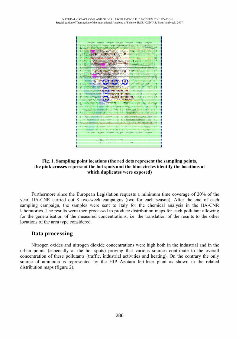
yslaflo
ucsd
Fthe p
Furtheyear, IIA-Csampling caaboratories.
for the geneocations of
Data
Nitrogurban pointconcentratiosource of adistribution
NASpecial
Fig. 1. Sampink crosse
ermore sincNR carriedampaign, th. The resulteralisation othe area typ
a processi
gen oxides ats (especialon of these ammonia ismaps (figur
ATURAL CATACLedition of Transacti
mpling pointes represent
ce the Europd out 8 twohe samplests were thenof the measpe considere
ing
and nitrogenlly at the hpollutants
s representere 2).
LYSMS AND GLOion of the Internatio
t locations t the hot spwhich dup
pean Legislo-week cams were senn processed sured conceed.
n dioxide chot spots) (traffic, inded by the
OBAL PROBLEMSonal Academy of Sc
286
(the red dopots and theplicates wer
lation requempaigns (twnt to Italy
to produceentrations,
concentratioproving th
dustrial actiHIP Azota
OF THE MODERNcience. H&E. ICSD/
ots represene blue circlre exposed)
ests a minimwo for eacfor the ch
e distributioni.e. the tran
ons were higat various ivities and hara fertilize
N CIVILIZATION/IAS, Baku-Innsbru
nt the samples identify)
mum time ch season).
hemical anan maps for nslation of
gh both in tsources co
heating). Oer plant as
.uck, 2007.
pling point the locatio
coverage ofAfter the
alysis in theach pollutthe results
the industriontribute to
On the contrs shown in
s,ons at
f 20% of thend of eache IIA-CNtant allowinto the othe
ial and in tho the overarary the onln the relate
hech
NRnger
healllyed
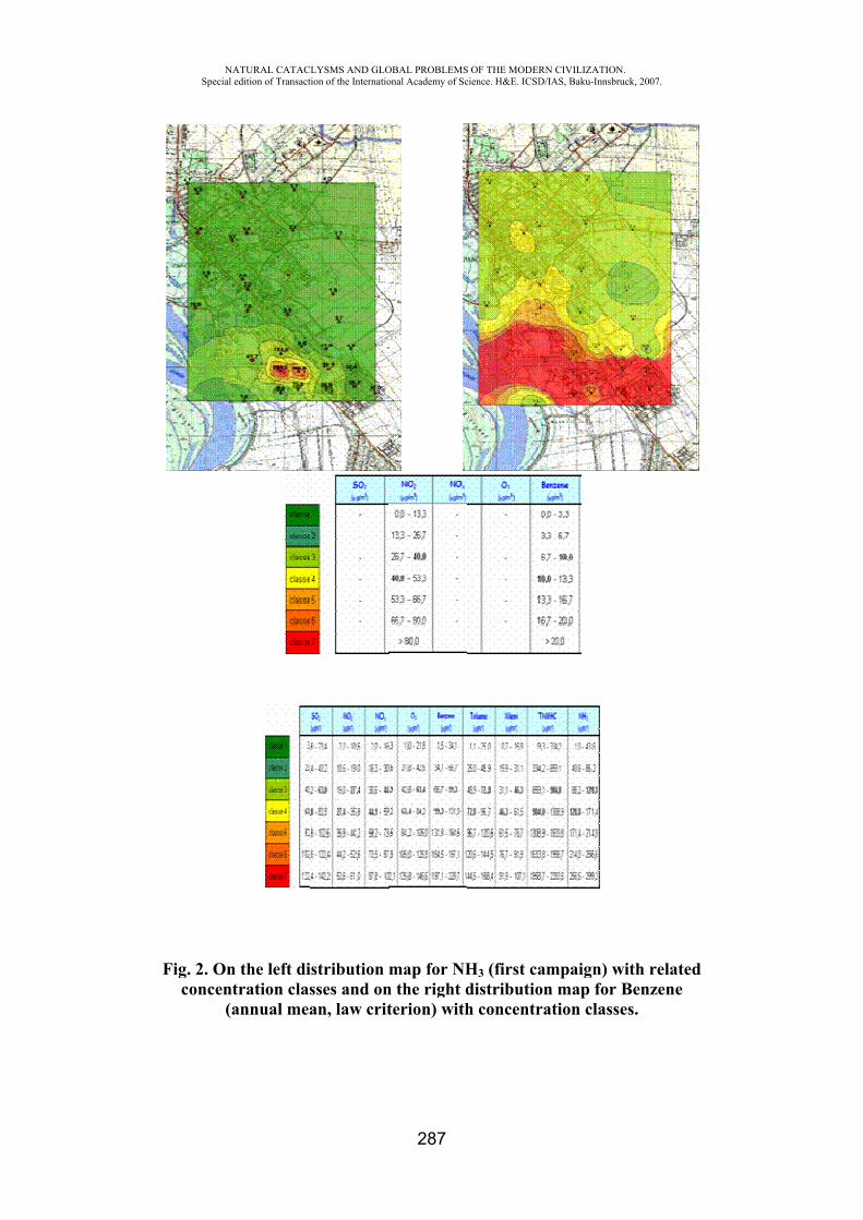
NASpecial
Fig. 2. Onconcent
(a
ATURAL CATACLedition of Transacti
n the left distration clasannual mea
LYSMS AND GLOion of the Internatio
stribution msses and onan, law crit
OBAL PROBLEMSonal Academy of Sc
287
map for NHn the right dterion) with
OF THE MODERNcience. H&E. ICSD/
H3 (first cadistributionh concentra
N CIVILIZATION/IAS, Baku-Innsbru
mpaign) wn map for Bation classe
.uck, 2007.
with related Benzene es.
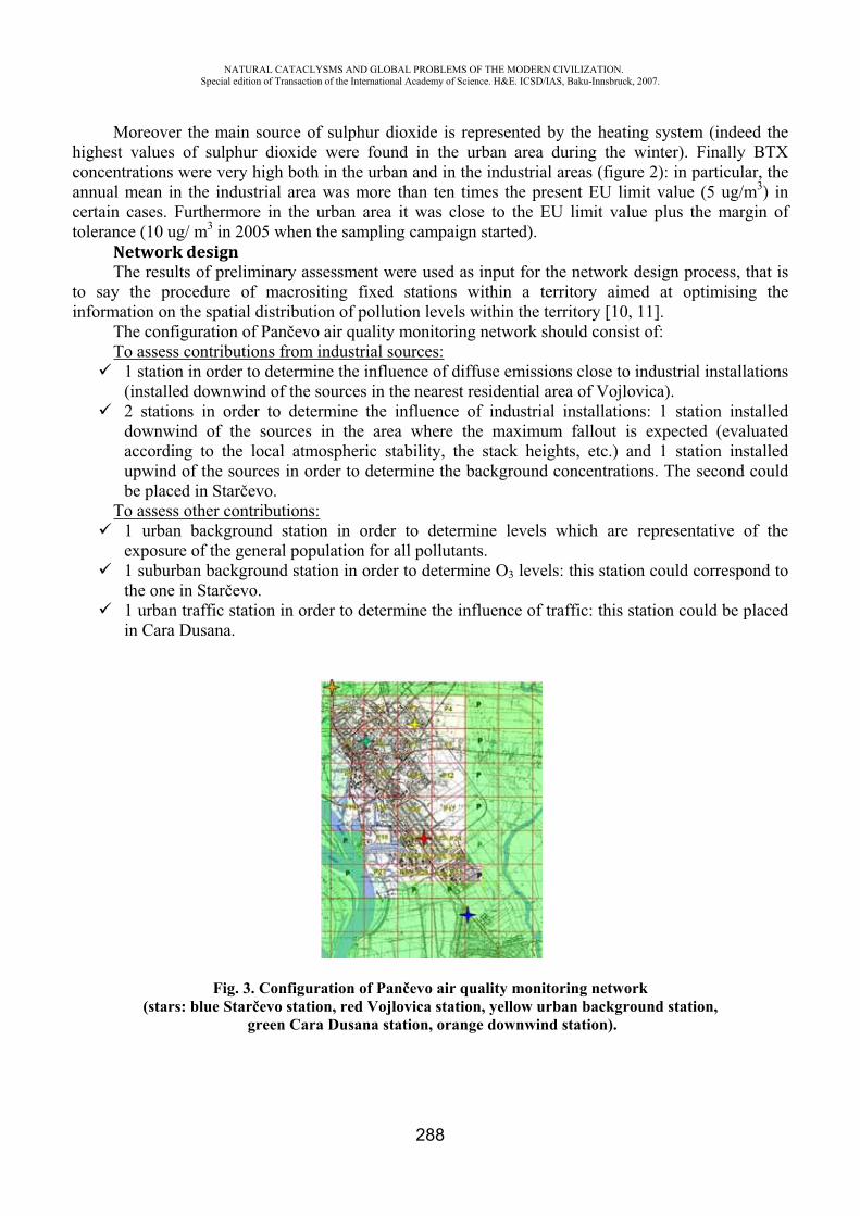
NATURAL CATACLYSMS AND GLOBAL PROBLEMS OF THE MODERN CIVILIZATION. Special edition of Transaction of the International Academy of Science. H&E. ICSD/IAS, Baku-Innsbruck, 2007.
288
Moreover the main source of sulphur dioxide is represented by the heating system (indeed the highest values of sulphur dioxide were found in the urban area during the winter). Finally BTX concentrations were very high both in the urban and in the industrial areas (figure 2): in particular, the annual mean in the industrial area was more than ten times the present EU limit value (5 ug/m3) in certain cases. Furthermore in the urban area it was close to the EU limit value plus the margin of tolerance (10 ug/ m3 in 2005 when the sampling campaign started).
Network designThe results of preliminary assessment were used as input for the network design process, that is
to say the procedure of macrositing fixed stations within a territory aimed at optimising the information on the spatial distribution of pollution levels within the territory [10, 11].
The configuration of Pan evo air quality monitoring network should consist of: To assess contributions from industrial sources:
1 station in order to determine the influence of diffuse emissions close to industrial installations (installed downwind of the sources in the nearest residential area of Vojlovica). 2 stations in order to determine the influence of industrial installations: 1 station installed downwind of the sources in the area where the maximum fallout is expected (evaluated according to the local atmospheric stability, the stack heights, etc.) and 1 station installed upwind of the sources in order to determine the background concentrations. The second could be placed in Star evo.
To assess other contributions:1 urban background station in order to determine levels which are representative of the exposure of the general population for all pollutants.1 suburban background station in order to determine O3 levels: this station could correspond to the one in Star evo.1 urban traffic station in order to determine the influence of traffic: this station could be placed in Cara Dusana.
Fig. 3. Configuration of Pan evo air quality monitoring network (stars: blue Star evo station, red Vojlovica station, yellow urban background station,
green Cara Dusana station, orange downwind station).
NATURAL CATACLYSMS AND GLOBAL PROBLEMS OF THE MODERN CIVILIZATION. Special edition of Transaction of the International Academy of Science. H&E. ICSD/IAS, Baku-Innsbruck, 2007.
289
ConclusionsThe study shows that passive samplers are an ideal tool for large scale air pollution surveys with
a high spatial resolution; in particular their low cost and sufficiently high reliability makes them suitable to determine the pollutant distribution over a large area, and to assess integrated concentration levels over longer periods of time (long-term limit values). Furthermore, as in this case, they can be used to determine areas of maximum concentration and to support network design or the optimization of monitoring networks.
The preliminary assessment of air quality by means of passive samplers in Pan evo showed that [12, 13]:
the most significant pollutant in both the urban and industrial oriented sites is benzene: in particular, the annual mean exceeded the EU limit value throughout the city; the main sources of benzene are the Refinery and the Petrochemical plant (located in the southern part of the city); Vojlovica (residential area in the southern part of the city) seems to be the populated area mostly affected by the industrial complex; the only source of ammonia is represented by the HIP Azotara plant (located in the southern part of the city).
REFERENCES
1. Framework Directive 96/62/EC. 2. First Daughter Directive 99/30/EC. 3. Second Daughter Directive 2000/69/EC. 4. Third Daughter Directive 2002/3/EC. 5. Fourth Daughter Directive 2004/107/EC. 6. Guidance on Assessment under the EU Air Quality Directives. 7. Guidance Report on Preliminary Assessment under EC Air Quality Directives. 8. Analyst - Dispositivo per il campionamento diffusionale di Benzene e composti organici
volatili -Guida pratica per l’impiego dei campionatori passivi di lungo periodo. 9. PRACTICAL GUIDE TO USE THE: ANALYST. Samplers for NO2, NOx, SO2, HONO,
HNO3, O3 and NH3.10. Criteria for EUROAIRNET. The EEA Air Quality Monitoring and Information Network. 11. Council Decision 2001/752/EC. 12. Technical Report “Air quality preliminary assessment in Pancevo”, January 2007, Institute
for Atmospheric Pollution of the Italian National Research Council. 13. Technical Report “Air quality preliminary assessment in Pancevo II”, June 2007, Institute
for Atmospheric Pollution of the Italian National Research Council. 14. F. Costabile, G. Bertoni, F. Desantis, F. Wang, W. Hong, F. Liu, I. Allegrini, A
preliminary assessment of major air pollutants in the city of Suzhou, China, Atmospheric Environment 40 (33), 6380-6395, 2006.
15. R. H. Brown, The use of diffusive samplers for monitoring of ambient air, Pure and Appl. Chem., Vol.65 (8), 1993, pp.1859-1874.
16. Allegrini, C. Paternò, M. Biscotto, W. Hong, F. Liu, Z. Yin & F. Costabile, According to Framework Directive 96/62/EC, preliminary assessment as a tool for Air Quality Monitoring Network design in a Chinese city, Air Pollution XII, Series: Advances in Air Pollution, WIT Press, Vol. 14, 415-424.

NATURAL CATACLYSMS AND GLOBAL PROBLEMS OF THE MODERN CIVILIZATION. Special edition of Transaction of the International Academy of Science. H&E. ICSD/IAS, Baku-Innsbruck, 2007.
290
EARTHQUAKES IN PAKISTAN: EFFORTS FOR RESEARCH IN EARTHQUAKE FORECASTING
Shahid A. Khan
Centre for Earthquake Studies Saudi Pak Tower, Jinnah Avenue Islamabad
Abstract
On the basis of historic and instrumental recorded seismic data, as well as the geotectonic, the region comprising Pakistan is divided into sixteen seismic zones. Modified and updated catalogues of seismic events for each zone has been prepared for this purpose. Recurrence relations for each source zone are also derived as are the projected maximum magnitude and the recurrence intervals.
The highest seismic activity is associated with the Kirthar Sulaiman Shear zone and the North-west Himalayas of Pakistan where a devastating earthquake occurred in October 2005, where as the alluvial plains of southern Punjab and Sind show the lowest activity in the country.
Recently efforts are being made for developing local capability for earthquake forecasting and a centre has been established for this purpose under the umbrella of National Centre for Physics. The main purpose of the centre is to foster and support inter disciplinary earthquake prediction research in the national institutions, training of young scientists and knowledge transfer. International collaboration is being sought as it is necessary for the growth of the centre.
The paper is intended to serve as a basis for the estimation of long term seismic hazard in Pakistan and medium and short term forecasting of large earthquakes.
THE DEVELOPMENT OF THE SYSTEM OF NORMAL HEIGHTS IN AZERBAIJAN BY THE SATELLITE METHODS
M.H. Gojamanov
Baku State University Azerbaijan, Baku
In study to and the estimation of the aftereffects of the most of natural cataclysms significant role play geodesy measurements and created on their basis geodesic systems of elevational and planimetric coordinates. State geodetic net (SGN), if her systematically do not renew and do not improve, by degree advances in years, loses the part of points, loses accuracy in separate its parts, especially due to the up to date movements of crust of the earth. In problem solution updating and evolution SGN follows to take into account that on up to date stage significantly broadened the armory of facilities and the methods of the construction of geodetic nets. This, first of all, relates to up to date satellite technologies based on using of systems GPS/GLONASS.
The developments of the system of normal heights is unitized and integral part the resolves of the overall problem of the reconstruction and the developments of the system of geodesic coverage on the territories of Azerbaijan Republic (AR) on basis of the satellite methods of coordinate determining [1].
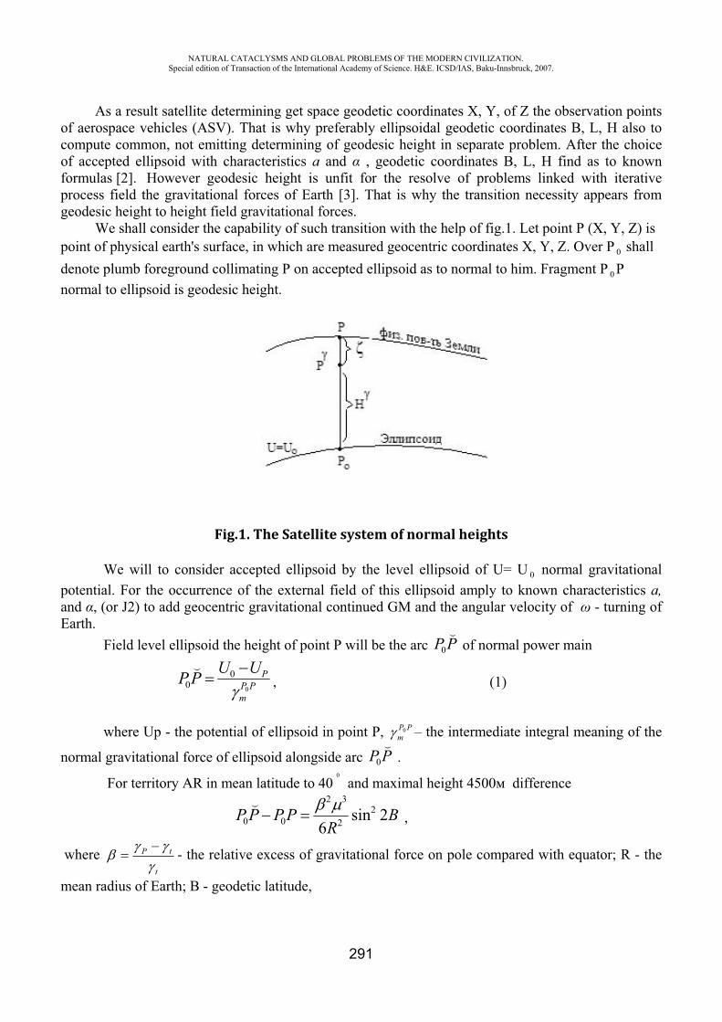
NATURAL CATACLYSMS AND GLOBAL PROBLEMS OF THE MODERN CIVILIZATION. Special edition of Transaction of the International Academy of Science. H&E. ICSD/IAS, Baku-Innsbruck, 2007.
291
As a result satellite determining get space geodetic coordinates X, Y, of Z the observation points of aerospace vehicles (ASV). That is why preferably ellipsoidal geodetic coordinates B, L, H also to compute common, not emitting determining of geodesic height in separate problem. After the choice of accepted ellipsoid with characteristics and , geodetic coordinates B, L, H find as to known formulas [2]. However geodesic height is unfit for the resolve of problems linked with iterative process field the gravitational forces of Earth [3]. That is why the transition necessity appears from geodesic height to height field gravitational forces.
We shall consider the capability of such transition with the help of fig.1. Let point P (X, Y, Z) is point of physical earth's surface, in which are measured geocentric coordinates X, Y, Z. Over P 0 shall denote plumb foreground collimating P on accepted ellipsoid as to normal to him. Fragment P 0
normal to ellipsoid is geodesic height.
Fig.1. The Satellite system of normal heights
We will to consider accepted ellipsoid by the level ellipsoid of U= U 0 normal gravitational potential. For the occurrence of the external field of this ellipsoid amply to known characteristics ,and , (or J2) to add geocentric gravitational continued GM and the angular velocity of - turning of Earth. Field level ellipsoid the height of point P will be the arc PP0 of normal power main
PPm
PUUPP0
00 , (1)
where Up - the potential of ellipsoid in point P, PP
m0 – the intermediate integral meaning of the
normal gravitational force of ellipsoid alongside arc PP0 .
For territory AR in mean latitude to 400
and maximal height 4500 difference
BR
PPPP 2sin6
22
32
00 ,
where t
tP - the relative excess of gravitational force on pole compared with equator; R - the
mean radius of Earth; B - geodetic latitude,
NATURAL CATACLYSMS AND GLOBAL PROBLEMS OF THE MODERN CIVILIZATION. Special edition of Transaction of the International Academy of Science. H&E. ICSD/IAS, Baku-Innsbruck, 2007.
292
of arc distance PP0 power main from the normal P 0 fragment to ellipsoid compounds 1*10 5 ,that is why to discriminate them will not. We shall present normal potential U in the form PPP TWU ,where PW - valid, - PT abnormal potential in point P homologous. We shall write down geodesic height so:
PPm
PP TWUH0
0 .
Dimension WU0 can be viewed as difference of normal potentials between ellipsoid and point , in which normal potential to UP identically equal valid potential in point P .
PP WU . (2)
In other words, on fragment PP0 is searched such point, in which potential of accepted level ellipsoid to equal valid potential in point P earth's surface. Using (2), for geodesic height find
PPm
PPP
m
P TUUH
0
0 , (3)
where, PPm
0 , PPm - the intermediate integral meaning of normal gravitational force on
fragments PP0 and PP homologous. The first term of right part (3) is normal height H , second - the abnormality of height, that is (3) can be written in the form
HH . (4) Thus, in satellite determining normal height is height over accepted ellipsoid point, in which normal potential is equal valid potential of the surface point of Earth. For the occurrence of normal height results from geodesic height take away the abnormality of height
HH . (5)
In formulas (3) - (4) normal field in both terms of right part should be strictly agreed. For the assignment of the system of normal heights as to satellite determining amply in some one point of State geodetic net (SGN) to receive coordinates X, Y, Z by absolute method and to calculate geodesic height and the abnormality of height field accepted-level ellipsoid. In SGN AR for such point follows to accept the incipient point of circuit - 001, linked with Fundamental astrogeodetic net (FAGS) of Russian Federation (RF). It is notable, what in such choice of the system of normal heights does not appear the necessity of the introduction of the notion of sea level or geoids and potential W0 on these grounds. This especially suitably for AR situated in the deep of mainland and not available in its circuit of the points of ashore Global ocean.
NATURAL CATACLYSMS AND GLOBAL PROBLEMS OF THE MODERN CIVILIZATION. Special edition of Transaction of the International Academy of Science. H&E. ICSD/IAS, Baku-Innsbruck, 2007.
293
In formulas (1) - (5) can be used any ellipsoid. If to choose the ellipsoid of system PZ-90 (The characteristics of The Earth 1990 year)
-2344,398600GM ; 106257,1082 6
2J ; 1510292115,7 c ;
6378136a ,
that the system of normal heights AR will be assented to altitude system SGN RF. If to use international ellipsoid WGS-84
-235,398600GM ;
1016685,4845
62J ;
1510292115,7 c ; 6378137a ,
the system of normal heights AR will coincide with the World system. For all the rest of the points satellite circuit defined of relative starting foreground point -001, follows to compute the differences of normal heights
001001 ii HHH , (6)
. . to fulfill satellite leveling. Here H measured difference of geodesic heights. Because is planned measurement of the differences of coordinates in insular figures, appears the capability of determining of the differences of normal heights as to the sides of these figures and their next adjustment.
REFERENCES
1. Mamedov G.SH., Gojamanov M.H. About the concept of developments and the reconstructions of state geodetic net AR//Geodesy and Cartography. - 2002, -12. - p.38-42
2. Boyko E.G. Higher geodesy. Part II. Geodesy on the ellipsoid: M.: Kartgeotsentr-geodezizdat, 2003. -144 p.
3. Eremeev V.F., Yurkina M.I. The theory of heights in the Earth gravitational field. - M.: Nedra, 1971. - 144 p.
NATURAL CATACLYSMS AND GLOBAL PROBLEMS OF THE MODERN CIVILIZATION. Special edition of Transaction of the International Academy of Science. H&E. ICSD/IAS, Baku-Innsbruck, 2007.
294
MERAPI VOLCANO ERUPTIONS 2006
Subandriyo*, Wahyudi**, Junun Sartohadi**
* Volcanological Survey of Indonesia ** Gadjah Mada University
Abstract
The last Merapi volcano eruption in 26 April 2006 begun since lava dome was formed and the peak occurred in 14 June 2006 when the hot avalance could reach 7 km towards Kali Gendol (Gendol river). Merapi eruption 2006 direction has changed from South West (since 1961) to South East (i.e. Kali Gendol).
The objectives of this paper were to describe the changes of hazard status of the Southern-South eastern Merapi volcano due to the 26th April 2006; (2) to evaluate the risk of some populated areas in the Southern-South eastern Merapi volcano; (3) to formulate the recommendation for settlement improvement as well as the master plan in the study area.
The method applied to achieved the objectives were including the satellite imageries interpretation, new topographic map interpretation, current landuse status evaluation, and field check. The data were evaluated and analyzed descriptively based on the spatial arrangement of hazard – risk status and settlement area.
This changes affect the potential hazard at South – South East district covered Kali Gendol, Kali Kuning, and Kali Boyong. The villages are only 4 km distance from the eruption center, and the higher population factor would increase the risk. To minimise the risk of volcanic hazard in future, it is really needed to rearrange the master plan at South – South East district.
BACKGROUNDThe activity of Merapi intially began since July 2005 which signed by high magnitude of
volcanic swarm. In July 9 – 10th, a volcanic earthquake was occurred that could be felt by human in radius 5 km. This phenomena is a sign of early new cycles after 4 years break since last eruption in February 10th 2001. At that time, the activity status was elevated into ”Waspada” in July 9th 2005, but then gradually decreased until November 29th 2005 into ”Normal”.
In early 2006, Merapi Volcano begun to show an increases in activity again, as shown by seismicity, deformation and geochemistry. To anticapte the early activity, Center for Volcanological dan Hazard Mitigartion has done hazard mitigation and recommended an early warning, produced hazard potential map and gave hazard campaign to the villages intensively.
There are some important should be known during eruption processes of Merapi in 2006, i.e., new lava dome occurrences, avalanche, tectonic effect, landsliding some part of Gegerbuaya, landsliding new lava dome and its implication. Avalanche deposit survey and human casualties due to Merapi eruption 2006 was also reported.
NATURAL CATACLYSMS AND GLOBAL PROBLEMS OF THE MODERN CIVILIZATION. Special edition of Transaction of the International Academy of Science. H&E. ICSD/IAS, Baku-Innsbruck, 2007.
295
Merapi Early Warning System Early warning system of Merapi Volcano hazard is all early warning which contain suggestion or
order for the people around Merapi in oder to do early safety. The early warning could be in form of Letter of Command issued by competent government or in form of Potentially Hazard Map or in form of early warning system by activating alarm (sirene). The output of early warning depends on the degree of hazard and their exhalation rate which means the hazard is wildy developed unexpectedly. If the potential hazard could be detected properly, an early warning would be sent gradually the activity rank. However, if the hazard is developing in very short time, early warning using sirine would be used as evacuation order.
There are 4 rank of early warning for hazard mitigation of Merapi, i.e. Normal Active, Waspada, Siaga and Awas.
1. Normal Active The activity of Merapi based on observation instrument data and visual does not show an early
activity eruption. The value of recorded data is within the daily background data.
2. Waspada The activity of Merapi based on observation instrument data and visual show an increases
activuty above an active normal situation. At Waspada rank, an increases activity is not always followed and advanced activity lead to an eruption, but that could return into normal situation.. At this rank, VSI (Volcanological Survey of Indonesia) begin to do a hazard campaign at the surround villages of Merapi.
3. Siaga An increases of Merapi Volcano activity is obviously shown, instrumentally as well as visually.
Hence based on an evaluation, the activity could be followed by eruptions. In Siaga rank, the campaign is more intensively conducted. The target are people living at area where mostly could be reached by eruption, SATLAK PB (local governmental hazard mitigation), NGO and volunteers. Besides those, training for villagers is conducted to anticipate an evacuation.
4. Awas Data analysis and evaluation based on instrument and visual tend to show that Merapi Volcano is
going into main eruption. At “Awas” condition, the settler around potential hazard area or where the avalanche possible will flow, should be evacuated as far as possible.
Merapi activity increases gradually since 2006. The activity was gradually elevated according activity and hazard risk. In March 15th 2006, activity status was elevated as “Waspada”, in Juni 14th
2006 the avalanche was emerged unexpectedly, then activity status was elevated into “Awas”, in particular Kali Gendol sector which is the most potential area covered by avalanche eruption.
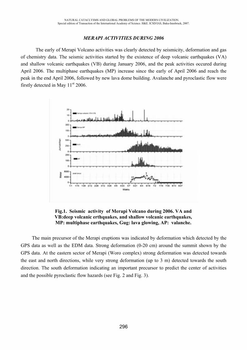
NATURAL CATACLYSMS AND GLOBAL PROBLEMS OF THE MODERN CIVILIZATION. Special edition of Transaction of the International Academy of Science. H&E. ICSD/IAS, Baku-Innsbruck, 2007.
296
MERAPI ACTIVITIES DURING 2006
The early of Merapi Volcano activities was clearly detected by seismicity, deformation and gas of chemistry data. The seismic activities started by the existence of deep volcanic earthquakes (VA) and shallow volcanic earthquakes (VB) during January 2006, and the peak activities occured during April 2006. The multiphase earthquakes (MP) increase since the early of April 2006 and reach the peak in the end April 2006, followed by new lava dome building. Avalanche and pyroclastic flow were firstly detected in May 11st 2006.
Fig.1. Seismic activity of Merapi Volcano during 2006. VA and VB:deep volcanic erthquakes, and shallow volcanic earthquakes, MP: multiphase earthquakes, Gug: lava glowing, AP: valanche.
The main precursor of the Merapi eruptions was indicated by deformation which detected by the GPS data as well as the EDM data. Strong deformation (0-20 cm) around the summit shown by the GPS data. At the eastern sector of Merapi (Woro complex) strong deformation was detected towards the east and north directions, while very strong deformation (up to 3 m) detected towards the south direction. The south deformation indicating an important precursor to predict the center of activities and the possible pyroclastic flow hazards (see Fig. 2 and Fig. 3).
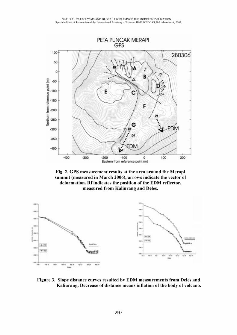
Fig
NASpecial
Fig.summ
de
gure 3. SlopKali
ATURAL CATACLedition of Transacti
2. GPS memit (measuformation.
m
pe distanceiurang. Dec
LYSMS AND GLOion of the Internatio
easurementured in Mar. Rf indicat
measured fr
e curves rescrease of d
OBAL PROBLEMSonal Academy of Sc
297
t results at rch 2006), ates the positrom Kaliur
sulted by Eistance me
OF THE MODERNcience. H&E. ICSD/
the area ararrows indtion of the ang and De
EDM measuans inflatio
N CIVILIZATION/IAS, Baku-Innsbru
round the Micate the veEDM refleeles.
urements fron of the bo
.uck, 2007.
Merapiector of ector,
rom Deles ody of volc
andano.
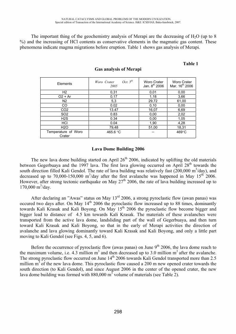
NATURAL CATACLYSMS AND GLOBAL PROBLEMS OF THE MODERN CIVILIZATION. Special edition of Transaction of the International Academy of Science. H&E. ICSD/IAS, Baku-Innsbruck, 2007.
298
The important thing of the geochemistry analysis of Merapi are the decreasing of H2O (up to 8 %) and the increasing of HCl contents as conservative elements in the magmatic gas content. These phenomena indicate magma migrations before eruption. Table 1 shows gas analysis of Merapi.
Table 1 Gas analysis of Merapi
Lava Dome Building 2006
The new lava dome building started on April 26th 2006, indicated by uplifting the old materials between Gegerbuaya and the 1997 lava. The first lava glowing occurred on April 28th towards the south direction filled Kali Gendol. The rate of lava building was relatively fast (200,000 m3/day), and decreased up to 70,000-150,000 m3/day after the first avalanche was happened in May 15th 2006. However, after strong tectonic earthquake on May 27th 2006, the rate of lava building increased up to 170,000 m3/day.
After declaring an ”Awas” status on May 13rd 2006, a strong pyroclastic flow (awan panas) was occured two days after. On May 14th 2006 the pyroclastic flow increased up to 88 times, dominantly towards Kali Krasak and Kali Boyong. On May 15th 2006 the pyroclastic flow become bigger and bigger lead to distance of 4.5 km towards Kali Krasak. The materials of these avalanches were transported from the active lava dome, landsliding part of the wall of Gegerbuaya, and then turn toward Kali Krasak and Kali Boyong, so that in the early of Merapi activities the direction of avalanche and lava glowing dominantly toward Kali Krasak and Kali Boyong, and only a little part moving to Kali Gendol (see Figs. 4, 5, and 6).
Before the occurrence of pyroclastic flow (awas panas) on June 9th 2006, the lava dome reach to the maximum volume, i.e. 4.3 million m3 and then decreased up to 3.0 million m3 after the avalanche. The strong pyroclastic flow occurred on June 14th 2006 towards Kali Gendol transported more than 2.5 million m3 of the new lava dome. This pyroclastic flow caused a 200 m new opened crater towards the south direction (to Kali Gendol), and since August 2006 in the center of the opened crater, the new lava dome building was formed with 880,000 m3 volume of materials (see Table 2).
Elements Woro Crater Oct. 5th
2005 Woro Crater Jan. 8th 2006
Woro Crater Mar. 16th 2006
H2 0,31 0,01 0,00 O2 + Ar 0,17 1,18 3,66
N2 5,3 29,72 61,00 CO 0.02 0,10 0,00 CO2 13.47 16,07 6,69 SO2 0.83 0,00 2,02 H2S 0.34 0,00 1,05 HCl 0.04 1,90 4,28 H2O 79,48 51,00 18,31
Temperature of Woro Crater
465.6 C -- 469 C
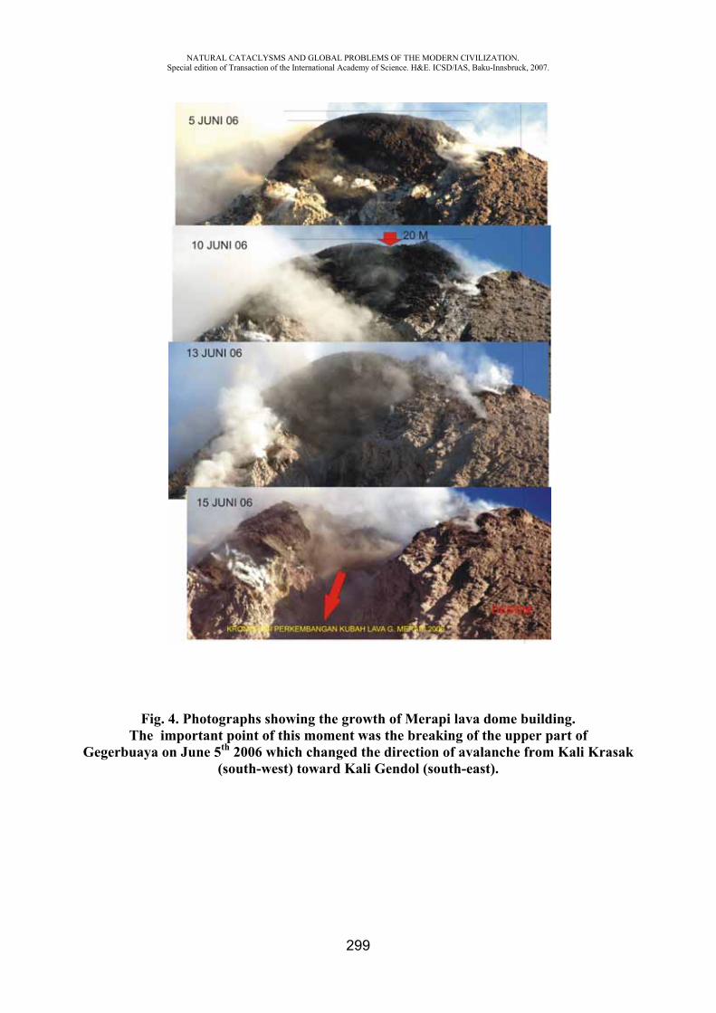
NATURAL CATACLYSMS AND GLOBAL PROBLEMS OF THE MODERN CIVILIZATION. Special edition of Transaction of the International Academy of Science. H&E. ICSD/IAS, Baku-Innsbruck, 2007.
299
Fig. 4. Photographs showing the growth of Merapi lava dome building. The important point of this moment was the breaking of the upper part of
Gegerbuaya on June 5th 2006 which changed the direction of avalanche from Kali Krasak (south-west) toward Kali Gendol (south-east).
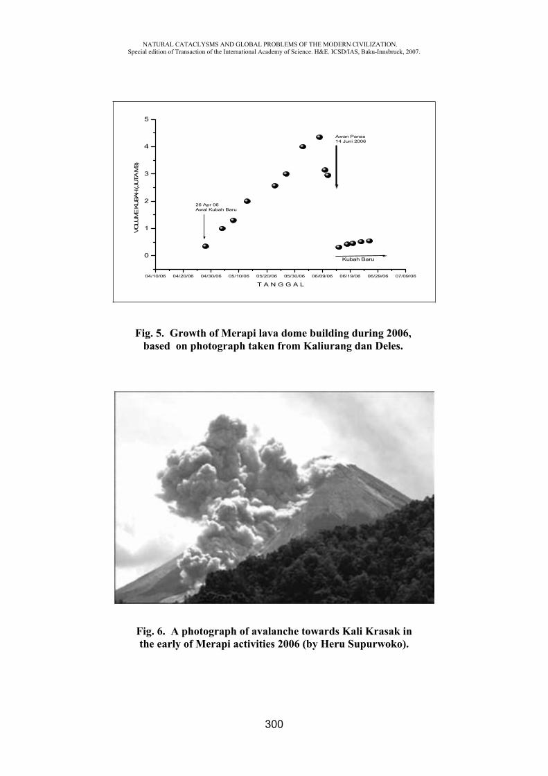
NATURAL CATACLYSMS AND GLOBAL PROBLEMS OF THE MODERN CIVILIZATION. Special edition of Transaction of the International Academy of Science. H&E. ICSD/IAS, Baku-Innsbruck, 2007.
300
04/10/06 04/20/06 04/30/06 05/10/06 05/20/06 05/30/06 06/09/06 06/19/06 06/29/06 07/09/06
0
1
2
3
4
5
26 Apr 06Awal Kubah Baru
Kubah Baru
Awan Panas14 Juni 2006
VO
LUM
E KUBA
H (J
UTA
M3)
T A N G G A L
Fig. 5. Growth of Merapi lava dome building during 2006, based on photograph taken from Kaliurang dan Deles.
Fig. 6. A photograph of avalanche towards Kali Krasak in the early of Merapi activities 2006 (by Heru Supurwoko).
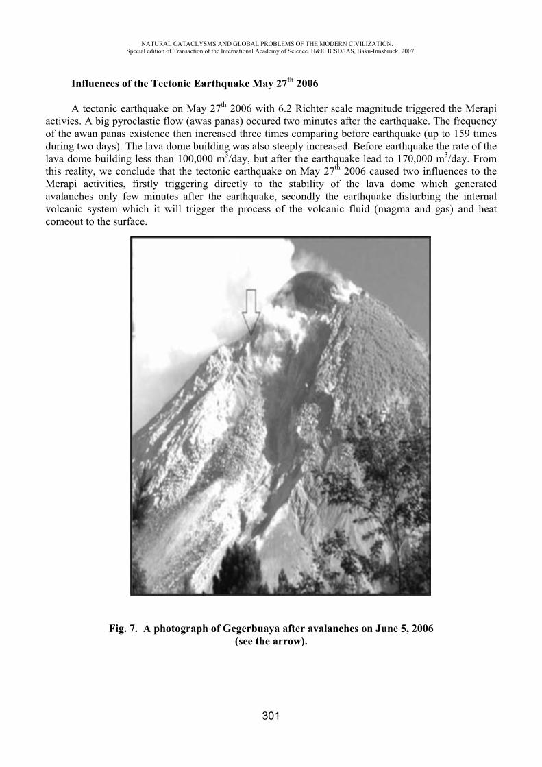
NATURAL CATACLYSMS AND GLOBAL PROBLEMS OF THE MODERN CIVILIZATION. Special edition of Transaction of the International Academy of Science. H&E. ICSD/IAS, Baku-Innsbruck, 2007.
301
Influences of the Tectonic Earthquake May 27th 2006
A tectonic earthquake on May 27th 2006 with 6.2 Richter scale magnitude triggered the Merapi activies. A big pyroclastic flow (awas panas) occured two minutes after the earthquake. The frequency of the awan panas existence then increased three times comparing before earthquake (up to 159 times during two days). The lava dome building was also steeply increased. Before earthquake the rate of the lava dome building less than 100,000 m3/day, but after the earthquake lead to 170,000 m3/day. From this reality, we conclude that the tectonic earthquake on May 27th 2006 caused two influences to the Merapi activities, firstly triggering directly to the stability of the lava dome which generated avalanches only few minutes after the earthquake, secondly the earthquake disturbing the internal volcanic system which it will trigger the process of the volcanic fluid (magma and gas) and heat comeout to the surface.
Fig. 7. A photograph of Gegerbuaya after avalanches on June 5, 2006(see the arrow).
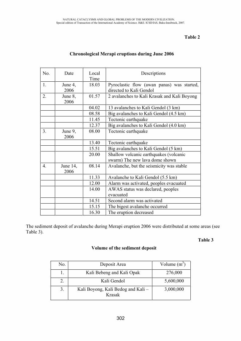
NATURAL CATACLYSMS AND GLOBAL PROBLEMS OF THE MODERN CIVILIZATION. Special edition of Transaction of the International Academy of Science. H&E. ICSD/IAS, Baku-Innsbruck, 2007.
302
Table 2
Chronological Merapi eruptions during June 2006
No. Date Local Time
Descriptions
1. June 4, 2006
18.03 Pyroclastic flow (awan panas) was started, directed to Kali Gendol
2. June 8, 2006
01.57 2 avalanches to Kali Krasak and Kali Boyong
04.02 13 avalanches to Kali Gendol (3 km) 08.58 Big avalanches to Kali Gendol (4.5 km) 11.45 Tectonic earthquake 12.37 Big avalanches to Kali Gendol (4.0 km) 3. June 9,
200608.00 Tectonic earthquake
13.40 Tectonic earthquake 15.51 Big avalanches to Kali Gendol (5 km) 20.00 Shallow volcanic earthquakes (volcanic
swarm) The new lava dome shown 4. June 14,
200608.14 Avalanche, but the seismicity was stable
11.33 Avalanche to Kali Gendol (5.5 km) 12.00 Alarm was activated, peoples evacuated 14.00 AWAS status was declared, peoples
evacuated 14.51 Second alarm was activated 15.15 The bigest avalanche occurred 16.30 The eruption decreased
The sediment deposit of avalanche during Merapi eruption 2006 were distributed at some areas (see Table 3).
Table 3 Volume of the sediment deposit
No. Deposit Area Volume (m3)
1. Kali Bebeng and Kali Opak 276,000
2. Kali Gendol 5,600,000
3. Kali Boyong, Kali Bedog and Kali –Krasak
3,000,000
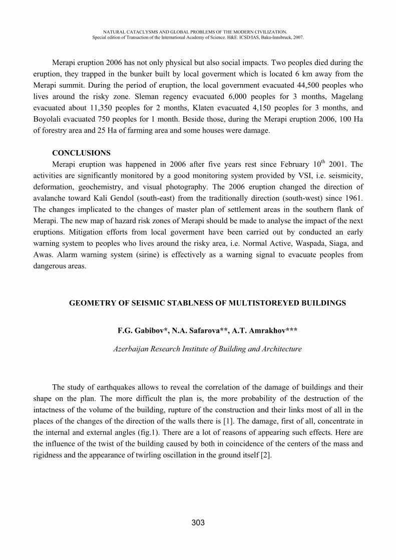
NATURAL CATACLYSMS AND GLOBAL PROBLEMS OF THE MODERN CIVILIZATION. Special edition of Transaction of the International Academy of Science. H&E. ICSD/IAS, Baku-Innsbruck, 2007.
303
Merapi eruption 2006 has not only physical but also social impacts. Two peoples died during the eruption, they trapped in the bunker built by local goverment which is located 6 km away from the Merapi summit. During the period of eruption, the local government evacuated 44,500 peoples who lives around the risky zone. Sleman regency evacuated 6,000 peoples for 3 months, Magelang evacuated about 11,350 peoples for 2 months, Klaten evacuated 4,150 peoples for 3 months, and Boyolali evacuated 750 peoples for 1 month. Beside those, during the Merapi eruption 2006, 100 Ha of forestry area and 25 Ha of farming area and some houses were damage.
CONCLUSIONS Merapi eruption was happened in 2006 after five years rest since February 10th 2001. The
activities are significantly monitored by a good monitoring system provided by VSI, i.e. seismicity, deformation, geochemistry, and visual photography. The 2006 eruption changed the direction of avalanche toward Kali Gendol (south-east) from the traditionally direction (south-west) since 1961. The changes implicated to the changes of master plan of settlement areas in the southern flank of Merapi. The new map of hazard risk zones of Merapi should be made to analyse the impact of the next eruptions. Mitigation efforts from local goverment have been carried out by conducted an early warning system to peoples who lives around the risky area, i.e. Normal Active, Waspada, Siaga, and Awas. Alarm warning system (sirine) is effectively as a warning signal to evacuate peoples from dangerous areas.
GEOMETRY OF SEISMIC STABLNESS OF MULTISTOREYED BUILDINGS
F.G. Gabibov*, N.A. Safarova**, A.T. Amrakhov***
Azerbaijan Research Institute of Building and Architecture
The study of earthquakes allows to reveal the correlation of the damage of buildings and their shape on the plan. The more difficult the plan is, the more probability of the destruction of the intactness of the volume of the building, rupture of the construction and their links most of all in the places of the changes of the direction of the walls there is [1]. The damage, first of all, concentrate in the internal and external angles (fig.1). There are a lot of reasons of appearing such effects. Here are the influence of the twist of the building caused by both in coincidence of the centers of the mass and rigidness and the appearance of twirling oscillation in the ground itself [2].
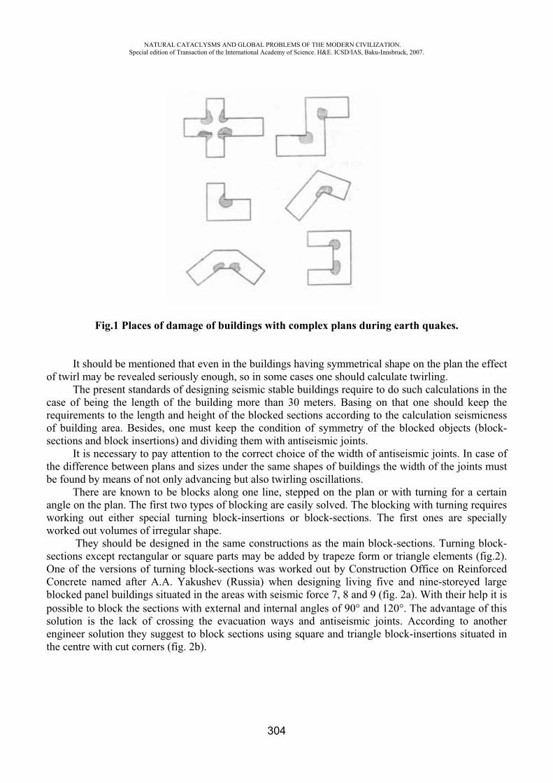
NATURAL CATACLYSMS AND GLOBAL PROBLEMS OF THE MODERN CIVILIZATION. Special edition of Transaction of the International Academy of Science. H&E. ICSD/IAS, Baku-Innsbruck, 2007.
304
Fig.1 Places of damage of buildings with complex plans during earth quakes.
It should be mentioned that even in the buildings having symmetrical shape on the plan the effect of twirl may be revealed seriously enough, so in some cases one should calculate twirling.
The present standards of designing seismic stable buildings require to do such calculations in the case of being the length of the building more than 30 meters. Basing on that one should keep the requirements to the length and height of the blocked sections according to the calculation seismicness of building area. Besides, one must keep the condition of symmetry of the blocked objects (block-sections and block insertions) and dividing them with antiseismic joints.
It is necessary to pay attention to the correct choice of the width of antiseismic joints. In case of the difference between plans and sizes under the same shapes of buildings the width of the joints must be found by means of not only advancing but also twirling oscillations.
There are known to be blocks along one line, stepped on the plan or with turning for a certain angle on the plan. The first two types of blocking are easily solved. The blocking with turning requires working out either special turning block-insertions or block-sections. The first ones are specially worked out volumes of irregular shape.
They should be designed in the same constructions as the main block-sections. Turning block-sections except rectangular or square parts may be added by trapeze form or triangle elements (fig.2). One of the versions of turning block-sections was worked out by Construction Office on Reinforced Concrete named after A.A. Yakushev (Russia) when designing living five and nine-storeyed large blocked panel buildings situated in the areas with seismic force 7, 8 and 9 (fig. 2a). With their help it is possible to block the sections with external and internal angles of 90 and 120 . The advantage of this solution is the lack of crossing the evacuation ways and antiseismic joints. According to another engineer solution they suggest to block sections using square and triangle block-insertions situated in the centre with cut corners (fig. 2b).
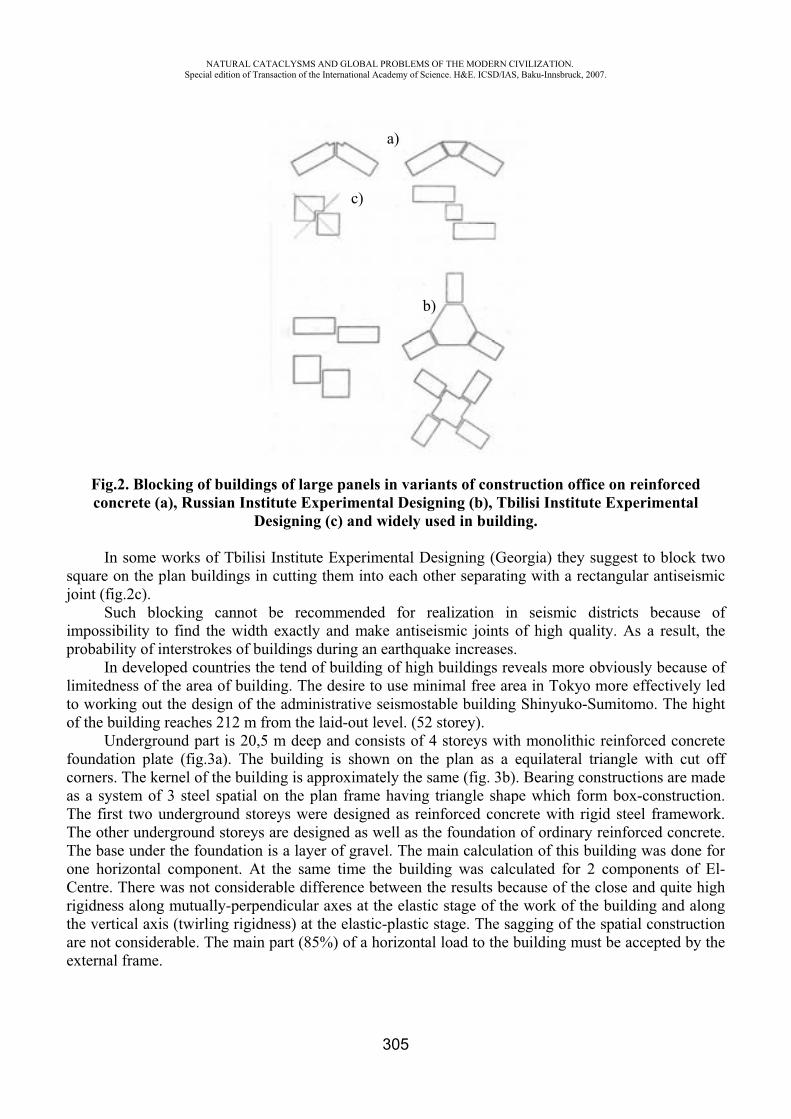
NATURAL CATACLYSMS AND GLOBAL PROBLEMS OF THE MODERN CIVILIZATION. Special edition of Transaction of the International Academy of Science. H&E. ICSD/IAS, Baku-Innsbruck, 2007.
305
Fig.2. Blocking of buildings of large panels in variants of construction office on reinforced concrete (a), Russian Institute Experimental Designing (b), Tbilisi Institute Experimental
Designing (c) and widely used in building.
In some works of Tbilisi Institute Experimental Designing (Georgia) they suggest to block two square on the plan buildings in cutting them into each other separating with a rectangular antiseismic joint (fig.2c).
Such blocking cannot be recommended for realization in seismic districts because of impossibility to find the width exactly and make antiseismic joints of high quality. As a result, the probability of interstrokes of buildings during an earthquake increases.
In developed countries the tend of building of high buildings reveals more obviously because of limitedness of the area of building. The desire to use minimal free area in Tokyo more effectively led to working out the design of the administrative seismostable building Shinyuko-Sumitomo. The hight of the building reaches 212 m from the laid-out level. (52 storey).
Underground part is 20,5 m deep and consists of 4 storeys with monolithic reinforced concrete foundation plate (fig.3a). The building is shown on the plan as a equilateral triangle with cut off corners. The kernel of the building is approximately the same (fig. 3b). Bearing constructions are made as a system of 3 steel spatial on the plan frame having triangle shape which form box-construction. The first two underground storeys were designed as reinforced concrete with rigid steel framework. The other underground storeys are designed as well as the foundation of ordinary reinforced concrete. The base under the foundation is a layer of gravel. The main calculation of this building was done for one horizontal component. At the same time the building was calculated for 2 components of El-Centre. There was not considerable difference between the results because of the close and quite high rigidness along mutually-perpendicular axes at the elastic stage of the work of the building and along the vertical axis (twirling rigidness) at the elastic-plastic stage. The sagging of the spatial construction are not considerable. The main part (85%) of a horizontal load to the building must be accepted by the external frame.
a)
b)
c)

NATURAL CATACLYSMS AND GLOBAL PROBLEMS OF THE MODERN CIVILIZATION. Special edition of Transaction of the International Academy of Science. H&E. ICSD/IAS, Baku-Innsbruck, 2007.
306
a)b)
Fig.3. The Administrative building in Tokio: a) vertical section, b) plan.
The study of the building 68 m high, with a square section on the plan (for the upper part sizes 40,5x40,5 m, for the basis 48,3x48,3m), having 15 overground and 3 underground storeys, leaning on the monolithic reinforced concrete ribbed plate (fig.4) showed the following. The rigid element consisting of 2 joined diaphragms having sizes 16,2x16,2 m in the plan is situated in the centre.
Fig.4 The square building: a) vertical section, b) plan.
a) b)
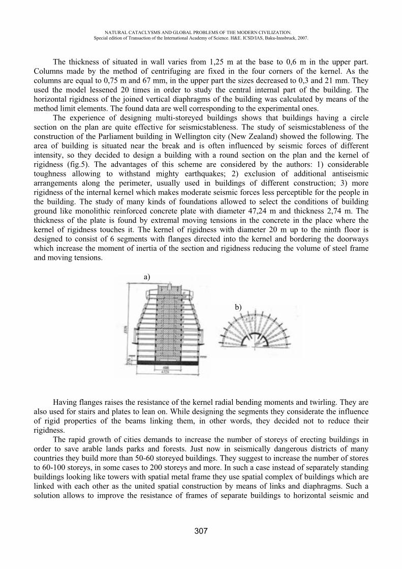
NATURAL CATACLYSMS AND GLOBAL PROBLEMS OF THE MODERN CIVILIZATION. Special edition of Transaction of the International Academy of Science. H&E. ICSD/IAS, Baku-Innsbruck, 2007.
307
a)
b)
The thickness of situated in wall varies from 1,25 m at the base to 0,6 m in the upper part. Columns made by the method of centrifuging are fixed in the four corners of the kernel. As the columns are equal to 0,75 m and 67 mm, in the upper part the sizes decreased to 0,3 and 21 mm. They used the model lessened 20 times in order to study the central internal part of the building. The horizontal rigidness of the joined vertical diaphragms of the building was calculated by means of the method limit elements. The found data are well corresponding to the experimental ones.
The experience of designing multi-storeyed buildings shows that buildings having a circle section on the plan are quite effective for seismicstableness. The study of seismicstableness of the construction of the Parliament building in Wellington city (New Zealand) showed the following. The area of building is situated near the break and is often influenced by seismic forces of different intensity, so they decided to design a building with a round section on the plan and the kernel of rigidness (fig.5). The advantages of this scheme are considered by the authors: 1) considerable toughness allowing to withstand mighty earthquakes; 2) exclusion of additional antiseismic arrangements along the perimeter, usually used in buildings of different construction; 3) more rigidness of the internal kernel which makes moderate seismic forces less perceptible for the people in the building. The study of many kinds of foundations allowed to select the conditions of building ground like monolithic reinforced concrete plate with diameter 47,24 m and thickness 2,74 m. The thickness of the plate is found by extremal moving tensions in the concrete in the place where the kernel of rigidness touches it. The kernel of rigidness with diameter 20 m up to the ninth floor is designed to consist of 6 segments with flanges directed into the kernel and bordering the doorways which increase the moment of inertia of the section and rigidness reducing the volume of steel frame and moving tensions.
Having flanges raises the resistance of the kernel radial bending moments and twirling. They are also used for stairs and plates to lean on. While designing the segments they considerate the influence of rigid properties of the beams linking them, in other words, they decided not to reduce their rigidness.
The rapid growth of cities demands to increase the number of storeys of erecting buildings in order to save arable lands parks and forests. Just now in seismically dangerous districts of many countries they build more than 50-60 storeyed buildings. They suggest to increase the number of stores to 60-100 storeys, in some cases to 200 storeys and more. In such a case instead of separately standing buildings looking like towers with spatial metal frame they use spatial complex of buildings which are linked with each other as the united spatial construction by means of links and diaphragms. Such a solution allows to improve the resistance of frames of separate buildings to horizontal seismic and
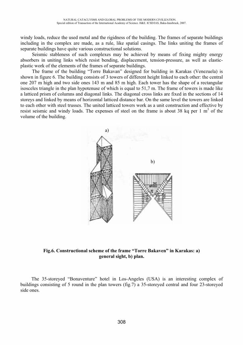
NATURAL CATACLYSMS AND GLOBAL PROBLEMS OF THE MODERN CIVILIZATION. Special edition of Transaction of the International Academy of Science. H&E. ICSD/IAS, Baku-Innsbruck, 2007.
308
windy loads, reduce the used metal and the rigidness of the building. The frames of separate buildings including in the complex are made, as a rule, like spatial casings. The links uniting the frames of separate buildings have quite various constructional solutions.
Seismic stableness of such complexes may be achieved by means of fixing mighty energy absorbers in uniting links which resist bending, displacement, tension-pressure, as well as elastic-plastic work of the elements of the frames of separate buildings.
The frame of the building “Torre Bakavan” designed for building in Karakas (Venezuela) is shown in figure 6. The building consists of 3 towers of different height linked to each other: the central one 207 m high and two side ones 143 m and 85 m high. Each tower has the shape of a rectangular isosceles triangle in the plan hypotenuse of which is equal to 51,7 m. The frame of towers is made like a latticed prism of columns and diagonal links. The diagonal cross links are fixed in the sections of 14 storeys and linked by means of horizontal latticed distance bar. On the same level the towers are linked to each other with steel trusses. The united latticed towers work as a unit construction and effective by resist seismic and windy loads. The expenses of steel on the frame is about 38 kq per 1 m3 of the volume of the building.
Fig.6. Constructional scheme of the frame “Torre Bakaven” in Karakas: a) general sight, b) plan.
The 35-storeyed “Bonaventure” hotel in Los-Angeles (USA) is an interesting complex of buildings consisting of 5 round in the plan towers (fig.7) a 35-storeyed central and four 23-storeyed side ones.
a)
b)
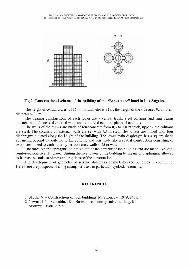
NATURAL CATACLYSMS AND GLOBAL PROBLEMS OF THE MODERN CIVILIZATION. Special edition of Transaction of the International Academy of Science. H&E. ICSD/IAS, Baku-Innsbruck, 2007.
309
Fig.7. Constructional scheme of the building of the “Bonaveture” hotel in Los-Angeles.
The height of central tower is 116 m, ins diameter is 32 m, the height of the side ones 92 m, their diameter is 26 m.
The bearing constructions of each tower are a central trunk, steel columns and ring beams situated in the flatness of external walls and reinforced concrete plates of overlaps.
The walls of the trunks are made of ferroconcrete from 0,3 to 1,0 m thick, upper - the columns are steel. The columns of external walls are set with 5,5 m step. The towers are linked with four diaphragms situated along the height of the building. The lower main diaphragm has a square shape advancing beyond the out-line of the building and was made like a spatial construction consisting of two plates linked to each other by ferroconcrete walls 0,45 m wide.
The three other diaphragms do not go out of the contour of the building and are made like steel reinforced concrete flat plates. Uniting the five towers of the building by means of diaphragms allowed to increase seismic stableness and rigidness of the construction.
The development of geometry of seismic stableness of multistoreyed buildings in continuing. Here there are prospects of using casing surfaces, in particular, cycloidal elements.
REFERENCES
1. Shuller V. – Constructions of high buildings. M, Stroiizdat, 1979, 248 p. 2. Newmark N., Rozenbluet E. – Bases of seismically stable building. M, Stroiizdat, 1980, 215 p.
A A
A - A
NATURAL CATACLYSMS AND GLOBAL PROBLEMS OF THE MODERN CIVILIZATION. Special edition of Transaction of the International Academy of Science. H&E. ICSD/IAS, Baku-Innsbruck, 2007.
310
THE PROBLEMS OF GLOBAL CLIMATE’S WARMING AND ITS CONSEQUENCES
V.Z. Sultanov*, N.Sh. Huseynov**
* “Azeraeronavigation” Enterprise, Azerbaijan, ** MetService of “Azeraeronavigation” Enterprise, Azerbaijan
As early as 1827 the French physicist Joseph Fourier supposed that the Earth’s atmosphere is like a glass in a hothouse: air passes the solar heat through but at the same time not giving it evaporates back to space. This effect is reached owing to some atmospheric gases of secondary importance such as, water vapor and carbon dioxide. They pass through visible and “near” infrared light, radiated by the sun, but absorb “far” infrared radiation, having lower frequency and being generated during the heating of surface by the sun rays. If it didn’t happen, the Earth would be approximately 30 centigrade degrees colder than today, and the life would practically freeze.
The climate on Earth is conditioned by the constant flux of energy; coming from the Sun. Mainly this energy comes up to the planet in the shape of visual light. About 30 % of this energy disperses in space at once but the most part of absorbing 70 % passes through the atmosphere and heats surface. The similar phenomenon is to be observed in hotbeds and greenhouses. That’s why it was named as “greenhouse effect”. Passing the sun rays through themselves, “greenhouse gases” nevertheless become the barrier in the way of infrared (heat) radiation, coming from the heated surface. Water vapor, carbon dioxide, ozone, nitric oxides and chlorofluorocarbons are the main greenhouse gases.
Content of carbon dioxide in the atmosphere has steeply increased since 1960s. The human economic activity (especially from burning of coal and oil, and deforestation) increased the existence of greenhouse gases, leading to the large emission of carbon dioxide, which removes from the atmosphere in natural conditions as a result of its absorption by water in the oceans and trees, using it for photosynthesis.
The convincing evidences of the global climate’s warming on Earth appeared at the end of 1988s. More obvious of them are arrays of measurements of the temperature in a different spots of the Globe on the long-term data of observations. The analysis of results of these observations has shown that the average temperature on the Globe for the XX century has risen approximately over 0.5 – 0.7 0C. The greatest rise in the temperature falls on the last decade of the XX century: this warming is statistically significant and be confirmed by the theoretical researches and the calculations by the model of global climate [2].
Except recordings of the temperature there are other evidences of accelerating warming. The last decades the occurrence depth of a permafrost layer has increased in Alaska and in Canadian Arctic. Average temperature of water in the Canadian lakes is increasing, boundaries of floe are moving to the poles in Antarctic and in Arctic [1], glaciers located in Europe and in the other regions are receding. . Lately the height of many mountain tops of the Alpine areas of Europe is getting strongly change towards decrease and on belief of experts the reason is the global warming of a climate. In wintry
NATURAL CATACLYSMS AND GLOBAL PROBLEMS OF THE MODERN CIVILIZATION. Special edition of Transaction of the International Academy of Science. H&E. ICSD/IAS, Baku-Innsbruck, 2007.
311
months of 2006s the lack of a snow blanket in the skiing resorts of Switzerland, Australia and other Alpine states caused the economical damage to the traveling firms.
In the south of France in June 2003 the daily temperature regularly was over 40 ºC (40 degrees centigrade), which topped the average temperature between 5 and 7 centigrade degrees. According to the indices June was the hottest month for the last 250 years in Switzerland. There were 562 tornados ruining the life of 41 people in the USA. In India before the seasonal monsoon rains the heat was the top of 45 degrees and even more, which exceeded the record showing on average. Because of it at least there were 1400 people died in the country [5].
In general winter months warm up; they are not so cold as earlier. Summer seasons are not so warmer than earlier. During the day the distribution of warming became uneven: nights warmed up. There are some parameters of the rising humidity, therefore the cloudiness.
In the last century a rise in the temperature was also observed in Azerbaijan. In comparison with previous 80 years the average annual temperature was 0.34ºC higher in 1961-90. For 1991-2000 this parameter rose sharply up to 0.41ºC in comparison with the period of 1961-90s. In summer 2000 the peak temperature was registered by two meteorological offices of Nakhchivan Autonomous Republic, running up to 46ºC and this value was the highest in history of instrumental observations of our country.
Reviewing the global climate’s warming, the World Weather Organization (WWO) establishes: “The new extremes climatic phenomena on a global scale are annually registered, but lately a number of such phenomena have increased. New data analysis presented by the national organizations shows that for example the rise of average temperature of surface in Northern hemisphere for XX century was more than in any other century of the last millennium». The WWO does its retrospective calculations on basis of handling indirect data in supercomputers.
The meteorologists emphasize that the rise in the average temperature of the surface went to the last quarter of century, i.e. since 1975-1980s. For 25 years its rise has happened three times faster than for previous 75 years. According to the data automated air meteorological measurements of Heydar Aliyev international airport the average temperature of air was raising up to 1,3ºC between 1995 and 2005. The scientists affirm that the instability of Earth’s climate had a certain altitude toward a field of the prediction for a long time, but now it has become reality.
The problems of a climate fluctuation is not only scientific, but economical, political problem nowadays. Mistakes in the dynamics of climate fluctuation are fraught with economical disasters. The glaring example can be the miscalculations of 50-60 years of the last century connecting with the forecast of the Caspian Sea level. The Caspian Sea is the biggest closed reservoir in the world; its total area is 371.000 square kilometers. In 1950-60 years of the last century the large hydroelectric power stations were built and the big reservoirs formed, and these reservoirs were used for irrigation of agricultural lands. To present the scale of these works it should mention that the Caspian Sea became to receive less than 40 cubes km. of water annually and this exceeded 10% of receipt matter of its water balance. The level of the Caspian Sea had already gone down slowly (1, 57 inches – 4 centimeters a year) since 1809 and the big technogeneous companies by irrigation of the agricultural land, which were created in 1950-60s years, noticeably worsened the hydrologic balance of the Caspian Sea. According to the hydrologists it brought to the systematic recession of level of the
NATURAL CATACLYSMS AND GLOBAL PROBLEMS OF THE MODERN CIVILIZATION. Special edition of Transaction of the International Academy of Science. H&E. ICSD/IAS, Baku-Innsbruck, 2007.
312
Caspian Sea about at 11.4 centimeters a year. There were developed the grandiose plans of “saving” the Caspian Sea, providing for the transference of northern rivers to the south. As the first point it was decided to separate Kara-Bogaz-Gol from the Caspian Sea for decreasing the area of the evaporation. The dam was constructed but before ending its construction, it had been mentioned that the level of water in the Caspian Sea was rising. In 1983 the gulf Kara-Bogaz-Gol practically dried out, it was decided to join the gulf with the Caspian Sea. But the level of the Caspian Sea continued to rise. What did happen? During the last two decades this question was discussed in many scientific articles and conferences. Some scientists easily forecasted the continuing of sea level’s rise within the next hundred years. But everything happened the wrong way, in 1995 the level of the Caspian Sea reached the note of 26,6 m below the sea level and it had suddenly gone down since 1996.
As a result of increasing of climate’s warming of the Earth, the scientists as well as the world community were anxious. The climate’s researches were carried out by the priority directions and were created numerous committees. So, in 1986 the NRC (National Research Council) was established, in 1988 under the aegis of the WMO (World Meteorological Organization) and the UNEP (United Nations Environment Programme) under the U.N.O. (United Nations Organization) the Intergovernmental Panel on Climate Change was established. There were number of serious evidences in the return of the working group, that the warming which was observed the last 50 years was the result of anthropogenic activity of human being. It is assumed that the global temperature in XXI century will rise up to 1,4 – 5,5ºC higher than it’ll be assumed earlier (1,0 – 3,5ºC) [4].
The global warming will make to change usual crops and agricultural methods. The farmers will adapt themselves to the new conditions with time, but it’ll be necessary the big investment to transform agriculture, but as a result of this the prices will go up.
According to the experts the global warming will give rise to about 50 millions of refugees from the coastal regions because of the land flood, hunger which will be accomplishing these cataclysms generated. The group of refugees to the other countries will bring to the internal and international conflicts. In that way the global warming of the climate will arouse economic consequences and will determine political shocks.
Well, the climate becomes warmer and the humanity partly bears the responsibility for it.
REFERENCES
1. Budiko M.I., Yefimova N.A., Lugina K.M. The modern global warning. Metrology and hydrology, 1993, 7, pp. 29-34.
2. G.V. Gruza, E.Y. Rankova. The discovery of climate change: a condition, a unsteadiness and a climate extreme, 2004, 4, pp. 50-66.
3. Gwley T.J and North G.R. Abrupt climate challenge and extinction events in Earth history. Science, 1988, vol 240, pp. 996-1002.
4. Jones P.D., New M., Parker D.E., Martin S. and Rigor I.G. Surface air temperature and its changes over the past 150 years. Rev.Geophys, 1999, vol. 37, 2, pp.173-199.
5. Thompson O.Y. The season, global temperature and precession. Science, 1995, vol. 268, pp. 59-68
NATURAL CATACLYSMS AND GLOBAL PROBLEMS OF THE MODERN CIVILIZATION. Special edition of Transaction of the International Academy of Science. H&E. ICSD/IAS, Baku-Innsbruck, 2007.
313
MULTI-PARAMETRICAL MONITORING FOR STUDY EARTHCRUST DEFORMATION PROCESSES
Jimsheladze T.*, Machaidze Z.**, Melikadze G.***, Kapanadze N.****, Kobzev G*****
Seismic Monitoring Center of Georgia
Hydro-dynamical and hydro-chemical monitoring has been carried out in Georgia in recent years. Periodic or automatic measurements of water level, temperature and gases have been carried out to investigate possible anomalous behavior connected with local strain processes.
All data set have been statistically processed by linear and nonlinear dynamic methods has been separated multiyear periodicities and possible fluctuations induced by meteorological and tides effects or by human activities. Regional hydro-dynamical fluctuations and gas anomalies have been identified as crustal deformation processes.
The analysis of the field illustrated that during the process of preparation of strong earthquakes, the characterizing changes of the compression and decompression are registered in the water levels, throughout the regional scale, which confirms that during the preparation of strong earthquakes. The formation of anomaly structure occurs during a long period, but its formation time depends on the magnitude of the expected earthquake.
REFERENCES
1. Melikadze G., Ghlonti E. (2000) Some features of hydrogeodeformation field in Caucasus during strong earthquakes preparation period. Journal of Georgian Geophysical Society, 5, 106- 111.
2. Gavrilenko, G. Melikaze, T.Chelidze, D. Gibert, G. Kumsiashvili (2000)-Permanent water level drop associated with Spitak Earthquake: Observations at Lisi Borehole (Republic of Georgia) and modeling. Geophis. J. Int., 143, 83-98.
3. T. Matcharashvili, T. Chelidze, G. Melikadze (2001)-Detecting differences in dynamics of water level variation during Spitak and Racha earthquakes by complexity measure Eos. Trans. AGU 82947), fall Meet. Suppl. Abstract, 78.
4. T. Matcharashvili, T. Chelidze, G. Melikadze, E. Ghlonti.(2002)-Earthquake related disturbance in stationarity of water level variation. Bulletin of the Academi of sciences of the Georgian, 165 1,
5. G. Buntebarth, T. Chelidze, G. Melikadze (2004)-Hydrodynamic and microtemperature monitoring in seismic areas. Georgian Engineering News, N3, 12-132.
6. T. Matcharashvili, T. Chelidze, G. Melikadze, (2005) Nonlinear analysis of dynamics of water level variation in Georgia during increased regional seismic activity. Printed by M. Nodia Institute of Geophysics, European Center “Geodynamic hazards of high dams”, Council of Europe.
NATURAL CATACLYSMS AND GLOBAL PROBLEMS OF THE MODERN CIVILIZATION. Special edition of Transaction of the International Academy of Science. H&E. ICSD/IAS, Baku-Innsbruck, 2007.
314
ON THE COMPLEX REGIONAL AND GLOBAL NETWORK SETS FOR RESEARCHING THE POSSIBILITIES FOR RELIABLE NATURAL RISKS ESTIMATION INCLUDING
“WHEN, WHERE AND HOW” EARTHQUAKE PREDICTION
S. Cht. Mavrodiev * , L. Pekevski **, G. Melikadze *** , T. Jimseladze ****,
V.D. Rusov *****, V.N. Pavlovich *****, V.N.Vachtenko ******
* Institute for Nuclear Research and Nuclear Energy, Bulgarian Academy of Sciences, Sofia, Bulgaria
*** Seismological Observatory, Faculty of Natural Sciences and Mathematics, Skopje, R. Macedonia
***** Institute of Geophysics, Georgian Academy of Sciences, Tbilisi, Georgia ****** Arctic Center, NASU, Kiev, Ukraine
Abstract
A project for complex regional (Adriatic, Black Sea, Caucasus, Caspian Sea gerions) NETWORK for prediction the earthquake’s time, place (epicenter, depth), magnitude and intensity using reliable precursors is proposed and shortly analyzed. The precursors list includes usual geophysical and seismological monitoring of the region, including hydrochemical monitoring of water sources and their Radon and Helium concentrations, crust temperature, and hydrogeodeformation field, monitoring of the electromagnetic field under, on, and above Earth surface, meteorological monitoring of the atmosphere, including earthquake clouds and electrical charge distributions, near space monitoring aimed to estimate the Sun or Earth origin of variations, and biological precursors. The Project is based on contemporary data acquisition system for preliminary archiving, testing, visualizing, and analyzing the data. The theoretical part of the Project includes wide interdisciplinary research based on the unification of standard Earth sciences and using of nonlinear inverse problem methods for discovering the empirical and hidden dependences between variables. By means of special software the complex environmental and real time analyzed Satellite data shall be used to prepare regional daily risk estimations.
The imminent “when” earthquake’s predictions are based on the correlation between geomagnetic quakes and the incoming minimum (or maximum) of tidal gravitational potential.
There is unique correspondence between the geomagnetic quake signal and the maximum of the monitoring point of the energy density of the predicted earthquake.
The probability time window for the incoming earthquake is for the tidal minimum approximately ± 1 day and for the maximum- ± 2 days.
The statistic evidence for reliability is based on of distributions of the time difference between occurred and predicted earthquakes for the period 2002- 2006 for Sofia region (one component of geomagnetic vector) and 2004- 2006 for Skopje (geomagnetic vector monitoring in variometer mode).
The predictions are valid for the earthquakes with magnitude greater then 3 at distance up to some 700- 800 km.
The analysis of distance dependence of the prediction accuracy on the magnitude and geology as well as the non understand problems is presented.
Some results of collaboration PrEqTimPlaMagInt, which is trying to create the earthquake research and prediction NETWORK in Balkan- Black Sea-Caspian region are presented:
The Sofia and Skopje geomagnetic data and geomagnetic quake as reliable imminent regional
NATURAL CATACLYSMS AND GLOBAL PROBLEMS OF THE MODERN CIVILIZATION. Special edition of Transaction of the International Academy of Science. H&E. ICSD/IAS, Baku-Innsbruck, 2007.
315
earthquake precursor; The preliminary analysis of Kiev and Lvov INTERMAGNET geomagnetic observatories; The preliminary analysis of correlation between hydrogeodeformation field variations and
earthquakes for Georgia; A reliability of predictions made for the 2006 world spectral earthquake numbers; The possibility for systematic of earthquake parameters Richter Magnitude, Seismic Moment,
Intensity and Depth; The world statistic of tide- earthquake correlation; The correlation between global warming and increasing seismicity on the basis of Sun Spots,
Sun Irradiation budget, CO2 anthropogenic production and atmospheric concentration, Ocean level, number and energy of hurricanes is analyzed and the Project for researching the natural or anthropogenic origin of Climate change;
The distribution of the earthquake with magnitude>4 with depth. The project
1. History of Earthquake Prediction Research 2. Experiment
Complex research of Earthquake precursor’s reliability:
Geological and seismological precursors, including depth and surface distributions of Electrical resistance and Temperature of the soil, Gravimetric isolines and priciest GPS monitoring, Hydrochemical monitoring of water sources and their Radon and Helium concentrations Electromagnetic monitoring under, on, and over Earth Surface, including Geomagnetic and Earth Current monitoring, ULF and LF Radio wave Pulsed LF-HF-VHF Ionosphere Radio Emissions monitoring, Attitude electropotential Shuman resonance distribution, Standard meteorological monitoring, including Ionosphere condition parameters, Earthquake clouds Near space satellite monitoring of Earth Surface radiation and temperature, geomagnetic field and charge distribution and its correlation with surface and atmosphere data Sun influence: radiation, storms, magnetic variations Biological precursors Laboratory simulation of earthquake’s processes.
3. Theory Research on the common parts of different models of Earth and its Crust conditions,Tidal
processes, Earth geomagnetism, Ionosphere and magnetosphere perturbations revealed from combined satellite and ground records (Lithosphere-Atmosphere-Ionosphere Coupling), Earthquake physics models, possible unifications of above sited and new created models
Researching of empirical dependences between planet Earth condition parameter on the basis on nonlinear inverse problem methods, systematic of earthquake parameters: magnitude, intensity, depth, the size of volume and surface fault on the basis on nonlinear inverse problem methods
Global warming, ocean level and increasing seismicity Etcetera 4. Technologies Real time data acquisition system for preliminary archiving, testing, visualizing and analyzing the data and risks estimations. Procedures and Software for solving nonlinear problems 5. Complex World NETWORK for researching the solution of “when, where and how”
earthquake prediction problem.
NATURAL CATACLYSMS AND GLOBAL PROBLEMS OF THE MODERN CIVILIZATION. Special edition of Transaction of the International Academy of Science. H&E. ICSD/IAS, Baku-Innsbruck, 2007.
316
DESTRUCTIVE EARTHQUAKES AND POSSIBLE WAYS OF THEIR PREDICTION
K.M. Kerimov*, E.S. Novruzov**, M.H. Hamidov***
At all times earthquakes brought people distress and suffering, cities and settlements were destroyed, damage to property was calculated as much as billions of dollars. Recent earthquakes in China, Japan, Indonesia and many other countries serve as an example. Of course, all this may be considerably reduced, and the loss of life minimized, should the way or method of earthquake prediction exist. Unfortunately, the main achievement of science in this sphere is long-term and medium-term prediction basing on the main detailed seismological study of the state of geodynamical environment in any region of the planet. As for the ways of short-term forecast, i.e. prediction of earthquakes a few hours or even days before it, unfortunately, this problem is still actual, let alone where this terrible event is expected in the nearest time.
Our studies of the analysis and decryption of electrical fields data received by means of magnetotelluric stations (like MTL-72) in the areas of active geodynamical processes enabled us to note certain changes of the states of terrestrial magnetic field prior to the expected event. This, first of all applies to those changes at horizontally constituents of the magnetic field (Nx, Ny,Nz) a few hours ( on average 5-6 hours) prior to the first main strike of the expected event. At later stage the station continues to record those changes of the magnetic field that occur during time of the main event and its attenuation. Important to note, that basing on the established effects, place of the epicentre of the expected earthquake has been designated for the first time.
A patent was received for the established effect in 2004 for a short-term prediction of severe earthquakes by means of application of electromagnetic field data.
In 2006 we received similar patents from Eurasian Patent Office ( 007086 and 007087). Detailed description of the inventions is given within the same patents.
Certainly, these methods (there are two of them) may be applied for the prediction not only earthquakes in many regions of the world but for other catastrophic natural phenomena.
THE ISOLATION OF GREENHOUSE GASES IN AN ATMOSPHERE FROM COMBUSTION OF JET ENGINE FUEL IN THE TERRITORY OF AZERBAIJAN
REPUBLIC
V.Z. Sultanov*, N.Sh. Huseynov**
* “Azeraeronavigation” Enterprise, Azerbaijan ** MetService of “Azeraeronavigation” Enterprise, Azerbaijan
With development of sciences and techniques there have been some problems of strengthening of greenhouse effect in the world. The greenhouse effect is the heating effect of the surface layer of air, it happens when the atmosphere absorbs long-wave radiation of surface. This effect reaches because of some atmospheric gases: carbon dioxide, water vapor, methane, nitrous oxide and a number of other gases, but their concentrations in an atmosphere aren’t so important. They pass the infrared lights which are radiated by the sun but absorb infrared lights having lower frequency and forming during the
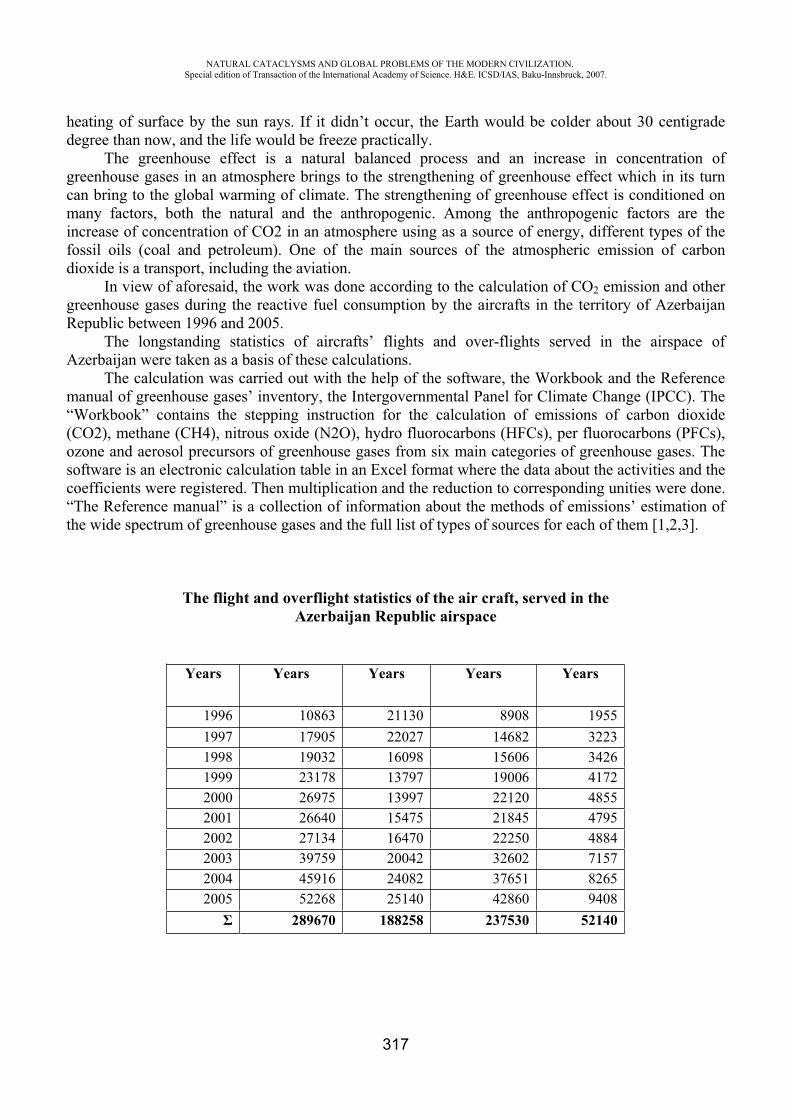
NATURAL CATACLYSMS AND GLOBAL PROBLEMS OF THE MODERN CIVILIZATION. Special edition of Transaction of the International Academy of Science. H&E. ICSD/IAS, Baku-Innsbruck, 2007.
317
heating of surface by the sun rays. If it didn’t occur, the Earth would be colder about 30 centigrade degree than now, and the life would be freeze practically.
The greenhouse effect is a natural balanced process and an increase in concentration of greenhouse gases in an atmosphere brings to the strengthening of greenhouse effect which in its turn can bring to the global warming of climate. The strengthening of greenhouse effect is conditioned on many factors, both the natural and the anthropogenic. Among the anthropogenic factors are the increase of concentration of CO2 in an atmosphere using as a source of energy, different types of the fossil oils (coal and petroleum). One of the main sources of the atmospheric emission of carbon dioxide is a transport, including the aviation.
In view of aforesaid, the work was done according to the calculation of CO2 emission and other greenhouse gases during the reactive fuel consumption by the aircrafts in the territory of Azerbaijan Republic between 1996 and 2005.
The longstanding statistics of aircrafts’ flights and over-flights served in the airspace of Azerbaijan were taken as a basis of these calculations.
The calculation was carried out with the help of the software, the Workbook and the Reference manual of greenhouse gases’ inventory, the Intergovernmental Panel for Climate Change (IPCC). The “Workbook” contains the stepping instruction for the calculation of emissions of carbon dioxide (CO2), methane (CH4), nitrous oxide (N2O), hydro fluorocarbons (HFCs), per fluorocarbons (PFCs), ozone and aerosol precursors of greenhouse gases from six main categories of greenhouse gases. The software is an electronic calculation table in an Excel format where the data about the activities and the coefficients were registered. Then multiplication and the reduction to corresponding unities were done. “The Reference manual” is a collection of information about the methods of emissions’ estimation of the wide spectrum of greenhouse gases and the full list of types of sources for each of them [1,2,3].
The flight and overflight statistics of the air craft, served in the Azerbaijan Republic airspace
Years Years Years Years Years
1996 10863 21130 8908 19551997 17905 22027 14682 32231998 19032 16098 15606 34261999 23178 13797 19006 41722000 26975 13997 22120 48552001 26640 15475 21845 47952002 27134 16470 22250 48842003 39759 20042 32602 71572004 45916 24082 37651 82652005 52268 25140 42860 9408
289670 188258 237530 52140
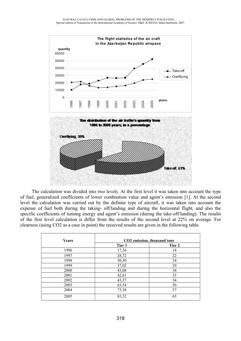
NATURAL CATACLYSMS AND GLOBAL PROBLEMS OF THE MODERN CIVILIZATION. Special edition of Transaction of the International Academy of Science. H&E. ICSD/IAS, Baku-Innsbruck, 2007.
318
The calculation was divided into two levels. At the first level it was taken into account the type of fuel, generalized coefficients of lower combustion value and agent’s emission [1]. At the second level the calculation was carried out by the definite type of aircraft, it was taken into account the expense of fuel both during the taking- off/landing and during the horizontal flight, and also the specific coefficients of turning energy and agent’s emission (during the take-off/landing). The results of the first level calculation is differ from the results of the second level at 22% on average. For clearness (using CO2 as a case in point) the received results are given in the following table.
The flight statistics of the air craft in the Azerbaijan Republic airspace
0
10000
20000
30000
40000
50000
60000
1996
1997
1998
1999
2000
2001
2002
2003
2004
2005
years
quantity
Take-off
Overfliying
Years CO2 emission, thousand tons Tier 1 Tier 2
1996 17,36 14 1997 28,72 22 1998 30,30 24 1999 37,02 29 2000 43,08 34 2001 42,61 33 2002 43,37 34 2003 63,54 50 2004 73,38 57 2005 83,52 65
NATURAL CATACLYSMS AND GLOBAL PROBLEMS OF THE MODERN CIVILIZATION. Special edition of Transaction of the International Academy of Science. H&E. ICSD/IAS, Baku-Innsbruck, 2007.
319
Considering the second level of calculation more detailed, for further analyze we take as a basis the results of this method. Analyze of calculation results determined that during the combustion of 1 ton of reactive kerosene CO2 evolves 2.5 times greater. For example, for 1996 5,5 thousand tons of reactive kerosene was expended in the domestic flights and at the same time it evolved 14 thousand tons of CO2, 0,02 thousand tons of CH4, 0,03 thousand tons of NOx, 0,23 thousand tons of CO2 and a slight number of other gases. Seeing that increase concentration of carbon dioxide in the atmosphere has an influence on strengthening of greenhouse effect, so we’ll investigate the results of emissions of CO2 comprehensively. Below it is given the table of the findings of CO2 emissions between 1996 and 2005.
years Fuel consumption per year, thousand tons
CO2 emission, thousand tons
1996 5,5 14 1997 9,1 22 1998 9,6 24 1999 11,73 29 2000 13,65 34
2001 13,5 33
2002 13,74 34
2003 20,13 50
2004 23,25 57
2005 26,46 65
Analyzing the table we can see that the fuel consumption increases every year and at the same time the number of carbon dioxide emissions increase in an atmosphere. Comparing every previous year with the following we come to conclusion that from 1996 to 1997 the emission of carbon dioxide was increasing on 57 per cent, from 1997 to 1998 – on 9 per cent, from 1998 to 1999 – on 21 per cent, from 2000 to 2002 – the process of emissions were increasing on 14 per cent and practically it were staying stable, from 2002 to 2003 – the emission of carbon dioxide was increasing on 47 per cent, from 2003 to 2004 – on 14 per cent, from 2004 to 2005 – also on 14 per cent. Summarizing it, we compare 1996 with 2005 – the emission of carbon dioxide gas in an atmosphere in 2005 was increasing on 364 per cent (4,6 times).
Also it’s worthy of notice the fact that the carbonic gas emission in an atmosphere had been 1078 thousand tons by 2000, but by 2005 it had increased up to 1 thousand ton.
The emissions of the other gases are low. Nowadays the transport emissions of carbon dioxide in an atmosphere are about on 25 per cent,
emissions of gas by the air transport contain 12 per cent of it, but emissions of land transport are 88 per cent. Air and land transport generally are the main sources of emission of harmful substances which lead to the greenhouse effect and promote the development of global warming effect.
Summarizing we want to notice that the half of carbon dioxide emissions stay in an atmosphere 50-200 years, whereas the second half is absorbed by the ocean, land and flora. The greenhouse gases have been staying in an atmosphere for a long time and get mixed here up well. As a result the greenhouse effect doesn’t depend on the place of concrete CO2 emission or another gas. Practically any local emission takes a global effect, and the global effect gives rise to repeated effects which tell on a climate one or another concrete place.
NATURAL CATACLYSMS AND GLOBAL PROBLEMS OF THE MODERN CIVILIZATION. Special edition of Transaction of the International Academy of Science. H&E. ICSD/IAS, Baku-Innsbruck, 2007.
320
Taking into account the development intensity of civil aviation activities (opening new airports and increase of domestic flights), the increase of greenhouse gases in an atmosphere is inevitable. For solving this problem first of all it is necessary to use advanced types of air transports which consume the lesser quantity of more qualitative fuel.
REFERENCES
1. Greenhouse gas inventory workbook. IPCC, 1996. 2. Greenhouse gas inventory reference manual. IPCC, 1996.3. Reference manual “Greenhouse gases – global ecological recourse”. Moscow, 2004.
THE USING OF THE RESULTS OF MORPHOMETRIC RESEARCHESOF SLOPES IN STRUGGLING AGAINST SNOW-SLIPS
AND LANDSLIPS
M. M. Mehbaliyev
Azerbaijan Republic, Baku city, Baku State University
Snow-slips and landslips were the most terrible and harmful events of nature that typical especially for mountainous districts. It is important to considerate these factors in mountainous countries during economy organization. Snow-slips in our republic were studied less than landslips. The maps were compiled for snow-slips and landslips study and for struggle against these natural phenomenons.
Their formation related with relief and climatic conditions. The role of morphometric indicators (inclination angle, horizontal and vertical shattering and other) is an essential.
The second factor that influence to the snow-slip’s formation is the thickness of blanket of snow. The places where the thickness of blanket of snow is 30 sm can be form snow-slips. The subsoil waters play a large role in landslip’s formation. They form atmospheric precipitates in conclusion.
For the struggle against snow-slips and landslips must be carrying out direct morphometric and climatic investigations and must be compile maps.
Our research work dedicated to such subject. The aim of the research work is to report the using of morphometric researches of slopes in
struggling against snow-slips and landslips. The research object borders from the north with Great Caucasus watershed from the south with
number of horizontal, from the east Chikilchay basin, from the west Khurmukhchay basin. The square is 1575,241 sq. km. This area is 18,19 % of territory of Azerbaijan.
Topographic maps with scale 1:100 000 have been used as a cartographic origin. In order to research more exactly 30 territory units (river basins, chains and etc) have been separated on the map, 2562 slopes within them have also been separated. The exposition of each slope has been determined according to 8 points (north, north-east, east, south-east, south, south-west, west, north-west), the exposition map has been made. Many necessary tables, graphics, histograms, flower-diagrams and etc.
NATURAL CATACLYSMS AND GLOBAL PROBLEMS OF THE MODERN CIVILIZATION. Special edition of Transaction of the International Academy of Science. H&E. ICSD/IAS, Baku-Innsbruck, 2007.
321
have been made. The west exposition slopes are superior in the researched area according to count (474; 18,50%) and square (2008,17; 19,80 %).
The slopes depending on their exposition get different count worm. Exposition influences to geographic landscape depending other morphometric exponents with other factors. Exposition has great influence on arising of snow-slips and landslips and their spreading.
Researches show that landslips are more met in north exposition slopes. It is closely connected with their temperature and humidity. The north slopes are more humid because they get warm less. The little by little gathered underground water causes landslip. Most of landslips are in the Girdimanchay, Goychay, Turianchay river basins in the researched area.
Usually south, south-west exposition slopes are more continental, warmer and less humid than north and north-east exposition slopes. The distributions of snow cover of various exposition slopes are different. Insoliation type snow-slips arise on the south exposition slopes. The snow is drier on the north exposition slopes.
The landslips are met on different exposition slopes. Landslips are less met on the south exposition slopes, because the south exposition slopes get warmer but dry faster. Landslips are observed on other exposition slopes less than on the north exposition slopes.
The maps of density of the horizontal shattering of slope’s relief is compiled by cartogram with the use of 0-1 (weakly shattering), 1-2 (middle shattering), 3 < (strongly shattering) scale.
In the investigated territories weakly shattering slopes predominate quantitatively (1799, 70,22%) and territorially (6522,16; 64,31 %). In these slopes predominate quantitatively (N=331; S=1067,29; K=0,31) the south side slopes and territorially (12,24; 60,98) the west side slopes.
In tectonically active arid regions (Jeyrankechmaz river basin, range of Acharbachar, Turianchay preserve) predominate comparatively small but strongly shattering slopes.
In the horizontally shattering dense places the other morfometric indicators of relief have a large quantity. It is form dense range of snow-slips and landslips in such regions. The dense of horizontal shattering of these places and their location on the region must be study for economy using.
The scale >1,5º (inclined); 1,5º-3º (less inclined); 3º-6º (medium inclined); 6º-12º (strong inclined); 12º-20º (less high), 20º-45º (medium high), 45º< (much high) has been used in the making of the map of inclination of slopes. The inclination map has been made with cartogram method. The slopes with inclination 6º-12º are superior in the researched area according to count (164; 35,04 %) and density (0,63). Inclination must be higher than 15º for happening of snow-slips.
The landslips prevailed at height 1500-2500 m. and in the regions that have atmospheric precipitates more than 300-600 m. The slopes in the north side have prevailed more than in the south side slopes. Here their form ravine range.
In the territory between Mazimchay and Geokchay rivers slopes have more prevailed in the linestoned, clayey and sanded rocks.
REFERENCES
1. Mekhbaliev M.M. Morphometric analysis of maps of an exposition of slopes by cartographo-mathematical method. Izv. RGO, St.-Petersburg, T. 133. Issue. 5. 2001, p. 54-64.
2. Semakova E.R. Cartographing of width of snow-covered for an estimation of avalanche danger (on an example of small mining basins of western Tien Shan). Math. YIII of scientific conference on thematic cartography. Irkutsk, 2006, p. 41-44.
3. Under editing Tushinskogo G.K. The maps of avalanche danger regions of Soviet Union. M.: MSU, 27 p.
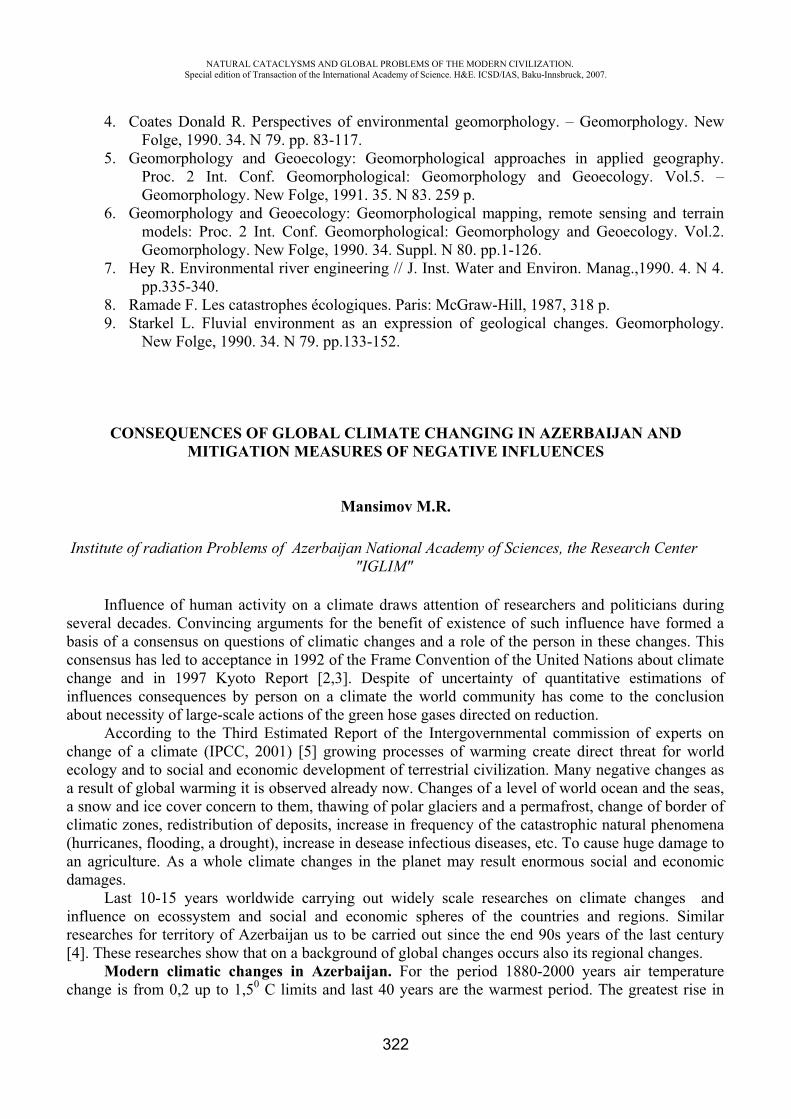
NATURAL CATACLYSMS AND GLOBAL PROBLEMS OF THE MODERN CIVILIZATION. Special edition of Transaction of the International Academy of Science. H&E. ICSD/IAS, Baku-Innsbruck, 2007.
322
4. Coates Donald R. Perspectives of environmental geomorphology. – Geomorphology. New Folge, 1990. 34. N 79. pp. 83-117.
5. Geomorphology and Geoecology: Geomorphological approaches in applied geography. Proc. 2 Int. Conf. Geomorphological: Geomorphology and Geoecology. Vol.5. – Geomorphology. New Folge, 1991. 35. N 83. 259 p.
6. Geomorphology and Geoecology: Geomorphological mapping, remote sensing and terrain models: Proc. 2 Int. Conf. Geomorphological: Geomorphology and Geoecology. Vol.2. Geomorphology. New Folge, 1990. 34. Suppl. N 80. pp.1-126.
7. Hey R. Environmental river engineering // J. Inst. Water and Environ. Manag.,1990. 4. N 4. pp.335-340.
8. Ramade F. Les catastrophes écologiques. Paris: McGraw-Hill, 1987, 318 p. 9. Starkel L. Fluvial environment as an expression of geological changes. Geomorphology.
New Folge, 1990. 34. N 79. pp.133-152.
CONSEQUENCES OF GLOBAL CLIMATE CHANGING IN AZERBAIJAN AND MITIGATION MEASURES OF NEGATIVE INFLUENCES
Mansimov M.R.
Institute of radiation Problems of Azerbaijan National Academy of Sciences, the Research Center "IGLIM"
Influence of human activity on a climate draws attention of researchers and politicians during several decades. Convincing arguments for the benefit of existence of such influence have formed a basis of a consensus on questions of climatic changes and a role of the person in these changes. This consensus has led to acceptance in 1992 of the Frame Convention of the United Nations about climate change and in 1997 Kyoto Report [2,3]. Despite of uncertainty of quantitative estimations of influences consequences by person on a climate the world community has come to the conclusion about necessity of large-scale actions of the green hose gases directed on reduction.
According to the Third Estimated Report of the Intergovernmental commission of experts on change of a climate (IPCC, 2001) [5] growing processes of warming create direct threat for world ecology and to social and economic development of terrestrial civilization. Many negative changes as a result of global warming it is observed already now. Changes of a level of world ocean and the seas, a snow and ice cover concern to them, thawing of polar glaciers and a permafrost, change of border of climatic zones, redistribution of deposits, increase in frequency of the catastrophic natural phenomena (hurricanes, flooding, a drought), increase in desease infectious diseases, etc. To cause huge damage to an agriculture. As a whole climate changes in the planet may result enormous social and economic damages.
Last 10-15 years worldwide carrying out widely scale researches on climate changes and influence on ecossystem and social and economic spheres of the countries and regions. Similar researches for territory of Azerbaijan us to be carried out since the end 90s years of the last century [4]. These researches show that on a background of global changes occurs also its regional changes.
Modern climatic changes in Azerbaijan. For the period 1880-2000 years air temperature change is from 0,2 up to 1,50 C limits and last 40 years are the warmest period. The greatest rise in
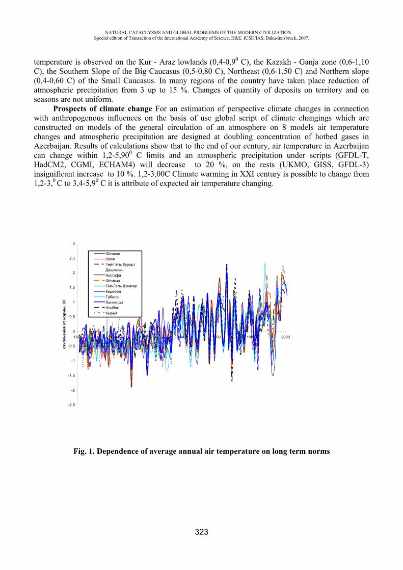
NATURAL CATACLYSMS AND GLOBAL PROBLEMS OF THE MODERN CIVILIZATION. Special edition of Transaction of the International Academy of Science. H&E. ICSD/IAS, Baku-Innsbruck, 2007.
323
temperature is observed on the Kur - Araz lowlands (0,4-0,90 ), the Kazakh - Ganja zone (0,6-1,10 ), the Southern Slope of the Big Caucasus (0,5-0,80 ), Northeast (0,6-1,50 ) and Northern slope
(0,4-0,60 ) of the Small Caucasus. In many regions of the country have taken place reduction of atmospheric precipitation from 3 up to 15 %. Changes of quantity of deposits on territory and on seasons are not uniform.
Prospects of climate change For an estimation of perspective climate changes in connection with anthropogenous influences on the basis of use global script of climate changings which are constructed on models of the general circulation of an atmosphere on 8 models air temperature changes and atmospheric precipitation are designed at doubling concentration of hotbed gases in Azerbaijan. Results of calculations show that to the end of our century, air temperature in Azerbaijan can change within 1,2-5,900 C limits and an atmospheric precipitation under scripts (GFDL-T, HadCM2, CGMI, ECHAM4) will decrease to 20 %, on the rests (UKMO, GISS, GFDL-3) insignificant increase to 10 %. 1,2-3,00 Climate warming in XXI century is possible to change from 1,2-3,0 to 3,4-5,90 it is attribute of expected air temperature changing.
Fig. 1. Dependence of average annual air temperature on long term norms
-2,5
-2
-1,5
-1
-0,5
0
0,5
1
1,5
2
2,5
3
1880 1900 1920 1940 1960 1980 2000
, 0
-
-
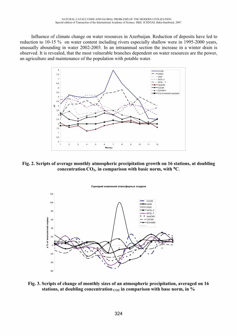
NATURAL CATACLYSMS AND GLOBAL PROBLEMS OF THE MODERN CIVILIZATION. Special edition of Transaction of the International Academy of Science. H&E. ICSD/IAS, Baku-Innsbruck, 2007.
324
Influence of climate change on water resources in Azerbaijan. Reduction of deposits have led to reduction to 10-15 % on water content including rivers especially shallow were in 1995-2000 years, unusually abounding in water 2002-2003. In an intraannual section the increase in a winter drain is observed. It is revealed, that the most vulnerable branches dependent on water resources are the power, an agriculture and maintenance of the population with potable water.
Fig. 2. Scripts of average monthly atmospheric precipitation growth on 16 stations, at doubling concentration 2, in comparison with basic norm, with º .
Fig. 3. Scripts of change of monthly sizes of an atmospheric precipitation, averaged on 16 stations, at doubling concentration 2 in comparison with base norm, in %
0
0,5
1
1,5
2
2,5
3
3,5
4
4,5
5
5,5
6
6,5
7
7,5
8
1 2 3 4 5 6 7 8 9 10 11 12
dT
UKMOGISSGFDL-3GFDL – THadCM2CGCMIECHAM 4C
-60
-40
-20
0
20
40
60
80
100
120
1 3 5 7 9 11
%
CCCMUK89GISSGFDL-3GFDL-THadCM2CGCMIECHAM4
NATURAL CATACLYSMS AND GLOBAL PROBLEMS OF THE MODERN CIVILIZATION. Special edition of Transaction of the International Academy of Science. H&E. ICSD/IAS, Baku-Innsbruck, 2007.
325
Calculations show that at the future reduction of a river drain because of climatic changes reduction of electric power development by existing Hydroelectric Power Stations on 15-20 % is expected. At present deficiency of 3,8 km ³ water up to middle of XXI centuries its size will be 9,5-11,5 km ³. Shortage of water will be felt also with agriculture as the increase in evaporation and terms of the vegetative period, it is needed for irrigating water will increase.
For prevention of the above-named negative consequences of climate change it is necessary to lead improvement of the control system by water resources; regulation of river drain, increase of efficiency of irrigating systems by improvement of a technical condition of channels and transition to the closed network of an irrigation, application water saving technologies - creation protective strips field and transition of rain and drop kinds of an irrigation, reuse of the cleared drainage water as an additional source of water for an irrigation pasturable in droughty.
Coastal zone of Caspian Sea. Last rise of the Caspian sea level (1979-1996) is 250 sm also is connected to climate changing in the Caspian sea pool . Now it is flooded with 48,5 thousand ha grounds and the cumulative damage suffered economy of Azerbaijan makes 2,2 billion US dollars. Researches have shown that at the further climate warming and increase pool moisture, the Caspian sea level can be within –26,0 ÷ -25,0 m.abs limits. Thus possible losses of the grounds will make 130-160 thousand h and the damage to social and economic branches can be 4,1 billion USA dollars. Prevention of expected damage probably by means of carrying out of actions on protection of settlements, objects of the industry and an infrastructure in a zone of influence of the sea, and also improvement of an ecological condition of a coastal zone.
Agroclimatic resources. At warming a climate probably increase evaporation averagely on 35 % and it will lead to conditions deterioration of territory natural humidifying. It agrees calculations of the sum active temperatures > 10º on models of change of a climate show that in conditions of the increased air temperature on border of thermal zones on mountains in comparison with modern will be displaced upwards on 550-850 - 700-950 m, 250-450 m places that will lead to expansion of the area warm and moderate, to reduction of cold for warm belts.
Ground resources and agriculture. As a result of warming a climate in all types soils, except for widespread in the Alpine zone, decrease in fertility will be observed. It will be spet up intrasoil chemical and biochemical processes, aerations, physical properties soil worsen, anthropogenic thinning and vegetative cover disappearance, on the Kur – Araz lowland areas of the salted grounds will increase for 10-15 %. A negative consequence of rise in air temperature will be significant (in 1,5-2 times): increase in repeatability of dry-droughty weather conditions, which number in the hottest areas the Kur - Araz lowland can make 50-60 days and more. The increase in the vegetative period will allow to expand the area of winter wheat and vineyard on significant heights, but on the other hand will lower efficiency boghara agriculture. On the irrigated grounds the requirement for irrigation water will increase.
For decrease in negative consequences of climate changes the system of agriculture in Azerbaijan for future should be based on water-and water saving technologies, carrying out of actions under the soil salinization prevention, water and wind erosion, droughts and dry winds. Overcoming of food danger there will be possible in result an introduction of cultures and grades, steady to expected by climate change; optimization of accommodation and structure of agricultural crops.
Wood resources. In conditions of probable rise in air temperature of the greatest influence is expected on the large forests, the located on Big and Small Caucasus, the bottom borders of these woods can rise on 550-950 m, and in Talish on the contrary, decreases to 100-200 m. However, taking into account modern anthropogenous loading at the top and bottom timberlines, it is possible to assume, that really timberlines will not change. The annual gain of deposited carbon decreases for 2 %. Now in connection with illegal cabins on the wood of Azerbaijan turn from an absorber of emissions
NATURAL CATACLYSMS AND GLOBAL PROBLEMS OF THE MODERN CIVILIZATION. Special edition of Transaction of the International Academy of Science. H&E. ICSD/IAS, Baku-Innsbruck, 2007.
326
GHG on the manufacturer of issues [4]. Some changes will take place in specific structure and efficiency of woods.
Mitigation of consequences climate change measures on increase of stability of woods, observance forest saving actions, assistance to natural renewal, an interdiction pasturing cattle, pest control, introduction of highly productive wood breeds, increase percentage of forest land will promote.
Emissions of green house gases and their restriction. In Azerbaijan for base year (1990) has made the common emissions of green house gases is 60, 8 million tons and falling of gross national product in 1990-1994 was accompanied with reduction of 2 emissions to 30 %. Probably the regenerative growth of the economy which have begun since 1998 results in slow increase in emissions. To most modern of official forecasts of emissions GHG it is submitted on the First National Message submitted by the Azerbaijan Republic in Secretariat. [4] and according to this document of GHG level excess in 1990 will take place not early, than in 2007-2008 and 2025 GHG level will be 1,8-2,0 times higher or 116-121 million tons a year. Probably, these figures will be specified after preparation of the Second National Message by the Ministry of Ecology and Natural resources of Azerbaijan at financial support .
It is known, that Kyoto Report has established quantitative obligations on restriction of emissions GHG for industrially advanced countries. For this purpose the Report determines mechanisms of emissions trade and joint realization. And for less developed countries, including Azerbaijan as member to Kyoto Report « the mechanism of clean development » (MCD) is determined. The report establishes that basic purpose MCD is rendering support to less developed countries during achievement of steady development. According to Clause 12 of Kyoto Report projects MCD should result in reduction of emissions additional to what would take place otherwise. Result of project MCD should be real, measurable and long-term advantage to the process directed on delay of climate change.
Basic principles Kyoto Report are advantageous for Azerbaijan as it is created favorable conditions for attraction of investments from the advanced countries for replacement of out-of-date power-consuming industries. Now the potential of GHG reduction of Azerbaijan makes 39 million tons 2-eq and from this of 93 % belongs to power sector [4]. Within the framework of realization of the mechanism of pure development of Kyoto Report the country can realize on mutually advantageous conditions projects on reduction of GHG issues, due to use of new technologies and improvement of a control system, etc. It basically energy saving projects, in branches oil-and gas extraction, their transportation and processing manufactures of the electric power and its distribution, use of renewable energy sources in housing and communal services, instead of forestry, etc.
Leaders last years researches have confirmed strong negotiation between decrease in emissions of green house gases and reduction of emissions of traditional polluting substances which the population are unhealthy [1]. As measures of policy on reduction in green hose gas emissions, and target investment projects in this area to the essential connected benefits for health of the population.
In spite of the fact that last 10 years of an investment into Azerbaijan economy, it is especial in power sector but while in the country one project on MCD is carried out. Though the part of these projects could be made out under MCD. If to take into account, that Kyoto Report has established the first budgetary period for the industrial advanced countries for the period 2008-2012 years to become obvious, already today we "it were late" or the nearest years essential change in a state of affairs it is not necessary to expect. Absence of national legislative base and legal mechanisms, care of the foreign companies, not understanding of the state and private companies essence of an affair and benefit from realization of similar projects after connection have led to creation such adverse a condition for Azerbaijan.
NATURAL CATACLYSMS AND GLOBAL PROBLEMS OF THE MODERN CIVILIZATION. Special edition of Transaction of the International Academy of Science. H&E. ICSD/IAS, Baku-Innsbruck, 2007.
327
Health of the population. The greatest direct influence of thermal stress will be felt on large cities Baki, Sumgayit, Ganja, etc. (the effect of heat at silent weather makes 2-3º more, than surrounding territory). In flow of agricultural population to last years to these cities and chaotic building constructions, destruction of parks and green plantings inside cities, occurrence on a place of green plantings of suburban settlements (there are no sewer and water systems) even more to aggravate developed situations. The worst situation there are the most vulnerable (old men, children, people suffering with cardiological illnesses, etc.) and poor layers of the population. However climate change renders far-reaching collateral influences - distribution of carriers of illnesses, decrease in quality of water, deterioration of the foodstuffs, etc.
REFERENCES
1. Golub A.A., Strukova E.V., Markandiya A. economical aspects of climatic changes and restriction of green house gas emissions. // In book. Climate change and population health in Russia in XXI century, Moscow. 2004.3. Kyoto Report. 1997. p 31.4. The convention of the United Nations on climate change Bonn: YUNEP, 1992, 29 p. 5. The first National Message of Azerbaijan on climate change / Under red. M.R. Mansimov, Baki: 2000, 84 p.6. The third estimated report of the Intergovernmental commission of experts on climate change (IPCC.) Geneva. 2001.
ANOMALY CHANGES OF FERRUM CONCENTRATION IN THE UNDERGROUND WATERS – A HYDROCHEMICAL FORERUNNER
OF HARD EARTHQUAKES
Rustamov N.H.*, Keramova R.A.**, Keramova A.A.***
The Institute of Chemical Problems of ANAS. Azerbaijan Republic
The hydrogeochemical methods of the earthquakes forecast are based on formation the anomalies in the chemical composition of the underground waters in the period forerunning the hard and disastrous earthquakes (MPV 4,5; MLH 5,0).
The formation of geochemical anomalies is controlled by physico-chemical processes, which take place in the seismic nidus, in the period of earthquakes preparation, as well as the development of the process of crackformation in geological sphere with the rise of tectonic strain.
At present time the role of hydrogeochemical methods in the wide complex of geophysical and seismogeophysical investigations is the most effective in solving the problems of short-term and even operative forecast of earthquakes in the real rejime of time. The hydrogeochemical methods together with the forecast of place and power of the earthquake may also be the most informative while deciding the most difficult problem – the problem of time for earthquake realization.
NATURAL CATACLYSMS AND GLOBAL PROBLEMS OF THE MODERN CIVILIZATION. Special edition of Transaction of the International Academy of Science. H&E. ICSD/IAS, Baku-Innsbruck, 2007.
328
In order to forecast the earthquake by the method of hydrogeochemical methods in the underground waters the physico-chemical indicators are measured and concentrations in the variations of macrocomponents (Na+, K+, Ca2+, Mg2+, Cl-, HCO3
-, CO32-, SO4
2-, H2SiO3 ), microcomponents (F-,J-, B3+, Hg2+, UO2
2+) as well as the gaseous components (He, Ar, Rn, N2, H2, CO2, CH4, H2S) [1] are defined.
While holding out the seismogeochemical all year round monitoring on the forecast experimental range, as the unificated methods, there have been suggested and inculcated the microtitrometrical, photometrical, ionometrical expressmerhods [1-2].
By long-standing observations of the Azerbaijan geochemists it has been established that the iron, being chemically active element is able to migrate over long distances. It’s well-known that the period of seismic activization is accompanied by the short-term changes of pH and Eh of geochemical sphere [3]. Besides, the concentration of iron ions (II, III) in the underground waters, easily entering the interaction with waterpossessing rocks, are short-termly anomally changed.
We have investigated many-liganded complex (MLC) of ferrum (III) with 1,10-phenantroline (PHEN) and alizarin yellow P (AlP) on the base of which there has been elaborated the method of extraction-photometric definition of the iron in the underground waters.
Experimental Part. Solutions and Reagents: 4,46.10-4M solution of iron (III) has been prepared from ferrumammonium alam. The content of ferrum (III) has been established by the complexometric method [4].
1,10- phenantroline from the czech firm “Chemapol” has been used in the type 1.10-2M of solution in 50% (according to volume) ethapole. AlP has been used in the type 5.10-3M of solution in ethapole.
The pH of the sphere has been created by the buffer solution; 0,1N-by the solutions of H2SO4
and NaOH, and then, has been controlled on the ionometer EV-74. The optical density of the tinged extracts has been measured at the spectrometer SF-46.
While elaboration the method of definition the optical density of extracts has been measured on photocolourimeter KFK-2; IR-spectrum has been taken at spectrophotometer Specord M-80; thermogravimetric investigations have been held on derivatographer Q-1500 D, the X-ray difractogrammes have been taken at difractometer DPON-2.
Methods of experiment. A definite volume of ferrum salts solutions (III) was put into the graduated test-tubes with the ground stopper, a few ml of buffer solution with a definite value of pH have been added, the corresponding quantity of PHEN and AlP have been dissolved by the same buffer solution till 10 ml, and the obtained complexes have been extragenated by 5 ml of chloroform within 1 minute. After the phases separation there has been measured the optical density of the tinged extracts of complexes concerning the extract AlP.
The Results and Their Discussion. The light absorption of chloroform extracts of the complex, being formed at the various values of pH (2÷8) has shown that the iron (III) with PHEN and AlP, irrespective of conditions, forms just one complex.

NATURAL CATACLYSMS AND GLOBAL PROBLEMS OF THE MODERN CIVILIZATION. Special edition of Transaction of the International Academy of Science. H&E. ICSD/IAS, Baku-Innsbruck, 2007.
329
The curves of pH influence on formation and extraction of the complexe have been shown in fig. 1.
Fig.1.The influence of water phase on formation and extraction ofcomplex Fe (III) with PHEN and AlP (1), adsorption
AlP (2) (CFe=4,46.10-5M, CPHEN=5.10-4M, CAlP=4.10-4M, KFK-2, l=1,0, =490nm).
Fig.2. Spectrum of chloroform extracts adsorption of the complex (1) and AlP (2) (CFe=2,23.10-5M, CPHEN=1.10-4M, CAlP=1.10-4M,
SF-46, l=1,0).
NATURAL CATACLYSMS AND GLOBAL PROBLEMS OF THE MODERN CIVILIZATION. Special edition of Transaction of the International Academy of Science. H&E. ICSD/IAS, Baku-Innsbruck, 2007.
330
Besides, the optimal condition of the formation and extraction of complexes is pH 5÷6. The complex is well axtragenated by organic dissolvents and their mixtures. The best ones are chloroform and dichlorethan. The optimal volume of the water phase is 10 ml, and for organic one is 5 ml. For maximum connection of Fe (III) in MLC we need 5-multiple molar surplus of PHEN and AlP. The surplus of PHEN and AlP doesn’t influence the lightabsorption of the complex negatively. The complex is formed immediately after the components mixture and while shaking for 1 minute there is an equilibrium between phases. The intensiveness of colouring of chloroform extract of the complex doesn’t change 24 hours. The spektrum of absorption the chloroform extracts of the complex and AlP are presented in pic. 2. The chloroform extract of the complex absorbs maximum reagent 385nm at 490. The complexformation is accompanied by bathochrom shifting on 105 nm.
By the methods of equilibrium shift, isomolar series and limited-logarithmic [5] it has been estableshed, that Fe (III) with AlP are forming MLC with the molar ratio Fe (III):PHEN:AlP=1:3:1.
By X-ray graphic investigations it has been established, that Fe (III) with PHEN and AlP are forming the individual compound and don’t have any admixture. The IR-spectroscopic investigations showed that Fe (III) is co-ordinated with the atoms of PHEN hydrogen, forming a tris-phenantrolinate complex.
While forming the complex Fe (III) from molecule AlP displaces both the hydrogen of carboxil group and the hydrogen of phenol hydroxil group.
Thermogravimetrical investigation showed that the thermal decomposition is accompanied by exo- and endothermal effects. The endoeffect at the temperature 80°C is stipulated by water removal.
The exoeffect at 300÷350°C corresponds to decomposition of PHEN and further slow oxidation of hydrocarbon remains by the oxygen from the air. The sharp decrease of mass on the curve DTG is connected with nitrogen discharge. The exoeffect at 550÷680°C is stipulated by splitting of benzol ring and its further slow oxidation. The AlP is the final product of a thermal decomposition of Fe2O3.
It has been established that Fe (III) with PHEN and AlP form the outersphere MLC of [Fe(OH)(PHEN)3]AlP composition.
By Komar method there have been determined the molar coefficient of absorption the complex [5], which was equal k=2,12.104. There also have been defined the twophaseous constants of associate stability and MLC on accounting stability of phenantrolinate of ferrum (lg Fe(PHEN)3=23,5) [6-7]. The constant of associate stability became equal to 1,09.105; MLC – 3,36.1028, and the constant of complex extraction 9,47.1019 [8].
The many-liganded complex of Fe (III) with PHEN and AlP are intensively dyed, the lightabsorption of chloroform estracts doesn’t change with the passing time, which let us to elaborate the methods of extraction-photometric definition of ferrum (III). Berr’s law takes place in the interval of 0,5÷30mkg Fe (III) in 10 ml of water phase volume.
The quantities of ions (according to their mass) indicated in the brackets don’t disturb the definition of ferrum (III) with PHEN and AlP: of alkaline and alkaline-earth elements (2000), Al(2), Ga(5),TlIII(10), MnIII(25), CoII(2), Ni(1), Pb(200), VV(4), MoVI(1000),
ReVII(25), Hf (60), WVI(5), Hg(128), Cl-(1400),| Br-(6700),| Y-(4500), F-(90), S2-(24), SO42-
(5500), NO3-(2100).
At pH 5-6 the ions Fe (III) also form MLC with PHEN and AlP according to its optic and analytic characteristics almost not distinguishing from the same with Fe (III).
The mentioned above method has been used as an express-method of definition the content of iron at the discrete, all-year-round seismogeochemical monitoring of the underground waters of the Absheron seismoforecast experimental range (well “Shikhova 2”).
NATURAL CATACLYSMS AND GLOBAL PROBLEMS OF THE MODERN CIVILIZATION. Special edition of Transaction of the International Academy of Science. H&E. ICSD/IAS, Baku-Innsbruck, 2007.
331
Definition of ferrum in the underground water. The water tests (5ml) have been put into the test-tube with the ground stopper, then we added the buffer solution (pH 5,5), and then – 1ml 1.10-3M of PHEN solution and 0.4ml 5.10-3M of AlP solution.
The volume of mixture achieved 10 ml by means of distilling water, then they added 5 ml of chloroform and it has been shaken for 1 minute. After separation of phases there were measuring the optic density at the photocolourimeter at =490nm.
As a control method there have been used the method of photometrical definition of ferrum with rodanide [9].
The seismogeochemical monitoring has showed that in the period of the Caspean-Baku earthquake preparation (25.11.2000), the physico-chemical data and the concentrations of separate macro- and microcomponents (pH, SO4
2-, a general hardness, Mg2+, (Fe(II), Fe(III)) are changed almost to 500÷1500%. Besides, the largest values were registered in the nearest ( =50÷70nm) Absheron seismozone. In the more distant seismic zones of Shemaha, Shaki and Siyazan they varied in the limit 200÷400%.
The anomaly change of Fe (II, III) ions concentration in the underground waters of the Absheron seusmic zone began much earlier than in other seismoactive zones.
Maximum value of anomal change of ferrum (II, III) concentration was registered 20 days before the earthquake took place. The change of ferrum concentration in the underground waters in the period of preparation and realization of the earthquake and smoth reducing after it till the level of average annual value tells us about the fact, that these parameters behave as the forerunners of the earthquake.
REFERENCES
1. Barsukov V.L., Varshal G.M., Garanik A.V., Zamokina N.S. Col. Hydrogeochemical forerunners of the earthquakes. M.: Science, 1985, p. 3-16
2. Osika D.G. Fluid rejime of seismic active fields. M.: Science, 1981, p. 10 3. Keramova R.A. Seismisity and geochemical fluid fields of Azerbaijan. Author thesis of
Doctor of geo-mineral sciences, M.: 2004, p. 65 4. Wiland F., Yansen A., Tirin D., Vyunsh G. Complex compounds in analytic chemistry.
M.: Mir, 1975, p. 296 5. Bulatov M.I., Kalingin I.P. Practical guide on photocolourmeter and spectrophotometrical
methods of analysis. L.: Chemistry, 1976, p. 386 6. Incendy Y. The use of complexes in analytic chemistry. M.: Mir, 1979, p. 322 7. Pilipenko A.G., Dyachenko N.A. //The Ukraine chem. Journal, 1976, V. 92, 11, p. 1180 8. Gershuns A.L., Adamovich L.A., Skorobogatov V.M. //Journ of analytic chemistry, 1974,
V. 29, 10, p. 1905 9. Sharlo G. Methods of analytic chemistry. M.: Chemistry, 1969, p. 771
NATURAL CATACLYSMS AND GLOBAL PROBLEMS OF THE MODERN CIVILIZATION. Special edition of Transaction of the International Academy of Science. H&E. ICSD/IAS, Baku-Innsbruck, 2007.
332
MUZAFFARABAD EARTHQUAKE OF OCTOBER 8, 2005: SEISMOLOGICAL ASPECTS
Muhammad Qaisar*, Muhammad Daud Shah**, Zahid Ali***, Tariq Mahmood****
Micro Seismic Studies Programme, Ishfaq Ahmed Research Laboratories Nilore, Islamabad, Pakistan
ABSTRACT
A devastating Earthquake of magnitude (ML) 7.0 (USGS mb=6.8, Mw = 7.6 Ms=7.7) occurred on Oct. 8, 2005, about 10 km north-west of Muzaffarabad at a depth of about 13km. The Earthquake was generated by the movement along the thrust fault structure and named subsequently Kashmir Thrust (KT). The earthquake caused a huge loss of life and property due to the near fault strong motion effects. The surface evidences of thrusting along Kashmir Thrust are observed at a number of places. Based on the records obtained by local seismic network, focal mechanism solution of the main shock coincides with Kashmir Thrust orientation striking NNW-SSE and dipping in NE direction. Maximum intensity XI on the Modified Mercalli Intensity (MMI) scale was observed along the strike of the KT, mainly due to near-fault strong motion and rupture directivity effects. The horizontal peak ground acceleration at Abbotabad about 40 km south-west of main shock was 0.231g. The aftershocks recorded per day during first month follow Omori’s law. In the course of the field survey, the maximum vertical displacement (4.2 m ± 0.5 m) was observed in between the regions of Muzaffarabad and Balakot cities while the total observed rupture length was about 112 km. It seems that the earthquake has ended a seismic gap where present tectonic movements and release of high seismic energy along Kashmir Thrust caused tectonic stress stability. However, it is not unlikely for any future seismic activity to occur in the area due to reactivation of the Kashmir Thrust.
INTRODUCTION
The Muzaffarabad Earthquake of Oct. 8, 2005, magnitude (ML) 7.0, Ms=7.7, mb=6.8, Mw = 7.6 as reported by USGS (2005) occurred at 03:50:38.05 GMT (08:50:38.05 local time) near the city of Muzaffarabad at about 95 km north-northeast of Islamabad, the capital city of Pakistan (Fig. 1). More than 6,000 aftershocks (ML 6.4) were recorded by local seismic network within one month after the main shock
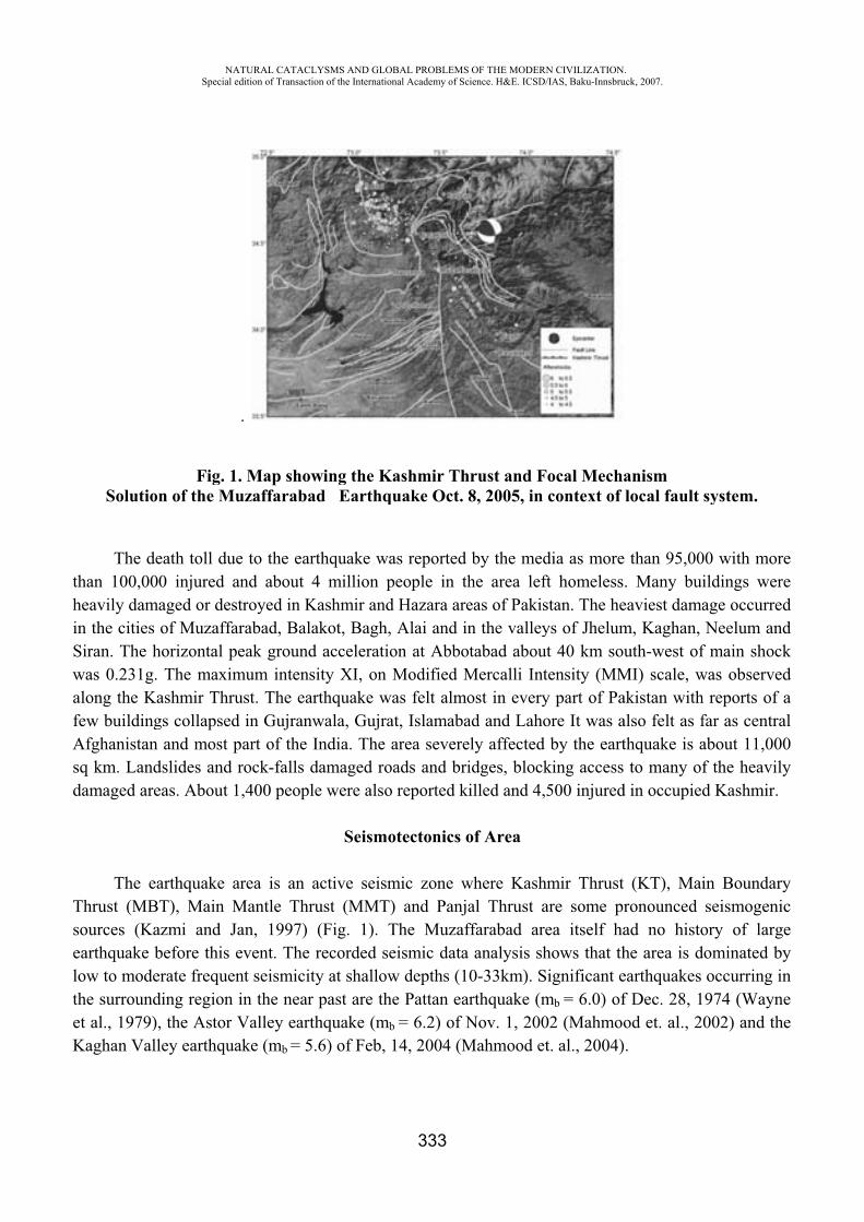
thhinSwafAsd
TselotheK
Solutio
The dehan 100,00
heavily damn the cities
Siran. The hwas 0.231g.along the Kfew buildingAfghanistansq km. Landdamaged are
The eThrust (MBsources (Kaearthquake bow to modehe surround
et al., 1979)Kaghan Val
NASpecial
Fig. 1on of the M
eath toll du00 injured a
maged or desof Muzaffa
horizontal p. The maximashmir Thrugs collapsedn and most pdslides and eas. About 1
arthquake aBT), Main Mazmi and Jbefore this erate frequeding region ), the Astor ley earthqu
ATURAL CATACLedition of Transacti
.
1. Map showMuzaffaraba
ue to the earand about 4stroyed in Karabad, Balapeak groundmum intensust. The ead in Gujranwpart of the rock-falls d
1,400 peopl
area is an Mantle ThrJan, 1997) event. The
ent seismicitin the nearValley eartake (mb = 5
LYSMS AND GLOion of the Internatio
wing the Kad Earthq
rthquake wa4 million p
Kashmir andakot, Bagh,d acceleratiosity XI, on arthquake wwala, GujraIndia. The damaged role were also
Seismo
active seismrust (MMT)(Fig. 1). Trecorded se
ty at shallowr past are ththquake (mb
.6) of Feb,
OBAL PROBLEMSonal Academy of Sc
333
Kashmir Thquake Oct.
as reported people in thd Hazara are, Alai and inon at AbboModified M
was felt almoat, Islamabaarea severe
oads and brio reported k
otectonics o
mic zone w) and PanjaThe Muzafeismic dataw depths (1he Pattan ea
b = 6.2) of N14, 2004 (M
OF THE MODERNcience. H&E. ICSD/
hrust and F8, 2005, in
by the medhe area lefeas of Pakisn the valley
otabad abouMercalli Intost in everyad and Lahoely affected idges, blockilled and 4,
of Area
where Kashal Thrust affarabad area analysis sh0-33km). S
arthquake (mNov. 1, 200
Mahmood et
N CIVILIZATION/IAS, Baku-Innsbru
Focal Mechacontext of
dia as moreft homelessstan. The heys of Jhelumut 40 km soutensity (MMy part of Paore It was aby the eart
king access 500 injured
hmir Thrust are some prea itself hahows that thignificant e
mb = 6.0) of02 (Mahmoot. al., 2004)
.uck, 2007.
anismlocal fault
than 95,00. Many bu
eaviest damam, Kaghan, uth-west of
MI) scale, wakistan withalso felt as fthquake is ato many of
d in occupie
(KT), Maironouncedad no histohe area is dearthquakes f Dec. 28, 1od et. al., 2.
system.
00 with morildings werage occurreNeelum an
f main shocwas observeh reports of far as centraabout 11,00f the heavild Kashmir.
in Boundarseismogeni
ory of largdominated b
occurring i1974 (Wayn002) and th
rereedndckeda
al00ly
ryicgebyinnehe
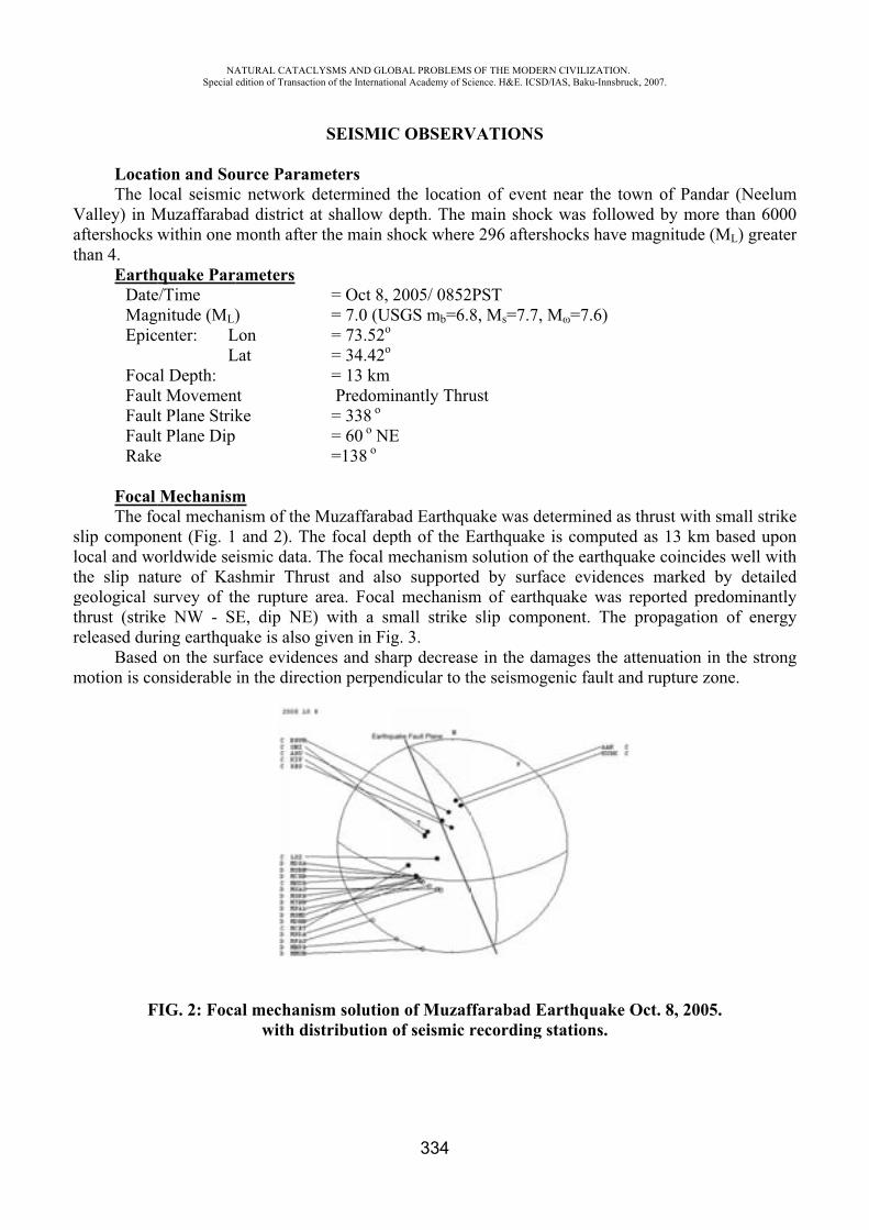
Vath
slothgthr
m
LocatThe lo
Valley) in Maftershocks whan 4.
EarthDateMagEpic
FocaFaultFaultFaultRake
FocalThe fo
slip componocal and wohe slip nat
geological shrust (strikeleased dur
Basedmotion is co
F
NASpecial
ion and Soocal seismicMuzaffarabawithin one
hquake Pare/Time nitude (ML)enter: L
Lal Depth: t Movement Plane Strikt Plane Dip e
Mechanismocal mechannent (Fig. 1orldwide seture of Kassurvey of thke NW - SEring earthqu
on the surfonsiderable
FIG. 2: Foca
ATURAL CATACLedition of Transacti
urce Paramc network dad district amonth after
ameters
)LonLat
nt ke
mnism of the and 2). Thismic data. shmir Thruhe rupture E, dip NE)
uake is also face evidenin the direc
al mechaniwith di
LYSMS AND GLOion of the Internatio
SEISMIC
metersdetermined at shallow dr the main s
= Oct 8, = 7.0 (US= 73.52o
= 34.42o
= 13 km Predomi= 338 o
= 60 o NE=138 o
Muzaffarabhe focal depThe focal m
ust and alsarea. Focal) with a smgiven in Fig
nces and shation perpen
ism solutionstribution
OBAL PROBLEMSonal Academy of Sc
334
C OBSERV
the locatiodepth. The shock where
2005/ 0852SGS mb=6.8
inantly Thru
E
bad Earthqupth of the Emechanism o supportel mechanismmall strike g. 3. arp decrease
ndicular to th
n of Muzafof seismic r
OF THE MODERNcience. H&E. ICSD/
VATIONS
on of event main shocke 296 aftersh
2PST8, Ms=7.7, M
ust
uake was deEarthquake solution ofd by surfam of earthqslip compo
e in the damhe seismoge
ffarabad Earecording s
N CIVILIZATION/IAS, Baku-Innsbru
near the tok was followhocks have
M =7.6)
termined asis compute
f the earthquace evidencquake was onent. The
mages the aenic fault an
arthquakestations.
.uck, 2007.
own of Panwed by mormagnitude
s thrust withed as 13 kmuake coincidces marked reported prpropagatio
attenuation nd rupture z
Oct. 8, 200
ndar (Neelumre than 600(ML) greate
h small strikm based upodes well wit
by detaileredominantlon of energ
in the stronzone.
05.
m00er
keonthedlygy
ng
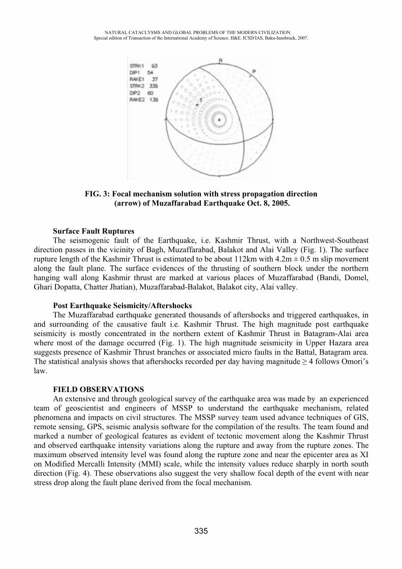
NATURAL CATACLYSMS AND GLOBAL PROBLEMS OF THE MODERN CIVILIZATION. Special edition of Transaction of the International Academy of Science. H&E. ICSD/IAS, Baku-Innsbruck, 2007.
335
FIG. 3: Focal mechanism solution with stress propagation direction (arrow) of Muzaffarabad Earthquake Oct. 8, 2005.
Surface Fault Ruptures The seismogenic fault of the Earthquake, i.e. Kashmir Thrust, with a Northwest-Southeast
direction passes in the vicinity of Bagh, Muzaffarabad, Balakot and Alai Valley (Fig. 1). The surface rupture length of the Kashmir Thrust is estimated to be about 112km with 4.2m ± 0.5 m slip movement along the fault plane. The surface evidences of the thrusting of southern block under the northern hanging wall along Kashmir thrust are marked at various places of Muzaffarabad (Bandi, Domel, Ghari Dopatta, Chatter Jhatian), Muzaffarabad-Balakot, Balakot city, Alai valley.
Post Earthquake Seismicity/Aftershocks The Muzaffarabad earthquake generated thousands of aftershocks and triggered earthquakes, in
and surrounding of the causative fault i.e. Kashmir Thrust. The high magnitude post earthquake seismicity is mostly concentrated in the northern extent of Kashmir Thrust in Batagram-Alai area where most of the damage occurred (Fig. 1). The high magnitude seismicity in Upper Hazara area suggests presence of Kashmir Thrust branches or associated micro faults in the Battal, Batagram area. The statistical analysis shows that aftershocks recorded per day having magnitude 4 follows Omori’s law.
FIELD OBSERVATIONS An extensive and through geological survey of the earthquake area was made by an experienced
team of geoscientist and engineers of MSSP to understand the earthquake mechanism, related phenomena and impacts on civil structures. The MSSP survey team used advance techniques of GIS, remote sensing, GPS, seismic analysis software for the compilation of the results. The team found and marked a number of geological features as evident of tectonic movement along the Kashmir Thrust and observed earthquake intensity variations along the rupture and away from the rupture zones. The maximum observed intensity level was found along the rupture zone and near the epicenter area as XI on Modified Mercalli Intensity (MMI) scale, while the intensity values reduce sharply in north south direction (Fig. 4). These observations also suggest the very shallow focal depth of the event with near stress drop along the fault plane derived from the focal mechanism.
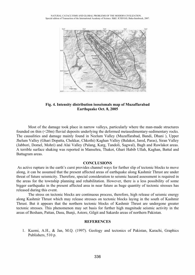
NATURAL CATACLYSMS AND GLOBAL PROBLEMS OF THE MODERN CIVILIZATION. Special edition of Transaction of the International Academy of Science. H&E. ICSD/IAS, Baku-Innsbruck, 2007.
336
Fig. 4. Intensity distribution isoseismals map of Muzaffarabad Earthquake Oct. 8, 2005
Most of the damage took place in narrow valleys, particularly where the man-made structures founded on thin (<20m) fluvial deposits underlying the deformed metasedimentary-sedimentary rocks. The causalities and damage mainly found in Neelum Valley (Muzaffarabad, Bandi, Dhani ), Upper Jhelum Valley (Ghari Dopatta, Chekkar, Chkothi) Kaghan Valley (Balakot, Jared, Paras), Siran Valley (Jabbori, Domel, Mohri) and Alai Valley (Palang, Karg, Tandoli, Sagwal), Bagh and Rawlakot areas. A terrible surface shaking was reported in Mansehra, Thakot, Ghari Habib Ullah, Kaghan, Battal and Battagram areas.
CONCLUSIONS As active rupture in the earth’s curst provides channel ways for further slip of tectonic blocks to move
along, it can be assumed that the present affected areas of earthquake along Kashmir Thrust are under threat of future seismicity. Therefore, special consideration to seismic hazard assessment is required in the areas for the township planning and rehabilitation. However, there is a less possibility of some bigger earthquake in the present affected area in near future as huge quantity of tectonic stresses has released during this event.
The stress on tectonic blocks are continuous process, therefore, high release of seismic energy along Kashmir Thrust which may release stresses on tectonic blocks laying in the south of Kashmir Thrust. But it appears that the northern tectonic blocks of Kashmir Thrust are undergone greater tectonic stresses. This phenomenon may set basis for further high magnitude seismic activity in the areas of Besham, Pattan, Dasu, Bunji, Astore, Gilgit and Sakardo areas of northern Pakistan.
REFERENCES
1. Kazmi, A.H., & Jan, M.Q. (1997). Geology and tectonics of Pakistan, Karachi, Graphics Publishers, 510 p.
NATURAL CATACLYSMS AND GLOBAL PROBLEMS OF THE MODERN CIVILIZATION. Special edition of Transaction of the International Academy of Science. H&E. ICSD/IAS, Baku-Innsbruck, 2007.
337
2. Mahmood T., Qaisar M. & Ali Z. (2002). Source mechanism of Astor Valley Earthquake of November 20, 2002 inferred from teleseismic body waves. Geol. Bull. University of Peshawar Vol. 35, 151-161.
3. Mahmood T., Qaisar M. and Ali Z. (2004). Intensity distribution and impact of Kaghan Valley (Pakistan) Earthquake February 14, 2004. MSSP Internal Rept. No. MSSP-73/2004.
4. USGS (2005). A Preliminary report on world wide earthquakes published by United Sates of Geological Survey.
5. Wayne, P.D. (1979). A summary of field and seismic observations of the Pattan Earthquake – 28 December 1974. Department of Geology and Geophysics, University of Wisconsin, USA.
CLIMATE CHANGE RESEARCH IN PAKISTAN
Arshad Muhammad Khan
Global Change Impact Studies Centre, Islamabad
Global Climate Change resulting from an increasing level of human interference with the Earth’s atmosphere since the advent of the Industrial Revolution in the mid-18th century is accepted today by most of the world leaders as “the greatest challenge facing the mankind in the 21st century”. The assessments made by the Intergovernmental Panel on Climate Change (IPCC) over the last two decades have clearly established that the atmospheric concentration of Greenhouse gases, such as Carbon dioxide has been increasing; that this increase is causing the warming of the Earth with its associated climate change; and that, as a result of this warming the average global temperature increased by 0.6 °C during the 20th century. The IPCC now projects that the average global temperature is likely to increase further by 1.8-4.0 °C by the year 2100 as a result of the world’s continued, albeit much reduced, reliance on fossil fuels. Accompanied by this temperature increase will be large increases in frequency and intensity of extreme climate events such as floods, draughts and cyclones; rapid melting of world’s glaciers and ice sheets including the ice caps on the poles; rise in average sea level causing submersion of small islands and low lying coastal areas etc. Particularly large will be the adverse impacts of Climate change on developing countries like Pakistan whose Water Security and Food Security could be seriously threatened by the changing climate. It is therefore of paramount importance for such countries to substantially improve their scientific skills and knowledge base in the related disciplines as well as their management capability in order to be able to develop and apply appropriate adaptation measures in time.
It was in this context that a dedicated research centre in the form of Global Change Impact Studies Centre (GCISC) was established in Pakistan in June 2002 with seed money provided by the Ministry of Science and Technology. The main objectives of the Centre include (1) keeping a track of climatic changes and related developments taking place worldwide and within Pakistan; (2) capacity building and research on climate change and its impacts on various sectors, focusing initially on water and Agriculture sectors; (3) provision of the results of its technical assessments to national planers and policymakers; and (4) raising of public awareness to climate change-related issues. The Centre has since been generously supported by the Planning Commission, while the Prime Minister himself has been interacting with it by setting up a high level ministerial committee called the Prime Minister’s Committee on Climate Change.

NATURAL CATACLYSMS AND GLOBAL PROBLEMS OF THE MODERN CIVILIZATION. Special edition of Transaction of the International Academy of Science. H&E. ICSD/IAS, Baku-Innsbruck, 2007.
338
The current research activities of the Centre are focussed in 3 main areas: Climatology, Agriculture and Water Resources. The main thrust of research in these areas is on the following aspects:
1. Climatology:
(i) Assessment of past climate changes in various parts of Pakistan using statistical analysis techniques;
(ii) Development of climate change scenarios for selected broad regions of Pakistan, based on the outputs of an ensemble of global level projections made by various Global Crculation Models (GCMs) in line with the IPCC Marker scenarios.
(iii) Formulation of high resolution climate change scenarios for Pakistan by dynamical downscaling of GCM projections using Regional Climate Models.
(iv) Development of indicators and indices for extreme climate events in South Asia.
2. Agriculture:
(i) Assessment of the impacts of projected climatic changes on the productivity of major agricultural crops in different climate zones of the country, using crop growth simulation models.
(ii) Identification of appropriate adaptation measures to cope with the negative impacts of climate change.
3. Water Resources:
(i) Study of the temporal changes in the HKH Glaciers using satellite imagery and GIS techniques.
(ii) Validation and calibration of selected Watershed models for simulation of annual, seasonal and daily flow patterns of River Indus and its tributaries.
(iii) Application of watershed models to assess the potential impact of climate change on hydrological regime of the Indus River System.
The paper will present salient features of the research results obtained so far in each of these areas.
NATURAL CATACLYSMS AND GLOBAL PROBLEMS OF THE MODERN CIVILIZATION. Special edition of Transaction of the International Academy of Science. H&E. ICSD/IAS, Baku-Innsbruck, 2007.
339
SOLAR ACTIVITY AND BRIGHTNESS CURVES OF COMETS 29P/SCHWASSMANN-WACHMANN AND 1P/HALLEY
A.S. Guliyev*, F.R. Mustafa**, E.S. Babayev***,P.N. Shustarev****
Shamakhy Astrophysical Observatory named after N.Tusi,Azerbaijan National Academy of Sciences
Abstract. In this paper an influence of solar activity on changes of brightness curve of periodic comets is investigated. Two selected comets, 29P/Schwassmann-Wachmann and 1P/Halley, were subjected to investigation. The first object has almost circular orbit located at approximate distance of the Jupiter while the latter one has an orbit with a big eccentricity. The brightness curve of 1P/Halley comet was constructed on the base of about 5900 estimations of brightness data obtained within years 1980 – 1989 and covering distances from 0.6 up to 9 AU. The brightness curve of 29P/Schwassmann-Wachmann comet is a result of about 1300 estimations for the period of 1972-2007. Spectral analyses which were carried out for both variations in solar activity (different mechanisms) and for changes of brightness of the considered comets showed a presence of similar changes in both cases for the same period. Some well-known periodicities in solar-terrestrial relations were revealed in periodical changes of brightness. It is concluded that interrelations between solar activity changes and brightness of studied comets are significant.
1. Introduction. Comets and solar activity “Comet and asteroid hazard” problem makes the study of comets one of very actual problems of
modern astronomy [2]. Of particular interest are investigations on solar activity influence on comets, their formation,
brightness, outburst, so on. There are quite enough papers devoted to this problem and particularly, about comets 29P/Schwassmann-Wachmann and 1P/Halley. The book written by D.A.Andrienko and V.N.Vashchenko [3] summarized results of studies on relationship between solar corpuscular radiation and brightness outburst of comets and different mechanisms. On the basis of an analysis of a catalog of flares of cometary brightness of 29P/Schwassmann-Wachmann it is shown that cometary flare activity depends on the phase of the 11-year solar activity cycle [4].
Study on the revealing of role solar-wind velocity-waves in comet outburst activity showed that the comet outburst activity dependence on the heliocentric distance is in good accordance with the behavior of the solar wind velocity waves with heliocentric distance. The cometary outburst activity also showed a good correlation with the phase distributions of the total area of coronal holes and the rate of change of sunspot area during the 11-years solar cycle [5].
In works Guliyev [6, 7] it is shown, that exists two types of dependence comet parameters from a phase of 11-year activity of the Sun: the first of them is characterized by the unique maximum having some displacement concerning a maximum of a 11-year cycle; at the second type of dependences two maxima, corresponding to the period of recession and cycle lifting are observed. The first type of dependence is inherent in periodic comets, and the second - basically long-period comets. However it is sometimes observed also deviations from this rule.
Studies on the effects of solar activity on the light curves of comet Halley showed that the integral brightness of comet Halley (1986 III) correlates with the changes in the solar activity and with the solar wind velocity [8, 9]. The interaction of the solar wind with active comets is investigated [8]
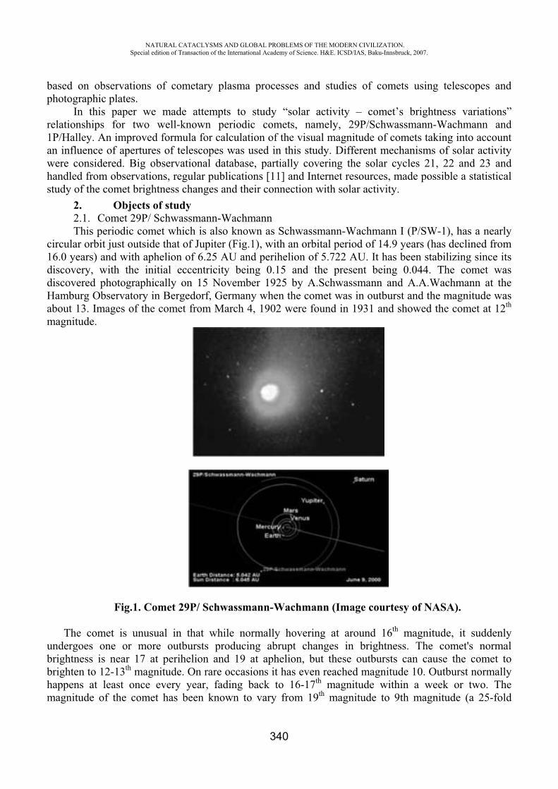
NATURAL CATACLYSMS AND GLOBAL PROBLEMS OF THE MODERN CIVILIZATION. Special edition of Transaction of the International Academy of Science. H&E. ICSD/IAS, Baku-Innsbruck, 2007.
340
based on observations of cometary plasma processes and studies of comets using telescopes and photographic plates.
In this paper we made attempts to study “solar activity – comet’s brightness variations” relationships for two well-known periodic comets, namely, 29P/Schwassmann-Wachmann and 1P/Halley. An improved formula for calculation of the visual magnitude of comets taking into account an influence of apertures of telescopes was used in this study. Different mechanisms of solar activity were considered. Big observational database, partially covering the solar cycles 21, 22 and 23 and handled from observations, regular publications [11] and Internet resources, made possible a statistical study of the comet brightness changes and their connection with solar activity.
2. Objects of study 2.1. Comet 29P/ Schwassmann-Wachmann This periodic comet which is also known as Schwassmann-Wachmann I (P/SW-1), has a nearly
circular orbit just outside that of Jupiter (Fig.1), with an orbital period of 14.9 years (has declined from 16.0 years) and with aphelion of 6.25 AU and perihelion of 5.722 AU. It has been stabilizing since its discovery, with the initial eccentricity being 0.15 and the present being 0.044. The comet was discovered photographically on 15 November 1925 by A.Schwassmann and A.A.Wachmann at the Hamburg Observatory in Bergedorf, Germany when the comet was in outburst and the magnitude was about 13. Images of the comet from March 4, 1902 were found in 1931 and showed the comet at 12th
magnitude.
Fig.1. Comet 29P/ Schwassmann-Wachmann (Image courtesy of NASA).
The comet is unusual in that while normally hovering at around 16th magnitude, it suddenly undergoes one or more outbursts producing abrupt changes in brightness. The comet's normal brightness is near 17 at perihelion and 19 at aphelion, but these outbursts can cause the comet to brighten to 12-13th magnitude. On rare occasions it has even reached magnitude 10. Outburst normally happens at least once every year, fading back to 16-17th magnitude within a week or two. The magnitude of the comet has been known to vary from 19th magnitude to 9th magnitude (a 25-fold
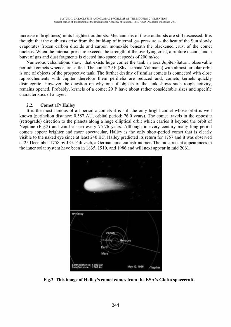
NATURAL CATACLYSMS AND GLOBAL PROBLEMS OF THE MODERN CIVILIZATION. Special edition of Transaction of the International Academy of Science. H&E. ICSD/IAS, Baku-Innsbruck, 2007.
341
increase in brightness) in its brightest outbursts. Mechanisms of these outbursts are still discussed. It is thought that the outbursts arise from the build-up of internal gas pressure as the heat of the Sun slowly evaporates frozen carbon dioxide and carbon monoxide beneath the blackened crust of the comet nucleus. When the internal pressure exceeds the strength of the overlying crust, a rupture occurs, and a burst of gas and dust fragments is ejected into space at speeds of 200 m/sec.
Numerous calculations show, that exists huge comet the tank in area Jupiter-Saturn, observable periodic comets whence are settled. The comet 29 (Shvassmana-Vahmana) with almost circular orbit is one of objects of the prospective tank. The further destiny of similar comets is connected with close rapprochements with Jupiter therefore them perihelia are reduced and, comets kernels quickly disintegrate. However the question on why one of objects of the tank shows such rough activity, remains opened. Probably, kernels of a comet 29 have about rather considerable sizes and specific characteristics of a layer.
2.2. Comet 1P/ Halley It is the most famous of all periodic comets it is still the only bright comet whose orbit is well
known (perihelion distance: 0.587 AU, orbital period: 76.0 years). The comet travels in the opposite (retrograde) direction to the planets along a huge elliptical orbit which carries it beyond the orbit of Neptune (Fig.2) and can be seen every 75-76 years. Although in every century many long-period comets appear brighter and more spectacular, Halley is the only short-period comet that is clearly visible to the naked eye since at least 240 BC. Halley predicted its return for 1757 and it was observed at 25 December 1758 by J.G. Palitzsch, a German amateur astronomer. The most recent appearances in the inner solar system have been in 1835, 1910, and 1986 and will next appear in mid 2061.
Fig.2. This image of Halley's comet comes from the ESA’s Giotto spacecraft.
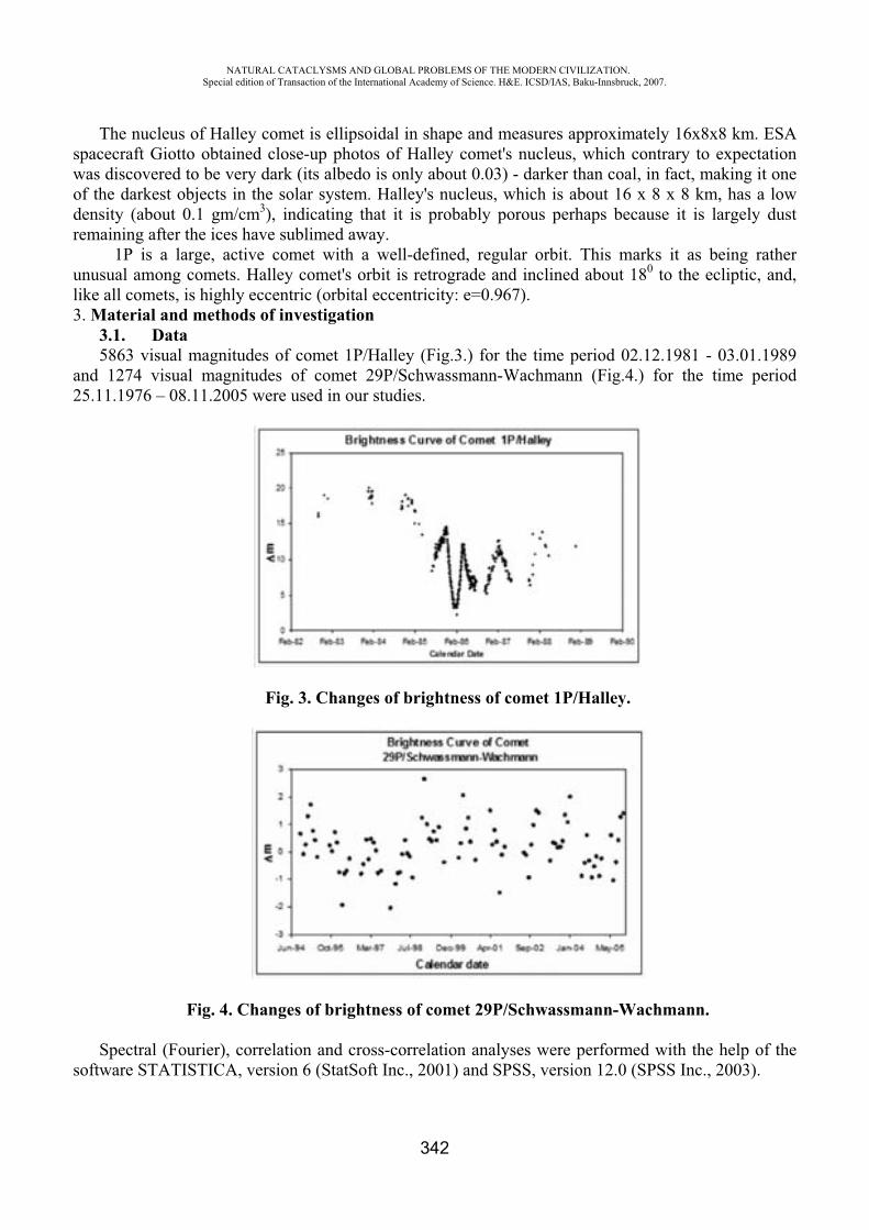
NATURAL CATACLYSMS AND GLOBAL PROBLEMS OF THE MODERN CIVILIZATION. Special edition of Transaction of the International Academy of Science. H&E. ICSD/IAS, Baku-Innsbruck, 2007.
342
The nucleus of Halley comet is ellipsoidal in shape and measures approximately 16x8x8 km. ESA spacecraft Giotto obtained close-up photos of Halley comet's nucleus, which contrary to expectation was discovered to be very dark (its albedo is only about 0.03) - darker than coal, in fact, making it one of the darkest objects in the solar system. Halley's nucleus, which is about 16 x 8 x 8 km, has a low density (about 0.1 gm/cm3), indicating that it is probably porous perhaps because it is largely dust remaining after the ices have sublimed away.
1P is a large, active comet with a well-defined, regular orbit. This marks it as being rather unusual among comets. Halley comet's orbit is retrograde and inclined about 180 to the ecliptic, and, like all comets, is highly eccentric (orbital eccentricity: e=0.967). 3. Material and methods of investigation
3.1. Data5863 visual magnitudes of comet 1P/Halley (Fig.3.) for the time period 02.12.1981 - 03.01.1989
and 1274 visual magnitudes of comet 29P/Schwassmann-Wachmann (Fig.4.) for the time period 25.11.1976 – 08.11.2005 were used in our studies.
Fig. 3. Changes of brightness of comet 1P/Halley.
Fig. 4. Changes of brightness of comet 29P/Schwassmann-Wachmann.
Spectral (Fourier), correlation and cross-correlation analyses were performed with the help of the software STATISTICA, version 6 (StatSoft Inc., 2001) and SPSS, version 12.0 (SPSS Inc., 2003).
NATURAL CATACLYSMS AND GLOBAL PROBLEMS OF THE MODERN CIVILIZATION. Special edition of Transaction of the International Academy of Science. H&E. ICSD/IAS, Baku-Innsbruck, 2007.
343
3.2. MethodsIn contrary to other bodies of the solar system, the brightness of comet (visual magnitude) is
exposed to significant variations [12]. Sometimes the range of such changes of magnitude achieves up to 15m. It is due to movement of comet on elliptic orbits when passing different points of the orbit, comet differently influenced by the solar radiation (both corpuscular and wave). Change of brightness on an observable part of comet’s orbit also depends on the form, size, and physical condition of surface layer of nucleus of comet. Therefore comets, sometimes moving on very close orbits, in the same distances show completely different physical activity and differ on brightness. For these reasons, now there is no standard mathematical formula describing change of brightness of comet on its orbit. Existing formulas up to the certain degree have an empirical character and finally are connected with the residual dispersion. One of the main tasks of cometary astronomy is to reduce to the minimum such dispersion. It is possible in the case if the used formula contains a maximum quantity of parameters reflecting influence of different factors, such as helio- and geocentric distances, phase angle and elongation of comet at the moment of observation, the aperture of the used telescope, etc.).
Achieving the minimum of dispersion it is possible to try to estimate the influence of other factors on variations. In this problem the solar activity is one of the major and primary factors. But in available papers on this subject the problem basically was limited to the comparison of certain diversions in changes of comet brightness with Wolf number (or sunspot number - SSN), and to the search of correlations between them.
In this paper the considered problem is stated more widely, and solar activity influence is studied by means of other and more concrete mechanisms involving their quantitative estimations.
In the recent work [13] a visual magnitude of the comet 1P/Halley was studied with the help of two formulas:
ryHm lg00 (1)
111 lg kryHm (2)
In these formulas
lg5mm
is the brightness of comet reduced to the unit geocentric distance while and r are geo- and heliocentric distances of comet, accordingly, Hi and yi are photometric parameters in different scales, is the elongation angle, and k1 is the relevant coefficient.
Expression (1) is the well-known Orlov’s formula [14] widely used in cometary astronomy, and the second one is its modernization.
Concrete calculations concerning the comet 1P/Halley show that the residual dispersion of the second formula is less for 40% than in first one (8857 and 13949, accordingly).
It is known that estimation of visual magnitude depend also on the aperture of the used telescope or the tool. There are several ways for taking into account the corrections because of aperture of telescope on comet brightness. However calculations of Guliyev [15] show that adding in the right part of the formula (2) one more term which takes into account an influence of apertures of used telescopes, and using the formula
hDkryHm 111 lg (3)
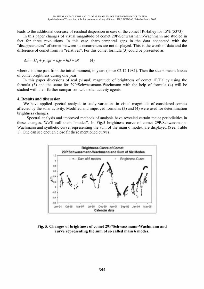
NATURAL CATACLYSMS AND GLOBAL PROBLEMS OF THE MODERN CIVILIZATION. Special edition of Transaction of the International Academy of Science. H&E. ICSD/IAS, Baku-Innsbruck, 2007.
344
leads to the additional decrease of residual dispersion in case of the comet 1P/Halley for 15% (5373). In this paper changes of visual magnitude of comet 29P/Schwassmann-Wachmann are studied in
fact for three revolutions. In this case sharp temporal gaps in the data connected with the “disappearances” of comet between its occurrences are not displayed. This is the worth of data and the difference of comet from its “relatives”. For this comet formula (3) could be presented as
thDkryHm 111 lg (4)
where t is time past from the initial moment, in years (since 02.12.1981). Then the size means losses of comet brightness during one year.
In this paper diversions of real (visual) magnitude of brightness of comet 1P/Halley using the formula (3) and the same for 29P/Schwassmann-Wachmann with the help of formula (4) will be studied with their further comparison with solar activity agents.
4. Results and discussion We have applied spectral analysis to study variations in visual magnitude of considered comets
affected by the solar activity. Modified and improved formulas (3) and (4) were used for determination brightness changes.
Spectral analysis and improved methods of analysis have revealed certain major periodicities in these changes. We’ll call them “modes”. In Fig.5 brightness curve of comet 29P/Schwassmann-Wachmann and synthetic curve, representing the sum of the main 6 modes, are displayed (See: Table 1). One can see enough close fit these mentioned curves.
Fig. 5. Changes of brightness of comet 29P/Schwassmann-Wachmann and curve representing the sum of so called main 6 modes.
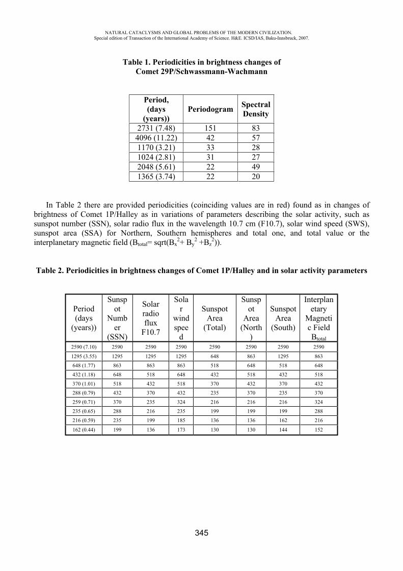
NATURAL CATACLYSMS AND GLOBAL PROBLEMS OF THE MODERN CIVILIZATION. Special edition of Transaction of the International Academy of Science. H&E. ICSD/IAS, Baku-Innsbruck, 2007.
345
Table 1. Periodicities in brightness changes ofComet 29P/Schwassmann-Wachmann
Period,(days
(years))Periodogram Spectral
Density
2731 (7.48) 151 83 4096 (11.22) 42 57 1170 (3.21) 33 28 1024 (2.81) 31 27 2048 (5.61) 22 49 1365 (3.74) 22 20
In Table 2 there are provided periodicities (coinciding values are in red) found as in changes of brightness of Comet 1P/Halley as in variations of parameters describing the solar activity, such as sunspot number (SSN), solar radio flux in the wavelength 10.7 cm (F10.7), solar wind speed (SWS), sunspot area (SSA) for Northern, Southern hemispheres and total one, and total value or the interplanetary magnetic field (Btotal= sqrt(Bx
2+ By2 +Bz
2)).
Table 2. Periodicities in brightness changes of Comet 1P/Halley and in solar activity parameters
Period(days
(years))
Sunspot
Number
(SSN)
Solarradioflux
F10.7
Solar
windspee
d
SunspotArea
(Total)
Sunspot
Area(North
)
SunspotArea
(South)
Interplanetary
Magnetic Field Btotal
2590 (7.10) 2590 2590 2590 2590 2590 2590 2590
1295 (3.55) 1295 1295 1295 648 863 1295 863
648 (1.77) 863 863 863 518 648 518 648
432 (1.18) 648 518 648 432 518 432 518
370 (1.01) 518 432 518 370 432 370 432
288 (0.79) 432 370 432 235 370 235 370
259 (0.71) 370 235 324 216 216 216 324
235 (0.65) 288 216 235 199 199 199 288
216 (0.59) 235 199 185 136 136 162 216
162 (0.44) 199 136 173 130 130 144 152
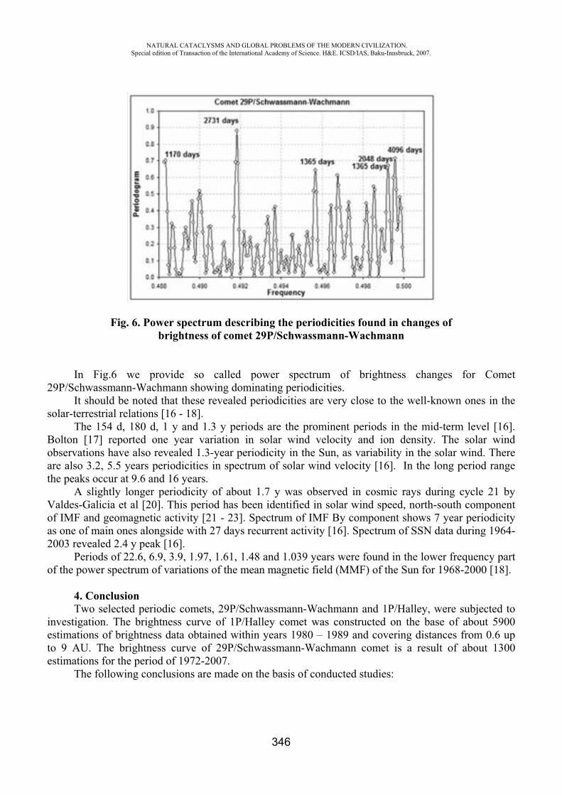
NATURAL CATACLYSMS AND GLOBAL PROBLEMS OF THE MODERN CIVILIZATION. Special edition of Transaction of the International Academy of Science. H&E. ICSD/IAS, Baku-Innsbruck, 2007.
346
Fig. 6. Power spectrum describing the periodicities found in changes ofbrightness of comet 29P/Schwassmann-Wachmann
In Fig.6 we provide so called power spectrum of brightness changes for Comet 29P/Schwassmann-Wachmann showing dominating periodicities.
It should be noted that these revealed periodicities are very close to the well-known ones in the solar-terrestrial relations [16 - 18].
The 154 d, 180 d, 1 y and 1.3 y periods are the prominent periods in the mid-term level [16]. Bolton [17] reported one year variation in solar wind velocity and ion density. The solar wind observations have also revealed 1.3-year periodicity in the Sun, as variability in the solar wind. There are also 3.2, 5.5 years periodicities in spectrum of solar wind velocity [16]. In the long period range the peaks occur at 9.6 and 16 years.
A slightly longer periodicity of about 1.7 y was observed in cosmic rays during cycle 21 by Valdes-Galicia et al [20]. This period has been identified in solar wind speed, north-south component of IMF and geomagnetic activity [21 - 23]. Spectrum of IMF By component shows 7 year periodicity as one of main ones alongside with 27 days recurrent activity [16]. Spectrum of SSN data during 1964-2003 revealed 2.4 y peak [16].
Periods of 22.6, 6.9, 3.9, 1.97, 1.61, 1.48 and 1.039 years were found in the lower frequency part of the power spectrum of variations of the mean magnetic field (MMF) of the Sun for 1968-2000 [18].
4. ConclusionTwo selected periodic comets, 29P/Schwassmann-Wachmann and 1P/Halley, were subjected to
investigation. The brightness curve of 1P/Halley comet was constructed on the base of about 5900 estimations of brightness data obtained within years 1980 – 1989 and covering distances from 0.6 up to 9 AU. The brightness curve of 29P/Schwassmann-Wachmann comet is a result of about 1300 estimations for the period of 1972-2007.
The following conclusions are made on the basis of conducted studies:
NATURAL CATACLYSMS AND GLOBAL PROBLEMS OF THE MODERN CIVILIZATION. Special edition of Transaction of the International Academy of Science. H&E. ICSD/IAS, Baku-Innsbruck, 2007.
347
- Corrections for taking into account an influence of the aperture of telescope on comet brightness makes possible to reduce residual dispersion which improves the results significantly;
- Spectral analyses which were carried out for both variations in solar activity (different mechanisms) and for changes of brightness of the considered comets showed a presence of similar changes in both cases for the same period;
- Solar activity influence showed very close values for both considered comets; - Some well-known periodicities in solar-terrestrial relations were revealed in periodical
changes of brightness; - Solar wind influence could be one of major mechanisms in the explaining of brightness
changes; - It is concluded that interrelations between solar activity changes and brightness of studied
comets are significant.
REFERENCES
1. The Study of Comets. B. Donn et al. (eds.), Washington, DC: U.S. Government Printing Office, NASA SP-393, 1976, 2 vols.
2. Hazards Due to Comets and Asteroids, T. Gehrels (ed.), University of Arizona Press, 1994, 1300 pages.
3. D.A.Andrienko, V.N.Vashchenko. Comets and corpuscular radiation of the Sun. Moscow: “Nauka” Press, 1981, 164 pages.
4. D.A.Andrienko, V.N.Vashchenko. Cometary brightness flares and solar corpuscular activity. Astron. Zh., 1980, vol.57, pp.1310-1316.
5. N.G.Ptitsyna, A.K.Richter, T.K.Breus. The role of solar-wind velocity-waves in comet outburst activity. Earth, Moon, and Planets, 1987, vol. 37, pp. 161-170.
6. A.S.Guliyev. About influence of Solar Activity on opening shot - period comets. Prob. Cosm. Phys., Kiev, 1985, 20, p.39.
7. A.S.Guliyev. About distribution comet parametres on a 11-year cycle of solar activity. Kinem. and phys., Kiev,1990,6,4, p.68.
8. K.I.Churyumov, V.S.Filonenko. The effects of solar activity on the light curves of Comets Churiumov-Gerasimenko (1982 VIII) and Halley (1986 III). Pis'ma v Astronomicheskii Zhurnal, 1991, vol. 17, p. 1135-1142.
9. K.I.Churyumov, V.S.Filonenko. Influence of solar activity upon light curves of comets P/Halley (1986 3) and P/Churyumov-Gerasimenko (1982 8) In Lunar and Planetary Inst., Asteroids, Comets, Meteors 1991 p 121-124 (SEE N93-19113 06-90)
10. M. Neugebauer. The interaction of active comets with the solar wind Earth in Space (ISSN 1040-3124), 1990, vol. 3, pp. 10-14.
11. International Comet Quarterly. The Comet and ICQ. Smithsonian Astrophysical Observatory, Cambridge, USA, 1976-2006.
12. S.K.Vsekhsvyatskii. Physical Characteristics of Comets. Moscow, “Fizmatgiz” Press, 1958, 575 pages.
13. A.S.Guliyev, A.Sh.Bayramov. The fine structure of brightness curve of Comet Halley in 1980s. Azerbaijani Astronomical Journal, 2007, vol. 3-4. (accepted).
14. S.V. Orlov. On the nature of comets. Moscow, Academy of Sciences of USSR Press, 1958. 15. A.S.Guliyev. About influence of telescope apertures on the comet brightness curves.
Azerbaijani Astronomical Journal, 2007 (submitted).
NATURAL CATACLYSMS AND GLOBAL PROBLEMS OF THE MODERN CIVILIZATION. Special edition of Transaction of the International Academy of Science. H&E. ICSD/IAS, Baku-Innsbruck, 2007.
348
16. S.R.P.Nayar, “Periodicities in Solar Activity and Their Signature in the Terrestrial Environment”, In: Proceedings of the ILWS Workshop “The Solar Influence on the Heliosphere and Earth’s Environment: Recent Progress and Prospects”, GOA, February 19-24, 2006, http://ilws.gsfc.nasa.gov/ilwsgoa_nayar.pdf.
17. B.M. Vladimirskii, et al. Space weather and our life. Fryazino: PH “Vek 2”, 2004, 224 pages (in Russian).
18. V.A. Kotov, V.I. Haneychuk, T.T. Tsap. Why does the Sun look like a magnetic S-polarity monopole? In: Proceedings of the 1st Potsdam Thinkshop on Sunspots and Starspots, K.G.Strassmeier & A. Washuettl (eds.), AIP, 2002, pp.137-138.
19. S.J.Bolton, “One Year Variations in the Near Earth Solar Wind Ion Density and Bulk Flow Velocity”, Geophys. Res. Lett., Vol.17, 1990, p.37.
20. J.F.Valdes-Galicia, R.Perez-Enriquez, J.A.Otaola, “The Cosmic Ray 1.68 Year Variation: A Clue to Understand the Nature of the Solar Cycle”, Solar Phys., Vol.167, 1996, pp.409–417.
21. K.I.Paularena, A.Szabo, J.D.Richardson, “Coincident 1.3 Year Periodicities in the Ap Geomagnetic Index and Solar Wind”, Geophys. Res. Letters, Vol.22, 1995, p.301.
22. P.Gazis, J.D.Richardson, K.I.Paularena, “Long Term Periodicity in Solar Wind Velocity during the Last Three Solar Cycles”, Geophys. Res. Lett., Vol. 22, 1995, pp.1165–1168.
23. S.R.P.Nayar, et al, “Wavelet Analysis of Periodicities in Interplanetary Medium”, Solar Phys., Vol.212, 2002, pp.207–211.
ANALYSES OF SOME FACTORS CONTRIBUTING TO FLOODING IN THE MOUTH PART OF THE KURA
R.N. Mahmudov*, R. Kh. Abbasov**, R.M. Fanelli ***
** Scientific-Research Institute of Hydrometeorology, Ministry of Ecology and Natural Resources of Azerbaijan Republic
***Water Research Institute, Michigan State University, USA
Flow regulation in Azerbaijan’s rivers has historically been considered the most effective method for flood prevention, although large flood events began to occur even in the highly regulated reaches in recent years. Also, while most of the Kura River’s flood events have usually occurred during warming periods, flooding events have been more recently observed even during shallow water periods, when the river’s discharge is relatively low. This recent change in the river’s flood frequency and magnitude has increased the threat to floodplain residences and the productivity of floodplain agricultural activities. Larger flood events have the potential to cause colossal economic and social damage to municipalities located near the banks of the river by not only flooding the surface of the floodplain, but also by raising local groundwater levels that affect the normal function of households both at the banks and the territories located far from the river.
More recently, there are numerous additional factors occurring in and around the Kura river basin area that have increased flooding in the Kura. Climatic patterns which increased intense snowmelt and intense rains during high flow period have increased flood frequency and peak flows. The rising Caspian Sea level, into which the River Kura flows, has also contributed to increase
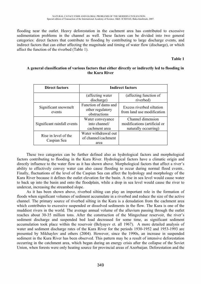
NATURAL CATACLYSMS AND GLOBAL PROBLEMS OF THE MODERN CIVILIZATION. Special edition of Transaction of the International Academy of Science. H&E. ICSD/IAS, Baku-Innsbruck, 2007.
349
flooding near the outlet. Heavy deforestation in the cachment area has contributed to excessive sedimentation problems in the channel as well. These factors can be divided into two general categories: direct factors that contribute to flooding by contributing to large discharge events, and indirect factors that can either affecting the magnitude and timing of water flow (discharge), or which affect the function of the riverbed (Table 1).
Table 1
A general classification of various factors that either directly or indirectly led to flooding in the Kura River
Direct factors Indirect factors
(affecting water discharge)
(affecting function of riverbed)
Significant snowmelt events
Function of dams and other regulatory
obstructions
Excess riverbed siltation from land use modification
Significant rainfall events Water conveyance
into channel/ cachment area
Channel dimension modifications (artificial or
naturally occurring)
Rise in level of theCaspian Sea
Water withdrawal out of channel/cachment
area
These two categories can be further defined also as hydrological factors and morphological factors contributing to flooding in the Kura River. Hydrological factors have a climatic origin and directly influence to the water flow as it has shown above. Morphological factors that affect a river’s ability to effectively convey water can also cause flooding to occur during normal flood events.. Finally, fluctuations of the level of the Caspian Sea can affect the hydrology and morphology of the Kura River because it defines the outlet elevation for the basin. A rise in sea level would cause water to back up into the basin and onto the floodplain, while a drop in sea level would cause the river to undercut, increasing the streambed slope.
As it has been shown above, riverbed silting can play an important role in the formation of floods when significant volumes of sediment accumulate in a riverbed and reduce the size of the active channel. The primary source of riverbed silting in the Kura is a denudation from the cachment area which contributes to excessive suspended or dissolved sediments in the flow. The Kura is one of the muddiest rivers in the world. The average annual volume of the alluvium passing through the outlet reaches about 30-35 million tons. After the construction of the Mingechaur reservoir, the river’s sediment discharge and suspended bed load decreased for some time, as significant sediment accumulation took place within the reservoir (Belyayev et. all 1967). A more detailed analysis of water and sediment discharge rates of the Kura River for the periods 1930-1952 and 1953-1993 are presented by Mikhaylov and others (2004). However, since the 1990s, an increase in suspended sediment in the Kura River has been observed. This pattern may be a result of intensive deforestation occurring in the catchment area, which began during an energy crisis after the collapse of the Soviet Union, when forests were only heating source for provincial areas of Azerbaijan. Deforestation and the
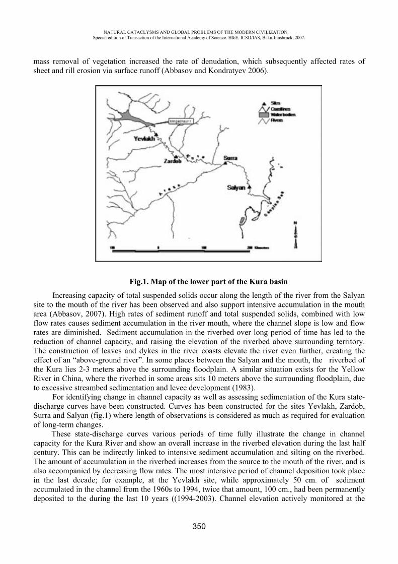
NATURAL CATACLYSMS AND GLOBAL PROBLEMS OF THE MODERN CIVILIZATION. Special edition of Transaction of the International Academy of Science. H&E. ICSD/IAS, Baku-Innsbruck, 2007.
350
mass removal of vegetation increased the rate of denudation, which subsequently affected rates of sheet and rill erosion via surface runoff (Abbasov and Kondratyev 2006).
Fig.1. Map of the lower part of the Kura basin
Increasing capacity of total suspended solids occur along the length of the river from the Salyan site to the mouth of the river has been observed and also support intensive accumulation in the mouth area (Abbasov, 2007). High rates of sediment runoff and total suspended solids, combined with low flow rates causes sediment accumulation in the river mouth, where the channel slope is low and flow rates are diminished. Sediment accumulation in the riverbed over long period of time has led to the reduction of channel capacity, and raising the elevation of the riverbed above surrounding territory. The construction of leaves and dykes in the river coasts elevate the river even further, creating the effect of an “above-ground river”. In some places between the Salyan and the mouth, the riverbed of the Kura lies 2-3 meters above the surrounding floodplain. A similar situation exists for the Yellow River in China, where the riverbed in some areas sits 10 meters above the surrounding floodplain, due to excessive streambed sedimentation and levee development (1983).
For identifying change in channel capacity as well as assessing sedimentation of the Kura state-discharge curves have been constructed. Curves has been constructed for the sites Yevlakh, Zardob, Surra and Salyan (fig.1) where length of observations is considered as much as required for evaluation of long-term changes.
These state-discharge curves various periods of time fully illustrate the change in channel capacity for the Kura River and show an overall increase in the riverbed elevation during the last half century. This can be indirectly linked to intensive sediment accumulation and silting on the riverbed. The amount of accumulation in the riverbed increases from the source to the mouth of the river, and is also accompanied by decreasing flow rates. The most intensive period of channel deposition took place in the last decade; for example, at the Yevlakh site, while approximately 50 cm. of sediment accumulated in the channel from the 1960s to 1994, twice that amount, 100 cm., had been permanently deposited to the during the last 10 years ((1994-2003). Channel elevation actively monitored at the
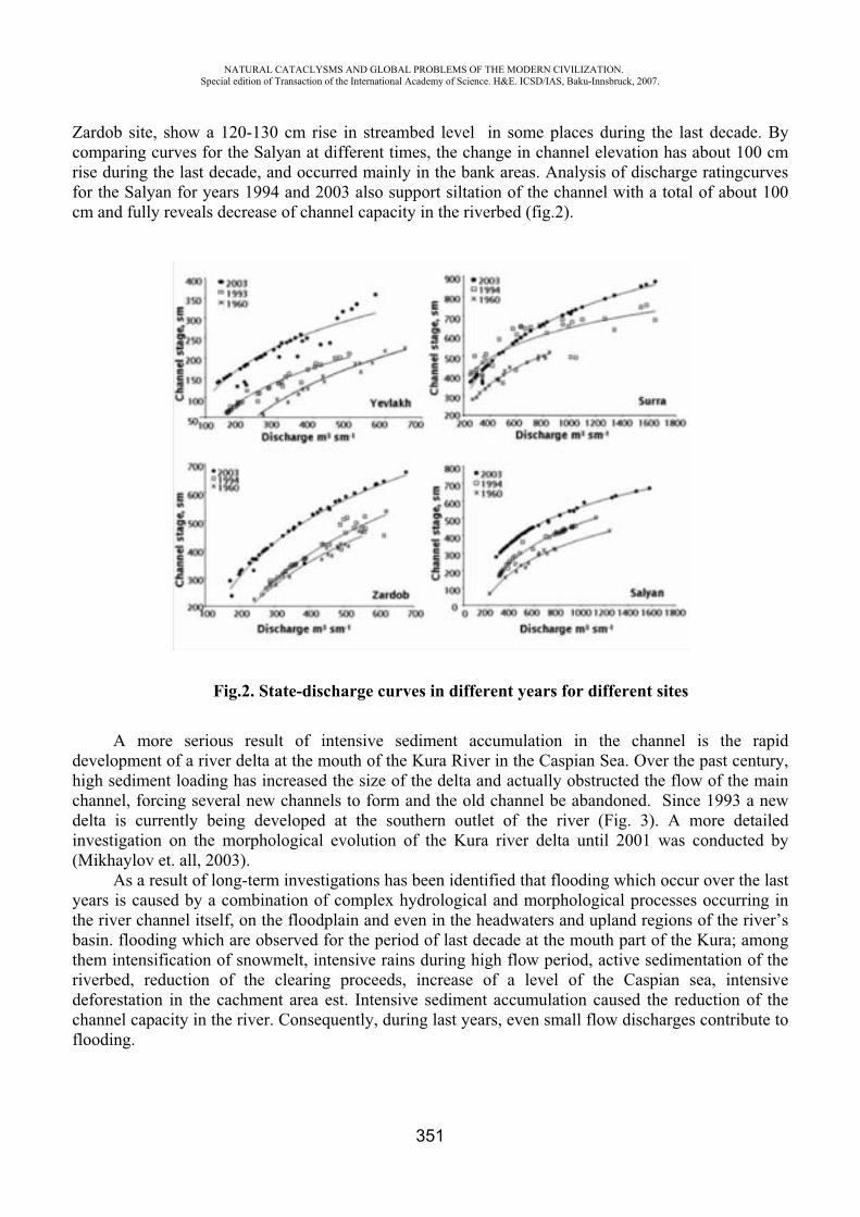
NATURAL CATACLYSMS AND GLOBAL PROBLEMS OF THE MODERN CIVILIZATION. Special edition of Transaction of the International Academy of Science. H&E. ICSD/IAS, Baku-Innsbruck, 2007.
351
Zardob site, show a 120-130 cm rise in streambed level in some places during the last decade. By comparing curves for the Salyan at different times, the change in channel elevation has about 100 cm rise during the last decade, and occurred mainly in the bank areas. Analysis of discharge ratingcurves for the Salyan for years 1994 and 2003 also support siltation of the channel with a total of about 100 cm and fully reveals decrease of channel capacity in the riverbed (fig.2).
Fig.2. State-discharge curves in different years for different sites
A more serious result of intensive sediment accumulation in the channel is the rapid development of a river delta at the mouth of the Kura River in the Caspian Sea. Over the past century, high sediment loading has increased the size of the delta and actually obstructed the flow of the main channel, forcing several new channels to form and the old channel be abandoned. Since 1993 a new delta is currently being developed at the southern outlet of the river (Fig. 3). A more detailed investigation on the morphological evolution of the Kura river delta until 2001 was conducted by (Mikhaylov et. all, 2003).
As a result of long-term investigations has been identified that flooding which occur over the last years is caused by a combination of complex hydrological and morphological processes occurring in the river channel itself, on the floodplain and even in the headwaters and upland regions of the river’s basin. flooding which are observed for the period of last decade at the mouth part of the Kura; among them intensification of snowmelt, intensive rains during high flow period, active sedimentation of the riverbed, reduction of the clearing proceeds, increase of a level of the Caspian sea, intensive deforestation in the cachment area est. Intensive sediment accumulation caused the reduction of the channel capacity in the river. Consequently, during last years, even small flow discharges contribute to flooding.
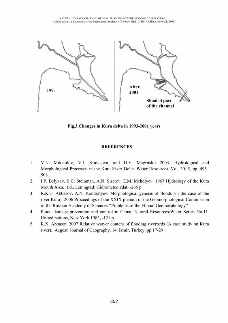
NATURAL CATACLYSMS AND GLOBAL PROBLEMS OF THE MODERN CIVILIZATION. Special edition of Transaction of the International Academy of Science. H&E. ICSD/IAS, Baku-Innsbruck, 2007.
352
Fig.3.Changes in Kura delta in 1993-2001 years
REFERENCES
1. V.N. Mikhailov, V.I. Kravtsova, and D.V. Magritskii 2003. Hydrological and Morphological Processes in the Kura River Delta. Water Resources, Vol. 30, 5, pp. 495–508.
2. I.P. Belyaev, B. . Steinman, A.N. Sisarev, E.M. Mehdiyev. 1967 Hydrology of the Kura Mouth Area, Ed., Leningrad: Gidrometeoizdat, -265 p.
3. R.Kh. Abbasov, A.N. Kondratyev, Morphological genesis of floods (in the case of the river Kura). 2006 Proceedings of the XXIX plenum of the Geomorphological Commission of the Russian Academy of Sciences “Problems of the Fluvial Geomorphology”
4. Flood damage prevention and control in China. Natural Resources/Water Series No.11. United nations, New York 1983, -121 p.
5. R.X. Abbasov 2007 Relative watyer content of flooding riverbeds (A case study on Kura river). Aegean Journal of Geography. 14. Izmir, Turkey, pp.17-29
1993After 2001
Shoaled partof the channel
NATURAL CATACLYSMS AND GLOBAL PROBLEMS OF THE MODERN CIVILIZATION. Special edition of Transaction of the International Academy of Science. H&E. ICSD/IAS, Baku-Innsbruck, 2007.
353
METHODS OF DRAWING UP MORPHOMETRIC TENSITY MAP OF SLOPES AND ITS NECESSITY IN STRUGGLE WITH NATURAL CATACLYSM
Mehbaliyev M.M.
Geography Faculty, Geodesy and cartography departmentBaku city, Azerbaijan Republic
After achieving independence of our republic, has been started intensive appropriation of
mountainous regions. For conducting such works, complex and exact investigations should be carried
out and necessary theme maps should draw up. Composition of these investigations is morphometric
investigations.
One of the most largely spread forms of natural cataclysm in territory of our republic is sliding.
Sliding may be met in every mountainous region.
In basin of Girdimanchay (Zarnava, Niyaldag, Tirjan, and near Lahij villages), near the basin of
Gudyalchay, Gusarchay and Valvalachay, have been spread mostly old and new sliding. In the result
of sliding on 12 May, 1963 in Tirjan - 35, in Varna - 15, in Mudrud - 47 houses have been destroyed.
Sliding changes million tones soil and ground in a year by establishing morphometric tensity.
According to information of Red Cross and Red Half-Moon Society sliding results by 1550 persons in
a year. The following factors influence to establishment of sliding: regulation of flowing of surface
waters, economical activity of humans (to graze cattle intensively, correctly installing of underground
tubes, liquidation of plant cover. etc) repeatedly flowing down of erosion base, side erosion of river
valley etc.
Character of soil, condition of getting humid, morphometric indicators of relief (sloping,
horizontal and vertical division, evaporate) greatly influence for establishment of sliding. Water is
collected over underground waterproof clayey layer, water soaks soil layer, and soil layer losing its
equilibrium starts to act. Sliding happens in spring and autumn during raining.
Sliding is met mostly at 1500-2000 m higher in north evaporated slopes other than in south
evaporated slopes. They establish thick ravine-gorge by dividing upper layer of earth and quicken
erosion process. One of the most facilities for discovering natural cataclysm hearths and struggle
against to them is morphometric evaluation maps.
Remarkable Azerbaijan geomorphologic E. K. Alizada used from three morphometric indicators
(sloping, horizontal and vertical division,) during drawing of morphometric tensity map. The received
results during investigation of mutual connection among morphometric indicators shows that,
NATURAL CATACLYSMS AND GLOBAL PROBLEMS OF THE MODERN CIVILIZATION. Special edition of Transaction of the International Academy of Science. H&E. ICSD/IAS, Baku-Innsbruck, 2007.
354
evaporation is thickly connected with these morphometric indicators. In for that reason used from four
morphometric indicators in our investigation.
Purpose of investigation work is in the example of Khinalig investigation field to draw
morphometric tensity map of higher and lower mountainous area slopes and to learn necessity of it in
the struggle with cataclysm.
Area of investigation field is 1761,52 square km. It covers mountainous area of Gudyalchay,
Gusarchay, Garachay, and Valvalachay rivers basin. There are 504 slopes there.
For achieving this purpose, the following works carried out:
1) On 1:100000 scaled topographic map, area of investigation field, slopes inside of the
territory has been separated.
2) Field of every slope measured, and details of every slopes is given according to their
field.
3) Middle sloping, steaming according to eight points, horizontal and vertical division maps
of Slopes drawn up by cartogram method.
4) (a), for sloping, horizontal ( H) and vertical (K) division of slopes is given details (Table
1).
5) On the basis of classification slopes are grouped and 8 schedule drawn after counting of
their number and filed.
6) Morphometric indicators evaluated according to fifth pointed system. (Schedule1).
7) All point marks summed up, and is given classification in the fifth pointed system
according to morphometric tensity grade of slopes on the basis of final point. (Schedule 1): 0-4 (very
weak), 4-8 (weak), 8-12 (middle) 12-16 (higher), 16-20 (highest).
8) On the basis of final point marks morphometric tensity map of slopes is drawn by
cartogram (Picture 1).
Natural cataclysms damage to dwelling houses. It is necessary to know place of dwelling houses
and height above ocean level for protection of them. For that, purpose on the basis of 1:25 000 scaled
topographic map, absolute height of all dwelling houses which situate in the investigation field and is
determined situated height zone. Besides it, on the basis of data of census of the population, general
number of population of all dwelling houses and sexual composition has been learned. Conducted
investigations shows that, for morphometric tensity grade is observed vertical division of slopes, high
morphometric tensity slopes form superiority.
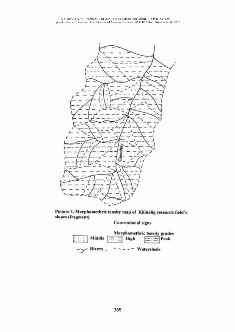
NATURAL CATACLYSMS AND GLOBAL PROBLEMS OF THE MODERN CIVILIZATION. Special edition of Transaction of the International Academy of Science. H&E. ICSD/IAS, Baku-Innsbruck, 2007.
355
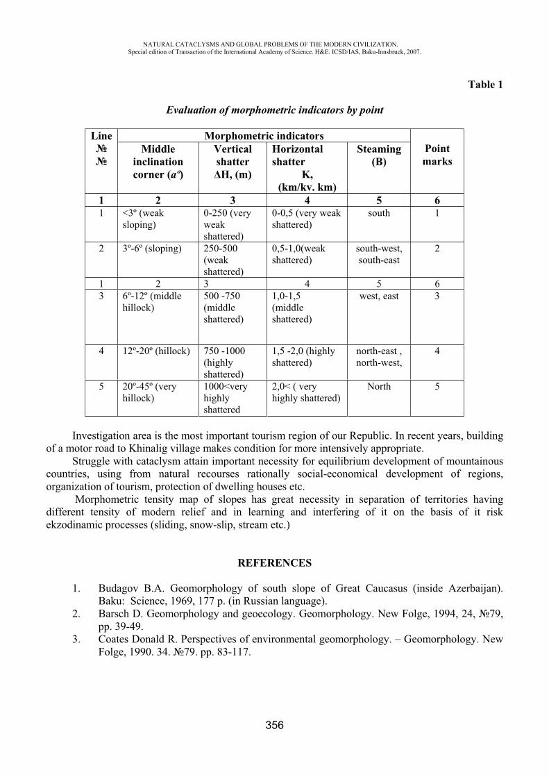
NATURAL CATACLYSMS AND GLOBAL PROBLEMS OF THE MODERN CIVILIZATION. Special edition of Transaction of the International Academy of Science. H&E. ICSD/IAS, Baku-Innsbruck, 2007.
356
Table 1
Evaluation of morphometric indicators by point
Line Morphometric indicators Pointmarks
Middleinclination corner (aº)
Vertical shatter H, (m)
Horizontal shatter
K,(km/kv. km)
Steaming(B)
1 2 3 4 5 6 1 <3º (weak
sloping)0-250 (very weakshattered)
0-0,5 (very weak shattered)
south 1
2 3º-6º (sloping) 250-500 (weakshattered)
0,5-1,0(weak shattered)
south-west,south-east
2
1 2 3 4 5 63 6º-12º (middle
hillock)500 -750 (middle shattered)
1,0-1,5 (middle shattered)
west, east 3
4 12º-20º (hillock) 750 -1000 (highly shattered)
1,5 -2,0 (highly shattered)
north-east , north-west,
4
5 20º-45º (very hillock)
1000<very highly shattered
2,0< ( very highly shattered)
North 5
Investigation area is the most important tourism region of our Republic. In recent years, building of a motor road to Khinalig village makes condition for more intensively appropriate.
Struggle with cataclysm attain important necessity for equilibrium development of mountainous countries, using from natural recourses rationally social-economical development of regions, organization of tourism, protection of dwelling houses etc.
Morphometric tensity map of slopes has great necessity in separation of territories having different tensity of modern relief and in learning and interfering of it on the basis of it risk ekzodinamic processes (sliding, snow-slip, stream etc.)
REFERENCES
1. Budagov B.A. Geomorphology of south slope of Great Caucasus (inside Azerbaijan). Baku: Science, 1969, 177 p. (in Russian language).
2. Barsch D. Geomorphology and geoecology. Geomorphology. New Folge, 1994, 24, 79,pp. 39-49.
3. Coates Donald R. Perspectives of environmental geomorphology. – Geomorphology. New Folge, 1990. 34. 79. pp. 83-117.
NATURAL CATACLYSMS AND GLOBAL PROBLEMS OF THE MODERN CIVILIZATION. Special edition of Transaction of the International Academy of Science. H&E. ICSD/IAS, Baku-Innsbruck, 2007.
357
4. Guliyev R.Y. According to methods of morphometric evaluation of Ecological condition’s tensity, News of Baku State University, Series of Natural Sciences, Geography, 2006, 3,pp. 151-158 (in Russian language).
5. Alizada E.K. Morpho structure of Azerbaijan and territories being neighbour to it. (On the basis of decipher of cosmic pictures) Baku Science 1998, 248 p (in Russian language)
6. Mehbaliyev M.M. Drawing of eco-geomorphology tensity map and morphometric analyses. Materials of VI International Conference, Vladikavkaz, 2007, pp. 273-275 (Russian language).
7. Ramade F. Les catastrophes écologiques. Paris: McGaw–Hill, 1987, 318 p. 8. Starkel L. Fluvial environment as an expression of geological changes. Geomorphology.
New Folge, 1990. 34. 79. pp. 133-152.
INTELLECTUAL INFORMATION EXPERT SYSTEMS AND COMPLEXES OF THE FORECAST AND MATHEMATICAL
MODELING OF NATURAL GEOLOGICAL ACCIDENTS
Hasanov A.B.*, Alizade Z.M.**, Allahverdiyeva S.S.***
Institute of Cybernetics of ANAS, Regional Centre of Science in Sheki
Development of mathematical models and computer programs for information – prognostics of system of a water -ecological status of pool of the mountain rivers of southern Caucasus.
The activization natural and techno genesis of accidents in the beginning I of century is marked worldwide. Many catastrophic phenomena, despite of a high level of technological development, have no for today approved of unequivocal methods of modeling and decision.
One of such problems is flows. The catastrophic phenomena flows have no an exact method of forecasting, therefore, study of a nature of flows, interaction them with artificial structures, development anti- flows of measures and scientifically proved methods of forecasting are a urgent task.
The decision of this problem the special value gets for mountain areas of the country, where passage catastrophic of flows frequently is observed.
There was a necessity of the constant control for exogenous by processes of areas, behind interaction of an environment and technical structures. For this purpose it is necessary to estimate a modern gynecological status of area and to develop the program of monitoring flows of processes, on the basis of which it is necessary to search for productive ways of forecasting
The general technological circuit of drawing up of the long-term regional forecasts consists in the following. On the basis of the analysis of long-term researches of display exogenous of geological processes and factors, their causing, the laws of development flows in time and space come to light. Then will be carried out zoning of territory on a mode of activization flows processes with allocation of potentially dangerous zones i.e. territories, which are characterized by different modes of change high-speed traverse of the factors determining development of flows processes.
NATURAL CATACLYSMS AND GLOBAL PROBLEMS OF THE MODERN CIVILIZATION. Special edition of Transaction of the International Academy of Science. H&E. ICSD/IAS, Baku-Innsbruck, 2007.
358
One of lacks of long-term forecasting is the absence of binding to concrete to pools. Therefore we will address to opportunities of the empiric-regional approach, which is based on the expert analysis of the items of information received by monitoring of changes of an environment of the central part Southern Caucasian range in territory of the Azerbaijan Republic - high-mountainous pools r. Kishchay, Shinchay, Kurmuxchay and etc. The purpose of the forecast - revealing of the period’s mud flowing of activity for concrete pool, that has practical value at development of flows risk territory.
On features of geomorphologic conditions the regions are subdivided into engineering –geological areas, and area on features of a geological structure, on a engineering -geological areas.
In a final map will be shown potential flows files. The technique of drawing up of such maps chooses GIS-technologies, with which help imposing one information layer on another is made, at the account of the geological and geomorphologic factors.
For each engineering -geological site in a temporary zone the long-term forecast of flows processes is given. The long-term forecasts are made for pool as a whole, or for separate mud flowing of the centers. At the long-term forecasts flows can be used interflows an interval, which is understood as time between passage in flows same stream.
On the basis of cartographical mode avalanche zoning, the short-term or operative forecasts are made. At drawing up of such forecasts the large role is played with the analysis of a status of components determining development of flow process, hydro meteorological conditions. The basic attributes of formation of flows in the centers connected to modern glaciers, are the steady long increases of temperature in high-mountainous areas and high rule zero isotherms. In a high-mountainous zone Southern Caucasian mountain ridge, the complex glacially and storm factors supplying with water, usual to the present time works in connection with warming of a climate and long glacier contraction of glaciers.
The basic tasks: Theoretical researches of processes forming a liquid, firm and chemical drain in pools of the
mountain rivers: - the mathematical description of processes of formation thawed, rain clouds, mixed, flows and
having dug the maximal charges; - development of the theory of the mechanics both thermodynamics of multiphase and
multicomponent environments with reference to mathematical modeling of flows; - study of casual sequences and processes in hydrometeorology;
Significant results: - a method of account of the maximal charges of thawed waters of the mountain rivers - a method of account mixed maximal charges of the mountain rivers; - mathematical modeling the hydro column of a drain of the mountain rivers; - a method of account of receipt of solar radiation on the variously focused and inclined slopes;
NATURAL CATACLYSMS AND GLOBAL PROBLEMS OF THE MODERN CIVILIZATION. Special edition of Transaction of the International Academy of Science. H&E. ICSD/IAS, Baku-Innsbruck, 2007.
359
- stochastic - the determined models of a drain of the rivers; - communication of factor turbulence with a high-speed field of a flow; - structure of factor of dynamic interaction of phases for multiphase environmental the
constrained and not constrained movement; - density sating pair and temperature of phase balance of system water - ice for multiphase
environment; - problems of a soil hydrology and artificial irrigation of grounds.
The forecast and rating erosive - flow of the phenomena in pools of the rivers The summary: For a rating erosive - flow of the phenomena in pool of the river the attention is
inverted on the geomorphologic and climatic factors of territory, and also on characteristic slope of region, in view of which pay of destructive processes of a surface of ground. With the purpose of a rating of an ecological situation in pool of the river, considering a degree of damage of slopes, the values of slopes, factor of erosion are established which enable of forecasting of volume of weight, from slopes and saved in channels of the rivers. To calculate capacity of a flow for active inflows of character of the river, the maximal charges of different security are established which enable of the forecast erosive - flow of the phenomena on mountain stream.
The basic modules of a program complex: - The system analysis and its application to study course of the rivers; - Types stream flow of processes and forms course of the mountain rivers; - Stream flow formation factor; - Conveyance fluid ability of a flow and charge sediment load; - Relative conveyance fluid ability of a flow; - Association of alternative hypotheses; - Kinds of influences on a channel and algorithm of the forecast of changes such as stream flow
of processes.
REFERENCES
1. Aliev T.A. The robast technology of the computer analysis. - ., Mechanical engineering, 1999, 195 p.
2. Hasanov A.B. Reaction of mechanical systems to non-stationary external influences. Baku, ELM, 2004, 247p.
3. Clackin V.I. The stochastic equations and waves in casual - non-uniform environments (Wednesdays). ., Science, 1980, 335 p.

NATURAL CATACLYSMS AND GLOBAL PROBLEMS OF THE MODERN CIVILIZATION. Special edition of Transaction of the International Academy of Science. H&E. ICSD/IAS, Baku-Innsbruck, 2007.
360
NATURAL CATACLYSMS AND GLOBAL PROBLEMS OF THE MODERN CIVILIZATION. Special edition of Transaction of the International Academy of Science. H&E. ICSD/IAS, Baku-Innsbruck, 2007.
361
THE RADAR-TRACKING FORECAST OF HIGH WATERS AND MUDFLOWS OF STORM ORIGIN
Safarov S.H.
National Hydrometeorological Departmentof the Ministry of Ecology and Natural Resources
Last years the increase in frequency and capacity of flooding, high waters and mudflows of storm origin which bring to ruin people, partially or completely destroy settlements, bridges and roads, fields and gardens, cause huge material and ecological damage is observed.
For maintenance of the duly notification of the population and the state bodies about the threat of expected high waters and mudflows it is necessary to have reliable methods of forecasting of such phenomena. As, in the territory of research high waters and mudflows basically arise as a result of fall of intensive showers, this problem can be solved by development of the methods of reliable forecasting intensity, duration, exact time and the concrete place of fall of intensive showers. Traditional methods of forecasting of atmospheric precipitation do not allow coping with the given problem as they cannot consider their existential variability with sufficient accuracy.
The given problem can be solved by means of the automated meteorological radar (MRL). The data of the automated MRL about presence, site, direction and speed of moving of the downpours zone are the most operative and full. This system also allows at any time and in any point of space operatively estimating intensity, quantity and other characteristics of dropping out precipitation. Continuous radar-tracking supervision over storm processes enables to watch accumulation of precipitation in reservoirs of mudflow centers in real time.
One of such systems is created in Akstafa experimentally-proving polygon on active influence on atmospheric processes of National Hydrometeorological Department of the Ministry of Ecology and Natural Resources on the basis of MRL-5 with application of modern program-technical complex [1].
As is known the total quantity of the precipitation dropped out in a reservoir of the river and forming drain, it is possible to present in the form of:
321 QQQQ , (1)Where Q1 – the quantity of the precipitation which have dropped out in a reservoir in last 24
hours (mm); Q2 - the quantity of the precipitation which have dropped out for last 10 day, considered with the weight factors decreasing in process of statute of limitation; Q3 – the quantity of the precipitation expected in the nearest hours.
Radar-tracking measurement of intensity of precipitation is based on its dependence on value of radar-tracking reflectivity [2]:
lg Jn = - 2,192 + 0,065 Z10n , (2) Where Z10n – the radar-tracking reflectivity of precipitation on length of wave 10 sm in the i-th
discrete of range. Then the layer of the dropped out precipitation will be:N
iini tJQ
1 , (3)
Where ti - the intervals between cycles of the radar-tracking review, equal for automated MRL-5 3, 5 mines; N – the number of radar-tracking cycles of the space review. Summation of value
NATURAL CATACLYSMS AND GLOBAL PROBLEMS OF THE MODERN CIVILIZATION. Special edition of Transaction of the International Academy of Science. H&E. ICSD/IAS, Baku-Innsbruck, 2007.
362
Q on the area of rivers basin or mudflows center provides receptions of quantity of precipitation Q1forming a drain:
kj
k j
kj SQQ1 1
1 , (4)
Where Skj and Qkj – the area and layer of precipitation in the k-th discrete of range and in the j-thdiscrete of azimuth on the rivers basin or mudflows centers.
The quantity of the precipitation which has dropped out in a rivers basin or mudflows center in previous 10 day pays off under the formula:
n
iii BQQ
112 , (5)
Where Q1i – the quantity of precipitation Q1 which has dropped out in the i-th previous day (kept in memory of a computer); Bi – the weight factors decreasing in process of statute of limitation; n – the number, considered previous day.
Thus, the quantity of the precipitation dropped out in current and previous days, are measured by means of automated MRL-5 in real time. Results of radar-tracking measurement are evidently displayed on the monitor of the system in the form of a picture of distribution of quantity of precipitation on a background of the card of district on which reservoirs of the rivers and mudflow centers (fig.) are specified.
The expected quantity of precipitation is payed off in view of speed, direction and water content of the precipitation zone approaching to a reservoir of the mudflow centers.
Speed and direction of moving of a precipitation zone are payed off according their consecutive positions in time. Measurement of intensity and quantity of precipitation Q1, Q2, Q3 and calculationQ are carried out round the clock on all basins of the rivers. Quantities of precipitation dropped out on reservoirs are measured in tons.
It is necessary to note, depending on some physiographic, geological, orographic, etc. factors threshold value of quantity of precipitation necessary for formation of high waters and mudflows, in general is various for different reservoirs and should be certain according to long-term radar-tracking supervision.
Weight factors in (5) which decrease depending on a limitation period of precipitation, can be accepted as:
Bi = 1 / ni ,Where ni - term of precipitation i - th limitation.Advantage of the given method is the opportunity of simultaneous supervision over all reservoirs
and mudflow centers, being in radius of the review automated MRL-5. The given method is calculated on round-the-clock work automated MRL-5 and at achievement of threshold value of quantity of precipitation can provide the population and the state bodies with notifications about high waters of a storm origin with the raised earliness.
The radar-tracking estimation of quantity of precipitation also allows predicting mudflow phenomena of a storm origin with earliness of 3-6 hours.
Mudflow is short-term and rather powerful high water with extreme the greater maintenance of firm material - clay, sand, rubble and stones.
In Azerbaijan the basic mudflow dangerous areas are the southern and northeast slopes of Big Caucasus, Lateral Ridge and Gobustan, the southwest and northeast slopes of Small Caucasus and the Lenkaran region. However the southern slope of Big Caucasus is most mudflow dangerous.
NATURAL CATACLYSMS AND GLOBAL PROBLEMS OF THE MODERN CIVILIZATION. Special edition of Transaction of the International Academy of Science. H&E. ICSD/IAS, Baku-Innsbruck, 2007.
363
It is necessary to note that in cases of forecasting mudflow phenomena the role of the second composed in (1) considerably decreases. It is first of all connected the features of mudflow formation process. As is known, for formation mudflow, except intensive precipitation, presence of a friable disintegrated rock formation material prepared to an output is necessary. Accumulation of friable material occurs during active aeration of rocks, collapses, landslips, taluses, eroded activity of water and tectonic phenomena [3].
The analysis of long-term data shows, that the most powerful mudflows are observed in July-August when the long period without precipitation promotes formation of enough friable disintegrated rock formation material necessary for formation of powerful structural mudflows. Thus, the most powerful structural mudflows, unlike usual high water, are in most cases formed as a result of fall of plentiful showers on the mudflow centers after the long period without precipitation. Therefore at the radar-tracking forecast of mudflow phenomena the second composed in expression (1) can be neglected.
The joint analysis of materials of radar-tracking and hydrological supervision also shows that powerful mudflows are formed at the certain relative positioning of a speed vector of the precipitation zone and directions of current of the mudflow dangerous rivers [4]. It is established, that for the period 2001-2007 on the southern slope of Big Caucasus, actually, all structural mudflows were observed when the powerful zones of precipitation moved roughly in a direction against a watercourse, aside a mountain ridge. Intensive precipitation on the mudflow centers creates favorable conditions for development of mudflow formation processes. On the other hand, as a result of moving the zone of precipitation on a river basin from below upwards intensive precipitation result in strong humidifying ground and various rocks in the bottom and average part of a river basin, weakening their durability and balance with water. The average part of basin represents area in which occurs both movement of a stream, and additional supply stream due to showered and destroyed slopes of valleys. Thus, the interaction of a water stream with friable disintegrated rock formations material in the top part of basin, results in avalanche involving a firm material in the stream and to repeated increase in its account characteristics and density in its average part. Besides moving of the storm centers, thus, provides full scope of all or significant part of rivers basins with intensive precipitation and results in formation of mudflows simultaneously in the several mudflow centers.
If to consider, that on the southern slope of Big Caucasus the orientation of basin of the mudflow dangerous rivers basically is directed from the northeast to
southwest the storm center approaching from the southwest with the raised value of the water-maintenance with a high probability can cause a mudflow.
Thus, by means of automated MRL-5, using the picture of distribution of quantity of precipitation on the territory of rivers basin or mudflow centers (fig.) and also considering dynamics of development of storm processes it is possible with sufficient reliability to predict high waters and mudflows of a storm origin.
For the period 2001-2007 on the set forth above method have been made the forecasts of the powerful high waters and mudflows in the majority pools of the rivers of the southern slope of Big Caucasus and in the northeast slope of Small Caucasus with enough high earliness (3-6 hours).
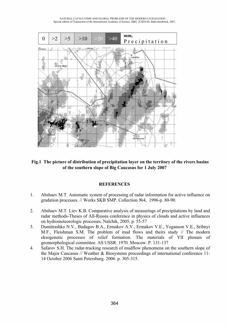
NATURAL CATACLYSMS AND GLOBAL PROBLEMS OF THE MODERN CIVILIZATION. Special edition of Transaction of the International Academy of Science. H&E. ICSD/IAS, Baku-Innsbruck, 2007.
364
Fig.1 The picture of distribution of precipitation layer on the territory of the rivers basins of the southern slope of Big Caucasus for 1 July 2007
REFERENCES
1. Abshaev M.T. Automatic system of processing of radar information for active influence on gradation processes. // Works SKB SMP. Collection 4, 1996-p. 80-90.
2. Abshaev M.T. Liev K.B. Comparative analysis of measurings of precipitations by land and radar methods-Theses of All-Russia conference in physics of clouds and active influences on hydrometeorologic processes. Nalchik, 2005, p. 55-57
3. Dumitrashko N.V., Budagov B.A., Ermakov A.V., Ermakov V.E., Yoganson V.E., Sribnyi M.F., Fleishman S.M. The problem of mud flows and theirs study // The modern eksogenetic processes of relief formation. The materials of YII plenum of geomorphological committee. AS USSR. 1970. Moscow. P. 131-137
4. Safarov S.H. The radar-tracking research of mudflow phenomena on the southern slope of the Major Caucasus // Weather & Biosystems proceedings of international conference 11-14 October 2006 Saint Petersburg. 2006. p. 305-315.
0 >2 >5 >10 >20 >40 mm,P r e c i p i t a t i o n
NATURAL CATACLYSMS AND GLOBAL PROBLEMS OF THE MODERN CIVILIZATION. Special edition of Transaction of the International Academy of Science. H&E. ICSD/IAS, Baku-Innsbruck, 2007.
365
FIELDWORKS AFTER EARTHQUAKES IN BULGARIA
R. Glavcheva*, M. Matova**
Geophysical Institute of the Bulgarian Academy of Sciences,
Introduction
The earthquakes represent relatively frequent events in Bulgaria. Several of them have left very bad sentiments in the population of the whole country or over some smaller regions. The 1977 Vrancea earthquake (Mw=7.4) caused human losses, destructions and deformations, also fear in almost all people [Grigorova et al., 1978; Brankov /ed./, 1983]. The 1977 Velingrad (M=5.3) [Petrov et al., 1980], the 1986 Strazhitsa (M=5.1 and 5.7) [Glavcheva, 1987; Christoskov et al., 1988], the 2002 Krumovo (M=4.2) [Glavcheva et al., 2003], the 2006 Kurdjali (M=4.5) [Hadjiyski, Glavcheva, 2006; Glavcheva et al., 2006] earthquakes, etc, caused local problems. A great part of the weaker seismic events attract the attention of the population in small localities.
In all the cases the seismic phenomena must be localized. The information for them must be distributed. The earthquakes must be studied. The people need enlarged information.
Initial activities after felt earthquakes
When the seismic activity is in a process of realization, the Geophysical Institute at Bulgarian Academy of Sciences is the responsible institution, the source of general information, and a consultant about what has happened, what might proceed and which the appropriate actions would be. That is why the seismological team on duty which acts in the Operative Center at the Geophysical Institute keeps the specialized equipment in good working conditions to ensure continuous seismic data flow and to obtain reliable earthquake solutions. When felt earthquakes in Bulgaria occur, this team, in close contact with The State Agency for Civil Protection, realizes a fast macroseismic survey on strongest effects’ distribution by phone communication.
Preparation for field observations
If the case is considered interesting for detailed survey (large felt area like at earthquakes from the Vrancea source, a case of Bulgarian earthquake of M5 or more, felt area with great possibilities of appearance of secondary surface effects, etc.) the field investigation team (seismologists and earthquake engineers, as a minimum) is called to an express discussion on the specific tasks of the forthcoming field inspection and equipment needed. Depending on the case, specialists in geology(tectonics, engineering geology, soil conditions, etc.) also participate in the team.
After very quick preparation of the transport, the equipment, and the experts, the completed group for field observations contacts the Civil Protection Agency to ensure free access to the affected epicentral zone. Figure 1 illustrates the activities and contacts in the time of a field expedition.
Start of the field observations in situ
In the area for inspection, the team contacts firstly the local authorities. The experts receive generalized information about the events and their influence from each suffered locality. The information includes:
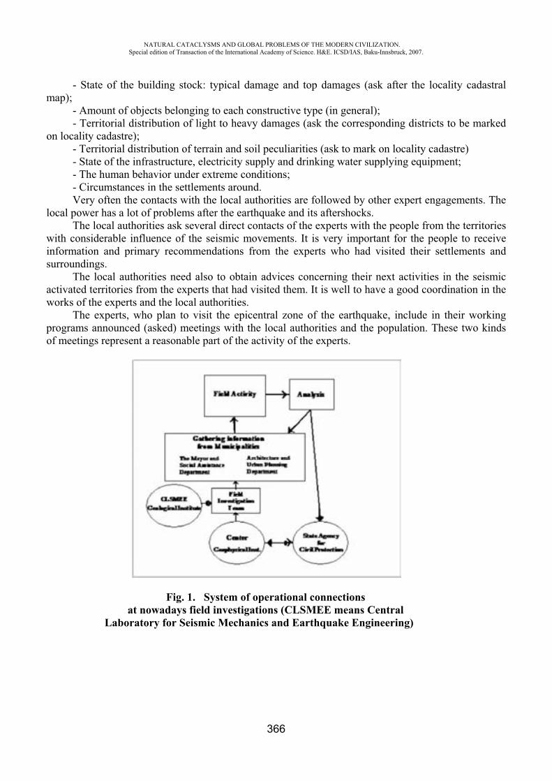
NATURAL CATACLYSMS AND GLOBAL PROBLEMS OF THE MODERN CIVILIZATION. Special edition of Transaction of the International Academy of Science. H&E. ICSD/IAS, Baku-Innsbruck, 2007.
366
- State of the building stock: typical damage and top damages (ask after the locality cadastral map);
- Amount of objects belonging to each constructive type (in general); - Territorial distribution of light to heavy damages (ask the corresponding districts to be marked
on locality cadastre); - Territorial distribution of terrain and soil peculiarities (ask to mark on locality cadastre) - State of the infrastructure, electricity supply and drinking water supplying equipment; - The human behavior under extreme conditions; - Circumstances in the settlements around. Very often the contacts with the local authorities are followed by other expert engagements. The
local power has a lot of problems after the earthquake and its aftershocks. The local authorities ask several direct contacts of the experts with the people from the territories
with considerable influence of the seismic movements. It is very important for the people to receive information and primary recommendations from the experts who had visited their settlements and surroundings.
The local authorities need also to obtain advices concerning their next activities in the seismic activated territories from the experts that had visited them. It is well to have a good coordination in the works of the experts and the local authorities.
The experts, who plan to visit the epicentral zone of the earthquake, include in their working programs announced (asked) meetings with the local authorities and the population. These two kinds of meetings represent a reasonable part of the activity of the experts.
Fig. 1. System of operational connections at nowadays field investigations (CLSMEE means Central
Laboratory for Seismic Mechanics and Earthquake Engineering)
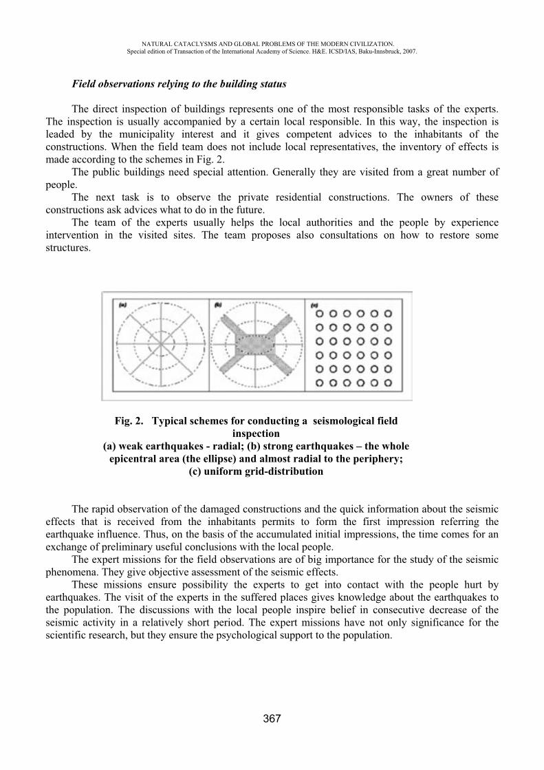
NATURAL CATACLYSMS AND GLOBAL PROBLEMS OF THE MODERN CIVILIZATION. Special edition of Transaction of the International Academy of Science. H&E. ICSD/IAS, Baku-Innsbruck, 2007.
367
Field observations relying to the building status
The direct inspection of buildings represents one of the most responsible tasks of the experts. The inspection is usually accompanied by a certain local responsible. In this way, the inspection is leaded by the municipality interest and it gives competent advices to the inhabitants of the constructions. When the field team does not include local representatives, the inventory of effects is made according to the schemes in Fig. 2.
The public buildings need special attention. Generally they are visited from a great number of people.
The next task is to observe the private residential constructions. The owners of these constructions ask advices what to do in the future.
The team of the experts usually helps the local authorities and the people by experience intervention in the visited sites. The team proposes also consultations on how to restore some structures.
Fig. 2. Typical schemes for conducting a seismological field inspection
(a) weak earthquakes - radial; (b) strong earthquakes – the whole epicentral area (the ellipse) and almost radial to the periphery;
(c) uniform grid-distribution
The rapid observation of the damaged constructions and the quick information about the seismic effects that is received from the inhabitants permits to form the first impression referring the earthquake influence. Thus, on the basis of the accumulated initial impressions, the time comes for anexchange of preliminary useful conclusions with the local people.
The expert missions for the field observations are of big importance for the study of the seismic phenomena. They give objective assessment of the seismic effects.
These missions ensure possibility the experts to get into contact with the people hurt by earthquakes. The visit of the experts in the suffered places gives knowledge about the earthquakes to the population. The discussions with the local people inspire belief in consecutive decrease of the seismic activity in a relatively short period. The expert missions have not only significance for the scientific research, but they ensure the psychological support to the population.
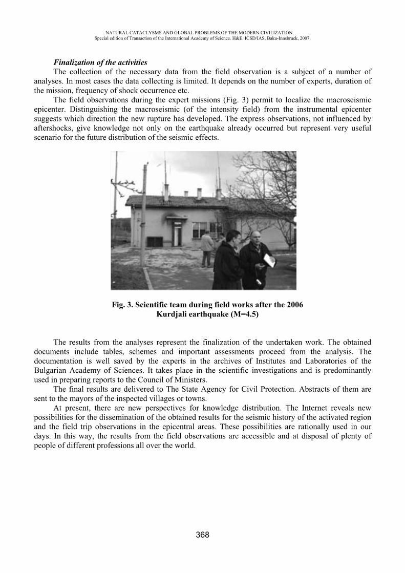
NATURAL CATACLYSMS AND GLOBAL PROBLEMS OF THE MODERN CIVILIZATION. Special edition of Transaction of the International Academy of Science. H&E. ICSD/IAS, Baku-Innsbruck, 2007.
368
Finalization of the activities The collection of the necessary data from the field observation is a subject of a number of
analyses. In most cases the data collecting is limited. It depends on the number of experts, duration of the mission, frequency of shock occurrence etc.
The field observations during the expert missions (Fig. 3) permit to localize the macroseismic epicenter. Distinguishing the macroseismic (of the intensity field) from the instrumental epicenter suggests which direction the new rupture has developed. The express observations, not influenced by aftershocks, give knowledge not only on the earthquake already occurred but represent very useful scenario for the future distribution of the seismic effects.
Fig. 3. Scientific team during field works after the 2006 Kurdjali earthquake (M=4.5)
The results from the analyses represent the finalization of the undertaken work. The obtained documents include tables, schemes and important assessments proceed from the analysis. The documentation is well saved by the experts in the archives of Institutes and Laboratories of the Bulgarian Academy of Sciences. It takes place in the scientific investigations and is predominantly used in preparing reports to the Council of Ministers.
The final results are delivered to The State Agency for Civil Protection. Abstracts of them are sent to the mayors of the inspected villages or towns.
At present, there are new perspectives for knowledge distribution. The Internet reveals new possibilities for the dissemination of the obtained results for the seismic history of the activated region and the field trip observations in the epicentral areas. These possibilities are rationally used in our days. In this way, the results from the field observations are accessible and at disposal of plenty of people of different professions all over the world.
NATURAL CATACLYSMS AND GLOBAL PROBLEMS OF THE MODERN CIVILIZATION. Special edition of Transaction of the International Academy of Science. H&E. ICSD/IAS, Baku-Innsbruck, 2007.
369
REFERENCES
1. Brankov G., editor (1983): Vrancea earthquake in 1977. Its after-effects in the People’s Republic of Bulgaria, Eartq. Engineering National Committee – Bulg. Acad. Sci., Sofia, 428 pp
2. Christoskov L., R. Glavcheva, Tz. Georgiev, Tz. Christova, K. Donkova, S. Simeonova, D. Solakov, S. Dineva, D. Mihaylov, B. Dimitrov, E. Spassov (1988): Seismological features of the region of the 1986 earthquake sequence, Bulg. Geophys. J. 14 (2), 73-89.
3. Glavcheva R. (1987): Preliminary estimates of the earthquake source region (February 21, 1986 in Northern Bulgaria) - 13 (1), 76-84.
4. Glavcheva R., S. Dimitrova, I. Tzoncheva (2003): The 2002 activation in Krumovo area, South Bulgaria, and related topics. Bulg. Geophys. J. vol 29, 1-4, 65 – 73.
5. Glavcheva R., N. Dobrev, K. Hadjiiski, S. Dimitrova, B. Ranguelov (2006): The 2006 seismic activation in the Eastern Rhodopes (Mts) – Kurdjali area and some generalization on geological features in the region. Proceedings of the National Conference with intl participation “Geosciences 2006”, Bulg. Geophys. Soc., Bulg. Geol. Soc., Sofia, 315 –318.
6. Grigorova Ek., Glavtcheva R., Sokerova D. (1978): The earthquake on March 4, 1977 - some results of seismic observation in Bulgaria. - In: Proc. of the Symposium on the Analysis of Seismicity and on Seismic Risk, Liblice, 17-22 Oct. 1977, Praha, 109-113.
7. Hadjiyski K., R. Glavcheva (2006): The Md=4.5 Earthquake of Feb. 20. 2006 in the Region of Kardjali – Macroseismic Survey in the Epicentral zone. InternationalConference on Civil Engineering Design and Construction (DCB 2006), 14-16 September 2006, Varna, Bulgaria, 307-313.
8. Petrov P., L.Tzenov, H.Bonceva, P.Sotirov, R.Glavtcheva (1980): The Velingrad Earthquake of November 3, 1977. - Bulg. Geophys. J. 6 (2), 42-52.
ABOUT TECHNOGENIC-TECTONIC EARTHQUAKES
M. Matova*, R. Glavcheva**
Geological Institute of the Bulgarian Academy of Sciences
Introduction
At present, the technogenic activities are very intensive in the well populated territories of the Earth. The people create numerous skyscrapers, large and very deep undergrounds, long and deep tunnels in mountains and seas, barrages with deep and spacious artificial lakes, town’s quarters or drilling equipments over artificial islands in seas and oceans, exceptionally deep mines for the exploration of the Earth resources etc. Considerable part of these constructions answers to the contemporary needs of persons or societies.
Numerous constructions take place in areas with tectonic mobility of different degrees. When the impressive man-made activities are developed in territories with considerable or high tectonic mobility the appearance of deformation or even destructive effects in the constructions and their geological
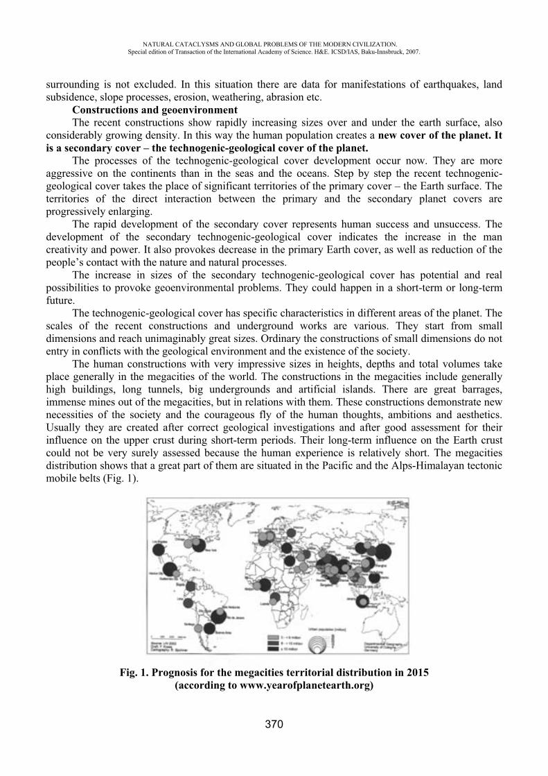
NATURAL CATACLYSMS AND GLOBAL PROBLEMS OF THE MODERN CIVILIZATION. Special edition of Transaction of the International Academy of Science. H&E. ICSD/IAS, Baku-Innsbruck, 2007.
370
surrounding is not excluded. In this situation there are data for manifestations of earthquakes, land subsidence, slope processes, erosion, weathering, abrasion etc.
Constructions and geoenvironmentThe recent constructions show rapidly increasing sizes over and under the earth surface, also
considerably growing density. In this way the human population creates a new cover of the planet. It is a secondary cover – the technogenic-geological cover of the planet.
The processes of the technogenic-geological cover development occur now. They are more aggressive on the continents than in the seas and the oceans. Step by step the recent technogenic-geological cover takes the place of significant territories of the primary cover – the Earth surface. The territories of the direct interaction between the primary and the secondary planet covers are progressively enlarging.
The rapid development of the secondary cover represents human success and unsuccess. The development of the secondary technogenic-geological cover indicates the increase in the man creativity and power. It also provokes decrease in the primary Earth cover, as well as reduction of the people’s contact with the nature and natural processes.
The increase in sizes of the secondary technogenic-geological cover has potential and real possibilities to provoke geoenvironmental problems. They could happen in a short-term or long-term future.
The technogenic-geological cover has specific characteristics in different areas of the planet. The scales of the recent constructions and underground works are various. They start from small dimensions and reach unimaginably great sizes. Ordinary the constructions of small dimensions do not entry in conflicts with the geological environment and the existence of the society.
The human constructions with very impressive sizes in heights, depths and total volumes take place generally in the megacities of the world. The constructions in the megacities include generally high buildings, long tunnels, big undergrounds and artificial islands. There are great barrages, immense mines out of the megacities, but in relations with them. These constructions demonstrate new necessities of the society and the courageous fly of the human thoughts, ambitions and aesthetics. Usually they are created after correct geological investigations and after good assessment for their influence on the upper crust during short-term periods. Their long-term influence on the Earth crust could not be very surely assessed because the human experience is relatively short. The megacities distribution shows that a great part of them are situated in the Pacific and the Alps-Himalayan tectonic mobile belts (Fig. 1).
Fig. 1. Prognosis for the megacities territorial distribution in 2015 (according to www.yearofplanetearth.org)
NATURAL CATACLYSMS AND GLOBAL PROBLEMS OF THE MODERN CIVILIZATION. Special edition of Transaction of the International Academy of Science. H&E. ICSD/IAS, Baku-Innsbruck, 2007.
371
The growth of the technogenic-geological cover takes place in various geological situations. The cover is developed in primary stable or in primary unstable from geological point of view territories.
The creation of the most courageous constructions contributes to the study of the processes of transformations in the geological stability of several localities. Sometimes the localities are transformed from stable to unstable ones, other times they are transformed from unstable to more unstable localities. It is important to note again that the biggest part of the megacities (Fig. 1) is developed in recently very active tectonic zones of our planet.
Constructions and changes in upper crust and surface The most grandiose human architectural creations on the continent or in the sea and oceans need
very big and stable basements with deep and large penetration in the Earth crust. Such hard requirements might provoke changes of the thickness and specific weight of the shallow layers of the crust, i.e. of those ones on the levels of the ground water, as well as on the Earth’s surface itself. All these changes would lead to unfavorable corrections of the structures in the Earth crust and of the relief of our planet.
The big technogenic creations contribute to changes of local stress situation of some territories. They influence on the value and direction of the stress. Moreover, the appearance of these stress anomalies has local or regional influence on the primary situation and the stress characteristics of the studied territories. The immense constructions also contribute to the considerable changes in the groundwater levels in the crust.
Sometimes the man-made changes of the crust and its relief reach unimaginable sizes. They do not permit to follow the ordinary natural laws of the planet development in the superficial crust layers. Practically, the recent very audacious constructions and the technogenic cover of the planet have real or supposed potential to provoke local or regional destabilizations of earth crust as a result of structural and stress transformations in the superficial crust layers.
The destabilization of the crust could be of different degrees. The influence of the man-made activity over the development of the geological processes varies from slightly small to considerably strong. The geological processes are numerous. They include the seismicity as well. The earthquakes are subjects of authors’ interest.
Technogenic-tectonic earthquakesUp to now the tectonic earthquakes are predominant ones. They occur as a result of the structural
processes in the lithosphere. They represent one of the forms of tectonic movements related to the local or regional rapid disintegration.
The technogenic seismic events or the man-made earthquakes are relatively rare. They are related to mine’s works, barrage exploration, also various peaceful and military actions.
The assessment for the types of the earthquakes is based on their principal characteristics. In our opinion a great part of the technogenic earthquakes represent real technogenic-tectonic earthquakes. These seismic manifestations are caused by technogenic factors, but they are developed and influenced by the local or regional tectonic situation. The technogenic-tectonic seismic events need special studies. Their manifestations represent danger for the society.
Tectonic and technogenic-tectonic earthquakes in Bulgaria A great part of Bulgarian territory is situated in tectonic active zones. The moderate and the
strong seismic manifestations in Bulgaria (Fig. 2) show very often direct or indirect relations with active fault zones and photolineaments. These seismic events cause small or considerable impacts to the Bulgarian society and the geological environment. Now the paleoseisms, the historical and recent earthquakes are studied hard. The earthquakes discovered by field excavations and those ones
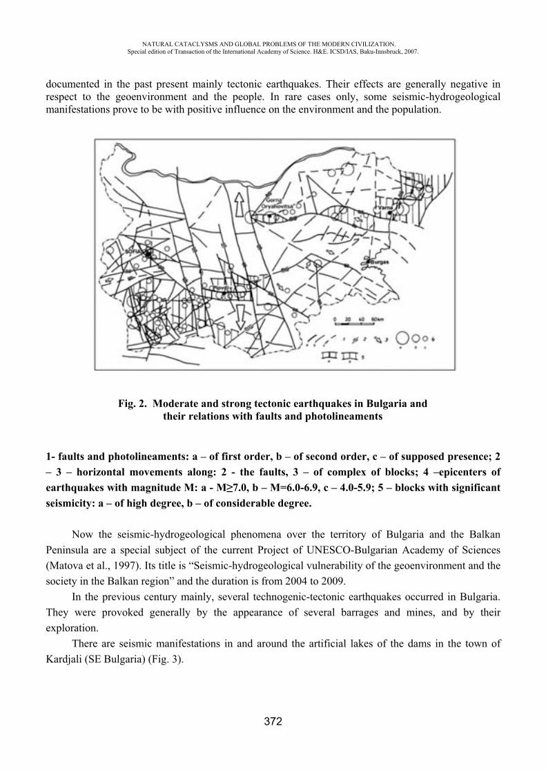
NATURAL CATACLYSMS AND GLOBAL PROBLEMS OF THE MODERN CIVILIZATION. Special edition of Transaction of the International Academy of Science. H&E. ICSD/IAS, Baku-Innsbruck, 2007.
372
documented in the past present mainly tectonic earthquakes. Their effects are generally negative in respect to the geoenvironment and the people. In rare cases only, some seismic-hydrogeological manifestations prove to be with positive influence on the environment and the population.
Fig. 2. Moderate and strong tectonic earthquakes in Bulgaria and their relations with faults and photolineaments
1- faults and photolineaments: a – of first order, b – of second order, c – of supposed presence; 2 – 3 – horizontal movements along: 2 - the faults, 3 – of complex of blocks; 4 –epicenters of earthquakes with magnitude M: a - M 7.0, b – M=6.0-6.9, c – 4.0-5.9; 5 – blocks with significant seismicity: a – of high degree, b – of considerable degree.
Now the seismic-hydrogeological phenomena over the territory of Bulgaria and the Balkan Peninsula are a special subject of the current Project of UNESCO-Bulgarian Academy of Sciences (Matova et al., 1997). Its title is “Seismic-hydrogeological vulnerability of the geoenvironment and the society in the Balkan region” and the duration is from 2004 to 2009.
In the previous century mainly, several technogenic-tectonic earthquakes occurred in Bulgaria. They were provoked generally by the appearance of several barrages and mines, and by their exploration.
There are seismic manifestations in and around the artificial lakes of the dams in the town of Kardjali (SE Bulgaria) (Fig. 3).
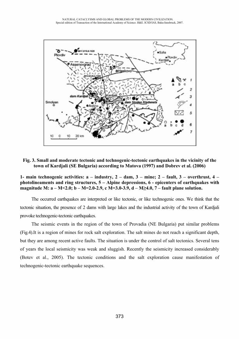
NATURAL CATACLYSMS AND GLOBAL PROBLEMS OF THE MODERN CIVILIZATION. Special edition of Transaction of the International Academy of Science. H&E. ICSD/IAS, Baku-Innsbruck, 2007.
373
Fig. 3. Small and moderate tectonic and technogenic-tectonic earthquakes in the vicinity of the town of Kardjali (SE Bulgaria) according to Matova (1997) and Dobrev et al. (2006)
1- main technogenic activities: a – industry, 2 – dam, 3 – mine; 2 – fault, 3 – overthrust, 4 – photolineaments and ring structures, 5 – Alpine depressions, 6 - epicenters of earthquakes with magnitude M: a – M<2.0; b – M=2.0-2.9, c M=3.0-3.9, d – M 4.0, 7 – fault plane solution.
The occurred earthquakes are interpreted or like tectonic, or like technogenic ones. We think that the
tectonic situation, the presence of 2 dams with large lakes and the industrial activity of the town of Kardjali
provoke technogenic-tectonic earthquakes.
The seismic events in the region of the town of Provadia (NE Bulgaria) put similar problems
(Fig.4).It is a region of mines for rock salt exploration. The salt mines do not reach a significant depth,
but they are among recent active faults. The situation is under the control of salt tectonics. Several tens
of years the local seismicity was weak and sluggish. Recently the seismicity increased considerably
(Botev et al., 2005). The tectonic conditions and the salt exploration cause manifestation of
technogenic-tectonic earthquake sequences.
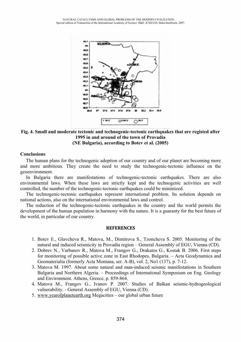
NATURAL CATACLYSMS AND GLOBAL PROBLEMS OF THE MODERN CIVILIZATION. Special edition of Transaction of the International Academy of Science. H&E. ICSD/IAS, Baku-Innsbruck, 2007.
374
Fig. 4. Small and moderate tectonic and technogenic-tectonic earthquakes that are registed after 1995 in and around of the town of Provadia
(NE Bulgaria), according to Botev et al. (2005)
ConclusionsThe human plans for the technogenic adoption of our country and of our planet are becoming more
and more ambitious. They create the need to study the technogenic-tectonic influence on the geoenvironment.
In Bulgaria there are manifestations of technogenic-tectonic earthquakes. There are also environmental laws. When these laws are strictly kept and the technogenic activities are well controlled, the number of the technogenic-tectonic earthquakes could be minimized.
The technogenic-tectonic earthquakes represent international problem. Its solution depends on national actions, also on the international environmental laws and control.
The reduction of the technogenic-tectonic earthquakes in the country and the world permits the development of the human population in harmony with the nature. It is a guaranty for the best future of the world, in particular of our country.
REFERENCES
1. Botev E., Glavcheva R., Matova, M., Dimitrova S., Tzoncheva S. 2005. Monitoring of the natural and induced seismicity in Provadia region – General Assembly of EGU, Vienna (CD).
2. Dobrev N., Varbanov R., Matova M., Frangov G., Drakatos G., Kostak B. 2006. First steps for monitoring of possible active zone in East Rhodopes, Bulgaria. – Acta Geodynamica and Geomaterialia (formerly Acta Montana, ser. A-B), vol. 2, No1 (137), p. 7-12.
3. Matova M. 1997. About some natural and man-induced seismic manifestations in Southern Bulgaria and Northern Algeria. – Proceedings of International Symposium on Eng. Geology and Environment. Athens, Greece, p. 859-864.
4. Matova M., Frangov G., Ivanov P. 2007. Studies of Balkan seismic-hydrogeological vulnerability. - General Assembly of EGU, Vienna (CD).
5. www.yearofplanetearth.org Megacities – our global urban future
NATURAL CATACLYSMS AND GLOBAL PROBLEMS OF THE MODERN CIVILIZATION. Special edition of Transaction of the International Academy of Science. H&E. ICSD/IAS, Baku-Innsbruck, 2007.
375
CONCERNING CADASTER SYSTEM NECESSARY TO INTRODUCE TO DOCUMENT GEOLOGIC PHENOMENA IN AZERBAIJAN
Sh. S. Kocharli*, T.A. Salmanova**
Geophysics & Geology Department of SOCAR
It was admitted for many centuries that geologic phenomena occur in spite of man's will power and without his impact. Just in XIX century while man's technical (artificial) ability increased it was admitted that mankind power is already commensurable with the power of natural geologic phenomena - both usual and extraordinary ones.
Though, those geologic phenomena has been separately investigated in a certain extent, only first steps in classification and cadaster system implementation are being conducted in terms of their interaction with human activity.
Conducted study suggests that there are 20 phenomena and 15 extraordinary natural events observed so far in Azerbaijan.
Geologic phenomena represent evolution type of natural processes happened in the Earth's crust, and occur as quantitative (basically in maxima) events or occasional combination of various geologic factors. Most typical phenomena met in Azerbaijan are considered to be as follows: maximum subsidence and maximum hydrocarbon concentration per sq.km in the South Caspian basin, vast inversion of the Earth's crust in the Caucasus region, plays associated with effusive rocks, exotic Jurassic cliffs, and unique Naftalan curative oil deposit
Extraordinary geologic events occur as a result of qualitative transformation of long-term geologic events into other kind of phenomena that are hazardous for mankind.
Both mentioned phenomena have always been happening during Earth's evolution history within geosyncline (more actively) and platform provinces as well (relatively faint).
Extraordinary geologic events are more closely associated with anthropogenic activity, though some kind of natural phenomena are also affected by human activity. Among extraordinary events there are actually few of them generated by human activity.
Rough list of extraordinary geologic events observed in Azerbaijan that should undergo cadastering in regard with anthropogenic activity are shown in table below. Undoubtedly this list will be added and refined by future studies.
Indicated list of natural-geologic extraordinary phenomena gives only a general information on nature of phenomena and requires further thorough and systematic analysis of data gathered over the Republic’s territory. In this respect one of the important tasks consists in developing and implementation of necessary long-term government program.
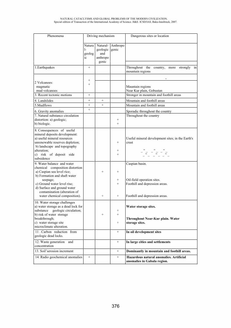
NATURAL CATACLYSMS AND GLOBAL PROBLEMS OF THE MODERN CIVILIZATION. Special edition of Transaction of the International Academy of Science. H&E. ICSD/IAS, Baku-Innsbruck, 2007.
376
Phenomena Driving mechanism Dangerous sites or location
Natural-geologic
Natural-geologic
andanthropo
genic
Anthropogenic
1.Earthquakes + Throughout the country, more strongly in mountain regions
2 Volcanoes: magmatic mud volcanoes
++
-
Mauntain regions Near Kur plain, Gobustan
3. Recent tectonic motions + Stronger in mountain and foothill areas 4. Landslides + + Mountain and foothill areas 5.Mudflows + + Mountain and foothill areas
6. Gravity anomalies + Sporadic throughout the country 7. Natural substance circulation distortion: a) geologic; b) biologic.
++
Throughout the country
8. Consequences of useful mineral deposits development: a) useful mineral resources unrenewable reserves depletion; b) landscape and topography
alteration; c) risk of deposit side subsidence
+
++
Useful mineral development sites; in the Earth's crust
_ “ _ _ “ _ _ “ _ _ “ _ _ “ _ _ “ _
9. Water balance and water chemical composition distortion a) Caspian sea level rice; b) Formation and shaft water
seepage; c) Ground water level rise; d) Surface and ground water
contamination (alteration of water chemical composition).
+
+
+
++
+
Caspian basin.
Oil-field operation sites. Foothill and depression areas.
Foothill and depression areas.
10. Water storage challenges a) water storage as a dead lock for substance geologic circulation; b) risk of water storage breakthrough; c) water storage site microclimate alteration.
+++
+
Water storage sites.
Throughout Near-Kur plain. Water storage sites.
11 . Carbon reduction from geologic dead locks.
+ In oil development sites
12. Waste generation and concentration
+ In large cities and settlements
13. Soil’serosion increment + Dominantly in mountain and foothill areas.
14. Radio geochemical anomalies + + Hazardous natural anomalies. Artificial anomalies in Gabala region.
NATURAL CATACLYSMS AND GLOBAL PROBLEMS OF THE MODERN CIVILIZATION. Special edition of Transaction of the International Academy of Science. H&E. ICSD/IAS, Baku-Innsbruck, 2007.
377
STRAIN FIELD VARIATIONS FROM GROUND-BASED AND REMOTE SENSING MONITORING OF MUD VOLCANIC GASEOUS EMISSIONS: A PILOT NATO C.L.G.
PROJECT
D.Albarello*, I.Gulyev**, G.Martinelli***,B.Panahi****, V.Tramutoli*****
1) Dept. of Earth Sciences, University of Siena, Siena, Italy 2) Geological Insitute of Azerbaijan, Academy of Sciences,Baku, Azerbaijan
3) ARPA,Environmental Protection Agency of Emilia Romagna Region, Reggio Emilia, Italy 4) DIFA, Dept.of Engineering and Environmental Physics, University of Basilicata,
Potenza, Italy
InroductionSeismic hazard assessment is commonly performed by using a “standard” probabilistic
procedure (e.g., McGuire, 1993a,b). Basic hypotheses underlying this approach are that the seismogenic process is stationary and that seismicity is the consequence of mutually independent activations of a relatively small number of seismogenic structures whose geometry can be assumed as stable in time (e.g. Cornell, 1968). However, recent seismological research suggests that the actual reliability of hazard estimates performed on this basis is debatable (see, for example, the reviews by Kagan, 1994; Main, 1995, 1996). These analyses suggest that seismogenic process is characterised by a strong sensitivity to small variations in the physical environment, which can result in dramatic macroscopic changes to the system status. Thus, notwithstanding a nearly constant energy supply (e.g. tectonic loading in the case of earthquakes), energy dissipation can occur in a highly intermittent, “bursting”, manner. In particular, due to the dynamic interactions between potential seismic sources, the system is dramatically influenced by relatively small variations in the stress/strain field (to the order of tens of kPa or 0.1 strain), which can significantly modify the seismic hazard level (e.g. Rydelek and Sacks, 1999). On the other hand, presence of strain field variations on the time-scale relevant for seismic hazard assessment (years/tens of years) has been widely recognised also on the basis of theoretical and empirical evidence (e.g. Kasahara, 1979; Viti et al., 2003 and references therein) that suggest that they can induce significant variations in the local seismic hazard level (e.g. Rydelek and Sacks, 1990; Albarello and Bonafede, 1990; King et al., 1994; Stein et al., 1997; Piersanti et al., 1997; Mantovani and Albarello, 1997; Belardinelli et al., 1999; Pollitz et al., 2000).
These considerations suggest that a major contribution to seismic hazard assessment could be provided by the permanent monitoring of strain field variations. To be effective, these kinds of monitoring apparatus should be sensitive to small strain variations (to the order of 10-7-10-5 strain units or 10-1000 kPa), to operate at relatively large space/time-scales (tens to hundreds km, from months to tens of years). Furthermore, in order to make such monitoring feasible even when the economic resources available for seismic hazard assessment are scarce, it should be cost-effective.
The most direct approach to this problem is space geodesy. However, these methodologies are, in many cases, unable to achieve sufficient accuracy, at least as concerns the time-space scale of concern. An attractive alternative seems to be the monitoring of deep-seated confined fluids. In the presence of low strain values, solid/fluid interactions within the crust can be modelled in the frame of poroelastic linear approximation (e.g. Wang, 2000). When confined aquifers are of concern, both theoretical considerations and experimental data (e.g. Roeloffs, 1996) suggest that volumetric strain fluctuations can dramatically affect pore pressure. The macroscopic response of confined geofluid reservoirs to microscopic strain variations makes deep geofluid monitoring a useful tool in the study of
NATURAL CATACLYSMS AND GLOBAL PROBLEMS OF THE MODERN CIVILIZATION. Special edition of Transaction of the International Academy of Science. H&E. ICSD/IAS, Baku-Innsbruck, 2007.
378
strain field perturbations (see, for example, Bodvarsson, 1970; Kumpel, 1992; Albarello and Martinelli, 1994; Roeloffs, 1996 and references therein). However, a major drawback to the use of piezometric observations as an inexpensive monitoring tool for strain perturbations is the difficulty in identifying confined fluid reservoirs (water or oil) not previously exploited for anthropic use.
The monitoring of mud volcano activity could represent a valid alternative, allowing such limitations to be overcome. A simple physical modelling of mud volcanoes dynamics (Albarello, 2005) has suggested that mud volcanoes could be sensitive to volumetric strain fluctuations at the reservoir. On the other hand, the association of mud volcano activity to strain field variations has been suggested by Tamrazyan (1982) on the basis of an observed correspondence between mud eruptions and earth tide maxima. Several authors (e.g. Wakita et al., 1988) have hypothesized a sensitivity of mud volcano gaseous emissions to seismogenic processes. Encouraging results in this sense have been also obtained in Italy by the monitoring of medium-term Radon fluctuations in the liquid phase of fluids erupted at a mud volcano in Northern Italy (Martinelli et al., 1995).
While long-term variations in the fluid discharge of mud volcanoes has been widely explored (see, for example, Carson and Screaton, 1998 and references therein) medium-short term fluctuations have been less extensively analysed. Despite the fact that a number of questions remain open in terms of the actual dynamic response of mud volcano activity to pore pressure variations in the reservoir when free gases are significantly present in the conduit, the considerations reported in this paper and some very preliminary experimental results (see above) seem to encourage experimental and theoretical studies in this direction. In particular, some indications useful to addressing the future experimental activity can be obtained.
In most cases, due to the mechanical coupling of liquid and gaseous phases, monitoring could regard relative variations in the flow rates of gaseous or liquid emissions both being representative of pore pressure variations at depth. Continuously emitting structures should be preferred in the monitoring since eruptive activity can be conditioned by a number of factors not necessarily dependant on pressure variations at depth (e.g. the strength of structures obstructing the conduit). Of course, the monitoring of any mud volcanic activity will result easier and effective where distributed expressions of sub-aerial mud volcanism exist (as in the case of Azerbaijan). Strain field variations induced post-seismic stress redistribution will involve wide areas (tens to hundreds of km) and develop over relatively long timescales (days to years).
Monitoring mud volcanoes emissions On this scientific basis, a NATO Cooperative Linkage Grant project has been proposed and
funded on 2003. The aims of this Italo-Azerian pilot project was to evaluate the feasibility of continuous monitoring of mud volcanic gaseous emissions to gain information about short/medium term variations of the crustal strain field at regional scale in Azerbaijan. In particular, the three-years project intends to provide a first evaluation different possible monitoring strategies based on ground-based and remote-sensing procedures.
As concerns the first ones, major difficulties arise when the whole emission budget is of concern. In this regard several strategies are possible. The first one require the sampling of gaseous emissions at the most emitting sources. The basic difficulty of this approach is that most important mud volcanic structures in Azerbaijan are characterised by a number of correlated sources distributed over an area of hundreds of squares meters. The relative importance of the different emitting structures (salsas, gryphons) is not well assessed and this implies that a number of sensors are required to monitor the structure. The effectiveness of this ground-based monitoring also depends on the peculiar emission typology. As an example, the experimental tool set up by a German research group (Delisle et al., 2007) can be effective for salsa but cannot be used where emission is mainly driven by bubbling through high viscosity fluids (gryphons). As concerns this last case, in the frame of the project, a
NATURAL CATACLYSMS AND GLOBAL PROBLEMS OF THE MODERN CIVILIZATION. Special edition of Transaction of the International Academy of Science. H&E. ICSD/IAS, Baku-Innsbruck, 2007.
379
different monitoring strategy has been tested. This is based on the acoustic properties of rising bubbles. In general, sound emissions of moving bubbles has been extensively studied (see, e.g., Leighton, 1994¸ Brennen, 1995) and indicate that nearly monochromatic acoustic emissions are expected from rising bubbles. The frequency of such emissions depends on the radius of the bubble. As an example, in water it holds that f 3/R where f is the frequency of sound mission and R is the radius of the bubble. This implies that bubbles with a radius of the order of 10 cm (i.e, the typical dimension of bubbles rising through the mud volcanic conduit following Albarello, 2004) will produce sound emissions with frequency of the order of 30 Hz. This implies that continuous monitoring of sound emissions from mud volcanoes could allow the counting and sizing of rising bubbles and thus an indirect evaluation of gaseous emissions. To this purpose some experiments have been set up during the project which supplied encouraging results.
Beyond any consideration about the respective effectiveness of available ground-based monitoring tools, an extensive ground-based monitoring of mud volcanoes would be characterised by discouragingly high costs. Remote sensing procedures could represent a valid cost-effective alternative to direct ground observations. Tramutoli et al. (2001) have recently proposed an interesting approach, which can be effectively applied to the monitoring of mud volcanoes. This approach can be used to detect relatively small variations in greenhouse gas emissions (methane, carbon dioxide, etc.) from underground towards the atmosphere, which can be detected in the form of apparent ground temperature anomalies measured by satellite images in the thermal infrared radiances possibly occurred during eruptive periods. Due to the relatively large space-scale, characterising the phenomena under investigation , the relatively low-resolving power of such an approach in the space-scale will not represent an obstacle to affective application. Furthermore, aerial averaging of emission anomalies could make observations less sensitive to “spurious” local anomalies due to the variations in the partitioning of fluid and gaseous emissions between secondary structures (gryphons) associated to the same mud volcano. Some encouraging results produced by this approach for the detection of earthquake-related gaseous ground emissions have been recently obtained in Southern Italy (Tramutoli et al. 2001). On the basis of these considerations, in the frame of the ongoing NATO project, the possibility of this remote-sensing approach has been investigated together with the Geological Institute of Azerbaijan which reviewed and made available updated catalogues of mud volcanic eruptions.
In particular Meteosat and Landsat images of Azerbaijan have been analyzed and preliminary results discussed during visits of the Azerbaijan team in Potenza (Italy) and of the Italian team in Baku. Furthermore indirect measurements of gas bubbling in some mud volcanoes of Azerbaijan have been collected by means of a Tromino seismic station. Gas samples have been collected in most representative mud volcanoes of Azerbaijan. Gas analysis of geochemical and isotopic components of gases is an effective approach to evaluate depth of origin of mud volcanic fluids. Furthermore a more detailed knowledge of mud volcanic deep gas origin will allow a better evaluation of geological pathways generated by faults along with gas seep toward earth surface. All results will be compared with gas flow rate data collected by Delisle et al.(2007) with the purpose to test innovative methods suitable for mud volcanic monitoring in remote and extreme environments.
ConclusionsInnovative methods have been experimented in monitoring mud volcanic emissions of
Azerbaijan. In particular satellite techniques have been utilized to detect morphology changes in mud
volcanic structures and variations in gas emissions possibly connected with eruptive events. Seismometric advanced techiques have been utilized to better estimate gas flux from mud volcanoes through gas bubbles counting. Gas analytical data have been utilized to detect depth origin of gases and to compare and constrain gas reservoir data with surface observed seepage phenomena. Flow rate
NATURAL CATACLYSMS AND GLOBAL PROBLEMS OF THE MODERN CIVILIZATION. Special edition of Transaction of the International Academy of Science. H&E. ICSD/IAS, Baku-Innsbruck, 2007.
380
variations detectable by innovative indirect techniques will allow a better evaluation of on going crustal deformative processes in Azerbaijan. A detailed dissemination of data collected during the NATO Collaborative Linkage Grant Project is planned after the end of experimental activities with the purpose to inform all potentially interested industrial and governmental Agencies.
REFERENCES
1. Albarello D., 2005. Mud volcanoes as natural strainmeters: a working hypothesis. In Martinelli G. and Panahi B. (eds), “Mud Volcanoes, geodynamics and seismicity”. NATO Science Series IV, v.51, Kluwer, 239-249
2. Albarello D. e Bonafede M., 1990. Stress diffusion across laterally heterogeneous plates. Tectonophysics, 179, 121-130
3. Albarello D. e Martinelli G., 1994 - Piezometric levels as a possible geodynamic indicator: analysis of the data from a regional deep waters monitoring network in Northern Italy. Geophys. Res. Lett., 21, 1955-1958
4. Albarello D., Lapenna V., Martinelli G. and Telesca L., 2003. Extracting quantitative dynamics from 222Rn gaseous emissions of mud volcanoes. Environmetrics, 14, 63-71
5. Anderson D., 1975. Accelerated plate tectonics. Science, 17, 1077-1079 6. Batchelor G.K., 1967. Fluid dynamics: an introduction. University Press, Cambridge, 615
pp.7. Belardinelli M.E., Cocco M., Coutant O., Cotton F., 1999. Redistribution of dynamic stress
durino coseismic ruptures: evidence for fault interaction and earthquake triggering. J.Geophys.Res., 104, B7, 14925-14945
8. Bodvarsson G., 1970. Confined fluids as strain meters. J.Geophys.Res., 75, 14, 2711-2718 9. Brennen C.E., 1995. Cavitation and bubble dynamics. University Press, Cambridge. 10. Brown K.M., 1990. The nature and significance of mud diapirs and diatremes for
accretionary systems, J.Geophys.Res., 95, 8969-8982 11. Carson B. and Screaton E.J., 1998. Fluid flow in accretionary prisms: evidence for
focused, time-variable discharge. Rev.Geophys., 36, 3, 329-351 12. Castellaro S. and Mulargia F., 2001. A simple but effective cellular automation for
earthquakes. Geophys.J.Int., 144, 609-624 13. Cornell, C.A.: 1968. Engineering seismic risk analysis, Bull. Seism. Soc. Am., 58, 1583-
1606.14. Delisle G., Teschner M., Panahi B., Guliev I., Aliev C., Faber E.(2007) A first approach to
quantify fluctuating gas emissions of methane and radon from mud volcanoes in Azerbaijan (submitted).
15. Giardini D. and Basham P. (eds.) “Global seismic hazard assessment program”, ILP publication 209, Ann.Geofis.,36, 3-4, 181-200
16. Harris R.A., 1998. Introduction to special section: stress triggers, stress shadows, and implications for seismic hazard. J.Geophys.Res., 103, B10, 24347-24358
17. Kagan Y.Y., 1992. Seismicity: turbulence of solids. Nonlin.Sci. Toady, 2, 1, 2-1318. Kagan, Y.Y., 1994. Observational evidence for earthquakes as a non linear dynamic
process. Physica D, 77, 160-192 19. Kasahara K., 1979. Migration of crustal deformation. Tectonophys., 52, 329-341 20. King G.C.P., Stein R.S., Lin J., 1994. Static stress change and the triggering of
earthquakes. Bull.Seism.Soc.Am., 84, 3 ,935-953 21. Kopf A., 2002. Significance of mud volcanism. Rev.Geophys., 40, 2, 1-52
NATURAL CATACLYSMS AND GLOBAL PROBLEMS OF THE MODERN CIVILIZATION. Special edition of Transaction of the International Academy of Science. H&E. ICSD/IAS, Baku-Innsbruck, 2007.
381
22. Kümpel H.-J., 1992. About the potential of wells to reflect stress variations within inhomogeneous crust. Tectonophys., 211, 317-336
23. Leighton T. G., 1994, The Acoustic Bubble, Academic, London 24. 22. Main i., 1995. Earthquake as critical phenomena: implications for probabilistic seismic
hazard analysis. Bull.Seism.Soc.Am., 85, 5, 1299-1308 24. Main I., 1996. Statistical physics, seismogenesis and seismic hazard. Rev.Geophys., 34, 4,
433-46225. Mantovani E. and Albarello D., 1997. Middle-term precursors of strong earthquakes in
southern Italy. Phys. Earth Planet. Int., 101, 49-60 26. Martinelli G., Albarello D. and Mucciarelli M., 1995 - Radon emission from mud
volcanoes in Northern Italy: possible connection with local seismicity. Geophys. Res. Lett., 22, 15, 1989-1992
27. McGuire R.K., 1993a. Computations of seismic hazard. In Giardini D. and Basham P. (eds.) “Global seismic hazard assessment program”, ILP publication 209, Ann.Geofis.,36, 3-4, 181-200
28. McGuire, R.K. (Ed.), 1993b, The practice of earthquake hazard assessment, IASPEI, Denver, 1-284.
29. Muir-Wood R. and King G.C.P., 1993. Hydrologic signatures of earthquake strain. J.Geophys.Res., 98, B12, 22035-22068
30. Okada Y., 1992. Internal deformation due to shear and tensile faults in a half-space. Bull.Seism.Soc.Am., 78, 1907-1929
31. Piersanti A., Spada G. and Sabadini R., 1997. Global post-seismic rebound of a viscoelastic earth: theory for finite faults and application to the 1964 Alaska earthquake. J.Geophys.Res., 102, 477-492
32. Pollitz F.F., Peltzer G. and Burgmann R., 2000. Mobility of continental mantle: evidence form post-seismic geodetic observations following the 1992 Landers earthquake. J.Geophys.Res., 105, 8035-8054
33. Ranalli G., 1995. Rheology of the Earth. Chapman & Hall, London, 413 pp. 34. Rydelek P.A. and Sacks I.S., 1990. Asthenospehric viscosity and stress diffusion: a
mechanism to explain correlated earthquakes and surface deformation in NE Japan. Geophys.J.Int., 100, 39-58
35. Rydelek P.A., and I.S. Sacks, 1999. Large earthquake occurrence affected by small stress changes. Bull.Seism.Soc.Am., 89, 822-828
36. Roeloffs E., 1996. Poroelastic techniques in the study of Earthquake related phenomena. Dmowska R. and Saltzman G. (eds.), Advances in Geophysics, 37, 135-195
37. Rossi G. and Zadro M., 1996. Long-term crustal deformations in NE Italy revealed by tilt-strain gauges. Phys. Earth Planet. Int., 97, 55-70
38. Sacks I.S., Rydelek P.A., 1995. Earthquake “quanta” as an explanation of observed magnitudes and stress drops. Bull.Seism.Soc.Am., 85, 3, 808-813
39. Stein R.S., Barka A.A., Dietrich J.H., 1997. Progressive failure on the North Anatolian fault since 1939 by earthquake stress triggering. Geophys.J.Int., 128, 594-604
40. Tamrazyan G.P., 1982. Peculiarities in the manifestation of gaseous-mud volcanoes. Nature, 240, 406-408
41. Tramutoli V., Di Bello G., Pergola N., Piscitelli S., 2001. Robust satellite techniques for remote sensing of seismically active areas. Ann. of Geophys., 44, 2, 295-312
42. Turcotte D.L., 1992. Fractals and Chaos in Geology and Geophysics. University Press, Cambridge, 398
NATURAL CATACLYSMS AND GLOBAL PROBLEMS OF THE MODERN CIVILIZATION. Special edition of Transaction of the International Academy of Science. H&E. ICSD/IAS, Baku-Innsbruck, 2007.
382
43. Turcotte D.L. and Schubert G., 2002. Geodynamics, 2nd edition, University Press, Cambridge, 456 pp.
44. Viti M., D’Onza F., Mantovani E., Albarello D. and Cenni N., 2003. Post-seismic relaxation and earthquake triggering in the Southern Adriatic region. Geophys.J.Int., 153, 645-657
45. Wang H.F., 2000. Theory of linear poroelasticity. Princeton Univ.Press,,46. Wakita H., Nakamura Y. and Sano Y., 1988. Short term and intermediate term
geochemical precursors. Pure Appl.Geophys., 126, 2657-278 47. Zadro M. and Rossi G., 1991. Long term strain variations in Friuli (NE Italy) seismic area.
Proc. of the Intern. Conf. “Earthquake prediction: state–of-the art”, Strasbourg, 435-441
GLOBAL CLIMATE CHANGES AND THEIR APPEARANCES IN AZERBAIJAN
R.N. Mahmudov
Climate changes which are observed during last decades in the planet of Earth have been increased the intensity and duration of unusual atmospheric processes, which are contributing to natural disasters in the different parts of the planet. Such disasters became the reason of many damages for the economies of the world countries. In nowadays one of the main problems of the civilization is to evaluate consequences of natural disasters and prevent them. In other words, the development of new technologies for the prevention of the harmful influences of global climate changes is necessary.
As it has been expressed in the WMO’s General Secretary’s appeal that today the world changes more quickly and human being is more dependent on natural cataclysms due to global anthropogenic impacts to the nature of the Earth. According to the statistics of UN more than 85% of all natural disasters are connected with hydrometeorological processes and it has been shown in all reports and annuals related to natural disasters, consequently, the last decades of XX century for the period of instrumental observations became most warm period at the almost all sites of the world. For example, most high air temperatures have been observed in the decade of 1990-2000. Most warm years with the temperature peaks have been observed in 1995, 1998, 2003 and 2006.
What is the main reason of climate changes? This question has made borrowed many researchers at the second half of the last century. The main direction on this path must be investigations over the climate forming factors, because only climate forming factors have been changed under the anthropogenic impact.
Impact of the astrophysical processes to the climate has more influence than other factors determining main characteristics of the climatic patterns. The main astrophysical factor which makes major climatic features in any part of the world is a solar radiation. Stability and allocation of a solar radiation on the Earth is connected with the processes occurring straight in the Sun. The second major impact occurs as a result of the position and movement of the Earth in the Solar system. In this case the form of the Earth has a major impact to define climatic patterns on the planet, because the spherical form determine climatic zones as well as the distribution of the solar radiation. Oceans are one of the major factor defining life forms on the Earth as well. By the influence of the oceans atmosphericconditions on Earth have been significantly altered by the presence of life forms, which create an
NATURAL CATACLYSMS AND GLOBAL PROBLEMS OF THE MODERN CIVILIZATION. Special edition of Transaction of the International Academy of Science. H&E. ICSD/IAS, Baku-Innsbruck, 2007.
383
ecological balance that modifies the surface conditions. As a result of combined impact of the oceans and solar radiations the main life maintainer of the life – hydrologic sycle have been determined. This hydrologic cycle is a vital mechanism for supporting life on land, and is a primary factor in the distrubition humidity over time and space. Therefore, oceans and other water bodyies on the planet has usually been considered as a “life kitchen”, which maintain all life forms on the planet.
As it has over the last decades been observed that since the beginning of 1970s an intense warming occur in the upper layers of the oceans, which results in changing energy exchange between atmosphere and ocean surface. Therefore, on the scale of decades, climate changes can also result from interaction of the atmosphere and oceans. This changes became the reason of changing in the distrubition of large air pressure centers.
Many climate fluctuations, the best known being the El Niño Southern oscillation but also including the Pacific decadal oscillation, the North Atlantic oscillation, and the Arctic oscillation, owe their existence at least in part to different ways that heat can be stored in the oceans and move between different reservoirs. On longer time scales ocean processes such as thermohaline circulation play a key role in redistributing heat, and can dramatically affect climate.
As a result of the impacts of aforementioned factors to climate, in many parts of the world instabilities of formation of syclons and antisyclons is observed. Apart from that there are many infringments in distrubition of precipation and humidiry over the climatic zones of the planet.
Sharp distictions of meteorological characteristics from the long-term parametres has led to cataclisms in climatic zones of the oceans, which are unusual for local conditions. Extremal temprature fluctiotions across the oceans are known as a El Nino and La Nina phenomenon. El Niño and La Niña are officially defined as sustained sea surface temprature anomalies of magnitude greater than 0.5°C across the central tropical Pacific Ocean. When the condition is met for a period of less than five months, it is classified as El Niño or La Niña conditions; if the anomaly persists for five months or longer, it is classified as an El Niño or La Niña episode. Historically, it has occurred at irregular intervals of 2-7 years and has usually lasted one or two years.
During non-El Nino conditions, the Walker circulation is seen at the surface as easterly trade winds which move water and air warmed by the sun towards the west. This also creates ocean upwelling off the coasts of Peru and Ecuador and brings nutrient-rich cold water to the surface, increasing fishing stocks. The western side of the equatorial Pacific is characterized by warm, wet low pressure weather as the collected moisture is dumped in the form of typhoons and thunderstorms. The ocean is some 60 cm higher in the western Pacific as the result of this motion. In the Pacific, La Niña is characterized by unusually cold ocean temperatures in the eastern equatorial Pacific, compared to El Niño, which is characterized by unusually warm ocean temperatures in the same area. The La Nina condition often follows the El Niño, especially when the latter is strong.
Climate change having impacted all climatic processes across the world resulted in decreasing of the ice cover of Arctic and Antarctic, which is known as a “white surface” of the world.
Generally, all possible impacts of the climate changes to hydrometeorological conditions is given in the folloowong diagram:
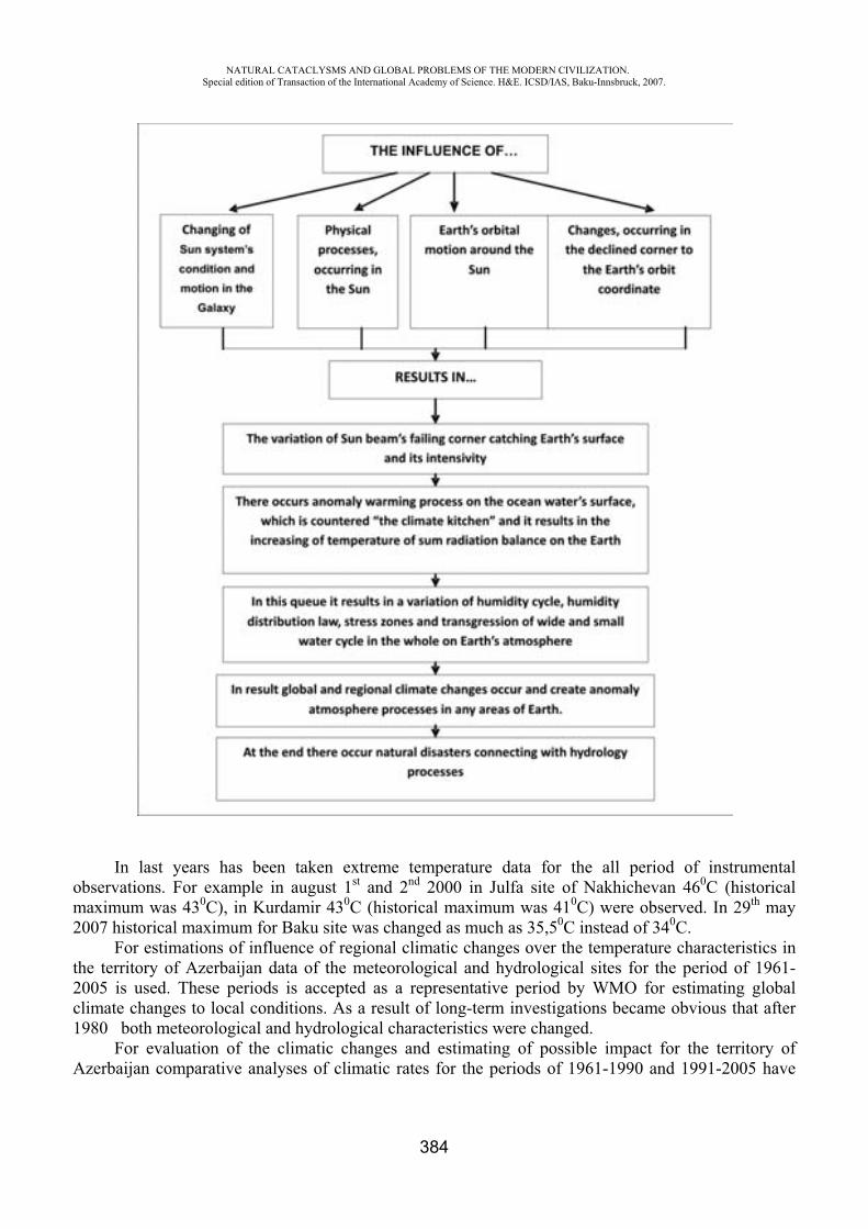
NATURAL CATACLYSMS AND GLOBAL PROBLEMS OF THE MODERN CIVILIZATION. Special edition of Transaction of the International Academy of Science. H&E. ICSD/IAS, Baku-Innsbruck, 2007.
384
In last years has been taken extreme temperature data for the all period of instrumental observations. For example in august 1st and 2nd 2000 in Julfa site of Nakhichevan 460C (historical maximum was 430C), in Kurdamir 430C (historical maximum was 410C) were observed. In 29th may 2007 historical maximum for Baku site was changed as much as 35,50C instead of 340C.
For estimations of influence of regional climatic changes over the temperature characteristics in the territory of Azerbaijan data of the meteorological and hydrological sites for the period of 1961-2005 is used. These periods is accepted as a representative period by WMO for estimating global climate changes to local conditions. As a result of long-term investigations became obvious that after 1980 both meteorological and hydrological characteristics were changed.
For evaluation of the climatic changes and estimating of possible impact for the territory of Azerbaijan comparative analyses of climatic rates for the periods of 1961-1990 and 1991-2005 have
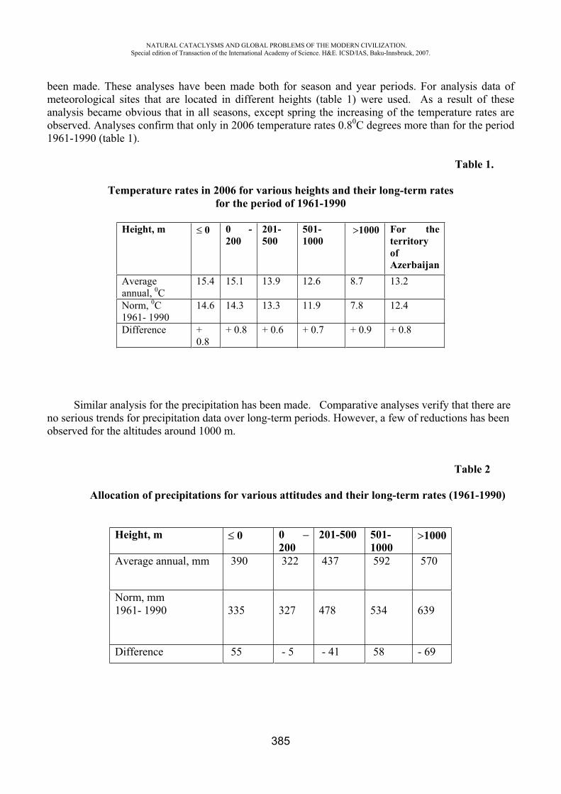
NATURAL CATACLYSMS AND GLOBAL PROBLEMS OF THE MODERN CIVILIZATION. Special edition of Transaction of the International Academy of Science. H&E. ICSD/IAS, Baku-Innsbruck, 2007.
385
been made. These analyses have been made both for season and year periods. For analysis data of meteorological sites that are located in different heights (table 1) were used. As a result of these analysis became obvious that in all seasons, except spring the increasing of the temperature rates are observed. Analyses confirm that only in 2006 temperature rates 0.80C degrees more than for the period 1961-1990 (table 1).
Table 1.
Temperature rates in 2006 for various heights and their long-term ratesfor the period of 1961-1990
Height, m 0 0 - 200
201-500
501-1000
1000 For the territoryofAzerbaijan
Averageannual, 0C
15.4 15.1 13.9 12.6 8.7 13.2
Norm, 0C1961- 1990
14.6 14.3 13.3 11.9 7.8 12.4
Difference +0.8
+ 0.8 + 0.6 + 0.7 + 0.9 + 0.8
Similar analysis for the precipitation has been made. Comparative analyses verify that there are no serious trends for precipitation data over long-term periods. However, a few of reductions has been observed for the altitudes around 1000 m.
Table 2
Allocation of precipitations for various attitudes and their long-term rates (1961-1990)
Height, m 0 0 – 200
201-500 501-1000
1000
Average annual, mm 390 322 437 592 570
Norm, mm 1961- 1990 335 327 478 534 639
Difference 55 - 5 - 41 58 - 69
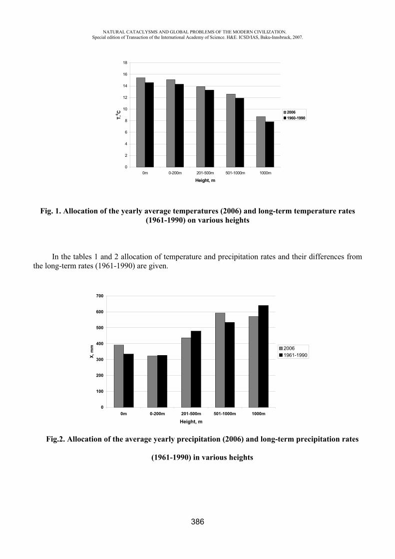
NATURAL CATACLYSMS AND GLOBAL PROBLEMS OF THE MODERN CIVILIZATION. Special edition of Transaction of the International Academy of Science. H&E. ICSD/IAS, Baku-Innsbruck, 2007.
386
Fig. 1. Allocation of the yearly average temperatures (2006) and long-term temperature rates(1961-1990) on various heights
In the tables 1 and 2 allocation of temperature and precipitation rates and their differences from the long-term rates (1961-1990) are given.
Fig.2. Allocation of the average yearly precipitation (2006) and long-term precipitation rates
(1961-1990) in various heights
0
2
4
6
8
10
12
14
16
18
0m 0-200m 201-500m 501-1000m 1000m
Height, m
T,0 C 2006
1960-1990
0
100
200
300
400
500
600
700
0m 0-200m 201-500m 501-1000m 1000m
Height, m
X, m
m 20061961-1990
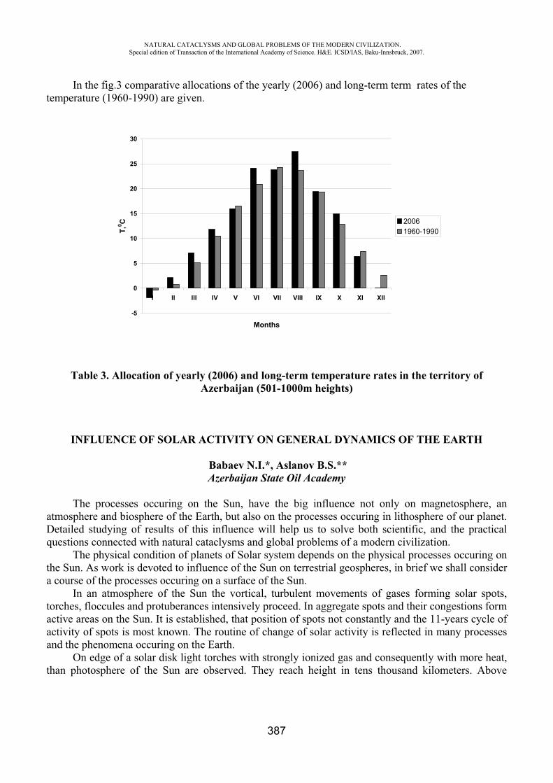
NATURAL CATACLYSMS AND GLOBAL PROBLEMS OF THE MODERN CIVILIZATION. Special edition of Transaction of the International Academy of Science. H&E. ICSD/IAS, Baku-Innsbruck, 2007.
387
In the fig.3 comparative allocations of the yearly (2006) and long-term term rates of the temperature (1960-1990) are given.
Table 3. Allocation of yearly (2006) and long-term temperature rates in the territory of Azerbaijan (501-1000m heights)
INFLUENCE OF SOLAR ACTIVITY ON GENERAL DYNAMICS OF THE EARTH
Babaev N.I.*, Aslanov B.S.** Azerbaijan State Oil Academy
The processes occuring on the Sun, have the big influence not only on magnetosphere, an atmosphere and biosphere of the Earth, but also on the processes occuring in lithosphere of our planet. Detailed studying of results of this influence will help us to solve both scientific, and the practical questions connected with natural cataclysms and global problems of a modern civilization.
The physical condition of planets of Solar system depends on the physical processes occuring on the Sun. As work is devoted to influence of the Sun on terrestrial geospheres, in brief we shall consider a course of the processes occuring on a surface of the Sun.
In an atmosphere of the Sun the vortical, turbulent movements of gases forming solar spots, torches, floccules and protuberances intensively proceed. In aggregate spots and their congestions form active areas on the Sun. It is established, that position of spots not constantly and the 11-years cycle of activity of spots is most known. The routine of change of solar activity is reflected in many processes and the phenomena occuring on the Earth.
On edge of a solar disk light torches with strongly ionized gas and consequently with more heat, than photosphere of the Sun are observed. They reach height in tens thousand kilometers. Above
-5
0
5
10
15
20
25
30
I II III IV V VI VII VIII IX X XI XII
Months
T,0 C 2006
1960-1990
NATURAL CATACLYSMS AND GLOBAL PROBLEMS OF THE MODERN CIVILIZATION. Special edition of Transaction of the International Academy of Science. H&E. ICSD/IAS, Baku-Innsbruck, 2007.
388
torches light clouds - floccules are located. They have on a vertical the sizes in hundred thousand kilometers and are formed mainly either the ionized hydrogen, or calcium.
Protuberances, especially eruptive, have most notable influence on the Earth. In occurrence of the phenomena occuring on the Sun, a greater role plays its magnetic field
which is stronger enough than a powerful magnetic field of the Earth in 6000 times. Besides the sun - a source of a strong radio emission. During appreciable solar flashes the radio emission of the Sun increases in millions times in comparison with a radio emission of the quiet Sun.
X-ray a beam X-rays of the Sun proceed, basically, from the top layers of a crown and are especially sensitive within the maximal solar activity. We shall note, that the Sun radiates not only light, warmly and all kinds of electromagnetic radiation, but also is a source of a direct current of particles – corpuscles. The significant part of corpuscular radiation (solar wind) is connected with solar flashes when particles get speed of 500-600 km/s. As experts of NASA on March, 21-stst, 2001 have informed northern magnetic pole of the Sun which are being northern hemisphere, has changed the position and now is in southern. It has appeared, that it not a unusual occurrence and a 22-years magnetic cycle it is connected with a 11-years cycle of solar activity and revolution of poles happens during passage of a maximum. Researchers of such phenomena have established, that the geomagnetic field of the Earth also mirror changed the direction and last such reverser has happened nearby 740 thousand years ago and when there will be a reverse motion anybody cannot predict. But communication of a 11-years cycle of solar activity with a 22-years magnetic cycle of the Sun and activization of the centers of earthquakes in many regions of the Earth is precisely enough traced. Magnetic fields of the Sun and the Earth behave differently, but they have also the general features. During a minimum of solar activity its magnetic field, as well as a geomagnetic field of the Earth, is directed along a meridian. Magnetic lines are concentrated at poles and rarefied in the field of equator. Such field has received the name « dipole» and its intensity makes 50 Gauss whereas the geomagnetic field of the Earth in 100 times is weaker. When solar activity increases and the number of solar spots grows, the magnetic field of the Sun starts to vary and the size of a magnetic field in these areas can exceed in hundreds times values of the basic dipole fields.
The source of a solar energy is known – thermonuclear reactions during which hydrogen turns to helium. The sun generates and directs to a space two basic streams of energy – electromagnetic radiation (solar radiation) and corpuscular radiation (a solar wind). Both of them render strong influence on the Earth, first of all on its magnetic field and an atmosphere. The thermal field of a surface of planets of Solar system (especially planets of internal group) is created by exclusively solar radiation as arrival endogenous energy of these planets to a surface is insignificant. Electromagnetic radiation has wave character, but not all waves are perceived by our eye. These waves get into gas and water environments of the Earth and strongly influence intensity of processes occuring there. If to consider and influence on the Earth corpuscular radiation of the Sun it becomes clear, that in the processes occuring not only on a surface of the Earth, but also in its bowels, the solar energy plays not last role. It is especially appreciable within solar activity when the strongest magnetic storms around our planet are formed.
As it has noted been above, in bowels of the Sun there is a thermonuclear reaction therefore the
temperature here rises even more. Something similar, in much smaller scales, but is sensitive enough
for the Earth, occurs and in internal layers of a planet when interaction of different chemical elements
leads to rise in temperature of environment. As an example element widespread enough in the nature -
a pine forest can serve. At heats it reacts with oxygen owing to what a plenty of heat is allocated:
2B+1,5O2 B2O3+302 kcal/mole
NATURAL CATACLYSMS AND GLOBAL PROBLEMS OF THE MODERN CIVILIZATION. Special edition of Transaction of the International Academy of Science. H&E. ICSD/IAS, Baku-Innsbruck, 2007.
389
Under usual conditions boric anhydride (B2O3) is included into reaction with water, forming
new connection – sassoline (orthoborate) with rise in temperature:
0,5 2 3+1,5 2 3[BO3]+9,1 kcal/mole
With an even greater thermal emission passes connection of a pine forest with sulfur in
conditions of greater depths:
2B+3S B2S3+57 kcal/mole
Similar examples with characteristic exothermal reactions is a lot of. Transformation of a pine forest into a new element – lithium is known also. It occurs as a result of changes in a kernel of a pine forest after connections with the neutrons, accompanied, as well as on the Sun, to allocation of big heat and transformation of one chemical element into another (hydrogen in helium).
Now a degree of solar activity characterize indexes – «Volf's numbers», concerning number of spots on a disk of the Sun. Finally solar activity is shown in emission from a surface of the Sun protuberances by extent of hundred thousand kilometers. On surrounding planets, including to the Earth, they have not only temperature, but also corpuscular influence. Light from protuberances reaches a surface of the Earth ~ for 500 seconds, whereas strained (it is strong ) a particle – the corpuscles possessing in the speed of 400-600 km/c, for 4 day. Thus, these particles reach that part of the Earth which has been directed to the Sun at eruptive eruption protuberance. It is quite obvious, that depending on a corner of falling on a surface of the Earth corpuscular particles on subequatorial sites will have more influences, than on subpolar. So, at the first approach, it is possible to note with confidence, that detection by a usual telescope powerful eruptive protuberance on a surface of the Sun for 4 day to notify us not only on possible changes in the organic world of our planet, but also in beat the geodynamic processes occuring in its bowels, about Activization as volcanism (including mud), and the centers of old earthquakes, about formation of probably new seismically active zones. Such conclusion not accident also has quite real substantiation.
We shall address to statistics powerful protuberance, recorded in observatories of the different countries:
- on January, 22nd, 2001 strong flash on the Sun, on January, 26th the same year earthquake in India (7,7 points);
- on November, 21st, 2000 powerful protuberance and earthquake in northeast of Apsheron (6,5 points), sensitive and in city Baku;
- on November, 03rd, 2003 strong eruption protuberance for last 150 years, earthquake on November, 07th, 2003 in the north of Algeria (6,8 points);
- on December, 22nd, 2003 explosion on the Sun and earthquake in Bam (Iran) on December, 26th, 2003 (6,4 points);
- on November, 13th, 2004 the strongest emission protuberance and earthquake in Armenia on November, 17th the same year (5,6 points), etc.
Apparently from the set forth above facts of 4 day later after strong eruptive protuberances the Sun on a surface of the Earth turned at that time to the Sun, there was an earthquake. Now easing solar activity is observed. But it does not mean, that is not present appreciable extractions from its surface. Constant steadfast studying of processes occuring on the Sun will notify us on possible catastrophic changes on the Earth, including about possible earthquakes.
NATURAL CATACLYSMS AND GLOBAL PROBLEMS OF THE MODERN CIVILIZATION. Special edition of Transaction of the International Academy of Science. H&E. ICSD/IAS, Baku-Innsbruck, 2007.
390
REFERENCES
1. E.V. Kononovich, A.A. Fadeeva JeNAM 2000, 9th European and 5th Euro-Azian Astronomical Society Conferance. Abstracts, Moscow, May 29 June 3 2000, p.130.
2. E.V. Kononovich, N.N. Shefov. An average atmosphere-regulator of influence of solar activity on long-term changes of power balance of the bottom atmosphere. Geomagnetism and aeronomy, 1999, volume 39, 1, .79-83.
«SOIL SELENTIST AND AGROCHEMICAL CHEMISTRY» NATIONAL ACADEMY OF SCIENCES OF AZERBAIJAN (Purification waste gas of thermo-electric power stations of NOx
by means of conjugation of electrochemical and chemical reactions.)
A.L. Shabanov*, E.E. Ramazanova**, P.B. Zamanov***, A.K. Rzayeva****, M.Sh. Atayev*****, M.D. Seidov******
Scientific Research Institute "Geotechnological problems of oil, gas and chemistry ", Azerbaijan Republic
The steady increase of consumption of fuel as in the power, and various industries and on transport results in growth of volume of harmful substances, emissive in an atmosphere. Thus the power (consuming more than thirds of extracted fuel) represents the largest source of emissions in an atmosphere of firm particles (soot, dust, ashes), oxides of sulfur SO2, SO3 and oxides of nitrogen, NO, NO2, and also oxides of carbon O, O2. On a share thermo-electric power stations (TPS) it is necessary about 60 % NOx from usual receive oxides of nitrogen, which are thrown out in an atmosphere.
Now oxides of nitrogen are considered dangerous pollution and for it established Maximum Permissible Concentration (MPC) -300 mg/m3.
It is revealed, that the given reaction emissions in stratosphere and results in destruction ozone layer. However, in spite of the fact that the allocation N x is one of the reasons global warmer spell of an atmosphere and destruction ozone of a layer, its emissions are annually increased. Therefore task of reduction of emissions N x and clearing them is by actuality question from the point of view of protection of an environment.
Taking into account general ecological conditions of a planet, it is necessary to accept the most urgent and most radical measures on neutralization of industrial gas emissions from harmful impurity. A number of methods on clearing N x are developed: absorption nitrogen oxides with liquid and firm sorbents, catalytic restoration of oxides nitrogen up to elementary nitrogen and catalytic oxidation. But all these methods have lacks connected to the large expenditure electric current, unsufficient level of an achievable degree of purification etc.
In last years with the purpose of elimination of lacks of existing methods on clearing oxides of nitrogen, the large attention was given to complex technology of deep clearing (80-85 %) of waste gases with using a method of selective uncatalytic restoration. This method is based on interaction of nitrogen oxides with ammonia and others organic restorers.
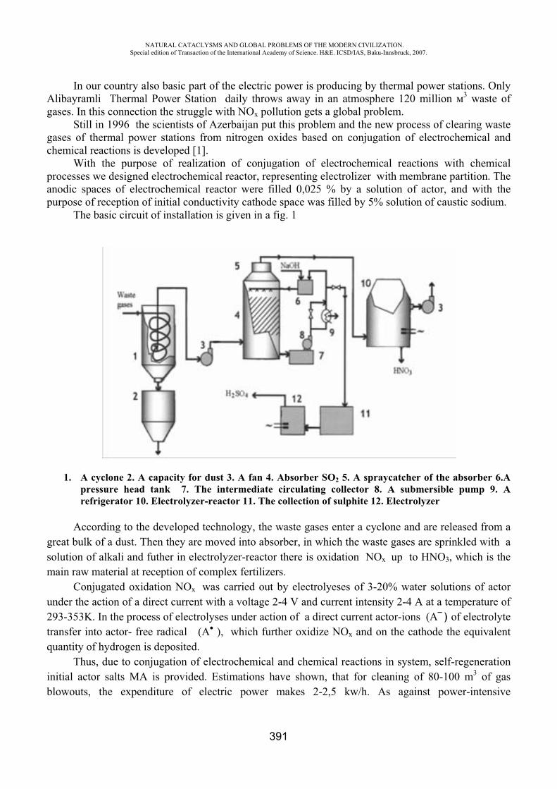
NATURAL CATACLYSMS AND GLOBAL PROBLEMS OF THE MODERN CIVILIZATION. Special edition of Transaction of the International Academy of Science. H&E. ICSD/IAS, Baku-Innsbruck, 2007.
391
In our country also basic part of the electric power is producing by thermal power stations. Only Alibayramli Thermal Power Station daily throws away in an atmosphere 120 million 3 waste of gases. In this connection the struggle with NOx pollution gets a global problem.
Still in 1996 the scientists of Azerbaijan put this problem and the new process of clearing waste gases of thermal power stations from nitrogen oxides based on conjugation of electrochemical and chemical reactions is developed [1].
With the purpose of realization of conjugation of electrochemical reactions with chemical processes we designed electrochemical reactor, representing electrolizer with membrane partition. The anodic spaces of electrochemical reactor were filled 0,025 % by a solution of actor, and with the purpose of reception of initial conductivity cathode space was filled by 5% solution of caustic sodium.
The basic circuit of installation is given in a fig. 1
1. A cyclone 2. A capacity for dust 3. A fan 4. Absorber SO2 5. A spraycatcher of the absorber 6.A pressure head tank 7. The intermediate circulating collector 8. A submersible pump 9. A refrigerator 10. Electrolyzer-reactor 11. The collection of sulphite 12. Electrolyzer
According to the developed technology, the waste gases enter a cyclone and are released from a great bulk of a dust. Then they are moved into absorber, in which the waste gases are sprinkled with a solution of alkali and futher in electrolyzer-reactor there is oxidation NOx up to HNO3, which is the main raw material at reception of complex fertilizers.
Conjugated oxidation NOx was carried out by electrolyeses of 3-20% water solutions of actor under the action of a direct current with a voltage 2-4 V and current intensity 2-4 A at a temperature of 293-353K. In the process of electrolyses under action of a direct current actor-ions ( ) of electrolyte transfer into actor- free radical ( ), which further oxidize NOx and on the cathode the equivalent quantity of hydrogen is deposited.
Thus, due to conjugation of electrochemical and chemical reactions in system, self-regeneration initial actor salts MA is provided. Estimations have shown, that for cleaning of 80-100 m3 of gas blowouts, the expenditure of electric power makes 2-2,5 kw/h. As against power-intensive
NATURAL CATACLYSMS AND GLOBAL PROBLEMS OF THE MODERN CIVILIZATION. Special edition of Transaction of the International Academy of Science. H&E. ICSD/IAS, Baku-Innsbruck, 2007.
392
electrochemical processes, conjugation of electrochemical and chemical reactions allows to reduce strongly energy consumption of the installation up to 60%. Besides, the developed process allows making additional production, in particular 30% nitric acid that raises the economic efficiency of the process.
We established, that nitrogen oxide (I) and (II) missed in the anodic chamber containing a water solution of actor ( ), intensively turns to a nitric acid in a solution. The essence of oxidation nitrogen oxide to a nitric acid consists that reaction of electrochemical transformation (1) on the anode is conjugated with chemical reaction (2):
– 1 (1)
NO + N O + (2)
N O + HOH HO-N=O + H (3)
As a result of this intermediate atomic again turn into it anionic form .Due to conjugation processes nitrogen (II) oxide becomes cation ON , which, as well as was necessary to expect, at interaction with water on reaction (3) gives a nitric acid. In the further nitric acid also is inclined to participate in anodic processes. So, in a solution she is exposed dissociation on the equation (4):
HO-N=O H+ + NO 2 (4) Formed anion NO 2 on the anode, losing electron on the equation (5), transform in cathion
ON . Last, as is known, easily having attached water on the equation (6), gives a nitric acid:
NO 2 – 1e N O2 (5)
N O2+ HOH HONO2 +H+ (6)
As it is visible from the given equations (3) and (6) in these processes the strong allocation of a proton is observed, that results, as well as followed, to increase acidity. This also proves to be true by experimental data. In a fig. 2 the dependence in the anodic chamber from density of a current is given, from which it is visible, that acidity of an anodic solution strongly raises, the strong increase of density of a current on the anode negatively influences increase acidity. Apparently, at high density of a current there is a destruction of a nitric acid on initial components. The influence of various technological parameters on an output of a nitric acid is investigated at the connected oxidation NO on the anode: concentration of actor, density of a current on the anode, speed of submission of gas in the anodic chamber. The concentration of a actor in a solution makes 5 %, density of a current 0,15 A/sm2,the speed of submission of gas in anodic chambers is equal 0,01 ml/min.
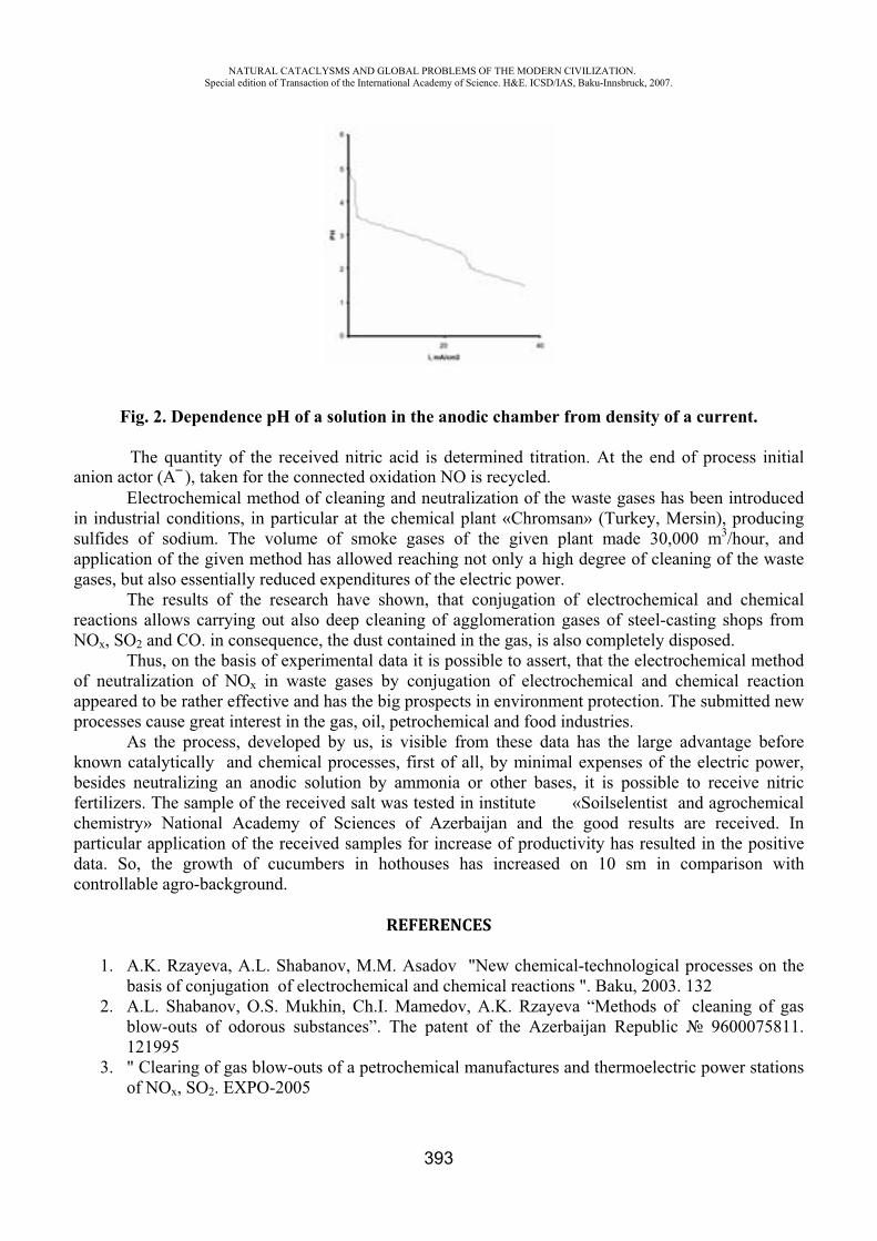
NATURAL CATACLYSMS AND GLOBAL PROBLEMS OF THE MODERN CIVILIZATION. Special edition of Transaction of the International Academy of Science. H&E. ICSD/IAS, Baku-Innsbruck, 2007.
393
Fig. 2. Dependence of a solution in the anodic chamber from density of a current.
The quantity of the received nitric acid is determined titration. At the end of process initial anion actor ( ), taken for the connected oxidation NO is recycled.
Electrochemical method of cleaning and neutralization of the waste gases has been introduced in industrial conditions, in particular at the chemical plant «Chromsan» (Turkey, Mersin), producing sulfides of sodium. The volume of smoke gases of the given plant made 30,000 m3/hour, and application of the given method has allowed reaching not only a high degree of cleaning of the waste gases, but also essentially reduced expenditures of the electric power.
The results of the research have shown, that conjugation of electrochemical and chemical reactions allows carrying out also deep cleaning of agglomeration gases of steel-casting shops from NOx, SO2 and CO. in consequence, the dust contained in the gas, is also completely disposed.
Thus, on the basis of experimental data it is possible to assert, that the electrochemical method of neutralization of NOx in waste gases by conjugation of electrochemical and chemical reaction appeared to be rather effective and has the big prospects in environment protection. The submitted new processes cause great interest in the gas, oil, petrochemical and food industries.
As the process, developed by us, is visible from these data has the large advantage before known catalytically and chemical processes, first of all, by minimal expenses of the electric power, besides neutralizing an anodic solution by ammonia or other bases, it is possible to receive nitric fertilizers. The sample of the received salt was tested in institute «Soilselentist and agrochemical chemistry» National Academy of Sciences of Azerbaijan and the good results are received. In particular application of the received samples for increase of productivity has resulted in the positive data. So, the growth of cucumbers in hothouses has increased on 10 sm in comparison with controllable agro-background.
REFERENCES
1. A.K. Rzayeva, A.L. Shabanov, M.M. Asadov "New chemical-technological processes on the basis of conjugation of electrochemical and chemical reactions ". Baku, 2003. 132
2. A.L. Shabanov, O.S. Mukhin, Ch.I. Mamedov, A.K. Rzayeva “Methods of cleaning of gas blow-outs of odorous substances”. The patent of the Azerbaijan Republic 9600075811. 121995
3. " Clearing of gas blow-outs of a petrochemical manufactures and thermoelectric power stations of NO , SO2. EXPO-2005
NATURAL CATACLYSMS AND GLOBAL PROBLEMS OF THE MODERN CIVILIZATION. Special edition of Transaction of the International Academy of Science. H&E. ICSD/IAS, Baku-Innsbruck, 2007.
394
SOILS’ ECOLOGICAL FUNCTIONS DEGRADATION AND ITS INFLUENCE OVER ENVIRONMENT
Kuharuk E., Stegarescu V., Liogchii N., Crivova O.
Institute of Ecology and Geography, Academy of Sciences, Republic of Moldova
Republic of Moldova is the unique world country that possesses the most fertile soils – chernozems that occupy 75% of its area. But, ill-considered soils’ use led to intensive degradation of their ecological functions: energetic, biogeochemical, hydrological, gas-atmospheric, geological etc.
First of all, ecological territorial balance was disturbed. In the whole of the country, natural ecosystems (wood plantations, including forest shelter belts, meadows, grasslands, swamps and water systems) quota makes just 19%, and at some villages it falls until 7% of total territory’s area. The country’s woodiness makes only 9.6%, and at some regions falls to 1.0%. At the same time, agricultural lands’ cultivation level has increased and rose up to 70% in average, while in some villages exceeding 90%.
The actual state of cultivated soils is no less alarming. Negative processes, which lead to soils’ degradation and destruction, increase together with exploitation intensification. Soils’ structure’s damage, increasing compactible degree, dehumification, erosion, hydromorphism, landslide processes, pollution are developing more intensely. Intense cultivation led to ploughing layer’s natural structure’s destruction, which worsened water and air penetrability along with other physical characteristics of soil. In consequence of applied tractors and other agrotechnique increasing weight a systematic increase of soil’s density is observed. Moldova’s chernozems and wood soils are shrinking ad litterarum, which is also a negative influence on their characteristics.
Energetic function, reviewed as soils humus potential, plays an important role in soils’ ecological functions system, which is important not only for Moldova, but also for the other countries, where other energy sources are limited. In early 60s Moldova’s soils contained nearly 1 milliard ton of humus on the whole area in 1 meter layer, now it has 0.8-0.9 milliard ton. Two thirds of this huge loss is ecologically useless, because of erosion.
Water erosion in Moldova’s conditions is the most wide-spread soil-destructing process. Averagely and strongly washed-off soils make more than 275 thousands of hectares. It should be noted that the more eroded soils is, the easier it is exposed to further washing off, because lower horizons have less anti-erosion resistance. Erosion processes’ intensity has particularly increased in last years as a consequence of wood protection belts’ destruction, implementation of so-called intra-farm crops rotation, row crops’ quota increasing in cultivated areas structure and their cultivation by industrial technologies. Applying herbicides to fight weeds excludes cultivation and also excludes possibility to realize appropriate agrotechnical anti-erosion measures: slitting, discrete furrowing, chiseling, and hollowing.
Erosion processes intensity on deep-ploughed soils has increased sharply because transitional chernozems horizons appear on the surface – less humified, with worse structure, water penetrability, and low anti-erosion resistance. Erosion processes are the reason of republic’s annual losses of 50

NATURAL CATACLYSMS AND GLOBAL PROBLEMS OF THE MODERN CIVILIZATION. Special edition of Transaction of the International Academy of Science. H&E. ICSD/IAS, Baku-Innsbruck, 2007.
395
thousands tones of winter grain crops, 100 thousands tones of maize, 25 thousands tones of sunflower seeds, 150 thousands tones of sugar beet.
It was calculated that if we take a full-profiled chernozems potential as 100, than weak wash-off one will have 75, averagely wash-off one – 60-65, strongly wash-off one – 34. Erosion completely disturbs soils’ potential energy’s accumulation process.
Thanks to their biogeochemical function, chernozems have accumulated in their profile carbon in organic form, nitrogen, phosphorus, some microelements. Every 100 ton erosion caused humus losses mean that also losing 5-6 tons of nitrogen, irretrievably almost half of phosphorus (which is the most scarce biofile in the world) quota, the low Clarke elements (manganese, boron, cuprum, zinc, molybdenum etc). In eroded chernozems these substances’ losses make 25-75% from their initial proportion.
Moldova’s soils fertility has decreased in half during the century; consequently cultures yield is decreasing accordingly.
In present for soils fertility restoration agrochemists recommend introducing 10-12 tons of manure in soil per hectare or 18-20 million of tons yearly.
Chernozems hydrological function operates with liquid effluent and solid elution. Liquid effluents may be powerful enough to cause erosion drought, and solid elution sharply disperses soils status as bio-inert carcass body. Soil’s biota suffers severely too- the quantity of invertebrate, bacteria, fungi, their activity and specific diversity is reduced in 2-4 times, so on every part of washed-off chernozems the quantity of living beings is reduced, like a fragment of biosphere is dying.
The prognosis is quite imposing – all eroded agricultural lands will increase in area, and their growth in last decade makes more than 30% (tables 1-2).
Table 1.
Eroded agricultural lands by zones in Republic of Moldova`on 01.01.2002
Zones
Total area, he
Eroded soils:
total weakly- averagely- strongly- averagely-+ strongly -
he % he % he % he % he % Northern 875176 296685 34,0 194340 22,2 73515 8,4 28881 3,4 102396 11,8 Central 696345 314748 45,2 165730 23,8 102363 14,7 46655 6,7 149018 21,4
Southern 732411 285640 39,0 157468 21,5 91551 12,5 36621 5,0 128172 17,5 South-Eastern 234753 51880 22,1 36152 15,4 12442 5,3 3287 1,4 15729 6,7
Total 2538685 949468 37,4 553433 21,8 279255 11,0 116780 4,6 396035 15,6 Referring to
Right bank 2274453 889481 39,1 511238 22,5 265486 11,7 112756 5,0 378242 16,7 Left bank 264232 59987 22,7 42195 16,0 13769 5,2 4024 1,5 17793 6,7
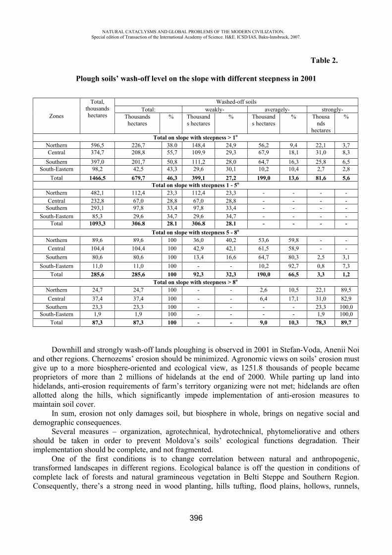
NATURAL CATACLYSMS AND GLOBAL PROBLEMS OF THE MODERN CIVILIZATION. Special edition of Transaction of the International Academy of Science. H&E. ICSD/IAS, Baku-Innsbruck, 2007.
396
Table 2.
Plough soils’ wash-off level on the slope with different steepness in 2001
Zones
Total, thousandshectares
Washed-off soils Total: weakly- averagely- strongly-
Thousandshectares
% Thousands hectares
% Thousands hectares
% Thousands
hectares
%
Total on slope with steepness > 1Northern 596,5 226,7 38.0 148,4 24,9 56,2 9,4 22,1 3,7 Central 374,7 208,8 55,7 109,9 29,3 67,9 18,1 31,0 8,3
Southern 397,0 201,7 50,8 111,2 28,0 64,7 16,3 25,8 6,5 South-Eastern 98,2 42,5 43,3 29,6 30,1 10,2 10,4 2,7 2,8
Total 1466,5 679,7 46,3 399,1 27,2 199,0 13,6 81,6 5,6 Total on slope with steepness 1 - 5
Northern 482,1 112,4 23,3 112,4 23,3 - - - - Central 232,8 67,0 28,8 67,0 28,8 - - - -
Southern 293,1 97,8 33,4 97,8 33,4 - - - - South-Eastern 85,3 29,6 34,7 29,6 34,7 - - - -
Total 1093,3 306.8 28.1 306.8 28.1 - - - - Total on slope with steepness 5 - 8
Northern 89,6 89,6 100 36,0 40,2 53,6 59,8 - - Central 104,4 104,4 100 42,9 42,1 61,5 58,9 - -
Southern 80,6 80,6 100 13,4 16,6 64,7 80,3 2,5 3,1 South-Eastern 11,0 11,0 100 - - 10,2 92,7 0,8 7,3
Total 285,6 285,6 100 92,3 32,3 190,0 66,5 3,3 1,2 Total on slope with steepness > 8
Northern 24,7 24,7 100 - - 2,6 10,5 22,1 89,5 Central 37,4 37,4 100 - - 6,4 17,1 31,0 82,9
Southern 23,3 23,3 100 - - - - 23,3 100,0 South-Eastern 1,9 1,9 100 - - - - 1,9 100,0
Total 87,3 87,3 100 - - 9,0 10,3 78,3 89,7
Downhill and strongly wash-off lands ploughing is observed in 2001 in Stefan-Voda, Anenii Noi and other regions. Chernozems’ erosion should be minimized. Agronomic views on soils’ erosion must give up to a more biosphere-oriented and ecological view, as 1251.8 thousands of people became proprietors of more than 2 millions of hidelands at the end of 2000. While parting up land into hidelands, anti-erosion requirements of farm’s territory organizing were not met; hidelands are often allotted along the hills, which significantly impede implementation of anti-erosion measures to maintain soil cover.
In sum, erosion not only damages soil, but biosphere in whole, brings on negative social and demographic consequences.
Several measures – organization, agrotechnical, hydrotechnical, phytomeliorative and others should be taken in order to prevent Moldova’s soils’ ecological functions degradation. Their implementation should be complete, and not fragmented.
One of the first conditions is to change correlation between natural and anthropogenic, transformed landscapes in different regions. Ecological balance is off the question in conditions of complete lack of forests and natural gramineous vegetation in Belti Steppe and Southern Region. Consequently, there’s a strong need in wood planting, hills tufting, flood plains, hollows, runnels,
NATURAL CATACLYSMS AND GLOBAL PROBLEMS OF THE MODERN CIVILIZATION. Special edition of Transaction of the International Academy of Science. H&E. ICSD/IAS, Baku-Innsbruck, 2007.
397
swamps and others natural destination’s restoration. It is necessary to examine Moldova’s flood plains’ soils and to evaluate them.
The other condition is to create natural carcass, a green skeleton – protection belts situated on watersheds. They would serve to smooth climatic conditions; lessen wind’s force and storms’ destructive power. Anti-erosion, flow–regulating belts are strictly necessary in order to regulate surface flow on hills. These belts should be connected with areas of natural forests and wood plantings, created on ravine’s and landslide’s hills, with areas where natural gramineous vegetation is still preserved, and with protection zones along rivers and lakes.
Natural carcass will provide a possibility to cultivate soil and plant cultures across the hills and by horizontals, to implement agrotechnical and anti-erosion measures. It would benefit to preserve local flora and fauna genetic fund.
The areas with mainly distribution of averagely and strongly washed-off soils should be taken out of ploughing fund and intense use; because they practically cannot be protected from erosion while being a part of crops rotation. These soils should be tufted and planted with perennial herbs. Natural vegetation restoration in rivers’ flood plains, cavins and hollows would regulate flow and clean surface waters. Thus, a considerable balance between natural and anthropogenic components of ecosystems will be created and chernozems’ ecological functions will be preserved.
The problem of soils radioactive pollution becomes more and more actual and serious. The application of radio nuclides, particularly Cs137, for water erosion and sedimentation studies
in Republic of Moldova has not been attempted so far. Consequently the investigations were made on reservoir sedimentation rates in an area subjected to wide range of land degradation by sheet-rill erosion.
The profile characteristics support the assumption that in most undisturbed sites there is a sharp decline in Cs137 activity along with increasing depth. Such an asymmetrical distribution of the Cs137
would suggest a standard pattern in the form of a cantilever. If the validity of this assumption is accepted it is possible to define two major types of Cs137 cantilever distribution: shallow and deep buried cantilever.
The main criterion in classifying these patterns lies generally in the shape of Cs137 depth profile and particularly in burial magnitude of Cs137 peak derived from Chernobyl.
Hills area has been impacted by greatest sedimentation. This regional differentiation is consistent with the decrease in clay and increase in sand content of substratum layers as moving from the North to the South.
Accumulation of Cs137 in reservoirs in the Republic of Moldova is mainly associated with the Chernobyl imputes and subsequently with Cs137 derived from testing of nuclear weapons.
The pattern of shallow buried cantilever typifies those areas where Cs137 peak concentration exhibits in the upper part of the profile commonly at a depth 15 – 50 cm (a plant’s main roots inhabited layer), especially in the northern and southern part of Moldova, where rill – inter-rill erosion is the main sediment source.
Along with radioactive pollution, there’s equally actual problem of waste pollution of soil. Around the localities by different ways, soil is polluted with solid waste. Even more dangerous consequences may have chemical pollution. Sulphur and nitrogen oxides diffuse through atmosphere, deposit on soil and in due course change its initial physical composition. Heavy metals get into soil together with wastewaters and their sediments (mercury, zinc, cuprum etc), from automobiles’ exhaust gases (lead). Soils’ chemical pollution takes larger scale together with agriculture’s chemicalization increase. Ballast elements (fluorine, chlorine) are applied together with fertilizers, different elements which are non-characteristic for soil are introduced while spray treatment for diseases and pest control and particularly while introducing herbicides. As the areas of irrigated lands are widening, we may observe the increase in threat and processes’ manifestation scales of gleyification, secondary water
NATURAL CATACLYSMS AND GLOBAL PROBLEMS OF THE MODERN CIVILIZATION. Special edition of Transaction of the International Academy of Science. H&E. ICSD/IAS, Baku-Innsbruck, 2007.
398
clogging, irrigational erosion, sodisation and salinization, particularly when alkaline and mineralized waters are used for irrigation.
That’s why the state of land resources is stressed, and the state of soil cover is alarming. Systematic control over its usage is needed and in some special cases there’s a need to take immediate action.
Apart from using soil, humankind has no other possibility to obtain food products and numerous materials necessary for existence. Soil as a source of material values, as a priceless natural wealth and the main environmental component must function perfectly and serve forever to us and our future generations.
INTEGRATED WATER RESOURCES MANAGEMENT AS BASIS FOR FLOOD PREVENTION IN THE
KURA RIVER BASIN
R. Verdiyev
This article is directed at review of floods in Azerbaijan and recommended by the author suggestions on improved water (flood) management in Azerbaijan by creating legal and institutional frameworks for the development of Integrated Water Resources Management and flood prevention programs at national level and for the whole Kura-Araz River Basin. This may be used to establish an institutional, legal and technical framework in order to overcome national level and trans-boundary water issues in the Caucasus region.
After the collapse of the Soviet Union, the countries of the South Caucasus gained their independence. However, they faced with the problems associated with national and trans-boundary water management. Transboundary water management remains one of the key issues leading to conflict in the region today.
The surface water resources of the South Caucasus mainly consist of run-off from the Kura-Araz River Basins. Kura with its vast river system is the key water provider or, as hydrologists say, is the main water artery of the Caucasus. The river flows through the territories of Turkey, Georgia and Azerbaijan Republics. The total length of the river is 1,364 km and it has a total watershed area of 188,000 km2. Of this area, 58,000 km2 relates to Azerbaijan, 34,700 km2 to Georgia, 29,800 km2 toArmenia and 66,000 km2 to Iran and Turkey/Verdiev 1999,2002/.
Though Azerbaijan is an extremely water-poor region (the water supply of the Azerbaijan Republic territory situated downstream of trans-boundary rivers makes up about 100,000 m3/ km2)there are often floods at mountain rivers that lead to huge damage to the economy of the country and human losses.
Flood formation at rivers of Azerbaijan is connected with snow melting, rainfall and also such characteristics of the basin as exposition of mountains slopes, elevation, forest and plant cover and etc.
Rivers of the Greater and Lesser Caucasus with average altitudes of the catchments area higher than 2500m main source of flood is melted snow (more than 70%). 80% of flood maximum is observed in June-July.
Rivers with average altitudes of the catchments area between 1500 and 2500m flood is formed mainly by snow melting and rainfall (mainly maximum flood discharges are observed in May-June).
NATURAL CATACLYSMS AND GLOBAL PROBLEMS OF THE MODERN CIVILIZATION. Special edition of Transaction of the International Academy of Science. H&E. ICSD/IAS, Baku-Innsbruck, 2007.
399
Flooding at rivers of Greater and Lesser Caucasus with less altitudes and those of Lenkoran region mainly is caused by rains (90%). These rivers are called flooding regime rivers. Flood mainly is observed during the rainfall in spring and autumn. At rivers of Lenkoran flood occurs during the winter as well. By researches of Prof. Magbet Mammadov the flood parameter for these rivers reach values about 20-30.
Often at the end of summer and beginning of autumn in result of intensive rainfall in most of rivers of South Slope of Greater Caucasus mud flow takes place. Absence of effective monitoring and early warning system, and data exchange at the transboundary and national level and also adequate technology don’t allow to prevent resulted serious damages to the economy of the country. There is also no required legal, policy and institutional basis for effective flood management.
Water sector is one of the most important parts of country’s economy and engineering-municipal infrastructure of the republic. Central, regional and territorial governances, joint stock companies, private and municipal structures are involved in the water activities. Their performance is regulated by sectorial Laws and number of standard acts and bylaws.
Water Policy of the country is also implemented through National Plans, State Programs and Action Plans. Now government in cooperation with Asian development Bank is implementing flood prevention, mitigation and management project. One of outcome of the project will be development of integrated flood management strategy.
National Program on Restoration and Enlargement of Forestlands in Republic of Azerbaijan (2003) also includes water policy principles.
In January 2004, President of the country approved Program on Development of Hydrometeorology in Republic of Azerbaijan (2004-2010).
The Program envisages carrying out following activities: Managing water resources in optimal manner and accurately assessing them; Hydrometeorological support of projects on effective use of water resources of the country; Developing forecasting system for hydrometeorological phenomena, which might cause disasters (floods, mudflows, showers, hail, etc.); Improving hydrometeorological service provision for population, extending hydrometeorological database network; Improving climate monitoring and assessment system, System of Global Climate Observation, Global On land Hydrological Network; Development and modernization of Hydrometeorological Network.
There is no arranged state water management system based on basin principle in Azerbaijan. It is necessary to identify one state authority, which would bear responsibility for providing population and economy with water resources, and taking measures for improvement of condition in rivers and reservoirs. Established practice of setting limits for water consumption and discharge of wastewaters does not consider actual volumes and types of production, technologies and water supply schemes (direct, reverse, etc.) existing at the enterprises.
Periodical rising of Caspian Sea level also represents serious environmental problem for the republic. The last rise resulted in flooding over 800 square kilometers of lands. The aggregate damage caused to economy of Azerbaijan exceeded 4 billion US Dollars.
Water sector – one of the most important parts of the nature, environment, social and economic life – requires permanent attention of the state. According to National Program on Socio-Economic Development, priorities of Republic of Azerbaijan in water sector are protection of environment and achievement of rational use of natural resources. This Program, being integral part of Development Strategy of the country, is aimed at coordinating national and regional efforts for protection of the environment, implementing scientifically based development principles, ensuring sustainability in use
NATURAL CATACLYSMS AND GLOBAL PROBLEMS OF THE MODERN CIVILIZATION. Special edition of Transaction of the International Academy of Science. H&E. ICSD/IAS, Baku-Innsbruck, 2007.
400
of economic and human resources for present and future generations. One of the most important trends also is coordinating efforts of government and NGO sectors for protection of the environment.
Organization of management of water resources of Azerbaijan is carried out in accordance with existing legislation. The laws adopted by Parliament are enforced by relevant decrees of the President of the country. These decrees determine also the authorities of relevant state bodies. The Ministry Cabinet of the country in accordance with the decrees of the President adopts a number of necessary regulations and decisions prepared by corresponding bodies of executive power.
The following organizations are dealing with the issues of water resources management in Azerbaijan:
Ministry of Ecology and Natural Resources; Amelioration and Water Farm JSC Ministry of Emergency
Relationships between water users are regulated, along with Water Code, by legislative acts on sanitary-epidemiological safety and other legislative acts. Relationships connected with drinking water supply and discharge of waste water, are regulated, along with Water Code, by corresponding legislation of Azerbaijan Republic. Relationships on land, forest, entrails of the earth, vegetation and animal world, atmosphere, exploration and protection of ground water, as well as property and other administrative relationships emerging during use and protection of water bodies, are regulated, along with Water Code, by relevant legislation of Azerbaijan Republic.
State management in the field of use and protection of water bodies in state ownership is carried out by the Amelioration JSCand Water Economy at the Ministry Cabinet of Azerbaijan Republic and Ministry of Ecology and Natural Resources within the limits of their authority. Management in the field of use and protection of water bodies in municipal ownership is carried out by municipalities within the limits of authority defined by law.
Donors. Different project on water were and still are being implemented in the region financed by the World Bank, EU TACIS, USAID, UNDP/GEF, EBRD, IDB, SADC, GTZ/KfW, Asian Development Bank
The World Bank project is directed at the creation of the base for the regulation water-supply, irrigation and drainage systems, etc. Kreditanstalt fur Wiederaufbau (KfW) and Asian and Islamic Banks of Development are financing the projects on the reconstruction of water-supply and wastewater systems, on fighting mudflow effects and others. Coordination of interactions between the projects and governments is the key factor for the achievement of water resources efficient management.
All of these show that it is necessary to develop Integrated Water Resources Management Plans and early warning systems and create institutional frameworks for their realization both at the national level and as an extension of the national level achievements to the trans-boundary level cooperation. In this case, a main guiding instrument would be the different International practices in the area of Water resources and Flood Management. In order for the countries of the South Caucasus to develop their own plans, the experience of leading countries should be utilized through the analysis of publications, web pages, interviews and meetings with international experts, attending the meetings of relevant agencies, and finally compared with the existing legal and institutional structures in the country. This may help to develop the relevant recommendations.
Application of the modern water management strategy, which is in use by the developed countries, may improve the situation with water supply, water protection and management at the national level and in the entire Kura River Basin.
This activity is directed at development of a mechanism to apply leading experience in the area flood management in Azerbaijan and in the Kura-Araz river basins. In order to apply the leading experience in this area by support of the Working Group and experts of European Countries, it is necessary to study and analyze the leading practices and after comparing them with the existing
NATURAL CATACLYSMS AND GLOBAL PROBLEMS OF THE MODERN CIVILIZATION. Special edition of Transaction of the International Academy of Science. H&E. ICSD/IAS, Baku-Innsbruck, 2007.
401
management structure and its legal and institutional aspects in Azerbaijan to make relevant recommendations for the decision makers on ways of early warning system development. In this regards the following aspects of water management should be considered :
The harmonization of the country’s water legislation with those accepted at the International level; Development of the best mechanism to enable laws to work more effectively by making additions and changes in related acts (such as statues, rules, flood management strategies); Instruments for the promotion of increased awareness of the population and agencies on water related National and International legislation and wide stakeholder participation, flood prevention and etc; Increased cooperation within the sphere of International agencies and donors. Joining to International Conventions Institutional settings for River Basin and Flood Management Water management models cannot be transferred inflexibly from country to country; rather, they should be adapted to local needs. These tasks may include irrigation, where this is a priority activity in the basin, hydropower, or flood management. It is necessary to adopt the underlying principles of a particular water management model, adapting it to needs and conditions in each country, region and river basin/Salman 1998, A.Wolf 1999/. Therefore, important aims of the future activities will be to analyze practices in the leading world on the development of river basin agencies and find best way of their application in Azerbaijan. Preferably, the river basin agencies should be entrusted only with those functions that they can perform more efficiently, more effectively and in a more sustainable way than any other institutional agency in the country. In order to create such an agency in Azerbaijan and for the Kura-Araz River Basin, it is necessary to learn from the experience of leading countries at the following spheres: In the conditions of market economy, in order to accelerate resolution of the water sector problems in the country, ensure its operative management, flood prevention, law enforcement, observance of international conventions on water related issues, international and inter-state cooperation, it is necessary to create State Commission on Water Issues. Preparation of a National Integrated Water Use, Water Protection and Flood management Strategy and creation of relevant institutions for their realization; Considering an integrated river basin planning approach more effective than administrative territorial water management and preparation proposals for development of IWRM plans; Strengthening the mechanism for coordination of water management by active participation of different sectors; Introduction of computer-based systems into monitoring and data exchange systems; Improvement of public participation in water resources management;
ConclusionAs mentioned above, the existing flood problems in the country and Kura-Araz region, the
absence of mechanisms for proper country and regional level flood management, and cooperation between the basin countries and the economic branches show the necessity for undertaking urgent measures and new steps toward the preparation and application of the flood management plans.
There is a necessary to adopt new approaches in water resources management and develop flood management strategy. Also there is a necessity to develop a basis for the river basin management plans and structures. For preparation of flood management plans experts from different water management spheres of the country should study and make suggestions on ways to apply leading experience of
NATURAL CATACLYSMS AND GLOBAL PROBLEMS OF THE MODERN CIVILIZATION. Special edition of Transaction of the International Academy of Science. H&E. ICSD/IAS, Baku-Innsbruck, 2007.
402
world countries to the water sector of Azerbaijan. Providing the adequate training with participation of European experts for specialists and decision makers may play an important role for the practical application of those plans.
In my opinion, implementation of the activity on use of world experiences on development of IWRM and flood management plans may be an important step for the improvement of the water management in Azerbaijan and may create a foundation for improvement of the Kura-Araz river basins’ level of cooperation. This also will play an important role in eliminating the reasons for water conflicts in the basin.
REFERENCES
1. Salman, Salman M.A. and Lawrence Boisson de Chazournes, eds ”International Water courses:
2. Enhancing Cooperation and Managing Conflict. ”Washington DC: The World Bank (Technical Paper No.414),1998
3. United Nations. Register of International Rivers. New York: Pergamon Press,1978. 4. Wolf A., Natharius J., Danilson B. Ward and J. Pender.” International River Basins of the
world:” International Journal of Water Resources Development. Vol.15 N4, December 1999, pp. 387-427.
5. Verdiyev R. H. Water Resources of the Eastern Caucasus Rivers Under Climate Change. Monograph. Baku-2002, 230 p.
6. R. Verdiyev Water resources assessment for the river Kura in conditions of limate change. World Meteorological Organization Bulletin, Genevre-1999, p. 327-328
7. Verdiyev Rafig, Mansimov Mirzakhan, Imanov Farda. The rale of meteorology in elonomy of the Azerbaijan Republic. Thesis of presentation. IV Evropean Conference on Application of Meteorology. Sweden. 13-17 September, 1999.
ON THE APPLYING OF THE GLOBAL CLIMATE CHANGE SCENARIOS IN AZERBAIJAN
G. M. Suleymanov
Ministry of Ecology and Natural Resources, Climate Change and Ozone Center
It is clear that, Global Climate Changes depend from the energy exchange between Earth and space.
Any factor which alerts the radiation received from the Sun or lost to the space, or which alerts the redistribution of energy within the atmosphere, and between the atmosphere, land and ocean, can affect climate. A change in the netto-radiation energy available to the global Earth/atmosphere system a radioactive forcing. Results of the positive radioactive forcing tends to warm and the results of the negative radioactive forcing tends to cool the lower atmosphere and surface. Increases in concentrations of greenhouse gas reduce the efficiency of the radiation from Earth surface to space. More of the outgoing terrestrial radiation from the surface is absorbed by the atmosphere and emitted at higher altitudes and colder temperature. This results in a positive radioactive forcing which tends to cool the lower atmosphere and surface. This is enhanced greenhouse effect – an enhancement of an
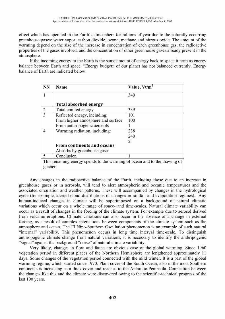
NATURAL CATACLYSMS AND GLOBAL PROBLEMS OF THE MODERN CIVILIZATION. Special edition of Transaction of the International Academy of Science. H&E. ICSD/IAS, Baku-Innsbruck, 2007.
403
effect which has operated in the Earth’s atmosphere for billions of year due to the naturally occurring greenhouse gases: water vapor, carbon dioxide, ozone, methane and nitrous oxide. The amount of the warming depend on the size of the increase in concentration of each greenhouse gas, the radioactive properties of the gases involved, and the concentration of other greenhouse gases already present in the atmosphere.
If the incoming energy to the Earth is the same amount of energy back to space it term as energy balance between Earth and space. “Energy budget» of our planet has not balanced currently. Energy balance of Earth are indicated below:
NN Name Value, Vt/m2
1
Total absorbed energy
340
2 Total emitted energy 339 3 Reflected energy, including:
From higher atmosphere and surface From anthropogenic aerosols
1011001
4 Warming radiation, including:
From continents and oceansAbsorbs by greenhouse gases
2382402
5 Conclusion 1 This renaming energy spends to the warming of ocean and to the thawing of glacier.
Any changes in the radioactive balance of the Earth, including those due to an increase in greenhouse gases or in aerosols, will tend to alert atmospheric and oceanic temperatures and the associated circulation and weather patterns. These will accompanied by changes in the hydrological cycle (for example, alerted cloud distributions or changes in rainfall and evaporation regimes). Any human-induced changes in climate will be superimposed on a background of natural climatic variations which occur on a whole range of space- and time-scales. Natural climate variability can occur as a result of changes in the forcing of the climate system. For example due to aerosol derived from volcanic eruptions. Climate variations can also occur in the absence of a change in external forcing, as a result of complex interactions between components of the climate system such as the atmosphere and ocean. The El Nino-Southern Oscillation phenomenon is an example of such natural “internal” variability. This phenomenon occurs in long time interval time-scale. To distinguish anthropogenic climate change from natural variations, it is necessary to identify the anthripogenic “signal” against the background “noise” of natural climate variability.
Very likely, changes in flora and fauna are obvious case of the global warming. Since 1960 vegetation period in different places of the Northern Hemisphere are lengthened approximately 11 days. Some changes of the vegetation period connected with the mild winter. It is a part of the global warming regime, which started since 1970. Plant cover of the South Ocean, also in the most Southern continents is increasing as a thick cover and reaches to the Antarctic Peninsula. Connection between the changes like this and the climate were discovered owing to the scientific-technical progress of the last 100 years.
NATURAL CATACLYSMS AND GLOBAL PROBLEMS OF THE MODERN CIVILIZATION. Special edition of Transaction of the International Academy of Science. H&E. ICSD/IAS, Baku-Innsbruck, 2007.
404
In the Third Assessment Report which presented in September 2001 an Intergovernmental Panel on Climate Change come to the next conclusion “there is available new and convincing arguments that the main reason of the warming of the last 50 years is a results of the human activities”. Such results also based on the perspective estimating of climate in the future, complex pattern of ocean-atmosphere circulation, energy use scenarios and greenhouse gas emission.
In the Third Assessment Report indicated that global mean temperature will increase in 1,4-5,80Sfrom 1990 to 2100. In all cases the average rate of warming would probably be greater than any seen in the last 10,000 years, but the actual annual to decadal changes would include considerable natural variability. In accordance with estimations global sea level will rise between 9 and 88 m from 1990 to2100. It will bring socio-economic disturbance to the plain islands, ports, some agricultural soils, drinking water reserves and tourism regions and also productively coastal regions will be under the threat.
Expected that the amount of precipitation will increase during the 21st century. The amount of the precipitation in the some regions of the lower latitudes will reduce and in the others will increase. There is expecting droughts and displacements in a high extent.
Volcanic activity can inject large amounts of sulphur containing gases into the troposphere, which are transformed to the aerosols. This can produce a large, but transitory negative radioactive forcing, tending to cool the Earth’s surface and lower atmosphere over periods of few years. The concentration of greenhouse gases in their radioactive force in the atmosphere continues to increase.
Concentration of the greenhouse gases in the atmosphere and their radioactive forcing are continuing to increase in the result of the human activity.
Basically to the emission scenarios which indicated in the IPCC report on the emission scenarios and in accordance with forecasts on the concentrations of the greenhouse gases and aerosols in the atmosphere there have been prepared forecast of climate of the future. At the all of the scenarios, which presented in the IPCC report displayed that global mean temperature and sea level will increase in accordance with forecast.
The A1-scenario family describes a future world of very rapid economic growth, global population that peaks in mid – century and declines there after, and the rapid introduction of new and more efficient technologies. Major underlying themes are convergence among regions, capacity building and increased cultural and social interactions, with a substantial reduction in regional differences in per capita income. The A1 scenario family develops into three groups that describe alternative directions of technological change in the energy system.
The A2-scenario family describes a very heterogeneous world. The underlying theme is self reliance and preservation of local identities. Fertility patterns across regions converge very slowly, which results in continuously increasing population. Economic development is primarily regionally oriented and per capita economic growth and technological change more fragmented and slower than other scenario.
The B1 -scenario family describes a convergent world with the same global population, that peaks in mid – century and declines thereafter, as in the A1 scenario, but with rapid change in economic structures toward a service and information economy, with reductions in material intensity and the introduction of clean and resource-efficient technologies. The emphasis in on global solutions to economic, social and environmental sustainability, including improved equity, but without additional climate initiatives.
The B2 -scenario family describes a world in which the emphasis is on local solutions to economic, social and environmental sustainability. It is a world with continuously increasing global population, at rate lower than A2, intermediate levels of economic development, and less rapid and more diverse technological change than in the A1 and B1 scenarios. While the scenario is also oriented towards environmental protection and social equity, it focuses on local and regional levels.
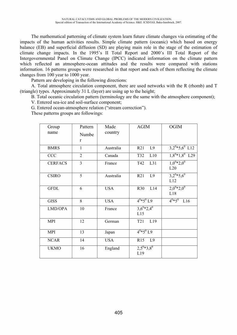
NATURAL CATACLYSMS AND GLOBAL PROBLEMS OF THE MODERN CIVILIZATION. Special edition of Transaction of the International Academy of Science. H&E. ICSD/IAS, Baku-Innsbruck, 2007.
405
The mathematical patterning of climate system learn future climate changes via estimating of the impacts of the human activities results. Simple climate pattern (oceanic) which based on energy balance (EB) and superficial diffusion (SD) are playing main role in the stage of the estimation of climate change impacts. In the 1995’s II Total Report and 2000’s III Total Report of the Intergovernmental Panel on Climate Change (IPCC) indicated information on the climate pattern which reflected an atmosphere-ocean attitudes and the results were compared with stations information. 16 patterns groups were researched in that report and each of them reflecting the climate changes from 100 year to 1000 year.
Pattern are developing in the following directions: A. Total atmosphere circulation component, there are used networks with the R (rhomb) and T
(triangle) types. Approximately 31 L (layer) are using up to the height;B. Total oceanic circulation pattern (terminology are the same with the atmosphere component);V. Entered sea-ice and soil-surface component; G. Entered ocean-atmosphere relation (“stream correction”). These patterns groups are followings:
Groupname
Pattern Number
Madecountry
AGIM OGIM
BMRS 1 Australia R21 L9 3,20*5,60 L12
CCC 2 Canada T32 L10 1,80*1,80 L29
CERFACS 3 France T42 L31 1,00*2,00
L20
CSIRO 5 Australia R21 L9 3,20*5,60
L12
GFDL 6 USA R30 L14 2,00*2,00
L18
GISS 8 USA 40*50 L9 40*50 L16
LMD/OPA 10 France 3,60*2,40
L15
MPI 12 German T21 L19
MPI 13 Japan 40*50 L9
NCAR 14 USA R15 L9
UKMO 16 England 2,50*3,80
L19
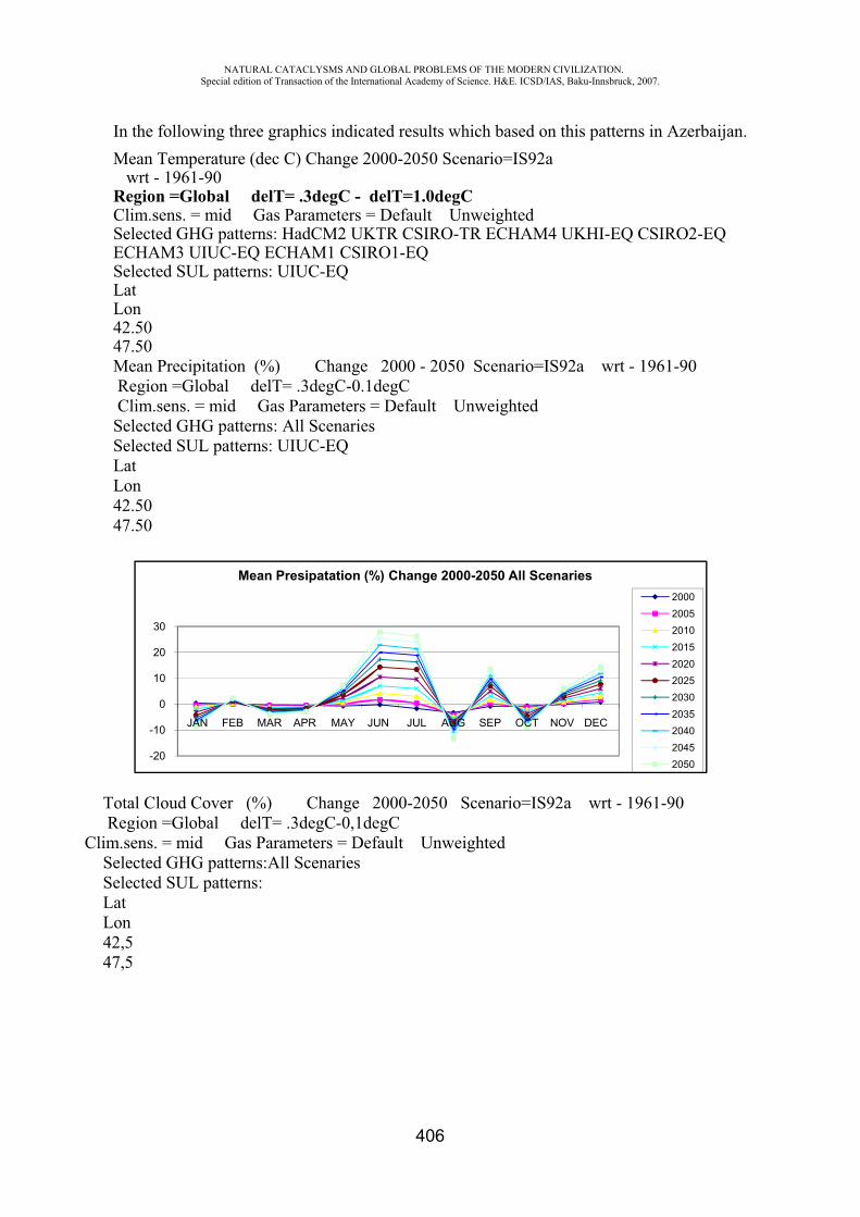
NATURAL CATACLYSMS AND GLOBAL PROBLEMS OF THE MODERN CIVILIZATION. Special edition of Transaction of the International Academy of Science. H&E. ICSD/IAS, Baku-Innsbruck, 2007.
406
In the following three graphics indicated results which based on this patterns in Azerbaijan.Mean Temperature (dec C) Change 2000-2050 Scenario=IS92a wrt - 1961-90 Region =Global delT= .3degC - delT=1.0degC Clim.sens. = mid Gas Parameters = Default Unweighted Selected GHG patterns: HadCM2 UKTR CSIRO-TR ECHAM4 UKHI-EQ CSIRO2-EQ ECHAM3 UIUC-EQ ECHAM1 CSIRO1-EQ Selected SUL patterns: UIUC-EQ LatLon42.5047.50Mean Precipitation (%) Change 2000 - 2050 Scenario=IS92a wrt - 1961-90 Region =Global delT= .3degC-0.1degC Clim.sens. = mid Gas Parameters = Default Unweighted Selected GHG patterns: All Scenaries Selected SUL patterns: UIUC-EQ LatLon42.5047.50
Total Cloud Cover (%) Change 2000-2050 Scenario=IS92a wrt - 1961-90 Region =Global delT= .3degC-0,1degC
Clim.sens. = mid Gas Parameters = Default Unweighted Selected GHG patterns:All Scenaries Selected SUL patterns: LatLon42,547,5
-20
-10
0
10
20
30
JAN FEB MAR APR MAY JUN JUL AUG SEP OCT NOV DEC
Mean Presipatation (%) Change 2000-2050 All Scenaries20002005201020152020202520302035204020452050
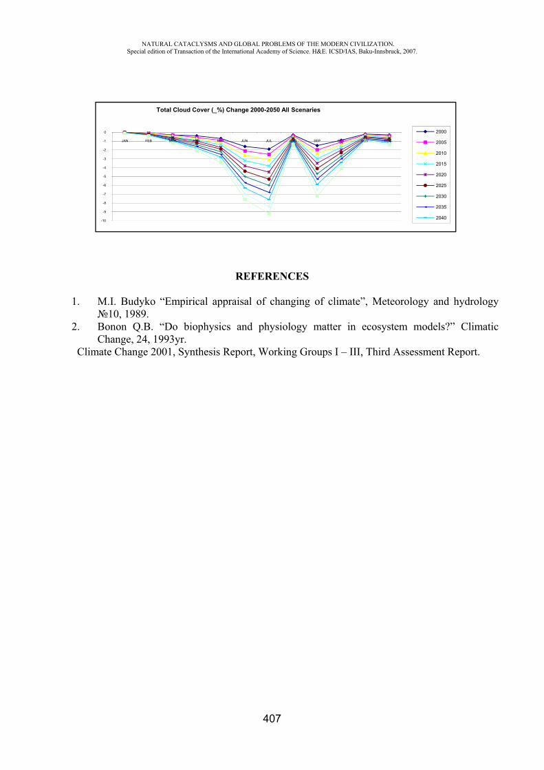
NATURAL CATACLYSMS AND GLOBAL PROBLEMS OF THE MODERN CIVILIZATION. Special edition of Transaction of the International Academy of Science. H&E. ICSD/IAS, Baku-Innsbruck, 2007.
407
REFERENCES
1. M.I. Budyko “Empirical appraisal of changing of climate”, Meteorology and hydrology 10, 1989.
2. Bonon Q.B. “Do biophysics and physiology matter in ecosystem models?” Climatic Change, 24, 1993yr.
Climate Change 2001, Synthesis Report, Working Groups I – III, Third Assessment Report.
-10
-9
-8
-7
-6
-5
-4
-3
-2
-1
0
JAN FEB MAR APR MAY JUN JUL AUG SEP OCT NOV DEC
Total Cloud Cover (_%) Change 2000-2050 All Scenaries
2000
2005
2010
2015
2020
2025
2030
2035
2040
NATURAL CATACLYSMS AND GLOBAL PROBLEMS OF THE MODERN CIVILIZATION. Special edition of Transaction of the International Academy of Science. H&E. ICSD/IAS, Baku-Innsbruck, 2007.
408
II PART:BIOSPHERE
SOME REGULARITIES MIGRATION OF LONG-LIVING NATURAL RADIONUCLIDES (238U and 232Th) IN
SOIL-PLANT COVER OF AZERBAIJAN REPUBLIC
Aliyev J.A.*, Mammadov G.SH.**, Abdullayev M. A.***
*Scientific-Research Institute of Agriculture of the Ministry of Agriculture of Azerbaijan Republic,
**Institute of Soil Science and Agricultural Chemistry Azerbaijan National Academy of Sciences
ABSTRACT
Even distribution of concentration of long-living natural radionuclides (238U and 232Th) in various soil types of different regions of Azerbaijan Republic was determined sufficiently. Mean concentration of radionuclides in soil makes up 238U – 13.0-26.0, but 232Th – 17.0-32.0 Bq/kg. Accumulation of 238U by plants from soil occurs intensively than that of 232Th. Accumulation coefficient of 238U in wheat and barley grain ranges between (2.54-4.50) x 10-3, but (5.62-10.85) x 10-3
in haulm. For 232Th the magnitude is equal to (0.56-3.29) x 10-3 and (1.84-7.82) x 10-3 respectively.
INTRODUCTION
Migration of artificial radionuclides (90Sr, 137Cs etc.) in soils of various world regions and their accumulation by various agricultural crops have been studied sufficiently [1-5 etc.]. But the problem on migration of long-living natural radionuclides (238U and 232Th) in various soil types and their accumulation in various agricultural crops has been studied poorly. At the same time quality characteristics of crop products can not be considered complete without radiological information on content of long-living natural radionuclides a 238U and 232Th. It is known that accumulation of long-living natural radionuclides (238U and 232Th and products of their dissociation) in agricultural crops and their subsequent entrance into man organism is a source of irradiation under natural radiation background.
In this connection presented studies on distribution of long-living natural radionuclides (238U and 232Th) in various soil types available in different regions of Azerbaijan Republic and their accumulation by various agricultural crops carried out at Sientific-Research Institute of Agriculture of the Ministry of Agriculture of Azerbaijan Republic are guite aktual.
MATERIALS AND METHODS
Main objects of the studies include soil and plants selected from three different regions of the Republic of Azerbaijan (including Minor Caucasus, Lenkoran region and Absheron Peninsula). Soil samples were picked out by making soil cutting in experimental stations of Research Institute of Crop
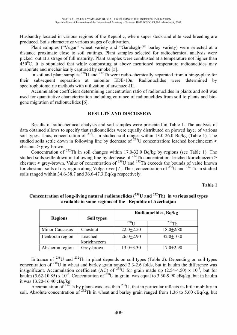
NATURAL CATACLYSMS AND GLOBAL PROBLEMS OF THE MODERN CIVILIZATION. Special edition of Transaction of the International Academy of Science. H&E. ICSD/IAS, Baku-Innsbruck, 2007.
409
Husbandry located in various regions of the Republic, where super stock and elite seed breeding are produced. Soils characterize various stages of cultivation.
Plant samples (“Vugar” wheat variety and “Garabagh-7” barley variety) were selected at a distance proximate close to soil cuttings. Plant samples selected for radiochemical analysis were picked out at a strage of full maturity. Plant samples were combusted at a temperature not higher than 4500C. It is stipulated that while combusting at above mentioned temperature radionuclides may evaporate and mechanically captured by smoke [5].
In soil and plant samples 238U and 232Th were radio-chemically separated from a hinge-plate for their subsequent separation at anionite EDE-10n. Radionuclides were determined by spectrophotometric methods with utilization of arsenazo-III.
Accumulation coefficient determining concentration ratio of radionuclides in plants and soil was used for quantitative characterization including entrance of radionuclides from soil to plants and bio-gene migration of radionuclides [6].
RESULTS AND DISCUSSION
Results of radiochemical analysis and soil samples were presented in Table 1. The analysis of data obtained allows to specify that radionuclides were equally distributed on plowed layer of various soil types. Thus, concentration of 238U in studied soil ranges within 13.0-26.0 Bq/kg (Table 1). The studied soils settle down in following line by decrease of 238U concentration: leached korichnezem >chestnut > grey-brown.
Concentration of 232Th in soil changes within 17.0-32.0 Bq/kg by regions (see Table 1). The studied soils settle down in following line by decrease of 232Th concentration: leached korichnezem >chestnut > grey-brown. Value of concentration of 238U and 232Th exceeds the bounds of value known for chestnut soils of dry region along Volga river [7]. Thus, concentration of 238U and 232Th in studied soils ranged within 34.6-38.7 and 36.6-47.3 Bq/kg respectively.
Table 1
Concentration of long-living natural radionuclides (238U and 232Th) in various soil types available in some regions of the Republic of Azerbaijan
Regions Soil types Radionuclides, Bq/kg
238U 232ThMinor Caucasus Chestnut 22.0+2.50 18.0+2/80Lenkoran region Leached
korichnezem26.0+2.90 32.0+10.0
Absheron region Grey-brown 13.0+3.30 17.0+2.90
Entrance of 238U and 232Th in plant depends on soil types (Table 2). Depending on soil types concentration of 238U in wheat and barley grain ranged 2.3-2.6 folds, but in haulm the difference was insignificant. Accumulation coefficient (AC) of 238U for grain made up (2.54-4.50) x 10-3, but for haulm (5.62-10.85) x 10-3. Concentration of 238U in grain was equal to 3.30-9.90 cBq/kg, but in haulm it was 13.20-16.40 cBq/kg.
Accumulation of 232Th by plants was less than 238U, that in particular reflects its little mobility in soil. Absolute concentration of 232Th in wheat and barley grain ranged from 1.36 to 5.60 cBq/kg, but
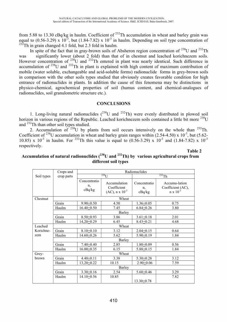
NATURAL CATACLYSMS AND GLOBAL PROBLEMS OF THE MODERN CIVILIZATION. Special edition of Transaction of the International Academy of Science. H&E. ICSD/IAS, Baku-Innsbruck, 2007.
410
from 5.88 to 13.30 cBq/kg in haulm. Coefficient of 232Th accumulation in wheat and barley grain was equal to (0.56-3.29) x 10-3, but (1.84-7.82) x 10-3 in haulm. Depending on soil type concentration of 232Th in grain changed 4.1 fold, but 2.3 fold in haulm.
In spite of the fact that in gray-brown soils of Absheron region concentration of 238U and 232Thwas significantly lower (about 2 fold) than that of in chestnut and leached korichnezem soils. However concentration of 238U and 232Th entered in plant was nearly identical. Such difference in accumulation of 238U and 232Th in plant is explained with high content of maximum contribution of mobile (water soluble, exchangeable and acid-soluble forms) radionuclide forms in grey-brown soils in comparison with the other soils types studied that obviously creates favorable condition for high entrance of radionuclides in plants. In addition the cause of this fenomena may be distinctions in physico-chemical, agrochemical properties of soil (humus content, and chemical-analogues of radionuclides, soil granulometric structure etc.).
CONCLUSIONS
1. Long-living natural radionuclides (238U and 232Th) were evenly distributed in plowed soil horizon in various regions of the Republic. Leached korichnezem soils contained a little bit more 238Uand 232Th than other soil types studied.
2. Accumulation of 238U by plants from soil occurs intensively on the whole than 232Th.Coefficient of 238U accumulation in wheat and barley grain ranges within (2.54-4.50) x 10-3, but (5.62-10.85) x 10-3 in haulm. For 232Th this value is equal to (0.56-3.29) x 10-3 and (1.84-7.82) x 10-3
respectively. Table 2
Accumulation of natural radionuclides (238U and 232Th) by various agricultural crops from different soil types
Soil types Crops and crop parts
Radionuclides 238U 232Th
Concentration,
cBq/kg
Accumulation Coefficient
(AC), n x 10-3
Concentration,
cBq/kg
Accumu-lation Coefficient (AC),
n x 10-3
Chestnut Wheat Grain 9.90+0.50 4.50 1.36+0.05 0.75 Haulm 16.40+0.50 7.45 6.84+0.26 3.80
BarleyGrain 8.50+0.93 3.86 3.61+0.18 2.01 Haulm 14,20+0.29 6.45 8.43+0.21 4.68
Leached Korichne-zem
Wheat Grain 8.10+0.10 3.12 2.04+0.15 0.64 Haulm 14.60+0.26 5.62 5.90+0.19 1.84
BarleyGrain 7.40+0.40 2.85 1.80+0.09 0.56 Haulm 16.00+0.35 6.15 5.88+0.15 1.84
Grey-brown
Wheat Grain 4.40+0.11 3.38 5.30+0.28 3.12 Haulm 13,20+0.22 10.15 2.90+0.06 7.59
BarleyGrain 3.30+0.16 2.54 5.60+0.46 3.29 Haulm 14.10+0.56 10.85
13.30+0.78 7.82
NATURAL CATACLYSMS AND GLOBAL PROBLEMS OF THE MODERN CIVILIZATION. Special edition of Transaction of the International Academy of Science. H&E. ICSD/IAS, Baku-Innsbruck, 2007.
411
REFERENCES
1. Aliyev D.A., Abdullayev M.A. Strontium-90 and caesium-137 in soil-plant cover of Azerbaijan. M.: Publishing house “Nauka”, 1983. 101 p. (in Russian).
2. Abdullayev M.A., Aliyev J.A. Migration of artificial and natural radionuclides in system of soil-plant. Baku. “Elm”. 1998. 240 p. (in Russian).
3. Alexakhin P.M. Nuclear energy and biosphere. M.: “Energoizdat”. 1982. 215 p. (in Russian). 4. Prister B.C., Loshilov N. A., Nemets O.F., Poyarkov V.A. Fundamentals of agricultural
radiology. Kiyev. “Urozhai”.1991. 472 p. (in Russian). 5. Pavlotskaya F.I., Babicheva Y.V. Long–live artificial and natural radioisotopes in grain of
agricultural crops in Podmoskovye. M.: “Atomizdat”. 1973. (in Russian). 6. Marey A. N., Barkhudarov P.M., Novikova N.Y. Global fall-out of caesium-137 and human
being. M.: “Atomizdat”.1974.168 p. (in Russian). 7. Ponikarova T.M., Strukov V.N., Panasov M.N., Drichko V.F., Semenov Y. Radioactivity of
chestnut soils and main agricultural crops of arid zone of Povolzhye. Agrochemistry. N4. 1992. p.96-100. (in Russian).
IMPACT OF MINERAL FERTILIZERS ON ACCUMULATION OF RADIONUCLIDES 90Sr, 137Cs, 238U and 232Th IN HARVEST
OF WHEAT AND LEGUMINOUS CROPS IN AZERBAIJAN
Aliyev J.A.*, Mammadov G.SH.**, Abdullayev M. A.***
*Scientific-Research Institute of Agriculture of the Ministry of Agriculture of Azerbaijan Republic,
**Institute of Soil Science and Agricultural Chemistry Azerbaijan National Academy of Sciences
ABSTRACT
It has been demonstrated by field experiments for many years that bringing optimal and higher doses of complete fertilizers along with significant of harvest, also leads to perceptible decrease in accumulation of artifical (90Sr and 137Cs) and natural (238U and 232Th) radionuclides in harvest of different agricultural crops in grayish brown soils of Absheron.
INTRODUCTION
From the moment when artificial and natural radionuclides appeared in biosphere, the intense research on finding ways how to limit it in agricultural crops has started. One of the ways is bringing mineral and organic fertilizers under crops. Existing literature data on this are contradictory (1-7). Before we started our research in Azerbaijan such research hasn’t been undertaken. Thus the purpose was set-to revise the influence of complete mineral fertilizers (NPK) on accumulation of 90Sr, 137Cs,238U and 232Th in harvest of grain tailings (winter wheat and winter barley) and leguminous crops (garbanzo and soybean) in grayish brown soil of Absheron.
NATURAL CATACLYSMS AND GLOBAL PROBLEMS OF THE MODERN CIVILIZATION. Special edition of Transaction of the International Academy of Science. H&E. ICSD/IAS, Baku-Innsbruck, 2007.
412
MATERIALS AND METHODS
Field experiments have been taken out on the plot of Absheron subsidiary experimental household of the Scientific-Research Institute of Agriculture. The soil is grayish brown, has loamy mechanical composition. Brought fertilizers were: nitrogen in form of ammonium nitrate, phosphorus - in form of double superphosphate and potassium - in form of sulfurous potassium. Accounting area of experimental plots with wheat and barley - 10 m2, with garbanzo and soybean - 16 m2. Repetition in experiments 3 multiple. In experiment all rules of agrotechnical rules were considered, which secures to receive big crop. Layout of experiment is given below.
Layout of experiment: For wheat- Control (without fertilizers), N160P90K60 (optimal dose), N240P360K240, N320P720K480; For barley- Control (without fertilizers), N90P90K60 (optimal dose), N135P360K240, N180P720K480; For garbanzo- Control (without fertilizers), N30P60K30 (optimal dose), N45P240K120, N60P480K240; For soybean - Control (without fertilizers), N90P60K30 (optimal dose), N135P240K120, N180P480K240.
RESULTS AND DISCUSSION
The results of experiments showed that bringing optimal and higher dose of complete mineral fertilizers significantly increases productivity of grain tailings and leguminous crops. Increase from bringing mineral fertilizers in average comprised for wheat grain 12.5-30.5 c/ha, for barley - 9.6-26.0, garbanzo - 2.7-8.3, soybean – 5.7-12.7 c/ha and for straw of same crops was accordingly 11.2-28.7 c/ha; 13.3-29.3; 4.4-12.9; 12.7-17.4 c/ha (Figure 1).
Use of mineral fertilizers decreased concentration 90Sr in average in wheat grain at 24-41%, in barley - at 18-52, in garbanzo - at 36-54 and soybean - at 31-60%, in straw - accordingly at 23-54%, 21-45, 25-38 and 15-39%. For 137Cs decrease in accumulation in wheat grain comprised 40-63%, barley - 34-57, garbanzo - 32-56 and soybean - 22-55%, and in straw - accordingly at 25-45%, 20-45, 25-47 and 21-49% (table 1).
Bringing mineral fertilizers decreased concentration of 238U in average in wheat grain at 2.3-20.5%, garbanzo - at 2.7-5.3, soybean - at 2.5-10.0%. At the same time concentration of 238U in grain stays unchanged. Use of increasing doses of mineral fertilizers decreased 232Th in average in wheat grain at 17.0-30.2%, barley - at 17.9-35.7, garbanzo - at 6.4-24.4 and soybean - at 10.7-24.1%, in straw - accordingly at 9.3-24.8%, 8.3-18.0, 9.5-14.6, and 19.7-51.8% (see table 1).
Thus, bringing mineral fertilizers in optimal, and also in increased doses along with increase of yields, brings to significant decrease in accumulation of artificial and natural radionuclides in yield of different agricultural crops. To our opinion, one of possible reasons of reduce of concentration of radionuclides in crops is that at bringing mineral fertilizers (especially in increased doses) portion of water-soluble and fixed forms of these radionuclides in soil is decreased, which is inaccessible to plants (4).
CONCLUSIONS 1. Use of increasing doses of complete mineral fertilizers along with increase of harvest, led to
decease in accumulation of 90Sr and 137Cs in harvest of winter wheat, winter barley, garbanzo and
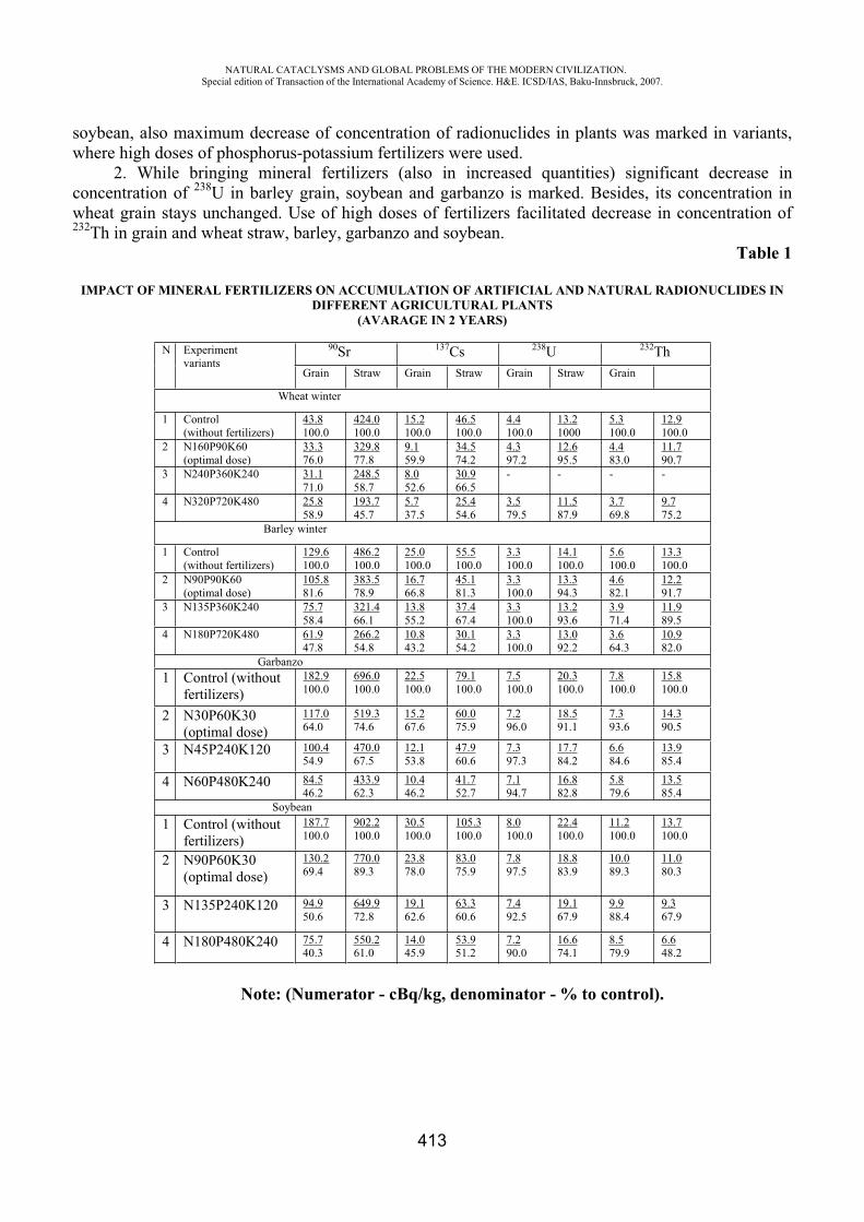
NATURAL CATACLYSMS AND GLOBAL PROBLEMS OF THE MODERN CIVILIZATION. Special edition of Transaction of the International Academy of Science. H&E. ICSD/IAS, Baku-Innsbruck, 2007.
413
soybean, also maximum decrease of concentration of radionuclides in plants was marked in variants, where high doses of phosphorus-potassium fertilizers were used.
2. While bringing mineral fertilizers (also in increased quantities) significant decrease in concentration of 238U in barley grain, soybean and garbanzo is marked. Besides, its concentration in wheat grain stays unchanged. Use of high doses of fertilizers facilitated decrease in concentration of 232Th in grain and wheat straw, barley, garbanzo and soybean.
Table 1
IMPACT OF MINERAL FERTILIZERS ON ACCUMULATION OF ARTIFICIAL AND NATURAL RADIONUCLIDES IN DIFFERENT AGRICULTURAL PLANTS
(AVARAGE IN 2 YEARS)
N Experiment variants
90Sr 137Cs 238U 232ThGrain Straw Grain Straw Grain Straw Grain
Wheat winter
1 Control (without fertilizers)
43.8100.0
424.0100.0
15.2100.0
46.5100.0
4.4100.0
13.21000
5.3100.0
12.9100.0
2 N160P90K60 (optimal dose)
33.376.0
329.877.8
9.159.9
34.574.2
4.397.2
12.695.5
4.483.0
11.790.7
3 N240P360K240 31.171.0
248.558.7
8.052.6
30.966.5
- - - -
4 N320P720K480 25.858.9
193.745.7
5.737.5
25.454.6
3.579.5
11.587.9
3.769.8
9.775.2
Barley winter
1 Control (without fertilizers)
129.6100.0
486.2100.0
25.0100.0
55.5100.0
3.3100.0
14.1100.0
5.6100.0
13.3100.0
2 N90P90K60 (optimal dose)
105.881.6
383.578.9
16.766.8
45.181.3
3.3100.0
13.394.3
4.682.1
12.291.7
3 N135P360K240 75.758.4
321.466.1
13.855.2
37.467.4
3.3100.0
13.293.6
3.971.4
11.989.5
4 N180P720K480 61.947.8
266.254.8
10.843.2
30.154.2
3.3100.0
13.092.2
3.664.3
10.982.0
Garbanzo 1 Control (without
fertilizers)182.9100.0
696.0100.0
22.5100.0
79.1100.0
7.5100.0
20.3100.0
7.8100.0
15.8100.0
2 N30P60K30 (optimal dose)
117.064.0
519.374.6
15.267.6
60.075.9
7.296.0
18.591.1
7.393.6
14.390.5
3 N45P240K120 100.454.9
470.067.5
12.153.8
47.960.6
7.397.3
17.784.2
6.684.6
13.985.4
4 N60P480K240 84.546.2
433.962.3
10.446.2
41.752.7
7.194.7
16.882.8
5.879.6
13.585.4
Soybean 1 Control (without
fertilizers)187.7100.0
902.2100.0
30.5100.0
105.3100.0
8.0100.0
22.4100.0
11.2100.0
13.7100.0
2 N90P60K30 (optimal dose)
130.269.4
770.089.3
23.878.0
83.075.9
7.897.5
18.883.9
10.089.3
11.080.3
3 N135P240K120 94.950.6
649.972.8
19.162.6
63.360.6
7.492.5
19.167.9
9.988.4
9.367.9
4 N180P480K240 75.740.3
550.261.0
14.045.9
53.951.2
7.290.0
16.674.1
8.579.9
6.648.2
Note: (Numerator - cBq/kg, denominator - % to control).
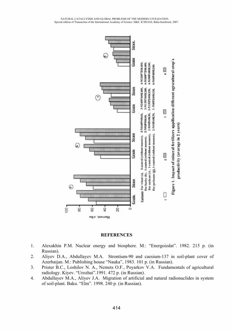
NATURAL CATACLYSMS AND GLOBAL PROBLEMS OF THE MODERN CIVILIZATION. Special edition of Transaction of the International Academy of Science. H&E. ICSD/IAS, Baku-Innsbruck, 2007.
414
REFERENCES
1. Alexakhin P.M. Nuclear energy and biosphere. M.: “Energoizdat”. 1982. 215 p. (in Russian).
2. Aliyev D.A., Abdullayev M.A. Strontium-90 and caesium-137 in soil-plant cover of Azerbaijan. M.: Publishing house “Nauka”, 1983. 101 p. (in Russian).
3. Prister B.C., Loshilov N. A., Nemets O.F., Poyarkov V.A. Fundamentals of agricultural radiology. Kiyev. “Urozhai”.1991. 472 p. (in Russian).
4. Abdullayev M.A., Aliyev J.A. Migration of artificial and natural radionuclides in system of soil-plant. Baku. “Elm”. 1998. 240 p. (in Russian).
NATURAL CATACLYSMS AND GLOBAL PROBLEMS OF THE MODERN CIVILIZATION. Special edition of Transaction of the International Academy of Science. H&E. ICSD/IAS, Baku-Innsbruck, 2007.
415
5. Pavlotskaya F.I., Babicheva Y.V. Long–live artificial and natural radioisotopes in grain of agricultural crops in Podmoskovye. M.: “Atomizdat”. 1973. (in Russian).
6. Ponikarova T.M., Strukov V.N., Panasov M.N., Drichko V.F., Semenov Y. I. Radioactivity of chestnut soils and main agricultural crops of arid zone of Povolzhye. Agrochemistry. N4. 1992. p.96-100. (in Russian).
7. Marey A.N., Barkhudarov P.M., Novikova N.Y. Global fall-out of caesium-137 and human being. M.: “Atomizdat”.1974.168 p. (in Russian).
FREEZING. ITS DIAQNOSTICS, TREATMENT
R. Ahmadov
Military Clinic Hospital of Ministry of Defence. Head of the Depatment. Surgery. Azerbaijan Republic
The influence of low temperature to body tissues one of the thermical traumatized is called freezing. Freezing is one of the difficult and important field of pathology during the war and peace period in surgery. The influence of low temperature in formation of freezing to body tissues, and making condition for it for a long time the role of factors are very great. So, in cold climate the men being tired, becoming weaker, being drunken, lacking of physical development, hypodynamia, adinamia, fainting consciousness and etc. happen.
The lasting spasm of peripherial vein causes the formation of the patological process in freezings. It makes changing in the wall of vein, irritating the sympathic nervous system intencifies adrenal syndrom makes thrombus. Further in patological process happens necrotizingof tissue imflammatory changes, metabolizm, the development of intoxication and purulentseptic wound becomes worse and worse.
In diagnostics of freezings reovasqraphe, capillaropathy, angioqraphy, dopplercardiometry and superficially thermometry are used in order to diagnose the exact degree of seriousness of disease. But for the first time in order to ezamine the temperature of skin and viscera of tissue thermopar thermometry have been used by us. By this way it is more convenient and easy to put diagnose comparing with the previous methods. The treatment of patients in the Military Clinic Hospital in thermical traumatized department is realized on according to modern requirment of military medicine. On this occasion warming of periphery quickly or slady in bath, bandages keeping warm, medicine are used with the method viscera of vein is carried on extracorporeal radiation of flood, hyperbaric oxygenation séance is given, ultraviolet, laser radiation are given to the wound.
The realized method of treatment weakens the common intoxication in organism, eliminates the lack of flood circulation, prevents the number and level of amputation. The usage of epidural anaesthesia, during secret period the syndrom of time is abated and prevents the usage of additional medicine. The usage of relaxat and warm keeping bandages with narcosis helping the blood circulation periphery prevents from necrotizing.
As soon as the treatment of heavy freezing begins, further it will be more effective.
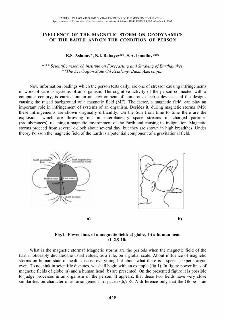
inccimthe(psth
Esemtos
Now in work of
computer cecausing the mportant rohese infring
explosionsprotuberanc
storms procheory Poiss
What Earth noticestorms on heven. To notmagnetic fieo judge pro
similarities
NASpecial
INFLUENOF TH
*,** Scient
nformation various sysentury, is craised back
ole in infringements arwhich are
ces), reachieed from se
son the mag
Fig
is the magneably deviathuman statet sink in scields of globocesses in on characte
ATURAL CATACLedition of Transacti
NCE OF THE EART
B.S. Asla
tific researc**The Azer
loadings wstems of ancarried out kground ofngement ofre shown oe throwingng a magneeveral o'clo
gnetic field o
.1. Power l
netic stormtes the usua
e of health ientific dispbe (a) and a an organism
er of an arra
LYSMS AND GLOion of the Internatio
THE MAGTH AND O
anov*, N.I.
ch institute orbaijan Stat
which the pen organism.
in an envif a magnetif systems oforiginally dig out in etic environock about seof the Earth
a)
lines of a m
ms? Magnetial values, adiscuss eve
putes, we shhuman hea
m of the peangement in
OBAL PROBLEMSonal Academy of Sc
416
GNETIC SON THE C
. Babayev*
on Forecaste Oil Acade
erson tests d. The cogniironment ofic field (MFf an organiifficultly. O
interplanenment of theveral day,
h is a potent
magnetic fie/1, 2,9,1
ic storms aras a rule, onerything butall begin wi
ad (b) are prerson. It apn space /3,
OF THE MODERNcience. H&E. ICSD/
TORM ONCONDITIO
*, S.A. Ism
ting and Stuemy. Baku,
daily, are onitive activitf numerousF). The facsm. Beside
On the Sunetary spacee Earth andbut they arial compone
eld: a) glob10/.
re the perion a global st about whaith an examresented. Onppears, that6,7,8/. A di
N CIVILIZATION/IAS, Baku-Innsbru
N GEODYON OF PE
mailov***
udying of EaAzerbaijan
ne of stressoty of the ps electric dctor, a magns it, during
n from timee streams d causing itre shown inent of a gra
be, b) a hum
ods when thscale. Abouat there is
mple (fig.1). n the present these twoifference on
.uck, 2007.
YNAMICSERSON
arthquakes,.
or causing inerson conn
devices andnetic field,
g magnetic e to time t
of chargts indignation high breaavitational fi
b)
man head
he magneticut influence a speech, eIn figure po
nted figure fields havnly that the
,
nfringemennected with d the design
can play astorms (MSthere are thed particleon. Magnetidthes. Undeield.
c field of thof magneti
experts arguower lines oit is possibl
ve very close Globe is a
ntsa
nsanS)heesicer
heicueoflesean
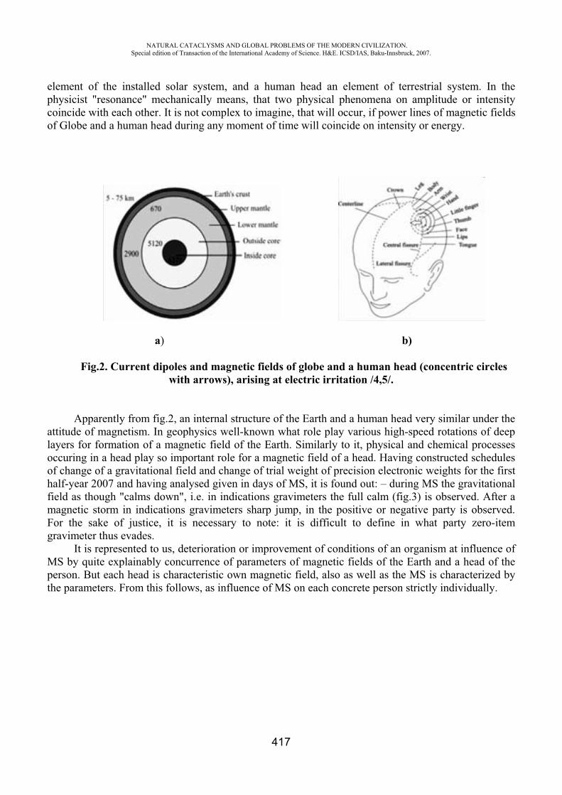
NATURAL CATACLYSMS AND GLOBAL PROBLEMS OF THE MODERN CIVILIZATION. Special edition of Transaction of the International Academy of Science. H&E. ICSD/IAS, Baku-Innsbruck, 2007.
417
element of the installed solar system, and a human head an element of terrestrial system. In the physicist "resonance" mechanically means, that two physical phenomena on amplitude or intensity coincide with each other. It is not complex to imagine, that will occur, if power lines of magnetic fields of Globe and a human head during any moment of time will coincide on intensity or energy.
a) b)
Fig.2. Current dipoles and magnetic fields of globe and a human head (concentric circles with arrows), arising at electric irritation /4,5/.
Apparently from fig.2, an internal structure of the Earth and a human head very similar under the attitude of magnetism. In geophysics well-known what role play various high-speed rotations of deep layers for formation of a magnetic field of the Earth. Similarly to it, physical and chemical processes occuring in a head play so important role for a magnetic field of a head. Having constructed schedules of change of a gravitational field and change of trial weight of precision electronic weights for the first half-year 2007 and having analysed given in days of MS, it is found out: – during MS the gravitational field as though "calms down", i.e. in indications gravimeters the full calm (fig.3) is observed. After a magnetic storm in indications gravimeters sharp jump, in the positive or negative party is observed. For the sake of justice, it is necessary to note: it is difficult to define in what party zero-item gravimeter thus evades.
It is represented to us, deterioration or improvement of conditions of an organism at influence of MS by quite explainably concurrence of parameters of magnetic fields of the Earth and a head of the person. But each head is characteristic own magnetic field, also as well as the MS is characterized by the parameters. From this follows, as influence of MS on each concrete person strictly individually.
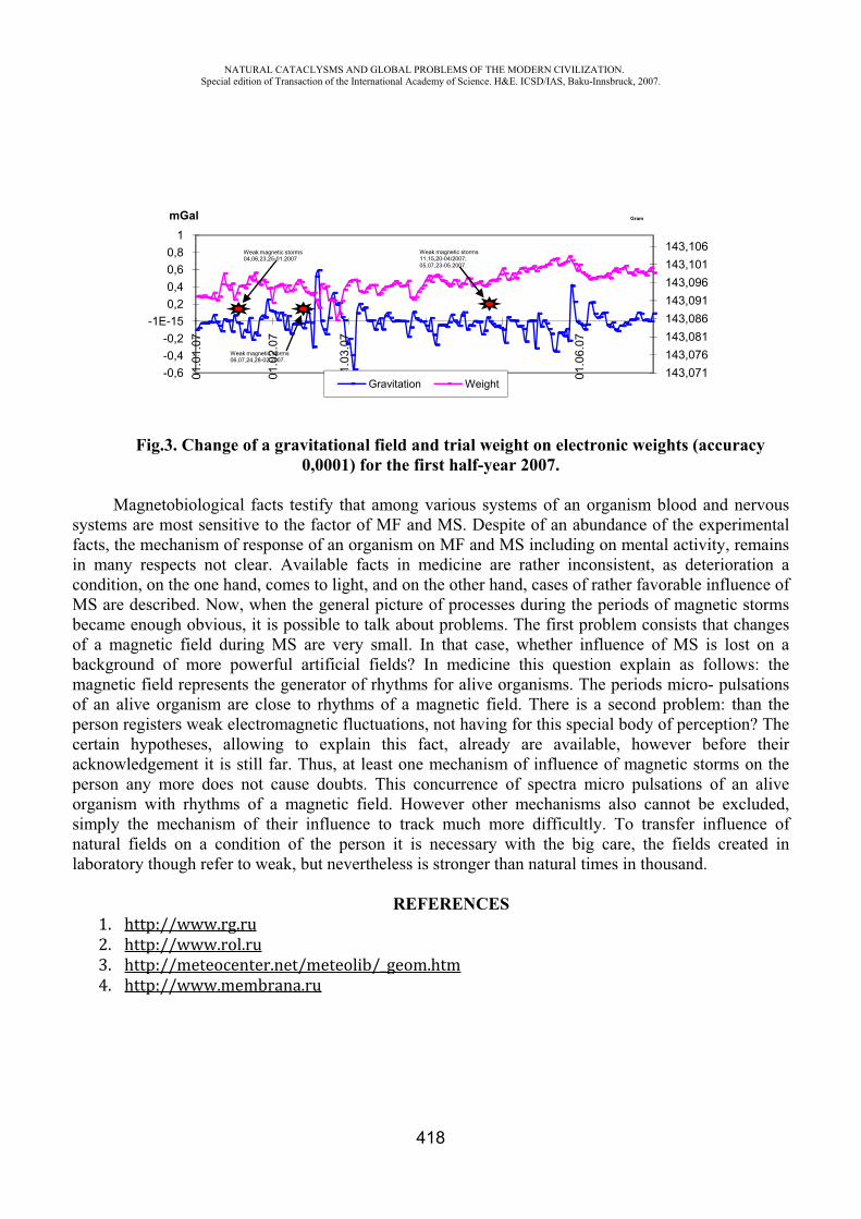
NATURAL CATACLYSMS AND GLOBAL PROBLEMS OF THE MODERN CIVILIZATION. Special edition of Transaction of the International Academy of Science. H&E. ICSD/IAS, Baku-Innsbruck, 2007.
418
Fig.3. Change of a gravitational field and trial weight on electronic weights (accuracy 0,0001) for the first half-year 2007.
Magnetobiological facts testify that among various systems of an organism blood and nervous systems are most sensitive to the factor of MF and MS. Despite of an abundance of the experimental facts, the mechanism of response of an organism on MF and MS including on mental activity, remains in many respects not clear. Available facts in medicine are rather inconsistent, as deterioration a condition, on the one hand, comes to light, and on the other hand, cases of rather favorable influence of MS are described. Now, when the general picture of processes during the periods of magnetic storms became enough obvious, it is possible to talk about problems. The first problem consists that changes of a magnetic field during MS are very small. In that case, whether influence of MS is lost on a background of more powerful artificial fields? In medicine this question explain as follows: the magnetic field represents the generator of rhythms for alive organisms. The periods micro- pulsations of an alive organism are close to rhythms of a magnetic field. There is a second problem: than the person registers weak electromagnetic fluctuations, not having for this special body of perception? The certain hypotheses, allowing to explain this fact, already are available, however before their acknowledgement it is still far. Thus, at least one mechanism of influence of magnetic storms on the person any more does not cause doubts. This concurrence of spectra micro pulsations of an alive organism with rhythms of a magnetic field. However other mechanisms also cannot be excluded, simply the mechanism of their influence to track much more difficultly. To transfer influence of natural fields on a condition of the person it is necessary with the big care, the fields created in laboratory though refer to weak, but nevertheless is stronger than natural times in thousand.
REFERENCES
143,071143,076143,081143,086143,091143,096143,101143,106
-0,6-0,4-0,2
-1E-150,20,40,60,8
1
01.0
1.07
01.0
2.07
01.0
3.07
01.0
6.07
mGal
Gravitation Weight
Gram
Weak magnetic storms04,06,23,25-01.2007
Weak magnetic storms06,07,24,28-02.2007.
Weak magnetic storms11,15,20-04/2007; 05,07,23-05.2007.
NATURAL CATACLYSMS AND GLOBAL PROBLEMS OF THE MODERN CIVILIZATION. Special edition of Transaction of the International Academy of Science. H&E. ICSD/IAS, Baku-Innsbruck, 2007.
419
368. IAGA Division V, Working Group 8, [Including Program member Quinn, J. M.], 2000.
International Geomagnetic Reference Field, 2000, Phys. Earth. Planet. Inter., 120, 39-42, Pure Appl. Geophys., 157 , 1797-1802, Geophys. J. Int., 141, 259-262.
9. Macmillan, S. & Quinn, J. M., 2000. The 2000 revision of the Joint UK/US Geomagnetic Field Models and the IGRF candidate model, Earth Planets Space, 52, 1149-1162.
10. Macmillan, S. & Quinn, J. M., 2000. The derivation of the World 11. Magnetic Model 2000, Brit. Geol. Surv. Tech. Rept., WM/00/17R.
SUBSTANTIATION FOR THE APPLICATION OF MULTIMODAL OXYHYPERTERMIC COMPLEXES “ALFA OXY SPA” IN PROPHYLAXIS AND CORRECTION OF
“CIVILIZATION DISEASES”
Glazko N.B.*, Platonenko V.I.**, Glazachev O.S.***, Dudnik E.N.****, Yartseva L.A.*****
Group of companies “VNIIMI”, Moscow, Russia P.K. Anokhin Research Institute of Normal Physiology, RAMS, Moscow, Russia,
Present day conditions of life (ecological disutility, unfavorable psychosocial factors, hypodynamia and others) very often exceed the adaptation reserves of a healthy human and lead to homeostasis disorders and development of psychosomatic diseases as the main “diseases of civilization”. So the questions of health strengthening and preservation of healthy people anddevelopment and application of new methods of effective restoration of psychophysiological functions are of great importance [1, 2, 3].
To get a maximum of results from rehabilitation–restoration procedures it is necessary to use methods of system action. These methods are combined physical factors. Recent investigations showed that as an additional chain for self-regulation of functional system of homeostatic level in humans such individually chosen effects as functional music, aromatherapy, massage, physiotherapeutic procedures with hyperthermia, sauna, relaxation, hypoxia training etc could be effectively used [1, 6, 7, 13].
However, every such factor influences only a definite receptor field and functional system not affecting the others. In case of their optimal combination they can correlate at once several functional systems harmonizing intersystem relations according to the principle of homeostatic multiparametric regulation and increase of personal adaptation potential [1, 5, 8]. The possibility (thanks to training multimodal influences) to harmoniously affect not only separate functions but the character of their relations is very important for restoration of adaptation potential of relatively healthy human [5].
By intuition just such an approach was used while creating complexes of treatment by companies (Vibrosaun complex, Alfa capsule, multifunctional capsules NeoQi and others).
The purpose of this investigation was to study of peculiarities of parameters dynamics of humoral-autonomic homeostasis of a man and psychophysiological indices when combined complex polymodal physical influences (termal, massage, sound, olfactory) are applied.
NATURAL CATACLYSMS AND GLOBAL PROBLEMS OF THE MODERN CIVILIZATION. Special edition of Transaction of the International Academy of Science. H&E. ICSD/IAS, Baku-Innsbruck, 2007.
420
In the test 25 volunteers, 14 men, 11 women of 37-60 years old (average age 45,2±16,1) took part. At the moment of the test all examiners were relatively healthy (in the state of remission).
Before the test the patients were divided randomly into 2 groups. The study group of 17 persons had a course of 10 procedures in physiotherapeutic “combine”- capsule “Alfa Oxy Spa” (Sybaritic Inc”, USA) The term of the course was 28-35 days, the duration of the procedure – 45 min every other day or twice a week. A combination of dry sauna, with temperature up to 83o C and system oxygenation of the body (oxygen -3-4 l/min) with individually chosen methods of aromatherapy (relaxing aroma mix), vibratory massage of the back and the legs, relaxing music were used.
The control group consisted of 8 persons that had an imitation course of procedures. The patients lied in capsule with relaxing music, imitated oxygenation by increased atmospheric air flow.
All patients had two complex examinations: before the first procedure and after the course of procedures. The tests took place in the first part of the day and included:
- Analysis of parameters dynamics of neuro-autonomic regulation. Cardiointervalgram within 5 min followed by estimation of temporal and frequency characteristics of heart rate variability (HRV) (complex “Polyspectr Rhythm”, OOO “Neurosoft”, Ivanovo) using common approaches [11, 12];
- Evaluation of psychoemotional state of patients: level of situational manifestation of anger (SA), depression (SD) and anxiety (SAn), level of situational discomfort (SDisc), indices of positive and negative emotions (PE, NE, scales of Ch. Spielberger and K.Izard, adapted by prof. A.B.Leonova, et.al) [10];
- Integral impedance technique with analyzer of the body content - ABC –01 “Medass” (Moscow, 2005). Body mass Index (BMI), quantity and percentage of active cell mass, fat mass and the water content in the organism;
- Venous blood sampling followed by biochemical investigation: level of cholesterol, triglycerides, HDL or LDL cholesterol, atherogenic index, glucose; - hormonal status: insulin-like growth factor (IGF1), somatotropin, insulin, cortisol.
Statistical interpretation of the received data was carried on program “Statistica for windows” 6.0. For estimation of reliability of differences for paired and unpaired excerpts nonparametric criterion - U-criterion of Mann-Withny was used.
Results and Discussion Under initial investigation it was found that despite the fact that all examined patients were
regarded as relatively healthy persons they had different combined features of psychosomatic functional dysfunctions: high level of situational anxiety and situational depression, very high level of situational discomfort with regard to population norms [10]. Most of the patients had excess body mass index (>25), signs of hypercholesterolemia (Fig. 1, 2), signs of autonomic disregulation towards sympaticotonia (high values of Strain-index, low-frequency power range (VLF, %), high values of blood pressure - SBP and DBP (Table 1).
The course of 10 complex physiotherapeutic multimodal procedures were accompanied by expressed increase of values in the scale of situational anger against the ground of the increase of positive emotions in regulation of psychoemotional state (Table 1). There were no significant changes in indices of psychological status in a control group. It should be noted that the patients of both groups in their subjective comments stated the improvement of their state of health, normalization of sleep and mood.
Under the analysis of HRV redistribution of its spectral characteristics in patients of the study group a small decrease of percentage of low frequency VLF component under parallel increase of high frequency component HF (p<0,1) were shown.
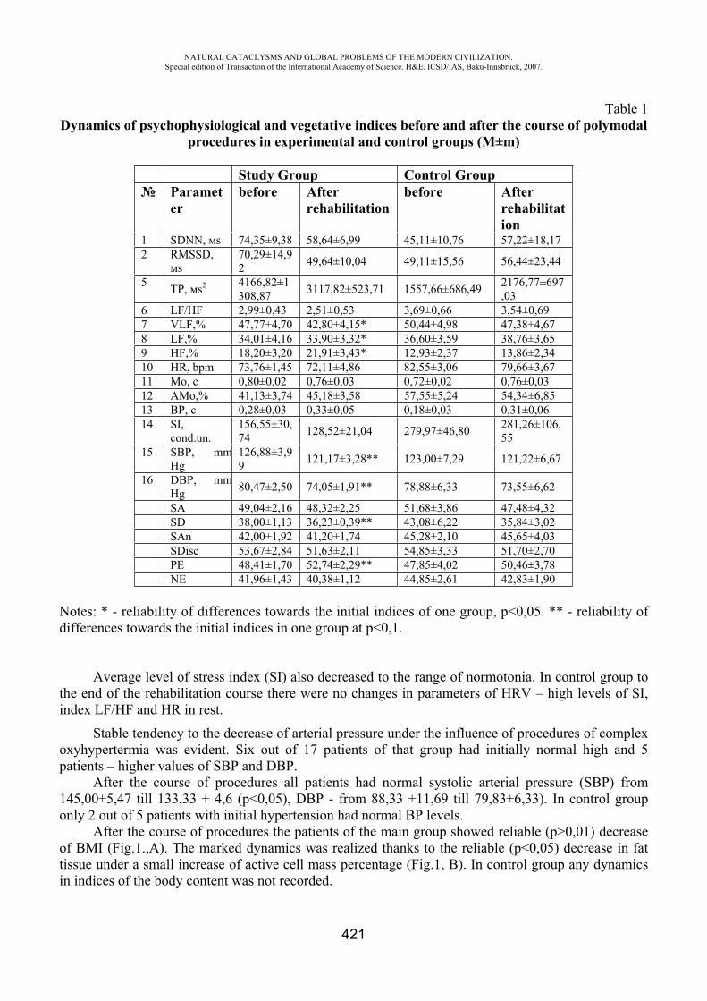
NATURAL CATACLYSMS AND GLOBAL PROBLEMS OF THE MODERN CIVILIZATION. Special edition of Transaction of the International Academy of Science. H&E. ICSD/IAS, Baku-Innsbruck, 2007.
421
Table 1Dynamics of psychophysiological and vegetative indices before and after the course of polymodal
procedures in experimental and control groups (M±m)
Study Group Control Group Paramet
erbefore After
rehabilitationbefore After
rehabilitation
1 SDNN, s 74,35±9,38 58,64±6,99 45,11±10,76 57,22±18,17 2 RMSSD,
s70,29±14,92 49,64±10,04 49,11±15,56 56,44±23,44
5 TP, s2 4166,82±1308,87 3117,82±523,71 1557,66±686,49 2176,77±697
,036 LF/HF 2,99±0,43 2,51±0,53 3,69±0,66 3,54±0,69 7 VLF,% 47,77±4,70 42,80±4,15* 50,44±4,98 47,38±4,67 8 LF,% 34,01±4,16 33,90±3,32* 36,60±3,59 38,76±3,65 9 HF,% 18,20±3,20 21,91±3,43* 12,93±2,37 13,86±2,34 10 HR, bpm 73,76±1,45 72,11±4,86 82,55±3,06 79,66±3,67 11 , 0,80±0,02 0,76±0,03 0,72±0,02 0,76±0,03 12 ,% 41,13±3,74 45,18±3,58 57,55±5,24 54,34±6,85 13 , 0,28±0,03 0,33±0,05 0,18±0,03 0,31±0,06 14 SI,
cond.un.156,55±30,74 128,52±21,04 279,97±46,80 281,26±106,
55 15 SBP, mm
Hg 126,88±3,99 121,17±3,28** 123,00±7,29 121,22±6,67
16 DBP, mmHg 80,47±2,50 74,05±1,91** 78,88±6,33 73,55±6,62
SA 49,04±2,16 48,32±2,25 51,68±3,86 47,48±4,32 SD 38,00±1,13 36,23±0,39** 43,08±6,22 35,84±3,02 SAn 42,00±1,92 41,20±1,74 45,28±2,10 45,65±4,03 SDisc 53,67±2,84 51,63±2,11 54,85±3,33 51,70±2,70 PE 48,41±1,70 52,74±2,29** 47,85±4,02 50,46±3,78 NE 41,96±1,43 40,38±1,12 44,85±2,61 42,83±1,90
Notes: * - reliability of differences towards the initial indices of one group, p<0,05. ** - reliability of differences towards the initial indices in one group at p<0,1.
Average level of stress index (SI) also decreased to the range of normotonia. In control group to the end of the rehabilitation course there were no changes in parameters of HRV – high levels of SI, index LF/HF and HR in rest.
Stable tendency to the decrease of arterial pressure under the influence of procedures of complex oxyhypertermia was evident. Six out of 17 patients of that group had initially normal high and 5 patients – higher values of SBP and DBP.
After the course of procedures all patients had normal systolic arterial pressure (SBP) from 145,00±5,47 till 133,33 ± 4,6 (p<0,05), DBP - from 88,33 ±11,69 till 79,83±6,33). In control group only 2 out of 5 patients with initial hypertension had normal BP levels.
After the course of procedures the patients of the main group showed reliable (p>0,01) decrease of BMI (Fig.1.,A). The marked dynamics was realized thanks to the reliable (p<0,05) decrease in fat tissue under a small increase of active cell mass percentage (Fig.1, B). In control group any dynamics in indices of the body content was not recorded.
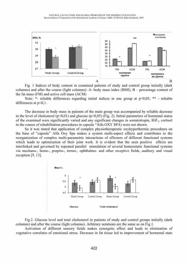
NATURAL CATACLYSMS AND GLOBAL PROBLEMS OF THE MODERN CIVILIZATION. Special edition of Transaction of the International Academy of Science. H&E. ICSD/IAS, Baku-Innsbruck, 2007.
422
B Fig. 1 Indices of body content in examined patients of study and control group initially (dark
columns) and after the course (light columns): A- body mass index (BMI), B – percentage content of the fat mass (FM) and active cell mass (ACM)
Note: *- reliable differences regarding initial indices in one group at p<0,05; ** - reliable differences at p<0,1.
The decrease in body mass in patients of the main group was accompanied by reliable decrease in the level of cholesterol (p<0,01) and glucose (p<0,05) (Fig. 2). Initial parameters of hormonal status of the examined were significantly varied and any significant changes in somatotropin, IGF1, cortisol in the course of rehabilitation procedures in capsule “Alfa OXY SPA) were not shown.
So it was stated that application of complex physiotherapeutic oxyhyperthermic procedures on the base of “capsule” Alfa Oxy Spa makes a system multi-aspect effects and contributes to the reorganization of complex multi-parametric interactions of effectors of different functional systems which leads to optimization of their joint work. It is evident that the seen positive effects are interlinked and governed by repeated parallel stimulation of several homeostatic functional systems via mechano-, hemo-, proprio-, termo-, ophthalmo- and other receptive fields, auditory and visual reception [9, 13].
Fig.2. Glucose level and total cholesterol in patients of study and control groups initially (dark columns) and after the course (light columns). Arbitrary notations are the same as on Fig.1.
Activation of different sensory fields makes synergetic effect and leads to elimination of vegetative correlates of emotional stress. Decrease in fat tissue led to improvement of hormonal state
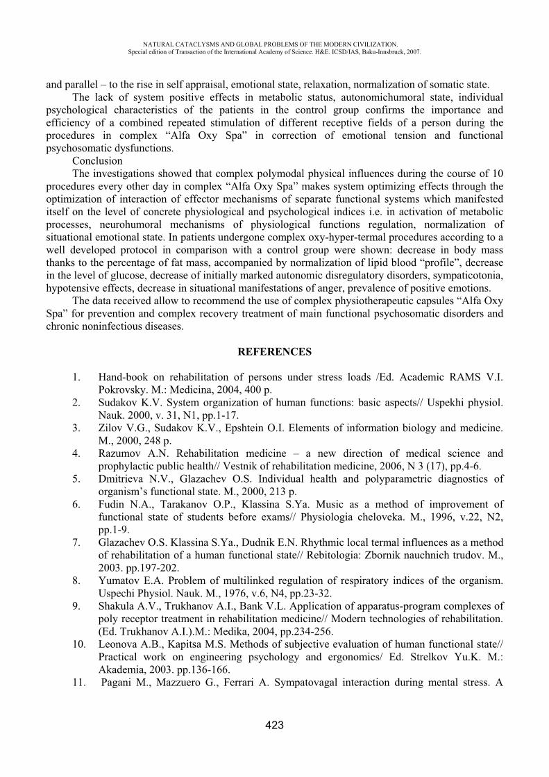
NATURAL CATACLYSMS AND GLOBAL PROBLEMS OF THE MODERN CIVILIZATION. Special edition of Transaction of the International Academy of Science. H&E. ICSD/IAS, Baku-Innsbruck, 2007.
423
and parallel – to the rise in self appraisal, emotional state, relaxation, normalization of somatic state. The lack of system positive effects in metabolic status, autonomichumoral state, individual
psychological characteristics of the patients in the control group confirms the importance and efficiency of a combined repeated stimulation of different receptive fields of a person during the procedures in complex “Alfa Oxy Spa” in correction of emotional tension and functional psychosomatic dysfunctions.
ConclusionThe investigations showed that complex polymodal physical influences during the course of 10
procedures every other day in complex “Alfa Oxy Spa” makes system optimizing effects through the optimization of interaction of effector mechanisms of separate functional systems which manifested itself on the level of concrete physiological and psychological indices i.e. in activation of metabolic processes, neurohumoral mechanisms of physiological functions regulation, normalization of situational emotional state. In patients undergone complex oxy-hyper-termal procedures according to a well developed protocol in comparison with a control group were shown: decrease in body mass thanks to the percentage of fat mass, accompanied by normalization of lipid blood “profile”, decrease in the level of glucose, decrease of initially marked autonomic disregulatory disorders, sympaticotonia, hypotensive effects, decrease in situational manifestations of anger, prevalence of positive emotions.
The data received allow to recommend the use of complex physiotherapeutic capsules “Alfa Oxy Spa” for prevention and complex recovery treatment of main functional psychosomatic disorders and chronic noninfectious diseases.
REFERENCES
1. Hand-book on rehabilitation of persons under stress loads /Ed. Academic RAMS V.I. Pokrovsky. M.: Medicina, 2004, 400 p.
2. Sudakov K.V. System organization of human functions: basic aspects// Uspekhi physiol. Nauk. 2000, v. 31, N1, pp.1-17.
3. Zilov V.G., Sudakov K.V., Epshtein O.I. Elements of information biology and medicine. M., 2000, 248 p.
4. Razumov A.N. Rehabilitation medicine – a new direction of medical science and prophylactic public health// Vestnik of rehabilitation medicine, 2006, N 3 (17), pp.4-6.
5. Dmitrieva N.V., Glazachev O.S. Individual health and polyparametric diagnostics of organism’s functional state. M., 2000, 213 p.
6. Fudin N.A., Tarakanov O.P., Klassina S.Ya. Music as a method of improvement of functional state of students before exams// Physiologia cheloveka. M., 1996, v.22, N2, pp.1-9.
7. Glazachev O.S. Klassina S.Ya., Dudnik E.N. Rhythmic local termal influences as a method of rehabilitation of a human functional state// Rebitologia: Zbornik nauchnich trudov. M., 2003. pp.197-202.
8. Yumatov E.A. Problem of multilinked regulation of respiratory indices of the organism. Uspechi Physiol. Nauk. M., 1976, v.6, N4, pp.23-32.
9. Shakula A.V., Trukhanov A.I., Bank V.L. Application of apparatus-program complexes of poly receptor treatment in rehabilitation medicine// Modern technologies of rehabilitation. (Ed. Trukhanov A.I.).M.: Medika, 2004, pp.234-256.
10. Leonova A.B., Kapitsa M.S. Methods of subjective evaluation of human functional state// Practical work on engineering psychology and ergonomics/ Ed. Strelkov Yu.K. M.: Akademia, 2003. pp.136-166.
11. Pagani M., Mazzuero G., Ferrari A. Sympatovagal interaction during mental stress. A
NATURAL CATACLYSMS AND GLOBAL PROBLEMS OF THE MODERN CIVILIZATION. Special edition of Transaction of the International Academy of Science. H&E. ICSD/IAS, Baku-Innsbruck, 2007.
424
study using spectral analysis of heart rate variability in healthy control subjects and patients with a prior myocardial infarction// Curculation. - 1991 - V. 83. - 4 Suppl. II - Pp. 43-51.
12. Mikhailov V.M. Variability of heart rate. Ivanovo, 2000, p.182. 13. Bikov A.T., Malyarenko T.N., Malyarenko Yu.E. Sensory flow as a technology of
recovery medicine// Proceedings of the First Intern. Congress “Recovery medicine and rehabilitation - 2004” - Moscow, 20-21 September, 2004. M.,2004, pp.64-65.
NEW APPROACHES TO REHABILITATION OF PSYCHOPHYSIOLOGICAL STATUS AND CORRECTION OF STRESS-RELATED DISORDERS
IN PERSONS OF DANGEROUS PROFESSIONS
Platonenko V.I., Glazachev O.S., Glazko N.B., Dudnik E.N., Yartseva L.A.
P.K.Anokhin Research Institute of Normal Physiology, RAMS, Moscow, Russia, Group of companies “VNIIMI”, Moscow, Russia
It is well known that practically all “extreme” professions connected with the necessity to work under risk conditions (emergency repair, rescue operations, military operations, operator’s work under technical and ecological disutility and the like) demand from a person great mobilization of his psycho-physiological functions accompanied by a marked emotional tension. At that the reaction on extreme industrial factors, psychosocial stressors has a system character, including emotional, cognitive, vegetative, neurohumoral, metabolic and somatic components (ecological model of stress development.
Later on, after cognitive evaluation of environmental factors the reaction is modulated (transact model of stress) when compensatory mechanisms of emotions, emotional reactions and changes in strategy of reaction (regulatory model of stress) are linked. Under long lasting chronic stress a stagnant stimulation arises which leads to neurohumoral disbalance, violation of psychophysiological functions in humans, development of a complex of stress-induced psychosomatic disorders and diseases, impossibility to adequately realize the production tasks (Sudakov K.V., Dmitrieva T.B., Volozhin A.I., 2001).
An individual level of resistance to stress, i.e. an organism’s ability to retain working efficiency under stress conditions and adequate tension of regulatory mechanisms, reorganization of behavior and homeostatic functions, is of great importance in development of stress-induced disorders in operators. The level of stress resistance is genetically determined; on the other hand it depends on the factors of upbringing, environment influencing the individual perception, subjective estimation and interpretation of stressors. Low resistance to stressors can lead to the development of “uncontrolled” stress reactions and against that background to high accident rate, to wrong decision-making, traumas, to speeding up psychosomatic functional disorders and diseases.
Are there any radical possibilities of correction of already raised stress state (syndrome of post traumatic stress dysfunctions, neurotic and somatic, worried depression), restoration of psychophysiological functions of the operator and increase of his individual resistance to stressors?
In the first case two tactics should be taken into consideration: 1) to change the stress situation (to optimize the production process, to eliminate stressors, to change rhythm and tempo of loads
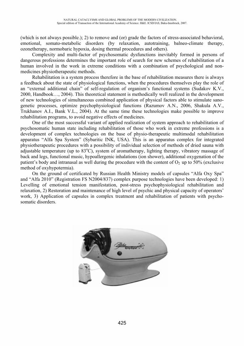
NATURAL CATACLYSMS AND GLOBAL PROBLEMS OF THE MODERN CIVILIZATION. Special edition of Transaction of the International Academy of Science. H&E. ICSD/IAS, Baku-Innsbruck, 2007.
425
(which is not always possible.); 2) to remove and (or) grade the factors of stress-associated behavioral, emotional, somato-metabolic disorders (by relaxation, autotraining, balneo-climate therapy, ozonetherapy, normobaric hypoxia, dosing thermal procedures and others).
Complexity and multi-factor of psychosomatic dysfunctions inevitably formed in persons of dangerous professions determines the important role of search for new schemes of rehabilitation of a human involved in the work in extreme conditions with a combination of psychological and non-medicines physiotherapeutic methods.
Rehabilitation is a system process therefore in the base of rehabilitation measures there is always a feedback about the state of physiological functions, when the procedures themselves play the role of an “external additional chain” of self-regulation of organism’s functional systems (Sudakov K.V., 2000, Handbook…, 2004). This theoretical statement is methodically well realized in the development of new technologies of simultaneous combined application of physical factors able to stimulate sano-genetic processes, optimize psychophysiological functions (Razumov A.N., 2006, Shakula A.V., Trukhanov A.I., Bank V.L., 2004). At the same time these technologies make possible to improve rehabilitation programs, to avoid negative effects of medicines.
One of the most successful variant of applied realization of system approach to rehabilitation of psychosomatic human state including rehabilitation of those who work in extreme professions is a development of complex technologies on the base of physio-therapeutic multimodal rehabilitation apparatus “Alfa Spa System” (Sybaritic INK, USA). This is an apparatus complex for integrated physiotherapeutic procedures with a possibility of individual selection of methods of dried sauna with adjustable temperature (up to 83oC), system of aromatherapy, lighting therapy, vibratory massage of back and legs, functional music, hypoallergenic inhalations (ion shower), additional oxygenation of the patient’s body and intranasal as well during the procedure with the content of O2 up to 50% (exclusive method of oxyhypotermia).
On the ground of certificated by Russian Health Ministry models of capsules “Alfa Oxy Spa” and “Alfa 2010” (Registration FS N2004/837) complex purpose technologies have been developed: 1) Levelling of emotional tension manifestation, post-stress psychophysiological rehabilitation and relaxation, 2) Restoration and maintenance of high level of psychic and physical capacity of operators’ work, 3) Application of capsules in complex treatment and rehabilitation of patients with psycho-somatic disorders.
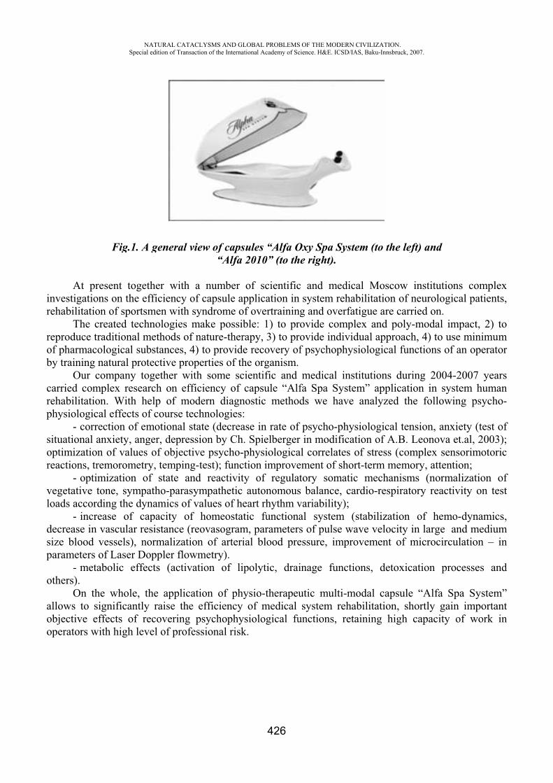
inr
rob
crp
sor
vlo
dsp
o
aoo
At prenvestigationehabilitatio
The creproduce tr
of pharmacoby training n
Our ccarried comehabilitatio
physiologica- corre
situational aoptimizationeactions, tre
- optimvegetative tooads accord
- incredecrease in vsize blood vparameters o
- metaothers).
On thallows to siobjective efoperators wi
NASpecial
Fig.1. A
esent togethns on the efn of sportsmreated technraditional mological subnatural proteompany tog
mplex researn. With heal effects ofection of emanxiety, angn of values emorometrymization ofone, sympading the dynease of capvascular resvessels), noof Laser Doabolic effec
e whole, thignificantlyffects of reith high leve
ATURAL CATACLedition of Transacti
general vie
her with afficiency ofmen with synologies m
methods of nbstances, 4) ective propegether withrch on efficelp of modf course techmotional stager, depressi
of objectivy, temping-tf state andatho-parasymnamics of vapacity of sistance (reoormalizationoppler flowmcts (activat
he applicatiraise the e
ecovering pel of profes
LYSMS AND GLOion of the Internatio
ew of capsu“Alfa 2
a number of capsule appyndrome of
make possiblnature-therap
to provide erties of the
h some scieciency of cadern diagnohnologies:ate (decreasion by Ch. Se psycho-phtest); functi
d reactivity mpathetic aalues of heahomeostaticovasogram,n of arteriametry). tion of lipo
ion of physefficiency opsychophysisional risk.
OBAL PROBLEMSonal Academy of Sc
426
ules “Alfa O2010” (to th
of scientificplication in overtraininle: 1) to prpy, 3) to prrecovery of
e organism.entific and apsule “Alf
ostic method
e in rate ofSpielbergerhysiologicaion improve
of regulatautonomousart rhythm vc functiona, parameters
al blood pre
olytic, drai
sio-therapeuof medical iological fu
OF THE MODERNcience. H&E. ICSD/
Oxy Spa Syse right).
c and medisystem reh
g and overfovide compovide indivf psychophy
medical infa Spa Systds we have
f psycho-phyr in modifical correlatesement of shotory somats balance, cvariability);al system s of pulse wessure, impr
inage funct
utic multi-msystem reh
unctions, re
N CIVILIZATION/IAS, Baku-Innsbru
stem (to the
ical Moscohabilitation ofatigue are cplex and po
vidual approysiological
nstitutions dtem” applice analyzed
ysiologicalation of A.B
s of stress (cort-term metic mechanicardio-respir
(stabilizatiowave velocitrovement o
tions, detox
modal capsuhabilitation, etaining hig
.uck, 2007.
e left) and
w institutioof neurologcarried on. oly-modal ioach, 4) to ufunctions o
during 2004cation in sy
the follow
tension, anB. Leonovacomplex seemory, attenisms (normratory react
on of hemty in large
of microcirc
xication pr
ule “Alfa Sshortly ga
gh capacity
ons complegical patient
impact, 2) tuse minimumf an operato
4-2007 yearystem humawing psycho
nxiety (test oa et.al, 2003ensorimotorintion; malization otivity on te
mo-dynamicand medium
culation – i
rocesses an
Spa Systemain importany of work i
exts,
tomor
rsano-
of);ic
ofst
cs, min
nd
m”ntin
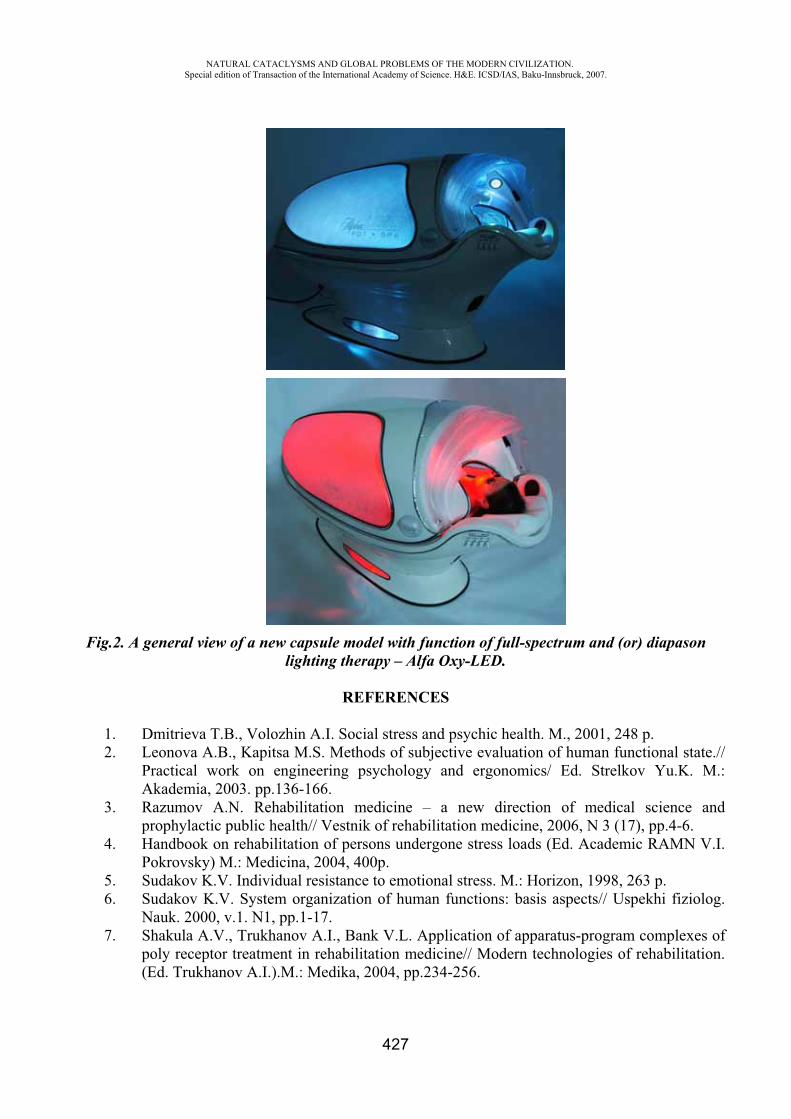
NATURAL CATACLYSMS AND GLOBAL PROBLEMS OF THE MODERN CIVILIZATION. Special edition of Transaction of the International Academy of Science. H&E. ICSD/IAS, Baku-Innsbruck, 2007.
427
Fig.2. A general view of a new capsule model with function of full-spectrum and (or) diapason lighting therapy – Alfa Oxy-LED.
REFERENCES
1. Dmitrieva T.B., Volozhin A.I. Social stress and psychic health. M., 2001, 248 p. 2. Leonova A.B., Kapitsa M.S. Methods of subjective evaluation of human functional state.//
Practical work on engineering psychology and ergonomics/ Ed. Strelkov Yu.K. M.: Akademia, 2003. pp.136-166.
3. Razumov A.N. Rehabilitation medicine – a new direction of medical science and prophylactic public health// Vestnik of rehabilitation medicine, 2006, N 3 (17), pp.4-6.
4. Handbook on rehabilitation of persons undergone stress loads (Ed. Academic RAMN V.I. Pokrovsky) M.: Medicina, 2004, 400p.
5. Sudakov K.V. Individual resistance to emotional stress. M.: Horizon, 1998, 263 p. 6. Sudakov K.V. System organization of human functions: basis aspects// Uspekhi fiziolog.
Nauk. 2000, v.1. N1, pp.1-17. 7. Shakula A.V., Trukhanov A.I., Bank V.L. Application of apparatus-program complexes of
poly receptor treatment in rehabilitation medicine// Modern technologies of rehabilitation. (Ed. Trukhanov A.I.).M.: Medika, 2004, pp.234-256.
NATURAL CATACLYSMS AND GLOBAL PROBLEMS OF THE MODERN CIVILIZATION. Special edition of Transaction of the International Academy of Science. H&E. ICSD/IAS, Baku-Innsbruck, 2007.
428
HUMAN BRAIN AND GEOMAGNETIC STORMS
A.A. Allahverdiyeva *, A.R. Allahverdiyev **, E.S. Babayev ***
*,** Institute of Physiology named after academician A.I. Garayev, Azerbaijan National Academy of Sciences;
*** Shamakhy Asrtophisical Observatory named after N. Tusi,Azerbaijan National Academy of Sciences;
Abstract. An investigation of the influence of geomagnetic storms of various intensities on healthy adults’ human brain activity and its functional state was conducted. Results of electroencephalogram (EEG) investigation were used as the most objective method reflecting functional state of the human brain. Studies on the influence of geomagnetic storms on the human brain functional state of healthy adult women patients (permanent group) in states of relaxation, photo-stimulation and hyper-ventilation have revealed a negative influence of severe geomagnetic storms on functional state of the human brain In balance of activating and deactivating mechanisms including dysfunctions of ergo- and tropho- tropic over-segmentary centers was registered. Strengthening cortical connections in the right cortical hemisphere and their short circuit on temporal sections during geomagnetically disturbed days were observed, while in geomagnetically quite days, a profile of correlation interrelations reflected weak internal- and inter- hemispheric connections. The threshold of conclusive (spasmodic) readiness of the human brain is reduced, which is especially dangerous for risk group persons. It is established that, in general, weak and moderate geomagnetic storms exert stimulating influence while strong disturbances of geomagnetic conditions activate braking (inhibiting) processes.
1. Introduction. Space Weather and human physiological state
The geosphere is very sensitive to solar activity, to changes in this activity and their manifestations on the Earth. Conditions on the Sun and in the solar wind, magnetosphere, ionosphere, and thermosphere (i.e., so called Space Weather) can influence not only the performance and reliability of space-borne and ground-based technological systems, but can endanger human life and health (1,2). Therefore, it is very important to get more and better knowledge about solar and geomagnetic storms and their potential impacts, in order to decrease or minimize these disturbance factors (3).
The results of the detailed studies, which are published, show that during the periods of strong geomagnetic disturbances, the number of hospitalized patients with nervous diseases notably increases, the cases of myocardial infarcts and cerebral insults, different paroxysmal conditions, nervous disturbance disorders and suicidal attempts become more frequent, the psycho-neurological diseases become aggravated and so on. At the same time, some reports show comparatively positive influences of heliogeophysical conditions on the human health state. For the persons, suffering from epilepsy, a reduction of frequency of epileptic attacks and improvement of general health state were detected during increases the level of geomagnetic field disturbances. Researches, conducted simultaneously at different geographical regions of the globe, revealed that during geomagnetic storms some monotype changes in the health state of mentally ill patients take place. It is curious that with an increase of disturbance of geomagnetic field, the number of epileptic attacks decreases.
During high solar activity periods, the predominance of maniacal phases in patients suffering from manic-depressive psychosis is of frequent and short-duration nature. When there is stabilization in the geomagnetic conditions, the maniacal phase is replaced by the depressive stage.
NATURAL CATACLYSMS AND GLOBAL PROBLEMS OF THE MODERN CIVILIZATION. Special edition of Transaction of the International Academy of Science. H&E. ICSD/IAS, Baku-Innsbruck, 2007.
429
Disturbances of the geomagnetic field, as any stress factor, influences first the central nervous system being the sensitive screen, and perceiving even weak disturbance fluctuations (oscillations) in the environment (4,5). Investigation of bioelectric activity of the human brain, which reflects a continuum of functional conditions, according to the paper (6), is an adequate method for research of a condition of cerebral cortex of the big hemispheres and cortico-subcortical interrelations.
Not only the central, but also vegetative nervous system of human being is very sensitive (responsive) to the geomagnetic disturbances (7). It is established that during weak and moderate magnetic storms, a tone strengthens in the field of sympathetic part (section) of a vegetative nervous system. Only in some cases and, most often for the men, the strengthening (amplification) of tone of the parasympathetic section of a vegetative nervous system is observed (8).
Based on EEG researches, it is established that the nervous system of patients responds on geomagnetic disturbances by a diphasic reaction (9). During days with geomagnetic storms, the generalized reduction of indexes of spatial synchronization of EEG is marked. On the contrary, a general increase is registered on the next day in contrasted long-leaved quiet period.
In this original research paper we have studied possible influence of solar and geomagnetic storms of various strength and very intense (severe) geomagnetic storms caused by the violent Sun-Earth connection events (such as which had a place in October-November 2003) on the human brain activity and its functional state. Special attention was paid to the stormy days of July 2000, April 2001, October-November 2003, November 2004, January 2005 etc. Particularly, one of the major and severe geomagnetic super-storms current Solar Cycle 23 in October-November 2003 gave a unique chance to Azerbaijani researches to study in details an impact of extreme Space Weather events on the human brain functional state.
We have studied the influence of geomagnetic storms on the human brain functional state of healthy adult women patients (permanent group) in states of relaxation, during photo-stimulation and hyper-ventilation. Results of EEG investigation were used for reflecting functional state of the human brain. A parallel registration of the electrocardiogram (ECG) was conducted. Comparison of data for October-November 2003 with other data obtained during a long-time period experiments for relatively geomagnetically quiet and moderately disturbed days as well as interpretation of the obtained results were carried out.
2. Experimental methods
Data record of bioelectric activity of the human brain was made with the help of the computerized electroencephalograph, which is the multi-channel (16 channels) digital recorder intended for polygraph registration of the physiological characteristics. The digital data was recorded on the hard disk, which was subsequently subjected to reviewing and analyzing qualitatively.
27 healthy female persons (permanent group), aged between 20 and 40 years old, issued from the same geographical area, were chosen for a long-term investigation during geomagnetically quiet (favorable) days, at days with weekly-disturb and strongly disturb (unfavorable) geomagnetic conditions. All female patients were examined in the inter-menstrual period.
Registration of spontaneous EEG by a mono-polar way from 16 standard leads arranged pursuant to the international system of “10-20” and parrarel registration of the electrocardiogram (ECG) was conducted. The experiments were carried out in the standard system from forehead (frontal), central, parietal, occipital and temporal areas of both hemispheres of the human brain.
The native records of EEG, which were obtained at different functional conditions, as well as the relevant data and registered curves were stored on disks. Later on after removal of artifact segments, they were subjected to the analysis using the special software. Spectral and amplitude mapping, correlation and periodical-metric analyses were carried out. Frequency and amplitude cartograms,
NATURAL CATACLYSMS AND GLOBAL PROBLEMS OF THE MODERN CIVILIZATION. Special edition of Transaction of the International Academy of Science. H&E. ICSD/IAS, Baku-Innsbruck, 2007.
430
obtained for different functional conditions, reflect features of the human brain functioning at comparatively quiet and at days with strong geomagnetic storm.
Experiments were conducted taking the account solar and geomagnetic storms during above mentioned days. As the most widely used parameters of the geomagnetic activity for biomedical problems, the Ap-index and Dst-index, we used in our researches a longside other Space Weather parameters.
3. Results and discussions
Results of our investigation have revealed that during severe geomagnetic storms the large majority of patients of under test expressed indisposition, weakness and/or presents of indistinct localized headaches. In most cases, bioelectric activity of the human brain was characterized by reduction of frequencies of a dominating rhythm, amplification (strengthening) of expressiveness of slow wave component (mainly, a thetarhythm) and increase in amplitude of activity. We have observed the forms of waves with pointed outlines and strengthening of process of synchronization of activity.
Flashes of pointed and sharp alpha- and theta- waves having right cerebral hemisphere’s accent (stress), were registered during experiments. Smoothing of inter-zonal distinctions was observed as well. For a part of examinees diffuse synchronization was traced on frequency ranges of alpha-1 and alpha-2 rhythms. Reactivity of dominating activity was weakened, and reactions of adopting rhythm were observed lower frequencies of the alpha-ranges.
During hyperventilation process observable flashes of both pointed and sharp alpha- and theta- rhythms were amplified, and their amplitudes were increased as well. Figure of correlation interrelations, inherent to various functional conditions, was broken. Inter-hemispheric asymmetry was revealed. The leading role in interrelations had temporal area of the right cerebral hemisphere. Activation of rostral-temporal and caudal-temporal connections (links) of the right hemisphere was marked.
The obtained results prove the significant changes in activity of the human brain during the days with severe geomagnetic storms, reflecting infringement of functions of both central integrative mechanisms and local processes of brain regulation.
It’s well known that the most sensitive sections of the human brain, being influenced by negative factors of an environment, are hypothalamus and cerebral cortex of the big hemispheres of the human brain (10). The increase of representativity of theta- and alpha- rhythms, which carry flash-like character, testifies on dysfunction of mesodiencephalitic sections within the limits of which hypothalamic nucleus are located. Considering hypothalamus as leading part of nonspecific systems of the human brain (11) and as responsible for neuroendocrenal and vegetative regulation, it should noted that strong geomagnetic disturbances infringe normal activity of the structure, causing imbalance in ergo- and tropho- tropic interrelations.
The dysfunction, registered on EEG and reflecting ascending sendings, undoubtedly affects descending directions as well, causing complex vegetative complaints observed in the majority of examinees. At the same time it must b noted that, pointed and sharp flashes of waves of theta- and alpha- range which are observe on some tested persons in the days with severe geomagnetic storms, testify on the paroxysmal character of the infringements, specifying on reduction in a threshold of convulsive (spasmodic) readiness mesodiencephalitic formations we followed corresponding clinical-neuropsychological consequences.
Observed right cerebral hemisphere accent (stress) of changes testifies the greater “interest” of right hemisphere. According to the paper, activation of the right hemisphere is accompanied by negative tinge of emotional reactions. Outgoing from this fact, it is possible assume that during very strong disturbances of geomagnetic conditions the negative emotional background of the person is
NATURAL CATACLYSMS AND GLOBAL PROBLEMS OF THE MODERN CIVILIZATION. Special edition of Transaction of the International Academy of Science. H&E. ICSD/IAS, Baku-Innsbruck, 2007.
431
amplified. This assumption is also proven by results of the correlation analyses specified strengthening cortical connection in the right cortical hemisphere and their short circuit temporal sections, while, in geomagnetically quiet days, a profile of correlation interrelations has reflected weak internal- and inter- hemispheric connections.
Thus, results of our researches prove the negative influence of the very strong geomagnetic storms on the functional state of the human brain. Normal functioning of integrative non specific systems located within the limits of limbric-reticular complex and responsible for creation of the corresponding level of wakefulness, which directed on realization of optimal current activity of an organism is broken. In balance of activating and deactivating mechanisms arises including also dysfunctions of ergo- and tropho-tropic over-segmentary centers.
The threshold of convulsive (spasmodic) readiness of the human brain is reduced which is especially dangerous for the persons of high risk and, as a result, this fact should be taken into account for preventive measures and therapy of paroxysmal conditions.
REFERENCES
1. Burch J.L. The fury of space storms. Scientific American 86-94, April, 2001. 2. Daglis I.A. (ed.). Space Storms and Space Weather Hazards. NATO Science Series, II.
Mathematics, Physics and Chemistry, Vol. 38, Kluwer Academic Publishers, 2001. 3. Jansen F., Pirjola R. and Favre R. Space Weather. Hazard to the Earth? Swiss Re
Publishing, Zurich, 2000. 4. Baevsky R.M. Forecasting of condition on the verge of nom and pathology. Publishing
House “Meditsina”, Moscow, 1979. (In Russian) 5. Mikhailov G.A. Possible biophysical mechanism of the influence of solar activity on the
central nervous system of man. Biofizika (J. Biophysics), 46, 922-926, 2001. (In Russian) 6. Allahverdiyev A.R., Hasanov G.G., Gafarova R.Z. Age features of maturing of functions
of the brain of children in norm and at neurosis. Publishing House “Tebib”, Baku, 1995. (In Russian)
7. Mizun Yu.G., Mizun P.G. Cosmos and Health. Publishing House “Znanie”, Moscow, 1984. (In Russian)
8. Allahverdiyev A.R. Ontogenetic features of nonspecific systems of a brain in the norm and at neourosis Petrov V.M., et al. Influence of changes of the Earth’s magnetic field on the functional state of man in conditions of a space flight (Abstract). Presentations of Int. Symposium “Computer Electro-Cardiography” at the Edge of Centuries”, Moscow, 12-114, 1999. (In Russian)
9. Allahverdiyev A.R., Babayev E.S., Khalilov E.N., Gahramanova N.N. Space Weather influence on functional activity of the human brain. In: Proceedings of ESA Space Weather Workshop: Looking Towards a European Space Weather Programme”, 17-19 December 2001, ESTEC, The Netherlands (also in press as: “ESA WPP-194”), ESA PD, Noordwijk, 133-136, 2001
10. Allahverdiyev A.R., Gahramanova N.N., Khalilov E.N., Babayev E.S. Peculiarities of spectral-amplitude characteristics of the electroencephalogram of men at the days with increased solar and geomagnetic activity. In: Cyclicity and Cosmological Problems”. Proceedings of the International Conference, 2-4 May 2003, Azerbaijan, Publishing House “Elm”, Baku, 80-186, 2003.
NATURAL CATACLYSMS AND GLOBAL PROBLEMS OF THE MODERN CIVILIZATION. Special edition of Transaction of the International Academy of Science. H&E. ICSD/IAS, Baku-Innsbruck, 2007.
432
DESTRUCTIVE INFLUENCE OF CADMIUM ON BIOSTRUCTURES
Khalilov R.I.*, Sharifzadeh G.F.**
Baku State University Holding “Intergeo-Tethys”
Cadmium - the most honorable rare metal of the table of Mendeleyev. The world Organization of Public health services cadmium is recognized from all elements of the table of Mendeleyev by the most dangerous heavy metal in connection with that from an organism of the person it practically is not deduced and collects over the years. For a day from an organism it is deduced only 0,1 % from the received doze. Danger chemical forms of cadmium represent all. Owing to pollution of the soils cadmium gets into a vegetative organism. The basic source by cadmium pollution of the soils is application of fertilizers, in particular superphosphate where cadmium enters as microadditives, (superphosphate contains 720,2 mkg of cadmium in 100 gr, kalium phosphate - 471 mkg, saltpeter - up to 66 mkg). Pollution of ground by cadmium is kept long time and after this metal ceases to act again [3,7]. Up to 70 % of cadmium getting in ground contacts the soil chemical complexes accessible to mastering by plants. The soil microflora participates in processes of formation of cadmium - organic connections also. Cadmium collects in the ionic form in sour waters in the form of insoluble hydroxide and a carbonate (pH=4,5-5,5), also can form the extremely toxic methylated, leaded and alkalized forms. Danger chemical forms of cadmium represent all. In zones of the raised maintenance of cadmium in ground 20-30 multiple increase in its concentration in ground parts of plants in comparison with plants of not polluted territories is established. Cadmium basically is localized in roots and in smaller quantities - in stalks, petioles and the main ribs of leaves. Thus when the quantity of cadmium in the environment sharply raises, concentration of an element in roots in some times exceeds its concentration in elevated weight [3,5]. The polluted plants can contain even up to 400 mg/kg of cadmium and more. It is established, that the chlorophyll possesses ability to concentrate cadmium in vegetative fabrics.
The visible symptoms caused by the raised maintenance of cadmium in plants is chlorosis leaves, it is red - brown painting of their edges and proteins, and also a growth inhibition and damages of root system.
Phytotoxicity of cadmium it is shown and in braking action on photosynthesis, infringement transpiration and fixings of carbonic gas, and also in change of permeability of cellular membranes (see on fig. 1).
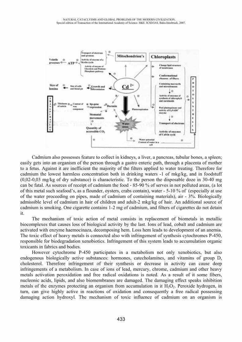
NATURAL CATACLYSMS AND GLOBAL PROBLEMS OF THE MODERN CIVILIZATION. Special edition of Transaction of the International Academy of Science. H&E. ICSD/IAS, Baku-Innsbruck, 2007.
433
Cadmium also possesses feature to collect in kidneys, a liver, a pancreas, tubular bones, a spleen; easily gets into an organism of the person through a gastro enteric path, through a placenta of mother to a fetus. Against it are inefficient the majority of the filters applied to water treating. Therefore for cadmium the lowest harmless concentration both in drinking waters -1 of mkg/kg, and in foodstuff (0,02-0,03 mg/kg of dry substance) is characteristic. To the person the disposable doze in 30-40 mg can be fatal. As sources of receipt of cadmium the food - 85-90 % of serves in not polluted areas, (a lot of this metal such seafood’s, as a flounder, oysters, crabs contain), water - 5-10 % of (especially at use of the water proceeding on pipes, made of cadmium of containing materials), air - 3%. Biologically admissible level of cadmium in hair of children and adult-2 mkg/kg of hair. An additional source of cadmium is smoking. One cigarette contains 1-2 mg of cadmium, and filters of cigarettes do not detain it.
The mechanism of toxic action of metal consists in replacement of biometals in metallic biocomplexes that causes loss of biological activity by the last. Ions of lead, cobalt and cadmium are activated with enzyme haemocinaza, decomposing hem. Loss hem leads to development of an anemia. The toxic effect of heavy metals is connected also with infringement of synthesis cytochromes P-450, responsible for biodegradation xenobiotics. Infringement of this system leads to accumulation organic toxicants in fabrics and bodies.
However cytochrome P-450 participates in a metabolism not only xenobiotics, but also endogenous biologically active substances: hormones, catecholamines, and vitamins of group D, cholesterol. Therefore infringement of their synthesis or decrease in activity can cause deep infringements of a metabolism. In case of ions of lead, mercury, chrome, cadmium and other heavy metals activation peroxidation and free radical oxidations is noted. As a result of it some fibers, nucleonic acids, lipids, and also biomembranes are damaged. The damaging effect speaks inhibition metals of the enzymes protecting an organism from accumulation in it H2O2. Peroxide hydrogen, in turn, can give highly active in reactions of oxidation and consequently a free radical possessing damaging action hydroxyl. The mechanism of toxic influence of cadmium on an organism is
NATURAL CATACLYSMS AND GLOBAL PROBLEMS OF THE MODERN CIVILIZATION. Special edition of Transaction of the International Academy of Science. H&E. ICSD/IAS, Baku-Innsbruck, 2007.
434
connected as with its direct influence on a fabric, infringement of an albuminous exchange, and with replacement from an organism of zinc, to a lesser degree copper, selenium, calcium. After hit of salts of cadmium inside of an organism of the person there are nausea, sialism, vomiting, pains in a stomach, a diarrhea, muscular pains, a headache. Inhalation follows of cadmium leads to occurrence of metal taste in an oral cavity, to superficial breath, pains in a breast. At the victim the pneumonia develops. Research wet finds out hematuria, proteinuria. At the patient the anemia and leucopoenia develops, function of a liver suffers. On opening after inhalation poisonings find out an inflammation of a stomach, an intestines and damage of a liver and kidneys. In case of a chronic inhalation poisoning cough, a short wind, weight loss, irritability, yellow coloring of a teeth, damage of a liver, kidneys and a pancreas are marked. [2, 4] Already for a long time it is known, that presence at an environment of cadmium can cause oncological diseases in the person. Now it was possible to the American researchers in laboratory experiments on cells of yeast to find out oncogenous action of cadmium. Superfluous accumulation in an organism of cadmium usually leads to suppression of activity of immune system, infringement of functions of kidneys (nephropathy, glomerulonephritis), prostate, causes hemorrhagic necrosis of testicles, an anemia, skin diseases, increase of arterial pressure, promotes decrease in appetite, negatively affects activity of a brain and plays a significant role in occurrence and development of insults, negatively influences reaction of sticks of an eye retina, possesses carcinogenic properties, raising all forms of display of malignant new growths.
Summary:Fixing consequences, we come to conclusion, that ability of cadmium to long-term accumulation
in alive organisms, biochemical affinity with zinc, mercury and other elements put this element on character of influence on an organism of the person out of competition among metals – ecotoxicological substances.
With a view of preventive maintenance, in conditions of environmental contamination by cadmium the special attention demands correctly organized feed. Dietotherapy provides increase of antitoxic functions of an organism both its resistance, and activation of allocation xenobiotics [1,6]. Except for it at microelementhosis antioxidants (for example, a preparation " AOK - selenium ") are used. Treatment in case of an inhalation poisoning consists in the following: it is necessary to stop influence of poison and to treat by the standard rules a hypostasis of lungs or pneumonia. Ethiopathogenetic treatment in cases of development microelementhosis toxicopathia should include the preparations promoting deducing of heavy metals from fabric depots (chelators, entherosorbent agents). Those are "Polisorbovit", "Phytosorbovit". And also preparations in the form of a complex with bioligands (natural carriers of microcells - peat, yeast, seaweed) - a preparation "Clorefyl" can be applied.
REFERENCES
1. Dmitriyeva N.V., Chernov I.P., Tkachenko T.G.,and others. State of health of children in the regions polluted by heavy metals. // Materials of VIII congress of pediatrists of Russia “Actual pediatric problems ”. – M., 2001,p.76
2. Ignatova M.S., Degtyareva E.M. Current notation about ecopathology of internals // coverage of literature –2002,No12,p.39-42
3. Ilyin V.B. Heavy metals in “soil - plant” systems. Novosibirsk: Science,1997, p.150-167 4. Likchachev A.Y. Studying of impurity of an environment by cancerogenic substances and
opportunity of forecasting of individual sensitivity them // Oncology question.-1997.No1p.111-115
5. Seregin I.V., Ivanov V.B. Studying of movement of ions of cadmium on fabrics of a plant Pytophysiology.1998.p.899-905
NATURAL CATACLYSMS AND GLOBAL PROBLEMS OF THE MODERN CIVILIZATION. Special edition of Transaction of the International Academy of Science. H&E. ICSD/IAS, Baku-Innsbruck, 2007.
435
6. Sichyev A.R., Sannikov V.M. The complex methodological approach to an estimation of genetic consequences of pollution of atmospheric air // Hygiene of an environment. –Kiev,2001, p.139-150
7. Phenik S.I., Trophimyak T.B., Blum Y.B. Mechanisms of formation of stability of plants to heavy metals M.: 1995.p.261-275
STATE OF A LIPIDE SPECTRUM OF A BLOOD AND HEMOSTASIS FOR ILL WITH A STABLE STENOCARDIA UNDER INFLUENCING OF LOW INTENSIVE OF A LASER
RADIATION.
Khalimbetova N. Yu.*, Khaitova N.M.**, Kazimova L.F.***, Ashrapov Kh.A.****
Samarkand State Medical Institute Samarkand, Uzbekistan Republic
The problem of ischemic illness of heart (IIH) represents the special urgency and social significance in connection with increase of a morbidity, magnification of invalidization of faces young and creatively of fissile age.
Now number ill, suffering affliction from IIH is permanently augmented also she, under the right considering by “Plague of XX century”, annually blows life of millions people. More often the men in the age of 40-64 years are sick, the women in a climacteric advance the men on frequency and gravity of disease. (ChazovE.I., 1997). Despite of huge number of researches of a pathogeny and features of clinic IIH with the purpose of decrease of a level of a morbidity, prevention of development of complications, early of invalidization and lethal outcome remains actual. The reasons of development IIH while completely are not clear, however due to experimental, clinical and epidemiological researches the risk factors (dislipidemiya, smoking, heightened arterial pressure, sugar Diabetum, exuberant mass of a skew field, hyperglycemia, low physical activity, ancestral(inheritable)predisposition, abusing by alcohol, violation of a system of curtailing of a blood), promoting to development and development of an atherosclerosis and IIH are revealed. The research of interplay of mechanisms of curtailing and parameters of a lipide structure of a blood at IIH has shown correlation of these components.
Therefore one of the basic perspective paths of struggle with IIH are the preventive measures, which one are based on duly revealing and deleting of risk factors of disease aggravating the prognosis IIH.
Fair quantity of by-effects of traditional medicamental therapy (TMT), availability of allergic responses, and main in 60 % of cases the development of refractation to nitrites, antiagregants and others antianhynalium and antilipidic to drugs causes to obtain in essence new means and methods of treatment, including not medicamental.
The low-energy lasers are widely applied at treatment of diseases of a cardiovascular system (Amirov N.B.. 2002).
At outside application the treatment by the laser happens by effect of emanating of the terminal on definite zones and points of a skew field challenging a metabolism in staggered tissues, activating adhesion both regeneration and general(common) stimulation of an organism as a whole. However, are present conflicting the data about influencing of low intensive of laser effect on a contracting system and lipide spectrum of a blood for ill with a stable stenocardia.
NATURAL CATACLYSMS AND GLOBAL PROBLEMS OF THE MODERN CIVILIZATION. Special edition of Transaction of the International Academy of Science. H&E. ICSD/IAS, Baku-Innsbruck, 2007.
436
In this connection, basic purpose of operation was the study of lipide and coagulative spectra of a blood for ill IIH with a stable stenocardia under influencing of low intensive of a photoradiotherapy. And also estimation of a possibility of correction of the revealed violations with the help of the given kind of treatment.
According to the delivered problems by us was inspected 69 ill IIH 20 practically of able-bodied faces. Among inspected ill there were 26 men (53,1 %) and 23 (46,9 %) woman in the age of from 35 till 82 years. The average age ill has compounded 58,7 1,7. Ill in the age of from 41 till 50 years have compounded 36,7 % from 51-60 of years - 26,6 % from 61-70 of years - 24,5 of % and from 71 and higher - 12,2 than %. All ill with a stable stenocardia were divided into groups depending on functional classes of a stenocardia, so for 38,4 % ill is revealed II , for 62,6 % III . Ill were distributed to group receiving only traditional medicamental therapy (TMT) and group with combined therapy with association to TMT-NILI in combination of antioxidants ("Aevitum" 600mg per day). The photoradiotherapy was conducted by a means " Neurolaz 001 ". Influenced a projection of heart in a zone of maximum localization of a pain and zone Zakharina-Geda (average third of breast bone, apex of heart and left infrascapular area) with frequency 3500 Hz, potency 10 mVt, modulation 2,4 Hz, exposition for 2 minutes on each zone. The rate of treatment consist of 10 daily procedures spent at morning hours o'clock
In our researches the lipide spectrum of a blood of able-bodied faces and ill IIH underwent considerable modifications: the level CCh for 49 ill IIH was authentically above ( < 0,05) as contrasted to level of common of cholesterol (CCh) for practically able-bodied faces - 6,6 0,15
/l and 4.16 0.38mmoth/l accordingly. Index of atherogenetic (IA) also underwent considerable modifications, namely the authentic magnification it(him) in group ill IIH as contrasted to by control group was marked. -2,24 0,15 and 0,53 0,16 accordingly. The return modifications took place at the analysis of the contents of - lipoproteins ( - LP) in both groups, that is authentic diminution of a level - LP in group of ill IIH-2,04 0,16mmoth/l as contrasted to 2,72 0,33mmoth/l, < 0,05. In our researches the authentic magnification of levels CCh , -lipoproteins ( -LP) and IA for ill II and III FK took place, however more expressed modifications are marked for ill III FK. The inverse modifications have levels of antiatherogenous lipoproteins - And - at different clinical variants IIH. More expressed modifications of a lipide spectrum of a blood for an ill stable stenocardia III FK as contrasted to ill II FK confirm a large expressiveness of atherosclerotic process.
The estimation of coagulative properties of a blood ill with a stable stenocardia was conducted with usage of definition of an activation of a contracting system of a blood (CSB): a calcium clotting time, tolerance of plasma to Heparinum, Fibrinogenum (FG), thrombotest, prothrombin ratio (PTI), indicator of gematokrit, state of fibrinolytic activity of a blood (FAB). In our research the authentic magnification of parameters FG, prothrombin time and PTI for ill IIH as contrasted to by control group took place, that once again specifies more heightened level CSB for ill IIH, so also large predilection of this group inspected as contrasted to able-bodied to a clottage. The given fact confirms also authentic diminution FAB for ill IIH as contrasted to by control group.
The analysis of parameters CSB and anticoagulative blood for ill with different gravity of clinical current IIH has shown an authentic diminution of time of a recalcification for ill II III FK of a stable stenocardia, and in the greater degree for ill II FK (42 % and 33 %). At the analysis of parameters PTI the identical authentic magnification of the given parameter for ill II- III FK took place practically, and also the authentic diminution FAB for an ill stable stenocardia III FK as contrasted to by control group was marked.
The analysis of influencing of combined therapy for an ill stable stenocardia on a lipide spectrum of a blood has shown an authentic diminution of a level CCh, -lipoproteins and index of atherogenetics for ill in both groups, thus, for the patients alongside with TMT receiving NILI more
NATURAL CATACLYSMS AND GLOBAL PROBLEMS OF THE MODERN CIVILIZATION. Special edition of Transaction of the International Academy of Science. H&E. ICSD/IAS, Baku-Innsbruck, 2007.
437
exponential was marked hypocholesterolic influencing of therapy. The inverse modifications were watched at the analysis of the contents of a level And - in a blood plasma for inspected ill.
At the analysis of parameters of a hemostasis for an ill stable stenocardia the considerable modifications were detected at matching levels FG, thrombotest and PTI, however in the speaker of treatment TMT in the maiden group was not watched of shift in parameters FG of a blood plasma before treatment, that it is impossible to say at the analysis of the given parameter for ill, receiving NILI alongside with TMT. In group of the patients receiving NILI. The authentic diminution PTI took place, whereas under influencing TMT the downward tendency it on 7 % was marked only.
Thus, the parameters of a lipide exchange are changed under influencing NILI in the greater degree as contrasted to by group of faces receiving TMT. As have shown our researches for ill with the chronic forms IIH viscosity of a blood is increased, that, in opinion of the majority of the contributors, is stipulated by a modification of qualitative structure, viscosity of plasma and aggregate of erythrocytes. In this case a reason of rheological violations, thicket - magnification of viscosity of plasma seldom emerges gemoconcentration as at the expense of of high molecular weight junctions FG and -LP. The researched method of not medicamental therapy having padding antiatherogenous effect, promotes acceleration of restoring of homeostatic, metabolic shifts and authentic reduction of terms of treatment and can be recommended as a means of a choice on a hum noise TMT of the indicated disease.
POETIC EXPRESSION OF ECOLOGICAL PROBLEMS
H. I. Mahmudov*, K.F. Samadova**
The history of the ecology science is very ancient. Heraclites, Democritus, Epicurus, Aristotle, Plato, Empedocles, Theophrastus and others known as thinkers of the ancient age had the thoughts about it. But the development of modern ecology science in Azerbaijan is connected to the name of well-known geographer-scientist, academic Hasan Aliyev. You can encounter not only in the modern worldwide sciences, but also in ancient theological books, and in the Holy Koran. The theological sciences started activities from initial stage of the civilization and culture of the men had always kept the importance of the environment in the center of attention. So that creation of life, creation of men and living things and protection of its reserves was reflected in the Koran. The 55 Ar-Rahman (Rahimli) sura of the Holy Koran says: “The sun and the moon moves with the certain capacity”. The science teaches that all the planets, stars around the sun moves around the sun with certain conformity and subject to attraction law. The ecological problems the people realize now were reflected in Islamic religion and in the words of the Mohammad the prophet. The Koran book says that it is necessary to wash hands and face before namaz and eating, to avoid from eating more, to fast for health and to spare the reserves.
Ecology got wide scope in past years. The world researchers working in this field developed this science and afforded to study it thoroughly. Ecology in modern period influenced all the fields of the world sciences and turned to the leading line of modern sciences. Some people coordinate the ecology with pollution of environment. But ecology shows its impact in the field of every science, and also in our culture and morality and it is very important to study them. So that geology and ecology, philosophy and ecology, mathematics and ecology, physics and ecology, history and ecology and so on even the expressed word has the ecology. If your speech is valuable, your speech causes to high human
NATURAL CATACLYSMS AND GLOBAL PROBLEMS OF THE MODERN CIVILIZATION. Special edition of Transaction of the International Academy of Science. H&E. ICSD/IAS, Baku-Innsbruck, 2007.
438
qualities, kindness and delight, this means the cleanness and transparency of your word ecology. If contrary you talk irrigating, nerving words, this means the dirtiness of your word ecology. The same thoughts may be included to other fields. Ecology and poetry, to express the positive and negative points of the ecological environment in poetic language – this is very young field. From ancient times the humans saw the ecology as damages of various nature events and humanity world. Of course the events polluting the nature and unpleasant cases towards the human life are valuated as the main factors of ecology. So that the people coordinate the damages incurred by eruption of volcanoes, creation of floods, sliding and other events created in the nature to the nature and humanity with the pollution and change of ecology. So that Nizami Ganjavi known as the sun of the world poetry coordinated the creation of the Goy Gol Lake the pearl of nature in the result of fall of Kapaz Mountain and cut the river of Agsu in the earthquake happened in 1139 with such ecological disorders:
So many cities destructed at once In the result of earthquake destroying the skies. Shuddered the mountains and rocks so that The evil itself remained under these dusts. The earth began dancing as the skies In the result of the games of the evil. The eyes did not remain in their places The world worn its mourning dress So much treasure lost at that nightthat Ganja forgot the Saturday night.
The views of Nizami on four elements – land, water, air and fire are especially interesting. He says that everything – either the wheat grain or farting was created from four elements. The poet differing from some contemporaries of his prefers the land from these four elements. Nizami called the people to deeply realize the nature and life and discover all the secrets of it.
The thinker poet spoke a lot on the dome of the sky consisting of the nine layers of the universe in the poem of “Leyli and Mejnun”. According to the geocentric theory seven sky spheres in the center of which the earth stands and the planets belonging to them: the moon (silver), Mercury (mercury), Venus (copper), the sun (gold), Mars (iron), Jupiter and Saturn (lead) are described graphically. He describes the movement of the universe, organization of their elementary parts and permanent movement of these parts in the poems of “Khosrov and Shirin” and then “Leyli and Mejnun”.
If one dust is seen as a particle, It may do work in the world house.
Nizami Ganjavi said repeatedly that the earth is in the form of ball, described its movement and form capitally, and talked about the influence of natural factors, water, earthquake, and wind to the change of earth:
It is not the earth that is the form of ball That line that wheels around is also round.
Or
Watch at this folded places once again The lands created from the land
NATURAL CATACLYSMS AND GLOBAL PROBLEMS OF THE MODERN CIVILIZATION. Special edition of Transaction of the International Academy of Science. H&E. ICSD/IAS, Baku-Innsbruck, 2007.
439
Either the earthquake happens or flood flowsThe earth can not calm down in one place The earthquake sinks it and the water washes it Then the end will be the desert
The poet having deep observatory talent as learning the secrets of the nature his outlook in the field of nature study directed to the materialism. The form, structure and movement of earth, common attraction law among the heaven bodies and the unity between human and nature raise special concerns in his poetry.
You may also encounter several points related to ecology in the works of Nizami Ganjavi together with the thinker poets such as Alishir Navai, Abay, Khagani, Seyid Azim Shirvani, Mirza Alakbar Sabir, and also the poets of XXI century poets Samad Vurgun, Mikail Mushvig, Mammad Araz, Nabi Khazri and other well-known literateraure faces. The public poet Samad Vurgun expresses the forests, flours, springs and nightingale and gazelle of Mughan in the poem of “Mughan”. Describes the beauty of the Kur River cleaving the mountains and getting to the desert:
The flowing waters meeting the mountains Cries angrily in the first spring Fighting with the grey faced stones It hits its wave as paw Hitting his breast to the mountains Raise it to the sky on his breast It may breach the heavy rocks and stones It will come to the deserts by forcing its way throughIt will rest by breathing in.
Samad Vurgun notwithstanding the flow of the Kur river describes the drying of Mughan desert from the thirst, the living of the flours with the regret of water:
The flower of the Mugan wants water, water! The land is cracked as thirsty lip
The poet describes the changing of the Mugan plain to green pastures, evoparating deserts and beatiful forests as the following:
Water flows into the Mugan, into Mil Human wishes on land
Forests made a sound, fields were pleasure Poppies were blossemed out in Mugan, in Mil The lute of the past turtle –doves was soundedThe waters were syrup in mouth and toungue
Major poems of our famous poet, Mammad Araz are dedicated to panoramas of mountains, forests and sea and beatuies of birds. The poet calls everybody to support to protect motherland’s nature and beatuies due to this nature came to human in his poets, such as “Goygol”, “Manim Nakhchivanim” ( My Nakhchivan), “Duman”(fog), “Salam a zirvalar” ( Greetings to peaks) , “Insan”( human) , “Omrum, arzum” ( my life, my wishes). Mammad Araz in his poet named as “ Muganin shikayati” ( Mugan’s complaints) tells to people that they should walk in Mugan plain not making

NATURAL CATACLYSMS AND GLOBAL PROBLEMS OF THE MODERN CIVILIZATION. Special edition of Transaction of the International Academy of Science. H&E. ICSD/IAS, Baku-Innsbruck, 2007.
440
noise as there is very less gazelles because of hungers. If countinues so, gazelles will not be in open life but in mouseums.
Across these plains in straight lineBe noiseless, shoutlessDont’ hunt in ShirvanWalk in Shirvan without rifle Gazelles are lessMuch less The spring that glancing at eyes Is complaining The land being spottyDue to its blood is complaining Gazelles are lessMuch less
Poetic expression of admiration in connection with ecology are also reflected in composes and poems of present poets. Poet Hikmet Mahmud makes reader love marvellous beauty of nature, color nooks of Shirvan, other charming lands of Babadagh, Goy gol and other places of our country with language of his poems. To approach motherland with loves, care with motherland and its nature, protect natural resources, increase love to nature are main notes calling readers in major poems of Hikmet Mahmud. Human attidue to nature, beaty of nature, its presentations to human and reservation of the world for next generations are spken in many poems of Hikmet Mahmud. Hikmet Mahmud doesn’t injure the nature. In contrast, he speaks and wrtites about the nature with great loves. So we would show his one piece of his poem named as “ Aglama, Khazarim, aglama” ( don’t cry my caspian sea, don’t cry):
My mother caspian sea that heart is filled with words Says that there are many problems in the sea Human injured the sea Recently has had many problems All faces of the sea are oil There is no any beaty in the sea Let see oil wells in the the sea And in another side there are drainage waters Such drainage waters makes griefs The sea has been overthrowen from the beaty Saying the Caspian sea cries bitterly The caspian sea’s heart is woudned with eye tears
The poet, who as if talked to the caspian sea face to face, informs readers about complaints of the sea. However men relaxing beyond the sea in summer should protect beaty of the sea, they trew wastes and drainage waters into the sea.People doesn’t hear shout of the sea. The poet calls people to protect the Caspian sea that saying “I make thousands of shouts, but there ie nobody to reply to my shouts, who I ask , they don’t help me”:
NATURAL CATACLYSMS AND GLOBAL PROBLEMS OF THE MODERN CIVILIZATION. Special edition of Transaction of the International Academy of Science. H&E. ICSD/IAS, Baku-Innsbruck, 2007.
441
Today the Caspian sea lives end life Its each sides are with oil Call everybody to helpLet make the Caspian sea stand from patient’s bed
We see in these hemistiches that the poet can’t bear shouts of the caspian.Hikmet Mahmud, who is witness to tears of the sea that losing its beaty day by day calls all country to save the sea between life and die. Otherwise, the poet is saying as the following in his poet “Giyma gozalliya” ( care with beaty):
Be humane hey human Don’t injure beaty in this worldEach will be responsible for this In future examine of the mankind
Human influence on the nature is increasing day by day and men who don’t forcast tomorrow they are unluck. Plants wish smokes and cars and gases and dusts due to these, waste waters and numbers of forests are increased day by day. As a result, injures and damages made by human impacts on human bad and damages human health.
The poet recommends to protect forests with oak and plane trees, babble rivers,spring waters in his poems.
Recently, books of our famous poets have been published. Educational book named as “Contemporary Ecology” composed by Professor Aladdin Asgarov, Honoured Scientist of Azerbaijan and Eldar Huseynov, Candidate of Sciences in 2004 is much remarkable. Development of ecology culture, combination of ecology and science, description of ecological problems in poems, protection of naturual resources and using them in effective ways are written in abovementioned book. In this aspect, the book named as “Hayat ve poeziya” ( life and poem) written by professor Gara Mustafayev, famous biologian –scientist and his student, young scientist and poet Anar Mammadov should also be noted. Realations between sciences and religion, deep sciences in the Islamic religion, as well as invitations to protect the nature and other problems are reflec ted in the book. The following piece from the poem on protection of the nature and care with the nature may be assessed successful:
There are green forestsThat conditioning our airThose who is caring even herbsThey get God’s reward
To protect the nature is duty of each one. Because the nature of motherland is our origin for food and health world. The nature is training resource for mankind, society is education center and good manners place. The nature is poet; composer, singer and human derive advantages from this spring. All poems drink water from the nature.
NATURAL CATACLYSMS AND GLOBAL PROBLEMS OF THE MODERN CIVILIZATION. Special edition of Transaction of the International Academy of Science. H&E. ICSD/IAS, Baku-Innsbruck, 2007.
442
OVERLOADING OF TOWNS AND CITIES WITH RADIO TRANSMITTERS (CELLULAR TRANSMITTER): A HAZARD FOR THE HUMAN HEALTH AND A
DISTURBANCE OF ECO-ETHICS
K. Hecht*, E. Savoley**
IRCHET International Research Centre of Healthy and Ecological Technology, Berlin, Germany
1. A Very Serious Warning 36 Years Ago “The electromagnetic radiations emanating for radar, television, communications systems,
microwave ovens, industrial heat-treatment systems, medical diathermy units, and many other sources permeate the modern environment, both civilian and military.”
“Unless adequate monitoring and control based on a fundamental understanding of biological effects are instituted in the near future, in the decades ahead, man may enter an era of energy pollution of the environment comparable to the chemical pollution of today.”
“The consequences of undervaluing or misjudging the biological effects of long-term, low-level exposure could become a critical problem for the public health, especially if genetic effects are involved.”
These quotations are excerpts from the US government report “Program for Control of Electromagnetic Pollution of the Environment”, which was published in December 1971. The government report was drafted starting in December 1968 by an expert group made up of nine people, “The Electromagnetic Radiation Management Advisory Council”. “The President’s Office of Telecommunications Policy” issued the order. This report was an urgent warning for the future.
2. Today (2007): Ignoring This Warning and Irresponsible Deception About 36 years have passed since the publishing of this report. Unfortunately, this urgent
warning, which is scientifically well-founded, is currently not taken seriously. The beauty of landscapes and cities are spoiled with “forests of radiant radio antennas” in order to serve a new addiction of people: telecommunication. From this unethical, environment-disfiguring antenna forest, people are continuously bombarded by invisible, imperceptible, health-damaging, stressing, high-frequency, electromagnetic radiations.
As predicted 36 years ago in the US government report, our planet today is more “contaminated” by “electronic smog” than with the chemistry that already heavily strains people. Those responsible have unfortunately still not considered a possible double strain of these two harmful factors.
The telecommunications and microwave industry even contends that these high-frequency electromagnetic radiations are not harmful for people’s health. That is irresponsible deception. Facts support the opposite.
3. Radio Wave or Microwave Sickness Known for 75 Years Seventy-five years ago in August 1932, the German doctor Erwin Schliephake published
scientific data in the German Medical Weekly about radio transmitter-induced “microwave” or “radio wave sickness” with the following symptoms: severe tiredness and fatigue during the day, fitful sleep in the night, headaches to the point of intolerability, and high susceptibility to infection.
These symptoms, which are also observed in neurasthenia (enervation), were not to be traced back to the thermal effects, but rather to the athermal effects of high-frequency electromagnetic radiation, according to Schliephake’s view. The health-damaging effect of high-frequency electromagnetic and electric radiation was reproduced in thousands of investigations.
NATURAL CATACLYSMS AND GLOBAL PROBLEMS OF THE MODERN CIVILIZATION. Special edition of Transaction of the International Academy of Science. H&E. ICSD/IAS, Baku-Innsbruck, 2007.
443
This microwave sickness, induced by athermal high-frequency EMF radiation, was verified by the scientific work of the Russian author Zinaida Gordon from the Moscow Institute for Industrial Hygiene und Occupational Diseases, in 1966 in the Russian language and in 1970 in the English language, among many others. She examined more than 1,000 workers who worked at radio installations, electric utilities, radar stations, etc., over the duration of 10 years. She established the following symptoms:
daytime tiredness neurovegetative disorders loss of productiveness neurosissleeplessness depressionsheadaches hyperactivity and inner
agitation cardiovascular regulation changes of various types
According to Prof. Gordon [1966], the symptoms strengthened with increasing duration of exposure, and sensitivity to the microwave radiations increased.
Reports from Poland were presented by Baranski (1971, 1967, 1966) and Czereski et al. (1972, 1964) about:
microwave syndrome and chromosome damage, and by
Minecki [1967, 1965, 1964, 1963, 1961] about:
psychoneurovegetative disorders chromosome damage neurasthenia embryonic development
disorders
after the chronic influence of weak high-frequency fields.
Karel Marha, from the Institute for Industrial Hygiene and Occupational Diseases Prague (1968-1971), reported about analogous symptoms, like they had already been described by the others. He stressed, though, that the brain functions are especially sensitive to high-frequency electromagnetic radiation.
In the USA from 1955 until 1969, eleven large conferences took place under the title “Microwaves – Their Biologic Effects and Damages to Health”. The so-called Richmond Conference in 1969 presented such overwhelming facts that the above-mentioned government report had to be compiled. Besides the microwave symptoms mentioned, gastric bleeding, leukemia, chromosome breakages, cancer, and clouding of the eye lenses were also observed by doctors in the USA.
Already in November 1958, the “Security Measures for Persons in the Range of Microwave Generators” was instituted by order of the Minister of the Soviet Public Health Service.
4. Eastern Threshold Value Around Three Orders of Magnitude Lower than Western Threshold Value
The threshold value was established at the value of 0.01 mW/cm2 for full-time contacts with high-frequency electromagnetic radiation, based on research results in Russia (the former Soviet Union).
The threshold value was bindingly stipulated at 10.0 mW/cm2 in the USA at the 1955 conference at the Mayo Clinic in Minnesota. With the establishment of NATO, this threshold value became
NATURAL CATACLYSMS AND GLOBAL PROBLEMS OF THE MODERN CIVILIZATION. Special edition of Transaction of the International Academy of Science. H&E. ICSD/IAS, Baku-Innsbruck, 2007.
444
binding also for Western Europe. This difference of three orders of magnitude between the threshold value in the East and the threshold value in the West still exists today. In the East, electrical smog is taken more seriously.
The annual report of the national Committee of Russia for non-ionizing radiation of the year 2002 addressed the following themes among others:
“Emotional stress and EMFs” (electromagnetic fields), “Electromagnetic Fields and Cancer”, “The State of Health and Work Conditions of Workers in Civil Aviation Who Operate Radar, Navigation, and Communication Equipment”, “The Functional Brain Hemisphere Asymmetry Under the Influence of Magnetic Fields”.
They adopted the following recommendations for the protection and safety from mobile telephone use: mobile telephones should not be used by children under 18 years old, pregnant women, patients with neurologic diseases, neurathenia, psychopathy, neurosis, sleep disorders, memory loss, or epilepsy syndrome.
Basically, it is recommended to keep mobile phone conversations as short as possible and in no case to have a conversation longer than 15 minutes.
5. Research into the Findings in the Russian-Language Scientific Literature Shocked German Authorities
Prof. Dr. Karl Hecht and his associate Hans-Ullrich Balzer were commissioned in 1996 by the German Federal Institute for Telecommunication to carry out research on the Russian technical literature about the health-damaging and biological effect of high-frequency electromagnetic radiations from the years 1960-1996. In 1997, the authors turned over the report, which was based on 878 scientific works, to the sponsor. The data was so overwhelming for the German conditions that the report immediately disappeared into the archive.
6. The Duration of the Effect of High-Frequency Electromagnetic Radiation – Decisive for Health Damage
Next we would like to mention a few important facts of this report. The duration of the effects proved to be a very decisive factor for the health-damaging effect of
the EMF. A three-phase progression in the development of the microwave syndrome was proved. First: Initial Phase In the first 1-3 years, predominantly a sympathicotonic deflected initial phase was predominantly demonstrated, which proceeded in three sub-phases: First Subphase = Pronounced sympathicotonia (hypertonia) activation phase. This phase is comparable with the alarm phase of the general adaptation syndrome of Selye and with the unspecific activation according to Lindsley [1951], Lacey [1967], and others. Second Subphase: Performance-promoting, increased sympathicotonic reaction phase in the sense of a eustress reaction or an emotional activation [Lindsley 1951]. According to Selye [1953], it is to be interpreted as a resistance phase. Third Subphase: Adaptive, balancing phase with less sympathicotonic deflection. The body functions are still located in the range of homeostasis, so normal values are measured, although latent, intermittently appearing ailments may already express themselves. This phase, too, is still to be assigned to the resistance phase, according to Selye [1953]. Second: Pre-Morbid or Early Phase of a Chronic Disease
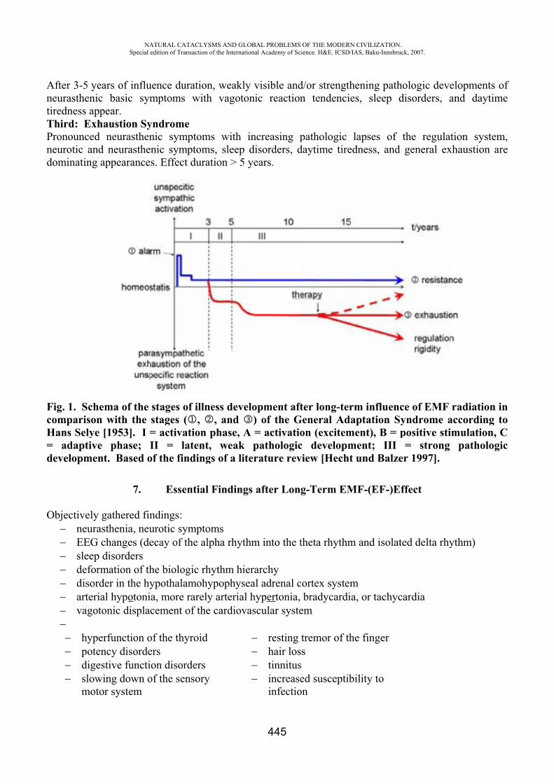
AntiTPnd
FcH=d
O
After 3-5 yeneurastheniciredness app
Third: ExhPronouncedneurotic anddominating
Fig. 1. SchecomparisonHans Selye= adaptivedevelopmen
Objectively neuraEEGsleepdeformdisordarterivagot
hypepotedigeslowmoto
NASpecial
ears of influc basic sympear.
haustion Syneurasthen
d neurastheappearance
ema of the n with the
[1953]. I =e phase; Int. Based o
7.
gathered finasthenia, neuchanges (dedisorders mation of thder in the hyal hypotonitonic displac
erfunction oency disordeestive functiwing down oor system
ATURAL CATACLedition of Transacti
uence duratimptoms w
yndromenic sympto
enic symptos. Effect du
stages of ilstages ( ,= activatioII = laten
of the findin
Essentia
ndings:urotic sympecay of the
he biologic ypothalamoa, more rarecement of th
of the thyroiers ion disorderof the senso
LYSMS AND GLOion of the Internatio
ion, weaklyith vagoton
oms with ioms, sleep duration > 5 y
llness devel, and
n phase, Ant, weak ngs of a lite
al Findings
ptoms alpha rhyth
rhythm hieohypophyseely arterial hhe cardiova
id
rsry
OBAL PROBLEMSonal Academy of Sc
445
y visible andnic reaction
ncreasing pdisorders, dyears.
lopment aft) of the G
A = activatiopathologic
erature rev
s after Lon
hm into the t
rarchy al adrenal chypertonia,
ascular syste
restinghair lostinnitusincreaseinfectio
OF THE MODERNcience. H&E. ICSD/
d/or strengthn tendenci
pathologic daytime tire
fter long-terGeneral Ad
on (excitemc developmview [Hecht
g-Term EM
theta rhythm
cortex system bradycardiem
tremor of thsssed susceptib
on
N CIVILIZATION/IAS, Baku-Innsbru
hening pathes, sleep d
lapses of edness, and
rm influencaptation S
ment), B = pment; III t und Balze
MF-(EF-)E
m and isolat
mia, or tachyc
he finger
bility to
.uck, 2007.
hologic devedisorders, a
the regulageneral ex
ce of EMF yndrome apositive sti= strong
er 1997].
ffect
ted delta rhy
cardia
elopments oand daytim
ation systemxhaustion ar
radiation iaccording timulation, C
pathologi
ythm)
ofme
m,re
intoCic
NATURAL CATACLYSMS AND GLOBAL PROBLEMS OF THE MODERN CIVILIZATION. Special edition of Transaction of the International Academy of Science. H&E. ICSD/IAS, Baku-Innsbruck, 2007.
446
Subjective Complaints:
exhaustion, lack of energy weakness of concentration daytime tiredness headaches quick tiring under stress lightheadedness
constriction of physical and mental ability concentration and memory decline night sweats spontaneously occurring excitability from hypotonic reaction situation, especially in the case of external pressures cardiac pain, heart racing
[Rubzowa 1983; Rakitin 1977; Drogitschina et al. 1966; Gordon 1966; Drogitschina und Sadtschikowa 1965, 1964; Piskunova und Abramowitsch-Poljakow 1961].
8. Factors That Can Influence the Development of an Illness through Athermal/Biologic, Non-Ionizing EMF Radiation
Duration of Influence: At the earliest, pathological appearances appear after ca. 3 years; duration of influence > 20 min. daily, 5x per week has no pathological consequences.
Age: Younger organisms show greater electromagnetic sensitivity than older ones; children especially must be protected.
Individual State of Health Electromagnetic Sensitivity: decreasing healthiness increasingly raises electromagnetic sensitivity
Status of the Elektrolyte/Mineral Balance: lack of minerals and toxic stress increases electromagnetic sensitivity
Additional stressor effects, e.g. noise, other radiations, conflicts, and stress, increase the risk to come down with microwave syndrome.
Active Ingredients and Medications: stimulants, e.g. caffeine, can increase electromagnetic sensitivity.
9. What Good Are Short-Term Research Projects?
The research projects of today’s cell phone, microwave, and telecommunication industry run for at most one year, very rarely two years. According to the state of knowledge shown, no harmful effect of the high-frequency electromagnetic radiation can be established at all. How the factor of the duration of influence is handled in these research projects should be explained with an example of a BUWAL study (BUWAL = Switzerland’s Department of the Environment).
The findings of a table of scientific works regarding the investigation of the duration of effect of high-frequency microwave radiations on various function systems or states of health, which one of us extracted and compiled from the tables of the BUWAL document, shows that among 129 analyzed scientific works or studies, an immediate effect (up to 1 h) was investigated in 44% of them. The duration of effect was tested for the short-term (up to three days) in 22.5% of them and for the middle-term (3-30 days) in 11% of them. Only 22.5% investigated the duration of effect of high-frequency microwaves longer than a month.
It must be added that cardiovascular, hormone system, and immune system symptoms of radio-wave or microwave sickness are cited in the BUWAL documentation in the form of headaches, sleep
NATURAL CATACLYSMS AND GLOBAL PROBLEMS OF THE MODERN CIVILIZATION. Special edition of Transaction of the International Academy of Science. H&E. ICSD/IAS, Baku-Innsbruck, 2007.
447
disorders, general condition, EEG changes, and information processing, which the authors could not explain with their one-sided conceptions of the thermal effects of high-frequency electromagnetic radiation.
With such erroneous research approaches, of course no health-damaging effect can be found. Such research projects are also completely unnecessary, because the athermal, health-damaging effect of high-frequency electromagnetic radiation has been known for 75 years and has been confirmed again and again during this time in more than a thousand investigations, whenever serious principles of research were guaranteed.
10. The Following Definitions Are Cited For Better Understanding of the Effect of High-Frequency Electromagnetic Radiation on People and Corresponding Interpretations.
10.1 Health Definitions Various views have existed about the term “health” for 60 years. Conventional medicine defines health as the exemption from organic, verifiable sicknesses. Such a definition does not correspond to the realities. The so-called “functional syndrome” or somatoform disorders (ICD 10F) are not accounted for in it. In the founding preamble of WHO, health is defined as follows: “Health is the condition of the complete physical, mental, and social well-being and not the exemption from sicknesses and ailments.” In the Ottawa Charter of 1986, this definition was extended as follows: Health is to be understood “as a satisfactory measure of functional capability in physical, mental, social, and economic regards and the ability to take care of oneself until an old age” [WHO 1987].
10.2 Bioactive Effect and Health Damage The terms health damage, bioactive effect, or bioactive reaction are frequently used without being sharply delimited from one another, thus leading to confusion. Therefore, a short definition for clarification:A bioactive effect is mostly an unspecific reaction of the organism to outside influences of various natures (physical, chemical, social, bacterial, viral). It must be differentiated:
if this reaction is temporary and the homeostasis (norm) recuperates through a reversible transient effect; that is an individual’s normal adaptation reaction, or if the changed reaction remained temporarily (e.g. several days) and then “normalized” again through a reversible transient effect. That would be equivalent to a health disorder in which the foreign influence was effective as a trigger, or if the triggered changed reaction involves problems, losses of abilities to do things, and quality of life for the long-term and is not reversible. That is damage to one’s health.
Under health damage, we thus understand enduring or intermittent irreversible changes of the physical, mental, and social functional capability of the person, which can arise from noxious influence developed over the short-term or long-term, or also from intense, short-term influences (e.g. shock). (Noxa = pollutants, harmful agents, pathogenic causes)
11. Animals and Plants are Also in Danger
Animals and plants are also very negatively influenced by this high-frequency electromagnetic radiation. In the case of cows, reduction of the milk yield and malformed offspring have been proven. Graver for humankind could be the death of bees observed everywhere due to the electro-smog contaminated environment. When the bees are dead, people not only have no more honey, but also no
NATURAL CATACLYSMS AND GLOBAL PROBLEMS OF THE MODERN CIVILIZATION. Special edition of Transaction of the International Academy of Science. H&E. ICSD/IAS, Baku-Innsbruck, 2007.
448
more fruit, because pollination of the flowers is impossible without bees. Humankind stands today before an important decision: further development of the technogenic pollution of the environment or finding our way back to Nature.
Let us remember the report of the Club of Rome [1983] in which there is the following statement: “The pressure of the facts is so great that we must either change our way-of-life or disappear from the face of the Earth.”
REFERENCES1. www.hese-projekt.org
COMPARATIVE ANALYSIS OF LONGEVITY INDEX BETWEEN THE NORTHWESTERN REGION, LOCATED IN THE AZERI MAJOR CAUCASUS AND THE TALYSH
MOUNTAINS AND THE SOUTHERN REGION.
Ch.Y. Gasymov*, S.I. Huseynova**
Institute of Physiology named after A.I.Garayev under the National Academy of Sciences of the Republic of Azerbaijan
Summary
The studies on the state of longevity index have been carried out in Ismayilli, Gabala, Shaki, Gakh and Zagatala regions of north-western Azerbaijan.
The findings have evidenced that longevities of 100 years and over could rarely be found in the regions of Major Caucasus as compared with those in the Talysh Mountains (101-122 years old).
As the problems of health and active longevity in elderly people is complex, it reflects the social, economic, psychological, medical and biological components. These problems require complex gerontological researches for studying the physiological and pathological processes in the aging organism. At the further stages it helps provide medical and social aide to elderly people. Therefore, the exploration of the influence of important changes and events, which occurred in the last 20 days, on the longevity index in various regions of Azerbaijan is important. The results of researches, conducted in the southern region of the country, help express specific views on the long-livers, residing in the Talysh mountains.
The registration of long-livers in the Talysh Mountains and piedmont regions showed that the longevity index is higher in Lerik (0.26) and Yardymly (0.2). Among the long-livers, residing in this region, as compared to the northwestern regions, the number of long-livers, who reached the age of 100, makes up 30-35% of all residents. Vision impairment has been observed in most of the people. This mainly includes retina dystrophy and cataract. The blood pressure of long-livers in this region was found at 140/78-155/86, and pulse-79-86 beats per minute. The most common diseases in this region include the diseases of digestive system and neoplasm. The verification of long-livers, residing in the south region, shows that the number of long-livers of over 100 years of age made up 10 people, in Lerik 28 people, in Lenkoran 20 people, in Astara 3 people, in Masalli 11 people and in Jelilabad 10 people
NATURAL CATACLYSMS AND GLOBAL PROBLEMS OF THE MODERN CIVILIZATION. Special edition of Transaction of the International Academy of Science. H&E. ICSD/IAS, Baku-Innsbruck, 2007.
449
Therefore, the registration of long-livers, residing in the northwestern region of Azerbaijan in the Major Caucasus and of a number of physiological indicators (arterial pressure, pulse, overall state of the body and memory) is more important for the comparative analysis of researches of the previous years.
An expertise was organized in Ismayilli, Gebele, Sheki, Qakh and Zagatala for registration of long-livers and studying influence of the ecological environment on longevity in 2005. The analyzed regions locate in the Major Caucasus at a height of 1100-1400 meters above the sea.
In order to verify the age of the long-livers, the main events, which occurred in the region in the beginning of the 20th century and birthday of the first children were taken as a basis. The arterial pressure and pulse was taken as a basis for definition of biological age.
Ismayilli locates at a height of 1200 meters above the sea. The population is 76740 people, including 36870 men and 39870 women. The recent census enumeration shows that the number of persons over 90 years of age totals 177 and over 100 years of age - 27 persons. The Gushence village was taken as a pilot area for verification of these figures. The village population is 5,000 persons. The researches showed that of 14 residents of the village of over 90 years of age only 5 persons can be considered real long-livers. Among them only 1 person Keremov Gafar reached the age of 100, according to the verification. He sees and hears well. The heart beats make up 72 per minute, blood pressure is 140/80. He is very energetic, has a good memory and clear consciousness. According to the ambulatory researches of the village, the most common diseases among the population include hepatitis-liver cirrhosis, tuberculosis, cardiovascular diseases. Few diabetes cases were revealed among the village residents. The polls, regarding the food of the long-livers showed that sumakh and bakmaz, which are mainly prepared in this village, are more frequently used.
Gebele locates at a height of 1200 meters above the sea. The population makes up 90000 people. 58 people of over 90 years of age were registered in Gebele. The Vendam district was chosen as a pilot area for verification. The population is 8,335 persons (Azerbaijanis prevailing).
9 persons of over 90 years of age were registered. The verification showed that only 3 out of 9 can be considered long-livers. Only one of them-Suleyman Demirov reached the age of 100. He is an imam of the village mosque. By his physiological state, he sees and hears well, has a good memory and clear consciousness. The number of heartbeats in a minute makes up 70, blood pressure 150/70.
According to the ambulatory registration in the Vendam district, the most common diseases among the population includes circulatory and myocardial failure (first place), respiratory failure (tuberculosis) and neoplasm. On the whole, the death rate made up 46 people in the district in 2004. The main cause of death included neoplasm, circulatory diseases, nervous system diseases and respiratory diseases.
The study was also staged in the Soltanmukha village of Gebele. The population is 4,320 persons. The village is located near the Gebele radar station. In this village, 4 persons are over 90 years of age, with the verification figures coinciding with official registration on only two of them. Abdulgadir Rzayev and Seyyare Aliyeva of over 90 years of age have good vision, but impaired hearing abilities. The per minute heartbeats of Rzayev Abdulgadir make up 85 and blood pressure 140/75, he has a good memory and clear consciousness. He is lezguin.
In 2004 the death rate in the village was 16 persons, with 7 of 70-92 years of age, 2 of over 90 years of age, 4 of 50-70 years of age and 3 of up to 1 year of age.. The main cause for death included cardiac failure7, infarct-5, hypertension-3, circulatory diseases-1.
On the whole, according to the statistical data on Gebele, the death rate within the last 10 years made up 615-700 people.
Sheki locates at a height of 1,000-1,100 meters above the sea. The flat area of the region is at a height of 600 meters. The population makes up 150,000 people. 75 people of over 90 years of age are
NATURAL CATACLYSMS AND GLOBAL PROBLEMS OF THE MODERN CIVILIZATION. Special edition of Transaction of the International Academy of Science. H&E. ICSD/IAS, Baku-Innsbruck, 2007.
450
registered in the region. The researches were held in Bash Zeyzid, Kish and Sheki in order to verify the said figures.
The population of Bash Zeyzid makes up 16,350 people. The verification showed that the official indicators of 4 out of 5 people of over 90 years of age coincide with the verification. Only 1 of the analyzed long-livers Sedaye Rahimova (91 years old) has good vision and hearing ability. The per minute number of heartbeats makes up 77 and blood pressure 150/70. According to the ambulatory research, conducted in the village, the most common diseases among the population include anemia (80%), high blood pressure and neoplasm. Anemia is also widely spread in Qakh and Zagatala. The death rate was at 48 in 2004. The main cause of death included anemia - 32 persons, cancer - 7 persons, diseases of nervous system - 8 persons, tuberculosis 1 person and cardiovascular diseases -1 person.
Kish is located at the height of 1,300 meters and has a population of 6,900 people with Azerbaijanis and lezgiuns prevailing. The most ancient Albanian church locates in there.
4 people of over 90 years of age were registered in the village. Verification showed that only 2 of them can be considered long-livers (Azadova Senuber born 1914, Aslanova Gulsum born 1915). Both of them see well and hear badly and have a good memory. Azadova Senuber’s per minute number of heartbeats makes up 60, blood pressure 128/64. Aslanova Gulsum -74 per minute, 140/70. It was verified that only 1 out of 4 long-livers, registered in Sheki, is 100 years of age (Kerimova Nazila). She is totally blind and hears badly, her blood pressure is constantly high. Sheki is among the iodine deficient regions. Yet, anemia is also widely spread, along with endocrine diseases. In 2004 the number of people who died of blood and circulatory disease made up 587, neoplasm 177, nervous system diseases 44, endocrine diseases 18.
Qakh is located at the altitude of 1,250-1,400 meters and has a population of 52,500 people. 35 people of over 90 years of age are registered in this region. The Lekit village is selected a pilot area for the longevity verification. The representation of the
region registered 9 persons of over 90 years of age. The official figures and verification indicators coincide only on 4 of them. Only 1 man Mamed Jabbarov hears well and is blind, yet has a good memory and clear consciousness. He is mogul by nationality. Another 3 people (Mamedova Khanperi, 1915, Sakhur; Gahramanova Gulperi, 1915, Sakhur; Musayeva Fatma, 1910, Avar) see and hear well, are energetic and have a good memory. The most interesting fact is that all these long-livers had a high pressure and the number of heartbeats in a minute made up 87-100.
The most common diseases among the population of Qakh include blood and circulatory diseases, anemia, hypertension, endocrine diseases. In 2004 the death rate made up 383 people with 285 people died at the age of 65. 239 people died of blood and circulatory diseases. The medical information, obtained for Zagatala, showed that growth dynamics of the spread of blood and hematopoietic diseases (anemia) among the population rises each year. In 1994 this indicator equaled 300 persons, while in 2004 - 967 persons. This factor causes early aging and life abridgment. The state becomes clearer, considering that the population of the region makes up 110,000 people and the diseases is more widely spread among the people of 24-43 years of age.
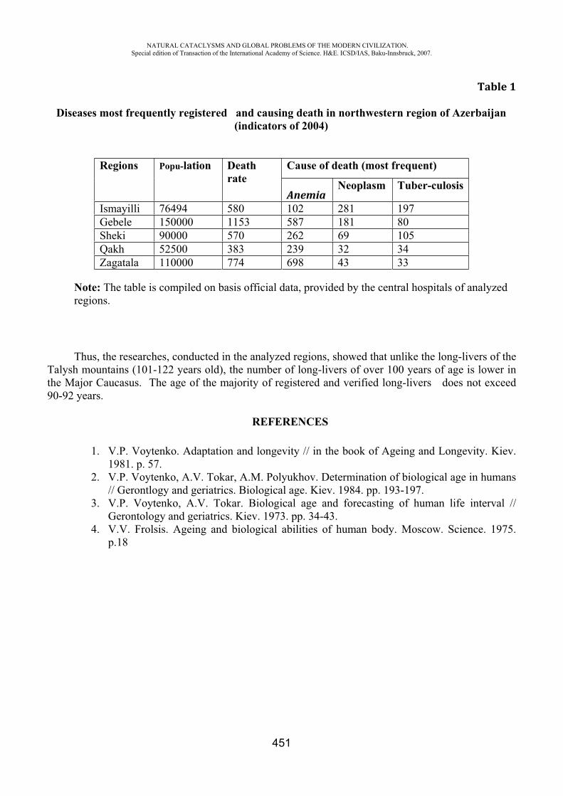
NATURAL CATACLYSMS AND GLOBAL PROBLEMS OF THE MODERN CIVILIZATION. Special edition of Transaction of the International Academy of Science. H&E. ICSD/IAS, Baku-Innsbruck, 2007.
451
Table 1
Diseases most frequently registered and causing death in northwestern region of Azerbaijan (indicators of 2004)
Regions Popu-lation Deathrate
Cause of death (most frequent)
AnemiaNeoplasm Tuber-culosis
Ismayilli 76494 580 102 281 197 Gebele 150000 1153 587 181 80 Sheki 90000 570 262 69 105 Qakh 52500 383 239 32 34 Zagatala 110000 774 698 43 33
Note: The table is compiled on basis official data, provided by the central hospitals of analyzed regions.
Thus, the researches, conducted in the analyzed regions, showed that unlike the long-livers of the Talysh mountains (101-122 years old), the number of long-livers of over 100 years of age is lower in the Major Caucasus. The age of the majority of registered and verified long-livers does not exceed 90-92 years.
REFERENCES
1. V.P. Voytenko. Adaptation and longevity // in the book of Ageing and Longevity. Kiev. 1981. p. 57.
2. V.P. Voytenko, A.V. Tokar, A.M. Polyukhov. Determination of biological age in humans // Gerontlogy and geriatrics. Biological age. Kiev. 1984. pp. 193-197.
3. V.P. Voytenko, A.V. Tokar. Biological age and forecasting of human life interval // Gerontology and geriatrics. Kiev. 1973. pp. 34-43.
4. V.V. Frolsis. Ageing and biological abilities of human body. Moscow. Science. 1975. p.18
NATURAL CATACLYSMS AND GLOBAL PROBLEMS OF THE MODERN CIVILIZATION. Special edition of Transaction of the International Academy of Science. H&E. ICSD/IAS, Baku-Innsbruck, 2007.
452
CAN CHRONOMICS HELP BUILD A UNIFIED SCIENCE?
Cornélissen G.*, Halberg F.*, Khalilov E.‡, Hillman D.*, Wendt H.W.*, Nolley E.S.•, Beaty L.A.•, Schwartzkopff O.*, Holte J.*, Otsuka K.¶ and Singh R.B.
*University of Minnesota, Minneapolis, MN, USA, [email protected], [email protected], ‡InterGeo-Tethys, International Scientific and Technical Complex, Baku, Azerbaijan
•Phoenix Group, Institute of Electrical and Electronics Engineers, Minneapolis, MN, USA ¶Tokyo Women's Medical University, Medical Center East, Tokyo, Japan
Halberg Hospital and Research Institute, Moradabad, India
Aim. Associations between biological and environmental variables are sought by examining their time structure for any congruence between their respective spectral components (with overlapping or overlying uncertainty estimates of their periods) and by following the time course of their characteristics to check for any coincidental changes by a remove-and-replace approach (the subtraction and addition of a given environmental spectral component happening naturally). To look on that basis, when opportunity arises, for any associated time-varying biological and environmental changes by a subtraction-addition (removal and preferably also replacement of a given environmental spectral component) approach done by the sun.
Background. With pertinence to Walter Kofler's extended view of health and ecology (1), differential congruence has been found among the cyclic components of biomedical and related time structures (also consisting of trends and of deterministic and other chaos) and a variety of helioseismic, heliomagnetic, solar-wind-related and geomagnetic variables and further, as here reported, between cycles in solar UV irradiation (2) vs. the Hale cycle of sunspot bipolarity and vs. putative cycles in the gravitational constant (3).
Method. Data of the gravitational constant G, covering the span from 1985 to 2000, from the web of the World Data Center for Solid Earth Physics (HTP table) were analyzed by methods described elsewhere (4-6), along with the original data averaged over consecutive years by one of us (EK). Results are aligned with those of solar UV irradiation from 1893 to 2002 recorded in Potsdam, Germany, as modeled by an artificial neural network, in a publication by Junk et al. (2).
Results. Components with periods of about 5.7 and 2.2 years were found to characterize G, Table 1, with particular emphasis on the detail in a footnote to this table. The major results, however, concern solar UV radiation, focusing on the reconstruction from meta-analyzed records of the daily UV-A (315-400 nm) and erythemal UV irradiation (ER), and their anomalies (A) (2), Table 2. A linear analysis reveals for all 4 highly correlated variables (UV-A, ER, and the % of anomalies of each; see 2) a spectral peak at the same frequency of one cycle in 20.4 years, extensively documented in biomedicine and ecology (7) as quasi-ubiquitous signatures of the Hale cycle in sunspot bipolarity. The circadecadal component is statistically significant in 2 cases and of borderline statistical significance in the other 2 series (P values for ER [A], ER, UV-A [A], and UV-A are 0.040, 0.064, 0.053, and 0.048, respectively, not corrected for multiple testing). A major component, also seen in all 4 variables has a common period of 5.85 years (P-values of 0.006, 0.022, 0.009, and 0.012). Two other components are seen for all variables, with periods of about 3.6 and 3.2 years. With the qualification that the 4 variables do not constitute independent data series, combined statistical estimation for data from all 4 variables at each of the 4 common trial periods detected in the frequency range of one cycle in 23 years to one cycle in 3.1 years (30 independent tests) yields P-values adjusted for multiple testing according to Bonferroni of 0.072, <0.001, 0.006 and 0.035 for the about 20.4-, 5.9-, 3.6- and 3.2-year components, respectively, but the reader is invited to view the separate results in view of the
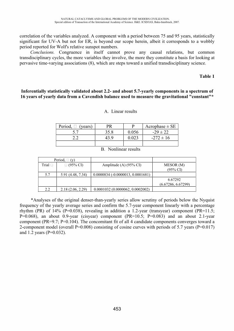
NATURAL CATACLYSMS AND GLOBAL PROBLEMS OF THE MODERN CIVILIZATION. Special edition of Transaction of the International Academy of Science. H&E. ICSD/IAS, Baku-Innsbruck, 2007.
453
correlation of the variables analyzed. A component with a period between 75 and 95 years, statistically significant for UV-A but not for ER, is beyond our scope herein, albeit it corresponds to a wobbly period reported for Wolf's relative sunspot numbers.
Conclusions. Congruence in itself cannot prove any causal relations, but common transdisciplinary cycles, the more variables they involve, the more they constitute a basis for looking at pervasive time-varying associations (8), which are steps toward a unified transdisciplinary science.
Table 1
Inferentially statistically validated about 2.2- and about 5.7-yearly components in a spectrum of 16 years of yearly data from a Cavendish balance used to measure the gravitational "constant"*
A. Linear results
Period, � (years) PR P Acrophase ± SE 5.7 35.8 0.056 -29 ± 22 2.2 43.9 0.023 -272 ± 16
B. Nonlinear results
Period, � (y) Trial � � (95% CI) Amplitude (A) (95% CI) MESOR (M)
(95% CI) 5.7 5.91 (4.48, 7.34) 0.0000834 (-0.0000013, 0.0001681)
6.67292 (6.67286, 6.67299)
2.2 2.18 (2.06, 2.29) 0.0001032 (0.0000062, 0.0002002)
*Analyses of the original denser-than-yearly series allow scrutiny of periods below the Nyquist frequency of the yearly average series and confirm the 5.7-year component linearly with a percentage rhythm (PR) of 14% (P=0.038), revealing in addition a 1.2-year (transyear) component (PR=11.5; P=0.068), an about 0.9-year (cisyear) component (PR=10.5; P=0.083) and an about 2.1-year component (PR=9.7; P=0.104). The concomitant fit of all 4 candidate components converges toward a 2-component model (overall P=0.008) consisting of cosine curves with periods of 5.7 years (P=0.017) and 1.2 years (P=0.032).
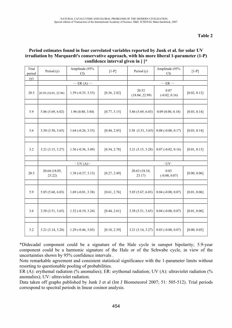
NATURAL CATACLYSMS AND GLOBAL PROBLEMS OF THE MODERN CIVILIZATION. Special edition of Transaction of the International Academy of Science. H&E. ICSD/IAS, Baku-Innsbruck, 2007.
454
Table 2
Period estimates found in four correlated variables reported by Junk et al. for solar UV irradiation by Marquardt's conservative approach, with his more liberal 1-parameter (1-P)
confidence interval given in [ ]* Trial
periodPeriod (y)
Amplitude (95% CI)
[1-P] Period (y) Amplitude (95%
CI)[1-P]
(y) ···· ER (A) ···· ···· ER ····
20.5 20.50 (18.03, 22.96) 1.59 (-0.35, 3.53) [0.36, 2.82] 20.52
(18.04, 22.99)0.07
(-0.02, 0.16) [0.02, 0.13]
5.9 5.86 (5.69, 6.02) 1.96 (0.80, 3.84) [0.77, 3.15] 5.86 (5.69, 6.03) 0.09 (0.00, 0.18) [0.03, 0.14]
3.6 3.58 (3.50, 3.65) 1.64 (-0.26, 3.55) [0.44, 2.85] 3.58 (3.51, 3.65) 0.08 (-0.00, 0.17) [0.03, 0.14]
3.2 3.21 (3.15, 3.27) 1.56 (-0.36, 3.49) [0.34, 2.78] 3.21 (3.15, 3.28) 0.07 (-0.02, 0.16) [0.01, 0.13]
·· UV (A)··· · UV·
20.5 20.64 (18.05,
23.22)1.38 (-0.37, 3.13) [0.27, 2.49]
20.63 (18.10, 23.17)
0.03 (-0.00, 0.07)
[0.00, 0.06]
5.9 5.85 (5.68, 6.03) 1.69 (-0.01, 3.38) [0.61, 2.76] 5.85 (5.67, 6.03) 0.04 (-0.00, 0.07) [0.01, 0.06]
3.6 3.58 (3.51, 3.65) 1.52 (-0.19, 3.24) [0.44, 2.61] 3.58 (3.51, 3.65) 0.04 (-0.00, 0.07) [0.01, 0.06]
3.2 3.21 (3.14, 3.28) 1.29 (-0.46, 3.03) [0.18, 2.39] 3.21 (3.14, 3.27) 0.03 (-0.00, 0.07) [0.00, 0.05]
*Didecadal component could be a signature of the Hale cycle in sunspot bipolarity; 5.9-year component could be a harmonic signature of the Hale or of the Schwabe cycle, in view of the uncertainties shown by 95% confidence intervals . Note remarkable agreement and consistent statistical significance with the 1-parameter limits without resorting to questionable pooling of probabilities. ER (A): erythemal radiation (% anomalies); ER: erythemal radiation; UV (A): ultraviolet radiation (% anomalies); UV: ultraviolet radiation. Data taken off graphs published by Junk J et al (Int J Biometeorol 2007; 51: 505-512). Trial periods correspond to spectral periods in linear cosinor analysis.
NATURAL CATACLYSMS AND GLOBAL PROBLEMS OF THE MODERN CIVILIZATION. Special edition of Transaction of the International Academy of Science. H&E. ICSD/IAS, Baku-Innsbruck, 2007.
455
REFERENCES
1. Kofler WW. The need on a "critical extended evolution related view" of reality as a basis for an "extended view" of health. Science without Borders, Transactions of the International Academy of Science H&E, 2003/2004; 1: 27-54.
2. Junk J, Feister U, Helbig A. Reconstruction of daily solar UV irradiation from 1893 to 2002 in Potsdam, Germany. Int J Biometeorol 2007; 51: 505-512.
3. International Council for Scientific Development, International Academy of Science (Kerimov MK, Kofler W, honorary chairmen), Azerbaijan National Academy of Science, N. Tusi Shamakhy Astrophysical Observatory. Proceedings "Cyclicity and Cosmological Problems" (2-4 May 2003, Pirgulu, Y. Mamedaliyev Settlement, Azerbaijan Republic). Baku: Ojag; 2003. 225 pp.
4. Halberg F. Chronobiology: methodological problems. Acta med rom 1980; 18: 399-440.
5. Cornélissen G, Halberg F. Chronomedicine. In: Armitage P, Colton T, editors. Encyclopedia of Biostatistics, 2nd ed. Chichester, UK: John Wiley & Sons Ltd; 2005. p. 796-812.
6. Refinetti R, Cornélissen G, Halberg F. Procedures for numerical analysis of circadian rhythms. Biological Rhythm Research 2007; 38 (4): 275-325. http://dx.doi.org/10.1080/09291010600903692.
7. Halberg F, Cornélissen G, Schack B, Wendt HW, Minne H, Sothern RB, Watanabe Y, Katinas G, Otsuka K, Bakken EE. Blood pressure self-surveillance for health also reflects 1.3-year Richardson solar wind variation: spin-off from chronomics. Biomedicine & Pharmacotherapy 2003; 57 (Suppl 1): 58s-76s.
8. Halberg F, Cornélissen G, Bingham C, Witte H, Ribary U, Hesse W, Petsche H, Engebretson M, Geissler H-G, Weiss S, Klimesch W, Rappelsberger P, Katinas G, Schwartzkopff O. Chronomics: Imaging in time by phase synchronization reveals wide spectral-biospheric resonances beyond short rhythms. ("Wenn man über kurze Rhythmen hinausgeht") In memoriam – lost future: Dr.-Ing. habil. Dr. rer. nat. Barbara Schack: 1952-2003. Neuroendocrinol Lett 2003; 24: 355-380.
NATURAL CATACLYSMS AND GLOBAL PROBLEMS OF THE MODERN CIVILIZATION. Special edition of Transaction of the International Academy of Science. H&E. ICSD/IAS, Baku-Innsbruck, 2007.
456
INNOVATIVE MEDICAL MICROPROCESSOR TECHNOLOGIES FOR THE CONTROL OF HEALTH OVER NORMAL AND EXTREME CONDITIONS OF A LIFE
Yumatov E.A.
I.M. Sechenov Moscow Medical Academy. Moscow. Russia. [email protected]
Nowadays most of people suffer from great psycho-emotional tension which is a risk-factor for a lot of vital dysfunction (Sudakov K.V. at al, 1991). A man, concentrated as a rule on his social behavioral activity, is unable objectively to control the state of his vital physiological functions. Therefore on the background of full wellbeing a man can become a victim of acute heart attack or brain dysfunction that can lead to sudden death. Untimely medical help is a fatal factor which often becomes the cause of death.
We know many tragic examples, when a person suddenly dies from cardiovascular or others acute disorders. The modern health protection has wide possibilities of using diagnostic and medical methods. However in many cases because of the whole number of famous objective and visual problems, these possibilities are not timely.
Referred to the life experience, a prophylaxis of health protection on practice is not always consummated and claimed by the people. In most cases the person is not able to make self-control of internal essential functions and timely react on emergent violations in the organism, because of the seriously- concentrated social activity. As a rule, the first signal of calling to a doctor or taking a medicine is a pain appearance or an ill-being. It is well known that the serious violations of physiological functions can develop suddenly; and ill-being appears mostly much after the first objective signs of disorders in human vital functions.
Unfortunately, we may conclude that impropriate medical help is that fatal factor, which carries away many human life, and the biggest achievements of medicine actually remain without realization. To use a potential of the modern medicine means to create conditions for a timely detection of the disorders in human essential functions. For an effective prophylaxis we need to realize a control of physiological functions in real everyday life and also to give an opportunity to the person to get informational signal about the first signs of objective violations in essential functions, which must be a stimulus for calling to a doctor or taking the necessary measures.
The mankind has invented a lot of technical and electronic devices to monitor the work of industries and their production: cars, planes ships, power stations and so on, when the most vital functions of man: operators, drivers, pilots, sportsmen, dispatchers, businessmen, politicians and especially sick persons are out of physiological control and protective signaling.
To make a decision of current important medical social problem - that is to prevent disturbances in human vital functions in real everyday life and well-timed rendering of medical help it was suggested a new direction in a medicine named “Informational medicine” (Yumatov E.A., 2001, 2006), the purpose is an objective control and protective signalization about the disorders in vital functions in real life conditions.
Life preservation and people health are possible only on the basis of development and creation of the new medical technologies for evaluation and discovery of the first objective disorders in vital essential functions in real life.
At present a new concept of medical instrument making for protection of human health and life in every-days-life and at work («Guards of Health») has been developed (E.A.Yumatov, 1993-2006). Now a number of original instruments has been devised, patented in Russia and are under production.
NATURAL CATACLYSMS AND GLOBAL PROBLEMS OF THE MODERN CIVILIZATION. Special edition of Transaction of the International Academy of Science. H&E. ICSD/IAS, Baku-Innsbruck, 2007.
457
«Heart Guard System (S.O.S.)», «Physiological Clock», «Stress Dosator» and others are designed for individual continuous control giving alarm when first objective signs of disorders in vital physiological functions appear during day-time or sleep at night, at home, at work, in transport. A warning signal will make it possible and timely to take some reasonable actions to normalize a disordered physiological parameter and so to prevent further development of a serious dysfunction.
The devices boast the following: 1) they give timely signals about the first signs of disturbances in vital functions (alarm-security system); 2) they can be used in daily life and work conditions and intended for every one; 3) they provide personal programming with due regard for the individual characteristics of physiological malfunctions; 4) they signal about physiological parameters that drop out of the individual norm; 5) they include physiological feedback; 6) microprocessor computer technology is based on large integrated circuits, which makes it portable and convenient for daily use.
According to the developed apparatus, organism essential functions, inaccessible in everyday life for self-control, transform to the category of controllable and perceptible processes.
With deviation of physiological function from the assigned individual “standard” there appears an preventive signal, which allows the person timely to make series of the expedient actions – that is to consult a doctor, take the prescribed medicine, reduce a psycho-emotion and physical loading and in this way to prevent further development of serious violations.
There is no question that this apparatus will enter into practice of health protection as supreme and necessary method for life and health preservation, prophylaxes of disorderes in essential functions in daily life.
“Heart Guard System – S.O.S-” - a device for continuous monitoring of heart activity.A device for prophylactics of disorders in heart activity: makes a continuous control of heart
rhythm and reveals the first objective signs of rhythm disturbance, makes personal programming of individually permissible parameters of heart rate, gives warning signals when disorders in heart rhythm appear, enables timely to take measures (to take medicine, to visit a doctor, to reduce a psychoemotional tension etc.).
It is intended for:
Healthy people- under extreme working and ecological conditions - for sportsmen to control functional state and the level of loads - for drivers, pilots to prevent accidents under sudden dysfunction of heart - for everyone to selfcontrol psychoemotional state or any discomfort, especially for those over
30;Sick people, predisposed to heart rhythm disorders:
- with arrhythmia, cardiosclerosis, stenocardia - after infarction, fibrillation
Informational system for a daily, objective control of rational nutrition. The rational nutrition being necessary for the needs of living organism provision in the nutrients,
salts, vitamins, micro-elements, is an important social problem, which touches the population culture, traditions, material well-being, health and possibility of objective daily control of volume and nutrition character.
Most people consume more food than needed, they don’t have a balance in the feeding for the main food components and organism power inputs, many suffer obesity.
At the same time the most part of the people have malnutrition, they regularly donot get full nutrition, which results in dystrophy and emaciation. Traditionally when food orientation is based on
NATURAL CATACLYSMS AND GLOBAL PROBLEMS OF THE MODERN CIVILIZATION. Special edition of Transaction of the International Academy of Science. H&E. ICSD/IAS, Baku-Innsbruck, 2007.
458
subjectively - tasted estimates of individual types of taken food products it` s just impossible to reach a right-balanced individual nutrition of main food components and control the level of efficiency, adequacy or redundancy of taken food.
As a result of improper feeding there arises a whole complex of diseases such as cardiovascular, atherosclerotic, psychosomatic and others, and also appears disorders in vital physiological functions. Therefore to solve an important complex of medico-social problems for population health and rational utilization of feeding resources it is needed a daily and objective control of feeding components taken by people organism. The purpose of the present project is a development and creation of the informational calculating system on basis of electronic microprocessor equipment a “PALM” type and PC for an individual objective evaluation and control of rational nutrition in daily life; and conduction of complex clinical-physiological researches for the optimal nutrition. This development can have the biggest practical meaning for providing a balanced feeding with main feeding components and timely prevention (that is protection signalization) about insufficiency or superfluity of overall quantity of taken food and its separate components.
«Physiological Clock» - instrument development of sleep controlling and objective investigation of its phase structure in natural home conditions of healthy and sick people.
Sleep is one of the main health components and on its quality depends as follows: intellectual, emotional, physical organism conditions, capacity for work, tiredness and others. However according to statistics the most part of adult population suffer from different sleep violations. In most cases these disorders are stimulated by an emotional stress.
Normal physiological sleep is the main anti-stress factor, which determines a psycho-emotional person condition, capacity for work, tiredness, etc. At the same time the emotional stress is one of the main reasons of different sleep violations. Under emotional stress a vicious circle appears: stress-provoked sleep violations become supplementary provocative factor, intensifying the stress itself being an original reason for sleep violation.
So, there is a real medico-social problem, combining all components of social-public environment, psycho-emotional people condition, and sleep violations induced by stress.
To normalize a sleep means to defend a human organism from stress, to improve a psycho-emotional state, to increase a capacity for work and study, to reduce a risk of acute cardiovascular and others comate-vegetative violations.
The normal physiological sleep is characterized by a number of consecutively changeable each others phases. At present investigations of sleep violations are carried out in clinics, hospitals with use of modern complex, polysomnological observation, including psychological and psychomotor tests, a registration of the night sleep phase structure and vegetative functions.
Most researches show correlation between a psycho-emotional, a characterological person status, the level of emotional tension, a cycle of “sleep-vigilance” and “quality” of the night sleep, its phase structure. Individual peculiarities of phase sleep structure, connected with predisposition and development of different diseases such as neurotic, cardiovascular, gastro-enteric and others were revealed.
Taking into account medico-social meaning and the biggest achievements of the modern (somnology) nevertheless unfortunately there remain important gaps in sleep studying and its violations stipulated by methodological conditions of research.
First, sleep research of healthy and sick people are carried out in clinics, in unusual for a patient situation. Many people in unusual conditions have problems in getting to sleep; and their sleep during night can break off frequently and considerably differs from usual sleep at home.
Secondly, when the person is in a hospital, he finds himself thrown out from habitual life All that cannot but effect the person and his sleep. Therefore, studying and observing sleep in such
NATURAL CATACLYSMS AND GLOBAL PROBLEMS OF THE MODERN CIVILIZATION. Special edition of Transaction of the International Academy of Science. H&E. ICSD/IAS, Baku-Innsbruck, 2007.
459
conditions, a doctor can not be sure, that it is the same sleep, which a patient would have in natural daily and home conditions. In addition, the clinic sleep inspection, as a rule, is a short-term, taking only the several nights, during which it is not possible to see a full “picture” of natural night sleep.
Thirdly, in a clinic for a sleep evaluation and its phase structure specialists use a complex, polygraph registration method of physiological index and the patient is to be connected with many sensors.
Fourthly, with diagnostics of sleep violations, a doctor estimates from a visual evaluation and the patient complaints. The doctor can not see a real “picture” of the person sleep in his everyday life. Also by prescription medicine, the doctor can not give an objective evaluation of the medicine effectiveness by natural home sleep character and must decide only from visual patient’s feelings.
So, at present practically there is no person’s sleep research at home. There is no opportunity of objective sleep control in everyday life situation. The doctor is not possible to find out and prescribe an effective medicine for sleep normalization and can not monitor medicine reaction in home sleep natural conditions.
The present classic methodology, the criteria and a classification of sleep phase structure are oriented only on clinical, stationary usage. The complex methods of comnological inspection and registration of sleep phase are cumbersome and not comfortable for application in daily night sleep and, therefore they can not be used in home conditions.
According to the point, the criteria, by which we discover and analyze different phases of night sleep under stationary inspection can not be used at home conditions in full measure.
For objective control of human state of sleep in real life a patented method and a micro-processed device which allows to record and analyze sleep structures at home and in clinic and to wake up a person at an individually chosen, fixed sleep phase, optimal for a psycho-emotional state has been developed (E.A. Yumatov, 1993). The method is based on uninterrupted recording of EEG and electro-oculargram (EOG) during night sleep, on recognition of sleep phases according to developed criteria and on automatic switch on of a sound awakening signal at a fixed time and at the moment of appearance of individually chosen sleep phase.
To realize the described method a portable electronic device “Physiological Clock” has been developed, where along with the time, the advanced programming of a chosen sleep phase is provided. During night sleep the device fixes and remembers in time all sleep phases, which can be looked through by the physician.
Using this device every person can choose for himself, with different factors in mind, a definite phase of sleep preferred for awakening and then on the ground of subjective self-estimation and objective psychophysiological analysis of functions to check the correctness of the chosen for awakening sleep phase.
The miniature instrument in the form of a pen for a daily control and measuring of human arterial pressure.
Million people, which suffer from cardiovascular diseases and, in particular, hypertension, are inneed of a permanent daily control of arterial pressure.
Among the cardiovascular diseases arterial hypertension is widely spread in population. Hypertensive crisis can appear any moment. Therefore, it is very important to have a device to measure and control arterial pressure during the day at home, at work, at rest etc.
At present, the whole range of electronic equipment for measuring arterial pressure were developed and exists in the market. Referred to the facts of international expertise, all of them have some defects. They are inaccurate, insufficiently portable, particularly, inconvenient in conditions of work activity, they are rather expensive (Clinical review in: The British Medical Journal, 3 March 2001, vol.322, p.531-536). Modern instruments do not allow to measure arterial pressure in real daily conditions: quickly, correctly, conveniently.
NATURAL CATACLYSMS AND GLOBAL PROBLEMS OF THE MODERN CIVILIZATION. Special edition of Transaction of the International Academy of Science. H&E. ICSD/IAS, Baku-Innsbruck, 2007.
460
For mass usage in a real daily life we suggest to develop an original method and portable device in the form of a pen for measuring and control of human arterial pressure and also to conduct its medical approbation.
This instrument will be more convenient and simple in use and production, considerably cheaper and more accurate, compared with famous analogue. The proposed instrument development of arterial pressure measuring in the form of pen will come in practice for actually each person. They can be useful as for healthy people to make self-control of the arterial pressure during physical activity as well as for sick ones which suffers from cardiovascular, renal and other sicknesses.
Application of these instruments gives an opportunity to take timely the prescribed medicine, estimate its effectiveness in real life conditions, consult a doctor, prevent serious cardiovascular violations and thus to safe and prolong the life.
«Stress Dosator» - information system for objective estimation of emotional stress.
Principal cause of numerous diseases of the person - neurotic, cardiovascular, oncological, gastro enteric, etc. is the emotional stress. The illnesses generated by stress break off a life, and in social scales - bear threat to existence of humanity more and more. At all importance and wide prevalence of emotional stress among the population till now there are no methods of the daily control and research of stress.
The purpose of work is development of information system on base for daily, objective self-checking and research of stress with which help it is possible to carry out in due time preventive and other measures for preservation of a life and health of people. On the basis of the experimental researches lead by us the new objective criterion of emotional stress based on calculation of cross-correlations function between such vital parameters, as arterial pressure, frequency of intimate reductions and frequency of the breath, reflecting a degree of interrelation among themselves heart activity and respiratory functions is found. It is established, that the emotional stress at people and animals is characterized by decrease communications cross-correlations function between the specified parameters, infringement of biorhythms, owing to disintegration of activity of different functional systems of organism. These data have formed a basis for development program maintenance and the electronic device «Stress Dosator» – an indicator for individual evaluation and control of the level of emotional stress in man. The device can be built - in or represent the microprocessor portable device for individual using (Yumatov E.A., Kramm .N., Nabrodov A.V., 2004, 2006).
«Health Guards» are informational house-hold instruments of the 21 century, intended for mass use to save life and health of people at home, at work, at hospitals. The development and manufacturing of these instruments is attractive for investments and financial support as they are a combination of unique modern technology, high social significance and interest.
REFERENCES
1. Sudakov K.V., Yumatov E.A. Emotional stress in a modern life. 1991. M. NPO “Soyuzmedinform” 83 p. (in Russian).
2. Yumatov E.A. «Guards of health and life» J. Nauka i techhnologia v Rossii. 1993 n.2 pp. 20-21 (in Russian)
3. Yumatov E.A. «Health Guards» – medical instruments of safeguard signaling of the XXI century». Spravochnik-inzhenernii zhurnal. 1997 n.4 c.52-57 (in Russian)
NATURAL CATACLYSMS AND GLOBAL PROBLEMS OF THE MODERN CIVILIZATION. Special edition of Transaction of the International Academy of Science. H&E. ICSD/IAS, Baku-Innsbruck, 2007.
461
4. Yumatov E. A. Methodology of the theory of functional systems in development of devices for control of human physiological functions. Vestnik Rossiiskoi Akademii Nauk, 1997, n.2, pp.40-45 (in Russian)
5. Yumatov E.A., Glazachev O.S. A device for continuous monitoring of heart activity. Patent of Russian Federation N=1814538.
6. Yumatov E.A. A method and a device for awakening of man in a fixed sleep phase. Patent of Russian Federation N=2061406.
7. Yumatov E.A. A method and device for defining of emotional stress. Patent of Russian Federation N=2073484.
8. Yumatov E.A. New Russian devices for the prophylaxis and treatment of stress related disorders. Abstr. 5 Intern. Montreux Congress on Stress. 1993. Switzerland.
9. Yumatov E.A. Criteria, methodology and instrumentation for the evaluation of emotional stress. Abstr. 7 International Montreux Congress on Stress. 1995. Switzerland
10. Yumatov E.A. Stress and sleep: awakening in an optimal sleep phase. Abstr. 9 Intern. Montreux Congress on Stress. 1997, Switzerland.
11. Yumatov E.A. Microprocessor of systems of self-checking of the vital physiological functions of the person. J. Biomeditsinskaja radio electronics, 1999, 8, p. 3-12 (in Russian)
12. Yumatov E.A. Objective control of stress at work and in daily life. Book of abstracts 7 International. Conference on stress management. “Stress at the workplace”. 2001.England
13. Yumatov E.A., Kramm .N., Nabrodov A.V. Information-expert system for an objective estimation of emotional stress. J. Biomeditsinskaja radio electronics, 2004,
12, p. 3-7. (in Russian) 14. Kramm .N., Nabrodov A.V., Yumatov E.A. Information system and methodology for
the objective control of emotional stress over the person. J."Reliability", 2006, 1 (16), p.44-52 (in Russian)
FORECAST OF EMERGENCY CASES IN SOIL-ECOLOGY SYSTEM BASED ON GIS.
Ismayilov .*, Ismayilov N.**
Institute of Soil Science and Agrochemistry of the National Academy of Sciences
In modern times, as in different spheres of life, use of land and protection of environment are considered to be one of most actual and important issues. In the implementation of projects related to soil-ecological system protection of such natural factors like upper fertile layer of soil, subsoil waters, rivers, water basins etc. from pollution should be in the foreground as the most necessary factor and should be always kept in the centre of attraction. The earth’s crust being one of the complicated biological objects, changes in time and space. To receive correct results in investigation of objects changing in space and time is difficult without use of electronic equipment and modern software. Main objective of the presented work is to forecast with modern methods emergency cases which might happen in soil-ecological environment as a result of man-caused or antropogenic influence and to prepare necessary measures for prevention of them. It is unnecessary to prove how important is
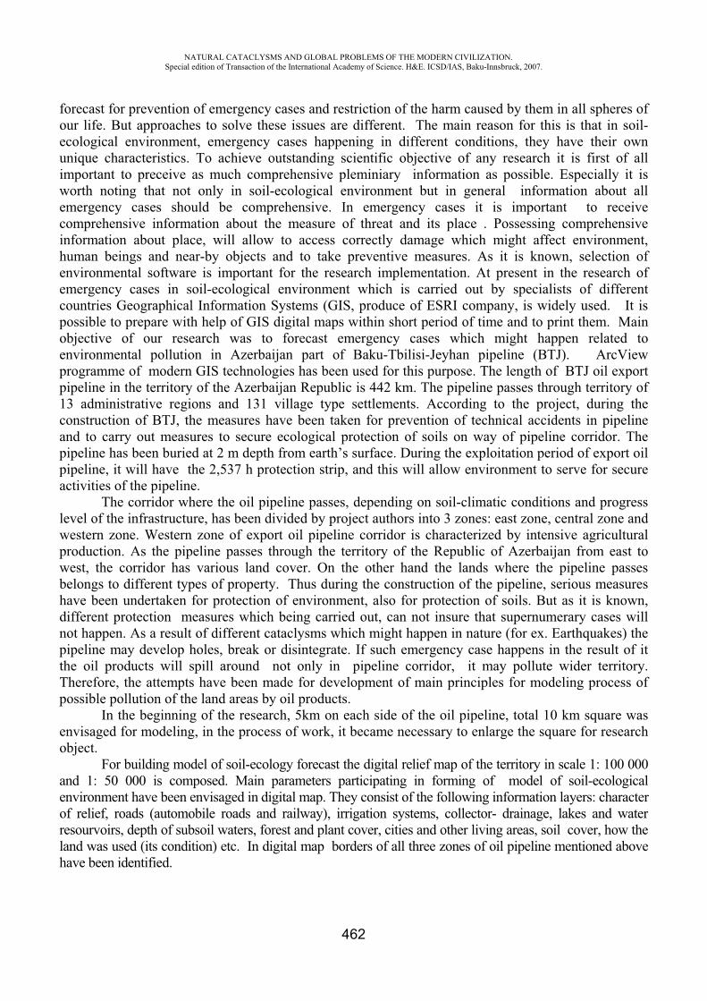
NATURAL CATACLYSMS AND GLOBAL PROBLEMS OF THE MODERN CIVILIZATION. Special edition of Transaction of the International Academy of Science. H&E. ICSD/IAS, Baku-Innsbruck, 2007.
462
forecast for prevention of emergency cases and restriction of the harm caused by them in all spheres of our life. But approaches to solve these issues are different. The main reason for this is that in soil-ecological environment, emergency cases happening in different conditions, they have their own unique characteristics. To achieve outstanding scientific objective of any research it is first of all important to receive as much comprehensive pleminiary information as possible. Especially it is worth noting that not only in soil-ecological environment but in general information about all emergency cases should be comprehensive. In emergency cases it is important to receive comprehensive information about the measure of threat and its place . Possessing comprehensive information about place, will allow to access correctly damage which might affect environment, human beings and near-by objects and to take preventive measures. As it is known, selection of environmental software is important for the research implementation. At present in the research of emergency cases in soil-ecological environment which is carried out by specialists of different countries Geographical Information Systems (GIS, produce of ESRI company, is widely used. It is possible to prepare with help of GIS digital maps within short period of time and to print them. Main objective of our research was to forecast emergency cases which might happen related to environmental pollution in Azerbaijan part of Baku-Tbilisi-Jeyhan pipeline (BTJ). ArcView programme of modern GIS technologies has been used for this purpose. The length of BTJ oil export pipeline in the territory of the Azerbaijan Republic is 442 km. The pipeline passes through territory of 13 administrative regions and 131 village type settlements. According to the project, during the construction of BTJ, the measures have been taken for prevention of technical accidents in pipeline and to carry out measures to secure ecological protection of soils on way of pipeline corridor. The pipeline has been buried at 2 m depth from earth’s surface. During the exploitation period of export oil pipeline, it will have the 2,537 h protection strip, and this will allow environment to serve for secure activities of the pipeline.
The corridor where the oil pipeline passes, depending on soil-climatic conditions and progress level of the infrastructure, has been divided by project authors into 3 zones: east zone, central zone and western zone. Western zone of export oil pipeline corridor is characterized by intensive agricultural production. As the pipeline passes through the territory of the Republic of Azerbaijan from east to west, the corridor has various land cover. On the other hand the lands where the pipeline passes belongs to different types of property. Thus during the construction of the pipeline, serious measures have been undertaken for protection of environment, also for protection of soils. But as it is known, different protection measures which being carried out, can not insure that supernumerary cases will not happen. As a result of different cataclysms which might happen in nature (for ex. Earthquakes) the pipeline may develop holes, break or disintegrate. If such emergency case happens in the result of it the oil products will spill around not only in pipeline corridor, it may pollute wider territory. Therefore, the attempts have been made for development of main principles for modeling process of possible pollution of the land areas by oil products.
In the beginning of the research, 5km on each side of the oil pipeline, total 10 km square was envisaged for modeling, in the process of work, it became necessary to enlarge the square for research object.
For building model of soil-ecology forecast the digital relief map of the territory in scale 1: 100 000 and 1: 50 000 is composed. Main parameters participating in forming of model of soil-ecological environment have been envisaged in digital map. They consist of the following information layers: character of relief, roads (automobile roads and railway), irrigation systems, collector- drainage, lakes and water resourvoirs, depth of subsoil waters, forest and plant cover, cities and other living areas, soil cover, how the land was used (its condition) etc. In digital map borders of all three zones of oil pipeline mentioned above have been identified.
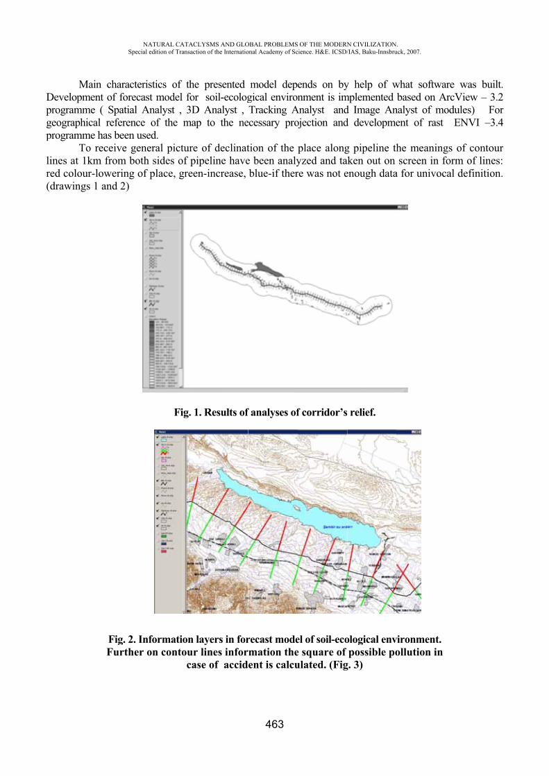
Dpgp
lir(
MainDevelopmenprogrammegeographicalprogramme h
To reines at 1kmed colour-lodrawings 1
NASpecial
n characterisnt of forecas( Spatial Al reference has been useeceive gene
m from bothowering of and 2)
Fig. 2. InfFurther o
ATURAL CATACLedition of Transacti
stics of thest model for
Analyst , 3Dof the map
ed. eral picture sides of piplace, green
Fig. 1
formation lon contour
cas
LYSMS AND GLOion of the Internatio
e presented soil-ecolog
D Analyst , p to the ne
of declinatipeline haven-increase,
. Results of
layers in forlines infor
se of accid
OBAL PROBLEMSonal Academy of Sc
463
model depgical enviroTracking A
ecessary pro
tion of the e been analyblue-if ther
f analyses of
recast modermation theent is calcu
OF THE MODERNcience. H&E. ICSD/
ends on bynment is im
Analyst andojection and
place alongyzed and tare was not e
f corridor’s
el of soil-ecoe square of ulated. (Fig
N CIVILIZATION/IAS, Baku-Innsbru
y help of wmplementedd Image And developme
g pipeline thaken out on enough data
s relief.
ological envpossible po
g. 3)
.uck, 2007.
what softwabased on A
nalyst of moent of rast
he meaningscreen in fo
a for univoc
vironment. ollution in
are was builArcView – 3odules) Fo ENVI –3
gs of contouform of linecal definition
lt..2or.4
urs: n.
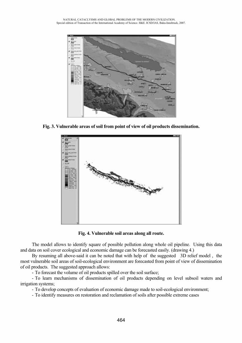
NATURAL CATACLYSMS AND GLOBAL PROBLEMS OF THE MODERN CIVILIZATION. Special edition of Transaction of the International Academy of Science. H&E. ICSD/IAS, Baku-Innsbruck, 2007.
464
Fig. 3. Vulnerable areas of soil from point of view of oil products dissemination.
Fig. 4. Vulnerable soil areas along all route.
The model allows to identify square of possible pollution along whole oil pipeline. Using this data and data on soil cover ecological and economic damage can be forecasted easily. (drawing 4.)
By resuming all above-said it can be noted that with help of the suggested 3D relief model , the most vulnerable soil areas of soil-ecological environment are forecasted from point of view of dissemination of oil products. The suggested approach allows:
- To forecast the volume of oil products spilled over the soil surface; - To learn mechanisms of dissemination of oil products depending on level subsoil waters and
irrigation systems; - To develop concepts of evaluation of economic damage made to soil-ecological environment; - To identify measures on restoration and reclamation of soils after possible extreme cases
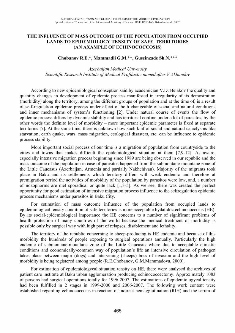
NATURAL CATACLYSMS AND GLOBAL PROBLEMS OF THE MODERN CIVILIZATION. Special edition of Transaction of the International Academy of Science. H&E. ICSD/IAS, Baku-Innsbruck, 2007.
465
THE INFLUENCE OF MASS OUTCOME OF THE POPULATION FROM OCCUPIED LANDS TO EPIDEMIOLOGY TENSITY OF SAFE TERRITORIES
(AN AXAMPLE OF ECHINOCOCCOSIS)
Chobanov R.E.*, Mammadli G.M.**, Guseinzade Sh.N.***
Azerbaijan Medical University Scientific Research Institute of Medical Profilactic named after V.Akhundov
According to new epidemiological conseption said by academician V.D. Belakov the quality and quantity changes in development of epidemic process manifested in irregularity of its demostration (morbidity) along the territory, among the different groups of population and at the time of, is a result of self-regulation epidemic process under effect of both changeable of social and natural conditions and inner mechanisms of system’s functioning [2]. Under natural course of events the flow of epidemic process differs by dynamic stability and has territorial confine under a lot of parasitos, by the other words the definite level of morbidity – more important epidemic parameter is fixed at separate territories [7]. At the same time, there is unknown how such kinf of social and natural cataclysms like starvation, earth quake, wars, mass migration, ecological disasters, etc. can be influence to epidemic process stability.
More important social process of our time is a migration of population from countryside to the cities and towns that makes difficult the epidemiological situation at them [7,9-12]. As aware, especially intensive migration process beginning since 1989 are being observed in our republic and the mass outcome of the population in case of parasitos happened from the submontane-mountane zone of the Little Caucasus (Azerbaijan, Armenia and partially Nakhchivan). Majority of the migrants took place in Baku and its settlements which territory differs with weak endemic and therefore at premigration period the activities of morbidity of the population by parasitos were low, and, a number of nozophorms are met sporadical or quite lack [1,3-5]. As we see, there was created the perfect opportunity for good estimation of intensive migration process influence to the selfregulation epidemic process mechanisms under parasitos in Baku City.
For estimation of mass outcome influence of the population from occupied lands to epidemiological tensity condition of safe territories is more acceptable hydatidoz echinococcosis (HE). By its social-epidemiological importance the HE concerns to a number of significant problems of health protection of many countries of the world because the medical treatment of morbidity is possible only by surgical way with high part of relapses, disablement and lethality.
The territory of the republic concerning to sheep-producing is HE endemic and because of this morbidity the hundreds of people exposing to surgical operations annually. Particularly the high endemic of submontane-mountane zone of the Little Caucasus where due to acceptable climatic conditions and economically-common way of population’s life an intensive circulation of pathogen takes place between major (dogs) and intervening (sheeps) boss of invasion and the high level of morbidity is being registered among people (R.E.Chobanov, G.M.Mammadova, 2000).
For estimation of epidemiologycal situation tensity on HE, there were analysed the archives of patient care institute at Baku urban agglomeration producing echinococcectomy. Approximately 1083 of persons had surgical operations totally for 1996-2007. The estimations of epidemiologycal tensity had been fulfilled in 2 stages in 1999-2000 and 2006-2007. The following work content were established regarding echinococcosis in reaction of indirect hemagglutination (RIH) and the serum of
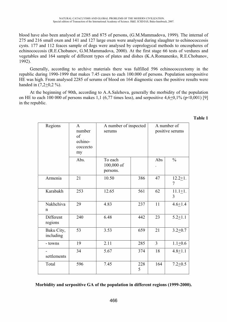
NATURAL CATACLYSMS AND GLOBAL PROBLEMS OF THE MODERN CIVILIZATION. Special edition of Transaction of the International Academy of Science. H&E. ICSD/IAS, Baku-Innsbruck, 2007.
466
blood have also been analysed at 2285 and 875 of persons, (G.M.Mammadova, 1999). The internal of 275 and 216 small oxen and 141 and 127 large oxen were analysed during slaughter to echinococcosis cysts. 177 and 112 feaces sample of dogs were analysed by coprologycal methods to oncospheres of echinococcosis (R.E.Chobanov, G.M.Mammadova, 2000). At the first stage 66 tests of verdures and vegetables and 164 sample of different types of plates and dishes (K.A.Romanenko, R.E.Chobanov, 1992).
Generally, according to archive materials there was fulfilled 596 echinococcectomy in the republic during 1990-1999 that makes 7.45 cases to each 100.000 of persons. Population seropositive HE was high. From analysed 2285 of serums of blood on 164 diagnostic cues the positive results were handed in (7,2+0,2 %).
At the beginning of 90th, according to A.A.Salehova, generally the morbidity of the population on HE to each 100 000 of persons makes 1,1 (6,77 times less), and serpositive 4,6+0,1% ( <0,001) [9] in the republic.
Table 1
Regions A number ofechino-coccectomy
A number of inspected serums
A number of positive serums
Abs. To each 100,000 of persons.
Abs.
%
Armenia 21 10.50 386 47 12.2+1.7
Karabakh 253 12.65 561 62 11.1+1.3
Nakhchivan
29 4.83 237 11 4.6+1.4
Different regions
240 6.48 442 23 5.2+1.1
Baku City, including
53 3.53 659 21 3.2+0.7
- towns 19 2.11 285 3 1.1+0.6
-settlements
34 5.67 374 18 4.8+1.1
Total 596 7.45 2285
164 7.2+0.5
Morbidity and serpositive GA of the population in different regions (1999-2000).
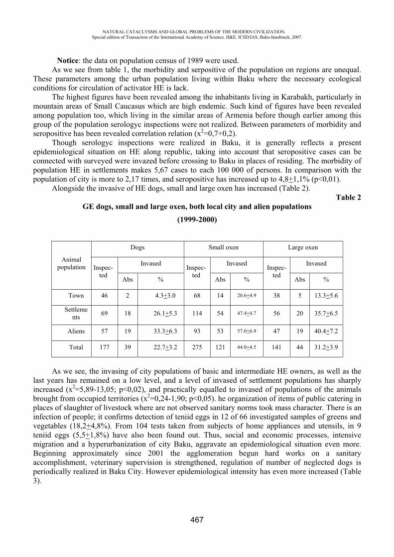
NATURAL CATACLYSMS AND GLOBAL PROBLEMS OF THE MODERN CIVILIZATION. Special edition of Transaction of the International Academy of Science. H&E. ICSD/IAS, Baku-Innsbruck, 2007.
467
Notice: the data on population census of 1989 were used.As we see from table 1, the morbidity and serpositive of the population on regions are unequal.
These parameters among the urban population living within Baku where the necessary ecological conditions for circulation of activator HE is lack.
The highest figures have been revealed among the inhabitants living in Karabakh, particularly in mountain areas of Small Caucasus which are high endemic. Such kind of figures have been revealed among population too, which living in the similar areas of Armenia before though earlier among this group of the population serologyc inspections were not realized. Between parameters of morbidity and seropositive has been revealed correlation relation (x2=0,7+0,2).
Though serologyc inspections were realized in Baku, it is generally reflects a present epidemiological situation on HE along republic, taking into account that seropositive cases can be connected with surveyed were invazed before crossing to Baku in places of residing. The morbidity of population HE in settlements makes 5,67 cases to each 100 000 of persons. In comparison with the population of city is more to 2,17 times, and seropositive has increased up to 4,8+1,1% (p<0,01).
Alongside the invasive of HE dogs, small and large oxen has increased (Table 2). Table 2
GE dogs, small and large oxen, both local city and alien populations(1999-2000)
Animal population
Dogs Small oxen Large oxen
Inspec-ted
Invased Inspec-ted
Invased Inspec-ted
Invased
Abs % Abs % Abs %
Town 46 2 4.3+3.0 68 14 20.6+4.9 38 5 13.3+5.6
Settlements 69 18 26.1+5.3 114 54 47.4+4.7 56 20 35.7+6.5
Aliens 57 19 33.3+6.3 93 53 57.0+6.9 47 19 40.4+7.2
Total 177 39 22.7+3.2 275 121 44.0+4.5 141 44 31.2+3.9
As we see, the invasing of city populations of basic and intermediate HE owners, as well as the last years has remained on a low level, and a level of invased of settlement populations has sharply increased (x2=5,89-13,05; <0,02), and practically equalled to invased of populations of the animals brought from occupied territories (x2=0,24-1,90; <0,05). he organization of items of public catering in places of slaughter of livestock where are not observed sanitary norms took mass character. There is an infection of people; it confirms detection of teniid eggs in 12 of 66 investigated samples of greens and vegetables (18,2+4,8%). From 104 tests taken from subjects of home appliances and utensils, in 9 teniid eggs (5,5+1,8%) have also been found out. Thus, social and economic processes, intensive migration and a hyperurbanization of city Baku, aggravate an epidemiological situation even more. Beginning approximately since 2001 the agglomeration begun hard works on a sanitary accomplishment, veterinary supervision is strengthened, regulation of number of neglected dogs is periodically realized in Baku City. However epidemiological intensity has even more increased (Table 3).
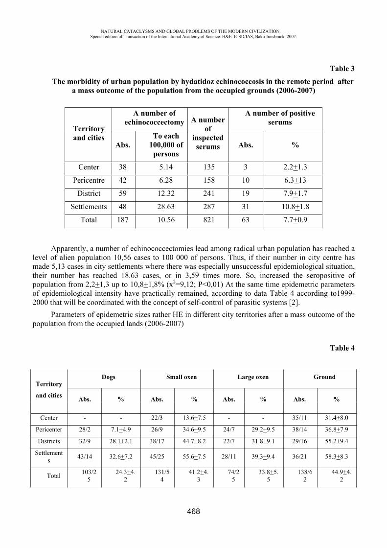
NATURAL CATACLYSMS AND GLOBAL PROBLEMS OF THE MODERN CIVILIZATION. Special edition of Transaction of the International Academy of Science. H&E. ICSD/IAS, Baku-Innsbruck, 2007.
468
Table 3 The morbidity of urban population by hydatidoz echinococcosis in the remote period after
a mass outcome of the population from the occupied grounds (2006-2007)
Territoryand cities
A number of echinococcectomy A number
ofinspectedserums
A number of positive serums
Abs.To each
100,000 of persons
Abs. %
Center 38 5.14 135 3 2.2+1.3
Pericentre 42 6.28 158 10 6.3+13
District 59 12.32 241 19 7.9+1.7
Settlements 48 28.63 287 31 10.8+1.8
Total 187 10.56 821 63 7.7+0.9
Apparently, a number of echinococcectomies lead among radical urban population has reached a level of alien population 10,56 cases to 100 000 of persons. Thus, if their number in city centre has made 5,13 cases in city settlements where there was especially unsuccessful epidemiological situation, their number has reached 18.63 cases, or in 3,59 times more. So, increased the seropositive of population from 2,2+1,3 up to 10,8+1,8% ( 2=9,12; <0,01) At the same time epidemetric parameters of epidemiological intensity have practically remained, according to data Table 4 according to1999-2000 that will be coordinated with the concept of self-control of parasitic systems [2].
Parameters of epidemetric sizes rather HE in different city territories after a mass outcome of the population from the occupied lands (2006-2007)
Table 4
Territory
and cities
Dogs Small oxen Large oxen Ground
Abs. % Abs. % Abs. % Abs. %
Center - - 22/3 13.6+7.5 - - 35/11 31.4+8.0
Pericenter 28/2 7.1+4.9 26/9 34.6+9.5 24/7 29.2+9.5 38/14 36.8+7.9
Districts 32/9 28.1+2.1 38/17 44.7+8.2 22/7 31.8+9.1 29/16 55.2+9.4
Settlements 43/14 32.6+7.2 45/25 55.6+7.5 28/11 39.3+9.4 36/21 58.3+8.3
Total 103/25
24.3+4.2
131/54
41.2+4.3
74/25
33.8+5.5
138/62
44.9+4.2
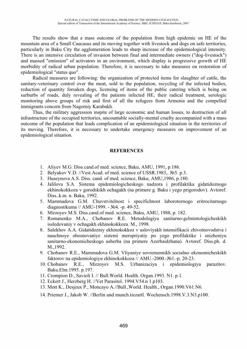
NATURAL CATACLYSMS AND GLOBAL PROBLEMS OF THE MODERN CIVILIZATION. Special edition of Transaction of the International Academy of Science. H&E. ICSD/IAS, Baku-Innsbruck, 2007.
469
The results show that a mass outcome of the population from high epidemic on HE of the mountain area of a Small Caucasus and its moving together with livestock and dogs on safe territories, particularly in Baku City the agglomeration leads to sharp increase of the epidemiological intensity. There is an intensive circulation of invasion between final and intermediate owners ("dog-livestock")and massed "emission" of activators in an environment, which display is progressive growth of HE morbidity of radical urban population. Therefore, it is necessary to take measures on restoration of epidemiological "status quo".
Radical measures are following: the organization of protected items for slaughter of cattle, the sanitary-veterinary control over the meat, sold to the population, recycling of the infected bodies, reduction of quantity forsaken dogs, licensing of items of the public catering which is being on surburbs of roads, duly revealing of the patients infected HE, their radical treatment, serologic monitoring above groups of risk and first of all the refugees from Armenia and the compelled immigrants concern from Nagorniy Karabakh.
Thus, the military aggression inspite of large economic and human losses, to destruction of all infrastructure of the occupied territories, uncountable socially-mental cruelty accompanied with a mass outcome of the population that leads complication of an epidemiological situation in the territories of its moving. Therefore, it is necessary to undertake emergency measures on improvement of an epidemiological situation.
REFERENCES
1. Aliyev M.G. Diss.cand.of med. science, Baku, AMU, 1991, p.186. 2. Belyakov V.D. //Vest.Acad. of med. science of USSR.1983,. 5. p.3. 3. Huseynova .S. Diss. cand. of med. science, Baku, AMU,1986, p.180. 4. Jalilova S. . Sistema epidemiologicheskogo nadzora i profilaktika gidatidoznogo
ekhinokokkoza v gorodskikh ochagakh (na primere g. Baku i yego prigorodov). Avtoref. Diss..k.m. n. Baku, 1992.
5. Mammadova G.M. Chuvstvitelnost i specifichnost laborotornogo eritrocitarnogo diagnostikuma // AMU-1999. - 4. -p. 49-52.
6. Mirzoyev M.S. Diss.cand.of med. science, Baku, AMU, 1988, p. 182. 7. Romanenko M.A., Chobanov R.E. Metodologiya sanitarno-gelmintologicheskikh
issledovaniy v ochagakh ekhinokokkoza. ., 1998. 8. Salekhov . . Gidatidozniy ekhinokokkoz v usloviyakh intensifikacii zhivotnovodstva i
nauchnoye obosnovaniye sistemi meropriyatiy po yego profilaktike i snizheniyu sanitarno-ekonomicheskogo usherba (na primere Azerbaidzhana). Avtoref. Diss.ph. d.
.,1992.9. Chobanov R.E., Mammadova G.M. Vliyaniye sovremennikh socialno–ekonomicheskikh
faktorov na epidemiologiyu ekhinokokkoza // AMU.-2000.- 1.-p. 20-23. 10. Chobanov R.E., Mirzoyev .S. Urbanizaciya i epidemiologiya parazitov.
Baku.Elm.1995. p.197. 11. Crompion D., Savioli I. // Bull.World. Health. Organ.1993. N1. p.1. 12. Eckert J., Herzberg H. //Vet Parasitol. 1994.V54.n 1.p103. 13. Mott K., Desjeux P., Moncayo A.//Bull.,World. Health., Organ.1990.V61.N6. 14. Priemer J., Jakob W. //Berlin und munch.tiezartl. Wochensch.1998.V.3.N3.p100.
NATURAL CATACLYSMS AND GLOBAL PROBLEMS OF THE MODERN CIVILIZATION. Special edition of Transaction of the International Academy of Science. H&E. ICSD/IAS, Baku-Innsbruck, 2007.
470
ECOLOGICAL AND AGRO-CHEMICAL STATE OF SOIL AS BASE COMPONENT OF NATURAL ENVIRONMENT
G.Sh. Mammadov*, G.M. Mammadov**, B.J. Bagirova***, U.F. Samadova****
Institute of Soil Science and Agrochemistry of ANAS, Baki, Azerbaijan *Institute of Radiation Problems of ANAS, Baki, Azerbaijan
Major components of natural environment are soil cover - products and localization place of «livings» and «nonlivings» [2,6]. Except soil, components of natural environment (NE) are geological medium, atmosphere air, surface and underground water, flora and fauna. Environmental integrity is to estimate natural environment state per se, having sum of integral expression of separate components state «allow» to use it [1,2]. Natural environment is traditionally considered as complex interacting nature – soil cover, plant and fauna, hydrosphere, atmosphere, geological medium [2,3].
Soil cover is peculiar limitary layer, in which, basically happens interaction «living» and «nonliving». Other components of biosphere (microorganism of plants, animals) in essence live because of existence of the such bio-oxide body as soil. Such important significance of soil for normal functioning of separate ground ecosystem, as well as for existence of biosphere in whole is specified by their variety ecological function [4,6]. Soil possesses natural original variety, which is universal indicator of natural environment state. That’s why disturbance of soil under any influence of (pollution, erosion, agricultural activity and etc.) indicates in ecosystem in whole [5,7].
High relevance of soil in the system of natural environment is conditionally variability of their function [1,5]. Among the functions of soil in Natural Environment NE the most essential is ecological regulation and manufacturing ability (Figure). This division in definite levels relatively links with listed functions of interdependence: implementation of one from the functions is practical impossible without implementation of others.
Specified multifunctionality of soil cover causes modern unique situation, when significance of soil state indicators is essentially higher than showings of other natural mediums’ state for estimation of natural environment state NES in whole (Table).
High relevance of soil state showings have been specified:- their considerable information value; - Low dynamics of property series («stable» and « conservative » soil feature); - Their «complex» characters – are showings of soil state, simultaneously reflects the state as
other natural environment, as well as NE in tote.
On expression of B.V. Vinogradov «soil criteria – is one of the most strong indicators of ecological trouble» [4,6,8].
Due to the ecological state of soil it is possible the understand complex soil properties determing the level of their matching to environmental-climate condition of soil formation and fitness for stable functioning of natural and anthropogenic ecosystem [1,3,6].
For estimation of soil ecological state complex agrochemical, physical, physico - chemical, chemical and biological properties of soil are used.
We may say that any soil property studied from the point of view of its influence on the soil usefulness grade for stable functioning of natural and anthropogenic ecosystem can serve showings of soil ecological state.
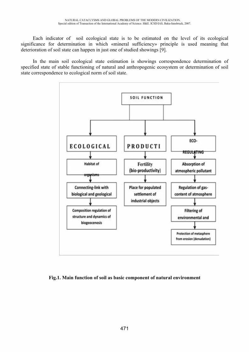
NATURAL CATACLYSMS AND GLOBAL PROBLEMS OF THE MODERN CIVILIZATION. Special edition of Transaction of the International Academy of Science. H&E. ICSD/IAS, Baku-Innsbruck, 2007.
471
Each indicator of soil ecological state is to be estimated on the level of its ecological significance for determination in which «mineral sufficiency» principle is used meaning that deterioration of soil state can happen in just one of studied showings [9].
In the main soil ecological state estimation is showings correspondence determination of specified state of stable functioning of natural and anthropogenic ecosystem or determination of soil state correspondence to ecological norm of soil state.
Fig.1. Main function of soil as basic component of natural environment
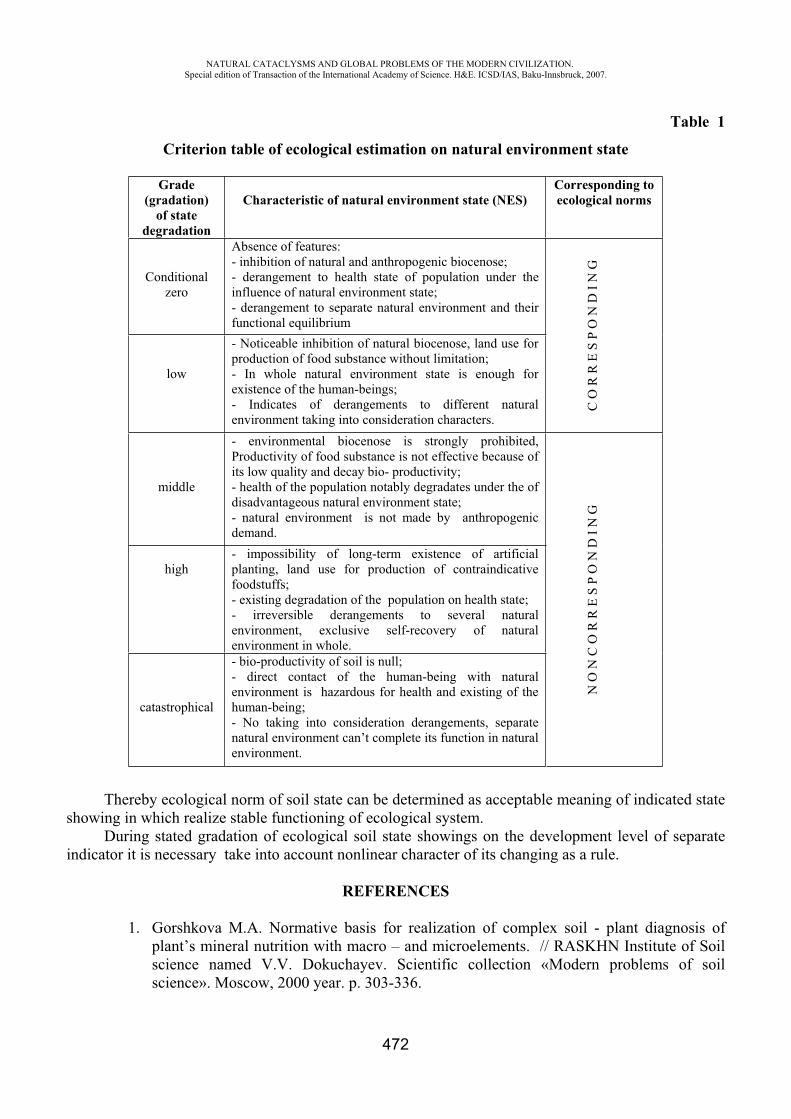
NATURAL CATACLYSMS AND GLOBAL PROBLEMS OF THE MODERN CIVILIZATION. Special edition of Transaction of the International Academy of Science. H&E. ICSD/IAS, Baku-Innsbruck, 2007.
472
Table 1
Criterion table of ecological estimation on natural environment state
Grade (gradation)
of state degradation
Characteristic of natural environment state (NES) Corresponding to ecological norms
Conditional zero
Absence of features: - inhibition of natural and anthropogenic biocenose; - derangement to health state of population under the influence of natural environment state; - derangement to separate natural environment and their functional equilibrium
C O
R R
E S
P O
N D
I N
G
low
- Noticeable inhibition of natural biocenose, land use for production of food substance without limitation; - In whole natural environment state is enough for existence of the human-beings; - Indicates of derangements to different natural environment taking into consideration characters.
middle
- environmental biocenose is strongly prohibited, Productivity of food substance is not effective because of its low quality and decay bio- productivity; - health of the population notably degradates under the of disadvantageous natural environment state; - natural environment is not made by anthropogenic demand.
N O
N C
O R
R E
S P
O N
D I
N G
high - impossibility of long-term existence of artificial planting, land use for production of contraindicative foodstuffs; - existing degradation of the population on health state; - irreversible derangements to several natural environment, exclusive self-recovery of natural environment in whole.
catastrophical
- bio-productivity of soil is null; - direct contact of the human-being with natural environment is hazardous for health and existing of the human-being; - No taking into consideration derangements, separate natural environment can’t complete its function in natural environment.
Thereby ecological norm of soil state can be determined as acceptable meaning of indicated state showing in which realize stable functioning of ecological system.
During stated gradation of ecological soil state showings on the development level of separate indicator it is necessary take into account nonlinear character of its changing as a rule.
REFERENCES
1. Gorshkova M.A. Normative basis for realization of complex soil - plant diagnosis of plant’s mineral nutrition with macro – and microelements. // RASKHN Institute of Soil science named V.V. Dokuchayev. Scientific collection «Modern problems of soil science». Moscow, 2000 year. p. 303-336.
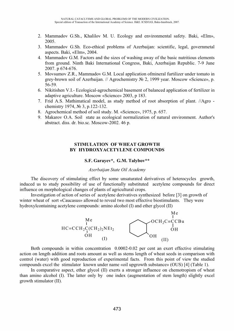
NATURAL CATACLYSMS AND GLOBAL PROBLEMS OF THE MODERN CIVILIZATION. Special edition of Transaction of the International Academy of Science. H&E. ICSD/IAS, Baku-Innsbruck, 2007.
473
2. Mammadov G.Sh., Khalilov M. U. Ecology and environmental safety. Baki, «Elm», 2005.
3. Mammadov G.Sh. Eco-ethical problems of Azerbaijan: scientific, legal, governmetal aspects. Baki, «Elm», 2004.
4. Mammadov G.M. Factors and the sizes of washing away of the basic nutritious elements from ground. Ninth Baki International Congress, Baki, Azerbaijan Republic. 7-9 June 2007. p 674-676.
5. Movsumov Z.R., Mammadov G.M. Local application ofmineral furtilizer under tomato in grey-brown soil of Azerbaijan. // Agrochemistry 2, 1999 year. Moscow «Science», p. 56-59.
6. Nikitishen V.I.- Ecological-agrochemical basement of balanced application of fertilizer in adaptive agriculture. Moscow «Science» 2003, p 183.
7. Frid A.S. Mathimatical model, as study method of root absorption of plant. //Agro - chemistry 1974, 3, p.122-132.
8. Agrochemical method of soil study. M. «Science», 1975, p. 657. 9. Makarov O.A. Soil state as ecological normalization of natural environment. Author's
abstract. diss. dr. bio.sc. Moscow-2002. 46 p.
STIMULATION OF WHEAT GROWTH BY HYDROXYACETYLENE COMPOUNDS
S.F. Garayev*, G.M. Talybov**
Azerbaijan State Oil Academy
The discovery of stimulating effect by some unsaturated derivatives of heterocycles growth, induced us to study possibility of use of functionally substituted acetylene compounds for direct influence on morphological changes of plants of agricultural crops.
Investigation of action of series of acetylene derivatives synthesized before [3] on growth of winter wheat of sort «Caucasus» allowed to reveal two most effective biostimulants. They were hydroxylcontaining acetylene compounds: amino alcohol (I) and ether glycol (II)
M e
OH(I)
OCH 2C CCBu
M e
OHOH
(II)
HC CCH 2C(CH 2)2N Et2
Both compounds in within concentration 0.0002-0.02 per cent an exert effective stimulating action on length addition and roots amount as well as stems length of wheat seeds in comparison with control (water) with good reproduction of experimental facts. From this point of view the studied compounds excel the stimulator known under name «oil upgrowth substance» (OUS) [4] (Table 1).
In comparative aspect, ether glycol (II) exerts a stronger influence on chemotropism of wheat than amino alcohol (I). The latter only by one index (augmentation of stem length) slightly excel growth stimulator (II).
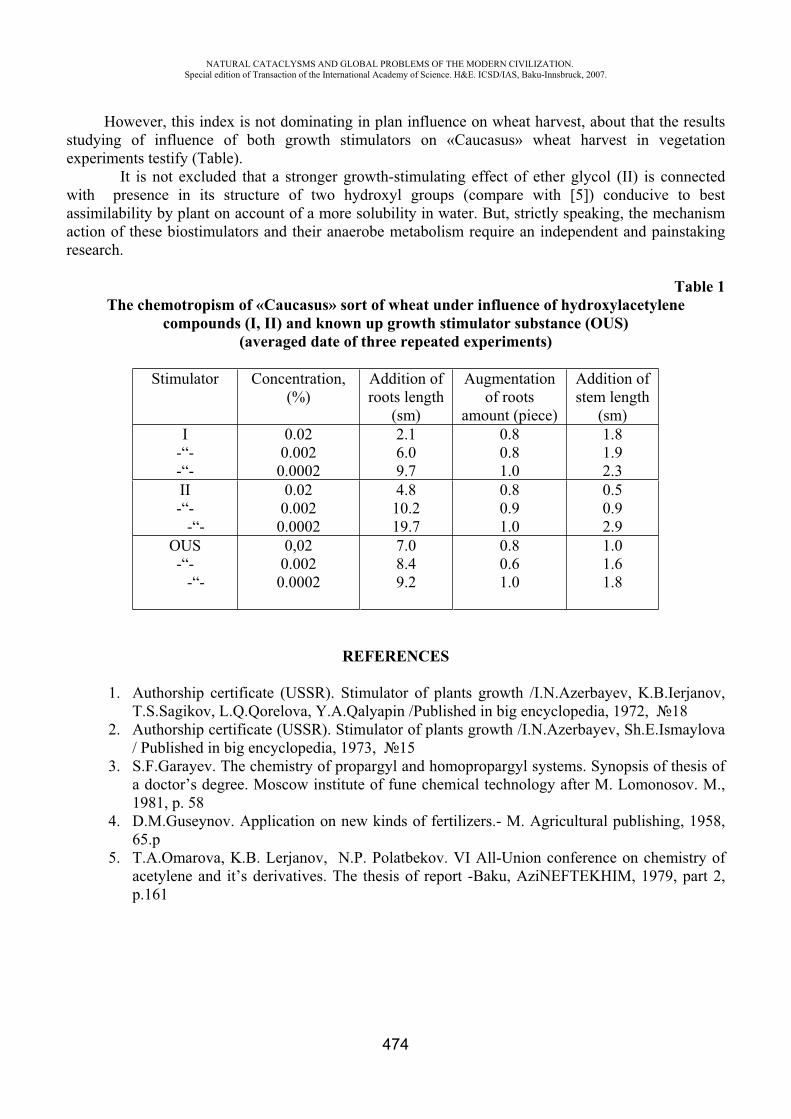
NATURAL CATACLYSMS AND GLOBAL PROBLEMS OF THE MODERN CIVILIZATION. Special edition of Transaction of the International Academy of Science. H&E. ICSD/IAS, Baku-Innsbruck, 2007.
474
However, this index is not dominating in plan influence on wheat harvest, about that the results studying of influence of both growth stimulators on «Caucasus» wheat harvest in vegetation experiments testify (Table).
It is not excluded that a stronger growth-stimulating effect of ether glycol (II) is connected with presence in its structure of two hydroxyl groups (compare with [5]) conducive to best assimilability by plant on account of a more solubility in water. But, strictly speaking, the mechanism action of these biostimulators and their anaerobe metabolism require an independent and painstaking research.
Table 1 The chemotropism of «Caucasus» sort of wheat under influence of hydroxylacetylene
compounds (I, II) and known up growth stimulator substance (OUS) (averaged date of three repeated experiments)
Stimulator Concentration, (%)
Addition of roots length
(sm)
Augmentation of roots
amount (piece)
Addition of stem length
(sm) I
-“--“-
0.020.0020.0002
2.16.09.7
0.80.81.0
1.81.92.3
II-“-
-“-
0.020.0020.0002
4.810.219.7
0.80.91.0
0.50.92.9
OUS -“-
-“-
0,020.0020.0002
7.08.49.2
0.80.61.0
1.01.61.8
REFERENCES
1. Authorship certificate (USSR). Stimulator of plants growth /I.N.Azerbayev, K.B.Ierjanov, T.S.Sagikov, L.Q.Qorelova, Y.A.Qalyapin /Published in big encyclopedia, 1972, 18
2. Authorship certificate (USSR). Stimulator of plants growth /I.N.Azerbayev, Sh.E.Ismaylova / Published in big encyclopedia, 1973, 15
3. S.F.Garayev. The chemistry of propargyl and homopropargyl systems. Synopsis of thesis of a doctor’s degree. Moscow institute of fune chemical technology after M. Lomonosov. M., 1981, p. 58
4. D.M.Guseynov. Application on new kinds of fertilizers.- M. Agricultural publishing, 1958, 65.p
5. T.A.Omarova, K.B. Lerjanov, N.P. Polatbekov. VI All-Union conference on chemistry of acetylene and it’s derivatives. The thesis of report -Baku, AziNEFTEKHIM, 1979, part 2, p.161
NATURAL CATACLYSMS AND GLOBAL PROBLEMS OF THE MODERN CIVILIZATION. Special edition of Transaction of the International Academy of Science. H&E. ICSD/IAS, Baku-Innsbruck, 2007.
475
THE STATE OF SGN OF AZERBAIJANIAN REPUBLIC AND THE MODERN TECHNOLOGIES OF ITS RECONSTRUCTION AND DEVELOPMENTS
G.SH. Mamedov*, M.H. Gojamanov**
*The Chairman of State committee of the land and the cartography of Azerbaijan Republic, the academician of the National Academy of Sciences of Azerbaijan
** Baku State University, Azerbaijan
State geodetic nets (SGN) presents coordinate basis on the territory of counrty, where she is created and plays larger role in recognition infomations about status to and the dynamics of natural cataclysms.
On the up to date stage of the evolution of geodesy changed of accuracy requirement and the compactnesses of points SGN. The rendition of geodesic coverage on sattelite methods supposes the creation of such initial geodetic base which as to its behaviours would fit to capabilities of the up to date technologies of the operative satellite determinings. This condition feasible, if the intermediate square error of the relative place of the points of geodetic base will compose of degree 1-2 sm [1,4]. Existing at the present time sattelite equipment lets to decide such problem, but in condition which processored circuit will bear on the construction of higher bubble-tube. Such constructions are IGS (International GPS Service for Geodynamics), FAGS (Fundamental astrogeodetic net), VGS (High- accuracy geodetic net). The assay of the status of existing SGN of Azerbaijan Republic (AR) created by classic subaerial methods showed that [2,3]:
1. SGN rather nonhomogeneous as to accuracy and compactnesses. 2. Gearing of coordinates within trapezium in scale 1: 200 000 in the co-ordinate system 1942
year (SK-42) reach till 30 sm, what does not let to the full actualize the potential of satellite the equipment of collections GPS.
3. The meanings of corrections dx, dy to the coordinates of points in SK-42 range irregularly and in larger deflections which bears evidence about the low interior hardeness of circuit, the bad correspondence of bonds between its separate slugs (trapeziumes), as well as existence in it distortions. This proving what coordinate basis in AR, just like in other countries of ex-Soviet Union, does not to the full replies up to date requirements and its function - to be the carrier of common co-ordinate system on the territories of counrty.
Specificly key geodetic nets in economic sector AR on Caspian sea can be noticed, of that such nets created as to purpose chart and program, never were. Exception compound some short polygonometry courses 4 class, 1 and 2 grades, lying as to scaffold bridges in the nearshore areas of sea. It is since, and extracting of oil of and gas was produced generally in nearshore areas plutonic till 40 meters and with disposal from coast till 60 km. Whereat of coordinates marine iterative processes was fulfiled generally radiogeodetic systems by collections subaerial based and the geodesic cross-bearings of straight apparition with accuracy from 15 till 50 meters.
Now changed condition and the conditions of iterative processes in economic sector AR on Kaspii. It is now, after the inference of contracts with foreign petroliferous companies, follow-up exploration and the depletion of oil and gas mine fields are conducted in remote from coast till 200 km and the deeps 120-200 meters, and in view will be fulfiled else in the more deep areas of body of water. That is why need for large-scale surveys and the necessity of high- accuracy determination of position (in constructing of hydrotechnical constractings and the erection of marine boring the platforms (of down holes), to the gasket of undersea service lines, the determination of marine borders
NATURAL CATACLYSMS AND GLOBAL PROBLEMS OF THE MODERN CIVILIZATION. Special edition of Transaction of the International Academy of Science. H&E. ICSD/IAS, Baku-Innsbruck, 2007.
476
and etc. aloof from coasts induces the necessity also of creation and the developments of key marine geodetic datums.
In problem solution updating and the evolution OF SGN Azerbaijan Republic follows to take into account that on up to date stage significantly broadened the armory of facilities and the methods of the construction of geodetic nets. This first of all relates to up to date satellire engineerings based on using of systems GPS (USA) and GLONASS (Russia). Basically for content in the geodesic coverage of economies, sciences of and the defense of land needed to prepare, and then and to actualize of four projects of nets:
1. State spase geodetic nets. 2. Altimetry nets (for determining of normal heights). 3. Gravimetry nets. 4. Nets coverring the executions of iterative processes on the body of waters of Caspian sea in
sector belonging Azerbaijan. All this four item are tied between each other and, strictly speaking, must be considered
complex. However from the methodological viewpoint of them it is necessary to dismember, this, all the more what, substantiation and compilation each of these drafts presents independent many-sided problem. Our attention is paid to mining of the up to date technological charts of the reconstruction and developments SGN AR.
Conformably [5], on territory AR is created High-accuracy two stages circuit - from VGS and SGS-1 (the satellite geodetic nets of 1 class) of as national geocentric co-ordinate system (of geodetic base). Thereby, function as to the implementation of geocentric co-ordinate system in Russia is lain on FAGS and VGS, in AR will be lied on processored nets VGS and SGS-1.
The circuit of VGS Azerbaijan is constructed in the form of the central collection consisting of 8 points situated as to the borders of Republic. Central item is planned to tie with circuit FAGS RF, as well as by the items of IGS stations. Circuit SGS-1 with spacings between points 20-30 km (overall amount ~150) will show up by resting place reconstructions and the upgradings of existing circuit and its conjunction to the nets of superior class (VGS, SGS-1).
For the convenience of the execution as of satellite measurements and network constructions, of so and their mathematical treatment all circuit SGS-1 preferable to split into 6-7 slugs. Whereat closely-spaced slugs must overlie each other not less than by two points. The central point of circuit will be overall for all slugs. For apart taked slug initial are points VGS - situated within this slug and central. In such array of the slugs of satellite observation preferable to fulfil in the following technological chart:
-Continuous observation in central item SGN for all age of the creation of circuit SGS-1, i.e. till the completion of iterative processes in all slugs;
-Continuous observation on the points of VGS current slug till filling of this slug by nets SGS-1; -Observations on the items of the fill net of SGS-1 current slug; -Transition to following slug over overall combined points as to the completion of observation
iterative processes in current slug.To give the geodetic base of Azerbaijan « a kinematics status » on its central point needed to
continue continued satellite observations and after its creation, in other words, needed to arrange on this point secular station. And this will allow the severe attribution of the coordinates of points VGS and SGS-1 AR to either of modifications SK ITRFxx. However at the present time the extrusion of this technological chart on production is tied with particular difficulties of engineering and organizational degree. That is why her can be recommended on view.
It is as is known, in using of the method of specific GPS - the measurements of three-dimensional geodesy the geometric chart of circuit is dependent on the accepted array design of the banks of satellite receivers and their migration in the iterative process: From that what number of the
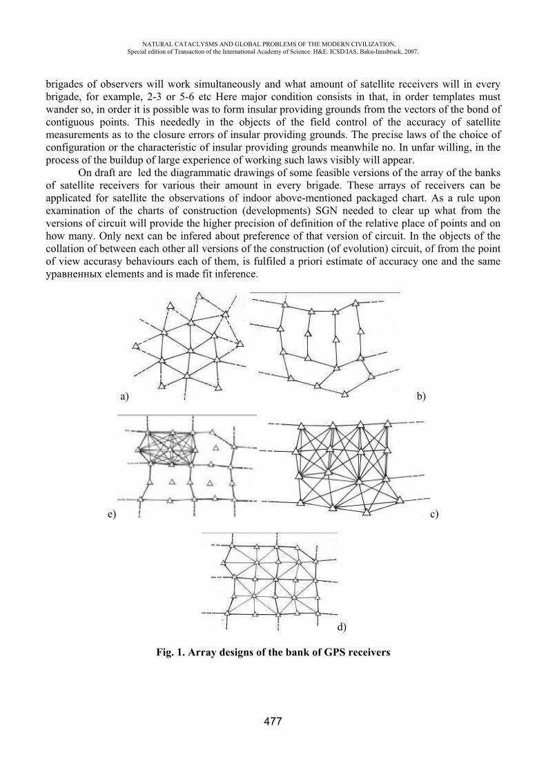
NATURAL CATACLYSMS AND GLOBAL PROBLEMS OF THE MODERN CIVILIZATION. Special edition of Transaction of the International Academy of Science. H&E. ICSD/IAS, Baku-Innsbruck, 2007.
477
brigades of observers will work simultaneously and what amount of satellite receivers will in every brigade, for example, 2-3 or 5-6 etc Here major condition consists in that, in order templates must wander so, in order it is possible was to form insular providing grounds from the vectors of the bond of contiguous points. This neededly in the objects of the field control of the accuracy of satellite measurements as to the closure errors of insular providing grounds. The precise laws of the choice of configuration or the characteristic of insular providing grounds meanwhile no. In unfar willing, in the process of the buildup of large experience of working such laws visibly will appear.
On draft are led the diagrammatic drawings of some feasible versions of the array of the banks of satellite receivers for various their amount in every brigade. These arrays of receivers can be applicated for satellite the observations of indoor above-mentioned packaged chart. As a rule upon examination of the charts of construction (developments) SGN needed to clear up what from the versions of circuit will provide the higher precision of definition of the relative place of points and on how many. Only next can be infered about preference of that version of circuit. In the objects of the collation of between each other all versions of the construction (of evolution) circuit, of from the point of view accurasy behaviours each of them, is fulfiled a priori estimate of accuracy one and the same
elements and is made fit inference.
a) b)
e) c)
d)
Fig. 1. Array designs of the bank of GPS receivers
NATURAL CATACLYSMS AND GLOBAL PROBLEMS OF THE MODERN CIVILIZATION. Special edition of Transaction of the International Academy of Science. H&E. ICSD/IAS, Baku-Innsbruck, 2007.
478
a) - brigade from three GPS receivers (as to triangles); b) - brigade from two GPS receivers (as to the sides 5-6 coaly providing grounds); c) - brigade from six GPS receivers (as to all sides between the points 5-6 coaly providing grounds); d) -brigade from nine GPS receivers (as to the sides of central collection from nine points); e) - brigade from nine GPS receivers (as to all sides between the points of central collection from nine points).
After a priori estimate of the accuracy of the adjustmented elements shall locate the most preferable version of network construction with allowance for her accurasy and technical-economic behaviours.
REFERENCES
1. Zhdanov N.D., Makarenko N.L. About the concept of the transition of topographic -geodesic production on freestanding methods of satellite coordinate determinings.//Geodesy and cartography, 1998, -3, p. 1-5.
2. Gojamanov M.H. The assay of the status of existing state geodetic net of Azerbaijan Republic. Part I.//Izv. Higher schools. Geodesy and aerophotography, 2004, -1.
3. Gojamanov M.H. The assay of the status of existing state geodetic net of Azerbaijan Republic. Part II.//Izv. Higher schools. Geodesy and aerophotography, 2004, -2.
4. Drazhnyuk A.A., Lazarev S.A., Makarenko N.L., et al. The completion of equalization SGN and the introduction of the new state collection of geodetic coordinates//Geodesy and cartography, 1998, -12, p.1-5.
5. Mamedov G.SH., Gojamanov M.H. About the concept of evolution and the reconstructions of the state geodetic net of Azerbaijan Republic//Geodesy and cartography, 2002, -12, p.38-42.
MONITORING OF SEROLOGIC ANTIBODY RESPONSE TO THE AVIAN H5N1 VIRUS BEFORE FLU PANDEMIA
Ilyicheva T.N.*, Zaikovskaya A.V.**, Katz J.M.***, Shestopalov A.M.****, Drozdov I.G*****
*Federal State Research Center of Virology and Biotechnology Vector, Novosibirsk region, Russia ***Influenza Division, Atlanta, USA
Introduction
The highly pathogenic avian influenza virus of H5N1 subtype was first isolated in 1959 in Scotland. From 1959 to 1997, 21 outbreaks of the disease caused by this subtype were registered. Since mid-90s, there started mass isolation from birds infected with this virus, first in countries of south-eastern Asia, where its active circulation continues now, and then in other parts of the world.
In summer 2005, the highly pathogenic H5N1 influenza virus was first isolated and characterized in Russia [1]. This virus was most likely brought to the territory of Novosibirsk region by migrating birds during the spring migration from South-Estern Asia. The migration ways of more than 250 bird species pass through this region, which abounds in rivers and lakes. Besides, this region is a nesting area of many species nesting at these water bodies. The migration flows of birds wintering in different
NATURAL CATACLYSMS AND GLOBAL PROBLEMS OF THE MODERN CIVILIZATION. Special edition of Transaction of the International Academy of Science. H&E. ICSD/IAS, Baku-Innsbruck, 2007.
479
regions of the world – Europe, Africa, Near East and Central Asia, Hindustan, and south-eastern Asia – cross in the south of western Siberia. The nesting areas of many bird species flying past the Western Siberia forest-steppe include wide territories – from the Lower Ob to the Lena delta [2, 3]. The distance from the wintering places of west-Siberian birds-migrants to their nesting areas is 2000-12000 km. They are scattered in the vast territories of Palearctic, Ethiopian, and Indo-Malayan zoogeographical regions.
Therefore, it is not accidental that the first outbreak of the poultry disease in the Russian territory caused by the new virus subtype was registered in Novosibirsk region. From there, the virus spread in the south of Western Siberia to the Caspian and Black Sea basins and then farther to the south of Western Europe. During 2005-2007, repeated outbreaks of highly pathogenic influenza caused by H5N1 virus in poultry were observed in these territories. Poultry of private farms perished most often. Although sick birds have close contacts with humans, which is characteristic of Russian villages, no cases of infection of humans with avian influenza H5N1 virus have been confirmed documentally. Nevertheless, for better understanding of the potential of H5N1 virus, one needs regular monitoring of the population immunological state. This would allow us to detect cases of asymptomatic or ill-defined clinical courses of the disease and understand how the virus biology, its ability to affect humans, changes.
The purpose of this paper is to determine the level of antibodies against influenza virus serotypes of social significance in the sera of people living in different regions of Russia and Ukraine and having different risk levels of infection with H5N1 avian influenza.
Materials and methodsVirusesIn this paper, the following influenza viruses were used: A/New Caledonia/ 99 H1N1, A/New
York/55/2005 H3N2, and A/Whooper swan/Mongolia/244/2005(H5N1) (CDC, Atlanta, GA, USA). Biosafety. Sera were tested by use H1N1 and H3N2 influenza viruses in biosafety level 2+
laboratories. All works with H5N1 influenza virus were performed in biosafety level 3+ laboratories. Blood samplesThirty three blood samples were taken from inhabitants of Suzdalka village, where H5N1
influenza virus was isolated in poultry for the first time in Russia. All samples were taken from the owners of farms where poultry perished. Twenty eight samples were taken in Crimea, Ukraine, in those villages which suffered poultry loss from H5N1 influenza. As many as 179 samples were taken from inhabitants of Novosibirsk region areas prone to H5N1 virus. Influenza H5N1 virus was isolated in wild birds caught in these regions [4], but there was no mass mortality of poultry in villages. Besides, 58 samples were taken from inhabitants of the Western Siberia northern region – the Khanty-Mansiisk Autonomous District. In this region, there were no cases of isolation of H5N1 avian influenza virus, although the traditional occupation of the population is hunting and, therefore, it can be considered a risk group. Table 1 contains data for the blood samples used in this paper.
SeraBlood samples were taken once. Serum was separated from each sample and poured into 2 test-
tubes. One of the test-tubes was left for long-term storage at -70 , and the second one was kept at -20 till the beginning of the experiment.
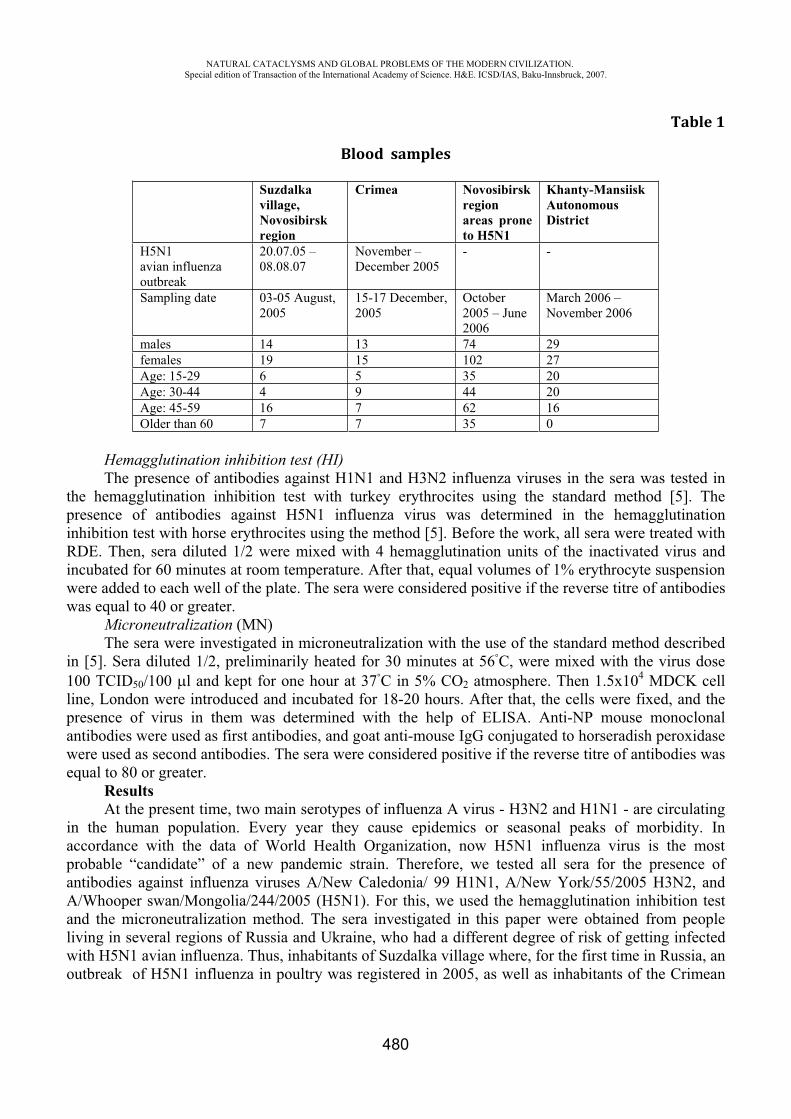
NATURAL CATACLYSMS AND GLOBAL PROBLEMS OF THE MODERN CIVILIZATION. Special edition of Transaction of the International Academy of Science. H&E. ICSD/IAS, Baku-Innsbruck, 2007.
480
Table 1
Blood samples
Suzdalka village, Novosibirskregion
Crimea Novosibirsk regionareas prone to H5N1
Khanty-Mansiisk Autonomous District
H5N1 avian influenza outbreak
20.07.05 – 08.08.07
November – December 2005
- -
Sampling date 03-05 August, 2005
15-17 December, 2005
October 2005 – June 2006
March 2006 – November 2006
males 14 13 74 29 females 19 15 102 27 Age: 15-29 6 5 35 20 Age: 30-44 4 9 44 20 Age: 45-59 16 7 62 16 Older than 60 7 7 35 0
Hemagglutination inhibition test (HI) The presence of antibodies against H1N1 and H3N2 influenza viruses in the sera was tested in
the hemagglutination inhibition test with turkey erythrocites using the standard method [5]. The presence of antibodies against H5N1 influenza virus was determined in the hemagglutination inhibition test with horse erythrocites using the method [5]. Before the work, all sera were treated with RDE. Then, sera diluted 1/2 were mixed with 4 hemagglutination units of the inactivated virus and incubated for 60 minutes at room temperature. After that, equal volumes of 1% erythrocyte suspension were added to each well of the plate. The sera were considered positive if the reverse titre of antibodies was equal to 40 or greater.
Microneutralization (MN)The sera were investigated in microneutralization with the use of the standard method described
in [5]. Sera diluted 1/2, preliminarily heated for 30 minutes at 56 , were mixed with the virus dose 100 TCID50/100 l and kept for one hour at 37 in 5% 2 atmosphere. Then 1.5x10⁴ MDCK cell line, London were introduced and incubated for 18-20 hours. After that, the cells were fixed, and the presence of virus in them was determined with the help of ELISA. Anti-NP mouse monoclonal antibodies were used as first antibodies, and goat anti-mouse IgG conjugated to horseradish peroxidase were used as second antibodies. The sera were considered positive if the reverse titre of antibodies was equal to 80 or greater.
ResultsAt the present time, two main serotypes of influenza A virus - H3N2 and H1N1 - are circulating
in the human population. Every year they cause epidemics or seasonal peaks of morbidity. In accordance with the data of World Health Organization, now H5N1 influenza virus is the most probable “candidate” of a new pandemic strain. Therefore, we tested all sera for the presence of antibodies against influenza viruses A/New Caledonia/ 99 H1N1, A/New York/55/2005 H3N2, and A/Whooper swan/Mongolia/244/2005 (H5N1). For this, we used the hemagglutination inhibition test and the microneutralization method. The sera investigated in this paper were obtained from people living in several regions of Russia and Ukraine, who had a different degree of risk of getting infected with H5N1 avian influenza. Thus, inhabitants of Suzdalka village where, for the first time in Russia, an outbreak of H5N1 influenza in poultry was registered in 2005, as well as inhabitants of the Crimean
NATURAL CATACLYSMS AND GLOBAL PROBLEMS OF THE MODERN CIVILIZATION. Special edition of Transaction of the International Academy of Science. H&E. ICSD/IAS, Baku-Innsbruck, 2007.
481
peninsula, where an epizootic was observed in November-December 2005, had the greatest risk of infection. The sera of people who lived in these regions tested by us were taken 12-20 days after the epizootic outbreak. Thirty three serums from Suzdalka village and twenty eight sera from Crimea were obtained from farmers and their families in whose farms poultry perished.
The least risk of getting infected with H5N1 avian influenza had people living in those areas of Novosibirsk region that did not have large disease outbreaks among poultry but are located very close to numerous large and small lakes, where wild water or near-water birds nest or stop during migration. In our opinion, the least risk of getting infected had people living in Khanty-Mansiisk Autonomous District, where no cases of isolation of H5N1 influenza virus from wild birds or poultry have been registered yet. Nevertheless, the traditional occupation of people in this region is hunting, in particular, of wild birds. Therefore, they had a certain risk of getting avian influenza.
Besides, it should be noted that sera of all age groups of the population, beginning with the age of 15, were used in this work. We did not use sera of children under 15, because they give false positive results in HI and MN with H5N1 virus [6]. It is known that incorrect data are sometimes obtained from the sera of people older than 60. However, people of this age group were not excluded from our investigation, because they constitute a considerable part of the population of Suzdalka village and other villages belonging to regions prone to H5N1.
Table 2 presents the results of testing of the sera. All tests were repeated. If the results of two independent analyses differed by a factor of more than 2, the experiment was repeated. If the results differed by a factor of 2, a smaller value of the serum titre was taken. One can see from the data in this table that most sensitive for determining the level of specific antibodies against H1N1 and H3N2 influenza viruses is the microneutralization method, and not the hemagglutination inhibition test. For instance, 14.2% of all sera were positive to H1N1 virus in the hemagglutination inhibition test and 44.1% of them in microneutralization. As for antibodies against H3N2 virus, the per cent of positive sera was higher: 40.3% and 76.2%, respectively. It should be noted that the per cent of sera positive for H1N1 and H3N2 corresponds to the per cent of morbidity caused by these serotypes of the virus in Russia. Thus, 178 epidemic strains were isolated in the Russian Federation in 2003; they include 41 strain of A(H1N1), 116 strains of A(H3N2), and 21 strains of influenza [7].
As for H5N1 virus, all investigated sera were negative. Moreover, whereas at the analysis of data of HI with H1N1 and H3N2 viruses only sera with a titre of 40 and higher were considered to be positive, and in MN sera with a titre of 80 and higher, with H5N1 virus no serum gave positive results at any dilution (initial serum dilution in HI was 1:10, in MN 1:20).
Thus, the results obtained make it possible to conclude that the sera investigated do not have antibodies against H5N1 avian influenza virus. This is clearly due to the fact that influenza viruses have a relatively strict host specificity, and avian viruses normally do not affect humans. However, more than 300 confirmed cases of human morbidity caused by highly pathogenic H5N1 avian influenza have been registered since 2003, when the influenza rapidly spread in various regions of the world. Besides, antibodies against H5N1 virus were detected in state employees who slaughtered poultry on Hong Kong markets during the 1997 epizootic [8], in Hong Kong workers of poultry farms [8], and in attendants of the Thailand hospital where a woman ill with avian influenza was receiving treatment [9]. Therefore, we assumed that after large epizootics at the Russian territory, even at the absence of morbid events, antibodies against this pathogen could be detected in the sera of people who were in close contact with sick birds. In our opinion, the fact that antibodies were not found can be explained in the following way. First, the number of investigated samples was insufficient, which is due to scarce population of Russian villages. For instance, at the investigation of 293 workers who participated in the slaughter of poultry on Hong Kong markets (1997-1998), antibodies against H5N1 were detected in 3% of people, and 10% of 1525 workers of Hong Kong poultry farms turned out to be
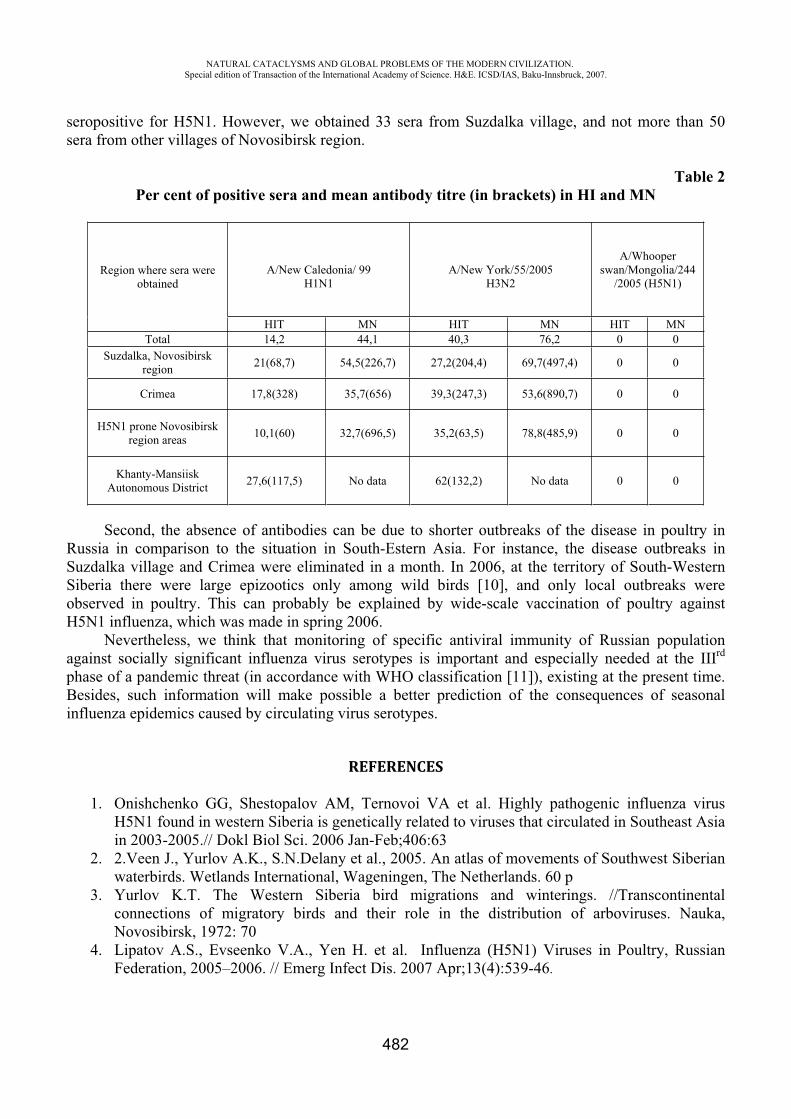
NATURAL CATACLYSMS AND GLOBAL PROBLEMS OF THE MODERN CIVILIZATION. Special edition of Transaction of the International Academy of Science. H&E. ICSD/IAS, Baku-Innsbruck, 2007.
482
seropositive for H5N1. However, we obtained 33 sera from Suzdalka village, and not more than 50 sera from other villages of Novosibirsk region.
Table 2 Per cent of positive sera and mean antibody titre (in brackets) in HI and MN
Region where sera were obtained
A/New Caledonia/ 99 H1N1
A/New York/55/2005 H3N2
A/Whooperswan/Mongolia/244
/2005 (H5N1)
HIT MN HIT MN HIT MN Total 14,2 44,1 40,3 76,2 0 0
Suzdalka, Novosibirsk region 21(68,7) 54,5(226,7) 27,2(204,4) 69,7(497,4) 0 0
Crimea 17,8(328) 35,7(656) 39,3(247,3) 53,6(890,7) 0 0
H5N1 prone Novosibirsk region areas 10,1(60) 32,7(696,5) 35,2(63,5) 78,8(485,9) 0 0
Khanty-Mansiisk Autonomous District 27,6(117,5) No data 62(132,2) No data 0 0
Second, the absence of antibodies can be due to shorter outbreaks of the disease in poultry in Russia in comparison to the situation in South-Estern Asia. For instance, the disease outbreaks in Suzdalka village and Crimea were eliminated in a month. In 2006, at the territory of South-Western Siberia there were large epizootics only among wild birds [10], and only local outbreaks were observed in poultry. This can probably be explained by wide-scale vaccination of poultry against H5N1 influenza, which was made in spring 2006.
Nevertheless, we think that monitoring of specific antiviral immunity of Russian population against socially significant influenza virus serotypes is important and especially needed at the IIIrd
phase of a pandemic threat (in accordance with WHO classification [11]), existing at the present time. Besides, such information will make possible a better prediction of the consequences of seasonal influenza epidemics caused by circulating virus serotypes.
REFERENCES
1. Onishchenko GG, Shestopalov AM, Ternovoi VA et al. Highly pathogenic influenza virus H5N1 found in western Siberia is genetically related to viruses that circulated in Southeast Asia in 2003-2005.// Dokl Biol Sci. 2006 Jan-Feb;406:63
2. 2.Veen J., Yurlov A.K., S.N.Delany et al., 2005. An atlas of movements of Southwest Siberian waterbirds. Wetlands International, Wageningen, The Netherlands. 60 p
3. Yurlov K.T. The Western Siberia bird migrations and winterings. //Transcontinental connections of migratory birds and their role in the distribution of arboviruses. Nauka, Novosibirsk, 1972: 70
4. Lipatov A.S., Evseenko V.A., Yen H. et al. Influenza (H5N1) Viruses in Poultry, Russian Federation, 2005–2006. // Emerg Infect Dis. 2007 Apr;13(4):539-46.
NATURAL CATACLYSMS AND GLOBAL PROBLEMS OF THE MODERN CIVILIZATION. Special edition of Transaction of the International Academy of Science. H&E. ICSD/IAS, Baku-Innsbruck, 2007.
483
5. Rowe T., Abernathy RA., Hu-Primer J. et al Detection of human serum antibody to avian influenza A (H5N1) virus using a combination of serologic assays. // J Clin Microbiol, 1999; 37:937-943.
6. Katz JM, Lim W, Bridges CB, et al. Antibody response in individuals infected with avian influenza A (H5N1) viruses and detection of anti-H5 antibody among household and social contacts. J Infect Dis 1999; 180:1763–70.
7. Ivanova VT, Burtseva EI, Slepushkin AN. et al. Influenza viruses which preconditioned the epidemic rise in Russia in 2002-2003. A resumed circulation of influenza viruses similar to V/Victoria/2/87 // Vopr Virusol. 2004 May-Jun; 49(3) : 12-7
8. Bridges C.B., Lim W., Hu-Primer J. et al. Risk of influenza A (H5N1) infection among poultry workers, HongKong, 1997-1998. // J Infection Diseases. – 2002. - 185. – P.1005-10.
9. Apisarnthanarak A., Erb S., Stephenson I. et al. Seroprevalence of Anti-H5 Antibody among Thai Health Care Workers after Exposure to Avian Influenza (H5N1) in a Tertiary Care Center. // CID 2005:40 (15 January).
10. Sharshov K.A., Silko N., Ilyicheva T.N. et al. New HPAI viruses H5N1 in Russia (2006-2007 years). // Options for the Control of influenza VI, Toronto, Canada, 2007, June 17-23, 324-5.
11. WHO/CDS/CSR/GIP/2005.5
INVESTIGATION PERRENNIAL PROVENDER PLANTING IN THE SOILCONSERVATION AND REDUCE SEDIMENT RODUCTION IN COUNTRY REGIONS
OF SYHACHAL
Mohammadreza Pournasrollah [email protected]
Abstract
Water and Soil is necessary for human being's life and producting nutritionmaterials is impossible without these two factors. One of the factors which threatenthe survivable agricalture are erosion and demelition, specially in aslant field, thatthe pressure rate of rage on it become of wrong managments. suitable ground cover will keep some rain like intreeption and debars from directimpact of rain to soil and prepares the situation for water infiltration in soil andchanges the surface water flow into the ground water.
Beside the lack of chaff and herd dispropotion with the capasity of pasture causedto graze more than capasity of pasture (thrice of pasture products) in mountain ouseast Guilan nd guide the retrogression and prorid background for erosion. forknowing the measure and the rate of erosion, there are various ways, one of themfor measuring surface erosion is using experimental strips.
for doing this plan after buying the land (with slant: 0.12) in chuk summer (ESHKAVAR) zone, one of the under branch of polerood river (CHAKROOPbranch), bird act and segment was done and channel excavation and tankinstallation and contrive the police pipes for guiding the water and sediment fromthe edge of strips into tanks. and then planting the studing plants. Cares:1. whiteclove (Trifolum Prentis) 2.w heat 3. evidence (pasture) 4. HAMEDAN alfalfa (medicage sativa) 5. blu alfalfa 6. spers sative. in this research in spide ofmeasuring of dryed chaff and runoff and sediment and erosion,result reasearchin in this plan was done by computer program SPSS and withperfect randomized block like break in time in three repeats a searec (plant breed) within 3 years. (incidental cares) result show that there are on sighifieant differencebecause of erosion measurment and runoff at the level 0.001 but this difference willbe seen between the time (first and second year) in level
NATURAL CATACLYSMS AND GLOBAL PROBLEMS OF THE MODERN CIVILIZATION. Special edition of Transaction of the International Academy of Science. H&E. ICSD/IAS, Baku-Innsbruck, 2007.
484
0.05.according to andanalysing them we will come to this condeusion that spors sative has got the mosteffects in area because of producting chaff and deduet runoff and flood soil ereotion - provender planting - soilconservation
ELECTROMAGNET SAFETY OF AZERBAIJAN POPULATION
E. G. Ismibeyli*, Y.G. Gaziyev**
Azerbaijan Technical University
It’s known, the development of mankind is determined with science-technical progress. Especially in XXI century by other areas the science-technical progress is connected with development of radio-techniques, communication and information-computer technologies. In its turn the development of these areas are defined with element base of technical apparatuses, especially irradiating systems (antennas, mobile communication). In its turn, the irradiating systems those are various kinds and with great range antennas play the role of sources for electromagnet irradiating. Spreading and irradiating of electromagnet waves, electromagnet areas are in touch with spreading electromagnet energy.
The numerous researches of authors, especially foreign specialists confirm that spreading electromagnet waves affect to human’s organism biologically very terrible and cause to playing role of becoming source for some illnesses (cardiovascular, skin, gynecological, nerve even gene conversions). As a result it finally depends on the intensiveness of electromagnet irradiating, frequency and period of influence. Therefore there are spoken about new science direction – electromagnet ecology. This science area learns influences of irradiating electromagnet waves on humans and environment.
It’s necessary to admit that this field of ecology especially electromagnet ecology in modern time, in viewpoint of evaluating its wide, impacts to human’s organism is very actual and it is affiliated to improvement of radio technical and communication equipments in megalopolises. For this reason in many countries especially in Russia last years many normative acts were passed a law in accordance to norm and standards of electro magnet ecology. According to 12.1.006-84 state standard the latest possible emission level of energetic loadings must be 100mkVt/sm2 (at 1000 MHz and upper frequencies). In accordance with “Microwaves and human’s security” monograph if the area level is 200 mkVt/sm2, it’ll cause to arterial pressure and pulse decreasing; if it’s 40 mkVt/sm2, at long-term influence period, happens chronicle descending of blood pressure; at 200 mkVt/sm2 appears nerve disorder on dogs; at 300 mkVt/sm2, at the period of long-termed irradiating it’s being observed the conversions on nerve system. But at the time of higher level of area happens inappropriate and out of tuning activities of immune-defense mechanisms of organism, changing functional case of cardiovascular and nerve systems, sex organs disordering, weakening of seeing organs. Nevertheless it is necessary to mark that conversation is about the informational and non-warm character of electro magnet area (EMA). The mechanisms of such influence upon human organism have been learnt very little.
Connecting with this World Health Organization accepted an international scientific program (1996-2005) for exploring biological influence of electromagnet area (EMA). At there were intended
NATURAL CATACLYSMS AND GLOBAL PROBLEMS OF THE MODERN CIVILIZATION. Special edition of Transaction of the International Academy of Science. H&E. ICSD/IAS, Baku-Innsbruck, 2007.
485
the dependence of medical character results (cancer illness, changes in behavior, memory disorder, Parkinson and Alsgeymer illnesses, genetic inclination of generation, brain oedemata, hormonal illnesses etc.) on the influence of long-term electromagnet area. World Health Organization (WHO) severely recommends avoiding from wide-risky electromagnet irradiating events.
Above mentioned factors commonly are true for electromagnet area. So, all radio electron equipments utilize modulated signals. The second mechanism of negative impact of electromagnet area to biological objects is related to modulation of electro magnet waves which carrying significant information on itself with low-frequency signals. Up-to-date time it’s clear that biological objects are eligible to receive and send electromagnet area and in this meaning they play wireless role.
Therefore even electromagnet areas that have little intensiveness level are eligible to impact considerably to human’s mood. For instance, it’s known that in the 500÷700 frequency diapason in period of long-term influence amplitude modulated areas can cause to headaches, redness of eyes and great tiredness, although their level is smaller than the marks can be released.
At the same time the density of radio ether space usage is increasing gradually and ecological circumstance in electromagnet areas province is worsening unceasingly. In comparison with the former USSR now the available value of irradiating level has increased 10 times. For example, at construction period, for maximal defense of people who are living at home against electromagnet pollution can be provided with making special measures. As a result of such measures at houses, offices and production buildings the level of electromagnet irradiating is possible to be lessened. One of such opportunities is applying Mirawall ventilation systems with aluminum facade, such systems except their working properties (warm protection, modern external design), they screen home from external electromagnet irradiating and from view of electromagnet security improve the ecological situation of the building-inside cardinally. For quantitatively computing decreasing coefficient of electromagnet area in wide frequency diapason, experimental researches must be conducted for defining degree and quality of inside building space screening.
Day by day in large dwelling places especially in Baku electromagnet safety invisibly reached to the sufficient dangerous point. Therefore, for preserving releasable level of electromagnet area intensity over different kinds of irradiating means, observing and supervising norm and standards are necessary. In accordance with information on exhibits in USA Science Museum exhibition “Risk” devoted to Baku, our city was called one of the dangerous cities in plan of environment pollution.
Many telecommunication systems which technology consists of electromagnet irradiating include in the infrastructure of our city. It’s important to include here broadcasting television, radio broadcasting, mobile communication means, Stations of Radio Location, also numerous communication equipments of state organs and information transporters (fire protecting, police, bank system, communication of state). In the city from view of profitability at the mass service places different kinds of transferor antennas of telecommunication means are set (at the roof of multi-staged buildings, at various towers). Sometimes their quantity reaches to a few hundred. So appears various frequencies diapasonic, various appointed technical means complex. Such “hot points” cause to accumulate irradiating technical means, to arise high irradiating sources.
Approaching correctly to the electromagnet ecology problem depends on directly responsible economy, finance, investment and commerce problems. Nevertheless, ecological safety absolutely must be provided with application of new technology. Therefore there is a severe demand on developing and preparing technologies for electromagnet monitoring. Following proposals are available for conducting electromagnet monitoring step by step.
I stage: Intends to summarize conducting experiments of establishing normative-methodic base of electromagnet security in CIS (Commonwealth of Independent States) and on its basis, developing and preparing normative acts of norm and standards on electromagnet security of republic is eligible.
NATURAL CATACLYSMS AND GLOBAL PROBLEMS OF THE MODERN CIVILIZATION. Special edition of Transaction of the International Academy of Science. H&E. ICSD/IAS, Baku-Innsbruck, 2007.
486
Those indicating can serve to organize essential of National program for providing Azerbaijan electromagnet safety.
II stage: Expediently inventorying technical means those create electro magnet area in environment. Places and districts which have more technical means are defined and for each district, criteria for evaluating environment are developed-prepared. At this time frequency, space and time parameters of evaluating criteria have to be considered. For electromagnet map, sanitary passport compiled for each technical object that irradiates electro magnet energy to the environment must be taken basically.
III stage: Program providing of electromagnet monitoring – geo information system of electromagnet safety is prepared. In separately sources and source groups those mentioned previous stages and also in separately districts, the report of electromagnet expertise is conducted. First of all it’s necessary to involve attraction of public, ecology specialists, specialists of radio communication and irradiating systems also proper government structures (Ministry of Communication, Ministry of Ecology, and Ministry of Health) for solution of this problem. Also preparing specialist on radioecology speciality is required. First of all in Baku and large cities, in other dwelling places systematic monitoring conducting service areas of radio ecological situation have to be managed.
REFERENCES
1. Ismibeili E.G. Electromagnetic waves are the source of series of serious diseases. - Baku: Echo. 2007, 3.
2. Dumanski Yu.D., Serdyuk A.M., Los I.P. Influence of electromagnetic fields, radiofrequencies on man.-Kiev: Health, 1975.-213 p.
3. Spodobaev Yu.M., Kubanov V.P. Fundamentals of electromagnetic ecology.-M.: Radio and communication, 2000.-341 p.
4. Buzov A.L., Spodobaev Yu.M., Kazanski L.S., Romanov V.A. Electromagnetic ecology.-M.: Radio and communication, 2004.-412 p.
5. Kubanov V.P., Kuklev V.A., Spodobaev Yu.M., Shishkin A.I. Security of vital activity in schemes and tables.-M.: Radio and communication, 2002.-343 p.
INFLUENCE OF MODIFYING OF ZEOLITE ON ADSORPTION OF THE MALIGNANT CELLULAR POPULATION
Kh.T. Kakhramanova
International scientific technical complex “INTERGEO-TETIS”
Natural zeolites - a new kind of mineral raw material. Unique adsorption and ion exchange properties, chemical and mechanical stability, high acid and radiating stability highsilica zeolites causes their wide scope.
In an organism there are hundreds and thousand various biochemical reactions without which it is impossible not only health and but also a life of an alive essence. The important property of zeolites is their ability to normalize all biochemical processes in an organism which cannot correctly proceed without macro-and microelements. The matter is that macro-and microelements in structure of zeolites are one of the most accessible forms for an alive organism as person and animals [1]
NATURAL CATACLYSMS AND GLOBAL PROBLEMS OF THE MODERN CIVILIZATION. Special edition of Transaction of the International Academy of Science. H&E. ICSD/IAS, Baku-Innsbruck, 2007.
487
Medical-preventive property and uniqueness of zeolites is shown that zeolite gives any element in which the organism requires and simultaneously deduces those elements which are much. Modelling experiments and clinical tests have revealed powerful antitoxic action of natural zeolites, and unique features adsorption, ion exchange properties allow to deduce heavy metals, free radicals, products of disintegration and toxins from the internal environment of an organism [2].
Antioxidation, detoksidation, immunomodulation, radioprotective and providing liquidation of a dysbacteriosis of action were the indication to application of zeolites in treatment of onkological diseases. Application of zeolites at beam therapy, chemotherapy, antibiotictherapy is reduced with displays of negative collateral actions of these highly toxic methods of therapy [3,4]. Even in work [5] investigated adsorption of cells of a tumour of ovary on amino form natural-montmorillonite. Quantity the adsorbed cells defined derivatography the analysis. As it has been established, montmorillonite adsorbs a significant amount of cells (1.3389991.1010). On the other hand, it is known, that adsorption properties of zeolites substantially depend on them cation compounds and ways of its processing.
Considering the above-stated, studying in experiment of the mechanism of clarification of an organism from products of disintegration was of interest at neoplastik transformations of fabrics. With this purpose have been studied adsorption opportunities of natural zeolite- clinoptilolite and of its modified forms and tablets ZEOMED [6] which is close on structure to widely advertised food additive, the MEGAMINE"[7], possessing by a lot of medical and anticarcinogenic properties. Alongside with clinoptilolite in their structure dolomite contains. As it is established in the [8] dolomite consisting from calcian and magnesian carbonates (12,8 % of magnesium) potentiated antineoplastic activity of zeolite, probably, as a result of improvement of a mineral exchange and activation antioksidation enzymes containing ions of magnesium.
MATERIALS AND METHODS
For research of the given question on the basis of natural clinoptilolite, having structure Ca4,5Al9Si24, the samples modified in the various ways have been prepared.
Considering [5] in the form of zeolite by processing clinoptilolite a solution 0,1 N has been prepared ammonium to salt NH4 Cl at 70-800C within 5-6 hours. As well-known bactericidal properties Ag, Cu. Zn - the zeolites widely used in manufacture of plastics, at manufacturing utensils, cosmetic means, at disinfecting water and . .. In work have been applied:
-Ag- clinoptilolite, received by processing 50 g. the natural zeolite containing 65-70 % of clinoptilolite by the 100 ml of a solution of nitrate of silver of 0,1 M within 3 hours at the 60-700 .
-Cu clinoptilolite received by processing 50 g of zeolite of 200 ml of 0,05 M of solution CuSO4 in one case and CuCl2 - in the second case at room temperature during 5
hours;- Zn- clinoptilolite received by processing 50 g of zeolite of 200 ml 2M o f solution ZnCl2 at 600C. In the subsequent, for studying influence sulfurine connections the above-stated samples were
processed 0,1 N by a solution thiourea (Ag-T, Zn-T, Cu-T). Sample Ag-FC has been received by sedimentation ferrocyanide on a surface of zeolite give rise
to it additional adsoption ability [10]. It is known, that naphtal n petroleum consists, basically, from napthen hydrocarbons (60-70
%) and also aromatic and resinous substances (25,4 % and 14.1 % accordingly). Except for that in naphtal n petroleum physiologically active microcells (copper, molybdenum, zinc, manganese, lithium, rubidium, cobalt, a pine forest, iodine) and other microcells [9] are found out. From this point of view naphtalene processing and its influence on malignant tumoral cells had the certain interest (sample-Nf). It received processing of unital natural zeolite by a solution native naphtalene
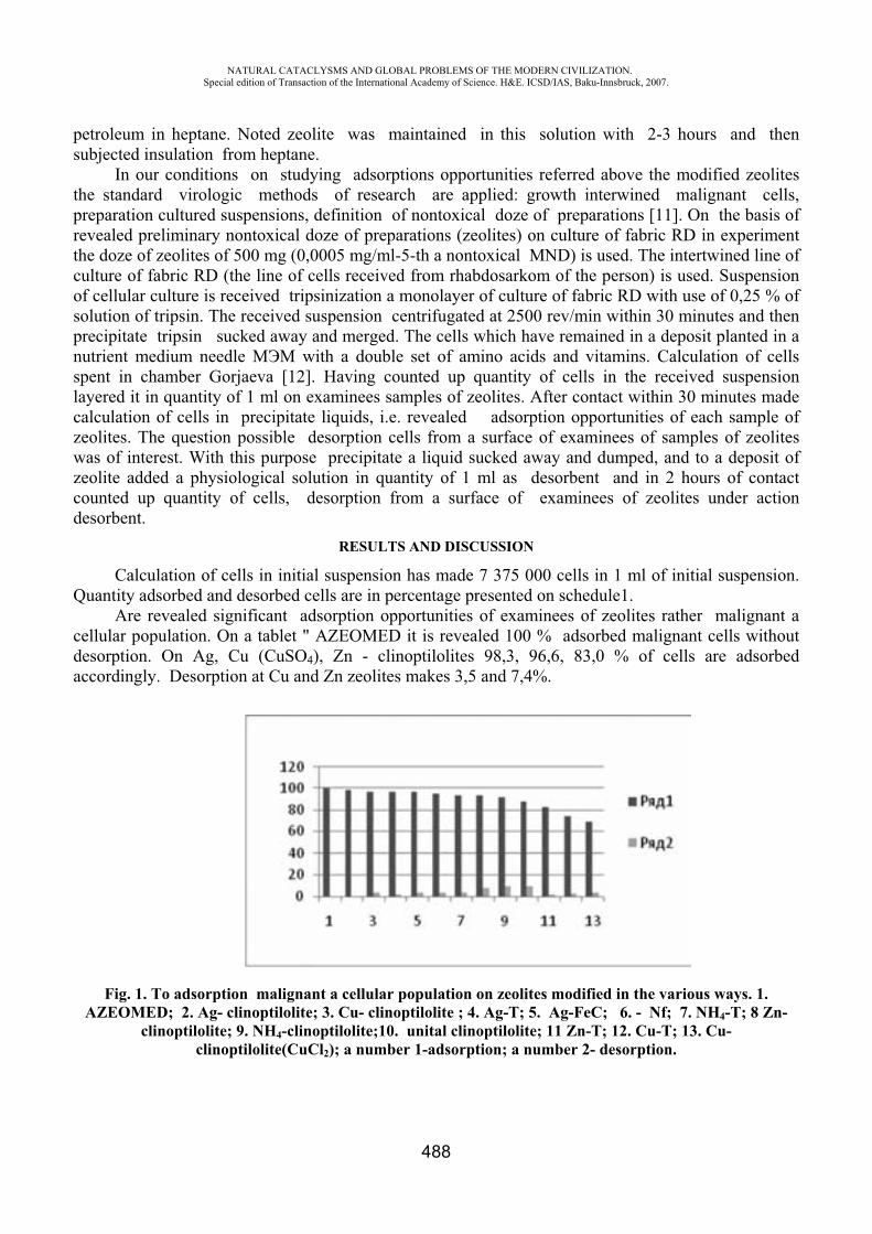
NATURAL CATACLYSMS AND GLOBAL PROBLEMS OF THE MODERN CIVILIZATION. Special edition of Transaction of the International Academy of Science. H&E. ICSD/IAS, Baku-Innsbruck, 2007.
488
petroleum in heptane. Noted zeolite was maintained in this solution with 2-3 hours and then subjected insulation from heptane.
In our conditions on studying adsorptions opportunities referred above the modified zeolites the standard virologic methods of research are applied: growth interwined malignant cells, preparation cultured suspensions, definition of nontoxical doze of preparations [11]. On the basis of revealed preliminary nontoxical doze of preparations (zeolites) on culture of fabric RD in experiment the doze of zeolites of 500 mg (0,0005 mg/ml-5-th a nontoxical MND) is used. The intertwined line of culture of fabric RD (the line of cells received from rhabdosarkom of the person) is used. Suspension of cellular culture is received tripsinization a monolayer of culture of fabric RD with use of 0,25 % of solution of tripsin. The received suspension centrifugated at 2500 rev/min within 30 minutes and then precipitate tripsin sucked away and merged. The cells which have remained in a deposit planted in a nutrient medium needle with a double set of amino acids and vitamins. Calculation of cells spent in chamber Gorjaeva [12]. Having counted up quantity of cells in the received suspension layered it in quantity of 1 ml on examinees samples of zeolites. After contact within 30 minutes made calculation of cells in precipitate liquids, i.e. revealed adsorption opportunities of each sample of zeolites. The question possible desorption cells from a surface of examinees of samples of zeolites was of interest. With this purpose precipitate a liquid sucked away and dumped, and to a deposit of zeolite added a physiological solution in quantity of 1 ml as desorbent and in 2 hours of contact counted up quantity of cells, desorption from a surface of examinees of zeolites under action desorbent.
RESULTS AND DISCUSSION
Calculation of cells in initial suspension has made 7 375 000 cells in 1 ml of initial suspension. Quantity adsorbed and desorbed cells are in percentage presented on schedule1.
Are revealed significant adsorption opportunities of examinees of zeolites rather malignant a cellular population. On a tablet " AZEOMED it is revealed 100 % adsorbed malignant cells without desorption. On Ag, Cu (CuSO4), Zn - clinoptilolites 98,3, 96,6, 83,0 % of cells are adsorbed accordingly. Desorption at Cu and Zn zeolites makes 3,5 and 7,4%.
Fig. 1. To adsorption malignant a cellular population on zeolites modified in the various ways. 1. AZEOMED; 2. Ag- clinoptilolite; 3. Cu- clinoptilolite ; 4. Ag- ; 5. Ag-FeC; 6. - Nf; 7. NH4- ; 8 Zn-
clinoptilolite; 9. NH4-clinoptilolite;10. unital clinoptilolite; 11 Zn- ; 12. Cu- ; 13. Cu- clinoptilolite(CuCl2); a number 1-adsorption; a number 2- desorption.
NATURAL CATACLYSMS AND GLOBAL PROBLEMS OF THE MODERN CIVILIZATION. Special edition of Transaction of the International Academy of Science. H&E. ICSD/IAS, Baku-Innsbruck, 2007.
489
On NH4-zeolite adsorption makes 91,5% and desorption 7,5 %., initial clinoptilolite adsorbs 88,1% and desorbed 9,6 % of cells. . initial clinoptilolite and it ion exchanged forms on activity to adsorption of cells it is possible to arrange in a following number:
Ag clin.> Cu (CuSO4)> NH4-clin.>unital clin. > Zn-clin.> Cu (CuCl2)-clin; on desorption : unital clin> NH4-clin> Cu, Zn-clin. At Ag-clin. completely is absent desorption.
The received results show, that the nature of cation of zeolite renders appreciable influence on adsorption-desorption properties of zeolites rather malignant cells. There are changes in adsorption-desorption properties of zeolites after processing NH4, Ag, Zn, Cu clinoptilolites by thiourea (samples- ). After processing by thiourea, desorbtion abilities, (Cu from 3,5 % up to 2.2 %; Zn from 7,4 % up to 2.1 %; NH4 from 9,6 % up to 3,6), but adsorption ability basically decreases, the possible reason of that can be partial shielding of times of zeolite by the formed complex thiourea-zeolite. The in itself fact of increase adsorption is interesting to ability on zeolite with put naphtalan petroleum with 88.1% on initial zeolite up to 94,9% and reduction desorption properties with 9,6% up to 3,5%. In work [13] naphthalene petroleum it is used together with zeolite in warming application. Favorable action of this application on pathological processes on a leather, including cancerogenic character.
Thus, revealed adsorption-desorption data of the above-stated samples have shown, that these properties can be changed modifying of zeolites, and opportunities of tablets " ZEOMED"rather malignant cells believes their recommendation for reception as the food additive for neutralization of products of disintegration at transformation of fabrics in an organism of the person. Perspective in referred above the plan is and Ag-clinoptilolite at which also the high parameter of adsorption and is absent desorption. That is the positive moment in absolute dedusing slags from an organism.
At a modern state of health of the population and all an amplifying social and environmental pressure on the basis of natural clinoptilolite it is possible to consider application food additive proved.
REFERENCES
1. E.M Blagitko with col. Preventive and medical properties of natural zeolites // Novosibirsk, 2000
2. E.N. Khalilov, R.A. Bagirov “Natural zeolites, their properties, production and application”, Baku – Berlin, 2002,p.157-169
3. Application of zeolites as medical - preventive food additives Sankt – Petersburgh State Technical Univrsity ISF, compartment “Engineering systems of buildings and constructions”, “Vnchuro”.p 8-10
4. V.I. Luchshev, O.V. Vatutina, M.Z. Shakhmardanov “Enterosorbtion in complex therapy sharp intestinal infectious diseases”/Russia State Medical University, Moskow.2002
5. I.G. Uspenskaya, S.V. Ivasivka, L.G. Yankevich etc. DAN SSSR, 1983,vol.2, p.480-482 6. E.N. Khalilov, A.A. Guvalov Pat.AR NoI 20050011 7. M. Polyak-Blazi, M Katic, M. Kralj, N. Zarkovic, T. Marotti, V. Zverko, T. Balog, K Pavelic.
Izvor: 13-th International Zeolite Conference, Montpellier, France , 8-13 July, 2001, Vol 135, p 374 ,2001.
8. Naturforsch [C] 1993 Sep-Oct; 48(9-10): 818-20 9. V.B. Abbasov, A.V. Musaev, G.A. Isaeva “Naphthalan oil and it naphthen hydrocarbons”
Baku, “ELM” 1998
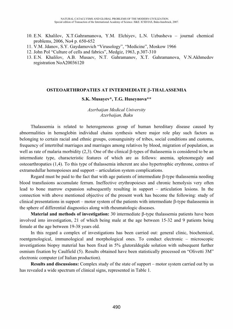
NATURAL CATACLYSMS AND GLOBAL PROBLEMS OF THE MODERN CIVILIZATION. Special edition of Transaction of the International Academy of Science. H&E. ICSD/IAS, Baku-Innsbruck, 2007.
490
10. E.N. Khalilov, X.T.Gahramanova, Y.M. Elchiyev, L.N. Uzbasheva – journal chemical problems, 2006, No4 p. 650-652
11. V.M. Jdanov, S.Y. Gaydamovich “Virusology”, “Medicine”, Moskow 1966 12. John Pol “Culture of cells and fabrics”, Medgiz, 1963, p.307-310 13. E.N. Khalilov, A.B. Musaev, N.T. Gahramanov, X.T. Gahramanova, V.N.Akhmedov
registration NoA20036120
OSTEOARTHROPATIES AT INTERMEDIATE -THALASSEMIA
S.K. Musayev*, T.G. Huseynova**
Azerbaijan Medical University Azerbaijan, Baku
Thalassemia is related to heterogeneous group of human hereditary disease caused by abnormalities in hemoglobin individual chains synthesis where major role play such factors as belonging to certain racial and ethnic groups, consanguinity of tribes, social conditions and customs, frequency of intertribal marriages and marriages among relatives by blood, migration of population, as well as rate of malaria morbidity (2,3). One of the clinical -types of thalassemia is considered to be an intermediate type, characteristic features of which are as follows: anemia, splenomegaly and osteoarthropaties (1,4). To this type of thalassemia inherent are also hypertrophic erythrone, centres of extramedullar hemopoieses and support – articulation system complications.
Regard must be paid to the fact that with age patients of intermediate -type thalassemia needing blood transfusions accumulate ferrum. Ineffective erythropoieses and chronic hemolysis very often lead to bone marrow expansion subsequently resulting in support – articulation lesions. In the connection with above mentioned objective of the present work has become the following: study of clinical presentations in support – motor system of the patients with intermediate -type thalassemia in the sphere of differential diagnostics along with rheumatologic diseases.
Material and methods of investigation: 30 intermediate -type thalassemia patients have been involved into investigation, 21 of which being male at the age between 15-32 and 9 patients being female at the age between 19-38 years old.
In this regard a complex of investigations has been carried out: general clinic, biochemical, roentgenological, immunological and morphological ones. To conduct electronic – microscopic investigations biopsy material has been fixed in 5% glutoraldegide solution with subsequent further osmium fixation by Caulfield (5). Results obtained have been statistically processed on “Olivetti 3M” electronic computer (of Italian production).
Results and discussions: Complex study of the state of support – motor system carried out by us has revealed a wide spectrum of clinical signs, represented in Table 1.
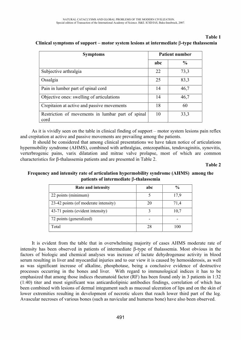
NATURAL CATACLYSMS AND GLOBAL PROBLEMS OF THE MODERN CIVILIZATION. Special edition of Transaction of the International Academy of Science. H&E. ICSD/IAS, Baku-Innsbruck, 2007.
491
Table 1 Clinical symptoms of support – motor system lesions at intermediate -type thalassemia
Symptoms Patient number
abc %
Subjective arthralgia 22 73,3
Ossalgia 25 83,3
Pain in lumber part of spinal cord 14 46,7
Objective ones: swelling of articulations 14 46,7
Crepitaion at active and passive movements 18 60
Restriction of movements in lumbar part of spinal cord
10 33,3
As it is vividly seen on the table in clinical finding of support – motor system lesions pain reflex and crepitation at active and passive movements are prevailing among the patients.
It should be considered that among clinical presentations we have taken notice of articulations hypermobility syndrome (AHMS), combined with arthralgias, entezopathias, tendovaginitis, synovitis, verterbrogenic pains, varix dilatation and mitrae valve prolapse, most of which are common characteristics for -thalassemia patients and are presented in Table 2.
Table 2
Frequency and intensity rate of articulation hypermobility syndrome (AHMS) among the patients of intermediate -thalassemia
Rate and intensity abc %
22 points (minimum) 5 17,9
23-42 points (of moderate intensity) 20 71,4
43-71 points (evident intensity) 3 10,7
72 points (generalized) - -
Total 28 100
It is evident from the table that in overwhelming majority of cases AHMS moderate rate of intensity has been observed in patients of intermediate -type of thalassemia. Most obvious in the factors of biologic and chemical analyses was increase of lactate dehydrogenase activity in blood serum resulting in liver and myocardial injuries and to our view it is caused by hemosiderosis, as well as was significant increase of alkaline, phosphotase, being a conclusive evidence of destructive processes occurring in the bones and liver. With regard to immunological indices it has to be emphasized that among those indices rheumatoid factor (RF) has been found only in 3 patients in 1:32 (1:40) titer and most significant was anticardiolipinic antibodies findings, correlation of which has been combined with lesions of dermal integument such as mucosal ulceration of lips and on the skin of lower extremities resulting in development of necrotic ulcers that reach lower third part of the leg. Avascular necroses of various bones (such as navicular and humerus bone) have also been observed.
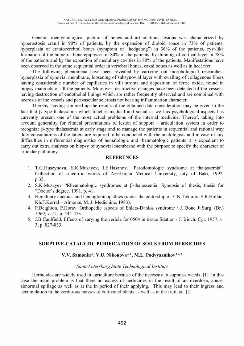
NATURAL CATACLYSMS AND GLOBAL PROBLEMS OF THE MODERN CIVILIZATION. Special edition of Transaction of the International Academy of Science. H&E. ICSD/IAS, Baku-Innsbruck, 2007.
492
General roentgenological picture of bones and articulations lesions was characterized by hyperostosis cranil in 90% of patients, by the expansion of diploid space in 73% of patients, hyperplasia of craniocerebral bones (symptom of “hedgehog”) in 36% of the patients, cyst-like formation of the humerus bone epiphyses in 80% of the patients, by thinning of cortical layer in 78% of the patients and by the expantion of medullary cavities in 80% of the patients. Manifestations have been observed in the same sequential order in vertebral bones, caxal bones as well as in heel feet.
The following phenomena have been revealed by carrying out morphological researches: hyperplasia of synovial membrane, loosening of subsynovial layer with swelling of collagenous fibers having considerable number of capillaries in villi stroma and deposition of ferric oxide, found in biopsy materials of all the patients. Moreover, destructive changes have been detected of the vessels, having destruction of endothelial linings which are rather frequently observed and are combined with necrosis of the vessels and perivascular sclerosis not bearing inflammation character.
Thereby, having summed up the results of the obtained data consideration may be given to the fact that -type thalassemia which touches medical and social as well as psychological aspects has currently present one of the most actual problems of the internal medicine. Thereof, taking into account generality for clinical presentations of lesion of support – articulation system in order to recognize -type thalassemia at early stage and to manage the patients in sequential and rational way duly consultations of the latters are required to be conducted with rheumatologists and in case of any difficulties in differential diagnostics of hematologic and rheumatologic patients it is expedient to carry out extra analyses on biopsy of synovial membrane with the purpose to specify the character of articular pathology.
REFERENCES
1. T.G.Huseynova, S.K.Musayev, I.E.Hasanov. “Parodontologic syndrome at thalassemia”. Collection of scientific works of Azerbaijan Medical University, city of Baki, 1992, p 35.
2. S.K.Musayev “Rheumatologic syndromes at -thalassemia. Synopsis of thesis, thesis for “Doctor’s degree. 1991, p. 41.
3. Hereditary anemias and hemoglobinopathies (under the editorship of Y.N.Tokarev, S.R.Hollan, Kh.F.Korral – Almonte, M. J. Medichine, 1983).
4. P.Beighton, P.Horav. Orthopedic aspects of Ehlers-Danlos syndrome / J. Bone Jt.Surg. (Br.) 1969, v. 51, p. 444-453.
5. J.B.Caulfield. Effects of varying the vericle for 0504 in tissue fidation / J. Bioch. Cyt. 1957, v. 3, p. 827-833
SORPTIVE-CATALYTIC PURIFICATION OF SOILS FROM HERBICIDES
V.V. Samonin*, V.U. Nikonova**, M.L. Podvyaznikov***
Saint-Petersburg State Technological Institute
Herbicides are widely used in agriculture because of the necessity to suppress weeds. [1]. In this case the main problem is that there an excess of herbicides in the result of an overdose, abuse, abnormal spillage as well as at the in period of their applying. This may lead to their ingress and accumulation in the verdurous masses of cultivated plants as well as in the fruitage. [2].
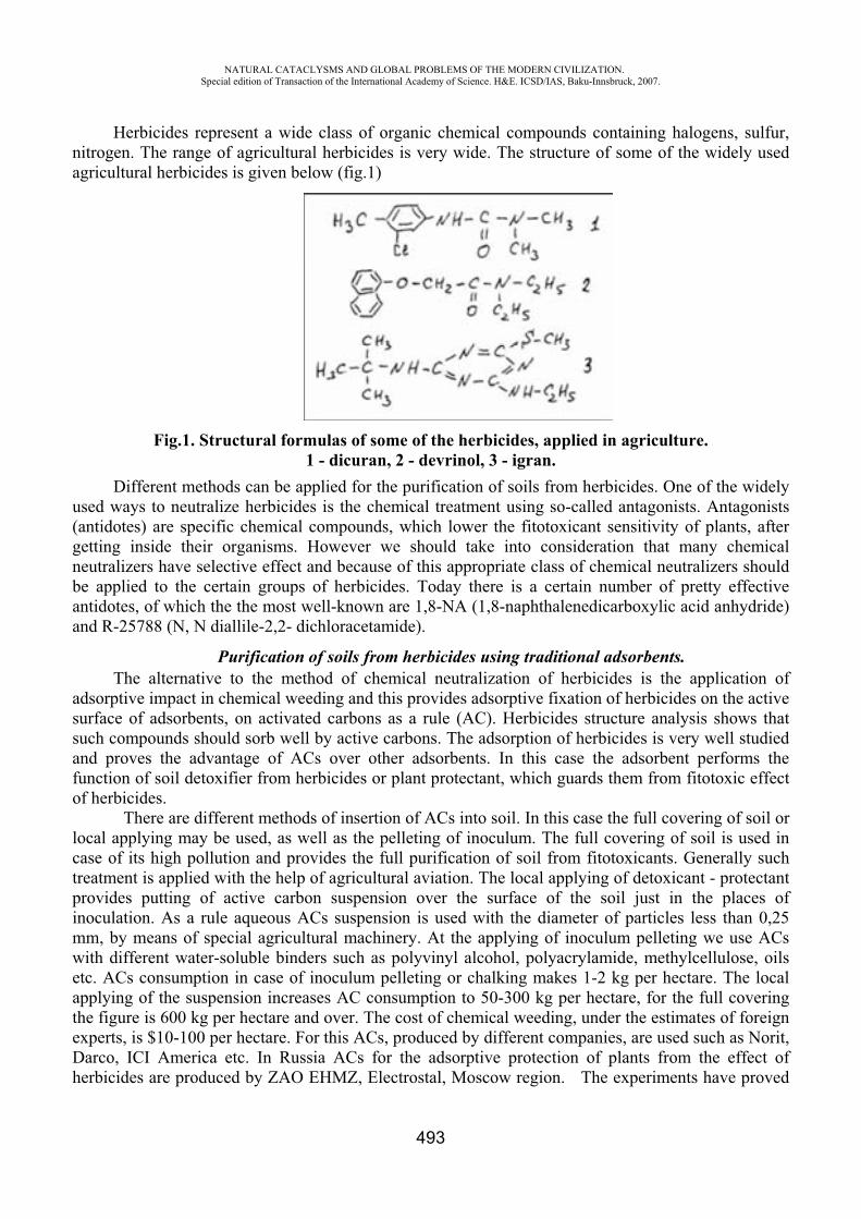
NATURAL CATACLYSMS AND GLOBAL PROBLEMS OF THE MODERN CIVILIZATION. Special edition of Transaction of the International Academy of Science. H&E. ICSD/IAS, Baku-Innsbruck, 2007.
493
Herbicides represent a wide class of organic chemical compounds containing halogens, sulfur, nitrogen. The range of agricultural herbicides is very wide. The structure of some of the widely used agricultural herbicides is given below (fig.1)
Fig.1. Structural formulas of some of the herbicides, applied in agriculture. 1 - dicuran, 2 - devrinol, 3 - igran.
Different methods can be applied for the purification of soils from herbicides. One of the widely used ways to neutralize herbicides is the chemical treatment using so-called antagonists. Antagonists (antidotes) are specific chemical compounds, which lower the fitotoxicant sensitivity of plants, after getting inside their organisms. However we should take into consideration that many chemical neutralizers have selective effect and because of this appropriate class of chemical neutralizers should be applied to the certain groups of herbicides. Today there is a certain number of pretty effective antidotes, of which the the most well-known are 1,8-NA (1,8-naphthalenedicarboxylic acid anhydride) and R-25788 (N, N diallile-2,2- dichloracetamide).
Purification of soils from herbicides using traditional adsorbents. The alternative to the method of chemical neutralization of herbicides is the application of
adsorptive impact in chemical weeding and this provides adsorptive fixation of herbicides on the active surface of adsorbents, on activated carbons as a rule (AC). Herbicides structure analysis shows that such compounds should sorb well by active carbons. The adsorption of herbicides is very well studied and proves the advantage of ACs over other adsorbents. In this case the adsorbent performs the function of soil detoxifier from herbicides or plant protectant, which guards them from fitotoxic effect of herbicides.
There are different methods of insertion of ACs into soil. In this case the full covering of soil or local applying may be used, as well as the pelleting of inoculum. The full covering of soil is used in case of its high pollution and provides the full purification of soil from fitotoxicants. Generally such treatment is applied with the help of agricultural aviation. The local applying of detoxicant - protectant provides putting of active carbon suspension over the surface of the soil just in the places of inoculation. As a rule aqueous ACs suspension is used with the diameter of particles less than 0,25 mm, by means of special agricultural machinery. At the applying of inoculum pelleting we use ACs with different water-soluble binders such as polyvinyl alcohol, polyacrylamide, methylcellulose, oils etc. ACs consumption in case of inoculum pelleting or chalking makes 1-2 kg per hectare. The local applying of the suspension increases AC consumption to 50-300 kg per hectare, for the full covering the figure is 600 kg per hectare and over. The cost of chemical weeding, under the estimates of foreign experts, is $10-100 per hectare. For this ACs, produced by different companies, are used such as Norit, Darco, ICI America etc. In Russia ACs for the adsorptive protection of plants from the effect of herbicides are produced by ZAO EHMZ, Electrostal, Moscow region. The experiments have proved
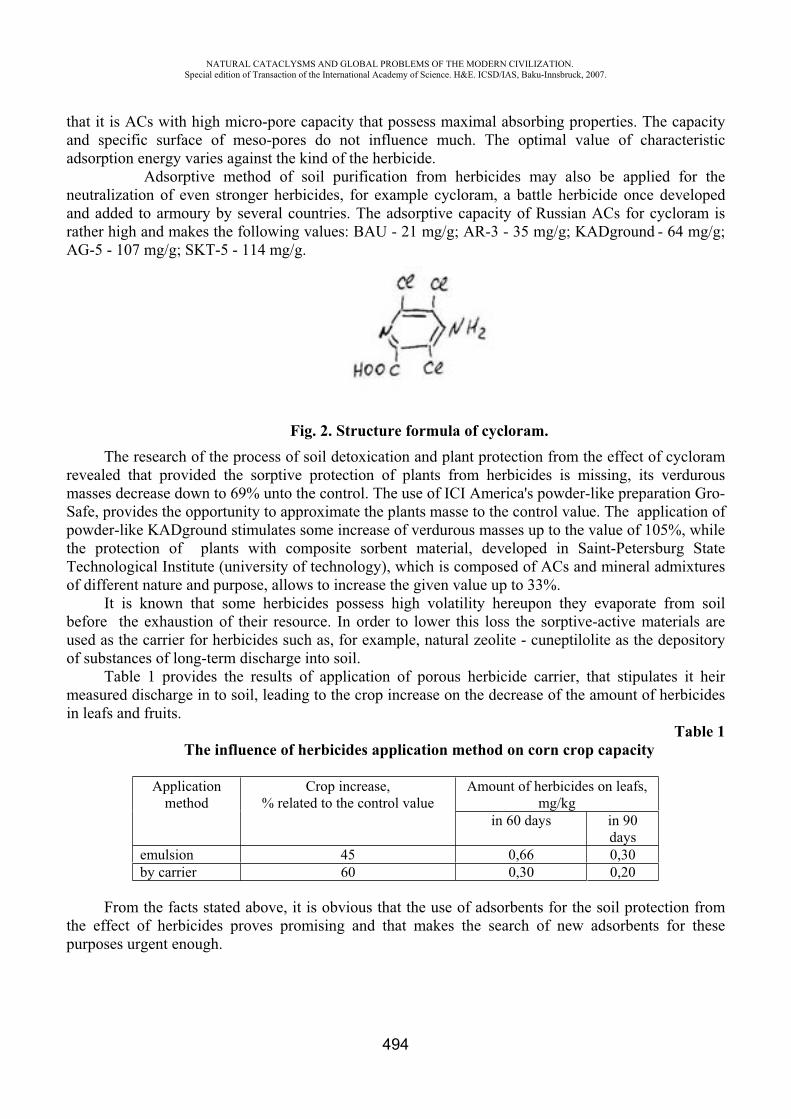
NATURAL CATACLYSMS AND GLOBAL PROBLEMS OF THE MODERN CIVILIZATION. Special edition of Transaction of the International Academy of Science. H&E. ICSD/IAS, Baku-Innsbruck, 2007.
494
that it is ACs with high micro-pore capacity that possess maximal absorbing properties. The capacity and specific surface of meso-pores do not influence much. The optimal value of characteristic adsorption energy varies against the kind of the herbicide.
Adsorptive method of soil purification from herbicides may also be applied for the neutralization of even stronger herbicides, for example cycloram, a battle herbicide once developed and added to armoury by several countries. The adsorptive capacity of Russian ACs for cycloram is rather high and makes the following values: BAU - 21 mg/g; AR-3 - 35 mg/g; KADground - 64 mg/g; AG-5 - 107 mg/g; SKT-5 - 114 mg/g.
Fig. 2. Structure formula of cycloram. The research of the process of soil detoxication and plant protection from the effect of cycloram
revealed that provided the sorptive protection of plants from herbicides is missing, its verdurous masses decrease down to 69% unto the control. The use of ICI America's powder-like preparation Gro-Safe, provides the opportunity to approximate the plants masse to the control value. The application of powder-like KADground stimulates some increase of verdurous masses up to the value of 105%, while the protection of plants with composite sorbent material, developed in Saint-Petersburg State Technological Institute (university of technology), which is composed of ACs and mineral admixtures of different nature and purpose, allows to increase the given value up to 33%.
It is known that some herbicides possess high volatility hereupon they evaporate from soil before the exhaustion of their resource. In order to lower this loss the sorptive-active materials are used as the carrier for herbicides such as, for example, natural zeolite - cuneptilolite as the depository of substances of long-term discharge into soil.
Table 1 provides the results of application of porous herbicide carrier, that stipulates it heir measured discharge in to soil, leading to the crop increase on the decrease of the amount of herbicides in leafs and fruits.
Table 1 The influence of herbicides application method on corn crop capacity
Applicationmethod
Crop increase, % related to the control value
Amount of herbicides on leafs, mg/kg
in 60 days in 90 days
emulsion 45 0,66 0,30by carrier 60 0,30 0,20
From the facts stated above, it is obvious that the use of adsorbents for the soil protection from the effect of herbicides proves promising and that makes the search of new adsorbents for these purposes urgent enough.

NATURAL CATACLYSMS AND GLOBAL PROBLEMS OF THE MODERN CIVILIZATION. Special edition of Transaction of the International Academy of Science. H&E. ICSD/IAS, Baku-Innsbruck, 2007.
495
Forward-looking adsorbents for the purification of soil from herbicides.The processes of soil purification are less studied in comparison with the purification of water,
because of the structural and functional complexity of soil in comparison with water, but we can assume that the mechanism of adsorption of organic compounds from soil is the same as from water. For this reason we shall deal below with the absorptive properties of new adsorbents in relation to the organic compounds from aquatic environment, which can be used as plants’ protectants in future.
In order to increase the sorptive capacity for organic compounds, dissolved in water, ACs are generally used. To increase their sorptive capacity the new method of modifying was developed by us, which is based on the insertion of micro quantities of fullerenes into the porous structure of ACs. Fullerenes extract is used as the modifying agent. The insertion of fullerenes is carried out from water solution, using different organic compounds of specific structure to stabilize it. Active carbons modified with fullerenes hereinafter referred to as ACM.
The research of adsorptive properties of the obtained material (table 2) revealed that such modification does not result in considerable change of porous material structure, characteristic adsorption energy’s well as the limit capacity of adsorptive space, defined by benzene fume.
Table 2
Characteristics of the adsorbents used
Sample Ws on benzene,sm3/g
E, Kilojoule /mole
Ssp,2/g
AC initial 0,35 23.8 1200 ACM 0,33 24.4 1100
The results research of adsorptive capacity of the initial and fullerene-modified ACs in relation to organic compounds from water can be found in table 3.
Table 3 Adsorptive capacity of the initial and fullerene-modified AC on different water
compounds.
Sample Organic compounds, mg/g
Methyleneblue dye,
Mg/g
J-, %
Butanol-1 O-xylol Chlorben-zene
AC initial 1,9 1,4 3,3 225 3,8 ACM 3,4 2,2 4,5 265 6,4
From table 3 we can see that the insertion of fullerenes into ACs allows to increase the adsorptive capacity for organic compounds dissolved in water: for butanol-1 – 35%, o-xylol – 52%, chlorbenzene – 40%. At such modification there is also a considerable increase for J- (70%) and methylene blue dye (20%).
We may assume that the increase of adsorptive capacity of ACs at the insertion of fullerenes because of the change of chemical structure of adsorbent's surface.
NATURAL CATACLYSMS AND GLOBAL PROBLEMS OF THE MODERN CIVILIZATION. Special edition of Transaction of the International Academy of Science. H&E. ICSD/IAS, Baku-Innsbruck, 2007.
496
The considerable increase of adsorptive capacity for water-soluble organic compounds, as well as for dyes at the insertion of fullerenes into porous structure of active carbons allows to use this method of modification to create highly active adsorbents for the purification of aquatic environments. Thus drawing certain analogy, it is possible for us to make the inference that fullerenes-modified ACs may successfully be applied for the purification of soils and grounds from toxic organic compounds.
REFERENCES
1. V. A. Zakharenko. The herbicides. – Moscow: Agropromizdat, 1990. 2. V. G. Bezuglov. The application of herbicides in high farming. – Moscow.,
Rosagropromizdat, 1988. 3. V. V. Chebykin. Active carbons, elastic sorbents, catalysts, dehydrators, chemical
absorbents. The catalogue. - Cherkassy, 1996
TO THE PROBLEM OF FLU VIRUS A/H5N1 TRANSMISSION THROUGHOUT THE WORLD
Sh.T. Shikhaliyeva
State Advanced Institute for Doctors of Baku, Azerbaijan
Until now the problem of virus, which has considered to be already solved is still a matter of debate and remains one of the important problem in health care. The unique variability of flu virus A still remains the main factor promoting the epidemic and pandemic virus spread. At present there exist two hypotheses concerning the basis of flu virus A variability in this regard.
The first theory is antropogenic and comprises mutations of human virus strain. The second theory is antropozoonotic, which implies a conception of recombination or
hybridization of human strains with animal or avian strains. While a total of 4-5 types of flu virus A circulate in human population, the amounts of flu virus including bird virus achieves 150.
Today flu virus circulating among birds both wild and domestic is of particular importance. Bird flu pathogenesis is worthy of a special mention. Bird flu A spreads by the type of septic
disease with that or another local symptoms including enteritis that enables mass flu virus isolation with feces of wild birds in places of nestling and dwelling as well as soil and water pollution.
The environmental pollution is an additional factor of viral elimination in biosphere (1). Today among highly pathogenic bird virus subdivided into two subtypes H5 and H7, again
however flu virus H5N1 is worthy of noting. After 1878 when in Italy a great outbreak of chicken disease with high lethal outcome has been
observed, another outbreak of chicken flu caused by high pathogenetic agent H5N1 was revealed in Scotland in 1959. Thereafter a total of 24 outbreaks have been observed throughout the world. 14 of them occurred over the past several decades (2).
The fact of coexistence of parallel circulation of human and animal virus with solitary cases of animal and bird flu virus transmitted into human population is well known. A lot of viruses caused in humans a slight disease manifested in the form of viral conjunctivitis followed by recovery. Virus H5N1 has found to be an exception.
NATURAL CATACLYSMS AND GLOBAL PROBLEMS OF THE MODERN CIVILIZATION. Special edition of Transaction of the International Academy of Science. H&E. ICSD/IAS, Baku-Innsbruck, 2007.
497
In 1997 after virus has been circulated among chickens within some months, it mutated and acquired a very high pathogenicity: mortality among chickens comprised 100%. The avian flu virus H5N1 has concurrently been detected among humans: 18 cases has been observed, six of them have a lethal outcome. This pathogenetic virus as yet observed in 1997 has not been noted till 2003.
Since 2003 till now there were observed next outbreaks of bird flu caused by H5N1 in some countries such as China, Korea, Viet-Nam, Japan, Indonesia, Cambodia, etc.
The geography of outbreaks above said once more confirms a theory of new epidemic flu virus spreading in the countries of Southeast Asia and Oceania where the presence of crowded population and abundance of animal population is combined with flight routes of wild birds.
During the outbreak in Asia 120 million domestic birds died within 3 months. Moreover, a fact of pathogenic capability manifestation (features) of flu virus A/H5N1/ among
wild birds has been noted. Circulation of virus above said among migrated wild birds is worthy of mention as being of potential interest and practical importance and also being a factor of virus elimination in the environment, namely among domestic birds, watery space with birds contaminated in water and near watery spaces. In the process of virological investigations related to H5N1 circulation the large-scale fact of epizooty of wild birds has been detected.
Epidemic significance of wild birds including waterfowl, which gives the virus the chance to evolve and spread to a large distance and which can be assessed as a natural reservoir for all subtypes of flu A should be emphasized.
Accordingly, the present finding, that is the isolation of virus H5N1 not only from domestic and also from wild birds both at watery and near watery spaces may confirm a well-known fact of viral rotation in nature (1).
A case above said we observed in Azerbaijan in 2006. In 2006 eight clinically marked cases of people who are infected with bird flu virus A/H5N1 have been observed in the territory of Azerbaijan. Five of them died. However, no cases of infection spread from human to human transmission was observed.
The epidemiological investigations showed the contact of people who has been infected and died in this region from fallen wild swans. This fact was an example of bird virus transmitted in human population and single prevention of species-specific barrier.
Accordingly, it is therefore should be noted of the presence of flight routes of wild birds through the territory of Azerbaijan, namely through Salyan district where the cases of H5N1 disease have been revealed.
The Azerbaijan is a unique region by its climatic and geographic parameters, that is we have a subtropical zone identical to natural-climatic parameters of Southeast Asia. In the presence of Kyzyl-Agach reserve, Absheron peninsula with a lot of cattle-breeding farms in crowded places, some islets with wintering of wild birds including waterfowl present optimal conditions for interaction of various populations, ecological contacts between human and animal flu virus (1).
Again, however, the fact of ongoing detection of contaminated cases with bird flu virus H5N1 isolation among wild and domestic birds and in some European countries such as Germany, Belgium, France, Great Britain and USA should be emphasized.
According to WHO data in 2002 a total number of cases infected with flu virus A/H5N1 among people was 318. Out of them 192 (60%) had a lethal outcome.
The facts of ecological change of people infected as well as change of a pathogene itself have multiple preconditions for feasible forming of H5N1 as a pandemic virus.
The confirmation of people contaminated with strain H5N1, which has a great pandemic potential is of particular importance and has alarm signal from standpoint of capability of pandemic evolution.
NATURAL CATACLYSMS AND GLOBAL PROBLEMS OF THE MODERN CIVILIZATION. Special edition of Transaction of the International Academy of Science. H&E. ICSD/IAS, Baku-Innsbruck, 2007.
498
REFERENCES
1. Sadikhova F.E. Flu virus ecology in the territory of Azerbaijan. The dissertation on completition of a scientiric degru of the dotor, Moscow, 1988: 53-68.
2. Bird flu: The assessment of pandemic threat. WHO, January, 2005: 30-36. 3. Kuznetsov O.K. The main guides on flu virus spread with pandemic potential, the
measures aimed at the prevention of their spread. Research Institute of the Russian Academy of Medical Sciences, Saint Petersburg, p. 5.
4. Sadikhova F.E. The results of ecologo-epidemiological, virological and clinicopathomorphologic investigation of human flu etiologically related to avian flu virus /H5N1/ p. 3. Proceedings of A. Aliyev State Advanced Institute for Doctors.
ARIDIZATION AND DESERTIFICATION AS THE FACTOR DECREASING FERTILITY OF SOILS
Khalilov T.A.
Azerbaijan, Baku State University
One of the biggest social and economical problems of nowadays, in solving of which interested people of the whole world, is the problem of preservation of the environment.
At the modern stage, aridization and desertification processes envelop not only one or two countries, but great regions. Therefore in some countries of arid regions these processes have peculiar commonality and distinctions.
Today, while discussing the outlets of the global crisis, threatening by distraction of all biosphere of the Earth and already visible undermined spiritual basis of human being, as “Ecologically secure” future it’s offering the concept of the “Stable development” of society. In a number of native scientists such “Stable development” has noospherical (by Vernadsky) perspectives. As the splendid scientist Vernadsky understood the meaning of Noosphere it’s the level of orderliness of biosphere, originated and managed by scientific conception, and scientific conception by itself is planetary occurrence (5).
In conditions of ecological crisis, which is due to the fact not of overpopulation, but west industrial civilization consequence of incursion in traditional societies of which exactly is demographical explosion, it’s impossible not include the task of preservation in organization and decision of questions.
One of the global problems of 21st century is preservation of soils and increasing of its fertility. Soil scientists of the world forced all of their efforts to decision of this problem under the slogan “Let’s save our soils”. Soil specialists of Azerbaijan also make researches on these vital problems and have reached some certain success.
It’s generally known that soil, relations concerning to soil, were historically main determinative factors not only in social-economical relations, but played the role of leading factor even in political and international relations at all societies. It can be said that soil serve as the source of all material riches not dependent on political regime of countries and relation to it didn’t change even in spite of changes in political-social formations.
NATURAL CATACLYSMS AND GLOBAL PROBLEMS OF THE MODERN CIVILIZATION. Special edition of Transaction of the International Academy of Science. H&E. ICSD/IAS, Baku-Innsbruck, 2007.
499
Countries with their political regimes, which showed concern for correct relation to soil, material riches and run correct in this direction, were survived, whereas countries not know how to regulate these directions vanished from the face of the earth in a short time.
Moisture famine, intensity of erosion, salinization, alkalinity, crop of rocks, short-cut humic horizon, low humusity and also various types of pollution are reside to soils of arid zones with complicated naturally soil- ecological conditions.
As in other arid countries of the world soil resources of Azerbaijan republic undergo serious changes in conditions of anthropogenic influence. As the result of longstanding intensive developing (industry, rural economy, life) soil resources are decreasing and ability of fertility is being slacken. Being international problem it exists in all countries of the world. For last 60-70 years the problems with soils abruptly became worst, useful fertility soil resources are slowing down (under the buildings of industrial establishments, roads, channels, water pools, under minerals and communal retreats) and reducing their fertility (3).
Soil resources of the world are gradually losing provision needs of fast growing population. At the beginning of 70th years the UN program on environment protection (UNEP) initiated
beginning of organization of international monitoring network for controlling, prognosis, prevention and efficient intervention in environment protection issues, including issues of the top-soil at our planet (1). According to UNEP, the lose of only irrigated lands of the world as the result of desertification comes to 6 mln./ha and the quarter of the dry land of the planet is under threat of desertification. It is directly damage more than 250 mln. people, and as the result of decreasing the productivity of arable lands and pasture the threat for sources of existence means for more than 1 mlrd. people in more than 100 countries appears.
Desertification of arid zones is one of the causes of destruction of natural environment. As in all arid zones in Kura-Araz lowland of Azerbaijan there are the great prerequisites of desertification.
In desertification of salt type in lowland there is the great influence of increase of Caspian Sea level. There are widespread of dealluvial and the riverside salt-marshes on the east and south - east part of the territory. The territory of sierozem soils widespread at the central part of Kura-Araz lowland comes to 200 thousand ha (i.e. 8% of all square of the lowland). These soils undergo surroundings and powerful degradation of salt-marsh – solonetzs. As in other arid countries the method of irrigation applies in Azerbaijan since the ancient time the same. Basically for irrigation of Kura-Araz lowland uses the waters of Kura, Araz and large in number inflow affluent from the Large and Small Caucasus. But intensive irrigation in our country and also in the north part of Syria-Arabic republic became the reason of appearing some negative processes in irrigative massif. In both of republics the reasons of negative influence on plants are drought and frequent drying winds. For prevention of these negative occurrences as protective action it’s recommended to apply of irrigation, planting of soil protective woodland belt, terracing of the mountainside, application of optimal agrotechnics and other complex soil conservative activities. But unfortunately in both of the regions such kind of activities conducted insufficiently expeditious.
As the result of long-term assimilation nature of these regions undergoes anthropogenic loadings, and assimilated by the plants nutritious elements didn’t return to soil, some changes happened in natural environment, undergo changes and thumbed by some ingredients: soil, growth, and fauna.
At present time all of the degradation undergo soils of republic are in unfavorable conditions. More than 20, 7% of soils undergo strong erosion even so that it’s impossible to use them as pasture and haying. 27 thousands ha of lands have been released from the forest i.e. destructed near Kura line.
There are very few flat forests in republic but they are destructing as a result of economical activity of people. As the result of anthropogenic influence plots of ecologically unfavorable conditions appeared at the territory of Azerbaijan. There were distinguish three categories on the reasons of ecological tensity and on their power of influence at the territory of Azerbaijan by academic
NATURAL CATACLYSMS AND GLOBAL PROBLEMS OF THE MODERN CIVILIZATION. Special edition of Transaction of the International Academy of Science. H&E. ICSD/IAS, Baku-Innsbruck, 2007.
500
B.A.Budagov. (4) According to our opinion the most actual among these categories have been formed under the influence of anthropogenic factors, ecological tensity processes (air, water and soil pollution in industrial cities; pollution of the environment by pesticides), felling of forests; increase surface wash-out’s intensity because of arable and irrigative erosion; salinization (by pollution of sea, surface and subterranean waters).
Researches showed that conducted numerous engineer – land-reclamation actions (especially after 50-es years of the last century) could not fully prevent the processes of soil salinization. At the 80 % of the lowland territory natural landscape undergo to the anthropogenic changes.
Existent in the ecosystems of Kura-Araz lowland processes are going on in several directions under the influence of strong anthropogenic factors. The main factors are: pasture of cattle, agriculture, mining, building of reservoirs, regulated river stock.
During the last 30-40 years agro irrigative landscapes enlarged and approximately came from 50 thousand ha to 70 thousand ha.
The territories of haying (irrigative) changed, but 40-45% of pasture territories undergoes degradation.
From the point of view of land-reclamation, analysis of the climate conditions of Kura-Araz lowland and the North part of Syrian Arabic Republic shows deficiency of irrigative water and necessity of irrigation’s application in wide-spread sierozems and taupe (chestnut colored) soils of the both regions.
Before getting political independence of republic, 80% of all soils were belonging to kolkhozes and sovkhozes.
Nowadays 44.2% of 8.6 mln. ha leaved for government, 31.4% i.e. 2.7 mln. ha passed to municipal authority, and 24.1 %i.e. 2.1 mln. ha passed to private sector. (6) But at the present not all of the soils given to the private sector are in safe conditions and demand their amelioration.
On a whole, it’s significant that conducted in both of the regions land-reclamative actions gave an opportunity to get big crop for long years and had beneficial effect on decrease of salinization of soils. As the result an area of irrigative soils of Azerbaijan reached 1.400 th. ha, and to 700 th. ha in Syria. Unfortunately for the last ten years these soils in Azerbaijan were use insufficiently, mistakes were committed in the usage of land-reclamation systems; the works at between economy and inside economy land –reclamation systems didn’t regulate, agro technical rules didn’t keep, dripping of water from the irrigative channels, didn’t supplied with concrete coating, occurred (90% of irrigative channels of republic are landed) and therefore land-reclamative condition of irrigative fields became worse, even in spite of conducted by the government definite actions, situation stays grave.
As the result of all of these 64% of irrigative territories in either extent case saline at the present time, including 722 th.ha saline weakly, 48.9 th. ha saline middling and 33 th.ha saline heavily, the level of mineralization of waters increased.(7)
At the process of conducting these actions generated ecological changes can bring to increase of vaporization, change of transpiration, speed of water supply and temperature, to the change of quality and quantity of water resources, salinization and alkalinization of soils, degradation and desertification of soils. As land-raclamative systems at the territory of Syria Arabic republic were build comparatively recent, then the conduction of preventive activities is necessary.
Since land reform in Azerbaijan republic finished recently and farmer got the land, farming unions and private persons still are not so rich, and their financial resources for refreshing and building new land-reclamative establishments are still limited, the government must help farmers for appointed period.
It significant that for the last years Azerbaijani government daily conducts politics of assistance to the rural population and to those who has land, particularly according to the decree of the president on “steady” development of regions of Azerbaijan republic in 2007 additional 80 mln. azn were
NATURAL CATACLYSMS AND GLOBAL PROBLEMS OF THE MODERN CIVILIZATION. Special edition of Transaction of the International Academy of Science. H&E. ICSD/IAS, Baku-Innsbruck, 2007.
501
marked out by the government for increase of productivity, for collection of grain crops and purchasing of mineral fertilizing. Great land-reclamation activities conduct on the whole lowlands of republic.
REFERENCES
1. Abdullayeva Z.G. Soil and environment. Works society of soil specialists of Azerbaijan.Baku, 2001, Part VIII, p.115-116.
2. Babayev M.P. Agro soil classifications of anthropogenic soils. Works society of soil specialists of Azerbaijan.Baku, 2001, Part VIII, p.19-27.
3. Babayev M.P., Orujeva G.G., Babayev I.M. Degradation of soil covering and ways of their restoration. Works society of soil specialists of Azerbaijan.Baku, 2001, Part VIII, p.68.
4. Budagov B.A. Ecologically strained territories of Azerbaijan SSR and the ways of their zoning. (Materials of VI conference). Geographical society og Azerb SSR, Baku, “Elm”, 1990, p129-131
5. Vernadsky V.I. Scientific conception as planet occurrence. Moscow, 1991, p. 241-242 6. Mamedov G.S. Samples of soil reforms in Azerbaijan republic. Works society of soil
specialists of Azerbaijan, Baku, 2001, Part VIII, p.7-18. 7. Khalilov T.A. Genetically features, modern soil-ecological characteristics and soil meliorative
districting of irrigative soils in arid zones (atexample of Kura-Araz lowland and north part of Syria Arabic republic) Dissertation work, for receiving the title of the doctor of geographical Sciences. Baku -2006.
DETERMINATION OF CRITICAL DROUGHT ZONES AND DROUGHT IMPACT ON FORESTS AND RANGELANDS OF IRAN, USING SATELLITE IMAGES AND RAINFALL
STATISTICS
Nader Jalali
Soil Conservation and Watershed Management Research Center Tehran, Iran
Abstract The present research work has been carried out for identification of extremely vulnerable areas
to drought in Iran. Limitations of rainfall and climatic changes are caused occurrence of drought in the period ending 2003. Since the vegetation cover is directly linked to water availability. So, any decrease in vegetation cover can be alarmed as an indicator. Monthly rainfall data of about 719 rainfall stations were compared with the long term mean monthly rainfall data, within the five years (1996-2001), in order to find out the deviations from normal condition. The result of this division then converted to drought duration map by summing up the relevant ratios for each station. On the other hand NDVI1
images of each year were prepared, using NOAA-AVHRR images. Then maximum NDVI values were
1 Normalized Difference Vegetation Index
NATURAL CATACLYSMS AND GLOBAL PROBLEMS OF THE MODERN CIVILIZATION. Special edition of Transaction of the International Academy of Science. H&E. ICSD/IAS, Baku-Innsbruck, 2007.
502
obtained among of these images as well. The maximum NDVI values of each year then compared with the maximum NDVI values of the reference year. I this respect beginning the period of study (1996-1997) is taken as a reference year. Result of this comparison led to production of vegetation cover changes map. This map is classified by making use of the criteria stated by Jensen, 1987. Areas faced to simultaneous decrease on vegetation cover and persistence of severe drought for more than 6 month per a year, were assumed as extremely or effective drought zones. Analysis showed that among of vegetation covers, sparse forests and rangelands are highly affected by extreme droughts and in the contrary damage to dense forests and irrigated lands were not severe.
Key words: Rainfall, NOAA-AVHRR images, Vegetation Index, Drought, Land-cover and Iran Introduction Drought is one of the big challenges of human all over the world, particularly in dry and semi-
dry regions. Without any doubt annual rain fed herbs, rangeland and forests are more vulnerable to shortage of water. Therefore, any information on spatial extent of extreme droughts can facilitate better management of drought and consequent risks. In this article an attempt was made to develop a methodology for identification of regions that were attributed to extreme droughts, by making use of long term rainfall data and satellite images. In second step, impact of severe drought on sensitive plant covers is estimated. Drought is identified as continuous and abnormal shortage of moisture within a certain period. Shortage of moisture or water is identified by comparing with mean conditions (Palmer, 1965). Investigation on occurrence of drought in Iran, shows that it has been iterated in 10 years ending 2003 (Razie, et al, 2003). Khalatbari (2001) also believes that droughts of the period of 1994 to 2001 was one of the severest drought after 1957 in Iran. This implies the selected period for study is exactly coincides with in the drought period. Satellite derived vegetation indices have also been used for drought studies and it has been found that these indices are highly correlated with monthly rainfall (Dami zade, et al, 2003). Literatures verify the applicability of remotely sensed and rainfall data to drought studies as well. Therefore further attempts were made to develop a methodology not only for drought severity estimation but also for mapping of spatial extent of extreme droughts and its impact on green vegetation covers in a certain period.
Materials and the methods In order to study the impacts of extreme droughts that have been occurred (from 1995 to 2001)
on rangelands and forests of Iran, the required data were provided. Mean monthly rainfall of about 719 rain stations with 26 year records, about 600 images of NOAA-AVHRR for above-mentioned period and land-cover map were the main data set that have been used.
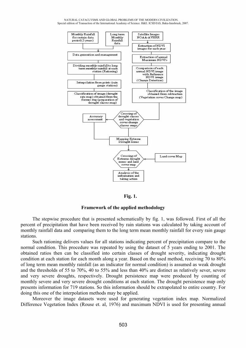
NATURAL CATACLYSMS AND GLOBAL PROBLEMS OF THE MODERN CIVILIZATION. Special edition of Transaction of the International Academy of Science. H&E. ICSD/IAS, Baku-Innsbruck, 2007.
503
Fig. 1.
Framework of the applied methodology
The stepwise procedure that is presented schematically by fig. 1, was followed. First of all the percent of precipitation that have been received by rain stations was calculated by taking account of monthly rainfall data and comparing them to the long term mean monthly rainfall for every rain gauge stations.
Such rationing delivers values for all stations indicating percent of precipitation compare to the normal condition. This procedure was repeated by using the dataset of 5 years ending to 2001. The obtained ratios then can be classified into certain classes of drought severity, indicating drought condition at each station for each month along a year. Based on the used method, receiving 70 to 80% of long term mean monthly rainfall (as an indicator for normal condition) is assumed as weak drought and the thresholds of 55 to 70%, 40 to 55% and less than 40% are distinct as relatively sever, severe and very severe droughts, respectively. Drought persistence map were produced by counting of monthly severe and very severe drought conditions at each station. The drought persistence map only presents information for 719 stations. So this information should be extrapolated to entire country. For doing this one of the interpolation methods may be applied.
Moreover the image datasets were used for generating vegetation index map. Normalized Difference Vegetation Index (Rouse et. al, 1976) and maximum NDVI is used for presenting annual
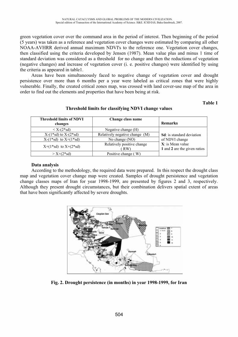
NATURAL CATACLYSMS AND GLOBAL PROBLEMS OF THE MODERN CIVILIZATION. Special edition of Transaction of the International Academy of Science. H&E. ICSD/IAS, Baku-Innsbruck, 2007.
504
green vegetation cover over the command area in the period of interest. Then beginning of the period (5 years) was taken as a reference and vegetation cover changes were estimated by comparing all other NOAA-AVHRR derived annual maximum NDVI's to the reference one. Vegetation cover changes, then classified using the criteria developed by Jensen (1987). Mean value plus and minus 1 time of standard deviation was considered as a threshold for no change and then the reductions of vegetation (negative changes) and increase of vegetation cover (i. e. positive changes) were identified by using the criteria as appeared in table1.
Areas have been simultaneously faced to negative change of vegetation cover and drought persistence over more than 6 months per a year were labeled as critical zones that were highly vulnerable. Finally, the created critical zones map, was crossed with land cover-use map of the area in order to find out the elements and properties that have been being at risk.
Table 1Threshold limits for classifying NDVI change values
Threshold limits of NDVI changes
Change class nameRemarks
< X-(2*sd) Negative change (H) Sd: is standard deviation of NDVI changeX: is Mean value1 and 2 are the given ratios
X-(1*sd) to X-(2*sd) Relatively negative change (M) X-(1*sd) to X+(1*sd) No change (NO)
X+(1*sd) to X+(2*sd) Relatively positive change ( RW)
> X+(2*sd) Positive change ( W)
Data analysis According to the methodology, the required data were prepared. In this respect the drought class
map and vegetation cover change map were created. Samples of drought persistence and vegetation change classes maps of Iran for year 1998-1999, are presented by figures 2 and 3, respectively. Although they present drought circumstances, but their combination delivers spatial extent of areas that have been significantly affected by severe droughts.
Fig. 2. Drought persistence (in months) in year 1998-1999, for Iran

NATURAL CATACLYSMS AND GLOBAL PROBLEMS OF THE MODERN CIVILIZATION. Special edition of Transaction of the International Academy of Science. H&E. ICSD/IAS, Baku-Innsbruck, 2007.
505
Type and acreage of different land covers that have been situated within these critical zones were estimated by overlaying the required maps. Investigations showed that droughts were much severe for 1996-1997 and 1999-2000 in Iran in the period of study. Variations of vegetation cover change classes for the period 1996 to 2000 were illustrated by figure 4. Therefore as it is expectable the sensitive vegetation covers were highly damaged in the above-mentioned years.
While the dense forests and irrigated lands were experienced lesser damages. Amount of damages that havebeen received by land covers due to droughts is presented by table 2.
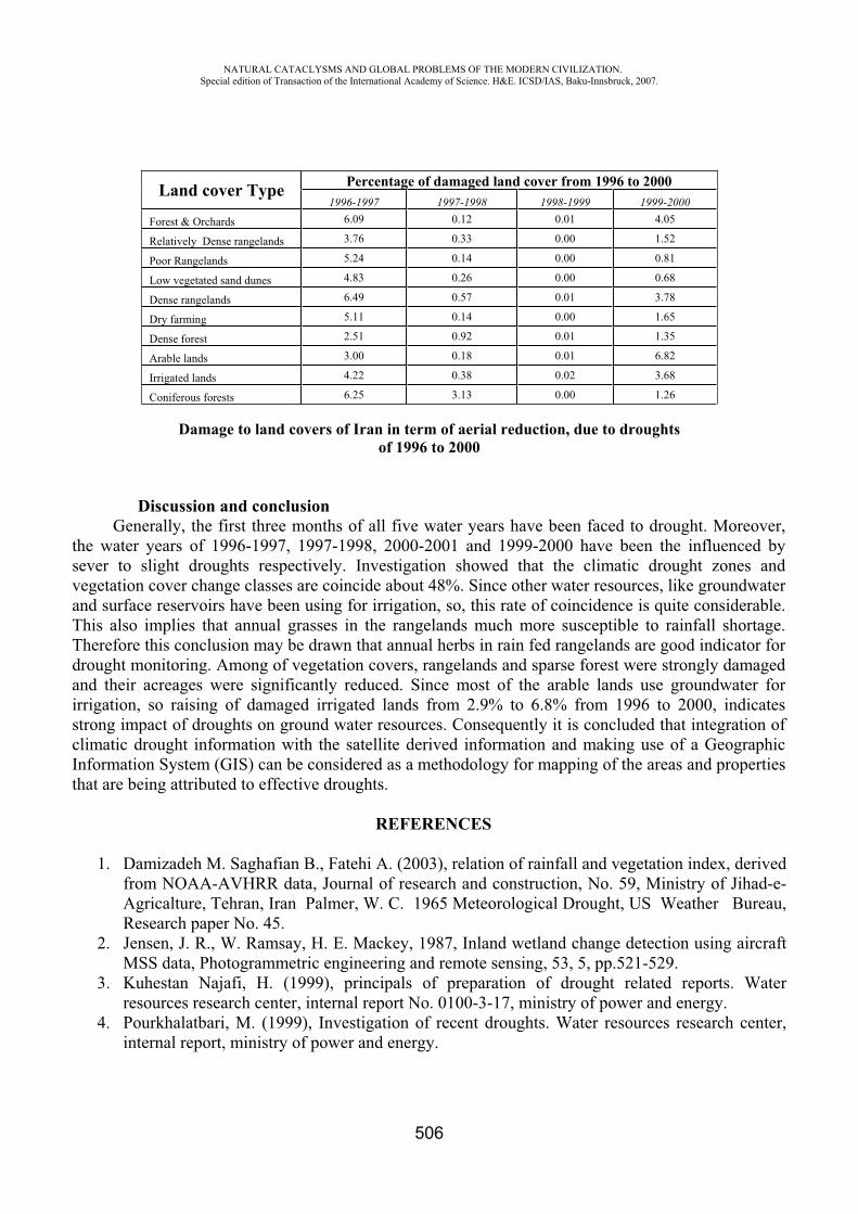
NATURAL CATACLYSMS AND GLOBAL PROBLEMS OF THE MODERN CIVILIZATION. Special edition of Transaction of the International Academy of Science. H&E. ICSD/IAS, Baku-Innsbruck, 2007.
506
Damage to land covers of Iran in term of aerial reduction, due to droughts of 1996 to 2000
Discussion and conclusion Generally, the first three months of all five water years have been faced to drought. Moreover,
the water years of 1996-1997, 1997-1998, 2000-2001 and 1999-2000 have been the influenced by sever to slight droughts respectively. Investigation showed that the climatic drought zones and vegetation cover change classes are coincide about 48%. Since other water resources, like groundwater and surface reservoirs have been using for irrigation, so, this rate of coincidence is quite considerable. This also implies that annual grasses in the rangelands much more susceptible to rainfall shortage. Therefore this conclusion may be drawn that annual herbs in rain fed rangelands are good indicator for drought monitoring. Among of vegetation covers, rangelands and sparse forest were strongly damaged and their acreages were significantly reduced. Since most of the arable lands use groundwater for irrigation, so raising of damaged irrigated lands from 2.9% to 6.8% from 1996 to 2000, indicates strong impact of droughts on ground water resources. Consequently it is concluded that integration of climatic drought information with the satellite derived information and making use of a Geographic Information System (GIS) can be considered as a methodology for mapping of the areas and properties that are being attributed to effective droughts.
REFERENCES
1. Damizadeh M. Saghafian B., Fatehi A. (2003), relation of rainfall and vegetation index, derived from NOAA-AVHRR data, Journal of research and construction, No. 59, Ministry of Jihad-e-Agricalture, Tehran, Iran Palmer, W. C. 1965 Meteorological Drought, US Weather Bureau, Research paper No. 45.
2. Jensen, J. R., W. Ramsay, H. E. Mackey, 1987, Inland wetland change detection using aircraft MSS data, Photogrammetric engineering and remote sensing, 53, 5, pp.521-529.
3. Kuhestan Najafi, H. (1999), principals of preparation of drought related reports. Water resources research center, internal report No. 0100-3-17, ministry of power and energy.
4. Pourkhalatbari, M. (1999), Investigation of recent droughts. Water resources research center, internal report, ministry of power and energy.
Land cover Type Percentage of damaged land cover from 1996 to 2000 1996-1997 1997-1998 1998-1999 1999-2000
Forest & Orchards 6.09 0.12 0.01 4.05
Relatively Dense rangelands 3.76 0.33 0.00 1.52
Poor Rangelands 5.24 0.14 0.00 0.81
Low vegetated sand dunes 4.83 0.26 0.00 0.68
Dense rangelands 6.49 0.57 0.01 3.78
Dry farming 5.11 0.14 0.00 1.65
Dense forest 2.51 0.92 0.01 1.35
Arable lands 3.00 0.18 0.01 6.82
Irrigated lands 4.22 0.38 0.02 3.68
Coniferous forests 6.25 3.13 0.00 1.26

NATURAL CATACLYSMS AND GLOBAL PROBLEMS OF THE MODERN CIVILIZATION. Special edition of Transaction of the International Academy of Science. H&E. ICSD/IAS, Baku-Innsbruck, 2007.
507
5. Razie T., Shokouhi A. Saghafian B. Arasteh P. (2003), Drought monitoring in Iran, using SPI index, third regional and first national conference on climatic change, Tehran, Iran
6. ILWIS, Users and reference guides, ITC publications, Enschede, The Netherlands. 7. Rouse, J.W., R.H.Haas, J.A.Schell, and D.W. Deering, 1973: Monitoring vegetation systems in
the great plains with ERTS, Third ERTS Symposium, NASA SP-351 I: 309-317. 8. Uzma Rabab, 2002 Manipulation of Normalized Difference Vegetation Index (NDVI) for
Delineating Drought Vulnerable Areas, Fatima Jinnah Women University, The Mall, Rawalpindi, Pakistan. http://www.gisdevelopment.net/application/natural_hazards/ drought/nhdr0005pf.htm.
STRUCTURALLY FUNCTIONAL CHANGES OF PHOTOSYSTEM 2 AT UV – IRRADIATION
R.I. Khalilov*, A.N. Nasibova**
*Baku State University ** Institute of Radiating Problems of NASA
Plants frequently are exposed to influence of adverse natural factors, such as high and low temperatures, strong salinity ground, light of high intensity and UV - radiation. UV - radiation is one of the ecological factors, attention-getting researchers last years, in particular, in connection with anthropogenous infringements of an ozone cloud.
In the given work is considered influence UV B radiation on plants, on their photosynthetic device. As the photosystem 2 (PS 2) is the most sensitive macrocomplex of the photosynthetic device, we studied structurally functional changes FS 2 at UV irradiation. In figure 1 is shown scheme of PS 2.
Fig. 1. Scheme of PS 2.
It is found out influence UV of light on allocation of oxygen, phototransport of electron and structural characteristics PS 2 in fragments PS 2. A series of experiments was spent for revealing
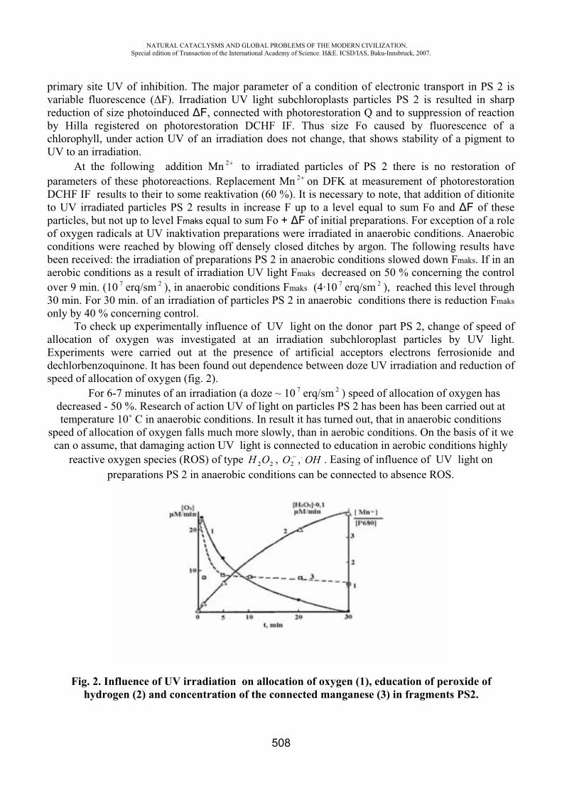
NATURAL CATACLYSMS AND GLOBAL PROBLEMS OF THE MODERN CIVILIZATION. Special edition of Transaction of the International Academy of Science. H&E. ICSD/IAS, Baku-Innsbruck, 2007.
508
primary site UV of inhibition. The major parameter of a condition of electronic transport in PS 2 is variable fluorescence ( F). Irradiation UV light subchloroplasts particles PS 2 is resulted in sharp reduction of size photoinduced F, connected with photorestoration Q and to suppression of reaction by Hilla registered on photorestoration DCHF IF. Thus size F caused by fluorescence of a chlorophyll, under action UV of an irradiation does not change, that shows stability of a pigment to UV to an irradiation.
At the following addition Mn 2 to irradiated particles of PS 2 there is no restoration of parameters of these photoreactions. Replacement Mn 2 on DFK at measurement of photorestoration DCHF IF results to their to some reaktivation (60 %). It is necessary to note, that addition of ditionite to UV irradiated particles PS 2 results in increase F up to a level equal to sum F and F of these particles, but not up to level Fmaks equal to sum F + F of initial preparations. For exception of a role of oxygen radicals at UV inaktivation preparations were irradiated in anaerobic conditions. Anaerobic conditions were reached by blowing off densely closed ditches by argon. The following results have been received: the irradiation of preparations PS 2 in anaerobic conditions slowed down Fmaks. If in an aerobic conditions as a result of irradiation UV light Fmaks decreased on 50 % concerning the control over 9 min. (10 7 erq/sm 2 ), in anaerobic conditions Fmaks (4·10 7 erq/sm 2 ), reached this level through 30 min. For 30 min. of an irradiation of particles PS 2 in anaerobic conditions there is reduction Fmaksonly by 40 % concerning control.
To check up experimentally influence of UV light on the donor part PS 2, change of speed of allocation of oxygen was investigated at an irradiation subchloroplast particles by UV light. Experiments were carried out at the presence of artificial acceptors electrons ferrosionide and dechlorbenzoquinone. It has been found out dependence between doze UV irradiation and reduction of speed of allocation of oxygen (fig. 2).
For 6-7 minutes of an irradiation (a doze ~ 10 7 erq/sm 2 ) speed of allocation of oxygen has decreased - 50 %. Research of action UV of light on particles PS 2 has been has been carried out at temperature 10˚ C in anaerobic conditions. In result it has turned out, that in anaerobic conditions
speed of allocation of oxygen falls much more slowly, than in aerobic conditions. On the basis of it we can o assume, that damaging action UV light is connected to education in aerobic conditions highly
reactive oxygen species (ROS) of type 22OH , ..2 , . Easing of influence of UV light on
preparations PS 2 in anaerobic conditions can be connected to absence ROS.
Fig. 2. Influence of UV irradiation on allocation of oxygen (1), education of peroxide of hydrogen (2) and concentration of the connected manganese (3) in fragments PS2.
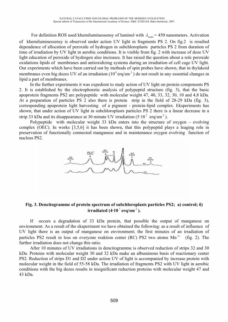
odtilioOmli
2aAcss
cpn
eUpfu
kPmc4
For deof khemiludependenceime of irradight educati
oxidations liOur experimmembranesipid a part o
In the 2. It is estaapoprotein fAt a preparcorrespondinshown, that strip 33 kDa
Polypecomplex (Opreservationnucleus PS2
Fig. 3. D
If ocenvironmentUV light thparticles PSfurther irrad
AfterkDa. ProteinPS2. Reductmolecular wconditions w43 kDa.
NASpecial
efinition ROuminessensy
of allocatiodiation by Uion of peroxipids of me
ments whicheven big do
of membranfurther exp
ablished byfragments Pration of pang apoproteunder actio
a and its disaeptide wit
OEC). In wn of functio2.
Dencitogram
ccurs a det. As a resu
here is an oS2 result in diation does 10 minutes ns with moltion of strip
weight in thewith the big
ATURAL CATACLedition of Transacti
OS used khey is observeon of perox
UV light in xide of hydembranes anh have been ozes UV of nes. periments it y the electrPS2 are polyarticles PS ein light haon of UV liappearanceth moleculaorks [3,5,6
onally conne
mme of pro
egradationlt of the eksoutput of mloss on evnot changeof UV irra
lecular weips D1 and De field of 55
g dozes resu
LYSMS AND GLOion of the Internatio
emiluminesed under ac
xide of hydraerobic con
drogen also nd antioxidcarried outan irradiati
was expedirophoretic aypeptide w2 also the
arvesting oight in subcat 30 minu
ar weight 3] it has beected mang
otein spectrirradiat
of 33 kDasperiment wmanganese veryone reae this ratio.diations in ght 30 and
D2 under ac5-58 kDa. Tults in insign
OBAL PROBLEMSonal Academy of Sc
509
ssensy of luction UV lirogen in subnditions. It iincreases. I
dizing systemt by methodon (10 8 erq/
ient to studyanalysis of
with moleculere is proteof a pigmenchloroplasts
ute UV irrad33 kDa enteen shown, ganese and
rum of subced (4·10 7 er
a protein, we have obta
on environaktion cente
dencitogram32 kDa ma
ction UV ofThe irradiatinificant red
OF THE MODERNcience. H&E. ICSD/
uminol with ight in fragbchloroplasis visible frot has raisedms during ads of spin pr/sm 2 ) do no
y action of Upolypeptid
lar weight 4in strip innt - proteins particles Pdiation (5·10ters into th
that this pin maintena
chloroplastrq/sm 2 ).
that possibained the fonment; the er (RC) PS
mme is obseake an albuf light is accion of fragm
duction prot
N CIVILIZATION/IAS, Baku-Innsbru
maks = 450gments PS 2sts particlesom fig. 2 w
d the questioan irradiatiorobes have sot result in
UV light ond structure 47, 40, 33, n the field n-lipid comPS 2 there i0 7 erq/sm 2
he structure polypeptid pance oxyge
ts particles
ble the ouollowing: as
first minut2 two atom
erved reducuminous bascompanied bments PS2 wteins with m
.uck, 2007.
0 nanometer2. On fig.2s PS 2 from
with increaseon about a ron of cell cashown, thatany essentia
n protein com(fig. 3), th32, 30, 10 aof 28-29 k
mplex. Ekspis a linear d).of oxygen
plays a lean evolving
PS2; ) co
tput of mas a result of tes of an ir
ms Mn 2
ction of stripsis of reactiby increase with UV ligmolecular w
rs. Activatio2 is resultem duration oe of doze UVrole peroxidage UV light in thylakoial changes i
mponents Phat the basiand 4,8 kDkDa (fig. 3eriments hadecrease in
n – evolvinaging role i
function o
ontrol; )
anganese oinfluence orradiation o(fig. 2). Th
ps 32 and 3ionary centeprotein wit
ght in aerobiweight 47 an
onedofVdeht.idin
PSica.
3),asa
nginof
onofofhe
30erthic
nd
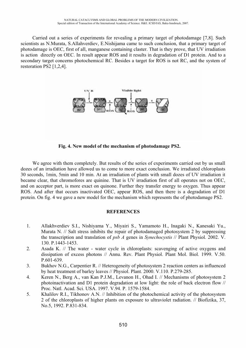
spissr
d3baRp
Carriescientists as photodamags action dir
secondary taestoration P
We agdozes of an 30 seconds, became cleaand on acceROS. And aprotein. On
1. AMth13
2. AdiP.
3. Buby
4. KphPr
5. K2N
NASpecial
ed out a serN.Murata,
ge is OEC, frectly on Oarget concePS2 [1,2,4].
Fig.
gree with thirradiation 1min, 5min
ar, that chroeptor part, isafter that ofig. 4 we ga
AllakhverdieMurata N. // he transcript30. P.1443-
Asada K. // issipation o.601-639.ukhov N.Gy heat treatm
Keren N., Behotoinactivaroc. Natl. A
Khalilov R.I.of the chlo
No.5, 1992. P
ATURAL CATACLedition of Transacti
ries of expeS.Allahver
first of all, mOEC. In resu
rns photoch
4. New mo
hem complehave allown and 10 momofores ars more exac
occurs inactave a new m
ev S.I., NisSalt stress
tion and tra1453.The water
of excess ph
., Carpentiement of barlerg A., van ation and D
Acad. Sci. U., Tikhonovoroplasts ofP.831-834.
LYSMS AND GLOion of the Internatio
eriments forrdiev, E.Nismanganeseult appear Rhemical RC
odel of the m
tely. But rewed us to comin. At an ir
re quinine. ct on quinotivated OEC
model for th
RE
hiyama Y.,inhibits the
anslation of
- water cyhotons // A
er R. // Heteley leaves //Kan P.J.M
D1 protein dUSA. 1997. Vv A.N. // Inhf higher pla
OBAL PROBLEMSonal Academy of Sc
510
r revealing shijama camcontaining
ROS and it rC. Besides a
mechanism
esults of theome to morerradiation oThat is UV
one. FurtherC, appear R
he mechanis
EFERENC
, Miyairi Se repair of f psb A gen
ycle in chloAnnu. Rev.
erogeneity o/ Physiol. P
M., Levanon degradationV.94. P. 157hibition of t
ants on expo
OF THE MODERNcience. H&E. ICSD/
a primary me to such c
claster. Tharesults in d
a target for
m of photod
e series of ee exact concof plants witV irradiationr they transfROS, and tm which re
CES
S., Yamamophotodamaes in Synec
oroplasts: sPlant Phys
of photosystlant. 2000. H., Ohad Iat low ligh
79-1584.the photochosure to ult
N CIVILIZATION/IAS, Baku-Innsbru
target of phconclusion,at is they pr
degradationROS is not
damage PS2
experimentsclusion. Weth small don first of alfer energy tthen there ipresents the
oto H., Inagaged photoschocystis //
scavengingsiol. Plant M
tem 2 reactiV.110. P.27I. // Mechanht: the role
hemical actitraviolet rad
.uck, 2007.
hotodamagethat a prim
rove, that Uof D1 protet RC, and th
2.
carried oute irradiated
ozes of UV ll operates nto oxygen. is a degrade of photoda
gaki N., Kystem 2 byPlant Physi
of active oMol. Biol.
on centers a79-285.nisms of phof back ele
ivity of the diation. // B
e [7,8]. Sucmary target oUV irradiatio
ein. And to he system o
t by us smachloroplastirradiationnot on OECThus appea
dation of Damage PS2.
Kanesaki Yuy suppressiniol. 2002. V
oxygens an1999. V.50
as influence
hotosystem ectron flow
photosystemBiofizika, 37
chofon
aof
alltsit
C,ar
D1.
u.,ngV.
nd0.
ed
2//
m7,
NATURAL CATACLYSMS AND GLOBAL PROBLEMS OF THE MODERN CIVILIZATION. Special edition of Transaction of the International Academy of Science. H&E. ICSD/IAS, Baku-Innsbruck, 2007.
511
6. Murata N., Nishiyama Y. // Molecular mechanisms of the low - temperature tolerance of the photosynthetic machinery // Stress responses of photosynthetic organisms./Eds Satoh K., Murata N. Amsterdam, Tokyo: Elsevier, 1998. P.93-112.
7. Nishiyama Y., Allakhverdiev S.I., Murata N. // A new paradigm for the action of reactive oxygen species in the photoinhibition of photosystem 2. // Biochimica et Biophysica Acta. 2006. P 742-749.
8. Nishiyama Y., Allakhverdiev S.I., Murata N. // Inhibition of the repair of photosystem 2 by oxidative stress in cyanobacteria // Photosynth. Res. 2005. V.84. P.1-7.
BIOCENOTIC RELATIONSHIP OF FLU VIRUS A AND SPECIES-SPECIFIC PROBLEMS
F.E. Sadikhova*, S. Imamaliyev**
Republician Antiplague Station of Baku, Azerbaijan
The viral infection is a global and challenging problem of contemporary medicine and still remains a matter of debate for experts throughout the world. The virus, being on the brink of live and inanimate matter with intracellular parasitism at a genetic level, is considered to be a classic model to study the mechanisms of cellular reproduction at a molecular level.
The well-known feature of viral biology including the feasibility of one ecological type of viral interaction with host transmitted into another type (viral genome reverse integration and cell genome), as well as a wide variety of biocenotic relationship of these agents in the nature provide a supporting evidence of a significant viral adaptive potential and rich reserves in their evolution.
Rapid growth of virology over the past several decades are a result of the arising of an increasing number of new viruses. The virus is observed in protozoan prokaryotic organisms (bacteriophages, mycoplasms) just like in lower organisms (water-plants, fungous and protozoan viruses) as well as in higher eukaryotic cells, plant and animal organisms.
Out of just classified viruses a part of human viruses may reproduce in intervertebral organisms and some species can just reproduce in plants. It is therefore likely that there exists a species-specific fact and accordingly a case of its periodical prevention under certain conditions.
The fact above said may be observed in bird flu virus A/H5 N1/ in different parts of world and in Azerbaijan as well.
In February 20, 2006 the first patient with suspected “bird flu” from Sarvan village of Salyan district was hospitalized in Semashko Central Clinic of Baku city suffering from acute abdominal pain and dyspnea.
Despite the treatment conducted, she died on February 23 of acute pulmonary insufficiency. Thereafter, another ten patients were hospitalized from Sarvan village of Salyan district. Irrespective of intensive therapy, three of them have died. Seven patients after have been
recovered, were discharged from Research Institute of Lung Diseases. They all have carried the diagnosis of mild form pneumonia.
Thus, we have 11 cases from Salyan district, four of them had the lethal outcome. Though patients above mentioned were in close relationship and communicated with each other,
person-to-person transmission did not occur.
NATURAL CATACLYSMS AND GLOBAL PROBLEMS OF THE MODERN CIVILIZATION. Special edition of Transaction of the International Academy of Science. H&E. ICSD/IAS, Baku-Innsbruck, 2007.
512
The epidemiological analysis revealed the contact with sick poultry excrements (guano of wild swans) while cleaning their feathers for pillows.
The virological investigation (lethal outcomes) using the PCR-method revealed flu virus A/H5N1/ in blood specimen (3 cases) and in throat culture (one case). Virologically out of seven cases flu virus A/H5 N1/ had been detected in throat culture of three recovered patients using the PCR-method.
In the process of study of lethal outcome we obtained the data of clinical and pathologic picture, characterizing a specific character of human flu infection, which etiologically related to flu virus A/chick/Scotland/59/H5 N1/-/Hav5 N1/.
Rapidly progressing of a disease process within seven days with high temperature, diarrhea, retention of urine, general weakness, catarrhal signs in throat can be referred to them.
Furthermore, the last days before death involved subtotal massive changes in lungs like bilateral pneumonia with lethal outcome from acute respiratory insufficiency.
The pathologic picture is as follows: bilateral hemorrhagic pneumonia with hemorrhagic pleuritis and complications such as hemorrhagic edema of lungs, dystrophic changes in heart, liver and kidneys and erosive-disquamative enteritis.
Thus, the data from clinical and pathomorphological investigations showed a specific character of flu infection in humans, which etiologically was associated with flu virus A/chicken/Scotland/59/H5 N1/-/Hav5 N1/.
It is therefore likely that cases, when bird flu virus A/H5 N1/ infects humans in the territory of Azerbaijan, were an example of species-specific (interspecific) barrier prevention and bird virus once coming across a population of people.
It happens in epidemiologic situations favourable for this circumstance, that is close contacts with contaminated poultry. Moreover, the existence of migration routes of wild birds (swans, gulls, ducks, coots) through Salyan district have, perhaps created favourable conditions for contamination of just domestic poultry of residents’ private houses with infected guano followed by close contact in the process of care and cleaning of sick poultry.
It is also worth noting that the prevention of species-specific barrier is not a novelty at al. In 1979 three hemagglutinating agents were isolated from children of kindergarten # 179 of
Sabunchi settlement (suburb of Baku city on Caspian sea coast) in breakout of acute respiratory disease (ORD) proceeding with high temperature and abdominal pain. The strains isolated are similar to A/Chicken/Germany/ “N”/49/Hav2/Neq1/-/H10N7/, (1).
That was a third case in the world over that period [De Lay, Cambell C, 1970, Sadikhova F, 1982, (1, 2)].
The epidemiological data obtained note of favourable conditions for virus coming across a population of people and presence of wild birds across the territory above said.
A case of isolation of natural recombinant strain of flu virus A/H0Nav2/-/H1N3 from humans under natural conditions first in the world is worthy of a special mention. The virus has been isolated from a 6-year old patient of Govsany settlement (suburb of Baku city) in insignificant outbreak of acute respiratory disease in the family.
The epidemiological situation was similar to that of above said case. This finding did its bit in one of theories – antropozoonotic, the appearance of epidemic strains
of flu virus A. The material reported gives us the basis to note that the process of viral infection in humans and
animals is a process determined by a number of complexes of ecological factors. Currently the problems of viral ecology are of particular importance for deep understanding of
epidemiology of infections caused by them.
NATURAL CATACLYSMS AND GLOBAL PROBLEMS OF THE MODERN CIVILIZATION. Special edition of Transaction of the International Academy of Science. H&E. ICSD/IAS, Baku-Innsbruck, 2007.
513
The results of species-specific barrier prevention by flu virus A /H5N1/-A/chicken/Scot/59/Hav5N1/ and persistent infection transmitted to productive infection open the perspectives in understanding of viral adaptation to varied conditions of reproduction in the organism of various hosts and preservation in surroundings.
It’s why, the prevention of viral infections a lot more exceeds the limits of certain infections and yet systemic antiepidemiological measures, growing into a serious problem of general biological character.
The elucidation of factors promoting the transformation of persistent infection in productive infection in avian organism a consequence of which is epizootic breakout as well as the elucidation of reasons promoting the transmission of animal activated virus into human population is of potential interest.
As for the first issue, we can suppose a series of factors having unfavourable effect on bird physical state, which may predispose to the recovery of latent infection in the organism, namely to transformation of persistent infection into that of productive one.
To these factors can be referred the factors reported below: inconvenient ecological conditions of surroundings: pollution of air, water, fodder, natural changes of natural landscape. For example, due to a 1.5 m fall of Caspian Sea level between 1930 and 1941, there occurred redistribution of waterfowl wintering on its East Sea coast, which related to successful wintering, nesting and formation of mass avian species gathering.
Moreover, natural cataclysms, as for example, geomagnetic deviations may result in accumulation of bioprocesses in various populations of biosystem including viral populations, which can lead to the reversion of that of the latter one and enabled the strengthening of their pathogenic capacities.
As for the second issue, just by the logic of infectious process the increase of pathogenic features of bird virus combined with the conditions of close contact of birds with humans promoted the feasibility of species-specific barrier prevention and infected humans by unusual for them pathogen.
Acknowledgements:
The author wishes to extend her thanks to the staff of epidemiologists, morbid anatomists and clinicians for the material presented, to the staff of NAMRU-3 for the assistance in diagnosing flu in humans using the PCR-method and also to Mrs Akhundzade Gyula for the assistance in translating and preparing the manuscript.
REFERENCES
1. Sadikhova F.E., Mamedbayli D.M., Zakstelskaya L.Ya., et al. Information: The isolation of flu virus A strain from humans by antigen-related hemagglutinin of bird flue virus. Obzor Regionalnogo Tsentra po grippu za I kvartal 1980 goda. Moscow, 1980: 23-24.
2. Cambel C, Webster R, Brecse S. Fowl plague virus from man. J. Infect. Dis., 1970, 122, 6: 513.
3. Lvov D., Zhdanov V., Sadikhova F., et al. Isolation of natural recombinant of flu virus A /H1N3/ from a sick child. Lancet, November 26, 1983, 8361: 1246-1247.
NATURAL CATACLYSMS AND GLOBAL PROBLEMS OF THE MODERN CIVILIZATION. Special edition of Transaction of the International Academy of Science. H&E. ICSD/IAS, Baku-Innsbruck, 2007.
514
MECHANISM OF TRANSPORT SYSTEM OF IONS AND ORGANIC SUBSTANCES INTO MUSCLE CELL BY POLYENE ANTIBIOTIC LEVORIN AND ITS DERIVATIVES
Samedova A.A.*, Sultanova G.H.**, Kasumov Kh.M.***, Kurbanov O.H.****, Huseynova K.F.*****
Institute of Botany, Azerbaijan National Academy of Sciences (Azerbaijan)
The development of new efficient systems in selective transport of ions and organic substances into living cells is one of the most important problem of the clinical medicine. Pathological processes at the human organism at first take defections of ionic channels functioning in cell membranes [1]. It's known, that channels functioning at muscle cell's membranes capable to transfer ions of Na+, K+, Ca++ and monocarbohydrates with definite selectivity for providing the processes of glycolysis and oxidizing phosphorilation for the synthesis of macroergic substances as ATP, creatin-phosphat etc. with high chemical energy [2]. It's well known, that at the pathological processes (ishemia, stenocardia, dropped heart beats, miocardian infarction) in the heart muscle potassium and calcium conductivity and membrane conductivity for carbohydrates sharply inhibits. Due to this case at the pathology skeletal muscles inhibit process of absorption of carbohydrates and rising activity of membrane-linked enzymes. Also organism needs ions, carbohydrates and organic substances, so channels of muscle cells begin to work more intensively. Anyway specific activity of native channels work is limited, thus they do not have capability in time-unit to bring essential quality of organic substances to muscle cells. So it is necessary to activate the work of native cell channels by exogenous substances that are capable to form additional cation-selective channels in muscle cells membranes. As a result of it is necessary to create the new selective transfer system of ions and substances into cell by exogenous carriers. Considering this, it's necessary to solve this problem by search of substances with known molecular mechanism of action that have high affinity to membranes and form ionic channels in cell membranes. Among these substances there are membrane-active channel-forming polyene antibiotics (PA) [3]. PA create structural channels of molecular size in lipid membranes. The main attention at this direction is the search of new transfer system, where membrane-active channel-forming positive charged PA-molecules are used. PA are the single group of substances in the nature that create molecular-size structural channels in cell membranes. We research it by aromatic heptaene PA- levorin. The chemical structure of levorin molecule is shown in Fig.1.
Fig. 1. The chemical structure of levorin molecule [Borowski et al., 1965/1966]
NATURAL CATACLYSMS AND GLOBAL PROBLEMS OF THE MODERN CIVILIZATION. Special edition of Transaction of the International Academy of Science. H&E. ICSD/IAS, Baku-Innsbruck, 2007.
515
This antibiotic contains the few positive charged groups in its structure. In spite of presence of two positive charges in the levorin's chemical structure, this one creates practically perfect selective conductance for cations. This phenomenon is very interesting by fundamental point of view. It is planned to realize the synthesis of new molecules on the levorin's basic. Being a channel-forming substance levorin may induce formation of additional conductive channels in the cell membranes of the muscle tissue. By involving levorin and its new synthesized derivatives into membranes they are capable to give effect of transmembrane transport of ions and carbohydrates that are so necessary in heart pathology. The synthesis of levorin's derivatives is necessary at first for solving question: " How does structural modification of levorin effect on physico-chemical properties of this molecule in the membranes?" and by the second side for creation transport system with the aim of transfer energy-dependent substratums (potassium, calcium ions and monocarbohydrates) into cells. The research of physico-chemical membrane's characteristics at the presence of levorin and its derivatives with the DMSO may create new pharmacological preparates that are effecient in the therapy of heart diseases like ishemia, stenocardia, dropped heart beats, miocardian infarction. So, the maximal efficiency of antibiotics is observed at the dimethylsolfoxide (DMSO) solution [4]. We suggest that molecule of levorin may be effecient in complex with DMSO at this pathology, because among the PA levorin is one of the most efficient compounds. It’s capable to change membrane’s conductivity at very small concentrations 10-9 – 10-8 M. The number of levorin-conducting channels in the membrane depends on antibiotic’s concentration.
Chemical modification of levorin's molecule will be at the hydrophilic part with the changed number of hydroxyl and carbonyl groups in the lacton ring of antibiotic's molecule with the planned therapeutic properties. The receiving of PA-derivatives by chemical modification of different parts in molecule’s lacton ring and research of their physico-chemical properties on bilayer lipid membranes (BLM) gives the unique possibility for theoretical basis of new antibiotic’s synthesis with necessary therapeutic properties.
The study of molecular mechanism of cell membrane’s selective conductivity for ions and organic substances is an actual problem of physico-chemical biology and medicine. Progress in membrane transport’s mechanism is more connected with the antibiotics substances such as valinomycin, alamethicin, gramicidin A and PA. PA have specific role. It’s shown that PA-action’s mechanism is based on the formation in complex with sterols components - cholesterol, ergosterol, 7-dehydrosterol of ionic channels with the specific conductivity in lipid and cell membranes [5]. It is shown that parameters of single ionic channels such as selectivity, conductivity, life-time of channels in open and closed state are settled by structural modification on polyene molecule. PA (amphotericin B, nystatin, mycoheptin and levorin) are used in medical practice by the detail study of antibiotic’s interaction with the cell and molecular mechanism of this process. Levorin is an aromatic PA. Chemical structure of levorin is shown on Fig.1. In opposite of amphoterisin B, nystatin and mycoheptin, levorin contains additional aromatic group in its molecule. The system of linked double bonds, hydrophilic chain, amino- and carboxyl groups in PA-molecules are important structural compounds of the biological activity. The main information about these compound’s functions you can receive at the study of single ionic channels in membranes of PA and their derivatives by method of membrane-potential fixation [6]. This method is based on electrical measurements of single ionic channel’s conductione, their life-time and constant of relaxation time (for large number of channels after removal antibiotics from water solution by perfusion in density gradient).
Mechanism of ionic channel’s selectivity and conductivity formed by PA in membranes is unknown yet. Some authors decide: 1) molecular system that regulate selectivity, takes place at the channel’s entrance; 2) this system is efficient on polar amino and carboxyl groups [7]. But another authors proposed that this system is inside the hydrophilic part of a channel [8]. The main argument to first suggestion is that hydrophilic part of molecule is responsible for selective regulation of ion’s
NATURAL CATACLYSMS AND GLOBAL PROBLEMS OF THE MODERN CIVILIZATION. Special edition of Transaction of the International Academy of Science. H&E. ICSD/IAS, Baku-Innsbruck, 2007.
516
transport through the channel is the presence of definite number of hydroxyl and carbonyl groups in hydrophilic chain of PA molecules. Physico-chemical properties of PA in membranes depend on polar groups structure(they are located in the channel’s entrance) and hydrophilic chain of lacton ring. It’s shown that increasing of carbonyl’s groups number changes channel’s conductivity from anionic to cationic.
As the results of our researches we discovered the single ionic channels formed by amphoterisin B, nystatin, mycoheptin and levorin and investigated their physico-chemical properties in the membranes. There is detected heptaene antibiotic (patent name REZORBIN) that has very high efficiency and selectivity and may be hard on virological, mycological and mattery infections [9].
The using of PA (amphothericin B, nystatin, mycoheptin and levorin) in medicial practise is based on detail researches of molecular mechanism of interaction between these antibiotics and cell. Researches of BLM at the presence of PA give more information about properties of single ionic channels in comparison with cell membranes and give us possibility to prove the suggestion about elementary conductivity units and receive information about molecular processes of ionic channels activity in the membranes in depending of channel-former molecules structure. The synthesis of new levorin's derivatives gives unique possibility for development of theoretical base of new antibiotics synthesis with the certain therapeutical properties.. Last years scientists fortify the creation of new forms of polyene antibiotics and development of new methods of bringing to damaged cells and tissue. Biological activity of PA depends of polien molecule's structure and of solvent type. PA are badly soluble in water, thus molecule's entering to organs and tissues is slowly in the peroral and parentheral inclusion of antibiotics to organism. The research of physico-chemical characteristics of membranes in the presence of levorin and its analogs may create new pharmacological drugs that are efficient in heart therapy ( ishemia, stenocardia, dropped heart beats, myocardial infarction). The research on BLM at the presence of PA gives us more information about the properties of single ionic channels in comparison with cell membranes and acknowledges by experiments the conception of elementary conductance units in membranes in dependence of channel-forming molecule’s structure. The comparative analysis of electrical characteristics of cell and bilayer membranes at the PA-action shows that more parameters of cell membranes characteristics concur with the same ones of bilayer membranes . Channel-forming substances of well known structure modifies BLM and by this way it is possible to determine molecular nature of ionic selectivity of membranes and relationship between molecule’s structure and functions in membranes. The accessibility of PA-molecules to chemical modification opens real possibility for production of new PA-derivations with new physico-chemical properties.
The research of physico-chemical characteristics of membranes at the presence of levorin and its derivatives in complex with DMSO may forms new pharmacological preparations that are efficient in heart therapy, including ischemia and myocardial infarction.
Specifity of our researches is the case of positive charged antibiotic levorin which is capable to transfer via the membranes ions of potassium, sodium and calcium (not anions) and also positive charged organic substances such as guanidine and hydrazine and neutral monocarbohydrates in opposite of work in famous world laboratories are researching the mechanism of PA-action. The levorin’s phenomenon is in its perfect selectivity for cations in cell and lipid membranes in spite of presence of two positive charges in its molecule [7]. By physical point of view positive charged levorin’s molecule will form channels in the membranes with the anion selectivity, but there are only perfect cationic selectivity. So it need careful research of membrane’s selectivity mechanism. We suppose that conductivity system is located on the hydrophilic side of molecule. It needs synthesis of new levorin-based molecules as cationic carrier. Chemical modification of levorin gives us real possibility for creation of new derivatives with new physico-chemical properties and may be created in hydrophilic part of molecule. Molecular nature of poliene channel’s selectivity and the interaction
NATURAL CATACLYSMS AND GLOBAL PROBLEMS OF THE MODERN CIVILIZATION. Special edition of Transaction of the International Academy of Science. H&E. ICSD/IAS, Baku-Innsbruck, 2007.
517
between molecule’s structure and their function in membranes may be define if channel-forming substances modify lipid membranes. The research of physico-chemical membrane’s characterisrics at the presence of levorin and its analogs may creates new pharmacological substances that are efficient at the heart therapy including ischemia and myocardial infarction.
REFERENSES
1. Hubner Ch., Jentsch Th. 2002. Ion channel diseases. – Human Molecular Genetics, v. 11, 20, p. 2435-2445.
2. MacKinnon R. 2003. Potassium channels. - FEBS Lett., v. 555, p. 62-65. 3. Samedova A.A., Kasumov Kh.M. The relationship between the structure and function of
polyene antibiotics as physiologically active substances Eastern Medical Journal, 1998, v3, N 1-2.
4. Ibragimova V., Alieva I., Kasumov Kh., Khutorsky V. 2006. Transient permeability induced by alkyl derivatives of amphotericin B in lipid membranes. - Biochim. Biophys. Acta, v. 1758, p. 29-37.
5. Kurbanov O.G., Kasumov Kh.M. 2004. Levorin, an aromatic heptaene antibiotic and its derivatives in muscle activity. - Antibiotics and Chemotherapy (in Russian), v. 49, 3, p. 40-46.
6. Mueller P., Rudin D.O, Tien H.T., Wescott W.C. 1963. Methods for the formation of single bimolecular lipid membrane in aqueous solution. - J. Phys. Chem. V. 67. P. 534-535.
7. Brajtburg J., Bolard J. 1996. Carrier effects on biological activity of amphotericin B - Clinical Microbiology Reviews, v. 9, p. 512- 531.
8. Kasumov Kh.M., Mekhtiev N.Kh., Karakozov S.D. 1981. Potential-dependent formation of single conducting ionic channels in lipid bilayers induced by the polyene antibiotic levorin A. - Biochim. Biophys. Acta, v. 644, P. 369 – 372.
9. Kasumov Kh. 2004. Positively charged aromatic polyene macrolide antibiotics at treatment of exogenic and endogenic deseases (RESORBIN-PATENT). - International Conference Science and Business Partnerships in Action: Issues and Solutions in Discovery and Use of Novel Biomolecules: Biodiversity and Environment, Russia-Pushchino, 89-90,238.
NON-DRUG THERAPIES OF POST-TRAUMATIC STRESS DISORDERS WITH VARIOUS GENESIS
Zilov V.G.*, Minenko I.A.**
I.M. Sechenov Moscow Medical Academy Moscow, Russia [email protected]
Rehabilitation of persons after posttraumatic stress (PTS) is continued to be very actual. It is become clear to use different therapeutic approaches to solve that problem. Present paper is dedicated to treatment of PTS disorders when various non-drug methods were used. PTS diagnosis was put after sophisticated both objective methods were taken. All of the patients under observation were divided
NATURAL CATACLYSMS AND GLOBAL PROBLEMS OF THE MODERN CIVILIZATION. Special edition of Transaction of the International Academy of Science. H&E. ICSD/IAS, Baku-Innsbruck, 2007.
518
into 4 groups dependant on stress origin. 173 patients of the 1-st group were presented as rangers (special troops) after Chechnya expedition. Second group was presented by pilots and navigators (124 persons). Members of Federal Security Service (32 men and 48 women) were included in the 3-rd group and 74 women after sexual violence formed the 4-th group. All persons were divided into subgroups where various non-drug therapeutic methods were used but psychotherapy (P) was choozen as an obligatory method for every of subgroups. Various non-drug methods: homoeopathy biopuncture (HB), acupuncture (A), manual therapy (MT), electrostimulation with biofeedback (EB) (SCENAR), constitutional homoeopathy (CH) and EEG with biofeedback (EEGB) were used in various combinations to cure. Various degree in efficiency was found when different methods were used. However, HB together with P was found to be more effective in al patients after various origins stressors. Efficiency was observed in 94,7%. Efficiency of 81,3% was found when EEGB with P were used. CH together with P gave 78,9% and efficiency for EP with was observed in 73,1% while for MT+P it was only 65,8%.
Data obtained let to suggest that complex of homoeopathic biopuncture in combination with psychotherapy was found to be optimal for all stress disorders in spite of its origins.
The advantage of that curative complex was presented in absence of side-effects, high degree of safety and economic accessibility for wide groups of population.
THE MIX -VIRAL DIARRHEAS AS PROBLEM OF MODERN CIVILIZATION OF EPIDEMIOLOGICAL SIGNIFICANCE
L.I. Rustamova*, F.D. Tagizadeh**, K.N. Aliyev***, Z.M. Kuliyeva****, T.A. Yunusova*****
The Scientific Research Institute of Medical Prophylaxis named after V.Akhundov
A very common disoder, diarrhea has many causes and may be mild to severe. Childhood diarrhea usually is caused by infection, however, improper diet, malabsorption, and various enteropathies also can cause the condition.
Diarrhea is so commonplace that individuals outside of clinical practice may disregard potential mortality and morbidity. However, approximately 400 children die from complications of diarrheal in the United States each year (8).
Diarrhea is a very common in primary care and emergency department settings, especially for younger than 5 years. Diarrhea accounts for as many as 5% of pediatric office visits and 10% of hospitalizations for this age group. Every year, approximately 500 million children younger than 5 years have at least 1 diarrheal illness. Especially, viral diarrhea is most common in young children. Last years an improvement of specific gravity of mixed infectious (O.Timopheeva, 1983, M.Korsunov, 1989, G.Kozlovskaya, 1996) is marked. Enteroviruses are common and important human pathogens. These include polioviruses, coxsackieviruses, echoviruses and numbered enteroviruses (types 68-71) (5). While vaccines have essentially eliminated polio in the United States, enteroviruses are responsible for an estimated 30 million nonpolio infections in U.S. annually. However, enteroviruses are responsible for a wide spectrum of acute diseases including nonspecific febrile illness, neonatal sepsis, aseptic meningitis, myocarditis and conjunctivitis. Enteroviral aseptic meningitis accounts for
NATURAL CATACLYSMS AND GLOBAL PROBLEMS OF THE MODERN CIVILIZATION. Special edition of Transaction of the International Academy of Science. H&E. ICSD/IAS, Baku-Innsbruck, 2007.
519
over 85% of the aseptic meningitis cases reported and occurs primarily in the late summer and early fall (1,10).
The unnecessary and prolonged hospitalization and use of antibiotics (antiviral) treatment often accompany enterovirus infections, especially in infants and children. This is because of the similarity of enterovirus disease in clinical presentation to other bacteria and viruses. Therefore, prompt and accurate identification of the agent is crucial to effective patient management and cost containment (5).
The results given E.Mendelson (1997) indicate that the outbreak in Israel and Palestinian authority was caused by a variant of Echovirus 4, wihc apparently did not circulate in the area before, and thus was capable of causing a widespread infection (6).
Concering data of M.Kathleen et al. in the United States the annual incidence of encephalitis is about 1 in 200.000 (3,7). Children, the elderly, and immunocompromised persons are most commonly affected. The nonpolio serotypes most often associated with central nervous system infection include echoviruses 7,9,11 and 30, coxsackie virus B5 and enterovirus 71 (9). Rotavirus is the most frequent etiologic agent of severe infantile diarrhea. It has been estimated that in the United States rotavirus enteritis annually accounts for 220-370 hospitalizations per 100.000 children under two years of age. Rotavirus has been found to play an important role in nosocomial infections of children admitted to hospitals (2).
A great role is attended to isolation conditional-pathogenic microorganisms in association with rotaviruses and enteroviruses – Coxsackie A 18,20,24. The carried out studying of virus and bacterial flora of fecal specimens of children Rutorova I., et al. has revealed the certain parallelism between isolation of enteroviruses and prevalence of lactosonegative Esherichia in intestinal microflora (2002). With the purpose of definition etiology of acute intestinal infections al children of early age complex simultaneous bacteriological and virological research of 62 tests of fecal specimens is carried out. Bacteriological research provides use of quantitative characteristics of cultivation by tenfold dilution with the subsequent seeding on dense differential-diagnostic nutrient mediums. Enteroviruses Coxsackie types A 18,20,21,24 and ECHO 11,14,18 were allocated in reaction immunodiffusive presipitation in gel with typospesific serums giving from Institute of Poliomyelitis and viral encephalitis named after M.P.Chumakov (Moscow). The diagnosis of rotavirus infection is accomplished by Biocard-Rota (ANI Biotech. oy, Helsinki, Finland) for rapid detection of rotavirus antigen in fecal specimens (4,11). From among pathogenic isolations are allocated and identified S.typhimurium in 15,8±4,6% of cases, among conditional – pathogenic Gram-negative bacteria – Proteus in 19,04±4,9%, Klebsiella in 11,11±3,95% of samples. Ps.aeruginosa has made 19,04±4,9%, St.aureus – 11,11±3,95%. Various combinations are identified: S.typh. + Coxsackie A 18 + rotavirus (4 cases), Preteus mirabilis + Coxsackie A 20 (2); St.aureus + ECHO 11 (1), Ps. aeruginosa + ECHO 14+ rotavirus (5), Candida + ECHO 11 (1), St.aureus + Coxsackie A 24 (2), Klebsiella + Candida + Coxsackie A 18 (2). Thus, the carried out research has allowed establishing possible simultaneous revealing of two or more isolations both bacterial, and the virus nature to define frequency of detection from them and to characterize their pathogenic activity. Thus, the mix bacterial viral diarrheas is the problem of modern civilization of epidemiological significance.
REFERENCES
1. Benjamin E. Enteroviral meningitis // Pediatric Bulletin, 1999, 16(8), p.493. 2. Cohen, Jeffrey I. Enteroviruses and reoviruses, New-York, Mc.Graw Hill, 1997. 3. Kathleen M., Gutierrez M., Charles D., Prober M. Encephalitis // Postgraduate medicine,
1998, vol.103, N 3. 4. Hughes L. et al. Latex immunoassay for rapid detection of rotavirus // J.Clin. Microbiol,
1984, 20, p.441-447.
NATURAL CATACLYSMS AND GLOBAL PROBLEMS OF THE MODERN CIVILIZATION. Special edition of Transaction of the International Academy of Science. H&E. ICSD/IAS, Baku-Innsbruck, 2007.
520
5. Lieffelholz M. Enterovirus infection on the increase // Hotline, 1998, V, 37, N 3, p.1-2. 6. Mendelson E. Enterovirus outbreaks in Israel the Palestenian Authority Tel-Hashomer,
1997.7. Modlin J., Dagan R., Berlin L. et al. Focal encephalitis with enterovirus infections //
Pediatrics, 1991, 88(4), p.841-845. 8. Richard E. Diarrhea // 2002. 9. Rotbart H., McCracken G., Whitley R. et al. Clinical significance of enteroviruses in
serious summer febrile illnesses of children. Pediatr. Infect. Dis. J. 18(10), p.869-874. 10. Rotbart H., Brennan P., Tife K. et al. Enterovirus meningitis in adults. Clin. Infec. Dis.
27(4), p.896-898/ 11. Sanekata T., Yoshida H. Detection of rotavirus in fatcts by latex agglutination // J. immun.
Methods, 1981, 41, p.377-380.
THE PROBLEMS OF TECHNOGENESIS AND AGROECOSPHERE ADAPTATION
Ilyazov R.G.
The Academy of Sciences of the Republic of Tatarstan Russia, Kazan
Technogenesis is the process of changing of natural complexes under influence of an industrial human activity, which consequence pollution of ecumene is biogeocenose, causing breaking of metabolic and production processes. In agroecosystems show a consequence technogenesis in changing quantitative and quality indicators of natural components, decrease of resistance and efficiency of agricultural animal and cultivated crops.
The problems of adaptation of agrarian manufacture and village mode of life to conditions of technogenesis are one of the most actual in agriculture, biology and medicine and there for scientists of different specialties should find adequate answers.
In our opinion, it is necessary to distinguish three sorts of adaptation of agroecosphere to conditions of technogenesis: informative, resistant and functional. Informative is the organization of toxicological inspection of the soil and provided agro-ecological monitoring, and also revealing of features and the mechanism of influence various pollutants on health of productive animals and the population.Resistant is a complex of protective measures inhabitancies, agricultural production and the population from technogenic pollutants. The functional adaptation is development of agro landscape systems of agriculture and a safety of vital activity of agricultural population.
There is an acute necessity of revealing of various types of technogenesis in agroecosphere with the count of features of adaptation of agribusiness industry to concrete habitat factors:
1. Agrotoxinchemicalixation is the penetrating transformation of landscapes everywhere wide-spread in countryside and soil covering under influence agroproduction with application with various agrochemicals.
2. Radiative is covering the terrains injured of radiation accidents with environmental by synthetic radioactive nuclides. There are zones of ecological crisis or disaster where the systems of counter-measures directed on overcoming of consequences of a radioactive impurity are applied.
3. Oil-and-gas is covering terrains where petroleum and gas refining and also power stations which use gas and oil for fuel are placed.
NATURAL CATACLYSMS AND GLOBAL PROBLEMS OF THE MODERN CIVILIZATION. Special edition of Transaction of the International Academy of Science. H&E. ICSD/IAS, Baku-Innsbruck, 2007.
521
4. Coal is covers terrains where engaged coal output and also thermal power stations on use like fuel are placed.
5. Ferrous metallurgy is terrains of extraction, enrichment of iron oxides and dispositions of factories on manufacture of pig-iron, steel and products from them.
6. Nonferrous metallurgy is terrains of extraction, dressing and disposition factories on extraction of non-ferrous metals.
7. Cellulose and a tree manufacturing is terrains, near by pulp-and-paper combines and factories which manufacture of veneer, chipboards.
8. Transport is routinely overlaps on all set technogenesis, which can be near by motorways, airports, seaports, river ports, objects of pipeline systems.
9. Megapolis is shows in environs of large cities as special type technogenesis, property of the other phylum integrating as the enterprises of different branches and a spectrum pollutant.
10. Hydropower is a special phylum technogenesis, in a complex influencing on an environment and agroecosphere on changing of landscapes.
11. Military are the most destructive phylum of environmental impact and health of people. It differs with big diversification of negative factors down to application of chemical and nuclear weapons.
For the first time we proved the typology of technogenic influences. It is enables to form of the targeted programs. It provides restoration of the favorable inhabitancy and improves health of a population in different regions.
It is necessary to note, that agro ecosphere at least protected from negative exhibiting techno genesis and consequently it more vulnerable at technogenic accidents. For example, explosion of a reactor on the Chernobyl atomic power station has resulted in contamination of huge masses of grounds of agriculture in series of the countries, having broken not only factory-farm enterprise, but also a way of life of agricultural population.
One of consequences technogenesis is technogenic pollution of landscapes, agroecosystems and food with radioactive nuclides, toxiferous elements (in particular, heavy metals) and chemical pollutant (dioxine, benzapilene, residues of pesticides, etc.). They are formed also in normal work of industrial systems. But especially menacing there is a pollution of an inhabitancy at technogenic accidents: not only such scale, as Kyschtym and Chernobyl accidents, but even at oil-extracting regions floods of oil and oil-field waste waters on agricultural grounds because of outbreak of pipe lines.
Three variants are essentially possible at a choice of optimal strategy of protection agroecosphere from technogenic pollution:
The first is all-round limitation of contamination pollutant by ecological modernization of technique and perfection of the production technologies.
The second variant is a form of system of biogeochemical barriers inside agrolandscape and agroecosystems which prevent migration radioactive or toxicants. That is provides reception of a net production in the polluted terrains with application of high technologies in agrarian sphere. Such technology is most widely used strategy. It is implanted in zones with influence of Chernobyl accident and Kyschtym radiation accident.
The third variant is to clear of a soil covering by means of plants – accumulators of radioactive nuclides and heavy metals with the subsequent processing a green material for extraction of metal. This idea is basically tempting. Our agriculture is not yet ready to its use. Researches and experiments in this direction are cost that them to continue.
Today extremely big alarm progressing processes of technogenic pollution of agroecosystems by heavy metals, chemical, organic and others pollutants is in regions awake oil-and-gas production and
NATURAL CATACLYSMS AND GLOBAL PROBLEMS OF THE MODERN CIVILIZATION. Special edition of Transaction of the International Academy of Science. H&E. ICSD/IAS, Baku-Innsbruck, 2007.
522
invoke arrangements petrochemical, metallurgical and motor industry, the enterprises of a fuel and energy complex, and also from exhaust gases of motor transport.
In conditions oil-and-gas technogenesis essential disturbing ecology it has resulted in contamination of soils and grounds, downstroke of efficiency of a soil covering, significant contamination of vegetation and forage lands, and also livestock products salts of heavy metals, phenols and others chemical pollutants is observed.
Intensity of accumulation of heavy metals in grain cultures is influenced with phylums of soils and varietal differences. On grey forest soils and a leached chernozem grain crops accumulate more pollutants. The greatest storage coefficients of heavy metals is in a grain of various agricultural crops are marked at cultivated on leached black earth and dark grey forest soils.
The cow milk is an original marker of environmental by toxiferous elements. High levels of contamination of milk are marked by lead and cadmium in all regions of oil extracting and oil refining (excess of marginal concentrations from 3,1 up to 7,6 times), and concentration of toxiferous elements in milk of cows in a private sector from 3 up to 6 times is higher in comparison with public as the grazing of cattle in a private sector is carried out on not improved pastures, in sanitary buffers of the production enterprises and roadside growing strips.
The comparative assessment of levels of pollution lead of milk of cows in basic economies during different seasons of year has shown, that in a winter stabling period the content pollutant in milk of cows public and a private sector is higher than marginal concentrations from 1,5 up to 2,2 times, but in milk of animals of a private sector is higher from 1,2 up to 2,0 times in comparison with public, that testifies to preparation of the forages polluted with heavy metals for a feeding milch cows in the winter season.
At technological processing milk heavy metals and others pollutants are redistributed on all gamma received by a food stuff. A minimum of heavy metals passed in rural sour cream. So, concentration of lead in it has decreased in 5,9, cadmium – 3,2, copper 2,0, zinc 6,7 and nickel – in 3,3 times from an initial level in milk. The content of cadmium and zinc at processing a whole milk on a sour-milk product – a button – has decreased in 1,3 and 1,25 times, and lead, to copper and nickel remained at a former level.
The greatest of concentration of heavy metals collect in curds from skim milk: the lead load increases in 4,5 time, cadmium – 3,0, copper – 4,0, zinc – 3,9 and nickel – in 3,4 times from an initial level of their content in milk. In lactoserum after technological processing concentration of heavy metals drops in 4,8-16,6 times.
The person is the major finishing part agro ecosphere. We asses torrent of entering of heavy metals in an organism of the countryman in 8 human settlements and 48 personal farmsteads during different seasons a year. Thus high levels of consumption pollutants with food stuffs both adult, and the nursery population fixed. By comparison of actual diurnal entering to a ration of lead and cadmium in an organism of countrymen of this region with allowable diurnal entering, twofold excess is observed, is especial during winter time. On adult population frequency rate of excess of allowable diurnal entering on lead has made 222 %, in the summer – 145 %, and on cadmium in the winter: in the winter – 193 %, in the summer – 81 %.
In region with oil-and-gas techno genesis into organism of children salt heavy metals enter with food much more in comparison with adult population. So, frequency rate of excess of a wood particle board on lead has made 260 %, in the summer – 233 %, and on cadmium: in the winter – 254 %, in the summer – 114 %.
NATURAL CATACLYSMS AND GLOBAL PROBLEMS OF THE MODERN CIVILIZATION. Special edition of Transaction of the International Academy of Science. H&E. ICSD/IAS, Baku-Innsbruck, 2007.
523
Formation of torrents of lead and the cadmium, acting in an organism of the countryman with a diet, basically descends due to milk and milk products, which contribution on lead (in the winter and in the summer) at adult compounds 31-48 %, at children – 34-54 %, and on cadmium – 48-73 % at adult and 59-80 % at children.
The contribution of meat products, crop products and vegetables to formation of a technogenic load from heavy metals on an organism of the countryman compound: on lead – 15-18 %, 15 % and 15-30 % at the adult inhabitant and, accordingly, at children – 14-16, 0,8-1,3 and 20-30 %; on cadmium at the adult inhabitant 13-21, 10-18 and 2,8-7,5 %, and at children – 10-15, 5-9 and 3-14 %.
Such high levels of entering pollutants in an organism of the adult and nursery population with food stuffs are reflected in a level of health of people. High levels of a sick rate of the population it is marked in economically safe region where oil is intensively got and manufactured. In the given region the level of breaking of a reproductive population health exceeds center on republic and the parameter of inborn malformations (28,58 +1,92 %) is in the lead and high levels mortinatality (8,11 +0,56 %) are characteristic stable.
One of essential measures in system of a safety of people and animal from damage effect of contaminants of an environment is the setting of the content of toxiferous elements in forages, agricultural and alimentary production. The establishment of their permissible concentrations, and also injection in practice of design techniques of torrents pollutants is similar to the calculations which were carried out in the attitude of radioactive nuclides.
Now principles and criteria of a setting of the content of heavy metals in parts of trophic chains of agricultural animals are not developed. Complexity of the given problem consists that reacting specifications of the allowable content of heavy metals in soil and forages are not designed.
Translation of animals into a stabling in conditions of technogenic pollution by heavy metals likes zeolites of a different origin, bentonite of sodium, ferrocyanides is essentially reduces a lead load, cadmium, copper and zinc from 1,5 up to 7,0 times in production of milk and guarantee reception of good-quality products of a nursery and dietary feed.
Development of new farm technologies in the conditions of techno genesis, producing clear and good-quality food has become one of priority problems of design ecology.
Now in the decision of a problem of adaptation of agribusiness industry in conditions of techno genesis key value it has generalization of cumulative experience in the different countries. The main role belong to Russian Academy of Agrarian Sciences when in 2001 was International Conference in Moscow for «Agro environmental safety in techno genesis conditions».
In Kazan in June 2006 was International Conference “Radiation accidents and liquidation of their consequences in agro ecosphere» which began stimulate agrarian scientific community to consolidation of efforts in this direction and to form the Regional Concept «Maintenance agro environmental safety in the Republic of Tatarstan» and monographs «Radiation accidents and liquidation of their consequences in agro ecosphere», «Adaptation agro ecosphere to conditions techno genesis» and «Agro landscape a land organization».
Thus, the problems of adaptation of agroecosphere to conditions of techno genesis are one of global problems of a modern civilization and to develop special work for an avoidance of planetary eco-catastrophe.
NATURAL CATACLYSMS AND GLOBAL PROBLEMS OF THE MODERN CIVILIZATION. Special edition of Transaction of the International Academy of Science. H&E. ICSD/IAS, Baku-Innsbruck, 2007.
524
INVESTIGATING CHANGES ARISING FROM INFLUENCE OF THE EFFICIENT FACTORS ON RUNOFF RATE BY USING RAINFALL SIMULATOR
Jalil Vahabi
Soil Conservation and Watershed Management Research Center Iran
AbstractTo simulate different soils behavior with various characteristics from the view point of texture,
vegetation cover and slope versus rainfalls with given intensity and duration, it is necessary to use rainfall simulators in watershed areas and laboratories regarding the absence of enough data. Since it is generally difficult, time consuming and expensive to achieve intended results in natural conditions particularly considering rainfall events. In this research, a rainfall simulator was used to examine the effect of slope, vegetation cover density, clay, sand, slit and soil moisture percentages on runoff yield. A rainfall with 32 mm/h was simulated on 72 experimental plots in Taleghan watershed using the rainfall simulator and the runoff yield was calculated in each experiment. Based on the results obtained, the influential variables on the runoff yield in rainfall intensity of 32 mm/h are respectively vegetation cover density, sand soil moisture, silt, clay and slope percentages according to their importance. One regression relations were also prepared and presented for predicting runoff yield in different conditions regarding the changes in existing independent variables.
Key words: Runoff rate, Rainfall simulator, Slope, Soil moisture, Vegetation covers density. Introduction Surface runoff is a part of rainfall which flows over the land after experiencing surface
evaporation, storage and watershed as well as penetrating into the ground and finally runs out of the basin through main rivers. Accumulation of rainwater and turning into flood, decreases production efficiency in agricultural and range lands after each rainfall event, by washing and transferring considerable amount of fertile surface soil which causes valuable biological resources to be lost in addition to imposing heavy casualties and financial damages to industrial, urban and rural properties. Precise estimation of runoff rate not only can lead to exact appraisal of the design flood and decrease in securing expenses and flood damages but also is of great importance in optimal use and rainfall management and environmental issues.
Runoff yield depends on various factors such as soil permeability, rainfall intensity, slope, initial soil moisture condition, land use, type and density of vegetation cover and soil texture. Considering the above mentioned efficient factors, it is possible to plan for decreasing floodwater volume, flood damages expenses and soil erosion, controlling accelerating erosion and optimal use of rainfall.
Land surface slope accelerates water flow and proportionally erosion magnitude and runoff increase happens (Mazaheri 1984). Soil erosion and runoff over marl formations depends on rainfall intensity to a high degree and the percentage of soil moisture before precipitation (Blum and Gomer 1999). Barthes and Roose (2002) calculated the runoff and erosion rate in small plots with one square meter area using a rainfall simulator after reviewing the results of the experiments; they stated that the results of these experiments could present results almost similar to those of the relations attained from field studies. In this research, the difference between runoff production in the two moisture conditions of dry and wet has been so high and the runoff rate got to near its peak during simulated rainfall in wet soils immediately after a few early minutes of the rainfall. Runoff yield depends on preliminary moisture of the soil and the more the preliminary moisture of the soil the less the infiltration rate and the more the runoff rate became.
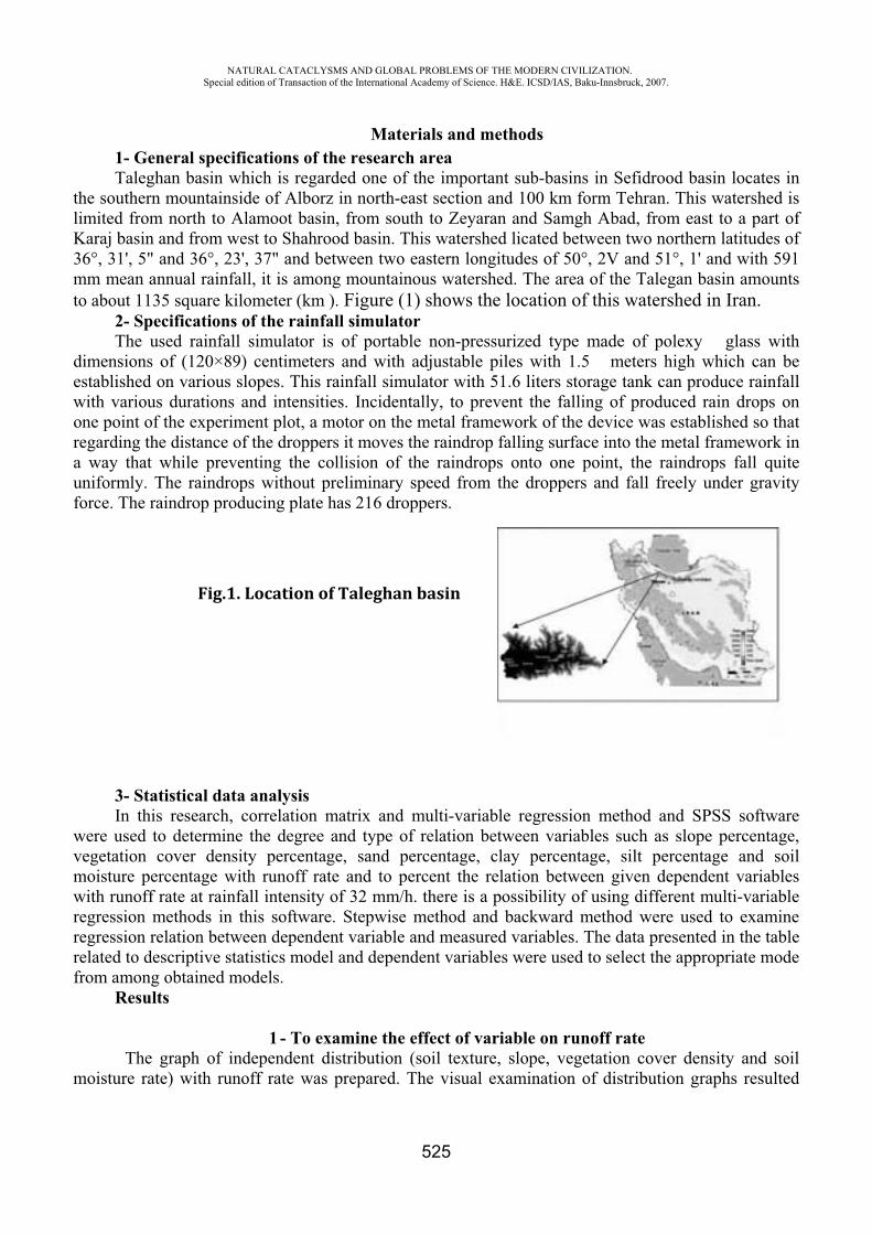
NATURAL CATACLYSMS AND GLOBAL PROBLEMS OF THE MODERN CIVILIZATION. Special edition of Transaction of the International Academy of Science. H&E. ICSD/IAS, Baku-Innsbruck, 2007.
525
Materials and methods 1- General specifications of the research area Taleghan basin which is regarded one of the important sub-basins in Sefidrood basin locates in
the southern mountainside of Alborz in north-east section and 100 km form Tehran. This watershed is limited from north to Alamoot basin, from south to Zeyaran and Samgh Abad, from east to a part of Karaj basin and from west to Shahrood basin. This watershed licated between two northern latitudes of 36°, 31', 5" and 36°, 23', 37" and between two eastern longitudes of 50°, 2V and 51°, 1' and with 591 mm mean annual rainfall, it is among mountainous watershed. The area of the Talegan basin amounts to about 1135 square kilometer (km ). Figure (1) shows the location of this watershed in Iran.
2- Specifications of the rainfall simulator The used rainfall simulator is of portable non-pressurized type made of polexy glass with
dimensions of (120×89) centimeters and with adjustable piles with 1.5 meters high which can be established on various slopes. This rainfall simulator with 51.6 liters storage tank can produce rainfall with various durations and intensities. Incidentally, to prevent the falling of produced rain drops on one point of the experiment plot, a motor on the metal framework of the device was established so that regarding the distance of the droppers it moves the raindrop falling surface into the metal framework in a way that while preventing the collision of the raindrops onto one point, the raindrops fall quite uniformly. The raindrops without preliminary speed from the droppers and fall freely under gravity force. The raindrop producing plate has 216 droppers.
Fig.1. Location of Taleghan basin
3- Statistical data analysis In this research, correlation matrix and multi-variable regression method and SPSS software
were used to determine the degree and type of relation between variables such as slope percentage, vegetation cover density percentage, sand percentage, clay percentage, silt percentage and soil moisture percentage with runoff rate and to percent the relation between given dependent variables with runoff rate at rainfall intensity of 32 mm/h. there is a possibility of using different multi-variable regression methods in this software. Stepwise method and backward method were used to examine regression relation between dependent variable and measured variables. The data presented in the table related to descriptive statistics model and dependent variables were used to select the appropriate mode from among obtained models.
Results
1 - To examine the effect of variable on runoff rate The graph of independent distribution (soil texture, slope, vegetation cover density and soil
moisture rate) with runoff rate was prepared. The visual examination of distribution graphs resulted
NATURAL CATACLYSMS AND GLOBAL PROBLEMS OF THE MODERN CIVILIZATION. Special edition of Transaction of the International Academy of Science. H&E. ICSD/IAS, Baku-Innsbruck, 2007.
526
from the results of the experiments related to mentioned rainfall intensity indicated the most correlation between clay percentage and soil moisture percentage and runoff rate respectively in rainfall intensity of 32 mm/h in the results achieved from the experiments implemented with the two given rainfall intensities. To determine the degree and type of relation of each variables, i.e. slope, vegetation cover density, sand, clay percentage, silt and soil moisture percentages with runoff rate in mentioned rainfall intensity, correlation matrix between given variables were extracted.
Based on correlation matrix results, correlation coefficient of all mentioned variable except for sand percentage and vegetation cover density percentage is positive that indicates the increase in runoff rate with increase in these variables. In other words, with increase in soil moisture, silt, clay and slope percentages, the runoff yield in creases which testifies to a logical relationship between mentioned variables with runoff rate. On the other hand, regarding the negative sign of correlation coefficient of sand and vegetation cover density percentages with runoff rate, with increase in these variables runoff yield will decreases. In other words, with increase in sand and vegetation cover density percentages the outgoing runoff yield will decrease, which enjoys logical justification.
Correlation degree of examined independent variables with runoff rate in runoff intensity of 32 mm/h can be interpreted as follows regarding the quantities of their correlation coefficients: correlation coefficient between slope, silt and sand percentages with runoff rate in runoff intensity of 32 mm/h, the correlation coefficient between slope and clay percentages with runoff rate equals respectively 0.058 and 0.184. Even of the given coefficients are significant statistically, they indicate a very low correlation between variables. The results presented regarding correlation matrix relating to rainfall intensity of 32 mm/h, silt percentage with correlation coefficient of 0.551 with runoff rate in 0.01 level are significant. The variables which their correlation coefficients settle within the range of 0.35 to 0.65 can be used by integrating with other variables for individual and group prediction in multi variable regression with acceptable error. They are also significant in rainfall intensity of 32 mm/h, vegetation cover density and sand percentages respectively with correlation coefficients of -0.872 and -0.702 with runoff rate in 0.01 level. The variables which their correlation coefficients settle within 0.65 to 0.85 can be used in precise individual and group predictions.
2- The correlation relationship between examined variables and runoff rate On of the fundamental gals in statistical investigation is to find a relationship between two or
more variables. These relationships can be used to estimate the quantities of dependent variables for different conditions from the viewpoint of changes in existing independent variables in established relationship. Regarding the fact that runoff yield resulted from creating two rainfall intensity of 32 mm/h were measured separately in 72 experimental plots thus stepwise and backward methods were used to determine and present the relationship between calculated variable including slope, vegetation cover density, soil moisture, clay, silt percentage and sand percentages with runoff rate for mentioned rainfall intensities with runoff rate for mentioned rainfall intensities. The results of the inspection separately for mentioned rainfall intensity were presented as follows:
Stepwise and backward methods have presented altogether six models between independent variables and runoff rate. Through examining descriptive statistics and quantities of and its significance degree in table (2) which exists for models of both methods, the model number 1 of backward method with significance degree of fisher test equals 0.000 which statistically is significantat 99 percent and with R square=0.805 indicates that 80.5% of the observed distribution in dependent variable is justified by five independent variables. The quantity of R=0.897 which implies its proper predicting capability caused it to be selected as an appropriate model for predicting runoff yield in rainfall runoff yield in rainfall intensity of 32 mm/h for different conditions from the viewpoint of mentioned independent variables. Regression coefficients of the selected model were presented in table (2).
NATURAL CATACLYSMS AND GLOBAL PROBLEMS OF THE MODERN CIVILIZATION. Special edition of Transaction of the International Academy of Science. H&E. ICSD/IAS, Baku-Innsbruck, 2007.
527
Table. 2
General relationship coefficients of runoff yield with examined variables
Sig.t
Standardized Coefficients
Unstandardized CoefficientsSymbol of
parameters in model
Parameters of selectedmodel
BetaStd. Error B
.128 -1.543 8.325 -12.847 -(Constant)
.230 -1.211 -.068 .022 -.026 X1Area Slope
(%)
.000 -8.339 -.985 .009 -.076 X2Vegetation
Cover Density (%)
.033 2.179 .159 .015 .034 X3Initial Moisture
(%).026 2.281 .882 .083 .190 X4Clay (%) .056 1.944 1.584 .083 .161 X5Loam (%) .031 2.201 1.683 .085 .187 X6Sand (%)
To examine the regression relationship between dependent variable and calculated variables, a linear relation between them was established expanded. Correlation coefficients between runoff rate and variables such as slope percentage, vegetation cover density percentage, soil moisture percentage, clay percentage, silt percentage, and sand percentage were shown in table (3) By means of data from table (3), linear relation (1) between dependent variable of runoff rate and independent variables such as slope percentage, vegetation cover density percentage, soil moisture percentage, silt percentage and such percentage is found:
589.8155.0133.0159.0009.0058.0028.0 654321 XXXXXXY (1) Concerning the results achieved from relation (1) and by means of calculated data of runoff
threshed, the graph between actual and calculated runoff rate was shown in figure (1). Thus, correlation coefficient of calculated runoff rate and actual runoff rate was calculated as 0.90 and this means that the equation (1) can simulate the actual runoff rate with appropriate precision.
Conclusion and recommendation Reviewing the results of this research and comparing them with the results of the presented
researches indicate a general coordination and consistency in the results. In the results of the reviewed researches the vegetation cover was considered as a factor which had an important effect on runoff and the achieved results also indicate decrease in runoff yield in wet conditions compared to dry conditions. On the other hand, slope was mentioned as a factor which its changes had slight effect on runoff. The results of this research define vegetation cover density and soil moisture percentage as the most influential factors. Also, in both rainfall intensities experimented slope percentage had a low correlation with runoff.
Concerning the method and time limitations of this research the experiments were only implemented for rainfall intensity of 32 mm/h for considering and examining the degree and type of relationship between rainfall intensity and duration it is necessary to plan and conduct supplementary researches. By developing and completing the experiments from climatic condition viewpoint considering all influential factors in runoff yield the possibility of preparing and presenting models with reasonable precision will be provided within the representative watersheds in the country.
NATURAL CATACLYSMS AND GLOBAL PROBLEMS OF THE MODERN CIVILIZATION. Special edition of Transaction of the International Academy of Science. H&E. ICSD/IAS, Baku-Innsbruck, 2007.
528
REFERENCES
1. Barthes, B. and Roose, E.2002. Aggregate stability as an indicator of soil susceptibility to runoff and erosion; Validation at several levels, Journal of Catena, 47: 133-149.
2. Blum WEH. and Gomer D. 1999. Runoff from soils on malrls under semi arid Mediterranean conditions, 105.
3. Mazaheri A., 1984, Generic Pedology, Publications of Shahid Chamran university Iran-Ahvaz.
SRI OF LUNGE DISEASE OF THE HEALTH MINISTRY OF AZERBAIJAN REPUBLIC
F.F. Agayev*, V.A. Abdullayev**, S.I. Mustafayeva***, G.Kh. Mursalova****
Work experience with avian influenza ill in Azerbaijan
Avian influenza is contagious disease that caused by A type influenza virus strains. Disease is spread all over the world. It is considered that all birds are sensitive to the avian influenza infection, but most of the wild bird species transfer these viruses without any obvious signs of harm for their health. (3)
Avian influenza is spreading through large group of various influenza viruses that mainly harms birds. In rare cases avian influenza viruses can infect other biologic species, including swine and humans. In most cases avian influenza viruses don’t infect humans. Pandemic influenza occurs only when appears new influenza subtype that earlier was not observed in humans. (4)
H5N1 virus of avian influenza is one of the influenza strain that has pandemic potential inasmuch as finally it can be adapted b accept strain form that infectious for humans. After this adaptation happens is will be not avian influenza virus but influenza virus that strikes people. Influenza pandemic is caused by influenza viruses that adapted to human organism. (3)
From the middle of December 2003 up to February 2004 influenza ictuses among poultries that caused by H5N1 virus were registered in eight Asia countries (listed registration order of ictuses): Korea Republic, Vietnam, Japan, Thailand, Cambodia, Laos People’s Democratic Republic, Indonesia and China. In most of these countries high pathogenic avian influenza ictus is never observed. (4)
In the end of July 2005 Russia reported about first H5N1 influenza ictus among poultries, and at the beginning of August disease reports followed from part of Kazakhstan’s parts bordering with Russia. In both countries were registered decease cases of wild birds caused by high pathogenic H5N1 influenza. On October 2005 H5N1 virus were confirmed at poultry in Turkey and Rumania. At the beginning of February 2006 during monitoring of Caspian coastwise in material samples taken from dead birds were revealed A type influenza virus and by decision of Health Ministry of Azerbaijan Republic were chosen 2 specialized medical institutions (SI LD and isolation hospital for children 2) under Hospital for possible disease cases among people.
Pulmonology department were supplied with necessary medical equipment, medical products, including viricide ozeltamivir (tameflu 75) recommended by WHO, and proper man-to-man defense equipment that consist of highly effective respirators 95, smocks, protective spectacles and gloves.
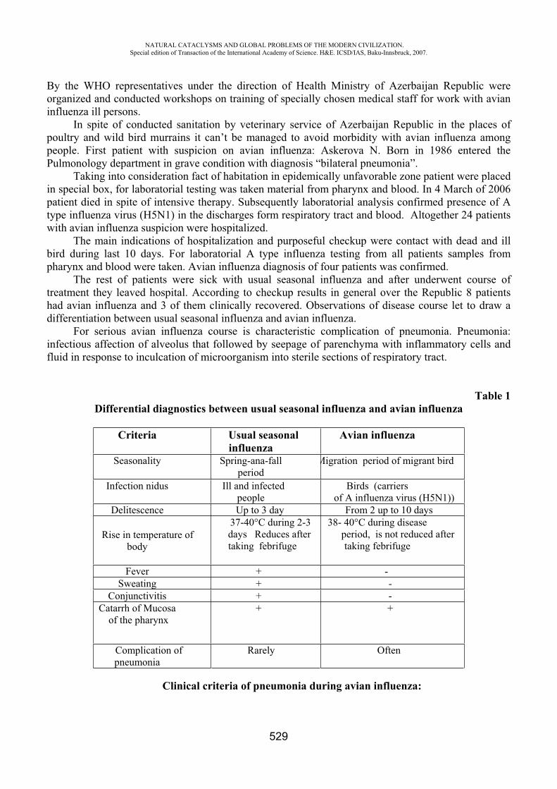
NATURAL CATACLYSMS AND GLOBAL PROBLEMS OF THE MODERN CIVILIZATION. Special edition of Transaction of the International Academy of Science. H&E. ICSD/IAS, Baku-Innsbruck, 2007.
529
By the WHO representatives under the direction of Health Ministry of Azerbaijan Republic were organized and conducted workshops on training of specially chosen medical staff for work with avian influenza ill persons.
In spite of conducted sanitation by veterinary service of Azerbaijan Republic in the places of poultry and wild bird murrains it can’t be managed to avoid morbidity with avian influenza among people. First patient with suspicion on avian influenza: Askerova N. Born in 1986 entered the Pulmonology department in grave condition with diagnosis “bilateral pneumonia”.
Taking into consideration fact of habitation in epidemically unfavorable zone patient were placed in special box, for laboratorial testing was taken material from pharynx and blood. In 4 March of 2006 patient died in spite of intensive therapy. Subsequently laboratorial analysis confirmed presence of A type influenza virus (H5N1) in the discharges form respiratory tract and blood. Altogether 24 patients with avian influenza suspicion were hospitalized.
The main indications of hospitalization and purposeful checkup were contact with dead and ill bird during last 10 days. For laboratorial A type influenza testing from all patients samples from pharynx and blood were taken. Avian influenza diagnosis of four patients was confirmed.
The rest of patients were sick with usual seasonal influenza and after underwent course of treatment they leaved hospital. According to checkup results in general over the Republic 8 patients had avian influenza and 3 of them clinically recovered. Observations of disease course let to draw a differentiation between usual seasonal influenza and avian influenza.
For serious avian influenza course is characteristic complication of pneumonia. Pneumonia: infectious affection of alveolus that followed by seepage of parenchyma with inflammatory cells and fluid in response to inculcation of microorganism into sterile sections of respiratory tract.
Table 1 Differential diagnostics between usual seasonal influenza and avian influenza
Criteria Usual seasonal influenza
Avian influenza
Seasonality Spring-ana-fallperiod
Migration period of migrant bird
Infection nidus Ill and infected people
Birds (carriers of A influenza virus (H5N1))
Delitescence Up to 3 day From 2 up to 10 days
Rise in temperature of body
37-40°C during 2-3days Reduces after
taking febrifuge
38- 40°C during diseaseperiod, is not reduced aftertaking febrifuge
Fever + - Sweating + -
Conjunctivitis + -Catarrh of Mucosa
of the pharynx + +
Complication of pneumonia
Rarely Often
Clinical criteria of pneumonia during avian influenza:
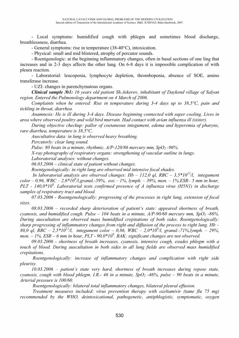
NATURAL CATACLYSMS AND GLOBAL PROBLEMS OF THE MODERN CIVILIZATION. Special edition of Transaction of the International Academy of Science. H&E. ICSD/IAS, Baku-Innsbruck, 2007.
530
- Local symptoms: humidified cough with phlegm and sometimes blood discharge, breathlessness, diarrhea.
- General symptoms: rise in temperature (38-40°C), intoxication. - Physical: small and mid blistered, atrophy of percutor sounds. - Roentgenologic: at the beginning inflammatory changes, often in basal sections of one ling that
increases and in 2-3 days affects the other lung. On 6-8 days it is impossible complication of with pleura reaction.
- Laboratorial: leucopenia, lymphocyte depletion, thrombopenia, absence of SOE, amino transferase increase.
- UZI: changes in parenchymatous organs. Clinical sample 1: 16 years old patient Sh.Askerov, inhabitant of Daykend village of Salyan
region. Entered the Pulmonology department on 4 March of 2006. Complaints when he entered: Rise in temperature during 3-4 days up to 38,5°C, pain and
tickling in throat, diarrhea. Anamnesis: He is ill during 3-4 days. Disease beginning connected with super cooling. Lives in
area where observed poultry and wild bird murrain. Had contact with avian influenza ill (sister). During objective checkup: pallor of coetaneous integument, edema and hyperemia of pharynx,
rare diarrhea, temperature is 38,5°C. Auscultative data: in lung is observed heavy breathing. Percutorly: clear lung sound. Pulse: 80 beats in a minute, rhythmic, A/P-120/86 mercury mm, SpO2 -96%. X-ray photography of respiratory organs: strengthening of vascular outline in lungs. Laboratorial analyses: without changes. 06.03.2006 – clinical state of patient without changes.Roentgenologically: in right lung are observed mid intensive focal shades. In laboratorial analysis are observed changes: Hb – 112,0 ql, RBC – 3,5*1012/l, integument
color – 0,96, WBC – 2,6*109/l,granul.-59%, eoz – 1%, lymph. – 39%, mon. – 1%,ESR– 5 mm in hour, PLT - 140,0*109. Laboratorial tests confirmed presence of A influenza virus (H5N1) in discharge samples of respiratory tract and blood.
07.03.2006 - Roentgenologically: progressing of the processes in right lung, extension of focal sizes.
08.03.2006 – recorded sharp deterioration of patient’s state: appeared shortness of breath, cyanosis, and humidified cough. Pulse – 104 beats in a minute, A/P-90/60 mercury mm, SpO2 -86%. During auscultation are observed mass humidified crepitations of both sides. Roentgenologically: sharp progressing of inflammatory changes from right and diffusion of the process to right lung. Hb – 80,0 ql, RBC – 2,5*1012/l, integument color – 0,86, WBC – 2,0*109/l, granul.-71%,lymph. – 29%, mon. – 1%, ESR – 6 mm in hour, PLT - 90,0*109. BAK: significant changes are not observed.
09.03.2006 - shortness of breath increases, cyanosis, intensive cough, exudes phlegm with a touch of blood. During auscultation in both sides in all lung fields are observed mass humidified crepitations.
Roentgenologically: increase of inflammatory changes and complication with right side pleurisy.
10.03.2006 – patient’s state very hard, shortness of breath increases during repose state, cyanosis, cough with blood phlegm. I.R.- 46 in a minute, SpO2 -46%, pulse – 90 beats in a minute, Arterial pressure is 100/60.
Roentgenologically: bilateral total inflammatory changes, bilateral pleural effusion. Treatment measures included: virus prevention therapy with ozeltamivir (tame flu 75 mg)
recommended by the WHO, deintoxicational, pathogenetic, antiphlogistic, symptomatic, oxygen
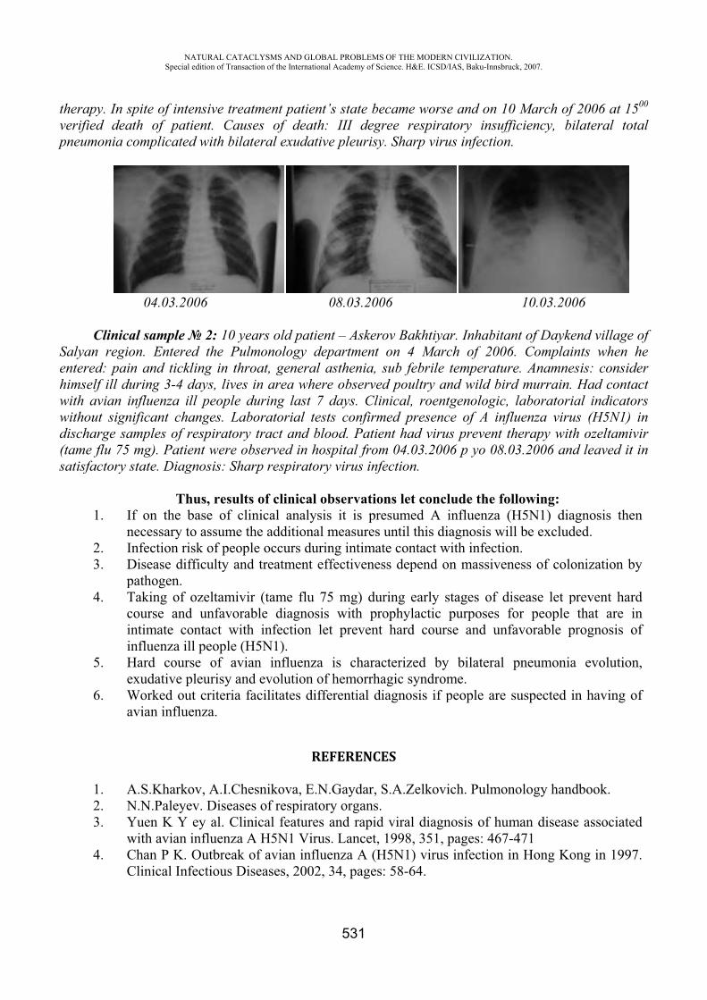
thvp
Sehwwd(s
herapy. In sverified deapneumonia c
ClinicSalyan regientered: paihimself ill dwith avian iwithout signdischarge sa(tame flu 75satisfactory
1. In
2. I3. D
p4. T
cii
5. He
6. Wa
1. A2. N3. Y
w4. C
C
NASpecial
spite of inteath of paticomplicated
04.03.20
cal sampleion. Enteredin and tickl
during 3-4 dinfluenza ilnificant chaamples of r5 mg). Patiestate. Diag
ThIf on the bnecessary toInfection risDisease difpathogen. Taking of ocourse andintimate coinfluenza illHard coursexudative pWorked outavian influe
A.S.KharkoN.N.PaleyeYuen K Y with avian iChan P K. Clinical Inf
ATURAL CATACLedition of Transacti
ensive treatmient. Caused with bilate
006
2: 10 yead the Pulmling in throdays, lives ill people duanges. Laborespiratory ent were obsgnosis: Sharp
hus, results base of clino assume thsk of people
fficulty and
ozeltamivir d unfavorabontact with l people (Hse of avian
pleurisy andt criteria fa
enza.
ov, A.I.Chesev. Diseasesey al. Cliniinfluenza AOutbreak o
fectious Dis
LYSMS AND GLOion of the Internatio
ment patienes of deatheral exudati
ars old patiemonology doat, generalin area wheuring last 7oratorial tetract and bserved in ho
rp respirato
of clinical nical analyshe additionae occurs durtreatment e
(tame flu ble diagnos
infection l5N1). n influenza
d evolution oacilitates dif
R
snikova, E.Ns of respiratoical features
A H5N1 Viruf avian infleases, 2002
OBAL PROBLEMSonal Academy of Sc
531
nt’s state beh: III degrive pleurisy
08.03.200
ent – Askerodepartment l asthenia, sere observed7 days. Clinests confirmblood. Patieospital fromry virus infe
observatiosis it is preal measures ring intimateffectivenes
75 mg) duris with prolet prevent
a is characof hemorrhafferential di
REFERENCE
N.Gaydar, Sory organs. s and rapidus. Lancet, uenza A (H
2, 34, pages
OF THE MODERNcience. H&E. ICSD/
ecame worsree respiray. Sharp viru
06
ov Bakhtiyaon 4 Marc
sub febrile d poultry annical, roent
med presencent had virum 04.03.200fection.
ns let conclesumed A until this dite contact wss depend o
ring early sophylactic
hard cour
cterized byagic syndromiagnosis if p
ES
S.A.Zelkovi
d viral diagn1998, 351,
H5N1) virus: 58-64.
N CIVILIZATION/IAS, Baku-Innsbru
e and on 10atory insuffus infection
ar. Inhabitach of 2006temperaturnd wild birtgenologic,ce of A influs prevent t06 p yo 08.0
lude the foinfluenza (iagnosis wil
with infectioon massiven
stages of dipurposes fse and unf
y bilateral me.people are
ich. Pulmon
nosis of humpages: 467-
s infection i
.uck, 2007.
0 March offficiency, bi.
10.03.200
nt of Dayke6. Complainre. Anamnesrd murrain.
laboratoriafluenza virutherapy with03.2006 and
llowing:(H5N1) diall be exclud
on. ness of colo
isease let pfor people favorable p
pneumonia
suspected i
nology hand
man disease-471in Hong Ko
f 2006 at 15ilateral tota
06
end village onts when hsis: consideHad contac
al indicatorus (H5N1) ih ozeltamivd leaved it i
agnosis thended.
onization by
prevent hardthat are in
prognosis of
a evolution
n having of
dbook.
e associated
ong in 1997
500
al
ofheerctrsin
vir in
n
y
dnf
n,
f
d
.
NATURAL CATACLYSMS AND GLOBAL PROBLEMS OF THE MODERN CIVILIZATION. Special edition of Transaction of the International Academy of Science. H&E. ICSD/IAS, Baku-Innsbruck, 2007.
532
TRIGGERS OF ACUTE CORONARY SYNDROMES AND UNEXPLAINED QUESTIONS OF MEDICINE
Tasch Christoph
Coronary Heart diseases are the number one reason of death in the Western world: more people die annually from CHDs than from any other cause. In the last century the infectious diseases and the illnesses of poverty could be kept under control through the achievements of the modern industrialized civilization, however now acute myocardial infarction (AMI) and sudden cardiac death became more and more important on its social meaning.
The classical theory of the pathogenesis of these heart syndromes reads as follows: A peak of sympathetic activity leads to sudden increase on the demands on the myocardium and/or an alteration in vasomotor tone of the coronary vessels. Erosion and rupture of an atheromatous plaque may arise, leading to the formation of a thrombus, which in turn may cause myocardial ischemia. This may manifest as unstable angina, AMI or sudden cardiac death. But totally unexplained remains, why an infarct enters just now and not already in the innumerable same earlier opportunities. Therefore the major question is what makes daily events so dangerously yet. There is an evidence that psychological and emotional stress can act as a trigger for acute vascular disease and sudden cardiac death but it is much less well understood in which way these factors can precipitate an acute event including sudden death in a person with coronary heart disease.
The presentation will give a survey of happenings, which were associated with an increased incidence of acute myocardial infarction and sudden cardiac death. The causal circumstances and reasons surrounding these syndromes are not known.
In fact football events can lead to AMI and sudden cardiac death among spectators in a soccer stadium. For example a higher mortality in Holland was noticed after a football match lost on penalty kicks by the Dutch team in the 1996 European championship.
Moreover the effects of war threats, earthquakes, terrorism, environmental accidents and holidays on the number of coronary heart syndromes will be discussed
In addition to that the SUNDS phenomenon will be mentioned. Sudden and unexplained death in sleep is a leading cause of death in several Asian populations. The victims are predominantly young men, all in apparent good health, who die within minutes after the onset of agonal respiration during sleep. In most cases the morphological findings are inconspicuous. The mechanism of this syndrome in subjects with apparently normal hearts is totally unknown and so the medicine is faced with an another riddle.
In conclusion the attention will be focused on the reality that classical approaches of medicine can not give causal explanations to the presented facts and that the extended view of cybernetic evolutionary social medicine allows to cast light in these matters.
REFERENCES
1. S. S. Chugh, K. L. Kelly, and J. L. Titus. Sudden cardiac death with apparently normal heart.Circulation 102 (6):649-654, 2000.
2. W. Kirkup and D. W. Merrick. A matter of life and death: population mortality and football results. J.Epidemiol.Community Health 57 (6):429-432, 2003.
3. J. E. Muller, G. S. Abela, R. W. Nesto, and G. H. Tofler. Triggers, acute risk factors and vulnerable plaques: the lexicon of a new frontier. J.Am.Coll.Cardiol. 23 (3):809-813, 1994.
NATURAL CATACLYSMS AND GLOBAL PROBLEMS OF THE MODERN CIVILIZATION. Special edition of Transaction of the International Academy of Science. H&E. ICSD/IAS, Baku-Innsbruck, 2007.
533
4. R. G. Munger. Sudden death in sleep of Laotian-Hmong refugees in Thailand: a case-control study. Am.J.Public Health 77 (9):1187-1190, 1987.
5. Müller-Nordhorn J and Willich SN. Triggering of Acute Coronary Syndromes. Journal of Clinical and Basic Cardiology 3:73-79, 2000.
PERSONAL LIFE EVENTS AS INDIVIDUAL CATACLYSMS AND OUR NEED FOR VARIABLE LOOP CONTROL MECHANISMS
Dr. David Schnaiter
After 30 years of scientific research the general massive health impact of life events is nowadays undisputed and in psychology, medicine and also sociology a wide range of explanations, factor analysis and studies have been made to analyse quantities, qualities and effects of life events as health relevant stressors.
Life events in general can be of diverse nature, can have exogenous causes as in the case of natural cataclysms like floods, fire, hurricanes, or human caused origins like crime, war etc. But as we know since Holmes and Rahe published their famous “Life Stress Inventory” also personal life events followed by a need for social readjustment have a major impact on our individual health. Yet there is still an explanation gap between physical stress mechanisms and their on one side protective, on the other side harmful basic functions and the psychological and social reactions to cope with life events and their effect on our personal health.
What does really happen to us and our physical health status when e.g. our spouse dies after 40 years of marriage and why is it more probable that we will suffer a major health breakdown after a marriage and becoming a mother/father than when getting divorced?
Holmes and Rahe have developed in the late 60ties the so called “Holmes-Rahe Social Readjustment Scale” and hundreds of epidemiologic studies followed, proving, discussing and refining their scale up to nowadays (e.g. Antonovsky, Lazarus, Cohen, Schwarzer or more recently also Geyer, Dohrenwend, Balfour, Kaplan etc. worked on life event researching topics). Examining thousands of patients they and their successors developed rated scales and assessment centers for different life events according to the significance of the life events health impact. It has been shown that the probability to suffer a major health breakdown within the next 2 years is raised up to 80% if during a one year period different life events occur accumulated to one person.
The first thing always mentioned also by students when looking at the scale is that quite a lot of the investigated life events e.g. on the original scale of Holmes and Rahe are “positive” life events, like being promoted in your job, earning more money, outstanding personal achievements, vacations and so on. So why can they be harmful to our health?
– We are still used to think within the basic concepts of eustress and distress, but – without taking into doubt this very important differentiation – this stress concept may be of minor importance than commonly thought.
Kofler’s “Extended View” does not speak about stress, but about limited organisation, coordination and discrimination potentials claimed by every task we, our body, our mind has/or wants to fulfil to survive or simply to reach personal goals. The capacity to control and coordinate these numerous conscious and unconscious tasks is limited and when we reach these limits, we lack potential to cover the needs of the whole system.
NATURAL CATACLYSMS AND GLOBAL PROBLEMS OF THE MODERN CIVILIZATION. Special edition of Transaction of the International Academy of Science. H&E. ICSD/IAS, Baku-Innsbruck, 2007.
534
Depression, grief and fear have a far-reaching health impact that very often can be observed after a couple gets separated through the death of one partner and “death of spouse” is also the highest rated life event within the classical social readjustment rating scale.
But quite a huge part of negative health effects after such a life event is not caused by negative feelings or psychic consequences of the loss itself. It is caused by the need to adjust and re-regulate a large part of our most basic living circumstances and daily routines. So this might be the explanation why a divorce raises the risk for a major health breakdown nearly the same way a marriage together with a honeymoon-vacancy does.
In my contribution I will try to point out how the constant and increasing need for adaptive readjustments caused by life events and chronic hassles is directly connected and in dependency of our variable use of open and closed loop control mechanisms on different physical, psychical and social levels – and what happens when the total capacity for task organisation is overused for a longer time period.
ANTIOXIDANT PROPERTIES OF THE EXTRACT OF SOPHORA
S.A. Mamedli
Institutes of Radiation Problems N S of Azerbaijan
There was carried out research antiradiation activity of an extract of sophora – S phora japonica L. at sharp gamma irradiation of seeds of tobacco and wheat. Preliminary processing of seeds with these preparations resulted in stabilization of the maintenance of pigments of chlorophylls and carotinoids at sprouts of wheat and to decrease in number of chromosomal aberrations in apical meristem of sprouts of tobacco – Nicoti na tabacum L., obtained from the irradiated seeds.
Key words: wheat, tobacco Nicoti na tabacum L., extract of S phora japonica L., seeds, ionizing radiation, pigments, chromosomal aberrations
Introduction. In connection with increase of the maintenance of pollutants of anthropogenic origin with a wide action spectrum, in particular, radionuclide pollution in an environment, actual problem is searching of effective preparations of the natural origin, capable to have protective effect on cells’ genome. Considerable interest to genome protection problem is connected, at least, with two principal causes: necessity development of approaches to protection of cells and organisms from mutagens of the environment and possibility for the majority of protectors to be effective not only against processes of induced mutagenesis but also against carcinogenesis. Antimutagen preparations of a biological origin have advantages before chemical ones as they can be easily obtaind from different plants, wastages, quickly checking up their action on plant and animal test objects [1]. In literature contains a significant number of data about antimutagen effect of crude extracts of many plants [1-3]. Except for antimutagen action, significant interest represents immunostimulating and adaptogenic properties of plant preparations, particularly, preparations from walnut Juglans regia L. [4].
Plant test systems are used as genetic test systems for screening and monitoring of pollution of the environment, for revealing and quantitative estimation influence of factors with genotoxic effect and their applications is recommended by the World Organization of Public Health [5, 6]. Plants can activate non-mutagenic compounds (promutagens) with formation of active mutagens, that makes plant test systems analogue of test systems on the basis of mammal cells. In this connection the data
NATURAL CATACLYSMS AND GLOBAL PROBLEMS OF THE MODERN CIVILIZATION. Special edition of Transaction of the International Academy of Science. H&E. ICSD/IAS, Baku-Innsbruck, 2007.
535
received on plant objects, are acceptable or even more acceptable for extrapolation to the person, than the data received with application of such biological test systems as a bacterium, drosophila, yeast. Leaded calculation of plural correlation has shown a high level of dependence of congenital defects of development from quantity of chromosomal aberrations in epithelial cells of a tunica mucosa of mouth at children and chromosomal aberrations at the plants which have been brought up on water samples which is used by the population [1]. Furthermore application of plants for testing substances with antimutagen and radioprotector properties is represented perspective.
The purpose of the given research was studying radioprotector properties of an extract of sophora – S phora japonica L. by means analysis of biochemical and cytogenetic parameters of plants at an irradiation and at influence of the given preparation.
Materials and methods of research. Protective action of an extract of sophora studied by means of biochemical definition content of pigments of chlorophylls and carotinoids at wheat sort of « Qirmizi bugda », and also with use of a method of cytogenetic estimation number of chromosomal aberrations ( ) in cells root meristems of tobacco Nicoti na tabacum L.
Irradiation of seeds of plants carried out on installation "Rkhund 20000" (60Co) at dozeage rate of radiation 0,5-1 Gy/min.). In experimental variants seeds of wheat and tobacco before exposure to radiation preliminarly processed during 15 hours in the extract of sophora (S phora japonica L.), bringing in 6 ml of the given solution into a variant, in the control used distilled water. Control and irradiated seeds sprouted on a humid filtering paper in Petri dishs at 30-32 º for tobacco and 24-28 ºfor wheat.
For definition quantity of at tobacco in appearance of primary rootlet in the length of 1,5-2,5 sm they fixed in mixture of Karnua (ethyl alcohol: glacial acetic acid in proportion 3:1), in 24 hours transferred to 80 % ethyl alcohol. Coloration made by acetoorcein [2]. Received temporary and permanent preparations. On cytologic preparations counted up number of aberrant anaphases and defined number of chromosomal aberrations ( ) in a cell. At application of anaphase method counted up formed bridges, chromosomal fragments, lagging chromosomes and other damages. In each variant analyzed 100 anaphases and early telophases, not sharing chromosomal aberrations on separate categories as it is recommended in [7, 8]. Frequency of aberrant anaphases expressed in percentage of the overlooked corresponding phases of mitosis (200 on each variant). Quantification contents of chlorophylls both a and b and carotinoids of wheat carried out by spectrophotometricmethod with the using 80 % of acetone [1].
Statistical analysis of the data is carried out by application of nonparametric methods - rank test of Wilkinson-Mann-Witny, a method of signs and rank test of Wilkinson. Statistical analysis of the qualitative data is carried out by application of 2criterion (chi-square) of Pirsaon. In cases of when the number of the data even in one group was less than five, results checked by Fisher's exact method. In application of these methods for statistical treatment has been used computer programs EXCEL 2003 and S-PLUS 2000.
Results and discussion
Influence of the extract of sophora on the content of pigments on wheat. It is known high sensitivity of the pigmentary apparatus of plants to influence of various stressors. For example, at processing the higher water plants by salts of heavy metals change of content and proportion of different pigments were marked for the first day of observation even at the minimal investigated concentration (0,5 maximum permissible concentration) when did not develop yet necrotic damages of tissues and there was no stunt [3]. Stress factors cause changes proportion of chlorophylls /b. Higher plants, in which photosynthesis occurs in normal conditions, contain a great quantity of chlorophyll a than chlorophyll b, i.e. the proportion of chlorophylls /b is normally more than 1. Decreaseing the
NATURAL CATACLYSMS AND GLOBAL PROBLEMS OF THE MODERN CIVILIZATION. Special edition of Transaction of the International Academy of Science. H&E. ICSD/IAS, Baku-Innsbruck, 2007.
536
mentioned proportion to a level less than 1 testifies about shift in photosynthetic system and indicated prevalence processes of destruction of organic substances above their synthesis.
In our experiments the irradiation decreased in the general content of pigments. Previous processing of seeds before irradiation by the extract of sophora decreased reduction of concentration of chlorophyll a in plant tissues caused by influence of irradiation and stabilized concentration of chlorophyll b (tab. 1). At the same time the given effect was even more expressed at rising doze of irradiation. For example, at the doze of irradiation 10 Gy the cecontent of chlorophyll a in a variant processed by the extract of sophora, was approximately 1,2 times higher, than in a variant irradiated without processing. The same tendency was kept in high dozes of irradiation of seeds (tab. 2).
Simultaneously with decreasing contents of chlorophyll a at wheat, received from the irradiated seeds, content of carotinoids decreased, but their relative quantity in relation to chlorophylls grew (tab. 1, 2). Processing by the extract of sophora in the certain degree decreased radiation-induced reduction content of carotinoids in plant tissues (tab. 1, 2). Increasing content of carotinoids at stress loads consider as the protective mechanism prevent from destruction and peroxide oxidation of chlorophylls [5, 1].
Carotinoids are the major antioxidants of lipid nature which protect the cell from influence of singlet oxygen. Antioxidant properties of carotinoids depends on their structure, a degree of affinity to cellular phospholipids and lipoproteids, from localization molecules of carotinoids in membrane and their surroundings, and also from parcial pressure of oxygen [4]. Carotinoids are predecessors of vitamin A and, also possessing powerful antioxidant effect. Thus, the extract of sophora showed stabilizing influence on the content of photosynthetic pigments at plants.
Influence of the extract of sophora on a level of radiating-induced chromosomal aberrations at plant of tobacco. Preliminary processing by the extract of sophora seeds of tobacco up to the irradiation authentically decreased quantity of radiating-induced in root meristems of sprouts (tab. 3). In particular, at dozes of irradiation 5 and 15 Gy quantity of decreased approximately in 1,5 times.
Thus, in use as test system of root meristems of tobacco on parameter output of , it is shown by us, that preliminary processing of seeds by the extract of sophora resulted in significant decrease output of at gamma irradiation that specifies presence at this preparation radioprotector and antimutagen properties.
REFERENCES
1. usiyaka V.K. Antimutagen action of preparations of natural origin // Physiology and biochemistry of cult. plants. - 2001. - V. 33, 3. - P. 216-225.
2. Barilyak I.R., Dugan A.M. Research of antimutagen action of spirituous extracts from culture of tissue of Rhodiola rosea and Polystias ficifolia in experiences on Salmonella typhimurium // Rep. of Ukraine AS. - 1994. - 11. - P. 164-167.
3. Agabeyli R.A., Gasimova T.E., Alekberov U.K. Antimutagen activity of plant extracts from Armoracia rusticana, Ficus c ric , Zea mays and peroxidases in cells of eukaryotes // Cytology and genetics. - 2004. - 2. - P. 40-45.
4. Abdullayev A.S., Farajov M.F., Azizov I.V. Oil of a walnut as immunostimulating and radioprotective means from action of various factors of natural-technogenic origins // Safety problem of nuclear power plants and Chernobyl. - 2005. - Issue. 3. Part. 1. P. 167-171.
5. Grant W.F. The present status of higher plant bioassays for the detection of environmental mutagens // Mutat. Res. - 1994. - 310. - P. 175-185.
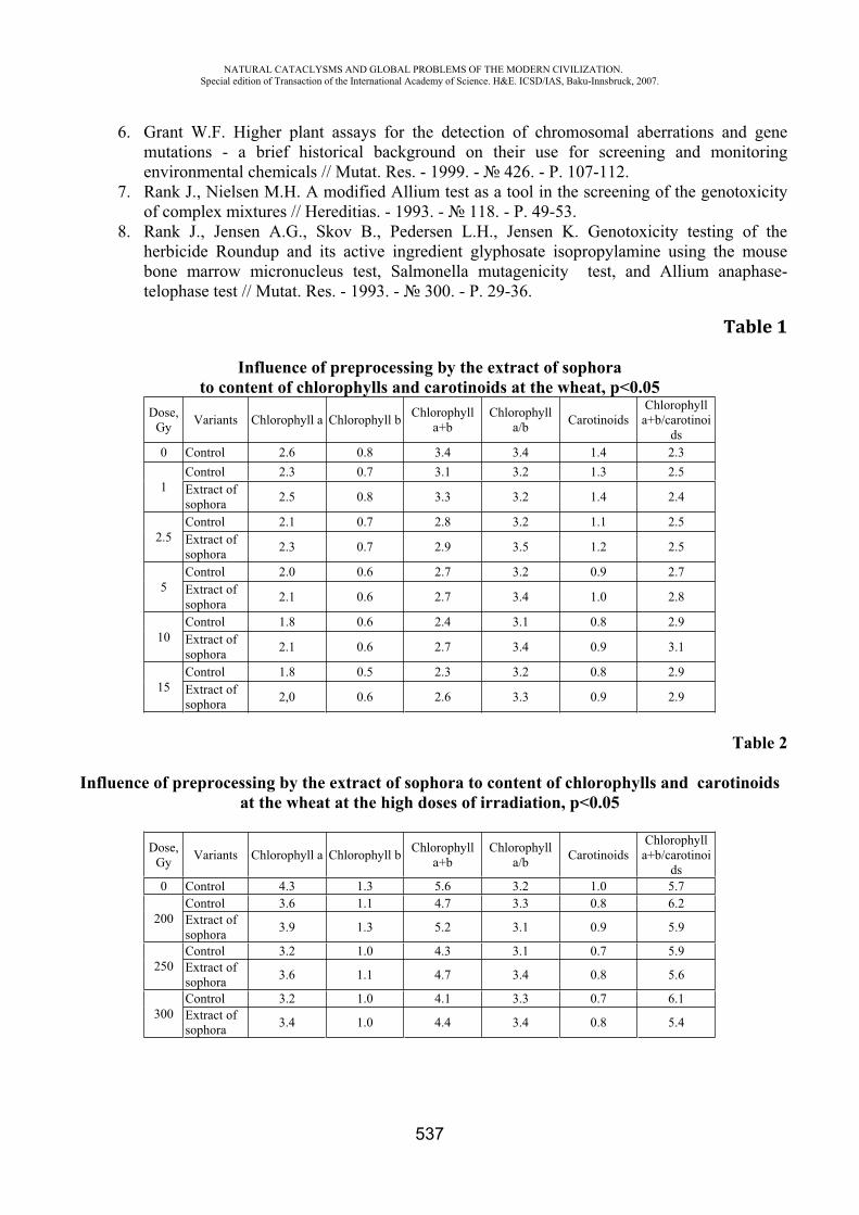
NATURAL CATACLYSMS AND GLOBAL PROBLEMS OF THE MODERN CIVILIZATION. Special edition of Transaction of the International Academy of Science. H&E. ICSD/IAS, Baku-Innsbruck, 2007.
537
6. Grant W.F. Higher plant assays for the detection of chromosomal aberrations and gene mutations - a brief historical background on their use for screening and monitoring environmental chemicals // Mutat. Res. - 1999. - 426. - P. 107-112.
7. Rank J., Nielsen M.H. A modified Allium test as a tool in the screening of the genotoxicity of complex mixtures // Hereditias. - 1993. - 118. - P. 49-53.
8. Rank J., Jensen A.G., Skov B., Pedersen L.H., Jensen K. Genotoxicity testing of the herbicide Roundup and its active ingredient glyphosate isopropylamine using the mouse bone marrow micronucleus test, Salmonella mutagenicity test, and Allium anaphase-telophase test // Mutat. Res. - 1993. - 300. - P. 29-36.
Table 1
Influence of preprocessing by the extract of sophora to content of chlorophylls and carotinoids at the wheat, p<0.05
Dose, Gy Variants Chlorophyll Chlorophyll b Chlorophyll
+b Chlorophyll
/b Carotinoids Chlorophyll +b/carotinoi
ds0 Control 2.6 0.8 3.4 3.4 1.4 2.3
1Control 2.3 0.7 3.1 3.2 1.3 2.5 Extract of sophora 2.5 0.8 3.3 3.2 1.4 2.4
2.5 Control 2.1 0.7 2.8 3.2 1.1 2.5 Extract of sophora 2.3 0.7 2.9 3.5 1.2 2.5
5Control 2.0 0.6 2.7 3.2 0.9 2.7 Extract of sophora 2.1 0.6 2.7 3.4 1.0 2.8
10Control 1.8 0.6 2.4 3.1 0.8 2.9 Extract of sophora 2.1 0.6 2.7 3.4 0.9 3.1
15Control 1.8 0.5 2.3 3.2 0.8 2.9 Extract of sophora 2,0 0.6 2.6 3.3 0.9 2.9
Table 2
Influence of preprocessing by the extract of sophora to content of chlorophylls and carotinoids at the wheat at the high doses of irradiation, p<0.05
Dose, Gy Variants Chlorophyll Chlorophyll b Chlorophyll
+b Chlorophyll
/b Carotinoids Chlorophyll +b/carotinoi
ds0 Control 4.3 1.3 5.6 3.2 1.0 5.7
200Control 3.6 1.1 4.7 3.3 0.8 6.2 Extract of sophora 3.9 1.3 5.2 3.1 0.9 5.9
250Control 3.2 1.0 4.3 3.1 0.7 5.9 Extract of sophora 3.6 1.1 4.7 3.4 0.8 5.6
300Control 3.2 1.0 4.1 3.3 0.7 6.1 Extract of sophora 3.4 1.0 4.4 3.4 0.8 5.4
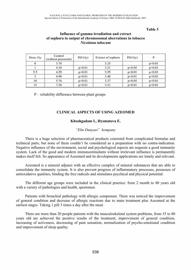
NATURAL CATACLYSMS AND GLOBAL PROBLEMS OF THE MODERN CIVILIZATION. Special edition of Transaction of the International Academy of Science. H&E. ICSD/IAS, Baku-Innsbruck, 2007.
538
Table 3Influence of gamma irradiation and extract
of sophora to output of chromosomal aberrations in tobacco Nicoti na tabacum
P – reliability difference between plant groups
CLINICAL ASPECTS OF USING AZEOMED
Khoshgadam I., Hysmatova E.
“Elm Dunyasi” kompany
There is a huge selection of pharmaceutical products consisted from complicated formulas and technical parts, but none of them couldn’t be considered as a preparation with no contra-indication. Negative influence of the environment, social and psychological aspects are requests a good immunity system. Lack of the good and modern immunostimulants without irrelevant influence is permanently makes itself felt. So appearance of Azeomed and its developments applications are timely and relevant.
Azeomed is a mineral adjunct with an effective complex of mineral substances that are able to consolidate the immunity system. It is also prevent progress of inflammatory processes, possesses of antioxidative qualities, binding the free radicals and stimulates psychical and physical potential.
The different age groups were included in the clinical practice: from 2 month to 80 years old with a variety of pathologies and health, sportsmen.
Patients with bronchial pathology with allergic component. There was noticed the improvement of general condition and decrease of allergic reactions due to main treatment plus Azeomed at the earliest stages. Taking 1 pill 3 times a day after the meal.
There are more than 20 people patients with the musculoskeletal system problems, from 35 to 80 years old are achieved the positive results of the treatment, improvement of general condition, increasing of activeness, decreasing of pain sensation, normalization of psycho-emotional condition and improvement of sleep quality.
NATURAL CATACLYSMS AND GLOBAL PROBLEMS OF THE MODERN CIVILIZATION. Special edition of Transaction of the International Academy of Science. H&E. ICSD/IAS, Baku-Innsbruck, 2007.
539
Especially I would like to note 20 children with an earliest closure of fontanel, after taking of Azeomed 1/8 and 1/6 during the year from 2, 6, 11 month of live, allowed to save theirs health with breast feeding and the closure continued till the 1 year.
The patient with a 3 years diarrhea, after taking of Azeomed 1 pill 3 times a day before the meal allowed to restore the stool and to facilitate further treatment.
2 aged patients with the expressed dysbacteriosis who achieved a perfect result. Beside the improvement of gastrointestinal tract activity they marked the vivacity, activeness and improvement of general condition.
4 oncological patients who took chemotherapy and Azeomed 1 pill 5 times a day quick recreation and decrease of side-effects was noticed and after 5 month during the echoscopy there were not seen any changes.
Also there were observed a group of sportsmen, who stated increased staying power and work efficiency during big physical activity and quick recreation, decreasing of traumatism, big flexibility and preciseness.
Pregnant women who took Azeomed there were no expressed anemia, top condition and easy deliveries. Two of them also took Azeomed during lactation.
Summary So from 2004 there were a lot of interesting researches with more than 60 people of different
ages and with different kind of diseases. All these researches are allow us to make a conclusion that taking of Azeomed 1 pill 2 or 3 times a day:
a) improving functional condition of all organs and systems
b) increasing of adaptation abilities
c) improving of emotional status
with no contra-indications.The preparation practically could be recommended as the prophylactic and as an additive to the
main treatment with any pathology to children, pregnant and nursing women, aged people and sportsmen.
ZEOLITE-THE BIOLOGICALLY ACTIVE MATERIAL
Kh. T. Kakhramanova
International Scientific-Technical Complex “INTERGEO-TETHYS”
An amplifying social and ecological pressure, the pollution of the nature observable now are not adequate to biological opportunities of the person and consequently render negative influence on health of the person, reduce its viability.
Now a parameter of health of the person is not only its physical condition, reserve opportunitiesof an organism, immunity, personal qualities, but also ability of an organism to be released from products of a metabolism (slags). What improving programs would not be developed for what improvement that of parameters of health, their effect will be low if to not consider the last, namely

NATURAL CATACLYSMS AND GLOBAL PROBLEMS OF THE MODERN CIVILIZATION. Special edition of Transaction of the International Academy of Science. H&E. ICSD/IAS, Baku-Innsbruck, 2007.
540
ability to deduce slags. From these positions use food additive is necessary for normal functioning an organism.
Huge value is got with mineral substances as food additives. It speaks that origin and the further development of vital processes occurred in close interrelation with mineral substance.
All alive organisms including plants during evolution have got genetic dependence with the surrounding mineral environment. In different corners of globe in food use clay - the sedimentary breeds possessing plasticity. Litho eating the Siberian scientists at reindeers observed, elks, Asiatic wild ass, and wolves and is the most active during copulation and lactations. Lithofagia animal’s an instinctive way of maintenance of healthy posterity, preservation of a population, a kind. One of the basic functions consists in it litho eating.
By numerous toxically-hygienic and medical and biologic tests it is established, that zeolite -clinoptilolite often meeting in the nature are effective improving means. Zeolite - it natural aluminum silicate frame structure in which times are various macro - and microcells. Alongside with , K, Mg in structure of zeolite are found out Ni, Cr, V, Mo, Sn, Pb, Be, Cu, Zn, Mn. Zeolite possesses unique, exclusive properties of a selective ionic exchange (delivers in an organism missing micro-, macro-, ultra micro-, nanoelements if they do not suffice and cleans from an organism if they are much.
On the basis of zeolite, since 90th years in the various countries have been made food additives. This Megamines, Nanosilizeo, Litovit, Nutricon, etc. In Azerbaijan on the basis of having greater stocks Aydag deposits of natural zeolite – clinoptilolite have been prepared food additive “AZEOMED”.
In an organism of the person are available about 2000 enzymes and the quarter this enzymes is represented with complexes of metals with organic ligands. And it is not surprising, that zeolite possesses multilateral influence on an organism.
Therefore zeolite promotes normalization of all biochemical processes in an organism, which cannot proceed without macro-, microcells. And in cells there are every minute hundreds and thousand various biochemical reactions Application of zeolites as have shown numerous researches in the various countries promotes: - increase stable to stress, to deducing from an organism of heavy metals. Zeolite possesses immunomodulatory, antianemic, antisclerous, antitoxic effect, normalizes lipid, albuminous, carbohydrate exchange processes, optimizes work of enzymes, etc.
Alongside with zeolite in structure of AZEOMED the dolomite consisting from calcium and magnesian carbonates (12,8 % of magnesium) potentiative as have shown researches of some scientists antineoplastic activityof clinoptilolite contains, is possible as a result of improvement of a mineral exchange and activation antioxidative of enzymes containing ions of magnesium.
Except for that zeolite - supplier of silicon. Silicon - element of a life. Its normal maintenance in an organism of the person a-natural key to health. It is experimentally proved, that introduction of silicon in an organism stops development of an arteriosclerosis and helps to restore normal cleanliness and functions of vascular wall.
Silicon actively participates in work of curtailing system of blood; therefore zeolite interferes with the further growth and the organization of a blood clot, and, making active processes fibrinolysis, promotes its destruction. Removes the inflammatory phenomena in a vascular wall.
Lack of silicon plays the important role in pathogenesis such diseases, as scrofulous, a tuberculosis, pernicious [Biermer's, Biermer-Ehrlich] anemia, a leprosy, the erysipelatous inflammations, insufficient immunobiological resistency.
Action food additive is directed not on substitution of functions of separate body, and to restoration of the capital of health, which enables an organism to pay off for overcoming of illnesses.
NATURAL CATACLYSMS AND GLOBAL PROBLEMS OF THE MODERN CIVILIZATION. Special edition of Transaction of the International Academy of Science. H&E. ICSD/IAS, Baku-Innsbruck, 2007.
541
STUDYING THE ADSORPTION PROPERTIES OF THE MODIFIED ZEOLITES AND TABLETS "AZEOMED" RATHER MALIGNANT A CELLULAR POPULATION FROM
BACTERIA AND VIRUSES
F.E. Sadikhova
Managing faculty of epidemiology and microbiology of Azerbaijan State institute of Improvement of Doctors
It is established, that application of zeolites as medical - preventive food additives gives a number of positive clinical effects.
Antitoxic immunomodulator, radio protective and providing liquidation of a dysbacteriosis of action are the indication to application of zeolites in treatment of oncological diseases with use of beam therapy, chemotherapy, antibiotic therapy as reduce displays of negative collateral actions of these highly toxic methods of therapy.
It is noted, that zeolites show also antibiotic activity, owing to linkage of fungoid strings with aluminosilicate skeleton. Local action of zeolites which render local antitoxic anti-inflammatory, sorption, reactivation the effects shown at dermatitis, furunculosis, lichens various kinds, burns, congelations, decubitus ulcer, long not healing wounds, ulcers, acnes, an erysipelatous inflammation, eczemas, herpetic infections, phlegmons is revealed.
In connection with, the purpose of our researches studying sorptive opportunities of some modified ions domestic natural zeolite - clinoptilolite concerning bacterial and virus flora was noted.
The big interest represented also research adsorptive opportunities of the modified zeolite and prepared on its basis of bio additive AZEOMED rather malignant to a cellular population.
For experience bacterial cultures have been taken: - E coli, Staph. aureus, Candida albicans, Ps. Aerugenosa.
- Virus cultures:-viruses of a poliomyelitis of 1,3 types (vaccine strains).; -culture of an intertwined line of cells L-20B (fibroblasts an embryo the mice occuring from
genetic modification of the mouse). Were studied sorptive properties of zeolites:
1. Nature clinoptilolite 2. NH4 clinoptilolite3. AZEOMED4. Ag clinoptilolite 5. Cu clinoptilolite 6. Zn clinoptilolite
In experiment methods of research are used standard in bacteriology and virology. Results of experience have revealed the greatest activity Cu - zeolite and Ag-zeolite, which
all 7000 unit all bacteria taken in experience including E -coli. Marking the aforesaid it is necessary to emphasize accomplished inactive initial zeolite, NH4-zeolite and Zn - zeolite rather E.coli that confirms already available researches specifying on weak adhesive properties of specified bacteria. Initial zeolite adsorbed only 50 % Cand. albicans, tablets "AZEOMED" and Zn-clinoptilolite sorbtion 90 % Staph.aureus and 80 % Cand.albican.
The analysis of results of research has revealed high properties of all investigated zeolites concerning viruses of a poliomyelitis of 1,3 types. It speaks, visible, the known fact, that most

NATURAL CATACLYSMS AND GLOBAL PROBLEMS OF THE MODERN CIVILIZATION. Special edition of Transaction of the International Academy of Science. H&E. ICSD/IAS, Baku-Innsbruck, 2007.
542
actively occurs adsorption of low-molecular connections. Molecular weight virion-8·106-9 106, factor sedimentation 140-165 S.
Experience on desorption viruses has revealed the perfect absence desorption from NH4-zeolite, Ag-zeolite and tablets "AZEOMED", that specifies an opportunity of their use for aggregation of virus flora and their deducing from an organism.
Are revealed significant adsorption opportunities of examinees of zeolites rather malignant a cellular population. On a tablet "AZEOMED" adsorption of malignant cells without desorption is revealed 100 %.
RESULTS OF PSYCHOPHYSIOLOGICAL AND NEUROPHYSIOLOGICAL RESEARCHES OF EFFICIENCY OF THE FOOD ADDITIVE "AZEOMED"
A.R. Allahverdiyev
The Academician of the International Academy of Science
Last years for complex and effective improvement of health of people the food additives consisting, as a rule, from natural minerals and a complex of nutritious microcells are widely used. Such additives are used successfully enough in a number of the countries of the Europe and Russia.
Experts mark, that food additives on the basis of zeolite possess immunomodulation, antioxidative, sorbent agently, enzymatic, bacteriostatic and virostatic properties, and can be used for correction disbalance in functional systems of an organism.
We for finding-out of efficiency of tablets have carried AZEOMED out large-scale researches with attraction specialists a various structure and use of various methodical approaches.
For these purposes were 3 groups of examinees are generated. With the purpose of research of influence of the mineral food additive "AZEOMED" which
structure includes natural zeolite, dolomite on a functional condition of a brain and the characteristic of is emotional-affective sphere, and a condition of the maximum mental functions were spent complex the psychophysiology researches including the complex analysis on bioelectric activity of a brain, and various psychological testing.
Researches had been captured 34 examinees volunteers, divided on 2 groups:1 group accepting of a tablet.2 group-control, i.e. non-accepting tablets.
For exception of influence of the sexual factor the equal quantity of men and women has been involved in researches.
The persons of 1 group accepting tablets, were, in turn, are divided into 2 subgroups: 1 subgroup accepted 2 times on 1 tablet. 2 subgroup -on 2 tablets 2 times.
Inspections were spent prior to the beginning of reception, after 4-week regular receptions of tablets and after 6-week receptions.
NATURAL CATACLYSMS AND GLOBAL PROBLEMS OF THE MODERN CIVILIZATION. Special edition of Transaction of the International Academy of Science. H&E. ICSD/IAS, Baku-Innsbruck, 2007.
543
Psychological testing.
Almost at all examinees the high personal uneasiness caused by genetic and social conditions of a life and low, or a moderate level of jet uneasiness, reflecting uneasiness at present time has been revealed.
Reception of tablets practically did not influence neither jet uneasiness, nor on personal. At the same time reception of AZEOMED changed a depressive background of the person. At
3 persons with the expressed depressive background on a background of reception of tablets depression completely was leveled. At others on a scale of depression parameters decreased, reflecting improvement of a background of a depressive orientation. Thus the positive effect did not depend on quantity of reception of tablets in day (1tab per 2 time in day or 2tab per 2 time in day), and depend on duration of reception.
Polygraph registration electroencephalogram and electrocardiogram.
From 45 surveyed changes on EEG have noted been at 40 examinees. Thus at the majority various functional changes have been revealed. At 7 examinees easy organic infringements with local paroxysmal changes and elements of decrease in a threshold of convulsive readiness of a brain have noted been.
Reception of tablets caused improvement in 35 examinees in picture EEG, shown in leveling functional shifts, in normalization of functioning of various areas of hemispheres and improvement rostral - caudalan index. At the same time it is necessary to note, that paroxysmal infringements, except for one examinee, have been removed, and structure EEG on all organization came nearer to healthy.
At one examinee on a background of reception of tablets deterioration of picture EEG and occurrence on a background of reception the phenomena, possibly connected with any negative internal and extreme factors was marked.
Improvement of picture EEG did not depend on quantity of reception of tablets in day, and depend on duration of their reception.
In control group (15 person) at all functional infringements in activity of a brain have been revealed. Improvement of structure EEG and normalization of a picture were marked on the expiration of 6 weeks only at one. At others these changes had proof enough character.
At the analysis of an electrocardiogram those or other shifts (a various degree a tachycardia, a bradycardia, changes of amplitude and the form of separate components of a wave, etc.) have been revealed almost at all examinees. On a background of reception of tablets in 90% of incidents appreciable improvement of a picture and normalization of an electrocardiogram also was more marked. Also the positive effect correlated not with a doze of the additive, and duration of reception.
Conclusions:
1. Food additive AZEOMED has the unique properties positively affecting activity of functional systems of an organism of the person.
2. Reception of food additive of AZEOMED improves a functional condition of a bark of greater hemispheres, normalizes balance of activating and brake mechanisms of nonspecific systems, restores a corresponding level of corticosubcortical psichosomatic mutual relations and improves adaptive opportunities of an organism.
NATURAL CATACLYSMS AND GLOBAL PROBLEMS OF THE MODERN CIVILIZATION. Special edition of Transaction of the International Academy of Science. H&E. ICSD/IAS, Baku-Innsbruck, 2007.
544
3. Under influence of tablets of AZEOMED the depressive background improves, and at presence of the expressed depression its level decreases.
4. During reception of tablets intimate activity improves, the rhythm is normalized; parameters of activity of heart improve.
5. Positive influence depends on a daily doze of reception not so much, how many depends on duration of reception. A recommended doze: on 1tablet-2 once a day not less than 4-6 weeks.
CORRELATION OF THE BIAS OF AN INTERFERON - AND IMMUNOGLOBULIN WITH THE DIFFERENT FORMS OF A BRONCHIAL ASTHMA OF HEAVY
CURRENT
Kh.I. Turdibekov, N.M. Khaitova, Sh.Kh. Ziyadullaev
Samarkand State medical institute Samarkand, Republic of Uzbekistan
Despite of considerable successes reached in diagnostic and treatment of a bronchial asthma (BA), the tendency of growth of a morbidity and transformation of the clinical forms in the party of a dominance of heavy variants of current of illness is saved. The search of the new approaches in problem solving of diagnostic, treatment and preventive maintenance of this disease is based on the detailed study of immunologic mechanisms of a pathogeny BA, thus the leading role is allocated to interplay of subpopulations of -helpers (TH) among themselves [2, 3].
The operations of the last years testify to participation numerous sitokinses- special proteins, with the help which one the signaling between effectorness by cells of an immune system - in development BA is carried out. In the basis the immunoglobulin (IgE) – oposredictive allergy lies an atopy - ancestral predisposition to reinforced antibody formation of the class IgE, which one is under composite monitoring of regulative cells and numerous sitokinses [5]. The influencing of sitokinses on IgE-oposredictive an allergy can be carried out at a level of formation of antibodies of the class IgE, of differentiation of effectorness cells of an allergy, synthesis by these cells of effectorness mediators of an allergy.
So, at advantage of subpopulations Th-2, which one answer for differentiation of bursacytes in plasma cells and decrease of a physiological inhibiting effect of an interferon - Y (IFN-Y) synthesis IgE, happens hyperproduction IgE [4].
In connection with above-stated the determination of a level IFN-Y in comparison to a level of production general IgE for patients with heavy current BA in a stage of its peaking was represented interesting.
By us were inspected 45 ill BA. Among patients there were 18 men and 27 women. The age of patients laid within the limits from 18 till 66 years and has compounded, on the average, 42,9 1,8years. The duration of illness, on the average has compounded 9,8 1,1 years.
At establishment of the diagnosis used diagnostic criteria GINA (2002). The patients inspected in a phase of a peaking of disease. Allergic BA (ABA) is troubleshot for 17 persons, not allergic

NATURAL CATACLYSMS AND GLOBAL PROBLEMS OF THE MODERN CIVILIZATION. Special edition of Transaction of the International Academy of Science. H&E. ICSD/IAS, Baku-Innsbruck, 2007.
545
(NBA) - for 11 persons and blended - for 17 persons. For all patients the heavy current BA was marked. Control group have compounded 10 practically of able-bodied faces.
The contents IFN-Y in Serum of a blood determined by a method immunofermentive analysis (IFA) with usage of tests - systems " a Vector Best ", Russia. A level general IgE in Serum of a blood determined by a method IFA by a gang of firm OOO "Khema-Media", Russia.
Statistical processing of outcomes conducted with the help of the program XCEL-2002. At the analysis of the outcomes, obtained by us, was installed, that for the patients with heavy
current BA the level IgE makes 770,98 126,18 pg/ml, considerably exceeding parameters of group practically of able-bodied faces (219,52 66,63 pg/ml, < 0,01). As there was a level IgE considerably oscillates in groups, compared by us, ill with the miscellaneous form BA. Highest this parameter was for the patients with ABA (1196,32 254,76 pg/ml), authentically differing from parameters of group patients NBA (229,89 37,44 pg/ml; < 0,02). Thus, most low level of the studied parameter is marked for patients NBA, what selects this group among general group of the studied patients with heavy current BA ( < 0,02), and also distinguishes its from two compared groups with the allergic and blended form of disease ( < 0,01; < 0,02 accordingly).
Further we have conducted the analysis of the contents IFN-Y in connection with features of pathological process. As have shown the outcomes, obtained by us, the parameters IFN-Y at patients with heavy current BA are twice lower than control group (0,13 0,01 pg/ml and 0,28 0,07 pg/ml accordingly, < 0,05). By comparison of a level IFN-Y for the patients with the different forms BA it is revealed, that its least significances are registered for patients with ABA (0,08 0,01 pg/ml, < 0,02) both as contrasted to by control group, and as contrasted to by group of the patients with NBA ( < 0,01). For patients with SBA IFN-Y is also considerably reduced as contrasted to by control group (0,11 0,015 pg/ml, < 0,05). It is necessary to mark, that the parameters IFN-Y at patients with NBA and ABA differ almost three times (0,23 0,03 pg/ml and 0,08 0,01 pg/ml accordingly, < 0,01).
Thus, the outcomes, obtained by us, testify that between the contents IFN-Y and IgE at patients with heavy current BA there is an inverse correlation, thus on a hum noise of essential distinctions of a level IgE, reference for each of the studied forms of disease this dependence is saved.
As a whole it is possible to conclude, that sitokinoposredictive hyperproduction IgE plays the relevant role in a pathogeny of an immune stage of an allergic inflammation. IgE is the basic pathogenetic link in the mechanism of development of inflammatory responses at BA.
The detected correlation of level variations IFN-Y and general IgE depending on the clinical forms BA of heavy current, testifies to possibility of using of the data of parameters in diagnostic of different forms of pathological process, and also for an estimation of the immune answer and efficiency of spent therapy.
REFERENCES
1. Demyanov A.B. Diagnostic value of research of levels of sitokinses in clinical practice // Sitokinses and inflammation-2003- 3-p. 20-33.
2. Ilyina N.I., Ogorodova L.M., Kobyakva O.S. and others. Characteristics of sitokinic profile at patients with therapeutic refractory asthma // Immunology-2003- -4-p. 223-226.
3. Ketlinski S.A. Role of -helpers of types 1 and 2 in a regulation of cell-like and humoral immunodefence // Immunology-2002- 2-p. 77-79.
4. 4.Latysheva T.V., Varfolomeeva M.I., Udalova V.A. and others. Correlation of the bias Th 1 and Th2- of lymphocytes and forms of a bronchial asthma // Immunology-2005- 3-p. 164-167.
5. Medunisyn N.V. Sitokinses and allergy // Immunology-1999- 5-p. 5-9.
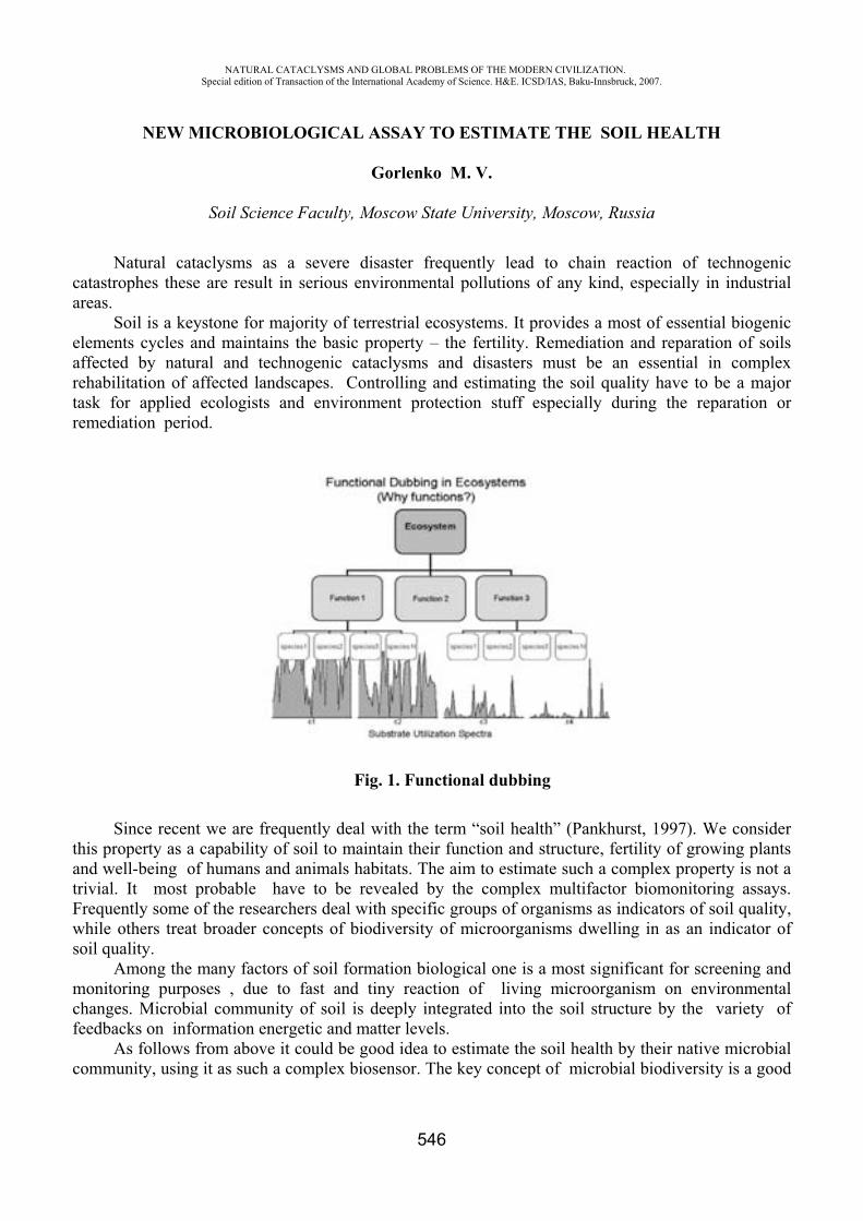
NATURAL CATACLYSMS AND GLOBAL PROBLEMS OF THE MODERN CIVILIZATION. Special edition of Transaction of the International Academy of Science. H&E. ICSD/IAS, Baku-Innsbruck, 2007.
546
NEW MICROBIOLOGICAL ASSAY TO ESTIMATE THE SOIL HEALTH
Gorlenko M. V.
Soil Science Faculty, Moscow State University, Moscow, Russia
Natural cataclysms as a severe disaster frequently lead to chain reaction of technogenic catastrophes these are result in serious environmental pollutions of any kind, especially in industrial areas.
Soil is a keystone for majority of terrestrial ecosystems. It provides a most of essential biogenic elements cycles and maintains the basic property – the fertility. Remediation and reparation of soils affected by natural and technogenic cataclysms and disasters must be an essential in complex rehabilitation of affected landscapes. Controlling and estimating the soil quality have to be a major task for applied ecologists and environment protection stuff especially during the reparation or remediation period.
Fig. 1. Functional dubbing
Since recent we are frequently deal with the term “soil health” (Pankhurst, 1997). We consider this property as a capability of soil to maintain their function and structure, fertility of growing plants and well-being of humans and animals habitats. The aim to estimate such a complex property is not a trivial. It most probable have to be revealed by the complex multifactor biomonitoring assays. Frequently some of the researchers deal with specific groups of organisms as indicators of soil quality, while others treat broader concepts of biodiversity of microorganisms dwelling in as an indicator of soil quality.
Among the many factors of soil formation biological one is a most significant for screening and monitoring purposes , due to fast and tiny reaction of living microorganism on environmental changes. Microbial community of soil is deeply integrated into the soil structure by the variety of feedbacks on information energetic and matter levels.
As follows from above it could be good idea to estimate the soil health by their native microbial community, using it as such a complex biosensor. The key concept of microbial biodiversity is a good
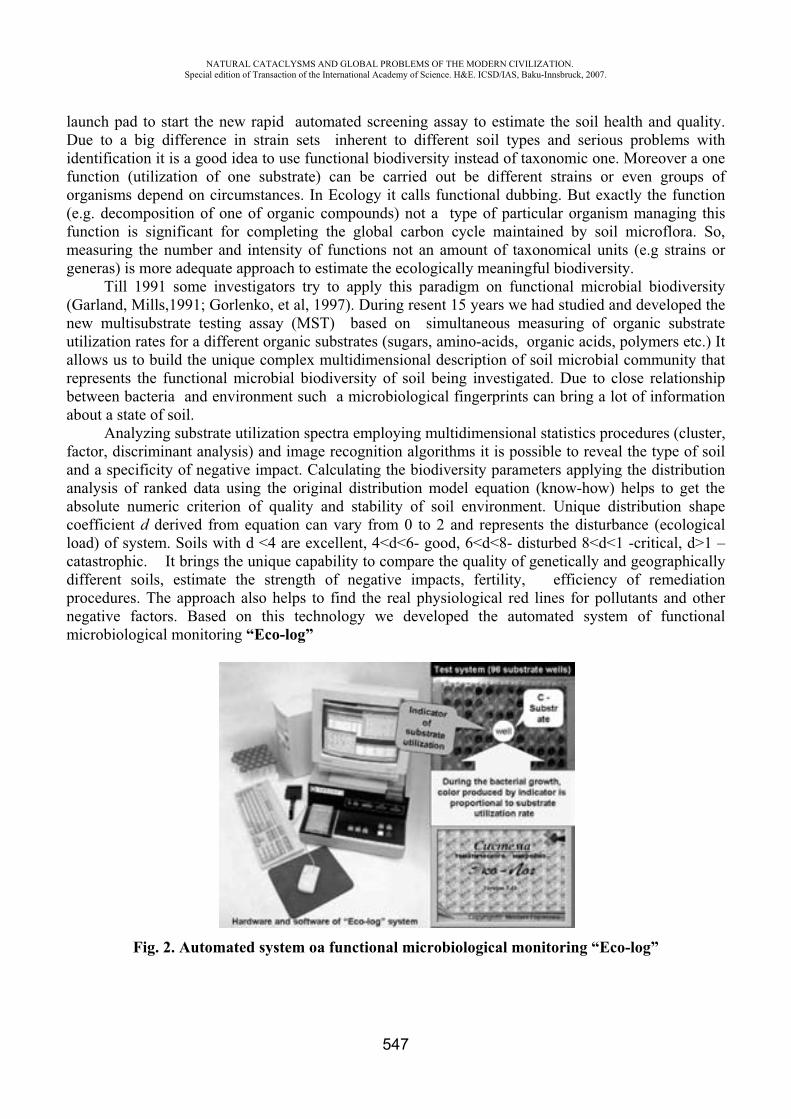
NATURAL CATACLYSMS AND GLOBAL PROBLEMS OF THE MODERN CIVILIZATION. Special edition of Transaction of the International Academy of Science. H&E. ICSD/IAS, Baku-Innsbruck, 2007.
547
launch pad to start the new rapid automated screening assay to estimate the soil health and quality. Due to a big difference in strain sets inherent to different soil types and serious problems with identification it is a good idea to use functional biodiversity instead of taxonomic one. Moreover a one function (utilization of one substrate) can be carried out be different strains or even groups of organisms depend on circumstances. In Ecology it calls functional dubbing. But exactly the function (e.g. decomposition of one of organic compounds) not a type of particular organism managing this function is significant for completing the global carbon cycle maintained by soil microflora. So, measuring the number and intensity of functions not an amount of taxonomical units (e.g strains or generas) is more adequate approach to estimate the ecologically meaningful biodiversity.
Till 1991 some investigators try to apply this paradigm on functional microbial biodiversity (Garland, Mills,1991; Gorlenko, et al, 1997). During resent 15 years we had studied and developed the new multisubstrate testing assay (MST) based on simultaneous measuring of organic substrate utilization rates for a different organic substrates (sugars, amino-acids, organic acids, polymers etc.) It allows us to build the unique complex multidimensional description of soil microbial community that represents the functional microbial biodiversity of soil being investigated. Due to close relationship between bacteria and environment such a microbiological fingerprints can bring a lot of information about a state of soil.
Analyzing substrate utilization spectra employing multidimensional statistics procedures (cluster, factor, discriminant analysis) and image recognition algorithms it is possible to reveal the type of soil and a specificity of negative impact. Calculating the biodiversity parameters applying the distribution analysis of ranked data using the original distribution model equation (know-how) helps to get the absolute numeric criterion of quality and stability of soil environment. Unique distribution shape coefficient d derived from equation can vary from 0 to 2 and represents the disturbance (ecological load) of system. Soils with d <4 are excellent, 4<d<6- good, 6<d<8- disturbed 8<d<1 -critical, d>1 –catastrophic. It brings the unique capability to compare the quality of genetically and geographically different soils, estimate the strength of negative impacts, fertility, efficiency of remediation procedures. The approach also helps to find the real physiological red lines for pollutants and other negative factors. Based on this technology we developed the automated system of functional microbiological monitoring “Eco-log”
Fig. 2. Automated system o functional microbiological monitoring “Eco-log”
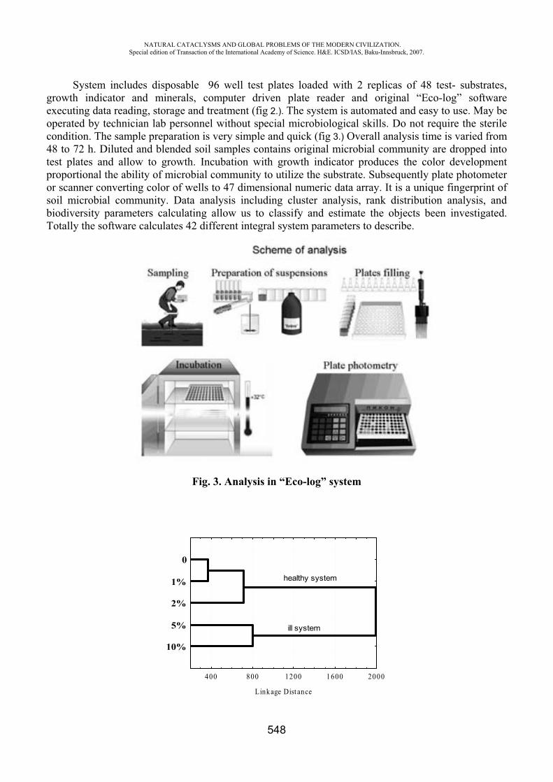
NATURAL CATACLYSMS AND GLOBAL PROBLEMS OF THE MODERN CIVILIZATION. Special edition of Transaction of the International Academy of Science. H&E. ICSD/IAS, Baku-Innsbruck, 2007.
548
System includes disposable 96 well test plates loaded with 2 replicas of 48 test- substrates, growth indicator and minerals, computer driven plate reader and original “Eco-log” software executing data reading, storage and treatment (fig 2.). The system is automated and easy to use. May be operated by technician lab personnel without special microbiological skills. Do not require the sterile condition. The sample preparation is very simple and quick (fig 3.) Overall analysis time is varied from 48 to 72 h. Diluted and blended soil samples contains original microbial community are dropped into test plates and allow to growth. Incubation with growth indicator produces the color development proportional the ability of microbial community to utilize the substrate. Subsequently plate photometer or scanner converting color of wells to 47 dimensional numeric data array. It is a unique fingerprint of soil microbial community. Data analysis including cluster analysis, rank distribution analysis, and biodiversity parameters calculating allow us to classify and estimate the objects been investigated. Totally the software calculates 42 different integral system parameters to describe.
Fig. 3. Analysis in “Eco-log” system
400 800 1200 1600 2000
Linkage Dist ance
10%
5%
2%
1%
0
healthy system
ill system
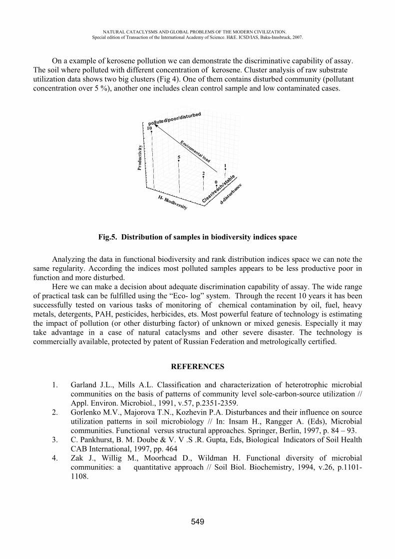
NATURAL CATACLYSMS AND GLOBAL PROBLEMS OF THE MODERN CIVILIZATION. Special edition of Transaction of the International Academy of Science. H&E. ICSD/IAS, Baku-Innsbruck, 2007.
549
On a example of kerosene pollution we can demonstrate the discriminative capability of assay. The soil where polluted with different concentration of kerosene. Cluster analysis of raw substrate utilization data shows two big clusters (Fig 4). One of them contains disturbed community (pollutant concentration over 5 %), another one includes clean control sample and low contaminated cases.
Fig.5. Distribution of samples in biodiversity indices space
Analyzing the data in functional biodiversity and rank distribution indices space we can note the same regularity. According the indices most polluted samples appears to be less productive poor in function and more disturbed.
Here we can make a decision about adequate discrimination capability of assay. The wide range of practical task can be fulfilled using the “Eco- log” system. Through the recent 10 years it has been successfully tested on various tasks of monitoring of chemical contamination by oil, fuel, heavy metals, detergents, PAH, pesticides, herbicides, ets. Most powerful feature of technology is estimating the impact of pollution (or other disturbing factor) of unknown or mixed genesis. Especially it may take advantage in a case of natural cataclysms and other severe disaster. The technology is commercially available, protected by patent of Russian Federation and metrologically certified.
REFERENCES
1. Garland J.L., Mills A.L. Classification and characterization of heterotrophic microbial communities on the basis of patterns of community level sole-carbon-source utilization // Appl. Environ. Microbiol., 1991, v.57, p.2351-2359.
2. Gorlenko M.V., Majorova T.N., Kozhevin P.A. Disturbances and their influence on source utilization patterns in soil microbiology // In: Insam H., Rangger A. (Eds), Microbial communities. Functional versus structural approaches. Springer, Berlin, 1997, p. 84 – 93.
3. C. Pankhurst, B. M. Doube & V. V .S .R. Gupta, Eds, Biological Indicators of Soil Health CAB International, 1997, pp. 464
4. Zak J., Willig M., Moorhcad D., Wildman H. Functional diversity of microbial communities: a quantitative approach // Soil Biol. Biochemistry, 1994, v.26, p.1101-1108.
1
0
2
5
10
Prod
uctiv
it y
d-dist
urban
ce
H- BiodiversityClear/re
ach/stable
polluted/poor/disturbed
Enviromental load
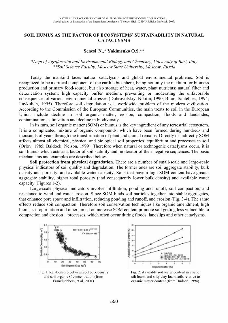
NATURAL CATACLYSMS AND GLOBAL PROBLEMS OF THE MODERN CIVILIZATION. Special edition of Transaction of the International Academy of Science. H&E. ICSD/IAS, Baku-Innsbruck, 2007.
550
SOIL HUMUS AS THE FACTOR OF ECOSYSTEMS’ SUSTAINABILITY IN NATURAL CATACLYSMS
Senesi N.,* Yakimenko O.S.**
*Dept of Agroforestal and Environmental Biology and Chemistry, University of Bari, Italy **Soil Science Faculty, Moscow State University, Moscow, Russia
Today the mankind faces natural cataclysms and global environmental problems. Soil is recognized to be a critical component of the earth’s biosphere, being not only the medium for biomass production and primary food-source, but also storage of heat, water, plant nutrients; natural filter and detoxication system; high capacity buffer medium, preventing or moderating the unfavorable consequences of various environmental stresses (Dobrovolskiy, Nikitin, 1990; Blum, Santelises, 1994; Lavkulich, 1995). Therefore soil degradation is a worldwide problem of the modern civilization. According to the Commission of the European Communities, the main treats to soil in the European Union include decline in soil organic matter, erosion, compaction, floods and landslides, contamination, salinization and decline in biodiversity.
In its turn, soil organic matter (SOM) or humus is the key ingredient of any terrestrial ecosystem. It is a complicated mixture of organic compounds, which have been formed during hundreds and thousands of years through the transformation of plant and animal remains. Directly or indirectly SOM affects almost all chemical, physical and biological soil properties, equilibrium and processes in soil (Orlov, 1985; Baldock, Nelson, 1999). Therefore when natural or technogenic cataclysms occur, it is soil humus which acts as a factor of soil stability and moderator of their negative sequences. The basic mechanisms and examples are described below.
Soil protection from physical degradation. There are a number of small-scale and large-scale physical indicators of soil quality and degradation. The former ones are soil aggregate stability, bulk density and porosity, and available water capacity. Soils that have a high SOM content have greater aggregate stability, higher total porosity (and consequently lower bulk density) and available water capacity (Figures 1-2).
Large-scale physical indicators involve infiltration, ponding and runoff; soil compaction; and resistance to wind and water erosion. Since SOM binds soil particles together into stable aggregates, that enhance pore space and infiltration, reducing ponding and runoff, and erosion (Fig. 3-4). The same effects reduce soil compaction. Therefore soil conservation techniques like organic amendment, high biomass crop rotation and other aimed on increase SOM content promote soil getting less vulnerable to compaction and erosion – processes, which often occur during floods, landslips and other cataclysms.
Fig. 1. Relationship between soil bulk density and soil organic C concentration (from
Franzluebbers, et al, 2001)
Fig. 2. Available soil water content in a sand, silt loam, and silty clay loam soils relative to organic matter content (from Hudson, 1994).
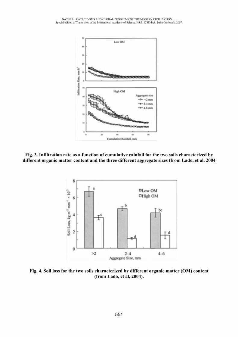
NATURAL CATACLYSMS AND GLOBAL PROBLEMS OF THE MODERN CIVILIZATION. Special edition of Transaction of the International Academy of Science. H&E. ICSD/IAS, Baku-Innsbruck, 2007.
551
Fig. 3. Infiltration rate as a function of cumulative rainfall for the two soils characterized by different organic matter content and the three different aggregate sizes (from Lado, et al, 2004
Fig. 4. Soil loss for the two soils characterized by different organic matter (OM) content (from Lado, et al, 2004).
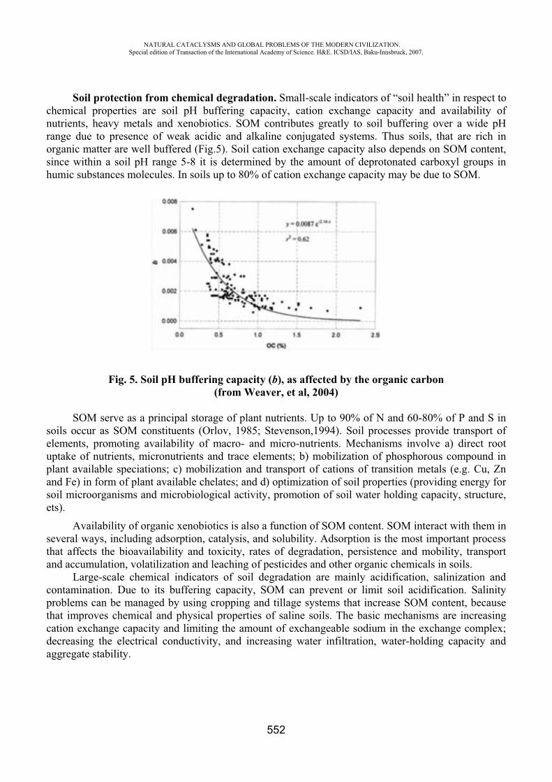
NATURAL CATACLYSMS AND GLOBAL PROBLEMS OF THE MODERN CIVILIZATION. Special edition of Transaction of the International Academy of Science. H&E. ICSD/IAS, Baku-Innsbruck, 2007.
552
Soil protection from chemical degradation. Small-scale indicators of “soil health” in respect to chemical properties are soil pH buffering capacity, cation exchange capacity and availability of nutrients, heavy metals and xenobiotics. SOM contributes greatly to soil buffering over a wide pH range due to presence of weak acidic and alkaline conjugated systems. Thus soils, that are rich in organic matter are well buffered (Fig.5). Soil cation exchange capacity also depends on SOM content, since within a soil pH range 5-8 it is determined by the amount of deprotonated carboxyl groups in humic substances molecules. In soils up to 80% of cation exchange capacity may be due to SOM.
Fig. 5. Soil pH buffering capacity (b), as affected by the organic carbon(from Weaver, et al, 2004)
SOM serve as a principal storage of plant nutrients. Up to 90% of N and 60-80% of P and S in soils occur as SOM constituents (Orlov, 1985; Stevenson,1994). Soil processes provide transport of elements, promoting availability of macro- and micro-nutrients. Mechanisms involve a) direct root uptake of nutrients, micronutrients and trace elements; b) mobilization of phosphorous compound in plant available speciations; c) mobilization and transport of cations of transition metals (e.g. Cu, Zn and Fe) in form of plant available chelates; and d) optimization of soil properties (providing energy for soil microorganisms and microbiological activity, promotion of soil water holding capacity, structure, ets).
Availability of organic xenobiotics is also a function of SOM content. SOM interact with them in several ways, including adsorption, catalysis, and solubility. Adsorption is the most important process that affects the bioavailability and toxicity, rates of degradation, persistence and mobility, transport and accumulation, volatilization and leaching of pesticides and other organic chemicals in soils.
Large-scale chemical indicators of soil degradation are mainly acidification, salinization and contamination. Due to its buffering capacity, SOM can prevent or limit soil acidification. Salinity problems can be managed by using cropping and tillage systems that increase SOM content, because that improves chemical and physical properties of saline soils. The basic mechanisms are increasing cation exchange capacity and limiting the amount of exchangeable sodium in the exchange complex; decreasing the electrical conductivity, and increasing water infiltration, water-holding capacity and aggregate stability.
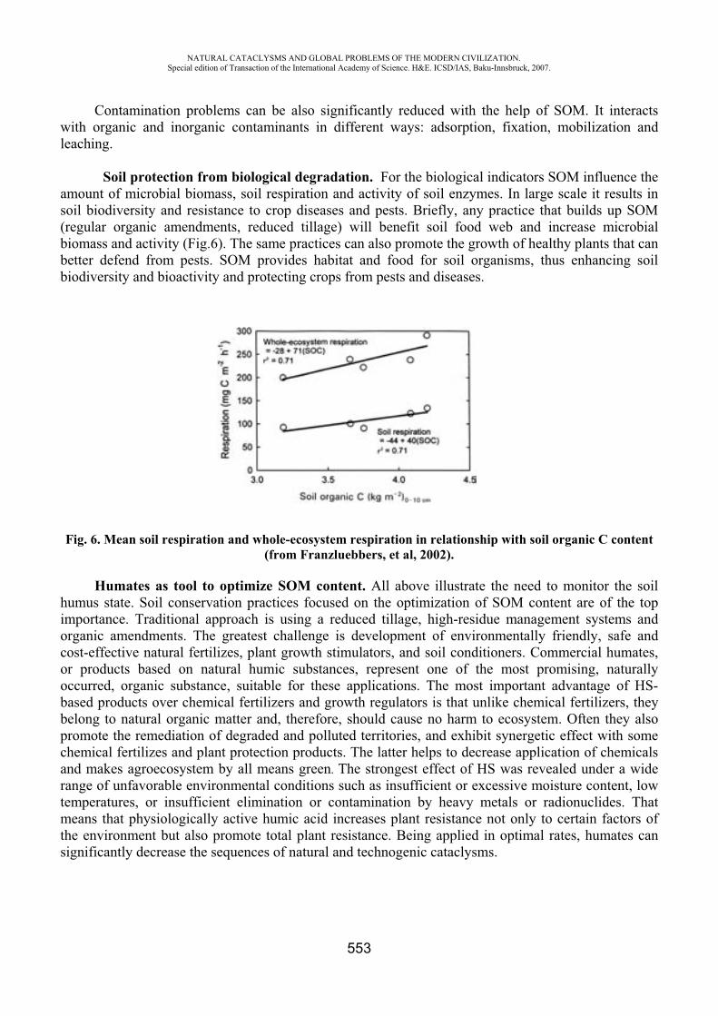
NATURAL CATACLYSMS AND GLOBAL PROBLEMS OF THE MODERN CIVILIZATION. Special edition of Transaction of the International Academy of Science. H&E. ICSD/IAS, Baku-Innsbruck, 2007.
553
Contamination problems can be also significantly reduced with the help of SOM. It interacts with organic and inorganic contaminants in different ways: adsorption, fixation, mobilization and leaching.
Soil protection from biological degradation. For the biological indicators SOM influence the amount of microbial biomass, soil respiration and activity of soil enzymes. In large scale it results in soil biodiversity and resistance to crop diseases and pests. Briefly, any practice that builds up SOM (regular organic amendments, reduced tillage) will benefit soil food web and increase microbial biomass and activity (Fig.6). The same practices can also promote the growth of healthy plants that can better defend from pests. SOM provides habitat and food for soil organisms, thus enhancing soil biodiversity and bioactivity and protecting crops from pests and diseases.
Fig. 6. Mean soil respiration and whole-ecosystem respiration in relationship with soil organic C content (from Franzluebbers, et al, 2002).
Humates as tool to optimize SOM content. All above illustrate the need to monitor the soil humus state. Soil conservation practices focused on the optimization of SOM content are of the top importance. Traditional approach is using a reduced tillage, high-residue management systems and organic amendments. The greatest challenge is development of environmentally friendly, safe and cost-effective natural fertilizes, plant growth stimulators, and soil conditioners. Commercial humates, or products based on natural humic substances, represent one of the most promising, naturally occurred, organic substance, suitable for these applications. The most important advantage of HS-based products over chemical fertilizers and growth regulators is that unlike chemical fertilizers, they belong to natural organic matter and, therefore, should cause no harm to ecosystem. Often they also promote the remediation of degraded and polluted territories, and exhibit synergetic effect with some chemical fertilizes and plant protection products. The latter helps to decrease application of chemicals and makes agroecosystem by all means green. The strongest effect of HS was revealed under a wide range of unfavorable environmental conditions such as insufficient or excessive moisture content, low temperatures, or insufficient elimination or contamination by heavy metals or radionuclides. That means that physiologically active humic acid increases plant resistance not only to certain factors of the environment but also promote total plant resistance. Being applied in optimal rates, humates can significantly decrease the sequences of natural and technogenic cataclysms.
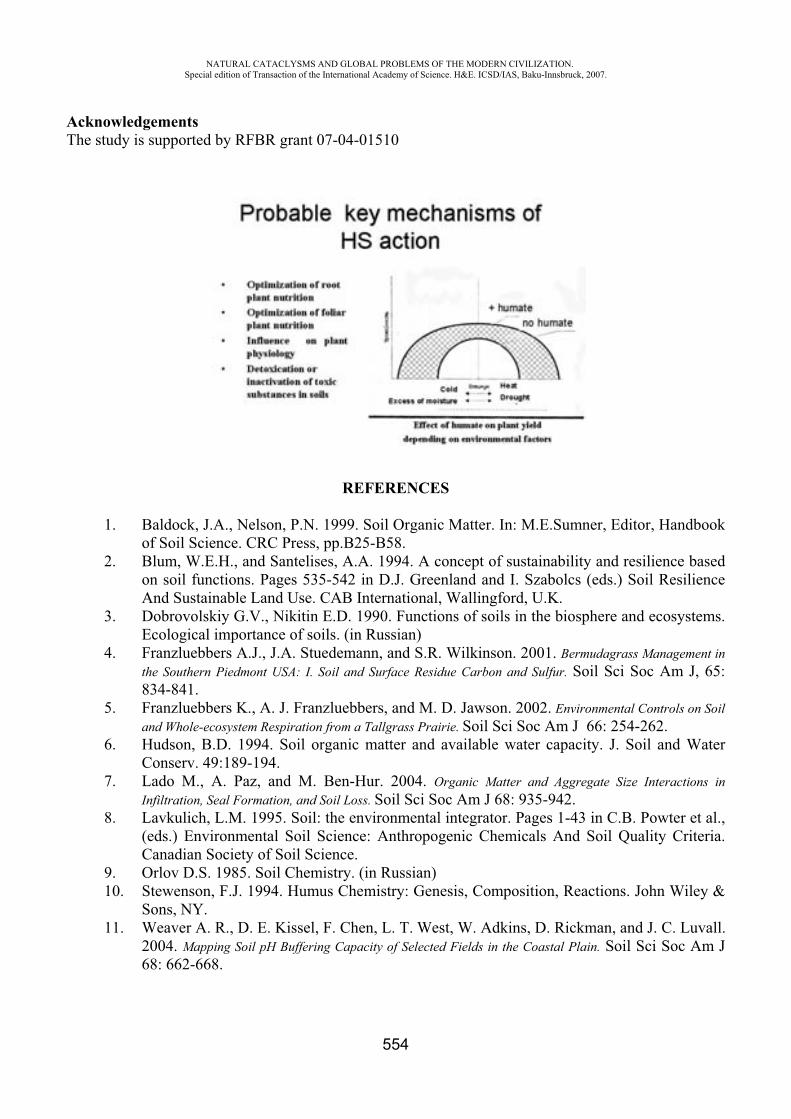
NATURAL CATACLYSMS AND GLOBAL PROBLEMS OF THE MODERN CIVILIZATION. Special edition of Transaction of the International Academy of Science. H&E. ICSD/IAS, Baku-Innsbruck, 2007.
554
Acknowledgements The study is supported by RFBR grant 07-04-01510
REFERENCES
1. Baldock, J.A., Nelson, P.N. 1999. Soil Organic Matter. In: M.E.Sumner, Editor, Handbook of Soil Science. CRC Press, pp.B25-B58.
2. Blum, W.E.H., and Santelises, A.A. 1994. A concept of sustainability and resilience based on soil functions. Pages 535-542 in D.J. Greenland and I. Szabolcs (eds.) Soil Resilience And Sustainable Land Use. CAB International, Wallingford, U.K.
3. Dobrovolskiy G.V., Nikitin E.D. 1990. Functions of soils in the biosphere and ecosystems. Ecological importance of soils. (in Russian)
4. Franzluebbers A.J., J.A. Stuedemann, and S.R. Wilkinson. 2001. Bermudagrass Management in the Southern Piedmont USA: I. Soil and Surface Residue Carbon and Sulfur. Soil Sci Soc Am J, 65: 834-841.
5. Franzluebbers K., A. J. Franzluebbers, and M. D. Jawson. 2002. Environmental Controls on Soil and Whole-ecosystem Respiration from a Tallgrass Prairie. Soil Sci Soc Am J 66: 254-262.
6. Hudson, B.D. 1994. Soil organic matter and available water capacity. J. Soil and Water Conserv. 49:189-194.
7. Lado M., A. Paz, and M. Ben-Hur. 2004. Organic Matter and Aggregate Size Interactions in Infiltration, Seal Formation, and Soil Loss. Soil Sci Soc Am J 68: 935-942.
8. Lavkulich, L.M. 1995. Soil: the environmental integrator. Pages 1-43 in C.B. Powter et al., (eds.) Environmental Soil Science: Anthropogenic Chemicals And Soil Quality Criteria. Canadian Society of Soil Science.
9. Orlov D.S. 1985. Soil Chemistry. (in Russian) 10. Stewenson, F.J. 1994. Humus Chemistry: Genesis, Composition, Reactions. John Wiley &
Sons, NY. 11. Weaver A. R., D. E. Kissel, F. Chen, L. T. West, W. Adkins, D. Rickman, and J. C. Luvall.
2004. Mapping Soil pH Buffering Capacity of Selected Fields in the Coastal Plain. Soil Sci Soc Am J 68: 662-668.

NATURAL CATACLYSMS AND GLOBAL PROBLEMS OF THE MODERN CIVILIZATION. Special edition of Transaction of the International Academy of Science. H&E. ICSD/IAS, Baku-Innsbruck, 2007.
555
III PART:TECHNOSPHERE
OIL POLLUTION CONTROL OF THE CASPIAN SEA WITH HELP OF SPACE RADIOLOCATION
Agaev F.Q.*, Tatarayev T.M.**, Faradjeva L.N.***, Ragimov E.R.****, Tatarayev M.T.*****
National Aerospace Agency. Azerbaijan, Baku Institute for Space Researches of Natural Resources, ANASA. Baku
Constantly increase of extraction and transport of oil, oil products in the Caspian sea are reasons of growth of scale pollution by oil products. After disintegration of the USSR the Caspian sea became a struggle arena for governments of new independence states and international oil companies for using energy resources with the purpose to get strategic advantages. Therefore, it is had a danger both relatively further intensive oil production development in the Caspian Sea and relatively threat of ecological catastrophe within scale of the whole sea. Absence of a centralized complex monitoring of the Caspian Sea, uniting efforts of all surrounding countries, is a principal obstacle in the control organization way of all marine ecosystems and elaboration of effective measures on improvement of its condition. The cause is a vagueness of juridical status of the Caspian Sea.
Control organization of the sea pollution by oil products demands their full-scale monitoring by using both ground and aerospace means of observation. Aerospace monitoring of the sea provides an operational scope of vast areas for incommensurably small cost as compared with contact monitoring. Aerospace monitoring of marine surface allows to carry out an observation which necessary for the diagnostics of pollution, its dynamics and its forecast for synoptic terms.
Basic science-practical task of the aerospace monitoring system is a definition of the fact and place of accident (oil flood) on marine surface radiation in the different fields of electromagnetic waves spectrum with enough high exactness. The rising radiation of marine surface in the visible, infra-red (IR) and ultrahigh frequency areas of electromagnetic waves spectrum depends on whole row of hydrophysical water parameters, and in the ultrahigh frequency area studied with help of the radar-tracking sensing it depends on roughness of surface (connected with capillary waves).
Modern means of remote sensing of the Earth use electromagnetic radiation of friction surface in the large range of wave length in ultra-violet and visible (0,26 – 0,8 mkm), near (0,9 – 3 mkm) and distant (7 – 14 mkm) infro-red, ultra-high frequency (1 - 100) ranges. They already provide a monitoring of the sea in the real scale time.
The radar-tracking sensing of the sea surface is more effective means of oil pollution monitoring. As it is known, a roughness of the sea surface registered by radiolocation is essentially (sharply) changed by availability of oil spill. Radiolocators with synthesized aperture are used for this purpose. At present the using of the radiolocator on sputniks ERS, Radarsat and Envisat more perspectively [1, 2].
Informational layer containing data about distribution spill of oil and oil products was added on the map after preparation cartographical basis. Thus, the map of distribution of oil spill and oil products spill on the Caspian Sea surface averaged for the first half of May 2004 was obtained. The obtained map characterizes a situation both on aerospace data and on data contact monitoring. Total picture of distribution and transfer of oil and oil products belongs to places of active exploitation of deposits on the shelf and coordinates with total schemes of flows in the Caspian Sea.
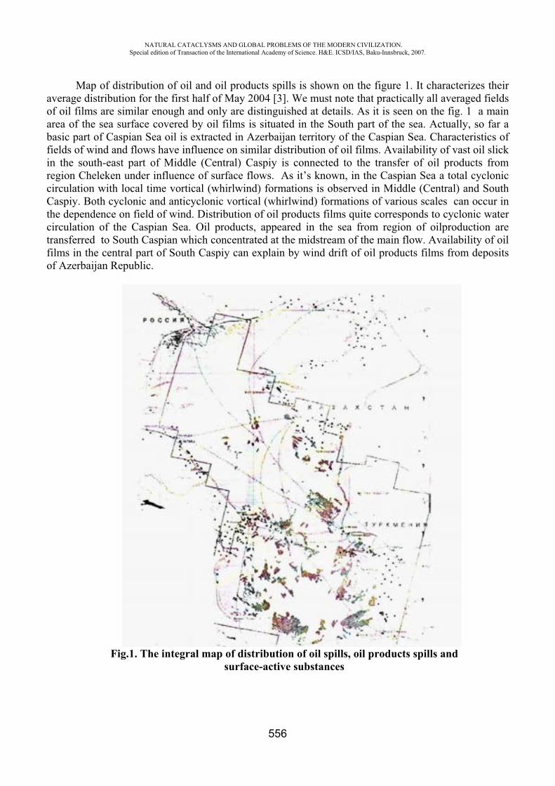
NATURAL CATACLYSMS AND GLOBAL PROBLEMS OF THE MODERN CIVILIZATION. Special edition of Transaction of the International Academy of Science. H&E. ICSD/IAS, Baku-Innsbruck, 2007.
556
Map of distribution of oil and oil products spills is shown on the figure 1. It characterizes their average distribution for the first half of May 2004 [3]. We must note that practically all averaged fields of oil films are similar enough and only are distinguished at details. As it is seen on the fig. 1 a main area of the sea surface covered by oil films is situated in the South part of the sea. Actually, so far a basic part of Caspian Sea oil is extracted in Azerbaijan territory of the Caspian Sea. Characteristics of fields of wind and flows have influence on similar distribution of oil films. Availability of vast oil slick in the south-east part of Middle (Central) Caspiy is connected to the transfer of oil products from region Cheleken under influence of surface flows. As it’s known, in the Caspian Sea a total cyclonic circulation with local time vortical (whirlwind) formations is observed in Middle (Central) and South Caspiy. Both cyclonic and anticyclonic vortical (whirlwind) formations of various scales can occur in the dependence on field of wind. Distribution of oil products films quite corresponds to cyclonic water circulation of the Caspian Sea. Oil products, appeared in the sea from region of oilproduction are transferred to South Caspian which concentrated at the midstream of the main flow. Availability of oil films in the central part of South Caspiy can explain by wind drift of oil products films from deposits of Azerbaijan Republic.
Fig.1. The integral map of distribution of oil spills, oil products spills and surface-active substances
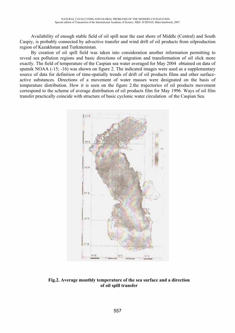
NATURAL CATACLYSMS AND GLOBAL PROBLEMS OF THE MODERN CIVILIZATION. Special edition of Transaction of the International Academy of Science. H&E. ICSD/IAS, Baku-Innsbruck, 2007.
557
Availability of enough stable field of oil spill near the east shore of Middle (Central) and South Caspiy, is probably connected by advective transfer and wind drift of oil products from oilproduction region of Kazakhstan and Turkmenistan.
By creation of oil spill field was taken into consideration another information permitting to reveal sea pollution regions and basic directions of migration and transformation of oil slick more exactly. The field of temperature of the Caspian sea water averaged for May 2004 obtained on data of sputnik NOAA (-15; -16) was shown on figure 2. The indicated images were used as a supplementary source of data for definition of time-spatially trends of drift of oil products films and other surface-active substances. Directions of a movement of water masses were designated on the basis of temperature distribution. How it is seen on the figure 2.the trajectories of oil products movement correspond to the scheme of average distribution of oil products film for May 1996. Ways of oil film transfer practically coincide with structure of basic cyclonic water circulation of the Caspian Sea.
Fig.2. Average monthly temperature of the sea surface and a direction of oil spill transfer
NATURAL CATACLYSMS AND GLOBAL PROBLEMS OF THE MODERN CIVILIZATION. Special edition of Transaction of the International Academy of Science. H&E. ICSD/IAS, Baku-Innsbruck, 2007.
558
REFERENCES
1. Pavlakis P. et al. Monitoring of oil spill pollution in the Mediterranean with ERS SAR // Earth Observ. Quarterly. 1996, v.52, p.13-16
2. Ivanov A.Yu., Litovchenko K.Ts., Ermakov S.A. Oil spill detection in the sea using Almaz – 1 SAR // J Adv. Marine Sci. & Technol. Soc. 1998, v.4(2), p.281-288
3. Ivanov A.Yu., Ermoshkin I.S., Fang M., He M.-C., Krovotyntsev V.A. Use of the wide-swath synthetic aperture radar images for mapping oil pollution in the sea // Research of the Earth from space. 2005, 5, p.78-95
CONTROL AND MANAGEMENT OF THE AIR QUALITY IN A PETRO-CHEMICAL INDUSTRIAL AREA
Salvatore Sciacca*, Agatino Gambadoro**, Rosario Carta***, Aurelio Gambadoro ****
C.I.P.A. Environmental Protection Industrial Union,Siracusa, Italy – [email protected]
ABSTRACT
C.I.P.A. (industrial consortium of environmental protection) is a network of permanent monitoring station covering an area of about 300 km2 could be affected by industrial activities. This Consortium was born in 1975 from the operating companies in Syracuse area, after they decided (in 1972), to play an active role in environmental protection, with reference to the air pollution. Through an experience of over 30 years C.I.P.A. studied how to optimize the network and next classical instruments it searched alternative way to control and forecast air pollution.
The C.I.P.A. network is interconnected with the networks of Enel and Province that works in the same area. This interconnection permit a better manage of industrial area. The purpose of interconnected network is avoid pollution critical condition in industrial area through an alarm systems (3 alarm levels) that informs the industries and local community of contingent high industrial ground concentrations. The critical value of this concentrations are suggested of national and regional law.
Today C.I.P.A. has a network of twelve stations that manage: METEO, BTX ,NOX, HC, SO2, 03, PM10, PM 2.5, H2S
Next to the classical monitors the C.I.P.A. is developing a Model system to forecast pollution immission. The development of this forecast model is the new challenge of our consortium that could be an useful way in to manage and control air pollution next to the classical network of permanent stations.
NATURAL CATACLYSMS AND GLOBAL PROBLEMS OF THE MODERN CIVILIZATION. Special edition of Transaction of the International Academy of Science. H&E. ICSD/IAS, Baku-Innsbruck, 2007.
559
MONITORING OF STEADINESS OF BUILDINGS AND CONSTRUCTION WITHIN A COMPLEX SYSTEM OF SAFETY OF FACILITIES
Aliyev N.S.*, Aliyev E.N.**
Azerbaijan University of Architecture and Construction Institute of Cybernetics of ANAS
There is a new direction of works on automation of control functions and management systems of the safety and system survival of buildings and constructions. With regard to this modern buildings require application of effective communication infrastructures that support the operation of various service and technical systems based on transmission of data in electronic format. Modern building of this type is a city in minuature. Indeed it has all of the service operating inside that are vital for city services. Usually these buildings have administrative room or solely an administrator, who operates and maintains 24 hours systems operation. Despite many automation systems, that are capable to implement the assigned tasks, management and servicing of such systems requires administrative personnel. This person is responsible to control the operation of sub-systems and take measures when something falls out. But there are situations, when actions of the most qualified personnel might be ineffective. These are cases when there is a danger to the building itself and to the people inside with a more global nature – earthquakes, fires and other disasters. In these cases it is pivatal to take extraordinary measures within a blink of eye. Reaction of correctness of human actions in a critical situations might be insufficient. To deal with these tasks and bring them to the confirmity with the international standards requires to apply modern scientific and technical achievements in the construction industry for the wellbeing of people. Such infrastructure might be analyzed as a collections of telecommunication and computing complexes, cable highways, network equipment and information databases, that provide basic support for distribution of the whole information within building.
The most precise information on the current condition of the building (construction) –namely its deterioration, existence of hidden defects – is possible to get after application of monitoring and interpretation of the obtained results. The procedure on implementation of monitoring implies inquiry from sensor, mounted over main construction elements of the dwelling house, that influence its durability and exploitation features as well as engineering equipment of the building. Monitoring of the engineering systems should transmit the information on the consequences of the emergencies into unified management system.
With the current activity we propose an intellectual information system for comprehensive automated processing of information on the condition of survival, safety and automatic transmission of the required information on the sequences of the emergencies. The system functions on the basis of two inter-related functionally-dependable modules.
Module 1 – is designed for implementation of the series of works on technical diagnosis and non-destructive control of load-bearing constructions and provides effectiveness in monitoring of the technical devices, buildings and constructions. The purpose of control is to identify defects that occur in the construction structures, namely fatigue cracks and corrosions. As it is well known, defects might have very different origin and vary by type, size and location. Thus, before picking the control method, it is necessary to study the technology of manufacturing the parts, the character of possible defects and technical conditions.
For example, acoustic method is widely known to control the durability and quality of constructions materials and constructions. Acoustic method of control, more precisely ultra-sound
NATURAL CATACLYSMS AND GLOBAL PROBLEMS OF THE MODERN CIVILIZATION. Special edition of Transaction of the International Academy of Science. H&E. ICSD/IAS, Baku-Innsbruck, 2007.
560
(US) impulse ekho-method enables visualization of the internal structure of henerogeneous materials (concrete and metal-concrete also belongs to this category) with one-way approach. Decision on defectiveness of the tested part is made based on the size of changes of the received signal on the exit of a receiving converter. Signal S (t), received by the ultra-sound converter after emanation of acoustic impulse by the converter into homogeneous isotropic sphere might be represented as following:
)(2)()()()( )^( btfSinebtbtFtAtS bta (1)where A(t ) – signal`s amplitude, F(t) – Heaviside function. Having (1) in Heaviside function excludes from signal any component with delay time, smaller than b.Heaviside function, unit function, step of location – special math function that is equal to nil for negative arguments and equal to one for positive arguments:
0,1
0,21
0,0
)(
x
x
x
xH (2)
The function is widely used in mathematics apparatus on theory of management and processing of signals for presentation for signals, engaging at certain moment and remaining constantly:
b – delay of signal relative to probing impulse, – parameter, determining the form of circumflex signal, f – frequency of infill, t – time.
Ultra-sound converter receiver exit – is the multitude of similar signals with accidental delays and amplitude factor, depending on the value of delay and it can be represented as the following:
)(2)()()( )^(i
btaii
i
yb btfSinebtbtFetS ii (3)
where bi – delay of i- of noise component, y – parameter simulated fading and dispersion of ultra-sound waves in material.
Data received from the ultra-sound sensor are primary parameters of the proposed system. Based on the aforementioned we present the methodic on demonstration of initial signal s(t), in a dynamic mode as in [1,2]. This method of getting signal models consists of the following. Real signal s (t) in a process of discretisation )(ts I is represented by the sum of several elementary signals )(tqk , which we name multi-random signals of the random process:
1
0)()(
m
kk
I tqts , where )(log 2 nm (4)
It is demonstrated here that amplitude quantization s(t) with a relatively small step of discretisation does not affect significantly the obtained results, and it means that we can value statistical signals s(t) and )(ts I as almost equal to each other.
Model signs for identification of the condition of load-bearing constructions is formed by using the statistical characteristics of MSS signals [3,4].
The essence of the proposed method of non-destructive control of construction buildings consists of indirect rating of their durability based on data from acoustic signal disperse.
Module 2 – designed for identification of surface cracks, interstices and similar defects of load-bearing constructions. For the purpose of automation the control process of external defects, the most interest (cracks, interstices) is represented by optic systems (systems of technical view).
In our work we also consider the tasks on recognition of patterns, namely recognition of images (sign method), received from the surface of construction buildings with the help of technical view systems. The specificity of technical view enabled to create a database based on geometry of matrix images, recognition of which is conducted by methods of probability theory and math statistics.
NATURAL CATACLYSMS AND GLOBAL PROBLEMS OF THE MODERN CIVILIZATION. Special edition of Transaction of the International Academy of Science. H&E. ICSD/IAS, Baku-Innsbruck, 2007.
561
The proposed method [5] differs from the method of direct reading out of raster pattern, even though it is more complex, but it enables to allocate less space in the memory for saving images as well as to increase accuracy of recognition. The initial raster with digital binary images is translated into a diagram of the condition. The value of sign is determined by information entered by the sign into condition system. The system condition is characterized by several parameters, where presence of changes determines presence of defect in a part. Information is being coded after it is received by the technical view system. The coded information is converted and represented into 1 and 0. Appearance and cycling of 1 and 0 is a random process, thus it means a function, values of which are not known at different times and depend on independent external influences. It is important to note, that incoming information 0 corresponds with correct condition of cycle, and 1 corresponds with change of condition, irrespective of which parameter was subject to violation. Therefore the system depending on m parameters might be led to the system having one-dimensional space of sings. Let’s agree, that:
.,1,,0
defectpresenceconditioncorrect
D
We will name recognition (identification) of image the process of setting up a compliance between the system condition and flow of mapping functions x (t).
The frequency of occurrence among xij of 1 enables to determine defect in an observed process and might be calculated with the following formula:
,...)(
..........
...)(
...)(
...)(
2
122222122
2
133232313
2
122222212
2
111212111
N
NNNNNN
N
N
N
N
N
N
ii
ii
ii
ii
xxxxxF
xxxxxF
xxxxxF
xxxxxF
that might be represented in the form of condition diagram. The structure of database is based on consequent image analysis. This knowledge enables to
conduct a classification, applying the approaches on recognition of images with the use of expert information. The formation of database was conducted gradually and multiple times. During each step we made sample selection out of general pool of parts (separate constructions or node points) and submitted the samples to an expert to identify the quality of construction materials and buildings. The process was on until all of the contradictions between the expert and area engineer were settled.
The aforementioned optic system also enables to control coarseness of surface. This is provided by dependence of density of light disperse while it is reflected from its surface micro-roughness. The more roughness the more light disperses and the less reflects on the micro-matrix. The proposed control system enables to identify surface defects, estimate coarseness of parts, existence of cracks, quality of surface and other parameters regardless of type, material and form of the construction surfaces.
Proposed modules were united at single calculation complex to ensure technical realization of the intellectual system.
NATURAL CATACLYSMS AND GLOBAL PROBLEMS OF THE MODERN CIVILIZATION. Special edition of Transaction of the International Academy of Science. H&E. ICSD/IAS, Baku-Innsbruck, 2007.
562
Cable lines are to be installed and sensors to be placed, controller to be assigned and terminal for a dispatcher (local server) to be set in a separate facility on the controlled object. The connection between terminal and controller is pursued either through modem or Ethernet. Processed data would be displayed both at the terminal and on a special web-site. Thanks to this option, the owner of the facility might get information on the condition of cite from any place throughout the globe. In case of critical situations, the information is being transmitted as to the dispatcher service room as well as to the central operation unit (main server) of the city for taking immediate steps on prevention of emergency and rescue of people.
REFERENCES
1. Telman Aliev. Robust Technology with Analysis of Interference in Signal Processing. Kluwer Academic, New York, USA, 2003, p.199
2. Aliev T.A., Aliev N.S. Author`s invention 1084746, 1983 y. 3. Aliev E.N. Dynamic expert system of ensuring of security of intellectual buildings, the
conference “Contemporary problems of sciences and education”, Ukraine, Alushta, 2007 y. 4. Aliev N.C., Aliev E.N., Kurbanova N.G. Intellectual system of control and diagnosis of
carring constructions in building complexes. Izvestiya NANA, c. phys-math. and tech.sciences, t. XXII, 2006
5. N.Aliyev, E.Aliyev. Program-technical complex for sorting ceramic tiles with the method of artificial intellect. Proceedings of SPIE, v.4388, Orlando, USA, 2001.
HIGH PERFORMANCE CATALYSTS FOR HYDROGEN PRODUCTION, GENERATION OF ELECTRIC ENERGY AND TRANSFORMATION OF GAS INTO LIQUIDS (GTL)
A. Di Felice*, D. Innamorati**, A. Nardini***, P.L. Villa****, P. Viparelli*****
Dipartimento di Chimica, Ingegneria Chimica e Materiali Monteluco di Roio – Università di L’Aquila – Italy
Introduction The world increasing demand of energy will still be satisfied in the coming years mainly by
fossil fuels, i.e. oil, gas and carbon. Only in the second half of the XXI century is it hopefully expected that nuclear fusion and renewables will play a major role. Therefore it is of critical importance, in line with the Kyoto agreement, to develop technologies that utilize oil and gas as raw materials, with an increased yield of products such as hydrogen, electric power and transportation fuels together with a decrease of the noxious emissions into the atmosphere.
At the University of L’Aquila a new technology of synthesis of oxides allows to manufacture new catalysts that may find interesting applications in:
a) production of hydrogen from natural gas and light hydrocarbons; b) electric power generation by catalytic combustion of hydrocarbons in a turbogas plant; c) transformation of natural gas into liquids by Fischer-Tropsch synthesis. The catalysts obtained by this method withstand temperatures higher than 1200°C, and are easily
regenerated.
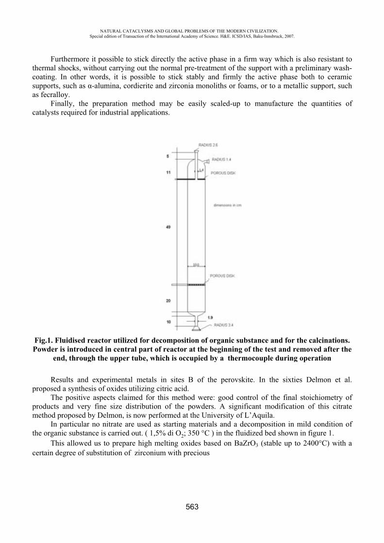
thcsa
c
FP
p
pm
th
c
Furthehermal shoc
coating. In supports, suas fecralloy.
Finallycatalysts req
Fig.1. FluidPowder is in
end, t
Resultproposed a s
The pproducts anmethod prop
In parhe organic s
This acertain degre
NASpecial
ermore it pocks, withouother wordch as -alum
y, the prepquired for in
dised reactntroducedthrough th
ts and expesynthesis ofositive aspe
nd very fineposed by Derticular no nsubstance isallowed us tee of substi
ATURAL CATACLedition of Transacti
ossible to stut carrying ods, it is posmina, cordi
paration mendustrial app
or utilized in central pe upper tub
erimental mf oxides utilects claimee size distrelmon, is nonitrate are us carried outo prepare htution of zi
LYSMS AND GLOion of the Internatio
tick directlyout the normssible to stierite and zi
ethod may plications.
for decomppart of reabe, which i
metals in slizing citric d for this m
ribution of ow performused as starut. ( 1,5% dihigh meltinirconium w
OBAL PROBLEMSonal Academy of Sc
563
y the active mal pre-treaick stably irconia mon
be easily
position of actor at the is occupied
ites B of tacid.
method werthe powdeed at the Unrting materi O2; 350 °C
ng oxides baith precious
OF THE MODERNcience. H&E. ICSD/
phase in a atment of thand firmly
noliths or fo
scaled-up
organic subeginningby a therm
the perovsk
re: good coers. A signiniversity ofials and a d
C ) in the fluased on Bas
N CIVILIZATION/IAS, Baku-Innsbru
firm way we support wthe active
oams, or to
to manufa
ubstance anof the test
mocouple d
kite. In the
ontrol of theificant modf L’Aquila. decompositiuidized bed ZrO3 (stabl
.uck, 2007.
which is alsowith a prelim
phase botha metallic s
acture the q
nd for the cand remov
during oper
e sixties D
e final stoicdification o
ion in mild shown in file up to 240
o resistant tminary washh to ceramisupport, suc
quantities o
calcinationsved after thration
elmon et a
chiometry of this citrat
condition oigure 1. 00°C) with
toh-icch
of
s.he
al.
ofte
of
a
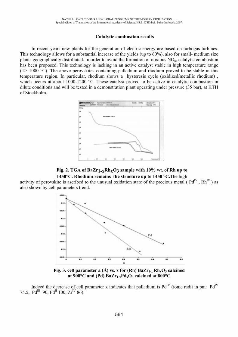
NATURAL CATACLYSMS AND GLOBAL PROBLEMS OF THE MODERN CIVILIZATION. Special edition of Transaction of the International Academy of Science. H&E. ICSD/IAS, Baku-Innsbruck, 2007.
564
Catalytic combustion results
In recent years new plants for the generation of electric energy are based on turbogas turbines. This technology allows for a substantial increase of the yields (up to 60%), also for small- medium size plants geographically distributed. In order to avoid the formation of noxious NOx, catalytic combustion has been proposed. This technology is lacking in an active catalyst stable in high temperature range (T> 1000 °C). The above perovskites containing palladium and rhodium proved to be stable in this temperature region. In particular, rhodium shows a hysteresis cycle (oxidized/metallic rhodium) , which occurs at about 1000-1200 °C. These catalyst proved to be active in catalytic combustion in dilute conditions and will be tested in a demonstration plant operating under pressure (35 bar), at KTH of Stockholm.
Fig. 2. TGA of BaZr1-xRhxO3 sample with 10% wt. of Rh up to 1450°C. Rhodium remains the structure up to 1450 °C.The high
activity of perovskite is ascribed to the unusual oxidation state of the precious metal ( PdIV , RhIV ) as also shown by cell parameters trend.
Fig. 3. cell parameter a (Å) vs. x for (Rh) BaZr1-x RhxO3 calcinedat 900°C and (Pd) BaZr1-xPdxO3 calcined at 800°C
Indeed the decrease of cell parameter x indicates that palladium is PdIV (ionic radii in pm: PdIV
75.5, PdIII 90, PdII 100, ZrIV 86).
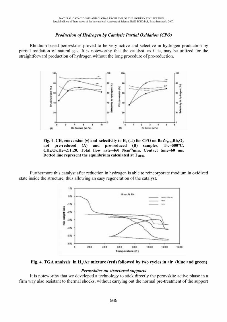
NATURAL CATACLYSMS AND GLOBAL PROBLEMS OF THE MODERN CIVILIZATION. Special edition of Transaction of the International Academy of Science. H&E. ICSD/IAS, Baku-Innsbruck, 2007.
565
Production of Hydrogen by Catalytic Partial Oxidation (CPO)
Rhodium-based perovskites proved to be very active and selective in hydrogen production by partial oxidation of natural gas. It is noteworthy that the catalyst, as it is, may be utilized for the straightforward production of hydrogen without the long procedure of pre-reduction.
Fig. 4. CH4 conversion ( ) and selectivity to H2 ( ) for CPO on BaZr(1-x)RhxO3not pre-reduced (A) and pre-reduced (B) samples. TIN=500°C,CH4:O2:He=2:1:20. Total flow rate=460 Ncm3/min. Contact time=60 ms. Dotted line represent the equilibrium calculated at TMED.
Furthermore this catalyst after reduction in hydrogen is able to reincorporate rhodium in oxidized state inside the structure, thus allowing an easy regeneration of the catalyst.
Fig. 4. TGA analysis in H2/Ar mixture (red) followed by two cycles in air (blue and green)
Perovskites on structured supports It is noteworthy that we developed a technology to stick directly the perovskite active phase in a
firm way also resistant to thermal shocks, without carrying out the normal pre-treatment of the support
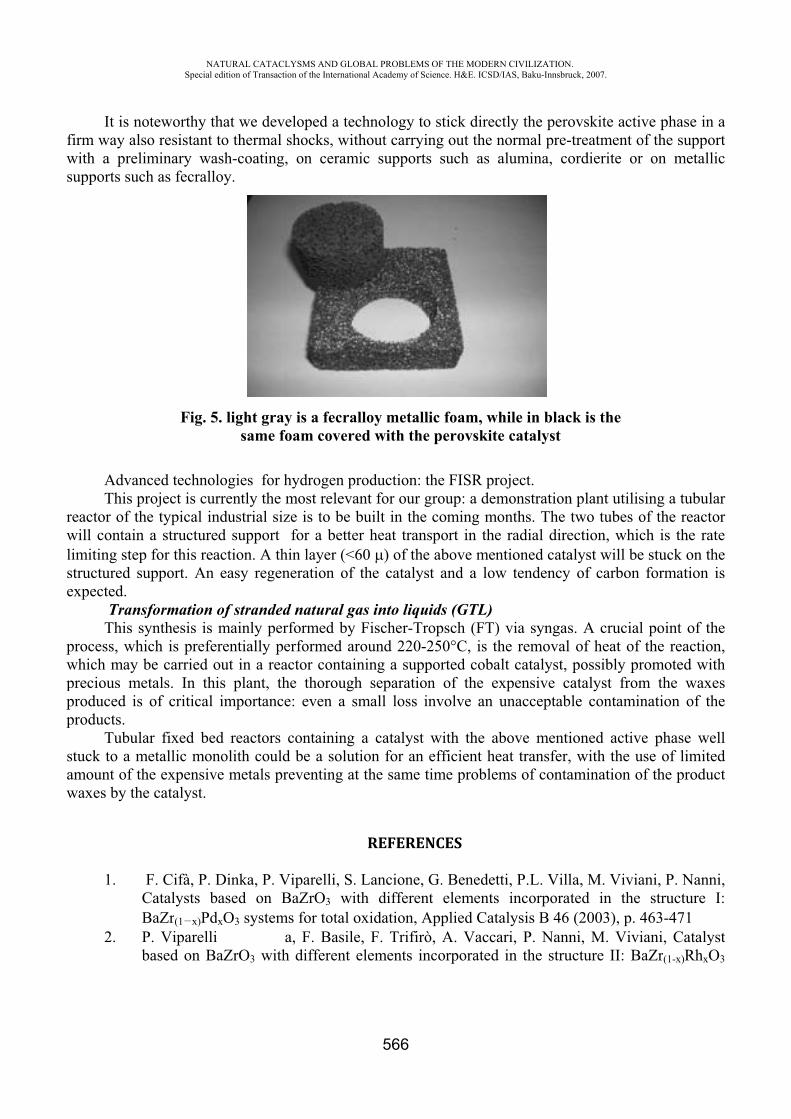
fws
rwlise
pwppp
saw
It is nofirm way alswith a prelisupports suc
AdvanThis p
eactor of thwill containimiting step
structured suexpected.
TransThis s
process, whwhich may bprecious meproduced is products.
Tubulastuck to a mamount of thwaxes by the
1.CB
2. Pb
NASpecial
oteworthy tso resistant iminary wach as fecrall
Fig. 5
nced technoproject is cuhe typical inn a structurep for this reaupport. An
sformationsynthesis is ich is prefebe carried oetals. In th
of critical
ar fixed bemetallic monhe expensive catalyst.
F. Cifà, P. Catalysts bBaZr(1 x)PdP. Viparellibased on B
ATURAL CATACLedition of Transacti
that we deveto thermal
ash-coating,loy.
5. light graysame fo
ologies for hurrently the mndustrial sized supportaction. A theasy regen
of strandedmainly per
erentially peout in a rea
his plant, thimportance
ed reactors nolith couldve metals pr
Dinka, P. Vbased on BdxO3 systemi a
BaZrO3 with
LYSMS AND GLOion of the Internatio
eloped a tecshocks, wit, on ceram
y is a fecraoam covere
hydrogen prmost relevaze is to be bfor a bette
hin layer (<6neration of
d natural garformed by erformed aractor containhe thoroughe: even a s
containing d be a solutreventing at
Viparelli, S. BaZrO3 wit
ms for total oa, F. Basileh different e
OBAL PROBLEMSonal Academy of Sc
566
chnology tothout carryin
mic supports
lloy metalled with the
roduction: tant for our gbuilt in the
er heat trans60 ) of thethe catalys
as into liquFischer-Tro
round 220-2ning a supph separationmall loss in
a catalyst tion for an t the same t
REFEREN
Lancione, Gth differenoxidation, Ae, F. Trifiròelements in
OF THE MODERNcience. H&E. ICSD/
o stick direcng out the ns such as a
ic foam, whe perovskite
the FISR progroup: a demcoming mo
sport in thee above menst and a low
ids (GTL)opsch (FT) 250°C, is thported coban of the exnvolve an u
with the abefficient he
time problem
NCES
G. Benedettt elements
Applied Cataò, A. Vaccancorporated
N CIVILIZATION/IAS, Baku-Innsbru
ctly the peronormal pre-alumina, co
hile in blace catalyst
oject. monstrationonths. The te radial direntioned cataw tendency
via syngashe removal alt catalyst, xpensive caunacceptabl
bove mentieat transfer, ms of conta
ti, P.L. Villincorporat
alysis B 46 ari, P. Nann
in the stru
.uck, 2007.
ovskite activtreatment o
ordierite or
ck is the
n plant utilistwo tubes oection, whicalyst will be
of carbon
s. A crucialof heat of possibly pratalyst fromle contamin
ioned activewith the u
amination o
la, M. Viviated in the (2003), p. 4
ni, M. Viviucture II: Ba
ve phase in of the suppo
on metalli
sing a tubulaof the reactoch is the rate stuck on th
formation
l point of ththe reaction
romoted witm the waxenation of th
e phase wese of limitef the produc
ani, P. Nannstructure
463-471iani, CatalyaZr(1-x)RhxO
aortic
arorteheis
hen,theshe
elledct
ni, I:
ystO3
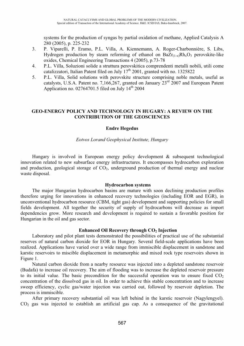
NATURAL CATACLYSMS AND GLOBAL PROBLEMS OF THE MODERN CIVILIZATION. Special edition of Transaction of the International Academy of Science. H&E. ICSD/IAS, Baku-Innsbruck, 2007.
567
systems for the production of syngas by partial oxidation of methane, Applied Catalysis A 280 (2005), p. 225-232
3. P. Viparelli, P. Eramo, P.L. Villa, A. Kiennemann, A. Roger-Charbonnière, S. Libs, Hydrogen production by steam reforming of ethanol on BaZr(1-x)RhxO3 perovskite-like oxides, Chemical Engineering Transactions 4 (2005), p.73-78
4. P.L. Villa, Soluzioni solide a struttura perovskitica comprendenti metalli nobili, utili come catalizzatori, Italian Patent filed on July 17th 2001, granted with no. 1325822
5. P.L. Villa, Solid solutions with perovskite structure comprising noble metals, useful as catalysts, U.S.A. Patent no. 7,166,267, granted on January 23rd 2007 and European Patent Application no. 02764701.5 filed on July 14th 2004
GEO-ENERGY POLICY AND TECHNOLOGY IN HUGARY: A REVIEW ON THE CONTRIBUTION OF THE GEOSCIENCES
Endre Hegedus
Eotvos Lorand Geophysical Institute, Hungary
Hungary is involved in European energy policy development & subsequent technological innovation related to new subsurface energy infrastructures. It encompasses hydrocarbon exploration and production, geological storage of CO2, underground production of thermal energy and nuclear waste disposal.
Hydrocarbon systemsThe major Hungarian hydrocarbon basins are mature with soon declining production profiles
therefore urging for innovations in enhanced recovery technologies (including EOR and EGR), in unconventional hydrocarbon resource (CBM, tight gas) development and supporting policies for small fields development. All together the security of supply of hydrocarbons will decrease as import dependencies grow. More research and development is required to sustain a favorable position for Hungarian in the oil and gas sector.
Enhanced Oil Recovery through CO2 Injection Laboratory and pilot plant tests demonstrated the possibilities of practical use of the substantial
reserves of natural carbon dioxide for EOR in Hungary. Several field-scale applications have been realized. Applications have varied over a wide range from immiscible displacement in sandstone and karstic reservoirs to miscible displacement in metamorphic and mixed rock type reservoirs shown in Figure 1.
Natural carbon dioxide from a nearby resource was injected into a depleted sandstone reservoir (Budafa) to increase oil recovery. The aim of flooding was to increase the depleted reservoir pressure to its initial value. The basic precondition for the successful operation was to ensure fixed CO2concentration of the dissolved gas in oil. In order to achieve this stable concentration and to increase sweep efficiency, cyclic gas/water injection was carried out, followed by reservoir depletion. The process is immiscible.
After primary recovery substantial oil was left behind in the karstic reservoir (Nagylengyel). CO2 gas was injected to establish an artificial gas cap. As a consequence of the gravitational
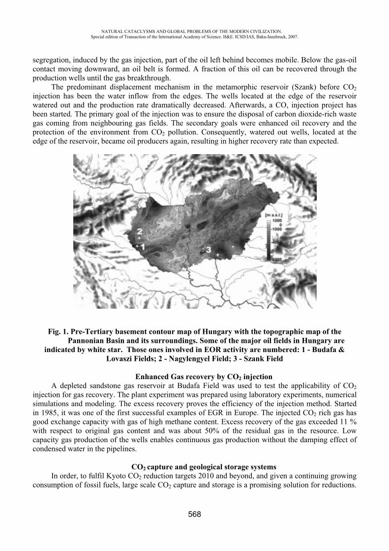
NATURAL CATACLYSMS AND GLOBAL PROBLEMS OF THE MODERN CIVILIZATION. Special edition of Transaction of the International Academy of Science. H&E. ICSD/IAS, Baku-Innsbruck, 2007.
568
segregation, induced by the gas injection, part of the oil left behind becomes mobile. Below the gas-oil contact moving downward, an oil belt is formed. A fraction of this oil can be recovered through the production wells until the gas breakthrough.
The predominant displacement mechanism in the metamorphic reservoir (Szank) before CO2injection has been the water inflow from the edges. The wells located at the edge of the reservoir watered out and the production rate dramatically decreased. Afterwards, a CO, injection project has been started. The primary goal of the injection was to ensure the disposal of carbon dioxide-rich waste gas coming from neighbouring gas fields. The secondary goals were enhanced oil recovery and the protection of the environment from CO2 pollution. Consequently, watered out wells, located at the edge of the reservoir, became oil producers again, resulting in higher recovery rate than expected.
Fig. 1. Pre-Tertiary basement contour map of Hungary with the topographic map of the Pannonian Basin and its surroundings. Some of the major oil fields in Hungary are indicated by white star. Those ones involved in EOR activity are numbered: 1 - Budafa &
Lovaszi Fields; 2 - Nagylengyel Field; 3 - Szank Field
Enhanced Gas recovery by CO2 injection A depleted sandstone gas reservoir at Budafa Field was used to test the applicability of CO2
injection for gas recovery. The plant experiment was prepared using laboratory experiments, numerical simulations and modeling. The excess recovery proves the efficiency of the injection method. Started in 1985, it was one of the first successful examples of EGR in Europe. The injected CO2 rich gas has good exchange capacity with gas of high methane content. Excess recovery of the gas exceeded 11 % with respect to original gas content and was about 50% of the residual gas in the resource. Low capacity gas production of the wells enables continuous gas production without the damping effect of condensed water in the pipelines.
CO2 capture and geological storage systems In order, to fulfil Kyoto CO2 reduction targets 2010 and beyond, and given a continuing growing
consumption of fossil fuels, large scale CO2 capture and storage is a promising solution for reductions.
NATURAL CATACLYSMS AND GLOBAL PROBLEMS OF THE MODERN CIVILIZATION. Special edition of Transaction of the International Academy of Science. H&E. ICSD/IAS, Baku-Innsbruck, 2007.
569
Research is focussing currently on the one hand on developing capture technologies with lower costs as capture costs are the large part of total CO2 reduction costs and on the other hand on environmental and safety assessment technologies to build confidence in the long term management of geologically stored CO2.
Methane production from coal seams enhanced by CO2 injection.A version of this method is the injection of flue gas emitted by power plants, where CO2
component of the flue gas remains underground absorbed by the coal, driving methane out from the coal structure. In this process the methane production as a source of energy can be coupled with the storage of CO2. We plan to adapt and test this process in the abandoned slopes and virgin coal complexes of the Mecsek coal field using flue gas from the Pecs thermal power plant in Hungary. This will be the first CO2 storage pilot project in Hungary. The Mecsek coal field is the largest hard coal complex in Hungary, with a coal reserve of 980 million tonnes, and recoverable gas reserve of about 28.5 billion cu.m.
Geothermal production systems House heating is an important percentage of energy consumption. Typically heat is generated
decentralized with hydrocarbons, mainly gas. In general, much more summer waste heat could be available for heating in winter, but without subsurface storage it is not possible to make a step change in efficiency. The demand for cold energy is a growing requirement which can also be produced by low enthalpy systems. High enthalpy heat (>150 degrees Celsius) is mainly used for electricity production. At the moment large scale high and low enthalpy geothermal production and thermal energy storage systems are not a major research topic despite the fact that major clean heat production, energy efficiency and CO2 reduction could be obtained.
The geothermal potential of Hungary is well over the world average and except the active volcanic areas it is one of the most prospective territories in Europe. In spite of this, there is hardly any geothermal energy facilities in this country, and the majority of them are operated on a less environmentally sound basis by not re-injecting the water. A pilot project looks to use this large geothermal resource in western Hungary.
In order to determine what the output of the power plant will be, well testing will be necessary. The wells are 2500-3200 m deep and the water temperature was expected to be above 135°C at well-heads. These parameters enable the investors to establish the reservoir could sustain a 2-5 MW geothermal power plant.
Current estimates show that it would be possible to construct 3-4 power plants by 2012. In this case the electricity production from geothermal energy could prove to be prospective in the long run.
Nuclear energy Nuclear energy is expected to remain an important source of electricity in Hungary. Mining
nuclear material and storage waste residues are main geo-energy issues to be solved in the coming decades. Knowledge about the natural safety barriers or potential migration mechanisms of radio nuclides have to be further developed as well as tools for modeling coupled processes to be able to perform commonly accepted environmental and safety studies. Geological repositories are required for long-lived low- and intermediate-level waste, high-level waste and spent fuel, which may take 10 to 100 thousands of years to decay. The exploration of a site for underground repository in the granite formation is already in advanced stage in southern Hungary.
It is clear that much geo-energy R&D is required to further develop various industrial geo-energy solutions needed for the transition towards a more sustainable energy future.
NATURAL CATACLYSMS AND GLOBAL PROBLEMS OF THE MODERN CIVILIZATION. Special edition of Transaction of the International Academy of Science. H&E. ICSD/IAS, Baku-Innsbruck, 2007.
570
CHROMATOGRAPHIC METHOD OF DETECTION OF OIL PRODUCTS IN WATER
O. I. Samonina
Water research and control center, Saint-Petersburg, Russia [email protected]
Oil products are among the most widespread and dangerous substances polluting the environment including water. It is the consequences of pollution that are considered the most dangerous. Pollution with oil products is the rated type of pollution. The following maximum permissible concentrations of oil products in water are determined in the Russian Federation: 0,3 mg/dm3 - for water basins of general sanitary use, 0,1 mg/dm3 - for drinking water and 0,05 mg/dm3
- for fish industry water basins. At the same time in several European countries, in Germany for example, the maximum permissible concentration of petroleum hydrocarbons is set at the level of 0,01 mg/dm3 .
Today up to several tons of oil and oil products pour in the ocean at the shelf extraction, shore abrasion and through the atmosphere annually. Huge amounts of oil products get through the soil into subterranean and underground waters. Among the main sources of pollution are transportation, which share is up to 35% of the total amount of pollution, river leakage from different sources (more than 30%), natural sources (about 10%), disasters, industrial and municipal waste (up to 5% each). The other sources make approximately 10% of the general amount of pollution. Usually at its inflow the major mass of oil products is concentrated in the film. At the spread of the oil film over the surface of water it forms multimolecular layer, which is able to cover very huge area. For example, 15 tons of black oil may spread and cover the area of about 20 km2 in 6-7 days. About 7% of ocean's surface is constantly covered with oil film, and the figure is 12% for the northern hemisphere.
After getting into the ocean the oil is exposed to natural factors (aeration, currents, tides), it evaporates, dissolves, emulsifies, sorbs on the solids of the slurries and bottom sediments. It is digested by living organisms, and suffers chemical and photochemical transformations. Oil pollutions capture and concentrate other wastes: heavy metals and pesticides that change its toxicity.
At the same time there is also the difference in the conduct of the aquatic environment objects registered: surface, deep-sea, subterranean and bottom sediments. For example, in the surface waters the composition of oil products suffers considerable change in a short period of time, while in subterranean waters the processes of decay are slowed down. Low-molecular components are withdrawn from the oil patch mainly in the result of dissolution processes. Water solubility of oil products varies in a wide range and its value (mg/dm3) for oil is 10…50, for diesel fuel - 8…22, kerosene - 2..5, gasoline - 6…505, black oil - …2, pentane - 38.5, octane - 0,66, decane - 0,016, dodecane - 0,0037, benzene - 1780, toluene - 515.
The increase of solubility can be traced in the following row: aromatic > naphthene > paraffin. Hot charge, as a rule, neither decays nor dissolves. It can be found on the surface of the water in the shape of floating resinous balls, which are stranded on the shore.
Different kinds of bacteria provide the biodegradation of oil, i.e. its microbiologic oxidation. It is accompanied by oxygen consumption, and it consequently disappears from water. Such oxygen consumption can be rather considerable, provided enough time is available for the total oil oxidation. The relation of oil amount to sea water is approximately 400 000:1. It means that the total oxidation of 1 litre of oil requires oxygen contained in 400 000 litres of sea water. In such conditions bacterial decay may have negative consequences, because it decreases the amount of dissolved oxygen. In the
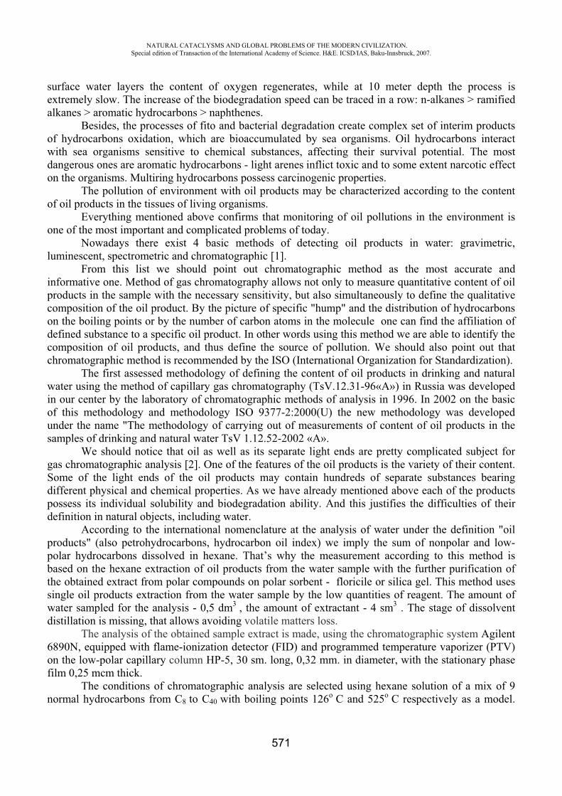
NATURAL CATACLYSMS AND GLOBAL PROBLEMS OF THE MODERN CIVILIZATION. Special edition of Transaction of the International Academy of Science. H&E. ICSD/IAS, Baku-Innsbruck, 2007.
571
surface water layers the content of oxygen regenerates, while at 10 meter depth the process is extremely slow. The increase of the biodegradation speed can be traced in a row: n-alkanes > ramified alkanes > aromatic hydrocarbons > naphthenes.
Besides, the processes of fito and bacterial degradation create complex set of interim products of hydrocarbons oxidation, which are bioaccumulated by sea organisms. Oil hydrocarbons interact with sea organisms sensitive to chemical substances, affecting their survival potential. The most dangerous ones are aromatic hydrocarbons - light arenes inflict toxic and to some extent narcotic effect on the organisms. Multiring hydrocarbons possess carcinogenic properties.
The pollution of environment with oil products may be characterized according to the content of oil products in the tissues of living organisms.
Everything mentioned above confirms that monitoring of oil pollutions in the environment is one of the most important and complicated problems of today.
Nowadays there exist 4 basic methods of detecting oil products in water: gravimetric, luminescent, spectrometric and chromatographic [1].
From this list we should point out chromatographic method as the most accurate and informative one. Method of gas chromatography allows not only to measure quantitative content of oil products in the sample with the necessary sensitivity, but also simultaneously to define the qualitative composition of the oil product. By the picture of specific "hump" and the distribution of hydrocarbons on the boiling points or by the number of carbon atoms in the molecule one can find the affiliation of defined substance to a specific oil product. In other words using this method we are able to identify the composition of oil products, and thus define the source of pollution. We should also point out that chromatographic method is recommended by the ISO (International Organization for Standardization).
The first assessed methodology of defining the content of oil products in drinking and natural water using the method of capillary gas chromatography (TsV.12.31-96« ») in Russia was developed in our center by the laboratory of chromatographic methods of analysis in 1996. In 2002 on the basic of this methodology and methodology ISO 9377-2:2000(U) the new methodology was developed under the name "The methodology of carrying out of measurements of content of oil products in the samples of drinking and natural water TsV 1.12.52-2002 « ».
We should notice that oil as well as its separate light ends are pretty complicated subject for gas chromatographic analysis [2]. One of the features of the oil products is the variety of their content. Some of the light ends of the oil products may contain hundreds of separate substances bearing different physical and chemical properties. As we have already mentioned above each of the products possess its individual solubility and biodegradation ability. And this justifies the difficulties of their definition in natural objects, including water.
According to the international nomenclature at the analysis of water under the definition "oil products" (also petrohydrocarbons, hydrocarbon oil index) we imply the sum of nonpolar and low-polar hydrocarbons dissolved in hexane. That’s why the measurement according to this method is based on the hexane extraction of oil products from the water sample with the further purification of the obtained extract from polar compounds on polar sorbent - floricile or silica gel. This method uses single oil products extraction from the water sample by the low quantities of reagent. The amount of water sampled for the analysis - 0,5 dm3 , the amount of extractant - 4 sm3 . The stage of dissolvent distillation is missing, that allows avoiding volatile matters loss.
The analysis of the obtained sample extract is made, using the chromatographic system Agilent6890N, equipped with flame-ionization detector (FID) and programmed temperature vaporizer (PTV) on the low-polar capillary column HP-5, 30 sm. long, 0,32 mm. in diameter, with the stationary phase film 0,25 mcm thick.
The conditions of chromatographic analysis are selected using hexane solution of a mix of 9 normal hydrocarbons from 8 to 40 with boiling points 126 and 525 respectively as a model.
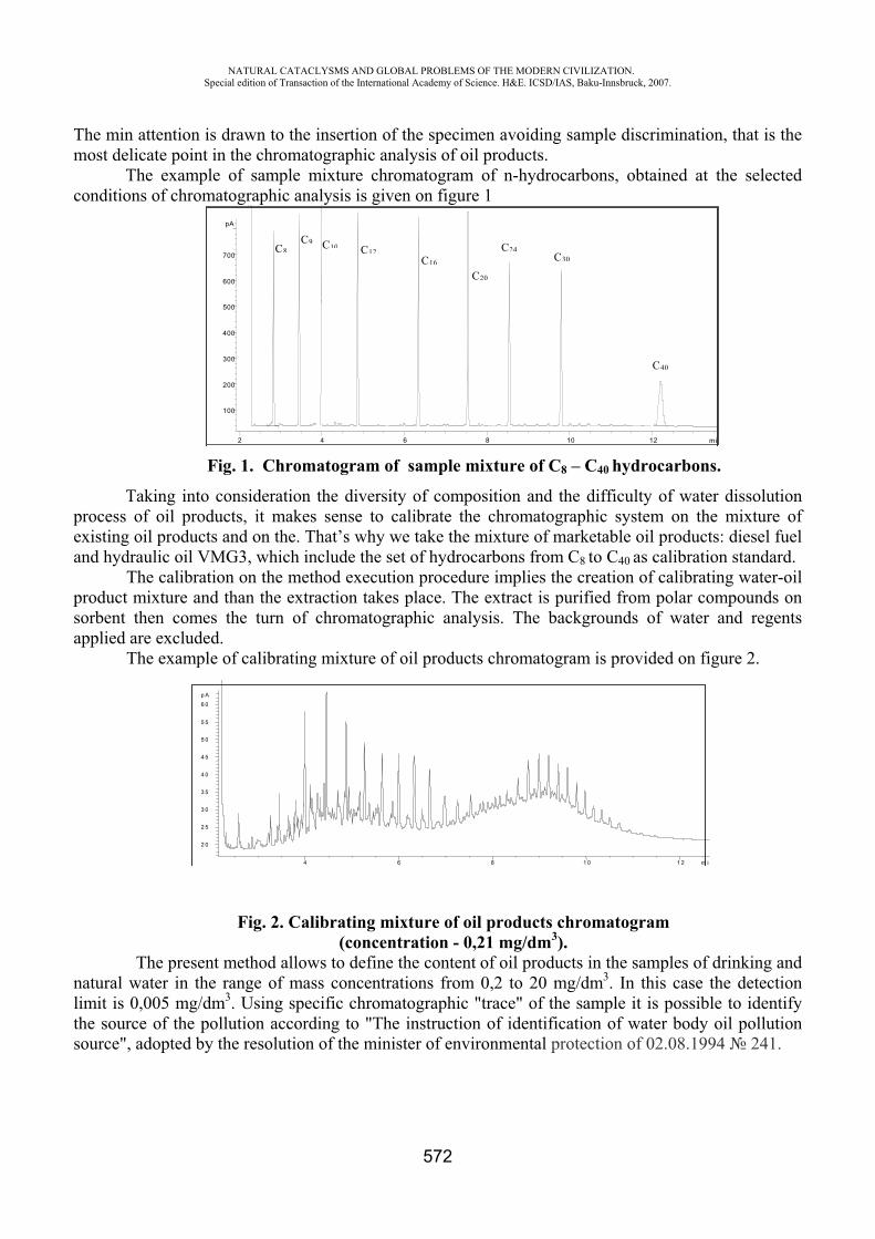
NATURAL CATACLYSMS AND GLOBAL PROBLEMS OF THE MODERN CIVILIZATION. Special edition of Transaction of the International Academy of Science. H&E. ICSD/IAS, Baku-Innsbruck, 2007.
572
The min attention is drawn to the insertion of the specimen avoiding sample discrimination, that is the most delicate point in the chromatographic analysis of oil products.
The example of sample mixture chromatogram of n-hydrocarbons, obtained at the selected conditions of chromatographic analysis is given on figure 1
min2 4 6 8 10 12
pA
100
200
300
400
500
600
7008
910
1216
20
2430
40
Fig. 1. Chromatogram of sample mixture of 8 – 40 hydrocarbons.
Taking into consideration the diversity of composition and the difficulty of water dissolution process of oil products, it makes sense to calibrate the chromatographic system on the mixture of existing oil products and on the. That’s why we take the mixture of marketable oil products: diesel fuel and hydraulic oil VMG3, which include the set of hydrocarbons from 8 to 40 as calibration standard.
The calibration on the method execution procedure implies the creation of calibrating water-oil product mixture and than the extraction takes place. The extract is purified from polar compounds on sorbent then comes the turn of chromatographic analysis. The backgrounds of water and regents applied are excluded.
The example of calibrating mixture of oil products chromatogram is provided on figure 2.
Fig. 2. Calibrating mixture of oil products chromatogram (concentration - 0,21 mg/dm3).
The present method allows to define the content of oil products in the samples of drinking and natural water in the range of mass concentrations from 0,2 to 20 mg/dm3. In this case the detection limit is 0,005 mg/dm3. Using specific chromatographic "trace" of the sample it is possible to identify the source of the pollution according to "The instruction of identification of water body oil pollution source", adopted by the resolution of the minister of environmental protection of 02.08.1994 241.
m in4 6 8 1 0 1 2
p A
2 0
2 5
3 0
3 5
4 0
4 5
5 0
5 5
6 0
NATURAL CATACLYSMS AND GLOBAL PROBLEMS OF THE MODERN CIVILIZATION. Special edition of Transaction of the International Academy of Science. H&E. ICSD/IAS, Baku-Innsbruck, 2007.
573
The method conforms to the international standards, particularly to ISO 9377-2:2000(U) method, and differs advantageously with the simplicity of analysis sample preparation, and the saving of reagents and efforts.
REFERENCES
1. S.I .Petrov, T.N. Tjuljagina, P.A. Vasilenko. Definition of mineral oil in objects of an environment. Russ. Journal «Factory laboratory. Diagnostics of materials», 1999, v. 65, 9, p. 3 - 19.
2. E.S. Brodsky, S.A. Savchuk. Definition of mineral oil in objects of an environment. Russ. Journal of analytical chemistry, 1998, . 53, 12, with. 1238 - 1251.
TREATMENT OF MAKEUP WATER FOR HEAT-AND-POWER ENGINEERING FACTORIES WITH ENVIRONMENTALLY APPROPRIATE AND RESOURCE-SAVING
TECHNOLOGY
Feyziyev G.K., Jalilov M.F.
Azerbaijan University of Architecture and Civil Engineering [email protected]
Plants for treatment of makeup water used in different fields of industry including heat power plants are characterized by occurrence of discharge of wastes with high content of salts and high reagents consumption polluting the environment.
A number of technological solutions and schemes of plants which enable to solve locally or in complex the problems of increase of water treatment plants efficiency with simultaneous reduction of reagents consumption by 2-3 times, i.e. down to values close to theoretical [1-2] has been developed in Azerbaijan Architectural-Constructional University (AzASU).
There are about 50 inventions achieved by us in the field of water and wastes treatment with precipitation of hardness compounds by reagents as well as softening and full demineralization on ion-exchange resins used in the developed technologies. The developments have successful industrial approbation and are characterized with high technical, economical and ecological efficiency. Developed technological solutions for reduction of consumption of alkali and acid during the ion-exchange demineralization of sweet waters have no analogs in the world and can be adapted to existing schemes.
It was detected during the analysis and research of traditional technological schemes of chemical desalination of water in AzASU that it is necessary to change the technology itself of both chemical desalination and softening of water for increase of their economical efficiency and environmental safety. At that, main developments and researches were directed to decrease of specific consumption of reagents for regeneration of ion exchangers down to stoichiometric values, increase of values of work exchange capacity of ion exchangers and utilization of wastes formed at the first cycle of water treatment or obtaining of wastes in the form of soft solutions that facilitates their further utilization.
For practical implementation of abovementioned, new constructions of ion exchangers’ filters also have been developed here besides new technologies [1].
In the result of researches conducted in AzASU it was determined that for increase of efficiency of
NATURAL CATACLYSMS AND GLOBAL PROBLEMS OF THE MODERN CIVILIZATION. Special edition of Transaction of the International Academy of Science. H&E. ICSD/IAS, Baku-Innsbruck, 2007.
574
hydrogen cycle which is one of the main stage of water chemical desalination, cation exchanger should be in readily regenerable ionic form before the regeneration by acid solution.
At that, high value of exchange capacity in cation exchangers [1] can be achieved even with low concentrations of acid and low consumption of it. It was determined that exchange capacity of cation exchanger KU-2-8 in calcium form during the regeneration by solutions of sulfuric and hydrochloric acids (at double consumption) makes accordingly 400 and 700 gr-ekv/m3. And when this cation exchanger is in readily regenerable ionic form before the regeneration its exchange capacity is more in several times even at 1,1-fold consumption of sulfuric and hydrochloric acids and makes accordingly 1000 and 1500 gr-ekv/m3. However, counter-flow process of cation exchange is an obligatory condition for obtaining of required level of water treatment.
Taking into consideration known imperfections of counter-flow filters the double-flow counter-flow principle of ionization has been developed in AzASU and construction of double-flow counter-flow filter has been developed on the base of it. Unlike the counter-flow filters these filters have in-bed collector located lower and working in better hydraulic conditions. There is no blocking flow here and in place of it a part of regenerant or treated water is fed depending on the scheme of use of this filter. The whole charge of ion exchanger is used effectively. These filters are manufactures on Taganrog Boiler Plant at the present time.
Readily regenerable ionic form of cation exchanger before the regeneration can be obtained by different effective environmentally appropriate methods.
Different high-performance technological schemes in the field of anion exchange of sweet waters have been developed in AzASU.
It’s known that weak-base anion exchangers have strong regenerability and at stoichiometric consumption of alkali they recover high enough exchange capacity. However, if they work by straight-flow scheme their regeneration is carried out with 1,5-2-fold consumption of alkali.
It was determined during researches that for sharp decrease of consumption of alkali it is necessary to use counter-flow principle of ionization. However, use of conventional counter-flow filters for this purpose is impossible due to known defects of the latter. The only right solution at that is to use double-flow counter-flow filters for this purpose. When these filters are included according to double-flow water treatment double increase of filters’ performance is also achieved beside decrease of consumption of reagents.
Technology of “advanced” regeneration [1] has been developed in AzASU in relation to conditions of works with low and medium-base anion exchangers.
AzASU also has developed an effective technology of regeneration of weak-base anion exchangers’ filters by lime solution in which there are no wastes and products of regeneration are removed from the system in the form of calcium sulphate [1,2].
It is should be noted that technologies of chemical desalination with decreased reagents and wastes, developed in AzASU have been introduced successfully on water treatment plants of Ali-Bayramli hydroelectric power plant, heat station-21 MOSENERGO, heat station GAZ, Volga heat station-2, Minsk heat station-3, Karmanovsk hydroelectric power plant, Kazan: heat stations-1,2 and 3 and others [2].
Development of AzASU were used during the drawing up of five “Methodic instructions” on design of technological schemes of softening and chemical desalination of water with decreased consumptions of reagent and wastes issued by directive of Ministry of Energy of USSR. Results of developments were included into tens of projects of water treatment plants of thermal power plant of CIS [2].
Plant of chemical desalination with decreased consumption of reagents and wastes developed in AzASU has been built for the first time in Ali-Bayramli hydroelectric power plant of the Azerbaijan Republic with capacity 100 t/h.

NATURAL CATACLYSMS AND GLOBAL PROBLEMS OF THE MODERN CIVILIZATION. Special edition of Transaction of the International Academy of Science. H&E. ICSD/IAS, Baku-Innsbruck, 2007.
575
Tests of the plant on Ali-Bayramli hydroelectric power plant were conducted by the commission of the former Ministry of Energy of USSR consisting of representatives of VTI named after F.Dzerjinski, All-USSR Scientific-Research Project Institute of Power Industry, Soyuztehenergo, Mosenergo and Azglavenergo. Test and examination of the plant of water treatment by the commission of the former Ministry of Energy of USSR certified high technological performance of the plant.
According to the results of the test during the regeneration of ion exchangers by practically stoichiometric number of reagents, i.e. 2-3 times less than values existing on station (mk =1,034 and m =1,09 gr-ekv/gr-ekv), exchange capacities of ion exchangers are high enough and for KU-2-8, SK-1, AN-31 and AV-17-8 they make accordingly about 1000, 400, 970 and 400 gr-ekv/m3.
Another plant of chemical desalination with decreased wastes and decreased reagents was constructed on the heat station of Gorki Automobile plant [3]. Operation of this plant shows that specific consumption of reagents for regeneration of ion exchangers was reduced practically down to stoichiometric values and work exchange capacity of ion exchangers in comparison with the working plant increased in 1,5-2 times. Exchange capacities of ion exchangers SK-1 in MN and N2-filters, KU-2-8 in N1 filter, AV-17-8 in II and 2-flilters and -31 in 1-filter at specific consumptions of acids and alkali for regeneration make accordingly 1,02 and 1,03 gr-ekv/gr-ekv and average are equal to 470, 380,1330, 330, 450 and 1350 gr-ekv/m3 on the average [3].
Heat station-21 of Mosenergo was reconstructed and put into operation with new technology, a chain working by the scheme 1
/ - 1// - 1 - - - 2 - 2
/ - 2//.
In the result of the tests carried out by All-USSR Scientific-Research Project Institute of Power Industry and Production Association Soyuztehenergo jointly with AzASU [4] it was determined that during the treatment of Moscow river water specific consumptions of acid and alkali for regeneration are reduced practically down to stoichiometric value. In spite of this, exchange capacities of ion exchangers are increased in 1,5-2 times on the average. Quality of desalted water met the necessary requirements.
One more plant for water desalination (chain #6) with reduced wastes and reagents was installed on the same station [4,5].
On Minsk heat station-3 installation of plants for treatment of desalted water for makeup of boilers and for makeup water of heating system with capacity accordingly 560 and 930 m3/h has been implemented according to the project of BelNIPIEnergoprom. During the design of the plant one of technologies of combined production of chemically desalted and softened water developed in AzASU was used. Prototype models of double-flow counter-flow filters produced by Taganrog Boiler Factory were used on VPU (http://www.tkz.su/).
According to data of Minsk heat station-3 specific consumption of acid and alkali for regeneration of ion exchangers are low enough. Its value in respect of acid is within 1,1-1,35 gr-ekv/gr-ekv, and in respect of alkali 1,05-1,3 gr-ekv/gr-ekv. Value of work exchange capacity of cation exchanger KU-2-8 and S-100 at that makes 750-800 gr-ekv/m3 on the average. Other ecologically clean and resources-saving technology of chemical desalination of water in 2001-2002 was introduced on XVO of Kazan heat station-3. During the introduction of this technology specific consumption of acid and alkali for regeneration of ion exchanger filters made 55-60 gr/gr-ekv and 40-45 gr/gr-ekv at standard values 128 and 90 gr/gr-ekv accordingly, number of wastes forming on the plant is reduced, consumption of water for own needs was reduced down to 10% (http://www. tatenergo.ru /).
Experience in operation of plants with reduced reagents and wastes gave similar technological indexes also on other thermal power plants.
NATURAL CATACLYSMS AND GLOBAL PROBLEMS OF THE MODERN CIVILIZATION. Special edition of Transaction of the International Academy of Science. H&E. ICSD/IAS, Baku-Innsbruck, 2007.
576
REFEFENCES
1. Feyziyev G.K. High-effective methods of softening, sweetening and desalination of water. M., Energoatomizdat, 1988.
2. Jalilov M.F. Chemical desalination of water on thermal power plants with reduced numbers of reagents and wastes. Baku, Elm, 1996.
3. Grosheva G.N. Scheme of zero-discharge method of chemical desalination of water with capacity 100 t/h. Protection of water reservoirs from pollution with wastes of heat-and-power plants. Baku, AzISI, 1983, p.9-11.
4. Yalova A.Y., Chub A.I, Lykov B.G. Industrial tests of new technological schemes of desalination with reduced consumption of reagents and volumes of wastes. M., Souyztehenergo, 1985.
5. Fedoseyev B.S. Reduction of consumption of chemical reagents on heat-and-power stations. Saint-Petersburg, VNIIG named after B.Y.Vedeneyev, 1992.
6. Jalilov M.F., Kuliyev A.M., Pribylski L.S., et al. Experience in operation of plant for treatment of makeup water of heating system on Minsk Heat station-3. Energetika, Minsk, 1997, #1-2.
RESEARCH OF RADIATION CONDITION AND ECOLOGICAL MONITORING OF THE RADIONUCLIDE CONTENTS IN THE NATURAL ENVIRONMENT ON SOUTHEAST
APPROACH OF THE SUMGAIT CITY
A.A. Garibov *, S.R. Khudaverdieva **, A.N. Samedov ***, R.D. Kasimov ****,Sh.A. Mirzoev *****, D.A. Naghiev ******, R.I. Khalilov *******
* Institute of Radiation Problems, NAS of Azerbaijan, Azerbaijan ** The Baku State University, Azerbaijan
Abstract
Now application of all kinds of radiation sources, and also as a result of the anthropogenous activity resulting in concentrating of the natural radionuclides (RN) in a local environment of alive organisms is connected to the certain risk for an environment and for the human. In this connection circumstance has arisen and today undergoes rapid development the radiation ecology representing a part of the common ecology, studying influence of radiations on the human and environment surrounding him. Development of radiation ecology has got large scales and in Azerbaijan after CAES accident.
First of all, soil as the firm basis of existence, at radiating pollution becomes a source of receipt of RN by plants and animals on a trophy chain. Taking into account all told, by us were carried out radioecological researches of natural components in territory of all Republic. Within the framework of these researches we investigate both radiation conditions and RN contents in soils of territory of the Sumgait city. In recent article results of spectrometric and EPR-radiospectrometric researches of soils and other natural components of some parts of investigated territory are submitted.
Pollution is an undesirable change of physical, chemical or biological characteristics of the natural environment components, which can now or in the future to render adverse influence on a life of the human, plants and animals, conditions of a life, to exhaust or spoil natural resources. All over
NATURAL CATACLYSMS AND GLOBAL PROBLEMS OF THE MODERN CIVILIZATION. Special edition of Transaction of the International Academy of Science. H&E. ICSD/IAS, Baku-Innsbruck, 2007.
577
the world environmental contamination increases not only because, that with growth of the population the space accessible to everyone person, but also because decreases, that needs per capita continuously increase. The contaminants are inevitable by-products of the human economic activities - transport, the industry and an agriculture, in process of expansion of this activity of people, pollution grows also. Now pollution began one of limiting factors for the human. The problem of environmental contamination exists all over the world.
Except for it global air and waters pollution, generated by transbounder carries mainly with developed countries threatens now to everyone. To cope with pollution in local and global scale, it is necessary the ecosystem approach: studying of a condition of impurity of the natural environment components by that or other pollutant should be accompanied by researches of change of features of individuals, kinds, populations of alive organisms. The system approach is necessary and concerning pollutants.
Radioactive substances from the polluted natural components can get inside of an organism and cause an internal irradiation. Or they can be outside of an organism and irradiate it outside. The last in the majority are -radiators and because have primary ecological value [1]. The population receives the most part of an irradiation from - radiation of natural radiation sources. Terrestrial sources of radiation in the sum are responsible for the most part of an irradiation to which organisms are exposed due to natural radiation. On the average terrestrial sources provide more than 5/6 annual effective equivalent dozes received by the population. Other part is brought with space beams [2]. The basic radioactive isotopes contained in rocks of the Earth, are kalium-40, rubidium - 87 and members of two radioactive families originating accordingly from 238U and 232Th of long-living isotopes, contained in structure of the Earth since its birth [3].
Alive organisms receive some doze of an irradiation from artificial radionuclides, created by the human and used in medicine and for creation of the nuclear weapon, for production of energy and search of minerals. All this results in increase in a doze of an irradiation as a whole [2].
Continuous development of nuclear power, in the peace purposes which should be accelerated in process of exhaustion of stocks of combustible minerals to be accompanied by increase in amount of radioactive waste products of which it is necessary to observe continuously and with which it is necessary to struggle, as well as with others dangerous pollutants. But, it is necessary to mean also, that radiation connected to normal development of nuclear power, makes only small share of radiation generated by the human activity. People receive considerably big dozes from application of X-rays in medicine, burning of coal, use of air transport, stay in well hermetically sealed premises and all this results in substantial growth of a level of an irradiation. We count, that for construction of the atomic power station in Azerbaijan and its functioning with the least risk for an environment are available all preconditions. In fact safe functioning of the atomic power station is a question not so much nuclear fuel, how many competence of administrative divisions.
What levels would not have radioactive pollution, it is considered, that for radiation effects there is no threshold and the first to this conclusion came genetics. Results of many works show, that small dozes of radioactive radiations are the stressful factor for biological objects and, that thus in alive organisms there are radio induced changes [4, 5, 6]. Such circumstance demands the constant control over a radioactive condition of an environment.
Taking into account the above said, supervision over radiation conditions and over RN contents in the natural environment of the territory of Sumgait, which are taking place in an industrial zone of Absheron, is an actual task of radioecology.
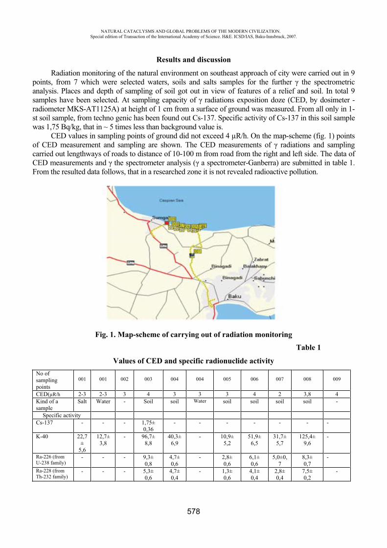
NATURAL CATACLYSMS AND GLOBAL PROBLEMS OF THE MODERN CIVILIZATION. Special edition of Transaction of the International Academy of Science. H&E. ICSD/IAS, Baku-Innsbruck, 2007.
578
Results and discussion
Radiation monitoring of the natural environment on southeast approach of city were carried out in 9 points, from 7 which were selected waters, soils and salts samples for the further the spectrometric analysis. Places and depth of sampling of soil got out in view of features of a relief and soil. In total 9 samples have been selected. At sampling capacity of radiations exposition doze (CED, by dosimeter - radiometer MKS- 1125 ) at height of 1 cm from a surface of ground was measured. From all only in 1-st soil sample, from techno genic has been found out Cs-137. Specific activity of Cs-137 in this soil sample was 1,75 Bq/kg, that in ~ 5 times less than background value is.
CED values in sampling points of ground did not exceed 4 μR/h. On the map-scheme (fig. 1) points of CED measurement and sampling are shown. The CED measurements of radiations and sampling carried out lengthways of roads to distance of 10-100 m from road from the right and left side. The data of CED measurements and the spectrometer analysis ( a spectrometer-Ganberra) are submitted in table 1. From the resulted data follows, that in a researched zone it is not revealed radioactive pollution.
Fig. 1. Map-scheme of carrying out of radiation monitoring Table 1
Values of CED and specific radionuclide activity No of samplingpoints
001 001 002 003 004 004 005 006 007 008 009
CED(μR/h 2-3 2-3 3 4 3 3 3 4 2 3,8 4 Kind of a sample
Salt Water - Soil soil Water soil soil soil soil -
Specific activity Cs-137 - - - 1,75±
0,36 - - - - - - -
K-40 22,7±
5,6
12,7±3,8
- 96,7± 8,8
40,3±6,9
- 10,9± 5,2
51,9±6,5
31,7±5,7
125,4±9,6
-
Ra-226 (from U-238 family)
- - - 9,3± 0,8
4,7±0,6
- 2,8± 0,6
6,1±0,6
5,0±0,7
8,3±0,7
-
Ra-228 (from Th-232 family)
- - - 5,3± 0,6
4,7±0,4
- 1,3± 0,6
4,1±0,4
2,8±0,4
7,5±0,2
-
NATURAL CATACLYSMS AND GLOBAL PROBLEMS OF THE MODERN CIVILIZATION. Special edition of Transaction of the International Academy of Science. H&E. ICSD/IAS, Baku-Innsbruck, 2007.
579
We investigate EPR spectra of soil samples on radio spectrometer RE-1306 at room temperature. In all samples the known spectrum of Mn2 +ions in a crystal field was observed. The lines corresponding to forbidden transitions were well observed also. On the basis of the received spectra the following values of the basic EPR parameters have been calculated:
g-factor of Mn2 + - 2,056;STS - Mn2 + - 8,85 mTl; Width of a line - - 1,35 mTl. Small distinctions of Mn concentration between samples were observed. Usually observable in
organic sated soils the free - radical spectrum from humus acids in our samples on a background of strong spectrum of Mn2+ was not observed, that speaks that in the given samples their concentration is insignificant.
The conclusion
As show the submitted results of CED measurements and the spectrometer analysis, radiation conditions along a route of samples of natural components (water, soil, salt from lake Masazyr), the leader to southeast - approach of the Sumgait city where the rest places and entertainments are located, and also inhabited files, is quite safe. Spectra EPR testify to their very poor organic composition.
REFERENCES
1. National system of monitoring of an environment of Byelorussia: Results of supervision, 2002. Minsk, 2003, p. 147
2. Radiation. Dozes, effects, risk. "Mir", 1988 3. M. Kreishmer. The inverse dose-rate effect for radon induced lung cancer: a modified
approach for risk modeling. // Radiation and environmental Biophysics, 2006, v.45, p.27-32 4. Tverskoj A.A., Grodzinskij D.M., Keysevich L.V. Research of biological effect of chronic
action of radiation with low dose capacity on phytopathogene mushrooms. Radiation biology. Radioecology, 1997, v.37, iss.5, p. 797-803
5. M.Tubiana, A.Aurengo, D.Averbeck, R.Masse. Recent reports on the effect of low doses of ionizing radiation and its dose-effect relationship. // Radiation and environmental Biophysics, 2006, v.44, No4, p.245-251
6. S.R.Khudaverdieva, M.R.Kurbanov, L.A.Aliev, A.Ch. Mammadov, R.I.Khalilov Research by PCR method of nuclear DNA of some plants subjected to chronic influence of small dozes of ionizing radiation // Reports of ANAS, Sec. Biophysics 2005, No2, p. 92-102
INFLUENCE OF EXTRACTION AND TRANSPORTATION OF OIL ECOLOGY OF THE WATER AND TERRESTRIAL SURFACE
Kakhramanov N.T. “Intergeo-Tetys” Holding, Azerbaijan
The XX-century, in particular its second half, was characterized by an intensification of the industry which automatically promoted increase in the world of an oil recovery and to consumption of hydrocarbonic raw material. And it, in turn, began to lead to increase in scales of the ecological
NATURAL CATACLYSMS AND GLOBAL PROBLEMS OF THE MODERN CIVILIZATION. Special edition of Transaction of the International Academy of Science. H&E. ICSD/IAS, Baku-Innsbruck, 2007.
580
incidents connected with extraction, transportation, storage, flood of oil and the mineral oil more and more polluting our planet [1]. Therefore, understanding importance and a urgency of a considered problem, in the given work the information on the various approaches directed on liquidation of consequences of flood of oil and mineral oil in brief is given. For this purpose we should understand precisely in the beginning, that from myself represent petroslurries (petrowaste) and what it is possible to take measures for their effective recycling? U concern to number of toxic materials and are subdivided into three groups-soil, water (benthonic) and reservoirs. Soil petroslurry basically are formed at oil extracting on the ground, at emergency floods, at transportation and oil refining and mineral oil; water (benthonic) are formed at oil extracting in the sea and their transportation, not enough effective work of the sediment bowls promoting a drain of petro-chisel waters in reservoirs; reservoirs – accumulation of heavy oil fractions and soil inclusions in oil storages, cisterns.
In oil elements of the table of Mendeleyev which during long storage in oil storages promote course of various physical and chemical reactions of mineral oil with the metal case of the tank at presence of a moisture and oxygen with formation, resinous connections, so-called, « reservoir petroslurries » contain practically all. During spent researches it is established, that in petroslurries a parity of hydrocarbons, waters and mechanical impurity (sand, clay, a rust, etc.) vibrate in enough wide limits. So, for example, the maintenance of hydrocarbon makes 10-92, firm impurity 1.2-71, water 4-48, at density petroslurries 910-1620 / 3. Similar distinctions in characteristics petroslurries necessity of an individual approach to their estimation reprocessing and puts forward recyclings.
The analysis of the lead researches shows, that from the point of view of a choice of technology of recycling petroslurries contents slurry barns can be divided into two types:
-top layers-more often hardly destruction (failure) water-oil emulsion (easy petroslurries), 50 oils containing more;
- bottom layers-ground petroslurries formed during a sediment petroslurries in settler for which greater concentration pyrobitumens and pitches, mechanical impurity are characteristic.
Methods of recycling petroslurries include [2]: 1. thermal methods-burning, drying, pyrolysis, thermal separation; 2. 2-the chemical method consisting processing slurry in firm powdery a material by
dispersion with waterproof reagents on the basis of not slaked to exhaust or other materials; 3. 3-a biological method of decomposition petroslurries with application special hydrocarbon
oxidation bacteria;4. 4-a physical method of division of components petroslurries gravitational upholding, in a centrifugal floor, filtering and extraction.
In the world there are very many receptions on recycling petroslurries and to increase of fertility of the ground areas in oil fields. Most widely widespread way of liquidation of oil floods is use of “oil sorbents” which are subdivided on mineral, synthetic and mixed-composite materials (filled mineral filler polymers). Oil sorbents it is original "microcontainers" which possess ability to absorb great volumes of mineral oil with their subsequent transportation places of recycling. In spite of the fact that such oil sorbents abroad are widely used at us in the country they yet have not found wide practical use.
So, for example, in work [3] for clearing a surface of water of oil and mineral oil use plates on the basis of a composition powdery polythene, a rubber crumb and a fibrous cellulose material. And also, a material [4] on the basis of latex of natural rubber and a rubber crumb which in addition contains frothing agent and structuring agents. Use of these Means allows to increase a degree of absorption and fast sorption an oil spillage from a surface of water and protection of coast.
For weeding from mineral oil, there is a sorbent (petroslurries) [5] manufactures of an additive being by a withdrawal to oils and contains oxide zinc, aluminium, magnesium and an organic part in
NATURAL CATACLYSMS AND GLOBAL PROBLEMS OF THE MODERN CIVILIZATION. Special edition of Transaction of the International Academy of Science. H&E. ICSD/IAS, Baku-Innsbruck, 2007.
581
the form of mineral oil. Introductions of a petroslurries-sorbent in ground promotes increase of efficiency of restoration of fertility of the ground polluted by oil and mineral oil and facilitates the working conditions connected with neutralization of polluted ground.
The Azerbaijan scientists develop three-componental petrocollecting and dispersing a composition intended for removal thin oil bilms (thickness of a film no more 0.5mm) from a water table [6]. At submission 2-5 % a water solution of this composition on an oil film in all cases collecting an oil film is observed.
With the purpose sorption clearing of various surfaces (waters and ground) from floods of oil use -hydrophobed aluminosilicate a material representing a withdrawal formed as a result of
burning dust of coal in industrial fuel devices with liquid remove of slag, and as hydrophobization use waste timber-chemical or a petroleum industry, containing limiting hydrocarbons, at a mass parity aluminosilicate a material and hydrophobization 1:(0.001-0.30), and also water emulsion hydrophobization liquids and water solutions of latex. After clearing surfaces the fulfilled sorbent recycles by mixing the fulfilled sorbent with 0.5-25 solution of ammonia at temperature 293-323 K [7].
At restoration a sandy ground in places of emergency flood of mineral oil use the equipment in which the polluted ground is washed out by hot water. Solution defend, mineral oil get in system of gathering of oil, and the cleared sand settles on a bottom of the bunker. After that the cleared sand ship [8].
In Russia one of widely used sorbents is "Neftesorb” made on the basis of ecologically pure natural materials. It concerns to number of sorbents from among natural organic sorbents. Maximal sorption the capacity on oil makes / : on water 17.7; on a land 12; on diesel fuel 10; on gasoline AI-76, AI-92 – 8. Besides sorbent “Neftesorb” can be used as filler various products – minibons, plates, rolls, napkins, etc.
One of possible ways of recycling petroslurries is its use as one of components of raw material for coking or additives in boiler fuel. Mixture petroslurries with peat, a coal dust, sawdust or other cheap combustible substances and waste allows to use it as the bricketed boiler fuel.
The majority reservoir petroslurries are a subject to direct recycling in processes of manufacturing of road and building materials as raw material. A part petroslurries pitches, paraffins and other high-molecular connections possess, as is known, surface-active and knitting properties. This feature petroslurries can be used at their recycling. Possessing high sorption by ability petroslurries are rather easily distributed on a surface practically any disperse mineral phase. Thus owing to physical and chemical interaction petroslurries with the mineral disperse environment, occurs chemisorption absorption of pollutants, including oxides of heavy metals, a mineral matrix and their neutralization.
To one of the most widespread reagents in practice of recycling petroslurries serves oxide calcium or not slaked lime which action is caused by its ability to enter in ekzotermic reaction with water. Feature of this reaction consists that it goes with a significant delay, being accelerated at a warming up of a mix. The formed product shows inert properties in relation to water and ground as particles of toxic substances-pollutants are concluded in limy environments-capsules and are in regular intervals distributed in weight of a product. Quite often with the purpose of neutralization of waste of mineral oil together with not slaked lime use surface active substance (SAS) from a class fat and sulfoacids, and also, other high-molecular natural and synthetic substances. At mixture petroslurries with these components in a proportion from 1:1 till 1:10 there is an adsorption of waste on a surface hydroxide . As a result receive a dry waterproof powder which can be used as loose road-building a material.
One of the effective processes promoting elimination of hydrocarbons of oil from the polluted environment is their biochemical destruction. As a source of microflora for biodestruction mineral oil in work [9] used active silt of stations of biochemical clearing of city sewage. It is caused, first of all,

NATURAL CATACLYSMS AND GLOBAL PROBLEMS OF THE MODERN CIVILIZATION. Special edition of Transaction of the International Academy of Science. H&E. ICSD/IAS, Baku-Innsbruck, 2007.
582
by presence in active bacteria which efficiency is established for bioprocessing hydrocarbons of an oil origin as the cultures of microorganisms used in biotechnologies have rather narrow spectrum of biochemical functions in comparison with natural associations. Entering into the petropolluted environment of a biosorbent " S-verad" promotes an intensification of processes of aeration of environment and provides conditions for more effective current of processes biodestruction mineral oil [10.]
Thus, at a choice of a variant of neutralization and clearing petroslurries the differentiated approach to this problem in view of both ecological, and economic parameters is necessary. Their resource value is confirmed by technical and economic researches and practical results of the leading oil companies of the world. Therefore, inclusion in target ecological programs of problems of recycling of petrowaste should become a priority problem for the enterprises of a petroleum industry of the country.
REFERENCES
1. Arens, Gridin, Gridin A. Oil-and-gas vertical, 2000, No9, p.47-50 2. Minigazimov N.S., Rasvetalov V.A., Zaynullin Kh.N. Recycling and disinfecting of
petrocontaining waste. Ufa “Ecology”,1999, p.299 3. The patent (Russia) No2148025 4. The application No 99100593/12 from 27.04.200/Kablov V.F., Zheltobrukhov V.F. 5. The patent (Russia) No 2210439 6. Asadov Z.G.,Aga-zade A.D., Akhmedova G.A.etc. New petrocollecting and dispersant
reagents // Materials of scientifically – practical conferense “oil refining and Oil chemistry - 2003”. Ufa, 2003.p.242
7. The patent (Russia) No2107034 8. The patent (Russia) No2027825 9. Markarova M.Y., Emelyanova L.G., Shemelina T.N. Features degratation oil connections by
some natural petrooxidizing bacteria. Moscow “ Ecology ”, 2001.p.118-121. 10. Zosin A.P. Priymak T.I. Technolog and properties of silicate materials from raw material of
Kola peninsular. “Apaptitys”, 2000, p.142-149
PROSPECT OF USE OF POLYMERIC MATERIALS AS SORBENTS OF MINERAL OIL
Kakhramanov N.T.*, Salimova N.A.**, Guseinov E.Y.***
Intergeo-Tetys Holding, Azerbaijan State Oil Academi
At emergencies one of effective ways of fast gathering oil and mineral oil from a surface of water and a ground is use of various types of synthetic sorbents [1]. Thus it is necessary to consider, that polymeric sorbents are used for final clearing surfaces from oil after gathering its basic part by existing mechanical, chemical and biochemical means [2]. In the literature the set of data on the given question [3] is resulted, however about one today there are no uniform methodological principles of selection and use of polymeric sorbents during clearing an environment of mineral oil. Various firms
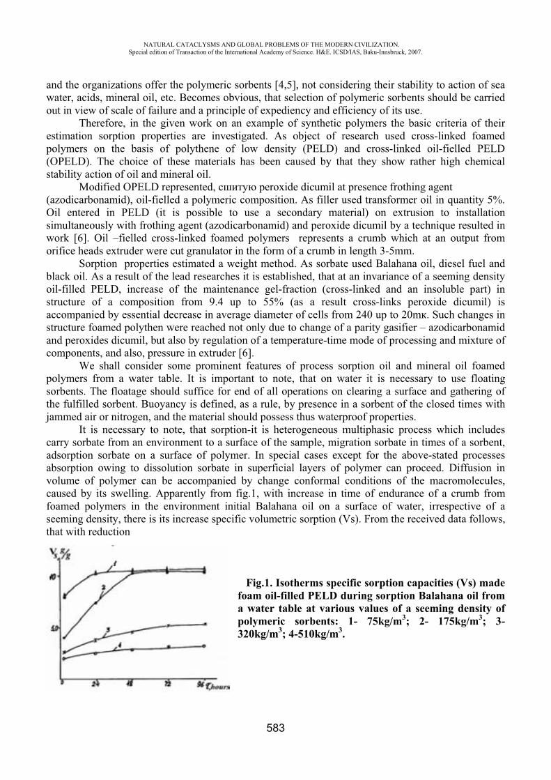
NATURAL CATACLYSMS AND GLOBAL PROBLEMS OF THE MODERN CIVILIZATION. Special edition of Transaction of the International Academy of Science. H&E. ICSD/IAS, Baku-Innsbruck, 2007.
583
and the organizations offer the polymeric sorbents [4,5], not considering their stability to action of sea water, acids, mineral oil, etc. Becomes obvious, that selection of polymeric sorbents should be carried out in view of scale of failure and a principle of expediency and efficiency of its use.
Therefore, in the given work on an example of synthetic polymers the basic criteria of their estimation sorption properties are investigated. As object of research used cross-linked foamed polymers on the basis of polythene of low density (PELD) and cross-linked oil-fielled PELD (OPELD). The choice of these materials has been caused by that they show rather high chemical stability action of oil and mineral oil.
Modified OPELD represented, peroxide dicumil at presence frothing agent (azodicarbonamid), oil-fielled a polymeric composition. As filler used transformer oil in quantity 5%. Oil entered in PELD (it is possible to use a secondary material) on extrusion to installation simultaneously with frothing agent (azodicarbonamid) and peroxide dicumil by a technique resulted in work [6]. Oil –fielled cross-linked foamed polymers represents a crumb which at an output from orifice heads extruder were cut granulator in the form of a crumb in length 3-5mm.
Sorption properties estimated a weight method. As sorbate used Balahan oil, diesel fuel and black oil. As a result of the lead researches it is established, that at an invariance of a seeming density oil-filled PELD, increase of the maintenance gel-fraction (cross-linked and an insoluble part) in structure of a composition from 9.4 up to 55% (as a result cross-links peroxide dicumil) is accompanied by essential decrease in average diameter of cells from 240 up to 20m . Such changes in structure foamed polythen were reached not only due to change of a parity gasifier – azodicarbonamid and peroxides dicumil, but also by regulation of a temperature-time mode of processing and mixture of components, and also, pressure in extruder [6].
We shall consider some prominent features of process sorption oil and mineral oil foamed polymers from a water table. It is important to note, that on water it is necessary to use floating sorbents. The floatage should suffice for end of all operations on clearing a surface and gathering of the fulfilled sorbent. Buoyancy is defined, as a rule, by presence in a sorbent of the closed times with jammed air or nitrogen, and the material should possess thus waterproof properties.
It is necessary to note, that sorption-it is heterogeneous multiphasic process which includes carry sorbate from an environment to a surface of the sample, migration sorbate in times of a sorbent, adsorption sorbate on a surface of polymer. In special cases except for the above-stated processes absorption owing to dissolution sorbate in superficial layers of polymer can proceed. Diffusion in volume of polymer can be accompanied by change conformal conditions of the macromolecules, caused by its swelling. Apparently from fig.1, with increase in time of endurance of a crumb from foamed polymers in the environment initial Balahana oil on a surface of water, irrespective of a seeming density, there is its increase specific volumetric sorption (Vs). From the received data follows, that with reduction
Fig.1. Isotherms specific sorption capacities (Vs) made foam oil-filled PELD during sorption Balahana oil from a water table at various values of a seeming density of polymeric sorbents: 1- 75kg/m3; 2- 175kg/m3; 3- 320kg/m3; 4-510kg/m3.
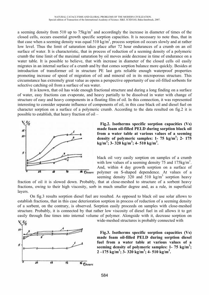
NATURAL CATACLYSMS AND GLOBAL PROBLEMS OF THE MODERN CIVILIZATION. Special edition of Transaction of the International Academy of Science. H&E. ICSD/IAS, Baku-Innsbruck, 2007.
584
a seeming density from 510 up to 75kg/m3 and accordingly the increase in diameter of times of the closed cells, occurs essential growth specific sorption capacities. It is necessary to note thus, that in that case when a seeming density was equal 510 kg/m3, process sorption oil occurs slowly and at rather low level. Thus the limit of saturation takes place after 72 hour endurances of a crumb on an oil surface of water. It is characteristic, that in process of reduction of a seeming density of a polymeric crumb the time limit of the maximal saturation by oil moves aside decrease in time of endurance on a water table. It is possible to believe, that with increase in diameter of the closed cells oil easily migrates in an internal surface of a crumb and by that comes sorption balance more quickly. Besides at introduction of transformer oil in structure PE last gets reliable enough waterproof properties promoting increase of speed of migration of oil and mineral oil in its microporous structure. This circumstance has extremely great value as opens a perspective opportunity of use oil-filled sorbents for selective catching oil from a surface of sea water.
It is known, that oil has wide enough fractional structure and during a long finding on a surface of water, easy fractions can evaporate, and heavy partially to be dissolved in water with change of structure of easy and heavy components in a floating film of oil. In this connection, it was represented interesting to consider separate influence of components of oil, in this case black oil and diesel fuel on character sorption on a surface of a polymeric crumb. According to the data resulted on fig.2 it is possible to establish, that heavy fraction of oil –
Fig.2. Isotherms specific sorption capacities (Vs) made foam oil-filled PELD during sorption black oil from a water table at various values of a seeming density of polymeric samples: 1- 75 kg/m3; 2- 175 kg/m3; 3- 320 kg/m3; 4- 510 kg/m3.
black oil very easily sorption on samples of a crumb with low values of a seeming density 75 and 175kg/m3.And, within 4 day growth sorption on a surface of polymer on S-shaped dependence. At values of a seeming density 320 and 510 kg/m3 sorption heavy
fraction of oil it is slowed down. Probably, that at close-meshed to structure of a sorbent heavy fractions, owing to their high viscosity, sorb in much smaller degree and, as a rule, in superficial layers.
On fig.3 results sorption diesel fuel are resulted. As opposed to black oil use solar allows to establish fractions, that in this case deterioration sorption in process of reduction of a seeming density of a sorbent, on the contrary, is observed. Sorption easily proceeds on samples with close-meshed structure. Probably, it is connected by that rather low viscosity of diesel fuel in oil allows it to get easily through fine times into internal volume of polymer. Alongside with it, decrease sorption on
wide-meshed structures is probably connected with
Fig.3. Isotherms specific sorption capacities (Vs) made foam oil-filled PELD during sorption diesel fuel from a water table at various values of a seeming density of polymeric samples: 1- 75 kg/m3;2 –175 kg/m3; 3- 320 kg/m3; 4- 510 kg/m3.
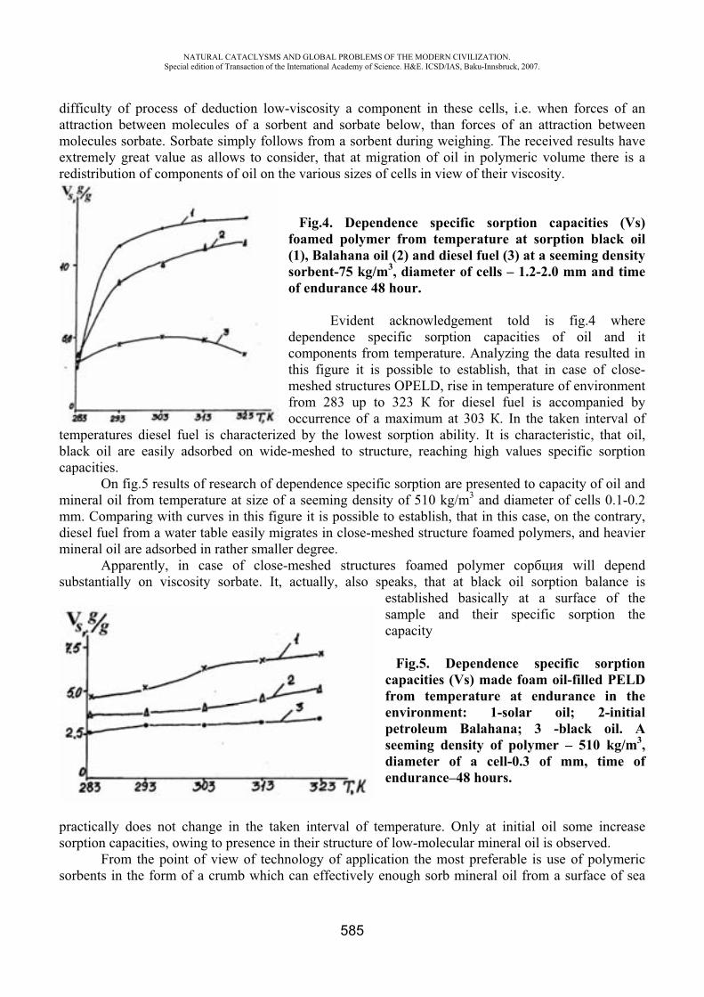
NATURAL CATACLYSMS AND GLOBAL PROBLEMS OF THE MODERN CIVILIZATION. Special edition of Transaction of the International Academy of Science. H&E. ICSD/IAS, Baku-Innsbruck, 2007.
585
difficulty of process of deduction low-viscosity a component in these cells, i.e. when forces of an attraction between molecules of a sorbent and sorbate below, than forces of an attraction between molecules sorbate. Sorbate simply follows from a sorbent during weighing. The received results have extremely great value as allows to consider, that at migration of oil in polymeric volume there is a redistribution of components of oil on the various sizes of cells in view of their viscosity.
Fig.4. Dependence specific sorption capacities (Vs) foamed polymer from temperature at sorption black oil (1), Balahana oil (2) and diesel fuel (3) at a seeming density sorbent-75 kg/m3, diameter of cells – 1.2-2.0 mm and time of endurance 48 hour.
Evident acknowledgement told is fig.4 where dependence specific sorption capacities of oil and it components from temperature. Analyzing the data resulted in this figure it is possible to establish, that in case of close-meshed structures OPELD, rise in temperature of environment from 283 up to 323 for diesel fuel is accompanied by occurrence of a maximum at 303 . In the taken interval of
temperatures diesel fuel is characterized by the lowest sorption ability. It is characteristic, that oil, black oil are easily adsorbed on wide-meshed to structure, reaching high values specific sorption capacities.
On fig.5 results of research of dependence specific sorption are presented to capacity of oil and mineral oil from temperature at size of a seeming density of 510 kg/m3 and diameter of cells 0.1-0.2 mm. Comparing with curves in this figure it is possible to establish, that in this case, on the contrary, diesel fuel from a water table easily migrates in close-meshed structure foamed polymers, and heavier mineral oil are adsorbed in rather smaller degree.
Apparently, in case of close-meshed structures foamed polymer will depend substantially on viscosity sorbate. It, actually, also speaks, that at black oil sorption balance is
established basically at a surface of the sample and their specific sorption the capacity
Fig.5. Dependence specific sorption capacities (Vs) made foam oil-filled PELD from temperature at endurance in the environment: 1-solar oil; 2-initial petroleum Balahana; 3 -black oil. A seeming density of polymer – 510 kg/m3,diameter of a cell-0.3 of mm, time of endurance–48 hours.
practically does not change in the taken interval of temperature. Only at initial oil some increase sorption capacities, owing to presence in their structure of low-molecular mineral oil is observed.
From the point of view of technology of application the most preferable is use of polymeric sorbents in the form of a crumb which can effectively enough sorb mineral oil from a surface of sea
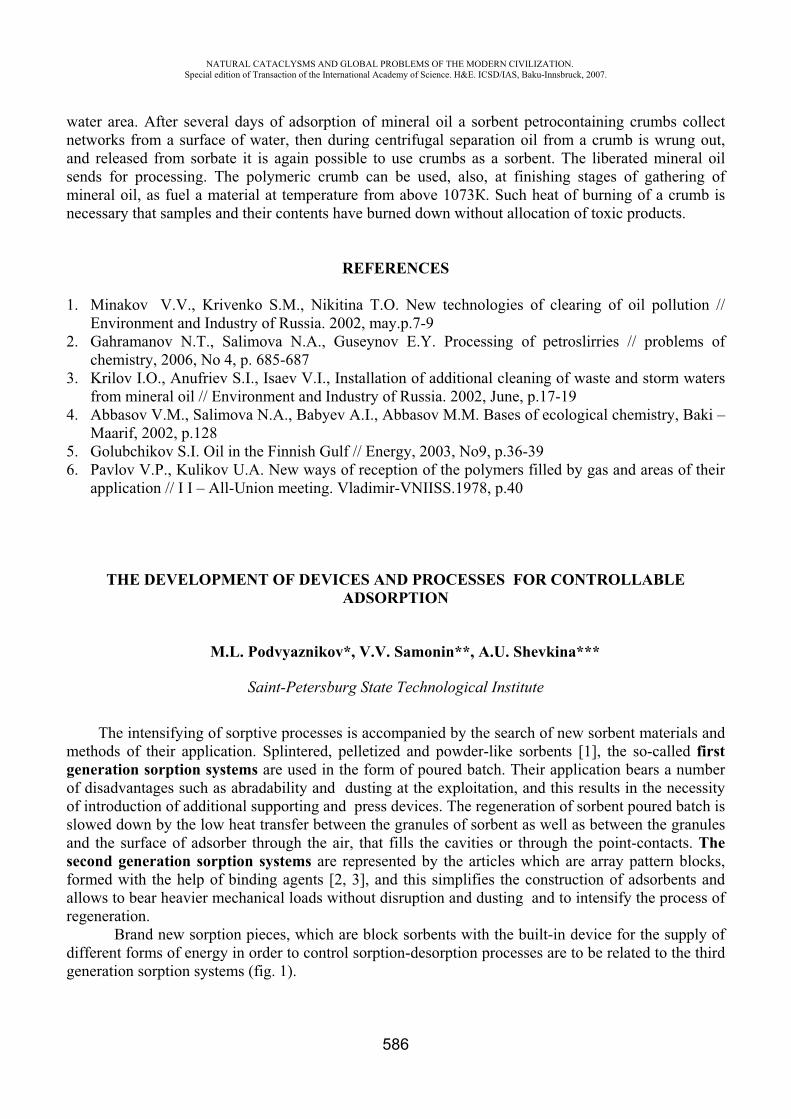
NATURAL CATACLYSMS AND GLOBAL PROBLEMS OF THE MODERN CIVILIZATION. Special edition of Transaction of the International Academy of Science. H&E. ICSD/IAS, Baku-Innsbruck, 2007.
586
water area. After several days of adsorption of mineral oil a sorbent petrocontaining crumbs collect networks from a surface of water, then during centrifugal separation oil from a crumb is wrung out, and released from sorbate it is again possible to use crumbs as a sorbent. The liberated mineral oil sends for processing. The polymeric crumb can be used, also, at finishing stages of gathering of mineral oil, as fuel a material at temperature from above 1073 . Such heat of burning of a crumb is necessary that samples and their contents have burned down without allocation of toxic products.
REFERENCES
1. Minakov V.V., Krivenko S.M., Nikitina T.O. New technologies of clearing of oil pollution // Environment and Industry of Russia. 2002, may.p.7-9
2. Gahramanov N.T., Salimova N.A., Guseynov E.Y. Processing of petroslirries // problems of chemistry, 2006, No 4, p. 685-687
3. Krilov I.O., Anufriev S.I., Isaev V.I., Installation of additional cleaning of waste and storm waters from mineral oil // Environment and Industry of Russia. 2002, June, p.17-19
4. Abbasov V.M., Salimova N.A., Babyev A.I., Abbasov M.M. Bases of ecological chemistry, Baki – Maarif, 2002, p.128
5. Golubchikov S.I. Oil in the Finnish Gulf // Energy, 2003, No9, p.36-39 6. Pavlov V.P., Kulikov U.A. New ways of reception of the polymers filled by gas and areas of their
application // I I – All-Union meeting. Vladimir-VNIISS.1978, p.40
THE DEVELOPMENT OF DEVICES AND PROCESSES FOR CONTROLLABLE ADSORPTION
M.L. Podvyaznikov*, V.V. Samonin**, A.U. Shevkina***
Saint-Petersburg State Technological Institute
The intensifying of sorptive processes is accompanied by the search of new sorbent materials and methods of their application. Splintered, pelletized and powder-like sorbents [1], the so-called first generation sorption systems are used in the form of poured batch. Their application bears a number of disadvantages such as abradability and dusting at the exploitation, and this results in the necessity of introduction of additional supporting and press devices. The regeneration of sorbent poured batch is slowed down by the low heat transfer between the granules of sorbent as well as between the granules and the surface of adsorber through the air, that fills the cavities or through the point-contacts. Thesecond generation sorption systems are represented by the articles which are array pattern blocks, formed with the help of binding agents [2, 3], and this simplifies the construction of adsorbents and allows to bear heavier mechanical loads without disruption and dusting and to intensify the process of regeneration.
Brand new sorption pieces, which are block sorbents with the built-in device for the supply of different forms of energy in order to control sorption-desorption processes are to be related to the third generation sorption systems (fig. 1).
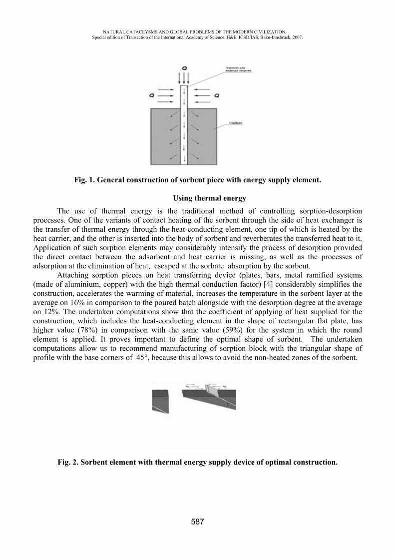
NATURAL CATACLYSMS AND GLOBAL PROBLEMS OF THE MODERN CIVILIZATION. Special edition of Transaction of the International Academy of Science. H&E. ICSD/IAS, Baku-Innsbruck, 2007.
587
Fig. 1. General construction of sorbent piece with energy supply element.
Using thermal energy The use of thermal energy is the traditional method of controlling sorption-desorption
processes. One of the variants of contact heating of the sorbent through the side of heat exchanger is the transfer of thermal energy through the heat-conducting element, one tip of which is heated by the heat carrier, and the other is inserted into the body of sorbent and reverberates the transferred heat to it. Application of such sorption elements may considerably intensify the process of desorption provided the direct contact between the adsorbent and heat carrier is missing, as well as the processes of adsorption at the elimination of heat, escaped at the sorbate absorption by the sorbent.
Attaching sorption pieces on heat transferring device (plates, bars, metal ramified systems (made of aluminium, copper) with the high thermal conduction factor) [4] considerably simplifies the construction, accelerates the warming of material, increases the temperature in the sorbent layer at the average on 16% in comparison to the poured batch alongside with the desorption degree at the average on 12%. The undertaken computations show that the coefficient of applying of heat supplied for the construction, which includes the heat-conducting element in the shape of rectangular flat plate, has higher value (78%) in comparison with the same value (59%) for the system in which the round element is applied. It proves important to define the optimal shape of sorbent. The undertaken computations allow us to recommend manufacturing of sorption block with the triangular shape of profile with the base corners of 45°, because this allows to avoid the non-heated zones of the sorbent.
Fig. 2. Sorbent element with thermal energy supply device of optimal construction.
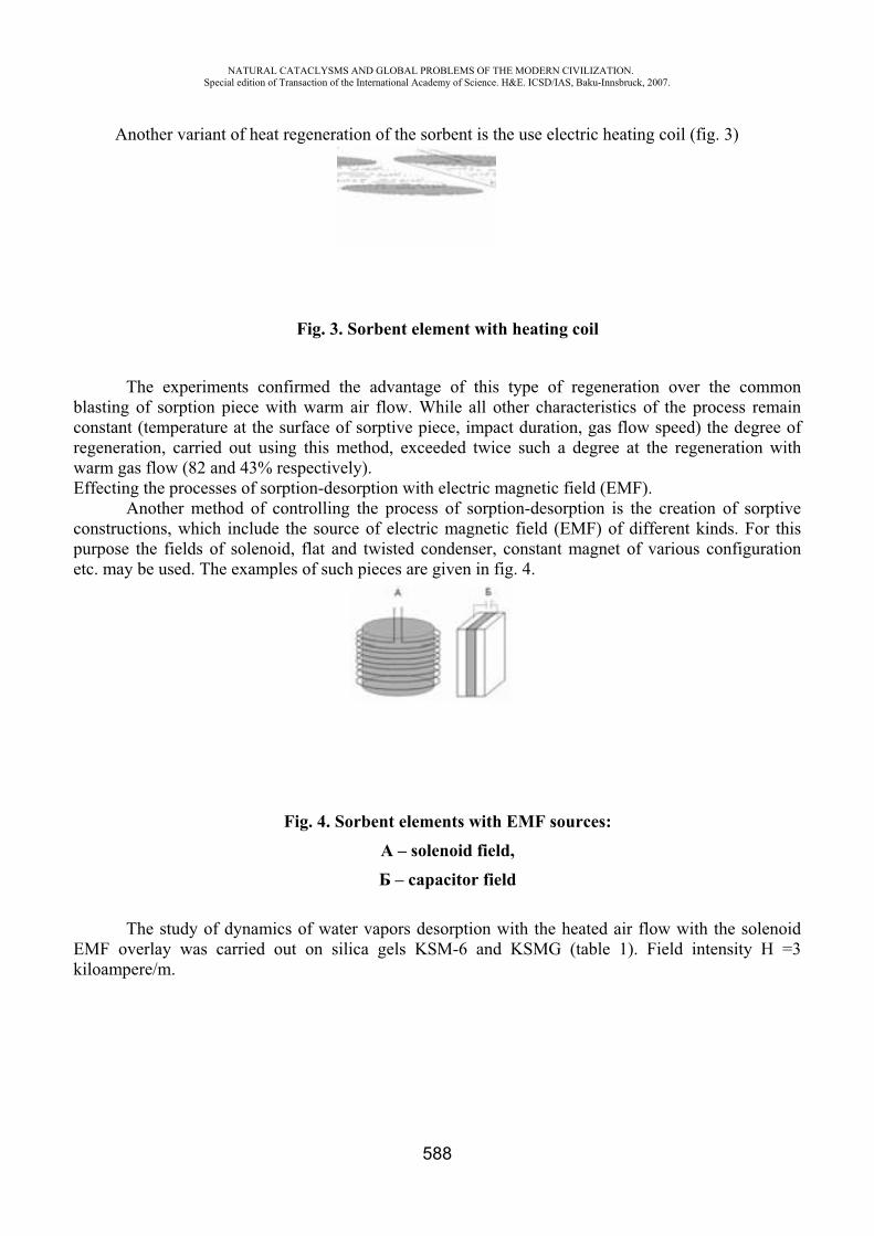
NATURAL CATACLYSMS AND GLOBAL PROBLEMS OF THE MODERN CIVILIZATION. Special edition of Transaction of the International Academy of Science. H&E. ICSD/IAS, Baku-Innsbruck, 2007.
588
Another variant of heat regeneration of the sorbent is the use electric heating coil (fig. 3)
Fig. 3. Sorbent element with heating coil
The experiments confirmed the advantage of this type of regeneration over the common blasting of sorption piece with warm air flow. While all other characteristics of the process remain constant (temperature at the surface of sorptive piece, impact duration, gas flow speed) the degree of regeneration, carried out using this method, exceeded twice such a degree at the regeneration with warm gas flow (82 and 43% respectively). Effecting the processes of sorption-desorption with electric magnetic field (EMF).
Another method of controlling the process of sorption-desorption is the creation of sorptive constructions, which include the source of electric magnetic field (EMF) of different kinds. For this purpose the fields of solenoid, flat and twisted condenser, constant magnet of various configuration etc. may be used. The examples of such pieces are given in fig. 4.
Fig. 4. Sorbent elements with EMF sources: – solenoid field, – capacitor field
The study of dynamics of water vapors desorption with the heated air flow with the solenoid EMF overlay was carried out on silica gels KSM-6 and KSMG (table 1). Field intensity H =3 kiloampere/m.
NATURAL CATACLYSMS AND GLOBAL PROBLEMS OF THE MODERN CIVILIZATION. Special edition of Transaction of the International Academy of Science. H&E. ICSD/IAS, Baku-Innsbruck, 2007.
589
Table 1Water vapor desorption on silica gels KSM-6 and KSMG in the solenoid EMF
Sorbent L, sm Regeneration duration, min EMF Control
KSM-6 2,5 90 105 KSMG 2,5 90 130 KSMG 3,0 140 185
The dependency of the obtained effect on the intensity of the outer electric magnetic field is of extreme nature. The highest effectiveness of the process has been registered at H =3 kiloampere/m. In this case the process of desorption, on the time of complete regeneration, progressed 17-44% faster. The solenoid EMF did not affect the depth of regeneration of silica gel.
Figure 5 shows the results of intensification of desorptive processes by means of effecting of condenser electric field (EF) on the sample of popcorn silica gel, impregnated with the hygroscopic calcium and lithium chlorides (industrial sorbent OSG). On this picture we can see dependencies of sorbent regeneration degree on time and temperature of regenerating air in control conditions with applying electric field (EF). This diagram vividly illustrates that the curve of dependency of sorbent regeneration degree on the time and at the temperature120 0 with EF overlay, is located between two similar curves for the temperatures of 140 0 and 160 0 without applying EF and almost totally matches the dependency of sorbent regeneration degree at 150 0 without applying EF.
Fig. 5. Elution curves of OSG in EF.
Effecting the sorption-desorption processes with light emission. Light emission is treated separately from the wide range of electric magnetic effects. It’s the
energy type of specific use. Because of their structure not many adsorbents may be effected by the overly of light of various wave lengths at the sorption-desorption processes. The particular case of such sorbents are fullerene-bearing materials (see table 2).
The removal of light will result in desorption at the lack of appropriate hysteresis [6]. The achieved results may be found applicable in creating sorptive elements, used at the sorption-desorption processes, which are controlled by the changeover of effecting light flows.
0
20
40
60
80
100
0 50 100
Time, min
Reg
ener
atio
n de
gree
,% 160
140
120
120( )
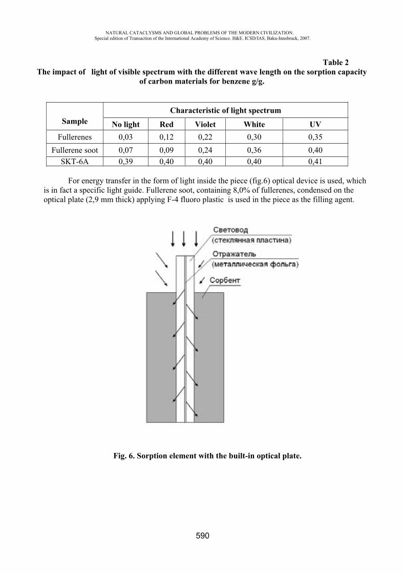
NATURAL CATACLYSMS AND GLOBAL PROBLEMS OF THE MODERN CIVILIZATION. Special edition of Transaction of the International Academy of Science. H&E. ICSD/IAS, Baku-Innsbruck, 2007.
590
Table 2 The impact of light of visible spectrum with the different wave length on the sorption capacity
of carbon materials for benzene g/g.
SampleCharacteristic of light spectrum
No light Red Violet White UV Fullerenes 0,03 0,12 0,22 0,30 0,35
Fullerene soot 0,07 0,09 0,24 0,36 0,40 SKT-6 0,39 0,40 0,40 0,40 0,41
For energy transfer in the form of light inside the piece (fig.6) optical device is used, which is in fact a specific light guide. Fullerene soot, containing 8,0% of fullerenes, condensed on the optical plate (2,9 mm thick) applying F-4 fluoro plastic is used in the piece as the filling agent.
Fig. 6. Sorption element with the built-in optical plate.
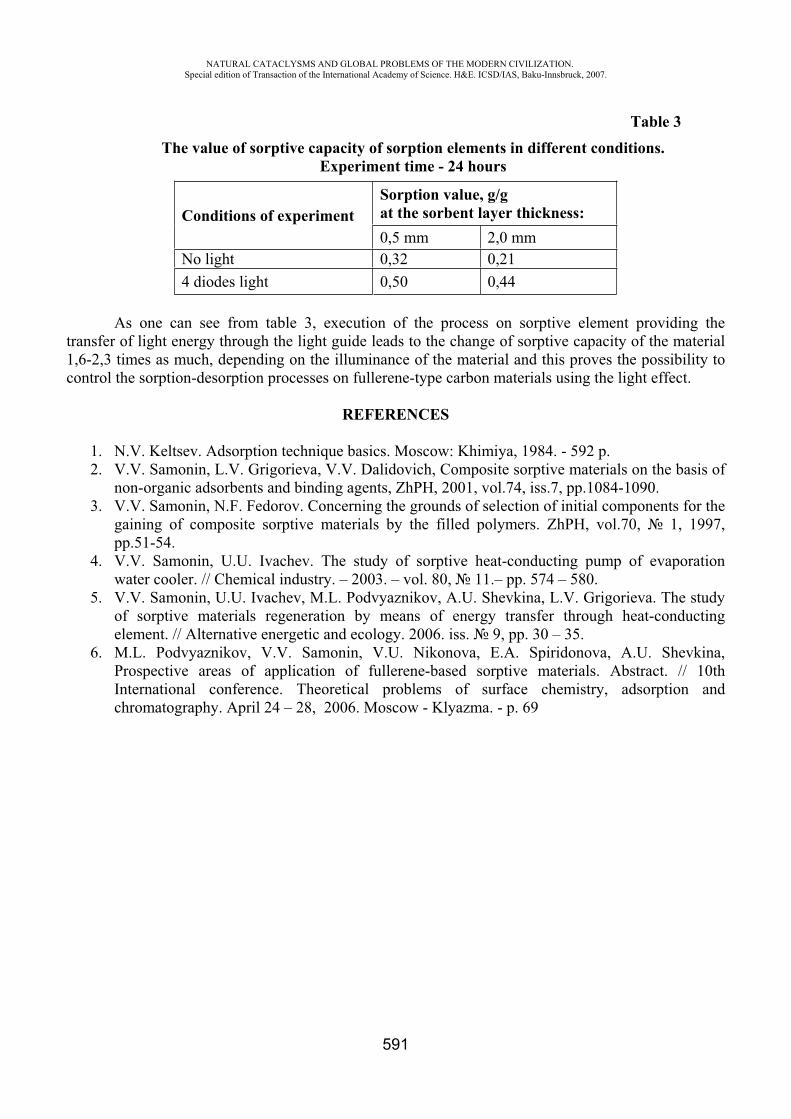
NATURAL CATACLYSMS AND GLOBAL PROBLEMS OF THE MODERN CIVILIZATION. Special edition of Transaction of the International Academy of Science. H&E. ICSD/IAS, Baku-Innsbruck, 2007.
591
Table 3The value of sorptive capacity of sorption elements in different conditions.
Experiment time - 24 hours
Conditions of experiment Sorption value, g/g at the sorbent layer thickness:0,5 mm 2,0 mm
No light 0,32 0,21 4 diodes light 0,50 0,44
As one can see from table 3, execution of the process on sorptive element providing the transfer of light energy through the light guide leads to the change of sorptive capacity of the material 1,6-2,3 times as much, depending on the illuminance of the material and this proves the possibility to control the sorption-desorption processes on fullerene-type carbon materials using the light effect.
REFERENCES
1. N.V. Keltsev. Adsorption technique basics. Moscow: Khimiya, 1984. - 592 p. 2. V.V. Samonin, L.V. Grigorieva, V.V. Dalidovich, Composite sorptive materials on the basis of
non-organic adsorbents and binding agents, ZhPH, 2001, vol.74, iss.7, pp.1084-1090. 3. V.V. Samonin, N.F. Fedorov. Concerning the grounds of selection of initial components for the
gaining of composite sorptive materials by the filled polymers. ZhPH, vol.70, 1, 1997, pp.51-54.
4. V.V. Samonin, U.U. Ivachev. The study of sorptive heat-conducting pump of evaporation water cooler. // Chemical industry. – 2003. – vol. 80, 11.– pp. 574 – 580.
5. V.V. Samonin, U.U. Ivachev, M.L. Podvyaznikov, A.U. Shevkina, L.V. Grigorieva. The study of sorptive materials regeneration by means of energy transfer through heat-conducting element. // Alternative energetic and ecology. 2006. iss. 9, pp. 30 – 35.
6. M.L. Podvyaznikov, V.V. Samonin, V.U. Nikonova, E.A. Spiridonova, A.U. Shevkina, Prospective areas of application of fullerene-based sorptive materials. Abstract. // 10th International conference. Theoretical problems of surface chemistry, adsorption and chromatography. April 24 – 28, 2006. Moscow - Klyazma. - p. 69
NATURAL CATACLYSMS AND GLOBAL PROBLEMS OF THE MODERN CIVILIZATION. Special edition of Transaction of the International Academy of Science. H&E. ICSD/IAS, Baku-Innsbruck, 2007.
592
GLOBAL ENVIRONMENTAL PROBLEM AND QUANTUM-CHEMICAL METHODS OF CALCULATION TO ESTABLISH CORRELATION BETWEEN STRUCTURE AND
TOXICITY OF MOLECULES OF DIBENXO-PARA-DIOXINS
Salakhov M.S.*, Baghmanov B.T.**, Aliyeva G.R.***, Pashayev F.G****, Ashurova N.D.*****
Institute of Polymeric Materials of the National Academy of Sciences of Azerbaijan Republic
**** Baku State University, Azerbaijan
The globality of the environmental problem of dioxin consists in universality of the numerous chlorinated, solid, polycyclic aromatic compounds, being the cellular poisons, destroying living organisms even in insignificant concentrations. Presently the number of known chlorinated dioxins polluting environment exceeds 5000, many of which on a level of toxicity prevail such poisons, as strychnine, cyanides, curare, sarin, soman and VX-gas [1]. They are long-living and very persistent in the environment. Getting into the human organism, basically with food, water and air, they may cause incurable fatal diseases.
In the human organism chlorinated dioxins impact the receptors; cause endocrine and hormonal destructions, particularly, sexual hormones, hormones of thyroid and pancreas, that increases risk of development of a diabetes, destroy processes of puberty and development of an embrion, children lag behind in development, young age people suffer from illnesses peculiar to senile age, the susceptibility of an organism to the infections increases, frequency of allergic reactions, oncological diseases also rises. The syndrome of skin disease “chloracne” is characteristic for dioxin intoxication [1, 2]. Therefore dioxins are called super-toxicants of 21st century, and due to destruction of immune system they are called otherwise "Chemical AIDS" [3].
In biosphere dioxins is quickly absorbed by plants, easily absorbed in the soil and various materials where practically remain unchanged under influence of physical, chemical and biological factors of the environment. Difficulty of ecological struggle with chlorinated dioxins consists in their large number of isomers, in formation of industrial and household chloro-organic products, in impact to living organisms even in a minor quantities, in necessity of sampling from an environment (soil, water, air) as well as living organisms (blood, chest milk, etc.) and in complexity of methods of the analysis (chromato-mass-spectrometry, etc.). The most widespread in an environment is chlorinated dibenzo-para-dioxin. Among 75 isomeric mono-, di-, three-, tetra-, penta-, hexa-, hepta- and the octa- chlordibenzo-para –dioxins the greatest toxicity belongs to symmetric 2,3,7,8-dibenzo-para –dioxin (2,3,7,8-TCDD), the plane structure and geometrical parameters (0,68x 1,4 nm) of which coincide with steps of a double spiral of a molecule of DNA forming a strong complex as " a key to the lock".
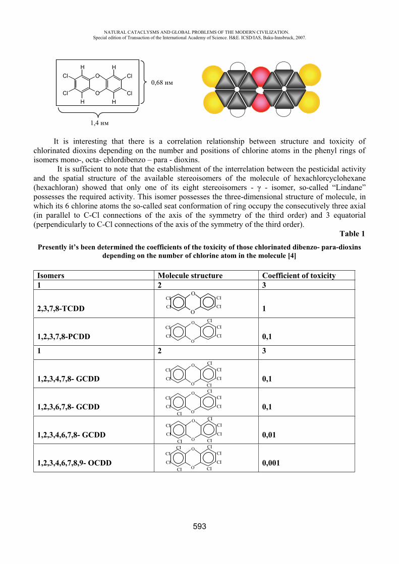
NATURAL CATACLYSMS AND GLOBAL PROBLEMS OF THE MODERN CIVILIZATION. Special edition of Transaction of the International Academy of Science. H&E. ICSD/IAS, Baku-Innsbruck, 2007.
593
H
H
O
O
Cl
Cl
H
H
Cl
Cl
1,4
0,68
It is interesting that there is a correlation relationship between structure and toxicity of chlorinated dioxins depending on the number and positions of chlorine atoms in the phenyl rings of isomers mono-, octa- chlordibenzo – para - dioxins.
It is sufficient to note that the establishment of the interrelation between the pesticidal activity and the spatial structure of the available stereoisomers of the molecule of hexachlorcyclohexane (hexachloran) showed that only one of its eight stereoisomers - - isomer, so-called “Lindane” possesses the required activity. This isomer possesses the three-dimensional structure of molecule, in which its 6 chlorine atoms the so-called seat conformation of ring occupy the consecutively three axial (in parallel to C-Cl connections of the axis of the symmetry of the third order) and 3 equatorial (perpendicularly to C-Cl connections of the axis of the symmetry of the third order).
Table 1 Presently it’s been determined the coefficients of the toxicity of those chlorinated dibenzo- para-dioxins
depending on the number of chlorine atom in the molecule [4]
Isomers Molecule structure Coefficient of toxicity 1 2 3
2,3,7,8-TCDD 1
1,2,3,7,8-PCDD 0,1
1 2 3
1,2,3,4,7,8- GCDD 0,1
1,2,3,6,7,8- GCDD 0,1
1,2,3,4,6,7,8- GCDD 0,01
1,2,3,4,6,7,8,9- OCDD 0,001
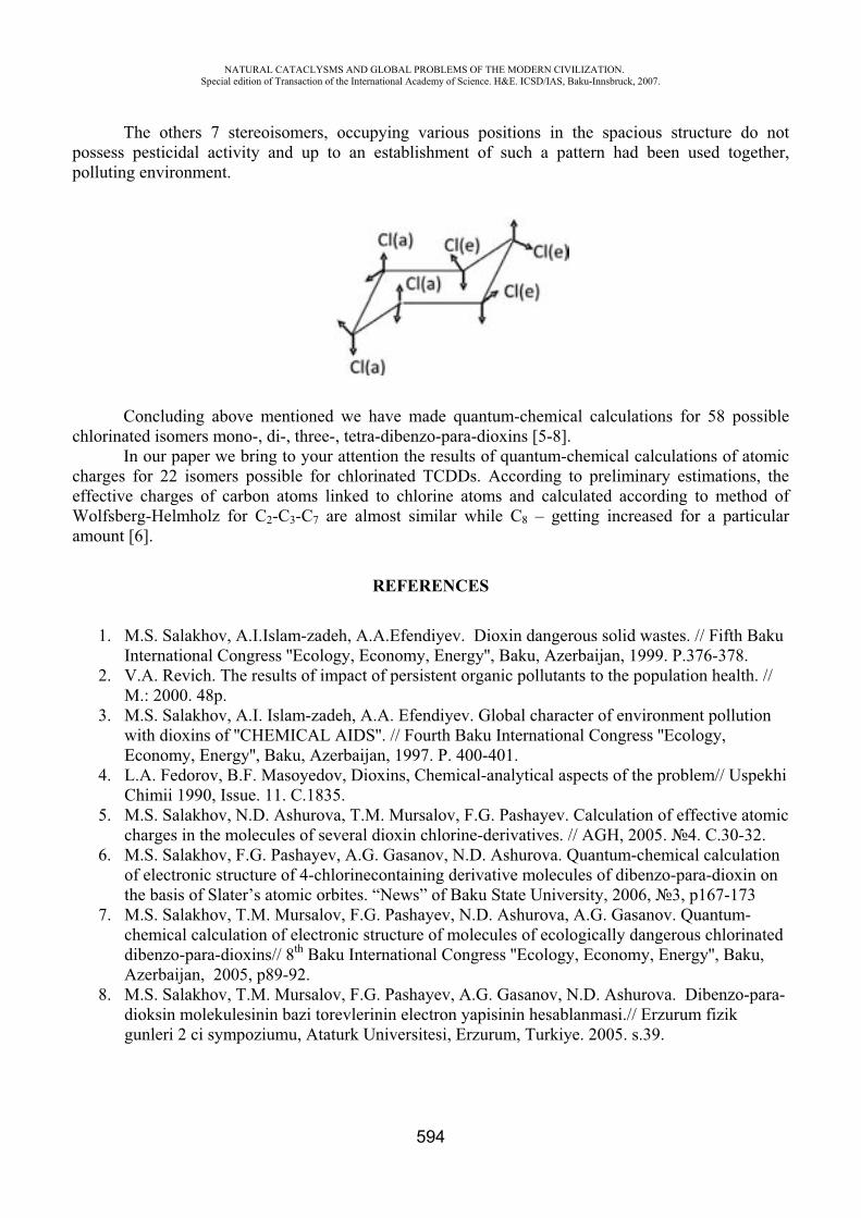
NATURAL CATACLYSMS AND GLOBAL PROBLEMS OF THE MODERN CIVILIZATION. Special edition of Transaction of the International Academy of Science. H&E. ICSD/IAS, Baku-Innsbruck, 2007.
594
The others 7 stereoisomers, occupying various positions in the spacious structure do not possess pesticidal activity and up to an establishment of such a pattern had been used together, polluting environment.
Concluding above mentioned we have made quantum-chemical calculations for 58 possible chlorinated isomers mono-, di-, three-, tetra-dibenzo-para-dioxins [5-8].
In our paper we bring to your attention the results of quantum-chemical calculations of atomic charges for 22 isomers possible for chlorinated TCDDs. According to preliminary estimations, the effective charges of carbon atoms linked to chlorine atoms and calculated according to method of Wolfsberg-Helmholz for C2-C3-C7 are almost similar while C8 – getting increased for a particular amount [6].
REFERENCES
1. M.S. Salakhov, A.I.Islam-zadeh, A.A.Efendiyev. Dioxin dangerous solid wastes. // Fifth Baku International Congress ''Ecology, Economy, Energy'', Baku, Azerbaijan, 1999. P.376-378.
2. V.A. Revich. The results of impact of persistent organic pollutants to the population health. // .: 2000. 48p.
3. M.S. Salakhov, A.I. Islam-zadeh, A.A. Efendiyev. Global character of environment pollution with dioxins of ''CHEMICAL AIDS''. // Fourth Baku International Congress ''Ecology, Economy, Energy'', Baku, Azerbaijan, 1997. P. 400-401.
4. L.A. Fedorov, B.F. Masoyedov, Dioxins, Chemical-analytical aspects of the problem// Uspekhi Chimii 1990, Issue. 11. .1835.
5. M.S. Salakhov, N.D. Ashurova, T.M. Mursalov, F.G. Pashayev. Calculation of effective atomic charges in the molecules of several dioxin chlorine-derivatives. // AGH, 2005. 4. .30-32.
6. M.S. Salakhov, F.G. Pashayev, A.G. Gasanov, N.D. Ashurova. Quantum-chemical calculation of electronic structure of 4-chlorinecontaining derivative molecules of dibenzo-para-dioxin on the basis of Slater’s atomic orbites. “News” of Baku State University, 2006, 3, p167-173
7. M.S. Salakhov, T.M. Mursalov, F.G. Pashayev, N.D. Ashurova, A.G. Gasanov. Quantum-chemical calculation of electronic structure of molecules of ecologically dangerous chlorinated dibenzo-para-dioxins// 8th Baku International Congress ''Ecology, Economy, Energy'', Baku, Azerbaijan, 2005, p89-92.
8. M.S. Salakhov, T.M. Mursalov, F.G. Pashayev, A.G. Gasanov, N.D. Ashurova. Dibenzo-para-dioksin molekulesinin bazi torevlerinin electron yapisinin hesablanmasi.// Erzurum fizik gunleri 2 ci sympoziumu, Ataturk Universitesi, Erzurum, Turkiye. 2005. s.39.
NATURAL CATACLYSMS AND GLOBAL PROBLEMS OF THE MODERN CIVILIZATION. Special edition of Transaction of the International Academy of Science. H&E. ICSD/IAS, Baku-Innsbruck, 2007.
595
TREATING OF WATER FROM LEAD IONS WITH POLYMERIC SORBENTS
S.Sh. Mamedova*, S.R. Gadjieva**, T.G. Khanlarov***,J.O. Khanlarova****
Baku State University, Azerbaijan
The main pollution sewage are ions of heavy metals. Consumption of the water polluted by heavy metals is the main reason of penetration of these pollutions in an organism of the person which, collecting, create a constant source of a poisoning. In processes of clearing wide application find ionchangers with various functional groups. Ability ionits selectivity to sorbs ions of metals has caused their use for clearing industrial sewage.
Preliminary heavy metal makes one of the major stages of the chemical analysis. This stage allows to allocate quantitatively separation from great volumes of the solutions containing a high salt background, to lower a limit of definition and, thus, to raise accuracy and reliability of methods of definition. Carrying out preliminary concentration in analytical chemistry is a necessary condition at definition trace quantities of ions of metals in various objects, for example, in natural and sewage, ground, plants, food stuffs, etc. Definition of toxic metals at a level of their maximum permissible concentration is an actual analytical problem in ecological monitoring objects of an environment. Direct definition of such elements at low concentration often is not possible even the advanced physical and physical and chemical methods. Therefore it is necessary to lead preliminary concentration these elements.
There are various methods concentration, such as extraction, together settle, etc. [1]. One of the basic methods concentration is sorbtion concentration. Recently it is frequent for these purposes apply various sorbents. Simplicity, expressity, reliability, sharp selectivity distinguishes this method from other methods concentration.
The present work is devoted to studying sorbtion properties of a sorbent on the basis of maleic anhydride with ions of lead and the further of its application for clearing ecological objects by the polluted heavy metals.
Copolymers maleic anhydride with styrene ( -ST) have received heterogeneous copolymerization of these monomers in a solution [2]. Constructed of insoluble sorbents have been received by sewing together of copolymers maleic anhydride with vinyl acetate by means of paraphenylendiamine (Ph). Modification of unsoluble sewing copolymers spent by means of paraaminosalicylic acid (PASA) and 4-aminoantipyrine(4AAP).Structures of the received copolymers defined the element analysis and a method potentiometric titrations. The chemical structure of the received sorbents investigated a method of IR-spectroscopy. To definition of concentration of ions Pb (II) applied a photometric method with xylene orange (XO) [3]. Desorbtion ions of lead spent in static conditions. For this purpose to complexes of ions of lead with a sorbent have added 25 ml of solutions of acids with different concentration and in 2 hours defined the amount of ions of lead.
Research kinetic of sorbtion spent in static conditions at various speeds hashing of a solution (weight of a sorbent-250mg, volume of a solution-500ml) a method of the limited volume. The control for sorbtion ions of metals from solutions carried out by the spectrophotometric method, defining lead ions with XO.Value in solutions established by means of acetate-ammonia buffer solutions ( 3-11), HCl ( 1-2), and NaOH ( 12-14). The set ionic force of a solution created with useKNO3.Optical density of solutions defined on spectrophotometer –Lambda 40. Value solutions supervised by means of ionmeter with glass and chlorargentium electrodes.
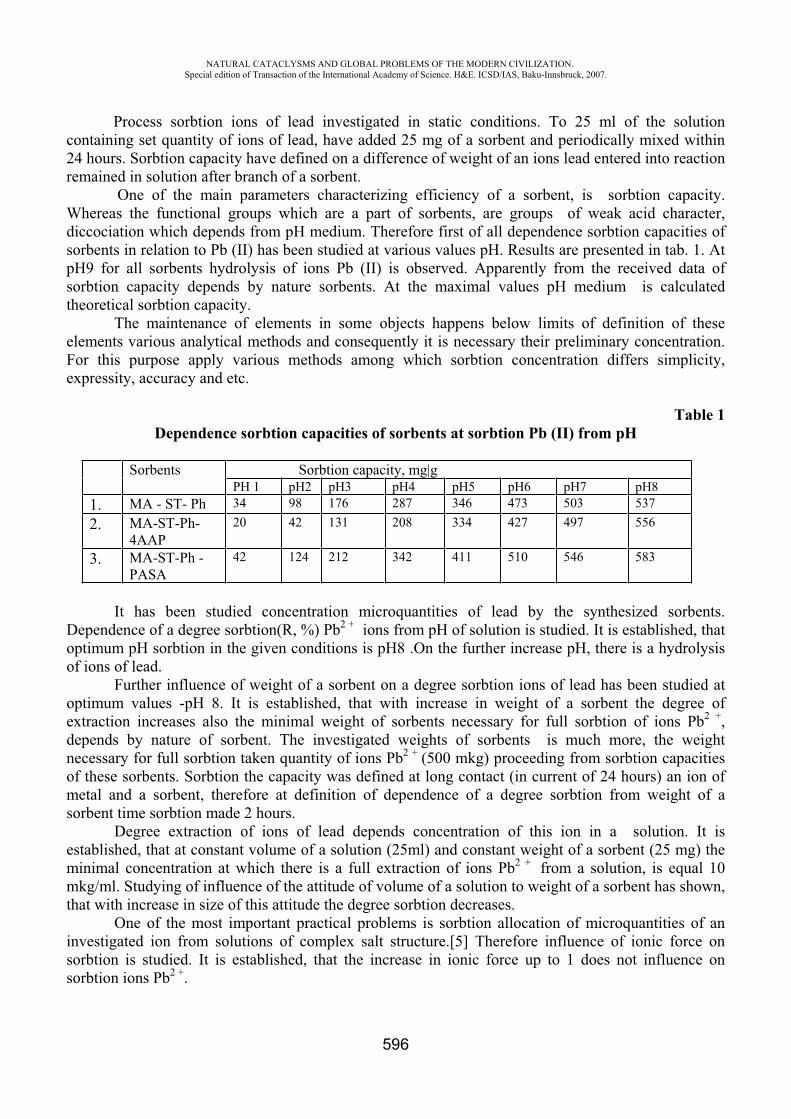
NATURAL CATACLYSMS AND GLOBAL PROBLEMS OF THE MODERN CIVILIZATION. Special edition of Transaction of the International Academy of Science. H&E. ICSD/IAS, Baku-Innsbruck, 2007.
596
Process sorbtion ions of lead investigated in static conditions. To 25 ml of the solution containing set quantity of ions of lead, have added 25 mg of a sorbent and periodically mixed within 24 hours. Sorbtion capacity have defined on a difference of weight of an ions lead entered into reaction remained in solution after branch of a sorbent. One of the main parameters characterizing efficiency of a sorbent, is sorbtion capacity. Whereas the functional groups which are a part of sorbents, are groups of weak acid character, diccociation which depends from medium. Therefore first of all dependence sorbtion capacities of sorbents in relation to Pb (II) has been studied at various values . Results are presented in tab. 1. At
9 for all sorbents hydrolysis of ions Pb (II) is observed. Apparently from the received data of sorbtion capacity depends by nature sorbents. At the maximal values medium is calculated theoretical sorbtion capacity.
The maintenance of elements in some objects happens below limits of definition of these elements various analytical methods and consequently it is necessary their preliminary concentration. For this purpose apply various methods among which sorbtion concentration differs simplicity, expressity, accuracy and etc.
Table 1Dependence sorbtion capacities of sorbents at sorbtion Pb (II) from
Sorbents Sorbtion capacity, mg|g 1 2 3 4 5 6 7 8
1. A - ST- Ph 34 98 176 287 346 473 503 537 2. A-ST-Ph-
4 P20 42 131 208 334 427 497 556
3. A-ST-Ph - PASA
42 124 212 342 411 510 546 583
It has been studied concentration microquantities of lead by the synthesized sorbents. Dependence of a degree sorbtion(R, %) Pb2 + ions from of solution is studied. It is established, that optimum sorbtion in the given conditions is 8 .On the further increase , there is a hydrolysis of ions of lead.
Further influence of weight of a sorbent on a degree sorbtion ions of lead has been studied at optimum values -pH 8. It is established, that with increase in weight of a sorbent the degree of extraction increases also the minimal weight of sorbents necessary for full sorbtion of ions Pb2 +,depends by nature of sorbent. The investigated weights of sorbents is much more, the weight necessary for full sorbtion taken quantity of ions Pb2 + (500 mkg) proceeding from sorbtion capacities of these sorbents. Sorbtion the capacity was defined at long contact (in current of 24 hours) an ion of metal and a sorbent, therefore at definition of dependence of a degree sorbtion from weight of a sorbent time sorbtion made 2 hours.
Degree extraction of ions of lead depends concentration of this ion in a solution. It is established, that at constant volume of a solution (25ml) and constant weight of a sorbent (25 mg) the minimal concentration at which there is a full extraction of ions Pb2 + from a solution, is equal 10 mkg/ml. Studying of influence of the attitude of volume of a solution to weight of a sorbent has shown, that with increase in size of this attitude the degree sorbtion decreases.
One of the most important practical problems is sorbtion allocation of microquantities of an investigated ion from solutions of complex salt structure.[5] Therefore influence of ionic force on sorbtion is studied. It is established, that the increase in ionic force up to 1 does not influence on sorbtion ions Pb2 +.
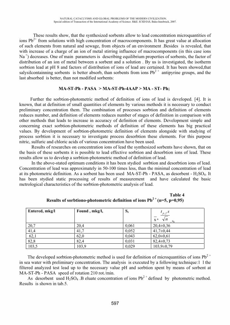
NATURAL CATACLYSMS AND GLOBAL PROBLEMS OF THE MODERN CIVILIZATION. Special edition of Transaction of the International Academy of Science. H&E. ICSD/IAS, Baku-Innsbruck, 2007.
597
These results show, that the synthesized sorbents allow to lead concentration microquantities of ions Pb2+ from solutions with high concentration of macrocomponents. It has great value at allocation of such elements from natural and sewage, from objects of an environment .Besides is revealed, that with increase of a charge of an ion of metal stirring influence of macrocomponents (in this case ions Na +) decreases. One of main parameters is describing equilibrium properties of sorbents, the factor of distribution of an ion of metal between a sorbent and a solution . By us is investigated, the isotherm sorbtion lead at 8 and factors of distribution of ions of lead are certained. It has been showed,that salysilcontainning sorbents is better absorb, than sorbents from ions Pb2 + antipyrine groups, and the last absorbed is better, than not modified sorbents:
A-ST-Ph - PASA > A-ST-Ph-4 P > A - ST- Ph;
Further the sorbtion-photometric method of definition of ions of lead is developed. [4]. It is known, that at definition of small quantities of elements by various methods it is necessary to conduct preliminary concentration them. The combination of processes sorbtion and definition of elements reduces number, and definition of elements reduces number of stages of definition in comparison with other methods that leads to increase in accuracy of definition of elements. Development simple and concerning exact sorbtion-photometric methods of definition of these elements has big practical values. By development of sorbtion-photometric definition of elements alongside with studying of process sorbtion it is necessary to investigate process desorbtion these elements. For this purpose nitric, sulfuric and chloric acids of various concentration have been used.
Results of researches on concentration ions of lead the synthesized sorbents have shown, that on the basis of these sorbents it is possible to lead effective sorbtion and desorbtion ions of lead. These results allow us to develop a sorbtion-photometric method of definition of lead.
In the above-stated optimum conditions it has been stydied sorbtion and desorbtion ions of lead. Concentration of lead was approximately in 50-100 times less, than the minimal concentration of lead at its photometric definition. As a sorbent has been used A-ST-Ph - PASA, as desorbent - H2SO4. It has been stydied static processing of results of measurement and have calculated the basic metrological characteristics of the sorbtion-photometric analysis of lead.
Table 4Results of sorbtion -photometric definition of ions Pb2 + ( =5, =0,95)
Entered, mkg/l Found , mkg/l, Sr
± nst fp ,
, %
20,7 20,4 0,061 20,4±0,36 41,4 41,7 0,052 41,7±0,44 62,1 62,0 0,043 62,0±0,61 82,8 82,4 0,031 82,4±0,73 103,5 103,9 0,029 103,9±0,79
The developed sorbtion-photometric method is used for definition of microquantities of ions Pb2 +
in sea water with preliminary concentration. The analysis is executed by a following technique:1 l the filtered analyzed test lead up to the necessary value and sorbtion spent by means of sorbent at
A-ST-Ph - PASA speed of rotation 210 rot./min. As desorbent used H2SO4 . eluate concentration of ions Pb2 + defined by photometric method.
Results is shown in tab.5.
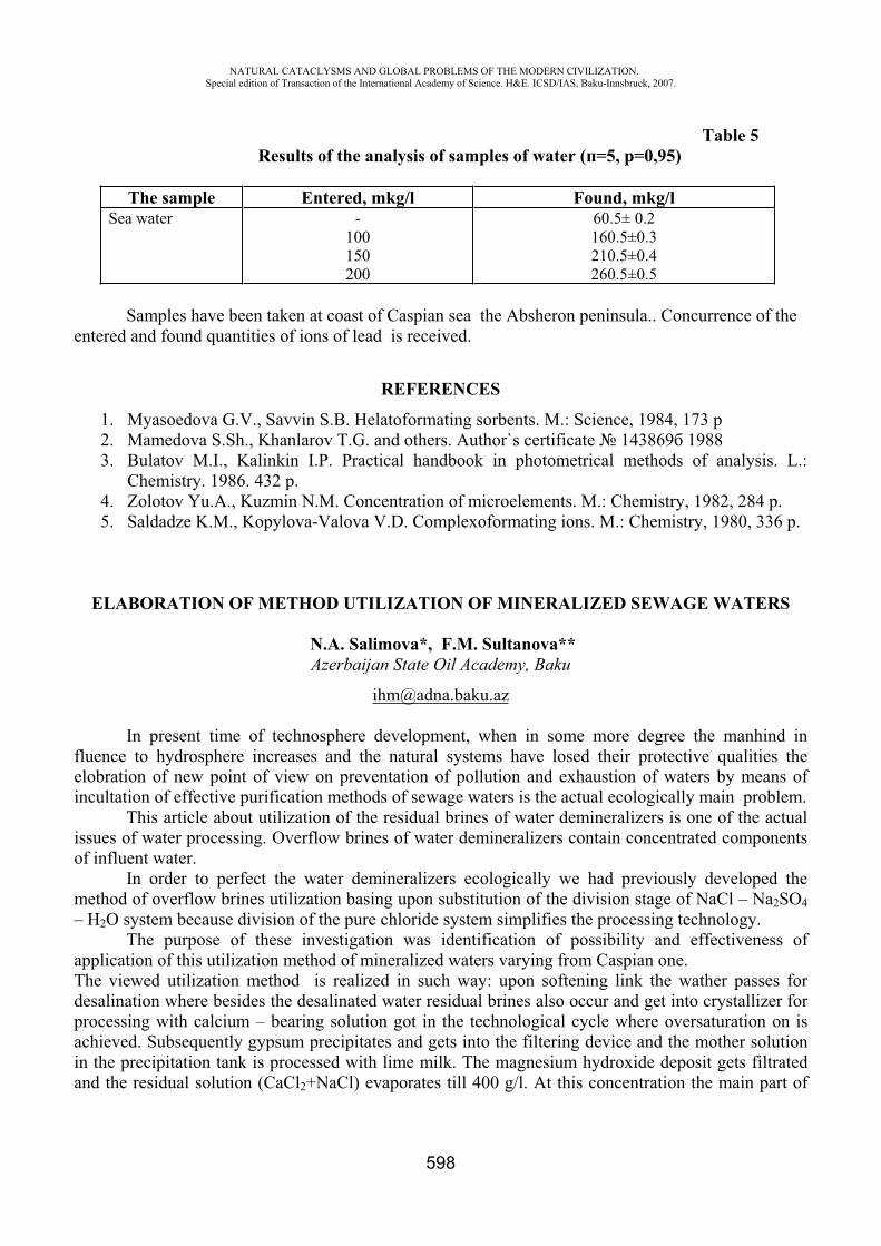
NATURAL CATACLYSMS AND GLOBAL PROBLEMS OF THE MODERN CIVILIZATION. Special edition of Transaction of the International Academy of Science. H&E. ICSD/IAS, Baku-Innsbruck, 2007.
598
Table 5 Results of the analysis of samples of water ( =5, =0,95)
The sample Entered, mkg/l Found, mkg/l Sea water -
100 150 200
60.5± 0.2 160.5±0.3 210.5±0.4 260.5±0.5
Samples have been taken at coast of Caspian sea the Absheron peninsula.. Concurrence of the entered and found quantities of ions of lead is received.
REFERENCES
1. Myasoedova G.V., Savvin S.B. Helatoformating sorbents. M.: Science, 1984, 173 p 2. Mamedova S.Sh., Khanlarov T.G. and others. Author`s certificate 143869 1988 3. Bulatov M.I., Kalinkin I.P. Practical handbook in photometrical methods of analysis. L.:
Chemistry. 1986. 432 p. 4. Zolotov Yu.A., Kuzmin N.M. Concentration of microelements. M.: Chemistry, 1982, 284 p. 5. Saldadze K.M., Kopylova-Valova V.D. Complexoformating ions. M.: Chemistry, 1980, 336 p.
ELABORATION OF METHOD UTILIZATION OF MINERALIZED SEWAGE WATERS
N.A. Salimova*, F.M. Sultanova** Azerbaijan State Oil Academy, Baku
In present time of technosphere development, when in some more degree the manhind in fluence to hydrosphere increases and the natural systems have losed their protective qualities the elobration of new point of view on preventation of pollution and exhaustion of waters by means of incultation of effective purification methods of sewage waters is the actual ecologically main problem.
This article about utilization of the residual brines of water demineralizers is one of the actual issues of water processing. Overflow brines of water demineralizers contain concentrated components of influent water.
In order to perfect the water demineralizers ecologically we had previously developed the method of overflow brines utilization basing upon substitution of the division stage of Na l – Na2SO4– H2O system because division of the pure chloride system simplifies the processing technology.
The purpose of these investigation was identification of possibility and effectiveness of application of this utilization method of mineralized waters varying from Caspian one. The viewed utilization method is realized in such way: upon softening link the wather passes for desalination where besides the desalinated water residual brines also occur and get into crystallizer for processing with calcium – bearing solution got in the technological cycle where oversaturation on is achieved. Subsequently gypsum precipitates and gets into the filtering device and the mother solution in the precipitation tank is processed with lime milk. The magnesium hydroxide deposit gets filtrated and the residual solution ( aCl2+NaCl) evaporates till 400 g/l. At this concentration the main part of
NATURAL CATACLYSMS AND GLOBAL PROBLEMS OF THE MODERN CIVILIZATION. Special edition of Transaction of the International Academy of Science. H&E. ICSD/IAS, Baku-Innsbruck, 2007.
599
NaCl gets crystallized and upon separation of NaCl crystals part of aCl2 with NaCl admixture gets stirred with the utilized brines for its desulfatization.
The specific feature of this technology is recirculation of a part of aCl2 into utilized brine. The technical and economic efficiency of offered thechnology is substantiated and the optimal unit discharge aCl2 is determined equal to 0,3-0,4 m3/m3 where a deep desulfatization (97-98 %) is gained. The residual concentration of sulfate – ion while processing of Caspian wather concentrates was 7-10 mg/equ/l.
This work covers a wide class of mineralized waters where the main soluble tasks included determination of the desulfatization stage and the optimal unit discharge of aCl2. The analytical investigations were realized in salt containing degree of 6-24 g/l with hardness from 20 to 60 mg – equ/l and shares of sulfate –ions in anion composition 0,1 0,5. Absence of bicarbonate ions in the utilized brines was suggested. Salt – containing of the residual brines of water demineralizers entering for utilization regardless of the initial composition was accepted equal to 60 q/l. The concentration of recirculated brine aCl2 was 7500 mg – equ/l cwith few admixture of sodium chloride (200 mg – equ/l). The discharge unit of calcium chloride varied within 0,2 0,5 m3/m3.
The accounting method based upon determination of the quantity of gypsum dropped from oversaturated solutions and identification of the balanced ion concentrations.
The pervious investigations testified that the most significant impact on the residual sulfate – ion composition is of the initial concentration of sulfate – ions.
Considering the results of the preliminary accounts the technological restrictions for the desulfatization depth in order to exlude contamination of magnesium hydroxide with gypsum and promotion to scaling – free mode of the evaporator system in these investigations only the sulfate – ion concentrations were modified. The gained results as well as the ion composition of the processed mineralized waters are specified in the table.
The analysis of the gained results specified that the residual sulfate – ion concentrations while concentrates processing is 2-10 mg – equ/l.
From the technical and economic considerations selections of the optimal discharge unit of the calcium – bearing solution is necessary because as its increase both the capital and the unit discharges get higher.
But at the lower values of aCl2 discharge the needed desulfatization depth and getting pure MgO isn t achieved. For these investigations the optimal value of the aCl2 unit discharge (as specified in the table) is on the level of 0,4 m3/m3. Higher than this value modification of the aCl2 unit discharge insignificantly impacts on the residual sulfate – ion concentrations. The desulfatization depth is 97-78 %. The analysis testifies that the weak impact of the ion compositions of the utilized brines on the indices of desulfatization process can be explained with the high concentrations of the used aCl2solution.
Thus, the investigations of the viewed class of mineralized waters discovered the optimal unit discharge aCl2 necessary for deep desulfatization of the water demineralizers concentrates. The investigation results significantly expand the opportunity of the known method of residual brines utilization and can be applied during projection of the economically and ecologically perfect technological water processing schemes allowing get chemical products of commercial quality simultaneously with desalinated water.
REFERENCES
1. L.V. Peredelski, V.I. Korobkin, O.E. Prikhodchenko. Ecology. Moscow, 2006, 512 pages. 2. Complex processing of mine of mineralized waters. A.T. Pilipenko, I.Q.Vakhnin – Kiyev,
1984, 284 pages.
NATURAL CATACLYSMS AND GLOBAL PROBLEMS OF THE MODERN CIVILIZATION. Special edition of Transaction of the International Academy of Science. H&E. ICSD/IAS, Baku-Innsbruck, 2007.
600
3. N.A. Salimova, F.M. Sultanova. Use of mineralized waters in technical waters appliyng. The encineering ecology, Moscow, 2, 2006, 28-33 pages
4. N.A.Salimova, F.M. Sultanova. Complex scheme of processing of mineralized sewage waters. The scientific, Issue 2 – Kiev, 2005, 384-400 page.
CORRELATION INDICATORS OF FAILURES ORIGIN
Musaeva N.F.*, Aliev E.R.**, Mastaliyeva D.I.***, Rzayeva U.E.****
Institute of Cybernetics of National Academy of Sciences of Azerbaijan
The performed experimental investigations showed that in most cases such classical conditions as normality of the distribution law, stationarity, etc. do not take place for the signals received as the output of the corresponding sensors during appearing the defect. Due to this the unknown estimates are determined with great errors when using traditional technologies. So the given data do not allow one to detect the origin of the defect. This disadvantage can be eliminated by means of robustness value. Its application allows one to determine the unknown estimates with enough accuracy.
Taking into account all mentioned above the specific characteristics of robustness value and the results of calculating experiments snowing the influence of the microerror of the products appeared in the process of traditional processing on the error of obtained results are considered below in more detail.
Signal and noise data bases were created for this purpose. They include: 1) data base of useful signals in the form of sinusoidal curves, sum of sinusoidal and cosinusoidal curves with variable frequency generated with different digitization steps; 2) data base of simulated physical random useful signals with different distribution laws obtained as a result of interpolation of a decimated random sequence; 3) data base of different types of noise with different distribution laws obtained by means of a random number generator; 4) data base of simulated physical random noise with different distribution laws obtained as a result of interpolation of a decimated random sequence; 5) data base of correlated simulated random useful signals and noise; 6) data base of simulated noisy signals consisting of a sum of different useful signals and different types of noise with different distribution laws and different “useful signal – noise” relations.
These signals simulating the physical random noisy signals obtained from the sensors of the technological processes were created to perform the computation experiments and to certify the reliability of the proposed methods of analysis of signals and noises [1-3], and in particular, to check the efficiency of the method used to calculate the variance of the noise of the noisy signal.
Besides simulated signals are used to carry out computational experiments designed to verify the efficiency of methods of computing other characteristics of noisy signals that have not been previously subjected to extensive study, in particular, for the case in which classical conditions are never satisfied.
The following aims were set in creating the software and the system of experimental researches: 1) development of theoretical bases for calculating the mean value of the micro-error of products obtained with the use of the traditional technology of computing estimators of auto- and cross-correlation functions and analysis of the properties of the methodology; 2) development of a methodology for computing an estimator of the magnitude of the robustness of a noisy signal; 3) creation of a program, performance of a computational experiment, and identification of features of the
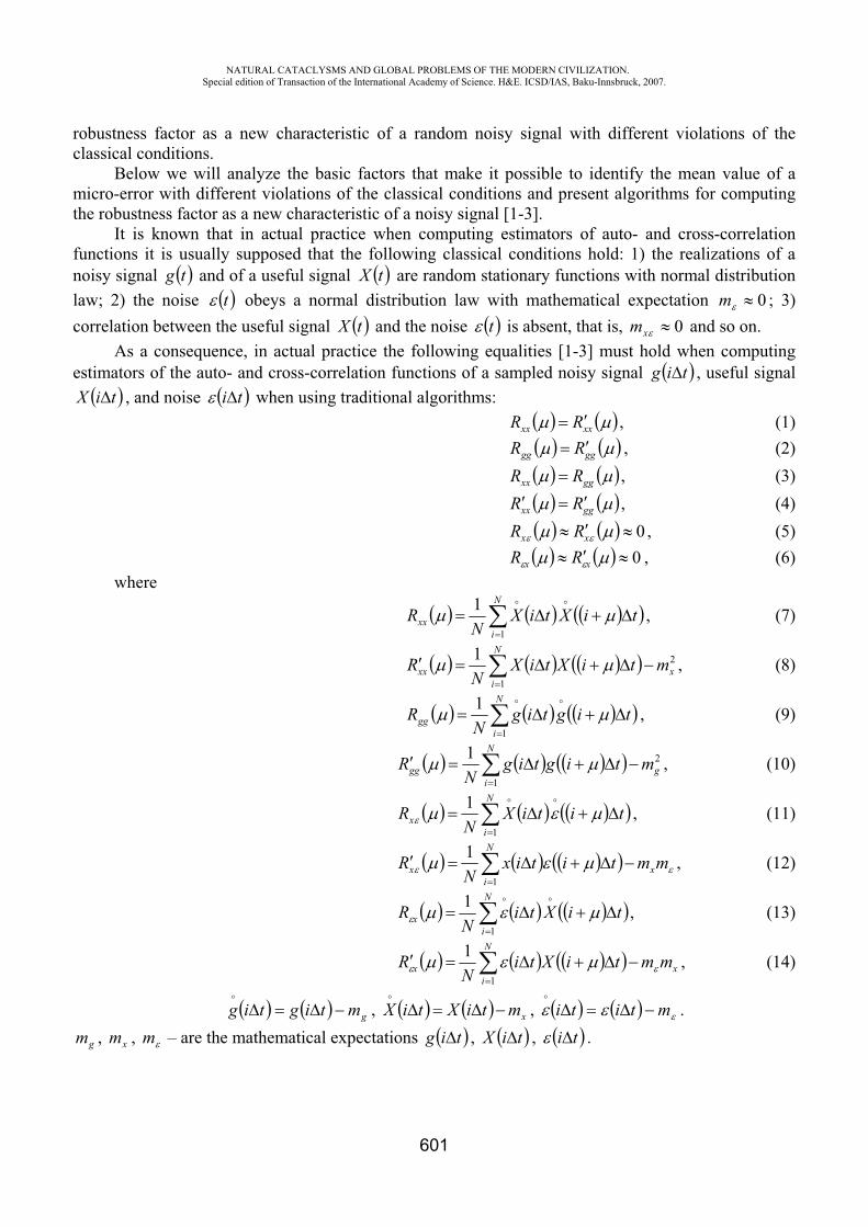
NATURAL CATACLYSMS AND GLOBAL PROBLEMS OF THE MODERN CIVILIZATION. Special edition of Transaction of the International Academy of Science. H&E. ICSD/IAS, Baku-Innsbruck, 2007.
601
robustness factor as a new characteristic of a random noisy signal with different violations of the classical conditions.
Below we will analyze the basic factors that make it possible to identify the mean value of a micro-error with different violations of the classical conditions and present algorithms for computing the robustness factor as a new characteristic of a noisy signal [1-3].
It is known that in actual practice when computing estimators of auto- and cross-correlation functions it is usually supposed that the following classical conditions hold: 1) the realizations of a noisy signal tg and of a useful signal tX are random stationary functions with normal distribution law; 2) the noise t obeys a normal distribution law with mathematical expectation 0m ; 3) correlation between the useful signal tX and the noise t is absent, that is, 0xm and so on.
As a consequence, in actual practice the following equalities [1-3] must hold when computing estimators of the auto- and cross-correlation functions of a sampled noisy signal tig , useful signal
tiX , and noise ti when using traditional algorithms:
xxxx RR , (1)
gggg RR , (2)
ggxx RR , (3)
ggxx RR , (4) 0xx RR , (5) 0xx RR , (6)
whereN
ixx tiXtiX
NR
1
1 , (7)
2
1
1x
N
ixx mtiXtiX
NR , (8)
N
igg tigtig
NR
1
1 , (9)
2
1
1g
N
igg mtigtig
NR , (10)
N
ix titiX
NR
1
1 , (11)
mmtitixN
R x
N
ix
1
1 , (12)
N
ix tiXti
NR
1
1 , (13)
x
N
ix mmtiXti
NR
1
1 , (14)
gmtigtig , xmtiXtiX , mtiti .
gm , xm , m – are the mathematical expectations tig , tiX , ti .
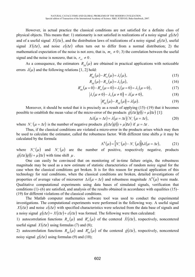
NATURAL CATACLYSMS AND GLOBAL PROBLEMS OF THE MODERN CIVILIZATION. Special edition of Transaction of the International Academy of Science. H&E. ICSD/IAS, Baku-Innsbruck, 2007.
602
However, in actual practice the classical conditions are not satisfied for a definite class of physical objects. This means that: 1) stationarity is not satisfied in realizations of a noisy signal tigand of a useful signal tiX , and the distribution laws of realizations of a noisy signal tig , useful signal tiX , and noise ti often turn out to differ from a normal distribution; 2) the mathematical expectation of the noise is not zero, that is, 0m ; 3) the correlation between the useful signal and the noise is nonzero, that is, 0xr .
As a consequence, the estimators ggR are obtained in practical applications with noticeable errors and the following relations [1, 2] hold:
1xxgg RR , (15)
2xxgg RR , (16) 0000 21xxgg RR , (17)
000 21 , (18)
gggg RR . (19) Moreover, it should be noted that it is precisely as a result of applying (15)–(19) that it becomes
possible to establish the mean value of the micro-error of the products tigtig [1]: tNtt , (20)
where tN is the number of negative products tigtig if t .Thus, if the classical conditions are violated a micro-error in the products arises which may then
be used to calculate the estimator, called the robustness factor. With different time shifts it may be calculated by the formula
tNNR , (21) where N and N are the number of positive, respectively negative, products
tigtig with time shift .One can easily be convinced that on monitoring of in-time failure origin, the robustness
magnitude may be used as a new estimate of statistic characteristics of random noisy signal for the case when the classical conditions get broken. It is for this reason for practical application of this technology for real conditions, when the classical conditions are broken, detailed investigations of properties of average value of microerror t and robustness magnitude R were made. Qualitative computational experiments using data bases of simulated signals, verification that conditions (1)–(6) are satisfied, and analysis of the results obtained in accordance with equalities (15)–(19) for different violations of the classical conditions.
The Matlab computer mathematics software tool was used to conduct the experimental investigations. The computational experiments were performed in the following way. A useful signal
tiX and noise ti with specified characteristics were selected from the data base of signals and a noisy signal titiXtig was formed. The following were then calculated: 1) autocorrelation functions xxR and xxR of the centered tiX , respectively, noncentered useful signal tiX using formulas (7) and (8); 2) autocorrelation functions ggR and ggR of the centered tig , respectively, noncentered noisy signal tig using formulas (9) and (10);
NATURAL CATACLYSMS AND GLOBAL PROBLEMS OF THE MODERN CIVILIZATION. Special edition of Transaction of the International Academy of Science. H&E. ICSD/IAS, Baku-Innsbruck, 2007.
603
3) cross-correlation functions xR and xR between the centered useful signal tiX and noise ti , respectively, between the noncentered useful signal tiX and the noise ti using formulas (11) and (12); 4) cross-correlation functions xR and xR between the centered noise ti and the useful signal tiX , respectively, and between the noncentered noise ti and the useful signal tiXusing formulas (13), and (14); 5) autocorrelation function R of the centered noise ti and autocorrelation function Rof the noncentered noise ti according to the formulas:
N
ititi
NR
1
1 , (22)
2
1
1 mtitiN
RN
i; (23)
6) detected part of error t using formula (19); 7) mean value of micro-error t using formula (20); 8) robustness factor R using formula (21); 9) true magnitude of error
tRtR xxgg ; (24) 10) correlation coefficient between useful signal and noise sr ;11) variance of noise according to the traditional algorithm
2
11
N
itiND ; (25)
12) variance of noise according to the nontraditional algorithm [1]: tRtRRD gggggg 2120 . (26)
REFERENCES
1. T.A. Aliev, Robust Technology with Analysis of Interference in Signal Processing, Kluwer Academic/Plenum Publishers, New York (2003), 199 p.
2. . . Aliev, The theory of noise analysis , Automatic Control and Computer Sciences, Latvia, Riga (2002), 6, . 35–45.
3. N.F. Musaeva, Methodology of calculating robustness as an estimator of the statistical characteristics of a noisy signal, Automatic Control and Computer Sciences, Allerton Press, Inc., New York (2005), Vol. 39, No.5 pp. 53–62.
4. T.A. Aliev, Digital noise monitoring of defect origin, Springer Publishers, New York (2007)
NATURAL CATACLYSMS AND GLOBAL PROBLEMS OF THE MODERN CIVILIZATION. Special edition of Transaction of the International Academy of Science. H&E. ICSD/IAS, Baku-Innsbruck, 2007.
604
SOME TECHNICAL AND ORGANIZATIONAL ASPECTS OF RATIONAL MANAGEMENT OF OIL AND GAS RESOURCES (by an example of JV “Vietsovpetro”)
Nguyen Thanh Long*, K.S. Karimov**, I.M. Petrunyak***,Le Dang Tam****
JV “Vietsovpetro”, SR Vietnam
Today more than 60% of power engineering facilities in the world work on oil and gas. Pollutions caused by the production, the transportation and the storage of oil and gas, in turn, cause ecological problems in the world. Oil and gas productions now rank among the most often negative technical activities that affect the environment.
These activities are carried out by JV “Vietsovpetro” at two oil fields: “White tiger” and “Dragon”. “White tiger” is the largest oil field [at the Vietnam shelf] which results in a greater part (90%) of JV’s oil production. Offshore Fixed Platforms (OFP) and Wellhead (satellite) Platforms (WP) are employed for oil production.
Given the stages of development and the preparation for operation of an oil field, it is necessary to calculate the system of oil and gas gathering, treatment and transportation and these calculations will be based on the production rates of the oil wells operating for a certain period of time. Offshore facilities and underwater pipelines of JV “Vietsovpetro” were designed accordingly and with due regard to the possibility of re-distribution of the output products from OFP and WP platforms (which are actually gas-liquid mixture or gas-saturated oil) and their direction from preliminary separation to repeated separation and their further pumping out to the Floating storage and offloading unit (FSO).
The system of oil and gas gathering, treatment and transportation was built up based on two delivery principles (fig. 1) as follows:
The output products from Northern OFP platforms are degassed and pumped out to FSO. A part of the output produced at WP platforms gas-saturated oil after preliminary separation at gas separation units is directed further to Central Processing Platform (CPP-2) and gas-liquid mixture from other WP platforms is also directed to the same platform; another part of the produced oil is directed to OFP platform for separation and pumping out to FSO. Output products of the wells are separated at OFP or CPP platforms and pumped out to FSO for dehydration, storage and offloading;Produced formation water is treated and disposed to the sea;Liberated at the first separation stage gas is directed to gas treatment unit and then to compressor’s intake for its delivery to the shore to be used for gas-lift cycle.
Though the JV’s system of oil and gas gathering, treatment and transportation is built up by closed cycle process equipment and employs up-to-date measuring and control instruments, still it does not provide a full protection for the sea water from pollution by oil and chemicals. Also low pressure gas is not utilized completely.
At the area of JV’s activity the pollutants can be classified as follows: Oil droplets entrained by the gas flow from separators; Oil losses because of the so called «large breathes» when filling the FSO’s tanks with oil; Oil losses because of the so called «small breathes» during storage of oil in the FSO’s tanks; Oil droplets entrained with the treated water when disposing to the sea; Burning of low pressure gas at the flare.
NATURAL CATACLYSMS AND GLOBAL PROBLEMS OF THE MODERN CIVILIZATION. Special edition of Transaction of the International Academy of Science. H&E. ICSD/IAS, Baku-Innsbruck, 2007.
605
In order to fulfill the International Conventions on preventing the contamination of the vessels, Environment Law of SRV, International Agreements on the sea environment protection and other legislative acts, JV “Vietsovpetro” developed a package of “Organizational and technical measures” for protection of the environment from pollutant presented during operation at the oil fields (fig. 2).
As it can be seen at the fig.2, the activities of JV “Vietsovpetro” for environment protection are aimed at a decrease of emergency situations at offshore oil and gas facilities.
The main factor of efficient development of oil and gas industry in SRV lays in the large potential of oil and gas resources of the country. And we must develop these resources rationally and attentively, with due regard to the environment protection.
At present time when the quality of oil and gas facilities all over the world becomes worse, the questions for environment protection are of special important. In XXI century, the scientific and engineering potential are expected to became the determining factors for the development of oil and gas industry. And the power of a country will depend upon high-tech technology and science.
Up to a certain extent, the model of interrelations within oil companies can determine a progress in the development of oil and gas industry with the introduction of innovations. Such interrelation can be seen on the example of oil companies of such developed countries with efficient oil and gas industry as USA and Norway.
There are many scientists in SRV. Our scientists can implement the most challenging programs including the programs of development of oil production technologies. It is necessary to point out that preparation of documentation for oil fields’ development is very important and complex scientific research work that requires creative approach, foreign experience, employment of up-to-date scientific achievements and experience in such field as oil production geology, geophysics, physics and chemistry of reservoirs, underground hydrodynamics based on 3D geological-technological computer model with due regard to environment and natural recourses protection.
Nowadays there is an urgent need for the introduction of changes in the old methods of oil and gas production and the employment of new technologies. As for JV “Vietsovpetro”, the following new methods of oil production could be introduced in future:
Improvement and optimization of the parameters of oilfield development model; Classification by groups of oil deposits in accordance with the complex of geological-technical characteristics, determining the perspectives of employment of modern technologies; Introduction of organizational-technical changes in the methods of oil and gas production, gathering and treatment as well as restructuring of the whole company; Development of attractive projects for investors; Representation of a large number of investment projects for making use of the new technologies.
The second task for introduction of changes is improvement of cooperation of JV “Vietsovpetro” with foreign scientific institutions.
Availability of highly skilled professional personnel is of primary importance for such high-tech scientific and engineering field as oil and gas production industry. Efficient training and upgrading of the company’s specialists is an important aspect of an efficient management.
Development of offshore oil fields shall be based on efficient scientific approach with due regard to the environment protection, scientific investigations on the basis of data collection, diagnostic and interpretation, correct method of decision making and introduction of high-tech technologies.
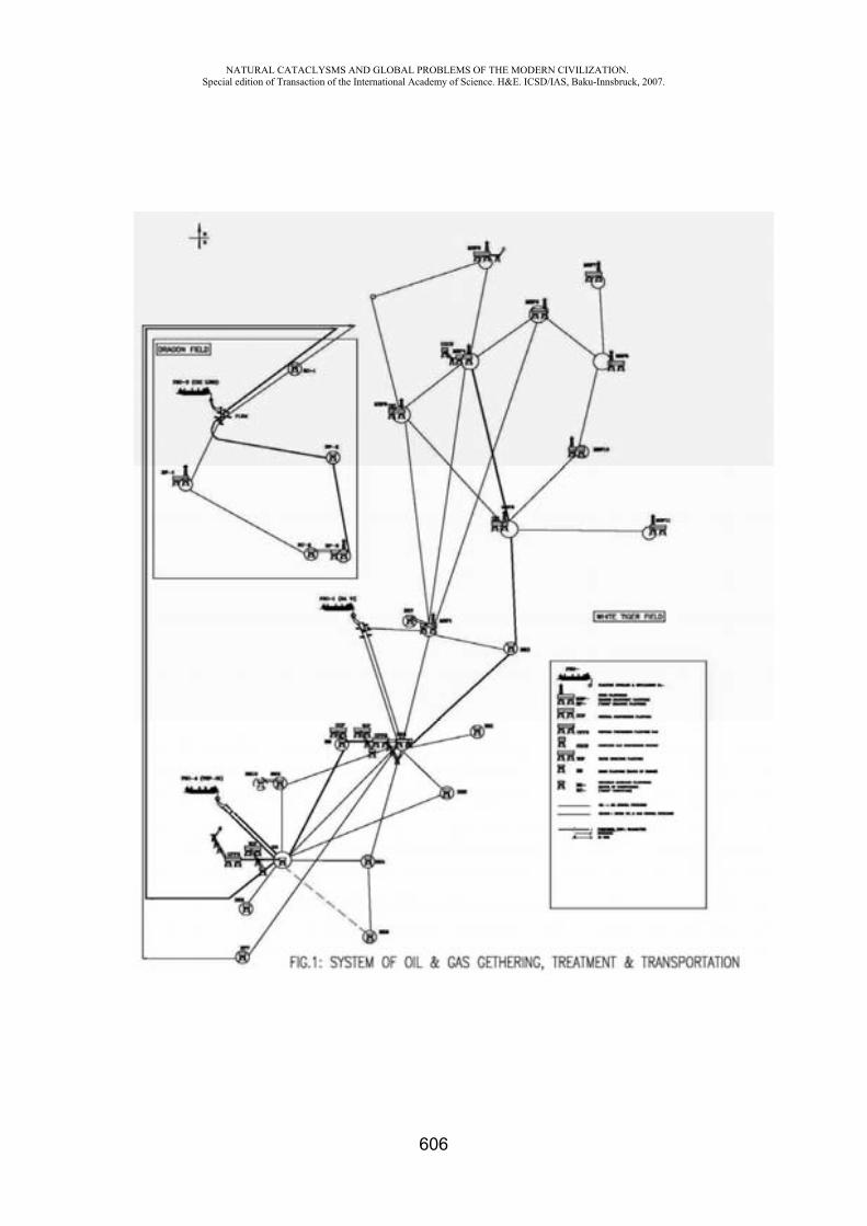
NATURAL CATACLYSMS AND GLOBAL PROBLEMS OF THE MODERN CIVILIZATION. Special edition of Transaction of the International Academy of Science. H&E. ICSD/IAS, Baku-Innsbruck, 2007.
606
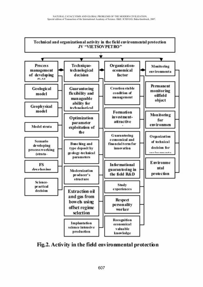
NATURAL CATACLYSMS AND GLOBAL PROBLEMS OF THE MODERN CIVILIZATION. Special edition of Transaction of the International Academy of Science. H&E. ICSD/IAS, Baku-Innsbruck, 2007.
607
NATURAL CATACLYSMS AND GLOBAL PROBLEMS OF THE MODERN CIVILIZATION. Special edition of Transaction of the International Academy of Science. H&E. ICSD/IAS, Baku-Innsbruck, 2007.
608
SOME ISSUES RELATED WITH URBAN-PLANNING SAFETY IN CONSTRUCTION OF RESIDENTIAL BUILDINGS IN AZERBAIJAN
R. Aghazadeh
State Agency on Control of Safety in Construction of the Ministry of Emergency Situations of the Republic of Azerbaijan
Due to continuation of the social-economic development strategy nowadays by president of the Republic of Azerbaijan Ilham Aliyev that begun under the direction of modern Azerbaijan statehood Founder, national leader Heydar Aliyev, works done in present area have accelerated, significant actions have been taken for improving of people living conditions. It is proud that today along with promotion of oil sector, non-oil sector also is raised, funds invested into this sphere increased. Widening of private property being the main attribute of market economy, free property, evokes great desire on people having interest in present sphere.
Buildings being erected in the capital of our country and other cities are once more indicators of power of our country economical increase and its successful advancement.
Besides, it should be noted that presently social-economical programs carried out in Azerbaijan consider satisfaction of demands and interests of the country population as a basic goal. One of the principles of these demands is dwelling supply problem reflecting the interests of mass people.
Now for achieving the supply, house needs of people of country housing constructions are conducted in 2 directions.
First direction is construction of housing buildings supplying comfort and more comfortable living.
Second direction is construction of housing buildings for socially unprotected levels of people (Refugees and internally displaced persons, lonely old people, war veterans and invalids, orphan children and so on).
Presently housing construction meets the requirements of comfort living and high aesthetic qualities mainly in the capital of the country Baku related to the first direction widely spread. These housing buildings are constructed on account of investments of various legal and individual entities.
Solutions of these residential building projects, wholly distinguishing from requirements of “Residential buildings” Construction norms and rules operated during soviet period, are drawn up by maintaining general technical requirements (including illumination, engineering provisions and so on).
The projects consider provision of house owners with high housing conditions. That’s why newly constructing housing buildings are constructed so high that they consider
maximum productive use of this assigned land. Taking into account seismic situation (8-9 points) of the country’s territory, 16-storey buildings for mainly reinforced concrete frame buildings are mostly constructed.
Construction companies erecting these buildings usually supply exploitation and operating services of the buildings on their strength. On the ground floors (1 and 2 floors) of the residential buildings placing trade and welfare service objects make easier the residents usage of these services. During last 2 years in the country, especially in Baku city, about 500 such many-storeyed buildings were constructed.
Houses’ building by means of free projection is increasing recently. Its main reason for population’s desire to improve house conditions while becoming better their life. Except this, as house construction is limited in state budget, some walks of the population, standing in a queue for house, supply their needs with these houses, other parts with buying old, but suitable houses, put up for sale through free house market.
NATURAL CATACLYSMS AND GLOBAL PROBLEMS OF THE MODERN CIVILIZATION. Special edition of Transaction of the International Academy of Science. H&E. ICSD/IAS, Baku-Innsbruck, 2007.
609
Houses being constructed for strata having no social support related to the second direction are financed by some sources.
1. Houses constructed in the cities and villages of the country for invalids of Garabagh war and martyr’s families on account of state budget. Houses, constructed for invalids in conformity with special norms are supplied with additional fixtures and areas. More than 1000 apartments of such houses have been built in our country lately.
2. On account of State Oil Fund – on purpose to end refugee and Internally displaced persons` living in camps and freight trains under miserable situation in an liberated areas of our country and other areas for such families some settlement and necessary infrastructure objects have been built.
In order to realize the housing constructions more successfully by urban-planning security point we suggest paying attention to settlement of some problems shown below.
In every populated area, either in Baku or in other city, settlement or village housing construction should be conducted by taking into account determined by main plan. Thus number of population first of all should be regulated by working places having city planning factors in populated area. As these matters in main plans accurately defined with perspective social-economical projects and programs of populated area, apartment construction should be conducted corresponding to it.
On main plan made for period till year 2005 number of city population is adopted to 2 million 200 thousand person. Existing Apartment Fund of Baku city and general residential fund of afterwards constructing new apartments are on sufficient level for the number of population considered in main plan. But as apartment construction in Baku city mainly became business, citizens coming from other parts of the country buy apartments in these buildings and leave their previous work places. In the result, population of Baku city became more than considered in the main plan.
For the settlement of this problem, we need to provide the population with profitable work and prevent stream of people to Baku by achieving the work with full power of the privatized main funds.
For the settlement of the problem within country level of production for 20 years meeting the requirements of market economy and providing economical and natural resources should be defined and main plan projects suitable for this level should be made and population of each populated area shortage of apartment construction under these documents should be determined and realized.
One of important factors of apartment construction successfully conducting and exploitation is problem of supply with engineering infrastructure of buildings erected. It must be regretfully noted that in most places after completion of residential building, existing problems with networks of water, sewerage, electric, gas, heating and other communications are “Hardly” settled without increasing the power. And this doesn’t allow using this infrastructure constantly.
For the settlement of these problems engineering communications taking into consideration constructions that will be carried out in conformity with future development of cities (first of all big cities) including residential buildings construction, demands should be projected and constructed financing by state.
Supply of apartments in an appropriate level with an engineering network and settings, is one of main factors of providing of population with normal conditions.
Apartment construction differs only with free projecting settlement and intra building equipment and systems. In order to derive more benefit from plot of land inclination to construction of many-storeyed buildings have increased. Besides, in some cases while constructing apartments demands of city planning norms and rules have not been fulfilled. Thus distances between buildings, anti-fire, insolation, aeration, without fulfilling area construction thickness norms, construction of buildings in close conditions were allowed.
Its main reason is that without making detailed planning project of the area in any bloc of the city and architectural – projection of separate buildings in an existing area and constructions of
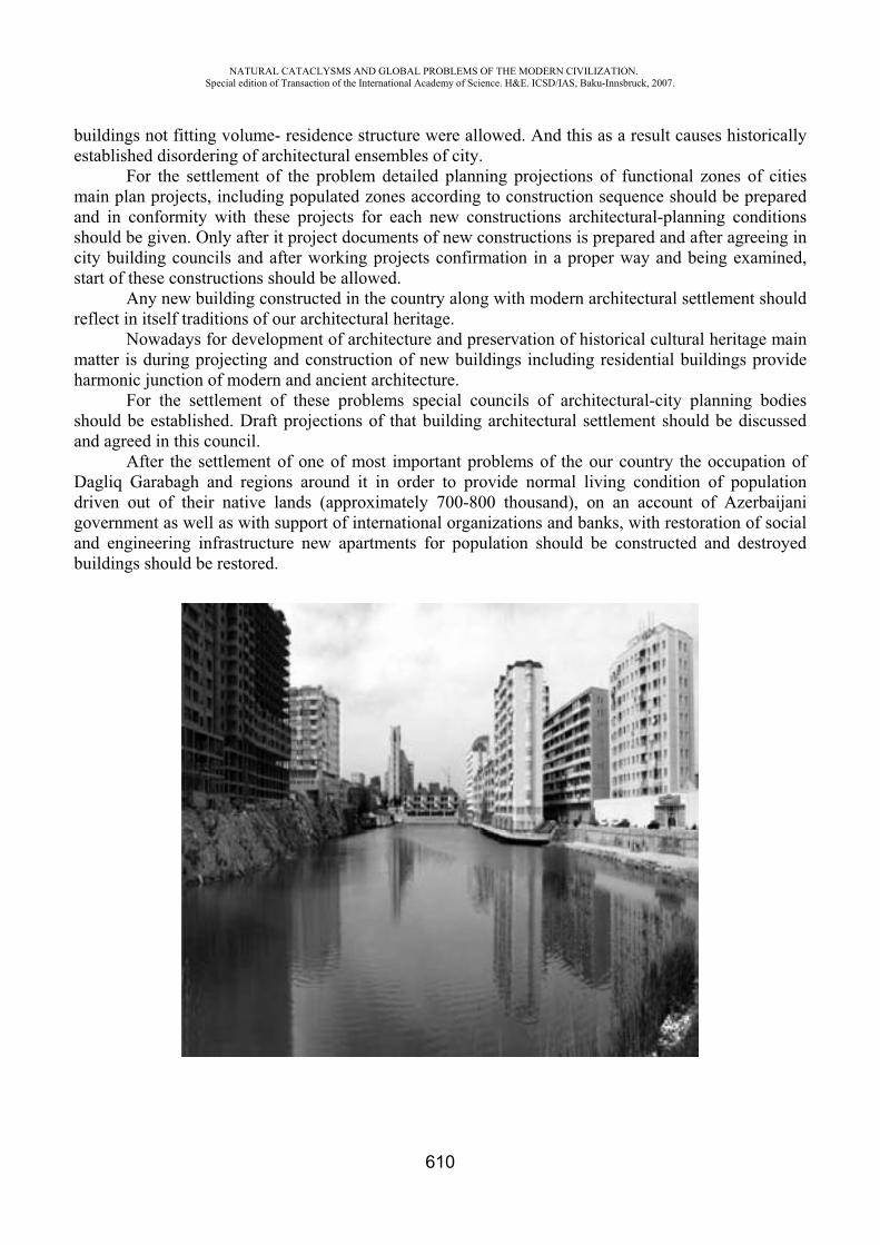
NATURAL CATACLYSMS AND GLOBAL PROBLEMS OF THE MODERN CIVILIZATION. Special edition of Transaction of the International Academy of Science. H&E. ICSD/IAS, Baku-Innsbruck, 2007.
610
buildings not fitting volume- residence structure were allowed. And this as a result causes historically established disordering of architectural ensembles of city.
For the settlement of the problem detailed planning projections of functional zones of cities main plan projects, including populated zones according to construction sequence should be prepared and in conformity with these projects for each new constructions architectural-planning conditions should be given. Only after it project documents of new constructions is prepared and after agreeing in city building councils and after working projects confirmation in a proper way and being examined, start of these constructions should be allowed.
Any new building constructed in the country along with modern architectural settlement should reflect in itself traditions of our architectural heritage.
Nowadays for development of architecture and preservation of historical cultural heritage main matter is during projecting and construction of new buildings including residential buildings provide harmonic junction of modern and ancient architecture.
For the settlement of these problems special councils of architectural-city planning bodies should be established. Draft projections of that building architectural settlement should be discussed and agreed in this council.
After the settlement of one of most important problems of the our country the occupation of Dagliq Garabagh and regions around it in order to provide normal living condition of population driven out of their native lands (approximately 700-800 thousand), on an account of Azerbaijani government as well as with support of international organizations and banks, with restoration of social and engineering infrastructure new apartments for population should be constructed and destroyed buildings should be restored.

NATURAL CATACLYSMS AND GLOBAL PROBLEMS OF THE MODERN CIVILIZATION. Special edition of Transaction of the International Academy of Science. H&E. ICSD/IAS, Baku-Innsbruck, 2007.
611
DEFINITION OF GERMANIUM IN ENVIRONMENTAL OBJECTS
N.Kh. Rustamov *, S.R. Hajiyeva**, U.N. Rustamova***
*Institute of chemical problems (National Academy of sciences of Azerbaijan) **Baku State University, Azerbaijan
Germanium takes an active participation in substances circulation. It is found out in animal and vegetative organisms. The content of germanium compounds 0, 05-0, 07 mkg G /l in seawater, it is consumed by phytoplankton in the sea environment. Ashes of birch leaves contains 4·10-5 % GeO2. It meets in waters, in ground samples and ground sedimentations. Small concentrations of germanium do not render physiological action on living organisms, and big are always toxic. By sanitary norms, it is supposed 2 mg / m3 Ge in the air of working premises, i.e. the same concentration for an asbestic dust. Bivalent compounds of germanium are considerably more toxic [1]. In difference from the compounds of heavy metals, not enough attention is paid to the definition and analytical control of germanium content in environmental objects. Therefore, development of sensitive and selective techniques of germanium definition in environmental objects is sharp.
The most perspective reagents providing the best characteristics of definition reaction are organic reagents. In analytical chemistry of germanium phenylfluoron and its derivatives, aniline derivatives, pyrocatechin violet, stilbazo and others are most widely used [2-4]. However, reactions with these reagents are insufficiently selective. Besides, some of them form colloid solutions with
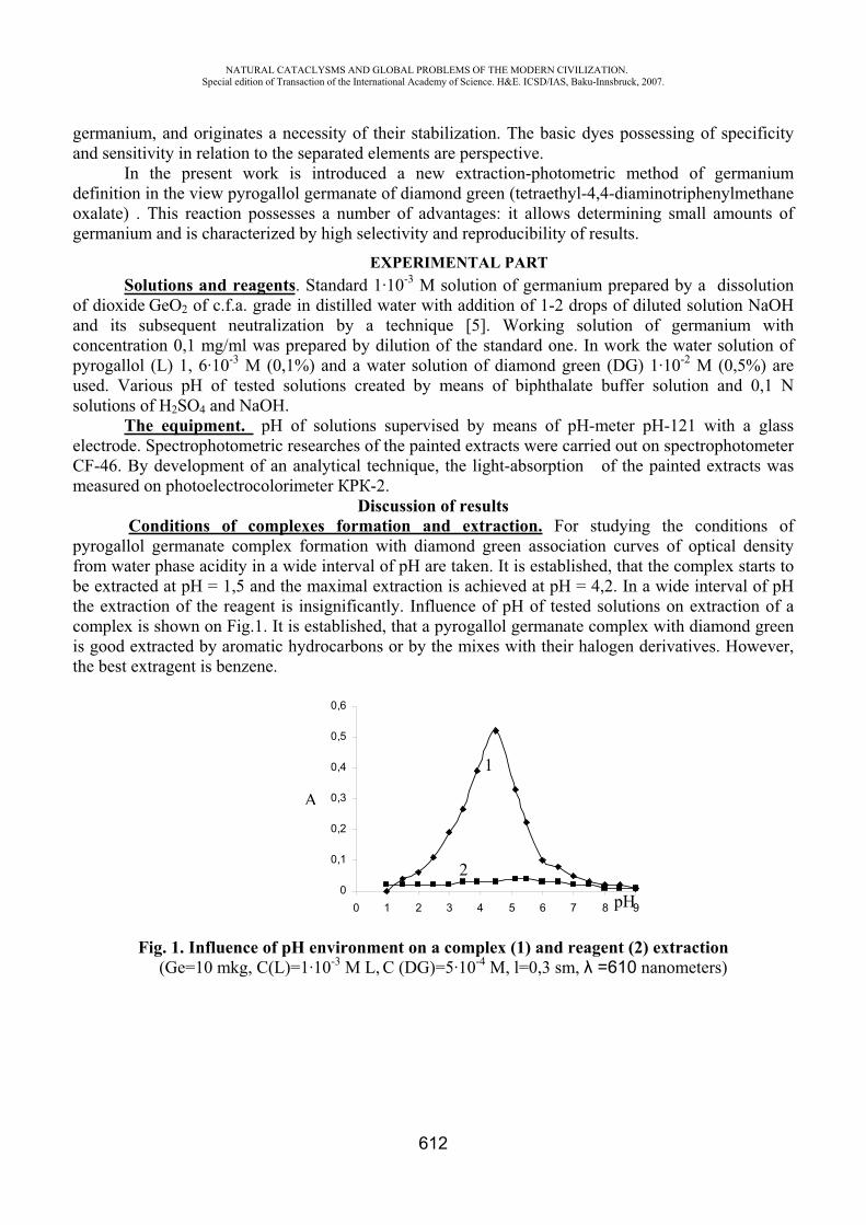
NATURAL CATACLYSMS AND GLOBAL PROBLEMS OF THE MODERN CIVILIZATION. Special edition of Transaction of the International Academy of Science. H&E. ICSD/IAS, Baku-Innsbruck, 2007.
612
germanium, and originates a necessity of their stabilization. The basic dyes possessing of specificity and sensitivity in relation to the separated elements are perspective.
In the present work is introduced a new extraction-photometric method of germanium definition in the view pyrogallol germanate of diamond green (tetraethyl-4,4-diaminotriphenylmethane oxalate) . This reaction possesses a number of advantages: it allows determining small amounts of germanium and is characterized by high selectivity and reproducibility of results.
EXPERIMENTAL PART Solutions and reagents. Standard 1·10-3 M solution of germanium prepared by a dissolution
of dioxide GeO2 of c.f.a. grade in distilled water with addition of 1-2 drops of diluted solution NaOH and its subsequent neutralization by a technique [5]. Working solution of germanium with concentration 0,1 mg/ml was prepared by dilution of the standard one. In work the water solution of pyrogallol (L) 1, 6·10-3 M (0,1%) and a water solution of diamond green (DG) 1·10-2 M (0,5%) are used. Various of tested solutions created by means of biphthalate buffer solution and 0,1 N solutions of H2SO4 and NaOH.
The equipment. of solutions supervised by means of -meter -121 with a glass electrode. Spectrophotometric researches of the painted extracts were carried out on spectrophotometer CF-46. By development of an analytical technique, the light-absorption of the painted extracts was measured on photoelectrocolorimeter P -2.
Discussion of results Conditions of complexes formation and extraction. For studying the conditions of
pyrogallol germanate complex formation with diamond green association curves of optical density from water phase acidity in a wide interval of are taken. It is established, that the complex starts to be extracted at = 1,5 and the maximal extraction is achieved at = 4,2. In a wide interval of the extraction of the reagent is insignificantly. Influence of of tested solutions on extraction of a complex is shown on Fig.1. It is established, that a pyrogallol germanate complex with diamond green is good extracted by aromatic hydrocarbons or by the mixes with their halogen derivatives. However, the best extragent is benzene.
0
0,1
0,2
0,3
0,4
0,5
0,6
0 1 2 3 4 5 6 7 8 9
Fig. 1. Influence of environment on a complex (1) and reagent (2) extraction (Ge=10 mkg, C(L)=1·10-3 M L, C (DG)=5·10-4 M, l=0,3 sm, =610 nanometers)
A
pH
2
1
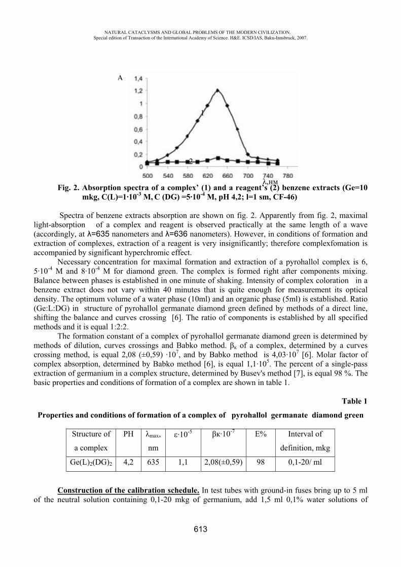
NATURAL CATACLYSMS AND GLOBAL PROBLEMS OF THE MODERN CIVILIZATION. Special edition of Transaction of the International Academy of Science. H&E. ICSD/IAS, Baku-Innsbruck, 2007.
613
Fig. 2. Absorption spectra of a complex’ (1) and a reagent’s (2) benzene extracts (Ge=10 mkg, C(L)=1·10-3 M, C (DG) =5·10-4 M, pH 4,2; l=1 sm, CF-46)
Spectra of benzene extracts absorption are shown on fig. 2. Apparently from fig. 2, maximal light-absorption of a complex and reagent is observed practically at the same length of a wave (accordingly, at =635 nanometers and =636 nanometers). However, in conditions of formation and extraction of complexes, extraction of a reagent is very insignificantly; therefore complexfomation is accompanied by significant hyperchromic effect.
Necessary concentration for maximal formation and extraction of a pyrohallol complex is 6, 5·10-4 M and 8·10-4 M for diamond green. The complex is formed right after components mixing. Balance between phases is established in one minute of shaking. Intensity of complex coloration in a benzene extract does not vary within 40 minutes that is quite enough for measurement its optical density. The optimum volume of a water phase (10ml) and an organic phase (5ml) is established. Ratio (Ge:L:DG) in structure of pyrohallol germanate diamond green defined by methods of a direct line, shifting the balance and curves crossing [6]. The ratio of components is established by all specified methods and it is equal 1:2:2.
The formation constant of a complex of pyrohallol germanate diamond green is determined by methods of dilution, curves crossings and Babko method. of a complex, determined by a curves crossing method, is equal 2,08 (±0,59) ·107, and by Babko method is 4,03·107 [6]. Molar factor of complex absorption, determined by Babko method [6], is equal 1,1·105. The percent of a single-pass extraction of germanium in a complex structure, determined by Busev's method [7], is equal 98 %. The basic properties and conditions of formation of a complex are shown in table 1.
Table 1
Properties and conditions of formation of a complex of pyrohallol germanate diamond green
Structure of
a complex m ,
nm
·10-5 ·10-7 % Interval of
definition, mkg
Ge(L)2(DG)2 4,2 635 1,1 2,08(±0,59) 98 0,1-20/ ml
Construction of the calibration schedule. In test tubes with ground-in fuses bring up to 5 ml of the neutral solution containing 0,1-20 mkg of germanium, add 1,5 ml 0,1% water solutions of
A
,
2
1
NATURAL CATACLYSMS AND GLOBAL PROBLEMS OF THE MODERN CIVILIZATION. Special edition of Transaction of the International Academy of Science. H&E. ICSD/IAS, Baku-Innsbruck, 2007.
614
pyrohallol, 1,5 ml 0,5% water solutions of diamond green and 2 ml of biphthalate buffer solution with 4,2. Volume of a solution lead up to 10 ml, add 5 ml of benzene, shake for 15 sec. Having
separated an organic phase from water, optical density of an extract measure on P -2 at -590nanometers and l=0, 3 sm on a background of the single pattern which does not contain germanium.
Alkaline and alkali-calcic elements, and also other extraneous ions taken in multiple surplus, specified in a bracket: B3+(400), VV(10), AgI(10), Cu2+(20), ZnII(100), HgII(2), NdIII (50), AsV(30),PbII(50), NbV(150), TaV(30), ThIV(1000), CdII(100), AlIII(850), TlIII(1), CoII(6), GaIII(100), SeIV(400),TeIV(900), MnII(620), NiII(60), MoVI(150), CrIII(800), FeIII(5),Cl-(800), BrIII(22), SnII(1), SbIII(2),AuIII(3) do not prevent definition of germanium with pyrohallol and diamond green.
The developed extraction-photometric method of definition of Ge as pyrohallol germanate of diamond green is applied in definition of its contents in environmental objects: oil coke, layer waters, thermal waters and ground. In all cases, tests were definitely processed to receive a representative solution. The received solution was twice extracted from 9N HCl 20 ml CCl4 in dividing funnel. Combined extracts were three times washed out by means of 9N l (within 10 ml). Germanium was extracted from the received extract by means of 6 ml of water in another dividing funnel. This procedure was repeated two more times and the water phase was collected in a measured flask in capacity of 25 ml. The received solution was neutralized within 1 N NaOH at the presence phenolphthalein. Content of Ge in the given solution was defined by the developed method and a method of comparison with phenilfluoron. Definition was carried out also by a method of additives.
Definition Ge in oil coke. Shot (2g ) fine-grainedof oil coke was well mixed with 3g of waterless sulfate of sodium. A mix placed in a porcelain crucible with a cover and maintained within one hour at 900° in muffle oven. Sinter was leached within15-20 ml of water. A solution was filtered, the filtrate and washing waters collected in a glass of 100 ml capacity. Added 2 ml of 30 % peroxides of hydrogen, boiled before its full decomposition and solution was evaporated up to 10 ml. Further was done the same that is mentioned above. By the developed method in oil coke has been found 3,1(±0,09) ·10-3 %, by a method of comparison - 1,25(±0, 04) ·10-4 %.
Definition of Ge in Daridah's thermal water. 1 was added to its concentration 0,5 N to 2 l of hot water, added 1 mg of antimony as a solution of trichloride or antimonyl-kalium-tartrate and 40 ml of 0,05 % of phenilfluoron solution. In a few hours a dropped out deposit was filtered and dissolved in 20 ml 0,5 N LiOH. A solution evaporated up to 5 ml, by drops flowed 5 ml of 2 % KMnO4 solution up phenilfluoron destruction. Then a solution was acidified within 1. For reduction of the maximum oxides of manganese was flowed 3 ml of 10 % ascorbic acid, added 5 ml of 2 % Mohr salt solution for linkage of elementary chlorine. Concentration of a hydrochloric acid was lead up to 9 N and carried out definition of germanium as it mentioned above. By the developed method in Daridah's thermal water has been found 4,7 (±0,1) ·10-5 g/l, with phenilfluoron 2,25 (±0,06) ·10-4 g/l Ge.
Definition of Ge in layer waters. 2 l of oil water was acidified within 1; added 1 ml of 20 % FeCl3 solutions and Fe(OH)3 was deposited by means of ammonia. The filtered deposit was washed out within 1% of NH4Cl solution, dissolved in diluted HCl, concentration of an acid was lead up to 9 N and carried out definition of Ge by the above-stated technique. By the developed extraction-photometric method in test of layer waters has been found 3,75 (±0,1) ·10-5 g/l Ge, and by a method of comparison - 2,5 (±0,07) ·10-6 g/l Ge.
Definition of Ge in yellow soil low podsolic ground taken from Lankaran.2 g of ground was incinerated in a platinum cup before organic substances burn out, slowly
raising temperature up to 500° . The rest decomposed in mix HNO3 + HF + H3 PO4 up to syrupy mass, heating up on water, and then on a sandy bath. Syrupy mass was dissolved in 9N 1 and extraction was carried out with the subsequent definition of Ge as in other cases. By the developed method has been found 4,25(±0,1) ·10-3% Ge, by a method of comparison
NATURAL CATACLYSMS AND GLOBAL PROBLEMS OF THE MODERN CIVILIZATION. Special edition of Transaction of the International Academy of Science. H&E. ICSD/IAS, Baku-Innsbruck, 2007.
615
2,5 (±0,06) ·10-4 %. Results of germanium content definition in environmental objects are shown in table 2.
Table 2
Definition of the Ge content in environmental objects (n = 5, p=0,95)
Analyzed material Found Ge With pyrohallol and
diamond green With phenilfluoron
Oil coke Thermal water Layer waters Sample of the ground
3,1(±0,09)·10-3%4,7(±0,1)·10-5 /3,75(±0,1)·10-5 /4,25(±0,1)·10-3%
1,25(±0,04)·10-4%2,25(±0,06)·10-4 /2,5(±0,07)·10-6 /2,5(±0,06)·10-4%.
REFERENSES
1. Nazarenko V. A. analytical chemistry, Germany. M.:, 1973, p. 262 2. Alieva R.A. Spektrofotometric studying of germanium compounds with some organic reagents
and development of photometric methods of germanium definition. Autoabstract. Baku, 1980. 3. Sargar B.M., Enews M.A. Definition of Ge (4 +) by means of exctraction within N-(n-octyl)
aniline, GAH, 2005, 60, 5, p.463-467 4. Soi Yin, Li Sheng. Definition of trace amounts of Ge in carbons by a method of
spectrophotometry with use of 2, 4-fluoronpenil chloride. Han-Fu-Bin, 2004, 24, 11.5. Korostelev P.P. Preparation of solutions for chemical-analytical works. M.: "Science", 1964, p.
3996. Bulatov M.I., Kalinkin I.P. Practical guidance on photocolorimeteric and spectrophotometric
methods of the analysis. L.: Chemistry, 1976, p.386 7. Yakovlev I.J., Busev A.I., Kozina G.V. collection of works, 1966, 7, 49, 7.
PURIFICATION OF ENGINE FUEL FROM AROMATIC COMPOUNDS WITH ADSORBENTS MODIFIED WITH FULLERENES.
V.V. Samonin*, M.L. Podvyaznikov**, V.U. Nikonova***
Saint-Petersburg State Technological Institute
The presence of aromatic hydrocarbons in fuel to be oxidized is inadmissible, for the reason that hydrocarbons, being oxidized, turn into the compounds that inhibit the process.
Dearomatization of oil products can be carried out in different ways for example by sulfuric acid processing [1], hydrogenation, azeotropic and extractive distillation, dissolvent extraction, adsorbent separation etc.
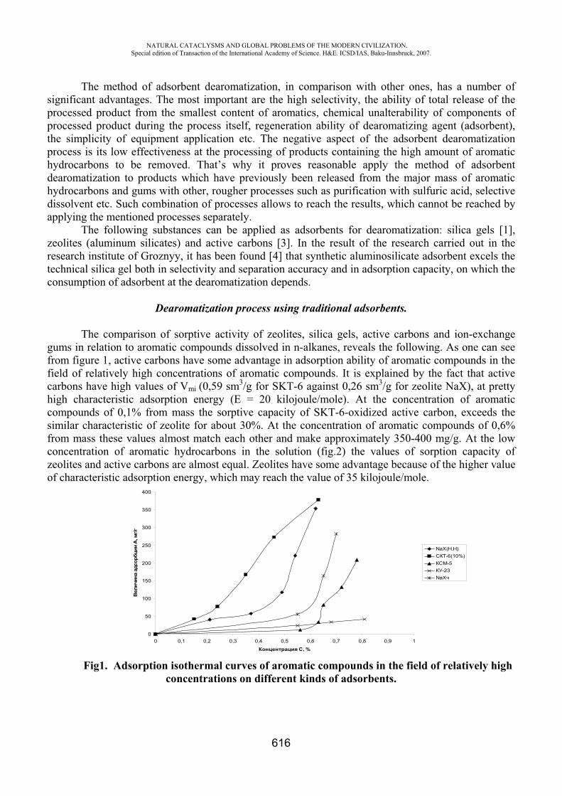
NATURAL CATACLYSMS AND GLOBAL PROBLEMS OF THE MODERN CIVILIZATION. Special edition of Transaction of the International Academy of Science. H&E. ICSD/IAS, Baku-Innsbruck, 2007.
616
The method of adsorbent dearomatization, in comparison with other ones, has a number of significant advantages. The most important are the high selectivity, the ability of total release of the processed product from the smallest content of aromatics, chemical unalterability of components of processed product during the process itself, regeneration ability of dearomatizing agent (adsorbent), the simplicity of equipment application etc. The negative aspect of the adsorbent dearomatization process is its low effectiveness at the processing of products containing the high amount of aromatic hydrocarbons to be removed. That’s why it proves reasonable apply the method of adsorbent dearomatization to products which have previously been released from the major mass of aromatic hydrocarbons and gums with other, rougher processes such as purification with sulfuric acid, selective dissolvent etc. Such combination of processes allows to reach the results, which cannot be reached by applying the mentioned processes separately.
The following substances can be applied as adsorbents for dearomatization: silica gels [1], zeolites (aluminum silicates) and active carbons [3]. In the result of the research carried out in the research institute of Groznyy, it has been found [4] that synthetic aluminosilicate adsorbent excels the technical silica gel both in selectivity and separation accuracy and in adsorption capacity, on which the consumption of adsorbent at the dearomatization depends.
Dearomatization process using traditional adsorbents.
The comparison of sorptive activity of zeolites, silica gels, active carbons and ion-exchange gums in relation to aromatic compounds dissolved in n-alkanes, reveals the following. As one can see from figure 1, active carbons have some advantage in adsorption ability of aromatic compounds in the field of relatively high concentrations of aromatic compounds. It is explained by the fact that active carbons have high values of Vmi (0,59 sm3/g for SKT-6 against 0,26 sm3/g for zeolite NaX), at pretty high characteristic adsorption energy ( = 20 kilojoule/mole). At the concentration of aromatic compounds of 0,1% from mass the sorptive capacity of SKT-6-oxidized active carbon, exceeds the similar characteristic of zeolite for about 30%. At the concentration of aromatic compounds of 0,6% from mass these values almost match each other and make approximately 350-400 mg/g. At the low concentration of aromatic hydrocarbons in the solution (fig.2) the values of sorption capacity of zeolites and active carbons are almost equal. Zeolites have some advantage because of the higher value of characteristic adsorption energy, which may reach the value of 35 kilojoule/mole.
0
50
100
150
200
250
300
350
400
0 0,1 0,2 0,3 0,4 0,5 0,6 0,7 0,8 0,9 1
, %
,/
NaX( . )-6(10%)-5
-23NaX
Fig1. Adsorption isothermal curves of aromatic compounds in the field of relatively high concentrations on different kinds of adsorbents.
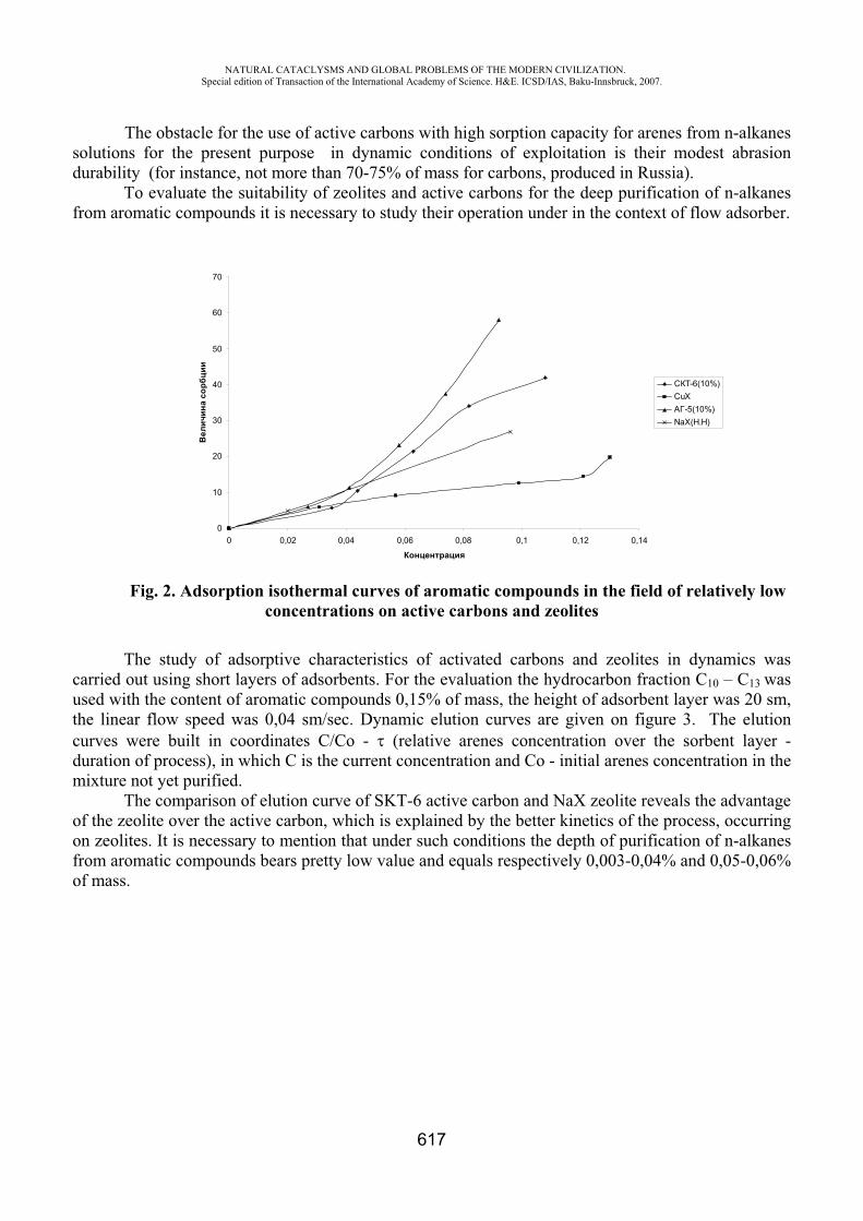
NATURAL CATACLYSMS AND GLOBAL PROBLEMS OF THE MODERN CIVILIZATION. Special edition of Transaction of the International Academy of Science. H&E. ICSD/IAS, Baku-Innsbruck, 2007.
617
The obstacle for the use of active carbons with high sorption capacity for arenes from n-alkanes solutions for the present purpose in dynamic conditions of exploitation is their modest abrasion durability (for instance, not more than 70-75% of mass for carbons, produced in Russia).
To evaluate the suitability of zeolites and active carbons for the deep purification of n-alkanes from aromatic compounds it is necessary to study their operation under in the context of flow adsorber.
0
10
20
30
40
50
60
70
0 0,02 0,04 0,06 0,08 0,1 0,12 0,14
-6(10%)CuX
-5(10%)NaX( . )
Fig. 2. Adsorption isothermal curves of aromatic compounds in the field of relatively low concentrations on active carbons and zeolites
The study of adsorptive characteristics of activated carbons and zeolites in dynamics was carried out using short layers of adsorbents. For the evaluation the hydrocarbon fraction 10 – 13 wasused with the content of aromatic compounds 0,15% of mass, the height of adsorbent layer was 20 sm, the linear flow speed was 0,04 sm/sec. Dynamic elution curves are given on figure 3. The elution curves were built in coordinates / - (relative arenes concentration over the sorbent layer - duration of process), in which C is the current concentration and Co - initial arenes concentration in the mixture not yet purified.
The comparison of elution curve of SKT-6 active carbon and NaX zeolite reveals the advantage of the zeolite over the active carbon, which is explained by the better kinetics of the process, occurring on zeolites. It is necessary to mention that under such conditions the depth of purification of n-alkanes from aromatic compounds bears pretty low value and equals respectively 0,003-0,04% and 0,05-0,06% of mass.
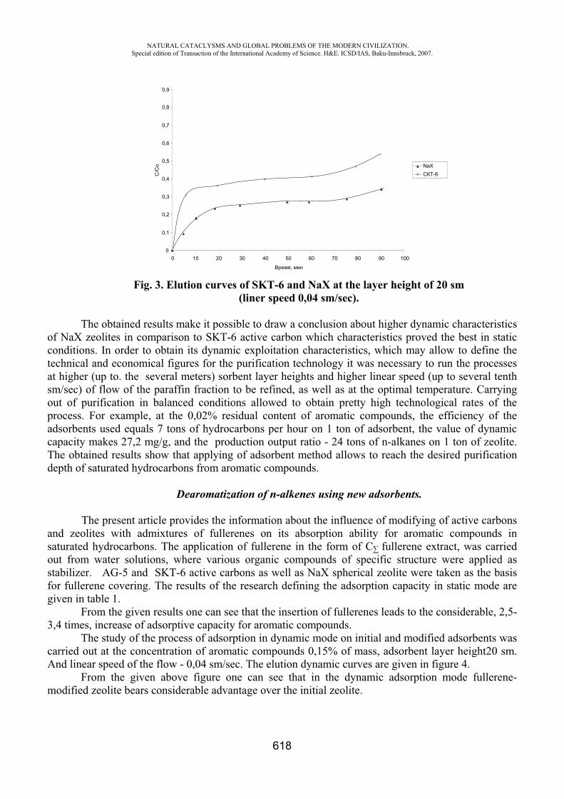
NATURAL CATACLYSMS AND GLOBAL PROBLEMS OF THE MODERN CIVILIZATION. Special edition of Transaction of the International Academy of Science. H&E. ICSD/IAS, Baku-Innsbruck, 2007.
618
0
0,1
0,2
0,3
0,4
0,5
0,6
0,7
0,8
0,9
0 10 20 30 40 50 60 70 80 90 100
,
/
NaX-6
Fig. 3. Elution curves of SKT-6 and NaX at the layer height of 20 sm(liner speed 0,04 sm/sec).
The obtained results make it possible to draw a conclusion about higher dynamic characteristics of NaX zeolites in comparison to SKT-6 active carbon which characteristics proved the best in static conditions. In order to obtain its dynamic exploitation characteristics, which may allow to define the technical and economical figures for the purification technology it was necessary to run the processes at higher (up to. the several meters) sorbent layer heights and higher linear speed (up to several tenth sm/sec) of flow of the paraffin fraction to be refined, as well as at the optimal temperature. Carrying out of purification in balanced conditions allowed to obtain pretty high technological rates of the process. For example, at the 0,02% residual content of aromatic compounds, the efficiency of the adsorbents used equals 7 tons of hydrocarbons per hour on 1 ton of adsorbent, the value of dynamic capacity makes 27,2 mg/g, and the production output ratio - 24 tons of n-alkanes on 1 ton of zeolite. The obtained results show that applying of adsorbent method allows to reach the desired purification depth of saturated hydrocarbons from aromatic compounds.
Dearomatization of n-alkenes using new adsorbents.
The present article provides the information about the influence of modifying of active carbons and zeolites with admixtures of fullerenes on its absorption ability for aromatic compounds in saturated hydrocarbons. The application of fullerene in the form of fullerene extract, was carried out from water solutions, where various organic compounds of specific structure were applied as stabilizer. G-5 and SKT-6 active carbons as well as NaX spherical zeolite were taken as the basis for fullerene covering. The results of the research defining the adsorption capacity in static mode are given in table 1.
From the given results one can see that the insertion of fullerenes leads to the considerable, 2,5-3,4 times, increase of adsorptive capacity for aromatic compounds.
The study of the process of adsorption in dynamic mode on initial and modified adsorbents was carried out at the concentration of aromatic compounds 0,15% of mass, adsorbent layer height20 sm. And linear speed of the flow - 0,04 sm/sec. The elution dynamic curves are given in figure 4.
From the given above figure one can see that in the dynamic adsorption mode fullerene-modified zeolite bears considerable advantage over the initial zeolite.
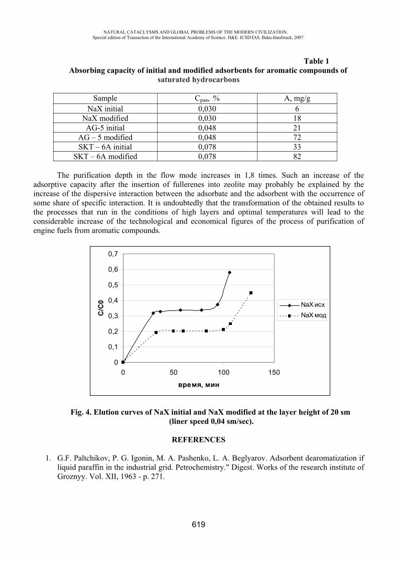
NATURAL CATACLYSMS AND GLOBAL PROBLEMS OF THE MODERN CIVILIZATION. Special edition of Transaction of the International Academy of Science. H&E. ICSD/IAS, Baku-Innsbruck, 2007.
619
Table 1 Absorbing capacity of initial and modified adsorbents for aromatic compounds of
saturated hydrocarbons
Sample , % , mg/g NaX initial 0,030 6
NaX modified 0,030 18 G-5 initial 0,048 21
G – 5 modified 0,048 72 SKT – 6 initial 0,078 33
SKT – 6 modified 0,078 82
The purification depth in the flow mode increases in 1,8 times. Such an increase of the adsorptive capacity after the insertion of fullerenes into zeolite may probably be explained by the increase of the dispersive interaction between the adsorbate and the adsorbent with the occurrence of some share of specific interaction. It is undoubtedly that the transformation of the obtained results to the processes that run in the conditions of high layers and optimal temperatures will lead to the considerable increase of the technological and economical figures of the process of purification of engine fuels from aromatic compounds.
0
0,1
0,2
0,3
0,4
0,5
0,6
0,7
0 50 100 150
,
/0 NaX
NaX
Fig. 4. Elution curves of NaX initial and NaX modified at the layer height of 20 sm (liner speed 0,04 sm/sec).
REFERENCES
1. G.F. Paltchikov, P. G. Igonin, M. A. Pashenko, L. A. Beglyarov. Adsorbent dearomatization if liquid paraffin in the industrial grid. Petrochemistry." Digest. Works of the research institute of Groznyy. Vol. XII, 1963 - p. 271.

NATURAL CATACLYSMS AND GLOBAL PROBLEMS OF THE MODERN CIVILIZATION. Special edition of Transaction of the International Academy of Science. H&E. ICSD/IAS, Baku-Innsbruck, 2007.
620
2. A.R. Martirosov. The development of adsorbent purification process of liquid paraffin’s from aromatic hydrocarbons admixtures. Candidate of Technical Science dissertation. Groznyy, 1986 - p. 136.
3. N.G. Velichkina. Preparation of liquid paraffin’s of high purity for biochemical synthesis. Candidate of Technical Science dissertation. Leningrad, 1982 - p. 128
4. N.F. Bogdanov, V. A. Bogdanova. The development of standard method of the research of petroleum for oils and paraffin’s. The report of the research institute of Groznyy on the topic 29, 1949
THE ENVIRONMENTAL STATUS OF THE ABSHERON PENINSULA OIL FIELDS
E.B. Veliyeva*, I.M. Afandiyeva**
SOCAR, ID Republic of Azerbaijan
As you know, oil and gas production in Azerbaijan began in 1848, while commercial production commenced in the vicinity of Baku in 1871. In 1872, annual oil production amounted 26 thousand tons in Azerbaijan. In 1900, it reached 10 million tons which consisted about half of global crude oil production. Thereafter the country had established a strong raw materials base, which contributed to the fact that the first billion tons of oil was extracted in 1971. The lack of capacities to use efficient or low-waste technology, which required appropriate engineering solutions and financing, caused the environmental tense. At that time despite of a strong soviet legislative framework a lot of environmental problems used to appear. The largest petroleum facilities associated with processing and refinery had an adverse effect on all components of nature in the Absheron Peninsula resulted in a disturbance of the natural balance which led to a critical point of oil wastes pollution. The aforesaid required reforms in legislative basis, techno genesis developing forecast, research and analysis of environmental pollution, environmental standards, treatment and recycling of waste oil, comprehensive environmental monitoring program and funds.
Despite the considerable work carried out to improve environment in the Absheron Peninsula, many current problems still need to resolve in accordance with the accepted international standards. The adopted practice of "Environmental Passports" for identifying basic information related to the impact of production operations on the environment caused specific difficulties. At present, there are differences between international standards and those applicable in Azerbaijan. In particular, as per Azerbaijani standards the MPC for oil in the soil is 5 g/kg, and 0.05 mg/l in water, while in the EU they are stricter.
The reforms policy for environment and economy is one of the key areas to take actions for protecting the environment in Azerbaijan. In this regard, presidential decree “2006-2010- Integrated Plan for Improving Environment in the Republic of Azerbaijan" dated 28 September 2006, was just in time. In accordance with the state program State Oil Company of the Azerbaijan Republic (“SOCAR”) has to perform an extensive work for cleanup and rehabilitation in the producing areas and any other polluted sites related to refinery, including refurbishment of onshore facilities to meet present-day standards. In particular, an action plan to improve the environmental situation in the Bibi- Eybat of Absheron covers 526 ha, a priority area adjacent to the airport is 21 ha, landscape and

NATURAL CATACLYSMS AND GLOBAL PROBLEMS OF THE MODERN CIVILIZATION. Special edition of Transaction of the International Academy of Science. H&E. ICSD/IAS, Baku-Innsbruck, 2007.
621
architectural phased rehabilitation will cover 2705 ha of Karadag, Binagadi, Surakhani and other oil regions in Azerbaijan.
All production facilities related to the petroleum industry cause area pollution in the lack of appropriate conditions. Large quantities of oily soil are formed as a result of technical accidents and spills of environmentally hazardous production facilities. The old onshore fields, such as Bibi-Eybat, Buzovny-Mashtagi, Kala, Zirya and etc. have many problems. Inactive wells, discharge channels, lagoons, separation points, unconfined processes, etc. provide a continuous source of pollution and an adverse environmental impact. They go from bad to worse. Only in the above fields over thousands of inactive and abandoned wells are littering the environment creating additional source for pollution. As of July 1, 2007 the number of SOCAR operational wells fleet is 6169, out of which 4,895 are active wells; 1,261 wells constitute inactive fleet, while the remaining 13 are under development. Many derricks because of their age and corrosion sensitivity are in danger, which requires specific approach. The main environmental objective in the process of wells liquidation should be the protection of aquifers and sealing of hydrocarbon reserves. Inactive but not being conserved wells may pose risks to soil, formation and surface water. Currently, many of the wells are idle waiting for workover. In addition, a planned upgrade of equipment and use of advanced technology will serve to reduce losses and leaks. As a result of discharges various hazardous substances of different significance appear in the environment. In addition to their own natural hydrocarbons and their satellites the pollutants contain numerous reagents, catalysts, SAC, inhibitors, alkalis, acids and other substances. A great danger in the oil producing areas is substantial concentration of water-soluble salts contained in formation liquids or sewages causing profound changes in physical-chemical and morphological properties of soil which includes thereof. Environmental safety of chemicals, often of toxic nature, does not provide a safe environment of the region.
The main source of pollution in the Absheron Peninsula is crude oil. The fields are saturated with crude oil and its heavy fractions. Losses in oil production, leaks from storage, distribution, transportation, processing, etc., and the presence of hundreds of thousands of wells in the oil fields and surrounding areas with various extent of pollution, are considered as ecologically disaster zone. Oil contaminated soils refer to the wastes harmful for the environment. Oil and heavy oil products are not so much toxic, but their high content makes worse water and physical properties of soils becoming fertile. Soils with high concentrations of aromatic hydrocarbons are potentially carcinogenic and mutagenic and have ongoing and sustained impact on the human lives and health. In some fields pollution is not merely in the air, water and soil, but goes out of the territory to the Caspian coastal waters covering them with a thick oily layer. If in the soil environment oil pollution occurs locally, it’ll have an enveloping effect on the plants, animals, birds with water spreading over large areas and having impact on the processes taking place in the marine environment. In particular, bank and the water surface of Qala, Boyuk Shor and other lakes expose to oil pollution and need cleaning.
Another source of pollution is waste oil spills along with produced water. The Absheron petroleum area covers over three thousand km2, and its subsoil contains relatively high content of water. For the past time fields of the Absheron Peninsula have produced more than 30 million cubic meters of water per a year along with oil, and currently about 14 million m3 water annually. Since the beginning of development from 24 oil and gas fields located in the peninsula, they selected 2755722 thousand m3 of associated formation water, including 16427 thousand m3 of associated water in 2006, which is partially discharged into the sea, and the remainder to the onshore. Thus, in the fields Balakhany-Sabunchi- Ramana there were selected only 737,016 thousand m3, equal to the annual flow of 6,524 thousand m3, Bibi Eybat - 547176 thousand m3 while annual quantity being 2068 thousand m3, and from the Surakhani reservoir – 647375 thousand m3 with annual quantity of 4,776 thousand m3. The associated water analyses show traces of accumulation of a number of macro and micro components, which are of interest as a source of mineral raw. The most significant components in sub

NATURAL CATACLYSMS AND GLOBAL PROBLEMS OF THE MODERN CIVILIZATION. Special edition of Transaction of the International Academy of Science. H&E. ICSD/IAS, Baku-Innsbruck, 2007.
622
sea formation water are deemed to be sulphur, paraffin, vanadium, nickel and some heavy metals in the oil content; and hydrogen sulphide, helium, nitrogen, carbon dioxide, propane and higher hydrocarbons in the gas content, as well as salt, potassium, calcium carbonate, lithium, soda, iodine, bromine, boron, strontium, rubidium, cesium, germane and others. Such components in the kind of hydro mineralogical raw materials are expensive. However, use of associated water components in accordance with the existing minimum allowable deductions for micro values not only provide the most cost-effective production, but also increase the value of deposits in the later stages of development, characterized by lower oil debits, high water cut production wells to 95%. In this context, we consider important to extract valuable associated water components from each site jointly with the Japanese Itochu, which has the great experience and advanced technology for producing iodine, bromine and other substances.
The waste and formation water spills in the evaporation fields, sludge pits with the soil base increase the risk of trickling into freshwater horizons, which reduces clean water stock and leads to precipitation, flooding, salts, including highly radiated elements. Release and remove of the sand remained after cleaning of associated produced water sometimes with radioactive substances which are above acceptable standards is a dangerous source of pollution. In some cases, oil leads to the accumulation of the natural radioactivity, and accumulation of large quantities of industrial waste. High content of natural radioactivity in the reservoir water, as well as in oil and gas their extraction is actually dangerous radiation technology, which requires the establishment and implementation of the radiation-protected technology. At present there is a lack of ecologically developed sound technologies to clean up oil and gas equipment from radio barit deposits. In the fields there are abandoned pipes with a scale inside storing high concentrations of natural radio-nuclides, such as radium, strontium and other elements. Despite the potential danger, waste in the form of pipes and sand is often used by local people for construction needs. Health risk for settlers in these territories, even after the treatment thereof is evident, as accumulation of radio-nuclides in the oil fields over a long period of time resulted in the soil buried as a source of radiation. The potential risk assessment associated with the removal and further disposal of radioactive materials and soil thereafter requires a comprehensive study of radiation.
It should be a clear definition of a strategy to restore oil spilled areas depending on the quantity, quality and nature of contamination in planning their future use after restoration. This will allow applying certain methods of soil treatment and technology related thereto and costs assumption as well. Under the Rehabilitation Project it is planned to create a wide-scaled environmental map (1:10000) of the Absheron Peninsula. However the implementation of such plan requires comprehensive environmental studies and detailed topographic maps - geological, radio-ecological in view of the land based equipment, assessment of production facilities and sources of pollution. In this regard, it is necessary to use satellite images. Based on updated cartography of affected sites, a list of detected contaminants is necessary. However, there is a necessity for developing targets and projects for qualitative environmental monitoring and resources based on regulations, waste certifications, including safe gathering and disposal as the lack of advanced infrastructure causes certain problems. Available information is critically important while planning rehabilitation procedures in the affected areas and database established thereon. Comprehensive study of the abiotic and biotic environment in such areas will provide the best method for its restoring, including costs analysis. These factors should be taken into account before rehabilitation method has been selected providing their description in a separate document for each site, which illustrates also a complete analysis of possible environmental risks and budget forecast to conduct operations. One of the main approaches in planning rehabilitation is drafting of a priority list for each site and its further use for business activities.
Considering the aforesaid, it is worth to note that in the Republic of Azerbaijan the main criteria of rational environmental management is determining the level of environmental risk,
NATURAL CATACLYSMS AND GLOBAL PROBLEMS OF THE MODERN CIVILIZATION. Special edition of Transaction of the International Academy of Science. H&E. ICSD/IAS, Baku-Innsbruck, 2007.
623
compliance with the requirements of environmental legislation, the degree of regulatory validity of the measures how to prevent further the adverse environmental impacts. Using up-to-date ecologically safe technology the problems of disposing wastes may be solved by their proper treatment which will provide further sales income from such treatment and regeneration. Upon rehabilitation of the oil polluted area it is necessary to make environmental risk assessment of immediate and remote, economic and demographic impacts of the said facilities while placing offices, buildings and other business facilities, subject to the requirements of existing environmental legislation of the Republic of Azerbaijan.
THE RESEARCH OF ACID RAINS IN THE TERRITORY OF AZERBAIJAN
Sh.P. Bayramov*, R.N. Mahmudov**
*Ministry of Ecology and Natural Resources of the Republic of Azerbaijan, **National Hydrometeorology Department, Scientific-Research Institute
One of the global problems of the modern world worrying the mankind is acid rains which appear in the results of influence of anthropogenic factors connected with the economy activity of men.
When we say acid rains, we mean the acid rains which in the result of their falling on cover (soil, plants, water resources, construction installations and so on) they reflect the free hydrogen ions into the environment.
In the formation of these acid rains the main role plays the chemical compounds, industrial sources and wastes thrown into the atmosphere by the motor transport are anthropogenic sulphur gas and nitrogen dioxide.
The acid rains are that rains which give the free hydrogen ions to the environment. In the case of the distribution of sulphur gas into the atmosphere in the height of 100-300 m,
there appears the distribution of azoth dioxide in the earth’s surface. That is why the chance of entering of sulphur gas into the system of cloud than azoth dioxide is bigger.
The part of emission of sulphur and azoth compounds, near to the wastes sources, also increase in the regions which cover the sources.
Because of free oxygen in its composition, the atmosphere in itself is the system of oxidizing property. Only because the all reactions of sulphur and nitrogen compounds practically is carried in the direction of creation of sulphate and nitrate as the high form of oxidizing.
The washing off sulphur and nitrogen compounds by cloud and rain from the atmosphere firstly happen by transforming the particles or molecule into the drops. It works with mechanism of creation of drops in diffusion, brown diffusion, collision and occupation, gas solubility and condensation nucleus.
The main part of sulphur and nitrogen compounds entering the atmosphere as an aerosol are H2 SO4, (NH4)2 SO4, (NH4)3, NH4 HSO4 and NH4 NO3.It is known, the estimation of balance of rain-water‘s ph is approximately 5-6 and it 2.5.10-6q/ion-l fits to the density of hydrogen ion. Adding of sulphur and nitric acids into the structure of such rain-water increases the density of free hydrogen ions and at the same time decrease the estimation of ph.
So, in the result of pollution of anthropogenic, the rainfalls falling from the atmosphere show the acid factor. The specialists think that in the case of the average velocity of sulphur and nitric oxides in the atmosphere is 20 km/h there can be rainfall which ph is equal to 3.8-4 in the distance of 600 km from the polluted sources.
NATURAL CATACLYSMS AND GLOBAL PROBLEMS OF THE MODERN CIVILIZATION. Special edition of Transaction of the International Academy of Science. H&E. ICSD/IAS, Baku-Innsbruck, 2007.
624
As one of the factors of violence of ecological balance is acid rains which became the problem of the most countries and scientific community. So, when rainfall fall on the surface from the atmosphere in that case there happens the acidification of surface water, salt soil, the destruction of woods, acceleration of corrosion of construction and arrangements.
As an anthropogenic typed, the turning of gases in the atmosphere into the acids through transformation, in the form of acid rains, also there are widely described the dangerous influence on ecosystem in the literature [1, 2].
Generally, the acid rains are the global problems for ecosystem and its solution are in the consideration of leading countries, scientific communities, corresponding governmental powers, international organizations which deals with ecological problems.
As the evidence of it the World Meteorology Organization published the monograph “Global Acid Deposition Assessment” [3] in 1996. With the purpose of studying of factors of acid rains in some industrial developed countries there were generalized the results of researches on their chemical structure.
So, there exists a problem of acid rains and it creates some troubles. That is why it is advisable to research on acid rains. In the connection of speedily development of power engineering and motor transport in the country, there are continuously increased the wastes of chemical compounds-sulphur and nitric oxides into the atmosphere, also in the result of entering of polluting matters into the atmosphere by transboundary transportation and increasing of density of mineral matters in the structure of acid rains from 4-12t/km2 to 17-18t/km2 from north to south of the Republic increase the probability of acid rains in this territories.
The first researches on acid rains were held in the Scientific-Research Institute of Hydrometeorology of Azergovhydromet in 1994 by the author of these lines and their results were published in some works [4-7].
In the territory of Absheron, Baku, Sumgayit, Lenkoran, Ganja, Nakhcheban, Agstafa, Guba, Gabala, Mingechevir, Neftchala by the aim to hold scientific-trsearch works on accounting the average annual value of sulphat, nitrate, chloride ions, falling with rains there have been worked up a table.
In I, II, III columns of table there have been indicated the height of above-mentioned territories in accordance to sea level, multi-mean annual and annual value for five years numbers, took from inquiry materials of rains, falling on those territories.
By the aim to hold scientific analyses there drew up graphics in accordance to that table. The comparison of values of rains, falling on this territory and the sulphat ions, falling by these
rains into the land shows that the great number of rains and sulphat ions are observed in Gabala’s and Lenkoran’s territory. But there is one exception in it. This exception consists of that despite of rains, falling Lenkorans territory mote than 1300 l/m2, the quantity of sulphat ions in that territory’s land is ~10-11 q/m2, but in Gabala by rains on ~850-950 l/m2, the number of sulphat ions is ~24-25 q/m2.
The value of chloride and nitrate ions, falling into the land by the rains as with sulphat ions, depends on characteristics of zones and the pollution level of atmosphere in the rain , falling into the territory, but not on the value of rains.
We cab show that the following for the comparison: of the average annual value of nitrat ions in rains, falling on the territory of Lenkoran is equal to 1322 l/m2 and 4,8 q/m3 accordingly, then in Sumgayit it will be observed in 200 l/m2 and 2,6 q/m2.
Rains change the background of lands on the high level in Gabala’s territory. In this territory the value of sulphat ions, falling with rains consists of 90% of sulphat ions of land composition.
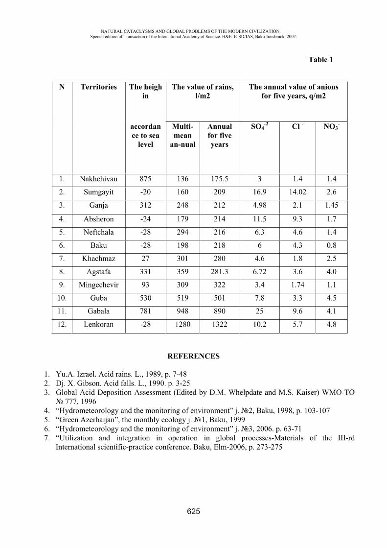
NATURAL CATACLYSMS AND GLOBAL PROBLEMS OF THE MODERN CIVILIZATION. Special edition of Transaction of the International Academy of Science. H&E. ICSD/IAS, Baku-Innsbruck, 2007.
625
Table 1
N Territories The heigh in
The value of rains, l/m2
The annual value of anions for five years, q/m2
accordance to sea
level
Multi-mean
an-nual
Annualfor five years
SO4-2 Cl - NO3
-
1. Nakhchivan 875 136 175.5 3 1.4 1.4
2. Sumgayit -20 160 209 16.9 14.02 2.6
3. Ganja 312 248 212 4.98 2.1 1.45
4. Absheron -24 179 214 11.5 9.3 1.7
5. Neftchala -28 294 216 6.3 4.6 1.4
6. Baku -28 198 218 6 4.3 0.8
7. Khachmaz 27 301 280 4.6 1.8 2.5
8. Agstafa 331 359 281.3 6.72 3.6 4.0
9. Mingechevir 93 309 322 3.4 1.74 1.1
10. Guba 530 519 501 7.8 3.3 4.5
11. Gabala 781 948 890 25 9.6 4.1
12. Lenkoran -28 1280 1322 10.2 5.7 4.8
REFERENCES
1. Yu.A. Izrael. Acid rains. L., 1989, p. 7-48 2. Dj. X. Gibson. Acid falls. L., 1990. p. 3-25 3. Global Acid Deposition Assessment (Edited by D.M. Whelpdate and M.S. Kaiser) WMO-TO
777, 1996 4. “Hydrometeorology and the monitoring of environment” j. 2, Baku, 1998, p. 103-107 5. “Green Azerbaijan”, the monthly ecology j. 1, Baku, 1999 6. “Hydrometeorology and the monitoring of environment” j. 3, 2006. p. 63-71 7. “Utilization and integration in operation in global processes-Materials of the III-rd
International scientific-practice conference. Baku, Elm-2006, p. 273-275
NATURAL CATACLYSMS AND GLOBAL PROBLEMS OF THE MODERN CIVILIZATION. Special edition of Transaction of the International Academy of Science. H&E. ICSD/IAS, Baku-Innsbruck, 2007.
626
PROBLEMS ON PREVENTION AND REMOVAL OF EMERGENCY SITUATIONS IN AZERBAIJAN REPUBLIC
H.O. Ojagov
Azerbaijan University of Architecture Association “FOVGAL”
According to various assessments of the last ten years, as a result of emergency situations, 750 thousand-3 million persons died and 2 billion 110 million persons were injured. It is difficult to assess level of damage inflicted by Emergency Situations. According to data of well-known international insurance companies for 40 years period the value of damage inflicted by ES increased by 14 times. Nevertheless, presently actual economic “value” of ES remains to be unknown due to many reasons. Settlement of the problem on prevention and removal of emergency situations of technical and natural character is the most important direction from activity on provision of balance of national security, defensive capacity and sustainable development in Azerbaijan Republic. Determining factors influencing on formation, development prevention and liquidation of emergency situation in the Republic are as follows
Destroying of natural environment causing intensification of hazardous natural processes. Additionally, it is necessary to take into account, that the large part of the Republic is in seismic zone; Strong industrial development, causing potential hazard to human, flora and fauna. There are numerous companies which operate, using more than twenty types of strong toxic substances in production and storing; New technologies created with great speed and its wide application, synthesis of majority of substances and increase of scale of application of corresponding explosive, flammable and chemical hazardous substances and technologies; Location of potentially hazardous structures and toxic production in vicinity of the residential areas and important life support systems. Directly, about one million people live in primary toxic area, which may cause formation of ES; Low level of readiness of population and specialists in the area of life safety results in formation of 98% ES of anthropogenic character; Accelerated wear of technological equipment, traffic vehicles, pipelines and main production funds; Absence and lack of devices for determination and control of hazardous and toxic factors and collective and personal protection equipment, poor condition; Lack of finances and materials, insufficient financing for fighting against ES;Poor condition of systems providing industrial, transport, energy and agriculture safety, low level of systems on management and provision by information and notification of population;Lack and nonconformance of modern technical means for execution of rescue works; Realization of results of new researches, obtained without authentic scientific data on its safety parameters and requirements, which are harmful for human being and inflict significant social-economic damage; Lack and insufficient level of fundamental and applied researches on provision of systematic complex works on problems on safety of life activity, problems on protection from ES;
NATURAL CATACLYSMS AND GLOBAL PROBLEMS OF THE MODERN CIVILIZATION. Special edition of Transaction of the International Academy of Science. H&E. ICSD/IAS, Baku-Innsbruck, 2007.
627
As one may state, absence of scientific schools, insufficient number of experts, specializing in prevention and removal of ES (very low number).
Certainly, all above enumerated define character of problems of scientific provision and orientation, defines priority of study at researches.
Settlement of the problem, namely, with assistance of science is evidently seen and no proof is required. It is necessary to indicate, provision of safety of life activity as scientific-research object covers many scientific areas and may be studied by means of application of methods and achievements of physics, chemistry, philosophy, economy, pedagogic, cultural science, informatics, psychology, medicine and many other sciences. Nevertheless, it is necessary to raise issue on development of specialized scientific area, dealing with prevention and removal of ES of natural and technogenic character.
This science will integrate not only available knowledge at establishment of individual methodological basis but even will provide development of new fair data and theoretical schemes about activity.
It is necessary to develop big volume of works on development and realization of common state scientific and technical policy in the area of prevention and removal of ES of natural and technogenic nature within the Republic:
to define main direction of development of national science as scientific guarantee of life safety;to plan state scientific-technical program “Emergency situations” for period 2007-2012; To develop complex prediction of scientific technical progress for the Ministry on Emergency Situations; To establish scientific-research institute for safety and problems that of emergency situations and scientific-technical board To establish scientific-research center between departments of ESM and «Life safety».
Additionally, it is necessary to solve numerous problems on prevention and removal of emergency situations taking into account scientific basis, concerning activity on safety provision, it is necessary to establish specialized legal-regulatory structure on safety, along with social, economic, scientific, legal organizational, technical and other components, acquiring features of new completeness, which are integrated and depend on each other; Legislation on safety is to formulate legal conditions of responsibility and interest of all subjects of social life, demanding guarantee of rational economic protection and realistic from technical viewpoint. As starting point of establishment and justification of legislation about scientific research and safety it is important to develop scientific and practical explanation of Laws of Azerbaijan Republic «About fire safety», «about civil protection», «About radiation protection of population», «About industrial safety of production organizations. Crucial point is the issue of undertaking of complex economic measures, providing returning of additional expenses, as a result of decrease of losses from ES and spending finances to safety system. Researches on economic evaluation of results of fire, industrial accidents, natural and natural technogenic and transport accidents are current. Development of such methodology will allow justifying the strategy of removal and prevention of accident. Taking into account inflicted loss and also minimizing its losses. It is necessary to conduct scientific research on detection of hazard and risks, and risk problems. System allowing evaluating quickly and correctly the risk of formation of ES and to assist at prediction of losses inflicted by them is to be established. As a result, state and concerned organizations will have fair attitude to evaluation of formed risk as a result of ES and on base of this they will undertake necessary preventive measures.
NATURAL CATACLYSMS AND GLOBAL PROBLEMS OF THE MODERN CIVILIZATION. Special edition of Transaction of the International Academy of Science. H&E. ICSD/IAS, Baku-Innsbruck, 2007.
628
One of the options of solution of indicated problem is realization of obligatory insurance civil liability of potentially hazardous organizations within the Republic. This measure will allow not only creating necessary conditions for compensation of losses, inflicted to organizations and citizens, but will serve as economic stimulation factor for strengthening of safety.
For provision of life safety it is necessary to develop and realize complex measures – organizational and pedagogical systems. Its main components are as follows:
For permanent readiness of population to prevent and protect from ES of natural and technogenic character (two blocks- of general civil and vocational), it is necessary to provide training of people and safe life activity determined by stability, which guarantees safety of person and society; Training of specialists of rescue services is conducted by experts, providing positions on special vocational training directed for prevention and removal of ES with features of sustainability, durability, quickness and optimal approach.
As a result of settlement of organizational-management problems it is possible to achieve high productivity of savings of additional provisional sources and finances. They compose scientific justification of optimization of structure of divisions of ESM, number and function and generally, capacity and facilities of state system on prevention and removal of ES. Development of information-management system from scientific point of view, dispatching of complex monitoring of ES, software systems, fire and industrial safety systems, development of effective technologies, coordination, establishment of means and methods of control-inspection, inspection-preventive and operative- tactic activity means, correct decisions, quick response, adoption and provision of realization is important. It is necessary to establish automated analytic –information basis. Expansion of development of modern technical and chemical equipment. These are new means removing accidents, where oil, oil products, microbiological preparations were used, which allows cleaning soil water basins from pollution hydrocarbon. Fire extinguishers extinguishing fire caused by oil and oil products based on fluoric surface-active substances, allow not only forming film stopping evaporation of solutions on surface of hydrocarbon liquids but make possible extinguishing flame of fire, and even protects from repeated fire. At formation of machine intellect in future it is necessary to take into consideration the automatic division of accidents. There is no scientific alternative basis for provision of life safety at modern development of the society. Indicated result is proved locally and in foreign countries by different experience on ES. Presently provision of safety requires establishment not only technologies, methods and equipment for protection of population from different hazards, but also establishment of corresponding social economic mechanism. It is necessary to evaluate safety problem of the society from these positions in close relationship with problem of its transfer to sustainable development. Presently it is not possible to realize protection of civilization disasters without changing of direction of existing development of society. The cases comprising prevalence of social development type are formed and this increases different hazards. Eventually, prevention of hazards and protection against them becomes non effective, specific features not considered as progressive appear and problems depending on decision of human existence arise. First of all, it is necessary to define direction of national scientific development, as scientific guarantee of safety of life activity. Along with this, presently, the most actual issue– how at economic, financial and product availability to organize high level protection of human being from outcomes of technogenic hazardous factors. What is the priority task? Protection of population and area from ES requires new principal approach to problem and to its solution.
NATURAL CATACLYSMS AND GLOBAL PROBLEMS OF THE MODERN CIVILIZATION. Special edition of Transaction of the International Academy of Science. H&E. ICSD/IAS, Baku-Innsbruck, 2007.
629
Joint decrease of technogenic and natural risk creates in conditions of ES great number of problems with specific features of fundamental and applied character and creation of effective system, planning and operational management in corporative complex of measures on prevention and removing of ES. It may be caused by absence of complex results of emergency situations, economical evaluation, scientific explanation, insufficient level of economic development of adopted decisions and non-effectiveness of undertaken measures in some cases. Development of such method will enable justifying strategy on prevention and removal of disasters, taking into account inflicted loss, will minimize loss. And this in its turn, will assist in establishment of economical bases for expertise of projects, elaboration of requirements concerning production of potentially hazardous technologies, development of economic norms and standards on safety of life activity. With aim to prevent death of people and to minimize social-economic damage, inflicted, as a result of natural and technogenic character ES, Ministry of Emergency Situations of Azerbaijan Republic is to provide, as its primary direction, state policy:
Establishment of effective state policy on prevention and removal of emergency situations; for increase of safety and protection of human being and enterprises as a result of ES to form material-economic mechanism, stimulation activity in macro and micro level; provision by training on safety of life activity; provision by modern technical and chemical equipment for localization and prevention of results of emergency situations, control on radiation; provision of establishment of machine-software complex for quick influence on ES; medical rehabilitation of persons, subjected to physical, psychic and emotional strain as a result of ES. To achieve the following by means of undertaking measures in prevention and removal of
emergency situations: by preventing and removing of emergency situations and its results, primarily as the result of significant decrease of economic loss to provide sustainability of economic growth; at the cost of high effectiveness of their application optimization of social issues for provision of technogenic and fire safety; decrease of technogenic and fire hazard, as a result of occurrence of tragic social-economic and ecological ES may be excluded; for prevention of emergency situations, establishment of new effective local (national) methods and means, conducting of rescue and fire extinguishing works; for prevention and removal of emergency situations to replace imported equipment and facilities by local (national) equipment. At the cost of elaboration of technologies, applied in enterprises of Azerbaijan Republic opening of new working places and increase of employment of population.
System of measures on prevention and removal of emergency situations in Azerbaijan Republic is to provide formation of new quality, new cultural level of society, and at the same time, protection from ES, establishment of harmonic relations both with natural and man-made environment.
REFERENCES
1. H. . djagov. Problems of control of ES. Monograph. Baku 1999. 2. H. . djagov. Problems and protection of State from Emergency Situations of XXI century,
Prospective information technologies and problems of risk management at the threshold of new millennium. Scientific works «White nights-2000» Saint-Petersburg, pag. 325.
NATURAL CATACLYSMS AND GLOBAL PROBLEMS OF THE MODERN CIVILIZATION. Special edition of Transaction of the International Academy of Science. H&E. ICSD/IAS, Baku-Innsbruck, 2007.
630
3. H. . djagov «Main directions of researches on development of regulatory-legal base in emergency situations of natural and technogenic character in Azerbaijan Republic». International Scientific-Practical conference (ISPC) «Human and disasters. Protection of human and society at emergency situations at the threshold of the third millennium, problems of management of ES and improvement of training» 17-18 September 2001, Reports and speeches. Baku, 2001.
4. H. . djagov «Cyclic processes, causing emergency situations and measures on mitigation of its consequences» Materials of the second international symposium «Problems of rhythms in natural science». Moscow 1-3 March 2004, pag. 296.
5. H. . djagov «Division of Azerbaijan territory into regions on load of risks onto environment taking into account factors of natural and technogenic character». Magazine «Problems of safety at emergency situations» 2, 2006, Moscow.
NONLINEAR RESPONSE ASSESSMENT OF SHEAR WALL STRUCTURES
P. Gulkan, I. Kazaz and A. Yakut Earthquake Engineering Research Center
Disaster Management Research Center Department of Civil Engineering, Middle East Technical University, Ankara, Turkey
Abstract: Seismic response of a lightly reinforced stiff shear wall structure subjected to ground motions classified as near- or far-field according to their distance to causative faults is investigated. A model structure that has previously been studied both experimentally and analytically in the context of a coordinated research project is re-examined. The structural model is a five-story lightly reinforced shear wall, subjected analytically to 55 different ground motion records on firm soil sites. Several response parameters are obtained by linear and nonlinear analyses. Additional analyses are performed to investigate the validity and range of applicability of the most widely used approximate displacement based analysis procedures. The approximate procedures considered in the study are found to be deficient in representing the actual response of the structure employed here regardless of the type of excitation, so modifications are suggested for improved results.
Keywords: near-field, far-field, approximate procedure, reinforced concrete shear wall, pushover analysis
Introduction Recent focus on the use of simplified procedures in performance-based earthquake engineering
has led to comprehensive research resulting in improved techniques applicable for buildings with generally regular geometrical and structural features. These methods are intended to provide basically an adequate level of equivalent linearization applicable to these types of systems so that the calculated nonlinear deformations match results calculated for linear systems of varying complexity. It should be recalled that all linearization techniques are designed to minimize the error in this calculation. In the final analysis the performance of performance based methods has not been tested by nature, so the goodness of a given method is assessed against results calculated for another method or technique. In this article we examine the accuracy of a number of commonly used methods in calculating the
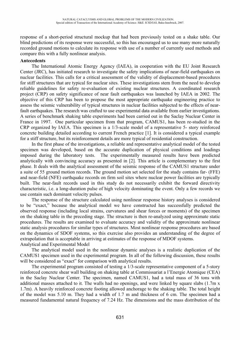
NATURAL CATACLYSMS AND GLOBAL PROBLEMS OF THE MODERN CIVILIZATION. Special edition of Transaction of the International Academy of Science. H&E. ICSD/IAS, Baku-Innsbruck, 2007.
631
response of a short-period structural mockup that had been previously tested on a shake table. Our blind predictions of its response were successful, so this has encouraged us to use many more naturally recorded ground motions to calculate its response with use of a number of currently used methods and compare this with a fully nonlinear analysis. Antecedents
The International Atomic Energy Agency (IAEA), in cooperation with the EU Joint Research Center (JRC), has initiated research to investigate the safety implications of near-field earthquakes on nuclear facilities. This calls for a critical assessment of the validity of displacement-based procedures for stiff structures that are typical for nuclear sites. These investigations stem from the need to develop reliable guidelines for safety re-evaluation of existing nuclear structures. A coordinated research project (CRP) on safety significance of near fault earthquakes was launched by IAEA in 2002. The objective of this CRP has been to propose the most appropriate earthquake engineering practice to assess the seismic vulnerability of typical structures in nuclear facilities subjected to the effects of near-fault earthquakes. The research was crafted to use experimental data available from earlier investigations. A series of benchmark shaking table experiments had been carried out in the Saclay Nuclear Center in France in 1997. One particular specimen from that program, CAMUS1, has been re-studied in the CRP organized by IAEA. This specimen is a 1/3-scale model of a representative 5- story reinforced concrete building detailed according to current French practice [1]. It is considered a typical example for a stiff structure, but its reinforcement details are more typical of residential construction.
In the first phase of the investigations, a reliable and representative analytical model of the tested specimen was developed, based on the accurate duplication of physical conditions and loadings imposed during the laboratory tests. The experimentally measured results have been predicted analytically with convincing accuracy as presented in [2]. This article is complementary to the first phase. It deals with the analytical assessment of the seismic response of the CAMUS1 structure under a suite of 55 ground motion records. The ground motion set selected for the study contains far- (FFE) and near-field (NFE) earthquake records on firm soil sites where nuclear power facilities are typically built. The near-fault records used in this study do not necessarily exhibit the forward directivity characteristic, i.e. a long-duration pulse of high velocity dominating the event. Only a few records we use contain such dominant velocity pulses.
The response of the structure calculated using nonlinear response history analyses is considered to be “exact,” because the analytical model we have constructed has successfully predicted the observed response (including local strains, curvatures and shear forces or moments) of the specimen on the shaking table in the preceding stage. The structure is then re-analyzed using approximate static procedures. The results are examined to evaluate accuracy and validity of the approximate nonlinear static analysis procedures for similar types of structures. Most nonlinear response procedures are based on the dynamics of SDOF systems, so this exercise also provides an understanding of the degree of extrapolation that is acceptable in arriving at estimates of the response of MDOF systems. Analytical and Experimental Model
The analytical model used in the nonlinear dynamic analyses is a realistic duplication of the CAMUS1 specimen used in the experimental program. In all of the following discussion, these results will be considered as “exact” for comparison with analytical results.
The experimental program consisted of testing a 1/3-scale representative component of a 5-story reinforced concrete shear wall building on shaking table at Commissariat a l’Energie Atomique (CEA) in the Saclay Nuclear Center. The specimen, named CAMUS1, had a total mass of 36 tons with additional masses attached to it. The walls had no openings, and were linked by square slabs (1.7m x 1.7m). A heavily reinforced concrete footing allowed anchorage to the shaking table. The total height of the model was 5.10 m. They had a width of 1.7 m and thickness of 6 cm. The specimen had a measured fundamental natural frequency of 7.24 Hz. The dimensions and the mass distribution of the
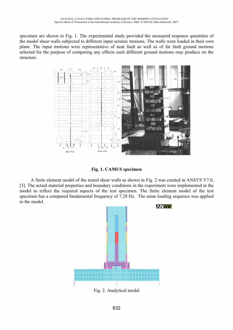
NATURAL CATACLYSMS AND GLOBAL PROBLEMS OF THE MODERN CIVILIZATION. Special edition of Transaction of the International Academy of Science. H&E. ICSD/IAS, Baku-Innsbruck, 2007.
632
specimen are shown in Fig. 1. The experimental study provided the measured response quantities of the model shear walls subjected to different input seismic motions. The walls were loaded in their own plane. The input motions were representative of near fault as well as of far fault ground motions selected for the purpose of comparing any effects such different ground motions may produce on the structure.
510
25
20
1020
2550 25 25 50 50
30 100100
60
90
10
21
21
6
90
90
90
90
40405 540
170
Front ViewSide View
25
30
20
55
Fig. 1. CAMUS specimen
A finite element model of the tested shear walls as shown in Fig. 2 was created in ANSYS V7.0, [3]. The actual material properties and boundary conditions in the experiment were implemented in the model to reflect the required aspects of the test specimen. The finite element model of the test specimen has a computed fundamental frequency of 7.28 Hz. The same loading sequence was applied to the model.
Fig. 2. Analytical model
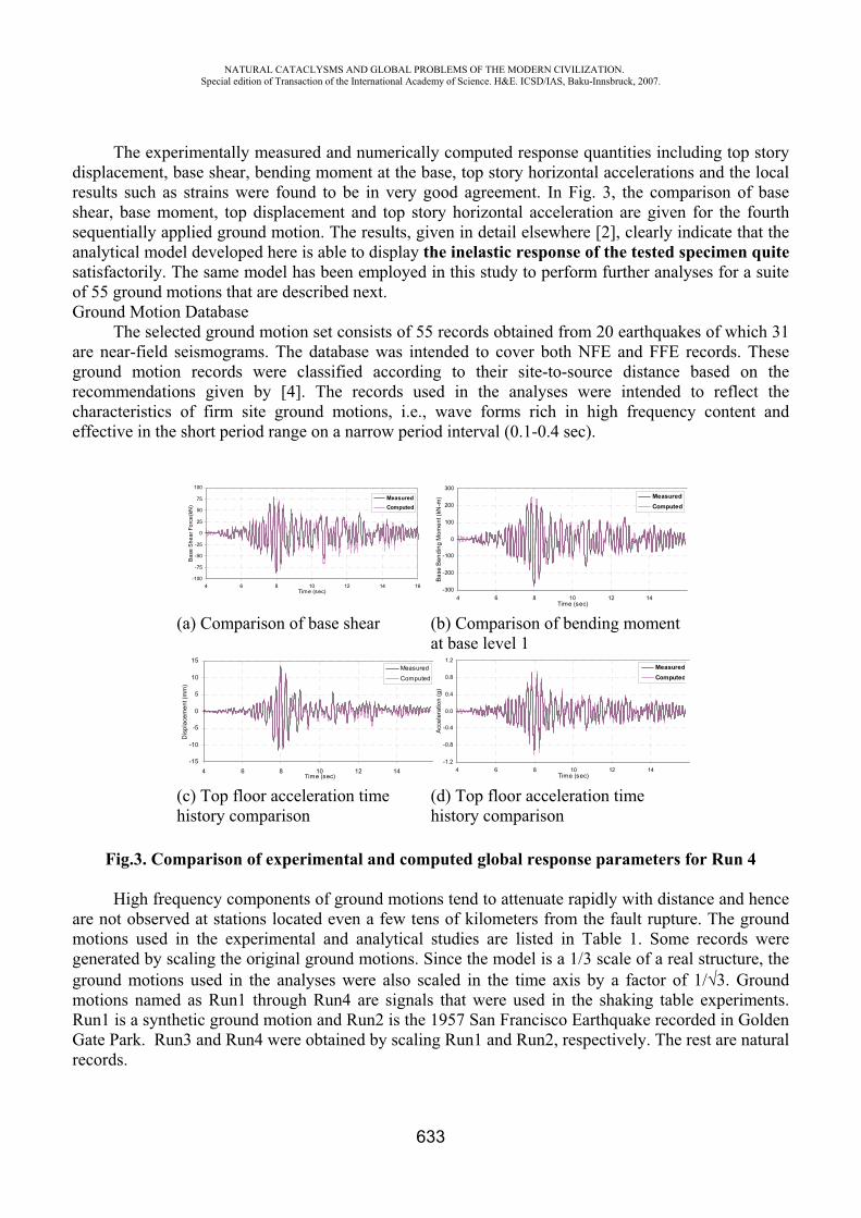
NATURAL CATACLYSMS AND GLOBAL PROBLEMS OF THE MODERN CIVILIZATION. Special edition of Transaction of the International Academy of Science. H&E. ICSD/IAS, Baku-Innsbruck, 2007.
633
The experimentally measured and numerically computed response quantities including top story displacement, base shear, bending moment at the base, top story horizontal accelerations and the local results such as strains were found to be in very good agreement. In Fig. 3, the comparison of base shear, base moment, top displacement and top story horizontal acceleration are given for the fourth sequentially applied ground motion. The results, given in detail elsewhere [2], clearly indicate that the analytical model developed here is able to display the inelastic response of the tested specimen quitesatisfactorily. The same model has been employed in this study to perform further analyses for a suite of 55 ground motions that are described next. Ground Motion Database
The selected ground motion set consists of 55 records obtained from 20 earthquakes of which 31 are near-field seismograms. The database was intended to cover both NFE and FFE records. These ground motion records were classified according to their site-to-source distance based on the recommendations given by [4]. The records used in the analyses were intended to reflect the characteristics of firm site ground motions, i.e., wave forms rich in high frequency content and effective in the short period range on a narrow period interval (0.1-0.4 sec).
-100
-75
-50
-25
0
25
50
75
100
4 6 8 10 12 14 16Time (sec)
Bas
e S
hear
For
ce(k
N)
MeasuredComputed
-300
-200
-100
0
100
200
300
4 6 8 10 12 14Time (sec)
Base
Ben
ding
Mom
ent (
kN-m
) MeasuredComputed
(a) Comparison of base shear (b) Comparison of bending moment at base level 1
-15
-10
-5
0
5
10
15
4 6 8 10 12 14Time (sec)
Dis
plac
emen
t (m
m)
Measured
Computed
-1.2
-0.8
-0.4
0.0
0.4
0.8
1.2
4 6 8 10 12 14Time (sec)
Acc
eler
atio
n (g
)
MeasuredComputed
(c) Top floor acceleration time history comparison
(d) Top floor acceleration time history comparison
Fig.3. Comparison of experimental and computed global response parameters for Run 4
High frequency components of ground motions tend to attenuate rapidly with distance and hence are not observed at stations located even a few tens of kilometers from the fault rupture. The ground motions used in the experimental and analytical studies are listed in Table 1. Some records were generated by scaling the original ground motions. Since the model is a 1/3 scale of a real structure, the ground motions used in the analyses were also scaled in the time axis by a factor of 1/ 3. Ground motions named as Run1 through Run4 are signals that were used in the shaking table experiments. Run1 is a synthetic ground motion and Run2 is the 1957 San Francisco Earthquake recorded in Golden Gate Park. Run3 and Run4 were obtained by scaling Run1 and Run2, respectively. The rest are natural records.
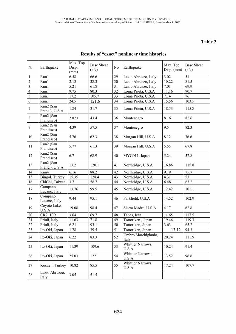
NATURAL CATACLYSMS AND GLOBAL PROBLEMS OF THE MODERN CIVILIZATION. Special edition of Transaction of the International Academy of Science. H&E. ICSD/IAS, Baku-Innsbruck, 2007.
634
Table 2
Results of “exact” nonlinear time histories
N. Earthquake Max. Top Disp. (mm)
Base Shear (kN) No Earthquake Max. Top
Disp. (mm) Base Shear (kN)
1 Run1 6.58 66.6 29 Lazio Abruzzo, Italy 3.02 51 2 Run1 2.13 38.3 30 Lazio Abruzzo, Italy 10.22 81.5 3 Run1 5.21 61.8 31 Lazio Abruzzo, Italy 7.01 69.9 4 Run1 9.75 80.3 32 Loma Prieta, U.S.A 11.16 90.7 5 Run1 17.2 105.7 33 Loma Prieta, U.S.A 7.14 76 6 Run1 24.5 121.6 34 Loma Prieta, U.S.A 15.56 103.5
7 Run2 (San Franc.), U.S.A 1.84 31.7 35 Loma Prieta, U.S.A 18.53 115.8
8 Run2 (San Francisco) 2.823 43.4 36 Montenegro 8.16 82.6
9 Run2 (San Francisco) 4.39 57.5 37 Montenegro 9.5 82.3
10 Run2 (San Francisco) 5.76 62.3 38 Morgan Hill, U.S.A 8.12 76.6
11 Run2 (San Francisco) 5.77 61.3 39 Morgan Hill, U.S.A 5.55 67.8
12 Run2 (San Francisco) 6.7 68.9 40 MYG011, Japan 5.24 57.8
13 Run2 (San Franc.), U.S.A 13.2 120.1 41 Northridge, U.S.A 16.86 115.8
14 Run4 6.16 88.2 42 Northridge, U.S.A 9.19 75.7 15 Bingöl, Turkey 15.35 128.4 43 Northridge, U.S.A 4.31 53 16 ChiChi, Taiwan 3.7 58.7 44 Northridge, U.S.A 6.48 63.2
17 Compano Lucano, Italy 13.76 99.5 45 Northridge, U.S.A 12.42 101.1
18 Compano Lucano, Italy 9.44 95.1 46 Parkfield, U.S.A 14.52 102.9
19 Coyote Lake, U.S.A 19.08 98.4 47 Sierra Madre, U.S.A 4.17 62.8
20 CR2_10R 3.64 69.7 48 Tabas, Iran 11.65 117.5 21 Friuli, Italy 11.63 71.8 49 Tottoriken , Japan 19.46 119.3 22 Friuli, Italy 6.21 93.1 50 Tottoriken, Japan 3.63 65.2 23 Ito-Oki, Japan 1.78 39.5 51 Tottoriken, Japan 13.12 94.3
24 Ito-Oki, Japan 6.22 83.3 52 Umbro Marchigianio, Italy 20.24 111.9
25 Ito-Oki, Japan 11.39 109.6 53 Whittier Narrows, U.S.A 10.24 91.4
26 Ito-Oki, Japan 25.03 122 54 Whittier Narrows, U.S.A 13.52 96.6
27 Kocaeli, Turkey 10.82 85.5 55 Whittier Narrows, U.S.A 17.24 107.7
28 Lazio Abruzzo, Italy 3.05 51.5
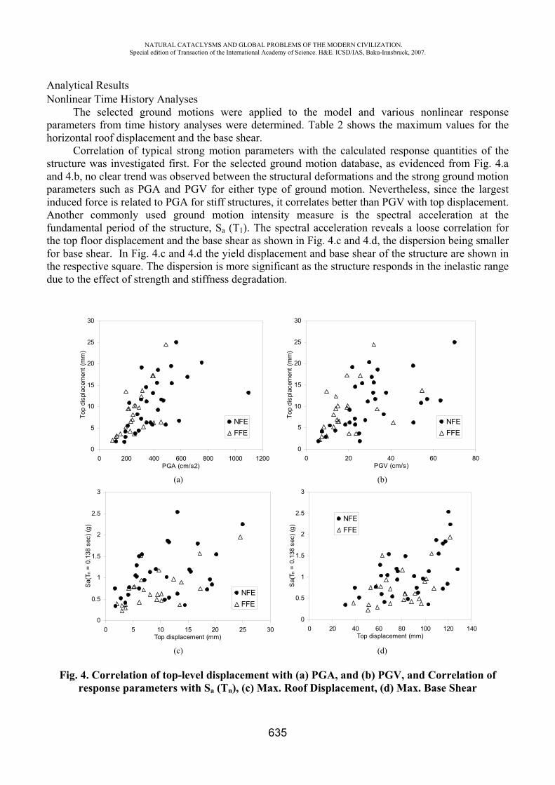
NATURAL CATACLYSMS AND GLOBAL PROBLEMS OF THE MODERN CIVILIZATION. Special edition of Transaction of the International Academy of Science. H&E. ICSD/IAS, Baku-Innsbruck, 2007.
635
Analytical Results Nonlinear Time History Analyses
The selected ground motions were applied to the model and various nonlinear response parameters from time history analyses were determined. Table 2 shows the maximum values for the horizontal roof displacement and the base shear.
Correlation of typical strong motion parameters with the calculated response quantities of the structure was investigated first. For the selected ground motion database, as evidenced from Fig. 4.a and 4.b, no clear trend was observed between the structural deformations and the strong ground motion parameters such as PGA and PGV for either type of ground motion. Nevertheless, since the largest induced force is related to PGA for stiff structures, it correlates better than PGV with top displacement. Another commonly used ground motion intensity measure is the spectral acceleration at the fundamental period of the structure, Sa (T1). The spectral acceleration reveals a loose correlation for the top floor displacement and the base shear as shown in Fig. 4.c and 4.d, the dispersion being smaller for base shear. In Fig. 4.c and 4.d the yield displacement and base shear of the structure are shown in the respective square. The dispersion is more significant as the structure responds in the inelastic range due to the effect of strength and stiffness degradation.
0
5
10
15
20
25
30
0 200 400 600 800 1000 1200PGA (cm/s2)
Top
disp
lace
men
t (m
m)
NFEFFE
0
5
10
15
20
25
30
0 20 40 60 80PGV (cm/s)
Top
disp
lace
men
t (m
m)
NFEFFE
(a) (b)
0
0.5
1
1.5
2
2.5
3
0 5 10 15 20 25 30Top displacement (mm)
Sa(
T n =
0.1
38 s
ec) (
g)
NFEFFE
0
0.5
1
1.5
2
2.5
3
0 20 40 60 80 100 120 140Top displacement (mm)
Sa(
T n =
0.1
38 s
ec) (
g)
NFEFFE
(c) (d)
Fig. 4. Correlation of top-level displacement with (a) PGA, and (b) PGV, and Correlation of response parameters with Sa (Tn), (c) Max. Roof Displacement, (d) Max. Base Shear
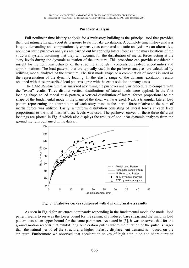
NATURAL CATACLYSMS AND GLOBAL PROBLEMS OF THE MODERN CIVILIZATION. Special edition of Transaction of the International Academy of Science. H&E. ICSD/IAS, Baku-Innsbruck, 2007.
636
Pushover Analysis
Full nonlinear time history analysis for a multistory building is the principal tool that provides the most intimate insight about its response to earthquake excitations. A complete time history analysis is quite demanding and computationally expensive as compared to static analysis. As an alternative, nonlinear static pushover analyses are carried out by applying lateral forces at the mass locations of the structural system, assuming that they will account for the distribution of inertia forces acting at the story levels during the dynamic excitation of the structure. This procedure can provide considerable insight for the nonlinear behavior of the structure although it conceals unresolved uncertainties and approximations. The load patterns that are typically used in the pushover analyses are calculated by utilizing modal analyses of the structure. The first mode shape or a combination of modes is used as the representation of the dynamic loading. In the elastic range of the dynamic excitation, results obtained with these prescribed load patterns agree with the exact solution in many cases.
The CAMUS structure was analyzed next using the pushover analysis procedure to compare with the “exact” results. Three distinct vertical distributions of lateral loads were applied. In the first loading shape called modal push pattern, a vertical distribution of lateral forces proportional to the shape of the fundamental mode in the plane of the shear wall was used. Next, a triangular lateral load pattern representing the contribution of each story mass to the inertia force relative to the sum of inertia forces was utilized. Lastly, a uniform distribution consisting of lateral forces at each level proportional to the total mass at these levels was used. The pushover curves of these three different loadings are plotted in Fig. 5 which also displays the results of nonlinear dynamic analyses from the ground motions contained in the dataset.
0
20
40
60
80
100
120
140
160
0 5 10 15 20 25 30 35 40 45Top displacement (mm)
Bas
e S
hear
(kN
)
Modal Load PatternTriangular Load PatternUniform Load PatternNFE dynamic analysisFFE dynamic analysis
Fig. 5. Pushover curves compared with dynamic analysis results
As seen in Fig. 5 for structures dominantly responding in the fundamental mode, the modal load pattern seems to serve as the lower bound for the seismically induced base shear, and the uniform load pattern acts as an upper bound for the same parameter. As stated in [5], it was observed that for the ground motion records that exhibit long acceleration pulses where the duration of the pulse is larger than the natural period of the structure, a higher inelastic displacement demand is induced on the structure. Furthermore we observed that acceleration spikes of high amplitude and short duration
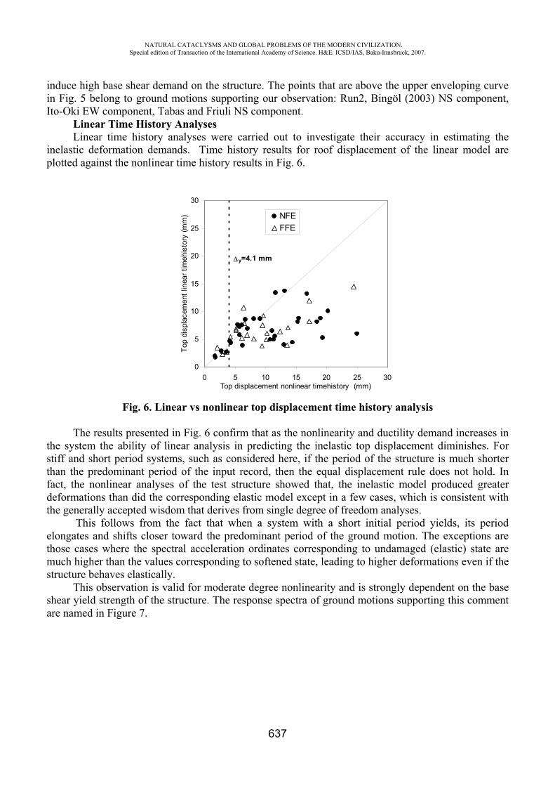
NATURAL CATACLYSMS AND GLOBAL PROBLEMS OF THE MODERN CIVILIZATION. Special edition of Transaction of the International Academy of Science. H&E. ICSD/IAS, Baku-Innsbruck, 2007.
637
induce high base shear demand on the structure. The points that are above the upper enveloping curve in Fig. 5 belong to ground motions supporting our observation: Run2, Bingöl (2003) NS component, Ito-Oki EW component, Tabas and Friuli NS component.
Linear Time History Analyses Linear time history analyses were carried out to investigate their accuracy in estimating the
inelastic deformation demands. Time history results for roof displacement of the linear model are plotted against the nonlinear time history results in Fig. 6.
Fig. 6. Linear vs nonlinear top displacement time history analysis
The results presented in Fig. 6 confirm that as the nonlinearity and ductility demand increases in the system the ability of linear analysis in predicting the inelastic top displacement diminishes. For stiff and short period systems, such as considered here, if the period of the structure is much shorter than the predominant period of the input record, then the equal displacement rule does not hold. In fact, the nonlinear analyses of the test structure showed that, the inelastic model produced greater deformations than did the corresponding elastic model except in a few cases, which is consistent with the generally accepted wisdom that derives from single degree of freedom analyses.
This follows from the fact that when a system with a short initial period yields, its period elongates and shifts closer toward the predominant period of the ground motion. The exceptions are those cases where the spectral acceleration ordinates corresponding to undamaged (elastic) state are much higher than the values corresponding to softened state, leading to higher deformations even if the structure behaves elastically.
This observation is valid for moderate degree nonlinearity and is strongly dependent on the base shear yield strength of the structure. The response spectra of ground motions supporting this comment are named in Figure 7.
0
5
10
15
20
25
30
0 5 10 15 20 25 30Top displacement nonlinear timehistory (mm)
Top
disp
lace
men
t lin
ear t
imeh
isto
ry (m
m) NFE
FFE
y=4.1 mm
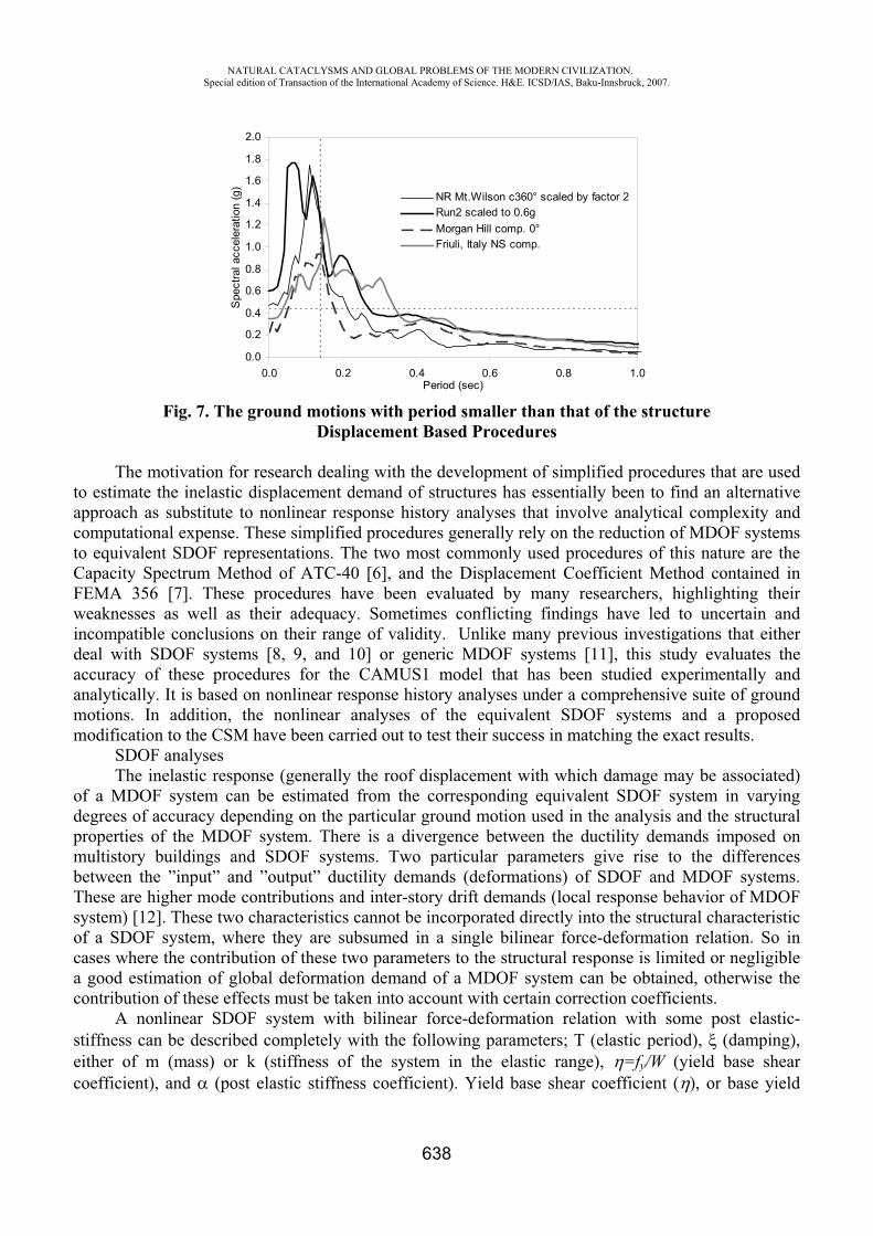
NATURAL CATACLYSMS AND GLOBAL PROBLEMS OF THE MODERN CIVILIZATION. Special edition of Transaction of the International Academy of Science. H&E. ICSD/IAS, Baku-Innsbruck, 2007.
638
0.0
0.2
0.4
0.6
0.8
1.0
1.2
1.4
1.6
1.8
2.0
0.0 0.2 0.4 0.6 0.8 1.0Period (sec)
Spe
ctra
l acc
eler
atio
n (g
)
NR Mt.Wilson c360° scaled by factor 2Run2 scaled to 0.6gMorgan Hill comp. 0°Friuli, Italy NS comp.
Fig. 7. The ground motions with period smaller than that of the structure Displacement Based Procedures
The motivation for research dealing with the development of simplified procedures that are used to estimate the inelastic displacement demand of structures has essentially been to find an alternative approach as substitute to nonlinear response history analyses that involve analytical complexity and computational expense. These simplified procedures generally rely on the reduction of MDOF systems to equivalent SDOF representations. The two most commonly used procedures of this nature are the Capacity Spectrum Method of ATC-40 [6], and the Displacement Coefficient Method contained in FEMA 356 [7]. These procedures have been evaluated by many researchers, highlighting their weaknesses as well as their adequacy. Sometimes conflicting findings have led to uncertain and incompatible conclusions on their range of validity. Unlike many previous investigations that either deal with SDOF systems [8, 9, and 10] or generic MDOF systems [11], this study evaluates the accuracy of these procedures for the CAMUS1 model that has been studied experimentally and analytically. It is based on nonlinear response history analyses under a comprehensive suite of ground motions. In addition, the nonlinear analyses of the equivalent SDOF systems and a proposed modification to the CSM have been carried out to test their success in matching the exact results.
SDOF analyses The inelastic response (generally the roof displacement with which damage may be associated)
of a MDOF system can be estimated from the corresponding equivalent SDOF system in varying degrees of accuracy depending on the particular ground motion used in the analysis and the structural properties of the MDOF system. There is a divergence between the ductility demands imposed on multistory buildings and SDOF systems. Two particular parameters give rise to the differences between the ”input” and ”output” ductility demands (deformations) of SDOF and MDOF systems. These are higher mode contributions and inter-story drift demands (local response behavior of MDOF system) [12]. These two characteristics cannot be incorporated directly into the structural characteristic of a SDOF system, where they are subsumed in a single bilinear force-deformation relation. So in cases where the contribution of these two parameters to the structural response is limited or negligible a good estimation of global deformation demand of a MDOF system can be obtained, otherwise the contribution of these effects must be taken into account with certain correction coefficients.
A nonlinear SDOF system with bilinear force-deformation relation with some post elastic-stiffness can be described completely with the following parameters; T (elastic period), (damping), either of m (mass) or k (stiffness of the system in the elastic range), =fy/W (yield base shear coefficient), and (post elastic stiffness coefficient). Yield base shear coefficient ( ), or base yield
NATURAL CATACLYSMS AND GLOBAL PROBLEMS OF THE MODERN CIVILIZATION. Special edition of Transaction of the International Academy of Science. H&E. ICSD/IAS, Baku-Innsbruck, 2007.
639
strength (fy), given in Eq. (3.1) is determined in the design stage for a desired ductility level under a postulated ground motion effect that defines the constant ductility response spectrum.
WgA
f yy (3.1)
In the above equation, Ay is the pseudo acceleration corresponding to yielding of the SDOF system with pre-defined ductility level and W is the weight of the structure.
To determine the response of the CAMUS structure by employing equivalent SDOF systems, a representative SDOF model of the MDOF structure was obtained. The accuracy of this approximate procedure depends strongly on how well various structural aspects of the MDOF are represented by the corresponding SDOF system. Examination of the pushover curves obtained for the three aforementioned lateral load patterns revealed that the triangular load pattern provides the best representation of the dynamic behavior for all ground motions except those with high amplitude acceleration spikes, so it has been used for further analyses. It is also important to note that the change in the initial slope of pushover curve due to bilinearization also requires a change in the natural period of the system that is modified with Te=Tn.(Ki/Ke)0.5. The following steps were implemented to convert bilinear MDOF system’s capacity curve to that of SDOF counterpart.
1. In constructing a relation between the MDOF system and its equivalent SDOF system, a widely accepted procedure that is based on the fundamental mode properties of the MDOF system was used. The horizontal axis of the load deformation curve describing the global roof displacement was divided by the factor PF1 which is the modal participation factor for the first mode obtained by assuming that the mode shape is normalized to unity at the top of the structure, Eq. (3.2).
2.1
T1
T1
1 .M..M.1
PF . (3.2)
3. We note that, to keep the effective period (Te) and damping ratio ( ) of the corresponding SDOF system the same as the fundamental mode properties of the multistory structure, we can either use the total weight of the MDOF structure (W), and derive a new elastic stiffness (Ke
*)by using Eq. (3.3), or by keeping the elastic stiffness (Ke) of the bilinear curve constant we can calculate a modified weight for structure (W*). Regardless of which weight and elastic stiffness pair is used, they must give the same elastic period calculated by Eq. (3.3).
4.K
W/g2T . (3.3)
5. By using the initial stiffness (Ke*) of the pushover curve, the yield base shear value
[fy=( y/PF1).Ke* ] for SDOF system is calculated.
6. Lastly, .Ke* will define the post elastic strain hardening stiffness of the SDOF system. In
Table 3, the force-deformation parameters used for SDOF analysis are given for both cases.
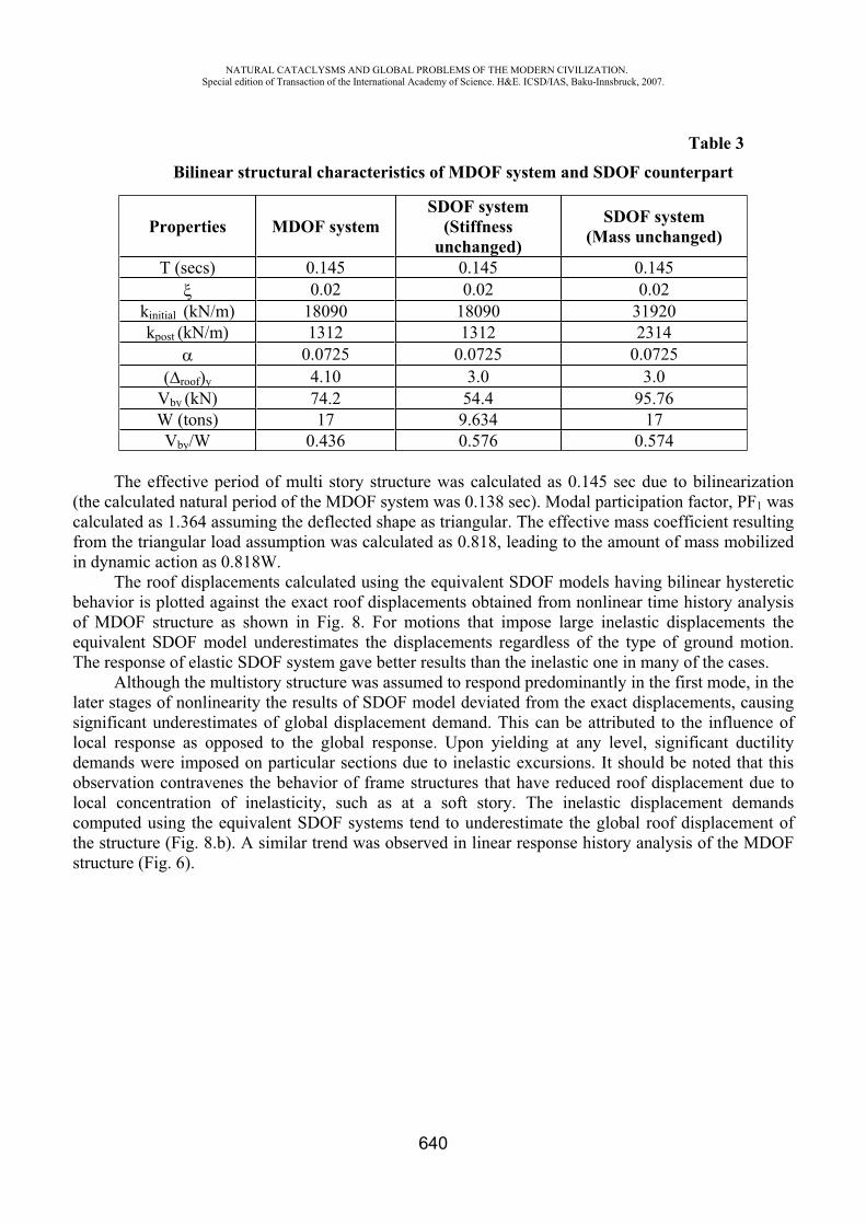
NATURAL CATACLYSMS AND GLOBAL PROBLEMS OF THE MODERN CIVILIZATION. Special edition of Transaction of the International Academy of Science. H&E. ICSD/IAS, Baku-Innsbruck, 2007.
640
Table 3
Bilinear structural characteristics of MDOF system and SDOF counterpart
Properties MDOF system SDOF system
(Stiffnessunchanged)
SDOF system (Mass unchanged)
T (secs) 0.145 0.145 0.145 0.02 0.02 0.02
kinitial (kN/m) 18090 18090 31920 kpost (kN/m) 1312 1312 2314
0.0725 0.0725 0.0725 ( roof)y 4.10 3.0 3.0
Vby (kN) 74.2 54.4 95.76 W (tons) 17 9.634 17 Vby/W 0.436 0.576 0.574
The effective period of multi story structure was calculated as 0.145 sec due to bilinearization (the calculated natural period of the MDOF system was 0.138 sec). Modal participation factor, PF1 was calculated as 1.364 assuming the deflected shape as triangular. The effective mass coefficient resulting from the triangular load assumption was calculated as 0.818, leading to the amount of mass mobilized in dynamic action as 0.818W.
The roof displacements calculated using the equivalent SDOF models having bilinear hysteretic behavior is plotted against the exact roof displacements obtained from nonlinear time history analysis of MDOF structure as shown in Fig. 8. For motions that impose large inelastic displacements the equivalent SDOF model underestimates the displacements regardless of the type of ground motion. The response of elastic SDOF system gave better results than the inelastic one in many of the cases.
Although the multistory structure was assumed to respond predominantly in the first mode, in the later stages of nonlinearity the results of SDOF model deviated from the exact displacements, causing significant underestimates of global displacement demand. This can be attributed to the influence of local response as opposed to the global response. Upon yielding at any level, significant ductility demands were imposed on particular sections due to inelastic excursions. It should be noted that this observation contravenes the behavior of frame structures that have reduced roof displacement due to local concentration of inelasticity, such as at a soft story. The inelastic displacement demands computed using the equivalent SDOF systems tend to underestimate the global roof displacement of the structure (Fig. 8.b). A similar trend was observed in linear response history analysis of the MDOF structure (Fig. 6).
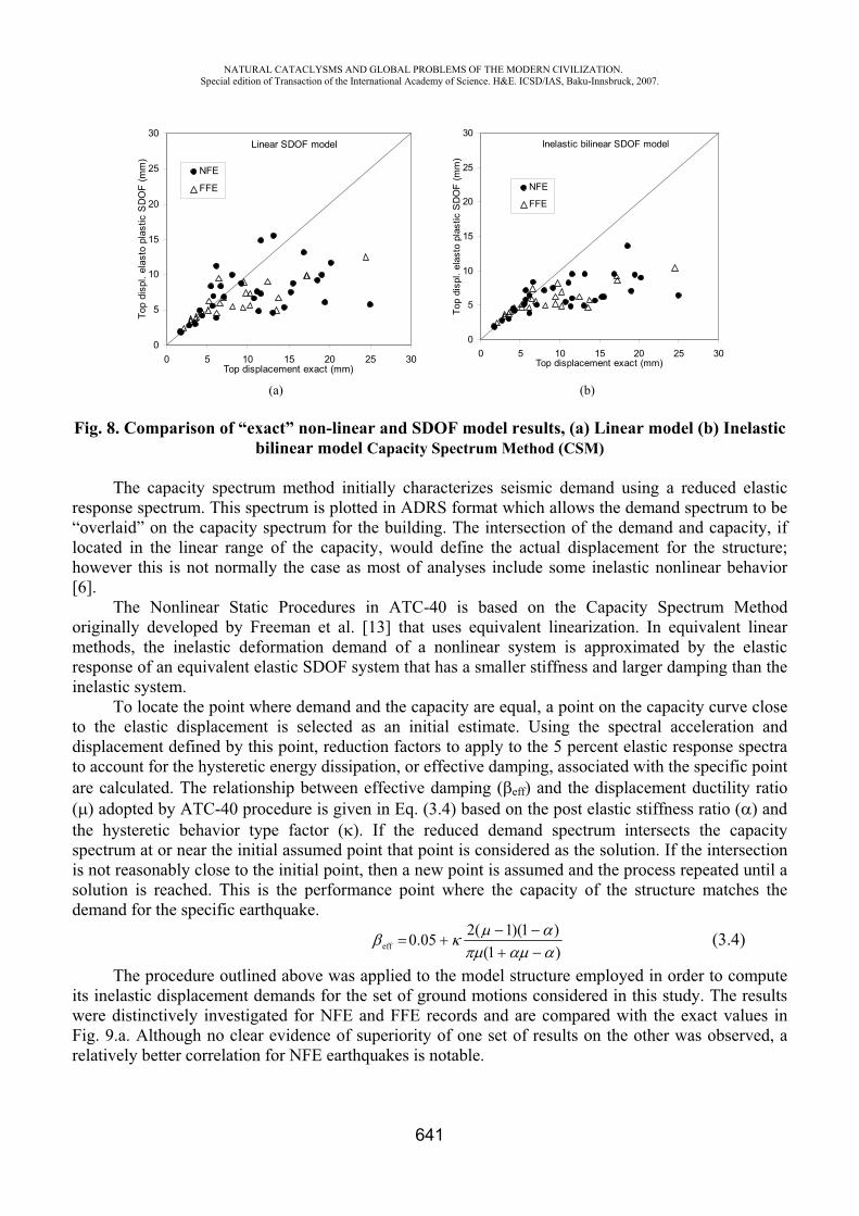
NATURAL CATACLYSMS AND GLOBAL PROBLEMS OF THE MODERN CIVILIZATION. Special edition of Transaction of the International Academy of Science. H&E. ICSD/IAS, Baku-Innsbruck, 2007.
641
Linear SDOF model
0
5
10
15
20
25
30
0 5 10 15 20 25 30Top displacement exact (mm)
Top
disp
l. el
asto
pla
stic
SD
OF
(mm
)
NFE
FFE
Inelastic bilinear SDOF model
0
5
10
15
20
25
30
0 5 10 15 20 25 30Top displacement exact (mm)
Top
disp
l. el
asto
pla
stic
SD
OF
(mm
)
NFE
FFE
(a) (b)
Fig. 8. Comparison of “exact” non-linear and SDOF model results, (a) Linear model (b) Inelastic bilinear model Capacity Spectrum Method (CSM)
The capacity spectrum method initially characterizes seismic demand using a reduced elastic response spectrum. This spectrum is plotted in ADRS format which allows the demand spectrum to be “overlaid” on the capacity spectrum for the building. The intersection of the demand and capacity, if located in the linear range of the capacity, would define the actual displacement for the structure; however this is not normally the case as most of analyses include some inelastic nonlinear behavior [6].
The Nonlinear Static Procedures in ATC-40 is based on the Capacity Spectrum Method originally developed by Freeman et al. [13] that uses equivalent linearization. In equivalent linear methods, the inelastic deformation demand of a nonlinear system is approximated by the elastic response of an equivalent elastic SDOF system that has a smaller stiffness and larger damping than the inelastic system.
To locate the point where demand and the capacity are equal, a point on the capacity curve close to the elastic displacement is selected as an initial estimate. Using the spectral acceleration and displacement defined by this point, reduction factors to apply to the 5 percent elastic response spectra to account for the hysteretic energy dissipation, or effective damping, associated with the specific point are calculated. The relationship between effective damping ( eff) and the displacement ductility ratio ( ) adopted by ATC-40 procedure is given in Eq. (3.4) based on the post elastic stiffness ratio ( ) and the hysteretic behavior type factor ( ). If the reduced demand spectrum intersects the capacity spectrum at or near the initial assumed point that point is considered as the solution. If the intersection is not reasonably close to the initial point, then a new point is assumed and the process repeated until a solution is reached. This is the performance point where the capacity of the structure matches the demand for the specific earthquake.
)1()1)(1(205.0eff (3.4)
The procedure outlined above was applied to the model structure employed in order to compute its inelastic displacement demands for the set of ground motions considered in this study. The results were distinctively investigated for NFE and FFE records and are compared with the exact values in Fig. 9.a. Although no clear evidence of superiority of one set of results on the other was observed, a relatively better correlation for NFE earthquakes is notable.
NATURAL CATACLYSMS AND GLOBAL PROBLEMS OF THE MODERN CIVILIZATION. Special edition of Transaction of the International Academy of Science. H&E. ICSD/IAS, Baku-Innsbruck, 2007.
642
A clear outcome is that the Capacity Spectrum Method significantly underestimates the inelastic displacements for both NFE and FFE records when the ductility demand is high. The principal reason for this outcome is the unrealistic reduction in the demand, i.e. reduced elastic response spectrum, owing to exaggerated damping values. The estimated damping value to take into account the inelastic behavior in the system is well above twenty percent in many of the cases. The equal energy principle used in effective damping calculation for CSM can be faulted on two points:
Derivation of equivalent damping that accounts only for the hysteretic cycle of maximum deformation, neglecting other, smaller amplitude yield excursions leads to high damping ratios as it does not include the reduction in stiffness and strength. The level of maximum deformation cannot alone account for the state of damage occurring in the structure, because the number of excursions and reversals would be parameters for the increased effective damping. Nonlinear time history analysis results revealed that the maximum displacement occurs after a few reversals of motion. We cannot attribute the same damage state for the structure prior to maximum excursion and following it, especially for near fault earthquakes where commonly a single pulse causes the one-sided maximum displacement excursion. Reduction of the force on the basis of maximum deformation will in turn reduce the driving forces that cause the maximum deformation.
A possible remedy to overcome this problem would be to use other methods that are based on more realistic assumptions for computing the equivalent viscous damping. The substitute damping ( S)given in Eq. (3.5) was proposed by Gülkan and Sözen [14] to determine the equivalent viscous damping that considers approximately the influence of inelastic excursions. Here, is the ductility factor that describes the ratio of maximum displacement excursion to the displacement at the yield.
50/))/11(101(s (3.5)
The underlying principle in Eq. (3.5) is based on the idea that the response of reinforced concrete structures to strong earthquake motions is controlled by two basic phenomena: reduction in stiffness and increase in energy dissipation capacity. Furthermore, the maximum dynamic response of reinforced concrete structures, represented by SDOF systems, can be approximated by linear response analysis using a reduced stiffness and a substitute damping. Substitute damping represents the increase in energy dissipation capacity through the use of Eq. (3.6).
dtuumdt)u(2mt
0g
t
0
2oS (3.6)
Eq. (3.6) is based on the assumption that the energy input from a ground motion is entirely dissipated by an imaginary viscous damper which has a damping ratio equal to substitute damping. In this equation, S is the substitute damping ratio, m is the mass, t is the total duration of response, gu is the ground acceleration, and u is the velocity of the mass. o is equal to the natural frequency of the system with reduced stiffness (Gülkan and Sözen calculated o as the square root of the ratio of maximum absolute acceleration to maximum absolute displacement). We note that Eq. (3.6) takes into account all inelastic excursions, not only that with the largest amplitude in calculating the equivalent damping coefficient. Equation (3.5) was incorporated into the algorithm of CSM procedure as described in ATC-40 instead of the equivalent viscous damping to compute the inelastic displacements demands.
The results obtained by substitute damping were superior to those obtained by equivalent damping as shown in Fig. 9.b. This finding emphasizes the significance of the accuracy in calculating the damping used in the CSM. It has been observed that the approximate nonlinear static procedures give better results with near field records of small-to-moderate magnitude earthquakes than the far
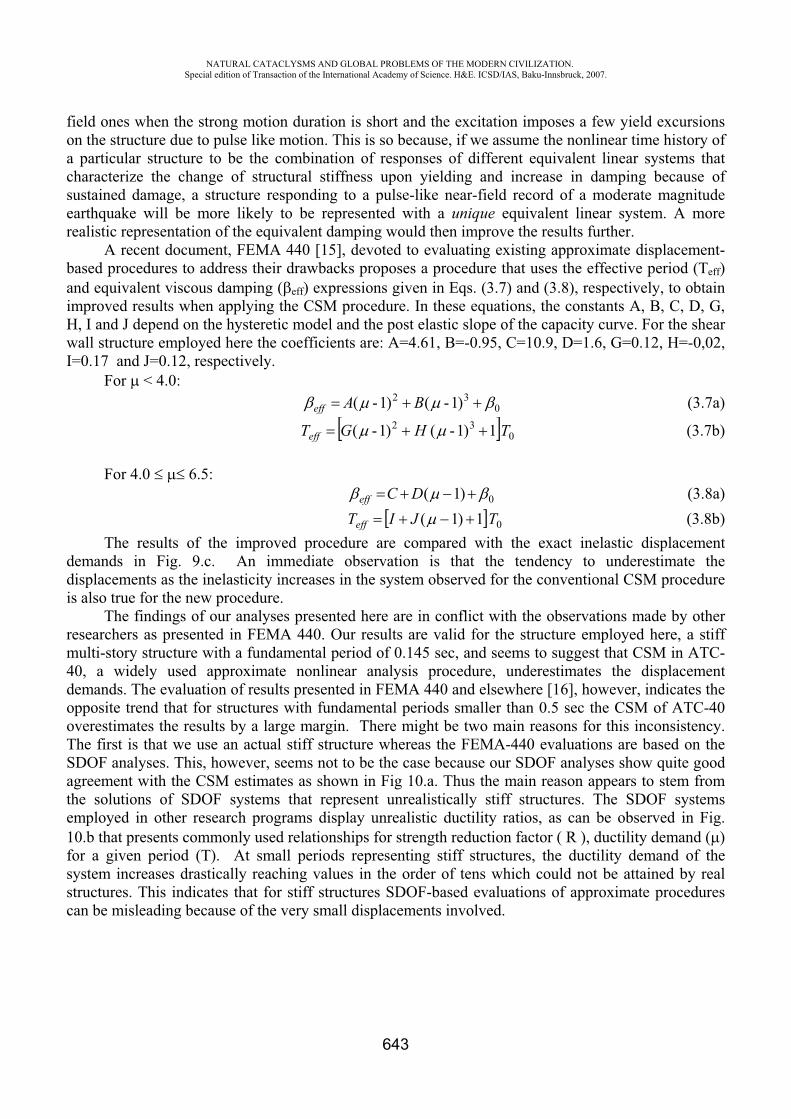
NATURAL CATACLYSMS AND GLOBAL PROBLEMS OF THE MODERN CIVILIZATION. Special edition of Transaction of the International Academy of Science. H&E. ICSD/IAS, Baku-Innsbruck, 2007.
643
field ones when the strong motion duration is short and the excitation imposes a few yield excursions on the structure due to pulse like motion. This is so because, if we assume the nonlinear time history of a particular structure to be the combination of responses of different equivalent linear systems that characterize the change of structural stiffness upon yielding and increase in damping because of sustained damage, a structure responding to a pulse-like near-field record of a moderate magnitude earthquake will be more likely to be represented with a unique equivalent linear system. A more realistic representation of the equivalent damping would then improve the results further.
A recent document, FEMA 440 [15], devoted to evaluating existing approximate displacement-based procedures to address their drawbacks proposes a procedure that uses the effective period (Teff)and equivalent viscous damping ( eff) expressions given in Eqs. (3.7) and (3.8), respectively, to obtain improved results when applying the CSM procedure. In these equations, the constants A, B, C, D, G, H, I and J depend on the hysteretic model and the post elastic slope of the capacity curve. For the shear wall structure employed here the coefficients are: A=4.61, B=-0.95, C=10.9, D=1.6, G=0.12, H=-0,02, I=0.17 and J=0.12, respectively.
For < 4.0: 0
32 )1-()1-( BAeff (3.7a)
032 1)1-()1-( THGTeff (3.7b)
For 4.0 6.5:0)1(DCeff (3.8a)
01)1( TJITeff (3.8b) The results of the improved procedure are compared with the exact inelastic displacement
demands in Fig. 9.c. An immediate observation is that the tendency to underestimate the displacements as the inelasticity increases in the system observed for the conventional CSM procedure is also true for the new procedure.
The findings of our analyses presented here are in conflict with the observations made by other researchers as presented in FEMA 440. Our results are valid for the structure employed here, a stiff multi-story structure with a fundamental period of 0.145 sec, and seems to suggest that CSM in ATC-40, a widely used approximate nonlinear analysis procedure, underestimates the displacement demands. The evaluation of results presented in FEMA 440 and elsewhere [16], however, indicates the opposite trend that for structures with fundamental periods smaller than 0.5 sec the CSM of ATC-40 overestimates the results by a large margin. There might be two main reasons for this inconsistency. The first is that we use an actual stiff structure whereas the FEMA-440 evaluations are based on the SDOF analyses. This, however, seems not to be the case because our SDOF analyses show quite good agreement with the CSM estimates as shown in Fig 10.a. Thus the main reason appears to stem from the solutions of SDOF systems that represent unrealistically stiff structures. The SDOF systems employed in other research programs display unrealistic ductility ratios, as can be observed in Fig. 10.b that presents commonly used relationships for strength reduction factor ( R ), ductility demand ( )for a given period (T). At small periods representing stiff structures, the ductility demand of the system increases drastically reaching values in the order of tens which could not be attained by real structures. This indicates that for stiff structures SDOF-based evaluations of approximate procedures can be misleading because of the very small displacements involved.
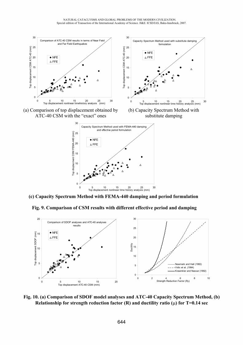
NATURAL CATACLYSMS AND GLOBAL PROBLEMS OF THE MODERN CIVILIZATION. Special edition of Transaction of the International Academy of Science. H&E. ICSD/IAS, Baku-Innsbruck, 2007.
644
Comparison of ATC-40 CSM results in terms of Near Field and Far Field Earthquakes
0
5
10
15
20
25
30
0 5 10 15 20 25 30Top displacement nonlinear timehistory analysis (mm)
Top
disp
lace
men
t CS
M A
TC-4
0 (m
m)
NFEFFE
Capacity Spectrum Method used with substitute damping formulation
0
5
10
15
20
25
30
0 5 10 15 20 25 30Top displacement nonlinear time history analysis (mm)
Top
disp
lace
men
t CS
M A
TC-4
0 (m
m)
NFEFFE
(a) Comparison of top displacement obtained by ATC-40 CSM with the “exact” ones
(b) Capacity Spectrum Method with substitute damping
Capacity Spectrum Method used with FEMA-440 damping and effective period formulation
0
5
10
15
20
25
30
0 5 10 15 20 25 30Top displacement nonlinear time history analysis (mm)
Top
disp
lacm
ent C
SM
FE
MA
-440
(mm
)
NFEFFE
(c) Capacity Spectrum Method with FEMA-440 damping and period formulation
Fig. 9. Comparison of CSM results with different effective period and damping
Comparison of SDOF analyses and ATC-40 analyses results
0
5
10
15
20
0 5 10 15 20Top displacement ATC-40 CSM (mm)
Top
disp
lace
men
t SD
OF
(mm
) NFE
FFE
0
5
10
15
20
25
30
0 2 4 6 8 10Strength Reduction Factor (Ry)
Duc
tility
Newmark and Hall (1982)Vidic et al. (1994)Krawinkler and Nassar (1992)
Fig. 10. (a) Comparison of SDOF model analyses and ATC-40 Capacity Spectrum Method, (b) Relationship for strength reduction factor (R) and ductility ratio ( ) for T=0.14 sec
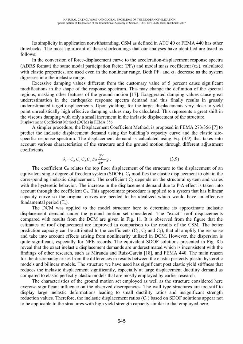
NATURAL CATACLYSMS AND GLOBAL PROBLEMS OF THE MODERN CIVILIZATION. Special edition of Transaction of the International Academy of Science. H&E. ICSD/IAS, Baku-Innsbruck, 2007.
645
Its simplicity in application notwithstanding, CSM as defined in ATC 40 or FEMA 440 has other drawbacks. The most significant of these shortcomings that our analyses have identified are listed as follows:
In the conversion of force-displacement curve to the acceleration-displacement response spectra (ADRS format) the same modal participation factor (PF1) and modal mass coefficient ( 1), calculated with elastic properties, are used even in the nonlinear range. Both PF1 and 1 decrease as the system digresses into the inelastic range.
Excessive damping values different from the customary value of 5 percent cause significant modifications in the shape of the response spectrum. This may change the definition of the spectral regions, masking other features of the ground motion [17]. Exaggerated damping values cause great underestimation in the earthquake response spectra demand and this finally results in grossly underestimated target displacements. Upon yielding, for the target displacements very close to yield point unrealistically high effective damping values may be calculated. This represents a great shift in the viscous damping with only a small increment in the inelastic displacement of the structure. Displacement Coefficient Method (DCM) in FEMA 356
A simpler procedure, the Displacement Coefficient Method, is proposed in FEMA 273/356 [7] to predict the inelastic displacement demand using the building’s capacity curve and the elastic site-specific response spectrum. The displacement demand is calculated using Eq. (3.9) that takes into account various characteristics of the structure and the ground motion through different adjustment coefficients.
g4T
SaCCCC 2
2e
3210t . (3.9)
The coefficient C0 relates the top floor displacement of the structure to the displacement of an equivalent single degree of freedom system (SDOF). C1 modifies the elastic displacement to obtain the corresponding inelastic displacement. The coefficient C2 depends on the structural system and varies with the hysteretic behavior. The increase in the displacement demand due to P- effect is taken into account through the coefficient C3. This approximate procedure is applied to a system that has bilinear capacity curve so the original curves are needed to be idealized which would have an effective fundamental period (Te).
The DCM was applied to the model structure here to determine its approximate inelastic displacement demand under the ground motion set considered. The “exact” roof displacements compared with results from the DCM are given in Fig. 11. It is observed from the figure that the estimates of roof displacement are improved in comparison to the results of the CSM. The better prediction capacity can be attributed to the coefficients (C1, C2 and C3), that all amplify the response and take into account effects arising from nonlinearity utilized in DCM. However, the dispersion is quite significant, especially for NFE records. The equivalent SDOF solutions presented in Fig. 8.b reveal that the exact inelastic displacement demands are underestimated which is inconsistent with the findings of other research, such as Miranda and Ruiz-Garcia [18], and FEMA 440. The main reason for the discrepancy arises from the differences in results between the elastic perfectly plastic hysteretic models and bilinear models. The structure we have used has significant post elastic yield stiffness that reduces the inelastic displacement significantly, especially at large displacement ductility demand as compared to elastic perfectly plastic models that are mostly employed by earlier research.
The characteristics of the ground motion set employed as well as the structure considered here exercise significant influence on the observed discrepancies. The wall type structures are too stiff to display large inelastic deformations leading to small ductility ratios and insignificant strength reduction values. Therefore, the inelastic displacement ratios (C1) based on SDOF solutions appear not to be applicable to the structures with high yield strength capacity similar to that employed here.
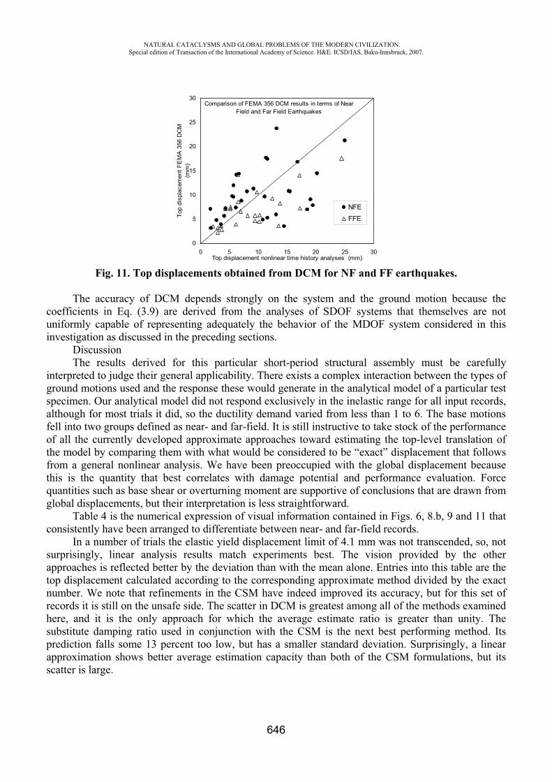
NATURAL CATACLYSMS AND GLOBAL PROBLEMS OF THE MODERN CIVILIZATION. Special edition of Transaction of the International Academy of Science. H&E. ICSD/IAS, Baku-Innsbruck, 2007.
646
Comparison of FEMA 356 DCM results in terms of Near Field and Far Field Earthquakes
0
5
10
15
20
25
30
0 5 10 15 20 25 30Top displacement nonlinear time history analyses (mm)
Top
disp
lace
men
t FE
MA
356
DC
M
(mm
)
NFE
FFE
Fig. 11. Top displacements obtained from DCM for NF and FF earthquakes.
The accuracy of DCM depends strongly on the system and the ground motion because the coefficients in Eq. (3.9) are derived from the analyses of SDOF systems that themselves are not uniformly capable of representing adequately the behavior of the MDOF system considered in this investigation as discussed in the preceding sections.
Discussion The results derived for this particular short-period structural assembly must be carefully
interpreted to judge their general applicability. There exists a complex interaction between the types of ground motions used and the response these would generate in the analytical model of a particular test specimen. Our analytical model did not respond exclusively in the inelastic range for all input records, although for most trials it did, so the ductility demand varied from less than 1 to 6. The base motions fell into two groups defined as near- and far-field. It is still instructive to take stock of the performance of all the currently developed approximate approaches toward estimating the top-level translation of the model by comparing them with what would be considered to be “exact” displacement that follows from a general nonlinear analysis. We have been preoccupied with the global displacement because this is the quantity that best correlates with damage potential and performance evaluation. Force quantities such as base shear or overturning moment are supportive of conclusions that are drawn from global displacements, but their interpretation is less straightforward.
Table 4 is the numerical expression of visual information contained in Figs. 6, 8.b, 9 and 11 that consistently have been arranged to differentiate between near- and far-field records.
In a number of trials the elastic yield displacement limit of 4.1 mm was not transcended, so, not surprisingly, linear analysis results match experiments best. The vision provided by the other approaches is reflected better by the deviation than with the mean alone. Entries into this table are the top displacement calculated according to the corresponding approximate method divided by the exact number. We note that refinements in the CSM have indeed improved its accuracy, but for this set of records it is still on the unsafe side. The scatter in DCM is greatest among all of the methods examined here, and it is the only approach for which the average estimate ratio is greater than unity. The substitute damping ratio used in conjunction with the CSM is the next best performing method. Its prediction falls some 13 percent too low, but has a smaller standard deviation. Surprisingly, a linear approximation shows better average estimation capacity than both of the CSM formulations, but its scatter is large.
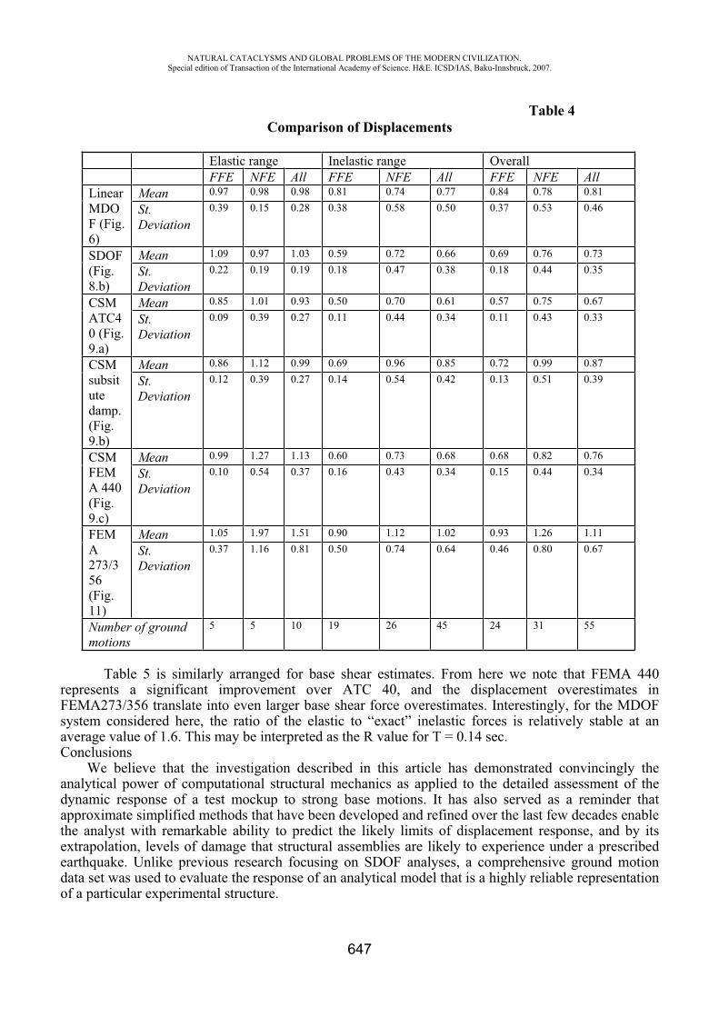
NATURAL CATACLYSMS AND GLOBAL PROBLEMS OF THE MODERN CIVILIZATION. Special edition of Transaction of the International Academy of Science. H&E. ICSD/IAS, Baku-Innsbruck, 2007.
647
Table 4 Comparison of Displacements
Elastic range Inelastic range Overall FFE NFE All FFE NFE All FFE NFE All
LinearMDOF (Fig. 6)
Mean 0.97 0.98 0.98 0.81 0.74 0.77 0.84 0.78 0.81
St.Deviation
0.39 0.15 0.28 0.38 0.58 0.50 0.37 0.53 0.46
SDOF(Fig.8.b)
Mean 1.09 0.97 1.03 0.59 0.72 0.66 0.69 0.76 0.73
St.Deviation
0.22 0.19 0.19 0.18 0.47 0.38 0.18 0.44 0.35
CSMATC40 (Fig. 9.a)
Mean 0.85 1.01 0.93 0.50 0.70 0.61 0.57 0.75 0.67
St.Deviation
0.09 0.39 0.27 0.11 0.44 0.34 0.11 0.43 0.33
CSMsubsitutedamp. (Fig.9.b)
Mean 0.86 1.12 0.99 0.69 0.96 0.85 0.72 0.99 0.87
St.Deviation
0.12 0.39 0.27 0.14 0.54 0.42 0.13 0.51 0.39
CSMFEMA 440 (Fig.9.c)
Mean 0.99 1.27 1.13 0.60 0.73 0.68 0.68 0.82 0.76
St.Deviation
0.10 0.54 0.37 0.16 0.43 0.34 0.15 0.44 0.34
FEMA273/356 (Fig.11)
Mean 1.05 1.97 1.51 0.90 1.12 1.02 0.93 1.26 1.11
St.Deviation
0.37 1.16 0.81 0.50 0.74 0.64 0.46 0.80 0.67
Number of ground motions
5 5 10 19 26 45 24 31 55
Table 5 is similarly arranged for base shear estimates. From here we note that FEMA 440 represents a significant improvement over ATC 40, and the displacement overestimates in FEMA273/356 translate into even larger base shear force overestimates. Interestingly, for the MDOF system considered here, the ratio of the elastic to “exact” inelastic forces is relatively stable at an average value of 1.6. This may be interpreted as the R value for T = 0.14 sec. Conclusions
We believe that the investigation described in this article has demonstrated convincingly the analytical power of computational structural mechanics as applied to the detailed assessment of the dynamic response of a test mockup to strong base motions. It has also served as a reminder that approximate simplified methods that have been developed and refined over the last few decades enable the analyst with remarkable ability to predict the likely limits of displacement response, and by its extrapolation, levels of damage that structural assemblies are likely to experience under a prescribed earthquake. Unlike previous research focusing on SDOF analyses, a comprehensive ground motion data set was used to evaluate the response of an analytical model that is a highly reliable representation of a particular experimental structure.
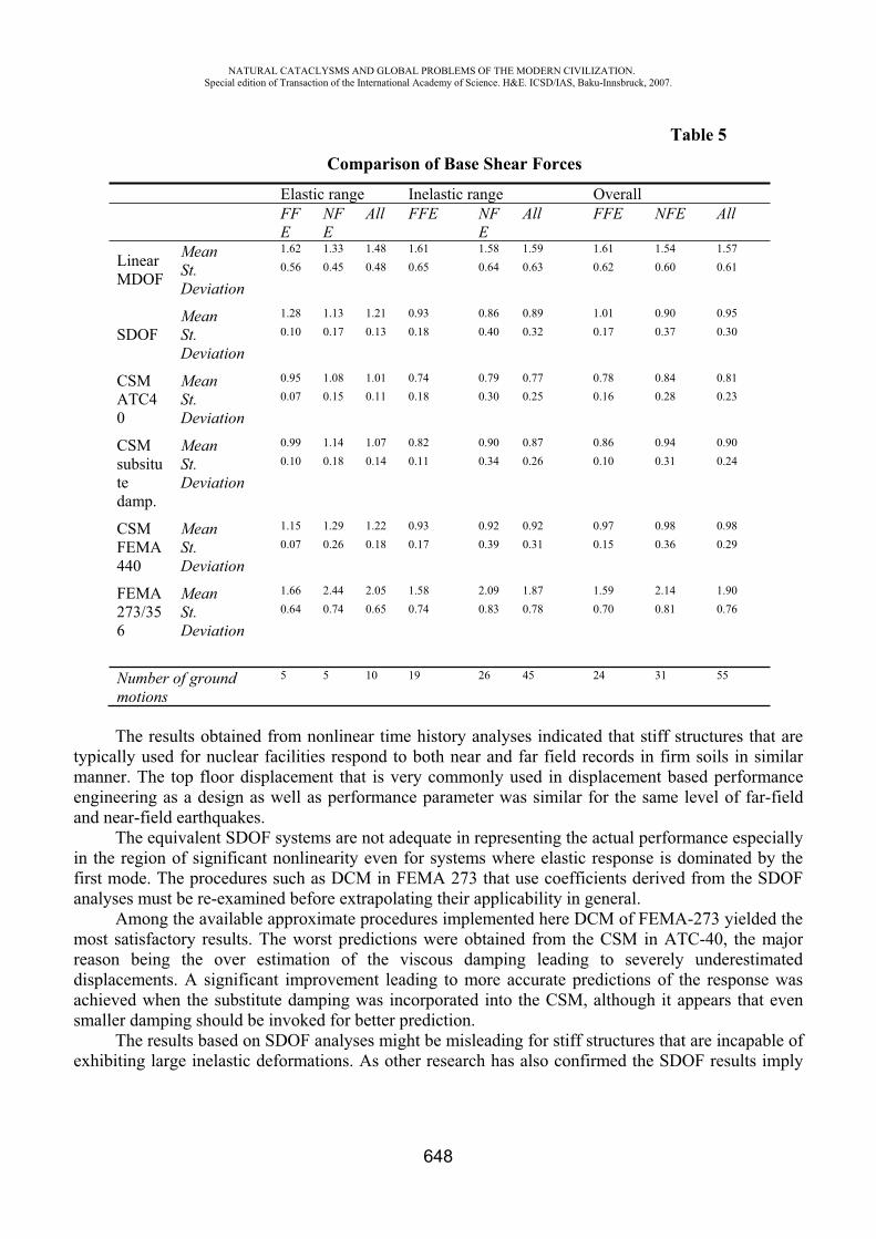
NATURAL CATACLYSMS AND GLOBAL PROBLEMS OF THE MODERN CIVILIZATION. Special edition of Transaction of the International Academy of Science. H&E. ICSD/IAS, Baku-Innsbruck, 2007.
648
Table 5 Comparison of Base Shear Forces
Elastic range Inelastic range Overall FFE
NFE
All FFE NFE
All FFE NFE All
LinearMDOF
Mean 1.62 1.33 1.48 1.61 1.58 1.59 1.61 1.54 1.57
St.Deviation
0.56 0.45 0.48 0.65 0.64 0.63 0.62 0.60 0.61
SDOF Mean 1.28 1.13 1.21 0.93 0.86 0.89 1.01 0.90 0.95
St.Deviation
0.10 0.17 0.13 0.18 0.40 0.32 0.17 0.37 0.30
CSMATC40
Mean 0.95 1.08 1.01 0.74 0.79 0.77 0.78 0.84 0.81
St.Deviation
0.07 0.15 0.11 0.18 0.30 0.25 0.16 0.28 0.23
CSMsubsitutedamp.
Mean 0.99 1.14 1.07 0.82 0.90 0.87 0.86 0.94 0.90
St.Deviation
0.10 0.18 0.14 0.11 0.34 0.26 0.10 0.31 0.24
CSMFEMA440
Mean 1.15 1.29 1.22 0.93 0.92 0.92 0.97 0.98 0.98
St.Deviation
0.07 0.26 0.18 0.17 0.39 0.31 0.15 0.36 0.29
FEMA273/356
Mean 1.66 2.44 2.05 1.58 2.09 1.87 1.59 2.14 1.90
St.Deviation
0.64 0.74 0.65 0.74 0.83 0.78 0.70 0.81 0.76
Number of ground motions
5 5 10 19 26 45 24 31 55
The results obtained from nonlinear time history analyses indicated that stiff structures that are typically used for nuclear facilities respond to both near and far field records in firm soils in similar manner. The top floor displacement that is very commonly used in displacement based performance engineering as a design as well as performance parameter was similar for the same level of far-field and near-field earthquakes.
The equivalent SDOF systems are not adequate in representing the actual performance especially in the region of significant nonlinearity even for systems where elastic response is dominated by the first mode. The procedures such as DCM in FEMA 273 that use coefficients derived from the SDOF analyses must be re-examined before extrapolating their applicability in general.
Among the available approximate procedures implemented here DCM of FEMA-273 yielded the most satisfactory results. The worst predictions were obtained from the CSM in ATC-40, the major reason being the over estimation of the viscous damping leading to severely underestimated displacements. A significant improvement leading to more accurate predictions of the response was achieved when the substitute damping was incorporated into the CSM, although it appears that even smaller damping should be invoked for better prediction.
The results based on SDOF analyses might be misleading for stiff structures that are incapable of exhibiting large inelastic deformations. As other research has also confirmed the SDOF results imply
NATURAL CATACLYSMS AND GLOBAL PROBLEMS OF THE MODERN CIVILIZATION. Special edition of Transaction of the International Academy of Science. H&E. ICSD/IAS, Baku-Innsbruck, 2007.
649
unrealistically large ductility ratios for these structures, but large ductility demand does not translate into large damping ratios.
It has been observed that for stiff structures used for nuclear facilities none of the available approximate displacement based procedures is in its current form appropriate for an assessment of performance. For design purposes where the ground motion is represented by a design spectrum, the DCM of FEMA 273 and CSM in ATC-40 in conjunction with the substitute damping may be used if only the mean response is desired.
REFERENCES
1. Combescure D. IAEA CRP-NFE Camus Benchmark: Experimental Results and Specifications to the Participants. Rapport DM2S, SEMT/EMSI/RT/02-047/A, 2002.
2. Kazaz I., Yakut A. and Gülkan P. Numerical Simulation of Dynamic Shear Wall Tests: A Benchmark Study. Submitted t o Computers and Structures 2005.
3. ANSYS Engineering Analysis System, User and Theoretical Manual. ANSYS, Inc. South Pointe, Canonsburg, Pennsylvania, 2002, Release 7.0 UP20021010.
4. Martinez-Pereira A. and Bommer J. J. What is the Near-field?. In Seismic Design Practice into the Next Century, 1998, 245-252, eds. Booth, E., Balkema.
5. Anderson J.C. and Bertero V.V. Uncertainties in Establishing Design Earthquakes. Journal of Structural Engineering 1987, ASCE 113 (8), 1709-1724.
6. ATC 40 Seismic Evaluation and Retrofit of Concrete Buildings, Volume 1; Applied Technology Council, California Seismic Safety Commission, 1996.
7. FEMA 356 Pre-standard and Commentary for the Seismic Rehabilitation of Buildings; Federal Emergency Management Agency, Washington, D.C, 2000.
8. Miranda E. Estimation of Inelastic Deformation Demands of SDOF Systems. Journal of Structural Engineering 2001, ASCE 127 (9), 1005-1012.
9. Miranda E., Akkar D. S. and Ruiz-Garcia,J. ATC-55: Summary of Evaluation of Current Nonlinear Static Procedures-SDOF Studies; Applied Technology Council, California Seismic Safety Commission, 2002.
10. Chopra A. K., Goel R. K. and Chintanapakdee C. Statistics of Single-Degree-of-Freedom Estimate of Displacement for Pushover Analysis of Buildings. Journal of Structural Engineering 2003, ASCE 129 (4), 459-469.
11. Chintanapakdee C. and Chopra, A. K. Evaluation of Modal Pushover Analysis Using Generic Frames. Earthquake Engineering & Structural Dynamics 2003, 32, 417–442.
12. Chopra, A. K. Dynamics of Structures: Theory and Application to Earthquake Engineering; 2nd edn., Prentice-Hall, New York, 2000.
13. Freeman S. A., Nicoletti J. P., and Tyrell J.V. Evaluations of Existing Buildings for Seismic Risk: A case study of Puget Sound Naval Shipyard, Bremerton. Proceedings of First U.S. NCEE, EERI, Berkeley, Washington, 1975, 113-122.
14. Gülkan P. and Sözen M., A. Inelastic Response of Reinforced Concrete Structures to Earthquake Motions. ACI Journal 1974, December, 604-610.
15. FEMA 440 Improvement of nonlinear static seismic analysis procedures, Draft Camera-Ready. Applied Technology Council, California Seismic Safety Commission, 2004.
16. Akkar S. D. and Miranda,E. Statistical Evaluation of Approximate Methods for Estimating Maximum Deformation Demands on Existing Structures. Journal of Structural Engineering 2005, ASCE 131(1), 160-172.
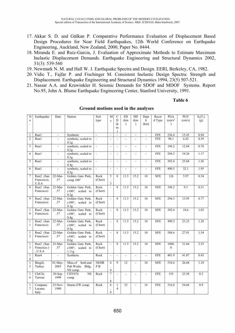
NATURAL CATACLYSMS AND GLOBAL PROBLEMS OF THE MODERN CIVILIZATION. Special edition of Transaction of the International Academy of Science. H&E. ICSD/IAS, Baku-Innsbruck, 2007.
650
17. Akkar S. D. and Gülkan P. Comparative Performance Evaluation of Displacement Based Design Procedures for Near Field Earthquakes, 12th World Conference on Earthquake Engineering, Auckland, New Zealand, 2000, Paper No. 0444.
18. Miranda E. and Ruiz-Garcia, J. Evaluation of Approximate Methods to Estimate Maximum Inelastic Displacement Demands. Earthquake Engineering and Structural Dynamics 2002, 31(3): 539-560
19. Newmark N. M. and Hall W. J. Earthquake Spectra and Design. EERI, Berkeley, CA, 1982. 20. Vidic T., Fajfar P. and Fischinger M. Consistent Inelastic Design Spectra: Strength and
Displacement. Earthquake Engineering and Structural Dynamics 1994, 23(5) 507-521. 21. Nassar A.A. and Krawinkler H. Seismic Demands for SDOF and MDOF Systems. Report
No.95, John A. Blume Earthquake Engineering Center, Stanford University, 1991.
Table 6
Ground motions used in the analyses No.
Earthquake Date Station Soil type
MW
CD(km)
ED (km
)
HD (km
)
Depth
(km)
Record Type
PGA(cm/s2
)
PGV(cm/s)
Sa(T1)(g)
1 Run1 - Synthetic - - - - - - FFE 236.4 15.45 0.94 2 Run1 - synthetic, scaled to
0.1g - - - - - - FFE 98.1 6.42 0.39
3 Run1 - synthetic, scaled to 0.2g
- - - - - - FFE 196.2 12.84 0.78
4 Run1 - synthetic, scaled to 0.3g
- - - - - - FFE 294.3 19.26 1.17
5 Run1 - synthetic, scaled to 0.4g
- - - - - - FFE 392.4 25.68 1.56
6 Run1 - synthetic, scaled to 0.5g
- - - - - - FFE 490.5 32.1 1.95
7 Run2 (San Francisco),U.S.A
22-Mar-.57
Golden Gate Park, comp 100
Rock(Chert)
5.3
8 11.5 15.2 10 NFE 126 5.97 0.34
8 Run2 (San Francisco)
22-Mar-.57
Golden Gate Park, c100 , scaled to 0.2g
Rock(Chert)
- 8 11.5 15.2 10 NFE 196.2 9.3 0.51
9 Run2 (San Francisco)
22-Mar-.57
Golden Gate Park, c100 , scaled to 0.3g
Rock(Chert)
- 8 11.5 15.2 10 NFE 294.3 13.95 0.77
10
Run2 (San Francisco)
22-Mar-.57
Golden Gate Park, c100 , scaled to 0.4g
Rock(Chert)
- 8 11.5 15.2 10 NFE 392.4 18.6 1.03
11
Run2 (San Francisco)
22-Mar-.57
Golden Gate Park, c100 , scaled to 0.5g
Rock(Chert)
- 8 11.5 15.2 10 NFE 490.5 23.25 1.28
12
Run2 (San Francisco)
22-Mar-.57
Golden Gate Park, c100 , scaled to 0.6g
Rock(Chert)
- 8 11.5 15.2 10 NFE 588.6 27.91 1.54
13
Run3 (San Francisco.), U.S.A
22-Mar-.57
Golden Gate Park, c100 , scaled to 1.11g
Rock(Chert)
- 8 11.5 15.2 10 NFE 1080.8
31.66 2.53
14
Run4 - Synthetic Rock - - - - - FFE 401.9 41.07 0.43
15
Bingöl,Turkey
01-May-2003
Mins.of Settl.and Pub.Works Bldg. NS comp.
NEHRP B
6.4
9 12 - 10 NFE 534.6 26.68 1.18
16
ChiChi,Taiwan
20-Sep-1999
CHY074 NS comp.
Rock 7.8
- - - - FFE 155 23.58 0.3
17
Compano Lucano, Italy
23-Nov-1980
Sturno EW comp. Rock 6.8
14
32 - 16 FFE 316.8 54.66 0.9
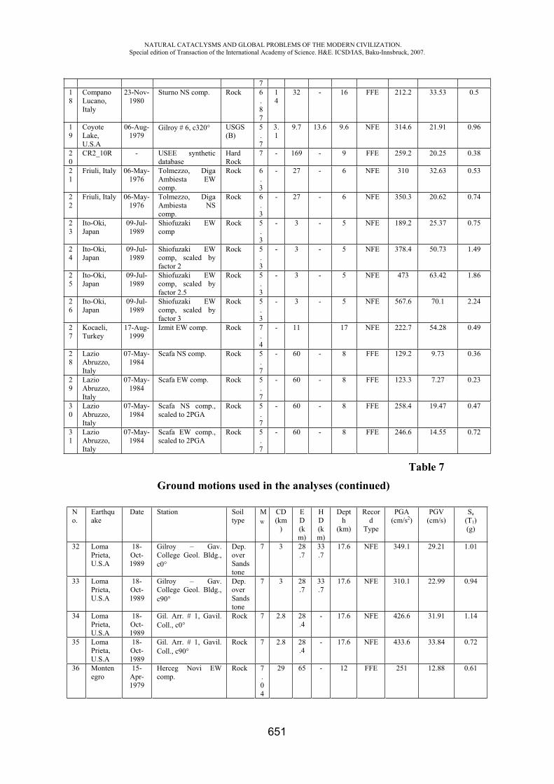
NATURAL CATACLYSMS AND GLOBAL PROBLEMS OF THE MODERN CIVILIZATION. Special edition of Transaction of the International Academy of Science. H&E. ICSD/IAS, Baku-Innsbruck, 2007.
651
718
Compano Lucano, Italy
23-Nov-1980
Sturno NS comp. Rock 6.87
14
32 - 16 FFE 212.2 33.53 0.5
19
CoyoteLake, U.S.A
06-Aug-1979
Gilroy # 6, c320 USGS(B)
5.7
3.1
9.7 13.6 9.6 NFE 314.6 21.91 0.96
20
CR2_10R - USEE synthetic database
Hard Rock
7 - 169 - 9 FFE 259.2 20.25 0.38
21
Friuli, Italy 06-May-1976
Tolmezzo, Diga Ambiesta EW comp.
Rock 6.3
- 27 - 6 NFE 310 32.63 0.53
22
Friuli, Italy 06-May-1976
Tolmezzo, Diga Ambiesta NS comp.
Rock 6.3
- 27 - 6 NFE 350.3 20.62 0.74
23
Ito-Oki,Japan
09-Jul-1989
Shiofuzaki EW comp
Rock 5.3
- 3 - 5 NFE 189.2 25.37 0.75
24
Ito-Oki,Japan
09-Jul-1989
Shiofuzaki EW comp, scaled by factor 2
Rock 5.3
- 3 - 5 NFE 378.4 50.73 1.49
25
Ito-Oki,Japan
09-Jul-1989
Shiofuzaki EW comp, scaled by factor 2.5
Rock 5.3
- 3 - 5 NFE 473 63.42 1.86
26
Ito-Oki,Japan
09-Jul-1989
Shiofuzaki EW comp, scaled by factor 3
Rock 5.3
- 3 - 5 NFE 567.6 70.1 2.24
27
Kocaeli,Turkey
17-Aug-1999
Izmit EW comp. Rock 7.4
- 11 17 NFE 222.7 54.28 0.49
28
LazioAbruzzo,Italy
07-May-1984
Scafa NS comp. Rock 5.7
- 60 - 8 FFE 129.2 9.73 0.36
29
LazioAbruzzo,Italy
07-May-1984
Scafa EW comp. Rock 5.7
- 60 - 8 FFE 123.3 7.27 0.23
30
LazioAbruzzo,Italy
07-May-1984
Scafa NS comp., scaled to 2PGA
Rock 5.7
- 60 - 8 FFE 258.4 19.47 0.47
31
LazioAbruzzo,Italy
07-May-1984
Scafa EW comp., scaled to 2PGA
Rock 5.7
- 60 - 8 FFE 246.6 14.55 0.72
Table 7
Ground motions used in the analyses (continued)
No.
Earthquake
Date Station Soil type
MW
CD(km
)
ED (km)
HD(km)
Depth
(km)
Record
Type
PGA(cm/s2)
PGV(cm/s)
Sa(T1)(g)
32 Loma Prieta, U.S.A
18-Oct-1989
Gilroy – Gav. College Geol. Bldg., c0
Dep. overSandstone
7 3 28.7
33.7
17.6 NFE 349.1 29.21 1.01
33 Loma Prieta, U.S.A
18-Oct-1989
Gilroy – Gav. College Geol. Bldg., c90
Dep. overSandstone
7 3 28.7
33.7
17.6 NFE 310.1 22.99 0.94
34 Loma Prieta, U.S.A
18-Oct-1989
Gil. Arr. # 1, Gavil. Coll., c0
Rock 7 2.8 28.4
- 17.6 NFE 426.6 31.91 1.14
35 Loma Prieta, U.S.A
18-Oct-1989
Gil. Arr. # 1, Gavil. Coll., c90
Rock 7 2.8 28.4
- 17.6 NFE 433.6 33.84 0.72
36 Montenegro
15-Apr-1979
Herceg Novi EW comp.
Rock 7.04
29 65 - 12 FFE 251 12.88 0.61
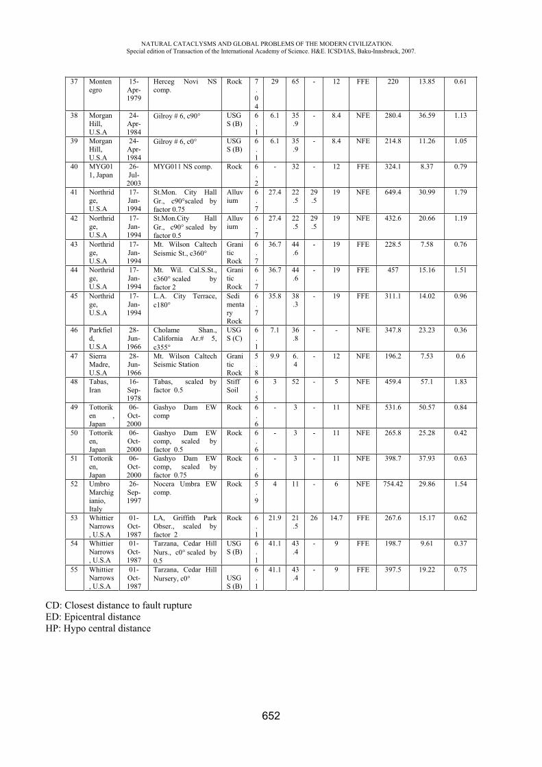
NATURAL CATACLYSMS AND GLOBAL PROBLEMS OF THE MODERN CIVILIZATION. Special edition of Transaction of the International Academy of Science. H&E. ICSD/IAS, Baku-Innsbruck, 2007.
652
37 Montenegro
15-Apr-1979
Herceg Novi NS comp.
Rock 7.04
29 65 - 12 FFE 220 13.85 0.61
38 Morgan Hill,U.S.A
24-Apr-1984
Gilroy # 6, c90 USGS (B)
6.1
6.1 35.9
- 8.4 NFE 280.4 36.59 1.13
39 Morgan Hill,U.S.A
24-Apr-1984
Gilroy # 6, c0 USGS (B)
6.1
6.1 35.9
- 8.4 NFE 214.8 11.26 1.05
40 MYG011, Japan
26-Jul-
2003
MYG011 NS comp. Rock 6.2
- 32 - 12 FFE 324.1 8.37 0.79
41 Northridge,U.S.A
17-Jan-1994
St.Mon. City Hall Gr., c90 scaled by factor 0.75
Alluvium
6.7
27.4 22.5
29.5
19 NFE 649.4 30.99 1.79
42 Northridge,U.S.A
17-Jan-1994
St.Mon.City Hall Gr., c90 scaled by factor 0.5
Alluvium
6.7
27.4 22.5
29.5
19 NFE 432.6 20.66 1.19
43 Northridge,U.S.A
17-Jan-1994
Mt. Wilson Caltech Seismic St., c360
GraniticRock
6.7
36.7 44.6
- 19 FFE 228.5 7.58 0.76
44 Northridge,U.S.A
17-Jan-1994
Mt. Wil. Cal.S.St., c360 scaled by factor 2
GraniticRock
6.7
36.7 44.6
- 19 FFE 457 15.16 1.51
45 Northridge,U.S.A
17-Jan-1994
L.A. City Terrace, c180
SedimentaryRock
6.7
35.8 38.3
- 19 FFE 311.1 14.02 0.96
46 Parkfield,U.S.A
28-Jun-1966
Cholame Shan., California Ar.# 5, c355
USGS (C)
6.1
7.1 36.8
- - NFE 347.8 23.23 0.36
47 Sierra Madre, U.S.A
28-Jun-1966
Mt. Wilson Caltech Seismic Station
GraniticRock
5.8
9.9 6.4
- 12 NFE 196.2 7.53 0.6
48 Tabas, Iran
16-Sep-1978
Tabas, scaled by factor 0.5
Stiff Soil
6.5
3 52 - 5 NFE 459.4 57.1 1.83
49 Tottoriken , Japan
06-Oct-2000
Gashyo Dam EW comp
Rock 6.6
- 3 - 11 NFE 531.6 50.57 0.84
50 Tottoriken,Japan
06-Oct-2000
Gashyo Dam EW comp, scaled by factor 0.5
Rock 6.6
- 3 - 11 NFE 265.8 25.28 0.42
51 Tottoriken,Japan
06-Oct-2000
Gashyo Dam EW comp, scaled by factor 0.75
Rock 6.6
- 3 - 11 NFE 398.7 37.93 0.63
52 Umbro Marchigianio,Italy
26-Sep-1997
Nocera Umbra EW comp.
Rock 5.9
4 11 - 6 NFE 754.42 29.86 1.54
53 Whittier Narrows, U.S.A
01-Oct-1987
LA, Griffith Park Obser., scaled by factor 2
Rock 6.1
21.9 21.5
26 14.7 FFE 267.6 15.17 0.62
54 Whittier Narrows, U.S.A
01-Oct-1987
Tarzana, Cedar Hill Nurs., c0 scaled by 0.5
USGS (B)
6.1
41.1 43.4
- 9 FFE 198.7 9.61 0.37
55 Whittier Narrows, U.S.A
01-Oct-1987
Tarzana, Cedar Hill Nursery, c0 USG
S (B)
6.1
41.1 43.4
- 9 FFE 397.5 19.22 0.75
CD: Closest distance to fault rupture ED: Epicentral distance HP: Hypo central distance
NATURAL CATACLYSMS AND GLOBAL PROBLEMS OF THE MODERN CIVILIZATION. Special edition of Transaction of the International Academy of Science. H&E. ICSD/IAS, Baku-Innsbruck, 2007.
653
ECOLOGICAL PROBLEMS OF BULGARIA AND SOME BALKAN STATES DURING THE TRANSITION PERIOD
Slaveykov P., Naydenov Kl.
Sofia University, Geography Faculty, Sofia, Bulgaria
Introduction
At the historical aspect the development of the humanity (demographic and economic) was pursued with the increase of the environment “pressure” and adversity influence. This is because people has used more and more natural resources (renewable and non renewable) for it feeding (in verbal and figurative meaning) and economic development. Because of the fact, that human beings are natural creatures, this pressure has always provoked “backward reaction” and problems for the people – water scarcity and lost of harvests, floods, hurricanes, erosion, fires and other natural hazards. On that base it is reasonable to expect that the decrease of the industrial and the agricultural production would decrease and the environment “pressure”. In this sense the Balkans are interesting for investigations region, because after 1989 most states in the region came into the so called “transition period” in terms of the economic development and (transition from centralized planned economy to market oriented) which is reason for many changes in the overall economic conditions. In contrast to West and North Europe, where the states are having sustainable economic growth, and fast development of the service sector, in the most of the Balkan states in the last 18 years the transition to market economy caused drastically decrease of the agricultural and the industrial production. This must be connected with significant decrease of the “pressure” injuring the environment.
During the transition period was registered decreasing of the pressure in the water resources by the agriculture and the industry and limitation of the harmful gas emissions and fractions in the soils and the atmosphere. At the same time a great part of the agriculture lands in Bulgaria and some other East European states has become desolated and this has rise biodiversity problems. In those period problems has caused by the migrations to the big cities and the concentration of people and cars in them. This brought to increase of the transport share in the emission of harmful gases in the atmosphere and soil pollution.
Ecological status and problems Today in Bulgaria and the Balkan states basic polluter of the environment is the Energy sector. The
throw up of gases in the atmosphere by the Thermal Power Plants, at greater extend define the climate changes in the Balkans, because still the basic fuel are the low caloric coals. After 1990 in Europe the emission of harmful gases decreased because of the economic stagnation in the Central and East European states, including the Balkans. In the last 15 years the energy consumption has decreased in the industry, agriculture and the households (because of the impoverishment of the population) in the Balkans in contrast to EU and North Europe, where the energy consumption in the household and the services constantly increase, while many industries has improved their energy efficiency and they has decrease the energy consumption.
At the same time in the Balkans the consumption of transport fuels remain the same or even increase, because of the demand for cars in Albania, Bulgaria and Romania and some other states in the region. Today the transport sector in the Balkan Peninsula states uses about 25 % of the energy and its load up
NATURAL CATACLYSMS AND GLOBAL PROBLEMS OF THE MODERN CIVILIZATION. Special edition of Transaction of the International Academy of Science. H&E. ICSD/IAS, Baku-Innsbruck, 2007.
654
about 20% of the harmful emissions. All this happens on the background of constantly increase of the EU requirements to the emission rates by the auto transport and the veto over the production and the sales of fuels with high contamination of Lead. It is obvious that the Balkan states lack behind in accordance to the share of transport vehicles in compare to the rest European countries. For example the rate cars count/per 1000 inhabitants in the Balkan region is twice smaller that the EU 15 states. At same time we have to underline that in the last 10 years the demand for cars in the Balkans has increased with 6%, while the demand for transport services by the railway transport has decreased with about 8% and today the auto transport takes about 75% of the cargo and the passengers in the Balkan states.
In the EU states for the last few years the airline transport has reaches high rates and the projections are that in 2030 the airplanes emissions will double. For now the Balkans are lack behind and increase in the airplanes emissions are not expected.
Other economic sector, which increases the environment under pressure through increase in the water consumption and wastes, is the tourism. The tourism leads to increase of the demand for transport services (basically auto and air transport), and in indirect way increase the negative impact of the transport over the environment. The tourism impact the electricity consumption, the infrastructure development, the increase of constructed areas and etc. This impact is most common in Bulgaria, Romania and Turkey for the last decade. In the Balkan region the transport expenses per capita constantly increase and they are already pass the limit of 180 US dollars. On the other hand, greater part of the tourist travels are made in the Balkan region borders, which enforce the “Effect” of the tourism exchange in the regions states.
The Balkans states are having significantly bigger energy expenses in the industry sector in contrast to the EU and North European countries. At the same time great share the production is exported to the to the EU and North European countries and in that sense the high “ecological price” must be shared, between the both regions.
After 1989 in the most Balkan countries the agriculture production had decreased rapidly and that decreased the negative impact over the environment through energy consumption, water consumption and the emission of harmful gases and fractions. At the same time the non used lands has increased, many of the irrigation systems were demolished and all that caused negative ecological consequences. In the Forestry business some Balkan states (basically Bulgaria) are having significant problems after 1989, which are illegal feeling, forest fires and etc.
According to the European Environment Agency (2005) the investments in the ecology are having efficiency at about 45 Euro/inhabitant per year, while the inaction costs at about 300 and 1500 Euro/inhabitant/per year. In this sense we must say that the investments in the EU 15 in the ecology sector are increasing, while the inactions in the Balkans remain in the most countries, despite of the great changes after 1990 in this particular field.
Bulgaria has a population of 7 761 000 and area of 111 002 km². The GDP is 4 840 Euro/inhabitant.Because of the economic recession and the decrease of the population number after 1989 the emissions of greenhouse gases has decreased too. Till 2002 they have grow down with 59 %. The renewable energy sources are producing jut 7.8% of the electricity of the state, or twice less that the EU average. Till 2010 has been planned the CO2 emissions is to grow down with 57%, to NO2 to decrease with 26%, NH3 with 25%. Till 2003 because of the depression in the industry sector and agriculture the SO2 emissions before the term decreased with 52%, to NO2 with 42 % and to NH3 with 64%.
NATURAL CATACLYSMS AND GLOBAL PROBLEMS OF THE MODERN CIVILIZATION. Special edition of Transaction of the International Academy of Science. H&E. ICSD/IAS, Baku-Innsbruck, 2007.
655
The plan was till 2010 the emissions of gases harmful to the Ozone layer of the Troposphere to decrease with 15% in compare to 1990 rates, but because of the economic stagnation these has decreased with 45 % in 2003. Because of that reason Bulgaria is having free quotas, which can be sold to countries which exceed the ecological standards like Germany for example.
Among the leader polluters of the Environment in Bulgaria is the transport. In the last 15 years the auto transport has developed with high rates on the base of import of used vehicles. This caused increasing pollution of the air and the soils. In 2004 has been polluted 11 771 ha, or 0.2 % of the arable lands in the country. By the 80ties of the 20th century the water use was 6130 Mln.m³, of which 467 Mln.m³ are underground waters. In accordance to that Bulgaria is considered as state with relatively rich reserves of fresh water.
Greece has a population of 10.68 millions people and area 131 960 km². The GDP is 12650 Euro/inhabitant. Greece is the oldest EU member state in the Balkan region. The most important ecological problems are concerning the land use and the water needs. At the same time the country is having some ecological advantages in compare to the rest countries in the region: inviolate biodiversity; significant variation in the settlement forms and kinds; high quality of the sea water in accordance to the tourism needs; clean air; huge coastal line (over 14 000 km) for the scale of the region.
The greenhouse gas emissions have increased during last decade (CO2 and CH4 are the basic). The main sources are the industry and the agriculture. There is projection for increasing till 2010 of natural gas share in electricity production with 52% and of hydro resources with 18%. In the same time is foreseen to decrease the usage of lignite coals (basic for Greece) with 3%.
Now the renewable are giving just 6% (13.5% EU -15 average) of the electricity in the country, or about twice less than Slovenia. The basic renewable resources is the biomass (about 66%), and just 1/3 of them are The chare of hydro, solar and wind energy is about 1/3 in electricity production from renewable resources, although in the Slavianka mountain there are many wind generators. The total production of electricity by Biomass in Greece has increased from 1 GWh in 1999 up to 126 GWh in 2002. According to the national plan till 2010 the renewable energy sources have to produce 20 % of the electricity in Greece.
In the period 1990-2002 the emissions of the polluters has increased to the limit defined for 2010. The Energy sector and Transport are the basic pollution sources for the atmosphere.
The water resources in Greece have relatively low quality. The Basic consummator of fresh water is the agriculture (80%) which cased by the soil and climate conditions in the country.
Slovenia counts about 2 millions people, the total area is 20250 km² and the GDP is 11 138 Euro/inhabitant. The country is one of the most dynamic developing states in economic sense in the EU and one of the most developed in the Balkans. For the last 10 years till 2002, the used in Slovenia energy has grow up with 2.7% at annual base, and 2/3 of this growth is based on coals and gasoline, used in the Energy sector and households. After 1999 the production of electricity has slow down its rate. The industry keeps its share in 27% of the total GDP, but in the sector are prevailing high energy consumption subsections – metals, paper, chemical products and etc.
The weak security of the country with energy resources is the reason to be search new energy sources. In this filed the Slovenia is among the European countries with high share of used energy, produced by renewable energy sources. (at about 11 % of the total used energy). This is explained by the government policy and the measures already taken – investments, eco taxes, construction of small WPP
NATURAL CATACLYSMS AND GLOBAL PROBLEMS OF THE MODERN CIVILIZATION. Special edition of Transaction of the International Academy of Science. H&E. ICSD/IAS, Baku-Innsbruck, 2007.
656
(Water Power Plants) and etc. The country is executing a national plan which goal is to increase the electricity produced by WPP with 52% till 2013, through new WPP construction in the river Sava basin. Among the alternative energy sources are the biomass (61%) followed by the hydro energy (38%) and the wind energy (about 1%).
In the last decade of the 20th century in Slovenia the emissions of ammonia and its derivates has decreased with about 20%. There is significant decrease in the emissions of harmful gases, which is a good testimonial of the policy and the state development.
The natural conditions and the economic structure in Slovenia, define the water use in the country. About 71% of the water use is done by the Energy sector, 28.45 by the industry and the households, and just 0.7% by the agriculture (the state is mostly mountainous and the irrigation agriculture is not common).
Romania has a population at about 22 millions people and area of 238 390 km². The GDP has reached 5030 Euro/inhabitant. The state is member of EU from the beginning of 2007. That is why it is interesting how the ecology problems are solved and what the tendencies are. In the period 1989 – 2001 the harmful gas emissions in the atmosphere has decreased with about 47%. As well as Bulgaria this has been cause by the transition from central planned economy to marked economy and the start of the First block and the Nuclear power plant “Cherna voda”. According to the Kyoto protocol, Romania have to reduce more emissions of harmful gases in the atmosphere in the period 2008-2012, in parallel with the growth of the industry production.
In 1989, 83% of the greenhouse gases have been emitted by the energy sector, while the share of this sector in the industry production has decreased to 79% in 2001. Despite of that the Energetic remain the basic polluter of the atmosphere in Romania. The industry loads up basically CO2 in the extraction of mineral resources. In 2004 has been adopted a legislative Act for the production of electricity from renewable energy sources and Act for construction of system for electricity production using renewable resources. In 2005 in the country has been adopted plan for the reduction of the air pollution trough system for monitoring and control.
In 1999 Romania sign up the convention for trans-border pollution and this fact has positive effect over the ecological situation in the north border of Bulgaria, because in the 80thies and 90thies of the 20th
century most of the Bulgarian Danube cities (Rousse, Silistra, Svishtov, Nikopol and etc.) were polluted by Romanian industrial companies. This has a negative impact of their socio-economic development.
In Romania are constructed stations (Timishoara and Resita) for monitoring of the ozone layer on the Troposphere, which are a part of the European network.
After the changes in 1989 in Romania, as well as in Bulgaria, the auto-transport has developed very quickly. This causes growth of the transport share in the harmful gases emissions. At the same time the agriculture production has decreased, which caused limitation in the usage of fertilizers and pesticides as well as the load of harmful gases and fractions. In the beginning of the 21st century the Agriculture growth up with high rates and the total usage of fertilizers and pesticides reached 15.8 Mt in 2000 and 17.3 Mt in 2003. This caused the share of Agriculture in harmful gases emissions and fractions to increase in the atmosphere, the waters and the soils.
The water resources of Romania are evaluating to 5850 Mm3. Over 2/3 of them (67%) are used in industry, about 21% in the households and 12% in the agriculture. For the period 1990-2004 the water use has decreased 3 times, which is a result of the lower industry rates and the negative population rate.
NATURAL CATACLYSMS AND GLOBAL PROBLEMS OF THE MODERN CIVILIZATION. Special edition of Transaction of the International Academy of Science. H&E. ICSD/IAS, Baku-Innsbruck, 2007.
657
Republic of Turkey has a population 71 millions people and area of 774 820 km²; GDP is 4422 Euro/inhabitant. The country still did not sign the Kyoto protocol, but has sign the convention of the Climate changes. In 1995, 28 % of the CO2 emissions in the country have been loaded by electricity production, 29 % by the industry, 21 % by the population and the agriculture and etc. In 2000, 34% of the emissions have been loaded by thermal power plants, 32% by the industry, 17% by the transport and 16 % by the households and the rest economic activities.
In the period 1998-2003 the energy consumption in Turkey has increased with 12% and today 57.4% of the electricity is consumed by the industry, 22.5 % in the households and 11.5% in the rest economic sectors. For the electricity production the country uses more and more renewable energy resources as well as biogas, wind and geothermal energy. In this particular field Turkey has outstrip significantly the rest of the Balkan states and even some EU member states.
The SO2 emissions in Turkey are basically loaded by the coal mining, energetic, transport and agriculture (58%). The share of the rest industries is significant too, for the industry its 29.5% and for the households 10%.
Among the emissions harmful to the ozone layer the leader is the industry 47.1%, followed by the transport 30.4%, and the combustion of coals in the households.
Very significant problem in front of Turkey development are the high population growth rate, the industrial and the agricultural production, which leads the country to water scarcity. For the six years period till 2001, the water use in Turkey has grow up with 33%, and only 84% of the country water needs are supplied by the national water resources.
ConclusionThe ecological condition of the states in Balkan region (with be exception of Greece and Turkey) is
definite from their economical development until transition period. In this connection the greenhouse gas emissions and the noxious substances were decrease.
Behind 1989 was change the role of primary noxious substances. Now primary noxious are power production and transport.
Most of states in Balkan region posses limited recourses for power production /thoroughly lignite coal/ that is a big problem and a question for use of renewable energy recourses.
Most of Balkan states has limited resources /they look to low-paid coals/, thereby this put up a question about use of the renewable energy resources (wind, sun and water power, as well biomass), also and nuclear energy construction, in spite of protest of public organization. At the moment countries on the Balkan region are lagging in comparison with European and World standards in use of the return power resources for power produce. This usually is obliged to under develop in comparison with countries on the Scandinavian Peninsula and countries which are a member of a European union.
The short analysis of the ecological problems in some Balkan states shows that they are, to a great extent, in a direct ratio to the social-economical problems in the region. According to expectation speedily drop out of the economic crisis which was provoked a period of transition to market economy in Rumania, Bulgaria, Albania and countries from old Yugoslavia, also ecological problems In this region will be limited and Balkans countries through second of ten days for XXI century will be pass over to ecological stable progress.
NATURAL CATACLYSMS AND GLOBAL PROBLEMS OF THE MODERN CIVILIZATION. Special edition of Transaction of the International Academy of Science. H&E. ICSD/IAS, Baku-Innsbruck, 2007.
658
REFERENCES
1. Slaveykov P. 2003. World-wide strategic natural resources. Martial magazine, 1, Sofia. (in Bulgarian)
2. Slaveykov P. 2006. The environment status in Bulgaria during the transition period. Martial magazine, 2, Sofia. (in Bulgarian)
3. Zlatunova D., Slaveykov P. 2003. Bulgarian environment status in the transition period to the market economy. In: Global Enviromental Change Research Community, Montreal, Canada.
4. Zlatunova D., Slaveykov P. 2004. Bulgaria in the context of the global change. In: Human Dimensions of Global Change in Bulgaria”, Sofia.
5. European Environmental Agency (EEA). 2003. European environmental status – third assessment (brief survey), Copenhagen.
6. European Environmental Agency (EEA). 2005. The European Environment – state and outlook.
RADIOPROTECTOR “DJVARI” – AGAINST RADIATION THREAT
Z. Chankselini*, N. Mindashvili**, K. Cnankselani***, M. Mikeladze****
The Institute of Agrarian Radiology end Ecology Georgia, Tbilisi – [email protected]
The article of chemical defence against ionizing radiation is getting more and more actual in connection with development of atomic power engineering as well as broadening application of ionizing radiation sources. This is also accompanied by improvement of corresponding measures of quaranteeing of radiation safety for those who have the contact with radiation sources.
Radiaoprotectors were invented in connection with intensive radiobiological investigations. As it was necessary complex defence besides physical defence application of radioprotectors was supposed. Application of preparations before irradiation at lethal doses in animals showed the survival of their considerable quantity. Presently the number of preparations among which effective radioprotectors are exposed is utterly high. These are representatives of different classes of chemical compounds including biologically active natural and medical preparations. That is why presently the term “chemical defence” is widely used in scientific-research literature, though apparently medical and pharmacological defence should be meant.
Presently the border between radioprotectors and means increasing radioresistance is dissapearing.
Nowadays a number of classification of radioprotectors are supposed. In majority of them as the basis the principles of chemical construction of the material or the mechanism of defence influence are taken. The classification in which radioprotectors are divided depending on date of radiation effect development or the duration of its influence is also used.
According the second classification all radiodefensive preparations may be dicided into two main groups: of short-term and of long-term action. The first group consists the preparations antiradiational activity of which appears in 1-4 hours after their introduction in an organism. Radioprotectors of short-term action defence an organism against relatively non long-term irradiation with high power of dose.
NATURAL CATACLYSMS AND GLOBAL PROBLEMS OF THE MODERN CIVILIZATION. Special edition of Transaction of the International Academy of Science. H&E. ICSD/IAS, Baku-Innsbruck, 2007.
659
The influence mechanism may be explained as oppression of cell bioenergetic progresses and nucleus protein metabolism.
The second group consists radioprotectors characterized with long-term effects. They can provide defence at long term as well as fractioned radiation. Such preparations usually defence from impulsive influence of ionizing radiation but not very effectively. Effect is far less than in case of radoprotectors of the first group. Defence duration against single introduction of radioprotectors of this group may be from one day to several weeks. The mechanism of their influence is connected with activation of systems which provide an increase of general nonspecific resistance of an organism. Combinerd application of radioprotectors of the both groups gives prolonged action and in some cases even an increase of activity. Georgia is very rich in plant resources. This country is one of the leading ones in the world by quantity and assortment of plants, the set of biologicallt active materials in them. Among of the most developed plants are those considering tanning agents – beginning at tea leaves and ending at sage leaves. The leaves of “Scumpia” are especially remarkable as they include 12-18% of tannin. Int sould be admit that the leaves of “Scumpia”traditionally are used for getting medical tannin as well as industrial dyes, in tanning production, etc. Plants were collected in different districts of Georgia in August and September. The content of tanning agents were analyzed in those organs of a plant which include the highest quantity of tannins by literature data (Libizov N.N., Zemlinskij S.I. . Medguz, 1953 p.71). Received data are given in table 1.
Proceeding from the results of analyses the highest quantity of tanning agents was found in leaves of Scumpia Half as many was seen in leaves of Sumakh whereas the rest of plants consisted no more than 10,0%. It should be mentioned that Scumpia is cultivated quite widely and on Shiraki valey there are even its plantations. Collection of Scumpia leaves is not labour-intensive. The rest of plants (with the exception of walmut, tea and grapes) are cultivated at considerably law quantity. The change of tannin content in Scumpia leaves depending on collection time is shown in table 2. It illustrates that the highest content is in July-August-September. At autumn leaf-fall leaves turn brown and though by the method of titration it is possible to definite quite high content of tanning agents it is evident that those are already phlobophens or other products of their condensation and dissociation.
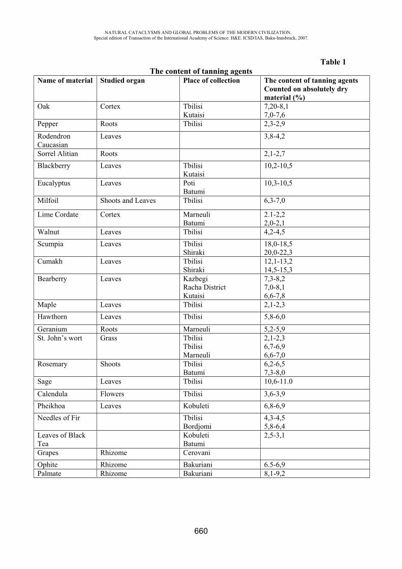
NATURAL CATACLYSMS AND GLOBAL PROBLEMS OF THE MODERN CIVILIZATION. Special edition of Transaction of the International Academy of Science. H&E. ICSD/IAS, Baku-Innsbruck, 2007.
660
Table 1 The content of tanning agents
Name of material Studied organ Place of collection The content of tanning agents Counted on absolutely dry material (%)
Oak Cortex Tbilisi Kutaisi
7,20-8,1 7,0-7,6
Pepper Roots Tbilisi 2,3-2,9
RodendronCaucasian
Leaves 3,8-4,2
Sorrel Alitian Roots 2,1-2,7 Blackberry Leaves Tbilisi
Kutaisi 10,2-10,5
Eucalyptus Leaves Poti Batumi
10,3-10,5
Milfoil Shoots and Leaves Tbilisi 6,3-7,0
Lime Cordate Cortex Marneuli Batumi
2.1-2,2 2,0-2,1
Walnut Leaves Tbilisi 4,2-4,5 Scumpia Leaves Tbilisi
Shiraki18,0-18,5 20,0-22,3
Cumakh Leaves Tbilisi Shiraki
12,1-13,2 14,5-15,3
Bearberry Leaves Kazbegi Racha District Kutaisi
7,3-8,2 7,0-8,1 6,6-7,8
Maple Leaves Tbilisi 2,1-2,3 Hawthorn Leaves Tbilisi 5,8-6,0
Geranium Roots Marneuli 5,2-5,9 St. John’s wort Grass Tbilisi
TbilisiMarneuli
2,1-2,3 6,7-6,9 6,6-7,0
Rosemary Shoots Tbilisi Batumi
6,2-6,5 7,3-8,0
Sage Leaves Tbilisi 10,6-11.0
Calendula Flowers Tbilisi 3,6-3,9 Pheikhoa Leaves Kobuleti 6,8-6,9 Needles of Fir Tbilisi
Bordjomi 4,3-4,5 5,8-6,4
Leaves of Black Tea
Kobuleti Batumi
2,5-3,1
Grapes Rhizome Cerovani Ophite Rhizome Bakuriani 6.5-6,9 Palmate Rhizome Bakuriani 8,1-9,2
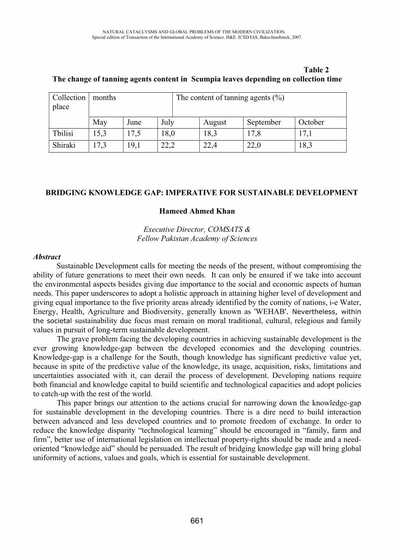
NATURAL CATACLYSMS AND GLOBAL PROBLEMS OF THE MODERN CIVILIZATION. Special edition of Transaction of the International Academy of Science. H&E. ICSD/IAS, Baku-Innsbruck, 2007.
661
Table 2 The change of tanning agents content in Scumpia leaves depending on collection time
Collection place
months The content of tanning agents (%)
May June July August September October Tbilisi 15,3 17,5 18,0 18,3 17,8 17,1 Shiraki 17,3 19,1 22,2 22,4 22,0 18,3
BRIDGING KNOWLEDGE GAP: IMPERATIVE FOR SUSTAINABLE DEVELOPMENT
Hameed Ahmed Khan
Executive Director, COMSATS & Fellow Pakistan Academy of Sciences
Abstract Sustainable Development calls for meeting the needs of the present, without compromising the ability of future generations to meet their own needs. It can only be ensured if we take into account the environmental aspects besides giving due importance to the social and economic aspects of human needs. This paper underscores to adopt a holistic approach in attaining higher level of development and giving equal importance to the five priority areas already identified by the comity of nations, i-e Water, Energy, Health, Agriculture and Biodiversity, generally known as 'WEHAB'. Nevertheless, within the societal sustainability due focus must remain on moral traditional, cultural, relegious and family values in pursuit of long-term sustainable development.
The grave problem facing the developing countries in achieving sustainable development is the ever growing knowledge-gap between the developed economies and the developing countries. Knowledge-gap is a challenge for the South, though knowledge has significant predictive value yet, because in spite of the predictive value of the knowledge, its usage, acquisition, risks, limitations and uncertainties associated with it, can derail the process of development. Developing nations require both financial and knowledge capital to build scientific and technological capacities and adopt policies to catch-up with the rest of the world.
This paper brings our attention to the actions crucial for narrowing down the knowledge-gap for sustainable development in the developing countries. There is a dire need to build interaction between advanced and less developed countries and to promote freedom of exchange. In order to reduce the knowledge disparity “technological learning” should be encouraged in “family, farm and firm”, better use of international legislation on intellectual property-rights should be made and a need-oriented “knowledge aid” should be persuaded. The result of bridging knowledge gap will bring global uniformity of actions, values and goals, which is essential for sustainable development.
NATURAL CATACLYSMS AND GLOBAL PROBLEMS OF THE MODERN CIVILIZATION. Special edition of Transaction of the International Academy of Science. H&E. ICSD/IAS, Baku-Innsbruck, 2007.
662
IV. PART: NOOSPHERE
SOLUTIONS FOR CHALLENGES OF THE MODERN CIVILIZATION ASSOCIATED WITH NATURAL CATACLYSMS
Do Valle, C. E.
Consulting Engineer, Member of the Presidium of the International Academy of Science - Health & Ecology, Member of Abeppolar, Brazil
1. Introduction Humanity faces serious global threats demanding deeper analysis for their resolution. In many
cases, current measures being taken are insufficient to curb the negative trends that can lead, sooner than believed, to disastrous consequences. The human influence on some types of natural cataclysms is now undeniable and already evident: climate change, water misuse, and desertification are examples of major negative impacts introduced by man on nature’s equilibrium that will result in catastrophic consequences. Recent conclusions exposed by IPCC conferences, based on scientific data, confirm the relevant fact that temperature rise will motivate the melting of glaciers and the rising of ocean level in the coming decades.
Such threats cannot be approached, however, by conventional countermeasures that contribute only to a gradual reduction of their effects on the parameters that command the natural equilibrium. More efficient and pragmatic solutions, based on new paradigms, are essential to overturn these natural cataclysms and their consequent tragedies.
The concept of paradigms shifts, exposed more than forty years ago by Thomas Kuhn in his magisterial book “The Structure of Scientific Revolutions” (Reference 5), should be used as a compassto deal with such major environmental challenges. According to Thomas Kuhn, when the traditional rules of normal science no longer define a playable game, a breakthrough solution conceiving a new paradigm should replace them.
Innovation is the keyword to keep in mind when time is short for conventional and gradual solutions, i.e. when the problem accelerates faster than our action to solve it does. Effective actions are urgently needed in our interfaces with the natural environment in order to curb the mounting effect that will result in the accumulation of tensions on the biosphere and the destruction of life.
Some solutions based on paradigmatic shifts already show encouraging results. The development of new sources of renewable energy as an alternative to the unchecked use of fossil fuels and the abolition of the use of several toxic substances from our daily life through the redesigning of products and the reviewing of production processes are indeed promising. Good examples are the international mechanisms set to eradicate some gases that are harmful to the ozone-layer in order to reduce at first and then eliminate the negative effect of such gases. This worldwide action became possible after the signing of an international commitment (the Vienna Convention on the protection of the Ozone-Layer of 1985) and is supported by funding and controlling mechanisms undertaken by the Montreal Protocol of 1987. Other examples of successful innovative solutions are the commercial use of wind power and sunrays for the generation of electrical energy and the production of bio-fuels used mostly for transportation. These solutions, all based on new paradigms, can arrest some of our growing concerns with the future of mankind, but the reversal of these impacts on the natural environment can only be effective if the actions are taken globally.
2. Historical background
NATURAL CATACLYSMS AND GLOBAL PROBLEMS OF THE MODERN CIVILIZATION. Special edition of Transaction of the International Academy of Science. H&E. ICSD/IAS, Baku-Innsbruck, 2007.
663
The quest for solutions aiming at problems created by mankind in its clashing relations with nature is relatively recent, if we consider historical facts and registers. Practical measures to prevent the extinction of living species and the exhaustion of non-renewable natural resources are recent institutions of the second half of the XX Century.
The distorted and pervert concept of diluting pollution was in use until the 1980’s – discharge of radioactive waste in the North Sea was a common practice, as was the incineration of very harmful wastes in international waters (at least one incinerator-ship was in use in the 1980’s for that purpose, and this was accepted as a good practice!). Solid waste discharge in uninhabited areas or in the outskirts of large cities was candidly accepted, and the impacts on the atmosphere caused by industrial air pollution were thought to be avoided by increasing the height of the chimneys that emitted all sorts of gases and particles. Risk Assessment methodologies were unknown until they were developed and adopted by process industries (particularly the chemical industries) in their struggle to prevent accidents. On the other hand, civil defence procedures were taken merely to diminish the effects of natural cataclysms, after they happened. At the turning of the millennium, the prevailing attitude was to minimize the volume of pollutants generated, and to find a safer destination for the solid waste rather than dump them in the conventional landfills used for discharging communal garbage.
With a growing concern motivated by some emblematic accidents, however (e.g. Seveso, Bophal, Chernobyl, Exxon Valdez just to mention a few in a long list of disasters), a new approach was necessary: risk assessment analyses recommended rethinking the problems from their starting point, and developing more effective solutions to circumvent new accidents. Therefore, industries had to rethink their production processes eliminating risky raw materials and unsafe equipment; shipbuilders had to fit their products with double hulls (double bottoms were already a common practice); old-fashioned nuclear reactors had to be entirely refitted, or definitely scrapped. As a result of this growth in responsibility, industry and maritime accidents were drastically reduced in the last decade, thanks to preventive measures that led to innovative technical solutions and stricter risk management procedures (Reference 4).
3. The sense of urgency and the call for action Several global disasters provoked by mankind are now at our doors. Shortage of freshwater,
depletion of natural resources, explosive growth of urban over-populated areas, ruthless expansion of agriculture over areas still forested, and expanding desertification are some themes that require urgent action if we are to avert their disastrous consequences on nature in time. These complex problems call for appropriate crisis management attitudes leading to a consistent evaluation of their consequences as a basis for long-lasting solutions although, unfortunately, gradualist solutions continue to be the fulcrum of current measures.
Although the market price of a non-renewable natural resource can signal its scarcity (or excess) at a given moment, market price does not necessarily reflect the trend of its future exhaustion. In consequence, it is misleading to expect that free market forces could anticipate a disruption in the future supply of a given good inducing society to preserve it. To curb the explosive over-use of natural resources, it is of paramount importance that corrective actions be taken well ahead of their exhaustion.
The principles of the Cartesian logic and the use of the traditional linear method of thinking are not sufficient to conceive time-lasting solutions to overcome the risks that lead to a natural cataclysm. A radically new approach, many times unusual and unexpected, is necessary to encourage changes that imply transforming the status quo: thinking as usual does not lead, as a rule, to creative solutions. One of the approaches to face these global challenges can be found in the concept of lateral thinking, exposed by Edward de Bono in his work “The use of Lateral Thinking” (Reference 1).
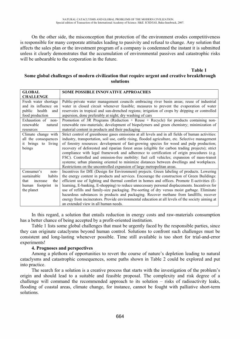
NATURAL CATACLYSMS AND GLOBAL PROBLEMS OF THE MODERN CIVILIZATION. Special edition of Transaction of the International Academy of Science. H&E. ICSD/IAS, Baku-Innsbruck, 2007.
664
On the other side, the misconception that protection of the environment erodes competitiveness is responsible for many corporate attitudes leading to passivity and refusal to change. Any solution that affects the sales plan or the investment program of a company is condemned the instant it is submitted unless it clearly demonstrates that the accumulation of environmental passives and catastrophic risks will be unbearable to the corporation in the future.
Table 1 Some global challenges of modern civilization that require urgent and creative breakthrough
solutions
GLOBALCHALLENGE
SOME POSSIBLE INNOVATIVE APPROACHES
Fresh water shortage and its influence on public health and food production
Public-private water management councils embracing river basin areas; reuse of industrial water in closed circuit whenever feasible; measures to prevent the evaporation of water reservoirs in tropical and sun-drenched regions; irrigation of crops by dripping or controlled aspersion, done preferably at night; dry washing of cars
Exhaustion of non-renewable natural resources
Promotion of 3R Programs (Reduction + Reuse + Recycle) for products containing non-renewable raw-materials; development of biopolymers and green chemistry; minimization of material content in products and their packaging
Climate change with all the consequences it brings to living beings
Strict control of greenhouse gases emissions at all levels and in all fields of human activities: industry, transportation, soil use, cattle rising, flooded agriculture, etc. Selective management of forestry resources: development of fast-growing species for wood and pulp production; recovery of deforested and riparian forest areas (eligible for carbon trading projects); strict compliance with legal framework and adherence to certification of origin procedures (e.g. FSC). Controlled and emission-free mobility: fuel cell vehicles; expansion of mass-transit systems; urban planning oriented to minimize distances between dwellings and workplaces. Restrictions on the uncontrolled expansion of large metropolitan areas.
Consumer’s non-sustainable habits that increase the human footprint in the planet
Incentives for DfE (Design for Environment) projects. Green labeling of products. Lowering the energy content in products and services. Encourage the construction of Green Buildings: efficient use of lighting and thermal comfort in homes and offices. Promote E-activities (E-learning, E-banking, E-shopping) to reduce unnecessary personal displacements. Incentives for use of refills and family-size packaging. Pre-sorting of dry versus moist garbage. Eliminate hazardous substances in products and packaging. Recover methane from landfills; recover energy from incinerators. Provide environmental education at all levels of the society aiming at an extended view in all human needs.
In this regard, a solution that entails reduction in energy costs and raw-materials consumption has a better chance of being accepted by a profit-oriented institution.
Table 1 lists some global challenges that must be urgently faced by the responsible parties, since they can originate cataclysms beyond human control. Solutions to confront such challenges must be consistent and long-lasting whenever possible. Time still available is too short for trial-and-error experiments!
4. Prognoses and perspectivesAmong a plethora of opportunities to revert the course of nature’s depletion leading to natural
cataclysms and catastrophic consequences, some paths shown in Table 2 could be explored and put into practice.
The search for a solution is a creative process that starts with the investigation of the problem’s origin and should lead to a suitable and feasible proposal. The complexity and risk degree of a challenge will command the recommended approach to its solution – risks of radioactivity leaks, flooding of coastal areas, climate change, for instance, cannot be fought with palliative short-term solutions.
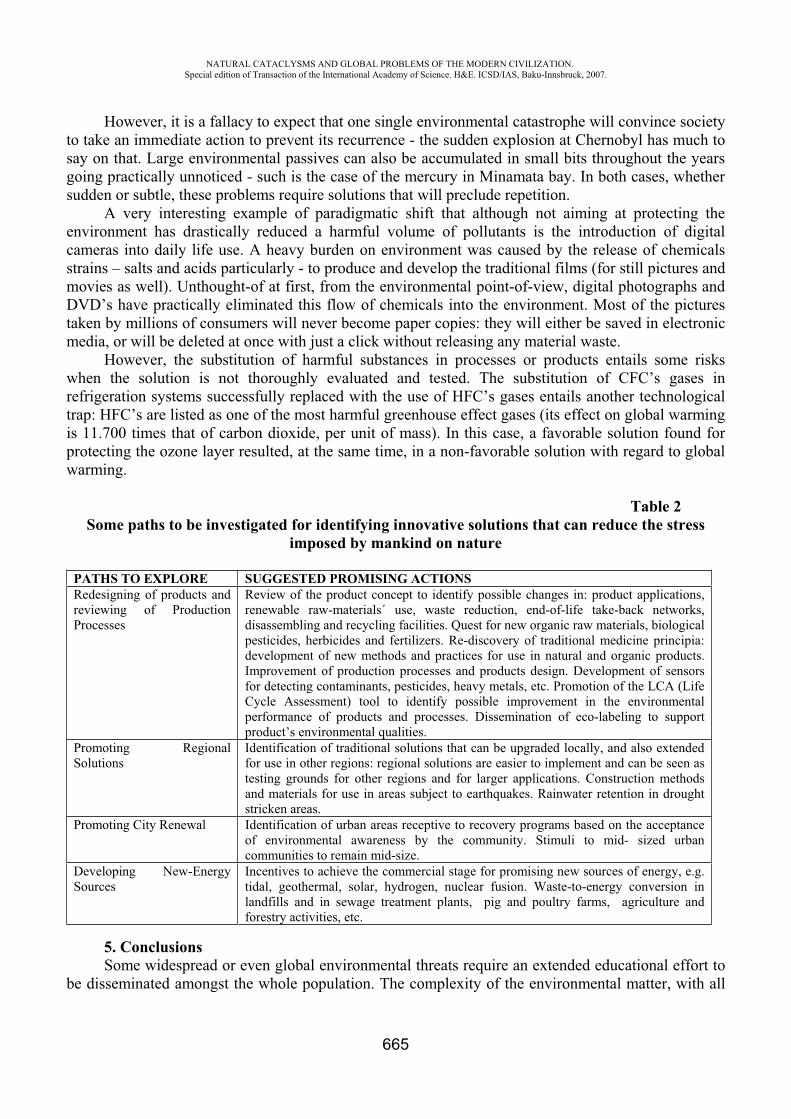
NATURAL CATACLYSMS AND GLOBAL PROBLEMS OF THE MODERN CIVILIZATION. Special edition of Transaction of the International Academy of Science. H&E. ICSD/IAS, Baku-Innsbruck, 2007.
665
However, it is a fallacy to expect that one single environmental catastrophe will convince society to take an immediate action to prevent its recurrence - the sudden explosion at Chernobyl has much to say on that. Large environmental passives can also be accumulated in small bits throughout the years going practically unnoticed - such is the case of the mercury in Minamata bay. In both cases, whether sudden or subtle, these problems require solutions that will preclude repetition.
A very interesting example of paradigmatic shift that although not aiming at protecting the environment has drastically reduced a harmful volume of pollutants is the introduction of digital cameras into daily life use. A heavy burden on environment was caused by the release of chemicals strains – salts and acids particularly - to produce and develop the traditional films (for still pictures and movies as well). Unthought-of at first, from the environmental point-of-view, digital photographs and DVD’s have practically eliminated this flow of chemicals into the environment. Most of the pictures taken by millions of consumers will never become paper copies: they will either be saved in electronic media, or will be deleted at once with just a click without releasing any material waste.
However, the substitution of harmful substances in processes or products entails some risks when the solution is not thoroughly evaluated and tested. The substitution of CFC’s gases in refrigeration systems successfully replaced with the use of HFC’s gases entails another technological trap: HFC’s are listed as one of the most harmful greenhouse effect gases (its effect on global warming is 11.700 times that of carbon dioxide, per unit of mass). In this case, a favorable solution found for protecting the ozone layer resulted, at the same time, in a non-favorable solution with regard to global warming.
Table 2 Some paths to be investigated for identifying innovative solutions that can reduce the stress
imposed by mankind on nature
PATHS TO EXPLORE SUGGESTED PROMISING ACTIONS Redesigning of products and reviewing of Production Processes
Review of the product concept to identify possible changes in: product applications, renewable raw-materials´ use, waste reduction, end-of-life take-back networks, disassembling and recycling facilities. Quest for new organic raw materials, biological pesticides, herbicides and fertilizers. Re-discovery of traditional medicine principia: development of new methods and practices for use in natural and organic products. Improvement of production processes and products design. Development of sensors for detecting contaminants, pesticides, heavy metals, etc. Promotion of the LCA (Life Cycle Assessment) tool to identify possible improvement in the environmental performance of products and processes. Dissemination of eco-labeling to support product’s environmental qualities.
Promoting Regional Solutions
Identification of traditional solutions that can be upgraded locally, and also extended for use in other regions: regional solutions are easier to implement and can be seen as testing grounds for other regions and for larger applications. Construction methods and materials for use in areas subject to earthquakes. Rainwater retention in drought stricken areas.
Promoting City Renewal Identification of urban areas receptive to recovery programs based on the acceptance of environmental awareness by the community. Stimuli to mid- sized urban communities to remain mid-size.
Developing New-Energy Sources
Incentives to achieve the commercial stage for promising new sources of energy, e.g. tidal, geothermal, solar, hydrogen, nuclear fusion. Waste-to-energy conversion in landfills and in sewage treatment plants, pig and poultry farms, agriculture and forestry activities, etc.
5. ConclusionsSome widespread or even global environmental threats require an extended educational effort to
be disseminated amongst the whole population. The complexity of the environmental matter, with all
NATURAL CATACLYSMS AND GLOBAL PROBLEMS OF THE MODERN CIVILIZATION. Special edition of Transaction of the International Academy of Science. H&E. ICSD/IAS, Baku-Innsbruck, 2007.
666
the technical aspects and social connotations it comprises, makes its comprehension difficult to a fraction of the population, particularly to people holding only a basic degree of education. In such cases, new methods may be necessary to transmit these environmental anxieties to the common people through mass education techniques to sensitize them to the environmental challenges without rising hysterical, or panic stricken attitudes.
A sound argument to motivate the society to adhere to good practices of environmental conservation is to link it to the risk of increasing the chances of natural cataclysms. Floods, droughts, desertification are cataclysms closely related to the human daily life, and its comprehension is easily grasped by most people.
The dissemination of a civil defence oriented education can also be a very important step toward facing the risks of natural cataclysms. But, it is imperative that present and future generations also learn to expend less more efficiently in the pursuit of better living conditions without forfeiting the pleasure of consuming. That could be a real shift of paradigm. In this regard, environmental incentives and rewards to stimulate creative ideas and innovative solutions are tantamount to this process of rethinking our relations with the environment.
In large measure, mankind in itself constitutes one of these major challenges. Of paramount importance is the unchecked growth of human population endangering the Earth’s supply of natural resources while increasing the ecological footprint to a point of no-return. Family planning, responsible parenthood, taxation versus incentives must be urgently considered. That would lead to a true shift in paradigm that would turnaround the course of extinction that humanity would face if nothing is done to control its reckless expansion.
The environmental impacts caused by modern civilization are now exerting direct influence on nature’s equilibrium to a point they are clearly affecting some natural cataclysms. The occurrence of tornados, floods and droughts are undoubtedly being influenced by man. In spite of the region in which they occur, however, political borders should not be invoked to restrict, or interfere with solutions found for global and transboundary challenges. “Science without Borders” should be a dictum to support these actions. There is just one Earth to manage – fragile, blue and inextensible – and conflicting approaches for competing actions would most certainly not benefit this quest for human survival.
REFERENCES 1. De Bono, E.: The Use of Lateral Thinking, London, UK: Jonathan Cape, 1967 2. Do Valle, C. E.: One Step Ahead of Environmental Regulations – A cultural Change: Durban,
Republic of South Africa: Proceedings 11th World Clean Air & Environment Congress, IUAPPA, 1998
3. Do Valle, C. E.: Hazardous Waste in Emerging Economies: Baku-Innsbruck: Science without Borders - Transactions of the International Academy of Science H&E, Volume 1, 2003/2004
4. Do Valle, C.E, Lage, H.: Environment: Accidents, Lessons, Solutions, São Paulo: Editora Senac São Paulo, 2004
5. Kuhn, T. S.: The Structure of Scientific Revolutions, Chicago, USA: The University of Chicago, 1962
NATURAL CATACLYSMS AND GLOBAL PROBLEMS OF THE MODERN CIVILIZATION. Special edition of Transaction of the International Academy of Science. H&E. ICSD/IAS, Baku-Innsbruck, 2007.
667
About the philosophical essence of safety of natural and technical objects (systems)
F.G. Gabibov*, H.M. Huseinov**, H.O. Ojagov***
Azerbaijan Research Institute of Building and Architecture. Azerbaijan
The variety of determinations and explanations of the safety of natural and technical objects (systems) does not solve the problem of realizing the phenomenon and its determination form. A great number of determinations and explanations do not ensure transition from notion to realizing the essence of safety of natural and technical objects (systems).
The creational disperseness of criticism of present notions of the safety of natural and technical objects (systems) shows that the criterion of essence is not used or even considered. That means that a researcher using his own special criterion within the limits of the solved problem which help to solve it is limited by his own research limits indeed.
Criticizing utilitarian notions he sets his own one no less utilitarian understanding of the phenomenon instead of the notions criticized.
The lack of a criterion allowing to separate the essence of the phenomenon from its displays does not let find its rightness or incorrectness of any notions of the safety of natural and technical objects (systems). It is possible to declare that some notion of the safety of natural and technical objects (systems) may be criticized regarding to the objective reality, existing notions and so on but not to the essence because it remains un unknown yet.
It becomes obvious that it is necessary to pass from the analyze of existing notions to the solutions of another research problem of realizing the essence of the safety of natural and technical objects (systems).
At the same time it is important to understand what the defects of existing approaches to revealing the essence and determining the notion of the safety of natural and technical objects (systems) are.
The main reason of notional uncertainness of the phenomenon of the safety of natural and technical objects (systems) is inadequateness of the methodological means applied to the solved problem.
Not finding the solutions of the problem of determination of the notion of the safety of natural and technical objects (systems) demonstrated obvious insufficiencies of formal and logical approach to understand the essence of the phenomenon and its notional determination.
While researching the essence of the safety of natural and technical objects (systems) it is necessary to differ the theoretical approach (attitude) and practical and applied (empiric) one (attitude).
In the basis of the applied practical attitude to the knowledge there lies not intellectuality but the researcher’s resolute position.
The result of practical attitude is not understanding the essence of the object but just the subject’s returning to itself which was made average by the object. In the contrary to the practical one the theoretical attitude to the studied object demands to throw away any subjective features, preference and so on, and the phenomenon was understood as it is itself. According to the approaches they differ theoretical and empirical thinking the difference between which is a necessary precondition of correctness of theoretical research.
Theoretical thinking leads to forming a theoretical construction “improvement and development of conceptual means of science”, building “the theoretical world”. The aim of empirical thinking is
NATURAL CATACLYSMS AND GLOBAL PROBLEMS OF THE MODERN CIVILIZATION. Special edition of Transaction of the International Academy of Science. H&E. ICSD/IAS, Baku-Innsbruck, 2007.
668
“the establishment links of the conceptual apparatus of science and reality revealed in tests and watching”[1, 2].
Accordingly they differ notions which may have empirical or theoretical forms. As a subjective reflection of reality the notion may be in two main forms:1) an empirical notion,
realizing the subjective need in notional difference between the phenomena; 2) a theoretical notion demonstrating the essence as the objective need of the phenomenon itself, therefore, speaking about the safety of natural and technical objects (systems) it is necessary to differ the applied empirical notion and theoretical one of the safety of natural and technical objects (systems).
The researcher’s empirical applied position, his practical attitude predetermine the subjective character of notions. As the phenomenon of safety is studied not as it itself but from the point of appliment because the theoretical attitude is substituted by the practical attitude and the desirable one. As a matter of fact is introduced as a real one. In the notion of the safety of natural and technical object (systems) instead of its objective essence they set what must be provided: the state of stableness, the state of protection, the state of reliability; the state of accordance with the proper quality and so on.
The inevitable result of practically acceptable interested position of a researcher is the phenomenon of the safety of natural and technical objects (systems) is studied not as it essentical notion but utilitarian and essential one according to the definite needs, first of all, the practical needs.
The result of the utilitarian approach is when using the notional determination, as a rule, they do not take account of the difference between the notion of the safety of natural and technical objects (systems) as a reflection of the safety oh the definite objects (systems) in the definite conditions and objective essence of the phenomenon and content. So researches usually consider the safety of natural and technical objects not notionally, but essencially in the certain form of existing one (private, local, technical, natural, ecological, regional, interregional, global, planetar safety and so on).
The study of the content of the safety of natural and technical objects (systems) in the certain conditions may be more important than the knowledge of the essence of the safety of natural and technical objects (systems).
The undoubted precondition of studying the safety of the certain of natural and technical object (system) is understanding the universality included in the phenomenon.
The result of concrete and essential approach to studying the safety of natural and technical objects (systems) without understanding the essence of the phenomenon is the substitution of universality with a special one, simple one - with a complex one.
Where the truth of the notions can be visibly checked man quickly learns to compare his views with the objective reality. It is more difficult when the authenticity can not be checked in practice as the ideal character of the studied object does not allow visually to check subjective notions, the theorist who has found, as it seems to him, “the proofs” of validity of the notion thinks that he has reached the knowledge. To tell the truth, it lasts till reality lets him get out of that imaginary state. Till the authenticity of one of the notions is proved it cannot be said that it has the authenticity according to its content. But because of the same reason it cannot be declared the contrary thing, in other words, the present notions of the safety of natural and technical objects (systems) do not have the true content because it has not been proved.
In fact, the lack of the correct conclusion of the theoretical notion leads to disappearing the only criterion allowing to separate the notion from the subjective imagination. Till the authenticity of the conclusion of one of the notions (not according to the subject’s notions, but its objective essence) is not proved it cannot put in a claim on the status of a theoretical notion.
That does not exclude that owing to the researcher’s excellent intuition some determination may be identical to the notion according to its content. But as its notional character has not been revealed yet it is just a subjective explanation of the notion. If we want to understand and notionally form just the essence of the safety of natural and technical objects (systems), not our subjective ideals, then the
NATURAL CATACLYSMS AND GLOBAL PROBLEMS OF THE MODERN CIVILIZATION. Special edition of Transaction of the International Academy of Science. H&E. ICSD/IAS, Baku-Innsbruck, 2007.
669
theoretical notion must be found out of the objective essence of the phenomenon. But then at once there appears the problem of the correct finding without solving which no determination can pretend to the status of a notion.
The theoretical problem of understating the essence of the phenomenon of the safety of natural and technical objects (systems) is impossibility of gaining it spontaneously and at the same time indistictness (by means of what method) it can be accepted so that the determination reflexes not subjective determination but objective essence.
The long and not successful enough attempts of theoretical solutions of the problem has led to the search of qualitatively new appveaches. The main ay out the present situation is seen by many researchers in transition to metatheoretical level of research work. Philosophy is considered to play the main role in solving the present theoretical problem? Not just formal with its modern nature - research, nature – ecological, socially ecological and noospheral content and thinking.
REFERENCES
1. Shiriyev V.S. Theoretical and empirical in scientific knowledge. M., 1978. 2. 2. P.V. Alekseyev, A.V. Panin Theory of knowledge and dialectics. M., High school, 1991.
ETHNOCULTURAL DIVERSITY AND ECOLOGICAL CULTURE: ON THE WAY TO SUSTAINABILITY
Glazachev S.N.*, Glazachev O.S.**
M.A. Sholokhov Moscow State Humanitarian University, Russia Russian Section of the International Academy of Science, Moscow, Russia
The experience of last decades shows that external methods of solving economic problems concerning humans (social, political, economical, technical and others) give no positive result as they do not affect the inner human nature solely directed towards the satisfaction of material needs. It is necessary to change radically human behavior and attitude to the nature by correction of human inner world: outlook, spiritual needs, changes in moral values and goals. The culture which we translate in education should be corrected in depth to become ecological, harmonizing human needs and nature potentials.
Sustainable development is nowadays regarded as strategy of human survival. However in practice it becomes just another utopia not scientifically substantiated and therefore absolutely unproductive. Despite the fact that the notion “sustainability” was widely spread after the Summit in Stockholm in 1972, the more scientists come to conclusion that because of frequent ungrounded thoughtless use of the term it loses its meaning and becomes a stamp. It happened, as I.Kuchuradi noted, with the notion “development” and “globalization”. As another myth E.V.Girusov calls the idea of sustainable development.
Meanwhile the roots of the idea of development comfortable to nature, harmonious, fit in the universum are presented in the deep layers of culture, in ethnos formation, their harmonious whereabouts in the environment, in the scientific works of predecessors who proved the role of living
NATURAL CATACLYSMS AND GLOBAL PROBLEMS OF THE MODERN CIVILIZATION. Special edition of Transaction of the International Academy of Science. H&E. ICSD/IAS, Baku-Innsbruck, 2007.
670
material (biota) in formation and preservation of life on the planet (V.I.Vernadsky, N.N. Moiseev, U.R. Kutton et al.) and our contemporaries [2, 3, 6, 7]. The scientific bases of balanced interaction of society and the nature are presented in the theory of biotic regulation of V.G. Gorshkov [4].
To make the idea of sustainability viable is possible only being free of PR, populism and formalities by deep sociological, ethnographic and geoecological investigations, utilizing scientific moral and spiritual potentials of the mankind [1].
The mankind increasingly more realizes itself a collective subject of biosphere, the scale and consequences of its impact on the Earth. This unity is deepened by a great variety of national socio-natural ecosystems, ecological cultures of ethnoses.
That diversity is sina qua non of good health (welfare) of biological and social systems. Culture is a “second nature” and a principle of diversity is also typical of it. Reduction in diversity is a general criteria of ecological degradation for socionatural system as well as for the nature.
“Ecological culture presumes such a mode of life when a society by system of moral values, ethic principles, ecological mechanisms, legal laws and social institutions can form the needs and means of their realization, which do not create a threat for the life on the Earth” (Moscow International Declaration on Ecological Culture, 1998)
Varieties in ecological culture are born by varieties in Nature. Even under preservation of typical zone features the local landscapes are always individual and unique. The picture of the Nature becomes more complicated with the appearance of society. Originality in the nature is defined by peculiarities of a special style of coping with the Nature.
From the point of view of ecological culture, which we call “culture of links” it is evident that every sphere of life (economic, social, moral) is important. However, having much in common in social reproduction, human communities differently form their cultural traditions, priorities and forms of land development. For example, for a Kazakh ethnos to ecologically cope with the land means to learn to move around boundless steppes with herds of cattle from one spring of water to another. While exploiting the pastures Kazakhs always have in mind the possibilities of their restoration. In Holland where people over the centuries created their life area on the sea ground the notion of ecological culture is quite different. Though quite different these are modes of ecological culture, optimal methods of society inclusion into a definite ecosystem.
Originality as a universe property of Nature is reproduced in culture. What is common in one culture could be interpreted as absolutely uncommon in the other ethnos. For example, to go mushrooming to the forest is a fascinating hobby and even business for Russians but the Swedes consider it as infringement upon squirrels’ interests.
The studies of ecological culture of different ethnoses make possible to note the rules detected by classical ecology as common ones for all living i.e. not a single organism survives but a collective one. Individual cultural type first arises in the kin. Just group, collective but not individual space becomes an initial space of forming human activity, for culture.
All elements and peculiarities of nature are absorbed and reproduced by the society: in language a sound shape of nature is reverberated; in legends and traditions – the attitude to the nature; in logics, the way of behavior – interaction, adaptation to the mastering of the landscape. Later on, on the basis of these social commonalities, political, economic and other commonalities arise. As a result a nation as an element of national ecosystem is formed.
The wealth of ecological system of the mankind on the earth is great and changes in the course of time – the space of ecological culture also changed. Nations are formed, making complex ethnoses and super ethnoses. Civilizations, as peculiar types of culture, ways of combination and manifestation of types of development distinctive for definite ethnic groups, appear. People and nations play an active role in building of national civilized ecosystem. People on different stages of its development play a role of an ecological system-forming factor.
NATURAL CATACLYSMS AND GLOBAL PROBLEMS OF THE MODERN CIVILIZATION. Special edition of Transaction of the International Academy of Science. H&E. ICSD/IAS, Baku-Innsbruck, 2007.
671
It is impossible to solve the question of ecological culture of different ethnoses without analyzing the correlation of ethnos, landscape and culture. A deep analysis of interaction of a definite ethnos with the surrounding landscape on the grounds of culture formation will help to see its ecological culture as an universum, as a way of realization of its essence.
There are many definitions for ethnos. We have chosen very simple and common one. Ethnos –is a nation. This is what a person identifies himself with when answering the question: Who are you? (the answer could be – Russian, German, French, Mongol or Japanese). We regard ethnos not as a static state but together with its coming-to be language, place, space and so on). Ethnic self consciousness –is a universal phenomenon.
At present the statement that there are places where man has never been before is archaic. Deserts, rainforests, mountains show the traces of humans by way of material and spiritual culture. Antroposphere because of the variety of landscapes and types of their mastering turns into ethnosphere – a mosaic space of different ethnoses.
It should be stated that not human individuals but human communities, collectives that mastered the culture as supragenetic character of evolution and social organization have inhabited the Earth. However, despite a various social organization and methods of interaction with the environment a human remains a biological being and nobody can “cancel” the natural laws of his development.
It is known that the character of ontogenesis often differs from the rhythms of development of social history of mankind [5]. Independent from the level of technical and economical development all necessary resources a man gets from Nature. A human presents the highest link of the chain of the inhabited geobiocenosis. Ecosystems in their turn are the part of common integrity – planet’s biosphere. Under condition of global ecological crisis it is very important to understand which factors of human activities are fatal for landscapes inhabited by definite ethnoses as soon as ruinous for people destruction of nature is closely connected with development of culture, technics, economy.
A man keeps the nature save for himself and from himself. It means that the cause of ecological crisis should be found not in the nature but in a man, in his consciousness, behavior and activities. The nature, its living material converting the sun’s energy and radio-decay in the depths of the Planet overcomes the world’s entropy. A man on the contrary, creating the anthroposphere turns the nature order into chaos, i.e. increases the entropy.
Every society strives for saving its individuality and independence, i.e. self preservation. At the same time the population of the world is interacting and can not be isolated from each other. Exchange of material, energy, information between national ecosystems happens under the influence of two principal tendencies: to draw together or to be isolated.
Domination of the tendency to approaching could lead to a confluence of national ecosystems, to a decrease in diversities i.e. to degradation. But an absolute isolation of national ecosystems, the closure of exchange could mean their degeneracy. A closed system has no outside control, becomes self-interested and results in degradation. Excessive isolation, sharp division of the world on “we”, our ethnos and “they” – the rest is, another extreme not less dangerous from the ecological point of view. If ecosystems are closed for a dialog, break relations with other ecosystems, a crisis ecological situation arises. Ecosystems, nonchalant to others, are ready to use the others as a garbage. The scheme according to which ecological crisis takes place between nature and society is repeated in the relations between national ecosystems. As a result very often the improvement, development of one of the processes in national ecosystem leads to deterioration, degradation in another ecosystem and threatens the integrity of the whole biosphere of the Earth. A striking example of that shows the ecological policy of the United States. “Withdrawal” from Kyoto Protocol about reduction of hotbed gas emission (though the American industry –is the main air pollutant), the refusal to sign Convention on preservation of biological diversities, the statement that the American Government will not sign any ecological protocol that infringes the interests of American business - all these characterizes the
NATURAL CATACLYSMS AND GLOBAL PROBLEMS OF THE MODERN CIVILIZATION. Special edition of Transaction of the International Academy of Science. H&E. ICSD/IAS, Baku-Innsbruck, 2007.
672
ideology of mono-polar world and achievements of “sustainable development” of America at the expense of the other countries and nations.
So in the view of ecological culture, it is essential to avoid extremes, to keep an eye on the maintenance of measures in openness and closure of national ecosystems. That also applies to eco-culture as soon as a global ecosystem is originally reflected in the cultures of different nations. There are specific “national images of the world” [3]. At present there is a need in considerable closing of significant world outlooks separately built within ethnic national cultures, the need to overcome a local inflexibility of some values and priorities in order to keep ethno-natural diversities.
On the early stages of development all human communities without any exception are characterized by syncletic type of thinking which puts a human in dependence on environment and “supranature” forces.
Legends, magic practice helped to create “order from chaos”, the experience of natural coming into being consciousness, the first experience of cultural work. As M.Buber noted, the unity of Spirit and instincts and the appearance of a new mental instinct stand in the cradle of culture. In the epoch of technocracy, maximum alienation from the Nature a human being realizes all imperfection of his behavior, thinking and culture. Under the thread of environmental transformation a man has to seek the ways to go back to nature, to comprehend himself as a part of the whole which is called Nature.
REFERENCES
1. Anisimov O.S., Glazachev S.N. Ecological culture: ascension to the spirit. M., 2005, 186 p. 2. Vernadsky V.I. Biosphere and Noosphere. M.: “Airis-press”, 2004, 576 p. 3. Gachev G.D. National Images of the World. M., 1998, 238 p. 4. Gorshkov V.G. Physical and biological grounds of life sustainability. M., 1995, 472 p. 5. Gumilyov L.N. Ethnogenesis and Biosphere of the Earth. M.:“Rolf”, 2001, 560 p. 6. Kutton U.R. The end of technoutopia. Kiev: “Ekopravo”, 2006, 256 p. 7. Medouz D.Kh., Medouz D.L., Randers Y. Beyond the Limits. M.: “Progress”, 1994, 304 p.
SUN ENERGY RESERVES AND ECONOMICAL VALUE OF NAKHICHIVAN AUTONOMIC REPUBLIC
Hasanov A.*, Guliyev A.**
Nakhichivan State University, Azerbaijan
The territory of Nakhichivan Autonomic Republic is 380 511 and 390 411 north width 440 451
with 460 101 east lengthy. The aria is 5363 km2. The width place is 75 km It this narrow place the high is 3306 metro. The aria in Qapidgiq mountain (3906 m) aria 0,15 km2 .There is always snow or ice here but in plain the temperature highs up to 40-45 sells. There are all components here and sun radiation chinches between145-160 k .kale. sm2. Nakhcihivan regions situated between 38-39 north width and the shortest day is on 22-ad. of December 9 hours 23 minutes. The length of the day in a month is to 10 hours. The length of the day is on gone 22 is 14 hours 39 minutes. To differ Nakhichivan from other regions of Azerbaijan there is much sun energy. For the present time don’t use sun energy here.
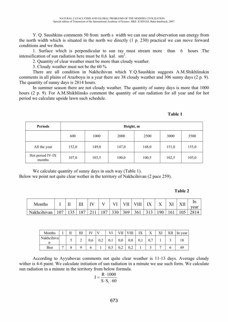
NATURAL CATACLYSMS AND GLOBAL PROBLEMS OF THE MODERN CIVILIZATION. Special edition of Transaction of the International Academy of Science. H&E. ICSD/IAS, Baku-Innsbruck, 2007.
673
Y. Q. Saushkins comments 50 from north s width we can use and observation sun energy from the north width which is situated in the north we directly (1 p. 230) practical we can move forward conditions and we them. 1. Surface which is perpendicular to sun ray must stream more than 6 hours .The intensification of sun radiation here must be 0,6 kal. sm2. 2. Quantity of clear weather must be more than cloudy weather. 3. Cloudy weather must not be the 60 % There are all condition in Nakhcihivan which Y.Q.Saushkin suggests A.M.Shikhlinskin comments in all plains of Arazboyu in a year there are 38 cloudy weather and 306 sunny days (2 p. 9). The quantity of sunny days is 2814 hours. In summer season there are not cloudy weather. The quantity of sunny days is more that 1000 hours (2 p. 9). For A.M.Shikhlinsks comment the quantity of sun radiation for all year and for hot period we calculate upside lawn such schedule.
Table 1
Periods Height, m
600 1000 2000 2500 3000 3500
All the year 152,0 149,0 147,0 148,0 151,0 155,0
Hot period IV-IX months 107,0 103,5 100,0 100,5 102,5 105,0
We calculate quantity of sunny days in such way (Table 1). Below we point not quite clear wether in the territory of Nakhcihivan (2 pace 259).
Table 2
Months I II III IV V VI VII VIII IX X XI XII Inyear
Nakhcihivan 107 135 187 211 187 330 369 361 313 190 161 105 2814
Months I II III IV V VI VII VIII IX X XI XII In yearNakhcihiva
n 5 2 0,6 0,2 0,1 0,0 0,0 0,1 0,7 1 3 18
Bist 7 8 9 6 1 0,5 0,2 0,2 1 3 7 6 49
According to Ayyubovas comments not quite clear weather is 11-13 days. Average cloudy wither is 4-6 paint. We calculate initiation of sun radiation in a minute we use such form. We calculate sun radiation in a minute in the territory from below formula.
60SS1000RI1

NATURAL CATACLYSMS AND GLOBAL PROBLEMS OF THE MODERN CIVILIZATION. Special edition of Transaction of the International Academy of Science. H&E. ICSD/IAS, Baku-Innsbruck, 2007.
674
R.1000 – The point of sun radiation S - The point of sunny days S1 - Sunny days in a day 60-intesification in a minute Radiation in the territory is 145-160 kkal. sm2 R-is 152 kkal.,
S 1 -in sunny days is 10 hours
2
1
82.06010306
100015260SS
1000RI smkal
It is clear radiation of intensification in a minute in the territory of Nakhcihivan is 0, 82 kal.sm2. We calculate intensification of radiation in a minute in all year in such way
Table 4
PeriodsHeight, m
600 1000 2000 2500 3000 3500
All the year 0,82 0,81 0,80 0,80 0,82 0,84
Hot periods 1V-1X 0,97 0,94 0,91 0,91 0,93 0,95
As you see on seduces to climb on average mountains intensification of radiation oliminishs. On average mountains radiation heights up. From calculation we see it is impossible to use sun energy in Nakhichivan.
For this there are all condition compensates. In the territory sun radiation is 145-160 k.kal\sm2
(2 pace 13). It is to 145 000 -160 000 kal./sm2. One kal. enercy is 4,19 joule (4 p. 163) in all the year 607 500 -670 400 joule. Heat energy is gathering (5). One kilowatt electric energy is 360 000 joule (4 p. 143) that is why to every sm2 area 0,169-0,186 kwt. hour electric energy is gathering (p. 6). This electric energy may lighten one number lamp (100 wt) about 2 hours.
According A. M. Shikhlinskis compete below from shed Ute you can see now electric energy gathers for one centimeter for one meter for one hectare area.
We calculate for this
36000004,191000)(R
S
We use for this form.
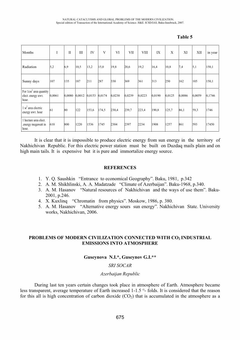
NATURAL CATACLYSMS AND GLOBAL PROBLEMS OF THE MODERN CIVILIZATION. Special edition of Transaction of the International Academy of Science. H&E. ICSD/IAS, Baku-Innsbruck, 2007.
675
Table 5
Months I II III IV V VI VII VIII IX X XI XII in year
Radiation 5,2 6,9 10,5 13,2 15,0 19,8 20,6 19,2 16,4 10,8 7,4 5,1 150,1
Sunny days 107 135 187 211 287 330 369 361 313 250 162 105 150,1
For 1 2 area quantity elect. energy w .hour.
0,0061 0,0080 0,0012 0,0153 0,0174 0,0230 0,0239 0,0223 0,0190 0,0125 0,0086 0,0059 0,1746
1 2 area electric energy w . hour 61 80 122 153,6 174,5 230,4 239,7 223,4 190,8 125,7 86,1 59,3 1746
1 hectare area elect. .energy megawatt in hour.
610 800 1220 1536 1745 2304 2397 2234 1908 1257 861 593 17450
It is clear that it is impossible to produce electric energy from sun energy in the territory of Nakhichivan Republic. For this electric power station must be built on Duzdaq mails plain and on high main tails. It is expensive but it is pure and immortalize energy source.
REFERENCES
1. Y. Q. Saushkin “Entrance to economical Geography”. Baku, 1981, p.342 2. A. M. Shikhlinski, A. A. Madatzade “Climate of Azerbaijan”. Baku-1968, p.340. 3. A. M. Hasanov “Natural resources of Nakhichivan and the ways of use them”. Baku-
2001, p.246.4. X. Kuxlinq “Chromatin from physics”. Moskow, 1986, p. 380. 5. A. M. Hasanov “Alternative energy sours sun energy”. Nakhichivan State. University
works, Nakhichivan, 2006.
PROBLEMS OF MODERN CIVILIZATION CONNECTED WITH CO2 INDUSTRIAL EMISSIONS INTO ATMOSPHERE
Guseynova N.I.*, Guseynov G.I.**
SRI SOCAR
Azerbaijan Republic
During last ten years certain changes took place in atmosphere of Earth. Atmosphere became less transparent, average temperature of Earth increased 1-1.5 O- folds. It is considered that the reason for this all is high concentration of carbon dioxide (CO2) that is accumulated in the atmosphere as a
NATURAL CATACLYSMS AND GLOBAL PROBLEMS OF THE MODERN CIVILIZATION. Special edition of Transaction of the International Academy of Science. H&E. ICSD/IAS, Baku-Innsbruck, 2007.
676
result of atmosphere as a result of industrial activity of person. Because of industrial contamination content of CO2 in atmosphere of industrial tons in significantly higher that maximum permitted rates. At present CO2 accounts for 0.03 volumetrically percent of air that is 2.3·10 12m3. However in the process of industrial revolution CO2 concentration in atmosphere in increased to more that 30% and is proceeds with increase more rapidly. Annually, industry, energy and other spheres of human activities produce about 20 billions ton of CO2 per 5 billions of men, i.e.4 ton of CO2 per one man. To imagine change of air in due time, let us give such example: out of every million of molecules inhaled by a men at William Shakespeare imagine time 280 were carbon dioxide. Today in every our inhalation CO2already constitutes 380 molecules out of million and every year its portion is increases to two molecules [1].
One can see that high concentration of CO2 is toxic and causes hypoxia. Owing to high content of CO2 (even at 1.5- 3% concentration) headache, giddiness and nausea. At concentration higher that 6% (critical level) total disability, somnolence, breathing weakening takes place and threat of life arises. According to agreement adopted in Kyoto in 2005, change of atmosphere content causes climatic changes, greenhouse effect, etc. [2]. And CO2 is called one of virulent greenhouse gases have peculiarity to absorb energy of Earth and by this causing heating of atmosphere. This in its turn causes raising of World Ocean level, and water acidity increase. It is considered that just CO2 up to 60% assures “greenhouse effect”. High-developed industrial countries joining to Kyoto Protocol took obligations to reduce total greenhouse gases emissions as a minimum up to 5% in comparison with 1990 level by 2008-2012. It is expected to use numerous measures including conducting of research works to contribute to development and introduction of CO2 absorption technologies and innovative ecologically safe technologies permitting to limit or to reduce its emissions into atmosphere. If creation of normative and legal base, strategy working –out and participation in international agreements applies to government action sphere, then stable development of scientific knowledge in this sphere practically completely belongs to trade science in all branches of economy including oil and gas producing sector. It is known, that CO2 releases into atmosphere at fuel burning, in the process of fermentation, at organic residua rotting, at human n and animal breathing. CO2 sources are heating unit exhaust gases, by-products of chemical industry. CO2 In oil and gas producing sector CO2emission sources are outbursts of exhausted gases at operation of vessel motors employed during works connected with offshore drilling and oil and gas production, helicopters for transportation of personnel from and to the shore CO2 emissions into atmosphere take place at hydrocarbon occasional blowouts from semi-submersible drilling unit (SSDU) and ship’s equipment. These emissions are evaluated and fixed. Measures are taken for these to this problem in numerous of documents developed and adopted in oil and gas sector of Azerbaijan Republic [3].
In addition to above-mentioned there is another CO2 source that is a part of natural gases content together with hydrocarbons, hydrogen sulphide, nitrogen, oxygen and other gases produced on oil and gas fields. Millions tons of CO2 are produced together with hydrocarbon on fields annually.
In accordance with pressure and temperature typical for many oil and gas fields of Azerbaijan, CO2 in formation conditions more often is in liquid or supercritical state. It is well soluble in water and oil significantly decreasing its viscosity thus facilitating more complete displacement of oil from oil-containing rock pores and oil recovery enhance. Besides, interacting with rock minerals CO2 takes part in the process of dolomitization improving formation medium permeability. In the process of hydrocarbons production CO2 from formation entering surface transited into gaseous state and is transported to (re) treatment place in dissolved gas composition state. And it possessed high corrosion action on well equipments and pipes. Then, after separation of oil products from impurities CO2existing under ground for a space o centuries is liberated into atmosphere and hence redoubling process of industrial contamination of environment.
NATURAL CATACLYSMS AND GLOBAL PROBLEMS OF THE MODERN CIVILIZATION. Special edition of Transaction of the International Academy of Science. H&E. ICSD/IAS, Baku-Innsbruck, 2007.
677
Concentration of CO2 on different fields in different and is changed in time depending on formation conditions on different field development stages. On Azerbaijan onshore fields CO2concentration both in dissolved gas and formation waters reaches high values (up to 30%). Analysis of offshore, field’s information showed lower results (3-9%), but tendency is revealed towards gradual CO2 concentration increase in dissolved gas and formation water [4].
CO2 formation reasons in stratal system are different. There is organic substances oxidation, activity of types of water (injected and formation water), rock among them. Interaction of CO2formation process with thermodynamic and tectonic processes occurring in Earth depths. So, physical, chemical and biological processes continually happening in stratum and interacting with each other cause formation fluids composition change including CO2 formation.
Thus, along with harmful consequences for atmosphere and corrosion action on equipment, CO2 has properties facilitating oil production increase.
Just this is guiding principle at CO2 volcanic origin slowly percolated2 in injection into oil fields productive formations. The so-called process of oil recovery intensification is based on chemical and physical displacement almost inaccessible oil remained in pores of bed after initial oil production by CO2 under pressure. By means of compressor CO2 in injected into stratum. Crude oil, mixing with CO2 in the process passed through porous rock to oil producing wells. It takes place because of decrease of contact surface oil and rock. In this way CO2 contributed to breathe new life into oil fields. Method of CO2 injection into oil strata in order to order to increase oil production is successfully employed on Bashkortostan, Siberia, USA, Hungary, Algeria, the North and Barents Sea oil fields [1, 2, 4].
So in oil branch, where CO2 injection is employed for oil production stimulation, possibility of CO2 storage in geological formations during standard engineering time, was demonstrated. Therefore for the purpose of global climate change prevention necessity is arose to provide integrity of such storage for a more long period of time. There are two types of risk for each underground storage: gradual and sudden leakage. As a result of gradual leakage a part of greenhouse gas is simply returned to atmosphere. But fast release of large CO2 volumes can result in much more worst effects. For example in 1986 in the Cameroons terrible natural distress took place: CO2 of volcanic origin slowly percolated through lake bottom Nios located in crater. Once at night sharp lake base overturn caused release of 200 thousand tons CO2. Gas poured down from two valleys (CO2 is heavy than air), and 1700 of rural inhabitants were perished from suffocation [5]. Thereby artificially developed carbon dioxide (CO2) storage should be such that gradual leakage CO2 occurs slowly and sudden one- was extremely unlikely. Realization of a number of joined international projects, on which CO2 injection places world scale monitoring is carried out, is devoted to this problem.
For the first time decision about underground storage of CO2 obtained from natural gas, as attempt for climate improvement, was adopted by “Statoil” Oil Company and its partners at “Sleipner” field development in the North Sea in 1990. Similar decision was adopted on “Shohoit” field in the Barents Sea in autumn 2001. At gas – condensate field on west “Sleipner” development planning a method of CO2 removal from natural gas where it was 9% too much that it could be neglected, had been developed. CO2 content on “Shohoit” field was 5-8%. Here 145 km pipeline was constructed through which annually 0.7mln.ton CO2 from natural gas is returned to field. And equipment placed on sea bottom and robot techniques was employed [3].
Just one more problem at development of CO2 bury technology in geological formations is recovery of this gas. Now some projects of CO2 recovery, coming from different sources, are considered in oil and gas industry. Applied technologies of CO2 recovery and storage suggests simultaneous development of several direction including systems of recovery, transportation and storage and they are capable to provide reduction of carbon dioxide emissions into atmosphere up to 90%.
NATURAL CATACLYSMS AND GLOBAL PROBLEMS OF THE MODERN CIVILIZATION. Special edition of Transaction of the International Academy of Science. H&E. ICSD/IAS, Baku-Innsbruck, 2007.
678
However, its should be noted that technology of deliverance from CO2 by geological methods required constant control when using.
After all, it should be admitted that whatever we already has been hidden under ground, -up to nuclear wastes! Though, results sometimes were sheer deplorable. And here it is somewhat forgotten that already at 2.5-5% concentration CO2 is toxic and painful poisoning can take place.
Recently, for example, it is suggested to utilize drilling wastes by their injection under ground (the so-called re-injection method) [4]. And it is not taken into account that at drilling mud or sludge and sea water mixture injection under water, processes of gas generation begin occurring there, there, in particular, formation of CO2 in a large quantity. Study, carried out by us shows that bentonitic clay mixture, that is a main part of drilling mud, rock and formation water treatment by seawater with different chemical additives, caused carbon dioxide formation. Quantity of formed gas is interconnected with additives composition [5]. Fractures inevitably formed at injection of wastes under ground do not permitted control of this gas traveling along stratum [6]. Generally always it should bear in mind that the Earth – is too complicated self – organizing and self –regulated system and its problems cannot be solved by simple methods even expensive ones such as gas injection under ground.
First of all it is necessary to understand what is what and then reckon up can we do anything or not. And apparently it is necessary to understand in what way it is possible to influence processes regulating CO2 concentration under ground.
It this connection we carry out investigations on the basis of which it is possible to develop quantitative and qualitative methods of CO2 formation process in stratum and its concentration management at its discharge. That is, according to this approach, technological conditions are created at field development for the, process of CO2 formation and traveling management in stratum and also for its minimal leakage from stratum. Then CO2 content control in stratum is performed by appropriate treatment of water injected into formation, control of formation medium pH, change of pressure and injection volume, development of displacing systems with gas phase dispersed at level close to microembryos.
Technology of physical and chemical stimulation of formation in such ways permitted to combine advantages of formation injection with formation stimulation by CO2 that permits to increase additional oil production.
The last ten years of XX century revealed increased interest to nanoparticles, their synthesis, properties and use in different fields of sciences.
In Azerbaijan occupation with nanoparticles began from 1980. These problems in oil and gas production were considered under leadership of academician A.Kh.Mirzajanzade [7]. Scientific work is conducting, within framework of solving problems in this direction on study of mechanism of interactions occurring between different components of formation system and causing CO2concentration change in formation. To develop methods of this process management, influence of different materials nanoparticles upon acidity formation medium and its gas content change is investigated.
According to above-mentioned it is clear that both for Azerbaijan and other oil producing countries theoretical and practical work in the field of development technologies of formation conditions can became important instrument for irreversible changes decrease achievement in nature and for field oil recovery increase.
Then it is obvious that it is impossible to solve global climate change only by one way, the whole package of measures is required for reduction of CO2 emissions.
NATURAL CATACLYSMS AND GLOBAL PROBLEMS OF THE MODERN CIVILIZATION. Special edition of Transaction of the International Academy of Science. H&E. ICSD/IAS, Baku-Innsbruck, 2007.
679
REFERENCES
1. Carbon Dioxide Capture and Geological Storage: Contributing to Climate Change Solutions. IPIECA workshop. Brussels, Belgium, 21–22 October 2003
2. Carbon dioxide Capture, Storage and Utilization. Research Technology. 2004, Memoir 53. Liquefied Natural Gas: Snohvit Process and Plant Research Technology. 2004, Memoir 64. Azeri, Chirag, Gunashli. Full Field Development Produced Water Disposal Project (ACG FTD
PWD). Environmental and Socio-economic Impact Assessment. Phaze 3. Draft report for Consultation. September 2006
5. Guseynova N.I. Analysis of possibility of control over carbon dioxide levels in formation. “Azerbaijan oil industry”, N2 (968) 2007, p.26-30
6. Sokolov R. Burial of global warmth. «World of science», N10, 2005. 7. Mirzajanzade A.Kh., qerramov A.M., Nagiev F.B. Development of nano-technologies in oil
production. “Azerbaijan oil industry” N10 (952) 2005, p.51-65
ENVIRONMENTAL RISKS RELATED TO NANOTECHNOLOGY
I.S. Ahmadov*, M.B. Muradov**, R.I. Khalilov***
Khazar University, Baku State University, Azerbaijan
Nanotechnology is the control and restructuring of matter at the level of atoms and molecules to create novel materials, devices and functional systems. Simply put, nanotechnology is the direct manipulation of matter at the level of atoms and molecules. One nanometer (1nm) is almost infinitesimal, just one billionth of a meter. This is very small in comparison with biological processes. For example, a human blood cell is 7000 nm in size, while a human hair is 80,000 nm across. Restructuring nature at the nanoscale leads to materials with novel and exotic properties. For existing substances and materials remade at the nano scale, these properties are significantly different to their larger equivalents. Strength, electrical and thermal conductivity, chemical reactivity, color, opacity, and magnetic properties may all vary in extraordinary ways. Nanomaterials in the form of nanoscale powders and fibers and are already being used in sunscreens, cosmetics, food additives, packaging, scratch-proof and self cleaning paints and glass, clothing, sports equipment, disinfectants, fuel additives, batteries and a range of other products. Not enough data exists to know for sure if nanoparticles could have undesirable effects on the environment. Two areas are relevant here: (1) In free form nanoparticles can be released in the air or water during production (or production accidents) or as waste byproduct of production, and ultimately accumulate in the soil, water or plant life. (2) In fixed form, where they are part of a manufactured substance or product, they will ultimately have to be recycled or disposed of as waste. We don’t know yet if certain nanoparticles will constitute a completely new class of non-biodegradable pollutant. In case they do, we also don’t know yet how such pollutants could be removed from air or water because most traditional filters are not suitable for such tasks (their pores are too big to catch nanoparticles).
Nanoscience and nanotechnology have the potential to produce major impacts on the environment. Advances in the field could also produce tangible benefits for the environment, but the risks associated with nanotechnology should not be ignored. Scientists know very little about the mechanisms by which nanomaterials may produce toxic reactions. Several factors, working in isolation or in conjunction, are appearing from the research into nanotoxicity.
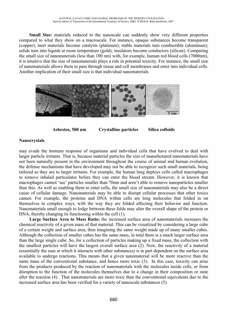
NATURAL CATACLYSMS AND GLOBAL PROBLEMS OF THE MODERN CIVILIZATION. Special edition of Transaction of the International Academy of Science. H&E. ICSD/IAS, Baku-Innsbruck, 2007.
680
Small Size: materials reduced to the nanoscale can suddenly show very different properties compared to what they show on a macroscale. For instance, opaque substances become transparent (copper); inert materials become catalysts (platinum); stable materials turn combustible (aluminum); solids turn into liquids at room temperature (gold); insulators become conductors (silicon). Comparing the small size of nanomaterials (less than 100 nm) with, for example, human red blood cells (7000nm), it is intuitive that the size of nanomaterials plays a role in potential toxicity. For instance, the small size of nanomaterials allows them to pass through tissue and cell membranes and enter into individual cells.Another implication of their small size is that individual nanomaterials
Asbestos, 500 nm Crystalline particles Silica colloids
Nanocrystals
may evade the immune response of organisms and individual cells that have evolved to deal with larger particle irritants. That is, because material particles the size of manufactured nanomaterials have not been naturally present in the environment throughout the course of animal and human evolution, the defense mechanisms that have developed may not be able to recognize such small materials, being tailored as they are to larger irritants. For example, the human lung deploys cells called macrophages to remove inhaled particulates before they can enter the blood stream. However, it is known that macrophages cannot ‘see’ particles smaller than 70nm and aren’t able to remove nanoparticles smaller than this. As well as enabling them to enter cells, the small size of nanomaterials may also be a direct cause of cellular damage. Nanomaterials may be able to disrupt cellular processes that other toxics cannot. For example, the proteins and DNA within cells are long molecules that folded in on themselves in complex ways, with the way they are folded affecting their behavior and function. Nanomaterials small enough to lodge between these folds may alter the overall shape of the protein or DNA, thereby changing its functioning within the cell (1).
Large Surface Area to Mass Ratio: the increased surface area of nanomaterials increases the chemical reactivity of a given mass of that material. This can be visualized by considering a large cube of a certain weight and surface area, then imagining the same weight made up of many smaller cubes. Although the collection of smaller cubes has the same mass, in total there is a much larger surface area than the large single cube. So, for a collection of particles making up a fixed mass, the collection with the smallest particles will have the largest overall surface area (2). Now, the reactivity of a material (essentially the ease at which it interacts with other substances) is in part dependent on the surface area available to undergo reactions. This means that a given nanomaterial will be more reactive than the same mass of the conventional substance, and hence more toxic (3). In this case, toxicity can arise from the products produced by the reaction of nanomaterials with the molecules inside cells, or from disruption to the function of the molecules themselves due to a change in their composition or state after the reaction (4). That nanomaterials are more toxic than the conventional equivalents due to the increased surface area has been verified for a variety of nanoscale substances (5).
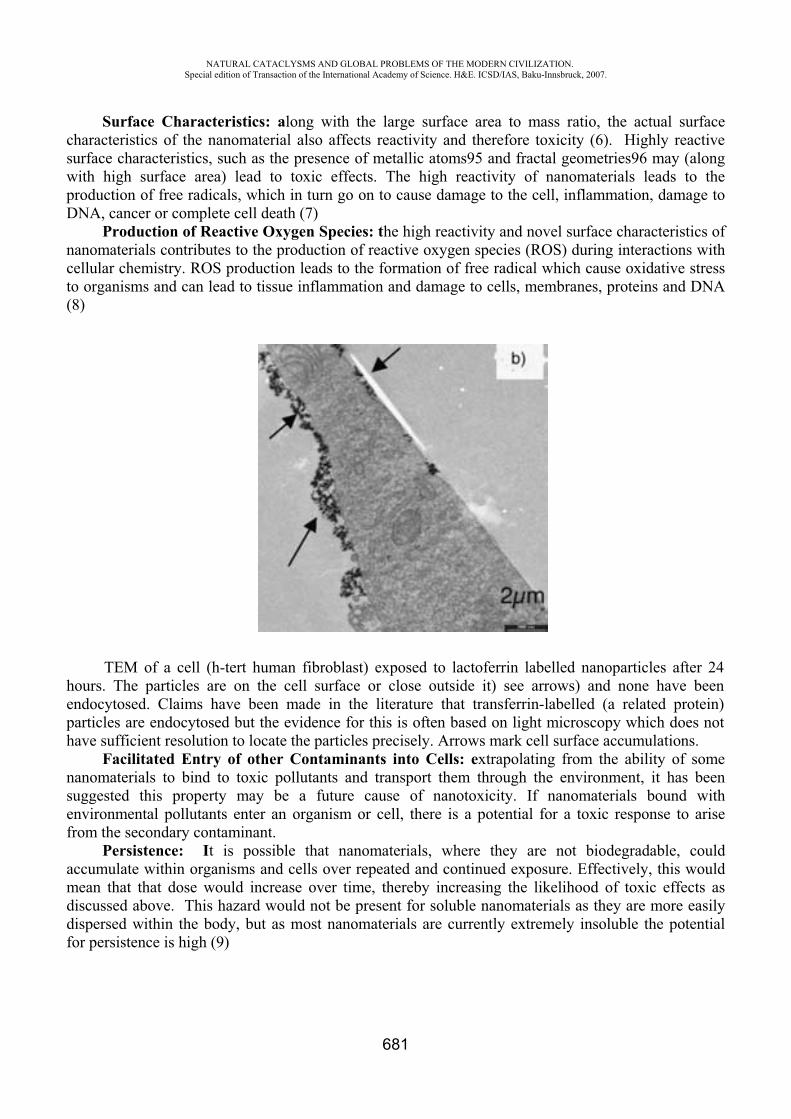
NATURAL CATACLYSMS AND GLOBAL PROBLEMS OF THE MODERN CIVILIZATION. Special edition of Transaction of the International Academy of Science. H&E. ICSD/IAS, Baku-Innsbruck, 2007.
681
Surface Characteristics: along with the large surface area to mass ratio, the actual surface characteristics of the nanomaterial also affects reactivity and therefore toxicity (6). Highly reactive surface characteristics, such as the presence of metallic atoms95 and fractal geometries96 may (alongwith high surface area) lead to toxic effects. The high reactivity of nanomaterials leads to the production of free radicals, which in turn go on to cause damage to the cell, inflammation, damage to DNA, cancer or complete cell death (7)
Production of Reactive Oxygen Species: the high reactivity and novel surface characteristics of nanomaterials contributes to the production of reactive oxygen species (ROS) during interactions with cellular chemistry. ROS production leads to the formation of free radical which cause oxidative stress to organisms and can lead to tissue inflammation and damage to cells, membranes, proteins and DNA (8)
TEM of a cell (h-tert human fibroblast) exposed to lactoferrin labelled nanoparticles after 24 hours. The particles are on the cell surface or close outside it) see arrows) and none have been endocytosed. Claims have been made in the literature that transferrin-labelled (a related protein) particles are endocytosed but the evidence for this is often based on light microscopy which does not have sufficient resolution to locate the particles precisely. Arrows mark cell surface accumulations.
Facilitated Entry of other Contaminants into Cells: extrapolating from the ability of some nanomaterials to bind to toxic pollutants and transport them through the environment, it has been suggested this property may be a future cause of nanotoxicity. If nanomaterials bound with environmental pollutants enter an organism or cell, there is a potential for a toxic response to arise from the secondary contaminant.
Persistence: It is possible that nanomaterials, where they are not biodegradable, could accumulate within organisms and cells over repeated and continued exposure. Effectively, this would mean that that dose would increase over time, thereby increasing the likelihood of toxic effects as discussed above. This hazard would not be present for soluble nanomaterials as they are more easily dispersed within the body, but as most nanomaterials are currently extremely insoluble the potential for persistence is high (9)
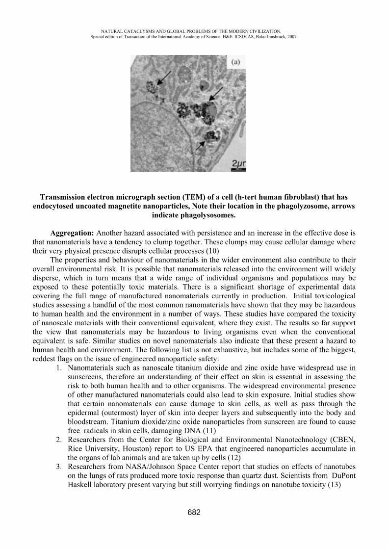
NATURAL CATACLYSMS AND GLOBAL PROBLEMS OF THE MODERN CIVILIZATION. Special edition of Transaction of the International Academy of Science. H&E. ICSD/IAS, Baku-Innsbruck, 2007.
682
Transmission electron micrograph section (TEM) of a cell (h-tert human fibroblast) that has endocytosed uncoated magnetite nanoparticles, Note their location in the phagolyzosome, arrows
indicate phagolysosomes.
Aggregation: Another hazard associated with persistence and an increase in the effective dose is that nanomaterials have a tendency to clump together. These clumps may cause cellular damage where their very physical presence disrupts cellular processes (10)
The properties and behaviour of nanomaterials in the wider environment also contribute to their overall environmental risk. It is possible that nanomaterials released into the environment will widely disperse, which in turn means that a wide range of individual organisms and populations may be exposed to these potentially toxic materials. There is a significant shortage of experimental data covering the full range of manufactured nanomaterials currently in production. Initial toxicological studies assessing a handful of the most common nanomaterials have shown that they may be hazardous to human health and the environment in a number of ways. These studies have compared the toxicity of nanoscale materials with their conventional equivalent, where they exist. The results so far support the view that nanomaterials may be hazardous to living organisms even when the conventional equivalent is safe. Similar studies on novel nanomaterials also indicate that these present a hazard to human health and environment. The following list is not exhaustive, but includes some of the biggest, reddest flags on the issue of engineered nanoparticle safety:
1. Nanomaterials such as nanoscale titanium dioxide and zinc oxide have widespread use in sunscreens, therefore an understanding of their effect on skin is essential in assessing the risk to both human health and to other organisms. The widespread environmental presence of other manufactured nanomaterials could also lead to skin exposure. Initial studies show that certain nanomaterials can cause damage to skin cells, as well as pass through the epidermal (outermost) layer of skin into deeper layers and subsequently into the body and bloodstream. Titanium dioxide/zinc oxide nanoparticles from sunscreen are found to cause free radicals in skin cells, damaging DNA (11)
2. Researchers from the Center for Biological and Environmental Nanotechnology (CBEN, Rice University, Houston) report to US EPA that engineered nanoparticles accumulate in the organs of lab animals and are taken up by cells (12)
3. Researchers from NASA/Johnson Space Center report that studies on effects of nanotubes on the lungs of rats produced more toxic response than quartz dust. Scientists from DuPont Haskell laboratory present varying but still worrying findings on nanotube toxicity (13)
NATURAL CATACLYSMS AND GLOBAL PROBLEMS OF THE MODERN CIVILIZATION. Special edition of Transaction of the International Academy of Science. H&E. ICSD/IAS, Baku-Innsbruck, 2007.
683
4. ETC group publishes first scientific literature survey on nanoparticle toxicity by toxicopathologist Dr. Howard concludes that the smaller the particle, the higher its likely toxicity and that nanoparticles have various routes into the body and across membranes such as the blood brain barrier (14)
5. Nature reports on work by CBEN scientist Mark Tomson that shows buckyballs can travel unhindered through the soil (15)
6. Research by Dr. Gonter Oberdorster is published showing that nanoparticles are able to move easily from the nasal passageway to the brain(16)
7. Nanosafety researchers from University of Leuven, Belgium, write in Nature that nanoparticles will require new toxicity tests: “We consider that producers of nanomaterials have a duty to provide relevant toxicity test results for any new material, according to prevailing international guidelines on risk assessment. Even some 'old' chemical agents may need to be reassessed if their physical state is substantially different from that which existed when they were assessed initially” (17)
8. At the first scientific conference on nanotoxicity, Nanotox 2004, Dr. Ben Wootliff an Howard presents initial findings that gold nanoparticles can move across the placenta from mother to fetus.(18)
9. Scientists at University of California, San Diego discover that cadmium selenide nanoparticles (quantum dots) can break down in the human body potentially causing cadmium poisoning. (19)
10. Dr. Eva Oberdorster reports to American Chemical Society meeting that buckyballs cause brain damage in juvenile fish along with changes in gene function. They also are toxic to small crustaceans (water fleas) (20)
Scientists are unanimous in asserting that there are still many gaps in the understanding of the risks posed to human health and the environment. In a recent survey of forty-five scientists specialising in nanotoxicity and environmental risk, the following unresolved issues were identified as critical in determining the hazards of nanomaterials:
Identifying which nanomaterials are entering the environment, and the extent of exposure. Identifying and understanding the specific characteristics by which each nanomaterial induces toxicity. Understanding the behavior and dispersion of nanomaterials in the wider environment and how they affect individual organisms and ecological systems. How, and to what extent, nanomaterials persist and bioaccumulate, as well as the long term effects of exposure to nanomaterials.
REFERENCES
1. Scenihn (2006) Modified Opinion After Public Consultation p 20. 2. Royal Society (2004) Nanoscience and nanotechnologies p 41 3. Scenihn (2006) Modified Opinion After Public Consultation p 22. 4. Bergeron et al (2005) Canadian Stewardship Practices for Environmental Nanotechnology, 16. 5. Tran et al (2000) “Inhalation of poorly soluble particles II influence of particle surface area on
inflammation and clearance” Inhalation Toxicology Vol. 12 p 113.6. Ayers (2003) Written Evidence to the Royal Society Nanotechnology Report 7. Renwick et al (2004) “Increased Inflammation and Altered Macrophage Chemotactic
Responses Caused by Two Ultrafine Particle Types” p 442; 8. Nel et al (2006) “Toxic potential of materials at the nanolevel”. Science Vol 311 p 622-627.

NATURAL CATACLYSMS AND GLOBAL PROBLEMS OF THE MODERN CIVILIZATION. Special edition of Transaction of the International Academy of Science. H&E. ICSD/IAS, Baku-Innsbruck, 2007.
684
9. Royal Society (2004) Nanoscience and nanotechnologies p 41; 10. Colvin (undated) “Nanotechnology- Environmental Impact Presentation” p 20; 11. Dunford, Salinaro et al. “Chemical oxidation and DNA damage catalysed by inorganic
sunscreen ingredients,” FEBS Letters, volume 418, no. 1-2, 24 November 1997, pp. 87-90. 12. Rick Weiss, “Nanoparticles Toxic in Aquatic Habitat, Study Finds,” The Washington Post,
March 29, 2004. 13. Mark T. Sampson, “Type of buckyball shown to cause brain damage in fish,” Eurekalert,
March 28, 2004. Available on the Internet, www.eurekalert.org 14. ETC Group, “Size Matters! The Case for a Global Moratorium,” Occasional Paper Series,
Volume 7, no.1, April 2003. Available on the Internet, www.etcgroup.org 15. Mark T. Sampson, “Type of buckyball shown to cause brain damage in fish,” Eurekalert,
March 28, 2004. 16. Oberdorster G et al (2005) “Nanotoxicology: an emerging discipline from studies of ultrafine
particles” Environmental Health Perspectives Vol 113 No 7 p 823-839 17. Peter Hoet, Abderrahim Nemmar and Benoit Nemery, “Health Impact of Nanomaterials?”
Nature Biotechnology, Vol. 22, no.1, January 2004, p. 19. 18. Ben Wootliff, “”Bristish Scientist: Nanoparticles Might Move from Mom to Fetus,” Small
Times, 14 January 2004. Available on the Internet, www.smalltimes.com 19. Justin Mullins, “Safety concerns over injectable quantum dots, New Scientist, Vol. 181, No.
2436, 28 February 2004, p. 10. 20. E. Oberdorster, Environmental Health Perspectives, Vol.1 12, n10, 2004, 1058-1062
THE CREATION OF MONITORINGS METHOD AND ESTIMATION OF ECOLOGICAL SITUATION IN AZERBAIJAN REPUBLIC
Ibragimova V. Kh.
Baku State University, Azerbaijan
If there are 11 climate zones in the world, you can meet 8 of them in Azerbaijan (1) besides only arctic, equatorial and tropic ones. It point to unique possibility of Azerbaijan. Oil and gas industry, colour and black metals had paid more and attention to this region (2). The geographic possibilities of Azerbaijan define the origination of its nature and differ it from another countries. Some biocenosys in this region consist of many thousands strains of micro-organisms in water and soil, are important chain in circulation of substances in nature. The structure and function of biocenosys depends of interaction of different organisms in particular. The man – micro-organisms, producing antibiotics (MPA) – pathogenic micro-organisms (PM), which cleate the basis of ecological regulation of biocenosys exchange step by step (3). The research of soil’s biocenosys in Azerbaijan with its large climatic zones hasn’t been carry out by anybody and is the unique study. It’s known, that the micro-organisms compositions and their number oscillate strongly in dependence of physical and chemical properties biological conditions of soil, season and temperature changes (4). Geographic distribution of MPA in soils and their number absolutely hasn’t been researched. One of the most important problems of ecoloqical researches is to define of qeneral correlations and relationships between “The Man MPA PM” and to know the way of requlation in human’s
NATURAL CATACLYSMS AND GLOBAL PROBLEMS OF THE MODERN CIVILIZATION. Special edition of Transaction of the International Academy of Science. H&E. ICSD/IAS, Baku-Innsbruck, 2007.
685
interests. The study of structural and functional possibilities in system “The Man MPA PM” and determination of qeneral relationships of their interrelation point to creation of new effective form of medical drugs. The change of ecological factors in region may be act on MPA mutation and PM ones. The speed of mutation may be very high and speed of creation of modern medicine drugs doesn’t approach to speed of mutation of PM. The aim of this paper is to use Actinomycetes as the producents of polyene antibiotics (PA) (5). In this case PA were used as test-system and you can notice on the interrelation between taxonomy of producents and antibiotics fromed by them. It’s suggested, that there are changes in biosynthesys of PA- molecules in dependence of geographic zone in distribution of PA- producents and as the result there are created antibiotics with the changed structure of molecule. We select PA as test-system because PA are membrane-active substances, which selectivity induce the conductance and increase the conductivity of cell and artifical membranes for ions and organic substances(6). PA is the single class of compounds in nature which form ionic structural channels in complex with sterols at biological and artificial membranes (7). Chemical structure of PA was determinated by Borowski (8-10). Physical and chemical characteristics of ionic channels depend of the structure of PA- molecules, which forming channel (7). The connection between structure and function of PA may be determine on bilayer lipid membranes (BLM) (7,11). PA are sensitive only to membranes with the composition in sterols by definite structure (12-14). PA interact with the free sterol in blood and another biological liquids and tissues (6,15). Thanks to this properties PA have practical application in medical treatment of virosological and fungial infections, cancer diseases, atherosclerosys, prostate adenoma liver’s fat dystrophy and others (16). PA have wide application in different fields of national economy and, for example, in medicine, oil and gass industry, oil chemistry and poultry farming. The principal purpose of this paper connected with the problem of preserving of ecosystem’s purity, in particular the preserving of humans organism from pathogenic infection is the determination of general rules in interrelation “The Man MPA PM” social aspect of preserving ecosystem’s purity includes the creation of efficient methods against to pathogenic micro-organisms. One of these methods is the search of antibiotics with the high membrane activity, selectivity and specifity of their action. Among these compounds there are PA, and their main representatives-amphotericin B, nystatin, mycoheptin, levorin. PA sharply increase total conductance of membranes, including sterols in their compounds. PA-function in membranes depends of their chemical structure (17-19). It’s supposed to make the next investigations: 1) The collection of soil samples from different climatic zones of region, election of sterile cultures of micro-organisms, producing PA and to control their antibiotic properties.2) The determination of biological activity of antibiotics during the growth of strain Candida Albicans in growth medium. 3) Making the screening of biological activity of antibiotics by the biophysical methods of registration of electrical characteristics of BLM by fixation of potential and current method (20) and the establishment of relationship between structure and function of antibiotics in membranes. 4) The determination of chemical structure of received antibiotics. These investigation allow us to receive the theoretical comments to the synthesis of new medicine drugs with the necessary properties. Integral characteristics of BLM modified by PA were investigated by Ibragimova V. (21-23). It was shown that physical and chemical properties of channels are in the sharp correlations from the structure of PA-molecules which forming the channel (17,19). Thus they need synthesis of new PA with the changes in chemical structure and function. PA may be produced by the cultivation of micro-organisms Actinomyces in necessary grown medium and by the chemical modification of PA-molecule structure. The work of election cleaning and studu of membrane activity
NATURAL CATACLYSMS AND GLOBAL PROBLEMS OF THE MODERN CIVILIZATION. Special edition of Transaction of the International Academy of Science. H&E. ICSD/IAS, Baku-Innsbruck, 2007.
686
of antibiotics from different geographic zones of the region was planned at the first time and hasn’t analogous at the world literature. Investigation of mechanism in PA-action were maked of animals and micro-organisms (16, 24,25) and on the model membrane systems (26,27). The main purpose of these investigations was in determination of more efficient antibiotics having the less toxicity for human’s organism and high selectivity of action in relation to pathogenic micro-organisms. Selective action of PA depends of sterol compounds in cell membranes. PA have different specifity to cholesterol and ergosterol (6,14). It’s known that cholesterol includes host cell membranes, but egosterol into fungial cell membranes (28,29). PA are more sensitive to ergosterol-containing membranes, that to cholesterol-containing ones (6). It’s suggested, that the degree of interaction of PA with sterol compounds depends of PA inside in membranes. The relaxation time constant for conductivity of membrane after antibiotic removed from the BLM defines the time, wich PA was inside in membrane (30). It’s shown that this time in cholesterol-containing membranes is more less than in ergosterol-containing ones (31). Chemical structure of PA in many – things define the biological activity and specifity of interaction between PA and cell membranes. These results were the notice different condition of PA- molecules biosynthesis in dependence of geographic zones of distribution of PA – producents it may be create the antibiotics with changed structure of their molecules. The general aims for dissolving these problems is the selection of Actinomycetes-producents of PA in different geographic zones of the region, the research of their enzyme’s conditions election, cleaning of PA and determination of their chemical structure. The research of mechanism of action on reseived PA will be make by BLM methods (11). BLM is the best model of cell membranes, where you can produce important electrical properties of cell membranes. The electrical characteristics of membranes, modifyed by PA will be investigate by method of potential and current fixation (20). By the help of BLM there will by study biophysical properties of PA, effectivity interactions between PA and membranes, selective ion permeability of membrane, properties of single ionic channels (conductance selectivity, life times in closed and open states), relaxation time constant, conductance of membranes with antibiotic inside the as one of the main parameters for the time of antibiotic inside the membrane. The study of chemical structure of PA will by make using the spectral methods as UV- spectrophotometry, NMR spectrometry and others. There will be applicate physical and chemical methods of producing of new derivatives of PA. For example, it’s planned the formation of dimer from amphotericin B and levorin molecules, which must be connected by carboxyl groups by cobalt atoms. Every stage is characterised by the next properties: the receiving of information about the type of PA- producent’s distribution’s, enzymation, election of steril cultures chemical cleaning and control their antagonistic properties. For the election of Actinomycetes usually it is used special selective growth medium, but for the research of their antagonist properties must be use test-organisms. Elected micro-organisms – antagonists are the native material for research the composition of antibiotics, substances, their marks and guality. Antibiotic’s activity of these drugs be define on the BLM, not on the growth medium with agar. The examination of membrane activity of antibiotics cleaning for the comparative marks. The principal problems of these stages include: 1) To know the factors, which are including the change of antibiotics producents in different zones of region; 2) Identification of antibiotics by BLM and physical and chemical methods ( UV-spectroscopy and thin-layer chromotography); 3) Screening and selection of more active antibiotics by the BLM. This part must be make in two stages: The first stage is the study of structure of received PA by modern spectrals methods; The second stage is the study of mechanism of reseived PA-action. On this base there will be give the recommendations about place and time of selection more active forms of antibiotics and these ones allow to found theoretically recommendations to the chemical synthesis of PA derivatives with their necessary properties. At the present time we have data that alkylation, at polar part in PA-molecule lead to increasing of biological activity and selectivity of their in relation to pathogenic form of micro-organisms. The analysis of own
NATURAL CATACLYSMS AND GLOBAL PROBLEMS OF THE MODERN CIVILIZATION. Special edition of Transaction of the International Academy of Science. H&E. ICSD/IAS, Baku-Innsbruck, 2007.
687
data about molecular mechanism of action of PA opens realy perspective for its particial application in 3 principal directions:Medicine; Oil and gas industry; Poultry farming. A new membrane-active compound of PA highly efficient for treatment of exogenic and endogenic diseases. Membrane-active compound is the new medicine form of PA, which have high degree of selectivity of action in relation to pathogenic forms of micro-organisms and has wide spectrum of treatment.
REFERENCES
1. Budagov B., Allev G. Geography of Azerbaijan Republic Book Printed “Maarif” in Baku in 1983.
2. “Small Soviet Ensyclopedia” issued by Vedenskov B.A. in Moscow in 1958, 1,p.166 3. Villi K. Biology Book Printed in Moscow (Russia) by “Mir” p. 705 in 1968. 4. Kashkin P., Besborodov A., Elinov N. Siganov V. “Antibiotik” Book. Printed in 1970 by
“Medicine” in Petersburg, p.9. 5. “Clinical used of mycoheptin”. Tereshin Book. Moscow 1973. 6. Kasumow Kh. Molecular mechanism interaction of polyene antibiotics with lipid membranes.
Book printed in Baku Elm. 1-224, 1986. 7. Ermishkin L.N., Kasumov Kh.M, Potseluyev V.M. Single ionic channels induced in lipid
bilayers by polyene antibiotics amphotericin B and nystatine. Nature, 262, 5570, 698-699, 1976.
8. Borowski E., Golik J., Zielinski J., Falkowski L., Kolodziejczyk P., Pawlak J., Shenin Yu. “The structure of mycoheptin a polyene macrolide antifungal antibiotic. The Journal of Antibiotics, 31, N2, 117-123, 1978.
9. Pawlak J., Zielinski J., Kolodziejczyk P., Golic J., Gumieniak J., Yereczek E., Borowski E., “The structure of lienomycin, a novel type of polyene macrolide antibiotic”. Tetrahedron Letters, N17, 1533-1536, 1979.
10. Zielinski J., Borowy-Borowski H., Golic J., Gumieniak J., Ziminski T., Kolodziejczyk P., Pawlak J., Borowski E., Shenin Yu., Filippova A., “The structure of levorin A2 and candicidin D.”, Tetrahedron Letters, N20, 1791-1794, 1979.
11. Mueller. P., Rudin D.O, Tien H.T., Wescott W.C. “Methods for the formation of single bio molecular lipid membrane in aqueous solution”. J. Phys. Chem., 67, 534, 1963.
12. Borisova M. P., Kasumov Kh.M. Sterol structure-dependent properties of amphotericin B channels. Studia Biophysica, Berlin, band 71, Heft 3,197-202, 1978.
13. Teerlink T., Kruyff B., Demel R. The action of pimaricin, etruscomycin and amphotericin B on liposomes with varying sterol content. Biophys. Acta, 599, N2, 484-492, 1980.
14. Milhand J., Bolard J., Benveniste P., Hartmann M. Interaction of the polyene antibiotic-filipin with model and natural membranes, containing plant-sterols. Biochim. Biophys. Acta, 161, 32, 315-325, 1988.
15. Kasumov Kh., Liberman E. “The role ofcholesterol in increasing the conductance of bimolecular membranes by polyene antibiotics”. Biofizica (Russia), 19, 71-75, 1974.
16. “Levorin and his clinical attachment”. Issued by Cyganova V. Book printed in Leningrad, 1970.
17. Kasumov Kh. M., Barisova M., Ermishkin L., Potseluyev V., Silberstein A., Vainshtein V. “How do the ionic channel properties depend on the structure of polyene antibiotic molecules?” Biochim. Biophys. Acta, 551, 229-237, 1979.
18. Bolard J. Interaction of polyene antibiotics with membrane lipids: physico-chemical studies of the molecular bases of selectivity. “Drugs Exp. And Clin. Res.”, 12, N6-7, 613-618, 1986.
NATURAL CATACLYSMS AND GLOBAL PROBLEMS OF THE MODERN CIVILIZATION. Special edition of Transaction of the International Academy of Science. H&E. ICSD/IAS, Baku-Innsbruck, 2007.
688
19. Bolard J. “How do the polyene macrolide antibiotics affect the cellular membrane properties?” Biochim. Biophys. Acta, 864, N3-4, 257-304, 1986.
20. “Registration of single channels” Issued by Sakman and Neer. Book printed by “Mir” in Moscow (Russia). 1987.
21. Ibragimova V.Kh., Aliev D.I., Alieva I.N. 2002. Biophysical and Medicobiological Aspects of Application of Polyene Antibiotics in Combination with Dimethyl Sulfoxide. - Biophysics, v. 47, 5, p. 774-781.
22. Ibragimova V.Kh., Alieva I.N., Aliev D.I. 2003. New approach to use of polyene antibiotics. Proceedings of the NATO Advanced Research Workshop on Radiation Safety Problems in the Caspian Region. Baku. IV. Earth and Environmental Sciences, v. 41, p. 121-128. Kluwer Academic Publishers. Dordrecht / Boston / London. Published in cooperation with NATO Scientific Affairs Division. Printed in Netherlands.
23. Ibragimova V., Alieva I., Kasumov Kh., Khutorsky V. 2006. Transient permeability induced by alkyl derivatives of amphotericin B in lipid membranes. - Biochim. Biophys. Acta, v. 1758, p. 29-37.
24. Ermiskhin L.N., Kasumov Kh.M., Potseluyev V.M. Properties of amphotericin B channels in a lipid bilayer. Biochim. Biophys. Acta, 470, 357-367, 1977.
25. Virina A., Feisin L., Fateeva. L., Kasumov Kh., Belousova I., Tereshin I. “Interaction of polyene antibiotics with sensitive and resistance celss of Candida Albicans.” Chemical-Phamaceutical Journal (Russia), 10, 12-16, 1976.
26. Andreoli T.E., Monahan M. “The interaction of polyene antibiotics with thin lipid membranes.” J. Gen. Pysiol., 52, 300-325, 1968.
27. Milhand Y., Hartmann M., Bolard J. “Interaction of the polyene antibiotics amphotericin B with model membranes: Differences between small and large unilamellar vesicles. “Biochimie, 71, 49-56, 1989.
28. Kasumov Kh. M., A new dates about mechanism of action of polyene antibiotics.Antibiotici (Russia), 26,143-155, 1981.
29. Akhrem A., Titov Yu. “Steroids and microorganizms. Book printed by “Nauka” in Moscow (Russia), 1970.
30. Kasumov Kh., Malafriev O. “Research of membrane conductivity relaxation kinetics in the presence of amphotericin B alkyl derivatives.” Studia Biophysica, Berlin, 99, 137-142, 1984.
31. Kasumov Kh., Malafriev O., Vainstein V. “Effect of amphotericin B alkyl derivatives on conductivity of bilayer membranes.” Antibiotici (Russia), 7, 513-516, 1984.
ENVIRONMENTAL FLOW AND RECOMMENDATIONS FOR THEIR ESTIMATIONS
F.A. Imanov*, R.Kh. Abbasov**
*Baku State University, Azerbaijan **Scientific-Research Institute of Hydrometeorology, Azerbaijan
Environmental flows are defined as the flows which are necessary to provide the survival of river ecosystems as a part of the environment (Ozdemir and et. all, 2007). Environmental flow is not only
NATURAL CATACLYSMS AND GLOBAL PROBLEMS OF THE MODERN CIVILIZATION. Special edition of Transaction of the International Academy of Science. H&E. ICSD/IAS, Baku-Innsbruck, 2007.
689
the quantity of water, but also a condition of the river system, which can safely maintain all ecologic needs in the ecosystem. For quarantines the necessary conditions, there are a need in many physical, chemical and biological characteristics, mainly in sufficient quantity, quality, temperature and flow rate.
In spite of the fact, that researchers are engaged in research of ecological flow since 1940s, up to this point there was not accepted the standardized term, for impression of the “ecological flow”. Therefore, instead of the term "ecological flow”, various terms are used by a variety of researchers, such as: “sanitary river flow”, “instream flow”, “stream flow”, “reserved flow”, “minimally residual runoff”, “minimally acceptable flow”, “minimally nessesary flow”, “environmental flow” etc. (Gatillo and Filipovich, 1971; Tenant, 1975; Shahov, 1980; Smatkhin et al., 2006 est.). In some cases researchers instead of ecological flow investigated the “base flow”, mainly supplied on ground-water discharge is considered as a base ecological maintenance of the river ecosystem (Jonathan and Mark, 2002). Although for investigation of “ecological flow” are used different approaches as well as different terms, in almost all cases “ecological flow” means some quantity of water which must be remained in riverbeds for satisfying some economic and environmental needs. However, in some cases, ecological flow is not only the minimum amount of water, but also maximum limit of river flow for satisfying fishery needs, and for that purpose used a term “ecological high flow” (Lin et al., 2006). Fashevskiy and Fashevskaya (2003) consider that the term should be used as an “ecological flow”, and this term does not mean an economic approach. According to the author, ecological flow provides conservation of river ecosystems and involves the whole natural complex of river ecosystems: fish, amphibians, reptiles, birds, mammals, floodplain meadows as well as forests etc. (Fashevskiy and Fashevskaya, 2003). The term “ecological flow” began to be widely used in former USSR in early 1990s and later (Shahov, 1980; Vladimirov and Imanov, 1994). Review of the last publications gives an opportunity for saying that the most used terms by researchers are “ecological flow” and “environmental flow” (Tharme, 2003; Smatkhin, 2001; Imanov, 2000; Vladimirov et al., 1997).
Another problem is that researchers in different countries, especially in former Soviet Union and Western Countries, studied ecological flow separately; thus there was no collaboration between scientists and this tendency continues in present times as it was 20-30 years before (Abbasov, 2007). This tendency might be confirmed from the literature reviewers of the most famous authors that are occupied in the study of ecological flow, where in most cases there was lack of information about publications in the former Soviet Union and other western countries.
Study of the ecological flow began in USA from the beginning of 1940s. In 1969, the first well-known method has been developed by Robinson (Connecticut method) for estimating instream flow mainly by fishery needs (Robinson, 1969). Another and most famous method of instream flow for fish and wildlife requirements has been developed by Tennant (also known as a Montana method) in 1975 (1975) and considered as the second famous method in the world. Bayha provides wide information about other early popular methods widely used in the USA (1978). In 1978, was developed the Incremental Method, for maintaining of recreation needs, which describes a relationship between the flow and recreation potential (Hyra, 1978). Eventually this method was advanced by Nestler et al.(1989) and Stalnaker et al. (1994 for the complex environmental needs and known as an Instream Flow Incremental Methodology (IFIM). In spite of that, IFIM requires a lot of environmental data, became very popular in USA, Canada and Europe (Reiser et al., 1989). Unfortunately, IFIM is not suitable in the developing countries, where material needs do not allow for applying that method and takes a lot of time for putting into practice. Since the 1980s wide exploration of the ecological flow began in other countries, mainly in South Africa (King, 1999) Among methodologies developed outside of USA come into view South African Desktop Model (Hughes and Hannart, 2003), Building Block Methodology (King and Tharme, 1994; King and Louw,1998) as well as Australian “Holistic Approach” (Arthington et al.,1992).
NATURAL CATACLYSMS AND GLOBAL PROBLEMS OF THE MODERN CIVILIZATION. Special edition of Transaction of the International Academy of Science. H&E. ICSD/IAS, Baku-Innsbruck, 2007.
690
Methods to determine environmental flow allocations, (mainly termed as a sanitary flow and ecological flow) were explored in the former Soviet Union since 1970s. In early proposed methods in the former Soviet Union “ecological flow” termed as a sanitary flow and considered for sanitary and fishery needs of downstream parts in the regulated rivers. The most famous methods in the former Soviet Union had been developed by Fashevskiy (1996) and Imanov (2000).
Tharme completed a global review of environmental flow methodologies (2003), however, to the Tharme’s review are not included methods which were developed in the former Soviet Union. In his investigation Tharme revealed the existence of 207 individual methodologies, recorded for 44 countries within six world regions. Tharme gives a wide classification of methodologies concerning the environmental flow. Different classifications can be seen in many investigations (Estes and Osborn, 1986, Karim et. al., 1995, Petts and Maddock, 1997, King, 1999). The detailed information about methodologies developed in the former Soviet Union can be received in the study of Imanov (2000).
Different researchers depending on applied methodology and used needs for estimating the ecological flow made different approaches. For example, Robinson proposed to estimate stream flow as a portion of the flows in the month of June month (1969); Tennant’s proposal is maintained in that the instream flow must be calculated as a part of annual average flow (1975); According to the recommendations of Gatillo and Filipovich, quantity of the minimally residual flow is accepted equal 75-80 % from the minimal monthly water flow (1971); Hyra suggests (single cross section method) that cross-section of the river must provide minimum depths for boat passage (1978), T. Pruitt et al.,consider that instream flow must have certain velocity and depth (1978); Shahov recommends calculating minimal ecological flow based on specific energy of a stream (1980); Dubinina and Kozlitina suggest that a 95% probability of discharge may be taken for the standard of irreversible river flow (2000); Hughes and Hannart suggest that the variability of ecological instream flows from drought year to wettest year over time should reflect the natural variability of flows that would occur due to climatic variations (2002); According to the methodology proposed by Imanov, the value of an ecological flow should be equal to the value, at which a river ecosystem exists in natural conditions (2000). With this purpose author suggests to study a natural perennial flow regime of each river as well as to estimate the values of ecological flow after studying. Proposals of Imanov are supported by Vladimirov A.M. et al, (1997). Tharme and King consider that an environmental flow for a river may be defined simply as an assessment of how much of the original flow regime of a river can maintain specified and valuable features of the ecosystem (Tharme and King, 1998; King et al, 1999); Jen-Yang Lin et al. consider that the quantity of the ecological flow must occupy some minimum and maximum area of cross-section (2006).
According to the classification of Tharme, methods for the assessment of the environmental flow can be classified into four reasonably distinct categories: hydrological, hydraulic rating, habitat simulation (or rating), and holistic methodologies (2003).
Although the developed methods have a wide exploitation in implementation, there are a lot of problems concerning these methodologies. Famous reviews and investigations present to note the following problems (Smakhtin et al. 2006; Thomas, 1994; Tharme, 1997, 2003; Dunbar et al. 1998):
Some popular methods are not well-based scientifically and have a necessity in improving. Most existing ecological flow assessment methods have been developed and applied primarily within local territories and there is no possibility to implement them into large territories. Some complex and well-based methods have no possibility to be applied easily and require much data, expenses and time. In spite of a large number ecosystem approach methods, hydrologic-based methods are considered to be most suitable at the development of water resources.
NATURAL CATACLYSMS AND GLOBAL PROBLEMS OF THE MODERN CIVILIZATION. Special edition of Transaction of the International Academy of Science. H&E. ICSD/IAS, Baku-Innsbruck, 2007.
691
Problems concerning to the ecological flow recommendations require scientifically based approaches for future investigations, which might be used in all conditions due to lack of necessary data.
REFERENCES
1. Abbasov R.Kh. Assessment of ecological flow for the mountain rivers of the Kura basin. Proceedings of the Annual Meeting & International Conference of the American Institute of Hydrology: “Integrated Watershed Management: Partnerships in Science, Technology, and Planning” April 22-25, 2007 Reno, Nevada, USA.
2. Arthington A.H, Zalucki J.M. Comparative Evaluation of Environmental Flow Assessment Techniques: Review of Methods. LWRRDC Occasional Paper27/98. Landand Water Resources Research and Development Corporation (LWRRDC): Canberra 1998
3. Bayha K., Instream flow methodologies for regional and national assessments. Instream flowinformation paper 7, 1978
4. Dubinina V.G., Kozlitina S.V., Water Resources management of the southern rivers of Russia with reference to fisheries requirements. Fisheries management and ecologu, 7, 2000, p.157-165
5. Dunbar M.J., Gustard A., Acreman M.C., Elliot C.R. Review of overseas approaches setiing river flow objectives. Environment R& D technical report W6B96 (4). Institute of Hydrology, Wallingford, UK.
6. Fashevskiy B., Fashevskaya T. “Water Management Budget as a Basis for Assessment Water Priorities”, Proceedings of the 1st International Conference on Hydrology and Water resources in Asia Pacific Region, Kyoto, Japan, Vol.1, 2003, pp. 357-360.
7. Fashevskiy B.V. Bases of ecological hydrology. Minsk, 1996. -240 p.
8. Gatillo P.D., Filipovich I.M. Questions of assessment of minimally necessary water flows of the rivers. Problems of use of water resources. The collection of scientific works. Minsk, 1971. pp. 26-42
9. Hughes D.A., Hannart P. / Journal of Hydrology 270 (2003) 167–181. A desktop model used to provide an initial estimate of the ecological instream flow requirements of rivers in South Africa
10. Hyra R. Methods of assessing instream flows for recreation. Instream flow information paper 6, Fort Collins, Colorado, 1978
11. Imanov F.A. Minimal water flow of Caucasus rivers. “Nafta-press”, Baku-2000. -299 p.
12. Vladimir A.M., Imanov F.A. Principles of the assessment of ecological flows. Ecology and hydrology design. St.-Peterburg, RGGMI, 1994, 116, pp.4-7
13. Jen-Yang Lin, Yen-Chang Chen and Eric Hsien Shao Tsao. Estimation of ecological high flow. Hydrol.Process. 20, pp.319–328, 2006.
14. Jonathan G. K., Mark A. A. Relation of environmental characteristics to the composition of aquatic assemblages along a gradient of urban land use in New-Jersey, 1996-1998. US
NATURAL CATACLYSMS AND GLOBAL PROBLEMS OF THE MODERN CIVILIZATION. Special edition of Transaction of the International Academy of Science. H&E. ICSD/IAS, Baku-Innsbruck, 2007.
692
Geological Survey Water-Resources Investigations Report 02-4069 National Water-Quality Assessment Program. West Trenton, New Jersey, 2002
15. King J.M., Tharme R.E. 1994. Assessment of the Instream Flow Incremental Methodology and Initial Development of Alternative Instream Flow.
16. Methodologies for South Africa. Water Research Commission Report No.295/1/94. Water Research Commission: Pretoria, SouthAfrica
17. King J.M, Louw M.D. 1998. Instream flow assessments for regulated rivers in South Africa using the Building Block Methodology. Aquatic Ecosystem Health and Management 1: 109–124.
18. Kondratyev A.N. Relation of transporting ability of the stream to the sediment flow as a condition of riverbed formation // Geomorphology. 1999. Vol. 3. pp. 14-18.
19. Ozdemir D., Karaca O., Erkush K. Low flow calculation to maintain ecological balance in streams. Proceedings of the international congress: River basin management, Ankara, Turkey, 2007, volume 1, pp.402,
20. Reiser, D.V., Wesche T.A., Estes C. Status of instream flow litigation and practices in North America. Fisheries. 14(2): 22-29, 1989
21. Robinson E.H. A procedure for determining desirable stream flows for fisheries. US Fish and Wildlife Service. Concord, New Hampshire. Mimeo. 1969
22. Shahov I.S. Methodic for calculating minimally ecological flow for the rivers of Urals Mountains. Scientific works of the Ural Institute of the Water management. Sverdlovsk, 1980. Volume 11. pp. 27-37
23. Smakhtin V.U., Shilpakar R.L., Hughes D.A. Hydrology-based assessment of environmental flows: an example from Nepal. Hydrological Sciences–Journal–des Sciences Hydrologiques, 51(2) April 2006
24. Stalkner C.B., LambB.L, Henriksen J. Bovee K.D, Bartholow J. The Instream Flow Incremental Methodology: a primer for IFIM. National Ecology Research Center, Internal Publication national Biological Survey: Fort Collins, CO, USA.
25. Tennant D.L. Instream flow regimes for fish, wildlife, recreation and related environmental resources. US Fish and Wildlife Service, Brillings, Montana. Mimeo. 30 pp., 1975.
26. Tharme R.E. A global perspective on environmental flow assessment: emerging trends in the development and application of environmental flow metedologies for rivers. River research and applications, 19. pp. 397-441, 2003
27. Thomas B.H. A conceptual approach to assessing instream flows in large rivers of the Nothern basin, Canada. Proceeding of the Nothern river basins study instream flow needs workshop. October 14-15, 1993 and January 6-7, 1994. pp. 15-36.
28. Vladimirov A.M., Orlov V.G., Sakovich V.M. Ecological aspects of consumption and water resources protection. Saint-Petersburg, 1997. – 125 p.
NATURAL CATACLYSMS AND GLOBAL PROBLEMS OF THE MODERN CIVILIZATION. Special edition of Transaction of the International Academy of Science. H&E. ICSD/IAS, Baku-Innsbruck, 2007.
693
EXPERIENCE IN OPTIMAL SOLUTION OF GLOBAL CONTROL PROBLEMS IN MODERN CIVILIZATION
K. L. Bravy
Mental Activities Institute, Israel [email protected]
I. Global Control Problems in Modern Civilization
In modern postindustrial world the control problems exceeding from the limits of empirical knowledge of a person appeared. The example of such problem in modern industry is high accidents and catastrophes' rate due to so-called "man factor" and enormous financial losses of industrial companies because of belated, wrong or non-optimal actions in operating and maintenance process of their production equipment. The example of such problem in modern economics is absence of technology for optimal actions in operating and maintenance process of production equipment in all possible branches of modern industry. The example of such problem in modern medicine is belated, wrong or non-optimal actions of physician personnel in medical service's process of patients. The example of such problem in public sphere is overcoming of global terror, which presents the real threat for harmonious progress of world community in modern postindustrial civilization. The example of such problem in highest education is absence the specialists needed for optimal solution of all above-mentioned problems, which appeared in modern postindustrial world.
The author of proposed article gave the title "mental activities problems" for the problemsexceeding from the limits of a person's empirical knowledge in modern industry, medicine, economics, highest education and in the public sphere.
The principal difference between solution of the mental activities problems in comparison with solution of control problems on the basis of known control methods is that solution of the mental activities problems is that there is no information for solution of above-mentioned problems not only about connections between operations, which lead to wished result, but even on the parameters characterizing achievement of the wished result. The criterions needed for optimal solution of mental activities problems are also absent.
So, the main problem, which appeared in modern postindustrial world, is the problem connected with progress of “Science on Mental Activities”, which is the basis for optimal solution of problems, exceeding from the limits of empirical knowledge of a person.
II. Science on Mental Activities
2.1 The tasks of modern science in cognition of “Nature of Consciousness”
In July 2005 the American "Science" magazine published a list of 125 greatest mysteries of modern science [1]. On the second place among 25 main problems of modern science the "Science" magazine named the "Nature of Consciousness" with regard to the modern science has answer the question: "How the mental activities are connected with biological processes and how much the biological processes stipulate it?". This accurate definition of the request to modern science became the determining indication for progress of "Science on Mental Activities", which provides optimal solution of global problems
NATURAL CATACLYSMS AND GLOBAL PROBLEMS OF THE MODERN CIVILIZATION. Special edition of Transaction of the International Academy of Science. H&E. ICSD/IAS, Baku-Innsbruck, 2007.
694
exceeding from the limits of empirical knowledge of a person in governance process of man-machine systems and human networks.
2.2 Biological foundations for progress of "Science on Mental Activities"
The “Science on Mental Activities” is progressing on the basis of scientific discovery "An earlier unknown conformity with a law of a brain's internal activities in viability maintaining of highly organized biological systems (animals)", through which the "Laws of pure (theoretical) reason [2]" became evident.
The essence of the scientific discovery consists in strict mathematical dependence of the integral viability property of animals from testability, controllability and steady functioning of an organism within an animal and from compensatory abilities of a brain in relation to endogenous chance factors determining a health state of an organism and to exogenous chance factors determining influence of an external environment on fulfillment the physiological functions on an organism in real conditions of its existence. It is showed that the "Laws of pure reason” don’t depend from “Consciousness”, “Sub-consciousness” and “Super-consciousness” of a person [3]. Seven "Laws of pure reason”, which create the “Bio-intellectual Control System”, were formulated. It is showed that the “Bio-intellectual Control System (BCS)” provides compensation of the endogenous (internal) chance factors determining the health’s state of animal and exogenous (external) chance factors characterizing influence of environment on behavior of animal’s organism. The mathematical description of BCS has been proposed. It is demonstrated, that BCS possesses the advantages of centralized control systems and decentralized control systems and are deprived the shortcomings of all known control systems [4].
On the basis of researchers, which were carried out in neurophysiology, it is demonstrated, that using of technology for internal unconscious activities of a brain provide amplification of intellectual possibilities of a person in millions times in comparison with intellectual possibilities, based on empirical knowledge of a person, received by him on all previous stages of civilization’s progress [5].
2.3 Science on Mental Activities and its application for harmonious progress of postindustrial civilization
The author of proposed article formulated the principal propositions of "Science on Mental Activities" [6], which has its own laws, method and mechanism for optimal solution of global problems exceeding from the limits of a person's empirical knowledge.
It is proved the “Paradigm of Viability” [7], which establishes that the "Laws of pure reason” acting in viability maintaining of animals are the “Laws of mental activities” acting in modern postindustrial world; that the "Laws of pure reason” and “Laws of mental activities” are the "Laws of highest reason” acting on all previous and future stages of civilization’s progress.
It is demonstrated that the “Laws of mental activities” and "Laws of highest reason” don’t depend from empirical knowledge of a person and received the title: “Laws of metaphysics” [8].
On the basis of proof of “Paradigm of Viability” the author of proposed article proved the complex scientific discovery “"An earlier unknown conformity with a law in viability maintaining of animals, machines and social-economic structures”. Declaration on complex scientific discovery named “Laws of metaphysics” the author of proposed article presented for “USA Patent and Trademark Office” [9].
NATURAL CATACLYSMS AND GLOBAL PROBLEMS OF THE MODERN CIVILIZATION. Special edition of Transaction of the International Academy of Science. H&E. ICSD/IAS, Baku-Innsbruck, 2007.
695
"Method of Mental Activities" is the method for optimal solution of problems exceeding from the limits of a person's empirical knowledge, which is based on mathematical description of internal activities process of a brain in viability maintaining of highly organized biological systems.
"Mechanism of Mental Activities" is the "Flexible Management System (FMS)" [10] intended for compensation the endogenous chance factors and exogenous chance factors influencing on behavior of FMS' control object, based on mathematical model of seven "Metaphysics' laws".
Mathematical model of seven "Metaphysics' laws" the author of proposed article has demonstrated on the example of optimal solution of all possible tasks arising in operating and maintenance process of machinery’s equipment [11]. It is proposed the mathematical description of “Bio-intellectual Technologies (BiT)” for diagnostics of FMS’ s control object [12].
Science on Mental Activities connected with harmonious progress of modern postindustrial world [13] includes new direction in progress of known scientific disciplines such as: Cybernetics, General Systems Theory, Control Theory, Optimization Theory and Operations Researcher Theory; Computer Science; Industrial Sciences; Life Science, Medicine; Economic Science, Social Science, Political Science, Futurology, Jurisprudence Science, Diplomacy Science; Soul Science, Psychology & Psychophysiology; Wisdom Science, Bionics & Genetics and one earlier unknown scientific discipline: Science on heredity and variability of social-economic structures ("Social Genetics").
On the basis of "Social Genetics" the author of proposed article showed that the "Laws of metaphysics”, united for all Great Religions, became the basis for overcoming of global terror and for progress a new epoch of postindustrial civilization, which received the title "Epoch of spirituality and humanism". Distinctive indication of a new epoch of postindustrial civilization is that such epoch, when a person for the first time will receive possibility to use “Laws of metaphysics” for optimal solution of global problems, arising in external and internal politics of all countries belonging to world community [14,15].
III. Application of Science on Mental Activities in Modern Civilization
3.1 Optimal Solution of Global Control Problems in Modern Industry
On the basis of 1-st, 2-nd and 3-rd "Laws of metaphysics" for optimal solution of global problems the author’s Israel "Turbodec" company developed "Intellectual Advisory Systems (IAS)",which provided operative recognition the damage of blades in power steam turbine 2,5 hours earlier in comparison with personnel of power plant. Simultaneously IAS provided per second measurement with high exactness the over normative expenses needed for functioning of power steam turbine. The measurement of over normative expenses with such exactness is carried out usually in the process of thermal tests, which are conducted once in 5 years and demand the significant financial expenses of electrical companies [16,17].
On the basis of seven "Laws of metaphysics" the author’s "Ergatonic" company developed "Flexible Management Systems" intended for compensation of chance factors influencing on behavior of FMS' control objects. Novelty of "Flexible Management Systems (FMS)" is that FMS similar to “Bio- intellectual Control System (BCS)” posses the advantages of centralized management systems and decentralized management systems and are deprived of shortcomings of all known management systems [18].
On the basis of "Flexible Management Systems " the "Ergatonic" company developed "WiseMachinery", which independently without support from the personnel of the company establishes
NATURAL CATACLYSMS AND GLOBAL PROBLEMS OF THE MODERN CIVILIZATION. Special edition of Transaction of the International Academy of Science. H&E. ICSD/IAS, Baku-Innsbruck, 2007.
696
who, what, when and how should act for optimal solution of all possible management tasks arising in operating and maintenance process of machine's equipment during its life cycle.
The "Flexible Management Systems" and their using in modern industry were presented and received the acknowledgement on the International Scientifically- Practical Conferences, which were hold 26.11.2001 and 26.11.04 [19] in Ashdod city (Israel). A first workable sample of "Wise Machinery" was awarded a gold medal on the Annual International Exhibition of Innovations "IENA 2004" in Nurnberg, Germany [20].
3.2 Optimal solution of global problems in modern economics
In Israel the scientific substantiation of "Goal-oriented program for ensuring harmonious economic progress of industry-developed countries in modern postindustrial world", based on introduction of the "Flexible Management Systems” in modern industry, has developed.
It is demonstrated, that expected financial profit from introduction of "Flexible Management Systems (FMS)" in various branches of modern industry is enormous. For example, the expected financial profit from introduction of FMS only in USA Ministry of Defense with regard to experience of the author of proposed article in using FMS for decreasing the operating and maintenance cost of complex equipment in 1,5 times, and with regard to data on USA Ministry's of Defense budget, which for more than 20-ty last years was presented in American journal “Aerospace & Defense”, amounts more than 30 billions USA dollars in a year [21].
3.3 Optimal solution of global problems in modern medicine
The author of proposed article demonstrated action of the "Flexible Management Systems" for optimal solution of all possible mental activities problems arising in medical service's process of patients. The project of "Intellectual Advisory Systems (IAS)" intended for optimal solution of all possible mental activities problems of "family doctors" and other physicians was presented for large Israel medical organization and received positive estimation from leading medical specialists |20|.
3.4 The "Science on Mental Activities" for new projects in highest education
In highest education the "Science of mental activities" allowed proposing the following projects [23, 24]: 1) "University of Mental Activities" intended for training of high-qualified specialists needed for optimal solution of global control problems in modern postindustrial world. 2) "International Social Genetics Institute" intended for optimal solution of mental activities problems in progress of every country in world community with regard to belonging of the country to one from all possible social-economic structures. 3) "Bio-intellectual Technologies Institutes" intended for optimal solution of mental activities problems arising in internal politics in every country of world community with regard to belonging of the country to one from all possible social-economic structures.
3.5 A new approach for peace overcoming of global terror in modern civilization
The most acute mental activities problem is overcoming of global terror, which more than 20 (twenty) years is actively operating in modern postindustrial world.
NATURAL CATACLYSMS AND GLOBAL PROBLEMS OF THE MODERN CIVILIZATION. Special edition of Transaction of the International Academy of Science. H&E. ICSD/IAS, Baku-Innsbruck, 2007.
697
Analyze of results in application of “Science on Mental Activities” for overcoming the global terror allowed make the following conclusions:
1. Experience in overcoming the global terror on the basis of military struggle of the democratic countries against global terror organizations only intensifies the position of above organizations.
2. Organization the “University of Mental Activities” and “International Center of Social Genetics” will provide scientifically-technical support for United Nations Organization. Organization of “Bio-intellectual Technologies Institutes” for providing scientifically-technical support in order to optimal solution of internal politics’ problems in any country of world community with regard to belonging of above country to one from all possible social-economic structures.
3. Goal-oriented activities of United Nations Organization in highest education in order to progress of Institutions based on the mathematical model of “Metaphysics’ laws”, united for all Great Religions, will provide optimal solution for overcoming of global terror and for harmonious progress of world community in modern postindustrial world.
IV. New Technology for Optimal Solution of Global Control Problems in Modern Civilization
The method and mechanism of “Science on Mental Activities” are the basis for creation “Bio-intellectual Technologies”, which provide optimal solution of global control problems exceeding from the limits of a person’s empirical knowledge. Uniqueness of “Bio-intellectual Technologies (BiT)” is that BiT provide amplification of intellectual possibilities of a person in million times in comparison with intellectual possibilities, based on empirical knowledge of a person received by him during all previous stages of civilization’s progress.
V. Importance of “Science on Mental Activities” for harmonious progress of modern civilization The development of “Wise Machinery” is the brightest indication of “Intellectual Revolution
in modern postindustrial world”. On the basis of “Laws of highest reason”, united for all Great Religions, will be created the reliable foundation for overcoming of global terror and for progress of new epoch in postindustrial civilization, which received the title: “Epoch of spirituality and humanism”.
REFERENCES
1. Kennedy D., Norman K. What don't we know? –"Science" magazine, Washington, USA, 07.2005.
2. Kant I. Critique of pure reason. - e-text version of this book was originally prepared by Stephen Palmquist and placed in the Oxford Text Archive in 1985.
3. Simonov P.V., Brain and Creativity. – Humans.ru, It is published on a server 05.06.2002. 4. 4.Bravy K. Laws of metaphysics and harmonious progress of global community. - Scientific-
popular "Thought" magazine 1, Israel, 2006, pgs.13 - 21. 5. Berg A.I., etc. Management. Information. Intellect. – Publishing house "Idea", ., 1976, pgs.
237.6. Bravy K. Science on mental activities and harmonious progress of world community in epoch
of postindustrial civilization. - "Russian Echo" magazine, 11, Israel, 2006, pgs. 114 – 116.
NATURAL CATACLYSMS AND GLOBAL PROBLEMS OF THE MODERN CIVILIZATION. Special edition of Transaction of the International Academy of Science. H&E. ICSD/IAS, Baku-Innsbruck, 2007.
698
7. Bravy K. Paradigm viability. – “Vesty” daily paper, 22.08.2001. 8. Aristotle. "Metaphysics" – Philosopher studies on most common foundations for real material
world's existence. – Text's archives, Oxford, UK, 1992. 9. Bravy K. Laws of metaphysics, Declaration on scientific discovery "An earlier unknown
conformity with a law in viability maintaining of animals, machines and social-economic structures" for United States Patent and Trademark Office, 17.06.2006, 57 pgs.
10. Bravy K. Flexible Management Systems for Optimal Solution of All Possible Tasks in Diagnostics and Control of Machinery’s Equipment. - Publishing House of IPI, Issue 5, Arad, Israel, 2006, pgs. 20 – 26.
11. Bravy K. Laws of metaphysics and their application in modern industry. - Scientific-popular "Thought" magazine 2, Israel, 2006, pgs. 9 – 22.
12. Bravy K.L. and others. The technical State Control of Complex Radio Electronic Equipment at Aircraft. – Leningrad Institute of Aviation Instrumentation, Leningrad, 1982, 84 pages.
13. Bravy K. Science on mental activities and new direction in progress of highest education. - Scientific-popular "Thought" magazine 3, Israel, 2007, pgs. 57 - 64.
14. Bravy K. Principal propositions of "Social Genetics" and perspectives in progress of global community. - Scientific-popular "Thought" magazine 4, Israel, 2006, pgs. 71 – 82.
15. Bravy K. "Social Genetics": scientific foundations and methodology for optimal solution of future management problems. - Publishing House of IPI, Issue 5, Arad, Israel, 2005, pgs.149 – 162.
16. Bravy K. and others. A new-type advisory subsystem for diagnostics of steam turbines. – American Power Conference, 1996.
17. Bravy K., Buravlev S. Intelligent Adviser Systems – New Generation Expert Systems. – Scientific Israel – Technological Advantages, Vol.1, 1999.
18. 18.Bravy K., Buravlev S. Intelligent Adviser Systems for Safety Increase of Flights of Airplanes. Scientific Israel – Technological Advantages, Vol.2, 2000, pgs. 131-136.
19. Gershov V. International Conference in Ashdod. - Scientific Israel – Technological Advantages, Vol.2, 2000, pgs. 193.
20. Bravy K. Intelligent Advisory Systems for Diagnostics of Power Steam Turbines. The project was awarded gold medal on the Annual International Innovations Exhibition of Innovations “IENA 2004” in Nurnberg (Germany) 31.11.2004.
21. Ulitsky G. Business Plan of "Ergatonic" Company - Ergatonic, 19.12.2002. 22. Bravy K. Phenomenon unconsciousness and new epoch in progress of modern medicine. –
Intellectual Technologies Institute, Ashdod, Israel, 2005. 23. Bravy K. Phenomena unconsciousness and new epoch in progress of world civilization. –
Synergetic into interdisciplinary approach in modern psychology. Collection of scientific works edited by professor R.X. Turgushev. Saratov State University, 2005, pgs. 32 – 41.
24. Bravy K. Bio-intellectual technologies and new epoch in progress of world civilization. – Collection of scientific works of 11 International scientifically-practical conference "Intellectual Technologies in Education, Economics and in Management". – Voroneg, Russia, 2005, pgs.10 – 29.
NATURAL CATACLYSMS AND GLOBAL PROBLEMS OF THE MODERN CIVILIZATION. Special edition of Transaction of the International Academy of Science. H&E. ICSD/IAS, Baku-Innsbruck, 2007.
699
ECONOMICS AND SUSTAINABLE DEVELOPMENT
L. Muradkhanli
Khazar University, Azerbaijan [email protected], [email protected]
Sustainable Development is meeting the needs of the present generation without compromising the ability of future generations to meet their own needs. Sustainable development promotes a multi-dimensional way to achieve recovery of impacted natural and human systems, while improving the quality of life for everyone. Sustainable development simultaneously considers environment, life, and human (social) well-being.Sustainable development is the ability to co-exist in a way that maintains a healthy natural environment, economic well-being, and an equal opportunity for all people on Earth now and in the future.
Sustainable development is much more than just about environmental issues and problems. Sustainable development is the parallel, simultaneous consideration of environment, life, and societal well-being. Sustainable communities are all about integrating social, economic, and environmental concerns, rather than addressing each one alone.
There are a number of issues associated with sustainable development that present significant challenges to the continued growth of global societies, especially in less advanced, developing countries of the world.
Socio-economic concerns, such as increasing resource needs due to population growth; social disintegration resulting from displacement of traditional lifestyles; growing income gaps between rich and poor sectors of society; lack of primary education for approximately 130 million children world-wide; and extreme poverty – about 3 billion people, roughly half the world’s population, are estimated to earn less than $2/day.
Human health concerns, such as widespread exposures to trace levels of persistent, bio-accumulating, and toxic substances; the lack of safe drinking water for approximately 1.5 billion people globally; unsanitary urban conditions where as many as 2 billion people lack access to sewers; and proliferation of both viral and bacterial infectious diseases.
Environmental concerns, such as the potential for climate change due to CO2 and other global warming gases; degradation of air, water, and land in industrialized areas; depletion of natural resources, including fresh water, biomass, and minerals, loss of agricultural land due to deforestation and soil erosion; and threatened wildlife habitats, including forests, reefs, and wetlands. The many characteristics that affect the way human beings live can be categorized into three major points of view: economic, social, and environmental, which need to equally be considered.
The economic system is geared mainly toward improving human welfare (primarily through the production and consumption of goods and services.)The social system emphasizes the enrichment of human relationships and achievement of individual and group ambitions. The environmental system focuses on protecting the integrity and flexibility of ecological structures.
While some argue that realization was long overdue, society has begun to recognize the importance of achieving a balance between economic growth and the preservation of natural resources.
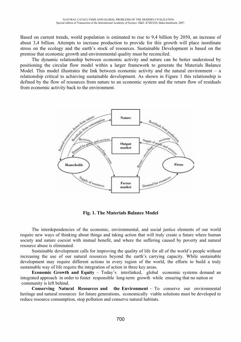
NATURAL CATACLYSMS AND GLOBAL PROBLEMS OF THE MODERN CIVILIZATION. Special edition of Transaction of the International Academy of Science. H&E. ICSD/IAS, Baku-Innsbruck, 2007.
700
Based on current trends, world population is estimated to rise to 9,4 billion by 2050, an increase of about 3,4 billion. Attempts to increase production to provide for this growth will place inordinate stress on the ecology and the earth’s stock of resources. Sustainable Development is based on the premise that economic growth and environmental quality must be reconciled.
The dynamic relationship between economic activity and nature can be better understood by positioning the circular flow model within a larger framework to generate the Materials Balance Model. This model illustrates the link between economic activity and the natural environment – a relationship critical to achieving sustainable development. As shown in Figure 1 this relationship is defined by the flow of resources from nature to an economic system and the return flow of residuals from economic activity back to the environment.
Fig. 1. The Materials Balance Model
The interdependencies of the economic, environmental, and social justice elements of our world require new ways of thinking about things and taking action that will truly create a future where human society and nature coexist with mutual benefit, and where the suffering caused by poverty and natural resource abuse is eliminated.
Sustainable development calls for improving the quality of life for all of the world’s people without increasing the use of our natural resources beyond the earth’s carrying capacity. While sustainable development may require different actions in every region of the world, the efforts to build a truly sustainable way of life require the integration of action in three key areas.
Economic Growth and Equity – Today’s interlinked, global economic systems demand an integrated approach in order to foster responsible long-term growth while ensuring that no nation or community is left behind.
Conserving Natural Resources and the Environment – To conserve our environmental heritage and natural resources for future generations, economically viable solutions must be developed to reduce resource consumption, stop pollution and conserve natural habitats.
NATURAL CATACLYSMS AND GLOBAL PROBLEMS OF THE MODERN CIVILIZATION. Special edition of Transaction of the International Academy of Science. H&E. ICSD/IAS, Baku-Innsbruck, 2007.
701
Social Development – Throughout the world, people require jobs, food, education, energy, health care, water and sanitation. While addressing these needs, the world community must also ensure that the rich fabric of cultural and social diversity and the rights of workers, are respected, and that all members of society are empowered to play a role in determining their futures.
It suggests reliable, responsible economic activity that considers the significance of place, the benefit of personal relationships, the importance of natural ecosystems, and when continued over the long-term, will:
1. not diminish the quality of the present environment; 2. not critically reduce the availability of renewable resources; 3. take into consideration the value of non-renewable resources to future generations; 4. not compromise the ability of other species or future generations to meet their needs It is time to think about a future in which environmental, societal, and economic considerations
are considered equally and at the same time in the pursuit of an improved quality of life for everyone. Inequality in resources and quality of life equals conflict. Society needs to view the world in terms of “cause and effect.” Sustainable development is the key to our future security, economic wealth, and environmental health.
Sustainable Development does not just mean a cleaner environment. It also requires a stable and healthy economy. To deliver a more sustainable economy we need to do more with less by making better use of resources, increase investment, promote stability and competition, develop skills and reward work. Sustainable development requires us to take a long term view of the economy, rather than adopting short term fixes.
REFERENCES
1. Report of the World Commission on Environment and Development, General Assembly Resolution 42/187, 11 December 1987.
2. Environmental Economics and Management: Theory, Policy, and Applications, 4th edition, Scott J. Callan and Janet M. Thomas, Thomson South-Western, 2007.
NEW TYPE Of ARTIFICIAL SOIL AND ITS ECO-TECHNOLOGICAL MANUFACTURING
O.L. Figovsky *, M. Ioelovich **, V.G. Isakova ***
*Israel Research Center "Polymate", Migdal Ha’Emek, Israel ** Baky State University
Many countries of the world have the limited areas of the fertile soils. For this reason underdeveloped and less developed countries are not capable to provide themselves with agricultural production. Industrially advanced countries solve a problem on the soil fertilizing shortage by use of advanced achievements of soil improvement, agrochemistry and genic engineering, such as the newest engineering, an artificial selective irrigation, advanced agrotechnology, removing of genetically modified high-yielding and steady cultures, use of new chemical and biological means of protection of plants, tray agriculture, artificial soil etc. It allows to receive high crops and to make surplus of agricultural production on export. Unfortunately, use of the newest agrotechnology and chemicals results in significant rise in price of agricultural production that makes its inaccessible to many
NATURAL CATACLYSMS AND GLOBAL PROBLEMS OF THE MODERN CIVILIZATION. Special edition of Transaction of the International Academy of Science. H&E. ICSD/IAS, Baku-Innsbruck, 2007.
702
countries of Africa, Asia and Latin America. Besides there are fears, that introduction of new chemical and biological means of protection of plants and is especial use of genetically modified cultures in food can be harmful to the person. Therefore one of priority directions of a modern agriculture is restoration and expansion of the area of the fertile grounds by creation of artificial soil.
Now artificial soil is maked, as a rule, on the basis of peat with the additive mineral creators, fertilizers, compost and some other additives [1]. Such soil is enough friable, is well aerated, easily absorbs and keeps water, that it is rather important for growth of plants. However it has also a number of essential lacks:
· Resources of peat in a nature are very much limited [2, 3]. Only one percent of the area of existing bogs is accessible to harvesting peat. Thus only third of crop is used for needs of an agriculture, in particular for manufacturing artificial soil. Harvesting of peat and its drying are naturally carried out limited time, only in the spring and in the summer.
· Peat contains few nutrients and insufficiently hydrophylen. Therefore at manufacturing artificial soil in peat add mineral fillers, organic both mineral fertilizers and some other substances.
· Conditions of drying of peat are naturally insufficient for its sterilization and do not provide suppression of pathogenic microorganisms. It needs additional artificial sterilization of peat.
For these reasons artificial soil on the basis of peat make in the limited amounts and under the high price which reaches 1000 dollars for ton and is higher. Application of such soil is limited only to hothouses for cultivation of colors and some other plants.
Perspective raw material for manufacturing new type of artificial soil are lingo-cellulosous waste products of agricultural plants, wood, papers, a cardboard and textiles. Annually in the world it is created up to 500 million tons of such waste products [4, 5]. More than half of these waste products now is thrown out and "loads" an environment because of absence of methods of their recycling [6]. The given project allows to solve this problem and to use cheap waste products as raw material for manufacturing artificial soil.
For transformation of lingo-cellulosous waste products in artificial soil friendly eco-technology for a nature, including the following basic stages is offered: 1) Preparation of raw material - gathering, clearing of mechanical impurity and pollution, sorting, threaded products and mixture. 2) Wet grinded raw material at the presence of special reagents before reception of a pulp. 3) extraction pulps from surplus of a reagent. 4) Artificial thermal - bio - chemical catabolism of lingo-cellulosous raw material. 5) Mixture of a catabolism products with modifying additives. 6) Packing.
The prepared raw material is impregnated with a water solution of a special reagent - the catalyst catabolism, crushed in a pulp with the help of a mixer or a beater and the after extraction is loaded into a reactor. Artificial catabolism of raw material in a reactor short time (30-60 mines) is carried out at moderate temperature. This process replaces long (from 6 months about several years) natural process catabolism of vegetative material in soil under action of microorganisms with the purpose of its partial destruction and preparations for process ulmification. As a result of artificial
the raw material turns in oligomerous an organic product sterile and disperse. This product mixes up with the modifying additives necessary for improvement of structure and properties of artificial soil. The ready artificial soil is hermetically packed into polyethylene bags for preservation of its sterility. The technological circuit of new process below is resulted:
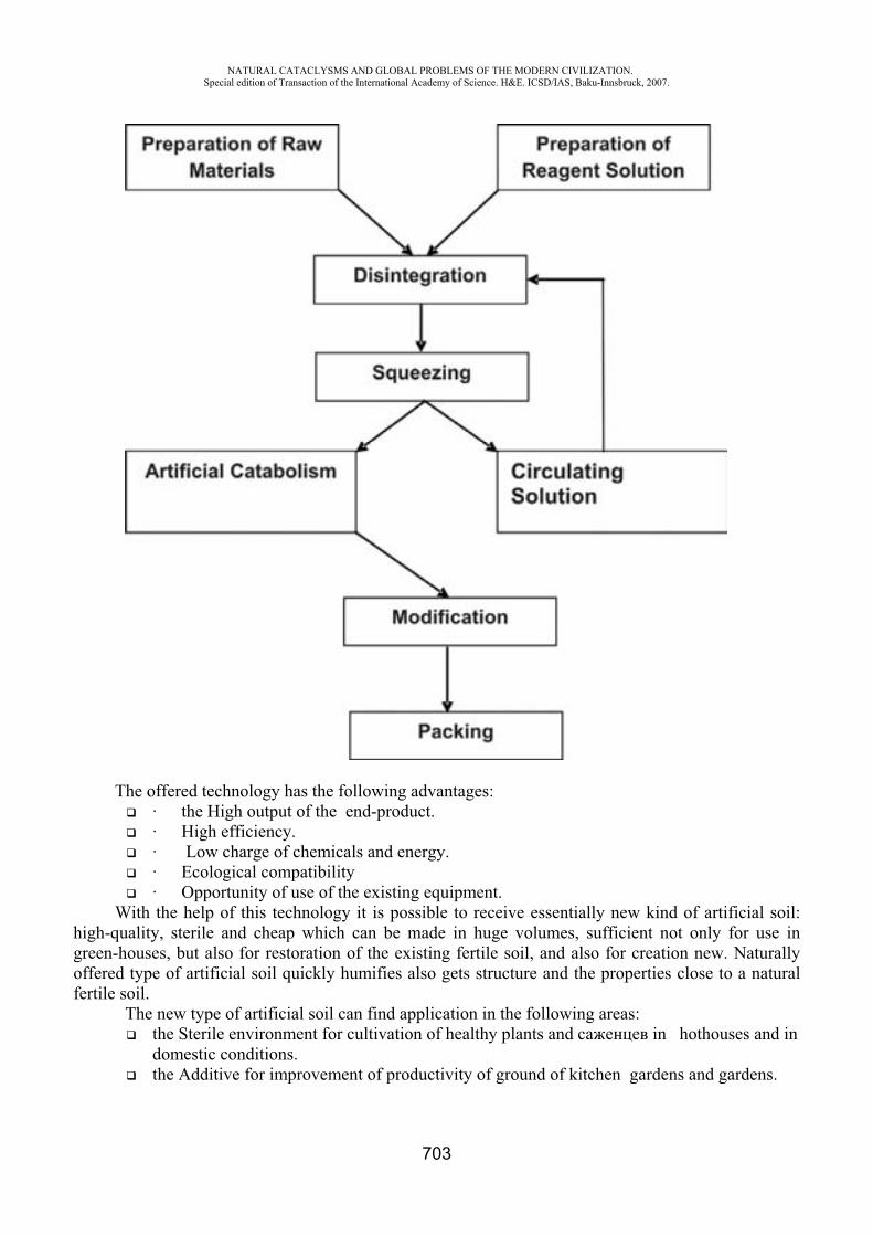
NATURAL CATACLYSMS AND GLOBAL PROBLEMS OF THE MODERN CIVILIZATION. Special edition of Transaction of the International Academy of Science. H&E. ICSD/IAS, Baku-Innsbruck, 2007.
703
The offered technology has the following advantages: · the High output of the end-product. · High efficiency. · Low charge of chemicals and energy. · Ecological compatibility · Opportunity of use of the existing equipment.
With the help of this technology it is possible to receive essentially new kind of artificial soil: high-quality, sterile and cheap which can be made in huge volumes, sufficient not only for use in green-houses, but also for restoration of the existing fertile soil, and also for creation new. Naturally offered type of artificial soil quickly humifies also gets structure and the properties close to a natural fertile soil.
The new type of artificial soil can find application in the following areas: the Sterile environment for cultivation of healthy plants and in hothouses and in domestic conditions. the Additive for improvement of productivity of ground of kitchen gardens and gardens.
NATURAL CATACLYSMS AND GLOBAL PROBLEMS OF THE MODERN CIVILIZATION. Special edition of Transaction of the International Academy of Science. H&E. ICSD/IAS, Baku-Innsbruck, 2007.
704
Modifying additive for restoration of fertility of fields. Artificial ground for expansion of the area of the fertile grounds. Improvement of fertility of saline soils. Restoration soils polluted with herbicides. Restoration polluted with petroleum soils after them clearing.
The marketing potential for new product is huge [7]. Due to low cost, unlimited raw-material base, high quality and the high-efficiency, harmless technology, the new type of artificial soil will be claimed by the world market and wide application in the various countries requiring for cultivation of healthy plants and restoration or expansion of the area of fertile soils will find. The market potential for new product is estimated up to 1-2 billion dollars.
REFERENCES
1. Artificial Soil Mixes. College of Agriculture, Fort Valley State University. – http://www.aginfo.fvsu.edu/teletips/houseplants/606.htm
2. Peat Horticulture and the Environment – The Facts. PPA Association. – http://www.peatproducers.co.uk/peatfacts.html
3. Clare Organic Products. - http://www.clareorganics.com 4. D. Beede, D. Bloom The Economics of Municipal Solid Waste.
http://www.worldbank.org/research/journals/wbro/obsaug95/waste.htm 5. Report of the U.S. Environment Protection Agency. 2001. 6. M. Ioelovich, O. Figovsky, Advanced Environment Friendly Barrier Composites. 10th
European Conference on Composite Materials, ECCM-10, Composites for Future, Brugge, Belgium, June 3-7, 2002.
7. O. Figovsky, Yu. Magarshak, Non-waste Civilization: Utopia or Reality. Scientific Israel - Technological Advantages, Volume 6, No.3, 2004, pp.16.
AIR LIQUIDE INDUSTRIAL MANAGEMENT SYSTEM “ECONOMICS AND SUSTAINABLE DEVELOPMENT”
Mata Zerbo*, Frank Slootman **, Xavier Drago***
*IMS Manager Air Liquide Electronics Europe**Industrial Director Air Liquide Electronics Europe
*** Sustainable Development Director [email protected]
Abstract : For over 100 years, Air Liquide has been in the same core business, operating under the same name, with steady growth, regular earnings, long-term relationships with its major customers, faithful and long serving employees and a large base of loyal individual shareholders. To sum up, Air Liquide has recorded sustained growth over the long term and has formalized its commitment to sustainable development focused on creating value for shareholders, developing the potential of the company’s human resources, preserving life and the environment, innovating for tomorrow.
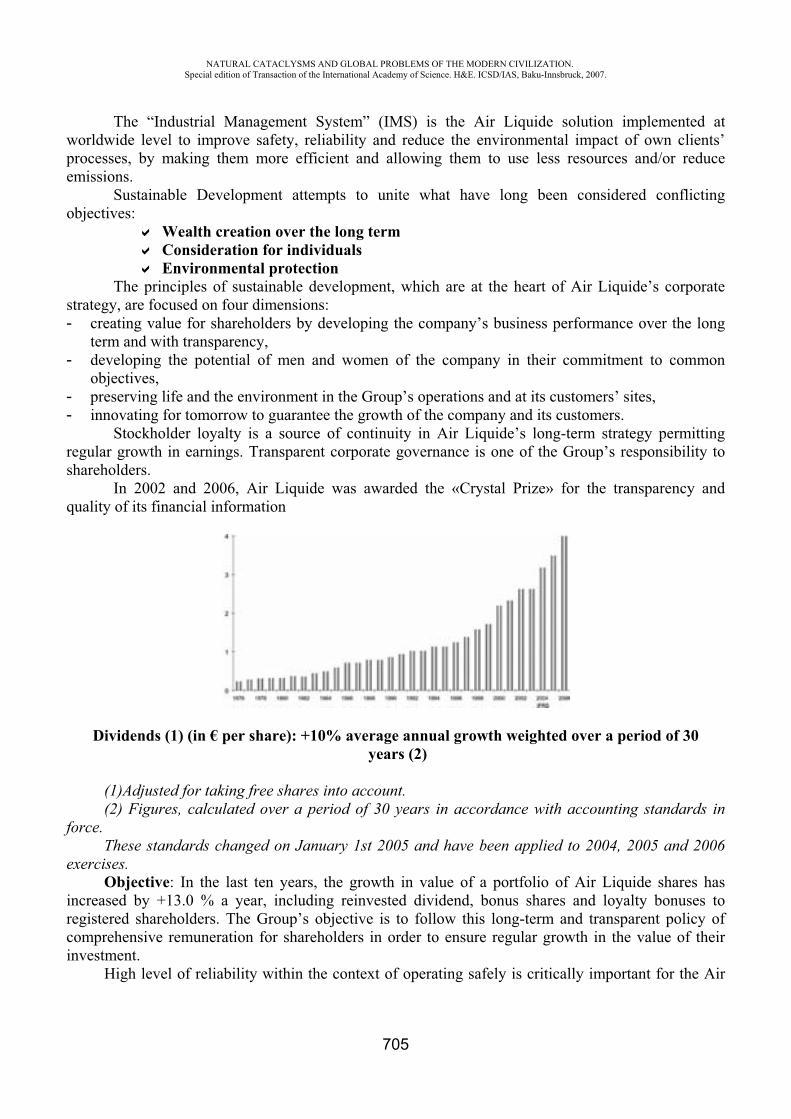
NATURAL CATACLYSMS AND GLOBAL PROBLEMS OF THE MODERN CIVILIZATION. Special edition of Transaction of the International Academy of Science. H&E. ICSD/IAS, Baku-Innsbruck, 2007.
705
The “Industrial Management System” (IMS) is the Air Liquide solution implemented at worldwide level to improve safety, reliability and reduce the environmental impact of own clients’ processes, by making them more efficient and allowing them to use less resources and/or reduce emissions.
Sustainable Development attempts to unite what have long been considered conflicting objectives:
Wealth creation over the long term Consideration for individuals Environmental protection
The principles of sustainable development, which are at the heart of Air Liquide’s corporate strategy, are focused on four dimensions: - creating value for shareholders by developing the company’s business performance over the long
term and with transparency, - developing the potential of men and women of the company in their commitment to common
objectives, - preserving life and the environment in the Group’s operations and at its customers’ sites, - innovating for tomorrow to guarantee the growth of the company and its customers.
Stockholder loyalty is a source of continuity in Air Liquide’s long-term strategy permitting regular growth in earnings. Transparent corporate governance is one of the Group’s responsibility to shareholders.
In 2002 and 2006, Air Liquide was awarded the «Crystal Prize» for the transparency and quality of its financial information
Dividends (1) (in € per share): +10% average annual growth weighted over a period of 30 years (2)
(1)Adjusted for taking free shares into account. (2) Figures, calculated over a period of 30 years in accordance with accounting standards in
force. These standards changed on January 1st 2005 and have been applied to 2004, 2005 and 2006
exercises.Objective: In the last ten years, the growth in value of a portfolio of Air Liquide shares has
increased by +13.0 % a year, including reinvested dividend, bonus shares and loyalty bonuses to registered shareholders. The Group’s objective is to follow this long-term and transparent policy of comprehensive remuneration for shareholders in order to ensure regular growth in the value of their investment.
High level of reliability within the context of operating safely is critically important for the Air
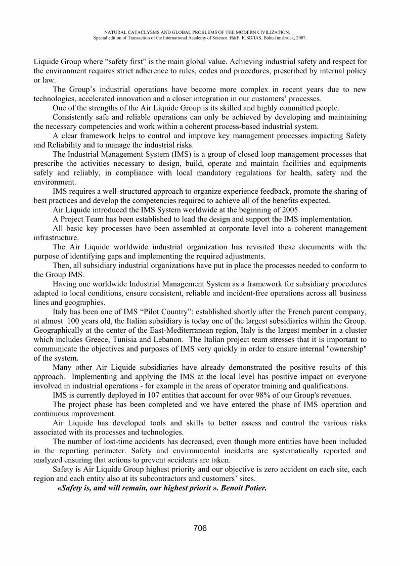
NATURAL CATACLYSMS AND GLOBAL PROBLEMS OF THE MODERN CIVILIZATION. Special edition of Transaction of the International Academy of Science. H&E. ICSD/IAS, Baku-Innsbruck, 2007.
706
Liquide Group where “safety first” is the main global value. Achieving industrial safety and respect for the environment requires strict adherence to rules, codes and procedures, prescribed by internal policy or law.
The Group’s industrial operations have become more complex in recent years due to new technologies, accelerated innovation and a closer integration in our customers’ processes.
One of the strengths of the Air Liquide Group is its skilled and highly committed people. Consistently safe and reliable operations can only be achieved by developing and maintaining
the necessary competencies and work within a coherent process-based industrial system. A clear framework helps to control and improve key management processes impacting Safety
and Reliability and to manage the industrial risks. The Industrial Management System (IMS) is a group of closed loop management processes that
prescribe the activities necessary to design, build, operate and maintain facilities and equipments safely and reliably, in compliance with local mandatory regulations for health, safety and the environment.
IMS requires a well-structured approach to organize experience feedback, promote the sharing of best practices and develop the competencies required to achieve all of the benefits expected.
Air Liquide introduced the IMS System worldwide at the beginning of 2005.A Project Team has been established to lead the design and support the IMS implementation. All basic key processes have been assembled at corporate level into a coherent management
infrastructure. The Air Liquide worldwide industrial organization has revisited these documents with the
purpose of identifying gaps and implementing the required adjustments. Then, all subsidiary industrial organizations have put in place the processes needed to conform to
the Group IMS.Having one worldwide Industrial Management System as a framework for subsidiary procedures
adapted to local conditions, ensure consistent, reliable and incident-free operations across all business lines and geographies.
Italy has been one of IMS “Pilot Country”: established shortly after the French parent company, at almost 100 years old, the Italian subsidiary is today one of the largest subsidiaries within the Group. Geographically at the center of the East-Mediterranean region, Italy is the largest member in a cluster which includes Greece, Tunisia and Lebanon. The Italian project team stresses that it is important to communicate the objectives and purposes of IMS very quickly in order to ensure internal "ownership" of the system.
Many other Air Liquide subsidiaries have already demonstrated the positive results of this approach. Implementing and applying the IMS at the local level has positive impact on everyone involved in industrial operations - for example in the areas of operator training and qualifications.
IMS is currently deployed in 107 entities that account for over 98% of our Group's revenues. The project phase has been completed and we have entered the phase of IMS operation and
continuous improvement. Air Liquide has developed tools and skills to better assess and control the various risks
associated with its processes and technologies. The number of lost-time accidents has decreased, even though more entities have been included
in the reporting perimeter. Safety and environmental incidents are systematically reported and analyzed ensuring that actions to prevent accidents are taken.
Safety is Air Liquide Group highest priority and our objective is zero accident on each site, each region and each entity also at its subcontractors and customers’ sites.
«Safety is, and will remain, our highest priorit ». Benoit Potier.
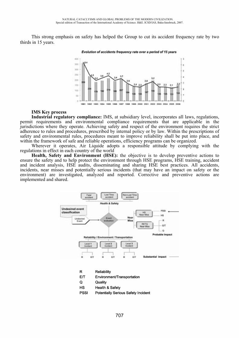
NATURAL CATACLYSMS AND GLOBAL PROBLEMS OF THE MODERN CIVILIZATION. Special edition of Transaction of the International Academy of Science. H&E. ICSD/IAS, Baku-Innsbruck, 2007.
707
Environment/TransportationE/T
Health & SafetyHSPotentially Serious Safety IncidentPSSI
QualityQ
ReliabilityREnvironment/TransportationE/T
Health & SafetyHSPotentially Serious Safety IncidentPSSI
QualityQ
ReliabilityR
This strong emphasis on safety has helped the Group to cut its accident frequency rate by two thirds in 15 years.
IMS Key process Industrial regulatory compliance: IMS, at subsidiary level, incorporates all laws, regulations,
permit requirements and environmental compliance requirements that are applicable in the jurisdictions where they operate. Achieving safety and respect of the environment requires the strict adherence to rules and procedures, prescribed by internal policy or by law. Within the prescriptions of safety and environmental rules, procedures meant to improve reliability shall be put into place, and within the framework of safe and reliable operations, efficiency programs can be organized.
Wherever it operates, Air Liquide adopts a responsible attitude by complying with the regulations in effect in each country of the world
Health, Safety and Environment (HSE): the objective is to develop preventive actions to ensure the safety and to help protect the environment through HSE programs, HSE training, accident and incident analysis, HSE audits, disseminating and sharing HSE best practices. All accidents, incidents, near misses and potentially serious incidents (that may have an impact on safety or the environment) are investigated, analyzed and reported. Corrective and preventive actions are implemented and shared.
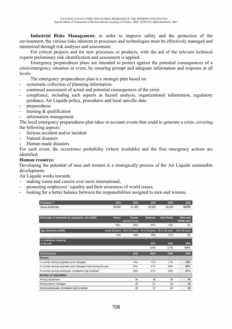
NATURAL CATACLYSMS AND GLOBAL PROBLEMS OF THE MODERN CIVILIZATION. Special edition of Transaction of the International Academy of Science. H&E. ICSD/IAS, Baku-Innsbruck, 2007.
708
Industrial Risks Management: in order to improve safety and the protection of the environment, the various risks inherent in processes and technologies must be effectively managed and minimized through risk analyses and assessment.
For critical projects and for new processes or products, with the aid of the relevant technical experts preliminary risk identification and assessment is applied.
Emergency preparedness plans are intended to protect against the potential consequences of a crisis/emergency situation or event, by ensuring prompt and adequate information and response at all levels.
The emergency preparedness plan is a strategic plan based on: - systematic collection of planning information - continued assessment of actual and potential consequences of the crisis - compliance, including such aspects as hazard analysis, organizational information, regulatory
guidance, Air Liquide policy, procedures and local specific data. - preparedness - training & qualification - information management The local emergency preparedness plan takes in account events that could to generate a crisis, covering the following aspects: - Serious accident and/or incident - Natural disasters - Human-made disasters For each event, the occurrence probability (where available) and the first emergency actions are identified. Human resource: Developing the potential of men and women is a strategically process of the Air Liquide sustainable development.Air Liquide works towards: - making teams and careers ever more international, - promoting employees’ equality and their awareness of world issues, - looking for a better balance between the responsibilities assigned to men and women.
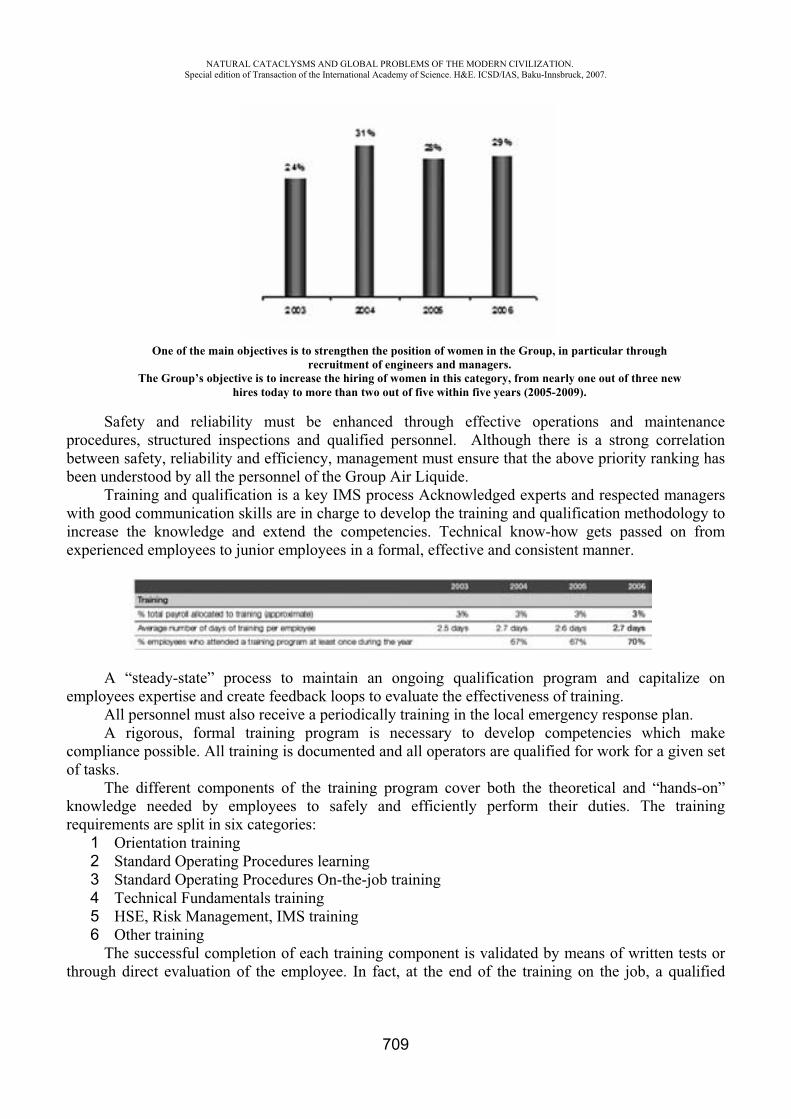
NATURAL CATACLYSMS AND GLOBAL PROBLEMS OF THE MODERN CIVILIZATION. Special edition of Transaction of the International Academy of Science. H&E. ICSD/IAS, Baku-Innsbruck, 2007.
709
Safety and reliability must be enhanced through effective operations and maintenance procedures, structured inspections and qualified personnel. Although there is a strong correlation between safety, reliability and efficiency, management must ensure that the above priority ranking has been understood by all the personnel of the Group Air Liquide.
Training and qualification is a key IMS process Acknowledged experts and respected managers with good communication skills are in charge to develop the training and qualification methodology to increase the knowledge and extend the competencies. Technical know-how gets passed on from experienced employees to junior employees in a formal, effective and consistent manner.
A “steady-state” process to maintain an ongoing qualification program and capitalize on employees expertise and create feedback loops to evaluate the effectiveness of training.
All personnel must also receive a periodically training in the local emergency response plan. A rigorous, formal training program is necessary to develop competencies which make
compliance possible. All training is documented and all operators are qualified for work for a given set of tasks.
The different components of the training program cover both the theoretical and “hands-on” knowledge needed by employees to safely and efficiently perform their duties. The training requirements are split in six categories:
1 Orientation training 2 Standard Operating Procedures learning3 Standard Operating Procedures On-the-job training 4 Technical Fundamentals training 5 HSE, Risk Management, IMS training 6 Other training
The successful completion of each training component is validated by means of written tests or through direct evaluation of the employee. In fact, at the end of the training on the job, a qualified
One of the main objectives is to strengthen the position of women in the Group, in particular through recruitment of engineers and managers.
The Group’s objective is to increase the hiring of women in this category, from nearly one out of three new hires today to more than two out of five within five years (2005-2009).

NATURAL CATACLYSMS AND GLOBAL PROBLEMS OF THE MODERN CIVILIZATION. Special edition of Transaction of the International Academy of Science. H&E. ICSD/IAS, Baku-Innsbruck, 2007.
710
technician “evaluator” must estimate the training effectiveness. Furthermore, each year, every employee, to have an evaluation interview with his supervisor and
about every 3 years an interview with the Human Resources Department. In 2006, 70% of the employees had an annual interview with their supervisor and 13% an
interview with their Human Resources Department. The Air Liquide Group is continuing to focus on organizing these interviews, which are the keystone of the company’s human resources policy.
Design: Group Design Safety Rules (GD) are documents issued by a worldwide engineering technical council. They define the minimum safety rules that must be applied in the design, fabrication, erection and commissioning of new installations.
A qualified “Design Authority” verifies that installations incorporating new or modified engineered systems have been designed using sound engineering practices and are in compliance with Design Standards.
Management of change: hazard identification is a critical part of each workers day-to-day activity. The purpose is to identify the conditions surrounding our immediate work areas as they are all unique and may change throughout the day.
Accidents and potentially serious safety incidents normally occur because of changes or non-routine works.
A specific procedure ensures that changes are technically sound and documented, and that HSE and reliability safeguards originally designed are either maintained or enhanced.
Any change must be evaluate by an assessor and approved by another expert or specialist in the field.
Moreover, prepare a detailed work permit and make sure it is properly applied is mandatory for each non-routine activity.
Operations control: requirements for Operating Manuals and Standard Operating Procedures are clearly defined. A “Ready for Start-up Review” process is required to confirm the completion of the tasks, the documentation, and the training required for starting up and operating a facility or equipment safely, reliably and in compliance with applicable regulations. Furthermore, a Maintenance Program and Plans are implemented.
Procurement: purchasing activities are all relevant to assist industrial operations; the design, construction materials, fabrication techniques, cleaning and preservation of certain components, materials and equipment as well as the conformance to specification of process raw materials as well as services from contractors can impact HSE and reliability in operations. Critical components, materials and equipment identified through risk assessments and contractor services related to industrial activities are purchased only from qualified supplier. In case of project, specifications are validated by the Design Authority.
Audit: to ensure the success of IMS and to improving our future performance, an audit program is in place. In case of implementation problems that arise in the field or needs for clarification of technical rules or information, appropriate corrective action may be taken.
Management review: to ensure the effective and continuous improvement of the industrial management system.
Safety and Environmental indicators A list of safety and environmental indicators has been defined by a Group Technical Standard, covering several themes, e.g.: 1 Loss time and non-loss time accident 2 Frequency rate 3 Property of the financial assets 4 Water (consumption and discharge) 5 Mass balance
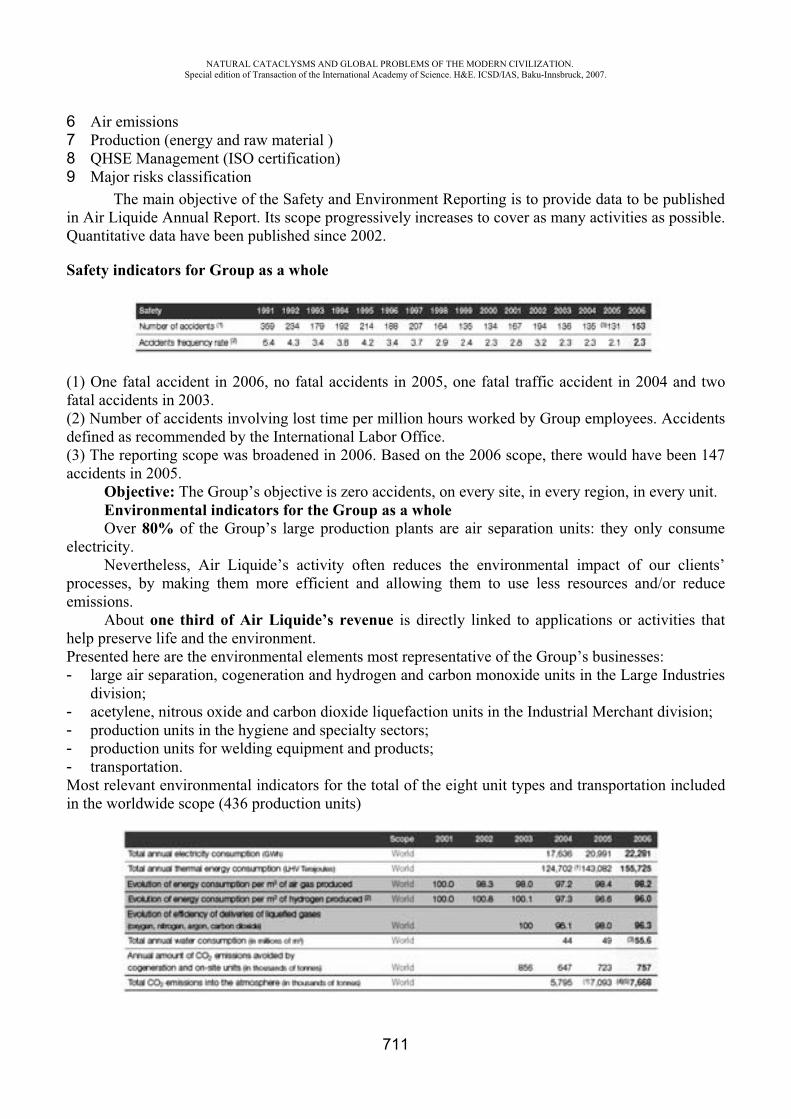
NATURAL CATACLYSMS AND GLOBAL PROBLEMS OF THE MODERN CIVILIZATION. Special edition of Transaction of the International Academy of Science. H&E. ICSD/IAS, Baku-Innsbruck, 2007.
711
6 Air emissions 7 Production (energy and raw material ) 8 QHSE Management (ISO certification) 9 Major risks classification
The main objective of the Safety and Environment Reporting is to provide data to be published in Air Liquide Annual Report. Its scope progressively increases to cover as many activities as possible. Quantitative data have been published since 2002.
Safety indicators for Group as a whole
(1) One fatal accident in 2006, no fatal accidents in 2005, one fatal traffic accident in 2004 and two fatal accidents in 2003. (2) Number of accidents involving lost time per million hours worked by Group employees. Accidents defined as recommended by the International Labor Office. (3) The reporting scope was broadened in 2006. Based on the 2006 scope, there would have been 147 accidents in 2005.
Objective: The Group’s objective is zero accidents, on every site, in every region, in every unit. Environmental indicators for the Group as a whole Over 80% of the Group’s large production plants are air separation units: they only consume
electricity. Nevertheless, Air Liquide’s activity often reduces the environmental impact of our clients’
processes, by making them more efficient and allowing them to use less resources and/or reduce emissions.
About one third of Air Liquide’s revenue is directly linked to applications or activities that help preserve life and the environment. Presented here are the environmental elements most representative of the Group’s businesses: - large air separation, cogeneration and hydrogen and carbon monoxide units in the Large Industries
division;- acetylene, nitrous oxide and carbon dioxide liquefaction units in the Industrial Merchant division; - production units in the hygiene and specialty sectors; - production units for welding equipment and products; - transportation. Most relevant environmental indicators for the total of the eight unit types and transportation included in the worldwide scope (436 production units)
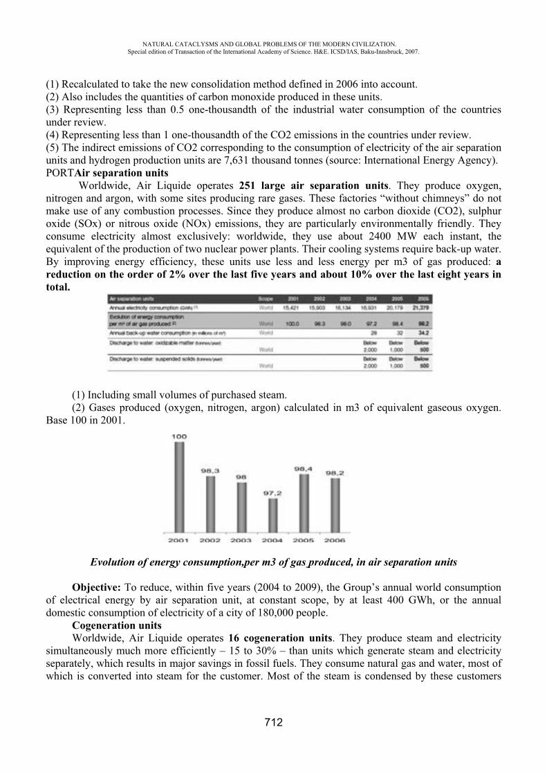
NATURAL CATACLYSMS AND GLOBAL PROBLEMS OF THE MODERN CIVILIZATION. Special edition of Transaction of the International Academy of Science. H&E. ICSD/IAS, Baku-Innsbruck, 2007.
712
(1) Recalculated to take the new consolidation method defined in 2006 into account. (2) Also includes the quantities of carbon monoxide produced in these units. (3) Representing less than 0.5 one-thousandth of the industrial water consumption of the countries under review. (4) Representing less than 1 one-thousandth of the CO2 emissions in the countries under review. (5) The indirect emissions of CO2 corresponding to the consumption of electricity of the air separation units and hydrogen production units are 7,631 thousand tonnes (source: International Energy Agency). PORTAir separation units
Worldwide, Air Liquide operates 251 large air separation units. They produce oxygen, nitrogen and argon, with some sites producing rare gases. These factories “without chimneys” do not make use of any combustion processes. Since they produce almost no carbon dioxide (CO2), sulphur oxide (SOx) or nitrous oxide (NOx) emissions, they are particularly environmentally friendly. They consume electricity almost exclusively: worldwide, they use about 2400 MW each instant, the equivalent of the production of two nuclear power plants. Their cooling systems require back-up water. By improving energy efficiency, these units use less and less energy per m3 of gas produced: areduction on the order of 2% over the last five years and about 10% over the last eight years in total.
(1) Including small volumes of purchased steam. (2) Gases produced (oxygen, nitrogen, argon) calculated in m3 of equivalent gaseous oxygen.
Base 100 in 2001.
Evolution of energy consumption,per m3 of gas produced, in air separation units
Objective: To reduce, within five years (2004 to 2009), the Group’s annual world consumption of electrical energy by air separation unit, at constant scope, by at least 400 GWh, or the annual domestic consumption of electricity of a city of 180,000 people.
Cogeneration units Worldwide, Air Liquide operates 16 cogeneration units. They produce steam and electricity
simultaneously much more efficiently – 15 to 30% – than units which generate steam and electricity separately, which results in major savings in fossil fuels. They consume natural gas and water, most of which is converted into steam for the customer. Most of the steam is condensed by these customers

NATURAL CATACLYSMS AND GLOBAL PROBLEMS OF THE MODERN CIVILIZATION. Special edition of Transaction of the International Academy of Science. H&E. ICSD/IAS, Baku-Innsbruck, 2007.
713
and then reused in the cogeneration unit. In most cases, the electricity produced is supplied to the local electricity distribution network. Combustion of natural gas gives off carbon dioxide (CO2) and produces some nitrous oxide (NOx) emissions, but practically no sulphur oxide (SOx) emissions. These units replace steam and electricity production units that would have produced more CO2 emissions. Cogeneration units therefore help reduce CO2 emissions in the industrial basins they supply. In 2006, the Group’s cogeneration units avoided 693,000 tonnes of carbon dioxide emissions being discharged into the atmosphere.
(1) Calculation takes into account the primary energy source each country uses to produce electricity (source: International Energy Agency).
Hydrogen and carbon monoxide production units Worldwide, Air Liquide operates 37 large hydrogen and carbon monoxide production units. Desulphurization of hydrocarbons to produce sulphur-free fuels is one of the main applications for hydrogen. In 2006, the hydrogen Air Liquide supplied to refineries throughout the world resulted in asavings of about 700,000 tonnes of sulphur oxide emissions discharged into the atmosphere,which is greater than all the emissions from a country like France. An important application for carbon monoxide is plastics manufacturing. Natural gas is the main raw material used in these production units, along with certain amounts of “process” water. These units emit carbon dioxide (CO2) and lead to nitrous oxide (NOx) emissions but produce practically no sulphur oxides (SOx). They also consume electricity and their cooling systems require back-up water. Energy efficiency of these units per m3 of gas produced has improved by about 4% since 2001.
(1) Recalculated to take the new consolidation method defined in 2006 into account. (2) Hydrogen and carbon monoxide. Base 100 in 2001.
Acetylene production unitsAir Liquide operates 47 acetylene production units (a gas used mainly in welding and metal
cutting). They produce the gas through the decomposition of a solid - calcium carbide - using water.
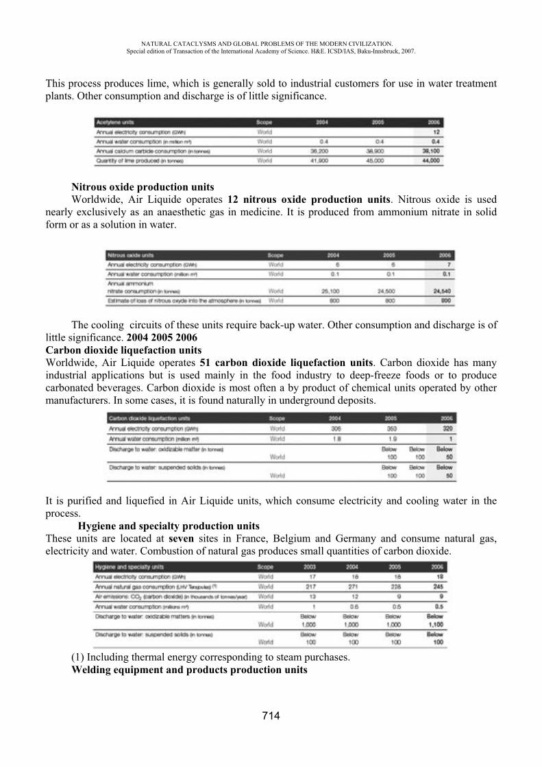
NATURAL CATACLYSMS AND GLOBAL PROBLEMS OF THE MODERN CIVILIZATION. Special edition of Transaction of the International Academy of Science. H&E. ICSD/IAS, Baku-Innsbruck, 2007.
714
This process produces lime, which is generally sold to industrial customers for use in water treatment plants. Other consumption and discharge is of little significance.
Nitrous oxide production units Worldwide, Air Liquide operates 12 nitrous oxide production units. Nitrous oxide is used
nearly exclusively as an anaesthetic gas in medicine. It is produced from ammonium nitrate in solid form or as a solution in water.
The cooling circuits of these units require back-up water. Other consumption and discharge is of little significance. 2004 2005 2006Carbon dioxide liquefaction unitsWorldwide, Air Liquide operates 51 carbon dioxide liquefaction units. Carbon dioxide has many industrial applications but is used mainly in the food industry to deep-freeze foods or to produce carbonated beverages. Carbon dioxide is most often a by product of chemical units operated by other manufacturers. In some cases, it is found naturally in underground deposits.
It is purified and liquefied in Air Liquide units, which consume electricity and cooling water in the process.
Hygiene and specialty production unitsThese units are located at seven sites in France, Belgium and Germany and consume natural gas, electricity and water. Combustion of natural gas produces small quantities of carbon dioxide.
(1) Including thermal energy corresponding to steam purchases. Welding equipment and products production units
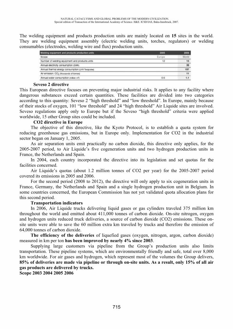
NATURAL CATACLYSMS AND GLOBAL PROBLEMS OF THE MODERN CIVILIZATION. Special edition of Transaction of the International Academy of Science. H&E. ICSD/IAS, Baku-Innsbruck, 2007.
715
The welding equipment and products production units are mainly located on 15 sites in the world. They are welding equipment assembly (electric welding units, torches, regulators) or welding consumables (electrodes, welding wire and flux) production units.
Seveso 2 directive This European directive focuses on preventing major industrial risks. It applies to any facility where dangerous substances exceed certain quantities. These facilities are divided into two categories according to this quantity: Seveso 2 “high threshold” and “low threshold”. In Europe, mainly because of their stocks of oxygen, 101 “low threshold” and 24 “high threshold” Air Liquide sites are involved. Seveso regulations apply only to Europe but if the Seveso “high threshold” criteria were applied worldwide, 15 other Group sites could be included.
CO2 directive in Europe The objective of this directive, like the Kyoto Protocol, is to establish a quota system for
reducing greenhouse gas emissions, but in Europe only. Implementation for CO2 in the industrial sector began on January 1, 2005.
As air separation units emit practically no carbon dioxide, this directive only applies, for the 2005-2007 period, to Air Liquide’s five cogeneration units and two hydrogen production units in France, the Netherlands and Spain.
In 2004, each country incorporated the directive into its legislation and set quotas for the facilities concerned.
Air Liquide’s quotas (about 1.2 million tonnes of CO2 per year) for the 2005-2007 period covered its emissions in 2005 and 2006.
For the second period (2008 to 2012), the directive will only apply to six cogeneration units in France, Germany, the Netherlands and Spain and a single hydrogen production unit in Belgium. In some countries concerned, the European Commission has not yet validated quota allocation plans for this second period.
Transportation indicators In 2006, Air Liquide trucks delivering liquid gases or gas cylinders traveled 375 million km
throughout the world and emitted about 411,000 tonnes of carbon dioxide. On-site nitrogen, oxygen and hydrogen units reduced truck deliveries, a source of carbon dioxide (CO2) emissions. These on-site units were able to save the 60 million extra km traveled by trucks and therefore the emission of 64,000 tonnes of carbon dioxide.
The efficiency of the deliveries of liquefied gases (oxygen, nitrogen, argon, carbon dioxide) measured in km per ton has been improved by nearly 4% since 2003.
Supplying large customers via pipeline from the Group’s production units also limits transportation. These pipeline systems, which are environmentally friendly and safe, total over 8,000 km worldwide. For air gases and hydrogen, which represent most of the volumes the Group delivers, 85% of deliveries are made via pipeline or through on-site units. As a result, only 15% of all air gas products are delivered by trucks. Scope 2003 2004 2005 2006
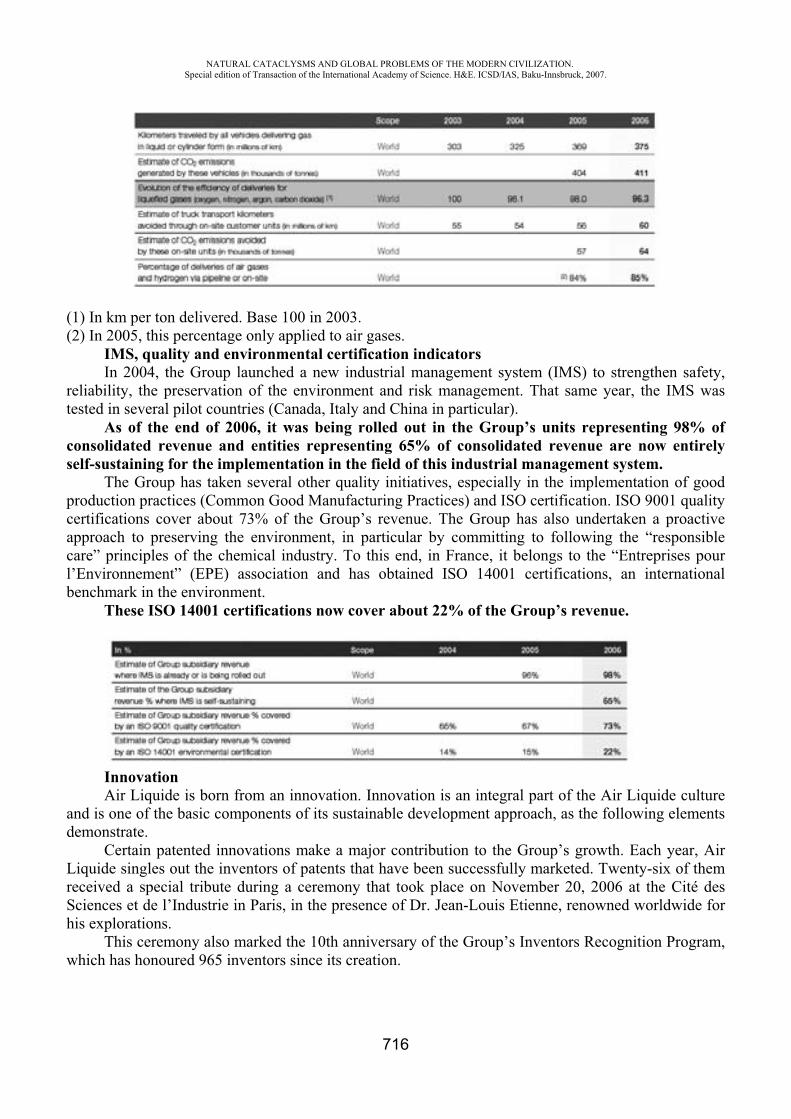
NATURAL CATACLYSMS AND GLOBAL PROBLEMS OF THE MODERN CIVILIZATION. Special edition of Transaction of the International Academy of Science. H&E. ICSD/IAS, Baku-Innsbruck, 2007.
716
(1) In km per ton delivered. Base 100 in 2003. (2) In 2005, this percentage only applied to air gases.
IMS, quality and environmental certification indicators In 2004, the Group launched a new industrial management system (IMS) to strengthen safety,
reliability, the preservation of the environment and risk management. That same year, the IMS was tested in several pilot countries (Canada, Italy and China in particular).
As of the end of 2006, it was being rolled out in the Group’s units representing 98% of consolidated revenue and entities representing 65% of consolidated revenue are now entirely self-sustaining for the implementation in the field of this industrial management system.
The Group has taken several other quality initiatives, especially in the implementation of good production practices (Common Good Manufacturing Practices) and ISO certification. ISO 9001 quality certifications cover about 73% of the Group’s revenue. The Group has also undertaken a proactive approach to preserving the environment, in particular by committing to following the “responsible care” principles of the chemical industry. To this end, in France, it belongs to the “Entreprises pour l’Environnement” (EPE) association and has obtained ISO 14001 certifications, an international benchmark in the environment.
These ISO 14001 certifications now cover about 22% of the Group’s revenue.
PORTInnovationAir Liquide is born from an innovation. Innovation is an integral part of the Air Liquide culture
and is one of the basic components of its sustainable development approach, as the following elements demonstrate.
Certain patented innovations make a major contribution to the Group’s growth. Each year, Air Liquide singles out the inventors of patents that have been successfully marketed. Twenty-six of them received a special tribute during a ceremony that took place on November 20, 2006 at the Cité des Sciences et de l’Industrie in Paris, in the presence of Dr. Jean-Louis Etienne, renowned worldwide for his explorations.
This ceremony also marked the 10th anniversary of the Group’s Inventors Recognition Program, which has honoured 965 inventors since its creation.
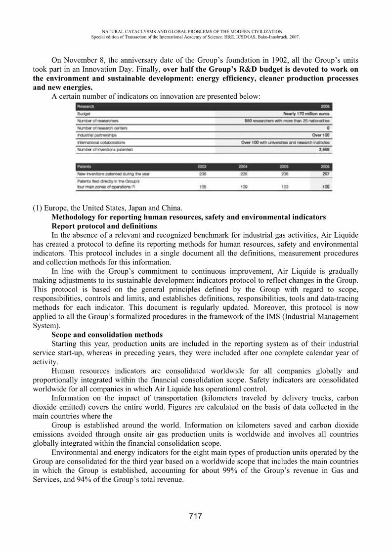
NATURAL CATACLYSMS AND GLOBAL PROBLEMS OF THE MODERN CIVILIZATION. Special edition of Transaction of the International Academy of Science. H&E. ICSD/IAS, Baku-Innsbruck, 2007.
717
On November 8, the anniversary date of the Group’s foundation in 1902, all the Group’s units took part in an Innovation Day. Finally, over half the Group’s R&D budget is devoted to work on the environment and sustainable development: energy efficiency, cleaner production processes and new energies.
A certain number of indicators on innovation are presented below:
(1) Europe, the United States, Japan and China. Methodology for reporting human resources, safety and environmental indicators Report protocol and definitions In the absence of a relevant and recognized benchmark for industrial gas activities, Air Liquide
has created a protocol to define its reporting methods for human resources, safety and environmental indicators. This protocol includes in a single document all the definitions, measurement procedures and collection methods for this information.
In line with the Group’s commitment to continuous improvement, Air Liquide is gradually making adjustments to its sustainable development indicators protocol to reflect changes in the Group. This protocol is based on the general principles defined by the Group with regard to scope, responsibilities, controls and limits, and establishes definitions, responsibilities, tools and data-tracing methods for each indicator. This document is regularly updated. Moreover, this protocol is now applied to all the Group’s formalized procedures in the framework of the IMS (Industrial Management System).
Scope and consolidation methods Starting this year, production units are included in the reporting system as of their industrial
service start-up, whereas in preceding years, they were included after one complete calendar year of activity.
Human resources indicators are consolidated worldwide for all companies globally and proportionally integrated within the financial consolidation scope. Safety indicators are consolidated worldwide for all companies in which Air Liquide has operational control.
Information on the impact of transportation (kilometers traveled by delivery trucks, carbon dioxide emitted) covers the entire world. Figures are calculated on the basis of data collected in the main countries where the
Group is established around the world. Information on kilometers saved and carbon dioxide emissions avoided through onsite air gas production units is worldwide and involves all countries globally integrated within the financial consolidation scope.
Environmental and energy indicators for the eight main types of production units operated by the Group are consolidated for the third year based on a worldwide scope that includes the main countries in which the Group is established, accounting for about 99% of the Group’s revenue in Gas and Services, and 94% of the Group’s total revenue.
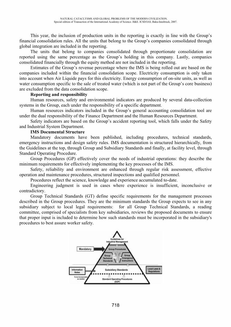
NATURAL CATACLYSMS AND GLOBAL PROBLEMS OF THE MODERN CIVILIZATION. Special edition of Transaction of the International Academy of Science. H&E. ICSD/IAS, Baku-Innsbruck, 2007.
718
This year, the inclusion of production units in the reporting is exactly in line with the Group’s financial consolidation rules. All the units that belong to the Group’s companies consolidated through global integration are included in the reporting.
The units that belong to companies consolidated through proportionate consolidation are reported using the same percentage as the Group’s holding in this company. Lastly, companies consolidated financially through the equity method are not included in the reporting.
Estimates of the Group’s revenue percentage where the IMS is being rolled out are based on the companies included within the financial consolidation scope. Electricity consumption is only taken into account when Air Liquide pays for this electricity. Energy consumption of on-site units, as well as water consumption specific to the sale of treated water (which is not part of the Group’s core business) are excluded from the data consolidation scope.
Reporting and responsibility Human resources, safety and environmental indicators are produced by several data-collection
systems in the Group, each under the responsibility of a specific department. Human resources indicators included in the Group’s general accounting consolidation tool are
under the dual responsibility of the Finance Department and the Human Resources Department. Safety indicators are based on the Group’s accident reporting tool, which falls under the Safety
and Industrial System Department. IMS Documental Structure Mandatory documents have been published, including procedures, technical standards,
emergency instructions and design safety rules. IMS documentation is structured hierarchically, from the Guidelines at the top, through Group and Subsidiary Standards and finally, at facility level, through Standard Operating Procedure.
Group Procedures (GP) effectively cover the needs of industrial operations: they describe the minimum requirements for effectively implementing the key processes of the IMS.
Safety, reliability and environment are enhanced through regular risk assessment, effective operation and maintenance procedures, structured inspections and qualified personnel.
Procedures reflect the science, knowledge and experience accumulated to-date.Engineering judgment is used in cases where experience is insufficient, inconclusive or
contradictory.Group Technical Standards (GT) define specific requirements for the management processes
described in the Group procedures. They are the minimum standards the Group expects to see in any subsidiary subject to local legal requirements: for all Group Technical Standards, a reading committee, comprised of specialists from key subsidiaries, reviews the proposed documents to ensure that proper input is included to determine how such standards must be incorporated in the subsidiary's procedures to best assure worker safety.

NATURAL CATACLYSMS AND GLOBAL PROBLEMS OF THE MODERN CIVILIZATION. Special edition of Transaction of the International Academy of Science. H&E. ICSD/IAS, Baku-Innsbruck, 2007.
719
Operating water consumption / consommation d'eau pour l'exploitation (55 millions m3)
North America43%
Europe40%
Asia8%
Central and South America
4%
Oceania / Océanie
3%
Africa2%
The most current Air Liquide standards are implemented for all new and planned installations. On existing installations, risk assessments are to be conducted at regular intervals and as changes occur. Group Emergency Instructions (GE) are documents in response to a serious accident, incident or near miss, that must be implemented by all subsidiaries and entities immediately.
Other non mandatory documents are available to subsidiaries: e.g., the Information Notes (IN) when it is judged to be of interest.
Best practices, checklists, protocols, background knowledge, and other tools are shared within Air Liquide through the Workspace and Intranet.
Several Best Practices are dedicated to the HSE. As an example, all Air Liquide sites use water, for industrial and/or domestic usage. In 2006, water consumption for industrial activities amounted to 55 millions m3.
Water is primarily used in cooling towers or as a raw material for the manufacturing of products in the Chemicals and Specialties activity, for the production of acetylene and for steam.
Best practices to limit water consumption and/or the impact of our use on this precious resource availability are communicated to all sites (water consumption optimization, rain water recovering, operation of cooling towers optimization, water recycling from the lime settling tanks towards the generator, etc.).
STUDIES OF THE CASPIANSIDE ZONES OF AZERBAIJAN AND PROBLEMSOF RATIONAL UTILIZATION OF NATURAL RESOURCES
Shovgi Geychayli Y.*, Metin Huseynli A.**Baku State University, Azerbaijan, Baku
[email protected] [email protected]
Coastal territories have peculiar geographical conditions. The activity of population of coastal territory sharply differs by its complications from the activity of population settled far from shore. This zone has all preconditions for development of such spheres of activity as fisheries, sea and land transport, sea energy, marinculture, tourism and recreation, port industry, creation of chemical industry, etc.
Since the second half of the XX century the studies of coastal zones as a system has particularly drawn attention of many scientists. Investigation of given sphere can be carried out in some
NATURAL CATACLYSMS AND GLOBAL PROBLEMS OF THE MODERN CIVILIZATION. Special edition of Transaction of the International Academy of Science. H&E. ICSD/IAS, Baku-Innsbruck, 2007.
720
directions: physical geography, geomorphology and oceanology, economical and social geography, regionology, etc. It should be noted that while studying the coasts of the world oceans many interesting researches have been carried out. The coastal zones of the world oceans basically differ from the sea coasts, but at the same time they have many similar features.
The research of the river mouths plays an important role in studying of coastal zones of the world oceans, and as well as the Caspian. The larger river sources form natural-territorial complexes. At the same time equally with their dynamism in some cases the river mouths for very short time, even during a year, are subjected to considerable changes. In favorable conditions the possibility for utilization of coastal territories increase in the sources of rivers. Therefore the study of coastal zones have a significant scientific and practical value.
The State Committee of Hydrometereology, Regional Transcaucasus Scientific-Research Institute, Project Institute on Studying of Sea, Oil and Gas, Institute of Biology of the ANAS, and other scientific-research institutes played a considerable role in studying of the Caspeanside zones.
It is necessary to note that at the second half of the XX century the study of seaside zones gained a particular importance in research and analysis of international division of labour. Some years later the scientists of the world and Commonwealth of Independent States made a scientific contribution to given sphere in their scientific works on geomarinology. Above mentioned researches were carried out on the initiative of commissions named "Coastal systems" and "Geography of the sea" of the International Geographical Union. The 1998 was declared an year of ocean by the United Nations and this fact attracted attention of the scientists of the whole world to the spoken problem. Side by side fruitful researches in the spheres of world geography and geographical policy, regionology, oceanology were included valuable scientific-researches data in order to continue the researches on the coastal zones in future. A research on palaeogeography of the coastal zones of the Caspian Sea, and long-term study on sea level were carried out by scientists of Azerbaijan (1986, 1989, 1994) as a result of which have been brought answers in many problematic questions on the given subjects.
The researches connected with the Caspian Sea and its coastal zones are large-scale. These researches are necessary for management of coastal zones. Carries out researches have a principal value till now for solution of below mentioned problems:
1. Definition and carrying out of corresponding delimitation of geographical conditions of coastal zones, processes of ecosystem and desertification.
2. Carrying out of zoning of the coast. 3. Establishing of monitoring of the coastal zones, generalization of practical works and
researches of the Caspian Sea and perfection of scientific-practical works in the given directions as well.
4. Definition of natural-economic rhythm of aqua-territories in connection with the changes of sea level, optimization of coasts, working out of projects for carrying out reconstructions in accordance with sustainable development.
Some valuable conceptions and theoretical preconditions were offered for solution of above mentioned problems. An idea called "System of land waters" was formed in connection with coastal zones up to day in the literary sources. By this is specified the line of contiguity of land and waters, so called contact strip of coastal zones. Actually the coastal zones consist not only of a contact strip and a line of land-water. The front line of contact of land and sea which is also a part of land and sea should be perceived as a component of basin and land. Sometimes the line of coast moving deeper to land forms a gulf or moving further to sea forms peninsula. In such cases territorial waters and coastal zone formed by land and sea are accepted as general front line. The whole hydrological regime of basin exerts strongly influence on coastal zone. The distance of state from coast and conditional distance of width of coastal zone are determined on the basis of international cooperation. It is necessary to note that dynamism of coast changes depending on recurrence of the level fluctuations, position of coastal line,
NATURAL CATACLYSMS AND GLOBAL PROBLEMS OF THE MODERN CIVILIZATION. Special edition of Transaction of the International Academy of Science. H&E. ICSD/IAS, Baku-Innsbruck, 2007.
721
level of depth, brought materials and other factors. All above mentioned shows that the coasts are changeable. Side by side with this it is needed to stabilize the coasts as far as possible, as there arises the problems in connection with construction of ports, development of fishery and providing the protection of land from waters as well.
In general, it is necessary to assess coastal zone and its complex sector on land and sea, the complicated territories of which extended to the sector of land and sea, and at the same time it is needed to estimate the course of development of fruitful forces of coastal zones. In order to carry out complex assessment of coastal zone it is necessary to conduct large-scale physical-geographical, ecogeographical estimations. For this purpose, first of all, in studying the coastal zone it is needed to determine the territorial units.
Last years the workers of the Department of Ecological Monitoring on the Caspia, Ministry of Ecology display a great activity in studying of ecological characteristics of coastal and shelf zones. A lot of valuable data related to ecological conditions of the coastal zone of the Caspia in Azerbaijan sector extended to 825 km were presented. The results of above mentioned researches to 825 km were presented. The results of above mentioned researches are of alarm signals for all administrative bodies and leaders of coastal administrative districts for carrying out urgent measures. It is necessary to take into account that the coastal zone of eastern part of Azerbaijan form the greater part of land.
Generalizing all theoretical and practical data obtained by researches, taking into account of recreational capability the development of coastal zone, perspectives of the development of tourism, fishery, navigation, system management of coastal territories for carrying out needed measures on strengthening of coasts, having an important role for rational utilization of coastal zones we have compiled map-scheme of territorial-functional division of coastal zone of the Azerbaijan Republic (See map-scheme). The following areas are distinguished in the map: l.Bank of outfall of the river Samur ,2-Gusarchay-Siyazan, 3-Atachay-Yashma, 4-Sumgait-Amburan, 5-Nourth-eastern part of Absheron, 6-South part of Absheron,7-Baku port, 8-Garadagh-Shirvan, 9-Outfall of the Kur,10-Zone of Gizilaghaj,11-Lenkoran-Astara
Each area differs by its distinctive hydrometeorological, geomorphological, ecological and other features.
The coastal parts of a zone make the unit territorial system for their general and distinctive features. But the contact zone and coastal strip are more changeable. Within the each administrative district utilization of coastal territories is concerned with the economic interest of neighboring administrative district. Especially, more favorable conditions is created for cooperation and formation of stable relations in the sphere of industrial and service infrastructures at the joint of coastal territories. Side by side with this, except of Baku port, measures connected with the sea are carried out on service of other coastal districts.
The natural conditions and territorial division of labour of the Baku port (bay) and Absheron region are very complicated. The reason of spoken complication consists of high urbanization of the territory, utilization of hydrocarbon resources, and existence of intensive transport net and frequent changes of the level of Caspia. Side by side with mentioned social-natural-territorial, labour divisions it is necessary to stress the significance that factor that Baku is capital and plays a particular role in management. Besides the said the development of sea oil-gas extraction, transportation through the Caspia oil and gas to West, intensive development of the way of "Aztranscaucasus" in the system of Silk Way provide the economic and social development of Azerbaijan. If we take into account of economic, service and other spheres of the states of Caspianside region, then we can minimize the negative anthropogenic influence of oil companies on environment and decrease to minimum of ecological tension in the whole Caspia. But from the ecological standpoint it is yet impossible to liquidate all negative influences and there are certain obstacles in given direction. The hydrobiological, physical, chemical data on the Caspia show that the level of antropogenic influence much more exceeds the level of self-cleaning process of given ecosystem.
NATURAL CATACLYSMS AND GLOBAL PROBLEMS OF THE MODERN CIVILIZATION. Special edition of Transaction of the International Academy of Science. H&E. ICSD/IAS, Baku-Innsbruck, 2007.
722
Four economic regions of Azerbaijan embrace the coastal zone. Undoubtedly, except of the Absheron economic region, where in general the development and management of coastal zone play leading role, in the remain economic regions it does not play leading role (Guba-Khachmaz, Aran, Lenkoran-Astara). These three economic regions, beginning from coasts to watershed, create potential possibility with energy production cycles which form in its turn stageness in natural systems in transformation. From the standpoint of history the fishery, mainly development of agriculture in the coastal economic regions of Azerbaijan based on local energetic production cycles. It is necessary to note that the economic regions going out to Caspia can be developed in accordance with their production-energetic cycles. Side by side with this it is not rational to be overloaded the coastal territories. At present there is no necessary to be development intensively the coastal territories. It is needed to take into account the existence of natural flows in the mountain territories. This process being formed by wind, water, soil, in shirt, by antropogenic influence increases and exerts strong influence on general cycles of movements of microelements, most of them in which falls into the sea. Basing on the researches of Y.Y. Saet and B.A. Kovda the rotation of matters in nature in a year consists of 19-109 t, 10 percents of them are realized by mean of anthropogenic influence ( S 108 1- 109) t. in a year and is moved by atmosphere. Therefore the world ocean possesses endless resources of microelements.

NATURAL CATACLYSMS AND GLOBAL PROBLEMS OF THE MODERN CIVILIZATION. Special edition of Transaction of the International Academy of Science. H&E. ICSD/IAS, Baku-Innsbruck, 2007.
723
Map-scheme of geographical and functional divisions of coastal zone of the Azerbaijan Republic
These moves in depending on biorhythm of seasons, amount of precipitations, geodynamic and gravitational processes in some cases raise to atmosphere or dissolve with precipitation, but in many cases form different sediments on terraces, which fall into the sea and in the places of channel along the river form the cones. This process under the force of anthropogenic influence, particularly, in arid and semiarid territories intensifies much more. In the territories where the population is settled densely and
NATURAL CATACLYSMS AND GLOBAL PROBLEMS OF THE MODERN CIVILIZATION. Special edition of Transaction of the International Academy of Science. H&E. ICSD/IAS, Baku-Innsbruck, 2007.
724
nonplanned, the grass cover is strongly destroyed and in the places where erosion process is going on strongly the intensity of spoken process takes place more actively. And in the highland territories where is observed. The frequent heavy rains the given process develops more quickly. The shelf zone of the sea and deltas of the rivers are more subjected to this process. In connection with this the natural-ecological tension of environment increases.
The coast and territory, where sea and land is connected with coast, are divided into the following parts: shelf zone, contact strip and contact zone. The coastal regions and territorial economic regions exerting influence on each other form territorial unit (See map-scheme: Territorial-Functional Division of Coastal Zones of the Azerbaijan Republic).
As a result of our theoretical researches it has been revealed that in many coasts of the countries of Caspian region, as well as in the territory of Azerbaijan for those economic regions which have the reach to coast and have connection with shelf zone on geological, geotectonic, morphological, transport other parameters are not managed in corresponding level and given proper attention to management of coastal zone. Sometimes in the natural-ecological systems, which concern to coastal zones, are broken the relations between the components of system from time to time. Particularly, the disturbance takes place clearly in the natural-ecological systems of coastal-economic regions. Thus, there arises a problem in management in the studied territories because of absence of structurization in the system of administration. Above mentioned disturbance are frequently observed in the mouth of the Kur river.
Generalizing all theoretical and practical data obtained by the researches, taking into account in this the recreational potentialities of the development of coastal zones, as well as perspectives of the development of tourism, fishery, navigation and for system managing of coastal territories, realizations of needed measures on strengthening of coasts, having an important role for rational utilization of coastal zones a map-scheme of territorial-functional divisions of coastal zones of the Azerbaijan Republic have been compiled by us.
REFERENCES
1. Yemelyanov A.F. Tikhomirov O.A. Bas of regional geology. Tver 2000. 2. Fransua Ramad. Bases of applied ecology, L, 1981 3. Yudin E.G. System the approach and a principle of activity. M, 1987 4. Tayn P., Nyubi P. Methods of geographical researches. M, Problems of pollution of Caspian
sea. 2003, Gyulb A.K.
THE CREATION OF MONITORINGS METHOD AND ESTIMATION OF ECOLOGICAL SITUATION IN AZERBAIJAN REPUBLIC
Ibragimova V. Kh.
Baku State University, Azerbaijan [email protected]
If there are 11 climate zones in the world, you can meet 8 of them in Azerbaijan (1) besides only arctic, equatorial and tropic ones. It point to unique possibility of Azerbaijan. Oil and gas industry, colour and black metals had paid more and attention to this region(2). The geographic possibilities of Azerbaijan define the origination of its nature and differ it from another countries.
NATURAL CATACLYSMS AND GLOBAL PROBLEMS OF THE MODERN CIVILIZATION. Special edition of Transaction of the International Academy of Science. H&E. ICSD/IAS, Baku-Innsbruck, 2007.
725
Some biocenosys in this region consist of many thousands strains of micro-organisms in water and soil, are important chain in circulation of substances in nature. The structure and function of biocenosys depends of interaction of different organisms in particular. The man – micro-organisms, producing antibiotics (MPA) – pathogenic micro-organisms (PM), which cleate the basis of ecological regulation of biocenosys exchange step by step (3). The research of soil’s biocenosys in Azerbaijan with its large climatic zones hasn’t been carry out by anybody and is the unique study. It’s known, that the micro-organisms compositions and their number oscillate strongly in dependence of physical and chemical properties biological conditions of soil, season and temperature changes (4). Geographic distribution of MPA in soils and their number absolutely hasn’t been researched. One of the most important problems of ecoloqical researches is to define of qeneral correlations and relationships between “The Man MPA PM” and to know the way of requlation in human’s interests. The study of structural and functional possibilities in system “The Man MPA PM” and determination of qeneral relationships of their interrelation point to creation of new effective form of medical drugs. The change of ecological factors in region may be act on MPA mutation and PM ones. The speed of mutation may be very high and speed of creation of modern medicine drugs doesn’t approach to speed of mutation of PM. The aim of this paper is to use Actinomycetes as the producents of polyene antibiotics (PA) (5). In this case PA were used as test-system and you can notice on the interrelation between taxonomy of producents and antibiotics fromed by them. It’s suggested, that there are changes in biosynthesys of PA- molecules in dependence of geographic zone in distribution of PA- producents and as the result there are created antibiotics with the changed structure of molecule. We select PA as test-system because PA are membrane-active substances, which selectivity induce the conductance and increase the conductivity of cell and artifical membranes for ions and organic substances (6). PA is the single class of compounds in nature which form ionic structural channels in complex with sterols at biological and artificial membranes (7). Chemical structure of PA was determinated by Borowski (8-10). Physical and chemical characteristics of ionic channels depend of the structure of PA- molecules, which forming channel (7). The connection between structure and function of PA may be determine on bilayer lipid membranes (BLM) (7,11). PA are sensitive only to membranes with the composition in sterols by definite structure (12-14). PA interact with the free sterol in blood and another biological liquids and tissues (6,15). Thanks to this properties PA have practical application in medical treatment of virosological and fungial infections, cancer diseases, atherosclerosys, prostate adenoma liver’s fat dystrophy and others (16). PA have wide application in different fields of national economy and, for example, in medicine, oil and gass industry, oil chemistry and poultry farming. The principal purpose of this paper connected with the problem of preserving of ecosystem’s purity, in particular the preserving of humans organism from pathogenic infection is the determination of general rules in interrelation “The Man MPA PM” social aspect of preserving ecosystem’s purity includes the creation of efficient methods against to pathogenic micro-organisms. One of these methods is the search of antibiotics with the high membrane activity, selectivity and specifity of their action. Among these compounds there are PA, and their main representatives-amphotericin B, nystatin, mycoheptin, levorin. PA sharply increase total conductance of membranes, including sterols in their compounds. PA-function in membranes depends of their chemical structure (17-19). It’s supposed to make the next investigations:
1. The collection of soil samples from different climatic zones of region, election of sterile cultures of micro-organisms, producing PA and to control their antibiotic properties.
NATURAL CATACLYSMS AND GLOBAL PROBLEMS OF THE MODERN CIVILIZATION. Special edition of Transaction of the International Academy of Science. H&E. ICSD/IAS, Baku-Innsbruck, 2007.
726
2. The determination of biological activity of antibiotics during the growth of strain Candida Albicans in growth medium.
3. Making the screening of biological activity of antibiotics by the biophysical methods of registration of electrical characteristics of BLM by fixation of potential and current method (20) and the establishment of relationship between structure and function of antibiotics in membranes.
4. The determination of chemical structure of received antibiotics. These investigation allow us to receive the theoretical comments to the synthesis of new
medicine drugs with the necessary properties. Integral characteristics of BLM modified by PA were investigated by Ibragimova V. (21-23). It was shown that physical and chemical properties of channels are in the sharp correlations from the structure of PA-molecules which forming the channel (17,19). Thus they need synthesis of new PA with the changes in chemical structure and function. PA may be produced by the cultivation of micro-organisms Actinomyces in necessary grown medium and by the chemical modification of PA-molecule structure. The work of election cleaning and studu of membrane activity of antibiotics from different geographic zones of the region was planned at the first time and hasn’t analogous at the world literature. Investigation of mechanism in PA-action were maked of animals and micro-organisms (16, 24,25) and on the model membrane systems (26,27). The main purpose of these investigations was in determination of more efficient antibiotics having the less toxicity for human’s organism and high selectivity of action in relation to pathogenic micro-organisms. Selective action of PA depends of sterol compounds in cell membranes. PA have different specifity to cholesterol and ergosterol (6,14). It’s known that cholesterol includes host cell membranes, but egosterol into fungial cell membranes (28,29). PA are more sensitive to ergosterol-containing membranes, that to cholesterol-containing ones (6). It’s suggested, that the degree of interaction of PA with sterol compounds depends of PA inside in membranes. The relaxation time constant for conductivity of membrane after antibiotic removed from the BLM defines the time, wich PA was inside in membrane (30). It’s shown that this time in cholesterol-containing membranes is more less than in ergosterol-containing ones (31). Chemical structure of PA in many – things define the biological activity and specifity of interaction between PA and cell membranes. These results were the notice different condition of PA- molecules biosynthesis in dependence of geographic zones of distribution of PA – producents it may be create the antibiotics with changed structure of their molecules. The general aims for dissolving these problems is the selection of Actinomycetes-producents of PA in different geographic zones of the region, the research of their enzyme’s conditions election, cleaning of PA and determination of their chemical structure. The research of mechanism of action on reseived PA will be make by BLM methods (11). BLM is the best model of cell membranes, where you can produce important electrical properties of cell membranes. The electrical characteristics of membranes, modifyed by PA will be investigate by method of potential and current fixation (20). By the help of BLM there will by study biophysical properties of PA, effectivity interactions between PA and membranes, selective ion permeability of membrane, properties of single ionic channels (conductance selectivity, life times in closed and open states), relaxation time constant, conductance of membranes with antibiotic inside the as one of the main parameters for the time of antibiotic inside the membrane. The study of chemical structure of PA will by make using the spectral methods as UV- spectrophotometry, NMR spectrometry and others. There will be applicate physical and chemical methods of producing of new derivatives of PA. For example, it’s planned the formation of dimer from amphotericin B and levorin molecules, which must be connected by carboxyl groups by cobalt atoms. Every stage is characterised by the next properties: the receiving of information about the type of PA- producent’s distribution’s, enzymation, election of steril cultures chemical cleaning and control their antagonistic properties. For the election of Actinomycetes usually it is used special selective growth medium, but for the research of their
NATURAL CATACLYSMS AND GLOBAL PROBLEMS OF THE MODERN CIVILIZATION. Special edition of Transaction of the International Academy of Science. H&E. ICSD/IAS, Baku-Innsbruck, 2007.
727
antagonist properties must be use test-organisms. Elected micro-organisms – antagonists are the native material for research the composition of antibiotics, substances, their marks and guality. Antibiotic’s activity of these drugs be define on the BLM, not on the growth medium with agar. The examination of membrane activity of antibiotics cleaning for the comparative marks. The principal problems of these stages include: 1) To know the factors, which are including the change of antibiotics producents in different zones of region; 2) Identification of antibiotics by BLM and physical and chemical methods ( UV-spectroscopy and thin-layer chromotography); 3) Screening and selection of more active antibiotics by the BLM. This part must be make in two stages: The first stage is the study of structure of received PA by modern spectrals methods; The second stage is the study of mechanism of reseived PA-action. On this base there will be give the recommendations about place and time of selection more active forms of antibiotics and these ones allow to found theoretically recommendations to the chemical synthesis of PA derivatives with their necessary properties. At the present time we have data that alkylation, at polar part in PA-molecule lead to increasing of biological activity and selectivity of their in relation to pathogenic form of micro-organisms. The analysis of own data about molecular mechanism of action of PA opens realy perspective for its particial application in 3 principal directions:Medicine; Oil and gas industry; Poultry farming. A new membrane-active compound of PA highly efficient for treatment of exogenic and endogenic diseases. Membrane-active compound is the new medicine form of PA, which have high degree of selectivity of action in relation to pathogenic forms of micro-organisms and has wide spectrum of treatment.
REFERENCES
1. Budagov B., Allev G. Geography of Azerbaijan Republic Book Printed “Maarlf” in Baku in 1983.
2. “Small Soviet Ensyclopedla” issued by Vedenskov B.A. in Moscow in 1958, 1, p.166 3. Villi K. Biology Book Printed in Moscow (Russia) by “Mir” p. 705 in 1968. 4. Kashkin P., Besborodov A., Elinov N. Siganov V. “Antibiotik” Book. Printed in 1970 by
“Medicine” in Petersburg, p.9. 5. “Clinical used of mycoheptin”. Tereshin Book. Moscow 1973. 6. Kasumow Kh. Molecular mechanism interaction of polyene antibiotics with lipid membranes.
Book printed in Baku Elm. 1-224, 1986. 7. Ermishkin L.N., Kasumov Kh.M, Potseluyev V.M. Single ionic channels induced in lipid
bilayers by polyene antibiotics amphotericin B and nystatine. Nature, 262, 5570, 698-699, 1976.
8. Borowski E., Golik J., Zielinski J., Falkowski L., Kolodziejczyk P., Pawlak J., Shenin Yu. “The structure of mycoheptin a polyene macrolide antifungal antibiotic. The Journal of Antibiotics, 31, N2, 117-123, 1978.
9. Pawlak J., Zielinski J., Kolodziejczyk P., Golic J., Gumieniak J., Yereczek E., Borowski E., “The structure of lienomycin, a novel type of polyene macrolide antibiotic”. Tetrahedron Letters, N17, 1533-1536, 1979.
10. Zielinski J., Borowy-Borowski H., Golic J., Gumieniak J., Ziminski T., 11. Kolodziejczyk P., Pawlak J., Borowski E., Shenin Yu., Filippova A., “The structure of
levorin A2 and candicidin D.”, Tetrahedron Letters, N20, 1791-1794, 1979. 12. Mueller P., Rudin D.O, Tien H.T., Wescott W.C. “Methods for the formation of single bio
molecular lipid membrane in aqueous solution”. J. Phys. Chem., 67, 534, 1963. 13. Borisova M. P., Kasumov Kh.M. Sterol structure-dependent properties of amphotericin B
channels. Studia Biophysica, Berlin, band 71, Heft 3,197-202, 1978.

NATURAL CATACLYSMS AND GLOBAL PROBLEMS OF THE MODERN CIVILIZATION. Special edition of Transaction of the International Academy of Science. H&E. ICSD/IAS, Baku-Innsbruck, 2007.
728
14. Teerlink T., Kruyff B., Demel R. The action of pimaricin, etruscomycin and amphotericin B on liposomes with varying sterol content. Biophys. Acta, 599, N2, 484-492, 1980.
15. Milhand J., Bolard J., Benveniste P., Hartmann M. Interaction of the polyene antibiotic-filipin with model and natural membranes, containing plant-sterols. Biochim. Biophys. Acta, 161, 32, 315-325, 1988.
16. Kasumov Kh., Liberman E. “The role ofcholesterol in increasing the conductance of bimolecular membranes by polyene antibiotics”. Biofizica (Russia), 19, 71-75, 1974.
17. “Levorin and his clinical attachment”. Issued by Cyganova V. Book printed in Leningrad, 1970.
18. Kasumov Kh. M., Barisova M., Ermishkin L., Potseluyev V., Silberstein A., Vainshtein V. “How do the ionic channel properties depend on the structure of polyene antibiotic molecules?” Biochim. Biophys. Acta, 551, 229-237, 1979.
19. Bolard J. Interaction of polyene antibiotics with membrane lipids: physico-chemical studies of the molecular bases of selectivity. “Drugs Exp. And Clin. Res.”, 12, N6-7, 613-618, 1986.
20. Bolard J. “How do the polyene macrolide antibiotics affect the cellular membrane properties?” Biochim. Biophys. Acta, 864, N3-4, 257-304, 1986.
21. “Registration of single channels” Issued by Sakman and Neer. Book printed by “Mir” in Moscow (Russia). 1987.
22. Ibragimova V.Kh., Aliev D.I., Alieva I.N. 2002. Biophysical and Medicobiological Aspects of Application of Polyene Antibiotics in Combination with Dimethyl Sulfoxide. - Biophysics, v. 47, 5, p. 774-781.
23. Ibragimova V.Kh., Alieva I.N., Aliev D.I. 2003. New approach to use of polyene antibiotics. Proceedings of the NATO Advanced Research Workshop on Radiation Safety Problems in the Caspian Region. Baku. IV. Earth and Environmental Sciences, , v. 41, p. 121-128. Kluwer Academic Publishers. Dordrecht / Boston / London. Published in cooperation with NATO Scientific Affairs Division. Printed in Netherlands.
24. Ibragimova V., Alieva I., Kasumov Kh., Khutorsky V. 2006. Transient permeability induced by alkyl derivatives of amphotericin B in lipid membranes. - Biochim. Biophys. Acta, v. 1758, p. 29-37.
25. Ermiskhin L.N., Kasumov Kh.M., Potseluyev V.M. Properties of amphotericin B channels in a lipid bilayer. Biochim. Biophys. Acta, 470, 357-367, 1977.
26. Virina A., Feisin L., Fateeva . L., Kasumov Kh., Belousova I., Tereshin I. “Interaction of polyene antibiotics with sensitive and resistance celss of Candida Albicans.” Chemical-Phamaceutical Journal (Russia), 10, 12-16, 1976.
27. Andreoli T.E., Monahan M. “The interaction of polyene antibiotics with thin lipid membranes.” J. Gen. Pysiol., 52, 300-325, 1968.
28. Milhand Y., Hartmann M., Bolard J. “Interaction of the polyene antibiotics amphotericin B with model membranes: Differences between small and large unilamellar vesicles. “Biochimie, 71, 49-56, 1989.
29. 28. Kasumov Kh. M., A new dates about mechanism of action of polyene antibiotics.Antibiotici (Russia), 26,143-155, 1981.
30. Akhrem A., Titov Yu. “Steroids and microorganizms. Book printed by “Nauka” in Moscow (Russia), 1970.
31. Kasumov Kh., Malafriev O. “Research of membrane conductivity relaxation kinetics in the presence of amphotericin B alkyl derivatives.” Studia Biophysica, Berlin, 99, 137-142, 1984.
32. Kasumov Kh., Malafriev O., Vainstein V. “Effect of amphotericin B alkyl derivatives on conductivity of bilayer membranes.” Antibiotici (Russia), 7, 513-516, 1984.
NATURAL CATACLYSMS AND GLOBAL PROBLEMS OF THE MODERN CIVILIZATION. Special edition of Transaction of the International Academy of Science. H&E. ICSD/IAS, Baku-Innsbruck, 2007.
729
MAIN STAGES OF DEVELOPMENT THE NOTION OF INFLUENCE OF THE SPACE ON BIOSPHERE AND NOOSPHERE
M.V. Ragulskaya*, S.M. Chibisov**
*Institute of terrestrial magnetism and spreading the radiowaves of RAS after N.V. Pushkov
**Department of general pathology and pathological physiology of Russian University of friendship of peoples, Moscow
To this moment the heliobilogy has taken 3 main stages of its development and is in forming of the fourth one. Appearance and development of each stage was determined either by appearance the principally new scientific paradigm or the appearance of principally new technological methods of investigation.
Stage 1. Works of A.L. Chijevski – origin and forming of heliobiology. Statement of basic paradigm about universal influence of internal solar processes and rhythmic of the Sun on amplitude-time organization of all levels of biosphere and society. The object of investigation: Human population in whole, averaged for the big period of time, when the studied temporal interval (centuries, ten years) and basic temporal units (years of solar cycle) much more the typical transient process on the Sun and in different mantles of the Earth (duration of such processes is from minutes till several days). Method of investigation: mathematical analysis of statistic medical, historical and economical series of data received in different parts of the Earth and their confrontation with the only objective at that moment indicator of solar activity – the numbers of Wolf. Stage 2. 1957. Beginning of developing the cosmos by a human being and receiving the objective information about structure of the space between the Sun and the Earth, the energy exchange and flows of particles and about the structure of magnetosphere of the Earth. Only these experimental data about existing and internal nature of not only wave radiation of the Sun but also the powerful corpuscular one, allowed to seriously speak about search of mechanisms of influence of solar activity and space weather on biosphere and society. For the physics of solar and terrestrial connections the important consequence of space flight was the application of new geophysical indexes and receiving the new objective information about periodicity of the Sun and the mantles of the Earth in all temporal range and frequency spectrum. The elaboration of the methods of prognosis of magnetic storms. Simultaneously it was found out that during applying the methods of linear correlation or cross-correlation to the search of regularities of solar-terrestrial biological connections on basis of medical statistics in temporal sphere the days and hours (i.e. when the typical times of external influence coincide with typical times of transitional adaptive processes of the investigated biological processes) brings to nonreproductivity of the results; in this temporal sphere the authenticity of correlative statistic results falls till the noise level. Stage 3. 70-s of XX century, etc. Appearance of available technologies of investigation of cellular level of organizing the biosystems, explosive development of biophysics of the cell. Appearance of numerous works about correlated change of parameters of blood and heart rhythmics, hormonal rhythms of a man, life activity of colonies of different bacteria and so on with abrupt variations of magnetic field of the Earth and cosmic rays. It is interesting to note that for many biophysics the existence of such correlations was found out unintentionally, but as a side effect, which prevents to carry out the planned thin monitoring investigations. Thus, there happened the change of the scale of the object of investigation from the humanity in whole to the level of cell (from 106 m till 10-6 m), at that the typical times of transitional processes of the object of investigation have become
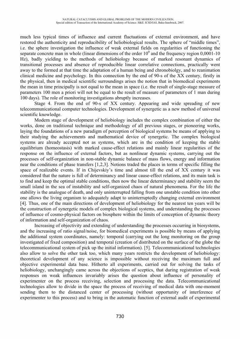
NATURAL CATACLYSMS AND GLOBAL PROBLEMS OF THE MODERN CIVILIZATION. Special edition of Transaction of the International Academy of Science. H&E. ICSD/IAS, Baku-Innsbruck, 2007.
730
much less typical times of influence and current fluctuations of external environment, and have restored the authenticity and reproducibility of heliobiological results. The sphere of “middle times”, i.e. the sphere investigation the influence of weak external fields on regularities of functioning the separate concrete man in whole (linear dimensions of the order 100 and the frequency region 0,0001-10 Hz), badly yielding to the methods of heliobiology because of marked resonant dynamics of transitional processes and absence of reproducible linear correlative connections, practically went away to the formed at that time the adaptation of a human being and chronobiolgy, and to reanimation clinical medicine and psychology. In this connection by the end of 90-s of the XX century, firstly in the physical, then in medical scientific surroundings arises the notion that in biomedical experiments the mean in time principally is not equal to the mean in space (i.e. the result of single-stage measure of parameters 100 men a priori will not be equal to the result of measure of parameters of 1 man during 100 days). The role of monitoring investigations abruptly increases. Stage 4. From the end of 90-s of XX century. Appearing and wide spreading of new telecommunicational computer technologies. Development of synergetic as a new method of universal scientific knowledge. Modern stage of development of heliobiology includes the complex combination of either the works, done on traditional technique and methodology of all previous stages, or pioneering works, laying the foundations of a new paradigm of perception of biological systems be means of applying to their studying the achievements and mathematical device of synergetic. The complex biological systems are already accepted not as systems, which are in the condition of keeping the stable equilibrium (homeostasis) with marked cause-effect relations and mainly linear regularities of the response on the influence of external factors, but as nonlinear dynamic systems, carrying out the processes of self-organization in non-stable dynamic balance of mass flows, energy and information near the conditions of phase transfers [1,2,3]. Notions traded the places in terms of specific filling the space of realizable events. If in Chijevskiy’s time and almost till the end of XX century it was considered that the nature is full of determinancy and linear cause-effect relations, and its main task is to find and keep the optimal stable conditions, then now the linear determinancy and stability seem the small island in the sea of instability and self-organized chaos of natural phenomena. For the life the stability is the analogue of death, and only uninterrupted falling from one unstable condition into other one allows the living organism to adequately adapt to uninterruptedly changing external environment [4]. Thus, one of the main directions of development of heliobiology for the nearest ten years will be the construction of synergetic models of complex biological systems, and understanding the processes of influence of cosmo-physical factors on biosphere within the limits of conception of dynamic theory of information and self-organization of chaos. Increasing of objectivity and extending of understanding the processes occurring in biosystems, and the increasing of ratio signal/noise, for biomedical experiments is possible by means of applying the additional system coordinates, namely: temporal (carrying out the long monitoring on the group investigated of fixed composition) and temporal (creation of distributed on the surface of the globe the telecommunicational system of pick up the initial information). [5]. Telecommunicational technologies also allow to solve the other task too, which many years restricts the development of heliobiology: theoretical development of any science is impossible without receiving the maximum full and objective experimental data base. Hitherto all experiments, carried out for solving the tasks of heliobiology, unchangingly came across the objections of sceptics, that during registration of weak responses on weak influences invariably arises the question about influence of personality of experimenter on the process receiving, selection and processing the data. Telecommunicational technologies allow to divide in the space the process of receiving of medical data with one-moment sending them to the distanced center of processing (without opportunity of interference of experimenter to this process) and to bring in the automatic function of external audit of experimental
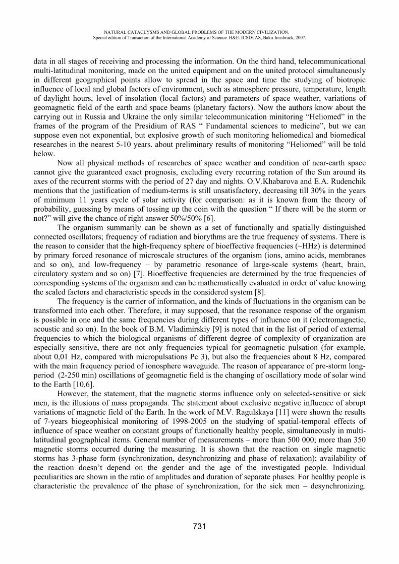
NATURAL CATACLYSMS AND GLOBAL PROBLEMS OF THE MODERN CIVILIZATION. Special edition of Transaction of the International Academy of Science. H&E. ICSD/IAS, Baku-Innsbruck, 2007.
731
data in all stages of receiving and processing the information. On the third hand, telecommunicational multi-latitudinal monitoring, made on the united equipment and on the united protocol simultaneously in different geographical points allow to spread in the space and time the studying of biotropic influence of local and global factors of environment, such as atmosphere pressure, temperature, length of daylight hours, level of insolation (local factors) and parameters of space weather, variations of geomagnetic field of the earth and space beams (planetary factors). Now the authors know about the carrying out in Russia and Ukraine the only similar telecommunication minitoring “Heliomed” in the frames of the program of the Presidium of RAS “ Fundamental sciences to medicine”, but we can suppose even not exponential, but explosive growth of such monitoring heliomedical and biomedical researches in the nearest 5-10 years. about preliminary results of monitoring “Heliomed” will be told below. Now all physical methods of researches of space weather and condition of near-earth space cannot give the guaranteed exact prognosis, excluding every recurring rotation of the Sun around its axes of the recurrent storms with the period of 27 day and nights. O.V.Khabarova and E.A. Rudenchik mentions that the justification of medium-terms is still unsatisfactory, decreasing till 30% in the years of minimum 11 years cycle of solar activity (for comparison: as it is known from the theory of probability, guessing by means of tossing up the coin with the question “ If there will be the storm or not?” will give the chance of right answer 50%/50% [6]. The organism summarily can be shown as a set of functionally and spatially distinguished connected oscillators; frequency of radiation and biorythms are the true frequency of systems. There is the reason to consider that the high-frequency sphere of bioeffective frequencies (~HHz) is determined by primary forced resonance of microscale structures of the organism (ions, amino acids, membranes and so on), and low-frequency – by parametric resonance of large-scale systems (heart, brain, circulatory system and so on) [7]. Bioeffective frequencies are determined by the true frequencies of corresponding systems of the organism and can be mathematically evaluated in order of value knowing the scaled factors and characteristic speeds in the considered system [8]. The frequency is the carrier of information, and the kinds of fluctuations in the organism can be transformed into each other. Therefore, it may supposed, that the resonance response of the organism is possible in one and the same frequencies during different types of influence on it (electromagnetic, acoustic and so on). In the book of B.M. Vladimirskiy [9] is noted that in the list of period of external frequencies to which the biological organisms of different degree of complexity of organization are especially sensitive, there are not only frequencies typical for geomagnetic pulsation (for example, about 0,01 Hz, compared with micropulsations Pc 3), but also the frequencies about 8 Hz, compared with the main frequency period of ionosphere waveguide. The reason of appearance of pre-storm long-period (2-250 min) oscillations of geomagnetic field is the changing of oscillatiory mode of solar wind to the Earth [10,6]. However, the statement, that the magnetic storms influence only on selected-sensitive or sick men, is the illusions of mass propaganda. The statement about exclusive negative influence of abrupt variations of magnetic field of the Earth. In the work of M.V. Ragulskaya [11] were shown the results of 7-years biogeophisical monitoring of 1998-2005 on the studying of spatial-temporal effects of influence of space weather on constant groups of functionally healthy people, simultaneously in multi-latitudinal geographical items. General number of measurements – more than 500 000; more than 350 magnetic storms occurred during the measuring. It is shown that the reaction on single magnetic storms has 3-phase form (synchronization, desynchronizing and phase of relaxation); availability of the reaction doesn’t depend on the gender and the age of the investigated people. Individual peculiarities are shown in the ratio of amplitudes and duration of separate phases. For healthy people is characteristic the prevalence of the phase of synchronization, for the sick men – desynchronizing.
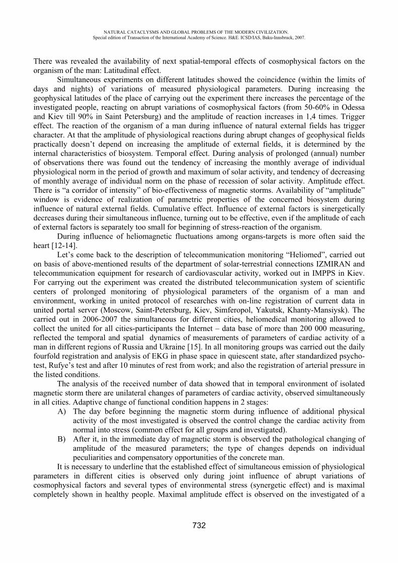
NATURAL CATACLYSMS AND GLOBAL PROBLEMS OF THE MODERN CIVILIZATION. Special edition of Transaction of the International Academy of Science. H&E. ICSD/IAS, Baku-Innsbruck, 2007.
732
There was revealed the availability of next spatial-temporal effects of cosmophysical factors on the organism of the man: Latitudinal effect. Simultaneous experiments on different latitudes showed the coincidence (within the limits of days and nights) of variations of measured physiological parameters. During increasing the geophysical latitudes of the place of carrying out the experiment there increases the percentage of the investigated people, reacting on abrupt variations of cosmophysical factors (from 50-60% in Odessa and Kiev till 90% in Saint Petersburg) and the amplitude of reaction increases in 1,4 times. Trigger effect. The reaction of the organism of a man during influence of natural external fields has trigger character. At that the amplitude of physiological reactions during abrupt changes of geophysical fields practically doesn’t depend on increasing the amplitude of external fields, it is determined by the internal characteristics of biosystem. Temporal effect. During analysis of prolonged (annual) number of observations there was found out the tendency of increasing the monthly average of individual physiological norm in the period of growth and maximum of solar activity, and tendency of decreasing of monthly average of individual norm on the phase of recession of solar activity. Amplitude effect. There is “a corridor of intensity” of bio-effectiveness of magnetic storms. Availability of “amplitude” window is evidence of realization of parametric properties of the concerned biosystem during influence of natural external fields. Cumulative effect. Influence of external factors is sinergetically decreases during their simultaneous influence, turning out to be effective, even if the amplitude of each of external factors is separately too small for beginning of stress-reaction of the organism. During influence of heliomagnetic fluctuations among organs-targets is more often said the heart [12-14]. Let’s come back to the description of telecommunication monitoring “Heliomed”, carried out on basis of above-mentioned results of the department of solar-terrestrial connections IZMIRAN and telecommunication equipment for research of cardiovascular activity, worked out in IMPPS in Kiev. For carrying out the experiment was created the distributed telecommunication system of scientific centers of prolonged monitoring of physiological parameters of the organism of a man and environment, working in united protocol of researches with on-line registration of current data in united portal server (Moscow, Saint-Petersburg, Kiev, Simferopol, Yakutsk, Khanty-Mansiysk). The carried out in 2006-2007 the simultaneous for different cities, heliomedical monitoring allowed to collect the united for all cities-participants the Internet – data base of more than 200 000 measuring, reflected the temporal and spatial dynamics of measurements of parameters of cardiac activity of a man in different regions of Russia and Ukraine [15]. In all monitoring groups was carried out the daily fourfold registration and analysis of EKG in phase space in quiescent state, after standardized psycho-test, Rufye’s test and after 10 minutes of rest from work; and also the registration of arterial pressure in the listed conditions. The analysis of the received number of data showed that in temporal environment of isolated magnetic storm there are unilateral changes of parameters of cardiac activity, observed simultaneously in all cities. Adaptive change of functional condition happens in 2 stages:
A) The day before beginning the magnetic storm during influence of additional physical activity of the most investigated is observed the control change the cardiac activity from normal into stress (common effect for all groups and investigated).
B) After it, in the immediate day of magnetic storm is observed the pathological changing of amplitude of the measured parameters; the type of changes depends on individual peculiarities and compensatory opportunities of the concrete man.
It is necessary to underline that the established effect of simultaneous emission of physiological parameters in different cities is observed only during joint influence of abrupt variations of cosmophysical factors and several types of environmental stress (synergetic effect) and is maximal completely shown in healthy people. Maximal amplitude effect is observed on the investigated of a
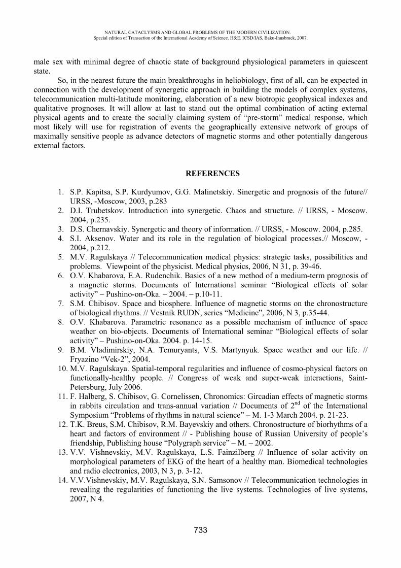
NATURAL CATACLYSMS AND GLOBAL PROBLEMS OF THE MODERN CIVILIZATION. Special edition of Transaction of the International Academy of Science. H&E. ICSD/IAS, Baku-Innsbruck, 2007.
733
male sex with minimal degree of chaotic state of background physiological parameters in quiescent state.
So, in the nearest future the main breakthroughs in heliobiology, first of all, can be expected in connection with the development of synergetic approach in building the models of complex systems, telecommunication multi-latitude monitoring, elaboration of a new biotropic geophysical indexes and qualitative prognoses. It will allow at last to stand out the optimal combination of acting external physical agents and to create the socially claiming system of “pre-storm” medical response, which most likely will use for registration of events the geographically extensive network of groups of maximally sensitive people as advance detectors of magnetic storms and other potentially dangerous external factors.
REFERENCES
1. S.P. Kapitsa, S.P. Kurdyumov, G.G. Malinetskiy. Sinergetic and prognosis of the future// URSS, -Moscow, 2003, p.283
2. D.I. Trubetskov. Introduction into synergetic. Chaos and structure. // URSS, - Moscow. 2004, p.235.
3. D.S. Chernavskiy. Synergetic and theory of information. // URSS, - Moscow. 2004, p.285. 4. S.I. Aksenov. Water and its role in the regulation of biological processes.// Moscow, -
2004, p.212. 5. M.V. Ragulskaya // Telecommunication medical physics: strategic tasks, possibilities and
problems. Viewpoint of the physicist. Medical physics, 2006, N 31, p. 39-46. 6. O.V. Khabarova, E.A. Rudenchik. Basics of a new method of a medium-term prognosis of
a magnetic storms. Documents of International seminar “Biological effects of solar activity” – Pushino-on-Oka. – 2004. – p.10-11.
7. S.M. Chibisov. Space and biosphere. Influence of magnetic storms on the chronostructure of biological rhythms. // Vestnik RUDN, series “Medicine”, 2006, N 3, p.35-44.
8. O.V. Khabarova. Parametric resonance as a possible mechanism of influence of space weather on bio-objects. Documents of International seminar “Biological effects of solar activity” – Pushino-on-Oka. 2004. p. 14-15.
9. B.M. Vladimirskiy, N.A. Temuryants, V.S. Martynyuk. Space weather and our life. // Fryazino “Vek-2”, 2004.
10. M.V. Ragulskaya. Spatial-temporal regularities and influence of cosmo-physical factors on functionally-healthy people. // Congress of weak and super-weak interactions, Saint-Petersburg, July 2006.
11. F. Halberg, S. Chibisov, G. Cornelissen, Chronomics: Gircadian effects of magnetic storms in rabbits circulation and trans-annual variation // Documents of 2nd of the International Symposium “Problems of rhythms in natural science” – M. 1-3 March 2004. p. 21-23.
12. T.K. Breus, S.M. Chibisov, R.M. Bayevskiy and others. Chronostructure of biorhythms of a heart and factors of environment // - Publishing house of Russian University of people’s friendship, Publishing house “Polygraph service” – M. – 2002.
13. V.V. Vishnevskiy, M.V. Ragulskaya, L.S. Fainzilberg // Influence of solar activity on morphological parameters of EKG of the heart of a healthy man. Biomedical technologies and radio electronics, 2003, N 3, p. 3-12.
14. V.V.Vishnevskiy, M.V. Ragulskaya, S.N. Samsonov // Telecommunication technologies in revealing the regularities of functioning the live systems. Technologies of live systems, 2007, N 4.
NATURAL CATACLYSMS AND GLOBAL PROBLEMS OF THE MODERN CIVILIZATION. Special edition of Transaction of the International Academy of Science. H&E. ICSD/IAS, Baku-Innsbruck, 2007.
734
INTERNATIONAL PROTECTION OF ENVIRONMENT
Gadir Khalilov
Institute on Human Rights, National Academy of Science of Azerbaijan
The main means of the regulation of the environmental protection for the ecological development of the world in the terms of international-law are the multilateral contracts ensuring the active engagement of the states. This approach is conditioned by the global significance of the ecological fields like the sea area, space, atmosphere, ozone layer and live environment.
The wide regulation system has been formed by way of the contracts within the framework of the Europe Region. Many contracts have been signed under the leadership of the Economic Commission of Europe of UN. Examples of these contracts can be Convention and its additions dated 1979 on transboundary pollution of air at a distance, Convention dated 1992 on the transboundary influence of the Industrial accidents, the Convention on the protection and use of the transboundary water basins and international lakes, as well as the Convention on assessment of the environmental influence at the transboundary context.
The main contracts on the nature protection are concluded under the leadership of the Europe Unions. They include the Convention dated 1979 on the protection of wild flora, fauna, natural settlement environment, the Contract dated 1987 on forecasting, eliminating the natural and technological disasters and providing appropriate assistance, including the Europe Contract dated 1968 on prohibition certain cleaning and washing detergents.
Helsinki Document called “Calling for Changes” by OSCE of 1992 stipulates the development of the wide-scale natural protection plan for Europe.
Regional contracts on protection of seas have to be mentioned, as well; these contracts are the Convention on protection of Mediterranean sea from pollution (Barcelona, 1976); Convention on protection of Baltic sea environment (Helsinki Contract of 1992 replacing the Convention of the same name of 1974); Convention on protection of Black sea from the pollution (Bucharest, 1992); Convention on protection of Middle and West Atlantic sea environment (Paris Convention of 1992 replacing the Convention of 1972 on preventing the ships and flying objects from polluting the seas from emissions and the Convention of 1974 on protection of the sea environment from being polluted by dry sources); the Contract of 1983 on cooperation to fight against the pollution of Mediterranean basin with oil and other hazardous substances.
Several regional contracts are about the protection of international water basins, that consist of the Convention dated 1976 on protection of the Rhine river from pollution with chemical substances, the interstates Contract of 1963 on navigation Nigerian river basin and economic cooperation; the Contract of 1978 on cooperation regarding the Amazon river basin; the Contract of 1978 on action plan regarding the ecologically effective use of the general system of Zambezi river.
The protection of the flora and fauna is regulated by the Convention of 1979 on the protection of the wild flora and fauna and their settlement environment in Europe.
A special role in the area of the protection of the sea environment and world ocean from pollution plays UN Convention of 1982 on sea rights, the Convention of 1972 on protection of seas from pollution with wastes and other materials, the Convention of 1973 on protection of seas from pollution with the wastes of ships, the Convention of 1982 on protection of live sea resources of Antarctica.
The atmosphere pollution protection is dealt by Vienna Convention of 1985 on protection of ozone layer, Montreal Protocol of 1987 and Frame Convention of 1992 on the climate changes.
NATURAL CATACLYSMS AND GLOBAL PROBLEMS OF THE MODERN CIVILIZATION. Special edition of Transaction of the International Academy of Science. H&E. ICSD/IAS, Baku-Innsbruck, 2007.
735
The Convention of 1973 on international trade with endangered wild species of flora and fauna, the Contract of 1973 on protection of arctic bears, the Convention of 1979 on protection of migrating wild animal species, the Convention of 1992 on biodiversity, protect the flora and fauna from being destroyed and exterminated.
The visible role of the quasi-normative international acts (declarations, strategies, leader behavior principles) called “Soft Right” is played by BHAM property. These recommended documents acting as supportive resource to the international right own a significant share in the international-legalmaterials on the environmental protection. They have a limited, but positive influence on international relations.
For the first time, UN identified approaches for the solution of the ecological problems in 1972. The Stockholm Declaration on environmental problems is most exemplary in this plan. Though this Declaration fail to have absolute validity, but still affects the norm creating process. Principles on prevention the mutual ecological damages, protection of seas from the pollution and other negative actions start developing by the international-legal practices on the environmental protection of the states.
The Rio-de-Janeiro Declaration accepted at the Conference on environment and its development held by UN in 1992 has been analogically assessed.
The ecological safety concept ensuring the stable and safe development of all states proposes to make a change to the traditional environmental protection approach. It is achieved by one-way and requires the cooperation among states.
Ecological safety – ensures protection and support of the system of ecological compositions of the world in a complicated mutual way and natural balance among them.
Ecological safety principle approaches to the environmental protection issues in complex and ensures its integrity as a living condition of mankind. This principle defines the relation between environmental protection and international safety. Therefore, environmental protection and improvement of this protection, as well as efficient use of all natural resources are closely linked to the provision of all aspects of the international safety, including dismantlement issues.
The legal context of the economic safety principle is about the states making efforts to eliminate the influence of the ecological damages at the local, national, regional and global level. Any action should be implemented to prevent the damages not only to other states, but also the international union.
International ecological safety includes international relations ensuring protection, efficient use, production and development of environment. Both regional and universal international contracts are acting as tools of legal provision of economic safety. It is important to design a legal document in the area of formation of “ecological and legal space” and environmental protection that is significant integral part of ecological safety.
The Resolution on formation of YUNEP on environment surrounding people was adopted at the Stockholm Conference and UN Program on environmental protection by the Resolution number 2997 at the XXVII Session of the General Assembly was approved in 1972. The main goal of YUNEP is to organize and implement activities aimed at environmental protection and development for the welfare of present and future generations of mankind.
The program has been developed within the UN system and coordinates nature protection activities at the general system level. The main goals of YUNEP are to assist international cooperation in the area of environment and develop appropriate recommendations; lead the policy on environmental protection within the UN System; draft and discuss periodical reports, facilitate the progressive development of the international environmental protection law.
The coordinating role of the international law is getting stronger in the contrast of the national law on environmental protection, as a result of the growing ecological threat. The scale of the damage
NATURAL CATACLYSMS AND GLOBAL PROBLEMS OF THE MODERN CIVILIZATION. Special edition of Transaction of the International Academy of Science. H&E. ICSD/IAS, Baku-Innsbruck, 2007.
736
imposed to the environment will witness the destruction of the all planetary system of the environment, tendency of the unexpected changes in the public and economic life of the mankind. It is becoming important to develop and approve the universal imperative behavior norms by the states. It will allow UN General Assembly, YUNEP and World Commission on environment and its development affairs to implement the global strategies on efficient use of natural resources and environmental protection bases on the stable ecological safety development concept.
The International Nature Protection Union originated stable development concept in the document on “World Nature Protection Strategy” in 1980. The main purpose of this concept is to prevent the economic damage that may be imposed by the activities aimed at the elimination of the consequences of economic damages. Several principles on provision of the stable development have been developed at the International Conference on environment and its development held in Ottawa in 1986.
REFERENCES
1. Timoshenko .S. International law problems of the environmental protection. International Law. Moscow – 1979, 4, pp. 173-179.
2. Nesterov S. . Reservation of environment and some aspects of international cooperation. Moscow – 1998, pp.120-128.
3. Marishevoy N.I. Problems of international private law. Moscow – 2000, pp.95-98. 4. Speranskaya L.V. International environmental law. Moscow – 1995, pp. 205-210. 5. Tunkie G.I. International law theory. Moscow – 2000, pp. 136-140. 6. UN environmental program. Moscow – 1979, pp. 56-59. 7. Chichvarin V. . Environmental safety and international relations. Moscow – 1990. pp. 154-
162.8. Khromov S.S. Environmental problems and international relations. Moscow – 1990. pp. 78-79. 9. Ushakov N. . International law. Moscow – 2000. pp. 198-199.
CO2 STORAGE OPPORTUNITIES IN CENTRAL-EASTERN EUROPE
Georgiev G.V. - Sofia University, Dept. of Geology, Sofia, Bulgaria
Larsen M., Christensen N. - Geological Survey of Denmark (GEUS), Copenhagen, Denmark
Scholtz, P., Falus G. - Eötvös Loránd Geophysical Institute (ELGI), Budapest, Hungary
Hladik V., Kolejka L. - Czech Geological Survey, Brno, Czech Republic
Kotulova J., Kucharic L. - Geological Survey of Slovak Republic, Bratislava, Slovak Republic
Wojcicki A. - PBG Geophysical Exploration Company, Warsaw, Poland
NATURAL CATACLYSMS AND GLOBAL PROBLEMS OF THE MODERN CIVILIZATION. Special edition of Transaction of the International Academy of Science. H&E. ICSD/IAS, Baku-Innsbruck, 2007.
737
Saftic B., Goricnik B. – Faculty of Mining, University of Zagreb, Croatia
Car M. - Geoinzeniring, Ljubljana, Slovenia
Sava C.S. - National Institute of Marine Geology (GeoEcoMar), Bucharest, Romania
Bentham M., Smith N. - British Geological Survey (BGS), UK
Introduction
The main purpose is to define and initiate integration of CO2 emission and storage data from 8 new EU member and candidate countries in Central and Eastern Europe: Bulgaria, the Czech Republic, Croatia, Hungary, Poland, Romania, Slovakia and Slovenia.
The study was carried out in the frame of CASTOR project (2004-2005) “CO2 from Capture to Storage”, partially funded by the EC under the 6th Framework Program. The overall goal of CASTOR is to develop and validate, in public/private partnerships, all the innovative technologies needed to capture and store CO2 in a reliable and safe way. In CASTOR information has been identified and collated from Central and Eastern Europe. Now this study is continuing in the frame of EU GeoCapacity project (2006-2008), funded by the EC under the 6th Framework Program.
The assessment was built on the GESTCO methodology developed for 8 European countries in the European Union FP5 research programme and aimed to unify, refine and fill data gaps to secure comparable data throughout Europe. The work was performed in close co-operation with the other national partners.
During the study data of CO2 emitting point sources were gathered, such as location, plant name and yearly CO2 pollution figures. A summary is given on the general geology of the countries. There was data collection on possible geological storage locations: gas- and oilfields, aquifers, coal fields/mines. Based on the gathered data a first estimate of the countrywide storage capacity was calculated.
Regional review The 8 participating countries have all signed the Kyoto Protocol and committed themselves to reduce
their greenhouse gas emissions (GHG) by 5-8 % from the base year 1990 in the first commitment period (2008 – 2012) of the Kyoto Protocol. Estimates in all participant countries declare that reductions for the first commitment period will be fulfilled without any serious problems. This is largely due to the reclassification of the industry in the first half of the 1990s.
Besides the commitments to the Kyoto Protocol, in many of the countries, like the Czech Republic or Croatia the protection of the climate system of the Earth is a top-priority environmental issue for the government.
The most important CO2 emitters in all countries are the energy sector, making up more than 50% of the total emitted CO2. In most countries the energy production is largely based on the burning of fossil fuels, i.e. hydrocarbons, natural gas, lignite and coal. In countries like Hungary, Romania or Croatia the predominance of hydrocarbon fueled power plants are observed, whereas power production in Poland and the Czech Republic are dominantly based on coal.
CO2 point sources inventoryAccording to the national CO2 industrial sources inventory of the participating countries the CO2
emissions from the whole studied area are approximately 860 million tons per year. A very significant
NATURAL CATACLYSMS AND GLOBAL PROBLEMS OF THE MODERN CIVILIZATION. Special edition of Transaction of the International Academy of Science. H&E. ICSD/IAS, Baku-Innsbruck, 2007.
738
portion, more than 70 % of the emission sources are represented by stationary industrial point sources. To obtain information about the geographical distribution of CO2 emissions, an inventory of point sources bigger than 100 000 t CO2 per year has been created.
Facilities with the highest emission rates are power plants, followed generally by heating facilities and energy producers for manufacturing industry. Metallurgical plants are also very important. Cement and lime works and chemical factories are also among the major contributors.
The concentration of CO2 in exhaust gases is usually lower than 20 % because the combustion processes are performed in the air atmosphere (21 % O2, 79 % N2). Nevertheless, there are some exceptions, generally chemical factories, where the CO2 concentration is much higher.
General geology of the region The countries overlap an area, which is geologically a complex region of Europe. All of the countries
include parts of “mobile Europe” that was formed, or at least largely influenced by the Alpine orogeny and accompanying tectonic processes. Among the studied countries the territory of Slovakia, Hungary, Slovenia and Croatia are fully in the mobile part of Europe, whereas Bulgaria, Romania are to some extent and the Czech Republic and Poland are dominated by much older geological features.
The most outstanding features in “mobile” Europe are the high mountain chains of the Carpathians and Dinarides that surround the Pannonian Basin. The Pannonian Basin and associated basins are subdivided into many sub-basins. The formation of these sub-basins is related to broad rifting during the formation of the Pannonian Basin in the Middle Miocene. The sub-basins are filled with young (< 12 Ma) clastic sediments and show very similar facies over the whole Pannonian Basin. Their thickness can reach 7000 meters indicating that the subsidence rate and the erosion of surrounding highs was very high. The sedimentary sequence in the basin generally starts with Middle Miocene limestone sequence, which is followed by very thick Upper Middle Miocene clastic formations. These younger silicoclastic sediments are related to prograding deltas with very similar sequence in all the sub-basins. These strata are the most important aquifers and hydrocarbon reservoirs in the Pannonian Basin.
In Poland not containing any portion of the Pannonian Basin the only deep basins (5-10 km) are associated to the Carpathian foredeep in the southern part of the country. It also exists in the Czech Republic and especially in Romania (Focsani basin). Older, Paleozoic basins, with moderate to low depths, but in many cases with important gas, coal, and lignite occurrences are present in the Czech Republic and Poland.
Bulgaria and Southern Romania are located on the European continental margin, and covers parts of the Alpine orogen in the Eastern Europe and its foreland. Parts of three major tectonic units are recognized, namely the Moesian platform, the Alpine thrust belt with its Tertiary foredeep, and a system of syn- to post-orogenic Tertiary extensional basins.
The Moesian Platform covers Northern Bulgaria and Southern Romania. This platform, forming the foreland of the Alpine thrust belt, is composed of up to 4-5 km thick relatively undeformed, dominantly shallow-marine Mesozoic sediments, that rest on a gently folded Palaeozoic basement. Major unconformities, occurring at the base of the Triassic, Jurassic, Upper Cretaceous and Eocene, are related to major compressional events within the Alpine thrust belt.
Seismicity, volcanic activity, natural CO2 seepage The northern and central part of the region (Poland, the Czech Republic, Slovakia and Hungary) has
low seismicity. However, the periphery of the Pannonian Basin is still quite active with earthquakes around the well-known Vrancea zone (Romania). Bulgaria as part of the Balkan has high number of high intensity seismic events, too. Seismological activity of the Mediterranean and its vicinity is governed by contact of the African and Eurasian tectonic plates. Both the continental and coastal parts of Slovenia and Croatia are seismically active.
NATURAL CATACLYSMS AND GLOBAL PROBLEMS OF THE MODERN CIVILIZATION. Special edition of Transaction of the International Academy of Science. H&E. ICSD/IAS, Baku-Innsbruck, 2007.
739
Although there are volcanic and metamorphic formations all over the investigated region, there are no traces of recent volcanic activity. Sporadic emanations of gases can be found at several places. In Croatia these are concentrated close to the Northern Adriatic coastline and there are also gases migrating from HC pools in the Pannonian basin. Natural seepages in Southern Poland are connected with neo-tectonic phenomena. It is the case of Bulgaria and the Czech Republic, too, where mineral springs are releasing CO2. In Hungary the best known and most voluminous natural discharge is located within the caldera of the Mátra volcano, the largest calc-alkaline volcano in Hungary. Less voluminous natural CO2seepage occurs as dozens of springs of carbonated water along the Balaton line [1]. It is suggested (O’Nions, unpublished data), that some of the CO2 is derived from the upper mantle along deep fractures.
Storage options Aquifers The most promising areas for CO2 storage are the aquifers with regional dimensions and also the
vertically closed structures with sufficient sealing and significant pore volume capacity. Though this kind of storage option has the largest potential capacity the available public data are amongst the least detailed for an accurate estimate. The quality and the availability of data for reliable calculations are varying from country to country.
In Croatia estimations were made only for the possible volume in regional aquifers based on the regional subsurface maps and data from the major oilfields in the area. In Poland on the basis of Mezozoic Formation maps by Dadlez et al. [2] approximate areas of mega-structures were determined, ranging from 100 km2 to 625 km2. For Slovakia the best data are gained from the East Slovakian basin [3] as part of the known Neogeneous basins of Slovakia. Two stratigraphical units have been chosen for CO2 storagecapacity calculation – Sarmatian and Pannonian. Altogether 35 potential locations for CO2 storage in aquifers were identified in Slovenia. The most relevant data for identification of potential storage structures came from investigations for underground natural gas storage in depleted gas/oil fields and/or sealed dome structures of porous sediments. Since very few information on deep geological structure of Slovenia is available and verified, many assumptions had to be established. In Czech Republic altogether 22 potentially suitable structures were identified, 17 of them in the Carpathians (eastern part of the country) and 5 in sedimentary basins of the Bohemian Massif. In the first estimation of CO2 storage potential of Bulgaria there are several aquifers, related with Devonian, Lower Triassic, Middle Jurassic, Valanginian and Eocene reservoir spreading in local zones. They were recognized by data from deep wells, but their extension is based on seismic data. There were no reliable public data on specific deep aquifers in Hungary, hence our very rough estimate was based only on the geologically stored water (down to 3000 m and more than 30oC) [4].
Hydrocarbon fields Since the long history of well documented hydrocarbon production and exploration on the studied
area – back to the middle of the nineteenth century – the available information is the most detailed from all the considered possible geological storage sites for CO2 making the capacity calculations more precise. In most regions the oil and natural gas production has already peaked, hence increasing EOR activity could ease the cost burden of CO2 storage. Croatia, Romania and Hungary have the most experience on the enhanced oil recovery techniques, especially using CO2.
Existing and depleted fields are mainly onshore, but Poland, Croatia, Bulgaria and Romania have some offshore production, too. Oil and gas fields are delineated and different attributes were gathered, as: the ultimate recovery ratio, depth of reservoir, etc. To enable planning of future transportation of CO2 the existing pipeline net is also recorded in the database.
Coal measures, coal mines Though many of the countries have coal mining history, only the ones having larger reserves are still
producing and using substantial amount of coal. Poland has the largest fields of deeper coal beds usable for
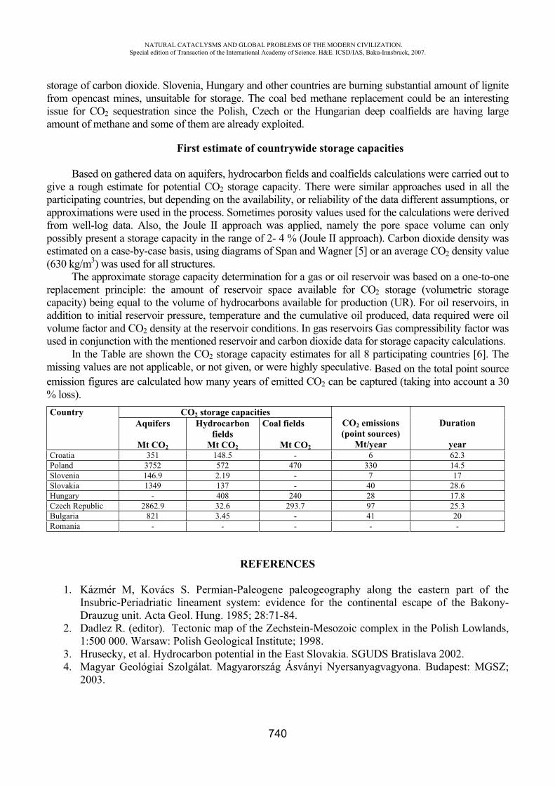
NATURAL CATACLYSMS AND GLOBAL PROBLEMS OF THE MODERN CIVILIZATION. Special edition of Transaction of the International Academy of Science. H&E. ICSD/IAS, Baku-Innsbruck, 2007.
740
storage of carbon dioxide. Slovenia, Hungary and other countries are burning substantial amount of lignite from opencast mines, unsuitable for storage. The coal bed methane replacement could be an interesting issue for CO2 sequestration since the Polish, Czech or the Hungarian deep coalfields are having large amount of methane and some of them are already exploited.
First estimate of countrywide storage capacities
Based on gathered data on aquifers, hydrocarbon fields and coalfields calculations were carried out to give a rough estimate for potential CO2 storage capacity. There were similar approaches used in all the participating countries, but depending on the availability, or reliability of the data different assumptions, or approximations were used in the process. Sometimes porosity values used for the calculations were derived from well-log data. Also, the Joule II approach was applied, namely the pore space volume can only possibly present a storage capacity in the range of 2- 4 % (Joule II approach). Carbon dioxide density was estimated on a case-by-case basis, using diagrams of Span and Wagner [5] or an average CO2 density value (630 kg/m3) was used for all structures.
The approximate storage capacity determination for a gas or oil reservoir was based on a one-to-one replacement principle: the amount of reservoir space available for CO2 storage (volumetric storage capacity) being equal to the volume of hydrocarbons available for production (UR). For oil reservoirs, in addition to initial reservoir pressure, temperature and the cumulative oil produced, data required were oil volume factor and CO2 density at the reservoir conditions. In gas reservoirs Gas compressibility factor was used in conjunction with the mentioned reservoir and carbon dioxide data for storage capacity calculations.
In the Table are shown the CO2 storage capacity estimates for all 8 participating countries [6]. The missing values are not applicable, or not given, or were highly speculative. Based on the total point source emission figures are calculated how many years of emitted CO2 can be captured (taking into account a 30 % loss). Country CO2 storage capacities
CO2 emissions (point sources)
Mt/year
Duration
year
Aquifers
Mt CO2
Hydrocarbon fields
Mt CO2
Coal fields
Mt CO2Croatia 351 148.5 - 6 62.3 Poland 3752 572 470 330 14.5 Slovenia 146.9 2.19 - 7 17 Slovakia 1349 137 - 40 28.6 Hungary - 408 240 28 17.8 Czech Republic 2862.9 32.6 293.7 97 25.3 Bulgaria 821 3.45 - 41 20 Romania - - - - -
REFERENCES
1. Kázmér M, Kovács S. Permian-Paleogene paleogeography along the eastern part of the Insubric-Periadriatic lineament system: evidence for the continental escape of the Bakony-Drauzug unit. Acta Geol. Hung. 1985; 28:71-84.
2. Dadlez R. (editor). Tectonic map of the Zechstein-Mesozoic complex in the Polish Lowlands, 1:500 000. Warsaw: Polish Geological Institute; 1998.
3. Hrusecky, et al. Hydrocarbon potential in the East Slovakia. SGUDS Bratislava 2002. 4. Magyar Geológiai Szolgálat. Magyarország Ásványi Nyersanyagvagyona. Budapest: MGSZ;
2003.
NATURAL CATACLYSMS AND GLOBAL PROBLEMS OF THE MODERN CIVILIZATION. Special edition of Transaction of the International Academy of Science. H&E. ICSD/IAS, Baku-Innsbruck, 2007.
741
5. Span R, Wagner W. A New Equation of State for Carbon Dioxide Covering the Fluid Region from the Triple-Point Temperature to 1100 K at Pressures up to 800 Mpa. J. Phys. Chem. Ref. Data 1996; 25, 6:1509-1596.
6. Scholtz, P., Falus, G., Georgiev, G., Saftic, B., Goricnik, B., Hladik, V., Larsen, M., Christensen, N-P., Bentham, M., Smith, N., Wojcicki, A., Sava, C., Kotulova, J., Kucharic, L., Car, M. 2006. Integration of CO2 emission and geological storage data from Eastern Europe – CASTOR WP 1.2. - ISBN: -0-08-046407-6, 8th International Conference on Greenhouse Gas Control Technologies, Trondheim, Norway.
LEADERSHIP STYLE IN THE DISASTER MANAGEMENT: A NOTE FROM THE FIELD
Andreasta Meliala
Introductory A disaster which is encountered unexpectedly causes unpreventable damages. These damages
require rapid management which is precisely and accurate. The management is conducted in abnormal situation and is full of technical psychological and ethical problems (Neira & Lic, 2004).
In the recent years, Indonesia was shocked by catastrophic disasters like; tsunami and several earthquakes that occurred consecutively. Tsunami in Aceh (2004) and Earthquake in Jogjakarta (2006) are the most prominent disaster taken place in Indonesia besides any other disasters which have caused many casualties. It has been announced that Indonesia is located in the ring of fire.
The conditions were mostly a copy. In a highly uncertain situation it can be happened that the institution and the helping staffs (for example: health staff in health center, hospital or health office) in the reality also become the victim. Though at the time of disaster happened it needs a systematic and inwrought initiative for the management movement. Theoretically, the nature of reachable ideal management is if there is a leader owning sense of leadership; he or she can show leadership attribute and apply the proper leadership style in the field operation.
How is the leadership style which matches with the steps of disaster management and who will become the leader in the effort of such complex disaster management mobilization? Both questions always emerge at the time when disaster management operation is “being planned”. This paper out will elaborate various leadership styles and each style application corresponding with the steps of disaster management.
Discussion is based on the notes from the field (contextual) in which the academic approach would be framed the analysis. Following studies should be made to strengthen the hypothetical finding.
LeadershipLeadership is the ability of a leader to recognize the time and requirement to make a change, to
identify change direction, to communicate the change strategy to people who are in the organization- especially those supporting the change-, and empower them to make a change and to facilitate the effort of attaining the target of change (Podsakoff et al. 1990).
Sir Kenneth Calman (England Chief of Medical Officer, 1991-1998) practically formulates leadership in simple and understandable words (Calman, 1998), that is: " Leadership requires knowing
NATURAL CATACLYSMS AND GLOBAL PROBLEMS OF THE MODERN CIVILIZATION. Special edition of Transaction of the International Academy of Science. H&E. ICSD/IAS, Baku-Innsbruck, 2007.
742
where you want to go, taking people with you, and giving sufficient time and energy to make it happen."
Through the understanding of the concept there arise some important reasons, why leadership become the main pillar in the disaster management (Carter, 1992), that is:
1. At the time of disaster it needed [by] a leader who holds leadership skill and character is required, not simply a formal leader
2. A disaster situation invites various parties to be able to become the resources and play major roles, on that account a leader needs to strengthen the position of each resource.
3. The situation at the time of disaster changes rapidly, so a leader who comprehends the change direction and has the ability to manage every changing process and result is required.
The main breath of leadership at the time of disaster is to give clear picture regarding the direction and target of the disaster management. On the other side, a leader is very expected to dedicate his/her ability in giving clarity on the importance of management rapidly, precisely and accurately. In the context of disaster, therefore, leader should describe clearly his vision regarding his decision to conduct certain action.
The major variables in leadership are vision and commitment building (Steers, 1996). These variables do not change either in normal situation or in disaster context. The vision of a leader in managing disaster will be communicated to the entire stakeholders and the vision will be communicated to build commitment among various parties to jointly realize it.
Clear vision and objective of the leader would lead the follower to desire direction. Experiences from the field showed that failures happened in disaster response caused by the unclear vision of the leader. Mobilization process was stranded since none of the follower believed in what they were going to do.
A vision represents the aspiration and ideality of a leader. To a leader, owning vision is a compulsion. Seeing far forwards and believing that his/ her view will bring the kindness for the world represent some special attributes of a leader which are often perceived. Besides vision, another important variable is the ability to build commitment. The vision of a leader is absolutely to be realized by his/ her followers. First step taken by a leader is to communicate his/ her vision to all followers. The purpose is to build the commitment of all followers, so that the followers are willing to provide the time and involve themselves in the effort of realizing the vision. Discussing vision without addressing strategy and activity is possibly a dream. However, addressing the activity and strategy without considering the vision is also just wasting energy unknowingly where the direction will lead to.
The effort to build the commitment can be done through the transformational, transactional and also non- transactional approaches (laissez-faire). The approaches have the same effectiveness in different situation (Rubin et al. 2005). Becoming a role-model, giving promise and also using power is the practical forms of the three approaches.
Foreign hospitals in Aceh were able to mobilize local health workforce since they could apply transactional leadership within short period of time and in a good manner. While local hospital had difficulties to redeploy its own staff since unclear command was launched including its purpose and benefit.
Effective leadership (Avolio, 1999 in Rubin et al. 2005) claims the existence of ability to develop vision which provides added value to the environment and also the efficacy of building the followers. Thereby, the effectiveness indicator of a leader is his/ her ability to create and operate his/ her vision through follower mobilization .
Modern-leadership (Calman, 1998) suggests someone to reach the leadership effectiveness through carefully choosing people (followers), sorting their suggestion in determining policy and designing the strategy to reach the trusted vision and also applying varied leadership style. This

NATURAL CATACLYSMS AND GLOBAL PROBLEMS OF THE MODERN CIVILIZATION. Special edition of Transaction of the International Academy of Science. H&E. ICSD/IAS, Baku-Innsbruck, 2007.
743
conception becomes very relevant to be applied at the time of managing disaster. This concept is often conceived of contextual leadership (Vail, 1989).
Especially in the disaster management process, the style of leadership and its application are the utmost important thing to achieve and to apply. It was observed that leader could be more effective since they know what style to be taken and when to apply it.
Qualities of Leadership A leader has a lot of criteria, as does the leader him/ herself, but there are basic criteria to be
agreed on in defining the features of a leader in a disaster management (Pencheon & Koh, 2000), those are:
1. having systematic and clear vision regarding the future of the service and organization 2. owning plenty of spirit and energy to carry out leadership process 3. owning self confidence and ability to trust others in the effort of: a. communicating the vision to people in the organization b. making the people in organization self- confident and willing to realize the visionc. empowering the people for operating the vision through logical and applicative strategy.
Those criteria represent the empirical criteria found in some leaders in health service. Through the study the way of forming the leader model is also found, in which there are three models of school of thought (stream), they are:
1. leadership is a magical strength, for some people are truly born to become a leader 2. leadership is a skilled which can be learned and applied3. leadership is a set of skills which can be trained through several analysis phases.
The effectiveness of these skills is not solely determined by the quality of the leadership but also by the time accuracy of its usage and approach in an organization.
A belief that a leadership is a magical strength is rejected by many organization experts, including those who are considered to be leaders, This is because the emergence of the magical power is not consistent and there is not any supra natural element in it.
A belief that a leadership is a skill which can be learned and applied also represents a belief that underestimates the problem. Many people agree that a leader has to have the vision and spirit. Nevertheless, those abilities are also owned by people who are not competent as leaders. Owning vision and spirit truly can be trained, but for the application in an organization, it is insufficient only with vision and spirit.
Some recent studies lead to a belief that leadership represent a package of skill and has certain specification. There is one unique matter, i.e. successful leader can carry out his/ her leadership process by performing specific approach to every situation. One approach should be applied for one condition. Developing skill to lead and exploit it in proper situation and time are the characteristic of leadership which is presently well accepted.
Seemingly effective leaders who are wedded to only one style may become rapidly unseated when circumstances demand another. Margaret Thatcher, the epitome of conviction leadership, rapidly lost the thread (and her position) when consensus leadership may have been more appropriate (Pencheon & Koh, 2000).
Therefore, in terms of disaster management, it would be wise if leader is willing to recognize the style of leadership to be applied in certain phase of disaster management. Example from the filed
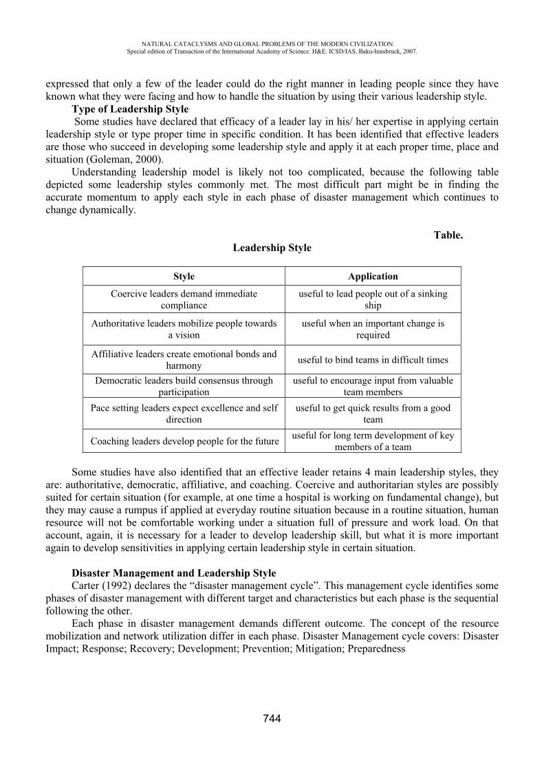
NATURAL CATACLYSMS AND GLOBAL PROBLEMS OF THE MODERN CIVILIZATION. Special edition of Transaction of the International Academy of Science. H&E. ICSD/IAS, Baku-Innsbruck, 2007.
744
expressed that only a few of the leader could do the right manner in leading people since they have known what they were facing and how to handle the situation by using their various leadership style.
Type of Leadership Style Some studies have declared that efficacy of a leader lay in his/ her expertise in applying certain
leadership style or type proper time in specific condition. It has been identified that effective leaders are those who succeed in developing some leadership style and apply it at each proper time, place and situation (Goleman, 2000).
Understanding leadership model is likely not too complicated, because the following table depicted some leadership styles commonly met. The most difficult part might be in finding the accurate momentum to apply each style in each phase of disaster management which continues to change dynamically.
Table.Leadership Style
Style Application
Coercive leaders demand immediate compliance
useful to lead people out of a sinking ship
Authoritative leaders mobilize people towards a vision
useful when an important change is required
Affiliative leaders create emotional bonds and harmony useful to bind teams in difficult times
Democratic leaders build consensus through participation
useful to encourage input from valuable team members
Pace setting leaders expect excellence and self direction
useful to get quick results from a good team
Coaching leaders develop people for the future useful for long term development of key members of a team
Some studies have also identified that an effective leader retains 4 main leadership styles, they are: authoritative, democratic, affiliative, and coaching. Coercive and authoritarian styles are possibly suited for certain situation (for example, at one time a hospital is working on fundamental change), but they may cause a rumpus if applied at everyday routine situation because in a routine situation, human resource will not be comfortable working under a situation full of pressure and work load. On that account, again, it is necessary for a leader to develop leadership skill, but what it is more important again to develop sensitivities in applying certain leadership style in certain situation.
Disaster Management and Leadership StyleCarter (1992) declares the “disaster management cycle”. This management cycle identifies some
phases of disaster management with different target and characteristics but each phase is the sequential following the other.
Each phase in disaster management demands different outcome. The concept of the resource mobilization and network utilization differ in each phase. Disaster Management cycle covers: Disaster Impact; Response; Recovery; Development; Prevention; Mitigation; Preparedness
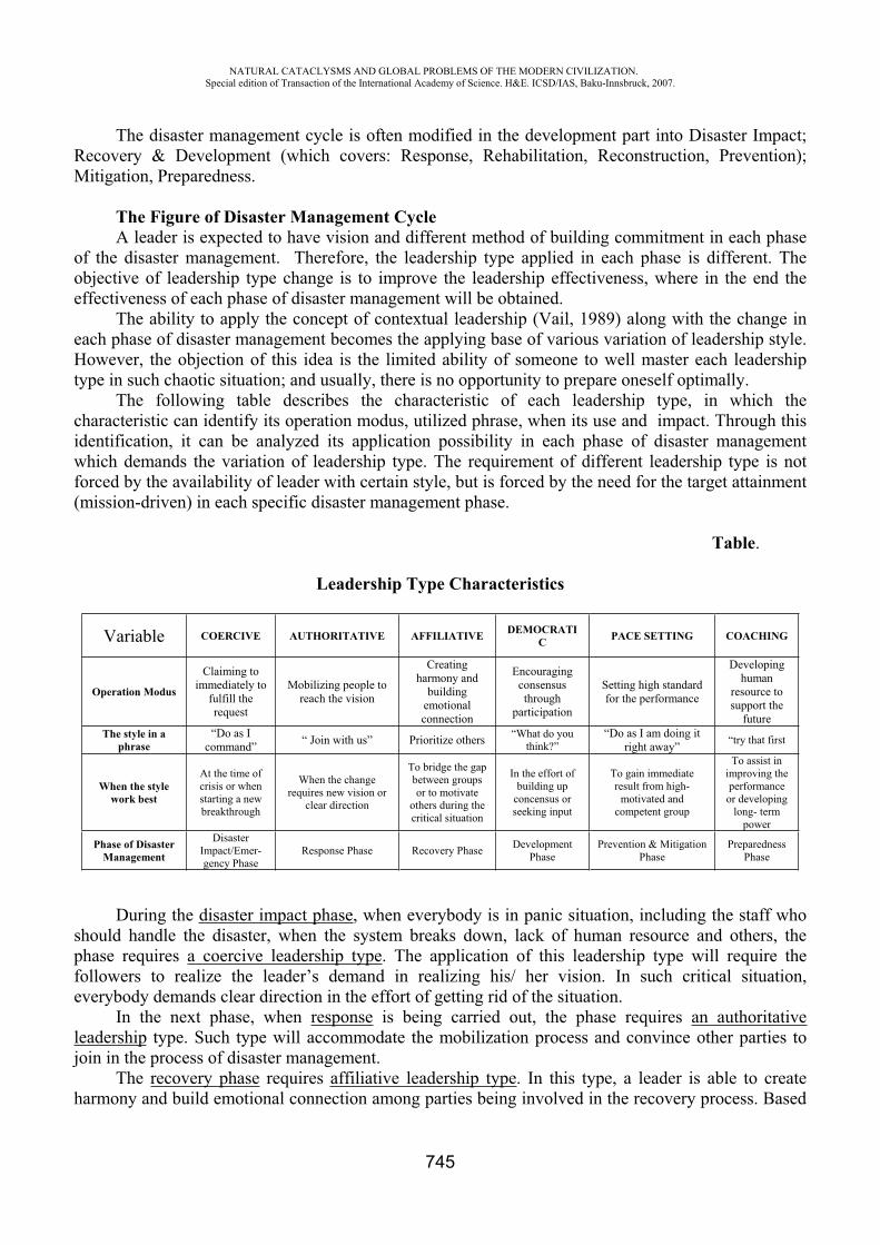
NATURAL CATACLYSMS AND GLOBAL PROBLEMS OF THE MODERN CIVILIZATION. Special edition of Transaction of the International Academy of Science. H&E. ICSD/IAS, Baku-Innsbruck, 2007.
745
The disaster management cycle is often modified in the development part into Disaster Impact; Recovery & Development (which covers: Response, Rehabilitation, Reconstruction, Prevention); Mitigation, Preparedness.
The Figure of Disaster Management Cycle A leader is expected to have vision and different method of building commitment in each phase
of the disaster management. Therefore, the leadership type applied in each phase is different. The objective of leadership type change is to improve the leadership effectiveness, where in the end the effectiveness of each phase of disaster management will be obtained.
The ability to apply the concept of contextual leadership (Vail, 1989) along with the change in each phase of disaster management becomes the applying base of various variation of leadership style. However, the objection of this idea is the limited ability of someone to well master each leadership type in such chaotic situation; and usually, there is no opportunity to prepare oneself optimally.
The following table describes the characteristic of each leadership type, in which the characteristic can identify its operation modus, utilized phrase, when its use and impact. Through this identification, it can be analyzed its application possibility in each phase of disaster management which demands the variation of leadership type. The requirement of different leadership type is not forced by the availability of leader with certain style, but is forced by the need for the target attainment (mission-driven) in each specific disaster management phase.
Table.
Leadership Type Characteristics
Variable COERCIVE AUTHORITATIVE AFFILIATIVE DEMOCRATIC PACE SETTING COACHING
Operation Modus
Claiming to immediately to
fulfill the request
Mobilizing people to reach the vision
Creatingharmony and
building emotional connection
Encouraging consensusthrough
participation
Setting high standard for the performance
Developing human
resource to support the
futureThe style in a
phrase“Do as I
command” “ Join with us” Prioritize others “What do you think?”
“Do as I am doing it right away” “try that first
When the style work best
At the time of crisis or when starting a new breakthrough
When the change requires new vision or
clear direction
To bridge the gap between groups or to motivate
others during the critical situation
In the effort of building up
concensus or seeking input
To gain immediate result from high-
motivated and competent group
To assist in improving the performance or developing
long- term power
Phase of Disaster Management
Disaster Impact/Emer-gency Phase
Response Phase Recovery Phase Development Phase
Prevention & Mitigation Phase
Preparedness Phase
During the disaster impact phase, when everybody is in panic situation, including the staff who should handle the disaster, when the system breaks down, lack of human resource and others, the phase requires a coercive leadership type. The application of this leadership type will require the followers to realize the leader’s demand in realizing his/ her vision. In such critical situation, everybody demands clear direction in the effort of getting rid of the situation.
In the next phase, when response is being carried out, the phase requires an authoritative leadership type. Such type will accommodate the mobilization process and convince other parties to join in the process of disaster management.
The recovery phase requires affiliative leadership type. In this type, a leader is able to create harmony and build emotional connection among parties being involved in the recovery process. Based
NATURAL CATACLYSMS AND GLOBAL PROBLEMS OF THE MODERN CIVILIZATION. Special edition of Transaction of the International Academy of Science. H&E. ICSD/IAS, Baku-Innsbruck, 2007.
746
on the observation, there are so many parties being involved directly and indirectly in the recovery phase. Each phase establishes their own mission, therefore, conflict is very likely to happen. However, each party obtains the proper resource required to attain some positive matter in this phase. For that reason, the phase requires leadership which is able to create harmony among the assisting parties, although each party has their own mission and significance.
The development phase requires democratic leadership type. Such phase requires contribution from numerous parties but with similar objective, namely turning the situation into the normal one. This phase requires consensus from different stakeholders, in which during the effort of consensus building different opinion may emerge. A leader who holds such democratic type will accommodate every opinion and be able to conclude it into an agreement satisfying those numerous parties.
Prevention and mitigation phase is the phase aiming at establishing standard in managing disaster and attempting to reduce the unavoidable disaster impact (unpreventable). This phase requires pace setting leadership type which will set up high standard for certain performance. Such type is applicable to gain immediate result from a certain high- motivated and competent group.
Preparedness phase is the phase which requires coaching leadership type. The preparedness phase requires long- term vision and ability to convince everybody that a disaster may happen in every moment, whenever and wherever and damage whosever. To keep the phase effective, the phase requires high energy from the leader to be consistent and sure that the built vision is the best one for everybody. Through some coaching approach, a leader is able to share his/ her burden with numerous parties, and as result his/ her stamina is kept in shape and his/ her commitment is kept consistent.
Collective Leadership Those various leadership types are not always owned by one person or a leader might not have
such complete leadership style. Each type has different attribute and requires emotional intelligence (Goleman, 2000) with wide range.
Thereby, it is necessary to develop a collective leadership system which will accommodate those various leadership types from numerous individuals. Each individual will complete each other according to his/ her strength, so that he/ she will improve the effectiveness of each disaster management phase which has been planned. A collective leadership system requires shared-vision from each individual representing the stakeholder. The more stakeholders, the more varied visions possibly arise. On that account, this type of leadership requires many conditions for its development.
ConclusionLeadership at the disaster impact is absolutely required to support the effectiveness and
attainment of the disaster management. Such critical resource, progressively demands an effective leadership.
Disaster management is divided into several phases, in which each phase has its own specific characteristic but supports each other in sequence. Every disaster management phase will involve numerous parties which may also involve in other phases, not just one, or even in all phases. The parties being involved also hold various mission and competence which may be different.
The types of leadership at the disaster impact may be adjusted to the phases of disaster management. The purpose of the adjustment is to improve the effectiveness of the leadership which in the end will improve the effectiveness of each management phase. A collective leadership is required in order to apply the leadership types in every phase of the disaster management.
Systematic and regular training is required to develop the leadership ability of the actors who directly involve in the disaster management. The training program is packaged to improve the primary leadership ability up to the extensive one in order to master varied leadership styles as the foothold in applying the concept of contextual leadership in the filed.
NATURAL CATACLYSMS AND GLOBAL PROBLEMS OF THE MODERN CIVILIZATION. Special edition of Transaction of the International Academy of Science. H&E. ICSD/IAS, Baku-Innsbruck, 2007.
747
REFERENCES
1. Calman K. 1998. Lessons from Whitehall. British Medical Journal; 317: 1718-1720 2. Carter, N.W. ( XXXX). Disaster Management 3. Goleman D. 2000. Leadership that Gets Results. Harvard Business Review 2000; Mar-Apr: 78-
90.4. Neira, J., Lic, L.B. The Word Accident: No Chance, No Error, No Destiny. Prehospital &
Disaster Medicine; vol: 19, no 3. 5. Pencheon D., Koh, Y.M. 2000. Leadership and Motivation. British Medical Journal; 321: S2-
7256-27256.6. Podsakoff, P.M., Mackenzie, S.B., Moorman, F.H & Fetter R. 1990. Transformational Leader
Behaviors and their Effect on Followers Trust in Leader, Satisfaction and Organizational Citizenship Behaviors. Journal Leadership Quarterly. Vol. 1, No. 2, 107-142.
7. Rubin, S.R., Munz, D.C., Bommer, W.H. 2005. Leading from Within. Academy Of Management Journal; vol 48 no. 5, 845-858.
8. Vail P. B. 1989. Managing as a Performing Art. Jossey-Bass, San Francisco.
THE STUDY OF EROSION AND SEDIMENT OF THE GUILAN PROVINCE'S COASTLINES CHANGES GEOMORPHOLOGY
Alireza Ghodrati The member of scientific committee, center of agricultural and
Guilan's natural resources researches. [email protected]
Summary In the recent years, the coast line of Caspian sea in Guilan province specially the month of big
rivers such as Sefidrud delta, has changed increasingly due to the environmental continental and marine factors. The changes in the position of these coastlines have made some damages. The changes of water that come from the land, the differences in the land sediment levels and the situation of erosion in the coast line's sediments such as continental factor and the changes of sea level and the patterns of current and Caspian sea waves are the some changes that occurs in Caspian sea's coastlines. We will be try to study of causes of these factors in different regions of Guilan's coastlines. On the other hand, using of aerial images in the 2 periods of years in 1346 and 1373 whit the scale of 1/20000 and using of software's such as lIwis, Photoshop and the sediment levels could estimate.Some Geographic maps and topography with the scales of 1/20000, 1/50000, and space measurement used in order to complete the information in this research. The sedimentary units that we studied their changes are units that in geography introduced it as the quaternary unit. These units in the sedimentary environment are Qt1, Qt2 and QM. That is related to land environment and Qts, Qsp units is belonged to land and Qt1, Qt2, Qt3 is related to rivers environment and finally the Q2be, Q2b, Qbm units are related to middle and under coast line figure. The Guilan's coastline progress under the sea erosion in Astaneh-Ashrafiye is nearly 84/08, In Talesh is 49/52, Anzali is 45/87, lasko-kelaye is 1430/69 and in Roudsar is 678/5 ha. Retrograde under the coastline's sediment in the coastline areas of Guilan
NATURAL CATACLYSMS AND GLOBAL PROBLEMS OF THE MODERN CIVILIZATION. Special edition of Transaction of the International Academy of Science. H&E. ICSD/IAS, Baku-Innsbruck, 2007.
748
province are included: in Astaneh Ashrafiye 276/99, Talesh 48/31, Anzali has not retrograde, laskokelaye 2/04 and Roudsar 5/46 ha.
KEY WORDS: water adrance,geomorphology changes , water level, catchment basin,Giullan shore.
Methods and materials. The Caspian sea is the biggest lake in the world and is located in the north of Iran and the South
of Russia and it is in between northern latitude in 33 minute and 360 ( the southwest area ) until 470
and 7 minute (the northeast area ) and east distance 460 and 43' western until 540 and 50' eastern.Guilan province has temperate and humid weather. In addition, it is included all plains and low coastline. In doing, this project used some library study and viewing the previous works and the space measurement and GIS. Some information achieve from the aerial images 1/20000 of year 1346 and 1/2000 of year 1373 and Topography maps 1/50000 and the maps of the Geography and satellite's images and meteorological statistic and wave statistic, some scientific reports and related articles and some books about the different coast line of common wealth countries around the Caspian sea. The isolation of images between the periods of 1346-1373 was in form of aerial scan as a Gray Scale and with 200, 250 DPI. The images of scan were not margin and the images had the numbers to doing this stage, and providing photo Mozaic orthophoto.
They used the graphic software such as Photoshop. To unify the color of aerial images, they used the light and shade. They used the skewed tools in order to unify the map. Based on Topography maps, the connecting of images provided in sector of 15'. The result of this function was in distance of 15' and in the coastline area. After that, the limit of image in order to drawing and other function was sent to Ilwis environment. The GIS studies of Caspian Sea's coastline provided a classic study, Input, process, and output of information and maps. The aims of this work was determining position of erosion and sediment in coastline and the natural factors in 2 period of photography, and determine the location of sediment and erosion.
ReasultsOn the basis of space measurement and some pervious results, the causes of the changes in the
sedimentary units were from different process, such as; coast line erosion (progressing), sedimentary layers (undergrading ), making new sedimentary units and human activities in making ports, roads, cities and creating some small ponds behind the sandyhills and also some changes that occurs in coastline's morphology.
1- Talesh region (Hashtpar):The west coast line of Caspian Sea in Talash region with leaving the sediments progress toward
the sea nearly in distance 31/48 ha. This region by the leaving sediments from rivers has created a coastline in distance 15/75. In
addition, some areas that have remained under river's sediment are in distance 3/52 ha. The patterns of progressing and sediment are in Talash.
2- Bandar Anzali region: Based on coming results, we can see on the all region, coastline profile that coastline's sediments
progress whit it. The space of it in the margin of Anzali coastline is 45/81 ha. Other process is not in this region. Totally the sediment patterns and progress is dominated on the leaving sediment.
3- Astaneh-Ashrafiye region:This region and Kiashahr coastline has the particular Morphology because of entering the water
of Safidrood River and transporting of sediment and some short and long time changes in the movement line. This region has different from. The sediment space is 59/10 ha, and in the coastline is about 276/99 ha. Undergrading of water and coastline sediment is about 48/08.
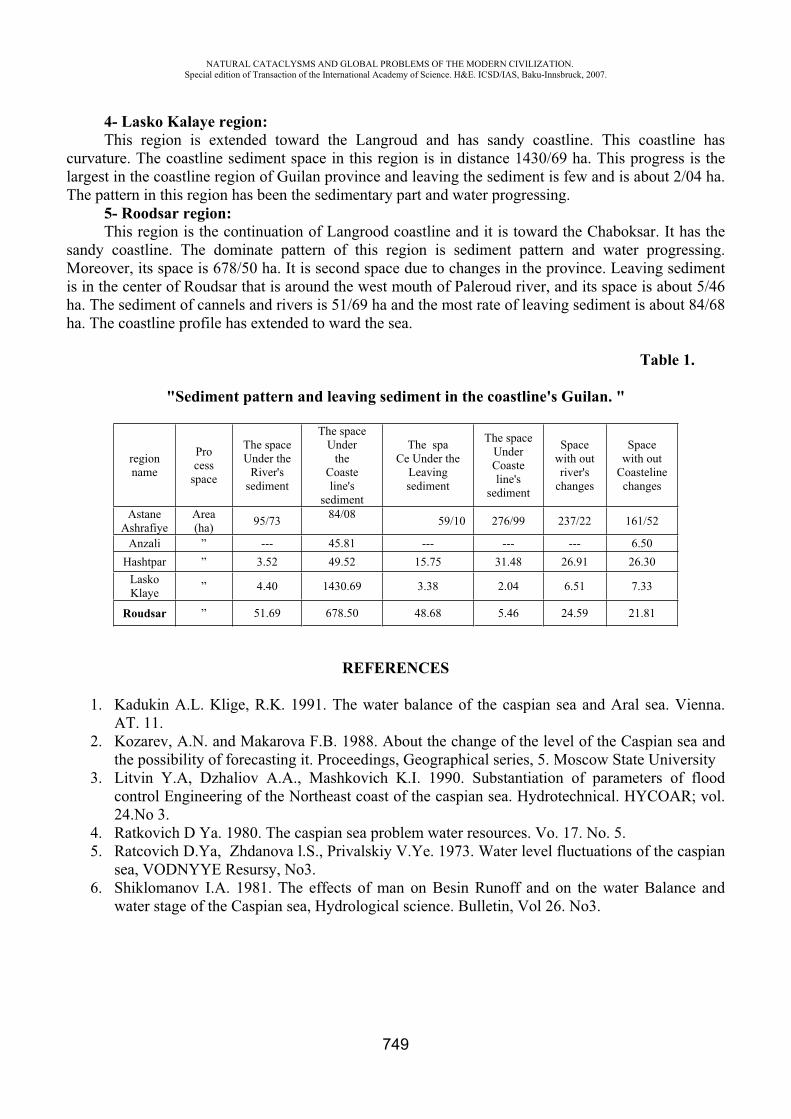
NATURAL CATACLYSMS AND GLOBAL PROBLEMS OF THE MODERN CIVILIZATION. Special edition of Transaction of the International Academy of Science. H&E. ICSD/IAS, Baku-Innsbruck, 2007.
749
4- Lasko Kalaye region:This region is extended toward the Langroud and has sandy coastline. This coastline has
curvature. The coastline sediment space in this region is in distance 1430/69 ha. This progress is the largest in the coastline region of Guilan province and leaving the sediment is few and is about 2/04 ha. The pattern in this region has been the sedimentary part and water progressing.
5- Roodsar region:This region is the continuation of Langrood coastline and it is toward the Chaboksar. It has the
sandy coastline. The dominate pattern of this region is sediment pattern and water progressing. Moreover, its space is 678/50 ha. It is second space due to changes in the province. Leaving sediment is in the center of Roudsar that is around the west mouth of Paleroud river, and its space is about 5/46 ha. The sediment of cannels and rivers is 51/69 ha and the most rate of leaving sediment is about 84/68 ha. The coastline profile has extended to ward the sea.
Table 1.
"Sediment pattern and leaving sediment in the coastline's Guilan. "
Space with out
Coasteline changes
Space with outriver's
changes
The space UnderCoasteline's
sediment
The spa Ce Under the
Leaving sediment
The space Under
theCoasteline's
sediment
The space Under the
River's sediment
Process
space
regionname
161/52237/22276/9959/1084/0895/73Area(ha)
AstaneAshrafiye
6.50 ---------45.81 ---”Anzali 26.30 26.91 31.48 15.75 49.52 3.52 ”Hashtpar
7.33 6.51 2.04 3.38 1430.69 4.40 ”LaskoKlaye
21.81 24.59 5.46 48.68 678.50 51.69 ”Roudsar
REFERENCES
1. Kadukin A.L. Klige, R.K. 1991. The water balance of the caspian sea and Aral sea. Vienna. AT. 11.
2. Kozarev, A.N. and Makarova F.B. 1988. About the change of the level of the Caspian sea and the possibility of forecasting it. Proceedings, Geographical series, 5. Moscow State University
3. Litvin Y.A, Dzhaliov A.A., Mashkovich K.I. 1990. Substantiation of parameters of flood control Engineering of the Northeast coast of the caspian sea. Hydrotechnical. HYCOAR; vol. 24.No 3.
4. Ratkovich D Ya. 1980. The caspian sea problem water resources. Vo. 17. No. 5. 5. Ratcovich D.Ya, Zhdanova l.S., Privalskiy V.Ye. 1973. Water level fluctuations of the caspian
sea, VODNYYE Resursy, No3. 6. Shiklomanov I.A. 1981. The effects of man on Besin Runoff and on the water Balance and
water stage of the Caspian sea, Hydrological science. Bulletin, Vol 26. No3.
NATURAL CATACLYSMS AND GLOBAL PROBLEMS OF THE MODERN CIVILIZATION. Special edition of Transaction of the International Academy of Science. H&E. ICSD/IAS, Baku-Innsbruck, 2007.
750
CHEMICAL PROBLEMS OF ECOLOGYAlieva R.A.*, Gadzieva S.R.**, Chyragov F.M.***, Mamedova S.Sh.****,
Alieva T.I.*****, Rafieva H.L.******
The Baku State University
Ecology, environmental contamination, ecological monitoring, ecological chemistry is frequent words meeting presently and the combinations expressing general concern by a condition of an environment. An original cause of occurrence of a problem-detection in ecological systems, first of all in biosphere, the intensive and disturbing changes caused by activity of the person, anthropogenous changes. From the big number of harmful factors we shall note emission in biosphere of substances chemically alien to the nature, physically active particles, a dust, aerosols, rise in temperature of biosphere, power pollution, physical and biological influence on it. For an estimation of a degree of negative changes carry out ecological monitoring system of supervision and the control over changes in structure of and functions of various ecological systems.
Ecological monitoring is serious and a challenge. Levels of its organization are various. It can realize in global, regional, national or local scales. Exists background and impacted (a level of strong local pollution) monitoring. At the same time studying and the control of a condition of an environment include research of such natural resources, as various waters, atmospheric air, ground, set of these systems from the point of view of definition in them of the polluting chemical substances breaking a developed ecological equilibrium in the nature. Here the chemical essence of a discussed problem is precisely looked through: from this point of view it is possible to speak and about chemical monitoring. The chemical analysis here to not manage. Therefore in ecological monitoring actively use various chemical, physical and chemical, physical and biological methods of the analysis.
Results of analytical definitions and measurements consider already within the limits of ecological monitoring. It gives the information on pollution of biosphere by various polluting substances unusual for the nature which collectively name ksenobiotiks. Data of ecological monitoring use for the all-round analysis of a condition of an environment and definition of strategy of management of its, for regulation of its quality, for definition of so-called admissible ecological loads on natural systems. The degree of the responsibility here is very great, as the specified factors, and first of all chemical, are capable to cause geophysical and geochemical changes: possible change of a climate, protoxidation of natural waters acid rains, pollution of the World ocean and infringement of balance of carbonic acid in its, infringement of an ozone cloud. It is possible to define distinction between the sciences, closely engaged environmental problems. So, ecology is a science about laws of interrelations and interactions of organisms and their systems with each other and with an inhabitancy. The ecological chemistry studies the processes determining a chemical compound and properties of objects of an environment. Chemical ecology chemical interaction between the alive and lifeless nature interests.
Thus, a basis of ecological monitoring is set of various chemical sciences, each of which requires results of the chemical analysis, as chemical pollution which is the major factor of adverse anthropogenous influence on the nature. The purpose of ecological chemistry becomes definition of concentration of polluting substances in various natural objects. Them are natural and sewage of various structure, ground adjournment, atmospheric precipitation, air, ground, biological objects.
Regulation of quality of an environment is based on definition of ecologically admissible influence on its when autopurification of the nature is still capable to work. The certain norms of such sparing influence are the maximum permissible concentration of polluting substances established by physicians-toxsicologies (maximum concentration limits) which are not causing undesirable
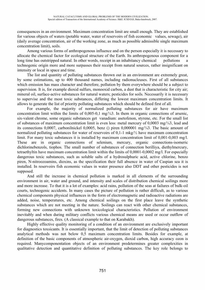
NATURAL CATACLYSMS AND GLOBAL PROBLEMS OF THE MODERN CIVILIZATION. Special edition of Transaction of the International Academy of Science. H&E. ICSD/IAS, Baku-Innsbruck, 2007.
751
consequences in an environment. Maximum concentration limit are small enough. They are established for various objects of waters (potable water, water of reservoirs of fish economic values, sewage), air (daily average concentration, air of the working zone, as much as possible admissible single maximum concentration limit), soils.
Among various forms of anthropogenous influence and on the person especially it is necessary to allocate the chemical factor for ecological structure of the Earth. Its anthropogenous component for a long time has outstripped natural. In other words, receipt in an inhabitancy chemical pollutions a technogenic origin more and more surpasses their receipt from natural sources, rather insignificant on intensity or local in space and time.
The list and quantity of polluting substances thrown out in an environment are extremely great, by some estimations, up to 400 thousand names, including radionucleuses. First of all substances which emission has mass character and therefore, pollution by them everywhere should be a subject to supervision. It is, for example dioxid sulfurs, monooxid carbon, a dust that is characteristic for city air; mineral oil, surface-active substances for natural waters; pesticides for soils. Necessarily it is necessary to supervise and the most toxic substances, differing the lowest maximum concentration limits. It allows to generate the list of priority polluting substances which should be defined first of all.
For example, the majority of normalized polluting substances for air have maximum concentration limit within the limits of 0,005-0,1 mg/¼3. In them in organic connections of arsenic, six-valent chrome, some organic substances get vanadium: asetofenon, styrene, etc. For the small list of substances of maximum concentration limit is even less: metal mercury of 0,0003 mg/¼3, lead and its connections 0,0007, carbonilnickel 0,0005, benz () piren 0,000001 mg/¼3. The basic amount of normalized polluting substances for water of reservoirs of 0,1-1 mkg/½ have maximum concentration limit. For many toxic substances it is installed by maximum concentration limit of 0,001-0,003 mg/l. These are in organic connections of selenium, mercury, organic connections-isomeric dichlorinebenzols, tiophos. The small number of substances of connection berilliya, diethylmercury, tetraethyltin have maximum concentration limit within the limits of 0,0001-0,0002 mg/l. For especially dangerous toxic substances, such as soluble salts of a hydrosulphuric acid, active chlorine, benzo piren, N-nitroozoamins, dioxins, as the specification their full absence in water of Caspian sea it is installed. In reservoirs fish economic values in water presence also DDT and other pesticides is not supposed.
And still the increase in chemical pollution is marked in all elements of the surrounding environment in air, water and ground, and intensity and scales of distribution chemical soilings more and more increase. To that it is a lot of examples: acid rains, pollution of the seas at failures of bulk-oil courts, technogenic accidents. In many cases the picture of pollution is rather difficult, as to various chemical components physical influences in the form of electromagnetic and radioactive radiations are added, noise, temperatures, etc. Among chemical soilings on the first place leave the synthetic substances which are not meeting in the nature. Soilings can react with other chemical substances, forming new connections with unknown toxicological characteristics. Pollution of environment inevitably and when during military conflicts various chemical means are used or occur outflow of dangerous substances, fires. (A classical example to that on Karabakh).
Highly effective quality monitoring of a condition of an environment are exclusively important for diagnostics toxsicants. It is essentially important, that the limit of detection of polluting substances analytical methods was not below 0,5 maximum concentration limits. Besides for example, at definition of the basic components of atmospheric air-oxygen, dioxid carbon, high accuracy ozon is required. Manycomponentation objects of an environment predetermines greater complexities in qualitative detection and quantitative definition of polluting substances. The key role belongs to
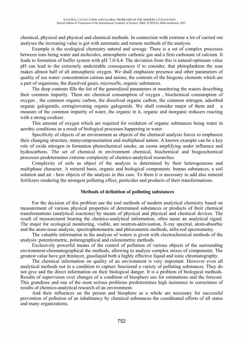
NATURAL CATACLYSMS AND GLOBAL PROBLEMS OF THE MODERN CIVILIZATION. Special edition of Transaction of the International Academy of Science. H&E. ICSD/IAS, Baku-Innsbruck, 2007.
752
chemical, physical and physical and chemical methods. In connection with extreme a lot of carried out analyses the increasing value is got with automatic and remote methods of the analysis.
Example is the ecological chemistry natural and sewage. There is a set of complex processes between ions being water and molecules, atmospheric carbonic gas and a firm carbonate of calcium. It leads to formation of buffer system with 7,0-8,4. The deviation from this is natural-optimum value
can lead to the extremely undesirable consequences if to consider, that phitoplankton the seas makes almost half of all atmospheric oxygen. We shall emphasize presence and other parameters of quality of sea water: concentration cations and anions, the contents of the biogenic elements which are a part of organisms, the dissolved gases, microcells, organic substances.
The deep contents fills the list of the generalized parameters at monitoring the waters describing their common impurity. Them are chemical consumption of oxygen , biochemical consumption of oxygen , the common organic carbon, the dissolved organic carbon, the common nitrogen, adsorbed organic galogenids, extragirovating organic galogenids. We shall consider major of them and a measure of the common impurity of water, the organic in it, organic and inorganic reducers reacting with a strong oxidizer.
This amount of oxygen which are required for oxidation of organic substances being water in aerobic conditions as a result of biological processes happening in water.
Specificity of objects of an environment as objects of the chemical analysis forces to emphasize their changing structure, manycomponentation and multiphasal nature. A known example can be a key role of oxids nitrogen in formation photochemical smoke, an ozone amplifying under influence and hydrocarbons. The set of chemical in environment chemical, biochemical and biogeochemical processes predetermines extreme complexity of chemico-analytical researches.
Complexity of soils as object of the analysis is determined by their heterogeneous and multiphase character. A mineral basis, organic and biological components: humus substances, a soil solution and air - here objects of the analysis in this case. To them it is necessary to add also mineral fertilizers rendering the strongest polluting effect, pesticides and products of their transformations.
Methods of definition of polluting substances
For the decision of this problem use the tool methods of modern analytical chemistry based on measurement of various physical properties of determined substances or products of their chemical transformations (analytical reactions) by means of physical and physical and chemical devices. The result of measurement bearing the chemico-analytical information, often name an analytical signal. The major for ecological monitoring, visible, are neutron-aktivisation, X-ray spectral, atom-absorbic and the atom-issue analysis, spectrophotometric and phlurometric methods, infra-red spectrometry.
The valuable information in the analysis of waters is given with electrochemical methods of the analysis: potentiometric, polarographical and culonometric methods.
Exclusively powerful means of the control of pollution of various objects of the surrounding environment-chromatographical the methods, allowing to analyze complex mixes of components. The greatest value have got thinlayer, gas liquid both a highly effective liquid and ionic chromatography.
The chemical information on quality of an environment is very important. However even all analytical methods not in a condition to capture functional a variety of polluting substances. They do not give and the direct information on their biological danger. It is a problem of biological methods. Results of supervision over changes of a condition of biosphere use for estimations and the forecast. This grandiose and one of the most serious problems predetermines high insistence to correctness of results of chemico-analytical research of an environment.
And their influences on the person and biosphere as a whole are necessary for successful prevention of pollution of an inhabitancy by chemical substances the coordinated efforts of all states and many organizations.
NATURAL CATACLYSMS AND GLOBAL PROBLEMS OF THE MODERN CIVILIZATION. Special edition of Transaction of the International Academy of Science. H&E. ICSD/IAS, Baku-Innsbruck, 2007.
753
RADIOPROTECTOR “DJVARI” – AGAINST RADIATION THREAT
Z. Chankselini, N. Mindashvili, K. Cnankselani, M. Mikeladze
The Institute of Agrarian Radiology end Ecology Georgia, Tbilisi – [email protected]
The article of chemical defence against ionizing radiation is getting more and more actual in connection with development of atomic power engineering as well as broadening application of ionizing radiation sources. This is also accompanied by improvement of corresponding measures of quaranteeing of radiation safety for those who have the contact with radiation sources.
Radiaoprotectors were invented in connection with intensive radiobiological investigations. As it was necessary complex defence besides physical defence application of radioprotectors was supposed. Application of preparations before irradiation at lethal doses in animals showed the survival of their considerable quantity. Presently the number of preparations among which effective radioprotectors are exposed is utterly high. These are representatives of different classes of chemical compounds including biologically active natural and medical preparations. That is why presently the term “chemical defence” is widely used in scientific-research literature, though apparently medical and pharmacological defence should be meant.
Presently the border between radioprotectors and means increasing radioresistance is dissapearing.
Nowadays a number of classification of radioprotectors are supposed. In majority of them as the basis the principles of chemical construction of the material or the mechanism of defence influence are taken. The classification in which radioprotectors are divided depending on date of radiation effect development or the duration of its influence is also used.
According the second classification all radiodefensive preparations may be dicided into two main groups: of short-term and of long-term action. The first group consists the preparations antiradiational activity of which appears in 1-4 hours after their introduction in an organism. Radioprotectors of short-term action defence an organism against relatively non long-term irradiation with high power of dose. The influence mechanism may be explained as oppression of cell bioenergetic progresses and nucleus protein metabolism.
The second group consists radioprotectors characterized with long-term effects. They can provide defence at long term as well as fractioned radiation. Such preparations usually defence from impulsive influence of ionizing radiation but not very effectively. Effect is far less than in case of radoprotectors of the first group. Defence duration against single introduction of radioprotectors of this group may be from one day to several weeks. The mechanism of their influence is connected with activation of systems which provide an increase of general nonspecific resistance of an organism. Combinerd application of radioprotectors of the both groups gives prolonged action and in some cases even an increase of activity.
Georgia is very rich in plant resources. This country is one of the leading ones in the world by quantity and assortment of plants, the set of biologicallt active materials in them. Among of the most developed plants are those considering tanning agents – beginning at tea leaves and ending at sage leaves.
The leaves of “Scumpia” are especially remarkable as they include 12-18% of tannin. Int sould be admit that the leaves of “Scumpia”traditionally are used for getting medical tannin as well as industrial dyes, in tanning production, etc.
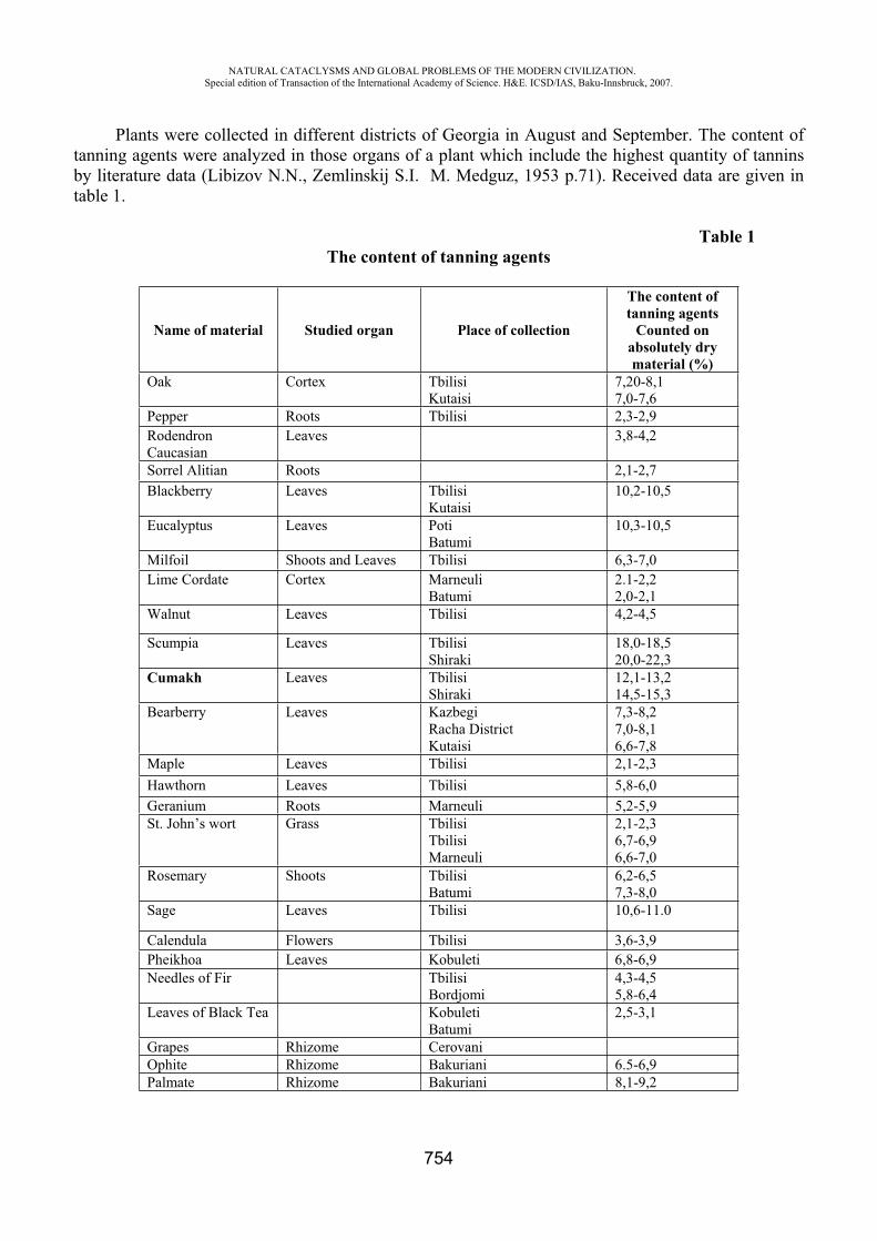
NATURAL CATACLYSMS AND GLOBAL PROBLEMS OF THE MODERN CIVILIZATION. Special edition of Transaction of the International Academy of Science. H&E. ICSD/IAS, Baku-Innsbruck, 2007.
754
Plants were collected in different districts of Georgia in August and September. The content of tanning agents were analyzed in those organs of a plant which include the highest quantity of tannins by literature data (Libizov N.N., Zemlinskij S.I. . Medguz, 1953 p.71). Received data are given in table 1.
Table 1 The content of tanning agents
Name of material Studied organ Place of collection
The content of tanning agents
Counted on absolutely dry material (%)
Oak Cortex Tbilisi Kutaisi
7,20-8,1 7,0-7,6
Pepper Roots Tbilisi 2,3-2,9 Rodendron Caucasian
Leaves 3,8-4,2
Sorrel Alitian Roots 2,1-2,7 Blackberry Leaves Tbilisi
Kutaisi 10,2-10,5
Eucalyptus Leaves Poti Batumi
10,3-10,5
Milfoil Shoots and Leaves Tbilisi 6,3-7,0 Lime Cordate Cortex Marneuli
Batumi 2.1-2,2 2,0-2,1
Walnut Leaves Tbilisi 4,2-4,5
Scumpia Leaves Tbilisi Shiraki
18,0-18,5 20,0-22,3
Cumakh Leaves Tbilisi Shiraki
12,1-13,2 14,5-15,3
Bearberry Leaves Kazbegi Racha District Kutaisi
7,3-8,2 7,0-8,1 6,6-7,8
Maple Leaves Tbilisi 2,1-2,3 Hawthorn Leaves Tbilisi 5,8-6,0 Geranium Roots Marneuli 5,2-5,9 St. John’s wort Grass Tbilisi
Tbilisi Marneuli
2,1-2,3 6,7-6,9 6,6-7,0
Rosemary Shoots Tbilisi Batumi
6,2-6,5 7,3-8,0
Sage Leaves Tbilisi 10,6-11.0
Calendula Flowers Tbilisi 3,6-3,9 Pheikhoa Leaves Kobuleti 6,8-6,9 Needles of Fir Tbilisi
Bordjomi 4,3-4,5 5,8-6,4
Leaves of Black Tea Kobuleti Batumi
2,5-3,1
Grapes Rhizome Cerovani Ophite Rhizome Bakuriani 6.5-6,9 Palmate Rhizome Bakuriani 8,1-9,2
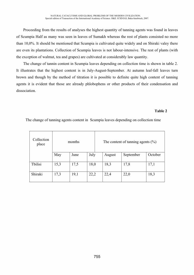
NATURAL CATACLYSMS AND GLOBAL PROBLEMS OF THE MODERN CIVILIZATION. Special edition of Transaction of the International Academy of Science. H&E. ICSD/IAS, Baku-Innsbruck, 2007.
755
Proceeding from the results of analyses the highest quantity of tanning agents was found in leaves
of Scumpia Half as many was seen in leaves of Sumakh whereas the rest of plants consisted no more
than 10,0%. It should be mentioned that Scumpia is cultivated quite widely and on Shiraki valey there
are even its plantations. Collection of Scumpia leaves is not labour-intensive. The rest of plants (with
the exception of walmut, tea and grapes) are cultivated at considerably law quantity.
The change of tannin content in Scumpia leaves depending on collection time is shown in table 2.
It illustrates that the highest content is in July-August-September. At autumn leaf-fall leaves turn
brown and though by the method of titration it is possible to definite quite high content of tanning
agents it is evident that those are already phlobophens or other products of their condensation and
dissociation.
Table 2
The change of tanning agents content in Scumpia leaves depending on collection time
Collectionplace months The content of tanning agents (%)
May June July August September October
Tbilisi 15,3 17,5 18,0 18,3 17,8 17,1
Shiraki 17,3 19,1 22,2 22,4 22,0 18,3
NATURAL CATACLYSMS AND GLOBAL PROBLEMS OF THE MODERN CIVILIZATION. Special edition of Transaction of the International Academy of Science. H&E. ICSD/IAS, Baku-Innsbruck, 2007.
756
INFLUENCE OF SHIP-CANAL OF THE BLACK SEA TERMINAL ON HYDROCHEMISTRY OF THE R. KHOBISTSKALI ESTUARY
U. Zviadadze, Georgian Technical University, Georgia, [email protected]
T.Tsutsunava, Al. Janelidze Geological Institute, Georgia, E-mail: [email protected]
M. Mardashova, Georgian Technical University, Georgia, E-mail:[email protected]
At the r. Khobistskali estuary, in outskirts of the village Kulevi the large scale building of the
Black Sea terminal is carrying out. The terminal is foreseen for receiving of transported by railway oil
products, their subsequent loading in middle displacement tankers, by means of which oil products will
be delivered to the European market. Area of building site is about 10 hectare. On this area a great
number of building materials and heavy equipment are concentrated, continuous work of which during
the daily schedule influence very grave on the ecological condition of environment. Besides terminals
building site itself, were the oil reservoirs, pumping equipment etc. should be disposed the terminal’s
complex embrace other large objects, such as the railway line for oil products transportation –
“Kolkheti – Kulevi” and ship-canal of tankers with loading platform on the left bank of the r.
Khobistskali. In presented article the question of influence of a channel building and its further
exploitation on the hydrochemistry regime of the r. Khobistskali is considered. Destined for building
territory is situated within the sea shore stripe of Kolkheti lowland and belongs to the category of
lightly vulnerable territories [3]. Besides, this territory is covered by RAMSAR Convention which
foresees the certain preservation of wetlands in existing conditions. The same Convention means that
anthropogenic intervention in such a territory demands compensation three times more area and this
demand covers the Black Sea terminal certainly also. As it is mentioned above, construction of tankers
ship-channel is foreseen at the estuary of the r. Khobistskali, on its left bank.
Opposite to flow directionf from the sea coastline the parameters of channel are as following:
- Lenght - L = 700 m;
- Width - B = 250 m;
- Depth - H = 17 m.
Coming out of these parameters, total volume of water in channel is:
17250700HBLV 2975000 m3.
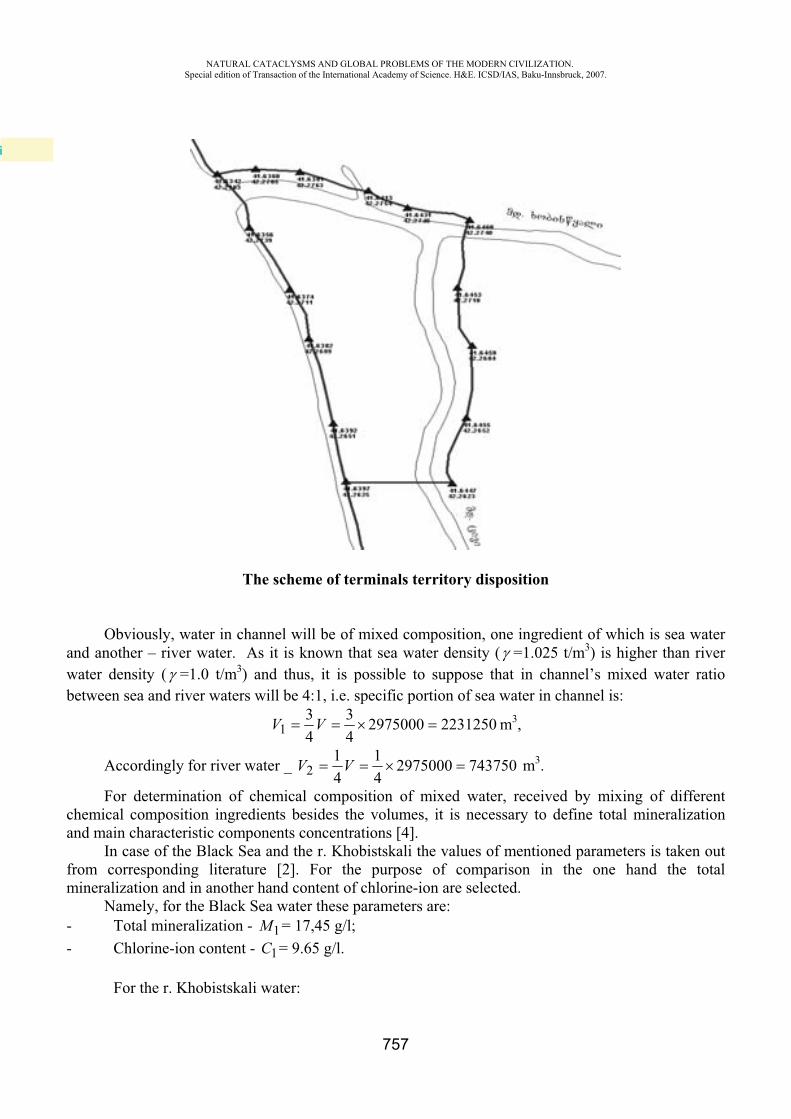
NATURAL CATACLYSMS AND GLOBAL PROBLEMS OF THE MODERN CIVILIZATION. Special edition of Transaction of the International Academy of Science. H&E. ICSD/IAS, Baku-Innsbruck, 2007.
757
The scheme of terminals territory disposition
Obviously, water in channel will be of mixed composition, one ingredient of which is sea water and another – river water. As it is known that sea water density ( =1.025 t/m3) is higher than river water density ( =1.0 t/m3) and thus, it is possible to suppose that in channel’s mixed water ratio between sea and river waters will be 4:1, i.e. specific portion of sea water in channel is:
2231250297500043
43
1 VV m3,
Accordingly for river water _ 743750297500041
41
2 VV m3.
For determination of chemical composition of mixed water, received by mixing of different chemical composition ingredients besides the volumes, it is necessary to define total mineralization and main characteristic components concentrations [4].
In case of the Black Sea and the r. Khobistskali the values of mentioned parameters is taken out from corresponding literature [2]. For the purpose of comparison in the one hand the total mineralization and in another hand content of chlorine-ion are selected.
Namely, for the Black Sea water these parameters are: - Total mineralization - 1M = 17,45 g/l; - Chlorine-ion content - 1C = 9.65 g/l.
For the r. Khobistskali water:
i
NATURAL CATACLYSMS AND GLOBAL PROBLEMS OF THE MODERN CIVILIZATION. Special edition of Transaction of the International Academy of Science. H&E. ICSD/IAS, Baku-Innsbruck, 2007.
758
- Total mineralization - 1M = 0.29 g/l; - Chlorine-ion content - 1C = 0.04 g/l.
The mixing process of natural waters of different chemical composition reflects by linear equation (graphical – analytical method of A.Ogilvi). Values of the total mineralization and chlorine-ion content in the mixture of sea and river waters we mark by X g/l and Y g/l correspondingly.
Issuing from linear dependence of mixing process it is possible to write: XVXVVVXMVMV 21212211 )( (for total mineralization);
YVYVVVYCVCV 21212211 )( (for chlorine-ion). Thereof follows that:
XMMX
VV
1
2
2
1 (1) andYC
CYVV
1
2
2
1 (2)
The unknown parameters given in equations (1) and (2) will be determined by means of known parameters.
Namely, the total mineralization of the mixed water will be:
16.132975000
39151000
21
2211VV
MVMVX g/l;
16.13X g/l Contents of chlorine –ion in mixed water is:
25.72975000
5.21561312
21
2211VV
CVCVY g/l.
25.7Y g/l
As it is mentioned above, depending from the difference between the densities ratio of sea and river waters in channel will be 4:1. Certainly it is the approximately estimation, but after that moment when the exploitation of navigation channel begins it will be possible to determine this value precisely by means of sampling of channel water in different points to determine the total mineralization and chlorine-ion content.
Calculation under consideration shows that almost ultra-fresh water of the r. Khobistskali ( 29.02M g/l) after mixing with sea water in channel will transform into the high mineralized ( =13.6 g/l) sea water type with increasing of chlorine-ion content from 0.04 to 7.25 g/l, i.e. 180 times! It is evident that such a radical change of total mineralization and chemical composition certainly will reflected on the environment’s ecological condition and biodiversity of this territory.
On the basis of actual data and above given calculation it is possible to trace the development of changes in dynamics of surface, river and ground waters during the construction and exploitation of the Kulevi terminal navigation channel.
As far as river-bed become deeper the marks of discharge of swamp and ground water in river-bed and under it will decreased and as a result level of ground water will decreases adjacent to river-stripe especially within the left bank and it will cause the worsening of swamping process [1]. This is
NATURAL CATACLYSMS AND GLOBAL PROBLEMS OF THE MODERN CIVILIZATION. Special edition of Transaction of the International Academy of Science. H&E. ICSD/IAS, Baku-Innsbruck, 2007.
759
temporary process and it will continue until the navigation channel receives the final configuration and will field by water with mixed chemical composition and mineralization (see calculation above). After filing of channel by water with mixed composition and after stabilization of condition the natural barrier of high mineralized water forms which will resist to natural discharge of ground waters into the river-bed and under it. It means, that existed before regime of level decreasing will change by the regime of level increasing, thus, it will formed the backwater regime, i.e. the preferable conditions for swamping will be restored. It means, that propped up ground water does not be already water with low mineralization and specific chemical composition specific for swamped area but it will transform into the ground water with high mineralization and nigh content of chlorine-ion, in condition of which should continue the function of swamped area by specific for it all the natural components. It is obviously that in result of changes of water’s mineralization and chemical composition it will be impossible the conservation of normal natural conditions of swamped area which immediately reflects on living conditions of flora and fauna.
Another question is to determine how much far will spread the influence of high mineralized channel water on swamp and ground waters of the r. Khobistskali left bank stripe. In such case the leading role belongs to chemical diffusion process and velocity of this process and natural habitat are subjected to corresponding calculation.
During the certain period, coming out from the fact that any natural process is subjected to equilibrium law, presumably up from the r. Khobistskali estuary, along the whole length of navigation canal and within the adjacent stripe will formed homogenous hydrochemical and hydrodynamic regimes, i.e. specific for the left bank changes will spread on the right bank stripe and it will create the directly danger to adjacent swamped areas.
Summary. The relevant ecological question of possible influence of construction and exploitation of one of the main objects of the Black Sea Oil Products Terminal - Navigation Channel for loading tankers on hydrochemical mode of the r. Khobistskali is considered. On the basis of corresponding hydrodynamic and hydrochemical calculations it is determined that in result of intrusion of high mineralized chloride-natrium sea water into the navigation channel the ultra-fresh (M=0,29g/l) hydrocarbonate-calcium water of the r. Khobistskali turns into the high mineralized (M=13,16 g/l)water of sea type, which will be reflected extremely negative on the biodiversity of the r. Khobistskali and adjacent swamps.
REFERENCES
1. L.A. Vladimirov, D.I. Shakarashvili, T.I. Gabrichidze. Hydrologic balance of Georgia. Publishing “Metsniereba”, Tbilisi, 1974, 181 p.
2. Hydrogeology of USSR (Georgian SSR). V. X, Editor-in-chief I.M. Buachidze, Publishing “Nedra”, Moscow, 1970, 404 p.
3. Kolkhida lowland. Natural Conditions and Social-Economic aspects. Editor-in-chief G.G. Svanidze, Publishing “Gydrometeoizdat”, Leningrad, 1989, 373 p.
4. A.M. Ovchinikov. General Hydrogeology. Publishing “Nedra”, Moscow, 1955, 382 p.

Styling and computer graphics Yunisov M.Y.
Technical editor N.A.Ligina
The proof-reader I.S. Allahverdiyeva