Inter- and intra-annual analysis of the salinity and temperature evolution in the Galician Rías...
14
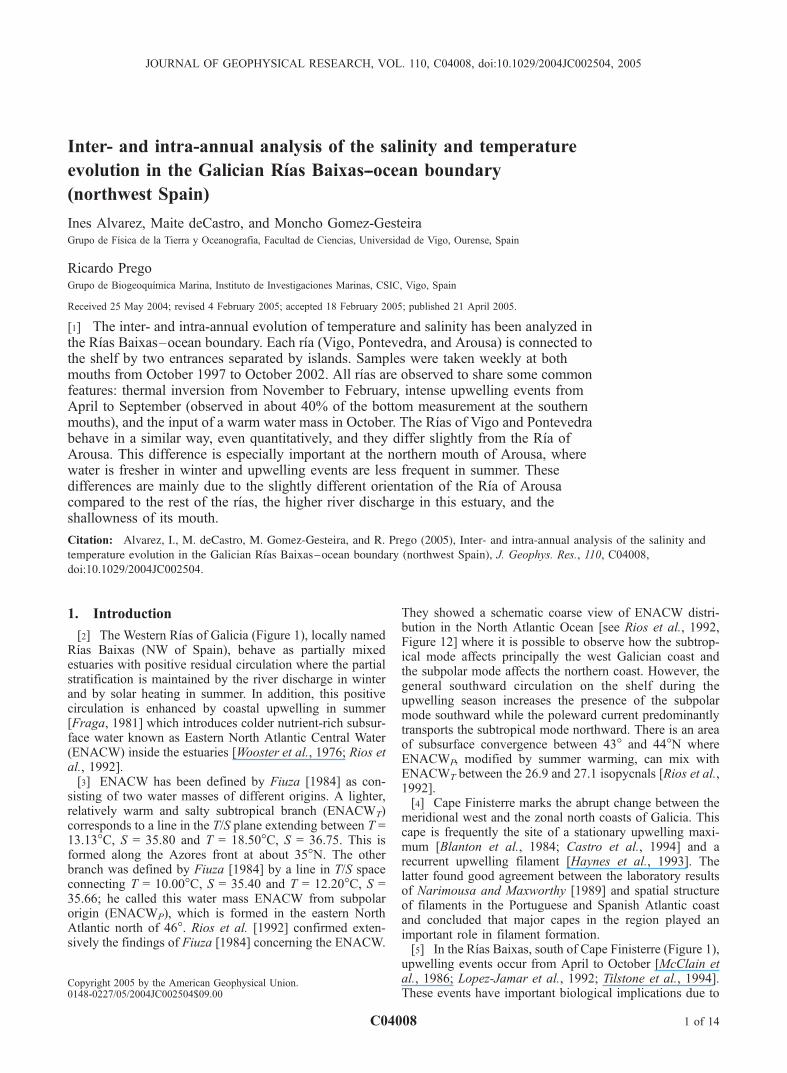
Inter- and intra-annual analysis of the salinity and temperature evolution in the Galician Rı ´as Baixas--ocean boundary (northwest Spain) Ines Alvarez, Maite deCastro, and Moncho Gomez-Gesteira Grupo de Fı ´sica de la Tierra y Oceanografia, Facultad de Ciencias, Universidad de Vigo, Ourense, Spain Ricardo Prego Grupo de Biogeoquı ´mica Marina, Instituto de Investigaciones Marinas, CSIC, Vigo, Spain Received 25 May 2004; revised 4 February 2005; accepted 18 February 2005; published 21 April 2005. [1] The inter- and intra-annual evolution of temperature and salinity has been analyzed in the Rı ´as Baixas–ocean boundary. Each rı ´a (Vigo, Pontevedra, and Arousa) is connected to the shelf by two entrances separated by islands. Samples were taken weekly at both mouths from October 1997 to October 2002. All rı ´as are observed to share some common features: thermal inversion from November to February, intense upwelling events from April to September (observed in about 40% of the bottom measurement at the southern mouths), and the input of a warm water mass in October. The Rı ´as of Vigo and Pontevedra behave in a similar way, even quantitatively, and they differ slightly from the Rı ´a of Arousa. This difference is especially important at the northern mouth of Arousa, where water is fresher in winter and upwelling events are less frequent in summer. These differences are mainly due to the slightly different orientation of the Rı ´a of Arousa compared to the rest of the rı ´as, the higher river discharge in this estuary, and the shallowness of its mouth. Citation: Alvarez, I., M. deCastro, M. Gomez-Gesteira, and R. Prego (2005), Inter- and intra-annual analysis of the salinity and temperature evolution in the Galician Rı ´as Baixas – ocean boundary (northwest Spain), J. Geophys. Res., 110, C04008, doi:10.1029/2004JC002504. 1. Introduction [2] The Western Rı ´as of Galicia (Figure 1), locally named Rı ´as Baixas (NW of Spain), behave as partially mixed estuaries with positive residual circulation where the partial stratification is maintained by the river discharge in winter and by solar heating in summer. In addition, this positive circulation is enhanced by coastal upwelling in summer [Fraga, 1981] which introduces colder nutrient-rich subsur- face water known as Eastern North Atlantic Central Water (ENACW) inside the estuaries [Wooster et al., 1976; Rios et al., 1992]. [3] ENACW has been defined by Fiuza [1984] as con- sisting of two water masses of different origins. A lighter, relatively warm and salty subtropical branch (ENACW T ) corresponds to a line in the T/S plane extending between T = 13.13°C, S = 35.80 and T = 18.50°C, S = 36.75. This is formed along the Azores front at about 35°N. The other branch was defined by Fiuza [1984] by a line in T/S space connecting T = 10.00°C, S = 35.40 and T = 12.20°C, S = 35.66; he called this water mass ENACW from subpolar origin (ENACW P ), which is formed in the eastern North Atlantic north of 46°. Rios et al. [1992] confirmed exten- sively the findings of Fiuza [1984] concerning the ENACW. They showed a schematic coarse view of ENACW distri- bution in the North Atlantic Ocean [see Rios et al., 1992, Figure 12] where it is possible to observe how the subtrop- ical mode affects principally the west Galician coast and the subpolar mode affects the northern coast. However, the general southward circulation on the shelf during the upwelling season increases the presence of the subpolar mode southward while the poleward current predominantly transports the subtropical mode northward. There is an area of subsurface convergence between 43° and 44°N where ENACW P , modified by summer warming, can mix with ENACW T between the 26.9 and 27.1 isopycnals [Rios et al., 1992]. [4] Cape Finisterre marks the abrupt change between the meridional west and the zonal north coasts of Galicia. This cape is frequently the site of a stationary upwelling maxi- mum [Blanton et al., 1984; Castro et al., 1994] and a recurrent upwelling filament [Haynes et al., 1993]. The latter found good agreement between the laboratory results of Narimousa and Maxworthy [1989] and spatial structure of filaments in the Portuguese and Spanish Atlantic coast and concluded that major capes in the region played an important role in filament formation. [5] In the Rı ´as Baixas, south of Cape Finisterre (Figure 1), upwelling events occur from April to October [McClain et al., 1986; Lopez-Jamar et al., 1992; Tilstone et al., 1994]. These events have important biological implications due to JOURNAL OF GEOPHYSICAL RESEARCH, VOL. 110, C04008, doi:10.1029/2004JC002504, 2005 Copyright 2005 by the American Geophysical Union. 0148-0227/05/2004JC002504$09.00 C04008 1 of 14
Transcript of Inter- and intra-annual analysis of the salinity and temperature evolution in the Galician Rías...
Inter- and intra-annual analysis of the salinity and temperature
evolution in the Galician Rıas Baixas--ocean boundary
(northwest Spain)
Ines Alvarez, Maite deCastro, and Moncho Gomez-GesteiraGrupo de Fısica de la Tierra y Oceanografia, Facultad de Ciencias, Universidad de Vigo, Ourense, Spain
Ricardo PregoGrupo de Biogeoquımica Marina, Instituto de Investigaciones Marinas, CSIC, Vigo, Spain
Received 25 May 2004; revised 4 February 2005; accepted 18 February 2005; published 21 April 2005.
[1] The inter- and intra-annual evolution of temperature and salinity has been analyzed inthe Rıas Baixas–ocean boundary. Each rıa (Vigo, Pontevedra, and Arousa) is connected tothe shelf by two entrances separated by islands. Samples were taken weekly at bothmouths from October 1997 to October 2002. All rıas are observed to share some commonfeatures: thermal inversion from November to February, intense upwelling events fromApril to September (observed in about 40% of the bottom measurement at the southernmouths), and the input of a warm water mass in October. The Rıas of Vigo and Pontevedrabehave in a similar way, even quantitatively, and they differ slightly from the Rıa ofArousa. This difference is especially important at the northern mouth of Arousa, wherewater is fresher in winter and upwelling events are less frequent in summer. Thesedifferences are mainly due to the slightly different orientation of the Rıa of Arousacompared to the rest of the rıas, the higher river discharge in this estuary, and theshallowness of its mouth.
Citation: Alvarez, I., M. deCastro, M. Gomez-Gesteira, and R. Prego (2005), Inter- and intra-annual analysis of the salinity and
temperature evolution in the Galician Rıas Baixas–ocean boundary (northwest Spain), J. Geophys. Res., 110, C04008,
doi:10.1029/2004JC002504.
1. Introduction
[2] The Western Rıas of Galicia (Figure 1), locally namedRıas Baixas (NW of Spain), behave as partially mixedestuaries with positive residual circulation where the partialstratification is maintained by the river discharge in winterand by solar heating in summer. In addition, this positivecirculation is enhanced by coastal upwelling in summer[Fraga, 1981] which introduces colder nutrient-rich subsur-face water known as Eastern North Atlantic Central Water(ENACW) inside the estuaries [Wooster et al., 1976; Rios etal., 1992].[3] ENACW has been defined by Fiuza [1984] as con-
sisting of two water masses of different origins. A lighter,relatively warm and salty subtropical branch (ENACWT)corresponds to a line in the T/S plane extending between T =13.13�C, S = 35.80 and T = 18.50�C, S = 36.75. This isformed along the Azores front at about 35�N. The otherbranch was defined by Fiuza [1984] by a line in T/S spaceconnecting T = 10.00�C, S = 35.40 and T = 12.20�C, S =35.66; he called this water mass ENACW from subpolarorigin (ENACWP), which is formed in the eastern NorthAtlantic north of 46�. Rios et al. [1992] confirmed exten-sively the findings of Fiuza [1984] concerning the ENACW.
They showed a schematic coarse view of ENACW distri-bution in the North Atlantic Ocean [see Rios et al., 1992,Figure 12] where it is possible to observe how the subtrop-ical mode affects principally the west Galician coast andthe subpolar mode affects the northern coast. However, thegeneral southward circulation on the shelf during theupwelling season increases the presence of the subpolarmode southward while the poleward current predominantlytransports the subtropical mode northward. There is an areaof subsurface convergence between 43� and 44�N whereENACWP, modified by summer warming, can mix withENACWT between the 26.9 and 27.1 isopycnals [Rios et al.,1992].[4] Cape Finisterre marks the abrupt change between the
meridional west and the zonal north coasts of Galicia. Thiscape is frequently the site of a stationary upwelling maxi-mum [Blanton et al., 1984; Castro et al., 1994] and arecurrent upwelling filament [Haynes et al., 1993]. Thelatter found good agreement between the laboratory resultsof Narimousa and Maxworthy [1989] and spatial structureof filaments in the Portuguese and Spanish Atlantic coastand concluded that major capes in the region played animportant role in filament formation.[5] In the Rıas Baixas, south of Cape Finisterre (Figure 1),
upwelling events occur from April to October [McClain etal., 1986; Lopez-Jamar et al., 1992; Tilstone et al., 1994].These events have important biological implications due to
JOURNAL OF GEOPHYSICAL RESEARCH, VOL. 110, C04008, doi:10.1029/2004JC002504, 2005
Copyright 2005 by the American Geophysical Union.0148-0227/05/2004JC002504$09.00
C04008 1 of 14

the high input of nutrients [Prego and Bao, 1997; Prego etal., 1999], that drive the great primary productivity of thisarea supporting an intense raft culture of mussels [Blantonet al., 1987].[6] The properties of the ocean water at the mouth of the
rıas are governed by upwelling and downwelling events,which take place along the coast. During upwelling, surfacewaters move offshore in response to along shelf wind stress,and at depth within a few kilometers of the coast cold,saltier, nutrient-rich water moves onshore and upward.During downwelling, warmer, fresher, nutrient-depletedsurface waters move inshore and downward reducing thestrength of exchange flow.[7] During the upwelling season, upwelled water may be
confined to the bottom few meters or it may move onshorein the central water column [Huyer, 1983; Allen et al.,1995]. This fact produces a thermal stratification inside theestuaries, which requires to analyze baroclinic processes toknow their impact on stratification. Monteiro and Largier[1999] studied upwelling effects in Saldana Bay (SouthAfrica) where they observed how the Bay is thermallystratified with a surface warmed upper layer and a lowerlayer of cold upwelled water that has been advected into thebay. Some comparable observations have been obtained inSan Francisco Bay [Largier, 1996], northern Monterey Bay[Graham and Largier, 1997], Tomales Bay [Hearn et al.,1997], San Diego Bay [Chadwick et al., 1996; Largier etal., 1997], Mission Bay [Largier et al., 1997] and in U.S.west coast estuaries [Hickey and Banas, 2003].[8] During the last years, the study of hydrodynamical
and hydrographical behavior in Galician Rıas Baixas has
been intensified. In the Rıa of Arousa (Figure 1), Otto[1975] carried out a hydrographic analysis with measure-ments taken in July–August 1962–1964; Roson et al.[1995] observed salinity increase and temperature decreasefrom June to September 1989, modified by upwelling peaksof higher frequency; and Roson et al. [1997] applied anonstationary box model using in situ measurementsobtained by intensive sampling (twice a week) carried outfrom June to October 1989. In the Rıa of Pontevedra(Figure 1), Cabanas et al. [1982] studied physical andchemical contamination; Pardo et al. [2001] analyzed thethermohaline and meteorological behavior, Gomez-Gesteiraet al. [2003] observed a positive two-layered tidal circula-tion pattern induced by stratification and wind; Alvarez etal. [2003] characterized an unusual winter upwelling eventpumping seawater driven by the poleward current into therıa; and deCastro et al. [2004] studied an along estuarynegative circulation pattern generated by the sudden transi-tion between upwelling and downwelling conditions. Inaddition, deCastro et al. [2000] studied the hydrodynamicalcharacteristics of the rıa from February to July 1998 takinginto account wind and tidal effect on water circulation;Gomez-Gesteira et al. [2003] related the residence timeestimated by a stationary box model to the upwelling indexand river discharge considering biweekly surveys fromOctober 1997 to October 1998; and Prego et al. [2001]studied the presence of four water masses in front of the rıaduring the same period. In the Rıa of Vigo, Prego and Fraga[1992] analyzed scattered measurements from February toOctober 1986 by means of a stationary box model andAlvarez-Salgado et al. [2000] studied the residual exchange
Figure 1. Map of Galician Rıas Baixas and sampling stations position. Black dots representhydrographic stations, and black diamonds represent meteorological stations where rainfall wasmeasured. Air temperature values were measured in the Cies Islands, and the upwelling indices weremeasured at N station.
C04008 ALVAREZ ET AL.: SALINITY AND TEMPERATURE EVOLUTION IN RIAS BAIXAS
2 of 14
C04008

during four study periods in 1997 using a nonstationary boxmodel; Nogueira et al. [1997a, 1997b] carried out aninterannual study to describe thermohaline properties inthe middle zone of the rıa; and Doval et al. [1998]studied the spatiotemporal variability of thermohaline andbiogeochemical properties of the rıa from May 1994 toSeptember 1995.[9] As for studies carried out off the Galician Rıas
Baixas, basically at the adjacent shelf, this zone was thenorthernmost part of the area considered in Wooster et al.[1976], who analyzed the seasonal upwelling cycle alongthe eastern boundary of the North Atlantic from 1850 to1970. Fraga [1981] described the upwelling off GalicianCoast using scattered measurements obtained from 1974 to1977. Alvarez-Salgado et al. [1993] studied the hydrographicvariability off the Rıas Baixas during the upwelling season(May–October 1989) by means of samples taken at astation located on the shelf, about 9 km from the mouthof the Rıa of Pontevedra. Tenore et al. [1984] studied thebenthic distribution on the continental shelf to describe thecoastal upwelling offshore. This benthic distribution isobserved to vary from the inner to the outer shelf. Intensemussel raft culture inside the rıas results in large amount ofdetritus which are deposited on the inner shelf. McClain etal. [1986] considered the wind driven upwelling using agrid of stations covering the continental shelf from CapeFinisterre to Vigo during April 1982. They observed salinityincrease and temperature decrease during the upwellingseason. Fiuza et al. [1998] analyzed the water masses andtheir circulation in the eastern North Atlantic region basedon CTD measurements made in May 1993. Perez et al.[1995] studied the correlation between interannual varia-tions in wind stress and changes in ENACW by means ofthe combination of data obtained from the eastern NorthAtlantic region from 1974 to 1992 and data obtained nearthe Iberian coast (around 42�N, 10�W) in 1991 and 1993.Finally, Torres et al. [2003] used SST to describe theGalician upwelling region from July 1999 to May 2001,although they covered a larger area and their study wasmainly focused on wind patterns.[10] All estuarine studies described above were focused
in only one estuary and most of them, except in Nogueira etal. [1997a, 1997b], did not considered interannual behavior,allowing a localized knowledge, both in time and in space,of the hydrodynamical and hydrographical characteristics ofthe Galician Rıas Baixas.[11] The aim of this paper is to analyze the inter- and
intra-annual salinity and temperature evolution simulta-neously in the three Rıas Baixas (Vigo, Pontevedra andArousa (Figure 1)) from October 1997 to October 2002.
This study was carried out by means of two fixed stationslocated at the boundary between each rıa and the ocean. Asfar as we know, information about the simultaneous surveyof the three rıas had never been related in the wide literatureconcerning Galician Rıas. Nevertheless, it is importantchecking the differences and similarities among estuariessince they can strongly affect biological processes. Thus thestrength and duration of upwelling events inside the rıas isclosely related to the water residence time [Gomez-Gesteiraet al., 2001] and consequently to the water quality. On theother hand, the survival of different species (especiallymussels and clams) depends on salinity and temperaturevalues during winter, which is related to the freshwaterinput in each estuary. This study aims to (1) establish thesalinity and temperature seasonal variability in the rıa-oceanboundary, with special effort devoted to the role of upwell-ing events; (2) define the common features shared by thethree rıas; (3) compare the salinity and temperature charac-teristics between the southern and the northern mouth ofeach rıa; and (4) compare the salinity and temperaturefeatures of the rıa-ocean boundary corresponding to thedifferent rıas.
2. Area Under Scope
[12] The Rıas Baixas are situated at the west coast ofGalicia between Cape Finisterre (Figure 1) and Portugal.These rıas are incised valleys where the estuarine zone canmove according to climatic changes [Evans and Prego,2003]. They are similar because they have approximatelythe same transverse geographical orientation in the north-east-southwest direction (Figure 1). They are V-shaped,widening progressively from the innermost part of theestuary toward the mouth. The three rıas considered in thisstudy are connected to the open sea by means of twoentrances due to the existence of little islands in theoutermost part (Cies Islands in the Rıa of Vigo, Ons andOnza Islands in the Rıa of Pontevedra and Salvora Island inthe Rıa of Arousa). The dimensions of these three rıas aredescribed in more detail in Table 1, which shows generalcharacteristics like surface area, length and the width anddepth of their mouths.[13] The main freshwater input is located in the innermost
part of estuaries coming from the rivers. All these riversshow a great seasonal variability with the highest value inwinter and the lowest one in summer following the rainfallpattern. The Oitaben River is located at the Rıa of Vigo headand the Lerez River corresponds to the Rıa of Pontevedra.The freshwater runoff in the Rıa of Arousa is mainly fromthe Ulla River. Moreover, a secondary river, Umia River,
Table 1. Rıa Dimensions and Head River Flows
RıaWater
Content, km3Surface
Area, km2 Length, kmMouth
Width, kmMouth
Depth, m RiverRiver
Flow, m3 s�1
Vigo 3.12 156 31 southern 5.1 45 Oitaben 27.5northern 2.8 25
Pontevedra 3.45 141 22 southern 7.3 60 Lerez 25.6northern 3.6 15
Arousa 4.34 230 25 southern 4.6 55 Ulla 79.3northern 3.7 5 Umia 16.3
C04008 ALVAREZ ET AL.: SALINITY AND TEMPERATURE EVOLUTION IN RIAS BAIXAS
3 of 14
C04008

reaches the southern coast of the Rıa of Arousa (Figure 1).The mean annual discharge of each river is also representedin Table 1.[14] The Rıas Baixas are characterized by an oceanic
climate, which tends to aridity in summer. The climate ofthe area is characterized by two different situations depend-ing on the position of the Azores anticyclone. In winter, theAzores anticyclone is located in the northwest African coastand a low-pressure center in Iceland, which induces south-west winds on the coast. However, in spring and summerthe Azores anticyclone moves to the north provoking highpressures with NNE winds on the coast generating frequentupwelling events.[15] The tidal regime of the rıas is mesotidal and semi-
diurnal. Tide is an important factor which contributes inwater circulation being the most energetic process takingplace inside the rıas, but other factors can also contribute asthe wind regime on the shelf [Souto et al., 2003], the windregime inside the rıas [deCastro et al., 2000], the freshwaterdischarge [Otto, 1975; Gomez-Gesteira et al., 2003], the airtemperature [Gomez-Gesteira et al., 2001] and the upwell-ing events [Roson et al., 1997; Prego et al., 2001; Alvarez etal., 2003].
3. Materials and Methods
3.1. Sampling
[16] To analyze the temperature and salinity evolution,measurement stations were placed at the northern andsouthern entrance of each estuary (Figure 1). Hydrographicparameters were measured weekly from October 1997 toOctober 2002 at these stations. In the Rıa of Vigo, thesouthern station (35 m deep) was located at 42�10.70N,8�52.50W and the northern one (20 m deep) at 42�140N,8�52.70W. In the Rıa of Pontevedra, the southern station(35 m deep) was located at 42�19.50N, 8�530W and thenorthern one (20 m deep) at 42�23.50N, 8�53.50W. In the Rıaof Arousa, the southern station (40 m deep) was located at42�28.50N, 8�580W and the northern one (30 m deep) at42�30.80N, 8�58.80W. Note that some of these depth valuesare deeper than those shown in Table 1. Values in this tablecorrespond to the narrowest point of each mouth, which notcoincides with the situation of the measurement stations.[17] Salinity and temperature profiles were measured by
means of a conductivity-temperature-depth (CTD) instru-ment (Seabird19 and 25). Salinity calibration was previouslyperformed by means of an ‘‘Autosal’’ salinometer.[18] The upwelling indices were calculated at 43�N,
11�W by means of the geostrophic wind speed obtainedfrom atmospheric pressure fields [Lavin et al., 1991, 2000]following the method described by Bakun [1973]. Theupwelling index corresponds to the onshore upwellingindex [Bakun, 1973], which is defined positive (negative)when the onshore component of the Ekman transport isseaward (landward). Daily rainfall and air temperature weresupplied by the ‘‘Instituto Nacional de Meteorologıa’’ and‘‘MeteoGalicia.’’ The air temperature was measured at CiesIslands (42�13.230N, 8�54.90W) and Mourente (42�26.400N,8� 36.980W). The monthly rainfall was averaged by means offour measurement stations located near the river mouths,(A Lama at 42�24.70N, 8�25.230W; Carballedo at 42�28.230N, 8�29.320W; Arcos da Condesa at 42�34.320N,
8�37.50W; and Sergude at 42�49.270N, 8�27.340W). Inaddition, daily rainfall data measured at Mourente (42�26.400N, 8�36.980W) were provided by ‘‘Instituto Nacionalde Meteorologıa.’’
3.2. Data Processing
[19] Time series corresponding to salinity and tempera-ture data were subjected to a smoothing procedure in orderto analyze their seasonal evolution. The followed protocolcan be summarized in several stages: (1) raw data werepurged in such a way that those data out of the range ±3s(where s is the standard deviation) corresponding to everyseason were removed; (2) data were filtered using a low-pass filter, in such a way that frequencies higher than onemonth were smoothed out, and (3) data gaps (less than 5%),generated by bad weather conditions and problems in themeasuring devices, were filled by cubic interpolation. Themean seasonal cycle of meteorological variables was cal-culated following the same procedure. This method isdifferent to the one used by other authors [Nezlin et al.,2004], which gives rise to a smoother seasonal cycle, butpreassumes that oceanographic and meteorological varia-bles follow a sinusoidal cycle.[20] From now on, we will distinguish two different
averages. Interannual monthly averages will refer to meanvalues calculated considering all cruises carried out during aparticular month from October 1997 to October 2002, andmonthly averages will refer to mean values calculatedconsidering cruises carried out during a particular monthof a particular year.[21] Seasonal anomalies in salinity and temperature were
computed by removing the mean seasonal cycle from theobserved time series integrated over the entire watercolumn. This analysis was carried out at both mouths ofthe three rıas. The seasonal anomalies were analyzedfurther using the method of empirical orthogonal functions(EOFs). The EOF method decomposes the spatiotemporalvariability into a set of orthogonal functions and thecorresponding principal components. Each of these orthog-onal functions is ranked by their temporal variance, so thatthe sum of them is a close reconstruction of the initialsignal. The methodology is described by Preisendorfer[1988]. Anomalies in meteorological variables wereobtained by subtracting the mean seasonal cycle from dailymeteorological data, which were previously smoothedusing a 7 day running average.
4. Results and Discussion
4.1. Meteorological Forcing
[22] The first step to study estuarine temperature andsalinity annual cycles is to analyze meteorological variables.The interannual monthly average of the rainfall (measurednear the river mouths) and the air temperature (measured atCies Islands) are represented in Figure 2. The rainfall (barsin Figure 2) shows a typical pattern with high values duringwinter and low values during summer. These values rangefrom 46 mm in June to 300 mm in December. The airtemperature (line in Figure 2) shows the highest value(19.3�C) in August, coinciding with the high solar radiationperiod, while the lowest value (11.5�C) corresponds toJanuary and December.
C04008 ALVAREZ ET AL.: SALINITY AND TEMPERATURE EVOLUTION IN RIAS BAIXAS
4 of 14
C04008

[23] To characterize the upwelling season in the rıas, theupwelling index was calculated at 43�N, 11�W (Figure 3).Both the interannual monthly average (light bars) and thehistorical values from 1966 to 1998 (dark bars) showpositive values from April to September and negative valuesduring the rest of the year.
4.2. Seasonal Evolution of Hydrographic Properties
4.2.1. Seasonal Evolution of Temperature[24] Figure 4 shows the near surface and near bed (35 m
deep) temperature time series corresponding to the collecteddata (dots) and to the interannual monthly average (line) atthe southern mouth of the Rıa of Vigo (this line wascalculated by averaging from 1997 to 2002 and then plottedlike a perpetual year value throughout the period understudy). Surface temperature increases from April to Octoberand decreases at the end of the year; and bottom temperaturedecreases from December to August and increases fromAugust to November. Comparing both temperature signals,real data practically follow the same pattern as the interan-nual monthly average.[25] To quantify the separation between real and average
signals for any A variable the NSR(A) =
�XNi¼1
(jA(ti) � A(ti)j/
N)/(max (A(ti)) � min(A(ti)))
�� 100 function can be
considered, where A(ti) represents the interannual averageof A at day ti. When dealing with temperature, noise-to-signal ratio (NSR)(T) values about 30% were obtained forall rıas and all mouths without any dependence on depth.[26] Figure 5 shows the interannual monthly temperature
average at the northern mouth of the three rıas. Twodifferent representations were use for each rıa, contour plotsshow the overall behavior of the mouth and lines show theextreme values: surface (light color) and bed (dark color).Error bars correspond to the standard deviation. Thermalinversion characterized by temperature increase with depthcan be observed from November to March. This behavior isconsistent with climatic forcing (Figure 2) and freshwaterinput, since in winter air is colder than water provoking thecooling of surface water and the freshwater input is muchcolder than the seawater. This superficial cooling affectssubsuperficial depths decreasing its effect as depthincreases. During the winter thermal inversion, it is possibleto observe similar temperature values in Vigo and Ponteve-dra Rıas, with a gradient DT = T surface � T bed = �1�C.Nevertheless, the Rıa of Arousa shows slight differencesnear surface attaining lower values (between 12.5�–13�C)
Figure 2. Interannual monthly average of rainfall pattern (bars) and air temperature (line) from 1997 to2002. Error bars represent the data standard deviation.
Figure 3. Interannual monthly average of upwelling index measured at 43�N, 11�W from 1997 to 2002(open bars) and from 1966 to 1998 (closed bars). The standard deviation for the period under study hasbeen included.
C04008 ALVAREZ ET AL.: SALINITY AND TEMPERATURE EVOLUTION IN RIAS BAIXAS
5 of 14
C04008

than the other two rıas, DT = �2�C. The situation in the Rıaof Arousa can be explained by means of the combination oftwo external inputs: the rainfall, which reaches maximumvalues during winter (between 250 and 300 mm in Decem-ber and January, Figure 2), and the air temperature, whichattains minimum values (11.5�C in December and January,Figure 2). In addition, it is necessary to take into accountthat the Rıa of Arousa has the highest freshwater input dueto the river inflow (Table 1) [Rio-Barja and Rodriguez-Lestegas, 1996].[27] A thermal gradient from bed to surface is observed
during the rest of the year in all rıas. Bed temperaturedecreases from April to July/August, due to the presence ofa colder water mass (ENACW) and increases during Sep-tember, reaching a maximum in October, when the ENACWpreviously observed on the adjacent shelf is replaced bywarmer water [Prego et al., 2001]. During the same period,April to October, the surface temperature tends to increasedue to the increase in air temperature (Figure 2) from Aprilto August and to the input of warm water in October. Thehighest vertical gradient of temperature can be observed insummer for the three rıas (DT = 3.5�C) due to the progres-sive heating of surface by solar radiation (Figure 2), and tothe presence of cold oceanic water near bed related to theprevalence of northerly winds (see upwelling index inFigure 3), which pump ENACW from the shelf.[28] Temperature reaches the maximum value in October
at all depths due to the presence of warmer water on theadjacent shelf [Prego et al., 2001]. This value is slightlylower in the Rıa of Arousa than in the rest, especially nearsurface. This can be explained in terms of the riverdischarge and the air temperature. The rainfall is muchhigher in October than the previous months (250 mm inOctober and 150 mm in September) and the air temperatureis lower (15�C in October and 20�C in September). So, thiscold freshwater tends to diminish surface water temperaturein all rıas although this phenomenon is more important inthe Rıa of Arousa whose river discharge is higher. Thiseffect is enhanced at the northern coast due to waterdeflection by Coriolis effect [Ruiz-Villarreal et al., 2002].
Figure 4. Near-surface and near-bed (35 m deep) temperature time series for the collected data (dots)and for interannual monthly average (line) from 1997 to 2002 at the southern mouth of the Rıa of Vigo.The difference between collected data and interannual monthly average was estimated in terms of thenoise-to-signal ratio (NSR) function, obtaining values around 30%.
Figure 5. Temperature contour plots and extreme valuesmeasured at northern mouths of the three Rıas Baixas. Thesurface line is lightly shaded, and the bed line is darklyshaded.
C04008 ALVAREZ ET AL.: SALINITY AND TEMPERATURE EVOLUTION IN RIAS BAIXAS
6 of 14
C04008

[29] Figure 6 represents the interannual monthly temper-ature average at the southern mouths of the three rıas. Thesetemperature patterns follow a similar behavior to the oneobserved at the northern mouths. A maximum thermalinversion is observed in January, with DT = �1�C. Surfacetemperature is warmer at the southern mouths than at thenorthern ones during the thermal inversion due to freshwa-ter deflection to the northern mouth as mentioned above.Thermal inversion disappears in March and temperaturesfrom April to October are similar to the ones previouslydescribed for northern mouths (Figure 5) showing the effectof solar heating and oceanic water input, which is colder insummer and warmer in autumn. DT = 4�C was obtained inthis case for the three rıas.[30] When comparing both mouths of the same rıa,
surface temperature is similar and near bed water temper-ature is colder at the southern mouth than at the northernone. This difference can be explained by the different depth(southern mouths are considerably deeper) and by thedifferent orientation of the mouths (the southern mouth isaligned with the axis of the rıa, while the northern one opensin the northwest direction) which affects water circulation[see Souto et al., 2003].
4.2.2. Seasonal Evolution of Salinity[31] Figure 7 shows near surface salinity time series
corresponding to the collected data (dots) and to interannualmonthly averages (line) at the southern mouth of the Rıa ofVigo. NSR(S) values around 50% were obtained. Salinitydeviation from interannual average values is bigger thantemperature deviation and it is more dependent on anoma-lies in rainfall. In particular, the monthly rainfall average(Figure 7 (top)) highlights that high-rainfall events like theones measured from November 1997 to January 1998(months 11–13) or from December 2000 to January 2001(months 48–49) give rise to abnormally low salinity values,which are far from interannual average values. These valuesare in contrast with winter periods (beginning of 1999months 37–39 or beginning of 2002 months 61–63) withlow rainfall and high salinity near surface. This disagree-ment between particular values and average valuesdecreases with depth as rainfall effect becomes less impor-tant. A similar NSR value was observed at the northernmouth and for the rest of the estuaries.[32] Figure 8 represents the interannual monthly salinity
average measured at the northern mouths. In the three rıas itis possible to observe how salinity values increase fromsurface to bed throughout the year. Salinity differencebetween surface and bed is higher during winter than duringsummer following the rainfall pattern (Figure 2). A maxi-mum salinity gradient was observed in January for the threerıas, attaining DS = 2.2 in the Rıas of Vigo and Pontevedraand DS = 4.5 in the Rıa of Arousa where the freshwaterinflow is higher (Table 1).[33] Figure 9 represents the interannual monthly salinity
average measured at the southern mouths, showing abehavior similar to the one previously described for north-ern mouths. The three rıas are similar from subsuperficialdepths (5 m) to bed as observed at northern mouths. Nearsurface water is slightly different depending on the rıa,being fresher at the Rıa of Arousa where the river dischargeis higher (Table 1). A maximum salinity gradient wasobserved in January for the three rıas, attaining DS = 2 inthe Rıas of Vigo and Pontevedra and DS = 3 in the Rıa ofArousa.[34] When comparing both mouths of the same rıa,
surface water is saltier at southern mouths which is consis-tent with surface freshwater deflection to the northernmouth induced by Coriolis force [Ruiz-Villarreal et al.,2002] as mentioned above. This effect is observed to fadewith depth.
4.3. Presence of Upwelled Water (ENACW)
[35] As it was mentioned in the Introduction, GalicianRıas Baixas are characterized by coastal upwelling events inspring and summer, which introduce a cold and salty watermass known as ENACW inside the rıas. In addition to thissummer upwelling, the existence of winter upwelling hasalso been reported in the literature [Alvarez et al., 2003].This winter upwelling pumps water corresponding to thepoleward current into the estuaries. At the Iberian continen-tal margin, this water is characterized by salinity andtemperature values of 35.9� and 15.2�C, respectively, asdescribed by Frouin et al. [1990]. This winter upwelling,takes place under meteorological conditions similar to thesummer ones, such as prevalence of northerly wind on the
Figure 6. Temperature contour plots and extreme valuesmeasured at southern mouths of the three Rıas Baixas. Thesurface line is lightly shaded, and the bed line is darklyshaded.
C04008 ALVAREZ ET AL.: SALINITY AND TEMPERATURE EVOLUTION IN RIAS BAIXAS
7 of 14
C04008

adjacent shelf, therefore it is seldom observed. Thus fromnow on we will associate the term upwelling to the usualspring-summer upwelling.[36] ENACW can be characterized by means of T/S
diagrams. Prego et al. [2001] showed an annual tempera-ture-salinity diagram at a station located at the southernmouth of the Rıa of Pontevedra (50 m deep). In their plotENACW is observed around 50% of the fortnightly surveyscarried out during the 1 year period.[37] Figure 10 shows the temperature and salinity mea-
sured near bed for the three rıas at both mouths. Thecharacteristics curves of ENACWP (dotted black line) andENACWT (solid black line) defined by Fiuza [1984] arerepresented in all frames. One can observe how near bedtemperature and salinity measurements take values be-tween the two modes of ENACW. Therefore it is notpossible to classify this water within the subpolar orsubtropical mode. For this reason, the ENACW linedefined by Fraga [1981], without distinction between bothmodes, has also been included in Figure 10 (dotted shadedline). Thus from now on we will refer to this water massas ENACW without subscript. Figure 10a corresponds tothe southern mouths at a depth of 35 m. A measuringpoint is considered to be under the influence of ENACW ifthat point is displaced less than 0.3� in temperature and0.1 in salinity from the ENACW line by Fraga [1981](dark points in Figure 10). These distances correspond to1.5 times the data dispersion normally used in the litera-ture to fit the ENACW line [Rios et al., 1992; Fiuza et al.,1998] from measurements. Thus about 40% of the mea-surements can be considered influenced by ENACW.Figure 10c represents the same measurements in a zoomedarea close to the ENACW line. Figure 10b corresponds tothe northern mouths at a depth of 20 m. Following thesame criterion, about 20% of the measurements correspondto ENACW. Figure 10d represents a zoomed view ofFigure 10b around the ENACW line.[38] Following the same protocol as in Figure 10, the
probability of finding ENACW during the upwelling season(from April to September) can be calculated along the water
Figure 7. Monthly rainfall pattern from October 1997 to October 2002 (open bars). Near-surfacesalinity time series for the collected data (dots) and for the interannual monthly average (line). Thedifference between collected data and the interannual monthly average was estimated in terms of the NSRfunction, obtaining values around 50%.
Figure 8. Salinity contour plots and extreme valuesmeasured at northern mouths of the three Rıas Baixas.The surface line is lightly shaded, and the bed line is darklyshaded.
C04008 ALVAREZ ET AL.: SALINITY AND TEMPERATURE EVOLUTION IN RIAS BAIXAS
8 of 14
C04008

column at both mouths (Figure 11). In the three frames ofFigure 11 circles represent the southern mouth and crossesthe northern one. The probability of finding ENACW is thesame in the Rıas of Vigo and Pontevedra. In each rıa, theprobability is also the same at both mouths when consider-ing the same depth. In both cases, probability increases withdepth due to the subsuperficial origin of this water mass.Obviously, the maximum probability is always found atsouthern mouths, which are considerably deeper. The Rıa ofArousa is different to the rest of the rıas, since it is moreprobable to find this water mass at the southern mouth thanat the northern one at any depth. This difference betweenmouths is due to the following causes. The orientation of theRıa of Arousa is slightly different to the other rıas (Figure 1).It shows a geographical orientation in the northeast-south-west direction more marked than the rest of the rıas. Notethat the wind induced Ekman transport is mainly directed inthe east or west direction, which is perpendicular to theGalician shoreline. Another reason is that, despite thesampling station at the northern entrance of the rıa is 30 mdeep, this station is located behind a rock barrier. This barcovers the northern mouth and blocks the landward waterinput below a maximum depth of 7 m.
[39] The presence of ENACW can be seasonally studiedas shown in Table 2, where different probability ranges wereconsidered depending on the rıa and mouth. The probabilityof ENACW appearance was calculated near surface, atintermediate depths and near bed. Two important facts can
Figure 9. Salinity contour plots and extreme valuesmeasured at southern mouths of the three Rıas Baixas.The surface line is lightly shaded, and the bed line is darklyshaded.
Figure 10. Temperature-salinity diagrams of (a) southernand (b) northern mouths. The area around the Eastern NorthAtlantic Central Water (ENACW) line was magnified in(c) southern mouths and (d) northern mouths. Temperatureand salinity values were measured at 35 m (southernmouths) and 20 m depth (northern mouths). In both frames,plusses refer to the Rıa of Vigo, crosses to the Rıa ofPontevedra, and asterisks to the Rıa of Arousa. Measure-ments considering ENACWare represented in dark shading.The lines representing ENACWP and ENACWT wereobtained from Fiuza [1984], and the line representingENACW was obtained from Fraga [1981].
Figure 11. Probability of finding ENACWalong the watercolumn in both mouths in the rıas under study from April toSeptember. Circles represent the southern mouths, andcrosses represent the northern mouths.
C04008 ALVAREZ ET AL.: SALINITY AND TEMPERATURE EVOLUTION IN RIAS BAIXAS
9 of 14
C04008

be observed in this table: (1) the probability of ENACWappearance is high in spring and summer and almostnegligible in autumn and winter. Actually, the water ob-served in winter corresponds to salinity and temperaturevalues slightly higher than during the rest of the seasons.This water is related to the poleward flow transporting agreater proportion of the subtropical mode of ENACW. (2)Vigo and Pontevedra Rıas behave in a similar way, but theprobability of finding ENACW in the Rıa of Arousa isslightly lower in the southern mouth and considerably lowerin the northern one than in the rest of the rıas.
4.4. Estuarine Response to External Forcing
[40] Before one can assess the correlations betweenoceanographic properties and meteorological factors oneneeds to be aware that air temperature, wind and atmo-spheric precipitation are correlated among themselves. Us-ing the correlation coefficient (rx,y) between two variables(x, y), which can be calculated by rx,y = Cov(x, y)/sx � sy
where �1 � rx,y � 1, Cov(x, y) = 1/NXNi¼1
(xi � mx) (yi � my),
sa2 = 1/N
XNi¼1
(ai � ma)2, and ma = 1/N
XNi¼1
ai, the correlation
between along-shore wind stress (ty) and precipitation (Pr)is 0.58, between along-shore wind stress and air temperature(Tair) �0.26 and between air temperature and precipitation�0.31. Variable ty determined by atmospheric pressurefields at 43�N, 11�W was considered rather than relativelysparse in situ wind measurements following [Nezlin et al.,2004]. All correlations are due to the seasonal cycle. Thuswinter mainly corresponds to positive along-shore windstress, high precipitation and low air temperatures; andsummer is characterized by negative along-shore windstress, low precipitation and high air temperatures.[41] Two different analysis will be carried out in this
section. First, the correlation between oceanographic varia-bles and atmospheric factors will be investigated by directcomparison between time series. Second, subseasonal var-iations of the oceanographic properties of the different rıaswill be analyzed by means of EOF. The correlation amongthe principal components of the leading modes
corresponding to the seasonal anomalies in oceanographicvariables and the seasonal anomalies of the meteorologicalfactors will be analyzed.[42] Table 3 shows the correlation between the time series
corresponding to oceanographic variables and atmosphericfactors. An important negative correlation, around �0.5, isfound between bottom salinity and along-shore wind stress.We should note that negative ty values are related toupwelling events, pumping salty water into the estuary. Asimilar pattern can be observed when comparing bottomtemperature, although the correlation is positive in this case,since upwelling events pump cold water into the estuary.Temperature correlation is significantly lower at the north-ern mouths, which are shallower and where the rest of themeteorological factors, which act at the free surface, canaffect the bottom properties. An important negative corre-lation, around �0.5, is found between surface salinity andprecipitation. Finally, there is a high correlation, around 0.7,between sea surface temperature and air temperature. The
Table 2. Measurements Influenced by Eastern North Atlantic Central Water (ENACW)a
Season
Northern Mouth Southern Mouth
Surface (5 m) Intermediate (10 m) Bottom (20 m) Surface (5 m) Intermediate (20 m) Bottom (35 m)
VigoWinter <10 <10 10–20 <10 <10 20–30Spring <10 <10 20–30 <10 20–30 >55Summer <10 20–30 30–40 <10 40–50 >55Autumn <10 <10 <10 <10 <10 20–30
PontevedraWinter <10 <10 10–20 <10 <10 20–30Spring <10 <10 20–30 <10 20–30 >55Summer <10 20–30 30–40 <10 40–50 >55Autumn <10 <10 <10 <10 <10 10–20
ArousaWinter <10 <10 <10 <10 <10 20–30Spring <10 <10 10–20 <10 10–20 30–40Summer <10 <10 20–30 <10 30–40 50–55Autumn <10 <10 <10 <10 <10 10–20
aIn %.
Table 3. Coefficients of Correlation Between the Meteorological
Factors and Oceanographic Variables (Salinity (S) and Temperature
(T))a
ty Pr Tair
SVigoS �0.48 �0.52 0.26
SVigoN �0.55 �0.53 0.30
SPontevedraS �0.53 �0.54 0.30
SPontevedraN �0.47 �0.50 0.34
SArousaS �0.42 �0.48 0.30
SArousaN �0.54 �0.52 0.30
TVigoS 0.43 � � � 0.67
TVigoN 0.21 � � � 0.73
TPontevedraS 0.41 � � � 0.64
TPontevedraN 0.20 � � � 0.68
TArousaS 0.34 � � � 0.67
TArousaN 0.28 � � � 0.70
aThe along-shore wind stress (ty) is correlated to the bottom salinity andtemperature; the precipitation (Pr) and air temperature (Tair) are correlatedto the surface salinity and temperature. The superscripts S and N refer to thesouthern and northern mouths, respectively. Only significant coefficients(p < 0.05) are given.
C04008 ALVAREZ ET AL.: SALINITY AND TEMPERATURE EVOLUTION IN RIAS BAIXAS
10 of 14
C04008

correlation observed between surface salinity and air tem-perature is only due to the cross correlation among meteo-rological factors.[43] The EOF analysis corresponding to the different rıas
and mouths showed the existence of a first mode responsi-ble of about 70% of the variation of the water columnproperties (both salinity and temperature), a second moderesponsible of about 10%, and the rest of the modes withvalues under 5%. Owing to this fact, we have consideredthat only the first mode provides an important contributionand the remaining modes contribute too little to the totalnonseasonal variability. In addition, they do not follow aclear pattern and show negligible correlation with meteoro-logical factors.[44] Table 4 corresponds to the correlation between the
first EOF mode of the anomalies in salinity and temperatureand the anomalies in meteorological factors. The first EOFmode of salinity shows a significant, around �0.45, nega-tive correlation with along-shore wind stress. This reflectsthe fact mentioned above that negative ty values are relatedto upwelling events which pump salty water into theestuary. The correlation between the first EOF mode oftemperature and ty is positive and around 0.30 and also dueto the pumping of cold water by upwelling events. Thenegative correlation between the first EOF mode of salinityand precipitation is also significant, around �0.55. Theobserved positive correlation between the first EOF mode oftemperature and precipitation, around 0.25, is due to thecross correlation with the rest of meteorological factors.Finally, the correlation between the first EOF mode oftemperature and air temperature is surprisingly low, espe-cially compared to the correlation observe in Table 3. Weshould note that the EOF analysis corresponds to theanomalies (subseasonal patterns) and it gives informationabout the whole water column, instead of about surfacevalues as represented in Table 3. Thus the water columntemperature depends both on ty and Tair.
5. Conclusion
[45] The inter and intra-annual evolution of salinity andtemperature have been analyzed in the Rıas Baixas–ocean
boundary from October 1997 to October 2002, consideringa sampling station at both entrances of each rıa. Simulta-neous hydrographic measurements were taken weekly at allstations for the period of interest and then subjected to asmoothing procedure in order to analyze their seasonalevolution. NSR(T) values around 30% were obtained,showing how the seasonal evolution of temperature is wellrepresented by interannual monthly averages. As for salin-ity, NSR(S) values around 50% were obtained. These valuespoint out that measured values are considerably well repre-sented by interannual monthly averages although with astrong dependence on the particular features of each year.[46] From this study it is possible to find some common
features shared by the three Rıas Baixas. (1) There is athermal inversion from November to March with maximumamplitude of 1�C in Pontevedra and Vigo and 2�C inArousa. (2) It is possible to see the existence of upwelledwater at both mouths of each rıa from April to September.This water, characterized by high salinity and low temper-ature, corresponds to ENACW, and it is observed in about50% of the near bed measurements at the southern mouthsand 40% at the northern ones. Seasonally, the highestprobability is obtained in summer and the lowest one inautumn. (3) The maximum vertical thermal gradient occursduring summer due to the presence of cold ENACW nearbed and high solar radiation which increases surface tem-perature. (4) Temperature reaches the maximum value inOctober at all depths associated with the presence of awarmer water mass on the adjacent shelf. (5) Salinitydepicts a common pattern in the three rıas, showing themaximum difference between surface and bed during win-ter, which is in accordance with the rainfall pattern. Insummer, the salinity difference between surface and beddecreases due to strong upwelling events and the lowrainfall. (6) The direct comparison between meteorologicalfactors and oceanographic variables proves the existence ofa considerable negative correlation both between bottomsalinity and along-shore wind stress, and between surfacesalinity and precipitation. A high correlation is obtainedbetween surface temperature and air temperature. Thecorrelations are similar in all rıas. (7) The comparisonbetween meteorological and oceanographic anomalies byEOF analysis shows similar results to the direct comparison,although referred to the whole water column, instead of to aparticular location. (8) There are small differences whencomparing the northern and southern mouth of the same rıa.In general, upwelling events are more frequent in thesouthern mouth, which is deeper and is aligned with theaxis of the rıa. In addition, a deflection of the riverfreshwater toward the northern mouth can be observed forthe three rıas. (9) The mouths of Vigo and Pontevedra Rıasbehave in a very similar way, even quantitatively.[47] Some of these facts had been previously mentioned
by other authors at some particular location in one of therıas. Thermal inversion (point 1) had been described in theRıa of Vigo at a station located in the middle part of the rıaby Nogueira et al. [1997a] and at two stations (one in themiddle part of the rıa and the other one at the adjacent shelf)by Doval et al. [1998]. This phenomenon had also beendescribed in the Rıa of Pontevedra by Prego et al. [2001]using data from a sampling station placed at the southernmouth and at the Rıa of Arousa [Otto, 1975]. The presence
Table 4. Coefficients of Correlation Between the First EOF Mode
of the Oceanographic Variables (Salinity (S) and Temperature (T))
and the Anomalies of Meteorological Factors: Along-Shore Wind
Stress (ty), Precipitation (Pr), and Air Temperature (Tair)a
ty Pr Tair
SVigoS �0.48 �0.60 � � �
SVigoN �0.43 �0.58 � � �
SPontevedraS �0.50 �0.59 � � �
SPontevedraN �0.41 �0.55 � � �
SArousaS �0.40 �0.51 � � �
SArousaN �0.45 �0.55 � � �
TVigoS 0.32 0.28 0.23
TVigoN 0.30 0.20 0.22
TPontevedraS 0.31 0.28 0.22
TPontevedraN 0.27 0.22 0.18
TArousaS 0.29 0.27 0.19
TArousaN 0.27 0.26 0.25aThe superscripts S and N refer to the southern and northern mouths,
respectively. Only significant coefficients (p < 0.05) are given.
C04008 ALVAREZ ET AL.: SALINITY AND TEMPERATURE EVOLUTION IN RIAS BAIXAS
11 of 14
C04008

of ENACW inside the estuaries from April to September(point 2) has been widely treated in the literature [Blanton etal., 1987; Tilstone et al., 1994] although the probability offinding this water mass had not been previously considered.Only Nogueira et al. [1997a] examined the average per-centage of ENACW in water composition using the mixingtriangle procedure. Salinity and temperature dependence onexternal inputs described in points 3 and 5 are well knownfeatures in the Rıas Baixas as described by Otto [1975],Nogueira et al. [1997a, 1997b], Doval et al. [1998], andPrego et al. [2001], although there is not a direct compar-ison among estuaries in these papers similar to the onecarried out in the present study.[48] Similar behavior to the one observed at both mouths
of the three Rıas Baixas was also observed by Nogueira etal. [1997a] inside the Rıa of Vigo. These authors placed astation located in the middle zone of this rıa, 42�14.50N,8�45.80W, from February 1987 to January 1993 to analyzethermohaline properties, nutrient salts and chlorophyll a.They found a minimum thermal gradient during January andearly February and a maximum one from June to Septemberwith values close to the ones observed at the mouths of theRıa of Vigo and the Rıa of Pontevedra. The annualevolution of temperature near bed inside the rıa shows thehighest values in November while the maximum tempera-ture value corresponds to October in our study. This slightdiscrepancy is mainly due to interannual variations betweenboth sampling periods. The most important differencebetween both studies corresponds to the maximum surfacetemperature. They found the maximum in July, in contrastwith our measurements that place the maximum in Octoberalong the whole water column. This apparent discrepancy isonly due to the different position of the sampling stations;Nogueira et al. [1997a] only considered a station in themiddle part of the Rıa of Vigo, and we considered a stationin each mouth of the three Rıas Baixas. Thus the presence ofthis warm water, which depends on the water on the shelf, ismore intense at our sampling stations. This warm water hadalso been found near bed at the southern mouth of the Rıaof Pontevedra [Prego et al., 2001]. The annual evolution ofsalinity studied by Nogueira et al. [1997a] inside the Rıa ofVigo from 1987 to 1992 is similar to the one observed inour study at the mouth of the Rıas Baixas. The lowestaveraged salinity values were observed from November toApril while the maximum values corresponded to August.[49] Correlation functions (points 6 and 7) have been
used at different areas to study the relationship betweenmeteorological factors and oceanographic variables [Nezlinet al., 2004]. Nevertheless, this kind of analysis had notbeen previously described in the Rıas Baixas. Only Perez etal. [1995] compared the annual salinity at 27.1 isopycniclevel with the northerly wind stress averaged during the lasthalf year of the former year. This study was carried outclose to point 42�N, 10�W (about 100 km from the mouthof the Rıa of Vigo).[50] The existence of differences between both mouths of
the same rıa (point 8) are due to the existence of lateralgradients, which have been partially modeled by Ruiz-Villarreal et al. [2002] in the Rıa of Pontevedra.[51] On the other hand, there are several differences
among the rıas, which can be summarized as follows. (1)The salinity observed near surface and at intermediate
depths from November to April in the Rıa of Arousa islower than in the rest of the rıas, due to the existence of ahigher river discharge. (2) The amplitude of the thermalinversion in the northern mouth of the Rıa of Arousa ishigher than in the rest of the rıas, due to the deflection ofcolder river water toward the northern mouth. Note that theRıa of Arousa presents the highest river runoff. (3) Also dueto the highest river runoff, the surface temperature at thenorthern mouth of the Rıa of Arousa is slightly colder inOctober than in the rest of the rıas. Thus the Octobertemperature value, which is maximum in the rest of the rıasis here comparable to the August value. (4) The probabilityof finding ENACW in the Vigo and Pontevedra Rıas issimilar at both mouths at all depths where they can becompared, although, globally, the probability is higher at thesouthern mouths, which are deeper. On the contrary, inthe Rıa of Arousa it is more probable to find ENACW in thesouthern mouth than in the northern one at all depths.The shallowness of northern mouths is also reflected bythe markedly lower correlation between bottom temperatureand ty when compared with southern mouths. (5) Whencomparing the southern (northern) mouths, the probabilityof finding ENACW is the same in the Rıas of Vigo andPontevedra, and slightly (considerably) lower in the Rıa ofArousa.[52] In spite of the differences observed among rıas, the
correlation between oceanographic variables and meteoro-logical factors calculated by principal component analysis issimilar in all rıas. It is especially striking the similarity in thecoefficients related to the along-shore wind stress (ty), sincethe presence of upwelled water (ENACW) in the Rıa ofArousa is less frequent than in the rest of the rıas. Thismeans that although this water is not pumped into the rıawith the same intensity, Arousa is under the same dynamicalforcing factors as the rest of the rıas, and the temperaturedecrease and salinity increase that characterize the summerupwelling are also present but with lower intensity.[53] In summary, we can conclude that taking into ac-
count salinity and temperature variables, southern mouths ofthe three rıas under study show similar behavior. Northernmouths of Vigo and Pontevedra Rıas show the same pattern,and are slightly different from the northern mouth of the Rıaof Arousa due to diverse factors: (1) the high river dischargein this estuary, which tends to deflect surface freshwater tothe northern mouth by Coriolis effect, (2) the Rıa of Arousahas an orientation in the northeast-southwest direction moremarked than the other two rıas, and (3) the northernmeasurement station is located behind a rocks barrier, whichstops the water entrance below a depth of 7 m.
[54] Acknowledgments. This work was partially supported byCICYT under project MAR96-1782, by ‘‘Xunta de Galicia’’ under projectPGIDIT02PXJA38301PR, and by ‘‘Ministerio de Ciencia y Tecnologia’’under projects REN2002-04629-C03-01/MAR and REN2003-04106-C03-02/MAR. We would like to thank A. Gordillo-Guerrero (Universidad deExtremadura) for help with meteorological data and L. de la Torre andL. Gimeno (Universidad de Vigo) for useful discussions about EOF analysis.
ReferencesAllen, J. S., P. A. Newberger, and J. Federiuk (1995), Upwelling circulationon the Oregon continental shelf. part I: Response to idealized forcing,J. Phys. Oceanogr., 25, 1843–1866.
Alvarez, I., M. deCastro, R. Prego, and M. Gomez-Gesteira (2003), Hydro-graphic characterization of a winter-upwelling event in the Ria of Ponte-vedra (NW Spain), Estuarine Coastal Shelf Sci., 56, 869–876.
C04008 ALVAREZ ET AL.: SALINITY AND TEMPERATURE EVOLUTION IN RIAS BAIXAS
12 of 14
C04008
Alvarez-Salgado, X. A., G. Roson, F. F. Perez, and Y. Pazos (1993), Hy-drographic variability off the Rias Baixas (NW, Spain) during the upwel-ling season, J. Geophys. Res., 98, 14,447–14,455.
Alvarez-Salgado, X. A., J. Gago, B. M. Mıguez, M. Gilcoto, and F. F. Perez(2000), Surface waters of the NW Iberian margin: Upwelling on the shelfversus outwelling of upwelled waters from the Rıas Baixas, EstuarineCoastal Shelf Sci., 51, 821–837.
Bakun, A. (1973), Coastal Upwelling Indexes, west coast of North Amer-ica, 1946–71, Tech. Rep. NMF 671, 103 pp., NOAA, Silver Spring, Md.
Blanton, J. O., L. P. Atkinson, F. Castillejo, and A. L. Montero (1984),Coastal upwelling of the Rias Bajas, Galicia, northwest Spain, I; Hydro-graphic studies, Rapp. P. V. Reun. Cons. Int. Explor. Mer., 183, 179–190.
Blanton, J. O., K. R. Tenore, F. Castillejo, L. P. Atkinson, F. B. Schwing,and A. Lavin (1987), The relationship of upwelling to mussel productionin the rias on the western coast of Spain, J. Mar. Res., 45, 497–511.
Cabanas, J. M., J. J. Gonzalez, and M. L. Iglesias (1982), Physical-chemicalconditions in winter in the Ria of Pontevedra (NW of Spain) and theirinfluences of contamination, Rep. C.M. 1982/E:53, 14 pp., Int. Counc.for the Explor. of the Sea Mar. Environ. Qual. Comm., Copenhagen.
Castro, C. G., F. F. Perez, X. A. Alvarez-Salgado, G. Roson, and A. F. Rios(1994), Hydrography conditions associated with the relaxation of a up-welling event off the Galician coast (NW Spain), J. Geophys. Res., 99,5135–5147.
Chadwick, D. B., J. L. Largier, and R. T. Cheng (1996), The role of thermalstratification in tidal exchange at the mouth of San Diego Bay, in Buoy-ancy Effects on Coastal and Estuarine Dynamics, Coastal EstuarineStud., vol. 53, edited by D. G. Aubrey and C. T. Friederichs, pp. 153–174, AGU, Washington, D. C.
deCastro, M., M. Gomez-Gesteira, R. Prego, J. J. Taboada, P. Montero,P. Herbello, and V. Perez-Villar (2000), Wind and tidal influence on watercirculation in a Galician ria (NW Spain), Estuarine Coastal Shelf Sci., 51,161–176.
deCastro, M., M. Gomez-Gesteira, I. Alvarez, and R. Prego (2004), Nega-tive estuarine circulation in the Ria of Pontevedra (NW Spain), EstuarineCoastal Shelf Sci., 60, 301–312.
Doval, M. D., E. Nogueira, and F. F. Perez (1998), Spatio-temporal varia-bility of the thermohaline and biogeochemical properties and dissolvedcarbon in a coastal embayment affected by upwelling: The Rıa of Vigo(NW Spain), J. Mar. Syst., 14, 135–150.
Evans, G., and R. Prego (2003), Rias, estuaries and incised valleys: Is a riaan estuary?, Mar. Geol., 196, 171–175.
Fiuza, A. F. G. (1984), Hidrologia e dinamica das aguas costeiras de Por-tugal (Hydrology and dynamics of the Portuguese coastal water), Ph.D.dissertation, 294 pp., Univ. de Lisboa, Portugal.
Fiuza, A. F. G., M. Hamann, I. Ambar, G. Dıaz del Rıo, N. Gonzalez, andJ. M. Cabanas (1998), Water masses and their circulation off westernIberia during May 1993, Deep Sea Res., Part I, 45, 1127–1160.
Fraga, F. (1981), Upwelling off the Galician Coast, northwest Spain, inCoastal Upwelling, Coastal Estuarine Stud., vol. 1, edited by F. A.Richards, pp. 176–182, AGU, Washington, D. C.
Frouin, R., A. F. G. Fiuza, I. Ambar, and T. J. Boyd (1990), Observations ofa poleward surface current off the coasts of Portugal and Spain duringwinter, J. Geophys. Res., 95, 679–691.
Gomez-Gesteira, M., M. deCastro, R. Prego, and V. Perez-Villar (2001), Anunusual two layered tidal circulation induced by stratification and wind inthe Ria of Pontevedra (NW Spain), Estuarine Coastal Shelf Sci., 52,555–563.
Gomez-Gesteira, M., M. deCastro, and R. Prego (2003), Dependence of thewater residence time in Ria of Pontevedra (NW Spain) on the seawaterinflow and the river discharge, Estuarine Coastal Shelf Sci., 58, 567–573.
Graham, W. M., and J. L. Largier (1997), Upwelling shadows as nearshoreretention sites: The example of northern Monterey Bay, Cont. Shelf Res.,17, 509–532.
Haynes, R., E. D. Barton, and I. Pilling (1993), Development, persistenceand variability of upwelling filaments off the Atlantic coast of the Iberianpeninsula, J. Geophys. Res., 98, 22,681–22,692.
Hearn, C. J., J. L. Largier, S. V. Smith, J. Plant, and J. Rooney (1997),Effects of changing bathymetry on the summer buoyancy dynamics of ashallow Mediterranean estuary: Tomales Bay, California, in BuoyancyEffects on Coastal and Estuarine Dynamics, Coastal and Estuarine Stu-dies, vol. 53, edited by D. G. Aubrey and C. T. Friedrichs, pp. 243–253,AGU, Washington, D. C.
Hickey, B. M., and N. Banas (2003), Oceanography of the U.S. Pacificnorthwest coastal ocean and estuaries with application to coastal ecology,Estuaries, 26, 1010–1031.
Huyer, A. (1983), Upwelling in the California Current System, Prog.Oceanogr., 12, 259–284.
Largier, J. L. (1996), Hydrodynamic exchange between San Francisco Bayand the ocean: The role of ocean circulation and stratification, in San
Francisco Bay, edited by J. T. Hollibaugh, pp. 69–104, Am. Assoc. forthe Advance. of Sci. Pac. Div., Ashland, Oreg.
Largier, J. L., J. T. Hollibaugh, and S. V. Smith (1997), Seasonally hypersa-line estuaries in Mediterranean-climate regions, Estuarine Coastal ShelfSci., 45, 789–797.
Lavin, A., G. Dıaz del Rio, J. M. Cabanas, and G. Casas (1991), Aflora-miento en el noroeste de la Peninsula Iberica: Indices de afloramientopara el punto 43�N 11�W periodo 1966–1989, Tech. Rep. 91, 33 pp.,Inst. Esp. de Oceanogr., Madrid.
Lavin, A., G. Dıaz del Rio, G. Casas, and J. M. Cabanas (2000), Aflora-miento en el noroeste de la Peninsula Iberica: Indices de afloramientopara el punto 43�N 11�W periodo 1990–1999, Tech. Rep. 15, 25 pp.,Inst. Esp. de Oceanogr., Madrid.
Lopez-Jamar, E., R. M. Cal, G. Gonzalez, R. B. Hanson, J. Rey, G. Santiago,and K. R. Tenore (1992), Upwelling and outwelling effects on the benthicregime of the continental shelf off Galicia, NW Spain, J. Mar. Res., 50,465–488.
McClain, C. R., S. Chao, L. P. Atkinson, J. O. Blanton, and F. Castillejo(1986), Wind driven upwelling in the vicinity of Cape Finisterre, Spain,J. Geophys. Res., 91, 8470–8486.
Monteiro, P. M. S., and J. L. Largier (1999), Thermal stratification inSaldhana Bay (South Africa) and subtidal, density-driven exchange withthe coastal waters of the Benguela upwelling system, Estuarine CoastalShelf Sci., 49, 877–890.
Narimousa, S., and T. Maxworthy (1989), Application of a laboratorymodel to the interpretation of satellite and fields observations of coastalupwelling, Dyn. Atmos. Oceans, 13, 1–46.
Nezlin, P. N., J. J. Oram, P. M. DiGiacomo, and N. Gruber (2004), Sub-seasonal to interannual variations of sea surface temperature, salinity,oxygen anomaly, and transmissivity in Santa Monica Bay, Californiafrom 1987 to 1997, Cont. Shelf Res., 24, 1053–1082.
Nogueira, E., F. F. Perez, and A. F. Rios (1997a), Seasonal patterns andlong-term trends in an estuarine upwelling ecosystem (ria of Vigo,Spain), Estuarine Coastal Shelf Sci., 44, 285–300.
Nogueira, E., F. F. Perez, and A. F. Rıos (1997b), Modelling thermohalineproperties in an estuarine upwelling ecosystem (Rıa de Vigo: NW Spain)using box-Jenkins transfer function models, Estuarine Coastal Shelf Sci.,44, 685–702.
Otto, L. (1975), Oceanography of the Ria de Arousa (NW Spain), KonikMeteorol. Int. Medelingen Verlan, 95, 210 pp.
Pardo, P. C., M. Gilcoto, and F. F. Perez (2001), Short-time scale couplingbetween thermohaline and meteorological forcing in the Ria de Ponteve-dra, Sci. Mar., 65, 229–240.
Perez, F. F., A. F. Rıos, B. A. King, and R. T. Pollard (1995), Decadalchanges of the q-S relationship of the Eastern North Atlantic CentralWater, Deep Sea Res., 42, 1849–1864.
Prego, R., and R. Bao (1997), Upwelling influence on the Galician coast:Silicate in shelf water and underlying surface sediments, Cont. Shelf Res.,17, 307–318.
Prego, R., and F. Fraga (1992), A simple model to calculate the residualflows in a Spanish ria: Hydrographic consequences in the ria of Vigo,Estuarine Coastal Shelf Sci., 34, 603–615.
Prego, R., C. Barciela, and M. Varela (1999), Nutrient dynamics in theGalician coastal area (northwestern Iberian Peninsula): Do the Rias Bajasreceive more nutrient salts than the Rias Altas?, Cont. Shelf Res., 19,317–334.
Prego, R., M. deCastro, M. Gomez-Gesteira, J. J. Taboada, P. Montero,V. Perez-Villar, and A. Dale (2001), Micro-scale hydrography of thePontevedra Rıa (NW Spain), J. Geophys. Res., 106, 19,845–19,857.
Preisendorfer, R. W. (1988), Principal Component Analysis in Meteorologyand Oceanography, 425 pp., Elsevier, New York.
Rio-Barja, F. X., and F. Rodrıguez-Lestegas (1996), Os rıos, in As augas deGalicia, pp. 178–180, Consello de Cultura Galega, Santiago de Compos-tela, Spain.
Rios, A. F., F. F. Perez, X. A. Alvarez-Salgado, and F. G. Figueiras (1992),Water masses in the upper and middle North Atlantic Ocean east of theAzores, Deep Sea Res., 39, 645–658.
Roson, G., F. F. Perez, X. A. Alvarez-Salgado, and F. G. Figueiras (1995),Variation of thermohaline and chemical properties in an estuarine upwel-ling ecosystem: Ria of Arousa. I. Time evolution, Estuarine Coastal ShelfSci., 41, 195–213.
Roson, G., X. A. Alvarez-Salgado, and F. F. Perez (1997), A non-stationarybox model to determine fluxes in a partially mixed estuary, based on boththermohaline properties: Aplication to the Ria de Arousa (NW Spain),Estuarine Coastal Shelf Sci., 44, 249–262.
Ruiz-Villarreal, M., P. Montero, J. J. Taboada, R. Prego, P. C. Leitao, andV. Perez-Villar (2002), Hydrodinamic model study of the Ria de Ponteve-dra under estuarine conditions, Estuarine Coastal Shelf Sci., 54, 101–113.
Souto, C., M. Gilcoto, L. Farina-Busto, and F. F. Perez (2003), Modelingthe residual circulation of a coastal embayment affected by wind-driven
C04008 ALVAREZ ET AL.: SALINITY AND TEMPERATURE EVOLUTION IN RIAS BAIXAS
13 of 14
C04008

upwelling: Circulation of the Rıa de Vigo (NW Spain), J. Geophys. Res.,108(C11), 3340, doi:10.1029/2002JC001512.
Tenore, K. R., R. M. Cal, R. B. Hanson, E. Lopez-Jamar, G. Santiago, andJ. M. Tietjen (1984), Coastal upwelling off the Rias Bajas, Galicia, north-west Spain. II Benthic studies, Rapp. P. V. Reun. Cons. Int. Explor. Mer.,183, 91–100.
Tilstone, G. H., F. G. Figueras, and F. Fraga (1994), Upwelling-downwel-ling sequences in the generation of red tides in a coastal upwellingsystem, Mar. Ecol. Prog. Ser., 112, 241–253.
Torres, R., E. D. Barton, P. Miller, and E. Fanjul (2003), Spatial patterns ofwind and sea surface temperature in the Galician upwelling region,J. Geophys. Res., 108(C4), 3130, doi:10.1029/2002JC001361.
Wooster, W. S., A. Bakun, and D. R. McClain (1976), The seasonal upwel-ling cycle along the eastern boundary of the North Atlantic, J. Mar. Res.,34, 131–141.
�����������������������I. Alvarez, M. deCastro, and M. Gomez-Gesteira, Grupo de Fısica de la
Tierra y Oceanografia, Facultad de Ciencias, Campus de Ourense,Universidad de Vigo, E-32004 Ourense, Spain. ([email protected];[email protected]; [email protected])R. Prego, Grupo de Biogeoquımica Marina, Instituto de Investigaciones
Marinas, CSIC, Eduardo Cabello 6, E-36208 Vigo, Spain. ([email protected])
C04008 ALVAREZ ET AL.: SALINITY AND TEMPERATURE EVOLUTION IN RIAS BAIXAS
14 of 14
C04008