GIS Based Suitable Site Selection and Road-map Preparation ...
14
Journal of Environment and Earth Science www.iiste.org ISSN 2224-3216 (Paper) ISSN 2225-0948 (Online) Vol.8, No.1, 2018 100 GIS Based Suitable Site Selection and Road-map Preparation for Equitable Distribution of Secondary Schools of Amhara Region, Ethiopia *Leykun Getaneh Ayele Yirga Kebede Wondim Abiyu Demessie Abebe Land Use Planning and Environmental Impact Study Core Process, Amhara Design and Supervision Works Enterprise (ADSWE), Amhara Regional State, Bahir Dar, PO box 1921, Ethiopia Abstract The main objective of this study is to select suitable sites for high school construction and prepare 10 years Road- map plan for the equitable distribution of secondary schools in Amhara Region, Ethiopia. The school site selection analysis is done by Multi-Criteria Analysis Method (MCAM) using Arc GIS software and GIS models. Three models: Restriction Model, Suitability Model and Integrated Suitable Sites Model were developed. First, Restriction Model was developed to identify areas excluded from suitability site analysis. Constraints or restrictions considered in this study includes: the area covered by roads, 150-meter noise level buffer along roads, 5-kilometer radius area around existing high schools, ecologically sensitive areas (parks and conservation areas), lakes and dams, and gorges of major rivers. Having Restriction Model results, Suitability Model was developed to identify suitable areas for high school construction. The major criteria used were: number of students in each school and their spatial distribution, slope, access to road, power access, drinking water access and telecommunication access. Finally, the integrated suitable sites model was developed to combine the restricted areas and suitable areas. The combination gives the final suitable sites for construction of new high schools. The finding of high school suitability sites of Amhara Region indicated that 235,903.67ha (2.1%), 2,551,599.57ha (22.3%), 7,518,477.63ha (65.8), 1,127,206.72ha (9.9%) of the areas of the Region were least suitable, marginally suitable, moderately suitable and highly suitable respectively. Finally, prioritization was done by clustering the primary schools according to the number of students, nearness to each other and considering geographical barriers. In general, about 902 school sites were selected and prioritized for the construction of new high schools in the coming 10 years. In connection, a 10-year road-map plan was prepared so as to achieve a reasonable high school coverage in Amhara region. Keywords: Geographic Information System (GIS); Multi-criteria Evaluation Technique; Restriction Model; Suitability Model. 1. Introduction Ethiopia is striving to join the middle-income country in the year 2025. To achieve this goal, our country planned Growth and Transformation Plan (GTP) in different sectors. Education is one of the main sectors among others to realize this vision. During GTP II, Ethiopia has continued to show remarkable progress in basic service delivery as in education and health, in a way that promotes equitable access to services. Investing in human development is a key for long term growth and transformation. This rapid expansion of basic services has helped Ethiopia in achieving the millennium development goals (MDGs) as related to gender parity in primary education, reducing child mortality, fighting HIV/AIDS, malaria and access to primary education. According to the study of Ajala and Kerebih (2008) on the distribution of the schools in Amhara region, there is a wide gap between the numbers of schools available for different levels of education. Currently, secondary school coverage of Amhara Region is estimated about 36.01%. This participation should be increased into 74.14% in the year 2020. The rest 25.86% of coverage expected to be achieved up to 2025. Therefore, to increase secondary school participation, working on equitable distribution of secondary schools is vital. One of the means to ensure quality education and equitable distribution is applying systematic planning and scientific methods of school site selection. Schools construct in a strategic area play an important role in improving students’ performance and excellence. In Ethiopia, using GIS for education sector has started recently. Some of the applied areas in recent years are: (a) developing thematic maps (Gross Enrolment Ratio (GER) map, Gender proportion of Secondary Students and teachers map), (b) facilitating micro-planning (school infrastructure and elevation map, school enrolment and gender ratio map, school catchment area map) and (c) other further possible uses(IIEP, 2001). Today, with the development of geographic information system (GIS) and sophisticated computer technology, a site selection and land suitability become an uncomplicated assignment for planners (Bukhari et al, 2010). Even though in Ethiopia GIS for education has been applied for developing thematic maps and facilitating micro- planning, the application of GIS for suitable site selection for new school construction and road map preparation is not yet started. Therefore, this study is the first in its kind at the regional as well as national level. Planners and decision makers need to consider many factors such as size, access/traffic, utilities, shape,
-
Upload
khangminh22 -
Category
Documents
-
view
0 -
download
0
Transcript of GIS Based Suitable Site Selection and Road-map Preparation ...

Journal of Environment and Earth Science www.iiste.org
ISSN 2224-3216 (Paper) ISSN 2225-0948 (Online)
Vol.8, No.1, 2018
100
GIS Based Suitable Site Selection and Road-map Preparation for
Equitable Distribution of Secondary Schools of Amhara Region,
Ethiopia
*Leykun Getaneh Ayele Yirga Kebede Wondim Abiyu Demessie Abebe
Land Use Planning and Environmental Impact Study Core Process, Amhara Design and Supervision Works
Enterprise (ADSWE), Amhara Regional State, Bahir Dar, PO box 1921, Ethiopia
Abstract
The main objective of this study is to select suitable sites for high school construction and prepare 10 years Road-
map plan for the equitable distribution of secondary schools in Amhara Region, Ethiopia. The school site selection
analysis is done by Multi-Criteria Analysis Method (MCAM) using Arc GIS software and GIS models. Three
models: Restriction Model, Suitability Model and Integrated Suitable Sites Model were developed. First,
Restriction Model was developed to identify areas excluded from suitability site analysis. Constraints or
restrictions considered in this study includes: the area covered by roads, 150-meter noise level buffer along roads,
5-kilometer radius area around existing high schools, ecologically sensitive areas (parks and conservation areas),
lakes and dams, and gorges of major rivers. Having Restriction Model results, Suitability Model was developed to
identify suitable areas for high school construction. The major criteria used were: number of students in each
school and their spatial distribution, slope, access to road, power access, drinking water access and
telecommunication access. Finally, the integrated suitable sites model was developed to combine the restricted
areas and suitable areas. The combination gives the final suitable sites for construction of new high schools. The
finding of high school suitability sites of Amhara Region indicated that 235,903.67ha (2.1%), 2,551,599.57ha
(22.3%), 7,518,477.63ha (65.8), 1,127,206.72ha (9.9%) of the areas of the Region were least suitable, marginally
suitable, moderately suitable and highly suitable respectively. Finally, prioritization was done by clustering the
primary schools according to the number of students, nearness to each other and considering geographical barriers.
In general, about 902 school sites were selected and prioritized for the construction of new high schools in the
coming 10 years. In connection, a 10-year road-map plan was prepared so as to achieve a reasonable high school
coverage in Amhara region.
Keywords: Geographic Information System (GIS); Multi-criteria Evaluation Technique; Restriction Model;
Suitability Model.
1. Introduction
Ethiopia is striving to join the middle-income country in the year 2025. To achieve this goal, our country planned
Growth and Transformation Plan (GTP) in different sectors. Education is one of the main sectors among others to
realize this vision. During GTP II, Ethiopia has continued to show remarkable progress in basic service delivery
as in education and health, in a way that promotes equitable access to services. Investing in human development
is a key for long term growth and transformation. This rapid expansion of basic services has helped Ethiopia in
achieving the millennium development goals (MDGs) as related to gender parity in primary education, reducing
child mortality, fighting HIV/AIDS, malaria and access to primary education.
According to the study of Ajala and Kerebih (2008) on the distribution of the schools in Amhara region, there
is a wide gap between the numbers of schools available for different levels of education. Currently, secondary
school coverage of Amhara Region is estimated about 36.01%. This participation should be increased into 74.14%
in the year 2020. The rest 25.86% of coverage expected to be achieved up to 2025. Therefore, to increase secondary
school participation, working on equitable distribution of secondary schools is vital. One of the means to ensure
quality education and equitable distribution is applying systematic planning and scientific methods of school site
selection. Schools construct in a strategic area play an important role in improving students’ performance and
excellence.
In Ethiopia, using GIS for education sector has started recently. Some of the applied areas in recent years are:
(a) developing thematic maps (Gross Enrolment Ratio (GER) map, Gender proportion of Secondary Students and
teachers map), (b) facilitating micro-planning (school infrastructure and elevation map, school enrolment and
gender ratio map, school catchment area map) and (c) other further possible uses(IIEP, 2001).
Today, with the development of geographic information system (GIS) and sophisticated computer technology,
a site selection and land suitability become an uncomplicated assignment for planners (Bukhari et al, 2010). Even
though in Ethiopia GIS for education has been applied for developing thematic maps and facilitating micro-
planning, the application of GIS for suitable site selection for new school construction and road map preparation
is not yet started. Therefore, this study is the first in its kind at the regional as well as national level.
Planners and decision makers need to consider many factors such as size, access/traffic, utilities, shape,

Journal of Environment and Earth Science www.iiste.org
ISSN 2224-3216 (Paper) ISSN 2225-0948 (Online)
Vol.8, No.1, 2018
101
security/safety, costs, locations, noise levels, topography/drainage and soil conditions/plant life (Alaska
Department of Education, 1997; Public Schools of North Carolina, 1998; Bukhari et al, 2010).Till now in Amhara
Region, the selection of school site has been normally carried out by organized committees from different sectors
at the woreda level. This method has some weaknesses such as: (a) absence of considering scientific social,
economic and environmental factors that determine the suitable site selection of secondary schools; (b) lack of
transparency in the site selection process that leads to conflict among communities and political leaders, and (c)
time consuming.
As a result of these problems, Amhara Region Bureau of Education decided to use a more advanced and
scientific way of site selection methods. Using Geographic Information System (GIS) techniques and the
embedded models of the software with the application of multi-criteria decision methods is a vital step forward to
use better way of site selection and achieve equitability. Therefore, the following suitability factors were proposed
by the Bureau to be considered during suitable site selection processes: student population density, distance from
existing high schools, minimum area of high school compound, road accessibility, and accessibility to utilities
(electricity, water supply and telecom), noise levels, topography, environmentally sensitive areas, and
drainage/rivers. Factors proposed by the Bureau of Education were used a milestone for the study team.
Therefore, to develop a roadmap of secondary schools in Amhara Region for the improvement of equitable
education access and sustainable socio-economic development, spatial multi-criteria analysis (SMCA) approach
in geographic information system will play a vital role. Several studies have focused on school sites issue. However,
there are still lacks of research for school site selection modeling (Bukhari et al, 2010). GIS is a decision support
system and not a decision-making system (Saleh, et al, 2013). Therefore, it is required to integrate some weighting
or decision techniques such as Multi-Criteria Decision Methods (MCDM) with GIS to increase their analysis
capability in site suitability process. Thus, this study is intended to improve the quality of the school site selection
methods, increase the equitable distribution of schools and provide solution by integrating the multi-criteria
decision analysis and geographic information system (GIS) into the decision-making process.
The overall objective of this study is to select suitable sites and develop a road-map of high schools in Amhara
Region for the improvement of equitable education access and sustainable socio-economic development. The
specific objectives of the study are:(a)inventory of existing elementary and secondary schools in the region and
identifying the gap,(b)suitable site selection to decide the number of new schools that shall be constructed within
GTP-II period and prioritize the newly identified suitable sites of secondary schools in Amhara Region, and(c)
produce maps that indicate the existing secondary school distributions as well as the proposed suitable sites for the
future school building; and, show the integration between secondary schools and elementary schools, and between
secondary schools and kebeles.
2. Methods
2.1 Study Area Description
Amhara National Regional State is located in the north-western and north-central part of Ethiopia. The State shares
common borders with the state of Tigray in the north, Afar in the east, Oromia in the south, Benishangul-Gumuz
in the south west, and the Republic of Sudan in the west. The Regional State of Amhara consists of 10
administrative zones and one special districts hereafter referred as woreda encompassing Wag Hemera, North
Wollo, North Gondar, South Gondar, South Wollo, North Shewa, Oromia, East Gojjam, West Gojjam, Awi and
Argoba special woreda ( see Figure 1), 168 woredas, and 40 town administratives. The capital city of the State of
Amhara region is Bahir Dar (BoFED, 2012).
The region's topography includes plains, gorges, plateaus, hills and mountains and its altitude ranges from a
low of 498 meters to a high of 4,620 meters found at the peak of Ras Dashen. The Ras Dashen Mountain, which
is found in North Gondar administrative zone, is Ethiopia's highest mountain. The State of Amhara is divided
mainly by three river basins, namely the Abay, Tekeze and Awash drainage basins. It is one of historically rich
and worth visiting regions of Ethiopia. It has a wide variety of both natural and manmade attractions. The Rock-
Hewn churches of Lalibela and the palaces in Gondar are the world known heritages of the country found in
Amhara Region

Journal of Environment and Earth Science www.iiste.org
ISSN 2224-3216 (Paper) ISSN 2225-0948 (Online)
Vol.8, No.1, 2018
102
Figure 1. Location Map of Amhara Region
2.2 Methods
The methodology used to carry out this GIS Based suitable site selection and road map preparation for equitable
distribution of secondary schools includes: desk review, field survey and data collection, criteria selection and
standard setting, clustering, modeling suitable sites, field verification and produce final road map. The work flow
and detailed methodologies followed to carry out this study are depicted and explained briefly in the sections
below:
Figure 2.Work Flow of the Study and Model Design
Journal of Environment and Earth Science www.iiste.org
ISSN 2224-3216 (Paper) ISSN 2225-0948 (Online)
Vol.8, No.1, 2018
103
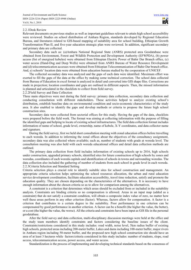
2.2.1Desk Review
Relevant documents on previous studies as well as important guidelines relevant to attain high school accessibility
were reviewed. Studies on school distribution of Amhara Region, standards developed by Regional Education
Bureau, and literatures related to GIS-based mapping of suitability area for school building, Ethiopian Growth
Transformation Plan-II, and five-year education strategic plan were reviewed. In addition, significant secondary
and primary data are collected.
Secondary data such as: (a)Amhara National Regional State (ANRS) protected area Geodatabase were
obtained from Environment, Forest and Wildlife Protection and Development Authority (EFWPDA), (b) power
access (list of energized kebeles) were obtained from Ethiopian Electric Power of Bahir Dar Branch office, (c)
water access (Hand-Dug and Deep Wells) were obtained from ANRS Bureau of Water Resource Development
and (d) telecommunication accesses were obtained from Ethiopian Telecommunication of Bahir Dar branch office.
And, e) schools’ location data were obtained from education bureau studied by the cooperation of UNICEF.
The collected secondary data was analyzed and the gaps of each data were identified. Maximum effort was
exerted to fill the gaps of the data at the office by making some technical correction. The school data collected
from Bureau of Education in excel format is analyzed in detail and converted into GIS shape files. Corrections are
made in projection; location coordinates and gaps are outlined in different aspects. Then, the missed information
is planned and articulated in the checklists to collect from field survey.
2.2.2Field Survey and Data Collection
Three main objectives were met during the field survey: primary data collection, secondary data collection and
conducting consultation with different stakeholders. These activities helped to analyze existing school’s
distribution, establish baseline data on environmental condition and socio-economic characteristics of the study
area. It also enabled to identify the gaps and develop methods or criteria to propose the future high school
construction sites.
Secondary data were collected from sectorial offices for this study. Having the gaps of the data, checklists
were prepared before the field work. The format was aiming at collecting information with the purpose of filling
the identified gaps and helping to locate of existing school infrastructures. The field data collection format includes
information of name of school, grade level, ownership, name of kebele, X-Y coordinates, and data collector name
and signature.
During the field survey, first we held short consultation meeting with zonal education offices before travelling
to each woreda. In addition to informing the zonal offices about the objectives of the consultancy assignment,
secondary data was also collected where available; such as, number of students with grade at woreda level. The
consultation meeting was also held with each woreda educational offices and detail data collection methods are
outlined.
The primary data collection from field includes information of existing schools up to 2016, high schools
under construction, upgraded primary schools, identified sites for future construction of high schools by zones and
woredas, coordinates of each woreda capitals and identification of schools in towns and surrounding woredas. The
data collection also included the gathering of number of students from each school in grade level in each woreda.
2.2.3Criteria Selection and Standard Setting
Criteria selection plays a crucial role to identify suitable sites for school construction and management. An
appropriate criteria selection helps optimizing the school resources allocation, the urban and rural education
service development coordination, facilitate education accessibility, travel time reduction, satisfy and promote the
education quality. They are chosen depending on the characteristics of the alternatives. It is necessary to have
enough information about the chosen criteria so as to allow for comparison among the alternatives.
A constraint is a criterion that determines which areas should be excluded from or included in the suitability
analysis. Constraints are binding criteria so no compensation is allowed. Areas in an input map (added as a
constraint) that do not satisfy a constraint condition, will obtain a composite index value of zero, no matter how
well these areas perform in any other criterion (factor). Whereas, factors allow for compensation. A factor is a
criterion that contributes to a certain degree to the suitability. Poor performance in one criterion can be
compensated by good performance in another criterion. A factor can be a benefit (the higher the value, the better),
or a cost (the higher the value, the worse). All the criteria and constraints have been input as GIS file in the personal
geodatabase.
After the field survey and data collection, multi-disciplinary discussion meetings were held at the office and
the study team members identify constraints and factors considering the baseline issues of the client.
Constraints/restrictions considered in this study includes: road width, noise level, 5km radius buffer of existing
high schools, protected areas including 200-meter buffer, Lakes and dams including 100-meter buffer, major rivers
in Amhara region including 50-meter buffer, and the proposed new high school construction site should have an
area of at least 3 hectares while factors/criteria considered in this study includes: number of students, slope, road
access, telecommunication access, power access, and water access.
Standardization is the process of implementing and developing technical standards based on the consensus of

Journal of Environment and Earth Science www.iiste.org
ISSN 2224-3216 (Paper) ISSN 2225-0948 (Online)
Vol.8, No.1, 2018
104
different parties that include users, interest groups and governments. Standardization can help to maximize
compatibility, repeatability or quality of data. It also facilitates commoditization of formerly custom processes. In
most cases, the standards set in the ‘Terms of Reference’ were used. Amhara Region Education Bureau has
proposed different analysis standards acquired from their long years of site selection experiences. Some other
standards are a result of studies in site selection of schools anywhere in the world. On the other hand, all inputs
used are transformed to common analysis scale using software.
Weights assigned to criteria are an important step as final results of the decision largely depend on such
weights. Assigning weights to criteria in a multi-criteria analysis approach is the most difficult task. The main
purpose of a weighting method is to attach ordinal values to different criteria to indicate their relative importance
in a multi-criteria decision-making method. These values are then used in subsequent evaluation of the alternatives
in the decision.
Table 1.Weights of the Criteria
No Criteria % influence Ratio
1 Number of students 70 0.70
2 Slope 13 0.13
3 Road access 10 0.10
4 Power access 3 0.03
5 Water access 2 0.02
6 Telecommunication access 2 0.02
Total 100 1.0
2.2.4Clustering
One of the ultimate objectives of this study was clustering of primary schools and kebeles for the selection of new
high schools. The clustering was expected to be based on the number of primary schools to one high school and
kebeles to a single high school ratio. The initial standard from the Bureau says that one high school expected to
contain 5 to 7 primary schools and a high school need to have 1 to 5 ratios with kebeles.
These two-clustering ratios have been used together with a combined analysis. This is because that the number
of primary schools which supply students for a high school are determined, the kebeles where the schools found
are also identified and clustered at the same time. The grouping was done using tools of ArcGIS software
overlaying hill shaded digital elevation model (DEM) on schools point map to visualize which schools in which
kebeles can be clustered with minimum distance and better terrain condition with each other.
2.2.5Modeling Suitable Site Selection
In this assignment, ‘Model Builder’ in ArcGIS/Spatial Analyst was used for school suitability model, which is
well known as flow chart approach (Malczewski, 2004). In the flow chart approach a school suitability model was
constructed from individual processes of input data, basic GIS operations, and derived data which are then linked
together. The model includes restriction model, suitability model, integrated suitable sites selection model and
prioritization model.
The GIS packages and tools were used to facilitate different stages of evaluating suitable sites for high school
construction in Amhara Region particularly in mapping of each constraints and factors, combination of different
constraints, combination of different factors, combination of each constraints outputs (overall suitability
evaluation), identification of school sites having an area greater or equal to 3 hectares, stratification of sites in
order of urgency, clustering of primary schools, generation of centroids of the sites in XY Coordinates, produce
final road maps and presentation of GIS outputs for decision makers (see figure 2).

Journal of Environment and Earth Science www.iiste.org
ISSN 2224-3216 (Paper) ISSN 2225-0948 (Online)
Vol.8, No.1, 2018
105
Figure 3.Model Diagram of Restriction Model
Figure 4.Model Diagram of the Suitability Analysis
Figure 5. Model Diagram of the Final Suitable Sites
2.3 Materials
The software employed to evaluate suitable sites for high school construction, being spatial plan, was ArcGIS 10.3
Software. GIS package and tools used in this consultancy assignment were: (a) spatial analyst tools (surface, raster
calculator, extraction, interpolation, map algebra, overlay); (b) analysis tools: extract (clip), proximity (create
thiessen polygon); (c) conversion tools (to KML, to raster, to shape file); (d) Arc hydro tools (watershed

Journal of Environment and Earth Science www.iiste.org
ISSN 2224-3216 (Paper) ISSN 2225-0948 (Online)
Vol.8, No.1, 2018
106
processing); and (e) data management tools (generalization, projections and transformations, raster). Hardware’s
such as Laptop computer, Digital Camera, Garmin GPS series 72H were used in this study.
3. Results and Discussion
3.1 Restriction Model Results
The restriction model evaluates those areas which are not permitted for the construction of high schools. It uses
those factors which enable to identify areas which are not suitable for high school construction. Six constraint
factors are used for this model.
3.1.1Road Width
The sites of the school need to be some distance far from roads. The GIS shape files of roads used here are simple
lines and needs buffer distance to cover the width of the road. About 40-meter width, 20 meter in both side of the
line, was used as a maximum and common width for all roads. This means the whole area cover by a 40-meter
width of roads is prohibited for school’s construction (figure 6a).
3.1.2Noise Level
Noise, as defined as unwanted sound, is a common complaint in public institutions and residence areas. Noise is
measured in decibels on the A scale of a sound meter (dBA) where higher frequencies are weighted more heavily.
Sound intensities greater than 50 dBA are believed to distract office workers and students (Sanders and
McCormick, 1993).
Activities such as industrial, development projects and traffic generate excessive noise. Noise pollution has
an impact on health and reduces productivity. School is categorized under Noise Sensitive Area. The noise level
for Amhara Region is not available. Therefore, the location of roads that generate excessive noise was considered.
Noisy offices and classrooms may increase a worker’s and student’s feelings of negative mood. In addition,
studies have shown that certain levels of noise can harm a person’s ability to concentrate on a particular task,
thereby leading to a stress response (Hedge, 1982). Increased stress leads to the release of certain chemicals, such
as epinephrine and norepinephrine, which are found in both blood and urine (Maxwell, 2005). Prolonged exposure
to stress has serious health effects. A study in the New England by McEwen (1998) found that stress could cause
insulin resistance, heart disease, memory loss, immune system dysfunction and decreased bone mass density.
Vehicle is one of such with distractive sounds which cause noise. The acceptable noise level for school
classroom is 35 dBA. To protect the sound noise above this limit, a range of distance between 150 and 300 meter
is commonly used. Therefore, the minimum 150-meter distance from roads was used for this analysis in order to
use the maximum transport access to schools. Hence, a 150-meter noise buffer has developed starting from the
sides of roads. That means, about 150-meter width area on both side of the road is protected from the selection of
high school construction sites (figure 6b).
3.1.3Existing High Schools
There is a total of 534 secondary schools in the region including under constructions. Among these, 362 are high
schools, 46 are preparatory and the rest 126 are high school & preparatory together. Only high schools or high
schools & preparatory are used for restriction analysis. Since preparatory are not the concern of the analysis, about
46 schools are out of the analysis.
Hence, based on the standards, 5-kilometer radius area of existing high schools should not be considered as
site of new high school construction. Therefore, the area found within 5-kilometer radius of existing high schools
is completely protected from analysis; which are called in this case “restricted areas” (figure 6c).
3.1.4Ecologically Sensitive Areas
Ecologically sensitive areas refer to areas located within the primary impact zones, which are classified as
“Ecologically Sensitive”. These areas include Natural Habitat, or area legally protected, officially proposed for
protection, or unprotected but of known high value for conservation and/or provision of ecosystem services (Janker
et al., 2011). This impact indicator was included because the international finance corporation (IFC) and World
Bank policy does not support projects that would lead to the significant loss or degradation of such areas.
Maps of protected areas in Amhara Region such as existing and proposed national park, and community based
conservation areas were obtained from Amhara Region Environment, Forest and Wildlife Protection and
Development Authority. Therefore, Ecologically Sensitive areas were considered as constraint areas that represent
the lands which are not allowed for any kinds of school construction. These parks and conservations areas are not
only considered but also there is a need to leave some distance from the boundary to build schools. Therefore,
these areas are buffered about 200 meters all round. Hence, the total area indicated in table 2 and the area covered
by 200-meter buffer around each protected area are restricted or not suitable for high school construction (figure
6d).

Journal of Environment and Earth Science www.iiste.org
ISSN 2224-3216 (Paper) ISSN 2225-0948 (Online)
Vol.8, No.1, 2018
107
Table 2. Protected Areas in Amhara Region
No Parks/ Conservations Location/zone Area in hectares
1 Alatish National Park North Gondar 263,542.45
2 Bagusa National Park Awi 55,301.04
3 Borena-Sayint National Park South Wollo 15,224.60
4 Semien Mountain National Park North Gondar 41,133.82
5 Menz-Guassa Community Conservation Area North Shewa 7,728.35
6 Abune Yosef and Aboye Gara CCA North Wollo 8,058.85
7 Mahebere Selassie Community Conservation Area North Gondar 19,070.48
8 Guna Proposed Community Conservation Area South Gondar 4,614.84
9 Godebe Proposed National Park North Gondar 18,691.03
Total 433,365.46
3.1.5 Lakes and Dams
Water bodies in Amhara region particularly natural lakes and artificial reservoirs/dams including 100meter buffer
around those water bodies were also considered as restricted areas. Therefore, major lakes and dams in the region
are identified and restricted (table 3). Again, to keep suitable distance from these water bodies, there is 100-meter
buffer from the boundary (figure 6e).
Table 3. Major Lakes and Dams in Amhara Region
No Lakes/dams Relative location Area in hectares
1 Lake Tana Western Amhara 306,083.32
2 Lake Haik Eastern Amhara 2,275.90
3 Lake Ardibo Eastern Amhara 1,550.86
4 Lake Zengena Western Amhara 125.66
5 Geray Weir South-western Amhara 4.92
6 Koga Dam Western Amhara 341.33
7 Tekeze Dam North-eastern Amhara 10,197.11
Total 320,578.22
3.1.6 Major Rivers/Flood Hazard Prone Areas
Schools should be located far from streams to ensure schools are safe from flood hazard which stem from their
closeness to river. Indian State Board of Education School Facility (2002) clearly states no school can be built
within 500 feet (152.4 meter) of a stream. Spatial multi-criteria decision analysis for safe school site selection of
Malaysia by Bukhari et al. (2010), states that the acceptable distance from the school site to the nearest stream was
at least 300m. For this study, the acceptable distance from the school site to the nearest stream needs to be at least
50m.Such small distance is taken to keep suitable gentle slopes near rivers. Large and wide gorges of rivers are
not suitable for the construction of schools. Therefore, to protect these unsuitable sites, a 50-meter buffer was
developed along major rivers (figure 6f).

Journal of Environment and Earth Science www.iiste.org
ISSN 2224-3216 (Paper) ISSN 2225-0948 (Online)
Vol.8, No.1, 2018
108
Figure 6.Maps of Restrictions Developed for School Suitability Mapping
3.1.2 Combination of the Restriction Criteria
The final results of each restriction criteria analysis were combined together to produce the final restriction area.
The combination of the criteria using “Raster Calculator” tool in ArcGIS software enabled to have final restriction
output (figure 7).
Figure 7. Final Restriction Areas for Rural Analysis

Journal of Environment and Earth Science www.iiste.org
ISSN 2224-3216 (Paper) ISSN 2225-0948 (Online)
Vol.8, No.1, 2018
109
3.2 Suitability Model Results
A suitability model is a model that weights locations relative to each other based on given criteria. Suitability
models are important in finding a favorable location for a new facility, road, commercial business centers,
institutions like schools or habitat for a species of bird. Overlay analysis is a common method for creating a
suitability model which involves using GIS techniques. With the advancement of computer mapping software,
suitability modeling has become much easier and faster to implement, and today it is used for varying tasks.
3.2.1 Analysis of Suitability Factors/Criteria
3.2.1.1 Number of Students
The most important input of the suitability analysis is number of students in each school. High schools will expand
and built considering number of students as a major criterion. The significance of other factors is too small as
compared to the number of students. The number of students will be a dominant and the most influencing factor
throughout this site analysis (figure 8a).
3.2.1.2 Slope
Landscape of the area is one of the most significant factors of the site analysis. The school compound needs to be
suitable and comfortable for student’s movement, playing grounds and even for the construction of the buildings.
On the other side, it is also important for the appraisal of environmental issues like landslide, flash and sheet
erosion, and flooding. Therefore, irrespective of other influences, suitability of the sites for construction of high
schools increases as slope decreases. Gentle slopes are the most suitable areas for school construction. The slope
of Amhara region was divided in to four groups for the analysis including gentle, sloping, steep and very steep
slopes (table 4). As indicated in figure 13, the eastern and north eastern part of the region are dominated by steep
and very steep slopes with the exception of some isolated pockets (figure 8b).
Table 4.Slope range and the percentage of area in each category
No Slope range (%) Code Total area (ha) %
1 0-20 4 8,549,771.18 54.71%
2 20-40 3 3,728,352.99 23.86%
3 40-80 2 2,953,008.32 18.90%
4 80-500 1 395,562.80 2.53%
Total 15,626,695.29 100.00%
3.2.1.3Road Access
Even though the roads are restricted for about 40-meter road width and 150-meter noise level buffer distance, the
sites, which will be selected as suitable, need to be easily accessible. Therefore, accessibility is a significant
criterion of analysis in the evaluation. After the distance of each specific area from existing road is calculated, it
is grouped in to four categories starting from most accessible to the farthest area from major roads. The grouping
is a result of noise level reference and the minimum distance that the students travel to schools. Nearly 60% of the
rural area in the region found within 5 kilometers from roads and 90% within 15 kilometers. Therefore,
accessibility is not a major problem in the region with some exceptions (figure 8c).
3.2.1.4Power Access
Power is mandatory for all high schools specifically for laboratory services. Power access data was collected from
Rural Electrification project office in the north-western branch office of EEA. A total of 1,300 electrified rural
kebeles list was collected and integrated with their spatial references. In addition, considering that all major towns
and rural kebeles along main roads and major power transmission lines have the chance to be electrified, the total
number of kebeles energized in the region reaches about 1,610 (figure 8d).
3.2.1.5Water Access
The construction of high schools should be restricted some distance from rivers, lakes and dams. This is done to
avoid river gorges, water pollution and flood hazards related to water bodies. However, access to potable water
and for other day-to-day school services is vital. Hence, some weight was given to the accessibility of sites to
hand-dug and deep wells. A total of 11,761-point data of water institutions were used for this analysis. Four
categories established in order to assess access to water taking in to consideration the guideline of the Bureau
(figure 8e).
3.2.1.6Telecommunication Access
The objective of using this criterion is for the plasma learning media in secondary schools. Currently, schools use
VSAT receivers. However, there is a possibility of using wireless devices for plasma learning transmission. Now,
all parts of the region have a wireless access, according to the information given by Ethiopian Telecommunication
Corporation North-western branch office. Therefore, every parts of the region has got equal value relation to
telecommunication (figure 8f).

Journal of Environment and Earth Science www.iiste.org
ISSN 2224-3216 (Paper) ISSN 2225-0948 (Online)
Vol.8, No.1, 2018
110
Figure 8.Maps of Factors Developed for High School Suitability Mapping
3.2.2Combination of the Criteria and Assigning Weights
All the suitability analysis criteria are combined together using a weighted overlay method. The combination gives
a vast area of suitable area for construction of high schools. This result indicates only the suitable lands without
considering restricted sites. However, the combination of this suitability map with the restriction areas will give
the final suitable sites.
Figure 9.Suitable Sites in the Rural Areas without Considering Restricted Sites
3.3 Integrated Suitability Sites Model Results
The comprehensive suitable sites were generated by combining the restricted areas and the suitability analysis
results. The suitable sites are results of the combination of restriction model output with the model results of
suitability. The restriction model result indicates those areas which prohibited from suitable site selection analysis.
On the other hand, the suitability model result shows the level of suitability of the areas for high school construction.
The combination model produces a stratified level of suitable areas from most suitable to least suitable sites, having

Journal of Environment and Earth Science www.iiste.org
ISSN 2224-3216 (Paper) ISSN 2225-0948 (Online)
Vol.8, No.1, 2018
111
restricted or completely non-suitable lands. As indicated in table 13, about 11,433,187.59 hectares of the region
has classified and stratified with levels of suitability and the rest parts of the region is non-suitable or restricted
from suitability analysis.
Figure 10.Suitability Levels for High Schools
Table 5. Levels of Suitable Sites after Combination
No Code Suitability level Area (ha) %
1 0 Non-suitable 4,396,348.68 27.77
2 1 Least suitable 235,903.67 1.49
3 2 Marginally suitable 2,551,599.57 16.12
4 3 Moderately suitable 7,518,477.63 47.50
5 4 Highly suitable 1,127,206.72 7.12
Total 15,829,536.27 100
As indicated the result, 7.12% of the region is the highly (most) suitable sites and are the best preferable sites
of high school construction. These sites are those which most satisfy the standards of the criteria used in the
suitability model. Therefore, high schools are preferred to be constructed on these sites.
However, it doesn’t mean that those parts of the region which lack the highly suitable sites will have no area
of high school construction. Rather, the selection of sites goes through the levels of suitability if the prior suitable
site is not found. This means, the selection even can be “Least suitable” sites if the area has a need of high school
due to high number of primary school students. Still, the main determinant factor is the number of students.
Figure 11. Highly Suitable Sites

Journal of Environment and Earth Science www.iiste.org
ISSN 2224-3216 (Paper) ISSN 2225-0948 (Online)
Vol.8, No.1, 2018
112
4. Concluding Remarks
It is possible to conclude that GIS tools are very significant to facilitate a systematic and comprehensive suitable
site selection processes in a more effective and scientific way by combining and spatially assessing multiple
constraints and factors. In this project work, the application of GIS for suitable site selection for high schools adds
a new dimension to the existing school site selection modeling using GIS. This project work also indicates that
GIS can serve as a support tools in suitable site selection processes for construction of new high schools in mapping
of each constraints and factors, combination of different constraints, combination of different factors, combination
of overall constraints output with overall factors(overall suitability evaluation), identification of school sites having
an area greater or equal to 3 hectares, stratification of sites in order of urgency, clustering of out puts, generation
of centroids of the sites in X-Y Coordinates, produce final road maps and presentation of GIS outputs for decision
makers.
For this study, different constraints and factors were considered for suitable site selection of new high school
construction in Amhara Region. Road width, noise level, 5km radius of existing high schools, protected areas
including 200 meter buffer, Lakes and Dams including 100 meter buffer, major Rivers in Amhara Region including
50 meter buffer; and minimum area size of the proposed new high school construction sites (at least 3 hectares)
were considered as constraints; while, number of students, slope, road access, power access and water access were
considered as factors or criteria. Then a MCA model was built to analyze all constraint maps and factor maps by
giving them different weights, and to get the final high school construction suitability map. Generally, the most
important limiting factor for suitable site selection for construction of new high schools in Amhara Region is
number of students. Power access and water access were the least important limiting factors. However,
Telecommunication access is common limiting factor for suitable site selection for new high school construction
in region.
The overall evaluation results revealed that there is a need to build many secondary schools that can
accommodate fast growing number of students who will graduate from primary schools. The analysis result also
indicated the availability of vast area of suitable sites which satisfied many of the criteria used in the evaluation.
Therefore, the remaining major tasks will be fund raising and effective implementation of the assigned plans.
In light of the results of GIS application to support the development of road-map of secondary schools in
Amhara Region for the improvement of equitable education access and sustainable socio-economic development,
the following key recommendations are forwarded:
1. Integration and Implementation of the study results: The proposed new high school construction sites
expected to be implemented with maximum effort of the Bureau as well as the regional government. Each
annual plan expected to cover in the same year. Hence, it requires immediate action plan and
implementation. For precise project location and detail implementation, the use of GIS and modelling
tools is vital. While locating the precise project location of the proposed high school sites, necessary care
should be taken in order not included areas of road infrastructures, road (highway and main road)
buffering of 150meter to reduce impacts of noise, 5km radius of existing high schools, protected areas
including 200metter buffer, lakes and dams including 100 meter buffer. gorges of major rivers including
50meter buffer.
2. Micro-development planning: To make socially acceptable, economically feasible and environmentally
sound suitable site selection decisions, educational planners and implementers of the Bureau as well as
the region should use and integrate the GIS assessment result of this project with the future detail level
of school micro-development planning. The implementation of the analysis result and school mapping
should be in woreda level. Hence, the local mapping and implementation needs to be supported by GIS
techniques.
3. Future Educational Geodatabase and Guideline Development: One of the major problem both regional
and local level is lack of effective and accurate Geodatabase. For instance, during the study of this suitable
site selection project, the main shortcoming was lack of adequate educational Geodatabase and guidelines
from both Bureau of Education and Woreda offices. This is also a major problem of other sectors.
Therefore, adequate educational Geodatabase and guidelines must be produced with cooperation of
Bureau of Education and other consultants.
4. GIS and related skill training for woreda experts: In addition, the woreda experts need to be equipped
with the necessary skill and knowledge of how to collect and handle spatial data about schools and
students. Therefore, the Bureau must plan to train experts in woreda level in GIS and related tools and
skills.
Acknowledgment
This work has been supported by Land Use Plan and Environmental Impact Study Core Process of Amhara Design
and Supervision Works Enterprise (ADSWE). Thus authors thank this organization for arranging different
equipment and devices such as vehicles, Laptop computer, Digital Camera, Garmin GPS 62 series, and other
Journal of Environment and Earth Science www.iiste.org
ISSN 2224-3216 (Paper) ISSN 2225-0948 (Online)
Vol.8, No.1, 2018
113
accommodations for field works. Furthermore we would like to thank our client, Amhara Region Bureau of
Education, especially Mr. Siyoum Admasu Sharew, Deputy Head of the Bureau and Mr.Shimelis Gebeyehu
Kebede, Core process owner.
References
Alpkokin, P., 2012.Historical and critical review of transport planning in the Netherlands. Land use policy, 29,
536-547.
Ajala, O.A. and A, Kerebih, 2008. Accessibility in equality to Basic Education in Amhara Region, Ethiopia.
Ethiopian Journal of Education &Science, l3 (2), 12-26.
Alaska Department of Education. Site Selection Criteria and Evaluation Handbook. Available from:
http://www.eed.state.ak.us/Facilities/publications/SiteSelection.pdf[Accessed 20 January 2017].
BoFED (Bureau of Finance and Economic Development), 2012. Stastical bulletin 2002.
Bukhari, Z., A. M. Rodzi, and A Noordin, 2010. Spatial multi-criteria decision analysis for safe school site
selection, Malaysia. International Geoinformatics Research and Development Journal, 1(2), 1-14.
Public Schools of North Carolina. Land for Learning, 1998.Available from:
http://www.schoolclearinghouse.org/pubs/schsite.pdf[Accessed 20January 2017].
Hedge, A., 1982. The open-plan office: a systematic study of employee reactions to their work. Environment and
Behavior, 14,519-542.
IIEP (International Institute for Educational Planning), 2001. Improving Micro-planning in Education through
Geographic Information System, studies in. and Palestine. Available from:
http://www.unesco.org/iiep[Accessed 12 February 2017].
Indiana State Board of Education. School Facility, 2002.Guidelines.Available from:
http://www.doe.state.in.us/stateboard/constguide.html[Accessed 12 February 2017].
Jonker, V., et al., 2011.Nile Basin Initiative Water Resource Planning and Management Project: Draft Inception
Report on Data compilation and pilot application of Nile Basin Decision Support System (NB-DSS): Work
Package 2/1:Stage2.
Maxwell, E., 2005. Noise in the Office Workplace, Department of Design and Environmental Analysis, College
of Huma Ecology, Cornell University.
McEwen, B.S., 1998. Protective and damaging effects of stress mediators. New England Journal of Medicine,
38(3), 171-177.
Malczewski, J., 2004. GIS-based land-use suitability analysis: a critical overview. Progress in Planning, 62(1), 3-
65
Saleh, A., R.M. Ahmad and P. Biswajeet, 2013. Spatial modelling of site suitability assessment for hospitals using
geographical information system-based multicriteria approach at Qazvin city, Iran, Geocarto International,
DOI:10.1080/10106049.2012.752531
Sanders, M., and E. McCormick, 1993. Human Factors in Engineering and Design, seventh edition. New York:
McGraw Hill.