EKSPLORASI BATUAN ANDESIT DENGAN METODE GEOLISTRIK
15
Exploration Using Ground Magnetic Method Exploration, Construction and Geological Subsurface Minerals Investigation Feb, 2018
-
Upload
khangminh22 -
Category
Documents
-
view
0 -
download
0
Transcript of EKSPLORASI BATUAN ANDESIT DENGAN METODE GEOLISTRIK

Exploration Using Ground Magnetic Method Exploration, Construction and Geological Subsurface
Minerals Investigation
Feb, 2018

Introduction
• Gold potential has been recognized in an exploration area centre of Kalimantan.
• Seisxplore Geosurvey has the equipment and capability to carry out a ground magnetometer survey & geological mapping program to interpret the geological structure of the project area and indicate targets for further gold & mineral exploration

Base Data Acquisition/Rover
Equipments and Acquisition Survey consists of a base station and a roving magnetometer to do acquire the data We have some equipments such :
• Geometric G-856 • GEM System GEM-19T • PMG-1

Magnetometer
• The ground proton magnetometer is used to detect variations in the earth’s magnetic field as a result of the underlying geology
• This can help interpret the geological structure of the geology beneath the surface

seisxplore Geosurvey#seisxplore-survey.com#
Geological Structures Delineation from DEM data

seisxplore Geosurvey#seisxplore-survey.com#
While the mag survey is carried out geological mapping will also be carried out to identify and record the rock types & geological structure in the area

seisxplore Geosurvey#seisxplore-survey.com#
Interpretation & Delineation of Structures
seisxplore Geosurvey#seisxplore-survey.com#
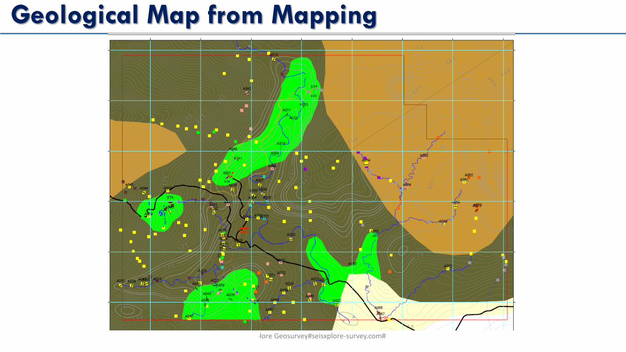
Geological Map from Mapping

A combination of magnetic anomaly and geological map

seisxplore Geosurvey#seisxplore-survey.com#
Exploration Target

seisxplore Geosurvey#seisxplore-survey.com#
Sediment Boundries and Delineate of Coal Distribution

seisxplore Geosurvey#seisxplore-survey.com#
Distribution of Target in 3-D Surface/Solid Model

seisxplore Geosurvey#seisxplore-survey.com#
Volumetric of Target(Andhesit/Ore/Mineralization)

seisxplore Geosurvey#seisxplore-survey.com#
Volumetric of Target(Andhesit/Ore/Mineralization)

seisxplore Geosurvey#seisxplore-survey.com#
Receivables
• A power point presentation containing;
• a) a magnetic anomaly map
• b) a surface geology map
• c) a combined geology and magnetic map
• d) a 3-D view distribution of the target
• d) a structural interpretation of the project area with target areas for further investigation