Tuesday September 8 2015 - Suamico
99
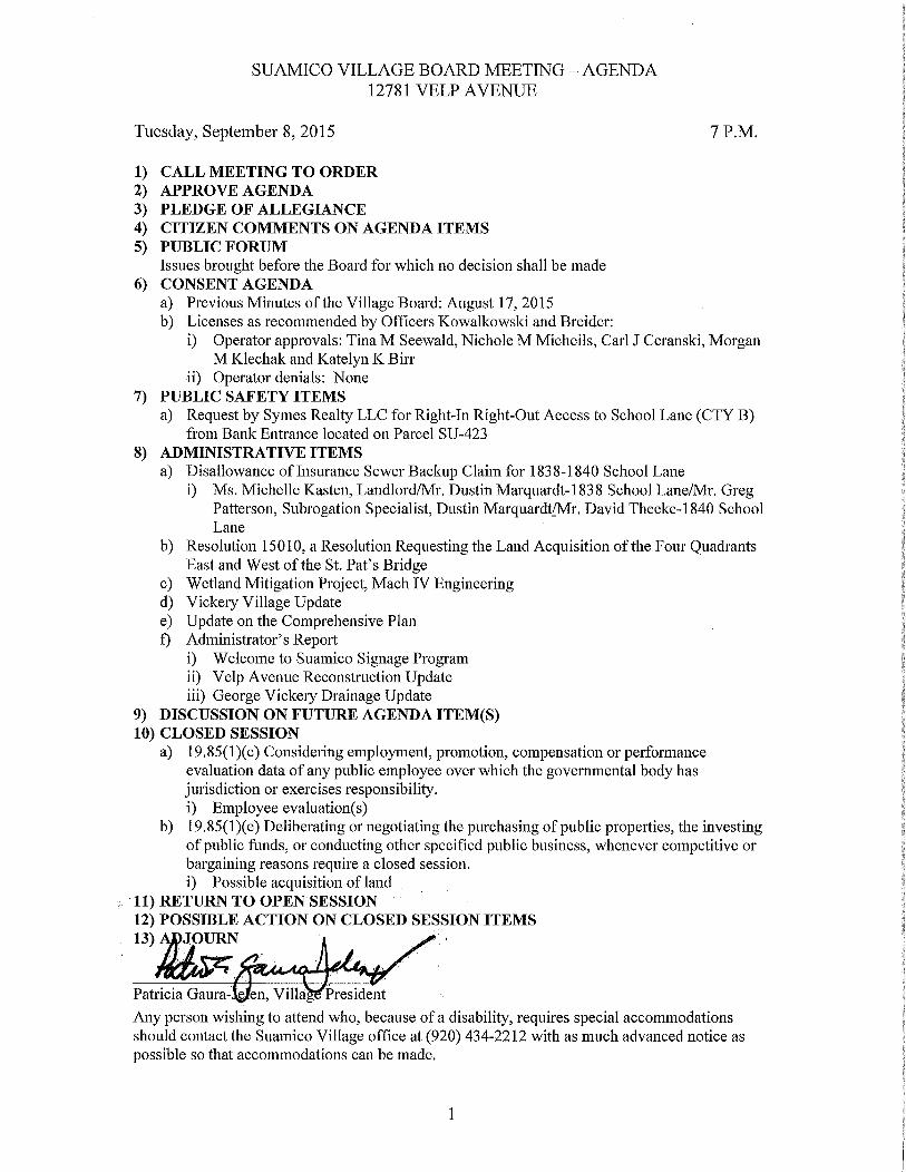
SUAMICO VILLAGE BOARD MEETING AGENDA 12781 VELP AVENUE Tuesday September 8 2015 7 P M 1 CALL MEETING TO ORDER 2 APPROVE AGENDA 3 PLEDGE OF ALLEGIANCE 4 CITIZEN COMMENTS ON AGENDA ITEMS 5 PUBLIC FORUM Issues brought before the Board for which no decision shall be made 6 CONSENT AGENDA a Previous Minutes of the Village Board August 17 2015 b Licenses as recommended by Officers Kowalkowski and Breider i Operator approvals Tina M Seewald Nichole M Micheils Carl J Ceranski Morgan M Klechak and Katelyn K Birr ii Operator denials None 7 PUBLIC SAFETY ITEMS a Request by Symes Realty LLC for Right In Right Out Access to School Lane CTY B from Bank Entrance located on Parcel SU 423 8 ADMINISTRATIVE ITEMS a Disallowance of Insurance Sewer Back ip Claim for 1838 1840 School Lane i Ms Michelle Kasten Landlord Mr Dustin Marquardt 1838 School Lane Mr Greg Patterson Subrogation Specialist Dustin Marquardt Mr David Theeke 1840 School Lane b Resolution 15010 a Resolution Requesting the Land Acquisition of the Four Quadrants East and West of the St Pat s Bridge c Wetland Mitigation Project Mach IV Engineering d Vickery Village Update e Update on the Comprehensive Plan f Administrator s Report i Welcome to Suamico Signage Program ii Velp Avenue Reconstruction Update iii George Vickery Drainage Update 9 DISCUSSION ON FUTURE AGENDA ITEM S 10 CLOSED SESSION a 19 85 1 c Considering employment promotion compensation or performance evaluation data of any public employee over which the governmental body has jurisdiction or exercises responsibility i Employee evaluation s b 19 85 1 e Deliberating or negotiating the pm chasing of public properties the investing of public funds or conducting other specified public business whenever competitive or bargaining reasons require a closed session i Possible acquisition of land 11 RETURN TO OPEN SESSION 12 POSSIBLE ACTION ON CLOSED SESSION ITEMS 13 JOURN Patricia Gaura en Villa President Any person wishing to attend who because of a disability requires special accommodations should contact the Suamico Village office at 920 434 2212 with as much advanced notice as possible so that accommodations can be made
-
Upload
khangminh22 -
Category
Documents
-
view
4 -
download
0
Transcript of Tuesday September 8 2015 - Suamico
SUAMICO VILLAGE BOARD MEETING AGENDA
12781 VELP AVENUE
Tuesday September 8 2015 7 PM
1 CALL MEETING TO ORDER
2 APPROVE AGENDA
3 PLEDGE OF ALLEGIANCE
4 CITIZEN COMMENTS ON AGENDA ITEMS
5 PUBLIC FORUM
Issues brought before the Board for which no decision shall be made
6 CONSENT AGENDA
a Previous Minutes ofthe Village Board August 17 2015
b Licenses as recommended by Officers Kowalkowski and Breider
i Operator approvals Tina M Seewald Nichole M Micheils Carl J Ceranski MorganMKlechak and Katelyn K Birr
ii Operator denials None
7 PUBLIC SAFETY ITEMS
a Request by Symes Realty LLC for RightInRightOut Access to School Lane CTY Bfrom Bank Entrance located on Parcel SU423
8 ADMINISTRATIVE ITEMS
a Disallowance ofInsurance Sewer BackipClaim for 18381840 School Lane
i Ms Michelle Kasten LandlordMrDustin Marquardt1838 School LaneMrGregPatterson Subrogation Specialist Dustin MarquardtMrDavid Theeke1840 School
Lane
b Resolution 15010 a Resolution Requesting the Land Acquisition ofthe Four QuadrantsEast and West of the St PatsBridge
c Wetland Mitigation Project Mach IV Engineeringd Vickery Village Updatee Update on the Comprehensive Plan
f AdministratorsReporti Welcome to Suamico Signage Programii Velp Avenue Reconstruction Updateiii George Vickery Drainage Update
9 DISCUSSION ON FUTURE AGENDA ITEMS10 CLOSED SESSION
a 19851cConsidering employment promotion compensation or performanceevaluation data of any public employee over which the governmental body has
jurisdiction or exercises responsibilityi Employee evaluations
b 19851e Deliberating or negotiating thepmchasing ofpublic properties the investingofpublic funds or conducting other specified public business whenever competitive or
bargaining reasons require a closed session
i Possible acquisition of land
11 RETURN TO OPEN SESSION
12 POSSIBLE ACTION ON CLOSED SESSION ITEMS
13 JOURN
Patricia Gaura en Villa President
Any person wishing to attend who because ofa disability requires special accommodationsshould contact the Suamico Village office at 920 4342212 with as much advanced notice as
possible so that accommodations can be made

SUAMICO VILLAGE BOARD
COMMITTEE OF THE WHOLE MEETING MINUTES
12781 Velp Avenue
Monday August 17 2015
600PM
1 Call the Meeting to Order
President Jelen called the meeting to order at600pmBoard members present President Jelen Trustee Andrews Trustee Eckert Trustee
Nelson Trustee Roddan and Trustee VanRossum Trustee Schenlcelberg excused
Staff present Administrator Kubacki Kay Magyar Finance Director Steve DunksZoning AdministratorBuilding Inspector and Ilan brewery DPW Director
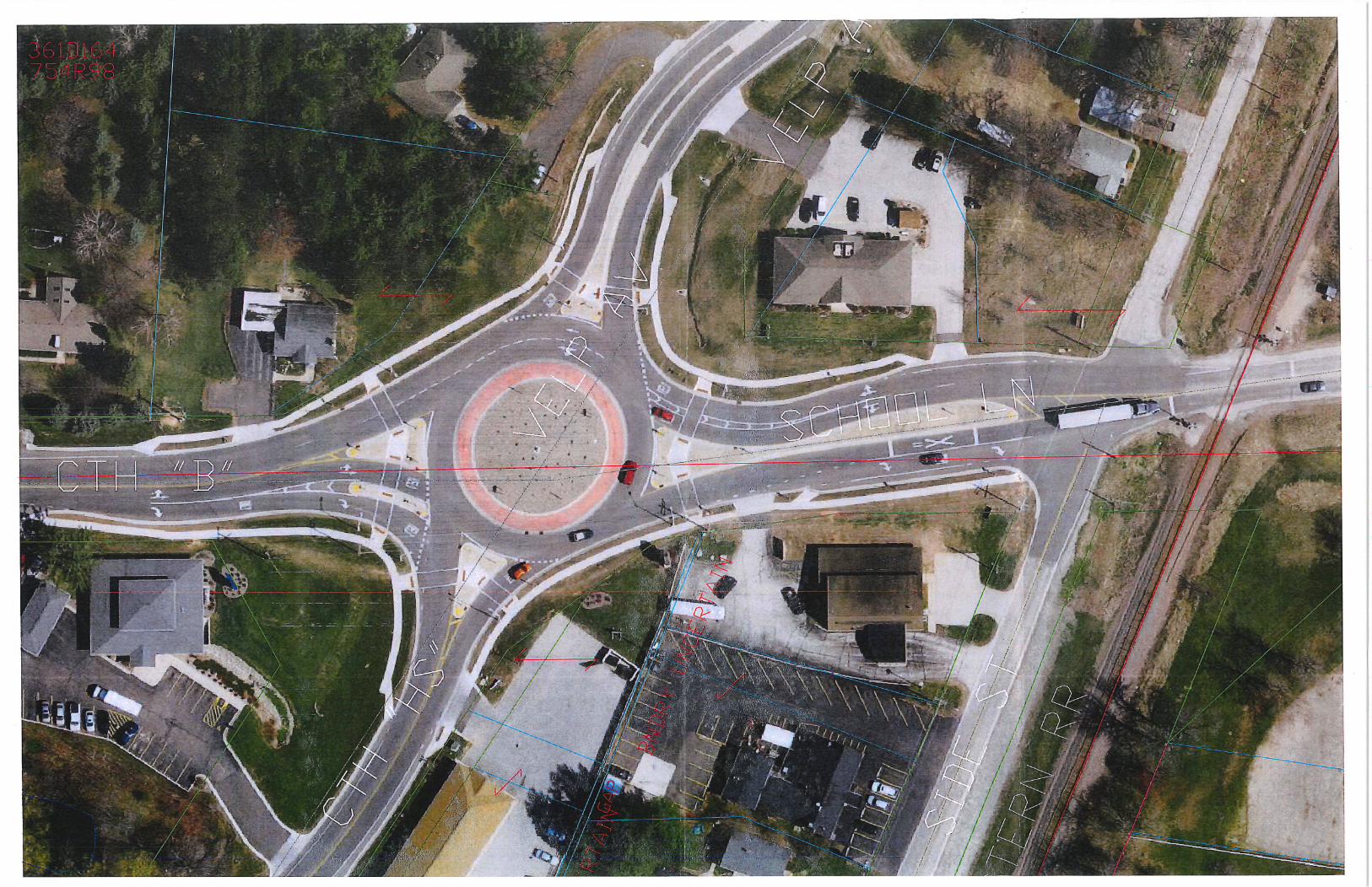
2 Velp Avenue Reconstruction
a StaffupdateWorkeffortsInfrastructure Improvementsi ThoughtsDirection from the Village Board
Administrator Kubacki lead a presentation on this potential 2017 Brown County lead
workeffort Staff has beendiiectcd by the Public Works Committee to investigatethe possibility ofplacing amultinzodallpedestrianbikepath along the east side of
Velp Avenue fromTineville Road to Riverside Drive and to get an estimate on the
costs and investigate the sources of possible fielding
Discussions were also held an the Lakeview Drive County J Sunset Beach Road
County B and County IR resurfacing projects and their timetables
3 AdjournMotion by Nelson to adjounsecond byFckert motion carded 60
Respectfully submitted
Bonnie Swan Village Clerk
COW Meeting 08172015
Page 1
SUAMICO VILLAGE BOARD MEETING MINUTES
12781 VELP AVENUE
Monday August 17 2015 7PM
1 CALL MEETING TO ORDER
President Jelen called the meeting to order at 700pmBoard members present President Jelen Trustee Andrews Trustee Eckert Trustee
Nelson Trustee Roddan and Trustee VanRossum Trustee Schenkelberg excused
Staff present Administrator Kubacki Kay Magyar Finance Director Dan breweryDPW Director Steve Dunks Zoning AdministratorBuildingInspector and Bonnie
Swan Village Clerk
2 APPROVE AGENDAMotion by Roddan to approve the agenda as submitted second by VanRossummotion carried 60
3 PLEDGE OF ALLEGIANCE
4 CITIZEN COMMENTS ON AGENDA I1LMS
No one spoke
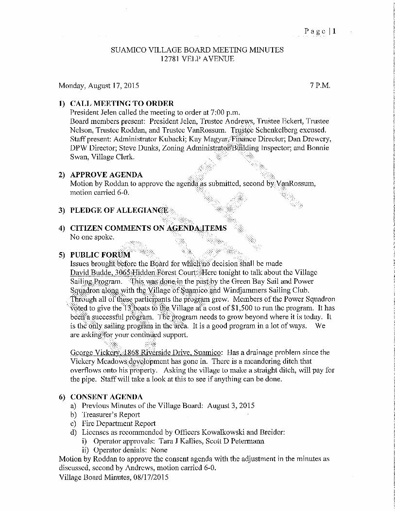
5 PUBLIC FORUMIssues brought before the Board for which no decision shall be made
David Budde 30651Iiddcn Forest Court llere tonight to talk about the VillageSailing Program This was done in the past by the Green Bay Sail and Power
Squadron along with the Villagc of Suamico and Windjammers Sailing Club
Through all of these participants the program grew Members ofthe Power Squadronvoted to give the 1 boats to the Village at acost of1500 to run the program It has
been a successful program fhc hrogram needs to grow beyond where it is today Itis the only sailing program in the area It is a good program in alot ofways Weare asking for your continued support
George Vickery 1864 Riverside Dr7ve Suamico Has adrainage problem since the
Vickery Meadows development has gone in There is ameandering ditch that
overflows onto his property Asking the village tomake astraight ditch will pay for
the pipe Staffwill take alook at this to see if anything can be done
6 CONSENT AGENDA
a Previous Minutes ofthe Village Board August 3 2015
b Treasurers Reportc Fire Department Reportd Licenses as recommended by Officers Kowalkowski and Breider
i Operator approvals Tara J Kallies Scott D Petermann
ii Operator denials None
Motion by Roddan to approve the consent agenda with the adjustment in the minutes as
discussed second by Andrews motion carried 60
Village Board Minutes08172015
Page 2
7 ADMINISTRATIVE ITEMS
a Disallowance of Insurance Sewer Backup Claim for Bradley Boettcher 3182
Longview LaneStaff reportBradley Boettcher has submitted abill for sewer and drain services due to a sewer
backup Staff submitted this to Statewide Services the Villagesinsurance
company They have done an investigation found no fault in the Village and are
recommending that the board disallow this request
Motion by Nelson to disallowdeny claim WM000050380045 for BradleyBoettcher 3182 Longview Lane second by Eckert motion carried 60
b County Rescue Service Agreement Approval 20162020
Staff reportMr Larry Ullmer Operations manager for County Rescue was present at the
meeting to address questions and gave apresentation on the services CountyRescue offers the Village He also reviewed how the contract costs for the years20162020were determined
Motion by Roddan to approve the Ambulance Service Agreement between
County Rescue Services Inc and the Village of Suamico for 2016 2020 with
pricing as noted second by VanRossum motion carried GO
c Wetland Mitigation Prospectus Presentation by Mach IV EngineeringStaff reportMach IV made a presentation on the comments and thoughts made by the
Wiscolisin Department ofNatural Resources and Army Core of Engineeringregardingtbe Norfield Wetland Mitigation Bank Project
President Jelen is going to decline from any comments from the discussions and
recuse from any voting if there is anything at tonightsmeeting on this as her
property may be included in this mitigation project Trustee Roddan will lead the
discussion during this portion of the meeting
Ben LaCount and Chad Fradette Mach IV Engineering gave apresentation at
tonightsmeeting The Army Corp and DNR met for the site visit and have said
they agree that the site does have good potential tobe asuccessful mitigationbank Maps of the area were shown on the overhead screens
The DNR wants the following items included in the prospectus they would
normally have been done at a later time
6 topographic survey
Hydrological study include monitoring wells and the monitoring of those
wells
A drain soil study
Village Board Minutes 08172015

Page 3
Estimated costsRevenue sheet was handed out by Mach IV
Total acreage is approximately 82 acres the way the project looks now
Village property is approximately 51 acres 39 credits 75 comes out to
approximately 2925credits or1755000Jelen property is approximately 31 acres 235 credits 75comes out to
approximately 17616 credits or just over 1 million dollars
Approximately 60000 per credit
They are now open to scattered mitigation sights meaning you will now be able to
jump across Lakeview Drive and talk toneighbors on that side about becominginvolved This is anew development in wetland mitigation projects The largerthe bank the easier it is to get approved Mach IV is approaching neighbors to see
if they would be interested in getting insolved in this A lot of this property iswooded wetland and that is exactly what the DNR is looking for
The costs will be shared by everyone involved in the project
Trustee Eckert said that she still doesntagree with this Feels that we shouldntbe dictating land use for all times to fiiture generations
After discussions Board members would like the following fiom Mach IV
Segregate what is requested from the Army Corpandwhat is requestedfrom the DNR
Divide cost estimate sheet outby parcels
How long until the credits would he available to recoup Approximately 12years
The landowners are taking all the risk with this project Inregards to the costs isthere some negotiating that could happen until we can get the MBI Mach IV
fherc have been some different agreements made Have been looking at some
things that Village Staff could do that would help with the costs Staff manpowercosts could be less expensive Mach IV would like toproceed with field work
and work out the details later
After the prospectus is complete this will give the Ai7ny Corp and the DNR theinformation they need to make adecision
Motion by VanRossum to authorize Mach IV tomove forward on the field workand prepare documentation for the next step the prospectus pending final
approval of the dollars at a later board meeting second by Nelson 41 nay byEckert abstention by Jelen
d Class B Fermented Malt License for Christine Herman Art Therapy LLC 1755Riverside Drive and Suamico for use at Christine Herman Art Therapy Study1755 Riverside Drive Suamico Christine Herman agent
Village Board Minutes08172015

Page 4
Staff reportChristine Heiman has applied for a Class B Fermented Malt License for
Christine Herman Art Therapy LLC 1755 Riverside Drive Suamico for use at
Christine Heirnan AitTherapy Study 1755 Riverside Drive Suamico Christine
Herman agent This is in Vickery Village
Motion by Nelson to approve the malt beverage license for Christine Heirnan Art
Therapy LLC subject to the following condition
1 Applicant has supplied proof of avalid WI Sellers Peirnit
2 Approval is granted for areas as specified on licenses only Anyexceptions or additions must come to Village Board for approval of an
amendment to the liquor license
3 That any or all outstanding fees charges utility bills or taxes are paid in
full prior to the issuance of the new license per Chapter 50213 of the
Suamico Village Code of Ordinances
4 That any Fire Code violations are corrected as specified by the Suamico
Fire Department and arereinspected prior to issuance oflicense
5 That any or all outstanding beer andor liquor bills have been paid per WI
State Statutes
Second by Andrews motion carried 60
e Payoff of land contract forSU36SU361SU362Staff reportThe Village entered into a land contract in 2007 for the purchase of the three
pcelsnaucdabove for a total purchase price of438430 at 5for 10 years
hhe land contract will be paid in full on812017 if it is not prepaid on September1 2015 The Village has a debt stabilization fund with approximately818834 in
it The purpose for this fiend is to put money aside to cover general obligationdebt payments owed by the water or sewer utility
Motion by lndrews to approve completely paying off the land contract for
parcels SU36 SU361and SU362on September 1 2015 with monies comingfrom the Debt Stabilization Fund second by VanRossum motion carried 60
f Administrators Reporti Vickery Village Planning Updateii Health Insurance Updateiii Comp Plan UpdatePlan Commission ReviewStatusReportiv Fire Department OperationsStatus Reportv Any other items that maybe germane
Village Board Minutes 08172015
Page 5
8 DISCUSSION ON FUTURE AGENDA ITEMSSince Monday September 7 2015 is Labor Day the next VB meeting will be
scheduled for Tuesday September 8 2015 at 7 PM Everyone will check their
schedules and let Clerk Swan know
9 ADJOURNMotion by Roddan to adjourn at 855PM second by Nelson motion carried 60
Respectfully submitted
Bonnie L Swan Village Clerk
Village Board Minutes08172015

Memo
To Bonnie Swan Village Clerk
From Jody Breider
Date081915
Re OperatorsLicense applications
I have reviewed all available paperwork and completed a background check on the
applications for an operators licenses Files accessed include Wisconsin Crime
Information Bureau CIB Wisconsin Circuit Court Access CCAP and local files
I respectfully recommend that the Village Board approve these applications
Tina M Seewald
Nichole M Micheils
Carl J Ceranski
Morgan M Klechak
Katelyn K Birr
If you have any further questions please contact me
Sincerely
Jody Breider
w Jrr II 1 ti hWA ay ry i ryi q T7
i1 it Ijj u 1 ytl1 i yy S
i
i
I
fi1
lI
4I
ri I qq dl yiw a r 6r
I a r sI I
y FI
7rr fr 1 FrF rMF tR
IY1
1 da J
9
iI
d 1 4 t iSs A
1 is
tie
i w dlr 4J I dlr aLI C
II rvr
n
Ljwt t l yp ti ir a
kf
X rf
iti
J9 y
I 1k y P CaA I y fNYmIde
f Nr J yd
Ir ICI t it f
itu xr vwC i1 r Yn Mrc Id
ti
x ttraI Jl u 1 i dvyr
Id l T T f 4 s
Lq rr f
IIII 1 l i il1Rk Jry vs 1 II pr I 1
1H i j yam r1r a
Vii k tI
III II
i
I
I I lr17 4 f1r yl IIIf 4 x 1 I nr
d
a yr ti 1 it p 1 T eyI
Ihf q I 11a
yy
dYr d crl
R I r I I I S II 1 9
II II I III 1 II
r
d
r
I
u
i Jxta P di dI c Ii
f ill
I
I
ti
I II
I
i s A y 7eI4
u
JIJt
I j
fit a x1 L 4 idmw
r y IICr
J
9
v
I IS ti y Yy ae 1 i t 1 I W h Y k r
s o qf w1 E F I MF qY
o rr b1 r iS1 yt1lyl d
Sti
wtirra 4I r f 44it 74
I t r Hit C II S s1
1 DWI I idy yRw a I
IL e J Lorwti
d
R Rrq K
gti0f
dQ
e
yam 1I
F
F7 n
qf
q
t ar 6 Typy I 1 Tyr Tf
1
TR I w
s
i

TO VILLAGE BOARD
FROM BONNIE SWAN DAN DREWERY
SUBJECT SEWER BACKUP INSURANCE CLAIM
DATE SEPTEMBER 1 2015
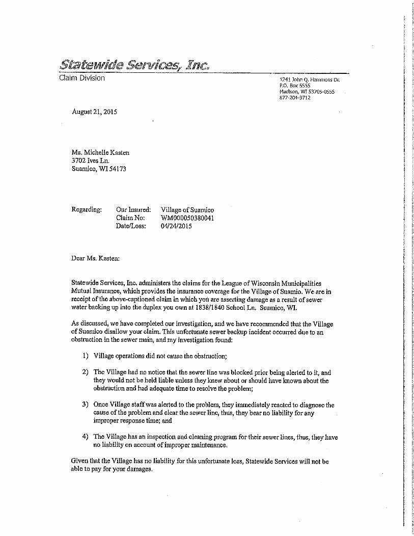
I was notified by DPW and UTILITY DEPT STAFF on Monday Apri127 2015 that thisincident had happened on Apri124 2015 I spoke to Statewide Services thirdpartyadministrator for the League ofWisconsin Municipalities Mutual Insurance Company forthe Village of Suamico on Monday and submitted a claim the same day A claims
specialist was assigned and the process of investigating the claim began
Staffwas notified on August 21 2015 that Statewide Services investigation revealed thatthe Village was not negligent for this incident Therefore they are recommending thatthe Village disallow this claim pursuant to the Wisconsin Statute for disallowance ofclaim 89380lg
This is the outcome of the investigation and recommendation from Statewide Insurance
This loss occurred on account ofaclog in the sewer main line however Villageoperations did not cause the clog Village staff had no prior notice that the clog existed inorder to take ameasure to prevent damage and the Village would not be liable unless
they know or should have known about the clog and had adequate time to resolve the
problem Finally onceVillage staff was alerted to the problem they reacted immediatelyto diagnose the problem and jet the sewer line clear thus the Village is not liable for anyinappropriate response time Given that the Village is not liable for the clog in the sewer
main and given Village staff responded timely once given notice ofit the insurance
company recommends the claims be disallowed
Recommended motion
To deny Claim WM000050380041Claimants Michelle Kasten
David TheekeDustin MarquardtAFNI Insurance on Behalf of Dustin Marquardt
Duplex at 1838 and 1840 School Lane Suamico WI 54313
a
Claim Division 1241 John Q Hammons Dr
POBox 5555
Madison WI 537050555
8772049712
August 21 2015
Ms Michelle Kasten3702 Ives Ln
Suamico WI 54173
Regarding Our Insured Village ofSuamico
C1aimNo WM000050380041
DateLoss 04242015
Dear Ms Kasten
Statewide Services Inc administers the claims for the League ofWisconsin MunicipalitiesMutual Insurance which provides the insurance coverage for the Village oSuamio We are in
receipt oftheabovecaptioned claim in which you are asserting damage as a result ofsewer
waterbacking up into the duplex you own at 18381840 School Ln Suamico WI
As discussed we have completed our investigation and we have recommended that theVillageof Suamico disallow your claim This unfortunate sewer backup incident occurred due to an
obstruction in the sewer main and my investigation found
1 Village operations did not cause the obstruction
2 The Village had no notice that the sewer line was blocked prior being alerted to it and
they would not be held liable unless they knew about or shouldhave known about theobstruction and had adequate time to resolve theproblem
3 OnceVillage staff was alerted to the problem they immediately reacted to diagnose thecause ofthe problem and clear the sewer line thus they bear no liability for anyimproper response time and
4 The Village has an inspection andcleaning program for their sewer lines thus they haveno liability onaccount ofimproper maintenance
Given that the Village has no liability for this unfortunate loss Statewide Services will not beable to pay for your damages
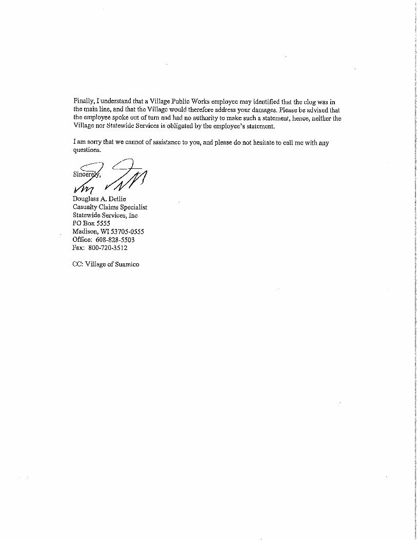
Finally Iunderstand that a Village Public Works employee may identified that the clog was inthe main line and that the Village would therefore address your damages Please be advised thatthe employee spoke out of turn and had no authority to make such a statement hence neither the
Village nor Statewide Services is obligated by the employeesstatement
Iamsong that we cannot of assistance to you and please do not hesitate to call me with any
questions
Sincer
Douglass A Detlie
Casualty Claims SpecialistStatewide Services Inc
PO Box 5555
Madison WI 537050555Office 608285503
Fax 8007203512
CC Village ofSuamico

VC4GI C
DATE September 8 2015
TO Village Board
FROM Dan brewerySUBJECT Land Acquisition St Pats Bridge
General InformationThe Village of Suamico will need topurchase four pieces of land due to the widening of
the St Pats Bridge and the guard rail on both north and south ends ofthe new bridgedeck John Kropp from SMI has drafted all legal documentation for the acquisition of
each parcel and his appraisal contractor has evaluated each parcel and given a mean value
in respect to other alike properties that have sold within the Village of Suamico in the
past five years
Suested Motion
To approve resolution 15010 A Resolution Requesting the Land Acquisition of the Four
Quadrants East and West of the St Pats Bridge

RESOLUTION 15010
A resolution requesting the land acquisition of the four quadrants east and west of
the St Pats Bridge
The Board ofTrustees ofthe Village of Suamico does resolve as follows
WHEREAS The Wisconsin Department of Transportation requires a resolution to
purchase four quadrants ofland east and west of the St Pats Bridge and
WHEREAS The DOTdesign of the bridge requiring guardrail has created a need for
right of way acquisition the overall expansion of the bridge deck guardrail being added and
having safe 3 to 1 side slopes has caused aneed for additional right of way for the project and
WHEREAS SMI has drafted all legal documentation for the acquisition of each parcel of
land needed for the project and his appraisal contractor has evaluated each parcel and given a
mean value with respect to other alike properties that have sold within the Village of Suamico in
the last 5 years and
NOW THEREFORE BE IT RESOLVED that the Village of Suamico Village Board
hereby requests the right of way be purchased for the construction of the St Pats Bridge to
accommodate theDOTplans
Passed by the Village Board of Suamico this 8th day ofAugust 2015
Patricia GuaraJelen Village President
AttestBonnie Swan Village Clerk
Vote AyeNayAbstain
Absent
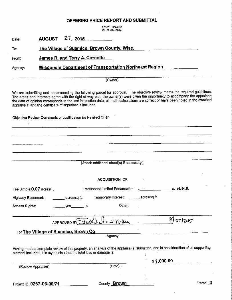
OFFERING PRICE REPORT AND SUBMITTAL
RE2001 LPA897Ch 32 Wis Stets
Date AUGUST Z7 2015
To The Village of Suamico Brown County Wisc
From James R and Terry A Cornette
Agency Wisconsin Department of Transportation Northeast Region
Owner
We are submitting and recommending the following parcel for approval The objective review meets the required guidelinesThe areas and interests agree with the right of way plat the ownerswere given the opportunity to accompany the appraiserthe date of opinion corresponds to the last inspection date ali math calculaons are correct or have been noted in the attached
appraisals and the certificate of appraiser is included
Objective Review Comments or Justification for Revised Offer
Attach additional sheetsifnecessary
ACQUISITION OF
Fee Simpie007 acres Permanent LimitedEasemert
Highway Easement acressqft Temporary Interest acressqft
Access Rights yes no Other
acressqft
APPROVEDBY V A 12I1t
For The Village of Suamico Brown Co
Agency
Having made a complete review of this property an analysis of the appraisalssubmitted and inconsideration of all supportingmaterial included it is my opinion that the total loss or damage is
Review Appraiser Dafe100000
Project ID 92670300171 County Brown Parcel 3
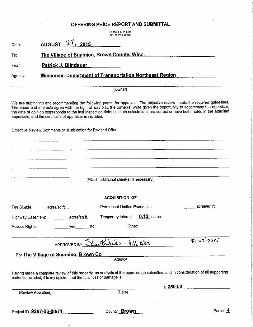
OFFERING PRICE REPORT AND SUBMITTAL
RE2001 LPA897Ch 32 WsStats
Date
To
From
Agency
AUGUST 2 2015
The Village of Suamico Brown County Wisc
Patrick J Blindauer
Wisconsin Department ofTransportation Northeast Region
Owner
We are submitting and recommending the following parcel for approval The objective review meets the required guidelinesThe areas and interests agree with the right of way plat the ownerswere given the opportunity to accompany the appraiserthe date of opinion corresponds to the last inspection date ail math calculations are correct or have been noted in the attached
appraisals and the certificate of appraiser is included
Objective Review Comments or Justification for Revised Offer
Attach additional sheetsif necessary
ACQUISITION OF
Fee Simple acressqft Permanent Limited Easement acressqft
Highway Easement acressqft Temporary Interest 012 acres
Access Rights yes no Other
n n 2l2J1APPROVEb BY O itrn
For The Village ofSuamico Brown CoAgency
Having made a complete review of this property an analysis of the appraisalssubmitted and inconsideration of ail supportingmaterial included it is my opinion that the total loss or damage is
25000Review Appraiser Date
Project ID 9267030071 County Brown Parcel 4
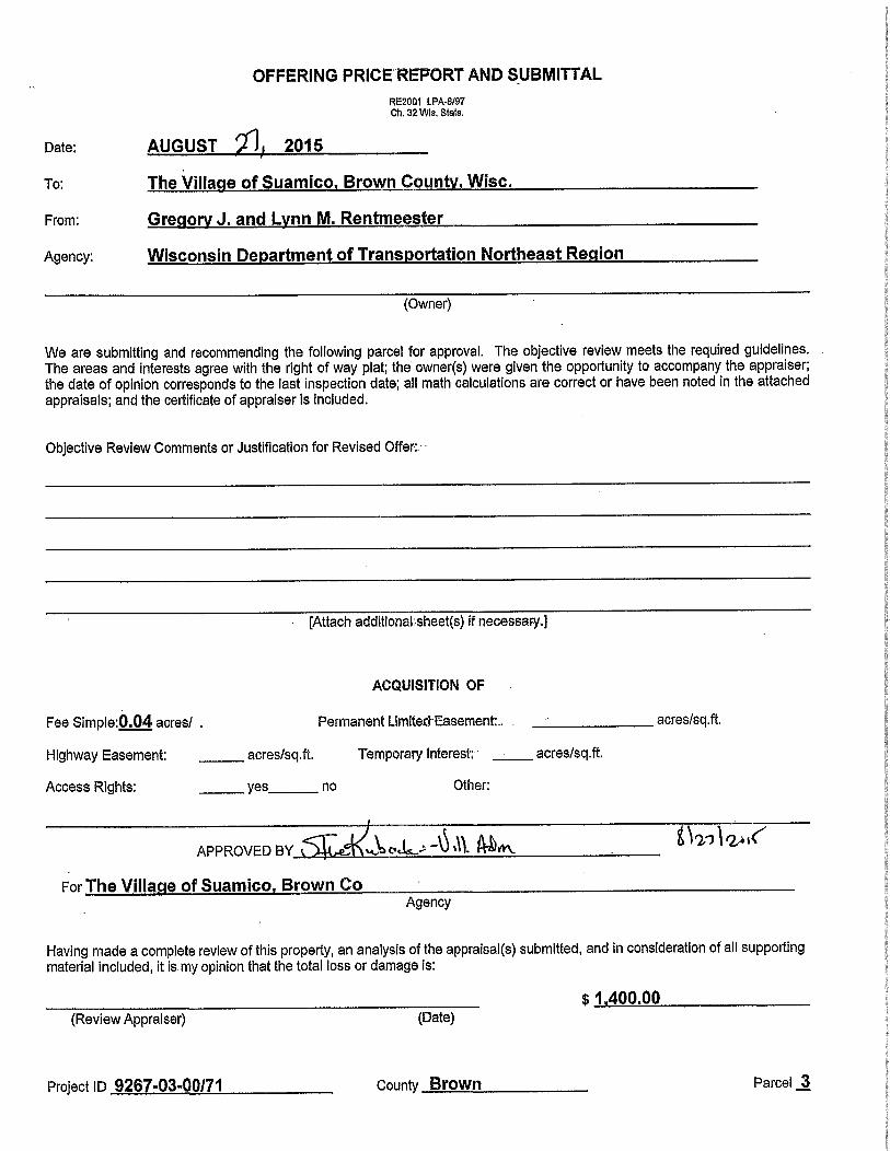
OFFERING PRICER ORT AND SUBMITTAL
RE2001 LPA897Ch 32 Wis Slats
Date
To
From
Agency
AUGUST 2015
The Village of Suamico Brown County Wisc
Gregory J and Lynn M Rentmeester
Wisconsin Department of Transportation Northeast Region
Owner
We are submitting and recommending the following parcel for approval The objective review meets the required guidelinesThe areas and interests agree with the right of way plat the ownerswere given the opportunity to accompany the appraiserthe date of opinion corresponds to the last inspection date al math calculations are correct or have been noted in the attached
appraisals and the certificate of appraiser is included
Objective Review Comments or Justification for Revised Offer
Attach additionalsheetsif necessary
ACQUISITION OF
Fee Simple004 acres Permanent Limited Easement
Highway Easement acressqft Temporary Interest acressqft
Access Rights yes no Other
APPROVED BY
acressqft
11 Z lt
For The Village of Suamico Brown Co
Agency
Having made a complete review of this property an analysis of the appraisalssubmitted and in consideration of all supportingmaterial included it is my opinion that the total loss or damage is
Review Appraiser Date140000
Project ID 9267030071 County Brown Parcel 3
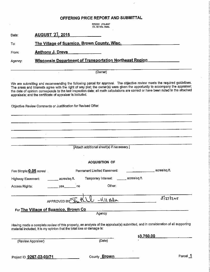
OFFERING PRICE REPORT AND SUBMITTAL
RE2001 LPA8197Ch 32 Wfs Stats
Date AUGUST 2015
To The Village of Suamico Brown County Wisc
From AnthonYJ Drevs
Agency Wisconsin Department of Transportation Northeast Region
Owner
We are submitting and recommending the following parcel for approval The objective review meets the required guidelinesThe areas and interests agree with the right of way plat the ownerswere given the opportunity to accompany the appraiserthe date of opinion corresponds to the last inspection date all math calculations are correct or have been noted in the attached
appraisals and the certificate of appraiser is included
Objective Review Comments or Justification for Revised Offer
Attach additional sheetsif necessary
ACQUISITION OF
Fee Simpie005 acres Permanent Limited Easement
Highway Easement acressqft Temporary Interest
Access Rights yes no Other
APPROVED
acressqft
acressqft
x11A9
For The Village of Suamico Brown Co
Agency
Having made a complete review of this property an analysis of the appraisalssubmitted and inconsideration of all supportingmaterial included it is my opinion that the total loss or damage is
X375000Review Appraiser Date
Project ID 9267030071 County Brown Parcel 1

SCHEDULE OF LANDS AND INTERESTS REQUIRE ONLYRANDNARESSUBJECTOTO CHANGEFPRIORETOURHESESTRANSFER OF LAND INTERESTS TO THE VILLAGE
TOTAL R W ACRES TOTAL ACRES 7LEPARCELN0
OWNERSHIPINTERESTREQUIRED ACRES NEW EXISTING TOTAL REMAINING ACRES
1 ANTHONY J DREVS FEE 150 005 005 145
2 JAMES R TERRY A CORNETTE FEE 973 007 007 966
3 GREGORY J LYNN M RENTMEESTER FEE 1644 004 004 1640
4 PATRICK J BLINDAUER TLE 012
50 ATT DISTRIBUTION RELEASE OF RIGHTS
51 WISCONSIN PUBLIC SERVICE CORP RELEASE OF RIGHTS
52 TIME WARNER ENTERTAINMENT CO RELEASE OF RIGHTS
V I L L A G EUTILITY EASEMENT
BLDG PLAT OF WHIPPOORWILL MEADVOL 1 PLATS PAGE 234
050 DOC 2238147
30
o b0
o 51 NQ O m
PK NAIL EXISTING RW OHY608247636 SLOPEX80187661 INTERCEPTS
ro TNI
304 00z
pF 303
301 IV J CONSIN PUBLIC SER
fOVERHEAD ELECTRIC
V PL
EXISTINGRW
I I lo o oioti L o0 0O0 1 O
M a INTERCEPTS N o iO P Ot
oo No N
Il NNc
NL mm U1 I
BEGIN RELOCATION ORDER m o Osra qoY slooo3s12 GREGORY J LYNN M RENTMEESTERX 80178329LOCATED 87777 SOUTH AND 321 EAST OF THE NORTHEASTCORNER OF SECTION 20 T 25 N R 20 E
CONVENTIONAL SYMBOLS
FOUND IRON PIPEiPIN TEMPORARY LIMITED1 UNLESS NOTED EASEMENT
6Er
RiW MONUMENT lSET PERMANENT LIMITED r
RiW STANDARD ISET EASEMENT
SIGN SIGNRiW BOUNDARY POINT flHB20
SECTION CORNER MONUMENT 0PARCEL NUMBER o
SECTION CORNER SYMBOL UTILITY PARCEL NUMBER
SIGN NUMBERzi
FEE HATCH VARIES VJdOFF PREMISE
BUILDING d
SECTION LINE
OUARTER LINE
SIXTEENTH LINE
1NEW REFERENCE LINE
NEW RiW LINE
EXISTING RiW LINE
PROPERTY LINEPL
LOT TIE
CORPORATE LIMITS iiiINAMEV i i
TEMPORARY LIMITED EASEMENT
FENCE xxx
SLOPE INTERCEPTS
PERMANENT LIMITED EASEMENT L J
NO ACCESS
BY STATUTORY AUTHORITY
NO ACCESSIBY PREVIOUS ACOUISITIONiCONTROU
NO ACCESS iBY ACQUISITION I I I I I 1 1 1 1 1
FILE NAMEVPROJECTSC3DGB45037800RW92670300RWPLDWG
APPRAISAL PLAT DATE 7072015
S o ar7
ANTHONY J DREVSm
Io0 m
r
p
do o
m cLOT 7
m
PLAT DF WHIPPOORWILL MEADOWSVOL 1 PLATS PAGE 234
Doc 2238147 1
OH
N
LP
900
M
ST PATS DRIVE 313
VICES CORPr
z
SCALE FEET
PARCEL 1 2 FEE
COURSE BEARING DISTANCE
300302 SOD 16 23E 36777
302303 500 16 23E 51000
303304 S89 32 45W 097
304305 S89 32 45W 3403
305306 N17 26 43W BBBB
306307 N21 20 50E 5385
307308 N00 2T ISW 8180
308309 N04 38 S2W 6837
309310 N00 27 15W 10000
310all N06 12 O6E 12585
311312 N89 32 45E 3041
312302 NB9 32 45E 259
OJAMES R TERRY A
CORNETTE
PARCEL 3 FEE
COURSE BEARING DISTANCE
300313 S00 16 23E 65777
313314 N69 32 45E 3300
314315 509 06 S3E 3540
315316 500 27 15E 7500
3163R 531 25 OSE 2915
317318 513 26 26W 6756
316303 589 32 45W 3300
303313 NDD 16 23W 22000
SLOPE
N
oZrv mromO
PARCEL 4 TLE
COURSE BEARING DISTANCE
300302 500 16 23E 36717
3027319 N89 32 45E 3300
73197320 N89 32 45E 1441
73207321 S00 2T 5E 7500
73217322 N89 32 45E 3000
73227323 SOD 27 15E 7500
73237324 589 32 45W 3000
73247325 S00 27 15E 5000
73257326 589 32 45W 1505
73267319 N00 I6 23W 20000
iuN
RL N002715W
r F
fl00 1200
312
I
SECTION LINE S001623E263397 300301
SLOPE IINTERCEPTS
PLT
1i
7325 iY
O 7324
PATRICK J BLINDAUER
TLE
SUAMICOD zs 5o STA 1250
Y 610513792X 80174285LOCATED 36779 SOUTH AND 084 WEST OF THE
NOTES NORTHEAST CORNER OF SECTION 20 T 25 N R 2D ECONVENTIONAL UTILITY sYMao15
WATER W SANITARY SEWER SRN POSITIONS SHOWN ON THIS PLAT ARE WISCONSIN COUNTY COORDINATES BROWN COUNTY ZONEGAS G STORM SEWER SS NADa3U99ll IN US SURVEY FEET VALUES ARE GRID COORDINATES GRID BEARINGS AND GRIDTELEPHONE T DISTANCES GRID DISTANCES MAY BE USED AS GROUND DISTANCESOVERHEAD OH
COMPENSABLE COMPENSABLE
TRANSMISSION LINES POWER POLE o ALL NEW RIGHTOFWAY MONUMENTS WILL BE TYPE 2 iTYPICALLY 34 X 24 REBARSI UNLESSELECTRIC E TELEPHONE POLE
AND WILL DE PLACED PRIOR TO THE COMPLETION OF THE PROJECTOTHERWISE NOTEDCABLE TELEVISION TV TELEPHONE PEDESTAL tt
FIBER OPTIC FO ELECTRIC TOWER ALL RIGHTOFWAY LINES DEPICTED IN THE NONACQUISITION AREAS ARE INTENDED TOREESTABLISH EXISTING RIGHTOFWAY LINES AS DETERMINED FROM PREVIOUS PROJECTS OTHERRECORDED DOCUMENTS OR FROM CENTERLINE Of EXISTING PAVEMENTS
CONVENTIONAL ABBREVIATIONSRIGHTOFWAY BOUNDARIES ARE DEFINED WITH COURSES OF THE PERIMETER OF THE HIGHWAY LANDS
ACCESS POINTi AP REFERENCE LINE RiL REFERENCED TO THE US PUBLIC LAND SURVEY SYSTEM OR OTHER SURVEYS OF PUBLIC RECORDDRIVEWAY CONNECTION RELEASE OF RIGHTS ROR
ACCESS RIGHTS AR REMAINING REM DIMENSIONING FOR THE NEW RIGHTOFWAY IS MEASURED ALONG AND PERPENDICULAR TO THEACRES AC RIGHTOFWAY RiW NEW REFERENCE LINESAND OTHERS ETALSECTION SEC
PARCEL IDENTIFICATION NUMBERS MAY NOT POINT TO ALL AREAS OF ACQUISITION AS NOTED ONCENTERLINE Cif
STATION STATHE SCHEDULE OF LANDS INTERESTS REQUIRED
CERTIFIED SURVEY MAP CSM 7pORARY LIIdITED EASEMENT TLECORNER CoR VOLUME V PROPERTY LINES SHOWN ON THIS PLAT ARE DRAWN FROM DATA DERIVED FROM MAPS ANDDOCUMENT DOC CURVE DATA
DOCUMENTS OF PUBLIC RECORD ANDOR EXISTING OCCUPATIONAL LINES THIS PLAT MAY NOT BE AEASEMENT EASE
LONG CHORD LCH TRUE REPRESENTATION OF EXISTING PROPERTY LINES EXCLUDING RIGHTOFWAY AND SHOULD NOTFIELD ENTRANCE FE
LONG CHORD BEARING LCB gE USED AS A SUBSTITUTE FOR AN ACCURATE FIELD SURVEYLAND CONTRACT LC
MONUMENT MON DEGREE OF CURVE D EXISTING HIGHWAY RIGHTOFWAY SHOWN HEREIN IS BASED ON PLAT OF WHIPOORWILL MEADOWSPAGE P
CENTRAL ANGLE OR DELTA DELTA HIGHWAY CONVEYANCE RECORDED IN VOLUME 89 PAGE 453 AS DOCUMENT NUMBER 517119 ANDPERMANENT LIMITED EASEMENTPLE LENGTH OF CURVE L HIGHWAY CONVEYANCE RECORDED IN VOLUME 69 PAGE 440 AS DOCUMENT NUMBER 517ll6PROPERTY LINE PL
TANGENT TANRECORDED AS 100BUILDING BLDG
SLOPE
PLOT DATE 7072015
N
D3
r
I
i in
1000
m
OF I1
D
r
7326
IE
EXISTING RW 1 14
IIRON PIPE
Y610881580
RW PROJECT NUMBER SHEET TOTAL
92670300 NUMBER SHEET9
FEDERAL PROJECT NUMBER 401 I
PLAT OF RIGHTOFWAY REQUIRED FOR
V SUAMICO ST PATS RDSUAMICO RIVER BRIDGE9050072
LOC STR BROWN COUNTY
CONSTRUCTION PROJECT NUMBER
92670371
PROJECT LOCATIONTOTAL NET LENGTH Of
CENTERLINE 0097 MILES
LAYOUT
SCALEu MiR19E R20E
ru UI fag 41 4y
1413 c
r
NJ N
o to
F T25N
300
Point Table
Point Y X
300 610881580 80175120
301 608247636 80187667
302 610513813 80176872
303 610003820 80179301
304 610003812 80178329
305 610003542 80144302
306 610068334 80ll7657
307 610138491 80137260
308 610220293 801366ll
309 610288442 80131071
310 610388439 80130278
all b1D513551 80143673
312 610513792 80174285
313 610223814 80178253
314 610224076 80211252
315 6101B9ll9 80216861
316 610114126 80217455
317 610069245 80232653
318 610004081 80212300
7319 610514074 8020987
7320 610514188 80224284
7321 610439191 80224878
7322 610439429 80254877
7323 610364431 80255472
7324 610364193 80225473
7325 610314195 80225869
7326 610314075 80210824
REVISION DATE
CJ
IR
liC I C1S
r ea
zo v
AiAYE
Anst YllnMt iE
Ea 381 a is b
APPROVEDFOR
VILLA E OF S MICO 1
z
GATE SignaturPLAT PREPAREf BYE
SURVEY IS PREPARED AT THE REQUEST
THE VILLAGE OF SUAMICO THE TOPOGRAPHY AND
ITY SURVEY WAS PERFORMED IN AUGUST 2013SURVEY IS ACCURATE TO THE BEST OF MY
WIEDGE AND BELIEF
G gay
sR
JAMES R CAPPEART PLS53044
92670371PLOT BY AYRES ASSOCIATES PLOT NAME
7072015DATE
EST PATS RD
92670300

VILLAGE BOARD MEETING982015
AGENDA ITEM 11ETIAND ITIGATINP OJECT MAC IV
ENGINEERING
MACH IV Engineering has prepared a document complete with attachments that lay out the expectedcosts associated with the planning design construction and maintenance for the creation and
management of a Wetland Mitigation Bank on Village Property working in conjunction with a privateproperty owner Both parties benefit from the design of this WMB the Private Property ownerfrom the
scope of the project and the Village from the buffering perspectives of the location of the adjacentprivate property The costs and related expenditures are prorated as a function of the acres of land
contributed by both parties
A Timetable of the expected benchmarks has been created and is also attached to this document
Please note that this is a conservative timetable and is impacted by the growing seasons when field
work can be conducted ie it is impossible to conduct the environmental studies necessary to validate the
expected success ofthis project during winter conditions
To proceed with this project in a timely manner noting that the wetland delineation work necessary to
proceed must be done yet this year we will need Village Board approval on Tuesday night the 8th of
September or very shortly thereafter
We as a staff believe that this project has a very good chance of being approved by the appropriateregulatory bodies IRT and would recommend that we proceed with the Present and Historical
Conditions Study and Prospectus as the next step in taking this project forward The costs should be
limited to the following
1 Present and Historical Conditions Study 12000
2 Prospectus 22000
3 Monitoring Well Installation 4500
TotaI 38500
The additional estimated costs of Approval Construction and Maintenance are well laid out on the
attached work effort from Mach IV along with the estimated sources of revenue It should be noted
that at the time ofthe signed MBI and 10 Credit Release we would have potential revenue stream of
175530and accumulated expenditures of74115 61 of121500 My worst case scenario has
Village Expenditures including 10 years ofmaintenance at approximately 37911561 of621500and Revenue of1755300 or surplus of1376185 It should be noted that these are estimates and
Mach IV has been conservative in their assumptions and calculations
Based on this additional information we would recommend proceeding forward with Mach IV with the
consulting work defined as the Present and Historical Conditions Study and the Prospectus not to
exceed 38500 and direction to staff to prepare a development agreement with the Private Propertyowner to define expectations cost and revenue allocations future continuing work efforts and all and
any other subjects that need clarification so that all parties are clear on future and current expectations
Mach IV will be present on Tuesday night to briefly present this information and answer any and all
questions that you might have
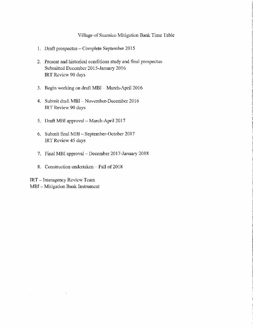
Village of Suamico Mitigation Bank Time Table
1 Draft prospectus Complete September 2015
2 Present and historical conditions study and final prospectusSubmitted December 2015January 2016
IRT Review 90 days
3 Begin working on draft MBIMarchApri12016
4 Submit draft MBI NovemberDecember2016
IRT Review 90 days
5 Draft MBI approvalMarchApri12017
6 Submit final MBISeptemberOctober 2017
IRT Review 45 days
7 Final MBI approval December2017January 2018
8 Construction undertaken Fall of2018
IRT Interagency Review Team
MBI Mitigation Bank Instrument

Estimated CostsRevenue
Costrevenue estimates are an approximation of what the project could cost and potential income from
the project It is important to realize that most costs and the final credit amount released to the
mitigation bank projects are determined upon IRT approval Variations in design engineering and
administrative services will differ depending on project direction
Cost
The following range of costs associated with compensatory wetland mitigation banks are estimates and
should be used as rough calculations to show what this project could cost They are as follows but are
not limited to
Draft Prospectus5000 10000 CompletedPresent and Historical Conditions Study 10000 12000
Prospectus 18000 22000
Archaeological work Minimal 2500Draft MBI 2000040000MBI 2500035000
Cost Through Signed MBI 10 Credit Release 78000121500
Construction 50000100000Seeding and Plantin 100000150000
Bank Construction Planting150000250000
Monitoring and Reporting 500010000per year Typically 10 yearsInvasive Species Control 500015000per year Typically 10 years
Exclusions from the above cost analysis includes but is not limited to Topographic Survey MonitoringWell Installation and Observation and Administration ofWetland Mitigation Bank Credits
The above costs were determined by estimating time spent to complete each phase of the project at
competitive rates and considering possible variations in construction engineering and administrative
services The costs associated from start to finish construction should range from 228000 to 371500
The median cost totals 299750
Annual expenses upon completion of bank construction include monitor and report the Wetland
Mitigation Bank status and invasive species control Typically banks are required to monitor banks for
ten years Over a ten year period approximate costs incurred to monitor and control invasive species in
the bank would be100000250000
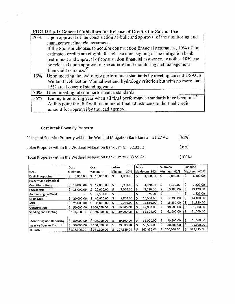
CIUIEGlGetlerat Guideline 1ailelewse of Credits fof Sale or Ilse
2C1 t71onasrwal of thecrtastruction a5huilt and approval afthe mnnitorin acidk
manalenlent financial ssurance
Itthe Sponsor chooses to acdtlire construction nanaial assitrances I Qfo of the
estimated ctedit5 are eligible for release pon signing of the mitigation bank
instrurnntand approval ofcostcucaicr financial assurance Another lflo can
be released upon approval of the asbuilt and monitoring and n1aagementfinancial assurances
1 Srro L1pon iTteeting the hydrology l5erfornxaacestaldards by meeting current USAE
Wetland delineation Manual wetland hydrology crifierion but wit1 omore than
15raxoal coveroisianditg orator
Q Upon rneeti1 interim performancestanduds35a Ending monitaiitg year wlenall final perforaance standards lave bee met
Al this point the IRT gill reconllerdtvial adjistJnents to the final credit
amount for ap roval b the lead a envy
Cost Break Down By Property
Village of Suamico Property within the Wetland Mitigation Bank Limits 5127Ac 61
Jelen Property within the Wetland Mitigation Banl Limits 3232 Ac 39
Total Property within the Wetland Mitigation Bank Limits 8359 Ac 100
Item
Cost
Minimum
Cost
Maximum
lellen
Minimum 39
Jellen
Maximum 39
Suamico
Minimum 61
Suamico
Maximum 61
Draft Prospectus 500000 1000000 195000 390000 305000 610000
Present and Historical
Conditions Study 1000000 1200000 390000 468000 610000 732000
Proppectus 1800000 2200000 702000 858000 1098000 1342000
Archaeological Work 250000 97500 152500
Draft MBI 2000000 4000000 780000 1560000 1220000 2440000
MBI 2500000 3500000 975000 1365000 1525000 2135000
Construction 5000000 10000000 1950000 3900000 3050000 6100000
Seeding and Planting 10000000 15000000 3900000 5850000 6100000 9150000
Monitoring and Reporting 5000000 10000000 1950000 3900000 3050000 6100000
Invasive Species Control 5000000 15000000 1950000 5850000 3050000 9150000TOTALS 32800000 62150000 12792000 24238500 20008000 37911500

Revenue
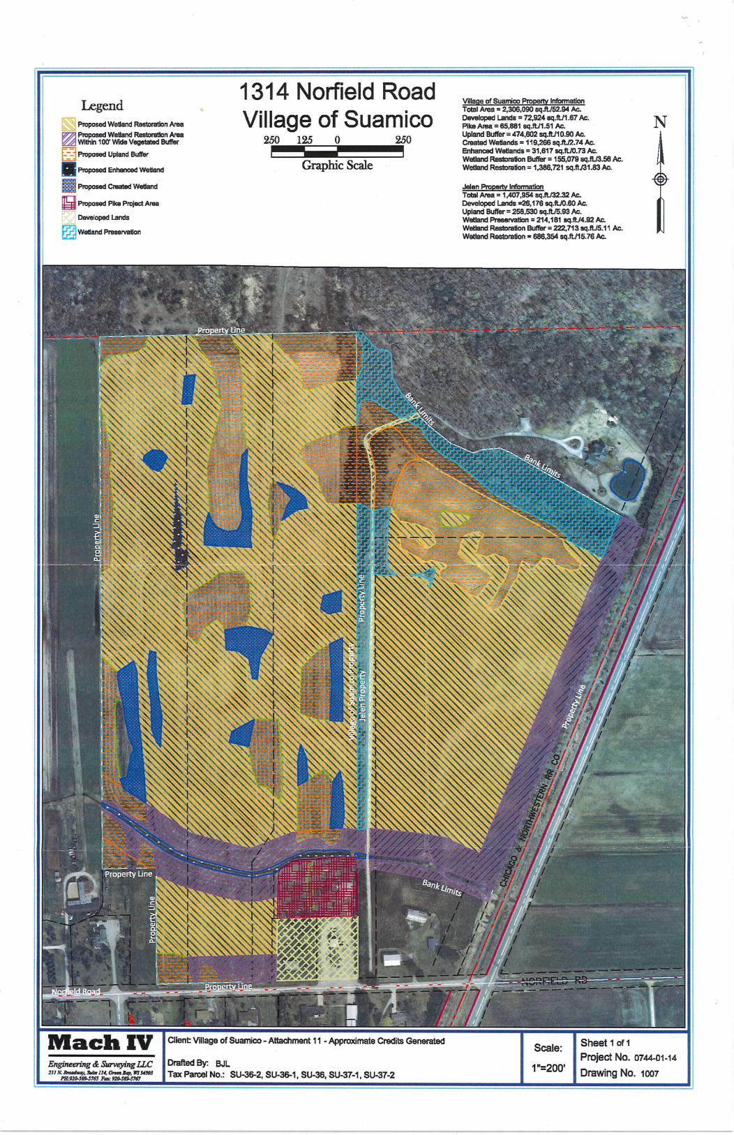
Village ofSuamico Property Information
Total Area 2233166 sq ft 5127Ac
Pike Area 65881 sq ft 151Ac X 05 0755 credits
Upland Buffer 474602 sq ft 1090Ac X025 2725 credits
Created Wetlands 119266 sq ft 274 Ac X 05 137credits
Enhanced Wetlands 31617 sq ft 073 Ac X075 0547 credits
Wetland Restoration Buffer 155079 sq ft 356 Ac X 05 178credits
Wetland Restoration 1386721 sa ft 3183 Ac X 10 3183credits
39007 credits
75 29255 credits
credits X 60000 1755300
Jelen Property Information
Total Area 1407954 sq ft 3232Ac
Driveway 26176 sq ft 060 Ac
Upland Buffer 258530 sq ft 593 Ac X 025 1483 credits
Wetland Enhancement 214181 sq ft 492 Ac X 075 369 credits
Wetland Restoration Buffer 222713 sq ft 511 Ac X 05 2555 credits
Wetland Restoration 686354 sg ft 1576Ac X 10 1576 credits
23488 credits
75 17616 credits
Jelen Property Approximate Total Revenue
Total Project Approximate Revenue 46871 credits X 60000 2812260
i
1314 Norfield RoadIe end Vllape of Suamico Property Information
g Total Area 2306090 sqftJ5294Ac
Village of S ua mi co Developed Lands 72924sqft167Ac TProposed Wetland Restoration Area 1lPike Area65861sqttl151Ac
Proposed Wetland l2estoratlon Ara Upland Buffer 474602sqfL11090Ac t
JWithin 100 Wide Vegetated Buffer 12J JO Crieated Wetlands119266sqft274Ao
i Proposed Upland BufferFlrhanced Wetlands 31617sqttJ073Aa
i Wetland Restoration Buffer 155079sqftJ358Ac
Proposed Enhanced Wetland GTap11C SC Wetland Restoration1386721sqftJ3183Ac
i Proposed Created Wetland Jelert Properly Information
Total Area 1407954sqt13232Ac
Proposed Pike ProjectArea Developed Lands2fi176sqftJ060Ac
Upland Buffer 258530sqtU593AcDeveloped Lands Wetland Preservation 214181 sqft1492Ac
r Wetland Restoration Buffer 222713sq11J511Acr Wetland Preservatlon
Wetland Restoration 686354sqfth576Ac
w
iY
c t r wdM x nr At tiirc 4y y y i y
r
y r 4 7 f A t a
h sd1 e2 a j F S t fi w
Jt e1i
1 w f Lt IS iqcl 3
ke4 h c fvy ni
A j t tr ay 7v yb c lIAAykk c y t
4
Jiq Ve
rt
My lna a
f wyn Y tA F lbtIesJJ9JB ri r 4Nr w c
ate y
y rl 44i1 c ipov 2 o da N 4SIs 4I nk Y 1 U
i
n
y e w t4 h tL
T1ryfy 3I t rvr i t4 1i ce 11 JL y
4 pt ry y V4Ai
Y TA ti
o1v14ti y Y AkC r P ww i t yt
t ayo
t ZZyyRR 1Q4 rw y3i4x K2 r r
FxC1ai i4l1atiw aixwE tecFaxowt44wrcw3shYPt bt
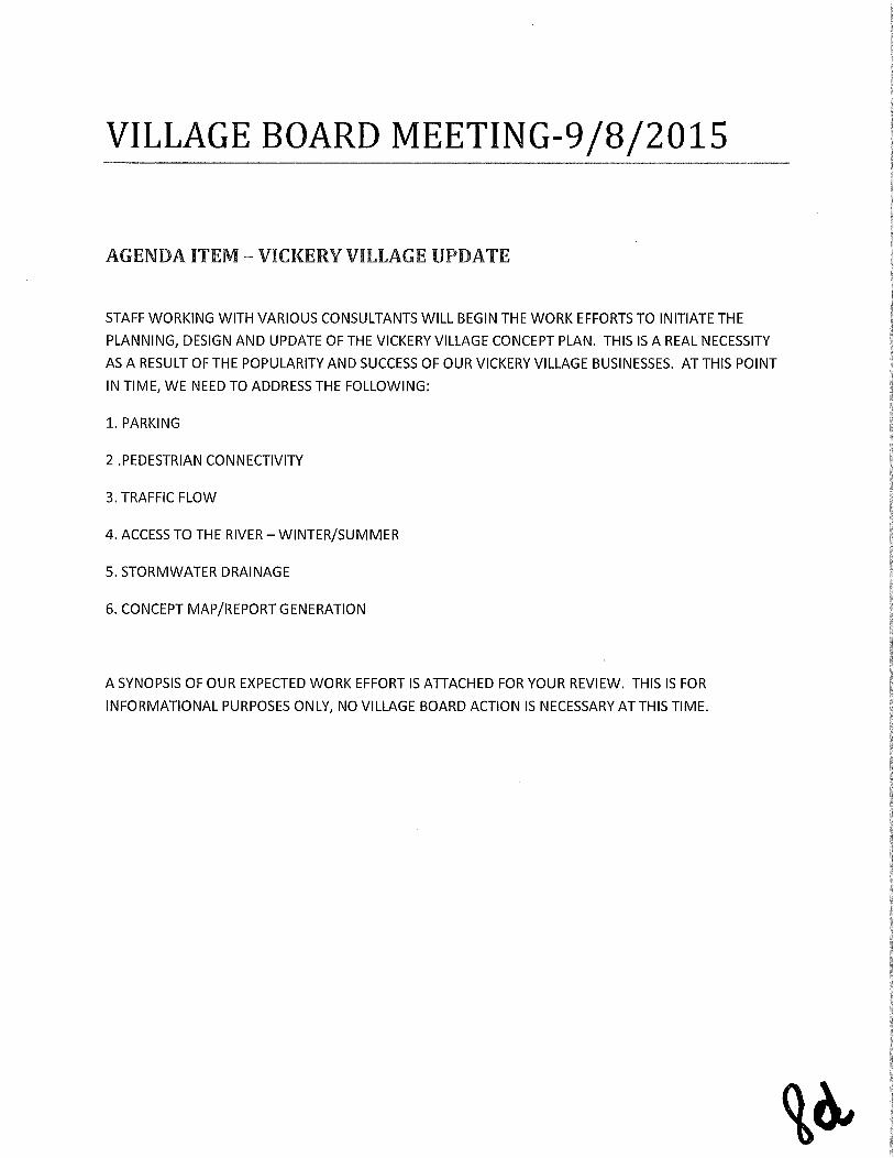
VILLAGE BOARD MEETING982015
ADEN AITE VICIE YIILIAG iJP ATE
STAFF WORKING WITH VARIOUS CONSULTANTS WILL BEGIN THE WORK EFFORTS TO INITIATE THE
PLANNING DESIGN AND UPDATE OF THE VICKERY VILLAGE CONCEPT PLAN THIS IS A REAL NECESSITY
AS A RESULT OF THE POPULARITY AND SUCCESS OF OUR VICKERY VILLAGE BUSINESSES AT THIS POINT
IN TIME WE NEED TO ADDRESS THE FOLLOWING
1 PARKING
2 PEDESTRIAN CONNECTIVITY
3 TRAFFIC FLOW
4 ACCESS TO THE RIVER WINTERSUMMER
5 STORMWATER DRAINAGE
6 CONCEPT MAPREPORT GENERATION
A SYNOPSIS OF OUR EXPECTED WORK EFFORT IS ATTACHED FOR YOUR REVIEW THIS IS FOR
INFORMATIONAL PURPOSES ONLY NO VILLAGE BOARD ACTION IS NECESSARY AT THIS TIME
a
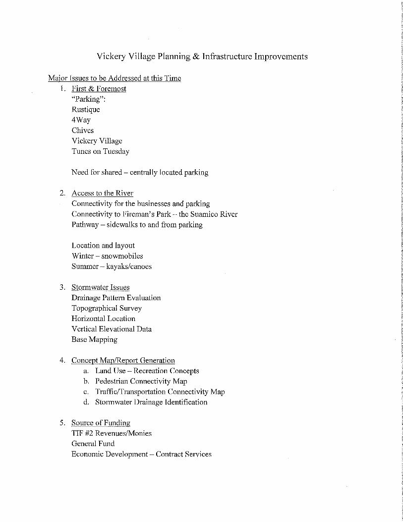
Vickery Village Planning Infrastructure Improvements
Major Issues to be Addressed at this Time
1 First Foremost
ParkingRustique4WayChives
Vickery VillageTunes on Tuesday
Need for shared centrally located parking
2 Access to the River
Connectivity for the businesses and parkingConnectivity to FiremansPark the Suamico River
Pathway sidewalks to and from parking
Location and layoutWinter snowmobiles
Summerkayakscanoes
3 Stormwater Issues
Drainage Pattern Evaluation
Topographical SurveyHorizontal Location
Vertical Elevational Data
Base Mapping
4 Concept MapReport Generation
a Land Use Recreation Conceptsb Pedestrian Connectivity Mapc TrafficTransportation Connectivity Mapd Stormwater Drainage Identification
5 Source of FundingTIF 2 RevenueslMonies
General Fund
Economic Development Contract Services
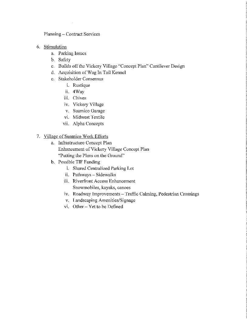
Planning Contract Services
6 Stimulation
a Parking Issues
b Safetyc Builds off the Vickery Village Concept Plan Cantilever Designd Acquisition of Wag In Tail Kennel
e Stakeholder Consensus
i Rustiqueii 4Wayiii Chives
iv Vickery Villagev Suamico Garagevi Midwest Textile
vii Alpha Concepts
7 Village of Suamico Work Efforts
a Infrastructure Concept Plan
Enhancement ofVickery Village Concept Plan
Putting the Plans on the Ground
b Possible TIF Fundingi Shared Centralized Parling Lot
ii Pathways Sidewalks
iii Riverfront Access Enhancement
Snowmobiles kayaks canoes
iv Roadway Improvements Traffic Calming Pedestrian Crossingsv Landscaping AmenitiesSignagevi Other Yet to be Defined
gfVILLAGE BOARD MEETING982015
PLAN BOARD MEETING992015
ilillae A inisratin as pre are a series dcu eats that
represents the changes ificatinsand u dates t at the
C re ensive asterLan LTse C ittee the lan C issin ande illae yard has c unicate t Staffver the C p Plan evie
Prcesso
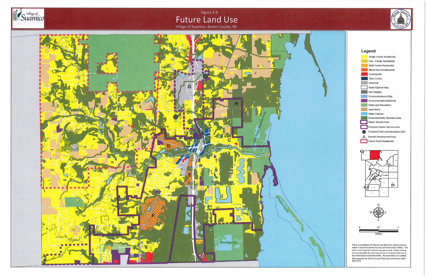
The only point of remaining high concern seems to be the language that addresses lot sizes in the Rural
Residential Development Areas previously identified in the 2005 CMLUP A map that identifies those
areas is attached and defines those areas within the dashed purple lines
The question is lot size 2 Acres 15 Acres minimum average and use ofa PDD in areas impacted byDevelopment Restrictions Environmental such as wetlands ESAsetc or Physical such as property
lines roads etc
WE look forward to your collective input on this issue Thanks for your patience

Village of Suamico 2015 Comprehensive Master Land Use UpdateTo the Village Board and Planning Zoning Commission
Summary
The Village of Suamico working in conjunction with Brown County Planning has reviewedrevised and updated the Village of Suamico Comprehensive Master Land Use Plan under the
guidance of the Comprehensive Master Land Use Committee the Planning ZoningCommission and the Village Board
Numerous committee meetings a Public Informational meeting Public Hearing frequentupdates on the Village Website and discussions at both the Village Board and PlanningZoning Commission have provided direction in the creation of this Comprehensive Master Land
Use Plan
Most significantly the following were accomplished or addressed
1 Definition of the Future CommercialBusiness Land Use Areas
Lineville Vickery Village East Deerfield and Norfield Road
2 Sewer Service Deerfield Areas
3 Mixed Use Defined Areas CommercialResidential
4 Balanced Growth Emphasis SeweredNonsewered
5 Significant discussion on the 2 acre minimum and 200 frontage expectations
It should be noted that not one subdivision in the Rural Residential Areas has been proposedsince 2005 over 10 years ago That has been our bread and butter in increased tax valuation in
the past We are cunning out of Rural Residential development and building sites Our reserve
of sewered lots is also diminishing There was significant discussion on the following1 Rural caracter
2 Commercial development and its relationship to commercial development3 Maintenance ofgood roads
4 General Funds budgetary constraints
Please find attached to this communication all proposed recommended and directed changes that
will be made to the final document Your approval ofPlanning Zoning Commission
Resolution PCR 15001 would be in order noting the changes that have been highlighted and
attached to this document
The Planning Zoning Commission had requested the 2 acre or 15 acre language be attached
along with the current Zoning Code for RR Rural Residential and the PDD language that
currently is in place today Staff also took a crack at developing language that would address a
modification to the 2 acre minimum that was endorsed by the Comprehensive Plan Review
Committee and also discussed by the Planning Zoning Commission at its last meeting There
was some discussion on the 15 acre minimum versus an average 15 minimum and language to
modify that is also included for your review We would recommend approval ofPCR 15001
with the changes as noted and any other modifications that the Planning Zoning Commission
deems necessary
PLANNING ZONING COTTEE
8122015
AGENDA ITEM 2015 COMPREHENSIVE MASTER LA SE PLAN UDATE
RESOLUTION APPROVAL RECOMMENDATION TO THE VILLAGE
BOARD
LADIES AND GENTLEMEN
PLEASE FIND ATTACHED TO THIS COMMUNICATION THE MINUTES FROM THE JULY 8 2015 PLANNING
AND ZONING COMMISSION MEETING WHERE THE COMMISSION GAVE DIRECTION TO VILLAGE STAFF
VIA COMMENTS RELATIVE TO MODIFICATIONS TO THE COMPREHENSIVE MASTER LAND USE PLAN
THE CHANGES HAVE BEEN MADE TO THE PORTIONS OF THE PLAN AND ARE ATTACHED FOR YOUR
REVIEW THESE CHANGES ARE REFLECTED ON THE ATTACHED PAGES OF THE DRAFT PLAN THEY HAVE
BEEN MADE IN A WRITTEN FORMAT AND IF YOU CONCUR AND APPROVE THE RESOLUTION SENDING
THE PLAN TO THE BOARD WITH THESE CHANGES THEY WILL IN FACT BE MADE ON THE FINAL
DOCUMENT
ONE MAJOR OF CONCERN AT THE VILLAGE BOARD LEVEL WAS THE MODIFICATION OF THE MINIMUM
SIZE OF LOTS IN THE RURAL RESIDENTIAL RR ZONING THE PLAN CURRENTLY REFLECTS THAT THE
MINIMUM AVERAGE SIZE SHALL BE 2 ACRES WITH THE EXCEPTION THAT IT MAY BE REDUCED TO 15
ACRES THROUGH THE PLANNED DEVELOPMENT DISTRICT PDD APPROVAL PROCESS
IT APPEARS THAT THE PLANNING COMMISSION SUPPORTS THIS CONCEPT AND NO CHANGE IS
REFLECTED IN THIS DRAFT STAFF AND ADMINISTRATION ALSO RECOMMENDS AND SUPPORTS THIS
CONCEPT
PLEASE REVIEW THESE CHANGES AS DIRECTED AND APPROVE THE RESOLUTION WITH ANY AND ALL
CHANGES THAT YOU MAY FEEL ARE APPROPORIATE AND SEND TO THE VILLAGE BOARD FOR THEIR
ACTION
THANK YOU FOR YOUR PATIENCE THROUGH THIS PROCESS YOUR DILIGENCE AND WORK EFFORT ARE
DULY NOTED AND APPRECIATED
1

PLANNING ZONING COMMISSION RESOLUTION PCR15001
RECOMMENDING ADOPTION OF THE 2015 VILLAGE OF SUAMICO
COMPREHENSIVE PLAN UPDATE
WHEREAS the Village of Suamico Planning Zoning Commission has developed the
2015 Village of Suamico Comprehensive Plan Update to guide and coordinate decisions
and development within the Village in accordance with Chapter 661001 of the
Wisconsin Statutes and
WHEREAS the comprehensive plan was prepared by the Village of Suamico and the
Brown County Planning Commission in accordance with the contract with the Village of
Suamico and
WHEREAS several public meetings were held to obtain public input during the
development of the comprehensive plan during 20132015 and these meetings included
monthly advisory committee meetings Planning Zoning Commission meetings VillageBoard meetings and a public hearing held on July 8 2015
NOW THEREFORE BE IT RESOLVED that the Village of Suamico Planning ZoningCommission recommends to the Suamico Village Board the adoption of the 2015 Villageof Suamico Comprehensive Plan Update
Approved this day of 2015
By
Ayes
Patricia GauraJelen
Village of Suamico Planning Zoning Commission Chair
Nays

SUAMICO PLANNING ZONING COMMISSION MEETINGMINUTES
12781 Velp Avenue
Wednesday July 8 2015 7 PM
1 CALL MEETING TO ORDER
Meeting called to order by Chair GauraJelen at700pm Commission members
present Chair GauraJelenCommissioner Thomson Commissioner
VanRossum Commissioner Ward CommissionerIylagray and CommissionerLnayaZastrow ExcusedCommissionex Yaggie Ej4FStaff
present Steve Dunks Zoning AdministiaoxandMelissaHongisto Deputy Clerlcfig 2
APPROVE AGENDAs aaMotionby Thomsontoapprove thugndaas presented secozclbyWard motion carried
603
PUBLIC HEARINGAbltichearing foxthVillageof SuamicoZJpdatednfibyb Comprehensive
Plan xti Thepublic hearing waspublisecaequiredbyVIStateStatutesi
l Si yvjit2PresidentJelen called the public hearinto orderuyfcg4
hiirli i1c1lS r1ki Petex
Sch dilzBrownlCountyPazx ommissnyoucan approve the plantthat
isin Vof youas riswith nocaarigesnoting fhatyou have Taken intoconsideratioti
thesuggested changesJathave been collected from the public from hzg r 4rumeeti
ngsYoucataletoYconsideratinthosestatements that have been madeo
4those chap es Or afte rviewnthisyou can suggest changesof your andmlg r e r5ti rownand tlienmalcetibs changesasoupass the resolutionIfyou feelsome of ef
thesechanges aretoodraseyoucan suggest these changes be made before youb
assthe resolutionr4 No
oiespokein favororagainst the public hearingFfyThe
followzncomiVtswere madea
Chapter 2fancTUseRevisionofthe Granny Flat Language limiting and providing
significant oversightof its use if it is allowed atall o
Remove this language due to the fact that it becomes subjective and you cantsay that Granny can havea place in the backyard but not allowa brother
inlawtohave two residences Chapter
2 Land Use Use ofthe term Balanced ratherthan2575for
Rural Residential ResidentialSewered Development expectationsorgoalsoAgree with changingit to balanced Chapter
4 Economic Development Addlanguageorsection entitled Tourismwithan emphasis on Marlceting1
Planning
and Zoning Commission Minutes07082015
o Feel that the Comprehensive LandUse Plan isntthe place for marketingIt might be abetter idea to develop a marketing strategy outside ofthe
Comprehensive Use PlanJ Chapter 2 LandUse Modify Mixed Use term to reflect
CommercialResidentialUse Eliminate or minimize use ofthe term
Multifamilyo Fine with this
Chapters 2 S LandUse Housing Remove Conservation by DesignSubdivision language ago Would like to keep this in as an optionu a mandate because it
allows more flexibilityChapter 3 Transportation NarrowSreet language removed Villagewill continue street developmentintleonventionalnannerwith standard
widths ya ysa4Yp ifyhtia
o Remove the lan ua e modfgure312
Chapter 3 Transportation PasseerRail language and references removedo Remove it due to the fact that theryzsnaealpossibilityoftlushappening
in the near fiituray aseChapter 2 LandUseeeconmendatioriQeduce the 2 Acre Minimum Lot
size to 15 Acres withanapprovecl4DD ajrtYrtecific to that actualo Allow this based onadevelopmtplanthatls
parcelraeathan just aflat 2 acressry t
FutueaiiUselYla Figura29kLpansibnoftheMixed Use Land Use
alongtlientirety ofelp AvenufromLinevilleRoad to County B4st 4544 h
o LinevlRoadaChambersHland then from Saputa cheese north
7 hapters 2 adseHousirigAdditionof language that would
setiiirnAreaIevelopmeYPandr Residential Development over20
acresmsize 4T
o RedunciantanguageryrThe Plan Commission already has the right to dor Vica
Chapters 2 5 wand Use Housing Change the language that refers to
Nieighborhoods eluninate neighborhood parks neighborhood commercialuses andotherIariuae that refers to uses that are not found in Suamico s
0
4 ACTION ON PUBLIC HEARING Resolution PCR 15001
Motion by Zastrow to refer this back to staff to revise the document with the
appropriate changes second by Ward motion carried 60
5 CONSENT AGENDA
a Appxove the Minutes ofthe Wednesday June 10 2015 PlanningZoning Commission Meeting
b Building Permit Report June 2015
2
Planning and Zoning Commission Minutes 07082015
Steven Kubacki
To Jelen Patricia E JelenPECcobrownwiusCc Steve Dunks Schleinz PJ Schleinz P1CcobrownwiusBonnie Swan Steven Kubacki
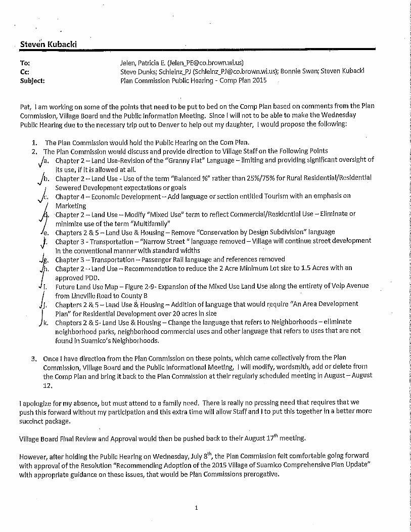
Subject Plan Commission Public Hearing Comp Plan 2015
Pat I am working on some of the points that need to be put to bed on the Comp Plan based on comments from the Plan
Commission Village Board and the Public Information Meeting Since I will not to be able to make the WednesdayPublic Hearing due to the necessary trip out to Denver to help out my daughter I would propose the following
1 The Plan Commission would hold the Public Hearing on the Com Plan
2 The Plan Commission would discuss and provide direction to Village Staff on the Following Points
Ja Chapter 2 Land UseRevision ofthe Granny Flat Language limitingand providing significant oversight of
its use if it is allowed at all
Jb Chapter2Land Use Use of the term Balanced rather than2575 for Rural ResidentialResidentialSewered Development expectations or goalsChapter4EconomicDevelopmentAdd language orsection entitled Tourism with an emphasis on
MarketingChapter 2 Land Use Modify Mixed Use term to reflect CommercialResidential Use Eliminate or
minimize use of the term Multifamilye Chapters 2 5Land Use Housing Remove Conservation by Design Subdivision language
Chapter 3 Transportation Narrow Street language removed Village will continue street developmentin the conventional mannerwith standard widths
Chapter 3 Transportation Passenger Rail language and references removed
Chapter 2 Land Use Recommendation to reduce the 2 Acre Minimum Lot size to 15Acres with an
approved PDD
i Future Land Use Map Figure29Expansion of the Mixed Use Land Use along the entirety ofVelp Avenue
from Lineville Road to County B
j Chapters 2 5 Land Use HousingAddition of language that would require An Area DevelopmentPlan for Residential Development over 20 acres in size
k Chapters 2 5 Land Use Housing Change the language that refers to Neighborhoods eliminate
neighborhood parks neighborhood commercial uses and other language that refers to uses thatare not
found in Suamicos Neighborhoods
3 Once I have direction from the Plan Commission on these points which came collectively from the Plan
Commission Village Board and the Public Informational Meeting I will modify wordsmith add or delete from
the Comp Plan and bring it back to the Plan Commission attheir regularly scheduled meeting in AugustAugust12
I apologize for my absence but must attend to a family need There is really no pressing need that requires that we
push this forward without my participation and this extra time will allow Staff and I to put this together in a better more
succinct package
Village Board Final Review and Approval would then be pushed baci to their August 17th meeting
However after holding the Public Hearing on Wednesday July 8th the Plan Commission felt comfortable going forward
with approval ofthe Resolution Recommending Adoption ofthe 2015 Village ofSuamico Comprehensive Plan Updatewith appropriate guidance on these issues that would be Plan Commissions prerogative
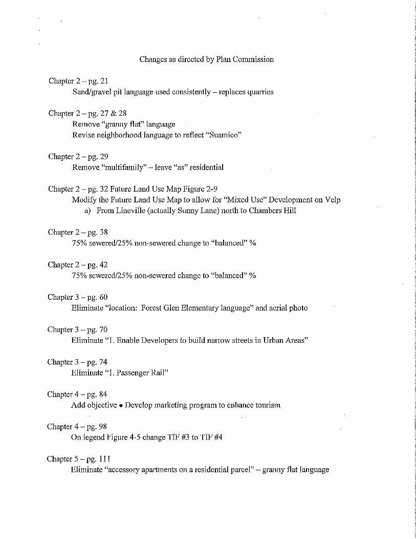
Changes as directed by Plan Commission
Chapter 2 pg 21
Sandgravelpit language used consistently replaces quarries
Chapter 2 pg 27 28
Remove granny flat languageRevise neighborhood language to reflect Suamico
Chapter 2 pg 29
Remove multifamily leave as residential
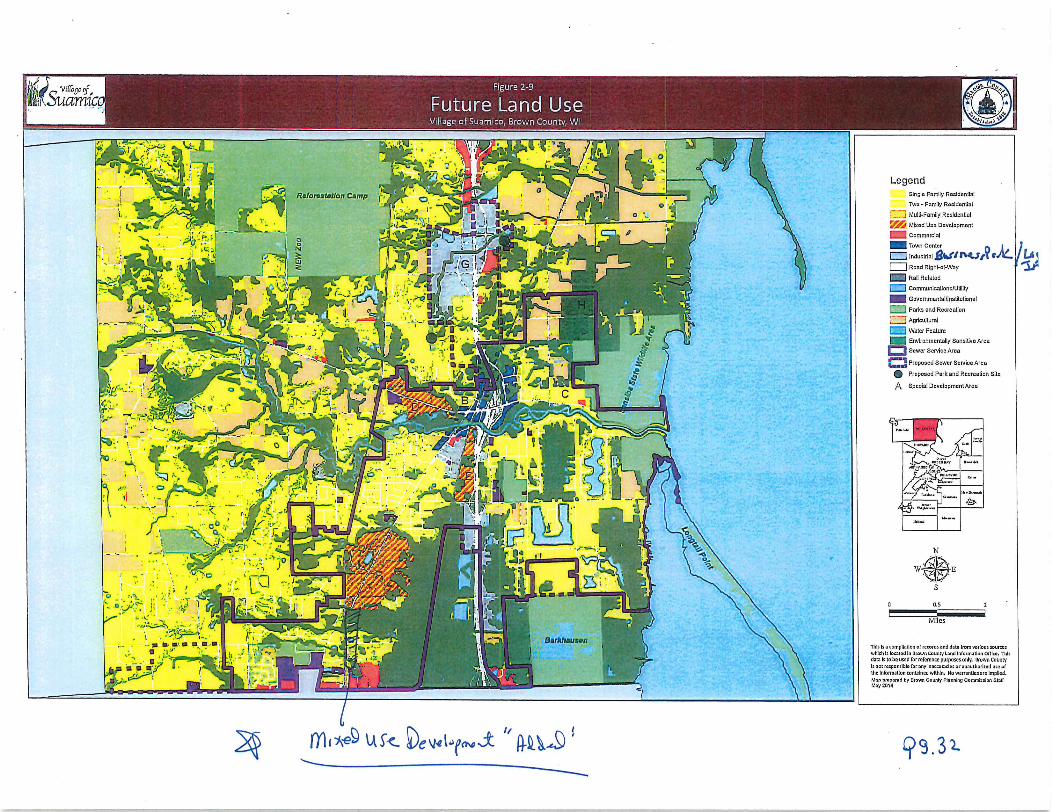
Chapter 2 pg 32 Future Land Use Map Figure 29
Modify the Future Land Use Map to allow for Mixed Use Development on Velpa From Lineville actually Sunny Lane north to Chambers Hill
Chapter 2 pg 38
75sewered25nonsewered change to balanced
Chapter 2 pg 42
75sewered25nnnsewered change to balanced
Chapter 3 pg 60
Eliminate location Forest Glen Elementary language and aerial photo
Chapter 3 pg 70
Eliminate 1 Enable Developers tobuild narrow streets in Urban Areas
Chapter 3 pg 74
EliminatelPassenger Rail
Chapter 4 pg 84
Add objective Develop marketing program to enhance tourism
Chapter 4 pg 98
On legend Figure 45 change TIF 3 to TIF 4
Chapter 5 pg 111
Eliminate accessory apartments on aresidential parcel granny flat language

Chapter 5 pg 112 113
Neighborhood language removed
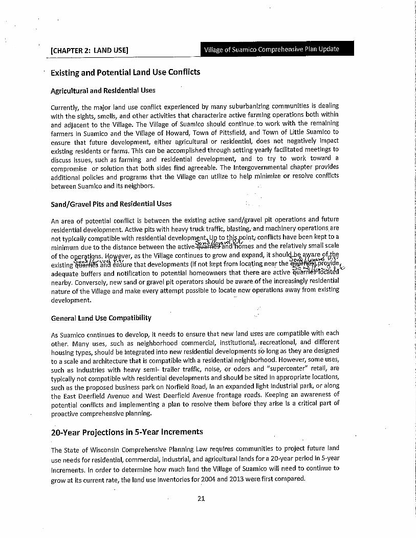
CHAPTER 2 LAND USE
Existing and Potential Land Use Conflicts
Agricultural and Residential Uses
Currently the major land use conflict experienced by many suburbanizing communities is dealingwith the sights smells and other activities that characterize active farming operations both within
and adjacent to the Village The Village of Suamico should continuetowork with the remaining
farmers in Suamico and the Village of Howard Town of Pittsfield and Town of Little Suamico to
ensure that future development either agricultural or residential does not negatively impactexisting residents or farms This can be accomplished through setting yearly facilitated meetings to
discuss issues such as farming and residential development and to try to work toward a
compromise or solution that both sides find agreeable The Intergovernmental chapter providesadditional policies and programs that the Village can utilize to help minimize or resolve conflicts
between Suamico and its neighbors
SandGravel Pits and Residential Uses
An area of potential conflict is between the existing active sandgravel pit operations and future
residential development Active pits with heavytrucltraffic blastingand machinery operationsarenot typically compatible with residential developmentU totjpoint conflicts have been kept to a
minimum due to the distance between the activeand Homes and the relatively small scale
of the o r tons Ho ever as the Village continues to grow and expand it shoulcYeavraeof he
existing an nsure that developments if not kept from locating near the pro idesadequate buffers and notification to potential homeowners that there are active qua ocatcnearby Conversely new sand or gravel pit operators should be awareofthe increasingly residential
nature of the Village and make every attempt possible to locate new operations away from existing
development
General Land Use Compatibility
As Suamico continues to develop it needs to ensure that new land uses are compatible with each
other Many uses such as neighborhood commercial institufionalyecreational and different
housing types should be integrated into new residential developments sa long as they are designedto a scale and architecture that is compatible with a residential neighborhood However some uses
such as industries with heavy semi trailer traffic noise or odors and supercenter retail are
typically not compatible with residential developments and shouldbe sited in appropriate locations
such as the proposed business park on Norfield Road in an expanded light industrial park or alongthe East Deerfield Avenue and West Deerfield Avenue frontage roads Keeping an awareness of
potential conflicts and implementing a plan to resolve them before they arise is a critical part of
proactive comprehensive planning
20Year Projections in5Year Incrernents
The State of Wisconsin Comprehensive Planning Law requires communities to project future land
use needs for residential commercial industrial and agricultural lands fora 20year period in5year
increments In order to determine how much land the Village of Suamico will need to continue to
grow at its current rate the land use inventories for 2004 and 2013 werefirst compared
21
CHAPTER 2 LAND USEj
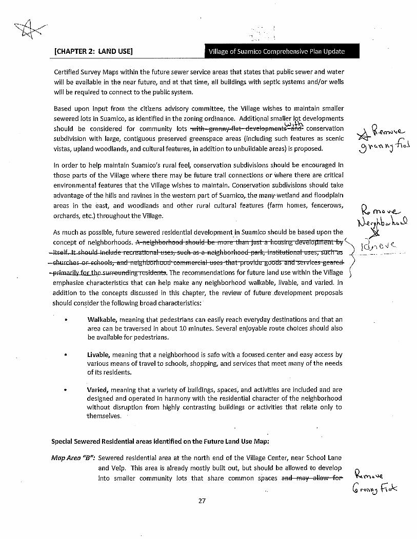
Certified Survey Maps within the future sewer service areas that states thatpublic sewer and water
will be available in the near future and at that time all buildings with septic systems andor wells
will be required to connect to the public system
Based upon input from the citizens advisory committee the Village wishes to maintain smaller
sewered lots in Suamico as identified in the zoning ordinance Additional smaller lot developmentsshould be considered for community lots velsptettdconservation 1eY1J VQ
subdivision with large contiguous preserved greenspace areas including such features as scenic
vistas upland woodlands and cultural features in addition to unbuildable areas is proposed Vrnt1
In order to help maintain Suamicosrural feel conservation subdivisions should be encouraged in
those parts of the Village where there may be future trail connections or where there are critical
environmental features that the Village wishes to maintain Conservation subdivisions should take
advantage of the hills and ravines in the western part of Suamico the manywetland and floodplainareas in the east and woodlands and other rural cultural features farm homes fencerows Qorchards etc throughout the Village
m J
n
X12cb a hnoJ
As much as possible future sewered residential development in Suamico should be based upon the
concept of neighborhoods e o
ssetgbereedrIcinstittti
rrhasrccAASetfidlnEigtTbar sgearedprimaril The recommendations for future land use within the Village
emphasize characteristics that can help make any neighborhood walkable livable and varied In
addition to the concepts discussed in this chapter the review of future development proposalsshould consider the following broad characteristics
Walkable meaning that pedestrians can easily reach everyday destinations and that an
area can be traversed in about 10 minutes Several enjoyable route choices should also
be available for pedestrians
Livable meaning that a neighborhood is safe with a focused center and easy access byvarious means of travel to schools shopping and services that meet many of the needs
of its residents
Varied meaning that a variety of buildings spaces and activities are included and are
designed and operated in harmony with the residential character of the neighborhoodwithout disruption from highly contrasting buildings or activities that relate only to
themselves
Special Sewered Residential areas identified onthe Future Land Use Map
Map AreaeSewered residential area at the north end of the Village Center near School Lane
and Velp This area is already mostly built out but should be allowed to developinto smaller community lots that share common spaces re
Cg rann 1c27

CHAPTER 2 LAND USE Q
autbaNitgresid rarmyflats The use of walkable and
bikeable access routes is necessary for this type of design to function as a walkable
and livable neighborhood while reducing automobile traffic for short trips
Map AreaC Sewered residential area on the north side of Sunset Beach Road Like Area B this
area should also be allowed to develop into smaller community lots that share
common spaces morayllswrfoelau sgrannyfats The use of walkable and bikeable access routes is necessary for this type of
pdesignto function as a walkable and livable neighborhood while reducingautomobile traffic for short trips
2 Sewered Mixed Use Commercial and Residential Areas
Forms of housing within neighborhoods should be mixed so people of different ages and incomes
have opportunities to live in the area of the Village that they choose The recommendation for most
of the future residential development is to encourage variation and a mixing of residential types
Townhouses duplexes and smaller apartment buildings can be strategically interspersed with
singlefamily residences Likewise certain commercial areas can be blended with welldesignedmultifamily developments in upper levels or with adjacent structures that have complimentarywell thought out designs Design standards and the creation of open space and other buffers can
help integrate different residential intensities Large expanses of strictly one residential type should
be avoided while variation in house models should be encouraged to avoid monotonous
streetscapes
Builders and developers are encouraged to use their ingenuity to combine and distribute a variety of
housing types to make an attractive marketable neighborhood with housing for people of various
income levels and preferences Although the current preference for the Village of Suamico is to
maintain its singlefamily residential character there likely will be an increased demand for single
family attached homes multifamily homes and agedcare facilities as the community continues to
age In order to account for this trend at least two housing types should be included in any Sewered
residential project encompassing more than 30 acres As the acreage of the residential projectincreases the number of housing types should also increase This can be achieved in various ways
Some examples include
Sewered singlefamily house lots lots over 1400020000 and 25000 square feet
depending on the area of the Village
Duplexes
Townhousescondominiums
Accessory dwelling units
28
CHAPTER 2 LAND USE
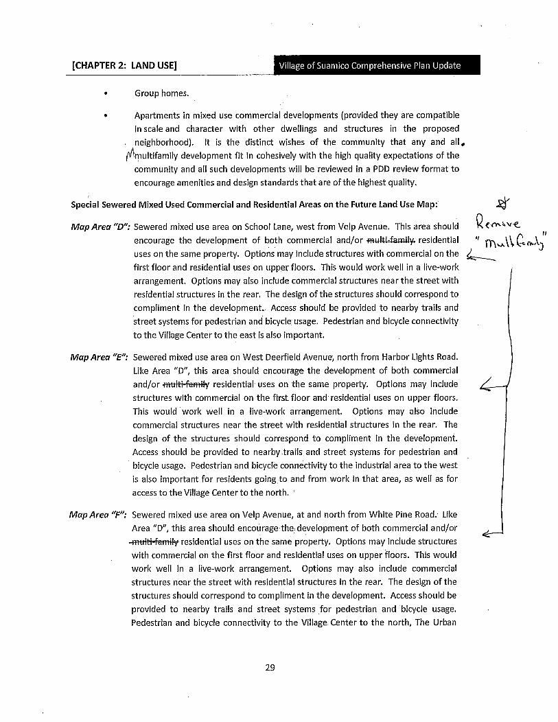
Group homes
Apartments in mixed use commercial developments provided they are compatiblein scale and character with other dwellings and structures in the proposedneighborhood It is the distinct wishes of the community that any and all
multifamily development fit in cohesively with the high quality expectations of the
community and all such developments will be reviewed in a PDD review format to
encourage amenities and design standards that are ofthe highest quality
Special Sewered Mixed Used Commercial and Residential Areas on the Future Land Use Map
Map Area D Sewered mixed use area on School Lane west from Velp Avenue This area should
encourage the development of both commercial andorifamilresidential
uses on the same property Options may include structures with commercial on the
first floor and residential uses on upperfloors This would work well in a livework
arrangement Options may also include commercial structures near the street with
residential structures in the rear The design of the structures should correspond to
compliment in the development Access should be provided to nearby trails and
street systems for pedestrian and bicycle usage Pedestrian and bicycle connectivityto the Village Center to the east is also important
Map AreaE Sewered mixed use area on West Deerfield Avenue north from Harbor Lights Road
LileArea D this area should encourage the development of both commercial
andor trFttay residential uses on the same property Options may include
structures with commercial on the first floor and residential uses on upper floors
This would work well in a livework arrangement Options may also include
commercial structures near the street with residential structures in the rear The
design of the structures should correspond to compliment in the developmentAccess should be provided to nearbytrailsand streefi systems for pedestrian and
bicycle usage Pedestrian and bicycle connectivity to the industrial area to the west
is also important for residents goingtoand from work in that area as well as for
access to the Village Center to the north
Map Area F Sewered mixed use area on Velp Avenue at and north from White Pine Road Lile
Area D this area should encourage the development of both commercial andorratifatilresidential uses on the same property Options may include structures
with commercial on the first floor and residential uses on upper floors This would
work well in a livework arrangement Options may also include commercial
structures near the street with residential structures in the rear The design of the
structures should correspond to compliment in the development Access should be
provided to nearby trails and street systems for pedestrian and bicycle usage
Pedestrian and bicycle connectivity to the Village Center to the north The Urban
Qens1
Y11 n
29
rt x ViIncnF 1Ifr91iif1lLb16tiCQe 1tOfrC G1ri
LG 1
Yl x9 St ev Q
o
O
O
Q
1
LegendSingle Family Resldenllal
Twa FamilyRcaidonlfal
MultiFamilyResldenUal
9Mixad fleeDevelopment
Commcrclal
Town Ccntcr r1Q Industrial81Trt7O Road RightafWay
Rali Related
QCommunicagoncUUlity
GovernmentalInsGtulional
IParke and Recreation
Agricultural
0Water Feature
Environmentally SonsNvo Arca
Q Sewer Scrvicc Area
dpropoxdSewer Scrvicc Aren
S Prapoeod Park and Recreation Site
q Special DcvelopmenlAraa
N
WLS
o as
Miles
This I a compllnllonarccordand dots Irom varlousourceswhich Is locatatl In Drawncounty Land Information Clllco Thlc
dataL to be used ror refcrenre purposes only OrownCountyIs notresponsible far any Inoccumcle or unaulharlxed usear
thelnormatlon mntalned wlthln No warranlle arelmplledMop pioparod Ey BrownCounty Ponninp CommiolonSIOR
May 2014
93Z
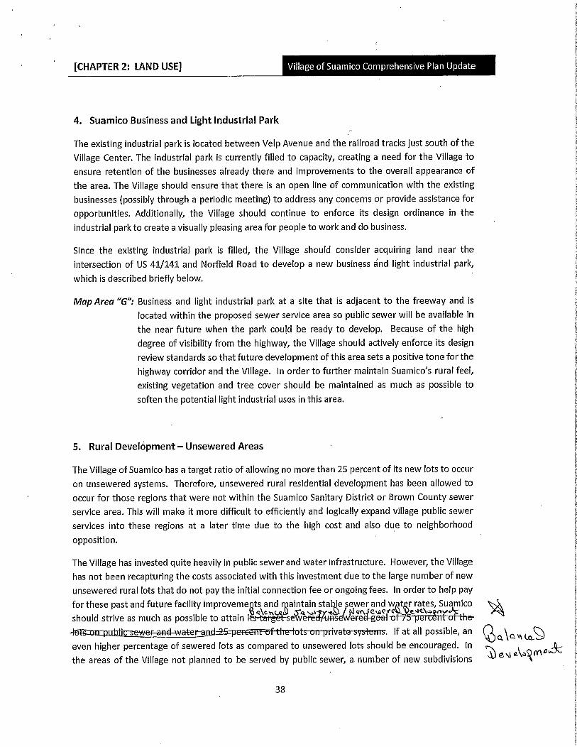
CHAPTER 2 LAND USE
4 Suamico Business and Light Industrial Park
The existing industrial park is located between Velp Avenue and the railroad tracks just south of the
Village Center The industrial park is currently filled to capacity creating a need for the Village to
ensure retention of the businesses already there and improvements to the overall appearance of
the area The Village should ensure that there is an open line of communication with the existing
businesses possibly through a periodic meeting to address any concerns or provide assistance for
opportunities Additionally the Village should continue to enforce its design ordinance in the
industrial park to create a visually pleasing area for people to work and do business
Since the existing industrial park is filled the Village should consider acquiring land near the
intersection of US 41141 and Norfieid Road to develop a new business and light industrial parkwhich is described briefly below
Map AreaG Business and light industrial park at a site that is adjacent to the freeway and is
located within the proposed sewer service area so public sewer will be available in
the near future when the park could be ready to develop Because of the high
degree of visibility from the highway the Village should actively enforce its designreview standards so thatfuture development of this area sets a positive tone for the
highway corridor and the Village In order to further maintain Suamicosrural feel
existing vegetation and tree cover should be maintained as much as possible to
soften the potential light industrial uses in this area
5 Rural Development Unsewered Areas
The Village of Suamico has a target ratio of allowing no more than 25 percent of its new lots to occur
on unsewered systems Therefore unsewered rural residential development has been allowed to
occur for those regions that were not within the Suamico Sanitary District or Brown County sewer
service area This will make it more difficult to efficiently and logically expand village public sewer
services into these regions at a later time due to the high cost and also due to neighborhood
opposition
The Village has invested quite heavily in public sewer and water infrastructure However the Villagehas not been recapturing the costs associated with this investment due to the large number of new
unsewered rural lots that do not pay the initial connection fee or ongoing fees In order to help pay
for these past and future facility improveme is and aintain stable sewer and w t r rates Suamico4ct a1 Q luh Cwere Cde nv
should strive as much as possible to attain redasereBealof h
icseweandovate datesyserrs If at all possible an Qeven higher percentage of sewered lots as compared to unsewered lots should be encouraged In
the areas of the Village not planned to be served by public sewer a number of new subdivisions evQJm38
CHAPTER 2 LAND USE
River
Pursue grants to aid in the acquisition of lands along the bayshore and other critical natural
areas
GnCQStrive to maintain a5p new ratio of sewered lots to unsewered lots at a
minimum in order to better capture the revenue and efficiencies associated with lots on publicsewer and water
Utilize the existing and proposed sewer service areas to indicate where and when public services
should be expanded
Suamico should not permit new unsewered development within the existing sewer service areas
and should strongly discourage if in proposed sewer service areas because public sewer and
water will be extended to these areas in thevery near future
The Village should carefully review and consider the future impact any proposed unsewered
development may have on the costeffective and IogicaP expansion of public sewer and water to
the north and west
Within sewer service areas or areas immediately adjacent to sewer service areas if unsewered
development is permitted lots homes andseptic fields should be positioned in a way that
public sewer and water may becosteffectively connected in the future
Within sewer service areas or areas immediately adjacent to sewer service areas for unsewered
developments a note should be placed on the subdivision plat or Certified Survey Map statingthat public sewer and water may be available in the near future at which time all structures
served by a private sewer system or well will be required to connect to the public system
42

CHAPTER 3 TRANSPORTATION
a
Il
K d
1
Location Bay Harbor Elementary P yJ y vz
Recommendation Retrofit pedestrianfacilities on streets such as Family Dr 4
i
ti
J r
i
Location Bay Harbor Elementary k
Recommendation Work with WisDOT Y r
to include bicycle and pedestrian 6 F T
facilities when the Harbor Lights Rd zoverpass is reconstructed i
1si rr i
r r
Tr
yMa Sx
Location F rest Glen Elem ary jir
O QI
itir i1 y
Recommends on C time to ii
implement plan r constructing new Msidewalks in a to tions shown to the i
right 52yaptEi3rfNote ly facilities in t Village of
T tq
Su ico were included
60

CHAPTER 3 TRANSPORTATION
llay
accessible to a variety of transportation system users areeasy for public works departments to
plow and maintain and enable communities to create efficient sewer and water systems that do
not have several stubs situations will arise where streets cannot be connected due to physical or
environmental constraints If constraints prohibit street connections the Village should allow the
development of culdesacs near the constraints However to maximize connectivity in these
neighborhoods the culdesacs should have public rightsofway or easements reserved at the
bulbs to enable pedestrians and bicyclists to travel easily throughout the area
1Enable Developers to Build Narw Streets in Urban Areas
The Village currently red fires urban streets to be etween 28 and 32 fit wide and rightsofwayto be at least 70 feetwide However this rightofway width isnoften necessary especially in
the Village snelborhoods and it forcesthe Village to mainta a significant amount ofrrd that
could insteadbetaxable property
The subdivision ordinance should be amended to estaGlish rightofway width standards that do
not require the acquisition ofmorerightofhannecessary A sumary of street and righofiay standards that should be consided by tlieVillage isided m Figure 312 T use
standards are based on recommendations in Residential Streets third edition whicwasdeveloped by the Urban Land stitute in conjunction with the Institute of TransrtationEngineers N
rial Association of Homebuilders and Amrican Society of Civil Engineefs
The implnentation oft se standards will enable
accomrrfodate its stye ts sidewalks and terraces
Fiure312 street andRi
Village to reserve only the land it needs to
Standards SummaryvPavement
Rightof idth tOnS ki APStreet Type way curb face Driving tree ng reasar
Width to LarieWid Parking Defined bycurb face Curbs
Collectors 60eet 34 feet 910feet Both sides Yes
Local RioStreets
No parligll
allowefl 40 feet 1 eet 9feet None s No
Parl fig on 1416feet
fideo 4648feed 2224feet travel lane One side Ifneeded
arling on 1012feet
both sides 505 feet 2628feet travel lane Both sides Ifneeded
A11e s 6 feet 12feet
Tlghtofwaywidth includes the widths6f the driving area parkingarea curbsterraces between the sidewalk and street and sidewalks
Define the Parking Areas of Urban Streets
70

CHAPTER 3 TRAIISPORTATION
The Village should also investigate the installation of smaller neighborhood traffic circles similar to
the ones shown below at minor intersections throughout Suamico to calm traffic and enhance the
appearance of neighborhoods
5 Other Modes ofTransporttior
Rail Transportation
1 Freight Rail
The Canadian National CN rail line which runs next to the Villages light industrial park is very
active and the Escanaba and LakeSuperior EiS rail line farther west is also active but at a much
lower rate than the CN The Village should work with WisflE3T and CN to develop a rail spur into
the proposed expanded area of the Villages light industrial park in order to accommodate any
potential new businessesthat would utilize rail access
Since the ELS line is currently very lightly used the Village should monitor activity on the rail line
and contact the Wisconsin Department of Natural Resources if the line is proposed for
abandonment in the future If abandonment is proposed by the railroad the Village should urge
the DNR to purchase the rightofway to enable the rail bed to be converted to amultiusetrail
1 Pass ger Rail
r
he Green Bay Me olitan Area does not curre ave access to passe service but the
Midwest Re al Rail Initiative MRRI r includes discussi ahigh speed passen 1line to extended to Brown Cou Although this se e is unlikely to be imply nted any
ti soon it would provid nother means for amico residents to tr throughout the
idwest without usin eir personal vehicles
74

CHAPTER 4 ECONOMIC DEVELOPMENT
4 ECONOMIC DEVELOPMENT
Local governments play an increasingly critical role in promoting private sector economic developmentbecause economic strength is critical to the vitality of a community Economic development is the
process by which a community organizes and then applies its energies to the task of creating the type of
business climate that will foster the retention and expansion of existing businesses attract new
businesses and develop new business ventures
Economic development efforts to createjobs are important beyond generating additional income for
the Suamico residents These efforts can help to generate additional tax base for the provisions of local
services and may assist in establishing an environment for longterm economic vitality
Success in economic development today requires a significant change in how economic development is
done It is important to think more broadly than was done in the past when it was believed that it was
most important to attract factories and companies and when economic development was all about
being the cheapest place to do business Today it is realized that physical and cultural amenities are
critical to attracting and retaining people to fill these positions In the past it was believed that
economic development was the governmentsjob However a successful transition into the new
informationbased economy will come only through partnerships among government businesses and
nonprofit organizations
The key to an economic development strategy is having a quality productcommunity to market The
Village of Suamico Comprehensive Plan is geared toward promoting future development in Suamico in a
manner thatsupports a high quality community that is attractive to existing and new businesses
Goal and Objectives
Cral
Broaden the tax base and strengthen Suamicoseconomy and employment base through the
expansion of business activity in a sustainable manner that does not detract from the Villagesrural
character
Objectives
Identify appropriate core development areas for additional business growth that do not
negatively impact the Villagesrural character
Continue to develop apedestrianfriendly Village Center to help foster community identity and
to serve as a focal point for economic development
Promote economic activities that incorporate views and uses of the Suamico River Bay of Green
Bay and harbor
Pursue economic development policies that promote Suamico as a community for
entrepreneurs to live create businesses and recreate
Encourage continued growth in small and regional businesses that serve Suamico and the
surrounding communities
Ensure new commercial and industrial development is designed to fit into the Suamico
community
84
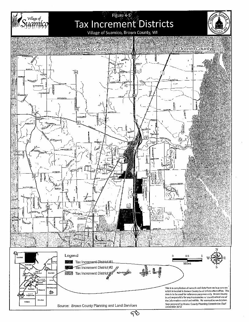
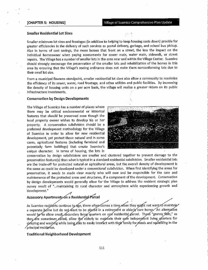
CHAPTER 5 HOUSING
Smaller Residential Lot Sizes
Smaller minimum lot sizes and frontages in addition to helping to keep housing costs down provide for
greater efficiencies in the delivery of such services as postal delivery garbage and school bus pickupAiso in terms of cost savings the more homes that front on a street the less the impact on the
individual homeowner when paying assessments for sewer main water main sidewalk or street
repairs The Village has a number of smaller lots in the area near and within the Village Center Suamico
should strongly encourage the preservation of the smaller lots and rehabilitation of the homes in this
area by ensuring that the Villageszoning ordinance does not make them nonconforming lots due to
theirsmall lot size
From a municipal finances standpoint smaller residential fot sizes also allow a community to maximize
the efficiency of its sewer water road frontage and other utilities and public facilities By increasingthe density of housing units on a per acre basis the villagewill realize a greater return on its publicinfrastructure investments
Conservation by Design Developments
The Village of Suamico has a number of places where
there may be critical environmental or historical
features that should be preserved even though the
local property owner wishes to develop his or her
property A conservation subdivision should be a
preferred development methodology for the Villageof Suamico in order to allow for new residential
development yet protect those natural and in some
cases agricultural features including farmland and
potentially farm buildings that create Suamicos
unique character In terms of housing the lots in
conservation by design subdivisions are smaller and clustered together to prevent damage to the
preservation featuresthan what is typical in a standard residential subdivision Smaller residential lots
are the tradeofffor protected natural or agricultural areas but theoverall density of development is
the same as could be developed under a conventional subdivision When first identifying the areas for
preservation it needs to made clear exactly who will own and be responsible for the care and
maintenance of the protected areas and structures if a componentofthe development Conservation
by design developments would generally allow for the Village to address the resident strategic plansurvey result of maintaining its rural character and atmosphere while experiencing growth and
development
Accessory Apartment6n a Residenti arcel
As Suamico rest nts continue t
a separate me but do no ant
would b to allow small econda
they re sometimes Iled allow
s eping and was g while beingprincipal resid ce
ge there ofte comes a time en they not wan o maintai
to be pl ed in a retire nt or elder care hom An altern ive
ry livi quarters ono residential arcel Th e granny ts as
t elderly to ma ain their o n indepe ent living garters for
le to easily int act with thJ family for eals ands ializng in the
Traditional Neighborhood Development
111
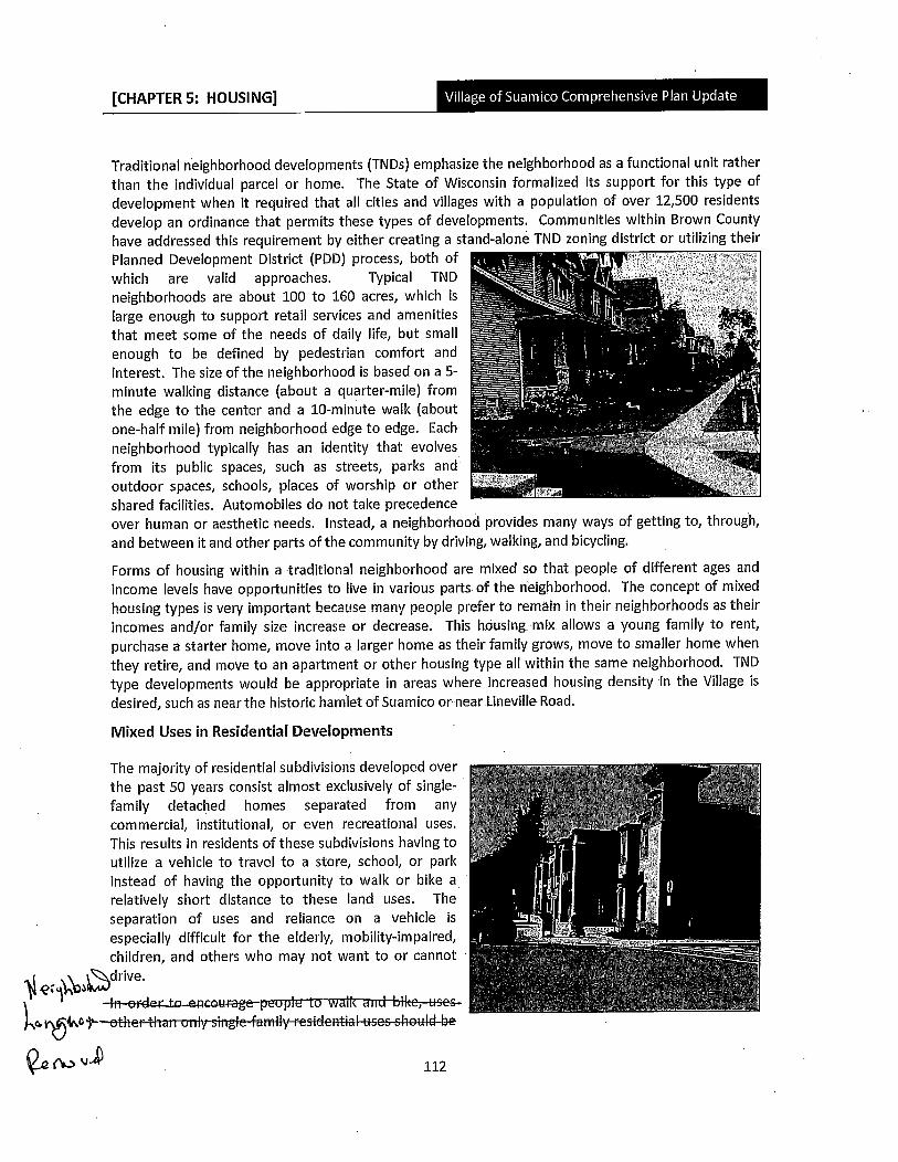
CHAPTER 5 HOUSING
Traditional neighborhood developments TNDs emphasize the neighborhood as a functional unit rather
than the individual parcel or home The State of Wisconsin formalized its support for this type of
development when it required that all cities and villages with a population of over 12500 residents
develop an ordinance that permits these types of developments Communities within Brown County
have addressed this requirement by either creating astandalone TND zoning district or utilizing their
Planned Development District PDD process both of
which are valid approaches Typical TND
neighborhoods are about 100 to 160 acres which is
large enough to support retail services and amenities
that meet some of the needs of daily life but small
enough to be defined by pedestrian comfort and
interest The size of the neighborhood is based on a 5
minute walking distance about aquartermile from
the edge to the center and a 10minute walls aboutonehalfmile from neighborhood edge to edge Each
neighborhood typically has an identity that evolves
from its public spaces such as streets parks and
outdoor spaces schools places of worship or other
shared facilities Automobiles do not take precedenceover human or aesthetic needs Instead a neighborhood provides many ways of getting to throughand between it and other parts of the community by driving walking and bicycling
Forms of housing within a traditional neighborhood are mixed so that people of different ages and
income levels have opportunities to live in various parts of the neighborhood The concept of mixed
housing types is very Important because many people prefer to remain in their neighborhoods as their
incomes andor family size increase or decrease This housing mix allows a young family to rent
purchase a starter home move into a larger home as their family grows move to smaller home when
they retire and move to an apartment or other housing type all within the same neighborhood TND
type developments would be appropriate in areas where increased housing density in the Village is
desired such as near the historic hamlet of Suamico or near linevilte Road
Mixed Uses in Residential eveloptnents
The majority of residential subdivisions developed over
the past 50 years consist almost exclusively of singlefamily detached homes separated from any
commercial institutional or even recreational uses
This results in residents of these subdivisions having to
utilize a vehicle to travel to a store school or parkinstead of having the opportunity to walls or bike a
relatively short distance to these land uses The
separation of uses and reliance on a vehicle is
especially difficult for the elderly mobilityimpairedchildren and others who may not want to or cannot
qtQybdrivetNetoea
a4petFertFiarroniysingfelyresdesubeU v 112
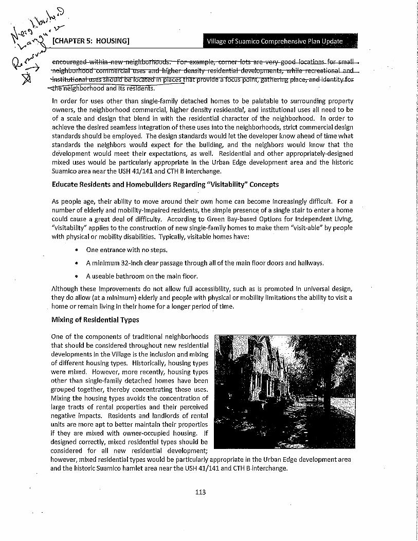
J
1aJ CHAPTER 5 HOUSINGr
SJ
reneettagedwftrye otsirevetgsacllacationsfarsmallYT@tgl1 e YetdE1T51ty1@StC11flaIdeVEfOp eCral6nalaan9
asttatis sou a oca e m p aces a p o e a ocus pom ga eeandaitfor
e neighborhood and its rest ents
In order for uses other than singlefamily detached homes to be palatable to surrounding propertyowners the neighborhood commercial higher density residential and institutional uses all need to be
of a scale and design that blend in with the residential character of the neighborhood In order to
achieve the desired seamless integration of these uses into the neighborhoods strict commercial designstandardsshould be employed The design standards would let the developer know ahead of time what
standards the neighbors would expect for the building and the neighbors would know that the
development would meet their expectations as well Residential and other appropriatelydesignedmixed uses would be particularly appropriate in the Urban Edge development area and the historic
Suamico area near the USH 41141 and CTH B interchange
Educate Residents and Homebuilders Regarding Visitability Concepts
As people age their ability to move around their own home can become increasingly difficult For a
number of elderly and mobilityimpaired residents the simple presence of a single stairto enter a home
could cause a great deal of difficulty According to Green Baybased Options for Independent Livingvisitability applies to the construction of new singlefamily homes to make them visitable by peoplewith physical or mobility disabilities Typically visitable homes have
One entrance with no steps
A minimum 32inch clear passage through all of the main floor doors and hallways
A useable bathroom on the main floor
Although these improvements do not allow full accessibility such as is promoted in universal designthey do allow at a minimum elderly and people with physical or mobility limitations the ability to visit a
home or remain living in their home for a longer period oftime
Mixing of Residential Types
One of the components of traditional neighborhoodsthat should be considered throughout new residential
developments in the Village is the inclusion and mixingof different housing types Historically housing typeswere mixed However more recently housing typesother than singlefamily detached homes have been
grouped together thereby concentrating these uses
Mixing the housing types avoids the concentration of
large tracts of rental properties and their perceivednegative impacts Residents and landlords of rental
units are more apt to better maintain their propertiesif they are mixed with owneroccupied housing If
designed correctly mixed residential types should be
consiaerea for aii new resiaentiai aeveiopment
however mixed residential types would be particularly appropriate in the Urban Edge development area
and the historic Suamico hamlet area near the USH41141 and CTHBinterchange
113
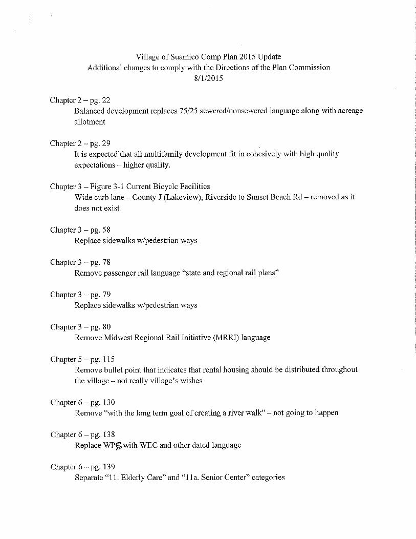
Village of Suamico Comp Plan 2015 UpdateAdditional changes to comply with the Directions ofthe Plan Commission
812015
Chapter 2 pg 22
Balanced development replaces 7525sewerednonsewered language along with acreage
allotment
Chapter 2 pg 29
It is expectedthat all multifamily development fit in cohesively with high qualityexpectations higher quality
Chapter 3 Figure 31 Current Bicycle Facilities
Wide curb lane County J Lakeview Riverside to Sunset Beach Rd removed as it
does not exist
Chapter 3 pg 58
Replace sidewalkswpedestrian ways
Chapter 3 pg 78
Remove passenger rail language state and regional rail plans
Chapter 3 pg 79
Replace sidewalkswpedestrian ways
Chapter 3 pg 80
Remove Midwest Regional Rail Initiative MRRI language
Chapter 5 pg 115
Remove bullet point that indicates that rental housing should be distributed throughoutthe village not really villages wishes
Chapter 6 pg 130
Remove with the long term goal of creating ariver walk not going to happen
Chapter 6 pg 138
Replace WP with WEC and other dated language
Chapter 6 pg 139
Separate 11Elderly Care and 11a Senior Center categories

Chapter 7 pg 161
Replace 75 with 50 reflects recent change
Chapter 8 pg 184
School District updated and correct information reflects what exists today
Chapter 9 pg 196
Replace 2018 with 20162017which reflects what will actually happen
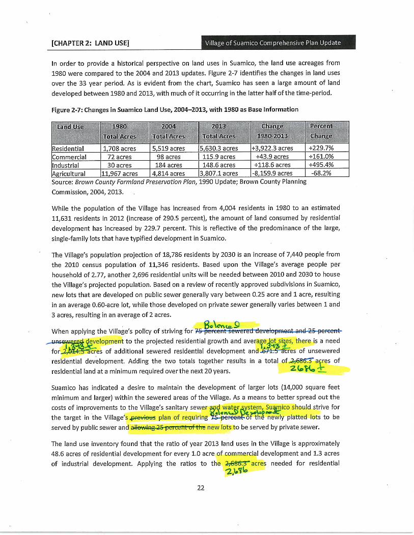
CHAPTER 2 LAND USE
In order to provide a historical perspective on land uses in Suamico the land use acreages from
1980 were compared to the 2004 and 2013 updates Figure 27 identifies the changes in land uses
over the 33 year period As is evident from the chart Suamico has seen a large amount of land
developed between 1980 and 2013 with much of it occurring in the latter half of the timeperiod
Figure 27Changes in Suamico Land Use 20042013with 1980 as Base Information
Land llse 1980
Total Acres
2904
Total Acres
2013
Total Acres
Change
19802013
Percent
Change
Residential 1708 acres 5519 acres 56303acres 39223acres 2297
Commercial 72 acres 98 acres 1159 acres 439acres 1610
Industrial 30 acres 184 acres 1486 acres 1186acres 4954
A ricultural 11967 acres 4814 acres 38071acres 81599acres 682
Source Brown County Farmland Preservation Plan 1990 Update Brown County Planning
Commission 2004 2013
While the population of the Village has increased from 4004 residents in 1980 to an estimated
11631 residents in 2012 increase of 2905 percent the amount of land consumed by residential
development has increased by 2297 percent This is reflective of the predominance of the large
singlefamily lots that have typified development in Suamico
The Villagespopulation projection of 18786 residents by 2030 is an increase of7440 people from
the 2010 census population of 11346 residents Based upon the Villages average people per
household of277 another2696 residential units will be needed between 2010 and 2030 to house
the Villages projected population Based on a review of recently approved subdivisions in Suamico
new lots that are developed on public sewer generally vary between 025 acre and 1 acre resulting
in an average060acre lot while those developed on private sewer generally varies between 1 and
3 acres resulting in an average of 2 acres
poCncaWhen applying the Villagespolicy of striving for eett
Ievelopment to the projected residential growth and
average iesthere is a need
fort cres of additional sewered residential development andt 3
res of unsewered
residential development Adding the two totals together results in a total off3a res of
residential land at a minimum required overthe next 20 years 20
Suamico has indicated a desire to maintain the development of larger lots 14000 square feet
minimum and larger within the sewered areas of the Village As a means to better spread out the
costs of improvements to the Villagessanitary sewer water ystem Sumico should strive foran W ti
the target in the Villagespeetrs plan of requiring oh newly platted lots to be
served by public sewer and new lots to be served by private sewer
The land use inventory found that the ratio of year 2013 land uses in the Village is approximately486 acres of residential development for every 10 acre of commercial development and 13 acres
of industrial development Applying the ratios to theC3acres needed for residential
21qb
22
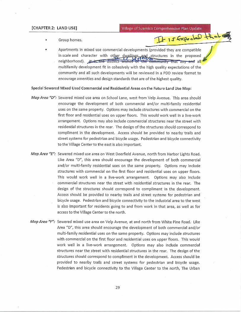
CHAPTER 2 LAND USE i ii
Group homes j S CxQo
Apartments in mixed use commercial developments provided they are compatiblein scale and character with of r d structures in the proposed
t Lneighborhood all
multifamily development fit in cohesively with the high quality expectations of the
community and all such developments will be reviewed in a PDD review format to
encourage amenities and design standards that are ofthe highest quality
Special Sewered Mixed Used Commercial and Residential Areas on the Future Land Use Map
Map Area D Sewered mixed use area on School Lane west from Velp Avenue This area should
encourage the development of both commercial andor multifamily residential
uses on the same property Options may include structures with commercial on the
first floor and residential uses on upper floors This would work well in a livework
arrangement Options may also include commercial structures near the street with
residential structures in the rear The design of the structures should correspond to
compliment in the development Access should be provided to nearby trails and
street systems for pedestrian and bicycle usage Pedestrian and bicycle connectivityto the Village Center to the east is also important
Map Area E Sewered mixed use area on West Deerfield Avenue north from Harbor Lights Road
Like Area D this area should encourage the development of both commercial
andor multifamily residential uses on the same property Options may include
structures with commercial on the first floor and residential uses on upper floors
This would work well in a livework arrangement Options may also include
commercial structures near the street with residential structures in the rear The
design of the structures should correspond to compliment in the developmentAccess should be provided to nearby trails and street systems for pedestrian and
bicycle usage Pedestrian and bicycle connectivity to the industrial area to the west
is also important for residents going to and from work in that area as well as for
access to the Village Center to the north
Map Area F Sewered mixed use area on Velp Avenue at and north from White Pine Road Like
Area D this area should encourage the development of both commercial andor
multifamily residential uses on the same property Options may include structures
with commercial on the first floor and residential uses on upper floors This would
work well in a livework arrangement Options may also include commercial
structures near the street with residential structures in the rear The design of the
structures should correspond to compliment in the development Access should be
provided to nearby trails and street systems for pedestrian and bicycle usage
Pedestrian and bicycle connectivity to the Village Center to the north The Urban
29
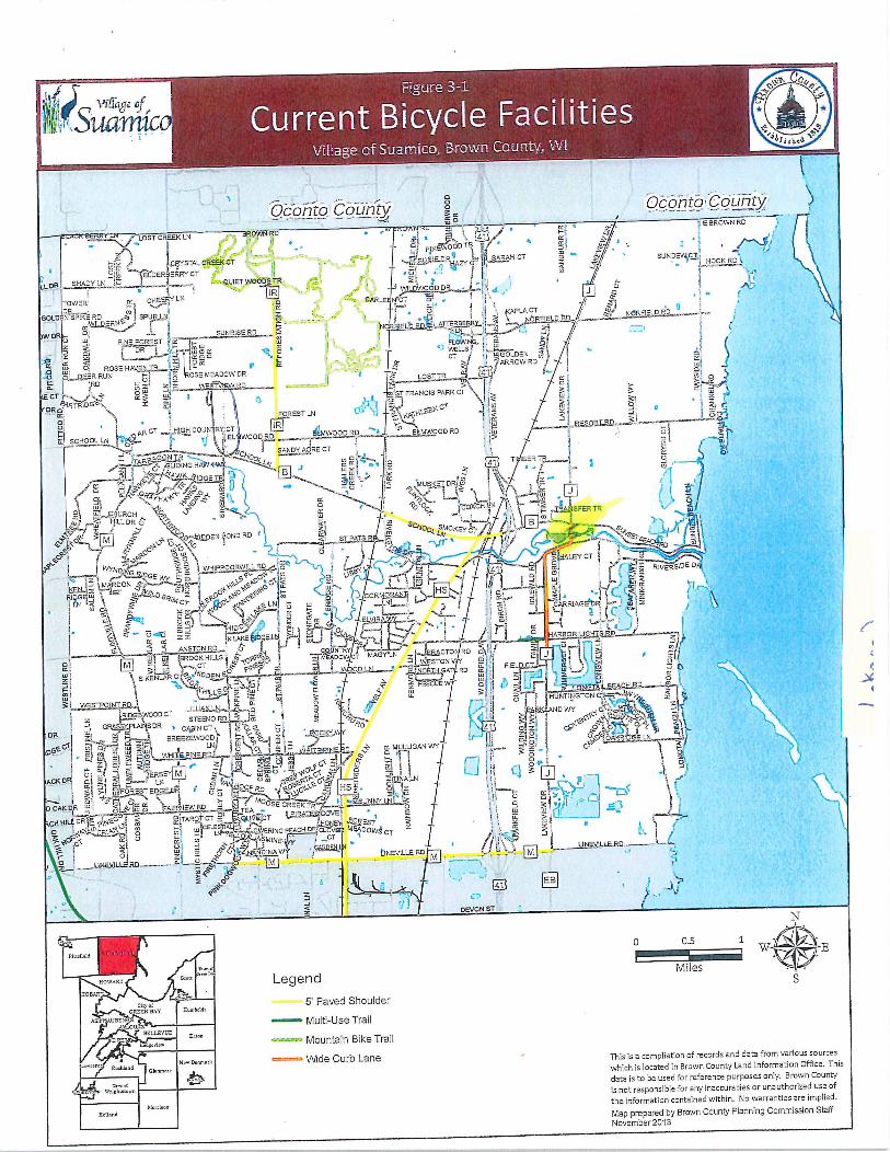
1lEGlc c i
a
OcontoCountyOconto County waOONm I w
E eFOWNRO
LOST CREEKLNBROWN Ij0n I O
Fd I41
c I3 PNEW 00 TEI i v
r g RJ SARAH CT tj SUN DEWCF
F
w FRYSTAL CREEKCT SslEOHAZY GT I y HOOKRDIw ELDERBEPRYCT I llpp I iDR SHA
IYLN i0 1 1 QUIET WOODS TR t
i I IR LOVVOODDR d l1TOWER C1EERY LN CARLE tG7 0l I
v
DPJ mo I
f t
DLD NSPIKE RD h SPUFZ LNIa I j
PLA CT j tl NORFIELO ROL I
WILDERNE ff I N FJELU RD ARBERRY N PFIELD 40s
W4
SUNRISERevN i ir LN I m9 ilDa I
PINE FOREST N w FLOWING i ZP rz r OR f cwJ C o WELLS w liii fcICa l CT J IGOLDEN yH
r i Isl V FARROW RD d wO ROSEHAVEITv2 4
I
U sERRUN U I ROSE MEADOW DR LOSTTRa 41 yz RD wzt zlu T RDav a
st W iii
O STFRANCIS PARK CIICT
PaRTRIDG z1
Ical
j GTt Im i 4 fR w FOREST LN KpHLEEN J YI
I I csiw S 31 q
koi
CT t GH COUN RXGTIR
Y
I YN RESOgT FO
pP LMWOOD RD ELM WOOD PD W U iSCHOOLLNa iEL WOORDs I oIL
41e C SANY AC RE CT II
1
rm
1 I 1 l
GO I m i41 HTAR LIDIN
IDGEfTRyL LN
weezi I lye
TI 6ERTR I O J
GW r w FLTSc w t t h l a x g MusKEDRIwd P G FrFCy mz I I t i i y 1 w d
wa 2O ul
r OHO COACH LN 7a CHURCH O S QoC Oir i
1
A QrA9NSF PTR yjw FfILL DR6 gJ 1 Q a
SC 94 BQr y x 3 HOO SMO YC Yv I S
2 3 M 20 ar OOJpDENPOND RD I STPATSIA LNK
is Y y4 I11K0 t vs Rp i S ew
oo
N Y i f f1 v Y a t ddd
o ff FoG r l I H I I I sclNpD ILE T
Ir
4 P off i0 I 1 elYC i
I1E 1
VvIDE D4 I YNOJIyO K 4 WHIPPOORWILL RD t p I L d F c41
RI Ea
OGE Ix I Q pC1 to L JJ aI co z
i h M RDONarbDYO 1EPOa N wr1G
HS ri 17 3W iREG w G7 4idWILOg z 00 p0 cP C1 CORM ANAT
a I 9 Igc z
I Na 3 RiMDr a9 oP PO w I6 ofI I e y lE p CARRIAGEIDR P
I f S P1 a mi I I o I 9 1 1
o L c xQ
pELwym m j I 1HIDOv r ZB HIO
fm d a y i Cm U tfJ Z I 1 Yd I II 1 ARBOR LIG SRD IC
tlYN LAKE G la F A
t r3 Ia5 AtvsroNRD couNrar lir I
w tgROOKHILLS r FEf MEADOW T MAGYiN JEwyB9CT0RD
Wl l LL I I IR i 1 IwI a jM aCT i Q pN I OnI N y STON I FIELD CTS I I r N3L yl O pYm JtI1ORGAT RD w I If l W
K
z S KENLAF Cisdp ODEON 1 i 3 o 3 I z I I 07m I
m QHILLS O4 LLFEGGUE 3I1jIIC6NGSPIEEACR l
I
w 3 1 I HU NTINGTON CT Y x3iysraoINTRD r d oF i a
RIDG@W000 CT r iw O YyA ND WY G POJ xgi STEENO RO i 1 YG f I I i3 I N CY vTOr 0
GRYPLNNS DR CAgIN CT o N coil Ra 41 csz rye oGSu C w 1
zi r 5 u 9 POC I zO Q G pORnzfl BREEZEWOOD h I z gP2p w h l I LOOAKRIOGE LN aiJ y
GEGj 1w4 n LN U O P N D a MULLIGAN WY I 3z I GF 1Ja z w jolWHl tlEPfDZ I
1 ajzV O
I WL1Ttl F I
o 1e
I cia wOGStJ II1t 3 OI jAOK DF e i S EPN M
r
o AFl HOOFOw pOLCG aINAN C p
Q p r la YI IFO EOGEDR U U cC RD IYGL FIS O to Ils y
I t lp r G4 rJqvt aSunl L Im I 3
1
OAK DR I w HOSE CREEK TR s 1w jQkw AIRVIEW RDT w 9
L p o RATESCOVEICH HILL DRIY P NcG Q yTAR CT xOLlEGT ON FOREST I Y w
u
CLOV MEADOO P1alRlpN F wGELESTIA
FGWERING PEACH DFL yyy10o w r OW cT 1 i ai I ixAaOpC rc rt IASMINE I tZ x c c1f 3t GFS l IJNEVILLERD
i O w pVIp1pNDINCAWY fjNEVILLE ROM
U
yl Oti p 111411 ri
2100 41EB i
Q JrrI t
DEVON ST1
N
0 05 1W E
einma
Milesw xei Legend S
5 Paved Shoulder
MultiUseTrail
Mountain Bike Trail
Wide Curb Lane This is a compliation of records and data from various sources
which is located in Brown County Land Information Office This
data is to 6e used for reference purposes only Brown County
is not responsible for any inaccuracies orunauthorized use of
the information contained within No warranties areimplied
Map prepared by Brown County Planning Commission Staff
November 2013
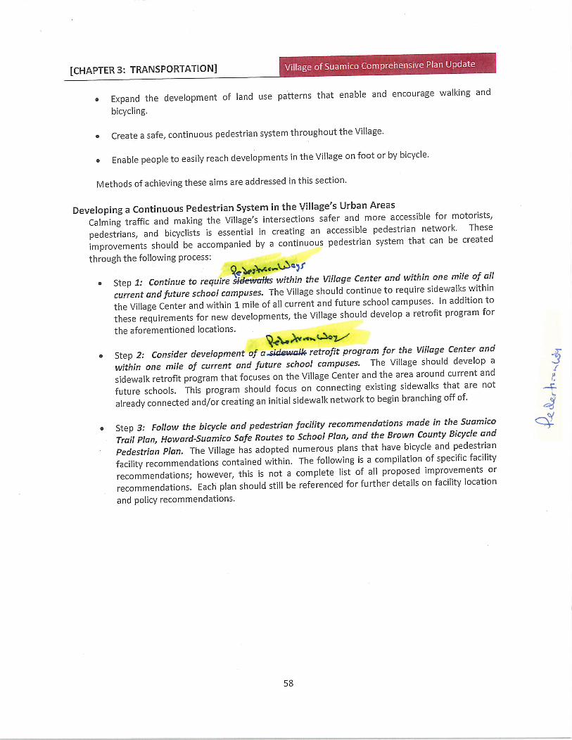
CHAPTER 3 TRANSPORTATION
Expand the development of land use patterns that enable and encourage walking and
bicycling
Create a safe continuous pedestrian system throughout the Village
Enable people to easily reach developments in the Village on foot or by bicycle
Methods of achieving these aims are addressed in this section
Developing a Continuous Pedestrian System in the VillagesUrban Areas
Calming traffic and making the Villages intersections safer and more accessible for motorists
pedestrians and bicyclists is essential in creating an accessible pedestrian network These
improvements should be accompanied by a continuous pedestrian system that can be created
through the following process
eray f
Step 1 Continue to requiresdevvaflrs within the Village Center and within one mile of all
current and future school campuses The Village should continue to require sidewalks within
the Village Center and within 1 mile of all current and future school campuses In addition to
these requirements for new developments the Village should develop a retrofit program for
the aforementioned locations
Qkrrla
Step 2 Consider development ofasideiatall retrofit program for the Village Center and
within one mile of current and future school campuses The Village should develop a
sidewalk retrofit program that focuses on the Village Center and the area around current and
future schools This program should focus on connecting existing sidewalks that are not
already connected andor creating an initial sidewalk network to begin branching off of
Step 3 Follow the bicycle and pedestrian facility recommendations made in the Suamico
Trail Plan HowardSuamico Safe Routes to School Plan and the Brown County Bicycle and
Pedestrian Plan The Village has adopted numerous plans that have bicycle and pedestrian
facility recommendations contained within The following is a compilation of specific facility
recommendations however this is not a complete list of all proposed improvements or
recommendations Each plan should still be referenced for further details on facility location
and policy recommendations
1
t
58
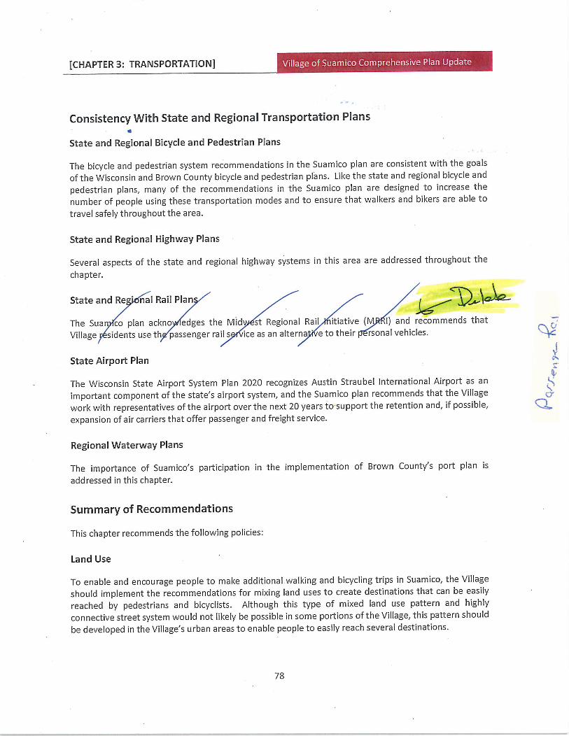
CHAPTER 3 TRANSPORTATION
Consistency 1Nith State and Regional Transportation Plans
State and Regional Bicycle and Pedestrian Plans
The bicycle and pedestrian system recommendations in the Suamico plan are consistent with the goals
of the Wisconsin and Brown County bicycle and pedestrian plans Like the state and regional bicycle and
pedestrian plans many of the recommendations in the Suamico plan are designed to increase the
number of people using these transportation modes and to ensure that walkers and bikers are able to
travel safely throughout the area
State and Regional Highway Plans
Several aspects of the state and regional highway systems in this area are addressed throughout the
chapter
State and Re nal Rail Plan y6
The Sua co plan ackno edges the Mid st Regional Rail itiative M I and recommends that
Village sidents use th passenger rails ice as an alterna e to their rsonal vehicles
State Airport Plan
The Wisconsin State Airport System Plan 2020 recognizes Austin Straubel International Airport as an
important component of the statesairport system and the Suamico plan recommends that the Village
work with representatives of the airport over the next 20 years to support the retention and if possibleexpansion of air carriers that offer passenger and freight service
Regional Waterway Plans
The importance of Suamicosparticipation in the implementation of Brown Countys port plan is
addressed in this chapter
Summary of Recommendations
This chapter recommends the following policies
Land Use
To enable and encourage people to make additional walking and bicycling trips in Suamico the Village
should implement the recommendations for mixing land uses to create destinations that can be easilyreached by pedestrians and bicyclists Although this type of mixed land use pattern and highly
connective street system would not likely be possible in some portions of the Village this pattern should
be developed in the Villagesurban areas to enable people to easily reach several destinations
Yc
t
78
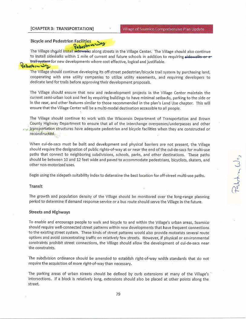
CHAPTER 3 TRANSPORTATION
Bicycle and Pedestrian Facilitie
QsThe Village should installscieevsalong streets in the Village Center The Village should also continue
to install sidewalks within 1 mile of current and future schools in addition to requiringtraiisysemfor new developments where cost effective logical and justifiable
The Village should continue developing its offstreet pedestrianbicycle trail system by purchasing landcooperating with area utility companies to utilize utility easements and requiring developers to
dedicate land for trails before approving their development proposals
The Village should ensure that new and redevelopment projects in the Village Center maintain the
currentsemiurban look and feel by requiring buildings to have minimal setbacks parking to the side or
in the rear and other features similar to those recommended in the plansLand Use chapter This will
ensure that the Village Center will be a multimodal destination accessible to all people
The Village should continue to work with the Wisconsin Department of Transportation and Brown
County Highway Department to ensure that all of the interchange overpassesunderpasses and other
transportation structures have adequate pedestrian and bicycle facilities when they are constructed or
reconstructed
When culdesacs must be built and development and physical barriers are not present the Villageshould require the designation of public rightsofway at or near the end of the culdesacs for multiuse
paths that connect to neighboring subdivisions schools parks and other destinations These pathsshould be between 10 and 12 feet wide and paved to accommodate pedestrians bicyclists skaters and
othernonmotorized uses
Begin using the sidepath suitability index to determine the best location foroffstreet multiuse paths
Transit a
The growth and population density of the Village should be monitored over the longrange planningperiod to determine if demand response service or a bus route should serve the Village in the future
Streets and Highways
To enable and encourage people to walk and bicycle to and within the Villages urban areas Suamicoshould requirewellconnected street patterns within new developments that have frequent connections
to the existing street system These kinds of street patterns would also provide motorists several route
options and avoid concentrating traffic on relatively few streets However if physical or environmental
constraints prohibit street connections the Village should allow the development of culdesacs near
the constraints
The subdivision ordinance should be amended to establish rightofway width standards that do not
require the acquisition of more rightofway than necessary
The parking areas of urban streets should be defined by curb extensions at many of the Villagesintersections If a block is relatively long extensions should also be placed at other points along thestreet
79
CHAPTER 3 TRANSPORTATION hensive Plan Update
To move traffic efficiently minimize barriers to pedestrians and bicyclists and make the Villages
thoroughfares more attractive the Village in cooperation with Brown County should construct two
lane arterial boulevards or three lane arterial streets that are complemented by an interconnected
collector and local street system mixed land uses and efficient traffic control techniques at
intersections rather than expanding these roads to four lanes
The Village should utilize street design techniques that reduce vehicle speeds minimize the possibility of
conflicts and enhance traveler awareness to maximize pedestrian bicyclist and motorist safety and
accessibility at the Villages intersections Techniques that should be used include roundabouts curb
extensions at intersections and other street design features
Other Modes ofTransportation
The Village should monitor activity on all rail lines and contact the Wisconsin Department of Natural
Resources if any line is proposed for abandonment in the future If abandonment is proposed the
Village should urge the DNR to purchase the rightofway to enable the rail bed to be converted to a
multiuse trail
The Villa should nitor the pr ess ofthe Midw egional Rail itiative RRI
The Village should work with representatives of the airport over the next 20 years to support the
retention and if possible expansion of air carriers that offer passenger and freight service
Continue to utilize yellow street signs to identify designated truck routes
To ensure that Suamicos current and future interests are considered by Port of Green Bay
representatives the Village should participate in the ports plan implementation process
Funding to Help Develop the VillagesTransportation System
To help the Village fund the development of its multimodal transportation system it should apply for
transportation grants from various sources over the next several years
Sidepath Suitability Algorithm
The following algorithm rates the suitability of a sidewalk or Sidepath as a bicycle facility A Sidepath is a
trail parallel to but separated from a roadway In addition to rating existing sidepaths it can be used to
plan safety improvements for new or existing sidepaths At present no other nationally accepted
suitability index exists This algorithm was developed using design issues described in the AASHTO Guide
for the Development of Bicycle Facilities
The factors considered are intersection traffic continuity curb cuts pedestrian use crosswalks and
pathroad separation at intersections For a particular segment add the following terms
1 Intersection Traffic Score The volume and speed of motor vehicular traffic especially
80

CHAPTER 5 HOUSING r
market
New residential developments provide consideration for properly designed mixed uses as additions
to the community that provide a place for housing and allow secondary uses commercialrecreational and institutional uses that serve the neighborhood and are designed to be compatiblewith the residential character and scale of Suamico
The Village of Suamico should review the site plan and design review standards currently in place for
multifamilydevelopment to ensure any new multifamily developments meet or exceed the high
design standards expected by Suamico residents
Avoid ncentra ns of rents ousing b couragimixtureousing types dst Rents
ho mg is vi to any co unity an ould beiributed t ughout the V ge as blic se ces 9come ailable rat r than confentrated irya few areas
Multiplefamily buildings should be designed to reflect as much as possible the characteristics and
amenities typically associated with singlefamily detached houses Examples of amenities include
the orientation of the front door to a sidewalk and street individual entries and garages
incorporated into the design of the building rather than as detached accessory structures
Review and modify the Villagesordinances
with regard to the ability to allow for the
development of an accessory residential
structure on existing residential lots
Educate homeowners and builders about
the advantages of including the visitabilityconcepts in new homes
Encourage low to moderate income
homeowners to utilize the Brown County Community Development Blocl Grant Housing loan
program for home repairs
D
115
CHAPTER 6 UTILITIES AND COMMUNITY
FACILITIES i
It is anticipated that implementation of the stormwater management plans recommendations and
the creation of a stormwater management utility will fully address the stormwater management needs
of the Village of Suamico during the timeframe of this comprehensive plan However the
stormwater management plan and this comprehensive plan will likely need to be revised to ensure
their continued compliance with state and federal stormwater regulations as those regulations change
over time
6 Parks and Recreation
The presence of outdoor recreation and open space adds to a communitysquality of life It enhances
the attractiveness of and fosters a sense of civic pride in the community Furthermore the
provision of an adequate supply of areas facilities and activities to accommodate the publics open
space and recreational needs has been demonstrated to promote the general health welfare and
safety ofthe community and its citizens
Suamico completed its first comprehensive park and outdoor recreation plan in 1991 with updates
approved in 1997 2008 and 2013 Suamicosparks are shown in Figure 65 The park system includes
37 sites encompassing40408 acres A description of each site is included in this section More
information is located in the Village of Suamico Outdoor Recreation Plan
Undeveloped Village Sites
DoctorVickeryPark
DoctorVickery Park is located on the north side of the Suamico River on Velp Avenue The north side of
this25acre property is bounded by Hailers Creek Owned by the Doctor Family the parcel is leased to
the Village in year increments with the understanding that it be maintained to the identical standards of
other Village parks The primary use is for fishing and picnicking Structural improvements are not
possible due to its location in the flood plain m
Firemans Park
Firemans Park is a small halfacre facility adjacent to the Suamico River at Deerfield Avenue West The 3
park is undeveloped but does offer fishing opportunities and canoe access to the river Picnic tables are gyppmade available as this is a popular spot for summer lunch breaks The possibility of enhanced Jfishingcanoe access may be explored
Hawks Nest
HawksNest is a rural residential development located in the northwest quadrant of the Village between
Flintville Road and Stream Road Because of its proximity to the Suamico River there is a considerable
expanse of wooded floodplain which was undevelopable This 291acre area was dedicated to the
Village as a conservancy IRose Hill Estates
Rose Hill Estates is located along Pine Lane in the northwestern portion of the Village Immediately to
the north on Sunrise Road is the Brown County Reforestation Camp This development dedicated 247
acres of green space that is intended to serve as stormwater management and a common area for the
130
CHAPTER 6 UTILITIES AND COMMUNITY
FACILITIES
nonprofit and volunteer organizations With such assistance the Village can accomplish more with
its park and recreation system than it could otherwise The Village should also continue and expandwhere possible its current practice of sharing facilities and joint planning with its school districts and
neighboring communities for the same reasons
Because of the importance of the Villages park system the provision of adequate funding is vital
Therefore use of park impact fees to ensure an equitable system for the acquisition development
maintenance and replacement of its parks and outdoor recreation sites and facilities should be
continued
7 Telecommunication
ATTprovides landline phone service to all but the far western portion of the Village while Nsight
provides similar service to the remainder of the Village Time Warner Cable provides cable television
telephone and internet access This includes Internet access by cable modem and DSL
Current trends in the telecommunications industry point to a continued demand for high speedInternet access and cellular communications in the future In response many local communities across
the country including some within Wisconsin have used a proactive approach to the provision
of this service to ensure that this service is provided to its community in the quickest most equitableand most efficient manner possible It is recommended that the Village consider the impacts of this
service to ensure that it is meeting the Villagesneeds
Although legislative action minimizes the control over certain cellular communications facilities that are
being approved the Village should ensure that all possible efforts are undertaken to collocate them
and that adequate easements and other necessary rightsofway are available It is recommended
that the Village ensure that adequate design standards for the associated infrastructure are
followed The Village should contact local cellular communication providers in order to address
reception problems in the northwestern quarter ofthe Village
It is otherwise anticipated that this service will continue to be provided by the private sector and will
continue to meet the demands of the Village
8 Power Generation rr eS GoaewX 7
Electricity and natural gas are provided in the Village of Suamico by ervic
a a ion WPS provides electricity and natural gas to most of B crCounty as well as
to most of northeastern Wisconsin including all or portions of 24 countiesisin the process of
converting its electric and gas meters to new automated meters which will result in better accuracy
fewer estimated readings and a quicker response to outages ThexrfpTsBn
Cnunty caniwd hNaFnaxef
It is anticipated that this service will continue to be provided by the private sector and will continue
to meet the demands ofthe Village
9 Cemeteries
138
CHAPTER 6 UTILITIES AND COMMUNITY
4 JFACILITIES
There are three cemeteries within the Village of Suamico While additional future demands for this
service should continue to be addressed by the private sector the Village should encourage such uses
within its own community when properly designed and located
10 Medical Healthcare
The Village of Suamico primarily relies upon private medical healthcare providers located in the City
of Green Bay and Village of Howard Suamico facilities include a clinic a fast care site and dental
offices all on or near Lineville Road Many services are also provided to the citizens of the Village as
well as the rest of Brown County by the Brown County Health Department
It is anticipated that these services will be adequate for the timeframe of this comprehensive plan
While additional future demands for hospitals and medical clinics should continue to be addressed
primarily by the private sector the Village should encourage such uses within its own community when
properly designed and located
11 Elderly Care
1JVAssisted living facilities are located within the Village of Suamico The Village primarily relies upon
private elderly care providers located in the City of Green Bay Many services are also provided to
the citizens of the Village as well as the rest ofi Brown County by the Brown County Aging ResourceV l I Center
IV ile additional future demands should continue to be addressed primarily by these agencies some
ervices may warrant provision by the Village Most often considered in this regard is a senior center
that would provide recreational educational and other similar opportunities to the Villages seniorw
citizens Senior centers are often located in conjunction with other compatible uses such as a parksite and school and often share space with other agencies for their services and programs such as
the local park department and the county health and human services department and Village of Suamico
park facilities
It is recommended that the Village study the feasibility of such a senior center
12 Childcare
Approximately four daycare centers are located within the Village of Suamico Residents also rely upon
private childcaredaycare providers located in neighboring communities and there are a number of in
home licensed providers within the Village
Additional future demands should continue to be addressed by the private sector and the Villageshould encourage such uses within its own community when properly designed and located
Ci
CY
a
139
CHAPTER 7 NATURAL CULTURAL AN
AGRICULTURAL RESOURCES
Based upon the importance of the Villagesshorelands and their relationship to surface water and the
Villages rural character Suamico should encourage greater protection of the shoreland area In this
regard the Village should take full advantage of federal state and county funding and other assistance
in the establishment of vegetative stream buffers to further filter out sediments and other associated
pollutants Suamico is currently in the process of developing ashorelandwetland ordinance that meets
the requirements of NR 115
7 Wetlands
Wetlands are characterized by water at or near the ground level by soils exhibiting physical or
chemical characteristics of waterlogging or by the presence of wetland adapted vegetation Wetlands
are significant natural resources that have several important functions They enhance water quality
by absorbing excess nutrients within the roots stems and leaves of plants and by slowing the flow of
water to let suspended pollutants settle out Wetlands help regulate storm runoff which minimizes
floods and periods of low flow They also provide essential habitat for many types of wildlife and offer
recreational educational and aesthetic opportunities to the community
There are two broad classifications of wetlands perennial wetlands and ephemeral intermittent
wetlands Perennial wetlands are inundated with water for much of the year and develop classic
wetland characteristics such as soil mottling Perennial wetlands usually support populations of water
loving plants Ephemeral wetlands which are sometimes called intermittent wetlands due to soil type
and topography often do not develop classic wetland characteristics since they are flooded only part of
the year Both types ofwetlands are equally important
The Village of Suamico contains a significant area of wetlands along the bay of Green Bay These
wetlands are recognized as being of national importance They are part of a larger complex of wetlands
located along the entire length of the western shore ofthe bay of Green Bay terminating near the City of
Marinette The west shore wetlands as they are known provide critical waterfowl and wildlife
habitat as well as fish spawning habitat for many game fish in the bay of Green Bay including perch
and northern pike In order to preserve some of these vital spawning areas the WDNR has purchased
and maintains ownership over the Sensiba Wildlife Area which includes Long Tail Point and the
Little Tail Management Unit in the far northeastern part of the Village
The Wisconsin Wetlands Inventory map identifies wetlands scattered throughout the Village As
shown on Figure 76 the WDNR digital wetlands inventory identified approximately 5190 acres of
wetlands within the Village In addition to the west shore wetlands there is a large wetland complex
located south of Harbor Lights Road between USH 41141 and Velp Avenue This complex is part of
the Suamico Lacustrine Flats which is also a critical northern pike spawning area Due to the value of
161
y
J
c
Under current regulatory requirements thefeet closest to navigable waters are off limits to
development but development could occur within the remainder of the shoreland area with receipt of
appropriate permits and approvals and agricultural activities could continue within the shoreland area
CHAPTER 8 INTERGOVERNMENTAL
COOPERATION d a
8 INTERGOVERNMENTAL COOPERATION
Cooperation between neighboring and overlapping units of government is one of the primary goalsof the Wisconsin Comprehensive Planning Law as well as the multi jurisdictional planning effort of
which this plan is a component In order for the Village of Suamico to grow in an orderly and efficient
manner it is necessary for the Village to work with its neighbors Brown County the state and other
units of government Working cooperatively is especially important since many issues such as
stormwater management and traffic do not recognize municipal boundaries What one municipalitydoes may have significant impacts on its neighbors
The intent of the Intergovernmental Cooperation chapter is to analyze the relationships between the
Village and other units of government and to identify means of working cooperatively toward the goalsand objectives identified in the Issues and Opportunities chapter ofthe plan
Analysis of Governmental Relationships
School Districts
Howard Suamico School District
The Village of Suamico and the Village of Howard have met with the Howard Suamico School District on
an annual basis to discuss topics of mutual interest The 2013 meeting dealt largely with the respectivestrategic plans and their implementation goals and objectives It is the intent of the administration ofthe Howard Suamico School District and the Village of Suamico that both parties work together in a
cooperative and collaborative manner on both short term and long term planning and day to dayoperations
The School District was represented on the Villages Tax Incremental Districts Joint Review Board thatreview and approve special Economic Development and the Village and School District Administratorsmeet on an as needed basis to discuss Development and Economic Development issues
The School Districtjarepresented on the Villages Comprehensive Master Land Use Planning StakeholderCo ittee that is reviewing revising and ultimately recommending a new and updated Village
omprehensive Master Land Use Plan that will guide development redevelopment and growth in the
future
While interaction between both bodies has been minimal in the past both parties believe that increased
interaction and collaboration in the future are essential and shall be encouraged Just recentlycooperative aquatic classes have been offered to the benefit of the school district and the VillagesRecreational programs The School District is also i ocess o up ating their swimming pool
tea yrek
C1C r
184
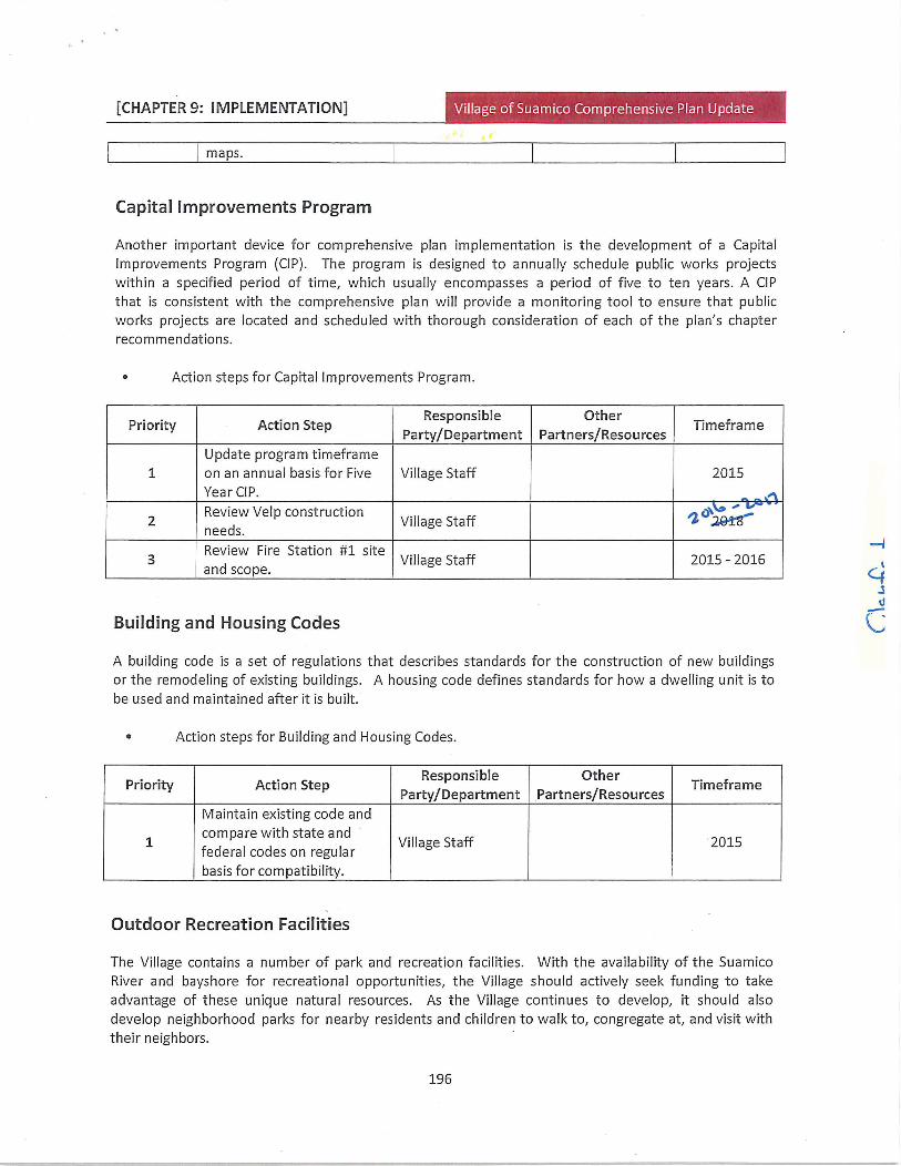
CHAPTER 9 IMPLEMENTATION lLtao ii II
maps
Capital Improvements Program
Another important device for comprehensive plan implementation is the development of a CapitalImprovements Program CIP The program is designed to annually schedule public works projectswithin a specified period of time which usually encompasses a period of five to ten years A CIP
that is consistent with the comprehensive plan will provide a monitoring tool to ensure that publicworks projects are located and scheduled with thorough consideration of each of the plans chapterrecommendations
Action steps for Capital Improvements Program
Priority Action StepResponsible Other
TimeframePartyDepartment PartnersResources
Update program tmeframe
1 on an annual basis for Five Village Staff 2015
Year CIP
2Review Velp construction
ll ff Zneeds
Vi age Sta
3Review Fire Station 1 site
Village Staff 2015 2016and scope
Building and Housing Codes
A building code is a set of regulations that describes standards for the construction of new buildingsor the remodeling of existing buildings A housing code defines standards for how a dwelling unit is to
be used and maintained after it is built
Action steps for Building and Housing Codes
Priority Action StepResponsible
PartyDepartmentOther
PartnersResourcesTimeframe
Maintain existing code and
1compare with state and
Village Staff 2015federal codes on regularbasis for compatibility
Outdoor Recreation Facilities
The Village contains a number of park and recreation facilities With the availability of the Suamico
River and bayshore for recreational opportunities the Village should actively seek funding to take
advantage of these unique natural resources As the Village continues to develop it should also
develop neighborhood parks for nearby residents and children to walk to congregate at and visit with
their neighbors
sv
196
Additional Changes to the Draft 2015 Comp Plan
8252015
1 Pg 21 Change quarries to sandgravel pits
2 Pg 25 Modify75sewered and 25nonsewered to is abalance of sewered and
nonsewered
3 Pg 42 RecommendationAdd TheVillage of Suamico should consider and evaluate the possibility ofpartneringwith developers or assisting developers in obtaining financing for the development of
infrastructure for residential subdivision development
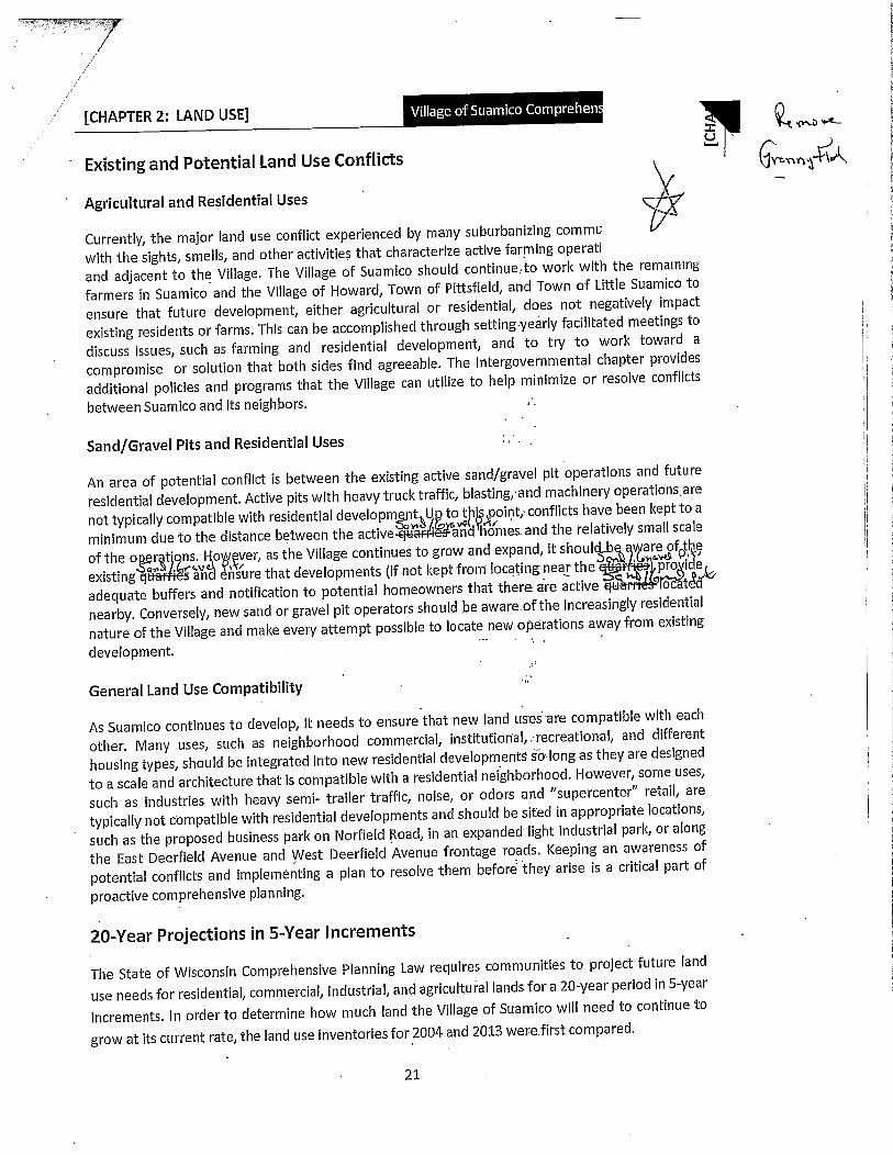
r
j
CHAPTER 2 LAND USEu
Existing and Potential Land Use Conflicts rrny11Agricultural and Residential Uses
Currently the major land use conflict experienced by many suburbanizing comma
with the sights smells and other activities that characterize active farming operatl
and adjacent to the Village The Village of Suamico should continuetowork with the remaining
farmers in Suamico and the Village of Howard Town of Pittsfield and Town of Little Suamico to
ensure that future development either agricultural or residential does not negatively impact
existing residents or farms This can be accomplished through settingyearly facilitated meetings to
discuss issues such as farming and residential development and to try to work toward a
compromise or solution that both sides find agreeable The Intergovernmental chapter provides
additional policies and programs that the Village can utilize to help minimize or resolve conflicts
between Suamico and its neighbors
SandGravel Pits and Residential Uses
An area of potential conflict is between the existing active sandgravel pit operations and future
residential development Active pits with heavy truck traffic blastingand machinery operationsare
not typically compatible with residential developmentU totjpoint conflicts have been kept to a
minimum due to the distance between the active and homes and the relatively small scale
of the o r tons Ho ever as the Village continues to grow and expand itshoulcbGofptheexisting f and sure that developments if not kept from locatingnear the provideadequate buffers and notification to potential homeowners thatthere are active ocat
nearby Conversely new sand or gravel pit operators should be awareofthe increasingly residential
nature of the Village and make every attempt possible to locate new operations away from existing
development
General Land Use Compatibility
As Suamico continues to develop it needs to ensure that new land usesare compatible with each
other Many uses such as neighborhood commercial institufiorialrecreationaI and different
housing types should be integrated into new residential developments sa long as they are designed
to a scale and architecture that is compatible with a residential neighborhood However some uses
such as industries with heavy semi trailer traffic noise or odors and supercenter retail are
typically not compatible with residential developments and should be sited in appropriate locations
such as the proposed business park on Norfield Road in an expanded light industrial park or along
the East Deerfield Avenue and West Deerfield Avenue frontage roads Keeping an awareness of
potential conflicts and implementing a plan to resolve them before they arise is a critical part of
proactive comprehensive planning
20Year Projections in5Year Increments
The State of Wisconsin Comprehensive Planning Law requires communities to project future land
use needs for residential commercial industrial and agricultural lands fora20year period in5year
increments In order to determine how much land the Village of Suamico will need to continue to
grow at its current rate the land use inventories for 2004 and 2013 werefirstcompared
21
r
CHAPTER 2 LAND USE
development may have on the efficient and logical extension of public sewer and water If new
unsewered lots are allowed the road frontage and depth to the new structure should be minimizedand the septic field should be located in a way to enable the cost effective provision of public sewer
and water when they become available Additionally the Village should require a note on all new
unsewered subdivision plats and Certified Survey Maps in the other service increment areas that
public sewer and water will be available in the near future and at that time all buildings with septic
systems andor wells will be required to connect to the public system
The northwestern part of the Village is not expected to be served by public sewer or water due to
capacity and geographic limitations in the interceptor sewers that will serve the other three
quarters of the Village as identified in the Villagesmost recent facilities plan Therefore this area is
identified for continued rural residential development with onsite sewage disposal systems and
wells As rural residential development continues in this part of Suamico Village officials should
keep in mind the Villagesseweredunsewered target for the number of new lotsof5prcct Gsewered and 25 percent unsewered A copy of plans related to this topic are available at the VillageHall
1 Service Area Amendments
In order to account for unexpected growth or Village opportunities the service areas and therefore
the plan may be amended if consistent with the goals objectives and intent of the plan Because
there is a local plan amendment process to go through it gives the Village a chance to determine
whether the action is consistent with the plan before making a large public investment in terms of
the extension of utilities and services The amendment process also gives the property owner
andor developer an indication of whether utilities and services will be extended before making a
large private investment outlay
2 Consistency with Brown County Sewage Plan
It is important for the Village to Keep in mind that the future service area does not take the place of
the sewer service areas identified in the Brown County Sewage Plan The proposed sewer service
areas identify where Suamico is planning to extend sewer and water services over the next 20 years
along with an associated timeline while the sewer service area is a regulatory tool under Wisconsin
Administrative Code NR121 As Suamico looks to expand its sewer service area it must have a
corresponding amount of new development to enable the expansion to occur in a manner
consistent with the policies set forth in the Brown County Sewage Plan In order to more smoothlyfacilitate sewer service boundary amendments consistent with the proposed sewer service areas
the Village should maintain a running tally of the acres of new development that have occurred in
the sewer service area since the sewage plan was developed
25

CHAPTER 2 LAND USED
River
1
Pursue grants to aid in the acquisition of lands along the bayshore and other critical natural
areas
J4onGBStrive to maintain a yG nmtinto S ratio of sewered lots to unsewered lots at a
minimum in order to better capture the revenue and efficiencies associated with lots on publicsewer acid water
Utilize the existing and proposed sewer service areas to indicate where and when public services
should be expanded
Suamico should not permit new unsewered development within the existing sewer service areas
and should strongly discourage it in proposed sewer service areas because public sewer and
water will be extended to these areas in the very near future
The Village should carefully review and consider the future impact any proposed unsewered
development may have on thecosteffective and logical expansion of public sewer and water to
the north and west
Within sewer service areas or areas immediately adjacent to sewer service areas if unsewered
development is permitted lots homes and septic fields should be positioned in a way that
public sewer and water may becosteffectively connected in the future
Within sewer service areas or areas immediately adjacent to sewer service areas for unsewered
developments a note should be placed on the subdivision plat or Certified SuYvey Map statingthat public sewer and water may be available in the near future at which time all structures
served by a private sewer system or well will be required to connect to the public system
4 I Jf DehoJ
42

CHAPTER 2 LAND USE CtfJtl r CiSuirriroi Irri L9cr
have recently been platted Suamico should encourage that these new subdivisions be filled with
homes before new large unsewered subdivisions are approved
Suamico does not plan to serve the area of the Village identified on the Future Land Use map as
rural residential with public sewer and water To Keep infrastructure and services cost effective for
unsewered lots the Village should consider reducing the required 2acre minimum lot sizes within
this area to 15acres minimum lot sizes with an approved PDD This will allow services to bevery
provided at less cost o eillage It will also allow some single family developments to be
densified which will help improve the need for housing as populations increase
As an alternative to the twoacre minimum lot sizes in the rural residential areas conservation
designed subdivisions and residences that allow for granny flats or outbuilding residential
structures should be encouraged as a means to maintain the many natural features and rural
character of the area and may have lots that are smaller than two acres as long as the overall
density does not exceed that of the twoacre minimum yield plan An exception to this may be
made when there are bonus lots included in a conservation subdivision that act as an incentive to
the development of conservation subdivisions In order to properly design a conservation
subdivision it is important to preserve more than just those areas of the property that are
unbuildable wetlands floodways steep slopes etc Therefore Suamicossubdivision ordinance
should be revised to ensure that lands that are potentially buildable are also included in the open
space requirements This may involve determining a maximum percentage of the open space that is
considered to be unbuildable for example no more than X of the dedicated open space may be
environmentally sensitive or other unbuildable areas
6 Natural Areas
The natural resource features provide Suamico with a large part of its identity as a community The
bayshore Suamico River large stands of upland woodlands and numerous streams and wetlands all
contribute to the Villages rural feel and should be protected as much as possible Features of the
Village that are identified as environmentally sensitive areas FBAs such as wetlands floodways
waterways and steep slopes should not be developed and should be placed in a conservancy
zoning district or as part of the greenspace requirements of conservation subdivisions These
features should be included in the design of developments as integral amenities and maintained in
common ownership and they could be utilized in the design of stormwater management facilities
The Suamico bayshore contains a number of large wetland complexes that when included with Long
and Little Tail Points provide critical habitat to a number of rare and endangered plants and
animals These areas have been classified as rare species habitat by WDNR and many are under
WDNR ownership The Village should actively work with the WDNR to mitigate the potential direct
and secondary impacts that development near the bayshore may have on the flora and fauna of this
unique area
39

CHAPTER 2 LAND USE iii rrrRcPC3oiiaiCfcCiIa
Encourage commercial uses in the Village Center that take advantage of the views or use of the
Suamico River for recreational purposes
lvew rural residential lots without public sewer service should only be allowed to be reduced in
lot size from 2 acres to 15 acres if done so with a Village approved PDD
anfaver4eFuture sewered residential development should be based on the concept of neighborhoods with
varying housing types neighborhood commercial uses parks and institutional uses particularlywithin and near the Village Center
Develop mixeduse neighborhood centers to serve the surrounding neighborhood at the areas
identified on the Future Land Use Plan map
Multifamily buildings should reflect as much as possible the characteristics and amenities
associated with singlefamily residences or the commercial facilities that the building is adjacentto
Continue to utilize Suamicos design review standards ordinance to ensure that new
commercial light industrial and mixed use developments contribute to the overall rural
character of the Village
Expand Suamicosexisting light industrial park along US 41141 in order to take advantage ofaccess to the freeway and visibility
Incorporate as much as possible the existing natural vegetation into site designs when
developing along the USH 41141 corridor to maintain the Villagesrural character
Emphasize neighborhood connectivity for pedestrians bicyclists and vehicles
Include amidblock pedestrian crossing easement between lots in blocks that exceed 700 feet in
length as appropriate
Investigate the placement of small neighborhood parks to provide an identity and focal point forthe neighborhood parks Parks should be situated along streets rather than tucked behindhouses
Integrate natural features into new developments and parks as trails bike paths greenspaceetc
Actively work with private property owners and the WDNR to mitigate the direct and secondaryimpacts of development on the critical habitat areas of the bayshore wetlands
Encourage the development of conservation by design subdivisions coordinated with the
Villages many natural areas to create an interconnected trail network
Develop parkways with trails as linear parks along waterways especially along the Suamico
41
S IE T LAS
E 2015
15 ACRE AVERAGE MINIMUM It is the intent and understanding that the 15 acre minimum average is
intended to allow for similarly sized lots with only slight deviation from the average throughout the
development or subdivision in the majority of cases In other words there should not be a minority of
significantly larger sized lots to allow for a majority of significantly smaller sized lots The 15acre
average with a X50 front footage minimum shall largely be the norm or expectation except in
developments where there are significant and difficult environmental extenuating circumstances ie
where cul de sacs may be required to plat out the development or roads are greatly impacted by the
curvature ofstreams waterways or other environmental factors
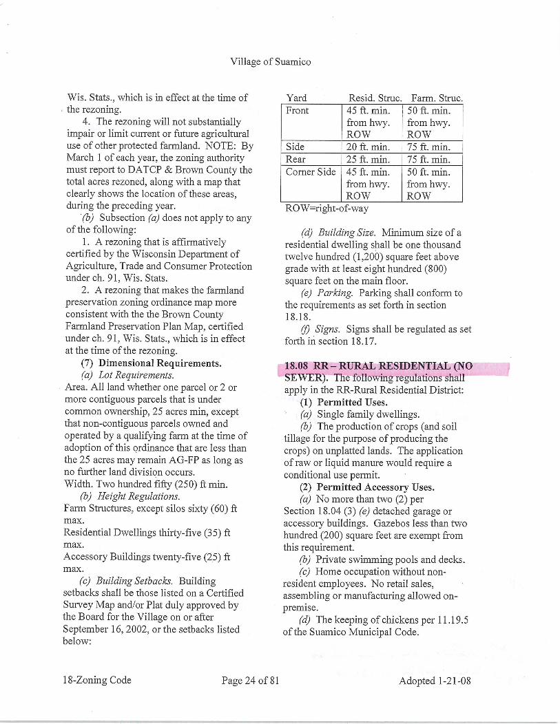
Village ofSuamico
Wis Stats which is in effect at the time of
the rezoning4 The rezoning will not substantially
impair or limit current or future agriculturaluse ofother protected farmland NOTE ByMarch 1 ofeach year the zoning authoritymust report to DATCP Brown County thetotal acres rezoned along with a map that
clearly shows the location ofthese areas
during the preceding year
b Subsection a does not apply to anyofthe following
1 A rezoning that is affirmativelycertified by the Wisconsin Department of
Agriculture Trade and Consumer Protection
under ch 91 Wis Stats
2 A rezoning that makes the farmland
preservation zoning ordinance map more
consistent with the the Brown CountyFarmland Preservation Plan Map certified
under ch 91 Wis Stats which is in effect
at the time ofthe rezoning7 Dimensional Requirementsa Lot Requirements
Area All land whether one parcel or 2 or
more contiguous parcels that is under
common ownership 25 acres min exceptthatnoncontiguous parcels owned and
operated by a qualifying farm at the time of
adoption ofthis ordinance that are less thanthe 25 acres may remain AGFPas long as
no further land division occurs
Width Two hundred fifty 250 ftmin
b Height RegulationsFarm Structures except silos sixty 60 ft
max
Residential Dwellings thirtyfive35 ft
max
Accessory Buildings twentyfive25 ft
max
c Building Setbacks Buildingsetbacks shall be those listed on a Certified
Survey Map andor Plat duly approved bythe Board for the Village on or after
September 16 2002 or the setback listedbelow
Yard Resid Struc Farm Struc
Front 45 ftmin 50 ftmin
from hwy from hwyROW ROW
Side 20 ft min 75 ft min
Rear 25 ft min 75 ft min
Corner Side 45 ft min 50 ftmin
from hwy from hwyROW ROW
ROWightofway
d Building Size Minimum size ofa
residential dwelling shall be one thousand
rivelve hundred1200 square feet above
grade with at least eight hundred 800square feet on the main floor
e Parking Parking shall conform to
the requirements as set forth in section
1818
fl Signs Signs shall be regulated as set
forth in section 1817
1808 RR RURAL RESIDENTIAL NOSEWER The following regulations shall
apply in the RRRuralResidential District
1 Permitted Uses
a Single family dwellingsb The production ofcrops and soil
tillage for the purpose ofproducing the
crops on unplatted lands The applicationofraw or liquid manure would require a
conditional use permit2 Permitted Accessory Uses
cc No more than two 2 perSection 18043 e detached garage or
accessory buildings Gazebos less than two
hundred 200 square feet are exempt from
this requirementb Private swimming pools and decks
c Home occupation without non
resident employees No retail salesassembling or manufacturing allowed on
premised The keeping of chickens per 11195
ofthe Suamico Municipal Code
18Zoning Code Page 24 of 81 Adopted121OS

80IZIpadopy
8I8I
uoloas u Ilzo has ssuauaaambaa ally
o uuouoo IlusuIaduiIand 6aoolluqua ally uo
aad aaenbs 008 paapunll tlAasnal um
apezo anoq aaaanbs OOZIpaapunll om
pusnoll auo aq Ilus DuIlampIuapsaa
ado azsuanualuly azSuipirng g
mouAatY102I
i B To SZ aad apo AuuoZgIf3
sazls oI uznuluuIaulmolloally anIl Iius 212TIuapsa2lIan2l
o pauozaa acI oulsanbaa ao pauozuIdanTSUallaadulo apepApapuaultpadop
Sluaoaa soul ally uIuapsagX003 aannbS 000SZaopug000OZ
000titaIrun sE palduapt s8aay cvIuapsa2lIean2l pauoz
aIIlm paonpaa aallznaq sazs oI asoll
Iiusaousu ou u aanamog oadspsIliosasodznd ally aosolpuuzzouoopaaapsuoo
aqIlus saaa Z om aa aaenbs
OZI L8 uam paapunll auopusnolluanastIpautIlssal AunIloadsp
slllouolslnaa SOOZ 8iiadd ally o aolad
2RIiuapsadInang pauozIIAaI paooaa
osolDusxa asorl I uodaoxg I
uznuauuzOOZ aad paapunll om Ilp
uua uuz
ooh OS ooSI apS aauao
uua ulua
ooT OZ food SZ aa2l
uuz uuaoo OZ food OZ apS
tYOIaaas m02I aaas
uzoad uua uaoaduuz
oo OS food Sb uoa
anassaoa anzls oulad pa
moiaq padsIsIoclasally ao ZOOZgI aaquzadas aa ao uo aAIIAally ao
pasog ally Cq panoadd Inp Idaopueduz
anans pallzao uo padsIasoll aq Ilus
sIaqasDupiing Z aa ornuIlaaaaAunouas atl oinbaIaqasIuoppaambaa Iius Z aa orna uIlaaaaA
DuIlaano dun Ildaoxa ilem uotpuno
ally uzoa paansnaul aq Ilussaqas
upina IIdsIanqas fluipltng Laaaanbs 000OTpusnolluao
aaalclplmq uznualulua anIl IIus SOOZ
8 iIady aapaaao uotslnlpgnsutsapquolnIasuoo pugsuauzdoianap pauuid
Dulpnlau soI iiV naa algnplinS 9umualxulSZ
aaanduam sDupiznq Saossaooumualxeua S
aaantlIusulpampIuapsad
suoininflagqiaH Suanuauuz
14 OOZ aa paapuntlomqpm
uznuauuaaa
aanbs 000OSpusnot eaa
uaI1LLiILIIUI aao Zom aaaanbs OZ iL8 uan paapunll
auo pussnoi uanasiqaaeaa
sazls oI uznuzuuaDuImoIloIally anIl
pals IuapsadIm2I pauoz uId
anlsuataaduaoaIIApapuauzpadopeIuaaaa soua ally uIuapsad
Ianaannsparluapsaa nsuauiaainbag oZ
saauidduolsnquaoo IaIpios aoopnp
sasn Dypaduzaad Aazs
uI aaaIao aad aanbs 000ZPusnolp
om spuod pug saIIiasaao
Z om aana aad asaollIaup asiauuax
SLLoiSsaxaidnQ c
aslulaaduopamolluanaenuulao
aullquzass saisIaaoN saaoidula ssalao Z omaumuodnoao auzoH v
GOBIuoaas aasasniuolpuooand paaapsuoo acItuz sasn
aulmollo allZ sasn Inuotipuo
oauansdo aaIiA
Village ofSuamico
4 Ifthe excavation site shall fall within
a floodplain shoreland or conservancy the
regulations as set forth in the Shoreland
Floodplain Protection Ordinance for the
Village shall apply5 Village employees shall be allowed
on the premises during scheduled operatinghours for inspection purposes
6 Any violation ofthis section shall be
subject to the regulations ofthe Section
18999 ofthis code
7 A performance bond in such amount
as the Administrator shall deem sufficient to
ensure completion ofthe work followingexcavation pursuant to the conditions set
forth in this ordinance Said performancebond may be in the form of a cash bondcertificate ofdeposit or insurance bond the
minimum value of which shall be the
weekly extraction value ofmaterial takenfrom the site plus an amount to cover the
cost ofrestoration ofthe site in question8 Copies ofall permits required by
overlying jurisdictions4 Erosion Control
a All erosion control must be installed
and maintained per any and all ordinances
and requirements ofany and all overlyingjurisdictions having authority over the site
b All tracking andor erosion must be
placed back on the site at the close ofbusiness each day
1822 P
1 Application to Existing Use
Districts This section shall operate as a
conditional use and as an alternate to the
permitted use and regulations applicable to
existing district except the AgriculturalFarmland Preservation AGFPand
Agriculture AG Districts and shall be
applicable only to those lands which are
hereby and may hereafter be zoned Planned
Development District by the Board Basic
underlying zoning requirements for land
conditionally zoned as a Planned
Development District shall continue in frill
force and effect and shall be solelyapplicable until such time as the Board
grants final approval as hereinafter providedAll Planned Commercial Districts approvedprior to January 21 008 will fall under the
guidelines ofthis section
2 Purpose The purpose ofthe
Planned Development District and the
regulations applicable to the same are to
encourage and provide means for effectingdesirable and quality development bypermitting greater flexibility and designfreedom than permitted under the basic
district regulations and to accomplish a well
balanced aesthetically satisfying Village and
economically desirable development of
building sites within a Planned DevelopmentDistrict These regulations are established
topennit latitude in the development ofthe
building sites if such development is foundto be in accordance with the purpose spiritand intent ofthis code and is found not to be
hazardous harmfiil offensive or otherwise
adverse to the environment property values
or the character of the neighborhood or the
health safety and welfare of the
cammunity It is intended to permit and
encourage diversification variation and
imagination in the relationship ofuses
structures open spaces and heights ofstructures for developments conceived and
implemented as comprehensive and
cohesive unified projects It is further
intended to encourage more rational and
economic development with relationship to
public services and to encourage and
facilitate preservation ofopen space and
other natural features such as woodlandsfloodplains and wetlands
3 Definitions
a Basic Zoning Regzlations Means
such zoning regulations as are applicable to
the use district other than the regulations set
forth in this section
s
18Zoning Code Page 62 of 81 Adopted12108
80IZIpadopF IBo9 armed apoo utuoZ8I
uauzdolanap pasodozd aua oaaoezeuo
auk ao sanlen jaadoad uauzuoxznua
auk o aszanpeasinnzauoxo aezsuadoInuzzusnopzezeu aq ou off punod aqllus
pine aoueuzpzo QQd auosuoioaszauouz
pasueussal aqsuauzaxtnbaz asau Ilusasuo ou uI QQd pasodoxd auk sausllaesa
pue sazzzouneupadop apoo aukpue usld uauzdolanapIeuz auk uz paeauzlap
acI Itusaoeds uado pue isuap aplsxauzoo pine xeazapis uozslaeqas azzs
oI eaze zoolT pine azzs uatau Auzplmq zodsuauzazznbag suoaasaffautpptng c
uauzdolanap QQd
pasodoxd auk sausllgesapine sazzzoune
upadope apoo auk uz passasppeaq
Iius sasn auxosuoxozzsaaasnleuozippeuepineaeuzs autslxed osl zadolanap
auk qpapinoxd pnsaIzeuzaeudozdde ue
qpaealpuz sssuapisaz auk qpazoddns aqueo sasn Mons papinozd eaxe uzpunozzns aukosuaptsax xopueQQa aukdosuapzsaz auk
anaas o papnlouz aqreuz sasnIeuoznzsuz
pine Ietoaauzuzoo IeuozeaxoaZlozxasip xauatauz paeool
zadoad aukouozzod auk oseaze auko zalleuzs auk o OS uaazad aq off
panduzoo eaze uepaaaxa ouIlus uozsuaxa
Mons o eaxs uznuzzxeuz aukuuozipuooauk zapun luo nqozxsip uaoefpe
auk outpapuaxaaq SeuxoizslpIauo
osuozelzaa Auzuoz ozseq zapunpazuuadsasn llaiasip asnIauo ueuazouz
uz paetIs sz azs autplmq azaulYl Z
paeools1 zadozdxelnotxed auk uozun ui alatsip
uzuoz auk o alcleozlddesuozelnAaz uzuoz
ozseqauk zapunpatuzzad sasn tI I
aousuTpzo
szuzapun pazmbaxslenozddeSzessaaau
IiiAutuiego uodnotzaslQuauzdolanaQpauueld uipaiuuad atesasn
auznoIlo auLsash uguoZasnS
paiuzzadsash 1QQd se opazxaazsI pine
izzn alAuls se padolanap acl o sT uotIm
zua Iealzauo xo uoiezodaoa zauno
alauts qpallozuoo peel o eaze ue ueauz
IIuS 1amssQ uauido1anaQ pauuzld
sIzedaazzeupugsaze ozuazd spuod sllex aloaicl uiptx
Iouaasaou uzITu xo daoxasuauzanozduzzzo aznonzasoaaz dalaoeds uado ueauz
IIuS aazdsuadp paaoducuzoaspuouzelp
tiasznoo szuua suzoozsaza1slaozdMons uodn paoeld aze rlotInnsuauzanoaduzz
aoaznonzsuepine slaoaed anode aukueauziluS ardsuadp panoduq
otxsQuauzdolanaQ pauueld auosuaptsaa
do uauzofua ao asn auk zod papuautpinepaeuzsap aIs aukutndoaxau uoleuiquzoo
zo zaennoeaze ue ao puel o slaoxedxo Iaozed ueauzIIuS aands uado aIenozddn zoo uozssluzuzo uiuoZ
2g auzuueld auk opatuzgns aq o ozz1siQuauzdolanaQ pauueld auk onoelzopueaauueuz pasodozd aukAuzeotpuT gZZ8IuoioaS ut pagtzosap sDutnnezpSzeuzuzilazdauk ueauzIiuS ubldrLsz7uupacd
Ienoxddn zoo uozsszuzuzo uiuoZguluueld auk offpatuzgns aq o Qgd auk
onoelzoo zauueuz pasodozd aukAuzeatput0I TaTux xzpuaddy ut paquosap
DuznezpIu guy uvpd1zu aasn puel o gage zadpazuzzad
stun Auzllanpozaquznu zo eaze peeloooaxnbs zad patuzzadszunuzllanpdo zaquznu aukueauzIIuS suaQ p
oaaut aqzaeaaauieuz xonoust
uum aaellTA azl 3ouozo ozuzouooa pine
Ietoos Ieotsudauzo aping lezoidoaukueazuIIuS u1daasuaradufo a
euuao aazs
azlgnd uo paeool aq snuzazs guy dnox
uznzuzuzopuoa eqpaunost zo dzusaaumoalauts uz st papinip os t puel o01auk
azaum zo papinTpgns aq you Ilinn uoTIrn pinesasodnld uzllanpSltuzealuzsuzdaoxa
soloulzosaazs ozlgnd q papinipyou puel dooex1 sI aS8up1nff 9
ootuzenSoaAelt11
Village ofSuamico
surrounding neighborhood or community or
adverse to the health safety and welfare of
the residents ofthe PDD andor communityas awhole Notwithstanding the foregoingifthe final development plan does not
address a specific zoning requirement theNonaddressed Requirement the
provisions of the Suamico ZoningOrdinance shall apply to the developmentplan to the extent ofthenonaddressed
requirements5 General Provisions
a Engineering Design StccndccrdsNormalstandards or operational policyregarding rightofvaywidths provisions of
sidewalks street lighting and similar
environmental design criteria shall not be
mandatory in a planned development but
precise standards satisfactory to the Villagepursuant to the criteria as set forth in Section
18226 shall be made a part ofthe
approval plan and shall be enforceable as
part ofthe code
1 Unless approved by the Village allsewer and water utility extensions shallremain public
b Approvals The developer shall
develop the site in accordance with the
teens and conditions of developmentpresented to and approved by the Board
Any changes or additions to the originalapproved development site structures or
plans ofoperation shall require resubmittaland recommendation by the PlanningZoning Commission and approval by theBoard
c Rescinding Approval Failure to
comply with conditions commitmentsguarantees or the recommendationsestablished in the approval ofsuch
development project shall be cause for
rescinding the approval of the same Uponnotice given by the Building Inspector the
developer then shall be required to appearbefore the Board at its next public meetingto explain any such failure to comply The
Board at such hearing shall determinewhether or not the developer shall havefailed to comply and ifthere has been such
a failure may either
1 Rescind its approval whereupon suchrecession and cessation ofall rights and
privileges ofthe developer and owner
including the right to complete construction
or to construct any building or other
structure or improvement shall become
effective on the thirtyfirst 31St dayfollowing mailing by certified mail to the
developer at his or her last lcnovnaddress of
awritten notice of such decision or
2 Adjourn such hearing for a period not
to exceed sixtyfive65 days to enable the
developer to comply whereupon if the
developer is then in substantial complianceand has then established to the reasonable
satisfaction ofthe Board that there will be
compliance in the firture the rights and
privileges ofthe developer and owner shall
continue for such period oftime that therebe such compliance or does not establish to
the reasonable satisfaction ofthe Board that
there will be compliance in the future the
Board will proceed in accordance with
for determining the acceptability ofa PDD
proposal the following criteria shall be
applied to the development proposal with
specific considerations as to whether or not
it is consistent with the spirit and intent of
this code has been prepared with competentprofessional advice and guidance and
produces significant benefits in terms ofenvironmental design
a Character ccnd Intensity ofLand
Use The uses proposed and their intensityand arrangement on the site shall be avisualaesthetic and operational character which
L Is compatible to the physical nature
ofthe site with particular concern for
preservation ofnahiral features tree growthand open space
18Zoning Code Page 64 of 81 Adopted12108

80IZI paldopy Igo sg awed apoa DuuoZ8i
atlgnd atI ouolnopap zo
uotnzasazanzdqzatlahemostlpupu aodsuado uotuutoodo aauuauuz
puguonzasazduautzuad atl zoo apuz
aqIius suosnozdaenbap azdsuadpoauzuaurz7yYpub uornncasadp
azIam pineasoIgnd atlaznsua ozssaoauutlssal aq spzpus
uotonzsuoo Ilus asoou ut nuzanamotlpapnozduotnsotIDads atl uuoaun
atIcads atI uelduz ozssaoau spzepus
alezdozdde atli o seuotuttuzaapt uodn
paseq aqIlus suotzapsuoaDutzaautaua
ItuautuoznuaztIuns zatlopuaAutzp zoouotstnozd put sauIzatmpine zamas tzuos
putztues ouoteool nuttlDtl zoopno
zoosuauzazmbaz Autned zatlozo aazso
uotoolpuupmfmostlAz otlpmatl1 spnpus u4isaQutaauiu
saouauanuoou
zatlopine nupooh uosoza notlmzatm
aaznsIIIo asodstp o s os pautezp pine
papezp aqIlus seaz Autpeoiun pineupeolaazsoputsazDutIzdIII 8
uossuzuzo
putuoZ gpuuuId atl qpanozddoazatl uDtsap atl put pandaqIiussaz
DutpeoIun punupoIaazslooiI L
saauapsazpuutofpauk uzozem pupIatl aaztp ospanuizzt
os aq IItIsautrIaIiIans III pauAiIaenbapt aq IiltlssaztutIzedIiv 9
aazs atlotedaazuuspauAsap az seazDutIzdazatImdaoxa sIImzo apznu saDutla
stzzzaq uarea DuuIdasuap saapatlumsatza otlzpine spozsaznonzs uaofpuzozd pauaazas aq IItIssazeutizd S
saz
putIzdzatlooatztlnnoztl uanazd o
s os paauzzeaq titIssazutIzedpaoiduza aq
Iius saonapanoaozd zatlozo spzna aaz
sgznaaeudozddt salaclanzooutzopu
sutzsapadq znfu o aIqdaasns aq IIm
sIezauzuiId azatlm suotaol uI
suotpuoo aszanpeutlenazdatllaezalo oIqzatl zoopaoiduza
aqsIzauzantuupapuaututooazsttzatlmd tlmozaauztInsu sazaut
zoo paoaIas aq IlusIzatuuId Zaouezeadde pooa o sanqzuoarazatlm
znooo Iuo pInotls sazneaattldzAodoouotaipolnluotznzasazd sttl o uantA
aq Ilnusuozapsuoo uauzdoianap o
tlfinpuneaq atl opangtzuoosaznaottldzaodor Dusxa zoIznuazatlrn I
tlzo has aqIittIspzipusuasaputmollo atl asodznd sttlurnnudaaI
uI sazutIzdpine uautanouzuusapadutdtaspuIanbap zoo apnozd o
pine adosaazsatl uzozIuosuzalgezsapapnozd o pauuiId aq Ileus aspuplzd
atlZsarAuZarZdOauZdbspu7 cvapoo QQd atlosuauzaztnbaz
atluumDuplzedanbapeapnozd o
oauotttodsuez sseuzouosnozdsolpunlztdaIIaszozalu zo zozalxa se trans
pass aqutsuautaAuzzutIzdauzaIy
papznooua st DutIzdouosnozdatlDutssazpp untazuostnozdDutIzd
aazsoanbapeauutzaapo apmas pasn aq IietIssuauzaznbazutIzed
aazsosaaIIAatl zanamoH QQdpasodozd atI sailsIgesapine saztzotlne
upadopt apoa ail upaeauIappu suIduauzdoianapIutpuzututtlazd
atlo Ienozdd aidcads atl ut pauuzzaapaq IIEtIssuauzaztnbaz DutIzdatlZ satla
Autpsol pugutIzdaazsoaIqssaaoeput quao1lnsapnozd plnorn
saatnzasItdtotunuz zatlozo uotaaozdazt dtUlatd aagzAInouzaz mows zam
zamas Iootlas zoo uosnozdpaledotueatl aaISlaszanpe you pinorn c
tunututoo atl
qpailsIgesas suIduauzdoianap ItzauaaatlumaIqduzooIaazdIuolout
puIqs atuzouoaaIqezsapatoloaapugoatpsae pausnsouauzuoznua
antazuaanpozd plnorn Z
oouznsoaeII1

Village ofSuamico
1 In the case ofprivate reservation the
open area to be reserved shall be protectedagainst building development by conveyingto the Village as part ofthe conditions for
project approval an open space easement
over such open areas restricting the areas
against any fiirther building or use except as
is consistent with that ofprovidinglandscaped open spaces for aesthetic andrecreational satisfaction ofthe surroundingresidences Buildings or uses fornoncommercial recreational or cultural
purposes compatible with the open spaceobjective may be permitted only where
specifically authorized as part ofthe
development plan or subsequently with the
express approval ofthe Board following therecommendation ofsite and operationalplans by the Planning ZoningCommission
2 In the case ofroadways and other
rightsofwaywhich are not dedicated to the
public as part ofthe conditions for projectapproval there shall be granted to the
Village such easements over the same as
may be necessary to enable the Village to
provide suitable and adequate fue
protection sanitary and storm sewer waterand other required municipal services to the
project area
3 The care and maintenance ofsuch
open space reservations and rightsofwayshall be assured either by establishment ofan appropriate management organization for
the project or by agreement with the Villagefor establishment ofa special service districtand levy the cost thereof as a specialassessment on the tax bill ofpropertieswithin the project area In any case the
Village shall have the right to carry out and
levy an assessment for the cost ofanymaintenance which it feels necessary if it isnot otherwise taken care ofto thesatisfaction ofthe Village The mannerof
assuring maintenance and assessing suchcost to individual properties shall be
determined prior to the approval ofthe final
project plans and shall be included in thetitle ofeach property The developer shallsubmit a landscape maintenance schedulewith the final plan for approval by the
Village that satisfies the above requirements4 Ownership and tax liability ofprivate
open space reservations and rightsofwayshall be established in a manneracceptableto the Village and made apart ofthe
conditions ofplan approvale Accommodation ofPedestrian
Traffic1 Sidewalks andorother walkways and
bicycle paths shall be provided where
necessary for the boundaries Specialattention shall be given to connections
accommodating pedestrian movement
between the dwelling units common openspace recreation facilities commercial
establishments and parking facilities or
areas
2 Walkway widths and surfacetreatments ofall wallvays shall be
designated with regard to their function andthe anticipated manner ofusage Thenatural feature ofthe area traversed by the
walkway system and suitable lighting in
scale with the project shall also beconsidered
3 Utilization ofpedestrian ramps shallbe encouraged where necessary to eitherresolve conflicts with vehicular traffic or
facilitate the movement ofelderly andorchildren
SetbackRequiements Setbacks for
parking areas and structures shall beestablished by the conditions governing the
particular Planned Commercial District so as
to ensure compatibility with adjoiningdevelopments uses and zoning but no
parking area or structure shall be permittedwithin
1 Fifteen feet 15 from any countyhighway or Village arterial street rightofway
18Zoning Code Page 66 of81 Adopted12108
Village of Suamico
2 Ten feet 10 ofthe rightofway line
ofa collector or local street
Signs and Outdoor Graphics All
signage shall comply to Section 1817 unless
specific signage regulations are contained inthe conditions of each approval by the Board
authorizing the establishment ofthe Planned
Development District
h Factors and Requirements to be
Considered by the Planning ZoningCommission and the Boccrd
1 Height of structures
2 Auto parking facilities3 Screening and fencing4 Landscaping5 Setbacks6 Open space and reservations7 The site itself as it relates to
neighborhood environment compatibility to
existing neighborhood use and generalneighborhood characteristics
8 Nature and use ofthe proposedstructures and design architecture and
materials to be used9 Highway access to the site number of
openings and location of same
10 Traffic generation number of
vehicles parked and rate of turnover per
hour11 Drainage12 Capacities required for sewer water
and other necessary utilities13 Educational capacity capabilities
number offamilies and school load14 Economic impact on the Village its
inducements attractions and detractions15 Lighting16 Proposed methods and hours of
operation17 Comparison ofopen space as
required by the underlying basic zones withthat proposed project
18 Operational control
19 Commencement and completiondates
20 Highway dedication
21 Deed restrictions and suretiesdeemed necessary to protect the healthsafety and welfare ofthe community
22 Such other limitations conditionsspecial requirements or characteristics to
the use as may be deemed necessary to
protect the health safety and welfare ofthe
Villagei Implementation Schedade The
proponents ofaplanned development shall
submit a reasonable schedule for
implementation of the development to the
satisfaction ofthe Planning ZoningCommission and the Board inchidingsuitable provisions and the Village may
require the furnishing ofa sufficient
performance bond for assurance that each
phase could and should be brought to
completion in amannerwhich shall not
result in adverse effect upon the communityas a result oftermination at the end ofany
phase7 PreApplication Conference Prior
to filing ofan application for PDD the
applicant ofthe proposed PDD is
encouraged to arrange a conference with the
Village The primary purpose of the
conference shall be to provide the applicantwith an opportunity to gather informationand obtain guidance as to the generalsuitability of the proposal for the area for
which it is proposed and its conformity to
the provisions ofthis chapter before
incurring substantial expense in the
preparation ofplans surveys and other data
8 Procedure The procedure for
approval of a planned development projectshall consist oftwo 2 phases
a Preliminary Approval Consistingof approval ofthe proposed project in
principle onlyb Final Approval Consisting of
approval of the proposed project in all itsterms and details
18Zoning Code Page 67 of 81 Adopted12108
Village of Suamico
9 Preliminary Approvala Notice and Fee Aperson desiring
to develop a particular site as a planneddevelopment project shall apply to the
Building Inspector on such forms as shall be
provided by the Village and shall pay a fee
equal to that currently required for a
Preliminary Planned Development District
application which must accompany saidforms Such application shall contain the
names mailing addresses and telephonenumbers ofthe owners and developers anda description ofthe developmentsite
Appropriate supporting documents and
maps as required in Section 18229 dshall be filed with the application
b Notice to Committee The BuildingInspector shall inform the PlanningZoning Commission ofsuch desire and shallsecure a date for a preliminary discussion
between the developer and the PlanningZoning Commission and shall notify such
developer of such date
c Planning Zoning CommissionRecommendations The Planning ZoningCommission after such preliminarydiscussions and such fiirther discussions as
maybe required with the developer shall
report in writing such proposed projectdevelopment to the Board together with itsrecommendation for either approval or
disapproval ofthe same Such report andrecommendation ofthe Planning ZoningCommission shall be made to the Board no
later than four 4 months from the filing ofthe application with the Building InspectorA recommendation of approval by the
Planning Zoning Commission shall in no
way be binding onthe Board
d Information Required The
following information shall be provided bythe applicant in adequate detail to satisfy the
Planning Zoning Commission for itsrecommendation regarding preliminaryapproval
1 A statement describing the generalcharacter ofthe intended development
2 An accurate map ofthe project area
drawn to scale no less than one inch 1equals two hundred feet 200 showing the
nature use and character ofabuttingproperties prepared by a registered surveyor
3 Four 4 copies ofageneraldevelopment plan of the proposed projectdrawn at ascale no less than one inch 1equals rivo hundred feet 200 showing the
following information in sufficient detail to
make possible the evaluation ofthe criteriafor approval as set forth in Section 18226a b c d crud h ofthis section
a Tract boundaries and a statement ofthe total acreage ofthe tract
b Significant existing physical featureswithin the tract with two feet 2 contour
topographic information including natural
drainage patterns and water resources suchas streams drainage swales watercourses
ponds lakes wetlands floodplains subjectto one hundred 100 year flood frequencyand proposed changes in those features
c Zoning districts on and within four
hundred feet 400 adjacent to the proposedproject
d Property lines if any within the
proposed projecte All contemplated land uses within the
tractf An indicator ofthe contemplated
intensity ofuseie gross density inresidential development number of
prospective tenants in office commercial
and industrial development or recreatiorial
developmentg Number and type of dwelling unitsh Existing buildings that may affect
future development and proposed location ofall principal structures and associated
parking areai Proposed lot coverage ofbuildings
and structures
18Zoning Code Page 68 of81 Adopted12108
Village ofSuamico
j Proposed circulation systemspedestrian bicycle auto mass transit bytype how they relate to the existing networkoutside this site
k Existing rightsofwayand easements
which may affect the PDD project1 In the case ofplans which call for
development in stages a map at an
appropriate scale showing the successive
stagesm The location ofsanitary and storm
sewer lines watermains fire hydrants and
lightingn The location ofrecreational and open
space areas and areas reserved or dedicatedfor public uses such as schools parks etc
o Description ofproposed system for
drainagep General landscape treatment
4 Appropriate statistical data on thesize of the development residential densityratio ofvarious land uses economic analysisof the development and any other data
pertinent to the evaluation under the criteriaof Section 18226 a b c d and
5 Architectural drawings and sketches
illustrating the design and character of
proposed structures
6 General outline ofintended
organization structure related to propertyowners association deed restrictions and
private provision ofcommon services if
any7 Economic feasibility and impact
report may be required by the PlanningZoning Commission to provide satisfactoryevidence ofthe projectseconomic
feasibility of available adequate financingand ofnot adversely affecting the economic
prosperity ofthe Village or the values of
surrounding properties10 Amendment ofPreliminary
Approval The recommendation ofthe
Planning Zoning Commission and the
preliminary approval ofthe Board shall be
based on and include as conditions thereto
the building site and operational plans for
the development as approved as well as allother commitments offered or required with
regard to project value character or otherfactors pertinent to an assurance that the
proposed development will be carried out
basically as presented in the approved plansDetailed construction time and the approvalofsuch preliminary plan shall be conditional
upon the subsequent submittal and approvalofmore specific and detailed plans Anysubsequent change or addition to the plansor use shall first be submitted to the
Planning Zoning Commission and if in
the opinion ofthe Planning ZoningCommission such change or additionconstitutes a substantial alteration ofthe
original plan it shall timely make an
appropriate recommendation to the Board
relating to an amendment ofthe preliminaryapproval
11 Final Approvala Petition for Final Approval When
the Board has issued its preliminaryapproval ofthe proposed plan then the
developer may file with the Clerlc apetitionexecuted by the owner ofthe property to be
developed or its agent for the finalapproval stating that it seeks to developsuch property under the provisions ofthis
section Such petition accompanied by a
final planned development district fee shallinclude unless previously submitted
1 The names mailing addresses and
telephone numbers ofany additional owners
and developers ofthe development site and
the names ofowners and developers listedon the application that no longer have an
interest in the project in the event there hasbeen a change in owners or developers sincethe date ofapplication
2 An accurate topographical map
showing topographical data at two foot 2intervals and extending within one hundredfeet 100 beyond the exteriorboundaries of
18Zoning Code Page 69 of 81 Adopted 12108
Village ofSuamico
such site showing all public rightsofvayand all buildings accurately located withinone hundred feet 100 ofthe exteriorboundaries ofsuch site Such map shallcontain all available utilities includingdrainage and capacities thereof and highwater elevations along rivers
3 A scale plot plan showing the
location type and size ofevery proposedstructure and its proposed use also
driveways driveway access roads parkingfacilities lighting appliances recreation
areas loading docks open spacesscreening fencing and landscaping areas
and utility easements
4 A statistical table showing the size ofthe site in square feet the acreage exclusiveofpublic streets proposed populationdensities and open areas both in square feetand as a percentage ofthe project area
5 Architectural drativings ofall
buildings and structures and sketches
showing the design characteristics andtreatment ofexterior elevations and typicalfloor plans ofproposed structures
6 A table showing the approximate cost
ofstructures
7 A statement showing the starting and
completion dates ofthe project8 Any other pertinent data statements
drawings or plans which may be requiredby the Planning Zoning Commission or
the Board9 The following additional information
for commercial and industrial developmentsa Square feetofbuildingsb Square feet ofoffices production
areas and the proposed number of
employees in such area
c Details ofproposed use or uses andmanner ofoperation and
d The municipal services that may be
required to serve the area
b Plan Approval Approval ofthe
preliminary plan shall entitle the developerto final approval if the final development
plan is submitted within twelve 12 monthsofthe date ofthe preliminary plan andconforms to such layout and conditions ofthe approved preliminary plan and requiredfinal approval information The PlanningZoning Commission shall make a
recommendation to the Board within fortyfive 45 days ofthe submittal ofa final
plan The Board then shall have an
additional fortyfive45 days after receiptofthe Planning Zoning Commissionrecommendation in which to make a
decision
c Expiation ofPlan If construction
has not begun andor no use established inthe PDD or one 1 of its stages within
twentyfour 24 months offinal approvaldate the final development plan shall lapseand be ofno fitrther effect
d Changes Minor changes in the
location setting and heights ofbuildingsand structures maybe authorized by the
Planning Zoning Commission withoutadditional hearing ifrequired by engineeringor other circumstances not foreseen at thetime the final plan was approved A planneddevelopment district amendment fee shall
accompany any such request No changeauthorized by this section may cause any ofthe following
1 A change in the use or character ofthe development
2 An increase in overall coverage of
structures
3 An increase in the intensity ofuse
4 An increase in the problems oftrafficcirculation and public utilities
5 A reduction in approved open space6 A reduction ofoffstreet parking and
loading spaces7 A reduction in required pavement
widths
8 All other changes in use or
rearrangement of lots blocks and buildingstracts every change in the provision ofcommon open space and changes other than
18Zoning Code Page 70 of 81 Adopted12108
Village ofSuamico
listed above must be made by the PlanningZoning Commission Such amendments
may be required by changes in communitypolicy
12 Interpretation In their
interpretation and application the provisionsofthis code shall beheld to the minimum
requirements and shall be liberally construedin favor ofthe Village and shall not bedeemed in a limitation or repeal of any other
power granted by the Wisconsin statutes
Development shall be planned reviewedand carried out in conformance with all
municipal state and other laws and
regulations However in interpreting and
applying the provisions ofthis subchapter or
any PDD adopted under this subchapter theyshall take precedence and be controllingtivhen there is conflict between their
provision and those ofthe zoning provisionsofthis code
1823 TCOD TOWN CENTEROVERLAY DISTRICT
1 Purpose of the Town Center
Overlay District TCODa The TCOD is intended to permit
developments that will over a period of
time be enhanced by coordinated area site
planning diversified location ofstructures
andormixing ofcompatible uses Such
developments are intended to provide a safe
and efficient system for pedestrian andvehicular traffic to create more active social
places to provide an opportunity for
developers to create economic activities that
serve the needs ofVillage residents to
provide attractive recreation green spacestown squares and plazas and public activityspaces as integral parts ofthe developmentto enable economical design ofutilities and
community facilities and to ensure adequatestandards ofconstruction and planning TheTCOD under this section will allow for
flexibility ofoverall development designwith benefits from such flexibility intended
to be derived by both the developer and the
community while at the same time
maintaining where judged appropriated bythe Board other standards or use
requirements as set forth in the underlyingbase zoning district The TCOD shall be
applicable only within the district as
depicted in the accompanying map withinthe Town Center Plan TCP
b The unified and planneddevelopment of a site in a singlepartnership or corporate ownership or
control or in common ownership under theUnit Ownership Act set for in Wis Stats
Ch 703 condominiums may be permittedby the Village upon specific petition withsuch development encompassing one 1 or
more principal uses or structures and related
accessory uses or structures when all
regulations and standards as set forth in thissection have been met
2 Area Requirements for TCOD
Project Areas designated as a TCOD
project shall be under single or corporateownership or control and shall contain a
minimum development area ofeither one
half1z acres or the size ofthe lots and
parcels existing as ofthe adoption date of
this TCOD
3 Uses Structures LotArea and
Dimensions Density ParkingLandscaping Heights Setback Yardsand Other Requirements Uses structuresindividual lot sizes densities setbacksyards dimensional requirementslandscaping requirements parkingrequirements height requirements and other
requirements required by the underlyingbase use district maybe modified and shallbe considered as permitted uses if in the
judgement ofthe Planning ZoningCommission Design Review Commissionand Board the proposed project is
compatible with the site design illustrationsguidelines and related features as shown inthe TCP
18Zoning Code Page 71 of 81 Adopted12108
Welcome to Suamico Signage Program
The Village of Suamico is preparing and planning a Welcome to Suamico Signage Program to
be implemented at various identified locations in the community
We have selected six 6 locations that we feel are prominent and good sites for the placementand erection ofthese signs We have attached amap that identifies the six 6 locations alongwith photographs of the sites Additionally aphoto of a6 long x 3 wide Welcome to
Ashwaubenon and a4 long x 2 wide Howard Suamico Lions Club donor sign is attached so
that you can visually appreciate the size and impression ofthe actual signs
The Welcome to Suamico language along with the logo with the Great Blue Heron and
Cattails will replace the Ashwaubenon specific language
The proposed locations are
1 Lineville Road north side ofthe road east of HWY 41
gets east bound traffic offofHWY 412 Velp Avenue west side of the road north ofLineville Road
gets north bound traffic3 HWY M Flintville Road east side ofthe road north of Lineville Road
gets north bound traffic4 HWY J Lakeview Road east side ofthe road north of Lineville Road
gets north bound traffic5 HWY J Lakeview Road west side of the road south ofBrown Road
gets south bound traffic6 HWY B School Lane south side of the road west of Pittco Road
gets east bound traffic
All donors will be allowed to place a 224 wide by 4 48 long donor sign that
acknowledges their contribution to this effort These signs are expected to cost approximatelyAnd will be erected by the Village of Suamico crews this fall
If you wish to participate and donate to this effort please contact Village Administrator Steve
Kubacki and ai7angements will be made to identify your preferred site your contribution to the
project the requirements ofthe 2 x 4 donor appreciation sign and any and all ofthe specifics
Thank you for consideration of defining the boundaries ofthe Village of Suamico for both
residents and visitors as they live work and enjoy our rural character businesses and quality of
life
Ifyou have any questions on this matter please feel free to contact me at your convenience
Sincerely
Steve Kubacki Village Administrator
SteveKsuamicoorg9204342212 or9206095492
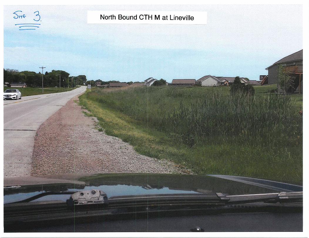
sT 3 North Bound CTH M at Lineville
rtewnyy T 11
N
11Ivya
ply 1Y
r 1i ri 4 1 A141ir 1 l uL acis 4c II 7 1 rn II
R Y rRR RP 1 le81c iyr wl6ww715 LtF ti
w
1 419 R i JI Irhhri i a Iu
ICI P 14 i I 1x I I I II I tl gyp1 y I I S11 di
l
I 4i f 1iLirI r 1 tp1lYirfj IiiilllI4 JI 1iyIfI
I I i 1 11 hA J all Ali PPy I yt lidr V
Iyla gill 1411 I r Q all 11 ple I iI I 1I IA Inr tlI
II ilt L A i a I 1 111 J Ih I i
trp 4 Li a 11 i 11 1 1 yta I iE lyP
w 1 s I
1 eIJI 1 1 vil P Ih il114 1 1lii r I h a I iay wr
t bs 1 I I dc I i p II r tyIJSi
da S a 1 9
1 x fA o K t t Ij y R f t y IU a r
4
i
y
a
ate
x
u
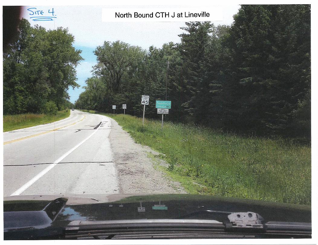
o 6r iM1 iriilrillil7191CI
1
a ifairtir t A b
lr 1r
1 r it Ir 1 rSk I7 AfKi
rrM1
s
Ii1
i 1v4 rYr
t r r7
irn
yj ii t 1
i r X11 L i I r
1I
r1 i4
z
tr
cif F i J
IG i f If Ct r1 ry i
i 9fat M1f 1 Y iPt
r rfc I iy 1
fxi I
i rT South Bound CTH J at Brown
rki
l
s y sAr
y nw
1iM1I y
Yom 4 hpI15 r P 4a G y r nlSni
td t
iri v fi r b G s V r ti SJ x
L x M1 s iCMiiI i wtr 7a wr r r u 1 ir F
fitwiy f
1r
r rVvli4 1Is1fl y
rr Ny u
d3 xa
y
w4
III rrrY 4
Py
S t 11
Ott TJf ti
ir
C r u tIr l I ri 1 rFiqr I tYt
tii stir I
tvx IItr ff r ir I I r s
di
Jr t t iv rant cyr i it a r Q dri 1 rdt i u1s
Flsi irk

J TF LOEast Bound CTH B at Pitco
xn
i x
rrl 3Y
l i1
k
w
cr 1
pia 1r i F Hrat
I may
fl
yr i
ifig
kS
y
51
Y
vur d j
ry
p

4w
f
i
s
3
i i
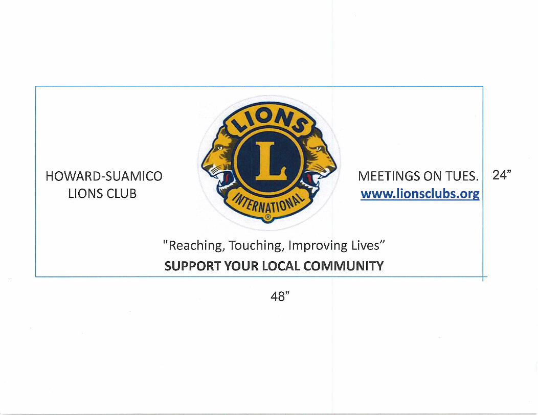
HOWARDSUAMICO
LIONS CLUB
MEETINGS ON TUES
wwwlionsclubsor
Reaching Touching Improving Lives
SUPPORT YOUR LOCAL COMMUNITY
24
48
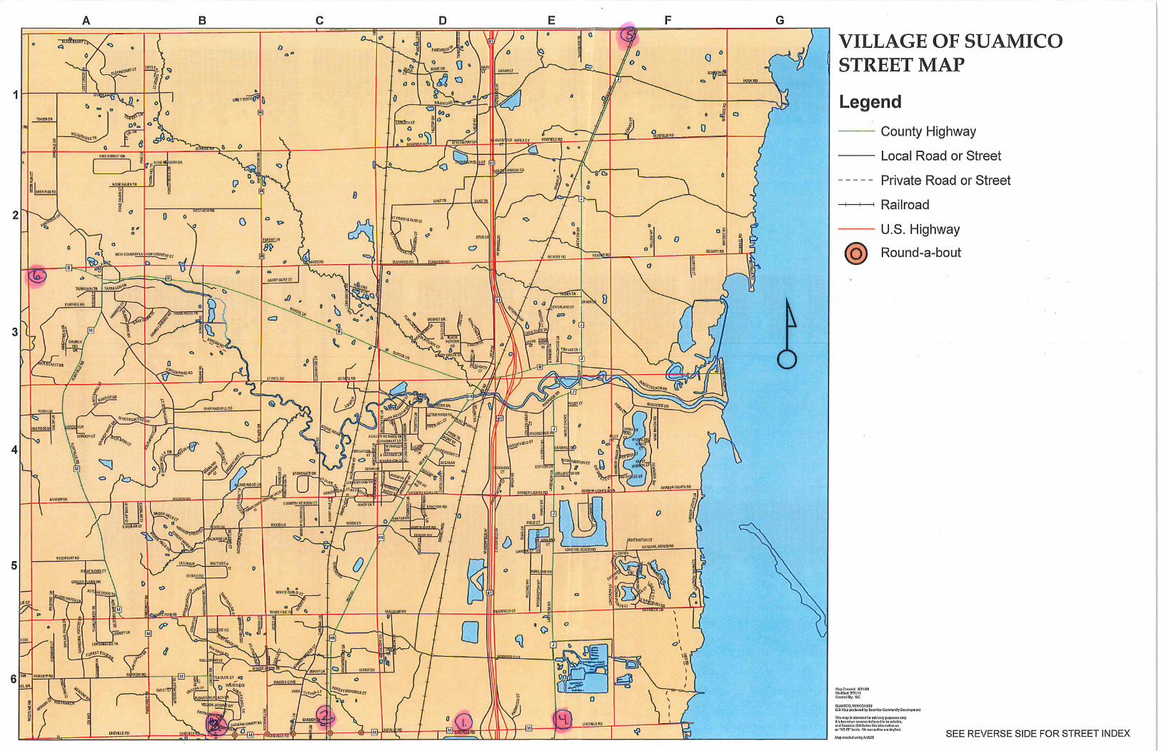
C17 p W N 3
F
WESTLINE RD
z
OOEEA PUN LT
D
r6 9ii Yp
o1
G
69 J pWAPO T PPISTINE LNy oPSALEM W b OA ALE1 OP
m D3N
N
SKYLINE PINE50 iSm a
WNEATFl0000Pr O
g G FGTHEORKFOPE5T1 P
7 SRO D IOBTLPEEK N
O G
OA mNi 1llMB EEO TP
g
n
JARYYa
Ta
c
d
a o 8r4 BRwQ Mh m
y HL3 alaNwn urYNF
oy I p a O dg
om
0E
pC 1 i ROSE HAVEN IK
g 17 RVIN3NM A
xMYWtl 9N0TI YA
gg
20
o os
GC 0A
o n 0
q
0t IOHViNEN3
mPINE
N p PIN R
qO Q
b
qORN HILLTA 0
O OJI33b do
n
A V ppA NDROOKHIN SGTTHW
s
ty 3 O
D T
eY
t PpQ eNOP
A oO by FOR QMYSNL ILLS TE g p ati R
B
a
m53I o9a
A
a RzEWOOn g c
O o
0
1D cEOnRSPPWr2
0
ou LT o C
Q Gn
0
eONIFER
J 5 N
p riN o
o p
I c
ofIncr jy
cWILWOOOINC
vU eWOR
CQ
D
stin1 I u
Y u4p
0
O
O
wEAM RD srPFA o o i
tiyi
7L Ig qi
ti3peos O 6m o
off
H o Dp9
sq O
OQD
N POf T
y p
qEF
AESA IO
NO ER LTg a
TR v
oDO p
QPp LEARWATER OR
c 8
3 O
axQ yd Lan
IERS CREsACE hNwooD WY g q 8
oMERGAN ER W
aD D a
amaWESTMDgE LN
n o
c z aP
oNCJ q
oO
f73AH353tl 01 appM w0 p y
F TRENTON W yO GENCf
a 9 I
cH S HILGH RD
n 7e n
S OSxH3N01 LM kEYW dp1M 4 SW
O
O
D0
a
dO
o
0 po
D m0tt
OMILNELLEp
NILLTOPpR a p
Ox
o O Sj
o 0Q TIME
C8
0 O d
V AV O
6 tln
U
0D
b RC m AP
OUAILWD HOUR o d h
S CT
O
hy
FAMILY DP 7qJ
m
g 01pKON0
LIKEWEWDRm egsi STIMBEP TR
qmo F
z n MAPLE GROVE
TANGLEWpOD W
5R t o
y
g Iy
6j0nPD
9
4o
pYo
Do
N
o o o
KeREwpP o
o
P
YRO cr O0
O 04 wluowwY
OD
5
0
0
sxnoTo
O
Op O
BAYSIOERO BAYSIOERO
0
n
n
1
w p NN ti
E ros s aZM OO I A
V3 d58 ds
op
w4 rmmaoQp
Z7 C l7v
r C7
or
e yQ CD try
oo
Q O
cn
rn r
m
n
I
O
0mm
z0mX