REMOTE SENSING FOR GEOLOGY WHAT IS REMOTE SENSING?
11
1 REMOTE SENSING FOR GEOLOGY Prepared by Sutikno Prof. Dr. WHAT IS REMOTE SENSING? Remote sensing is: Science and art of obtaining information of object, area, of phenomenon through analysis of data acquired by a device without contact of the object, area or phenomenon under investigation.
-
Upload
independent -
Category
Documents
-
view
1 -
download
0
Transcript of REMOTE SENSING FOR GEOLOGY WHAT IS REMOTE SENSING?

1
REMOTE SENSING FOR
GEOLOGY
Prepared by
Sutikno Prof. Dr.
WHAT IS REMOTE SENSING?
Remote sensing is:
Science and art of obtaining information
of object, area, of phenomenon through
analysis of data acquired by a device
without contact of the object, area or
phenomenon under investigation.
2
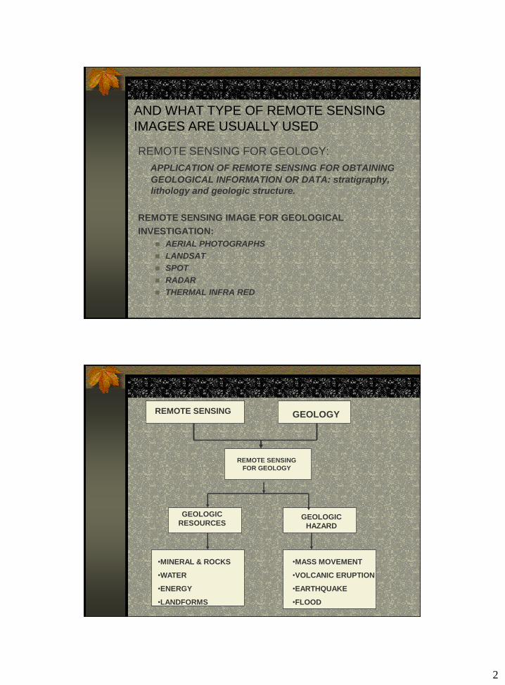
WHAT IS REMOTE SENSING FOR GEOLOGY
AND WHAT TYPE OF REMOTE SENSING
IMAGES ARE USUALLY USED
REMOTE SENSING FOR GEOLOGY:
APPLICATION OF REMOTE SENSING FOR OBTAINING
GEOLOGICAL INFORMATION OR DATA: stratigraphy,
lithology and geologic structure.
REMOTE SENSING IMAGE FOR GEOLOGICAL
INVESTIGATION:
AERIAL PHOTOGRAPHS
LANDSAT
SPOT
RADAR
THERMAL INFRA RED
REMOTE SENSINGREMOTE SENSING GEOLOGY
REMOTE SENSING
FOR GEOLOGY
GEOLOGIC
RESOURCESGEOLOGIC
HAZARD
•MINERAL & ROCKS
•WATER
•ENERGY
•LANDFORMS
•MASS MOVEMENT
•VOLCANIC ERUPTION
•EARTHQUAKE
•FLOOD
3
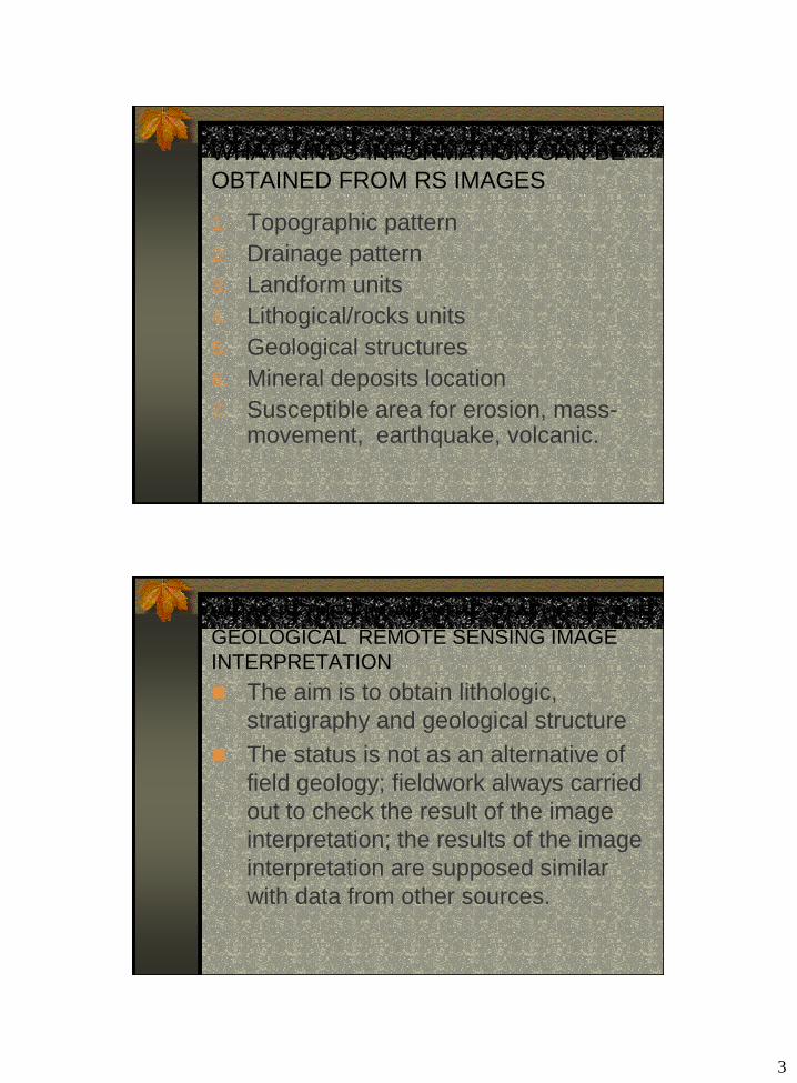
WHAT KINDS INFORMATION CAN BE
OBTAINED FROM RS IMAGES
1. Topographic pattern
2. Drainage pattern
3. Landform units
4. Lithogical/rocks units
5. Geological structures
6. Mineral deposits location
7. Susceptible area for erosion, mass-movement, earthquake, volcanic.
WHAT IS THE AIM AND THE STATUS OF THE
GEOLOGICAL REMOTE SENSING IMAGE
INTERPRETATION
The aim is to obtain lithologic,
stratigraphy and geological structure
The status is not as an alternative of
field geology; fieldwork always carried
out to check the result of the image
interpretation; the results of the image
interpretation are supposed similar
with data from other sources.
4
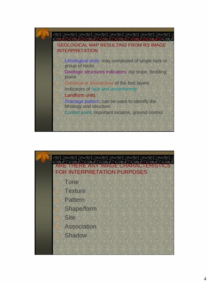
WHAT IS THE CONTENT OF THE PRELIMINARY
GEOLOGICAL MAP RESULTING FROM RS IMAGE
INTERPRETATION
1. Lithological units: may composed of single rock or group of rocks
2. Geologic structures indicators: dip slope, bedding plane
3. Continue or discontinue of the bed layers
4. Indicators of fault and unconformity
5. Landform units
6. Drainage pattern, can be used to identify the lithology and structure
7. Control point, important location, ground control
ARE THERE ANY IMAGE CHARACTERISTICS
FOR INTERPRETATION PURPOSES
1. Tone
2. Texture
3. Pattern
4. Shape/form
5. Site
6. Association
7. Shadow
5
HOW TO IDENTIFY AND INTERPRETATION
OF GEOLOGICAL DATA FROM RS IMAGES
1. Using element for geological interpretation:a. Outcrop features and distribution
b. Structure in detail
c. Landform
d. Drainage pattern
e. Vegetation
f. Cultural features
2. Using factors for geological features identification:a. Form; for lithology and structure identification
b. Asymmetrical slope: to determine the dip slope of the beds
c. Drainage: to recognize the density and pattern.Drainage density is associate to rock resistance and permeability. Drainage pattern is important for lithological and structural interpretation.
CHARACTERISTICS OF DRAINAGE SYSTEM
IN GEOLOGICAL INTERPRETATION
1. Integration
2. Density or spaciation
3. Homogeneity
4. Orientation and control
5. Pattern
6
HOW TO INTERPRETATE THE LITHOLOGY
1. Lithological units are easily to identify from
remote sensing image (especially aerial
photograph):a. Sandstone
b. Shale stone
c. Limestone
d. A certain igneous and metamorphic rocks
e. Unconsolidated material, such as: sand, gravel,
clay
f. Intercalation resistance and non resistance rocks
2. Sedimentary rocks can be identify and
classified based on:a. Texture
b. Mineral composition
c. Color
d. Porosity
e. Permeability
f. Drainage density
g. Drainage pattern (fig.1)

7
limestone
sandstone shale
Water soluble
Subsurface drainage
Sinkhole
External drainage
Closed spaced
pattern
Internal drainage
Wide spaced
pattern
Calcareous shale,
marl
Clay limestoneArenaceous
limestone
Calcareous
sandstone
Arenaceous shaleArgillaceous sandstone
Three types of
sedimentary rocks
CARBONATE
COARSE GRAINED CLASTICS FINE GRAINED CLASTICS
Intermediate
lithologies with
mixed
characteristicsResistant,
porous,
permeable
Resistant/
nonresistant,
soluble, karstification, internal and external drainage,jointing; light to medium photo tone
Low
resistant
insoluble
Impervious, external
drainage, high density,
dark to medium photo
tone
depend on cement and
matrix, internal drainage,
low density; frequent joint
system; light or light to
medium photo tone
Fig. Image/photo
characteristic of
sedimentary rocks

8
IDENTIFICATION OF SEDIMENTARY ROCKS
FROM IMAGE/AERIAL PHOTOGRAPH
Coarse clastic
sediment:
breccia,conglomerate
sandstone
Fine clastic:
sediment:clay,
shale, siltstone
Carbonate:
limestone and
dolomite, marls
Resistant, depend on cementation
Low permeability and non resistant
In arid resistant, in humid soluble
Form: cuesta, hogbag, mesa
In humid: low hill with rounded topo.
Karst topography
As key horizon for structural analysis
Impervious, external drainage
Sink hole and doline dominant
Joint system well develop Joint system not develop
Joint frequent, longitudinal belt of dark tone/colour
Drainage: low-medium density
Drainage: high density
Low drainage density
Drainage pattern: dendritic, trellis
Dendritic drainage pattern
Partly: underground
Tone: light to medium Gray to dark tone Light to dark photo tone
IMAGE CHARACTERISTICS OF
IGNEOUS ROCKS
1. Based on mineral composition: Acidic: light photo tone
Intermediate: light to medium photo tone
Basic: dark to dark photo tone
2. Extrusive rocks: Associate with volcanic landform
Porosity and permeability: high
External drainage
Basic lava: shield volcano, joint are predominat
Acidic lava: bocca, spatter cone, lava blister
Intermediate lava: strato volcano
3. Intrusive rocks: Homogen
Topography humocky (humid) and sharp (arid)
Joint: frequent
Drainage pattern with low density.
9
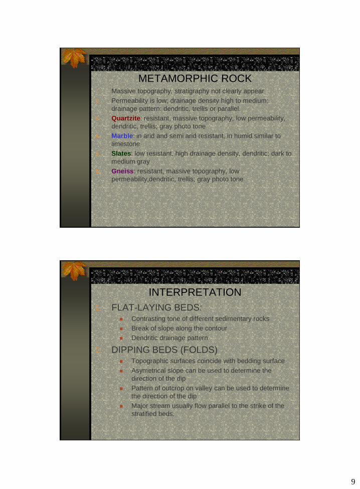
IMAGE CHARACTERISTICS OF
METAMORPHIC ROCK1. Massive topography, stratigraphy not clearly appear
2. Permeability is low; drainage density high to medium;
drainage pattern: dendritic, trellis or parallel.
3. Quartzite: resistant, massive topography, low permeability,
dendritic, trellis; gray photo tone
4. Marble: in arid and semi arid resistant, in humid similar to
limestone
5. Slates: low resistant, high drainage density, dendritic; dark to
medium gray
6. Gneiss: resistant, massive topography, low
permeability,dendritic, trellis; gray photo tone
GEOLOGIC STRUCTURE IMAGE
INTERPRETATION
1. FLAT-LAYING BEDS: Contrasting tone of different sedimentary rocks
Break of slope along the contour
Dendritic drainage pattern
2. DIPPING BEDS (FOLDS) Topographic surfaces coincide with bedding surface
Asymetrical slope can be used to determine the
direction of the dip
Pattern of outcrop on valley can be used to determine
the direction of the dip
Major stream usually flow parallel to the strike of the
stratified beds.
10
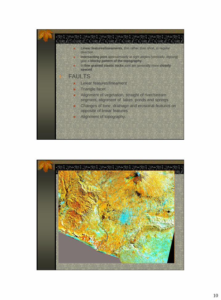
3. JOINTS Linear features/lineaments, thin rather than short, in regular
direction
Intersecting joint approximately at right angles (vertically, dipping)
give a blocky pattern of the topography.
In fine grained clastic rocks joint are generally more closely
spaced
4. FAULTS Linear features/lineament
Triangle facet
Alignment of vegetation, straight of river/stream
segment, alignment of lakes, ponds and springs
Changes of tone, drainage and erosional features on
opposite of linear features
Alignment of topography.

11