Introduction to Satellite Remote Sensing - ITU
51
See a better world. Introduction to Remote Sensing, Earth Observation Optical & Radar Satellites REGIONAL TRAINING ON THE USE OF DRONES, SATELLITE IMAGERY AND GIS JUNE 07, 2018 ANDREW STEELE SALES ENGINEERING MANAGER, DIGITALGLOBE ASIA-PACIFIC
-
Upload
khangminh22 -
Category
Documents
-
view
0 -
download
0
Transcript of Introduction to Satellite Remote Sensing - ITU
See a better world.
Introduction to Remote Sensing,
Earth Observation Optical & Radar Satellites
REGIONAL TRAINING ON THE USE OF DRONES, SATELLITE IMAGERY AND GIS
JUNE 07, 2018
ANDREW STEELE
SALES ENGINEERING MANAGER, DIGITALGLOBE ASIA-PACIFIC
DigitalGlobe Proprietary and Business Confidential
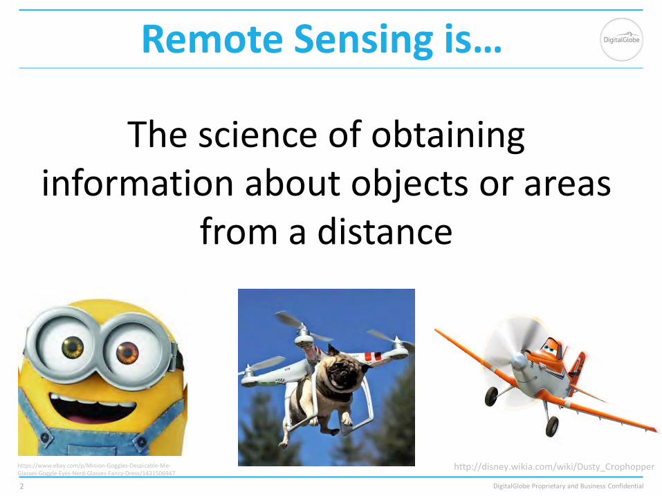
Remote Sensing is…
2
The science of obtaining information about objects or areas
from a distance
https://www.ebay.com/p/Minion-Goggles-Despicable-Me-Glasses-Goggle-Eyes-Nerd-Glasses-Fancy-Dress/1431506947
http://disney.wikia.com/wiki/Dusty_Crophopper
DigitalGlobe Proprietary and Business Confidential
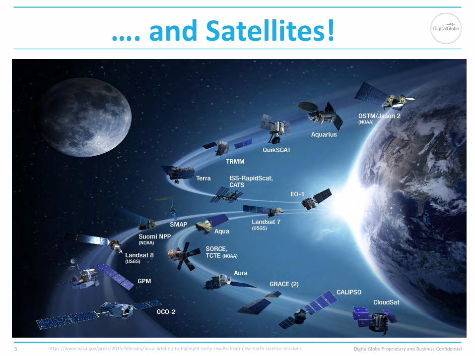
…. and Satellites!
3 https://www.nasa.gov/press/2015/february/nasa-briefing-to-highlight-early-results-from-new-earth-science-missions

DigitalGlobe Proprietary and Business Confidential
There are Many Types of Satellites Out There
• Communication Satellites
• To broadcast television, internet, and enable telephone applications
• Weather Satellites
• To record and monitor the Earth’s climate: temperature, pollution, cloud movement
• Navigational Satellites
• To help aircraft and vessels navigate and determine geographic location
• Earth Observation Satellites
• To observe the earth with various sensors, including optical and radar cameras. Typically used for environmental monitoring and various mapping applications.
Engage EMEAR: Product Marketing & Management 4
https://www.satimagingcorp.com/satellite-sensors/worldview-3/

DigitalGlobe Proprietary and Business Confidential
Sensor Specifications Characterized by Resolution
• Spatial Resolution
How big are the pixels? How far can you zoom into the image?
• Temporal Resolution
What is the revisit time until the sensor can collect data over the same location? How often is the pixel collected? What time of day does the sensor collect images?
• Spectral Resolution
What range of the spectrum can the sensor interpret? How many bands does the sensor have?
5
DigitalGlobe Proprietary and Business Confidential
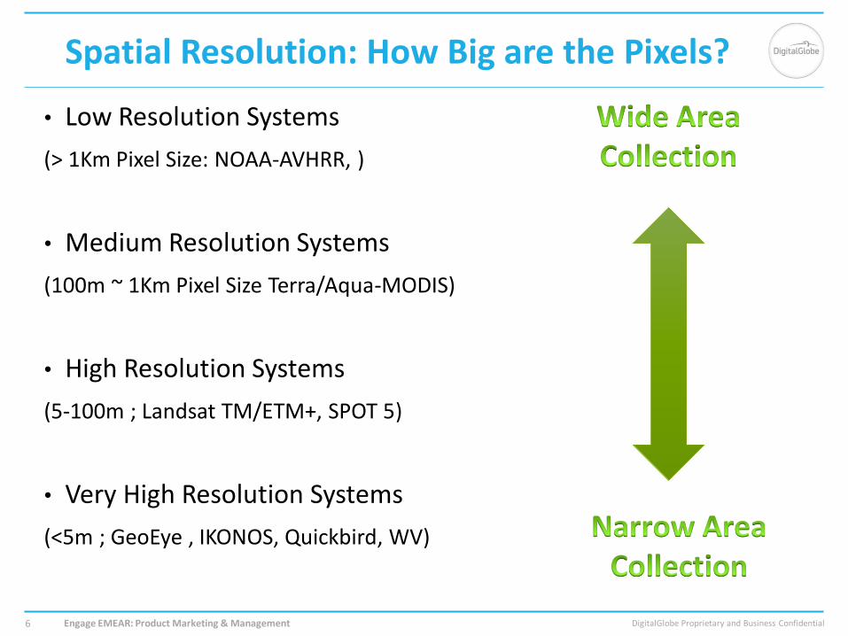
Spatial Resolution: How Big are the Pixels?
• Low Resolution Systems
(> 1Km Pixel Size: NOAA-AVHRR, )
• Medium Resolution Systems
(100m ~ 1Km Pixel Size Terra/Aqua-MODIS)
• High Resolution Systems
(5-100m ; Landsat TM/ETM+, SPOT 5)
• Very High Resolution Systems
(<5m ; GeoEye , IKONOS, Quickbird, WV)
Engage EMEAR: Product Marketing & Management 6
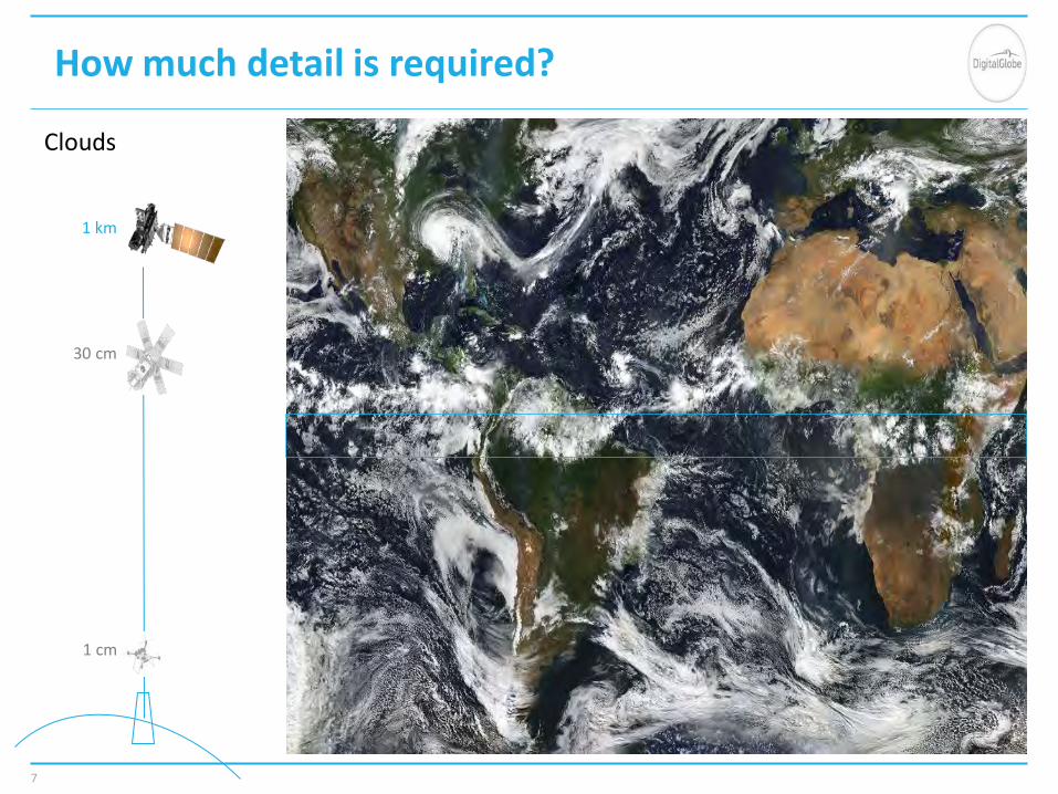
7
Clouds
How much detail is required?
1 km
30 cm
1 cm

8
Land use
How much detail is required?
30 m
30 cm
1 cm

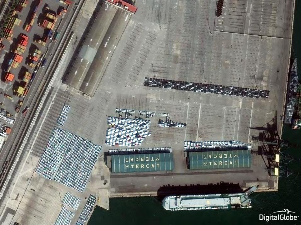
How much detail is required?
9
Crops
30 m
30 cm
1 cm
senseFly eBee drone
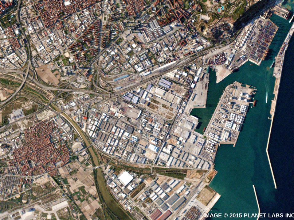
IMAGE © 2015 PLANET LABS INC.

ZOOM IN
IMAGE © 2015 PLANET LABS INC.
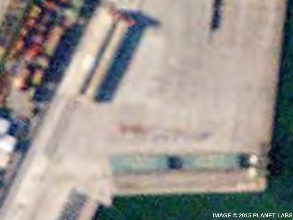
IMAGE © 2015 PLANET LABS INC.

DigitalGlobe Proprietary and Business Confidential
Coverage vs Spatial Resolution
http://www.edc.uri.edu/nrs/classes/NRS409 14
DigitalGlobe Proprietary and Business Confidential
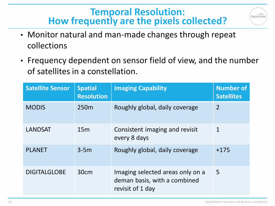
Temporal Resolution: How frequently are the pixels collected?
• Monitor natural and man-made changes through repeat collections
• Frequency dependent on sensor field of view, and the number of satellites in a constellation.
15
Satellite Sensor Spatial Resolution
Imaging Capability Number of Satellites
MODIS 250m Roughly global, daily coverage 2
LANDSAT 15m Consistent imaging and revisit every 8 days
1
PLANET 3-5m Roughly global, daily coverage +175
DIGITALGLOBE 30cm Imaging selected areas only on a deman basis, with a combined revisit of 1 day
5
How frequently does it change?
16
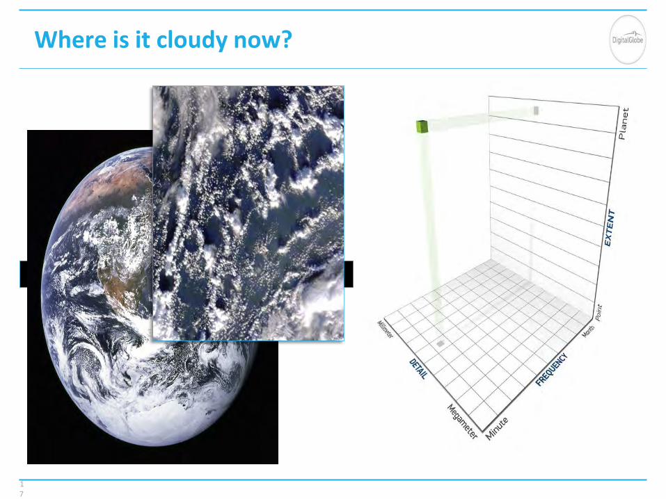
Where is it cloudy now?
17
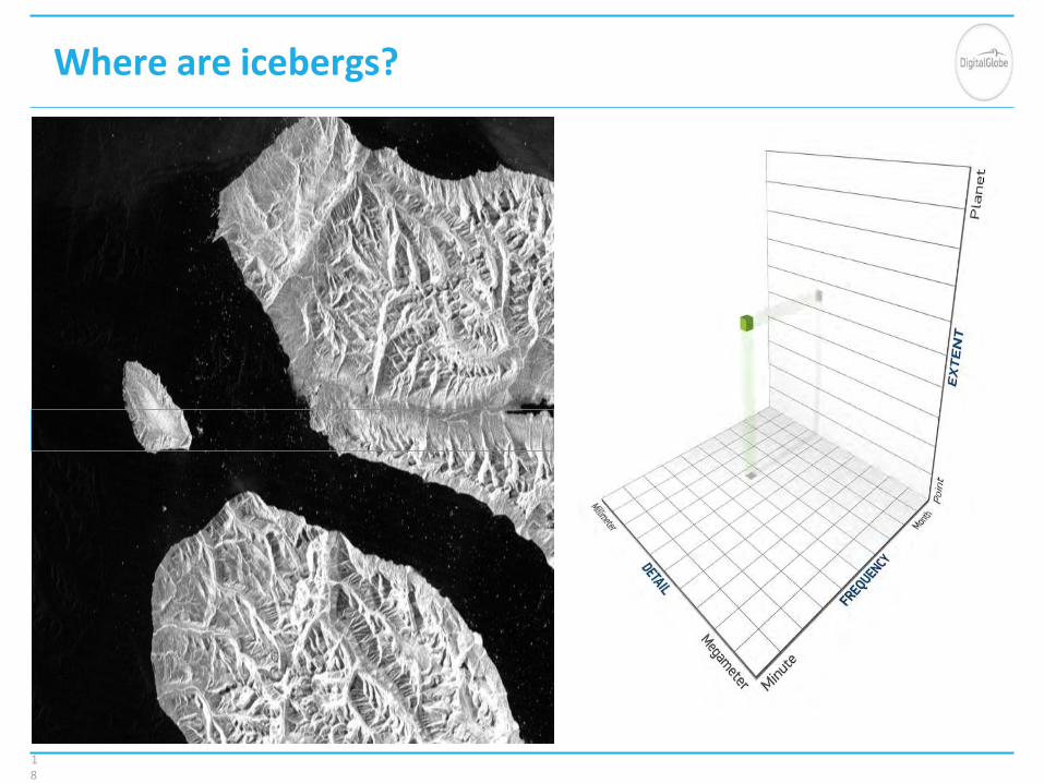
Where are icebergs?
18

Where are new subdivisions?
19

How many vehicles?
20

Car traffic throughout the day?
21

DigitalGlobe Proprietary and Business Confidential M-spectral | Definition 22
Spectral Resolution: More than the Eye can See
• Satellites extract information from the energy reflecting off of the Earth’s surface
• Satellites have the ability to interpret specific light reflectance in the form of a wave, that is associated with a specific wavelength and frequency.
• The range of specific wavelengths are also known as “bands” describing the channel of light
DigitalGlobe Proprietary and Business Confidential Engage EMEAR: Product Marketing & Management 23
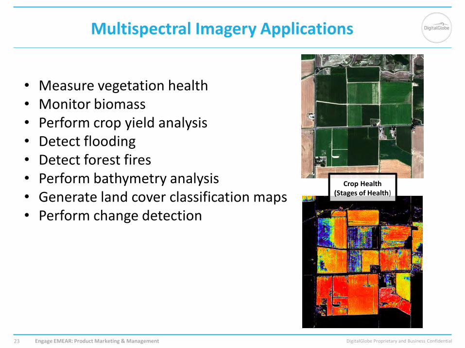
Multispectral Imagery Applications
• Measure vegetation health • Monitor biomass • Perform crop yield analysis • Detect flooding • Detect forest fires • Perform bathymetry analysis • Generate land cover classification maps • Perform change detection
Crop Health (Stages of Health)
Moderate-resolution, high-revisit monitoring
Large area, low-resolution change detection
High-resolution, high-accuracy mapping and monitoring
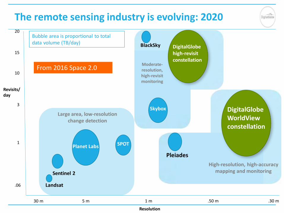
The remote sensing industry is evolving: 2020
Revisits/ day
.06
1
3
20
5 m 30 m .50 m 1 m .30 m
SPOT
Pleiades
DigitalGlobe WorldView constellation
Skybox
BlackSky
Planet Labs
Sentinel 2
Landsat
Resolution
15
10
DigitalGlobe high-revisit constellation
Bubble area is proportional to total data volume (TB/day)
From 2016 Space 2.0

DigitalGlobe® Proprietary and Business Confidential 6/7/2018 25
Operator of the world’s highest-performance commercial imaging constellation
IKONOS®
.82 meter resolution 9 m CE90
QuickBird®
.65 meter resolution 23 m CE90
WorldView-3®
.30 meter resolution
<3.0 m CE90
WorldView-2®
.46 meter resolution
<3.5 m CE90
GeoEye-1®
.46 meter resolution
<3.5 m CE90
WorldView-1®
.50 meter resolution <4 m CE90
AVAILABLE VIA DIGITALGLOBE ARCHIVE CURRENTLY IMAGING IN ORBIT
WorldView-4®
.30 meter resolution
< 3.5m CE90
1999 2001 2007 2008 2009 2014 2016

Potential Area 150,000 sqkm/day
Potential Area 100,000 sqkm/day
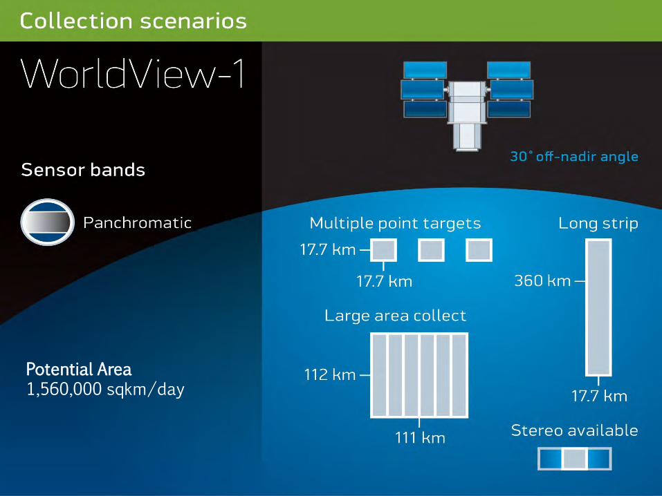
Potential Area 1,560,000 sqkm/day
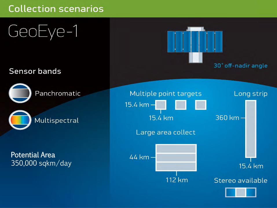
Potential Area 350,000 sqkm/day

Potential Area 1,170,000 sqkm/day

Potential Area 680,000 sqkm/day

Potential Area 350,000 sqkm/day
WorldView-4
33
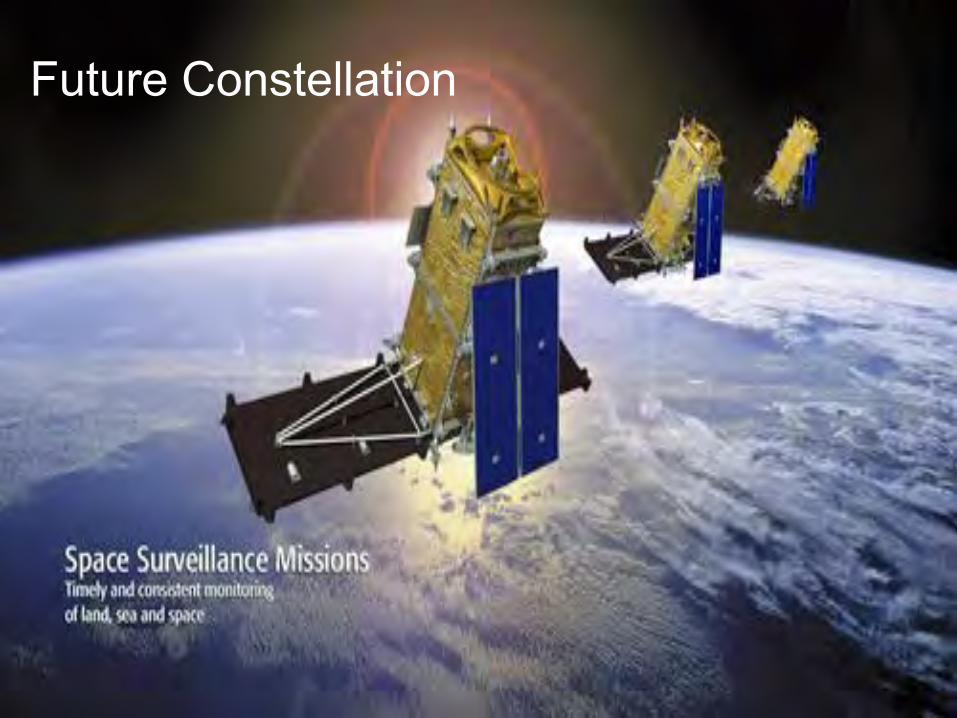
Future Constellation
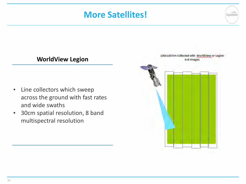
More Satellites!
34
WorldView Legion
• Line collectors which sweep across the ground with fast rates and wide swaths
• 30cm spatial resolution, 8 band multispectral resolution

Increased 8-band color capacity
0
1,000,000
2,000,000
3,000,000
4,000,000
5,000,000
6,000,000
7,000,000
Today With Legion After WV1/WV2 EOL
Sqkm
/day

Double 30 cm capacity
0
500,000
1,000,000
1,500,000
2,000,000
2,500,000
3,000,000
Today With Legion After WV1/WV2 EOL
Sqkm
/day
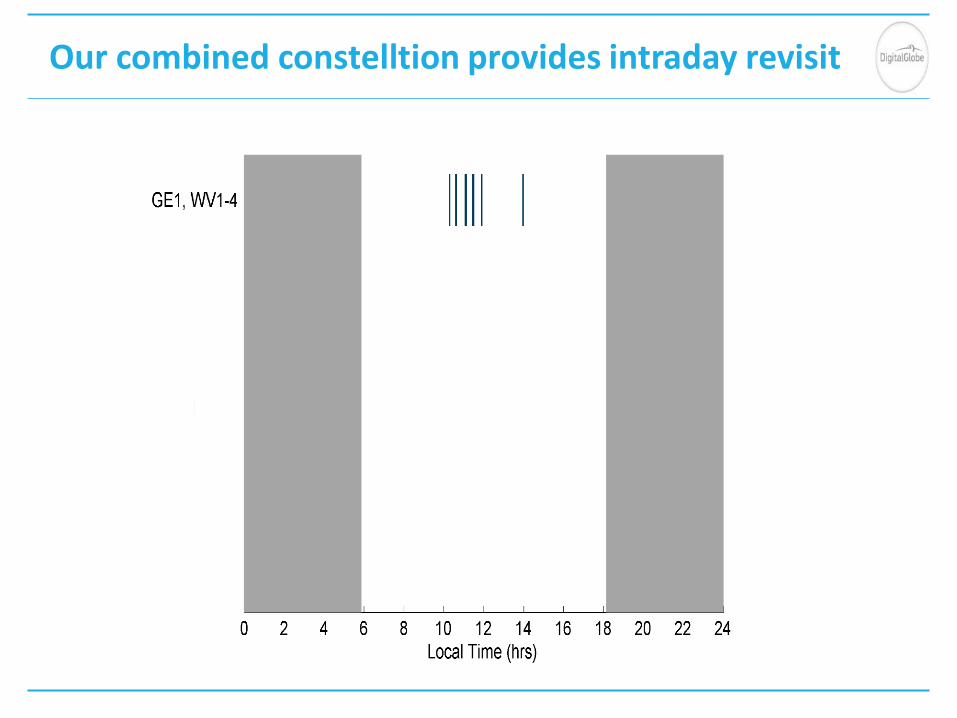
Our combined constelltion provides intraday revisit
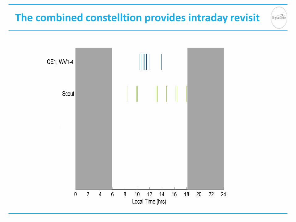
The combined constelltion provides intraday revisit

The combined constelltion provides intraday revisit

The combined constelltion provides intraday revisit
Radar Introduction

Use, duplication or disclosure of this document or any of the information or images contained herein is subject to the restrictions on the title page of this document.
©Maxar Technologies 2018.
SAR Is Fundamentally Different From Optical

Use, duplication or disclosure of this document or any of the information or images contained herein is subject to the restrictions on the title page of this document.
©Maxar Technologies 2018.
Use, duplication or disclosure of this document or any of the information or images contained herein is subject to the restrictions on the title page of this document.
©Maxar Technologies 2018.
Radar Sees The World Differently
Radar provides routine and reliable detections on a monthly or better basis regardless of cloud cover or seasonal light limitations Radar sees changes in structure and phase enabling new insights

Use, duplication or disclosure of this document or any of the information or images contained herein is subject to the restrictions on the title page of this document.
©Maxar Technologies 2018.

Use, duplication or disclosure of this document or any of the information or images contained herein is subject to the restrictions on the title page of this document.
©Maxar Technologies 2018.

Use, duplication or disclosure of this document or any of the information or images contained herein is subject to the restrictions on the title page of this document. COPYRIGHT ©2017 MDA
46
Commonly Used Frequency Bands

Use, duplication or disclosure of this document or any of the information or images contained herein is subject to the restrictions on the title page of this document. COPYRIGHT ©2017 MDA
Synthetic Aperture Radar (SAR) Satellites
47

Use, duplication or disclosure of this document or any of the information or images contained herein is subject to the restrictions on the title page of this document. COPYRIGHT ©2017 MDA
48

Use, duplication or disclosure of this document or any of the information or images contained herein is subject to the restrictions on the title page of this document. COPYRIGHT ©2017 MDA
49

Use, duplication or disclosure of this document or any of the information or images contained herein is subject to the restrictions on the title page of this document. COPYRIGHT ©2017 MDA
50

Use, duplication or disclosure of this document or any of the information or images contained herein is subject to the restrictions on the title page of this document. COPYRIGHT ©2017 MDA
51