Pappu RS, and Shinde V. 1990. Site Catchment analysis of the Deccan Chalcolithic Cultures in the...
22
, . -- 1 BULLETIN OF THE DECCAN COLLEGE POST-GRADUATE & RESEARCH INSTITUTE Volume 49 1990 PROFESSOR H. D. SANKALIA MEMORIAL VOLUME PUNE
-
Upload
deccancollegepune -
Category
Documents
-
view
4 -
download
0
Transcript of Pappu RS, and Shinde V. 1990. Site Catchment analysis of the Deccan Chalcolithic Cultures in the...
, .
--
1
BULLETINOF THE
DECCAN COLLEGEPOST-GRADUATE & RESEARCH INSTITUTE
Volume 491990
PROFESSOR H. D. SANKALIA
MEMORIAL VOLUME
PUNE
SITE CATCHMENT ANALYSIS OF THE DECCAN CHALCOLITHICIN THE CENTRAL TAPI BASIN
RAGHUNATH S. PAPPU and VASANT S. SHINDE
The concept site catchment analysis wasintroduced into the archaeological literatureby Claudio Vita-Finzi and Eric Higgs (1970)as a method of regional analysis designed toexamine prehistoric site location and land usepatterns. The explicit realisation that humangroups procure resources from the regionsimmediately surrounding their settlementsled to the formulation in the late 1960s of thisnew analytical method. This method was firstintroduced by Vita-Finzi and Higgs in thestudy of prehistoric economy in the MountCarmel area of Palestine. According to them,the site catchment analysis is the study ofrelationship between technology and the nat-ural resources lying within the economicrange of individual archaeological sites(1970: 5).
Catchment area is that area from whichresources are taken to support human popu-lations and occur within reasonable walkingdistance from a site. The concept of Vita-Finzi and Higg's method is based principallyon two ethnographic sources: I. Lee's (1969:61) input-output analysis of! Kung Bushmensubsistence (the present hunter-gatherer ofAfrica), in which he found that hunter-gatherers are unlikely to forage beyond a 10km range of their camp without moving thecamp itself; and 2. Chisholm's (1979: 108)study of European peasant agriculture inwhich he concludes that farmers seldomtravel more than 4 to 5 kilometers from theirsettlements. Site catchment analysis is thusconcerned with the exploitation of plant,animal, mineral and other resources by
human groups in a particular territory andencompasses both theory and method inassessing the resource potential of anarchaeological site. The site catchment analy-sis when applied to a single site gives a roughidea about the way in which the resourceswere exploited by any community and is alsohelpful to some extent in assessing the eco-nomic potential of an archaeological site.However, it is necessary to apply the methodof site catchment analysis in a regional con-text rather than to individual sites. It is onlywhen the catchment characteristics of a seriesof sites are studied in search of one or morerepetitive patterns, the technique serves todefine the system of land use.
The second writer has been working in thecentral Tapi basin for a number of years andhas studied the settlement and subsistencepatterns of the Chalcolithic communites(Shinde 1984). This region is one of the mostfertile regions in the country beca use of thepresence of deep black a ra ble soils. There isample evidence for Chalcolithic cultures andall the four phases of the Chalcolithic, viz., theSavalda , late Harappan, Malwa and theJorwe are very well repersented. This regiontherefore offers an excellent opportunity toundertake site catchment analysis studies.This concept has already been employed withgreat success by the first writer at the Chalco-lithic site of Inamgaon (Pappu 1988). Againstthis background, site catchment analysis wasundertaken on regional basis in the centralTapi basin. The results of this investigationare presented in this pa per.
318 RAGHUNATH S. PAPPU AND VASANT S. SHINDE
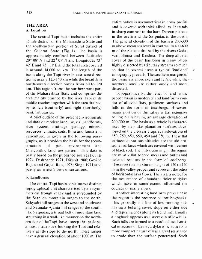
THE AREAa. Location
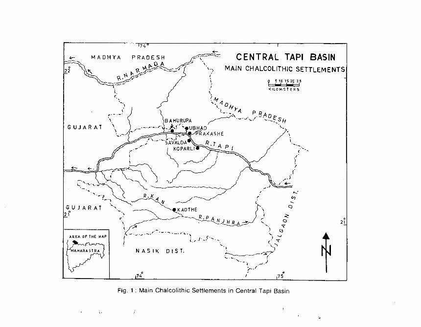
The central Tapi basin includes the entireDhule district of the Maharashtra State andthe southeastern portion of Surat district ofthe Gujarat State (Fig. I). The basin isapproximately confined between Latitudes200 08' Nand 22 0 07' N and Longitudes 730
42' E and 750 II' E and the total area coveredis around 14,000 sq km. The length of thebasin along the Tapi river in east-west direc-tion is nearly 125-140 km while the breadth innorth-south direction varies from 80 to 120km. This region froms the northernmost partof the Maharashtra State and comprises thearea mainly drained by the river Tapi in itsmiddle reaches together with the area drainedby its left (southerly) and right (northerly)bank tributaries.
A brief outline of the present environmentsand data on modern land use, viz., landforms,river system, drainage, geology, mineralresources, climate, soils, flora and fauna andagriculture, is given in the following para-graphs, as it provides the basis for the recon-struction of past environment andChalcolithic land use pattern. This data ispartly based on the published sources (Kunte1974; Deshpande 1971; DiJrshit 1986; GovindRajan and Gopal Rao, 1978; Singh 1971) andpartly on writer's own observations.
b. Landforms
The central Tapi basin constitutes a distincttopographical unit characterised by an asym-metrical trough valley and is surrounded bythe Satpuda mountain ranges to the north,Sahyadri hill ranges to the west and southwestand Satrnala-Ajanta hill ranges to the south.The Satpudas, a broad helt of mountain landstretching in a wall-like manner on the north-ern side of the Tapi, have a steep abrupt slope,almost a scarp overlooking the Tapi and rela-tively gentle slope to the north. These rangeshave a general elevation of about 1000 m. The
entire valley is asymmetrical in cross profileand is covered with thick alluvium. It standsin sharp contrast to the bare Deccan plateauin the south and the Satpudas in the north.The general elevation of the basin is 200-300m a bove mean sea level in contrast to 400-600m of the plateau drained by the rivers Goda-vari, Bhirna and Krishna. The deep alluvialcover of the basin has been in many placeshighly dissected hy tributary streams so muchso that in several areas a typical 'badland'topography prevails. The southern margins ofthe basin are more even and fertile while the -northern ones are rather sandy and moredissected.
Topographically, the relief of land in theproper basin is moderate and landforms con-sist of alluvial flats, pediment surfaces andhills in the form of inselbergs. However,major portion of the valley is flat extensiverolling plain having an average elevation of200-300 m. The basin as a whole is characte-rised by step like planation surfaces deve-loped on the Deccan Traps at an elevations of850,750,650,550,450 and 350 m. These flatsurfaces at various altitudes are the old ero-sional surfaces which are covered with veneerof black soil. The hills occurring in the regionare mostly flat topped mesas and buttes andisolated residues in the form of inselbergs.These rise to a maximum height of 120 to 150m in the valley proper and represent the relics· .....of horizontal lava flows. The area is noted forthe occurrence of abundant dolerite dykeswhich have to some extent influenced thecourses of many rivers.
Another interesting landform prevalent inthe region is the presence of low hogbacks.This generally is a line of low-running hills "having a bulging covex slope on either sideand tapering ends along its trend line. Usuallya hogback appears as a successin of low hills.Such hills are formed as a result oflocal verti-cal intrusion of lava as a dyke which due to itsmore compact nature offers a great resistanceto erode than the surface penetrated. Such
SITE CATCHMENT ANALYSIS OF THE DECCAN CHALCOLITHIC
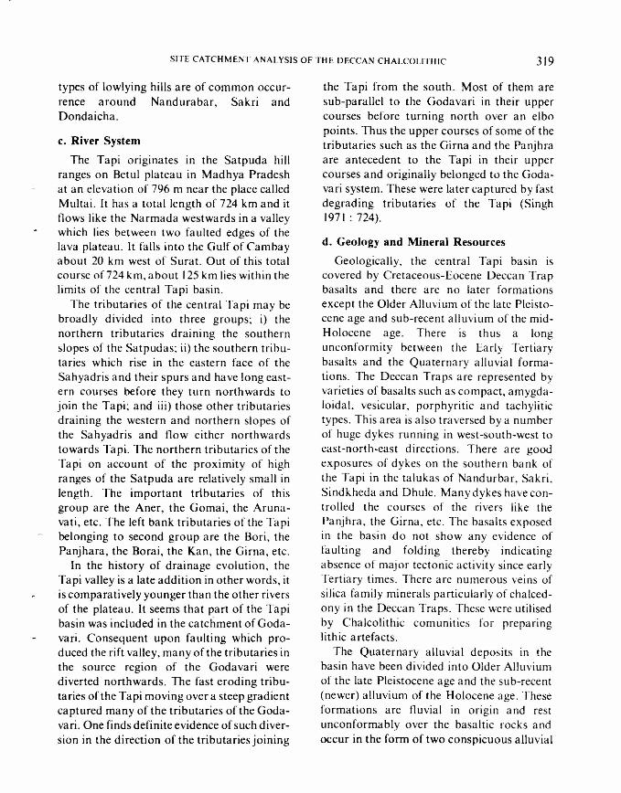
types of lowlying hills are of common occur-rence around Nandurabar, Sakri andDondaicha.
c. River System
The Tapi originates in the Satpuda hillranges on Betul plateau in Madhya Pradeshat an elevation of 796 m near the place calledMultai. It has a total length of 724 km and itflows like the Narmada westwards in a valleywhich lies between two faulted edges of thelava plateau. It falls into the Gulf of Cambayabout 20 km west of Surat. Out of this totalcourse of 724 km, a bout 125 km lies within thelimits of the central Tapi basin.
The tributaries of the central Tapi may bebroadly divided into three groups; i) thenorthern tributaries draini ng the southernslopes of the Satpudas; ii) the southern tribu-taries which rise in the eastern face of theSahyadris and their spurs and have long east-ern courses before they turn northwards tojoin the Tapi; and iii) those other tributariesdraining the western and northern slopes ofthe Sahyadris and flow either northwardstowards Tapi. The northern tributaries of theTapi on account of the proximity of highranges of the Satpuda are relatively small inlength. The important tributaries of thisgroup are the Aner, the Gomai, the Aruna-vati, etc. The left bank tributaries of the Tapibelonging to second group are the Bori, thePanjhara, the Borai, the Kan, the Girna, etc.
In the history of drainage evolution, theTapi valley is a late addition in other words, itis comparatively younger than the other riversof the plateau. It seems that part of the Tapibasin was included in the catchment of Goda-vari. Consequent upon faulting which pro-duced the rift valley, many of the tributaries inthe source region of the Godavari werediverted northwards. The fast eroding tribu-taries of the Tapi moving over a steep gradientcaptured many of the tributaries of the Goda-vari. One finds definite evidence of such diver-sion in the direction of the tributaries joining
319
the Tapi from the south. Most of them aresub-parallel to the Godavari in their uppercourses before turning north over an elbopoints. Thus the upper courses of some of thetributaries such as the Girna and the Panjhraare antecedent to the Tapi in their uppercourses and originally belonged to the Goda-vari system. These were later captured by fastdegrading tributaries of the Tapi (Singh1971: 724).
d. Geology and Mineral Resources
Geologically. the central Tapi basin iscovered by Cretaceous-Eocene Deccan Trapbasalts and there are no later formationsexcept the Older Alluvium of the late Pleisto-cene age and sub-recent alluvium of the mid-Holocene age. There is thus a longunconformity between the Early Tertiarybasalts and the Quaternary alluvial forma-tions. The Deccan Traps are represented byvarieties of basalts such as compact, arnygda-loidal, vesicular, porphyritic and tachylitictypes. This area is also traversed by a numberof huge dykes running in west-south-west toeast-north-east directions. There are goodexposures of dykes on the southern bank ofthe Tapi in the talukas of Nandurbar, Sakri,Sindkheda and Dhule. Many dykes have con-trolled the courses of the rivers like thePanjhra, the Girna, etc. The basalts exposedin the basin do not show any evidence offaulting and folding thereby indicatingabsence of major tectonic activity since earlyTertiary times. There are numerous veins ofsilica family minerals particularly of chalced-ony in the Deccan Traps. These were utilisedby Chalcolithic com unities for preparinglithic artefacts.
The Quaternary alluvial deposits in thebasin have been divided into Older Alluviumof the late Pleistocene age and the sub-recent(newer) alluvium of the Holocene age. Theseformations are fluvial in origin and restunconformably over the basaltic rocks andoccur in the form of two conspicuous alluvial
320 RAGHUNATH S. PAPPU AND VASAN', S. SHINDE
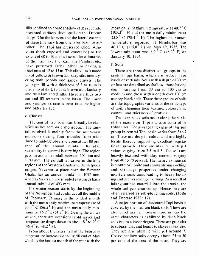
fills confined to broad shallow valleys cut intoerosional surfaces developed on the DeccanTraps. The thicknesses and the lateral extentsof these fills vary from one river basin to an-other. The Tapi has preserved Older Allu-vium (both exposed and concealed) to theextent of 60 to 70 m thickness. The tributariesof the Tapi like the Kan, the Panjhra, etc.have preserved Older Alluvium having athickness of 12 to 15 m. This alluvium is madeup of yellowish brown kankary silts interlay-ering with pebbly and sandy gravels. Theyounger fill with a thickness of 8 to 10 m ismade up of dark to dark brown non-kankaryand well laminated silts. There are thus twocut and fill terraces in the basin. The lowerand younger terrace is inset into the higherand older terrace.
e. Climate
The central Tapi basin can broadly be clas-sified as hot semi-arid monsoonic. The rain-fall received is mainly from the south-westmonsoon during four months from mid-June to mid-October and coinstitutes 88 per-cent of the annual rainfall. Rain-fallvariability in general is very high. The regiongets an annual rainfall between 500 mm andI100 mm. The rainfall is heavier in the hillyregions of the Western Ghatsand the Satpudaranges. Navapur, a place near the WesternGhats, has an annual rainfall of 1097 mrn,whereas Sakri a place situated eastwards has aannual rainfall of 493 mm.
The winter season starts by the beginningof the November and continues till the middleof February. January is the coldest monthwith the mean daily maximum temperature of30.3
0C (86.50 F) and the mean daily min-
imum at 16.2 °c (61.20 F). During the winterseason, there are occasional cold waves andtemperature drops down to about 8
0to 90 C
(46.40 to 48.20 F).From a bout the latter half of the February
temperature increases steadily till end of Maywhich is the hottest month of the year with the
mean daily maximum temperature at 40.70 C(105.3° F) and the mean daily minimum at25.8 Q C (78.4 0 F). The highest maximumtemperature recorded at Nandurbar was46.1 °c (115.0
0F) on May 19, 1955. The
lowest minimum was 8.9 0 C (48.00 F) onJanuary 10, 1954.
f. Soils
There are three distinct soil groups in thecentral Tapi basin, which are pedocal typeba\ck or vertisols. Soils with a depth of 30 cmor less are described as shallow, those having -depth varying from 30 ern to 100 ern asmedium and those with a depth over 100 cmas deep black soils. These three groups of soilsare the topographic variants of the same typeof soil, changing their texture, colour, limecontent and thickness of profiles.
The deep black soils occur along the banksof the main river Tapi and also some of itstributaries. The average thickness of this soilgroup in central Tapi basin varies from 3 to 7m. These are deep in colour and are highlyfertile thereby supporting excellent vegeta-tional growth. They are alkaline with pHvalues varying from 7.5 to 8.5. The soils areheavily textured with clay content varyingfrom 40 to 70 percent. The main clay mineralis montmorillonite and shows strong swellingand shrinkage properties under changingmoisture conditions leading to heavy fissur-ing and deep cracking on drying. As a result offalling surface material into the cracks, thewhole soil gets churned up. Hence they areoften referred as self-ploughing soils, (Joshiand Deotare 1983: 17).
A major portion of the central Tapi basin iscovered by the medium black soils. These arealso good arable, possess more or less thesame characters as exhibited by deep blacksoils but to a lesser degree. These are granularto subgranular and loamy to clayey in texture.They are also alkaline wiht pH around 7.Coarse shallow soils occupy about 25 to 30per cent of the area of the basin. They are
SITE CATCHMENT ANALYSIS OF THE DECCAN CHALCOLITHIC 321
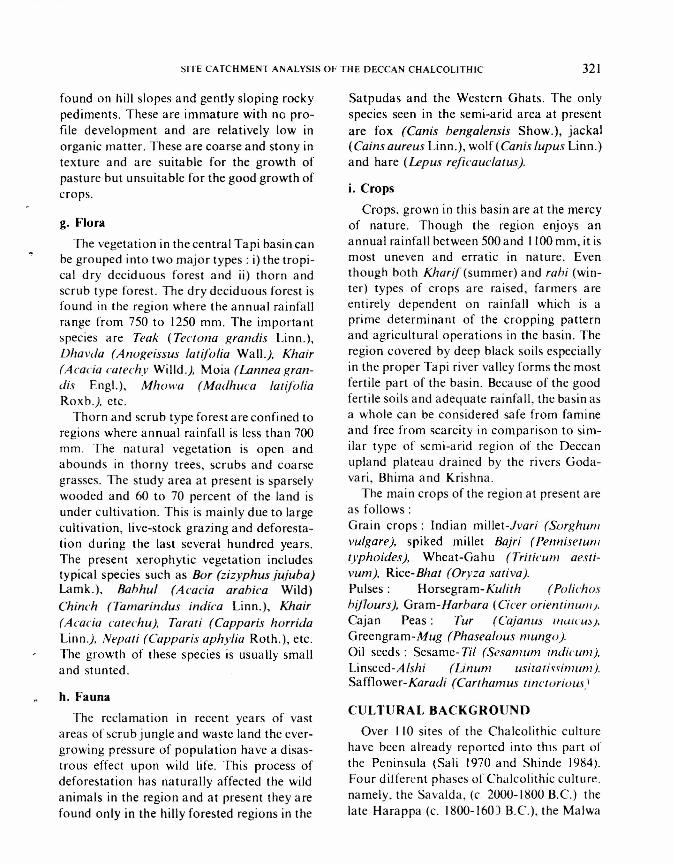
found on hill slopes and gently sloping rockypediments. These are immature with no pro-file development and are relatively low inorganic matter. These are coarse and stony intexture and are suitable for the growth ofpasture but unsuitable for the good growth ofcrops.
g. Flora
The vegetation in the central Tapi basin canbe grouped into two major types: i) the tropi-cal dry deciduous forest and ii) thorn andscrub type forest. The dry deciduous forest isfound in the region where the annual rainfallrange from 750 to 1250 mm. The importantspecies are Teak iTectona grandis Linn.),Dhavda (Anogeissus latifolia Wall.). Khair(Acacia catechy Willd.). Moia (Lannea gran-dis Engl.), Mhowa (Madhuca latifoliaRoxb.). etc.
Thorn and scrub type forest are confined toregions where annual rainfall is less than 700mm. The natural vegetation is open andabounds in thorny trees, scrubs and coarsegrasses. The study area at present is sparselywooded and 60 to 70 percent of the land isunder cultivation. This is mainly due to largecultivation, live-stock grazing and deforesta-tion during the last several hundred years.The present xerophytic vegetation includestypical species such as Bor (zizyphus jujuba)Lamk.), Babhul (Acacia arabica Wild)Chinch (Tamarindus indica Linn.), Khair(Acacia catechu). Tarati (Capparis horridaLinn.). Nepati (Capparis aphylia Roth.), etc.The growth of these species is usually smalland stunted.
h. Fauna
The reclamation in recent years of vastareas of scrub jungle and waste land the ever-growing pressure of population have a disas-trous effect upon wild life. This process ofdeforestation has naturally affected the wildanimals in the region and at present they arefound only in the hilly forested regions in the
Satpudas and the Western Ghats. The onlyspecies seen in the semi-arid area at presentare fox (Canis bengalensis Show.), jackal(Cains aureus Linn.), wolf (Canis lupus Linn.)and hare (Lepus reficauclatus).
i. Crops
Crops, grown in this basin are at the mercyof nature. Though the region enjoys anannual rainfall between 500 and 1100 mrn, it ismost uneven and erratic in nature. Eventhough both Kharif (summer) and rabi (win-ter) types of crops are raised, farmers areentirely dependent on rainfall which is aprime determinant of the cropping patternand agricultural operations in the basin. Theregion covered by deep black soils especiallyin the proper Tapi river valley forms the mostfertile part of the basin. Because of the goodfertile soils and adequate rainfall, the basin asa whole can be considered safe from famineand free from scarcity in comparison to sim-ilar type of semi-arid region of the Deccanupland plateau drained by the rivers Goda-vari, Bhima and Krishna.
The main crops of the region at present areas follows:Grain crops: Indian millet-Jvari (Sorghumvulgare). spiked millet Bajri (Pennisetumtyph 0ides). Wheat-Gahu (Triticum aesti-vum ), Rice-Bhat (Oryza sativa).Pulses: Horsegram-Kulith (Polichosbiflours), Gram-Harbara i Cicer orientinum).Cajan Peas: Tur (Cajanus /llL/ICU:».
Greengram-Mug (Phasealous mungo ).Oil seeds: Sesame- Til (Sesamum indicum ),Linseed-Alshi (Linum usitatissimum ).Safflower-Karadi (Carthamus tinctoriousi
CULTURAL BACKGROUNDOver 110 sites of the Chalcolithic culture
have been already reported into this part ofthe Peninsula (Sali 1970 and Shinde 1984).Four different phases of Chalcolithic culture.namely, the Savalda, (c. 2000-1800 B.c.) thelate Harappa (c. 1800-160) B.C.), the Malwa
322 RAGHUNATH S. PAPPU AND VASANT S. SHINDE
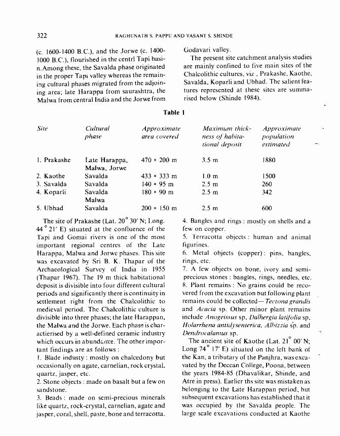
(c. 1600-1400 B.C.), and the Jorwe (c. 1400-1000 B.C.), flourished in the centrl Tapi basi-n.Among these, the Savalda phase originatedin the proper Tapi valley whereas the remain-ing cultural phases migrated from the adjoin-ing area; late Harappa from saurashtra, theMalwa from central India and the Jorwe from
si« Culturalphase
Appro ximatearea covered
I. Prakashe Late Harappa, 470 x 200 mMalwa, Jorwe
2. Kaothe Savalda 433 x 333 m3. Savalda Savalda 140 x 95 m4. Koparli Savalda 180 x 90 m
Malwa5. Ubhad Savalda 200 x 150 m
The site of Prakashe (Lat. 20030' N; Long.44 021, E) situated at the confluence of theTapi and Gomai rivers is one of the mostimportant regional centres of the LateHarappa, Malwa and Jorwe phases. This sitewas excavated by Sri B. K. Thapar of theArchaeological Survey of India in 1955(Thapar 1967). The 19 m thick habitationaldeposit is divisible into four different culturalperiods and significantly there is continuity insettlement right from the Chalcolithic tomedieval period. The Chalcolithic culture isdivisible into three phases; the late Harappan,the Malwa and the Jorwe. Each phase is char-actierised by a well-defined ceramic industrywhich occurs in abundance. The other impor-tant findings are as follows:I. Blade industy : mostly on chalcedony butoccasionally on agate, carnelian, rock crystal,quartz, jasper, etc.2. Stone objects: made on basalt but a few onsandstone.3. Beads: made on semi-precious mineralslike quartz, rock-crystal, carnelian, agate andjasper, coral, shell, paste, bone and terracotta.
Godavari valley.The present site catchment analysis studies
are mainly confined to five main sites of theChalcolithic cultures, viz, Prakashe, Kaothe,Savalda, Koparli and Ubhad. The salient fea-tures represented at these sites are summa-rised below (Shinde 1984).
Table 1
Maximum thick-ness of habita-tional deposit
Approximatepopulationestimated
3.5 m 1880
1.0m2.5 m2.5 m
1500260342
2.5 m 600
4. Bangles and rings: mostly on shells and afew on copper.5. Terracotta objects: human and animalfigurines.6. Metal objects (copper): pins, bangles,rings, etc. .7. A few objects on bone, ivory and semi-precious stones: bangles, rings, needles, etc.R. Plant remains: No grains could be reco-vered from the excavation but following plantremains could be collected- Tect ona grandisand Acacia sp. Other minor plant remainsinclude Anogeissus sp, Dalhergia latifolia sp,Holarrhena antidysenterica, Albizzia sp. andDendrocalamus sp.
The ancient site of Kaothe (Lat. 210
00' N;Long 74
017' E) situated on the left bank of
the Kan, a tributary of the Panjhra, was exca-vated by the Deccan College, Poona, betweenthe years 1984-85 (Dhavalikar, Shinde, andAtre in press). Earlier ths site was mistaken asbelonging to the Late Harappan period, butsubsequent excavations has established that itwas occupied by the Savalda people. Thelarge scale excavations conducted at Kaothe
SITE CATCHMENT ANALYSIS OF THE DECCAN CHALCOLITHIC 323
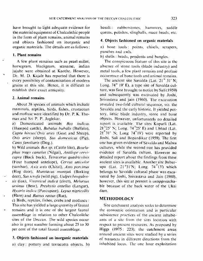
have brought to light adequate evidence forthe material equipment of Chalcolithic peoplein the form of plant remains, animal remainsand objects fashioned on inorganic andorganic materials. The details are as follows:
1. Plant remains
A few plant remains such as pearl millet,horsegram, blackgram, seasame, indianjujube were obtained at Kaothe. However,Dr. M. D. Kajale has reported that there isevery possibility of contamination of moderngrains at this site. Hence, it is difficult toestablish their exact antiquity.
2. Animal remains
About 38 species of animals which includemammals, reptiles, birds, fishes, crustaceanand mollusc were identified by Dr. P. K. Tho-mas and Sri P. P. Joglekar.a) Domesticated animals Bas indie us(Humped cattle), Buha/us huhalis (Buffalo),Capra hircus] Ovis aries (Goat and Sheep),Ovis aries (sheep), Sus domesticus (Pig),Canis familiaris (Dog.).b) Wild animals Bos sp. (Cattle like), Bosela-phus trego came/us (Nilgai), Anti/ope cervi-capra (Black buck), Tetracerus quadricolnis(Four humped antelope), Cervus unicolor(sarnbar), Axis axis (Chi tal), Axis porcinus(Hog deer), Muntiacus muntjak (Barkingdeer), Sus scrofa (wild pig), Uulpes bengalen-sis (fox), Viverricul indica (civet), Melursusursin us (Bear), Preshytis entel/us (Langur),Hystrix indica (Porcupine), Lepus nigricollis(Hare) and Rattus rattus (Rat).c) Birds, reptiles, fishes, crabs and molluscs:This site has yielded a large quantity offaunalremains and it is one of the largest faunalassemblage in relation to other Chalcolithcsites of the Deccan. The wild species occuralso in great number forming about 25 to 30per cent of the total faunal assemblage.
3. Objects fashioned on inorganic materials
a) clay: pottery and terracotta objects. b)
basalt: rubberstones, hammers. saddlequerns, polishrs, slingballs, mace heads, etc.
4. Objects fashioned on organic materials
a) bone tools: points, chisels, scrapers,punches and awls.b) shells: beads, pendents and bangles.
The conspicuous feature of this site is theabsence of stone tools (blade ind ustry) andmetal tools, a few plant remains and profuseoccurrence of bone tools and animal remains.
The ancient site Savalda (Lat. 21° 31' N;Long. 74 ° 19' E), a type site of Savalda cul-ture, was first brought to notice by Sa Ii (1959)and subsequently was excavated by Joshi,Srivastava and jain (1960). The excavationrevealed two-fold cultural sequence, viz. theSavalda and the early historic. It yielded pot-tery, lithic blade industry, stone and boneobjects. However, unfortunately no detailedreport is available. The sites Koparli (Lat.21 °25' N; Long. 74 °25' E) and Ubhad (Lat.21°31' N; Long 74°19,) were reported byJoshi, Sali and Bopardikar (1959). The firstone has given evidence of Savalda and Malwacultures, while the second one has providedevidence of Savalda culture. However nodetailed report about the findings from theseancient sites is available. Another site Bahur-
oupa (Lat. 21 °31 'N; Long. 74 13') whichbelongs to Savalda cultural phase was exca-vated by Joshi, Srivastava and Jain (1960),however, this site at present is unapproacha-ble because of the back water of the Ukaidam.
METHODOLOGY
Site catchment analysis seeks to determinethe economic orientation and is particularsubsistence practices of the ancient inhabit-ants of a site from the sites location withrespect to present resources. As proposed byHiggs (1975: 223), the catchment areasaround ancient sites were studied by a seriesof transects in different directions from theinhabited locus. The one hour exploitation
324 RAGHUNATH S. PAPPU AND VASANT S. SHINDE
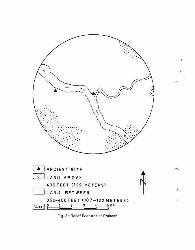
territory (5 km) was further divided into timecontours of 12minutes (I km), 30 minutes (2.5km) and 60 minutes (5 km). As the reliefaround the ancient sites is not pronounced,the exploitation territories are more or lesscircular (Figs. 2 and 3). The particulars of themodern land use zones such a terrain types,soils, plant and animal remains and mineralresources encountered all the way from thecore to periphery were carefully recorded. Inaddition to this detailed catchment analysis, areconnaissance survey was also undertakenfor 2 to 3 hours exploitation territory (10 to 15km) around each site. This was undertaken tohave overall appreciation of the landscape, toknow the resource potentiality within thislarger area around ancient sites and to locateseasonal camps if any present in the form offarmsteads, herding units, camps etc.
ENVIRONMENTAL CHANGES
The central Tapi basin was continuouslyil1habited for a period of nearly 1000 yearsbetween 2000 BrC, and 1000 B.c. In order toassess the subsistence activities in the regionby means of site catchment analysis, we mustfirst estimate as far as possible the nature andthe magnitude of the environmental changesduring and since the sites were occupied.
As the investigated region is tectonicallystable, the Chalcolithic settlements were notdisturbed. The landscape, has also notchanged much during last 4000 years. Therivers were flowing at the same bed levels asthey flow today. The region at present enjoysa semi-arid monsoonic type climate and sim-ilar type of climate with fluctuations in theform of slightly higher or lower precipitationthan the present one prevailed during theChalcolithic times (Pappu 1988; Rajaguru1988)
The other environmental changes that haveoccurred since the region was occupied byearly farmers are vegetational degradationand soil erosion. The natural vegetationaround ancient sites has been reduced to relict
stands by deforestation resulting from sheepand goat grazing, tree felling and extensivecultivation. The black soils in the form ofpalaeosols buried under habitational depositsof Chalcolithic period of Chandoli, Nevasa,Sonegaon and Navadatoli and also the mod-ern black soils of the. same region in the vicin-ity of these ancient sites were investigated byMujumdar (1974: 147). These studies haveclearly indicated that modern black soils com-pare poorly with the fossil soils and exhibitdegraded pedological characteres. Fossil soilsare characterised by higher proportion oforganic matter and better development of soilprofile which is suggestive of dense vegeta-tional cover.
The studies concerning the environmentalchanges around the ancient sites thus indicatethat the landforms within the catchment areashave been fairly stable over last 4000 years.There is also evidence for the vegetationaldegradation and regolith loss and Chalcoli-thic soils were of better qualities possessinggood arable potential.
DISCUSSION
We have already established the categorisa-tion of the present resources around mainChalcolithic sites. The excavations conductedat Kaothe and Prakashe have provided ade-quate evidence for the material equipment ofthe Chalcolithic communities in the form ofplant remains, faunal remains, and objectsfashioned on inorganic and organic materials.The data from excavations and data collectedon present resource potential around ancientsites will now be integrated and attempt willbe made to reconstruct subsistence activitiesand to suggest reasons for site locations.
The Chalcolithic communities mainly sub-sisted on farming but hunting, fishing, collec-tion of forest products and pastroal activityalso played an important role in their subsist-ence activities. The early farmers cultivatedthe black soil which is known for its fertilityand moisture retaining capacity. The black
SITE CATCHMENT ANALYSIS OF THE DECCAN CHALCOLITHIC
soil shows its best development in the studyarea. The black soil, therefore, was a signifi-ca nt factor in the efflorescence of Chalco lithiccultures of the Deccan. Our approach to sitecatchment analysis is mainly based on thedistribution of arable land around the ancientsites. Modern land use categories and in par-ticular soils will be taken as a guide line for thereconstruction of Chalcolithic land use clases.Since landscape during the Chalcolithic timeswas more or less the same as the present oneand also soil conditions in general were better,we safely presume that the distribution ofancient and modern resource spaces corres-pond systematically to one another.
325
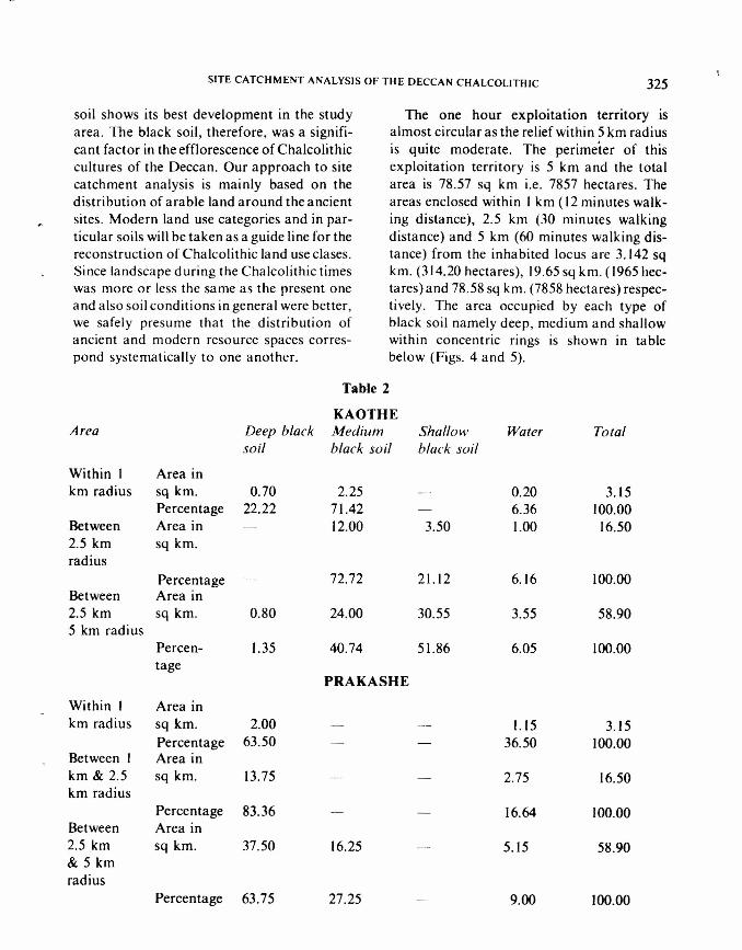
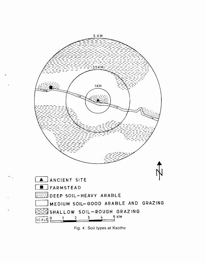
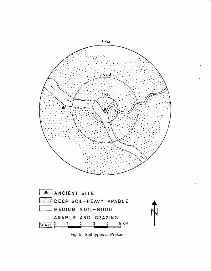
The one hour exploitation territory isalmost circular as the relief within 5 km radiusis quite moderate. The perimeter of thisexploitation territory is 5 km and the totalarea is 78.57 sq km i.e. 7857 hectares. Theareas enclosed within I km (12 minutes walk-ing distance), 2.5 km (30 minutes walkingdistance) and 5 km (60 minutes walking dis-tance) from the inhabited locus are 3.142 sqkm. (314.20 hectares), /9.65 sq km. (1965 hec-tares) and 78.58 sq km. (7858 hectares) respec-tive/y. The area occupied by each type ofblack soil namely deep, medium and shallowwithin concentric rings is shown in tablebelow (Figs. 4 and 5).
Table2
KAOTHEArea Deep black Medium Shallow Water Total
soil black soil black soil
Within / Area inkm radius sq km. 0.70 2.25 0.20 3.15
Percentage 22.22 71.42 6.36 100.00Between Area in 12.00 3.50 1.00 16.502.5 km sq km.radius
Percentage 72.72 21.12 6.16 100.00Between Area in2.5 km sq km. 0.80 24.00 30.55 3.55 58.905 km radius
Percen- 1.35 40.74 51.86 6.05 100.00tage
PRAKASHEWithin I Area inkm radius sq km. 2.00 1.15 3.15
Percentage 63.50 36.50 100.00Between I Area inkm & 2.5 sq km. 13.75 2.75 16.50km radius
Percentage 83.36 16.64 100.00Between Area in2.5 km sq km. 37.50 16.25 5.15 58.90& 5 kmradius
Percentage 63.75 27.25 9.00 100.00

326 RAGHUNATH S. PAPPU AND VASANT S. SHINDE
The IOtal arable land (deep and mediumblack soils) around I km radius is 2.95 sq km(295 hectares) and around 2.5 km radius is12.00 sq km (1200 hectares) at Kaothe andarable land around I km radius is 2.00 sq km.(200 hectares) and around 2.5 km radius is13.75 sq km (1375 hectares) at Prakashe.Shinde (1984: 271-273) has estimated theapproximate population of Kaothe asbetween 800 and 1200 and that of Prakasheduring the late Ha rappa, Malwa and .Iorweperiods as 1500-1800, and the arable landrequired for these population as between 250(minimum) to 1000 (maximum) hectares.According to our calculations, the availablearable land around 2.5 km radius comes toalmost 1200 hectares at Kaothe and 1375 hec-tares at Prakashe. This arable land. therefore,was more than adequate for the Chalcolithicfarmers.
The attempt will now be made to evaluatethe distribution of Chalcolithic resourceswithin concentric territory rings of I km, 2.5km and 5 km radii.
I. Within the settlement
Several resources were a vaila ble wit hi nandin the close vicinity of the ancient sites such asclay for pottery, terracotta objects and housebuilding material, chalcedony for lithic arti-facts, kankar and shells for lime making,typha grass for roof thatching, domesticanimals. fishes and the aquatic animals.
2. From the settlement to 1 km radius (12minutes walking distance)
At Prakashe and Savalda the area within Ikm radius along both the banks is completelycovered by deep black fertile soils. It is, there-fore, evident that intensive agriculture waspractised by early farmersat these sites. How-ever, unfortunately there is no evidence forcharred food grains as flotation techniqueused for recovering the ancient foodgrainswas not well developed, at the time when theexcavations were conducted.
There are a few patches of deep black soiland a large tract of medium soil aroundancient site of Kaothe within I km radius. Thetotal arable land (deep and medium blacksoil) in this exploitation territory is about 295hectares. We have very meagre evidence forthe cultivated plants. It, therefore, appearsthat primitive incipient type of agriculturewas practised by Savalda people at Kaothe.This was on the left bank and within radiusof0.50 to I km from the ancient site. The avila-ble arable land was more than quite sufficientfor the early farmers.
Pottery has been found in enormous qua n-tities at all the ancient sites. The clay, the mainrequirement for pottery preparation is availa-ble in the all uvial cliff sections which aremostly made up of finer constituents of thealluvium like clay and silt. The fine sticky clayis generally formed when stagnant pool waterconditions (ponds) prevail. Such situations,i.e. large ponds with abundant quantity ofclay were observed at both Prakashe andKaothe within a radius of 0.50 km fromancient sites.
Lithic blade industry is one of the salientfeatures of the Chalcolithic culture of theDeccan. The raw material used for preparinglithic artifacts was mainly chalcedony andoccasionally other silica family minerals suchas chert, jasper, milky quartz, agate, carne-lian, etc. Sub-angular to sub-rounded nodulesand pebbles of chalcedony and other silicafamily minerals are found in plenty in thegravel beds developed in the river bedsaround all the Chalcolithic sites. This was themain and nearest source of chalcedony for theChalcolithic communities for preparing lithicartifacts and beads.
There are extensive outcrops of hard com-pact basalts in the river beds at both Prakasheand Kaothe just at the distance of 50 to 100 min the vicinity of ancient sites. These basaltexposures exhibit both horizontal and verti-cal joint pattern and blocks of suitable sizesand shapes come out easily because of this
SITE CATCHMENT ANALYSIS OF THE DECCAN CHALCOLITHIC 327
joint pattern. Even at present, a large numberof loose blocks of hard basalts are found inthe modern river beds near the outcrops.These outcrops must have served as a mainsource of raw material for early farmers forpreparing different types of stone objects suchas saddle querns, hammerstones, rubber-stones, maceheads, etc.
3. Area enclosed between I and 5 kmradius from the ancient site (12 to 60minutes walking distance).
This area at the ancient site of Kaothe isoccupied by medium and coarse shallow soils.There is a small patch of deep black soil on theleft bank near the village Chhadwell (Fig. 6).This was a farmstead of the main settlement atKaothe situated at a distance of 4 km west-north-west of ancient site. Similarly at Pra-kashe we have evidence of farmstead duringJorwe period at Prakashe II which lies at adistacne of 2 km west of the main site.
There are a few isolated hills in this zonearound Kaothe which are situated to the west,north-west, south-west a nd south of ancientsite. These hills rise to an elevation of 100 to150 m above average ground elevation of 420-450 m. This exploitation territory at Kaotheat present is not thickly forested; in fact, it isalmost barren with occasional growth ofgrasses and a few bushes. However, duringChalcolithic times, this zone was definitelycovered by thick thorn and scrub type vegeta-tion. The seasonal wild food plants mighthave been gathered from this zone. We haveevidence from the excavtions at Kaothe of thefollowing ancient wild fauna comprising nil-gai, black buck, four-horned antelope, sarn-bar, chital, hog deer, barking deer, wild pig,fox, civet, bear, hare, etc. At present onlysmall game like hare, jackel, and fox arefound in this zone. The presence of above-mentioned faunal remains indicate a relativelythick vegetation cover than the present oneand the area was teeming with varieties ofdeer and other wild fauna. The area around
Prakashe for a radius of I to 5 km is at presentcovered by mainly deep black and occasion-ally medium black soil. During Chalcolithictimes, a few fields especially within distance of2 km from the ancient site on the right bankmight have been located. Otherwise this zonehad served as an ideal hunting ground. Littlebeyond this zone of 5 km radius, that is, at adistance of 7 km northeast of Prakashe at aplace called Sasda , an extensive exposure ofchalcedony associated with vesicular basaltwas noticed. It is probable tht this mineralresource was also exploited to some extent forfashioning lithic artefacts.
In the course of excavations, both at Pra-kashe and Kaothe, the evidence was found fora few objects like copper, gold, marine shells,quartzites, etc. which were not locally availa-ble. These include objects on marine shells,afew copper and gold objects, objects on ivoryand a few stone objects on quartzites. Itappears that all these objects except gold wereobtained from Saurashtra coastal region situ-ated 200 to 250 km west of ancient sites, whe-reas gold objects were obtained from southIndia where gold is available only at Huttinear Raichur in Karnataka. These objectswere used on a restricted scale. This suggeststhat these were luxury items used by a smallproportion of population to display and storetheir wealth. Dhavalikar (1984: 73) has sug-gested that the Chalcolithic people mighthave exchanged materials with their contem-poraries including the hunter-gatherers andthis process has been described as reciprocalexchange characteristic of a chiefdom society.
There is evidence for the setting of small-size settlements in the form of small village(population between 100-200), hamlet (popu-lation between 100-10) and camps (popula-tion below 10) of the same culture within aradius 5 to 20 km from the main settlementwhich is either in the form of regional centre(population more than 1000) or big village(population between 200-600) (Shinde 1984 :236-237). These small-size settlements were
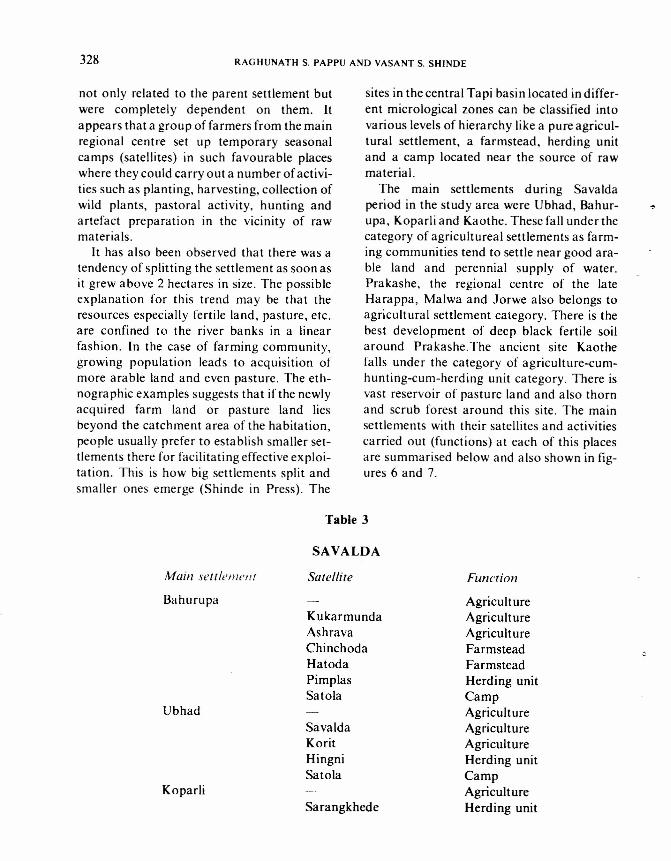
328 RAGHUNATH S. PAPPU AND VASANT S. SHINDE
not only related to the parent settlement butwere completely dependent on them. Itappears that a group of farmers from the mainregional centre set up temporary seasonalcamps (satellites) in such favourable placeswhere they could carry out a number of activi-ties such as planting, harvesting, collection ofwild plants, pastoral activity, hunting andartefact preparation in the vicinity of rawmaterials.
It has also been observed that there was atendency of splitting the settlement as soon asit grew above 2 hectares in size. The possibleexplanation for this trend may be that theresources especially fertile land, pasture, etc.are confined to the river banks in a linearfashion. In the case of farming community,growing population leads to acquisition ofmore arable land and even pasture. The eth-nographic examples suggests that if the newlyacquired farm land or pasture land liesbeyond the catchment area of the habitation,people usually prefer to establish smaller set-tlements there for facilitating effective exploi-tation. This is how big settlements split andsmaller ones emerge (Shinde in Press). The
SAVALDAMain settlement Satellite
BahurupaKukarmundaAshravaChinchodaHatodaPimplasSatola
UbhadSavaldaKoritHingniSatola
KopariiSarangkhede
sites in the central Tapi basin located in differ-ent micrological zones can be classified intovarious levels of hierarchy like a pure agricul-tural settlement, a farmstead, herding unitand a camp located near the source of rawmaterial.
The main settlements during Savaldaperiod in the study area were Ubhad, Bahur-upa, Koparii and Kaothe. These fall under thecategory of agricultureal settlements as farm-ing communities tend to settle near good ara-ble land and perennial supply of water.Prakashe, the regional centre of the lateHarappa, Malwa and Jorwe also belongs toagricultural settlement category. There is thebest development of deep black fertile soilaround Prakashe.The ancient site Kaothefalls under the category of agriculture-cum-hunting-cum-herding unit category. There isvast reservoir of pasture land and also thornand scrub forest around this site. The mainsettlements with their satellites and activitiescarried out (functions) at each of this placesare summarised below and also shown in fig-ures 6 and 7.
Table 3
Function
AgricultureAgricultureAgricultureFarmsteadFarmsteadHerding unitCampAgricultureAgricultureAgricultureHerding unitCampAgricultureHerding unit
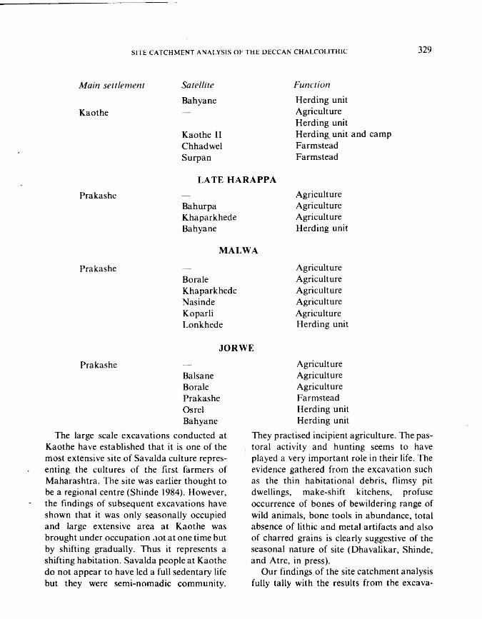
SITE CATCHMENT ANALYSIS OF THE DECCAN CHALCOLITHIC 329
Main settlement Satellite
BahyaneKaothe
Kaothe IIChhadwelSurpan
Function
Herding unitAgricultureHerding unitHerding, unit and campFarmsteadFarmstead
Prakashe
LATE HARAPPA
BahurpaKhaparkhedeBahyane
MALWA
PrakasheBoraieKhaparkhedeNasindeKoparliLonkhede
JORWE
PrakasheBalsaneBoraiePrakasheOsrelBahyane
The large scale excavations conducted atKaothe have established that it is one of themost extensive site of Savalda culture repres-enting the cultures of the first farmers ofMaharashtra. The site was earlier thought tobe a regional centre (Shinde 1984). However,the findings of subsequent excavations haveshown that it was only seasonally occupiedand large extensive area at Kaothe wasbrought under occupation .1Otat one time butby shifting gradually. Thus it represents ashifting habitation. Savalda people at Kaothedo not appear to have led a full sedentary lifebut they were semi-nomadic community.
AgricultureAgricultureAgricultureHerding unit
AgricultureAgricultureAgricultureAgricultureAgricultureHerding unit
AgricultureAgricultureAgricultureFarmsteadHerding unitHerding unit
They practised incipient agriculture. The pas-toral activity and hunting seems to haveplayed a very important role in their life. Theevidence gathered from the excavation suchas the thin habitational debris, flimsy pitdwellings, make-shift kitchens, profuseoccurrence of bones of bewildering range ofwild animals, bone tools in abundance, totalabsence of lithic and metal artifacts and alsoof charred grains is clearly suggestive of theseasonal nature of site (Dhavalikar, Shinde,and Atre, in press).
Our findings of the site catchment analysisfully tally with the results from the excava-
330 RAGHUNATH S. PAPPU AND VASANT S. SHINDE
tions. Prakashe, Ubhad, Bahurupa andKoparli as mentioned earlier were mainlyagricultural settlements because of the loca-tion of these sites in the fertile deep black soilzone. The Savalda community at Kaothe,practised incipient agriculture and reliedmore on hunting-gathering and pastoralactivity as there was no good development ofdeep black arable soil around the settlement.
The Cha1colithic communities establishedthe main settlements in the central Tapi basinbecause of the number of prevailing favoura-ble ecological factors. The proximity to per-ennial supply of water is the most importantdeterminant for the establishment of any set-tlement. All the main settlements are situatedin the vicinity of the deep pools formed in theriver beds. These pools provided an assuredsupply of water throughout the year and alsosupported aquatic creatures and alsoattracted the terrestrial animals. The siteswere also established on the elevated terracesurfaces to avoid danger from normal floods.The presence of a vast reservoir of pastureland and thorn and scrub forest within a
Chisholm M. 1979. Rural Settlements ane. Land use:An Essav in Location (3rd edition). London:Hutchinson.
Deshpande, C. D. 1971. Geography of Maharashtra.New Delhi: National Book Trust.
Dhavalikar, M. K. 1984. Ecological model for Chalco-lithic cultures. Journal of Anthropoiogicat Archaeology3(2): 133-158.
Dhavalikar, M. K. Shinde Vasa nt, and S. M. Atre (inPrss). Excavations at Kaothe. Pune: Deccan College.
Dikshit, K. R. 1986. Maharashtra in Maps. Bombay:Maharashtra State Board for Literature and Culture.
Govind Rajan, S. V. and H. G. Gopal Rao. 1978.Studies on Soils of India. New Delhi: Vikas PublishingHouse.
Joshi, R. V. and B. C. Deotare. 1983. Chemical Analy-sis of Archaeological Deposits/rom India. Pune: DeccanCollege.
Joshi, R. V., S. A. Sali and B. P. Bopardikar. 1959.Exploration in District West Khandesh. IndianArchaeology 1958-59 A Review: pp. 22-25.
Joshi, R. V., K. M. Srivastava and S. P. Jain. 1960Excavtion at Bahurupa and Savalda, District West
radius of 5 to 10 km from ancient sites weremost ideal ecological niches for Cha1colithiccommunities for undertaking hunting, foodgathering and pastoral activities.
On the basis of these studies, we can con-clude that Cha1colithic communities neededan area of 5 km radius at all the main settle-ments to satisfy all their basic requirements.The early farmers thus exploited mostly localresources lying within these exploitation terri-tories. The black soil was a most significantfactor in the efflorescence of the Cha1colithiccultures in the investigated area. Earlyfarmers were capable of making effective useof this main resource and cultivated grains ofdomesticated species in the vicinity of settle-ment within walking distance of 5 to 15 min-utes. An area enclosed between I km and 5 kmradius satisfied almost all the other resourcerequirements and from this zone they utiliseda wide variety of wild resources. At times,they were also prone to go a considerable waybeyond normal walking distance to exploitcertain materials which they may haveregarded as necessary.
References
Khandesh. Indian Archaeology 1959-60 A review: pp.34-37.
Kunte, B. G. (ed), 1974. Gazetteer of MaharashtraState: Dhulia District (Revised Edition). Bombay:Government of Maharashtra.
Lee, R. B. 1969. ! Kung Bushman subsistence: an input-output analysis. In Environment and Cultural Behav-iour. A. P. Vayda (ed), pp. 47-79. New York: NaturalHistory Press.
Mujumdar, G. G. 1974. Pedological study of somefossil and modern soils from western Deccan: Ancientsoils of the Deccan. In Studies in Indologv and MedievalHistory (Prof. G. H. Khare Felicitation Volume), M. S.Mate and G. T. Kulkarni (eds.), pp. 139-150. Poona:Joshi-Lokhande Prakashan.
Pappu, R. S. 1988. Site catchment analysis. In Excava-tions at lnamgaon, M. K. Dhavilikar, H. D. Sankalia andZ. D. Ansari (eds.), pp. 107-120. Pune : Deccan College.
Rajaguru, S. N. 1988. Environment In Excavations atInamgaon, M. K. Dhavalikar, H. D. Sankalia and Z. D.Ansari (eds.), pr. 9-14. Pune: Deccan College.
Sali, S. A. 1959. Explorations in District West Khan-desh, Indian Archaeology 1958-59 A Review: pp. 22-25.
SITE CATCHMENT ANALYSIS OF THE DECCAN CHALCOLITHIC 331
1970.The Harappan cultures as revealed thourgh surfaceexplorations in the central Tapi basin. Journa/ of Orien-ta/Institute 20: 93-101.
Shinde, Vasant. 1984.Early Settlements in the Centra/Tapi Basin. Unpublished Ph. D. thesis. University ofPoona and Deccan College, Pune.1985. Kaothe-A late Harappan settlement in the Cen-tral Tapi basin. Bulletin of the Deccan College ResearchInstitute 44: 173-177.
Singh, R. C. 1971. India: A Regiona/ Geography.Varanasi: Geographical Society of India.
Thapar, B. K. 1967. Prkash 1955: Chalcolithic site inthe Tapi valley. Ancient India 20-21: 1-167.
Vita-Finzi, C. and E. S. Higgs. 1970. Prehistoric econ-omy in the Mount Carmel area of Palestine: Site cat-chemtn analysis. Proceedings of the Prehistoric Society36:1-37.
74I.- MADHYA
~ ~.;.,~~
\
~ :.:l'UO?K I L 0 M. E T E R 5
l.)
(
\
CENTRAL TAPI BASINMAIN CHALCOLITHIC SETTLEMENTS
s-:o.....
Q
!V__ ,_,_,r '-'-,-,,'., ~I ' Vi..,.J._.r.-. •.. <!l..• " "
'- r ' V~ ~~.)~.
',- (" ..•.1'r.l
i.(.
,.-.-
GUJARAT
- -GUJARAT
o21
.....,R. k -4
tvr
l
'- KAOTHE
~NJ~
,r '
\( ?f
AR EA Of THE MAP
N A S I K 015 T.
o74 a75
Fig. 1 : Main Chalcolithic Settlements in Central Tapi Basin
,I -'-c' - •
.I'
Ii
.1. .....}
~.)~,
\I"..•..
"
o21
"

5 KM
... ~ ....
~ ANCIENT SITE
o LAND BELOW t400 FEET (429 METERS)
I: : : : ~:1 LAN D BET WEE N 140 0 -1450 FEE T (42 9 -4 4 5 MET ERS)
1=:::=:=1 LAND BETWEEN 1450-1500 FEET '445-460 METERS)
~ LAND ABOVE t500 FEET (460 METERS)ISCALEI ~ " ~ ~ 1 ~K M
Fig. 2 : Relief Features at Kaothe
:.....•. . .~.0 ••.• 0
..::':':'::':':"':'~.\.• . . •..... .. .......•• -0.
o •••••••••.•.•.
e••.•••. : °0 o. •. •• •. •• • •• 0.
o : ••. "
: .• °0
•• " ••••
mANCIENT SITE[:-:-:: .. :-1 LAND ABOVE
400FEET (122 METERS)
[:=J LAN 0 'B E T WEE N
350-400FEET (107-122 METERS)jSCAlij P 1 1 1 4 ~ K M
Fig. 3: Relief Features at Prakash
---
5 KM
-::--------- ---------
---------- - - - ------------------_.- - - - - - -----------
~ANCIENT SITECi:J FARMSTEAD[:.:.:.:.:.:1 DEEP
or=.====:=I~
SOIL-HEAVY ARABLE
MEDIUM SOIL-GOOD ARABLE
SHALLOW SOIL-ROUGH GRAZING~ 0 1 2 3 4 5 KM~ tl=====-'••••• '=====3'•••• .t'====~1
AND GRAZING
Fig. 4: Soil types at Kaothe
SKM
'. . .... ':: . ' ..'. . .' ...... . . . . . . . . . . ' ... . . . . .
~ANCIENT SITE
1':-:-'::::1 DEE P S OIL-H E AVY ARAB L E
o MEDIUM SOIL-GOOD
ARABLE AND GRAZING~D '2 3 4 SKM~[ !!! J
Fig, 5: Soil types at Prakash
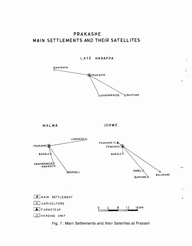
PRAKASHEMAIN SETTLEMENTS AND THEIR SATELLITES
LATE HARAPPA
BAHUIIUPA
KliAPARKHEOE BAHYANE
MALWA JORW E
P R AKASHE-II
PRAKASHE
KOPARLI
BAHYANE
WMAIN SETTLEMENT
~ AGRICULTURE
mFARMSTEAO
[JDHEROING UNIT
o 4 8 12 16KM~1==~I••••c! ==~ ••"IFig. 7: Main Settlements and their Satellites at Prakash
BALASANE