Pana'ewa Agricultural Lots Subdivision
434
Prepared for Department of Hawaiian Home Lands July, 2015 Prepared by Pana‘ewa Agricultural Lots Subdivision Draft Environmental Assessment – Anticipated Finding of No Significant Impacts (HRS 343) PBR & ASSOCIATES, INC. HAWAII
-
Upload
khangminh22 -
Category
Documents
-
view
1 -
download
0
Transcript of Pana'ewa Agricultural Lots Subdivision
Prepared for
Department of Hawaiian Home Lands
July, 2015
Prepared by
Pana‘ewa Agricultural Lots SubdivisionDraft Environmental Assessment – Anticipated Finding of No Significant Impacts
(HRS 343)
PBR& ASSOCIATES, INC.
HAWAII
S U M M A R Y Project Name: Pana‘ewa Agricultural Lots Subdivision Location: Waiākea ahupua’a, South Hilo, Island and County of Hawai‘i Judicial District: South Hilo Tax Map Key (TMK): Parcels off of Auwae Road (hereafter referred to as the “Auwae
Lots”): (3) 2-1-025:047 (Lot 47 of Pana‘ewa House & Farm Lots) (3) 2-1-025:048 (Lot 48 of Pana‘ewa House & Farm Lots) (3) 2-1-025:006 (Lot 6 of Pana‘ewa House & Farm Lots) (3) 2-1-025:007 (Lot 7 of Pana‘ewa House & Farm Lots) Parcel off of Mahiai Street (hereafter referred to as the “Mahiai Lot”): (3) 2-2-061:002 (Lot 185 of Pana‘ewa House & Farm Lots)
Land Area: Approximately 50 acres total (10 acres each of five lots) Proposing/Determining Agency:
Department of Hawaiian Home Lands
Landowner: Department of Hawaiian Home Lands Existing Use: One open area with a single home to be demolished (Mahiai Lot),
and four undeveloped parcels with existing vegetation dominated by albizia trees (Auwae Lots)
Proposed Action: The project consists of subdividing the various parcels into approximately 80 half-acre lots with County dedicated roads and water system. DHHL will award the lots to native Hawaiian beneficiaries on the wait list, and/or to existing lessees who need to relocate due to lava or other hazards.
Current Land Use Designations:
State Land Use: Agriculture County General Plan LUPAG: Urban Expansion (Auwae Lots); Low Density Urban (Mahiai Lot) County Zoning: General industrial district (MG-1a) (Auwae Lots);
Agricultural (A-5a) (Mahiai Lot) Special Management Area (SMA): Not in SMA DHHL Land Designation (Hawai‘i Island Plan 2002): Commercial
(Auwae Lots); Supplemental Agricultural (Mahiai Lot) Alternatives Considered:
Three alternatives were considered: • No action • Alternative sites • Alternative designs
Potential Impacts and Mitigation Measures:
Beneficial impact by providing affordable housing opportunity for native Hawaiians within the urban core in proximity to jobs, schools, and shopping. One-half acre lot size provides opportunity for self-sufficiency agriculture.
i

Mitigation measures include: Threatened or endangered species. DHHL to provide notice to lessees: • To protect night-flying seabirds, outdoor illumination be shielded so that the bulb is not visible at or above bulb-height. • To protect the low-flying, foraging Hawaiian hoary bat, barbed wire not be used for fencing. Construction scheduling and documents will incorporate the following applicable recommendations of the USFW: • Hawaiian hawk. If construction occurs during the hawk’s breeding season (March through September), the contractor will retain a qualified ornithologist to conduct a nest search of the area of the proposed construction site and surrounding area prior to the advent of construction activities. Surveys should ensure that construction activity will not occur within 1,600 feet of any Hawaiian hawk nest. • Hawaiian hoary bat. It is recommended that woody plants greater than 15 feet tall should not be removed or trimmed during the Hawaiian hoary bat breeding season (June 1 to September 15). • Seabirds. If night work must be conducted, it should take place outside the sea bird fledging season (September 15 through December 15) and should utilize shielded lighting. Air quality, noise, water quality. Construction documents will include: • Standard dust control measures • Standard noise control measures • Best management practices for erosion and sedimentation control in accordance with approved Grading and NPDES permits Land use plans consistency. DHHL will amend the Hawai‘i Island Plan to reflect the proposed Subsistence Agricultural use and update the County per MOU. Solid Waste. Construction documents will include requirement to mulch the green waste onsite and make available to DHHL homesteaders. Whenever green waste cannot be processed on site, the green waste will be hauled to the Hawaii County Green Waste Site in Hilo for final disposal. Wastewater. Find additional funding to install dry sewers as part of the Project for the Auwae Lots. Upon updating the master planning for the Auwae Lots area, determine the required wastewater capacity of a collection system and find a funding source to construct. Toxics and Hazardous Waste.
Auwae Lots o Properly dispose of the illegal dumping solid waste
ii

at the end of Auwae Road; o Retain a Phase 1 consultant to conduct further
research as follows: Inspect for any industrial use encroachment
along the boundary of parcels [3] 2-1-025: parcels 092 and 093 with mitigation as needed to properly cleanup.
Use best efforts to research the extent of historic military use of the Auwae Lots.
o As long as groundwater is not pumped, no groundwater testing is necessary for potential impacts from the landfill or green waste site.
Mahiai Lot. Retain a Phase 1 consultant for further research as follows:
o Test the soil for arsenic; o Inspect the kennel drainage area and conduct
further testing as appropriate. Historic preservation. Construction documents will include a condition that should burials or other traditional deposits be identified during intrusive activities, all work in the area will cease and the appropriate agencies will be contacted. Coordination with DOT Airports. DHHL or contractor will file FAA Form 7460-1 "Notice of Proposed Construction or Alteration” and also notify DOT when filing the grubbing and/or grading permit.
Approvals and Permits Required:
Subdivision, UIC, NPDES, Grubbing/Grading, Noise, Individual Wastewater System Approval (by future lessee of each lot), Building (by future lessee of each lot)
Determination: Anticipated Finding of No Significant Impact
iii

Table of Contents
SUMMARY .................................................................................................................................... I
1 INTRODUCTION ................................................................................................................. 1 1.1 Landowner ..................................................................................................................... 1 1.2 Proposing/Determining Agency ..................................................................................... 1 1.3 Environmental Consultant ............................................................................................. 1 1.4 Compliance with State of Hawai‘i environmental laws ................................................. 1 1.5 Studies Contributing to this EA ...................................................................................... 2
2 PROJECT DESCRIPTION .................................................................................................. 3 2.1 Background Information ................................................................................................ 3
2.1.1 Location and Property Description .................................................................................. 3 2.1.2 Existing and Surrounding Land Uses ................................................................................ 3
2.2 Purpose and Need .......................................................................................................... 4 2.3 Project Description ......................................................................................................... 4 2.4 Development Timetable and Preliminary Costs ............................................................ 4
3 DESCRIPTION OF THE NATURAL ENVIRONMENT, POTENTIAL IMPACTS, AND MITIGATION MEASURES ....................................................................................... 5 3.1 Climate ........................................................................................................................... 5 3.2 Geology and Topography ............................................................................................... 5 3.3 Soils ................................................................................................................................ 6 3.4 Hydrology ....................................................................................................................... 7 3.5 Natural Hazards .............................................................................................................. 8 3.6 Flora and Fauna ............................................................................................................ 10
4 DESCRIPTION OF THE HUMAN ENVIRONMENT, POTENTIAL IMPACTS, AND MITIGATION MEASURES .............................................................................................. 13 4.1 Archaeological and Historic Resources ........................................................................ 13 4.2 Cultural Resources ....................................................................................................... 15 4.3 Roadways and Traffic ................................................................................................... 15 4.4 Noise ............................................................................................................................. 17 4.5 Air Quality .................................................................................................................... 17 4.6 Visual Resources ........................................................................................................... 18 4.7 Infrastructure and Utilities ........................................................................................... 19
4.7.1 Water System ................................................................................................................. 20 4.7.2 Wastewater System ....................................................................................................... 20 4.7.3 Drainage System ............................................................................................................. 21 4.7.4 Solid Waste ..................................................................................................................... 22 4.7.5 Utilities ........................................................................................................................... 22
4.8 Socio-Economic Characteristics ................................................................................... 22 4.8.1 Environmental Justice .................................................................................................... 23
iv

4.9 Public Services and Facilities ........................................................................................ 24 4.9.1 Schools ........................................................................................................................... 24 4.9.2 Police, Fire and Medical Services ................................................................................... 24 4.9.3 Recreational Facilities .................................................................................................... 25 4.9.4 Airport ............................................................................................................................ 25
5 LAND USE CONFORMANCE .......................................................................................... 27 5.1 State of Hawai‘i ............................................................................................................ 27
5.1.1 Chapter 343, Hawai‘i Revised Statutes .......................................................................... 27 5.1.2 State Land Use Law, Chapter 205, Hawai‘i Revised Statutes ......................................... 27 5.1.3 Coastal Zone Management Act, Chapter 205A, Hawai‘i Revised Statutes .................... 27 5.1.4 Hawai‘i State Plan ........................................................................................................... 32 5.1.5 DHHL Island and Regional Plans ..................................................................................... 35
5.2 County of Hawai‘i ......................................................................................................... 36 5.2.1 County of Hawai‘i General Plan...................................................................................... 36 5.2.2 County of Hawai‘i Zoning ............................................................................................... 39 5.2.3 Special Management Area ............................................................................................. 39
5.3 Approvals and Permits ................................................................................................. 40
6 ALTERNATIVES ................................................................................................................ 41 6.1 No Action Alternative ................................................................................................... 41 6.2 Alternative Sites ........................................................................................................... 41 6.3 Alternative Designs ...................................................................................................... 41
7 FINDINGS AND DETERMINATION .............................................................................. 43 7.1 Significance Criteria ...................................................................................................... 43 7.2 Anticipated Determination .......................................................................................... 45
8 CONSULTATION ............................................................................................................... 47 8.1 Pre-Assessment Consultation ...................................................................................... 47 8.2 Public Review ............................................................................................................... 48
9 REFERENCES .................................................................................................................... 49
APPENDICES
A Figures
B Pre-Assessment Consultation
C Flora and Fauna Survey and Assessment
D Archaeological Inventory Survey and SHPD Approval Letter
E Phase I Environmental Assessment
v

TABLES
Table 1: Anticipated Approvals and Permits ................................................................................ 40
FIGURES
(in Appendix A)
Figure 1. Regional Location Map
Figure 2. Pana‘ewa House and Farm Lots, File Plan 1487
Figure 3. Surrounding Uses
Figure 4. Site Plans
Figure 5. Soils Map
Figure 6. NRCS Agricultural Suitability Map
Figure 7. Water Resources
Figure 8. Flood Insurance Rate Map
Figure 9. Lava Flow Hazard Map
Figure 10. County Water System
Figure 11. County Sewer System for Hilo
Figure 12. Critical Wastewater Disposal Area Map
Figure 13. Public Facilities
Figure 14. State Land Use Districts
Figure 15. DHHL Hawai‘i Island Plan Land Use Designation
Figure 16. County General Plan
Figure 17. County Zoning
vi

ACRONYMS
AFONSI Anticipated Finding of No Significant Impact AIS Archaeological Inventory Survey ALISH Agricultural Lands of Importance to the State of Hawai‘i BMP Best Management Practices CIA Cultural Impact Assessment CWRM State of Hawai‘i Commission on Water Resource Management CZM Coastal Zone Management DBEDT State of Hawai‘i Department of Business, Economic Development, and Tourism DHHL Department of Hawaiian Home Lands DLNR State of Hawai‘i Department of Land and Natural Resources DOE State of Hawai‘i Department of Education DOH State of Hawai‘i Department of Health DOT State of Hawai‘i Department of Transportation DPR County of Hawai‘i Department of Parks and Recreation DWS County of Hawai‘i Department of Water Supply EA Environmental Assessment EIS Environmental Impact Statement EPA Environmental Protection Agency FAA Federal Aviation Administration FEMA Federal Emergency Management Agency FIRM Flood Insurance Rate Map FONSI Finding of No Significant Impact gpd Gallons per day HAR Hawai‘i Administrative Rules HELCO Hawai‘i Electric Light Company, Inc. HRS Hawai‘i Revised Statutes LEED Leadership in Energy and Environmental Design LID Low Impact Development LSB Land Study Bureau LUC State of Hawai‘i Land Use Commission LUPAG County of Hawai‘i General Plan Land Use Pattern Allocation Guide MGD Million gallons per day NAHASDA Native American Housing Assistance and Self-Determination Act NOAA National Oceanic and Atmospheric Administration NPDES National Pollutant Discharge Elimination Systems NRCS Natural Resources Conservation Service NPS National Park Service OEQC State of Hawai‘i Office of Environmental Quality Control ROW Right-of-way SCS Scientific Consultant Services, Inc. SHPD State of Hawai‘i Historic Preservation Division SMA Special Management Area
vii

TMK Tax map key UIC Underground Injection Control USDA United States Department of Agriculture USFWS United States Fish and Wildlife Service USGS United States Geological Survey UXO Unexploded ordnance
viii

(This page left blank intentionally.)
ix

PANA‘EWA ARICULTURAL LOTS Draft Environmental Assessment/Anticipated Finding of No Significant Impact
1 I N T R OD U C TI ON The State Department of Hawaiian Home Lands (DHHL) is proposing to subdivide five approximately 10-acre parcels into 80 lots at a minimum lot size of half-acre, collectively referred to as the Pana‘ewa Agricultural Lots Subdivision (“Project”). The proposed use of State lands triggers the preparation of an Environmental Assessment (EA) in compliance with Chapter 343, HRS.
1 . 1 LANDOW NER
The DHHL is the fee simple landowner and will lease the lots to qualified native Hawaiians.
1 . 2 PROPOSING/ DETERM INING AGENCY
DHHL is the proposing/determining agency.
Contact: Department of Hawaiian Home Lands ATTN: Niniau Simmons 91-5420 Kapolei Parkway Kapolei, Hawai'i 96707 Phone: (808) 620-9513 Fax: (808) 620-9529
1 . 3 ENVIRONM ENTAL CONSULTANT
PBR HAWAI‘I is the environmental planning consultant.
Contact: PBR HAWAI‘I & Associates, Inc. ATTN: Roy Takemoto 1001 Bishop Street, Suite 650 Honolulu, Hawai‘i 96813
Telephone: (808) 521-5631 Fax: (808) 523-1402
1 . 4 COM PLIANCE W ITH STATE OF HAW AI‘I ENVIRONM ENTAL LAW S
Preparation of this document is in accordance with the provisions of Chapter 343, HRS and Title 11, Chapter 200, Hawai‘i Administrative Rules (HAR) pertaining to Environmental Impact Statements. Section 343-5, HRS established nine “triggers” that require either an EA or an Environmental Impact Statement (EIS). The use of State or County lands or funds is one of these “triggers.” The project will also use federal funds. DHHL will comply with the requirements of the National Environmental Policy Act by a separate document.
CHAPTER 1 INTRODUCTION 1

PANA‘EWA ARICULTURAL LOTS Draft Environmental Assessment/Anticipated Finding of No Significant Impact
1 . 5 STUDIES CONTRIBUTING TO THIS EA
The information contained in this report has been developed from site visits, generally available information regarding the site and surrounding areas, and technical studies. Technical studies are attached as appendices to this EA. These studies include:
• Flora and Fauna Surveys • Archaeological Inventory Survey • Phase 1 Environmental Study.
CHAPTER 1 INTRODUCTION 2

PANA‘EWA ARICULTURAL LOTS Draft Environmental Assessment/Anticipated Finding of No Significant Impact
2 P R OJ E C T D ES C R I P T I ON
2 . 1 BACKGROUND INFORM ATION
2.1.1 Location and Property Description
The Project is proposed to be located in the Waiākea ahupua’a, South Hilo District, Island and County of Hawai‘i. One 10-acre parcel is located off Mahiai Street, north of a drainage channel (TMK (3) 2-2-061:002) (hereafter referred to as the “Mahiai Lot”), while the other four 10-acre parcels are located off the north end of Auwae Road (TMKs (3)2-1-025:006, (3)2-1-025:007, (3)2-1-025:047, and (3)2-1-025:048) (hereafter referred to as the “Auwae Lots”) (the Mahiai Lot and Auwae Lots collectively referred to as the “Site”) (see Figure 1).
The five 10-acre parcels are part of the Pana‘ewa House and Farm Lots filed in 1976 in the Bureau of Conveyances as File Plan 1487 (see Figure 2). The Auwae Lots are Lots 6, 7, 47, and 48 of Section 1 of this File Plan. The Mahiai Lot is Lot 185 of Section 2.
2.1.2 Existing and Surrounding Land Uses
A portion of the Mahiai Lot is open land with a single home (DHHL canceled the existing lease and will demolish the home), and the other four parcels of the Auwae Lots are undeveloped.
The surrounding uses are as follows (see Figure 3):
Mahiai Lot (TMK 322061002) Auwae Lots (TMK 321025006, 321025007, 321025047, 321025048)
North Orchard agricultural Forested, undeveloped parcels designated by DHHL for Commercial use; quarry located approximately 1700’ from nearest boundary
South Open undeveloped parcels DHHL agricultural homestead lots
East Mahiai Street; agricultural, low-density residential
County green waste site; landfill
West Residential homes DHHL agricultural homestead lots
CHAPTER 3 DESCRIPTION OF THE NATURAL ENVIRONMENT, POTENTIAL IMPACTS & MITIGATION MEASURES 3
PANA‘EWA ARICULTURAL LOTS Draft Environmental Assessment/Anticipated Finding of No Significant Impact
2 . 2 PURPOSE AND NEED
The Project will enable the relocation of Maku‘u Farm Lot lessees threatened by the lava flow, accommodate other lessees who may need to be relocated (e.g., Pu‘ukapu lessees with UXO issues), and/or awarded to new lessees on the wait list.
2 . 3 PROJECT DESCRIPTION
The Project consists of subdividing the Mahiai Lot into 16 approximately half-acre lots, a road lot, and a road reserve for a future connection. The four 10-acre Auwae Lots will each be subdivided into 16 approximately half-acre lots and roadway lots. The resulting subdivision of the Mahiai Lot and Auwae Lots will total 80 lots for homestead agricultural leases. For lessees relocating from another homestead lot, these lessees will have the option to move their existing home to the new lots. The other lots will require new construction. The lots will be accessed by County-dedicated roadways built to County standards. The lots will be served by the County water system and individual onsite septic systems (see Figure 4).
2 . 4 DEVELOPM ENT TIM ETABLE AND PRELIM INARY COSTS
The estimated total construction cost is $5 million. Federal (Native American Housing Assistance and Self-Determination Act (NAHASDA) funds) and possibly State funds will be used. Construction will commence by the start of next year and will require approximately 12 months for construction.
CHAPTER 3 DESCRIPTION OF THE NATURAL ENVIRONMENT, POTENTIAL IMPACTS & MITIGATION MEASURES 4

PANA‘EWA ARICULTURAL LOTS Draft Environmental Assessment/Anticipated Finding of No Significant Impact
3 D E S C R I P TI ON OF T HE N A T U R A L
E N V I R ON M EN T , P OT E N TI A L IM P A C TS , A N D M I TI GA T I ON M E A S U RES
This section describes existing conditions of the natural environment, potential impacts related to the Project, and mitigation measures to minimize impacts.
3 . 1 CLIM ATE
Hawai‘i Island’s geological features heavily influence its climate. Mauna Loa (13,679 foot summit elevation) and Mauna Kea (13,796 foot summit elevation) dominate ground-based atmospheric influences. Northeast trade winds typically occur during the day, while winds from the southwest typically occur during the night due to cold air drainage from the mountains. The mean annual wind speed at the airport is about 8 miles per hour (mph), and usually varies between about 4 and 12 mph during the day.
Regional temperatures are generally cool due to the trade winds. Average annual temperatures range from 66-82 degrees Fahrenheit (County of Hawai‘i Data Book).
According to The Rainfall Atlas of Hawai‘i, the property receives an average annual rainfall of approximately 150” inches (Giambelluca, et al., 2012). Hilo’s rainfall pattern is characterized by windward-leeward differences due to the orographic effect of the mountains and trade winds.
POTENTIAL IMPACTS AND MITIGATION MEASURES
No significant impact. The Project will do its part to minimize climate change impacts by encouraging homestead lessees to install renewable sources and passive energy-conserving measures such as natural ventilation, solar water heating, and photovoltaic energy.
3 . 2 GEOLOGY AND TOPOGRAPHY
Of the five volcanoes that formed the island of Hawai‘i—Kohala, Hualālai, Mauna Kea, Mauna Loa, and Kīlauea—only Mauna Loa and Kīlauea are presently considered active; the other three are considered dormant. The Site is located on the southeastern flank of Mauna Kea:
Both the Mahiai Lot and Auwae Lots are relatively level. The elevation of the Auwae Lots is approximately 100’ above mean sea level; the Mahiai Lot elevation is approximately 200’.
POTENTIAL IMPACTS AND MITIGATION MEASURES
Mitigable impact. Due to the generally flat surface, minimal grading will be required. To minimize potential impacts, best practices to control erosion and sedimentation will be specified in the grading plans, in compliance with Chapter 10 (Erosion and Sedimentation Control) of the Hawai‘i County Code and the NPDES Permit. Best practices to incorporate as applicable include:
CHAPTER 3 DESCRIPTION OF THE NATURAL ENVIRONMENT, POTENTIAL IMPACTS & MITIGATION MEASURES 5

PANA‘EWA ARICULTURAL LOTS Draft Environmental Assessment/Anticipated Finding of No Significant Impact
• Minimizing the time of construction;
• Retaining existing ground cover as long as possible;
• Constructing drainage control features early;
• Using temporary area sprinklers in non-active construction areas when ground cover is removed;
• Providing a water truck on-site during the construction period to provide for immediate sprinkling, as needed;
• Using temporary berms and cut-off ditches, where needed, for control of erosion;
• Watering graded areas when construction activity for each day has ceased;
• Grassing or planting all cut and fill slopes immediately after grading work has been completed; and
• Installing silt screens, where appropriate.
3 . 3 SOILS
Three soil suitability studies prepared for lands in Hawai‘i describe the physical attributes of land and the relative productivity of different land types for agricultural production; these are: 1) the U.S. Department of Agriculture Natural Resource Conservation Services (NRCS) Soil Survey; 2) the University of Hawai‘i Land Study Bureau (LSB) Detailed Land Classification; and 3) the State Department of Agriculture’s Agricultural Lands of Importance to the State of Hawai‘i (ALISH) system.
Natural Resource Conservation Service Soil Survey
Within the Site and surrounding area the soil type is Papai extremely stony muck (rPAE) (see Figure 5). This soil type is well drained, negligible to low runoff, permeability is very rapid in the soil and fragmental material and very slow in the underlying bedrock (Natural Resources Conservation Service, United States Department of Agriculture, Accessed April 2015). The NRCS rates the Site as “not prime farmland” (see Figure 6).
LSB Detailed Land Classification
The University of Hawai‘i LSB document, Detailed Land Classification, Island of Hawai‘i, classifies soils based on a productivity rating. Letters indicate class of productivity with A representing the highest class and E the lowest. The soils of the Site are classified as E (“very poor”).
CHAPTER 3 DESCRIPTION OF THE NATURAL ENVIRONMENT, POTENTIAL IMPACTS & MITIGATION MEASURES 6

PANA‘EWA ARICULTURAL LOTS Draft Environmental Assessment/Anticipated Finding of No Significant Impact
Agricultural Lands of Importance to the State of Hawai‘i
The ALISH system classifies agricultural lands as Prime, Unique, or Other Agricultural Land. The soils of the Site are classified as “Other” under the ALISH system.
POTENTIAL IMPACTS AND MITIGATION MEASURES
No significant impact. The Project will not reduce the inventory of agriculturally important land. Although rated as marginal for agriculture, the agricultural lease will permit and encourage agricultural activity for home use or commercial.
Impacts to the soils include the potential for soil erosion and the generation of dust during grading and construction. All construction activities will comply with all applicable Federal, State, and County regulations and rules for erosion control. As typically required for projects on land greater than one acre in size, a National Pollutant Discharge Elimination System (NPDES) Notice of General Permit Coverage (NGPC) for Storm Water Associated with Construction Activity will be necessary.
3 . 4 HYDROLOGY
The Site is located within the Hilo Watershed, which measures 470 square miles and encompasses seven sub-watershed areas including two large (Wailuku, Wailoa), one medium (Honoli‘i), and four small (Mali‘i, Pauka, Pukihae, Wainaku) sub-watersheds. A watershed area captures rainfall and atmospheric moisture from the air and allows the water to drip slowly into underground aquifers or enter stream channels and eventually to the ocean. The Hilo watershed includes the combined eastern slopes of Mauna Kea and Mauna Loa reaching maximum elevations of 13,796 and 13,679 feet, respectively. The saddle between the two mountains drains mostly through Hilo into Hilo Bay.
Surface Water
The headwaters of the tributaries of the Kaahakini Stream are located to the west of the Site and feed into a flood channel in proximity to the Mahiai Lot (see Figure 7). According to the National Wetlands Inventory, there are no wetlands within or in the vicinity of the Site ( (U.S. Environmental Protection Agency, accessed May 2015).
Ground Water
Due to the relatively young and porous geology of Hawai‘i island, most of the rainfall infiltrates to groundwater. Groundwater has been classified under an aquifer coding system to identify and describe these aquifers. The Site overlies the Hilo Aquifer System, a subset of the N.E. Mauna Loa Aquifer Sector. The geology of the Hilo Aquifer System is dominated by the Ka‘ū volcanic series of Mauna Loa volcano, and extends from the coast to the inland boundary at the crest of Mauna Loa. Groundwater within this aquifer exists primarily as basal groundwater followed by high level dike and perched water. Cap rock, although thick and extensive, does not play an important role in the coastal regions of the aquifer.
CHAPTER 3 DESCRIPTION OF THE NATURAL ENVIRONMENT, POTENTIAL IMPACTS & MITIGATION MEASURES 7

PANA‘EWA ARICULTURAL LOTS Draft Environmental Assessment/Anticipated Finding of No Significant Impact
Sustainable yield is the amount of groundwater that can be pumped without depleting the source. The sustainable yield of the Hilo Aquifer System is 349 MGD, and existing water use is 42.228 MGD (Wilson Okamoto Corporation, 2008).
Marine Waters
The Auwae Lots and Mahiai Lot are approximately 1.5 and 3 miles inland, respectively, from the nearest coastline at Hilo Bay. Near shore marine waters off the coast of Hilo Bay are classified as class “A” by the State Department of Health (2012).
According to DOH Water Quality Standards, “It is the objective of class A waters that their use for recreational purposes and aesthetic enjoyment be permitted as long as it is compatible with the protection and propagation of fish, shellfish, and wildlife, and with recreation in and on these waters” (HAR §11-54-03).
POTENTIAL IMPACTS AND MITIGATION MEASURES
No significant impact. The Project is not anticipated to have any significant adverse impact on groundwater or surface water resources. According to the USGS maps, the Mahiai Lot is located approximately 700’ from the Pana‘ewa Deep Well. However, septic systems would be required; no cesspools. Although the paved roads will increase the amount of impermeable surfaces, grass shoulders and swales would slow and filter the storm runoff, and promote infiltration. Any surface runoff will not directly discharge to Hilo Bay due to the distance of the Site to Hilo Bay.
3 . 5 NATURAL HAZARDS
Hawai‘i island is susceptible to potential natural hazards, such as flooding, hurricanes, volcanic hazards, earthquakes, and wildfires. This section provides an analysis of the Site’s vulnerability to such hazards.
The State of Hawai‘i Department of Defense, Office of Civil Defense operates a system of civil defense sirens throughout the State to alert the public of emergencies and natural hazards, particularly tsunamis and hurricanes. The State has plans to modernize the system by replacing or adding new sirens. A proposed siren location is the Pana‘ewa Park, approximately 2000’ from the Auwae Lots. The closest existing or proposed siren for the Mahiai Lot is approximately 4,000’. The sirens have a range of 1,700 to 3,400’ depending on the type of speaker array.
The nearest emergency evacuation shelters for hurricane are Waiakea and Waiakea-Waena Elementary Schools.
3.5.1.1 Flood
The Federal Emergency Management Agency (FEMA) publishes flood information in the form of Flood Insurance Rate Maps (FIRM) used by government and insurance agencies to determine the relative potential for damage during flood events. According to the FIRM, the Site is in Zone
CHAPTER 3 DESCRIPTION OF THE NATURAL ENVIRONMENT, POTENTIAL IMPACTS & MITIGATION MEASURES 8

PANA‘EWA ARICULTURAL LOTS Draft Environmental Assessment/Anticipated Finding of No Significant Impact
X, which is outside the special flood hazard area and not subject to flood control regulation (see Figure 8).
3.5.1.2 Tsunami
The current tsunami evacuation zone is in the process of being updated by the Hawai‘i County Civil Defense Agency. The property is well outside of the current tsunami evacuation zone (Hawai‘i County Civil Defense Agency, accessed June 2015).
3.5.1.3 Hurricane
Since 1980, two hurricanes have had a devastating effect on Hawai‘i. They were Hurricane ‘Iwa in 1982 and Hurricane ‘Iniki in 1992. In 2007, Hurricane Flossie threatened to reach Hawai‘i, putting Hawai‘i on a hurricane watch. The hurricane, however, was downgraded from a hurricane to a tropical storm after passing Hawai‘i island, 95 miles south of South Point (Associated Press, 2007). While it is difficult to predict such natural occurrences, it is reasonable to assume that future incidents are likely, given historical events. Several studies sponsored by the NASA Office of Earth Science have developed new models for estimating the probability of hurricanes in the Pacific. While the island of Hawai‘i has not been in the direct path of a hurricane since recordation began in 1950, the models indicate that the island has a long-term hurricane hazard higher than any of the other islands.
3.5.1.4 Earthquake
In Hawai‘i, most earthquakes are linked to volcanic activity, unlike other areas where a shift in tectonic plates is the cause of an earthquake. Each year, thousands of earthquakes occur in Hawai‘i, the vast majority of which are so small they are detectable only with highly sensitive instruments. However, moderate and disastrous earthquakes have occurred in the islands.
Since 1868, nine disastrous earthquakes have occurred in Hawai‘i County. The largest earthquake series occurred between March 27 and April 2, 1868 with an epicenter a few miles north of Pāhala in the district of Ka‘ū. It is estimated that the magnitude of these earthquakes were 7.1 and 7.9. These earthquakes resulted in 77 deaths (46 from tsunami and 31 from landslides triggered by the earthquake). In 1929, an earthquake with an epicenter in Hualālai and a magnitude of 6.5 resulted in extensive damage. Another earthquake in 1951, with its epicenter in the Kona area and a magnitude of 6.9 also resulted in extensive damage. A series of earthquakes, with magnitudes of 6.7 and 6.0, occurred at Kīholo Bay on October 15, 2006. These earthquakes resulted in more than $100 million in damages to the northwest area of the island (USGS, 2006).
3.5.1.5 Volcanic Hazards
Volcanic hazards include lava flows and emission of volcanic gases (vog).
CHAPTER 3 DESCRIPTION OF THE NATURAL ENVIRONMENT, POTENTIAL IMPACTS & MITIGATION MEASURES 9

PANA‘EWA ARICULTURAL LOTS Draft Environmental Assessment/Anticipated Finding of No Significant Impact
Lava Flows
The volcanic hazard zone map for Hawai‘i Island divides the island into zones ranked from one through nine, with one being the area of greatest hazard and nine being the area of least hazard. The zones are based chiefly on the location of active vents, frequency of past lava coverage, and topography. According to this map, the project area is within Zone 3, meaning only one to five percent of the area has been covered by lava since 1800 and 15-75 percent within the last 750 years (USGS, 1997) (see Figure 9). The Site is approximately 26 miles from Kīlauea, the nearest active vent.
Vog
Volcanic gases, which are visible as fog called vog, are emitted during all types of eruptions. Halema‘uma‘u, the crater located at the summit of Kīlauea is erupting large amounts of volcanic gas. Any hazard posed by volcanic gases is greatest immediately downwind from active vents; the concentration of the gases quickly diminishes as the gases mix with air and are carried by winds away from the source (USGS, 1997).
The Site is located 26 miles northeast of Kīlauea Volcano. The prevailing northeasterly trade wind flow tends to push vog and any airborne particulates away from the property. However, the amount of vog and other airborne particulates can significantly increase during periods when the winds are from the southwest.
POTENTIAL IMPACTS AND MITIGATION MEASURES
Mitigable impact. To mitigate the potential hazard from earthquakes and hurricanes, new homes must be designed in accordance with the latest building code which is the 2006 International Building Code (IBC) as amended by State of Hawai‘i Building Code. The 2006 IBC provides minimum design criteria to address the potential for damage due to seismic and wind disturbances. Although the State Department of Defense recommended that DHHL include an emergency siren (see letter in Appendix B), a more appropriate location seems to be Pana‘ewa Park for improved coverage and maintenance access which is already planned.
3 . 6 FLORA AND FAUNA
In April 2015, Robert Hobdy conducted a flora and fauna survey of the Site (Appendix C).
Flora - In summary, Mr. Hobdy found that the vegetation throughout the project area is dominated by non-native grasses, vines, ferns, shrubs and trees. The area has been heavily altered by historical land uses and continues to be invaded by aggressive weed species. All of the ten native species found in the two focus areas are widespread in Hawai‘i and of no special conservation concern. No Federally listed Threatened or Endangered plant species were found on the property, nor were any found that are candidates for such status. No special native plant habitats were found here either.
Fauna – According to Mr. Hobdy, the fauna of these two project area components is largely made up of non-native species that have been either purposeful or accidental introductions to
CHAPTER 3 DESCRIPTION OF THE NATURAL ENVIRONMENT, POTENTIAL IMPACTS & MITIGATION MEASURES 10

PANA‘EWA ARICULTURAL LOTS Draft Environmental Assessment/Anticipated Finding of No Significant Impact
Hawai‘i. Just one native mammal, the ′ōpe′ape′a or Hawaiian hoary bat, was recorded as common in both focus areas during the surveys.
The ′ōpe′ape′a carries federal protections where it occurs. It occurs on at least five of the major Hawaiian islands and has its largest population on Hawai‘i island. These bats are highly mobile and are known to occur in a variety of habitats from nearly 10,000 feet down to sea level. These movements are likely driven by food source availability and seasonal temperatures. ′Ōpe′ape′a were well represented in the project area during the time of the survey. Mitigation measures are set forth in the section below.
Hawaiian petrels (Pterodroma phaeopygia sandwichensis) and Newell’s shearwaters (Puffinus auricularis newellii), (collectively known as seabirds) may transit over the project area when flying between the ocean and nesting sites in the mountains during their breeding season (March through November). Fatalities to these seabirds resulting from collisions with artificial structures that extend above the surrounding vegetation have been documented in Hawai‘i where high densities of transiting seabirds occur. Additionally, artificial lighting such as floodlighting for construction work can adversely impact seabirds by causing disorientation which may result in collision with utility lines, buildings, fences and vehicles. Fledgling seabirds are especially affected by artificial lighting and have a tendency to exhaust themselves while circling the light sources and become grounded. Too weak to fly, these birds become vulnerable to predation by predators such as mongoose (Herpestes auropunctatus), cats (Felis catus) and dogs (Canis familiaris). These threats can be minimized by the shielding of any outdoor lighting so that the light is visible only from below.
The Blackburn’s sphinx moth was not found in the project area. None of the specific host plants that the larvae feed upon were present on or around the project area, and none of the nectar producing plants that the adult moths feed upon were found here either. No Blackburn’s sphinx moths, their eggs or larvae were seen.
POTENTIAL IMPACTS AND MITIGATION MEASURES
Mitigable impact. Mitigation measures include:
DHHL to provide notice to lessees:
• To protect night-flying seabirds, outdoors illumination be shielded so that the bulb is not visible at or above bulb-height.
• To protect the low-flying, foraging Hawaiian hoary bat, barbed wire not be used for fencing.
Construction scheduling and documents will incorporate the following applicable recommend-ations of the USFW:
• Hawaiian hawk. If construction occurs during the hawk’s breeding season (March through September), the contractor will retain a qualified ornithologist to conduct a nest search of the area of the proposed construction site and surrounding area prior to
CHAPTER 3 DESCRIPTION OF THE NATURAL ENVIRONMENT, POTENTIAL IMPACTS & MITIGATION MEASURES 11

PANA‘EWA ARICULTURAL LOTS Draft Environmental Assessment/Anticipated Finding of No Significant Impact
the advent of construction activities. Surveys should ensure that construction activity will not occur within 1,600 feet of any Hawaiian hawk nest.
• Hawaiian hoary bat. It is recommended that woody plants greater than 15 feet tall should not be removed or trimmed during the Hawaiian hoary bat breeding season (June 1 to September 15).
• Seabirds. If night work must be conducted, it should take place outside the sea bird fledging season (September 15 through December 15) and should utilize shielded lighting.
CHAPTER 3 DESCRIPTION OF THE NATURAL ENVIRONMENT, POTENTIAL IMPACTS & MITIGATION MEASURES 12

PANA‘EWA ARICULTURAL LOTS Draft Environmental Assessment/Anticipated Finding of No Significant Impact
4 D E S C R I P TI ON OF T HE HU M A N E N V I R ON M EN T , P OT E N TI A L IM P A C TS , A N D
M I TI GA T I ON M E A S U RES This section describes the existing conditions of the human environment, preliminary potential impacts of the Project, and preliminary mitigation measures to minimize any impacts.
4 . 1 ARCHAEOLOGICAL AND HISTORIC RESOURCES
Scientific Consultant Services (SCS) conducted an archaeological inventory survey (AIS) of the Site and submitted to SHPD for review (Appendix D). The survey was conducted in accordance with Hawai‘i Administrative Rules Chapter 13-275 (Rules Governing Minimal Standards for Archaeological Inventory Surveys and Reports) and Section 106 of the National Historic Preservation Act of 1966, as amended, and its implementing regulations (36 CFR Part 800). The archaeologist determined through archaeological survey that no historic properties exist within the area of potential effect and that no historic properties will be affected by the proposed undertaking. The report recommended that, pursuant to Section 106 of the National Historic Preservation Act of 1966 as amended and 36 CFR part 800.2(c), the State Historic Preservation Officer (SHPO) concur with the determination of no effect.
Historic Background
The project area is located in the ahupua‘a of Waiākea, Hilo Hanakāhi ‘Okana, in the moku-o-loko (district) of Hilo. The ahupua‘a of Waiākea is large, consists of roughly 95,000 acres, and according to the AIS was regarded as a region of abundant natural resources and numerous fishponds. Waiākea was also an early important political center, notably under chief Kulukulu‘a. Kamehameha lived and often returned to his ‘ili kūpono (independent land division where all tributes were paid to the chief of the ‘ili and not the ahupua‘a) lands of Pi‘opi‘o in the ahupua‘a of Waiākea. The ‘ili kūpono lands and its royal fishpond were passed on to his son Liholiho after his death.
Early accounts of Waiākea portray it as divided into several distinct environmental regions. From the coast to a distance of five or six miles scattered subsistence agriculture was evident, followed by a region of tall fern and bracken, flanked at higher elevations by a forest region between 10 and 20 miles wide, beyond which was an expanse of grass and lava (Ellis 1963:403). The American Missionary C.S. Stewart wrote, “the first four miles of the country is open and uneven, and beautifully sprinkled with clumps, groves, and single trees of the bread-fruit, pandanus, and candle tree (Stewart 1970:361-363). The majority of Waiākea’s estimated 2,000 inhabitants (in 1825) lived within this coastal region (Ellis1963: 253). Taro, plantains, bananas, coconuts, sweet potatoes, and breadfruit were grown individually or in small garden plots. Fish, pig, dog, and birds were also raised and captured for consumption.
The present study area is situated inland of the coastal region, in the Pana‘ewa Forest. The project area lands are not located in an area of known traditional habitation. The Pana‘ewa forest area was traditionally known as a forbidding and dangerous landscape.
CHAPTER 4 DESCRIPTION OF THE HUMAN ENVIRONMENT, POTENTIAL IMPACTS & MITIGATION MEASURES 13

PANA‘EWA ARICULTURAL LOTS Draft Environmental Assessment/Anticipated Finding of No Significant Impact
The forest is heavily wooded and dense with thickets. Travel through it is made more difficult by the broken and undulating ground surface. There is an historic trail that leads from the modern day Lili‘uokalani Gardens area to the Puna coast. The trail is often called the Puna Trail and/or the Old Government Road (Escott and Tolleson 2003). Remains of the trail cross the Hawai‘i Army Reserve National Guard (HIARNG) Keaukaha Military Reserve (KMR) property, and it has the current appearance of a gravel-covered dirt road (Figure 7 and Figure 8). While there may have been some scattered home sites and gardens in this area, most of the known habitation was along the coast. The probable use of the area prehistorically was for trapping birds and collecting plants, including the plentiful pandanus or hala (Kelly et al. 1981:20).
Prior to the Māhele, Waiākea Ahupua‘a belonged to King Kamehameha, then Lihiliho, and was later held by the chiefess Ka-unu-o-hua, granddaughter of Keawe-mau-hili (Kelly et al. 1981:40). Waiākea became Crown Lands during the Māhele of 1848 and in the following years twenty-six Land Claims were awarded within the ahupua‘a of Waiākea (Table 1). The awards were small in area, 25 of which went to native claimants. The vast majority of awards were further west in the area of Hilo Bay. No Land Commission awards were made within or near the current project area. The project area property is owned by the State of Hawai‘i lands and is administered by DHHL.
Between 1845 and 1865, traditional land-use and residential patterns underwent a change. In particular, the regular use of Hilo Bay by foreign vessels, the whaling industry, the establishment of missions in the Hilo area, the introduction of the sandalwood trade, the legalization of private land ownership, the introduction of cattle ranching, and the introduction of sugarcane cultivation all brought about changes in settlement patterns and long-established land-use patterns. Hilo became the center of population and traditional settlements along the shoreline in outlying regions declined or disappeared. While food was still grown for consumption, greater areas of land were continually given over to the specialized cultivation and processing of commercial foodstuffs for export. Sugarcane plantations and industrial facilities were established in areas that were once upland agricultural areas and coastal settlements, respectively.
Expected Archaeological Patterns
Based on previous archaeological studies, geological studies, historical research, archaeological sites in the area surrounding the current project should be associated primarily with Historic era and modern land-uses. This is likely since this area is not known to have been used for habitation or agricultural purposes, ever. The Pana‘ewa forest area where the project parcels only began to be accessed to a larger degree in the Historic era as new areas were explored to open up for agricultural pursuits. The Pana‘ewa region where the project area is located contains marginally thin soils and is not well suited to mechanical agricultural techniques.
It is possible that pre-Contact era site types such as trail segments, temporary habitation features associated with travel and forest resource extraction might be present on the project area. It is less likely, but possible, that scattered temporary habitation features adjacent to
CHAPTER 4 DESCRIPTION OF THE HUMAN ENVIRONMENT, POTENTIAL IMPACTS & MITIGATION MEASURES 14

PANA‘EWA ARICULTURAL LOTS Draft Environmental Assessment/Anticipated Finding of No Significant Impact
planting features might be present. It is also possible that more modern features associated with WWII training and quarrying in the area might be present on the project area.
Results of Fieldwork
No archaeological sites and no remains of historic properties were identified during the pedestrian survey conducted at the project area. Three overgrown, bulldozed road alignments were identified in the northernmost 40 acres during the survey. The bulldozed road alignments are evident in a 1954 USDA aerial photograph (see Figure 8). The bulldozer roads were likely created in anticipation of future development for the expansion of Hilo.
POTENTIAL IMPACTS AND MITIGATION MEASURES
No significant impact. Given the findings of the AIS, no archaeological or historical properties are anticipated to be affected. Review comments from SHPD will be included in the Final EA.
The construction documents will include a provision that should historic sites such as walls, platforms, pavements and mounds, or remains such as artifacts, burials, concentrations of shell or charcoal or artifacts be inadvertently encountered during construction activities, work will cease immediately in the immediate vicinity of the find and the find will be protected. The contractor will immediately contact the State Historic Preservation Division, which will assess the significance of the find and recommend appropriate mitigation measures, if necessary.
4 . 2 CULTURAL RESOURCES
The archaeological assessment report included archival research with findings summarized in the previous section. Pre-assessment consultation and meetings included the Office of Hawaiian Affairs and Keaukaha-Pana‘ewa Farmers Association.
POTENTIAL IMPACTS AND MITIGATION MEASURES
No significant impact. According to the AIS, the project area had not been used for traditional cultural purposes. Based on historical research and the responses from the above listed contacts, it is reasonable to conclude that Hawaiian rights related to gathering, access or other customary activities within the project area will not be affected and there will be no direct adverse effect upon cultural practices or beliefs. The Project is intended to benefit native Hawaiians by providing homestead leasing opportunities.
4 . 3 ROADW AYS AND TRAFFIC
Regional access to the Auwae Lots and Mahiai Lot is provided by Kanoelehua Avenue (Route 11). From Kanoelehua Avenue, local access is provided by East Kahaopea Street and Auwae Road for the Auwae Lots, and East Palai Street and Mahiai Street for the Mahiai Lot. The following describes these key roadways in the project vicinity: Kanoelehua Avenue (Route 11) is a State arterial four-lane divided highway, also designated as Māmalahoa Highway, which extends through Hilo and is part of a network of roadways that
CHAPTER 4 DESCRIPTION OF THE HUMAN ENVIRONMENT, POTENTIAL IMPACTS & MITIGATION MEASURES 15
PANA‘EWA ARICULTURAL LOTS Draft Environmental Assessment/Anticipated Finding of No Significant Impact
encircles the island of Hawai‘i. This highway is located approximately 1.5 mile west of the Auwae Lots via a signalized intersection on East Kahaopea Street, and approximately 0.6 mile west of the Mahiai Lot via an unsignalized intersection at East Palai Street and Mahiai Street. Kahaopea Street is a two-lane County collector that extends westerly from Kanoelehua Avenue to Auwae Road. The intersections along East Kahaopea Street are un-signalized, side-street stop intersections. This roadway currently does not have paved sidewalks in either direction. Auwae Road is a two-lane, undivided, north-south County collector that currently deadends at the southern boundary of the Auwae Lots. File Plan 1487 created the 50’ rights-of-way that extend Auwae Road and connect it to Railroad Avenue (refer to Figure 2). East Palai Street is an east-west County 2-lane collector. There is a channelized left turn lane from Kanoelehua Avenue to enter this street. Mahiai Street is a north-south County 2-lane collector that connects to East Palai Street and curves to connect to Railroad Avenue. DHHL will construct the extension of Auwae Road through the Auwae Lots and stop at the project boundary. DHHL will construct the internal roads for the Auwae Lots as looped roads with 50’ rights-of-way width. For the Mahiai Lot, will construct an internal road within a 50’ wide right-of-way that will connect to Mahiai Road. Although this internal road ends in a cul-de-sac, a 50’ wide roadway reserve will enable a future connection of this internal road to an extension of Kinai Street to provide an alternative access. All roads are intended to be dedicated to the County with shoulders and swales in keeping with the agricultural-rural character of the Project, and to minimize impervious surfaces. POTENTIAL IMPACTS AND MITIGATION MEASURES
No significant impact. DHHL will construct the required roads within the Project to dedicable County standards. Since maintenance of County roads are primarily funded by fuel tax, which the lessees pay at the pump like other vehicle owners, the fiscal impact to the County would be insignificant. The Auwae Lots and the Mahiai Lot are surrounded by lower density agricultural lots where the existing level of traffic is relatively low. The Project is not expected to result in any significant traffic impacts to the roadway system in the Project vicinity. The intersections along the State Kanoelehua Highway that future Project residents will primarily use are already improved (signalized or channelized turning lanes).
CHAPTER 4 DESCRIPTION OF THE HUMAN ENVIRONMENT, POTENTIAL IMPACTS & MITIGATION MEASURES 16

PANA‘EWA ARICULTURAL LOTS Draft Environmental Assessment/Anticipated Finding of No Significant Impact
4 . 4 NOISE
The Auwae Lots are located at its nearest points approximately 1,700’ from an active quarry, approximately 1,000’ from the County’s landfill operation, and adjacent to the County’s green waste operation. The Mahiai Lot is surrounded by residential or agricultural uses.
POTENTIAL IMPACTS AND MITIGATION MEASURES
Unavoidable impact. The Auwae Lots lessees may hear background noise from the quarry and County solid waste heavy equipment. However, the County and quarry operations have typical weekday operations with no night or weekend operations. Although audible, the noise levels would not interrupt speech or require higher volumes to hear over the background noise.
Mitigable impact. During construction, temporary noise impacts will occur that are unavoidable. During the pre-assessment consultation, the State of Hawai‘i Department of Health, District Environmental Health Program Chief wrote that:
Construction activities must comply with the provisions of Hawai‘i Administrative Rules, Chapter 11-46, “Community Noise Control.”
1. The contractor must obtain a noise permit if the noise levels from the construction activities are expected to exceed the allowable levels of the rules.
2. Construction equipment and on-site vehicles requiring an exhaust of gas or air must be equipped with mufflers.
3. The contractor must comply with the requirements pertaining to construction activities as specified in the rules and conditions issued with the permit.
4 . 5 AIR QUALITY
Air quality in the Hilo area is believed to be relatively good, except for occasional impacts from localized traffic congestion. The prevailing northeasterly trade wind flow tends to push any human-made or natural pollutants away. However, the amount of particulates and other air pollutants can significantly increase during periods when the winds shift to a southwesterly direction. Air flow from this direction carrying volcanic smog (more commonly referred to as vog), can lead to an increase in pollution and a decrease in visibility.
The State Department of Health (DOH) maintains a limited network of air monitoring stations around the State to gather data on certain regulated pollutants. Currently, no routine ambient air monitoring is conducted by DOH in the Hilo area. Historical monitoring during the 1970's and 1980's indicated very low pollutant levels in Hilo. The entire state has been an attainment area for the last several decades. There is little reason to believe this has changed significantly.
POTENTIAL IMPACTS AND MITIGATION MEASURES
Mitigable impact. Construction activity will be the principal source of short-term air quality impact. Construction vehicle activity will temporarily increase automotive pollutant
CHAPTER 4 DESCRIPTION OF THE HUMAN ENVIRONMENT, POTENTIAL IMPACTS & MITIGATION MEASURES 17

PANA‘EWA ARICULTURAL LOTS Draft Environmental Assessment/Anticipated Finding of No Significant Impact
concentrations along the existing roadways as well as on the project site. Site preparation, earth moving, and building construction will create particulate emissions during the short term. Movement of construction vehicles on unpaved surfaces can also generate particulate emissions.
Short-term impacts that could result from the project would be the emission of fugitive dust during site preparation and construction. During the pre-assessment consultation, the State of Hawai‘i Department of Health, District Environmental Health Program Chief wrote that: “The applicant would need to meet the requirements of our Department of Health Air Pollution Rules, Chapter 60.1, Title 11, State of Hawai‘i for fugitive dust control.”
Although the potential for fugitive dust is low due to the wet climate and low wind speeds of Hilo, adequate dust control measures will be employed, particularly during construction during low-rainfall periods. Dust control will be accomplished by frequent watering of unpaved roads within the project site and areas of exposed soil surfaces. As soon as it is feasible, landscaping of completed areas will also be employed. Dust control measures will comply with applicable provisions of HAR section 11-60.1-33 and Chapter 10 of the Hawai‘i County Code (“Erosion and Sedimentation Control”). Measures to control dust during construction include:
• Providing an adequate water source at the site prior to start-up construction activities;
• Irrigating the construction site during periods of drought or high winds and all dry conditions;
• Disturbing only the areas of construction that are in the immediate zone of construction to limit the amount of time that the areas will be subject to erosion;
• Providing adequate dust control measures during weekends, after hours, and before daily start-up of construction activities; and
• Installing silt screening in the areas of disturbance. Long-term negative impacts related to air quality are not expected.
4 . 6 VISUAL RESOURCES
The Site is surrounded by developed urban or agricultural land uses. The Site does not have any trees designated as Exceptional Trees by county code (HCC chapter 14, article 10). The General Plan does not identify natural beauty sites in the vicinity of the Project.
POTENTIAL IMPACTS AND MITIGATION MEASURES
No significant impact. The conversion of the Site from its existing undeveloped condition to agricultural lots will not impact any significant visual resource.
CHAPTER 4 DESCRIPTION OF THE HUMAN ENVIRONMENT, POTENTIAL IMPACTS & MITIGATION MEASURES 18

PANA‘EWA ARICULTURAL LOTS Draft Environmental Assessment/Anticipated Finding of No Significant Impact
4 . 7 Toxics and Hazardous W ast e
Pursuant to Department of Health Hazard Evaluation and Emergency Response Office’s recommendation, a Phase 1 study was conducted of the Site (see DOH letter in Appendix B referring to DOH’s standard conditions). Findings from the study were as follows (see Appendix E):
• Auwae Lots. During the site reconnaissance on June 9, 2015, debris was observed near the end of Auwae Street on the subject property, including: a lawn mower tractor and an old television. The subject property was once within the boundaries of the “Hawaii National Guard” area, indicating it was once part of the Keaukaha Military Reservation. The adjacent property located at 485 Railroad Avenue (TMK: [3] 2-1-025: parcels 092 and 093) was occupied by Orchid Island Rubbish & Recycle, Ken’s Towing Service, Inc., and Hilo Community Recycling Center, LLC. Historical activities, including recycling of used cooking oil, aluminum cans, cardboard, newspaper, magazines, paper, glass, and phone books and vehicle salvage, were conducted at the site from c. 1999 until 2009. Several “notices of violation” (NOV) were issued to the various business operators by the DOH Solid and Hazardous Waste Branch for improper materials storage, illegal dumping, and releases of cooking oil and the unpermitted storage of a large number of junk vehicles at the site. Activities historically conducted at the site may have encroached on and/or negatively impacted the subject property. The South Hilo Sanitary Landfill (SHSL) is located in a former quarry, approximately 1/8th mile southeast (down/crossgradient assuming groundwater flows to the northeast) of the subject property. The SHSL is an unlined (pre-RCRA Subtitle D) landfill that has been in operation since at least the 1960s. The Hilo Rubbish Dump site, is identified as a “County Dump Site” on a 1978 survey map and is listed by EDR as a CERCLA NFRAP (No Further Remedial Action Planned) site. This dump site is located within a former quarry/borrow pit less than 1/10th mile north (downgradient assuming groundwater flows to the northeast) of the subject property and is currently an active green waste facility (East Hawaii Organics Facility) owned and operated by the County of Hawaii.
• Mahiai Lot. Soil was imported to this site from an unknown agricultural source. The former occupant had kennels that drained to open sumps covered with lumber rather than a cesspool.
POTENTIAL IMPACTS AND MITIGATION MEASURES
Mitigable impacts. To ensure the health and safety of future residents of the Site, DHHL should implement the following mitigation measures:
Auwae Lots
o Properly dispose of the illegal dumping solid waste at the end of Auwae Road;
o Retain a Phase 1 consultant to conduct further research as follows:
CHAPTER 4 DESCRIPTION OF THE HUMAN ENVIRONMENT, POTENTIAL IMPACTS & MITIGATION MEASURES 19

PANA‘EWA ARICULTURAL LOTS Draft Environmental Assessment/Anticipated Finding of No Significant Impact
Inspect for any industrial use encroachment along the boundary of parcels [3] 2-1-025: parcels 092 and 093 with mitigation as needed to properly cleanup.
Use best efforts to research the extent of historic military use of the Auwae Lots.
o As long as groundwater is not pumped, no groundwater testing is necessary for potential impacts from the landfill or green waste site.
Mahiai Lot. Retain a Phase 1 consultant for further research as follows:
o Test the soil for arsenic;
o Inspect the kennel drainage area and conduct further testing as appropriate.
4 . 8 INFRASTRUCTURE AND UTILITIES
4.8.1 Water System
According to the County Department of Water Supply (DWS) in its pre-assessment consultation comments (see Appendix B), water can be made available from an existing 8-inch County waterline within Auwae Road and an 8-inch County waterline within Mahiai Street, fronting the proposed project sites (see Figure 10). The required water system improvements, designed to deliver water at adequate pressure and volume under peak-flow and fire-flow conditions in accordance with the County of Hawai'i, Water System Standards 2002, as amended, and the Rules and Regulations of the Department of Water Supply, include, but not be limited to, mains (minimum 6 inches in diameter), service laterals to front each lot, and fire hydrants at the appropriate spacing. All construction plans, calculations, and specifications must be submitted by a professional engineer, registered in the State of Hawai'i, to DWS for review and approval. In addition to the above water system improvements, DHHL must also pay the prevailing facilities charge, which is subject to change, of $5,500.00 for each additional lot created. Payment is due and payable upon completion of the required water system improvements.
POTENTIAL IMPACTS AND MITIGATION MEASURES
No significant impact. The County water system has adequate capacity to serve the Project. DHHL must construct and dedicate the water system improvements to the County and pay the prevailing facilities charge (estimated at $5,500 x 75 additional lots= $412,500) upon dedication of the water system to DWS.
4.8.2 Wastewater System
There are no sewer lines within Auwae Road or Mahiai Street that connect to the project sites (see Figure 11). Cesspools will not be allowed since the Auwae Lots are in the Critical Wastewater Disposal Area and the Mahiai Lot is in an area that requires a minimum lot size of 1-acre for a cesspool, pursuant to the Department of Health’s wastewater systems rules
CHAPTER 4 DESCRIPTION OF THE HUMAN ENVIRONMENT, POTENTIAL IMPACTS & MITIGATION MEASURES 20

PANA‘EWA ARICULTURAL LOTS Draft Environmental Assessment/Anticipated Finding of No Significant Impact
(Hawai‘i Administrative Rules chapter 11-62) (see Figure 12). DHHL will require the Mahiai Lot lessees to install septic systems approved by the Department of Health (DOH).
For the Auwae Lots, in response to DOH consultation comments (see letter in Appendix B), DHHL examined an alternative to sewer these 64 lots by connecting to the County’s sewer system at a manhole located near Home Depot on Railroad Avenue. A lift station would be required at Auwae Road. A force main minimally sized to accommodate the Auwae Lots approximately 3,000 l.f. in length would connect the lift station to the Home Depot manhole via a 10’ sewer easement on DHHL land. The collection system within the Auwae Lots would require approximately 3,600 l.f. of collector lines and 12 manholes. The estimated additional cost for this sewer system is approximately $2.4 million, a 150% increase in the Project cost. Since DHHL is still in the process of re-examining their plans for this area to update the Island Plan, the future sewer needs are not certain. The proposal, therefore, is to install dry sewers as part of this Project and increase the Project funding by approximately $1.2 million to accommodate this proposal. This dry sewer proposal commits DHHL to a future sewer system, puts the future residents on notice to locate their interim septic system to cost-effectively connect to the sewer system when required, buys time to enable DHHL to plan this area to properly size the main collector system, facilitates finding the additional funds with a reduced cost estimate, and avoids having to dig up the roads within the Project to install sewer lines in the future.
POTENTIAL IMPACTS AND MITIGATION MEASURES
Mitigable impact. For the Mahiai Lot, the minimum one-half acre lot size provides adequate area for the septic system’s leach field. The DOH requires a licensed engineer to design and inspect the completed septic system (Hawai‘i Administrative Rules section 11-62-31.1). For the Auwae Lots, the dry sewer system and interim septic systems commit the area to a future sewer connection. DHHL will look into potential funding sources such as the U.S. Department of Agriculture water and wastewater loan and grant program.
4.8.3 Drainage System
The Site is located in an area described as “outside floodplain/minimal flooding area” on the Flood Insurance Rate Map (FIRM) (see Figure 8). The grass shoulders and swales along the roads would promote infiltration, consistent with Low Impact Design (LID) site design measures. LID measures are intended to accomplish the following: (1) decrease the erosive potential of increased runoff volumes and velocities associated with development-induced changes in hydrology; (2) remove suspended solids and associated pollutants entrained in runoff that result from activities occurring during and after development; and (3) retain hydrological conditions to closely resemble those of the pre-disturbance condition. Any runoff along the streets would drain into drywells that will be installed within the Project rights-of-way.
CHAPTER 4 DESCRIPTION OF THE HUMAN ENVIRONMENT, POTENTIAL IMPACTS & MITIGATION MEASURES 21

PANA‘EWA ARICULTURAL LOTS Draft Environmental Assessment/Anticipated Finding of No Significant Impact
POTENTIAL IMPACTS AND MITIGATION MEASURES
No significant impact. Runoff would be minimized with the 2-lane pavement width and grass shoulders and swales. Any increase in runoff from roofs and pavement would flow into drywells within the Project and recharge the groundwater.
4.8.4 Solid Waste
The County of Hawai‘i Solid Waste Division operates and maintains, either by County personnel or by contracted services, two landfills and twenty-one transfer stations. The South Hilo Sanitary Landfill, transfer station, and green waste processing site are located near the Auwae Lots. Since the volume and size of the Project’s grubbed material exceed the capacity of the County’s green waste facility, the grubbed material will be chipped on site. The stockpiled materials will not exceed 5’ in height. The mulch will be made available to DHHL lessees.
POTENTIAL IMPACTS AND MITIGATION MEASURES
Mitigated impact. Construction documents will require chipping the grubbed material on site and making the mulch available to DHHL lessees. Whenever green waste cannot be processed on site, the green waste will be hauled to the Hawaii County Green Waste Site in Hilo for final disposal. Soil and rocks displaced from grading and clearing will be used as fill within the site as needed.
4.8.5 Utilit ies
The Hawai‘i Electric Light Company, Inc. (HELCO), a privately-owned utility company regulated by the State Public Utilities Commission, provides electrical power to the island of Hawai‘i. The HELCO network of power plants serving Hilo includes the Kanoelehua Power Plant, Puna Power Plant, Wailuku Hydro Power Plant, Hilo Coast Power Plant, and Shipman Power Plant.
Telecommunication services are provided by Hawaiian Telcom via overhead lines. Sandwich Isles Communication is the sole provider of fiber optics serving DHHL properties.
POTENTIAL IMPACTS AND MITIGATION MEASURES
No significant impact. Electrical and telephone services are currently sized, adequate, and available to supply the Project. In response to pre-assessment consultation, HELCO had no objections to service the Project (see Appendix B).
4 . 9 SOCIO-ECONOM IC CHARACTERISTICS
The overall population of Hawai‘i County has exhibited relatively stable growth over the past decade. The County of Hawai‘i Department of Research and Development reported that the population of Hawai‘i County was 186,738 people in 2011, a 25.6 percent increase from the 2000 population of 148,677 people.
CHAPTER 4 DESCRIPTION OF THE HUMAN ENVIRONMENT, POTENTIAL IMPACTS & MITIGATION MEASURES 22

PANA‘EWA ARICULTURAL LOTS Draft Environmental Assessment/Anticipated Finding of No Significant Impact
The South Hilo district had a population of 48,786 in 2010 which represented approximately 26 percent of the total population for Hawai‘i Island. The City of Hilo contains the main offices of the County government, branch offices of federal and state agencies. The island’s major deep draft harbor and international airport are also located in Hilo. In addition to industrial, commercial and social service activities, the University of Hawai‘i at Hilo and Hawai‘i Community College and affiliated research programs play an important role in Hilo’s economy. The Site is currently underutilized. The Project would enable commercial or subsistence agriculture by the lessees.
As of February 2014, Hawai‘i County’s unemployment rate was 6.1 percent, compared to the State’s overall rate of 4.6 percent, and it was decreased by .9 percent from February 2013 from the Hawai‘i County’s unemployment rate of 7.0 percent (State of Hawai‘i Department of Labor and Industrial Relations, 2014).
POTENTIAL IMPACTS AND MITIGATION MEASURES
Mitigable impact. During the pre-assessment consultation process, the State Department of Human Services (DHS) noted that: “There are several DHS licensed family child care homes located in the vicinity that may be impacted by the construction project” (see Appendix B). Construction documents will require the contractor to follow noise and dust mitigation measures.
Construction of the Project will not require the relocation of residents, as the Site is currently vacant. DHHL had terminated the lease of the Mahiai Lot and will demolish the existing home. The Project will enable relocation of existing lessees threatened by lava flow (Puna) or potential unexploded ordnances (Pu‘ukapu or Lālāmilo).
4.9.1 Environmental Justice
On February 11, 1994, President Clinton signed Executive Order (E.O.) 12898. This E.O. directs federal agencies to make achieving environmental justice part of its mission by identifying and addressing, as appropriate, disproportionately high adverse human health or environmental effects of its activities on minority and low-income populations.
Each Federal agency must make achieving environmental justice part of its mission by identifying and addressing, as appropriate, disproportionately high and adverse human health, environmental, economic, and social effects of its programs, policies, and activities on minority and low-income populations. Since this Project will use Federal funds, it is subject to the Federal review process,
The project site is located in a predominantly mixed-race neighborhood typical of many in the State. No single cultural or ethnic group in the vicinity of the project site is disproportionately impacted relative to the Waiākea community.
CHAPTER 4 DESCRIPTION OF THE HUMAN ENVIRONMENT, POTENTIAL IMPACTS & MITIGATION MEASURES 23

PANA‘EWA ARICULTURAL LOTS Draft Environmental Assessment/Anticipated Finding of No Significant Impact
POTENTIAL IMPACTS AND MITIGATION MEASURES
Mitigable impact. In response to pre-assessment consultation, the State Department of Human Services “advised that there are several OHS licensed family child care homes located in the near vicinity that may be impacted by the construction project” (see Appendix B for a copy of the letter). Construction documents will require the contractor to comply with noise and dust standards. Depending on the location of the license care homes, there may be some short-term construction vehicle traffic during the construction period.
Beneficial impact. The Project will provide homestead awards to native Hawaiians, many of whom are low-income families. Therefore, the Project will benefit rather than expose or disproportionately adversely affect minority or low-income persons in comparison to the rest of the population, and thereby is in compliance with E.O. 12898.
4 . 1 0 PUBLIC SERVICES AND FACILITIES
4.10.1 Schools
The closest State Department of Education (DOE) public schools are: Waiākeawaena Elementary School, Waiākea Elementary School, Waiākea Intermediate School, and Waiākea High School.
POTENTIAL IMPACTS AND MITIGATION MEASURES
No significant impact. Although the Project has the potential to increase the school-age population, DOE has confirmed that the public schools in the region have the capacity to accommodate the increase (see Appendix B for DOE’s letter).
4.10.2 Police, Fire and Medical Services
Police Protection
The project site is located in South Hilo, Patrol District 1. The district extends from Hakalau in the north, to the mid-point of Kanoelehua Avenue between Hilo and Kea‘au in the south, to the Saddle Road in the west. The district includes the main police station, located at 349 Kapi‘olani Street, approximately 2 miles from the Auwae Lots and 3 miles from the Mahiai Lot.
Fire Protection
The Site is within the 5-mile response zones of Kawailani, Waiakea, Kaumana, and Central Fire Stations. The Hawai‘i County Fire Department Kawailani Fire Station is an Engine Company with one engine, a tanker and a medic unit. Central Fire Station is an Engine Company and an ALS medic unit. Kaumana Fire Station is an Engine Company and HAZMAT Response capabilities. Waiakea Fire Station in Keaukaha is a Rescue Company providing firefighting response with an Engine, Light and Heavy Rescue, including helicopter response and ocean rescue response capabilities. Recently, Waiakea received a new 79’ Ladder Truck. At this time, no tanker vehicles
CHAPTER 4 DESCRIPTION OF THE HUMAN ENVIRONMENT, POTENTIAL IMPACTS & MITIGATION MEASURES 24

PANA‘EWA ARICULTURAL LOTS Draft Environmental Assessment/Anticipated Finding of No Significant Impact
are assigned to the Hilo area due to the adequate hydrant system and all of the Engines (also referred to as Pumpers) each carry 1,000 gallons of water.
Medical Services
Hilo Medical Center (HMC) is the primary health care facility serving the South Hilo district. HMC is located approximately 4 miles from the Auwae Lots and 4.5 miles from the Mahiai Lot at 1190 Waiānuenue Avenue. Ambulance service is provided by the Hawai‘i Fire Department. Kawailani and Central Fire Stations have emergency medical service (EMS) capabilities.
POTENTIAL IMPACTS AND MITIGATION MEASURES
No significant impact. The Project will have fire hydrants. The Site is within adequate response zones of several fire stations. During the pre-assessment consultation and Draft EA public review processes, the Police Department wrote: “Staff, upon reviewing the provided documents, does not anticipate any significant impact to traffic and/or public safety concerns.”
4.10.3 Recreational Facilit ies
The entire South Hilo District contains 54 parks totaling 590 acres. In the vicinity of the Site, there is the Pana‘ewa Park, Waiakeawaena Playground, and Malama Park (see Figure 13). Other recreational facilities, parks, and open spaces in the Hilo area include Hilo Municipal Golf Course, Kūhiō-Kalaniana‘ole Park, Honoli‘i Beach Park, Lili‘uokalani Gardens, Reeds Bay, Onekahakaha Beach Park, Kealoha Beach Park, Carlsmith Beach Park and Richardson Ocean Park.
POTENTIAL IMPACTS AND MITIGATION MEASURES
No significant impact. There are a variety of recreational facilities to serve the Project within reasonable distance with adequate capacity to accommodate the future Project residents.
4.10.4 Airport
The Hilo International Airport provides interisland service, cargo, commuter, and tour services. It is also used by the military. The airport's primary runway (8-26) is 9,800 feet long and is used principally for air carrier operations. Crosswind Runway 3-21 is 5,600 feet long and is used mainly for general aviation operations.
POTENTIAL IMPACTS AND MITIGATION MEASURES
Mitigable impacts. According to early consultation comments from the State Department of Transportation, the Auwae Lots and Mahiai Lot are located 5,462 feet and 12,913 feet, respectively, from the end of Runway 3 (see Appendix B for a copy of the letter). The Auwae Lots are located within the 10,000’ recommended zone to restrict agricultural activities that
CHAPTER 4 DESCRIPTION OF THE HUMAN ENVIRONMENT, POTENTIAL IMPACTS & MITIGATION MEASURES 25

PANA‘EWA ARICULTURAL LOTS Draft Environmental Assessment/Anticipated Finding of No Significant Impact
could attract wildlife that are potential hazards to aircraft operations. The Federal Aviation Administration (FAA) would assess the Project’s impact upon DHHL’s filing of a notice of proposed construction in accordance with Code of Federal Regulations, Title 14, Part 77.9 (FAA Form 7460-1 "Notice of Proposed Construction or Alteration" if construction is within 20,000 feet of a public use airport. The DOT-Airports Division also requested notification prior to any land disturbance activities that could present fugitive dust issues. This would include both general clearing, grading, and grubbing operations as well as blasting for excavation. DOT also expressed concern with photovoltaic systems if the lot is located in or near the approach path of aircraft into the airport; however, neither the Auwae Lots nor the Mahiai Lot is within the approach path.
CHAPTER 4 DESCRIPTION OF THE HUMAN ENVIRONMENT, POTENTIAL IMPACTS & MITIGATION MEASURES 26

PANA‘EWA ARICULTURAL LOTS Draft Environmental Assessment/Anticipated Finding of No Significant Impact
5 L A N D U S E CON F OR M A N C E State of Hawai‘i and Hawai‘i County land use plans, policies, and ordinances relevant to the Project are described below.
5 . 1 STATE OF HAW AI‘I
5.1.1 Chapter 343, Hawai‘i Revised Statutes
Compliance with Chapter 343, HRS is required as described in Section 1.4.
5.1.2 State Land Use Law, Chapter 205, Hawai‘i Revised Statutes
The State Land Use Law (Chapter 205, HRS), establishes the State Land Use Commission (LUC) and authorizes this body to designate all lands in the State into one of four Districts: Urban, Rural, Agricultural, or Conservation.
Both the Auwae Lots and Mahiai Lot are in the Agricultural District (see Figure 14). The State Land Use Law specifies a minimum lot size of one acre within this District (HRS §205-5). However, the Hawaiian Homes Commission Act (HHCA §§204 & 206) empowers DHHL with exclusive authority to control its land, whereby these lands are not subject to State or county land use controls. Therefore, the Project’s one-half acre lots are permitted.
5.1.3 Coastal Zone Management Act, Chapter 205A, Hawai‘i Revised Statutes
The entire state is defined to be within the Coastal Zone Management Area, pursuant to Hawai‘i Revised Statutes (HRS) 205A-1, (definition of “coastal zone management area”).” As such, the Project, although not within the regulated Special Management Area (SMA), is within the Coastal Zone Management Area that is subject to the objectives and policies of the Coastal Zone Management Act. The Project’s relationship to the objectives and policies set forth in HRS 205A-2, is discussed below.
5.1.3.1 Recreational Resources
Objective: Provide coastal recreational opportunities accessible to the public. Policies
(A) Improve coordination and funding of coastal recreational planning and management; and
(B) Provide adequate, accessible, and diverse recreational opportunities in the coastal zone management area by:
(i) Protecting coastal resources uniquely suited for recreational activities that cannot be provided in other areas;
(ii) Requiring replacement of coastal resources having significant recreational value including, but not limited to surfing sites, fishponds, and sand beaches, when
CHAPTER 7 FINDINGS & DETERMINATION 27

PANA‘EWA ARICULTURAL LOTS Draft Environmental Assessment/Anticipated Finding of No Significant Impact
such resources will be unavoidably damaged by development; or requiring reasonable monetary compensation to the State for recreation when replacement is not feasible or desirable;
(iii) Providing and managing adequate public access, consistent with conservation of natural resources, to and along shorelines with recreational value;
(iv) Providing an adequate supply of shoreline parks and other recreational facilities suitable for public recreation;
(v) Ensuring public recreational uses of County, state, and federally owned or controlled shoreline lands and waters having recreational value consistent with public safety standards and conservation of natural resources;
(vi) Adopting water quality standards and regulating point and nonpoint sources of pollution to protect, and where feasible, restore the recreational value of coastal waters;
(vii) Developing new shoreline recreational opportunities, where appropriate, such as artificial lagoons, artificial beaches, and artificial reefs for surfing and fishing; and
(viii) Encouraging reasonable dedication of shoreline areas with recreational value for public use as part of discretionary approvals or permits by the land use commission, board of land and natural resources, and County authorities; and crediting such dedication against the requirements of section 46-6;
Discussion: The Project is not a coastal development, is not located on the coastline, and is not in the SMA; therefore, policies regarding shoreline recreation resources are not applicable; however to protect marine resources for purposes including recreation, the State of Hawai‘i has adopted water quality standards. Generally, these standards will require the submittal and adherence to a National Pollution Discharge Elimination System (NPDES) permit. This permit requires compliance with best management practices during construction to minimize soil erosion into adjacent waterways. The NPDES permit will also include requirements to maintain water quality during operation. A NPDES permit will be required for the Project.
5.1.3.2 Historic Resources
Objective: Protect, preserve, and, where desirable, restore those natural and manmade historic and prehistoric resources in the coastal zone management area that are significant in Hawaiian and American history and culture. Policies
(A) Identify and analyze significant archaeological resources; (B) Maximize information retention through preservation of remains and artifacts or
salvage operations; and (C) Support state goals for protection, restoration, interpretation, and display of historic
resources;
CHAPTER 7 FINDINGS & DETERMINATION 28

PANA‘EWA ARICULTURAL LOTS Draft Environmental Assessment/Anticipated Finding of No Significant Impact
Discussion: Based on an archaeological inventory survey, the archaeologist concluded that no historic properties will be affected by this Project (see Appendix D). The report has been submitted to the State Historic Preservation Division for review and concurrence. DHHL will require its contractors to comply with all State and County laws and rules regarding the preservation of archaeological and historic sites. The construction documents will include a provision that should historic sites such as walls, platforms, pavements and mounds, or remains such as artifacts, burials, concentrations of shell or charcoal or artifacts be inadvertently encountered during construction activities, work will cease immediately in the immediate vicinity of the find and the find will be protected. The contractor will immediately contact the State Historic Preservation Division, which will assess the significance of the find and recommend appropriate mitigation measures, if necessary.
5.1.3.3 Scenic and Open Space Resources
Objective: Protect, preserve, and, where desirable, restore or improve the quality of coastal scenic and open space resources. Policies
(A) Identify valued scenic resources in the coastal zone management area; (B) Ensure that new developments are compatible with their visual environment by
designing and locating such developments to minimize the alteration of natural landforms and existing public views to and along the shoreline;
(C) Preserve, maintain, and, where desirable, improve and restore shoreline open space and scenic resources; and
(D) Encourage those developments that are not coastal dependent to locate in inland areas;
Discussion: The Project will be located inland, away from the shoreline; therefore, it is anticipated that there will be no effect on the quality of the coastal scenic resources.
5.1.3.4 Coastal Ecosystems
Objective: Protect valuable coastal ecosystems, including reefs, from disruption and minimize adverse impacts on all coastal ecosystems.
Policy A: Exercise an overall conservation ethic, and practice stewardship in the protection, use, and development of marine and coastal resources;
Policy B: Improve the technical basis for natural resource management;
Policy C: Preserve valuable coastal ecosystems, including reefs, of significant biological or economic importance;
Policy D: Minimize disruption or degradation of coastal water ecosystems by effective regulation of stream diversions, channelization, and similar land and water uses, recognizing competing water needs; and
CHAPTER 7 FINDINGS & DETERMINATION 29

PANA‘EWA ARICULTURAL LOTS Draft Environmental Assessment/Anticipated Finding of No Significant Impact
Policy E: Promote water quantity and quality planning and management practices that reflect the tolerance of fresh water and marine ecosystems and maintain and enhance water quality through the development and implementation of point and nonpoint source water pollution control measures.
Discussion: The Project will be located far inland from the coastline. Therefore, it is anticipated that there will be no effect on the quality of the coastal ecosystems.
5.1.3.5 Economic Uses
Objective: Provide public or private facilities and improvements important to the State’s economy in suitable locations.
Policy A: Concentrate coastal dependent development in appropriate areas;
Policy B: Ensure that coastal dependent development such as harbors and ports, and coastal related development such as visitor industry facilities and energy generating facilities, are located, designed, and constructed to minimize adverse social, visual, and environmental impacts in the coastal zone management area; and
Policy C: Direct the location and expansion of coastal dependent developments to areas presently designated and used for such developments and permit reasonable long-term growth at such areas, and permit coastal dependent development outside of presently designated areas when:
(i) Use of presently designated locations is not feasible;
(ii) Adverse environmental effects are minimized; and
(iii) The development is important to the State's economy.
Discussion: The Project is not a coastal dependent development, is not located on the coastline, and is not in the SMA; therefore, these policies are not applicable.
5.1.3.6 Coastal Hazards
Objective: Reduce hazard to life and property from tsunami, storm waves, stream flooding, erosion, subsidence, and pollution.
Policy A: Develop and communicate adequate information about storm wave, tsunami, flood, erosion, subsidence, and point and non-point source pollution hazards;
Policy B: Control development in areas subject to storm wave, tsunami, flood, erosion, hurricane, wind, subsidence, and point and non-point source pollution hazards;
Policy C: Ensure that developments comply with requirements of the Federal Flood Insurance Program; and
Policy D: Prevent coastal flooding from inland projects.
CHAPTER 7 FINDINGS & DETERMINATION 30

PANA‘EWA ARICULTURAL LOTS Draft Environmental Assessment/Anticipated Finding of No Significant Impact
Discussion: The Project is located far inland from the coastline and will not exacerbate any coastal hazards.
5.1.3.7 Managing Development
Objective: Improve the development review process, communication, and public participation in the management of coastal resources and hazards.
Policy A: Use, implement, and enforce existing law effectively to the maximum extent possible in managing present and future coastal zone development;
Policy B: Facilitate timely processing of applications for development permits and resolve overlapping or conflicting permit requirements; and
Policy C: Communicate the potential short and long-term impacts of proposed significant coastal developments early in their life cycle and in terms understandable to the public to facilitate public participation in the planning and review process.
Discussion: The Project is not a coastal development, is not located on the coastline, and is not in the SMA; however, this EA, provided opportunity for public input during the Draft EA Public Comment period. Pre-assessment consultation comments were obtained and are reproduced in Appendix B.
5.1.3.8 Public Participation
Objective: Stimulate public awareness, education, and participation in coastal management.
Policy A: Promote public involvement in coastal zone management processes;
Policy B: Disseminate information on coastal management issues by means of educational materials, published reports, staff contact, and public workshops for persons and organizations concerned with coastal issues, developments, and government activities; and
Policy C: Organize workshops, policy dialogues, and site- specific mediations to respond to coastal issues and conflicts.
Discussion: The Project is not a coastal development, is not located on the coastline, and is not in the SMA; however, this EA, provided opportunity for public input during the Draft EA Public Comment period. Pre-assessment consultation comments were obtained and are reproduced in Appendix B.
5.1.3.9 Beach Protection
Objective: Protect beaches for public use and recreation.
Policy A: Locate new structures inland from the shoreline setback to conserve open space, minimize interference with natural shoreline processes, and minimize loss of improvements due to erosion;
CHAPTER 7 FINDINGS & DETERMINATION 31

PANA‘EWA ARICULTURAL LOTS Draft Environmental Assessment/Anticipated Finding of No Significant Impact
Policy B: Prohibit construction of private erosion-protection structures seaward of the shoreline, except when they result in improved aesthetic and engineering solutions to erosion at the sites and do not interfere with existing recreational and waterline activities; and
Policy C: Minimize the construction of public erosion-protection structures seaward of the shoreline.
Discussion: The Project is not a coastal dependent development, is not located on the coastline, and is not in the SMA; therefore, these policies are not applicable.
5.1.3.10 Marine Resources
Objective: Promote the protection, use, and development of marine and coastal resources to assure their sustainability.
Policy A: Ensure that the use and development of marine and coastal resources are ecologically and environmentally sound and economically beneficial;
Policy B: Coordinate the management of marine and coastal resources and activities to improve effectiveness and efficiency;
Policy C: Assert and articulate the interests of the State as a partner with Federal agencies in the sound management of ocean resources within the United States exclusive economic zone;
Policy D: Promote research, study, and understanding of ocean processes, marine life, and other ocean resources in order to acquire and inventory information necessary to understand how ocean development activities relate to and impact upon ocean and coastal resources; and
Policy E: Encourage research and development of new, innovative technologies for exploring, using, or protecting marine and coastal resources.
Discussion: The Project is not a coastal development, is not located on the coastline, and is not in the SMA; therefore, policies regarding shoreline recreation resources are not applicable; however to protect marine water quality the Project will be designed and built in compliance with all applicable Federal, State, and County regulations pertaining to storm water management including Chapter 10 (Erosion and Sedimentation Control) of the Hawai‘i County Code and the DOH NPDES permit program.
5.1.4 Hawai‘i State Plan
The Hawai‘i State Plan (Chapter 226, HRS), establishes a set of goals, objectives and policies that serve as long-range guidelines for the growth and development of the State. Objectives and policies pertinent to the proposed project are as follows:
Section 226-5 Objective and policies for population:
(a) It shall be the objective in planning for the State's population to guide population growth
CHAPTER 7 FINDINGS & DETERMINATION 32

PANA‘EWA ARICULTURAL LOTS Draft Environmental Assessment/Anticipated Finding of No Significant Impact
to be consistent with the achievement of physical, economic, and social objectives
contained in this chapter.
(b) To achieve the population objective, it shall be the policy of this State to:
(1) Manage population growth statewide in a manner that provides increased opportunities
for Hawaii's people to pursue their physical, social, and economic aspirations while
recognizing the unique needs of each county.
(3) Promote increased opportunities for Hawaii's people to pursue their socio-economic
aspirations throughout the islands.
(7) Plan the development and availability of land and water resources in a coordinated
manner so as to provide for the desired levels of growth in each geographic area.
Discussion: The Project is consistent with these objectives and policies by providing native Hawaiians with affordable housing and subsistence agricultural opportunities.
Section 226-10 Objective and policies for the economy – potential growth activities:
(a) Planning for the State’s economy with regard to potential growth activities shall be directed towards achievement of the objective of development and expansion of potential growth activities that serve to increase and diversify Hawaii’s economic base.
(b) To achieve the potential growth activity objective, it shall be the policy of this State to:
(10) Encourage the development and implementation of joint federal and state initiatives to attract federal programs and projects that will support Hawaii’s social, economic, physical, and environmental objectives.
Discussion: This project will receive Federal and State funding to provide native Hawaiians with enhanced socio-economic opportunities through home ownership in an agricultural community in proximity to urban services.
Section 226-11 Objectives and policies for the physical environment – land-based, shoreline, and marine resources:
(a) Planning for the State’s physical environment with regard to land-based, shoreline, and marine resources shall be directed towards achievement of the following objectives.
(2) Effective protection of Hawaii's unique and fragile environmental resources.
(b) To achieve the land-based, shoreline, and marine resources objectives, it shall be the policy of this State to:
CHAPTER 7 FINDINGS & DETERMINATION 33

PANA‘EWA ARICULTURAL LOTS Draft Environmental Assessment/Anticipated Finding of No Significant Impact
(3) Take into account the physical attributes of areas when planning and designing activities and facilities.
(6) Encourage the protection of rare or endangered plant and animal species and habitats native to Hawaii.
Discussion: As part of the development process, DHHL retained services to assess the biological, archaeological, and hazardous waste assessment, and also consulted with various agencies such as SHPD and the U.S. Fish and & Wildlife Services. DHHL is committed to implement the mitigation measures identified in this environmental assessment to protect endangered species and other sensitive resources.
§226-19 Objectives and policies for socio-cultural advancement--housing.
(a) Planning for the State's socio-cultural advancement with regard to housing shall be directed toward the achievement of the following objectives:
(1) Greater opportunities for Hawaii's people to secure reasonably priced, safe, sanitary, and livable homes, located in suitable environments that satisfactorily accommodate the needs and desires of families and individuals, through collaboration and cooperation between government and nonprofit and for-profit developers to ensure that more affordable housing is made available to very low-, low- and moderate-income segments of Hawaii's population.
(2) The orderly development of residential areas sensitive to community needs and other land uses.
(b) To achieve the housing objectives, it shall be the policy of this State to:
(1) Effectively accommodate the housing needs of Hawaii's people.
(2) Stimulate and promote feasible approaches that increase housing choices for low-income, moderate-income, and gap-group households.
(3) Increase homeownership and rental opportunities and choices in terms of quality, location, cost, densities, style, and size of housing.
(4) Promote appropriate improvement, rehabilitation, and maintenance of existing housing units and residential areas.
(5) Promote design and location of housing developments taking into account the physical setting, accessibility to public facilities and services, and other concerns of existing communities and surrounding areas.
(6) Facilitate the use of available vacant, developable, and underutilized urban lands for housing.
(7) Foster a variety of lifestyles traditional to Hawaii through the design and maintenance of neighborhoods that reflect the culture and values of the community.
CHAPTER 7 FINDINGS & DETERMINATION 34

PANA‘EWA ARICULTURAL LOTS Draft Environmental Assessment/Anticipated Finding of No Significant Impact
Priority Guidelines: §226-106 Affordable housing. Priority guidelines for the provision of affordable housing:
(1) Seek to use marginal or nonessential agricultural land and public land to meet housing needs of low- and moderate-income and gap-group households.
(2) Encourage the use of alternative construction and development methods as a means of reducing production costs.
(4) Create incentives for development which would increase home ownership and rental opportunities for Hawaii's low- and moderate-income households, gap-group households, and residents with special needs.
(5) Encourage continued support for government or private housing programs that provide low interest mortgages to Hawaii's people for the purchase of initial owner- occupied housing.
(7) Encourage improved coordination between various agencies and levels of government to deal with housing policies and regulations.
(8) Give higher priority to the provision of quality housing that is affordable for Hawaii's residents and less priority to development of housing intended primarily for individuals outside of Hawai‘i.
Discussion: The Project provides an opportunity for existing lessees threatened by lava or other hazards to relocate to a safer location. The Project utilizes marginal agricultural land in a suitable location in proximity to infrastructure and urban services. DHHL offers a diversity of programs to enable low- to moderate-income native Hawaiian families to construct a home on their awarded homestead lot (e.g., self-help, package home loans, down payment assistance). The Project will use agricultural standards for the streets (e.g., grass shoulders and swales) to minimize development costs, maintain a rural character, and reduce runoff.
5.1.5 DHHL Island and Regional Plans
The Hawaiian Homes Commission adopted the Hawai‘i Island Plan in 2002. The Plan “provides summary description and evaluation of current Department of Hawaiian Home Lands (DHHL) holdings on Hawai‘i Island, and presents land use plans developed to meet DHHL beneficiary needs. These are necessary components of the DHHL Hawai‘i Island Plan, developed to guide award of lands to native Hawaiian beneficiaries on the Big Island. The project was undertaken per Section 213(e) of the Hawaiian Homes Commission Act (HHCA), which authorizes planning studies to provide the basis for identifying preferred DHHL land uses and appropriate management strategies for those lands” (PBR HAWAII, 2002, p. 1). In addition to administering the homesteading program, DHHL is authorized to lease and issue revocable permits, licenses, and rights-of-entry for lands not in current homestead use. Revenues from lands used for commercial, industrial, and other income-producing purposes support administration of the homestead program.
CHAPTER 7 FINDINGS & DETERMINATION 35

PANA‘EWA ARICULTURAL LOTS Draft Environmental Assessment/Anticipated Finding of No Significant Impact
The Plan designated the Auwae Lots as Commercial, and the Mahiai Lot as Supplemental Agriculture (see Figure 15). The Project’s one-half acre agricultural lots are not consistent with either designation. DHHL will update the Plan to reflect the proposed use with a designation of Subsistence Agriculture. The Plan describes Subsistence Agriculture as follows:
“Small agriculture/aquaculture lots. Marginal to good lands. Lifestyle areas intended to allow for home consumption of agricultural products. Occupancy required. Agriculture waiting list. Close proximity to existing infrastructure. <5 acres”
The Hawaiian Homes Commission adopted the Pana‘ewa Regional Plan in 2009. This Regional Plan was “…prepared to facilitate the work of such partnerships as DHHL and others develop lands in Pana‘ewa. Specifically, this report is intended to:
• Help identify opportunities for partnerships with DHHL in the development of its Pana‘ewa lands;
• Provide information essential to the planning of projects, services, and entrepreneurial ventures;
• Identify key issues, opportunities, and constraints affecting regional development and area improvements;
• Assist in the efficient allocation of resources by DHHL and its partners; and
• Identify priority projects that are essential to moving development and community improvement projects forward.” (PBR HAWAII, 2009, p. 2)
The Regional Plan, consistent with the Island Plan, identified the Auwae Lots for Industrial Development Opportunity. This Plan will also be updated to reflect the proposed Project and to reevaluate the income generation needs and objectives from the planned industrial uses of these lands, which were identified as a priority in the Regional Plan.
5 . 2 COUNTY OF HAW AI‘I
County-specific land use plans and ordinances pertaining to the Project include the General Plan and the Zoning Code.
5.2.1 County of Hawai‘i General Plan
The County of Hawai‘i General Plan is the policy document for the long-range comprehensive development of the Island of Hawai‘i. Among the purposes of the General Plan are to guide the pattern of development in Hawai‘i County and to provide the framework for regulatory decisions and capital improvement projects. The General Plan undergoes a comprehensive review every ten years, with the last review being completed in 2005.
The policy land use map, referred to as the Land Use Pattern Allocation Guide (LUPAG) Map, is intended to guide the direction and quality of future developments in a coordinated and
CHAPTER 7 FINDINGS & DETERMINATION 36

PANA‘EWA ARICULTURAL LOTS Draft Environmental Assessment/Anticipated Finding of No Significant Impact
rational manner. The LUPAG Map designates the Auwae Lots as “Urban Expansion” and the Mahiai Lot as “Low Density Urban” (see Figure 16). The Project is consistent with both designations.
Low Density: Residential, with ancillary community and public uses, and neighborhood and convenience-type commercial uses; overall residential density may be up to six units per acre.
Urban Expansion Area: Allows for a mix of high density, medium density, low density, industrial, industrial-commercial and/or open designations in areas where new settlements may be desirable, but where the specific settlement pattern and mix of uses have not yet been determined. (General Plan, §14.1.1)
Specific General Plan goals, policies, and courses of action most applicable to the Project are discussed below.
Housing
9.2 GOALS
(a) Attain safe, sanitary, and livable housing for the residents of the County of Hawai‘i.
(b) Attain a diversity of socio-economic housing mix throughout the different parts of the County.
(c) Maintain a housing supply that allows a variety of choices.
(d) Create viable communities with affordable housing and suitable living environments.
(e) Improve and maintain the quality and affordability of the existing housing inventory.
(f) Seek sufficient production of new affordable rental and fee-simple housing in the County in a variety of sizes to satisfactorily accommodate the needs and desires of families and individuals.
(g) Ensure that housing is available to all persons regardless of age, sex, marital status, ethnic background, and income.
(h) Make affordable housing available in reasonable proximity to employment centers.
(i) Encourage and expand home ownership opportunities for residents.
9.3 POLICIES
(a) Encourage a volume of construction and rehabilitation of housing sufficient to meet growth needs and correct existing deficiencies.
(d) Support the construction of housing for minimum wage and agricultural workers.
CHAPTER 7 FINDINGS & DETERMINATION 37

PANA‘EWA ARICULTURAL LOTS Draft Environmental Assessment/Anticipated Finding of No Significant Impact
(n) Investigate, develop, and promote the creation of new innovative and timely financing techniques and programs to reduce the cost of housing.
(o) Encourage the use of suitable public lands for housing purposes in fee or lease.
(p) Encourage the construction of homes for lease or lease with option to purchase.
(t) Ensure that adequate infrastructure is available in appropriate locations to support the timely development of affordable housing.
(x) Vacant lands in urban areas and urban expansion areas should be made available for residential uses before additional agricultural lands are converted into residential uses.
Discussion: The Project provides an opportunity for existing lessees threatened by lava or other hazards to relocate to a safer location. The Project utilizes marginal agricultural land in a suitable location in proximity to infrastructure, urban services, and employment centers. DHHL offers a diversity of programs to enable low- to moderate-income native Hawaiian families to construct a home on their awarded homestead lot (e.g., self-help, package home loans, down payment assistance). DHHL is also innovating with a rent to own program.
Transportation
13.2.2 Goals
(a) Provide a system of roadways for the safe, efficient and comfortable movement of people and goods.
(b) Provide an integrated State and County transportation system so that new major routes will complement and encourage proposed land policies.
13.2.3 Policies
(l) Adopt street design standards that accommodate, where appropriate, flexibility in the design of streets to preserve the rural character of an area and encourage a pedestrian-friendly design, including landscaping and planted medians.
Discussion: The Project will use agricultural standards for the streets (e.g., grass shoulders and swales) to minimize development costs, maintain a rural character, and reduce runoff. The Project’s streets have been laid out for connectivity, in lieu of long dead-end cul de sacs, that provide redundant accessibility. The Auwae Lots are looped roads. The Mahiai Lot has a road reserve to connect to a future extension of Kinai Street.
Land Use
14.1.2 Goals
(a) Designate and allocate land uses in appropriate proportions and mix and in keeping with the social, cultural, and physical environments of the County.
CHAPTER 7 FINDINGS & DETERMINATION 38

PANA‘EWA ARICULTURAL LOTS Draft Environmental Assessment/Anticipated Finding of No Significant Impact
(b) Protect and encourage the intensive and extensive utilization of the County's important agricultural lands.
(c) Protect and preserve forest, water, natural and scientific reserves and open areas.
14.1.3 Policies
(a) Zone urban- types of uses in areas with ease of access to community services and employment centers and with adequate public utilities and facilities.
(b) Promote and encourage the rehabilitation and use of urban areas that are serviced by basic community facilities and utilities.
(c) Allocate appropriate requested zoning in accordance with the existing or projected needs of neighborhood, community, region and County.
Discussion: As further discussed in the next section on zoning, DHHL has preemptive authority over county land use regulations but has entered into a Memorandum of Agreement with the County of Hawaii to establish a common understanding and procedure. DHHL prepares an Island Plan where the County has an opportunity to review and comment. The Island Plan conveys DHHL’s desired land use and DHHL submits to the County an appropriate zoning designation that matches the Island Plan designation. DHHL’s Island Plan identifies residential and subsistence agricultural areas consistent with the County’s General Plan policies to concentrate higher density in areas serviced by basic community infrastructure in accordance with projected needs of DHHL’s wait list.
5.2.2 County of Hawai‘i Zoning
The County zoning is MG-1a (general industrial district with 1-acre minimum lot size) and A-5a district (agricultural district with 5-acre minimum lot size) (see Figure 17). Under a Memorandum of Agreement between DHHL and the County of Hawai‘i, DHHL has the power to determine the appropriate County zoning based on DHHL’s land use designation in the island plan (Department of Hawaiian Home Lands, 2002). For the one-half acre agricultural lots, the appropriate DHHL land use designation is Subsistence Agriculture corresponding to the County’s RA-0.5a (residential-agricultural district with a minimum lot size of half-acre). However, under the current DHHL Hawai‘i Island Plan (2002), the land use designations for the Site are Commercial and Supplemental Agriculture (see Figure 12). DHHL’s Planning Office will process an amendment to the island plan’s land use designation for approval by the Hawaiian Homes Commission, then submit a letter to the County for recognition of the appropriate zoning.
5.2.3 Special Management Area
The property is not located within the Special Management Area (SMA).
CHAPTER 7 FINDINGS & DETERMINATION 39

PANA‘EWA ARICULTURAL LOTS Draft Environmental Assessment/Anticipated Finding of No Significant Impact
5 . 3 APPROVALS AND PERM ITS
A listing of anticipated permits and approvals required for the Project is presented below:
Table 1: Anticipated Approvals and Permits
Permit/Approval Responsible Agency
Chapter 343, HRS Compliance Department of Hawaiian Home Lands Office of Environmental Quality Control
Subdivision Hawai‘i County Planning Department
Underground Injection Control Permit State Department of Health National Pollutant Discharge Elimination System (NPDES) Permit State Department of Health
Grubbing/Grading Hawai‘i Department of Public Works
Noise Permit State Department of Health Individual Wastewater System Approval (by future lessee of each lot) State Department of Health
Building Permit (by future lessee of each lot) Hawai‘i County Department of Public Works
CHAPTER 7 FINDINGS & DETERMINATION 40

PANA‘EWA ARICULTURAL LOTS Draft Environmental Assessment/Anticipated Finding of No Significant Impact
6 A L T E R N AT IV E S This section identifies and evaluates a range of alternatives in addition to the preferred alternative (i.e., the Project) that could meet the purpose and need and possibly avoid, reduce, or minimize adverse environmental effects. The reference point to compare alternatives is the “no action” alternative.
6 . 1 NO ACTION ALTERNATIVE
With the “no action” alternative, the Site remains underutilized. The option for commercial or industrial use for the Auwae Lots remains open as envisioned in the current Island and Regional Plans (see §5.1.5). However, homesteading opportunities to relocate existing lessees or to award new leases to those on the wait list would not be realized.
6 . 2 ALTERNATIVE SITES
An alternative DHHL-owned site for the Project is the Priority Tract identified in DHHL’s Hawai‘i Island Plan. The Island Plan designated this tract as Residential. However, the Pana‘ewa Regional Plan, upon closer study, designated this tract as “Unencumbered Lands”, acknowledging “…their lack of infrastructure will make it a challenge to find a feasible way to utilize these parcels.” Another consideration was DHHL’s desire to relocate existing lessee’s with agricultural leases (e.g., Maku‘u) with comparable agricultural leases although the acreage may be less than their existing lease. The preferred Site infills in areas surrounded by agricultural leases and available infrastructure.
6 . 3 ALTERNATIVE DESIGNS
One alternative lot layout to minimize pavement costs and maximize the size of the lots is to create long deadend cul de sacs. The additional right-of-way to create a loop road for the Auwae Lots is not significantly greater than a cul de sac layout since the land area needed for the turnaround of a cul de sac would instead be used for the loop road connection. The loop road provides a redundant means to access the lots in the event one of the road segments closes. For the Mahiai Lot, the addition of a road reserve to enable a future extension of Kinai Street is an unavoidable setaside of 7.876 s.f. that could have been included to increase lot sizes. However, the addition of this road reserve provides an emergency access until fully improved, and a convenient alternative access when constructed. The existing Kinai Street is not a cul de sac and is intended to be extended. With the avoidance of long cul de sacs, the Project is consistent with the subdivision code’s preference that “A cul-de-sac shall be as short as possible and shall not be more than six hundred feet in length nor serve more than eighteen lots” (HCC §23-48).
Another alternative design is the road section. The existing County dedicable standard for a road without sidewalks and curbs is to completely pave the shoulders and swales (HCC §23-86
CHAPTER 7 FINDINGS & DETERMINATION 41
PANA‘EWA ARICULTURAL LOTS Draft Environmental Assessment/Anticipated Finding of No Significant Impact
and Standard Details R-33 and R-34). DHHL has the authority to preempt county standards, and the Project proposes roads for dedication to the County (i.e., license) within a 50’ right-of-way but with grass shoulders and swales. The request is consistent with the County General Plan Transportation policy to “Adopt street design standards that accommodate, where appropriate, flexibility in the design of streets to preserve the rural character of an area and encourage a pedestrian-friendly design” (General Plan §13.2.3(l)).
CHAPTER 7 FINDINGS & DETERMINATION 42

PANA‘EWA ARICULTURAL LOTS Draft Environmental Assessment/Anticipated Finding of No Significant Impact
7 F I N D I N GS AN D D E T E RMI N A T I ON
To determine whether the construction of the Project may have a significant impact on the physical and human environment, all phases and expected consequences of the proposed project have been evaluated, including potential primary, secondary, short-range, long-range, and cumulative impacts. Based on this evaluation, the Proposing Agency (Department of Hawaiian Home Lands) anticipates issuing a Finding of No Significant Impact (FONSI). The supporting rationale for this finding is presented in this chapter.
7 . 1 SIGNIFICANCE CRITERIA
The discussion below evaluates the significance of the Project’s impacts based upon the Significance Criteria set forth in Hawai‘i Administrative Rules section 11-200-12. An action shall be determined to have a significant impact on the environment if it meets any one of the following criteria:
(1) Involves an irrevocable commitment to loss or destruction of any natural or cultural resource;
Discussion: The proposed project is not anticipated to involve any construction activity that may lead to a loss or destruction of any sensitive natural or cultural resource. The project site has been the subject of flora/fauna, archaeological and cultural studies conducted in and around the site. All of the studies reveal the absence of any resource potentially subject to irrevocable loss as a result of construction.
(2) Curtails the range of beneficial uses of the environment;
Discussion: Although the future option to use the Auwae Lots for commercial or industrial use would be curtailed, DHHL has determined that the homestead needs from these lands outweigh the income potential.
(3) Conflicts with the State's long term environmental policies or goals and guidelines as expressed in Chapter 344, HRS; and any revisions thereof and amendments thereto, court decisions, or executive orders;
Discussion: The proposed project is not in conflict with the long-term environmental policies, goals, and guidelines of the State of Hawai‘i. As presented earlier in this EA, the project’s potential adverse impacts are associated only with the short-term construction-related activities, and such impacts can be mitigated through adherence to standard construction mitigation practices.
CHAPTER 7 FINDINGS & DETERMINATION 43

PANA‘EWA ARICULTURAL LOTS Draft Environmental Assessment/Anticipated Finding of No Significant Impact
(4) Substantially affects the economic or social welfare of the community or State;
Discussion: The proposed project will have beneficial effects on the economy and social welfare of Hilo town or the County of Hawai’i by providing affordable housing opportunities for native Hawaiians in proximity to jobs, schools, shopping, and other urban services.
(5) Substantially affects public health;
Discussion: There will be temporary impacts to noise and air quality levels during the construction phase of the project; however, these potential impacts will be short-term and are not expected to substantially affect public health. Wastewater disposal will utilize individual septic systems approved by the Department of Health. All construction activities will comply with applicable regulations and will implement appropriate mitigation measures.
(6) Involves substantial secondary impacts, such as population changes or effects on public facilities;
Discussion: Although the Project will increase population in the immediate area, the surrounding roads, schools, parks, and other public facilities have the capacity to serve this increase.
(7) Involves a substantial degradation of environmental quality;
Discussion: Construction activities associated with the proposed project are anticipated to result in negligible short-term impacts to noise, air-quality, and traffic in the immediate vicinity. With the incorporation of the recommended mitigation measures during the construction period, the project will not result in degradation of environmental quality. No long term negative impacts are expected from project implementation.
(8) Is individually limited but cumulatively has considerable effect on the environment, or involves a commitment for larger actions;
Discussion: DHHL’s lands are intended for homesteading or income-producing uses. DHHL will amend the Island Plan to reflect the Project’s proposed use and density. The Island Plan is the means for DHHL to coordinate and mitigate, as necessary, the cumulative impact of developing their lands.
(9) Substantially affects a rare, threatened or endangered species or its habitat;
Discussion: Although there are no known, threatened, or endangered species of flora, fauna, or associated habitats located on the project site, mitigation measures are included to prevent potential impacts during breeding seasons for the Hawaiian hawk, Hawaiian hoary bat, and seabirds.
(10) Detrimentally affects air or water quality or ambient noise levels;
Discussion: Construction activities for development of the Project could potentially impact noise and air and water quality levels on the project site. However, these impacts will be short-
CHAPTER 7 FINDINGS & DETERMINATION 44

PANA‘EWA ARICULTURAL LOTS Draft Environmental Assessment/Anticipated Finding of No Significant Impact
term and are not expected to be detrimental. All construction activities will comply with applicable regulations and will implement appropriate mitigation measures as necessary. After construction, the development is not expected to adversely impact ambient noise levels or water and air quality. There will be a slight increase in impervious surfaces over the site’s former undeveloped use; however, any increase in runoff will be accommodated by proposed drainage improvements and will not detrimentally affect water quality.
(11) Affects or is likely to suffer damage by being located in an environmentally sensitive area, such as a flood plain, tsunami zone, beach, erosion-prone area, geologically hazardous land, estuary, fresh water, or coastal waters;
Discussion: The development will not affect any environmentally sensitive area. The project is located outside a FIRM-designated flood plain and inland from the coast. Homes will be constructed in compliance with County of Hawai‘i building codes, and the drainage improvements will be designed to minimize any potential for localized flooding.
(12) Substantially affects scenic vistas and view planes identified in County or State plans or studies; or,
Discussion: The Site is not listed as a scenic view plane or area of natural beauty by the County.
(13) Requires substantial energy consumption.
Discussion: The new homes will increase energy consumption. DHHL is looking into programs to assist with financing solar or other renewable sources for homeowners as a means to reduce household utility costs.
7 . 2 ANTICIPATED DETERM INATION
Pursuant to Chapter 343, HRS, the determining agency, the Department of Hawaiian Home Lands anticipates issuing a Finding of No Significant Impact (FONSI) for this environmental assessment. This finding is based on analysis of impacts and mitigation measures examined in this document, public comments received during the pre-assessment consultation and public comment phases, and analyzed under the above criteria.
CHAPTER 7 FINDINGS & DETERMINATION 45

PANA‘EWA ARICULTURAL LOTS Draft Environmental Assessment/Anticipated Finding of No Significant Impact
CHAPTER 7 FINDINGS & DETERMINATION 46

PANA‘EWA ARICULTURAL LOTS Draft Environmental Assessment/Anticipated Finding of No Significant Impact
8 C ON S U L T A TI ON
8 . 1 PRE-ASSESSM ENT CONSULTATION
Pre-assessment consultation letters were mailed to various agencies and organizations listed below in March 2015. The purpose of the pre-assessment consultation was to consult with agencies, organizations and individuals with technical expertise, or an interest or will be affected by the proposed project. This process is part of the scoping process for the Draft EA. Comments and input received during this period were used to identify environmental issues and concerns to be addressed in the Draft EA, which in turn will undergo a 30-day public comment period.
Those that provided written comments (either by hardcopy or email) are highlighted in italics. Copies of the written comments and responses are reproduced in Appendix B.
8.1.1.1 State of Hawai‘i
• Department of Accounting and General Services • Department of Agriculture • Department of Business, Economic Development & Tourism (DBEDT) • DBEDT – Energy Division • DBEDT – Hawai‘i Housing Finance and Development Corporation • DBEDT – Office of Planning • Department of Defense • Department of Education • Department of Health • Department of Health—Wastewater Division • Department of Human Services • Department of Labor and Industrial Relations • Department of Land and Natural Resources (DLNR) • DLNR - State Historic Preservation Division • Department of Transportation • Office of Environmental Quality Control • Office of Hawaiian Affairs • University of Hawai‘i Water Resources Research Center • State Representative R. Onishi • State Senator Kauhale
8.1.1.2 Federal
• U.S. Army Corps of Engineers – Regulatory Branch • U.S. Federal Aviation Administration • U.S. Federal Emergency Management Agency • U.S. Federal Highway Administration
CHAPTER 8 CONSULTATION 47

PANA‘EWA ARICULTURAL LOTS Draft Environmental Assessment/Anticipated Finding of No Significant Impact
• U.S. Fish and Wildlife Service
8.1.1.3 County of Hawai‘i
• Department of Environmental Management • Department of Parks & Recreation • Department of Research & Development • Department of Water Supply • Fire Department • Office of Housing and Community Development • Planning Department • Police Department • Department of Public Works • County Councilmember D. Onishi
Private Organizations & Individuals
• Oceanic Time Warner • Hawaiian Electric Light Co. • Hawaiian Telecom
DHHL also met with the Keaukaha Pana‘ewa Farmers Association and will provide them a copy of the Draft EA for review.
8 . 2 PUBLIC REVIEW
This Draft EA was published in the OEQC Environmental Notice on July 23, 2015 initiating a 30-day public comment period that was scheduled to end on August 24, 2015. The Draft EA was mailed to all of the agencies and organizations previously consulted as listed above, as well as the Keaukaha Pana‘ewa Farmers Association and Pana‘ewa Hawaiian Home Lands Community Association. In addition, copies were mailed to the newspapers (Hawaii Tribune Herald, West Hawai‘i Today, Star Advertiser) and Hilo Public Library to inform the general public.
CHAPTER 8 CONSULTATION 48

9 R E F E R E N CES Associated Press. (2007, August 15). Flossie downgraded again after swiping Hawaii. Retrieved
September 17, 2007, from http://www.msnbe.msn.com/id/20228092
County of Hawai‘i. (Current). County of Hawai‘i Data Book.
Department of Hawaiian Home Lands. (2002). Memorandum of Agreement Between the County of Hawaii and the Department of Hawaiian Home Lands.
Giambelluca, T., Chen, Q., Frazier, A., Price, J., Chen, Y.-L., Chu, P.-S., . . . Delparte, D. (2012). (Bull. Amer. Meteor. Soc.) doi:10.1175/BAMS-D-11-00228.1
Hawai‘i County Civil Defense Agency. (accessed June 2015). Tsunami Evacuation Zones & Shelters. Retrieved from http://records.co.hawaii.hi.us/Weblink8/1/doc/73305/Electronic.aspx
Kamakau, S. (1961). Ruling Chiefs of Hawaii. Honolulu, Hawaii: The Kamehameha Schools Press.
Natural Resources Conservation Service, United States Department of Agriculture. (Accessed April 2015). Web Soil Survey. Retrieved from http://websoilsurvey.nrcs.usda.gov/
PBR HAWAII. (2002, May). Hawai‘i Island Plan. Retrieved from Department of Hawaiian Home Lands: http://dhhl.hawaii.gov/wp-content/uploads/2012/05/Island_Plan_Hawaii_2002.pdf
PBR HAWAII. (2009). Pana‘ewa Regional Plan. Prepared for the Department of Hawaiian Home Lands.
State of Hawaii. (2012). 2008/2010 State of Hawaii Water Quality Monitoring and Assessment Report. Department of Health, Clean Water Branch, Honolulu.
U.S. Environmental Protection Agency. (accessed May 2015). NEPAssist Mapping. Retrieved from http://nepassisttool.epa.gov/nepassist/entry.aspx
USDA Soil Conservation Service. (1973, January 2). Soil Survey of the Island of Hawai‘i, State of Hawai‘i. Retrieved from Natural Resources Conservation Service, United States Department of Agriculture.
USGS. (1997, July 18). Volcanic and Seismis Hazards on the Island of Hawaii:Volcanic Hazards. Retrieved January 5, 2011, from U.S. Geological Survey: http://pubs.usgs.gov/gip/hazards.html
Wilson Okamoto Corporation. (2008). Hawaii Water Plan Water Resource Protection Plan. Prepared for the State of Hawaii, Department of Land and Natural Resources, Commission on Water Resource Management.


Appendix AFIGURES

Figure 1. Regional Location Map Figure 2. Pana‘ewa House and Farm Lots, File Plan 1487 Figure 3. Surrounding Uses Figure 4. Site Plans Figure 5. Soils Map Figure 6. NRCS Agricultural Suitability Map Figure 7. Water Resources Figure 8. Flood Insurance Rate Map Figure 9. Lava Flow Hazard Map Figure 10. County Water System Figure 11. County Sewer System for Hilo Figure 12. Critical Wastewater Disposal Area Map Figure 13. Public Facilities Figure 14. State Land Use Districts Figure 15. DHHL Hawai‘i Island Plan Land Use Designation Figure 16. County General Plan Figure 17. County Zoning

322061002
321025047
321025048
321025006
321025007
LEGEND
Path
: Q:\
Stat
ew
ide
\DH
HL
ER
R\G
IS\H
awai
i\Pa
nae
wa\
Re
gio
nal
Lo
cati
on
.mxd
PD
F -
Q:\
Stat
ew
ide
\DH
HL
ERR
\PD
F\H
awai
i\P
anae
wa\
Reg
ion
al L
oca
tio
n.p
df
DATE: 2/19/2015
Source: ESRI Online Basemaps.
Disclaimer: This graphic has been prepared for general planning purposes only and should not be used for boundary interpretations or other spatial analysis.
PANAEWA SUBDIVISIONDepartment of Hawaiian Home Lands Island of Hawaii
Regional Location
North
Linear Scale (miles)
0 .0625 .125 .25
r
Panaewa Parcels for Subdivsion
Tax Map Key ParcelsFigure 1

Figure 2: File Plan

®qHilo International
Glover Quarry
LandfillLandfill
Transfer Station
Sort Station
Yamada Quarry
Green Waste Processing
Kaahakini
Wailoa R
KaahakiniKaahakini
KINOO
LE ST
KILAUEA AVE
KA
NO
ELE
HU
A A
VE
RAILR
OAD
AVE
AUW
AE RD
KEKUANAOA ST
LEILANI ST
HAIHAI ST
IWALAN
I ST
KAMEHAMEHA AVE
NO
HE
A ST
HO
OLAU
LIMA R
D
MA
NO
NO
ST
AHU
NA R
D
E KAHAOPEA ST
TODD AVE
NAN
IAKEA ST
KA
LAN
IKO
A S
T
KING AVE
OLU
ST
W PUAINAKO ST
KEHAU
LANI ST
ANELA
ST
MIL
ILA
NI S
T
ELAMA R
DW
KAW
ILI S
T
E PALAI ST
MAIKAI S
T
BAYFRONT HWY
MAHIAI ST
KUH
ILAN
I ST
KALANIANAOLE ST
POH
AKULA
NI ST
MOHOULI ST
OH
UO
HU
ST
HEAH
EA ST
E PUAINAKO ST
KANO
ELAN
I ST
LYMAN AVE
HUALANI ST
E LANIKAULA ST
KIMO
PL
AWA ST
ULULANI ST
E KAWAILANI ST
MA
KA
ALA
ST
W LANIKAULA ST
DESHA AVE
KUAWA ST
PA
RK
RD
MOKUEA ST
BANYAN
DR
AINAOLA
DR
HO
LOM
UA
ST
PAUAHI ST
IOLA
NI S
T
PILIPAA ST
SIL
VA
ST
SANTO
S ST
ANDREWS AVE
E MAKAALA ST
AWAPU
HI ST
HOKU ST
MAU
NA
KAI ST
WIW
OO
LE S
T
WAIN
OH
IA ST
KAMANA ST
HO
ON
ANE
A ST
MIK
IOI ST
PAKELE LN
LONO ST
AUPU
NI STAALA LN
ELM
DR
LANIHULI ST
PIOPIO ST
KUKILA ST
LOK
ELA
NI S
T
LIH
IWA
I ST
E KAWILI ST
SERVICE ST
EK
ELA
ST
MAILE ST
KAIEIE PL
AK
AH
AN
A S
T
LOKAHI PLO
LU ST
AUW
AE RD
LEGEND
®q airport
Panaewa_Surrounding_Uses
Proposed Subdivision Lots 6 & 7
Proposed Subdivision Lots 47 $ 48
Proposed Subdivision Lot 185
Panaewa Ag Lots
darstreams
State Highways
Path
: C:\
Use
rs\r
take
mo
to\D
ocu
men
ts\A
rcG
IS\D
HH
L\H
awai
i\P
roje
ct\P
anae
wa.
mxd
PD
F -
Q:\
DATE: 6/10/2015
Source: ESRI Online Basemaps.
Disclaimer: This graphic has been prepared for general planning purposes only and should not be used for boundary interpretations or other spatial analysis.
SFD New ConstructionDepartment of Hawaiian Home Lands Island of Hawaii
Panaewa Ag Lots
NorthKau
Puna
Hamakua
North Kona South HiloNorth Hilo
South Kohala
South Kona
North Kohala
0 1,300 2,600650Feet
Figure 3. Surrounding Uses

Figure 4A. Site Plan

Figure 4B. Site Plan

Figure 4C. Site Plan

Ahona Pl
Hoohua St
Kinai Pl
Na
ni P
l
Ulum
au Pl
Kupu
ohi Pl
Ka
ieie Pl
Haihai St
Pala
ihih
i St
Pohai St
Paipai St
Noeau St
Ka
ma
lii St
Aw
a St
Ho
lom
ua
St
Ho
onan
i Pl
Kin
oo
le St
Kin
ai St
Mikio
i St
Elm
Dr
Wiw
oole S
t
No
ho
na
St
Palai St
Kukila St
Pilipa
a St
East Hakaalast
Kawailani St
State H
igh
wa
y 11
Oh
uo
hu
St
Puainako St
Ma
kaa
la S
t
Manuia Rd
Ma
hia
i St
Olu
St
Kila
uea
Ave
State H
igh
wa
y 130
Ah
una
Rd
Aw
ap
uh
i St
Kahaopea St
Railroad A
ve
Keon
aona St
Au
wae Rd
322061002
321025006
321025007321025047
321025048
LEGEND
Tax Map Key Parcels
Hawaii SoilsOaC - Olaa silty clay loam, 0 to 10 percent slopesOlD - Olaa extremely stony silty clay loam, 0 to 20 percent slopesPeC - Panaewa very rocky silty clay loam, 0 to 10 percent slopesrKFD - Keaukaha extremely rocky muck, 6 to 20 percent slopesrLW - Lava flows, pahoehoerPAE - Papai extremely stony muck, 3 to 25 percent slopes
Path
: Q:\
Stat
ew
ide
\DH
HL
ER
R\G
IS\H
awai
i\Pa
nae
wa\
Soils
.mxd
PD
F -
Q:\
Stat
ew
ide
\DH
HL
ERR
\PD
F\H
awai
ia\P
anae
wa\
So
ils.p
df
DATE: 2/5/2015
Source: County of Hawaii, 2014. USDA Natural Resources Conservation Service.
Disclaimer: This graphic has been prepared for general planning purposes only and should not be used for boundary interpretations or other spatial analysis.
Figure 5
Soils
PANAEWA SUBDIVISIONDepartment of Hawaiian Home Lands Island of Hawaii
North
Linear Scale (feet)
0 300 600 1200

Railroad A
ve
Kawailani St
Palai St
Puainako St
Ma
kaa
laSt
Aw
a St
Au
wae Rd
Kahaopea St
State H
igh
wa
y 11
Haihai St
Olu
St
Mahiai St
Kila
uea
Ave
State H
igh
wa
y 130
Hoohua StPilipa
a St
Oh
uo
hu
St
Mikio
i St
Noeau St
Paipai St
Kinai Pl
Kin
ai St
Na
ni P
l
Ulum
au Pl
Ah
una
Rd
Pohai St
Kupu
ohi Pl
Ka
ieie Pl
Kekela St
Ho
lom
ua
St
Pala
ihih
i St
Ka
ma
lii St Ho
on
an
iPl
Wiw
oole
St
No
ho
na
St
East Hakaalast
Kukila St
Manuia Rd
Keonaona St
Aw
ap
uh
i St
322061002
321025006
321025007321025047
321025048
LEGEND
Tax Map Key Parcels
All areas are prime farmlandNot prime farmland
Path
: Q:\
Stat
ew
ide
\DH
HL
ER
R\G
IS\H
awai
i\Pa
nae
wa\
NR
CS
Ag
Su
itab
ility
.mxd
PD
F -
Q:\
Stat
ew
ide
\DH
HL
ERR
\PD
F\H
awai
i\P
anae
wa\
NR
CS
Ag
Su
itab
ility
.pd
f
DATE: 2/25/2015
Source: County of Hawaii, 2014. USDA Natural Resources Conservation Service.
Disclaimer: This graphic has been prepared for general planning purposes only and should not be used for boundary interpretations or other spatial analysis.
PANAEWA SUBDIVISIONDepartment of Hawaiian Home Lands Island of Hawaii
NRCS Ag Suitability Map
North
Linear Scale (feet)
0 300 600 1200
Figure 6

Ahona Pl
Hoohua St
Kinai Pl
Na
ni P
l
Ulum
au Pl
Kupu
ohi Pl
Ka
ieie Pl
Haihai St
Pala
ihih
i St
Pohai St
Paipai St
Noeau St
Ka
ma
lii St
Aw
a St
Ho
lom
ua
St
Ho
onan
i Pl
Kin
oo
le St
Kin
ai St
Mikio
i St
Elm
Dr
Wiw
oole S
t
No
ho
na
St
Palai St
Kukila St
Pilipa
a St
East Hakaalast
Kawailani St
State H
igh
wa
y 11
Oh
uo
hu
St
Puainako St
Ma
kaa
la S
t
Manuia Rd
Ma
hia
i St
Olu
St
Kila
uea
Ave
State H
igh
wa
y 130
Ah
una
Rd
Aw
ap
uh
i St
Kahaopea St
Railroad A
ve
Keon
aona St
Au
wae Rd
Kaahakini StreamKaahakini Stream
Kaa
hak
iniS
trea
m
Ka ahakini Stream
322061002
321025006
321025007321025047
321025048
LEGEND
Tax Map Key Parcels
Streams
Not Perennial
Perennial
Wetlands
Estuarine and Marine Deepwater
Estuarine and Marine Wetland
Freshwater Pond
Path
: Q:\
Stat
ew
ide
\DH
HL
ER
R\G
IS\H
awai
i\Pa
nae
wa\
Surf
ace
Wat
er.m
xd
PD
F -
Q:\
Stat
ew
ide
\DH
HL
ERR
\PD
F\H
awai
i\P
anae
wa\
Su
rfac
e W
ate
r.pd
f
DATE: 2/5/2015
Source: County of Hawaii, 2014. Hawaii Department of Land and Natural Resources Division of Aquatic Resources, 2008.
Hawaii Department of Health, 2002. USFWS National Wetlands Inventory. GDSI, 1995.
Disclaimer: This graphic has been prepared for general planning purposes only and should not be used for boundary interpretations or other spatial analysis.
Figure 7
Surface Water
PANAEWA SUBDIVISIONDepartment of Hawaiian Home Lands Island of Hawaii
North
Linear Scale (feet)
0 300 600 1200
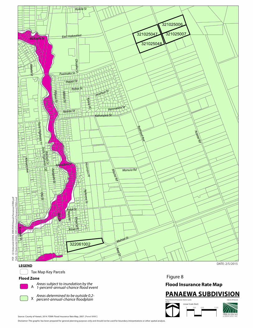
Palai St
Makaala St
Au
wae Rd
Kahaopea St
Hoohua StPilipa
a St
Keonaona St
Mikio
i St
Noeau St
Kawailani St
Paipai St
Na
ni P
l
Pohai St
Ka
ieie Pl
Ka
ma
lii St Ho
on
an
i Pl
Mahiai St
No
ho
na
St
East Hakaalast
Kukila St
Manuia Rd
Olu
St
Aw
ap
uh
i St
Aw
a St
Elm D
r
Oh
uo
hu
St
Kinai Pl
Kin
ai StK
ino
ole St
Puainako St
Ah
una
Rd
Kekela St
Kila
uea
Ave
Railroad A
ve
State H
igh
wa
y 11Sta
te Hig
hw
ay 130
322061002
321025006
321025007321025047
321025048
LEGEND
Tax Map Key Parcels
Flood Zone
AAreas subject to inundation by the 1-percent-annual-chance flood event
XAreas determined to be outside 0.2-percent-annual-chance floodplain
Path
: Q:\
Stat
ew
ide
\DH
HL
ER
R\G
IS\H
awai
i\Pa
nae
wa\
FIR
M.m
xd
PD
F -
Q:\
Stat
ew
ide
\DH
HL
ERR
\PD
R\H
awai
i\Pa
nae
wa\
FIR
M.p
df
DATE: 2/5/2015
Source: County of Hawaii, 2014. FEMA Flood Insurance Rate Map, 2007. [Panel 890C]
Disclaimer: This graphic has been prepared for general planning purposes only and should not be used for boundary interpretations or other spatial analysis.
Figure 8
Flood Insurance Rate Map
PANAEWA SUBDIVISIONDepartment of Hawaiian Home Lands Island of Hawaii
North
Linear Scale (feet)
0 300 600 1200

Ahona Pl
Hoohua St
Kinai Pl
Na
ni P
l
Ulum
au Pl
Kupu
ohi Pl
Ka
ieie Pl
Haihai St
Pala
ihih
i St
Pohai St
Paipai St
Noeau St
Ka
ma
lii St
Aw
a St
Ho
lom
ua
St
Ho
onan
i Pl
Kin
oo
le St
Kin
ai St
Mikio
i St
Elm
Dr
Wiw
oole S
t
No
ho
na
St
Palai St
Kukila St
Pilipa
a St
East Hakaalast
Kawailani St
State H
igh
wa
y 11
Oh
uo
hu
St
Puainako St
Ma
kaa
la S
t
Manuia Rd
Ma
hia
i St
Olu
St
Kila
uea
Ave
State H
igh
wa
y 130
Ah
una
Rd
Aw
ap
uh
i St
Kahaopea St
Railroad A
ve
Keon
aona St
Au
wae Rd
322061002
321025006
321025007321025047
321025048
LEGEND
Tax Map Key Parcels
Tsunami Evacuation Zone
Path
: Q:\
Stat
ew
ide
\DH
HL
ER
R\G
IS\H
awai
i\Pa
nae
wa\
Haz
ard
s.m
xd
PD
F -
Q:\
Stat
ew
ide
\DH
HL
ERR
\PD
F\H
awai
i\P
anae
wa\
Haz
ard
s.p
df
DATE: 2/5/2015
Source: County of Hawaii, 2014. Pacific Disaster Center, 1998. U.S. Geological Survey, 1991.
Disclaimer: This graphic has been prepared for general planning purposes only and should not be used for boundary interpretations or other spatial analysis.
Figure 9
Natural Hazards
PANAEWA SUBDIVISIONDepartment of Hawaiian Home Lands Island of Hawaii
North
Linear Scale (feet)
0 300 600 1200
1
2
3
4
5
6
7
8
9
Volcanic Hazard Zones (1 highest, 9 lowest)

'
'
'
'
'
'
'
'
'
'
'
'
'
'
'
'
'
'
'
'
'
'
''
'
'
'
'
'
'
'
'''
'
'
'
''
'
'
'
'
Ahona Pl
Hoohua St
Kinai Pl
Na
ni P
l
Ulum
au Pl
Kupu
ohi Pl
Ka
ieie Pl
Haihai St
Pala
ihih
i St
Pohai St
Paipai St
Noeau St
Ka
ma
lii St
Aw
a St
Ho
lom
ua
St
Ho
onan
i Pl
Kin
oo
le St
Kin
ai St
Mikio
i St
Elm
Dr
Wiw
oole S
t
No
ho
na
St
Palai St
Kukila St
Pilipa
a St
East Hakaalast
Kawailani St
State H
igh
wa
y 11
Oh
uo
hu
St
Puainako St
Ma
kaa
la S
t
Manuia Rd
Ma
hia
i St
Olu
St
Kila
uea
Ave
State H
igh
wa
y 130
Ah
una
Rd
Aw
ap
uh
i St
Kahaopea St
Railroad A
ve
Keon
aona St
Au
wae Rd
322061002
321025006
321025007321025047
321025048
LEGEND
Tax Map Key Parcels
NodePipePump
' TankValve
Path
: Q:\
Stat
ew
ide
\DH
HL
ER
R\G
IS\H
awai
i\Pa
nae
wa\
14_
Co
un
ty W
ate
r Sy
stem
.mxd
PD
F -
Q:\
Stat
ew
ide
\DH
HL
ERR
\PD
F\H
awai
i\P
anae
wa\
14
_W
ater
Sys
tem
.pd
f
DATE: 2/27/2015
Source: County of Hawaii, 2014. Hawaii Department of Land and Natural Resources Division of Aquatic Resources, 2008.
Hawaii Department of Health, 2002. USFWS National Wetlands Inventory. GDSI, 1995.
Disclaimer: This graphic has been prepared for general planning purposes only and should not be used for boundary interpretations or other spatial analysis.
Figure 10County Water System PANAEWA SUBDIVISION
Department of Hawaiian Home Lands Island of Hawaii
North
Linear Scale (feet)
0 300 600 1200

Ahona Pl
Hoohua St
Kinai Pl
Na
ni P
l
Ulum
au Pl
Kupu
ohi Pl
Ka
ieie Pl
Haihai St
Pala
ihih
i St
Pohai St
Paipai St
Noeau St
Ka
ma
lii St
Aw
a St
Ho
lom
ua
St
Ho
onan
i Pl
Kin
oo
le St
Kin
ai St
Mikio
i St
Elm
Dr
Wiw
oole S
t
No
ho
na
St
Palai St
Kukila St
Pilipa
a St
East Hakaalast
Kawailani St
State H
igh
wa
y 11
Oh
uo
hu
St
Puainako St
Ma
kaa
la S
t
Manuia Rd
Ma
hia
i St
Olu
St
Kila
uea
Ave
State H
igh
wa
y 130
Ah
una
Rd
Aw
ap
uh
i St
Kahaopea St
Railroad A
ve
Keon
aona St
Au
wae Rd
322061002
321025006
321025007321025047
321025048
LEGEND
Tax Map Key Parcels
Hawaii Island Sewer Manholes
Hawaii Island Sewer Mains
Path
: Q:\
Stat
ew
ide
\DH
HL
ER
R\G
IS\H
awai
i\Pa
nae
wa\
12_
Sew
er S
yste
m.m
xd
PD
F -
Q:\
Stat
ew
ide
\DH
HL
ERR
\PD
F\H
awai
i\P
anae
wa\
12
_ S
ew
er S
yste
m.p
df
DATE: 2/27/2015
Source: County of Hawaii, 2014. Hawaii Department of Land and Natural Resources Division of Aquatic Resources, 2008.
Hawaii Department of Health, 2002. USFWS National Wetlands Inventory. GDSI, 1995.
Disclaimer: This graphic has been prepared for general planning purposes only and should not be used for boundary interpretations or other spatial analysis.
PANAEWA SUBDIVISIONDepartment of Hawaiian Home Lands Island of Hawaii
Figure 11County Sewer System
North
Linear Scale (feet)
0 300 600 1200

Ahona Pl
Hoohua St
Kinai Pl
Na
ni P
l
Ulum
au Pl
Kupu
ohi Pl
Ka
ieie Pl
Haihai St
Pala
ihih
i St
Pohai St
Paipai St
Noeau St
Ka
ma
lii St
Aw
a St
Ho
lom
ua
St
Ho
onan
i Pl
Kin
oo
le St
Kin
ai St
Mikio
i St
Elm
Dr
Wiw
oole S
t
No
ho
na
St
Palai St
Kukila St
Pilipa
a St
East Hakaalast
Kawailani St
State H
igh
wa
y 11
Oh
uo
hu
St
Puainako St
Ma
kaa
la S
t
Manuia Rd
Ma
hia
i St
Olu
St
Kila
uea
Ave
State H
igh
wa
y 130
Ah
una
Rd
Aw
ap
uh
i St
Kahaopea St
Railroad A
ve
Keon
aona St
Au
wae Rd
322061002
321025006
321025007321025047
321025048
LEGEND
Tax Map Key Parcels
Critical Wastewater Disposal Area
Cesspool 1
Path
: Q:\
Stat
ew
ide
\DH
HL
ER
R\G
IS\H
awai
i\Pa
nae
wa\
Cri
tica
l Was
tew
ate
r D
isp
osa
l.mxd
PD
F -
Q:\
Stat
ew
ide
\DH
HL
ERR
\PD
F\H
awai
i\P
anae
wa\
Was
tew
ater
Dis
po
sal.p
df
DATE: 2/6/2015
Source: County of Hawaii, 2014 & Department of Health, 2014.
Disclaimer: This graphic has been prepared for general planning purposes only and should not be used for boundary interpretations or other spatial analysis.
PANAEWA SUBDIVISIONDepartment of Hawaiian Home Lands Island of Hawaii
Figure 12DOH Critical Wastewater Disposal
North
Linear Scale (feet)
0 300 600 1200

PanaewaPark
Hualani/Kawananakoa
WaiakeawaenaPly.
HAPPINESSGARDEN
WailoaRiver
LokahiPark
AinaolaPark
Kawailani
Central
Waiakea
Central(new)
321025006321025007
322061002
321025047321025048
HiloBayfront ParkHilo
BayfrontSoccer
LiliuokalaniGardens
MooheauPark
Reed'sBay
Bakers Beach
HiloArmory
E. HawaiiCultural
LincolnPark
KeikilandPlayground
HiloSeniorCenter
Univ.Hts.Park
CoconutIsland
WaiakeaRec. Ctr.
HooluluPark
NASSwimming
Pool
PanaewaDrag Strip
Munici.Golf
Course
LEGEND
Tax Map Key Parcels
Police Station
Fire Stations
CentralKaumanaKawailaniKeaauParadise ParkWaiakea
Path
: Q:\
Stat
ew
ide
\DH
HL
ER
R\G
IS\H
awai
i\Pa
nae
wa\
15_
Pu
blic
Fac
iliti
es.m
xd
PD
F -
Q:\
Stat
ew
ide
\DH
HL
ERR
\PD
F\H
awai
i\P
anae
wa\
Reg
ion
al L
oca
tio
n.p
df
DATE: 2/27/2015
Source: ESRI Online Basemaps.
Disclaimer: This graphic has been prepared for general planning purposes only and should not be used for boundary interpretations or other spatial analysis.
PANAEWA SUBDIVISIONDepartment of Hawaiian Home Lands Island of Hawaii
Figure 13 Public Facilities
North
Linear Scale (miles)
0 .125 .25 .5
r

Ahona Pl
Hoohua St
Kinai Pl
Na
ni P
l
Ulum
au Pl
Kupu
ohi Pl
Ka
ieie Pl
Haihai St
Pala
ihih
i St
Pohai St
Paipai St
Noeau St
Ka
ma
lii St
Aw
a St
Ho
lom
ua
St
Ho
onan
i Pl
Kin
oo
le St
Kin
ai St
Mikio
i St
Elm
Dr
Wiw
oole S
t
No
ho
na
St
Palai St
Kukila St
Pilipa
a St
East Hakaalast
Kawailani St
State H
igh
wa
y 11
Oh
uo
hu
St
Puainako St
Ma
kaa
la S
t
Manuia Rd
Ma
hia
i St
Olu
St
Kila
uea
Ave
State H
igh
wa
y 130
Ah
una
Rd
Aw
ap
uh
i St
Kahaopea St
Railroad A
ve
Keon
aona St
Au
wae Rd
C
U
A
322061002
321025006
321025007321025047
321025048
LEGEND
Tax Map Key Parcels
State Land Use District
A - Agriculture
C - Conservation
R - Rural
U - Urban
Path
: Q:\
Stat
ew
ide
\DH
HL
ER
R\G
IS\H
awai
i\Pa
nae
wa\
SLU
D.m
xd
PD
F -
Q:\
Stat
ew
ide
\DH
HL
ERR
\PD
F\H
awai
i\P
anae
wa\
SLU
D.p
df
DATE: 2/5/2015
Source: County of Hawaii, 2014. Hawaii State Land Use Commission, 2014.
Disclaimer: This graphic has been prepared for general planning purposes only and should not be used for boundary interpretations or other spatial analysis.
Figure 14
State Land Use Districts
PANAEWA SUBDIVISIONDepartment of Hawaiian Home Lands Island of Hawaii
North
Linear Scale (feet)
0 300 600 1200

Ahona Pl
Hoohua St
Kinai Pl
Na
ni P
l
Ulum
au Pl
Kupu
ohi Pl
Ka
ieie Pl
Haihai St
Pala
ihih
i St
Pohai St
Paipai St
Noeau St
Ka
ma
lii St
Aw
a St
Ho
lom
ua
St
Ho
onan
i Pl
Kin
oo
le St
Kin
ai St
Mikio
i St
Elm
Dr
Wiw
oole S
t
No
ho
na
St
Palai St
Kukila St
Pilipa
a St
East Hakaalast
Kawailani St
State H
igh
wa
y 11
Oh
uo
hu
St
Puainako St
Ma
kaa
la S
t
Manuia Rd
Ma
hia
i St
Olu
St
Kila
uea
Ave
State H
igh
wa
y 130
Ah
una
Rd
Aw
ap
uh
i St
Kahaopea St
Railroad A
ve
Keon
aona St
Au
wae Rd
322061002
321025006
321025007321025047
321025048
LEGEND
Tax Map Key Parcels
DHHL DesignationsCommercial
Community Facility
Industrial
Residential
Subsistence Agriculture
Supplemental Agriculture
Path
: Q:\
Stat
ew
ide
\DH
HL
ER
R\G
IS\H
awai
i\Pa
nae
wa\
DH
HL
Lan
d U
se.m
xd
PD
F -
Q:\
Stat
ew
ide
\DH
HL
ERR
\PD
F\H
awai
i\P
anae
wa\
DH
HL
Lan
d U
sel.p
df
DATE: 2/6/2015
Source: County of Hawaii, 2014 & DHHL Hawaii Island Plan, 2002.
Disclaimer: This graphic has been prepared for general planning purposes only and should not be used for boundary interpretations or other spatial analysis.
PANAEWA SUBDIVISIONDepartment of Hawaiian Home Lands Island of Hawaii
Figure 15DHHL Land Use Designations
North
Linear Scale (feet)
0 300 600 1200

Ahona Pl
Hoohua St
Kinai Pl
Na
ni P
l
Ulum
au Pl
Kupu
ohi Pl
Ka
ieie Pl
Haihai St
Kekela St
Pala
ihih
i St
Pohai St
Paipai St
Noeau St
Ka
ma
lii St
Aw
a St
Ho
lom
ua
St
Ho
onan
i Pl
Kin
ai St
Mikio
i St
Elm
Dr
Wiw
oole S
t
No
ho
na
St
Palai St
Kukila St
Pilipa
a St
East Hakaalast
Kawailani St
State H
igh
wa
y 11
Oh
uo
hu
St
Puainako St
Ma
kaa
la S
t
Manuia Rd
Ma
hia
i St
Kin
oo
le St
Olu
St
Kila
uea
Ave
State H
igh
wa
y 130
Ah
una
Rd
Aw
ap
uh
i St
Kahaopea St
Railroad A
ve
Keon
aona St
Au
wae Rd
322061002
321025006
321025007321025047
321025048
LEGEND
Tax Map Key Parcels
ConservationExtensive AgricultureHigh Density UrbanImportant Ag. Lands
IndustrialLow Density UrbanMedium Density UrbanOpen AreaUrban Expansion
Path
: Q:\
Stat
ew
ide
\DH
HL
ER
R\G
IS\H
awai
i\Pa
nae
wa\
LUPA
G.m
xd
PD
F -
Q:\
Stat
ew
ide
\DH
HL
ERR
\PD
F\H
awai
i\P
anae
wa\
LUPA
G.p
df
DATE: 2/5/2015
Source: County of Hawaii, 2014.
Disclaimer: This graphic has been prepared for general planning purposes only and should not be used for boundary interpretations or other spatial analysis.
Figure 16
County General Plan LUPAG
PANAEWA SUBDIVISIONDepartment of Hawaiian Home Lands Island of Hawaii
North
Linear Scale (feet)
0 300 600 1200

Ahona Pl
Hoohua St
Kinai Pl
Na
ni P
l
Ulum
au Pl
Kupu
ohi Pl
Ka
ieie Pl
Haihai St
Pala
ihih
i St
Pohai St
Paipai St
Noeau St
Ka
ma
lii St
Aw
a St
Ho
lom
ua
St
Ho
onan
i Pl
Kin
oo
le St
Kin
ai St
Mikio
i St
Elm
Dr
Wiw
oole S
t
No
ho
na
St
Palai St
Kukila St
Pilipa
a St
East Hakaalast
Kawailani St
State H
igh
wa
y 11
Oh
uo
hu
St
Puainako St
Ma
kaa
la S
t
Manuia Rd
Ma
hia
i St
Olu
St
Kila
uea
Ave
State H
igh
wa
y 130
Ah
una
Rd
Aw
ap
uh
i St
Kahaopea St
Railroad A
ve
Keon
aona St
Au
wae Rd
322061002
321025006
321025007321025047
321025048
LEGEND
Tax Map Key Parcels Zoning
A-10a
A-1a
A-20a
A-3a
A-5a
CG-20
CN-10
CN-20
CN-40
CN-7.5
FA-1a
FR
MCX-20
MG-1a
ML-20
OPEN
RS-10
RS-15
Path
: Q:\
Stat
ew
ide
\DH
HL
ER
R\G
IS\H
awai
i\Pa
nae
wa\
Zo
nin
g.m
xd
PD
F -
Q:\
Stat
ew
ide
\DH
HL
ERR
\PD
F\H
awai
i\P
anae
wa\
Zo
nin
g.p
df
DATE: 2/5/2015
Source: County of Hawaii, 2014.
Disclaimer: This graphic has been prepared for general planning purposes only and should not be used for boundary interpretations or other spatial analysis.
Figure 17
Zoning
PANAEWA SUBDIVISIONDepartment of Hawaiian Home Lands Island of Hawaii
North
Linear Scale (feet)
0 300 600 1200

Appendix BPRE-ASSESSMENT CONSULTATION

Page Intentionally Left Blank
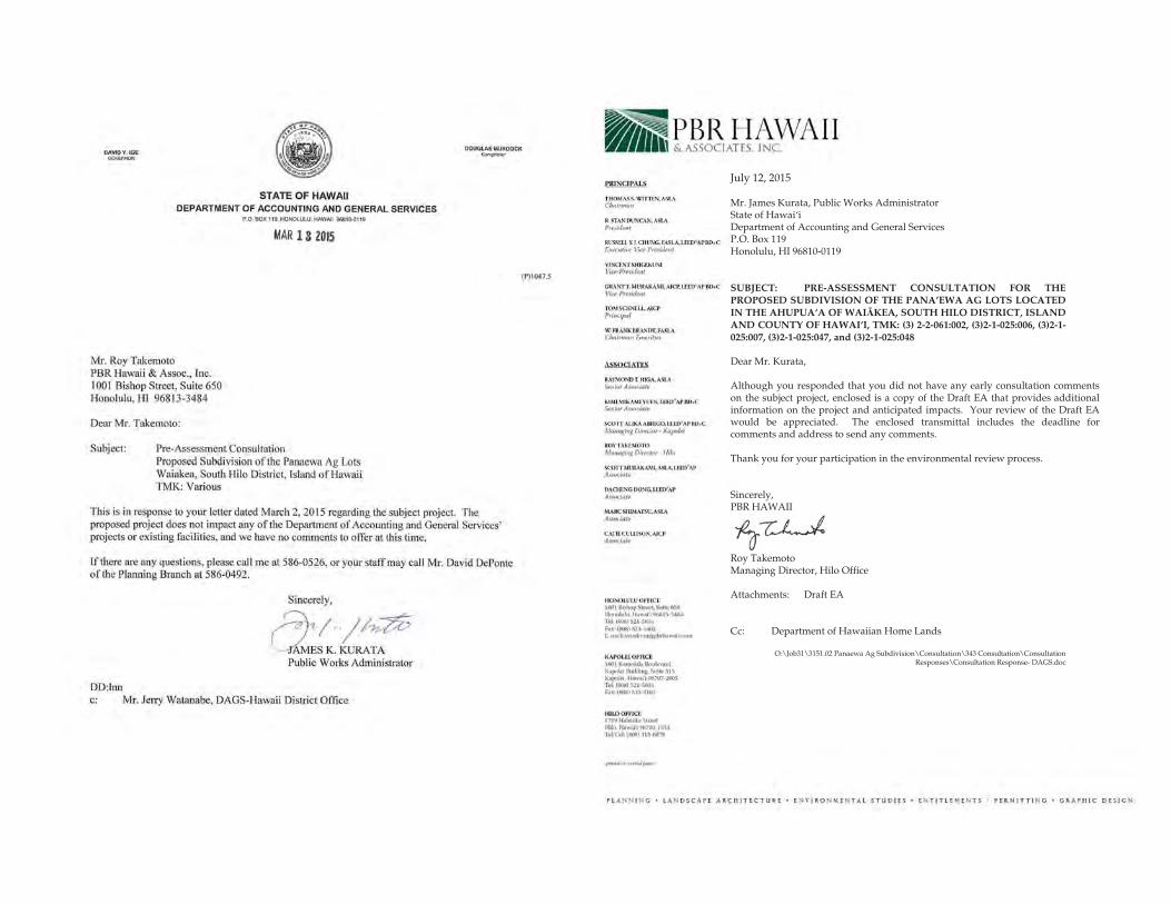
July 12, 2015
Mr. James Kurata, Public Works Administrator State of Hawai‘i Department of Accounting and General Services P.O. Box 119 Honolulu, HI 96810-0119
SUBJECT: PRE-ASSESSMENT CONSULTATION FOR THE PROPOSED SUBDIVISION OF THE PANA’EWA AG LOTS LOCATED IN THE AHUPUAÿA OF WAI KEA, SOUTH HILO DISTRICT, ISLAND AND COUNTY OF HAWAI‘I, TMK: (3) 2-2-061:002, (3)2-1-025:006, (3)2-1-025:007, (3)2-1-025:047, and (3)2-1-025:048
Dear Mr. Kurata,
Although you responded that you did not have any early consultation comments on the subject project, enclosed is a copy of the Draft EA that provides additional information on the project and anticipated impacts. Your review of the Draft EA would be appreciated. The enclosed transmittal includes the deadline for comments and address to send any comments.
Thank you for your participation in the environmental review process.
Sincerely, PBR HAWAII
Roy Takemoto Managing Director, Hilo Office
Attachments: Draft EA
Cc: Department of Hawaiian Home Lands
O:\Job31\3151.02 Panaewa Ag Subdivision\Consultation\343 Consultation\Consultation Responses\Consultation Response- DAGS.doc

July 12, 2015
Brigadier General Arthur Logan State of Hawai‘i Department of Defense 3949 Diamond Head Road Honolulu, HI 96816
SUBJECT: PRE-ASSESSMENT CONSULTATION FOR THE PROPOSED SUBDIVISION OF THE PANA’EWA AG LOTS LOCATED IN THE AHUPUAÿA OF WAI KEA, SOUTH HILO DISTRICT, ISLAND AND COUNTY OF HAWAI‘I, TMK: (3) 2-2-061:002, (3)2-1-025:006, (3)2-1-025:007, (3)2-1-025:047, and (3)2-1-025:048
Dear General Logan,
Thank you for your comments on the subject project. Enclosed is a Draft EA that includes a discussion of your recommendation to include an emergency siren. The Draft EA states that a more appropriate location is the Pana‘ewa Park that should be audible to the Project residents. We would appreciate your review of the Draft EA. The enclosed transmittal includes the deadline and contact information to send any comments.
Thank you for your participation in the environmental review process.
Sincerely, PBR HAWAII
Roy Takemoto Managing Director, Hilo Office
Attachments: Draft EA
Cc: Department of Hawaiian Home Lands
O:\Job31\3151.02 Panaewa Ag Subdivision\Consultation\343 Consultation\Consultation Responses\Consultation Response- DoD.doc

July 12, 2015
Mr. Craig Hirai, Executive Director State of Hawai‘i Hawai‘i Housing Finance and Development Corporation 677 Queen Street, Suite 300 Honolulu, HI 96813
SUBJECT: PRE-ASSESSMENT CONSULTATION FOR THE PROPOSED SUBDIVISION OF THE PANA’EWA AG LOTS LOCATED IN THE AHUPUAÿA OF WAI KEA, SOUTH HILO DISTRICT, ISLAND AND COUNTY OF HAWAI‘I, TMK: (3) 2-2-061:002, (3)2-1-025:006, (3)2-1-025:007, (3)2-1-025:047, and (3)2-1-025:048
Dear Mr. Hirai,
Although you responded that you did not have any early consultation comments on the subject project, enclosed is a copy of the Draft EA that provides additional information on the project and anticipated impacts. Your review of the Draft EA would be appreciated. The enclosed transmittal includes the deadline for comments and address to send any comments.
Thank you for your participation in the environmental review process.
Sincerely, PBR HAWAII
Roy Takemoto Managing Director, Hilo Office
Attachments: Draft EA
Cc: Department of Hawaiian Home Lands
O:\Job31\3151.02 Panaewa Ag Subdivision\Consultation\343 Consultation\Consultation Responses\Consultation Response- HHFDC.doc

July 12, 2015
Mr. Kenneth Masden, Public Works Manager Planning Section State of Hawaii, Department of Education PO Box 2360 Honolulu, HI 96804
SUBJECT: PRE-ASSESSMENT CONSULTATION FOR THE PROPOSED SUBDIVISION OF THE PANA’EWA AG LOTS LOCATED IN THE AHUPUAÿA OF WAI KEA, SOUTH HILO DISTRICT, ISLAND AND COUNTY OF HAWAI‘I, TMK: (3) 2-2-061:002, (3)2-1-025:006, (3)2-1-025:007, (3)2-1-025:047, and (3)2-1-025:048
Dear Mr. Masden,
Thank you for responding to our pre-assessment consultation. In your letter dated March 24, 2015, you provided very helpful information identifying the schools that the Project school-aged children would attend and confirming that these schools have adequate capacity. We incorporated your comment in the enclosed Draft EA (section 4.9.1). Your review of the Draft EA would be appreciated to assess whether accurately reflected your information, and to add any other comments you may have. The enclosed transmittal includes the deadline for comments and the contact information to send any comments.
Thank you for your participation in the environmental review process.
Sincerely, PBR HAWAII
Roy Takemoto Managing Director, Hilo Office
Attachments: Draft EA
Cc: Department of Hawaiian Home Lands
O:\Job31\3151.02 Panaewa Ag Subdivision\Consultation\343 Consultation\Consultation Responses\Consultation Response- DOE.doc

DAVID 'I.IGE a:M!~ OFAAY/i.ll
DATE: March20, 20 15
S·TATE OF HAWAII DEPARTMENT OF HEALTH
P,O. BOX916 HILO, HAWAII96721-0il15
TO: PBR Haw&ii & Associates. Inc.
FROM: Newton Inouye N-District Bnvironmcnt.al Health Program Chief
VIRGINIA PRESSLER, M,O, llliiECIORCF....._)\;
SUBJECT: PRE-ASSESSMENT CONSULTATION FOR THE PROPOSED SUBDJVISION OF THE PANA'EWA AG LOTS LOCATED IN THEAHUPUA'A OF WAIAKEA, SOUTH H1LO DISTR[CT, lSLAND AND COUNTY OF .HAWAI'l. TMJ<; (3} :!-2·0151:002, (3) 2- lo025;006, (3) 2-J-025:007, (3) 2- 1-025;047,
and (3) 2-1-025:048
The applicant wmdd need to meet the requirements of our Department of Health Air Pollution RUleS', Chapter 60.1 , Title II, State of Hawaii for fugitive dust control. If abcre is need to discuss these requirements, please eontaot our Clean Air Braooh staff at Ph. 933-Q40 l .
Construction ac•ivide~ must comply with the provis1on.s of Hawaii Administrative Rules, Chapter ll-46, "Community Noise Control."
1. The contractor must obtain a noise permit if lhe noise levels from the construction activities are expected to exceed the allowable levels of lhe rules.
2. Construction equipment and on-site vehicles requiring an exhaust of gas or air must be equipped with mufflers.
3. The contractor must comply with the requirement.~ pertaining to construction activities as SJ)-."Cified in the rules and lhe conditions issued with the permit.
Should there be any questions on this matter, please comact the Departmem of Health m 933-09 17.
We recommend U1at you review nll of the Standard Comments on our website: bttp://hawaii.gov/healthlenviroumentaVenv-plannino/landuseJ!nnduse.html . Any comments specilictl.lly applicuble ro this project should be adhered to.
Duane Kanuha March 20,2015 Page 2of2
The same website also features a Healthy Community Design Smart Growth Checklist (Checklist) created by Built Environment Working Group (BEWG) of the Hawaii State Department of Health. The BEWG recommends that state and county planning departments, developers, planners, engineers and other interested parties apply the healthy built environment principles in the Checklist whenever they plan or review new developments or redevelopments projects. We also ask you to share this li>t with others to increase community awareness on healthy community design.
c: EPO
WORD: Ponacwa Ag Lols

July 12, 2015
Mr. Newton Inouye, District Environmental Health Program Chief State of Hawai‘i Department of Health P.O. Box 916 Hilo, HI 96721-0916
SUBJECT: PRE-ASSESSMENT CONSULTATION FOR THE PROPOSED SUBDIVISION OF THE PANA’EWA AG LOTS LOCATED IN THE AHUPUAÿA OF WAI KEA, SOUTH HILO DISTRICT, ISLAND AND COUNTY OF HAWAI‘I, TMK: (3) 2-2-061:002, (3)2-1-025:006, (3)2-1-025:007, (3)2-1-025:047, and (3)2-1-025:048
Dear Mr. Inouye,
Thank you for responding to our pre-assessment consultation. In your letter dated March 20, 2015, you provided very helpful information identifying the requirements to comply with fugitive dust and noise from construction activities, as well as reference to DOH’s other standard comments and the healthy communities checklist. We incorporated your comments in the enclosed Draft EA in various sections addressing air quality, water quality, noise, and stormwater runoff. Your review of the Draft EA would be appreciated to assess whether we accurately reflected your information, and to add any other comments you may have. The enclosed transmittal includes the deadline for comments and the contact information to send any comments.
Thank you for your participation in the environmental review process.
Sincerely, PBR HAWAII
Roy Takemoto Managing Director, Hilo Office
Attachments: Draft EA
Cc: Department of Hawaiian Home Lands
O:\Job31\3151.02 Panaewa Ag Subdivision\Consultation\343 Consultation\Consultation Responses\Consultation Response- DOH.doc
This page intentionally left blank.

Mr. Roy Takemoto Managing Oireelor, Hilo Offtce PBR HAWAII & Associates, too. 1001 Bishop Street, Suite 65Q Honolulu, Hawaii 96813· 3484
Dear Mr. Takemoto;
STATE OF HAWAII DEPARTMENT Of HEALTH
"'0 80~ 3378 i'<ONOlVliJ HI 90001~l1A
March 30,2015
LUO • 3 2 2 001 ~ Olll Prop SUbd PaNitW& AIJ l04 .. 10216&
Subject: Pre-Assessment Consullallon for Proposed Subdivision oflhe Panaewa Ag Lots Located In lhe Ahupuaa of Wafak&a. South Hilo District. Island and County of Hawaii TMK (3) 2·2-<161: 002, (3) 2-i·025~ 006. (3)2+025: 007 TMK (3) 2·1·025: 047 and (3) 2·t.025: 048
Thank you lor allowinSI us the opponunity to provide comment& on the above SubJect project Wo hi!VO the following information to ol1er. The subject project TMI<s 8191ocated 1n the critical wastewater diSposal area wrth one (1) acre lot exceptron as determmed by lhe Hawaii County Wastewater Advisory Commrtlee. We do not have any lndlvklual wastewater system (IWS) lnlorma11on on file.
In the drawings, Makaala S1reetls mislabeled as Hakaala Makaala is sewered and services the commercially developed area between lhe highway and Ranroad Avenue. The Prince Kuhio Plaza (maO), Wai·Mar1. Target. Saleway, Home Depot and numeroos last food restauranls and other businesses are located In that area. All 111ese businesses are served by County sewer.
The lot between the commordal area and tne proposed subdivision, TMK (3) 2·1.025: 091 Is used as a farmer's market by OHHL (tha sole own.er) for owners In tho lots to soli their products.
The next lot. TMK (3) 2·1.025: 0461s undeveloped and zoned commercial and DHHL fs the sole owner.
Although a direct sewer lateral connec1ion to the County of Hawaii's sewer system Is presently not available lor the subleet proper11es at TMK (3) 2·1.o25. oonsldenng tl1e relative close prol<imlly In order to cor~ to the County sewer system, 1M DHHL should pui'Sue oonnectrng proposed projeot to the County system Htlo WWB estrmates the distance from the extsling sewer line to the nearest portico of the TMK (3) 2·1.025 subdiVIsion to be just over a third of a mile, about half a kilometer. Also. since OHHL Is the sole owner of the onlermediale. undeveloped. and oommefQaDy lOlled properties in lhos area. it should be straighl!orward 10 proceed wn'l a sewer easement. even a pumping station should It be requlred In addition, any future DHHL developments In thiS area Will also benef4 by being able to coonect to the County sewer system for wastewater treatment and disposal.
Mr. Takemoto March 30, 2015 Page2
The property, TMK (3) 2·2·061: 002 Is presenlly considered by the WWB to be far beyond the area served by the County sewer
Until the waste.,.,aler and treatment and disposal concerns fOf the proposed project are appropnately addressed we are not able to provide our support I Of the proposed project.
Please be Informed that the proposed Wastewater systems for the subdiv1ston!development may have to Include design considerations to address any effects associated with the constructton or and/or discllarges from the wastewater systems to any pul>toc trust. Native Hawaiian resources or lhe exercise ol tradollonal cullural pracllces. In addition, all wastewater plans muS1 conform to applicable proviSIOnS of the Hawaii AdminiSifalive Rules, Chapter 11-62, 'Wastewater Systems."
Should you have any questions. please contact Mark Tomomilsu or our Oahu oft lee at (808) 586-4294.
Sincerely, r--..A~ __ ;_ ,~ ~~OER, P.E., CHIEF
Wastewater Branch
Ms. Laura t.Attnryre. n£'lH.F~rorvTU3nta' Pta~ Office ....-. /Vrly Cock. OOH·WWB'• tl'o Slllff

July 12, 2015 Sina Pruder, P.E., Chief Wastewater Branch State of Hawai‘i Department of Health P. 0. Box 3378 Honolulu, HI 96801-3378 SUBJECT: PRE-ASSESSMENT CONSULTATION FOR THE PROPOSED SUBDIVISION OF THE PANA’EWA AG LOTS LOCATED IN THE AHUPUAÿA OF WAI KEA, SOUTH HILO DISTRICT, ISLAND AND COUNTY OF HAWAI‘I, TMK: (3) 2-2-061:002, (3)2-1-025:006, (3)2-1-025:007, (3)2-1-025:047, and (3)2-1-025:048
Thank you for your comments dated March 30, 2015. Enclosed is a Draft EA that includes a discussion of the wastewater alternatives including your suggestion to connect to the existing County sewer via a sewer easement (see §4.7.2 of the enclosed Draft EA). We would appreciate your review of the Draft EA. The enclosed transmittal includes the deadline and contact information to send any comments. Thank you for your participation in the environmental review process.
Sincerely, PBR HAWAII
Roy Takemoto Managing Director, Hilo Office Attachments: Draft EA Cc: Department of Hawaiian Home Lands
O:\Job31\3151.02 Panaewa Ag Subdivision\Consultation\343 Consultation\Consultation
Responses\Consultation Response- DOH_WW.doc
This page intentionally left blank.

July 12, 2015 Dr. Rachel Wong, Director State of Hawai‘i Department of Human Services 1390 Miller Street, Room 209 Honolulu, HI 96813 SUBJECT: PRE-ASSESSMENT CONSULTATION FOR THE PROPOSED SUBDIVISION OF THE PANA’EWA AG LOTS LOCATED IN THE AHUPUAÿA OF WAI KEA, SOUTH HILO DISTRICT, ISLAND AND COUNTY OF HAWAI‘I, TMK: (3) 2-2-061:002, (3)2-1-025:006, (3)2-1-025:007, (3)2-1-025:047, and (3)2-1-025:048 Dear Dr. Wong, Thank you for responding to our pre-assessment consultation. In your letter dated March 18, 2015, you advised us that there are several OHS licensed family child care homes located in the near vicinity that may be impacted by the subject project. We incorporated your comment in the enclosed Draft EA (section 4.8.1). Your review of the Draft EA would be appreciated to assess whether your concerns have been adequately addressed, and to add any other comments you may have. The enclosed transmittal includes the deadline for comments and the contact information to send any comments. Thank you for your participation in the environmental review process.
Sincerely, PBR HAWAII
Roy Takemoto Managing Director, Hilo Office Attachments: Draft EA Cc: Department of Hawaiian Home Lands
O:\Job31\3151.02 Panaewa Ag Subdivision\Consultation\343 Consultation\Consultation
Responses\Consultation Response- DHS.doc

DAVID Y. IGEGOVERNOR OF HAWAII
SUZANNE D. CASECHAIRPERSON
BOARD OF LAND AND NATURAL RESOURCESCOMMISSION ON WATER RESOURCE MANAGEMENT
KEKOA KALUHIWAFIRST DEPUTY
W. ROY HARDYACTING DEPUTY DIRECTOR - WATER
AQUATIC RESOURCESBOATING AND OCEAN RECREATION
BUREAU OF CONVEYANCESCOMMISSION ON WATER RESOURCE MANAGEMENT
CONSERVATION AND COASTAL LANDSCONSERVATION AND RESOURCES ENFORCEMENT
ENGINEERINGFORESTRY AND WILDLIFEHISTORIC PRESERVATION
KAHOOLAWE ISLAND RESERVE COMMISSIONLAND
STATE PARKS
STATE OF HAWAIIDEPARTMENT OF LAND AND NATURAL RESOURCES
STATE HISTORIC PRESERVATION DIVISIONKAKUHIHEWA BUILDING
601 KAMOKILA BLVD, STE 555KAPOLEI, HAWAII 96707
April 29, 2015
Niniau K. Simmons LOG NO: 2015.01397Department of Hawaiian Home Lands DOC NO: 1504SN08PO Box 1879 ArchaeologyHonolulu, HI 96805
Aloha Ms. Simmons:
SUBJECT: Chapter 6E-8 and National Historic Preservation Act Section 106 Review –Proposed Subdi
TMK: (3) 2-1-025:006, 007, 047, and 048; (3) 2-2-061:002
Mahalo for your letter dated April 7, 2015, initiating consultation on the proposed subdivision of the Panaʻewa AG lots. Also included with your letter was a draft letter report prepared by Scientific Consultant Services (SCS) for the five parcels. The draft letter report states that the entire 50-acre APE was surveyed utilizing pedestrian transects spaced 10 m apart and that no historic properties were identified.
Your submittal letter indicates that the Department of Hawaiian Home Lands (DHHL) is conducting an environmental assessment and NEPA review for the proposed project. The project will be funded using Native American Housing Assistance and Self-Determination Act (NAHASA) funds from the U.S. Department of Housing and Urban Development (HUD). The DHHL is acting as the responsible agency for the NHPA Section 106 consultation process. The proposed undertaking will subdivide 90 1/2-acre parcels for single-family housing on undeveloped DHHL state-owned land in Panaʻewa.
The Area of Potential Effect (APE) for this undertaking is the aforementioned TMKs. The acreage of the APE totals approximately 50 acres. Four parcels (TMK: (3) 2-1-025:006, 007, 047, and 048) are located adjacent to each otheron Auwae Street. The fifth parcel (TMK: (3) 2-2-061:002) is located on Mahiʻai Street.
Our records indicate that we do not have an Archaeological Inventory Survey (AIS) on file for the APE. The draft SCS letter report was not prepared at the request of SHPD and has not been officially submitted to our division for review. Thus, we have insufficient information to evaluate the efficacy of the SCS surface survey or the potential for the proposed project to affect historic properties.
The State Historic Preservation Officer (SHPO) requests the following:
(1) A letter from DHHL documenting the consultation process and results, including a list of consulting parties, method of consultation, and consultation comments shared by Native Hawaiian Organizations (NHOs) and other interested parties;
(2) A letter from DHHL identifying the historic properties within the APE, the DHHL’s determination of eligibility for each identified historic property and, if historic properties may be affected, DHHL’s proposed mitigation recommendations; and
Niniau K. SimmonsApril 29, 2015Page 2
(3) An AIS including subsurface testing be conducted and that an AIS report meeting the requirements of Hawaii Administrative Rule (HAR) §13-276 and the Secretary of the Interior’s Standards for Archaeological Documentation be submitted for SHPD review and acceptance prior to DHHL submitting a project effect determination to SHPD for concurrence.
We look forward to working with you throughout the Section 106 process. Please contact Sean Nāleimaile at (808) 933-7651 or [email protected] if you have any questions or concerns regarding this letter.
Aloha,
Alan S. Downer, PhDAdministrator, State Historic Preservation Division Deputy State Historic Preservation Officer
cc: Catie Cullison1001 Bishop Street, Suite 650Honolulu, HI 96813

July 12, 2015 Mr. Alan Downer, Administrator State of Hawai‘i DLNR, State Historic Preservation Division Kakuhihewa Building 601 Kamokila Blvd., Suite 555 Honolulu, HI 96707 SUBJECT: PRE-ASSESSMENT CONSULTATION FOR THE PROPOSED SUBDIVISION OF THE PANA’EWA AG LOTS LOCATED IN THE AHUPUAÿA OF WAI KEA, SOUTH HILO DISTRICT, ISLAND AND COUNTY OF HAWAI‘I, TMK: (3) 2-2-061:002, (3)2-1-025:006, (3)2-1-025:007, (3)2-1-025:047, and (3)2-1-025:048 Dear Mr. Downer, Thank you for your comments dated April 29, 2015. Enclosed is a Draft EA for your review. The Draft EA includes an archaeological inventory survey as Appendix D. The archaeologist also submitted a copy of the study directly to your division for review. The enclosed transmittal includes the deadline for comments and the contact information to send any comments. Thank you for your participation in the environmental review process.
Sincerely, PBR HAWAII
Roy Takemoto Managing Director, Hilo Office Attachments: Draft EA Cc: Department of Hawaiian Home Lands
O:\Job31\3151.02 Panaewa Ag Subdivision\Consultation\343 Consultation\Consultation
Responses\Consultation Response- SHPD.doc
This page intentionally left blank.

OAVIDY IGE
_....,..
STATE OF HAWAII OEPARTMENT OF TRANSPORTATION
869 PUNCHBOWL STREET HONOLULU. HAWAII 96813-5097
AprilS , 2015
Mr. Roy Takemoto Managing Director. H.ilo Office PBR HA WAJ 1 & Associates. Inc. 1001 Bi~hor Str<let. Suit~ 650 Honolulu. lluwaii 96813-3484
D~r Mr. Takl!tm>to:
Subject Panaewa Agricultul'al Lolli Pre-Assessment Consultation for Environmentnl Assessment
ond National Environm<~ltoi Policy Act (NEPAl Environmental Review Record
Waiakca. South Hilo. Hawai• TMK; (3) 2-2-061 :002. l-1-025:006, 2-1-025:007, 2-1-025:047,
2-1-025:048
1-0RD H FUCHIGAMI
"'""""" O.O.y~,
».0E f M"A't ROSSM.. HIGM!tt £DW~NI-4~e~
DARAEU f 'f'OUHC
STP 8. 1 711~
Our Depanment ofTransportalion·s (DOT) comments on the subject project ore as follows:
Aimorts Divjsion
I. ll should be noted U1attbe project is located approximately 5,462 feet and 12,913 fe~ from the end of Runway 3 at Hilo lntemational Airpon (Airfield). As such. the applicant should be aware of potential noise. fumes, smoke and vibrations from aircraft flying into and out of tht: Airfield.
l . We ure concemed about the pt•oposed land uses of the subject projeat due to the potential wildlife altractants which could create hazards for O~'rations at the Airfield. 1n acx:ordance with the attuched Fooeral Avmtion Administfation (FAA) Advisory Circular 150/5200-338, 1/uzurdnus Wildlife Allrlu:.lliii/.V 011 ur Near AiJ71UI'/-<, land use practices such as agricultural activities. should not be located within I 0.000 feel from tl1e aircraft operations area of tbe Airl1eld. FAA also r.:¢0mmends a distance of 5 stat11te miles hetwe.:n the farthest edge of the airport's air opemtions area {AOA) and the hazardous wildlife attractant if the attractant could cause hazardous wildlife movement into or across the approach or departure airspace.
Mr. Roy Takemoto AprilS, 2015 Page2
STP 8.1783
3. The Depatimem of Hawaiian Home T, ands (DHHL) should submit a Federal Aviation Administration ('fAA) Form 7460-1 "Notice of Proposed Construction or Alteration," in accordance with Code of Federal Regulations, Title 14, Part 77.9, if construction of alteration is within 20,000 feet of a public use or mi litary airport which CJ<cee<is a 100~1 surface !Tom .any point on the runway of each airport with its longest ntnway more than 3,200 feet. In addition. a FAA follil 7460-1 should be submi tted for any tall equipment, such as cranes, that may be used during construction. This form and criteria foe submittal can be found at the following website: https://oeaaafaa.gov/oeaaa/extemallportaljsp If they fi le a F'AA Form 7460-1 , we request a copy be provided to DOT-Airports Division when they receive the FAA determination.
4. Additionally, ifphotovoltaic (PV) systems are being considered, then the DHHL should be aware that photovoltaic (PV) systems, located in or near the approach path of aircraft imo an airport, can create a hazardous condilion for a pilot due to possible glint and glare relleclet,! from the PV array. The following website may assist with preparaJion of a glint and gla.re analysis: www.sandia.gov/glare
5. We recommend that landscoping shall be carefully chosen to avoid species that willa !tract migratory birds or wild life that could pose a thre-at to air navigation nearby. Lc:ssees should be cognizant or mature heights oftrees planted in the ~ubjeci ar~a so they do not become a hazard/obstruction to 11ircmfl operations at Hilo lntemational Airport.
6. The DOT-Airports Division should be notified prior to any lattd disturbance activities that could present fugitive dust issues. This would include both general clearing, gmding, Md grubbing openuions as well as blasting for excavation.
Highwavs Division
A traffic assessmen.t shall be prepared and submined to our Highways Division for review and acceptance to evaluate the cumulative lrllffic inrpact of t he project on the State highway facilities in the an:a.

Mr. Roy Talcemoto AprilS. 2015 Page3
STP ~. 1783
If there are any questions, please ~onlacl Mr. Nerren Kato of the DOT Statewide Transportation Planning Offic" 01 tel ephone number (808) 831-7976.
Sincerely,
Attachmont: FAA Advis<!ry Circular
c: Gordon Wong, Federal Aviation Administration
U.S. Department or Transportation
Federal Aviation Admlnlstmtlon
Subject~ HAZARDOUS WILDLIFE AJTRACTANTS ON OR NEAR AIRPORTS
Advisory Circular
Date: 8128/2007 AC No: 15015200-338
lnlti;~ted by: AAS-300 Change:
1. PURPOSE. This Advisory Circular (AC) provides guidance on certain land uses that have the potential to attract hazardous wildlife on or near public-use airports. II also dlscl,lsses airport development projec(s (i0¢1ut;ling airport conslri.Jction, expansion, and renovation) affecting aircraft movement near hazardous wlldllre attractants. Appendix 1 provides definitions of terms used In this AC.
2. APPLICABILITY. The Federal Aviation Administra.tion (FAA) recommends that public-use airport operators implement the standards and practices contained in this AC. The holders of Airport Operating Certificates issued under Title 14, Code of Federal Regulations (CFR). Part 13!3, Centncatlon of Airports, Subpart 0 (Part 139), may use the standards. practices, and recommendations contained In this AC to comply with the wildlife l1az.ard management requirements of Part 139. Airports that have received Federal grant-In-aid assistance must use these standards. The FAA also recommends the guidance In this AC for land-use planners, opera tors of noncertificated airports, and developers of projects. facilities, and activities on or near airports.
3. CANCELLATION. This AC cancels AC 150/5200-33A, Hazardous Wildlifa Attractants on or near Airports, dated July 27,2004.
4. PRINCIPAL CHANGES. This AC contains the following major changes, which are matked with vertical bars in the margin:
a. Tectmical changes to paragraph references.
b. Wording on storm waler detention ponds.
c. Deleted paragraph 4-3.b, Additional Coordination.
5. BACKGROUND. lnfomnation about the risks posed lo aircraft by certain wildlife species has Increased a great deal In recent years. Improved reporting, studies, documentation, and statistics clearly show that aircraft collisions with birds and other wildlife are a serious economic and public safety problem. While many spades of wildlife can pose a threat to aircraft safety, they are not equally hazardous. Table 1
812812007 AC 150/5200-338
ranks the wildlife groups commonly involved in damaging strikes in the United States according to their relative hazard to aircraft. The ranking is based on the 47,212 records in the FAA National Wildlife Strike Database for the years 1990 through 2003. These hazard rankings, in conjunction with site-specific Wildlife Hazards Assessments (WHA}, will help airport operators determine the relative abundance and use patterns of wildlife species and help focus hazardous wildlife management efforts on those species most likely to cause problems at an airport.
Most public-use airports have large tracts of open, undeveloped land that provide added margins of safety and noise mitigation. These areas can also present potential hazards to aviation if they encourage wildlife to enter an airport's approach or departure airspace or air operations area (AOA). Constructed or natural areas- such as poorly drained locations, detention/retention ponds, roosting habitats on buildings, landscaping, odor· causing rotting organic matter (putrescible waste) disposal operations, wastewater treatment plants, agricultural or aquaculture activities, surface mining, or wetlands-can · provide wildlife with ideal locations for feeding, loafing, reproduction, and escape. Even small facilities, such as fast food restaurants, taxicab staging areas, rental car facilities, aircraft viewing areas, and public parks, can produce substantial attractions for hazardous wildlife.
During the past century, wildlife-aircraft strikes have resulted in the loss of hundreds of lives worldwide, as well as billions of dollars in aircraft damage. Hazardous wildlife attractants on and near airports can jeopardize future airport expansion, making proper community land-use planning essential. This AC provides airport operators and those parties with whom they cooperate with the guidance they need to assess and address potentially hazardous wildlife attractants when locating new facilities and implementing certain land-use practices on or near public-use airports.
6. MEMORANDUM OF AGREEMENT BETWEEN FEDERAL RESOURCE AGENCIES. The FAA, the U.S. Air Force, the U.S. Army Corps of Engineers, the U.S. Environmental Protection Agency, the U.S. Fish and Wildlife Service, and the U.S. Department of Agriculture • Wildlife Services signed a Memorandum of Agreement (MOA} in July 2003 to acknowledge their respective missions in protecting aviation from wildlife hazards. Through the MOA, the agencies established procedures necessary to coordinate their missions to address more effectively existing and future environmental conditions contributing to collisions between wildlife and aircraft (wildlife strikes) throughout the United States. These efforts are intended to minimize wildlife risks to aviation and human safety while protecting the Nation's valuable environmental resources.
DAVID L. BENNETT Director, Office of Airport Safety and Standards
812812007 AC 150/5200-338
Table 1. Ranking of 25 species groups as to relative hazard to aircraft (1=most hazardous) based on three criteria (damage, major damase. and effect-on-flight), a composlte ranking based on all three rankings, and a relative hamrd score. Data were derived from the FAA National Wildlife Strike Database, January 199~April2003. '
Ranking by criteria
Majot ComPQ5ite Relative Species goovp Damage• damage• E~ot on ftlght' t'Mklngl hazo rei score~
Deer 1 1 1 1 100
Vultures 2 2 2 2 84
Ge- 3 3 6 3 55
Cormoraotslpebni 4 5 3 4 54
Cranes 1 6 • 5 41
Eagles 6 9 1 6 41
Dud<$ 5 8 10 1 39
o.proy 8 • 8 8 39 T utkeyfphe,l!llllls 9 1 11 9 33 Herons 11 14 9 10 27
H3'Mt$(bii1A!O$) 10 12 12 11 25
Gulls 12 11 13 12 24
ROCk pigeon 13 10 14 13 23
Owls 14 13 20 14 23
H.lol1</s. bunting 18 15 15 15 17
Crowslravei\'S 15 16 16 16 16
Coyote 16 19 5 11 14
Mourning dOve 17 11 17 18 14
Shorebirds 19 21 18 19 10
Blad<bltds/...,1119 20 22 19 20 10
Amarica.n kestrel 21 18 21 21 9
MeedOYAarb 22 20 22 22 1
SWolows 24 23 24 23 • Sparrows 25 24 23 24 4
Nighlhawt<s 23 25 25 25 1
' Excerpted from the Special Report for the FAA, "Ranking the Hazard Level of Wildlife Species to Civil Av/81/on In the USA: Updsl9 #1, July 2, 2003". Refer to this report for additional explanations of criteria and method of ranking. 2 Relative rank of each species group was compared with every other group for the three variables, placing the species group with the greatesl hazard rank for~ 2 of the 3 variables above the next highest ranked group. then proceeding down the list. 3 Percentage values, from Tables 3 and 4 in Footnote 1 of the Special Report, for the three criteria were summed and scaled down from 100, with 100 as the score for the species group with the maximum summed values and the greatest potential hazard to aircraft. 'Aircraft Incurred at least some damage (deslroyed, substantial. minor, or unknown) from slrike. • Aircraft inrurred damage or structural failure, which adversely affected the structure strength, performance, or flight characteristics, and which would normally require major repair or replacement of the affected component, or the damage sustained makes it inadvisable to restore aircraft to ailworthy condition. • Aborted takeoff, engine shutdown, precautionary landing. or other.
iii

812812007 AC 150/5200-33B 812812007 AC 150/5200-33B
Table of Contents
This page Intentionally' left blank. SECTION 1. GENERAL SEPARATION CRITERIA FOR HAZARDOUS WILDLIFE ATTRACTANTS ON OR NEAR AIRPORTS ............................................................................................................................ 1
1-1. INTRODUCTION .... ...................... .............................................................. ......................... 1
1-2. AIRPORTS SERVING PISTON-POWERED AIRCRAFT .............. ..................................... 1
1-3. AIRPORTS SERVING TURBINE-POWERED AIRCRAFT ............ ..................................... 1
1-4. PROTECTION OF APPROACH, DEPARTURE, AND CIRCLING AIRSPACE .................. 1
SECTION 2. LAND-USE PRACTICES ON OR NEAR AIRPORTS THAT POTENTIALLY ATTRACT HAZARDOUS WILDLIFE ........................................... ....................... ..................... ...................................... 3
2-1 . GENERAL ... ....... ....... ..................... .................................................................................... 3
2-2. WASTE DISPOSAL OPERATIONS .................................................................................. 3
2·3. WATER MANAGEMENT FACILITIES ................. .... ....... .................................................... 5
2-4. WETLANDS ........... ..... ................................................ ........................ ............................... 8
2-5. DREDGE SPOIL CONTAINMENT AREAS .......................... .............................................. 9
2-6. AGRICULTURAL ACTIVITIES ......................................................... .................................. 9
2-7. GOLF COURSES, LANDSCAPING AND OTHER LAND-USE CONSIDERATIONS ...... 10
2·8. SYNERGISTIC EFFECTS OF SURROUNDING LAND USES ........................................ 11
SECTION 3. PROCEDURES FOR WILDLIFE HAZARD MANAGEMENT BY OPERATORS OF PUBLIC-USE AIRPORTS ..... .. ................................................. ................................................................... 13
3.1. INTRODUCTION .................................. .......... ....... .. .. ..................... ................. .................. 13
3.2. COORDINATION WITH USDA WILDLIFE SERVICES OR OTHER QUALIFIED WILDLIFE DAMAGE MANAGEMENTBIOLOGISTS ....................................................... 13
3-3. WILDLIFE HAZARD MANAGEMENT AT AIRPORTS: A MANUAL FOR AIRPORT PERSONNEL ......... ........................................................................................................... 13
3-4. WILDLIFE HAZARD ASSESSMENTS. TITLE 14, CODE OF FEDERAL REGULATIONS, PART 139 ..... ..................................... : .......... ......................................... 13
3-5. WILDLIFE HAZARD MANAGEMENT PLAN (WHMP) ..................................................... 14
3-6. LOCAL COORDINATION ............ ....................................... ................. ............................. 14
3-7. COORDINATION/NOTIFICATION OF AIRMEN OF WILDLIFE HAZARDS .................... 14
SECTION 4. FAA NOTIFICATION AND REVIEW OF PROPOSED LAND-USE PRACTICE CHANGES IN THE VICINITY OF PUBLIC-USE AIRPORTS ..................................................................... 15
4-1 . FAA REVlEW OF PROPOSED LAND-USE PRACTICE CHANGES IN THE VICINITY OF PUBLIC-USE AIRPORTS .................... ................................................................. ...... 15
4-2. WASTE MANAGEMENT FACILITIES .............................................................................. 15
4-3. OTHER LAND-USE PRACTICE CHA 'IGES ....................... .............. ............................... 16
APPENDIX 1. DEFINITIONS OF TERMS USED IN THIS ADVISORY CIRCULAR .................................. 19
iv v

812812007 AC 150/5200-338
This page intentionally left blank.
vi
812812007 AC 150/5200-338
SECTION 1.
GENERAL SEPARATION CRITERIA FOR HAZARDOUS WILDLIFE ATIRACTANTS ON OR NEAR AIRPORTS.
1-1. INTRODUCTION. When considering proposed land uses, airport operators, local planners, and developers must take into account whether the proposed land uses, including new development projects, will increase wildlife hazards. Land-use practices that attract or sustain hazardous wildlife populations on or near airports can significantly increase the potential for wildlife strikes.
The FAA recommends the minimum separation criteria outlined below for land-use practices that attract hazardous wildlife to the vicinity of airports. Please note that FAA criteria include land uses that cause movement of hazardous wildlife onto, into, or across the airport's approach or departure airspace or air operations area (AOA). (See the discussion of the synergistic effects of surrounding land uses in Section 2-8 of this AC.)
The basis for the separation criteria contained in this section can be found in existing FAA regulations. The separation distances are based on (1) flight pattems of pistonpowered aircraft and turbine-powered aircraft, (2) the altitude at which most strikes happen (78 percent occur under 1,000 feet and 90 percent occur under 3,000 feet above ground level), and (3) National Transportation Safety Board (NTSB) recommendations.
1-2. AIRPORTS SERVING PISTON-POWERED AIRCRAFT. Airports that do not sell Jet-A fuel normally serve piston-powered aircraft. Notwithstanding more stringent requirements for specific land uses, the FAA recommends a separation distance of 5,000 feet at these airports for any of the hazardous wildlife attractants mentioned in Section 2 or for new airport development projects meant to accommodate aircraft movement. This distance is to be maintained between an airport's AOA and the hazardous wildlife attractant. Figure 1 depicts this separation distance measured from the nearest aircraft operations areas.
1-3. AIRPORTS SERVING TURBINE-POWERED AIRCRAFT. Airports selling Jet-A fuel normally serve turbine-powered aircraft. Notwithstanding more stringent requirements for specific land uses, the FAA recommends a separation distance of 10,000 feet at these airports for any of the hazardous wildlife attractants mentioned in Section 2 or for new airport development projects meant to accommodate aircraft movement. This distance is to be maintained between an airport's AOA and the hazardous wildlife attractant. Figure 1 depicts this separation distance from the nearest aircraft movement areas.
1-4. PROTECTION OF APPROACH, DEPARTURE, AND CIRCLING AIRSPACE. For ali airports, the FAA recommends a distance of 5 statute miles between the farthest edge of the airport's AOA and the hazardous wildlife attractant if the attractant could cause hazardous wildlife movement into or across the approach or departure airspace.

ill 9~ ;~ "' h ;;: a'f ~ [~ 3~
"' a"' l;o P. 3 ~ ~~
i ~~ H : .. !f ~ - '8 !s iii
8 ~i u i !.~ n
t ~~ . ~
~l I i ii l 5 .. l ;>
~ ~ ~ e II II. f .a a f ~ ! .
" 'l I! ~ ~
I <i"
I !: 3 a §.
~ :;r
:;r i
• • • • •• '/~ ... -="'-:'"'-; ... ;-.. ; -.--.--... "\ • • 0 •• •• •••
••• 0 ••
" , , •' t_ __ • __ ·....,_'"\~'1,!0.:.;-L:"'~;".._,_....,__. 0
' 0
, 0
,
••• 0 ' •• • • • •• • • • • ••••
. . . . . . . . . . . . . . . . • •• ' •••• f •••••• . ' . ' .. ..
6128/2007 AC 15015200-336
SECTION 2.
LAND-USE PRACTICES ON OR NEAR AIRPORTS THAT POTENTIALLY ATTRACT HAZARDOUS WILDLIFE.
2-1. GENERAL The wildlife species and the size of the populations attracted to the airport environment vary considerably, depending on several factors, including land-use practices on or near the airport. This section discusses land-use practices having the potential to attract hazardous wildlife and threaten aviation safety. In addition to the specific considerations outlined below, airport operators should refer to Wildlife Hazard Management at Airports, prepared by FAA and U.S. Department of Agriculture (USDA) staff. (This manual is available in English, Spanish, and French. It can be viewed and downloaded free of charge from the FAA's wildlife hazard mitigation web site: http://wildlife-mitioation.tc.FAA.gov.). And, Prevention and Control of Wildlife Damage, compiled by the University of Nebraska Cooperative Extension Division. {This manual is available online in a periodically updated version at: ianrwww.unl.edu/wildlife/solutionslhandbookl.}
2-2. WASTE DISPOSAL OPERATIONS. Municipal solid waste landfills (MSWLF) are known to attract large numbers of hazardous wildlife, particularly birds. Because of this, these operations, when located within the separations identified in the siting criteria in Sections 1·2 through 1-4, are considered incompatible with safe airport operations.
a. Siting for new municipal solid waste landfills subject to AIR 21. Section 503 of the Wendell H. Ford Aviation Investment and Refonm Act for the 21st Century (Public Law 106-181) {AIR 21) prohibits the construction or establishment of a new MSWLF within 6 statute miles of certain public-use airports. Before these prohibitions apply, both the airport and the landfill must meet the very specific conditions described below. These restrictions do not apply to airports or landfills located within the state of Alaska.
The airport must (1) have received a Federal grant(s) under 49 U.S.C. § 47101 , et. seq.; {2} be under control of a public agency; {3} serve some scheduled air carrier operations conducted in aircraft with less than 60 seats; and {4) have total annual enplanements consisting of at least 51 percent of scheduled air carrier enplanements conducted in aircraft with less than 60 passenger seats .
The proposed MSWLF must (1) be within 6 miles of the airport, as measured from airport property line to MSWLF property line, and (2) have started construction or establishment on or after April 5, 2001. Public Law 106-181 only limits the construction or establishment of some new MSWLF. It does not limit the expansion. either vertical or horizontal, of existing landfills.
NOTE: Consult the most recent version of AC 150/5200·34, Construction or Establishment of Landfills Near Public Airports, for a more detailed discussion of these restrictions.
3

812812007 AC 15015200-338
b. Siting for new MSWLF not subject to AIR 21. If an airport and MSWI..F do not meet the restrictions of Public Law 106-181, the FAA recommends against locating MSWLF within the separation distances identified in Sections 1-2 through 1-4. The separation distances should be measured from the closest point of the airport's AOA to the closest planned MSWLF cell.
c. Considerations for existing waste disposal facilities within the limits of separation criteria. The FAA recommends against airport development projects that would increase the number of aircraft operations or accommodate larger or faster aircraft near MSWI..F operations located within the separations identified in Sections 1-2 through 1-4. In addition, in accordance with 40 CFR 258.10, owners or operators of existing MSWLF units that are located within the separations listed in Sections 1-2 through 1-4 must demonstrate that the unit is designed and operated so it does not pose a bird hazard to aircraft. (See Section 4·2(b) of this AC for a discussion of this demonstration requirement.)
d. Enclosed trash transfer stations. Enclosed waste-handling facilities that receive garbage behind closed doors; process It via compaction, incineration, or similar manner; and remove all residue by enclosed vehicles generally are compatible with safe airport operations, provided they are not located on airport property or within the Runway Protection Zone (RPZ). These facilities should not handle or store putrescible waste outside or In a partially enclosed structure accessible to hazardous wildlife. Trash transfer facilities that are open on one or more sides; that store uncovered quantities of municipal solid waste outside, even if only for a short time; that use semi-trailers that leak or have trash clinging to the outside; or that do not control odors by ventilation and filtration systems {odor masking is not acceptable) do not meet the FAA's definition of fully enclosed trash transfer stations. The FAA considers these facilities incompatible with safe airport operations if they are located closer than the separation distances specified in Sections 1-2 through 1-4.
e. Composting operations on or near airport property. Composting operations that accept only yard waste (e.g., leaves, lawn clippings, or branches) generally do not attract hazardous wildlife. Sewage sludge, woodchips, and similar material are not municipal solid wastes and may be used as compost bulking agents. The compost, however, must never include food or other municipal solid waste. Composting operations should not be located on airport property. Off-airport property composting operations should be located no closer than the greater of the following distances: 1,200 feet from any AOA or the distance called for by airport design requirements (see AC 150/5300-13, Airport Design). This spacing should prevent material, personnel, or equipment from penetrating any Object Free Area (OFA), Obstacle Free Zone (OFZ), Threshold Siting Surface (TSS), or Clearway. Alrport operators should monitor composting operations located in proximity to the airport to ensure that steam or thermal rise does not adversely affect air traffic. On-airport disposal of compost by-products should not be conducted for the reasons stated in 2-3f.
4
812812007 AC 15015200-338
f. Underwater waste discharges. The FAA recommends against the underwater discharge of any food waste (e.g., fish processing offal) within the separations identified in Sections 1-2 through 1-4 because it could attract scavenging hazardous wildlife.
g. Recycling centers. Recycling centers that accept previously sorted non-food items, such as glass, newspaper, cardboard, or aluminum, are, in most cases, not attractive to hazardous wildlife and are acceptable.
h. Construction and demolition (C&D) debris facilities. C&D landfills do not generally attract hazardous wildlife and are acceptable if maintained in an orderly manner, admit no putrescible waste, and are not co-located with other waste disposal operations. However, C&D landfills have similar visual and operational characteristics to putrescible waste disposal sites. When co-located with putrescible waste disposal operations, C&D landfills are more likely to attract hazardous wildlife because of the similarities between these disposal facilities. Therefore, a C&D landfill co-located with another waste disposal operation should be located outside of the separations identified In Sections 1-2 through 1-4.
i. Fly ash disposal. The incinerated residue from resource recovery power/heatgenerating facilities that are fired by municipal solid waste, coal, or wood is generally not a wildlife attractant because it no longer contains putrescible matter. Landfills accepting only fly ash are generally not considered to be wildlife attractants and are accep~ble as long as they are maintained in an orderly manner, admit no putrese~ble waste of any kind, and are not co-located with other disposal operations that attract hazardous wildlife.
~i~ce varying degrees of waste consumption are associated with general sne~neration (not resource recovery power/heat-generating facilities), the FAA considers the ash from general incinerators a regular waste disposal by-product and, therefore, a hazardous wildlife att.ractant if disposed of within the separation criteria outlined in Sections 1-2 through 1-4.
2-3. WATER MANAGEMENT FACILITIES. Drinking water intake and treatment facilities, stonm water and wastewater treatment facilities, associated retention and settling ponds, ponds built for recreational use, and ponds that result from mining activities often attract large numbers of potentially hazardous wildlife. To prevent wildlife hazards, land-use developers and airport operators may need to develop management plans, in compliance with local and state regulations, to support the operation of stonm water management facilities on or near all public-use airports to ensure a safe airport environment.
a. Existing storm water management facilities. On-airport stonm water management facilities allow the quick removal of surface water, Including discharges related to aircraft deicing, from Impervious surfaces, such as pavement and terminal/hangar building roofs. Existing on-airport detention ponds collect stonm water, protect water quality, and control runoff. Because they slowly release water
5
812812007 AC 150/5200-338
after storms, they create standing bodies of water that can attract hazardous wildlife. Where the airport has developed a Wildlife Hazard Management Plan {WHMP) in accordance with Part 139, the FAA requires immediate correction of any wildlife hazards arising from existing storm water facilities located on or near airports, using appropriate wildlife hazard mitigation techniques. Airport operators should develop measures to minimize hazardous wildlife attraction in consultation with a wildlife damage management biologist.
Where possible, airport operators should modify storm water detention ponds to allow a maximum 48-hour detention period for the design storm. The FAA recommends that airport operators avoid or remove retention ponds and detention ponds featuring dead storage to eliminate standing water. Detention basins should remain totally dry between rainfalls. Where constant flow of water is anticipated through the basin, or where any portion of the basin bottom may remain wet, the detention facility should include a concrete or paved pad and/or ditch/swale in the bottom to prevent vegetation that may provide nesting habitat.
When it is not possible to drain a large detention pond completely, airport operators may use physical barriers, such as bird balls, wires grids, pillows, or netting, to deter birds and other hazardous wildlife. When physical barriers are used, airport operators must evaluate their use and ensure they will not adversely affect water rescue. Before Installing any physical barriers over detention ponds on Part 13g airports, airport operators must get approval from the appropriate FAA Regional Airports Division Office.
The FAA recommends that airport operators encourage off-airport storm water treatment facility operators to incorporate appropriate wildlife hazard mitigation techniques into storm water treatment facility operating practices when their facility is located within the separation criteria specified in Sections 1-2 through 1-4.
b. New storm water management facilities. The FAA strongly recommends that offairport storm water management systems located within the separations identified in Sections 1·2 through 1-4 be designed and operated so as not to create aboveground standing water. Stormwater detention ponds should be designed, engineered, constructed, and maintained for a maximum 48-hour detention period after the design storm and remain completely dry between storms. To facilitate the control of hazardous wildlife, the FAA recommends the use of steep-sided, rip-rap lined, narrow, linearly shaped water detention basins. When it is not possible to place these ponds away from an airport's AOA, airport operators should use physical barriers, such as bird balls, wires grids, pillows, or netting, to prevent access of hazardous wildlife to open water and minimize aircraft-wildlife interactions. When physical barriers are used, airport operators must evaluate their use and ensure they will not adversely affect water rescue. Before installing any physical barriers over detention ponds on Part 13g airports, airport operators must get approval from the appropriate FAA Regional Airports Division Office. All vegetation in or around detention basins that provide food or cover for hazardous wildlife should be eliminated. If soli conditions and other requirements allow, the FAA encourages
6
812812007 AC 150/5200-338
the use of underground storm water Infiltration systems, such as French drains or buried rock fields, because they are less attractive to wildlife.
c. Existing wastewater treatment facilities. The FAA strongly recommends that airport operators immediately correct any wildlife hazards arising from existing wastewater treatment facilities located on or near the airport. Where required, a WHMP developed in accordance with Part 139 will outline appropriate wildlife hazard mitigation techniques. Accordingly, airport operators should encourage wastewater treatment facility operators to incorporate measures, developed in consultation with a wildlife damage management biologist, to minimize hazardous wildlife attractants. Airport operators should also encourage those wastewater treatment facility operators to incorporate these mitigation techniques into their standard operating practices. In addition, airport operators should consider the existence of wastewater treatment facilities when evaluating proposed sites for new airport development projects and avoid such sites when practicable.
d. New wastewater treatment facilities. The FAA strongly recommends against the construction of new wastewater treatment facilities or associated settling ponds within the separations identified in Sections 1·2 through 1·4. Appendix 1 defines wastewater treatment facility as "any devices and/or systems used to store, treat, recycle, or reclaim municipal sewage or liquid Industrial wastes." The definition includes any pretreatment involving the reduction of the amount of pollutants or the elimination of pollutants prior to Introducing such pollutants Into a publicly owned treatment works (wastewater treatment facility). During the site-location analysis for wastewater treatment facilities, cevelopers should consider the potential to attract hazardous wildlife If an airport is in the vicinity of the proposed site, and airport operators should voice their opposition to such facilities if they are in proximity to the airport.
e. Artificial marshes. In warmer dimates, wastewater treatment facilities sometimes employ artificial marshes and use submergent and emergent aquatic vegetation as natural filters. These artificial marshes may be used by some species of flocking birds, such as blackbirds and waterfowl, for breeding or roosting activities. The FAA strongly recommends against establishing artificial marshes within the separations identified in Sections 1-2 through 1-4.
f. Wastewater discharge and sludge disposal. The FAA recommends against the discharge of wastewater or sludge on airport property because it may improve soil moisture and quality on unpaved areas and lead to improved turf growth that can be an attractive food source for many species of animals. Also, the turf requires more frequent mowing, which in turn may mutilate or flush Insects or small animals and produce straw, both of which can attract hazardous wildlife. In addition, the improved turf may attract grazing wildlife, such as deer and geese. Problems may also occur when discharges saturate unpaved airport areas. The resultant soft, muddy conditions can severely restrict or prevent emergency vehicles from reaching accident sites in a timely manner.

812812007 AC 15015200-339
2-4. WETLANDS. Wetlands provide a variety of functions and can be regulated by local, state, and Federal laws. Nonnally, wetlands are attractive to many types of wildlife, including many which rank high on the list of hazardous wildlife species (Table 1).
NOTE: If questions exist as to whether an area qualifies as a wetland, contact the local division of the U.S. Army Corps of Engineers, the Natural Resources Conservation Service, or a wetland consultant qualified to delineate wetlands.
a. Existing wetlands on or near airport property. If wetlands are located on or near airport property, airport operators should be alert to any wildlife use or habitat changes In these areas that could affect safe aircraft operations. At public-use airports, the FAA recommends immediately correcting, In cooperation with local, state, and Federal regulatory agencies, any wildlife hazards arising from existing wetlands located on or near airports. Where required, a WHMP will outline appropriate wildlife hazard mitigation techniques. Accordingly, airport operators should develop measures to minimize hazardous wildlife attraction in consultation with a wildlife damage management biologist.
b. New airport development. Whenever possible, the FAA recommends locating new airports using the separations from wetlands identified in Sections 1-2 through 1-4. Where alternative sites are not practicable, or when airport operators are expanding an existing airport into or near wetlands, a wildlife damage management biologist, in ooMultation with the U.S. Fish and Wildlife Servic-.e, the U.S. Army Corp" of Engineers, and the state wildlife management agency should evaluate the wildlife hazards and prepare a WHMP that indicates methods of minimizing the hazards.
c. Mitigation for wetland impacts from airport projects. Wetland mitigation may be necessary when unavoidable wetland disturbances result from new airport development projects or projects required to correct wildlife hazards from wetlands. Wetland mitigation must be designed so it does not create a wildlife hazard. The FAA recommends that wetland mitigation projects that may attract hazardous wildlife be sited outside of the separations identified in Sections 1-2 through 1-4.
(1) Onsltc mitigation of wetland functions. The FAA may consider exceptions to locating mitigation activities outside the separations identified in Sections 1-2 through 1-4 If the affected wetlands provide unique ecological functions, such as critical habitat for threatened or endangered species or ground water recharge, which cannot be replicated when moved to a different location. Using existing airport property is sometimes the only feasible way to achieve the mitigation ratios mandated In regulatory orders and/or settlement agreements with the resource agencies. Conservation easements are an additional means of providing mitigation for project impacts. Typically the airport operator continues to own the property, and an easement is created stipulating that the property will be maintained as habitat for state or Federally listed species.
8
812812007 AC 150(5200-339
Mitigation must not inhibit the airport operator's abiUty to effectively control hazardous wildlife on or near the mitigation site or effectively maintain other aspects of safe airport operations. Enhancing such mitigation areas to attract hazardous wildlife must be avoided. The FAA will review any onsle mitigation proposals to detennine compatibility with safe airport operations. A wildlife damage management biologist should evaluate any wetland mitigation projects that are needed to protect unique wetland functions and that must be located in the separation criteria in Sections 1-2 through 1-4 before the mitigation Is Implemented. A WHMP should be developed to reduce the wildlife hazards.
(2) Offsite mitigation of wetland functions. The FAA recommends that wetland mitigation projects that may attract hazardous wildlife be sited outside of the separations identified in Sections 1-2 through 1-4 unless they provide unique functions that must remain onslte (see 2-4c(1 )). Agencies that regulate Impacts to or around wetlands recognize that it may be necessary to split wetland functions in mitigation schemes. Therefore, regulatory agencies may, under certain circumstances, allow portions of mitigation to take place in different locations.
(3) Mitigation banking. Wetland mitigation banking is the creation or restoration of wetlands in order to provide mitigation credits that can be used to offset permitted wetland losses. Mitigation banking benefits welland resources by providing advance replacement for permitted wetland losses; consolidating small projects into larger, better-designed and managed units: and encouraging integration of wetland mitigation projects with watershed planning. This last benefit is most helpful for airport projects, as wetland impacts mitigated outside of the separations identified in Sections 1-2 through 1-4 can still be located within the same watershed. Wetland mitigation banks meeting the separation criteria offer an ecologically sound approach to mitigation in these situations. Airport operators should work with local watershed management agencies or organizations to develop mitigation banking for weUand impacts on airport property.
2-5. DREDGE SPOIL CONTAINMENT AREAS. The FAA recommends against locating dredge spoil containment areas (also known as Confined Disposal Facilities) within the separations identified in Sections 1-2 through 1-4 If the containment area or the spoils contain material that would attract hazardous wildlife.
2-6. AGRICULTURAL ACTIVITIES. Because most, if not all, agricultural crops can attract hazardous wildlife during some phase of production, the FAA recommends against the used of airport property for agricultural production, including hay crops, within the separations identified in Sections 1-2 through 1-4. . If the airport has no financial alternative to agricultural crops to produce income necessary to maintain the viability of the airport, then the airport shall follow the crop distance guidelines listed in the table titled "Minimum Distances between Certain Airport Features and Any OnAirport Agricultural Crops• found In AC 150/5300-13, Airport Design, Appendix 17. The cost of wildlife control and potential accidents should be weighed against the income produced by the on-airport crops when deciding whether to allow crops on the airport.
9

812812007 AC 150/5200-338
a. Livestock production. Confined livestock operations (i.e., feedlots, dairy operations, hog or chicken production facilities, or egg laying operations) often attract flocking birds, such as starlings, that pose a hazard to aviation. Therefore, The FAA recommends against such facilities within the separations identified in Sections 1-2 through 1-4. Any livestock operation within these separations should have a program developed to reduce the attractiveness of the site to species that are hazardous to aviation safety. Free-ranging livestock must not be grazed on airport property because the animals may wander onto the AOA. Furthermore, livestock feed, water, and manure may attract birds.
b. Aquaculture. Aquaculture activities (i.e. catfish or trout production) conducted outside of fully enclosed buildings are inherenUy attractive to a wide variety of birds. Existing aquaculture facilities/activities within the separations listed in Sections 1-2 through 1-4 must have a program developed to reduce the attractiveness of the sites to species that are hazardous to aviation safety. Airport operators should also oppose the establishment of new aquaculture facilities/activities within the separations listed in Sections 1-2 through 1-4.
c. Alternative uses of agricultural land. Some airports are surrounded by vast areas of farmed land within the distances specified in Sections 1-2 through 1-4. Seasonal uses of agricultural land for activities such as hunting can create a hazardous wildlife situation. In some areas, farmers will rent their land for hunting purposes. Rice farmers, for example, flood their land during waterfowl hunting season and obtain additional revenue by renting out duck blinds. The duck hunters then use decoys and call in hundreds, if not thousands. of birds, creating a tremendous threat to aircraft safety. A wildlife damage management biologist should review, in coordination with local farmers and producers, these types of seasonal land uses and incorporate them into the WHMP.
2-7. GOLF COURSES, LANDSCAPING AND OTHER LAND-USE CONSIDERATIONS.
a. Golf courses. The large grassy areas and open water found on most golf courses are attractive to hazardous wildl ife, particularly Canada geese and some species of gulls. These species can pose a threat to aviation safety. The FAA recommends against construction of new golf courses within the separations identified in Sections 1-2 through 1-4. Existing golf courses located within these separations must develop a program to reduce the attractiveness of the sites to species that are hazardous to aviation safety. Airport operators should ensure these golf courses are monitored on a continuing basis for the presence of hazardous wildlife. If hazardous wildlife is detected, corrective actions should be Immediately implemented.
b. Landscaping and landscape maintenance. Depending on its geographic location, landscaping can attract hazardous wildlife. The FAA recommends that airport operators approach landscaping with caution and confine it to airport areas not associated with aircraft movements. A wildlife damage management biologist should review all landscaping plans. Airport operators should also monitor all landscaped areas on a continuing basis for the presence of hazardous wildlife. If
10
8/28/2007 AC 150/52()().338
hazardous wildlife is detected, corrective actions should be immediately implemented.
Turf grass areas can be highly attractive to a variety of hazardous wildlife species. Research conducted by the USDA Wildlife Services' National Wildlife Research Center has shown that no one grass management regime will deter all species of hazardous wildlife in all situations. In cooperation with wildlife damage management biologist, airport operators should develop airport turf grass management plans on a prescription basis, depending on the airport's geographic locations and the type of hazardous wildlife likely to frequent the airport
Airport operators should ensure that plant varieties attractive to hazardous wildlife are not used on the airport. Disturbed areas or areas in need of re-vegetating should not be planted with seed mixtures containing millet or any other large-seed producing grass. For airport property already planted with seed mixtures containing millet, rye grass, or other large-seed producing grasses, the FAA recommends disking, plowing, or another suitable agricultural practice to prevent plant maturation and seed head production. Plantings should follow the specific recommendations for grass management and seed and plant selection made by the State University Cooperative Extension Service, the local office of Wildlife Services, or a qualified wildlife damage management biologist. Airport operators should also consider developing and implementing a preferred/prohibited plant species list, reviewed by a wildlife damage management biologist, which has been designed for the geographic location to reduce the attractiveness to hazardous wildlife for landscaping airport property.
c. Airports surrounded by wildlife habitat. The FAA recommends that operators of airports surrounded by woodlands, water, or wetlands refer to Section 2.4 of this AC. Operators of such airports should provide for a Wildlife Hazard Assessment (WHA) conducted by a wildlife damage management biologist. This WHA is the first step in preparing a WHMP, where required.
d. Other hazardous wildlife attractants. Other specific land uses or activities (e.g., sport or commercial fishing, shellfish harvesting, etc.), perhaps unique to certain regions of the country, have the potential to attract hazardous wildlife. Regardless of the source of the attraction, when hazardous wildlife is noted on a public-use airport, airport operators must take prompt remedial action(s) to protect aviation safety.
2-8. SYNERGISTIC EFFECTS OF SURROUNDING LAND USES. There may be circumstances where two (or more) different land uses that would not, by themselves, be considered hazardous wildlife attractants or that are located outside of the separations identified in Sections 1-2 through 1-4 that are in such an alignment with the airport as to create a wildlife corridor directly through the airport and/or surrounding airspace. An example of this situation may involve a lake located outside of the separation criteria on the east side of an airport and a large hayfield on the west side of an airport, land uses that together could create a flyway for Canada geese directly across the airspace of the airport. There are numerous examples of such situations;
11

8/2812007 AC 150/5200-338
therefore, airport operators and the wildlife damage management biologist must consider the entire surrounding landscape and community when developing the WHMP.
12
812812007 AC 150/5200-338
SECTION 3.
PROCEDURES FOR WILDLIFE HAZARD MANAGEMENT BY OPERATORS OF PUBLIC-USE AIRPORTS.
3.1. INTRODUCTION. In recognition of the increased risk of serious aircraft damage or the loss of human life that can result from a wildlife strike, the FAA may require the development of a Wildlife Hazard Management Plan (WHMP) when specific triggering events occur on or near the airport. Part 139.337 discusses the specific events that trigger a Wildlife Hazard Assessment (WHA) and the specific issues that a WHMP must address for FAA approval and inclusion in an Airport Certification Manual.
3.2. COORDINATION WITH USDA WILDLIFE SERVICES OR OTHER QUALIFIED WILDLIFE DAMAGE MANAGEMENT BIOLOGISTS. The FAA will use the Wildlife Hazard Assessment (WHA) conducted in accordance with Part 139 to detem1ine if the airport needs a WHMP. Therefore, persons having the education, training, and expertise necessary to assess wildlife hazards must conduct the WHA. The airport operator may look to Wildlife Services or to qualified private consultants to conduct the WHA. When the services of a wildlife damage management biologist are required, the FAA recommends that land-use developers or airport operators contact a consultant specializing in wildlife damage management or the appropriate state director of Wildlife Services.
NOTE: Telephone numbers for the respective USDA Wildlife Services state offices can be obtained by contacting USDA Wildlife Services Operational Support Staff, 4700 River Road, Unit 87, Riverdale, MD, 20737-1234, Telephone (301) 734-7921, Fax (301) 734-5157 (http://www.aphfs.usda.gov/ws/}.
3-3. WILDLIFE HAZARD MANAGEMENT AT AIRPORTS: A MANUAL FOR AIRPORT PERSONNEL. This marual, prepared by FAA and USDA Wildlife Services staff, contains a compilation of infom1ation to assist airport personnel in the development. implementation, and evaluation of WHMPs at airports. The manual includes specific information on the nature of wildlife strikes, legal authority, regulations, wildlife management techniques, WHAs, WHMPs, and sources of help and information. The manual is available in three larYJuages: English, Spanish, and French. It can be viewed and downloaded free of charge from the FAA's wildlife hazard mitigation web site: http://wlldlife-mitigation.tc. F AA.gov/. This manual only provides a starting point for addressing wildlife hazard issues at airports. Hazardous wildlife management is a complex discipline and conditions vary widely across the United States. Therefore, qualified wildlife damage management biologists must direct the development of a WHMP and the implementation of management actions by airport personnel.
There are many other resources complementary to this manual for use in developing and implementing WHMPs. Several are listed in the manual's bibliography.
3-4. WILDLIFE HAZARD ASSESSMENTS, TITLE 14, CODE OF FEDERAL REGULATIONS, PART 139. Part 139.337(b) requires airport operators to conduct a Wildlife Hazard Assessment (WHA) when certain events occur on or near the airport.
13

812812007 AC 150/5200-338
Part 139.337 (c) provides specific guidance as to what facts must be addressed in a WHA.
3-5. WILDLIFE HAZARD MANAGEMENT PLAN (WHMP). The FAA will consider the results of the WHA, along with the aeronautical activity at the airport and the views of the airport operator and airport users, in determining whether a formal WHMP is needed, in accordance with Part 139.337. If the FAA determines that a WHMP Is needed, the airport operator must formulate and implement a WHMP, using the WHA as the basis for the plan.
The goal of an airport's Wildlife Hazard Management Pian is to minimize the risk to aviation safety, airport structures or equipment, or human health posed by populations of hazardous wildlife on and around the airport.
The WHMP must Identify hazardous wildlife attractants on or near the airport and the appropriate wildlife damage management techniques to minimize the wildlife hazard. It must also prioritize the management measures.
3-6. LOCAL COORDINATION. The establishment of a Wildlife Hazards Working Group (WHWG) will facilitate the communication, cooperation, and coordination of the airport and Its surrounding community necessary to ensure the effectiveness of the WHMP. The cooperation of the airport community is also necessary when new projects are considered. Whether on or off the airport, the input from all involved parties must be considered when a potentially hazardous wildlife attractant is being proposed. Airport operators should also incorporate public education activities with the local coordination efforts because some activities in the viclnlty of your airport, while harmless under normal leisure conditions, can attract wildlife and present a danger to aircraft. For example, if public trails are planned near wetlands or in parks adjoining airport property, the public should know that feeding birds and other wildlife in the area may pose a risk to aircraft.
Airport operators should wOO< with local and regional planning and zoning boards so as to be aware of proposed land-use changes, or modification of existing land uses, that could create hazardous wildlife attractants within the separations identified in Sections 1·2 through 1-4. Pay particular attention to proposed land uses involving creation or expansion of waste water treatment facilities, development of wetland mitigation sites, o~ development or expansion of dredge spoil containment areas. At the very least, a1rport operators must ensure they are on the notification list of the local planning board or equivalent review entity for all communities located within 5 miles of the airport, so they will receive notification of any proposed project and have the opportunity to review it for attractiveness to hazardous wildlife.
3-7 COORDINATION/NOTIFICATION OF AIRMEN OF WILDLIFE HAZARDS. if an existing land-use practice creates a wildlife hazard and the land-use practice or wildlife hazard cannot be immediately eliminated, airport operators must issue a Notice to Airmen (NOTAM) and encourage the land-owner or manager to take steps to control the wildlife hazard and minimize further attraction.
14
812812007 AC 150/5200-338
SECTION4.
FAA NOTIFICATION AND REVIEW OF PROPOSED LAND-USE PRACTICE CHANGES IN THE VICINITY OF PUBLIC-USE AIRPORTS
4-1. FAA REVIEW OF PROPOSED LAND-USE PRACTICE CHANGES IN THE VICINITY OF PUBLIC-USE AIRPORTS.
a. The FAA discourages the developmert of waste disposal and other facilities, discussed in Section 2, located within the 5,000/1 0,000-foot criteria specified in Sections 1·2 through 1-4.
b. For projects that are located outside the 5,000/10,000-foot criteria but within 5 statute miles of the airport's AOA, the FAA may review development plans, proposed land-use changes, operational changes, or wetland mitigation plans to determine if such changes present potential wildlife hazards to aircraft operations. The FAA considers sensitive airport areas as those that lie under or next to approach or departure airspace. This br1ef examination should indicate if further investigation is warranted.
c. Where a wildlife damage management biologist has conducted a further study to evaluate a site's compatibility with airport operations, the FAA may use the study results to make a determination.
4-2. WASTE MANAGEMENT FACILITIES.
a. Notification of new/expanded project proposal. Section 503 of the Wendell H. Ford Aviation Investment and Reform Act for the 21st Century (Public Law 106-181) limits the construction or establishment of new MSWLF within 6 statute miles of certain public-use airports, when both the airport and the landfill meet very specific conditions. See Section 2-2 of this AC and AC 150/5200-34 for a more detailed discussion of these restrictions.
The Environmental Protection Agency (EPA) requires any MSWLF operator proposing a new or expanded waste disposal operation within 5 statute miles of a runway end to notify the appropriate FAA Regional Airports Division Office and the airport operator of the proposal (40 CFR 258, Criteria for Municipal Solid Waste Landfills, Section 258.10, Airport Safoty). The EPA also requires owners or operators of new MSWLF units, or lateral expansions of existing MSWLF units, that are located within 10,000 feel of any airport runway end used by turbojet aircraft, or \vithin 5,000 feet of any airport runway end used only by piston-type aircraft, to demonstrate successfully that such units are not hazards to aircraft. (See 4·2.b below.)
When new or expanded MSWLF are being proposed near airports, MSWLF operators must notify the airport operator and the FAA of the proposal as early as possible pursuant to 40 CFR 258.
15

8/2812007 AC 150/5200-336
b. Waste handling facilities within separations identified in Sect ions 1·2 through 1·4. To claim successfully that a waste-handling facility sited within the separations identified in Sections 1·2 through 1-4 does not attract hazardous wildlife and does not threaten aviation, the developer must establish convincingly that the facility will not handle putrescible material other than that as outlined in 2-2.d. The FAA strongly recommends against any facility other than that as outl ined In 2-2.d (enclosed transfer stations). The FAA will use this information to determine if the facility will be a hazard to aviation.
c. Putrescible-Waste Facilities. In their effort to satlsfy the EPA requirement, some putrescible-waste facility proponents may offer to undertake experimental measures to demonstrate that their proposed facility will not be a hazard to aircraft. To date, no such facility has been able to demonstrate an ability to reduce and sustain hazardous wildlife to levels that existed before the putrescible·waste landfill began operating. For this reason, demonstrations of experimental wildlife control measures may not be conducted within the separation identified in Sections 1-2 through 1-4.
4-3. OTHER LAND-USE PRACTICE CHANGES. As a matter of policy, the FAA encourages operators of public-use airports who become aware of proposed land use practice changes that may attract hazardous wildlife within 5 statute miles of their airports to promptly notify the FAA. The FAA also encourages proponents of such land use changes to notify the FAA as early In the planning process as possible. Advanced notice affords the FAA an opportunity (1} to evaluate the effect of a particular land-use change on aviation safety and (2} to support efforts by the airport sponsor to restrict the use of land next to or near the airport to uses that are compatible with the airport.
The airport operator, project proponent, or land-use operator may use FAA Form 7460-1, Notice of Proposed Construction or Alteration, or other suitable documents similar to FAA Form 7460-1 to notify the appropriate FAA Regional Airports Division Office. Project proponents can contact the appropriate FAA Regional Airports Division Office for assistance with the notification process.
It is helpful if the notification includes a 15-minute quadrangle map of the area identifying the location of the proposed activity. The land-use opera tor or project proponent should also forward specific details of the proposed land-use change or operational change or expansion. In the case of solid waste landfills, the Information should include the type of waste to be handled, how the waste will be processed, and final disposal methods.
a. Airports that have received Federal grant-in-aid assistance. Airports that have received Federal grant-in-aid assistance are required by their grant assurances to take appropriate actions to restrict the use of land next to or near the airport to uses that are compatible with normal airport operations. The FAA recommends that airport operators to the extent practicable oppose off-airport land-use changes or practices within the separations identified in Sections 1·2 through 1-4 that may attract hazardous wildlife. Failure to do so may lead to noncompliance with applicable grant assurances. The FAA will not approve the placement of airport
16
812812007 AC 150/5200-336
development projects pertaining to aircraft movement in the vicinity of hazardous wildlife attractants without appropriate mitigating measures. Increasing the intensity of wildlife control efforts Is not a substitute for eliminating or reducing a proposed wildlife hazard. Airport operators should identify hazardous wildlife attractants and any associated wildlife hazards during any planning process for new airport development projects.
17

812812007 AC 150/5200-336
This page intentionally left blank.
18
8/2812007 AC 150/5200-336
APPENDIX 1. DEFINITIONS OF TERMS USED IN THIS ADVISORY CIRCULAR.
1. GENERAL. This appendix provides definitions of terms used throughout this AC.
1. Air operations area. Any area of an airport used or intended to be used for landing, takeoff, or surface maneuvering of aircraft. An air operations area includes such paved areas or unpaved areas that are used or Intended to be used for the unobstructed movement of aircraft in addition to its associated runway, taxiways, or apron.
2. Airport operator. The operator (private or public) or sponsor of a public-use airport.
3. Approach or departure airspace. The airspace, within 5 statute milss of an airport, through which aircraft move during landing or takeoff.
4. Bird balls. High-density plastic floating balls that can be used to cover ponds and prevent birds from using the sites.
5. Certificate holder. The holder of an Airport Operating Certifica te issued under Title 14, Code of Federal Regulations, Part 139.
6. Construct a new MSWLF. To begin to excavate, grade land, or raise structures to prepare a municipal solid waste landfill as permitted by the appropriate regulatory or permitting agency.
7. Detention ponds. Storm water management ponds that hold storm water for short periods of time, a few hours to a few days.
8. Establish a new MSWLF. When the first load of putrescible waste is received on-site for placement in a prepared municipal solid waste landfill.
9. Fly ash. The fine, sand-like residue resulting from the complete incineration of an organic fuel source. Fly ash typically results from the combustion of coal or waste used to operate a power generating plant.
10. General aviation aircraft. Any civil aviation aircraft not operating under 14 CFR Part 119, Certification: Air Carriers and Commercial Operators.
11. Hazardous wildlife. Species of wildlife (birds, mammals, reptiles), Including feral animals and domesticated animals not under control, that are associated with aircraft strike problems, are capable of causing structural damage to airport facilities, or act as attractants to other wildlife that pose a strike hazard
12. Municipal Solid Waste Landfill (MSWLF). A publicly or privately owned discrete area of land or an excavation that receives household waste and that is not a land application unit, surface impoundment, injection well, or waste pile, as those terms are defined under 40 CFR § 257.2. An MSWLF may receive
19

812812007 AC 15015200-338
other types wastes, such as commercial solid waste, non-ha.:ardous sludge, small-quantity generator waste, and industrial solid waste, as defined under 40 CFR § 258.2. Aro MSWLF can consist of either a stand alone unit or several cells that receive household waste.
13. Now MSWLF. A municipal solid waste landfill that was established or constructed after April 5, 2001.
14. Piston-powered aircraft. Fixed-wing aircraft powered by piston engines.
15. Piston-use airport. Aroy airport that does not sell Jet-A fuel for fixed-wing turbine-powered aircraft, and primarily serves fixed-wing, piston-powered aircraft. Incidental use of the airport by turbine-powered, fixed-wing aircraft would not affect this designation. However, such aircraft should not be based at the airport.
16. Public agency. A State or political subdivision of a State, a tax-supported organlulion, or an Indian tribe or pueblo (49 U.S.C. § 47102(19)).
17.
18.
Public airport. An airport used or intended to be used for public purposes that is under the control of a public agency; and of which the area used or intended to be used for landing, taking off, or surface maneuvering of aircraft is publicly owned (49 U.S.C. § 47102{20)).
Public-use airport. Aro airport used or intended to be used for public purposes, I and of which the area used or intended to be used for landing, taking off, or surface maneuvering of aircrafl may be under the control of a public agency or privately owned and used for public purposes {49 U.S. C.§ 47102{21)).
19. Putresclble waste. Solid waste that contains organic matter capable of being decomposed by micro-organisms and of such a character and proportion as to be capable of attracting or providing food for birds {40 CFR §257.3-8).
20. Putresclble-waste disposal operation. Landfills, garbage dumps, underwater waste discharges, or simflar facilities where activities include processing, burying, storing, or otherwise disposing of putrescible material , trash, and refuse.
21. Retention ponds. Storm water management ponds that hold water for several months.
22. Runway protection zone {RPZ). An area off the runway end to enhance the protection of people and property on the ground {see AC 150/5300-13). The dimensions of this zone vary with the airport design, aircraft. type of operation, and visibility minimum.
23. Scheduled air carrier operation. Any common carriage passenger-carrying operation for compensation or hire conducted by an air carrier or commercial
20
812812007 AC 150/5200.338
operator for which the air carrier, commercial operator, or their representative offers in advance the departure location, departure time, and arrival location. It does not include any operalon that is conducted as a supplemental operation under 14 CFR Part 119 or as a public charter operation under 14 CFR Part 380 (14 CFR § 119.3).
24. Sewage sludge. Any solid, semi-solid, or liquid residue generated during the treatment of domestic sewage in a treatment works. Sewage sludge includes, but is not limited to, domestic septage; scum or solids removed in primary, secondary, or advanced wastewater treatment process; and a material derived from sewage sludge. Sewage does not include ash generated during the firing of sewage sludge in a sewage sludge Incinerator or grit and screenings generated during preliminary treatment of domestic sewage in a treatment works. (40 CFR 257.2)
25. Sludge. Any solid, semi-solid, or liquid waste generated form a municipal, commercial or industrial wastewater treatment plant, water supply treatment plant, or air pollution control facility or any other such waste having similar characteristics and effect. {40 CFR 257.2)
26. Solid waste. Aroy garbage, refuse, sludge, from a waste treatment plant, water supply treatment plant or air pollution control facility and other discarded material, including, solid liquid, semisolid, or contained gaseous material resulting l rom industrial, commercial, mining, and agricultural operations, and from community activities, but does not include solid or dissolved materials in domestic sewage, or solid or dissolved material in irrigation return flows or industrial discharges which are point sources subject to permits under section 402 of the Federal Water Pollution Control Act, as amended {86 Stat. 880), or source, special nuclear, or bf product material as defined by the Atomic Energy Act of 1954, as amended, {68 Stat. 923). {40 CFR 257.2)
27. Turbine-powered aircraft. Aircraft powered by turbine engines including turbojets and turboprops but excluding turbo-shaft rotary-wing aircraft.
28. Turbine-use airport. Aroy airport that sells Jet-A fuel for fixed-wing turbinepowered aircraft.
29. Wastewater treatment facility. Any devices andfor systems used to store, treat, recycle, or reclaim municipal sewage or liquid Industrial wastes, including Publicly Owned Treatment Works (POTW), as defined by Section 212 of the Federal Water Pollution Control Act (P.l. 92-500) as amended by the Clean Water Act of 1977 (P.l. 95-576) and the Water Quality Act of 1987 {P.l. 100-4). This definition includes any pretreatment involving the reduction of the amount of pollutants, the elimination of pollutants, or the alteration of the nature of pollutant properties in wastewater prior to or in lieu of discharging or otherwise introducing such pollutants Into a POTW. (See 40 CFR Section 403.3 (q), (r). & {s)).
21

July 12, 2015 Mr. Ford Fuchigami, Director State of Hawai‘i Department of Transportation Ali‘iaimoku Building 869 Punchbowl Street Honolulu, HI 96813 SUBJECT: PRE-ASSESSMENT CONSULTATION FOR THE PROPOSED SUBDIVISION OF THE PANA’EWA AG LOTS LOCATED IN THE AHUPUAÿA OF WAI KEA, SOUTH HILO DISTRICT, ISLAND AND COUNTY OF HAWAI‘I, TMK: (3) 2-2-061:002, (3)2-1-025:006, (3)2-1-025:007, (3)2-1-025:047, and (3)2-1-025:048 Dear Mr. Fuchigami, Thank you for responding to our pre-assessment consultation. In your letter dated April 8, 2015, you provided comments related to potential wildlife attractants near airports and a request for a traffic impact study. Enclosed is a Draft EA for your review. We would appreciate any comments, particularly whether we have adequately addressed your concerns regarding wildlife attractants, photovoltaic systems, and traffic (see Draft EA sections 4.3 and 4.9.4). We have not conducted a traffic impact assessment since the Project does not directly access a State highway and the primary intersections on the State highway that future residents would use are already improved. The enclosed transmittal includes the deadline for comments and the contact information to send any comments. Thank you for your participation in the environmental review process.
Sincerely, PBR HAWAII
Roy Takemoto Managing Director, Hilo Office Attachments: Draft EA Cc: Department of Hawaiian Home Lands
O:\Job31\3151.02 Panaewa Ag Subdivision\Consultation\343 Consultation\Consultation
Responses\Consultation Response- DOT.doc

... United State~ Department of the Interior ~
In Rc1•l) l<d~1 I u EI'II'INI-2111~ 1112~X
~I'IHKI-JH I~ 11121•1 liPII~MI-2111~ I mlol
Ms llltue Mu,:tgatuni
I'JSH AND WILDLIFE SERVICE
p,...,,.,_ hiJmh F"h :md W•ldtor~ om,< lflll AI,, MC\.111<1 BQu(~v.u\1, Room l -121
H<lnnllllll. H<~W.ni %~50
Chun. Dcp.orlntcnlol Huwuiiun Home Lam), Hale Kuluniunuolc \l l-5420 Kupulci Purkway Kupo11d, HliWIIii 96707
JUN 01 2015
SUt>JCCt: lnl c•rmul Con,uhution tnr Dcp:uiment uf Hawuiiun Home L:ond' Adclr~"' "l! Devclnpmcnl un~ Rchabililuuun uf Home' at Pun;tcw.o and Kcuukuha. H<tWllll l'l:ont.l unt.l 'lew Con,trucliCin at Kulumaul.o, Molok.•i
Titc U.S. Fhh und Wlldhlc Scrv1ce !Scrvk~f received kller. from )QIIrNativc Amcncan llnu\lng A"htuncc :tnd Sell Dctcmunauon Acl (NAHASDA) Man~ger Niniau S•mnmn,, de\t'nhing. an award nl NAHASDA fund' ll'tlm the US. Dctxutmen• tof Housing and Urh.tn O.:'clopmcnt IHUDI h•thc St.olc of Hawa11 Dcp.tthnent of Hawaitan Home Lilnd< (DHHLIII• dcvclnp the Pun.oeW;> A~n<ullurJ) Lot,, Waiakea. Hawau l<lund, rchah,lilatilln and development nl home' 111 Keuul.oha. llilu. H.&w.tll hland. and Nev. Cnn.<truction at K:damauloo. Mnlnka1 'nte letter' were d.ucd Apnl 17, ~01~. April27. 2015. Jnd May I. 2015. rc'llCCiivcly Pur<U.anl to HUD rc~ulauon,. DIIHL 'tl11. ""'JXIn"blc cnllt} fur the purpc•~c' nf cun,ult:UIIIn rcluting 111
\Cellon 7 ol1hc End.mgcrcd SJX.-cie.' Act ol 1'.173 (!'.SA). :l\ amended ( 16 U.S C ISJ I ~I.IC'tJI 'ntc lcu~r md1c~tcd DHHL\ d~tenmn•ltton thatth~· f'W(X>..Cd action m~y .ofr•ct but'' nnt hl.:l) In .tdvc.--cl) ullcct nllhf'CI) .tlloct the and.tngcrctl Hawai1un ho.try J,ol (Opcaf!C"· /.(tl/111'11'
• 1111 It'll\ 1<'1111111111. lin" .111an hJwl. llo. 1111/o'tl wlrlurittl 1. Hawaiian ~oo,-c CNcnc. llrmtrtJ \lmdllnu\;,) Huwnuun J').:lrcl fU.m. Ptt'i'otlromtl pluu,p.ndu ~tmr/,J·idwu\1\) and Bl;1clhurn, 'Phin~ much (MIIIIIIttrtllllilr U111mo) .ond the thrcutcnctl Newell's siiC:>rwutcr(Au. Ptt/littlll 111111'''",,., llllot lltl and llrcquc,ted nur ttlncurr~n~c wilh thai tlctcuninntrnn (llll"oUotnl 10 'C~IIoill 7nl'th, ESA
Proj~cl Dest·rltJtlon
Prupqscd rchuho l•tnl i(IO wnr~ includmg 111i nnr 1ntermr und c~tcriur unprovcment' such'" pnintong, run I' r~puif\, electrical und plumbing work. termite llcJtmcnl. repair uf da lll:tgc hy termite, llr Wlllld rm und l:ltchcn und hmh c;thlnet rcpuin, D~mohtkon und new cnnmucthmut hnmc• and rcutinin~ wull~ :tnd &.'<lllSlructi<>n 1•1' new ht•mc' on vac.antiNs b al~n pri>Jlml.ld.
C,>n,lnt<:tion will cnt.til in,wllation ol w:n~r ,mtJ 'cwc1 or -.:ph~ 'Y'ICIIl'. ~r.tdmg, dtivcw~y ill\lJII.tiiOn. dr.1illill_;C impf(HCIIICnl\, 11\C Ol htlhiCidC .Uidlll"oeCIICidc Ill control weed' and (in: .tllh, Jlld L'OII'-Inoctinll or lilt: IC\idcncc huildiRJ;\ .tnd letiCC\
11tc propo,cd 'ulxlh ;,;un .md development ul the Pun..cw.o Agncuhtto at Lui\ '' beong untlcnool.en In cn~hle the oCii><:;llinn ot fJnuhe' nnd htlllle' thrc.otcncd hy 11 l.ov.t now :n MJI.uu Emn l.oh. The pro(IO-.cd 'uhtlivt,iun wlonld rc,ult 10 the dcvcl~>pment ol ;tppmAintalel) 50 .t.:IC\ orr Muhiai Street ( IU • ..:r .. -..) .md 1\uwac R1•:11l (40 acre') in lh~ Pun.ocw~ Agncuhuri!llul,, W:nal.c:t. Sol!lh llilu. Haw;~ii "l:ond ·n,c rch.ol>iht:oJ•un and dc11CI11pmen1 1•1 hon1e' in Kcauk:th.t. ~lito. Huw;~ii (,luud. will entaol rch:ohilir:nion nl'thrce home,. :md new cl'n,trucuon on rou• vucantlul\ und IWiliWo lot 'uhdi1 j,iun' 111 onlill witlun the cxi,hnt! wbdivl\illn. At Kalumuula, Mololai , five vac:ml lot~ will be tlcvelnpc<l within un CXI\IIng ,utodlvhlon.
In M:ty 12 ;~nd June I. 2015. cnmil,, M,, Simrnun' cclllfllmcd the cpnnnitment' in the lcucr,, th.11 the following mc:"l'i'C' wil l be ••nplcmentcd at :til nf the poojccl ~ito., In minimize potential advcr'e effect> toli,ted 'pede,. The'e cnn,crvutinn mcuMtre' ure considered putt nrthc project dc,~ription. Any chungc' 111. llii.Jtlific:uiolh Ill. 111' lui lure 10 implement these con>crvtotion tn~u,urc' 111:ty rc'uh in the need II' rcmiti:uc thi' tlln,u luuilln .
Hmmiiau ltti<lft' l>m
TI•c Hawaiian hoary hal n1t>~l' on hoth cxOIIL' .ond native woody vq~ctation and, while for:1gmg. leave< young unallcndcd in "nur..cry" tree' :md 'hrulh. If lice' llr 'hnob,, :.uitahlc for bill roo'ting are cleared during lhc hill hrecdmg ,e,o<.on. thct.:" ;t tl\lthat )OIIng bat~ could in~dvcncntly be h:trmcd 0 1 l.illt!d , Additi!>nJII}. H~w.niun "''·"Y ""'' for-ugc rnr 111\CCI\ from., low u' thr~ feet tn higher than 500 feet •hn~e the gl'l'und. Wh~n hart>cd w1rc i- U\Cd on rcn~tng. JiiiWdlllln b!ldl} h;u, can bcc\llllC entangled T11 OIVntd .mt.l llllllllnll!l f)\llcnllal prtiJCCt IIIIPJCt• Ill
Hawauan ho-o~ry toat-.lhc fllllowmg mca<un:' ure included 1n the project tle-cripllllll'
Nt'llt'
No woody plant' over 15 fcctlnll wtll be t~movcll or r•u~'ll dunn!! the -cn\11 ''hat pup binhmg and remmg -eu,on ur June I to Sertctnber 15 II tl hal;, prc..cnl Ul the p10JCCI ,jte. the •• rc.o will h<· nvOttiL'Il II,, hal .oonvc' in thcOn\lnoeln'n arc:o uftct Wllfl. begin,, wurl. will ccu\C Until the .mlln.tllc.!V" nn '" '""' ucc(lf(!. The nn ly llarbed wire u'cd 101 rcncmj! for the (lRIJl(hCd nrutcct Will he'' otlun 2 onclw' nl the grouml 'urf:>cc
Ncnc m:oy "" fll'l,Cill Wllhtn the fli'OJCCI .llCa Thcrclul'\. ·'" (>n·,it~ jlfii)Cll rcr,nnnel \hnultl k uppri,cu !hat Ncnc 111ay be on the viconity nl the (lfOJCCI otl nny Ii i Ill during the ycur. Tn .ovnou and minimitc potcntiulproJCCI impact' ttl Ncnc the lullnv. 1ng tnc:osun!' ,trc indudetlln the prt>ject dc,crirtion.
II a Ncnc "llf!Cur,, woth1n 100 reel (30.5 meter') nlllngoin~ wnrl. . ull activity woll he 1cmp11runly "'~rcndcd untollhc .munullt.:uvc' the un:.t nl it' uwn .tccurd Mur~nwr, ot

J
any numl>c1 of Nc•tc .u-c oll-erved loafing nr fur.1ging within the project urea during the Neue hrccchnj1..C·"Oil (Octnbcr through Mun:h). ;1 biologi'l fumihur with the nc,ting heh•v111r ell Nc11C will ,urH~} m and ;tround the project arc:• prior to the rc .. umptinn nr any wntl.. c•r nrtct any ,ullo,cqucnt d.-lay or wnrl. of three or ntore day' (dunng wh1th 1hc '"""may .utc:mrt tollt'.l). If" nc,t "d1..ccwcrcd withm a r.d1u' or 150 feet ol propo\Cd Wllfl.. Ill ,1 JlfCVI(IU'-1}' \IOdi'-COVCI'CtJ OC\t "lnuncJ \VII hill ..:ud radiu' at1cr WOf~ bl'gm,, all wo1l. will cc:.1-e immcdi.11cly and the Serv1ce w1ll he cnntoctrd for fu11her guidance
The ll:twall.m pctrd .mJ the Newell ' ' 'he.trwmer (collcclivcly kn01111 ll\ 'cabirth) may lr.tn'll 1hc pi'OJCCi urcu nyinglll ttplund ltrc'Cdtng col11nb. Ouldo<~r ligh1ing allhl' projecc ~ilc could rc''' " in 'cabird t.Jiwrient;,lttln, f.dluut, and injuty or "'ortalicy. The 'cahird' urc allru~tcd to hght' und after c1rdinglhc li~lt l ' they ruuy cull ide Wtl h nearby wire,, building,, Ill' nthc1 'lmciUI'C' ,,,. I hey may lund nn the gruund due In cxhuu,lion. Dnwn~d ' eabifd, arc ~ubjcctlt' mcrc:"ed mo•1ulil)' due 111 cnii i\IOn wilh aucomobtlc,, \I!II'V>IIion,;snd jWCdUiion hy dog,, cui\. lind t)l hct· prcdatur,. Young bird' (rlcdgling') tmvcr,ing thc projcc1 urea hc1wccn Scpt~mhct 15 und Dcccmher 15.1n thCJr ll r\1 flight\ from lh<!ir mountain ncs1s lulhc ~ca. t~rc particularly vu lnerable. Tt> uvt,id und nnn11nizc PQt~nlial projcct tmpaccs lo liMed ~cdhirJ,, the rolluwin~ m~UWI'C' lilt: lncludttl in lhc projcd dc,cription:
• To minuni7c iiOicntlul (li'OJCCI tmp;ICI\ to 'eubird~ during the 1 breeding >CU>On,nll uutdoot light\ ut the \1Jh1~c1 propcrttc' wt ll be rctrolic or repl:tced with hghtin~ that " Fully llllchJct.l ,u the hulh cJn only he \CCII fmm below hulh hc1gh1 and only U\Cd when rwcc"ary. No lllj!hllllnc con,trocuon wtll occur during 1h.: ..eabird lledtms p.!nOO. Scrncmlll.r l!i through Decem her I~ II ntghnnnc cnn,tr.ll'lton tll'eur.. durin!! other time' or 1hc yc•r. "" hf;hlutg Will he ,hicldcd ;mel tl1~.:k!IIIUW>Ird 1hc !!rllund lo,l\'Uid aurJwng .tduh w:thmb '" 1hcy u.rvcl rrom 1hc • ...:c.tn to tl1crr hr..'Cd1ng "rc·~'·
In her May 14. 1015. ClllJil conlinn;th<•n. M~ Sunnwn' reconfinned lhc cumm•tment m loc lcner.. I hat Ute followin~ 11\CJ\UIC' will he 1mplcmcn1cd lhc Kalumaula project 'icc on Mului.Jt lu mmtntt7e puccnllal a(hCf\C cffccl' 1c11he Bl . ..:lhum·, 'phinx mmh. The H •• w.man h,tll.l.. 1.h11.:' nol occur on Mnlnka1. '" h.111.l ,urwy' wnuld nm he done :tllh•l pmjC\.1 lc)I.'JIII•n
Hmrmilllllmu-1..
The rcproduclivc 'IICCC\\ ol1hc llawa11an hJwk may he reduced 1r the)• arc dl\lurhcd ullhc•r nc'l \IIC dunng lhc hrccdinr; w:"\111 Thcrctorc where IIIIISC t;matcr than(>() uB lUI five lccl) Ill
vegetation dearing" fll\lj10\Cd dunng the Murch tluuu~h Scplcmhc H•~< uii.m lmwt.. brccdtnj1 'c""'"• ,w-vcy> rtl the tree, wrlhtn J:!ll feel ( I OOmc1cr') ,,r the pr1~cc1 ~tiC >h•lll he contluc1ed and it u hawk nc,l 1' round. \Itch work ' h:dl he del.lyld unll l thc ne'l " n11111ngcr utcullil'd.
Blat ~hurn'•· ·''flhilll 11111111
The adult 131 acl..htn n', 'l'hin,( rumh I ceil• on ncclar hom nJine pl.ml' mcluthn~ beach morn ing l!lnt y ( /p"'""'''' I"'·"'"'"""' 1. i hcc (Piumh11,~11 u•ylnuua) .tntl maloptln ( C"l'l'"' is ,.,,/ll'n'ldwm I
4
Bl.~el.llum', 'phin& moth (,rvil<' feed 11(1011 m•n nat1vc tr.:c tnh,ICC(l INt<Y>Iitlll" ~IIIIIHII. which occup1e' di,turbcd an:a' "'ch a' open liclch .md madw,1y m.lfll""· .u1d the m111vc aiea (Nmtu~~.~·.ttrum ·'fl· l To pupate. Bl.•cklltun\ 'pllln\ moth latv.IC hurrow into the ,oil n~ar ha..t pl:tnh untlc"un renrain in .1 'late of lorpur lor up 10 u ycm (ol more) hcfnrc cmcrgmg from the "'il Tolli'Old and minimi1c polcntiill pmJecl imp • ..:t' to the llli1Ckhum·, ,plunx mo1h. 1he flltlowing nlCJ'll"'' :uc induded m the pr!IJCCI dc..cript1on. IJ II any tree rcn11nul. hru'h clearing. (lr '"'I di,lur!l.mc;c :11.'11' lilt'' Jrc ,mll-.p.tlc\1. J qu.thf1cl1 htul11gi'1 wtll 'urvcy the ptojccl area for ll1c Jlt"C..cnc~ of laf\allu"l plant': aml11 il ho~l pl.ml' at-e tlt-cnvcrc:d in the area affcc1cd by the aclivily, lhc pJ.mt w1ll nol be.· cu1u1 removed und the ,ni l within Ill melct' 1.\J I cell 11f lhc planl nol he di,lllrhcd.
Conclusion
J3!1,ed on the project·, tnl·orpurallf>n nf the ut>ove t~votdunce unt.l mimnuzatiun tucawrc\, we concu1· with your delerminatilln lhat lhc proiiO\Cd project may aiTcct. hut ;, noc likely tu advcr,cly uiTec11hc Huwai it1n hoary bat, Huwuiiun huwk. lluwuiit.ll1 goo,e, Huwui iun petrel, ttnt.l Blackburn·, ' Phinx 111111h. ttnd chc thr~ulcnctJ Newell'' 'hctuwutcr, Unlc" the p1'ojec1 de,cripcion ch ungc~. or new infnt'mntlon t·evcal' thul the prnrn,ed projcc1 muy uffec1 li,ICcl >pecic' in a manner or 10 un Cl(lenl nlll cnn,idercd. Clr u new ~pccic' n•· criucul hahihll ;, Ue\ignatcd lhJtmay be affected hy the fl 1 Cipo~ctl UCtllln. no fun her action pUI"'UUnl to ,eel ion 7 of the ESA i' nc<'C'>ary.
If you have any ljUC\Iinn' or concem' rc~Jarding thl\ cnn,ullalinn, plc:"e cl,)nluct D 1wn Brun' I phone: 808-792-\1469, l!n'lail: d;~wn hrun'IP fw,.g<wl
Sincerely.
·~ ~n 11 Young
Achnt; Fteld SupcrvNlr
Cc. M' Catic C'ulll\nll. PBR HJWUII M' Claudine Allen. U.S. DcpJI1mcnl ol Hou\lng .tnd U1h.1n Ocvclopmcnl

July 12, 2015 Ms. Kristi Young, Acting Field Supervisor USFWS – Pacific Islands Office 300 Ala Moana Blvd., Rm 3-122 Box 50088 Honolulu, HI 96850 SUBJECT: PRE-ASSESSMENT CONSULTATION FOR THE PROPOSED SUBDIVISION OF THE PANA’EWA AG LOTS LOCATED IN THE AHUPUAÿA OF WAI KEA, SOUTH HILO DISTRICT, ISLAND AND COUNTY OF HAWAI‘I, TMK: (3) 2-2-061:002, (3)2-1-025:006, (3)2-1-025:007, (3)2-1-025:047, and (3)2-1-025:048 Dear Ms. Young, Thank you for your comments dated June 4, 2015 (EPIF00-2015-1-0258, EPIF00-2015-1-0261, EPIF00-201.5-1-0262). Enclosed is a Draft EA for your review. The Draft EA includes a flora and fauna survey as Appendix C. We would appreciate your review of the Draft EA and flora/fauna survey to assess whether we have adequately incorporated your recommended mitigation measures. The enclosed transmittal includes the deadline for comments and the contact information to send any comments. Thank you for your participation in the environmental review process.
Sincerely, PBR HAWAII
Roy Takemoto Managing Director, Hilo Office Attachments: Draft EA Cc: Department of Hawaiian Home Lands
O:\Job31\3151.02 Panaewa Ag Subdivision\Consultation\343 Consultation\Consultation
Responses\Consultation Response- USFW.doc
This page intentionally left blank.

Green Waste Processing and Disposal Meeting
April 24, 2015 at WRSA Hilo Office
Attendance:
Isaac Takahashi DHHL
Louie Hao DHHL
Leslie Wilson Earth Karvers Hawaii
Bob Shirai Island Survey
Dan Bautista WRSA
Dennis Lee WRSA
Discussion:
1. Slide Presentation – a slide presentation (enclosed) was conducted in the meeting. The Green Waste Processing & Disposal proposal included the Panaewa Subdivision of Lots 6, 7, 47, & 48. A Sat Photo showed the subdivision in relation to the existing County Green Waste site. The second part of the presentation included the Options for Green Waste Processing Proposal. Three options was proposed: (a) – Level and Process Trees and Dispose on Site; (b) – Level Trees and Haul to County Green Waste Site and County Process Trees; and (c) – Level Trees and Dispose on Site with No Processing of Trees. The third part of the presentation the Demolition and Removal of a house on Panaewa Subdivision of Lot 185. The fourth part of the presentation was the Subdivision Improvement of Panaewa Subdivision of Lot 185.
2. Discussion on Options – the discussion on the options were as follows:
A. Level and Process Trees and Dispose on Site – a cost estimate was provided by Leslie at the meeting on the processing cost of the trees and disposal on site ($8,500 per acre for processing and $12,500 for grubbing). The total cost for the 40 acres is $840,000 for grubbing and processing. The mob/demob fee is 6% of the total cost or around $45,000, so the grand total cost is around $900,000. The shredded green waste would be stored on site for DHHL homesteaders to take for their use on their agricultural or residential leased lands. This option seems to be the best out of the all the options because it is the cheapest and quickest to do and also provides a benefit to the DHHL homesteaders.
B. Level Trees and Haul to County Green Waste Site and County Process Trees – the negative aspect of this option is the cost. A cost estimate (enclosed) was provided earlier by Leslie Wilson to clear and grub, reduce the tree size for County acceptance, preparing a haul road within the

subdivision, and hauling the green waste to the County site. The total cost was around $40,000 per acre or $1.6 M for 40 acres.
C. Level Trees and Dispose on Site with No Processing of Trees – this option may be the cheapest of all the options but not acceptable to DOH or County regulations. The green waste could be buried but that option is not acceptable for a subdivision development.
3. Discussion of Demolition and Removal of the house on Panaewa Lot 185 – a cost estimate (enclosed) was provided by Leslie Wilson. The cost to demolish and remove the house is $11,000. The Lauhala Trees (3) will remain. The other trees will be removed, save the Samoan Coconut Tree. The cost for tree removal and disposal is around $4,000. The total cost is around $15,000.
4. Discussion on Subdivision Improvements for Panaewa Lot 185 – a preliminary Engineer’s Cost Estimate was provided in the slide presentation. A waterline was included in the improvement, which included an extension on the road reserve for future tie-ins and 5 fire hydrants. The cost of the water system is around $250,000. The cost of the road construction and lot grading is around $500,000. The grand total cost is around $750,000.
July 12, 2015 Ms. BJ Leithead Todd, Director County of Hawai‘i Department of Environmental Management 25 Aupuni Street Hilo, HI 96720 SUBJECT: PRE-ASSESSMENT CONSULTATION FOR THE PROPOSED SUBDIVISION OF THE PANA’EWA AG LOTS LOCATED IN THE AHUPUAÿA OF WAI KEA, SOUTH HILO DISTRICT, ISLAND AND COUNTY OF HAWAI‘I, TMK: (3) 2-2-061:002, (3)2-1-025:006, (3)2-1-025:007, (3)2-1-025:047, and (3)2-1-025:048 Dear Ms. Leithead Todd, Thank you for meeting with the Project engineers on April 24, 2015. We incorporated the understanding from the meeting regarding green waste disposal. Enclosed is a Draft EA for the subject project. We would appreciate your review, particularly whether we have accurately incorporated your comments on green waste disposal (Draft EA section 4.7.4). The enclosed transmittal includes the deadline for comments and the contact information to send any comments. Thank you for your participation in the environmental review process.
Sincerely, PBR HAWAII
Roy Takemoto Managing Director, Hilo Office Attachments: Draft EA Cc: Department of Hawaiian Home Lands
O:\Job31\3151.02 Panaewa Ag Subdivision\Consultation\343 Consultation\Consultation
Responses\Consultation Response- DEM.doc

DEPARTMENT OF WATER SUPPLY • COUNTY OF HAWAl'l 3A5 ~EK0ANA0'A STREET, SUITE ~0 • HILO HAWAI 'I 96720
TElEPHONE (8081 96!·8050 • FAX 16081 961·8657
Mr. Roy Takemoto PBR I Jawai'i & Associates. Inc. 1001 Bishop Street, Suire 650 Honolulu. HI 96813-3484
PRE-ENVIRONMENTAL ASSESSMENT
April 8. 2015
PR01'0SED SUUDlVISION OFTITE PANAEWA AG LOTS 'rAX MAl' KEY 2-l-025:006, 007.047, 048 AND 2-2-061:002
This is in response to your Pre- Euviromuemal Assessment lellerdated March 2. 2015.
Please be infonned lllllt ~1ere are existing service laterals 10 Parcels 7, 48 and 2.
fqrTMK2-1-025· 2-1 -025·006 007 047 and 048
Warer can be made available from doc eud of llte existing 8-inch waterline within Auwae Road fronting parcels 7 aud 48, in accordauce wirh lloe Department's current water availability conditions, which are subje<:t!o chan.ge without notice.
foriMK 2-2-061:002
Water can be on3dc available from an C~<isting 8-lnch waterline along Mahiru Street fronting this parcel, in accordance With the Department-s ct1rrent warer availability conclitioos, wbich are subject to change without n<llice.
The subdivisions will require water sys~em impo·uvements in accondance with the Count)' of llawoi' l. Water System Staodru'<ls 2002, as ruuenclccl, and the Rules and Regulations of the Department of Water Supply.
In genero" thesul>division wnrersysrem shall be designed 10 deliver water at adequarc pressure and volume under peak-Oow and fire-now conditions. 111e water system shall include, but not be limited to, mains (minimum 6 inches in diameter), service laterals to from each lo~ and fire hydrnms at the appropriate spacing,
All construction plans, calculations. and specitieations for the above must be submincd by a professional engineer, registered in the State ofHawai' i, to Litis D~partmcnt for review and approvaL
In addition 10 the above water sy~1cm improvements. the developer must also pay the prevailing facilities cltargc, \Vbich is subj~ct It> change, of$5.500.00 for each additional lot created. Payment is due and payable upon completion of the insrallation ofrhe required watc.-r system improvements.
Upon completion of the above water system improvements. paymenl of the prevailing facilities chargl-s, and
.. 'WIIter. Our !Most Precious 'R,~uru ... ?\jl 'WaiJl ?;fl11e ••• 1l\e Depamt~Cil"!l oiW.:or :SuPQpt I '" Equal OcoonuMy MJYI®t Ar4«np10r61
Mr. Roy Takemoto Page2 April 8, 2015
proper dedication and c<>nveyance of said water system to the Water Board ofdte County ofHawai' i, al l requirements of this Department will have been fulfilled.
Please keep in mind that this letter shall not be construed as a water commitment IJ1 other words, unless a water commitment is officially effected, water availability is subject to change, depending on the water situation.
Shou ld there be any questions, please contact Ryan Quitoriano of our Water Resources and Planning Branch at 961 -8070, extension 256.
Sincerely yours,
RQdfg

July 12, 2015 Mr. Quirino Antonio, Manager County of Hawai‘i Department of Water Supply 345 Kekuanaoa Street, Suite 20 Hilo, HI 96720 SUBJECT: PRE-ASSESSMENT CONSULTATION FOR THE PROPOSED SUBDIVISION OF THE PANA’EWA AG LOTS LOCATED IN THE AHUPUAÿA OF WAI KEA, SOUTH HILO DISTRICT, ISLAND AND COUNTY OF HAWAI‘I, TMK: (3) 2-2-061:002, (3)2-1-025:006, (3)2-1-025:007, (3)2-1-025:047, and (3)2-1-025:048 Dear Mr. Antonio, Thank you for responding to our pre-assessment consultation. In your letter dated April 8, 2015, we appreciate your confirmation that water is available to serve the Project. Enclosed is a Draft EA for the subject project. We would appreciate your review, particularly whether we have accurately incorporated your comments (Draft EA section 4.7.1). The enclosed transmittal includes the deadline for comments and the contact information to send any comments. Thank you for your participation in the environmental review process.
Sincerely, PBR HAWAII
Roy Takemoto Managing Director, Hilo Office Attachments: Draft EA Cc: Department of Hawaiian Home Lands
O:\Job31\3151.02 Panaewa Ag Subdivision\Consultation\343 Consultation\Consultation
Responses\Consultation Response- DWS.doc
This page intentionally left blank.

July 12, 2015 Chief Darren Rosario County of Hawai‘i Fire Department 25 Aupuni Street, #2603 Hilo, HI 96720 SUBJECT: PRE-ASSESSMENT CONSULTATION FOR THE PROPOSED SUBDIVISION OF THE PANA’EWA AG LOTS LOCATED IN THE AHUPUAÿA OF WAI KEA, SOUTH HILO DISTRICT, ISLAND AND COUNTY OF HAWAI‘I, TMK: (3) 2-2-061:002, (3)2-1-025:006, (3)2-1-025:007, (3)2-1-025:047, and (3)2-1-025:048 Dear Mr. Rosario, Although you responded that you did not have any early consultation comments on the subject project, enclosed is a copy of the Draft EA that provides additional information on the project and anticipated impacts. Your review of the Draft EA would be appreciated. The enclosed transmittal includes the deadline for comments and address to send any comments. Thank you for your participation in the environmental review process.
Sincerely, PBR HAWAII
Roy Takemoto Managing Director, Hilo Office Attachments: Draft EA Cc: Department of Hawaiian Home Lands
O:\Job31\3151.02 Panaewa Ag Subdivision\Consultation\343 Consultation\Consultation
Responses\Consultation Response- Fire.doc

Willil1mP a.....,; Al11\'tJI'
WCII Hi1A11'1 00"1« • . . . .
1~-~ Arc .._,,.,._.,ok liwy
1<.111"*'"- titwJI o %7~0 l'tloclc (llll )lll-41'11) f .,. (~Ol)l27·lS6l
CountyofHawai'i PLANNING OEJ>ARTMEI'oT
April 2, 2015
Mr. Roy Takemoto PBR Hawai ·i & AsS«Kiatcs, Inc. I 00 I Bishop Stm:t, Suite 650 Honolulu, HJ 96813-3484
Dear Mr. Takemoto:
~ l11wa1'• Oif.ar 101 Pau.llh.i sum. ~uJtc J
H•to, l~aw~t'( 96720 Ploooo(~OI) \161·8213
~a,IIW4!) 961·Sl•~
Subject: Pre-Contultatlon for Draft Envlronmemal Asseumenl Project: Subdivision of Pana'ewa Agr icuJrural Lots l'MK: (3) 2-2-061 :002, (3) 2-1-025:006, (3) 2-1-025:007, (3) 2-1..025:047,
and (3) 2-1..025:048; Wai'"kea1 South Kobala, Bawal'l
Thllllk you for your letter dated March 2, 2015, requesting comments from this office regnrding the preparotion of a Draft Environmental Assessment (DEA) for the subjcc1 project.
The SUite of Hawai'i, Department of Hawaiian Home Lands (OHHL) is proposing to subdivide and develop five existing lots, creating a total of90 lots tha< wnl enable the relocation of Moku'u Farm Lot families and homes threatened by the lava flow. Some of the existing Malcu' u bomes will be cut and moved to the new lots; other lots will require new oonstnJction. The lots will be n=ed by County-dedicated IV8dways built to County strutdards and served by the County water system and individual onsite septic systems.
The subject properties are under the oootrol of the Department of Hawaiian Home Lands (DHHL). Zoning will ultimately be determined by DHHL per the 2002 Memon.odum of Agreement (MOA) with Hawai'i County. The table below provides the current County zoning. State Land Usc designatioo and Hawai'i County General Pion Land Use Pattern Allocation Guide(LUPAG) Map designation for the subject properties. In addition, none of the propellies are located within the Special Management Area (SMA).
TMK Countv Zonintz State Land Use General Plan LUPAG 13) 2·2-061:002 A·la. A·Sa AllrlculturBI Low Density Urban ()) 2·1·025:006 MG-Ia Urban Urban Expansion (J) 2-1-025:007 MG- In Urban Urban Expnnsionl
Important Agrlcultw"al Land
Mr. Roy Takemoto PBR Hnwai 'i & Associates, inc. April2, 2015 Page 2
TMK Coun1Y Zonlnt ffi2·1-025:047 MG-Ja (3) 2-1-025:048 MG-Ja
State Land Use General Plan LUPAG Urban Urban &pan.<ion Urban Urban Expaosionl
Important Agricultural Land
Plea.~e note that pursuant to the 2002 MOA, OHHL will determine the appropriate County zoning districts that shall apply to the properties. In addition, the MOA provides that all normal land use controls will be applied by Hawai'i County to OHHL property according to the ronmg distntt selected by DHHL
We have no further comments to ofl"cr. at this time. However, plca<e provide our department with a copy of the Draft Environmental Assessment for our review and comment.
If you have liD)' questions, or if you need further assistance, please feel free to contact Bethany Morrison of this oflioe at (808) 961-8138.
Sincerely,
~~~ BJM:cs \'CQH)llplanDI"'!'INbl.....,..._y\BJI•tlS R .. .........,_...,ll<a OHHL P.,..... Aa Uo< S.Wi•ition.do<

July 12, 2015 Mr. Duane Kanuha, Director County of Hawai‘i Planning Department Aupuni Center 101 Pauahi Street, Suite 3 Hilo, HI 96720 SUBJECT: PRE-ASSESSMENT CONSULTATION FOR THE PROPOSED SUBDIVISION OF THE PANA’EWA AG LOTS LOCATED IN THE AHUPUAÿA OF WAI KEA, SOUTH HILO DISTRICT, ISLAND AND COUNTY OF HAWAI‘I, TMK: (3) 2-2-061:002, (3)2-1-025:006, (3)2-1-025:007, (3)2-1-025:047, and (3)2-1-025:048 Dear Mr. Kanuha, Thank you for your comments dated April 2, 2015. Enclosed is a Draft EA that includes a discussion of the MOA between DHHL and the County, and the appropriate zoning designation that would apply to the Project area (see §5.2.2 of the enclosed Draft EA). We would appreciate your review of the Draft EA. The enclosed transmittal includes the deadline and contact information to send any comments. Thank you for your participation in the environmental review process.
Sincerely, PBR HAWAII
Roy Takemoto Managing Director, Hilo Office Attachments: Draft EA Cc: Department of Hawaiian Home Lands
O:\Job31\3151.02 Panaewa Ag Subdivision\Consultation\343 Consultation\Consultation
Responses\Consultation Response- Plng.doc
This page intentionally left blank.
July 12, 2015 Henry Tavares, Jr., Assistant Police Chief County of Hawai‘i Police Department 349 Kapiolani Street Hilo, HI 96720 SUBJECT: PRE-ASSESSMENT CONSULTATION FOR THE PROPOSED SUBDIVISION OF THE PANA’EWA AG LOTS LOCATED IN THE AHUPUAÿA OF WAI KEA, SOUTH HILO DISTRICT, ISLAND AND COUNTY OF HAWAI‘I, TMK: (3) 2-2-061:002, (3)2-1-025:006, (3)2-1-025:007, (3)2-1-025:047, and (3)2-1-025:048 Dear Mr. Tavares, Thank you for your comments dated March 16, 2015. We appreciate your assessment that the subject project should not have any significant traffic impact or other public safety concerns. Enclosed is a Draft EA for your further review, The enclosed transmittal includes the deadline for comments and the contact information to send any comments. Thank you for your participation in the environmental review process.
Sincerely, PBR HAWAII
Roy Takemoto Managing Director, Hilo Office Attachments: Draft EA Cc: Department of Hawaiian Home Lands
O:\Job31\3151.02 Panaewa Ag Subdivision\Consultation\343 Consultation\Consultation
Responses\Consultation Response- HPD.doc

1
Nathalie Razo
From: Roy TakemotoSent: Tuesday, March 31, 2015 1:04 PMTo: Nathalie RazoCc: [email protected]; Dennis LeeSubject: FW: Pre-Assessment Consultation For The Proposed Subdivision of the Pana'ewa AG
Lots Located in the Ahupua'a of Waiakea, South Hilo District
Nathalie, please file as a early consultation comment for Panaewa. Isaac and Dennis, nice of HELCO to respond; FYI, theywant to be kept informed as design progresses.
From: Kuwaye, Kristen [mailto:[email protected]]Sent: Tuesday, March 31, 2015 12:52 PMTo: Roy TakemotoCc: Liu, Rouen; '[email protected]'Subject: Pre Assessment Consultation For The Proposed Subdivision of the Pana'ewa AG Lots Located in the Ahupua'a ofWaiakea, South Hilo District
Kristen Kuwaye on behalf of Rouen Liu
Dear Mr. Roy Takemoto,
Thank you for the opportunity to comment on the subject project. Hawaiian Electric Company has no objection to the project. Should HECO have existing easements and facilities on the subject property, we will need continued access for maintenance of our facilities. We appreciate your efforts to keep us apprised of the subject project in the planning process. As the proposed subdivision and development of the Pana’ewa Ag Lots comes to fruition, please continue to keep us informed. Further along in the design, we will be better able to evaluate the effects on our system facilities. If you have any questions, please call me at 543-7245.
Sincerely,Rouen Q. W. Liu Permits Engineer
______________________________________________
CONFIDENTIALITY NOTICE: This e-mail message, including any attachments, is for the sole use of the intended recipient(s) and may contain confidential and/or privileged information. Any unauthorized review, use, copying, disclosure or distribution is prohibited. If you are not the intended recipient, please contact the sender immediately by reply e-mail and destroy the original message and all copies.
July 12, 2015 Mr. Kerstan Wong, Manager Hawaiian Electric Company, Inc. Engineering Department (Mail Stop: WA2-BA) P.O. Box 2750 Honolulu, HI 96840 SUBJECT: PRE-ASSESSMENT CONSULTATION FOR THE PROPOSED SUBDIVISION OF THE PANA’EWA AG LOTS LOCATED IN THE AHUPUAÿA OF WAI KEA, SOUTH HILO DISTRICT, ISLAND AND COUNTY OF HAWAI‘I, TMK: (3) 2-2-061:002, (3)2-1-025:006, (3)2-1-025:007, (3)2-1-025:047, and (3)2-1-025:048 Dear Mr. Wong, Thank you for the email comments dated March 31, 2015. Although HELCO expressed no objection to the subject project, enclosed is a Draft EA for your further review. The enclosed transmittal includes the deadline for comments and the contact information to send any comments. Thank you for your participation in the environmental review process.
Sincerely, PBR HAWAII
Roy Takemoto Managing Director, Hilo Office Attachments: Draft EA Cc: Department of Hawaiian Home Lands
O:\Job31\3151.02 Panaewa Ag Subdivision\Consultation\343 Consultation\Consultation
Responses\Consultation Response- HELCO.doc

Appendix CFLORA AND FAUNA SURVEY AND ASSESSMENT

Page Intentionally Left Blank

FLORA AND FAUNA SURVEY AND ASSESSMENT
FOR
THE DEPARTMENT OF HAWAIIAN HOME LANDS PROJECT
5 PARCELS AT PANAEWA, HILO - HAWAII
by
ROBERT W. HOBDY ENVIRONMENTAL CONSULTANT
Kokomo, Maui April 2015
Prepared for: Department of Hawaiian Home Lands
1

FLORA AND FAUNA SURVEY AND ASSESSMENT DEPARTMENT OF HAWAIIAN HOME LANDS
5 PARCELS AT PANAEWA, HILO, HAWAII
INTRODUCTION The Department of Hawaiian Home Lands, Panaewa Project encompasses five parcels of land on the eastern edge of Hilo Town. Four of these parcels, each 10 acres in size, are adjacent in a single block at the north end of Auwae Street, TMK’s (3) 2-1-025:006, 007, 047, 048 (see Figures 1 - 7). The fifth parcel, 10.171 acres in size, is nearby on Mahi′ai Street, TMK (3) 2-2-061:02. The Department plans to develop these parcels into residential lots. This study was initiated in response to environmental requirements of the planning process.
SITE DESCRIPTION All of these five parcels lie on nearly level ′ā′ā lava substrate classified as Papa′i Extremely Stony Muck (rPAE) which is a thin organic soil over the lava (Sato et al, 1973). Rainfall averages 150 inches a year. The four contiguous parcel are a dense, wet forest with many large trees over a thick shrub and vine understory. The fifth parcel was previously cleared and has a now dilapidated structure on it. The area is mostly an open grassland but is mostly overgrown with deep grass and scattered shrubs.
BIOLOGICAL HISTORY
The relatively recent 'a'ā lava flows in the upper and eastern parts of Hilo were originally colonized by young, vigorous 'ōhi'a (Metrosideros polymorpha) and hala (Pandanus tectorius) forests and such other pioneer species as uluhe fern (Dicranopteris linearis), kupukupu fern (Nephrolepis exaltata) and 'ie'ie (Freycinetia arborea). This native species composition began to change during the 1900s as Hilo became a center for flower culture. Many exotic plant species were introduced by nurseries, landscape professionals and plant lovers because everything grew so well in Hilo. Many of these introductions began to naturalize and move out into the wild. Today, the Hilo area is inundated with hundreds of species of these introductions that have proliferated and have replaced the original native species, forming dense and nearly impenetrable jungles. This is what was encountered in most of the project area.
SURVEY OBJECTIVES
This report summarizes the findings of a flora and fauna survey of the proposed Department of Hawaiian Homes Panaewa Project conducted in April 2015. The objectives of the survey were to:
2

1. Document what plant, and animal species occur on the property or may likely occur in the existing habitat. 2. Document the status and abundance of each species. 3. Determine the presence or likely occurrence of any native flora and fauna, particularly any that are Federally listed as Threatened or Endangered. If such occur, identify what features of the habitat may be essential for these species. 4. Determine if the project area contains any special habitats which if lost or altered might result in a significant negative impact on the flora and fauna in this part of the island.
BOTANICAL SURVEY REPORT
SURVEY METHODS A walk-through botanical survey method was used following routes to ensure that all parts of these parcels were covered. Areas most likely to harbor native or rare plants such as the rocky outcrops and gullies were more intensively examined. Notes were made on plant species, distribution and abundance as well as on terrain and substrate. Inventories of the disjunct 4 parcel block and the single parcel were kept separately and are shown in two separate columns.
DESCRIPTION OF THE VEGETATION The four parcel block and the single parcel were very different in aspect. While they had many species in common, they were dominated by different plants. The four parcel block was a dense jungle. Species that were abundant included: albizia trees (Falcataria moluccana), strawberry guava (Psidium cattleianum), melastoma (Melastoma candida) and basket grass (Oplismenus hirtellus). Common species included: hala (Pandanus tectorius), miconia (Miconia calvescens), maile hohono (Paederia foetida), cecropia (Cecropia obtusifolia) and dissotis (Dissotis rotundifolia). Forty nine plant species were recorded in the four parcel block. Of these eight species were native to Hawaii. These included three species that are endemic to Hawaii: ′ōhi′a (Metrosideros polymorpha), hāpu′u pulu (Cibotium glaucum), and hāpu′u ′ī′ī (Cibotium menziesii), and five indigenous species that are native here as well as in other parts of the Pacific: uluhe fern (Dicranopteris linearis), pākahakaha fern (Lepisorus thunberginaus), puapuamoa fern (Ophioderma pendulum Subsp. falcatum), moa (Psilotum nudum) and hala. All of these native species are widespread and common in Hawaii. The single parcel was previously cleared but is now an overgrown grassland. Just one species was abundant, pangola grass (Digitaria eriantha). Common species included: broad-leaved carpetgrass (Axonopus compressus), wedelia (Sphagneticola trilobata), sensistive plant (Mimosa pudica), maile pilau (Paederia foetida) and ōwī (Stachytarpheta australis). Sixty two plant species were recorded in the single parcel. Of these six species were native to Hawaii. These included two species that are endemic to Hawaii: hāpu′u pulu and ′ōhi′a, and an
3

additional four indigenous species: (Cyperus polystachyos) no common name, nanea (Vigna marina), pākahakaha and hala. All of these native species are widespread and common in Hawaii.
DISCUSSION AND RECOMMENDATIONS
The vegetation throughout the project area is dominated by non-native grasses, vines, ferns, shrubs and trees. The area has been heavily altered by historical land uses and continues to be invaded by aggressive weed species. All of the ten native species found in the two focus areas are widespread in Hawaii and of no special conservation concern. No Federally listed Threatened or Endangered plant species (USFWS, 2015) were found on the property, nor were any found that are candidates for such status. No special native plant habitats were found here either. Because of the above existing conditions, it is determined that the future development of these five parcels will not have a significant negative impact on the botanical resources in this part of Hawaii island. No recommendations regarding the botanical resources are deemed appropriate or necessary.
PLANT SPECIES LIST Following is a checklist with two columns, each representing a separate focus area of all those vascular plant species inventoried during the field studies. Plant families are arranged alphabetically within four groups: Conifers, Ferns, Monocots and Dicots. Taxonomy and nomenclature of the ferns follow Palmer (2003), while the Conifers, Monocots and Dicots are in accordance with Wagner et al. (1999) and Staples and Herbst (2005). For each species, the following information is provided: 1. Scientific name with author citation
4

2. Common English or Hawaiian name. 3. Bio-geographical status. The following symbols are used: endemic = native only to the Hawaiian Islands; not naturally occurring anywhere else in the world. indigenous = native to the Hawaiian Islands and also to one or more other geographic area(s). Polynesian = all those plants brought to Hawaii during the course of Polynesian migrations. non-native = all those plants brought to the islands intentionally or accidentally after western contact. 4. Abundance of each species within the project area: abundant = forming a major part of the vegetation within the project area. common = widely scattered throughout the area or locally abundant within a portion of it. uncommon = scattered sparsely throughout the area or occurring in a few small patches. rare = only a few isolated individuals within the project area.
SCIENTIFIC NAME COMMON NAME STATUS ABUNDANCE
FERNS
Single Parcel
Four Parcels
BLECHNACEAE (Chain Fern Family)
Blechnum appendiculatumWilld. palm fern non-native U DICKSONIACEAE (Dicksonia Family)
Cibotium glaucum (Sm.) Hook. & Arn. hāpu'u pulu endemic R R Cibotium menziesii Hook. hāpu'u 'ī'ī endemic R GLEICHENIACEAE (False Staghorn Fern Family)
Dicranopteris linearis (Burmf.) Underw. uluhe indigenous U LINDSAEACEAE (Lindsaea Fern Family)
Lindsaea ensifolia Sw. ----------------- non-native R NEPHROLEPIDACEAE (Sword Fern Family)
Nephrolepis brownii (Desv.) Hovencamp & Miyamoto Asian sword fern non-native U U
5

OPHIOGLOSSACEAE (Adder's Tongue Fern Family)
Ophioderma pendulum (L.) C. Presl subsp. falcatum (C. Presl) R.T. Clausen puapua moa indigenous R POLYPODIACEAE (Polypody Fern Family)
Lepisorus thunbergianus (Kaulf.) Ching pākahakaha indigenous R R
Phlebodium aureum (L.) J. Sm. rabbits foot fern non-native R R Phymatosorus grossus (Langsd. & Fisch.) Brownlie laua'e non-native R R PSILOTACEAE (Whisk-fern Family)
Psilotum nudum (L.) P. Beauv. moa indigenous R PTERIDACEAE (Brake Fern Family)
Pityrogramma calomelanos (L.) Link silver fern non-native R Pteris vittata L. ladder brake fern non-native R THELYPTERIDACEAE (Marsh Fern Family)
Christella parasitica (L.) H. Lev. -------------------- non-native U CONIFERS
CUPRESSACEAE (Cypress Family)
Cupressus sempervirens L. Italian cypress non-native R MONOCOTS
ARACEAE (Aroid Family)
Epipremnum pinnatum (L.) Engl. taro vine non-native R Monstera deliciosa Liebmann monstera non-native R ARECACEAE (Palm Family)
Archontophoenix alexandrae (V. Muell) Wendl. & Drude king palm non-native U Cocos nucifera L. niu, coconut Polynesian U
Dypsis lutescens (Wendl.) Beentje & Dransfield Golden- fruited palm non-native R
Veitchia merrillii (Becc.) H.E. Moore Manila palm non-native U ASPARAGACEAE (Asparagus Family)
Cordyline fruticosa (L.) A. Chev. ki, ti Polynesian U U SCIENTIFIC NAME COMMON NAME STATUS ABUNDANCE COMMELINACEAE (Spiderwort Family)
Single Parcel
Four Parcels
Commelina diffusa N.L. Burm. honohono non-native R R CYPERACEAE (Sedge Family)
Cyperus haspan L. ------------------- non-native U Cyperus polystachyos Rottb. ------------------- indigenous R Kyllinga brevifolia Rottb. kili'o'opu non-native R Rhynchospora caduca Elliot -------------------- non-native U ORCHIDACEAE (Orchid Family)
Arundina graminifolia (D.Don) Hochr. bamboo orchid non-native U Phaius tankarvilliae (Banks ex L'Her.) Blume Chinese ground orchid non-native R PANDANACEAE (Screw Pine Family)
Pandanus tectorius S. Parkinson ex Z. hala indigenous U C POACEAE (Grass Family)
Andropogon virginicus L. broomsedge non-native U Axonopus compressus (Sw.) P. Beauv. broad-leaved carpet grass non-native C
6

Cenchrus purpureus (Schumach.) Morrone Napier grass non-native U Digitaria eriantha Steud. pangola grass non-native A Megathyrsus maximus (Jacq.) Simon & Jacobs Guinea grass non-native U U Melinis minutiflora P. Beauv. molasses grass non-native R Melinis repens (Willd.) Zizka Natal redtop non-native U Oplismenus hirtellus (L.) P. Beauv. basket grass non-native A Panicum repens L. torpedo grass non-native U Paspalum scrobiculatum L. rice grass non-native U Sacciolepis indica (L.) Chase Glenwood grass non-native U Schizachyrium condensatum (Kunth) Nees bushy beardgrass non-native R Setaria palmifolia (J. Kong) Stapf palm grass non-native U Urochloa mutica (Forssk.) T. Q. Nguyen California grass non-native U DICOTS
ACANTHACEAE (Acanthus Family)
Blechum brownie-Juss. ---------------------- non-native U APOCYNACEAE (Dogbane Family)
Alstonia scholaris R. Br. devil tree non-native R Plumeria rubra L. plumeria non-native R ARALIACEAE (Ginseng Family)
Schefflera actinophylla (Endl.) Harms octopus tree non-native U ASTERACEAE (Sunflower Family)
Ageratum conyzoides L. maile hohono non-native R Conyza bonariensis (L.) Cronq. hairy horseweed non-native R Emilia sonchifolia (L.) DC. violet pualele non-native R Pluchea carolinensis (Jacq.) G. Don sourbush non-native R Sphagneticola trilobata (L.) Pruski wedelia non-native C U SCIENTIFIC NAME COMMON NAME STATUS ABUNDANCE
Single Parcel
Four Parcels
BALSAMINACEAE (Impatiens Family)
Impatiens walleriana J.D. Hook. impatiens non-native R BEGONIACEAE (Begonia Family)
Begonia hirtella Link ----------------------- non-native R BIGNONIACEAE (Bignonia Family)
Spathodea campanulata P. Beauv. African tulip tree non-native R R CANNABACEAE (Hemp Family)
Trema orientalis (L.) Blume gunpowder tree non-native U CONVOLVULACEAE (Morning Glory Family)
Ipomoea alba L. moon flower non-native R CUCURBITACEAE (Gourd Family)
Momordica charantia L. bitter melon non-native R R EUPHORBIACEAE (Spurge Family)
Aleurites moluccana (L.) Willd. kukui Polynesian U Macaranga mappa (L.) Willd. bingabing non-native R U FABACEAE (Pea Family)
Bauhinia x blakeana Dunn Hong Kong orchid tree non-native R
7

Chamaecrista nictitans (L.) Moench partridge pea non-native U Desmodium heterophyllum(Willd.) DC. variable leaved tick trefoil non-native U Desmodim incanum DC. kaimi clover non-native R Falcataria moluccana (Mig.) Barneby & Grimes albizia non-native U A Mimosa pudica L. sensitive plant non-native C Vigna marina (J. Burm) Merr. nanea indigenous R LAMIACEAE (Mint Family)
Hyptis pectinata (L.) Poit. comb hyptis non-native R MALVACEAE (Mallow Family)
Melochia umbellata (Houtt.) Stapf melochia non-native R R MELASTOMATACEAE (Melastoma Family)
Clidemia hirta (L.) D. Don Koster's curse non-native R U Dissotis rotundifolia (Sm.) Triana dissotis non-native U C Melastoma candidum D. Don melastoma non-native U A Miconia calvescens DC. miconia non-native C MYRTACEAE (Myrtle Family)
Metrosideros polymorpha Gaud. 'ōhi'a endemic R U Psidium cattleinanum Sabine strawberry guava non-native A Syzygium malaccense (L.) Merr. & Perry ′ōhi′a′ai Polynesian R PHYLLANTHACEAE (Phyllanthus Family)
Phyllanthus debilis Klein ex Willd. niruri non-native U RUBIACEAE (Coffee Family)
Gardenia augusta (L.) Merrill gardenia non-native R SCIENTIFIC NAME COMMON NAME STATUS ABUNDANCE
Single Parcel
Four Parcels
Morinda citrifolia L. noni Polynesian R Paederia foetida L. maile pilau non-native C C SCROPHULARIACEAE (Figwort Family)
Buddleia asiatica Lour. dog tail non-native U SOLANACEAE (Nightshade Family)
Cestrum diurnum L. day cestrum non-native U URTICACEAE (Nettle Family)
Cecropia obtusifolia Bertol. cecropia non-native C VERBENACEAE (Verbena Family)
Citharexylum caudatum L. -------------------- non-native R U Lantana camara L. lantana non-native U Stachytarpheta australis Moldenke ōwī non-native C R Stachytarpheta cayennensis (Rich.) Vahl nettle-leaved vervain non-native U R
8

FAUNA SURVEY REPORT
SURVEY METHODS
A walk-through fauna survey method was conducted in conjunction with the botanical survey. All parts of the project area including all habitat types were covered. Field observations were made with the aid of binoculars and by listening to vocalizations. Notes were made on species, abundance, activities and location as well as observations of trails, tracks, scat and signs of feeding. In addition an evening visit was made to the area to record crepuscular activities and vocalizations and to see if there was any evidence of occurrence of the Hawaiian hoary bat (Lasiurus cinereus semotus) in the area.
RESULTS
MAMMALS
Just one mammal species was recorded during four site visits in the project area. Taxonomy and nomenclature follow Tomich (1986). This mammal was the ′ōpe′ape′a or the Hawaiian hoary bat. An evening survey was conducted at two locations in the project area in order to ascertain the presence of the endemic and Endangered 'ōpe'ape'a or Hawaiian hoary bat. A bat detecting device (Batbox IIID) was employed, set to the frequency of 27,000 Hertz which these bats are known to use for echolocation. As soon as this device was turned on at each location, multiple bats were detected emitting their echolocation calls as they flew about in search of flying insects. This level of activity indicated a substantial population of these bats at the time of the survey. Other non-native mammals that would be expected to be present in this habitat but which were not seen include mice (Mus domesticus), rats (Rattus spp.), mongoose (Herpestes auropunctatus), cats (Felis catus) and the feral pig (Sus scrofa). Mice and rats feed on seeds, fruits and herbaceous vegetation, while the mongoose and cats would prey on these rodents and birds. Feral pigs are common throughout much of the Big Island. BIRDS
9

Birdlife was moderate in the single parcel where eight species were recorded and sparse in the dense forest in the four parcel block where smaller numbers of six non-native species were seen. Taxonomy and nomenclature follow American Ornithologists’ Union (2013). Most common in both areas were the common myna (Acridotheres tristis), zebra dove (Geopelia striata) and Japanese white-eye (Zosterops japonicus). Less common were the northern cardinal (Cardinalis cardinalis), spotted dove (Streptopelia chinensis), house finch (Carpodacus mexicanus), nutmeg mannikin (Lonchura punctulata) and the hwamei (Leucodioptron canorum). A few other non-native birds would be occasional users of this site, but the habitat is unsuitable for Hawaii’s native forest birds which presently occupy native forest uplands beyond the elevational range of mosquitoes and the avian diseases they carry and transmit. These two areas also do not provide habitat for the other native Endangered birds like the ae’o or Hawaiian stilt (Himantopus mexicanus knudseni), the alae ke’oke’o or Hawaiian coot (Fulica alai) and the nēnē or Hawaiian goose (Branta sandvicensis). None of these native birds were seen. The Endangered ′io or Hawaiian hawk is known from forests around Hilo and is occasionally sighted, but was not seen during this survey. INSECTS
There were moderate amounts of insect life in the single parcel where eight non-native species were recorded. Most common were the beet webworm moth (Spoladea recurvalis) and the dung fly (Musca sorbens). Uncommon were the longtail blue butterfly (Lampides boeticus), small rice grasshopper (Oxya japonica) and the spittle bug (Philaenus spumarius). Three other non-native species were rare. The four parcel block had just six species of non-native insects. Three species were common in the dense forest: the day mosquito (Aedes albopictus), the Southern day mosquito (Culex quinquefasciatus) and the little fire ant (Wasmannia auropunctata). Less common were the dungfly (Musca sorbens) and the beet webworm moth (Spoladea recurvalis). No native insects were observed in either area. The Endangered Blackburn’s sphinx moth (Manduca blackburni) was not seen. None of the specific host plants utilized by either the larvae or adults were found in the project areas. AMPHIBIANS Just one non-native amphibian the Puerto Rican coqui frog (Eleutherodactylus coqui) was found to be abundant in occurrence in both project focus areas during evening surveys. Their piercing calls can be heard at distances up to a hundred yards. REPTILES AND MOLLUSKS No reptiles or mollusks were observed during the survey.
DISCUSSION AND RECOMMENDATIONS
10
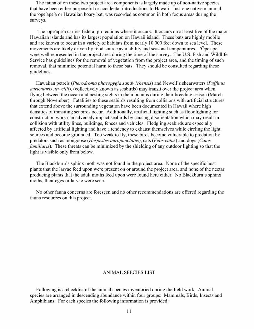
The fauna of on these two project area components is largely made up of non-native species that have been either purposeful or accidental introductions to Hawaii. Just one native mammal, the ′ōpe′ape′a or Hawaiian hoary bat, was recorded as common in both focus areas during the surveys. The ′ōpe′ape′a carries federal protections where it occurs. It occurs on at least five of the major Hawaiian islands and has its largest population on Hawaii island. These bats are highly mobile and are known to occur in a variety of habitats from nearly 10,000 feet down to sea level. These movements are likely driven by food source availability and seasonal temperatures. ′Ōpe′ape′a were well represented in the project area during the time of the survey. The U.S. Fish and Wildlife Service has guidelines for the removal of vegetation from the project area, and the timing of such removal, that minimize potential harm to these bats. They should be consulted regarding these guidelines. Hawaiian petrels (Pterodroma phaeopygia sandwichensis) and Newell’s shearwaters (Puffinus auricularis newellii), (collectively known as seabirds) may transit over the project area when flying between the ocean and nesting sights in the moutains during their breeding season (March through November). Fatalities to these seabirds resulting from collisions with artificial structures that extend above the surrounding vegetation have been documented in Hawaii where high densities of transiting seabirds occur. Additionally, artificial lighting such as floodlighting for construction work can adversely impact seabirds by causing disorientation which may result in collision with utility lines, buildings, fences and vehicles. Fledgling seabirds are especially affected by artificial lighting and have a tendency to exhaust themselves while circling the light sources and become grounded. Too weak to fly, these birds become vulnerable to predation by predators such as mongoose (Herpestes auropunctatus), cats (Felis catus) and dogs (Canis familiaris). These threats can be minimized by the shielding of any outdoor lighting so that the light is visible only from below. The Blackburn’s sphinx moth was not found in the project area. None of the specific host plants that the larvae feed upon were present on or around the project area, and none of the nectar producing plants that the adult moths feed upon were found here either. No Blackburn’s sphinx moths, their eggs or larvae were seen. No other fauna concerns are foreseen and no other recommendations are offered regarding the fauna resources on this project.
ANIMAL SPECIES LIST
Following is a checklist of the animal species inventoried during the field work. Animal species are arranged in descending abundance within four groups: Mammals, Birds, Insects and Amphibians. For each species the following information is provided:
11

1. Common name
2. Scientific name
3. Bio-geographical status. The following symbols are used: endemic = native only to Hawaii; not naturally occurring anywhere else in the world. indigenous = native to the Hawaiian Islands and also to one or more other geographic area(s). non-native = all those animals brought to Hawaii intentionally or accidentally after western contact. migratory = spending a portion of the year in Hawaii and a portion elsewhere. In Hawaii the migratory birds are usually in the overwintering/non-breeding phase of their life cycle. 4. Abundance of each species within the project area: abundant = many flocks or individuals seen throughout the area at all times of day. common = a few flocks or well scattered individuals throughout the area. uncommon = only one flock or several individuals seen within the project area. rare = only one or two seen within the project area.
SCIENTIFIC NAME COMMON NAME STATUS ABUNDANCE
MAMMALS
1 parcel
4 parcels
Lasiurus cinereus semotusAllen ′ōpe'ape'a, Hawaiian bat endemic C C
BIRDS
Geopelia striata L. zebra dove non-native C C Acridotheres tristis L. common myna non-native C U Zosterops japonicus Temminck & Schlegel Japanese white-eye non-native U C
12

Cardinalis cardinalis L. northern cardinal non-native U U Streptopelia chinensis Scopoli spotted dove non-native U U Carpodacus mexicanus Muller house finch non-native R U Lonchura punctulata L. nutmeg mannikin non-native U Leucodioptron canorum L. hwamei non-native R
AMPHIBIANS
Eleutherodactylus coqui Thomas coqui frog non-native A A
13

SCIENTIFIC NAME COMMON NAME STATUS ABUNDANCE INSECTS
1 parcel 4 parcels
Order DIPTERA - flies
CULICIDAE (Mosquito Family)
Aedes albopictus Seuse day mosquito non-native C Culex quinquefasciatus Say Southern house mosquito non-native C MUSCIDAE (Housefly Family)
Musca sorbens Wiedemann dung fly non-native C U
Order HEMIPTERA - true bugs
ALEYRODIDAE (Whitefly Family)
Aleurodicus dispersus Russell spiraling whitefly non-native R APHROPHORIDAE (Spittle Bug Family)
Philaenus spumarius L. spittle bug non-native U
Order HYMENOPTERA - bees, wasps, ants
FORMICIDAE (Ant Family)
Wasmannia auropunctata Roger little fire ant non-native C
Order LEPIDOPTERA - butterflies, moths
CRAMBIDAE (Grass Moth Family)
Spoladea recurvalis Fabricius beet webworm moth non-native C U HESPERIIDAE (Skipper Butterfly Family)
Hylephila phyleus Drury fiery skipper non-native R LYCAENIDAE (Gossamer-winged Butterfly Family)
Lampides boeticus L. long tail blue butterfly non-native U NYMPHALIDAE (Brush-footed Butterfly Family)
Agraulis vanillae L. passion flower butterfly non-native R
Order ORTHOPTERA - grasshoppers, crickets
ACRIDIDAE (Grasshopper Family)
Oxya japonica Thunberg small rice grasshopper non-native U TETTIGONIIDAE (Katydid Family)
Elimaea punctifera Walker katydid non-native R
14

FIGURE 1. Project area on the east side of Hilo – Five parcels highlighted.
FIGURE 2. Single parcel along Mahi′ai Street.
15
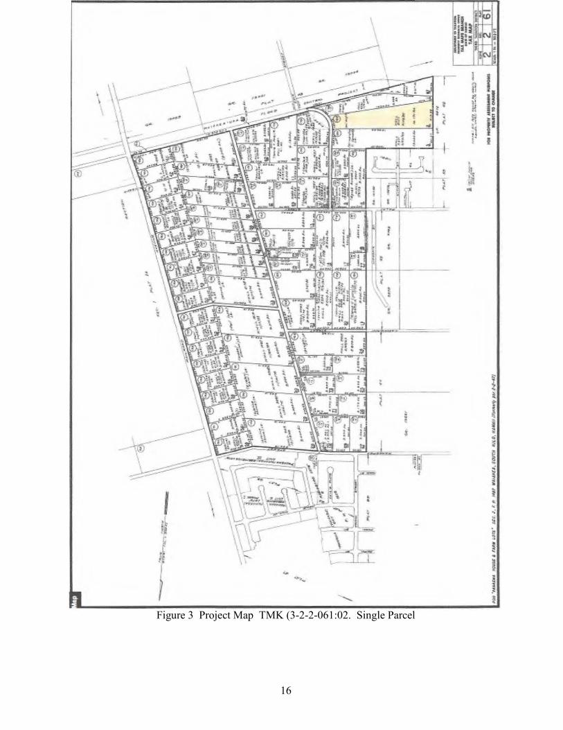
Figure 3 Project Map TMK (3-2-2-061:02. Single Parcel
16
--....... ... ,- i ii I
:; I! \ t l , . l! ·- l '
.... c ~ J! •I
:1 i' f
:I ~ !~ ...
'"' L .
...,_

FIGURE 4 - SINGLE PARCEL TMK (3) 2-2-061:02 A formerly mowed lawn surrounding a residence, now overgrown with deep grass and scattered shrubs.
17

Figure 5 – 4 PARCELS TMK’s (3) 2-1-25: 06, 07, 47, 48.
18
N
' I
l • ~
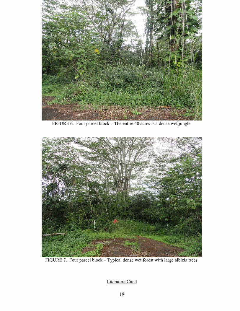
FIGURE 6. Four parcel block – The entire 40 acres is a dense wet jungle.
FIGURE 7. Four parcel block – Typical dense wet forest with large albizia trees.
Literature Cited
19

American Ornithologists’ Union 2013. Check-list of North American Birds. 7th edition. American Ornithologists’ Union. Washington D.C. Armstrong, R. W. (ed.) 1983. Atlas of Hawaii. (2nd. ed.) University of Hawaii Press. Nishida, G.M. & G.A. Samuelson, J.S. Strazanac & K.S. Kami. 1992. Hawaiian Terrestrial Arthropod Checklist. Hawaiian Biological Survey. Sato, H.H., W. Ikeda, R. Paeth, R. Smythe, M. Takehiro, Jr. 1973. Soil Survey of the Island of Hawaii, State of Hawaii. USDA Soil Conservation Service, Washington, DC. Staples, G.W. and D.R. Herbst. 2005. A Tropical Garden Flora – Plants Cultivated in the Hawaiian Islands and Other Tropical Places. Bishop Museum Press, Honolulu. Tomich, P.Q. 1986. Mammals in Hawaii. Bishop Museum Press, Honolulu. United States Congress (1973). Endangered Species Act (7 U.S.C. section 136, 16 U.S.C. section 1531 et seqo.) Washington, D.C. U.S. Fish and Wildlife Service. 2015. Endangered and threatened wildlife and Plants. Listings and Occurrences for Hawaii. www.fws.gov/endangered. U.S. Fish and Wildlife Service. 2000. Endangered and threatened wildlife and plants: determination of endangered status for Blackburn’s sphinx moth from Hawaii. Federal Register 65(21): 4770-4779. Wagner, W. L., D.R. Herbst, and S. H. Sohmer. 1999. Manual of the Flowering Plants of Hawai’i. University of Hawai’i Press and Bishop Museum Press. Honolulu.
20

Appendix DARCHAEOLOGICAL INVENTORY SURVEY

Page Intentionally Left Blank

Hawai‘i Island Office: PO Box 155 Kea‘au, HI 96749
June 10, 2015
Sean Naleimaile Hawai‘i Island Archaeologist State Historic Preservation Division 40 Po‘okela Street Hilo, HI 96720
Submittal of Draft Report: An Archaeological Assessment of Five 10-Acre DHHL Parcels in the Pana‘ewa Region of Waiākea Ahupua‘a, South Hilo District, Island of Hawai‘i, Hawai‘i [TMK: (3) 2-1-025: 006, 007, 047, 048; & 2-1-061: 002].
Aloha e Sean:
Thank you in advance for your review of the above referenced draft report. The proposed project addressed in the report is federally funded and constitutes an undertaking as defined under Section 106 of the National Historic Preservation Act (36 CFR Section 800.16(y). The Archaeological Assessment report is supporting documentation for Section 106 requirements. The report is attached with this letter. The review fee for the draft report has been sent to the SHPD Kapolei office. Please feel free to contact me if you have questions or concerns.
Sincerely,
Glenn G. Escott, MA Senior Archaeologist SCS Hawai‘i Island Ops Mgr PO Box 155 Kea‘au, HI 96749 808-938-0968 (cell) 808-959-5956 (office)
Enclosure A: Draft Report

SCS Project Number 1706-1
AN ARCHAEOLOGICAL ASSESSMENT OF FIVE 10-ACRE DHHL PARCELS IN THE PANA‘EWA REGION OF WAIĀKEA AHUPUA‘A,
SOUTH HILO DISTRICT, HAWAI‘I ISLAND, HAWAI‘I [TMK: 2-1-025: 006, 007, 047, 048; & 2-1-061: 002]
Prepared By:
Glenn G. Escott, M.A.
June 2015 DRAFT
Prepared for: PBR Hawaii
1001 Bishop Street Pacific Tower, Suite 650
Honolulu, Hawai‘i 96813-3429
1347 Kapi‘olani Boulevard, Suite 408 Honolulu, HI 96814 Hawai‘i Island Office: PO Box 155 Kea‘au, HI 96749

ii
ABSTRACT
At the request of PBR Hawai‘i, Scientific Consultant Services, Inc. (SCS) conducted an archaeological assessment of 50.0 acres of Department of Hawaiian Home Lands (DHHL) land [TMK: (3) 2-1-025: 006, 007, 047, 048; and (3) 2-1-061: 002] located in the Pana‘ewa region of Waiākea Ahupua‘a, South Hilo District, Island of Hawai‘i, Hawai‘i. DHHL is proposing to subdivide the five 10-acre parcels into 90 half-acre lots to enable relocation of Maku'u Farm Lot lessees who may have to move due to threat of the lava flow, and other lessees who may have to relocate for various reasons (e.g., UXO issues), as well as awarding to those on the wait list. The proposed project will be conducted, in part, using federal funds and constitutes an undertaking as defined under Section 106 of the National Historic Preservation Act of 1966, as amended, and its implementing regulations (36 CFR Part 800). The proposed project is also covered under Hawai‘i Revised Statutes, Title 13, Chapter 6-E Historic Preservation Review regulations. The undertaking Area of Potential Effect (APE) is defined as the five 10-acre parcels. The northern most four parcels form a contiguous 40-acre area of undeveloped land at the northern end of ‘Auwae Street. The land is approximately 95 feet (29 meters) above mean sea level (amsl). The southwest corner of the 40-acres is bordered by a grubbed and graded residential lot containing a house. The east and west boundaries are bordered by grubbed and graded macadamia nut orchards and garden fields, respectively. The northern boundary borders undeveloped land. The southernmost 10-acre parcel, TMK (3) 2-2-061:002, is located at 230 Mahi‘ai Street at an elevation of between 180 and 200 feet (55 to 60 meters) amsl. The property is bounded to the north by grubbed and graded gardens and orchards. The east and west boundaries are bordered by residential lots, and the southern boundary is bordered by undeveloped land. The entire 10-acre property is grubbed, graded, and landscaped. There is a house on the property built in the mid 1980s. A pedestrian survey was carried out in March 2015 by Glenn Escott, M.A and Suzan Keris, B.A.. A series of transects spaced ten meters apart were walked across the entire project area. The northernmost 40-acres had some areas of thick forest, but ground surface visibility was good. The southernmost 10-acre parcel ground surface was grass lawn and visibility was excellent. No archaeological sites or historic properties were identified during the survey. This archaeological assessment report is intended as supporting documentation for Section 106 consultation. It has been determined through archaeological survey that no historic properties exist within the APE and that no historic properties will be affected by the proposed undertaking. This report recommends that, pursuant to Section 106 of the National Historic Preservation Act of 1966 as amended and 36 CFR part 800.2(c), the SHPO concur with the determination of no effect.

TABLE OF CONTENTS ABSTRACT .................................................................................................................................................. ii TABLE OF CONTENTS ............................................................................................................................. iii LIST OF FIGURES ..................................................................................................................................... iii LIST OF TABLES ....................................................................................................................................... iv INTRODUCTION ........................................................................................................................................ 1
PROJECT AREA DESCRIPTION ............................................................................................. 1 METHODS ................................................................................................................................. 1
Archival Methods.................................................................................................................... 6 Field Methods ......................................................................................................................... 6
ENVIRONMENTAL SETTING .................................................................................................................. 7 HISTORICAL AND CULTURAL CONTEXTS ......................................................................................... 7
PRE-CONTACT ACCOUNTS OF HILO .................................................................................. 8
TRADITIONAL SETTLEMENT PATTERNS, SUBSISTENCE, AND LAND-USE ........... 10 THE MĀHELE OF 1848 AND LAND COMMISSION AWARDS ....................................... 15 CHANGING RESIDENTIAL AND LAND-USE PATTERNS (1845-1865) ......................... 16 HISTORIC OVERVIEW OF KMR.......................................................................................... 16
PREVIOUS ARCHAEOLOGICAL INVESTIGATIONS ......................................................................... 17 EXPECTED ARCHAEOLOGICAL PATTERNS ..................................................................................... 24 RESULTS OF FIELDWORK ..................................................................................................................... 25 CONCLUSION AND RECOMMENDATIONS ........................................................................................ 25 REFERENCES CITED ............................................................................................................................... 26
LIST OF FIGURES Figure 1: 5,500 K-Series Map of Hawai‘i Showing Location of Project Area (National
Geographic Topo!, 2003. Sources: National Geographic Society, USGS). .......................... 2 Figure 2: 7.5-Minute Series USGS Topographic Map Showing Location of Project Area Shaded
Yellow (ESRI, 2011. Sources: National Geographic Society, USGS Hilo Quadrangle). ..... 3 Figure 3: Aerial Photograph Showing Northern Four Project Area Parcels (Google Earth, 2013
Image. Hilo, HI, 5Q 284875m E 2179315m N). ................................................................... 4 Figure 4: Aerial Photograph Showing Northern Four Project Area Parcels (Google Earth, 2013
Image. Hilo, HI, 5Q 283981m E 2176888m N). ................................................................... 5 Figure 5: Map of Waiākea Ahupua‘a Showing Location of Project Area (adapted from Bush et
al. 2000). ................................................................................................................................. 9 Figure 6: Map of Kamehameha,s ‘Ili Kūpono Lands of Pi‘opi‘o in the Ahupua‘a of Waiākea
Showing Project Area Location (adapted from Kelly et al. 1981). ...................................... 10
Figure 7: Portion of 1932 15-Minute Series USGS Topographic Map Showing Puna Trail and Location of Project Area (USGS Hilo Quadrangle). ............................................................ 13
Figure 8: Portion of 1954 USDA Aerial Photograph of Hilo Airport Showing Location of Northern Project Area. .......................................................................................................... 14
Figure 9: 7.5-Minute Series USGS Topographic Map Showing Location of Previous Archaeological Studies Near the Project Area (ESRI, 2011. Sources: National Geographic Society, USGS Hilo Quadrangle). ........................................................................................ 20

iv
Figure 10: Portion of 1825 Map of Hilo Bay Showing Location of Major Habitation and Agricultural Fields (Malden 1825). ...................................................................................... 22
LIST OF TABLES
Table 1: Land Commission Awards in Waiākea Ahupua‘a......................................................... 15 Table 2: Inventory of Previous Archaeological Investigations in Waiākea. ............................... 18

1
INTRODUCTION PROJECT AREA DESCRIPTION At the request of PBR Hawai‘i, Scientific Consultant Services, Inc. (SCS) conducted an archaeological assessment of five 10-acre parcels of Department of Hawaiian Home Lands (DHHL) property [TMK: (3) 2-1-025: 006, 007, 047, 048; and (3) 2-1-061: 002] located in the Pana‘ewa region of Waiākea Ahupua‘a, South Hilo District, Island of Hawai‘i, Hawai‘i (Figure 1 and Figure 2). The Department of Hawaiian Home Lands (DHHL) is proposing to subdivide the five 10-acre parcels into 90 half-acre lots to enable relocation of Maku'u Farm Lot lessees who may have to move due to threat of the lava flow, and other lessees who may have to relocate for various reasons (e.g., UXO issues), as well as awarding to those on the wait list. The proposed project will be conducted, in part, using federal funds and constitutes an undertaking as defined under Section 106 of the National Historic Preservation (36 CFR Section 800.16[y]). The undertaking Area of Potential Effect (APE) is defined as the five 10-acre parcels. This archaeological assessment report is intended as supporting documentation for Section 106 requirements. The northern most four parcels form a contiguous 40-acre area of undeveloped land at the northern end of ‘Auwae Street (Figure 3). The land is approximately 95 feet (29 meters) above mean sea level (amsl). The southwest corner of the 40-acres is bordered by a grubbed and graded residential lot containing a house. The east and west boundaries are bordered by grubbed and graded d macadamia nut orchards and garden fields, respectively. The northern boundary borders undeveloped land.
The southernmost 10-acre parcel, TMK (3) 2-2-061:002, is located at 230 Mahi‘ai Street at an elevation of between 180 and 200 feet (55 to 60 meters) amsl (Figure 4). The property is bounded to the north by grubbed and graded gardens and orchards. The east and west boundaries are bordered by residential lots, and the southern boundary is bordered by undeveloped land. The entire 10-acre property is grubbed, graded, and landscaped. There is a house on the property built in the mid 1980s. METHODS Because the proposed undertaking is a governmental project covered, in part, under Sections 6E-7 and 6E-8, the archaeological assessment was conducted in

2
accordance with Hawai‘i Administrative Rules 13§13-284 and was performed in compliance with the Rules Governing Minimal Standards for Archaeological Inventory Surveys and Reports contained in Hawai‘i Administrative Rules 13§13-275/276. Because the proposed undertaking will also be conducted using federal funds, it is also covered under Section 106 of the National Historic Preservation Act of 1966, as amended, and its implementing regulations (36 CFR Part 800).
Figure 1: 5,500 K-Series Map of Hawai‘i Showing Location of Project Area (National Geographic Topo!, 2003. Sources: National Geographic Society, USGS).

3
Figure 2: 7.5-Minute Series USGS Topographic Map Showing Location of Project Area Shaded Yellow (ESRI, 2011. Sources: National Geographic Society, USGS Hilo Quadrangle).
z J5 8 ..... ..... ;:;;
284000m E , 285000m E 286000m E 287000m E
z J5
~-~~----T--------7--g ..... ;:;;
z E C)
"8 <X> .....

4
Figure 3: Aerial Photograph Showing Northern Four Project Area Parcels (Google Earth, 2013 Image. Hilo, HI, 5Q 284875m E 2179315m N).

5
Figure 4: Aerial Photograph Showing Northern Four Project Area Parcels (Google Earth, 2013 Image. Hilo, HI, 5Q 283981m E 2176888m N).

6
The investigation included the following procedures:
1. Historical and archaeological archival research was conducted, including a search of historic maps, aerial photos, written records, Land Commission Award documents, State and County Planning Division documents, and previous archaeological reports. The research was aimed at determining past land-use in the project area.
2. A 100 percent pedestrian survey of the project area. All sites and features were located, mapped (GIS), described, drawn at appropriate scales, and photographed. Sites were assigned temporary numbers pending State Historic Preservation Division (SHPD) assignment of State Inventory of Historic Property site numbers.
Archival Methods Prior to commencing field work, archival research was conducted in the State Historic Preservation Division (SHPD) report database and library facility (Hilo, HI), the Hawai‘i County land records office, the Waihona ‘Āina Māhele database website, the Hawaiian collections holdings at the University of Hawai‘i-Hilo Library, and the Hawai‘i State Library system. Archival work consisted of general research on the history and cultural practices specific to the project area, as well as research of previous archaeological studies in and around the subject parcels. Historic land use data, land ownership, maps, and narrative information were obtained from the Hawai‘i County land records office, the Waihona ‘Āina Māhele database website, and the University of Hawai‘i, Hilo, Special Collections. Based on previous studies, none of the five 10-acre parcels are within areas of traditional pre-Contact Hawaiian settlement and habitation. The parcels are inland of the coast where early settlements were located. In 1825, the majority of Waiākea’s estimated 2,000 inhabitants lived along the coast (Ellis1963: 253). While there were settlements along the coast at Keaukaha and in Puna District to the southeast, the majority of habitation and gardens were along, what is now, Hilo Bay. Field Methods
A pedestrian survey was conducted by Glenn Escott, M.A. and Suzan Keris Escott between March 10 and 19, 2015. The field effort totaled 96 man-hours. The

7
pedestrian survey consisted of a series of north/south transects spaced ten meters apart across the entire project area. The northernmost 40-acres had some areas of thick forest, but ground surface visibility was good. The southernmost 10-acre parcel ground surface was grass lawn and visibility was excellent. No archaeological sites or historic properties were identified during the survey. Glenn Escott is the principal investigator for the project.
This report contains background information outlining the project area
environmental and cultural contexts, a presentation of previous archaeological work within the study area and in the immediate vicinity, and current survey expectations based on that previous work, as well as an explanation of project methods.
ENVIRONMENTAL SETTING The ground surface at all five parcels is level to slightly undulating Paipai Series (rPAE) extremely stony muck (Sato et al. 1973: 46) overlaying a Mauna Loa lava flow dated between 750 and 1,500 years before present (ybp) (Wolf and Morris 1996). There are exposed ‘a‘a bedrock outcrops and low ridges on the ground surface across the properties. Annual rainfall ranges from 120 to 160 inches. Vegetation within the south, east, and northeast portions of the contiguous four parcels, where ground disturbance is evident, is composed of a suite of invasive plant species dominated by albizia trees (Falcataria moluccana) and guava (Psidium sp.) (Starr Environmental 2014). Vegetation on the remainder of 40 acres is primarily ‘ōhi‘a (Metrosideros polymorpha, hala (Pandanus odoratissimus), as well as invasive species including guava, gunpowder tree (Trema orientalis), miconia (Miconia calvescens), Asian Melastoma (Melastoma septemnervium), and bingabing (Macaranga mappa). The entire southernmost 10-acre parcel is grubbed, graded, and landscaped. There is a house on the property built in the mid 1980s.
HISTORICAL AND CULTURAL CONTEXTS
The rich marine resources of Hilo Bay and the gently sloping forests of Mauna Loa and Mauna Kea provided abundant resources. Fresh water was available from the Wailoa and Wailuku rivers and smaller streams such as Waiākea, Waiolama, Pukihae, and ‘Alenaio.

8
The project area is located in the ahupua‘a of Waiākea, Hilo Hanakāhi ‘Okana, in the moku-o-loko (district) of Hilo (Maly 1996:4–5) (Figure 5). The ahupua‘a of Waiākea is large, consists of roughly 95,000 acres, and was regarded as a region of abundant natural resources and numerous fishponds. Waiākea was also an early important political center, notably under chief Kulukulu‘a (Kelly et al. 1981:3). Kamehameha lived and often returned to his ‘ili kūpono (independent land division where all tributes were paid to the chief of the ‘ili and not the ahupua‘a) lands of Pi‘opi‘o in the ahupua‘a of Waiākea (Figure 6). The ‘ili kūpono lands and its royal fishpond were passed on to his son Liholiho after his death. PRE-CONTACT ACCOUNTS OF HILO
The earliest account of Hilo appears in ‘Umi-a-Liloa’s (1600–1620) conquest of the Island of Hawai‘i, which establishes Hilo as a royal center by the seventeenth century. In the account, ‘Umi-a-Liloa began his conquest of the Island of Hawai‘i by defeating chief Kulukulu‘ā, who lived in Waiākea, and the other chiefs of Hilo (Kamakau 1992:16–17). ‘Umi-a-Liloa’s second son, Keawe-nui-a-‘Umi, ruled Hamākua, Hilo, and Puna from his residence at Hilo (ibid: 34). It was from Hilo that he waged war on the Kona chiefs and unified the island. Keawe-nui-a-‘Umi’s descendants single handedly continued to rule, from Hilo, for many generations.
After the death of Keawe-nui-a-‘Umi the kingdom was divided into three parts
and was established under warring chiefs; Hilo was ruled by Kumalae-nui-pu‘awa-lau and his son Makua (ibid: 45). It was during the period of time that Kamehameha I was born. Kalani‘ōpu‘u’s grandson, Keoua Kuahu‘ula and nephew Kamehameha vied for control over the six chiefdoms constituting the island kingdom and Keoua conquered Hilo chief Keawe-mau-hili and harvested the benefits for a short time only to be killed by Kamehameha late in 1791. Kamehameha’s son Liholiho was born in Hilo in November 1797 (Kamakau 1992:22). Waiākea was inherited by Lihiliho after Kamehameha’s death. The ‘ili kūpono of Pi‘opi‘o and its royal fishpond were given to his favorite wife, Ka‘ahumanu (Figure 6).

9
Figure 5: Map of Waiākea Ahupua‘a Showing Location of Project Area (adapted from Bush et al. 2000).

10
Figure 6: Map of Kamehameha,s ‘Ili Kūpono Lands of Pi‘opi‘o in the Ahupua‘a of Waiākea Showing Project Area Location (adapted from Kelly et al. 1981). TRADITIONAL SETTLEMENT PATTERNS, SUBSISTENCE, AND LAND-USE
Historical accounts and archaeological/cultural studies pertaining to the ahupua‘a of Waiākea (Bingham 1969; Bird 1974; Ellis 1963; Handy and Handy 1972; Kelly et al. 1981; Maly 1996; McEldowney 1979) provide a wealth of information on traditional residence patterns, land-use, and subsistence horticulture of the area. It is widely held that these historical accounts of residence patterns, land-use, and subsistence horticulture, indicative of traditional practices, developed long before contact with Europeans (McEldowney 1979). These are synthesized below in order to explain the types of cultural resources possibly located within the current project area.

11
Early accounts of Waiākea portray it as divided into several distinct environmental regions. From the coast to a distance of five or six miles scattered subsistence agriculture was evident, followed by a region of tall fern and bracken, flanked at higher elevations by a forest region between 10 and 20 miles wide, beyond which was an expanse of grass and lava (Ellis 1963:403). The American Missionary C.S. Stewart wrote, “the first four miles of the country is open and uneven, and beautifully sprinkled with clumps, groves, and single trees of the bread-fruit, pandanus, and candle tree (Stewart 1970:361-363). The majority of Waiākea’s estimated 2,000 inhabitants (in 1825) lived within this coastal region (Ellis1963: 253). Taro, plantains, bananas, coconuts, sweet potatoes, and breadfruit were grown individually or in small garden plots. Fish, pig, dog, and birds were also raised and captured for consumption. The present study area is situated inland of the coastal region, in the Pana‘ewa Forest. The project area lands are not located in an area of known traditional habitation. The Pana‘ewa forest area was traditionally known as a forbidding and dangerous landscape. The legendary origin of the Pana‘ewa Forest is associated with Pele’s search for a suitable home in the island chain of Hawai‘i.
When a suitable place was finally discovered on Hawaii, the Paoa staff was planted in Panaewa and became a living tree, multiplying itself until it was a forest. The writer’s informant says that it is a tree known to the present generation of men. “I have seen sticks cut from it,” said he, “but not the living tree itself” [Emerson 2005:xi].
When Pele sent her sister Hi‘iakapoliopele (referred to as Hi‘iaka) to travel to Kaua‘i to contact Lohi‘au, Hi‘iaka passed through the Pana‘ewa Forest. Hi‘iaka could have passed around the forest, taking the pathway along the shoreline from Hā‘ena (southeast of the project area) to Waiākea and Hilo, but she instead chose to cut through the forest taking a more direct, and shorter route.
Two routes offered themselves for Hiiaka’s choice, a makai road, circuitous but safe, the one ordinarily pursued by travelers; the other direct but bristling with danger, because it traversed the territory of the redoubtable witch-mo‘o, Pana-ewa. … When Hiiaka announced her determination to take the short road, the one of danger that struck through the heart of Pana-ewa, Pa-pulehu drew back in dismay and expostulated:

12
“That is not a fit road for us, or for any but a band of warriors. If we go that way we shall be killed” [Emerson 1:2005:30].
Pana‘ewa did not let her pass without a fight.
The battle that ensued when Pana‘ewa sent to the attack his nondescript pack of mo‘o, dragonlike anthropoids, the spawn of witchcraft, inflamed with the spite of demons, was hideous and uncanny. Tooth and claw ran amuck. Flesh was torn, limbs rent apart, blood ran like water. If it had been only a battle with enemies in the open Hiiaka would have made short work of the job. Her forces lay ambushed in every wood and brake and assumed every imaginable disguise. A withered bush, a bunch of grass, a moss-grown stone, any, the most innocent object in nature, might prove to be an assailant ready to spit venom or tear with hook and talon [Emerson 2005:35].
The mo‘o Pana‘ewa and all of his minions were defeated by Hi‘iaka and her
assistants. “Hawaii for once, and for all time, was rid of that pestilential, man-eating, mo‘o band headed by Pana-ewa who, from the time of Pele’s coming, had remained entrenched in the beautiful forest-land that still bears the name – Pana-ewa” (Emerson 2005:46).
The forest is heavily wooded and dense with thickets. Travel through it is made
more difficult by the broken and undulating ground surface. There is an historic trail that leads from the modern day Lili‘uokalani Gardens area to the Puna coast. The trail is often called the Puna Trail and/or the Old Government Road (Escott and Tolleson 2003). Remains of the trail cross the Hawai‘i Army Reserve National Guard (HIARNG) Keaukaha Military Reserve (KMR) property, and it has the current appearance of a gravel-covered dirt road (Figure 7 and Figure 8). While there may have been some scattered home sites and gardens in this area, most of the known habitation was along the coast. The probable use of the area prehistorically was for trapping birds and collecting plants, including the plentiful pandanus or hala (Kelly et al. 1981:20).

13
Figure 7: Portion of 1932 15-Minute Series USGS Topographic Map Showing Puna Trail and Location of Project Area (USGS Hilo Quadrangle).

14
Figure 8: Portion of 1954 USDA Aerial Photograph of Hilo Airport Showing Location of Northern Project Area.

15
THE MĀHELE OF 1848 AND LAND COMMISSION AWARDS Prior to the Māhele, Waiākea Ahupua‘a belonged to King Kamehameha, then
Lihiliho, and was later held by the chiefess Ka-unu-o-hua, granddaughter of Keawe-mau-hili (Kelly et al. 1981:40). Waiākea became Crown Lands during the Māhele of 1848 and in the following years twenty-six Land Claims were awarded within the ahupua‘a of Waiākea (Table 1). The awards were small in area, 25 of which went to native claimants. The vast majority of awards were further west in the area of Hilo Bay. No Land Commission awards were made within or near the current project area. The project area property is owned by the State of Hawai‘i lands and is administered by DHHL.
Table 1: Land Commission Awards in Waiākea Ahupua‘a.
Grantee LCA Acreage Barenaba 2327 12.25 Halai, L.K. 1279 0.60 Hale 40004 4.25 Kahue 2663 3.75 Kaiana, J.B. 2281 10.25 Kaihenui 11050-B 5.19 Kalolo 1333 2.25 Kalua 8854 3.40 Kaluhikaua 1738 2.98 Kamamalu, V. 7713 ‘ili ‘aina Kamanuhaka 8803 1.02 Kapu 1-F 1.60 Kealiko 11174 1.00 Keaniho 2402 5.00 Keawe 5018 0.24 - 10505 - Kuaio 4344 1.22 Leoi 9982 0.80 Lolo 4738-B 1.27 Mahoe 1-E 4.46 Moealoha 4737 1.03 Nakai 4785 1.05 Napeahi 2603 1.30 Wahine 4737-B 1.01 Wahinealua 11173 2.50 Wahinenohoihilo 10004 1.69

16
CHANGING RESIDENTIAL AND LAND-USE PATTERNS (1845-1865) Between 1845 and 1865 traditional land-use and residential patterns underwent a
change. In particular, the regular use of Hilo Bay by foreign vessels and the whaling industry, in addition to the establishment of missions in the Hilo area, the introduction of the sandalwood trade, the legalization of private land ownership, the introduction of cattle ranching, and the introduction of sugar cane cultivation, all brought about changes in settlement patterns and long-established land-use patterns (Kelly et al. 1981).
As Hilo became the center of population, settlements in outlying regions declined
or disappeared. While food was still grown for consumption, greater areas of land were continually given over to the specialized cultivation and processing of commercial foodstuffs for export. Sugar cane plantations, and industrial, transportation, and military facilities were established in areas that were once upland agricultural areas and coastal settlements, respectively. In particular, the land immediately north of the current project area was used as the location of a jail, an airfield, and the Keaukaha Military Reserve (KMR).
HISTORIC OVERVIEW OF KMR KMR comprises 503.6 acres located between General Lyman Field (Hilo International Airport) to the north, and the current project area to the south. The area lies in rugged, broken, undulating lava flows, and where unmodified by bulldozing, a dense forest of mixed and native flora abounds. Rainfall in this portion of Hilo keeps the jungle wet, and the ground surface slippery. In 1914, the Territory of Hawai‘i, via Executive Order Number (EO) 26 set aside 213.43 acres of government lands in Waiākea, north of the current project area, for a National Guard rifle range. In 1925, the Territory withdrew 33 acres for the building of Lyman Airfield by the Army Corp of Engineers. In August of 1938, a territorial prison camp was constructed on 13.55 acres in Waiākea, north of the current project area. The complex included a Jailer's and acting Jailer's cottage, and a large fenced area with two dormitories, a mess/laundry building, and a recreation/workshop. The prison camp was moved in 1946 and all buildings were removed.

17
The Army Corp of Engineers constructed a coral runway at KMR beginning in 1925. Hawaiian Airlines used the airport at the outbreak of World War II. The Navy expanded the airfield to three runways, built storage for 450,000 gallons of gasoline, and 24 airplane revetments. KMR became a Naval Station in August 1943 under the 14th Naval District Command Servicing Carrier Aircraft Service Unit (CASU) No. 31 and Air Group One. Extensive building took place including officer and enlisted men's quarters, a swimming pool, two clubs, a three-tank tank farm, water systems, cesspools, tennis courts, and other infrastructure. Personnel at KMR hit a wartime peak of 4,500 upon completion of construction in 1945. Naval Air Station Hilo officially closed on August 31, 1947. On May 10, 1943, Hilo Airport was officially renamed General Lyman Field. In May 1946, while the Naval Station at KMR was being reduced to caretaker status, the Army Air Force announced that the 7th Army Air Corps (AAC) would begin 24-hour operations at Lyman Field.
In 1947, reactivation of the Hawai‘i Army Reserve and National Guard (HIARNG) resulted in the HIARNG using several Navy buildings. During this time, many buildings were demolished or sold to the public as war surplus. KMR is the headquarters for the island of Hawai‘i National Guard units of the 2nd Battalion, 299th Infantry Company D and 2nd Battalion 299th Infantry, as well as Army Air Guard units 451Bt Aviation Detachment, and the 452nd Aviation Attachment. KMR has firing ranges, training areas, barracks, support facilities, an armory and offices. During annual or special training operations, several hundred to thousands of Guardsmen are housed in cabins and tents pitched in the encampment area.
PREVIOUS ARCHAEOLOGICAL INVESTIGATIONS Many archaeological and historical studies have been conducted in Waiākea Ahupua‘a from Hilo Bay west of the current project area, to the Waiākea Sugar Mill sugarcane fields southwest of the current project area, to the KMR lands just north of the current project area. Summaries of 38 of these studies are provided in Table 2 below. Figure 7 shows the locations of archaeological studies in the region surrounding the current project area. A rough model of archaeological site types and distribution can be formulated from these regional archaeological studies.

18
Table 2: Inventory of Previous Archaeological Investigations in Waiākea. Reference Study Location Results
Ching and Staruder (1974) Reconnaissance Proposed Road alignment from S. Hilo to Puna
Wall, enclosure, platform burial, and habitation site near Puna boundary
Bonk (1979) Survey West of KMR Historic wall and road alignment McEldowney (1979) Historical research Hilo Settlement pattern Kelly, Nakamura and Barrère (1981)
Historical research Hilo Chronology
Kam (1983) Site inspection Reed's Bay 1 site, heiau Smith and Tourtellotte (1988) Burial removal Wailoa Bridge One individual encountered Rosendahl, M. (1988) Reconnaissance Various parcels in Hilo Town No sites Rosendahl, M. and L. Talea (1988)
Reconnaissance North West of KMR No sites
Rosendahl, P. (1988) Reconnaissance No sites Pietrusewsky (1989) Skeletal analysis Wailoa Bridge 1 Individual Stokes (1991) Intermittent survey Various Parcels Heiau locations Hunt and McDermott (1993) Inventory Survey Puainako Street Extension 11 sites, historic sugarcane Borthwick et al. (1993) Inventory Survey UH Hilo Sugar cane remains in uplands Maly (1996) Cultural History Puainako- Komohana Street area Sugar cane history Robbins and Spear (1996) Inventory Survey Puainako Street Sugar cane sites in the uplands Eblé et al. (1997) Supplemental Testing Puainako Street Sugar cane sites in the uplands Deveroux, et al. (1997) Reconnaissance KMR 2 sites Carson (1999) Inventory Survey Pana‘ewa No sites McGerty and Spear (1999) Inventory Survey Puainako Street Extension 1 site Dega and Benson (1999) Reconnaissance Puainako Street Extension Possible prehistoric ‘auwai

19
Reference Study Location Results Dega (2000) Inventory Survey Puainako Street Extension ‘Auwai equals historical ditch Bush et al. (2000) Inventory Survey Puainako Street Extension Burial in cave in uplands Hammatt & Bush (2000) Inventory Survey KMR Mounds and Puna Trail McDermott and Hammatt (2001)
Inventory Survey Puainako Street Extension 2 historical sites in uplands
Tolleson and Godby 2001 KMR Historic era sites and Puna Trail Rosendahl, P. (2002) Assessment Survey Quarry Site on Southeast Edge of KMR No sites Escott and Tolleson (2002) Inventory Survey KMR Trail and planting features Haun & Henry (2002) Southwest of KMR No sites Rechtman (2003) Archaeological study and
limited CIA Western edge of KMR No site
Escott (2004) Inventory Survey Puainkao Street and Komohana Street area WWII sites in the uplands Wolforth (2004) Inventory Survey Reed's Bay Fishponds, railroad, Historic era
foundations Wolforth (2006) Inventory Survey Western edge of KMR Modern military building remains Rechtman (2006) Inventory Survey Quarry site south of KMR No sites Hammatt & Uyeoka (2007) Archaeological Monitoring Southeast of KMR No sites Tulchin & Hammatt (2007) Field Inspection Wal-Mart Property No sites Escott (2013a) Archaeological Assessment Quarry site west of KMR No sites Escott (2013b) Archaeological Assessment Quarry site west of KMR No sites Wheeler et al. (2014) Inventory Survey KMR Eleven sites, some pre-Contact era,
some historic, and some more modern including military features

20
Figure 9: 7.5-Minute Series USGS Topographic Map Showing Location of Previous Archaeological Studies Near the Project Area (ESRI, 2011. Sources: National Geographic Society, USGS Hilo Quadrangle).

21
The current project area lands are situated inland of the Coastal Settlement Zone of the east Hawai‘i settlement model (McEldowney 1979). As reflected in the name of that zone, prehistoric habitation is focused along the coastline. Fishponds for ali‘i and maka‘āinana were created, maintained, and used all along the coast. The basic cultivated crops such as irrigated and dry taro, bananas, breadfruit, kukui nuts, pandanus and ti were grown in these lower elevations. They did not grow uniformly over the coastal zone, however. The heavily weathered soils on the Mauna Kea flows along the western portion of Hilo Bay were particularly well suited for agriculture. This bias towards the western area is evident in the distribution of fields portrayed in an early depiction of the Hilo Bay (Figure 10). The eastern half of the Hilo Bay area and further south and east are covered by younger Mauna Loa flows that lack soil the level of soil development present in the Mauna Kea flows. Few archaeological sites have been recorded as a result of the projects conducted in the lower elevations of Waiākea. It is likely that the extent of disturbance by the 200 years of development in Hilo town is partially to blame for the lack of recorded lowland sites. In the case of archaeological projects conducted very close to the current project area, it is more likely that the lack of habitation is the result of this region being an inland, rugged, forest area that was not settled. Also, modern disturbance from historic and modern uses have likely removed some archaeological remains. Paul H. Rosendahl Inc. (PHRI) (Rosendahl and Talea1988) conducted research on five 5-acre lots dispersed through the South Hilo area, recording no cultural deposits due to extensive landform changes caused by the development of Hilo Town (see Figure 9). A reconnaissance survey by PHRI (M. Rosendahl 1988) conducted at the eastern end of General Lyman Field again resulted in no extant archaeological remains due to previous land disturbance. Devereux et al (1997) conducted a reconnaissance level survey for HIARNG on selected portions of KMR along a corridor parallel to the Puna Trail (see Figure 9). Two sites (assigned temporary site numbers CSH 1 and CSH 2) were recorded: as a prehistoric C-shaped enclosure and a coral mound, the team also addressed 10 historic structures over 50 years of age. CSH2 was later interpreted as a modern bulldozer push.

22
Figure 10: Portion of 1825 Map of Hilo Bay Showing Location of Major Habitation and Agricultural Fields (Malden 1825).
'I
,Cable. 6 0 1
lD :r
,, \,
\ JO
:111)
\. \
\ ? 6 \
I
8 'I
THE PROJECT AREA IS JUST SOUTH QF TH IS LOCATION ,

23
Hammatt and Bush (2000) conducted an inventory level survey of KMR adjacent to the portion of the Puna Trail that extends through the facility. In this report, they discussed the history of the Puna Trail that continues down to south Puna where it meets with the Old Gov't Road (also called the Puna trail). They noted extensive mechanical grading of the ground surface at KMR during military occupation that has effectively removed all surface traces of historic/prehistoric occupation. However, the entire facility was not completely surveyed. Hammatt and Bush recorded three archaeological sites, a C-shaped enclosure, thought to be military in origin, a group of five ahu, possibly markers to denote the trail set parallel to the Puna Trail and a modified natural lava blister interpreted as a traditional Hawaiian agricultural planting feature. Tolleson and Godby (2001) conducted archaeological data recovery at Site 21771 located adjacent to the paved portion of the Puna Trail the traverses KMR. This site consists of a complex comprised of a low platform, an enclosure, a possible imu, fruit trees, and a meadow. Artifacts, such as horse/mule shoes, sharpening implements, a sharpening wheel, and hoof files suggest the site is related to historical road construction along the Puna Trail. PHRI (P. Rosendahl 2002) conducted an archaeological assessment survey of 14.99-acres of the quarry site within the current project area. No archaeological sites were identified during the study. Escott and Tolleson (2003) conducted an archaeological inventory survey just east of the current project area. A single site (Site 23273) consisting of a remnant trail segment and two planting features were recorded along the south west boundary of the project area. Wolforth (2006) conducted an archaeological inventory survey of 147 acres south of the Hilo International Airport. Four sites (SIHP 50-10-35-25538, 25539, 25540, and 25541) associated with a Naval Air Station facilities and quarry were recorded. No pre-Contact orearly post-Contact era sites were documented on the project area. Scientific Consultant Services, Inc. (Escott 2013a, Escott 2013b) conducted two archaeological assessments of 50 and 85 acres of land along the eastern edge of the KMR. No archaeological sites or historic properties were identified during the study.

24
The study did document modern dirt roads that were cut by bulldozers, likely in anticipation of building out this area. The dirt roads were straight and were oriented northwest/southeast. A search was made of Hawai‘i County Planning documents, historic maps, and archival documents to ensure the dirt road was not constructed over a pre-existing trail or government road. In addition, SCS consulted with Ala Kahakai and Na Ala Hele. There were no documents showing a traditional trail or government road in the location of the dirt road identified during the current study. Cultural Surveys Hawai‘i, Inc. recently conducted an archaeological inventory survey of the KMR (Wheeler et al. 2014). During that study eleven sites were documented, including seven early post-Contact era to modern era sites, and four pre-Contact to Historic era sites (Wheeler et al. 2014:64). The pre-Contact era to Historic era sites included two trails, a modified lava tube, and a modified outcrop complex. The trails were associated with travel and transportation through the area, and the latter two sites were associated with temporary habitation, possibly while traveling through the area, or while collecting forest resources. The early post-Contact to modern era sites included three trail segments, a military position, and two possible homesteads with small agricultural garden plots.
EXPECTED ARCHAEOLOGICAL PATTERNS Based on previous archaeological studies, geological studies, historical research,
archaeological sites in the area surrounding the current project should be associated primarily with Historic era and modern land-uses. This is likely since this area is not known to have been used for habitation or agricultural purposes, ever. The Pana‘ewa forest area where the project parcels only began to be accessed to a larger degree in the Historic era as new areas were explored to open up for agricultural pursuits. The Pana‘ewa region where the project area is located contains marginally thin soils and is not well suited to mechanical agricultural techniques.
It is possible that pre-Contact era site types such as trail segments, temporary
habitation features associated with travel and forest resource extraction might be present on the project area. It is less likely, but possible, that scattered temporary habitation features adjacent to planting features might be present. It is also possible that more

25
modern features associated with WWII training and quarrying in the area might be present on the project area.
RESULTS OF FIELDWORK No archaeological sites and no remains of historic properties were identified during the pedestrian survey conducted at the project area. Three overgrown, bulldozed road alignments were identified in the northernmost 40 acres during the survey. The bulldozed road alignments are evident in a 1954 USDA aerial photograph (see Figure 8). The bulldozer roads were likely created in anticipation of future development for the expansion of Hilo.
CONCLUSION AND RECOMMENDATIONS No archaeological sites or historic properties were identified within the project area APE during the archaeological survey. The results of the survey support the results of the ethnographic and historical archival record for this area. According to ethnographic and historical documentation, the Pana‘ewa forest was traditionally considered an inhospitable place. The forest was thick and was difficult to travel through. The Pana‘ewa forest was not a traditional location for settlements or gardens. Settlements and garden areas were located along the coast on the outside edges of the forest. Previous archaeological studies in the region have identified archaeological sites further north, closer to the Hilo International Airport. The majority are the remains of post-Contact era to modern era trails, military sites and individual homestead sites. There are a small number of pre-Contact era sites that include small rock mound complexes and trail segments. All of these sites have been identified north of the current project area. It has been determined through archaeological survey that no historic properties exist within the APE and that no historic properties will be affected by the proposed undertaking. SCS recommends that, pursuant to Section 106 of the National Historic Preservation Act of 1966 as amended and 36 CFR part 800.2(c), the SHPO concur with the determination of no effect. This archaeological assessment report is intended as supporting documentation for Section 106 requirements.

26
REFERENCES CITED Bingham, M.
1969 A Residence of Twenty-one Years in the Sandwich Islands. Hartford. Bird, I. 1974 Six months in the Sandwich Islands. Charles E. Tuttle Co., Rutland. Bonk, W. 1979 An Archaeological Survey of a Portion of Hawaiian Home Lands of Pana‘ewa, Tract 1, Waiākea, So. Hilo, Hawai‘i. University of Hawai‘i, Hilo. Borthwick, D., J. Collins, W.H. Folk, and H.H. Hammatt 1993 Archaeological Survey and Testing of Lands Proposed for Research and Technology Lots at the University of Hawaii at Hilo (TMK:2-4-01:7 and 41). On file at State Historic Preservation Division, Kapolei, Hawaii. Bush, A.R., M. McDermott, and H.H. Hammatt
2000 Archaeological Inventory Survey of an Approximately 20-Acre Parcel Proposed for the USDA Pacific Basin Agricultural Research Center Located near the intersection of Komohana and Puainako Streets, South Hilo, Hawai‘i Island (TMK 2-4-01: por122), Prepared for SSFM International Inc. On file at State Historic Preservation Division, Kapolei, Hawaii.
Carson, M.T. 1999 Archaeological Inventory Survey of the 176-Acre Pana‘ewa Campus Site, Waiākea Ahupua‘a, Hilo District, Island of Hawai‘i. Prepared for PBR & Associates, Honolulu. Ching, F.K.W. and C. Staruder 1974 The Archaeology of South Hilo, Hawai‘i. For Muroda and Associates, Inc., Lawai. Dega, M.F., and LB. Benson
1999 Letter Report concerning Archaeological Reconnaissance Survey of the Puainako Street Realignment/Extension Project Expanded Corridor, Waiakea, Kukuau 1 and 2 and Ponahawai, South Hilo District, Island of Hawai 'i. Scientific Consultant Services Inc., Honolulu, Hawai'i.
Dega, M.
2000 Addendum To: Archaeological Inventory Survey of the Pu‘ainako Street Realignment/Extension Project, Expanded Corridor, Waiakea, Kukuau 1 and 2, South Hilo District, Hilo, Island of Hawaii‘i. On file at State Historic Preservation Division, Kapolei, Hawaii.

27
Devereux, T. K., D. F. Borthwick, H. Hammatt and M. Orr 1997 Archaeological Reconnaissance Survey of Keaukaha Military Reservation, South Hilo District, Hawai‘i Island. Cultural Surveys Hawai‘i, September 1997. Eblé, F.J., T. Denham, and J. Pantaleo 1997 Draft Report of Supplemental Archaeological Testing Conducted Along the Proposed Alternate Alignments of Pu‘ainako Street (TMK:2-4-01), Hi/o, Hawaii. On file at State Historic Preservation Division, Kapolei, Hawaii. Ellis, W. 1963 Journal of William Ellis. Honolulu Advertiser Publishing Co., Ltd, Honolulu. Emerson, N.B. 2005 Pele and Hiiaka: a myth from Hawaii. Originally printed by the Honolulu Star-Bulletin, 1915. Edith Kanaka‘ole Foundation, Hilo. Escott, G.E. 2004 An Archaeological Inventory Survey on Approximately 288 Acres of Land for the University of Hawai‘i-Hilo Mauka Lands Development. Prepared for PBR
Hawai‘i. SCS Report 361-4, Honolulu. 2013a Archaeological Assessment of A Fifty-Acre Quarry Site in Waiākea Ahupua‘a, South Hilo District, Hawai‘i Island, Hawai‘i [TMK (3) 2-1-013:004 (por.)]. Prepared for Jas. W. Glover, Ltd. SCS Report 1272-2, Honolulu. 2013b Archaeological Assessment of A Proposed 90-Acre Quarry Site in Waiākea Ahupua‘a, South Hilo District, Hawai‘i Island, Hawai‘i [TMK (3) 2-1-013:004 (por.)]. Prepared for Jas. W. Glover, Ltd. SCS Report 1272-2, Honolulu. Escott, G., and W. Tolleson 2003 Archaeological Inventory Survey Work At Keaukaha Military Reservation, South Hilo District, Island of Hawai‘i. Prepared for The Environmental Office Hawai‘i Army National Guard. SCS Report 316, Honolulu. Hammatt, H. and T. R. Bush 2000 Archaeological Inventory Survey of Selected Portions of the Hawai‘i Army National Guard 503.6 Acre Keaukaha Military Reservation, Waiakea Ahapua‘a South Hilo District, Hawai‘i Island, TMK: 2-1-12:3 and 2-1-13:10. Prepared for the Hawai‘i Army National Guard. Hammatt, H. and K. Uyeoka 2007 Archaeological Monitoring Report for Waiākeawaena Elementary School, Hawai‘i Inter-Island DOE Cesspool Project, Waiākea Ahupua‘a, Hilo District, Island of Hawai‘i, TMK: [3] 2-2-042:017. Cultural Surveys Hawai‘i, Inc. Kailua, Hawai‘i.

28
Handy, E.S.C., and E.G. Handy 1972 Native Planters in Old Hawaii. B.P. Bishop Museum Bulletin 233. Bishop Museum Press, Honolulu.
Haun, A., and D. Henry 2002 Archaeological Inventory Survey, DHHL Project at Pana‘ewa, Land of Waiākea, South Hilo District, Island of Hawai‘i. Haun & Associates, Kea‘au. Hunt, T.L. and M.J. McDermott 1993 Archaeological Inventory Survey Puainako Street Expansion Project. University of Hawai‘i for Okahara and Associates, Inc., Hilo. Kam, W. 1983 Unrecorded Heiau on State Lands, Waiākea, South Hilo, Hawai‘i. Historic Sites Section, Department of Land and Natural Resources, Honolulu. Kamakau, S.M.
1992 Ruling Chiefs of Hawaii. Kamehameha Schools Press, Honolulu. Kelly, M., B. Nakamura, and Dorothy Barrère 1981 Hilo Bay: A Chronological History, Land and Water Use in the Hilo Bay Area, Island of Hawai‘i, Bishop Museum, Honolulu. Malden, C.R. 1825 Chart of Hilo Bay. In A Chronological History, Land and Water Use in the Hilo Bay Area, Island of Hawai‘i, by M. Kelly, B. Nakamura, and D. Barrère 1981. Bishop Museum, Honolulu. Maly, K.A. 1996 Historical Documentary Research and Oral History Interviews: Waiakea Cane Lots (12, 13, 17, 18, 19,20, and 20-A). Kumu Pono Associates, Hilo, Hawai'i. On file at State Historic Preservation Division, Kapolei, Hawaii. McEldowney, H.
1979 Archaeological and Historical Literature Search and Research Design: Lava Flow Control Study, Hilo, Hawaii, Department of Anthropology, Bishop Museum. Prepared for the U.S. Army Engineer District, Pacific Ocean.
McDermott, M., and H.H Hammatt
2001 Addendum to: Archaeological Inventory Survey of an Approximately 20-Acre Parcel Proposed for the USDA Pacific Basin Agricultural Research Center Located near the intersection of Komohana and Puainako Streets, South Hilo, Hawai‘i Island (TMK 2-4-01: por122), Prepared for SSFM International Inc. On file at State Historic Preservation Division, Kapolei, Hawaii.

29
McGerty, L, and R.L Spear 1999 Addendum to: An Inventory Survey of the Pu‘ainako o Street Realignment/Extension Project Expanded Corridor, Waiakea, Kukuau 1 and 2 and Ponahawai, South Hilo District, Island of Hawai'i. Scientific Consultant Services Inc., Honolulu, Hawai'i.
Pietrusewsky, M. 1989 Human Remains Found at Wailoa Bridge Renovation Project, Waiākea, South Hilo. Department of Anthropology, University of Hawai‘i, Manoa. Rechtman Consulting 2003 Archaeological and Limited Cultural Impact Assessment for the Proposed Regional Solid Waste Sorting Station (TMK: 3-2-1-12:4 por. and 3-2-1-13:11, 150, 151, 162, 168. Rechtman Consulting, LLC report prepared for the County of Hawai‘i, Hilo. 2009 Request for SHPO Concurrence with a Determination of No Historic Properties Affected Pursuant to the National Environmental Policy Act and in Compliance with Section 106 of the National Historic Preservation Act, Kamoleao Laulima Community Resource Center (TMK:3-2-2-47:075), Waiākea Ahupua‘a, South Hilo District, Island of Hawai‘i. Rechtman Consulting, LLC, Hilo. Robins, J.J., and RL. Spear 1996 An Inventory Survey of the Puainako Street Realignment/Extension Project Expanded Corridor, Waiakea, Kukuau 1 and 2 and Ponahawai, South Hilo District, Island of Hawai‘i. Scientific Consultant Services Inc., Honolulu, Hawai'i. Rosendahl, M.L.K. 1988 Archaeological Reconnaissance Survey for Environmental Impact Statement (EIS) Proposed Irradiation Plant Site. SHPD Library, Kapolei. Rosendahl, M.L.K. and L. Talea 1988 Archaeological Reconnaissance Survey for Environmental Impact Statement (EIS) Proposed Irradiation Plant Site. PRHI Report 352- 040888 for Westec Services, San Diego. Rosendahl, P. H. 2002 Archaeological Assessment Survey at 14.99 Acre "Proposed Quarry Site". PHRI Report 2293.1-120302 for Jas. W. Glover, Ltd, Hilo. Sato, H., W. Ikeda, R Paeth, R Smythe, and M. Takehiro Jr.
1973 Soil Survey of Island of Hawaii, State of Hawaii. United States Department of Agriculture Soil Conservation Service. Washington D.C.

30
Smith, M. and Tourtellotte 1988 "Wailoa Bridge Renovation Project, Site No. 50-10-11,115 Burial Removal." Historic Sites Section, Department of Land and Natural Resources, Honolulu. Starr Environmental 2013 Botanical and Faunal Surveys in the State of Hawai‘i. Makawao. www.starrenvironmental.com. Stewart, C.S. 1970 Journal of a Residence in the Sandwich Islands, During the Years 1823, 1834, and 1825: Including Remarks on the Manners and Customs of the Inhabitants; an Account of Lord Byron's Visit in the H.M.S. Blonde; and a Description of the Ceremonies Observed at the Interment of the Late King and Queen in the island of Oahu. University of Hawai‘i Press, Honolulu. Stokes, J.F.G., and T. Dye
1991 Hieau of the Island of Hawai‘i; A Historic Survey of Native Hawaiian Temple Sites. Bishop Museum, Honolulu. Tolleson, W. n. d. “From Trail to Road: A Late Historic Way Station on the Puna Trail on the Hawai‘i Army National Guard Keaukaha Military Reservation, Hilo, Hawai‘i Island”. Tolleson, W., and W. Godby 2001 From Trail to Road: A Late Historic Way Station on the Puna Trail on the Hawai‘i Army National Guard Keaukaha Military Reservation, Hilo, Hawai‘i Island, TMK: 2-1-13 and 10 and 2-1-12:3. Scientific Consultant Services, Inc., Honolulu. Tulchin, T., and H. Hammatt 2007 Archaeological Literature Review and Field Inspection for an Approximately 33- acre Wal-Mart Expansion Project, Waiākea Ahupua‘a, South Hilo District, Hawai‘i Island, TMK: [3] 2-1-025:090. Cultural Surveys Hawai‘i, Inc. Kailua. Wheeler, M., O. Bautista, S. Wilkinson, and H. Hammatt 2014 Archaeological Inventory Survey and Monitoring Plan, Phase I, Keaukaha Military Reservation (KMR), Hawai‘i Army National Guard Facility, Waiākea Ahupua‘a, South Hilo District, Island of Hawai‘i, TMKs: [3] 2-1-012:003, 131 and [3] 2-1-013:010. Cultural Surveys Hawai‘i, Inc., Kailua. Wolfe, E.W., and J. Morris
1996 Geological Map of the Island of Hawai‘i. U.S.G.S. Miscellaneous Investigations Series. Department of the Interior, Washington, D.C.
Wolforth, T.R. 2004 Inventory Survey for the Proposed Kūhiō-Kalaniana‘ole Park, Hilo: Investigations into the Kanakea Fishpond at Reed's Bay. SCS Report B-1. Prepared for Rotary Clubs of East Hawaii. SCS, Honolulu.

31
2006 Inventory Survey for the Mana Industrial Park Project: Investigations in the Pana‘ewa Forest in Waiākea Ahupua‘a, South Hilo District, Hawai‘i Island TMK: (3) 2-1-012:4, 5, 6, 24 (por.), 25, 26, 69 and 2-1-013:151. SCS, Inc. Report prepared for PBR Hawaii & Associates. SHPD Library, Kapolei.

Appendix EPHASE 1 STUDY

Page Intentionally Left Blank

98-030 Hekaha Street Unit 9 Aiea Hawaii 96701 tel: (808) 488-1200 fax: (808) 488-1300 www.e2hi.com
July 6, 2015
Mr. Roy Takemoto, Managing Director, Hilo Office PBR HAWAII & Associates, Inc. 1719 Haleloke Street Hilo, Hawaii 96720
Subject: Phase I Environmental Site Assessment Department of Hawaiian Home Lands Four Parcels of Undeveloped Land Hilo, Hawaii, Hawaii Tax Map Key: (3) 2-1-025: Parcels 006, 007, 047, and 048
Dear Mr. Takemoto:
Element Environmental LLC (E2) has performed a Phase I Environmental Site Assessment (ESA) of the subject properties, referenced above. The purpose of this assessment was to evaluate the environmental condition of the subject property and identify recognized environmental conditions. The property will be subdivided into half-acre lots to provide house lots for DHHL Makuu Farm Lots residents forced to relocate due to advancing Kilauea lava flows.
The accompanying report summarizes our findings and relates our opinions with respect to the property and potential sources of contamination at the properties. Our findings and opinions are based on information that we obtained on given dates through records review, site reconnaissance, interviews, and related activities. It is possible that other information exists or subsequently has become known, just as it is possible for conditions we observed to have changed after our observation. For these and associated reasons, E2 and many of its peers routinely advise clients for ESA services that it would be a mistake to place unmerited faith in findings and opinions conveyed via ESA reports. E2 cannot under any circumstances warrant or guarantee that not finding indicators of hazardous substances or petroleum products means that hazardous substances or petroleum products do not exist on the property.
It has been a pleasure conducting this assessment for you. If you have questions regarding this report please contact me on my mobile phone at 551-9552.
Respectfully submitted,
Element Environmental LLC
Arlene H. Campbell, L.G. Senior Geologist


ELEMENT ENVIRONMENTAL LLC ENVIRONMENTAL CERTIFICATION
E2 Project No. 150024
Report: Phase I Environmental Site Assessment, ASTM E1527-13
Inspection Dates: June 9, 2015
Report Date: July 6, 2015
Site: Four Parcels of Undeveloped Land Hilo, Hawaii, Hawaii Tax Map Key: (3) 2-1-025: Parcels 006, 007, 047, and 048
Weather Conditions: Mostly cloudy with periodic light rain showers, 82°
Client: PBR HAWAII & Associates, Inc.
Report Prepared By:
Angela Peltier Date: July 6, 2015 ENVIRONMENTAL PROFESSIONAL CERTIFICATION I declare that, to the best of my professional knowledge and belief, I meet the definition of Environmental Professional as defined in §312.10 of 40 Code of Federal Regulations (CFR) 312.
Arlene H. Campbell, L.G Date: July 6, 2015 DIRECTING ENVIRONMENTAL PROFESSIONAL CERTIFICATION The Environmental Professional who directed this project has the specific qualifications based on education, training, and experience to assess a property of the nature, history, and setting of the subject property.
We have developed and performed the all appropriate inquiries in conformance with the standards and practices set forth in 40 CFR Part 312.

This page is intentionally left blank.

Phase I ESA Four Parcels of Undeveloped Land Hilo, Hawaii, Hawaii
Table of Contents
July 2015
i
Table of Contents Section Page List of Acronyms ................................................................................................................. v Executive Summary ...................................................................................................... ES-1
Section 1 Introduction ..................................................................................................... 1-1 1.1 Overview .................................................................................................................. 1-1 1.2 Purpose.................................................................................................................... 1-1 1.3 Detailed Scope-of-Services ...................................................................................... 1-2 1.4 Significant Assumptions ........................................................................................... 1-3 1.5 Limitations and Exceptions ....................................................................................... 1-3 1.6 Special Terms and Conditions .................................................................................. 1-4 1.7 Data Gaps ................................................................................................................ 1-4 1.8 User Reliance .......................................................................................................... 1-4
Section 2 Site Description ............................................................................................... 2-1 2.1 Location and Legal Description ................................................................................ 2-1 2.2 Site and Vicinity General Characteristics .................................................................. 2-1 2.3 Current Use of the Property...................................................................................... 2-1 2.4 Descriptions of Structures, Roads, and Other Improvements on the Site ................. 2-1 2.5 Current Uses of the Adjacent Properties .................................................................. 2-1
Section 3 User Provided Information ............................................................................. 3-1 3.1 Title Records ............................................................................................................ 3-1 3.2 Environmental Liens or Activity and Use Limitations ................................................ 3-1 3.3 Specialized Knowledge ............................................................................................ 3-1 3.4 Commonly Known or Reasonably Ascertainable Information ................................... 3-1 3.5 Valuation Reduction for Environmental Issues ......................................................... 3-1 3.6 Owner, Property Manager, and Occupant Information.............................................. 3-1 3.7 Reason for Performing the Phase I ESA .................................................................. 3-1
Section 4 Records Review ............................................................................................... 4-1 4.1 Standard Environmental Record Sources................................................................. 4-1
4.1.1 Overview ........................................................................................................... 4-1 4.1.2 Federal NPL Site List ......................................................................................... 4-2 4.1.3 Federal Delisted NPL Site List ........................................................................... 4-2 4.1.4 Federal CERCLIS List ....................................................................................... 4-2 4.1.5 Federal CERCLIS NFRAP Site List ................................................................... 4-2 4.1.6 Federal RCRA CORRACTS Facilities List ......................................................... 4-3 4.1.7 Federal RCRA Non-CORRACTS TSD Facilities List ......................................... 4-3 4.1.8 Federal RCRA Generators List .......................................................................... 4-3 4.1.9 Federal Institutional / Engineering Controls Registries ....................................... 4-3 4.1.10 Federal ERNS List ........................................................................................... 4-4 4.1.11 State of Hawaii Hazardous Waste Sites List .................................................... 4-4 4.1.12 State of Hawaii Landfill and/or Solid Waste Disposal Site List ......................... 4-4 4.1.13 State of Hawaii LUST List ................................................................................ 4-5 4.1.14 State of Hawaii Registered UST List ................................................................ 4-5 4.1.15 State of Hawaii Institutional / Engineering Controls Registry ............................ 4-5 4.1.16 State of Hawaii Voluntary Cleanup Sites.......................................................... 4-5 4.1.17 State of Hawaii Brownfield Sites ...................................................................... 4-5 4.1.18 Additional Environmental Record Sources ....................................................... 4-6

Phase I ESA Four Parcels of Undeveloped Land Hilo, Hawaii, Hawaii
Table of Contents
July 2015
ii
Table of Contents Section Page
4.2 Other Information Sources ....................................................................................... 4-6 4.2.1 State of Hawaii Department of Health File Review ............................................. 4-6 4.2.2 Department of Land and Natural Resources Commission on Water Resources
Management ..................................................................................................... 4-7 4.3 Physical Setting Sources .......................................................................................... 4-8
4.3.1 U.S. Geological Survey Topographic Map Coverage ......................................... 4-8 4.3.2 Geologic and Hydrogeologic Setting .................................................................. 4-8
4.4 Historical Use Information ........................................................................................ 4-9 4.4.1 Standard Historical Sources .............................................................................. 4-9 4.4.2 Summary of Historical Land Use ..................................................................... 4-10
Section 5 Site Reconnaissance....................................................................................... 5-1 5.1 Methodology ............................................................................................................ 5-1 5.2 Limiting Conditions ................................................................................................... 5-1 5.3 General Site Setting and Observations .................................................................... 5-1
5.3.1 Hazardous Substances and Petroleum Products in Connection with Identified Uses .................................................................................................................. 5-1
5.3.2 Hazardous Substance and Petroleum Products Containers (Not Necessarily in Connection with Identified Uses) ....................................................................... 5-1
5.3.3 Storage Tanks ................................................................................................... 5-1 5.3.4 Odors ................................................................................................................ 5-1 5.3.5 Pools of Liquid ................................................................................................... 5-1 5.3.6 Drums ................................................................................................................ 5-2 5.3.7 Unidentified Substance Containers .................................................................... 5-2 5.3.8 Polychlorinated Biphenyls .................................................................................. 5-2 5.3.9 Pits, Ponds, or Lagoons ..................................................................................... 5-2 5.3.10 Stained Soil or Pavement ................................................................................ 5-2 5.3.11 Stressed Vegetation ........................................................................................ 5-2 5.3.12 Solid Waste ..................................................................................................... 5-2 5.3.13 Wastewater ..................................................................................................... 5-2 5.3.14 Wells ............................................................................................................... 5-2 5.3.15 Septic Systems ................................................................................................ 5-2
Section 6 Interviews ......................................................................................................... 6-1 6.1 Subject Property Owner and Manager ..................................................................... 6-1 6.2 Local Government Agencies .................................................................................... 6-1
6.2.1 State of Hawaii Department of Health ................................................................ 6-1 6.2.2 Department of Land and Natural Resources Commission on Water Resources
Management ..................................................................................................... 6-1 6.2.3 Hawaiian Electric Light Company ...................................................................... 6-1
6.3 Other Interviews ....................................................................................................... 6-1
Section 7 Findings, Opinions, and Conclusions ........................................................... 7-1
Section 8 Deviations ........................................................................................................ 8-1
Section 9 Additional Services ......................................................................................... 9-1
Section 10 Qualifications of Environmental Professionals ......................................... 10-1
Section 11 References ................................................................................................... 11-1

Phase I ESA Four Parcels of Undeveloped Land Hilo, Hawaii, Hawaii
Table of Contents
July 2015
iii
Table of Contents (Continued) APPENDICES
Appendix A Figures and Photographs Figures Figure 1 Site Location Map Figure 2 Site Vicinity Map Figure 3 1965 Topographic Map Overlay Site Reconnaissance Photographs
Appendix B Questionnaires Site Reconnaissance Questionnaire User Questionnaire
Appendix C EDR Reports The EDR Radius Map™ Report with GeoCheck® The EDR Aerial Photo Decade Package Certified Sanborn® Map Report EDR Historical Topographic Map Report The EDR-City Directory Image Report
Appendix D Qualifications of Environmental Professionals Arlene Campbell, Licensed Geologist Angela Peltier, Geologist

Phase I ESA Four Parcels of Undeveloped Land Hilo, Hawaii, Hawaii
Table of Contents
July 2015
iv
This page is intentionally left blank.

Phase I ESA Four Parcels of Undeveloped Land Hilo, Hawaii, Hawaii
List of Acronyms and Abbreviations
July 2015
v
List of Acronyms and Abbreviations ACM asbestos-containing material AST aboveground storage tank ASTM ASTM International c. circa CERCLA Comprehensive Environmental Response Compensation and Liability Act CERCLIS Comprehensive Environmental Response Compensation and Liability
Information System CFR Code of Federal Regulations CORRACTS Corrective Action Sites under RCRA CREC controlled recognized environmental condition CSH Cultural Surveys Hawaii, Inc. CWB Clean Water Branch CWRM Commission on Water Resources Management DAGS Department of Accounting and General Services DHHL Department of Hawaiian Home Lands DLNR Department of Land and Natural Resources, State of Hawaii E2 Element Environmental LLC EDR Environmental Data Resources, Inc. EPA Environmental Protection Agency ERNS Emergency Response Notification System ESA Environmental Site Assessment HDOH State of Hawaii, Department of Health HELCO Hawaiian Electric Light Company HEER Hazard Evaluation and Emergency Response HREC historical recognized environmental condition IEC Institutional / Engineering Controls IRHB Indoor & Radiological Health Branch KMR Keaukaha Military Reservation LBP lead-based paint LUST leaking underground storage tank msl mean sea level NFA No Further Action NFRAP No Further Remedial Action Planned NPL National Priorities List (Superfund sites) PBR HAWAII PBR HAWAII & Associates, Inc. PCB polychlorinated biphenyl RCRA Resource Conservation and Recovery Act REC recognized environmental condition SCS Scientific Consultant Services, Inc. SDWB Safe Drinking Water Branch SHSL South Hilo Sanitary Landfill SHWB Solid and Hazardous Waste Branch

Phase I ESA Four Parcels of Undeveloped Land Hilo, Hawaii, Hawaii
List of Acronyms and Abbreviations
July 2015
vi
List of Acronyms and Abbreviations (Cont.) SHWS State of Hawaii Hazardous Waste Sites TMK tax map key TSD treatment, storage and disposal (category of RCRA facility) U.S. United States of America U.S.C United States Code USGS United States Geological Survey (U.S. Department of the Interior) UST underground storage tank VRP Voluntary Response Program WWB Wastewater Branch

Phase I ESA Four Parcels of Undeveloped Land Hilo, Hawaii, Hawaii
Executive Summary July 2015
ES-1
Executive Summary Element Environmental LLC (E2) was retained by PBR HAWAII & Associates, Inc. (PBR HAWAII) to conduct a Phase I Environmental Site Assessment (ESA) in conformance with ASTM International (ASTM) Practice E 1527-13, Standard Practice for Environmental Site Assessments. The subject property consists of four 10-acre parcels of undeveloped land located in Hilo, Hawaii, Hawaii, designated as Tax Map Key (TMK): (3) 2-1-025: parcels 006, 007, 047, and 048; hereinafter referred to as “the site, the subject property and/or the property”. The site is owned by the State of Hawaii Department of Hawaiian Home Lands (DHHL).
At the time of the site reconnaissance, conducted on June 9, 2015, the subject property was undeveloped and entirely covered with dense, wet forest consisting of large trees, and a thick shrub and vine understory. The subject property is bounded on the north and southeast sides by undeveloped land; to the east side by a former borrow pit/quarry that is also undeveloped; on the west side by grubbed and graded macadamia nut orchards, garden fields, and a vehicle salvage/junk yard (Ken’s Towing Service, Inc.); and on the southwest side by a grubbed and graded residential lot containing a house.
The east and west boundaries are bordered by grubbed and graded macadamia nut orchards and garden fields, respectively.
The purpose of this Phase I ESA was to identify recognized environmental conditions (REC). ASTM guidance defines a REC as the presence or likely presence of any hazardous substances or petroleum products, in, on, or at the property: (1) due to any release to the environment; (2) under conditions indicative of a release to the environment; or (3) under conditions that pose a material threat of a future release to the environment.
Recognized Environmental Concerns
This assessment has not revealed evidence of RECs associated with the site, with the exception of the following:
1. During the site reconnaissance on June 9, 2015, debris was observed near the end ofAuwae Street on the subject property, including: a lawn mower tractor and an oldtelevision.
REC: The presence of solid waste at the facility qualifies as a release to the environment.
2. The subject property was once within the boundaries of the “Hawaii National Guard” area,indicating it was once part of the Keaukaha Military Reservation.
REC: The possibility that historical military activities were conducted on or near thesubject property qualifies as a condition indicative of a release to the environment.
Potential Environmental Conditions
The following, while not considered to be RECs, are considered to be potential environmental concerns because of the nature of the historical land use:
1. The adjacent property located at 485 Railroad Avenue (TMK: [3] 2-1-025: parcels 092 and093) was occupied by Orchid Island Rubbish & Recycle, Ken’s Towing Service, Inc., andHilo Community Recycling Center, LLC. Historical activities, including recycling of usedcooking oil, aluminum cans, cardboard, newspaper, magazines, paper, glass, and phonebooks and vehicle salvage, were conducted at the site from c. 1999 until 2009. Several

Phase I ESA Four Parcels of Undeveloped Land Hilo, Hawaii, Hawaii
Executive Summary
July 2015
ES-2
“notices of violation” (NOV) were issued to the various business operators by the HDOH SHWB for improper materials storage, illegal dumping, and releases of cooking oil and the unpermitted storage of a large number of junk vehicles at the site.
Potential Environmental Concern: Activities historically conducted at the site may have encroached on and /or negatively impacted the subject property.
2. The South Hilo Sanitary Landfill (SHSL) is located in a former quarry, approximately 1/8th mile southeast (down/crossgradient assuming groundwater flows to the northeast) of the subject property. The SHSL is an unlined (pre-RCRA Subtitle D) landfill that has been in operation since at least the 1960s. The SHSL is owned and operated by the County of Hawaii.
Potential Environmental Concern: It is possible that groundwater beneath the site could be negatively impacted by activities conducted at the landfill; therefore, its proximity to the subject property is considered to be a potential environmental concern.
3. The Hilo Rubbish Dump site, is identified as a “County Dump Site” on a 1978 survey map and is listed by EDR as a CERCLA NFRAP site. This dump site is located within a former quarry/borrow pit less than 1/10th mile north (downgradient assuming groundwater flows to the northeast) of the subject property and is currently an active green waste facility (East Hawaii Organics Facility) owned and operated by the County of Hawaii.
Potential Environmental Concern: It is possible that buried waste is present at this site and groundwater beneath the site could be negatively impacted by activities conducted at the dump site; therefore, its proximity to the subject property is considered to be a potential environmental concern.

Phase I ESA Four Parcels of Undeveloped Land Hilo, Hawaii, Hawaii
Section 1 Introduction
July 2015
1-1
Section 1 Introduction 1.1 Overview
Element Environmental LLC (E2) was retained by PBR HAWAII & Associates, Inc. (PBR HAWAII) to conduct a Phase I Environmental Site Assessment (ESA) in conformance with ASTM International (ASTM) Practice E 1527-13, Standard Practice for Environmental Site Assessments. The subject property consists of four parcels of undeveloped land in Hilo, Hawaii, Hawaii, designated as Tax Map Key (TMK): (3) 2-1-025: parcels 006, 007, 047, and 048; hereinafter referred to as “the site, the subject property and/or the property”. The objective of this assessment was to determine the presence or absence of recognized environmental conditions (REC), as defined in ASTM 1527-13. There are no exceptions or deletions from ASTM Practice E 1527-13.
The subject property consists of four 10-acre parcels of land that is owned by the State of Hawaii Department of Hawaiian Home Lands (DHHL) (County of Hawaii 2015).
1.2 Purpose
This Phase I ESA was requested by the client, PBR HAWAII, to evaluate the environmental condition of the subject property and identify RECs associated with the property. The purpose of this practice is to define good commercial and customary practice in the United States of America (U.S.) for conducting an ESA of a parcel of commercial real estate with respect to the range of contaminants within the scope of the Comprehensive Environmental Response, Compensation and Liability Act (CERCLA) (42 U.S. Code [U.S.C.] §9601) and petroleum products. As such, this practice is intended to permit a user to satisfy one of the requirements to qualify for the innocent landowner, contiguous property owner, or bona fide prospective purchaser limitations on CERCLA liability (hereinafter, the “landowner liability protections,” or “LLPs”): that is, the practice that constitutes all appropriate inquiries into the previous ownership and uses of the property consistent with good commercial and customary practice as defined at 42 U.S.C. §9601(35)(B).
For the purposes of this practice:
• The definition of a release includes contamination in the soil vapor phase, as well as insoil or groundwater.
• “Migrate’ and “migration” refer to the movement of hazardous substances or petroleumproducts in any form, including solid and liquid at the surface or subsurface and vapor inthe subsurface.
• Vapor migration/intrusion does not fall under the category of an Indoor Air Quality concern,which is not included in the ASTM 1527 scope of work.
ASTM guidance defines a REC as the presence or likely presence of any hazardous substances or petroleum products in, on, or at a property: (1) due to any release to the environment; (2) under conditions indicative of a release to the environment; or (3) under conditions that pose a material threat of a future release to the environment (ASTM 2013).
Controlled RECs (CREC) are defined as a REC resulting from a past release of hazardous substances or petroleum products that has been addressed to the satisfaction of the applicable regulatory authority (for example, as evidenced by the issuance of a no further action [NFA] letter or equivalent, or meeting risk-based criteria established by regulatory authority), with hazardous
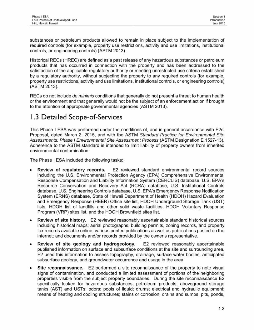
Phase I ESA Four Parcels of Undeveloped Land Hilo, Hawaii, Hawaii
Section 1 Introduction
July 2015
1-2
substances or petroleum products allowed to remain in place subject to the implementation of required controls (for example, property use restrictions, activity and use limitations, institutional controls, or engineering controls) (ASTM 2013).
Historical RECs (HREC) are defined as a past release of any hazardous substances or petroleum products that has occurred in connection with the property and has been addressed to the satisfaction of the applicable regulatory authority or meeting unrestricted use criteria established by a regulatory authority, without subjecting the property to any required controls (for example, property use restrictions, activity and use limitations, institutional controls, or engineering controls) (ASTM 2013).
RECs do not include de minimis conditions that generally do not present a threat to human health or the environment and that generally would not be the subject of an enforcement action if brought to the attention of appropriate governmental agencies (ASTM 2013).
1.3 Detailed Scope-of-Services
This Phase I ESA was performed under the conditions of, and in general accordance with E2s’ Proposal, dated March 2, 2015, and with the ASTM Standard Practice for Environmental Site Assessments: Phase I Environmental Site Assessment Process (ASTM Designation E 1527-13). Adherence to the ASTM standard is intended to limit liability of property owners from inherited environmental contamination.
The Phase I ESA included the following tasks:
• Review of regulatory records. E2 reviewed standard environmental record sources including the U.S. Environmental Protection Agency (EPA) Comprehensive Environmental Response Compensation and Liability Information System (CERCLIS) database, U.S. EPA’s Resource Conservation and Recovery Act (RCRA) database, U.S. Institutional Controls database, U.S. Engineering Controls database, U.S. EPA’s Emergency Response Notification System (ERNS) database, State of Hawaii Department of Health (HDOH) Hazard Evaluation and Emergency Response (HEER) Office site list, HDOH Underground Storage Tank (UST) lists, HDOH list of landfills and other solid waste facilities, HDOH Voluntary Response Program (VRP) sites list, and the HDOH Brownfield sites list.
• Review of site history. E2 reviewed reasonably ascertainable standard historical sources including historical maps; aerial photographs; building permits, zoning records, and property tax records available online; various printed publications as well as publications posted on the internet; and documents and/or records provided by the owner’s representative.
• Review of site geology and hydrogeology. E2 reviewed reasonably ascertainable published information on surface and subsurface conditions at the site and surrounding area. E2 used this information to assess topography, drainage, surface water bodies, anticipated subsurface geology, and groundwater occurrence and usage in the area.
• Site reconnaissance. E2 performed a site reconnaissance of the property to note visual signs of contamination, and conducted a limited assessment of portions of the neighboring properties visible from the subject property boundaries. During the site reconnaissance E2 specifically looked for hazardous substances; petroleum products; aboveground storage tanks (AST) and USTs; odors; pools of liquid; drums; electrical and hydraulic equipment; means of heating and cooling structures; stains or corrosion; drains and sumps; pits, ponds,

Phase I ESA Four Parcels of Undeveloped Land Hilo, Hawaii, Hawaii
Section 1 Introduction
July 2015
1-3
or lagoons; stained soil or pavement; stressed vegetation; solid waste; wastewater; wells; and septic systems.
• Interviews. E2 interviewed available personnel familiar with the site conditions and/or history of site use.
• Data evaluation and report preparation. E2 evaluated the information collected and prepared this report that documents our assessment and presents our findings, opinions, and conclusions.
1.4 Significant Assumptions
Significant assumptions include the following:
1) The information provided by the owner/user and the owner/user representatives is complete and accurate;
2) The information provided by the regulatory database search service is complete and accurate; and
3) The responses of government agencies to public requests for information are complete and accurate.
1.5 Limitations and Exceptions
Phase I ESAs, by their very nature, are limited. E2 has endeavored to meet what it believes is the applicable standard of care and, in so doing is obliged to advise its client, PBR HAWAII, of Phase I ESA limitations. This Phase I ESA did not assess environmental issues or conditions at the property that are outside the scope of ASTM Practice E1527-13, including, but not limited to, asbestos-containing material (ACM), biological agents, cultural and historical resources, ecological resources, endangered species, health and safety, indoor air quality unrelated to releases of hazardous substances or petroleum products into the environment, industrial hygiene, lead-based paint (LBP), lead in drinking water, mold, radon, regulatory compliance, and wetlands, nor did it include any sampling or testing for biological agents and mold, radon, methane, ACM, LBP, or other environmental contaminants. Our investigation was limited to the procedures described in the Phase I ESA Standard Practice (ASTM 2013).
The conclusions presented in this report are professional opinions based solely upon visual observations of the site and vicinity and our interpretation of the available historical and regulatory information and documents reviewed. They are intended exclusively for the purpose outlined herein and apply only to the site location and project indicated.
The findings and opinions are based on information that E2 obtained on given dates through records review, site reconnaissance, interviews, and related activities. It is possible that other information exists or subsequently has become known, just as it is possible for conditions E2 observed to have changed after our observation. For these and associated reasons, E2 and many of its peers routinely advise clients for ESA services that it would be a mistake to place unmerited faith in findings and opinions conveyed via ESA reports. E2 cannot under any circumstances warrant or guarantee that not finding indicators of hazardous substances or petroleum products means that hazardous substances or petroleum products do not exist on the site.

Phase I ESA Four Parcels of Undeveloped Land Hilo, Hawaii, Hawaii
Section 1 Introduction
July 2015
1-4
1.6 Special Terms and Conditions
E2’s services are performed, within the limits prescribed by our clients, with the usual thoroughness and competence of the consulting profession in accordance with the standard for professional services at the time those services are rendered. No warranty or representation, either expressed or implied, is included or intended in the proposals, contracts, or reports.
Findings and opinions presented herein apply to site conditions existing at the time of E2’s investigation and those reasonably foreseeable; they cannot necessarily apply to site changes of which E2 is not aware and has not had the opportunity to evaluate.
1.7 Data Gaps
Based on the information obtained during this ESA, it is the professional opinion of E2 that a historical data failure, as defined in the ASTM guidelines, has occurred in attempting to document the history of the subject property back to the earlier part of 1940 or the first developed usage of the property in five year increments, as follows:
1. Historical information regarding the subject property from 1915 to 1924, 1933 to 1940, 1942 to 1952, 1955 to 1960, 1966 to 1972, and 1982 to 1987 was limited.
2. The property is occupied by a dense jungle; therefore, assessment of the site was severely restricted due to a lack of access.
Based on the information obtained, the lack of documentation is not deemed critical and did not affect the ability to identify potential REC(s) associated with the subject property.
1.8 User Reliance
This report is intended for the use of PBR HAWAII and its assignees. The scope of services performed in execution of this investigation may not be appropriate to satisfy the needs of other users, and any use or re-use of this document or the findings, conclusions, or recommendations presented herein is at the sole risk of said user.

Phase I ESA Four Parcels of Undeveloped Land Hilo, Hawaii, Hawaii
Section 2 Site Description
July 2015
2-1
Section 2 Site Description 2.1 Location and Legal Description
The subject property is located in the Panaewa portion of the Waiakea Ahupuaa, South Hilo District, Hawaii, Hawaii, as shown on Figure 1, included in Appendix A. The property consists of four equal parcels of undeveloped land with an area of 10 acres each, designated as TMK: (3) 2-1-025: parcels 006, 007, 047, and 048 (County of Hawaii 2015).
2.2 Site and Vicinity General Characteristics
The property is located on the windward coast of Hawaii Island on the lower east slope of Mauna Loa. The subject property is located approximately two miles south of the Hilo Bay portion of the Pacific Ocean and approximately one-half mile east of Mamalahoa Highway (Route 11) (Google Earth 2015).
The climate in the region of Hilo has mean monthly temperatures ranging from 64 to 84 degrees Fahrenheit (Western Regional Climate Center 2015) with an average annual rainfall of approximately 133.6 inches per year (Giambelluca et al. 1986). Trade winds are generally from the northeast.
2.3 Current Use of the Property
The subject property is undeveloped and entirely covered with dense, wet forest consisting of large trees, and a thick shrub and vine understory.
2.4 Descriptions of Structures, Roads, and Other Improvements on the Site
The property consists of four parcels of land with a total area of 40 acres. Access to the site is from Auwae Road, which terminates at the south central portion of the subject property. The property is rectangular in shape with level to slightly undulating topography and a general topographic gradient towards the north northeast. A relatively steep rock face is present on the eastern edge of the property. The elevation of the property is approximately 95 feet above mean sea level (msl) (Environmental Data Resources [EDR] 2015a). Figure 2 shows the site layout. Photographs of the subject property are included in Appendix A.
2.5 Current Uses of the Adjacent Properties
Table 2-1 lists the parcel numbers, owners/occupants, and owner/occupant activities for the adjacent properties. The subject property is bounded on the north and southeast sides by undeveloped land; to the east side by a former borrow pit/quarry that is also undeveloped; on the west side by grubbed and graded macadamia nut orchards, garden fields, and a vehicle salvage/junk yard (Ken’s Towing Service, Inc.); and on the southwest side by a grubbed and graded residential lot containing a house. Figure 2 shows the locations of adjacent properties.

Phase I ESA Four Parcels of Undeveloped Land Hilo, Hawaii, Hawaii
Section 2 Site Description
July 2015
2-2
Table 2-1: Adjacent Properties
Parcel Number Owner/Occupant Owner/Occupant Activities
Parcels adjacent to the north
2-1-025:046 DHHL (owner) No associated address Undeveloped industrial-zoned land
2-1-025:005 DHHL (owner) No associated address Undeveloped industrial-zoned land
Parcel adjacent to the east
2-1-013:168 DHHL (owner) No associated address
Undeveloped industrial-zoned land Formerly a Quarry / Borrow Pit Site
Parcels adjacent to the south
2-1-025:008 DHHL (owner) Agnes Kaipo (lessee) Agricultural
2-1-025:157 DHHL (owner) Colette L Paglinawan (lessee) 394 Auwae Road
Agricultural
Parcel adjacent to the southwest
2-1-025:094 DHHL (owner) Hardy K Unea (lessee) 411 Railroad Avenue
Agricultural/Residential
Parcels adjacent to the west
2-1-025:093 DHHL (owner) Wallace Beck (lessee) 485 Railroad Avenue
Agricultural Orchid Island Rubbish & Recycle Ken’s Towing Service, Inc. Hilo Community Recycling Center, LLC
2-1-025:092 DHHL (owner) Wallace Beck (lessee) No associated address
Agricultural
Parcel adjacent to the northwest
2-1-025:091 DHHL (owner) No associated address Undeveloped industrial-zoned land

Phase I ESA Four Parcels of Undeveloped Land Hilo, Hawaii, Hawaii
Section 3 User Provided Information
July 2015
3-1
Section 3 User Provided Information Mr. Isaac Takahashi, Acting Branch Chief, Housing Projects Branch for DHHL, completed an ASTM E1527-13 Questionnaire. The ASTM questionnaire is provided in Appendix A, and Mr. Takahashi’s responses are provided in the following sections.
3.1 Title Records
Title records were not provided by the user.
3.2 Environmental Liens or Activity and Use Limitations
During the course of this investigation, the user did not provide E2 with any information pertaining to activity and/or use limitations associated with the subject property.
3.3 Specialized Knowledge
No specialized knowledge in connection with the subject property was identified by the user.
3.4 Commonly Known or Reasonably Ascertainable Information
The user did not provide information regarding any commonly known or reasonably ascertainable information within the local community that is material to RECs in connection with the property.
3.5 Valuation Reduction for Environmental Issues
E2 was not provided with an appraisal for the subject property. No environmental issues were identified by the user that could result in property value reduction.
3.6 Owner, Property Manager, and Occupant Information
DHHL is the current property owner. The land owner contact is Ms. Niniau K. Simmons, Housing Administrator with the Native American Housing Assistance & Self Determination Act, Office of the Chairman, DHHL, and the site access contact is Mr. Louis Hao, East Hawaii District Manager, with DHHL Hawaii District Office.
3.7 Reason for Performing the Phase I ESA
The purpose of this Phase I ESA was to evaluate the environmental condition of the subject property and identify RECs. The property will be subdivided into half-acre lots to provide house lots for DHHL Makuu Farm Lots residents forced to relocate due to advancing Kilauea lava flows.

Phase I ESA Four Parcels of Undeveloped Land Hilo, Hawaii, Hawaii
Section 3 User Provided Information
July 2015
3-2
This page is intentionally left blank.

Phase I ESA Four Parcels of Undeveloped Land Hilo, Hawaii, Hawaii
Section 4 Records Review
July 2015
4-1
Section 4 Records Review 4.1 Standard Environmental Record Sources
4.1.1 Overview To identify the presence of adverse environmental conditions at the subject property, several published sources of environmental records were reviewed. This section lists the records that were searched and the results of each search.
ASTM E1527-13 specifies search distances for specific environmental record sources. The following record sources were searched for incidents or sites within the listed search distances of the subject property:
Standard Environmental Record Sources Search Distance (miles) Number of Sites Identified
Federal NPL site list 1.0 0 Federal Delisted NPL site list 0.5 0 Federal CERCLIS list 0.5 0 Federal CERCLIS NFRAP site list 0.5 1 Federal RCRA CORRACTS facilities list 1.0 0 Federal RCRA Non-CORRACTS TSD facilities list 0.5 0 Federal RCRA generators list Subject and Adjacent properties 0 Federal IEC registries Subject property only 0 Federal ERNS list Subject property only 0 State list of hazardous waste sites identified for investigation or remediation (NPL or CERCLIS equivalents)
1.0 6
State landfill and/or solid waste disposal site lists 0.5 1 State LUST list 0.5 3 State registered UST list Subject and Adjacent properties 0 State IEC registries Subject and Adjacent properties 0 State VRP sites 0.5 0 State Brownfield sites 0.5 1 Note: NPL = National Priorities List
NFRAP = No Further Remedial Action Planned CORRACTS = facilities subject to Corrective Action under RCRA TSD = treatment, storage, and disposal IEC = institutional / engineering controls LUST = leaking underground storage tank
E2 used an online regulatory database search service, provided by EDR, to review the above Federal and State government databases. A copy of the EDR report is included in Appendix C.
The following sections summarize the findings of the regulatory database search. In reviewing the environmental databases, it should be noted that such databases are not instantaneously updated by the specific regulatory agencies. Depending on the database and the agency, update frequency may be as infrequent as annually. The dates of the most recent updates for the searched environmental databases are listed in the EDR report in Appendix C.

Phase I ESA Four Parcels of Undeveloped Land Hilo, Hawaii, Hawaii
Section 4 Records Review
July 2015
4-2
The subject and adjoining properties were not listed on any of the databases searched by EDR (EDR 2015a).
The SHWB file contained copies of violations and notices of improper storage of solid waste at the adjacent 485 Railroad Avenue on TMK (3) 2-1-025: parcels 092 and 093 (Orchid Island Rubbish & Recycle, Ken’s Towing Service, Inc., and Hilo Community Recycling Center, LLC).
4.1.2 Federal NPL Site List The Federal NPL is a subset of CERCLIS and identifies over 1,200 sites identified for priority cleanup under the Superfund Program. The ASTM-designated search distance for the Federal NPL is one mile. EDR did not identify Federal NPL sites within one mile of the subject property.
4.1.3 Federal Delisted NPL Site List The National Oil and Hazardous Substances Pollution Contingency Plan establish the criteria that the U.S. EPA uses to delete sites from the NPL. In accordance with 40 Code of Federal Regulations (CFR) 300.425(e), sites may be deleted from the NPL where no further response is appropriate. The ASTM-designated search distance for Federal delisted NPL sites is one-half mile. EDR did not identify Federal delisted NPL sites within one-half mile of the subject property.
4.1.4 Federal CERCLIS List The CERCLIS list contains data on potentially hazardous sites that have been reported to the U.S. EPA by states, municipalities, private companies, and private persons pursuant to Section 103 of CERCLA. CERCLIS contains sites which are either proposed to be, or on the NPL and sites which are in the screening and assessment phase for possible inclusion on the NPL. The ASTM-designated search distance for Federal CERCLIS sites is one-half mile. EDR did not identify Federal CERCLIS sites within one-half mile of the subject property.
4.1.5 Federal CERCLIS NFRAP Site List Archived sites are sites that have been removed and archived from the inventory of CERCLIS sites. Archived status indicates that, to the best of U.S. EPA’s knowledge, assessment at a site has been completed and that U.S. EPA has determined no further steps will be taken to list this site on the NPL, unless information indicates this decision was not appropriate or other considerations require a recommendation for listing at a later time. This decision does not necessarily mean that there is no hazard associated with a given site; it only means that, based upon available information, the location is not judged to be a potential NPL site. The ASTM-designated search distance for Federal CERCLIS NFRAP sites is one-half mile. EDR identified one Federal CERCLIS NFRAP site within one-half mile of the subject property. General information on the CERCLIS NFRAP site is provided below, and more detailed information is provided in the EDR report in Appendix C.
Federal CERCLIS NFRAP Site Name
Location Relative to the Subject Property Site Status/Comments
Hilo Rubbish Dump Leilani Street Hilo, HI 96720
⅛ to ¼ mile northeast (lower elevation /
cross/downgradient)
11/01/1979: Discovery 10/01/1984: Preliminary Assessment low priority for further assessment 11/21/1988: Preliminary Assessment low priority for further assessment 02/25/1991: NFRAP – Site does not qualify for the NPL based on existing Information. 01/23/1996: Archive Site
Phase I ESA Four Parcels of Undeveloped Land Hilo, Hawaii, Hawaii
Section 4 Records Review
July 2015
4-3
It is possible that the Hilo Rubbish Dump site has negatively impacted the subject property due to due its proximity and location relative to the subject property (i.e., hydraulically cross/downgradient, etc.).
4.1.6 Federal RCRA CORRACTS Facilities List U.S. EPA’s facilities subject to CORRACTS or Corrective Action Sites database, identifies facilities that generate, treat, store, or dispose of hazardous wastes where RCRA corrective action activity has occurred. These sites have experienced spills or releases of hazardous chemicals prompting the need for corrective action. The ASTM-designated search distance for the Federal RCRA CORRACTS list is one mile. EDR did not identify Federal RCRA CORRACTS site within one mile of the subject property.
4.1.7 Federal RCRA Non-CORRACTS TSD Facilities List The Federal RCRA Non-CORRACTS TSD facilities list is the U.S. EPA’s list of TSD facilities that are not currently subject to corrective action. The RCRAInfo is U.S. EPA’s comprehensive information system, providing access to data supporting the RCRA of 1976 and the Hazardous and Solid Waste Amendments of 1984. RCRAInfo replaces the data recording and reporting abilities of the Resource Conservation and Recovery Information System. The database includes selective information on sites which generate, transport, store, treat and/or dispose of hazardous waste as defined by the RCRA. The RCRAInfo list includes facilities that treat, store, dispose of, or incinerate hazardous waste (TSD facilities). The ASTM-designated search distance for Federal RCRA Non-CORRACTS TSD facilities is one-half mile. EDR did not identify Federal RCRA Non-CORRACTS TSD sites within one-half mile of the subject property.
4.1.8 Federal RCRA Generators List In addition to TSD facilities discussed above in Section 4.1.7, the RCRAInfo list also includes selective information on sites which generate hazardous waste as defined by the RCRA. Conditionally exempt small quantity generators generate less than 100 kilograms of hazardous waste, or less than one kg of acutely hazardous waste per month. Small quantity generators generate between 100 kg and 1,000 kg of hazardous waste per month. Large quantity generators generate over 1,000 kg of hazardous waste, or over one kg of acutely hazardous waste per month. The ASTM-designated search distance for Federal RCRA generators is the subject property and adjacent properties. EDR did not identify the subject or adjacent properties as Federal RCRA Generator sites.
4.1.9 Federal Institutional / Engineering Controls Registries Federal IEC Registries are lists of sites that have institutional and/or engineering controls in place. Institutional controls include administrative measures, such as groundwater use restrictions, construction restrictions, property use restrictions, and post remediation care requirements intended to prevent exposure to contaminants remaining on site. Deed restrictions are generally required as part of the institutional controls. Engineering controls include various forms of caps, building foundations, liners, and treatment methods to create pathway elimination for regulated substances to enter environmental media or effect human health. The ASTM-designated search distance for Federal IEC Registries is the subject property only. EDR did not identify the subject property as a Federal IEC Registry site.

Phase I ESA Four Parcels of Undeveloped Land Hilo, Hawaii, Hawaii
Section 4 Records Review
July 2015
4-4
4.1.10 Federal ERNS List ERNS is a national database of more than 365,000 records, which contains information on specific notification of releases of oil and hazardous substances to the environment. The ASTM-designated search distance for Federal ERNS incidents is the subject property only. No reported Federal ERNS incidents have occurred on the subject property.
4.1.11 State of Hawaii Hazardous Waste Sites List The State of Hawaii Hazardous Waste Sites (SHWS) list is Hawaii’s equivalent to the NPL or CERCLIS. These sites may or may not already be listed on the federal NPL or CERCLIS list. Priority sites planned for cleanup using state funds (state equivalent of Superfund) are identified along with sites where cleanup will be paid for by potentially responsible parties. The HDOH HEER Office maintains a Sites of Interest Database, which includes sites that HDOH HEER has an interest in, has investigated, or may investigate under Hawaii Revised Statute 128D (the State Superfund law). The ASTM-designated search distance for the SHWS List is one mile. EDR identified six SHWS sites within one mile of the subject property. E2 reviewed the SHWS sites identified by EDR within the search radius. The closest SHWS site (located within one-half mile of the site) is listed below. Refer to the EDR report (Appendix C) for a full listing of the remaining SHWS sites.
SHWS Site Name Location Relative to the Subject Property Site Status/Comments
HELCO Kanoelehua Operations Center 54 Halekauila Street Hilo, HI 96720
¼ to ½ mile west northwest
(lower elevation / crossgradient)
NFA – Unrestricted Restricted Use as of 07/10/2012. (contaminants of concern: total petroleum hydrocarbons)
It is not likely that the closest SHWS site listed above, and the remaining five SHWS sites listed in the EDR report (Appendix C) have negatively impacted the subject property due to their status (i.e., NFA), distance from, and/or location relative to the subject property (i.e., hydraulically crossgradient, etc.).
4.1.12 State of Hawaii Landfill and/or Solid Waste Disposal Site List HDOH Solid and Hazardous Waste Branch (SHWB) has a list of permitted solid waste disposal facilities and landfills in the State of Hawaii. The ASTM-designated search distance for permitted solid waste disposal sites / landfills is one-half mile of the subject property. EDR identified one HDOH SHWB site within one-half mile of the subject property. General information on the HDOH SHWB site is provided below, and more detailed information is provided in the EDR report in Appendix C.
Federal CERCLIS NFRAP Site Name
Location Relative to the Subject Property Site Status/Comments
Hilo Landfill (South Hilo Sanitary Landfill) Hilo, HI 96720
¼ to ½ mile east southeast
(lower elevation / cross/downgradient)
1984 – Present. Accepts municipal solid waste and construction debris. Located on TMK: (3) -1-013: parcels 142, 152, and 156
The Hilo Landfill (South Hilo Sanitary Landfill [SHSL]) is located within a former quarry, approximately 1/8th mile southeast (down/cross gradient assuming groundwater flows to the northeast) of the subject property. The SHSL is an unlined (pre-RCRA Subtitle D) landfill that has been in operation since at least the 1960s. The SHSL is owned and operated by the County of

Phase I ESA Four Parcels of Undeveloped Land Hilo, Hawaii, Hawaii
Section 4 Records Review
July 2015
4-5
Hawaii. It is possible that groundwater beneath the site could be negatively impacted by activities conducted at the landfill; therefore, the proximity of the SHSL to the subject property is considered to be a potential environmental concern.
4.1.13 State of Hawaii LUST List The State of Hawaii LUST database, compiled by the HDOH SHWB UST Section, contains an inventory of reported LUST incidents. The ASTM-designated search distance for State of Hawaii LUST sites is one-half mile. EDR identified three State of Hawaii LUST sites within one-half mile of the subject property. General information on the State of Hawaii LUST sites is provided below, and more detailed information is provided in the EDR report in Appendix C.
LUST Site Name Location Relative to the Subject Property Site Status/Comments
Hilo Warehouse 95 Pohaku Street Hilo, HI 96720
¼ to ½ mile west (lower elevation /
crossgradient)
930031: NFA as of 07/30/1993
Helco Kanoelehua Operations Center 54 Halekauila Street Hilo, HI 96720
¼ to ½ mile west northwest
(lower elevation / crossgradient)
000013: NFA as of 07/14/2000
Sears Roebuck & Company 111 E Puainako Street Hilo, HI 96720
¼ to ½ mile west southwest
(lower elevation / crossgradient)
030002: NFA as of 10/31/2002 940040: NFA as of 01/04/1998
It is not likely that the any of the LUST sites identified by EDR, have negatively impacted the subject property due to their status (i.e., NFA), distance from, and/or location relative to the subject property (i.e., hydraulically crossgradient, etc.).
4.1.14 State of Hawaii Registered UST List State of Hawaii Registered USTs are regulated under RCRA and must be registered with the state department responsible for administering the UST program. The list of registered UST sites is compiled by the HDOH SHWB UST Section. The ASTM-designated search distance for State of Hawaii Registered UST sites is the subject property and adjacent properties. EDR did not identify the subject or adjacent properties as State of Hawaii Registered UST sites.
4.1.15 State of Hawaii Institutional / Engineering Controls Registry The ASTM-designated search distance for State of Hawaii IEC registries is the subject and adjacent properties. EDR did not identify any State of Hawaii IEC registries on the subject or adjacent properties.
4.1.16 State of Hawaii Voluntary Cleanup Sites The ASTM-designated search distance for State of Hawaii VRP sites is one-half mile. EDR did not identify State of Hawaii VRP sites within one-half mile of the subject property.
4.1.17 State of Hawaii Brownfield Sites The ASTM-designated search distance for State of Hawaii Brownfield sites is one-half mile. EDR identified one State of Hawaii Brownfield site within one-half mile of the subject property. General information on the State of Hawaii Brownfield site is provided below, and more detailed information is provided in the EDR report in Appendix C.

Phase I ESA Four Parcels of Undeveloped Land Hilo, Hawaii, Hawaii
Section 4 Records Review
July 2015
4-6
State of Hawaii Brownfield Site Name
Location Relative to the Subject Property Site Status/Comments
Hilo Transfer Station Leilani Street Hilo, HI 96720
⅛ to ¼ mile north northeast
(lower elevation / upgradient)
Phase II ESA – No contaminant found
It is not likely that the State of Hawaii Brownfield site, listed above, has negatively impacted the subject property due to its site status (no contaminant found), distance from, and/or location relative to the subject property (i.e., hydraulically upgradient).
4.1.18 Additional Environmental Record Sources 4.1.18.1 Zoning and Land Use The State Land Use Ordnance zoning for the subject property and surrounding property is Urban. The subject and surrounding properties are zoned A-10a (Agricultural District, minimum building site of 10 acres) (County of Hawaii 2015).
4.1.18.2 Hawaii Seismic and Lava Flow Hazard Zones The site is located within the Hawaii Seismic Zone Assignment 4 (US Geological Survey [USGS] 2001). The South Hilo area is rated Lava Flow Hazard Zone 3 on a scale of ascending risk 9 to 1. Zone 3 have has only one to five percent of their surfaces covered by lava since 1800, and 15 to 75 percent of their surfaces covered by lava within the past 750 years (USGS 2006).
4.1.18.3 Local Electric Utility Company Electricity is not supplied to the subject property and there are no transformers located on the subject property. One transformer (36133) is located on an adjacent property, 394 Auwae Road, according to Mr. James Moules, Commercial Account Manager with Hawaiian Electric Light Company (HELCO) the transformer does not contain polychlorinated biphenyls (PCB).
4.2 Other Information Sources The following sections describe information obtained from other information sources.
4.2.1 State of Hawaii Department of Health File Review E2 submitted requests to access public information for the subject and adjacent properties and received responses from the following HDOH sections/branches:
4.2.1.1 Clean Water Branch On June 15, 2015, Mr. Bobbie Teixeira, Environmental Health Specialist with the Clean Water Branch (CWB) confirmed that CWB has no relevant information regarding the subject property. On June 24, 2015, Ms. Angela Peltier, Geologist with E2, reviewed the Hawaii Environmental Health Portal and Water Pollution Control Viewer. No RECs or environmental concerns were identified.
4.2.1.2 Hazard Evaluation and Emergency Response Office On June 15, 2015, Ms. Mae Domingo, Administrative Assistant for the HEER Office, confirmed there are no records for the subject or adjacent properties.

Phase I ESA Four Parcels of Undeveloped Land Hilo, Hawaii, Hawaii
Section 4 Records Review
July 2015
4-7
4.2.1.3 Indoor and Radiological Health Branch The Indoor and Radiological Health Branch (IRHB) has not yet responded to the Request to Access Government Records sent to their office on June 3, 2015.
4.2.1.4 Safe Drinking Water Branch On June 15, 2015, Mr. Norris Uehara, Supervisor of the Groundwater Pollution Control Section for the Safe Drinking Water Branch (SDWB), confirmed there are no Underground Injection Control permits associated with the subject and adjacent properties.
4.2.1.5 Solid and Hazardous Waste Branch On June 16, 2015, Ms. Amy Susana Liana, Planner for SHWB, confirmed there are no records on the subject or adjacent properties for the UST and Hazardous Waste Sections; however, the Solid Waste Section has records for an adjacent property. On June 26, 2015, Ms. Arlene Campbell, Senior Geologist with E2, reviewed the Solid Waste Section files, and identified the following environmental concern at an adjacent property located at 485 Railroad Avenue on TMK: (3) 2-1-025: parcels 092 and 093 as follows:
Recycling of used cooking oil, aluminum cans, cardboard, newspaper, magazines, paper, glass, and phone books and salvage of junk vehicles, was conducted at the site from circa (c.) 1999 until 2009 as Orchid Island Rubbish & Recycle, Ken’s Towing Service, Inc., and Hilo Community Recycling Center, LLC. Several NOVs were issued to the business owners by the HDOH SHWB regarding the improper storage, illegal dumping, and releases from cooking oil and the unpermitted storage of junk vehicles at the site. The site operated without 1) a valid Solid Waste Management Permit from June 2004 through c. 2009 and 2) a National Pollutant Discharge Elimination System General Permit authorizing discharges of storm water associated with industrial activities. In September 2006, HDOH SHWB and Mr. Wallace Beck (tenant) entered into a settlement agreement (Docket No. 06-SHW-SWS-003) requiring Mr. Beck to reduce the number of vehicles at the subject property to 25 or less by March 1, 2007 and immediately cease and desist from bringing more waste vehicles or other solid waste onto the site. According to the HDOH SHWB files Mr. Beck continued to violate the restriction against accumulation of used cooking oil, vehicles, and phone books until 2009.
The activities conducted at the adjacent property are considered to be a potential environmental concern because it is not known if historical and/or current activities conducted at the site have negatively impacted the subject property.
4.2.1.6 Waste Water Branch On June 3, 2015, Ms. Lori Morikami, Planner for the Planning & Design Section of the Waste Water Branch (WWB), confirmed there are no records for the subject or adjacent properties.
4.2.2 Department of Land and Natural Resources Commission on Water Resources Management E2 interviewed Mr. Jonas Burgon with the Department of Land and Natural Resources (DLNR) Commission on Water Resources Management (CWRM) on June 6, 2015. According to the maps and documents provided by Mr. Burgon, no wells are located on the subject or adjacent properties. No municipal wells are located within 1-mile of the subject property.
Phase I ESA Four Parcels of Undeveloped Land Hilo, Hawaii, Hawaii
Section 4 Records Review
July 2015
4-8
4.3 Physical Setting Sources
4.3.1 U.S. Geological Survey Topographic Map Coverage Topographic map coverage of the site is included on the USGS 7.5-minute Honolulu quadrangle map, as shown on Figure 1. The property is located at 19° 41’ 58.92’’ north latitude and 155° 3’ 9.72’’ west longitude. The elevation of the subject property is approximately 93 feet msl (EDR 2015a).
4.3.2 Geologic and Hydrogeologic Setting E2 reviewed published geologic and hydrogeologic reports and maps to obtain information regarding subsurface conditions in the general area of the site and to evaluate potential migration of contaminants.
4.3.2.1 Geology The island of Hawaii has an area of 4,028 square miles and is comprised of five separate shield volcanoes (from oldest to youngest): 1) Kohala; 2) Mauna Kea; 3) Hualalai; 4) Mauna Loa; and 5) Kilauea. Moana Loa, makes up more than half of the Big Island. The site is located approximately two miles south of Hilo Bay in South Hilo, on the southeast flank of the Mauna Loa Volcano in the saddle near the boundary of the Kilauea Volcano. Mauna Loa rocks are divided into the oldest Ninole Volcanic Series, then the Kahuku Volcanic Series, Pahala Ash layer, then the newest Kau Volcanic Series (Macdonald et al. 1983). The Kuhuku Series is capped by Pahala Ash, and is believed to be coeval with the Hilina Series of Kilauea (Macdonald et al. 1983). The Kau Series overlies the Pahala ash and is correlative with the Puna Series of Kilauea (Macdonald et al. 1983). Lava flows of the Kau Series interfinger with the Puna Series of Kilauea interfinger along the boundary between the two volcanoes (Macdonald et al. 1983). The site is located on the pre-historic rocks of the Kau Volcanic Series with an age of 5,000-11,000 years before present (Macdonald et al. 1983).
The geology of the region has been heavily influenced by lava flows from two active volcanoes, Kilauea and Mauna Loa. Lava tubes and lava tube caves are a notable geological feature underlying the area. In many cases, the presence of a lava tube is not known unless a cave roof collapses from construction activity or vegetation clearing otherwise results in the discovery of a skylight. The depth of lava tube caves often canoe be determined without detailed surveying.
4.3.2.2 Soils The ground surface is level to slightly undulating Paipai Series extremely stony muck overlaying a Mauna Loa lava flow dated between 750 and 1,500 years before present. There are exposed a‘a bedrock outcrops and low ridges on the ground surface across the property (Scientific Consultant Services, Inc. [SCS] 2015).
4.3.2.3 Hydrogeology Groundwater resources beneath the site are part of the Hilo Aquifer System of the Northeast Mauna Loa Sector. The aquifer is classified as basal, unconfined, where the water table is the upper surface of the saturated aquifer, and occurs in flank deposits (horizontally extensive basalt lavas). The aquifer is listed as currently used as a drinking water aquifer. This aquifer has fresh salinity (<250 milligram per liter chloride), is listed as irreplaceable, and is highly vulnerable to contamination (Mink and Lau 1993).

Phase I ESA Four Parcels of Undeveloped Land Hilo, Hawaii, Hawaii
Section 4 Records Review
July 2015
4-9
The subsurface conditions under the subject property are interpreted from available data and may vary. Groundwater is assumed to flow downgradient, based on topography and nearby water features, in a north northeast direction toward the shoreline of Hilo Bay. The depth to and direction of groundwater flow beneath the property are not definitively known. Characterization would require subsurface exploration, installation of groundwater monitoring wells, and surveys of groundwater elevations.
4.3.2.4 Surface Water The closest surface water body to the site is ponds associated with the Glover Quarry located approximately ½ mile (800 meters) north of the subject property. The Glover Quarry, was formerly the Mana Quarry and encompassed most of the old rubbish dump, the Army Ordinance Area, the old County quarry, possibly the Navy Asphalt Plant, and a significant portion of DLNR property.
4.4 Historical Use Information
4.4.1 Standard Historical Sources Historical use of the subject and adjacent properties was obtained by reviewing the following standard historical sources: aerial photographs (1954 - 2014); property tax records available online; recorded land title records; historical topographic maps (1914 – 1995); other historical maps (1886 – 1973); local street directories; various printed publications and publications posted on the internet; documents, maps, and information from interviews with the owner’s representative.
4.4.1.1 Aerial Photograph Review E2 reviewed available historical aerial photographs of the subject property dated 1954, 1965, 1975, 1977, 1988, 1992, 2010, 2011, 2012, 2013, and 2014 (EDR 2015b, University of Hawaii 2015, SCS 2015, and Google Earth 2015). One potential environmental concern was identified during the review of the aerial photographs:
• A large number of abandoned vehicles are present on the adjacent properties to the west of the site (485 Railroad Avenue) in the 2010 through 2014 aerial photos. This is considered a potential environmental concern because it is not known if activities conducted on the adjacent properties have negatively impacted the subject property.
4.4.1.2 Sanborn Fire Insurance Maps Sanborn Fire Insurance Maps were not available for this area from EDR (EDR 2015c).
4.4.1.3 Real Property Tax Records According to real property tax records available online, the subject property is owned by DHHL. The parcels consist of ten acres each of industrial undeveloped land.
4.4.1.4 Historical Topographic Map Review E2 reviewed available USGS topographic maps of the area dated 1914, 1932, 1963, 1965, 1980, 1981, and 1995 (EDR 2015d, SCS, Inc. 2015, and University of Hawaii 2015). One REC was identified for the subject property during the review of topographic maps:
• The “Hawaii National Guard” site, shown on a 1965 topographic map of Hilo, indicates the subject property was once part of the Keaukaha Military Reservation (KMR), see Figure 3
Phase I ESA Four Parcels of Undeveloped Land Hilo, Hawaii, Hawaii
Section 4 Records Review
July 2015
4-10
in Appendix A. It is possible that historical military activities were conducted on or near the subject property.
4.4.1.5 Other Historical Maps Review E2 reviewed other available historical maps of the area dated 1886, 1906, 1914, 1925, 1927, 1929, 1938, 1941, 1953, 1961, 1962, and 1973 (Cultural Surveys Hawaii, Inc. [CSH] 1996, Inter Island Environmental Services, Inc. 1997, Department of Accounting and General Services [DAGS] 2015, and County of Hawaii 2015). One potential environmental concern was identified in the vicinity of the subject property during the review of other historical maps:
• The “County Dump Site”, shown on a 1978 survey map (DAGS 2105), also located within a former quarry/borrow pit, is located less than 1/10th mile north (downgradient assuming groundwater flows to the northeast) of the subject property and is currently occupied by an active green waste facility (East Hawaii Organics Facility) owned and operated by the County of Hawaii. This site was also identified by EDR as a CERCLA NFRAP site. It is possible that buried waste is present at this site and groundwater beneath the site could be negatively impacted by activities conducted at the dump site; therefore, its proximity to the subject property is considered to be a potential environmental concern.
4.4.1.6 Local Street Directories E2 reviewed local street directories dated 1992, 1995, 1999, 2003, 2008, and 2013 for Auwae and Railroad Roads (EDR 2015e). A copy of the local street directories is included in Appendix C. No RECs were identified during the review of the local street directories; however, one potential environmental concern was identified, as follows:
• The adjacent property to the west of the site, 485 Railroad Avenue, in 2008 is listed as Hilo Community Recycling Center, LLC and Orchid Island Rubbish & Recycling. It is unknown if activities historically conducted at the site have negatively impacted the subject property
4.4.2 Summary of Historical Land Use E2 reviewed the historical use of the subject and adjacent properties from readily available standard historical sources. A brief summary of the historical use of the area and subject and adjacent properties is provided below.
A review of standard historical sources indicates that the area to the west of Railroad Avenue (which is west of the subject property) were within areas formerly occupied by sugar cane fields from c. 1870s until c. 1966. The subject property was once within the boundaries of the KMR; however, does not appear to have ever been developed.

Phase I ESA Four Parcels of Undeveloped Land Hilo, Hawaii, Hawaii
Section 5 Site Reconnaissance
July 2015
5-1
Section 5 Site Reconnaissance 5.1 Methodology
Site reconnaissance was conducted by Ms. Arlene Campbell, Senior Geologist and Mr. Marvin Haskett, Senior Scientist with E2, on June 9, 2015. Site reconnaissance included visual surveys of the property and brief surveys of the visible portions of the adjacent parcels. Site photographs are included in Appendix A.
5.2 Limiting Conditions
The property is occupied by a dense jungle with exposed ‘a‘a bedrock outcrops and low ridges on the ground surface across the property, making access to the site difficult. Assessment of the site and adjacent properties was limited due to lack of access.
5.3 General Site Setting and Observations
The subject property was assessed on foot. At the time of the site reconnaissance on June 9, 2015, the subject property was vacant and undeveloped; there were no visible improvements on the property. Observations made during the site reconnaissance are summarized below, in their pertinent section/subsection.
5.3.1 Hazardous Substances and Petroleum Products in Connection with Identified Uses E2 did not observe any hazardous substances and/or petroleum products associated with identified uses at the site during the site reconnaissance.
5.3.2 Hazardous Substance and Petroleum Products Containers (Not Necessarily in Connection with Identified Uses) E2 did not observe hazardous substances and petroleum products that were not associated with identified uses at the site during the site reconnaissance.
5.3.3 Storage Tanks E2 did not observe the presence of storage tanks on the subject property during the site reconnaissance.
5.3.4 Odors E2 did not note any unusually strong, pungent, or noxious orders in or at the subject property during the site reconnaissance.
5.3.5 Pools of Liquid E2 did not observe the presence of standing water or pools of liquid on the subject property at the time of the site reconnaissance.

Phase I ESA Four Parcels of Undeveloped Land Hilo, Hawaii, Hawaii
Section 5 Site Reconnaissance
July 2015
5-2
5.3.6 Drums E2 did not observe the presence of drums on the subject property at the time of the site reconnaissance.
5.3.7 Unidentified Substance Containers E2 did not observe unidentified substance containers on the subject property at the time of the site reconnaissance.
5.3.8 Polychlorinated Biphenyls E2 did not observe electrical transformers, electrical equipment, or other signs of PCBs on the subject property at the time of the site reconnaissance.
5.3.9 Pits, Ponds, or Lagoons E2 did not observe pits, ponds, or lagoons on the subject property during the site reconnaissance.
5.3.10 Stained Soil or Pavement E2 did not observe stained soil or pavement at the site during the site reconnaissance.
5.3.11 Stressed Vegetation E2 did not observe stressed vegetation on the subject property during the site reconnaissance.
5.3.12 Solid Waste With the exception of the following, E2 did not observe the presence of solid waste on the subject property at the time of the site reconnaissance:
• Debris was observed near the end of Auwae Street on the subject property, including: a lawn mower tractor and an old television.
5.3.13 Wastewater E2 did not observe wastewater and/or wastewater generation on the subject property during the site reconnaissance.
5.3.14 Wells E2 did not observe wells on the subject property during the site reconnaissance.
5.3.15 Septic Systems E2 did not observe septic systems on the subject property during the site reconnaissance.

Phase I ESA Four Parcels of Undeveloped Land Hilo, Hawaii, Hawaii
Section 6 Interviews July 2015
6-1
Section 6 Interviews Information obtained during interviews is included in the pertinent sections of this report. Questionnaires and/or documentation completed/received as a result of the interviews are included in Appendix B.
6.1 Subject Property Owner and Manager
E2 interviewed Mr. Isaac Takahashi, Acting Branch Chief, Housing Project Branch for DHHL, Ms. Niniau K. Simmons, Housing administrator with the Native American Housing Assistance & Self Determination Act, Office of the Chairman, DHHL, and Mr. Louis Hao, East Hawaii District Manager, with DHHL Hawaii District Office regarding past and current use and activities on the property and adjacent properties. A copy of the User and Site Evaluation Questionnaires are included in Appendix B.
6.2 Local Government Agencies
6.2.1 State of Hawaii Department of Health E2 interviewed the following HDOH representatives regarding the subject and adjacent properties: Mr. Bobbie Teixeira, Environmental Health Specialist with the CWB; Ms. Mae Domingo, Administrative Assistant for the HEER Office; Mr. Norris Uehara, Supervisor of the Groundwater Pollution Control Section for the SDWB; Ms. Amy Susana Liana, Planner for the SHWB; and Ms. Lori Morikami, Planner for the Planning & Design Section of the WWB. The CWB, HEER Office, and SDWB confirmed that there were no files for the subject or adjacent properties; however, the SHWB had records for an adjacent property (see Section 4.2.1.5).
6.2.2 Department of Land and Natural Resources Commission on Water Resources Management E2 interviewed Mr. Jonas Burgon, Engineer Technician with the DLNR CWRM, regarding wells located in the vicinity of the subject property. Well information provided by Mr. Burgon is included in Section 4.2.2.
6.2.3 Hawaiian Electric Light Company E2 interviewed Mr. James Moules, Commercial Account manager with HELCO, regarding a transformer located on an adjacent property. Transformer information provided by Mr. Moules is included in Section 4.1.18.3.
6.3 Other Interviews
No other interviews were conducted.

Phase I ESA Four Parcels of Undeveloped Land Hilo, Hawaii, Hawaii
Section 6 Interviews July 2015
6-2
This page is intentionally left blank.

Phase I ESA Four Parcels of Undeveloped Land Hilo, Hawaii, Hawaii
Section 7 Findings, Opinions, and Conclusions
July 2015
7-1
Section 7 Findings, Opinions, and Conclusions E2 was retained by PBR HAWAII to conduct a Phase I ESA in conformance with ASTM Practice E 1527-13, Standard Practice for Environmental Site Assessments. The subject property is located on four parcels of undeveloped land in Hilo, Hawaii, Hawaii, and designated as TMK: (3) 2-1-025: parcels 006, 007, 047, and 048. Any exceptions to, or deletions from, this practice are described in Section 1.5 of this report.
Recognized Environmental Concerns
This assessment has not revealed evidence of RECs associated with the site, with the exception of the following:
1. During the site reconnaissance on June 9, 2015, debris was observed near the end of Auwae Street on the subject property, including: a lawn mower tractor and an old television.
REC: The presence of solid waste at the facility qualifies as a release to the environment.
2. The subject property was once within the boundaries of the “Hawaii National Guard” area, indicating it was once part of the KMR.
REC: The possibility that historical military activities were conducted on or near the subject property qualifies as a condition indicative of a release to the environment.
Potential Environmental Conditions
The following, while not considered to be RECs, are considered to be potential environmental concerns because of the nature of the historical land use:
1. The adjacent property located at 485 Railroad Avenue (TMK: [3] 2-1-025: parcels 092 and 093) was occupied by Orchid Island Rubbish & Recycle, Ken’s Towing Service, Inc., and Hilo Community Recycling Center, LLC. Historical activities, including recycling of used cooking oil, aluminum cans, cardboard, newspaper, magazines, paper, glass, and phone books and vehicle salvage, were conducted at the site from c. 1999 until 2009. Several NOVs were issued to the various business operators by the HDOH SHWB for improper materials storage, illegal dumping, and releases of cooking oil and the unpermitted storage of a large number of junk vehicles at the site.
Potential Environmental Concern: Activities historically conducted at the site may have encroached on and /or negatively impacted the subject property.
2. The SHSL is located in a former quarry, approximately 1/8th mile southeast (down/cross gradient assuming groundwater flows to the northeast) of the subject property. The SHSL is an unlined (pre-RCRA Subtitle D) landfill that has been in operation since at least the 1960s. The SHSL is owned and operated by the County of Hawaii.
Potential Environmental Concern: It is possible that groundwater beneath the site could be negatively impacted by activities conducted at the landfill; therefore, its proximity to the subject property is considered to be a potential environmental concern.
3. The Hilo Rubbish Dump site, is identified as a “County Dump Site” on a 1978 survey map (DAGS 2015) and is listed by EDR as a CERCLA NFRAP site. This dump site is located within a former quarry/borrow pit less than 1/10th mile north (downgradient assuming groundwater flows to the northeast) of the subject property and is currently an active green waste facility (East Hawaii Organics Facility) owned and operated by the County of Hawaii.

Phase I ESA Four Parcels of Undeveloped Land Hilo, Hawaii, Hawaii
Section 7 Findings, Opinions, and Conclusions
July 2015
7-2
Potential Environmental Concern: It is possible that buried waste is present at this site and groundwater beneath the site could be negatively impacted by activities conducted at the dump site; therefore, its proximity to the subject property is considered to be a potential environmental concern.

Phase I ESA Four Parcels of Undeveloped Land Hilo, Hawaii, Hawaii
Section 8 Deviations July 2015
8-1
Section 8 Deviations In conducting this Phase I ESA, there were no deletions from the standard practice (ASTM Designation E1527-13 and E2600-10) and no client-imposed constraints.
In addition to the limitations described in Sections 1.5 and 5, the following data gaps were encountered:
1. Historical information regarding the subject property between 1915 to 1924, 1933 to 1940, 1942 to 1952, 1955 to 1960, 1966 to 1972, and 1982 to 1987 was limited; however, the data gaps are not considered significant since use of the site and adjacent properties did not change much throughout the years.
2. The property is occupied by a dense jungle; therefore, assessment of the site was severely restricted due to a lack of access.
3. IRHB did not respond to the Request to Access Government Records sent to their office on June 3, 2015.

Phase I ESA Four Parcels of Undeveloped Land Hilo, Hawaii, Hawaii
Section 8 Deviations July 2015
8-2
This page is intentionally left blank.

Phase I ESA Four Parcels of Undeveloped Land Hilo, Hawaii, Hawaii
Section 9 Additional Services
July 2015
9-1
Section 9 Additional Services Although E2 was not contracted to conduct additional services; as a courtesy to the client, the following additional services were performed:
• E2 listed potential environmental concerns, which were not considered to be RECs due to a lack of /or limited information, for adjacent properties based on their historical use.

Phase I ESA Four Parcels of Undeveloped Land Hilo, Hawaii, Hawaii
Section 9 Additional Services
July 2015
9-2
This page is intentionally left blank.

Phase I ESA Four Parcels of Undeveloped Land Hilo, Hawaii, Hawaii
Section 10 Qualifications of Environmental Professionals
July 2015
10-1
Section 10 Qualifications of Environmental Professionals Qualifications of the Environmental Professionals are included in Appendix D.

Phase I ESA Four Parcels of Undeveloped Land Hilo, Hawaii, Hawaii
Section 10 Qualifications of Environmental Professionals
July 2015
10-2
This page is intentionally left blank.

Phase I ESA Four Parcels of Undeveloped Land Hilo, Hawaii, Hawaii
Section 11 References
July 2015
11-1
Section 11 References ASTM International [ASTM] 2013. Standard Practice for Environmental Site Assessments: Phase
I Environmental Site Assessment Process (ASTM Designation E1527-13). ASTM International (ASTM), Washington, 11 November.
County of Hawaii 2015. County of Hawaii Real Property Tax Office. Retrieved from http://qpublic9.qpublic.net/hi_hawaii_search.php.
Cultural Surveys Hawaii, Inc. 1996. Final Archaeological Inventory Survey and Monitoring Plan, Phase I, Keaukaha Military Reservation (KMR), Hawai’i Army National Guard Facility, Waiakea Ahupua’a, South Hilo District, Island of Hawai’i, TMKs: [3] 2-1-012:003, 131 and [3] 2-1-013:010. July
Department of Accounting and General Services 2015. Land Survey Map, July 23, 1978. Retrieved from website 28 June. http://ags.hawaii.gov/survey/map-search/
Department of Land and Natural Resources [DLNR] 2001. Commission on Water Resources Management Well Database. State of Hawaii Department of Land and Natural Resources, 16 April.
Element Environmental LLC 2015. Proposal, Phase I Environmental Site Assessment on Four Parcels of Undeveloped Land, Tax Map Keys: (3) 2-1-025: Parcels 006, 007, 047, and 048, and Phase I ESA on the Non-Contiguous Residential Parcel, Tax Map Key: (3) 2-2-061: Parcel 002, Hilo, Hilo, Hawaii, Hawaii. To PBR HAWAII, 2 March.
Environmental Data Resources [EDR] 2015a. The EDR Radius MapTM Report with GeoCheck®, DHHL Hilo Properties (3) 2-1-025: 006, 007, 047, 048, Auwae Rd, Hilo, HI 96720, Inquiry Number: 4315061.2s. EDR Environmental Data Resources, Inc., 3 June.
——— 2015b. The EDR Aerial Photo Decade Package, DHHL Hilo Properties (3) 2-1-025: 006, 007, 047, 048, Auwae Rd, Hilo, HI 96720, Inquiry Number: 4315061.9. Environmental Data Resources, Inc., 4 June.
——— 2015c. EDR Certified Sanborn Map Report, DHHL Hilo Properties (3) 2-1-025: 006, 007, 047, 048, Auwae Rd, Hilo, HI 96720, Inquiry Number: 4315061.3. Environmental Data Resources, Inc., 3 June.
——— 2015d. EDR Historical Topographic Map Report, DHHL Hilo Properties (3) 2-1-025: 006, 007, 047, 048, Auwae Rd, Hilo, HI 96720, Inquiry Number: 4315061.4. Environmental Data Resources, Inc., 4 June.
——— 2015e. The EDR-City Directory Image Report, DHHL Hilo Properties (3) 2-1-025: 006, 007, 047, 048, Auwae Rd, Hilo, HI 96720, Inquiry Number: 4315061.5. EDR Environmental Data Resources, Inc., 5 June.
Giambelluca, T.W., Q. Chen, A.G. Frazier, J.P. Price, Y.-L. Chen, P.-S. Chu, J.K. Eischeid, and D.M. Delparte 2013: Online Rainfall Atlas of Hawai‘i. Bull. Amer. Meteor. Soc. 94, 313-316, doi: 10.1175/BAMS-D-11-00228.1.
Google Earth 2015. ©2010, 2011, 2012, 2013, and 2014 Google Image USGS, Image ©2015 DigitalGlobe. Retrieved from http://www.google.com.

Phase I ESA Four Parcels of Undeveloped Land Hilo, Hawaii, Hawaii
Section 11 References
July 2015
11-2
Hobdy, Robert W. 2015. Flora and Fauna Survey and Assessment for The Department of Hawaiian Home Lands Project, 5 Parcels at Panaewa, Hilo – Hawaii. April.
Inter Island Environmental Services, Inc. 1997. Preliminary Assessment for Keaukaha Military Reservation Hawaii Army National Guard, Hilo, Hawaii. April
Macdonald, G. A., Abbott, A. T. and Peterson, F. L. 1983. Volcanoes in the Sea: The Geology of Hawaii. Honolulu (University of Hawaii Press).
Mink, J. F. and Lau, S. 1993. Aquifer Identification and Classification for Hawaii: Groundwater Protection Strategy for Hawaii. Water Resources Research Center, University of Hawaii, Technical Report 191, May.
Scientific Consultant Services, Inc. [SCS, Inc.] 2015. Request for Determination Letter for five 10-acre parcels of Department of Hawaiian Home Lands property in the Pana’ewa region of Waiakea Ahupua’a, South Hilo District, Hawai’I Island [TMK: (3) 2-1-025: 006, 007, 048, and (3) 2-2-061: 002]. 25 March.
Soil Survey Staff, Natural Resources Conservation Service, United States Department of Agriculture. Web Soil Survey. Available online at http://websoilsurvey.nrcs.usda.gov/. Accessed 7 July.
United States Geological Society (Department of the Interior) [USGS] 2001. Earthquakes: Hazards in Hawaii. USGS Hawaiian Volcano Observatory, Website updated 18 June. http://hvo.wr.usgs.gov/earthquakes/hazards/.
——— 2006. Island of Hawaii Lava Flow Hazards. USGS Hawaiian Volcano Observatory, Website updated October 30. http://hvo.wr.usgs.gov/hazards/lavazones.
University of Hawaii 2015. MAGIS (Maps, Aerial Photos, & GIS). Retrieved from website on 25 July. http://guides.library.manoa.hawaii.edu/magis.
Western Regional Climate Center 2015. Western Regional Climate Center, Hilo Intl Ap, Hawaii (511492), Period of Record Monthly Climate Summary, 10/1/1949 to 01/20/2015. Retrieved from website on June 25, 2015. http://www.wrcc.dri.edu.

APPENDIX A
FIGURES AND PHOTOGRAPHS


Figures


FIGURE NO.:
1
PROJECT TITLE:
FIGURE TITLE:
SITE LOCATION MAP
DATE:
JUL 2015PHASE I ESA FOR FOUR PARCELS OF UNDEVELOPED LAND(3) 2-1-025: PARCELS 006, 007, 047, AND 048HILO, HAWAII, HAWAII
ISLAND OF HAWAII
REF: GOGGLE EARTH 2015; USGS 2013; AND STATE OF HAWAII 2015


FIGURE NO.:
PROJECT TITLE:PHASE I ESA FOR FOUR PARCELS OF UNDEVELOPED LAND(3) 2-1-025: PARCELS 006, 007, 047, AND 048HILO, HAWAII, HAWAII
FIGURE TITLE:
DATE:
JUL 2015
SITE VICINITY MAP 2
?J ~ s
(3) 2-1-025:091 NO ADDRESS DHHL (OWNER)
(3) 2-1-025:092 NO ADDRESS DHHL (OWNER); WALLACE BECK (LESSEE)
(3) 2-1-025:093 485 RAILROAD AVE DHHL (OWNER): WALLACE BECK (LESSEE)
(3) 2-1-025:094 411 RAILROAD AVE DHHL (OWNER); HARDY K UNEA (LESSEE)
0
b ~ '2.
REF: ~~ATE OF HAWAII 2015
(3) 2-1-025:046 NO ADDRESS DHHL (OWNER)
(3) 2-1-025:047 NO ADDRESS 10 ACRES DHHL (OWNER) INDUSTRIAL
(3) 2-1-025:048 NO ADDRESS 10 ACRES DHHL (OWNER) INDUSTRIAL
(3) 2-1-025:005 NO ADDRESS DHHL (OWNER)
(3) 2-1-025:006 10 ACRES DHHL (OWNER) INDUSTRIAL
(3) 2-1-025:007 NO ADDRESS 10 ACRES DHHL (OWNER)
\ 3) 2-1-025:157 '
OHHL (OWNER); COLETTE ~ 394 AUWAE RD 1
PAGLINAWAN (LESSEE)
EAST HAWAII ORGANICS FACILITY (EHOF) AND FORMER COUNTY DU!:df3
HISTORIC QUARRY AND BORROW PIT
SITE
(3) 2-1-025:~8 NO ADDRESS DHHL (OWNER); AGNES KAIPO
t\SSEE)
KEAUKAHA MILITARY
RESERVA T!ON
EAST HAWAII SORTING STATION, HILO SCALEHOUSE AND FORMER QUARRY
(3) 2-1-025:001 NO ADDRESS DHHL (OWNER);
QUARRY --QUARRY
SOUTH HILO SANITARY
--D LANDFILL AND ')2_ FORMER
-~ QUARRY -:Z
DAVY P MAHI (LESSEE)
'i? \d 01 (c;
\\ BOO'
SCALE: 1 "=400' \ I


FIGURE NO.:
3
PROJECT TITLE:
FIGURE TITLE:
DATE:
JUL 2015PHASE I ESA FOR FOUR PARCELS OF UNDEVELOPED LAND(3) 2-1-025: PARCELS 006, 007, 047, AND 048HILO, HAWAII, HAWAII
SITE VICINITY MAP


Site Reconnaissance Photographs


E2 Project No.:
150024
Description Transformer and wire located near the entrance to the subject property at the end of Auwae Street, view looking north. Photo 1
Site Name DHHL Phase I ESA, Four Parcels of Undeveloped Land, Hilo, Hawaii, Hawaii TMK (3) 2-1-025: parcels 006, 007, 047, and 048 Photo Date
06/09/2015 Client PBR HAWAII & Associates, Inc.
E2 Project No.:
150024
Description Dense vegetation on subject property at the end of Auwae Street, view looking north.east
Photo 2
Site Name DHHL Phase I ESA, Four Parcels of Undeveloped Land, Hilo, Hawaii, Hawaii TMK (3) 2-1-025: parcels 006, 007, 047, and 048 Photo Date
06/09/2015 Client PBR HAWAII & Associates, Inc.

E2 Project No.:
150024
Description Illegal dumping of lawn-mower tractor on subject property surrounded by dense vegetation within 50 feet of Auwae Road terminus. Photo 3
Site Name DHHL Phase I ESA, Four Parcels of Undeveloped Land, Hilo, Hawaii, Hawaii TMK (3) 2-1-025: parcels 006, 007, 047, and 048 Photo Date
06/09/2015 Client PBR HAWAII & Associates, Inc.
E2 Project No.:
150024
Description Illegal dumping of an old television set, located within 50 feet of the Auwae Road terminus. Photo 4
Site Name DHHL Phase I ESA, Four Parcels of Undeveloped Land, Hilo, Hawaii, Hawaii TMK (3) 2-1-025: parcels 006, 007, 047, and 048 Photo Date
06/09/2015 Client PBR HAWAII & Associates, Inc.

E2 Project No.:
150024
Description Google Earth 2015 aerial photograph showing solid waste disposal (junk vehicles) on adjacent properties to the west. Photo 5
Site Name DHHL Phase I ESA, Four Parcels of Undeveloped Land, Hilo, Hawaii, Hawaii TMK (3) 2-1-025: parcels 006, 007, 047, and 048 Photo Date
01/23/2013 Client PBR HAWAII & Associates, Inc.
TMK: (3) 2-1-025: parcel 093 485 Railroad Avenue
TMK: (3) 2-1-025: parcel 092 No associated address


APPENDIX B
QUESTIONNAIRES


Owner Questionnaire


INTERVIEW QUESTIONNAIRE
Date: June 25, 2015
Project Name: DHHL Phase I ESAs
Site 1: 230 Mahiai Street TMK (3) 2-2-061: parcel 002
Site 2: TMK: (3) 2-1-025: parcels 006, 007, 047, and 048
1. NAME AND PHONE NUMBER OF PERSON BEING INTERVIEWED.
Ms. Niniau K. Simmons, Housing Administrator, Native American Housing Assistance & Self Determination Act Office of the Chairman, DHHL, 91-5420 Kapolei Parkway, Kapolei, HI 96707 (808) 620-9513
2. PERSON'S RELATIONSHIP TO THE PROPERTY (i.e., past or present owner or occupant, key site manager, neighboring owner or occupant). owner - trust lands
3. HOW LONG HAS THE PROPERTY BEEN DEVELOPED? WHAT WAS THE PROPERTY USED FOR IN THE PAST? Site 1 19+ years Site 2 Unde veloped lands
4. CAN YOU PROVIDE A LIST OF TENANTS AND THE NATURE OF THEIR BUSINESS?
N/A
5. IS THERE A HEATING OR COOLING SYSTEM FOR BUILDINGS ON THE PROPERTY? WHAT IS THE FUEL SOURCE (i.e., heating o.il, gas, electric, radiators from steam boiler fueled by gas).
NO
6. IS THERE A DISCHARGE OF WASTEWATER OR STORM WATER FROM THE PROPERTY? IS THERE A WASTEWATER DISCHARGE PERMIT OR A NPDES PERMIT?
NO
7. ARE THERE ANY ABOVE-GROUND OR UNDERGROUND STORAGE TANKS? NO
SIZEfTYPE CONTENT REGISTERED WITH DOH?
8. ARE THERE ANY HYDRAULIC LIFTS OR OTHER HYDRAULIC EQUIPMENT? NO
HAVE THEY LEAKED?
9. IS OR WAS THERE A DRY CLEANER, PHOTO PROCESSING SHOP, GAS STATION, MOTOR REPAIR FACILITY, COMMERCIAL PRINTING FACILITY, JUNK YARD, LANDFILL, OR WASTE DISPOSAL OR RECYCLING FACILITY ON THE PROPERTY OR ON ADJOINING PROPERTIES? NO
10. ARE THERE ANY WASTE OR CHEMICAL PIPELINES, PITS, PONDS, OR LAGOONS ON THE PROPERTY OR ON ADJOINING PROPERTIES? NO
Page 1 of3

11. ARE THERE ANY WELLS ON THE PROPERTY (including water wells, dry wells, irrigation wells, injection wells, abandoned wells, or other wells)? NO
12. HAVE ANY OF THE FOLLOWING MATERIALS BEEN USED ON THE PROPERTY? NO
PESTICIDES/HERBICIDES (Are they EPA registered pesticides?):
FERTILIZERS:
PETROLEUM PRODUCTS (oils, lubricants. gasoline, waste oil): NO
SOLVENTS (cleansers, degreasers, paint thinners, coolants): NO
PCBs (electrical or hydraulic equipment):
ACIDS/BASES (lead-acid batteries)· NO
IGNITABLE OR REACTIVE MATERIALS: NO
METALS (Arsenic, Cadmium, Chromium, Lead, Mercury, Silver): NO
RADIOACTIVE MATERIALS: NO
13. HOW WERE THESE MATERIALS DISPOSED OF? N/A
14. DO YOU KNOW OF ANY SPILLS OR LEAKS OF THESE MATERIALS ON THE PROPERTY? NO
15. WERE ANY OTHER TYPES OF WASTE GENERATED? IF YES, WHAT TYPES OF WASTES? NO
16. ARE YOU AWARE OF ANY WASTE DISPOSAL AREAS ON THE PROPERTY OR NEARBY PROPERTIES (including mounds or depressions or areas that are filled or graded by non-natural causes or filled by fill of unknown origin suggesting trash, construction debris, demolition debris, or other solid waste disposal or)? NO
17. ARE YOU AWARE OF ANY CONTAMINATION, ODORS, STAINED SOIL OR PAVEMENT, OR STRESSED VEGETATION (from something other than insufficient water) ON THE PROPERTY OR ON NEARBY PROPERTIES? NO
18. IS THERE ANY RUNOFF FROM ADJACENT PROPERTIES ON TO THE PROPERTY? NONE
Page 2 of 3

19. ARE ANY OF THE FOLLOWING ENVIRONMENTAL DOCUMENTS AVAILABLE? NO • Old site plans that show former buildings and other appurtenances
• Recent site plans that show buildings and other appurtenances
• Environmental site assessment reports
• Environmental compliance audit reports
• Environmental permits (for example, solid waste disposal permits, hazardous waste d1sposal permits, wastewater permits, NPDES permits, underground injection permits)
• Registrations for underground and above-ground storage tanks
• Registrations for underground injection systems
• Material Safety Data Sheets
• Community right-to-know plan
• Safety plans; preparedness and prevention plans; spill prevention, countermeasure. and control plans; etc.
• Notices or other correspondence from any government agency relating to past or current violations of environmental laws with respect to the property or relating to environmental liens encumbering the property
• Hazardous waste generator notices or reports
• Geotechnical studies
• Risk assessments
• Recorded activity and land use limitations
Page 3 of 3


User Questionnaire


USER QUESTIONNAIRE Department of Hawaiian Home Lands Parcels
Undeveloped Land, Hilo, Hawaii TMK: (3) 2-1-025: parcels 006, 007, 047, and 048
In order to qualify for one of the Landowner Liability Protections {LLPs}1 offered by the Small Business Liability Relief and Brownfield information (if available) to the environmental professional. Failure to provide this information could result in a determination that "all appropriate inquiry" is not complete.
(1.) Environmental cleanup liens that are filed or recorded against the site (40 CFR 312.25). Are you aware of any environmental cleanup liens against the property that are filed or recorded under federal, tribal, state or local law? NO
(2.) Activity and land use limitations that are in place on the site or that have been filed or recorded in a registry (40 CFR 312.26). Are you aware of any AULs, such as engineering controls, land use restrictions or institutional controls that are in place at the site and/or have been filed or recorded in a registry under federal, tribal, state or local law? NO
(3.) Specialized knowledge or experience of the person seeking to qualify for the LLP (40 CFR 312.28). As the user of this ESA do you have any specialized knowledge or experience related to the property or nearby properties? For example, are you involved in the same line of business as the current or former occupants of the property or an adjoining property so that you would have specialized knowledge of the chemicals and processes used by this type of business? NO
(4.) Relationship of the purchase price to the fair market value of the property if it were not contaminated (40 CFR 312.29). Does the purchase price being paid for this property reasonably reflect the fair market value of the property? If you conclude that there is a difference, have you considered whether the lower purchase price is because contamination is known or believed to be present at the property? NO
(5.) Commonly known or reasonably ascertainable information about the property (40 CFR 312.30). Are you aware of commonly known or reasonably ascertainable information about the property that would help the environmental professional to identify conditions indicative of releases or threatened releases? For example, as user,
{a.) Do you know the past uses of the property? NO
1 f.cmdml'ller l.iahility l'rotedions, Ill' U.f>s, is the h:rm used to describe the three I) pes nf poh:ntial dcf~:nscs In Superfund liability in EP/\ ·s lnterun Grridant't! Uegardiltg Criteria f.anclowners Must Meet in Order to Qrralrjj• for Bona Fide Prospecti\'1! Purchaser. Conllgrwus Properly 0\l'ner or /nnon!lll f.wrdow11er Limitations on CERCIA Liability ("'Common E/emel//.1' .. Guide) issued on March 6, 2003.

(b.) Do you know of specific chemicals that are present or once were present at the property? NO
(c.) Do you know of spills or other chemical releases that have taken place at the property? NO
(d.) Do you know of any environmental cleanups that have taken place at the property? NO
(6.) The degree of obviousness of the presence or likely presence of contamination at the property, and the ability to detect the contamination by appropriate investigation (40 CFR 312.31 ). As the user of this ESA, based on your knowledge and experience related to the property are there any obvious indicators that point to the presence or likely presence of contamination at the property? NO
Please provide the following additional information:
(a) The reason why the Phase I environmental site assessment is required. subdivis ion
(b) The type of property and type of property transaction, for example, sale, purchase, exchange, etc.
Subdivision o f p r opert y into 1/2 acr e subsistence AG lots.
(c) The complete and correct address for the property (a map or other documentation showing property location and boundaries is helpful).
(d) The scope of services desired for the Phase I (including whether any parties to the property transaction may have a required standard scope of services on whether any considerations beyond the requirements of Practice E 1527 are to be considered).
(e) Identification of all parties who will rely on the Phase I report.
(f) Identification of the site contact and how the contact can be reached. Louise Hao, East Hawaii District Manager, 808 974-4250.
(g) Any special terms and conditions which must be agreed upon by the environmental professional.
(h) A copy of the title report for the property. N/A
(i) Any proceedings involving the property, for example: (1) Any pending, threatened, or past litigation relevant to hazardous substances or petroleum
products in. on, or from the property; NO
(2) Any pending, threatened, or past administrative proceedings relevant to hazardous substances or petroleum products in, on, or from the property; NO
(3) Any notices from any governmental entity regarding any possible violation of environmental laws or possible liability relating to hazardous substances or petroleum products.
NO
(j) Any other knowledge or experience with the property that may be pertinent to the environmental professional (for example, copies of any available prior environmental site assessment reports, documents, correspondence, etc., concerning the property and its environmental condition.) Documents that would be helpful include the following:
• Environmental site assessment reports:
• Environmental compliance audit reports:
• Environmental permits (for example, solid waste disposal permits, hazardous waste disposal permits, wastewater permits, NPDES permits, underground injection permits):
• Registrations for underground and above-ground storage tanks:
• Registrations for underground injection systems:
• Material Safety Data Sheets:
• Community right-to-know plan:
• Safety plans; preparedness and prevention plans; spill prevention, countermeasure, and control plans; etc:
• Notices or other correspondence from any government agency relating to past or current violations of environmental laws with respect to the property or relating to environmental liens encumbering the property:
• Hazardous waste generator notices or reports:
• Geotechnical studies:
• Risk assessments:
• Recorded activity and land use limitations:

Form Completed by:
Isaac Takahashi Acting Branch Chief, Housing Project Branch 6/25/2015
Name, Title Date
Department of Hawaiian Horne Lands
Company

APPENDIX C
EDR REPORTS


The EDR Radius Map™ Report with GeoCheck®


FORM-LBC-KKT
®kcehCoeG htiw tropeR ™paM suidaR RDE ehT
6 Armstrong Road, 4th floorShelton, CT 06484Toll Free: 800.352.0050www.edrnet.com
DHHL Hilo Properties 3 2-1-025 6,7,47,48AUWAE RDHilo, HI 96720
Inquiry Number: 4315061.2sJuly 06, 2015

SECTION PAGE
Executive Summary ES1
Overview Map 2
Detail Map 3
Map Findings Summary 4
Map Findings 7
Orphan Summary 44
Government Records Searched/Data Currency Tracking GR-1
GEOCHECK ADDENDUM
Physical Setting Source Addendum A-1
Physical Setting Source Summary A-2
Physical Setting SSURGO Soil Map A-5
Physical Setting Source Map A-8
Physical Setting Source Map Findings A-10
Physical Setting Source Records Searched PSGR-1
TC4315061.2s Page 1
Thank you for your business.Please contact EDR at 1-800-352-0050
with any questions or comments.
Disclaimer - Copyright and Trademark Notice
This Report contains certain information obtained from a variety of public and other sources reasonably available to Environmental DataResources, Inc. It cannot be concluded from this Report that coverage information for the target and surrounding properties does not exist fromother sources. NO WARRANTY EXPRESSED OR IMPLIED, IS MADE WHATSOEVER IN CONNECTION WITH THIS REPORT. ENVIRONMENTALDATA RESOURCES, INC. SPECIFICALLY DISCLAIMS THE MAKING OF ANY SUCH WARRANTIES, INCLUDING WITHOUT LIMITATION,MERCHANTABILITY OR FITNESS FOR A PARTICULAR USE OR PURPOSE. ALL RISK IS ASSUMED BY THE USER. IN NO EVENT SHALLENVIRONMENTAL DATA RESOURCES, INC. BE LIABLE TO ANYONE, WHETHER ARISING OUT OF ERRORS OR OMISSIONS, NEGLIGENCE,ACCIDENT OR ANY OTHER CAUSE, FOR ANY LOSS OF DAMAGE, INCLUDING, WITHOUT LIMITATION, SPECIAL, INCIDENTAL,CONSEQUENTIAL, OR EXEMPLARY DAMAGES. ANY LIABILITY ON THE PART OF ENVIRONMENTAL DATA RESOURCES, INC. IS STRICTLYLIMITED TO A REFUND OF THE AMOUNT PAID FOR THIS REPORT. Purchaser accepts this Report "AS IS". Any analyses, estimates, ratings,environmental risk levels or risk codes provided in this Report are provided for illustrative purposes only, and are not intended to provide, norshould they be interpreted as providing any facts regarding, or prediction or forecast of, any environmental risk for any property. Only a Phase IEnvironmental Site Assessment performed by an environmental professional can provide information regarding the environmental risk for anyproperty. Additionally, the information provided in this Report is not to be construed as legal advice.
Copyright 2015 by Environmental Data Resources, Inc. All rights reserved. Reproduction in any media or format, in wholeor in part, of any report or map of Environmental Data Resources, Inc., or its affiliates, is prohibited without prior written permission.
EDR and its logos (including Sanborn and Sanborn Map) are trademarks of Environmental Data Resources, Inc. or its affiliates. All othertrademarks used herein are the property of their respective owners.
TABLE OF CONTENTS

EXECUTIVE SUMMARY
TC4315061.2s EXECUTIVE SUMMARY 1
A search of available environmental records was conducted by Environmental Data Resources, Inc (EDR).The report was designed to assist parties seeking to meet the search requirements of EPA’s Standardsand Practices for All Appropriate Inquiries (40 CFR Part 312), the ASTM Standard Practice forEnvironmental Site Assessments (E 1527-13) or custom requirements developed for the evaluation ofenvironmental risk associated with a parcel of real estate.
TARGET PROPERTY INFORMATION
ADDRESS
AUWAE RDHILO, HI 96720
COORDINATES
19.6997000 - 19˚ 41’ 58.92’’Latitude (North): 155.0527000 - 155˚ 3’ 9.72’’Longitude (West): Zone 5Universal Tranverse Mercator: 284833.5UTM X (Meters): 2179420.5UTM Y (Meters): 93 ft. above sea levelElevation:
USGS TOPOGRAPHIC MAP ASSOCIATED WITH TARGET PROPERTY
19155-F1 HILO, HITarget Property Map:Not reportedMost Recent Revision:

4315061.2s Page 2
15 HILO SODA WORKS 270 E KAWILI ST SHWS, LUST, UST Lower 4605, 0.872, WNW
14 STATIONERS CORPORATI 708 KANOELEHUA AVE SHWS, SPILLS Lower 4401, 0.834, NW
13 KANOELEHUA INDUSTRIA 20 POOKELA ST SHWS, BROWNFIELDS Lower 3824, 0.724, WNW
12 HILO MECHANICAL, INC 50 HOLOMUA ST SHWS Lower 3750, 0.710, WNW
11 HAWAII PEST CONTROL 56 WIWOOLE ST SHWS Lower 3250, 0.616, WNW
10 SEARS ROEBUCK & COMP 111 E PUAINAKO ST LUST, UST, Financial Assurance Lower 2585, 0.490, WSW
9 HELCO KANOELEHUA OPE 54 HALEKAUILA ST SHWS, UIC, LUST, UST, SPILLS, AIRS, Financial... Lower 2562, 0.485, WNW
8 HILO WAREHOUSE 95 POHAKU ST LUST, UST, SPILLS, Financial Assurance Lower 1761, 0.334, West
7 HILO LANDFILL SWF/LF Lower 1711, 0.324, ESE
A6 HOME DEPOT USA HD 84 380 MAKAALA ST RCRA-SQG Lower 1026, 0.194, West
A5 SAFEWAY STORE #2893 381 EAST MAKAALA STR RCRA-CESQG Lower 1025, 0.194, West
A4 SAFEWAY FUEL CENTER 371 EAST MAKAALA ST UST, Financial Assurance Lower 1025, 0.194, West
A3 TARGET STORE T2682 391 E MAKAALA ST RCRA-SQG Lower 839, 0.159, West
2 HILO TRANSFER STATIO LEILANI ST US BROWNFIELDS Lower 826, 0.156, NNE
1 HILO RUBBISH DUMP LEILANI ST CERC-NFRAP Lower 415, 0.079, NE
MAPPED SITES SUMMARY
Target Property Address:AUWAE RDHILO, HI 96720
Click on Map ID to see full detail.
MAP RELATIVE DIST (ft. & mi.)ID DATABASE ACRONYMS ELEVATION DIRECTIONSITE NAME ADDRESS

EXECUTIVE SUMMARY
TC4315061.2s EXECUTIVE SUMMARY 3
TARGET PROPERTY SEARCH RESULTS
The target property was not listed in any of the databases searched by EDR.
DATABASES WITH NO MAPPED SITES
No mapped sites were found in EDR’s search of available ("reasonably ascertainable ") governmentrecords either on the target property or within the search radius around the target property for thefollowing databases:
STANDARD ENVIRONMENTAL RECORDS
Federal NPL site list
NPL National Priority ListProposed NPL Proposed National Priority List SitesNPL LIENS Federal Superfund Liens
Federal Delisted NPL site list
Delisted NPL National Priority List Deletions
Federal CERCLIS list
CERCLIS Comprehensive Environmental Response, Compensation, and Liability Information SystemFEDERAL FACILITY Federal Facility Site Information listing
Federal RCRA CORRACTS facilities list
CORRACTS Corrective Action Report
Federal RCRA non-CORRACTS TSD facilities list
RCRA-TSDF RCRA - Treatment, Storage and Disposal
Federal RCRA generators list
RCRA-LQG RCRA - Large Quantity Generators
Federal institutional controls / engineering controls registries
US ENG CONTROLS Engineering Controls Sites ListUS INST CONTROL Sites with Institutional ControlsLUCIS Land Use Control Information System
Federal ERNS list
ERNS Emergency Response Notification System
State and tribal leaking storage tank lists
INDIAN LUST Leaking Underground Storage Tanks on Indian Land

EXECUTIVE SUMMARY
TC4315061.2s EXECUTIVE SUMMARY 4
State and tribal registered storage tank lists
INDIAN UST Underground Storage Tanks on Indian LandFEMA UST Underground Storage Tank Listing
State and tribal institutional control / engineering control registries
ENG CONTROLS Engineering Control SitesINST CONTROL Sites with Institutional Controls
State and tribal voluntary cleanup sites
VCP Voluntary Response Program SitesINDIAN VCP Voluntary Cleanup Priority Listing
State and tribal Brownfields sites
BROWNFIELDS Brownfields Sites
ADDITIONAL ENVIRONMENTAL RECORDS
Local Lists of Landfill / Solid Waste Disposal Sites
DEBRIS REGION 9 Torres Martinez Reservation Illegal Dump Site LocationsODI Open Dump InventoryINDIAN ODI Report on the Status of Open Dumps on Indian Lands
Local Lists of Hazardous waste / Contaminated Sites
US CDL Clandestine Drug LabsCDL Clandestine Drug Lab ListingUS HIST CDL National Clandestine Laboratory Register
Local Land Records
LIENS 2 CERCLA Lien Information
Records of Emergency Release Reports
HMIRS Hazardous Materials Information Reporting SystemSPILLS Release NotificationsSPILLS 90 SPILLS 90 data from FirstSearch
Other Ascertainable Records
RCRA NonGen / NLR RCRA - Non Generators / No Longer RegulatedDOT OPS Incident and Accident DataDOD Department of Defense SitesFUDS Formerly Used Defense SitesCONSENT Superfund (CERCLA) Consent DecreesROD Records Of DecisionUMTRA Uranium Mill Tailings SitesUS MINES Mines Master Index File

EXECUTIVE SUMMARY
TC4315061.2s EXECUTIVE SUMMARY 5
TRIS Toxic Chemical Release Inventory SystemTSCA Toxic Substances Control ActFTTS FIFRA/ TSCA Tracking System - FIFRA (Federal Insecticide, Fungicide, & Rodenticide Act)/TSCA (Toxic Substances Control Act)HIST FTTS FIFRA/TSCA Tracking System Administrative Case ListingSSTS Section 7 Tracking SystemsICIS Integrated Compliance Information SystemPADS PCB Activity Database SystemMLTS Material Licensing Tracking SystemRADINFO Radiation Information DatabaseFINDS Facility Index System/Facility Registry SystemRAATS RCRA Administrative Action Tracking SystemRMP Risk Management PlansUIC Underground Injection Wells ListingDRYCLEANERS Permitted Drycleaner Facility ListingAIRS List of Permitted FacilitiesINDIAN RESERV Indian ReservationsSCRD DRYCLEANERS State Coalition for Remediation of Drycleaners ListingFinancial Assurance Financial Assurance Information ListingLEAD SMELTERS Lead Smelter SitesUS AIRS Aerometric Information Retrieval System Facility SubsystemEPA WATCH LIST EPA WATCH LISTUS FIN ASSUR Financial Assurance InformationCOAL ASH EPA Coal Combustion Residues Surface Impoundments ListPCB TRANSFORMER PCB Transformer Registration DatabaseCOAL ASH DOE Steam-Electric Plant Operation Data2020 COR ACTION 2020 Corrective Action Program ListPRP Potentially Responsible Parties
EDR HIGH RISK HISTORICAL RECORDS
EDR Exclusive Records
EDR MGP EDR Proprietary Manufactured Gas PlantsEDR US Hist Auto Stat EDR Exclusive Historic Gas StationsEDR US Hist Cleaners EDR Exclusive Historic Dry Cleaners
EDR RECOVERED GOVERNMENT ARCHIVES
Exclusive Recovered Govt. Archives
RGA LF Recovered Government Archive Solid Waste Facilities ListRGA LUST Recovered Government Archive Leaking Underground Storage TankRGA HWS Recovered Government Archive State Hazardous Waste Facilities List
SURROUNDING SITES: SEARCH RESULTS
Surrounding sites were identified in the following databases.
Elevations have been determined from the USGS Digital Elevation Model and should be evaluated ona relative (not an absolute) basis. Relative elevation information between sites of close proximityshould be field verified. Sites with an elevation equal to or higher than the target property have beendifferentiated below from sites with an elevation lower than the target property.Page numbers and map identification numbers refer to the EDR Radius Map report where detaileddata on individual sites can be reviewed.
Sites listed in bold italics are in multiple databases.
Unmappable (orphan) sites are not considered in the foregoing analysis.

EXECUTIVE SUMMARY
TC4315061.2s EXECUTIVE SUMMARY 6
STANDARD ENVIRONMENTAL RECORDS
Federal CERCLIS NFRAP site List
CERC-NFRAP: Archived sites are sites that have been removed and archived from the inventory of CERCLISsites. Archived status indicates that, to the best of EPA’s knowledge, assessment at a site has been completedand that EPA has determined no further steps will be taken to list this site on the National Priorities List(NPL), unless information indicates this decision was not appropriate or other considerations require arecommendation for listing at a later time. This decision does not necessarily mean that there is no hazardassociated with a given site; it only means that, based upon available information, the location is not judgedto be a potential NPL site.
A review of the CERC-NFRAP list, as provided by EDR, and dated 10/25/2013 has revealed that there is 1 CERC-NFRAP site within approximately 0.5 miles of the target property.
PageMap IDDirection / Distance Address Lower Elevation ____________________ ________ ___________________ _____ _____
HILO RUBBISH DUMP LEILANI ST NE 0 - 1/8 (0.079 mi.) 1 7
Federal RCRA generators list
RCRA-SQG: RCRAInfo is EPA’s comprehensive information system, providing access to data supportingthe Resource Conservation and Recovery Act (RCRA) of 1976 and the Hazardous and Solid Waste Amendments (HSWA)of 1984. The database includes selective information on sites which generate, transport, store, treat and/ordispose of hazardous waste as defined by the Resource Conservation and Recovery Act (RCRA). Small quantitygenerators (SQGs) generate between 100 kg and 1,000 kg of hazardous waste per month.
A review of the RCRA-SQG list, as provided by EDR, and dated 03/10/2015 has revealed that there are 2 RCRA-SQG sites within approximately 0.25 miles of the target property.
PageMap IDDirection / Distance Address Lower Elevation ____________________ ________ ___________________ _____ _____
TARGET STORE T2682 391 E MAKAALA ST W 1/8 - 1/4 (0.159 mi.) A3 12 HOME DEPOT USA HD 84 380 MAKAALA ST W 1/8 - 1/4 (0.194 mi.) A6 23
RCRA-CESQG: RCRAInfo is EPA’s comprehensive information system, providing access to data supportingthe Resource Conservation and Recovery Act (RCRA) of 1976 and the Hazardous and Solid Waste Amendments (HSWA)of 1984. The database includes selective information on sites which generate, transport, store, treat and/ordispose of hazardous waste as defined by the Resource Conservation and Recovery Act (RCRA). Conditionallyexempt small quantity generators (CESQGs) generate less than 100 kg of hazardous waste, or less than 1 kg ofacutely hazardous waste per month.
A review of the RCRA-CESQG list, as provided by EDR, and dated 03/10/2015 has revealed that there is 1 RCRA-CESQG site within approximately 0.25 miles of the target property.
PageMap IDDirection / Distance Address Lower Elevation ____________________ ________ ___________________ _____ _____
SAFEWAY STORE #2893 381 EAST MAKAALA STR W 1/8 - 1/4 (0.194 mi.) A5 22

EXECUTIVE SUMMARY
TC4315061.2s EXECUTIVE SUMMARY 7
State- and tribal - equivalent CERCLIS
SHWS: The State Hazardous Waste Sites records are the states’ equivalent to CERCLIS. These sitesmay or may not already be listed on the federal CERCLIS list. Priority sites planned for cleanup using statefunds (state equivalent of Superfund) are identified along with sites where cleanup will be paid for bypotentially responsible parties. The data come from the Department of Health.
A review of the SHWS list, as provided by EDR, and dated 12/02/2014 has revealed that there are 6 SHWS sites within approximately 1 mile of the target property.
PageMap IDDirection / Distance Address Lower Elevation ____________________ ________ ___________________ _____ _____
HELCO KANOELEHUA OPE 54 HALEKAUILA ST WNW 1/4 - 1/2 (0.485 mi.) 9 28 HAWAII PEST CONTROL 56 WIWOOLE ST WNW 1/2 - 1 (0.616 mi.) 11 39 HILO MECHANICAL, INC 50 HOLOMUA ST WNW 1/2 - 1 (0.710 mi.) 12 39 KANOELEHUA INDUSTRIA 20 POOKELA ST WNW 1/2 - 1 (0.724 mi.) 13 40 STATIONERS CORPORATI 708 KANOELEHUA AVE NW 1/2 - 1 (0.834 mi.) 14 41 HILO SODA WORKS 270 E KAWILI ST WNW 1/2 - 1 (0.872 mi.) 15 42
State and tribal landfill and/or solid waste disposal site lists
SWF/LF: The Solid Waste Facilities/Landfill Sites records typically contain an inventory of solidwaste disposal facilities or landfills in a particular state. The data come from the Department of Health’sPermitted Landfills in the State of Hawaii database.
A review of the SWF/LF list, as provided by EDR, and dated 09/17/2012 has revealed that there is 1 SWF/LF site within approximately 0.5 miles of the target property.
PageMap IDDirection / Distance Address Lower Elevation ____________________ ________ ___________________ _____ _____
HILO LANDFILL ESE 1/4 - 1/2 (0.324 mi.) 7 26Facility Status: ACTIVE LANDFILLS NEIGHBOR ISLANDS
State and tribal leaking storage tank lists
LUST: The Leaking Underground Storage Tank Incident Reports contain an inventory of reportedleaking underground storage tank incidents. The data come from the Department of Health’s Active LeakingUnderground Storage Tank Log Listing.
A review of the LUST list, as provided by EDR, and dated 06/04/2015 has revealed that there are 3 LUST sites within approximately 0.5 miles of the target property.
PageMap IDDirection / Distance Address Lower Elevation ____________________ ________ ___________________ _____ _____
HILO WAREHOUSE 95 POHAKU ST W 1/4 - 1/2 (0.334 mi.) 8 27Facility Id: 9-600564Release ID: 930031Facility Status: Site Cleanup Completed (NFA)
HELCO KANOELEHUA OPE 54 HALEKAUILA ST WNW 1/4 - 1/2 (0.485 mi.) 9 28Facility Id: 9-600238Release ID: 000013Facility Status: Site Cleanup Completed (NFA)
SEARS ROEBUCK & COMP 111 E PUAINAKO ST WSW 1/4 - 1/2 (0.490 mi.) 10 38Facility Id: 9-603106Facility Id: 9-601834Release ID: 030002Release ID: 940040Facility Status: Site Cleanup Completed (NFA)
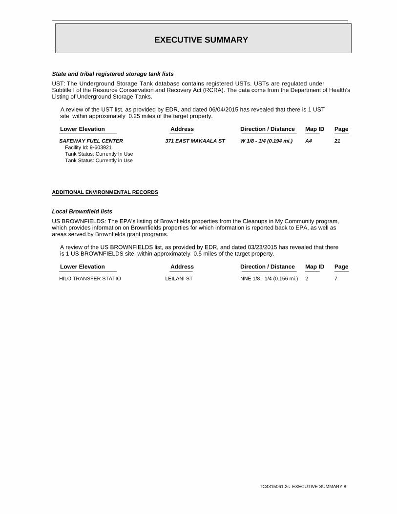
EXECUTIVE SUMMARY
TC4315061.2s EXECUTIVE SUMMARY 8
State and tribal registered storage tank lists
UST: The Underground Storage Tank database contains registered USTs. USTs are regulated underSubtitle I of the Resource Conservation and Recovery Act (RCRA). The data come from the Department of Health’sListing of Underground Storage Tanks.
A review of the UST list, as provided by EDR, and dated 06/04/2015 has revealed that there is 1 UST site within approximately 0.25 miles of the target property.
PageMap IDDirection / Distance Address Lower Elevation ____________________ ________ ___________________ _____ _____
SAFEWAY FUEL CENTER 371 EAST MAKAALA ST W 1/8 - 1/4 (0.194 mi.) A4 21Facility Id: 9-603921Tank Status: Currently In UseTank Status: Currently in Use
ADDITIONAL ENVIRONMENTAL RECORDS
Local Brownfield lists
US BROWNFIELDS: The EPA’s listing of Brownfields properties from the Cleanups in My Community program,which provides information on Brownfields properties for which information is reported back to EPA, as well asareas served by Brownfields grant programs.
A review of the US BROWNFIELDS list, as provided by EDR, and dated 03/23/2015 has revealed that there is 1 US BROWNFIELDS site within approximately 0.5 miles of the target property.
PageMap IDDirection / Distance Address Lower Elevation ____________________ ________ ___________________ _____ _____
HILO TRANSFER STATIO LEILANI ST NNE 1/8 - 1/4 (0.156 mi.) 2 7

EXECUTIVE SUMMARY
TC4315061.2s EXECUTIVE SUMMARY 9
Due to poor or inadequate address information, the following sites were not mapped. Count: 3 records.
Site Name Database(s)____________ ____________
HILO JUDICIARY CENTER PROJECT SHWS, ENG CONTROLS, INST CONTROLHILO SAFEWAY/TARGET SHWS, ENG CONTROLS, INST CONTROLARMY AVIATION SUPPORT FACILITY #2 SHWS

EDR Inc.EDR Inc.EDR Inc.EDR Inc.EDR Inc.EDR Inc.EDR Inc.EDR Inc.EDR Inc.EDR Inc.EDR Inc.EDR Inc.EDR Inc.EDR Inc.EDR Inc.EDR Inc.EDR Inc.EDR Inc.EDR Inc.EDR Inc.EDR Inc.EDR Inc.EDR Inc.EDR Inc.EDR Inc.EDR Inc.EDR Inc.EDR Inc.EDR Inc.EDR Inc.EDR Inc.EDR Inc.EDR Inc.EDR Inc.EDR Inc.EDR Inc.EDR Inc.EDR Inc.EDR Inc.EDR Inc.
100

MAP FINDINGS SUMMARY
SearchTargetDistance Total
Database Property(Miles) < 1/8 1/8 - 1/4 1/4 - 1/2 1/2 - 1 > 1 Plotted
STANDARD ENVIRONMENTAL RECORDS
Federal NPL site list
0 NR 0 0 0 0 1.000NPL 0 NR 0 0 0 0 1.000Proposed NPL 0 NR NR NR NR NR TPNPL LIENS
Federal Delisted NPL site list
0 NR 0 0 0 0 1.000Delisted NPL
Federal CERCLIS list
0 NR NR 0 0 0 0.500CERCLIS 0 NR NR 0 0 0 0.500FEDERAL FACILITY
Federal CERCLIS NFRAP site List
1 NR NR 0 0 1 0.500CERC-NFRAP
Federal RCRA CORRACTS facilities list
0 NR 0 0 0 0 1.000CORRACTS
Federal RCRA non-CORRACTS TSD facilities list
0 NR NR 0 0 0 0.500RCRA-TSDF
Federal RCRA generators list
0 NR NR NR 0 0 0.250RCRA-LQG 2 NR NR NR 2 0 0.250RCRA-SQG 1 NR NR NR 1 0 0.250RCRA-CESQG
Federal institutional controls /engineering controls registries
0 NR NR 0 0 0 0.500US ENG CONTROLS 0 NR NR 0 0 0 0.500US INST CONTROL 0 NR NR 0 0 0 0.500LUCIS
Federal ERNS list
0 NR NR NR NR NR TPERNS
State- and tribal - equivalent CERCLIS
6 NR 5 1 0 0 1.000SHWS
State and tribal landfill and/orsolid waste disposal site lists
1 NR NR 1 0 0 0.500SWF/LF
State and tribal leaking storage tank lists
3 NR NR 3 0 0 0.500LUST 0 NR NR 0 0 0 0.500INDIAN LUST
State and tribal registered storage tank lists
1 NR NR NR 1 0 0.250UST
TC4315061.2s Page 4

MAP FINDINGS SUMMARY
SearchTargetDistance Total
Database Property(Miles) < 1/8 1/8 - 1/4 1/4 - 1/2 1/2 - 1 > 1 Plotted
0 NR NR NR 0 0 0.250INDIAN UST 0 NR NR NR 0 0 0.250FEMA UST
State and tribal institutionalcontrol / engineering control registries
0 NR NR 0 0 0 0.500ENG CONTROLS 0 NR NR 0 0 0 0.500INST CONTROL
State and tribal voluntary cleanup sites
0 NR NR 0 0 0 0.500VCP 0 NR NR 0 0 0 0.500INDIAN VCP
State and tribal Brownfields sites
0 NR NR 0 0 0 0.500BROWNFIELDS
ADDITIONAL ENVIRONMENTAL RECORDS
Local Brownfield lists
1 NR NR 0 1 0 0.500US BROWNFIELDS
Local Lists of Landfill / SolidWaste Disposal Sites
0 NR NR 0 0 0 0.500DEBRIS REGION 9 0 NR NR 0 0 0 0.500ODI 0 NR NR 0 0 0 0.500INDIAN ODI
Local Lists of Hazardous waste /Contaminated Sites
0 NR NR NR NR NR TPUS CDL 0 NR NR NR NR NR TPCDL 0 NR NR NR NR NR TPUS HIST CDL
Local Land Records
0 NR NR NR NR NR TPLIENS 2
Records of Emergency Release Reports
0 NR NR NR NR NR TPHMIRS 0 NR NR NR NR NR TPSPILLS 0 NR NR NR NR NR TPSPILLS 90
Other Ascertainable Records
0 NR NR NR 0 0 0.250RCRA NonGen / NLR 0 NR NR NR NR NR TPDOT OPS 0 NR 0 0 0 0 1.000DOD 0 NR 0 0 0 0 1.000FUDS 0 NR 0 0 0 0 1.000CONSENT 0 NR 0 0 0 0 1.000ROD 0 NR NR 0 0 0 0.500UMTRA 0 NR NR NR 0 0 0.250US MINES 0 NR NR NR NR NR TPTRIS
TC4315061.2s Page 5

MAP FINDINGS SUMMARY
SearchTargetDistance Total
Database Property(Miles) < 1/8 1/8 - 1/4 1/4 - 1/2 1/2 - 1 > 1 Plotted
0 NR NR NR NR NR TPTSCA 0 NR NR NR NR NR TPFTTS 0 NR NR NR NR NR TPHIST FTTS 0 NR NR NR NR NR TPSSTS 0 NR NR NR NR NR TPICIS 0 NR NR NR NR NR TPPADS 0 NR NR NR NR NR TPMLTS 0 NR NR NR NR NR TPRADINFO 0 NR NR NR NR NR TPFINDS 0 NR NR NR NR NR TPRAATS 0 NR NR NR NR NR TPRMP 0 NR NR NR NR NR TPUIC 0 NR NR NR 0 0 0.250DRYCLEANERS 0 NR NR NR NR NR TPAIRS 0 NR 0 0 0 0 1.000INDIAN RESERV 0 NR NR 0 0 0 0.500SCRD DRYCLEANERS 0 NR NR NR NR NR TPFinancial Assurance 0 NR NR NR NR NR TPLEAD SMELTERS 0 NR NR NR NR NR TPUS AIRS 0 NR NR NR NR NR TPEPA WATCH LIST 0 NR NR NR NR NR TPUS FIN ASSUR 0 NR NR 0 0 0 0.500COAL ASH EPA 0 NR NR NR NR NR TPPCB TRANSFORMER 0 NR NR NR NR NR TPCOAL ASH DOE 0 NR NR NR 0 0 0.2502020 COR ACTION 0 NR NR NR NR NR TPPRP
EDR HIGH RISK HISTORICAL RECORDS
EDR Exclusive Records
0 NR 0 0 0 0 1.000EDR MGP 0 NR NR NR 0 0 0.250EDR US Hist Auto Stat 0 NR NR NR 0 0 0.250EDR US Hist Cleaners
EDR RECOVERED GOVERNMENT ARCHIVES
Exclusive Recovered Govt. Archives
0 NR NR NR NR NR TPRGA LF 0 NR NR NR NR NR TPRGA LUST 0 NR NR NR NR NR TPRGA HWS
16 0 5 5 5 1 0- Totals --
NOTES:
TP = Target Property
NR = Not Requested at this Search Distance
Sites may be listed in more than one database
TC4315061.2s Page 6

MAP FINDINGSMap IDDirection
EDR ID NumberDistanceEPA ID NumberDatabase(s)SiteElevation
NFRAP-Site does not qualify for the NPL based on existing informationPriority Level: 02/25/91Date Completed: / /Date Started: SITE INSPECTIONAction:
Not reportedPriority Level: 01/23/96Date Completed: / /Date Started: ARCHIVE SITEAction:
Low priority for further assessmentPriority Level: 11/21/88Date Completed: / /Date Started: PRELIMINARY ASSESSMENTAction:
Not reportedPriority Level: 11/01/79Date Completed: / /Date Started: DISCOVERYAction:
Low priority for further assessmentPriority Level: 02/01/85Date Completed: 10/01/84Date Started: PRELIMINARY ASSESSMENTAction:
CERCLIS-NFRAP Assessment History:
HI Not reportedAlias Address: HILO LANDFILLAlias Name:
CERCLIS-NFRAP Site Alias Name(s):
9000059.00000Person ID: 13037476.00000Contact Sequence ID:
CERCLIS-NFRAP Site Contact Details:
NFRAP-Site does not qualify for the NPL based on existing informationNon NPL Status: Not on the NPLNPL Status: Not a Federal FacilityFederal Facility: 0902829Site ID:
CERC-NFRAP:
415 ft.0.079 mi.
Relative:Lower
Actual:81 ft.
< 1/8 HILO, HI 96720NE LEILANI ST HID0006065821 CERC-NFRAPHILO RUBBISH DUMP 1003879108
21013150000, 210131670000, 210131680000Property #: HILO TRANSFER STATIONProperty name: TBAGrant type: R9 TBA (STAG Funded)Recipient name:
US BROWNFIELDS:
826 ft.0.156 mi.
Relative:Lower
Actual:78 ft.
1/8-1/4 HILO, HI 96720NNE LEILANI ST N/A2 US BROWNFIELDSHILO TRANSFER STATION 1009569567
TC4315061.2s Page 7
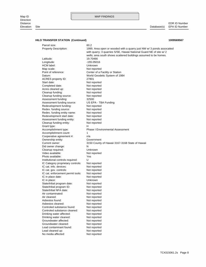
MAP FINDINGSMap IDDirection
EDR ID NumberDistanceEPA ID NumberDatabase(s)SiteElevation
Not reportedNo media affected: Not reportedLead cleaned up: Not reportedLead contaminant found: Not reportedGroundwater cleaned: Not reportedGroundwater affected: Not reportedDrinking water cleaned: Not reportedDrinking water affected: Not reportedControled substance cleaned: Not reportedControled substance found: Not reportedAsbestos cleaned: Not reportedAsbestos found: Not reportedAir cleaned: Not reportedAir contaminated: Not reportedState/tribal NFA date: Not reportedState/tribal program ID: Not reportedState/tribal program date: UnknownIC in place: Not reportedIC in place date: Not reportedIC cat. enforcement permit tools: Not reportedIC cat. gov. controls: Not reportedIC cat. info. devices: Not reportedIC Category proprietary controls: UInstitutional controls required: YesPhoto available: Not reportedVideo available: UnknownCleanup required: NDid owner change: 3150 County of Hawaii 3167-3168 State of HawaiiCurrent owner: GovernmentOwnership entity: n/aCooperative agreement #: 1Accomplishment count: Phase I Environmental AssessmentAccomplishment type: HGrant type: Not reportedCleanup funding entity: Not reportedAssessment funding entity: Not reportedRedevelopment start date: Not reportedRedev. funding entity name: Not reportedRedev. funding source: Not reportedRedevelopment funding: US EPA - TBA FundingAssessment funding source: 32500Assessment funding: Not reportedCleanup funding source: Not reportedCleanup funding: Not reportedAcres cleaned up: Not reportedCompleted date: Not reportedStart date: 27801ACRES property ID: World Geodetic System of 1984Datum: Center of a Facility or StationPoint of reference: Not reportedMap scale: UnknownHCM label: -155.05016Longitude: 19.70466Latitude: wells; area south shows scattered buildings assumed to be homes. with quarry; 3 quarries S/SE, Hawaii National Guard NE of site w/ 2 1995: Area open or wooded with a quarry just NW w/ 3 ponds assocaitedProperty Description: 60.2Parcel size:
HILO TRANSFER STATION (Continued) 1009569567
TC4315061.2s Page 8

MAP FINDINGSMap IDDirection
EDR ID NumberDistanceEPA ID NumberDatabase(s)SiteElevation
Not reportedMedia affected Bluiding Material: Not reportedFuture Use: Multistory Not reportedUnknown contaminant found: Not reportedSVOCs contaminant found: Not reportedSelenium contaminant found: Not reportedPesticides contaminant found: YNo contaminant found: Not reportedNickel contaminant found: Not reportedMercury contaminant found: Not reportedIron contaminant found: Not reportedCopper contaminant found: Not reportedChromium contaminant found: Not reportedCadmium contaminant found: Not reportedArsenic contaminant found: Not reportedUnknown clean up: Not reportedSVOCs cleaned up: Not reportedSelenium cleaned up: Not reportedPesticides cleaned up: Not reportedNo clean up: Not reportednickel cleaned up: Not reportedmercury cleaned up: Not reportedIron cleaned up: Not reportedCopper cleaned up: Not reportedChromium cleaned up: Not reportedCadmium cleaned up: Not reportedArsenic cleaned up: Not reportedSuperfund Fed. landowner flag: Not reportedGreenspace acreage and type: Not reportedFuture use industrial acreage: Not reportedFuture use commercial acreage: Not reportedFuture use residential acreage: Not reportedFuture use greenspace acreage: Not reportedPast use industrial acreage: Not reportedPast use commercial acreage: Not reportedPast use residential acreage: Not reportedPast use greenspace acreage: Not reportedNum. of cleanup and re-dev. jobs: Not reportedCleanup other description: Not reportedVOCs cleaned: Not reportedVOCs found: Not reportedSurface water cleaned: YSoil cleaned up: YSoil affected: Not reportedSediments cleaned: Not reportedSediments found: Not reportedPetro products cleaned: Not reportedPetro products found: Not reportedPCBs cleaned up: Not reportedPCBs found: Not reportedPAHs cleaned up: Not reportedPAHs found: Not reportedOther contams found description: Not reportedOther contaminants found: Not reportedOther metals cleaned: Not reportedOther metals found: Not reportedOther cleaned up: Not reportedUnknown media affected:
HILO TRANSFER STATION (Continued) 1009569567
TC4315061.2s Page 9

MAP FINDINGSMap IDDirection
EDR ID NumberDistanceEPA ID NumberDatabase(s)SiteElevation
Not reportedAsbestos found: Not reportedAir cleaned: Not reportedAir contaminated: Not reportedState/tribal NFA date: Not reportedState/tribal program ID: Not reportedState/tribal program date: UnknownIC in place: Not reportedIC in place date: Not reportedIC cat. enforcement permit tools: Not reportedIC cat. gov. controls: Not reportedIC cat. info. devices: Not reportedIC Category proprietary controls: UInstitutional controls required: YesPhoto available: Not reportedVideo available: UnknownCleanup required: NDid owner change: 3150 County of Hawaii 3167-3168 State of HawaiiCurrent owner: GovernmentOwnership entity: n/aCooperative agreement #: 0Accomplishment count: Phase II Environmental AssessmentAccomplishment type: HGrant type: Not reportedCleanup funding entity: Not reportedAssessment funding entity: Not reportedRedevelopment start date: Not reportedRedev. funding entity name: Not reportedRedev. funding source: Not reportedRedevelopment funding: US EPA - TBA FundingAssessment funding source: 32500Assessment funding: Not reportedCleanup funding source: Not reportedCleanup funding: Not reportedAcres cleaned up: Not reportedCompleted date: Not reportedStart date: 27801ACRES property ID: World Geodetic System of 1984Datum: Center of a Facility or StationPoint of reference: Not reportedMap scale: UnknownHCM label: -155.05016Longitude: 19.70466Latitude: wells; area south shows scattered buildings assumed to be homes. with quarry; 3 quarries S/SE, Hawaii National Guard NE of site w/ 2 1995: Area open or wooded with a quarry just NW w/ 3 ponds assocaitedProperty Description: 60.2Parcel size: 21013150000, 210131670000, 210131680000Property #: HILO TRANSFER STATIONProperty name: TBAGrant type: R9 TBA (STAG Funded)Recipient name:
Not reportedPast Use: Multistory Not reportedUnknown media cleaned up: Not reportedIndoor air media cleaned up: Not reportedBuilding material media cleaned up: Not reportedMedia affected indoor air:
HILO TRANSFER STATION (Continued) 1009569567
TC4315061.2s Page 10

MAP FINDINGSMap IDDirection
EDR ID NumberDistanceEPA ID NumberDatabase(s)SiteElevation
Not reportedCopper contaminant found: Not reportedChromium contaminant found: Not reportedCadmium contaminant found: Not reportedArsenic contaminant found: Not reportedUnknown clean up: Not reportedSVOCs cleaned up: Not reportedSelenium cleaned up: Not reportedPesticides cleaned up: Not reportedNo clean up: Not reportednickel cleaned up: Not reportedmercury cleaned up: Not reportedIron cleaned up: Not reportedCopper cleaned up: Not reportedChromium cleaned up: Not reportedCadmium cleaned up: Not reportedArsenic cleaned up: Not reportedSuperfund Fed. landowner flag: Not reportedGreenspace acreage and type: Not reportedFuture use industrial acreage: Not reportedFuture use commercial acreage: Not reportedFuture use residential acreage: Not reportedFuture use greenspace acreage: Not reportedPast use industrial acreage: Not reportedPast use commercial acreage: Not reportedPast use residential acreage: Not reportedPast use greenspace acreage: Not reportedNum. of cleanup and re-dev. jobs: Not reportedCleanup other description: Not reportedVOCs cleaned: Not reportedVOCs found: Not reportedSurface water cleaned: YSoil cleaned up: YSoil affected: Not reportedSediments cleaned: Not reportedSediments found: Not reportedPetro products cleaned: Not reportedPetro products found: Not reportedPCBs cleaned up: Not reportedPCBs found: Not reportedPAHs cleaned up: Not reportedPAHs found: Not reportedOther contams found description: Not reportedOther contaminants found: Not reportedOther metals cleaned: Not reportedOther metals found: Not reportedOther cleaned up: Not reportedUnknown media affected: Not reportedNo media affected: Not reportedLead cleaned up: Not reportedLead contaminant found: Not reportedGroundwater cleaned: Not reportedGroundwater affected: Not reportedDrinking water cleaned: Not reportedDrinking water affected: Not reportedControled substance cleaned: Not reportedControled substance found: Not reportedAsbestos cleaned:
HILO TRANSFER STATION (Continued) 1009569567
TC4315061.2s Page 11

MAP FINDINGSMap IDDirection
EDR ID NumberDistanceEPA ID NumberDatabase(s)SiteElevation
Not reportedPast Use: Multistory Not reportedUnknown media cleaned up: Not reportedIndoor air media cleaned up: Not reportedBuilding material media cleaned up: Not reportedMedia affected indoor air: Not reportedMedia affected Bluiding Material: Not reportedFuture Use: Multistory Not reportedUnknown contaminant found: Not reportedSVOCs contaminant found: Not reportedSelenium contaminant found: Not reportedPesticides contaminant found: YNo contaminant found: Not reportedNickel contaminant found: Not reportedMercury contaminant found: Not reportedIron contaminant found:
HILO TRANSFER STATION (Continued) 1009569567
P.O. BOX 111Owner/operator address: TARGET CORPORATIONOwner/operator name:
Not reportedOwner/Op end date: 07/24/2011Owner/Op start date: OperatorOwner/Operator Type: PrivateLegal status: (800) 587-2228Owner/operator telephone: Not reportedOwner/operator country: MINNEAPOLIS, MN 55440 P.O. BOX 111Owner/operator address: TARGET CORPORATIONOwner/operator name:
Owner/Operator Summary:
hazardous waste at any time waste during any calendar month, and accumulates more than 1000 kg of hazardous waste at any time; or generates 100 kg or less of hazardous waste during any calendar month and accumulates less than 6000 kg of Handler: generates more than 100 and less than 1000 kg of hazardousDescription: Small Small Quantity GeneratorClassification: 09EPA Region: [email protected] email: 800 5872228Contact telephone: Not reportedContact country: MINNEAPOLIS, MN 55440 P.O. BOX 111Contact address: STEVE MUSSERContact: MINNEAPOLIS, HI 55440 P.O. BOX 111Mailing address: HIR000140459EPA ID: HILO, HI 967205146 391 E MAKAALA STFacility address: TARGET STORE T2682Facility name: 04/23/2014Date form received by agency:
RCRA-SQG:
839 ft. Site 1 of 4 in cluster A0.159 mi.
Relative:Lower
Actual:83 ft.
1/8-1/4 HILO, HI 96720West 391 E MAKAALA ST HIR000140459A3 RCRA-SQGTARGET STORE T2682 1014916454
TC4315061.2s Page 12

MAP FINDINGSMap IDDirection
EDR ID NumberDistanceEPA ID NumberDatabase(s)SiteElevation
SILVER. Waste name: D011. Waste code:
SELENIUM. Waste name: D010. Waste code:
MERCURY. Waste name: D009. Waste code:
LEAD. Waste name: D008. Waste code:
CHROMIUM. Waste name: D007. Waste code:
CADMIUM. Waste name: D006. Waste code:
BARIUM. Waste name: D005. Waste code:
ARSENIC. Waste name: D004. Waste code:
REACTIVE WASTE. Waste name: D003. Waste code:
CORROSIVE WASTE. Waste name: D002. Waste code:
IGNITABLE WASTE. Waste name: D001. Waste code:
NoUsed oil transporter: NoUsed oil transfer facility: NoUsed oil Specification marketer: NoUsed oil fuel marketer to burner: NoUser oil refiner: NoUsed oil processor: NoUsed oil fuel burner: NoFurnace exemption: NoOn-site burner exemption: NoUnderground injection activity: NoTreater, storer or disposer of HW: NoTransporter of hazardous waste: NoRecycler of hazardous waste: NoMixed waste (haz. and radioactive): NoU.S. importer of hazardous waste:
Handler Activities Summary:
Not reportedOwner/Op end date: 07/24/2011Owner/Op start date: OwnerOwner/Operator Type: PrivateLegal status: (800) 587-2228Owner/operator telephone: Not reportedOwner/operator country: MINNEAPOLIS, MN 55440
TARGET STORE T2682 (Continued) 1014916454
TC4315061.2s Page 13

MAP FINDINGSMap IDDirection
EDR ID NumberDistanceEPA ID NumberDatabase(s)SiteElevation
U129. Waste code:
FORMALDEHYDE. Waste name: U122. Waste code:
BENZENE, 1,4-DICHLORO- (OR) P-DICHLOROBENZENE. Waste name: U072. Waste code:
2-OXIDE (OR) CYCLOPHOSPHAMIDE 2H-1,3,2-OXAZAPHOSPHORIN-2-AMINE, N,N-BIS(2-CHLOROETHYL)TETRAHYDRO-,. Waste name: U058. Waste code:
CHLOROFORM (OR) METHANE, TRICHLORO-. Waste name: U044. Waste code:
BENZENEBUTANOIC ACID, 4-[BIS(2-CHLOROETHYL)AMINO]- (OR) CHLORAMBUCIL. Waste name: U035. Waste code:
ACETALDEHYDE, TRICHLORO- (OR) CHLORAL. Waste name: U034. Waste code:
2-PROPANONE (I) (OR) ACETONE (I). Waste name: U002. Waste code:
1,2,3-PROPANETRIOL, TRINITRATE (R) (OR) NITROGLYCERINE (R). Waste name: P081. Waste code:
SALTS NICOTINE, & SALTS (OR) PYRIDINE, 3-(1-METHYL-2-PYRROLIDINYL)-,(S)-, &. Waste name: P075. Waste code:
EPINEPHRINE 1,2-BENZENEDIOL, 4-[1-HYDROXY-2-(METHYLAMINO)ETHYL]-, (R)- (OR). Waste name: P042. Waste code:
SALTS, WHEN PRESENT AT CONCENTRATIONS GREATER THAN 0.3% WHEN PRESENT AT CONCENTRATIONS GREATER THAN 0.3% (OR) WARFARIN, & 2H-1-BENZOPYRAN-2-ONE, 4-HYDROXY-3-(3-OXO-1-PHENYLBUTYL)-, & SALTS,. Waste name: P001. Waste code:
METHYL ETHYL KETONE. Waste name: D035. Waste code:
1,2-DICHLOROETHANE. Waste name: D028. Waste code:
CRESOL. Waste name: D026. Waste code:
M-CRESOL. Waste name: D024. Waste code:
BENZENE. Waste name: D018. Waste code:
2,4-D (2,4-DICHLOROPHENOXYACETIC ACID). Waste name: D016. Waste code:
TARGET STORE T2682 (Continued) 1014916454
TC4315061.2s Page 14
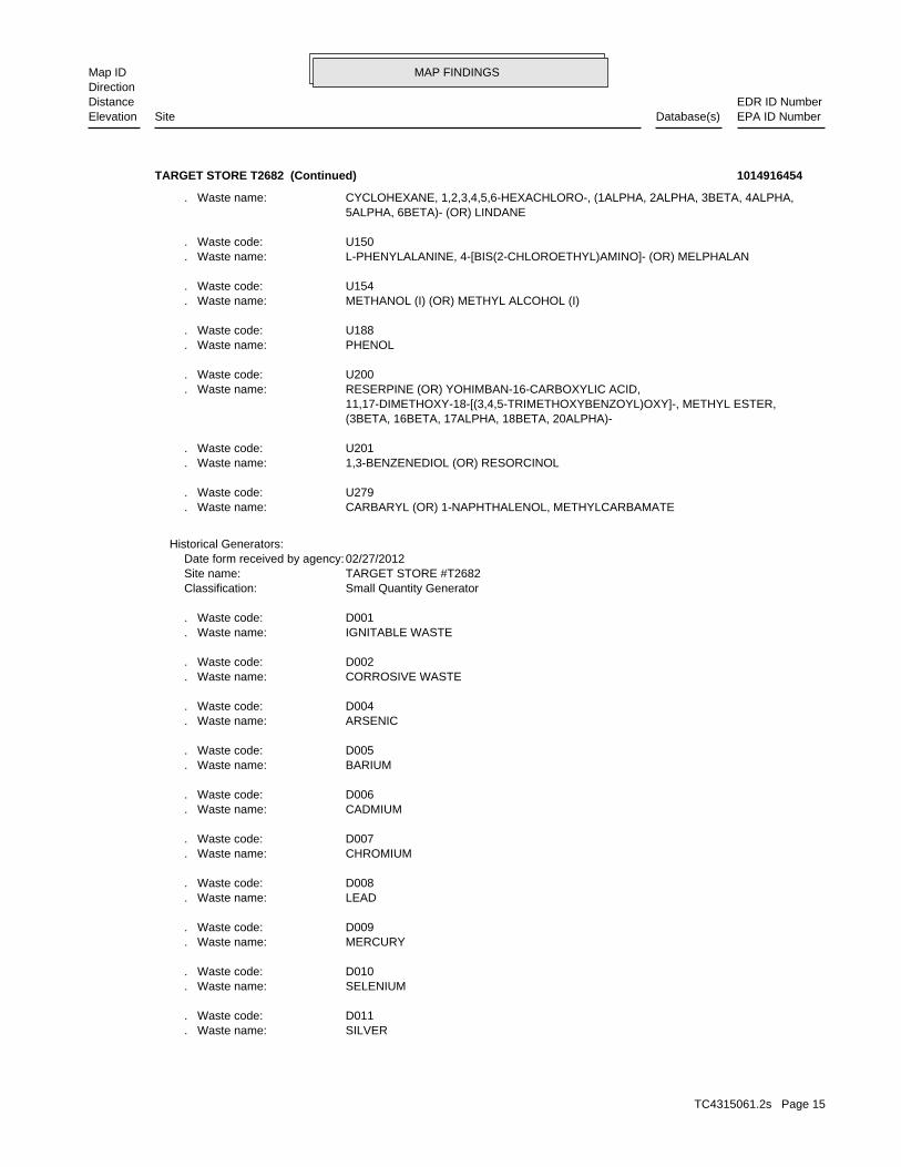
MAP FINDINGSMap IDDirection
EDR ID NumberDistanceEPA ID NumberDatabase(s)SiteElevation
SILVER. Waste name: D011. Waste code:
SELENIUM. Waste name: D010. Waste code:
MERCURY. Waste name: D009. Waste code:
LEAD. Waste name: D008. Waste code:
CHROMIUM. Waste name: D007. Waste code:
CADMIUM. Waste name: D006. Waste code:
BARIUM. Waste name: D005. Waste code:
ARSENIC. Waste name: D004. Waste code:
CORROSIVE WASTE. Waste name: D002. Waste code:
IGNITABLE WASTE. Waste name: D001. Waste code:
Small Quantity GeneratorClassification: TARGET STORE #T2682Site name: 02/27/2012Date form received by agency:
Historical Generators:
CARBARYL (OR) 1-NAPHTHALENOL, METHYLCARBAMATE. Waste name: U279. Waste code:
1,3-BENZENEDIOL (OR) RESORCINOL. Waste name: U201. Waste code:
(3BETA, 16BETA, 17ALPHA, 18BETA, 20ALPHA)- 11,17-DIMETHOXY-18-[(3,4,5-TRIMETHOXYBENZOYL)OXY]-, METHYL ESTER, RESERPINE (OR) YOHIMBAN-16-CARBOXYLIC ACID,. Waste name: U200. Waste code:
PHENOL. Waste name: U188. Waste code:
METHANOL (I) (OR) METHYL ALCOHOL (I). Waste name: U154. Waste code:
L-PHENYLALANINE, 4-[BIS(2-CHLOROETHYL)AMINO]- (OR) MELPHALAN. Waste name: U150. Waste code:
5ALPHA, 6BETA)- (OR) LINDANE CYCLOHEXANE, 1,2,3,4,5,6-HEXACHLORO-, (1ALPHA, 2ALPHA, 3BETA, 4ALPHA,. Waste name:
TARGET STORE T2682 (Continued) 1014916454
TC4315061.2s Page 15

MAP FINDINGSMap IDDirection
EDR ID NumberDistanceEPA ID NumberDatabase(s)SiteElevation
U035. Waste code:
ACETALDEHYDE, TRICHLORO- (OR) CHLORAL. Waste name: U034. Waste code:
2-PROPANONE (I) (OR) ACETONE (I). Waste name: U002. Waste code:
(3AS-CIS)- 1,2,3,3A,8,8A-HEXAHYDRO-1,3A,8-TRIMETHYL-METHYLCARBAMATE (ESTER), PHYSOSTIGMINE (OR) PYRROLO[2,3-B]INDOL-5-OL,. Waste name: P204. Waste code:
-YL METHYLCARBAMATE ESTER (1:1) (OR) PHYSOSTIGMINE SALICYLATE (3AS-CIS)-1,2,3,3A,8,8A-HEXAHYDRO-1,3A,8-TRIMETHYLPYRROLO[2,3-B]INDOL- BENZOIC ACID, 2-HYDROXY-, COMPD. WITH. Waste name: P188. Waste code:
STRYCHNIDIN-10-ONE, & SALTS (OR) STRYCHNINE, & SALTS. Waste name: P108. Waste code:
1,2,3-PROPANETRIOL, TRINITRATE (R) (OR) NITROGLYCERINE (R). Waste name: P081. Waste code:
SALTS NICOTINE, & SALTS (OR) PYRIDINE, 3-(1-METHYL-2-PYRROLIDINYL)-,(S)-, &. Waste name: P075. Waste code:
ALPHA-DIMETHYL- ALPHA,ALPHA-DIMETHYLPHENETHYLAMINE (OR) BENZENEETHANAMINE, ALPHA,. Waste name: P046. Waste code:
CARBON DISULFIDE. Waste name: P022. Waste code:
ARSENIC OXIDE AS2O3 (OR) ARSENIC TRIOXIDE. Waste name: P012. Waste code:
SALTS, WHEN PRESENT AT CONCENTRATIONS GREATER THAN 0.3% WHEN PRESENT AT CONCENTRATIONS GREATER THAN 0.3% (OR) WARFARIN, & 2H-1-BENZOPYRAN-2-ONE, 4-HYDROXY-3-(3-OXO-1-PHENYLBUTYL)-, & SALTS,. Waste name: P001. Waste code:
METHYL ETHYL KETONE. Waste name: D035. Waste code:
CRESOL. Waste name: D026. Waste code:
M-CRESOL. Waste name: D024. Waste code:
BENZENE. Waste name: D018. Waste code:
2,4-D (2,4-DICHLOROPHENOXYACETIC ACID). Waste name: D016. Waste code:
TARGET STORE T2682 (Continued) 1014916454
TC4315061.2s Page 16

MAP FINDINGSMap IDDirection
EDR ID NumberDistanceEPA ID NumberDatabase(s)SiteElevation
MERCURY. Waste name: D009. Waste code:
LEAD. Waste name: D008. Waste code:
BARIUM. Waste name: D005. Waste code:
CORROSIVE WASTE. Waste name: D002. Waste code:
IGNITABLE WASTE. Waste name: D001. Waste code:
Small Quantity GeneratorClassification: TARGET STORE NO 2682Site name: 07/07/2011Date form received by agency:
CARBARYL (OR) 1-NAPHTHALENOL, METHYLCARBAMATE. Waste name: U279. Waste code:
1,3-BENZENEDIOL (OR) RESORCINOL. Waste name: U201. Waste code:
(3BETA, 16BETA, 17ALPHA, 18BETA, 20ALPHA)- 11,17-DIMETHOXY-18-[(3,4,5-TRIMETHOXYBENZOYL)OXY]-, METHYL ESTER, RESERPINE (OR) YOHIMBAN-16-CARBOXYLIC ACID,. Waste name: U200. Waste code:
PHENOL. Waste name: U188. Waste code:
METHANOL (I) (OR) METHYL ALCOHOL (I). Waste name: U154. Waste code:
L-PHENYLALANINE, 4-[BIS(2-CHLOROETHYL)AMINO]- (OR) MELPHALAN. Waste name: U150. Waste code:
5ALPHA, 6BETA)- (OR) LINDANE CYCLOHEXANE, 1,2,3,4,5,6-HEXACHLORO-, (1ALPHA, 2ALPHA, 3BETA, 4ALPHA,. Waste name: U129. Waste code:
FORMALDEHYDE. Waste name: U122. Waste code:
BENZENE, 1,4-DICHLORO- (OR) P-DICHLOROBENZENE. Waste name: U072. Waste code:
2-OXIDE (OR) CYCLOPHOSPHAMIDE 2H-1,3,2-OXAZAPHOSPHORIN-2-AMINE, N,N-BIS(2-CHLOROETHYL)TETRAHYDRO-,. Waste name: U058. Waste code:
CHLOROFORM (OR) METHANE, TRICHLORO-. Waste name: U044. Waste code:
BENZENEBUTANOIC ACID, 4-[BIS(2-CHLOROETHYL)AMINO]- (OR) CHLORAMBUCIL. Waste name:
TARGET STORE T2682 (Continued) 1014916454
TC4315061.2s Page 17

MAP FINDINGSMap IDDirection
EDR ID NumberDistanceEPA ID NumberDatabase(s)SiteElevation
LEADWaste name: D008Waste code:
233Amount (Lbs): CHROMIUMWaste name: D007Waste code:
233Amount (Lbs): BARIUMWaste name: D005Waste code:
22Amount (Lbs): ARSENICWaste name: D004Waste code:
394Amount (Lbs): DISPOSED, THE WASTE WOULD BE A CORROSIVE HAZARDOUS WASTE. THESE CAUSTIC OR ACID SOLUTIONS BECOME CONTAMINATED AND MUST BE USED BY MANY INDUSTRIES TO CLEAN METAL PARTS PRIOR TO PAINTING. WHEN OR DEGREASE PARTS. HYDROCHLORIC ACID, A SOLUTION WITH A LOW PH, IS CAUSTIC SOLUTION WITH A HIGH PH, IS OFTEN USED BY INDUSTRIES TO CLEAN CONSIDERED TO BE A CORROSIVE HAZARDOUS WASTE. SODIUM HYDROXIDE, A A WASTE WHICH HAS A PH OF LESS THAN 2 OR GREATER THAN 12.5 ISWaste name: D002Waste code:
1084Amount (Lbs): WHICH WOULD BE CONSIDERED AS IGNITABLE HAZARDOUS WASTE. MATERIAL. LACQUER THINNER IS AN EXAMPLE OF A COMMONLY USED SOLVENT WHICH CAN BE OBTAINED FROM THE MANUFACTURER OR DISTRIBUTOR OF THE FLASH POINT OF A WASTE IS TO REVIEW THE MATERIAL SAFETY DATA SHEET, CLOSED CUP FLASH POINT TESTER. ANOTHER METHOD OF DETERMINING THE LESS THAN 140 DEGREES FAHRENHEIT AS DETERMINED BY A PENSKY-MARTENS IGNITABLE HAZARDOUS WASTES ARE THOSE WASTES WHICH HAVE A FLASHPOINT OFWaste name: D001Waste code:
Annual Waste Handled:
Last Biennial Reporting Year: 2013
Biennial Reports:
SALTS NICOTINE, & SALTS (OR) PYRIDINE, 3-(1-METHYL-2-PYRROLIDINYL)-,(S)-, &. Waste name: P075. Waste code:
ALPHA-DIMETHYL- ALPHA,ALPHA-DIMETHYLPHENETHYLAMINE (OR) BENZENEETHANAMINE, ALPHA,. Waste name: P046. Waste code:
SALTS, WHEN PRESENT AT CONCENTRATIONS GREATER THAN 0.3% WHEN PRESENT AT CONCENTRATIONS GREATER THAN 0.3% (OR) WARFARIN, & 2H-1-BENZOPYRAN-2-ONE, 4-HYDROXY-3-(3-OXO-1-PHENYLBUTYL)-, & SALTS,. Waste name: P001. Waste code:
2,4-D (2,4-DICHLOROPHENOXYACETIC ACID). Waste name: D016. Waste code:
SILVER. Waste name: D011. Waste code:
TARGET STORE T2682 (Continued) 1014916454
TC4315061.2s Page 18

MAP FINDINGSMap IDDirection
EDR ID NumberDistanceEPA ID NumberDatabase(s)SiteElevation
NITROGLYCERINE (R)Waste name: P081Waste code:
6Amount (Lbs): NICOTINE, & SALTSWaste name: P075Waste code:
6Amount (Lbs): BENZENEETHANAMINE, ALPHA,ALPHA-DIMETHYL-Waste name: P046Waste code:
6Amount (Lbs): CARBON DISULFIDEWaste name: P022Waste code:
6Amount (Lbs): ARSENIC OXIDE AS2O3Waste name: P012Waste code:
6Amount (Lbs): WHEN PRESENT AT CONCENTRATIONS GREATER THAN 0.3% 2H-1-BENZOPYRAN-2-ONE, 4-HYDROXY-3-(3-OXO-1-PHENYLBUTYL)-, & SALTS,Waste name: P001Waste code:
957Amount (Lbs): METHYL ETHYL KETONEWaste name: D035Waste code:
22Amount (Lbs): CRESOLWaste name: D026Waste code:
22Amount (Lbs): M-CRESOLWaste name: D024Waste code:
211Amount (Lbs): BENZENEWaste name: D018Waste code:
22Amount (Lbs): 2,4-DWaste name: D016Waste code:
233Amount (Lbs): SILVERWaste name: D011Waste code:
22Amount (Lbs): SELENIUMWaste name: D010Waste code:
22Amount (Lbs): MERCURYWaste name: D009Waste code:
22Amount (Lbs):
TARGET STORE T2682 (Continued) 1014916454
TC4315061.2s Page 19

MAP FINDINGSMap IDDirection
EDR ID NumberDistanceEPA ID NumberDatabase(s)SiteElevation
22Amount (Lbs): PHENOLWaste name: U188Waste code:
233Amount (Lbs): METHANOL (I)Waste name: U154Waste code:
22Amount (Lbs): MELPHALANWaste name: U150Waste code:
22Amount (Lbs): (1ALPHA,2ALPHA,3BETA,4ALPHA,5ALPHA,6BETA)- CYCLOHEXANE, 1,2,3,4,5,6-HEXACHLORO-,Waste name: U129Waste code:
22Amount (Lbs): FORMALDEHYDEWaste name: U122Waste code:
22Amount (Lbs): BENZENE, 1,4-DICHLORO-Waste name: U072Waste code:
22Amount (Lbs): CYCLOPHOSPHAMIDEWaste name: U058Waste code:
22Amount (Lbs): CHLOROFORMWaste name: U044Waste code:
22Amount (Lbs): BENZENEBUTANOIC ACID, 4-[BIS(2-CHLOROETHYL)AMINO]-Waste name: U035Waste code:
233Amount (Lbs): ACETONE (I)Waste name: U002Waste code:
6Amount (Lbs): 1,2,3,3A,8,8A-HEXAHYDRO-1,3A,8-TRIMETHYL-METHYLCARBAMAT PHYSOSTIGMINE (OR) PYRROLO[2,3-B]INDOL-5-OL,Waste name: P204Waste code:
6Amount (Lbs): (3AS-CIS)-1,2,3,3A,8,8A-HEXAHYDRO-1,3A,8-TRIMETHYLPYRROLO[2,3- BENZOIC ACID, 2-HYDROXY-, COMPD. WITHWaste name: P188Waste code:
6Amount (Lbs): STRYCHNIDIN-10-ONE, & SALTSWaste name: P108Waste code:
6Amount (Lbs):
TARGET STORE T2682 (Continued) 1014916454
TC4315061.2s Page 20

MAP FINDINGSMap IDDirection
EDR ID NumberDistanceEPA ID NumberDatabase(s)SiteElevation
No violations foundViolation Status:
22Amount (Lbs): CARBARYL (OR) 1-NAPHTHALENOL, METHYLCARBAMATEWaste name: U279Waste code:
22Amount (Lbs): 1,3-BENZENEDIOLWaste name: U201Waste code:
22Amount (Lbs): RESERPINEWaste name: U200Waste code:
TARGET STORE T2682 (Continued) 1014916454
Currently in UseTank Status: 2Tank Id: 9-603921Alt Facility ID:
HI Financial Assurance:
DieselSubstance: 15000Tank Capacity: Not reportedDate Closed: Currently In UseTank Status: 10/11/2013Date Installed: 3Tank ID:
GasoholSubstance: 15000Tank Capacity: Not reportedDate Closed: Currently in UseTank Status: 10/11/2013Date Installed: 2Tank ID:
GasoholSubstance: 30000Tank Capacity: Not reportedDate Closed: Currently in UseTank Status: 10/11/2013Date Installed: 1Tank ID:
Not reportedHorizontal Collection Method Name: Not reportedHorizontal Reference Datum Name: Not reportedLongitude: Not reportedLatitude: Hilo, 96720 96720Owner City,St,Zip: 5918 Stoneridge Mall RoadOwner Address: Safeway Fuel Center #2893Owner: 9-603921Facility ID:
UST:
1025 ft. Site 2 of 4 in cluster A0.194 mi.
Relative:Lower
Actual:83 ft.
1/8-1/4 HILO, HI 96720West Financial Assurance371 EAST MAKAALA ST N/AA4 USTSAFEWAY FUEL CENTER 2893 U004191716
TC4315061.2s Page 21

MAP FINDINGSMap IDDirection
EDR ID NumberDistanceEPA ID NumberDatabase(s)SiteElevation
07/01/2014Expiration Date: InsuranceFRTYPE: Currently in UseTank Status: 1Tank Id: 9-603921Alt Facility ID:
07/01/2014Expiration Date: InsuranceFRTYPE: Currently In UseTank Status: 3Tank Id: 9-603921Alt Facility ID:
07/01/2014Expiration Date: InsuranceFRTYPE:
SAFEWAY FUEL CENTER 2893 (Continued) U004191716
USOwner/operator country: KAPOLEI, 96707 ATTN LAND MANAGEMENT 91-5420 KAPOLEI PARKWAYOwner/operator address: STATE OF HAWAII BY ITSOwner/operator name:
Owner/Operator Summary:
hazardous waste the cleanup of a spill, into or on any land or water, of acutely any residue or contaminated soil, waste or other debris resulting from time: 1 kg or less of acutely hazardous waste; or 100 kg or less of hazardous waste during any calendar month, and accumulates at any from the cleanup of a spill, into or on any land or water, of acutely of any residue or contaminated soil, waste or other debris resulting land or water, of acutely hazardous waste; or generates 100 kg or less other debris resulting from the cleanup of a spill, into or on any waste; or 100 kg or less of any residue or contaminated soil, waste or month, and accumulates at any time: 1 kg or less of acutely hazardous or generates 1 kg or less of acutely hazardous waste per calendar month, and accumulates 1000 kg or less of hazardous waste at any time; Handler: generates 100 kg or less of hazardous waste per calendarDescription: Conditionally Exempt Small Quantity GeneratorClassification: 09EPA Region: [email protected] email: 925-226-5655Contact telephone: USContact country: PLEASANTON, CA 94588 5918 STONERIDGE MALL ROADContact address: KEITH B POWERSContact: PLEASANTON, CA 94588 5918 STONERIDGE MALL ROADMailing address: HIR000142901EPA ID: HILO, HI 96720 381 EAST MAKAALA STREETFacility address: SAFEWAY STORE #2893Facility name: 09/08/2014Date form received by agency:
RCRA-CESQG:
1025 ft. Site 3 of 4 in cluster A0.194 mi.
Relative:Lower
Actual:83 ft.
1/8-1/4 HILO, HI 96720West 381 EAST MAKAALA STREET HIR000142901A5 RCRA-CESQGSAFEWAY STORE #2893 1017770195
TC4315061.2s Page 22

MAP FINDINGSMap IDDirection
EDR ID NumberDistanceEPA ID NumberDatabase(s)SiteElevation
No violations foundViolation Status:
SALTS NICOTINE, & SALTS (OR) PYRIDINE, 3-(1-METHYL-2-PYRROLIDINYL)-,(S)-, &. Waste name: P075. Waste code:
CORROSIVE WASTE. Waste name: D002. Waste code:
IGNITABLE WASTE. Waste name: D001. Waste code:
NoUsed oil transporter: NoUsed oil transfer facility: NoUsed oil Specification marketer: NoUsed oil fuel marketer to burner: NoUser oil refiner: NoUsed oil processor: NoUsed oil fuel burner: NoFurnace exemption: NoOn-site burner exemption: NoUnderground injection activity: NoTreater, storer or disposer of HW: NoTransporter of hazardous waste: NoRecycler of hazardous waste: NoMixed waste (haz. and radioactive): NoU.S. importer of hazardous waste:
Handler Activities Summary:
Not reportedOwner/Op end date: 03/24/2011Owner/Op start date: OperatorOwner/Operator Type: PrivateLegal status: Not reportedOwner/operator telephone: USOwner/operator country: Not reported Not reportedOwner/operator address: SAFEWAYOwner/operator name:
Not reportedOwner/Op end date: 01/01/2011Owner/Op start date: OwnerOwner/Operator Type: PrivateLegal status: Not reportedOwner/operator telephone:
SAFEWAY STORE #2893 (Continued) 1017770195
1905 ASTON AVEMailing address: HIR000136465EPA ID: HILO, HI 96720 380 MAKAALA STFacility address: HOME DEPOT USA HD 8453Facility name: 08/21/2007Date form received by agency:
RCRA-SQG:
1026 ft. Site 4 of 4 in cluster A0.194 mi.
Relative:Lower
Actual:83 ft.
1/8-1/4 HILO, HI 96720West 380 MAKAALA ST HIR000136465A6 RCRA-SQGHOME DEPOT USA HD 8453 1008372605
TC4315061.2s Page 23

MAP FINDINGSMap IDDirection
EDR ID NumberDistanceEPA ID NumberDatabase(s)SiteElevation
IGNITABLE WASTE. Waste name: D001. Waste code:
NoUsed oil transporter: NoUsed oil transfer facility: NoUsed oil Specification marketer: NoUsed oil fuel marketer to burner: NoUser oil refiner: NoUsed oil processor: NoUsed oil fuel burner: NoFurnace exemption: NoOn-site burner exemption: NoUnderground injection activity: NoTreater, storer or disposer of HW: NoTransporter of hazardous waste: NoRecycler of hazardous waste: NoMixed waste (haz. and radioactive): NoU.S. importer of hazardous waste:
Handler Activities Summary:
Not reportedOwner/Op end date: 12/16/2004Owner/Op start date: OperatorOwner/Operator Type: PrivateLegal status: Not reportedOwner/operator telephone: USOwner/operator country: Not reported Not reportedOwner/operator address: HOME DEPOT USA INCOwner/operator name:
Not reportedOwner/Op end date: 12/16/2004Owner/Op start date: OwnerOwner/Operator Type: PrivateLegal status: 770-433-8211Owner/operator telephone: USOwner/operator country: ATLANTA, GA 30339 2455 PACES FERRY RD D 17Owner/operator address: HOME DEPOT USA INCOwner/operator name:
Owner/Operator Summary:
hazardous waste at any time waste during any calendar month, and accumulates more than 1000 kg of hazardous waste at any time; or generates 100 kg or less of hazardous waste during any calendar month and accumulates less than 6000 kg of Handler: generates more than 100 and less than 1000 kg of hazardousDescription: Small Small Quantity GeneratorClassification: 09EPA Region: [email protected] email: 760-602-8743Contact telephone: USContact country: CARLSBAD, CA 92008 1905 ASTON AVE NO 100Contact address: BECKY WILBANKSContact: CARLSBAD, CA 92008 NO 100
HOME DEPOT USA HD 8453 (Continued) 1008372605
TC4315061.2s Page 24

MAP FINDINGSMap IDDirection
EDR ID NumberDistanceEPA ID NumberDatabase(s)SiteElevation
BENZENE. Waste name: D018. Waste code:
2,4-D (2,4-DICHLOROPHENOXYACETIC ACID). Waste name: D016. Waste code:
MERCURY. Waste name: D009. Waste code:
CORROSIVE WASTE. Waste name: D002. Waste code:
IGNITABLE WASTE. Waste name: D001. Waste code:
Conditionally Exempt Small Quantity GeneratorClassification: HOME DEPOT USA INC HD 8453Site name: 07/15/2005Date form received by agency:
METHYL ETHYL KETONE. Waste name: D035. Waste code:
BENZENE. Waste name: D018. Waste code:
2,4-D (2,4-DICHLOROPHENOXYACETIC ACID). Waste name: D016. Waste code:
MERCURY. Waste name: D009. Waste code:
CORROSIVE WASTE. Waste name: D002. Waste code:
IGNITABLE WASTE. Waste name: D001. Waste code:
Small Quantity GeneratorClassification: HOME DEPOT HD 8453Site name: 01/19/2007Date form received by agency:
Historical Generators:
METHYL ETHYL KETONE. Waste name: D035. Waste code:
BENZENE. Waste name: D018. Waste code:
2,4-D (2,4-DICHLOROPHENOXYACETIC ACID). Waste name: D016. Waste code:
MERCURY. Waste name: D009. Waste code:
CORROSIVE WASTE. Waste name: D002. Waste code:
HOME DEPOT USA HD 8453 (Continued) 1008372605
TC4315061.2s Page 25

MAP FINDINGSMap IDDirection
EDR ID NumberDistanceEPA ID NumberDatabase(s)SiteElevation
No violations foundViolation Status:
BENZENE. Waste name: D018. Waste code:
2,4-D (2,4-DICHLOROPHENOXYACETIC ACID). Waste name: D016. Waste code:
MERCURY. Waste name: D009. Waste code:
CORROSIVE WASTE. Waste name: D002. Waste code:
IGNITABLE WASTE. Waste name: D001. Waste code:
Small Quantity GeneratorClassification: HOME DEPOT 8453Site name: 04/13/2005Date form received by agency:
THESE SPENT SOLVENTS AND SPENT SOLVENT MIXTURES. LISTED IN F001, F002, OR F004; AND STILL BOTTOMS FROM THE RECOVERY OF ONE OR MORE OF THE ABOVE NONHALOGENATED SOLVENTS OR THOSE SOLVENTS CONTAINING, BEFORE USE, A TOTAL OF TEN PERCENT OR MORE (BY VOLUME) OF 2-ETHOXYETHANOL, AND 2-NITROPROPANE; ALL SPENT SOLVENT MIXTURES/BLENDS KETONE, CARBON DISULFIDE, ISOBUTANOL, PYRIDINE, BENZENE, THE FOLLOWING SPENT NONHALOGENATED SOLVENTS: TOLUENE, METHYL ETHYL. Waste name: F005. Waste code:
MIXTURES. BOTTOMS FROM THE RECOVERY OF THESE SPENT SOLVENTS AND SPENT SOLVENT MORE OF THOSE SOLVENTS LISTED IN F001, F002, F004, AND F005; AND STILL SOLVENTS, AND A TOTAL OF TEN PERCENT OR MORE (BY VOLUME) OF ONE OR CONTAINING, BEFORE USE, ONE OR MORE OF THE ABOVE NONHALOGENATED NONHALOGENATED SOLVENTS; AND ALL SPENT SOLVENT MIXTURES/BLENDS MIXTURES/BLENDS CONTAINING, BEFORE USE, ONLY THE ABOVE SPENT ALCOHOL, CYCLOHEXANONE, AND METHANOL; ALL SPENT SOLVENT ACETATE, ETHYL BENZENE, ETHYL ETHER, METHYL ISOBUTYL KETONE, N-BUTYL THE FOLLOWING SPENT NONHALOGENATED SOLVENTS: XYLENE, ACETONE, ETHYL. Waste name: F003. Waste code:
METHYL ETHYL KETONE. Waste name: D035. Waste code:
HOME DEPOT USA HD 8453 (Continued) 1008372605
Municipal solid waste and construction debrisWaste Type:1984-Present*Close Date:HawaiiIsland Location:3rd, 2-1-013:142, 152, 156TMK:ACTIVE LANDFILLS NEIGHBOR ISLANDSFacility Status:
SWF/LF:
1711 ft.0.324 mi.
Relative:Lower
Actual:88 ft.
1/4-1/2 HILO, HI ESE N/A7 SWF/LFHILO LANDFILL S109569373
TC4315061.2s Page 26

MAP FINDINGSMap IDDirection
EDR ID NumberDistanceEPA ID NumberDatabase(s)SiteElevation
10Numerical Quantity: >Less Or Greater Than: Transformer OilSubstances: HELCO transformer pad-mounted #8994 releaseUnits: NoneER: HEER EP&RLead and Program: Not reportedFacility Registry Id: Not reportedHID Number: 20121116-1254Case Number: Not reportedSupplemental Loc. Text: HawaiiIsland:
HI SPILLS:
GasolineSubstance: 1000Tank Capacity: 11/12/1992Date Closed: Permanently Out of UseTank Status: 07/02/1969Date Installed: R-1Tank ID:
DieselSubstance: 550Tank Capacity: Not reportedDate Closed: Currently in UseTank Status: 07/02/1987Date Installed: M-2Tank ID:
GasolineSubstance: 4000Tank Capacity: Not reportedDate Closed: Currently In UseTank Status: 02/01/1993Date Installed: 3Tank ID:
GPSHorizontal Collection Method Name: NAD83Horizontal Reference Datum Name: -155.061423Longitude: 19.701417Latitude: Hilo, 96720 96720Owner City,St,Zip: P.O. Box 2200Owner Address: Hawaiian TelcomOwner: 9-600564Facility ID:
UST:
Not AssignedProject Officer: 930031Release ID: 07/30/1993Facility Status Date: Site Cleanup Completed (NFA)Facility Status: 9-600564Facility ID:
LUST:
1761 ft.0.334 mi. Financial Assurance
Relative:Lower
Actual:71 ft.
1/4-1/2 SPILLSHILO, HI 96720West UST95 POHAKU ST N/A8 LUSTHILO WAREHOUSE U003155177
TC4315061.2s Page 27

MAP FINDINGSMap IDDirection
EDR ID NumberDistanceEPA ID NumberDatabase(s)SiteElevation
05/02/2015Expiration Date: InsuranceFRTYPE: Currently in UseTank Status: M-2Tank Id: 9-600564Alt Facility ID:
05/02/2015Expiration Date: InsuranceFRTYPE: Currently In UseTank Status: 3Tank Id: 9-600564Alt Facility ID:
05/02/2015Expiration Date: InsuranceFRTYPE: Permanently Out of UseTank Status: R-1Tank Id: 9-600564Alt Facility ID:
Not reportedExpiration Date: Risk Retention GroupFRTYPE: Currently In UseTank Status: 3Tank Id: 9-600564Alt Facility ID:
Not reportedExpiration Date: Risk Retention GroupFRTYPE: Currently in UseTank Status: M-2Tank Id: 9-600564Alt Facility ID:
Not reportedExpiration Date: Risk Retention GroupFRTYPE: Permanently Out of UseTank Status: R-1Tank Id: 9-600564Alt Facility ID:
HI Financial Assurance:
Not reportedFile Under: Not reportedResult: Not reportedAssignment End Date: Curtis MartinActivity Lead: ResponseActivity Type: GallonsUnits:
HILO WAREHOUSE (Continued) U003155177
HELCO Hill Generating Station Test TankEnvironmental Interest: HawaiiIsland: Not reportedSupplemental Location: Not reportedOrganization:
SHWS:
Financial AssuranceAIRS
2562 ft. SPILLS0.485 mi. UST
Relative:Lower
Actual:50 ft.
1/4-1/2 LUSTHILO, HI 96720WNW UIC54 HALEKAUILA ST N/A9 SHWSHELCO KANOELEHUA OPERATIONS CENTER U001236868
TC4315061.2s Page 28

MAP FINDINGSMap IDDirection
EDR ID NumberDistanceEPA ID NumberDatabase(s)SiteElevation
Response NecessaryAssessment: NFAPriority: No HazardPotential Hazard And Controls: StateProgran Name: HEERLead Agency: 110000486377Facility Registry Identifier: Not reportedHID Number: HELCO Substation Transformer No. 15923 at Kanoelehua Switching StationSDAR Environmental Interest Name: Not reportedSupplemental Location Text: HawaiiIsland: Not reportedOrganization: No HazardPotential Hazards And Controls: NFAHazard Priority: Amelia HicksProject Manager: StateProgram: HEERLead Agency: 110000486377Facility Registry Identifier: Not reportedHID Number: HELCO Substation Transformer No. 15923 at Kanoelehua Switching StationEnvironmental Interest: HawaiiIsland: Not reportedSupplemental Location: Not reportedOrganization:
(808) 586-4249 919 Ala Moana Blvd, Honolulu, HI 96814Contact Information: Amelia HicksProject Manager: Tank No Further Action Determination for HELCO Hill Generating Station TestDocument Subject: 2012-414-AHDocument Number: 07/10/2012Document Date: No Further Action Letter - Unrestricted Residential UseSite Closure Type: Not reportedWithin Designated Areawide Contamination: Not reportedInstitutional Control: Not reportedDescription of Restrictions: Not reportedEngineering Control: No Hazard Present For Unrestricted Residential UseUse Restrictions: prior to contactwith ground surface. Free product was satisfactorily recovered from the containment areaNature of Residual Contamination: Not reportedNature of Contamination: Response CompleteResponse: Response NecessaryAssessment: NFAPriority: No HazardPotential Hazard And Controls: StateProgran Name: HEERLead Agency: 110000486377Facility Registry Identifier: Not reportedHID Number: HELCO Hill Generating Station Test TankSDAR Environmental Interest Name: Not reportedSupplemental Location Text: HawaiiIsland: Not reportedOrganization: No HazardPotential Hazards And Controls: NFAHazard Priority: Amelia HicksProject Manager: StateProgram: HEERLead Agency: 110000486377Facility Registry Identifier: Not reportedHID Number:
HELCO KANOELEHUA OPERATIONS CENTER (Continued) U001236868
TC4315061.2s Page 29

MAP FINDINGSMap IDDirection
EDR ID NumberDistanceEPA ID NumberDatabase(s)SiteElevation
HELCOFacility Operator, Not Contract Opr: ABSubclass: IND:HIFacility Type: belowLocation In Relation To UIC Line: HawaiiIsland: 1Total Number Of Inj. Well(S) On Permit: 36,000,000Flow In Gallons Per Day: 155 03 46Central Longitude Of The Site: 19 42 24Central Latitude Of The Site: 8-4203.03.1Facility Id/Lat Long Minute Coordinates: UH-1241UIC Permit Number:
Not reportedRemarks: NUUIC Project Geologist: Not reportedDate When File Is Closed: 6/29/2016Permit Expiration Date: Not reportedType: 7/29/2005Last Issuance Of Permit: 9/10/19851st Issuance Of Permit: Not reportedExemption Issuance Date: 9/10/1985Approval-To-Construct Issuance Date: Not reportedPublic Notice Date: 12/19/1984Receipt Of Initial Application: HELCOConsultant Serving The Application: noneOwner Of Land Property On Leasehold: 3:2-2-58:019Tax Map Key Number: PO Box 1027, Hilo, HI 96720-1027Owner Address: Hawaii Electric Light Co., Inc. (HELCO)Facility Owner: PO Box 1027 Hilo, HI 96721Operator Address: HELCOFacility Operator, Not Contract Opr: ABSubclass: IND:HIFacility Type: belowLocation In Relation To UIC Line: HawaiiIsland: 1Total Number Of Inj. Well(S) On Permit: 22,500,000Flow In Gallons Per Day: 155 03 50Central Longitude Of The Site: 19 42 28Central Latitude Of The Site: 8-4203.01.1Facility Id/Lat Long Minute Coordinates: UH-1240UIC Permit Number:
UIC:
(808) 586-4249 919 Ala Moana Blvd, Honolulu, HI 96814Contact Information: Amelia HicksProject Manager: 10690 (Incident ID 20080222-1408 No Further Action Determination for HELCO Pad-Mount Transformer No.Document Subject: 2012-363-AHDocument Number: 06/13/2012Document Date: No Further Action Letter - Unrestricted Residential UseSite Closure Type: Not reportedWithin Designated Areawide Contamination: Not reportedInstitutional Control: Not reportedDescription of Restrictions: Not reportedEngineering Control: No Hazard Present For Unrestricted Residential UseUse Restrictions: TPH below HDOH EALs at <50 mg/kg.Nature of Residual Contamination: Not reportedNature of Contamination: Response CompleteResponse:
HELCO KANOELEHUA OPERATIONS CENTER (Continued) U001236868
TC4315061.2s Page 30

MAP FINDINGSMap IDDirection
EDR ID NumberDistanceEPA ID NumberDatabase(s)SiteElevation
ABSubclass: SEW:CESFacility Type: belowLocation In Relation To UIC Line: HawaiiIsland: 1Total Number Of Inj. Well(S) On Permit: 1,000Flow In Gallons Per Day: 155 03 50Central Longitude Of The Site: 19 42 29Central Latitude Of The Site: 8-4203.02.1Facility Id/Lat Long Minute Coordinates: UH-1243UIC Permit Number:
Not reportedRemarks: NUUIC Project Geologist: Not reportedDate When File Is Closed: 2/14/2017Permit Expiration Date: Not reportedType: 2/15/2012Last Issuance Of Permit: 9/13/19851st Issuance Of Permit: Not reportedExemption Issuance Date: 9/13/1985Approval-To-Construct Issuance Date: Not reportedPublic Notice Date: 12/19/1984Receipt Of Initial Application: HELCOConsultant Serving The Application: noneOwner Of Land Property On Leasehold: 3:2-2-58:019Tax Map Key Number: PO Box 1027 Hilo, HI 96720Owner Address: Hawaii Electric Light Co., Inc.Facility Owner: PO Box 1027 Hilo, HI 96721Operator Address: HELCOFacility Operator, Not Contract Opr: ABSubclass: IND:HIFacility Type: belowLocation In Relation To UIC Line: HawaiiIsland: 1Total Number Of Inj. Well(S) On Permit: 30,000Flow In Gallons Per Day: 155 03 50Central Longitude Of The Site: 19 42 29Central Latitude Of The Site: 8-4203.04.1Facility Id/Lat Long Minute Coordinates: UH-1242UIC Permit Number:
Not reportedRemarks: NUUIC Project Geologist: Not reportedDate When File Is Closed: 6/29/2016Permit Expiration Date: Not reportedType: 7/29/2005Last Issuance Of Permit: 9/10/19851st Issuance Of Permit: Not reportedExemption Issuance Date: 9/10/1985Approval-To-Construct Issuance Date: Not reportedPublic Notice Date: 12/19/1984Receipt Of Initial Application: HELCOConsultant Serving The Application: noneOwner Of Land Property On Leasehold: 3:2-2-58:019Tax Map Key Number: PO Box 1027 Hilo, HI 96720Owner Address: Hawaii Electric Light Co., Inc.Facility Owner: PO Box 1027 Hilo, HI 96721Operator Address:
HELCO KANOELEHUA OPERATIONS CENTER (Continued) U001236868
TC4315061.2s Page 31

MAP FINDINGSMap IDDirection
EDR ID NumberDistanceEPA ID NumberDatabase(s)SiteElevation
DWFacility Type: Not reportedLocation In Relation To UIC Line: HawaiiIsland: 1Total Number Of Inj. Well(S) On Permit: Not reportedFlow In Gallons Per Day: 155 03 50Central Longitude Of The Site: 19 42 29Central Latitude Of The Site: 8-4203.09.1-4Facility Id/Lat Long Minute Coordinates: UH-1676UIC Permit Number:
Not reportedRemarks: NUUIC Project Geologist: Not reportedDate When File Is Closed: 7/12/2017Permit Expiration Date: Not reportedType: 7/13/2012Last Issuance Of Permit: 9/13/19851st Issuance Of Permit: Not reportedExemption Issuance Date: 9/13/1985Approval-To-Construct Issuance Date: Not reportedPublic Notice Date: 12/19/1984Receipt Of Initial Application: HELCOConsultant Serving The Application: noneOwner Of Land Property On Leasehold: 3:2-2-58:019Tax Map Key Number: PO Box 1027 Hilo, HI 96720Owner Address: Hawaii Electric Light Co., Inc.Facility Owner: PO Box 1027 Hilo, HI 96721Operator Address: HELCOFacility Operator, Not Contract Opr: ABSubclass: SEW:CESFacility Type: belowLocation In Relation To UIC Line: HawaiiIsland: 1Total Number Of Inj. Well(S) On Permit: 2,000Flow In Gallons Per Day: 155 03 55Central Longitude Of The Site: 19 42 25Central Latitude Of The Site: 8-4203.05.1Facility Id/Lat Long Minute Coordinates: UH-1244UIC Permit Number:
Not reportedRemarks: NUUIC Project Geologist: Not reportedDate When File Is Closed: 7/12/2017Permit Expiration Date: Not reportedType: 7/13/2012Last Issuance Of Permit: 9/13/19851st Issuance Of Permit: Not reportedExemption Issuance Date: 9/13/1985Approval-To-Construct Issuance Date: Not reportedPublic Notice Date: 12/19/1984Receipt Of Initial Application: HELCOConsultant Serving The Application: noneOwner Of Land Property On Leasehold: 3:2-2-58:019Tax Map Key Number: PO Box 1027 Hilo, HI 96720Owner Address: Hawaii Electric Light Co., Inc.Facility Owner: PO Box 1027 Hilo, HI 96721Operator Address: HELCOFacility Operator, Not Contract Opr:
HELCO KANOELEHUA OPERATIONS CENTER (Continued) U001236868
TC4315061.2s Page 32

MAP FINDINGSMap IDDirection
EDR ID NumberDistanceEPA ID NumberDatabase(s)SiteElevation
Richard TakabaProject Officer: 000013Release ID: 07/14/2000Facility Status Date: Site Cleanup Completed (NFA)Facility Status: 9-600238Facility ID:
LUST:
Not reportedRemarks: NUUIC Project Geologist: 5/2/2002Date When File Is Closed: 12/1/2005Permit Expiration Date: Not reportedType: 12/2/1996Last Issuance Of Permit: 12/2/19911st Issuance Of Permit: Not reportedExemption Issuance Date: 12/5/1991Approval-To-Construct Issuance Date: Not reportedPublic Notice Date: 2/28/1990Receipt Of Initial Application: Hawaii Electric Co Inc.Consultant Serving The Application: noneOwner Of Land Property On Leasehold: 3:2-2-58:019Tax Map Key Number: PO Box 1027 Hilo, HI 96720Owner Address: HELCOFacility Owner: PO Box 1027 Hilo, HI 96720Operator Address: HELCOFacility Operator, Not Contract Opr: CSubclass: DWFacility Type: Not reportedLocation In Relation To UIC Line: HawaiiIsland: 1Total Number Of Inj. Well(S) On Permit: Not reportedFlow In Gallons Per Day: 155 03 50Central Longitude Of The Site: 19 42 29Central Latitude Of The Site: 8-4203.12.1Facility Id/Lat Long Minute Coordinates: UH-1680UIC Permit Number:
Not reportedRemarks: NUUIC Project Geologist: Not reportedDate When File Is Closed: 6/19/2017Permit Expiration Date: Not reportedType: 6/20/2012Last Issuance Of Permit: 12/2/19911st Issuance Of Permit: Not reportedExemption Issuance Date: 12/12/1991Approval-To-Construct Issuance Date: Not reportedPublic Notice Date: 2/28/1990Receipt Of Initial Application: Hawaiian Electric Company, IncConsultant Serving The Application: noneOwner Of Land Property On Leasehold: 3:2-2-58:019Tax Map Key Number: PO Box 1027, Hilo, HI 96720Owner Address: HELCOFacility Owner: PO Box 1027, Hilo, HI 96720Operator Address: HELCOFacility Operator, Not Contract Opr: CSubclass:
HELCO KANOELEHUA OPERATIONS CENTER (Continued) U001236868
TC4315061.2s Page 33

MAP FINDINGSMap IDDirection
EDR ID NumberDistanceEPA ID NumberDatabase(s)SiteElevation
HEER EP&RLead and Program: 110000486377Facility Registry Id: Not reportedHID Number: 20030530-1551Case Number: Not reportedSupplemental Loc. Text: HawaiiIsland:
HI SPILLS:
GasolineSubstance: 10000Tank Capacity: 10/12/1999Date Closed: Permanently Out of UseTank Status: 04/16/1977Date Installed: R-3Tank ID:
DieselSubstance: 1000Tank Capacity: 01/22/1992Date Closed: Permanently Out of UseTank Status: 04/17/1975Date Installed: R-2Tank ID:
DieselSubstance: 6000Tank Capacity: 10/12/1999Date Closed: Permanently Out of UseTank Status: 04/16/1970Date Installed: R-1Tank ID:
DieselSubstance: 6000Tank Capacity: Not reportedDate Closed: Currently In UseTank Status: 12/01/1999Date Installed: 2Tank ID:
GasolineSubstance: 10000Tank Capacity: Not reportedDate Closed: Currently In UseTank Status: 12/01/1999Date Installed: 1Tank ID:
GPSHorizontal Collection Method Name: NAD83Horizontal Reference Datum Name: -155.062410Longitude: 19.703490Latitude: Hilo, 96720 96720Owner City,St,Zip: P.O. BOX 1027Owner Address: HAWAII ELECTRIC LIGHT CO., INC.Owner: 9-600238Facility ID:
UST:
HELCO KANOELEHUA OPERATIONS CENTER (Continued) U001236868
TC4315061.2s Page 34

MAP FINDINGSMap IDDirection
EDR ID NumberDistanceEPA ID NumberDatabase(s)SiteElevation
Oil LubricatingSubstances: HELCO Kanoelehua Switching StationUnits: NoneER: HEER EP&RLead and Program: 110000486377Facility Registry Id: Not reportedHID Number: 20080208-1445Case Number: Not reportedSupplemental Loc. Text: HawaiiIsland:
Hawaii Electric Light Co., Inc. (HELCO)File Under: Refer to SDARResult: Not reportedAssignment End Date: Liz GalvezActivity Lead: ResponseActivity Type: Not reportedUnits: 0Numerical Quantity: Not reportedLess Or Greater Than: Fuel Oil #6Substances: Hill Test TankUnits: NoneER: HEER EP&RLead and Program: 110000486377Facility Registry Id: Not reportedHID Number: 20070927-1327Case Number: Not reportedSupplemental Loc. Text: HawaiiIsland:
Hawaii Electric Light Co., Inc. (HELCO)File Under: SOSC NFAResult: 2007-10-08 00:00:00Assignment End Date: Liz GalvezActivity Lead: ResponseActivity Type: GallonsUnits: 25Numerical Quantity: >Less Or Greater Than: Fuel OilSubstances: HELCO Generating Station: Hill/Kanoelehua Test Tank ReleaseUnits: NoER: HEER EP&RLead and Program: 110000486377Facility Registry Id: Not reportedHID Number: 20070825-1240Case Number: Not reportedSupplemental Loc. Text: HawaiiIsland:
Hawaii Electric Light Co., Inc. (HELCO)File Under: SOSC NFAResult: Not reportedAssignment End Date: Mike CrippsActivity Lead: ResponseActivity Type: GallonsUnits: 100Numerical Quantity: Not reportedLess Or Greater Than: Shell Diala OilSubstances: HELCO pad-mounted transformer 15923Units: NoER:
HELCO KANOELEHUA OPERATIONS CENTER (Continued) U001236868
TC4315061.2s Page 35

MAP FINDINGSMap IDDirection
EDR ID NumberDistanceEPA ID NumberDatabase(s)SiteElevation
9-600238Alt Facility ID:HI Financial Assurance:
Combustion Engineering Boiler, model no. VU 60. Engineering Boiler, model no. VU 60; andHill 6 One (1) 23 MW appurtenances:UnitDescriptionHill 5 One (1) 14.1 MW Combustion IIC:This permit encompasses the following equipment and associated General Electric Combustion Turbine, model no. MS5001DAttachment and associated appurtenances:UnitDescriptionCT-1One (1) 11.6 MW 20-645.Attachment IIB:This permit encompasses the following equipment General Motors Diesel Engine Generator, model no. EMD Diesel Engine Generator, model no. EMD 20-645; andD-17 2.75 MW Engine Generator, model no. EMD 20-645;D-16 2.75 MW General Motors Morse Diesel Engine Generator;D-15 2.75 MW General Motors Diesel and associated appurtenances:UnitDescriptionD-11 2.0 MW Fairbanks EnginesAttachment IIA:This permit encompasses the following equipment Two (2) Boilers, One (1) Combustion Turbine, and Four (4) DieselDescription: Senior Environmental ScientistContact Title: Karin KimuraContact Name: Honolulu, HI 96840-0001Mailing City,St,Zip: 543-4522Business Phone: Not reportedLocale: P.O. Box 2750Mailing Address: HawaiiIsland: 0234-01-CFacility ID:
AIRS:
10 additional HI SPILLS: record(s) in the EDR Site Report.Click this hyperlink while viewing on your computer to access
Hawaii Electric Light Co., Inc. (HELCO)File Under: SOSC NFAResult: 2005-02-08 00:00:00Assignment End Date: Mike CrippsActivity Lead: ResponseActivity Type: GallonsUnits: 5Numerical Quantity: Not reportedLess Or Greater Than: Mineral OilSubstances: Transformer OverflowUnits: NoER: HEER EP&RLead and Program: 110000486377Facility Registry Id: Not reportedHID Number: 20041115-1423Case Number: Not reportedSupplemental Loc. Text: HawaiiIsland:
Hawaii Electric Light Co., Inc. (HELCO)File Under: Refer to SDARResult: Not reportedAssignment End Date: Liz GalvezActivity Lead: ResponseActivity Type: GallonsUnits: 0.5Numerical Quantity: Not reportedLess Or Greater Than:
HELCO KANOELEHUA OPERATIONS CENTER (Continued) U001236868
TC4315061.2s Page 36

MAP FINDINGSMap IDDirection
EDR ID NumberDistanceEPA ID NumberDatabase(s)SiteElevation
Self InsuredFRTYPE: Currently In UseTank Status: 1Tank Id: 9-600238Alt Facility ID:
04/28/2013Expiration Date: Self InsuredFRTYPE: Permanently Out of UseTank Status: R-3Tank Id: 9-600238Alt Facility ID:
04/28/2013Expiration Date: Self InsuredFRTYPE: Permanently Out of UseTank Status: R-2Tank Id: 9-600238Alt Facility ID:
04/28/2013Expiration Date: Self InsuredFRTYPE: Permanently Out of UseTank Status: R-1Tank Id: 9-600238Alt Facility ID:
04/28/2013Expiration Date: Self InsuredFRTYPE: Currently In UseTank Status: 2Tank Id: 9-600238Alt Facility ID:
Not reportedExpiration Date: OtherFRTYPE: Currently In UseTank Status: 1Tank Id: 9-600238Alt Facility ID:
Not reportedExpiration Date: OtherFRTYPE: Currently In UseTank Status: 2Tank Id: 9-600238Alt Facility ID:
Not reportedExpiration Date: OtherFRTYPE: Permanently Out of UseTank Status: R-1Tank Id: 9-600238Alt Facility ID:
Not reportedExpiration Date: OtherFRTYPE: Permanently Out of UseTank Status: R-2Tank Id: 9-600238Alt Facility ID:
Not reportedExpiration Date: OtherFRTYPE: Permanently Out of UseTank Status: R-3Tank Id:
HELCO KANOELEHUA OPERATIONS CENTER (Continued) U001236868
TC4315061.2s Page 37
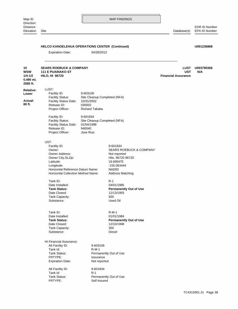
MAP FINDINGSMap IDDirection
EDR ID NumberDistanceEPA ID NumberDatabase(s)SiteElevation
04/28/2013Expiration Date:
HELCO KANOELEHUA OPERATIONS CENTER (Continued) U001236868
Self InsuredFRTYPE: Permanently Out of UseTank Status: R-1Tank Id: 9-601834Alt Facility ID:
Not reportedExpiration Date: InsuranceFRTYPE: Permanently Out of UseTank Status: R-M-1Tank Id: 9-603106Alt Facility ID:
HI Financial Assurance:
DieselSubstance: 300Tank Capacity: 12/10/1998Date Closed: Permanently Out of UseTank Status: 01/01/1984Date Installed: R-M-1Tank ID:
Used OilSubstance: 500Tank Capacity: 12/13/1993Date Closed: Permanently Out of UseTank Status: 04/01/1985Date Installed: R-1Tank ID:
Address MatchingHorizontal Collection Method Name: NAD83Horizontal Reference Datum Name: -155.063444Longitude: 19.695475Latitude: Hilo, 96720 96720Owner City,St,Zip: Not reportedOwner Address: SEARS ROEBUCK & COMPANYOwner: 9-601834Facility ID:
UST:
Jose RuizProject Officer: 940040Release ID: 01/04/1998Facility Status Date: Site Cleanup Completed (NFA)Facility Status: 9-601834Facility ID:
Richard TakabaProject Officer: 030002Release ID: 10/31/2002Facility Status Date: Site Cleanup Completed (NFA)Facility Status: 9-603106Facility ID:
LUST:
2585 ft.0.490 mi.
Relative:Lower
Actual:80 ft.
1/4-1/2 Financial AssuranceHILO, HI 96720WSW UST111 E PUAINAKO ST N/A10 LUSTSEARS ROEBUCK & COMPANY U003790356
TC4315061.2s Page 38

MAP FINDINGSMap IDDirection
EDR ID NumberDistanceEPA ID NumberDatabase(s)SiteElevation
Not reportedExpiration Date:
SEARS ROEBUCK & COMPANY (Continued) U003790356
(808) 586-4249 919 Ala Moana Blvd, Honolulu, HI 96814Contact Information: Steve MowProject Manager: Not reportedDocument Subject: Not reportedDocument Number: Not reportedDocument Date: Not reportedSite Closure Type: Not reportedWithin Designated Areawide Contamination: Not reportedInstitutional Control: Not reportedDescription of Restrictions: Not reportedEngineering Control: Controls Required to Manage ContaminationUse Restrictions: Not reportedNature of Residual Contamination: Found: Organochlorine pesticidesNature of Contamination: Response OngoingResponse: Response NecessaryAssessment: HighPriority: Hazard PresentPotential Hazard And Controls: StateProgran Name: HEERLead Agency: 110013789132Facility Registry Identifier: HI0000603266HID Number: Hawaii Pest ControlSDAR Environmental Interest Name: Unit ASupplemental Location Text: HawaiiIsland: Not reportedOrganization: Hazard PresentPotential Hazards And Controls: HighHazard Priority: Steve MowProject Manager: StateProgram: HEERLead Agency: 110013789132Facility Registry Identifier: HI0000603266HID Number: Hawaii Pest ControlEnvironmental Interest: HawaiiIsland: Unit ASupplemental Location: Not reportedOrganization:
SHWS:
3250 ft.0.616 mi.
Relative:Lower
Actual:49 ft.
1/2-1 HILO, HI 96720WNW 56 WIWOOLE ST N/A11 SHWSHAWAII PEST CONTROL 1006820888
HawaiiIsland: Not reportedSupplemental Location: Not reportedOrganization:
SHWS:
3750 ft.0.710 mi.
Relative:Lower
Actual:56 ft.
1/2-1 HILO, HI 96720WNW 50 HOLOMUA ST N/A12 SHWSHILO MECHANICAL, INC 1006820676
TC4315061.2s Page 39

MAP FINDINGSMap IDDirection
EDR ID NumberDistanceEPA ID NumberDatabase(s)SiteElevation
(808) 586-4249 919 Ala Moana Blvd, Honolulu, HI 96814Contact Information: UnassignedProject Manager: Not reportedDocument Subject: Not reportedDocument Number: 03/23/1995Document Date: No Further Action - Type UndeterminedSite Closure Type: Not reportedWithin Designated Areawide Contamination: Not reportedInstitutional Control: Not reportedDescription of Restrictions: Not reportedEngineering Control: UndeterminedUse Restrictions: Not reportedNature of Residual Contamination: Not reportedNature of Contamination: Not reportedResponse: Assessment OngoingAssessment: NFAPriority: Hazard UndeterminedPotential Hazard And Controls: StateProgran Name: Not reportedLead Agency: 110013786778Facility Registry Identifier: Not reportedHID Number: Hilo Mechanical, Inc.SDAR Environmental Interest Name: Not reportedSupplemental Location Text: HawaiiIsland: Not reportedOrganization: Hazard UndeterminedPotential Hazards And Controls: NFAHazard Priority: UnassignedProject Manager: StateProgram: Not reportedLead Agency: 110013786778Facility Registry Identifier: Not reportedHID Number: Hilo Mechanical, Inc.Environmental Interest:
HILO MECHANICAL, INC (Continued) 1006820676
Not reportedFacility Registry Identifier: Not reportedHID Number: Kanoelehua Industrial WarehouseSDAR Environmental Interest Name: Kanoelehua Industrial WarehouseSupplemental Location Text: HawaiiIsland: Not reportedOrganization: Hazard UndeterminedPotential Hazards And Controls: LowHazard Priority: UnassignedProject Manager: BrownfieldsProgram: HEERLead Agency: Not reportedFacility Registry Identifier: Not reportedHID Number: Kanoelehua Industrial WarehouseEnvironmental Interest: HawaiiIsland: Kanoelehua Industrial WarehouseSupplemental Location: Not reportedOrganization:
SHWS:
3824 ft.0.724 mi.
Relative:Lower
Actual:66 ft.
1/2-1 HILO, HI 96720WNW BROWNFIELDS20 POOKELA ST N/A13 SHWSKANOELEHUA INDUSTRIAL WAREHOUSE S110061615
TC4315061.2s Page 40

MAP FINDINGSMap IDDirection
EDR ID NumberDistanceEPA ID NumberDatabase(s)SiteElevation
Not reportedZip Suffix: HawaiiIsland: Kanoelehua Industrial WarehouseSupplemental Location: BrownfieldsProgram:
BROWNFIELDS:
(808) 586-4249 919 Ala Moana Blvd, Honolulu, HI 96814Contact Information: UnassignedProject Manager: Not reportedDocument Subject: Not reportedDocument Number: Not reportedDocument Date: Not reportedSite Closure Type: Not reportedWithin Designated Areawide Contamination: Not reportedInstitutional Control: Not reportedDescription of Restrictions: Not reportedEngineering Control: UndeterminedUse Restrictions: Not reportedNature of Residual Contamination: Not reportedNature of Contamination: Not reportedResponse: Assessment OngoingAssessment: LowPriority: Hazard UndeterminedPotential Hazard And Controls: BrownfieldsProgran Name: HEERLead Agency:
KANOELEHUA INDUSTRIAL WAREHOUSE (Continued) S110061615
Not reportedNature of Contamination: Response CompleteResponse: Response NecessaryAssessment: Not reportedPriority: No HazardPotential Hazard And Controls: StateProgran Name: HEERLead Agency: Not reportedFacility Registry Identifier: Not reportedHID Number: Stationers Corporation of HawaiiSDAR Environmental Interest Name: ESA Limited Phase II InvestigationSupplemental Location Text: HawaiiIsland: Not reportedOrganization: No HazardPotential Hazards And Controls: Not reportedHazard Priority: UnassignedProject Manager: StateProgram: HEERLead Agency: Not reportedFacility Registry Identifier: Not reportedHID Number: Stationers Corporation of HawaiiEnvironmental Interest: HawaiiIsland: ESA Limited Phase II InvestigationSupplemental Location: Not reportedOrganization:
SHWS:
4401 ft.0.834 mi.
Relative:Lower
Actual:29 ft.
1/2-1 HILO, HI 96720NW SPILLS708 KANOELEHUA AVE N/A14 SHWSSTATIONERS CORPORATION OF HAWAII S108009231
TC4315061.2s Page 41

MAP FINDINGSMap IDDirection
EDR ID NumberDistanceEPA ID NumberDatabase(s)SiteElevation
Stationers Corporation of HawaiiFile Under: SOSC NFAResult: 2005-11-23 00:00:00Assignment End Date: Curtis MartinActivity Lead: ResponseActivity Type: Not reportedUnits: Not reportedNumerical Quantity: Not reportedLess Or Greater Than: UnknownSubstances: Building Materials Survey - Typewriter Cleaning StationUnits: NoER: HEER EP&RLead and Program: Not reportedFacility Registry Id: Not reportedHID Number: 20051123-0823Case Number: ESA Limited Phase II InvestigationSupplemental Loc. Text: HawaiiIsland:
HI SPILLS:
(808) 586-4249 919 Ala Moana Blvd, Honolulu, HI 96814Contact Information: UnassignedProject Manager: Review of the Limited Phase II ESADocument Subject: 2005-637-CACDocument Number: 12/09/2005Document Date: No Further Action Letter - Unrestricted Residential UseSite Closure Type: Not reportedWithin Designated Areawide Contamination: Not reportedInstitutional Control: Not reportedDescription of Restrictions: Not reportedEngineering Control: No Hazard Present For Unrestricted Residential UseUse Restrictions: Not reportedNature of Residual Contamination:
STATIONERS CORPORATION OF HAWAII (Continued) S108009231
HEERLead Agency: 110013786803Facility Registry Identifier: Not reportedHID Number: Hilo Soda Works Tank ClosureSDAR Environmental Interest Name: Not reportedSupplemental Location Text: HawaiiIsland: Not reportedOrganization: No HazardPotential Hazards And Controls: NFAHazard Priority: UnassignedProject Manager: StateProgram: HEERLead Agency: 110013786803Facility Registry Identifier: Not reportedHID Number: Hilo Soda Works Tank ClosureEnvironmental Interest: HawaiiIsland: Not reportedSupplemental Location: Not reportedOrganization:
SHWS:
4605 ft.0.872 mi.
Relative:Lower
Actual:45 ft.
1/2-1 USTHILO, HI 96720WNW LUST270 E KAWILI ST N/A15 SHWSHILO SODA WORKS U003155315
TC4315061.2s Page 42

MAP FINDINGSMap IDDirection
EDR ID NumberDistanceEPA ID NumberDatabase(s)SiteElevation
GasolineSubstance: 550Tank Capacity: 12/04/1996Date Closed: Permanently Out of UseTank Status: 01/01/1964Date Installed: R-2Tank ID:
DieselSubstance: 550Tank Capacity: 12/04/1996Date Closed: Permanently Out of UseTank Status: 01/01/1970Date Installed: R-1Tank ID:
Address MatchingHorizontal Collection Method Name: NAD83Horizontal Reference Datum Name: -155.068516Longitude: 19.705588Latitude: Hilo, 96720 96720Owner City,St,Zip: 145 KEOULA STOwner Address: HILO SODA WORKSOwner: 9-603256Facility ID:
UST:
Jose RuizProject Officer: 970025Release ID: 07/31/1997Facility Status Date: Site Cleanup Completed (NFA)Facility Status: 9-603256Facility ID:
LUST:
(808) 586-4249 919 Ala Moana Blvd, Honolulu, HI 96814Contact Information: UnassignedProject Manager: NFA for Hilo Soda Works siteDocument Subject: 1997-340-RKDocument Number: 09/15/1997Document Date: No Further Action Letter - Unrestricted Residential UseSite Closure Type: Not reportedWithin Designated Areawide Contamination: Not reportedInstitutional Control: Not reportedDescription of Restrictions: Not reportedEngineering Control: No Hazard Present For Unrestricted Residential UseUse Restrictions: Diesel and Gasoline USTsNature of Residual Contamination: Not reportedNature of Contamination: Response CompleteResponse: Response NecessaryAssessment: NFAPriority: No HazardPotential Hazard And Controls: StateProgran Name:
HILO SODA WORKS (Continued) U003155315
TC4315061.2s Page 43

ORPHAN SUMMARY
City EDR ID Site Name Site Address Zip Database(s)
Count: 3 records.
HILO S108008478 ARMY AVIATION SUPPORT FACILITY #2 HILO INTERNATIONAL AIRPORT BUI 96720 SHWSHILO S107022566 HILO JUDICIARY CENTER PROJECT KILAUEA AVE 96720 SHWS, ENG CONTROLS, INST CONTHILO S110061564 HILO SAFEWAY/TARGET MAKAALA ST X RAILROAD AVE 96720 SHWS, ENG CONTROLS, INST CONT
TC4315061.2s Page 44

To maintain currency of the following federal and state databases, EDR contacts the appropriate governmental agencyon a monthly or quarterly basis, as required.
Number of Days to Update: Provides confirmation that EDR is reporting records that have been updated within 90 daysfrom the date the government agency made the information available to the public.
STANDARD ENVIRONMENTAL RECORDS
Federal NPL site list
NPL: National Priority ListNational Priorities List (Superfund). The NPL is a subset of CERCLIS and identifies over 1,200 sites for prioritycleanup under the Superfund Program. NPL sites may encompass relatively large areas. As such, EDR provides polygoncoverage for over 1,000 NPL site boundaries produced by EPA’s Environmental Photographic Interpretation Center(EPIC) and regional EPA offices.
Date of Government Version: 03/26/2015Date Data Arrived at EDR: 04/08/2015Date Made Active in Reports: 06/22/2015Number of Days to Update: 75
Source: EPATelephone: N/ALast EDR Contact: 04/08/2015Next Scheduled EDR Contact: 07/20/2015Data Release Frequency: Quarterly
NPL Site Boundaries
Sources:
EPA’s Environmental Photographic Interpretation Center (EPIC)Telephone: 202-564-7333
EPA Region 1 EPA Region 6Telephone 617-918-1143 Telephone: 214-655-6659
EPA Region 3 EPA Region 7Telephone 215-814-5418 Telephone: 913-551-7247
EPA Region 4 EPA Region 8Telephone 404-562-8033 Telephone: 303-312-6774
EPA Region 5 EPA Region 9Telephone 312-886-6686 Telephone: 415-947-4246
EPA Region 10Telephone 206-553-8665
Proposed NPL: Proposed National Priority List SitesA site that has been proposed for listing on the National Priorities List through the issuance of a proposed rulein the Federal Register. EPA then accepts public comments on the site, responds to the comments, and places onthe NPL those sites that continue to meet the requirements for listing.
Date of Government Version: 03/26/2015Date Data Arrived at EDR: 04/08/2015Date Made Active in Reports: 06/22/2015Number of Days to Update: 75
Source: EPATelephone: N/ALast EDR Contact: 04/08/2015Next Scheduled EDR Contact: 07/20/2015Data Release Frequency: Quarterly
NPL LIENS: Federal Superfund LiensFederal Superfund Liens. Under the authority granted the USEPA by CERCLA of 1980, the USEPA has the authorityto file liens against real property in order to recover remedial action expenditures or when the property ownerreceived notification of potential liability. USEPA compiles a listing of filed notices of Superfund Liens.
Date of Government Version: 10/15/1991Date Data Arrived at EDR: 02/02/1994Date Made Active in Reports: 03/30/1994Number of Days to Update: 56
Source: EPATelephone: 202-564-4267Last EDR Contact: 08/15/2011Next Scheduled EDR Contact: 11/28/2011Data Release Frequency: No Update Planned
TC4315061.2s Page GR-1
GOVERNMENT RECORDS SEARCHED / DATA CURRENCY TRACKING

Federal Delisted NPL site list
Delisted NPL: National Priority List DeletionsThe National Oil and Hazardous Substances Pollution Contingency Plan (NCP) establishes the criteria that theEPA uses to delete sites from the NPL. In accordance with 40 CFR 300.425.(e), sites may be deleted from theNPL where no further response is appropriate.
Date of Government Version: 03/26/2015Date Data Arrived at EDR: 04/08/2015Date Made Active in Reports: 06/22/2015Number of Days to Update: 75
Source: EPATelephone: N/ALast EDR Contact: 04/08/2015Next Scheduled EDR Contact: 07/20/2015Data Release Frequency: Quarterly
Federal CERCLIS list
CERCLIS: Comprehensive Environmental Response, Compensation, and Liability Information SystemCERCLIS contains data on potentially hazardous waste sites that have been reported to the USEPA by states, municipalities,private companies and private persons, pursuant to Section 103 of the Comprehensive Environmental Response, Compensation,and Liability Act (CERCLA). CERCLIS contains sites which are either proposed to or on the National PrioritiesList (NPL) and sites which are in the screening and assessment phase for possible inclusion on the NPL.
Date of Government Version: 10/25/2013Date Data Arrived at EDR: 11/11/2013Date Made Active in Reports: 02/13/2014Number of Days to Update: 94
Source: EPATelephone: 703-412-9810Last EDR Contact: 05/29/2015Next Scheduled EDR Contact: 09/07/2015Data Release Frequency: Quarterly
FEDERAL FACILITY: Federal Facility Site Information listingA listing of National Priority List (NPL) and Base Realignment and Closure (BRAC) sites found in the ComprehensiveEnvironmental Response, Compensation and Liability Information System (CERCLIS) Database where EPA Federal FacilitiesRestoration and Reuse Office is involved in cleanup activities.
Date of Government Version: 03/26/2015Date Data Arrived at EDR: 04/08/2015Date Made Active in Reports: 06/11/2015Number of Days to Update: 64
Source: Environmental Protection AgencyTelephone: 703-603-8704Last EDR Contact: 04/08/2015Next Scheduled EDR Contact: 07/20/2015Data Release Frequency: Varies
Federal CERCLIS NFRAP site List
CERCLIS-NFRAP: CERCLIS No Further Remedial Action PlannedArchived sites are sites that have been removed and archived from the inventory of CERCLIS sites. Archived statusindicates that, to the best of EPA’s knowledge, assessment at a site has been completed and that EPA has determinedno further steps will be taken to list this site on the National Priorities List (NPL), unless information indicatesthis decision was not appropriate or other considerations require a recommendation for listing at a later time.This decision does not necessarily mean that there is no hazard associated with a given site; it only means that,based upon available information, the location is not judged to be a potential NPL site.
Date of Government Version: 10/25/2013Date Data Arrived at EDR: 11/11/2013Date Made Active in Reports: 02/13/2014Number of Days to Update: 94
Source: EPATelephone: 703-412-9810Last EDR Contact: 05/29/2015Next Scheduled EDR Contact: 09/07/2015Data Release Frequency: Quarterly
Federal RCRA CORRACTS facilities list
CORRACTS: Corrective Action ReportCORRACTS identifies hazardous waste handlers with RCRA corrective action activity.
TC4315061.2s Page GR-2
GOVERNMENT RECORDS SEARCHED / DATA CURRENCY TRACKING

Date of Government Version: 03/10/2015Date Data Arrived at EDR: 03/31/2015Date Made Active in Reports: 06/11/2015Number of Days to Update: 72
Source: EPATelephone: 800-424-9346Last EDR Contact: 06/26/2015Next Scheduled EDR Contact: 10/12/2015Data Release Frequency: Quarterly
Federal RCRA non-CORRACTS TSD facilities list
RCRA-TSDF: RCRA - Treatment, Storage and DisposalRCRAInfo is EPA’s comprehensive information system, providing access to data supporting the Resource Conservationand Recovery Act (RCRA) of 1976 and the Hazardous and Solid Waste Amendments (HSWA) of 1984. The databaseincludes selective information on sites which generate, transport, store, treat and/or dispose of hazardous wasteas defined by the Resource Conservation and Recovery Act (RCRA). Transporters are individuals or entities thatmove hazardous waste from the generator offsite to a facility that can recycle, treat, store, or dispose of thewaste. TSDFs treat, store, or dispose of the waste.
Date of Government Version: 03/10/2015Date Data Arrived at EDR: 03/31/2015Date Made Active in Reports: 06/11/2015Number of Days to Update: 72
Source: Environmental Protection AgencyTelephone: (415) 495-8895Last EDR Contact: 06/26/2015Next Scheduled EDR Contact: 10/12/2015Data Release Frequency: Quarterly
Federal RCRA generators list
RCRA-LQG: RCRA - Large Quantity GeneratorsRCRAInfo is EPA’s comprehensive information system, providing access to data supporting the Resource Conservationand Recovery Act (RCRA) of 1976 and the Hazardous and Solid Waste Amendments (HSWA) of 1984. The databaseincludes selective information on sites which generate, transport, store, treat and/or dispose of hazardous wasteas defined by the Resource Conservation and Recovery Act (RCRA). Large quantity generators (LQGs) generateover 1,000 kilograms (kg) of hazardous waste, or over 1 kg of acutely hazardous waste per month.
Date of Government Version: 03/10/2015Date Data Arrived at EDR: 03/31/2015Date Made Active in Reports: 06/11/2015Number of Days to Update: 72
Source: Environmental Protection AgencyTelephone: (415) 495-8895Last EDR Contact: 06/26/2015Next Scheduled EDR Contact: 10/12/2015Data Release Frequency: Quarterly
RCRA-SQG: RCRA - Small Quantity GeneratorsRCRAInfo is EPA’s comprehensive information system, providing access to data supporting the Resource Conservationand Recovery Act (RCRA) of 1976 and the Hazardous and Solid Waste Amendments (HSWA) of 1984. The databaseincludes selective information on sites which generate, transport, store, treat and/or dispose of hazardous wasteas defined by the Resource Conservation and Recovery Act (RCRA). Small quantity generators (SQGs) generatebetween 100 kg and 1,000 kg of hazardous waste per month.
Date of Government Version: 03/10/2015Date Data Arrived at EDR: 03/31/2015Date Made Active in Reports: 06/11/2015Number of Days to Update: 72
Source: Environmental Protection AgencyTelephone: (415) 495-8895Last EDR Contact: 06/26/2015Next Scheduled EDR Contact: 10/12/2015Data Release Frequency: Quarterly
RCRA-CESQG: RCRA - Conditionally Exempt Small Quantity GeneratorsRCRAInfo is EPA’s comprehensive information system, providing access to data supporting the Resource Conservationand Recovery Act (RCRA) of 1976 and the Hazardous and Solid Waste Amendments (HSWA) of 1984. The databaseincludes selective information on sites which generate, transport, store, treat and/or dispose of hazardous wasteas defined by the Resource Conservation and Recovery Act (RCRA). Conditionally exempt small quantity generators(CESQGs) generate less than 100 kg of hazardous waste, or less than 1 kg of acutely hazardous waste per month.
Date of Government Version: 03/10/2015Date Data Arrived at EDR: 03/31/2015Date Made Active in Reports: 06/11/2015Number of Days to Update: 72
Source: Environmental Protection AgencyTelephone: (415) 495-8895Last EDR Contact: 06/26/2015Next Scheduled EDR Contact: 10/12/2015Data Release Frequency: Varies
TC4315061.2s Page GR-3
GOVERNMENT RECORDS SEARCHED / DATA CURRENCY TRACKING

Federal institutional controls / engineering controls registries
US ENG CONTROLS: Engineering Controls Sites ListA listing of sites with engineering controls in place. Engineering controls include various forms of caps, buildingfoundations, liners, and treatment methods to create pathway elimination for regulated substances to enter environmentalmedia or effect human health.
Date of Government Version: 03/16/2015Date Data Arrived at EDR: 03/17/2015Date Made Active in Reports: 06/02/2015Number of Days to Update: 77
Source: Environmental Protection AgencyTelephone: 703-603-0695Last EDR Contact: 06/01/2015Next Scheduled EDR Contact: 09/14/2015Data Release Frequency: Varies
US INST CONTROL: Sites with Institutional ControlsA listing of sites with institutional controls in place. Institutional controls include administrative measures,such as groundwater use restrictions, construction restrictions, property use restrictions, and post remediationcare requirements intended to prevent exposure to contaminants remaining on site. Deed restrictions are generallyrequired as part of the institutional controls.
Date of Government Version: 03/16/2015Date Data Arrived at EDR: 03/17/2015Date Made Active in Reports: 06/02/2015Number of Days to Update: 77
Source: Environmental Protection AgencyTelephone: 703-603-0695Last EDR Contact: 06/01/2015Next Scheduled EDR Contact: 09/14/2015Data Release Frequency: Varies
LUCIS: Land Use Control Information SystemLUCIS contains records of land use control information pertaining to the former Navy Base Realignment and Closureproperties.
Date of Government Version: 05/28/2015Date Data Arrived at EDR: 05/29/2015Date Made Active in Reports: 06/11/2015Number of Days to Update: 13
Source: Department of the NavyTelephone: 843-820-7326Last EDR Contact: 05/18/2015Next Scheduled EDR Contact: 08/31/2015Data Release Frequency: Varies
Federal ERNS list
ERNS: Emergency Response Notification SystemEmergency Response Notification System. ERNS records and stores information on reported releases of oil and hazardoussubstances.
Date of Government Version: 03/30/2015Date Data Arrived at EDR: 03/31/2015Date Made Active in Reports: 06/02/2015Number of Days to Update: 63
Source: National Response Center, United States Coast GuardTelephone: 202-267-2180Last EDR Contact: 06/26/2015Next Scheduled EDR Contact: 10/12/2015Data Release Frequency: Annually
State- and tribal - equivalent CERCLIS
SHWS: Sites ListFacilities, sites or areas in which the Office of Hazard Evaluation and Emergency Response has an interest, hasinvestigated or may investigate under HRS 128D (includes CERCLIS sites).
Date of Government Version: 12/02/2014Date Data Arrived at EDR: 12/22/2014Date Made Active in Reports: 01/27/2015Number of Days to Update: 36
Source: Department of HealthTelephone: 808-586-4249Last EDR Contact: 05/29/2015Next Scheduled EDR Contact: 09/07/2015Data Release Frequency: Semi-Annually
State and tribal landfill and/or solid waste disposal site lists
TC4315061.2s Page GR-4
GOVERNMENT RECORDS SEARCHED / DATA CURRENCY TRACKING

SWF/LF: Permitted Landfills in the State of HawaiiSolid Waste Facilities/Landfill Sites. SWF/LF type records typically contain an inventory of solid waste disposalfacilities or landfills in a particular state. Depending on the state, these may be active or inactive facilitiesor open dumps that failed to meet RCRA Subtitle D Section 4004 criteria for solid waste landfills or disposalsites.
Date of Government Version: 09/17/2012Date Data Arrived at EDR: 04/03/2013Date Made Active in Reports: 05/10/2013Number of Days to Update: 37
Source: Department of HealthTelephone: 808-586-4245Last EDR Contact: 06/26/2015Next Scheduled EDR Contact: 10/12/2015Data Release Frequency: Varies
State and tribal leaking storage tank lists
LUST: Leaking Underground Storage Tank DatabaseLeaking Underground Storage Tank Incident Reports. LUST records contain an inventory of reported leaking undergroundstorage tank incidents. Not all states maintain these records, and the information stored varies by state.
Date of Government Version: 06/04/2015Date Data Arrived at EDR: 06/05/2015Date Made Active in Reports: 07/02/2015Number of Days to Update: 27
Source: Department of HealthTelephone: 808-586-4228Last EDR Contact: 06/01/2015Next Scheduled EDR Contact: 09/14/2015Data Release Frequency: Semi-Annually
INDIAN LUST R1: Leaking Underground Storage Tanks on Indian LandA listing of leaking underground storage tank locations on Indian Land.
Date of Government Version: 02/03/2015Date Data Arrived at EDR: 04/30/2015Date Made Active in Reports: 06/22/2015Number of Days to Update: 53
Source: EPA Region 1Telephone: 617-918-1313Last EDR Contact: 04/03/2015Next Scheduled EDR Contact: 08/10/2015Data Release Frequency: Varies
INDIAN LUST R5: Leaking Underground Storage Tanks on Indian LandLeaking underground storage tanks located on Indian Land in Michigan, Minnesota and Wisconsin.
Date of Government Version: 04/30/2015Date Data Arrived at EDR: 05/29/2015Date Made Active in Reports: 06/22/2015Number of Days to Update: 24
Source: EPA, Region 5Telephone: 312-886-7439Last EDR Contact: 04/27/2015Next Scheduled EDR Contact: 08/10/2015Data Release Frequency: Varies
INDIAN LUST R10: Leaking Underground Storage Tanks on Indian LandLUSTs on Indian land in Alaska, Idaho, Oregon and Washington.
Date of Government Version: 02/03/2015Date Data Arrived at EDR: 02/12/2015Date Made Active in Reports: 03/13/2015Number of Days to Update: 29
Source: EPA Region 10Telephone: 206-553-2857Last EDR Contact: 04/27/2015Next Scheduled EDR Contact: 08/10/2015Data Release Frequency: Quarterly
INDIAN LUST R9: Leaking Underground Storage Tanks on Indian LandLUSTs on Indian land in Arizona, California, New Mexico and Nevada
Date of Government Version: 01/08/2015Date Data Arrived at EDR: 01/08/2015Date Made Active in Reports: 02/09/2015Number of Days to Update: 32
Source: Environmental Protection AgencyTelephone: 415-972-3372Last EDR Contact: 01/08/2015Next Scheduled EDR Contact: 05/11/2015Data Release Frequency: Quarterly
TC4315061.2s Page GR-5
GOVERNMENT RECORDS SEARCHED / DATA CURRENCY TRACKING

INDIAN LUST R8: Leaking Underground Storage Tanks on Indian LandLUSTs on Indian land in Colorado, Montana, North Dakota, South Dakota, Utah and Wyoming.
Date of Government Version: 04/30/2015Date Data Arrived at EDR: 05/05/2015Date Made Active in Reports: 06/22/2015Number of Days to Update: 48
Source: EPA Region 8Telephone: 303-312-6271Last EDR Contact: 04/27/2015Next Scheduled EDR Contact: 08/10/2015Data Release Frequency: Quarterly
INDIAN LUST R7: Leaking Underground Storage Tanks on Indian LandLUSTs on Indian land in Iowa, Kansas, and Nebraska
Date of Government Version: 03/30/2015Date Data Arrived at EDR: 04/28/2015Date Made Active in Reports: 06/22/2015Number of Days to Update: 55
Source: EPA Region 7Telephone: 913-551-7003Last EDR Contact: 04/27/2015Next Scheduled EDR Contact: 08/10/2015Data Release Frequency: Varies
INDIAN LUST R6: Leaking Underground Storage Tanks on Indian LandLUSTs on Indian land in New Mexico and Oklahoma.
Date of Government Version: 03/17/2015Date Data Arrived at EDR: 05/01/2015Date Made Active in Reports: 06/22/2015Number of Days to Update: 52
Source: EPA Region 6Telephone: 214-665-6597Last EDR Contact: 01/26/2015Next Scheduled EDR Contact: 05/11/2015Data Release Frequency: Varies
INDIAN LUST R4: Leaking Underground Storage Tanks on Indian LandLUSTs on Indian land in Florida, Mississippi and North Carolina.
Date of Government Version: 09/30/2014Date Data Arrived at EDR: 03/03/2015Date Made Active in Reports: 03/13/2015Number of Days to Update: 10
Source: EPA Region 4Telephone: 404-562-8677Last EDR Contact: 04/27/2015Next Scheduled EDR Contact: 08/10/2015Data Release Frequency: Semi-Annually
State and tribal registered storage tank lists
UST: Underground Storage Tank DatabaseRegistered Underground Storage Tanks. UST’s are regulated under Subtitle I of the Resource Conservation and RecoveryAct (RCRA) and must be registered with the state department responsible for administering the UST program. Availableinformation varies by state program.
Date of Government Version: 06/04/2015Date Data Arrived at EDR: 06/05/2015Date Made Active in Reports: 07/02/2015Number of Days to Update: 27
Source: Department of HealthTelephone: 808-586-4228Last EDR Contact: 06/01/2015Next Scheduled EDR Contact: 09/14/2015Data Release Frequency: Semi-Annually
INDIAN UST R4: Underground Storage Tanks on Indian LandThe Indian Underground Storage Tank (UST) database provides information about underground storage tanks on Indianland in EPA Region 4 (Alabama, Florida, Georgia, Kentucky, Mississippi, North Carolina, South Carolina, Tennesseeand Tribal Nations)
Date of Government Version: 09/30/2014Date Data Arrived at EDR: 03/03/2015Date Made Active in Reports: 03/13/2015Number of Days to Update: 10
Source: EPA Region 4Telephone: 404-562-9424Last EDR Contact: 04/27/2015Next Scheduled EDR Contact: 08/10/2015Data Release Frequency: Semi-Annually
TC4315061.2s Page GR-6
GOVERNMENT RECORDS SEARCHED / DATA CURRENCY TRACKING

INDIAN UST R10: Underground Storage Tanks on Indian LandThe Indian Underground Storage Tank (UST) database provides information about underground storage tanks on Indianland in EPA Region 10 (Alaska, Idaho, Oregon, Washington, and Tribal Nations).
Date of Government Version: 05/06/2015Date Data Arrived at EDR: 05/19/2015Date Made Active in Reports: 06/22/2015Number of Days to Update: 34
Source: EPA Region 10Telephone: 206-553-2857Last EDR Contact: 04/27/2015Next Scheduled EDR Contact: 08/10/2015Data Release Frequency: Quarterly
INDIAN UST R1: Underground Storage Tanks on Indian LandThe Indian Underground Storage Tank (UST) database provides information about underground storage tanks on Indianland in EPA Region 1 (Connecticut, Maine, Massachusetts, New Hampshire, Rhode Island, Vermont and ten TribalNations).
Date of Government Version: 02/03/2015Date Data Arrived at EDR: 04/30/2015Date Made Active in Reports: 06/22/2015Number of Days to Update: 53
Source: EPA, Region 1Telephone: 617-918-1313Last EDR Contact: 04/28/2015Next Scheduled EDR Contact: 08/10/2015Data Release Frequency: Varies
INDIAN UST R9: Underground Storage Tanks on Indian LandThe Indian Underground Storage Tank (UST) database provides information about underground storage tanks on Indianland in EPA Region 9 (Arizona, California, Hawaii, Nevada, the Pacific Islands, and Tribal Nations).
Date of Government Version: 12/14/2014Date Data Arrived at EDR: 02/13/2015Date Made Active in Reports: 03/13/2015Number of Days to Update: 28
Source: EPA Region 9Telephone: 415-972-3368Last EDR Contact: 01/26/2015Next Scheduled EDR Contact: 05/11/2015Data Release Frequency: Quarterly
INDIAN UST R5: Underground Storage Tanks on Indian LandThe Indian Underground Storage Tank (UST) database provides information about underground storage tanks on Indianland in EPA Region 5 (Michigan, Minnesota and Wisconsin and Tribal Nations).
Date of Government Version: 04/30/2015Date Data Arrived at EDR: 05/26/2015Date Made Active in Reports: 06/22/2015Number of Days to Update: 27
Source: EPA Region 5Telephone: 312-886-6136Last EDR Contact: 04/27/2015Next Scheduled EDR Contact: 08/10/2015Data Release Frequency: Varies
INDIAN UST R6: Underground Storage Tanks on Indian LandThe Indian Underground Storage Tank (UST) database provides information about underground storage tanks on Indianland in EPA Region 6 (Louisiana, Arkansas, Oklahoma, New Mexico, Texas and 65 Tribes).
Date of Government Version: 03/17/2015Date Data Arrived at EDR: 05/01/2015Date Made Active in Reports: 06/22/2015Number of Days to Update: 52
Source: EPA Region 6Telephone: 214-665-7591Last EDR Contact: 01/26/2015Next Scheduled EDR Contact: 05/11/2015Data Release Frequency: Semi-Annually
INDIAN UST R7: Underground Storage Tanks on Indian LandThe Indian Underground Storage Tank (UST) database provides information about underground storage tanks on Indianland in EPA Region 7 (Iowa, Kansas, Missouri, Nebraska, and 9 Tribal Nations).
Date of Government Version: 09/23/2014Date Data Arrived at EDR: 11/25/2014Date Made Active in Reports: 01/29/2015Number of Days to Update: 65
Source: EPA Region 7Telephone: 913-551-7003Last EDR Contact: 04/27/2015Next Scheduled EDR Contact: 08/10/2015Data Release Frequency: Varies
TC4315061.2s Page GR-7
GOVERNMENT RECORDS SEARCHED / DATA CURRENCY TRACKING

INDIAN UST R8: Underground Storage Tanks on Indian LandThe Indian Underground Storage Tank (UST) database provides information about underground storage tanks on Indianland in EPA Region 8 (Colorado, Montana, North Dakota, South Dakota, Utah, Wyoming and 27 Tribal Nations).
Date of Government Version: 04/30/2015Date Data Arrived at EDR: 05/05/2015Date Made Active in Reports: 06/22/2015Number of Days to Update: 48
Source: EPA Region 8Telephone: 303-312-6137Last EDR Contact: 04/27/2015Next Scheduled EDR Contact: 08/10/2015Data Release Frequency: Quarterly
FEMA UST: Underground Storage Tank ListingA listing of all FEMA owned underground storage tanks.
Date of Government Version: 01/01/2010Date Data Arrived at EDR: 02/16/2010Date Made Active in Reports: 04/12/2010Number of Days to Update: 55
Source: FEMATelephone: 202-646-5797Last EDR Contact: 04/13/2015Next Scheduled EDR Contact: 07/27/2015Data Release Frequency: Varies
State and tribal institutional control / engineering control registries
ENG CONTROLS: Engineering Control SitesA listing of sites with engineering controls in place.
Date of Government Version: 12/02/2014Date Data Arrived at EDR: 12/22/2014Date Made Active in Reports: 01/27/2015Number of Days to Update: 36
Source: Department of HealthTelephone: 404-586-4249Last EDR Contact: 05/29/2015Next Scheduled EDR Contact: 09/07/2015Data Release Frequency: Varies
INST CONTROL: Sites with Institutional ControlsVoluntary Remediation Program and Brownfields sites with institutional controls in place.
Date of Government Version: 12/02/2014Date Data Arrived at EDR: 12/22/2014Date Made Active in Reports: 01/27/2015Number of Days to Update: 36
Source: Department of HealthTelephone: 808-586-4249Last EDR Contact: 05/29/2015Next Scheduled EDR Contact: 09/07/2015Data Release Frequency: Varies
State and tribal voluntary cleanup sites
INDIAN VCP R7: Voluntary Cleanup Priority LisitngA listing of voluntary cleanup priority sites located on Indian Land located in Region 7.
Date of Government Version: 03/20/2008Date Data Arrived at EDR: 04/22/2008Date Made Active in Reports: 05/19/2008Number of Days to Update: 27
Source: EPA, Region 7Telephone: 913-551-7365Last EDR Contact: 04/20/2009Next Scheduled EDR Contact: 07/20/2009Data Release Frequency: Varies
INDIAN VCP R1: Voluntary Cleanup Priority ListingA listing of voluntary cleanup priority sites located on Indian Land located in Region 1.
Date of Government Version: 09/29/2014Date Data Arrived at EDR: 10/01/2014Date Made Active in Reports: 11/06/2014Number of Days to Update: 36
Source: EPA, Region 1Telephone: 617-918-1102Last EDR Contact: 06/26/2015Next Scheduled EDR Contact: 10/12/2015Data Release Frequency: Varies
TC4315061.2s Page GR-8
GOVERNMENT RECORDS SEARCHED / DATA CURRENCY TRACKING

VCP: Voluntary Response Program SitesSites participating in the Voluntary Response Program. The purpose of the VRP is to streamline the cleanup processin a way that will encourage prospective developers, lenders, and purchasers to voluntarily cleanup properties.
Date of Government Version: 12/02/2014Date Data Arrived at EDR: 12/22/2014Date Made Active in Reports: 01/27/2015Number of Days to Update: 36
Source: Department of HealthTelephone: 808-586-4249Last EDR Contact: 05/29/2015Next Scheduled EDR Contact: 09/07/2015Data Release Frequency: Varies
State and tribal Brownfields sites
BROWNFIELDS: Brownfields SitesWith certain legal exclusions and additions, the term ‘brownfield site’ means real property, the expansion, redevelopment,or reuse of which may be complicated by the presence or potential presence of a hazardous substance, pollutant,or contaminant.
Date of Government Version: 12/02/2014Date Data Arrived at EDR: 12/22/2014Date Made Active in Reports: 01/27/2015Number of Days to Update: 36
Source: Department of HealthTelephone: 808-586-4249Last EDR Contact: 05/29/2015Next Scheduled EDR Contact: 09/07/2015Data Release Frequency: Varies
ADDITIONAL ENVIRONMENTAL RECORDS
Local Brownfield lists
US BROWNFIELDS: A Listing of Brownfields SitesBrownfields are real property, the expansion, redevelopment, or reuse of which may be complicated by the presenceor potential presence of a hazardous substance, pollutant, or contaminant. Cleaning up and reinvesting in theseproperties takes development pressures off of undeveloped, open land, and both improves and protects the environment.Assessment, Cleanup and Redevelopment Exchange System (ACRES) stores information reported by EPA Brownfieldsgrant recipients on brownfields properties assessed or cleaned up with grant funding as well as information onTargeted Brownfields Assessments performed by EPA Regions. A listing of ACRES Brownfield sites is obtained fromCleanups in My Community. Cleanups in My Community provides information on Brownfields properties for which informationis reported back to EPA, as well as areas served by Brownfields grant programs.
Date of Government Version: 03/23/2015Date Data Arrived at EDR: 03/24/2015Date Made Active in Reports: 06/02/2015Number of Days to Update: 70
Source: Environmental Protection AgencyTelephone: 202-566-2777Last EDR Contact: 06/24/2015Next Scheduled EDR Contact: 10/05/2015Data Release Frequency: Semi-Annually
Local Lists of Landfill / Solid Waste Disposal Sites
ODI: Open Dump InventoryAn open dump is defined as a disposal facility that does not comply with one or more of the Part 257 or Part 258Subtitle D Criteria.
Date of Government Version: 06/30/1985Date Data Arrived at EDR: 08/09/2004Date Made Active in Reports: 09/17/2004Number of Days to Update: 39
Source: Environmental Protection AgencyTelephone: 800-424-9346Last EDR Contact: 06/09/2004Next Scheduled EDR Contact: N/AData Release Frequency: No Update Planned
DEBRIS REGION 9: Torres Martinez Reservation Illegal Dump Site LocationsA listing of illegal dump sites location on the Torres Martinez Indian Reservation located in eastern RiversideCounty and northern Imperial County, California.
Date of Government Version: 01/12/2009Date Data Arrived at EDR: 05/07/2009Date Made Active in Reports: 09/21/2009Number of Days to Update: 137
Source: EPA, Region 9Telephone: 415-947-4219Last EDR Contact: 04/23/2015Next Scheduled EDR Contact: 08/10/2015Data Release Frequency: No Update Planned
TC4315061.2s Page GR-9
GOVERNMENT RECORDS SEARCHED / DATA CURRENCY TRACKING

INDIAN ODI: Report on the Status of Open Dumps on Indian LandsLocation of open dumps on Indian land.
Date of Government Version: 12/31/1998Date Data Arrived at EDR: 12/03/2007Date Made Active in Reports: 01/24/2008Number of Days to Update: 52
Source: Environmental Protection AgencyTelephone: 703-308-8245Last EDR Contact: 05/01/2015Next Scheduled EDR Contact: 08/17/2015Data Release Frequency: Varies
Local Lists of Hazardous waste / Contaminated Sites
US CDL: Clandestine Drug LabsA listing of clandestine drug lab locations. The U.S. Department of Justice ("the Department") provides thisweb site as a public service. It contains addresses of some locations where law enforcement agencies reportedthey found chemicals or other items that indicated the presence of either clandestine drug laboratories or dumpsites.In most cases, the source of the entries is not the Department, and the Department has not verified the entryand does not guarantee its accuracy. Members of the public must verify the accuracy of all entries by, for example,contacting local law enforcement and local health departments.
Date of Government Version: 02/25/2015Date Data Arrived at EDR: 03/10/2015Date Made Active in Reports: 03/25/2015Number of Days to Update: 15
Source: Drug Enforcement AdministrationTelephone: 202-307-1000Last EDR Contact: 05/29/2015Next Scheduled EDR Contact: 09/14/2015Data Release Frequency: Quarterly
CDL: Clandestine Drug Lab ListingA listing of clandestine drug lab site locations.
Date of Government Version: 08/04/2010Date Data Arrived at EDR: 09/10/2010Date Made Active in Reports: 10/22/2010Number of Days to Update: 42
Source: Department of HealthTelephone: 808-586-4249Last EDR Contact: 06/01/2015Next Scheduled EDR Contact: 09/14/2015Data Release Frequency: Varies
US HIST CDL: National Clandestine Laboratory RegisterA listing of clandestine drug lab locations. The U.S. Department of Justice ("the Department") provides thisweb site as a public service. It contains addresses of some locations where law enforcement agencies reportedthey found chemicals or other items that indicated the presence of either clandestine drug laboratories or dumpsites.In most cases, the source of the entries is not the Department, and the Department has not verified the entryand does not guarantee its accuracy. Members of the public must verify the accuracy of all entries by, for example,contacting local law enforcement and local health departments.
Date of Government Version: 02/25/2015Date Data Arrived at EDR: 03/10/2015Date Made Active in Reports: 03/25/2015Number of Days to Update: 15
Source: Drug Enforcement AdministrationTelephone: 202-307-1000Last EDR Contact: 05/29/2015Next Scheduled EDR Contact: 09/14/2015Data Release Frequency: No Update Planned
Local Land Records
LIENS 2: CERCLA Lien InformationA Federal CERCLA (’Superfund’) lien can exist by operation of law at any site or property at which EPA has spentSuperfund monies. These monies are spent to investigate and address releases and threatened releases of contamination.CERCLIS provides information as to the identity of these sites and properties.
Date of Government Version: 02/18/2014Date Data Arrived at EDR: 03/18/2014Date Made Active in Reports: 04/24/2014Number of Days to Update: 37
Source: Environmental Protection AgencyTelephone: 202-564-6023Last EDR Contact: 04/27/2015Next Scheduled EDR Contact: 08/10/2015Data Release Frequency: Varies
TC4315061.2s Page GR-10
GOVERNMENT RECORDS SEARCHED / DATA CURRENCY TRACKING

Records of Emergency Release Reports
HMIRS: Hazardous Materials Information Reporting SystemHazardous Materials Incident Report System. HMIRS contains hazardous material spill incidents reported to DOT.
Date of Government Version: 03/30/2015Date Data Arrived at EDR: 03/31/2015Date Made Active in Reports: 06/11/2015Number of Days to Update: 72
Source: U.S. Department of TransportationTelephone: 202-366-4555Last EDR Contact: 06/26/2015Next Scheduled EDR Contact: 10/12/2015Data Release Frequency: Annually
SPILLS: Release NotificationsReleases of hazardous substances to the environment reported to the Office of Hazard Evaluation and EmergencyResponse since 1988.
Date of Government Version: 12/02/2014Date Data Arrived at EDR: 12/22/2014Date Made Active in Reports: 01/28/2015Number of Days to Update: 37
Source: Department of HealthTelephone: 808-586-4249Last EDR Contact: 05/29/2015Next Scheduled EDR Contact: 09/07/2015Data Release Frequency: Varies
SPILLS 90: SPILLS90 data from FirstSearchSpills 90 includes those spill and release records available exclusively from FirstSearch databases. Typically,they may include chemical, oil and/or hazardous substance spills recorded after 1990. Duplicate records that arealready included in EDR incident and release records are not included in Spills 90.
Date of Government Version: 03/10/2012Date Data Arrived at EDR: 01/03/2013Date Made Active in Reports: 02/11/2013Number of Days to Update: 39
Source: FirstSearchTelephone: N/ALast EDR Contact: 01/03/2013Next Scheduled EDR Contact: N/AData Release Frequency: No Update Planned
Other Ascertainable Records
RCRA NonGen / NLR: RCRA - Non Generators / No Longer RegulatedRCRAInfo is EPA’s comprehensive information system, providing access to data supporting the Resource Conservationand Recovery Act (RCRA) of 1976 and the Hazardous and Solid Waste Amendments (HSWA) of 1984. The databaseincludes selective information on sites which generate, transport, store, treat and/or dispose of hazardous wasteas defined by the Resource Conservation and Recovery Act (RCRA). Non-Generators do not presently generate hazardouswaste.
Date of Government Version: 03/10/2015Date Data Arrived at EDR: 03/31/2015Date Made Active in Reports: 06/11/2015Number of Days to Update: 72
Source: Environmental Protection AgencyTelephone: (415) 495-8895Last EDR Contact: 06/26/2015Next Scheduled EDR Contact: 10/12/2015Data Release Frequency: Varies
DOT OPS: Incident and Accident DataDepartment of Transporation, Office of Pipeline Safety Incident and Accident data.
Date of Government Version: 07/31/2012Date Data Arrived at EDR: 08/07/2012Date Made Active in Reports: 09/18/2012Number of Days to Update: 42
Source: Department of Transporation, Office of Pipeline SafetyTelephone: 202-366-4595Last EDR Contact: 05/05/2015Next Scheduled EDR Contact: 08/17/2015Data Release Frequency: Varies
DOD: Department of Defense SitesThis data set consists of federally owned or administered lands, administered by the Department of Defense, thathave any area equal to or greater than 640 acres of the United States, Puerto Rico, and the U.S. Virgin Islands.
TC4315061.2s Page GR-11
GOVERNMENT RECORDS SEARCHED / DATA CURRENCY TRACKING

Date of Government Version: 12/31/2005Date Data Arrived at EDR: 11/10/2006Date Made Active in Reports: 01/11/2007Number of Days to Update: 62
Source: USGSTelephone: 888-275-8747Last EDR Contact: 04/14/2015Next Scheduled EDR Contact: 07/27/2015Data Release Frequency: Semi-Annually
FUDS: Formerly Used Defense SitesThe listing includes locations of Formerly Used Defense Sites properties where the US Army Corps of Engineersis actively working or will take necessary cleanup actions.
Date of Government Version: 06/06/2014Date Data Arrived at EDR: 09/10/2014Date Made Active in Reports: 09/18/2014Number of Days to Update: 8
Source: U.S. Army Corps of EngineersTelephone: 202-528-4285Last EDR Contact: 06/12/2015Next Scheduled EDR Contact: 09/21/2015Data Release Frequency: Varies
CONSENT: Superfund (CERCLA) Consent DecreesMajor legal settlements that establish responsibility and standards for cleanup at NPL (Superfund) sites. Releasedperiodically by United States District Courts after settlement by parties to litigation matters.
Date of Government Version: 12/31/2014Date Data Arrived at EDR: 04/17/2015Date Made Active in Reports: 06/02/2015Number of Days to Update: 46
Source: Department of Justice, Consent Decree LibraryTelephone: VariesLast EDR Contact: 06/22/2015Next Scheduled EDR Contact: 10/12/2015Data Release Frequency: Varies
ROD: Records Of DecisionRecord of Decision. ROD documents mandate a permanent remedy at an NPL (Superfund) site containing technicaland health information to aid in the cleanup.
Date of Government Version: 11/25/2013Date Data Arrived at EDR: 12/12/2013Date Made Active in Reports: 02/24/2014Number of Days to Update: 74
Source: EPATelephone: 703-416-0223Last EDR Contact: 06/12/2015Next Scheduled EDR Contact: 09/21/2015Data Release Frequency: Annually
UMTRA: Uranium Mill Tailings SitesUranium ore was mined by private companies for federal government use in national defense programs. When the millsshut down, large piles of the sand-like material (mill tailings) remain after uranium has been extracted fromthe ore. Levels of human exposure to radioactive materials from the piles are low; however, in some cases tailingswere used as construction materials before the potential health hazards of the tailings were recognized.
Date of Government Version: 09/14/2010Date Data Arrived at EDR: 10/07/2011Date Made Active in Reports: 03/01/2012Number of Days to Update: 146
Source: Department of EnergyTelephone: 505-845-0011Last EDR Contact: 05/26/2015Next Scheduled EDR Contact: 09/07/2015Data Release Frequency: Varies
US MINES: Mines Master Index FileContains all mine identification numbers issued for mines active or opened since 1971. The data also includesviolation information.
Date of Government Version: 12/30/2014Date Data Arrived at EDR: 12/31/2014Date Made Active in Reports: 01/29/2015Number of Days to Update: 29
Source: Department of Labor, Mine Safety and Health AdministrationTelephone: 303-231-5959Last EDR Contact: 06/03/2015Next Scheduled EDR Contact: 09/14/2015Data Release Frequency: Semi-Annually
TRIS: Toxic Chemical Release Inventory SystemToxic Release Inventory System. TRIS identifies facilities which release toxic chemicals to the air, water andland in reportable quantities under SARA Title III Section 313.
TC4315061.2s Page GR-12
GOVERNMENT RECORDS SEARCHED / DATA CURRENCY TRACKING

Date of Government Version: 12/31/2013Date Data Arrived at EDR: 02/12/2015Date Made Active in Reports: 06/02/2015Number of Days to Update: 110
Source: EPATelephone: 202-566-0250Last EDR Contact: 01/29/2015Next Scheduled EDR Contact: 06/08/2015Data Release Frequency: Annually
TSCA: Toxic Substances Control ActToxic Substances Control Act. TSCA identifies manufacturers and importers of chemical substances included on theTSCA Chemical Substance Inventory list. It includes data on the production volume of these substances by plantsite.
Date of Government Version: 12/31/2012Date Data Arrived at EDR: 01/15/2015Date Made Active in Reports: 01/29/2015Number of Days to Update: 14
Source: EPATelephone: 202-260-5521Last EDR Contact: 06/25/2015Next Scheduled EDR Contact: 10/05/2015Data Release Frequency: Every 4 Years
FTTS: FIFRA/ TSCA Tracking System - FIFRA (Federal Insecticide, Fungicide, & Rodenticide Act)/TSCA (Toxic Substances Control Act)FTTS tracks administrative cases and pesticide enforcement actions and compliance activities related to FIFRA,TSCA and EPCRA (Emergency Planning and Community Right-to-Know Act). To maintain currency, EDR contacts theAgency on a quarterly basis.
Date of Government Version: 04/09/2009Date Data Arrived at EDR: 04/16/2009Date Made Active in Reports: 05/11/2009Number of Days to Update: 25
Source: EPA/Office of Prevention, Pesticides and Toxic SubstancesTelephone: 202-566-1667Last EDR Contact: 05/20/2015Next Scheduled EDR Contact: 09/07/2015Data Release Frequency: Quarterly
FTTS INSP: FIFRA/ TSCA Tracking System - FIFRA (Federal Insecticide, Fungicide, & Rodenticide Act)/TSCA (Toxic Substances Control Act)A listing of FIFRA/TSCA Tracking System (FTTS) inspections and enforcements.
Date of Government Version: 04/09/2009Date Data Arrived at EDR: 04/16/2009Date Made Active in Reports: 05/11/2009Number of Days to Update: 25
Source: EPATelephone: 202-566-1667Last EDR Contact: 05/20/2015Next Scheduled EDR Contact: 09/07/2015Data Release Frequency: Quarterly
HIST FTTS: FIFRA/TSCA Tracking System Administrative Case ListingA complete administrative case listing from the FIFRA/TSCA Tracking System (FTTS) for all ten EPA regions. Theinformation was obtained from the National Compliance Database (NCDB). NCDB supports the implementation of FIFRA(Federal Insecticide, Fungicide, and Rodenticide Act) and TSCA (Toxic Substances Control Act). Some EPA regionsare now closing out records. Because of that, and the fact that some EPA regions are not providing EPA Headquarterswith updated records, it was decided to create a HIST FTTS database. It included records that may not be includedin the newer FTTS database updates. This database is no longer updated.
Date of Government Version: 10/19/2006Date Data Arrived at EDR: 03/01/2007Date Made Active in Reports: 04/10/2007Number of Days to Update: 40
Source: Environmental Protection AgencyTelephone: 202-564-2501Last EDR Contact: 12/17/2007Next Scheduled EDR Contact: 03/17/2008Data Release Frequency: No Update Planned
HIST FTTS INSP: FIFRA/TSCA Tracking System Inspection & Enforcement Case ListingA complete inspection and enforcement case listing from the FIFRA/TSCA Tracking System (FTTS) for all ten EPAregions. The information was obtained from the National Compliance Database (NCDB). NCDB supports the implementationof FIFRA (Federal Insecticide, Fungicide, and Rodenticide Act) and TSCA (Toxic Substances Control Act). SomeEPA regions are now closing out records. Because of that, and the fact that some EPA regions are not providingEPA Headquarters with updated records, it was decided to create a HIST FTTS database. It included records thatmay not be included in the newer FTTS database updates. This database is no longer updated.
TC4315061.2s Page GR-13
GOVERNMENT RECORDS SEARCHED / DATA CURRENCY TRACKING
Date of Government Version: 10/19/2006Date Data Arrived at EDR: 03/01/2007Date Made Active in Reports: 04/10/2007Number of Days to Update: 40
Source: Environmental Protection AgencyTelephone: 202-564-2501Last EDR Contact: 12/17/2008Next Scheduled EDR Contact: 03/17/2008Data Release Frequency: No Update Planned
SSTS: Section 7 Tracking SystemsSection 7 of the Federal Insecticide, Fungicide and Rodenticide Act, as amended (92 Stat. 829) requires allregistered pesticide-producing establishments to submit a report to the Environmental Protection Agency by March1st each year. Each establishment must report the types and amounts of pesticides, active ingredients and devicesbeing produced, and those having been produced and sold or distributed in the past year.
Date of Government Version: 12/31/2009Date Data Arrived at EDR: 12/10/2010Date Made Active in Reports: 02/25/2011Number of Days to Update: 77
Source: EPATelephone: 202-564-4203Last EDR Contact: 04/10/2015Next Scheduled EDR Contact: 08/10/2015Data Release Frequency: Annually
ICIS: Integrated Compliance Information SystemThe Integrated Compliance Information System (ICIS) supports the information needs of the national enforcementand compliance program as well as the unique needs of the National Pollutant Discharge Elimination System (NPDES)program.
Date of Government Version: 01/23/2015Date Data Arrived at EDR: 02/06/2015Date Made Active in Reports: 03/09/2015Number of Days to Update: 31
Source: Environmental Protection AgencyTelephone: 202-564-5088Last EDR Contact: 04/09/2015Next Scheduled EDR Contact: 07/27/2015Data Release Frequency: Quarterly
PADS: PCB Activity Database SystemPCB Activity Database. PADS Identifies generators, transporters, commercial storers and/or brokers and disposersof PCB’s who are required to notify the EPA of such activities.
Date of Government Version: 07/01/2014Date Data Arrived at EDR: 10/15/2014Date Made Active in Reports: 11/17/2014Number of Days to Update: 33
Source: EPATelephone: 202-566-0500Last EDR Contact: 04/17/2015Next Scheduled EDR Contact: 07/27/2015Data Release Frequency: Annually
MLTS: Material Licensing Tracking SystemMLTS is maintained by the Nuclear Regulatory Commission and contains a list of approximately 8,100 sites whichpossess or use radioactive materials and which are subject to NRC licensing requirements. To maintain currency,EDR contacts the Agency on a quarterly basis.
Date of Government Version: 03/31/2015Date Data Arrived at EDR: 04/09/2015Date Made Active in Reports: 06/11/2015Number of Days to Update: 63
Source: Nuclear Regulatory CommissionTelephone: 301-415-7169Last EDR Contact: 06/04/2015Next Scheduled EDR Contact: 09/21/2015Data Release Frequency: Quarterly
RADINFO: Radiation Information DatabaseThe Radiation Information Database (RADINFO) contains information about facilities that are regulated by U.S.Environmental Protection Agency (EPA) regulations for radiation and radioactivity.
Date of Government Version: 04/07/2015Date Data Arrived at EDR: 04/09/2015Date Made Active in Reports: 06/11/2015Number of Days to Update: 63
Source: Environmental Protection AgencyTelephone: 202-343-9775Last EDR Contact: 04/09/2015Next Scheduled EDR Contact: 07/20/2015Data Release Frequency: Quarterly
TC4315061.2s Page GR-14
GOVERNMENT RECORDS SEARCHED / DATA CURRENCY TRACKING

FINDS: Facility Index System/Facility Registry SystemFacility Index System. FINDS contains both facility information and ’pointers’ to other sources that contain moredetail. EDR includes the following FINDS databases in this report: PCS (Permit Compliance System), AIRS (AerometricInformation Retrieval System), DOCKET (Enforcement Docket used to manage and track information on civil judicialenforcement cases for all environmental statutes), FURS (Federal Underground Injection Control), C-DOCKET (CriminalDocket System used to track criminal enforcement actions for all environmental statutes), FFIS (Federal FacilitiesInformation System), STATE (State Environmental Laws and Statutes), and PADS (PCB Activity Data System).
Date of Government Version: 01/18/2015Date Data Arrived at EDR: 02/27/2015Date Made Active in Reports: 03/25/2015Number of Days to Update: 26
Source: EPATelephone: (415) 947-8000Last EDR Contact: 06/10/2015Next Scheduled EDR Contact: 09/21/2015Data Release Frequency: Quarterly
RAATS: RCRA Administrative Action Tracking SystemRCRA Administration Action Tracking System. RAATS contains records based on enforcement actions issued under RCRApertaining to major violators and includes administrative and civil actions brought by the EPA. For administrationactions after September 30, 1995, data entry in the RAATS database was discontinued. EPA will retain a copy ofthe database for historical records. It was necessary to terminate RAATS because a decrease in agency resourcesmade it impossible to continue to update the information contained in the database.
Date of Government Version: 04/17/1995Date Data Arrived at EDR: 07/03/1995Date Made Active in Reports: 08/07/1995Number of Days to Update: 35
Source: EPATelephone: 202-564-4104Last EDR Contact: 06/02/2008Next Scheduled EDR Contact: 09/01/2008Data Release Frequency: No Update Planned
RMP: Risk Management PlansWhen Congress passed the Clean Air Act Amendments of 1990, it required EPA to publish regulations and guidancefor chemical accident prevention at facilities using extremely hazardous substances. The Risk Management ProgramRule (RMP Rule) was written to implement Section 112(r) of these amendments. The rule, which built upon existingindustry codes and standards, requires companies of all sizes that use certain flammable and toxic substancesto develop a Risk Management Program, which includes a(n): Hazard assessment that details the potential effectsof an accidental release, an accident history of the last five years, and an evaluation of worst-case and alternativeaccidental releases; Prevention program that includes safety precautions and maintenance, monitoring, and employeetraining measures; and Emergency response program that spells out emergency health care, employee training measuresand procedures for informing the public and response agencies (e.g the fire department) should an accident occur.
Date of Government Version: 02/01/2015Date Data Arrived at EDR: 02/13/2015Date Made Active in Reports: 03/25/2015Number of Days to Update: 40
Source: Environmental Protection AgencyTelephone: 202-564-8600Last EDR Contact: 04/27/2015Next Scheduled EDR Contact: 08/10/2015Data Release Frequency: Varies
BRS: Biennial Reporting SystemThe Biennial Reporting System is a national system administered by the EPA that collects data on the generationand management of hazardous waste. BRS captures detailed data from two groups: Large Quantity Generators (LQG)and Treatment, Storage, and Disposal Facilities.
Date of Government Version: 12/31/2011Date Data Arrived at EDR: 02/26/2013Date Made Active in Reports: 04/19/2013Number of Days to Update: 52
Source: EPA/NTISTelephone: 800-424-9346Last EDR Contact: 05/29/2015Next Scheduled EDR Contact: 09/07/2015Data Release Frequency: Biennially
UIC: Underground Injection Wells ListingA listing of underground injection well locations.
Date of Government Version: 02/07/2013Date Data Arrived at EDR: 02/12/2013Date Made Active in Reports: 04/09/2013Number of Days to Update: 56
Source: Department of HealthTelephone: 808-586-4258Last EDR Contact: 06/01/2015Next Scheduled EDR Contact: 09/14/2015Data Release Frequency: Varies
TC4315061.2s Page GR-15
GOVERNMENT RECORDS SEARCHED / DATA CURRENCY TRACKING

DRYCLEANERS: Permitted Drycleaner Facility ListingA listing of permitted drycleaner facilities in the state.
Date of Government Version: 12/31/2014Date Data Arrived at EDR: 01/09/2015Date Made Active in Reports: 02/11/2015Number of Days to Update: 33
Source: Department of HealthTelephone: 808-586-4200Last EDR Contact: 04/06/2015Next Scheduled EDR Contact: 07/20/2015Data Release Frequency: Varies
AIRS: List of Permitted FacilitiesA listing of permitted facilities in the state.
Date of Government Version: 04/08/2015Date Data Arrived at EDR: 04/10/2015Date Made Active in Reports: 04/30/2015Number of Days to Update: 20
Source: Department of HealthTelephone: 808-586-4200Last EDR Contact: 04/06/2015Next Scheduled EDR Contact: 07/20/2015Data Release Frequency: Varies
INDIAN RESERV: Indian ReservationsThis map layer portrays Indian administered lands of the United States that have any area equal to or greaterthan 640 acres.
Date of Government Version: 12/31/2005Date Data Arrived at EDR: 12/08/2006Date Made Active in Reports: 01/11/2007Number of Days to Update: 34
Source: USGSTelephone: 202-208-3710Last EDR Contact: 04/14/2015Next Scheduled EDR Contact: 07/27/2015Data Release Frequency: Semi-Annually
SCRD DRYCLEANERS: State Coalition for Remediation of Drycleaners ListingThe State Coalition for Remediation of Drycleaners was established in 1998, with support from the U.S. EPA Officeof Superfund Remediation and Technology Innovation. It is comprised of representatives of states with establisheddrycleaner remediation programs. Currently the member states are Alabama, Connecticut, Florida, Illinois, Kansas,Minnesota, Missouri, North Carolina, Oregon, South Carolina, Tennessee, Texas, and Wisconsin.
Date of Government Version: 03/07/2011Date Data Arrived at EDR: 03/09/2011Date Made Active in Reports: 05/02/2011Number of Days to Update: 54
Source: Environmental Protection AgencyTelephone: 615-532-8599Last EDR Contact: 05/21/2015Next Scheduled EDR Contact: 08/31/2015Data Release Frequency: Varies
COAL ASH EPA: Coal Combustion Residues Surface Impoundments ListA listing of coal combustion residues surface impoundments with high hazard potential ratings.
Date of Government Version: 07/01/2014Date Data Arrived at EDR: 09/10/2014Date Made Active in Reports: 10/20/2014Number of Days to Update: 40
Source: Environmental Protection AgencyTelephone: N/ALast EDR Contact: 06/12/2015Next Scheduled EDR Contact: 09/21/2015Data Release Frequency: Varies
US AIRS MINOR: Air Facility System DataA listing of minor source facilities.
Date of Government Version: 10/16/2014Date Data Arrived at EDR: 10/31/2014Date Made Active in Reports: 11/17/2014Number of Days to Update: 17
Source: EPATelephone: 202-564-2496Last EDR Contact: 06/22/2015Next Scheduled EDR Contact: 10/22/2015Data Release Frequency: Annually
Financial Assurance: Financial Assurance Information ListingA listing of financial assurance information for underground storage tank facilities. Financial assurance is intendedto ensure that resources are available to pay for the cost of closure, post-closure care, and corrective measuresif the owner or operator of a regulated facility is unable or unwilling to pay.
TC4315061.2s Page GR-16
GOVERNMENT RECORDS SEARCHED / DATA CURRENCY TRACKING

Date of Government Version: 06/10/2015Date Data Arrived at EDR: 06/16/2015Date Made Active in Reports: 07/02/2015Number of Days to Update: 16
Source: Department of HealthTelephone: 808-586-4226Last EDR Contact: 06/10/2015Next Scheduled EDR Contact: 09/28/2015Data Release Frequency: Varies
US FIN ASSUR: Financial Assurance InformationAll owners and operators of facilities that treat, store, or dispose of hazardous waste are required to provideproof that they will have sufficient funds to pay for the clean up, closure, and post-closure care of their facilities.
Date of Government Version: 03/09/2015Date Data Arrived at EDR: 03/10/2015Date Made Active in Reports: 03/25/2015Number of Days to Update: 15
Source: Environmental Protection AgencyTelephone: 202-566-1917Last EDR Contact: 05/14/2015Next Scheduled EDR Contact: 08/31/2015Data Release Frequency: Quarterly
PCB TRANSFORMER: PCB Transformer Registration DatabaseThe database of PCB transformer registrations that includes all PCB registration submittals.
Date of Government Version: 02/01/2011Date Data Arrived at EDR: 10/19/2011Date Made Active in Reports: 01/10/2012Number of Days to Update: 83
Source: Environmental Protection AgencyTelephone: 202-566-0517Last EDR Contact: 05/01/2015Next Scheduled EDR Contact: 08/10/2015Data Release Frequency: Varies
2020 COR ACTION: 2020 Corrective Action Program ListThe EPA has set ambitious goals for the RCRA Corrective Action program by creating the 2020 Corrective ActionUniverse. This RCRA cleanup baseline includes facilities expected to need corrective action. The 2020 universecontains a wide variety of sites. Some properties are heavily contaminated while others were contaminated buthave since been cleaned up. Still others have not been fully investigated yet, and may require little or no remediation.Inclusion in the 2020 Universe does not necessarily imply failure on the part of a facility to meet its RCRA obligations.
Date of Government Version: 04/22/2013Date Data Arrived at EDR: 03/03/2015Date Made Active in Reports: 03/09/2015Number of Days to Update: 6
Source: Environmental Protection AgencyTelephone: 703-308-4044Last EDR Contact: 05/14/2015Next Scheduled EDR Contact: 08/24/2015Data Release Frequency: Varies
COAL ASH DOE: Steam-Electric Plant Operation DataA listing of power plants that store ash in surface ponds.
Date of Government Version: 12/31/2005Date Data Arrived at EDR: 08/07/2009Date Made Active in Reports: 10/22/2009Number of Days to Update: 76
Source: Department of EnergyTelephone: 202-586-8719Last EDR Contact: 04/15/2015Next Scheduled EDR Contact: 07/27/2015Data Release Frequency: Varies
US AIRS (AFS): Aerometric Information Retrieval System Facility Subsystem (AFS)The database is a sub-system of Aerometric Information Retrieval System (AIRS). AFS contains compliance dataon air pollution point sources regulated by the U.S. EPA and/or state and local air regulatory agencies. Thisinformation comes from source reports by various stationary sources of air pollution, such as electric power plants,steel mills, factories, and universities, and provides information about the air pollutants they produce. Action,air program, air program pollutant, and general level plant data. It is used to track emissions and compliancedata from industrial plants.
Date of Government Version: 10/16/2014Date Data Arrived at EDR: 10/31/2014Date Made Active in Reports: 11/17/2014Number of Days to Update: 17
Source: EPATelephone: 202-564-2496Last EDR Contact: 06/22/2015Next Scheduled EDR Contact: 10/05/2015Data Release Frequency: Annually
TC4315061.2s Page GR-17
GOVERNMENT RECORDS SEARCHED / DATA CURRENCY TRACKING

FEDLAND: Federal and Indian LandsFederally and Indian administrated lands of the United States. Lands included are administrated by: Army Corpsof Engineers, Bureau of Reclamation, National Wild and Scenic River, National Wildlife Refuge, Public Domain Land,Wilderness, Wilderness Study Area, Wildlife Management Area, Bureau of Indian Affairs, Bureau of Land Management,Department of Justice, Forest Service, Fish and Wildlife Service, National Park Service.
Date of Government Version: 12/31/2005Date Data Arrived at EDR: 02/06/2006Date Made Active in Reports: 01/11/2007Number of Days to Update: 339
Source: U.S. Geological SurveyTelephone: 888-275-8747Last EDR Contact: 04/14/2015Next Scheduled EDR Contact: 07/27/2015Data Release Frequency: N/A
EPA WATCH LIST: EPA WATCH LISTEPA maintains a "Watch List" to facilitate dialogue between EPA, state and local environmental agencies on enforcementmatters relating to facilities with alleged violations identified as either significant or high priority. Beingon the Watch List does not mean that the facility has actually violated the law only that an investigation byEPA or a state or local environmental agency has led those organizations to allege that an unproven violationhas in fact occurred. Being on the Watch List does not represent a higher level of concern regarding the allegedviolations that were detected, but instead indicates cases requiring additional dialogue between EPA, state andlocal agencies - primarily because of the length of time the alleged violation has gone unaddressed or unresolved.
Date of Government Version: 08/30/2013Date Data Arrived at EDR: 03/21/2014Date Made Active in Reports: 06/17/2014Number of Days to Update: 88
Source: Environmental Protection AgencyTelephone: 617-520-3000Last EDR Contact: 05/07/2015Next Scheduled EDR Contact: 08/24/2015Data Release Frequency: Quarterly
PRP: Potentially Responsible PartiesA listing of verified Potentially Responsible Parties
Date of Government Version: 10/25/2013Date Data Arrived at EDR: 10/17/2014Date Made Active in Reports: 10/20/2014Number of Days to Update: 3
Source: EPATelephone: 202-564-6023Last EDR Contact: 05/14/2015Next Scheduled EDR Contact: 08/24/2015Data Release Frequency: Quarterly
LEAD SMELTER 1: Lead Smelter SitesA listing of former lead smelter site locations.
Date of Government Version: 11/25/2014Date Data Arrived at EDR: 11/26/2014Date Made Active in Reports: 01/29/2015Number of Days to Update: 64
Source: Environmental Protection AgencyTelephone: 703-603-8787Last EDR Contact: 04/10/2015Next Scheduled EDR Contact: 07/20/2015Data Release Frequency: Varies
LEAD SMELTER 2: Lead Smelter SitesA list of several hundred sites in the U.S. where secondary lead smelting was done from 1931and 1964. These sitesmay pose a threat to public health through ingestion or inhalation of contaminated soil or dust
Date of Government Version: 04/05/2001Date Data Arrived at EDR: 10/27/2010Date Made Active in Reports: 12/02/2010Number of Days to Update: 36
Source: American Journal of Public HealthTelephone: 703-305-6451Last EDR Contact: 12/02/2009Next Scheduled EDR Contact: N/AData Release Frequency: No Update Planned
EDR HIGH RISK HISTORICAL RECORDS
EDR Exclusive Records
EDR MGP: EDR Proprietary Manufactured Gas PlantsThe EDR Proprietary Manufactured Gas Plant Database includes records of coal gas plants (manufactured gas plants)compiled by EDR’s researchers. Manufactured gas sites were used in the United States from the 1800’s to 1950’sto produce a gas that could be distributed and used as fuel. These plants used whale oil, rosin, coal, or a mixtureof coal, oil, and water that also produced a significant amount of waste. Many of the byproducts of the gas production,such as coal tar (oily waste containing volatile and non-volatile chemicals), sludges, oils and other compoundsare potentially hazardous to human health and the environment. The byproduct from this process was frequentlydisposed of directly at the plant site and can remain or spread slowly, serving as a continuous source of soiland groundwater contamination.
TC4315061.2s Page GR-18
GOVERNMENT RECORDS SEARCHED / DATA CURRENCY TRACKING

Date of Government Version: N/ADate Data Arrived at EDR: N/ADate Made Active in Reports: N/ANumber of Days to Update: N/A
Source: EDR, Inc.Telephone: N/ALast EDR Contact: N/ANext Scheduled EDR Contact: N/AData Release Frequency: No Update Planned
EDR US Hist Auto Stat: EDR Exclusive Historic Gas StationsEDR has searched selected national collections of business directories and has collected listings of potentialgas station/filling station/service station sites that were available to EDR researchers. EDR’s review was limitedto those categories of sources that might, in EDR’s opinion, include gas station/filling station/service stationestablishments. The categories reviewed included, but were not limited to gas, gas station, gasoline station,filling station, auto, automobile repair, auto service station, service station, etc. This database falls withina category of information EDR classifies as "High Risk Historical Records", or HRHR. EDR’s HRHR effort presentsunique and sometimes proprietary data about past sites and operations that typically create environmental concerns,but may not show up in current government records searches.
Date of Government Version: N/ADate Data Arrived at EDR: N/ADate Made Active in Reports: N/ANumber of Days to Update: N/A
Source: EDR, Inc.Telephone: N/ALast EDR Contact: N/ANext Scheduled EDR Contact: N/AData Release Frequency: Varies
EDR US Hist Cleaners: EDR Exclusive Historic Dry CleanersEDR has searched selected national collections of business directories and has collected listings of potentialdry cleaner sites that were available to EDR researchers. EDR’s review was limited to those categories of sourcesthat might, in EDR’s opinion, include dry cleaning establishments. The categories reviewed included, but werenot limited to dry cleaners, cleaners, laundry, laundromat, cleaning/laundry, wash & dry etc. This database fallswithin a category of information EDR classifies as "High Risk Historical Records", or HRHR. EDR’s HRHR effortpresents unique and sometimes proprietary data about past sites and operations that typically create environmentalconcerns, but may not show up in current government records searches.
Date of Government Version: N/ADate Data Arrived at EDR: N/ADate Made Active in Reports: N/ANumber of Days to Update: N/A
Source: EDR, Inc.Telephone: N/ALast EDR Contact: N/ANext Scheduled EDR Contact: N/AData Release Frequency: Varies
EDR RECOVERED GOVERNMENT ARCHIVES
Exclusive Recovered Govt. Archives
RGA LUST: Recovered Government Archive Leaking Underground Storage TankThe EDR Recovered Government Archive Leaking Underground Storage Tank database provides a list of LUST incidentsderived from historical databases and includes many records that no longer appear in current government lists.Compiled from Records formerly available from the Department of Health in Hawaii.
Date of Government Version: N/ADate Data Arrived at EDR: 07/01/2013Date Made Active in Reports: 01/03/2014Number of Days to Update: 186
Source: Department of HealthTelephone: N/ALast EDR Contact: 06/01/2012Next Scheduled EDR Contact: N/AData Release Frequency: Varies
RGA LF: Recovered Government Archive Solid Waste Facilities ListThe EDR Recovered Government Archive Landfill database provides a list of landfills derived from historical databasesand includes many records that no longer appear in current government lists. Compiled from Records formerly availablefrom the Department of Health in Hawaii.
Date of Government Version: N/ADate Data Arrived at EDR: 07/01/2013Date Made Active in Reports: 01/17/2014Number of Days to Update: 200
Source: Department of HealthTelephone: N/ALast EDR Contact: 06/01/2012Next Scheduled EDR Contact: N/AData Release Frequency: Varies
TC4315061.2s Page GR-19
GOVERNMENT RECORDS SEARCHED / DATA CURRENCY TRACKING
RGA HWS: Recovered Government Archive State Hazardous Waste Facilities ListThe EDR Recovered Government Archive State Hazardous Waste database provides a list of SHWS incidents derivedfrom historical databases and includes many records that no longer appear in current government lists. Compiledfrom Records formerly available from the Department of Health in Hawaii.
Date of Government Version: N/ADate Data Arrived at EDR: 07/01/2013Date Made Active in Reports: 01/08/2014Number of Days to Update: 191
Source: Department of HealthTelephone: N/ALast EDR Contact: 06/01/2012Next Scheduled EDR Contact: N/AData Release Frequency: Varies
OTHER DATABASE(S)
Depending on the geographic area covered by this report, the data provided in these specialty databases may or may not becomplete. For example, the existence of wetlands information data in a specific report does not mean that all wetlands in thearea covered by the report are included. Moreover, the absence of any reported wetlands information does not necessarilymean that wetlands do not exist in the area covered by the report.
Oil/Gas PipelinesSource: PennWell CorporationTelephone: 281-546-1505Petroleum Bundle (Crude Oil, Refined Products, Petrochemicals, Gas Liquids (LPG/NGL), and SpecialtyGases (Miscellaneous)) N = Natural Gas Bundle (Natural Gas, Gas Liquids (LPG/NGL), and Specialty Gases(Miscellaneous)). This map includes information copyrighted by PennWell Corporation. This informationis provided on a best effort basis and PennWell Corporation does not guarantee its accuracy nor warrantits fitness for any particular purpose. Such information has been reprinted with the permission of PennWell.
Sensitive Receptors: There are individuals deemed sensitive receptors due to their fragile immune systems and special sensitivityto environmental discharges. These sensitive receptors typically include the elderly, the sick, and children. While the location of allsensitive receptors cannot be determined, EDR indicates those buildings and facilities - schools, daycares, hospitals, medical centers,and nursing homes - where individuals who are sensitive receptors are likely to be located.
AHA Hospitals:Source: American Hospital Association, Inc.Telephone: 312-280-5991The database includes a listing of hospitals based on the American Hospital Association’s annual survey of hospitals.
Medical Centers: Provider of Services ListingSource: Centers for Medicare & Medicaid ServicesTelephone: 410-786-3000A listing of hospitals with Medicare provider number, produced by Centers of Medicare & Medicaid Services,a federal agency within the U.S. Department of Health and Human Services.
Nursing HomesSource: National Institutes of HealthTelephone: 301-594-6248Information on Medicare and Medicaid certified nursing homes in the United States.
Public SchoolsSource: National Center for Education StatisticsTelephone: 202-502-7300The National Center for Education Statistics’ primary database on elementaryand secondary public education in the United States. It is a comprehensive, annual, national statisticaldatabase of all public elementary and secondary schools and school districts, which contains data that arecomparable across all states.
Private SchoolsSource: National Center for Education StatisticsTelephone: 202-502-7300The National Center for Education Statistics’ primary database on private school locations in the United States.
Flood Zone Data: This data, available in select counties across the country, was obtained by EDR in 2003 & 2011 from the FederalEmergency Management Agency (FEMA). Data depicts 100-year and 500-year flood zones as defined by FEMA.
TC4315061.2s Page GR-20
GOVERNMENT RECORDS SEARCHED / DATA CURRENCY TRACKING

NWI: National Wetlands Inventory. This data, available in select counties across the country, was obtained by EDRin 2002, 2005 and 2010 from the U.S. Fish and Wildlife Service.
Scanned Digital USGS 7.5’ Topographic Map (DRG)Source: United States Geologic SurveyA digital raster graphic (DRG) is a scanned image of a U.S. Geological Survey topographic map. The map imagesare made by scanning published paper maps on high-resolution scanners. The raster imageis georeferenced and fit to the Universal Transverse Mercator (UTM) projection.
STREET AND ADDRESS INFORMATION
© 2010 Tele Atlas North America, Inc. All rights reserved. This material is proprietary and the subject of copyright protectionand other intellectual property rights owned by or licensed to Tele Atlas North America, Inc. The use of this material is subjectto the terms of a license agreement. You will be held liable for any unauthorized copying or disclosure of this material.
TC4315061.2s Page GR-21
GOVERNMENT RECORDS SEARCHED / DATA CURRENCY TRACKING
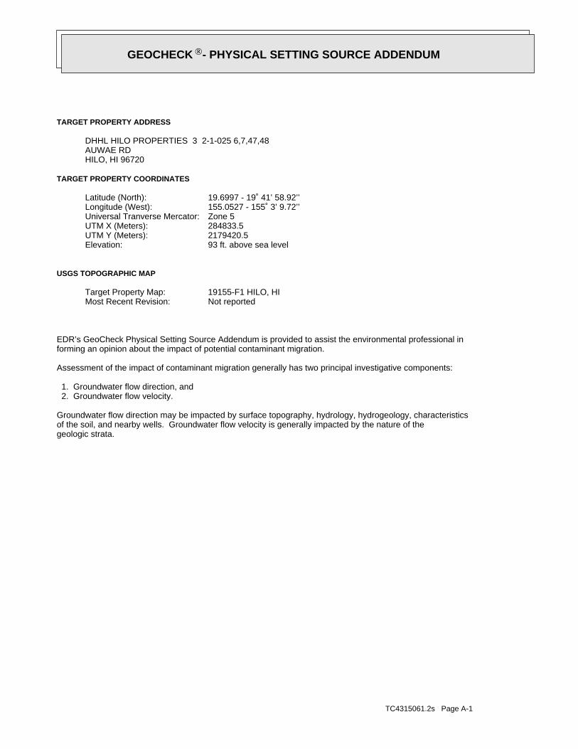
TC4315061.2s Page A-1
geologic strata.of the soil, and nearby wells. Groundwater flow velocity is generally impacted by the nature of theGroundwater flow direction may be impacted by surface topography, hydrology, hydrogeology, characteristics
2. Groundwater flow velocity. 1. Groundwater flow direction, and
Assessment of the impact of contaminant migration generally has two principal investigative components:
forming an opinion about the impact of potential contaminant migration.EDR’s GeoCheck Physical Setting Source Addendum is provided to assist the environmental professional in
Not reportedMost Recent Revision:19155-F1 HILO, HITarget Property Map:
USGS TOPOGRAPHIC MAP
93 ft. above sea levelElevation:2179420.5UTM Y (Meters): 284833.5UTM X (Meters): Zone 5Universal Tranverse Mercator: 155.0527 - 155˚ 3’ 9.72’’Longitude (West): 19.6997 - 19˚ 41’ 58.92’’Latitude (North):
TARGET PROPERTY COORDINATES
HILO, HI 96720AUWAE RDDHHL HILO PROPERTIES 3 2-1-025 6,7,47,48
TARGET PROPERTY ADDRESS
®GEOCHECK - PHYSICAL SETTING SOURCE ADDENDUM®

TC4315061.2s Page A-2
should be field verified.on a relative (not an absolute) basis. Relative elevation information between sites of close proximitySource: Topography has been determined from the USGS 7.5’ Digital Elevation Model and should be evaluated
SURROUNDING TOPOGRAPHY: ELEVATION PROFILES
Ele
vatio
n (f
t)E
leva
tion
(ft)
TP
TP0 1/2 1 Miles
✩Target Property Elevation: 93 ft.
North South
West East
147
142
138
1331231129997949387797571706959
38
4062 59
65
73
76
80
82
83
89
93 92 91 85 83
84 84 83 82 79
General NNWGeneral Topographic Gradient:TARGET PROPERTY TOPOGRAPHY
should contamination exist on the target property, what downgradient sites might be impacted.assist the environmental professional in forming an opinion about the impact of nearby contaminated properties or,Surface topography may be indicative of the direction of surficial groundwater flow. This information can be used toTOPOGRAPHIC INFORMATION
collected on nearby properties, and regional groundwater flow information (from deep aquifers).sources of information, such as surface topographic information, hydrologic information, hydrogeologic datausing site-specific well data. If such data is not reasonably ascertainable, it may be necessary to rely on otherGroundwater flow direction for a particular site is best determined by a qualified environmental professionalGROUNDWATER FLOW DIRECTION INFORMATION
®GEOCHECK - PHYSICAL SETTING SOURCE SUMMARY®
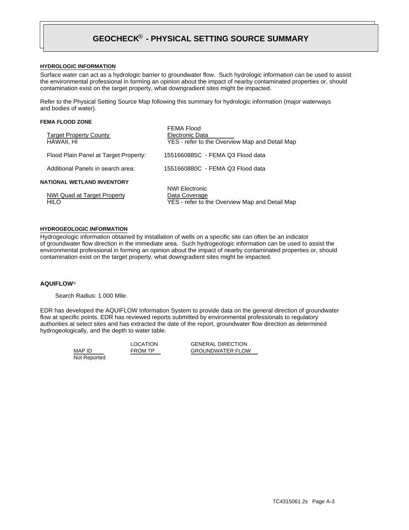
TC4315061.2s Page A-3
Not Reported
GENERAL DIRECTIONLOCATIONGROUNDWATER FLOWFROM TPMAP ID
hydrogeologically, and the depth to water table.authorities at select sites and has extracted the date of the report, groundwater flow direction as determinedflow at specific points. EDR has reviewed reports submitted by environmental professionals to regulatoryEDR has developed the AQUIFLOW Information System to provide data on the general direction of groundwater
AQUIFLOW®
Search Radius: 1.000 Mile.
contamination exist on the target property, what downgradient sites might be impacted.environmental professional in forming an opinion about the impact of nearby contaminated properties or, shouldof groundwater flow direction in the immediate area. Such hydrogeologic information can be used to assist theHydrogeologic information obtained by installation of wells on a specific site can often be an indicatorHYDROGEOLOGIC INFORMATION
YES - refer to the Overview Map and Detail MapHILO
NATIONAL WETLAND INVENTORYNWI ElectronicData CoverageNWI Quad at Target Property
1551660880C - FEMA Q3 Flood dataAdditional Panels in search area:
1551660885C - FEMA Q3 Flood dataFlood Plain Panel at Target Property:
YES - refer to the Overview Map and Detail MapHAWAII, HI
FEMA FLOOD ZONEFEMA FloodElectronic DataTarget Property County
and bodies of water).Refer to the Physical Setting Source Map following this summary for hydrologic information (major waterways
contamination exist on the target property, what downgradient sites might be impacted.the environmental professional in forming an opinion about the impact of nearby contaminated properties or, shouldSurface water can act as a hydrologic barrier to groundwater flow. Such hydrologic information can be used to assistHYDROLOGIC INFORMATION
®GEOCHECK - PHYSICAL SETTING SOURCE SUMMARY®

TC4315061.2s Page A-4
Map, USGS Digital Data Series DDS - 11 (1994).of the Conterminous U.S. at 1:2,500,000 Scale - a digital representation of the 1974 P.B. King and H.M. BeikmanGeologic Age and Rock Stratigraphic Unit Source: P.G. Schruben, R.E. Arndt and W.J. Bawiec, Geology
ROCK STRATIGRAPHIC UNIT GEOLOGIC AGE IDENTIFICATION
-Category:-Era:-System:-Series:N/ACode: (decoded above as Era, System & Series)
at which contaminant migration may be occurring.Geologic information can be used by the environmental professional in forming an opinion about the relative speedGEOLOGIC INFORMATION IN GENERAL AREA OF TARGET PROPERTY
move more quickly through sandy-gravelly types of soils than silty-clayey types of soils.characteristics data collected on nearby properties and regional soil information. In general, contaminant plumesto rely on other sources of information, including geologic age identification, rock stratigraphic unit and soilusing site specific geologic and soil strata data. If such data are not reasonably ascertainable, it may be necessaryGroundwater flow velocity information for a particular site is best determined by a qualified environmental professionalGROUNDWATER FLOW VELOCITY INFORMATION
®GEOCHECK - PHYSICAL SETTING SOURCE SUMMARY®

EDR Inc.EDR Inc.EDR Inc.EDR Inc.EDR Inc.EDR Inc.EDR Inc.EDR Inc.EDR Inc.EDR Inc.EDR Inc.EDR Inc.EDR Inc.EDR Inc.EDR Inc.EDR Inc.EDR Inc.EDR Inc.EDR Inc.EDR Inc.EDR Inc.EDR Inc.EDR Inc.EDR Inc.EDR Inc.EDR Inc.EDR Inc.EDR Inc.EDR Inc.EDR Inc.EDR Inc.EDR Inc.EDR Inc.EDR Inc.EDR Inc.EDR Inc.EDR Inc.EDR Inc.EDR Inc.EDR Inc.
1
0 1/16 1/8 1/4 Miles

TC4315061.2s Page A-6
opinion about the impact of contaminant migration on nearby drinking water wells.professional in assessing sources that may impact ground water flow direction, and in forming anEDR Local/Regional Water Agency records provide water well information to assist the environmental
LOCAL / REGIONAL WATER AGENCY RECORDS
Max: Min: Min: 141.14Max: 700
Gravel.fines, SiltyGravels withSOILS, Gravels,COARSE-GRAINEDGravel.Poorly GradedClean gravels,SOILS, Gravels,COARSE-GRAINED
Sand.Gravel andFragments,200), Stonepassing No.pct. or lessmaterials (35Granular
cobbly materialextremely59 inches 7 inches 2
Min: 5.5Max: 6.9
Min: 14Max: 141
soils, Peat.Highly organicA-8
muckextremely stony 7 inches 0 inches 1
Soil Layer Information
Boundary Classification Saturatedhydraulicconductivitymicro m/sec
Layer Upper Lower Soil Texture Class AASHTO Group Unified Soil Soil Reaction(pH)
> 0 inchesDepth to Watertable Min:
> 152 inchesDepth to Bedrock Min:
LowCorrosion Potential - Uncoated Steel:
Hydric Status: Not hydric
Well drainedSoil Drainage Class:
excessively drained sands and gravels.Class A - High infiltration rates. Soils are deep, well drained toHydrologic Group:
extremely stony muckSoil Surface Texture:
PapaiSoil Component Name:
Soil Map ID: 1
in a landscape. The following information is based on Soil Conservation Service SSURGO data.for privately owned lands in the United States. A soil map in a soil survey is a representation of soil patternsSurvey (NCSS) and is responsible for collecting, storing, maintaining and distributing soil survey informationThe U.S. Department of Agriculture’s (USDA) Soil Conservation Service (SCS) leads the National Cooperative Soil
DOMINANT SOIL COMPOSITION IN GENERAL AREA OF TARGET PROPERTY
®GEOCHECK - PHYSICAL SETTING SOURCE SUMMARY®

TC4315061.2s Page A-7
1/2 - 1 Mile WNWHI9000000004291 C181/2 - 1 Mile WNWHI9000000004294 B171/2 - 1 Mile WNWHI9000000004292 B151/2 - 1 Mile WNWHI9000000004293 B131/2 - 1 Mile WNWHI9000000004296 B91/2 - 1 Mile WNWHI9000000004297 B71/2 - 1 Mile WNWHI9000000004298 B51/2 - 1 Mile WNWHI9000000004299 B31/4 - 1/2 Mile WNWHI9000000004302 A1
STATE DATABASE WELL INFORMATION
LOCATIONFROM TPWELL IDMAP ID
Note: PWS System location is not always the same as well location.
No PWS System Found
FEDERAL FRDS PUBLIC WATER SUPPLY SYSTEM INFORMATION
LOCATIONFROM TPWELL IDMAP ID
1/2 - 1 Mile NEUSGS40000268578 H361/2 - 1 Mile NEUSGS40000268575 E301/2 - 1 Mile WNWUSGS40000268573 D281/2 - 1 Mile WNWUSGS40000268572 D261/2 - 1 Mile NWUSGS40000268574 D241/2 - 1 Mile WNWUSGS40000268569 C221/2 - 1 Mile WNWUSGS40000268563 D201/2 - 1 Mile WNWUSGS40000268565 C191/2 - 1 Mile WNWUSGS40000268564 B161/2 - 1 Mile WNWUSGS40000268571 B141/2 - 1 Mile WNWUSGS40000268570 B121/2 - 1 Mile WNWUSGS40000268562 B111/2 - 1 Mile WNWUSGS40000268568 B101/2 - 1 Mile WNWUSGS40000268561 B81/2 - 1 Mile WNWUSGS40000268567 B61/2 - 1 Mile WNWUSGS40000268560 B41/4 - 1/2 Mile WNWUSGS40000268559 A2
FEDERAL USGS WELL INFORMATION
LOCATIONFROM TPWELL IDMAP ID
1.000State DatabaseNearest PWS within 1 mileFederal FRDS PWS1.000Federal USGS
WELL SEARCH DISTANCE INFORMATION
SEARCH DISTANCE (miles)DATABASE
®GEOCHECK - PHYSICAL SETTING SOURCE SUMMARY®

TC4315061.2s Page A-8
1/2 - 1 Mile NEHI9000000004286 H351/2 - 1 Mile NorthHI9000000004304 G341/2 - 1 Mile NorthHI9000000004303 G331/2 - 1 Mile NWHI9000000004300 F321/2 - 1 Mile NNWHI9000000004301 F311/2 - 1 Mile NEHI9000000004287 E291/2 - 1 Mile WNWHI9000000004288 D271/2 - 1 Mile WNWHI9000000004295 D251/2 - 1 Mile NWHI9000000004290 D231/2 - 1 Mile WNWHI9000000004289 C21
STATE DATABASE WELL INFORMATION
LOCATIONFROM TPWELL IDMAP ID
®GEOCHECK - PHYSICAL SETTING SOURCE SUMMARY®

EDR Inc.EDR Inc.EDR Inc.EDR Inc.EDR Inc.EDR Inc.EDR Inc.EDR Inc.EDR Inc.EDR Inc.EDR Inc.EDR Inc.EDR Inc.EDR Inc.EDR Inc.EDR Inc.EDR Inc.EDR Inc.EDR Inc.EDR Inc.EDR Inc.EDR Inc.EDR Inc.EDR Inc.EDR Inc.EDR Inc.EDR Inc.EDR Inc.EDR Inc.EDR Inc.EDR Inc.EDR Inc.EDR Inc.EDR Inc.EDR Inc.EDR Inc.EDR Inc.EDR Inc.EDR Inc.EDR Inc.
100

TC4315061.2s Page A-10
24000Sourcemap scale:-155.0572307Longitude:19.7014066Latitude:Not ReportedContrib drainagearea units:Not ReportedContrib drainagearea:Not ReportedDrainagearea Units:Not ReportedDrainagearea value:20010000Huc code:
Not ReportedMonloc desc:WellMonloc type:8-4203-15 WAIAKEAMonloc name:USGS-194216155033601Monloc Identifier:USGS Hawaii Water Science CenterFormal name:USGS-HIOrg. Identifier:
A2WNW1/4 - 1/2 MileLower
USGS40000268559FED USGS
HI9000000004302Site id:Not ReportedT:Not ReportedSurveyor:Not ReportedPir:
01-DEC-87Wcr:Not ReportedLatest hd:80401Aqui code:
Not ReportedTmk:Not ReportedPump depth:Not ReportedPump elev:Not ReportedDraft mgd:
0Pump mgd:Not ReportedSpec capac:
-19Bot perf:1Bot solid:-49Bot hole:Not ReportedDraft yr:
0Pump yr:Not ReportedGeology:
Not ReportedMin chlor:Not ReportedMax chlor:Not ReportedHead feet:Not ReportedDraft mgy:
0Pump gpm:CTest unit:19.4Test temp:21Test chlor:0Test ddown:250Test gpm:12/11/1987Test date:
21Init cl:Not ReportedInit head3:
Not ReportedInit head2:8.75Init head:Not ReportedUse year:IND - IndustrialUse:
100Perf case:80Solid case:130Well depth:
81Ground el:8Casing dia:PERWell type:Not ReportedOld number:
Not ReportedPump insta:Not ReportedLand owner:Hawaiian Host, Inc.Owner user:
-1Utm:0Gps:19.701389Lat83dd:-155.057222Long83dd:67Quad map:Roscoe Moss Hawaii IncDriller:1987Yr drilled:
Not ReportedOld name:WaiakeaWell name:HawaiiIsland:8-4203-015Wid:
A1WNW1/4 - 1/2 MileLower
HI9000000004302HI WELLS
Map IDDirectionDistanceElevation EDR ID NumberDatabase
®GEOCHECK - PHYSICAL SETTING SOURCE MAP FINDINGS®

TC4315061.2s Page A-11
60000Spec capac:Not ReportedBot perf:-31Bot solid:-161Bot hole:Not ReportedDraft yr:
0Pump yr:Not ReportedGeology:
Not ReportedMin chlor:Not ReportedMax chlor:Not ReportedHead feet:Not ReportedDraft mgy:
6250Pump gpm:Not ReportedTest unit:Not ReportedTest temp:Not ReportedTest chlor:0.1Test ddown:6000Test gpm:Not ReportedTest date:
0Init cl:Not ReportedInit head3:
Not ReportedInit head2:6Init head:Not ReportedUse year:IND - Geothermal, Thermoelectric Cooling, Power DeUse:
Not ReportedPerf case:80Solid case:210Well depth:
49Ground el:30Casing dia:ROTWell type:Not ReportedOld number:
Not ReportedPump insta:Not ReportedLand owner:Hawaii Electric Light Co., Inc., HELCOOwner user:
-1Utm:0Gps:19.703056Lat83dd:-155.06Long83dd:67Quad map:Water Resources International, Inc.Driller:1974Yr drilled:
Not ReportedOld name:HELCO Kan 6-4Well name:HawaiiIsland:8-4203-012Wid:
B3WNW1/2 - 1 MileLower
HI9000000004299HI WELLS
1987-12-11 72.
DateFeet belowSurface
Feet toSealevel
-------------------------------------------------
Ground-water levels, Number of Measurements: 1
ftWellholedepth units:130Wellholedepth:ftWelldepth units:130Welldepth:19871208Construction date:
Not ReportedAquifer type:Not ReportedFormation type:Not ReportedAquifername:
USCountrycode:HILOCALVert coord refsys:Level or other surveying methodVertcollection method:feetVert accmeasure units:
.1Vertacc measure val:feetVert measure units:80.9Vert measure val:NAD83Horiz coord refsys:
Interpolated from mapHoriz Collection method:secondsHoriz Acc measure units:1Horiz Acc measure:
®GEOCHECK - PHYSICAL SETTING SOURCE MAP FINDINGS®

TC4315061.2s Page A-12
Not ReportedLand owner:Hawaii Electric Light Co., Inc., HELCOOwner user:
-1Utm:0Gps:19.703333Lat83dd:-155.06Long83dd:67Quad map:Water Resources International, Inc.Driller:1974Yr drilled:
Not ReportedOld name:Hill Unit 6CWell name:HawaiiIsland:8-4203-011Wid:
B5WNW1/2 - 1 MileLower
HI9000000004298HI WELLS
1974-10-04 49.07
DateFeet belowSurface
Feet toSealevel
-------------------------------------------------
Ground-water levels, Number of Measurements: 1
ftWellholedepth units:210Wellholedepth:ftWelldepth units:210Welldepth:19740601Construction date:
Not ReportedAquifer type:Not ReportedFormation type:Not ReportedAquifername:
USCountrycode:HILOCALVert coord refsys:Level or other surveying methodVertcollection method:feetVert accmeasure units:
.1Vertacc measure val:feetVert measure units:55.00Vert measure val:NAD83Horiz coord refsys:
Interpolated from mapHoriz Collection method:secondsHoriz Acc measure units:1Horiz Acc measure:24000Sourcemap scale:-155.0600085Longitude:19.7030732Latitude:Not ReportedContrib drainagearea units:Not ReportedContrib drainagearea:Not ReportedDrainagearea Units:Not ReportedDrainagearea value:20010000Huc code:
Not ReportedMonloc desc:WellMonloc type:8-4203-14 W6-DMonloc name:USGS-194222155034601Monloc Identifier:USGS Hawaii Water Science CenterFormal name:USGS-HIOrg. Identifier:
B4WNW1/2 - 1 MileLower
USGS40000268560FED USGS
HI9000000004299Site id:Not ReportedT:Not ReportedSurveyor:Not ReportedPir:
01-JAN-74Wcr:Not ReportedLatest hd:80401Aqui code:
(3) 2-2-058:019Tmk:Not ReportedPump depth:Not ReportedPump elev:Not ReportedDraft mgd:
9Pump mgd:
®GEOCHECK - PHYSICAL SETTING SOURCE MAP FINDINGS®

TC4315061.2s Page A-13
Not ReportedFormation type:Not ReportedAquifername:
USCountrycode:HILOCALVert coord refsys:Level or other surveying methodVertcollection method:feetVert accmeasure units:
.1Vertacc measure val:feetVert measure units:55.00Vert measure val:NAD83Horiz coord refsys:
Interpolated from mapHoriz Collection method:secondsHoriz Acc measure units:1Horiz Acc measure:24000Sourcemap scale:-155.0600085Longitude:19.7033509Latitude:Not ReportedContrib drainagearea units:Not ReportedContrib drainagearea:Not ReportedDrainagearea Units:Not ReportedDrainagearea value:20010000Huc code:
Not ReportedMonloc desc:WellMonloc type:8-4203-13 W6-CMonloc name:USGS-194223155034601Monloc Identifier:USGS Hawaii Water Science CenterFormal name:USGS-HIOrg. Identifier:
B6WNW1/2 - 1 MileLower
USGS40000268567FED USGS
HI9000000004298Site id:Not ReportedT:Not ReportedSurveyor:Not ReportedPir:
01-JAN-74Wcr:Not ReportedLatest hd:80401Aqui code:
(3) 2-2-058:019Tmk:Not ReportedPump depth:Not ReportedPump elev:Not ReportedDraft mgd:
0Pump mgd:1349Spec capac:
Not ReportedBot perf:Not ReportedBot solid:-167Bot hole:Not ReportedDraft yr:
0Pump yr:Not ReportedGeology:
Not ReportedMin chlor:Not ReportedMax chlor:Not ReportedHead feet:Not ReportedDraft mgy:
0Pump gpm:Not ReportedTest unit:Not ReportedTest temp:Not ReportedTest chlor:4.3Test ddown:5800Test gpm:Not ReportedTest date:
0Init cl:Not ReportedInit head3:
Not ReportedInit head2:6Init head:Not ReportedUse year:IND - Geothermal, Thermoelectric Cooling, Power DeUse:
Not ReportedPerf case:Not ReportedSolid case:210Well depth:
43Ground el:72Casing dia:DUGWell type:Not ReportedOld number:
Not ReportedPump insta:
®GEOCHECK - PHYSICAL SETTING SOURCE MAP FINDINGS®

TC4315061.2s Page A-14
HI9000000004297Site id:Not ReportedT:Not ReportedSurveyor:Not ReportedPir:
01-JAN-73Wcr:Not ReportedLatest hd:80401Aqui code:
(3) 2-2-058:019Tmk:Not ReportedPump depth:Not ReportedPump elev:Not ReportedDraft mgd:
9Pump mgd:1743Spec capac:
Not ReportedBot perf:-20Bot solid:-155Bot hole:Not ReportedDraft yr:
0Pump yr:Not ReportedGeology:
Not ReportedMin chlor:Not ReportedMax chlor:Not ReportedHead feet:Not ReportedDraft mgy:
6250Pump gpm:CTest unit:20Test temp:Not ReportedTest chlor:3.5Test ddown:6100Test gpm:Not ReportedTest date:
0Init cl:Not ReportedInit head3:
Not ReportedInit head2:6Init head:Not ReportedUse year:IND - Geothermal, Thermoelectric Cooling, Power DeUse:
Not ReportedPerf case:75Solid case:210Well depth:
55Ground el:32Casing dia:ROTWell type:Not ReportedOld number:
Not ReportedPump insta:Not ReportedLand owner:Hawaii Electric Light Co., Inc., HELCOOwner user:
-1Utm:0Gps:19.703056Lat83dd:-155.060278Long83dd:67Quad map:Water Resources International, Inc.Driller:1973Yr drilled:
Not ReportedOld name:Hill Unit 6BWell name:HawaiiIsland:8-4203-010Wid:
B7WNW1/2 - 1 MileLower
HI9000000004297HI WELLS
1974-10-04 49.04
DateFeet belowSurface
Feet toSealevel
-------------------------------------------------
Ground-water levels, Number of Measurements: 1
ftWellholedepth units:210Wellholedepth:ftWelldepth units:210Welldepth:19740501Construction date:
Not ReportedAquifer type:
®GEOCHECK - PHYSICAL SETTING SOURCE MAP FINDINGS®

TC4315061.2s Page A-15
Not ReportedTest gpm:Not ReportedTest date:0Init cl:Not ReportedInit head3:
Not ReportedInit head2:6Init head:Not ReportedUse year:IND - Geothermal, Thermoelectric Cooling, Power DeUse:
Not ReportedPerf case:Not ReportedSolid case:210Well depth:
55Ground el:32Casing dia:ROTWell type:Not ReportedOld number:
Not ReportedPump insta:Not ReportedLand owner:Hawaii Electric Light Co., Inc., HELCOOwner user:
-1Utm:0Gps:19.703333Lat83dd:-155.060278Long83dd:67Quad map:Water Resources International, Inc.Driller:1974Yr drilled:
Not ReportedOld name:Hill Unit 6AWell name:HawaiiIsland:8-4203-009Wid:
B9WNW1/2 - 1 MileLower
HI9000000004296HI WELLS
1974-10-04 49.05
DateFeet belowSurface
Feet toSealevel
-------------------------------------------------
Ground-water levels, Number of Measurements: 1
ftWellholedepth units:210Wellholedepth:ftWelldepth units:210Welldepth:19731001Construction date:
Not ReportedAquifer type:Not ReportedFormation type:Not ReportedAquifername:
USCountrycode:HILOCALVert coord refsys:Level or other surveying methodVertcollection method:feetVert accmeasure units:
.1Vertacc measure val:feetVert measure units:55.00Vert measure val:NAD83Horiz coord refsys:
Interpolated from mapHoriz Collection method:secondsHoriz Acc measure units:1Horiz Acc measure:24000Sourcemap scale:-155.0602863Longitude:19.7030732Latitude:Not ReportedContrib drainagearea units:Not ReportedContrib drainagearea:Not ReportedDrainagearea Units:Not ReportedDrainagearea value:20010000Huc code:
Not ReportedMonloc desc:WellMonloc type:8-4203-10 W6-BMonloc name:USGS-194222155034701Monloc Identifier:USGS Hawaii Water Science CenterFormal name:USGS-HIOrg. Identifier:
B8WNW1/2 - 1 MileLower
USGS40000268561FED USGS
Map IDDirectionDistanceElevation EDR ID NumberDatabase
®GEOCHECK - PHYSICAL SETTING SOURCE MAP FINDINGS®

TC4315061.2s Page A-16
B11WNW1/2 - 1 MileLower
USGS40000268562FED USGS
Ground-water levels, Number of Measurements: 0
ftWellholedepth units:210Wellholedepth:ftWelldepth units:210Welldepth:1974Construction date:
Not ReportedAquifer type:Not ReportedFormation type:Not ReportedAquifername:
USCountrycode:HILOCALVert coord refsys:Level or other surveying methodVertcollection method:feetVert accmeasure units:
.1Vertacc measure val:feetVert measure units:55.Vert measure val:NAD83Horiz coord refsys:
Interpolated from mapHoriz Collection method:secondsHoriz Acc measure units:1Horiz Acc measure:24000Sourcemap scale:-155.0602863Longitude:19.7033509Latitude:Not ReportedContrib drainagearea units:Not ReportedContrib drainagearea:Not ReportedDrainagearea Units:Not ReportedDrainagearea value:20010000Huc code:
FILE INFO FROM STATE COMPUTER PRINTOUTMonloc desc:WellMonloc type:8-4203-09 LYMAN FIELDMonloc name:USGS-194223155034701Monloc Identifier:USGS Hawaii Water Science CenterFormal name:USGS-HIOrg. Identifier:
B10WNW1/2 - 1 MileLower
USGS40000268568FED USGS
HI9000000004296Site id:Not ReportedT:Not ReportedSurveyor:Not ReportedPir:
01-JAN-74Wcr:Not ReportedLatest hd:80401Aqui code:
(3) 2-2-058:019Tmk:Not ReportedPump depth:Not ReportedPump elev:Not ReportedDraft mgd:
9Pump mgd:Not ReportedSpec capac:
Not ReportedBot perf:Not ReportedBot solid:-155Bot hole:Not ReportedDraft yr:
0Pump yr:Not ReportedGeology:
Not ReportedMin chlor:Not ReportedMax chlor:Not ReportedHead feet:Not ReportedDraft mgy:
6250Pump gpm:Not ReportedTest unit:Not ReportedTest temp:Not ReportedTest chlor:Not ReportedTest ddown:
®GEOCHECK - PHYSICAL SETTING SOURCE MAP FINDINGS®

TC4315061.2s Page A-17
ftWellholedepth units:210Wellholedepth:ftWelldepth units:210Welldepth:19740401Construction date:
Not ReportedAquifer type:Not ReportedFormation type:Not ReportedAquifername:
USCountrycode:HILOCALVert coord refsys:Level or other surveying methodVertcollection method:feetVert accmeasure units:
.1Vertacc measure val:feetVert measure units:55.00Vert measure val:NAD83Horiz coord refsys:
Interpolated from mapHoriz Collection method:secondsHoriz Acc measure units:1Horiz Acc measure:24000Sourcemap scale:-155.0602863Longitude:19.7036287Latitude:Not ReportedContrib drainagearea units:Not ReportedContrib drainagearea:Not ReportedDrainagearea Units:Not ReportedDrainagearea value:20010000Huc code:
Not ReportedMonloc desc:WellMonloc type:8-4203-12 W6-AMonloc name:USGS-194224155034701Monloc Identifier:USGS Hawaii Water Science CenterFormal name:USGS-HIOrg. Identifier:
B12WNW1/2 - 1 MileLower
USGS40000268570FED USGS
Ground-water levels, Number of Measurements: 0
ftWellholedepth units:200Wellholedepth:ftWelldepth units:200Welldepth:19640429Construction date:
Not ReportedAquifer type:Not ReportedFormation type:Hawaii volcanic-rock aquifersAquifername:
USCountrycode:HILOCALVert coord refsys:Interpolated from topographic mapVertcollection method:feetVert accmeasure units:
20Vertacc measure val:feetVert measure units:50.00Vert measure val:NAD83Horiz coord refsys:
Interpolated from mapHoriz Collection method:secondsHoriz Acc measure units:1Horiz Acc measure:24000Sourcemap scale:-155.060564Longitude:19.7030732Latitude:Not ReportedContrib drainagearea units:Not ReportedContrib drainagearea:Not ReportedDrainagearea Units:Not ReportedDrainagearea value:20010000Huc code:
Not ReportedMonloc desc:WellMonloc type:8-4203-06 W8-2BMonloc name:USGS-194222155034801Monloc Identifier:USGS Hawaii Water Science CenterFormal name:USGS-HIOrg. Identifier:
®GEOCHECK - PHYSICAL SETTING SOURCE MAP FINDINGS®

TC4315061.2s Page A-18
B14WNW1/2 - 1 MileLower
USGS40000268571FED USGS
HI9000000004293Site id:Not ReportedT:Not ReportedSurveyor:Not ReportedPir:
01-JAN-65Wcr:Not ReportedLatest hd:80401Aqui code:
(3) 2-2-058:019Tmk:Not ReportedPump depth:Not ReportedPump elev:Not ReportedDraft mgd:
6.48Pump mgd:1000Spec capac:
Not ReportedBot perf:-4Bot solid:-150Bot hole:Not ReportedDraft yr:
0Pump yr:QKLGeology:
Not ReportedMin chlor:Not ReportedMax chlor:Not ReportedHead feet:Not ReportedDraft mgy:
4500Pump gpm:CTest unit:19.9Test temp:Not ReportedTest chlor:6.5Test ddown:6500Test gpm:Not ReportedTest date:
0Init cl:Not ReportedInit head3:
Not ReportedInit head2:6.5Init head:Not ReportedUse year:IND - Geothermal, Thermoelectric Cooling, Power DeUse:
Not ReportedPerf case:54Solid case:200Well depth:
50Ground el:29Casing dia:Not ReportedWell type:Not ReportedOld number:
Not ReportedPump insta:Not ReportedLand owner:Hawaii Electric Light Co., Inc., HELCOOwner user:
-1Utm:0Gps:19.703333Lat83dd:-155.060833Long83dd:67Quad map:Layne InternationalDriller:1965Yr drilled:
Not ReportedOld name:Hill Unit 5BWell name:HawaiiIsland:8-4203-006Wid:
B13WNW1/2 - 1 MileLower
HI9000000004293HI WELLS
1974-10-04 49.07
DateFeet belowSurface
Feet toSealevel
-------------------------------------------------
Ground-water levels, Number of Measurements: 1
®GEOCHECK - PHYSICAL SETTING SOURCE MAP FINDINGS®

TC4315061.2s Page A-19
Not ReportedSpec capac:Not ReportedBot perf:-4Bot solid:-150Bot hole:Not ReportedDraft yr:
0Pump yr:QKLGeology:
Not ReportedMin chlor:Not ReportedMax chlor:Not ReportedHead feet:Not ReportedDraft mgy:
4500Pump gpm:CTest unit:20Test temp:Not ReportedTest chlor:Not ReportedTest ddown:Not ReportedTest gpm:Not ReportedTest date:
0Init cl:Not ReportedInit head3:
Not ReportedInit head2:Not ReportedInit head:Not ReportedUse year:IND - Geothermal, Thermoelectric Cooling, Power DeUse:
Not ReportedPerf case:54Solid case:200Well depth:
50Ground el:29Casing dia:Not ReportedWell type:Not ReportedOld number:
Not ReportedPump insta:Not ReportedLand owner:Hawaii Electric Light Co., Inc., HELCOOwner user:
-1Utm:0Gps:19.703056Lat83dd:-155.061111Long83dd:67Quad map:Layne InternationalDriller:1965Yr drilled:
Not ReportedOld name:Hill Unit 5AWell name:HawaiiIsland:8-4203-005Wid:
B15WNW1/2 - 1 MileLower
HI9000000004292HI WELLS
Ground-water levels, Number of Measurements: 0
ftWellholedepth units:200Wellholedepth:ftWelldepth units:200Welldepth:19650427Construction date:
Not ReportedAquifer type:Not ReportedFormation type:Not ReportedAquifername:
USCountrycode:HILOCALVert coord refsys:Interpolated from topographic mapVertcollection method:feetVert accmeasure units:
20Vertacc measure val:feetVert measure units:50.00Vert measure val:NAD83Horiz coord refsys:
Interpolated from mapHoriz Collection method:secondsHoriz Acc measure units:1Horiz Acc measure:24000Sourcemap scale:-155.0608419Longitude:19.7033509Latitude:Not ReportedContrib drainagearea units:Not ReportedContrib drainagearea:Not ReportedDrainagearea Units:Not ReportedDrainagearea value:20010000Huc code:
Not ReportedMonloc desc:WellMonloc type:8-4203-07 W8-2CMonloc name:USGS-194224155035001Monloc Identifier:USGS Hawaii Water Science CenterFormal name:USGS-HIOrg. Identifier:
®GEOCHECK - PHYSICAL SETTING SOURCE MAP FINDINGS®

TC4315061.2s Page A-20
Not ReportedLand owner:Hawaii Electric Light Co., Inc., HELCOOwner user:
-1Utm:0Gps:19.703611Lat83dd:-155.061111Long83dd:67Quad map:Layne InternationalDriller:1965Yr drilled:
Not ReportedOld name:Hill Unit 5CWell name:HawaiiIsland:8-4203-007Wid:
B17WNW1/2 - 1 MileLower
HI9000000004294HI WELLS
Ground-water levels, Number of Measurements: 0
ftWellholedepth units:200Wellholedepth:ftWelldepth units:200Welldepth:19640429Construction date:
Not ReportedAquifer type:Not ReportedFormation type:Not ReportedAquifername:
USCountrycode:HILOCALVert coord refsys:Interpolated from topographic mapVertcollection method:feetVert accmeasure units:
20Vertacc measure val:feetVert measure units:50.00Vert measure val:NAD83Horiz coord refsys:
Interpolated from mapHoriz Collection method:secondsHoriz Acc measure units:1Horiz Acc measure:24000Sourcemap scale:-155.0611196Longitude:19.7030732Latitude:Not ReportedContrib drainagearea units:Not ReportedContrib drainagearea:Not ReportedDrainagearea Units:Not ReportedDrainagearea value:20010000Huc code:
Not ReportedMonloc desc:WellMonloc type:8-4203-05 W8-2AMonloc name:USGS-194222155035001Monloc Identifier:USGS Hawaii Water Science CenterFormal name:USGS-HIOrg. Identifier:
B16WNW1/2 - 1 MileLower
USGS40000268564FED USGS
HI9000000004292Site id:Not ReportedT:Not ReportedSurveyor:Not ReportedPir:
01-JAN-65Wcr:Not ReportedLatest hd:80401Aqui code:
(3) 2-2-058:019Tmk:Not ReportedPump depth:Not ReportedPump elev:Not ReportedDraft mgd:
6.48Pump mgd:
®GEOCHECK - PHYSICAL SETTING SOURCE MAP FINDINGS®

TC4315061.2s Page A-21
2500Test gpm:11/11/1961Test date:22Init cl:Not ReportedInit head3:
Not ReportedInit head2:7.06Init head:Not ReportedUse year:ABN - SealedUse:
Not ReportedPerf case:60Solid case:201Well depth:
47Ground el:16Casing dia:PERWell type:2-AugOld number:
Not ReportedPump insta:Not ReportedLand owner:Hawaii Electric Light Co., Inc., HELCOOwner user:
-1Utm:0Gps:19.703056Lat83dd:-155.061389Long83dd:67Quad map:Samson & ZerbeDriller:1961Yr drilled:
Not ReportedOld name:Waiakea 4Well name:HawaiiIsland:8-4203-004Wid:
C18WNW1/2 - 1 MileLower
HI9000000004291HI WELLS
HI9000000004294Site id:Not ReportedT:Not ReportedSurveyor:Not ReportedPir:
01-JAN-65Wcr:Not ReportedLatest hd:80401Aqui code:
(3) 2-2-058:019Tmk:Not ReportedPump depth:Not ReportedPump elev:Not ReportedDraft mgd:
6.48Pump mgd:Not ReportedSpec capac:
Not ReportedBot perf:-150Bot solid:-535Bot hole:Not ReportedDraft yr:
0Pump yr:QKLGeology:
Not ReportedMin chlor:Not ReportedMax chlor:Not ReportedHead feet:Not ReportedDraft mgy:
4500Pump gpm:Not ReportedTest unit:Not ReportedTest temp:Not ReportedTest chlor:Not ReportedTest ddown:Not ReportedTest gpm:Not ReportedTest date:
0Init cl:Not ReportedInit head3:
Not ReportedInit head2:Not ReportedInit head:Not ReportedUse year:IND - Geothermal, Thermoelectric Cooling, Power DeUse:
Not ReportedPerf case:200Solid case:585Well depth:
50Ground el:29Casing dia:Not ReportedWell type:Not ReportedOld number:
Not ReportedPump insta:
®GEOCHECK - PHYSICAL SETTING SOURCE MAP FINDINGS®
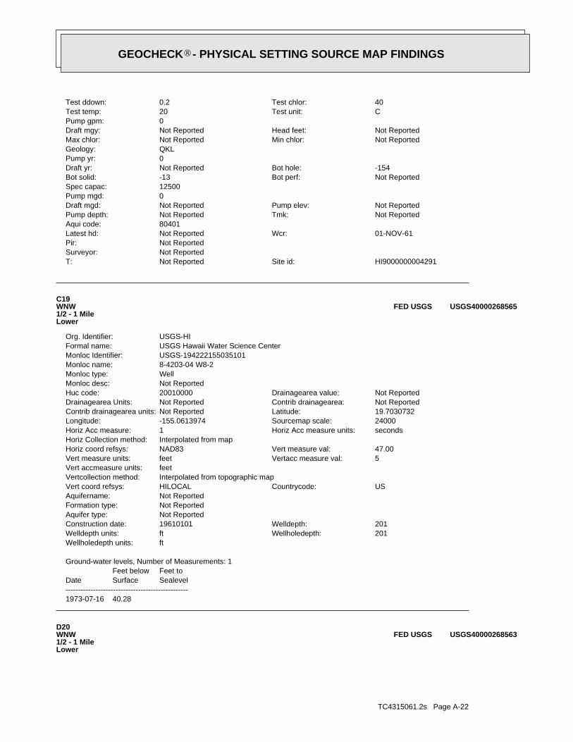
TC4315061.2s Page A-22
D20WNW1/2 - 1 MileLower
USGS40000268563FED USGS
1973-07-16 40.28
DateFeet belowSurface
Feet toSealevel
-------------------------------------------------
Ground-water levels, Number of Measurements: 1
ftWellholedepth units:201Wellholedepth:ftWelldepth units:201Welldepth:19610101Construction date:
Not ReportedAquifer type:Not ReportedFormation type:Not ReportedAquifername:
USCountrycode:HILOCALVert coord refsys:Interpolated from topographic mapVertcollection method:feetVert accmeasure units:
5Vertacc measure val:feetVert measure units:47.00Vert measure val:NAD83Horiz coord refsys:
Interpolated from mapHoriz Collection method:secondsHoriz Acc measure units:1Horiz Acc measure:24000Sourcemap scale:-155.0613974Longitude:19.7030732Latitude:Not ReportedContrib drainagearea units:Not ReportedContrib drainagearea:Not ReportedDrainagearea Units:Not ReportedDrainagearea value:20010000Huc code:
Not ReportedMonloc desc:WellMonloc type:8-4203-04 W8-2Monloc name:USGS-194222155035101Monloc Identifier:USGS Hawaii Water Science CenterFormal name:USGS-HIOrg. Identifier:
C19WNW1/2 - 1 MileLower
USGS40000268565FED USGS
HI9000000004291Site id:Not ReportedT:Not ReportedSurveyor:Not ReportedPir:
01-NOV-61Wcr:Not ReportedLatest hd:80401Aqui code:
Not ReportedTmk:Not ReportedPump depth:Not ReportedPump elev:Not ReportedDraft mgd:
0Pump mgd:12500Spec capac:
Not ReportedBot perf:-13Bot solid:-154Bot hole:Not ReportedDraft yr:
0Pump yr:QKLGeology:
Not ReportedMin chlor:Not ReportedMax chlor:Not ReportedHead feet:Not ReportedDraft mgy:
0Pump gpm:CTest unit:20Test temp:40Test chlor:0.2Test ddown:
®GEOCHECK - PHYSICAL SETTING SOURCE MAP FINDINGS®

TC4315061.2s Page A-23
50Test gpm:Not ReportedTest date:6Init cl:Not ReportedInit head3:
Not ReportedInit head2:9.1Init head:Not ReportedUse year:UNU - UnusedUse:
Not ReportedPerf case:Not ReportedSolid case:55Well depth:
41Ground el:5Casing dia:Not ReportedWell type:Not ReportedOld number:
Not ReportedPump insta:Not ReportedLand owner:Hawaii Electric Light Co., Inc., HELCOOwner user:
-1Utm:0Gps:19.703333Lat83dd:-155.061667Long83dd:67Quad map:Samson & ZerbeDriller:1960Yr drilled:
Not ReportedOld name:Waiakea TH 2Well name:HawaiiIsland:8-4203-002Wid:
C21WNW1/2 - 1 MileLower
HI9000000004289HI WELLS
1973-11-05 36.24
DateFeet belowSurface
Feet toSealevel
-------------------------------------------------
Ground-water levels, Number of Measurements: 1
Not ReportedWellholedepth units:Not ReportedWellholedepth:Not ReportedWelldepth units:Not ReportedWelldepth:19731001Construction date:
Not ReportedAquifer type:Not ReportedFormation type:Not ReportedAquifername:
USCountrycode:HILOCALVert coord refsys:Level or other surveying methodVertcollection method:feetVert accmeasure units:
.1Vertacc measure val:feetVert measure units:41.00Vert measure val:NAD83Horiz coord refsys:
Interpolated from mapHoriz Collection method:secondsHoriz Acc measure units:1Horiz Acc measure:24000Sourcemap scale:-155.0608419Longitude:19.704462Latitude:Not ReportedContrib drainagearea units:Not ReportedContrib drainagearea:Not ReportedDrainagearea Units:Not ReportedDrainagearea value:20010000Huc code:
Not ReportedMonloc desc:WellMonloc type:8-4203.01B -09/W6Monloc name:USGS-194222155034802Monloc Identifier:USGS Hawaii Water Science CenterFormal name:USGS-HIOrg. Identifier:
®GEOCHECK - PHYSICAL SETTING SOURCE MAP FINDINGS®

TC4315061.2s Page A-24
D23NW1/2 - 1 MileLower
HI9000000004290HI WELLS
Ground-water levels, Number of Measurements: 0
ftWellholedepth units:55Wellholedepth:ftWelldepth units:55Welldepth:19600101Construction date:
Not ReportedAquifer type:Not ReportedFormation type:Not ReportedAquifername:
USCountrycode:HILOCALVert coord refsys:Interpolated from topographic mapVertcollection method:feetVert accmeasure units:
5Vertacc measure val:feetVert measure units:41.00Vert measure val:NAD83Horiz coord refsys:
Interpolated from mapHoriz Collection method:secondsHoriz Acc measure units:1Horiz Acc measure:24000Sourcemap scale:-155.0616752Longitude:19.7033509Latitude:Not ReportedContrib drainagearea units:Not ReportedContrib drainagearea:Not ReportedDrainagearea Units:Not ReportedDrainagearea value:20010000Huc code:
Not ReportedMonloc desc:Well: Test hole not completed as a wellMonloc type:8-4203-02 WAIAKEA TH17Monloc name:USGS-194223155035201Monloc Identifier:USGS Hawaii Water Science CenterFormal name:USGS-HIOrg. Identifier:
C22WNW1/2 - 1 MileLower
USGS40000268569FED USGS
HI9000000004289Site id:Not ReportedT:Not ReportedSurveyor:Not ReportedPir:
01-JAN-60Wcr:Not ReportedLatest hd:80401Aqui code:
Not ReportedTmk:Not ReportedPump depth:Not ReportedPump elev:Not ReportedDraft mgd:
0Pump mgd:83Spec capac:
Not ReportedBot perf:Not ReportedBot solid:-14Bot hole:Not ReportedDraft yr:
0Pump yr:QKLGeology:
Not ReportedMin chlor:Not ReportedMax chlor:Not ReportedHead feet:Not ReportedDraft mgy:
0Pump gpm:CTest unit:21.1Test temp:6Test chlor:0.6Test ddown:
®GEOCHECK - PHYSICAL SETTING SOURCE MAP FINDINGS®

TC4315061.2s Page A-25
24000Sourcemap scale:-155.060564Longitude:19.7052953Latitude:Not ReportedContrib drainagearea units:Not ReportedContrib drainagearea:Not ReportedDrainagearea Units:Not ReportedDrainagearea value:20010000Huc code:
Not ReportedMonloc desc:Well: Test hole not completed as a wellMonloc type:8-4203-03 WAIAKEA TH18Monloc name:USGS-194230155034801Monloc Identifier:USGS Hawaii Water Science CenterFormal name:USGS-HIOrg. Identifier:
D24NW1/2 - 1 MileLower
USGS40000268574FED USGS
HI9000000004290Site id:Not ReportedT:Not ReportedSurveyor:Not ReportedPir:
01-JAN-60Wcr:Not ReportedLatest hd:80401Aqui code:
Not ReportedTmk:Not ReportedPump depth:Not ReportedPump elev:Not ReportedDraft mgd:
0Pump mgd:250Spec capac:
Not ReportedBot perf:Not ReportedBot solid:-15Bot hole:Not ReportedDraft yr:
0Pump yr:QKLGeology:
Not ReportedMin chlor:Not ReportedMax chlor:Not ReportedHead feet:Not ReportedDraft mgy:
0Pump gpm:CTest unit:21.1Test temp:8Test chlor:0.2Test ddown:50Test gpm:Not ReportedTest date:
4Init cl:Not ReportedInit head3:
Not ReportedInit head2:5.8Init head:Not ReportedUse year:ABN - LostUse:
Not ReportedPerf case:Not ReportedSolid case:56Well depth:
41Ground el:5Casing dia:Not ReportedWell type:Not ReportedOld number:
Not ReportedPump insta:Not ReportedLand owner:Hawaii Electric Light Co., Inc., HELCOOwner user:
-1Utm:0Gps:19.705278Lat83dd:-155.060556Long83dd:67Quad map:Samson & ZerbeDriller:1960Yr drilled:
Not ReportedOld name:Waiakea TH 3Well name:HawaiiIsland:8-4203-003Wid:
®GEOCHECK - PHYSICAL SETTING SOURCE MAP FINDINGS®

TC4315061.2s Page A-26
HI9000000004295Site id:Not ReportedT:Not ReportedSurveyor:Not ReportedPir:
01-JAN-65Wcr:Not ReportedLatest hd:80401Aqui code:
Not ReportedTmk:Not ReportedPump depth:Not ReportedPump elev:Not ReportedDraft mgd:
0Pump mgd:Not ReportedSpec capac:
Not ReportedBot perf:31Bot solid:6Bot hole:Not ReportedDraft yr:
0Pump yr:QKLGeology:
Not ReportedMin chlor:Not ReportedMax chlor:Not ReportedHead feet:Not ReportedDraft mgy:
0Pump gpm:Not ReportedTest unit:Not ReportedTest temp:Not ReportedTest chlor:Not ReportedTest ddown:Not ReportedTest gpm:Not ReportedTest date:
0Init cl:Not ReportedInit head3:
Not ReportedInit head2:Not ReportedInit head:Not ReportedUse year:IND - Geothermal, Thermoelectric Cooling, Power DeUse:
Not ReportedPerf case:8Solid case:33Well depth:
39Ground el:192Casing dia:DUGWell type:Not ReportedOld number:
Not ReportedPump insta:Not ReportedLand owner:Hawaii Electric Light Co., Inc., HELCOOwner user:
-1Utm:0Gps:19.704722Lat83dd:-155.061111Long83dd:67Quad map:Layne InternationalDriller:1965Yr drilled:
Not ReportedOld name:Kanoelehua DispWell name:HawaiiIsland:8-4203-008Wid:
D25WNW1/2 - 1 MileLower
HI9000000004295HI WELLS
Ground-water levels, Number of Measurements: 0
Not ReportedWellholedepth units:Not ReportedWellholedepth:ftWelldepth units:56Welldepth:19600101Construction date:
Not ReportedAquifer type:Not ReportedFormation type:Not ReportedAquifername:
USCountrycode:HILOCALVert coord refsys:Interpolated from topographic mapVertcollection method:feetVert accmeasure units:
5Vertacc measure val:feetVert measure units:41.00Vert measure val:NAD83Horiz coord refsys:
Interpolated from mapHoriz Collection method:secondsHoriz Acc measure units:1Horiz Acc measure:
®GEOCHECK - PHYSICAL SETTING SOURCE MAP FINDINGS®

TC4315061.2s Page A-27
36Test gpm:Not ReportedTest date:4Init cl:Not ReportedInit head3:
Not ReportedInit head2:6.7Init head:Not ReportedUse year:UNU - UnusedUse:
Not ReportedPerf case:Not ReportedSolid case:54Well depth:
40Ground el:5Casing dia:Not ReportedWell type:Not ReportedOld number:
Not ReportedPump insta:Not ReportedLand owner:Hawaii Electric Light Co., Inc., HELCOOwner user:
-1Utm:0Gps:19.704722Lat83dd:-155.061944Long83dd:67Quad map:Samson & ZerbeDriller:1960Yr drilled:
Not ReportedOld name:Waiakea TH 1Well name:HawaiiIsland:8-4203-001Wid:
D27WNW1/2 - 1 MileLower
HI9000000004288HI WELLS
Ground-water levels, Number of Measurements: 0
ftWellholedepth units:33Wellholedepth:ftWelldepth units:33Welldepth:19650401Construction date:
Not ReportedAquifer type:Not ReportedFormation type:Not ReportedAquifername:
USCountrycode:HILOCALVert coord refsys:Interpolated from topographic mapVertcollection method:feetVert accmeasure units:
5Vertacc measure val:feetVert measure units:39.00Vert measure val:NAD83Horiz coord refsys:
Interpolated from mapHoriz Collection method:secondsHoriz Acc measure units:1Horiz Acc measure:24000Sourcemap scale:-155.0611197Longitude:19.7047397Latitude:Not ReportedContrib drainagearea units:Not ReportedContrib drainagearea:Not ReportedDrainagearea Units:Not ReportedDrainagearea value:20010000Huc code:
Not ReportedMonloc desc:WellMonloc type:8-4203.01A -08Monloc name:USGS-194228155035001Monloc Identifier:USGS Hawaii Water Science CenterFormal name:USGS-HIOrg. Identifier:
D26WNW1/2 - 1 MileLower
USGS40000268572FED USGS
Map IDDirectionDistanceElevation EDR ID NumberDatabase
®GEOCHECK - PHYSICAL SETTING SOURCE MAP FINDINGS®

TC4315061.2s Page A-28
E29NE1/2 - 1 MileLower
HI9000000004287HI WELLS
Ground-water levels, Number of Measurements: 0
ftWellholedepth units:54Wellholedepth:ftWelldepth units:54Welldepth:19600101Construction date:
Not ReportedAquifer type:Not ReportedFormation type:Not ReportedAquifername:
USCountrycode:HILOCALVert coord refsys:Interpolated from topographic mapVertcollection method:feetVert accmeasure units:
5Vertacc measure val:feetVert measure units:40.00Vert measure val:NAD83Horiz coord refsys:
Interpolated from mapHoriz Collection method:secondsHoriz Acc measure units:1Horiz Acc measure:24000Sourcemap scale:-155.061953Longitude:19.7047397Latitude:Not ReportedContrib drainagearea units:Not ReportedContrib drainagearea:Not ReportedDrainagearea Units:Not ReportedDrainagearea value:20010000Huc code:
Not ReportedMonloc desc:Well: Test hole not completed as a wellMonloc type:8-4203-01 WAIAKEA TH16Monloc name:USGS-194228155035301Monloc Identifier:USGS Hawaii Water Science CenterFormal name:USGS-HIOrg. Identifier:
D28WNW1/2 - 1 MileLower
USGS40000268573FED USGS
HI9000000004288Site id:Not ReportedT:Not ReportedSurveyor:Not ReportedPir:
01-JAN-60Wcr:Not ReportedLatest hd:80401Aqui code:
Not ReportedTmk:Not ReportedPump depth:Not ReportedPump elev:Not ReportedDraft mgd:
0Pump mgd:36Spec capac:
Not ReportedBot perf:Not ReportedBot solid:-14Bot hole:Not ReportedDraft yr:
0Pump yr:QKLGeology:
Not ReportedMin chlor:Not ReportedMax chlor:Not ReportedHead feet:Not ReportedDraft mgy:
0Pump gpm:CTest unit:21.1Test temp:6Test chlor:1Test ddown:
®GEOCHECK - PHYSICAL SETTING SOURCE MAP FINDINGS®
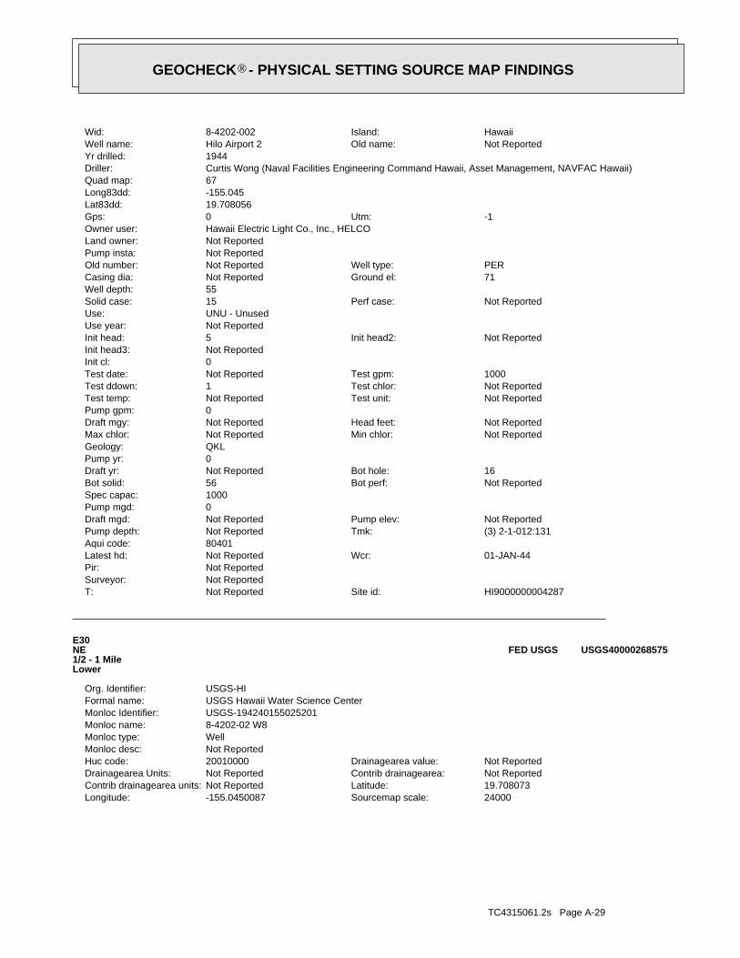
TC4315061.2s Page A-29
24000Sourcemap scale:-155.0450087Longitude:19.708073Latitude:Not ReportedContrib drainagearea units:Not ReportedContrib drainagearea:Not ReportedDrainagearea Units:Not ReportedDrainagearea value:20010000Huc code:
Not ReportedMonloc desc:WellMonloc type:8-4202-02 W8Monloc name:USGS-194240155025201Monloc Identifier:USGS Hawaii Water Science CenterFormal name:USGS-HIOrg. Identifier:
E30NE1/2 - 1 MileLower
USGS40000268575FED USGS
HI9000000004287Site id:Not ReportedT:Not ReportedSurveyor:Not ReportedPir:
01-JAN-44Wcr:Not ReportedLatest hd:80401Aqui code:
(3) 2-1-012:131Tmk:Not ReportedPump depth:Not ReportedPump elev:Not ReportedDraft mgd:
0Pump mgd:1000Spec capac:
Not ReportedBot perf:56Bot solid:16Bot hole:Not ReportedDraft yr:
0Pump yr:QKLGeology:
Not ReportedMin chlor:Not ReportedMax chlor:Not ReportedHead feet:Not ReportedDraft mgy:
0Pump gpm:Not ReportedTest unit:Not ReportedTest temp:Not ReportedTest chlor:1Test ddown:1000Test gpm:Not ReportedTest date:
0Init cl:Not ReportedInit head3:
Not ReportedInit head2:5Init head:Not ReportedUse year:UNU - UnusedUse:
Not ReportedPerf case:15Solid case:55Well depth:
71Ground el:Not ReportedCasing dia:PERWell type:Not ReportedOld number:
Not ReportedPump insta:Not ReportedLand owner:Hawaii Electric Light Co., Inc., HELCOOwner user:
-1Utm:0Gps:19.708056Lat83dd:-155.045Long83dd:67Quad map:Curtis Wong (Naval Facilities Engineering Command Hawaii, Asset Management, NAVFAC Hawaii)Driller:1944Yr drilled:
Not ReportedOld name:Hilo Airport 2Well name:HawaiiIsland:8-4202-002Wid:
®GEOCHECK - PHYSICAL SETTING SOURCE MAP FINDINGS®

TC4315061.2s Page A-30
HI9000000004301Site id:Not ReportedT:Not ReportedSurveyor:Not ReportedPir:
01-JAN-48Wcr:Not ReportedLatest hd:80401Aqui code:
Not ReportedTmk:Not ReportedPump depth:Not ReportedPump elev:Not ReportedDraft mgd:
.504Pump mgd:Not ReportedSpec capac:
Not ReportedBot perf:Not ReportedBot solid:-2Bot hole:Not ReportedDraft yr:
1984Pump yr:Not ReportedGeology:
Not ReportedMin chlor:Not ReportedMax chlor:Not ReportedHead feet:Not ReportedDraft mgy:
350Pump gpm:Not ReportedTest unit:Not ReportedTest temp:Not ReportedTest chlor:Not ReportedTest ddown:Not ReportedTest gpm:Not ReportedTest date:
0Init cl:Not ReportedInit head3:
Not ReportedInit head2:Not ReportedInit head:Not ReportedUse year:IND - Mining, Dust ControlUse:
Not ReportedPerf case:Not ReportedSolid case:25Well depth:
23Ground el:72Casing dia:DUGWell type:Not ReportedOld number:
Not ReportedPump insta:Not ReportedLand owner:Jas. W. Glover, Ltd.Owner user:
-1Utm:0Gps:19.709444Lat83dd:-155.058889Long83dd:67Quad map:Jas. W. Glover, Ltd.Driller:1948Yr drilled:
Not ReportedOld name:Glover Quarry BWell name:HawaiiIsland:8-4203-014Wid:
F31NNW1/2 - 1 MileLower
HI9000000004301HI WELLS
Ground-water levels, Number of Measurements: 0
Not ReportedWellholedepth units:Not ReportedWellholedepth:ftWelldepth units:55Welldepth:19440101Construction date:
Not ReportedAquifer type:Not ReportedFormation type:Not ReportedAquifername:
USCountrycode:HILOCALVert coord refsys:Interpolated from topographic mapVertcollection method:feetVert accmeasure units:
5Vertacc measure val:feetVert measure units:71.00Vert measure val:NAD83Horiz coord refsys:
Interpolated from mapHoriz Collection method:secondsHoriz Acc measure units:1Horiz Acc measure:
®GEOCHECK - PHYSICAL SETTING SOURCE MAP FINDINGS®

TC4315061.2s Page A-31
Land Division Oahu, DLNR-LDLand owner:University of Hawaii Hilo, UHHOwner user:
0Utm:0Gps:19.712558Lat83dd:-155.054303Long83dd:0Quad map:Not ReportedDriller:1999Yr drilled:
Not ReportedOld name:HSDP 2 DeepWell name:HawaiiIsland:8-4203-016Wid:
G33North1/2 - 1 MileLower
HI9000000004303HI WELLS
HI9000000004300Site id:Not ReportedT:Not ReportedSurveyor:Not ReportedPir:
01-JAN-48Wcr:Not ReportedLatest hd:80401Aqui code:
Not ReportedTmk:Not ReportedPump depth:Not ReportedPump elev:Not ReportedDraft mgd:
.864Pump mgd:Not ReportedSpec capac:
Not ReportedBot perf:Not ReportedBot solid:-2Bot hole:Not ReportedDraft yr:
1984Pump yr:Not ReportedGeology:
Not ReportedMin chlor:Not ReportedMax chlor:Not ReportedHead feet:Not ReportedDraft mgy:
600Pump gpm:Not ReportedTest unit:Not ReportedTest temp:Not ReportedTest chlor:Not ReportedTest ddown:Not ReportedTest gpm:Not ReportedTest date:
0Init cl:Not ReportedInit head3:
Not ReportedInit head2:Not ReportedInit head:Not ReportedUse year:IND - Mining, Dust ControlUse:
Not ReportedPerf case:Not ReportedSolid case:25Well depth:
23Ground el:72Casing dia:DUGWell type:Not ReportedOld number:
Not ReportedPump insta:Not ReportedLand owner:Jas. W. Glover, Ltd.Owner user:
-1Utm:0Gps:19.709167Lat83dd:-155.059444Long83dd:67Quad map:Jas. W. Glover, Ltd.Driller:1948Yr drilled:
Not ReportedOld name:Glover Quarry AWell name:HawaiiIsland:8-4203-013Wid:
F32NW1/2 - 1 MileLower
HI9000000004300HI WELLS
Map IDDirectionDistanceElevation EDR ID NumberDatabase
®GEOCHECK - PHYSICAL SETTING SOURCE MAP FINDINGS®

TC4315061.2s Page A-32
Not ReportedTest gpm:Not ReportedTest date:8.6Init cl:2Init head3:
2Init head2:2Init head:Not ReportedUse year:UNU - UnusedUse:
Not ReportedPerf case:16Solid case:38Well depth:
29.03Ground el:Not ReportedCasing dia:ROTWell type:Not ReportedOld number:
Not ReportedPump insta:Land Division Oahu, DLNR-LDLand owner:University of Hawaii Manoa, UHMOwner user:
0Utm:0Gps:19.713261Lat83dd:-155.054236Long83dd:0Quad map:DeLima’s Drilling, Inc.Driller:1999Yr drilled:
Not ReportedOld name:HSDP 3Well name:HawaiiIsland:8-4203-017Wid:
G34North1/2 - 1 MileLower
HI9000000004304HI WELLS
HI9000000004303Site id:Not ReportedT:Not ReportedSurveyor:Not ReportedPir:
30-JUL-03Wcr:Not ReportedLatest hd:80401Aqui code:
(3) 2-1-012:024Tmk:Not ReportedPump depth:Not ReportedPump elev:Not ReportedDraft mgd:
0Pump mgd:Not ReportedSpec capac:
Not ReportedBot perf:-1972Bot solid:-10173Bot hole:Not ReportedDraft yr:
0Pump yr:Not ReportedGeology:
Not ReportedMin chlor:Not ReportedMax chlor:Not ReportedHead feet:Not ReportedDraft mgy:
0Pump gpm:FTest unit:Not ReportedTest temp:Not ReportedTest chlor:Not ReportedTest ddown:Not ReportedTest gpm:Not ReportedTest date:
0Init cl:13Init head3:
50Init head2:13Init head:Not ReportedUse year:OBS - Deep (through transition zone)Use:
Not ReportedPerf case:2000Solid case:10201Well depth:
28Ground el:9.625Casing dia:Not ReportedWell type:Not ReportedOld number:
Not ReportedPump insta:
®GEOCHECK - PHYSICAL SETTING SOURCE MAP FINDINGS®

TC4315061.2s Page A-33
64Spec capac:Not ReportedBot perf:44Bot solid:-17Bot hole:Not ReportedDraft yr:
0Pump yr:Qk3Geology:
Not ReportedMin chlor:Not ReportedMax chlor:Not ReportedHead feet:Not ReportedDraft mgy:
0Pump gpm:Not ReportedTest unit:Not ReportedTest temp:Not ReportedTest chlor:14Test ddown:900Test gpm:Not ReportedTest date:
0Init cl:Not ReportedInit head3:
Not ReportedInit head2:4Init head:Not ReportedUse year:UNU - UnusedUse:
Not ReportedPerf case:15Solid case:76Well depth:
59Ground el:16Casing dia:PERWell type:7-Old number:
Not ReportedPump insta:National Guard & Civil DefenseLand owner:Department of Water Supply Hawaii - Hilo, HDWSOwner user:
-1Utm:0Gps:19.710278Lat83dd:-155.043056Long83dd:67Quad map:Curtis Wong (Naval Facilities Engineering Command Hawaii, Asset Management, NAVFAC Hawaii)Driller:1944Yr drilled:
Hilo Airport 1Old name:Hilo Airport Well [NIU]Well name:HawaiiIsland:8-4202-001Wid:
H35NE1/2 - 1 MileLower
HI9000000004286HI WELLS
HI9000000004304Site id:Not ReportedT:Not ReportedSurveyor:Not ReportedPir:
12-FEB-14Wcr:Not ReportedLatest hd:80401Aqui code:
(3) 2-1-012:024Tmk:Not ReportedPump depth:Not ReportedPump elev:Not ReportedDraft mgd:
0Pump mgd:Not ReportedSpec capac:
Not ReportedBot perf:13.03Bot solid:-8.97Bot hole:Not ReportedDraft yr:
0Pump yr:Qk3Geology:
Not ReportedMin chlor:Not ReportedMax chlor:Not ReportedHead feet:67Draft mgy:
0Pump gpm:Not ReportedTest unit:Not ReportedTest temp:Not ReportedTest chlor:Not ReportedTest ddown:
®GEOCHECK - PHYSICAL SETTING SOURCE MAP FINDINGS®

TC4315061.2s Page A-34
Ground-water levels, Number of Measurements: 0
Not ReportedWellholedepth units:Not ReportedWellholedepth:ftWelldepth units:76Welldepth:19440101Construction date:
Not ReportedAquifer type:Not ReportedFormation type:Not ReportedAquifername:
USCountrycode:HILOCALVert coord refsys:Interpolated from topographic mapVertcollection method:feetVert accmeasure units:
5Vertacc measure val:feetVert measure units:59.00Vert measure val:NAD83Horiz coord refsys:
Interpolated from mapHoriz Collection method:secondsHoriz Acc measure units:1Horiz Acc measure:24000Sourcemap scale:-155.0430643Longitude:19.7102952Latitude:Not ReportedContrib drainagearea units:Not ReportedContrib drainagearea:Not ReportedDrainagearea Units:Not ReportedDrainagearea value:20010000Huc code:
Not ReportedMonloc desc:WellMonloc type:8-4202-01 W7Monloc name:USGS-194248155024501Monloc Identifier:USGS Hawaii Water Science CenterFormal name:USGS-HIOrg. Identifier:
H36NE1/2 - 1 MileLower
USGS40000268578FED USGS
HI9000000004286Site id:Not ReportedT:Not ReportedSurveyor:Not ReportedPir:
01-JAN-44Wcr:Not ReportedLatest hd:80401Aqui code:
(3) 2-1-012:003Tmk:Not ReportedPump depth:Not ReportedPump elev:Not ReportedDraft mgd:
0Pump mgd:
®GEOCHECK - PHYSICAL SETTING SOURCE MAP FINDINGS®

TC4315061.2s Page A-35
0%0%100%-0.106 pCi/LBasementNot ReportedNot ReportedNot ReportedNot ReportedLiving Area - 2nd Floor0%0%100%-0.112 pCi/LLiving Area - 1st Floor
% >20 pCi/L% 4-20 pCi/L% <4 pCi/LAverage ActivityArea
Number of sites tested: 43
Federal Area Radon Information for Zip Code: 96720
: Zone 3 indoor average level < 2 pCi/L. : Zone 2 indoor average level >= 2 pCi/L and <= 4 pCi/L. Note: Zone 1 indoor average level > 4 pCi/L.
Federal EPA Radon Zone for HAWAII County: 3
AREA RADON INFORMATION
®GEOCHECK - PHYSICAL SETTING SOURCE MAP FINDINGSRADON
®

TOPOGRAPHIC INFORMATION
USGS 7.5’ Digital Elevation Model (DEM)Source: United States Geologic SurveyEDR acquired the USGS 7.5’ Digital Elevation Model in 2002 and updated it in 2006. The 7.5 minute DEM correspondsto the USGS 1:24,000- and 1:25,000-scale topographic quadrangle maps. The DEM provides elevation datawith consistent elevation units and projection.
Scanned Digital USGS 7.5’ Topographic Map (DRG)Source: United States Geologic SurveyA digital raster graphic (DRG) is a scanned image of a U.S. Geological Survey topographic map. The map imagesare made by scanning published paper maps on high-resolution scanners. The raster imageis georeferenced and fit to the Universal Transverse Mercator (UTM) projection.
HYDROLOGIC INFORMATION
Flood Zone Data: This data, available in select counties across the country, was obtained by EDR in 2003 & 2011 from the FederalEmergency Management Agency (FEMA). Data depicts 100-year and 500-year flood zones as defined by FEMA.
NWI: National Wetlands Inventory. This data, available in select counties across the country, was obtained by EDRin 2002, 2005 and 2010 from the U.S. Fish and Wildlife Service.
HYDROGEOLOGIC INFORMATION
AQUIFLOW Information SystemR
Source: EDR proprietary database of groundwater flow informationEDR has developed the AQUIFLOW Information System (AIS) to provide data on the general direction of groundwater
flow at specific points. EDR has reviewed reports submitted to regulatory authorities at select sites and hasextracted the date of the report, hydrogeologically determined groundwater flow direction and depth to water tableinformation.
GEOLOGIC INFORMATION
Geologic Age and Rock Stratigraphic UnitSource: P.G. Schruben, R.E. Arndt and W.J. Bawiec, Geology of the Conterminous U.S. at 1:2,500,000 Scale - A digitalrepresentation of the 1974 P.B. King and H.M. Beikman Map, USGS Digital Data Series DDS - 11 (1994).
STATSGO: State Soil Geographic DatabaseSource: Department of Agriculture, Natural Resources Conservation ServicesThe U.S. Department of Agriculture’s (USDA) Natural Resources Conservation Service (NRCS) leads the nationalConservation Soil Survey (NCSS) and is responsible for collecting, storing, maintaining and distributing soilsurvey information for privately owned lands in the United States. A soil map in a soil survey is a representationof soil patterns in a landscape. Soil maps for STATSGO are compiled by generalizing more detailed (SSURGO)soil survey maps.
SSURGO: Soil Survey Geographic DatabaseSource: Department of Agriculture, Natural Resources Conservation Services (NRCS)Telephone: 800-672-5559SSURGO is the most detailed level of mapping done by the Natural Resources Conservation Services, mappingscales generally range from 1:12,000 to 1:63,360. Field mapping methods using national standards are used toconstruct the soil maps in the Soil Survey Geographic (SSURGO) database. SSURGO digitizing duplicates theoriginal soil survey maps. This level of mapping is designed for use by landowners, townships and countynatural resource planning and management.
TC4315061.2s Page PSGR-1
PHYSICAL SETTING SOURCE RECORDS SEARCHED

LOCAL / REGIONAL WATER AGENCY RECORDS
FEDERAL WATER WELLS
PWS: Public Water SystemsSource: EPA/Office of Drinking WaterTelephone: 202-564-3750Public Water System data from the Federal Reporting Data System. A PWS is any water system which provides water to at
least 25 people for at least 60 days annually. PWSs provide water from wells, rivers and other sources.
PWS ENF: Public Water Systems Violation and Enforcement DataSource: EPA/Office of Drinking WaterTelephone: 202-564-3750Violation and Enforcement data for Public Water Systems from the Safe Drinking Water Information System (SDWIS) after
August 1995. Prior to August 1995, the data came from the Federal Reporting Data System (FRDS).
USGS Water Wells: USGS National Water Inventory System (NWIS)This database contains descriptive information on sites where the USGS collects or has collected data on surfacewater and/or groundwater. The groundwater data includes information on wells, springs, and other sources of groundwater.
STATE RECORDS
Well Index DatabaseSource: Commission on Water Resource ManagementTelephone: 808-587-0214CWRM maintains a Well Index Database to track specific information pertaining to the construction and installation
of production wells in Hawaii
OTHER STATE DATABASE INFORMATION
RADON
Area Radon InformationSource: USGSTelephone: 703-356-4020The National Radon Database has been developed by the U.S. Environmental Protection Agency(USEPA) and is a compilation of the EPA/State Residential Radon Survey and the National Residential Radon Survey.The study covers the years 1986 - 1992. Where necessary data has been supplemented by information collected atprivate sources such as universities and research institutions.
EPA Radon ZonesSource: EPATelephone: 703-356-4020Sections 307 & 309 of IRAA directed EPA to list and identify areas of U.S. with the potential for elevated indoorradon levels.
OTHER
Airport Landing Facilities: Private and public use landing facilitiesSource: Federal Aviation Administration, 800-457-6656
Epicenters: World earthquake epicenters, Richter 5 or greaterSource: Department of Commerce, National Oceanic and Atmospheric Administration
Earthquake Fault Lines: The fault lines displayed on EDR’s Topographic map are digitized quaternary faultlines, preparedin 1975 by the United State Geological Survey
TC4315061.2s Page PSGR-2
PHYSICAL SETTING SOURCE RECORDS SEARCHED

STREET AND ADDRESS INFORMATION
© 2010 Tele Atlas North America, Inc. All rights reserved. This material is proprietary and the subject of copyright protectionand other intellectual property rights owned by or licensed to Tele Atlas North America, Inc. The use of this material is subjectto the terms of a license agreement. You will be held liable for any unauthorized copying or disclosure of this material.
TC4315061.2s Page PSGR-3
PHYSICAL SETTING SOURCE RECORDS SEARCHED


The EDR Aerial Photo Decade Package


The EDR Aerial Photo Decade Package
DHHL Hilo Properties 3 2-1-025 6,7,47,48
AUWAE RD
Hilo, HI 96720
Inquiry Number: 4315061.9
June 04, 2015
EDR Aerial Photo Decade Package
Environmental Data Resources, Inc. (EDR) Aerial Photo Decade Package is a screening tool designed to assistenvironmental professionals in evaluating potential liability on a target property resulting from past activities. EDR’sprofessional researchers provide digitally reproduced historical aerial photographs, and when available, provide one photoper decade.
When delivered electronically by EDR, the aerial photo images included with this report are for ONE TIME USEONLY. Further reproduction of these aerial photo images is prohibited without permission from EDR. For moreinformation contact your EDR Account Executive.
Thank you for your business.Please contact EDR at 1-800-352-0050
with any questions or comments.
Disclaimer - Copyright and Trademark Notice
This Report contains certain information obtained from a variety of public and other sources reasonably available to Environmental Data Resources, Inc.It cannot be concluded from this Report that coverage information for the target and surrounding properties does not exist from other sources. NOWARRANTY EXPRESSED OR IMPLIED, IS MADE WHATSOEVER IN CONNECTION WITH THIS REPORT. ENVIRONMENTAL DATARESOURCES, INC. SPECIFICALLY DISCLAIMS THE MAKING OF ANY SUCH WARRANTIES, INCLUDING WITHOUT LIMITATION,MERCHANTABILITY OR FITNESS FOR A PARTICULAR USE OR PURPOSE. ALL RISK IS ASSUMED BY THE USER. IN NO EVENT SHALLENVIRONMENTAL DATA RESOURCES, INC. BE LIABLE TO ANYONE, WHETHER ARISING OUT OF ERRORS OR OMISSIONS, NEGLIGENCE,ACCIDENT OR ANY OTHER CAUSE, FOR ANY LOSS OF DAMAGE, INCLUDING, WITHOUT LIMITATION, SPECIAL, INCIDENTAL,CONSEQUENTIAL, OR EXEMPLARY DAMAGES. ANY LIABILITY ON THE PART OF ENVIRONMENTAL DATA RESOURCES, INC. IS STRICTLYLIMITED TO A REFUND OF THE AMOUNT PAID FOR THIS REPORT. Purchaser accepts this Report AS IS. Any analyses, estimates, ratings,environmental risk levels or risk codes provided in this Report are provided for illustrative purposes only, and are not intended to provide, nor should theybe interpreted as providing any facts regarding, or prediction or forecast of, any environmental risk for any property. Only a Phase I Environmental SiteAssessment performed by an environmental professional can provide information regarding the environmental risk for any property. Additionally, theinformation provided in this Report is not to be construed as legal advice.
Copyright 2015 by Environmental Data Resources, Inc. All rights reserved. Reproduction in any media or format, in whole or in part, of any report or mapof Environmental Data Resources, Inc., or its affiliates, is prohibited without prior written permission.
EDR and its logos (including Sanborn and Sanborn Map) are trademarks of Environmental Data Resources, Inc. or its affiliates. All other trademarksused herein are the property of their respective owners.

Date EDR Searched Historical Sources:Aerial PhotographyJune 04, 2015
Target Property:AUWAE RD
Hilo, HI 96720
Year Scale Details Source
1954 Aerial Photograph. Scale: 1"=750' Flight Date: April 10, 1954 EDR
1975 Aerial Photograph. Scale: 1"=500' Flight Date: July 17, 1975 USGS
1977 Aerial Photograph. Scale: 1"=500' Flight Date: January 03, 1977 USGS
1988 Aerial Photograph. Scale: 1"=500' Flight Date: October 01, 1988 EDR
1992 Aerial Photograph. Scale: 1"=500' Flight Date: September 23, 1992 USGS
4315061.92

INQUIRY #:
YEAR:
4315061.9
1954
= 750'
if N ---- ~EOR
1--------t

INQUIRY #:
YEAR:
4315061.9
1975
= 500'
if N --- ~EDR
1--------4

INQUIRY #:
YEAR:
4315061.9
1977
= 500'
if N --- ~EDR
1--------4

INQUIRY #:
YEAR:
4315061.9
1988
= 500'
if N ---- ~EDR

INQUIRY #:
YEAR:
4315061.9
1992
= 500'

Certified Sanborn® Map Report


Certified Sanborn® Map Report
DHHL Hilo Properties 3 2-1-025 6,7,47,48
AUWAE RD
Hilo, HI 96720
Inquiry Number: 4315061.3
June 03, 2015

Certified Sanborn® Map Report 6/03/15
Site Name:DHHL Hilo Properties 3 2-1-AUWAE RDHilo, HI 96720
Client Name:Element Environmental , LLC98-030 Hekaha StreetAiea, HI 96701-0000
Contact: Angela PeltierEDR Inquiry # 4315061.3
The Sanborn Library has been searched by EDR and maps covering the target property location as provided byElement Environmental , LLC were identified for the years listed below. The Sanborn Library is the largest, mostcomplete collection of fire insurance maps. The collection includes maps from Sanborn, Bromley, Perris & Browne,Hopkins, Barlow, and others. Only Environmental Data Resources Inc. (EDR) is authorized to grant rights forcommercial reproduction of maps by the Sanborn Library LLC, the copyright holder for the collection. Results can beauthenticated by visiting www.edrnet.com/sanborn.
The Sanborn Library is continually enhanced with newly identified map archives. This report accesses all maps in thecollection as of the day this report was generated.
Certified Sanborn Results:
Site Name: DHHL Hilo Properties 3 2-1-025 6,7,47,48Address: AUWAE RDCity, State, Zip: Hilo, HI 96720Cross Street:P.O. # 150024Project: 150024 DHHL Phase I ESACertification # 59B0-49F3-B032
Library of Congress
University Publications of America
EDR Private Collection
The Sanborn Library LLC Since 1866™
The Sanborn Library includes more than 1.2 millionfire insurance maps from Sanborn, Bromley, Perris &Browne, Hopkins, Barlow and others which trackhistorical property usage in approximately 12,000American cities and towns. Collections searched:
Sanborn® Library search resultsCertification # 59B0-49F3-B032
UNMAPPED PROPERTYThis report certifies that the complete holdings of the SanbornLibrary, LLC collection have been searched based on clientsupplied target property information, and fire insurance mapscovering the target property were not found.
Limited Permission To Make CopiesElement Environmental , LLC (the client) is permitted to make up to FIVE photocopies of this Sanborn Map transmittal and each fire insurance mapaccompanying this report solely for the limited use of its customer. No one other than the client is authorized to make copies. Upon request madedirectly to an EDR Account Executive, the client may be permitted to make a limited number of additional photocopies. This permission isconditioned upon compliance by the client, its customer and their agents with EDR's copyright policy; a copy of which is available upon request.
Disclaimer - Copyright and Trademark noticeThis Report contains certain information obtained from a variety of public and other sources reasonably available to Environmental Data Resources, Inc. It cannot beconcluded from this Report that coverage information for the target and surrounding properties does not exist from other sources. NO WARRANTY EXPRESSED ORIMPLIED, IS MADE WHATSOEVER IN CONNECTION WITH THIS REPORT. ENVIRONMENTAL DATA RESOURCES, INC. SPECIFICALLY DISCLAIMS THEMAKING OF ANY SUCH WARRANTIES, INCLUDING WITHOUT LIMITATION, MERCHANTABILITY OR FITNESS FOR A PARTICULAR USE OR PURPOSE. ALLRISK IS ASSUMED BY THE USER. IN NO EVENT SHALL ENVIRONMENTAL DATA RESOURCES, INC. BE LIABLE TO ANYONE, WHETHER ARISING OUT OFERRORS OR OMISSIONS, NEGLIGENCE, ACCIDENT OR ANY OTHER CAUSE, FOR ANY LOSS OF DAMAGE, INCLUDING, WITHOUT LIMITATION, SPECIAL,INCIDENTAL CONSEQUENTIAL, OR EXEMPLARY DAMAGES. ANY LIABILITY ON THE PART OF ENVIRONMENTAL DATA RESOURCES, INC. IS STRICTLYLIMITED TO A REFUND OF THE AMOUNT PAID FOR THIS REPORT. Purchaser accepts this Report "AS IS". Any analyses, estimates, ratings, environmental risklevels or risk codes provided in this Report are provided for illustrative purposes only, and are not intended to provide, nor should they be interpreted as providingany facts regarding, or prediction or forecast of, any environmental risk for any property. Only a Phase I Environmental Site Assessment performed by anenvironmental professional can provide information regarding the environmental risk for any property. Additionally, the information provided in this Report is not to beconstrued as legal advice.
Copyright 2015 by Environmental Data Resources, Inc. All rights reserved. Reproduction in any media or format, in whole or in part, of any report or map ofEnvironmental Data Resources, Inc., or its affiliates, is prohibited without prior written permission.
EDR and its logos (including Sanborn and Sanborn Map) are trademarks of Environmental Data Resources, Inc. or its affiliates. All other trademarks used herein arethe property of their respective owners.
4315061 - 3 page 2

EDR Historical Topographic Map Report


EDR Historical Topographic Map Report
DHHL Hilo Properties 3 2-1-025 6,7,47,48
AUWAE RD
Hilo, HI 96720
Inquiry Number: 4315061.4
June 04, 2015

EDR Historical Topographic Map Report
Environmental Data Resources, Inc.s (EDR) Historical Topographic Map Report is designed to assist professionals inevaluating potential liability on a target property resulting from past activities. EDRs Historical Topographic Map Reportincludes a search of a collection of public and private color historical topographic maps, dating back to the early 1900s.
Thank you for your business.Please contact EDR at 1-800-352-0050
with any questions or comments.
Disclaimer - Copyright and Trademark Notice
This Report contains certain information obtained from a variety of public and other sources reasonably available to Environmental Data Resources, Inc.It cannot be concluded from this Report that coverage information for the target and surrounding properties does not exist from other sources. NOWARRANTY EXPRESSED OR IMPLIED, IS MADE WHATSOEVER IN CONNECTION WITH THIS REPORT. ENVIRONMENTAL DATARESOURCES, INC. SPECIFICALLY DISCLAIMS THE MAKING OF ANY SUCH WARRANTIES, INCLUDING WITHOUT LIMITATION,MERCHANTABILITY OR FITNESS FOR A PARTICULAR USE OR PURPOSE. ALL RISK IS ASSUMED BY THE USER. IN NO EVENT SHALLENVIRONMENTAL DATA RESOURCES, INC. BE LIABLE TO ANYONE, WHETHER ARISING OUT OF ERRORS OR OMISSIONS, NEGLIGENCE,ACCIDENT OR ANY OTHER CAUSE, FOR ANY LOSS OF DAMAGE, INCLUDING, WITHOUT LIMITATION, SPECIAL, INCIDENTAL,CONSEQUENTIAL, OR EXEMPLARY DAMAGES. ANY LIABILITY ON THE PART OF ENVIRONMENTAL DATA RESOURCES, INC. IS STRICTLYLIMITED TO A REFUND OF THE AMOUNT PAID FOR THIS REPORT. Purchaser accepts this Report AS IS. Any analyses, estimates, ratings,environmental risk levels or risk codes provided in this Report are provided for illustrative purposes only, and are not intended to provide, nor should theybe interpreted as providing any facts regarding, or prediction or forecast of, any environmental risk for any property. Only a Phase I Environmental SiteAssessment performed by an environmental professional can provide information regarding the environmental risk for any property. Additionally, theinformation provided in this Report is not to be construed as legal advice.
Copyright 2015 by Environmental Data Resources, Inc. All rights reserved. Reproduction in any media or format, in whole or in part, of any report or mapof Environmental Data Resources, Inc., or its affiliates, is prohibited without prior written permission.
EDR and its logos (including Sanborn and Sanborn Map) are trademarks of Environmental Data Resources, Inc. or its affiliates. All other trademarksused herein are the property of their respective owners.

Historical Topographic Map
→
NTARGET QUADTARGET QUADNAME: WAIAKEAMAP YEAR: 1914
SERIES: 7.5SCALE: 1:31680
SITE NAME: DHHL HiloProperties 3 2-1-
ADDRESS: AUWAE RDHilo, HI 96720
LAT/LONG: 19.6997 / -155.0527
CLIENT: Element Environmental , LLCCONTACT: Angela PeltierINQUIRY#: 4315061.4RESEARCH DATE: 06/04/2015

Historical Topographic Map
→
NTARGET QUADTARGET QUADNAME: HILOMAP YEAR: 1932
SERIES: 15SCALE: 1:62500
SITE NAME: DHHL HiloProperties 3 2-1-
ADDRESS: AUWAE RDHilo, HI 96720
LAT/LONG: 19.6997 / -155.0527
CLIENT: Element Environmental , LLCCONTACT: Angela PeltierINQUIRY#: 4315061.4RESEARCH DATE: 06/04/2015
w A I E A l r7
; \ / \
' ' / \
/ /
/ /

Historical Topographic Map
→
NTARGET QUADTARGET QUADNAME: HILOMAP YEAR: 1963
SERIES: 7.5SCALE: 1:24000
SITE NAME: DHHL HiloProperties 3 2-1-
ADDRESS: AUWAE RDHilo, HI 96720
LAT/LONG: 19.6997 / -155.0527
CLIENT: Element Environmental , LLCCONTACT: Angela PeltierINQUIRY#: 4315061.4RESEARCH DATE: 06/04/2015
II ) II ~ \1 II \\ II II
71 =:e. \I II II \1 \1 '\1 / II
11 II II II
11 \1 II II II II II II \1 II II II
11 II II II
II II II II II 1\
\1
" \1 " ..... \\ .,-:;.!#&
1'1'"' II \\
" \\ \1 II II
40
80 ~
'
\ '5o:' Quarry \
~,./
)
-"b

Historical Topographic Map
→
NTARGET QUADTARGET QUADNAME: HILOMAP YEAR: 1980
SERIES: 15SCALE: 1:50000
SITE NAME: DHHL HiloProperties 3 2-1-
ADDRESS: AUWAE RDHilo, HI 96720
LAT/LONG: 19.6997 / -155.0527
CLIENT: Element Environmental , LLCCONTACT: Angela PeltierINQUIRY#: 4315061.4RESEARCH DATE: 06/04/2015
I /

Historical Topographic Map
→
NTARGET QUADTARGET QUADNAME: HILOMAP YEAR: 1981
SERIES: 7.5SCALE: 1:24000
SITE NAME: DHHL HiloProperties 3 2-1-
ADDRESS: AUWAE RDHilo, HI 96720
LAT/LONG: 19.6997 / -155.0527
CLIENT: Element Environmental , LLCCONTACT: Angela PeltierINQUIRY#: 4315061.4RESEARCH DATE: 06/04/2015
40
I )
~ Quarry
,'<'"'----
\ \

Historical Topographic Map
→
NTARGET QUADTARGET QUADNAME: HILOMAP YEAR: 1995
SERIES: 7.5SCALE: 1:24000
SITE NAME: DHHL HiloProperties 3 2-1-
ADDRESS: AUWAE RDHilo, HI 96720
LAT/LONG: 19.6997 / -155.0527
CLIENT: Element Environmental , LLCCONTACT: Angela PeltierINQUIRY#: 4315061.4RESEARCH DATE: 06/04/2015
.. • • Hoolulu" •
_ Park I G I -'- .
• I

The EDR-City Directory Image Report


DHHL Hilo Properties 3 2-1-025 6,7,47,48
AUWAE RDHilo, HI 96720
Inquiry Number: 4315061.5June 05, 2015
The EDR-City Directory Image Report
6 Armstrong RoadShelton, CT 06484800.352.0050www.edrnet.comEnvironmental Data Resources IncEnvironmental Data Resources IncEnvironmental Data Resources IncEnvironmental Data Resources Inc

TABLE OF CONTENTS
SECTION
Executive Summary
Findings
City Directory Images
Thank you for your business. Please contact EDR at 1-800-352-0050
with any questions or comments.
Disclaimer - Copyright and Trademark Notice
This Report contains certain information obtained from a variety of public and other sources reasonably available to Environmental Data Resources, Inc. It cannot be concluded from this Report that coverage information for the target and surrounding properties does not exist from other sources. NO WARRANTY EXPRESSED OR IMPLIED, IS MADE WHATSOEVER IN CONNECTION WITH THIS REPORT. ENVIRONMENTAL DATA RESOURCES, INC. SPECIFICALLY DISCLAIMS THE MAKING OF ANY SUCH WARRANTIES, INCLUDING WITHOUT LIMITATION, MERCHANTABILITY OR FITNESS FOR A PARTICULAR USE OR PURPOSE. ALL RISK IS ASSUMED BY THE USER. IN NO EVENT SHALL ENVIRONMENTAL DATA RESOURCES, INC. BE LIABLE TO ANYONE, WHETHER ARISING OUT OF ERRORS OR OMISSIONS, NEGLIGENCE, ACCIDENT OR ANY OTHER CAUSE, FOR ANY LOSS OR DAMAGE, INCLUDING, WITHOUT LIMITATION, SPECIAL, INCIDENTAL, CONSEQUENTIAL, OR EXEMPLARY DAMAGES. ANY LIABILITY ON THE PART OF ENVIRONMENTAL DATA RESOURCES, INC. IS STRICTLY LIMITED TO A REFUND OF THE AMOUNT PAID FOR THIS REPORT. Purchaser accepts this Report "AS IS". Any analyses, estimates, ratings, environmental risk levels or risk codes provided in this Report are provided for illustrative purposes only, and are not intended to provide, nor should they be interpreted as providing any facts regarding, or prediction orforecast of, any environmental risk for any property. Only a Phase I Environmental Site Assessment performed by an environmental professional can provide information regarding the environmental risk for any property. Additionally, the information provided in this Report is not to be construed as legal advice.
Copyright 2015 by Environmental Data Resources, Inc. All rights reserved. Reproduction in any media or format, in whole or in part, of any report or map of Environmental Data Resources, Inc. or its affiliates is prohibited without prior written permission.
EDR and its logos (including Sanborn and Sanborn Map) are trademarks of Environmental Data Resources, Inc. or its affiliates. All other trademarks used herein are the property of their respective owners.

EXECUTIVE SUMMARY
DESCRIPTION
Environmental Data Resources, Inc.’s (EDR) City Directory Report is a screening tool designed to assist environmental professionals in evaluating potential liability on a target property resulting from past activities. EDR’s City Directory Report includes a search of available city directory data at 5 year intervals.
RESEARCH SUMMARY
The following research sources were consulted in the preparation of this report. A check mark indicates where information was identified in the source and provided in this report.
Year Target Street Cross Street Source
2013 Cole Information Services
2008 Cole Information Services
2003 Cole Information Services
1999 Cole Information Services
1995 Cole Information Services
1992 Cole Information Services
RECORD SOURCES
EDR is licensed to reproduce certain City Directory works by the copyright holders of those works. The purchaser of this EDR City Directory Report may include it in report(s) delivered to a customer. Reproduction of City Directories without permission of the publisher or licensed vendor may be a violation of copyright.
4315061- 5 Page 1

FINDINGS
TARGET PROPERTY STREET
AUWAE RDHilo, HI 96720
Year CD Image Source
AUWAE RD
2013 pg A2 Cole Information Services
2008 pg A6 Cole Information Services
2003 pg A9 Cole Information Services
1999 pg A11 Cole Information Services
1995 pg A13 Cole Information Services
1992 - Cole Information Services Target and Adjoining not listed in Source
AUWAE ST
1992 pg A15 Cole Information Services
4315061- 5 Page 2

FINDINGS
CROSS STREETS
Year CD Image Source
RAILROAD AVE
2013 pg. A4 Cole Information Services
2008 pg. A8 Cole Information Services
2003 pg. A10 Cole Information Services
1999 pg. A12 Cole Information Services
1995 pg. A14 Cole Information Services
1992 pg. A16 Cole Information Services
4315061- 5 Page 3

City Directory Images

-
AUWAE RD
Cole Information Services
4315061.5 Page: A2
SourceTarget Street Cross Street
2013
394 COLETTE PAGLINAWAN428 PATRICIA LEE432 OCCUPANT UNKNOWN449 OCCUPANT UNKNOWN465 ROANNE HA498 IAN LOY501 MARK GOMES510 IAN LOY516 HEDWIG WARRINGTON549 KIHA KINNEY631 MAX ROLDAN
SAMUEL KAMOKU682 LEEROM VENTURA697 HERBERT LARANANG710 OCCUPANT UNKNOWN741 BILLIE KEAWEKANE781 LIZA NAMAUU809 STARLENE NGATA889 LISA KURIHARA940 GORDON VALENTINE961 JOSEPH SPENCER962 BUSINESS SERVICES HAWAII983 DALE BURTON
RURAL COMMUNITY ASSISTANCE998 OCCUPANT UNKNOWN1039 BILLY DEMELLO1040 L HUTCHINSON1110 KALA MOSSMAN
OCCUPANT UNKNOWNPUALANI KANAHELE
1111 PAULINE WEDDLE1114 KEKUHI KEALIIKANAKAOLEOHAIL1130 AHIENA KANAHELE1140 OCCUPANT UNKNOWN1155 MAXFIELD NAMAHOE1194 KAREN KANE1197 CYNTHIA MAKAIWI1267 NAOMI NAIPO1279 OCCUPANT UNKNOWN1297 CLEMENT MALANI1310 DAVID KAHALEWAI1323 MILTON MASAOKA1345 OCCUPANT UNKNOWN1379 BRONSON KELEPOLO1384 OCCUPANT UNKNOWN1414 AIUAHUN DESHA1420 MENEHUNE MAINTENANCE INC
SOLOMON HOCSON1423 NIRALYN HOCSON1480 CATHERINE HAMILTON

(Cont'd)
-
AUWAE RD
Cole Information Services
4315061.5 Page: A3
SourceTarget Street Cross Street
2013
1481 OCCUPANT UNKNOWN1518 JOHN LUUWAI1537 LOUISA REFF1550 ANGELA LEE1551 LAWRENCE NAHAKUELUA1570 OCCUPANT UNKNOWN1593 WENDEL ICARI1598 ROBERT YAMADA1604 MICHITAKA NAKAMOTO1611 OCCUPANT UNKNOWN1695 OCCUPANT UNKNOWN1700 OCCUPANT UNKNOWN1721 SIONE MOALA1743 OCCUPANT UNKNOWN1750 OCCUPANT UNKNOWN1763 CHRISTINE PAKANI1827 ALAN MEYERS1847 OCCUPANT UNKNOWN1867 DARLENE HOOPAI1910 BEN CACHOLA1924 LUCINDA KEAMO

-
RAILROAD AVE
Cole Information Services
4315061.5 Page: A4
SourceTarget Street Cross Street
2013
1 CLAYTON HORNYAMADA DIVERSIFIED CORPORATIONYS ROCKQUARRY
11 MEADOW GOLD DAIRIES INC15 CHARLES KEKAHU
FRANKILITO BABASJOHN BOBADILLAJOSE GARCIAKERRY PETERSENKINNE ITOSCOTT TRACY
16 CONAGG OF HAWAIICONCRETEDANICOLE INVESTMENTS LTDHAWAII PETROLEUM INCHR WORKS LLCJOHN UMPHREYTEXACO DISTRIBUTORS INCUMPHREY JOHN PHOTOGRAPHYWORKFORCE MANAGEMENT INC
24 DMS DIESEL REPAIR LLC69 BIG ISLAND ENTERTAINMENT INC
BIG ISLE MOVING & DRAYING INCC A R S S LLCCARE RESOURCE HAWAIICARERESOURCE HAWAIICYCLELOGICGOLDEN NEOLIFE DIAMITE DISTRIBUTORHILOS DIAMOND DETAILLINGHOT LAVA TAXI & TOURSHUI MALAMA OLA NA OIWIPROVISION SOLAR INCSUGAR T EXPRESS INCUHAUL NEIGHBORHOOD DEALER
108 COUNTY OF HAWAII164 NICOLE DOLAN169 LAUPAHOEHOE TRANSPORTATION COMPANY I171 CATERPILLAR DILLAR
HAWTHORNE PACIFIC CORP215 ALOHA FITNESS CLUB
APPROVED FREIGHT FORWARDERSBACONUNIVERSAL COMPANY INCFLORAL CONNECTION THEPACIFIC GYMNASTICSROYAL HAWAIIAN MOVERS
385 OCCUPANT UNKNOWN411 KEALANI PELEIHOLANI497 OCCUPANT UNKNOWN600 HOWARD PEA661 MILTON IOPA696 MAKAALA RAWLINS

(Cont'd)
-
RAILROAD AVE
Cole Information Services
4315061.5 Page: A5
SourceTarget Street Cross Street
2013
801 OLIVA SING839 MARIE BUMATAG899 JOHNSON KAHILI940 ALEXANDER BUMATAY959 DAVID SATO960 LEOLANI LEE967 DOUGLAS AWAI

-
AUWAE RD
Cole Information Services
4315061.5 Page: A6
SourceTarget Street Cross Street
2008
428 WILLIAM CABIGON449 MARY AIONA498 PATRICIA KEOHOKAPU501 MARK GOMES510 MARY BECK516 OCCUPANT UNKNOWN549 EVERETT KINNEY631 SAMUEL KAMOKU682 LEEROM VENTURA697 OCCUPANT UNKNOWN809 OCCUPANT UNKNOWN940 GORDON VALENTINE961 JOSEPH SPENCER962 RECYCLING SYSTEMS HAWAII INC983 OCCUPANT UNKNOWN998 OCCUPANT UNKNOWN1040 OCCUPANT UNKNOWN1110 AHIENA KANAHELE
BENJAMIN ENOSKALA MOSSMANTRACY HIGASHI
1111 PAULINE WEDDLE1114 KEKUHI KANAHELE1155 MAXFIELD NAMAHOE1194 DENNIS KANE1197 OCCUPANT UNKNOWN1297 CLEMENT MALANI
LAUPAHOEHOE CONGREGATIONAL CHURCH1310 DAVID KAHALEWAI1323 MILTON MASAOKA1379 ALEX KELEPOLO1384 AMMON BORGES1414 AIUAHUN DESHA1420 APRIL HOCSON
MENEHUNE MAINTENANCE INC1423 OCCUPANT UNKNOWN1464 FRANCIS NAOPE1518 M LUUWAI1550 ANGELA LEE1570 DONNA GOLDSWORTHY1593 WENDEL ICARI1598 ROBERT YAMADA1604 OCCUPANT UNKNOWN1611 VICTORIA WHITWORTH1700 L FIGUEIRA1721 OCCUPANT UNKNOWN1743 ALAN PASA1750 OCCUPANT UNKNOWN1763 CHRISTINE PAKANI1809 OCCUPANT UNKNOWN

(Cont'd)
-
AUWAE RD
Cole Information Services
4315061.5 Page: A7
SourceTarget Street Cross Street
2008
1827 ALAN MEYERS1840 LEINANI AINA1867 DARLENE HOOPAI1924 OCCUPANT UNKNOWN

-
RAILROAD AVE
Cole Information Services
4315061.5 Page: A8
SourceTarget Street Cross Street
2008
1 CLAYTON HORN11 MEADOW GOLD DAIRY15 GARET NAKAMAEJO16 COURTNEY DEAGUIAR
DANICOLE INVESTMENT INCDOLAN SILVA & ASSOCIATES INCHAWAII PETROLEUM INCHCBA INCHR WORKS LLCUMPHREY JOHN PHOTOGRAPHYWORKFORCE MANAGEMENT INC
24 DMS DIESEL REPAIR LLC69 ANVIL INC
BIG ISLAND ENTERTAINMENTBIG ISLE MOVING & DRAYING INCCYCLE LOGIC TECHNICAL SERVICESDK AUTO REPAIR INCHAWAIIAN HOUSEWARES LTDHUI MALAMA OLA NA OIWIHULALIMAU JEWELRY INCJE MERK & ASSOCIATES INCKAMAAINA DISTRIBUTION COMALAMA HUIPROVISION TECHNOLOGIES INCPUNA PIZZA INCSTUFF IT MINI STORAGE OF HILOSTUFF IT MINI STORAGE OF HILO INCU HAUL COWORK RITE SYSTEMS INC
108 COUNTY OF HAWAIIDEPARTMENT PUB WORKS HIGHWSTRAFFIC SIGNS & MARKING SHOP
215 ALOHA FITNESS CLUBBACON UNIVERSAL CO INCPACIFIC GYMNASTICS
485 HILO COMMUNITY RECYCLING CENTER LLCORCHID ISLAND RUBBISH & RECYCLE
600 HOWARD PEA661 PHIL SOLYWADA690 TIM MAULDIN696 MAKAALA RAWLINS699 JENNIE ITO830 OCCUPANT UNKNOWN839 DEBBIE COLLINS899 JOHNSON KAHILI940 RAYMOND BUMATAY959 AWAIS MASONRY
DOUGLAS AWAI967 OCCUPANT UNKNOWN
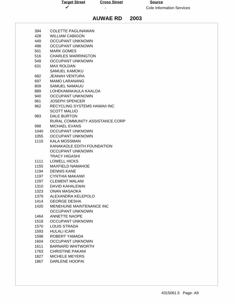
-
AUWAE RD
Cole Information Services
4315061.5 Page: A9
SourceTarget Street Cross Street
2003
394 COLETTE PAGLINAWAN428 WILLIAM CABIGON449 OCCUPANT UNKNOWN498 OCCUPANT UNKNOWN501 MARK GOMES516 CHARLES WARRINGTON549 OCCUPANT UNKNOWN631 MAX ROLDAN
SAMUEL KAMOKU682 JEANAH VENTURA697 MAMO LARANANG809 SAMUEL NAMAUU889 LOHEKAMAKAULA KAALOA940 OCCUPANT UNKNOWN961 JOSEPH SPENCER962 RECYCLING SYSTEMS HAWAII INC
SCOTT MALUO983 DALE BURTON
RURAL COMMUNITY ASSISTANCE CORP998 MICHAEL EVANS1040 OCCUPANT UNKNOWN1055 OCCUPANT UNKNOWN1110 KALA MOSSMAN
KANAKAOLE EDITH FOUNDATIONOCCUPANT UNKNOWNTRACY HIGASHI
1111 LOWELL HICKS1155 MAXFIELD NAMAHOE1194 DENNIS KANE1197 CYNTHIA MAKAIWI1297 CLEMENT MALANI1310 DAVID KAHALEWAI1323 ONAN MASAOKA1379 ALEXANDRA KELEPOLO1414 GEORGE DESHA1420 MENEHUNE MAINTENANCE INC
OCCUPANT UNKNOWN1464 ANNETTE NAOPE1518 OCCUPANT UNKNOWN1570 LOUIS STRADA1593 HULALI ICARI1598 ROBERT YAMADA1604 OCCUPANT UNKNOWN1611 BARNARD WHITWORTH1763 CHRISTINE PAKANI1827 MICHELE MEYERS1867 DARLENE HOOPAI

-
RAILROAD AVE
Cole Information Services
4315061.5 Page: A10
SourceTarget Street Cross Street
2003
11 OCCUPANT UNKNOWN16 DOLAN SILVA & ASSOCS CPAS INC
DOLAN WILLIAM RONALD CPA INCHAWAII PETROLEUM INCJOHN UMPHREY
24 OCCUPANT UNKNOWN69 ANVIL INC
BIG ISLE MOVING & DRAYING INCCHARLES ROBERTSCYCLE LOGICGOLDEN NEO LIFE DMT DSTRBTRHILO KWIK LUBEJE MERK & ASSOCS INCKAMAAINA DISTRIBUTION COPROVISION TECHNOLOGIES INCSTUFF IT MINI STORAGE OF HILO
211 CHAUNS EXPRESSIONS215 BACON UNIVERSAL CO
FLEET REFINISHING HAWAIIPACIFIC GYMNASTICSPAK RANDY FARMSQUALITY AUTO PNTNG & BODY RPR
497 OCCUPANT UNKNOWN600 OCCUPANT UNKNOWN661 PHIL SOLYWADA696 JAMES KIERKIEWICZ
MOKE RAWLINS697 DOUGLAS AWAI699 REBECCA ITO830 OCCUPANT UNKNOWN839 DEBBIE COLLINS899 JOHNSON KAHILI940 RAYMOND BUMATAY959 AWAIS MASONRY

-
AUWAE RD
Cole Information Services
4315061.5 Page: A11
SourceTarget Street Cross Street
1999
501 GINA GOMES510 GENESIS LOY516 CHARLES WARRINGTON631 GLADYS LEE940 OCCUPANT UNKNOWN961 JOSEPH SPENCER962 BUSINESS SERVICES HAWAII
SCOTT MALUO983 OCCUPANT UNKNOWN998 KEVIN NEKOBA1040 SHEILA EVANS1110 KALA MOSSMAN1155 MAXFIEL NAMAHOE1297 CLEMENT MALANI1310 DAVID KAHALEWAI1379 UILANI ARCANGEL1414 GEORGE DESHA1420 JERRYL MAUHILI1518 VIVIAN KOBAYASHI1604 DAISY NAKAMOTO1611 BARNARD WHITWORTH1840 KUKUI BOY PRODUCTS
MAMO ULU CREATIONS1867 J PERREIRA

-
RAILROAD AVE
Cole Information Services
4315061.5 Page: A12
SourceTarget Street Cross Street
1999
11 MEADOW GOLD DAIRIES INCORPORATED16 DANICOLE INVESTMENTS LIMITED
DOLAN SILVA & ASSNS CPAS INCORPORATED AN ACCNTANCY CORPORATIH P S LIMITEDHAWAII PETROLEUM LUBRICANTS DIVISIONJOHN UMPHREYUMPHREY JOHN PHOTOGRAPHYWEST HAWAII PETROLEUM INCORPORATED
24 HARADA H CONTRACTOR INCORPORATED69 ANVIL INCORPORATED
BIG ISLAND PRODUCTION SERVICESBIG ISLE MOVING & DRAYINGKAMAAINA DISTRIBUTION COMPANYKAMANAWA SCHOOL OF PERSONAL DEVELOPMENTKANIU KINIMAKA MODEL & TALENT AGENCYMERK J E & ASSOCIATESNEO LIFE DISTRIBUTOR JANE ELLEN GIBSONSTOCKSDALES MASONRYSTUFF IT MINI STORAGE OF HILO INCORPORATEDU HAUL COMPANY INDEPENDENT DEALERSWORK RITE SYSTEMS INCORPORATED
108 COUNTY OF HAWAII PUBLIC WORKS DEPARTMENT215 BACON UNIVERSAL COMPANY INCORPORATED HILO BRANCH
BELL ATLANTIC PROFESSIONAL SERVICESHAWAIIAN HOST PAPAYASPACIFIC GYMNASTICS & ACRO SPORTSWAIPIO VALLEY OHANA CORPORATION
485 HAWAIIAN CRACKED GLASS PRODUCTSRECYCLING SYSTEMS HAWAII INCORPORATED
696 JAMES KIERKIEWICZMOKE RAWLINSROBERT NELSON
697 DOUGLAS AWAI699 OCCUPANT UNKNOWN759 SUZS TOWING & USED AUTO PARTS839 HARPER VANPETTEN899 OCCUPANT UNKNOWN940 RAYMOND BUMATAY959 DOUGLAS AWAI

-
AUWAE RD
Cole Information Services
4315061.5 Page: A13
SourceTarget Street Cross Street
1995
428 LEE, TUCK W498 LEE, LOY I500 PAKELE, D K631 KAMOKU, S961 SPENCER, JOSEPH A983 MAHOE, SOLOMON K JR1110 GARMON, PEARL U
KANAHELE, EDWARDMOSSMAN, KALA
1650 MOALA, DIANA1840 EVANGELISTA, EMMA

-
RAILROAD AVE
Cole Information Services
4315061.5 Page: A14
SourceTarget Street Cross Street
1995
0 BELL, BILLDUARTE, LOVLYNPEA, HOWARDPELEIHOLANI, AS A
11 MEADOW GOLD DAIRY16 DANICOLE INVESTMENTS LTD
JEN GLYN LTDJOHN UMPHREY PHOTOGRAPHYUMPHREY, JOHNWILLIAM R DOLAN INC
24 H HARADA CONTRACTOR INC69 ANVIL INC
BIG ISLAND PRODUCTION SVCBIG ISLE MOVING & DRAYING INCJ E MERK & ASSOCIATESKAMAAINA DISTRIBUTION COKAMANAWA SCHOOL OF PERSONALKANIU K ENTERPRISESKINIMAKA KANIU MODEL & TALENTNEO LIFE DISTRIBUTORSTOCKSDALES MASONRYSTUFF ITTRUS RITE SYSTEMSU HAUL COWEC INCWORK RITE SYSTEMS INC
108 HAWAII COUNTY WASTEWATER DIV143 BORGES, AMMON215 BACON UNIVERSAL CO
HAWAIIAN HOST PAPAYASWILSONS TROPHIES
600 OCCUPANT UNKNOWNN696 AWAI, DOUGLAS K
KIERKIEWICZ, JAMESLOY, E LRAWLINS, MOKE JR
698 IOPA, I699 ITO, R940 BUMATAY, RAYMOND K

-
AUWAE ST
Cole Information Services
4315061.5 Page: A15
SourceTarget Street Cross Street
1992
1110 KANAHELE, EDWARD

-
RAILROAD AVE
Cole Information Services
4315061.5 Page: A16
SourceTarget Street Cross Street
1992
0 DUARTE, LOVLYNHALL, HAROLDPEA, HOWARDYOGI, G
143 BORGES, AMMON600 WAGNER, G696 DARLEY, AJCKIE
KAILIAWA, EARL PRAWLINS, MOKE JR
698 IOPA, I839 COLLINS, MARK940 BUMATAY, RAYMOND K


APPENDIX D
QUALIFICATIONS OF THE ENVIRONMENTAL PROFESSIONALS


Arlene Campbell, Licensed Geologist


98-030 hakaha s t ree t , un i t 9 , a iea , h i 96701· te l : (808) 488-1200 · fax : (808) 488-1300
www.e2hi.com
Arlene H. Campbell, L.G. Associate
Senior Geologist
EDUCATION: Graduate Work in Geology - Vanderbilt University, 1988 - 1989 B.A., Geology (minor in Hydrology) - Austin Peay State University, 1988 PROFESSIONAL REGISTRATIONS: Licensed Geologist, Washington State, No. 1664, 2002 SPECIALIZED TRAINING: OSHA 40-hour Initial HAZWOPER Training and Current 8-hour Refresher Hazardous Waste Site Supervisor Training SUMMARY OF EXPERIENCE: Ms. Campbell is an Associate and Senior Geologist at Element Environmental, LLC (E2). Ms. Camp bell joined E2 on July 1, 2006, when E2 merged with Mountain Edge Environmental, Inc. She has 16 years of experience in Ha waii in the environ mental consulting field. Her specific expertise includes site assessment, characterization, and remediation. Ms. Campbell has assisted with several state level task forces to assess environmental risk and address petroleum contaminated soils. Ms. Campbell has managed many environmental projects involving Phase I Enviro nmental Site Assessments (ESAs), preliminary as sessments, emergency spill response, subsurface investigation, groundwater monitoring, assessment of fate and transport of surface and groundwater contaminants, soil and groundwater remediation, and ri sk assessment. She has also man aged numerous underground storage tank (UST) removal projects which included preparation of pl ans and specifications for UST removal, UST removal monitoring, release response activities such as over-excavation, installation of soil borings and groundwater monitoring wells, long term remediation design and implementation, and report preparation. Ms. Campbell has also managed a number of complex hazardous and biological waste removal and site closure projects which involved geophysical surveys, preparation of pla ns and specifications, waste characterization, and removal and disposal activities. She has performed Phase I ESAs and has assisted with the pre paration and review of environ mental impact sta tements. She ha s also performed environmental and hyd rogeological investigations and has conducted remediation activities for several illegal landfill sites. Noteworthy projects Ms. Campbell has managed included several large emergency response site investigations and remediation projects involving the release of petroleum and PCBs. One of these projects included an emergency response to a major ga soline spill on Kauai that impacte d air, soil, surface water, and groundwater. For thi s project, Ms. Cam pbell coordinated with th e U.S. Coa st Guard, county fire and police depar tments, EPA Region 9, Hawaii DOH, responsible parties, property owners, tenants, and th e community. She monit ored explosivity and con taminant migration in th e subsurface, underground structures/utilities, buildings, a private sewage pumping station, an adjacent stream and t he Pacific Ocean; coordinated emergency medical treatment a nd medical monitoring of affected spill response personnel and civilians; moni tored installation of soil vapor points, soil borings, and groundwater monitoring wells; collected soil vapor, soil, groundwater, and stream water samples; prepared release response report; and provided technical support to legal team. Ms. Campbell has been the p rincipal investigator for several water quality re lated projects, including preparation of National Pollutant Discharge Elimination System (NPDES) permit applications for an auto recycling facility, an aquarium, a well drilling operation, a cemetery, and a museum; preparation of Storm Water Pollution Control Plans for an auto recycling facility and a solid waste transfer station; storm water and industrial discharge monitoring at various sites; and a ssisting clients in addressi ng NPDES compliance issues.


Angela Peltier, Geologist


Angela K. Peltier Geologist
EDUCATION: B.S., Geology and Geophysics – University of Hawaii, 2004
SPECIALIZED TRAINING: OSHA 40-hour Initial HAZWOPER Training
SUMMARY OF EXPERIENCE:
Ms. Peltier is a Geologist at Element Environmental, LLC (E2). Ms. Peltier joined E2 on July 1, 2006, when E2 merged with Mountain Edge Environmental, Inc. She has 8 years of experience in Hawaii in the environmental consulting field. Her specific expertise includes site assessment, characterization, and remediation.
Ms. Peltier has assisted in many environmental projects involving Phase I Environmental Site Assessments (ESAs), preliminary assessments, emergency spill response, subsurface investigation, groundwater monitoring, assessment of fate and transport of surface and groundwater contaminants, soil and groundwater remediation, risk assessment, groundwater monitoring, and explosive gas monitoring. She has also assisted in underground storage tank (UST) removal projects which included preparation of plans and specifications for UST removal, UST removal monitoring, release response activities such as over-excavation, installation of soil borings and groundwater monitoring wells, long term remediation design and implementation, and report preparation.
Ms. Peltier has also performed Phase I ESAs and has assisted with the preparation of environmental impact statements. She has also performed environmental and hydrogeological investigations and has conducted remediation activities for several illegal landfill sites.
Ms. Peltier has been involved in several water quality related projects, including preparation of National Pollutant Discharge Elimination System (NPDES) permit applications for an auto recycling facility, an aquarium, and a well drilling operation, preparation of Storm Water Pollution Control Plans for an auto recycling facility and a solid waste transfer station; storm water and industrial discharge monitoring at various sites.
98 -030 hakaha s t ree t , un i t 9 , a iea , h i 96701· te l : (808) 488-1200 · fax : (808) 488-1300 www.e2h i .com