
Manatt_022221_redacted_v1_cu... - California Public Utilities ...
138
9LFWRU 'H OD &UX] 0DQDWW 3KHOSV 3KLOOLSV //3 'LUHFW 'LDO 9'HOD&UX]#0DQDWWFRP &HQWXU\ 3DUN (DVW 6XLWH /RV $QJHOHV &DOLIRUQLD 7HOHSKRQH )D[ $OEDQ\ _ %RVWRQ _ &KLFDJR _ /RV $QJHOHV _ 1HZ <RUN _ 2UDQJH &RXQW\ _ 3DOR $OWR _ 6DFUDPHQWR _ 6DQ )UDQFLVFR _ :DVKLQJWRQ '& )HEUXDU\ &OLHQW0DWWHU 6(17 9,$ (0$,/ >HVWUHOODSURMHFW#KRUL]RQKRFRP@ 0U 5RE 3HWHUVRQ &38& (QHUJ\ 'LYLVLRQ ,QIUDVWUXFWXUH 3HUPLWWLQJ DQG &(4$ &DSLWDO 0DOO 6XLWH 6DFUDPHQWR &$ 0U 7RP (QJHOV +RUL]RQ :DWHU DQG (QYLURQPHQW //& *UDQG $YHQXH 6XLWH 2DNODQG &$ 5H &RPPHQWV RQ WKH 'UDIW (QYLURQPHQWDO ,PSDFW 5HSRUW IRU WKH (VWUHOOD 6XEVWDWLRQ DQG 3DVR 5REOHV $UHD 5HLQIRUFHPHQW 3URMHFW 6WDWH &OHDULQJKRXVH 1R $SSOLFDWLRQ 1R $ 'HDU 0U 3HWHUVRQ DQG 0U (QJHOV 7KLV ILUP UHSUHVHQWV 6XQ &RPPXQLWLHV ,QF DQG WKH &DYD 5REOHV 59 5HVRUW ³&DYD 5REOHV´ LQ WKH &LW\ RI 3DVR 5REOHV &DOLIRUQLD 2Q EHKDOI RI &DYD 5REOHV ZH WKDQN WKH &DOLIRUQLD 3XEOLF 8WLOLWLHV &RPPLVVLRQ ³&38&´ IRU WKH RSSRUWXQLW\ WR FRPPHQW RQ WKH 'UDIW (QYLURQPHQWDO ,PSDFW 5HSRUW ³'UDIW (,5´ SUHSDUHG IRU WKH (VWUHOOD 6XEVWDWLRQ DQG 3DVR 5REOHV $UHD 5HLQIRUFHPHQW 3URMHFW ³3URMHFW´ ZKLFK DV FXUUHQWO\ SURSRVHG ZRXOG EH FRQVWUXFWHG GLUHFWO\ DGMDFHQW WR DQG DORQJ WKH HQWLUH ZHVWHUQ ERXQGDU\ RI &DYD 5REOHV 8QIRUWXQDWHO\ WKH 3URMHFW¶V 'UDIW (,5 LV IDWDOO\ GHIHFWLYH DQG GRHV QRW DGHTXDWHO\ DQDO\]H GLVFORVH RU PLWLJDWH WKH 3URMHFW¶V LPSDFWV DV UHTXLUHG E\ WKH &DOLIRUQLD (QYLURQPHQWDO 4XDOLW\ $FW ³&(4$´ 3XE 5HVRXUFHV &RGH HW VHT 7KH GRFXPHQW LV ULIH ZLWK VLJQLILFDQW OHJDO DQG VXEVWDQWLYH IODZV UHQGHULQJ LW LQDGHTXDWH DQG XQILW WR EH UHOLHG XSRQ LQ DQ\ &38& GHFLVLRQ RQ WKH 3URMHFW $V VXFK &(4$ SURKLELWV WKH &38& IURP PRYLQJ IRUZDUG ZLWK DQ\ GHFLVLRQ RQ WKLV 3URMHFW XQWLO WKH 'UDIW (,5 LV VXEVWDQWLDOO\ UHYLVHG WR EH FRQVLVWHQW ZLWK &(4$ WKH 6WDWH &(4$ *XLGHOLQHV &DO &RGH 5HJV WLWO HW VHT DQG JRYHUQLQJ FDVH ODZ &DYD 5REOHV LV D VHFOXGHG OX[XU\ UHVRUW LQ D QDWXUHEDVHG VHWWLQJ ORFDWHG LPPHGLDWHO\ HDVW RI *ROGHQ +LOO 5RDG 7KH UHVRUW ZKLFK LQFOXGHV PRUH WKDQ PRWRU FRDFK VLWHV DQG IUHHVWDQGLQJ FRWWDJHLQVSLUHG YDFDWLRQ UHQWDOV SURYLGHV DQ DFWLYH JXHVW H[SHULHQFH ZLWK PXOWLSOH RXWGRRU SRROV QDWXUH WUDLOV D ILWQHVV DQG ZHOOQHVV FHQWHU XSVFDOH HYHQW VSDFH ELVWUR ILUH SLW DQG
-
Upload
khangminh22 -
Category
Documents
-
view
0 -
download
0
Transcript of Manatt_022221_redacted_v1_cu... - California Public Utilities ...


Ibid

mandates

Kings County Farm Bureau v. City of Hanford
so greatCenter for Biological
Diversity v. County of San Bernardino Citizens of Goleta Valley v. Board of Supervisors
so severe
Ibid
California Native Plant Society v. City of Santa Cruz

total Project cost
Citizens of Goleta Valley v. Board of Supervisors of Santa Barbara County
Center for Biological Diversity v. County of San Bernardino

Ibid
Ibidactually

actually
Santiago County Water District v. County of OrangeSan Joaquin Raptor/Wildlife Rescue Center v. County of Stanislaus

Ibid
Ibid

City of Santee v. County of San Diego Santiago County Water District v. County of Orange
1. The Draft EIR manipulates its placement, description, and categorization of KOPs to downplay impacts on viewers, in particular, viewers associated with Cava Robles.

Ibid
Ibid

Ibid
2. The Draft EIR’s analysis of impacts to scenic vistas is inadequate and flawed.

3. The Draft EIR fails to disclose the true magnitude of impacts to existing visual character, and fails to adequately mitigate for the same.

4. The Draft EIR fails to fully address impacts from new sources of light and glare, especially in regards to nighttime construction activities.
Ibid

IbidIbid
Ibid
Federation of Hillside & Canyon Associations v. City of Los Angeles
North Coast Rivers Alliance v. Marin Municipal Water District

unplanned

Ibid
Lotus v. Department of Transportation
Id.Lotus

Ibidwhere possible
as needed shouldIbid
Ibid
Ibid
require
Save Panoche Valley v. San Benito County

1. The Draft EIR fails to include any reasonable or adequate description of the existing environmental baseline, and appears to rely on outdated biological surveys that have not been released to the public.
2. The Draft EIR egregiously and impermissibly defers meaningful analysis of impacts to sensitive plant species, and any meaningful mitigation for the same.

Laurel Heights Improvement Association v. Regents of University of California
San Joaquin Raptor Rescue Center v. County of Merced
any
Madera Oversight Coalition, Inc. v. County of Madera
beforeLotus v. Department of Transportation
Id. Lotus v. Department of Transportation
Id.
Id.

Id.
unequivocally does not constitute adequate mitigation under CEQA.
3. The Draft EIR’s analysis and mitigation of impacts to sensitive wildlife species is similarly deferred and inadequate.

to the extent feasible
Lotus v. Department of Transportation

4. No meaningful analysis of riparian habitats, sensitive natural communities, or jurisdictional waters and wetlands is provided.
Ibid
Ibid

Corona Audible Noise of 110 kV High Voltage Transmission Lines

unplanned

Ibid
Sierra Club v. County of FresnoJoshua Tree Downtown Business
Alliance v. County of San Bernardino
Protect the Historic Amador Waterways v. Amador Water Agency
San Francisco Baykeeper, Inc. v. State Lands Commission

Vineyard Area Citizens for Responsible Growth v. City of Rancho Cordova
Mountain Lion Coalition v. Fish & Game Commission


ATTACHMENT 1

2/3/2021 This Luxury RV Resort in California Has On-site Wine Tastings, Stone-fire Pizza, and a Wellness Center | Travel + Leisure
https://www.travelandleisure.com/trip-ideas/road-trips/paso-robles-cava-rv-resort 1/2
This Luxury RV Resort in California Has On-siteWine Tastings, Stone-fire Pizza, and a WellnessCenterYou don't even need an RV to take a workcation to this resort that has it all.
BY STATT CEY LEASCA
OCTOBER 08, 2020
Now that you can work from anywhere why not work from heaven on earth? And byheaven on earth, we mean aso Robles, California.
Tucked away along the Central Coast of California, travelers will nd the low-key wineregion, Paso Robles. The idyllic region sits between the mountains and the sea. It’s theperfect spot to come for an extended stay to nd both a little slice of relaxation and a
CREDIT: DAVID LAA ALUSH
2/3/2021 This Luxury RV Resort in California Has On-site Wine Tastings, Stone-fire Pizza, and a Wellness Center | Travel + Leisure
https://www.travelandleisure.com/trip-ideas/road-trips/paso-robles-cava-rv-resort 2/2
prime destination to do a bit of socially distant work. And there’s no better place to dothat than by RV camping at Cava Robles.
Cava Robles sits in the midst of the area's many vineyards. Guests staying at the resortcan take full advantage of the wine tasting tours, head out for a bit of gol ng, hiking,shopping, and even go for a dip in one of Central California’s hot springs at the nearbyRiver Oaks Hot Springs Spa and Franklin Hot Springs.
At the resort, both short and long-term guests can choose to stay in their own RV andpark in one of its sites that include a patio, picnic table, full hookups, and Tuscan-inspired landscaping. However, if you don’t have an RV that’s ok, as you can also rent outone of Cava Robles’s cabins, including its Studio Chalet for two or the Chateau, which isbig enough for four. Those looking for an epic view can also try to score the TuscanyVilla, which sleeps two and comes with its own rooftop deck overlooking the vineyards.
But, there’s one big reason why this is the place to be for a workcation: On-site winetastings.
The resort hosts its own local wine tastings so you don’t even need to leave to try someof the area’s best varietals. Beyond wine, the resort is also home to its own market, aswimming pool, putting green, spa, meditation and yoga rooms, and even a farmhousebistro that serves stone- re pizzas. So really, why would you ever leave? Check outeverything the resort has to offer and book a lengthy stay here.

78 SUMMER 2019 slovisitorsguide.com
Paso Robles
Adventure awaits at Cava Robles RV ResortOffering amenities galore in the centrally located Paso Robles Wine Region
Tour the spacious, beautiful Cava Robles RV Resort and one
thing becomes perfectly clear – this is the perfect spot to set up camp in Paso Robles while exploring the Central Coast of California. With easy access off major highways and plenty of pull-through and large sites, it’s one of the most inviting spots for RV travelers to relax and enjoy the many amenities of the surrounding area.
And that’s just what the design team had in mind when setting out to create an active guest experience
that captured the unique qualities of Paso Robles and the Central Coast. Owned and operated by Sun Communities, Inc., Cava Robles RV Resort is one of the newest – and most popular – of the corporation’s resorts tailored to fit the recreation-al lifestyle.
“The development team put a lot of thought into how our ameni-ties, such as our nature walking trails, our fitness center, the lap pool and more would complement the hillsides, vineyards and the atmosphere of Paso,” said Brandon
Placer Title CompanyConnecting The Industry’s Future
EST. 1973
PISMO BEACH OFFICE 1401 Dolliver St., Suite 103 • Pismo Beach, CA 93449
(805) 556-6980 • www.PlacerTitle.com
Darley, Sun Communities Regional Vice President.
The team placed particular importance on preserving part of the history and culture of Paso Robles, the beautiful oak trees. Visi-tors will notice many oaks spread throughout the resort, essential to the site design that organically winds through the property and maximizes the aesthetics of the landscaping.
“We wanted to create a dream-like RV experience by finding a balance between nature and luxury,
ensuring our guests truly feel like they are camping under the stars,” said Darley.
Amenities galoreFriendly staff members are
available to provide assistance for guests’ every need, and the ameni-ties at Cava Robles RV Resort are extensive. There are a variety of full-hookup RV site options and, in an effort to extend the camp-ing experience to all who visit the area, a few vacation cottages with two story balconies have been

slovisitorsguide.com SUMMER 2019 79
ARTISTS AT WORK • GALLERIES • ORIGINAL ART
A R ARE OPPORTUNIT Y TO E XPERIENCE ART BEING CRE ATED
1130 PI N E S T R EE T, PA SO RO B L E S(ACROSS FRO M D OW N TOW N CI T Y PA R K )
(8 05) 238 –98 0 0 • S T U D I OSO N T H EPA R K .O RG
HOURS
Paso Robles
added. Whether at an RV site or in a cottage, guests enjoy a secluded environment connected to natural surroundings.
From laundry facilities to complimentary Wi-Fi and cable, this resort is all about convenience. In addition to the Welcome Center, there’s the Cava Market and the Farmhouse Bistro & Bar offering dine in or take out options to enjoy during a jaunt to a local beach or the many wine and beer tasting tours offered nearby.
“Paso Robles is home to some of the best wine, craft beer, and
food in California,” said Resort Manager Kaitlin Butler. “The quaint atmosphere and friendly locals create a welcoming environment for travelers from all over. There are unique experiences to fit every life-style, whether you want to explore a nearby beach, catch your favorite musician in concert, or take an adventurous jeep tour through the vineyards – Paso Robles has it all.”
Bring the entire familyWant to stay put and relax at
the resort? No worries – Cava Robles has plenty to offer. Enjoy the impressive lap pool and hot tub at the Wellness Center, gather around the fire pit, or experience arts and crafts in the community center. Onsite wine tasting is available, and there is a game room, outdoor games, a bocce ball court, two fam-ily swimming pools, a splash pad, and plenty of biking, hiking, and walking trails nearby.
There are plenty of activities for the kids to explore while parents participate in fitness class, water aerobics, and more. Additionally, the Cava Critters program features
animals including the San Joaquin Kit Fox, a Pacific Chorus Frog, and a Red-tailed Hawk to keep young campers engaged. In the evening, fire up the outdoor grills, gather around the campfire, or join new friends at Movies in the Park.
Everyone from the youngest to the young-at-heart is welcome at Cava Robles, including furry family members! That’s right, this is a pet-friendly RV resort with conveniently located dog runs.
Rustic yet upscaleWith all of the modern ameni-
ties offered, one might wonder how Cava Robles RV Resort still man-
ages to maintain the welcoming yet rustic ambiance those visiting Paso Robles have come to expect.
“The focus through the design process was to develop a feeling that was rustic yet contempo-rary,” said Darley. “A mix of rustic touches and upscale amenities create a relaxed environment where guests get the perception that time is to be savored.”
Butler agreed, saying, “When guests walk up to our Welcome Center they are surrounded by well-maintained landscaping, with flower pots hanging from our porch and cozy Adirondack chairs that create the feeling of entering a lodge. An instrumental part of providing a welcoming retreat is our Cava Robles team and how they strive to always go above and beyond, to ensure everyone has a great guest experience.”
Cava Robles RV Resort is located at 3800 Golden Hill Road in Paso Robles. For more information, call (844) 641-5093 or see sunrvresorts.com/resorts/west/california/cava-robles.
– Meagan Friberg

2/3/2021 Matt Masia, Cava Robles RV Resort honored by Paso Robles Chamber of Commerce - Paso Robles Daily News
https://pasoroblesdailynews.com/matt-masia-cava-robles-rv-resort-honored-by-paso-robles-chamber-of-commerce/90140/#:~:text=–The Paso Robles … 1/3
Matt Masia, Cava Robles RV Resort honored by PasoRobles Chamber of Commerce Posted: 7:35 am, January 23, 2019 by News Staff
Cava Robles Resort has received the Beautification Award by the Paso Robles Chamber of Commerce.
–The Paso Robles Chamber of Commerce (PRCC) has announced Matt Masia as 2018 Roblan of the Year and CavaRobles RV Resort as the 2018 Beautification of the Year recipients. Both will be honored at the Chamber’s Annual Galabeing held Saturday, Jan. 26, at the Paso Robles Inn Ballroom. In addition, they will recognize the 2018 Ambassador ofthe Year, Virginia Lockyer, install their 2019 Board of Directors, thank the outgoing board for the years of dedicatedservice, and hold a silent and live auction at the event.

2/3/2021 Matt Masia, Cava Robles RV Resort honored by Paso Robles Chamber of Commerce - Paso Robles Daily News
https://pasoroblesdailynews.com/matt-masia-cava-robles-rv-resort-honored-by-paso-robles-chamber-of-commerce/90140/#:~:text=–The Paso Robles … 2/3
Matt Masia is a graduate of Paso Robles High School and played on the CIF Champion Football team. He received aBachelor of Science in Finance from Fresno State University. After college, he returned to Paso Robles and in 1986, heestablished the Adelaide Inn. In 2017, he was inducted into the California Mid State Fair Hall of Fame. He also won theMid Sate Fair Blue Ribbon Award and the Pioneer Committee “Supporter Award.”
He has been a proud supporter of numerous youth organizations, including the California Mid State Fair LivestockAuction, several youth sports teams, Bearcat Boosters, Boys and Girls Club, Children’s Museum, and Youth Arts atStudios on the Park. He volunteers with Little League Baseball and has helped establish a working garden along with thestudents of Daniel Speck Elementary School. He has also been instrumental in a variety of community organizationssuch as Estrella Warbird Museum, Pioneer Museum, Pioneer Day, Main Street Association and the Paso Robles Chamberof Commerce.
His committee and board involvement includes, but is certainly not limited to, 4-H President, Paso Robles FFAPresident, Paso Robles Chamber of Commerce President for 2 years and longtime Board Member, City of Paso Robles“All Aboard” Train Station Committee Chair and Board, San Luis Obispo County Visitor and Convention BureauFounding Member and Board and a founding member of the Paso Robles Business Improvement District.
Cava Robles RV Resort will be awarded the 2018 Beautification of the Year for its transformation of a 74-acre propertyin northeast Paso Robles, off CA 46 East. This gorgeous resort includes more than 200 motor coach sites and 20freestanding cottage-inspired vacation rentals, spacious banquet facilities, two large swimming pools, a state-of-the artfitness center, and a large covered picnic and gathering spot for guests’ enjoyment.
Join the chamber in honoring these awardees during their Annual Gala on Saturday, Jan. 26, 2019. Visitwww.pasorobleschamber.com or call (805) 238-0506 for ticket information and additional details.
Subscribe to our mailing list email address
Subscribe
Business Directories District High School Ambassador Associations Awarded
Awardees Bachelor Baseballs Chair Business Directories District
Related
Paso Robles Chamber of CommerceAnnual Gala returns Jan. 26January 8, 2018In "Business"
Annual Chamber of Commerce gala tohonor Roblan of the yearJanuary 11, 2018In "Business"
Cava Robles Luxury RV Resort namesRRlocal management teamFebruary 16, 2018In "Business"

ATTACHMENT 2

PD 08-001 and CUP 08-001 Amendment Reso/Paso Robles RV Resort 1
RESOLUTION NO. 12-008
A RESOLUTION OF THE PLANNING COMMISSION OF THE CITY OF EL PASO DE ROBLES
APPROVING AN AMENDMENT TO PLANNED DEVELOPMENT 08-001 & CONDITIONAL USE PERMIT 08-001
(Paso Robles RV Resort) APN: 025-435-022, & 023
WHEREAS, PD 08-001 & CUP 08-001 (The PR Motorcoach Resort project) was approved by the City Council on February 10, 2004, via Resolutions 09-025, 09-026 & 09-027; and WHEREAS, the project is located on the 73-acre site at the northern end of Golden Hill Road, on the east side of the road; and WHEREAS, the project allows for the development of a 332 space RV resort; and WHEREAS, North Coast Engineering on behalf of Paso 33 LP, has applied to amend PD 08-001 & CUP 08-001; and WHEREAS, the proposed amendment would consist of the following changes:
Consider a new design that would reduce the disturbed area (grading) from 73 acres to 50; Reduce the amount of grading, retaining walls and paving for roads; Reduce the RV space size and reduce the use of impermeable materials; Relocate reception building to the northeast, further away from Golden Hill Road; Eliminate the club house; Replace the masonry wall proposed along Golden Hill Rd. with an combination of masonry wall, open fence and screening landscaping; Eliminate the RV sites at the south east corner of the site, reducing views of RVs from Golden Hill Rd.; Request to review various conditions of approval related to road improvements and fees; Addendum to the Mitigated Negative Declaration related to Kit Fox mitigation as a result of less site impact.
WHEREAS, at its January 10, 2012 meeting, the Planning Commission continued the open public hearing to the February 14, 2012 Planning Commission meeting, to allow for additional time for staff to work with the applicants to answer questions raised by the Planning Commission and the public related to the proposed project; and WHEREAS, at its February 14, 2012 meeting, the Planning Commission opened the continued public hearing on the Project, to accept public testimony on the proposed amendments to Planned Development 08-001 & CUP 08-001; and WHEREAS,, a resolution was adopted by the Planning Commission approving an addendum to the previously approved Mitigated Negative Declaration (Res. 09-025) for this project, in accordance with the California Environmental Quality Act; and WHEREAS, the previously approved Mitigated Negative Declaration (Res. 09-025) for the project and the mitigation measures outlined in the Resolution remain in effect, except for the addendum approved concurrent with this Amendment, as adopted in Resolution 12-009; and

PD 08-001 and CUP 08-001 Amendment Reso/Paso Robles RV Resort 2
WHEREAS, with the Planning Commission’s approval of this Resolution, Resolutions 09-026 & 09-027 shall be superseded by the findings and conditions of approval within this Resolution; and WHEREAS, based upon the facts and analysis presented in the staff report and the attachments thereto, the public testimony received, and subject to the Conditions of Approval listed below, the Planning Commission makes the following findings: Section 1. Findings In accordance with Sections 21.23.250 and 21.23B.050 of the Zoning Code, based on facts and analysis set forth in the staff report for this item, and taking into consideration comments received from the public and/or other governmental agencies having purview in the subject development plan and conditional use permit applications, the Planning Commission (City Council) hereby makes the following findings: a. The design and intensity (density of the proposed development is consistent with the following:
1. The goals and policies established by the General Plan;
a. The project site is located in the Parks and Open Space Land Use Category. The purpose of this land use category includes provision of sites for recreation uses.
b. The project site is also located in the Airport Overlay Land Use Category. This overlay land use
category allows business and non-residential land uses. RV Parks are considered to be a type of transient lodging and not a residential use. Conditions #6 will limit the length of stay for any RV space or tents or tent/cabins to a maximum of 30 consecutive days.
c. Consistent with Policy OS-1A of the Conservation Element, a 58 acre portion of the site has been
dedicated to the City for open space purposes.
d. The project is designed to maximize protection of oaks and biological resources as called for in Policies C-3A and C-3B of the Conservation Element. Additionally, Condition #10 requires submittal and implementation of an oak tree replacement plan and Condition #1 of Resolution 12-009 requires mitigation of impacts to Kit Fox habitat.
e. Conditions # 20 will require construction of pedestrian paths (sidewalks) and incorporation of air
quality mitigation measures, which will implement Policies C-2-B and C-2C of the Conservation Element.
2. The policies and development standards established by any applicable specific plan;
The project site is not located within any specific plan area. 3. The Zoning Code, particularly the purpose and intent of the zoning district in which a development
project is located;
(a) The project site is located in the Parks and Open Space (POS) Zone. RV Parks are subject to approval of a Conditional Use Permit (CUP) in the POS Zone. The purpose of a CUP is to enable the City to impose conditions to ensure that land uses will be compatible with neighboring properties and implement City codes and policies.

PD 08-001 and CUP 08-001 Amendment Reso/Paso Robles RV Resort 3
(b) The project site is located in Airport Land Use Plan Zone 5. RV parks are permitted uses in this zone. 4. All other adopted codes, policies, standards, and plans of the City;
a. This resolution contains several conditions designed to implement the Municipal Code, City State, and
Regional governmental policies, regulations and adopted standards related to public infrastructure (e.g., streets, water, sewer, storm drainage), building and fire safety, general public safety.
b. The project expands the City’s inventory of transient lodgings, which advances the following policies
in the 2006 Economic Strategy
(1) The overall policy pertaining to “Place”, which calls for the establishment of “distinctive, quality, stable, safe and sustainable physical improvements and attractions that welcome … commerce, ttourism,… and wealth necessary to maintain and enhance quality of life.”
(2) The “Positioning” policy, which calls for the promotion of local industry, products, services and
destinations via expansion and diversification of hotel products, including end destination full-service resorts;
b. The Paso Robles RV Resort is consistent with the adopted codes, policies, standards and plans of the City; since
the project has gone through the development review process including, environmental review and the processing of a Conditional Use Permit as required by Table 21.16.200 for recreational parks in the Parks and Open Space zoning districts; and
c. The Paso Robles RV Resort will not be detrimental to the health, safety, morals, comfort, convenience and
general welfare of the residents and or businesses in the surrounding area, or be injurious or detrimental to property and improvements in the neighborhood or to the general welfare of the City; since the project will be required to comply with the recommended conditions of approval, including any environmental mitigation measures, and comply with any building and fire codes; and
d. The Paso Robles RV Resort accommodates the aesthetic quality of the City as a whole, especially where
development will be visible from the gateways to the City, scenic corridors and the public right-of-way; in this particular case, the project site is not located in a City gateway area or a scenic corridor and has minimal frontage to the public street, however, based on the project being designed to fit the subject site and based on the site plan, architecture and landscaping, the proposed development will accommodate the aesthetic quality of the City as a whole; and
e. The Paso Robles RV Resort is compatible with, and is not detrimental to, surrounding land uses and
improvements, provides an appropriate visual appearance, and contributes to the mitigation of any environmental and social impacts, because the project has been designed to provide significant buffers, including setbacks, screen walls and landscaping from the residential neighborhood to the west, and additionally as a result of the site planning, building architecture and environmental mitigation, and included with this project.
f. The Paso Robles RV Resort is compatible with existing scenic and environmental resources such as hillsides,
oak trees, vistas, etc. as a result of the project being designed to limit the amount of grading and oak tree impacts by developing in the flatter areas of the site, which allows for the preservation of the existing hillsides and oak trees; and

PD 08-001 and CUP 08-001 Amendment Reso/Paso Robles RV Resort 4
g. The establishment, maintenance or operation of the Paso Robles RV Resort, will not, under the circumstances of the particular case, be detrimental to the health, safety, morals, comfort, convenience and general welfare of the persons residing or working in the neighborhood of such proposed use, since the project has gone through the development review process including, environmental review and the processing of a Conditional Use Permit as required by Table 21.16.200 for recreational vehicle parks in the POS zoning districts; and
h. The Paso Robles RV Resort contributes to the orderly development of the City as a whole, since the project will utilize the existing infrastructure in Golden Hill Road, consisting of sewer water and other utilities; and
i. The Paso Robles RV Resort as conditioned would meet the intent of the General Plan and Zoning Ordinance
by providing a transient occupancy/resort type use in close proximity to golf courses and commercial recreation.
j. The Paso Robles RV Resort would be consistent with the Economic Strategy, since it would allow for the
expansion and diversification of transient occupancy projects, by providing an end-destination full-service resort.
Section 2. Conditions of Approval NOW, THEREFORE, BE IT RESOLVED, that the Planning Commission of the City of El Paso de Robles approves the amendment to PD 08-001 & CUP 08-001 subject to the following conditions:
PPLANNING: 1. The Amendment to Planned Development 08-001 and Conditional Use Permit 08-001, allows for the
development of the 332 space Paso Robles Recreational Vehicle (RV) Resort on the 73 acre site (APN 025-435-022 and 025-435-023).
2. The project is proposed to be developed in 2 phases. In the event that the applicant wishes to change the
phasing order, after verification from the City Engineer that there are no concerns, the DRC may approve the phasing changer request.
3. The project shall be constructed in substantial conformance with the Conditions of Approval established by
this Resolution and it shall be constructed in substantial conformance with the following Exhibits:
EXHIBIT DESCRIPTION A Standard Conditions B Cover Sheet C1-C8 Site Plan D RV Stacking Exhibit E Circle-B Access Road
F Privacy Wall Sections G Drainage Basin
H1-H3 Registration Building Details I1-I3 Pool House Details J1-J2 Misc. Items K Outdoor Lighting L1-L11 Landscape Plans M1-M4 Storm Water Run Off Control Plan N1-N13 Grading and Drainage Plans

PD 08-001 and CUP 08-001 Amendment Reso/Paso Robles RV Resort 5
4. Recreational vehicle parks are regulated by the State Department of Housing and Community Development. The City will not be issuing grading or building permits. In order to insure that the project mitigation measures and conditions of approval are satisfied in a timely manner (i.e. prior to the issuance of a grading permit, encroachment permit, or occupancy) an agreement shall be entered into between the applicants and the City outlining timing of project mitigation and condition completion. The agreement shall be subject to approval by the City Attorney and be executed prior to the State’s issuance of a grading or any building permit. City Attorney time and materials shall be paid by the applicants prior to execution of the Agreement.
5. With the adoption of this Resolution, Resolutions 09-026(PD Resolution) & 09-027 (CUP Resolution) shall be
superseded. 6. The maximum length of stay for any RV, tent or tent/cabin space is 30 consecutive days. 7. The maximum number of tent sites would be eleven (11); the maximum number of tent/cabins shall be twenty
(20). The total number or RV, tent, and tent/cabin spaces shall be no more than 332. In the event that there is a reduction or elimination of tent or tent/cabin spaces, those spaces may be converted to RV spaces.
8. Prior to the issuance of a building permit, the Development Review Committee (DRC) shall review the
following items to insure substantial compliance with the above listed Exhibits:
Final site details such as landscaping, decorative paving, benches, exterior lighting and any other site planning details; Architectural elevations, including final materials, colors and details; Final placement of the boundary wall/fence; Equipment such as back flow devices, transformers, a/c condensers and appropriate screening methods for both views and noise. Back flow and double check-valves shall not be visible from Golden Hill Road; Final grading and drainage plans. Signage
9. Landscape screening shall be reviewed by Planning Staff after two years from the time of installation to insure
that landscaping is in good healthy condition and being maintained in an acceptable manner. 10. Prior to the issuance of a grading permit, the applicants will need to provide an Oak Tree Replacement plan
that indicates the location and timing of the planting of the required oak tree replacement trees. 11. In the event if in the future there is request to add additional impervious concrete or asphalt to the project, the
request will need to be approved by both the Engineering and Planning Divisions to insure the addition of the impervious surface is consistent with the Low Impact Development plan for this project.
12. To the extent allowable by law, Owner agrees to hold City harmless from costs and expenses, including
attorney’s fees, incurred by City or held to be the liability of City in connection with City’s defense of its actions in any proceeding brought in any State or Federal court challenging the City’s actions with respect to the project. Owner understands and acknowledges that City is under no obligation to defend any legal actions challenging the City’s actions with respect to the project.
13. Special events beyond typical resort activities shall be reviewed by the Planning Department to insure
compliance with the Zoning Code and ALUP. The Police Department shall also review the activities. The number of people per acre shall be in compliance with the maximum density identified by the ALUP.

PD 08-001 and CUP 08-001 Amendment Reso/Paso Robles RV Resort 6
14. Prior to the issuance of a permit by the State for construction and/or grading, as required by Section 21.22B.050 (Landscape and Irrigation Ordinance) since the landscape area for this project will be over 1 acre, a Landscape Document Package (LPD) as outlined in the Ordinance shall be provided prior to the issuance of a water meter.
15. Any condition imposed by the Planning Commission in granting this Conditional Use Permit may be modified or
eliminated, or new conditions may be added, provided that the Planning Commission shall first conduct a public hearing in the same manner as required for the granting of the original permit. No such modification shall be made unless the Commission finds that such modification is necessary to protect the public interest and/or neighboring properties, or, in the case of deletion of an existing condition, that such action is necessary to permit reasonable operation and use under the Conditional Use Permit.
16. Quite hours shall be observed after 10p.m. every night to minimize noise disturbance. Any use of generators shall be only for RV sites that do not have electrical service, which would only be the dry camping area. All generators shall be turned off by the 10p.m. quite hour.
17. All on-site operations shall be in conformance with the City’s performance standards contained in Section
21.21.040 and as listed below:
a. Fire and Explosion Hazards. All activities involving, and all storage of, inflammable and explosive materials shall be provided with adequate safety devices against the hazard of fire and explosion and adequate firefighting and fire-suppression equipment and devices standard in industry and as approved by the fire department. All incineration is prohibited.
b. Radioactivity or Electrical Disturbance. Devices that radiate radio-frequency energy shall be so operated as
not to cause interference with any activity carried on beyond the boundary line of the property upon which the device is located. Further, no radiation of any kind shall be emitted which is dangerous to humans. All radio transmissions shall occur in full compliance with Federal Communications Commission (FCC) and other applicable regulations.
c. Noise. No land use shall increase the ambient noise level as measured at the nearest residentially zoned
property line to a level that constitutes a public nuisance. d. Vibration. No vibrations shall be permitted so as to cause a noticeable tremor measurable without
instruments at the lot line. e. Smoke. Except for fireplaces and barbecues, no emission shall be permitted at any point from any chimney
which would constitute a violation of standards established by the San Luis Obispo County Air Pollution Control District (APCD).
f. Odors. Except for fireplaces and barbecues, no emission shall be permitted of odorous gases or other odorous matter in such quantities as to constitute a public nuisance.
g. Fly Ash, Dust, Fumes, Vapors, Gases and Other Forms of Air Pollution. No emission shall be permitted
which can cause damage to health, animals, vegetations or other forms of property, or which can cause any excessive soiling at any point. No emissions shall be permitted in excess of the standards established by the San Luis Obispo County Air Pollution Control District (APCD).
h. Glare. No direct glare, whether produced by floodlight, high-temperature processes such as combustion or
welding or other processes, so as to be visible from any boundary line of the property on which the same is

PD 08-001 and CUP 08-001 Amendment Reso/Paso Robles RV Resort 7
produced shall be permitted. Sky-reflected glare from buildings or portions thereof shall be so controlled by reasonable means as are practical to the end that said sky-reflected glare will not inconvenience or annoy persons or interfere with the use and enjoyment of property in and about the area where it occurs.
i. Liquid or Solid Wastes. No discharge shall be permitted at any point into any public sewer, private sewage
disposal system or stream, or into the ground, of any materials of such nature or temperature as can contaminate any water supply, interfere with bacterial processes in sewage treatment, or otherwise cause the emission of dangerous or offensive elements, except in accord with standards approved by the California Department of Health or such other governmental agency as shall have jurisdiction over such activities. Manufacturing, processing, treatment and other activities involving use of toxic or hazardous materials shall be designed to incorporate the best available control technologies and wherever technically feasible shall employ a "closed loop" system of containment.
j. Transportation Systems Impacts. Vehicular, bikeway and/or pedestrian traffic, directly attributable to the
proposed land use, shall not increase to a significant extent without implementation of adequate mitigation measures in a form to be approved by the city engineer. In determining significance of impacts, consideration shall be given to cumulative (projected build-out) capacity of streets and highways serving the land use. Mitigation measures required may include but not be limited to curb, gutter, sidewalk, street and/or alley, bikeway, transit related improvements and traffic signalization. Mitigation may be required as pursuant to the California Environmental Quality Act (CEQA), or as a condition of a discretionary review. (Ord. 665 N.S. § 28, 1993: (Ord. 405 N.S. § 2 (part), 1977)
ENGINEERING: 18. Low impact development best management practices as outlined in the project submittals shall be
incorporated into the project grading plans and shall meet design criteria adopted by the City in effect at the time of development of the project.
19. The project will be subject to traffic impact and other development impact fees in effect at the time of
occupancy of the project. 20. Prior to occupancy of Phase I, Golden Hill Road shall be fully constructed from the north boundary of
Tract 2269 to the project entrance in accordance with plans approved by the City Engineer. The plans shall include provisions for a public traffic turn-around.
21. At the time of development of Phase II, the applicant shall enter into an agreement to construct Golden
Hill Road from the termination of Phase 1 improvements to the north boundary of the property. The agreement will provide that the City may accept a cash deposit in lieu of construction, based upon a construction cost estimate approved by the City Engineer.
22. A 12-inch water main shall be extended in the Golden Hill Road right-of-way to the north project
boundary in accordance with plans approved by the City Engineer and in accordance with the phasing plan proposed. The plans shall include fire hydrants and an aggregate based access road.
23. Prior to grading of Phase 2, the applicant shall provide a floodplain study prepared by a civil engineer
demonstrating compliance with the City’s floodplain ordinance.

PD 08-001 and CUP 08-001 Amendment Reso/Paso Robles RV Resort 8
EEMERGENCY SERVICES 24. Prior to the start of construction, documentation shall be submitted to Emergency Services showing that
required fire flows can be provided to meet all project demands. 25. Provide fire hydrants at not greater than five hundred (500) foot intervals. 26. Provide central station monitored fire sprinkler system for all buildings greater than five thousand (5,000)
square feet. 27. Provide fire department connection to the fire sprinkler system on the address side of the building for all
buildings with fire sprinklers. 28. Provide exterior fire alarm enunciator panel in weather proof enclosure on the address side of the building for
all buildings with fire sprinklers. 29. Provide Knox Box fire department rapid entry device on address side of the building for all buildings that will
be accessed by the public and/or that have fire sprinkler systems. Section 3. Environmental Mitigation Measures Air Quality Mitigation Measures:
APCD-1 Prior to any grading on the site, the project proponent shall ensure that a geologic evaluation is
conducted to determine if Naturally Occurring Asbestos (NOA) is present within the area that will be disturbed. If NOA is not present, as exemption form must be filed with the District. If NOA is found at the site the applicant must comply with all requirements outlined in the Asbestos (Air Toxics Control Measure) ACTM.
APCD-2 The project shall be conditioned to comply with all applicable District regulations pertaining to the
control of fugitive dust (PM-10) as contained in section 6.5 of the Air Quality Handbook. All site grading and demolition plans noted shall list the following regulations:
a. Reduce the amount of the disturbed area where possible. b. Use of water trucks or sprinkler systems in sufficient quantities to prevent airborne dust from
leaving the site. Increased watering frequency would be required whenever wind speeds exceed 15 mph. Reclaimed (nonpotable) water should be used whenever possible.
c. All dirt stockpile areas should be sprayed daily as needed. d. Permanent dust control measures identified in the approved project revegetation and landscape
plans should be implemented as soon as possible following completion of any soil disturbing activities.
e. Exposed ground areas that are to be reworked at dates greater than one month after initial grading should be sown with a fast-germinating native grass seed and watered until vegetation is established.
f. All disturbed soil areas not subject to revegetation should be stabilized using approved chemical soil binders, jute netting, or other methods approved in advance by the APCD.
g. All roadways, driveways, sidewalks, etc. to be paved should be completed as soon as possible. In addition, building pads should be laid as soon as possible after grading unless seeding or soil binders are used.
PD 08-001 and CUP 08-001 Amendment Reso/Paso Robles RV Resort 9
h. Vehicle speed for all construction vehicles shall not exceed 15 mph on any unpaved surface at the construction site.
i. All trucks hauling dirt, sand, soil, or other loose materials are to be covered or should maintain at least two feet of freeboard (minimum vertical distance between top of load and top of trailer) in accordance with CVC Section 23114.
j. Install wheel washers where vehicles enter and exit unpaved roads onto streets, or wash off trucks and equipment leaving the site.
k. Sweep streets at the end of each day if visible soil material is carried onto adjacent paved roads. Water sweepers with reclaimed water should be used where feasible
APCD-3 Construction Permit Requirements:
If portable equipment, 50 horsepower or greater, are used during construction, a California statewide portable equipment registration (issued by the California Air Resources Board) or an APCD permit. The following list is provided as a guide to equipment and operations that may have permitting requirements, but should not be viewed as exclusive. For a more detailed listing, refer to page A-5 in the Districts CEQA Handbook.
Power screens, conveyors, diesel engines, and/or crushers;
Portable generators and equipment with engines that are 50hp or greater;
IC Engines;
Concrete batch plants;
Rock and pavement crushing;
Tub grinders; and
Trommel screens. APCD-4 DDevelop a comprehensive Construction Activity Management Plan designed to minimize the amount
of large construction equipment operating during any given time period. The plan should be submitted to the District for review and approval prior to the start of construction. The plans should include but not be limited to the following elements:
Schedule construction truck trips during non-peak hours to reduce peak hour emissions; Limit the length of the construction work-day period, if necessary; and, Phase construction activities, if appropriate.
APCD-5 Standard NOx Control Measures for Construction Equipment
The standard construction equipment mitigation measures for reducing nitrogen oxide (NOx) emissions are listed below and in section 6.3.1 of the Air Quality Handbook. These measures are applicable to all projects where construction equipment will be used:
Maintain all construction equipment in proper tune according to manufacturer’s specifications; Fuel all off-road and portable diesel powered equipment with ARB certified motor vehicle diesel fuel (non-taxed version suitable for use off-road); Maximize to the extent feasible, the use of on-road heavy-duty equipment and trucks that meet the ARB’s 1998 or newer certification standard for on-road heavy-duty diesel engines; and, All on and off-road diesel equipment shall not be allowed to idle for more than 5 minutes. Signs shall be posted in the designated queuing areas and or job sites to remind

PD 08-001 and CUP 08-001 Amendment Reso/Paso Robles RV Resort 10
drivers and operators of the 5 minute idling limit.
APCD 6 OOPERATIONAL PHASE MITIGATION
Greenhouse Gas Impacts and Mitigation While California successfully passed Assembly Bill 32, California's Global Solutions Act of 2006, little guidance was provided to lead agencies regarding how to address greenhouse gas (GHG) impacts in the CEQA process. In the 2007 California legislative session, Senate Bill 97 was passed and required that the California Office of Planning and Research, by July 1, 2009, prepare and develop guidelines for the feasible mitigation of GHG emissions or the effects of GHG emissions as required by CEQA, including, but not limited to, effects associated with transportation or energy consumption. As guidelines are not currently available, the APCD suggests that projects subject to CEQA should quantify project related GHG emissions and identify feasible mitigation. The APCD staff considered the operational impact of this proposed development by running the URBEMIS2007 computer model, a tool for estimating vehicle travel, fuel use and the resulting emissions related to this project’s land uses. This indicated that operational phase impacts of the greenhouse gas known as carbon dioxide (CO2) will be approximately 7,277 pounds per day in the summer and 6,906 pounds per day in the winter. While statewide/global thresholds have not yet been defined for GHG impacts, SLO County APCD recommends the implementation of feasible mitigation measures that minimize project related GHG impacts. Examples of potential measures for this development include:
Developments within Urban Reserve Lines with walking or bicycling access to nearby commercial and transit services thus reducing automobile dependence; Install on-site solar power infrastructure to offset grid-based power consumption; Provide low-speed neighborhood electric vehicles (NEVs) and charging stations for internal use by resort patrons;
Include pedestrian amenities that provide improved connectivity to existing amenities; Securing shuttle services;
Green building techniques such as: o Installing outdoor electrical outlets to encourage the use of electric appliances and tools; o Planting of native, drought resistant landscaping; o Use of locally or nearby produced building materials; and, o Use of renewable or reclaimed building materials.
Other measures suitable for GHG as well as ozone precursor mitigation are listed below in this comment letter.
Operational Permit Requirements Based on the information provided, we are unsure of the types of equipment that may be present at the site. Operational sources may require APCD permits. The following list is provided as a guide to equipment and operations that may have permitting requirements, but should not be viewed as exclusive. For a more detailed listing, refer to page A-5 in the District's CEQA Handbook.
Portable generators and equipment with engines that 50 hp or greater; Electric generation plants or the use of standby generator; and Cogeneration facilities.
Traffic Impact Mitigation Measures:

PD 08-001 and CUP 08-001 Amendment Reso/Paso Robles RV Resort 11
TT-1. The project will be subject to traffic impact and other development impact fees in effect at the time of occupancy of the project.
T-2. Golden Hill Road shall be constructed in general conformance to the preliminary road improvement
plans approved by the City Engineer, and in accordance with the phasing plan proposed.
Biological Resources Mitigation Measures BR-1 Avoidance and protection of vernal pools on the property. Vernal pools shall be avoided and protected
where possible. If listed fairy shrimp species are found in vernal pools on the property, the vernal pools shall be avoided and a 50-foot setback distance shall be observed for all activities. If rare species are not found and vernal pools cannot be avoided, a vernal pool mitigation plan shall be prepared by a qualified biologist that specifies creation of vernal pool habitat in kind at a one to one ratio within open space areas on the property.
BR-2 Interpretive signs shall be developed in cooperation with the project biologist to inform guests at the Resort of the sensitive biological resources located on and near the property. Signs shall be placed on at least two sides of all vernal pools or vernal pool complexes that remain within the project open space areas. The signs shall provide general information about vernal pools in the Paso Robles region, including potential rare species that could be present.
BR-3 Tree canopies and trunks within 50 feet of proposed disturbance zones should be mapped and numbered by a certified arborist or qualified biologist and a licensed land surveyor. Data for each tree should include date, species, number of stems, diameter at breast height (dbh) of each stem, critical root zone (CRZ) diameter, canopy diameter, tree height, health, habitat notes, and nests observed.
BR-4 An oak tree protection plan shall be prepared and approved by the City of Paso Robles.
BR-5 Impacts to the oak canopy or critical root zone (CRZ) should be avoided where practicable. Impacts include pruning, any ground disturbance within the dripline or CRZ of the tree (whichever distance is greater), and trunk damage.
BR-6 Impacts to oak trees shall be assessed by a licensed arborist. Mitigations for impacted trees shall comply with the City of Paso Robles tree ordinance.
BR-7 Replacement oaks for removed trees must be equivalent to 25% of the diameter of the removed tree(s). For example, the replacement requirement for removal of two trees of 15 inches dbh (30 total diameter inches), would be 7.5 inches (30" removed x 0.25 replacement factor). This requirement could be satisfied by planting five 1.5 inch trees, or three 2.5 inch trees, or any other combination totaling 7.5 inches. A minimum of two 24 inch box, 1.5 inch trees shall be required for each oak tree removed.
BR-8 Replacement trees should be seasonally maintained (browse protection, weed reduction and irrigation, as needed) and monitored annually for at least 7 years. Replacement trees shall be of local origin, and of the same species as was impacted or removed.
BR-9 Within one week of ground disturbance or tree removal/trimming activities, if work occurs between March 15 and August 15, nesting bird surveys shall be conducted. To avoid impacts to nesting birds, grading and construction activities that affect trees and grasslands shall not be conducted during the breeding season from March 15 to August 15. If construction activities must be conducted during this period, nesting bird surveys shall take place within one week of habitat disturbance. If surveys do not locate nesting birds, construction activities may be conducted. If nesting birds are located, no construction activities shall occur within 100 feet of nests until chicks are fledged. Construction activities shall observe a 300-foot buffer for occupied raptor nests. A 500-foot buffer shall be observed from occupied nests of all special status species (refer to BR-12 and BR-13). A pre-construction survey report shall be submitted to

PD 08-001 and CUP 08-001 Amendment Reso/Paso Robles RV Resort 12
the lead agency immediately upon completion of the survey. The report shall detail appropriate fencing or flagging of the buffer zone and make recommendations on additional monitoring requirements.
BBR-10 To prevent disturbance to nesting eagles, if construction is planned between January 30th and August 15th, a pre-construction survey should be conducted to determine if eagles are present. If eagles are not present after March 15th, work could commence. If eagles are present on the nest, work within 500 feet of the occupied nest should be delayed until after either adult eagles have left the nest, or eagle chicks have fledged and are no longer dependent on the nest as determined by a qualified biologist. At the commencement of work, a qualified biologist should monitor the eagles. If commencement of construction disturbs the eagles, the qualified monitor would be authorized to stop construction activity within range of the nest that causes disturbance to the eagles. Work within that area could commence once the eagle chicks have fledged and are no longer dependent on the nest.
BR-11 If the project design cannot avoid shining navarretia on the property, a mitigation and monitoring plan shall be developed by the project biologist to replace lost navarretia habitat at a 1:1 ratio on-site. The mitigation plan will provide details on appropriate mitigation sites, seed collection and distribution methods, and maintenance and monitoring requirements.
BR-12 Interpretive signs shall be developed in cooperation with the project biologist to inform guests at the Resort of the sensitive biological resources including the Golden Eagle nest located on and near the property. Signage shall be placed on all sides of the rare plant occurrence, and shall have specific information about the plant and its ecology, including photographs.
BR-13 All occupied Golden Eagle nests shall be mapped using GPS or survey equipment. The mapped locations shall be placed on a copy of the grading plans with a 500-foot buffer indicated. Work shall not be allowed within the 500 foot buffer while the nest is in use by eagles. The buffer zone shall be delineated on the ground with orange construction fencing where it overlaps work areas.
BR-14 Occupied nests of special status bird species that are within 500 feet of project work areas shall be monitored bi-monthly through the nesting season to document nest success and check for project compliance with buffer zones. Once nests are deemed inactive and/or chicks have fledged and are no longer dependent on the nest, work can commence.
BR-15 Interpretive signs shall be developed in cooperation with the project biologist to inform guests at the Resort of the sensitive biological resources located on and near the property. If the golden eagle nest continues to be occupied seasonally at the time the Resort opens to the public, signs shall be placed on the hilltop to exclude entry within approximately 500 feet of the eagle nest.
BR-16 Prior to removal of any trees over 20 inches dbh, a survey shall be conducted by a qualified biologist to determine if any of the trees proposed for removal or trimming harbor sensitive bat species or maternal bat colonies. Maternal bat colonies may not be disturbed.
BR-17 The following supplemental measures for kit fox protection are from the December 17, 2008 letter from Dan Meade of Althouse and Meade, Inc. The following measures when employed on the site, would reduce potential impacts to the San Joaquin Kit Fox. The consideration of these additional measures and the substantial widening of the proposed open space corridor, adjustment to the offsite mitigation requirements may be appropriate. The reduction of the mitigation ratio for kit fox payments from four to one to three to one can be made with review and approval by the Department of Fish and Game.
1. Kit fox friendly fencing shall be used for into all fences on the property, including the masonry screen wall, if project Biologist see as necessary. For chain link, wildlife, no-climb, or other wire fences with openings, at ground level less than eight inches square, kit fox passages shall be made in the fences every 100 yards. Passages shall be created by cutting wire and placing spreader bars to form a smooth 8-inch wide by 12-inch high, or as specified by the Endangered Species
PD 08-001 and CUP 08-001 Amendment Reso/Paso Robles RV Resort 13
Recovery Program. In solid walls, an 8-inch diameter concrete pipe shall be placed at ground level in the wall every 100 yards.
2. Four SJKF escape dens and a chambered den shall be constructed as per guidelines provided in the Endangered Species Recovery Program. The precise location of each den shall be designated in the field by a qualified kit fox biologist.
3. BR-31. All pets on the property shall be kept on a leash at all times. Owners shall be required to clean up after their pets. Resort maintenance personnel shall conduct daily clean up on the property to remove pet waste.
4. Lighting shall be shielded to prevent direct lighting of the riparian corridor. All lighting shall be directed down and shall be low intensity.
5. Use of poisons including rodenticides on the property should be restricted. This is necessary to prevent primary or secondary poisoning of kit foxes and the depletion of prey populations on which they depend. All uses of such compounds should observe labels and other restrictions, mandated by the U.S. Agriculture, and other State and Federal legislation, as well as additional project-related restrictions deemed necessary by the Service. If rodent poison must be utilized, zinc phosphate should be used because of proven lower risk to kit fox. (U.S. Fish and Wildlife Service, 1999).
6. Quiet hours shall be observed after 10 pm every night to reduce disturbance.
7. Speed limits. To avoid accidental injury to animals on the property a speed limit of 10 miles per hour shall be enforced on the property for all vehicles. Speed limits shall be posted at the entrance gate and throughout roadways on the property.
8. To enhance habitat for use by kit fox vegetation management shall be conducted on neighborhood properties, including the City sewer facility on the north bank of the Heur Heuro Creek adjacent to the Paso Robles Motorcoach Resort property. Work shall consist of removal of overgrown vegetation and removal of barrier fence when appropriate.
9. Neighborhood fencing improvements shall be conducted where fencing is a barrier to kit fox movement on properties adjacent to the Paso Robles Motorcoach property. Improvements will consist of either replacement of fences with kit fox friendly fencing, or creation of kit fox passages in existing fences every 100 yards where feasible.
BBR-18 Prior to issuance of grading and/or construction permits, the applicant shall submit evidence to the County of San Luis Obispo, Department of Planning and Building, Environmental and Resource Management Division (County) (see contact information below) that states that one or a combination of the following three San Joaquin kit fox mitigation measures has been implemented:
a. Provide for the protection in perpetuity, through acquisition of fee or a conservation easement of 100 (50 disturbed area x2) acres of suitable habitat in the kit fox corridor area (e.g. within the San Luis Obispo County kit fox habitat area, northwest of Highway 58), either on-site or off-site, and provide for a non-wasting endowment to provide for management and monitoring of the property in perpetuity. Lands to be conserved shall be subject to the review and approval of the California Department of Fish and Game (Department) and the County.
This mitigation alternative (a.) requires that all aspects of this program must be in place before City or State permit issuance or initiation of any ground disturbing activities.
b. Deposit funds into an approved in-lieu fee program, which would provide for the protection in perpetuity of suitable habitat in the kit fox corridor area within San Luis Obispo County, and provide for a non-wasting endowment for management and monitoring of the property in

PD 08-001 and CUP 08-001 Amendment Reso/Paso Robles RV Resort 14
perpetuity.
Mitigation alternative (b) above, can be completed by providing funds to The Nature Conservancy (TNC) pursuant to the Voluntary Fee-Based Compensatory Mitigation Program (Program). The Program was established in agreement between the Department and TNC to preserve San Joaquin kit fox habitat, and to provide a voluntary mitigation alternative to project proponents who must mitigate the impacts of projects in accordance with the California Environmental Quality Act (CEQA). The fee, payable to “The Nature Conservancy”, would total $2250,000. This fee is calculated based on the current cost-per-unit of $2500 per acre of mitigation, which is scheduled to be adjusted to address the increasing cost of property in San Luis Obispo County; your actual cost may increase depending on the timing of payment. This fee must be paid after the Department provides written notification about your mitigation options but prior to County permit issuance and initiation of any ground disturbing activities.
c. Purchase 1100 credits in a Department-approved conservation bank, which would provide for the protection in perpetuity of suitable habitat within the kit fox corridor area and provide for a non-wasting endowment for management and monitoring of the property in perpetuity.
Mitigation alternative (c) above, can be completed by purchasing credits from the Palo Prieto Conservation Bank (see contact information below). The Palo Prieto Conservation Bank was established to preserve San Joaquin kit fox habitat, and to provide a voluntary mitigation alternative to project proponents who must mitigate the impacts of projects in accordance with
the California Environmental Quality Act (CEQA). The cost for purchasing credits is payable to the owners of The Palo Prieto Conservation Bank, and would total $250,000. This fee is calculated based on the current cost-per-credit of $2500 per acre of mitigation. The fee is established by the conservation bank owner and may change at any time. Your actual cost may increase depending on the timing of payment. Purchase of credits must be completed prior to City or State permit issuance and initiation of any ground disturbing activities.
BR-19 Prior to issuance of grading and/or construction permits, the applicant shall provide evidence that they have retained a qualified biologist acceptable to the City. The retained biologist shall perform the following monitoring activities:
i. PPrior to issuance of grading and/or construction permits and within 30 days prior to initiation of site disturbance and/or construction, the biologist shall conduct a pre-activity (i.e. pre-construction) survey for known or potential kit fox dens and submit a letter to the City reporting the date the survey was conducted, the survey protocol, survey results, and what measures were necessary (and completed), as applicable, to address any kit fox activity within the project limits.
ii.TThe qualified biologist shall conduct weekly site visits dduring site-disturbance activities (i.e. grading, disking, excavation, stock piling of dirt or gravel, etc.) that proceed longer than 14 days, for the purpose of monitoring compliance with required Mitigation Measures BR-19 through BR-26. Site disturbance activities lasting up to 14 days do not require weekly monitoring by the biologist unless observations of kit fox or their dens are made on-site or the qualified biologist recommends monitoring for some other reason (see BR-19iii). When weekly monitoring is required, the biologist shall submit weekly monitoring reports to the City.
iii. PPrior to or during project activities, if any observations are made of San Joaquin Kit fox, or any known or potential San Joaquin kit fox dens are discovered within the project limits, the qualified biologist shall re-assess the probability of incidental take (e.g. harm or death) to kit fox. At the time a den is discovered, the qualified biologist shall contact USFWS and the CDFG for guidance on possible additional kit fox protection measures to implement and whether or not a Federal and/or State incidental take permit is needed. If a potential den is encountered during construction, work

PD 08-001 and CUP 08-001 Amendment Reso/Paso Robles RV Resort 15
shall stop until such time the USFWS determines it is appropriate to resume work.
If incidental take of kit fox during project activities is possible, before project activities commence, the applicant must consult with the USFWS. The results of this consultation may require the applicant to obtain a Federal and/or State permit for incidental take during project activities. The applicant should be aware that the presence of kit foxes or known or potential kit fox dens at the project site could result in further delays of project activities.
iv. IIn addition, the qualified biologist shall implement the following measures:
1. Within 30 days prior to initiation of site disturbance and/or construction, fenced exclusion zones shall be established around all known and potential kit fox dens. Exclusion zone fencing shall consist of either large flagged stakes connected by rope or cord, or survey laths or wooden stakes prominently flagged with survey ribbon. Each exclusion zone shall be roughly circular in configuration with a radius of the following distance measured outward from the den or burrow entrances:
Potential kit fox den: 50 feet
Known or active kit fox den: 100 feet
Kit fox pupping den: 150 feet
2. All foot and vehicle traffic, as well as all construction activities, including storage of supplies and equipment, shall remain outside of exclusion zones. Exclusion zones shall be maintained until all project-related disturbances have been terminated, and then shall be removed.
3. If kit foxes or known or potential kit fox dens are found on site, daily monitoring by a qualified biologist shall be required during ground disturbing activities.
Monitoring: Required prior to issuance of a grading and/or construction permit. Compliance will be verified by the City Planning Division.
BR-20 Prior to issuance of grading and/or construction permits, the applicant shall clearly delineate the following as a note on the project plans: “Speed signs of 25 mph (or lower) shall be posted for all construction traffic to minimize the probability of road mortality of the San Joaquin kit fox”. Speed limit signs shall be installed on the project site wwithin 30 days prior to initiation of site disturbance and/or construction.
BR-21 During the site disturbance and/or construction phase, grading and construction activities after dusk shall be prohibited unless coordinated through the City, during which additional kit fox mitigation measures may be required.
BR-22 Prior to issuance of grading and/or construction permit and within 30 days prior to initiation of site disturbance and/or construction, all personnel associated with the project shall attend a worker education training program, conducted by a qualified biologist, to avoid or reduce impacts on sensitive biological resources (i.e. San Joaquin kit fox). At a minimum, as the program relates to the kit fox, the training shall include the kit fox’s life history, all mitigation measures specified by the City, as well as any related biological report(s) prepared for the project. The applicant shall notify the City shortly prior to this meeting. A kit fox fact sheet shall also be developed prior to the training program, and distributed at the training program to all contractors, employers and other personnel involved with the construction of the project.

PD 08-001 and CUP 08-001 Amendment Reso/Paso Robles RV Resort 16
BBR-23 During the site-disturbance and/or construction phase, to prevent entrapment of the San Joaquin kit fox, all excavations, steep-walled holes and trenches in excess of two feet in depth shall be covered at the close of each working day by plywood or similar materials, or provided with one or more escape ramps constructed of earth fill or wooden planks. Trenches shall also be inspected for entrapped kit fox each morning prior to onset of field activities and immediately prior to covering with plywood at the end of each working day. Before such holes or trenches are filled, they shall be thoroughly inspected for entrapped kit fox. Any kit fox so discovered shall be allowed to escape before field activities resume, or removed from the trench or hole by a qualified biologist and allowed to escape unimpeded.
BR-24 During the site-disturbance and/or construction phase, any pipes, culverts, or similar structures with a diameter of four inches or greater, stored overnight at the project site shall be thoroughly inspected for trapped San Joaquin kit foxes before the subject pipe is subsequently buried, capped, or otherwise used or moved in any way. If during the construction phase a kit fox is discovered inside a pipe, that section of pipe will not be moved. If necessary, the pipe may be moved only once to remove it from the path of activity, until the kit fox has escaped.
BR-25 During the site-disturbance and/or construction phase, all food-related trash items such as wrappers, cans, bottles, and food scraps shall be disposed of only in closed containers. These containers shall be regularly removed from the site. Food items may attract San Joaquin kit foxes onto the project site, consequently exposing such animals to increased risk of injury or mortality. No deliberate feeding of wildlife shall be allowed.
BR-26 Prior to, during and after the site-disturbance and/or construction phase, use of pesticides or herbicides shall be in compliance with all local, State and Federal regulations. This is necessary to minimize the probability of primary or secondary poisoning of endangered species utilizing adjacent habitats, and the depletion of prey upon which San Joaquin kit foxes depend.
BR-27 During the site-disturbance and/or construction phase, any contractor or employee that inadvertently kills or injures a San Joaquin kit fox or who finds any such animal either dead, injured, or entrapped shall be required to report the incident immediately to the applicant and City. In the event that any observations are made of injured or dead kit fox, the applicant shall immediately notify the USFWS and CDFG by telephone. In addition, formal notification shall be provided in writing within three working days of the finding of any such animal(s). Notification shall include the date, time, location and circumstances of the incident. Any threatened or endangered species found dead or injured shall be turned over immediately to CDFG for care, analysis, or disposition.
BR-28 Prior to final inspection, or occupancy, whichever comes first, should any long internal or perimeter fencing be proposed or installed, the applicant shall do the following to provide for kit fox passage:
i. If a wire strand/pole design is used, the lowest strand shall be no closer to the ground than 12 inches.
ii. If a more solid wire mesh fence is used, 8" x 12" openings near the ground shall be provided every 100 yards
iii.Upon fence installation, the applicant shall notify the City to verify proper installation. Any fencing constructed after issuance of a final permit shall follow the above guidelines
Monitoring (San Joaquin Kit Fox Measures BR-18 to BR-26): Compliance will be verified by the City of Paso Robles, Planning Division in consultation with the California Department of Fish and Game. As applicable, each of these measures shall be included on construction plans.

PD 08-001 and CUP 08-001 Amendment Reso/Paso Robles RV Resort 17
BBR-29 A pre-construction survey shall be conducted within thirty days of beginning work on the project to identify if badgers are using the site. The results of the survey shall be sent to the project manager, CDFG, and the City of Paso Robles.
If the pre-construction survey finds potential badger dens, they shall be inspected to determine whether they are occupied. The survey shall cover the entire property, and shall examine both old and new dens. If potential badger dens are too long to completely inspect from the entrance, a fiber optic scope shall be used to examine the den to the end. Inactive dens may be excavated by hand with a shovel to prevent re-use of dens during construction. If badgers are found in dens on the property between February and July, nursing young may be present. To avoid disturbance and the possibility of direct take of adults and nursing young, and to prevent badgers from becoming trapped in burrows during construction activity, no grading shall occur within 100 feet of active badger dens between February and July. Between July 1 and February 1 all potential badger dens shall be inspected to determine if badgers are present. During the winter badgers do not truly hibernate, but are inactive and asleep in their dens for several days at a time. Because they can be torpid during the winter, they are vulnerable to disturbances that may collapse their dens before they rouse and emerge. Therefore, surveys shall be conducted for badger dens throughout the year. If badger dens are found on the property during the pre-construction survey, the CDFG wildlife biologist for the area shall be contacted to review current allowable management practices.
Hazard Mitigation Measures
H-1 – Airport and Aircraft Safety: Development of any new land use on the project site shall not create an undue public safety risk from overflight of aircraft. The eastern portion of project site is in Airport Safety Zone 3 for turning and sideline zones and the western portion is Safety Zone 4 for outer approach and departure zones. All development plan, proposed use, or subdivision on the project site is subject to the nonresidential land use densities and open space requirements as provided in Chapter 4 of the Paso Robles ALUP which are excerpted below (Table 5, ALUP, 2007). Handley Property Airport Safety Areas
Maximum Land Use Density (persons/acre)
Maximum Single Acre Land Use Density (persons/acre)
Maximum Percent Open Space (% gross area)
Safety Zone 3 60 120 252 Safety Zone 4 40 120 202 1 No structures, congregations of equipment or vehicles, or public venues shall be located within 250 feet of any extended runway centerline and within 6000 feet of the corresponding
runway end.
2When feasible, development should be planned in a manner that maintains maximum open space within 50 feet of any extended runway centerline. H-2 - Airspace Protection: No object or structure may be erected, and no plant allowed to grow, to penetrate any “imaginary surface” as defined in Federal Aviation Regulations Part 77. Any proposed feature approaching these surfaces will be referred to the airport manager for review and recommendation. Building within the height limits of this specific plan will not approach the FAA imaginary surfaces. H-3 - Operations Interference: No use shall be established which produces visually significant quantities of smoke. H-4 - Bird Attractants: No use shall be established and no activity conducted which attracts birds to the extent of creating a significant hazard of bird strikes. Examples are outdoor storage or disposal of food or grain, or large, artificial water features. This provision is not intended to prevent enhancement or protection of existing wetlands, the mitigation of impacts to wetlands or construction of required detention basins.

1(Adopted by Planning Commission Resolution 94-038)
EXHIBIT A OF RESOLUTION CITY OF EL PASO DE ROBLES STANDARD DEVELOPMENT CONDITIONS FOR PLANNED DEVELOPMENTS / CONDITIONAL USE PERMITS PROJECT #: PD 08-001 & CUP 08-001 Amendment APPROVING BODY: Planning Commission DATE OF APPROVAL: February 14, 2012 APPLICANT: PR RV Resort LOCATION: NORTH END OF GOLDEN HILL ROAD The following conditions that have been checked are standard conditions of approval for the above referenced project. The checked conditions shall be complied with in their entirety before the project can be finalized, unless otherwise specifically indicated. In addition, there may be site specific conditions of approval that apply to this project in the resolution. COMMUNITY DEVELOPMENT DEPARTMENT - The applicant shall contact the Community Development Department, (805) 237-3970, for compliance with the following conditions: A. GENERAL CONDITIONS:
1. This project approval shall expire on February 14, 2014 (See Planned Development Approval Resolution) unless a time extension request is filed with the Community Development Department prior to expiration.
2. The site shall be developed and maintained in accordance with the approved plans and unless
specifically provided for through the Planned Development process shall not waive compliance with any sections of the Zoning Code, all other applicable City Ordinances, and applicable Specific Plans.
3. Prior to occupancy, all conditions of approval shall be completed to the satisfaction of the City
Engineer and Community Developer Director or his designee.
4. Any site specific condition imposed by the Planning Commission in approving this project may be modified or eliminated, or new conditions may be added, provided that the Planning Commission shall first conduct a public hearing in the same manner as required for the approval of this project. No such modification shall be made unless the Commission finds that such modification is necessary to protect the public interest and/or neighboring properties, or, in the case of deletion of an existing condition, that such action is necessary to permit reasonable operation and use for this approval.
5. This project is subject to the California Environmental Quality Act (CEQA) which requires the
applicant submit a $________.00 filing fee for the Notice of Determination payable to "County of San Luis Obispo". The fee should be submitted to the Community Development Department within 24 hours of project approval which is then forwarded to the San Luis Obispo County Clerk. Please note that the project may be subject to court challenge unless the required fee is paid.

2(Adopted by Planning Commission Resolution 94-038)
6. The site shall be kept in a neat manner at all times and the landscaping shall be continuously
maintained in a healthy and thriving condition.
7. All signs shall be subject to review and approval as required by Municipal Code Section 21.19 and shall require a separate application and approval prior to installation of any sign.
8. All outdoor storage shall be screened from public view by landscaping and walls or fences per
Section 21.21.110 of the Municipal Code.
9. All trash enclosures shall be constructed of decorative masonry block compatible with the main buildings. Gates shall be view obscuring and constructed of durable materials such as painted metal or chain link with plastic slatting.
10. All existing and/or new ground-mounted appurtenances such as air-conditioning condensers,
electrical transformers, backflow devices etc., shall be screened from public view through the use of decorative walls and/or landscaping subject to approval by the Community Development Director or his designee. Details shall be included in the building plans.
11. All existing and/or new roof appurtenances such as air-conditioning units, grease hoods, etc. shall
be screened from public view. The screening shall be architecturally integrated with the building design and constructed of compatible materials to the satisfaction of the Community Development Director or his designee. Details shall be included in the building plans.
12. All existing and/or new lighting shall be shielded so as to be directed downward in such a
manner as to not create off-site glare or adversely impact adjacent properties. The style, location and height of the lighting fixtures shall be submitted with the building plans and shall be subject to approval by the Community Development Director or his designee.
13. All existing and/or new landscaping shall be installed with automatic irrigation systems.
14. All walls/fences and exposed retaining walls shall be constructed of decorative materials which
include but are not limited to splitface block, slumpstone, stuccoed block, brick, wood, crib walls or other similar materials as determined by the Development Review Committee, but specifically excluding precision block.
15. The following areas shall be placed in the Landscape and Lighting District:
__________________________________________________________________ _________________________________________________________________. The developer shall install all improvements and landscape areas. City acceptance on behalf of
the Landscape and Lighting District shall be subject to the approval of the Public Works Street Department (237-3864).
16. All parking lot landscape planters shall have a minimum outside dimension of six feet and shall
be separated from parking and driving areas by a six inch high solid concrete curb.

3(Adopted by Planning Commission Resolution 94-038)
17. The following areas shall be permanently maintained by the property owner, Homeowners’ Association, or other means acceptable to the City:
________________________________________________________ ________________________________________________________________.
18. It is the property owner's responsibility to insure that all construction of private property improvements occur on private property. It is the owner's responsibility to identify the property lines and insure compliance by the owner's agents.
B. THE FOLLOWING CONDITIONS SHALL BE COMPLETED PRIOR TO THE ISSUANCE OF
BUILDING PERMITS:
1. Two sets of the revised Planning Commission approved plans incorporating all Conditions of Approval, standard and site specific, shall be submitted to the Community Development Department prior to the issuance of building permits.
2. Prior to the issuance of building permits, the
Development Review Committee shall approve the following: Planning Division Staff shall approve the following:
a. A detailed site plan indicating the location of all structures, parking layout, outdoor storage areas, walls, fences and trash enclosures;
b. A detailed landscape plan; c. Detailed building elevations of all structures indicating materials,
colors, and architectural treatments; d. Other: See site specific conditions in PD 08-001 Resolution
3. The applicant shall meet with the City's Crime Prevention Officer prior to the issuance of building permits for recommendations on security measures to be incorporated into the design of the structures to be constructed. The applicant is encouraged to contact the Police Department at (805) 237-6464 prior to plan check submittal.
C. THE FOLLOWING CONDITIONS SHALL BE COMPLETED PRIOR TO OCCUPANCY:
1. Occupancy of the facility shall not commence until such time as all Uniform Building Code and Uniform Fire Code regulations have been complied with. Prior to occupancy, plans shall be submitted to the Paso Robles Fire Department and the Building Division to show compliance. The building shall be inspected by the appropriate department prior to occupancy.
2. All public or private manufactured slopes located adjacent to public right-of-ways on property in
excess of six (6) feet in vertical height and of 2.5:1 or greater slope shall be irrigated and landscaped for erosion control and to soften their appearance as follows: one 15-gallon tree per each 250 square feet of slope area, one 1-gallon or larger size shrub per each 100 square feet of slope area, and appropriate ground cover. Trees and shrubs shall be staggered in clusters to soften and vary the slope plane. Slope planting shall include a permanent irrigation system be installed by the developer prior to occupancy. In lieu of the above planting ratio, the applicant may submit a slope planting plan by a licensed landscape architect or contractor providing adequate landscaping, erosion control and slope retention measures; the slope planting plan is subject to approval by the Development Review Committee. Hydroseeding may be considered on lots of 20,000 square feet or greater.

4(Adopted by Planning Commission Resolution 94-038)
****************************************************************************** PUBLIC WORKS DEPARTMENT - The applicant shall contact the Engineering Division, (805) 237-3860, for compliance with the following conditions: APPLICANT: PR RV PREPARED BY: JF REPRESENTATIVE: NCE CHECKED BY: PROJECT: PD 08-001 TO PLANNING: All conditions marked are applicable to the above referenced project for the phase indicated. D. PRIOR TO ANY PLAN CHECK:
1. The applicant shall enter into an Engineering Plan Check and Inspection Services Agreement with the City.
E. PRIOR TO ISSUANCE OF A GRADING PERMIT:
1. Prior to approval of a grading plan, the developer shall apply through the City, to FEMA and receive a Letter of Map Amendment (LOMA) issued from FEMA. The developer's engineer shall provide the required supporting data to justify the application.
2. The proposed structures and grading shall not encroach into the 100-year floodway as specified in
Municipal Code Chapter 21.14 "Flood Damage Prevention Regulations".
3. Any existing Oak trees located on the project site shall be protected and preserved as required in City Ordinance No. 553, Municipal Code No. 10.01 "Oak Tree Preservation", unless specifically approved to be removed. An Oak tree inventory shall be prepared listing the Oak trees, their disposition, and the proposed location of any replacement trees required. In the event an Oak tree is designated for removal, an approved Oak Tree Removal Permit must be obtained from the City, prior to removal.
4. A complete grading and drainage plan prepared by a registered civil engineer shall be included
with the improvement plans. Drainage calculations shall be submitted, with provisions made for on-site detention/ retention if adequate disposal facilities are not available, as determined by the City Engineer.
5. A Preliminary Soils and/or Geology Report shall be prepared by a registered engineer for the
property to determine the presence of expansive soils or other soils problems and shall make recommendations regarding grading of the proposed site.
F. PRIOR TO ANY SITE WORK:
1. All off-site public improvement plans shall be prepared by a registered civil engineer and shall be submitted to the City Engineer for review and approval. The improvements shall be designed and placed to the Public Works Department Standards and Specifications.

5(Adopted by Planning Commission Resolution 94-038)
2. The applicant shall submit a composite utility plan signed as approved by a representative of each public utility, together with the improvement plans. The composite utility plan shall also be signed by the Water, Fire, Wastewater, and Street Division heads.
3. Any grading anticipated during the rainy season (October 15 to April 15) will require the
approval of a Construction Zone Drainage and Erosion Control Plan to prevent damage to adjacent property. Appropriateness of areas shall be subject to City Engineer approval.
4. Any construction within an existing street shall require a Traffic Control Plan. The plan shall
include any necessary detours, flagging, signing, or road closures requested. Said plan shall be prepared and signed by a registered civil or traffic engineer.
5. Landscape and irrigation plans for the public right-of-way shall be incorporated into the
improvement plans and shall require a signature of approval by the Department of Public Works, Street Superintendent and the Community Development Department.
6. The owner shall offer to dedicate and improve the following street(s) to the standard indicated:
Golden Hill Road Arterial A-1 Street Name City Standard Standard Drawing No.
7. The owner shall offer to dedicate to the City the following easement(s). The location and alignment of the easement(s) shall be to the description and satisfaction of the City Engineer:
a. Public Utilities Easement; b. Water Line Easement; c. Sewer Facilities Easement; d. Landscape Easement; e. Storm Drain Easement. G. PRIOR TO ISSUANCE OF A BUILDING PERMIT:
1. A final soils report shall be submitted to the City prior to the final inspection and shall certify that all grading was inspected and approved, and that all work has been done in accordance with the plans, preliminary report, and Chapter 70 of the Uniform Building Code.
2. The applicants civil and soils engineer shall submit a certification that the rough grading work
has been completed in substantial conformance to the approved plans and permit.
3. When retaining walls are shown on the grading plan, said walls shall be completed before approval of the rough grade, and prior to issuance of any building permits, unless waived by the Building Official and the City Engineer.
4. All property corners shall be staked for construction control, and shall be promptly replaced if
destroyed.
5. Building permits shall not be issued until the water system has been completed and approved, and a based access road installed sufficient to support the City's fire trucks per Fire Department recommendation.

6(Adopted by Planning Commission Resolution 94-038)
6. The developer shall annex to the City's Landscape and Lighting District for payment of the operating and maintenance costs of the following:
a. Street lights; b. Parkway and open space landscaping; c. Wall maintenance in conjunction with landscaping; d. Graffiti abatement; e. Maintenance of open space areas.
7. Prior to the issuance of a Building Permit for a building within Flood Insurance Rate Map (FIRM) - in zones A1-A30, AE, AO, AH, A, V1-V30, VE and V - the developer shall provide an Elevation Certificate in accordance with the National Flood Insurance Program. This form must be completed by a land surveyor, engineer or architect licensed in the State of California.
8. Prior to the issuance of a Building Permit for a building within Flood Insurance Rate Map (FIRM)
in zones A1-A30, AE, AO, AH, A, V1-V30, VE and V, the developer shall provide a Flood Proofing Certificate in accordance with the National Insurance Program. This form must be completed by a land surveyor, engineer or architect licensed in the State California.
H. PRIOR TO ISSUANCE OF CERTIFICATE OF OCCUPANCY:
1. The applicant shall pay any current and outstanding fees for Engineering Plan Checking and Construction Inspection services and any outstanding annexation fees.
2. No buildings shall be occupied until all public improvements are completed and approved by the City Engineer, and accepted by the City Council.
3. All final property corners and street monuments shall be installed before acceptance of the public
improvements.
4. All top soil removed shall be stockpiled and evenly distributed over the slopes and lots upon completion of rough grading to support hydroseeding and landscaping. All slope areas shall be protected against erosion by hydroseeding or landscaping.
5. The applicant shall install all street names, traffic signs and traffic striping as directed by the City
Engineer.
6. If the adjoining existing City street is inadequate for the traffic generated by the project, or will be severely damaged by the construction, the applicant shall remove the entire roadway and replace it with a minimum full half-width street plus a 12' wide travel lane and 8' wide graded shoulder adequate to provide for two-way traffic. (A finding of "rough proportionality" has been made in the resolution for this condition).
7. If the development includes a phased street construction along the project boundary for future
completion by the adjacent property owner, the applicant shall provide a minimum half-width street plus a 12' wide travel lane and 4' wide graded shoulder adequate for two-way traffic. (A finding of "rough proportionality" has been made in the resolution for this condition).
8. When the project fronts on an existing street, the applicant shall pave-out from the proposed curb
to the edge of pavement if the existing pavement section is adequate, and shall feather the new paving out to the centerline for a smooth transition. If the existing pavement is inadequate, the roadway shall be replaced to centerline and the remaining pavement shall be overlaid. (A finding

7(Adopted by Planning Commission Resolution 94-038)
of "rough proportionality" has been made in the resolution for this condition).
9. Any utility trenching in existing streets shall be overlaid to restore a smooth riding surface as required by the City Engineer. Boring and jacking rather than trenching may be required on newly constructed or heavily traveled City streets.
10. The applicant shall install all utilities (sewer, water, gas, electricity, cable TV and telephone)
underground (as shown on the composite utility plan). Street lights shall be installed at locations as required by the City Engineer. All existing overhead utilities adjacent to or within the project shall be relocated underground except for electrical lines 77 kilovolts or greater. All utilities shall be extended to the boundaries of the project. All underground construction shall be completed and approved by the public utility companies, and the subgrade shall be scarified and compacted, before paving the streets.
11. Prior to paving any street the water and sewer systems shall successfully pass a pressure test. The
sewer system shall also be tested by a means of a mandrel and video inspection with a copy of the video tape provided to the City. No paving shall occur until the City has reviewed and viewed the sewer video tape and has determined that the sewerline is acceptable. Any repair costs to the pipeline including trench paving restoration shall be at the developer's expense.
12. A blackline clear Mylar (0.4 MIL) copy and a blueline print of as-built improvement plans, signed
by the engineer of record, shall be provided to the City Engineer prior to the final inspection. A reduced copy (i.e. 1" = 100') of the composite utility plan shall be provided to update the City's Atlas Map.
13. All construction refuse shall be separated (i.e. concrete, asphalt concrete, wood gypsum board,
etc.) and removed from the project in accordance with the City's Source Reduction and Recycling Element.
****************************************************************************** PASO ROBLES FIRE DEPARTMENT - The applicant shall contact the Fire Department, (805) 237-3973, for compliance with the following conditions: I. GGENERAL CONDITIONS
1. Fire hydrants shall be installed at intervals as required by the Fire Chief and City Engineer. The maximum spacing for single family residential shall be 500 feet. The maximum spacing for multi-family and commercial/ residential shall be 300 feet. On-site hydrants shall be placed as required by the Fire Chief.
2. Building permits shall not be issued until the water system, including hydrants, has been tested
and accepted and a based access road installed sufficient to support the City's fire apparatus (HS-20 truck loading). The access road shall be kept clear to a minimum of 24 feet at all times and shall be extended to each lot and shall be maintained to provide all weather driving conditions.
3. No buildings shall be occupied until all improvements are completed and accepted by the City for
maintenance.
4. If the development includes phased street construction, temporary turn-arounds shall be

8(Adopted by Planning Commission Resolution 94-038)
provided for streets that exceed 150 feet in length. The temporary turn around shall meet City requirements as set forth in the Public Works Department Standards and Specifications.
5. All open space areas to be dedicated to the City shall be inspected by the Fire Department prior to
acceptance. A report shall be submitted recommending action needed for debris, brush and weed removal and tree trimming. The developer shall clean out all debris, dead limbs and trash from areas to be recorded as open space prior to acceptance into a Benefit Maintenance District.
6. Any open space included in a private development shall be subject to the approval of a vegetation
management plan approved by the Fire Chief.
7. Each tract or phase shall provide two sources of water and two points of access unless otherwise determined by the Fire Chief and Public Works Director.
8. Provisions shall be made to update the Fire Department Run Book.


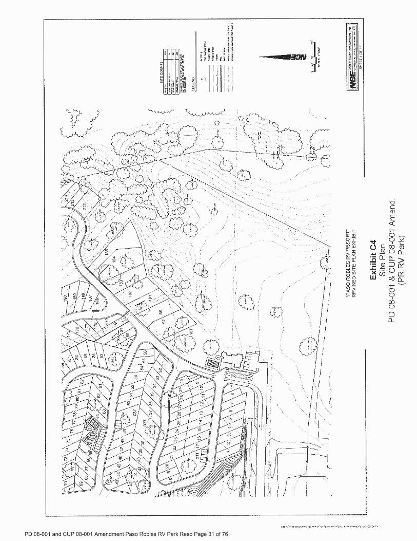


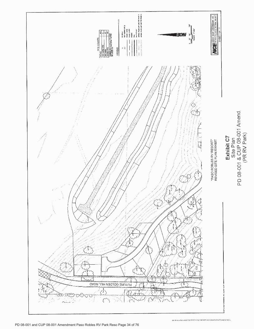


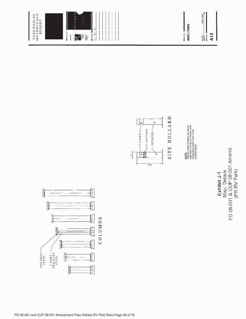


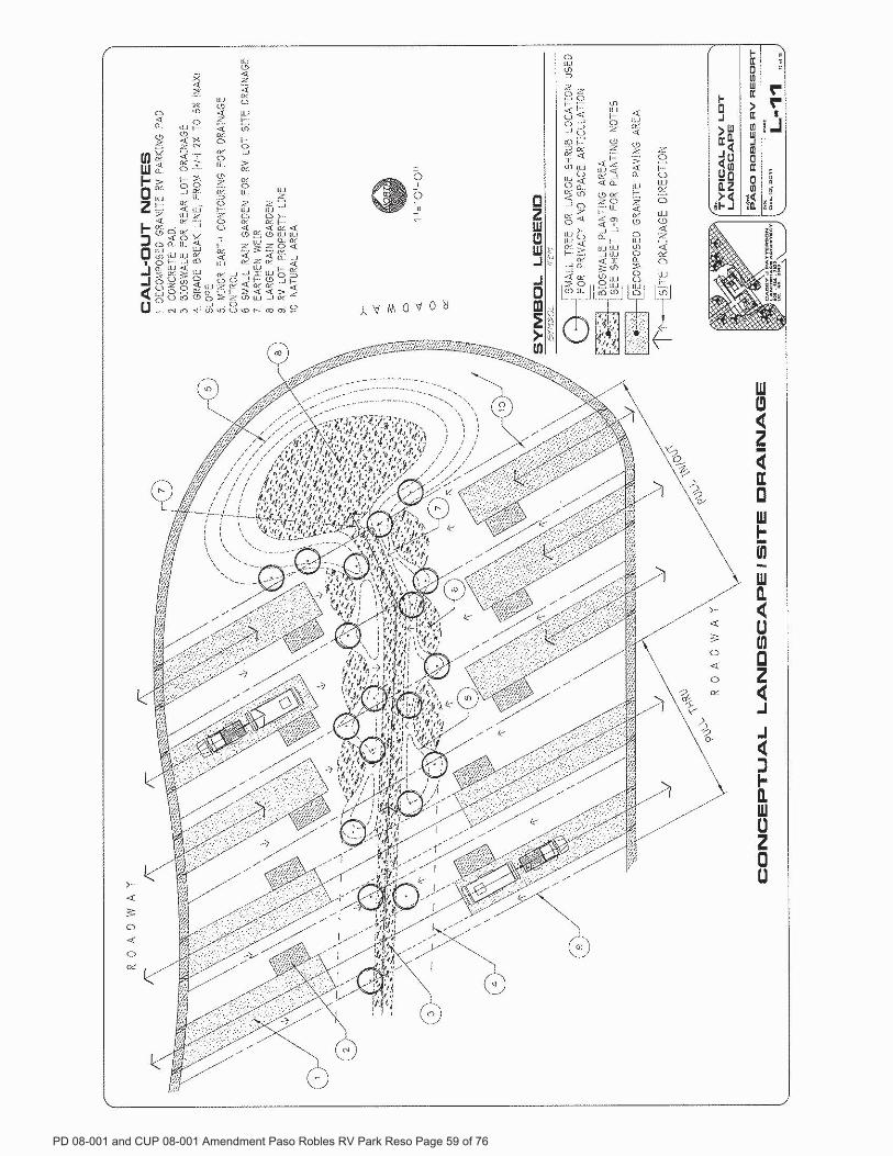


ATTACHMENT 3

�������� ����� ����������� ������������ ���������������������� �� �� �!���
�����"������� ��#�� �����$�%������� ������������� ���������������������� �������&�� ��'
()*+,+-./*01230+4561.+77+*/*5/87+8/9.15/*+:/9;1<=8)3>?
@ABCDEFGFHIJKLMJNOJPQRILRIRSTQUDVBWCJXX
YZ[\]DPDCA_[DVCDKDDC[NANaAOCOTDb
cdC[CBeODBEJQN[ CKDDC[NLCD@JBAfATZDBY[CQYAON\[Z_ACDEONJN[KAOBZQCAAggABDJgPAgABDE@hijgAVDPZ[NDCJCVAOZE\PABBk[ VJQHGJNECPJ_DZJ\PABBBD_DPJZTOB[NDBBDBANCDDJBCB[EDAX@JBAfATZDBb
YAKKON[CQlD_DZAgKDNCl[PD\CAPmJPPDNnPJ\DBAVDEBZ[EDBAXCDgPAgABDEjBCPDZZJWOTBCJC[ANJNE@JBAfATZDBdPDJfD[NXAP\DKDNC@PAoD\CbfDgPDBDNCJC[_DBAXYJ_JfATZDBfp@JP]Lp[NJfATZDBm[NDPQLf[TAZ[m[NDPQLJNEBD_DPJZACDPTOB[NDBBDB[NCDJPDJBgA]DJJ[NBCCDgPAgABJZb@hij[BgPAgAB[N[KgPA_DKDNCBCACDjBCPDZZJWOTBCJC[ANJNE@JBAfATZDBdPDJfD[NXAP\DKDNC@PAoD\CV[\[N\ZOEDBCD\ANBCPO\C[ANAXCAVDPBqIrCASIsrCJZZCACPJNBgAPCDZD\CP[\[CQJ\PABBCDXPDDVJQb
kJNBt[\DZLCDAVNDPAXp[NJfATZDBBJ[ECD[PXJ\[Z[CQ_JZODBCD_[BOJZDugDP[DN\DAX_[B[CAPBCACJCgJPCAX@JBAfATZDBJNEBJQBZJPDgAVDPZ[NDBNDJPCDDJBCDPNDNCPJN\DAXCD\[CQV[ZZ\AKgPAK[BDCJC_[BOJZDugDP[DN\DbvCDPBBJ[ECDgAVDPZ[NDBJNEZJPDCAVDPBVAOZEPO[NCD[PTOB[NDBBDBbWCD_DwJ]DPAXYJ_JfATZDBfpfDBAPCBJ[ECJC@hijJBJNJZCDPNJC[_DCJC[BgPDXDPJTZDDN_[PANKDNCJZZQb
xZC[KJCDZQCD\AON\[Z_ACDEsyICAAggABDCDED_DZAgKDNCLTOCY[CQtJNJDPeAKnPOC\DQJE_[BDECD\AON\[ZC[BKJQTDJZANgPA\DBBLJNECD\[CQNDDEBCATDgPDgJPDECAX[ CCDgPAgABJZJCDJ\BCDgbeD\AON\[ZrB_ACDV[ZZTDBDNCCACDYJZ[XAPN[J@OTZ[\xC[Z[CQYAKK[BB[ANb
eD\AON\[ZJZBAPD\D[_DEJPDgAPCXPAK@AZ[\DY[DXeQzDV[BAN\ZDJN[NCDP[_DPTDEbkD\AKgJPDE[CCAgJ[NC[NCDhAZEDNhJCDwP[EDbm DNCDQrPDX[N[BDEKJ][NCD[PVJQCPAO CDP[_DPTDELCDQPDCOPNCACDTD[NN[NbkDE[ENAC\AKKDNCANeODBEJQJXCDPNAANrBTJN]PATTDPQJXCDPV[\CDPATTDPDB\JgDE[NCACDP[_DPTDECADZOEDAXX[\DPBb
eD\[CQ\AON\[ZJZBAPD\D[_DEJPDgAPCXPAK@JBAfATZDBn[PDlDgJPCKDNCwJCCJZ[ANY[DXfJNEQkJPP[BJNEdBB[BCJNCY[CQtJNJDPWJPJMANBANyf[ABPDJPE[NYvp{lyS|bkJPP[BBJQBCD_J\\[NJC[ANgPAPJK[BONEDPVJQJCCD@JBAfATZDBj_DNCYDNCDPbfDBDP_JC[ANBVDPDCJ]DNZJBCVDD]JNEX[ZZDEOgTQANDnP[EJQJXCDPNAANbkDBJQBCDQV[ZZCJ]D

�������� ����� ����������� ������������ ���������������������� �� �� �!���
�����"������� ��#�� �����$�%������� ������������� ���������������������� �������&�� ��'
()*)(+,-./0*,1,.0/0234(*5,6780)9,0:,;),()*)(+,-./0</(+,99.0,-./0=61/.01-/-3)9/40-6>)=*.-)>>>7(),56*?/7/(1@/(=69,??.01ABCDEDFGHIFFF7
J**.*-,0-K.-6L,0,1)(M,(,3N/30*/0HO./**,.5-3)9/409.?,PP(/+)5.0Q)9):=)(*P)05.01RIGD@CCC-/,**.*-?/9,?=4*.0)**)*723,-:/0)63,*1/0)-/*4PP/(-P,(;?)-*.0-3)9.-6@,05,?*/P(/+.5)P(/P,0)</(3),-.01/4-H/<H5//(5.0.01723)9.-6.*,?*/.0-(/549.01,0)>P(/1(,:-3,-,??/>*?/9,?=4*.0)**)*-/*)??1.<-9,(5*>3.93.09?45),ICHP)(9)0-5.*9/40-723)9.-6P,6*</(-3,-5.*9/40-4P-/RD@CCCP)(=4*.0)**723)1.<-9,(5*,()1/.01/0*,?)0/>,-:/()-3,0DC=4*.0)**)*.0S,*/O/=?)*7
J5:.0.*-(,-.+)M)(+.9)*Q.()9-/(O6,0K/(0)??()P/(-)5-3)9.-6T*<.0,09.,?*-,05.01.*1//57U)*,6*-3)9.-63,*V4*-405)(RIC:.??./05/??,(*.0()*)(+)*@>3.93.*,=/4-DCHP)(9)0-/<-3),004,?=451)-7U)()9/::)05*5)<)((,?/<2(,0*.)0-8994P,0962,WK/??)9-./0*</(3/-)?*@:/-)?*@,05*3/(-H-)(:()0-,?*7U/>)+)(@.->/4?5P4--3):.0.:4:5)<)((,?,-RG@CCC,:/0-37
23)S,*/O/=?)*K.-6K/409.?,?*/3.()58,*.*J**/9.,-)*-/5/)0+.(/0:)0-,?P?,00.01>/(;-/)WP)5.-)-3)*-,-)T**,?)/<-3)X?S,*/5)O/=?)*Y/4-3K/(()9-./0,?Z,9.?.-6/0J.(P/(-O/,5723)*-,-)3,*5)9.5)5-/*)??-3)P(/P)(-6,05-3)(),()*)+)(,?.0-)()*-)5=46)(*723)K.-6/<S,*/O/=?)*.*0/-=46.01-3)P(/P)(-6@=4-)WP)5.-.01-3)*,?)7
M4=*9(.=)-//4(:,.?.01?.*-�%�� �##����
[��������
��� ���������� \��]������� �����_����#� ������� ���������
\#%���������� \#%�����������\��������� \#%������������ �a��
bcdefcg

ATTACHMENT 4

City of El Paso de Robles General Plan 2003 Land Use Element
LU-1 Revised March 2014 per GPA 2014-001
LAND USE ELEMENT
1.0 Introduction This Land Use Element provides for the opportunity for infill development within the City limits and expansion of the City limits to incorporate potential annexation areas. Since adoption of the Land Use Element in 2003, the City has completed annexation of the Sphere and Expansion Areas shown on Figure LU-2. Following completion of the Olsen Ranch and Beechwood Annexations in 2004 and the Linne Road (Our Town) Annexation in 2005, there are 19.9 square miles (12,739 acres) within City Limits. Population Planning Threshold Resolution 03-232, by which the General Plan was comprehensively updated in December 2003, established a population planning threshold of 44,000 persons. That population threshold was calculated on the assumption that the sum of all existing dwelling units (in 2003) and the maximum number of potential dwelling units authorized by the Land Use Element would be occupied by an average of 2.7 persons per household (average household size reported for the City in the 2000 U.S Census). As discussed below, the population planning threshold remains at 44,000 persons. However, in 2012, the City Council approved adjustments to the underlying assumptions defining the occupancy of dwelling units. Population Projection The General Plan sets a vision and supporting policy focused on expected development between 2003 and the plan’s 2025 horizon year. This projection is not a statement of policy that the City should or will take actions to manage the rate of development to conform to the projection. When the General Plan Update was adopted in December 2003, based on the pace of development activity at that time, it was anticipated that residential build-out of the City, resulting in a population of 44,000, would occur by 2025. However, the national economic slowdown that began in 2007, coupled with the history of periodic slowdowns over prior decades, has caused the City to consider that build-out and an attendant population of 44,000 may take more than 20 additional years: to 2045 or longer, to attain. Table LU-3B contains a population projection prepared in 2014 that takes into consideration the periodic fluctuations in the economy as well as the anticipated availability of finished subdivided lots in the various specific plan areas. Table 1-E in the Land Use Element Appendix provides greater detail for the figures shown in Table LU-3B. It is important to note that the population projection in Table LU-3B and Table 1-E in the Land Use Element Appendix is an estimate of population growth in response to the expected pace of development. Projected Number of Dwelling Units A key component of determining the future population is to identify the numbers of existing and potential dwelling units. Table LU-3 provides an accounting of these units. Vacancy Rate In 2012, the City acknowledged that, at any point in time, a percentage of built units will be vacant, and that an appropriate vacancy rate is a hallmark of a healthy economy: helping

City of El Paso de Robles General Plan 2003 Land Use Element
LU-2 Revised March 2014 per GPA 2014-001
provide access to housing and stabilize housing prices. According to the U.S. Census, between 1980 and 2010, the housing vacancy rate has averaged 6.22 percent. However, noting that the vacancy rate fluctuates with the state of the economy, the City finds it prudent to adopt a more-conservative vacancy rate of 5.0 percent. Average Household Size According to the U.S. Census, the household size has averaged 2.66 persons between 1980 and 2010. The General Plan now (2012) assumes that each dwelling unit will be occupied with an average 2.66 persons. Build-Out Population At such time that the 16,818 units shown in Table LU-3 are built, it is assumed that 5.0% of them will be vacant and that the other 95.0 percent will be occupied with an average of 2.66 persons, yielding a population of 42,499. The City Council may consider general plan amendments that increase the numbers of dwelling units at build-out provided that the build-out population does not exceed the population planning threshold of 44,000 persons. Commercial and Industrial Land designated for commercial and industrial development is projected to be more than adequate to accommodate the demands associated with the planned for population growth. There is sufficient commercially designated area within the City to accommodate a projected 2.90 million additional square feet of floor area through the Year 2025 (refer to Table LU-1B). Industrially-designated land could accommodate up to 1.50 million additional square feet of City of El Paso de Robles General Plan 2003 floor space through the Year 2025. Much of the industrial development is anticipated to be concentrated near the airport.


City of El Paso de Robles General Plan 2003 Land Use Element
LU-4 Revised March 2014 per GPA 2014-001
Table LU-2. General Plan Land Use Distribution Land Use Category Acres Percent
Agriculture 814 7.3%
Residential Categories Residential Rural (1 du/5 acres) 0 0.0% Residential Suburban (1 du/2.5 acres) 642 5.8% Residential - Single Family - 1 (1 du/acre) 419 3.8% Residential - Single Family - 2 (2 du/acre) 272 2.5% Residential - Single Family - 3 (3 du/acre) 772 7.0% Residential - Single Family - 4 (4 du/acre) 1,590 14.3% Residential - Single Family - 6 (6 du/acre) 18 0.2% Residential - Multiple Family - 8 (8 du/acre) 287 2.8% Residential - Multiple Family - 9 (9 du/acre) 17 0.2% Residential - Multiple Family - 12 (12 du/acre) 178 1.6% Residential - Multiple Family - 16 (16 du/acre) 0 0.0% Residential - Multiple Family - 20 (20 du/acre) 47 0.4% Mobile Home Park (5 du/acre) 58 0.5%
Residential Total 4,300 39.0%
Commercial Categories Neighborhood Commercial 55 0.5% Office Professional 29 0.3% Downtown Commercial 41 0.4% Community Commercial 97 0.9% Regional Commercial 175 1.6% Commercial Service 505 4.6%
Commercial Total: 902 8.1%
Mixed Use Categories Mixed Use 8 (Commercial and Multi-Family - 8) 18 0.2% Mixed Use 12 (Commercial and Multi-Family - 12) 37 0.3%
Mixed Use Total: 55 0.5%
Industrial Categories Business Park 1,676 15.1% Industry 52 0.5% Industrial Total: 1,728 15.6%
Other Categories Public Facilities 1,654 14.9% Parks and Open Space 1,634 14.5%
Other Categories Total: 3,288 29.5%
TOTAL 11,087 100.0% Notes: 1. Source: Land Use Inventory, updated to reflect General Plan Amendments through June 30.
2011. All acreages are net (exclude dedicated rights-of-way for streets and highways). 2. It is expected that the Chandler Ranch Area Specific Plan will include changes to some of the
above acreage in order to attain the 1,439 dwelling units provided by the General Plan.


City of El Paso de Robles General Plan 2003 Land Use Element
LU-6 Revised March 2014 per GPA 2014-001
POLICY LU-1B: Airport Land Use Compatibility. As a general policy, new residential development is an undesirable land use within the Airport Influence Area.
Action Item 1. Prohibit further subdivision of land within the Airport Land Use Review Area (AP Overlay Area), or changes to land use or zoning, in a manner that would accommodate additional dwelling units. Existing parcels would, however, be entitled to be occupied by existing or new residential dwelling in accordance with current General Plan and Zoning.
GOAL LU-2: Image/Identity. Maintain/enhance the City’s image/ identity.
POLICY LU-2A: Citizen Participation. Foster citizen participation in the planning process. POLICY LU-2B: Visual Identity. Promote architectural and design excellence by imposing stringent design and construction standards for commercial, industrial, mixed-use, and multi-family projects.
Action Item 1. Amend/Update the Zoning Ordinance to define standards. Encourage property-owners to upgrade existing buildings and sites to conform to these standards. Action Item 2. Adopt design standards to clearly articulate how important public views, gateways and landmarks (as shown on Figure CE-3) are to be maintained/ enhanced. This is to include, but not be limited to:
Enhancing views along highways, roads, streets, and rail corridors with landscaping, building setbacks, enhanced architecture and signage/monuments. Ensuring that residential building lots are of sufficient size to preserve the topographic and aesthetic features of the landscape.
Action Item 3. Require utilities to be placed underground in new development projects, except for those circumstances where this requirement is not reasonably related to the specific project. Voltage lines of 44 KV or greater are excluded from this undergrounding requirement. Action Item 4. Continue to enhance the downtown as a priority. Action Item 5. Require new development to mitigate its share of the impacts to the natural and built environment as feasible and appropriate.
POLICY LU-2C: Local Heritage. Preserve/enhance downtown and the historic Vine Street neighborhood through adherence to established guidelines.
Action Item 1. Establish a Vine Street Historic Overlay District and adopt design guidelines.

City of El Paso de Robles General Plan 2003 Land Use Element
LU-7 Revised March 2014 per GPA 2014-001
Action Item 2. Review new development projects for consistency with the Downtown design guidelines and the Vine Street neighborhood guidelines.
POLICY LU-2D: Neighborhoods. Strive to maintain and create livable, vibrant neighborhoods and districts with:
Attractive streetscapes, A pedestrian friendly setting, Coordinated site design, architecture, and amenities, Adequate public and private spaces; and, A recognizable and high quality design aesthetic.
Action Item 1 (Accessory Structures). Review/Revise the Zoning Ordinance, as necessary, to address the size, use and appearance of accessory structures to ensure neighborhood compatibility. Action Item 2 (Quality of Life). Preserve health and safety, and strengthen the integrity of distinct and identifiable neighborhoods and districts, by protecting local streets from cut through traffic, speeding, parking intrusion, and traffic congestion and by implementing traffic calming measures.
a. Maintain/enhance traffic flow of arterial streets bordering residential neighborhoods, and develop neighborhood traffic management plans where deemed appropriate.
b. Provide well designed streets that provide for multiple benefits including public
safety, mobility and storm water management. Integrate storm water management design features in an aesthetically pleasing manner to; intercept pollutants in storm water, recharge ground water, reduce storm water volume and velocity on streets that drain to the Salinas River, Huer Huero Creek, and other smaller tributaries for purposes of protecting and preserving riparian habitats and enhancing water resources.
Action Item 3 (Traffic Calming). Develop safety and traffic calming measures to be incorporated into the design of streets to ensure that they are compatible with the character of the residential neighborhood and other districts with pedestrian activity. These measures are to include, but not be limited to: narrow lanes, landscaped parkways, traffic circles, textured crosswalks, angled parking, and/or other measures. Action Item 4 (Safety/Security). Review and update, as necessary, the City’s Building Security & Construction Standards for new development projects to address:
Exterior lighting, Surveillance devices, Illuminated street numbering, Locking devices for doors,

City of El Paso de Robles General Plan 2003 Land Use Element
LU-8 Revised March 2014 per GPA 2014-001
Pedestrian safety devices, City Security Plan requirements, and City requirements/standards to incorporate considerations related to safety and defensibility into project design and site layout.
Action Item 5 (Light/Glare – New Development). Require all new lighting to be shielded and directed downward in such a manner as to not create off-site glare or adversely impact adjacent properties. The style, location and height of the lighting fixtures shall be submitted with the building plans and shall be subject to approval by the Development Review Committee prior to issuance of building or grading permits, as appropriate. Action Item 6 (Light/Glare – Existing Development). Continue to enforce the General Performance Standards for All Uses (Section 21.21.040 of the City’s Zoning Ordinance) specifies that: “No direct glare, whether produced by floodlight, high-temperature processes such as combustion or welding or other processes, so as to be visible from any boundary line of the property on which the same is produced shall be permitted. Sky-reflected glare from the building or portions thereof shall be so controlled by reasonable means as are practical to the end that said sky-reflected glare will not inconvenience or annoy persons or interfere with the use and enjoyment of property in and about the area where it occurs.
POLICY LU- 2E: “Purple Belt”(Open Space/Conservation Areas Around the City). Create a distinct “Purple Belt” surrounding the City by taking actions to retain the rural, open space, and agricultural areas.
Action Item 1. Coordinate with the County and private organizations to identify boundaries of and obtain support for a “purple-belt” that buffers the eventual edge of the City through the preservation of existing, and encouragement of future agriculture and open space. Action Item 2. As feasible, acquire development rights/easements within the designated purple belt area. Use these development rights/easements to limit land uses within the designated purple belt to agricultural and/or open space. Action Item 3. Take steps to ensure that the County retains surrounding lands in very low-density rural residential, open space (including natural resource), and agricultural uses. Oppose the creation of new parcels within the County. Action Item 4. Implement strategies that help preserve or protect agriculture beyond the City limits, including:
Establishment of agricultural buffer easements, berms and/or vegetative screening, on property proposed for urban development as a condition of approval of discretionary development applications. Implement the City’s adopted “right-to-farm” ordinance. Participation in the Williamson Act and other farmland preservation programs.

City of El Paso de Robles General Plan 2003 Land Use Element
LU-9 Revised March 2014 per GPA 2014-001
Action Item 5. Require disclosure agreements for new non-agricultural development within 500 feet of an existing agricultural use. Such disclosure agreements should describe potential nuisances (e.g., dust, noise, pesticide spraying, etc.) associated with normal agricultural operations.
POLICY LU- 2F: Planning Impact Area (PIA): Maintain and periodically update a Planning Impact Area (PIA) to indicate the maximum potential geographical boundaries to which the City may grow in the foreseeable future (within the 2003-2025 planning period and beyond), or areas within which development patterns would have an immediate impact upon the City, and identify land use categories that would be assigned if unincorporated land were annexed.
Action Item 1: Evaluate annexation requests for conformance with adopted General Plan goals, policies and action items (including the requirement that financing mechanisms or alternative measures be put into effect in order to ensure fiscal neutrality), as well as public infrastructure and service plans. Action Item 2: Continue to review and comment on planning efforts and development projects being considered by the County within the City’s Planning Impact Area.
POLICY LU- 2G: Specific Plans. Require for large, vacant and/or underutilized areas, as well as for areas with special planning needs, as follows (refer to Figure LU-3):
Areas outside of and southeast of the 2003 City limits, within Subarea “D” (proposed Annexation Areas between Linne Road and Creston Road). Two specific plans, which include: Olsen Ranch Specific Plan Beechwood Area Specific Plan Chandler Ranch Area Specific Plan Oak Park Area Specific Plan Uptown/Town Centre Specific Plan Other areas as established by the City Council
Limitations on Chandler Ranch Area Specific Plan, Olsen Ranch Specific Plan, Beechwood Area and Uptown/Town Centre Specific Plans. The following shows the maximum number of dwelling units that can be accommodated within each of the specific plans. These numbers may be reduced, depending on topographic, environmental, or other development constraints:
Chandler Ranch Area Specific Plan: 1,439 dwellings Olsen Ranch Specific Plan: 673 dwellings Beechwood Area Specific Plan: 674 dwellings Uptown/Town Centre Specific Plan 989 dwellings
Within the scope of a specific plan, the Planning Commission and City Council have the authority to:

City of El Paso de Robles General Plan 2003 Land Use Element
LU-10 Revised March 2014 per GPA 2014-001
Provide flexibility in terms of: Distribution of densities within the geographic area covered Parcel sizes and location (including clustering to retain unique site features) Development Standards and other Zoning Ordinance requirements Allowable land uses by providing an opportunity for mixed use provisions (e.g. neighborhood serving commercial land uses) within the overall residential densities anticipated in the General Plan. This flexibility includes the ability to provide for multi-family land uses as long as the total dwelling unit count is within the scope of the General Plan designation for the geographic area under consideration.
Address community-wide issues on a comprehensive basis, including: Fiscal impacts Infrastructure phasing and financing Parks and Trails Project Amenities Coordinated Architecture
Action Item 1. Encourage establishment of Specific Plans for other areas where it would be appropriate to:
a) Retain unique site features. b) Insure a cohesive development pattern for the area (A Specific Plan could
establish site planning, design and architectural parameters that could integrate the uses of the different parcels in the area).
c) Lend themselves to long-term development and infrastructure phasing; d) Allow for flexibility in site planning in order to encourage creative and higher
quality design and to ensure compatibility with surrounding land uses.
Action Item 2. As part of the environmental review of new Specific Plans, require preparation of fire station analysis identifying staffing requirements, station location, and response times.
POLICY LU- 2H: Downtown. Continue to revitalize the historic Downtown. Focus efforts on developing Downtown Paso Robles as the specialty retail, government, office, cultural, conference, and entertainment center of the City and North County region.
Action Item 1. Continue requiring new projects to implement the adopted Downtown Design Guidelines and to adhere to the development standards of the Zoning Ordinance.
Action Item 2. Promote a vibrant Downtown using the following methods:
Implement the City’s Economic Development Strategy. Continue to support Main Street and Chamber of Commerce efforts to use media, publications and technology to encourage retailers and entrepreneurs to locate and build in downtown. Encourage Main Street to recruit specialty stores to the Downtown

City of El Paso de Robles General Plan 2003 Land Use Element
LU-11 Revised March 2014 per GPA 2014-001
Promote special events in the downtown developed by the City, Farmer's Market, Main Street, Chamber of Commerce and other community groups. Accommodate and encourage special festivals and events, and public art in the Downtown area.
POLICY LU-2I: Infill. Encourage infill development as a means of accommodating growth, while preserving open space areas, reducing vehicle miles traveled, and enhancing livability/quality of life. Infill includes:
1. Mixed use development in the Downtown and/or in areas within walking distance
to transit, employment centers, and commercial services where the environmental impacts of the development would be minimized;
2. Residential infill in/near established neighborhoods; 3. Increased densities on sites which can accommodate the increases without having an
adverse effect on adjacent properties; 4. Targeted residential infill to help address the needs of Cuesta College students and
employees, City and school district employees, seniors, lower income households and other special needs groups; and rehabilitation of older apartment complexes. Action Item 1. Amend the Zoning Ordinance to allow mixed-use projects in the Downtown and other suitable locations (near transit, multi-modal transportation facilities, commercial services, and/or employment centers). Action Item 2. Prior to or concurrent with consideration of any mixed use projects, stringent design and construction standards shall be established.
POLICY LU-2J: Public Art. Art is in public places is an essential element of the Community's quality of life, contributing to what makes Paso Robles a special place to live, work and shop.
Action Item 1. Public and private development projects shall be required to contribute toward the establishment and maintenance of art in public places, based on a formula and process to be established by the City Council.
POLICY LU-2K: Support environmental responsibility. Manage the natural landscape to preserve the natural beauty and rural identity of the community, which enhances ecological functions and maintains environmental and public health.
Action Item 1. Require new development, either on public or private property, to mitigate its share of impacts from storm water on the natural environment through implementation of Low-Impact Development (LID) storm water management features.

City of El Paso de Robles General Plan 2003 Land Use Element
LU-12 Revised March 2014 per GPA 2014-001
GOAL LU-4: Public Services and Facilities. Maintain/improve the quality of life enjoyed by residents.
POLICY LU-4A: Service Levels. Strive to ensure that City services and facilities are maintained at current levels and/or adopted standards, and are funded as revenues become available. These standards are summarized as follows:
Police Maintain a ratio of 0.5 non-sworn personnel per 1,000 population.
Maintain a ratio of 1.4 to 1.6 sworn personnel per 1,000 population. Emergency Services Public Works (Water, Sewer, Storm Drainage, Solid Waste)
Strive to achieve a 4 minute response to 90% of the calls for service. Maintain a ratio of 0.8 to 1.3 Firefighters per 1,000 population. Public facilities to be designed to meet the current and planned land uses, provisions to be made for continued operation, maintenance, and upgrades as necessary.
Library Maintain 0.5 square feet per capita of library facilities. Action Item 1. Direct City revenues toward continuing to fund the public services and on-going maintenance/operation of public facilities and utilities provided by the City (water, sewer, storm drains, police, emergency services, library, recreational services, and solid waste).
Action Item 2. Require new development in annexation areas and/or specific plan areas to establish funding mechanisms to pay for the construction, maintenance, and operation of required City services and facilities on an on-going basis: (1) at current levels; or (2) per adopted City standards, as well as in compliance with state and federal mandates; and/or (3) as deemed necessary during the environmental review and/or the fiscal impact review process. Action Item 3. Require a fiscal impact analysis for new development in annexation areas and/or specific plan areas and condition projects accordingly so as to ensure that they will be fiscally neutral and not result in a net loss for the City. Action Item 4. As part of implementation of the General Plan Update:
Review/refine the existing Growth Management Plan to address Emergency service needs on a periodic basis. Revise/update the City’s Master Plans of Water, Sewer, Storm Drainage, and Solid Waste and City standards and specifications for public facilities. Update the Capital Improvement Program so that it is in conformance with the revised Master Plans. Investigate expansion of branch libraries to serve outlying areas and adding new outreach programs, including a book mobile. Implement planned City library expansion into the 2nd floor of the existing library and develop City hall relocation plans, as feasible. Maintain the Youth Arts Center satellite library.

LU 5
Table 1-E Population Projection Details
Potential Jan 1 Jan 1 Jan 1 Jan 1 Jan 1 Jan 1 Jan 1 # Units 2015 2020 2025 2030 2035 2040 2045 Residual
West Side Uptown/Town Centre Specific Plan Multi-family, vacant lots 105 12 30 30 30 0 0 0 3 Multi-family, under-developed lots 541 8 110 75 40 30 40 30 208 Multi-family, mixed use potential 295 0 0 0 0 44 50 40 161 Outside UTCSP Area Single family, vacant finished lots 97 10 20 15 20 15 5 0 12 Single family, under-developed lots 22 0 2 1 2 1 2 1 13 Single family, vacant subdividable parcels 3 0 1 1 1 0 0 0 0 Multi-family, vacant lots 17 0 16 1 0 0 0 0 0 Multi-family, under-developed lots 90 1 5 7 10 7 10 7 43 Subtotal for West Side 1,170 440
East Side
Borkey Area Specific Plan Single family, vacant finished lots 13 0 11 0 0 0 0 0 2 Single family, vacant subdividable parcels 15 2 2 2 2 2 2 2 1 Multi-family, vacant lots 188 0 188 0 0 0 0 0 0 Union/46 Specific Plan Single family, vacant finished lots 18 6 7 3 2 0 0 0 0 Single family, subdividable parcels 49 0 8 8 13 5 5 5 5 Chandler Ranch Specific Plan Single family (does not include 12 existing units) 1,291 0 0 200 300 250 350 191 0 Multi-family 135 0 0 75 60 0 0 0 0 Beechwood Specific Plan Single family (does not include 5 existing units) 469 0 100 120 180 69 0 0 0 Multi-family 200 0 0 50 50 50 50 0 0 Olsen Ranch Specific Plan Single family (does not include 4 existing units) 574 0 0 80 184 120 190 0 0 Multi-family 95 0 0 0 50 45 0 0 0 Outside Specific Plan Areas Single family, vacant lots 94 10 20 10 20 10 15 8 1 Multi-family, vacant parcels 440 5 150 100 80 40 35 29 1 Multi-family, under-developed lots 197 0 40 25 40 25 35 25 7 Multi-family on mixed use zoned property 28 0 28 0 0 0 0 0 0 Subtotal 3,806 17 General Plan Amendments Active in 2014 Borkey Area Specific Plan - Single Family 271 0 120 24 77 30 20 0 0 Beechwood Area Specific Plan - Mixed types 241 0 0 0 150 89 2 0 0 Furlotti Annexation - Single Family 30 0 0 0 20 10 0 0 0 Subtotal 542 0
Total 5,518 54 858 827 1,331 842 811 338 457
Notes:1. Source for Potential # Units is the City’s Land Use Inventory dated December 31, 2013. 2. Figures in Jan 2015, Jan 2020,... columns assume units complete (Certificates of Occupancy issued) as of Dec 31 of the previous year. 3. Inclusion of dwelling units in General Plan Amendments Active in 2014 does not indicate pre-approval of these applications, but provides an
estimate of their development in the event that they are approved.

ATTACHMENT 5

CORONA AUDIBLE NOISE OF 110 KV HIGH VOLTAGE OVERHEAD TRANSMISSION LINES
H. Egger1, R. Draxler2, H.-J. Wernegger2*, M. Muhr3, R. Woschitz3 (1) KELAG-Kärntner Elektrizitäts-Aktiengesellschaft, Klagenfurt, Austria
(2) KELAG Netz GmbH, Klagenfurt, Austria (3) University of Technology, Institute of High Voltage Engineering and System Management,
Graz, Austria *Email: [email protected]
Abstract: The corona discharge mechanism and the resulting audible noise of high voltage overhead transmission lines with a nominal voltage class equal or higher than 220kV is largely solved and published. In the course of reconstructing a 110kV line the local approving authority has forced the grid operator to investigate the corona noise before and after the reconstruction, especially the effect of changing from single to bundle conductor. Therefore an experimental setup in the high voltage laboratory of the Institute of High Voltage Engineering and System Management of the University of Technology has been build and acoustic measurements on single and bundle conductor were performed. To prove the impact of typical, various weather conditions to the corona discharges field tests are also realized. With this results general predications of the corona audible noise of 110kV high voltage overhead transmission lines can be derived.
1 INTRODUCTION
At places of raised electric field strengths high voltage overhead transmission lines can produce spontaneous, pulse-like corona discharges (acoustic sound emission or A-levels) which become apparent by crackling noise. By wet or humid weather conditions a distinctive 100 hertz hum (2f or tonale emission) can appear beside the acoustic sound emission [1]. To take into account the increased awareness of the population concerning noise exposure, the local approving authority has forced the grid operator to investigate the corona noise before and after the reconstruction of an 110kV overhead line (OHL), especially the effect of changing from single to bundle conductor. This paper describes the results of sound measurements in different conductor-configurations in a high voltage laboratory and verification of these results on the basis of field tests. 2 GENERAL DEFINITIONS OF SOUND
MEASUREMENT
In this Paper the following sound pressure levels are used: Name Description LA,95% Basis level in dB
In 95% of the observation time exceeded A-valued sound pressure level of any noise.
LA,eq
LZ,eq
A-valued energy-equivalent long-term sound level in dB
Single indication, which describes the sound events with fluctuating sound pressure levels. It is that sound level which has the same energy concentration like the fluctuating noise by constant steady influence for a given relation time.
Unvalued energy-equivalent long-term sound level in dB
LA,Max Maximum level in dB
The highest sound level within the measuring time
Table 1: sound pressure levels
"A-valued" means the weighting of the measured unvalued sound pressure levels with a function considering that human beings have a different frequency-dependent hearing.
3 CALCULATION OF THE CONDUCTOR- GRADIENT
Substantially for the appearance of corona discharge is the existence of effectual conductor-gradient on the conducting wire. The middle conductor-gradient of one outer conductor is generally calculated according to the equation below [2]:
(1) 3
]sin)1(21[2
'
0
Var
nn
rCiEi
ISBN 978-0-620-44584-9Proceedings of the 16th International Symposium on High Voltage Engineering
Copyright c© 2009 SAIEE, Innes House, Johannesburg
Pg. 1 Paper B-35

Ei middle conductor-gradient of one outer conductor
Ci' capacitance per unit length of the conductor i at the co-system
0 dielectric constant 8.8 F/m10 12
V nominal voltage (phase to phase) a subconductor distance of the bundle
conductor r subconductor radius n number of the subconductor’s The capacity Ci' must be determined from the geometrical data of the outer conductors, the earth wire and the tower geometry. For a symmetrical line with two systems the middle capacity of one conductor can be determined by the following approximation formula:
(5) DDDDmRr
(4) DDDDmRs
(3) DDDD
(2)
DmRrrDmRsDln
2'C
3TtSeRr
3RtStRS
3RTSTRS
0
'C middle capacitance per unit length of
one conductor of the co-system
0 dielectric constant 8.8 F/m10 12
r subconductor radius DXy middle outer conductor’s distance of
the phase X to the phase y DmRs, DmRr middle outer conductor
distance of different systems D middle outer conductor’s distance of
one system By the bundle conductor the partial radius becomes the equivalent radius rB.
(6) )1(n nTB rrnr
rB equivalent radius n number of the subconductors r subconductor radius rT pitch circle radius
Figure 1) examples of double bundle configurations a) horizontally and b) vertically The results of the conductor-gradient-calculation with the Al/St 240/40 wire in different configurations and various tower designs used in the field tests are shown in the Table 2. Besides, the shown voltages in tables and in the figures are phase-earth voltages.
tower design
operating voltage in
kV
conductor- type
conductor-configuration
conductor- gradient in
kV/cm
68 Al/St 240/40
single conductor 9,5
„ton“ 68 Al/St
240/40 2-bundle conductor 6,9
„lyra“ 69 Al/St 240/40
single conductor 9,8
Table 2) calculation of the conductor-gradient The critical conductor-gradient cited in the literature concerning annoying corona discharge emission of 16-17kV/cm were fallen short under the examined conditions (see table 2). 4 LABORATORY MEASUREMENT
4.1 Description of the high-voltage laboratory and the measuring set-up
The sound measurements on different conductor- configurations were carried out in the high voltage-laboratory of the test research institute for high voltage engineering Graz GmbH (VAH) of the University of Technology of Graz. The high voltage laboratory is located 353 metres above the sea level and is performed completely shielded to be able to measure interference-free in the hall and to not disturb the environment through unintentional hf-transmission. For the realisation of the sound measurement the high-voltage-cascade was supplied by a variable AC transformer. The connection of the specimen occurred by means of a 9kOhm resistor and a central electrode. A 3m long pipe with an external diameter of 22.5mm was taken down on the central electrode to the specimen and the conductor was connected through a T-connector electrically as well as mechanically. The basic set up of the measurements is shown in figure 2.
cascadedamping resistor
central electrode
voltage dividervariable AC transformer
conductorconfiguration
cascadedamping resistor
central electrode
voltage dividervariable AC transformer
conductorconfiguration
Figure 2) basic set-up
The specimen itself was mounted horizontal in the hall and stretched on both sides of the hall by means of composite insulator and chain block. Besides, the specimen's length was approx. 25 metres long. The ends of the insulator and the connectors were shielded with doubletorus (external diameter of 600mm).
ISBN 978-0-620-44584-9Proceedings of the 16th International Symposium on High Voltage Engineering
Copyright c© 2009 SAIEE, Innes House, Johannesburg
Pg. 2 Paper B-35

central electrode
pipe
T-connector
com
posi
tein
sula
tor
doub
leto
rus
pres
s-co
nnec
tor
chai
nbl
ock
com
posi
tein
sula
tor
doub
leto
rus
ca. 34.60m
central electrode
pipe
T-connector
com
posi
tein
sula
tor
doub
leto
rus
pres
s-co
nnec
tor
chai
nbl
ock
com
posi
tein
sula
tor
doub
leto
rus
ca. 34.60m
Figure 3) scheme of the single conductor configuration
Figure 4) laboratory set-up of the single conductor measurement
In addition to fix the double bundle a plastic rope was mounted on the right double torus, so the vertical mounting orientation could be reached by the hall crane. The field distance holders were mounted at the end of the press-connectors and at the T-connector.
ca. 34.60m
plas
ticro
pe
central electrode
pipe
T-connector
com
posi
tein
sula
tor
doub
leto
rus
pres
s-co
nnec
tor
chai
nbl
ock
com
posi
tein
sula
tor
doub
leto
rus
pres
s-co
nnec
tor
ca. 34.60m
plas
ticro
pe
central electrode
pipe
T-connector
com
posi
tein
sula
tor
doub
leto
rus
pres
s-co
nnec
tor
chai
nbl
ock
com
posi
tein
sula
tor
doub
leto
rus
pres
s-co
nnec
tor
Figure 5) scheme of the double bundle configuration
4.2 Description and set-up of the sound level measuring instrument
The sound level measuring instrument 2250 of the company Brühl and Kjaer was used. The measuring microphone was mounted in a distance of 3 metres vertically below the conductor and led by shielded cables in the control room to the analyzer.
4.3 Atmospheric measuring conditions in the high voltage laboratory
During the measurements the climate in the hall was 22.4°C, 61.9% relative dampness (corresponds 11.9 g / m ³ H2O) and 1015hPa (relative air pressure). 4.4 Measurement of the quiescent noise level in
the laboratory
The measurement of the quiescent level occurred with built up specimen and without supply of the cascade. Besides, possible disturbing noise and background noise just as the own noise of the measuring instruments were also detected. The quiescent noise level in the hall moved by the LA, eq between 20.4dB and 24.7dB and by the LA, 95% between 19.0dB and 19.8dB. The evaluation of the noise emission of the transformer (transformer hum) resulted sound levels at the LA, eq from 21.7dB to 26.1dB and at the LA, 95% of from 19.6dB to 20.1dB. 4.5 Measurements on the single conductor
configuration
For the single conductor configuration a used wire piece from the rebuilt 110kV line Malta - Außerfragant (system number 115 / 3B and 115 / 4C) was used. The used line conductor was a 240/40 aluminium/steel composite wire with a nominal external diameter of 21.84mm. The surface of the conductor showed cokings by the many years of use. The conductor was mounted with the T-connector at 5.9 metre height and by the microphone at a height of 6.07 metres above the hall bottom. operating voltage in
kV
LA,eq in dB
LA,Max in dB
LA,95% in dB
70 22.3 33.6 19.7 120 25.5 40.2 21.5
Table 3) measurement results of the single conductor, measuring time 5 minutes The following diagrammes show the third-octave-band unvalued frequency spectra by different operating voltages.
Figure 6) spectrum of the single conductor measurement with a voltage of 70kV, measuring time 5 minutes
ISBN 978-0-620-44584-9Proceedings of the 16th International Symposium on High Voltage Engineering
Copyright c© 2009 SAIEE, Innes House, Johannesburg
Pg. 3 Paper B-35

The envelopes mark the curves of the same volume in phon after Fletcher and Munson.
Figure 7) spectrum of the single conductor measurement with a voltage of 120kV, measuring time 5 minutes By a voltage of 120kV a light increase of the high frequency levels is recognizable, but not audible. 4.6 Measurements on the double bundle
configuration
For the double bundle configuration in vertical position (subconductor distance of 400mm) a brand new conductor was used. The height above the hall bottom of the lowest conductor was by T-connector 5.52 metres and by the microphone 5.38 metres. At the beginning of the measurements the conductors were "branded" with 200kV for 5 minutes to delete possible foulings. operating voltage in
kV
LA,eq in dB
LA,Max in dB
LA,95% in dB
70 20.7 33.2 19.3 120 23.3 44.6 19.7
Table 4) measurement results of the double bundle configuration, measuring time for 70kV and 120kV in each case 5 minutes
Figure 8) spectrum of the double bundle measurement with a voltage of 70kV, measuring time 5 minutes
Figure 9) spectrum of the double bundle measurement with an operating voltage of 120kV, measuring time 5 minutes 4.7 Results of the laboratory measurement
With an operating voltage of approximately 70kV no essential noise emission over the quiescent level was noticed at both conductor-configurations (single and bundle conductor). The simulation of an earth-fault (increase of the phase-earth voltage in both "healthy" phases to 120kV) showed a higher noise level by the single conductor configuration than the double bundle configuration. This is a result of the conductor-gradient-decreasing-effect of the double bundle configuration. 5 FIELD MEASUREMENTS
5.1 General
To verify the laboratory-results other sound level measurements were carried out on selected 110kV overhead line locations. The sound level measuring instrument was again the 2250 of the company Brühl and Kjaer. The choice of the measuring locations occurred according to the accessibility and the quiescent level at the respective place (traffic, waters, railroad, wind, etc.). To minimize the quiescent level all measurements were hold during late night hours. 5.2 Measurement at a 110kV OHL of the type
“ton-tower”
5.2.1 Description of the measuring place and the measuring set up
Measuring place: The measuring place was located between mast No. 146 and No. 145 of the 110kV OHL “ton-tower” with the system number 112/2 (southern system) and 112/5 (northern system) near the places Projern and Dellach.
ISBN 978-0-620-44584-9Proceedings of the 16th International Symposium on High Voltage Engineering
Copyright c© 2009 SAIEE, Innes House, Johannesburg
Pg. 4 Paper B-35

110 kV line 112/2 and 112/5measuring place110 kV line 112/2 and 112/5measuring place
Figure 10) description of the measuring location During the measurement the vertical distance between microphone and the tower symmetry line was 4 metres The distance between microphone (spike) and the lowest conductor (system 112/2) 5.5 metres. The measuring place is lying 517 metres above the sea level and is well protected against the wind. Conductor and overhead earth wire:The system 112/2 consists of an 240/40 aluminium/steel composite wire and runs between the substation St. Veit and the substation Landskron. The system 112/5 consists of an 260/40 aluminium/stalum composite wire and runs between the substation Brueckl and the substation Windischbach. The earth wire type is a 56 / E24. AlMgSI/Stalum. Tower geometry, span field length and insulators: The “ton-tower” consist of screwed angle-frameworks with open profiles. As insulators full-core-long-rod-insulators in double configuration with electric arc protection armatures were used. The span field 145 - 146 measures a length of 280 metres and has in the measuring point a bottom distance of 9.42 metres (distance between the lowest conductor of the system 112/2 and the surface of the earth level).
Figure 11) 110kV tower designs (left: “ton-tower”, right: “lyra-tower”)
5.2.2 Atmospheric conditions at the measuring location
During the measurement the climate at the measuring place was 2.4°C, 73.8% rel. dampness (corresponds 5.4 g / m ³ H2O) and 1080hPa (relative air pressure). During the measurement it was absolutely calm. 5.2.3 Measurement at the 110kV OHL “ton-
tower” The measurement started about 22.08 CET and lasted 5 minutes. During the measurement the operating voltage in both systems was 68.13kV (phase-earth voltage). operating voltage in
kV
LA,eq in dB
LA,Max in dB
LA,95% in dB
68.13 20.9 21.5 20.7 Table 5) measurement results of the 110kV OHL “ton-tower”
Figure 12) spectrum of the measurement of the 110kV OHL “ton-tower” 5.3 Measurement at a 110kV OHL of the type
“lyra-tower”
5.3.1 Description of the measuring place and the measuring set up
Measuring place: The measuring place was between mast No. 168 and No. 169 of the 110kV OHL “lyra-tower” with the system number 111 / 3A near the place Kras.
110-kV-Leitung 111/3AMessort110 kV line 111/3Ameasuring place110-kV-Leitung 111/3AMessort110 kV line 111/3Ameasuring place
Figure 13) description of the measuring location During the measurement the vertical distance between microphone and the tower symmetry line was 4 metres. The distance between microphone and the lowest conductor (system 112/2) 3.0 metres. The measuring place is lying 654 metres above the sea level.
ISBN 978-0-620-44584-9Proceedings of the 16th International Symposium on High Voltage Engineering
Copyright c© 2009 SAIEE, Innes House, Johannesburg
Pg. 5 Paper B-35

Conductor: The system 111 / 3A consists of an 240/40 aluminium/steel composite wire and runs between the substation Landskron and the substation Gummern. Tower geometry, span field length and insulators: The “lyra-tower” consist of screwed angle-frameworks with open profiles. As insulators full-core-long-rod-insulators in double configuration with electric arc protection armatures were used. The span field 168 - 169 measures a length of 250 metres and has in the measuring point a bottom distance of 10.10 metres. 5.3.2 Atmospheric conditions at the measuring
location During the measurement the climate at the measuring place was 0.3°C, 72.0% rel. dampness (corresponds 3.6 g / m ³ H2O) and 1113hPa (relative air pressure). The measurement was influenced strongly by wind caused sounds. 5.3.3 Measurement at the 110kV OHL “lyra-
tower” The measurement started at about 00.25 CET and lasted 5 minutes. In the system 111 / 3A the operating voltage during the measurement was 68.7kV (phase-earth voltage). operating voltage in
kV
LA,eq in dB
LA,Max in dB
LA,95% in dB
68.7 33.8 48.8 32.6 Table 6) measurement results of the 110kV OHL “lyra-tower”
12,50 31,50 63 125 250 500 1000 2000 4000 8000 16000 A Z0
20
40
60
80
100
120
140dB 10.03.2009 00:25:37 - 00:30:37 Gesamt
HzLZeq
Figure 14) spectrum of the measurement in the 110kV OHL “lyra-tower” 5.4 Results of the field measurements
In comparison to the laboratory measurement the biggest problem with the field tests was the relatively high quiescent sound level. However, laboratory conditions could be reached by the transfer of the measurements during the night hours. Nevertheless, it turned out that also with favourable measuring conditions the background noise was always stronger than a possible corona discharge noise of the line itself.
Also the analysis of the spectra could not deliver any indication of corona discharge noise (no striking 100 hertz level and no audible broadband increase of the sound level between 1kHz and 16kHz). 6 CONCLUSION AND VIEW
Several measurements were executed in the laboratory as well as in the field to investigate the corona discharge emission from 110kV overhead lines. Nevertheless, the analyses of the measurement-results showed that under the prevailing climatic conditions and an operating voltage of 69kV phase-earth voltage (phase-phase voltage of 120kV) the phenomenon of corona discharge emission could not be attested neither in the laboratory nor in the field test. Also the critical conductor gradients cited in the literature concerning annoying corona discharge emission of 16-17kV/cm were fallen short by the examined conductor-configurations, conductor-types and the tower-configurations by far. All field measurements were executed under dry weather conditions. In addition to these investigations further field measurements on 110kV overhead lines under humid air conditions are planed. 7 EXPRESSION OF THANKS
This paper would not have been possible without vigorous support by the Carinthian government, department 15, subdivision sound and electrical engineering. Hence, our special thanks go to Mr. Ewald Holzer and Mr. Jürgen Ruppitsch. 8 REFERENCES
[1] U. Straumann et. al.: Tonale Emission von Hochspannungsfreileitungen, Bulletin SEV/VSE 15/05
[2] H. Happold, D. Oeding: Elektrische Kraftwerke und Netze. Berlin, Heidelberg, New York. Springer Verlag, 5-Auflage 1978
ISBN 978-0-620-44584-9Proceedings of the 16th International Symposium on High Voltage Engineering
Copyright c© 2009 SAIEE, Innes House, Johannesburg
Pg. 6 Paper B-35