Laramie County Comprehensive Plan
72
Laramie County Comprehensive Plan Adopted June 7, 2016
-
Upload
khangminh22 -
Category
Documents
-
view
1 -
download
0
Transcript of Laramie County Comprehensive Plan

Laramie CountyComprehensive Plan
Adopted June 7, 2016

Table of Contents
Acknowledgements ................................................................................................................ Pg 4
Section 1: Introduction 1.1 How the Plan was Prepared ........................................................................................... Pg 51.2 What is a Comprehensive Plan ..................................................................................... Pg 61.3 Goals, Guiding Principles & Strategies ....................................................................... Pg 9
Section 2: Heritage, Vision & Values 2.1 Background & Existing Conditions ............................................................................ Pg 102.2 Trends, Influences & Projections ................................................................................. Pg 152.3 Vision Statement & Core Values ................................................................................... Pg 30
Section 3: Natural & Cultural Resources 3.1 Natural Resources ............................................................................................................. Pg 313.2 Goals & Recommendations ........................................................................................... Pg 45 & 473.3 Cultural Resources ............................................................................................................ Pg 463.4 Goals & Recommendations ............................................................................................ Pg 46 - 47
Section 4: Community Services & Transportation 4.1 Community Services ........................................................................................................ Pg 494.2 Goals & Recommendations ............................................................................................ Pg 53 & 57 - 594.3 Transportation .................................................................................................................... Pg 554.4 Goals & Recommendations ............................................................................................ Pg 56 & 59
Section 5: Land Use & Development5.1 Introduction & Intent ..................................................................................................... Pg 615.2 Goals & Recommendations ........................................................................................... Pg 63 - 645.3 Future Land Use Designations ...................................................................................... Pg 655.3.1 Future Land Use Map .................................................................................................... Pg 68
Section 6: Adoption & Updates ........................................................................................ Pg 69Adoption Resolution ................................................................................................................. Pg 70

Maps Key
Map 1: Areas Governed by Land Use Plans ............................................................ Pg 8
Map 2: Regional Location of Laramie County ....................................................... Pg 10Map 3: Existing Land Use Map ................................................................................... Pg 13Map 4: Large Landholders ........................................................................................... Pg 14
Map 5: Potential Growth Factors ................................................................................ Pg 16Map 6: Subdivision Growth ........................................................................................... Pg 17Map 7: Buildable Vacant Lots ....................................................................................... Pg 20Map 8: Mineral Production ........................................................................................... Pg 36Map 9: Oil & Gas Well Permits by Year ..................................................................... Pg 37 Map 10: Vegetative Land Coverage .............................................................................. Pg 39Map 11: Wildlife Impacts ................................................................................................. Pg 41Map 12: Cultivated Agricultural Lands ...................................................................... Pg 43Map 13: Historic & Cultural Resources ...................................................................... Pg 48Map 14: Community Services ........................................................................................ Pg 54Map 15: Transportation Systems ................................................................................. Pg 60Map 16: Future Land Use Map ...................................................................................... Pg 68
Goal Tables Key
Natural & Cultural Resources Goals ............................................................................ Pg 47Community Services & Transportation Goals ......................................................... Pg 57 - 59Land Use Goals ..................................................................................................................... Pg 63 - 64

Acknowledgements: Authors & Contributors
Steering CommitteeJoe Patterson Kevin BurkettAnja BendelDale SteenbergenJan FeltonRobert JensenDon ThreewittRandy ByersWill EdwardsJana GinterBen TrautweinBoyd WiggamDennis AukerJudy JohnstoneJeff KetchamKevin MarquardtRuss DahlgrenFrank ColeTaft LoveSreyoshi ChakrabortyBrady PetschDennis Ellis
PhotographyJordan EvansJoe FisherBarbara KlothJason CaugheyChrissy Konegni BurneyDana GageRoy KroegerTracy NavarroMark SlovikBridget WilsonMatt LeyTeena Dorshorst Gering
Laramie County Planning CommissionFrank ColeJody ClarkBert MacyPat MoffettJason CaugheyJim WardBonnie Reider
Laramie County Board of CommissionersTroy ThompsonAmber AshBuck HolmesRon KaileyLinda Heath
Laramie County Planning & Development
Public at Large
Thank you!

Introduction
The 5 W’s and an H.
1.1 How the Plan was Prepared
This Plan was developed with participation of approximately 300 citizens with the goal to include significant public input. This input helped to develop a clear and concise document developed by the Community for the Community.
The first Comprehensive Plan for Laramie County was adopted in 1978 with subsequent plans adopted in 1982 and 2001. The 1978 and 1982 plans were developed by an advisory committee with minimal public input. The 2001 plan included public input in the development of the plan, upon which the 2016 Plan was built and expanded.
In the fall of 2014, Planning and Development Department Staff re-initiated an effort to update the 2001 Comprehensive Plan that had begun in 2011. A Steering Committee was formed to represent a broad set of interests throughout the community. This Steering Committee served as “citizen advisors” to the planning process. Technical Advisors, which included representatives of public and quasi-public agencies, also provided input and expertise throughout the process.
Another goal of this update was to create a vision statement that concisely reflected the diversity and commonality in Laramie County. The intended outcome of this update is a simplified document for use by staff, elected and appointed officials, developers and private citizens to guide growth and development in the County.
Page 5

A comprehensive plan is a tool to plan for future growth of a community. Its purpose is to establish guidelines that address changes and development over time based on the vision, goals and strategies as determined by the community itself. The Plan should seek to maintain and improve the social, physical and economic wellbeing of a community. While particular elements of a comprehensive plan can vary, in most cases it consists of a study of existing conditions, a discussion of future trends, goals and objectives, and recommendations on how to achieve the vision and goals.
The 2016 Laramie County Comprehensive Plan is a document founded on the history and traditions of the County. The overall intent of the plan, as outlined in the Wyoming Statutes, is to promote the health, safety and general welfare of all residents. As highlighted in the table of contents, the plan includes a compilation of information about historic and current conditions in the County, recent trends and influences, and maps of land uses and natural resources. More importantly, the plan also includes a vision, as well as a set of goals and strategies providing guidance to fulfill
1.2 What is a Comprehensive Plan & How Can it be Used?
The initial phase of the update involved the development of a planning database, including information about the County’s physical resources; social, economic and governmental structure; and assets. This phase also included a number of interviews with individuals who represented a variety of interests throughout the County.
Phase two included three rounds of public input to guide and develop the plan. The first two rounds included fourteen public meetings. The focus was to develop vision and goals which would serve as the backbone for the plan. The third round of public input occurred after a draft plan was developed in February 2016. Throughout the process of drafting the document, staff also coordinated with both the Steering Committee and Technical Advisors to summarize and incorporate the public input into the document.
The Planning Commission and Laramie County Board of Commissioners were kept up-to-date, and input from both entities was received throughout the process. The Final Draft of the Plan was presented to the Laramie County Planning Commission and Laramie County Board of Commissioners at public hearings. This plan was adopted by the Commissioners on June 7, 2016, by the resolution on page 70.
Page 6

Portion of development layout planning model created to help assess patterns and impacts of existing trends in development. Created in SketchUp by Barbara Kloth, 2015.
that vision. Finally, the plan discusses which implementation tools are currently in use, such as subdivision regulations, zoning, septic system regulations and sub-area plans, as well as other implementation tools that might be considered for future use.
The Comprehensive Plan is a statement made by the Laramie County Commissioners on behalf of the people of the County, reflecting who we are and what we want to happen with future growth in the County. It can provide guidance to elected and appointed officials, private and public sector decision-makers, as well as residents and landowners, on matters that affect the future of the County. Actions taken by both the public and private sector that should be influenced by this Plan include, but are not limited to, the following:
• Land development applications• Potential annexations into municipalities and related boundary changes• Subdivision and site development review• Intergovernmental agreements with other local governments• Long term capital improvement planning and budgeting• Long term operating cost and service level planning• Annual operating programming and budgeting• Economic development planning and programming• Public and County service planning and budgeting• Redevelopment planning and programming• Private sector land development
The 2016 Laramie County Comprehensive Plan is advisory in nature. It is intended as a type of “roadmap” for the short-term and long-term growth and development of the County.
In order for this Plan to function as an effective decision-making tool, it is necessary to have the capability to respond to changing conditions, such as increased population and subsequent demand for public services, housing, legislative policies, technological development, economic fluctuations and other issues the citizens of the County believe are relevant.
Page 7

Map #1: Areas Governed by Land Use Plans
This map displays the areas guided by PlanCheyenne (2014) in relation to the Laramie County Comprehensive Plan.
TN
18
TN
17
TN
16
TN
15
TN
14
TN
13
TTN
12
TN
13
TN
14
TN
15
TN
16
TN
17
TN
18
TN
19TN
19
R 65 W R 64 W R 63 W R 62 W R 61 W R 60 W
N
R 68 WR 70 W R 69 W R 67 W R 65 W R 64 W R 63 W R 62 W R 61 W R 60 W
12
R 70 W R 69 W R 68 W R 67 W R 66 W R 65 W
R 66 W
¬«211
¬«210
¬«213
¬«215
¬«214
¬«216
§̈¦25
§̈¦25
§̈¦25
§̈¦80
§̈¦80
£¤85
£¤85
BURNSPINE
BLUFFS
ALBIN
CARPENTER
CHEYENNE
HARRIMAN
ZONED AREA
Areas Governed By
Land Use Plans
Land Use PlansComprehensive (2016)PlanCheyenne
AdministrativeBoundary
Incorportaed TownF.E. Warren A. F. B.Zoned Area
Street CenterlinesInterstateArterialCollector
Reference GridCounty LineTownship/Range Line
April 2016
This ma p is made possible through the Cheyenne and La ramie County Cooperative GIS Progra m (CLCCGIS) . The data contained herein was collected for its use and is for display a nd planning purposes only. The CLCCGIS will not be held lia ble as to the validity, correctness, accuracy, completeness, a nd/or reliability of the data. The CLCCGIS furthermore a ssumes no lia bility associated with the use or misuse of this information.
1:700,000°N
L A R A M I E C O U N T YComprehensive Plan 2016
0 5 102.5
Miles
Map # 1
The Plan includes several strategies that suggest that the County adopt subsequent plan implementation tools including programs, procedures, guidelines, regulations and standards. To be effective and generally accepted in the community, these tools will require careful consideration and public input during the development process. It is not the intent of the Plan to stop or slow down development. The goal is to develop tools to ensure implementation of the citizen’s vision.
Page 8

1.3 Goals, Guiding Principles & Strategies
The Community’s Vision is expressed through the stated goals and guiding principles. These goals and guiding principles form the yardstick against which future regulations and public programs shall be measured. Goals provide a guide for decision-making, not only in development review, but throughout all sectors of local government.
Goals are important values and beliefs adhered to by the community. They are based on the community’s desires and were formed through stakeholder interviews, community group presentations, public meetings, Steering Committee meetings, and correspondence with various technical advisors and County Departments.
Implementation strategies and guiding principles are the tools used to achieve the goals. The metrics will determine how successful the implementation strategies are at achieving the defined goals. These metrics are critical to determining the success of the Plan and how well it meets the Vision and subsequent goals and guiding principles determined by the community.
This plan breaks goals into immediate and long term based on the priorities set forth during the public input process and by the Laramie County Board of Commissioners and Planning Commission. The immediate goals are accompanied by guiding principles, implementation strategies and metrics. The long term goals are items which may take longer to achieve; in many cases further development will be needed to identify specific principles and strategies for implementation.
“Scattering Community Seeds” by Tracy Navarro. Photo taken at the Cheyenne Botanical Gardens, 2014.
Page 9

Laramie County is located in the southeastern corner of Wyoming, and encompasses approximately 2,660 square miles. It is bounded on the west by Albany County, on the north by Platte and Goshen Counties, on the east by the Nebraska state-line and on the south by the Colorado state-line. Laramie, Wyoming is approximately 45 miles west along I-80, and Casper, Wyoming nearly 180 miles north via I-25. Major population centers of Colorado’s Front Range lie to the south. Fort Collins is approximately 30 miles south of the County line and the Denver Metropolitan Area is approximately 90 miles south.
Heritage, Vision & Values
This section provides a brief summary of Laramie County history, physical setting, municipal centers, existing land use, population, education, household information and County economic data. It includes statewide and local trends and influences with regard to economics, employment data, land use and development issues, and services.
2.1 Background & Existing Conditions
Source: ESRI, ArcGIS Online
Map # 2
Page 10

On the western edge of America’s Great Plains, the County’s rolling plains rise westward to the foothills of the Southern Laramie Mountain Range. Elevations range from approximately 5,300 feet above sea level in the east and northeast, rising to 6,000 feet and above near Cheyenne, and between 7,000 and 8,000 feet in the west. Several drainage corridors traverse the County including Horse Creek, Lodgepole Creek, Crow Creek and the upper headwaters of Chugwater Creek. Several other minor creeks and draws feed into the major creeks mentioned above. The majority of the County’s landform drains into the South Platte River Basin, while the northern quarter drains into the North Platte basin.
2.1.1 Physical Setting
2.1.2 Municipalities & Rural Centers
Wyoming’s capitol city of Cheyenne is the County’s major population center, located at the intersection of Interstates 25 and 80. Other incorporated towns include Albin in the northeast corner; Burns, which lies approximately 20 miles east of Cheyenne, along I-80; and Pine Bluffs
Significant landscape formations include the Pine Bluffs in the southeast, the Horse Creek eastern escarpments in the northeast corner of the County and the western Horse Creek and Chugwater Creek escarpments in the northwest. The Chalk Bluffs rise in the south central area of the County along the Weld County, Colorado border. Along the western boundary the Laramie Range rises and includes, from north to south, Iron Mountain, Red Ridge, the Horse Creek Hogback, Mesa Mountain and the Twin Mountains. The “Gang Plank”, a long, subtle physiographic incline that connects the eastern plains and the Laramie Range, provided the early transcontinental railroad with a viable grade, and assured the County’s place as a transportation hub of national significance. See maps in Section 3, Natural and Cultural Resources, for more details. Two major municipal reservoirs, Granite Springs Reservoir and Crystal Lake Reservoir, are located just south of State Highway 210 near the Albany/Laramie County line. The reservoirs serve as the focal point of the Curt Gowdy State Park.
The County’s climate is considered continental temperate and cold in the winter. Mean temperature is 65 degrees, with lowest temperatures occurring in January and the highest temperatures in July. Average annual precipitation is just over 15 inches, the majority of which is received in the late spring.
Landscape near the old Hecla Mine site in Western Laramie County. Taken by Matt Ley in October 2012.
Page 11

2.1.3 Existing Land Use
Agricultural uses dominate in Laramie County. Over 80 percent of the land in the County is used as rangeland and cropland. Rangeland accounts for nearly 64 percent of all land uses. Rangeland occurs throughout the County, but is most prevalent in the north, northwest and southern areas of the County. The production of crops, on both irrigated and dry farm land, accounts for 20 percent of all County land uses. The cropland exists primarily in the eastern one-half of the County.
Approximately 11 percent of the County is public land, owned by local, State and federal governments. These land uses include city and town properties, State lands, State parks and federal facilities, the most prominent being F.E. Warren Air Force Base in Cheyenne.
Map #3: Existing Land Use Map
Depicts existing property use, based on how they are taxed by the County Assessor’s Office.
Map #4: Large Landholders
Depicting land ownership in Laramie County for large parcels of 640 acres or more (1 section or more). Usefulness: Gives a better idea of scale of development possible in areas of the County. Also shows larger land areas in relation to areas of the County and existing roads, cities, and public lands.
Nearly 5 percent of all land in the County is dedicated to residential uses.
Commercial and industrial uses, located primarily in the incorporated communities, account for less than one percent of all land uses. Developed land, for residential, commercial and industrial use, is the predominant use in the incorporated communities. Many large lot residential subdivisions have been developed throughout the unincorporated area of the County.
Left: FE Warren Air Force Base, January 2016.
Right: Red maples at the State Capital, October 2008.
Photos by Roy Kroeger.
near the Nebraska state-line. Several other unincorporated rural centers include Carpenter, 10 miles south of Burns, Meriden along U.S. Highway 85 in the northeast; Little Bear north of Cheyenne along I-25; and Farthing, Horse Creek, Happy Valley and Granite Canyon in the west near the Laramie Foothills.
Page 12

TN18
TN17
TN16
TN15
TN14
TN13
TTN12
TN13
TN14
TN15
TN16
TN17
TN18
TN19
TN19
R 65 W R 64 W R 63 W R 62 W R 61 W R 60 W
N
R 68 WR 70 W R 69 W R 67 W R 65 W R 64 W R 63 W R 62 W R 61 W R 60 W
12
R 70 W R 69 W R 68 W R 67 W R 66 W R 65 W
R 66 W
¬«211
¬«210
¬«213
¬«215
¬«214
¬«216
§̈¦25
§̈¦25
§̈¦25
§̈¦80
§̈¦80
£¤85
£¤85
BURNSPINE
BLUFFS
ALBIN
CARPENTER
CHEYENNE
HARRIMAN
ZONED AREA
Existing Land Use
February 2016
This map is made possible through the Cheyenne and Laramie County Cooperative GIS Program (CLCCGIS). The data contained herein was collected for its use and is for display and planning purposes only. The CLCCGIS will not be held liable as to the validity, correctness, accuracy, completeness, and/or reliability of the data. The CLCCGIS furthermore assumes no liability associated with the use or misuse of this information.
Source Information:CLCGISC, Laramie County Assessor's Office
L A R A M I E C O U N T YComprehensive Plan 2016
Property AssessmentAccount Type
AgriculturalResidentialCommercialIndustrialMulti-UseExemptOpen Space
Administrative BoundaryIncorporated CommunityF.E. Warren A. F. B.Zoned Area
Street ClassificationsInterstateArterialCollectorLocal
HydrologyBodies of Water
Reference GridCounty LineTownship/Range LineSection Line
5 0 5
Miles
1:350,000°NMap # 3

TN18
TN17
TN16
TN15
TN14
TN13
TTN12
TN13
TN14
TN15
TN16
TN17
TN18
TN19
TN19
R 65 W R 64 W R 63 W R 62 W R 61 W R 60 W
N
R 68 WR 70 W R 69 W R 67 W R 65 W R 64 W R 63 W R 62 W R 61 W R 60 W
12
R 70 W R 69 W R 68 W R 67 W R 66 W R 65 W
R 66 W
¬«211
¬«210
¬«213
¬«215
¬«214
¬«216
§̈¦25
§̈¦25
§̈¦25
§̈¦80
§̈¦80
£¤85
£¤85
BURNSPINE
BLUFFS
ALBIN
CARPENTER
CHEYENNE
HARRIMAN
ZONED AREA
Large Landholders
April 2016
This map is made possible through the Cheyenne and Laramie County Cooperative GIS Program (CLCCGIS). The data contained herein was collected for its use and is for display and planning purposes only. The CLCCGIS will not be held liable as to the validity, correctness, accuracy, completeness, and/or reliability of the data. The CLCCGIS furthermore assumes no liability associated with the use or misuse of this information.
Source Information:CLCGISC, Laramie County Assessor
L A R A M I E C O U N T YComprehensive Plan 2016
Land OwnershipAcres
640 - 32003201 - 1280012801 - 43230Less than 640
Public LandsPublic Lands
State LandCurt Gowdy State ParkBLM Land
Administrative BoundaryIncorporated CommunityF.E. Warren A. F. B.Zoned Area
Street ClassificationsInterstateArterialCollectorLocal
Reference GridCounty LineTownship/Range LineSection Line
5 0 5
Miles
1:350,000°N
Map # 4
2.2 Trends, Influences & Projections
Laramie County’s economy, growth and rate of change are influenced by local, regional, and state factors.
This Comprehensive Plan does not intend to make predictions. It is important, however, to look at trends, especially at the State and local level. Decision-makers, whether they be elected officials, appointed boards and commissions, or businessmen and women, may consider the implications of emerging trends.
Many local and state agencies and organizations study economic and social trends. Reported results may vary. Some suggest the local population will increase at a faster rate than others suggest. Some believe the population growth throughout the Rocky Mountain region will affect much of Wyoming. Others believe that such impacts will be limited to the more urban centers and resort areas of the State. The purpose of the discussion below is to outline some of the major influences and trends that may have an impact on growth and development in Laramie County.
The information that follows is from the document “A Profile of Socioeconomic Measures: Laramie County” produced by the Economic Profile System-Human Dimensions Toolkit EPS-HDT in March of 2015, the Wyoming Center for Business and Economic Analysis, Inc., and the Economic Analysis Division of the Wyoming Department of Administration and Information.
Map # 5: Potential Growth Factors
Shows new address assignments in 5 year increments from 1995. Also shows roads that are paved in the rural sections of Laramie County, and how that may influence growth.
Map # 6: Subdivision Growth
Shows subdivisions recorded with the County Clerk’s Office in approximately 25 year increments.
Page 15

TN18
TN17
TN16
TN15
TN14
TN13
TTN12
TN13
TN14
TN15
TN16
TN17
TN18
TN19
TN19
R 65 W R 64 W R 63 W R 62 W R 61 W R 60 W
N
R 68 WR 70 W R 69 W R 67 W R 65 W R 64 W R 63 W R 62 W R 61 W R 60 W
12
R 70 W R 69 W R 68 W R 67 W R 66 W R 65 W
R 66 W
!!!!
!
!
!
!
!!!!
!!!
!
!!
!
!
!!
!
! !
!
! !
!!
!
!
!
!
!!!!
!!
!
!
!
!
!
!
!
!
!
!
!
!
!
!
!
!
!!
!
!
!!!
!
!
!
!
!
!!
!
!
!
!
!
!
!
!!
!
!
!
!
!!!
!
!
!!!
!
!
!
!
!
!
!
!
!
!
!
!
!
!
!
!
!
! !
!
!
!
!
!
!
!!
!
!!
!
!!!!
!!
!
!
!
! !
!
!!
!
!
!
!!
!
!!!!
!
!!! ! !!!
! !!
!
!
!!!!!!!!!!!! !!!!!!!!
! !! !!
!!!
!
!
!
!!
!
!
!!!
!
!!!
!! !!!
!! !!!
!!! !!! ! !!
!
!! !
!
!! ! !
!! !! !!!
!
!! !! !!! ! !! !!
!!
!! !
!
!
!
!
!!!
!!
! ! !! ! !!
!!!!! !!
!!
!
! !!!!!
!!!!!
!! !!!!
!!
!!
!
!
!!!!
!
!
!
!
!
!!
!!!
!!
!
! !
! !!!
!
!
! !
!!
!
!
!!!!!!!!!
!
!!!!!!!
!
!!!
!
!
!! !! !
! ! !
!!!!!!!!!
! !! !!! !
! !!! !
!
!!!
!
!! !!
!
!
! !!!!
!!!!!! !! ! ! !!!!!!!! !! !
!
! !! !
! !!!!
!! !
!
! !!
!!!!!!!!!!!!!!!
!
!
!!!
!
!
!
!
!
!
! ! !!
!
!!
!
!
!
!
!
!!
!
!
!
!
!
!
!
!
!!
!
!
!
!
!
!
!
!!
!
!
!!
!
!
!
!! !!
!!!!!!!!!!!!
!!
! !
!
!
!
!!
!!
!
!
!
!
!
!
!
!
!
!
!
!
!
!!
!
!
!
!!
!
!!!
!
!
!
!
!!
!
!
!
!
!!!
! !! !
! !!! ! !
!
!! !
!
!
!!!!!!
!!!!!!!
!
!!!!!!!!!!!!
!! !!!!!!
!!!!
!!!!!! !!!!!!!
!
!!
!
!
!!!
!!!
!!!
!
!
!
!
!!
!
!
!
!
!!!
!
!
!!!
!
!!
!
!
!
!!!!
!
!
!!
!
!
!
!!!
!
!!
!
!
!
!!
!
!
!
!!!!
! !
!!
!
!
!!
!
!
!
!
!
!
!!
!
!
!!!
!
!!!!
!
!
!
!
!
!
!!
!
!
!
!
!
!!!!!
!
!
!! !
!
!
!!
! !! !! !!
!
!
!
!
!
!
!
!
!
! ! !
! ! !!
!!
!
!! !! !!!
!
!
!!
!
!
!
!
!
!
!
!
!! !
!! !!!!!!!!!!!!
!! !!!!!!!!!!!!!!!!!!!
! ! !!
!
!! !!!!!
!
! !
!! !!
!
!!!
!
!
!!
!!
!!!!!!!!!! !!!!
!! !
!
!
!
!
!!!
!!
!
!
!
!!
!
!
!
!
!
!
!!
!
!!
!
! !! !! ! !!!!
!!
!!! !!! !!! !!!!!!
!
!
!
!
!
!
! !! !
!!
!
!
!
!!
!
!!!
!
!
!
!
!
!
!! !
!!
!
!
!!! !! !
!!!
!!!
!! !!!!
!!!
!
!!
!
!!!
!!
!!! !!
!
!
!!
! !!
!!! !!!
!
!!!!
!
!
!
!
!!
!
!
!!
!
!
!
!
!
!!
!
!
!
!
!
!
!
!
!
!
!
!
!
!
! !! !! !!
!
!!!
!
! !
!
!!! !
! ! !
! !!!!! ! !
!
!
!
!
!
!! !! !
!!! !
!
!
!!!
!
!! !!
!
!
!
!!
!
!!
!
!
!
!
!
!
!
!
!
!
!
!
!!!
!! ! !!
!!!
!!!
! !!!!!!!!!
!!! !
!
!
!
!
!
!
!!
!!!
!
!
!
!!!
!! !!! !! !!
!
!
!!!!!
! ! ! !!
!!!
!
!!!
! !!!
!!
!!!
!
!
!
!
!! !!!!! !
!
!
!
!!
!! !!!
!
!
!
!
!
!
! ! !
!
!! !
!!!
!
!
!
!
!
!
!
!
!
!
!!
!!!
!! !
! ! !!!!
!!!!!!!!!
!!!!
! !! !!
!
!
!
!
!
!!!
!!
!
!
! !!
!
!
!
!
!!!
!
!!
!
!
!
!
!
!
! !!! ! !!
!
!! !
!
!!
!
!
!
!!!
!
!!
!!! !!
! !! !! ! !!!
!!
!!!!!
!!
!! !!!! !! ! !! ! !
!! ! !
!
!!!
!! !!
! !!
! !
!!!
!
!!!
!
!
!
!
!!
!
!
!
!
!
!
!
!
!
!
! !!!
!!! !!!
!
!!
!
!
!
!
!
!
!
!!!
!
!!
! !
!
!
!
!
!!!
!
!
!
!
!
!
!
!!
!! !!! !! !
! ! !!!!! !!!! ! !! !!!!!!!!!!!! !
!
!!!!!! !! !!
!
!
!!
!!
!
!
!!
!
!!!
!!
!
!
! !! !!
! !
!
!! !
!
!
! !!!
!
!!!!
!
!!
!
!
!
! !! !
!!!!!!!!!!!!!!!!!!!!! !!!!!!!!!!!!!!!!!!!!!!!!!!!!!!!!
! !!! !
!
!!!!!!!!!!!!!!!!!! !!!!!!
!!! !!!!!!!!!!!!!!!!!!!!!
!!! !
! !!
!!
!! !!
!! !
! !! !!!!
!!! ! !
!!!!!!!!!!!!!!!!! !!! !!!!!!
! !!!
!!! !
!!
!
!!
! !! ! !! ! ! !
!! !! !!! !
! !!! !!!!
! !! !! !!!! !!! !!
!!
!
!
!
!
!
! !!
!
! !
!
!!!
!
!
! !
!
!!
! !!
!! !! !
!
!! !
!
!
! !
!
!!
!!
!
!!
!
!
!
!!
!
!
!
!
!!
!
!!
!
!
!
!
!
!
!
!
!
!
!
!!
!
!
!
!!
!
!
!
!
!
!!
!
!
!
!
!
!
!
!
!
!
!
!!!!!
!! !!!
! !
!!
!
!!
!
!!
!
!
!
!
!
!!!
!!
!!!
!!
!
!
!!
!! !
!
!!!
!
!!
!
!
!
!
!
!
!
!!!!
!
!!
!!!
!
!
!
!!
!!!
!!
!
!
!
!
!
!
!!
!
!
!
!!
!
!
!!
!
!!!
!
!
!
!!
!!
!
!
!
!!
!
!
!!!
!!
!
!!
! !!!
!
!
!!!
!
!!
!!
!!
!!!!
!
!
! !!! !!
!!!
!!
!
!
!!
!
! !!! !!!!!
! !
!! !!!!! !!!
!!!!!!!
!! !
! !
!!
!
!!! ! !
!!
!! !!
! !! ! !
!!! !!
!! !
!
!!! !!
!!
!
!!!!!
!!!!
!!! !
!!! !!!!!!
!!
!!! !!
!!!
!
!!
!
!
!
!!
!! !
!
!!!!!!
!
!!
!!
!
!
!
!!
!
!
!!! ! ! !! !
!
!
!
!
!
!
!! !
!!! !
!
!!
!!!
!
!
!! !
!
!
!
!!
! !! !
! !!!!
!
! !
! !!! !
!
!
!! !
!!
!
!!!!!!!
!! !
!! !!
!
!! !!! !!!
!!! !
! !!! !
!
!
!
!
!!!!!!!!!!!
!!
!!!!!
!
!
!
!
!!
!
!!
!
!
!
!
!
!!
!
!
!!!
!
!
!
!
!
!
!
!
!!
!
!!
!
!
!
!
!
!!
!
!
!!
!
!
!
!
!!!!
!!
!
!
!
!
!
!! !!!!
!
!
!
!
!
!
!
!
!!
!
!
!
!
!
!
!
!
!
!
!
!! !!
!
!!!
!
!
!!
!!!!!!!! !
! !!!!!!
! !!!
!
!
!!
!
!
!
!!
!
!
!
!
! !
! ! !!
!
!
!
!!
!
!
!
!
!
!
!
!
!!
!
!!
!
!
!
!
! !!
!!
!!
!
!
!!
!!!!
!
!!!
!!
!!!!
!
!
!
!
!
!
!!!!!
!
!!
!
!!
!
!
!
!!
!
!!!
!
!
!!!!
!
!
!
!!!
!
!
!
!
!!
!
!!
!
!
!
!!!
!
!
!
!
!
!
!
!
!
!! ! !!!! !
!
!
!
!
!
!
!
! !!
!
! ! !! !
!!
!!!!
!
!
! !
!! !!! !
!!! !!!!!!! !!!! !!!!!!
! !
!
! !
!!
!!! !
!
!
! !! !!! !
!
!
!
!!!!
!
!
!!
!!
!
!
!!
! !
!!!! !!
!!
!! !! !!
!!!
!!
!
!
!
!
!
!
!
!
!
!
!
!
!
!
!
!
!
!!
!
!
!
!
!
!
!
!! !
!
!!!! !!!!!! !
!
!
!! !!
!!
!
!
!
!
!!!!!
!
!
!
!
!
!
!
!
!
!
!
!
!
!
!!!! !!
! !
!!
!
!! !!!
! !!
!!!
!
!
!!
!
!
!!!
!
! !!
!!! !!!!
! !!!!!!
!
!
!!
!
!!! !
! !!! !
!
!
!
!
!
!
!
! !!! !!
!
!
!
!
!
!
!
!
!
!
!
!
!
!!
!!
!
!
!
!
!
!
!
!
!! !!! ! !!! !!
!
!
!!
!
!
!
!
!
!
!! ! !!
!! !!
!
!
!!
!
!
!
!
!
!
!!
!
!
!
!
!
! !!
!
!
!
!
!
!
!
!
!
!
!
!
!
!!!
!!!!!! !
!
!!!
!
!
!!
!
!!!!
!!!!
!
!!
! !
!!
!! !
!!!! !
!
!
!
!
!!!
!!
!!
!
!!
!!
!
!
!
!
!
!! !! !!!
!!
!!
!
!!!
! !
!!! ! !
!!! !!
!
!
!
!
!
!
!!
!!!! !
!
!
!!
!!
!
!
!
!
!!
!! !!
!
!!
!!
!! !!!!
!!
!
!
! !!
!!
!! !!
!
!
!
!!
!! !! !! !! !!
!! !
!! ! !
!! !
!
!
!
!
!
!!
!
!!! !!!!
!! !!
!
!
! !! !!!!! !!
!!
!!
! !!
!
!
!
!!!
!
!!
!
!!!
!!
!
!
!
!
!
!
!!
!
!!
!!!!! !
!!
! !!
!
!
!! ! !!!
! !! !!!
! ! !!
!!
!!!
!! ! !! !! !
!!!!!
!
!
!
!
!!
!! !
!!!
! !!
! !
!!!!
!
!
!
!
!
!
!!!
!
!!
!
!
!
!
!
!!
!
!! !
!
!
!
!
!
!
!
!
!
!
!
!
!
!!
!!!
!
!!
!! !!
!!
!!
!
!
!!!
!
!
!
!
!!
!
!
!
!!
!
!
!
!
!!
!! !!! !!
!!
!!
!!
!!!!!!
!
!
! !!!!!!!!! !! !
!!
!
!
!!!!!!
!!
!
!
!
!
!
!
!
!
!!
!!! !
! !!
!
!! ! !!
! !!
!!!!!!!! !!!!!! !!!!!!!!!!!!!!!!!!!!!
! !!!!!!!!! ! !!!!!!!!
!!!!!!!!
!!!!!!!!!!!!!!!!!!
!!! !
!! !!!! !!!
! ! !!
!!
!
!
!!!!! ! !! !! !
!!
!!!
!!! !!
!! !!!!!!!
!!!! !!
!!! !! !
!! !
!
! !!
! ! !!!
!! !! ! !!!
!! ! !!!!! !
!! !! !
!
!
!!
!!
!!
!
!
!
!
!
!
!
!!
!!
!
!
!
!
!
!
!
!
!
!!
!!!
!! !
!
!
!!
!
!
!
!
!
!!
!
!
!
!
!!
!
!
!
!
!
!
!
!
!
!
!
!
!
!
!
!
!
!
!!
!
!
!
!
!!!!!!!! !!!
!
!
!
!! !!!
!
!!! !
!
!!
!
!
!!!
!
!
!
!! !
!!!!!
!!
! !!!
!!!
!
!
!
!!
!
! !!
!
!
!
!!! !
!
!!! !
!!
! !! !!
!
!
!
!
!!!
!!
!
!!!!!!
!
!
!
!!
!
!
!
!
!
!!
!
!!
!
!
!
!
!
!!
!
!
!
!
!
!
! !
!
!
!!!
! ! !
! !!!!!!
!
!
!
!!!
!
! !
!
!
!
! !
!
!
!!
!
!
!
!
!!
!
!
!
!
!
!
!
!
!
!
!
!
!!
!
!
!
!!
!
!!
!
!
!
!
!
!
!
!! !
!!
! ! !
!!
!
!
!
!
!!
!!!
!
!!
!
!
!
!
!
!
!
!!
!
! !!
!! !!! !
! !
! !!
!
!
!
!! !! ! !!!
!
!
!!
!
!
! !!
!
! !
!!
!
!
!
!
!
!
!
!
!
!!!
!
!!
!
!
!
!
!! !! !!!
! !
! !
!
!
!
!!
!
!
!
!
!
!
!
!
!
!
!
!
!
!
! !
!
!
! !
!!
!
!!!! !
!
!! !
!!
!!
!
!
!!
!!
! !
!
!!
!
!
!
!
!
!
!
! !!
!
!
!
!
!!!!
! !!!
!
!!
!!
!
!
!
!!!
!
! !!!!!
!!
!!
!
!
!!
!!!
!
!
!
!
!
!!
!!
!
!
!!
! !!!
!!
!
!
!
!!!
!
!
!
!
!
!
!
!
!
!!
!
!
!
!
! !!
!
! !
! !!
!
!
!
!
!
!
!
!! !
!
!
!
!
!
!
!
!!
!
!
! !!
! !!
!
!
!
!
!
!
!
!
!!
!!!
!
!!!
!
!!
!
!
!
!
!!
!
!
!
!!
!
!
!
!
!!
!
! !
!
!
!
!! !
!!!
!!!
!
!
!
!
!
!
!
!
!
!
!
!! !!
!
!
!
!
!
!
!
!
!
!
!
!!
!!
!!
!
!
!
!!!!!
!
!!
!
!
!! !!
!!
!
!
!!
!
!
!
!
!!
!
!!
!
!!
!! !
! !
!
!
!! !
!!!
! !!
!
! !
!
!
!!! !
! !
!
!
! !!
!
!
! !
!! ! !!
!
!
!!!
! !
!
!
!
! !!!
!!
!
!
!
!
!
!
!!
!
!
!
!
!
!
!
!
!
!
!
!
!!
!!
!
!!
! !
!
!!
!
!
!
!!
!
!
!
!
!
!!
!
!
!
!
!
!!
!
!
!!
!
!!
!
!!
!
!
!
! !!!!!!!!
! !!! ! !!
! !
!
! !!
!
!
!
!!!
!
!!
!
!
!!
!
! !!!
!!
!
!
!
!!!
!!!
!!
!
!!!
!
!!!
!!
!
!!
!
! !
!
!!
!
!
!!
! !
! !
!
!!!!
!
! !! !
!! !
!
!
!
!!
! !
!!
!
!
!
!
!!
!
!!
!
!
!!
!!!
!
!!!
!!
!!
!!
!
!!!
!
!!!
!!
!
!
!
!!!
!
!
!!
!
!
!
!
!!!
!!
! !!!! !!
!!
!
!!
!! !!!!! !!!!
!
!!
!
!
!
!!
!!!!!
!
!
!!
!
!
! ! !
!!
!
!
!
!
!
!
!
!
!
!
!
!
!
!
!
!!
!
!
!!
!!!
!!
!
!
!!
!
! !
!
!! !!
!!
!
!
!
!
!!
!!!!
!!!
!
!
!
!
!!
!
!! !!!!
!!
!!! !
!
!
!
!
!! !
!!!!!
!!!
!!
!
!
!
!
!
!
!
!!
!
!
!
!!
!
!! !!!!
!
!
!!
!
!
!
!
!
!
!
!
! ! !
!
!
!!!
!
!!!
!
!
!
!
!!!!! !!!
!!! !!!!!!
!!
!! !
!!!!
!
!
!
!
!!
!
!
!
!!
!!!!!
!!!
!
!
!
!!!
! !!
!
! ! !! !
!
!
!
!
!!
!! !!
!
!!!!
!!
!!
!
! !!! !!
!
!
!
!
!
!
!
!!
!!
!
!
!
!
!
!
!
!
!
!!
!
!!
!
!
!
!
!
!
!
!
!
!
!
!
!
!!
!
!
!
!!
! !
!
!
!
!
!
!!
!!
!
!!!
!
!
!!!!!!!
!
!
!!
!!
!
!!!!!!
!!
!!
!!
!
!!
!
!
!!
!
! !
! !!
!
!
!
!!
!!!
!
!
!
! !!!! !!
!
!!!!! !!!!! ! !!
!
!! !!
!! !
!!!
!
!
!
!
!! !
!!
!
!! !
!
!
!
!!!
!
! ! !! !
!!!!
!
!
!!!!
! ! !! ! !!
!!
!
!!!!!!!!!
!
!
!
!
!! !!
¬«211
¬«210
¬«213
¬«215
¬«214
¬«216
§̈¦25
§̈¦25
§̈¦25
§̈¦80
§̈¦80
£¤85
£¤85
BURNSPINE
BLUFFS
ALBIN
CARPENTER
CHEYENNE
HARRIMAN
ZONED AREA
PotentialGrowth Factors
June 2016
This map is made possible through the Cheyenne and Laramie County Cooperative GIS Program (CLCCGIS). The data contained herein was collected for its use and is for display and planning purposes only. The CLCCGIS will not be held liable as to the validity, correctness, accuracy, completeness, and/or reliability of the data. The CLCCGIS furthermore assumes no liability associated with the use or misuse of this information.
Source Information:CLCGISC, Laramie County Planning & Development
L A R A M I E C O U N T YComprehensive Plan 2016
New Address Assignments! 2011-2015! 2006-2010! 2001-2005! 1995-2000
Administrative BoundaryIncorporated CommunityF.E. Warren A. F. B.Zoned Area
Street ClassificationsInterstateArterialCollectorLocal
Reference GridCounty LineTownship/Range Line
5 0 5
Miles
1:350,000°N
Map # 5
All Numerical Values are Apporximated
Years1995-20002001-20052006-20102011-2015
Residential17011666643614
Commerical60483557

TN18
TN17
TN16
TN15
TN14
TN13
TTN12
TN13
TN14
TN15
TN16
TN17
TN18
TN19
TN19
R 65 W R 64 W R 63 W R 62 W R 61 W R 60 W
N
R 68 WR 70 W R 69 W R 67 W R 65 W R 64 W R 63 W R 62 W R 61 W R 60 W
12
R 70 W R 69 W R 68 W R 67 W R 66 W R 65 W
R 66 W
¬«211
¬«210
¬«213
¬«215
¬«214
¬«216
§̈¦25
§̈¦25
§̈¦25
§̈¦80
§̈¦80
£¤85
£¤85
BURNSPINE
BLUFFS
ALBIN
CARPENTER
CHEYENNE
HARRIMAN
ZONED AREA
SubdivisionGrowth
February 2016
This map is made possible through the Cheyenne and Laramie County Cooperative GIS Program (CLCCGIS). The data contained herein was collected for its use and is for display and planning purposes only. The CLCCGIS will not be held liable as to the validity, correctness, accuracy, completeness, and/or reliability of the data. The CLCCGIS furthermore assumes no liability associated with the use or misuse of this information.
Source Information:CLCGISC, Laramie County Planning & Development
L A R A M I E C O U N T YComprehensive Plan 2016
SubdivisionYear
1870 -1901 -1926 -1951 -1976 -2001 -
Subdivision
AdministrativeIncorporatedF.E. Warren A. F.Zoned
Street
CollectorReference
CountyTownship/Range
5 0 5
Miles
1:350,000°NMap # 6

2.2.1 The People
Historic and Current PopulationLaramie County is currently the most populated County in the State of Wyoming with an estimated population of 97,121. The population overall has increased the last several decades. In 1960, theCounty was the home to approximately 60,000 residents. The population decreased to nearly 56,000 in 1970, but rose again to just over 68,000 in 1980, up to 73,000 in 1990 and to 81,607 by 2000.
Source: “A Profile of Socioeconomic Measures: Laramie County”
County wide Distribution of PopulationTable 1 shows the geographic distribution of the population using the 2010 U.S. Census figures. In 2010, approximately 79 percent of the population resided in City of Cheyenne; approximately 20 percent resided in the unincorporated area, 1.2 percent in Pine Bluffs, 0.3 percent in Burns and 0.2 percent in Albin. This is a change from 65 percent of the population residing in City of Cheyenne and 33 percent residing in the unincorporated areas, with the populations in the Towns of Pine Bluffs, Burns and Albin remaining constant. These statistics demonstrate a shift in population distribution to the more urbanized City of Cheyenne.
Page 18
0
10,000
20,000
30,000
40,000
50,000
60,000
70,000
80,000
90,000
100,000
110,000
1970
1971
1972
1973
1974
1975
1976
1977
1978
1979
1980
1981
1982
1983
1984
1985
1986
1987
1988
1989
1990
1991
1992
1993
1994
1995
1996
1997
1998
1999
2000
2001
2002
2003
2004
2005
2006
2007
2008
2009
2010
2011
2012
2013
2014
2015
Laramie County Population 1970 - 2015

Source: US Census Bureau 2010
Map # 7: Buildable Vacant Lots
Illustrates lots that are available for new construction. It also distinguishes between lots that were created through a subdivision process versus those that were created by Maps of Survey using the 35+ Acres Exemption from the Subdivision permits as outlined in State Statutes.
Page 19
Table 1

TN18
TN17
TN16
TN15
TN14
TN13
TTN12
TN13
TN14
TN15
TN16
TN17
TN18
TN19
TN19
R 65 W R 64 W R 63 W R 62 W R 61 W R 60 W
N
R 68 WR 70 W R 69 W R 67 W R 65 W R 64 W R 63 W R 62 W R 61 W R 60 W
12
R 70 W R 69 W R 68 W R 67 W R 66 W R 65 W
R 66 W
¬«211
¬«210
¬«213
¬«215
¬«214
¬«216
§̈¦25
§̈¦25
§̈¦25
§̈¦80
§̈¦80
£¤85
£¤85
BURNSPINE
BLUFFS
ALBIN
CARPENTER
CHEYENNE
HARRIMAN
ZONED AREA
BuildableVacant Lots
February 2016
This map is made possible through the Cheyenne and Laramie County Cooperative GIS Program (CLCCGIS). The data contained herein was collected for its use and is for display and planning purposes only. The CLCCGIS will not be held liable as to the validity, correctness, accuracy, completeness, and/or reliability of the data. The CLCCGIS furthermore assumes no liability associated with the use or misuse of this information.
Source Information:CLCGISC, Laramie County Planning & Development
L A R A M I E C O U N T YComprehensive Plan 2016
Buildable LotsSubdivison Lots35+Acres (SubdivisionExemption)
Administrative BoundaryIncorporated CommunityF.E. Warren A. F. B.Zoned Area
Street ClassificationsInterstateArterialCollectorLocal
Reference GridCounty LineTownship/Range LineSection Line
5 0 5
Miles
1:350,000°NMap # 7

AgeAs in many rural communities throughout the United States, the population of Wyoming and Laramie County is getting older. The median age of the population has increased from 28 years old in 1980, to 33 years old for 2000, and to 37 years in 2010. In another trend, an increasingly large proportion of Laramie County’s population is 50 years or older; rising from approximately 27 percent in 2000 to an estimated 34 percent in 2013, See Table 2.
Table 2
Source: US Census Bureau
Page 21

Race and EthnicityThe pie chart below shows race identity for Laramie County residents in 2014. Census Data shows 14% of people in Laramie County identified as Hispanic in 2014.
Source: US Census Bureau
Educational AttainmentLaramie County residents continue to attain higher levels of eduction. In 1960, 57 percent of the population graduated from high school, which increased to 84 percent in 1990. Within this 30 year period, the percent of the population with a college, graduate or professional degree more than doubled from 5 percent to almost 13 percent. This trend of higher education has continued. In 2014, 93 percent of the population graduated from high school; nearly 27 percent received a college, graduate or professional degree.
Source: US Census Bureau
Page 22
7%
27%
27%
13%
17%
9%
Educational Attainment *Did not graduate high school
High school graduate(including equivalency)
Some college, no degree
Associate's degree
Bachelor's Degree
Graduate of professional degree
Figure 2
* Note: This chart shows data for age 25 and up
77.38%
14.06%
3.34%
2.46% 1.28%1.28%
0.20%
Population by Race
White
Hispanic or Latino
Black or African American
Two or more
Asian
American Indian & Alaska Native
Native Hawaiian & Other Pacific Islander
Figure 1

A more complete summary of the Economic Indicators and Impacts for Laramie County can be found in the “A Profile of Socioeconomic Measures”, but a brief summary of several factors can be found below.
Median Household IncomeThe Median Household Income for Laramie County is comparable to the State of Wyoming, both of which are higher than national levels.
2.2.2 The Economy
Source for both: US Census Bureau* indicates estimates
Figure 3
Table 3
Page 23
0
10,000
20,000
30,000
40,000
50,000
60,000
70,000
1990 2000 2010 2014*
Median Household Income
US Wyoming Laramie County

Employment DataThe Unemployment rate for Laramie County has remained relatively low and consistent compared to the national average.
Source: US Census Bureau* indicates estimates
EmploymentEmployment and labor statistics are collected and reported by several different agencies at the Federal, State and local levels. The following discussion is a summary of key elements of the employment sector. This plan utilizes several data sources for statistical information; it is important to note numbers may differ.
The Wyoming Department of Labor prepares estimates on the average annual labor force. According to the Department of Labor, in 1990, 34,787 people, out of a labor force of 36,688, were employed in the County. By 2000, the number of those employed rose to 38,833 out of 40,042 available workers. Using these estimates, between 1990 and 1999, the unemployment rate in Laramie County steadily decreased from 5.2% to 3.0%.
The Center for Economic and Business Data has estimated total employment in the County by “place of work”. The Center estimated that in 2000, most jobs were provided by the private sector. Construction, manufacturing, transportation, wholesale and retail trade, finance, insurance and real estate and service jobs accounted for 35,502 jobs, or 65 percent of all jobs. Other private sector jobs including farming and agriculture accounted for 1,218 jobs, or 2 percent of all jobs. Mining accounted for 248 jobs, or less than one percent.
Approximately 24 percent of all jobs (just over 13,000) were in the public sector, including Federal, State and local jobs, excluding military jobs. Military jobs, primarily at the F.E. Warren Air Force Base, were estimated at 4,282 or nearly 8 percent of all jobs in the County.
Page 24
1990 2000 2010 2014*US 5.60% 4.00% 9.60% 9.20%Wyoming 5.50% 3.50% 4.40% 5.20%Laramie County 5.30% 4.57% 4.78% 5.10%
0.00%
2.00%
4.00%
6.00%
8.00%
10.00%
12.00%
Unemployment RatesFigure 4

Source for both: The Center for Economic and Business Data
Table 4
Page 25
Farm, Forestry, fishing, & ag. Services, 2.0%
Mining (including fossil fuels), 1.4%
Construction, 6.6%Manufacturing , 2.5%
Utilities, 0.2%Wholesale trade, 1.9%
Retail trade, 6.3% Transportation and
warehousing, 2.1%
Information, 5.8%
Finance and insurance, 5.8%
Real estate and rental and leasing, 4.4%
Professional and technical services, 4.6%
Management of companies and enterprises, 0.4%
Administrative and waste services, 4.0%
Educational services, 0.9%
Health care and social assistance, 7.3%
Arts, entertainment, and recreation, 1.4%
Accommodation and food services, 7.0%
Other services, except public administration, 4.4%
Government, 26.1%
2014 Employment by Industry
Figure 5

Source: The Center for Economic and Business Data
Table 5
Page 26
/ Disability Services

In early 2015, the Wyoming Rural Development Council, on behalf of the Health and Human Services Department, completed a Housing Assessment for all of Laramie County. Below are some results of the assessment. The complete Assessment can be found online.
Average Home Sales PriceThe Center for Economic and Business Data reports the average sales price of a home in Cheyenne in 2000 was estimated at $108,509 and $168,607 for “close-in” rural areas of the County. Average sale prices were not available for homes in the outlying rural centers of the County, including Albin, Burns, and Pine Bluffs.
2.2.3 Housing
Figure 6
Source for both: US Census Bureau
Page 27

Number of Housing Units The numbers show housing units in the County has increased by 20 percent since 1980. From 2000 to 2010 housing units increased by approximately 18%; whereas, population increased by 11%.
Source: State of Wyoming, Department of Administration and Information, Economic Analysis Division
Table 6
Figure 7 shows the change from 2000 until 2010 of occupied versus vacant units, as well as the changes in owner-occupied versus renter occupied. Indicators have increased by at least 15% during this time.
Source: State of Wyoming, Department of Administration and Information, Economic Analysis Division
Figure 7
Overall, the 2015 Housing Assessment identified concerns regarding housing in the County. A major concern throughout the County, and especially near the Cheyenne metropolitan area, was a lack of housing options. Specifically, availability and quality of rental properties and housing variety - such as duplexes and townhouses.
Page 28

2.3 Bringing it all together
The trends and heritage of the area play a large role in determining how decisions are made. Steady population growth and stable economy make Laramie County a community of choice. They factor into the community’s development and vision for how we evolve into the future.
Above: Wind turbine in a thunderstorm by Dana Gage, August 2015.
Left: Horse pen at the Hereford Ranch. Taken in 2015 by Tracy Navarro.
Page 29
• We are diverse people and places with distinctive values and interests.
• We value our strong economy, safe community, and natural environment - wide open spaces, clean air and water.
• We strive to balance property rights, while embracing responsible growth and development, protecting our natural resources, and our heritage.
Vision Statement
Laramie County is a western community with a range of opportunities on the horizon.
Page 30
Laramie County is a land of exceptional beauty. Here the rolling grasslands meet the foothills of the Southern Laramie Mountains. Unlike other locations, a prolonged transition rather than an abrupt escarpment mark the meeting of these great landforms. This landform is known as the gangplank. It slowly rises from the rolling plains in the East to the purple mountain peaks in the West. This is the only location along the entire length of the Rocky Mountains that the plains and mountains are still tied together geologically and hydrologically. The resulting landscape combines elements of each, a landscape where sweeping grasslands are intermixed with cathedral bluffs and carving streams.
This section is based on the recognition that natural resources are important to Laramie County residents and that additional efforts are needed to protect this rich heritage. The preservation of Laramie County’s natural resources is linked to the successful future of the County.
In the past, County resource protection has been through wise land management by community residents and County planning entities. This section also serves to ensure that property is developed in a way that is consistent with the community’s vision for the protection of the County’s natural resources.
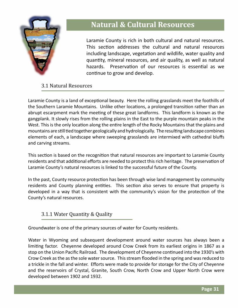
Natural & Cultural Resources
Laramie County is rich in both cultural and natural resources. This section addresses the cultural and natural resources including landscape, vegetation and wildlife, water quality and quantity, mineral resources, and air quality, as well as natural hazards. Preservation of our resources is essential as we continue to grow and develop.
3.1 Natural Resources
3.1.1 Water Quantity & Quality
Groundwater is one of the primary sources of water for County residents. Water in Wyoming and subsequent development around water sources has always been a limiting factor. Cheyenne developed around Crow Creek from its earliest origins in 1867 as a stop on the Union Pacific Railroad. The development of Cheyenne continued into the 1930’s with Crow Creek as the as the sole water source. This stream flooded in the spring and was reduced to a trickle in the fall and winter. Efforts were made to provide for storage for the City of Cheyenne and the reservoirs of Crystal, Granite, South Crow, North Crow and Upper North Crow were developed between 1902 and 1932.
Page 31

Development and the growth of Cheyenne have continued through the 19th and 20th century and into the 21st century. This continued growth and development has required a constant and increasing supply of water. The 30’s and 40’s saw a boom in the population of the City of Cheyenne. The City, with the newly formed Board of Public Utilities (BOPU), looked to supplement their water supply. During this time in history ground water and a series of wells were added to the city water resources.
Natural resources at Curt Gowdy State Park. “River and Rocks” by Chrissy Konegi Burney.
By the 1960’s it became apparent that there was a need for additional water sources for the City of Cheyenne. No more water was available for appropriations in the Laramie and North Platte Rivers leaving the city no choice but to look further west. During this time and into the 80’s city and state officials worked out an agreement to trade water in the Little Snake River for water in Douglas Creek. This trade agreement and water transmission system allows water from Douglas Creek to be transported into Crow Creek and added to the supply for the City of Cheyenne.
While the supply for the City of Cheyenne appears to be stable for the next 20 years the demands of residents in Laramie County continue to increase. Rural irrigated crop development in Laramie County has relied on groundwater appropriations. The Wyoming State Engineer recognized the need for an orderly system of developing and utilizing groundwater in Laramie County since 1939. In 1945 groundwater appropriation began to be regulated. The early 50’s brought recognition from state agencies that the draw-down of underground aquifers needed to be studied and monitored. The late 60’s and 70’s saw the implementation of permitting requirements for domestic and stock wells. The 70’s also saw the need to form an eastern Laramie County Groundwater Control Area. This control area has continued in existence in various levels up to present time. From 2000 to 2009 recognition of groundwater declines were increasingly apparent. In 2012 the State Engineer’s Office adopted well spacing requirements in the Laramie County Control Area (LCCA). Also in 2012 the State Engineer’s Office (SEO) contracted with AMEC Environment and Infrastructure and Hinckley Consulting and HDR to do a Hydro-geologic study of the LCCA. The AMEC report was completed in March of 2014 and offers recommendations to the SEO.
According to the AMEC report three main areas, within the LCCA, where groundwater levels have experienced significant declines. Pine Bluffs, Carpenter, and Albin areas have all experienced
Page 32

declines due to the long term impacts of large scale irrigation uses of the aquifer which began in the late 1960’s and early 1970’s. Increasing development from residential, commercial and municipal have also contributed to drawdown of the aquifers. A number of management strategies have been suggested to address these areas where long term decline is expected. These strategies include voluntarily reducing the demand of water consumption by metering wells, land fallowing and a continued support of new technologies and conservation practices that more efficiently utilize the available water. The full Hydrogeological Study of the Laramie County Control Area is available at the State Engineer’s office: https://sites.google.com/a/wyo.gov/seo/home.
In 2012, the State Engineer’s Office (SEO) issued temporary orders which restricted well spacing and set limitations for new groundwater applications in the LCCA. This temporary order was extended until April 1, 2015 at which time a new order was issued to guide the groundwater development in the LCCA until 2020. The latest order identifies four areas in the LCCA: the Drawdown Area, Conservation Area, Unaffected Area, and Underlying Units. The order requires meters for all wells other than domestic and stock wells. It also stipulates well spacing for all new wells, and allows wells in the deeper Underlying Units to be developed within spacing and metering requirements. Drawdown limits will be in effect and monitored by the SEO. This order will be in effect for a period of at least five years.
The SEO and Laramie County Board of Commissioners have taken this study further and formed the Laramie County Control Area Steering Committee. This committee is tasked with developing a groundwater management plan to locally manage, and protect and conserve groundwater resources in a long-term sustainable, economical, and equitable manner. The group has been meeting since 2014 and no immediate solutions are anticipated. However, any future adopted policy from this group should be taken into account when developing in the county.
Maintaining the quality of these resources is essential to the wellbeing of Laramie County residents. The State, County, and City are working together to address water quality issues in Crow Creek. Groundwater quality contamination sites consist of two Atlas Missile sites and two
Windmill and aeromotor full moon near Old Yellowstone Road, October 2014. Photo by Dana Gage
Page 33

3.1.2 Mineral Resources
The first documented discovery of oil came in 1832 near present day Lander. The first oil well in Wyoming was drilled near Lander on 1884 and the first Wyoming oil refinery was built in 1895. Since its early beginnings in the 1800’s the oil industry in Wyoming has grown and produced 75.6 million barrels of crude in 2014 and has an estimated 955 million barrels in reserve.
In 2001, Laramie County produced 342,825 barrels of oil and 227,660 million cubic feet of natural gas. This oil production amounted to .597 % of the State of Wyoming’s oil production and .014% of the states’ gas production. By 2015 these numbers have increased to 4,579,185 barrels of oil, 5.75% of the States total output and 3,576,664 million cubic feet of gas, .20% of the State’s total gas production.
Oil drilling operations in Laramie County, 2010, by Roy Kroeger.
Laramie County has experienced a large amount of mineral exploration and development from 2001 to 2015. New technologies in the industry have unleashed the potential for production from oil reserves located many miles under the surface. The advancement of horizontal drilling and hydraulic fracking techniques have accounted for this huge increase in production. Hydraulic fracturing is a procedure of injecting a pressurized compound of water, sand and additives into the well boring thus opening up tiny fractures in the formation and thereby allowing the trapped oil and gas to flow more freely out.
Horizontal drilling is a procedure whereby the well is drilled vertically and then the boring can be steered horizontally into the desired formation. This horizontal drilling can continue for several thousand feet in the producing formation, and greatly increases the oil and gas yield from each well. Improvements and new technologies have allowed the capture and production of oil and gas reserves that were previously too deep in the earth’s surface to extract economically.
military sites in the County. The Army Corps of Engineers is working with local interest to clean up these sites. The Board of Public Utilities has added a recycled water system for the irrigation of parks throughout the City to offset the use of freshwater. The BOPU finished the Sherard Water Treatment Plant in 2002 which can treat up to 32 million gallons of water per day.
What this means for Laramie County is there are limited sources of water for multiple users. New technologies in water conservation and reclamation shall be encouraged as the County progresses in the future. The development and exploration of new sources is encouraged, along with the monitored and careful use of this precious resource.
Page 34

The recent improvement in and discovery of oil reserves deep within Laramie County in the Niobrara and Codell formations has paved the way for increased oil activity in the county. The Niobrara Shale Formation is a fractured shale rock in which oil and gas can be found below the surface of the earth at depths of 3,000 to 14,000 feet. The Codell Sand Formation lies beneath the Niobrara formation in an ubiquitous layer of sandstone underlying the Denver / Julesburg (DJ) basin and is proving to contain vast reserves of oil. The Niobrara and Codell formations located in Laramie County are both formations in the DJ Basin which encompasses northern Colorado western Nebraska and southeast Wyoming. This oil shale play is being compared to the Bakken Shale Basin in North Dakota.
Laramie County had 148 oil producing wells in 2001 and by 2015 these numbers had increased to 296.
Map # 8: Mineral Production
Illustrates Sections of Land that contain drilling permits issued by the Wyoming Oil and Gas Conservation Commission. The map allows a visual representation to show areas of concentration and impact in Laramie County.
Oil drillers in Laramie County, 2012.Photo by Barbara Kloth
Map # 9: Well Permits by Year
Shows wells by year permitted though the Wyoming Oil and Gas Conservation Commission.
Once the oil is brought to the surface, a means of transportation is required. This industry has developed infrastructure and routes to transport oil to processing plants, and includes truck transport, pipelines, pipeline transfer stations, and railcar transfer stations. Oil is currently both processed in, and exported from Laramie County. Laramie County has also experienced development in oilfield related businesses that are necessary in the exploration, extraction, production and transportation of the oil related products.
Laramie County experienced a very short lived oil boom then falling oil prices in late 2015. However, the pieces are in place and the potential is proven to have a substantial impact on the face of Laramie County. The Niobrara oil play and the resulting development and future development have the potential to play a significant part in the future of Laramie County.
Page 35

")D
")D")")D")
")
")")")
")
")")
")")")")")
")")
")")")
")
")") ")")")")")")D")")")")")")") ")")XWXWXWXWXWXWXWXWXW")")
")D")D")D")D
")
")
")D")")D")D")")")XWXWXWXWXWXWXWXWXWXWXWXWXW
")
")")")")")")")")XW")")")")") ")")")")")")")")")")")")")")")")")")")")") ")")")")")")")")")")")")")")")")")
")D XW")D")")")XWXWXWXWXWXWXWXWXWXWXWXW")DXW")DXW")D")DXWXWXW")")
")")")")") ")")")")")")")")D")D")D")D")D")D")D")")")")D")")")")")
")")")D")")")") ")")")")")")")") ")")
")")")D")")")") ")")")XWXWXWXWXWXWXWXWXWXWXWXWXW ")")")")") ")
")D")
")D")D
")")")")")
")")")")")")")")
XWXWXWXW
")")")")")")")") XWXWXWXWXWXWXW")D
")D
")D")
")D")D")")D")D")")")")
")")")XWXWXW ")")")")")") ")")") ")")")")")")")")")")")")")")")")") ")")")")")")")")")")")")")")")")")")")")")")")")")")")XWXWXWXWXWXWXWXWXWXWXWXWXWXWXWXWXWXWXW")")") ")")")")")
")")") ")")")
") XWXWXWXWXWXWXWXWXWXWXWXWXWXWXWXW ")")")")")") ") ")")")")")")")XWXWXWXWXWXWXWXWXW")")
")D")")")")")")")")")") ")")")")")")")")")")")")")D
")")")")")") ")")")")")")")")")")")")")")")")XWXWXWXWXWXWXWXWXWXWXWXWXW")D")D")D")D")D")D ")D")")")")")")")")")")D ")")D")D")")")")")")")")")")")")")")
")
")")")")")")")")")")")")")")")")")")D")")")
")D")D")D
")")")")")")
")D
XWXWXW ")D")D")D")D")D")D ")D")D")D")D")D")D")D")")")")")")")")D")")")")")
")")")")")")XW")
")")")")")") ") ")XW")XWXWXW
")")")")")")")")")")")")")")
")")")")")")")") ")")")")") ")")")")")")
")
")
")")")")")")")")")D
")")")")")
")")")D")")")D")D
")")")")")")")D")")")")")D")")")")")")")")")")XW")")")")")")")")")")")")
")")")")")")")")")")XW")") ")")")")")")")")")")")")XW
")D")D")D")D")D")D")D")D")D")D")D")D")D")D")D")")")D")D")D
")D
")D")")")")D")D")D")D")")D")D")D")D")D")D")D")D")D")D")D")")D") ")D") ")D")") ")D ")")")")")")")")")")")D")")")D")")")")")")")")")")")D") ")")")")") ")")")")")") ")")")")")")")D")D")D")D")")")")")
")
")")")")")")")")")")")")")")")")")")")")")")")")")")")")")
")D")D
")D
")D")D ")")")")")")")")")")") ")")")") ")")")")")")")")")
")")")")")")")")")")")")")")")")")")")")")")")") ")")")
")D")")D")")")D
")D")")D
")D")D")D
")D
")D")D
")")")")D ")D
")D")D") ")")")")")")
")")D
")")D
")")D
")D")D")D")D")D")D")D")D
XW ")")")")")")XWXWXWXWXWXWXWXWXWXWXW")")")")")")")
")")")") ")")")")")")")")") ")")")")
")")")")")D
")")XWXW")") ")")")
")")")")")")")")")
")")")")")")")")")")")")")")")")")")")XW")")")")")") ")XW")")XW")XW")XW")XW")")")XWXWXWXW")")")")")")")") ")")")")XW")")")")") ")")")")")")")")") ")")")")")")")")")")")")")")")")")")")")") ")D")D")D")D")D")D")D
")")D
")")") ")")")")")")")")")")XWXWXW")")")")")")")")")")")
")")") ")")
")")")")")")")")")")
")D")D")")D")D")D
")")")")")")XWXWXWXWXWXW") XWXWXW")XWXWXWXW")XWXWXWXWXWXWXWXWXW
")D
")")XWXWXW")")")")")")")")")")")")")")")")")")
XW")")")")XW")XW")XW")
XWXWXWXWXWXWXWXWXWXWXWXWXW")")")")")")")")")")")")")
")")")")")")")")")")")")")")")")")")")")")")")")D")
")D")
")
")
")
")
")")")") ")")")")D")")") XWXWXWXWXWXWXWXWXWXWXWXWXWXWXWXWXWXWXWXWXWXWXWXWXWXW
")")")")")")")
")")")")")")")")")")")")
")")D
")D")D")D")D")D")D
")")")
")")")")")")")") ")")")")") ")")")")")")") ")")")")")")")")")") ")")")")")")")")")")")")
")")")")")")") ")")")")")")") ")D")D")D ")D")D")DXW")D ")D")D")DXW
") ")")")")")")
")D")D")D")D")
")")")
")")D")")")")") ")
")")")")")")")")")
")")")")
")
")")")")")")")")")")")")")")")
")")
")")")")")")")D")
")
")")")")
")
")")")")")")")")")")
")
")
")")")")")")")")")D")D
")D")D")D")D
")D
")D ")D")D")D")D")D")
")D")D")D")")")")")")")")")")")")")")")")")")")")")")")")")")XWXW")")")")")")")")")")")")")")
XWXWXWXWXWXWXWXWXW")")") ")D")D")D")D")D")D
")
")")")")")")")")")")")")")")
")")")")D")D")D")
")D")D")D")D
")")")
")
")
")")")
")")
")")D
")")")
")
")")XWXW
") ") ")")")")")")")")")")")")")")")") ")")")")")")")")")")")")") ")")")")")")")")")")")")")")")")")")")")")")")")")")")")D
")D ")D")D")D
")DXWXWXWXWXWXWXWXWXWXWXWXWXWXWXWXWXWXWXWXWXWXWXWXWXWXW")D")
") ")")")")")")")")")")") ")")")")")")") ")")XWXW")")")")")
")
XWXWXWXWXWXWXWXWXWXWXWXWXW ")") ")")
") XWXWXWXWXWXWXWXWXWXWXWXWXWXWXWXWXWXWXWXWXWXWXWXWXWXWXWXWXWXWXWXWXWXWXWXWXWXWXWXWXWXWXWXWXWXWXWXWXWXWXWXW")D
")D
")D
")XW")")")")")")")
")")")")")")")")D
")")
")")")")")")")")
")")")")")")") ")")")")")")")") ")D ")D ")
")")")")
")")")")")")
")")")")
")")")")")")")")")")")")
")")")
")")D")D")
")")D
")D")D
")D")D")D")D
")D")D")D")D
")")")")")")")")")")")")")
")")") ")
")")
")")")
")
")
")")")
")")
")")")")
")
")")")D")D
")D")D")D")D")D ")
") ") ")")")")")")")")")
")")
")")D
")D")
")
")
")
")")")")")") ") ")")D")")")")")D")D")D")")D")D")")")
")")")")")")")")")")") ")
")")
")")D")")XW")")")
")")")")")")D")D")D
")
")D")D
")
")")")")")")")
")
")
")
XWXWXWXWXWXWXWXWXWXWXW
")
XWXWXWXWXWXWXWXWXWXWXW")D
")D
")")")")
") ")")")")")
")
")")
")")")D") ")")")D")
")D
")D ")D")D
")D
BORIE
PINE BLUFFS
LINDBERGH EAST
CHIVINGTONSILO
HORSE CREEK
UNNAMED
GOLDEN PRAIRIE
Mineral Productions
June 2016
This map is made possible through the Cheyenne and Laramie County Cooperative GIS Program (CLCCGIS). The data contained herein was collected for its use and is for display and planning purposes only. The CLCCGIS will not be held liable as to the validity, correctness, accuracy, completeness, and/or reliability of the data. The CLCCGIS furthermore assumes no liability associated with the use or misuse of this information.
Source Information:CLCGISC, Wyoming Oil and Gas Conservation Commission
L A R A M I E C O U N T YComprehensive Plan 2016
Reported Well StatusUnreported (1,087)
XW Waiting on Approval (364)") Permit to Drill (1,153)") Active Injector (22)") Producing Gas (3)") Producing Oil (267)
")DInactive, Denied, Abandoned(278)Known Areal Fields (2012)
Administrative BoundaryIncorporated CommunityF.E. Warren A. F. B.Zoned Area
Street ClassificationsInterstateArterialCollector
Reference GridCounty LineTownship/Range LineSection Line
5 0 5
Miles
1:350,000°N
Map # 8

BORIE
PINE BLUFFS
LINDBERGH EAST
CHIVINGTONSILO
HORSE CREEK
UNNAMED
GOLDEN PRAIRIE
Well PermitsBy Year
June 2016
This map is made possible through the Cheyenne and Laramie County Cooperative GIS Program (CLCCGIS). The data contained herein was collected for its use and is for display and planning purposes only. The CLCCGIS will not be held liable as to the validity, correctness, accuracy, completeness, and/or reliability of the data. The CLCCGIS furthermore assumes no liability associated with the use or misuse of this information.
Source Information:CLCGISC, Wyoming Oil and Gas Conservation Commission
L A R A M I E C O U N T YComprehensive Plan 2016
Year Permit was Approvedby WOGCC
Prior to 2010 (149)2010 (26)2011 (31)2012 (23)2013 (39)2014 (125)2015 (1,022)2016 (1,343)Known Areal Fields (2012)
Administrative BoundaryIncorporated CommunityF.E. Warren A. F. B.Zoned Area
Street ClassificationsInterstateArterialCollector
Reference GridCounty LineTownship/Range LineSection Line
5 0 5
Miles
1:350,000°N
Map # 9

3.1.3 Landscape
The landscape of Laramie County is one of gradual transitions from grasslands to mountains. This landscape is complemented with escarpments, carving streams and rolling hills. The preservation of this wide-open landscape is interconnected with the County’s past and future heritage.
3.1.4 Vegetation
Grasslands are Laramie County’s primary vegetation. Intermixed in this community are woodlands of ponderosa pine, limber pine, and juniper. Foothills mountain grassland/shrubland occurs in the western portions of the County. The majority of the County’s grasslands are mixed-grass or short-grass prairie. Short-grass prairie consists primarily of blue grama and buffalo grass. Mixed-grass prairie is composed of needle-and-thread grass, western wheatgrass, blue grama, Sandberg bluegrass, threadleaf sedge, junegrass, Indian ricegrass, prickly pear cactus, scarlet globemallow, fringed sagewort, milkvetch, sand bluestem, prairie sandreed, and locoweed. Wyoming big sagebrush is also scattered throughout the County.
Map # 10: Vegetative Land Coverage
Depicts Primary Land Cover Classifications as determined as part of the Wyoming GAP Analysis project. Land Cover information can be helpful when looking at potential environmental impacts of developments
Wyoming homestead among the rolling hills. Photo taken east of Cheyenne in 2015 by Tracy Navarro.
The County’s elevation rises from 5,000 feet in the east to 8,500 feet in the west. The County is part of the Great Plains of Wyoming. Scattered through the County’s rolling plains are many escarpments formed by resistant bedrock, an important component of the County’s scenic landscape. Complimenting these landforms is the backdrop formed by the Southern Laramie Mountains. These general landscapes are comprised of smaller rolling hills, stream channels, outcrops and ridges.
Page 38

TN18
TN17
TN16
TN15
TN14
TN13
TTN12
TN13
TN14
TN15
TN16
TN17
TN18
TN19
TN19
R 65 W R 64 W R 63 W R 62 W R 61 W R 60 W
N
R 68 WR 70 W R 69 W R 67 W R 65 W R 64 W R 63 W R 62 W R 61 W R 60 W
12
R 70 W R 69 W R 68 W R 67 W R 66 W R 65 W
R 66 W
¬«211
¬«210
¬«213
¬«215
¬«214
¬«216
§̈¦25
§̈¦25
§̈¦25
§̈¦80
§̈¦80
£¤85
£¤85
BURNSPINE
BLUFFS
ALBIN
CARPENTER
CHEYENNE
HARRIMAN
ZONED AREA
Vegetative Land Coverage
February 2016
This map is made possible through the Cheyenne and Laramie County Cooperative GIS Program (CLCCGIS). The data contained herein was collected for its use and is for display and planning purposes only. The CLCCGIS will not be held liable as to the validity, correctness, accuracy, completeness, and/or reliability of the data. The CLCCGIS furthermore assumes no liability associated with the use or misuse of this information.
Source Information:CLCGISC, Wyoming Gap Analysis Project
L A R A M I E C O U N T YComprehensive Plan 2016
Land Cover Types (1994)Riparian
Forest-dominated riparianGrass-dominated riparianShrub-dominated riparian
ForestlandLimber pine and woodlandLodgepole pinePonderosa pine
Grassland and ShrublandMixed grass prairieShort grass prairieMesic upland shrubWyoming big sagebrushXeric upland shrub
FarmingClearcut coniferDry-land cropsIrrigated crops
OtherBasin exposed rock/soilHuman settlementsOpen water
Administrative BoundaryIncorporated CommunityF.E. Warren A. F. B.Zoned Area
Street ClassificationsInterstateArterialCollectorLocal
Reference GridCounty LineTownship/Range Line
5 0 5
Miles
1:350,000°NMap # 10

Wetlands and Riparian landscapes occur in the saturated soils along the streams of Laramie County. This habitat is critical to a portion of 80% of all native animals’ life cycles living in Wyoming (Knight, 1994). This productive habitat is also among the most rare, representing less than 2% of the County’s land area. These areas serve as travel corridor for many animal species. Shrub and forest dominated wetland/riparian communities are the prime habitats for white-tailed and mule deer and waterfowl. This highly vegetated zone provides important thermal cover that protects species from excessive temperatures. These habitats also filter and store water, helping to protect and distribute the County’s water.
Approximately twenty sensitive plant species are known or suspected to occur in the County. Specific information regarding these species can be obtained from the Wyoming Natural Diversity Database at the University of Wyoming. Among these species are two federally protected plants, the Colorado butterfly plant (found in sub-irrigated alluvium) and the Ute Ladies-tresses (found in riparian areas). Any occurrence of these species should be treated as an important natural resource deserving of avoidance and protection.
3.1.5 Sensitive Habitats
Laramie County is home to an abundance of wildlife. As we develop it is important to consider impacts to sensitive areas and historic trails. The habitat types present in the Laramie County Plan include open water, wetlands, grasslands, shrubland, riparian areas and forest. The dominant habitat is grasslands.
3.1.6 Wildlife
Depicts Wildlife Ranges as determined by the State of Wyoming Game and Fish. Wildlife included are Antelope, Big Horn Sheep, Elk, Mule Deer and White-tailed Deer. This is useful when looking at potential environmental impacts and potential transportation corridors for the animals that may be impacted by developing areas.
Map # 11: Wildlife Impacts
Left: Iron Mountain fox found North of Cheyenne, May 2011. Photo by Roy Kroeger.
Right :Snow bunny at Laramie County Fairgrounds. Photo taken December 2014 by Bridget Wilson.
Page 40

TN18
TN17
TN16
TN15
TN14
TN13
TTN12
TN13
TN14
TN15
TN16
TN17
TN18
TN19
TN19
R 65 W R 64 W R 63 W R 62 W R 61 W R 60 W
N
R 68 WR 70 W R 69 W R 67 W R 65 W R 64 W R 63 W R 62 W R 61 W R 60 W
12
R 70 W R 69 W R 68 W R 67 W R 66 W R 65 W
R 66 W
¬«211
¬«210
¬«213
¬«215
¬«214
¬«216
§̈¦25
§̈¦25
§̈¦25
§̈¦80
§̈¦80
£¤85
£¤85
BURNSPINE
BLUFFS
ALBIN
CARPENTER
CHEYENNE
HARRIMAN
ZONED AREA
ALLIS
ON D
RAW
CLEAR CREEK
NORTH FORK CROW CREEK
LIT
TLE BEAR CREEK
CHUGWAT
ER C REEK
M IDDLE CROW C REEK
MUD DY CR EEK
BEAR CREEK
LOD GEPOLE CREEK
SPRIN G CREEK
SO LODGEPOLE CREEK
DRY CREEK
ANTELOPE DRAW
DIA MONDCREEK
HORSE CREEK
DUCK CREEK
LONE TREE CREEK
CR OW CREEK
BUSHNELL CREEK
LITTLE HO RSE CREEK
NINEMILE DRA W
PORTER DRAW
SOUTH CROW CREE K
MIDD LE LODGEPOLECREEK
NORTH LODGEPOLE CREEK
CHI VINGT ON DRAW
CORLETT CREEK
CHILDS DRAW
MID
DLE H
ORSE CREEK
Wildlife Impacts
March 2016
This map is made possible through the Cheyenne and Laramie County Cooperative GIS Program (CLCCGIS). The data contained herein was collected for its use and is for display and planning purposes only. The CLCCGIS will not be held liable as to the validity, correctness, accuracy, completeness, and/or reliability of the data. The CLCCGIS furthermore assumes no liability associated with the use or misuse of this information.
Source Information:CLCGISC, Wyoming Game and Fish
L A R A M I E C O U N T YComprehensive Plan 2016
AntelopeCrucial Winter/Yearlong
Bighorn SheepWinter/Yearlong
ElkCrucial Winter\YearlongWinterWinter/Yearlong
Mule DeerCrucial Winter\YearlongWinter/Yearlong
Whitetailed DeerWinter/Yearlong
Administrative BoundaryIncorporated CommunityF.E. Warren A. F. B.Zoned Area
Street ClassificationsInterstateArterialCollectorLocal
HydrologyMajor Waterways
Reference GridCounty LineTownship/Range Line
5 0 5
Miles
1:350,000°NMap # 11
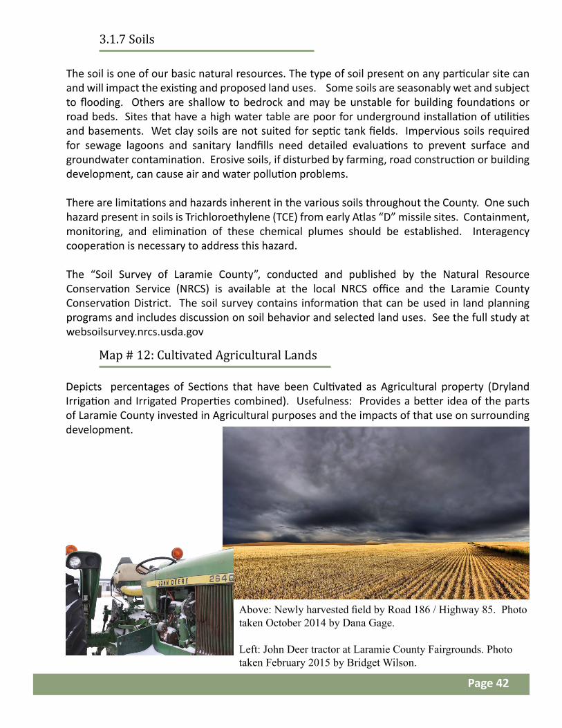
The soil is one of our basic natural resources. The type of soil present on any particular site can and will impact the existing and proposed land uses. Some soils are seasonably wet and subject to flooding. Others are shallow to bedrock and may be unstable for building foundations or road beds. Sites that have a high water table are poor for underground installation of utilities and basements. Wet clay soils are not suited for septic tank fields. Impervious soils required for sewage lagoons and sanitary landfills need detailed evaluations to prevent surface and groundwater contamination. Erosive soils, if disturbed by farming, road construction or building development, can cause air and water pollution problems.
There are limitations and hazards inherent in the various soils throughout the County. One such hazard present in soils is Trichloroethylene (TCE) from early Atlas “D” missile sites. Containment, monitoring, and elimination of these chemical plumes should be established. Interagency cooperation is necessary to address this hazard.
The “Soil Survey of Laramie County”, conducted and published by the Natural Resource Conservation Service (NRCS) is available at the local NRCS office and the Laramie County Conservation District. The soil survey contains information that can be used in land planning programs and includes discussion on soil behavior and selected land uses. See the full study at websoilsurvey.nrcs.usda.gov
3.1.7 Soils
Depicts percentages of Sections that have been Cultivated as Agricultural property (Dryland Irrigation and Irrigated Properties combined). Usefulness: Provides a better idea of the parts of Laramie County invested in Agricultural purposes and the impacts of that use on surrounding development.
Map # 12: Cultivated Agricultural Lands
Above: Newly harvested field by Road 186 / Highway 85. Photo taken October 2014 by Dana Gage.
Left: John Deer tractor at Laramie County Fairgrounds. Photo taken February 2015 by Bridget Wilson.
Page 42

TN18
TN17
TN16
TN15
TN14
TN13
TTN12
TN13
TN14
TN15
TN16
TN17
TN18
TN19
TN19
R 65 W R 64 W R 63 W R 62 W R 61 W R 60 W
N
R 68 WR 70 W R 69 W R 67 W R 65 W R 64 W R 63 W R 62 W R 61 W R 60 W
12
R 70 W R 69 W R 68 W R 67 W R 66 W R 65 W
R 66 W
¬«211
¬«210
¬«213
¬«215
¬«214
¬«216
§̈¦25
§̈¦25
§̈¦25
§̈¦80
§̈¦80
£¤85
£¤85
BURNSPINE
BLUFFS
ALBIN
CARPENTER
CHEYENNE
HARRIMAN
ZONED AREA
CultivatedAgricultural
Lands
March 2016
This map is made possible through the Cheyenne and Laramie County Cooperative GIS Program (CLCCGIS). The data contained herein was collected for its use and is for display and planning purposes only. The CLCCGIS will not be held liable as to the validity, correctness, accuracy, completeness, and/or reliability of the data. The CLCCGIS furthermore assumes no liability associated with the use or misuse of this information.
Source Information:CLCGISC, Laramie County Assessor, Laramie County Planning & Development
L A R A M I E C O U N T YComprehensive Plan 2016
Cultivated AgriculturalLandsPercentage of Section
1% - 25%26% - 50%51% - 75%76% - 100%
Administrative BoundaryIncorporated CommunityF.E. Warren A. F. B.Zoned Area
Street ClassificationsInterstateArterialCollectorLocal
Reference GridCounty LineTownship/Range LineSection Line
5 0 5
Miles
1:350,000°NMap # 12

Laramie County was ranked 10th in the “top 25 cleanest counties for year-round particle pollution” in the 2016 State of the Air study by the American Lung Association. Protection of this asset is important to the health and enjoyment of all the residents and visitors to Laramie County. The Wyoming Department of Environmental Quality has several programs in place to protect the Air Quality of Laramie County. Growth in the County could have an impact on air quality. Impacts include transportation-related sources, stationary sources of air toxins, including light industrial uses. Another source is emissions from fireplaces and wood-burning stoves. Developers should evaluate their proposals in relation to air quality issues and comply with current State and Federal air quality programs.
3.1.8 Air Quality
Natural hazards are areas subject to natural disturbance. Some of the many factors that can present significant risk to development are floodplains, soil constraints, landslides and slope. Other natural disturbances include wildfire, seismic events, radon, ground subsidence and expansive soils. These risks, as well as other potential risks to people and property, must be taken into account when development occurs. It is incumbent upon future developers to be aware of risks through additional studies for mitigation and community wildfire protection planning (CWPP) to eliminate risk of damage or injury to people or property. Developers must provide sufficient information to locate and understand the extent of all potential hazard areas.
3.1.9 Natural Hazards
This section provides a framework for identifying important open lands in Laramie County. Rather than attempting to pinpoint particular parcels or areas that should be prioritized for protection, this Plan suggests that all of the important resource areas identified in the Natural Resources section merit consideration for some type of protection. In some cases, these lands will remain open through continuation of the stewardship already being practiced by the current landowners. No further efforts are needed in these instances, with the possible exception of creating opportunities for landowners to take advantage of the tax and other benefits associated with conservation easements and other strategies that provide long-term assurance that the land will remain open.
The residents of Laramie County look at the open space as an integral piece of what makes Laramie County unique, especially compared to other places in the region.
With increasing frequency, however, economics or other considerations are likely to prompt the current landowners to convert important open lands to residential uses or other forms of urban development. An underlying goal of the County should be to provide other choices for landowners – choices that enable a landowner to realize a financial return or other benefits without having to sell off their property for urban development. A variety of approaches can
3.1.10 Open Space
Page 44
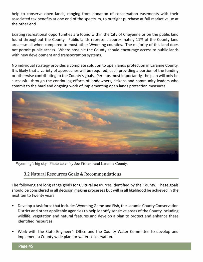
3.1.8 Air Quality
3.1.9 Natural Hazards
3.1.10 Open Space
help to conserve open lands, ranging from donation of conservation easements with their associated tax benefits at one end of the spectrum, to outright purchase at full market value at the other end.
Existing recreational opportunities are found within the City of Cheyenne or on the public land found throughout the County. Public lands represent approximately 11% of the County land area—small when compared to most other Wyoming counties. The majority of this land does not permit public access. Where possible the County should encourage access to public lands with new development and transportation systems.
No individual strategy provides a complete solution to open lands protection in Laramie County. It is likely that a variety of approaches will be required, each providing a portion of the funding or otherwise contributing to the County’s goals. Perhaps most importantly, the plan will only be successful through the continuing efforts of landowners, citizens and community leaders who commit to the hard and ongoing work of implementing open lands protection measures.
The following are long range goals for Cultural Resources identified by the County. These goals should be considered in all decision making processes but will in all likelihood be achieved in the next ten to twenty years.
• Develop a task force that includes Wyoming Game and Fish, the Laramie County Conservation District and other applicable agencies to help identify sensitive areas of the County including wildlife, vegetation and natural features and develop a plan to protect and enhance these identified resources.
• Work with the State Engineer’s Office and the County Water Committee to develop and implement a County wide plan for water conservation.
3.2 Natural Resources Goals & Recommendations
Wyoming’s big sky. Photo taken by Joe Fisher, rural Laramie County.
Page 45

Laramie County’s history is an account of emigration, settlement, and resource development inseparable from the natural landscape. Nomadic Indians hunting the great herds of buffalo, elk and bighorn sheep first occupied the County. The Louisiana Purchase of 1804 led to the arrival of explorers and Laramie County began to take its place in the path toward the West.
The Wyoming Basin provides one of the only natural passes through the Rocky Mountains and has been used for a route to the Pacific Northwest, California and Utah. In the 1860’s came the Transcontinental Railway facilitating the movement of travelers through the State. This railroad was built across Laramie County, climbing west from Cheyenne. The railroad, built on what is known as the ‘Gangplank’, is roughly parallel to the Cherokee and Overland Trails. Cheyenne and the County experienced economic and population booms during the railroad construction, gold rushes and mineral explorations (Lageson, 1988).
3.3 Cultural Resources
The following long range goal should be considered in decision making processes and will likely be achieved in the next 10 - 20 years.• Develop a Cultural Resources and Historic Preservation Plan for the County in conjunction
with the State Historic Preservation Office.
3.4 Cultural Resources Goals & Recommendations
Cheyenne Rail Plat. Photo by Jordan Evans
The Union Pacific Railway established communities like Pine Bluffs, once known as Rock Ranch. This community was one of the largest shipping points in the 1860’s as cattle were brought to market. Other towns like Burns and Egbert were also established by the railroad (Moulton, 1995).
This rich history provides residents with a unique identity. Events like Cheyenne Frontier Days provide an opportunity to reflect upon this shared heritage. Residents identify with the open spaces of the area created by the large agricultural presence in Laramie County. Similarly, the role of the forest to the west for timber, wildlife, livestock grazing, and water remains an important living cultural resource.
To protect the County’s historical heritage, the Wyoming State Preservation Office identifies important historic and archeological sites. The general locations of these resources are shown on Map 13. This map highlights the County’s rich history of emigration and settlement. The map highlights each square mile where a survey (less than 1 percent of the County’s acreage has been surveyed) has taken place and the significance of the resources found there. The most significant sites are on the National Register of Historic Places or are National Landmarks. These are sites where significant historical events occurred and are worthy of preservation.
Page 46

Section 3: Natural & Cultural Resources Goals & Recommendations
Goals Guiding Principles & Strategies Metrics
All development, including utilities, should be designed to protect natural, cultural, and historic resources and integrate into the landscape.
Water - To preserve, enhance and protect Laramie County’s surface and groundwater supplies.
• Develop County policies and regulations that promote water conservation in commercial and residential development.
• Encourage xeriscaping and other low water requirement landscaping in commercial and residential development and properties.
• Look into the possibilities of utilizing grey and recycled water in development projects.
• Encourage remediation of TCE within groundwater sources.
Hazards - To protect residents against the hazards of floodplains, excessive slopes, landslide areas and other geologic hazards including expanding soils.
• Determine specific threats and create mitigation policy.
• Include any requirements for placement in regulatory documents.
Was this done?
Was this done?
Was this done?
Page 47

TN18
TN17
TN16
TN15
TN14
TN13
TTN12
TN13
TN14
TN15
TN16
TN17
TN18
TN19
TN19
R 65 W R 64 W R 63 W R 62 W R 61 W R 60 W
N
R 68 WR 70 W R 69 W R 67 W R 65 W R 64 W R 63 W R 62 W R 61 W R 60 W
12
R 70 W R 69 W R 68 W R 67 W R 66 W R 65 W
R 66 W
!(
!(!(!(!(!(!(!(!(
!(
!(!(
!(
!(
!(!(
!(!(!(
!(!(!(!(
!(
!( !(
!(!(!(!(!(!(!(!(!(
!(!(!(
!(!(
!(
!(!(
!(
!(
")
")
")
!(
!(
")
")
!(
!(
")
!(
")
!(
!(
!(
!(
")
!(
")
!(
!(
!(
")
!(
!(
!(
!(
")
")
!(
!(
")
")
!(
")
!(!(")
!(!(
!(
!(
!(
")
!(
")
!(
") !(
")
")
!(
!(
")
!(
!(
")
")
")
")")
!( ")
")
")
!(
")
!(
")
")
#*
#*
McDonaldRanch
HyndsLodge
Crow Creek--ColeRanch HeadquartersHistoric District
RemountRanch
Pine BluffsHigh School
FT DAVIDA. RUSSELL
WYOMINGSTATECAPTIOL
UPRRDEPOT
GRANITECANYON
EMKAY
DURHAM
ALTVAN
BURNS(LUTHER)
ISLAY
ARCHER
BORIE
CAMPSTOOL
LINDBERGH
HARRIMAN
CORLETT
LYNCH
HILLSDALE
SPEER
SILVERCROWN
CARPENTER
EGBERT
TRACY
OTTOOZONE
PINEBLUFFS
FEDERAL
ARCOLA
TERMAINE
HORSECREEKSTATION
MERIDEN
ALBIN
JORDAN
ALTUS
MIDWAY
FARTHINGSTATION
IRONMOUNTAIN
UNDERWOOD
NORTH FORK CROW CREEK
ALLIS
ON D
RAW
CLEAR CREEK
C HUGWATER
C REEK
LITTLE BEARCREE K
MUDDY CREEK
LODGEPOLE CREEK
BEAR CREEK
SPRI NGCR
E EK
SO LODGEPOLE CREEK
DRY CREEKANTELOPE DRAW
DIAM ONDCREE K
HORS E CREEK
DUCK CREEK
LONETREE CREEK
CROWCREEK
BUSHNELL CREEK
LITTLE HORSECREEK
NINEM ILE DRAW
PORTER DRAW
MIDDLE LODGEPOLE CREEK
SOUTH CROW CREEK
NORTH LODGEPOLE CRE EK
CHIVINGTON DRAW
CORLETT CREEK
CHILDS DRAW
MID
DLEH
ORSE CREEK
TwinMountain
SaddlebackMountain
Historic &Cultural Resources
April 2016
This map is made possible through the Cheyenne and Laramie County Cooperative GIS Program (CLCCGIS). The data contained herein was collected for its use and is for display and planning purposes only. The CLCCGIS will not be held liable as to the validity, correctness, accuracy, completeness, and/or reliability of the data. The CLCCGIS furthermore assumes no liability associated with the use or misuse of this information.
Source Information:CLCGISC, City Engineers Office, State Hisoric Preservation Office,
Laramie County Planning & Development, Geospatial Hub
L A R A M I E C O U N T YComprehensive Plan 2016
Historical Places
!(HistoricalCommunities/Stops
") Ranch
!(National HistoricalLandmarks
!(National Register ofHistorical PlacesHistorical Districts
Historical TrailsExtent of Land Grants(Transcontinental Railroad)Emigration TrailsRailroads-AbandonedRailroadsApproximate Location ofRoads Established Prior to1900
Physical LandmarksBodies of WaterMajor Waterways
#* Mountain PeaksReference Grid
County LineTownship/Range Line
5 0 5
Miles
1:350,000°N
Map # 13

All residents of Laramie County depend on a number of different services that are provided by both the public and private sectors. These include water and sanitation, law enforcement, fire protection, education, storm water management, telecommunications, electricity and gas. As development occurs the capacities of water and sanitation services may need to be expanded; emergency response staff and equipment may need to be increased, as demands for services increase. In some cases, the physical capacity of a system may need to be expanded, such as a water storage tank or a sewage treatment plant. In other situations, additional services must be provided by adding equipment such as fire trucks or patrol cars. Additional staff may also be necessary to meet increasing demand, such as additional teachers, technical and administrative staff, and law enforcement officers. The following is a summary of the various public and quasi-public services that are provided throughout the County.
Community Services & Transportation
Residents, businesses, and visitors all depend upon efficient services and strong transportation networks. This Chapter discusses major County facilities and services including law enforcement, fire protection, medical facilities, parks and recreation, education, communications, drainage, and utilities. It highlights key elements of the County transportation network including goals and guiding strategies to ensure it remains efficient and effective
4.1 Community Services
Emergency Services ensure public safety and health by responding to different emergency situations. The level of emergency services in Laramie County depends on the location, with a higher level of service in the urban areas where development and population is more dense, as opposed to a lower level of service in the more rural areas.
The Cheyenne / Laramie County Emergency Management Agency, in coordination with Emergency Services, Combined Communications Center, Planning offices, County IT and Elected Officials, work to ensure all emergency, comprehensive and mitigation planning are conducted within Laramie County. The Combined Cheyenne/Laramie County Hazard Mitigation and Strategy Plan provides details on all potential threats and hazards within Laramie County, man-made and natural. This plan provides county officials with the tools and guidance needed to: mitigate potential hazards; react in the event of a disaster; and recover and mitigate future hazards including Community Wildfire Protection Planning (CWPP).
4.1.1 Emergency Services & Preparedness
Page 49

The Laramie County Sheriff’s Department is the primary law enforcement agency for the entire County. Cheyenne and Pine Bluffs have independent law enforcement services, and have entered into an interagency agreement with the Sheriff’s Department to support one another. The County operates a jail facility located in the City of Cheyenne, where all arrests in the County are processed and detained.
Laramie County Fire District #2 Training. Photo taken in Spring 2016 by Chief Jason Caughey.
The various municipalities or service districts in Laramie County provide public water and sanitation services. Outside these municipalities and districts, with a few exceptions, water and sanitation services are provided on an individual basis with domestic groundwater wells and small, on-site, individual wastewater systems (septic systems).
4.1.2 Water & Sanitation
Public education in Laramie County is provided by two school districts, and elected education boards oversee both school districts.
School District #1 serves the area from the western border of Laramie County to County Road 136. School District #1 encompasses Cheyenne and its outlying areas. In spring 2016, District #1 had 28 elementary schools, three junior high schools, three senior high schools and one alternative high school.
The portion of the County east of County Road 136 is in School District #2, and encompasses all other incorporated towns and outlying areas in Laramie County. This district administers four elementary schools, two junior highs, and two senior high schools. In both cases, the junior and senior high schools are combined into one facility.
4.1.3 Education & Libraries
Page 50
Nine fire districts serve Laramie County. The districts consist of volunteer fire fighters, paramedics, as well as limited paid staff. Fire protection and paramedic services in Laramie County are based on a “Mutual Aid” policy which allows the districts to support one another in the event of a large fire or catastrophic event. A new facility is currently in the design phase, for construction of a combined station for Districts 1 and 2 at the Archer Complex, located east on I-80. In addition, District 8 is designing a new six truck facility at the Gilchrist location.

The voters created Laramie County Community College on May 21, 1968, to help fill the need for academic, technical and community service/continuing education in Laramie County. The North Central Association of Colleges and Schools accredit the college. The campus occupies facilities situated on 271 acres in unincorporated Laramie County, located southeast of Cheyenne. Facilities consist of 22 modern buildings, with current projects underway.
The Laramie County Library System is the oldest continually operating county library in the nation. The system includes a central library in Cheyenne, branch libraries in Burns and Pine Bluffs, as well as a bookmobile and homebound services. The library houses over 275,000 print and audio-visual materials. In 2007, a new 100,000+ square foot, 3-story building was constructed, which offers meeting rooms, a computer center/training classroom, age-specific areas, and self-check stations. With more than double the space of the previous location, it has allowed for an expanded collection of books, audiobooks, movies, music and more.
Private sector companies provide telecommunication services, including landline and wireless systems. While the County is not involved directly in the provision of such services, land development and growth can have a significant effect on the quality and availability of services. In addition, counties and municipalities across the country are realizing that effective and state-of-the-art communication facilities are critical to economic development and quality of life. There is also limited fiber optic infrastructure in the Cheyenne area.
4.1.4 Communications
Two landfills provide for solid waste disposal in Laramie County. The Cheyenne Landfill, operated by the City of Cheyenne, is located west of Cheyenne along Happy Jack Road and serves the western two-thirds of the County including Cheyenne. The Burns Landfill, operated by the Eastern Laramie County Solid Waste District, is located north of Burns and serves the Towns of Albin, Burns, Pine Bluffs and the area encompassed by Laramie County School District #2.
4.1.5 Landfills & Solid Waste Management
Satellite farm near Cheyenne. Photo taken April 2016 by Teena Dorshorst Gering.
Page 51

High West Energy, headquartered in Pine Bluffs, provides electricity for the towns of Albin, Burns and areas outside of Cheyenne. Pine Bluffs is a municipal partner with seven other communities in the Wyoming Municipal Power Agency (WMPA), whose generation capacity comes from its ownership share of the Missouri Basin Power Project in Wheatland, Woming and Dry Fork Station, just north of Gillette, Wyoming.
Black Hills Energy serves approximately 41,000 electric customers and 36,000 natural gas customers in the greater Cheyenne, Wyoming area, with more than 1,200 square miles of certificated territory in southeast Wyoming including the City of Cheyenne and the towns of Pine Bluffs, Burns and Carpenter.
4.1.6 Utilities
Power line at sunset in rural Laramie County. Photo taken by Joe Fisher.
Parks and Open Space are an important piece of what makes Laramie County unique. As detailed in Chapter 4, Recreation Centers are identified for existing and future areas. While most of rural Laramie County does not depend on parks for active recreation, parks can provide an opportunity for urban residents and tourism. Opportunities to expand parks services within the County may include supporting the existing Board in expansion of park lands and facilities. The focus should be based on preservation of natural areas, efficient use of funds for construction and maintenance. This category also includes trails and related amenities. Residents identified equestrian multi-use trails being of interest in and around these hubs. Open Space is detailed in Chapter 3.1.10 of this plan. Public access and preservation of these areas is a priority.
4.1.7 Parks & Open Space
Evening moon glow at Lions Park, 2015. Photo by Tracy Navarro.
Page 52

Storm water management should be done on a site by site basis as development occurs. It is important that new development not create undue impacts to existing downstream properties.
4.1.8 Storm Water Management
The following are long range goals for Community Services identified by the County. These goals should be considered in all decision making processes and will likely be achieved in the next 10 - 20 years.
• Investigate new or alternative funding sources to assure community services provided by the County keep pace with the demand.
• Continue coordination among Laramie County law enforcement, Combined Communications, Combined Communications Advisory Board, Fire Chiefs, Information Technology, Emergency Management Agency, and Planning and Building to enhance efficiency and effectiveness of emergency response throughout the County.
4.2 Community Services Goals & Recommendations
Storm water management at Archer. Photo taken early 2016 by Barbara Kloth
Page 53
Map # 14: Community Services
Shows community services in Laramie County. Useful in identifying potential gaps in the system in relation to development patterns.

!
! !
!
!
!
!
! !
!!
!!
!!
!
! !
!
!
!
!
!
!
!
!
!!!
!
!
!!
!
!! !
!!
!!
!!
!!
!!
!!!!
!!
!!
!!
!
!!!!!!!!!
!!
!!
!!
!!
!!
! ! ! ! ! ! ! ! ! ! ! !!
!!
!!
!
!!!
!
!
!!
! ! !!
!!
! ! !!
!!
!!
!!
!!
!!
!!!!
!
!!!!!!!!!!!!
!!
!!
!!
!!
!!
!!
!!
! ! ! ! ! ! ! ! ! !
! !
!
!!
!
!
!!! !!
! ! ! ! ! ! ! ! ! ! ! ! ! !
!!
!!
!!
!!
!!!!!!!!!!!!!!!!
!!
!!
!!
!! !
!
! !
!!
!
!!!!!!!!!!!!!!!!!!!!!
!!
!!
!!
!
! ! ! ! ! ! ! ! ! ! !
!
! ! ! ! ! ! ! ! ! ! !!
!!
!
!
!
!!
!
!!!
!
! !
!
!
!
!
!
!
! !
! ! ! ! ! !
!!
!!
!!
!!
! ! ! ! ! ! ! ! ! ! ! ! !
!
! ! ! ! ! !
! ! ! !!
!!
!!
!!
!!
!!
!!
!!
!!
!!
!!
!
!!
!!
!!
!
!!
! ! !
!
!!
!!
!
!
!
!!
! !!!
!
!!
!
!
!!!
!
!
!!
!!!
!!
!
!!
!
!!!!!!!
!!
!!
!!
!!
!
!!!!!!!!!!
!!
!!
!!
!!
!!
!!
!!
!!
!!
!!
! ! ! ! !
!
!
!! !
!
!
!
! !
!! !
!
!!
!!
!!
!!
!!
!!
!!
!
!!!!!!!!!!!!!!
!!
!
!!!
!!!!!!!!!!!
!!
!!
!!
!!
! ! ! ! ! ! ! ! ! ! ! ! ! ! ! ! ! ! ! ! ! ! ! ! !
!
!
!
!
!
!!!!!!!!!!
!!
!!
!!
!!
!!
! ! ! ! ! ! ! ! ! ! !!
!!
!!
!!
!!
!
!
!
!!
!!
!
!
!!
!!
!
! !
! ! ! !!!
!!
!!
!!!!!
!!
!!!!!!!!!!!!!!!
!!
!!
!!
! ! ! ! ! ! ! ! ! ! ! ! ! ! !
!!
!!
!
! !
!!
!!
!!
!!
!!
!!
!!!!!!!!!!!!!!!!!!
!!
!!
!!
!!
!!
! !
!!!! !
! ! !
!
!
!!!
! !!
!
!
!!
!
!
!!
!
!!
!
!
!
!
!
!!
!
!
!
TN18
TN17
TN16
TN15
TN14
TN13
TTN12
TN13
TN14
TN15
TN16
TN17
TN18
TN19
TN19
R 65 W R 64 W R 63 W R 62 W R 61 W R 60 W
N
R 68 WR 70 W R 69 W R 67 W R 65 W R 64 W R 63 W R 62 W R 61 W R 60 W
12
R 70 W R 69 W R 68 W R 67 W R 66 W R 65 W
R 66 W
Þß
ÞßÞß
Þß
Þß
Þß
Þß
Þß
Þß
Þß
Þß
Þß Þß
Þß
Þß
Þß
Þß
Þß
Þß
Þß
Þß
Þß
Þß
Þß
Þß
ååå åå
å
å
å
å
åå
å
åå å
å
å
å
å
åå
åå
å
åå
å
åå
å
å
ååå
åå
å
å
å
ååå
å
å
å
å
å
å
¬«211
¬«210
¬«213
¬«215
¬«214
¬«216
§̈¦25
§̈¦25
§̈¦25
§̈¦80
§̈¦80
£¤85
£¤85
BURNSPINE
BLUFFS
ALBIN
CARPENTER
CHEYENNE
HARRIMAN
ZONED AREA
Community Services:Town HallCommunity CenterLibrary
Community Services:Town HallCommunity CenterBall ParkGolf CourseRodeo GroundsLibraryArcheology Center
Community Services:Town HallCommunity CenterRodeo Grounds
Community Services:City HallCommunity CenterBall ParksRodeo GroundsFair GroundsGolf CourseLibrary FD-5
FD-6
FD-10 FD-4
FD-2
FD-3
FD-8
FD-9
FD-1
Community Services
March 2016
This map is made possible through the Cheyenne and Laramie County Cooperative GIS Program (CLCCGIS). The data contained herein was collected for its use and is for display and planning purposes only. The CLCCGIS will not be held liable as to the validity, correctness, accuracy, completeness, and/or reliability of the data. The CLCCGIS furthermore assumes no liability associated with the use or misuse of this information.
Source Information:CLCGISC
L A R A M I E C O U N T YComprehensive Plan 2016
State ParkCurt Gowdy State Park
Fire Response ServicesÞß Fire Stations
!!
!
!Fire DistrictsEducation Serviceså Elementary Education
å Secondary Education
åElementary-SecondaryEducationSchool District #1School District #2
Administrative BoundaryIncorporated CommunityF.E. Warren A. F. B.Zoned Area
Street ClassificationsInterstateArterialCollector
Reference GridCounty LineTownship/Range LineSection Line
5 0 5
Miles
1:350,000°NMap # 14

Laramie County’s quality of life depends, in part, on the transportation network and the Community’s ability to travel easily between residences, employment, services and amenities. The community’s growth and development should be guided by proximity to existing public roads and rights of way.
4.3 Transportation
An inventory of the existing transportation system within the County is provided on Map 15.
In conjunction with the State highways, the County roadway system provides the dominant transportation network. A roadway network is comprised of a hierarchy of road types. Typically, roads serve two functions: access and mobility, and these define a road’s functional classification.
4.3.1 Existing Transportation System
Transportation heritage by Carpenter, WY in 2015 by Tracy Navarro.
Laramie County no longer accepts roads under a certain functional classification level for public maintenance. The majority of new roads built in rural Laramie County are therefore under private maintenance agreements. This can put additional burdens on landowners. It is critically important to encourage development that minimizes the need for additional roads and associated costs.
It is important in comprehensive planning to identify the functional classification of existing and proposed roads in order to plan for growth, as well as regular maintenance and engineering activities. Through classification of a roadway system, rights-of-way can be determined for acquisition purposes, or reserved for future roadway improvements. Classification also determines the spacing requirements for access points onto the roadway network.
Transportation Systems at Archer. Photo taken early 2016 by Barbara Kloth.
Page 55

• Interstate: Interstates 25 and 80 are at the highest level of road network, and provide for the high-speed movement of large volumes of traffic with minimum interference. Interstate routes are characterized by full control of access, divided roadways, and grade-separations at crossroads and railroad crossings.
• Arterials: These roads emphasize traffic flow over service to abutting land uses, and are designed to carry high traffic volumes with minimum interference related to adjacent land uses. This classification is frequently divided into major (or principal) and minor arterials.
• Collectors: These routes provide a lower level of traffic movement than arterials, usually with lower volumes and with trips of a shorter distance. Collectors connect local roads to arterials.
• Local: Local roads emphasize access to abutting property and usually have low volumes, low speeds, and short trip lengths.
• Platted, not built: These are locations where the road rights-of-way have been reserved, but the streets have not been constructed.
• Private: As indicated on Map 15, private roads are privately owned and are indicated on the map for address purposes.
4.3.2 Transportation System Functional Classification
Shows different types of Transportation Systems used in Laramie County. It shows the paths of Rail, Roads and Runways (Landing Strips). Usefulness: Transportation tends to have a strong influence on growth and land use patterns, specifically Commercial and Industrial uses. Railroad and Air transportation are more closely related to commercial and industrial activities than residential uses.
Map # 15: Transportation Systems
The following are long range goals for Transportation identified by the County. These goals should be considered in all decision making processes and will in all likelihood be achieved in the next 10 - 20 years.
4.4 Transportation Goals & Recommendations
• Expand existing transportation options to include more equestrian trails, bike lanes, pedestrian ways, and transit where appropriate.
Right: “Evelyn on her horse”, end of summer 2015 in Western Laramie County. Photo taken by Mark Slovik.
Page 56

Section 4: Community Services & Transportation Goals & Recommendations
Goals Guiding Principles & Strategies Metrics
Ensure that adequate community services are provided and available prior to new development occurring so as not to overburden existing services.
• Establish adequate levels-of-service standards for all necessary community services and infrastructure, including but not limited to emergency services, roads and schools.
• Develop an education and awareness program to be provide new and existing County residents a better understanding of the difference in level of services between urban and rural areas.
• Continue to seek funding to improve, enhance, and expand critical community services.
Was this done?
Emergency Services – Ensure adequate emergency services are available for new development. (fire, paramedics and law enforcement)
• At the time of subdivision and site development review, consult with emergency service personnel on the effect the development on the agency’s resources and to ensure adequate resources are available.
• Continue to expand the Community Wildfire Protection Plan (CWPP) with the intent to complete it for the entire County.
Communications - Promote and effective network of communication technologies throughout the County.
• Work with municipalities, private organizations, and public agencies to promote the extension of “state of the art” communication systems, including high speed Internet access, to all users in the County.
• Encourage the location of new and expanded communication systems in a manner that minimizes negative impacts on surrounding land uses.
Education - Ensure that adequate public educational facilities are provided concurrent with new development, may include dedicated school sites; cash-in-lieu of sites or innovative school agreements to facilitate financing of school construction.
• Encourage efforts to establish public and private higher education facilities in the County, including academic institutions, vocational-technical schools, and continuing education programs.
Page 57

Section 4: Community Services & Transportation Goals & Recommendations
Goals Guiding Principles & Strategies Metrics
Was this done?
Library - Support the Laramie County Library System’s commitment to provide free and easy access to the printed word, information and cultural enhancement, as well as promoting reading and literacy for children and adults.
Landfills and Solid Waste - To properly manage and dispose of solid waste generated throughout the County.
• Ensure that solid waste disposal facilities are planned, located, designed and operated in a manner that prevents air, water, noise and visual pollution.
• Require all solid waste facilities located within the County to be designed and operated in conformance with all applicable federal, State and local regulations.
• Encourage new residential subdivisions to provide adequate park and recreation facilities and open space necessary to serve the new residents.
• Support additional parks and open space access in the County.• Set standards for maintenance and seek funding opportunities.
Parks, Recreation and Open Space - To encourage the preservation of open space, the development of recreation opportunities, and public spaces.
Storm Drainage - Effectively manage stormwater runoff to protect lives and property.
• Require all new development to conform to the City of Cheyenne/Laramie County Stormwater Policy Design Standards and Regulations.
• Coordinate and cooperate with the municipalities in the design, construction, maintenance and management of storm drainage systems. Page 58

Section 4: Community Services & Transportation Goals & Recommendations
Goals Guiding Principles & Strategies Metrics
Was this done?Utilities - To accommodate the cost-effective and environmentally sensitive provision of public utilities in a manner that ensures adequate services to customers throughout the County.
• Coordinate with various utility providers on long-range land use planning and development efforts.
• Facilitate communication and the sharing of projections for the amount and location of new growth between landowners, developers and private utilities.
• Encourage the use of all energy resources including but not limited to electric, natural gas, petroleum, coal and alternative energy sources.
Transportation To improve, expand, and maintain the county road system in a safe, cost-effective manner.
• Prepare and maintain a County-wide Transportation Improvement Plan that will prioritize, on an annual basis, future road improvements, maintenance, and possible reclassifications of roads, as necessary.
• Coordinate with other municipalities and the State of Wyoming on transportation planning and network development.
• Investigate alternative methods for road surfaces and maintenance that are more cost effective and environmentally friendly.
• Look into alternative funding sources for road maintenance, upgrade and improvement.
Page 59

TN18
TN17
TN16
TN15
TN14
TN13
TTN12
TN13
TN14
TN15
TN16
TN17
TN18
TN19
TN19
R 65 W R 64 W R 63 W R 62 W R 61 W R 60 W
N
R 68 WR 70 W R 69 W R 67 W R 65 W R 64 W R 63 W R 62 W R 61 W R 60 W
12
R 70 W R 69 W R 68 W R 67 W R 66 W R 65 W
R 66 W
¬«211
¬«210
¬«213
¬«215
¬«214
¬«216
§̈¦25
§̈¦25
§̈¦25
§̈¦80
§̈¦80
£¤85
£¤85
BURNSPINE
BLUFFS
ALBIN
CARPENTER
CHEYENNE
HARRIMAN
ZONED AREA
!
!
!
!!
!
!
!
!
!
!
!
!
! !
!
!
!
!
!
!
!!
!
! !
!
!
!
!
! !!
!
!
!
!
!
!
!!
!
!
! ! ! ! ! !
!
!
!
!
!
! ! !
!
!
!
! !
!
!
!
!
!
!
!!
!
!
!
!
!
!
!
!
!
!
!
!
!
!
!!
!
!!
!
!
!
!
!
!
!
!
!
!
!
!
!!
!
!
!
!
!
!
!
!
!
!
!
!
!
!
!
!!
!
!
!
!
!
!
!
!
!
!
!
!
!
!
!
!
!
!
!
!
!
!
!
!
!
!
!
!
!
!
!
! !
!
!
!
!
!
!
!
!
!
!
!
! !
!
!
!
!
!
!
!
!
!
!
!
!!
!
!
!
!
!
!!
!
!
!
!
!
!
!!
!!
!
!
!
!
!
!
!
!
!
!
!
!
!
!
!
!
! !
!
!
!
!
!
!
!
!
!
! !
!!!
!
!!
!
!
!
!
!!
!
!
!
! !
!
!
!
!
!
!
!
!
!
!
!
!
!
!
!
!
!
!
!
!
!!
!
!
!
!
!
!
!
!
!
!
!
!
!
!
!
!!
!
!
!
!
!
!
!
!
!
!
!
!
!
!
!!
!
!
!
!
!
!
!
! !
!
!
!
o
o
o
TransportationSystems
May 2016
This map is made possible through the Cheyenne and Laramie County Cooperative GIS Program (CLCCGIS). The data contained herein was collected for its use and is for display and planning purposes only. The CLCCGIS will not be held liable as to the validity, correctness, accuracy, completeness, and/or reliability of the data. The CLCCGIS furthermore assumes no liability associated with the use or misuse of this information.
Source Information:CLCGISC, Laramie County Planning & Development
L A R A M I E C O U N T YComprehensive Plan 2016
Transportation SystemsRailroads
BNSFUnion Pacific
Streets SurfacesPavedDirt / Gravel
!! Primitive
Undeveloped Right of WayAir Traffic
o Landing Strips
Administrative BoundaryIncorporated CommunityF.E. Warren A. F. B.Zoned Area
Reference GridCounty LineTownship/Range Line
5 0 5
Miles
1:350,000°N
Map # 15
Of all the noticeable characteristics of a community that change over time, how the land is used is one of the most prominent. The existing land use pattern was described in Section 2 of this Plan, and shown on Map 3. The following Land Use Plan and related policies are intended to give direction to decision-makers, landowners and residents on the ever-changing land use patterns in the County.
The intent of the land use component of the Plan is to establish a set of general recommendations regarding future development in the County. An underlying assumption of the Future Land Use Plan is that most areas of the County can, and should, accommodate a mix of compatible, yet different, land uses and activities.
FUTURE LAND USES:The Future Land Use Map on page 68 identifies seven general land use areas:• Urban Rural Interface (URI)• Rural Metro (RM)• Rural Ag Interface (RAI)• Ag & Range Land (AGR)• Rural Center (RC)• Gateway Corridor (GC)• Recreation Hub (REC)
A number of factors were considered during the development of the Future Land Use Map. The primary determinants include:• Availability of public water and sewer;• Proximity to road and highway access; • Proximity to other urban services;• Historic land use and subdivision patterns; and,• General physical opportunities or constraints.
Land Use & Development
Development patterns affect everything from service times and costs, to changes in the character of a community. Priorities and the future land use plan are based on public input and values for Laramie County.
5.1 Introduction & Intent
Page 61

More dense development is encouraged along existing road networks, with the more dense uses closest to cities and less dense development moving outward into the rural areas of the County. However, where adequate services can be provided, limited, minor subdivisions may be appropriate in rural or agricultural areas. Additionally, the future land use plan and designations are not intended to supersede subdivision exemptions as laid out in Wyoming Statutes (W.S.) Title 18, Chapter 5.
The Future Land Use Plan Map is not a zoning map as discussed in the W.S. Title 18, Chapter 5. The Land Use Plan Map is not a final determination of approved or prohibited uses.
The following are long range goals for Land Use. These goals shall be considered in all decision making and will likely be achieved over a period of 10 - 20 years.
• Through collaboration with other agencies, work to resolve conflicting codes and requirements so that innovative site specific design can be embraced by the County.
5.2 Goals & Recommendations
Rather, it is a guide to landowners and decision-makers about the most appropriate land uses for different areas of the County.
The Land Use Plan Map does not pre-determine the best use for any given parcel of land. Instead, the map illustrates general areas of preferred intensity or density. By not pre-determining a preferred specific use, the Plan may allow more efficient and creative land use patterns in accordance with the written goals and strategies of the Plan. A principal assumption of this plan is that the private market is in a better position to determine the appropriate location of a use. However, the Plan advances the notion that adjacent land uses must be made compatible through careful design and mitigation of impacts, as well as observe natural resource, environmental, and physical constraints.
The use area boundaries are not intended to be rigid. In many cases, a parcel of land just outside a given use area has similar, if not the same, attributes as land within the adjoining higher intensity area. As land use decisions are made, including zoning, subdivision and the issuance of permits, decision-makers should determine if the general intent of the Comprehensive Plan can still be met even though a parcel might lie in a lower intensity area. It may be appropriate to accommodate higher intensity uses as long as the goals and policies of the Plan can be achieved and impacts addressed.
Urban Rural Development near Cheyenne city limits. Photo taken in April 2016 by Teena Dorshorst Gering.
Page 62

Section 5: Land Use & Development Goals & Recommendations
Goals Guiding Principles & Strategies Metrics
Accommodate and facilitate growth and development throughout the County in a manner that respects property rights, taxpayers, environmental constraints, the marketplace, and the community.
• Encourage private enterprise by limiting restrictions on development.
• Promote compatibility between land uses, striving to minimize potential impacts between different neighboring land uses.
• Amend Land Use Regulations to streamline the development process.
• Create a menu of items the County wants to see in developments and allow Developers to choose what is appropriate for their specific development instead of strict design standards.
• Amend Land Use Regulations to require buffering of new development when the proposed use is a higher intensity than existing uses.
Was this done?
Commercial - Accommodate adequate commercial office and retail space to meet current and future market demand while encouraging intensive office development in existing urban centers.
• Support and encourage the retention of existing businesses, and promote the expansion and diversification of new enterprises within the County.
• Encourage new businesses that will provide a variety of skilled employment opportunities.
• Encourage new commercial, office, and employment centers to locate within urban density areas in order that adequate public services can be efficiently provided.
• Locate major employment centers in areas that are easily accessible and convenient to the workforce.
Industrial - To accommodate new industrial development that provides jobs and is compatible with the character of the community.
• Encourage new businesses which provide a variety of skilled employment opportunities.
• Encourage the location of new industrial development near major transportation facilities, within urban development areas and outside gateway corridors. Page 63

Residential - Accommodate adequate residential development to meet current and future market demand, ensuring adequate services are available, while striving to protect open space, and the natural environment.
• Work with developers to identify the impacts of future residential developments upon the availably of water, sewer, road maintenance, emergency response, and schools. Encourage developments that lessen the identified impacts.
Section 5: Land Use & Development Goals & Recommendations
Goals Guiding Principles & Strategies Metrics
Was this done?
Agriculture - Protect agricultural production in the County to ensure land devoted to agricultural production and associated activities remains an integral/essential/valuable part of Laramie County’s economy, culture, heritage and landscape.
• Strive to maintain and enhance the viability of the County’s agricultural economy and its related resources.
• Promote a healthy agricultural community by supporting efforts to strengthen the agricultural economic base.
• Promote agricultural businesses related to ranching, livestock production and farming in areas outside of the urban density growth areas.
• Support programs that encourage landowners to preserve and enhance significant agricultural land and natural resource areas.
Gateways - Encourage high quality development at the major entries into the County and its communities in line with our shared heritage.
• Amend Land Use Regulations to create overlay districts for beatification and development standards.
Page 64

Urban Rural Interface (URI)The Urban Rural Interface areas identified in the Land Use Plan Map are intended to accommodate a mix of more intensive land uses than other areas. These areas may have public water and sewer services, a higher level of vehicular access, and a greater overall level of community services. Higher density residential, intensive commercial, employment centers and industrial uses are preferred in these areas. Large lot, low density residential or intensive agricultural uses are generally less suitable. While some of these areas may include existing agricultural uses, it is anticipated they are more service-oriented and may change and develop over time.
Adjacent jurisdictions should be involved in decision making in the URI. Large scale, high intensity development may necessitate extension of water and sewer services within these areas. Any extension of services should be encouraged with any development in the URI.
5.3 Future Land Use Designations
Rural Metro (RM)The Rural Metro area is located generally outside the Urban Interface of Cheyenne, and includes the areas within the Metropolitan Planning Organization (MPO) boundaries. Additionally, this area includes similarly developing properties in close proximity to the MPO district. Properties within this area are likely to develop on private, or small, shared water and septic and/or sewer systems. Where possible, shared systems and denser residential uses should be encouraged. Average residential developments may be 2.5 – 5 acres depending on availability of services. PlanCheyenne identifies specific uses for areas within the MPO boundary. The areas outside this may be a mix of residential and neighborhood oriented services, where buffering of dissimilar uses is essential.
Rural Ag Interface (RAI)Rural residential uses are primarily anticipated in these areas. Limited service commercial and retail uses are anticipated at major intersections. For example, a gas station, repair shops, lodging, and restaurants may be appropriate along a highway or interstate interchange when adequate buffering from adjacent residential uses is provided. Commercial uses should provide evidence they will not significantly impact surrounding residential uses. Density of uses shall be foremost based on availability and access to water.
Approaching storm in May 2014. Photo by Roy Kroeger.
Page 65

Development should be located on existing Rights-of-Way where possible. New ROW’s may be required for development; however, private maintenance agreements will be evaluated at time of application. Proximity to community and emergency services should be evaluated when development applications are submitted. Due to lengthy response times, existing topography, and limited reliable water resources, cisterns are encouraged in any development in an RAI area, as well as utilizing fire-wise planning.
Any new development in this area shall address water availability, public lands access, cultural resource preservation, and roads and connectivity. Future development in the RAI area should take into consideration minimizing impacts to view sheds and wildlife, especially in the western portion of Laramie County.
Ag and Range Land (AGR)The Ag and Range Land are outlying areas of Laramie County. These areas are far removed from the providers of public services and have relatively lower levels of road access. Primary uses are agriculture crop and livestock production, and associated residential uses. Freestanding residential uses, not associated with agricultural purposes, should be discouraged. Some areas with existing development may be appropriate for expansion, identified as rural centers. For example, the Harriman Road area in Southwestern Laramie County may be appropriate for additional residential uses and/or neighborhood services, keeping in mind that access to water may be difficult and expensive.
Any new development in this area shall address water availability, public lands access, cultural resource preservation, and roads and connectivity. Ensuring minimal impacts to view sheds and wildlife are especially critical in the western portion of Laramie County.
Rural Centers (RC)Rural centers are those areas where limited commercial and public services are available in outlying areas of the County. They may be historically developed along crossroads to serve the immediate residents, including farmers and ranchers. Uses may include gas stations, limited grocery services, post office, schools and emergency service stations (i.e. fire station). These areas include existing towns and developed intersections, as well as major intersections where future development is anticipated. Development in these areas should be considered at a scale appropriate to road access, water and sewer services, where accessible, and should include buffering or other methods to mitigate impacts to adjacent residential uses from commercial uses.
Gateway Corridors (GC)Gateways into the County and its communities help establish a first impression about the quality and character of each area. These gateways typically include highway-oriented development and high-quality development. Appropriate uses may include a mix of commercial, industrial, office, and public facilities. Additional signage and development standards may be appropriate in these areas. The view a traveler sees along the major highways in Laramie County establishes a lasting impression.
Page 66

Recreation Hubs (REC)Recreation Hubs provide a service to residents of Laramie County, as well as encourages investment through tourism. Public lands in the County are important to our heritage and should be maintained for public access and use. Four intensive recreation hubs were identified that may be appropriate for new and additional development: Curt Gowdy State Park, Belvoir Ranch, the Archer Complex, and Pine Bluffs recreation areas. Appropriate uses in these areas include fairgrounds, public parks and facilities, multi-use facilities, multi-use trails and learning centers. Funding sources for development and maintenance of these areas needs exploration.
Above: Baseball photo by Jordan Evans.
Right: Tired Cowboy taken at Cheyenne Frontier Days, 2008 by Roy Kroeger.
As described in this section, the future land use map includes suggestions to guide development and decision-making in the County. In some places more than one designation may apply.
Map # 16: Future Land Use Map
Page 67
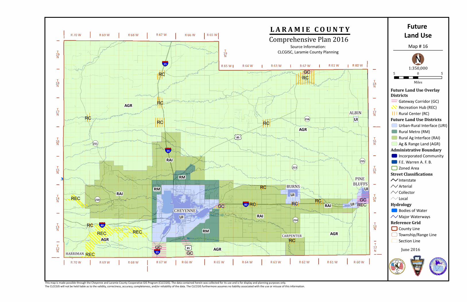
¬«211
¬«210
¬«213
¬«215
¬«214
¬«216
§̈¦25
§̈¦25
§̈¦25
§̈¦80
§̈¦80
£¤85
£¤85
BURNSPINE
BLUFFS
ALBIN
CARPENTER
CHEYENNE
HARRIMAN
ZONED AREARM AGR
UI
UI
UI
UI
RAI
RAI
RM
RM
RAI
RAI
UI
AGR
AGR
AGR
AGR
RECGC
GC
RC
RECREC
RC
GC RCRCREC
RC
RCRCRC
RC
RCRCGC
GCRECRC
Future Land Use
June 2016
This map is made possible through the Cheyenne and Laramie County Cooperative GIS Program (CLCCGIS). The data contained herein was collected for its use and is for display and planning purposes only. The CLCCGIS will not be held liable as to the validity, correctness, accuracy, completeness, and/or reliability of the data. The CLCCGIS furthermore assumes no liability associated with the use or misuse of this information.
Source Information:CLCGISC, Laramie County Planning
L A R A M I E C O U N T YComprehensive Plan 2016
Future Land Use OverlayDistricts
Gateway Corridor (GC)Recreation Hub (REC)Rural Center (RC)
Future Land Use DistrictsUrban-Rural Interface (URI)Rural Metro (RM)Rural Ag Interface (RAI)Ag & Range Land (AGR)
Administrative BoundaryIncorporated CommunityF.E. Warren A. F. B.Zoned Area
Street ClassificationsInterstateArterialCollectorLocal
HydrologyBodies of WaterMajor Waterways
Reference GridCounty LineTownship/Range LineSection Line
5 0 5
Miles
1:350,000°N
Map # 16

Wyoming Statutes 18-5-202 (b) and 9-8-301(c)
This Plan has been adopted pursuant to Wyoming Statutes 18-5-202 (b), which states “the planning and zoning commission may prepare and amend a comprehensive plan including zoning for promoting the public health, safety, morals and general welfare of the unincorporated areas of the County” and Wyoming Statute 9-8-301(c), which states “all counties shall develop a county-wide land use plan which shall incorporate the land use plans of all incorporated cities and towns within the county”.
Adoption & Updates
6.1 Legal Authority to Adopt a Plan
A Comprehensive Plan assists decision makers in the management and coordination of a community’s growth. It is important for the Comprehensive Plan to be updated to reflect changes as Laramie County grows and changes over time. This plan distinguishes between short term goals to be accomplished in the next five years and long term goals to be accomplished in the next ten to twenty years. This distinction is made with the intention of the Plan to be updated every five years to ensure continued alignment of goals and vision with community interests.
The Planning and Development Department shall be responsible for undertaking a series of public input sessions every 5 years. The focus of these sessions is to determine the continued accuracy of vision, goals, and policies within the Plan. Maps and data shall be updated. In addition, new technologies and best practices shall be included.
6.3 Updating The Plan
6.2 Resolution of Adoption
Recorded Resolution shown on next page.
Page 69

Page 70


Prepared by Laramie County Planning & Development