INTEGRATING INFORMATION FROM GEOLOCATORS, WEATHER RADAR, AND CITIZEN SCIENCE TO UNCOVER A KEY...
10
INTEGRATING INFORMATION FROM GEOLOCATORS, WEATHER RADAR, AND CITIZEN SCIENCE TO UNCOVER A KEY STOPOVER AREA OF AN AERIAL INSECTIVORE ANDREW J. LAUGHLIN, 1,11 CAZ M. T AYLOR, 1 DAVID W. BRADLEY , 2,3 DAYNA LECLAIR, 2 ROBERT G. CLARK, 4 RUSSELL D. DAWSON, 5 PETER O. DUNN, 6 ANDREW HORN, 7 MARTY LEONARD, 7 DANIEL R. SHELDON, 8 DAVE SHUTLER, 9 LINDA A. WHITTINGHAM, 6 DAVID W. WINKLER, 10 AND D. RYAN NORRIS 2 1 Department of Ecology and Evolutionary Biology, Tulane University, New Orleans, Louisiana 70118, USA; 2 Department of Integrative Biology, University of Guelph, Guelph, Ontario N1G 2W1, Canada; 3 Bird Studies Canada, Port Rowan, Ontario N0E 1M0, Canada; 4 Environment Canada, Saskatoon, Saskatchewan S7N 0X4, Canada; 5 Ecosystem Science and Management Program, University of Northern British Columbia, Prince George, British Columbia V2N 4Z9, Canada; 6 Behavioral and Molecular Ecology Group, Department of Biological Sciences, University of Wisconsin, Milwaukee, Wisconsin 53201, USA; 7 Department of Biology, Dalhousie University, Halifax, Nova Scotia B3H 4R2, Canada; 8 Department of Computer Science, University of Massachusetts, Amherst, Massachusetts 01003, USA; 9 Department of Biology, Acadia University, Wolfville, Nova Scotia B4P 2R6, Canada; and 10 Department of Ecology and Evolutionary Biology, Museum of Vertebrates, and Lab of Ornithology, Cornell University, Ithaca, New York 14853, USA A.—Determining the distribution of stopover and overwintering areas of migratory animals is essential for understanding population dynamics and building predictive models. Tree Swallows ( Tachycineta bicolor) are small songbirds that breed across North America. Data from Doppler weather radar and eBird indicate that Tree Swallow numbers increase throughout October and November in southeastern Louisiana, but then decrease during December. We thus hypothesized that southeastern Louisiana is a stopover area used by Tree Swallows during fall migration before they move to farther overwintering areas. We tested this hypothesis by attaching light-logging geolocators to Tree Swallows at five breeding sites spanning the species’ breeding range from British Columbia to Nova Scotia, and then tracking their fall migration routes, stopover sites, and wintering locations. Of individuals that returned in the following breeding season, birds from three breeding sites (Saskatchewan, Wisconsin, and Ontario) used southeastern Louisiana as a stopover site. Arrival date and duration of stay closely matched observations from both eBird and radar data. From Louisiana, most Tree Swallows continued their migration to one of three wintering sites: peninsular Florida, the Bahamas, or the Yucatán Peninsula, whereas two birds remained until spring within km of the stopover area. Our results () suggest that southeastern Louisiana is an extended stopover site for Tree Swallows that originate from a wide geographic range on the breeding grounds; and () demonstrate how geolocators, combined with other sources of movement information, reveal habitat use throughout the annual cycle. Received December , accepted February . Key words: annual cycle, habitat use, migration, stopover sites, Tachycineta bicolor , Tree Swallow. Integración de Información de Geolocalizadores, Radares de Clima y Ciencia Ciudadana para Descubrir un Área de Parada Migratoria Clave de un Insectívoro Aéreo R.—Determinar la distribución de áreas de parada e invernada de los animales migratorios es esencial para comprender su dinámica poblaciona y para la construcción de modelos predictivos. Tachycineta bicolor es un ave canora pequeña que se reproduce a través de Norte América. Los datos de radares climáticos Doppler y de eBird indican que los números de T. bicolor aumentan durante octubre y noviembre en el sureste de Luisiana, pero luego disminuyen durante diciembre. Planteamos la hipótesis de que el sureste de Luisiana es un área de parada usada por T. bicolor durante la migración de otoño, antes de moverse hacia sitios de invernada más lejanos. Evaluamos esta hipótesis por medio de geolocalizadores livianos acoplados a individuos de T. bicolor en — 230 — e Auk 130(2):230-239, 2013 e American Ornithologists’ Union, 2013. Printed in USA. e Auk, Vol. , Number , pages -. ISSN -, electronic ISSN -. by e American Ornithologists’ Union. All rights reserved. Please direct all requests for permission to photocopy or reproduce article content through the University of California Press’s Rights and Permissions website, http://www.ucpressjournals. com/reprintInfo.asp. DOI: ./auk.. 11 E-mail: [email protected]
Transcript of INTEGRATING INFORMATION FROM GEOLOCATORS, WEATHER RADAR, AND CITIZEN SCIENCE TO UNCOVER A KEY...

INTEGRATING INFORMATION FROM GEOLOCATORS, WEATHER RADAR,
AND CITIZEN SCIENCE TO UNCOVER A KEY STOPOVER AREA OF
AN AERIAL INSECTIVORE
ANDREW J. LAUGHLIN,1,11 CAZ M. TAYLOR,1 DAVID W. BRADLEY,2,3 DAYNA LECLAIR,2 ROBERT G. CLARK,4 RUSSELL D. DAWSON,5 PETER O. DUNN,6 ANDREW HORN,7 MARTY LEONARD,7
DANIEL R. SHELDON,8 DAVE SHUTLER,9 LINDA A. WHITTINGHAM,6 DAVID W. WINKLER,10 AND D. RYAN NORRIS2
1Department of Ecology and Evolutionary Biology, Tulane University, New Orleans, Louisiana 70118, USA;2Department of Integrative Biology, University of Guelph, Guelph, Ontario N1G 2W1, Canada;
3Bird Studies Canada, Port Rowan, Ontario N0E 1M0, Canada;4Environment Canada, Saskatoon, Saskatchewan S7N 0X4, Canada;
5Ecosystem Science and Management Program, University of Northern British Columbia, Prince George, British Columbia V2N 4Z9, Canada;6Behavioral and Molecular Ecology Group, Department of Biological Sciences, University of Wisconsin, Milwaukee, Wisconsin 53201, USA;
7Department of Biology, Dalhousie University, Halifax, Nova Scotia B3H 4R2, Canada;8Department of Computer Science, University of Massachusetts, Amherst, Massachusetts 01003, USA;
9Department of Biology, Acadia University, Wolfville, Nova Scotia B4P 2R6, Canada; and10Department of Ecology and Evolutionary Biology, Museum of Vertebrates, and Lab of Ornithology, Cornell University, Ithaca, New York 14853, USA
A.—Determining the distribution of stopover and overwintering areas of migratory animals is essential for understanding population dynamics and building predictive models. Tree Swallows (Tachycineta bicolor) are small songbirds that breed across North America. Data from Doppler weather radar and eBird indicate that Tree Swallow numbers increase throughout October and November in southeastern Louisiana, but then decrease during December. We thus hypothesized that southeastern Louisiana is a stopover area used by Tree Swallows during fall migration before they move to farther overwintering areas. We tested this hypothesis by attaching light-logging geolocators to Tree Swallows at five breeding sites spanning the species’ breeding range from British Columbia to Nova Scotia, and then tracking their fall migration routes, stopover sites, and wintering locations. Of individuals that returned in the following breeding season, birds from three breeding sites (Saskatchewan, Wisconsin, and Ontario) used southeastern Louisiana as a stopover site. Arrival date and duration of stay closely matched observations from both eBird and radar data. From Louisiana, most Tree Swallows continued their migration to one of three wintering sites: peninsular Florida, the Bahamas, or the Yucatán Peninsula, whereas two birds remained until spring within km of the stopover area. Our results () suggest that southeastern Louisiana is an extended stopover site for Tree Swallows that originate from a wide geographic range on the breeding grounds; and () demonstrate how geolocators, combined with other sources of movement information, reveal habitat use throughout the annual cycle. Received December , accepted February .
Key words: annual cycle, habitat use, migration, stopover sites, Tachycineta bicolor, Tree Swallow.
Integración de Información de Geolocalizadores, Radares de Clima y Ciencia Ciudadana para Descubrir un Área de Parada Migratoria Clave de un Insectívoro Aéreo
R.—Determinar la distribución de áreas de parada e invernada de los animales migratorios es esencial para comprender su dinámica poblaciona y para la construcción de modelos predictivos. Tachycineta bicolor es un ave canora pequeña que se reproduce a través de Norte América. Los datos de radares climáticos Doppler y de eBird indican que los números de T. bicolor aumentan durante octubre y noviembre en el sureste de Luisiana, pero luego disminuyen durante diciembre. Planteamos la hipótesis de que el sureste de Luisiana es un área de parada usada por T. bicolor durante la migración de otoño, antes de moverse hacia sitios de invernada más lejanos. Evaluamos esta hipótesis por medio de geolocalizadores livianos acoplados a individuos de T. bicolor en
— 230 —
&e Auk 130(2):230!239, 2013" 0e American Ornithologists’ Union, 2013.Printed in USA.
&e Auk, Vol. , Number , pages !. ISSN -, electronic ISSN -. " by 0e American Ornithologists’ Union. All rights reserved. Please direct all requests for permission to photocopy or reproduce article content through the University of California Press’s Rights and Permissions website, http://www.ucpressjournals.com/reprintInfo.asp. DOI: ./auk..
11E-mail: [email protected]

APRIL 2013 — GEOLOCATORS UNCOVER KEY STOPOVER SITE — 231
that southeastern Louisiana is used primarily as a stopover site by Tree Swallows before individuals continue toward overwinter-ing sites. An alternative explanation is that Tree Swallows do not actually leave southeastern Louisiana, but that the sugarcane har-vest forces Tree Swallows to disperse to smaller roosts that are not readily visible on radar. To examine these hypotheses, we attached light-level geolocators to birds at five breeding sites across North America to track their fall migration routes, stopover sites, and wintering locations.
METHODS
Locating Tree Swallow roosts using NEXRAD Doppler weather radar.—Our study area in southeastern Louisiana for both radar and eBird data is a circle with a radius of km centered near Slidell, Louisiana, at the KLIX Doppler weather radar station (°#N, °#W). 0is circle covers all of southeastern Louisi-ana and much of southern Mississippi (Fig. A). We chose km radius as the cutoff because large swallow roosts are less easily detectable on radar beyond that distance. 0e United States has WSR-D radar stations throughout the country, continu-ously scanning the aerosphere for precipitation patterns. Birds, bats, and insects are often also detected in radar data (Kunz et al. , Chilson et al. a). 0e WSR-D program was in-troduced in the early s, and these data are archived and freely available online from the National Climatic Data Center (see Acknowledgments). In the nonbreeding season, many swallow species ascend at dawn from their nocturnal roosts in large num-bers into the aerosphere. Large swallow and martin roosts appear on morning Doppler weather radar as “ring-echoes,” an annu-lus (or semi-annulus) of pixels that expands with each successive sweep of the radar beam (Fig. A–C; Russell and Gauthreaux , Winkler ). Roost-rings expand until either birds descend be-low the altitude detected by radar or the density of birds becomes too low for detection by the radar beam.
We downloaded WSR-D Doppler weather data from the National Climatic Data Center for station KLIX in Slidell, Loui-siana, from October through April . We scanned radar data visually each morning during the hour following local sun-rise and noted suspected Tree Swallow roosts within the study area. Locations, habitat, and species composition for most of these roosts were verified by visiting the roosts. Although we did not visit each roost in person, roosts that were not visited displayed the roost-ring structure on radar that is diagnostic of Tree Swal-lows (i.e., speed of departure and shape of roost-ring) and were located in typical roosting habitat (Phragmites reed beds) known on the basis of eBird data to attract numerous Tree Swallows. For
cinco áreas de reproducción que comprenden toda el área de distribución reproductiva de la especie, desde Columbia Británica hasta Nueva Escocia, y rastreamos su ruta migratoria, sitios de parada y localidades de invernada. De individuos que regresaron en la siguiente temporada reproductiva, aves de tres sitios de reproducción (Saskatchewan, Wisconsin y Ontario) usaron el sureste de Luisiana como sitio de parada. La fecha de llegada y la duración de su estadía correspondieron de cerca con las observaciones de eBird y de los radares. Desde Luisiana, la mayoría de individuos continuó su migración hacia uno de tres sitios de invernada: la península de Florida, las Bahamas o la península de Yucatán, mientras que dos aves permanecieron a menos de km del área de parada hasta la primavera. Nuestros resultados sugieren que el sureste de Luisiana es un sitio de parada extendida para individuos de T. bicolor provenientes de un área geográfica amplia de la distribución reproductiva de la especie, y demuestran cómo los geolocalizadores, combinados con otras fuentes de información sobre el movimiento, permiten conocer el uso del hábitat a través del ciclo anual.
U influence population dynam-ics of migratory organisms requires knowledge of habitat use and movements throughout the annual cycle (Sherry and Holmes , Norris and Marra , Faaborg et al. ). Most studies describing migratory connectivity have focused on connecting breeding areas with primary overwintering sites (e.g., Chamber-lain et al. , Hobson and Wassenaar , Kelly et al. , Bou-let et al. , Norris et al. ). However, many migrant birds move between two or more stopover sites during their autumn and spring migrations (Moore ), and determining locations of stopover sites is a critical step for both conservation (Mehlman et al. ) and building population models to predict how mi-gratory animals will respond to environmental change (Warnock et al. , Sheehy et al. ).
For most small-bodied birds, we have information on use of stopover sites from only a limited number of long-term banding sites (e.g., Fransson et al. , Priestley et al. , D. F. DeSante et al. unpubl. data). Identifying stopover sites can be challeng-ing because of the difficulty of directly tracking individuals dur-ing migration. Furthermore, determining whether stopover sites are used by multiple breeding or nonbreeding populations re-quires information on movements across a species’ range. Recent advances in light-logging geolocators make it possible to follow daily movements of individuals throughout the annual cycle (e.g., Stutchbury et al. , Bairlein et al. , Fraser et al. ), pro-viding opportunities for identifying stopover sites and estimating how many breeding or nonbreeding populations use these sites during migration.
Tree Swallows are small (~ g) migratory birds that breed throughout much of North America (Winkler et al. ). Shortly after breeding, individuals aggregate in large nocturnal roosts that form near breeding grounds (Burney , D. R. Norris et al. un-publ. data). After to months, individuals migrate south to their wintering grounds, located along the Atlantic and Gulf coasts of southeastern North America, Mexico, Central America, and the Caribbean (Winkler et al. ), where they also form roosts, some of which contain well over million birds (Burney ). However, direct linkages among specific breeding, stopover, and wintering areas, as well as details of migration phenology, are unknown in Tree Swallows and most other songbird species.
Here, we use citizen science (eBird) records and weather ra-dar to show that Tree Swallows arrive in the lower Mississippi Val-ley in southeastern Louisiana en masse in October and November, use abundant sugarcane fields as roosting habitat, and then appear to significantly decrease in number after the sugarcane harvest, migrating out of the area toward their main overwintering sites. On the basis of these observations, we examine the hypothesis

232 — LAUGHLIN ET AL. — AUK, VOL. 130
each radar scan in which a roost-ring appeared, we drew a circle around the roost annulus (or semicircle) using a Web-based ap-plication (developed by D.R.S.). 0e application automatically cal-culates the radius, latitude, and longitude of the center of each roost-ring. Although estimating numbers of birds within Doppler weather-radar scans remains problematic (Russell and Gauth-reaux ; but see Chilson et al. b), we used the maximum detectable radius of the expanding roost rings as an index that is
positively related to roost size. However, we do not yet understand the precise relationship between roost size and maximum radius, which may be nonlinear. For each roost, we calculated the maxi-mum detectable radius, and for each day that roosts appeared, we summed the maximum detectable radii of all roosts.
Estimating bird distribution using eBird records.—eBird is a citizen-science-based program run jointly by the National Audu-bon Society and the Cornell Lab of Ornithology that collects bird
FIG. 1. (A) Map showing study area in Louisiana. Black circle is study area for radar and eBird data: a circle of radius 175 km centered at KLIX radar station near Slidell, Louisiana (black dot at center of circle). Red dots are sugarcane roosts, green dots are wetland roosts, blue line is Mississippi River, and brown area is approximate extent of sugarcane production in study area. (B–E) Example of successive Doppler radar images from station KLIX on 1 November 2010 in the hour following local sunrise. (B–D) Emergence and subsequent expansion of five Tree Swallow roosts (successive panels are ~20 min apart). (E) The same scan as panel D, but showing the manually added circles over roosts from which we calculated roost radii. Roosts are (from west to east) Baton Rouge, Plattenville, Vacherie, Edgard, and Luling.

APRIL 2013 — GEOLOCATORS UNCOVER KEY STOPOVER SITE — 233
observations. eBird is a repository of tens of millions of bird sight-ings submitted by birders around the world (Wood et al. ), and millions of new observations are submitted every month. 0us, this resource reflects spatial and temporal patterns of the distribu-tion and abundance of birds. We downloaded eBird data from the Avian Knowledge Network (see Acknowledgments) from – for the same study area from which we analyzed radar data. We calculated the proportion of eBird reports submitted each day that included Tree Swallows, a value we refer to as “frequency.” Fol-lowing Hurlbert and Liang (), we used frequency of Tree Swal-low reports rather than abundance of Tree Swallows to reduce bias that may be introduced by the sighting of extremely large roosts. For example, an observer visiting a large roost site in the morning or evening may submit an observation of million Tree Swallows, whereas an observer in the same area of more dispersed foraging birds during the day may report much smaller numbers. A linear re-gression of frequency of Tree Swallow reports versus total number of reports (r < ., F = ., df = and , P = .) verified that the total number of reports submitted to eBird does not influence the frequency of Tree Swallow observations within those reports.
Geolocators.—In summer , we deployed geolocators (Lotek Wireless model MK-S, with -mm light stalk) on adult Tree Swallows (n = ) at five breeding sites across North Amer-ica: Wolfville, Nova Scotia (°#N, °#W; n = ); Long Point, Ontario (°#N, °#W; n = ); Saukville, Wisconsin (°#N, °#W; n = ); Saskatoon, Saskatchewan (°’N, °’W; n = ); and Prince George, British Columbia (°#N, °#W; n = ). We attached geolocators with a modified leg-loop backpack har-ness (Stutchbury et al. ), which had a combined mass of ≤. g (<% of body mass). Prior to deployment, we calibrated each geolo-cator in two distinct phases. Static (off-bird) calibration was used to identify changes in light sensitivity between the two periods before deployment and after retrieval the following year. For these calibra-tion periods, we placed geolocators on the roof of a building near the deployment site at Long Point, Ontario, and away from artifi-cial light for days in early June and again in July . Using a light threshold value of on the arbitrary scale of to used in BASTRACK software (British Antarctic Survey [BAS], Cambridge, United Kingdom), we determined that there were similar average sun elevation angles for the two periods (–.° pre-deployment, –.° post-retrieval). After geolocators were deployed on birds, we performed dynamic on-bird calibration for each bird for the period
after nesting and before migration when birds were still at or near their known breeding location but no longer using nest boxes (mean duration ± SD = ± days). 0e start of migration is defined here as a pronounced movement of ≥ km from the breeding site that resulted in another location in the same direction the next day. Sun angle values determined in this way more accurately reflected conditions during deployment by accounting for potential shad-ing effects caused by a bird’s behavior (Fudickar et al. , Liso-vski et al. ). We considered calibration on the breeding grounds (shortly after breeding) to be sufficient for the entire annual cycle because Tree Swallows generally roost in Typha marshes in both the breeding (Dunn and Whittingham ; but for western popu-lations, see Hayes and Cohen ) and nonbreeding season (pres-ent study). We used each geolocator-specific sun angle determined during dynamic calibration to plot estimated locations using BIRD TRACKER (BAS). On-bird sun angles ranged from –.° to –.° and resulted in a mismatch with true breeding locations by an av-erage . ± km in latitude (range: – km) and . ± km in longitude (range: – km). Geolocator positions during this period were accurate to within an average distance of . ± km.
Following visual inspection of twilight transitions in TRANSE-DIT (BAS) to remove obvious outliers caused by unusual shading events or behavior, we used live-calibration sun angles calculated for each geolocator to estimate birds’ latitude and longitude using mid-night locations. Because estimating latitude is problematic during the equinox periods, when day length is equal at all latitudes, we ex-cluded days on either side of the equinoxes (as in Fraser et al. ). To determine location probabilities (e.g., Bächler et al. ) during the main stopover and overwintering locations, we used the KDE and Isopleth commands in the Geospatial Modeling Environment (Beyer ) to produce % and % kernel density estimates.
RESULTS
Radar and eBird.—0e summed daily radii of all Tree Swallow roosts located on Doppler radar from October to April increased throughout October, peaked in mid-November, began to decrease in December, and remained low throughout the rest of the study period. October through December is the pe-riod in which eight roosts were located in sugarcane fields along the lower Mississippi Valley (Table and Figs. and ). By the end of December, sugarcane had been completely removed. Figure
TABLE 1. Location and duration of all Tree Swallow roosts as seen on Doppler weather radar station KLIX, Slidell, Louisiana, October 2011–April 2012.
Roost name Location
(latitude, longitude) Habitat Start date End dateDuration
(days)
Edgard 30.03, –90.53 Sugarcane field 11-Oct 20-Dec 70Vacherie 29.97, –90.80 Sugarcane field 12-Oct 9-Dec 58Luling 29.94, –90.39 Sugarcane field 12-Oct 20-Dec 69Lockport 29.62, –90.49 Sugarcane field 14-Oct 9-Dec 56Thibodeaux 29.73, –90.80 Sugarcane field 17-Oct 11-Nov 25Plattenville 30.02, –91.02 Sugarcane field 17-Oct 30-Nov 44Iberville 30.17, –91.16 Sugarcane field 17-Oct 18-Nov 32Baton Rouge 30.48, –91.27 Sugarcane field 17-Oct 5-Nov 19Pearl River S. 30.22, –89.59 Wetland 5-Nov, 29-Feb a 20-Nov, 16-Mar a 15, 17 aN. Pontchartrain 30.39, –90.17 Wetland 28-Dec 21-Feb 56Miss. Delta 29.36, –89.30 Wetland 9-Jan 20-Apr 101
a Roost appeared in November 2011, dissolved, and formed again in February 2012.

234 — LAUGHLIN ET AL. — AUK, VOL. 130
(R Development Core Team ). From these curves, calculated separately for increase and decrease in roost numbers, we calcu-lated the th percentiles of curves as arrival and departure win-dows, respectively. We calculated inflection points of arrival and departure curves to estimate mean arrival and departure dates from radar data and compared these to mean dates from geolo-cator birds. Mean arrival and departure dates from radar were October and November, respectively. Arrival and depar-ture windows were – October and October– December, respectively.
shows a vertical bar at December, after which no sugarcane roosts appeared on radar, and both roost radii and eBird frequen-cies decreased.
To correlate the arrival and departure of geolocator-bear-ing birds with changes in the aggregate number of Tree Swal-low roosts detected on radar, we fitted logistic curves to changes in the numbers of Tree Swallow roosts as seen on Doppler ra-dar from October through December. 0e curves were fitted us-ing the glm function in the stats-package of the R programming language by specifying a binomial distribution and a logit link
FIG. 2. Daily summed roost-ring maximum radii (left y-axis, blue circles) and averaged weekly frequency of eBird reports that contain Tree Swallows (right y-axis, red triangles), and their associated smoothing curves, October 2011–April 2012. Dashed red curve represents averaged daily eBird fre-quency of Tree Swallow reports for October–April, 2006–2010, on the same right y-axis scale. Shaded area represents duration of sugarcane roosts; roosts in the nonshaded area are in wetlands. Long-dashed vertical line represents mean arrival date for Tree Swallows with geolocators (20 October), and short-dashed vertical line is mean departure date for Tree Swallows with geolocators (22 November).
FIG. 3. Timeline showing the location and duration of Tree Swallow roosts that appeared on NEXRAD radar station KLIX in Slidell, Louisiana, October 2011–April 2012 (black bars are sugarcane roosts, light gray bars are wetland roosts), and the breeding-ground origin (SK = Saskatoon, Saskatchewan; WI = Saukville, Wisconsin; ON = Long Point, Ontario), geolocator number, sex, and approximate arrival, duration, and departure date of Tree Swal-lows fitted with geolocators that stopped over in southeastern Louisiana in 2011. The spring departure dates of two birds were masked by the equinox and are here faded to reflect this uncertainty.

APRIL 2013 — GEOLOCATORS UNCOVER KEY STOPOVER SITE — 235
though the Texas coast was closer because unusual sensor shading between the autumn and spring equinoxes is known to artificially increase latitude estimates in the Northern Hemisphere (Lisovski et al. ). Mean distance traveled to wintering locations after stopping over in Louisiana was , ± km.
Two male birds (geolocator nos. and ; Fig. ) remained within km of the stopover area for the rest of the winter. We did not include these birds in the calculation of mean departure date from the geolocator data. One bird moved slightly northeast
0e proportion of total eBird reports that include Tree Swal-lows (Tree Swallow frequency) also increased sharply during Oc-tober , peaked in early November , and began to steadily decrease throughout the rest of the winter and into spring (mean [± SD] number of reports submitted per week = ± ; Fig. ). Averaged weekly frequency of Tree Swallow reports for years (–; mean number of reports submitted per week = ± ) also shows a similar pattern of a peak in late October and early November and a gradual decline throughout the rest of win-ter (Fig. , dashed red line), which suggests that – was not an atypical year for eBird reports. Radar and eBird data were positively correlated (Pearson’s r = ., t = ., df = , P < .).
Geolocators.—We retrieved geolocators (%) in from the five deployment sites (Table ): of from British Columbia; of from Saskatchewan; of from Wisconsin; of from On-tario; and of from Nova Scotia. Of the Tree Swallows that returned with geolocators (Fig. ), (%) spent some time in south-eastern Louisiana during early winter before moving to their main overwintering site. 0ese birds originated from three breeding sites: of (%) from Saskatchewan, of (%) from Wisconsin, and of (%) from Ontario. Excluding one bird whose arrival date was masked by the equinox, mean (± SD) arrival date to Louisiana was October ± days, and mean departure date was November ± days (Fig. ). Eight of the birds that used southeastern Louisiana ar-rived within the – October arrival window as calculated from the radar data, and the mean arrival date for birds with geolocators was days earlier than the mean arrival date estimated from radar.
Nine of birds departed Louisiana during the sugarcane roost departure window, and the mean departure date of birds with geolocators was days earlier than the departure date estimated from radar. 0ese nine birds left Louisiana destined for three distinct overwintering regions in the Yucatán Peninsula, Mexico (n = ), peninsular Florida (n = ), and the Bahamas (n = ; Fig. ). For four birds whose mean estimated winter position was over water, we chose the nearest location on land (mean differ-ence ± SD = ± km). For one bird whose mean winter loca-tion was located > km over the Gulf of Mexico, we chose the nearest point on land to the south. We made this decision even
FIG. 4. Map showing the breeding sites (SK = Saskatoon, Saskatchewan; WI = Saukville, Wisconsin; ON = Long Point, Ontario; hollow squares) of Tree Swallows fitted with geolocators that staged in southeastern Loui-siana (hollow circle). For two of the breeding sites (BC = Prince George, British Columbia; NS = Wolfville, Nova Scotia; black squares), none of the individuals traveled through Louisiana during fall migration. Num-bers represent the proportion of individuals from each breeding site that staged in southeastern Louisiana, and the thickness of the connecting lines is proportional to the percentage of all geolocator-fitted birds that staged in southeastern Louisiana.
TABLE 2. Timing and onward migration distances of Tree Swallows using southeastern Louisiana as a late-fall stopover site in fall 2011 (SK = Saska-toon, Saskatchewan; WI = Saukville, Wisconsin; ON = Long Point, Ontario).
Band number
British Antarctic Survey geolocator
number SexBreeding
site
Southeast Louisiana
Wintering region
Distance from Louisiana to main
wintering site (km)
Arrival date
Departure date
Stopover duration (days)
2321-10994 794 M SK 4-Oct a 18-Nov 45a Yucatan 12022321-10851 832 F SK 16-Oct 12-Nov 27 Yucatan 9741851-75491 474 F WI 21-Oct 18-Nov 28 Eastern Mexico 1359 b2351-32559 790 M SK 21-Oct 18-Nov 28 Yucatan 13421671-55771 840 M SK 21-Oct a 15-Apr a 177 a Southern USA 1252321-11763 846 M SK 21-Oct 11-Nov 21 Eastern Mexico 13862321-11377 851 F SK 21-Oct 11-Nov 21 Eastern Mexico 13602311-93640 763 F ON 25-Oct 25-Dec 61 Eastern Mexico 12552321-10896 799 M SK 26-Oct 6-Nov 11 Bahamas 12262351-32201 841 M SK 31-Oct a 15-Apr a 167 a Southern USA 2041831-01663 472 M WI 2-Nov 22-Nov 20 Florida 930a Date influenced by effect of latitude estimates close to equinox (see text for further details).b Winter location shifted north by sensor shading. See text for further explanation.

236 — LAUGHLIN ET AL. — AUK, VOL. 130
from the study area, and the departure date of the other bird was difficult to estimate. 0is was due to consistency in longitude es-timates combined with latitude-masking caused by the equinox. 0e other of Tree Swallows did not travel to southeastern Louisiana as a stopover site, and instead used other stopover sites closer to their breeding origin before migrating to their overwin-tering areas (D. R. Norris et al. unpubl. data).
DISCUSSION
Our study demonstrates how data from geolocators can be used to examine hypotheses about habitat use in a period of the an-nual cycle that is extremely challenging to study. From citizen-science and radar observations, we generated the hypothesis that southeastern Louisiana is used as stopover site by Tree Swallows
FIG. 5. Maps showing migration routes and kernel density polygons of stopover and overwintering locations for all 11 Tree Swallows that used south-eastern Louisiana as a stopover area during fall migration in 2011. Each panel represents a single individual with 95% kernel density polygons located within 50% kernel density polygons in each stopover and wintering period. Migration routes are presented as solid lines, with dotted lines represent-ing gaps in location estimates due to equinox periods. Hollow dots represent mean locations where birds remained for >7 days, solid dots represent single locations to illustrate the route taken, hollow squares represent breeding sites (as in Fig. 4), and numbers refer to geolocator numbers (as in Table 2).
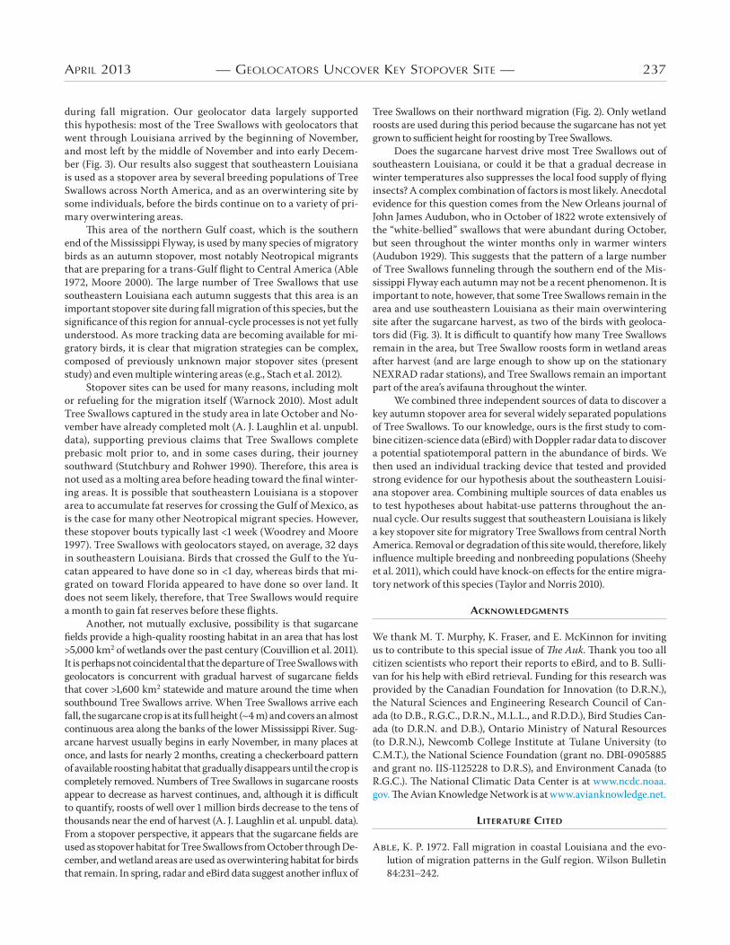
APRIL 2013 — GEOLOCATORS UNCOVER KEY STOPOVER SITE — 237
during fall migration. Our geolocator data largely supported this hypothesis: most of the Tree Swallows with geolocators that went through Louisiana arrived by the beginning of November, and most left by the middle of November and into early Decem-ber (Fig. ). Our results also suggest that southeastern Louisiana is used as a stopover area by several breeding populations of Tree Swallows across North America, and as an overwintering site by some individuals, before the birds continue on to a variety of pri-mary overwintering areas.
0is area of the northern Gulf coast, which is the southern end of the Mississippi Flyway, is used by many species of migratory birds as an autumn stopover, most notably Neotropical migrants that are preparing for a trans-Gulf flight to Central America (Able , Moore ). 0e large number of Tree Swallows that use southeastern Louisiana each autumn suggests that this area is an important stopover site during fall migration of this species, but the significance of this region for annual-cycle processes is not yet fully understood. As more tracking data are becoming available for mi-gratory birds, it is clear that migration strategies can be complex, composed of previously unknown major stopover sites (present study) and even multiple wintering areas (e.g., Stach et al. ).
Stopover sites can be used for many reasons, including molt or refueling for the migration itself (Warnock ). Most adult Tree Swallows captured in the study area in late October and No-vember have already completed molt (A. J. Laughlin et al. unpubl. data), supporting previous claims that Tree Swallows complete prebasic molt prior to, and in some cases during, their journey southward (Stutchbury and Rohwer ). 0erefore, this area is not used as a molting area before heading toward the final winter-ing areas. It is possible that southeastern Louisiana is a stopover area to accumulate fat reserves for crossing the Gulf of Mexico, as is the case for many other Neotropical migrant species. However, these stopover bouts typically last < week (Woodrey and Moore ). Tree Swallows with geolocators stayed, on average, days in southeastern Louisiana. Birds that crossed the Gulf to the Yu-catan appeared to have done so in < day, whereas birds that mi-grated on toward Florida appeared to have done so over land. It does not seem likely, therefore, that Tree Swallows would require a month to gain fat reserves before these flights.
Another, not mutually exclusive, possibility is that sugarcane fields provide a high-quality roosting habitat in an area that has lost >, km of wetlands over the past century (Couvillion et al. ). It is perhaps not coincidental that the departure of Tree Swallows with geolocators is concurrent with gradual harvest of sugarcane fields that cover >, km statewide and mature around the time when southbound Tree Swallows arrive. When Tree Swallows arrive each fall, the sugarcane crop is at its full height (~ m) and covers an almost continuous area along the banks of the lower Mississippi River. Sug-arcane harvest usually begins in early November, in many places at once, and lasts for nearly months, creating a checkerboard pattern of available roosting habitat that gradually disappears until the crop is completely removed. Numbers of Tree Swallows in sugarcane roosts appear to decrease as harvest continues, and, although it is difficult to quantify, roosts of well over million birds decrease to the tens of thousands near the end of harvest (A. J. Laughlin et al. unpubl. data). From a stopover perspective, it appears that the sugarcane fields are used as stopover habitat for Tree Swallows from October through De-cember, and wetland areas are used as overwintering habitat for birds that remain. In spring, radar and eBird data suggest another influx of
Tree Swallows on their northward migration (Fig. ). Only wetland roosts are used during this period because the sugarcane has not yet grown to sufficient height for roosting by Tree Swallows.
Does the sugarcane harvest drive most Tree Swallows out of southeastern Louisiana, or could it be that a gradual decrease in winter temperatures also suppresses the local food supply of flying insects? A complex combination of factors is most likely. Anecdotal evidence for this question comes from the New Orleans journal of John James Audubon, who in October of wrote extensively of the “white-bellied” swallows that were abundant during October, but seen throughout the winter months only in warmer winters (Audubon ). 0is suggests that the pattern of a large number of Tree Swallows funneling through the southern end of the Mis-sissippi Flyway each autumn may not be a recent phenomenon. It is important to note, however, that some Tree Swallows remain in the area and use southeastern Louisiana as their main overwintering site after the sugarcane harvest, as two of the birds with geoloca-tors did (Fig. ). It is difficult to quantify how many Tree Swallows remain in the area, but Tree Swallow roosts form in wetland areas after harvest (and are large enough to show up on the stationary NEXRAD radar stations), and Tree Swallows remain an important part of the area’s avifauna throughout the winter.
We combined three independent sources of data to discover a key autumn stopover area for several widely separated populations of Tree Swallows. To our knowledge, ours is the first study to com-bine citizen-science data (eBird) with Doppler radar data to discover a potential spatiotemporal pattern in the abundance of birds. We then used an individual tracking device that tested and provided strong evidence for our hypothesis about the southeastern Louisi-ana stopover area. Combining multiple sources of data enables us to test hypotheses about habitat-use patterns throughout the an-nual cycle. Our results suggest that southeastern Louisiana is likely a key stopover site for migratory Tree Swallows from central North America. Removal or degradation of this site would, therefore, likely influence multiple breeding and nonbreeding populations (Sheehy et al. ), which could have knock-on effects for the entire migra-tory network of this species (Taylor and Norris ).
ACKNOWLEDGMENTS
We thank M. T. Murphy, K. Fraser, and E. McKinnon for inviting us to contribute to this special issue of &e Auk. 0ank you too all citizen scientists who report their reports to eBird, and to B. Sulli-van for his help with eBird retrieval. Funding for this research was provided by the Canadian Foundation for Innovation (to D.R.N.), the Natural Sciences and Engineering Research Council of Can-ada (to D.B., R.G.C., D.R.N., M.L.L., and R.D.D.), Bird Studies Can-ada (to D.R.N. and D.B.), Ontario Ministry of Natural Resources (to D.R.N.), Newcomb College Institute at Tulane University (to C.M.T.), the National Science Foundation (grant no. DBI- and grant no. IIS- to D.R.S), and Environment Canada (to R.G.C.). 0e National Climatic Data Center is at www.ncdc.noaa.gov. 0e Avian Knowledge Network is at www.avianknowledge.net.
LITERATURE CITED
A, K. P. . Fall migration in coastal Louisiana and the evo-lution of migration patterns in the Gulf region. Wilson Bulletin :–.

238 — LAUGHLIN ET AL. — AUK, VOL. 130
A, J. J. . Journal of John James Audubon: made during his trip to New Orleans in –. Business Historical Society, Cambridge, Massachusetts.
B, E., S. H, M. S, R. A, L. J, J. W. F, V. A, F. L. . Year-round track-ing of small trans-Saharan migrants using light-level geolocators. PLoS ONE :e.
B, F., D. R. N, R. N, M. B, C. C. V, J. W. F, D. J. T. H, H. S. . Cross-hemisphere migration of a g songbird. Biology Letters :–.
B, H. L. . Geospatial Modelling Environment, version .... [Online.] Available at www.spatialecology.com/gme.
B, M., H. L. G, K. A. H. . Integrated analysis of genetic, stable-isotope and banding data reveals migratory connectivity and flyways of the Yellow Warbler (Den-droica petechia). Pages – in Migratory Connectivity of Two Species of Neotropical–Nearctic Migratory Songbirds (M. Boulet and D. R. Norris, Eds.). Ornithological Monographs, no. .
B, C. W. . A study of swallow roosts found in the eastern United States. M.S. thesis, Cornell University, Ithaca, New York.
C, C. P., J. D. B, R. T. H, X. F, T. W. S, G. R. G. . 0e use of isotope tracers for identifying populations of migratory birds. Oecologia :–.
C, P. B., E. B, W. F. F, J. W. C, J. F. K. a. Radar aeroecology: Exploring the movements of aerial fauna through radio-wave remote sensing. Biology Let-ters :–.
C, P. B., W. F. F, P. M. S, J. R. S, T. H. K, J. F. K. b. Estimating animal densities in the aerosphere using weather radar: To Z or not to Z? Ecosphere :.
C, B. A., J. A. B, G. D. S, W. S, M. F, H. B, N. T, B. G, D. H. . Land-Area Change in Coastal Louisiana, –. Scien-tific Investigations Map , U.S. Geological Survey, Washing-ton, D.C.
D, P. O., L. A. W. . Radio-tracking of female Tree Swallows prior to egg-laying. Journal of Field Orni-thology :–.
F, J., R. T. H, A. D. A, K. L. B, K. M. D, S. A. G, J., P. H, K. A. H-, A. E. J, D. H. J, . . Conserv-ing migratory land birds in the New World: Do we know enough? Ecological Applications :–.
F, T., S. J, C. K. . Non-ran-dom distribution of ring recoveries from trans-Saharan migrants indicates species-specific stopover areas. Journal of Avian Biol-ogy :–.
F, K. C., B. J. M. S, C. S, P. M. K, J. B, D. N, N. M, B. F. C, J. C. L, D. M. M, . . Continent-wide tracking to determine migratory connectivity and tropical habitat associa-tions of a declining aerial insectivore. Proceedings of the Royal Society of London, Series B :–.
F, A. M., M. W, J. P. . Tracking migratory songbirds: Accuracy of light-level loggers (geolocators) in forest habitats. Methods in Ecology and Evolution :–.
H, S. G., R. R. C. . Night-roosting behavior of radio-tagged breeding male Tree Swallows (Tachycineta bicolor). Journal of the Colorado–Wyoming Academy of Science :.
H, K. A., L. I. W. . Linking breeding and wintering grounds of Neotropical migrant songbirds using stable hydrogen isotopic analysis of feathers. Oecologia :–.
H, A. H., Z. L. . Spatiotemporal variation in avian migration phenology: Citizen science reveals effects of cli-mate change. PLoS ONE :e.
K, J. F., K. C. R, T. B. S. . Combining iso-topic and genetic markers to identify breeding origins of migrant birds. Ecological Applications :–.
K, T. H., S. A. G, J., N. I. H, J. W. H, G. J, E. K. V. K, R. P. L, G. F. MC, S. M. S, R. B. S, . . Aeroecology: Prob-ing and modeling the aerosphere. Integrative and Comparative Biology :–.
L, S., C. M. H, R. H. G. K, F. K-N, M. W. K, S. H. . Geoloca-tion by light: Accuracy and precision affected by environmental factors. Methods in Ecology and Evolution :–.
M, D. W., S. E. M, D. N. E, C. D, B. A, D. C, R. D. S, M. W. . Conserv-ing stopover sites for forest-dwelling migratory landbirds. Auk :–.
M, F. R. . Stopover ecology of Nearctic–Neotropical land-bird migrants: Habitat relations and conservation implications. Studies in Avian Biology, no. .
N, D. R., P. P. M. . Seasonal interactions, habi-tat quality, and population dynamics in migratory birds. Condor :–.
N, D. R., P. P. M, G. J. B, L. M. R, J. A. R, T. K. K. . Migratory connectivity of a widely distributed Nearctic–Neotropical songbird, the American Redstart. Pages – in Migratory Connectivity of Two Species of Neotropical–Nearctic Migratory Songbirds (M. Boulet and D. R. Norris, Eds.). Ornithological Monographs, no. .
P, L. T., C. P, D. M. C, D. Z-, M. H. . Encounters of Northern Saw-whet Owls (Aegolius acadicus) from banding stations in Alberta and Saskatchewan, Canada. Journal of Raptor Research : –.
R D C T. . R: A Language and Environ-ment for Statistical Computing. R Foundation for Statistical Computing, Vienna, Austria.
R, K. R., S. A. G, J. . Use of weather radar to characterize movements of roosting Purple Martins. Wildlife Society Bulletin :–.
S, J., C. M. T, D. R. N. . 0e importance of stopover habitat for developing effective conservation strate-gies for migratory animals. Journal of Ornithology (Supple-ment ):S–S.
S, T. W., R. T. H. . Summer versus winter lim-itation of populations: What are the issues and what is the evi-dence? Pages – in Ecology and Management of Neotropical Migratory Birds (T. E. Martin and D. M. Finch, Eds.). Oxford Uni-versity Press, Oxford, United Kingdom.
S, R., S. J, C. K, T. F. . Geolocators reveal three consecutive wintering areas in the 0rush Nightingale. Animal Migration :–.
S, B. J. M., S. R. . Molt patterns in the Tree Swallow (Tachycineta bicolor). Canadian Journal of Zoology :–.

APRIL 2013 — GEOLOCATORS UNCOVER KEY STOPOVER SITE — 239
W, D. W., K. K. H, D. R. A, R. J. R, B. J. S, R. R. C. . Tree Swallow (Tachy-cineta bicolor). In Birds of North America Online (A. Poole, Ed.). Cornell Lab of Ornithology, Ithaca, New York. Available at bna.birds.cornell.edu/bna/species/.
W, C., B. S, M. I, D. F, S. K. . eBird: Engaging birders in science and conservation. PLoS Biol-ogy :e.
W, M. S., F. R. M. . Age-related differences in the stopover of fall landbird migrants on the coast of Alabama. Auk :–.
Associate Editor: M. T. Murphy
S, B. J. M., S. A. T, T. D, E. G, P. M. K, J. T, J. W. F, V. A. . Tracking long-distance songbird migration by using geolocators. Science :.
T, C. M., D. R. N. . Population dynamics in migratory networks. 0eoretical Ecology :–.
W, N. . Stopping vs. staging: 0e difference between a hop and a jump. Journal of Avian Biology :–.
W, N., J. Y. T, M. A. B. . Migration and stopover strategies of individual Dunlin along the Pacific Coast of North America. Canadian Journal of Zoology :–.
W, D. W. . Roosts and migrations of swallows (Hirun-dinidae). Hornero :–.