Geography of Super Typhoon HaiYan
27
The Geography of Super Typhoon Haiyan Jennifer Yongmei Pomeroy, Ph.D. December 10, 2013
Transcript of Geography of Super Typhoon HaiYan

The Geographyof Super Typhoon Haiyan
Jennifer Yongmei Pomeroy, Ph.D.December 10, 2013

Overview1. First, how significant was this typhoon?2. Why do typhoons occur where they do?
• And what is a typhoon, anyway?3. What about the damaged areas of the Philippines influenced the level of destruction?4. What kind of socio-cultural conditions play a role in the long-term resiliency and recovery in the areas damaged by the typhoon?

This aerial photo shows flattened houses in the city of Tacloban, Leyte province on November 11.2013. (Source: TED Aljibe/AFP/Getty Images


1. How significant was this typhoon?•Physical characteristics
•Intensity• Category 5 on Saffir-Simpson Scale
•Highest wind speeds•10 minute – 145 mph (230 km/h)•1 minute – 195 mph (315 km/h)•Gusts up to 235 mph (380 km/h)
•Size•Diameter of clouds 1,150 miles•Diameter of storm force winds 150 miles from center
•Storm surge•Average of 18 feet for Philippines; Up to or 20 feet (or more) in Tacloban

1. How significant was this typhoon? Con’t• Damage•Death toll = 5,924, 26,000 injured, & 1,779 people missing •> 15 million people have been affected •Over four million being displaced from homes•Property damage $217 million ; 1.2 million homes destroyed; •Perhaps $14 billion in total economic loss (i.e. infrastructure, agriculture etc.)

2. Why do typhoons occur where they do? and what is a typhoon, anyway? •Tropical cyclones go by several names•Hurricane = typhoon = cyclone
•What are tropical cyclones?•Tropical cyclones are “giant heat engines” that take sensible and latent heat from warm seas to air•Tropical cyclones consist of air flowing up from a low pressure center, with surface air flowing in to replace that•The spin and path of a cyclone is due to the Coriolis Effect (as a result of the Earth’s spin -http://www.youtube.com/watch?v=mcPs_OdQOYU)•Not enough “deflective force” to form at Equator; form at 5º to 15º N or S of Equator.

Source: National Weather Service. JetStream-OnlineSchool for Weather. [accessed on December 8, 2013].

As “giant heat engines” that take sensible and latent heat from warm seas to air, where are we most likely to find warm moist air?
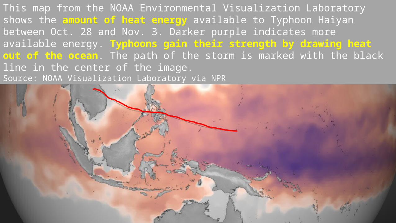
This map from the NOAA Environmental Visualization Laboratory shows the amount of heat energy available to Typhoon Haiyan between Oct. 28 and Nov. 3. Darker purple indicates more available energy. Typhoons gain their strength by drawing heat out of the ocean. The path of the storm is marked with the black line in the center of the image.Source: NOAA Visualization Laboratory via NPR

3. What about the physical landscape that influenced the level of destruction?

What about the physical landscape that influenced the level of destruction?
•Location propensity•Lies in “Typhoon Isle” - Ave. 15 to 18 typhoons a year
•Low-lying, mountains, narrow coasts on the islands. • Particularly, where Tacloban is located acts as a “funnel” for the storm surge.

The funnel effect can be seen more closely at this scale.
http://www.youtube.com/watch?v=8SH5fhGYCm0 for an illustration; andhttp://www.youtube.com/watch?v=rS0gv4Xbw7w for the real thing!

4. What else about the physical landscape might inhibit rescue and recovery efforts?•Comparing the Philippines with Poland, what likely contrasts can we draw?• Fragmented vs.
compact Poorly
integrated transportation network & infrastructure

Hazard
VulnerabilityExposure
Risk
•What is resilience? Ability to absorb perturbations without being undermined or becoming unable to adapt, self –organize, and learn.
•Hazard: inherent danger associated with a potential problem, both region-wide and specifically•Exposure: People, property, and resources (including ecological) exposed to hazard•Vulnerability: Unprotected nature of exposure; may be reduced
•Risk: The probable degree of death, injury, and damage
4. Preparing for the next Haiyan: Building Resilient Communities

- This map shows the affected area by providing information of “exposure” in victim population and housing destruction.
-Marginal socio-cultural conditions as to geographical location, socially, and politically

Source: Bradshaw et al. 2013. Contemporary World Geography. Chapter 6. McGraw-Hill .• Size of Arizona• 100 million, 12th. The median Filipino is 23 years old, compare to 37 of U.S.• Last year’s economic growth was 6.8%, 2nd to China.• Suffers from pockets of poverty and from endemic corruption (34 of CPI)
• Lowland population that are marginal, poor, and voiceless in political process.
• The Visayas – Cebu, Bohol, Singujor, Negros, Leytes

Building Resilient Communities: How might communities reduce hazards or reduce vulnerability?•Avoid the impact by moving away altogether
- Can this be done in the Philippines?• Lessen the impact by modifying the location (move away to lesser impact area)
- With this case, can this be done? How?• Modifying design of human settlements and structures (engineering ; design)
- In what ways can this be done? How? In what ways could it be done if more resources were provided?
• Offset the impact (relief and reconstruction) - what might be a drawback in this?
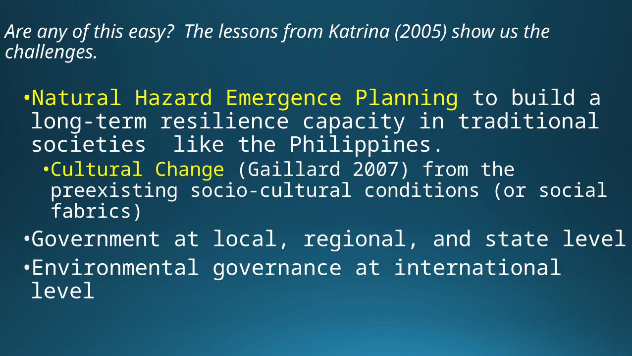
Are any of this easy? The lessons from Katrina (2005) show us the challenges.
•Natural Hazard Emergence Planning to build a long-term resilience capacity in traditional societies like the Philippines.•Cultural Change (Gaillard 2007) from the preexisting socio-cultural conditions (or social fabrics)
•Government at local, regional, and state level•Environmental governance at international level


Big Three Ideas •Typhoon Haiyan was one of the most devastating storms to hit land (#3- 9). •Locational propensity of the Central Philippines is susceptible to typhoons. The physical landscape significantly influences the level of destruction (#10-17). •Natural Hazard Emergence Planning is essential in the long-term resiliency and recovery of impacted areas/communities of the Philippines and other traditional societies (#18-22).

Thank You!
Questions?
Web resources • http://spaceplace.nasa.gov/hurricanes/en/• http://www.oxfam.org/sites/www.oxfam.org/files/bn-typhoon-haiyan-philippines-response-071213-en.pdf• http://science.howstuffworks.com/nature/natural-disasters/hurricane2.htm • http://www.npr.org/2013/11/11/244572227/why-typhoon-haiyan-caused-so-much-damage• http://blogs.wsj.com/searealtime/2013/11/21/timeline-following-the-path-of-typhoon-haiyan-and-beyond/• http://www.washingtonpost.com/blogs/worldviews/wp/2013/11/15/8-maps-that-explain-why-typhoon-haiyan-hit-the-philippines-so-hard/• http://www.nytimes.com/interactive/2013/11/11/world/asia/typhoon-haiyan-map.html?_r=0• http://www.csmonitor.com/World/Global-News/2013/1115/By-the-numbers-Typhoon-Haiyan-s-human-toll-property-damage-and-aid-pledges• http://www.nc-climate.ncsu.edu/edu/k12/.lsheat
“Typhoon Haiyan was one of the most devastating storms to hit land. Where Typhoon Haiyan occurs is due to its locational propensity for typhoons, as well as the physical landscape that influenced the level of destruction. In particular , the pre-existing socio-cultural conditions plays significant roles. In the long-term resiliency and recovery , cultural change is required for the impacted areas/communities of the Philippines.”

Time X Resources X Efficiency X Priority•Why is the relief aid delivery slow?•Scale of the destruction was not properly imagined; need to get used to new norm•Gov’t capacity – local municipalities were the first responders•Infrastructure•telecommunication