Maya Geography
18
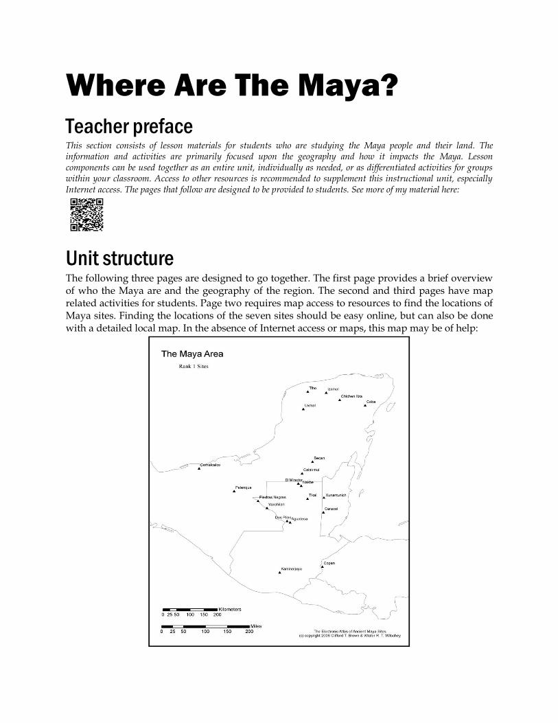
Where Are The Maya? Teacher preface This section consists of lesson materials for students who are studying the Maya people and their land. The information and activities are primarily focused upon the geography and how it impacts the Maya. Lesson components can be used together as an entire unit, individually as needed, or as differentiated activities for groups within your classroom. Access to other resources is recommended to supplement this instructional unit, especially Internet access. The pages that follow are designed to be provided to students. See more of my material here: Unit structure The following three pages are designed to go together. The first page provides a brief overview of who the Maya are and the geography of the region. The second and third pages have map related activities for students. Page two requires map access to resources to find the locations of Maya sites. Finding the locations of the seven sites should be easy online, but can also be done with a detailed local map. In the absence of Internet access or maps, this map may be of help:
-
Upload
charlottemecklenburgschools -
Category
Documents
-
view
2 -
download
0
Transcript of Maya Geography
Where Are The Maya?
Teacher preface This section consists of lesson materials for students who are studying the Maya people and their land. The information and activities are primarily focused upon the geography and how it impacts the Maya. Lesson components can be used together as an entire unit, individually as needed, or as differentiated activities for groups within your classroom. Access to other resources is recommended to supplement this instructional unit, especially Internet access. The pages that follow are designed to be provided to students. See more of my material here:
Unit structure The following three pages are designed to go together. The first page provides a brief overview of who the Maya are and the geography of the region. The second and third pages have map related activities for students. Page two requires map access to resources to find the locations of Maya sites. Finding the locations of the seven sites should be easy online, but can also be done with a detailed local map. In the absence of Internet access or maps, this map may be of help:
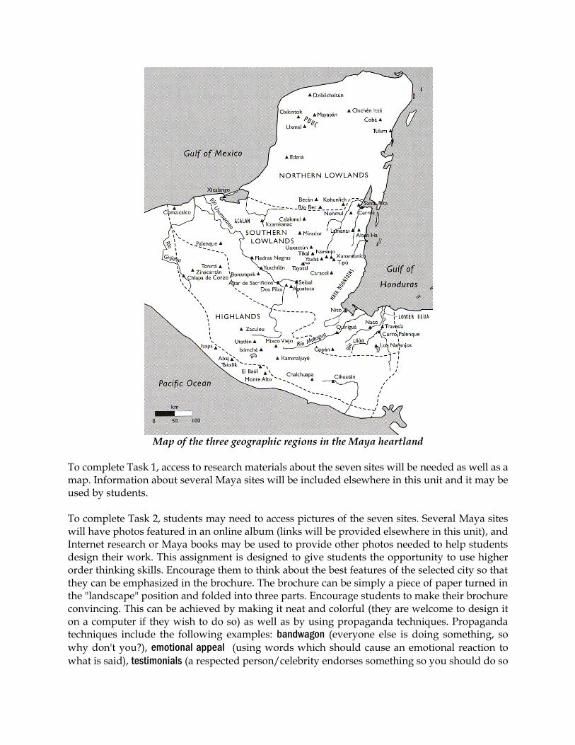
Map of the three geographic regions in the Maya heartland
To complete Task 1, access to research materials about the seven sites will be needed as well as a map. Information about several Maya sites will be included elsewhere in this unit and it may be used by students. To complete Task 2, students may need to access pictures of the seven sites. Several Maya sites will have photos featured in an online album (links will be provided elsewhere in this unit), and Internet research or Maya books may be used to provide other photos needed to help students design their work. This assignment is designed to give students the opportunity to use higher order thinking skills. Encourage them to think about the best features of the selected city so that they can be emphasized in the brochure. The brochure can be simply a piece of paper turned in the "landscape" position and folded into three parts. Encourage students to make their brochure convincing. This can be achieved by making it neat and colorful (they are welcome to design it on a computer if they wish to do so) as well as by using propaganda techniques. Propaganda techniques include the following examples: bandwagon (everyone else is doing something, so
why don't you?), emotional appeal (using words which should cause an emotional reaction to
what is said), testimonials (a respected person/celebrity endorses something so you should do so
too), slogans (using catchy phrases to make something stick in your mind), and snob appeal (you
will be special and liked more if you do something). A scoring rubric for this assignment is provided. The rubric does not include categories for spelling or grammar, but you are welcome to add those in as you wish on the rubric in the "Other" section. To save paper, there are three scoring rubrics per page. Task 3 and Task 4 do not require additional research to complete. These tasks are looking for quality, fact-based paragraphs. Encourage students to do some pre-writing to organize their thoughts before writing their final drafts. These tasks seek to have students use higher order thinking to analyze, evaluate, and infer based upon the information they have learned. The directions indicate what needs to be included for complete responses. The rubric does not include categories for spelling or grammar, but you are welcome to add those in as you wish on the rubric in the "Other" section. Scoring rubrics for these assignments are provided. To save paper, there are two scoring rubrics per page. There is an additional small group task that goes along with this sequence of four tasks ("Small Group Task >>> Ajaw Xulman Site Selection"). This group task uses Task 4 to group students based upon whether they selected Northern Lowlands, Southern Lowlands or Highlands. Ideal group size is 3-4 students. It is acceptable to have several groups with the same site selection in the same class. Actually, it can foster a sense of competition for the groups to have the best of their kind in the class. When students present, they may do so with a poster, orally, using a technology presentation, or other means. The objective is to persuade using facts. The target audience is the Maya city's king. The king's decision may be represented by the teacher or by a class vote; but the best option is to have an outsider, such as another teacher or school official, come in and use the rubric to score students as they present. When students are aware that an outside person is evaluating them and that the evaluation will be based solely upon what the observer sees in their presentation, it can help them focus to ensure that they incorporate all of the project components in a clear, convincing manner. The propaganda techniques referenced above would possibly be of use in completing this task. Two scoring rubrics for this assignment are provided. One focuses solely upon the content of the presentation and the other is for individual and group participation and effort. The rubrics do not include categories for spelling or grammar, but you are welcome to add those in as you wish on each rubric in the "Other" section. To save paper, there are two scoring rubrics per page for the content-based rubric. For the group grading rubric, there are two individual rubrics and one group grade rubric per page.
The reading passage ("Reading about the land and climate...") may be completed in isolation as well as in sequence. The passage uses text and graphics to provide students information about the geography of Belize and Guatemala. A word bank is provided at the end of the passage for vocabulary words some students may not know. The task is designed to allow students to use higher order thinking to respond to a fact-based text. Students analyze, infer, and predict based upon what they have read. This reading passage is also useful for science classes studying ecosystems or plate tectonics. Scoring rubrics for this assignment are provided. To save paper, there are two scoring rubrics per page. The Data Analysis page is available for flexible use with this unit. Some suggested ideas for how to incorporate the data include:
Using a computer spreadsheet or database to analyze data
Locating Maya sites on a map (latitude and longitude in Table 1)
Graphing elevations (in Table 1; students complete on paper or with computer software)
Graphing dimensions of carved stone stelae (in Table 2; students complete on paper or with computer software)
Graphing annual rainfall in Belize and Guatemala (in Table 3; students complete on paper or with computer software)
There are additional activities for students in the Fun & Games section of this project. Some additional Internet resources you may wish to use with your students are listed and described below. Interactive quiz with general knowledge questions about the Maya and their culture
http://ngm.nationalgeographic.com/2007/08/maya-rise-fall/maya-quiz-interactive
Interactive map of Maya sites http://ngm.nationalgeographic.com/2007/08/maya-rise-fall/map-interactive
Where Are The Maya?
The people The Maya are a group of indigenous people native to southeastern Mexico and Central America. The Maya are not a single group of people but several, linked together by shared roots in culture and language. There are several million Maya living in the region today. The largest concentration is in Guatemala, where some 40% of the population has Maya roots.
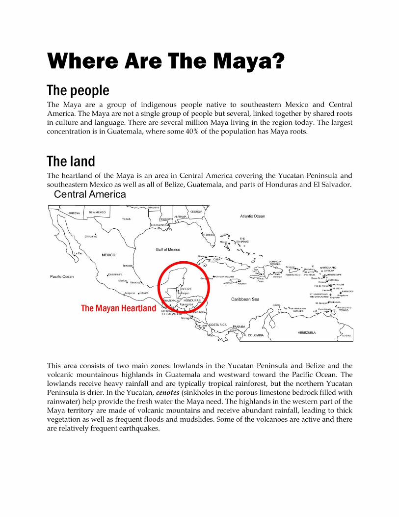
The land The heartland of the Maya is an area in Central America covering the Yucatan Peninsula and southeastern Mexico as well as all of Belize, Guatemala, and parts of Honduras and El Salvador.
This area consists of two main zones: lowlands in the Yucatan Peninsula and Belize and the volcanic mountainous highlands in Guatemala and westward toward the Pacific Ocean. The lowlands receive heavy rainfall and are typically tropical rainforest, but the northern Yucatan Peninsula is drier. In the Yucatan, cenotes (sinkholes in the porous limestone bedrock filled with rainwater) help provide the fresh water the Maya need. The highlands in the western part of the Maya territory are made of volcanic mountains and receive abundant rainfall, leading to thick vegetation as well as frequent floods and mudslides. Some of the volcanoes are active and there are relatively frequent earthquakes.
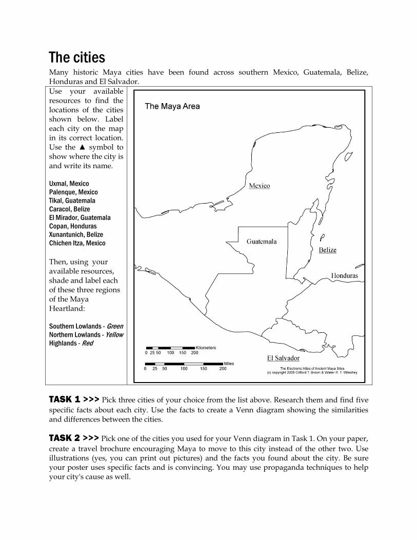
The cities Many historic Maya cities have been found across southern Mexico, Guatemala, Belize, Honduras and El Salvador.
Use your available resources to find the locations of the cities shown below. Label each city on the map in its correct location. Use the ▲ symbol to show where the city is and write its name. Uxmal, Mexico
Palenque, Mexico
Tikal, Guatemala
Caracol, Belize
El Mirador, Guatemala
Copan, Honduras
Xunantunich, Belize
Chichen Itza, Mexico
Then, using your available resources, shade and label each of these three regions of the Maya Heartland: Southern Lowlands - Green
Northern Lowlands - Yellow
Highlands - Red
TASK 1 >>> Pick three cities of your choice from the list above. Research them and find five
specific facts about each city. Use the facts to create a Venn diagram showing the similarities and differences between the cities.
TASK 2 >>> Pick one of the cities you used for your Venn diagram in Task 1. On your paper,
create a travel brochure encouraging Maya to move to this city instead of the other two. Use illustrations (yes, you can print out pictures) and the facts you found about the city. Be sure your poster uses specific facts and is convincing. You may use propaganda techniques to help your city's cause as well.
The geography
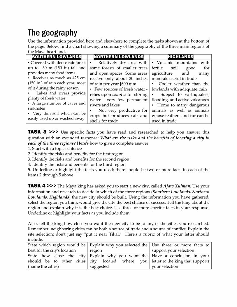
Use the information provided here and elsewhere to complete the tasks shown at the bottom of the page. Below, find a chart showing a summary of the geography of the three main regions of the Maya heartland.
SOUTHERN LOWLANDS NORTHERN LOWLANDS HIGHLANDS
▪ Covered with dense rainforest up to 50 m (150 ft.) tall and provides many food items ▪ Receives as much as 425 cm (150 in.) of rain each year, most of it during the rainy season ▪ Lakes and rivers provide plenty of fresh water ▪ A large number of caves and sinkholes ▪ Very thin soil which can be easily used up or washed away
▪ Relatively dry area with some forests of smaller trees and open spaces. Some areas receive only about 20 inches of rain per year [600 mm] ▪ Few sources of fresh water - relies upon cenotes for storing water - very few permanent rivers and lakes ▪ Not very productive for crops but produces salt and shells for trade
▪ Volcanic mountains with fertile soil good for agriculture and many minerals useful in trade ▪ Cooler weather than the lowlands with adequate rain ▪ Subject to earthquakes, flooding, and active volcanoes ▪ Home to many dangerous animals as well as animals whose feathers and fur can be used in trade
TASK 3 >>> Use specific facts you have read and researched to help you answer this
question with an extended response: What are the risks and the benefits of locating a city in each of the three regions? Here's how to give a complete answer: 1. Start with a topic sentence 2. Identify the risks and benefits for the first region 3. Identify the risks and benefits for the second region 4. Identify the risks and benefits for the third region 5. Underline or highlight the facts you used; there should be two or more facts in each of the items 2 through 5 above
TASK 4 >>> The Maya king has asked you to start a new city, called Ajaw Xulman. Use your
information and research to decide in which of the three regions (Southern Lowlands, Northern Lowlands, Highlands) the new city should be built. Using the information you have gathered, select the region you think would give the city the best chance of success. Tell the king about the region and explain why it is the best choice. Use three or more specific facts in your response. Underline or highlight your facts as you include them. Also, tell the king how close you want the new city to be to any of the cities you researched. Remember, neighboring cities can be both a source of trade and a source of conflict. Explain the site selection; don't just say "put it near Tikal." Here's a rubric of what your letter should include:
State which region would be best for the city's location
Explain why you selected the region
Use three or more facts to support your selection
State how close the city should be to other cities (name the cities)
Explain why you want the city located where you suggested
Have a conclusion in your letter to the king that supports your selection

Small Group Task >>> Ajaw Xulman Site Selection
You have completed several tasks related to Maya geography. You will use the work you have completed to help you with a group task. Your teacher will assign you to a group based upon the location you selected for the new city. Together, you will need to combine your ideas expressed in your letters to the king to develop a proposal highlighting the most important reasons why your site selection is the best for the new city. Your proposal will be in the form of a presentation for the class.
The Maya king (or his representative) will be present to evaluate the presentation. There are many ways to make your presentation convincing. The king's representative will be looking to see that your presentation is both factual and persuasive. Additionally, your teacher may also evaluate your participation with your group and your group's cooperation and effort. Your presentation may be in any format you wish, but it must be presented for the class and the king's representative. Some suggestions include making posters, giving an oral presentation or using computer technology to develop a presentation. Adding visual elements, such as pictures and maps (these may be drawn or printed off from a computer), to your presentation will help make it more memorable for your target audience. To guide you in developing your presentation's content, here are the components that will be evaluated: 1. Containing visual elements 2. Stating reasons for the site selection. Multiple reasons need to be included and these reasons need to be significant. 3. Explaining each of the reasons for site selection (#2 above). You selected this site because you thought it was the best. You gave your reasons. Now, explain why the reasons you selected are important. For example, an explained reason might be: We selected a small island in the Mediterranean Sea as the ideal site. [#2 above] This island is along two major sea commerce routes, offering us many opportunities to profit from trade with all countries in the region. [#3 above; explaining why your reason is important] 4. Persuading the king to select the site. Use your facts, explanations, and your words to be convincing. Propaganda techniques will be useful, but don't go too far! Part of your grade comes from how much your presentation persuades the king's representative. So be convincing! 5. Refuting others' claims. Part of being convincing is to show not only that your choice is right but also that other choices are wrong. State and explain (like #2 and #3 above) why your group did not select the other two regions for the city's site and how both of those regions would be poor selections.

Reading about land and climate
Read about the land and climate of Belize and Guatemala. Use what you read to help you complete the task below.
Belize Belize begins at the coastline of the Caribbean Sea. The warm, shallow waters house many coral reefs, some of which emerge out of the water to form islands called cays. The Belize Barrier Reef is the largest such reef system in the western hemisphere and second longest on earth. Its 200 mile (300 km) length is home to over 100 species of coral and over 500 species of fish. The coastal plain is heavily vegetated and contains many mangrove swamps. Mangrove swamps are coastal wetlands found in tropical and subtropical regions. These wetlands are often found in estuaries, where fresh water meets salt water and are well known for their dense vegetation and wide variety of animal life. As you move west across Belize, the land rises in elevation as you enter the Maya Mountains and the Cockscomb Range, with peaks well over 3000 feet (1100 meters) in height. The rainy season is from June to November and the dry season from February to May. Annual rainfall amounts vary from 50 (in the north) to 180 inches (in the south) (1300 to 4500 mm). Belize has been periodically impacted by hurricanes, including several severe hurricanes since 1998, causing millions of dollars in damage. The mangrove ecosystem
The interaction of mangroves and reefs
Guatemala
Guatemala is a mountainous country. To the west, the Sierra Madre consists of steep volcanic mountains. Several of the volcanoes are active, including Tajumulco Volcano (4,220 m or 13,845 ft) is the highest peak in all of Central America. Guatemala experiences both earthquakes and hurricanes. The last major earthquake was in 1976 which killed more than 23,000 people. A magnitude 7.4 earthquake struck in 2012, the strongest since the deadly 1976 one. Guatemala is located around the intersection of several tectonic plates, so it is one of the more active locations in the world for volcanic and earthquake activity. Guatemala has been periodically impacted by hurricanes, including several severe hurricanes since 1998, causing flooding and landslides. The Petén Basin in the north of the country consists of lower, flatter lands. The climate is generally hot and wet in the west and the north. It is hot and drier towards the east. It can get cold in the mountains. There are many rivers, most of which are short and shallow.
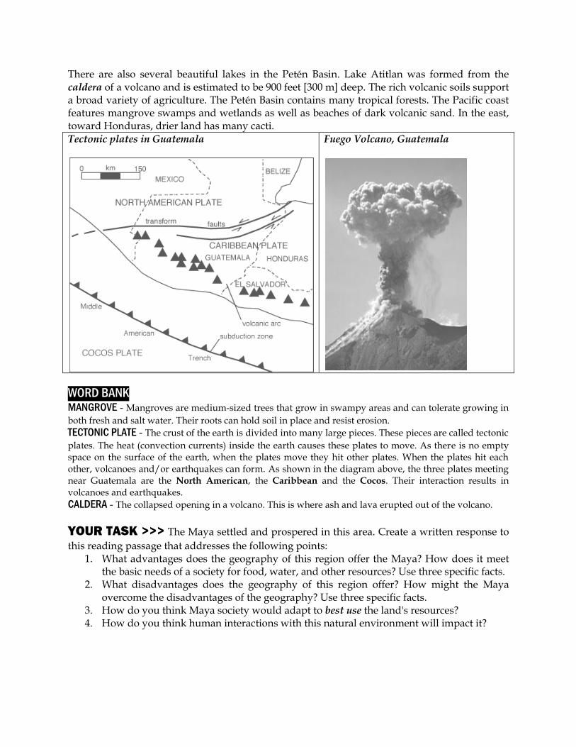
There are also several beautiful lakes in the Petén Basin. Lake Atitlan was formed from the caldera of a volcano and is estimated to be 900 feet [300 m] deep. The rich volcanic soils support a broad variety of agriculture. The Petén Basin contains many tropical forests. The Pacific coast features mangrove swamps and wetlands as well as beaches of dark volcanic sand. In the east, toward Honduras, drier land has many cacti. Tectonic plates in Guatemala
Fuego Volcano, Guatemala
WORD BANK MANGROVE - Mangroves are medium-sized trees that grow in swampy areas and can tolerate growing in
both fresh and salt water. Their roots can hold soil in place and resist erosion. TECTONIC PLATE - The crust of the earth is divided into many large pieces. These pieces are called tectonic
plates. The heat (convection currents) inside the earth causes these plates to move. As there is no empty space on the surface of the earth, when the plates move they hit other plates. When the plates hit each other, volcanoes and/or earthquakes can form. As shown in the diagram above, the three plates meeting near Guatemala are the North American, the Caribbean and the Cocos. Their interaction results in volcanoes and earthquakes.
CALDERA - The collapsed opening in a volcano. This is where ash and lava erupted out of the volcano.
YOUR TASK >>> The Maya settled and prospered in this area. Create a written response to
this reading passage that addresses the following points: 1. What advantages does the geography of this region offer the Maya? How does it meet
the basic needs of a society for food, water, and other resources? Use three specific facts. 2. What disadvantages does the geography of this region offer? How might the Maya
overcome the disadvantages of the geography? Use three specific facts. 3. How do you think Maya society would adapt to best use the land's resources? 4. How do you think human interactions with this natural environment will impact it?

Data Analysis
Use the data tables below to help you better understand the geography of the Maya heartland.
Data Table 1:
Locations of important Maya sites... Site Latitude (° N) Latitude (° W) Elevation (meters) Tikal, Guatemala 17.21 89.61 292.9
Caracol, Belize 16.76 89.11 533.0
Xunantunich, Belize 17.09 89.14 171.2
Altun Ha, Belize 17.76 88.35 24.4
Chichen Itza, Mexico 20.68 88.57 32.1
Uxmal, Mexico 20.36 89.77 61.4
Palenque, Mexico 17.48 92.05 17.5
El Mirador, Guatemala 17.76 89.92 249.0
Kaminaljuyu, Guatemala 14.63 90.55 1537.5
Copan, Honduras 14.84 89.14 602.6
Data Table 2:
Dimensions of carved stone stelae at Maya sites... Site Stela Number Height (meters) Width (meters) Itzimté (Campeche, Mexico) 6 1.32 0.82
Ixkun (Petén, Guatemala) 1 4.13 2.00
Ixkun (Petén, Guatemala) 5 2.65 1.00
Kaminaljuyu (Guatemala City) 11 1.98 0.68
Takalik Abaj (Retalhuleu, Guatemala) 5 2.11 1.22
Toniná (Chiapas, Mexico) 101 1.04 0.31
Piedras Negras (Petén, Guatemala) 12 3.00 1.00
Data Table 3:
Average rainfall amounts in Belize and Guatemala (in mm)... COUNTRY JAN FEB MAR APR MAY JUN Belize 113.8 58.9 45.2 53.0 153.5 267.6
Guatemala 80.0 52.6 53.6 74.0 239.6 397.8
COUNTRY JUL AUG SEPT OCT NOV DEC Belize 287.0 247.3 283.9 256.7 163.9 129.6
Guatemala 362.7 340.0 420.8 318.7 124.6 90.1
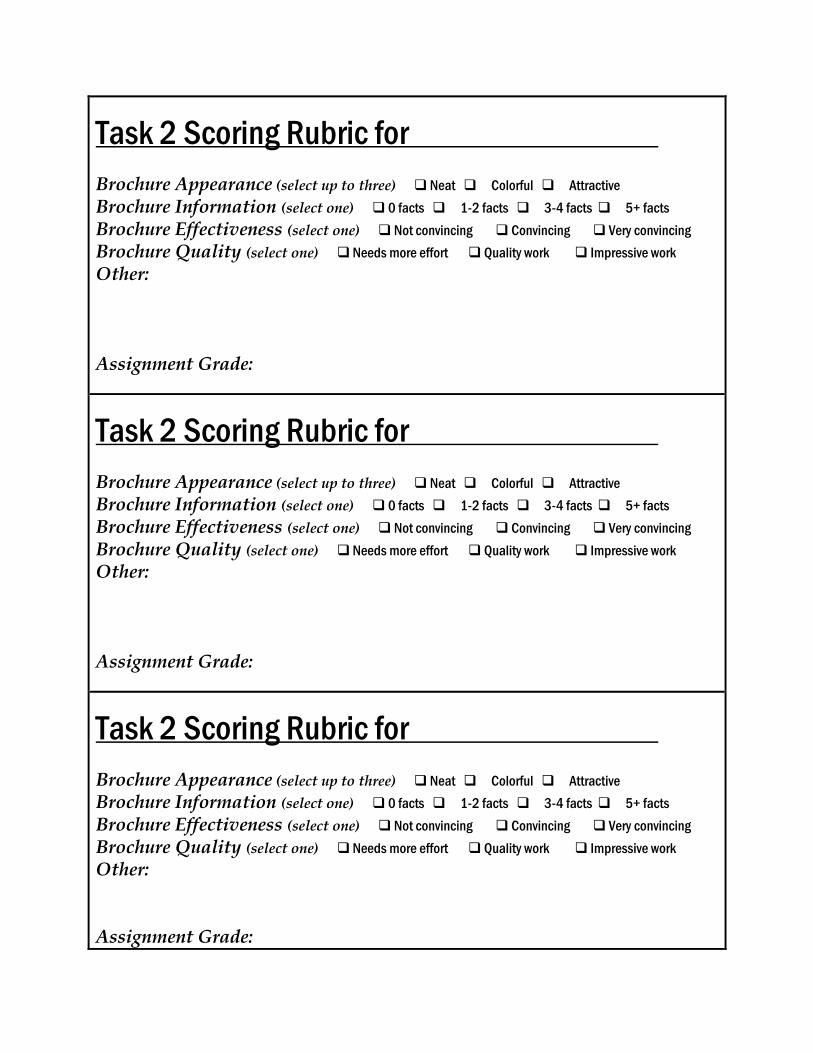
Task 2 Scoring Rubric for .
Brochure Appearance (select up to three) Neat Colorful Attractive
Brochure Information (select one) 0 facts 1-2 facts 3-4 facts 5+ facts
Brochure Effectiveness (select one) Not convincing Convincing Very convincing
Brochure Quality (select one) Needs more effort Quality work Impressive work
Other: Assignment Grade:
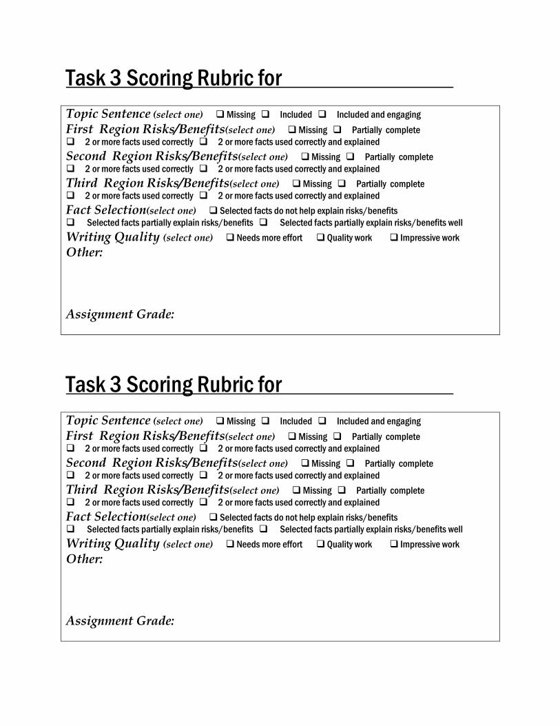
Task 3 Scoring Rubric for .
Topic Sentence (select one) Missing Included Included and engaging
First Region Risks/Benefits(select one) Missing Partially complete
2 or more facts used correctly 2 or more facts used correctly and explained
Second Region Risks/Benefits(select one) Missing Partially complete
2 or more facts used correctly 2 or more facts used correctly and explained
Third Region Risks/Benefits(select one) Missing Partially complete
2 or more facts used correctly 2 or more facts used correctly and explained
Fact Selection(select one) Selected facts do not help explain risks/benefits
Selected facts partially explain risks/benefits Selected facts partially explain risks/benefits well
Writing Quality (select one) Needs more effort Quality work Impressive work
Other: Assignment Grade:
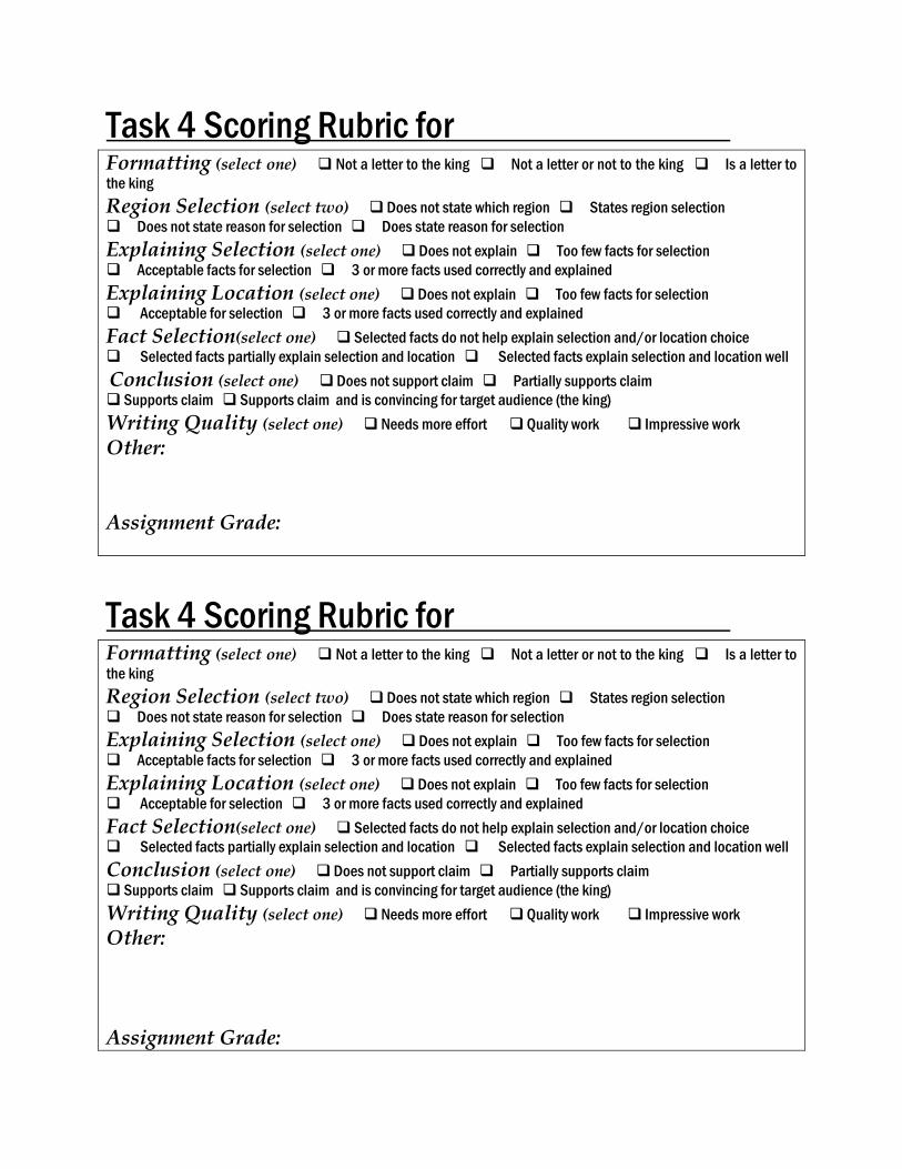
Task 4 Scoring Rubric for .
Formatting (select one) Not a letter to the king Not a letter or not to the king Is a letter to
the king
Region Selection (select two) Does not state which region States region selection
Does not state reason for selection Does state reason for selection
Explaining Selection (select one) Does not explain Too few facts for selection
Acceptable facts for selection 3 or more facts used correctly and explained
Explaining Location (select one) Does not explain Too few facts for selection
Acceptable for selection 3 or more facts used correctly and explained
Fact Selection(select one) Selected facts do not help explain selection and/or location choice
Selected facts partially explain selection and location Selected facts explain selection and location well
Conclusion (select one) Does not support claim Partially supports claim
Supports claim Supports claim and is convincing for target audience (the king)
Writing Quality (select one) Needs more effort Quality work Impressive work
Other: Assignment Grade:
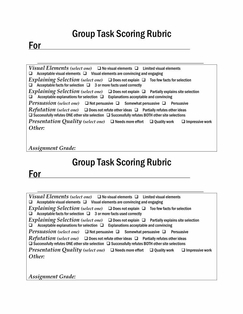
Group Task Scoring Rubric
For .
.
Visual Elements (select one) No visual elements Limited visual elements
Acceptable visual elements Visual elements are convincing and engaging
Explaining Selection (select one) Does not explain Too few facts for selection
Acceptable facts for selection 3 or more facts used correctly
Explaining Selection (select one) Does not explain Partially explains site selection
Acceptable explanations for selection Explanations acceptable and convincing
Persuasion (select one) Not persuasive Somewhat persuasive Persuasive
Refutation (select one) Does not refute other ideas Partially refutes other ideas
Successfully refutes ONE other site selection Successfully refutes BOTH other site selections
Presentation Quality (select one) Needs more effort Quality work Impressive work
Other: Assignment Grade:
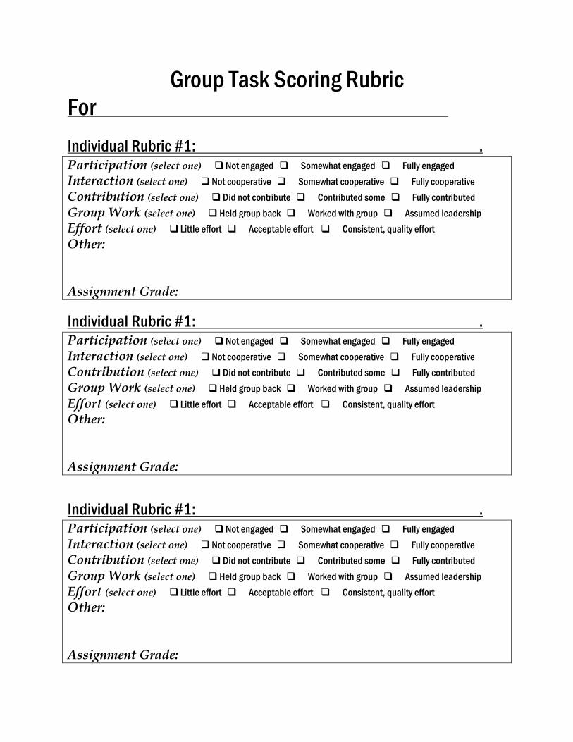
Group Task Scoring Rubric
For .
Individual Rubric #1: . Participation (select one) Not engaged Somewhat engaged Fully engaged
Interaction (select one) Not cooperative Somewhat cooperative Fully cooperative
Contribution (select one) Did not contribute Contributed some Fully contributed
Group Work (select one) Held group back Worked with group Assumed leadership
Effort (select one) Little effort Acceptable effort Consistent, quality effort
Other: Assignment Grade:
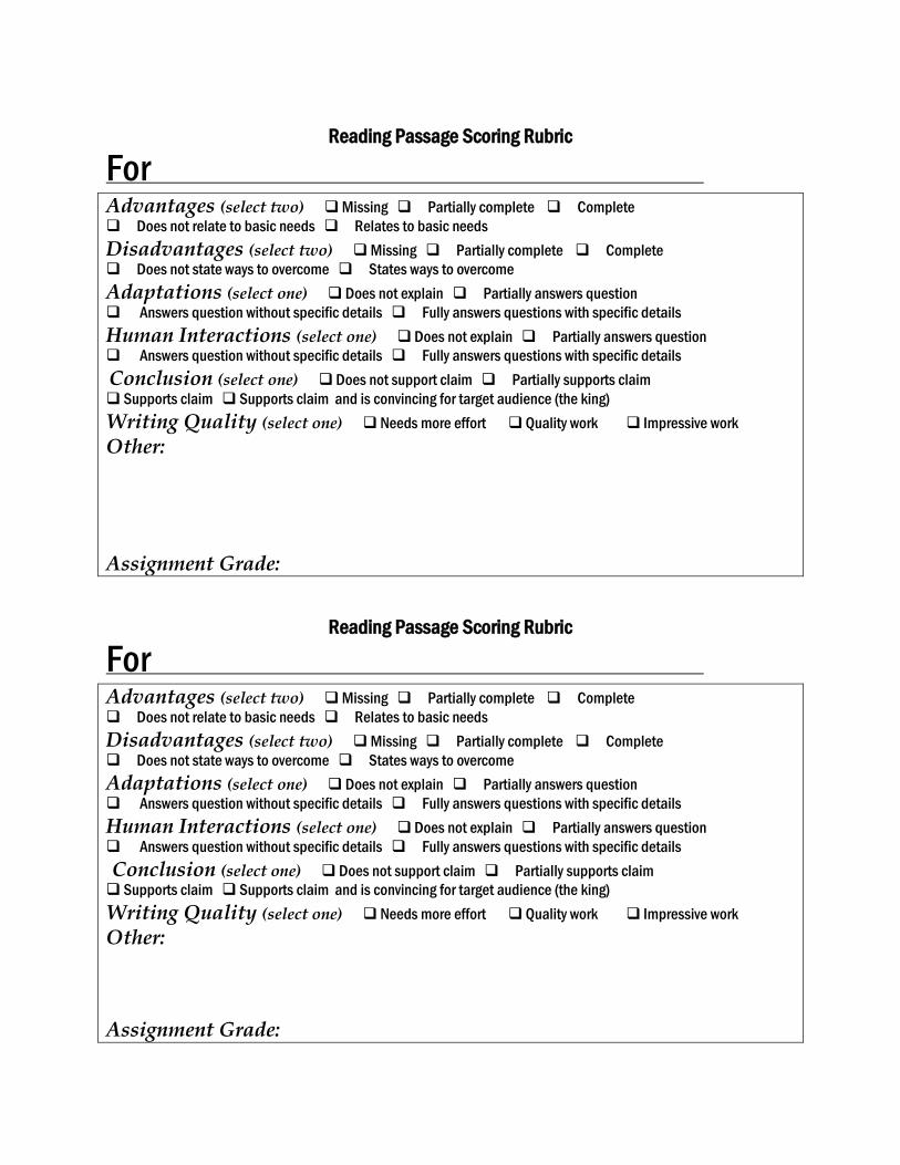
Reading Passage Scoring Rubric
For .
Advantages (select two) Missing Partially complete Complete
Does not relate to basic needs Relates to basic needs
Disadvantages (select two) Missing Partially complete Complete
Does not state ways to overcome States ways to overcome
Adaptations (select one) Does not explain Partially answers question
Answers question without specific details Fully answers questions with specific details
Human Interactions (select one) Does not explain Partially answers question
Answers question without specific details Fully answers questions with specific details
Conclusion (select one) Does not support claim Partially supports claim
Supports claim Supports claim and is convincing for target audience (the king)
Writing Quality (select one) Needs more effort Quality work Impressive work
Other:
Assignment Grade:
References
http://en.wikipedia.org/wiki/Maya_peoples http://mayagis.smv.org/maps_of_the_maya_area.htm (Maps used in accordance with site permissions) http://en.wikipedia.org/wiki/Geography_of_Mesoamerica http://www.crystalinks.com/Mayageography.html http://www.lost-civilizations.net/Maya-geography.html http://www.embassyofbelize.org/belize-profile/geography.html http://water.epa.gov/type/wetlands/mangrove.cfm http://coastvserosion.wikispaces.com/Mangrove http://www.princeton.edu/~achaney/tmve/wiki100k/docs/Geography_of_Belize.html http://en.wikipedia.org/wiki/Geography_of_Belize https://web.duke.edu/nicholas/bio217/jrc25/impacts.html http://en.wikipedia.org/wiki/Geography_of_Guatemala http://moon.com/2012/12/geography-terrain-and-geographical-features-of-guatemala/ http://volcano.oregonstate.edu/fuego http://www.photovolcanica.com/VolcanoInfo/Fuego/Fuego.html http://www.latinamericanstudies.org/maya/maya-map2.gif http://www.altitude.nu/ http://en.wikipedia.org/wiki/Maya_stelae http://data.worldbank.org/country/belize http://data.worldbank.org/country/guatemala http://upload.wikimedia.org/wikipedia/commons/7/77/Plaza_and_pyramid%2C_Tikal%2C_Guatemala.jpg (Image used in accordance with site permissions)