Characterisation of microstructure and modelling of flow behaviour of bainite-aided dual-phase steel
Upload
khangminh22Category
view
4download
0
1426
Ymddiriedolaeth Archaeolegol GwyneddGwynedd Archaeological Trust
Understanding Place:
Characterisation and Deposit Modelling
for Newborough, Anglesey
Mae Ymddiriedolaeth Archaeolegol Gwynedd yn Gwmni Cyfyngedig (Ref Cof. 1180515) ac yn Elusen (ff Rhif Cof. 508849)ff
Gwynedd Archaeological Trust is both a Limited Company (Reg No. 1180515) and a Charity (reg No. 508849)
Cadeiryddes/Chair - Yr Athro/Professor Nancy Edwards, B.A., PhD, F.S.A.
Prif Archaeolegydd/Chief Archaeologist - Andrew Davidson, B.A., M.I.F.A.
Published by Gwynedd Archaeological Trust
Gwynedd Archaeological TrustCraig Beuno, Garth Road,
Bangor, Grr wynedd, LL57 2RT
Cyhoeddwyd gan Ymddiriedolaeth Achaeolegol Gwynedd
mddiriedolaeth Archaeolegol Gwynedd
Craig Beuno, Ffoff rdd y Garth,
Bangor, Grr wynedd, LL57 2RT
Project No. G2404
Understanding Place:
Characterisation and Deposit Modelling
for Newborough, Anglesey
Prepared for: Cadw
Report No. 1426
March 2018
Written by: Jane Kenney
Illustrations by: Jane Kenney with photographs by many volunteers
Cover photograph: View down Chapel Street, Newborough, towards Snowdonia
Event PRN 44993

Contents SUMMARY 11. INTRODUCTION 12. METHODOLOGY 2 2.1. Introduction 2 2.2. Desk-based Study and HER Enhancement 2 2.3. Characterisation Recording 2 2.4. Deposit model 3 2.5. Outreach 3 2.6. Report and Archiving 6 2.7. Copyright 73. PHYSICAL SETTING 74. HISTORICAL MAPPING 95. HISTORICAL DEVELOPMENT 19 5.1. General History 19 5.2. Borough Boundary 23 5.3. Limit of the town 256. PRESENT SETTLEMENT CHARACTER: SUMMARY 277. ARCHAEOLOGICAL RESOURCE 28 7.1. Deposit Model 28 7.2. Town layout and building survival 338. CHARACTER AREAS 35 8.1. Character area 01: Heart of the old town 35 8.2. Character area 02: Lower Chapel Street 57 8.3. Character area 03: Western Church Street 61 8.4. Character area 04: Ty’n Lôn 62 8.5. Character area 05: Northern Malltraeth Street 64 8.6. Character area 06: Lôn Twnti 70 8.7. Character area 07: Eastern Pendref Street 72 8.8. Character area 08: Outlying Farms 74 8.9. Character area 09: Prichard Jones Institute 77 8.10. Character area 10: Former Council Houses 80 8.11. Character area 11: School and new developments 83 8.12. Character area 12: Northern new developments 88 8.13. Character area 13: Bryn Felin etc. 90 8.14. Character area 14: Crud yr Awel 929. CONCLUSIONS 9210. ACKNOWLEDGEMENTS 9311. SOURCES 94 11.1. Published references 94 11.2. Unpublished reports 94 11.3. Websites 95
12. APPENDIX I: Gazetteer of Sites in Newborough Village 9713. APPENDIX II: Sites Studied for the Deposit Model 13114. APPENDIX III: The Forms Used for Characterisation Recording 13916. APPENDIX IV: Maps of zones used in the Characterisation Recording 14717. APPENDIX V: Descriptions of Newborough by Zone 15218. APPENDIX VI: A Selection of the Photographs Taken by the School Pupils 231
FIGURES AND PLATES FiguresFigure 1. Location of Newborough Figure 2. Plan of a property known as “Yr House, Newborough”, with inset showing location, date 1782 (Archives
and Special Collections, Bangor University, Lligwy Additional Mss 1123)Figure 3. Part of Plan of the Sign and Tyddynpwrpas in the parish of Newborough, date 1799 (Archives and
Special Collections, Bangor University, MISC 3/101)Figure 4. Part of plan of Penrhos Estate lands in Newborough, date 1801(Archives and Special Collections, Bangor
University, Penrhos II 777, p25)Figure 5. Plan of Mostyn property in Newborough, date 1827 (Archives and Special Collections, Bangor University,
Mostyn Mss 8450)Figure 6. Plan of the town from the enclosure award map, date 1843 (W MAPS 5, courtesy of Anglesey Archives)Figure 7. Part of tithe map for Llanbedr Newborough parish, date 1846, from Places of Wales website
Figure 9. Part of third edition County Series map (Anglesey sheet XXII.10), date 1920Figure 10. Part of 6 inch map Anglesey XXII.SW, revised 1949, published 1953 (from http://maps.nls.uk)
Figure 12. Probable limit of medieval town with location of buildings on the tithe map shownFigure 13. Projected borough boundary using the named locations listed by Henry Rowlands (Rowlands 1846)Figure 14. Deposit model for the area behind Church StreetFigure 15. Deposit model for land along Chapel Street
Figure 17. Plan showing areas of high archaeological potential and buildings of particular interestFigure 18. Plan of character areas of NewboroughFigure 19. Character area 01: heart of the old townFigure 20. Comparisons of plans of the cross roads showing different representations of the market cross
Series map (not all these inns were necessarily open at the same time)Figure 22. Character area 02: lower Chapel StreetFigure 23. Character areas 03 and 04: Western Church Street and Ty’n LônFigure 24. Character area 05: Northern Malltraeth StreetFigure 25. Character areas 06 and 07: Lôn Twnti and Eastern Pendref StreetFigure 26. Character areas 08 and 09: Outlying Farms and Prichard Jones InstituteFigure 27. Outline plan of the Prichard Jones Institute and cottages showing the gardens opposite and how they
Figure 28. Character areas 10 and 11: Former Council Houses and School and new developmentsFigure 29. Original 1867 plan and drawing of the south elevation of the British School (WA/13/72, courtesy of
Anglesey Archives)Figure 30. 1927 proposals for extended playgrounds and toilets at the school (WA/13/73, courtesy of Anglesey
Archives)Figure 31. Character areas 12 and 13: Modern northern developments and Bryn FelinFigure 32. Character areas 14: Crud yr Awel
PlatesPlate 1. Pupils from Newborough primary school with their iPads for taking photographsPlate 2. Painting the panels for the photographic exhibition
Plate 4. The photographic exhibition in the Prichard Jones InstitutePlate 5. Attendees at the Day School admiring the photographic exhibitionPlate 6. Display at Day SchoolPlate 7. Day School audience in the warm glow of radiant heaters required because of heating problems on
one of the coldest days of the yearPlate 8. Looking down Chapel Street with Snowdonia and the Menai Straits in the distancePlate 9. Excavations underway at Llys Rhosyr 1996Plate 10. Mat making in Newborough (Courtesy of Anglesey Archives WSG/14/10, no date)Plate 11. The cross roads looking from Church Street across to Pendref Street (photograph by Jane Kenney,
11/05/2017)Plate 12. View down Pendref Street and Church Street (photograph by Jane Kenney, 11/05/2017)Plate 13. Remains of a wall found in 2017 excavations north of Lôn Twnti in advance of a new schoolPlate 14. Bronze Age pit containing burnt stones found in advance of a new schoolPlate 15. Excavated postholes of a 8-post granary found on new school sitePlate 16. Excavated postholes of a 4-post granary found on new school sitePlate 17. Date stone above the door of Cae Crwn (photograph by David Elis-Williams, 30/07/2017)Plate 18. Early 16th century doorway photographed by RCAHMW in 1960Plate 19. Pump on Malltraeth Street (photograph by Jane Kenney, 11/05/2017)Plate 20. Plaque commemorating the building of Seion Chapel built into the wall of Cermar (photographed by
David Owen, 26/07/2017)Plate 21. The north-west end of Chapel Street, looking south-east, with Cae Crwn in the foreground (photograph
by David Elis-Williams, 30/07/2017)Plate 22. Tyn yr Ardd, Chapel Street (photograph by David Elis-Williams, 30/07/2017)Plate 23. Tegfan, Chapel Street (photograph by David Elis-Williams, 30/07/2017)Plate 24. Carrog House, Chapel Street (photograph by David Elis-Williams, 30/07/2017)Plate 25. Moranedd (photographed by Chris Jones, 01/08/2017)Plate 26. Chapel Street in about 1875 (Peoples’ Collection Reproduced
by permission of The National Library of Wales. All Rights Reserved.)Plate 27. Chapel Street from south (photograph by David Elis-Williams, 30/07/2017)
Plate 30. The Male Groom Room (photographed by Megan Howe, 05/02/2018)Plate 31. Sign Cottage (photographed by Megan Howe, 05/02/2018)Plate 32. Plas Pydewau (photographed by Owenna Orme, 30/08/2017)Plate 33. Soar Terrace (photographed by Owenna Orme, 30/08/2017)Plate 34. College Bach and Ysgubor Ddu (photographed by Owenna Orme, 30/08/2017)Plate 35. Spier House and neighbouring properties (photographed by Owenna Orme, 30/08/2017)Plate 36. No. 2 Fair View (photographed by Megan Howe, 05/02/2018)Plate 37. No. 1 Fair View (photographed by Megan Howe, 05/02/2018)Plate 38. Dwyryd (photographed by Megan Howe, 05/02/2018)Plate 39. Tan y Ffynnon (photographed by Megan Howe, 05/02/2018)Plate 40. Carpark on Church Street (photographed by Sian Barker, 13/07/2017)Plate 41. Hen Blas and neighbouring houses (photographed by Sian Barker, 13/07/2017)Plate 42. Bodnant (photographed by Sian Barker, 13/07/2017)Plate 43. Old cottage/marram grass weaving shed (PRN 67588) (photographed by Sian Barker, 13/07/2017)Plate 44. The White Lion (photographed by Jane Kenney, 16/02/2018)Plate 45. Image of the White Lion in the late 19th century held in the Prichard Jones Institute
Plate 47. Vacant plot on Malltraeth Street with the pump almost hidden by the vegetation (photographed by Louise Williams, 22/07/2017)
Plate 48. Bron Heulog (photographed by Louise Williams, 22/07/2017)Plate 49. Llys Alaw, Llwyn Llifon and Bodawel (photographed by David Elis-Williams, 27/08/2017)Plate 50. Cae Coch Terrace (photographed by David Elis-Williams, 27/08/2017)Plate 51. Rhouse (photographed by David Elis-Williams, 27/08/2017)

Plate 52. Gorphwysfa (photographed by David Elis-Williams, 27/08/2017)Plate 53. Newborough Stores (photographed by David Elis-Williams, 27/08/2017)Plate 54. Idan House (photographed by David Owen, 26/07/2017)Plate 55. Elm Grove (photographed by David Owen, 26/07/2017)Plate 56. Tan y Fron (photographed by David Owen, 26/07/2017)Plate 57. Part of the main Pendref Street terrace (photographed by David Owen, 26/07/2017)Plate 58. Rhianfa with Baron Hill next door (photographed by David Owen, 26/07/2017)Plate 59. Sain Delyn (photographed by David Owen, 26/07/2017)Plate 60. Plas Newydd and Llys Gwynedd (photographed by David Owen, 26/07/2017)Plate 61. Cermar (photographed by David Owen, 26/07/2017)
Plate 63. Victoria House (photographed by David Owen, 26/07/2017)
Plate 65. Capel Ebeneser Sunday School (photographed by Chris Jones, 26/09/2017)Plate 66. Capel Ebeneser (photographed by Chris Jones, 26/09/2017)Plate 67. Tyn y Goedan barn (photographed by Chris Jones, 07/09/2017)Plate 68. Tal y Braich (photographed by Chris Jones, 15/08/2017)Plate 69. Forest Lodge (photographed by Megan Howe, 05/02/2018)Plate 70. Bron Rallt and Awelon (photographed by Megan Howe, 05/02/2018)Plate 71. Tan yr Allt (photographed by Megan Howe, 05/02/2018)Plate 72. Pengwern (photographed by Megan Howe, 05/02/2018)Plate 73. Tyn Lôn (photographed by Megan Howe, 05/02/2018)Plate 74. Tyn y Pant (photographed by Marianne Jones, 01/09/2017)Plate 75. Detail of 1782 map showing the row of houses along Malltraeth Street (Archives and Special Collections,
Bangor University, Lligwy Additional Mss 1123)Plate 76. Date stone on Pengamfa (photographed by Marianne Jones, 01/09/2017)Plate 77. Photograph of Y Plas (undated) collected by Morwenna OwenPlate 78. Hen Capel (photographed by Marianne Jones, 01/09/2017)Plate 79. Pengamfa (photographed by Marianne Jones, 01/09/2017)Plate 80. Vacant plot next to Boston Terrace (photographed by Marianne Jones, 01/09/2017)Plate 81. Minffordd (photographed by Natalie Herring, 14/09/2017)Plate 82. Pen y Bonc (photographed by Natalie Herring, 14/09/2017)Plate 83. The site of Y Plas (photographed by Jane Kenney, 16/02/2018)Plate 84. Eglwys Bach (photographed by David Elis-Williams, 27/08/2017)Plate 85. Nos. 1 and 2 Lôn Twnti (photographed by Anne Harris, 29/08/2017)Plate 86. Angorfa (photographed by Megan Howe, 05/02/2018)Plate 87. The dog at Angorfa (photographed by Dan Amor, 11/05/2017)Plate 88. Tyddyn Abercyn (photographed by Megan Howe, 05/02/2018)Plate 89. Llanerch (photographed by David Elis-Williams, 22/01/2018)Plate 90. Erw Goch (photographed by Jan Hale, 31/07/2017)Plate 91. Erw Goch barn (photographed by Jan Hale, 31/07/2017)Plate 92. Cow stall inside Erw Goch barn (photographed by Jan Hale, 31/07/2017)Plate 93. Bryn-sinc (photographed by Megan Howe, 05/02/2018)Plate 94. Eirianedd (photographed by Megan Howe, 05/02/2018)Plate 95. A photograph of the Prichard Jones Institute and cottage when they were just completed (from a
commemorative booklet Anglesey Archives WDD/2538/1)Plate 96. Bust of Sir John Prichard JonesPlate 97. Plaque in the Prichard Jones Institute recording the construction and endowment of the buildingPlate 98. The Prichard Jones Institute (photographed by Jane Kenney, 11/05/2017)Plate 99. One of the Prichard Jones Institute Cottages (photographed by Natalie Herring, 08/07/2017)Plate 100. The war memorial in the Prichard Jones Institute grounds (photographed by Natalie Herring, 08/07/2017)Plate 101. Playground on the site of the gardens for the Prichard Jones cottages. Showing the wall and impressive
gates into the area (photographed by Bethany Crabtree, 08/07/2017)Plate 102. Tre Rhosyr (photographed by Anne Harris, 29/08/2017)Plate 103. Houses in Ucheldre with Marion Gash recording (photographed by Anne Harris, 29/08/2017)Plate 104. Houses in Gwel Fenai (photographed by David Elis-Williams, 22/01/2018)Plate 105. Plaque recording the laying of the foundation stone for the British School, now in the Prichard Jones
Institute

Plate 106. Ysgol Gynradd Niwbwrch (photographed by Jane Kenney, 16/02/2018)Plate 107. Stad Hen Ysgol (photographed by Megan Howe, 05/02/2018)Plate 108. Gwethdai Rhosyr (photographed by Alex Kraus, 05/11/2017)Plate 109. Nos 1 and 2 Pen Rhos, showing the probable 1940s porch on No 1 (photographed by Natalie Herring,
14/09/2017)Plate 110. Llys Ogwen (photographed by Louise Williams, 22/07/2017)Plate 111. One of the bungalows in Tyn y Cae (photographed by Natalie Herring, 14/09/2017)Plate 112. One of the bungalows in Bryn Rhedyn (photographed by Jade Owen, 05/02/2018)Plate 113. Bron Meillion (photographed by Natalie Herring, 14/09/2017)
Plate 115. Bryn-felin (photographed by Megan Howe, 05/02/2018)Plate 116. Fron Dirion (photographed by Megan Howe, 05/02/2018)Plate 117. Crud yr Awel (photographed by Jane Kenney, 16/02/2018)
UNDERSTANDING PLACE: CHARACTERISATION AND DEPOSIT MODELLING FOR NEWBOROUGH, ANGLESEY
GAT PROJECT NO. G2404
GAT REPORT NO. 1426
Event PRN 44993
SUMMARY
This report describes the results of a study carried out by Gwynedd Archaeological Trust and grant aided by Cadw. This project used volunteers to help carry out a characterisation study of the village of Newborough, with archive research, especially map regression, to investigate the development of the settlement. This has produced a record of the village as it is today and investigation into what survives of its history. Reports on previous excavations in the village were also studied and areas of high archaeological potential identi ed. n addition the report describes the production of a photographic exhibition on Newborough by the pupils of Newborough Primary School. The wor for this project was underta en in the nancial year .
ae r adroddiad hwn yn disgri o canlyniadau astudiaeth a gynhaliwyd gan mddiriedolaeth Archaeolegol Gwynedd a gafodd gymorth grant gan Cadw. Fel rhan o’r prosiect hwn, defnyddiwyd gwirfoddolwyr i helpu i gynnal astudiaeth nodweddu o bentref Niwbwrch, gydag ymchwil archifol yn enwedig atchweliad mapiau, i archwilio datblygiad yr anheddiad. Mae hyn wedi arwain at gofnod o’r pentref fel y mae heddiw ac ymchwiliad i’r hyn sydd wedi goroesi o’i hanes. n ogystal, astudiwyd adroddiadau ar gloddiadau blaenorol yn y pentref a nodwyd yr ardaloedd a oedd photensial mawr o safbwynt archaeolegol. Mae’r adroddiad hefyd yn disgri o’r gwaith a wnaed i greu arddangosfa ffotograf g ar Niwbwrch gan ddisgyblion sgol Gynradd Niwbwrch. Cynhaliwyd y gwaith ar gyfer y prosiect hwn yn ystod y wyddyn ariannol .
1. INTRODUCTION
Characterisation studies have been undertaken on towns in north-west Wales by Cadw and GAT, e.g. Harlech (Davidson 2009), Pwllheli (Davidson 2008) and Dolgellau (Cadw 2009), but smaller settlements have rarely been recorded in this way. However this can be a very useful technique to investigate the history of a village and record what survives, to understand its development and character, and to provide evidence-based criteria for its future management. It is a procedure that has been undertaken by volunteer groups elsewhere in Wales and it was considered that a characterisation study of Newborough carried out with the assistance of volunteers would
allow for better decision making in the future. The use of volunteers aimed to provide opportunities for the local and wider community to increase its understanding of the development and nature of the settlement, leading to an increased sense of place and ownership. It was hoped the results of the project would provide opportunities for better interpretation, improved curatorial decision making and more informed Local Plans. The results will be incorporated into the regional Historic Environment Record, which is used by curatorial archaeologists when examining the impact of proposed developments on the historic environment.
Newborough was chosen for this project because of its importance as a major medieval town with much of the town plan still surviving. The location of the medieval town, now the modern village, has perhaps been overlooked archaeologically because of the proximity of the earlier site of the medieval court, Llys Rhosyr, which underwent a phase of excavation in the early 1990s. Newborough was founded in about 1300 as a borough to house the displaced inhabitants of Llanfaes, and was the foremost market within Anglesey until Llangefni and Llanerchymedd overtook it in the 17th and 18th centuries.
1

2. METHODOLOGY
2.1. IntroductionThis project has several elements which have been combined in this report. At the heart of the work is a characterisation study of the village of Newborough carried out by volunteers, but this has been supplemented by a desk-based study and deposit modelling using information from previous archaeological work in the village to highlight areas of high archaeological potential. Archive research and the use of the early OS maps and tithe map have supplemented this information. In order to gather volunteers and information and to disseminate the results outreach work has been undertaken as part of the project. Pupils from the local primary school have also been involved in their own characterisation project using photography to present their view of the village.
2.2. Desk-based Study and HER EnhancementTo identify what was already known about the village and provide a base to work from a desk-based study of Newborough was carried out. This started with the compilation of material from the Gwynedd Archaeological Trust Historic Environment Record (HER) and the National Monuments Record (NMR). These were combined into a database with grid references allowing comparison to other source material through a Global Information System (GIS), in this case MapInfo. References obtained from these sources were followed up and secondary sources consulted.
Information was obtained on the location of wells and named buildings from the County Series Ordnance Survey maps. Changes to buildings could also be recorded from this source. A scan of the tithe map was registered on to MapInfo and compared to the modern and 19th century mapping, and the Places of Wales website was used to obtain information from the tithe map schedule for individual plots.
The information obtained from the desk-based study, characterisation recording and archive research was used to identify new sites that were added to the database. Information was added to existing site records. PRNs were obtained for the new sites and the database was made compatible with the HER so that the new sites and additional information could be easily added to the HER to provide full HER enhancement.
2.3. Characterisation RecordingA major aim of this project was to include local residents and other volunteers in the work. The majority of the recording for the project was therefore carried out by volunteers. This required the recording system to be designed for use by people with little or no experience. The Civic Trust for Wales carried out characterisation studies of this sort with volunteers and used their experience to develop a methodology detailed in a published toolkit (Lermon 2013). This toolkit and the Historic England guidance on Historic Area Assessments (English Heritage 2010) were used to develop the methodology for the present work.
The Civic Trust for Wales toolkit provides questions for volunteers to answer and these were used to create recording forms. There was one form for the building or buildings themselves and one for the surrounding streets and spaces. The village of Newborough was divided into zones based on external appearance of the buildings and a rough estimate of date. The object of the zones was to limit recording to groups of buildings of roughly the same style to simplify recording for volunteers. The size of the zones varied from single buildings to whole housing estates and the zones were selected using basic mapping information and Google Street View. Maps were created
the zones and appendix III for the forms used.
Volunteers were recruited as described below and given training in recording. Where volunteers had their own cameras, or other devices that could take photographs, these were used or the volunteers borrowed cameras supplied by GAT. Students from Bangor University were able to use the high quality GAT cameras. This meant that photograph resolution is very variable. Despite training and the availability of GAT staff to answer questions at drop-in session or by email volunteers interpreted the forms in different ways and provided variable degrees of detail. This lack of consistency is inevitable when so many people are involved and especially without intensive and long term training. Some volunteers preferred to make notes rather than restrict themselves to the forms.
The recording took place between July 2017 and February 2018 (inclusive).
2

The information on the forms was transcribed to a database, with some voluntary help to do this. The photographs were numbered in a continuous sequence and a database of metadata was created from the paper photo record forms, again with some volunteer help.
The original small zones were merged into larger areas for overall description following the style of the previous historic urban characterisation work which has been undertaken by Cadw and the Welsh Archaeological Trusts. This enabled an overall characterisation report to be produced.
2.4. Deposit modelThe deposit model involved collecting all available excavation reports, both published and grey literature. These were used to locate trenches and to obtain detailed information about features and deposits. Representing deposits on a map can be done by contour plots where a large number of boreholes or other data are available for which altitudes OD can be calculated for the surface of each layer. None of the available reports provided altitudes,
columns showing deposits for each trench using written descriptions and section drawings as available. These have been presented at a consistent scale so that the depth of deposits can be compared. Due to the lack of altitudes it has not been possible to show how the ground surface or glacial till undulates across an area but an idea of soil depths has been presented. This is most effective in the area to the north of Church Street where a considerable amount of work has been carried out. Elsewhere soil depths can only be considered to represent the immediate location of the trench until further areas are tested nearby.
Some reports do not provide all necessary information and GAT 1979 (White 1979), for which a report was never produced but plans and sections are available, has errors in the north points making location of the features found
north arrow is more likely to be pointing NE than SW, but if there was complete confusion at the drawing stage it is possible that the current assumptions could be wrong by 180 degrees. It is also assumed that the north arrows on the drawings of trenches A and B are pointing in the same direction but it is also possible that this assumption is incorrect.
The tithe map and estate maps were used to identify buildings with possible earlier traces surviving and the location of building remains that might be buried. This information was also used to hint at the original layout of the medieval town. Not all the buildings on the tithe map have medieval origins but it can be argued that many can. Although quite well surveyed the tithe map is not accurate enough to superimpose on the 19th century and modern maps without correction. Once a scan of the tithe map had been registered on MapInfo as well as possible the outlines of the buildings were traced and these were moved to provide corrections. Where a block of buildings
cross roads were positioned in this way it became evident that the buildings on the north-west side of Church Street were further to the north-west than the modern buildings and that the street was wider. This interpretation relies on the assumption that there is likely to be internal consistency in the surveying around the cross road area. This “correction” of the tithe map is obviously to some extent interpretive and might be open to alternative interpretation by others. Particularly the north-east end of Pendref Street, where the survey goes quite distinctly
The deposit model and map evidence were used to identify locations of high archaeological potential. This information and information from the characterisation study was used to identify buildings that have a high potential of preserving pre-19th century structural elements. A map has been produced showing these high potential locations, but this is only as good as the evidence obtained and future evidence may lead to a change in priorities or reveal well-preserved archaeological deposits or upstanding structures that were not expected.
2.5. Outreach
Volunteers
and inviting people to an introductory meeting on 29th June 2017. This was distributed by email to organisations within Newborough and Anglesey and to GAT Friends and volunteer contacts. It was also sent to people expressing
3

printed and distributed to locations around Newborough and to people and organisations who wished to distribute the paper version. The project was also advertised in the local papur bro.
An introductory meeting was held on 29th June at the Prichard Jones Institute. This was attended by about 30 people and led to 24 people signing up as volunteers. Of these volunteers 11 live in the Newborough area and 6
th and 8th July and 21st August, to train volunteers in recording and to allocate zones for them to record. Drop-in sessions were held on 3rd August, 7th September and 5th October. These sessions were designed to keep in contact with volunteers, allow them to drop off record sheets, have photos downloaded and ask questions. A Drop-in Session was also organised and advertised at the school on 22nd November, to encourage people to bring in old photographs of the
day was appalling and attendance was very low.
Two volunteers assisted with searching Gwynedd Archives at Caernarfon and Bangor University Archives for material on Newborough. Volunteers assisted with in-putting information from records sheets into databases. Volunteers spent over 150 hours carrying out the recording of Newborough and other tasks.
A photographic exhibition by the children of Newborough primary school
school. The school were keen to become involved and after a series of meetings a programme of workshops and activities was devised and implemented at the school. These sessions commenced in September 2018. The aim was to capture Newborough as seen through the eyes of the school pupils, and for the exhibition to be ready in time for the Day School we would be holding on March 4th 2018.The children were encouraged to:
Take photographs of things around Newborough that were important to themTake photographs of things that they likedTake photographs of things that interested themConsider photographic composition as an aid to achieving good quality / interesting photographsTo take ‘big’ pictures
During the introductory session we:Explained the nature of the project to the children and what we would be doing in each sessionExplained the pupil’s work would form part of our wider characterisation projectProvided background information on Newborough, contextualising the village in the wider historic landscapeDiscussed what archaeology is and the role of archaeologistsDiscussed some of the projects GAT was currently involved inDiscussed the various functions of GATDiscussed approaches to photography / photographic composition
Working with the pupils and staff, there followed 8 sessions at the school:Years 4, 5 and 6 were divided into three groups, each group ‘explored Newborough’, capturing images as they went, using the school’s iPads and our digital SLR camera (plate 1).
4
Plate 1. Pupils from Newborough primary school with their iPads for taking photographs

Training was given to those pupils who wished to have a go at taking photographs using the SLR camera
photographsPupils made rough versions of the exhibition panels, arranging printed versions of their images on a
the arrangements of their photos, the images were stuck downPupils helped design a title panel for the exhibition
Volunteers helped build and paint the exhibition panels (plate 2). A professional printer was enlisted to print the
(plates 3 and 4). The panels were displayed at the Day School held on March 4th 2018 at the Prichard Jones Institute, Newborough (plate 5), and one of the talks at the Day School centred on how the exhibition was created. The children were invited to view the exhibition at the Institute. There are currently discussions as to where the exhibition may be housed next, but for the duration of March it has remained at the Prichard Jones Institute where the various community groups who use the building can view the children’s work.
See appendix VI for examples of the children’s photographs.
5
Plate 2. Painting the panels for the photographic exhibition
Plate 3. Two of the finished panels
Plate 4. The photographic exhibition in the Prichard Jones Institute

Day SchoolTo present the results of the project a Day School was held in the Prichard Jones Institute on 4th March 2018. As well as Jane Kenney describing the Explore Newborough Project and its results and Dan Amor speaking about the school children’s photographic project there were three other speakers. These were Dr Tony Carr, formerly of Bangor University, speaking on the history of Newborough, Dr Sara Elin Roberts, University of Chester, speaking about Dafydd ap Gwilym and his connections with Newborough and Rob Evans presenting the results of the recent GAT excavations in advance of building a new school in the village.
The completed work of the children was displayed (plate 5) and there were other displays of relevant historical and archaeological material. The event was free of charge and lunch was provided. Sixty two people attended (plates 6 and 7), along with the speakers.
2.6. Report and ArchivingThis report describes the background, methodology and results of the project. The present report incorporates a gazetteer of sites as submitted to the HER, generated from the Access database accompanying this report (appendix I), an appendix listing the entries for each zone (appendix V), and a list of sites studied for the deposit model (appendix IV).
The digital archive will be submitted to RCAHMW for long term curation and the report submitted to the Gwynedd
6
Plate 5. Attendees at the Day School admiring the photographic exhibition
Plate 6. Display at Day School
Plate 7. Day School audience in the warm glow of radiant heaters required because of heating problems on one of the coldest days of the year

HER. A database of sites has been produced for ease of entry into the HER. This includes a summary of each site, which is translated into Welsh, as are the site names.
2.7. CopyrightThe copyright of this report is held by Cadw and Gwynedd Archaeological Trust Ltd. The maps used in this report are reproduced from Ordnance Survey material with the permission of Ordnance Survey on behalf of the
Copyright and may lead to prosecution or civil proceedings. Welsh Government Licence Number: 100017916 (2018).
Historic Mapping, reproduced here, is covered under Crown Copyright and Landmark Information Group. All rights reserved. Gwynedd Archaeological Trust Ltd., on behalf of Welsh Government 2018. SAM polygon data in this report is based on Cadw’s Historic Assets Data (Crown Copyright- Cadw).
3. PHYSICAL SETTING
the village centre and the Malltraeth Estuary is 2km to the north-west. The coast is bounded by a broad swathe of dunes, which forms Newborough Warren. The southern part of these dunes is still an active dune system, now a
planted with Corsican pine for timber and to protect the village of Newborough from wind-blown sand (Natural Resources Wales website). The plantation formed Newborough Forest, so the dunes here have been stabilised by the trees, though dune plants do still survive under the trees in places. The long beach is very popular with visitors,
and horse riding.
The village is located on the top of a low ridge, which rises slightly from about 10 OD to a high point of 40m OD. This gives the village a southern aspect and good views of the mountains of Snowdonia across the Menai Strait (plate 8).
The underlying bedrock is schist, a metamorphic rock dating to the Ediacaran and Cambrian periods (508 to 635 million years ago), with glacial deposits overlying it and large areas of windblown sand near the coast (Geology of Britain Viewer). The farmland surrounding the village, away from the dunes, is fairly rich and has been heavily cultivated in the past, but now, in common with most of Anglesey, it is under improved pasture and used largely for sheep, including over wintering sheep from the mountains.
7
Plate 8. Looking down Chapel Street with Snowdonia and the Menai Straits in the distance
43
42
46
44
47
41
40
39
38
43
42
46
44
47
41
40
39
38
45
37
65
66
67
68
63
64
62
65
66
67
68
64
62
SH
Ma
lltra
eth
Est
ua
ry
Ne
wb
oro
ug
h F
ore
st
Ne
wb
oro
ug
h W
arr
enNe
wb
oro
ug
hD
wyr
an
Lla
ng
aff
o
Me
na
i Str
ait
s
Ab
erm
en
ai P
oin
t
Yn
ys L
lan
dd
wyn
Yn
ys L
lan
dd
wyn
Lla
nd
dw
yn B
ay
B4421 A4080
Ca
ern
arf
on
© C
row
n C
op
yrig
ht
an
d d
ata
ba
se r
igh
t 2
01
8. O
rdn
an
ce S
urv
ey
10
00
21
87
4. W
els
h G
ove
rnm
en
t.
© H
awlf
rain
t a
haw
liau
cro
nfa
dd
ata
’r G
oro
n 2
01
8. R
hif
Trw
ydd
ed
yr
Aro
lwg
Ord
na
ns
10
00
21
87
4.
Fig
ure
1. L
ocat
ion
of
New
bor
ough

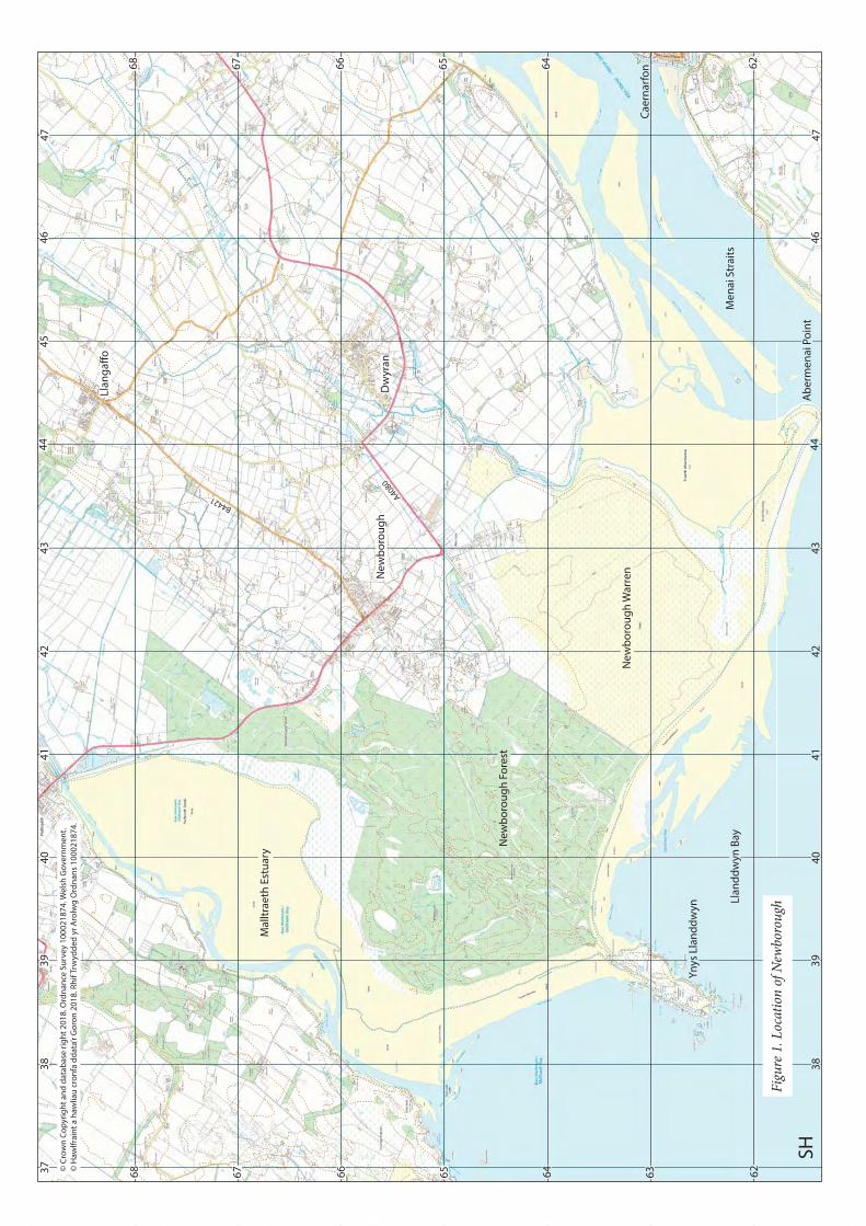
4. HISTORICAL MAPPING
Historical maps relating to Newborough village are presented below in chronological order. There are no doubt other estate maps that have not been located for the project but the maps range from 1782 and provide a fairly clear impression of the development of the village. Throughout text below, especially the history of the character areas these maps will be repeatedly referred to. The County Series maps are referred to below as County Series maps, 25 inch maps or just by the date.
9

Fig
ure
2. P
lan
of
a p
rop
erty
kn
own
as
“Yr
Hou
se, N
ewb
orou
gh”,
wit
h i
nse
t sh
owin
g lo
cati
on, d
ate
1782
(A
rch
ives
an
d S
pec
ial C
olle
ctio
ns,
Ban
gor
Un
iver
sity
, Lli
gwy
Ad
dit
ion
al M
ss 1
123)

Pendref Street
Chap
el Street
Figure 3. Part of Plan of the Sign and Tyddynpwrpas in the parish of Newborough, date 1799 (Archives and Special Collections, Bangor University, MISC 3/101)
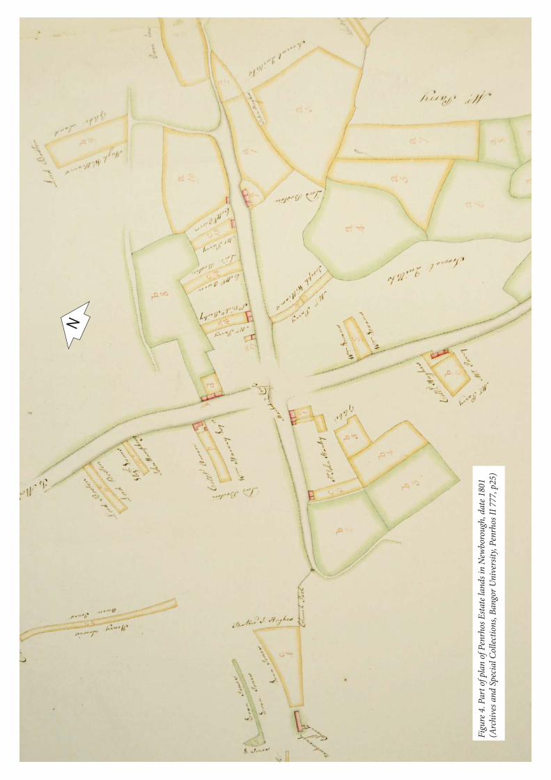
Fig
ure
4. P
art
of p
lan
of
Pen
rhos
Est
ate
lan
ds
in N
ewb
orou
gh, d
ate
1801
(Arc
hiv
es a
nd
Sp
ecia
l Col
lect
ion
s, B
ango
r U
niv
ersi
ty, P
enrh
os I
I 77
7, p
25)

Figure 5. Plan of Mostyn property in Newborough, date 1827 (Archives and Special Collections, Bangor University, Mostyn Mss 8450)

Figure 6. Plan of the town from the enclosure award map, date 1843 (W MAPS 5, courtesy of Anglesey Archives)
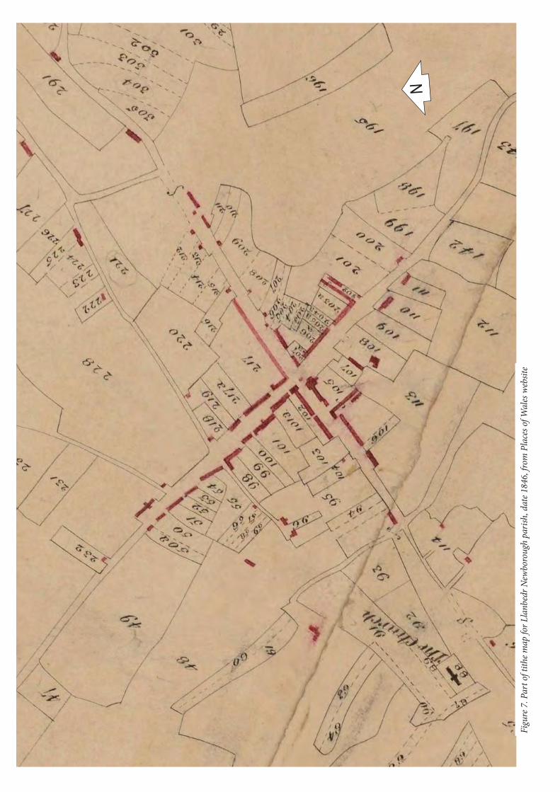
Fig
ure
7. P
art
of t
ith
e m
ap f
or L
lan
bed
r N
ewb
orou
gh p
aris
h, d
ate
1846
, fro
m P
lace
s of
Wal
es w
ebsi
te

Fig
ure
8. P
art
of fi
rst
edit
ion
Cou
nty
Ser
ies
map
(A
ngl
esey
sh
eet
XX
II.1
0), d
ate
1889
Fig
ure
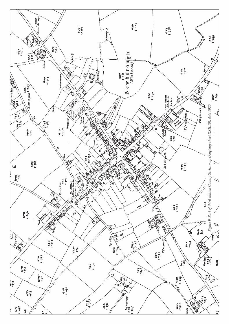
9. P
art
of t
hir
d e
dit
ion
Cou
nty
Ser
ies
map
(A
ngl
esey
sh
eet
XX
II.1
0), d
ate
1920

Fig
ure
10.
Par
t of
6 i
nch
map
An
gles
ey X
XII
.SW
, rev
ised
194
9, p
ubl
ish
ed 1
953
(fro
m h
ttp
://m
aps.
nls
.uk)

5. HISTORICAL DEVELOPMENT
5.1. General HistoryBy the 13th century the main unit for administration in the Kingdom of Gwynedd was the commote (cwmwd). Anglesey was divided into six commotes. Each had a royal court that was the administrative centre and where the Prince of Gwynedd stayed as he travelled around his kingdom. Rhosyr was the royal centre for the commote of Menai. It had a royal court (llys) and a township, the maerdref (reeve’s township), containing a hamlet where the bondsmen who farmed the Prince’s estate lived. The llys was the focus for the collection of dues and renders owed to the king from that commote. The tenants of the commote had to attend the commotal court and use the king’s mill in the maerdref (Longley 2001, 41).
The site of the llys, next to St Peter’s Church to the west of Newborough village, was excavated in the 1990s revealing a hall (A) and chamber (B) as well as a possible bakehouse (C) and another large building (G) (Johnstone
may have been close to the farm called Hendre (Longley 2002) or further north where small enclosures suggest a former settlement (Aris in prep.). The functions of the llys became redundant on the conquest of Edward I, and the site began to decline, but a number of tenants continued to occupy the township of Rhosyr. These paid their rents directly to the new king for farming the lands of the former maerdref. There is even evidence that the royal court
19
Figure 11. Plan of the excavated area at Llys Rhosyr (from Johnstone 1999, fig 2)
Plate 9. Excavations underway at Llys Rhosyr 1996

Royal courts usually had a royal chapel and it is assumed that St Peter’s church originated as the royal chapel. The present church dates from the 14th century, when the borough was established, but an 11th/12th century font with Insular Viking Age decoration, indicates an earlier building once stood here associated with the court. The church was extended in the late 15th or early 16th century (RCAHMW 1937). It contains memorials to former burgesses
Barker, and another to Ellena, all of the late 14th century (Gresham 1968).
The llys and the maerdref
There would have been few walls, fences or hedges enclosing any of the land, which would have been worked communally. In the 17th century the crown lands at Rhosyr were sold into private hands and land holdings were consolidated and enclosed (Longley 2001, 47). However the boundaries of the enclosures still followed the original
48). The tithe map shows some adjacent strips still unenclosed and being worked by different farms. Even many
(Kenney 2015, 11-12).
In the 13th century Llanfaes, in the south-east of Anglesey, was the main trading centre on the island. From 1294 Edward I built his castle and the adjacent borough at Beaumaris, largely in response to the revolt of Madoc ap Llywelyn (Lewis 1912, 31). The location of two boroughs adjacent to one another, one English and the other Welsh, could not be tolerated on economic or political grounds, and so the population of Llanfaes was moved across the island and a new borough was established for them on the royal lands of Rhosyr (Johnstone 2000, 179).
delaying their departure (Lewis 1912, 52).
Land for the borough was appropriated from the demesnes of Rhosyr and the borough of Newborough was laid out to give each burgess the same amount of property as they held in Llanfaes (Lewis 1912, 52). In 1303 the borough
Lewis (1912, 283) gives the original text of the charter in Latin and the original document is held in the British Museum (Harlean Mss 87). Most Welsh borough charters were based on the liberties of Hereford. Newborough was granted the same privileges as Rhuddlan, which in its turn had taken the privileges of Hereford. The new borough did not originally have a name and in 1305 the burgesses asked that it could be called “Newborough” (Lewis 1912, 40).
Property in the borough would be divided into long narrow pieces of land. These narrow plots are generally known as burgage plots, but documents for Newborough refer to the holdings as ‘places’ (placeae) rather than
broad, while those at Beaumaris were 80 ft long and 40 ft broad, but the Newborough placeae had varying rents suggesting varying sizes, which is probably why the technical term ‘burgage’ was not used (Lewis 1912, 63). However in this report these plots will be referred to as burgage plots. They variety of sizes was probably related to Newborough having to accommodate the various sizes of holdings of the burgesses of Llanfaes. Most of these plots can still be seen in the present land boundaries and it is clear how variable they were. A burgage included a tenement with the land under and around it. A burgage did not necessarily have to be built on but it had to have a building for the owner to claim to be a burgess (Lewis 1912, 63). It can be assumed that most of these plots originally had houses, generally on the street frontage.
Street was the main medieval street through the town and continued to a ferry at Abermenai Point. The town cross would have stood at the main cross roads, with a town hall nearby, which survived into the 18th century (Carr 2011, 9, 209, Soulsby 1983, 194-6). The current B road to Llangaffo was probably also part of the original layout, forming a back lane to the town. This road is now known as Lôn Twnti where it runs through the edge of the village. A weekly market was held on Tuesday, and there were fairs on June 22nd, August 10th, August 21st, September 25th and November 11th
at Midsummer (29th June, the feast of Apostles Peter and Paul) and Martinmass (Nov 11th, the feast of St Martin) (Lewis 1912, 208, 171). The cross roads and main streets were wider than today and would have provided a market square. These fairs served the tenantry of the commote of Menai, though the market became famous over a much wider area for its cattle and oxen (Soulsby 1983, 194-6).
20
42
54
20
66
0
65
5
66
0
65
5
42
54
20
SH
St
Pe
ter’
s C
hu
rch
He
nd
ref
Tyn
y C
oe
d
Tit
he
ba
rn?
Pe
nd
ref
Erw
Go
ch
Bry
n A
we
l
Y P
las
© C
row
n C
op
yrig
ht
an
d d
ata
ba
se r
igh
t 2
01
8. O
rdn
an
ce S
urv
ey
10
00
21
87
4. W
els
h G
ove
rnm
en
t.
© H
awlf
rain
t a
haw
liau
cro
nfa
dd
ata
’r G
oro
n 2
01
8. R
hif
Trw
ydd
ed
yr
Aro
lwg
Ord
na
ns
10
00
21
87
4.
KE
Y
Pro
ject
ed
lim
it o
f th
e m
ed
iev
al t
ow
n
Bu
ildin
g f
rom
tit
he
ma
p (
wit
h s
om
e c
orr
ect
ion
s)
cro
ss r
oa
ds
Tyn
’ra
llt
Tan Rofft
Mo
ran
ed
d
Tyn
y G
oe
de
n
Minffordd
Tyd
dyn
Ab
ercy
n
Pendre
f Str
eet
Chapel Stre
etChurc
h Str
eet
Mallt
raeth
StreetLô
n Tw
nti
Fig
ure
12.
Pro
bab
le li
mit
of
med
ieva
l tow
n w
ith
loca
tion
of
buil
din
gs o
n t
he
tith
e m
ap s
how
n

The houses in the borough would probably have been built of timber. In 1305 Newborough asked for a grant to obtain wood from the forest of Snowdon but this seems not to have been granted (Lewis 1912, 64). Not all the town appears to have been built-up. There are records of several gardens, 14 crofts and an orchard, so there was
Anglesey was built at Newborough in 1305 (Guise and Lees 2010, 7). It probably stood at the north-western end
The town was almost entirely Welsh, and welcomed Welsh poets including Dafydd ap Gwilym, who praised the town, its wine and its people (Carr 2011, 9, 209). Newborough did not initially have a mayor but the steward of the
and they continued to do so until as late as 1811 (Lewis 1912, 157, 158). The bailiffs, there were usually two, were
the borough courts, summoned general assemblies, and proclaimed fairs (Lewis 1912, 159-60).
In the later 14th century Newborough was a thriving borough, and economically successful. This was despite the hardship caused by the Great Storm of 6th December 1330 which covered a large area of agricultural land with sand, making it worthless. The king’s tenants at Rhosyr also lost land and 11 cottages. Another storm in 1396-7 destroyed more land, whilst in the mid-fourteenth century the Black Death caused a severe decline in the
th century both the town of Newborough and the township of Rhosyr were badly damaged by attacks from both sides (Carr 2011, 256). There was a renewal of fortune when in 1507 Henry VII transferred the county courts from Beaumaris to Newborough, but this was reversed in 1549 and the town began to decline (Soulsby 1983, 194-6). It began to rely on agriculture rather than trade and by the reign of Edward VI it was no more than a village (Lewis 1912, 208-209). Its common land was vital to the survival of all members of the community. The rights of burgesses to common land were often not recognised when Enclosure Acts were enacted in the 19th century and some boroughs felt that they had been robbed of their rights (Lewis 1912, 91). The Enclosure Act for Newborough was passed in
were divided between landowners and enclosed as private land.
Encroachment by sand continued to be a problem and in 1561 Elizabeth I forbade the pulling of marram grass (Soulsby 1983, 194-6). This plant was vital to stabilise the sand dunes and prevent more sand blows but it was also a useful resource if cut and encouraged to grow rather than being pulled up. There had traditionally been a custom of not cutting the marram grass within 2 miles of the borough to protect the borough land from sand blows (Lewis 1912, 208). Since the 16th century at least marram grass (môrhesg) was used in Newborough to make mats, ropes, baskets and fancy goods (Hughes 1956). The town was surrounded by marshes as well as sand dunes and peat from the marshes provided the inhabitants with fuel (Lewis 1912, 208).
By the end of the 17th century Newborough had lost much of its urban character, the weekly market was discontinued by the early 19th century (Soulsby 1983, 194-6), but annual fairs still continued (Lewis 1849). Travelers who passed through were not complementary. In the late 18th century Thomas Pennant describes Newborough as “a place greatly fallen away from its antient splendor [sic]” (Pennant 1783, 232-235), and in the early 19th century Richard Fenton thought it was “a wretched place” (Fenton 1917, 270). Samuel Lewis described it as having
the main industry other than agriculture, but the enclosure of the common land in the early 19th century led to the
marram grass industry (Lewis 1849).
Nonconformist religion gained in popularity throughout the late 18th and 19th centuries. A Methodist chapel was built in 1784 and by 1801 there was also a chapel for independent protestant dissenters (Pryce 1922, 50, 51). In the later 19th century Newborough had four chapels: Calvinistic Methodist, Wesleyan Methodist, Baptists and Independent. Of these only the Ebenezer Methodist chapel survives. This had a burial ground to its rear and a Sunday school next to it. The Wesleyan chapel also had a Sunday school (Lewis 1849). There were also two churches, the parish church of St Peter and St Thomas’s Mission Church, now Eglwys Bach.
There was a smithy in the middle of the town in the 19th century, in part of the building now used by the shop, and there was were also several inns, including the White Lion, which is shown on the 1845 tithe map, and so it has been in the same place and has had the same name for a long time. There was a fulling mill at Pandy near the shore of the Cefni Estuary, now buried in forest and partly covered by sand.
22

In 1905 John Prichard Jones, Managing Director of Dickins and Jones in Regent Street, London, built the Institute
residents, and the inhabitants of Newborough and surrounding district.
In 1913 the marram grass industry was revived with the establishment of the Mat Makers’ Association and women and children in Newborough could be seen making mats, baskets and ropes (plate 10), until Newborough Warren, the source of the marram grass was taken over by the War Ministry in 1939 used as a bombing range before being taken over by the Forestry Commission in 1947 (Hughes 1956).
5.2. Borough BoundaryThe borough included farmland as well as the town and the boundary was traditionally annually “perambulated” by the burgesses (Lewis 1912, 53). The boundaries of the borough were recorded as a list of placenames by Henry Rowlands (1846, 310-11) in the early 18th century. Owen (1952, 33) has the list of markers recorded by
boundary on his map but does not discuss its route. Almost all of Rowland’s named locations can be found on the modern or 19th
cannot have simply gone from point to point and closer consideration of possible routes strongly indicates that many of the points mentioned were not directly touched by the boundary. Often when a farm name is mentioned it appears that the boundary ran along the edge of the lands of that farm and the farmhouse was nearly always outside the borough boundary. Clynnog Fechan, at which Rowlands description starts and ends, actually stands 200m east of the borough boundary in Llangeinwen parish, the boundary running along the western edge of its lands. The names of Terwyn Beuno or Derfyn Beuno and Ddolgerran cannot be found on the tithe map, mainly
boundary until the late 19th
this area had been replanned as large, regular rectangles and the parish boundary on the 1st edition 25 inch map is
shown on the modern digital mapping, although there is some doubt as to how many of these still survive today, something that would be worth checking on the ground.
23
Plate 10. Mat making in Newborough (Courtesy of Anglesey Archives WSG/14/10, no date)

40
45
41
46
42
43
44
47
37
38
39
40
45
41
46
42
43
44
47
37
38
39
61
62
63
64
65
66
67
68
61
62
63
64
65
66
67
68
SH
Cly
nnog
Fec
han
Riv
er n
ear R
hudd
gaer
Abe
rmen
ae
Bry
n R
hedy
nMae
s y
Cei
rchd
i
Rho
sddu
pon
d
Pla
s U
chaTir B
odfe
l
Ty M
awr
Bry
n M
adoc
Gly
n te
g
Cef
n M
awr U
cha
Tave
rn b
ridd
Cae
au b
rych
ion
Cer
rig y
Gw
ydd
Tir N
est?
Pon
d of
Rho
shir
Hen
dai
Hig
h R
oad
Bry
nsin
c
Cer
rig M
awr
Hen
dre’
r ors
edd
Ro
Bac
h
Mae
n Lw
yd
© C
row
n C
op
yrig
ht
an
d d
ata
ba
se r
igh
t 2
01
8. O
rdn
an
ce S
urv
ey
10
00
21
87
4. W
els
h G
ove
rnm
en
t.
© H
awlf
rain
t a
haw
liau
cro
nfa
dd
ata
’r G
oro
n 2
01
8. R
hif
Trw
ydd
ed
yr
Aro
lwg
Ord
na
ns
10
00
21
87
4.
Ma
lltra
eth
Est
ua
ry
Me
na
i Str
ait
s
KE
Y
Ide
nti
fia
ble
loca
tio
ns
na
me
d b
y R
ow
lan
ds
Pro
ject
ed
bo
rou
gh
bo
un
da
ry
Pa
rish
bo
un
da
ry
Hen
dai
Fig
ure
13.
Pro
ject
ed b
orou
gh b
oun
dar
y u
sin
g th
e n
amed
lo
cati
ons
list
ed b
y H
enry
Row
lan
ds
(Row
lan
ds
1846
)

y Wal (plot 187 on the tithe map) and down the road between Tros yr Afon and Glan yr Afon to the ford across
clearly indicates that the southern part of Newborough Warren belonged to the borough, along with Abermenai Point and the ferry. This is supported by other references to the ferry belonging to the borough (Carr 2011, 207, 245). The borough boundary presumably ran down the middle of Afon Braint as the parish boundary did. From Abermenai Point the boundary ran up the coast to Ro Bach on Traeth Llanddwyn, and then headed inland to Hendai. This was a medieval farmstead, long abandoned by the 1889 map was made, but excavated in 1973 (Evans 1973). A straight line would take the boundary through the warren to the next point in Rowlands itinerary, Bryn Rhedyn, and it is likely this boundary was always straight and somewhat notional through the dunes. Longley’s (2001) plan of properties associated with the hamlets of Hendre Rhosfair and Maerdref or owing rents to the king in 1608 has been used to improve the borough boundary on the assumption that these properties were always part of these hamlets and not within the borough. This takes the boundary quite neatly past Maes y Ceirchdi to Rhosddu Pond to hit the high road, which it followed to a boundary stone known as Maen Lwyd (PRN 67592) where the boundary headed back to the north-west along the edge of the town, obviously including all the town, including Plas (named by Rowland as Plas Ucha), within the borough boundary. Rowlands has the boundary then heading for Tir Bodfel but it is not clear whether land to the south-west of Tir Bodfel was within the borough. The
the boundary. Longley (2001) also has this holding as owing rents to the king in 1608 and therefore not part of the borough. However the description of the borough boundary going to Bryn Madoc, Cerrig Mawr and then Glyn
the borough. It is certainly hard to drawn the boundary in any way that excludes it.
This interpretation strongly hints that one of the unlocated names mentioned “Hendre’r orsedd” refers to the rocky hill immediately north of Bryniau (Aris in prep.). This place name raises two intriguing questions: which
been a suggestion (Aris in prep.) that there was a medieval settlement in the area around Cefn bychan and Tyddyn Bach, to the south-west of the hill, and that this may even have been the location of the maerdref settlement. “Orsedd” could indicate an early medieval meeting place. The word has connections with royal judicial courts, mounds, probably used for assemblies and the proximity of a llys (McNicol, Kenney and Smith 2017, 57-59). Whether any of these can be applied to this location requires much more work, but the track running west from Bryniau may be an ancient road up from the shore of the estuary, making it a fairly accessible location.
As the borough boundary extended as far as Tarvarn bridd (Dafarn-bridd) it is likely that the triangular area between the two roads to the north-east of the town was all borough land, but the route of the boundary is uncertain between Hendre’r orsedd and Cefn Mawr Ucha and unclear around Tir Nest and Brynsinc. Rowlands has the boundary going round Cerrig y Gwydd and passing the tithe barn or Rector’s barn back to the start. Tradition places the tithe barn in the village close to the Rectory so the mention of a tithe barn on the boundary is confusing.
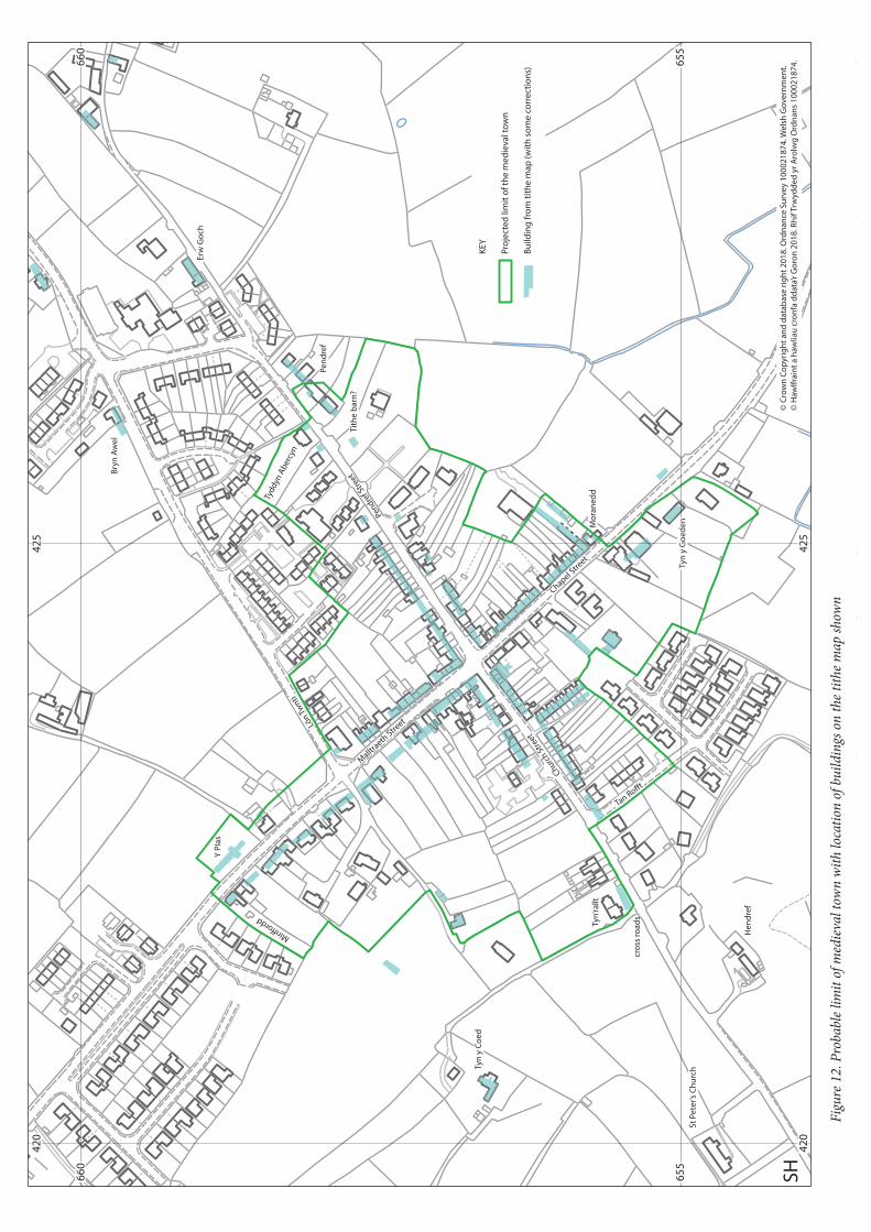
5.3. Limit of the townFigure 12
edition 25 inch maps add some additional information. The key indicator is the present of burgage plots or placae. The tithe map is in some ways less useful than might be thought. It only shows boundaries between lands owned or rented by different people, so many of the plot boundaries are missing because of consolidation of property holdings. The houses shown on the tithe map give some indication of the area built-up in the medieval town in 1846.
Longley (2002) and Johnston (1995) have previously considered the town limits or at least mapped the town.
on the western side of the town but also most of the plots to give a much truncated line on the western side of the town and provide room for his proposed maerdref hamlet at the small cross roads near Hendref. This interpretation is hard to defend when looking at the evidence in detail. Johnstone (1995) takes the town right up to the cross roads on this side. This is a much more defensible position as Tyn’rallt seems to be in a burgage plot, especially as there was a house here on the tithe map. However on the south-eastern side of the street none of the maps suggest burgage plots west of Tan Rofft. A map of 1801 (Penrhos II 777, p25) strongly suggests that there was no cross road near Hendref in the 18th century and that this is a 19th century development.
25

There are burgage plots along the north-east side of Chapel Street and the present houses are mostly on the site of those shown on the tithe map. The new house, Moranedd, now occupies the last plot in the town on this side, though the modern building extends beyond the plot and town boundary. The south-west side of Chapel Street is less clear. The tithe map shows very few buildings on this side and plot boundaries are more fragmentary. However all the boundaries on the tithe map in this area, most of which still survive, strongly resemble groups of 2 or 3 plots that have been merged. It is therefore suggested that the town extended down to Tyn y Goeden. The original house of Tyn y Goeden is shown on the tithe map and is a long narrow building suggestive of at least being on the site of a medieval terrace. The house is not on the present street frontage and this with considerable evidence from further up the street suggest that Chapel Street used to be much wider than today.
Malltraeth Street clearly had town plots and dwellings on both sides of the street up to the cross roads where the B4421 (known here as Lôn Twnti) comes off the main street. The continuation of plots and houses on the tithe map suggests the town extended as far as the plot now occupied by Minffordd on the south-west side of Malltraeth Street. Rowlands describes Y Plas or Plas Ucha as a house in the town and a marker on the boundary. The house is shown on the tithe map and on the County Series maps to 1920, but this does not seem to have had a burgage plot so may not have been originally a medieval property. However its place as a marker on the boundary suggests that the later house was built right on the edge of the medieval town.
The locations of medieval buildings along the western end of Pendref Street are indicated by surviving plot boundaries and houses marked on the tithe map. Plot boundaries and an occasional surviving house on the tithe map suggest that the street was built-up as far at Tyddyn Abercyn on the north side. The site of Pendref must have been the limit on the southern side. Like Y Plas it is not associated with a burgage plot and so it probably a later addition but the name suggests it marks the limit of the town.
this seems to be due to a closer study of the evidence. The limits are quite different to those proposed by Longley
26
Plate 11. The cross roads looking from Church Street across to Pendref Street (photograph by Jane Kenney, 11/05/2017)

6. PRESENT SETTLEMENT CHARACTER: SUMMARY
The settlement is a large village measuring 1km north-west to south-east and 800m south-west to north-east. The original main north-west to south-east street (Malltraeth and Chapel Streets), running from Aberffraw to Abermenai, is now part of the main coastal road around Anglesey (A4080) (plate 11). The B4421 comes off the main road just north-west of the main cross roads and this leads to Llangaffo. The centre of the village is fairly heavily built-up with rows of 19th
towards the edges of the village. The older houses are towards the centre of the village with the outskirts dominated by modern developments, especially at the northern end of the village.
Though the village formerly contained a high number of shops and businesses, these are now much less in evidence, and the large majority of the buildings are domestic houses. These are typically two-storey, stone-built with slate roofs, and a high percentage of chimneys. Recent upgrading of the houses has resulted in a high number of new windows and doors, and pebble-dash surfaces. Short terraces do exist, but typically each house is of slightly
of large-scale investment in the 19th century, and the retention of individual ownership of the houses within each plot. Other building types include non-conformist chapels, the Prichard-Jones Institute, and the parish church of
llys. The latter has been partially excavated, and is accessible for visiting, though with no parking and poor sign-posting, many tourists pass it by unaware of its existence. This road leads only to a large beach carpark, passing through the forest, and is popular with tourists and residents.
A notable feature of the village are the electricity cables criss-crossing the streets, supported on numerous poles
a recent phase in the history of the village as in the 1950s, along with other Anglesey villages, Newborough still had not been supplied with electricity when much of the rest of North Wales was already connected. There was political pressure to get the area connected quickly and over-head cables were quicker to install than underground
resulting in oil storage containers and gas bottles being a feature in many gardens.
27
Plate 12. View down Pendref Street and Church Street (photograph by Jane Kenney, 11/05/2017)

7. ARCHAEOLOGICAL RESOURCE
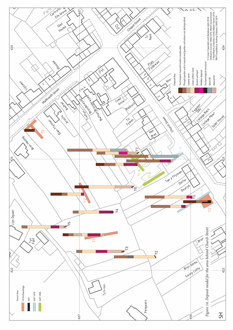
7.1. Deposit ModelSee appendix IV for information used to create deposit model.
The aim of this study is to use previous excavation and trial trenching results to gain some understanding of the buried archaeology of the village and identify areas of high archaeological potential. Map evidence has also been used to recognise areas of older buildings, either still standing or demolished but possibly with surviving buried foundations and associated deposits.
Over much of the area studying deposit depths from excavation data can only give a very localised indication of what deposits are likely to be found, however considerable work has been carried out in the area to the north of
a good spread of information on the depth of deposits. This collection of data gives an intriguing view into the heart of the town. One notable feature is the wide spread extent of windblown sand. A layer up to 0.85m thick is consistently found across this area with the exception of locations near the street fronts. The sand is usually described as homogenous with no stabilisation layers or soil development. It is tempting to see this as a single major inundation of sand into the heart of the town. The locations lacking this sand layer are all on the street frontages. In CR Archaeology trenches 4 and 5 (Rees and Jones 2015b) the original deposits have obviously been truncated by 19th century house building as the topsoil lies directly on the boulder clay, but elsewhere early deposits are preserved so truncation does not necessarily explain the lack of the sand. In CR Archaeology trench 2 (Rees and Jones 2015b) and GAT 1979 trench A (White 1979, PRN 60255) there is evidence of building remains and it seems probable that these buildings were standing when the sand was blown in and blocked sand build-up in these areas. Just behind this frontage zone sand was deposited as shown in EAS trench 1 (Brookes 2013).
Below the sand across much of the area is a buried soil up to 0.5m thick. This would appear to be the original medieval ground surface. In GAT 1996 trench A (Johnstone 1996) a sherd of medieval pottery was recovered from this layer, although this sherd is not described. There are also shells within the deposit in trench C suggesting midden material has been mixed into the buried soil. The depth of the deposit suggests a well-developed soil
out. Shallow furrows in GAT 1996 trench A and C could be the remains of plough furrows. If so they run WSW to ENE and suggest that the plot layout did not follow the existing strip orientation.
In places occupation deposits have clearly been introduced to this layer or have built up on top of it. In EAS
middens (Brookes 2013). There were also midden deposits in the buried soil just north-west of the building remains in CR Archaeology trench 2 (Rees and Jones 2015b). This suggests considerable medieval activity before the sand inundation. The lack of differentiation in the sand suggests a single deposition event and it is possible
considerable creation of soil on top of the sand, presumably by working the plots as gardens and adding organic
have been reported from this gardening soil above the sand as might be expected if the sand dated to 1330 but there seems to have been an assumption that important archaeology lay under the sand, it is unclear how carefully the upper layers were investigated. Future work should not assume that all medieval activity lies below the sand until this has been demonstrated by excavation deliberately looking for medieval activity in the layers above the sand. If the sand deposit does represent this single storm it shows how devastating that storm was, with the loss of horticultural land right in the heart of the village, although this was reclaimed. This area is open to the west so would have received much more sand than the eastern side of the town but it still suggests that about half the town was buried under up to 0.7m of sand. Clarifying the date and nature of this sand layer clearly needs to be considered a priority in future archaeological work.
extends well back from the street but no sand was recorded here either.
In trench A (if the features are correctly orientated) a building was found at the same distance from the modern
28
42
24
23
42
4
42
24
23
42
4
65
6
65
7
65
6
65
7
SH
T1
T1
T2
T3
T4
T5
T6T7
Tr B
T3
T5
T4
Tr A
Tr A
T2
Tr B
Chu
rch
Stre
et
Chapel Stre
et
Mallt
raeth
Street
De
po
sit
Ke
y
Turf
/org
an
ic t
op
soil/
mo
de
rn o
verb
urd
en
Plo
ug
h/g
ard
en
so
il o
r to
pso
il a
nd
ga
rde
n s
oil
wh
ere
no
t d
isti
ng
uis
he
d
Loa
my
san
d
Cle
an
ye
llow
sa
nd
Bu
rie
d s
oil
laye
r
Mid
de
n d
ep
osi
t
Arc
ha
eo
log
ica
l str
uct
ure
Dit
ch fi
ll
Na
tura
l till
Tre
nch
Ke
y
CR
Arc
ha
eo
log
y
EA
S
GA
T 1
97
9
GA
T 1
99
6
© C
row
n C
op
yrig
ht
an
d d
ata
ba
se r
igh
t 2
01
8.
Ord
na
nce
Su
rve
y 1
00
02
18
74
. We
lsh
Go
vern
me
nt.
© H
awlf
rain
t a
haw
liau
cro
nfa
dd
ata
’r G
oro
n 2
01
8.
Rh
if T
rwyd
de
d y
r A
rolw
g O
rdn
an
s 1
00
02
18
74
.
Fig
ure
14.
Dep
osit
mod
el f
or t
he
area
beh
ind
Ch
urc
h S
tree
t

42
44
25
42
44
25
65
5
65
6
65
5
65
6
SH
Are
a1
Are
a2
T1
T2T3
Chapel Stre
et
Chu
rch
Stre
et
Tre
nch
Ke
y
CR
Arc
ha
eo
log
y
EA
S
De
po
sit
Ke
y
Turf
/org
an
ic t
op
soil/
mo
de
rn o
verb
urd
en
Plo
ug
h/g
ard
en
so
il o
r to
pso
il a
nd
ga
rde
n s
oil
wh
ere
no
t d
isti
ng
uis
he
d
Ma
de
-gro
un
d
Loa
my
san
d
Cle
an
ye
llow
sa
nd
Bu
rie
d s
oil
laye
r
Mid
de
n d
ep
osi
t
Arc
ha
eo
log
ica
l str
uct
ure
Dit
ch fi
ll
Na
tura
l till
© C
row
n C
op
yrig
ht
an
d d
ata
ba
se r
igh
t 2
01
8.
Ord
na
nce
Su
rve
y 1
00
02
18
74
. We
lsh
Go
vern
me
nt.
© H
awlf
rain
t a
haw
liau
cro
nfa
dd
ata
’r G
oro
n 2
01
8.
Rh
if T
rwyd
de
d y
r A
rolw
g O
rdn
an
s 1
00
02
18
74
.
Fig
ure
15.
Dep
osit
mod
el f
or la
nd
alo
ng
Ch
apel
Str
eet
street frontage as the tithe map indicates houses a little further to the north-east. It is likely that medieval town houses continued along this street frontage, and it is a pity that the potential archaeology was not investigated more thoroughly before the carpark was built. Trench 2 hints at buildings closer to the modern street in this part, which is supported by a building on the tithe map on the western limits of the town.
CR Archaeology (Rees and Jones 2015a) also found remains of a medieval building in Area 1 on Chapel Street
2003). This was assumed to be late activity associated with Bod Iorwerth, but it may also be medieval. Here a terrace edge was noted, which was not understood at the time but is likely to be the edge of the medieval road. The terrace was roughly revetted with stone but was not used for building as no building remains survived and these
for the modern house so building remains might have been missed but the terrace runs along the line of the road edge as interpreted from the tithe map and other early maps. The tithe map shows that the road was formerly wider and buildings such as the old house at Tyn y Geoden and the building preceding the present Ebenezer Chapel
development once the full width of the road went out of use. Any activity immediately south-west of this, such as the midden, wall and cobbled surfaces recorded, would be in the position where medieval town houses would be expected. It is a great loss that the plot was not more carefully investigated in advance of the construction of the modern houses on the site. No similar terrace was noticed in the plot to the south-east, which was more extensively investigated in advance of development, but the road may not have been terraced so deeply into the slope here.
The discovery of medieval building remains in vacant plots suggest that most of the town was heavily built-up along the street frontages but archaeology has not yet properly investigated what uses the plots behind the houses were put to. The uses are likely to be varied, industrial, storage, waste disposal, as well as agricultural or horticultural and the evidence they might preserve is likely to be equally varied and interesting. Some of the plots may hold more information about life in the town than the house sites.
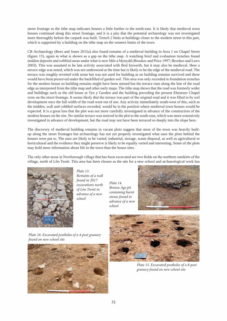
village, north of Lôn Twnti. This area has been chosen as the site for a new school and archaeological work has
31
Plate 13. Remains of a wall found in 2017 excavations north of Lôn Twnti in advance of a new school
Plate 14. Bronze Age pit containing burnt stones found in advance of a new school
Plate 15. Excavated postholes of a 8-post granary found on new school site
Plate 16. Excavated postholes of a 4-post granary found on new school site

T0
1
T0
2
T0
3
T0
4
T0
5
T0
6
T01
T02
T03
T09
T04
T06
T08
T05
T07
T10
T19
T16
T14
T17
T15
T20
T11
T18
T12
T13
Lôn
Tw
nti
42
44
25
42
64
27
42
84
23
42
44
25
42
64
27
42
84
23
65
9
66
0
66
1
65
9
66
0
66
1
SH
De
po
sit
Ke
y
Turf
/org
an
ic t
op
soil
Plo
ug
hso
il
Na
tura
l till
Tre
nch
Ke
y
GA
T t
ria
l tre
nch
es
GA
T m
itig
ati
on
tre
nch
es
© C
row
n C
op
yrig
ht
an
d d
ata
ba
se r
igh
t 2
01
8. O
rdn
an
ce S
urv
ey
10
00
21
87
4. W
els
h G
ove
rnm
en
t.
© H
awlf
rain
t a
haw
liau
cro
nfa
dd
ata
’r G
oro
n 2
01
8. R
hif
Trw
ydd
ed
yr
Aro
lwg
Ord
na
ns
10
00
21
87
4.
Fig
ure
16.
Dep
osit
mod
el f
or fi
eld
s off
Lôn
Tw
nti
dev
elop
ed f
or a
new
sch
ool

been taking place in advance of the development. The work is not yet complete and results from the mitigation work is still very preliminary but the report on trial trenching has been produced (McGuinness 2016). The trial
between 0.15m and 0.35m deep over ploughsoil up to 0.7m deep. These deposits overlie the natural glacial clay which is generally a red-brown sandy clay with some areas of gravel usually about 0.8m to 0.9m below the modern surface. There is no sign of windblown sand recorded in this area at all.
medieval strips (Evans, Hopewell and McGuiness 2016). Further excavation investigated these but also revealed more complex archaeology. In trench 01 of the mitigation trenches (Evans forthcoming) the remains of a wall were found (plate 13), probably related to a house shown in this area on an 18th century estate map (Lligwy
produced a Bronze Age date and more dates are to be obtained. In trench 05 was a 9 post granary (plate 15) and a 4 post granary (plate 16). These are usually attributed to the Iron Age but what appears to be Bronze Age pottery was found in a feature in the 9 post granary. These features need to be studied in more detail and dates obtained but this certainly shows prehistoric activity on this side of the village, almost certainly a settlement.
This area shows the importance of not making assumptions about where archaeological remains might be found.
medieval archaeology.
7.2. Town layout and building survival
The tithe map gives such a convincing impression of a medieval town with rows of town houses that it is hard to
the houses have been rebuilt. However maps dating from before 1846 suggest that while this general impression might be correct in terms of overall layout of burgage plots, there was a lot of building in the early 19th century and some of this was on plots that were vacant at the time.
Historical evidence suggests a large amount of rebuilding in the early 19th century and most of the earlier houses in the village date from that period. The medieval houses that stood on their sites were probably entirely demolished when the houses were rebuilt and there are various records of houses being demolished before rebuilding (Owen 1952). The likelihood of surviving pre-19th century fabric is therefore low, although lower courses of masonry may survive in the present structures. The only exception to this is Pengamfa, which has a date stone of 1769 though map evidence appears to contradict this, however surviving external features, including the large chimney and off-centre doorway, would indicate 18th century or earlier origins. Internal inspection of this property, especially
The excavated evidence discussed above suggests that there were medieval buildings in the majority of plots, and it is to be expected that pre-19th century buildings survive as buried archaeology in many of them. Further consideration of this is given within each of the character areas.
33

42
54
20
66
0
65
5
66
0
65
5
42
54
20
SH
St
Pe
ter’
s C
hu
rch
He
nd
ref
Tyn
y C
oe
d
Tit
he
ba
rn?
Erw
Go
ch
Bry
n A
we
l
Y P
las
Pe
nd
ref
© C
row
n C
op
yrig
ht
an
d d
ata
ba
se r
igh
t 2
01
8. O
rdn
an
ce S
urv
ey
10
00
21
87
4. W
els
h G
ove
rnm
en
t.
© H
awlf
rain
t a
haw
liau
cro
nfa
dd
ata
’r G
oro
n 2
01
8. R
hif
Trw
ydd
ed
yr
Aro
lwg
Ord
na
ns
10
00
21
87
4.
KE
Y
Pro
ject
ed
lim
it o
f th
e m
ed
iev
al t
ow
n
List
ed
bu
ildin
gs
Bu
ildin
gs
wit
h p
oss
ible
pre
-19
th c
en
tury
fa
bri
c o
r fo
un
da
tio
ns
Bu
ildin
gs
pro
ba
bly
ori
gin
ally
bu
ilt in
th
e e
arl
y 1
9th
ce
ntu
ry
Sit
e o
f d
em
olis
he
d b
uild
ing
wh
ere
bu
rie
d r
em
ain
s m
igh
t su
rviv
e
Are
a o
f a
rch
ae
olo
gic
al p
ote
nti
al
Are
a o
f ve
ry h
igh
arc
ha
eo
log
ica
l po
ten
tia
l
Fig
ure
17.
Pla
n s
how
ing
area
s of
hig
h a
rch
aeo
logi
cal
pot
enti
al a
nd
bu
ild
ings
of
par
ticu
lar
inte
rest

8. CHARACTER AREAS
The village has been divided into character areas and each are described in terms of their historical development,
of interest have been given a Primary Record Number (PRN) for inclusion in the HER and are included in the gazetteer. These PRNs are marked on the maps of each character area and referenced in the text. NPRNs (National Primary Record Numbers) indicate records held in the National Monuments Record (NMR) and are referenced where information from that record is used in the text.
8.1. Character area 01: Heart of the old townFigure 19
Historical developmentThis area was the heart of the medieval town, planned around the main cross roads. It is the part of the town covered by most of the available maps, so a considerable amount of detail is known about its history at least from 1799. All the properties are based on property boundaries originating from burgage plots. In some cases some of the plots have been merged and the boundaries are wider than originally laid out but the majority retain the original outline of the burgage.
Chapel StreetThere are two long rows of houses shown on the tithe map on the north-eastern side of Chapel Street, which still exist in an altered form today (PRN 69202 and 69203). However earlier maps suggest that the south-easterly of these two terraces was built in the early 19th
show quillets (agricultural strips of land) on the north-eastern side of Chapel Street with no houses, and plot 204a
been built here by that date. There seem to always have been houses along the upper part of the street but these have been heavily rebuilt. The house called Cae Crwn has a date stone of 1806 (plate 17) and this could indicate a major period of rebuilding for the whole row in the early 19th century. This rebuilding very likely resulted in the demolition of the earlier buildings but a 16th century doorway recorded by RCAHMW (PRN 67574, NPRN 15763) (plate 18) may be located in this row, probably in Carrog House, though it was not located during the current project. This may indicate the survival of earlier fabric, though it is likely that the doorway was reused from elsewhere and could have been built into the property in the early 19th century. The last house in the row, now completely rebuilt, used to be the start of a terrace running perpendicular to Chapel Street (PRN 69204). This terrace was called Rhenc Isaf and was occupied by poorer families (Norman Evans pers. comm.).
Moranedd, the last house down this side of the street, seems to have been built in the late 19th century. It does
was much more rectangular than today. It seems to have been rebuilt shortly before 1920, as it is shown as an
this rebuilding.
35
Plate 17. Date stone above the door of Cae Crwn (photograph by David Elis-Williams, 30/07/2017)
Plate 18. Early 16th century doorway photographed by RCAHMW in 1960

01
01
02
03
04
05
06
07
08
09
10
11
12
13
© C
row
n C
op
yrig
ht
an
d d
ata
ba
se r
igh
t 2
01
8. O
rdn
an
ce S
urv
ey
10
00
21
87
4. W
els
h G
ove
rnm
en
t.
© H
awlf
rain
t a
haw
liau
cro
nfa
dd
ata
’r G
oro
n 2
01
8. R
hif
Trw
ydd
ed
yr
Aro
lwg
Ord
na
ns
10
00
21
87
4.
Fig
ure
18.
Pla
n o
f ch
ara
cter
are
as
of N
ewb
orou
gh

Gorph
wysfa
42
44
25
42
24
23
42
44
25
42
24
23
65
8
65
7
65
6
65
8
65
7
65
6
SH
69
21
3
69
20
9
67
57
1
69
20
1
69
20
66
92
36
69
23
5
69
23
4
69
23
3
69
23
2
69
23
1
69
23
0
69
22
7
69
22
6
69
22
5
69
22
4
69
23
8
69
23
7
69
20
2
67
57
4
69
20
3
69
20
4
67
58
8
69
20
5
69
21
2
60
25
5
59
77
7
67
58
7
67
60
1
69
21
5
67
60
0
69
21
9
67
57
9
69
24
56
75
76
69
20
0
67
58
0
67
57
8
69
21
7
69
21
8
69
21
6
81
11
69
22
9
67
59
9
67
78
8
69
25
0
Chu
rch
Stre
et
Chapel Stre
et
Pend
ref S
tree
t
Mallt
raeth
Street
© C
row
n C
op
yrig
ht
an
d d
ata
ba
se r
igh
t 2
01
8. O
rdn
an
ce S
urv
ey
10
00
21
87
4. W
els
h G
ove
rnm
en
t.
© H
awlf
rain
t a
haw
liau
cro
nfa
dd
ata
’r G
oro
n 2
01
8. R
hif
Trw
ydd
ed
yr
Aro
lwg
Ord
na
ns
10
00
21
87
4.
Ke
y
Sit
e w
ith
PR
N
We
ll o
r p
um
p w
ith
PR
N
69
20
4
69
23
7
B442
1
Fig
ure
19.
Ch
ara
cter
are
a 0
1: h
eart
of
the
old
tow
n

Church StreetTerraces of houses are shown on the tithe map along the southern side of the eastern end of Church Street. Plas
was there as well, though not part of the properties included on the map. In 1801 Plas Pydewau is described as a house with two gardens. One garden lies perpendicular to the other and their outlines can still be seen. Houses are
they were not included or that the houses were built between 1799 and 1801. Plas Pydewau and Llain Stent have obviously been heavily rebuilt. Owen (1952, 129) records that the old buildings on Plas Pydewau were demolished and new ones built around 1840. It is likely that Llain Stent was rebuilt at a similar time but both rows of houses have been subsequently heavily altered.
Sign Cottage (PRN 69213) is marked on most of the late 18th and early 19th century maps. The building is shown attached to another, larger building, with a wing projecting into the cross roads and another wing or separate cottage to the south-east. These other buildings must have been demolished when the terrace along Chapel Street was built. The 1889 and 1900 County Series maps show two cottages in this location, but the 1920 map shows three. The current appearance of the building therefore dates to the early 20th century. This is demonstrated by the brick arches over the windows and doors, which seem to be a feature of later houses in the village.
The vacant plot adjacent to 3 Llain Stent is the site of the Soar Independent Chapel (PRN 67571), built in 1864, and now entirely demolished.
Rhenc Newydd (PRN 69201) appears very modern but it is on the site of a terrace shown on the tithe map. The terrace was originally called Rhenc Newydd, and it was built as poorhouses on land previously known as Llain-y-beiliaid (Bailiff’s Quillett) in about 1815 or 1816. The land was sold in 1866 and a new terrace was built, known as Soar Terrace (Owen 1952, 93, 110, 130). The terrace appears to have been rebuilt again in the late 20th century but it may just have been heavily modernised and extensions added to the back of each house. The terrace has returned to its original name.
The row of houses along the south-eastern side of Church Street including College Mawr and Bach (PRN 69206) seems to retain much of its early 19th century character. The map evidence shows that the north-western end of this terrace was in existence by 1827 and the full terrace by 1846. The enclosure map of 1843 confuses the history by showing only one T-shaped building in this area, but this may not be a very accurate representation. It is unclear what stood on the site before the early 19th century terrace was built but all these properties have burgage plots so there would originally have been medieval houses along the frontage.
The 1846 tithe map shows a row of houses (PRN 69207) in front of where Tan Rofft now stands. The 1801 estate
the cottages were rebuilt and extended before the tithe map was made. The terrace is shown on the County Series maps from 1889 and was still there when the 1953 6 inch map was surveyed in 1949. Fairview 1 and 2 are the remains of this terrace, though they suggest that it had been heavily rebuilt during the 19th century. In the later 20th century the rest of the terrace was demolished and Tan Rofft built some distance back from the street.
The land now used as a carpark is shown as a vacant plot without a dwelling on the tithe map but this must originally have been several burgage plots. A trench dug in 1979 (White 1979, PRN 60255) revealed remains of a building on the same alignment as the houses on the tithe map. This suggests that medieval town houses were built all along this street frontage. A single building on the tithe map to the west (PRN 69212), probably indicates where this line of houses once continued. West of the carpark is a terrace of late 19th
Dolfor and Dwyryd. These are on the 1889 map but no houses are shown in this location on the tithe map.
Like Chapel Street the north-eastern end of Church Street was formerly wider than today. The terraces shown on the tithe map were set back where Hen Blas and adjacent houses currently are (PRN 69205). It is unlikely that these houses have a medieval core, as they were probably rebuilt in the 19th century, and appear to have been entirely rebuilt again in the 20th century. Further north-east the houses had been built along the frontage of the narrowed street by 1889. The only trace of the earlier houses is an old building (PRN 67588), now used as a shed adjacent to Coed Anna, which seems to be the remains of an early 19th century cottage. This building was used by women making marram grass items. Women who did not have their own sheds to work in clubbed together to rent this building for their marram grass weaving. This work was wet and dirty because the grass had to be soaked
38
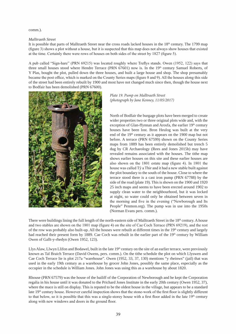
comm.).
Malltraeth StreetIt is possible that parts of Malltraeth Street near the cross roads lacked houses in the 18th century. The 1799 map
three small houses stood where Hendre Terrace (PRN 67601) now is. In the 19th century Samuel Roberts, of Y Plas, bought the plot, pulled down the three houses, and built a large house and shop. The shop presumably
of the street had been entirely rebuilt by 1900 and most have not changed much since then, though the house next to Bodfair has been demolished (PRN 67600).
North of Bodfair the burgage plots have been merged to create wider properties two or three original plots wide and, with the exception of Glan-ffynnan and Arosfa, the earlier 19th century houses have been lost. Bron Heulog was built at the very end of the 19th century as it appears on the 1900 map but not before. A terrace (PRN 67599) shown on the County Series maps from 1889 has been entirely demolished but trench 5 dug by CR Archaeology (Rees and Jones 2015b) may have revealed remains associated with the houses. The tithe map shows earlier houses on this site and these earlier houses are
the plot boundary to the south of the house. Close to where the terrace stood there is a cast iron pump (PRN 67788) by the side of the road (plate 19). This is shown on the 1900 and 1920 25 inch maps and seems to have been erected around 1902 to supply clean water to the neighbourhood, but it was locked at night, so water could only be obtained between seven in
People” Penmon.org). The pump was in use into the 1950s (Norman Evans pers. comm.).
There were buildings lining the full length of the north-eastern side of Malltraeth Street in the 18th century. A house
of the row was probably also built-up. All the houses were rebuilt at different times in the 19th century and largely had reached their present form by 1889. Cae Coch was rebuilt in the earlier part of the 19th century by William Owen of Gallt-y-rhedyn (Owen 1952, 123).
Llys Alaw, Llwyn Llifon and Bodawel, built in the late 19th century on the site of an earlier terrace, were previously known as Tal Braich Terrace (David Owens, pers. comm.). On the tithe schedule the plot on which Llyswen and Cae Coch Terrace lie is plot 217a “warehouse”. Owen (1952, 33, 37, 130) mentions “y rheinws” (jail) that was used in the early 19th century as a warehouse by grocer John Jones, possibly the same place, especially as the occupier in the schedule is William Jones. John Jones was using this as a warehouse by about 1820.
Rhouse (PRN 67579) was the house of the bailiff of the Corporation of Newborough and he kept the Corporation regalia in his house until it was donated to the Prichard Jones Institute in the early 20th century (Owen 1952, 37), where the mace is still on display. This is reputed to be the oldest house in the village, but appears to be a standard late 19th
th century
39
Plate 19. Pump on Malltraeth Street (photograph by Jane Kenney, 11/05/2017)

Pendref StreetThe tithe map shows a continuous row of houses (PRN 69218) along the north-western side of Pendref Street, the south-western end of which has been considerably altered but the rest consists of houses of much the same size
and 4) shows that the row was present in the late 18th century. In 1801 one of the buildings in the terrace is listed
town house associated with the farm of Tir Glas-coed (Owen 1952, 126).
By 1889 some of the houses at the south-western end of the terrace had been rebuilt in a larger, grander style, including Idan House (PRN 69217), and others, such as Elm Grove had been built closer to the current road edge than the original line. The rest of the terrace was probably also rebuilt in the 19th century. In 1920 there were three houses, the plans of which suggest that they had not been rebuilt, but these were demolished to create the current carpark.
Idan House was previously an inn called Sign-sloop or, in about 1844, Tafarn-Racs, and was also the location of Siop-Sharp (Owen 1952, 131). Elm Grove, adjacent to Idan House, was formerly called Pwll-Gro (Owen 1952, 130) and it is suggested that the name referred to a pond next to the street. There is a story that in the 1930s an Irish navvy drowned in the pond (presumably after coming out of the pub next door) (David Owens pers. comm.), but there is no trace of a pond on the County Series maps. The building to the south-west of Idan House was a grocer’s shop and was converted to a dwelling in about 1995 (David Owen pers. comm.), the main house was demolished in 1960 and entirely rebuilt.
The south-eastern side of the street was less built-up in the time of the tithe map. There was a short terrace (PRN 69216) running across the Sain Delyn plot. The 1799 map shows a
terrace had been built further back from the street and by 1889 this was rebuilt or reduced to two single storey cottages. The cottages were made into one dwelling about 40 years ago (David Owen pers. comm.). The row of houses towards the street corner were probably built in the 1840s as one of the buildings was a Baptist Chapel (PRN 8111), known as the Seion Chapel, and that was built in 1849, as recorded by a plaque still built into the wall of the house built on its site (plate 20). Llys Gwynedd, next to it, used to be the police station and the small shed at the back of the building was the prison cell (David Owens pers. comm.).
Baron Hill, Rhianfa and Pant are all on the County Series maps from 1889 but only two small buildings are shown in this area on the tithe map. The Heol y Wal development is new and has removed the house that stood there previously as shown on the County Series maps. There was also a small building on the street front in this area shown on the tithe map but there is little chance of any remains surviving.
The Cross RoadsThe cross roads was the heart of the medieval town and would have had medieval town houses around it. It was
present to accommodate markets and fairs.
1304-05 (Carr 2011, 206). The cross is indicated in various ways and in slightly different positions on different
precisely draws the cross base on its plinth. The 1801 map has a basic cross labelled as the “market cross” stood on what appears to be a low hill. The tithe map has a small dot to indicate the cross. The 1827 map does not show the cross but does have what appears to be a substantial building just off centre of the cross roads. It is possible this
40
Plate 20. Plaque commemorating the building of Seion Chapel built into the wall of Cermar (photographed by David Owen, 26/07/2017)

Tithe map 1846
Mostyn Estate map 1827
Penrhos Estate map 1801
Sketch by H Owen of a plan by Lewis Morris 1738-9 (Owen 1952)
Plan of the Sign 1799 with an enlarged inset of the cross on its plinth
Figure 20. Comparisons of plans of the cross roads showing different representations of the market cross

was the town hall (PRN 67576). A town hall had stood near the cross roads, but it was ruined by the 18th century. A sketch by Lewis Morris dated 1738-39, copied by Hugh Owen, has “Shire Hall In ruins” marked on the side of it without a clear indication of the location of the hall (Owen 1952). If the building on the 1827 map was the town or shire hall then it seems odd that it is not marked on the earlier maps. Perhaps as it was ruined it was not thought worth including and there is a faint pencil outline marked on the 1799 map in the same place as the building on the 1827 map, possibly where someone had noted the location of the ruins. If this was the location of the town hall it is likely that most of the buried remains were destroyed when Penrhyn House was built (see below).
Near the market cross was also a “carreg orchest” or “feat stone”, a large stone that strong men attempted to lift to their shoulders to prove their strength (Owen 1952, 135). The houses along the north-western end of Chapel Street, including what is now the Male Grooming Room, at the road corner were built in the 19th century after the tithe map but before 1889. They encroached on the previous
the end in recent years to make the turning into Church Street easier (Norman Evans pers. comm.). This house was called Penrhyn House (PRN 69245). In the early 19th century an inn known as Sign or Sign Fawr occupied this corner (PRN 69213). The opposite corner across Church Street was occupied by the White Lion pub (PRN 67580), but by 1889 the pub itself had been rebuilt and buildings added on the south-eastern side, again reducing the road width. The building (PRN 69252) that now occupies the corner position was called Cambrian House and it was built as a shop. Records transcribed by Owen show that the shop was in existence by 1870 and was owned by RP Jones (Owen 1952, 111, 115). An elderly resident of Newborough remembers that the shop was owned by the brother of John Prichard Jones (Richard Prichard Jones) and each year the latest London fashions would be sent from Dickins and Jones department store to be sold in the shop. Social hierarchy was strictly observed as the
The building had been left empty and neglected for 23 years and only two and a half years ago was renovated and is now the home of Twinkle Toes Foot Care.
The corner between Malltraeth Street and Pendref Street has also been heavily rebuilt but on the original foundations. In 1799 there was a house on the corner with a garden at each side, but since then the whole street frontage has been built-up. In the late 19th and early 20th century there was a smithy (PRN 67578) in part of what is now the Newborough Stores, conveniently located for passing trade.
this site but, like much of the village centre, it was rebuilt in the 19th century.
Signs of the TimesIn the early 19th century there were numerous taverns or inns in the village, which now only has one pub. These included the White Lion, still in business on much the same site, Sign Fawr, Sign-hare, Sign-delyn, the Sign of the Greyhound and Sign-sloop. The names are generally a reduction of “sign of” referring to the sign outside identifying the inn. English seems generally to be used for the names of these inns.
mention in parish records as in 1746, but he does not indicate its location. In 1810 Hugh Owen of the Sign obtained a licence to keep an inn (WQS/1810/M/149), but presumably a tavern had been run there for some considerable time previously, as the name Sign is suggestive of a tavern. The location of this building comes from somewhat circumstantial evidence. A map of 1799 (MISC 3/101) shows property belonging to Sign in the
roads. In 1772 a lease was obtained on a property called “Plas Mawr alias the Sign in the village of Newborough” (Llwydiarth Escob Papers 226). This is confusing as it might refer to Y Plas (PRN 67573) but the building shown in 1799 in the centre of the village was fairly large and could have been known as Plas Mawr. There is currently a cottage known as Sign Cottage (PRN 69213), which was originally attached to the building on the cross roads, and presumably named after it. Local residents, when asked, suggested that Sign Fawr was in the terrace on Chapel
Fawr, as this terrace is not shown on the tithe map and seems to have been built in the mid or late 19th century. However it does further suggest that Sign Fawr was on this street corner and almost certainly was the building shown on the tithe map and earlier maps on the corner between Church Street and Chapel Street. This building
42

Wh
ite
Lio
n
Sig
n F
awr
Sig
n-h
are
Sig
n-s
loo
p
Sig
n-d
ely
n
Sig
n o
f th
e G
reyh
ou
nd
Fig
ure
21.
Loc
atio
ns
of i
nn
s an
d t
aver
ns
in t
he
mid
dle
of
New
bor
ough
sh
own
on
th
e 18
89 fi
rst
edit
ion
Cou
nty
Ser
ies
map
(n
ot a
ll t
hes
e in
ns
wer
e n
eces
sari
ly o
pen
at
the
sam
e ti
me)

must have been demolished when the current terrace was built, reducing the width of Chapel Street. It is possible that remains of this building survive under the yards behind the present buildings.
A pub was run in the front room of the house now called “Sain Delyn” into the early 20th century (PRN 69216). It was known as Sign-delyn (sign of the harp) (Owen 1952, 130), with the present name (sound of the harp) hiding its original form. The present building was probably built in the early 19th century but has been extensively adapted, but an earlier building did exist on the site in 1799 when the plot was called “Gardd gerrig” (BUA MISC 3/101).
Idan House (PRN 69217) was previously known as Sign-sloop, and before that, in about 1844, as Tafarn-Racs (Owen 1952, 131). Idan House, and the two houses south-west of it, appear as a terrace on a 1799 map (MISC 3/101).
Morus (Morris) around 1808 to 1828 (Owen 1952, 133-1). John Jones is described as the “victualler of the Hare” in 1810 (ANGLESEY ARCHIVES WQS/1810/M/149). Owen describes the pub as being adjacent to Hendre Terrace. The pub would have been in the house shown on tithe map, a little further back from the street than the
The current White Lion (PRN 67580) is built in plot 102 on the tithe map, which is named as the White Lion on the schedule. In 1846 it was owned by the Right Honourable Lord Dinorben and the tenant was Robert Jones.
(Owen 1952, 135).
The Greyhound (PRN 69214) is known only from the sketch map copied by Hugh Owen from Lewis Morris (Owen 1952). The map seems originally to have been titled “to R Parry’s House Sign of ye Greyhound”. Buildings are approximately marked but one building on Chapel Street is labelled “RP”, and it appears that this is R Parry’s house. “Sign of ye Greyhound” suggests that this was an inn called the Greyhound. This building existed in the early 18th century but had been demolished by the tithe map was produced in 1846. However there is an inset on plot 107 (Caeau Llidiart) which appears to be where a building had stood, and other earlier maps show a building here.
WellsMost of the properties would have had wells or would have shared a communal well. Many of these are shown on the County Series maps, especially the 1889 and 1900 maps, several wells seem to have disappeared by 1920. No wells are shown in the yards along Chapel Street on these maps, though they must have had a water source, and it is likely that, throughout the village, there were many more wells than shown on the maps. By the early 19th century communal water pumps seem to have generally replaced wells in the early 20th century, presumably fed
buried under present gardens or yards. A few of the pumps still exist.
Current characterThe centre of the village retains, although heavily disguised, something of the character of a medieval town. The
streets. All the properties have their long narrow gardens or yards, which originate from the burgage plots and generally retain the original limits and outline.
mentioned in the descriptions below this should be assumed. Most, but not all, of the houses are pebble-dashed, with some being rendered and painted and a few with their stone walls exposed.
Malltraeth Street and Chapel Street form the main street through the village and these are busy and frequently
street is particularly visually dominated by electricity cables, supported on poles, running up and across the street.
Warren and the beach.
44
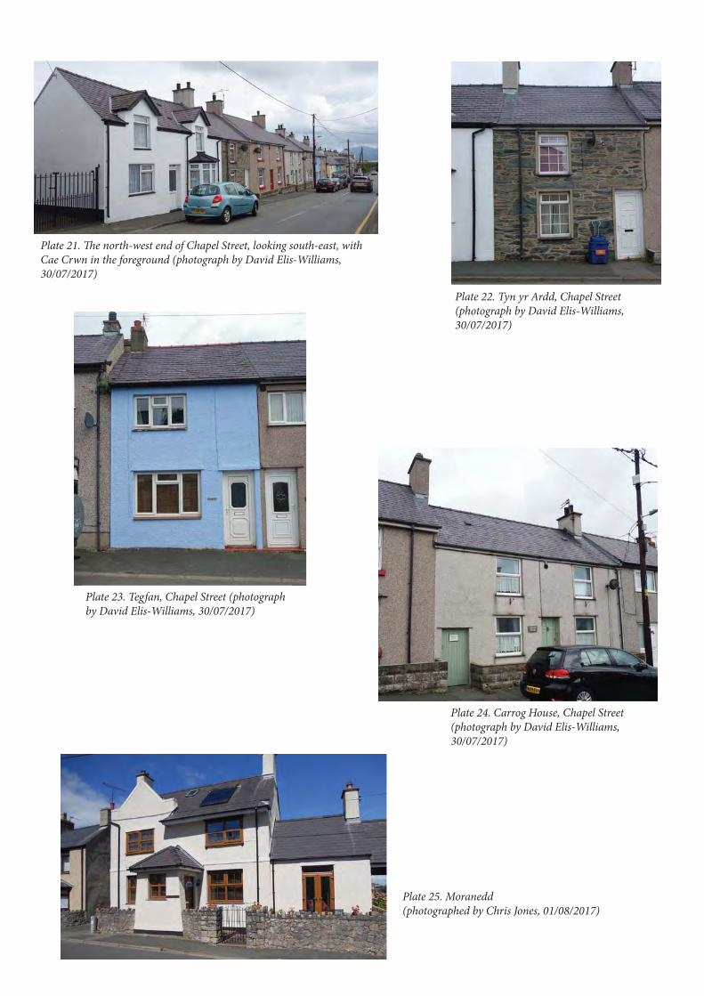
Plate 21. The north-west end of Chapel Street, looking south-east, with Cae Crwn in the foreground (photograph by David Elis-Williams, 30/07/2017)
Plate 22. Tyn yr Ardd, Chapel Street (photograph by David Elis-Williams, 30/07/2017)
Plate 23. Tegfan, Chapel Street (photograph by David Elis-Williams, 30/07/2017)
Plate 24. Carrog House, Chapel Street (photograph by David Elis-Williams, 30/07/2017)
Plate 25. Moranedd (photographed by Chris Jones, 01/08/2017)
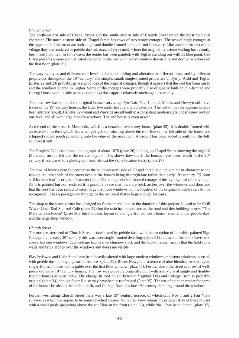
Chapel StreetThe north-eastern side of Chapel Street and the south-eastern side of Church Street retain the most medieval character. The north-eastern side of Chapel Street has rows of two-storey cottages. The row of eight cottages at the upper end of the street are both single and double-fronted and their roof lines vary. Like much of the rest of the
been neatly pointed. In some cases the render has been painted, with Tegfan standing out with its blue paint. Cae Crwn presents a more sophisticated character to the rest with its bay window downstairs and dormer windows on
The varying styles and different roof levels indicate rebuilding and alteration at different times and by different proprietors throughout the 19th century. The simple, small, single-fronted properties of Tyn yr Ardd and Tegfan (plates 22 and 23) probably give a good idea of the original cottages, though it appears that the roof has been raised and the windows altered in Tegfan. Some of the cottages were probably also originally built double-fronted and Carrog House with its side passage (plate 24) does appear relatively unchanged externally.
The next row has some of the original houses surviving. Tyn Gait, Nos 1 and 2, Monfa and Derwyn still have traces of the 19th century houses, the latter two under heavily altered exteriors. The rest of the row appears to have been entirely rebuilt. Henllys, Gwynant and Wayside are all built in a consistent modern style under a new roof on one level and all with large modern windows. The end house is even newer.
At the end of the street is Moranedd, which is a detached two-storey house (plate 25). It is double-fronted with an extension to the right. It has a winged gable projecting above the roof line on the left side of the house and a hipped roofed porch projecting onto the edge of the pavement. A carport has been added recently on the left, south-east side.
The Peoples’ Collection has a photograph of about 1875 (plate 26) looking up Chapel Street showing the original Moranedd on the left and the terrace beyond. This shows how much the houses have been rebuilt in the 20th century if compared to a photograph from almost the same location today (plate 27).
The row of houses near the corner on the south-western side of Chapel Street is quite similar in character to the row on the other side of the street despite the houses being in origin late rather than early 19th
still has much of its original character (plate 28), being a double-fronted cottage of the style typical of the village. As it is painted but not rendered it is possible to see that there are brick arches over the windows and door and
recognised. It has a passageway through to the rear yard that is large enough for carts.
Male Groom Room” (plate 30), but the basic layout of a single-fronted town house remains under pebble-dash and the large shop window.
Church StreetThe north-eastern end of Church Street is dominated by pebble-dash with the exception of the white painted Sign Cottage. In the early 20th century this was three single-fronted dwellings (plate 31), but two of the doors have been
walls and brick arches over the windows and doors are visible.
Plas Pydewau and Llain Stent have been heavily altered with large modern windows or dormer windows inserted, with pebble-dash hiding any earlier features (plate 32). Rhenc Newydd is a terrace of nine identical two storeyed,
preserved early 19th century houses. The row was probably originally built with a mixture of single and double-fronted houses as seen today. The change in roof height between Ysgubor Ddu and College Bach is probably original (plate 34), though Spier House may have had its roof raised (Plate 35). The use of paint on render for some of the houses breaks up the pebble-dash, and College Bach has late 19th century detailing around the windows.
Further west along Church Street there was a late 19th century terrace, of which only Nos 1 and 2 Fair View survive, as what now appear to be semi-detached houses. No. 2 Fair View retains the original style of these houses with a small gable projecting above the roof line at the front (plate 36), while No. 1 has been altered (plate 37).
46

Plate 26. Chapel Street in about 1875 (Peoples’ Collection https://www.peoplescollection.wales/items/1527 Reproduced by permission of The National Library of Wales. All Rights Reserved.)
Plate 27. Chapel Street from south photograph by David Elis-Williams, 30/07/2017)
Plate 28. Tŷ Nant (photographed by Megan Howe, 05/02/2018)
Plate 29. The former Caffi Wiwer Goch/Red Squirrel Café (photographed by Jane Kenney, 11/05/2017)
Plate 30. The Male Groom Room (photographed by Megan Howe, 05/02/2018)

Plate 31. Sign Cottage (photographed by Megan Howe, 05/02/2018)
Plate 32. Plas Pydewau (photographed by Owenna Orme, 30/08/2017)
Plate 33. Soar Terrace (photographed by Owenna Orme, 30/08/2017)
Plate 34. College Bach and Ysgubor Ddu (photographed by Owenna Orme, 30/08/2017)
Plate 35. Spier House and neighbouring properties (photographed by Owenna Orme, 30/08/2017)

Plate 36. No. 2 Fair View (photographed by Megan Howe, 05/02/2018)
Plate 37. No. 1 Fair View (photographed by Megan Howe, 05/02/2018)
Plate 39. Tan y Ffynnon (photographed by Megan Howe, 05/02/2018)
Plate 38. Dwyryd (photographed by Megan Howe, 05/02/2018)
Plate 40. Carpark on Church Street (photographed by Sian Barker, 13/07/2017)

th century houses. All three are two-storey double-fronted houses but Dwyryd is taller and more imposing than the others (plate 38). The render has been removed from Tan y Ffynnon and its stone walls can be seen (plate 39). It has thick sandstone lintels
The carpark on Church Street, which would be so useful for visitors to the village and Llys Rhosyr, is partially closed off and the toilets are closed. The whole place is becoming run-down (plate 40). There may well be the original 19th century terrace under the modernised exteriors of Hen Blas and the adjacent houses, although this is
obviously 19th century houses, both double fronted, and Bodnant has an extra room over the passage between them (plate 42). At the end of Coed Anna is a shed formerly used for marram grass weaving (PRN 67588) (plate 43).
stone and there is a small window in the south side with a wooden lintel. The roof is of rendered slates. Cambrian House and adjacent buildings at the corner have been heavily altered and covered in a neat pale, silvery pebble-dash.
Malltraeth StreetThe White Lion is typical of a late 19th pub in a market town, which is what it was (plate 44). It has decorative
current owners started renovating seven years ago and work is still in progress. A passage led though to the yard in the back, which is now closed off by modern double wooden doors to create a garage or storeroom. A photograph held in the Prichard Jones Institute shows how little the building has changed since the late 19th century (plate 45).
and decorative window surrounds (plate 46). The plot with the pump (PRN 67788) on its frontage is now very
probably dates to the turn of the 20th century.
Llys Alaw, Llwyn Llifon and Bodawel, although heavily modernised, retain some of their 19th century character (plate 49). Tyn Llan and Llyswen seem to be entirely modern. Cae Coch Terrace, though with new windows, doors and roof, are recognisable as 19th century double-fronted cottages (plate 50). The render has been removed from
be a standard double-fronted 19th century cottage. Adjacent to the north is a small shed. This is very dilapidated and cracked render shows that much of the walls are of modern brick but the roof seems to be of rendered slate and the sag in the roof suggests that this is of some age. This seems to be the same shed as shown on the 1889 map.
Gorphwysfa appears to be a modern house, with two little gables above the upper windows and a porch between two bay windows, but this probably hides the 19th century house (plate 52). The earlier buildings are equally well-hidden in the Newborough Stores, which is nicely rendered and painted, with prominent yellow and purple signage (plate 53).
Pendref StreetIdan House was rebuilt in the 1960s so its pebble-dashed exterior is unlikely to conceal any earlier remains (plate
lintels of this late 19th century house (plate 55). The main row of houses along the northern side of Pendref Street has numerous alterations and additions, extensions, dormer windows, projecting roofs etc., but some houses retain their 19th century character or a few original features (plates 56 and 57). Some painted render varies the pebble-
Rhianfa (plate 58) has recently been renovated, the render removed and the stone walls and slate lintels exposed. It is a double-fronted house like many in the village. It has a date stone of 1859 with initials GAG, so although it closely resembles houses such as Rhouse, that claim to be early, it was built in the mid-19th
with the map evidence. The adjacent Pant is very similar in design, though smaller and was probably built at the same time. The two Baron Hill houses are essentially semi-detach houses that have been added on to the end of
later than Rhianfa. The building is also much taller than its neighbour.
50

Plate 41. Hen Blas and neighbouring houses (photographed by Sian Barker, 13/07/2017)
Plate 42. Bodnant (photographed by Sian Barker, 13/07/2017)
Plate 43. Old cottage/marram grass weaving shed (PRN 67588) (photographed by Sian Barker, 13/07/2017)
Plate 44. The White Lion (photographed by Jane Kenney, 16/02/2018)
Plate 45. Image of the White Lion in the late 19th century held in the Prichard Jones Institute
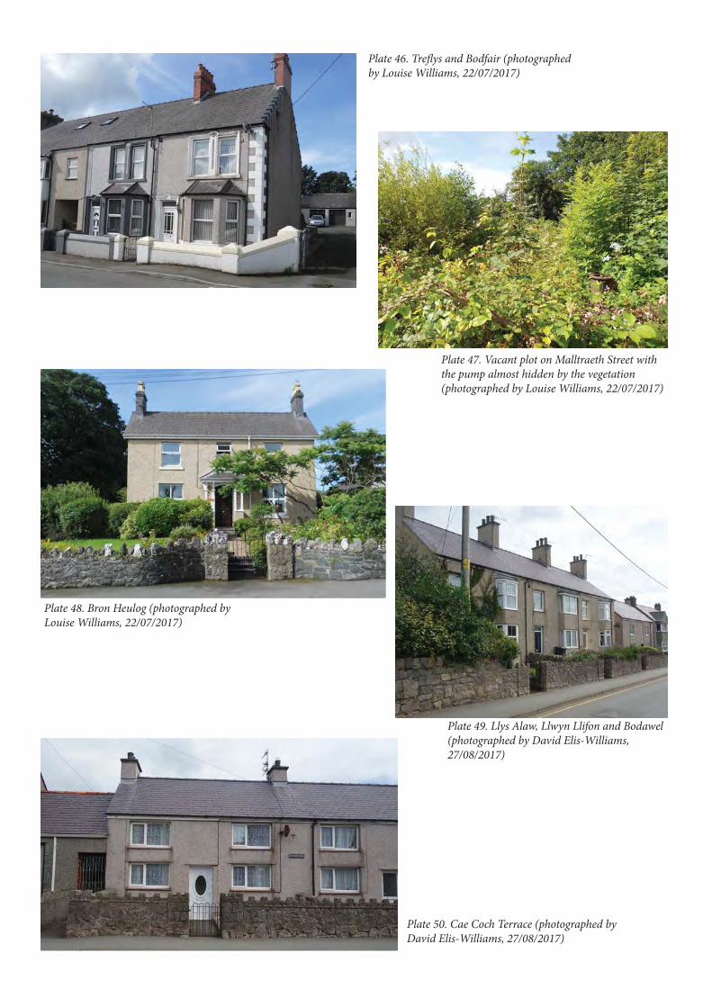
Plate 46. Treflys and Bodfair (photographed by Louise Williams, 22/07/2017)
Plate 47. Vacant plot on Malltraeth Street with the pump almost hidden by the vegetation (photographed by Louise Williams, 22/07/2017)
Plate 48. Bron Heulog (photographed by Louise Williams, 22/07/2017)
Plate 49. Llys Alaw, Llwyn Llifon and Bodawel (photographed by David Elis-Williams, 27/08/2017)
Plate 50. Cae Coch Terrace (photographed by David Elis-Williams, 27/08/2017)

Plate 51. Rhouse (photographed by David Elis-Williams, 27/08/2017)
Plate 52. Gorphwysfa (photographed by David Elis-Williams, 27/08/2017)
Plate 53. Newborough Stores (photographed by David Elis-Williams, 27/08/2017)
Plate 54. Idan House (photographed by David Owen, 26/07/2017)
Plate 55. Elm Grove (photographed by David Owen, 26/07/2017)

Plate 56. Tan y Fron (photographed by David Owen, 26/07/2017)
Plate 57. Part of the main Pendref Street terrace (photographed by David Owen, 26/07/2017)
Plate 58. Rhianfa with Baron Hill next door (photographed by David Owen, 26/07/2017)
Plate 59. Sain Delyn (photographed by David Owen, 26/07/2017)
Plate 60. Plas Newydd and Llys Gwynedd (photographed by David Owen, 26/07/2017)

Sain Delyn appears to be a modern bungalow with only the short, wide chimney stack perhaps hinting at a
but underneath are the remains of two 19th
19th century houses. As they are not rendered the walls of quarried stone can be seen, and, although not using cut
There are decorative pale brick surrounds to the windows and doors and alternating pale and red brick above the downstairs windows and door (plate 60). Cermar is a modern dormer bungalow with a gabled porch (plate 61). It stands on the site of Seion Chapel but seems to have been entirely rebuilt. The covered passage through to the back yard shown on the 1920 map has gone, leaving a drive which leads through to the rear garden.
red window and door surrounds (plate 62). The adjacent Victoria House is distinguished by its prominent painted quoins against the usual pebble-dash. This also still has the name “Victoria House” carved in stone above the door
Burgage plotsThe back gardens and yards of the properties could not be inspected for this project. Many are clearly gardens with concrete yards close to the houses or parking spaces where there is access. Many had sheds in the late 19th century and a few of these seem to survive. The continuity of the property boundaries is notable. A few plots have been merged but in most cases each house has a single burgage plot just as in the medieval town.
Archaeological potential
have 18th
of the history of the house. Many other houses in the village may also have some remains of earlier fabric within them and some attempt to search for this as the opportunity arrives would add to the understanding of the history
55
Plate 61. Cermar (photographed by David Owen, 26/07/2017)
Plate 62. Former post office now Caffi Wiwer Goch/Red Squirrel Café (photographed by David Owen, 26/07/2017)
Plate 63. Victoria House (photographed by David Owen, 26/07/2017)

69
21
4
69
21
1
69
23
9
69
21
0
67
58
6
67
75
6
67
75
5
67
75
9
67
75
8
67
75
76
69
54
69
24
0
67
59
3
67
59
0 67
59
2
69
24
1
69
24
2
78
27
42
64
27
42
44
25
42
64
27
42
44
25
65
6
65
5
65
6
65
5
SH
42
3
Chapel Stre
et
© C
row
n C
op
yrig
ht
an
d d
ata
ba
se r
igh
t 2
01
8. O
rdn
an
ce S
urv
ey
10
00
21
87
4. W
els
h G
ove
rnm
en
t.
© H
awlf
rain
t a
haw
liau
cro
nfa
dd
ata
’r G
oro
n 2
01
8. R
hif
Trw
ydd
ed
yr
Aro
lwg
Ord
na
ns
10
00
21
87
4.
Ke
y
Sit
e w
ith
PR
N
We
ll o
r p
um
p w
ith
PR
N
69
20
4
69
23
7
Fig
ure
22.
Ch
ara
cter
are
a 0
2: lo
wer
Ch
apel
Str
eet

of the village. Even those entirely rebuilt in the early 19th century may still preserve interesting features from that period. It would be useful to identify the actual location of the 16th century doorway (PRN 67574) and whether it is reused and if so where from.
built on and otherwise disturbed but archaeology representing the whole history of the village, especially that of the medieval town, is likely to survive in these areas. Most of these areas are gardens and are relatively undisturbed. Although these remains will be of activity in the burgages rather than remains of houses the careful excavation of a single medieval rubbish pit could hugely expand our knowledge of the medieval town, its inhabitants and the economy. There must be numerous wells concealed within this area and trades were almost certainly carried out in the burgages, potentially leaving their waste and other remains.
8.2. Character area 02: Lower Chapel StreetFigure 22
Historical developmentThis character area covers the south-eastern end of Chapel Street but also much of the south-western side of the street closer to the cross roads as this area has quite a different character to the opposite side of the street. This area is less densely occupied than upper Chapel Street and has more variety in the style, date and function of the buildings.
7). The original house of Tyn y Goeden is shown as a long narrow building suggestive of at least being on the site
19th century but on the original site. The building is not on the present street frontage. The tithe map shows the few buildings on the street frontage to be on the same alignment. This indicates that Chapel Street was about 23 or 24m wide in the early 19th
hosted the market and fairs.
The Ebeneser Chapel (PRN 7827) is said to have been built in 1784 or 1785, and the current building has the date of 1785 on its front gable, but the building shown on the tithe map is quite different to the present building, which was actually built in 1881. Most early dissenter meetings were held in houses licensed for the purpose (Pryce
but was two or more existing houses converted into a chapel. The chapel was restored in 1835, rebuilt in 1861, and the present version was built in 1881. A Sunday school and chapel house (PRN 66954) were added next to the chapel in 1892 (NMR NPRN 8827). The chapel house is shown on the 1889 map, but at that date there were only two small buildings behind it, which were presumably used for the Sunday school. By 1900 an extension had been built on the north-west end of the chapel house and the large present Sunday school building had been built. A cart shed was built behind the enlarge schoolroom at the same time.
Traces of a medieval dwelling were excavated in the plot adjacent to the Sunday school in 2015 (Rees and Jones 2015a) (PRN 67755-9) and other remains under Môr a Mynydd were probably also related to medieval occupation
seems to have been an inn during the 18th century as a sketch map drawn by Lewis Morris in 1738-39 and copied by Hugh Owen (Owen 1952) refers to a building in this location as “R Parry’s House Sign of ye Greyhound” (PRN 69214). The 1827 map names this building as “Ty Pydw House” with a garden and unenclosed space between it and the road.
Behind the buildings on Chapel Street is Bod Iorwerth (PRN 69210). The present house was built around 1844 by Edward Hugh Owen, Glas-coed, but he died before going to live there (Owen 1952, 122). The house is shown on the tithe map and the building would have been new when the tithe map was drawn up. The tithe map shows an extension to the north-west not shown on later maps. A range of buildings (PRN 69211) is shown on the 1846 tithe map just north of Bod Iorwerth and what appears to be the same buildings are still marked on the County Series maps until at least 1920. At least in the 19th century these appear to have been outbuildings.
On the north-eastern side the lower part of Chapel Street was, and largely still is, unoccupied. The only exception
57

in the 19th and early 20th century was a cottage (PRN 67590) shown by the road side on the 25 inch maps up to
than the one shown on the later maps, but the accuracy of this map is doubtful and it is probably the same cottage.
and there has been no later development on the site.
Tal y Braich was a new build in the late 19th century, appearing on the 1889 map with an orchard and numerous outbuildings. The orchard does not seem to have done well, perhaps due to the exposed position, and it had become a garden by 1900. Maen Lwyd (PRN 67592), a stone marking the borough boundary, stood somewhere near where Tal-y-Braich stands today, but it was broken up and used to build walls (Owen 1952, 128).
There are two small developments of new houses in this area, with Môr a Mynydd built in 2003 and Llain Capel
Current characterThe area is characterised by detached buildings, of widely differing types and periods and is the result of relatively haphazard development in the later 19th and 20th centuries. Little survives of the medieval burgage plots, though the limits of the medieval town may be set by Moranedd on the north and Tal y Braich on the south. To the north of
was built in the second half of the 20th century. Though this side of the road never appears to have been developed,
the buildings lying to the south of the road.
The Capel Ebeneser complex of chapel, chapel house and school room dominate the south side. The house is one of the few surviving stone buildings not covered by render, and is a reminder of how much of the remainder of the village may have looked prior to relatively recent enveloping schemes.
quoins, and narrow slate lintels over the downstairs windows and door. Unusually for Newborough the windows have not been replaced and they are probably the original sash windows, retaining marginally spaced glazing bars. The door may also be original. The extension on the right of the original building is built in a similar style, though
in the angle of the L (plate 65). It is rendered and painted white with tall 12-pane sash windows, again probably
gate-pillars of roughly knapped stone.
Next door is the Ebeneser Chapel (plate 66). This is a rectangular building of renaissance design with a pitched slate roof and a projecting porch with a hipped slate roof and a central bay topped with a balustraded parapet. The
pedimented gable with projecting cornice. On the gable are three plaques: circular plaques to the left and right with “O.C.” and “1785” inside them and a centre plaque reading “EBENESER”. The windows on the front have round arches with cement architraves and keystones. The windows in other elevations are rectangular, tall 12 pane windows. All the windows appear to be the original sash windows. Behind the chapel is a cemetery. The wall in
pillars and coping. The chapel is a grade II listed building (reference 20552) and the chapel house and Sunday school are also grade II listed (reference 20556).
Tyn y Goedan is one of the few houses that lies perpendicular to the road. It is now heavily rendered, but is two-storeyed, with a larger chimney on the right and slightly off-set door to the left. There is a small extension on the north-east end and a lean-to extension on the other end. A yard lies adjacent to the road, and on the far side of
the other (plate 67). The tithe map shows a building, assumed to be a house, on this location, though there is no evidence of this surviving within the masonry of the barn. The barn is well-maintained but seems not to have been
58

Plate 64. Tŷ Capel (photographed by Chris Jones, 26/09/2017)
Plate 65. Capel Ebeneser Sunday School (photographed by Chris Jones, 26/09/2017)
Plate 66. Capel Ebeneser (photographed by Chris Jones, 26/09/2017)
Plate 67. Tyn y Goedan barn (photographed by Chris Jones, 07/09/2017)
Plate 68. Tal y Braich (photographed by Chris Jones, 15/08/2017)
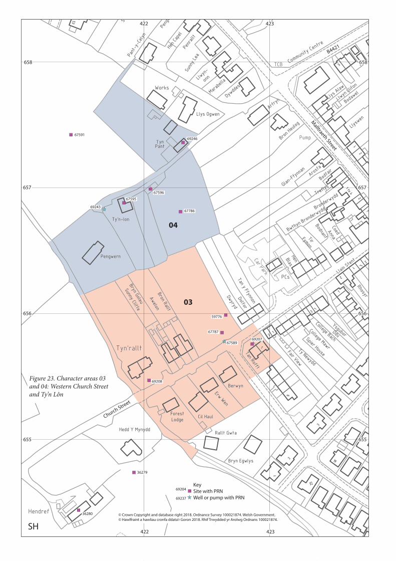
423 42422
657
656
655
SH
658
657
656
655
658
423422
59776
67787
6758969207
69208
67786
67596
67595
69243
36279
36280
6759169246
03
04
Church Street
Malltraeth Street
© Crown Copyright and database right 2018. Ordnance Survey 100021874. Welsh Government.
© Hawlfraint a hawliau cronfa ddata’r Goron 2018. Rhif Trwydded yr Arolwg Ordnans 100021874.
Key
Site with PRN
Well or pump with PRN
69204
69237
B4421
Figure 23. Character areas 03 and 04: Western Church Street and Ty’n Lôn

Tal y Braich still stands in its extensive gardens at the entrance to the village from the south (plate 68). It is a substantial two-storey building, double-fronted on its south-east elevation with a central porch. It has various original features including decorative slates on the roof and decorative brick chimneys.
The modern house of Cae Ffynnon hides behind high hedges and on the opposite side of the road Llwyn Helig
and Moranedd, but there was a cottage here until at least 1920 (PRN 67590). The road appears to have been widened and straightened here, probably resulting in the demolition of the cottage.
Archaeological potentialExcavation on the plot next to the Sunday school demonstrated the archaeological potential of this area as the remains of a medieval building were found. An opportunity for extensive archaeological work was missed in
medieval but were not fully understood due to the limits of the work. Like the other areas over the medieval town the back gardens and yards could preserve archaeological remains, but south-east of Ty’n y Goedan the present village has extended beyond the limits of the town and the possibility of archaeology is reduced, though not excluded. The exception to this is the site of a cottage (PRN 67590) on the north-east side of the road.
example of a 19th century barn. The chapel and associated chapel house and Sunday school are listed buildings and so of regional importance. The chapel is an impressive example and dominates the entrance to the village from the south. It would be a pity for it to further deteriorate.
8.3. Character area 03: Western Church StreetFigure 23
Historical developmentThe burgage plot boundaries continue as far as Fair View and south-west of that the limits of the town are less
and could well be three plots combined. The tithe map also shows dwellings along the street in a position which suggests they were medieval and belonged to these proposed plots. There is no evidence that the town continued any further in this direction. On the north-western side of the street all the plots are burgage plots, or merged plots,
is also shown as a gap on the tithe map. The excavation of building remains within this plot close to the street frontage in 2015 (Rees and Jones 2015b) (PRN 67787), shows that this was also built on and part of the town. A well (PRN 67589) is shown on the frontage of this land on the County Series maps from 1889, in an indentation in the roadside wall. This well was called Ffynnon Wrallt and was the main public well for the village (Norman Evans pers. comm.).
Longley (2002, 7) suggests the small cross roads on the western edge of the village as the possible centre of the
of what is now Church Street is shown turning south-east in a broad curve. The church is reached by the “church
Church Street has been extended straight to the west, a road also heads north and all these roads join at right angles as today. This suggests that the cross roads was formed in the early 19th century and is not a medieval feature.
The two pairs of semi-detached houses, Bron Rallt/Awelon and Bryn Goleu/ Sunny Cliffe, were built by 1889, at least in plan much as they are today, including a range of sheds behind the houses, which presumably originally
a fairly large holding (plot 65) called Tyn yr allt. They are also shown on a 1827 map (Mostyn 8450) and on the County Series maps and on the 1953 6 inch map, although from 1889 another house is also shown further back from the road, so it is possible that in their later history they became outhouses to the new house of Ty’n-yr-allt. These are probably in origin medieval town houses, though rebuilt during their history. The earlier houses were demolished when the present Tyn’rallt was built on the site. The site of the earliest houses is now a garden but it is possible that foundations survive.
61

Current characterThis area encompasses the limits of the medieval borough and also the limits of the intensively built-up area. Properties are either semi-detached or detached, and the grounds around them more extensive, with many set back further from the road.
Tan Rofft are two modern semi-detached houses. Towards the end of the built-up street are a group of modern
very modern in design (plate 69). It is a two-storey house with a dramatic asymmetrical roof and, although new, seemed to be undergoing recladding when the survey was being done.
Bron Rallt/Awelon and Bryn Goleu/ Sunny Cliffe are two pairs of semi-detached houses. Bron Rallt and Awelon (plate 70) are well-preserved with the original wooden porches over the doors and on Bron Rallt the two colour
brick decoration on the chimney stacks can be seen. The houses are single-fronted and a mirror image of each other. Bryn Goleu and Sunny Cliffe would have looked the same but they have lost their original porches and gained dormer windows. Tan yr Allt is a very modern house making use of stone and some brick as well as pebble-
Archaeological potentialWhile the gardens of the modern bungalows, Berwyn to Forest Lodge, probably have fairly low archaeological potential, the rest of the properties have gardens that were burgage plots and have the potential to preserve medieval archaeological deposits. The vacant plot between Dwyryd and Bron Rallt is particularly important because it has not had 19th century or later building on the street frontage and it has already been demonstrated by excavation that archaeological remains of earlier houses survive here. Any development in this area must be preceded by detailed archaeological investigation, not just a watching brief, as this is one of the few remaining chances to recover evidence of the medieval buildings.
8.4. Character area 04: Ty’n LônFigure 23
Historical development
62
Plate 69. Forest Lodge (photographed by Megan Howe, 05/02/2018)
Plate 70. Bron Rallt and Awelon (photographed by Megan Howe, 05/02/2018)
Plate 71. Tan yr Allt (photographed by Megan Howe, 05/02/2018)

being divided into four narrow strips owned by different landowners but not individually enclosed. This makes
more so than many of the burgage plots in the town. It seems unusual that they are not enclosed as they were still owned by different holdings, but perhaps as their function as burgage plots was lost the boundaries were removed
a house (the early Ty’n Pant) on the frontage of one strip may support the suggestion that these were originally burgage plots and that the other strips originally also had houses. It is likely that the adjacent land on which currently a workshop and Llys Ogwen stand was also originally at least two burgage plots.
There is a plot running south from Tyn Lôn (plot 96 on the tithe map) that resembles a burgage plot and in this case it has remained enclosed despite the land around it also belonging to Tyn Lôn. The position of this suggests that originally the land to either side was also originally divided into burgage plots. In contrast the land on
originally part of the medieval town with plots running perpendicularly from the small lane. The lane itself must therefore have been medieval in date. The presence of the lane is suggested on the Enclosure map and it is clearly shown on the tithe map but it does not extend beyond Tyn Lôn and almost certainly never did. It is unlikely that it joined through to the lane that runs to the west as this seems not to have existed before the early 19th century.
The archaeological potential of the former burgage plots is indicated by the discovery of a linear feature (PRN 67786) in a trial trench. The date and nature of this feature was not established but it underlay a relic soil layer and could be at least medieval in date (Rees and Jones 2015b).
The house of Ty’n Pant (PRN 69246) shown on the tithe map is on the site of part of the present house. The main house is shown on the 25 inch maps from 1889 but building to the north-west is not present till 1920 then it is half its present size.
Tyn y Lôn (PRN 67595) is shown on the 1846 tithe map exactly as it appears today. The current building must at least be based on buildings present in the early 19th century. The building to the east of Tyn Lôn (PRN 67596), now just a barn or shed, was shown as a house on the 1846 tithe map and County Series maps.
25 inch maps. On the tithe map the building is within a single large plot (No 48) named as Tyn y Cae. It is highly likely that the building shown is the farmhouse associated with this land and that this is the original location of Ty’n y Cae, which has moved towards the north-west end of the plot by 1889. Ty’n y Cae is mentioned in the 1773
Current character
entirely modern house the other houses have a history going back to at least the early 19th century and as this appears to have been part of the medieval town there could have been medieval houses originally on their sites. Tyn Lôn is a single-storey, white painted bungalow still retaining the L-shaped plan of the original house (plate 73). It is likely to have early 19th century fabric within it. The adjacent house has been recently rebuilt as a barn or outbuildings with a good new slate roof. Tyn y Pant (plate 74) is a two-storey house with a glass porch or
63
Plate 72. Pengwern (photographed by Megan Howe, 05/02/2018)
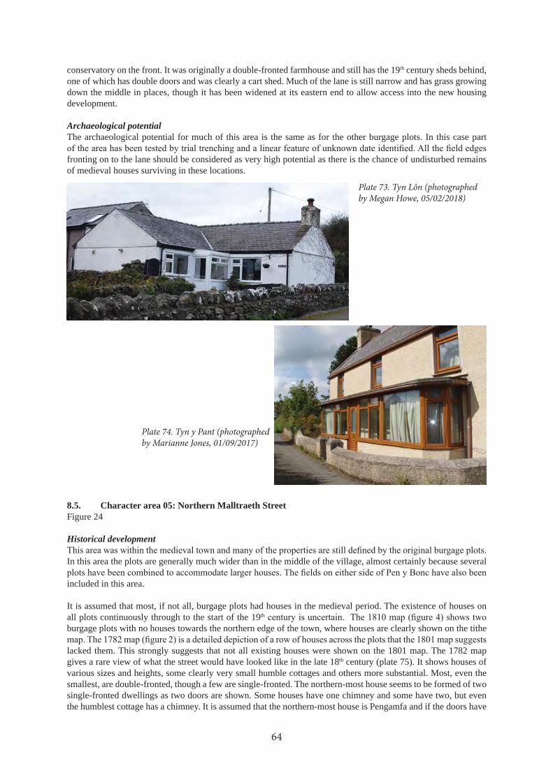
conservatory on the front. It was originally a double-fronted farmhouse and still has the 19th century sheds behind, one of which has double doors and was clearly a cart shed. Much of the lane is still narrow and has grass growing down the middle in places, though it has been widened at its eastern end to allow access into the new housing development.
Archaeological potentialThe archaeological potential for much of this area is the same as for the other burgage plots. In this case part
fronting on to the lane should be considered as very high potential as there is the chance of undisturbed remains of medieval houses surviving in these locations.
8.5. Character area 05: Northern Malltraeth StreetFigure 24
Historical development
In this area the plots are generally much wider than in the middle of the village, almost certainly because several
included in this area.
It is assumed that most, if not all, burgage plots had houses in the medieval period. The existence of houses on all plots continuously through to the start of the 19th
burgage plots with no houses towards the northern edge of the town, where houses are clearly shown on the tithe
lacked them. This strongly suggests that not all existing houses were shown on the 1801 map. The 1782 map gives a rare view of what the street would have looked like in the late 18th century (plate 75). It shows houses of various sizes and heights, some clearly very small humble cottages and others more substantial. Most, even the smallest, are double-fronted, though a few are single-fronted. The northern-most house seems to be formed of two single-fronted dwellings as two doors are shown. Some houses have one chimney and some have two, but even the humblest cottage has a chimney. It is assumed that the northern-most house is Pengamfa and if the doors have
64
Plate 73. Tyn Lôn (photographed by Megan Howe, 05/02/2018)
Plate 74. Tyn y Pant (photographed by Marianne Jones, 01/09/2017)

42
34
24
42
14
22
42
34
24
42
14
22
66
0
65
9
65
8
66
0
65
9
65
8
SH
67
59
7
67
58
2
67
59
8
78
28
67
58
3
67
57
3
69
25
1
05
© C
row
n C
op
yrig
ht
an
d d
ata
ba
se r
igh
t 2
01
8. O
rdn
an
ce S
urv
ey
10
00
21
87
4. W
els
h G
ove
rnm
en
t.
© H
awlf
rain
t a
haw
liau
cro
nfa
dd
ata
’r G
oro
n 2
01
8. R
hif
Trw
ydd
ed
yr
Aro
lwg
Ord
na
ns
10
00
21
87
4.
Ke
y
Sit
e w
ith
PR
N
We
ll o
r p
um
p w
ith
PR
N
69
20
4
69
23
7M
alltra
eth S
treet
B442
1
Lôn
Twnt
i
Fig
ure
24.
Ch
ara
cter
are
a 0
5:
Nor
ther
n M
allt
raet
h S
tree
t

been converted to windows it looks quite similar to the house today. Pengamfa (PRN 67598) has a date stone of 1769 (plate 76), so it should have been standing what the 1782 map was made. On the tithe map it is named as Pen
1817 (Owen 1952, 129, 131).
The houses adjacent to Pengamfa have been entirely rebuilt in the 19th century. Immediately next door was the Wesleyan Methodist chapel (PRN 7828) supposedly built in 1804, but the tithe map (plot 52) just lists this as a house and garden, so it is likely that it was not purpose built as a chapel but the house was used for services from 1804. The building is labelled as a Wesleyan Methodist Chapel on the 1st and 2nd 25 inch maps and it is said to have closed in 1914 (NPRN 8828). There is now a modern house on the site that has removed all traces of the chapel, but the house is still called Hen Capel. Minffordd (PRN 67597) is shown on the 1846 tithe map much as it appears today, but the current building has obviously been very heavily altered or largely rebuilt.
Between Pengamfa and Boston Terrace there was a cottage (PRN 67582), which survived until at least the 1950s. This was known as Llain Cleddyf cottage (sword quillet), and it is shown on the 25 inch maps and the tithe map
in 1835 (Owen 1952, 127).
the parish registers in 1751 and that of Pen y Bonc in 1800 (Owen 1952, 129). There were formerly two thatched houses on the site (Owen 1952, 129), though only one cottage is shown on the 1782 map (plate 75). The present buildings are shown on OS maps from 1889. It is possible that the old house was reused in a later barn but it is more likely that it was demolished. Pen y Bonc does not seem to have been built in a burgage plot and there is no evidence of plots between Pen y Bonc and Lôn Twnti, so it is likely that this side of the road was not built-up in the medieval period.
There was a house to the north-west of Pen y Bonc. This was known as Plas or Y Plas (PRN 67573). The Royal Commission Inventory (RCHAMW 1937, 119) describes this house as follows “Plas, house, 500 yards NE of the parish church, in a ruined condition, the SE gable and chimney stack standing but the remainder of the walls destroyed. A stone found buried in the ruins and now disappeared, was dated 1664 and had a shield with the arms of Llywarch. (The house has been completely demolished since examination)”. The NMR record (NPRN 15796) states that there were two houses, one 16th century and the other 17th century with a further structure. Two adjacent buildings are shown on 1889 and 1900 25 inch maps and one house shown on 1920 map. The tithe map shows a long building with short projecting wings on either side. It is situated a little back from the road in the southern corner of a large property, plot 233, known as “Plas”. On the 1843 enclosure map (W MAPS 5) it is shown right on the edge of the road with the southern wing projecting into the road and no northern wing shown. This shows that the road at this point was once wider and by 1846 it had been narrowed and both Plas and Pen y Bonc were set back from the road, where they had previously been right on its edge. The enclosure map also suggests that the original house was L-shaped with a small barn on the north-west end. By 1846 the barn had been much extended and a short northern wing added. A photograph (plate 77) of the building before demolition, collected by Morwenna Owen, shows the building much as it is represented on the tithe map, with a short projecting southern wing and set back a little from the road. This shows that the house was the south-eastern part of the building with
Y Plas is one of the markers on the borough boundaries when Henry Rowlands recorded this in the early 18th century (Rowlands 1846). This does not prove that the building was medieval in origin as the markers could have changed over time, but it probably marked the limit of the medieval town and it seems likely that there were medieval buildings on this site prior to the 16th century building.
Current characterThis part of the village is more open than the village centre, with most of the north-eastern side of Malltraeth Street not built-up. Detached or semi-detached houses are more typical of this area than the long rows of houses in the village centre. Penrallt and Hen Capel are new buildings with nothing more than the name of the latter to indicate their history (plate 78).
Pengamfa (plate 79) is a double-fronted, two-storey house with two chimneys and an extension on the left side
66

Plate 75. Detail of 1782 map showing the row of houses along Malltraeth Street (Archives and Special Collections, Bangor University, Lligwy Additional Mss 1123)
Plate 76. Date stone on Pengamfa (photographed by Marianne Jones, 01/09/2017)
Plate 77. Photograph of Y Plas (undated) collected by Morwenna Owen
Plate 78. Hen Capel (photographed by Marianne Jones, 01/09/2017)

which appears to originally have been a passageway through to the rear of the properties. It appears that Hen Capel
it still retains a lop-sided stone lintel, hinting at the age of the property. The age is also shown by the date stone of 1769 with the initials WTE. There is no reason to doubt that this indicates the building or rebuilding of the house, though the design of the house is almost the same as early 19th century houses in the village. The central porch is probably an addition. Under the white paint the walls appear to be made of large ashlar stone blocks but this is an
are not 18th century in date but they could be 19th century.
The front of the vacant plot on which Llain Cleddyf cottage used to stand is currently used for parking with gardens behind (plate 80). Despite the pebble-dash Boston Terrace is still a 19th century building and apparently fairly unchanged, with decorative stone surrounds to the windows nicely exposed. Minffordd was redesigned and probably rebuilt in the early 20th
of two bay windows joined by the doorway.
windows seem to be original sash windows. Numerous stone sheds and barns survive behind the house in fairly
enclosed by a stone wall, and contains a modern gorsedd stone circle (PRN 69251) from a county eisteddfod held
Plas enclosure and shrubs over another part but most of the area is under grass.
Archaeological potential
spot for development and if this occurs full archaeological investigation of the history of this house, which was a prominent marker on the borough boundary, must be carried out. The lack of use of this site since Y Plas was demolished and the fact that the building was not rebuilt in 19th century, suggests a very high likelihood of survival of early post medieval and medieval remains.
map evidence to show that this area was built up but it is within the area of the medieval town and traces of its use might survive.
68
Plate 79. Pengamfa (photographed by Marianne Jones, 01/09/2017)

Plate 80. Vacant plot next to Boston Terrace (photographed by Marianne Jones, 01/09/2017)
Plate 81. Minffordd (photographed by Natalie Herring, 14/09/2017)
Plate 82. Pen y Bonc (photographed by Natalie Herring, 14/09/2017)
Plate 83. The site of Y Plas (photographed by Jane Kenney, 16/02/2018)

8.6. Character area 06: Lôn TwntiFigure 25
Historical developmentLôn Twnti is shown on all the maps and certainly existed in the 18th century. It is likely to have been the back lane for the medieval town. Pendref Street was the main road, leading to the road to Llangaffo and beyond, after
1920 map there are markings on the road indicating that the main road ran down Pendref Street and Lôn Twnti was just a back lane. The latter must have come into use as the straightest route once motor vehicles became common.
At the corner of the road is Eglwys Bach (PRN 67572). This is now a community centre but it was the St Thomas’s Mission Church and is shown on 25 inch maps from 1889. The mission room was built in 1870 by the popular vicar, Rev. Thomas Meredith, who revitalised the church in Newborough (Williamson 1985, 65), and was used as a parish hall by St Peter’s Church.
Until well into the 20th century there were no other buildings along the south-eastern side of Lôn Twnti apart from Nos 1 and 2 Lôn Twnti. They are shown on the County Series maps from 1889 and must have been built shortly before then. The tithe map does show a small building on this site that belonged to Tyn y coeden, but this must have been entirely demolished when the semi-detached houses were built.
On the north-west side of the road is Môr Awelon, previously known as Llain y Pwll. The house is shown on OS maps from 1889, and also on tithe map as plot 222 (Llain y pwll). The current house is on exactly the same footprint as the early 19th century house but appears to have been entirely rebuilt. Bryn Awel, previously known as Ty’n Lôn Bach, is also shown on the tithe map (plot 225, Tyn lon bach), and on the County Series maps.
In the late 18th
2) (PRN 62699), some remains of which have recently been found by excavation (Evans forthcoming).
The County Series maps show long narrow enclosures, including those occupied by Môr Awelon and Bryn Awel. These are unlikely to be burgage plots as they are separated from the medieval town and are more likely to be parts
Current character
much of its length. The zone was historically a peripheral area with farmhouses on the edge of the village, but little of village character until recently.
70
Plate 84. Eglwys Bach (photographed by David Elis-Williams, 27/08/2017)16/02/2018)
Plate 85. Nos. 1 and 2 Lôn Twnti (photographed by Anne Harris, 29/08/2017)

Pend
ref S
tree
t
42
54
26
42
34
24
42
54
26
42
34
24
66
0
65
9
65
8
66
0
65
9
65
8
SH
65
76
57
42
7
42
7
67
57
2
62
69
9
67
40
4
62
70
1
67
77
46
77
63
67
76
4
67
76
2
67
76
8
67
40
3
67
76
16
27
00
67
76
5
67
76
76
77
73
69
24
4
69
24
7
Loca
tio
n o
f n
ew
sch
oo
l
67
58
5
67
57
7
69
22
0
69
22
3
06
07
07
© C
row
n C
op
yrig
ht
an
d d
ata
ba
se r
igh
t 2
01
8. O
rdn
an
ce S
urv
ey
10
00
21
87
4. W
els
h G
ove
rnm
en
t.
© H
awlf
rain
t a
haw
liau
cro
nfa
dd
ata
’r G
oro
n 2
01
8. R
hif
Trw
ydd
ed
yr
Aro
lwg
Ord
na
ns
10
00
21
87
4.
Ke
y
Sit
e w
ith
PR
N
We
ll o
r p
um
p w
ith
PR
N
69
20
4
69
23
7
B442
1
Lôn
Twnt
i
Mallt
raeth
Street
Fig
ure
25.
Ch
ara
cter
are
as
06 a
nd
07:
L
ôn T
wn
ti a
nd
Ea
ster
n P
end
ref
Stre
et

Eglwys Bach (plate 84) was originally a small church composed of a simple rectangular building with a small porch toward the south-western end. In the 20th century a larger porch was added on the north-eastern end and late in the 20th century the southern porch was rebuilt and a structure built to join the two porches and make the building wider. The original building is rendered with two arched windows, now blocked, in the south-western end. On top of the south-eastern gable is a small bell cote which still has a bell, and a simple stone cross on top. The new parts of the building are faced in fresh-looking, rather rounded stones, neatly pointed.
Nos 3 to 5 Lôn Twnti form a modern pebble-dashed terrace with porches, and a telephone exchange is housed in two small buildings just beyond. Nos 1 and 2 Lôn Twnti (plate 85) are a pair of late 19th century semi-detached houses. Each is single-fronted and they mirror each other. They have prominent ashlar quoins, made more prominent by being painted black, and stone window and door surrounds, with the rest of the building rendered and painted.
house is modern or very heavily modernised. Bryn Awel still has much of its 19th century character and appears to originally have been two double-fronted houses, although only one door is now in use and the other is obscured under the pebble-dash.
Archaeological potential
anticipated. The discovery of traces of a prehistoric settlement is a reminder that remains much earlier than the medieval period may survive around Newborough. However as far as the medieval town is concerned the archaeological potential of this area is fairly low, though more of the Yr House cottage and lands may well be found just to the south-west of the area investigated for the new school.
8.7. Character area 07: Eastern Pendref StreetFigure 25
Historical developmentThis area forms the eastern side of the medieval town and burgage plots are still recognisable, though most properties are formed from two or more of the original burgage plots being combined. The long plots around Pendref do not seem to be original but recent divisions.
Bryn Afon, Angorfa and Tyddyn Abercyn are all late 19th century houses built on groups of burgage plots. They also all had small cottages shown on the tithe map on the same sites. In the tithe map schedule plot 210, on which the house now called Llanerch now stands, is called Ysgubor degwm (tithe barn). A building is shown near the street in this plot, which is presumably the tithe barn (PRN 67585). There was a building in roughly the same position on the County Series maps that was still there is the 1950s, which was used as an outbuilding for the Rectory and, before the Rectory was built, it was a house occupied by the sexton (Owen 1952, 135).
Llanerch was originally the rectory (PRN 67577), which must have been built in the late 19th century as it appears on the 1889 map. To the north-east of the rectory was the eastern limit of the medieval town marked by Pendref.
map of 1889 all these buildings had been demolished and a new farm built a little back from the street. Some of these buildings have been demolished in their turn but the main house survives. The tithe map does not show any enclosures around Pendref but the 1801 map shows the early houses enclosed in a small sub-oval boundary with no hint of burgage plots in this area.
Current characterThis area is more open than the centre of the village with larger houses in larger gardens. Many of the houses are 19th century in date and retain some of their original character. The area does include a small development of modern bungalows (Heol y Wal). These have modest gardens but some room for off-road parking. Bryn Afon and Angorfa have much bigger gardens and retain some of the 19th century character of their houses. Angorfa has had new windows but the bay windows downstairs are probably original with the slate roof joining them and forming a porch over the door (plate 86). This house is currently notable for the garden ornaments, including a plaster dog that sometimes wears a tea-cosy as a hat (plate 87). Tyddyn Abercyn hides behind it large hedge but it still has the features of a double-fronted 19th
72

Plate 86. Angorfa (photographed by Megan Howe, 05/02/2018)
Plate 87. The dog at Angorfa (photographed by Dan Amor, 11/05/2017)
Plate 88. Tyddyn Abercyn (photographed by Megan Howe, 05/02/2018)
Plate 89. Llanerch (photographed by David Elis-Williams, 22/01/2018)

is still essentially the same late 19th century house that appears on the 1889 map. It is a substantial double-fronted house which has had a modern porch added.
Llanerch, the former rectory, seems almost unchanged (plate 89). It has recently been repainted, highlighting the ashlar window surrounds, string course, and detail on the gabled porch.
Archaeological potentialThe chance to investigate possible medieval street-front houses before the building of Heol y Wal has been missed
particular it would be interesting to discover if foundations of the tithe barn survive. There may also be a chance that remains of the early houses at Pendref survive but they are likely to have been damaged by the building of the new houses.
8.8. Character area 08: Outlying FarmsFigure 26
Historical developmentErw Goch or Cae Coch (PRN 69248) is shown on the County Series maps from 1889 in exactly its current plan. It is also on the tithe map in a very similar form. The building is on the street frontage of a long plot (290) called
Bryn-sinc was an important farm mentioned in the list of places along the borough boundary (Rowlands 1846). The County Series maps show a range of barns extending to the north-east of the house into what is now the garden of Bryn Aber. A long building is shown on the tithe map, suggesting the house with the barns was in existence by 1846, looking much as it did later in the 19th century.
Current characterThis zone was beyond the limit of the village until recently and includes individual properties that were originally farmhouses. It is a rural area that has been encroached by the village. Erw Goch is composed of a single-storey cottage with dormer windows with a long barn attached (plates 90 and 91). The main cottage would appear to be early 19th century in date and still has original timbers in the roof. The barn may possibly have been older and developed from a long house with a dwelling at one end and barn at the other. Many features survive in the barn including a stall with a drinking trough and chain to fasten a cow (plate 92). There is a door to a hay loft in the
the doors and windows.
A small building shown on the County Series maps next to the house still survives but in a ruined condition, lacking its roof.
Today Bryn-sinc is a modest double-fronted two-storey house with a porch over the door and the usual pebble-dash (plate 93). It is probably of early 19th century origin and there is now no trace of the barns to the north-east.
Archaeological potentialThe houses of Erw Goch and Bryn-sinc would be worth closer inspection to determine whether there is earlier fabric than the obvious 19th century buildings. The extensive outbuildings and sheds at Erw Goch would also be worth recording.
Foundations of the barns of Bryn-sinc may still survive under the garden of Bryn Aber. The mention of this farm on the borough boundary does suggest a much earlier origin than the 19th century and some earlier archaeological remains may survive.
74

427426
660
659
658
SH
661
660
659
658
661
427426
657
08
08
09
69222
69248
69249
34931
66962
66961
66955
66957
66965
66966
66947
© Crown Copyright and database right 2018. Ordnance Survey 100021874. Welsh Government.
© Hawlfraint a hawliau cronfa ddata’r Goron 2018. Rhif Trwydded yr Arolwg Ordnans 100021874.
Key
Site with PRN
Well or pump with PRN
69204
69237
Pendref S
treet
B4421
Lôn Twnti
Figure 26. Character areas 08 and 09: Outlying Farms and Prichard Jones Institute
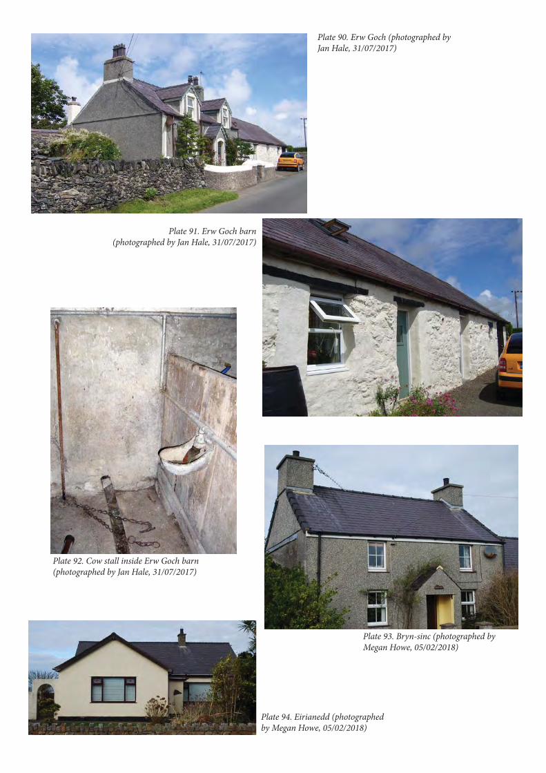
Plate 90. Erw Goch (photographed by Jan Hale, 31/07/2017)
Plate 91. Erw Goch barn (photographed by Jan Hale, 31/07/2017)
Plate 92. Cow stall inside Erw Goch barn (photographed by Jan Hale, 31/07/2017)
Plate 93. Bryn-sinc (photographed by Megan Howe, 05/02/2018)
Plate 94. Eirianedd (photographed by Megan Howe, 05/02/2018)
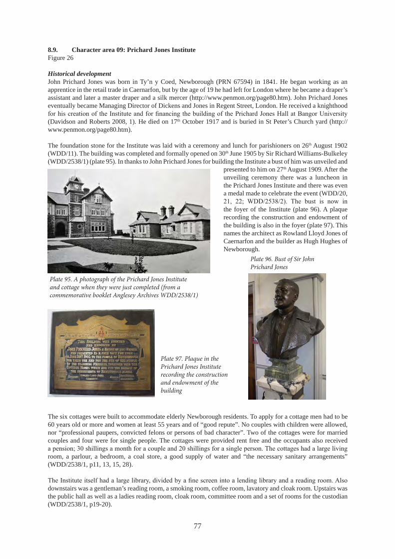
8.9. Character area 09: Prichard Jones InstituteFigure 26
Historical developmentJohn Prichard Jones was born in Ty’n y Coed, Newborough (PRN 67594) in 1841. He began working as an apprentice in the retail trade in Caernarfon, but by the age of 19 he had left for London where he became a draper’s assistant and later a master draper and a silk mercer (http://www.penmon.org/page80.htm). John Prichard Jones eventually became Managing Director of Dickens and Jones in Regent Street, London. He received a knighthood
(Davidson and Roberts 2008, 1). He died on 17th October 1917 and is buried in St Peter’s Church yard (http://www.penmon.org/page80.htm).
The foundation stone for the Institute was laid with a ceremony and lunch for parishioners on 26th August 1902 (WDD/11). The building was completed and formally opened on 30th June 1905 by Sir Richard Williams-Bulkeley (WDD/2538/1) (plate 95). In thanks to John Prichard Jones for building the Institute a bust of him was unveiled and
presented to him on 27th August 1909. After the unveiling ceremony there was a luncheon in the Prichard Jones Institute and there was even a medal made to celebrate the event (WDD/20,
the foyer of the Institute (plate 96). A plaque recording the construction and endowment of the building is also in the foyer (plate 97). This names the architect as Rowland Lloyd Jones of Caernarfon and the builder as Hugh Hughes of Newborough.
The six cottages were built to accommodate elderly Newborough residents. To apply for a cottage men had to be 60 years old or more and women at least 55 years and of “good repute”. No couples with children were allowed, nor “professional paupers, convicted felons or persons of bad character”. Two of the cottages were for married couples and four were for single people. The cottages were provided rent free and the occupants also received
room, a parlour, a bedroom, a coal store, a good supply of water and “the necessary sanitary arrangements” (WDD/2538/1, p11, 13, 15, 28).
downstairs was a gentleman’s reading room, a smoking room, coffee room, lavatory and cloak room. Upstairs was the public hall as well as a ladies reading room, cloak room, committee room and a set of rooms for the custodian (WDD/2538/1, p19-20).
77
Plate 95. A photograph of the Prichard Jones Institute and cottage when they were just completed (from a commemorative booklet Anglesey Archives WDD/2538/1)
Plate 96. Bust of Sir John Prichard Jones
Plate 97. Plaque in the Prichard Jones Institute recording the construction and endowment of the building

garden was laid out as planned. The 1920 County Series map shows the central path but not the sub-divisions, so
Boston. It was sold to the Institute by Lord Boston in 1904 for £120, partly because he was intending to sell most of his land in Newborough for building plots and this prevented building opposite the Institute. Before the sale was
Archives Lligwy Papers 261-282).
In the 1920s a war memorial for the parish of Newborough was constructed in the grounds of the Prichard Jones Institute (PRN 66947).
Current characterThe Prichard Jones Institute forms the centrepiece of a planned development that includes six cottage homes and an area of garden provided for the use of the cottage residents. The Institute building is built of grey Anglesey
asymmetrically layout and has two storeys with attics (plate 98). Set back to right end of main building is a short
78
Figure 27. Outline plan of the Prichard Jones Institute and cottages showing the gardens opposite and how they were to be laid out (Caernarfon Record Office XM-MAPS-410-1)
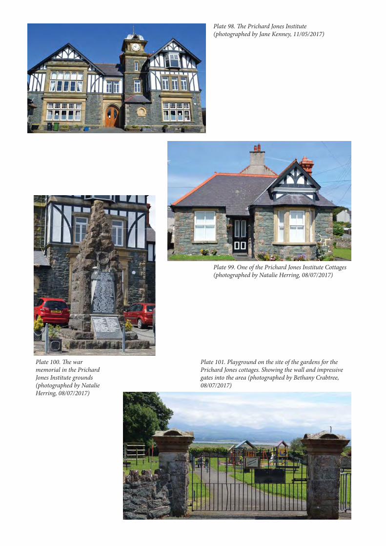
Plate 98. The Prichard Jones Institute (photographed by Jane Kenney, 11/05/2017)
Plate 99. One of the Prichard Jones Institute Cottages (photographed by Natalie Herring, 08/07/2017)
Plate 100. The war memorial in the Prichard Jones Institute grounds (photographed by Natalie Herring, 08/07/2017)
Plate 101. Playground on the site of the gardens for the Prichard Jones cottages. Showing the wall and impressive gates into the area (photographed by Bethany Crabtree, 08/07/2017)
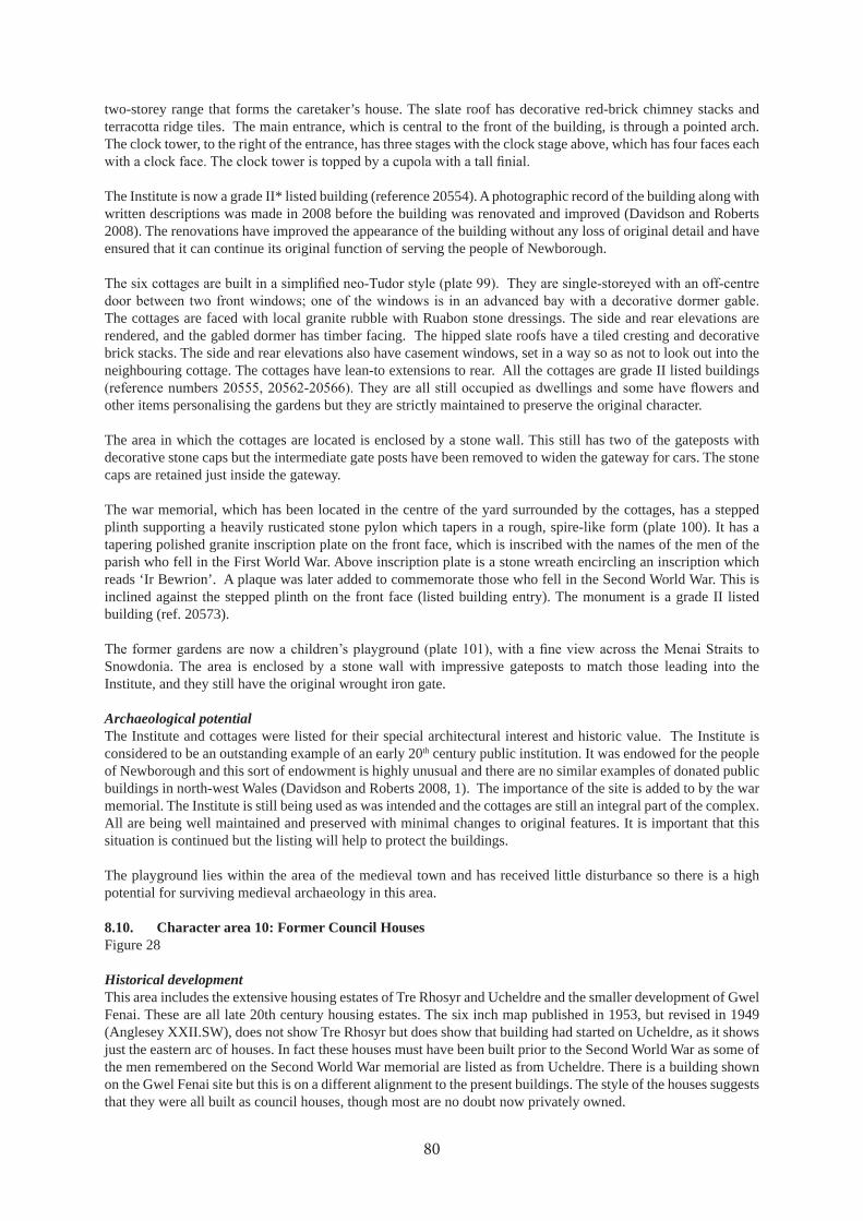
two-storey range that forms the caretaker’s house. The slate roof has decorative red-brick chimney stacks and terracotta ridge tiles. The main entrance, which is central to the front of the building, is through a pointed arch. The clock tower, to the right of the entrance, has three stages with the clock stage above, which has four faces each
The Institute is now a grade II* listed building (reference 20554). A photographic record of the building along with written descriptions was made in 2008 before the building was renovated and improved (Davidson and Roberts 2008). The renovations have improved the appearance of the building without any loss of original detail and have ensured that it can continue its original function of serving the people of Newborough.
The cottages are faced with local granite rubble with Ruabon stone dressings. The side and rear elevations are rendered, and the gabled dormer has timber facing. The hipped slate roofs have a tiled cresting and decorative brick stacks. The side and rear elevations also have casement windows, set in a way so as not to look out into the neighbouring cottage. The cottages have lean-to extensions to rear. All the cottages are grade II listed buildings
other items personalising the gardens but they are strictly maintained to preserve the original character.
The area in which the cottages are located is enclosed by a stone wall. This still has two of the gateposts with decorative stone caps but the intermediate gate posts have been removed to widen the gateway for cars. The stone caps are retained just inside the gateway.
The war memorial, which has been located in the centre of the yard surrounded by the cottages, has a stepped plinth supporting a heavily rusticated stone pylon which tapers in a rough, spire-like form (plate 100). It has a tapering polished granite inscription plate on the front face, which is inscribed with the names of the men of the parish who fell in the First World War. Above inscription plate is a stone wreath encircling an inscription which reads ‘Ir Bewrion’. A plaque was later added to commemorate those who fell in the Second World War. This is inclined against the stepped plinth on the front face (listed building entry). The monument is a grade II listed building (ref. 20573).
Snowdonia. The area is enclosed by a stone wall with impressive gateposts to match those leading into the Institute, and they still have the original wrought iron gate.
Archaeological potentialThe Institute and cottages were listed for their special architectural interest and historic value. The Institute is considered to be an outstanding example of an early 20th century public institution. It was endowed for the people of Newborough and this sort of endowment is highly unusual and there are no similar examples of donated public buildings in north-west Wales (Davidson and Roberts 2008, 1). The importance of the site is added to by the war memorial. The Institute is still being used as was intended and the cottages are still an integral part of the complex. All are being well maintained and preserved with minimal changes to original features. It is important that this situation is continued but the listing will help to protect the buildings.
The playground lies within the area of the medieval town and has received little disturbance so there is a high potential for surviving medieval archaeology in this area.
8.10. Character area 10: Former Council HousesFigure 28
Historical developmentThis area includes the extensive housing estates of Tre Rhosyr and Ucheldre and the smaller development of Gwel Fenai. These are all late 20th century housing estates. The six inch map published in 1953, but revised in 1949 (Anglesey XXII.SW), does not show Tre Rhosyr but does show that building had started on Ucheldre, as it shows just the eastern arc of houses. In fact these houses must have been built prior to the Second World War as some of the men remembered on the Second World War memorial are listed as from Ucheldre. There is a building shown on the Gwel Fenai site but this is on a different alignment to the present buildings. The style of the houses suggests that they were all built as council houses, though most are no doubt now privately owned.
80
42
64
27
42
44
25
42
64
27
42
44
25
66
0
65
9
65
8
66
0
65
9
65
8
SH
10
11 67
57
5
Sta
d H
en
Ysg
ol
© C
row
n C
op
yrig
ht
an
d d
ata
ba
se r
igh
t 2
01
8. O
rdn
an
ce S
urv
ey
10
00
21
87
4. W
els
h G
ove
rnm
en
t.
© H
awlf
rain
t a
haw
liau
cro
nfa
dd
ata
’r G
oro
n 2
01
8. R
hif
Trw
ydd
ed
yr
Aro
lwg
Ord
na
ns
10
00
21
87
4.
Ke
y
Sit
e w
ith
PR
N
We
ll o
r p
um
p w
ith
PR
N
69
20
4
69
23
7
Pend
ref S
tree
t
B44
21
Lôn
Tw
nti
F
igu
re 2
8. C
har
act
er a
rea
s 10
an
d 1
1: F
orm
er C
oun
cil
Hou
ses
and
Sch
ool a
nd
new
dev
elop
men
ts

Tre Rhosyr occupies what was plot 220 (Tyn y coeden) on the tithe map, with a small house just beyond the south-
on the tithe map and part of an extensive plot 195 (part of Pendre or Pendref farm). Gwel Fenai was also within plot 195.
Current characterThis zone covers former council housing estate that developed on the eastern edge of the village. Each estate is largely self-contained around a road system, with fairly dense housing but also with communal grassy areas and private gardens. Tre Rhosyr is a housing estate of 40 houses (plate 102). Some houses face the street while others
surround two small courtyards which are used for car parking and also have green space. The estate consists of both two-storey houses and bungalows. They are arranged mostly in small rows of terraces, but there are two semi-detached houses, one set of three, and one large detached house. The houses have pebble-dashed walls of various pastel colours, and slate roofs. The housing is fairly high density but there are areas of grass between the main road and the estate, and some areas in the centre of the estate, as well as the small gardens.
Ucheldre is a housing estate of 39 houses (plate 103). Some are arranged around a cul-de-sac running off Lôn Twnti, and others face out onto Pendref Street. The cul-de-sac curves round sharply, with a central space used for car parking. The area consists mainly of two-storey houses, most of which are semi-detached, but there are also three rows of four terraced houses.
of three and a set of two. The houses are all in a similar
style with pebble-dashed walls, of various pastel colours, and slate roofs. The houses have generous gardens both in front and to the rear, but there is little public green space.
In Gwel Fenai the houses face south to take advantage of the view with their main access to the rear of the buildings (plate 104). This explains the small windows that face onto the access road. They are two-storey dwellings, attached in one group of
similar with a pale, silvery pebble-dash and slate roofs.
Archaeological potentialThere seems to be very little archaeological potential to this area. These areas were probably not occupied in the
in relation to house and road building and garden landscaping, that there is little chance of archaeology surviving here.
82
Plate 102. Tre Rhosyr (photographed by Anne Harris, 29/08/2017)
Plate 103. Houses in Ucheldre with Marion Gash recording (photographed by Anne Harris, 29/08/2017)
Plate 104. Houses in Gwel Fenai (photographed by David Elis-Williams, 22/01/2018)

8.11. Character area 11: School and new developmentsFigure 28
Historical developmentThis area includes the current primary school and new developments to the north and south of it, the latter being on the site of the previous school.
The British School (PRN 67575), later referred to as the Council School, was built in 1867 on the eastern edge of the village, on land that was part of plot 290 (Cae Coch) on the tithe map. The foundation stone was laid on 2nd August 1867 by Robert Davies of Bodlondeb, on the Menai Straits, near Bangor. Davies had owned the land and had gifted it for the use of the school as well as subscribing £100 towards its construction. Richard Davies, Robert’s brother also subscribed £100 (plaque now in the Prichard Jones Institute) (plate 105). The Davies family made their money running a timber importing business at Menai Bridge. Robert was a philanthropist giving large amounts of money to the Calvinistic Methodists and to other charities. Richard was more interested in politics but also gave generously to charity, and was particularly interested in the British schools, so it may have been Richard who encouraged Robert to donate his land to this cause (Dictionary of Welsh Biography
).
The school had a large schoolroom and a smaller separate classroom, a master’s house and separate playgrounds for boys and girls. The architect was John Thomas of Caernarfon and the original plans dated 12/3/1867 provide a good impression of what it would have looked like
29). An additional class room for infants had been built by 1889 as it is shown on
1927 there was a proposal to construct new large playgrounds with a toilet block at the end with separate toilets for boys, girls and infants (Anglesey Archives
that this was never done as 1953 6 inch map (Anglesey sheet XXII SW) revised in 1949 does not show this extension.
A new school was built on adjacent land was opened in 1970 by the Prince of Wales (). The original school was demolished and Stad Hen Ysgol was built
2007 (Street Check). A new school for the Bro Aberffraw area is currently being built on land north of Lôn Twnti.
Across Lôn Twnti, north of the current school, is a small group of four industrial units known as Gwethdai Rhosyr. There was also an industrial unit to the west of this but this land has been redeveloped as the housing development of Ty’n Lôn Bach. Google Earth shows that the building of Ty’n Lôn Bach had not started at the end of 2006 but by 01/06/2009 the industrial unit had been demolished and house building was well underway. By 27/05/2010 most of the houses had been completed.
Current characterThis zone is very modern in character with new housing developments, a light industrial unit and the school. It has had some part in the village history with the site of the former British School located under Stad Hen Ysgol. The
will change in the case of Ty’n Lôn Bach, when the new school is built next to it.
The current school is a single-storey building with a raised roof over the main hall (plate 106). The raised roof is
83
Plate 105. Plaque recording the laying of the foundation stone for the British School, now in the Prichard Jones Institute

Figure 29. Original 1867 plan and drawing of the south elevation of the British School (WA/13/72, courtesy of Anglesey Archives)
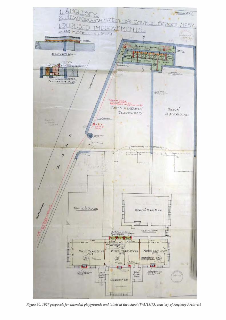
Figure 30. 1927 proposals for extended playgrounds and toilets at the school (WA/13/73, courtesy of Anglesey Archives)

Stad Hen Ysgol is composed of three sets of semi-detached houses (plate 107). They are pebble-dashed with slate roofs and are fairly plain in design with a projecting slate roofed porch for the entrances. The gardens are very small but there is some off-road parking.
Gwethdai Rhosyr is a single storey building made of brick in the lower part with corrugated metal above (plate
detached houses and a terrace of three houses. They are brick built with slate roofs, and some have solar panels on the roof.
Archaeological potentialIt is assumed that all traces of the British School have been lost during the development of Stad Hen Ysgol. No archaeological work seems to have been done when Ty’n Lôn Bach was built but Bronze Age remains were recently found immediately to the north-west of the development. These remains may suggest the presence of a prehistoric settlement in the area, some of which may have been under Ty’n Lôn Bach. There are still large undisturbed areas
possible that prehistoric archaeology is present here, although only archaeological investigation could demonstrate whether this is so.
86
Plate 106. Ysgol Gynradd Niwbwrch (photographed by Jane Kenney, 16/02/2018)
Plate 107. Stad Hen Ysgol (photographed by Megan Howe, 05/02/2018)
Plate 108. Gwethdai Rhosyr (photographed by Alex Kraus, 05/11/2017)

42
04
21
41
84
19
66
1
66
0
65
9 SH
65
8
42
2
65
7
42
34
24
42
5
42
04
21
41
84
19
42
24
23
42
44
25
66
1
66
0
65
9
65
8
65
7
65
6
36
12
3
67
58
4
67
58
1
69
22
1
69
22
8
12
13
12
Tyn-y
-cae
Tyn-y-c
ae
Rhoddfa M
eyric
k
Mal
ltrae
th S
treet
B442
1
Lôn
Twnt
i
© C
row
n C
op
yrig
ht
an
d d
ata
ba
se r
igh
t 2
01
8. O
rdn
an
ce S
urv
ey
10
00
21
87
4. W
els
h G
ove
rnm
en
t.
© H
awlf
rain
t a
haw
liau
cro
nfa
dd
ata
’r G
oro
n 2
01
8. R
hif
Trw
ydd
ed
yr
Aro
lwg
Ord
na
ns
10
00
21
87
4.
Ke
y
Sit
e w
ith
PR
N
We
ll o
r p
um
p w
ith
PR
N
69
20
4
69
23
7
Pend
ref S
tree
tF
igu
re 3
1. C
har
act
er a
rea
s 12
an
d 1
3: M
oder
n n
orth
ern
dev
elop
men
ts a
nd
Bry
n F
elin

8.12. Character area 12: Northern new developmentsFigure 31
Historical development
small, apparently un-named, development off Malltraeth Street opposite the end of Lôn Twnti, Rhoddfa Bach,
of Bron Meillion and Gwel y Don.
The small development including Llys Ogwen and Marabella was probably constructed in the 1990s. The houses facing on the Malltraeth Street replaced two terraces of houses originally shown on the tithe map but presumably rebuilt or altered since. Arfryn is built over the location a house also shown on the tithe map. The relevant plots on
to have been shortened. They are shown in this short form on the tithe map.
house is shown on the tithe map on plot 232, then known as Llain y Plas. This house still existed by 1889, when
building had not yet started on the new houses, which had been built by 01/06/2009.
The 1953 6 inch map (revised in 1949) shows what is presumably Bron Meillion and a building on the site of the south-western terrace in Pen Rhos. Bron Meillion therefore seems to have been built in the 1940s. The Pen Rhos terrace initially looks too modern to have been built in the 1940s but it has probably been modernised. The small,
this building (plate 109).
Ty’n y Cae, after which the largest new development is named, is a farm now located behind the development. This farm is shown on the County Series maps from 1889 but not on the tithe map, as at this time the house was
Current characterThis zone has a different character to much of the village, being composed largely of bungalows in their gardens, with occasional modern two storey houses. Only the names of the developments suggest some earlier history with
The small development including Llys Ogwen and Marabella also includes a small industrial unit. Four of the houses front onto Malltraeth Street and two houses and the industrial unit open off a cul-de-sac (plate 110)
Tyn y Cae is a modern development of detached bungalows (plate 111). Their walls are generally rendered or pebble-dashed and many are painted in cream. They have slate roofs and modest gardens, some full of shrubs and some paved. Part of the area is still undeveloped. Bryn Rhedyn is a similar development of bungalows around a cul-de-sac (plate 112).
Bron Meillion (plate 113) is a detached house standing in an extensive lawn with a traditional stone wall around
two semi-detached houses built around a cul-de-sac. The south-west terrace faces onto Malltraeth Street and the
114). The houses are plain and simple but with a large projecting porch structure with a gable reaching to the height of the main roof. The porches are painted a strong or pale terracotta colour to contrast with the cream paint of the rest of the building. The construction is presumably of breeze-block but rendered and painted. There is room for more houses at the end of the cul-de-sac.
Archaeological potentialLlys Ogwen and adjacent houses are within the area of the medieval town and medieval remains could still survive
88

Plate 109. Nos 1 and 2 Pen Rhos, showing the probable 1940s porch on No 1 (photographed by Natalie Herring, 14/09/2017)
Plate 110. Llys Ogwen (photographed by Louise Williams, 22/07/2017)
Plate 111. One of the bungalows in Tyn y Cae (photographed by Natalie Herring, 14/09/2017)
Plate 112. One of the bungalows in Bryn Rhedyn (photographed by Jade Owen, 05/02/2018)
Plate 113. Bron Meillion (photographed by Natalie Herring, 14/09/2017)

in the gardens. The rest of the character area is outside the limits of the medieval town and medieval remains are unlikely. There could be earlier remains surviving in the undeveloped areas as there could be in any
area has been too disturbed by development for anything to survive. There seems to have been no archaeological work done when Stad
Gwyn are likely to have been lost, although some foundations could remain in gardens.
8.13. Character area 13: Bryn Felin etc.Figure 31
Historical development
Llanfair Eithaf, which now includes Benllech. Three millers were employed and paid in grain (Guise
The mill probably stood at the north-western end of the village on the site of the house still called Bryn-felin (PRN
circular blob, not the usual rectangular symbol for a house, which strongly suggests that there was still a windmill here in the early 19th century. The County Series maps from 1889 show a house aligned north-east to south-west with a long range of barns on the south-west end. This range of buildings is still shown on the 1953 6 inch map. These earlier buildings have been demolished to build the present house.
There is also a small building, presumably a cottage (PRN 67584), shown on the tithe map to the south of Bryn-felin and within the same plot. There is no building shown on the 25 inch maps but buried remains may survive.
There is no map evidence for other buildings in this area prior to the present ones, although the track to Rhedyn-coch is shown on the County Series maps from 1889.
Current characterThis zone forms the outer limits of the current village and is well beyond the medieval town or 19th century village. However the site of the windmill shows that this was still land used by
the town, although apparently beyond the borough
boundary. The zone is composed of modern detached houses in their large gardens.
The current Bryn-felin (plate 115) is a modern detached house in a fairly large garden. The other houses here are also new, though Ael-y-bryn is set too far back from the road to see. It does have a substantial Leylandii hedge. Caer Glyn and Fron Dirion are bungalows, the latter with an attic room (plate 116).
90
Plate 115. Bryn-felin (photographed by Megan Howe, 05/02/2018)
Plate 116. Fron Dirion (photographed by Megan Howe, 05/02/2018)
Plate 114. House in Stad Tŷ Gwyn (photographed by Natalie Herring, 14/09/2017)

Crud yr A
wel
Crud y
r Aw
el
Cru
d yr
Aw
el
Crud yr A
wel
42
44
25
42
24
23
42
44
25
42
24
23
65
6
65
5
65
4
65
6
65
5
65
4
SH
Chu
rch
Stre
et
© C
row
n C
op
yrig
ht
an
d d
ata
ba
se r
igh
t 2
01
8. O
rdn
an
ce S
urv
ey
10
00
21
87
4. W
els
h G
ove
rnm
en
t.
© H
awlf
rain
t a
haw
liau
cro
nfa
dd
ata
’r G
oro
n 2
01
8. R
hif
Trw
ydd
ed
yr
Aro
lwg
Ord
na
ns
10
00
21
87
4.
Fig
ure
32.
Ch
ara
cter
are
as
14: C
rud
yr
Aw
el

Archaeological potentialProbably all traces of the windmill have been lost but there may be remains of the other building shown on the tithe map or possibly structures, such as a barn, associated with the windmill. Archaeological investigation of the garden of the present house could possibly reveal some evidence about the use of the mill.
8.14. Character area 14: Crud yr AwelFigure 32
Historical development
belonging to the borough but not built on, and seems not to have been built on until the modern development was built.
Current characterThis zone is another area of modern development and is dominated by bungalows. There is a row of four terraced houses on the road into the development, with little to distinguish them apart from their porches. Most of Crud yr Awel is a development of bungalows with small but neat gardens (plate 117). Most are rendered and some have a corner clad in stone as a decorative detail.
Archaeological potentialThe survival of archaeological remains in this area is unlikely, although it is just possible that remains might survive in the gardens.
9. CONCLUSIONS
Newborough is a particularly good example of a medieval borough where much of the original layout survives and can easily be recognised on the ground. It has expanded outwards late in its history leaving much of the centre largely unchanged in layout even through much rebuilding has occurred. Even where houses have been entirely rebuilt in many cases this was in the early 19th
pebble-dashing obscuring the relatively early date of many of the buildings.
The opportunity to exploit the archaeological potential of most of the open gaps between the buildings has been
medieval remains of houses, but earlier developments were carried out with only a few narrow trenches excavated or in most cases no archaeology at all. The opportunity to fully recover the archaeology of the one remaining plot which might still preserve remains of medieval town houses must not be missed if this is to be developed in future.
archaeological remains that would enlighten the history of the medieval borough. All the former burgage plots must be considered of high potential and be subject to full excavation wherever they are to be disturbed. It is important that the question of the sand deposits is investigated and that there is no automatic assumption that all layers overlying the sand are recent. If the sand is largely the result of the 1330 storm then medieval archaeology will overlie and cut into this layer. Recording the limits of the sand will also help record the actual impact of this
92
Plate 117. Crud yr Awel (photographed by Jane Kenney, 16/02/2018)

event.
The former location of Y Plas must also be considered to be of very high potential. This is currently in the corner
seem to be a prime spot for development and if this occurs full archaeological investigation of the history of this house, which was a prominent marker on the borough boundary, must be carried out. The lack of use of this site since Y Plas was demolished and the fact that the building was not rebuilt in 19th century, suggests a very high likelihood of survival of early post medieval and medieval remains.
of houses relating to phases of the settlement’s history before the 19th
large town houses from the 16th or 17th centuries usually survive. In Newborough maps and historical evidence, as well as building styles, suggest that almost all the houses were built or largely rebuilt in the 19th century. This can probably be explained by the decline in the fortunes of the town from the 16th century onwards. Any new buildings would have been for agricultural labourers rather than merchants, and of lower status. By the early 19th century most of the housing stock was probably very old or poorly built, necessitating considerable rebuilding
of the previous houses, was reused in the remodelled buildings and, less likely, some of the original roof timbers may have been retained. In most cases pebble-dash obscures evidence of survival of older masonry so the extent of earlier survivals is hard to estimate.
There are certainly good examples of early 19th century vernacular architecture, in particular the Tyn y Goedan barn and some of the houses along Chapel and Church Street. The only probable surviving 18th century house
marram grass weaving should also be considered as possibly having early fabric. This is probably more vulnerable
as the last remaining of the many inns and taverns and is particularly important because it is largely on the site of the original inn. Again, although the building was constructed in the later 19th century it could have incorporated
of the other buildings in the heart of the village must be considered to be unknown until more work is done in investigating them.
Archaeologically the village of Newborough has been over-shadowed by Llys Rhosyr, although there is much that could still be done on that site. Although every archaeological report mentions that this was a medieval borough there has been little serious consideration about what might survive here. The archaeology of Newborough needs to be given a higher priority in the planning process and the assumption must be that archaeology will survive within the heart of the borough where it has not obviously been removed by later buildings. This archaeology
watching briefs or small trial trenches. This study has highlighted the scarcity of upstanding early buildings but the survival of early remains within what appear to be 19th century buildings must not be ruled out and there is still a great deal of work that deserves to be done to investigate what really survives of this medieval town.
10. ACKNOWLEDGEMENTS
The project was funded by Cadw. Most of the work on this project was done by many volunteers. The following people were involved in the characterisation recording: Siân Barker, Di Broad, Bethany Crabtree, Andrew Day, David Elis-Williams, Marion Gash, Jan Hale, Anne Harris, Pryderi Hedd, Natalie Herring, Megan Howe, Chris Jones, Glyn W. Jones, Marianne Jones, Alex Kraus, Sue Madine, Owenna Orme, David Owens, Einir Thomas, Andrew Varley, Catriona Varley, Louise Williams, Delyth Wilson. Marion Gash and Anne Harris helped with archive research, Natalie Herring and Martin Marwood did data inputting. The children of Ysgol Gynradd Niwbwrch created the photographic displays. Morwenna Owen, David Owen, Norman Evans and Einir Thomas provided local information. Mary Aris shared her research for background information. Ann Huws did translations for the Day School. Thanks to my colleagues, Dan Amor for organising the school project and the Day School and to Jade Owen for assisting with other tasks. This report was edited by Andrew Davidson.
93
11. SOURCES
11.1. Published referencesCadw 2009. Dolgellau: Understanding Urban Character, Cadw, CardiffCarr, A. D., 2011. Medieval Anglesey, Anglesey Antiquarian Society and Field Club, LlangefniEnglish Heritage, 2010. Understanding Place: Historic Area Assessments in a Planning and Development Context,
English Heritage, SwindonFenton, R., 1917. Tours in Wales , Cambrian Archaeological Association (Accessed online at https://
archive.org/details/toursinwales180400fentrich)Guise, B. and Lees, G., 2010. Windmills of Anglesey, Scotforth Books, LancasterHughes, M., 1956. The marram grass industry of Newborough, Anglesey, Trans Anglesey Antiquarian Society,
22-28Johnstone, N., 1999. Cae Llys, Rhosyr: a court of the princes of Gwynedd, Studia Celtic XXXIII, 251-295Johnstone, N., 2000. Llys and Maerdref: the royal courts of the Princes of Gwynedd, Studia Celtica, XXXIV,
167-210Lermon, A., 2013. Exploring your town: a manual and tool kit, The Civic Trust for WalesLewis, E. A., 1912. The Medieval Boroughs of Snowdonia, Henry Sotheran and Co., LondonLewis, S., 1849, A Topographical Dictionary of Wales, London (accessed online http://www.british-history.ac.uk/
topographical-dict/wales)Longley, D., 2001. Medieval settlement and landscape change on Anglesey, Landscape History vol 23, 39-59Owen, H., 1952. Hanes Plwyf Niwbwrch ym MônPennant, T., 1991. A Tour in Wales ol (1783), Bridge Books, Wrexham Pryce, A. I., 1922. Sidelights on the rise of Nonconformity in the diocese of Bangor, Trans Anglesey Antiquarian
Society, 47-56Rowlands, H., 1846. ‘Antiquitates parochiales No. II’, Archaeologia Cambrensis vol I, no. III supplement, 305-
317 (written about 1710 and translated from the Latin)RCAHMW (Royal Commission for the Ancient and Historical Monuments of Wales), 1937. An nventory of the
Ancient Monuments in Anglesey, HMSO, LondonSoulsby, I., 1983. The Towns of Medieval Wales, Phillimore and Co., ChichesterWilliamson, O., 1895. Hanes Niwbwrch
11.2. Unpublished reportsAris, M., in prep. The location of Rhosyr? The Medieval geography of Rhosyr in the Age of the Princes, Anglesey
Ancient Roads Group, Research PaperBrooks, I. P., 2013. Land ff Church Street, Newborough, nys Mon: watching brief, unpublished EAS report
EAS2013/08Brookes, I. and Laws, K., 2003. Plots and , Land Adjacent to Bod orwerth, Chapel Street, Newborough,
unpublished EAS report EAS2003/3Brookes, I. P. and Price, J., 1997. Land Adjoining Bod orwerth, Newborough: archaeological evaluation,
unpublished EAS reportDavidson, A., 2002. The Medieval Mills of Anglesey: Archaeological Threat Related Assessment, unpublished
GAT Report No. 405Davidson, A., 2008. Urban Characterisation: Pwllheli, unpublished GAT Report No. 730Davidson, A., 2009. Urban Characterisation: Harlech, unpublished GAT Report No. 787Davidson, A. and Roberts, J., 2008. Prichard ones nstitute Level Archaeological Building Record, unpublished
GAT report 722 ()
Evans, R., forthcoming. New Primary School, Newborough, Anglesey: Archaeological Mitigation, GAT reportEvans, R., Hopewell, D. and McGuiness, N., 2016. New sgol Bro Aberffraw Primary School, Newborough,
Anglesey: Archaeological Assessment and Geophysical Survey, unpublished GAT report 1318Johnstone, N., 1995. Llys and Maerdref: An nvestigation into the Location of the Royal Courts of the Princes of
Gwynedd, unpublished GAT report 167Johnstone, N., 1996. Church Street, Newborough: Archaeological Evaluation, unpublished GAT report 191Kenney, J. 2015. Medieval Field Systems in North West Wales, Scheduling Enhancement, Part :
report and gazetteer, unpublished GAT report 1236Longley, D., 2002. Hendre Bach, Newborough: Archaeological Assessment, unpublished GAT report 461McGuiness, N., 2016. New sgol Bro Aberff raw Primary School, Newborough, Anglesey: Archaeological
Assessment Phase : Trial Trenching, unpublished GAT report 1329
94

McNicol, D., Kenney, J. and Smith, S., 2017. Archaeological Excavation in Advance of the Extension of the Dolbenmaen Water Treatment Works and Dolbenmaen to Cwmystradllyn Water Pipeline: Final Excavation Report, unpublished GAT report 1371
Rees, C. and Jones, M., 2015a. Results of Archaeological Work at Land adjacent to T Capel, Chapel Street, Newborough, nys Mon, unpublished CR Archaeology report CR66_2015Rees, C. and Jones, M., 2015b. Results of Archaeological Work at Land at Church Street, Newborough, unpublished CR Archaeology report CR98_2015White, R., 1979. GAT HER Further Information File PRN 60255
11.3. WebsitesGeology of Britain Viewer, British Geological Survey:
Google Earth: its “historical imagery” gives dates for photographs that show recent developments.
census records for the village and the history of Sir John Prichard Jones traced through census records but it is often unclear who to credit with the work. ( , accessed 22/01/2018)
Places of Wales: The National Library of Wales ( ), copies of tithe maps and schedules for parishes across Wales
National Library of Scotland Natural Resources Wales
Ysgol Gynradd Niwbwrch Street Check : gives dates of sales of houses after 1995 so indicates construction of 21st
century developments.
11.4. Notes on each document are added in italics to aid future investigation.
Gwynedd Historic Environment RecordGwynedd HER Further Information File PRN 60255
Bangor University Archives Bodorgan 1579: Survey of Bodorgan Estate 1724-1727 (lovely maps but no trace of Newborough)Lligwy Add. Mss 1123: Plans of Lord Boston 1782 (only r House in Newborough)Lligwy Papers 261-282: papers relating to the purchase of Dynadas Quillet opposite the Prichard Jones Institute, 1904Bangor Mss 7366: ‘A Sketch of the Ancient and Present State of the Isle of Anglesey’, author unknown, written before 1782Bangor Mss 7391: Notes on Newborough written in Welsh by Owen Williamson, dated 1894MISC 3/101: Plan of Sign and Tyddynpwrpas in the parish of Newborough, 1799
(includes a nice plan of the middle of the village)Penrhos II 777: Volume of maps of Penrhos Estate, dated 1801(plans and schedules for Newborough on p25-27)Penrhos II 802: Plan of properties belonging to Sir JT Stanley, Lord Newborough, Lord Boston and others in Holyhead, Aberffraw, Llanfechell, Trewalchmai, Llangadwaladr etc, dated 1799-1815 (p126 has a plan of Newborough copied from Penrhos II 777, survey undated but possibly copied about 1812)
Records consultedXD/35/31 – Particulars and plans of Cae Newydd and Rhedyn Coch Bach for sale in the parishes of Llanbeblig and Llanrug (Carnarvonshire) and the parish of Newborough (Anglesey) 1906( ncludes a plan showing the cross roads and other roads. ne lot is Rhedyn Coch Bach including the quarry)XD/35/427 – Letters relating to Rhedyn Coch Bach Quarry 1920 (queries over mineral rights)XD/32/1193/1 (1925-1926) – Production book of the Newborough Matmakers AssociationPoole Papers(Documents from the records of Solicitors Messrs. Poole of Caernarfon)X/Poole/1489 – Extracts from old rental re Llanbedr Newborough 1722-42
95

Rentals for the King’s Rent from Rhosfair and Hendre:-X/Poole/1490 – 1727-54X/Poole/1491 – 1773X/Poole/1492 – 1776X/Poole/1493 – 1504X/Poole/1496 – 1806X/Poole/1499 – 1812
(These documents list tenants’ names and property names the latter help to indicate the former royal townships of Rhosfair and Hendre)
(1796)mortgages, sales and leases of property etc for various farms, none within core area of study
X/Poole/3259 (1768) – agreements to sell various lands including Bryn SincX/Poole/2990 (1803) – Sale of Neuadd Wen
XM/MAPS/410/11 (n.d. early 20th century) – New public hall library at Newborough, Anglesey(Part of the collection from Rowland Lloyd Jones, Architect. Original plans and elevations of the Prichard Jones Hall and almshouses)Vaynol 2377 – Sale of freehold farm, outbuildings and land known as Brynsinc Farm 1910( ncludes a large scale plan showing elds belonging to Brynsinc with owners of neighbouring elds named)
Anglesey Archives, LlangefniWA/13/72: Plans of the British School, Newborough, 1867WA/13/73: Proposed improvements to the Council School, Newborough, 1927WCD/343: Plans of practice bombing air to ground gunnery and RP ranges, Newborough Warren, 1949 (location
of targets, warning agstaffs etc marked on OS map, several copies)WDD/11: Programme for ceremony of laying the foundation stone for the Prichard Jones Institute, August 26th
1902WDD/20: Unveiling the bust of John Prichard Jones, August 27th 1909WDD/21: Presenting the bust to John Prichard Jones, August 27th 1909WDD/22: Luncheon, August 27th 1909WDD/1728: Plans and surveys of land in the parish of Newborough, 1792 (this only includes the farm of T Main)WDD/2538/1: Souvenir brochure giving the history of the Prichard Jones Institute, by J Wells Thatcher, June 30th
1905WDD/2538/2: Medal produced to commemorate the unveiling of the bust of John Prichard Jones, August 27th
1909WM/2118: Report of survey of the condition of rural industries in Anglesey by TO Williams, 1943WM/1588/1 and 8: Title deed touching the manor or lordship of Aberffraw and all other estates of Sir Arthur
Owen and William Owen, 1724/5 (this does not itemise most properties in detail and there is no map)W MAPS 5 and W MAPS 54: Enclosure Award for Llanbedr Newborough Parish, 1843 ( ne coloured maps
showing area of enclosure award but also showing the town)WQS/1810/M/149: Memorandum of recognizance of Hugh Owen of the Sign, Newborough, who has obtained a
licence to keep an inn, 1810WSG/14/5: Postcard of Main Street, Newborough, c.1915WSG/14/9: Postcard of Newborough, road leading to the church, not datedWSG/14/3 and 10: Photograph: making rush mats at Newborough, c.1920 ( copies of the same photo)WSG/14/57: Postcard of Prichard Jones Institute, 1905WM/1976/2: Copy of the charter of Newborough, 1302 (photocopy of charter, original in British Museum Harlean
Mss )
96

12. APPENDIX I: GAZETTEER OF SITES IN NEWBOROUGH VILLAGE
PRN 7827 NPRN 8827Capel Ebeneser, Church Street, NewboroughNGR: SH42506553 Location: Rhosyr, Ynys MonDescriptionShown on all 25 inch maps from 1889 with a burial ground shown to the rear of the chapel.
earlier building.The building shown on the tithe map is a long narrow building similar to the terrace houses in the town. It is possible that the original chapel was established in an existing terrace of medieval houses.Previous HER descriptionRectangular building of renaissance design. Pitched slate roof. West front with projecting porch. Flat rendered. Winged pedimented gable with projecting cornice. Stressed cement triangular decoration within pediment, and horizontal rectangular plaque below with circular plaque either side. L. circular plaque “O.C.”, centre plaque
keystones. Twelve pane sash windows. Projecting porch with hipped slate roof. Central bay topped with blind balustraded parapet, open round arch entrance, moulded hood resting on Tuscan style pilasters. Central round arched window in rear wall of porch recess, two side door entrances into chapel. Two segmental arch windows
eight square headed windows. Sixteen pane, sliding sash. Four upper, four lower. Small outhouse attached to east end of south elevation. East elevation pebble dashed with small circular slate ventilator at centre of gable. Two lower square headed long windows with grills (to protect stained glass windows) in centre of wall. Small slate roofed outhouse attached to east end of wall. Interior: galleried, two aisled chapel, central stagger divided bank of doored pews, side banks running lengthwise, curving at rear. Vestibule - plaster ceiling and walls. Panelled dado. Two double door entrances into chapel with
single circular decorative ventilation grill with projecting boss surrounded by a series of T and G panels arranged to form a large eight-pointed star. Painted plaster walls with grooved moulded coving above window height and T and G panelled dado. U-shaped gallery, supported on tapering cast iron columns, with three raked banks of doored pews. Solid panelled front with upper narrow inserted cast iron frieze. Classical style reredos, three
with two scenes from the bible. Inscription on north window at top “Eu byd y rhai pur o gwyn galon”, and at
Jones, Barwnig”. Makers name recorded on small corner plate “Dudley Forsythe, London”. Inscription on south window at top reads “Tangnefedd i ddynion ar y ddaear ewyllys da”, and at bottom is same as north window. Set fawr - Rectangular, projecting central bay. Two-step entrances with doors, set diagonally either side. Doors have
panelled back benches. Two doored cupboard centre front. Elaborate wood and brass lecturn with central engraved
brass columns with square bases. Three bay pulpit, central bay projecting. Curving six-step double balustraded
lys motif within trefoil headed arch. Upholstered rear bench. Fittings - Sixteen stop pedal organ, “Christophe et Etienne, Paris”. Two low-backed Windsor armchairs. Two brass collecting dishes. Large brass vase on wooden base.Cemetery to rear of chapel. Alongside chapel is two storey double fronted stone built chapel house, with later extension on south side.
behind school room. Chapel forecourt surrounded by snecked rubble stone wall, with large square posts and double cast iron gated entrance to chapel and cemetery. Single gate to north side of chapel.Visited 23/09/94. <1>NMR Description
97

present chapel, dated 1881, is built to the design of architect Richard Davies of Bangor, in the Sub-Classical style
the lectern of 1897.RCAHMW, March 2010Listed Building Description (Grade II, Reference No. 20552)
small, square, lean-to extension to rear. Walls are rendered with rendered dressings, slate roof. Entrance elevation
entrance under a moulded arch on Tuscan pilasters. Above the entrance is a moulded cornice surmounted by a pierced parapet with square angle piers with moulded pyramidal caps. Within the arch is a round-headed light with margin panes and entry to the chapel is by two large panelled doors either side of the open porch. Flanking the
panel containing stepped round-headed recesses, below that is a rectangular slate plaque, with stressed moulded
and 1785 (to right). Rear elevation has a gable parapet as for the front, and is pebble-dashed rendered, with 2 tall square-headed lights. Side elevations, each of 2 storeys and 4 bays have recessed sash windows with margin panes. In front of the chapel is a low rubble wall of Penmaenmawr granite, capped with roughly dressed blocks and with square piers of roughly dressed stone capped with moulded rendered caps. Central gateway hung with
above the lock stile below which are diagonally set rails, forming a cross design.
PRN 7828 NPRN 8828Wesleyan Methodist chapel, Malltraeth Street, NewboroughNGR: SH4223965834 Location: Rhosyr, Ynys MonDescriptionA Wesleyan Methodist chapel said by NMR (NPRN 8828) to have been built in 1804 and closed in 1914. However the tithe map (plot 52) just lists this as a house and garden, so it is likely that it was not purpose built as a chapel but the house was used for services from 1804.The building is labelled as a Wesleyan Methodist Chapel on the 1st and 2nd 25 inch maps. The chapel is not labelled on the 3rd edition map, but a tank adjacent to the building is marked. There is now a modern house on the site that seems to have completely removed all traces of the chapel, but the house is still called Hen Capel.The NMR record is in slightly the wrong place.Previous HER descriptionThis chapel was recorded as “Niwbwrch, Rhosyr” in the RCAHMW Chapel Survey list (Davidson, A. & Roberts, R., G1234 & G1300) with no other information than a cross reference to the NPRN. The latter shows that this reference should be to the Niwbwrch Methodist Chapel.NMR DescriptionNiwbwrch Methodist Chapel was built in 1804. The chapel closed in 1914 and has since been converted for use as a garage. By 2010 modern houses on site.RCAHMW, March 2010
PRN 8111 NPRN 8826Baptist Chapel, Pendref Street, NewboroughNGR: SH42446568 Location: Rhosyr, Ynys MonDescriptionThe site of Seion Baptist Chapel, built in 1849. By 1999 the chapel had been converted for residential use, or more likely demolished and a house built on the site. On the lower wall of the porch is a plaque “ SEION ADDOLDY BEDYDDWYR ADEILADAU 1849”The chapel is shown on all 25 inch maps from 1889 and labelled on 1st and 2nd edition maps as a Baptist Chapel.Previous HER descriptionNMR DescriptionNiwbwrch Baptist Chapel was built in 1848/9. By 1999 the chapel had been converted for residential use, or more likely demolished and a house built on the site. On the lower wall of the porch is a plaque “ SEION ADDOLDY
98

BEDYDDWYR ADEILADAU 1849”RCAHMW, March 2010
PRN 34931 NPRN 404922Prichard Jones Institute, NewboroughNGR: SH4252365807 Location: Rhosyr, Ynys MonDescriptionThe original plans and elevations produced by Rowland Lloyd Jones Architect are held in the Caernarfon Record
Previous HER description
Jones, a native of this Parish, and presented as a free gift forever on June 30th 1905 to the people of Newborough for their use and for the use of the people of adjoining parishes, together with the cottage homes which are for
Hughes, Newborough’.
as an apprentice in the retail trade in Caernarfon and eventually became Managing Director of Dickens and Jones
for which he received a knighthood. The cottages were built to provide homes for pensioners of Newborough and
of the cottage residents, and the inhabitants of Newborough and surrounding district.The Institute was intended to serve as a community centre for the people of Newborough and the adjoining parishes of Llangeinwen, Llangaffo, Llanidan and Malltraeth. Its facilities included a library, exhibition space and meeting and lecture rooms. The building was intended to contribute to the betterment of those using it. As well as copies of paintings by well-known artists of the calibre of JMW Turner, it also houses a copy of The ‘Compleat Angler’ by Izaak Walton, one of the most widely read books in English literature.At its peak the Institute received daily deliveries of newspapers and periodicals from London and its capacious halls were used for banquets and civic functions. During and after World War Two the building was used as a school, and later, during the snooker boom of the 1980s, two full-sized tables were added.The Institutes upkeep was paid for from the annual income generated by a property in the City of London at 24 Aldgate, until it was destroyed by bombs in World War Two. Sadly in the last ten years the Institute has declined in use and the trustees have struggled to maintain the building. The roof is in need of urgent attention and widespread damp and patches of woodworm need to be resolved.The institute was furnished by North of England Furnishing Company, Darlington, which was established in
materials.The clock within the clock tower was built by J. Smith & Sons Midland Steam Clock Works, Derby and is still maintained by the same company, now called Smiths of Derby. The company was established in 1856 by John Smith.The Institute was included in the BBC TV Restoration series in 2006, where it was entered as an exceptional example of an early 20th century public institution, receiving regional runner-up place. (Davidson & Roberts 2008)NMR DescriptionListed grade II* as an exceptional example of an early C20th public institution which forms part of a remarkable endowment at Newborough by John Prichard Jones. Featured in BBC’s [ ] programme Summer 2006. R.F. Suggett/RCAHMW/September 2006.Listed Building Description (Grade II*, Reference No. 20554)
hall and cross-wing principal, with short central range of 2-bays, and shorter 2-storey range set back to right end of main building (the caretaker’s house). Entrance to left in central block, clock tower to its right. Elevations are faced with local granite rubble to lower part, half-timbered above, with Ruabon stone dressings throughout.
with beading in the angle, hoodmould above and recesses in the spandrels. Above the arch is a plain entablature
99
smaller upper lights small paned. Entablature and mullioned windows of 3-lights above, similarly detailed to
also with transomed and mullioned windows of 5-lights, lower lights 2-pane, upper lights with rounded heads. Two-storey wing set back at right end (caretakers house) has panelled door to left and windows similarly detailed to those over the main entrance. Other elevations also have similar windows.
PRN 36123 Melin Rhosyr or Melin Bryn, Possible Site of, RhosyrNGR: SH4186466150 Location: Rhosyr, Ynys MonDescriptionTithe schedule calls plot 46 “Felin Wynt” and the map shows a circular blob, not the usual rectangular symbol for a house, which strongly suggests that there was still a windmill here in the early 19th century. The plot was owned
The County Series maps from 1889 show a house aligned north-east to south-west with a long range of barns on the south-west end. This range of buildings is still shown on the 1953 6 inch map. These earlier buildings have been demolished to build the present house.Previous HER descriptionUnlocated. Probably the windmill built in 1303, which may have been on knoll next to house called Bryn Felin (79) to NW of village. Probably the site of the medieval windmill (Melin Rhosyr 66). (Davidson, 2002)
PRN 36279 Hendre Bach, Former Site of, NewboroughNGR: SH4219265474 Location: Rhosyr, Ynys MonDescriptionDespite the lack of geophysical evidence it is likely that some buried remains survive of this building.Previous HER descriptionHendre Bach is a small property occupying gently rising ground at 45m OD on agricultural land immediately to the south-west of the town of Newborough. The site lies 270m from the centre of the town at its crossroads and 200m from St. Peters Church, which occupies the highest point of this rising ground, to the west. Hendre came
the northernmost third of a compact parcel of Hendre land on the south side of the road between Newborough crossroads and St. Peters Church.The Tithe map shows a separate access to Hendre Bach from the road leading west out of Newborough towards St. Peters Church. By the end of the nineteenth century this access had been closed and in its place a track led from the main house, now simply named Hendref, to the former property of Hendre Bach, which is no longer named
closely to those plotted on the Tithe Apportionment Map of 1837.By the end of the nineteenth century it would seem that Hendre Bach had been assimilated within the curtilage of Hendre. The old eighteenth century farm house of Hendre, though still standing to the present day, had been
site occupied by the present house.The old house of Hendre Bach still stood and carried a roof into the 1950s. It has since been levelled, theonly surviving indication of its former presence is an irregular platform of building rubble, partly on bare rock, partly overgrown, incorporating some recent brick and mortar indicative of its survival into the later twentieth century. (Longley 2002)
100

across the site each display a strong positive and negative element and are best interpreted as fragments of iron in the topsoil each acting like a small magnet. These may well be derived from the demolition debris from Hendre Bach. (Hopewell 2002)
PRN 36280 Hendre Fawr, NewboroughNGR: SH4214865444 Location: Rhosyr, Ynys MonDescriptionPrevious HER description
approximately the northernmost third of a compact parcel of Hendre land on the south side of the road between Newborough crossroads and St. Peters Church.The old eighteenth century farm house of Hendre, though still standing to the present day, had been replaced as
by the present house. (Longley 2002)
PRN 59776 Midden, Site of, NewboroughNGR: SH4226565599 Location: Rhosyr, Ynys MonDescription7 small trenches were dug in 2013, none more than 3m long, to investigate the deposits in advance of development. In two of these trenches (1 and 7) deposits containing marine shells, mainly cockles, and bone were found. These deposits are interpreted as middens.The grid reference is for trench 1 and has been altered slightly from that given in the report to place the site where the trench is shown on the plan in the report.Previous HER description
which could indicate the presence of a Medieval midden. (Brooks, 2013)
PRN 59777 Midden, Site of, NewboroughNGR: SH4230665648 Location: Rhosyr, Ynys MonDescription7 small trenches were dug in 2013, none more than 3m long, to investigate the deposits in advance of development. In two of these trenches (1 and 7) deposits containing marine shells, mainly cockles, and bone were found. These deposits are interpreted as middens.The grid reference is for trench 7 and has been altered slightly from that given in the report to place the site where the trench is shown on the plan in the report.Previous HER description
which could indicate the presence of a Medieval midden. (Brooks, 2013)
PRN 60255 Occupation Site, Site of, NewboroughNGR: SH4229865617 Location: Rhosyr, Ynys MonDescriptionThe grid reference gives the location of trench A. In this there were two stone walls with an occupation deposit between them. A ditch about 1m deep was located to the SE of the building remains towards the street frontage. There is little information on this work but plans and sections survive.
the width between the walls is also about right. The tithe map gives the general line and position of the terrace in this area but in the early 19th century the buildings over the site of the trench no longer survived. It does seem
101
This area is currently a carpark but some of these features may remain sealed under the tarmac.Previous HER descriptionTrial excavations in 1979 along the street frontage of Llain Stent showed an overburden of practically pure sand, a fairly uniform metre deep, below which lay archaeological deposits. These included stone walls, shallow slots or gullies and a small U-shaped ditch. No dateable artefacts were recovered but some of the features at least are presumably Medieval. (White, 1979)
PRN 62699 House Plot and associated Garden Plot (site of), NewboroughNGR: SH4246565898 Location: Rhosyr, Ynys MonDescriptionThe 1782 map (Lligwy Add. Mss 1123) names the property as “House”. On the tithe map this is plot 228 called “Yr House”, but there is no building shown in this part of the plot on the tithe map. Owen (1952, 122) notes that
Previous HER descriptionA curvilinear house plot orientated southwest northeast, with an attached sub rectangular garden plot orientated north south, and covering an area about 60m by 20m is shown on the Lligwy Estate map of 1782. A house with a chimney is depicted on the plot. It was located near to the southwest corner of the assessment area, and is not shown on the tithe map or any later mapping. The exact location of this feature is unknown, and no evidence for this feature was seen on the ground. It has been located 25m southwest of a widening of the road shown on all mapping, where the entrance to the house is thought likely to have come off the road from, and then the distance measures off the 1782 map measured. The probable location of the house plot is likely to have been
possible however that archaeological evidence for this feature survives below surface level. (McGuiness, 2016). Structural remains in the southwest corner of Field 1 potentially relate to the house shown on historic maps in this area. Both wall (0905) in Trench 09 and wall (0109) in Trench 1 are potentially part of a larger structure in this area. Likewise, the earth and stone bank (0104) in Trench 1 could well be part of the curvilinear enclosure surrounding the house on the same map. Wall (0905), near to the gateway to Field 1, already appears to be
on the Lligwy Estate map certainly predate the late 18th century and may be Post-medieval or Medieval in origin. (McGuiness, 2016).The location of a possible stone walled building, possibly that represented on the 1782 Lligwy estate map. (Oattes, 2016).
PRN 62700 Ring Ditch, Possible, NewboroughNGR: SH4252665998 Location: Rhosyr, Ynys MonDescriptionPrevious HER descriptionAn area of magnetic noise. A narrow circular feature is faintly discernible on the clipped grey-scale plot Fig 12.
Hopewell and McGuiness, 2016). No evidence for the circular gully was encountered in Trench 19, however a section of the seemingly associated
medieval pottery (despite the noticeable quantities visible in the top and subsoil in this area) suggest it is early,
material. Feature 19 is assessed as having high archaeological potential. (McGuiness, 2016).A 1.17m wide, 0.51m deep, possible prehistoric ditch cutting NE-SW across TR19, Field 2. This feature lies within an area of potential prehistoric activity indicated by the geophysical survey results and its extent is uncertain. (Oattes, 2016).
102

PRN 62701 Field Boundary, Possible, NewboroughNGR: SH4241965952 Location: Rhosyr, Ynys MonDescriptionPrevious HER description
appear to be shown on the 1782 Lligwy estate map (Figure 03), so is probably earlier than late 18th century in date. (Evans, Hopewell and McGuiness, 2016).The remains of Feature 8 were encountered in Trench 7 as a wide 0.25m deep ditch [0707] cut into the natural drift
as the 0.35m deep ditch [0304]. The characteristics of all three of these ditch sections are consistent with that of
of [0707], [0108] and [0305] and artefacts and or datable material may yet be recovered. Features 8 and 9 are currently designated as having low archaeological potential. (McGuiness, 2016).
PRN 66947 War Memorial, NewboroughNGR: SH4253665790 Location: Rhosyr, Ynys MonDescriptionWar memorial located in the grounds of the Prichard Jones Institute. It has a stepped plinth supporting a heavily rusticated stone pylon which tapers in a rough, spire-like form above the tapering polished granite inscription plate on the front face. This is inscribed with the names of the men of the parish who fell in the 1914-18 war, and above it is a stone wreath encircling an inscription which reads ‘Ir Bewrion’. A plaque was later added to commemorate those who fell in the 1939-45 war. This is inclined against the stepped plinth on the front face.Listed Building Description (Grade II, Reference No. 20573)
1920’s.
above the tapering polished granite inscription plate on the front face. This is inscribed with the names of the men of the parish who fell in the 1914-18 war, and above it is a stone wreath encircling an inscription which reads ‘Ir Bewrion’. Later plaque added to commemorate those who fell in the 1939-45 war is inclined against the stepped plinth on the front face.
PRN 66954 NPRN 97214Ebeneser Chapel house and Sunday schoolNGR: SH4249065554 Location: Rhosyr, Ynys MonDescriptionThe NMR (see NPRN 8827) says that the Sunday School and chapel house were built in 1892. Certainly the chapel house was built then as it appears on the 1889 County Series map, but at that date there were only two small buildings behind it. These may have been used for the Sunday School. By 1900 an extension had been built on the north-west end of the chapel house and the large present Sunday School building had been built. On the 1920 map the latter is labelled as the Sunday School. The chapel house is still known as Ty Capel.NMR Description
Listed Building Description (Grade II, Reference No. 20556)
school rooms to the rear comprises a 2-bay rectangular block with single window wing advanced at SE corner. The chapel house is built of rubble masonry with widely slobbered mortar and slate dressings. Slate roof with
103

entrance is through a square-headed doorway in the S wall. To the front of the chapel house the garden is enclosed
with square granite piers with rendered caps. The gate has alternating short and tall vertical rails, with spearhead
house wall contains wider double gates.
PRN 66955 NPRN 23148Prichard Jones Institute Cottage Home (No. 6)NGR: SH4255665793 Location: Rhosyr, Ynys MonDescription
a pitched slate roof and a bay window.The original plans and elevations produced by Rowland Lloyd Jones Architect are held in the Caernarfon Record
Previous HER descriptionNMR DescriptionSingle-storey building, possibly of stone construction, with pitched slate roof. Bay windows.
J Hill 13.11.2003Listed Building Description (Grade II, Reference No. 20566)This cottage is one of a group of 6, one of the 3 on the right on the approach to the Institute, and the furthest of the
gabletted bay to one side with gabled dormer, lean-to extensions to rear. Faced with local rubble with gritstone quoins and sandstone dressings, side and rear elevations rendered, gabled dormer with timber facing. Slate roof with shaped red-brick axial stack to end with advanced gabled wing and red clay ridge tiles, plain along hipped ridges, sawtooth along main ridge. The advanced wing has a canted bay window of 3-lights at the gable end with
(presumably replacing earlier sashes). The entrance is through a panelled door set under a small porch created
a further casement window set to the side. Side and rear elevations also have casement windows, set in a way so as not to look out into the neighbouring cottage.
PRN 66957 NPRN 23148Prichard Jones Institute Cottage Home (No. 3)NGR: SH4253365772 Location: Rhosyr, Ynys MonDescription
a pitched slate roof and a bay window.The original plans and elevations produced by Rowland Lloyd Jones Architect are held in the Caernarfon Record
Previous HER descriptionNMR DescriptionSingle-storey building, possibly of stone construction, with pitched slate roof. Bay windows.
J Hill 13.11.2003Listed Building Description (Grade II, Reference No. 20563)This cottage is one of a group of 6, one of the 3 on the left on the approach to the Institute, and the furthest
advanced gabletted bay to one side, lean-to extensions to rear. Faced with local granite rubble with Ruabon stone dressings, side and rear elevations rendered, gabled dormer with timber facing. Hipped slate roof with tiled cresting (sawtooth to main ridge) and enriched brick stack. Off-centre entrance alongside the advanced bay,
windows are top-hung casements, front window of 4-panes, sides of 2-panes (presumably replacing original
104
sashes). Four-panelled door in porch formed by the continuance of main roof-slope carried on corbelled brackets, recessed 4-light casement window alongside. Side and rear elevations also have casement windows, set in a way so as not to look out into the neighbouring cottage.
PRN 66961 NPRN 23148Prichard Jones Institute Cottage Home (No. 5)NGR: SH4254965799 Location: Rhosyr, Ynys MonDescription
a pitched slate roof and a bay window.The original plans and elevations produced by Rowland Lloyd Jones Architect are held in the Caernarfon Record
Previous HER descriptionNMR DescriptionSingle-storey building, possibly of stone construction, with pitched slate roof. Bay windows.
J Hill 13.11.2003Listed Building Description (Grade II, Reference No. 20565)
Neo-Tudor style. Small single storeyed cottage, 2-window range with advanced gabletted bay to one side with gabled dormer, lean-to extensions to rear. Faced with local granite rubble with Ruabon stone dressings, side and rear elevations rendered, gabled dormer with timber facing. Hipped slate roof with tiled cresting (sawtooth to main ridge) and enriched brick stack. Off-centre entrance alongside the advanced bay, with hipped roof broken
casements, front window of 4-panes, sides of 2-panes (presumably replacing original sashes). Four-panelled door in porch formed by the continuation of main roof-slope, carried on corbelled brackets, recessed 4-light casement window alongside. Side and rear elevations also have casement windows, set in a way so as not to look out into the neighbouring cottage.
PRN 66962 NPRN 23148Prichard Jones Institute Cottage Home (No. 4)NGR: SH4254065806 Location: Rhosyr, Ynys MonDescription
a pitched slate roof and a bay window.The original plans and elevations produced by Rowland Lloyd Jones Architect are held in the Caernarfon Record
Previous HER descriptionNMR DescriptionSingle-storey building, possibly of stone construction, with pitched slate roof. Bay windows.
J Hill 13.11.2003Listed Building Description (Grade II, Reference No. 20564)This cottage is one of a group of 6, one of the 3 on the right on the approach to the Institute, and the nearest of
gabletted bay to one side with gabled dormer, lean-to extensions to rear. Faced with local granite rubble with Ruabon stone dressings, side and rear elevations rendered, gabled dormer with timber facing. Hipped slate roof with tiled cresting (sawtooth to main ridge) and enriched brick stack. Off-centre entrance alongside the advanced bay, with hipped roof broken by decorative dormer gable with timber framing, over a canted bay window of
original sashes) Four-panelled door in porch formed by the continuation of main roof-slope, carried on corbelled brackets, recessed 4-light casement window alongside. Side and rear elevations also have casement windows, set in a way so as not to look out into the neighbouring cottage.
105
PRN 66965 NPRN 23148Prichard Jones Institute Cottage Home (No. 2)NGR: SH4252665779 Location: Rhosyr, Ynys MonDescription
a pitched slate roof and a bay window.The original plans and elevations produced by Rowland Lloyd Jones Architect are held in the Caernarfon Record
Previous HER descriptionNMR DescriptionSingle-storey building, possibly of stone construction, with pitched slate roof. Bay windows.
J Hill 13.11.2003Listed Building Description (Grade II, Reference No. 20562)
extensions to rear. Faced with local granite rubble with Ruabon stone dressings, side and rear elevations rendered, gabled dormer with timber facing. Hipped slate roof with tiled cresting (sawtooth to main ridge) and enriched brick stack. Off-centre entrance alongside the advanced bay which has hipped roof broken by decorative dormer
of 4-panes, sides of 2-panes (presumably replacing original sashes). Four-panelled door in porch formed by the continuation of main roof-slope, carried on corbelled brackets, recessed 4-light casement window alongside. Side and rear elevations also have casement windows, set in a way so as not to look out into the neighbouring cottage.
PRN 66966 NPRN 23148Prichard Jones Institute Cottage Home (No. 1)NGR: SH4251865785 Location: Rhosyr, Ynys MonDescription
a pitched slate roof and a bay window.The original plans and elevations produced by Rowland Lloyd Jones Architect are held in the Caernarfon Record
Previous HER descriptionNMR DescriptionSingle-storey building, possibly of stone construction, with pitched slate roof. Bay windows.
J Hill 13.11.2003Listed Building Description (Grade II, Reference No. 20555)This cottage is one of a group of 6, one of the 3 on the left on the approach to the Institute, and the nearest of the
bay to one side, lean-to extensions to rear. Faced with local granite rubble with Ruabon stone dressings, side and rear elevations rendered, gabled dormer with timber facing. Hipped slate roof with tiled cresting (sawtooth to bay which has a hipped roof broken by decorative dormer gable with timber framing, over a canted bay window
original sashes). Four-panelled door in porch formed by the continuation of the main roof-slope, carried on corbelled brackets, recessed 4-light casement window alongside. Side and rear elevations also have casement windows, set in a way so as not to look out into the neighbouring cottage.
PRN 67403 Field Boundary, New Ysgol Bro AberffrawNGR: SH42466600 Location: Rhosyr, Ynys MonDescriptionPrevious HER description
106

155m. The boundary comprised both clawdd (earth and stone bank) and drystone wall and included a gateway
main drystone wall section measured 69m in length and was screened by a hedgerow for the majority of its length (Plates 01 to 04). The wall was built from irregular sized subrectangular and measured an average 0.4m in height and 0.5m in width, with upright stone capping. There was evidence of disrepair. This section was separated from the rest of the boundary by a 3.0m wide gateway (Plate 04 and Plate 09). The gateway comprised a 1.5m high and 0.5m wide stone carved gatepost on the southern side (Plate 10) and a drystone built, conical shaped gatepost on the northern side, 1.3m high and 1.4m wide (Plate 11). The drystone built gatepost included evidence of cement patch repair. The gate had been removed, with metal hinge supports still visible in the stone carved gatepost and a small hole visible in the cement render on the opposite gatepost, for receiving a sprung gate bolt. An additional 4m length of drystone wall continued north from the gateway, built in a similar style to the rest of the drystone wall,
sections of varied construction and condition: a 36m long, 2.5m wide and 0.35m high denuded earth bank limited
bank (Plates 17 and 18). All three sections were surmounted by unpruned hawthorn and trees. Both sections incorporating the earth and stone bank used closely packed subrectangular and sub-angular stones of varying size, with the 23m long section more dilapidated, in part from root action. (Roberts, 2017)
PRN 67403 Field Boundary, New Ysgol Bro AberffrawNGR: SH42466600 Location: Rhosyr, Ynys MonDescriptionPrevious HER description
155m. The boundary comprised both clawdd (earth and stone bank) and drystone wall and included a gateway
main drystone wall section measured 69m in length and was screened by a hedgerow for the majority of its length (Plates 01 to 04). The wall was built from irregular sized subrectangular and measured an average 0.4m in height and 0.5m in width, with upright stone capping. There was evidence of disrepair. This section was separated from the rest of the boundary by a 3.0m wide gateway (Plate 04 and Plate 09). The gateway comprised a 1.5m high and 0.5m wide stone carved gatepost on the southern side (Plate 10) and a drystone built, conical shaped gatepost on the northern side, 1.3m high and 1.4m wide (Plate 11). The drystone built gatepost included evidence of cement patch repair. The gate had been removed, with metal hinge supports still visible in the stone carved gatepost and a small hole visible in the cement render on the opposite gatepost, for receiving a sprung gate bolt. An additional 4m length of drystone wall continued north from the gateway, built in a similar style to the rest of the drystone wall,
sections of varied construction and condition: a 36m long, 2.5m wide and 0.35m high denuded earth bank limited
bank (Plates 17 and 18). All three sections were surmounted by unpruned hawthorn and trees. Both sections incorporating the earth and stone bank used closely packed subrectangular and sub-angular stones of varying size, with the 23m long section more dilapidated, in part from root action. (Roberts, 2017)
PRN 67404 Field Boundary, New Ysgol Bro AberffrawNGR: SH42506591 Location: Rhosyr, Ynys MonDescriptionPrevious HER description
1 and incorporated an earth bank and stone wall. Total length recorded was 77m, with 45m comprising the earth bank and the remaining length a stone wall (Plates 19 to 22). The earth bank was heavily obscured on both sides
107

by vegetation overgrowth and could not be accessed to measure the height or width of construction. No stone work was visible. The stone wall measured 1.4m in height and 0.5m in width and was built from mortar bonded irregular sized sub-angular and sub-rectangular stone, with crenelated capping of roughly square shaped stone. The stones used appeared similar to those used for the drystone wall and clawdd sections of Boundary 1. The
hinges (Plate 23). The roadside portion of the stone wall was partly obscured by a grassed embank and vegetation overgrowth (Plates 26 and 26). (Roberts, 2017)
PRN 67571 NPRN 8825Soar Independent Chapel, Church Street, NewboroughNGR: SH42356562 Location: Rhosyr, Ynys MonDescriptionShown on the 25 inch maps from 1889 and on 1st and 2nd edition maps labelled as Soar Chapel (independent). The NMR description says that the chapel was built in 1864 (NPRN 8825). The building has been demolished, with only a vacant plot where it stood.Previous HER descriptionNMR DescriptionSoar Independent Chapel was built in 1864. Aerial photos suggest the building has been demolished.RCAHMW, March 2010
PRN 67572 NPRN 43646Eglwys Bach (St Thomas’s Church), Malltraeth Street, NewboroughNGR: SH42346578 Location: Rhosyr, Ynys MonDescriptionShown on 25 inch maps from 1889 and labelled as St Thomas’s Mission Church. The building has been extended to the NW and one of the porches rebuilt in the early 2000s. This building is now known as Eglwys Bach and is used as a community hall.The mission room was built in 1870 by the popular vicar, Rev. Thomas Meredith, who revitalised the church in Newborough (Williamson 1985, 65), and was used as a parish hall by St Peter’s Church.The current garden was designed by Jamie Cunliffe.Previous HER descriptionNMR DescriptionNone
PRN 67573 NPRN 15796Y Plas (site of), NewboroughNGR: SH42256587 Location: Rhosyr, Ynys MonDescriptionThe Inventory describes this house as follows “Plas, house, 500 yards NE of the parish church, in a ruined condition, the SE gable and chimney stack standing but the remainder of the walls destroyed. A stone found buried in the ruins and now disappeared, was dated 1664 and had a shield with the arms of Llywarch. (The house has been completely demolished since examination.)”The NMR record states that there were two houses, one 16th century and the other 17th century with a further structure. Two houses are shown on 1889 and 1900 25 inch maps and one house shown on 1920 map.The tithe map shows a long building with short projecting wings on either side. It is situated a little back from the road in the southern corner of a large property, plot 233, known as ‘Plas’. On the 1843 enclosure map (W MAPS 5) it is shown right on the edge of the road with the southern wing projecting into the road and no northern wing shown. This shows that the road at this point was once wider and by 1846 it had been narrowed and both Plas and Pen y Bonc were set back from the road, where they had previously been right on its edge. The enclosure map also suggests that the original house was L-shaped with a small barn on the north-west end. By 1846 the barn had been much extended and a short northern wing added. A photograph of the building before demolition collected by Morwenna Owen shows the building much as it is represented on the tithe map, with a short projecting southern wing and set back a little from the road. This shows that the house was the south-eastern part of the building with
108

a long barn on the north-western side.
Previous HER descriptionNMR Description1. Now completely demolished. A stone found in ruins dated 1664. Now lost.2. Rubble construction with grit dressings. Comprised two houses, one C16, the other C17. A further structure, probably C16, stood on the S side.
J Hill 13.11.2003
PRN 67574 NPRN 1576316th century doorway, NewboroughNGR: SH4244465637 ALocation: Rhosyr, Ynys MonDescription
main street, an early 16th-century doorway with chamfered jambs and a four-centred head with a moulded label. Condition - fair.”Grid references are not given for sites in this volume but the NMR has SH423657 as the location. This is however too general and appears anyway to be wrong. Site (3) referred to in the Inventory is Y Plas, a house now demolished which was located at about SH42256587. 350 yards SE of this places the doorway within the houses at the NW end of Chapel Street. The 25 inch maps show an alley way through the building at Carrog House, which might be the location of the doorway as on the photograph on the NMR this appears to be the rear exit of an alley. Until this
proposed.The doorway was photographed in December 1960 by RCAHMW.Previous HER descriptionNMR DescriptionAn early 16th Century doorway, chamfered jambs, and a 4 centred head with a moulded label reset into a cottage in Main Street.
PRN 67575 NPRN 417451British School, NewboroughNGR: SH4268465881 Location: Rhosyr, Ynys MonDescriptionThe British School, later referred to as the Council School, was built in 1867 on the eastern edge of the village, on land that was part of plot 290 (Cae Coch) on the tithe map. The foundation stone was laid on 2nd August 1867 by Robert Davies of Bodlondeb, on the Menai Straits, near Bangor. Davies had owned the land and had gifted it for the use of the school as well as subscribing £100 towards its construction. Richard Davies, Robert’s brother also subscribed £100 (plaque now in PJI). The school had a large schoolroom and a smaller separate classroom, a master’s house and separate playgrounds for boys and girls. The architect was John Thomas of Caernarfon and the original plans dated 12/3/1867 provide a good impression of what it would have looked like (Anglesey Archives WA/13/72). An additional class room for
to construct new large playgrounds with a toilet block at the end with separate toilets for boys, girls and infants (Anglesey Archives WA/13/73). It appears that that this was never done as 1953 6 inch map (Anglesey sheet XXII SW) revised in 1949 does not show this extension.A new school was built on adjacent land, being opened in 1970 by the Prince of Wales (http://www.niwbwrch.anglesey.sch.uk/Hanes%20yr%20Ysgol.htm). The original school was demolished and Stad Hen Ysgol was built in 2007.Previous HER descriptionNMR DescriptionNewborough former British School was built in 1868. The present Primary School is built on land near to the site of the former British School.
PRN 67576 Town Hall (site of), Newborough
109

NGR: SH4239865665 Location: Rhosyr, Ynys MonDescriptionA town hall stood at or next to the cross roads. The building was still existing but in ruins in 1738-39 when a sketch plan was made by Lewis Morris (copied by Owen (Owen 1952)). The Lewis Morris sketch has “Shire Hall In ruins” marked on the side of it without a clear indication of the location of the hall. There is no clear indication of it on maps of 1799 (MISC 3/101) and 1801 (Penrhos II 777, p25), but a map of 1827 (Mostyn Mss 8450) does include a building on the edge of the cross roads. It seems odd that it was not marked on the earlier maps if it was the town hall, but perhaps as it was ruined it was not thought worth including and there is a faint pencil outline marked on the 1799 map may suggest the same building. The Enclosure map (W MAPS 5) also has what appears to be a building in the middle of the cross roads but this may just indicate the market cross.Until better evidence is found the 1827 map may provide the most accurate location for the town hall. If this was the location it is likely that most of the buried remains of the hall were destroyed when Penrhyn House was built.
PRN 67577 Rectory, NewboroughNGR: SH4261965750 Location: Rhosyr, Ynys MonDescriptionThe house now known as Llanerch was the rectory. The rectory is shown in its current form on the 25 inch maps from 1889, so it seems to have been little changed since it was built.
PRN 67578 Smithy, NewboroughNGR: SH4240565690 Location: Rhosyr, Ynys MonDescriptionOn the 25 inch maps from 1889 a building near the cross roads in Newborough is labelled as a smithy. It is not known whether any trace of this survives, though it is perhaps unlikely.
PRN 67579 Rhouse, Malltraeth Street, NewboroughNGR: SH4237765717 Location: Rhosyr, Ynys MonDescriptionRhouse was the house of the bailiff of the Corporation of Newborough and he kept the Corporation regalia in his house until it was donated to the Prichard Jones Institute in the early 20th century (Owen 1952, 37), where it is still on display. This is reputed to be the oldest house in the village, but its style, with brick arches over the lower
from the lower windows upwards.
PRN 67580 White Lion Pub, NewboroughNGR: SH4237965679 Location: Rhosyr, Ynys MonDescriptionThe pub is shown on the 25 inch maps from 1889 and is labelled as the White Lion.Plot 102 is named as the White Lion on the tithe schedule. In 1845 it was owned the Right Honourable Lord Dinorben and the tenant was Robert Jones. The pub at that time probably occupied the corner of the street but the plot includes the land that the current pub is built on and the current building may include at least half of the original building. The plot also includes houses down Llain Stent.First mentioned in the parish registers in 1830. Said to have been built by John Jones, husband of Elin Morus Sign-hare. Around 1800 opposite the White Lion was a “carreg orchest” (feat stone) lifted as a trial of strength (Owen 1952, 135).
110
PRN 67581 Pump, Malltraeth Street, NewboroughNGR: SH4206766012 Location: Rhosyr, Ynys MonDescriptionPump marked on modern digital mapping. Not shown on the 25 inch maps up to 1920.This pump was in use by the local residents as late as the 1950s (Norman Evans pers. comm.).
PRN 67582 Llain Cleddyf cottage (site of), Malltraeth Street, NewboroughNGR: SH4222465854 Location: Rhosyr, Ynys MonDescriptionBoth the 25 inch maps and the tithe map show a building that no longer exists to the SE of Boston Terrace. There is currently a gap in the houses here but in the 1950s the old cottage was still standing. The cottage was called Llain
David Owens, pers. comm.). It is plot 50, “Llain y cleddau” on the tithe schedule.
PRN 67583 Pen y Bonc, Malltraeth Street, NewboroughNGR: SH4227465850 Location: Rhosyr, Ynys MonDescription
1800 (Owen 1952, 129).Owen (1952, 129) describes Pen y Bonc as built on a large terrace of sand at a higher level than the road. There were formerly two thatched houses here.The farm buildings are shown on OS maps from 1889, but not on the tithe map. However the tithe map does show a small building that must have been the original Pen y Banc house. It is possible that part of this building was reused in a later barn but this seems fairly unlikely. A map of 1782 shows a nice drawing of this house (Lligwy Additional Mss 1123).The current buildings are late 19th century in date and are still surviving including the barns and outbuildings, though rather run down.
PRN 67584 Cottage (site of), NewboroughNGR: SH4184666099 Location: Rhosyr, Ynys MonDescriptionBuilding shown on tithe map south of Bryn-felin. There is no building shown on the 25 inch maps but buried remains may survive.
PRN 67585 Tithe barn (site of), NewboroughNGR: SH4257865770 Location: Rhosyr, Ynys MonDescriptionThere is a building shown on the 25 inch maps near the road that no longer exists. Local people thought that this used to be the tithe barn (David Owens pers. comm.). The building is shown on the 25 inch maps and on the tithe map, where the plot (210) is called Ysgubor degwm (tithe barn), so presumably this building was the tithe barn. Owen (1952, 135) says that it was used as an outbuilding for the Rectory and before the Rectory was built it was a house occupied by Rowland Thomas Sexton.It seems highly likely that buried remains of the barn/house survive.
111

PRN 67586 Medieval road and occupation (excavated evidence), Chapel Street, NewboroughNGR: SH4245365583 Location: Rhosyr, Ynys MonDescriptionEvaluation trenches and a watching brief in advance of development revealed traces of cobbling probably for a yard and a midden deposit containing quantities of shells. There was also a terraced area on the street frontage. No dating evidence was obtained and it was assumed that these features related to the use of Bod Iorwerth and that they were post medieval in date.The tithe map shows this plot as open land with no buildings, however the line of buildings shown on the tithe map suggests that the road was originally much wider here than at present. It seems likely that the terrace had been created for the road and that the occupation evidence on the edge of it could be the remains of medieval
of the foundation trenches for the new house. There was no stripping of soil over a wider area. It is therefore hard to fully interpret the remains found.
PRN 67587 Ditch, NewboroughNGR: SH4230565655 Location: Rhosyr, Ynys MonDescriptionA linear feature revealed in an evaluation trench and interpreted as a ditch. It ran for almost nine metres from east to west taking a slight kink to the north before turning to the south and continuing beyond the limits of the
the same feature to be 0.80m wide and 0.30m deep with less steeply sloping sides and a less
layers of wind blown sand and soil had accumulated within it. The feature was subsequently buried below a 0 . 70m deep layer of wind blown sand over which an earthen bank had been built. On the north of the feature a deposit of blackened brown soil overlay the old ground surface (Johnstone 1996).
and terminating and a shallower curving one running into it from the S. The relationship between these was not investigated so it is not known which was earliest. This means that the deeper ditch could possibly be interpreted
occupied by Hen Blas originally extended as far as this ditch. The shallower ditch may possibly be a much earlier feature. The deeper ditch probably cut through the buried soil but the relationship of the shallower ditch to the buried soil is not clear.
PRN 67588 Old cottage, adjacent to Coed Anna, NewboroughNGR: SH4236365659 Location: Rhosyr, Ynys MonDescriptionAn old building survives now used as a shed that used to be cottage. It is shown on the 25 inch maps but seems to have been reduced in width. It is on the line of the houses shown on the tithe map and almost certainly is one of the buildings shown. The building was used by women making marram grass items (Norman Evans pers. comm.). Women how did not have sheds themselves to work in clubbed together to rent this building for their marram grass weaving. This work was wet and dirty because the grass had to be soaked before it could be woven (Einir Thomas pers. comm.).
PRN 67589 Ffynnon Wrallt (site of), Church Street, NewboroughNGR: SH4226465579 Location: Rhosyr, Ynys MonDescriptionA well is shown on the 25 inch maps from 1889. It is in an indentation in the roadside wall. This well was called
112
Ffynnon Wrallt and was the main public well for the village (Norman Evans pers. comm.).
PRN 67590 Cottage (site of), Chapel Street, NewboroughNGR: SH4255665513 Location: Rhosyr, Ynys MonDescriptionA small building, probably a cottage, is shown by the road side on the 25 inch maps up to 1920. This building is also shown on the tithe map. A cottage is also shown on a 1827 map (Mostyn Mss 8450). This seems to be a little further north-west than the one shown on the later maps, but the accuracy of this map is doubtful and it is probably the same cottage. A cottage is also shown on the Enclosure map (W MAPS 5) in the same place as on the tithe map but this map shows it within its own enclosed garden.
and there has been no later development on the site.
PRN 67591 Tyn y Cae Farmhouse (site of), NewboroughNGR: SH4214265742 Location: Rhosyr, Ynys MonDescriptionA building is shown at this location on the tithe map, but not on the 25 inch maps. On the tithe map the building is within a single large plot (No 48) which is named as Tyn y Cae. It is highly likely that the building shown is the farmhouse associated with this land and that this is the original location of Ty’n y Cae, which has moved towards the north-west end of the plot by 1889. Ty’n y Cae is mentioned in the 1773 accounts of the King’s Rents from
It is possible that buried remains of the farmhouse still survive at its original location.
PRN 67592 Maen Lwyd boundary stone (site of), NewboroughNGR: SH4256265478 ALocation: Rhosyr, Ynys MonDescriptionOwen (1952, 128) says that the Maen Lwyd boundary stone stood where Tal-y-Braich stands today and this marked the borough boundary. The stone was broken up for use in a stone wall. It is therefore assumed that the borough boundary ran up the road until it reached this point.The precise location of the former stone is not known.
PRN 67593 Tyn y Goeden barn, Chapel Street, NewboroughNGR: SH4252565506 Location: Rhosyr, Ynys MonDescription
shown on OS maps from 1889, and on tithe map, where it is in plot 111 (Tyn y coeden). The current building is a
The 1889 map shows the current house to the north of the barn and the barn was probably built when the house was built in the 19th century. However this barn is in exactly the same position and of the same size as the building on the tithe map, which it must have been built on and perhaps out of. The position in relation to the road and the shape of the building on the tithe map suggests that it was originally a terrace of medieval town houses later rebuilt as a barn.
PRN 67594 Tyn y Coed, NewboroughNGR: SH4204965659 Location: Rhosyr, Ynys MonDescription
113
Tyn y Coed is shown on the 1846 tithe map. The shape of the building on the tithe map suggests that the western wing and central part of the main house are based on buildings present in the early 19th century. This building was not inspected on the ground for the G2404 Explore Newborough project.Sir John Prichard Jones was born here (http://www.penmon.org/page80.htm) and in 1846 the tithe schedule shows his father Richard Jones as the tenant of Ty’n y Coed (plot 62).
PRN 67595 Tyn y Lôn, NewboroughNGR: SH4218465688 Location: Rhosyr, Ynys MonDescriptionTyn y Lôn is shown on the 1846 tithe map exactly as it appears today. The current building must at least be based on buildings present in the early 19th century.
PRN 67596 Tyn y Lon barn, NewboroughNGR: SH4220565699 Location: Rhosyr, Ynys MonDescriptionA building is shown on the 1846 tithe map much as it appears today. The current building must at least be based on buildings present in the early 19th century.
PRN 67597 Minffordd, Malltraeth Street, NewboroughNGR: SH4220465874 Location: Rhosyr, Ynys MonDescriptionA building is shown on the 1846 tithe map much as it appears today. The current building must at least be based on a building present in the early 19th century, but it has obviously been very heavily altered or largely rebuilt.
PRN 67598 Pengamfa, Malltraeth Street, NewboroughNGR: SH4222965842 Location: Rhosyr, Ynys MonDescriptionOn the tithe map this plot (51) is called Pen y gamdda and there is a row of houses along the street. The layout of buildings on the tithe map is suggestive of medieval terraces. The current houses are at least built on the foundations of the earlier buildings and some may include earlier fabric. Pengamfa itself has a date stone of 1769, which suggests the house was rebuilt before the tithe map was made and even in this medieval fabric may be unlikely, but there could still be a medieval core to the house. The other houses in the row externally appear much
parish registers in 1814 or as “Ty’n gamfa” in 1817 (Owen 1952, 129, 131).This formerly belonged to Rev. Henry Rowlands, Plas-gwyn, H. C. Evans, who owned it when the tithe schedule was drawn up, was his nephew (Owen 1952, 129).
PRN 67599 Houses (site of), Malltraeth Street, NewboroughNGR: SH4232365734 Location: Rhosyr, Ynys MonDescriptionSite of a row of houses shown on the County Series maps from 1889. This has been entirely demolished but trench 5 dug by CR Archaeology (Rees and Jones 2015) may have revealed remains associated with the houses. The tithe map shows earlier houses on this site so there is a slight chance of earlier post-medieval or medieval foundations surviving. These earlier houses are also shown on a 1801 estate map (Penrhos II 777). In 1801 the house was
114
PRN 67600 Site of house adjacent to Bodfair, Malltraeth Street, NewboroughNGR: SH4234465712 Location: Rhosyr, Ynys MonDescriptionA house is shown at this location on the County Series maps from 1889 to 1920. It has been entirely demolished. The tithe map shows a terrace of houses running across this area and under adjacent houses. It is possible that foundations of these earlier buildings still survive.
PRN 67601 Hendre Terrace, Malltraeth Street, NewboroughNGR: SH4236665696 Location: Rhosyr, Ynys MonDescriptionThe buildings are shown the 1846 tithe map, but the terrace was rebuilt before the 1889 County Series map.
Terrace. The 2nd and 3rd edition maps suggest it was in No. 4 Hendre Terrace.
Sign-hare and the White Lion was a plot of land. On the part opposite Rhouse stood three small houses with a well between the footpath and the road. Samuel Roberts (Y Plas) bought the plot, pulled down the three houses, and
It is unlikely that any earlier fabric survives within the modern houses.
PRN 67755 Building (Site of), Chapel Street, NewboroughNGR: SH4247665557 Location: Rhosyr, Ynys MonDescriptionPrevious HER descriptionHand excavation revealed the remains of a small structure comprising a stone wall (06) together with an associated
Where the wall was surviving it was found to have been constructed using large squarish stones within a clay
wall was orientated on an east-west axis and a length of 2.5 meters had survived. The wall terminated with a single large stone measuring 1.0m by 0.6m by 0.4m in height. This stone was utilised as a corner stone and from this the wall return continued 1.5 meters on a north-south axis.
average 0.05cm and the stones had been pressed directly into the underlying natural.
layer. This feature ran on a north-east to south-west axis for a distance of 3.5m and was 0.80m in width. The internal space was 0.32m in width and 0.13m in depth.
within the building remains. This building is however believed to be of Medieval date and given the presence of one possible mill stone is thought likely to postdate the establishment of the Medieval Borough. The rather rough
of either a low status “peasant” house or quite possibly an outbuilding for a structure located on the roadside element of the Burgess plot. (Rees, 2015)
PRN 67756 Stone Spread, Chapel Street, NewboroughNGR: SH4246765566 Location: Rhosyr, Ynys MonDescriptionPrevious HER descriptionA slot was hand excavated through this feature which showed it to be a single stone thick and not to be in any cut.
115

It is possible that this was simply levelling or stone laid in a wet patch. (Rees, 2015).
PRN 67757 Possible Cist, Chapel Street, NewboroughNGR: SH4247165553 Location: Rhosyr, Ynys MonDescriptionPrevious HER description
been used to cover the feature but on excavation it was found to be shallow with a maximum depth of just 0.16m.
south-west axis and measured 1m by 0.4m at its widest point. It is unclear as to the function of this pit or the reason for the stones lining what appears to be its base. It would seem likely that the pity was originally deeper and that it has been truncated by later land use, and one cannot fully discount the possibility that these stones represent the base of a cist burial. It is however equally likely that the stone lined feature has a more mundane storage function and was possibly associated with the stone structure nearby. (Rees, 2015)
PRN 67758 Whetstone, Findspot, Chapel Street, NewboroughNGR: SH4246165554 ALocation: Rhosyr, Ynys MonDescriptionA whetstone was recovered from topsoil during machining for archaeological works in advance of a new development.Previous HER description
been a hoop or method of attaching the stone to a belt at this end. the stone has clearly been well used and there are signs of wear on all faces. On one face, the wear is more extensive than seen on the other 3 faces. On this side there are two long slashes which cross a deep V shape with the point of the V pointing towards the tapered end.
The whetstone is similar in shape and style to the complete Viking age pendent whetstone from Llanbedrgoch
similar whetstones to the artefact at Newborough although in his examples both have perforations at the smaller end and one still contains a surviving suspension ring (O’Connor 1991: 46, 56). The Llanbedrgoch example had a silver cap at the tapered end with a hoop attachment. the cap and hoop for this example has not survived so it is uncertain as to what metal or attachment was used, a factor which would greatly includes ones interpretation of the status of this item. It is tempting to assign the whetstone an Early Medieval or Viking date and given the rich early and later Medieval
somewhat as to date there is very little synthesises on whetstones from any period and as styles rarely change it
PRN 67759
NGR: SH4246265553 Location: Rhosyr, Ynys MonDescriptionPrevious HER description
topsoil. Both pieces show evidence of post-depositional rolling and one piece (the blade) is completely covered with a white patina. The proximal end of the small blade is 11mm in length, 15mm in width and 2.5mm in thickness. The lateral edges and proximal end exhibit evidence of post-depositional damage. the blade itself has a uniform white patina except
116

likely occurred in antiquity. The side-and-end scraper is 22mm in length, 16mm in width and 10mm in thickness. It could also be considered a crude thumbnail scraper. (Rees, 2015)
PRN 67760 Straight Gully, NewboroughNGR: SH4251966113 Location: Rhosyr, Ynys MonDescriptionPrevious HER descriptionGully [1307] was 0.11m wide and 0.04m deep, with steepish sides that broke gradually to an irregular concave
it is of unknown date. (McGuiness, 2016)
PRN 67761 Straight Gully, NewboroughNGR: SH4249065993 Location: Rhosyr, Ynys MonDescriptionPrevious HER descriptionA shallow straight linear gully [1605] ran along the northern half of the trench from northnorthwest to south-southeast, perpendicular to the alignment of geophysical survey anomaly number 17 (Plate 59). It was 0.36m
date. (McGuiness, 2016)
PRN 67762 Ditch, NewboroughNGR: SH4248165961 Location: Rhosyr, Ynys MonDescriptionPrevious HER descriptionJust to the south of [0404], a shallow straight linear ditch cut [0406] ran across the trench from east to west (Plate
(McGuiness, 2016)
PRN 67763 Ditch, NewboroughNGR: SH4241265966 Location: Rhosyr, Ynys MonDescriptionPrevious HER descriptionDitch [0705] was 0.30m wide with smooth concave sides which broke gradually to an irregular, slightly concave
PRN 67764 Ditch, NewboroughNGR: SH4241165967 Location: Rhosyr, Ynys MonDescriptionPrevious HER descriptionDitch [0706] to the north was 0.53m wide with smooth concave sides which broke gradually to an irregular,
117

of unknown date. (McGuiness, 2016)
PRN 67765 Probable Field Boundary, NewboroughNGR: SH4252966001 Location: Rhosyr, Ynys MonDescriptionPrevious HER description
Post-medieval in date. (McGuiness, 2016)
PRN 67766 Field Bank or Wall, NewboroughNGR: SH4254466073 Location: Rhosyr, Ynys MonDescriptionPrevious HER descriptionThe remains of a possible earth and stone bank or wall (1804), comprised of angular blocks of schist up to 25cm long in a mid brown sandy silt matrix, was encountered at the central north eastern end of the trench (Plate 68). It had been constructed on top of the natural ground surface (1803) and was up to 0.20m high. It was straight linear in shape and orientated northwest to southeast with a maximum width of 1.14m. The bank / wall did not quite extend across the width of the trench into the southeastern baulk, it did appear to continue into the northwestern baulk. Similar sized stones visible in the ploughsoil in the northwestern baulk just to the northeast of the bank may
date. (McGuiness, 2016)
PRN 67767 Ditch, NewboroughNGR: SH4249566029 Location: Rhosyr, Ynys MonDescriptionPrevious HER descriptionA shallow straight linear ditch [1505] ran across the trench from southwest to northeast at its northwest end, approximately 5m to the northwest of the location of geophysical survey anomaly number 16 (Plate 55). It was 0.65m wide and 0.09m deep, with generally smoothish sides, steeper on its southern edge, that broke gradually to
date. (McGuiness, 2016)
PRN 67768 Ditch Terminus, Possible, NewboroughNGR: SH4248265962 Location: Rhosyr, Ynys MonDescriptionPrevious HER descriptionDitch [0408] ran from southeast to northwest across the trench, terminating approximately 0.5m from the western baulk (Plate 19). It was 0.72m wide, with concave sides that broke imperceptibly to an irregular base 0.28m deep.
118

PRN 67769 Ditch Terminus, Possible, NewboroughNGR: SH4253666112 Location: Rhosyr, Ynys MonDescriptionPrevious HER descriptionPit / terminus [1308] was located against the northern baulk of the trench and continued under it. It was sub-rounded in plan, at least 0.48m long and 0.73m wide, with gently sloping sides that broke gradually to an irregular
unknown date. (McGuiness, 2016)
PRN 67770 Ditch Terminus, Possible, NewboroughNGR: SH4253666111 Location: Rhosyr, Ynys MonDescriptionPrevious HER descriptionPit / terminus [1309] was located opposite [1308] against the southern baulk of the trench and also continued under it (Plate 45). It was sub-rounded in plan, at least 0.50m long and 0.78m wide, with steep irregular sides that
considerably less charcoal than (1304) and the stones in it were larger, on average they were between 9 to 10cm
unknown date. (McGuiness, 2016)
PRN 67771 Ditch Terminus, Possible, NewboroughNGR: SH4255466076 Location: Rhosyr, Ynys MonDescriptionPrevious HER descriptionAt the south east end of the trench, the cut of a shallow pit or ditch terminus [1806] emerged from the northwestern baulk (Plate 69). It was cut into the natural ground surface (1803). It visible portion was 0.75m long, 0.65m wide and 0.14m deep. It was linear in plan with rounded corners and gently sloping sides which broke imperceptibly
rich lenses and occasional small stones 1-5cm long (1805). The lack of evidence for heating of the natural ground
PRN 67772 Ditch Terminus, Possible, NewboroughNGR: SH4246266047 Location: Rhosyr, Ynys MonDescriptionPrevious HER descriptionThe terminus of an apparently curvilinear ditch [2005] emerged from the western baulk in the central part of the
PRN 67773 Pit, NewboroughNGR: SH4252266032 Location: Rhosyr, Ynys MonDescriptionPrevious HER descriptionThe remains of the shallow, charcoal rich pit in Trench 17 [1705]. As yet unprocessed environmental samples
119

undated. (McGuiness, 2016)
PRN 67774 Stone Slab, NewboroughNGR: SH4241065962 Location: Rhosyr, Ynys MonDescription
be an isolated natural phenomena.
PRN 67786 Linear Feature, NewboroughNGR: SH4222965681 Location: Rhosyr, Ynys MonDescriptionPrevious HER descriptionA single feature (107) was found cut into the natural which underlies the later relict soil evidencing an earlier activity horizon. It is hard to put a date on this feature as there was no artefactual evidence, but given the depth of the feature and the separate sand layers overlying which presumably represent different inundations events it is quite plausible that this feature of Medieval or earlier date. (Rees, 2015)
PRN 67787 Possible Medieval Structure, Church Street, NewboroughNGR: SH4226265585 Location: Rhosyr, Ynys MonDescriptionBuilding remains found during an evaluation in advance of development. Remains of the foundation of a stone structure surviving up to 2 courses high. A wall runs SE-NW for 4m then
surface and a fragment of a quern stone was found reused within this. Further north was a deposit of midden material containing animal bones and shell.An evaluation trench dug in 1979 by GAT found a stone wall just to the north of the CR Archaeology structure and it seems likely that these were related. The 1979 evaluation trench also revealed gullies or slots, possibly for a timber building a little further north in this plot.The midden deposit found in a small trench in 2013 (PRN 59776) in this same area is almost certainly related to this activity.Previous HER descriptionA likely Medieval house found during excavation in 2015. Stones (203) were found to be part of a structure
remaining structure consisting of a compact clay and stone core. A large displaced stone was found nearby which would indicate a large corner and facing stone which has been disturbed by later activity. Wall (203) runs on a south-east and north-west axis for 4m then turns towards the south-west for a distance of 2m. This wall survives to a height of 0.50m at its highest point. Internally to this structure was a roughly laid stone
spread there was the beginning of a dark sandy soil (206) which was in a possible cut (207). Contained within the
grinding stone was also recovered from within this deposit. Context (206) was spread over an area which covered 1.5m by 5m and continued beyond the trench limits. (Rees, 2015)
120

PRN 67788 Water Pump, Malltraeth Street, NewboroughNGR: SH4233165746 Location: Rhosyr, Ynys MonDescriptionAn iron pump by the side of the road. Shown on the 1900-1920 25 inch maps.Cast iron pump with a handle for manual pumping. It is currently over grown but is in fairly good condition.The writer of “Newborough and Its People” for the Penmon Family History website (Penmon.org) writes that about 1902 “With the increased demand for clean water, a pump at Malltraeth Street was put to use, with Mr
in the evening.”The pump was in use into the 1950s (Norman Evans (Newborough resident) pers. comm.).
PRN 69200 Market Cross (site of), NewboroughNGR: SH4240165671 Location: Rhosyr, Ynys MonDescriptionAt the back of his book (Owen 1952) Owen includes some sketch maps that he has copied from Lewis Morris. One is titled “Plan Lewis Morris o ganol pentref Niwbwrch yn 1738-39”. It is a sketch of the cross roads and clearly shows the cross and stocks in the middle of the cross roads. The cross or its base is still shown on the 1846 tithe map as a dot in the middle of the cross roads. The cross is marked on other maps, with a clear image on a map of 1799 (MISC 3/101) which represents the cross on its plinth.Also in this area was a “carreg orchest “ or “feat stone”, a large stone that strong men attempted to lift to their shoulders (Owen 1952 , 135).
PRN 69201 Rhenc Newydd/ Soar Terrace, NewboroughNGR: SH4236865600 Location: Rhosyr, Ynys MonDescriptionA terrace is shown on OS maps from 1889 that closely resembles the current terrace but the style of the houses suggest that this must have been entirely rebuilt in the 20th century. There is a terrace on exactly the same line on tithe map, but these houses were entirely rebuilt so nothing of the earlier terrace is likely to survive. This is part of plot 105 (Houses & Gardens) on the tithe map.
Poorhouses were built here on land previously known as Llain-y-beiliaid (Bailiff’s Quillett) in about 1815 or 1816 (Owen 1952, 93, 130). A map of 1799 shows that the land was then owned by the Corporation (MISC 3/101). Owen (1952, 130) says that the land was sold in 1866 and Soar Terrace was built in the place of Rhenc Newydd (Owen 1952, 110).The terrace appears to have been rebuilt again in the late 20th century but it may just have been heavily modernised and extensions added to the back of each house. The terrace has returned to the name Rhenc Newydd.
PRN 69202 Row of houses, Chapel Street, NewboroughNGR: SH4243965641 Location: Rhosyr, Ynys MonDescriptionThere is a row of houses shown in this location on the 1846 tithe map that must originally have been medieval town houses. These were probably largely rebuilt in the late 19th century and appear in largely their present form on the County Series maps from 1889. The current houses may have earlier fabric within them. There is a date stone on Cae Crwn (1806) which may give the rebuilding date of the whole terrace.
PRN 69203 Row of houses, Chapel Street, NewboroughNGR: SH4247965598 Location: Rhosyr, Ynys MonDescription
121

There is a row of houses shown in this location on the 1846 tithe map. There are suggestions from earlier maps that there were few houses in this area prior to the 1820s (MISC 3/101, Penrhos II 777 p25, Mostyn 8450). It is likely that the terrace was built in the early 19th century, which would roughly correspond with a date of 1834 which the resident of 1 Tyn y Gait gave for the building of his house. The terrace appears largely in its present form on the County Series maps from 1889.
was a warehouse to the house (Monfa) next door. 1 Tyn y Gait used to be a bakery and pigs were kept in the back.
PRN 69204 Rhenc Isaf (site of), NewboroughNGR: SH4251465601 Location: Rhosyr, Ynys MonDescriptionThe tithe map shows a row of houses running perpendicularly to the street (plot 202, houses and gardens). There are also buildings, possibly sheds, opposite. A row of houses with sheds opposite is shown on the County Series maps from 1889 to at least 1920. This terrace was called Rhenc Isaf and was occupied by poorer families (Norman Evans pers. comm.). Part of the terrace possibly survives in the house called Wayside and in the buildings behind this but much has been demolished. However a few of the sheds survive.
PRN 69205 Hen Blas and neighbouring houses on Church Street, NewboroughNGR: SH4233065636 Location: Rhosyr, Ynys MonDescriptionThe tithe map shows a terrace on the same line as the present buildings and it is possible that some traces of the earlier buildings remain inside the present ones, although the houses seem to have been extensively rebuilt in the
(Owen 1952, 126).
PRN 69206 Row of houses on Church Street, NewboroughNGR: SH4232565598 Location: Rhosyr, Ynys MonDescriptionThe tithe map shows a row of houses on the same line as the present buildings and it is possible that some traces of the earlier buildings remain inside the present ones, although the houses seem to have been extensively rebuilt in the late 19th century and are shown on OS maps from 1889. Norman Evans suggests that the names College Mawr and College Bach come from this being the site of the priest’s house (collegium) at the time of the llys and that this name has been remembered in the names of the houses.
PRN 69207 Row of houses on Church Street, NewboroughNGR: SH4228665576 Location: Rhosyr, Ynys MonDescriptionThe 1846 tithe map shows a row of houses in this location. A 1801 estate map (Penrhos II 777), shows two cottages in this location, listed in the schedule as “cottage in ruins”. It seems likely that the cottages were rebuilt and possibly extended before the tithe map was made. The terrace is shown on the County Series maps from 1889 and was still there when the 1953 6 inch map was surveyed in 1949. Fairview 1 and 2 are the remains of this terrace, though they suggest that it had been heavily rebuilt during the 19th century, as were most of the Newborough terraces. The rest of the terrace was demolished and Tan Rofft built some distance back from the street.
PRN 69208 Ty’n-yr-allt, Church Street, NewboroughNGR: SH4220465547 Location: Rhosyr, Ynys MonDescriptionThe 1846 tithe map shows a long building or row of houses in this location, as part of a fairly large holding (plot
122

65) called Tyn yr allt. They are also shown on a 1827 map (Mostyn 8450) and on the County Series maps and on the 1953 6 inch map, although from 1889 another house is also shown further back from the road, so it is possible that in their later history they became outhouses to the new house of Ty’n-yr-allt. These are probably in origin medieval town houses, though rebuilt during their history. The earlier houses were demolished when the present Tyn’rallt was built on the site. The site of the earliest houses is now a garden but it is possible that foundations survive.
PRN 69209 Plas Pydewau and Llain Stent, Church Street, NewboroughNGR: SH4238065645 Location: Rhosyr, Ynys MonDescriptionThe tithe map shows a row of houses on the same line as the present buildings and Plas Pydewau is shown on a map of 1801 (Penrhos II 777, p25). It is not shown on a map of 1799 (MISC 3/101), but it is unclear whether this is because they were not included or that the houses were built between 1799 and 1801. Owen (1952, 129) records that the old thatched buildings on this land were demolished around 1840 and William Owen, Gallt-y-rhedyn, built four houses in their place.The adjacent Llain Stent is shown on the tithe map but not on the earlier maps, but was probably built and rebuilt at roughly the same time. The full terrace was in existence by 1827 (Mostyn Mss 8450).
PRN 69210 Bod Iorwerth, NewboroughNGR: SH4242065557 Location: Rhosyr, Ynys MonDescriptionThe present house was built around 1844 by Edward Hugh Owen, Glas-coed, but he died before going to live there (Owen 1952, 122). Williamson (in his notes dated 1894 for his Hanes Niwbwrch, Bangor University Archives Bangor MSS 7391) says that the house was built by Hugh Owen Edwards “50 years ago”, again placing it around 1844.The house is shown on the tithe map and the building would have been new when the tithe map was drawn up. The tithe map shows an extension to the NW not shown on later maps.
PRN 69211 Buildings near Bod Iorwerth (site of), NewboroughNGR: SH4241765584 Location: Rhosyr, Ynys MonDescriptionA range of buildings is shown on the 1846 tithe map and what appears to be the same buildings are still marked on the County Series maps until at least 1920. They are now demolished but some buried remains might survive.
PRN 69212 Building (site of), behind Tan y Ffynnon, Church Street, NewboroughNGR: SH4228865614 Location: Rhosyr, Ynys MonDescriptionA small building is shown on the 1846 tithe map in this location. It is on the original medieval street frontage and is probably the remains of a medieval town house. By 1889 there was a shed or outhouse in this location but this may have reused the earlier building. It is possible that medieval archaeology is present in this area.
PRN 69213 Sign Cottage, Church Street, NewboroughNGR: SH4239065654 Location: Rhosyr, Ynys MonDescriptionA cottage formed by combining three previous dwellings as can be seen from the blocked doors used as windows. A building in this location is shown on a 1799 map (MISC 3/101) as well as on the tithe map attached to a larger building, probably Sign Fawr (PRN 69250), after which the cottage is named. The 1889 and 1900 County Series maps show two cottages in this location, but the 1920 map shows three. The current appearance of the building
123

therefore dates to the early 20th century, which is demonstrated by the brick arches over the windows and doors, which seem to be a feature of later houses in the village. It appears that the cottages were rebuilt in the early 20th century, though it is possible that the earlier building was converted.
PRN 69214 R Parry’s House, Sign of ye Greyhound, NewboroughNGR: SH4242965612 Location: Rhosyr, Ynys MonDescriptionAt the back of his book (Owen 1952) Owen includes some sketch maps that he has copied from Lewis Morris. One is titled Plan Lewis Morris o ganol pentref Niwbwrch yn 1738-39. It is a sketch of the cross roads and seems originally to have been titled “to R Parry’s House Sign of ye Greyhound”. Buildings are approximately marked but one building on Chapel Street is labelled “RP”. It appears that this is R Parry’s house. “Sign of ye Greyhound” means that this was an inn called the Greyhound. This building existed in the early 18th century but had been demolished by the tithe map was produced in 1846. However there is an inset on plot 107 (Caeau Llidiart) which appears to be where a building had stood. The position of this compared to the Morris plan makes it likely that this is where Sign-greyhound used to be. A building is shown on earlier maps, particularly on a 1827 map (Mostyn Mss 8450), which marks the building and calls it “Ty Pydw House” with a garden and unenclosed space between it and the road.There may be a possibility that the foundations of this building still survive underground.
PRN 69215 Sign-hare (site of), Malltraeth Street, NewboroughNGR: SH4235165704 Location: Rhosyr, Ynys MonDescription
around 1808 to 1828. After John Jones died in 1835 Elin continued to run the pub but then moved to the White Lion and John Prichard ran the Sign-hare (Owen 1952, 133-1). Owen describes the pub as being adjacent to Hendre Terrace. The pub would have been in the house shown on tithe map, a little further back from the street
PRN 69216 Sign-delyn (site of), Pendref Street, NewboroughNGR: SH4245765688 Location: Rhosyr, Ynys MonDescriptionSain Delyn means the sound of the harp but Owen (1952, 130) has it as Sign-delyn, i.e. an inn called the harp. He says that it was occupied recently (recently to 1950) by a cobbler called David Owen, but before that there was a pub in the front of the house and the innkeeper was Edward Michael. A building is shown on a 1799 map in a
on the street front whereas the buildings on the tithe map and the present buildings are set back. By 1846 when the tithe map was produced there was a terrace of at least 4 houses. The present building was probably part of this and was originally built in the early 19th century. The SW end of the terrace had been demolished by 1889 and the remaining building has been reduced to two single storey cottages. The cottages were made into one dwelling about 40 years ago (David Owen pers. comm.). Although it is hard to imagine from the current exterior most of the fabric of the current building must be early 19th century in date.
PRN 69217 Idan House and Sign-sloop, Pendref Streeet, NewboroughNGR: SH4242565703 Location: Rhosyr, Ynys MonDescriptionIdan House was previously known as Sign-sloop, as it was a pub with the sign of a sloop (a kind of ship). It was
1808 (Owen 1952, 131).
124

Idan House and the two houses SW of it appear as a terrace on a 1799 map (MISC 3/101) but have been entirely rebuilt in the 19th century. Idan House was demolished in the 1960s and rebuilt as a modern house so remains of the earlier buildings are unlikely to survive.Elm Grove, adjacent to Idan House, was formerly called Pwll-Gro (Owen 1952, 130) and it is suggested that the name referred to a pond next to the street. There is a story that in the 1930s an Irish navvy drowned in the pond (presumably after coming out of the pub next door) (David Owens pers. comm.), but there is no trace of a pond on the County Series maps.
PRN 69218 Row of houses, Pendref Street, NewboroughNGR: SH4247965739 Location: Rhosyr, Ynys MonDescriptionA row of houses is shown here on the tithe map and it is also suggested by earlier maps. Maps of 1799 (MISC 3/101) and 1801 (Penrhos II 777, p25) show some of the row. In 1801 one of the buildings is listed as a barn and yard. The houses have been extensively altered and some may have been largely rebuilt but it is probable that some 18th century fabric remains and possibly traces of medieval origins.
126).
PRN 69219 Cae Coch Terrace, Malltraeth Street, NewboroughNGR: SH4236565732 Location: Rhosyr, Ynys MonDescriptionOwen (1952, 123) says that this terrace was built by William Owen of Gallt-y-rhedyn. Owen does not say when this was but probably around 1840 when William Owen also rebuilt Plas Pydewau (Owen 1952, 129). There were buildings here in 1801, when a house and stable are shown on an estate map (Penrhos II 777, p25), with a stable
The houses seem to have been too heavily rebuilt to have remains of the earlier buildings within them.
PRN 69220 Pendref, Pendref Street, NewboroughNGR: SH4261165808 Location: Rhosyr, Ynys MonDescriptionIn 1801 (Penrhos II 77, p25) was composed of three adjacent buildings on the street frontage at the grid reference
Series map of 1889 all these buildings had been demolished and a new farm built a little back from the street. Some of these buildings have been demolished in their turn but the main house survives. It is possible that foundations of some of the earliest buildings might survive in the modern front gardens and that these buildings were in origin medieval.
PRN 69221
NGR: SH4215665948 Location: Rhosyr, Ynys MonDescription
house is shown on the tithe map on plot 232, then known as Llain y Plas. This house still existed by 1889, when
By 1900 the old house had gone.
are likely to have been lost, although some foundations could remain in gardens.
125

PRN 69222 Pump (site of), Erw Goch, NewboroughNGR: SH4271065896 Location: Rhosyr, Ynys MonDescriptionA pump shown on 1889-1920 25 inch maps next to Erw Goch.
PRN 69223 Well/pump (site of), Pendref, NewboroughNGR: SH4264165823 Location: Rhosyr, Ynys MonDescriptionA well then a pump shown on 1889-1920 25 inch maps in front of Pendref.
PRN 69224 Well (site of), Glascoed, Pendref Street, NewboroughNGR: SH4246165733 Location: Rhosyr, Ynys MonDescription
PRN 69225 Well (site of), Idan House, Pendref Street, NewboroughNGR: SH4241565718 Location: Rhosyr, Ynys MonDescription
PRN 69226 Well/ pump (site of), Gorphwysfa, Malltraeth Street, NewboroughNGR: SH4239765705 Location: Rhosyr, Ynys MonDescription
and sealed.
PRN 69227 Pump (site of), Rhouse, Malltraeth Street, NewboroughNGR: SH4237965720 Location: Rhosyr, Ynys MonDescriptionA pump shown on 1889 and 1900 25 inch maps behind Rhouse. Unlikely to survive.
PRN 69228
NGR: SH4215565943 Location: Rhosyr, Ynys MonDescription
PRN 69229 Well (site of), Arosfa, NewboroughNGR: SH4234065717 Location: Rhosyr, Ynys MonDescriptionA well shown on 1889 and 1900 25 inch maps behind Arosfa.
126

PRN 69230 Well (site of), Bodfair, Malltraeth Street, NewboroughNGR: SH4233965702 Location: Rhosyr, Ynys MonDescription
PRN 69231 Pump (site of), Bronderwydd, Malltraeth Street, NewboroughNGR: SH4235665691 Location: Rhosyr, Ynys MonDescriptionA pump shown on the 1900 25 inch map behind Bronderwydd, unlikely to survive.
PRN 69232 Well (site of), White Lion, NewboroughNGR: SH4237365678 Location: Rhosyr, Ynys MonDescriptionA well shown on 1889 and 1900 25 inch maps behind the White Lion pub. This must have been destroyed when an extension to the building was built.
PRN 69233 Well (site of), Bodnant, Church Street, NewboroughNGR: SH4233565669 Location: Rhosyr, Ynys MonDescription
PRN 69234 Well (site of), Tir Ffynnon, Church Street, NewboroughNGR: SH4233365650 Location: Rhosyr, Ynys MonDescription
PRN 69235 Well (site of), Hen Blas, Church Street, NewboroughNGR: SH4231965635 Location: Rhosyr, Ynys MonDescriptionA well shown on 1889 and 1900 25 inch maps in the yard behind Hen Blas. This has probably been destroyed during building the present house.
PRN 69236 Well (site of), Spier House, Church Street, NewboroughNGR: SH4231765598 Location: Rhosyr, Ynys MonDescriptionA well shown on 1889 and 1900 25 inch maps immediately in front of Spier House. Not currently visible.
PRN 69237 Well (site of), Plas Pydewau, Church Street, NewboroughNGR: SH4239265626 Location: Rhosyr, Ynys MonDescription
127

PRN 69238
NGR: SH4241465637 Location: Rhosyr, Ynys MonDescription
and it was sealed (David Owens pers. comm.), but it may still exist.
PRN 69239 Pump (site of), Bod Iorwerth, NewboroughNGR: SH4241765568 Location: Rhosyr, Ynys MonDescriptionA pump shown on 1889 and 1900 25 inch maps behind Bod Iorwerth.
PRN 69240 Well (site of), Tyn’y Goeden, NewboroughNGR: SH4253365522 Location: Rhosyr, Ynys MonDescriptionA pump shown on 1889 and 1900 25 inch maps near roadside at Tyn’y Goeden.
PRN 69241 Pump (site of), Tal y Braich, NewboroughNGR: SH4255265464 Location: Rhosyr, Ynys MonDescriptionA pump shown on 1889-1920 25 inch maps behind Tal y Braich.
PRN 69242 Spring (site of), Tal y Braich, NewboroughNGR: SH4263565441 Location: Rhosyr, Ynys MonDescriptionA spring shown on 1889-1920 25 inch maps by the roadside south-east of Tal y Braich.
PRN 69243 Pump/ well (site of), Ty’n Lôn, NewboroughNGR: SH4216865683 Location: Rhosyr, Ynys MonDescriptionA pump then a well shown on 1889-1920 25 inch maps behind Ty’n Lôn.
PRN 69244 Well (site of), Bryn Awel, NewboroughNGR: SH4261965973 Location: Rhosyr, Ynys MonDescriptionA well shown on 1889-1920 25 inch maps next to Bryn Awel.
PRN 69245 Penrhyn House (site of), NewboroughNGR: SH4239665663 Location: Rhosyr, Ynys MonDescriptionThe house at the corner was knocked down relatively recently to make the corner easier to turn in a vehicle. The corner house was called Penrhyn House (Norman Evans pers. comm.). It was part of a row built in the 19th century after the tithe map but before 1889.
128
PRN 69246 Ty’n Pant, NewboroughNGR: SH4223165735 Location: Rhosyr, Ynys MonDescriptionThe main house is shown on the 25 inch maps from 1889 but building to the NW is not present till 1920 then it is half its present size. The tithe map shows a small building on the site of the current house. On the tithe map this plot is sub-divided into 4 strips (56 (Tyn y pant), 57 (Tyddyn tylodion), 58 (Tywadus), 59 (Tyn yr ardd)), with Tyn
PRN 69247 Well (site of), Lôn Twnti, NewboroughNGR: SH4238965823 Location: Rhosyr, Ynys MonDescriptionA well shown on 1889-1920 25 inch maps next to No. 1 Lôn Twnti.
PRN 69248 NPRN Erw Goch, NewboroughNGR: SH4272565906 Location: Rhosyr, Ynys MonDescriptionErw Goch or Cae Coch is shown on the County Series maps from 1889 in exactly it current plan. It is also on the tithe map in a very similar form. The building is on the street frontage of a long plot (290) called Cae Coch.Erw Goch is composed of a single storey cottage with dormer windows with a long barn attached. The main cottage would appear to be early 19th century in date and still has original timbers in the roof. The barn may possibly have been older and developed from a long house with a dwelling at one end and barn at the other. Many features survive in the barn including a stall with a drinking trough and chain to fasten a cow. There is a door to a
lintels over the doors and windows. A small building shown on the County Series maps next to the house still survives but in a ruined condition, lacking its roof.
PRN 69249 Bryn-sinc, NewboroughNGR: SH4271866033 Location: Rhosyr, Ynys MonDescriptionBryn-sinc was an important farm mentioned in the list of places along the borough boundary (Rowlands 1846). The County Series maps show a range of barns extending to the north-east of the house into what is now the garden of Bryn Aber. A long building is shown on the tithe map, suggesting the house with the barns was in existence by 1846 looking much as it did later in the 19th century. The mention of this farm on the borough boundary does suggest a much earlier origin than the 19th century and some earlier archaeological remains may survive.
PRN 69250 Sign Fawr (site of), NewboroughNGR: SH4239865651Location: Rhosyr, Ynys MonDescriptionSign or Sign Fawr was a tavern in Newborough. In 1810 Hugh Owen of the Sign obtained a licence to keep an inn (WQS/1810/M/149), but presumably had been running a tavern there for some considerable time previously,
mention in parish records as in 1746, but he does not give an indication of its location. A map of 1799 (MISC
Sign but does show a large building on the cross roads. In 1772 a lease was obtained on a property called “Plas Mawr alias the Sign in the village of Newborough” (Llwydiarth Escob Papers 226). This is confusing as it might refer to Y Plas (PRN 67573) but the building shown in 1799 in the centre of the village was fairly large and could have been known as Plas Mawr. There is currently a cottage known as Sign Cottage, which was originally attached
129

to the building on the cross roads. Local residents, when asked, suggested that Sign Fawr was in the terrace on Chapel Street, now occupied by Kingslow Cottage and Ty Nant. This could not have been the original location for Sign Fawr, as this terrace is not shown on the tithe map and seems to have been built in the mid or late 19th century. However it does further suggest that Sign Fawr was on this street corner and almost certainly was the building shown on the tithe map and earlier maps on the corner between Church Street and Chapel Street. This building must have been demolished when the current terrace was built, reducing the width of Chapel Street. It is possible that remains of this building survive under the yards behind the present buildings.
PRN 69251 Stone circle, near Pen y Bonc, NewboroughNGR: SH4231965812 Location: Rhosyr, Ynys MonDescription
There seems to be a central feature, possibly an “altar” stone now over grown with brambles, and 2 outliers stones on the east side, forming an entrance. This was not closely investigated. The stones are all angular quarried stone and the feature is clearly recent.These are gorsedd stones erected when Eisteddfod Môn was held in Newborough in the early 1980s (David Owen, pers. comm.). There was also an Eisteddfod Môn in Newborough in 1959.
PRN 69252 Cambrian House, NewboroughNGR: SH4238565671 Location: Rhosyr, Ynys MonDescriptionCambrian House is named by Owen (1952, 135), who says that it was built as a shop and records transcribed by Owen show that the shop was in existence by 1870 and was owned by RP Jones (Owen 1952, 111, 115). The building is shown on the 1889 County Series map. An elderly resident of Newborough remembers that the shop was owned by the brother of John Prichard Jones (Richard Prichard Jones) and each year the latest London fashions would be sent from Dickins and Jones department store to be sold in the shop. Social hierarchy was
people of the village.The building had been left empty and neglected for 23 years and only two and a half years ago was renovated and is now the home of Twinkle Toes Foot Care.
130

13. APPENDIX II: SITES STUDIED FOR THE DEPOSIT MODEL
13.1. CR Archaeology: Land at Church Street(Rees and Jones 2015b)
Trench 1Size 30m x 2mMax depth 1.5m0.2m deep – turf/topsoil0.14-0.18m deep – dark brown sandy loam, plough/garden soil0.21-0.32m deep – lighter brown loamy sand0.22m deep – clean yellow sand0.35-0.42m deep – clay, sandy layer with occasional small stones, buried soil0.1m deep – very clean windblown yellow sand in eastern part of trench1.35m below surface – pinkish clay (natural substrate)
occupying much of eastern half of trench (possibly a natural feature). Both sealed under the possible buried soil.
Trench 2Size 10m by 8.5mMax depth 1mTopsoil – 0.46-0.55m deepPlough/garden soil – 0.22-0.50m deepBuilding remains – highest point about 0.68m below surface
Features - Remains of the foundation of a stone structure surviving up to 2 courses high. A wall runs SE-NW for
midden material containing animal bones and shell.
Trench 3Size 20m by 2mMax depth 1.2mTurf – 0.4mDark brown loamy sand, plough/garden soil – 0.20-0.32m deepClean yellow sand – 0.5m deepFirm brown clayey sand with occasional small stones, buried soil – 0.1mPinkish clay natural substrate
No archaeological features
Trenches 4 and 5Size T4 12m by 2m T5 15m by 2mMax depth T4 0.42mT5 0.37m
Topsoil – 0.37m deepOrange red clay natural substrate immediately below topsoil
Features – Line of slates on bed of white plaster, under topsoil and on natural. Laid along edge of shallow ditch/th century building.
13.2. GAT: Land at Church Street 1979(White 1979)
Trench A
131

Size c.16m by 1.2m with width of 2m over ditchMax depth 2.25mModern sandy overburden – 1.0-1.2m deepBuried soil with occupation deposit on top between walls – c.0.4m deepNatural substrate – 1.6m below surface
Features – Ditch about 1.4m deep, cut though buried soil and sealed by overburden. Two parallel stone walls, a minimum of 0.6m below surface with occupation deposit between.
Trench BSize c.30m by 1mMax depth 1.6mSandy soil – 0.7m deepYellow sand – 0.4m deepBuried soil – 0.1-0.15m deepNatural substrate – 1.25m below surface
sand. A stone wall, relationship to deposits unknown.
13.3. GAT: Land at Church Street 1996 (Report 191)(Johnstone 1996)
Trench ASize 24m by 2mMax depth 1.5mTopsoil – c.0.3m deepBrown sand – up to 0.7m deepYellow sand - 0.1-0.35m deepBrown clayey soil, buried soil – 0.5m deepNatural substrate, orange clay – 1.5m below surface
Features – A ditch up to 0.7m deep running SW to NE. This was interpreted as turning S at its SW end but the
shallower ditch, about 0.3m deep. The deeper ditch probably cut through the buried soil but the relationship of the shallower ditch to the buried soil is not clear. There were also some shallow, straight linear features, possibly furrows running SW-NE.Finds – a sherd of medieval pottery was found in the buried soil
Trench BSize 22m by 2mMax depth not recordedDeposits not recorded, presumed to be similar to trench AFeatures – a narrow slot or furrow is shown on the trench location plan but not described.
Trench CSize 7m by 2mMax depth not recordedDeposits not separately recorded, presumed to be similar to trench A. The buried soil layer at the SE end of Trench C contained cockle shells.Features - shallow, straight linear features, possibly furrows, running SW-NE.
13.4. EAS: Land at Church Street (Report EAS2013/08)(Brookes 2013)
Trench 1Size c.2.5m by 0.3m
132

Max depth 1.7mTopsoil – 0.7m deepA lens of clean yellow sand – 0.1m deep max.Yellowish brown silty sand, windblown sand deposit – 0.85m deepMidden deposit with marine shells (largely cockles) and occasional animal bones in yellowish brown sand – 0.2m deep
Trench 2Size c.2.5m by 0.3mMax depth 1.5mYellowish brown sandy soil, dumped topsoil – 0.5m deepModern track of crushed stone and quarry waste – 0.2m deepYellowish brown silty sand, windblown sand deposit – 0.8m deep
Features – a water pipe trench cut through the windblown sand
Trench 3Size c.2.5m by 0.3mMax depth 1.7mTopsoil – 0.2m deepYellowish brown silty sand, windblown sand deposit – 0.5m deepMid brown slightly clayey sandy soil with some stone, possible buried soil – 0.4m deepNatural substrate, bright yellow clayey sandy gravel – 1.1m below surface
Trench 4Size c.2.5m by 0.3mMax depth 1.45mTopsoil – 0.2m deepYellowish brown silty sand, windblown sand deposit – 0.75m deepMid brown slightly clayey sandy soil with some stone, possible buried soil – 0.50m deep
Trench 5Size c.2.5m by 0.3mMax depth 1.6mTopsoil – 0.2m deepYellowish brown silty sand, windblown sand deposit – 0.85m deepMid brown slightly clayey sandy soil with some stone, possible buried soil – 0.3m deepNatural substrate, bright yellow clayey sandy gravel – 1.35m below surface
Trench 6Size c.2.5m by 0.3mMax depth 2.1mUp cast from the construction of the car park, yellowish brown sandy soil with fragments of concrete kerbstones and modern debris – up to 0.5m deepYellowish brown silty sand, windblown sand deposit – 0.85m deepNatural substrate, dark yellowish brown sandy clay with gravel lenses – 0.85-1.40m below surface
Trench 7Size c.2.5m by 0.3mMax depth 1.5mTopsoil – 0.3m deepYellowish brown silty sand, windblown sand deposit – 0.5m deepMidden deposit, marine shells including cockles and a few oysters in yellowish brown silty sand – 0.3m deepNatural substrate, dark yellowish brown sandy clay with gravel lenses – 1.1m below surface
13.5. (Rees and Jones 2015a)
133

Area 1Size 80m by 4mMax depth 0.8mTurf and topsoil – 0.25-0.32m deepDark brown silty sand, plough/garden soil – 0.4-0.5m deepLight brown sandy clay - natural substrate 0.8m below surface
Remains of a stone structure with part of a wall, a roughly laid floor surface and a capped drain.
conglomerate gritstone
Area 2Size 30m by up to 25mMax depth 0.8mTurf and topsoil – 0.25-0.32m deepDark brown silty sand, plough/garden soil – 0.4-0.5m deepLight brown sandy clay - natural substrate 0.8m below surface
Features – Uneven spread of stones 1m by 0.5m Truncated base of a sub-rectangular pit with stones lining the base.
Finds
Whetstone of possible early medieval date.Rough slate disc, 40mm in diameter, possible counter or pot lid2 sherds of medieval pottery: a strap handle of a jug (possibly of 13th century date) and a decorated sherd (14th-15th century but possibly earlier).
13.6. EAS: Land adjacent to Bod Iorwerth
Trench 1Size 9.1m by 1.6mMax depth 1.0mSandy loam with stones, modern levelling layer – 0.2m deepMid brown sandy loam, plough/garden soilMid brown sandy loam, slightly less humic, plough/garden soilArea of cobbling – 0.16m deep, cut by two gulliesNatural substrate 1.0m below surface
Trench 2Size 8.2m by 1.8mMax depth 0.9mSandy loam over a mid brown sandy loam, topsoil/garden soil – c.0.5m deep combinedMid brown sandy loam, slightly less humic, plough/garden soil – up to 0.5m deepSandy loam with fragments of bone, shells, occasional slates and one fragment of coal, not dense enough to be a midden but suggestive of activity in the area – up to 0.4m deepNatural substrate 0.9m below surface
Features – Area of rough cobbling (c0.7m below surface) with possible base of wall on top (c0.45m below surface), irregular hollow containing occasional bone fragments and shells.
Trench 3
134

Size 10.5m by 1.8mMax depth 0.55mHumic sandy loam, topsoil and garden soil – 0.55m combinedGravelly natural substrate 0.55m below surface
Features – Patch of rough cobbling and small patches of burnt clay associated with 19th century pot and glass. The base of a wall crossing the trench at an angle.
Section 1Sketch section along foundation trenchMax depth c.1.1m (precise depths unclear)Topsoil – up to 0.6m deepMade-up ground – between 0.2-0.3m deepBuried garden soil - between 0.2-0.3m deep
Features – Part of a terrace cut down to road level on which soil has developed then level was raised again by made-up ground.
Section 2Sketch section along foundation trenchMax depth c.1.2m (precise depths unclear)Topsoil – up to 0.6m deepBuried garden soil covering a linear dump of boulders, probably terrace revetting
At SW end, beyond the terrace a layer of midden 0.15m thick underlies the topsoil.
Features – Cut of the terrace seen in section. The terrace is roughly revetted with stone and a garden soil has built up over the stones. To the SW beyond the terrace the ground level is higher and a deposit of shell midden lies between topsoil and natural.
13.7. GAT: New Ysgol Bro Aberffraw Primary School: trial trenching(McGuinness 2016)
Trench 1Size 30m by 2mMax depth 0.8mTopsoil: A dark orangey brown slightly clayey sandy silt – 0.35m deepPloughsoil: A mid orangey brown sandy clayey silt with occasional small and medium sized rounded and sub-angular stones – 0.45m deepNatural substrate: Light orangey brown sandy clay - 0.8m below the surface
the historic mapping.
Trench 2Size 30m by 2mMax depth 0.60mTopsoil: A mid orangey brown slightly clayey sandy silt – 0.20m deepPloughsoil: A mid orangey brown silty clay – 0.40mNatural substrate: Reddish brown clay with gravel and stones – 0.60m below the surface
Trench 3Size 30m by 2mMax depth 0.52mTopsoil: A mid brown slightly silty sand with very occasional small stones – 0.15m deepPloughsoil: A mid brown slightly silty sand with very occasional small stones – 0.37m deepNatural substrate: A mid reddish brown sandy clay with sub-angular stones and cobbles – 0.52m below the surface
135
Features – a substantial ditch.
Trench 4Size 30m by 2mMax depth 0.8mTopsoil: mid orangey greyish brown slightly clayey sandy silt – 0.20m deepPloughsoil: Mid orangey brown silty sandy clay – 0.60m deepNatural substrate: A mid reddish brown sandy clay with gravel and occasional sub-angular cobbles – 0.80m below the surface
Features – Three ditches, one terminating in the trench.
Trench 5Size 30m by 2mMax depth 0.9mTopsoil: soft mid brown slightly silty sand – 0.25m deepPloughsoil: Mid greyish brown slightly silty sand – 0.65m deepNatural substrate: Slightly reddish brown sandy clay with sub-rounded stones and cobbles – 0.90m below the surface
Features – None
Trench 6Size 30m by 2mMax depth 0.95mTopsoil: soft mid brown slightly silty sand – 0.25m deepPloughsoil: Mid greyish brown slightly silty sand – 0.70m deepNatural substrate: Reddish brown sandy clay with sub-rounded stones and cobbles – 0.95m below the surface
Features – None
Trench 7Size 30m by 2mMax depth 0.8mTopsoil: soft mid orangey brown slightly silty sand – 0.20m deepPloughsoil: Mid orangey brown silty clayey sand – 0.60m deepNatural substrate: Light orangey brown sandy clay – 0.80m below the surface
Features – Three straight, shallow ditches or gullies. A 0.6m square schist slab set horizontally onto natural, possibly a post pad
Trench 8Size 30m by 2mMax depth 0.95mTopsoil: soft mid brown slightly silty sand – 0.25m deepPloughsoil: Mid greyish brown slightly silty sand – 0.70m deepNatural substrate: Reddish brown sandy clay with sub-rounded stones and cobbles – 0.95m below the surface
Features – None
Trench 9Size 30m by 2mMax depth 0.63mTopsoil: soft mid brown slightly silty sand – 0.20m deepPloughsoil: Mid greyish brown slightly silty sand – 0.43mNatural substrate: Reddish brown sandy clay with sub-rounded stones and cobbles – 0.63m below the surface
136

Trench 10Size 30m by 2mMax depth 0.75mTopsoil: soft loose mid brown slightly silty sand – 0.25m deepPloughsoil: Mid brown slightly silty sand – 0.50m deepNatural substrate: Reddish brown sandy silty clay with sub-rounded stones and cobbles – 0.75m below the surface
Features – None
Trench 11Size 30m by 2mMax depth 0.65mTopsoil: soft loose mid brown slightly silty sand – 0.15m deepPloughsoil: Mid brown slightly silty sand – 0.50m deepNatural substrate: Firm, yellow and greyish brown mottled silty sandy clay with stones and cobbles – 0.65m below the surface
Features – None
Trench 12Size 30m by 2mMax depth 0.65mTopsoil: soft loose mid brown slightly silty sand – 0.20m deepPloughsoil: Mid brown slightly silty sand – 0.45m deepNatural substrate: Firm, yellow and greyish brown mottled silty sandy clay with stones and cobbles – 0.65m below the surface
Features – None
Trench 13Size 30m by 2mMax depth 0.56mTopsoil: soft loose mid brown slightly silty sand – 0.20m deepPloughsoil: Mid brown slightly silty sand – 0.36m deepNatural substrate: Firm mid brown and orangey brown mottled silty sandy clay – 0.56m below the surface
Trench 14Size 30m by 2mMax depth 0.90mTopsoil: soft loose mid brown slightly silty sand – 0.25m deepPloughsoil: Mid brown slightly silty sand – 0.65m deepNatural substrate: Firm orangey brown silty sandy clay with stones – 0.90m below the surface
Features – A tree throw hollow
Trench 15Size 30m by 2mMax depth 0.70mTopsoil: soft loose mid brown slightly silty sand – 0.20m deepPloughsoil: Mid brown slightly silty sand – 0.50m deepNatural substrate: Firm, mottled orangey brown and brownish yellow silty sandy clay – 0.70m below the surface
Features – A straight shallow ditch
Trench 16
137
Size 30m by 2mMax depth 0.78mTopsoil: soft loose mid brown slightly silty sand – 0.20m deepPloughsoil: Mid brown slightly silty sand – 0.58m deepNatural substrate: Firm, orangey brown silty sandy clay – 0.78m below the surface
Features – A straight shallow gully
Trench 17Size 30m by 2mMax depth 0.55mTopsoil: soft loose mid brown slightly silty sand – 0.15m deepPloughsoil: Mid brown slightly silty sand – 0.40m deepNatural substrate: Firm, mottled orangey brown and mid brown silty sandy clay – 0.55m below the surface
Trench 18Size 30m by 2mMax depth 0.59mTopsoil: soft loose mid brown slightly silty sand – 0.20m deepPloughsoil: Mid brown slightly silty sand – 0.39m deepNatural substrate: Firm, mottled orangey brown and mid brown silty sandy clay – 0.59m below the surface
Trench 19Size 30m by 2mMax depth 0.55mTopsoil: soft loose mid brown slightly silty sand – 0.15m deepPloughsoil: Mid brown slightly silty sand – 0.40m deepNatural substrate: Firm, mottled orangey brown and mid brown silty sandy clay – 0.55m below the surface
Trench 20Size 30m by 2mMax depth 0.90mTopsoil: soft loose mid brown slightly silty sand – 0.30m deepPloughsoil: Mid brown slightly silty sand – 0.60m deepNatural substrate: Firm, mottled orangey brown and mid brown silty sandy clay – 0.90m below the surface
Features – Apparent terminus of a shallow curvilinear ditch and a land drain.
13.8. GAT: New Ysgol Bro Aberffraw Primary School: mitigation(Evans forthcoming)
138

14. APPENDIX III: THE FORMS USED FOR CHARACTERISATION RECORDING
Archwilio Niwbwrch: Adeiladau
Parth
Enw (au) Dyddiad
Ffurff Adeilad a Chyd-destun Stryd
Rhowch ystyriaeth i drefn yr adeiladau (e.e. rhesi tai), sut maent yn dwyn perthynas
Defnydd yr Adeiladau
Amcangyfrifwch oed yr adeiladau (modern, diweddar iawn, 19eg ganrif neu cynt).
Defnyddiau
Arddull a Manylion
139

Toeau, Ffenestri a Drysau
Pa fath o ffenestri sy’n amlwg (e.e. fertigol/llorweddol, ffenestr godi/adeiniog, pren/
sydd, a pha nodweddion drws sydd i’w gweld (canopi, cyntedd, cilfachog, gyda
Personoli gardd, arwyddion neu ddewis addurno, peintio allanol (gan gynnwys dewis lliw) ac
Hanes
140

Exploring Newborough: Buildings
Zone
Name (s) Date
Building Form and Street Context
Consider the arrangement of buildings (e.g. terraces), how they relate to the street (e.g. facing, stepped entrances), building frontages and building lines.
Building Use
Age and ConditionEstimate the age of the buildings (modern, very recent, 19th century or earlier). Do
Materials
141

Style and Detail
Roofs, Windows and Doors
What type of windows are evident (e.g. vertical/horizontal, sash/casement, timber/
doors are used and what doorway features are evident (e.g. canopied, porch, recessed,
Personalisation signage or preferences for decoration, external painting (including colour choice) and
History
142

Archwilio Niwbwrch: Strydoedd a Lleoedd
Parth
Enw (au) Dyddiad
Cyd-destunTirwedd
Sut mae’r parth wedi ei osod yn y tirwedd, a pha ddylanwad mae hyn yn gael ar y
Lle
Lleoedd Gwyrdd
Adeiladau a Mannau Gwag Oes swyddogaeth bwysig i’r bylchau rhwng adeiladau, neu ydynt yn cynnig
143

Tir Amgaeëdig
Defnydd, Gweithgarwch a
Symud
Defnyddiau, Dodrefn Stryd
144

Exploring Newborough: Streets and Spaces
Zone
Name (s) Date
Landscape Context
Space
Describe the public spaces in the zone (including street and pavement). Are there
Green Space
Buildings and Spaces
145

Enclosure
Use, Activity and Movement
Do the buildings have active frontages, i.e. people going in and out of the building,
Materials, Street Furniture
15.
146

16. APPENDIX IV: MAPS OF ZONES USED IN THE CHARACTERISATION RECORDING
147
MS31
425 426424423
425 426424423
656
657
656
657
SH
658 658
Allwedd/Key
Terfyn y parth gyda nod y parth/
Zone boundary with zone id
Adeilad cofrestredig/Listed building
Golygfa/View
Coed pwysig neu lwyni mawrion/
Important trees or large shrubs
Archwilio Niwbwrch
Exploring Newborough
© Crown Copyright and database right 2017. Ordnance Survey 100021874. Welsh Government© Hawlfraint a hawliau cronfa ddata’r Goron 2017. Rhif Trwydded yr Arolwg Ordnans 100021874

428 430426424
428 430426424
656
658
656
658
SH
660 660
MS31
Archwilio Niwbwrch
Exploring Newborough
© Crown Copyright and database right 2017. Ordnance Survey 100021874. Welsh Government© Hawlfraint a hawliau cronfa ddata’r Goron 2017. Rhif Trwydded yr Arolwg Ordnans 100021874
Allwedd/Key
Terfyn y parth gyda nod y parth/
Zone boundary with zone id
Adeilad cofrestredig/Listed building
Golygfa/View
Coed pwysig neu lwyni mawrion/
Important trees or large shrubs

422420418
422420418
658
660
658
660
SH
662 662
416
Archwilio Niwbwrch
Exploring Newborough
© Crown Copyright and database right 2017. Ordnance Survey 100021874. Welsh Government© Hawlfraint a hawliau cronfa ddata’r Goron 2017. Rhif Trwydded yr Arolwg Ordnans 100021874
Allwedd/Key
Terfyn y parth gyda nod y parth/
Zone boundary with zone id
Adeilad cofrestredig/Listed building
Golygfa/View
Coed pwysig neu lwyni mawrion/
Important trees or large shrubs

TynPant
424 426422420
424 426422420
654 654
SH
656 656
MS31
Archwilio Niwbwrch
Exploring Newborough© Crown Copyright and database right 2017. Ordnance Survey 100021874. Welsh Government© Hawlfraint a hawliau cronfa ddata’r Goron 2017. Rhif Trwydded yr Arolwg Ordnans 100021874
Allwedd/Key
Terfyn y parth gyda nod y parth/
Zone boundary with zone id
Adeilad cofrestredig/Listed building
Golygfa/View
Coed pwysig neu lwyni mawrion/
Important trees or large shrubs

17. APPENDIX V: DESCRIPTIONS OF NEWBOROUGH BY ZONE
Zone: B01, Terrace, B4421/Lôn TwntiRecorded by: Marion Gash and Anne Harris, on 29/08/2017Building Form and Street Context Small terrace of 3 single fronted houses facing the street. Each house has two storeys. Small gardens to the front.Building UseResidential use. All seem to be occupied. No evidence of change of use.Age and ConditionBuildings modern in style.Appear in good condition.MaterialsLight brown pebble dashing in the walls.Roof made of slate.Style and DetailAll 3 houses are similar in style with gable roof. No chimney stacks, but one house has a metal chimney (see diagram).Roofs, Windows and DoorsDoors and windows are made of uPVC and open vertically. Each house has an enclosed porch around the front doorway.Personalisation
another has bushes.HistoryThe terrace is not on the 1920 25 inch map so built in the 20th century. The location is within plot 218 (Tyn yr ardd) on the tithe map, this was originally a burgage plot.Landscape Context
SpaceHouses are clearly numbered but the road appears unnamed, outside the houses there is a tarmac pavement which looks well kept as there are no visible potholes, there are concrete curbstones at the edge. On the opposite side of
Green SpaceThere are private gardens in front of the houses, covered with slate chips with garden furniture and pots, there is a
Buildings and SpacesTerrace of three houses with drive along one side (to the west) which looks across the road with a view of the
Enclosure
Use, Activity and Movement
well as some cars parked on the road.Materials, Street FurnitureNo yellow lines, long white dashes mark the centre of the road. Telegraph pole on opposite side of the road to houses.
Zone: B02, Telephone exchange, B4421/Lôn TwntiRecorded by: Marion Gash and Anne Harris, on 29/08/2017Building Form and Street Context
Building UseNon-residential building. No signage indicating use, but looks like an electricity sub-station.Age and ConditionModern utility building.Appear in good condition.
152

MaterialsWhite pebble dashed walls with black guttering and drainpipe.Roof made of slate.Style and DetailUtility building.Roofs, Windows and DoorsTiled gable roof on both buildings. Central utilitarian doors, probably metal, with faded blue paint.Air vents in the side of the front building.Small window visible in the rear building. None in the front one.PersonalisationN/AHistory20th century. The location is within plot 218 (Tyn yr ardd) on the tithe map, this was originally a burgage plot.Landscape Context
SpaceBuilding is not numbered. Outside there is a tarmac pavement and concrete curbstones, on the other side of the
Green SpaceGrass verge on side of the road opposite to building (North side.)Buildings and Spaces
EnclosureThere is a high cement wall (roughly 4-5ft high) with strong net supported by posts with barbed wire on the top. Some ivy is growing on the posts. The area around the building is covered by a mixture of paving and gravel.Use, Activity and MovementNo public access to building. Access from the road is through a pad locked gate (metal with grey paint, peeling)
Materials, Street FurnitureNo yellow lines, long white dashes mark centre of the road. Telegraph pole on front west corner of building enclosure.
Zone: B03, Mon-Arfon, B4421/Lôn TwntiRecorded by: Marion Gash and Anne Harris, on 29/08/2017Building Form and Street Context Two semi-detached houses of two storeys facing the street at a slight angle. Both extended at the rear. Minimal front gardens. The houses are single fronted with one upstairs window.Building UseResidential use. Both seem to be occupied. No evidence of change of use.Age and ConditionBuildings modern in style.Appear in good condition.MaterialsWhite pebble dashed walls.Roof made of slate.Style and DetailBoth houses are similar in style with gable roof. Black trim around the doors, windows and corners. Corners show
Roofs, Windows and DoorsDoors and windows are made of uPVC and open horizontally. The doors next to each other and windows at the outside edges. One upstairs window visible in each house.Personalisation
a children’s play area.HistoryShown on OS maps from 1889, but not on tithe map. The location is within plot 219 (Houses & Gardens) on the tithe map. This appears to originally have been the NE end of plot 218 and was originally a burgage plot, but it
153

was acquired by the neighbouring plot. A building is shown on the tithe map between the current houses and the eastern boundary.Landscape Context
SpaceHouses are clearly numbered or names. Outside the building is a tarmac pavement, concrete curbstones. Opposite
Green SpaceOn each side of the building there is a drive then an area of garden. On the west side there is a raised gravel area with plant pots, on the east side there is a wooden climbing frame. The garden area in front of the building is tarmacked with potted plants. There is a grass verge on the side of the road opposite to the building.Buildings and Spaces
EnclosureFront boundary is a low wall (painted white) with railings (painted black) on top. There are drive ways at both sides of the building to garages at the rear. West side there is a wooden gate, east there is a metal gate east side has a wooden fence dividing the side garden and rear garage area.Use, Activity and MovementAt least one side of the building uses the side door as main entrance, there is a plant pot in front of the door on the road side of the building.
on the road side.Materials, Street FurnitureNo yellow lines, long white dashed mark through centre of the road. Street lamp and telegraph pole on roadside opposite.
Zone: B04, Tre Rhosyr, Off B4421/Lôn TwntiRecorded by: Marion Gash and Anne Harris, on 29/08/2017Building Form and Street Context A housing estate of approximately 39 houses. Some houses face the street while others surround 2 small courtyards which are used for car parking and also have green space. The estate consists of both 2 storey houses and bungalows. They are arranged mostly in small rows of terraces, but there are 2 semi-detached houses, one set of 3, and one large detached house. The houses have single frontage, except for the detached house which is double. The bungalows are also double.Building UseResidential use and occupied. No evidence of change of use.Age and ConditionModern looking houses/bungalows in good condition, although the condition of the paintwork varies between buildings.MaterialsThe dwellings have pebbledash walls, of various pastel colours, and slate roofs. Occasionally a house will have decorative trim.Style and DetailThe houses are similar in style, apart from the detached house which has an extension to the side. The bungalows are also similar to each other, but a different style to the houses.Roofs, Windows and DoorsThe houses (except one) have one chimney stack with 2 pots and porches. The bungalows and the detached house have recessed doorways. All have white uPVC windows and doors.PersonalisationThe houses show some variation in the style of porches and colour of their pebble-dashing. Most are very similar, but occasional houses have decorative trim.HistoryLate 20th century housing estate. Occupies what was plot 220 (Tyn y coeden) on the tithe map. The building shown on the tithe map in zone B03 seems to have opened into this plot. There are no other buildings shown on this plot.Landscape ContextHousing estate set back from side of B road with side roads leave to more housing at the rear.Space
154

Estate name (Tre Rhosyr) and house number are clear.Green SpaceThere are areas of grass between the main road and the estate. More grass in the centre of the estate, grass in the
stone and slate.)Buildings and SpacesHousing estate houses are all similar, planned as a whole.EnclosureHousing facing the B road only one house has wall enclosing front garden the others are open mostly grass (with paths to front doors) one house has covered ground and plant pots. Houses facing side roads some have fenced front gardens and some walls (grey pebble dash, with cap stones.)Use, Activity and MovementLaybys for parking between B road and front of estate. Parking area in centre of estate.Materials, Street FurnitureRoads are tarmac, as are the pavements. 3 lamp posts on grass verge on opposite side of B road to estate, telegraph pole between laybys on side of B road.
Zone: B05, Ucheldre, Off B4421/Lôn TwntiRecorded by: Marion Gash and Anne Harris, on 29/08/2017Building Form and Street Context A housing estate of approximately 40 houses. Most houses face the road, as there is a road around 2/3 of the area. Others are arranged in a crescent shape around a central space used for car parking. The area consists mainly of 2 storey single fronted houses with either 1 large and 2 small windows upstairs or 2 large windows. These are mostly semi detached, but there are also 3 rows of 4 terraced houses. In addition there are 5 double fronted bungalows arranged in a set of three and a set of two.Building UseResidential use and occupied. No evidence of change of use. Three of the bungalows have disabled access.Age and ConditionModern looking houses/bungalows in good condition, although the condition of the paintwork varies between buildings.MaterialsThe dwellings have pebbledash walls, of various pastel colours, and slate roofs.Style and DetailThe houses are similar in style and the bungalows are also similar to each other, but a different style to the houses.Roofs, Windows and DoorsThe houses have one chimney stack with 2 pots and porches. The bungalows have recessed doorways. All have white uPVC windows and doors.PersonalisationThe houses show some variation in the style of porches e.g. Some are built up, and colour of their walls. One house has solar panels and 4 of the 5 bungalows had solar heating panels on the roof.History20th century housing estate. Occupies what was plot 221 (belonging to Plas) on the tithe map and part of an extensive plot 195 (part of Pendref farm).Landscape ContextHousing estate on side of B road. Built around cul de sac.SpaceEstate road with pavement leading off B road, going round 3/4 of a crescent which is completed by a footpath returning to the B road. The estate road is also connected to Pen-Dref road by a footpath (which goes under an arch.)Green SpaceGenerous gardens in front of houses and bungalows. Grass along the side of the foot path which completes the crescent with the estate road.Buildings and SpacesHousing estate-houses similar, planned as a whole.Enclosure
Use, Activity and Movement
155

Materials, Street FurnitureRoad and pavement well maintained tarmac.
Zone: B06, Mor Awelon, B4421/Lôn TwntiRecorded by: Marion Gash and Anne Harris, on 29/08/2017Building Form and Street Context A double fronted detached house facing the road with small front garden. The house has 2 storeys.Building UseResidential use and occupied. No evidence of change of use.Age and ConditionModern looking house in good condition.MaterialsBrown pebble dashed walls with wood trim.Roof made of slate.Style and DetailThe house has a double gable roof. Has 2 chimney stacks - one on either side of the house. There are 2 chimney pots on each.Roofs, Windows and DoorsWindows are made of brown uPVC. Door centrally placed and probably made of the same material but obscured by hedge. No porch.PersonalisationGood sized hedge. Looks tidy.HistoryPreviously known as Llain y Pwll (OS 25 inch maps). The house is shown on OS maps from 1889, and also on tithe map as plot 222 (Llain y pwll). The current house is on exactly the same footprint as the 19th century house but appears to have been entirely rebuilt.Landscape Context
SpaceGrass verge between front garden and road crossed by gravel drive. Boundary of front garden-wall overgrown with bushes and brambles.Green SpaceGrass verge, view of front of garden blocked by overgrown bushes and brambles, Rear of the house lawn and
Buildings and SpacesView over road to housing estate. View to rear-unable to observe.EnclosureFront garden wall, overgrown with bushes and brambles with grey gate posts and gate. Drive gravel as it crosses
rear of the house.Use, Activity and Movement
Materials, Street FurnitureGrass verge between road and building. School (Ysgol) warning sign on verge west side of the drive. Lamp-post on verge on east side of drive. Telegraph pole in boundary of front garden on west side. No yellow lines, white dashes mark centre of road.
Zone: B07, Bryn Awel, B4421/Lôn TwntiRecorded by: Alex Kraus, on 5/11/2017Building Form and Street Context Single house, facing the road. (House name: Bryn Awel)Building UsePresumably residentialAge and ConditionFront part of house I would guess early 20th century. Looks like there is a more modern extension at the back. General condition is OK. The pebbledash is a bit dirty. Roof looks intact.Materials
156

assume stone.
Style and DetailFairly standard house. Chimneys at each side of the roof (at the gables).Roofs, Windows and Doors
window (counted from the left). No porch. Very small step at door.Right side of house: in the extension: door with a round top. Window on each side of the door. Slight larger
they are on private property and I can’t get any closer.) No porch.PersonalisationVery little individualisation. The front area between the low wall adjacent to the pavement and the house itself is tarmacked, no decorations or plants.Rusty satellite dish on front right hand corner of house.Sign with name of house on the front of the house, near the right hand corner.HistoryPreviously known as Ty’n Lôn Bach (OS 25 inch maps). Shown on OS maps from 1889, and on tithe map.Landscape ContextHouse (Bryn Awel). Facing the road. According to the map there might be further buildings at the back, but since it’s private land, I am unable to verify that.SpaceNarrow pavement in front of the house. No other public space in this zone.Green SpaceNo public green space. There is probably some lawn at the back of the building, but since it’s private land, I am unable to verify.Buildings and SpacesThere is only one visible house at the front.EnclosureLow wall at the front. Hedge to the left. Wall to the right, further back hedge. I can’t see the back of the zone.Use, Activity and MovementNo one going in or out of the house/zone at the moment.Materials, Street FurnitureNo public roads in zone. Tarmacked area to right of house, leading to the back - has quite a few potholes.
Zone: B08, Ty’n Lôn Bach, Off B4421/Lôn TwntiRecorded by: Alex Kraus, on 5/11/2017Building Form and Street Context Cul-de-sac with 5 detached, 2 semidetached houses and a terrace of 3 houses.Building UseResidential buildings, look all occupied.Age and ConditionModern (just a few years old). Very good general condition.MaterialsBrick houses, slate roofs. The terraced houses have solar panels on the roof.Style and DetailThe detached and semi detached houses are rendered in light brown pebble dash, the terraced houses in white pebble dash. Overall similar style of houses. (The terraced houses look slightly different due to the different colour of the rendering and doors/window frames, but still a similar style).Roofs, Windows and DoorsWindows: uPVC. Window frames are brown on the detached and semidetached houses, and white on the terrace. Windows consist of several vertical panels (either two or four), some of the panels appear to open to the side. Doors have two glass panels. The detached and semidetached houses have a vertical window next to the door (same height as the door and same style).All doors have a slate covered canopy.PersonalisationVery little individual features. All houses have small lawns at the front.History
157
Early 21st century estate built on the site of a modern industrial unit. Google Earth shows that building had not started at the end of 2006 but by 01/06/2009 the industrial unit had been demolished and house building was well underway. By 27/05/2010 most of the houses had been completed.Landscape ContextCul-de-sac with 8 buildings (5 detached houses, 2 semi-detached houses, 1 terrace).Space
de-sac seems to have been planned and built in one go.Green SpaceSmall front gardens in front of the houses. No public green spaces.Buildings and SpacesComing into the cul-de-sac, there is a detached house on the left right at the front. The rest of the space to the left of the street are parking spaces. To the right there are 4 detached houses, then a terrace of 3 houses. The cul-de-sac ends in a T shape, on the opposite side of the T there are 2 semi-detached houses. Between house 1 and 2, and house 3 and 4 on the right there are garages, with no gap between. The detached house on the left has a garage to the right of it.Between house 2 and 3 on the left, and house 4 and the terrace there is space with access to the back gardens.Between the 2 semi-detached houses there is space (parking and access to back gardens).EnclosureThe gardens have wooden fences.On the left hand side of the zone, after the house at the front, there is hedge. At the ends of the short arms of the “T” of the cul-de-sac there are low brick walls.Use, Activity and Movement
Properties have front access. Back gardens can only be accessed from the street or the house (no little alleyways or similar on the back).Ample parking.Materials, Street FurnitureRoad and pavement: Tarmac. New and well maintained.Parking areas (at front of houses, and on the left hand side of the road): paving stones.
Zone: B09, Gweithdai Rhosyr workshops, Off B4421/Lôn TwntiRecorded by: Alex Kraus, on 5/11/2017Building Form and Street Context One building containing four workshops. Front of the building facing road/entrance gate - no doors or windows. Workshops are accessed from right hand side of building.Building UseWorkshops.Age and ConditionModern (1980s or 90s, I guess).
Materials
Style and DetailFunctional building.Green fence with gate to left of building, fencing off the left side of the building. I’m unable to tell if the workshops have a back door to this area. It looks like there is an oil tank in there.Roofs, Windows and Doors
PersonalisationWorkshops - no residents. No real personalisation. CCTV camera at front.No signs to indicate what the workshops actually are.HistoryLate 20th centuryLandscape Context
158

Workshops at edge of village (Rhosyr Industrial Units).SpaceThe area is fenced of, therefore there are no real public spaces.Tarmacked areas at the front and right side of the building (as seen from the road). Between those, on the front right hand corner of the building, there is a small grassy area. Larger grassy areas to right and at back of building. Small grassy hill to right of entrance gate.Sign at front with name of Industrial Unit, and indicating which companies are there.Green SpaceSmall grassy area front right hand corner of building. Larger grassy areas to right and at back of building. Small grassy hill to right of entrance gate.Buildings and SpacesJust one building (with several workshops).EnclosureFenced off area. Gate at front, which is open. Wooden fence at front, partly broken down. Hedge on other sides.Use, Activity and MovementParking at front and side of building. No people about (but then I was here on a Sunday).Only one entrance gate to the industrial unit.Materials, Street FurnitureTarmac.
Zone: B10, Ysgol Gynradd Niwbwrch, Off B4421/Lôn TwntiRecorded by: Alex Kraus, on 5/11/2017Building Form and Street Context School buildings, steps at the entrance, entrance facing the main gate.Building UseSchool.Age and ConditionFairly modern.Materials
Style and DetailFunctional style.Roofs, Windows and DoorsFairly large windows, divided into four parts, two larger lower and two small upper. The upper parts are casement. I’m not sure if the lower parts can be opened. Two part door at main entrance.PersonalisationSchool - paintings on walls, play stuff on the lawn in front.HistoryOpened 1970.Landscape ContextSchool at edge of villageSpaceNo public spaces in the zone - it’s a fenced off school.Green SpaceLawn in front of school.Buildings and SpacesSchool building with adjacent sports facilities and playground. A lot of things can’t really be seen from the road.EnclosureFence around the school ground.Enclosed/fenced off sports ground.Use, Activity and MovementSchool.Materials, Street FurnitureYellow zig-zag line in front of school gate, and the words “school-keep-clear/Ysgol-cadwch-yn-clir”.
159
Zone: B11, Bryn-sinc, B4421/Lôn TwntiRecorded by: Jade Owen and Megan Howe, on 05/02/2018Building Form and Street Context Detached two storey, double fronted. On outskirts of the village. Porch. Along quiet road. Annex attached.Building UseHouse, occupied.Age and ConditionModern 19th century or earlier. Good condition.MaterialsPebble dash and slate roof.Style and DetailDetached, double sided 2 storey. Annex attached, similar style to area.Roofs, Windows and DoorsSlate roof. UPVC windows, wooden door, porch painted yellow on inside.PersonalisationFront garden, climbing plants up front of house. Painted porch. Still similar to rest in area, but looked more looked afterHistoryShown on OS maps from 1889, and on tithe map.Listed as Brun Sink in 1780 rents for the Borough of Newborough (Owen 1952, 31).First referenced in the parish registers in 1785 (Owen 1952, 123).A document recording the agreement to sell various properties dated 1768 mentions Brynsink (Caernarfon Record
Land sold in 1910 (CRO Vaynol 2377)Landscape ContextOutskirts of town, northern side.Space
Sinc’ above front entrance.Green SpaceSome trees and climbing plants.Buildings and SpacesDetached with small annexEnclosurePebble dashed wall and gateUse, Activity and MovementDomestic, quiet road and pavementMaterials, Street FurnitureConcrete
Zone: B12, Bryn Aber/Eirianedd, B4421/Lôn TwntiRecorded by: Jade Owen and Megan Howe, on 05/02/2018Building Form and Street Context Detached bungalows. Outskirts of village on small road but set back off road with small garden out front.Building UseHouse, occupiedAge and ConditionModern and good conditionMaterialsSlate roof. One house was rendered and painted yellowish, other was pebble-dashed and painted creamStyle and DetailDetached bungalows. Very similar in style to each other and rest of the area. One has attached garage. One has wall with a gate into the back gardenRoofs, Windows and Doorsslate roofs. Wooden windows and doors. One has skylightsPersonalisationGardens have plants. Both painted. Wall with gate to back garden. Both very similar.History
160

The current house is modern but the Bryn Sinc farm buildings extended into this zone. These buildings are now completely demolished but buried remains might survive (see B12 for Brynsinc historical references).Landscape ContextDetached property, quiet area.SpaceFacing pavement and road. Own driveway. Easily identify name ‘Bryn Aber’ on slate plaque near front of entranceGreen SpaceSmall green space in front with some trees and bushes.Buildings and SpacesBoth detached and single storey bungalows. Built in different styles.EnclosureStone wallsUse, Activity and MovementDomestic. Quiet area.Materials, Street FurnitureConcrete
Zone: CPS01, Carrog House etc, Chapel StreetRecorded by: David Elis-Williams, on 30/7/2017Building Form and Street Context One building line for frontage, broken only by bay at Cae Crwn.Building UseNow residential. Some of them could be housing lets. According to nearby resident, Tegfan used to be barber shop, Nisa used to be cobblers.Age and ConditionCae Crwn has datestone WW 1806. All look 19th century. Good condition, all new roofs, 4 pebble-dashedMaterialsTyn yr Ardd - Green stone. Stands out because not renderedCae Crwn- rusticated render, building material not visible Others - pebble-dashed, building material not visibleSlate roofs on allStyle and DetailCae Crwn- double fronted with bay. Attractive white buildingTyn yr Ardd - 2 storey, single fronted Corn Coch - Double fronted, symmetricalCarrog House - Double fronted with alley to backNisa - Single frontedTegfan - small single frontedArwel - single fronted but widerRoofs, Windows and Doors
Tyn yr Ardd and Carrog House has slate window sills.Others have any early features hidden by modern façade.PersonalisationCae Crwn - Style of render and white paint give a distinctive look.Tyn yr Ardd - nicest looking because of original stone extensively repointedCorn Coch - Red paint on door and window sills give a distinctive look to itCarrog House- brackets for hanging baskets but not in use - looks neglectedTegfan - blue paint personalise lookOthers less distinctiveNames: Then property named as Coryn Doc on the map is now called Nisa.HistoryTerrace shown on OS maps from 1889, and on tithe map, which shows the terrace much as it is today. The gardens behind are clearly burgage plots. The tithe map plots covered are 206a (House & Garden) and 205a (House & Garden). The date stone on Cae Crwn may give the rebuilding date of the whole terrace (1806).The 16th century doorway (PRN 67574) is probably located in this zone.Landscape ContextTerrace of 7 individual houses. On main road into village leading to crossroad, uphill towards north
161

SpaceTarmacked pavement. Corn Coch and Carrog House have breeze block low wall cutting off private front yard (hard ground in both) cutting off private space. Nisa has steps down to pavement. Other properties abut directly onto pavement. Recycling boxes in front of Tyn yr Ardd suggest private use of that space.Dropped kerbs from Arwel to Carrog House continuing the same practice along CPS02. Sign on Carrog House alley “Carrog House Private Entry Access by Consent Only”Green SpaceNo green space visible. Garden behind not accessible.Buildings and SpacesEach distinct in character (unlike in CPS02) No gaps, door to alley in Carrog House closed. Drives to side Arwel allows vehicle access behind. Gates to left of Cae Crwn give vehicle access to garage behind.EnclosureProperties abut directly on pavement except Corn Coch and Carrog House which have very small enclosure yards
Boundaries behind not visible.Use, Activity and MovementNo active frontage - main street into village. Front access only except Cae Crwn and Arwel with drives to the side. Carrog House with pedestrian alley through house. Parking is in the street for remaining properties.Materials, Street FurnitureTarmac.One electricity/telephone pole in zone.
Zone: CPS02, Henllys etc, Chapel StreetRecorded by: , on Building Form and Street Context
the left end. The roof line on the next three is slightly lower (following the slight slope of the street). The last cottage (on the extreme right) is smaller and has a markedly lower roof than the others. The cottages are all double storey (two down two up) but the last one is one down one up at the front. The chimneys are at the left hand end of
chimneys are at the right end of the cottages. All the cottages have stepped entrances.House names: 1 and 2 Tyn y Gait, Monfa, Derwyn, Henllys, Gwynant, Wayside1 and 2 Tyn y Gait are a pair.Building UseAll are apparently occupied. Six have satellite dishes. There is no evidence of any change in use. Derwyn, fourth, from the left may be a holiday let as there is a sign on the door asking for mail to be redirected next door but it was occupied at the time of the survey.Age and ConditionProbably mid 19th Century, although the resident of Tyn Gait 1 told me that his was built in 1834. Another resident thought that they were late 18th Century which would tie in with the date on the chapel opposite.The two left hand cottages (Tyn Gait 1 and 2) may be earlier than the others: their style is typical of late 18th century cottages. The cottages to the right of these two seem more modern in style. All are generally in good condition: the two cottages on the extreme left and the one on the extreme right are in the best condition and
Materials
The ridge tiles on the four left hand cottages are grey slate. The ridge tiles on the next three are brick red in colour but the last one is grey slate. All are heavily rendered of varying quality. From the left the rendering is Yellow,
All rainwater gutters are black uPVC. Satellite dishes on all except 1 Tyn y Gait and Wayside.Style and Detail
of Tyn Gait 2 seems to have been altered at some stage: the door is to the left rather than in the middle and there
two cottages (Monfa and Derwyn) have gabled dormer windows above the two upper bedrooms. The next three (Henllys, Gwynant and Wayside) are very similar in style and look more modern. Gwynant is wider than the other
162

end cottage is smaller than the others (as described above) and has a more distinctive, more modern style with a small porch, a small downstairs bay window and a short wall jutting on to the pavement at the front. Further investigation revealed that this building goes much further back that the others and has some connection with the farm in CPS03.Roofs, Windows and Doors
windows with wooden frames and a small porch with double doors. All doorways have stepped access. All non-PVC doors are wooden with glass insets.PersonalisationTyn Gait 1 has a distinctive creamy yellow (magnolia) rendering with dark green window frames and door frame. Very well presented. 2 has a light green rendering. The chimney between 1 and 2 is half cream and half green to match the general colouring of the two cottages below. The right hand end cottage has been tastefully modernised as described above: it has brown wooden window frames and expensive looking pebble dashed rendering. The
HistoryAll the buildings are shown on OS maps from 1889, and on tithe map. On the tithe map they are in plots 204a and 203a (houses and gardens) and the terrace is similar but with no extensions and a gap at the NW end. The zone also covers part of plot 202 (house and gardens).The terrace extending away from the street on the SE edge of this zone was called Rhenc Isaf and was occupied by poorer families (Norman Evans pers. comm.).
a warehouse to the house (Monfa) next door.1 Tyn y Gait used to be a bakery and kept pigs in the back. Resident of this house said that it was built in 1834.Landscape ContextThe zone fronts on to the main A4080, which runs through the village. It is close to the central cross roads in the village which seems to act as a social fulcrum. There is a village store, a cafe and pub virtually on this cross roads.
disruptive to any sense of community or place.SpaceThere is a pavement bordering the street, which fronts on to the cottages in the zone. This is wide enough for the residents to park a car off the road. There are cars parked on the opposite side of the road, partly on the narrow pavement. Walking to the centre of the village is not easy, as the parked cars get in the way. A woman with a push chair was obviously experiencing problems in this regard.There are very few visible private spaces but it is possible to glimpse the gardens at the back of the cottages from the ends of the zone and the passage-way leading through Gwynant to the rear. These contribute positively to the character. The building names are clear and easy to identify. The right hand end cottage appears not to have a name.There is a dropped kerb along length of pavement allowing parking on the pavement.Green SpaceGardens to the rear not clearly visible except as described above (under ‘Space’)Buildings and Spaces
spaces are the gardens at the back of the cottages.There are alleys to the back between several houses.EnclosureOpen boundary to pavement at the front of the zone with a short wall jutting onto the pavement at the front of the right end cottage (no name). There seem to be fences dividing the gardens at the rear of the cottages, although not possible to see them all from the front. At the left hand end of the zone there is a driveway running alongside the right hand end cottage of zone CPS01. There is a wooden fence alongside Tyn Gait 1 marking its boundary all the way back to the rear of its garden. There is a small gate at the side of Tyn Gait 1 leading to the back garden which is visible behind a small shed. At the right hand end of the zone the boundary runs along the wall of the end cottage, which extends further back than the others. There is no discernible garden.Use, Activity and MovementAs mentioned above (under ‘Space’) there is little sign of pedestrian activity due to the parked cars and the
woman with a push chair was having in gaining a footway passage through to the centre of the village. Parking is
163

Materials, Street FurnitureThere are no yellow lines on the main road bordering this zone. The road and pavements are tarmacked and
Tarmac throughout. 2 electricity/telephone poles in pavement in zone.
Zone: CPS03, Sheds, Chapel StreetRecorded by: David Elis-Williams, on 30/07/2017Building Form and Street Context Property not visible from the road so no building form.Building UseAge and ConditionMaterialsStyle and DetailRoofs, Windows and DoorsPersonalisationHistoryModern barn. A terrace is shown on the tithe map and 25 inch maps extending into this area with other buildings along the western boundary. Some of the latter might survive in existing sheds along this boundary. Part of Rhenc Isaf extended into this zone with other buildings on the opposite side of the track, all shown on tithe map and early OS maps. Some of the sheds that still survive seem to be the ones that appear on the 1889 map.Landscape ContextMost of the zone not visible, only a short alleyway from the road.SpaceAlleyway has closed gate-assumed this is now private space.Green SpaceWilderness in distance-looks like untended lands, otherwise there is no visible green space.Buildings and SpacesSheds to the left and right within the zone as viewed from street.Slate scalping on ground.EnclosureMostly not visible.Use, Activity and MovementLooks like service area-Private parking.Materials, Street FurnitureNo street in zone.
Zone: CPS04, Moranedd, Chapel StreetRecorded by: , on Building Form and Street Context The single building is a detached two storey house with a loft. There is an adjoining integral one storey structure forming part of the house, probably a through sitting room. There is also an adjoining Car Port extension. There is an entrance porch, which is side on to the street, but the frontage of the house faces on to the street. There is a gabled roof at three different levels (the main house, the through sitting room and the Car Port extension). There is a wall at the front of the house protruding on to the pavement which demarcates the private space. Within the wall there is a gated entrance to the Car Port.Building UseThe building is a private dwelling, which appears to be occupied. There is no evidence of change of use.Age and ConditionLocal knowledge suggests that the building was constructed in the 1920’s. To outward appearance it has since been extensively modernised. It is in excellent condition.MaterialsThe exterior is a uniform, high quality, creamy white rendering. The roof is high quality grey slate, with matching grey ridge tiles at three different levels.Style and DetailThe style seems quite unique. There is an interesting turret at the front in the shape of a gabled dormer but it has no window. However there is a loft window near the centre top of the roof. The single storey through lounge with French windows may be a later addition to the house or was perhaps originally an out-house. There are three
164

chimneys, one at each end of the higher roof and one at the right hand end of the single storey roof. Style is 20th century.Roofs, Windows and DoorsThe quartered windows are double glazed with classy modern brown wooden frames. There are French windows (as described above) on the single storey through lounge, opening out to the front of the house. The porched main
exterior walling. The doorway itself is side on to the road and is stepped, with a small metal gate at right angles to the doorway and set into the wall. The porch has a small quartered window in the wall fronting the road. The doors are made of brown wood, which matches the window frames. There is a solar panel on the main roof and there is a loft window in the roof as described above.PersonalisationQuite striking bright cream/yellow rendering covers the whole building. There are quartered stylish modern brown window frames as described above with matching doors with brass handles. There is a small, neat, well designed garden to the rear with a small wooden potting shed. The whole appearance is of a tastefully designed and decorated, well updated house with probably proud owners. There are interesting design features, such as the turret described above and the porched doorway.HistoryShown on OS maps from 1889, but not on tithe map. Building was redesigned after 1900, so about 1920 would be right for the building of the new house. It has clearly been added to extensively since.The interesting porch protruding onto the pavement could be consistent with an original toll-house, though this would make the original date much earlier than the 1920’s given above.Two buildings, probably houses, are shown in this area on the tithe map and this is part of plot 202 (houses and gardens).Landscape ContextAs for CPS02, the zone fronts on to the main A4080, which runs through the village. It is not far from the central cross roads in the village which seems to act as a social fulcrum. There is a village store, a cafe and pub virtually
disruptive to any sense of community or place. However unlike CPS02 this zone seems more private and independent and is probably less affected by the through
In terms of the general landscape context see also ‘Buildings and Spaces’ below.SpaceThe building is called ‘Moranedd’ but this is not indicated on the house itself. There is a pavement to the front of the building alongside the main street running through the village. The retaining wall and gates to the front of the building jut onto the pavement leaving little room for parked cars. There is a small garden to the rear of the house and a short driveway leading to the Car Port. There is a small well kept wooden shed at the back and shrubs in the garden. These all add to the neatness and the general character of the building.Green SpaceThere is a small private garden to the rear, which is partly visible. There appears to be a small lawn bordered by
Buildings and Spaces
which the zone is placed, which by contrast is not clearly visible from CPS02.EnclosureThe boundary surrounding the building within the zone is a retaining wall to the front jutting on to the public pavement interspersed by metal gateways to the main doorway entrance and the driveway. The boundary to the right hand side is a wall alongside the driveway and private garden to the rear separating the zone from the
passageway to CPS03. The walls are consistent with the general character of the zone described above. The space around the buildings is as described above.Use, Activity and Movement
pedestrian activity at the time of the survey: this may be partly due to the parked cars further up the street outside
does not appear to be a Parking Issue particular to this zone. The private Car Port was not in use at the time of the survey.
165

Materials, Street FurnitureThere are no yellow lines on the main road bordering this zone. The road and pavements are tarmacked and
not be strictly adhered to.
Zone: CPS05, Llwyn Helyg, Chapel StreetRecorded by: Chris Jones, on 15/08/17Building Form and Street Context Llwyn Helyg is a large detached two storey house set in its own grounds. There is an adjoining integral one storey structure forming part of the house at the far end from the road. There are two outhouses including a double garage to the rear of the house which is side on to the main road. The front of the house is at right angles to the road and faces the Snowdonia mountains in the distance. The house is set back some 40 metres from the road. The substantial side doorway acts as the main entrance to the house. There is a one metre high stone wall, with hedge behind, alongside the roadside pavement to the side of the house with two double gateways some 30 metres apart. The gateways provide a looped driveway access to the main entrance with ample car parking space outside the main doorway. The main building is in two connected portions with two parallel roofs at right angles to the road. The rear portion is slightly lower and set back slightly from the front portion (see also Style and detail below).Building UseThe building appears to be a private dwelling, which is occupied, but it is possible that it is a business premise. There may be multiple occupancy (three cars were parked in the drive) but there is only one letter box on the outside wall next to the main gate. There is no evidence of change of use.Age and ConditionProbably early 20th Century. The general condition is excellent: Very well maintained and kept up.MaterialsThe exterior has a uniform, high quality, white rendering. The roof is of grey slate with redbrick ridge tiles.Style and DetailThe style seems fairly typical of a large late 19th/early 20th century detached house. The main roof is gabled but the rear parallel roof is hipped. This roof slopes right down to single storey level at the back. It has a small dormer and skylights within the roof. At the front two rectangular bays jut out to the full height of the house both with gabled roofs at right angles to the main roof. At the far end of the house (from the road) there is a single storey
to the rear). There is an interesting arched recess to the main doorway at the side of the house. There are three chimneys, one at each end of the main front roof and one very tall one at the back of the rear roof. Between the two bays at the front of the house there is a doorway with a wooden balcony above. The garage has a gabled roof but the outhouse has an interesting hipped roof with a smaller hipped roof at right angles to it with an attached building having a gabled roof.Roofs, Windows and DoorsThe roofs are as described above (under ‘Style and Detail’). At the front of the house there are large rectangular PVC windows at both levels. Within the rectangular frames there are small vertical window frames at each side. The windows to the side of the house facing the road in the rear portion are similar in style but not as wide. To the side of the front bay nearest the road there are narrow vertical windows at each level opening at the top. To
cloakroom) but no windows above except for a wider vertical window above the door. There is only one dormer window in the rear sloping roof as described above. The arched double doorway with stepped access at the side of the house appears to be the main entrance. There is a small front doorway as described above (under ‘Style and
PersonalisationThere is a lawned garden at the side of the house nearest the road with two young trees. There are short tidy hedges protruding above the roadside wall. There are shrubs lining the driveway along the wall to the left of the zone. The general appearance is of a well kept, tidy house and gardens set back from the road. The impact on the area is pleasing to the eye. The window surrounds, doors and eves are all painted black with contrasting white rendering to the walls.HistoryA large modern house, probably early 20th Century. No previous building on this site.Occupies part of plot 199 (Tir glascoed) shown on tithe map.Landscape ContextThe zone is to the right of main A4080 as it enters the village from the South just within the 30 mph speed limit
166

the Snowdonia mountains to the front.This rural idyll seems quite separate and independent from the bustling centre of the village only 300 yards or so away.SpaceThe name of the property within the zone is clearly marked outside both entrance gates as ‘Llwyn Helyg’. The
quite wide. The 30mph speed limit signs signify the village boundary which is just outside the zone. The main visible private space is the lawned garden and pebbled driveways which contribute to the overall character of the zone.Green SpaceFormed of the spacious private lawned garden with small trees and the trees behind the main building away from the road.Buildings and Spaces
0065). There is space between the rear of the building and the outhouses allowing access. There are views across to the Snowdonia mountains from the front of the main building. There is a nice balance between buildings and spaces.EnclosureThere is a stone wall alongside the roadside pavement marking the boundary between the public and private space to the edge of the zone. Set within the wall there are two double metal gates set about 30 metres apart giving access to the private looped driveway. There is a stone wall along the left hand edge of the zone at right angles to the road. There is a wooden fence running alongside the curved lower driveway forming the boundary between the right
remainder of the zone boundary at this side. The space around the buildings is as described above.Use, Activity and MovementThere was little sign of any movement from the buildings within the zone or to or from the zone. The main road
There were one or two passing walkers but otherwise little sign of pedestrian activity. There are two gateways allowing access from the road to the property as described above. There do not appear to be any Parking issues in this part of the village. There is ample private parking space for cars within the zone.Materials, Street FurnitureThere is street lighting on the right hand side of the main road, just within the edge of the zone, looking towards the centre of the village. There is a tarmac surface to the road and the pavement both of which are well maintained. There is a ‘Slow/Araf’ instruction to motorists painted on the road surface adjacent to the 30mph speed limit sign. There is also a notice on the sign asking motorists to drive slowly through the village. There is a while line painted on the road side part of the way through the zone and a broken white line in the middle of the road. There is plenty
of these pictures).
Zone: CPS06, Tal y Braich, Chapel StreetRecorded by: Chris Jones, on 15/08/17Building Form and Street Context Tal y Braich is a detached two storey house set in its own extensive grounds. There are three conjoined outhouses to the rear of the house which is side on to the main road. The front of the house is at right angles to the road and faces the Snowdonia mountains in the distance. The house is set back some 10 metres from the road-side. There is a long stone-walled boundary (about one metre in height and 80 metres in length) bordering the road to the side of the house. There is footway access to a porched door through a small metal gate in the wall. There is narrow driveway access to the rear of the property and the outhouses via a wooden gate to the far right hand side of the boundary wall, looking from the road-side. The house consists of two conjoined portions at the same height placed at right angles to one another. The rear portion is sideways onto the road and the front portion is at right angles to the road (see also Style and detail below).Building UseThe building appears to be a private residence, which is occupied. It is possible that the house and outbuildings
Age and ConditionProbably late 19th Century. The general condition of the house is excellent and well maintained. The outhouses
167

less so.MaterialsThe outhouses are built of grey stone with slate roofs. The exterior of the main house is rendered with cream/white rendering. The roof is of grey slate with redbrick ridge tiles. The four chimney stacks are built of yellow bricks with red brick ribbings. The red chimney pots are ceramic.Style and DetailThe style is fairly typical of a late 19th Century farmhouse. Several layers of overlapping semi circular roof tiles are of interest as are the chimney stacks described above. Both the front and side roofs, at right angles to one another, are gabled. The front door porch with its side doorway facing the road is also of interest.Roofs, Windows and DoorsThe roofs are as described above (under ‘Materials’ and ‘Style and Detail’). The windows to the front and near side of the house are uniformly of traditional style quartered frames. They are now made of PVC but at one time would have been sash windows. There are no dormer windows. The porch with its doorway to the side has a smaller quartered window at its front. The porch door is the only visible door to the house. It faces the roadside and there is a 15 metre path to the roadside gate. It is a wooden door with two small windows at its top.PersonalisationThere is a walled lawn garden to the front and the side of the house bordering the road with border shrubs and a small palm tree. The front part is split by a wooden fence at right angles to the front of the porch alongside a short path leading to a small gateway, which leads to a larger walled lawn garden to the front of the house. Within this garden there is a small greenhouse growing tomatoes and some raised beds growing plants and vegetables.
rendering is cream/magnolia in colour, the window frames are white and the door and eves are black. The impact on the area is pleasing to the eye.HistoryShown on OS maps from 1889, but not on tithe map.Owen (1952, 128) says that the Maen Lwyd boundary stone stood where Tal-y-Braich stands today and this marked the borough boundary. The stone was broken up for use in a stone wall. It is therefore assumed that the boundary ran up the road until it reached this point.Captain William Thomas, Cae Coch, who the house and Tal-y-Braich in about 1879 (Owen (1952, 131).In tithe map plot 142 (Hendy), but no trace of an old house here on the map.Landscape Context
hedges etc. at the edge of the village and faces the Snowdonia and Llyn mountains to the south.This rural idyll seems quite separate and independent from the bustling centre of the village only 300 yards or so to the north.SpaceThe name of the property within the zone is clearly marked on the left gateway pillar as ‘Tal y Braich’. The main
of the property’s boundary wall. This [grass verge] widens into a lay by/bus stop outside the main house itself. There is no pavement on this side of the road. The visible private spaces are as described in the ‘Personalisation’ section of the CPS06 Buildings report as follows: ‘There is a walled lawn garden to the front and the side of the house bordering the road with border shrubs and a small palm tree. The front part is split by a wooden fence at right angles to the front of the porch alongside a short path leading to a small gateway, which leads to a larger walled lawn garden to the front of the house. Within this garden there is a small greenhouse growing tomatoes and some raised beds growing plants and vegetables.
to the character of the zone.Green SpaceThe green spaces are as described under ‘Space’ above. The overall character is of a relaxed and comfortable smallholding, formerly a small farm, with a few crops as described above but with no visible sign of grazing animals.Buildings and SpacesThe buildings within the zone are at the northerly, village end, of the zone. The green spaces are to the westerly and southern sides of the zone. In terms of their area the green spaces predominate and provide a nice frontal view
168
EnclosureAs described above under ‘Space’ the boundaries within the zone are walls but also hedges and a fence. These are demarcations within the zone rather than boundaries as they all appear to relate to a single property. The boundary surrounding the property, and for the most part the zone, are all stone walls. The space around the buildings is as described above.Use, Activity and MovementThere was little sign of any movement to or from the buildings within the zone, although a car did come and go
30 mph speed limit as it entered and exited the village. There were one or two passing walkers but otherwise little sign of pedestrian activity. There do not appear to be any Parking issues in this part of the village. There is a sizeable lay by and bus stop at the road side of the property boundary wall in front of the house itself.Materials, Street FurnitureThere is street lighting on the opposite side of the main road in front of CPS05. There is a tarmac surface to the road and the lay-by both of which are well maintained. There is a worn ‘Slow/Araf’ instruction to motorists painted on the road surface adjacent to the 30mph speed limit sign at the southern tip of the zone. There is also a notice on the sign asking motorists to drive slowly through the village. There is a worn white line painted on this side of the road passing through the zone and a broken white line in the middle of the road. There is plenty of space
Zone: CPS07, Cae Ffynnon, Chapel StreetRecorded by: Chris Jones, on 07/09/2017Building Form and Street Context The single building is a large detached two storey house with a substantial adjoining double garage nearest to the street. The whole is side-on to the street and is set back some 30 metres from the street in its own spacious grounds. The garage juts out in front of the main building at the front but is level with the rear wall at the back. A wide, spacious driveway opens onto the street via a wide wooden gate. There is a 4 foot high wall alongside the street surmounted by a high hedge which demarcates the private space. The combined height of wall and hedge is some 8 feet thus obscuring much of the house and the garden behind it. The gated entrance to the drive is at the northerly end of the boundary wall adjacent to zone CPS08.Building UseThe building is a private dwelling, which appears to be occupied. There is no evidence of change of use.Age and Condition
built in the 1950’s or 60’s but there may have been an earlier building on the site. It is in excellent condition.MaterialsThe building has a uniform, high quality, greyish brown rendering. There is brickwork at each corner of the building and to the front of the adjoining garage. The roof is made up of modern small uniform slate tiles with redbrick ridge tiles covering both the main house and the adjoining garage.Style and Detail
rectangular main building and the roof on the adjoining garage is also gabled. There is a single chimney stack in the centre of the roof to the rear of the building, with two red ceramic chimney pots which appear to be central heating outlets.Roofs, Windows and DoorsAt the front upper storey there are three different rather unique window styles (see photo 89). All are double glazed with classy modern brown wooden frames. The one nearest the road to the left is the widest with three vertical
The two upper windows at the back of the house (photo 92) have wide rectangular frames with a large rectangular pane set in the middle with two vertical side panes. There is a side window in the garage which is similar in style
Aside from the garage double doors there are two visible doors, the main door at the centre of the lower storey of the house and a side door to the garage. The doors are made of brown wood, which matches the window frames. There is an unusual triangular feature above the main door etched into the wall.PersonalisationThe well kept garden has lawns to the front and far end of the house, looking from the road side. There are
(hydrangeas and the like) behind the wall alongside the road. The front garden (i.e. the one beside the road) is
169
separated by a hedge from the gardens behind. However the gardens are not clearly visible from the road so have little impact on the area.History
parish vestry decided that “The water of the well-” Ffynnon-dwr-cloddiau”-in Cae Ffynnon, Bod Iorwerth to be drain into the High road by means of a drainage, properly piped, & a cistern to be placed to hold water for the convenience of those concerned” (Owen 1952, 110). The resulting cistern is probably the well shown by the road side in front of Ty’n y Goeden on the 1st and 2nd edition 25 inch maps.Landscape Context
the main A4080 road from the south. Both zones contain large detached houses in their own grounds. The zone is
the village and within easy reach of the village amenities.SpaceThe name of the building (Cae Ffynnon) is clearly marked on the gate to the driveway. The private spaces add to the neat, tidy character of the zone. There are unfussy lawns to the front and rear of the zone with neat hedges and shrubs. There is the continuation of a wide lay-by to the front of the zone alongside the main road. This tapers to a narrower pavement at the northern end of the zone.Green SpaceAs above (under Space) there are lawns, shrubs and small trees all well spaced out within the zone. The green space is very uncluttered.Buildings and SpacesThere is a nice balance between the building and the surrounding, mainly green, space. There is a garden shed, just visible, and trees at the far end of the zone well away from the main road.EnclosureThere is a hedge within the zone as described above but this acts as a partition between two parts of the garden rather than as a boundary. The boundary to the roadside separating the private from the public space is a 4 foot high stone wall surmounted by a high hedge giving a total height of some 8 feet. A low wall, with a hedge behind and trees growing above forms the northern boundary with zone CPS08. The boundary with zone CPS06 to the south is a stone wall surmounted by a hedge. The space around the buildings is predominately private grassy garden as described above.Use, Activity and MovementThe gateway to the drive at the top (north) end of the roadside boundary wall provides the only access to the private space and buildings within the zone. There was some pedestrian activity on the opposite side of the main road where there is a pavement but on the whole it was quiet. There are appear to be no parking issues. The lay-by bordering the road-side immediately to the public side of the boundary wall provides parking space and acts as a bus stop. Residents park within the private space.Materials, Street Furniture
road and lay-by are tarmacked and well maintained. The lay-by has paved edging demarcating it from the road.
Zone: CPS08, Tyn y Goeden, Chapel StreetRecorded by: Chris Jones, on 07/09/17Building Form and Street Context Tyn y Goeden is a two storey cottage set at right angles to the street. There is a one storey extension forming part of the cottage possibly built at a later date. This extension juts out onto the pavement at the side of the street. The cottage also has a lean-to construction at the far end away from the street. There is an outbuilding, which is set back some 20 metres from the street, at right angles to the cottage, and which faces the street. This outhouse is in the shape of a 50 metre long single storey building with four entrances and may originally have been a terraced
garage. There is a narrow footway to the left of the outhouse also allowing access to the rear. A low stone wall forms the boundary between the private property and the lay-by/pavement at the side of the street with two large gateways allowing access.
170

Building UseThe cottage is clearly being used as a family dwelling. The listed outbuilding seems to be used for storage of building materials. The outbuilding may originally have been a small holding or a crofter’s cottage.Age and ConditionThe cottage was probably built in the mid 19th Century. The listed outbuilding is much older and may date back to mid 18th century or earlier. The cottage is well maintained and has been tastefully renovated. The outhouse is in reasonable condition apart from the doors, which look like old barn doors.MaterialsThe cottage walls have been rendered. The listed building is built of grey stone of varying sizes and types, which are held together by cement. Large stones and boulders have been used at the base of the building and at the lower levels. Rocks such as red sandstone and granite have been used in the construction. Smaller stones have been used at the upper levels. The door lintels are made of slate slabs. The cottage has a slate roof. There are older, larger slates on the outbuilding roof, tapering in size towards the top. There are slate ridge tiles on both buildingsStyle and DetailThe cottage style is fairly typical of a traditional mid 19th Century two-up, two-down double fronted cottage. The single storey extension may once have been an outhouse or a privy but now forms part of the main residence. There is a chimney at each end of the main roof and a chimney at the end of the extension. The listed outhouse does not have any chimneys and the ‘windows’ are slits in the walls.The roofs of the main cottage and the extension are both gabledRoofs, Windows and DoorsThe square windows at the front of the cottage are probably originally sash widows but are now PVC windows opening outwards from the top. They have retained their original style, the two windows above being slightly smaller than those below. There is a smaller window on the extension in the same style. At the back of the house (sideways onto the road) there are two upstairs windows in the same style but differing
rear of the extension (see photo 82). The cottage has a central main door with a canopied doorway. This does not appear to be currently in use: the family seem to use the side door (barn door style) in the extension as their main access to the cottage. The lean-to at the far end also has a small wooden door (See photo 79).The outhouse has four doorways, three in the shape of wooden barn doors and one in the shape of a stable doorway with a corrugated metal door (see photo 76).PersonalisationThe area in front of the listed building bordered by the cottage to one side is about 50 metres by 20. This is used as a yard to store building materials and there is a restored 1950’s ‘Ferguson’ tractor on view. It is also used as a play area for children with children’s toys on view. There are parked cars and a kennel for a small dog. There is
Alongside and to the rear of the boundary wall there is a small garden with shrubs, two trees and some ornaments including an original water hand pump. The impact is untidy and higgledy-piggledy but not too displeasing to the eye.HistoryFirst referenced in the parish registers in 1830 (Owen 1952, 134).The house and barn are shown on OS maps from 1889. A building is shown on the site of the barn on the tithe map, in plot 111 (Tyn y coeden).Landscape ContextThe zone is in the outskirts of the village to the left of the main A4080 as it enters the village from the south. The zone is between two large detached houses to the south and Capel Ebeneser to the north on the approach to the more built up centre of the village. The setting is rural but at the same time close to the village centre and its amenities.SpaceThe name of the property within the zone is clearly marked on the main gate as ‘Tyn y Coeden’. The main road is
side of the property’s boundary wall. The lay by tapers into a pavement beyond the cottage extension, which juts out into the roadside. The visible private spaces are as described in the ‘Personalisation’ section of the CPS08 Buildings report as follows: ‘The area in front of the listed building bordered by the cottage to one side is about 50 metres by 20. This is used as a yard to store building materials and there is a restored 1950’s ‘Ferguson’ tractor on view. It is also used as a
171

play area for children with children’s toys on view. There are parked cars and a kennel for a small dog. There is
Alongside and to the rear of the boundary wall there is a small garden with shrubs, two trees and some ornaments including an original water hand pump (See photos 78 and 81). The impact is untidy and higgledy-piggledy but not too displeasing to the eye.’
the overall ramshackle impression.Green SpaceThe green spaces to the front of the zone are as described under ‘Space’ above i.e. a small lawned garden at the front of the cottage and a small garden with shrubs and two medium sized trees immediately behind the boundary wall, which separates the public from the private space .
huts, sheds and a caravan.Buildings and SpacesAs described under the CPS08 Buildings report, the cottage is at right angles to the main road. The listed outbuilding, which is set back some 20 metres from the street is at right angles to the far end of the cottage, and faces the street. There is a large rectangular space (some 20 x 50 metres) in front of the outbuilding. There is a
footway to the left of the outhouse also allowing access to the space behind.From the roadside the buildings appear dominant but there is also plenty of space behind the buildings to the rear of the zone.EnclosureThe only boundary within the zone is the low stone wall, probably original, separating the private from the public space. There are two gateways in the wall allowing access to the front yard, the lower one of which appears very recent. The higher one (towards the village centre) allows access to the cottage and the inner gateway between the
To each side of the zone the boundary is formed by a stone wall leading away from the road towards the rear. On the north side the wall is interrupted by the rear wall of the cottage itself (see photos 84 and 85). There are high hedges surmounting the wall towards the rear of the zone. The end of the cottage which juts out into the roadside interrupts the frontal boundary wall and forms the boundary between public and private space at this point (See photos 80 and 82).There is evidence of an entrance behind the cottage from the road, which has now been walled up photos 84 and 85). This now forms part of zone CPS09.There is evidence of a low stone stile in the wall to the front of the cottage which would have provided footway access (See photo 80).Use, Activity and MovementQuite active: family and friends coming to and from the property, cars coming and going. Some work going on in
Some pedestrian activity e.g. people walking their dogs from the village.Cars parked in the private front yard and occasionally in the lay-by to the front of the zone.The street is the main A4080 road passing through the village from south to north.Materials, Street FurnitureThere is street lighting on the opposite side of the main road. There is a tarmac surface to the road and the lay-by
motorists painted on the road surface adjacent to the 30mph speed limit sign at the village entrance to the south of the zone. There is also a notice on the sign asking motorists to drive slowly through the village.
Zone: CPS09, Ebeneser Chapel and Burial Ground, Chapel StreetRecorded by: Chris Jones, on 26/09/2017Building Form and Street Context There is only one building, Capel Ebeneser, within the zone. It is a large rectangular building and it rises high above the surrounding buildings in adjacent zones. It fronts on to the main street running through the village and is set some 2 metres back from the street. The frontage is about 10 metres wide and the building extends some 15 metres to the rear. There is a hugely impressive arched, open porch entrance facing the street.Building UseThe building does not appear to be still in use for religious services. However it does appear to be in use, probably for public meetings, concerts etc.Age and Condition
172
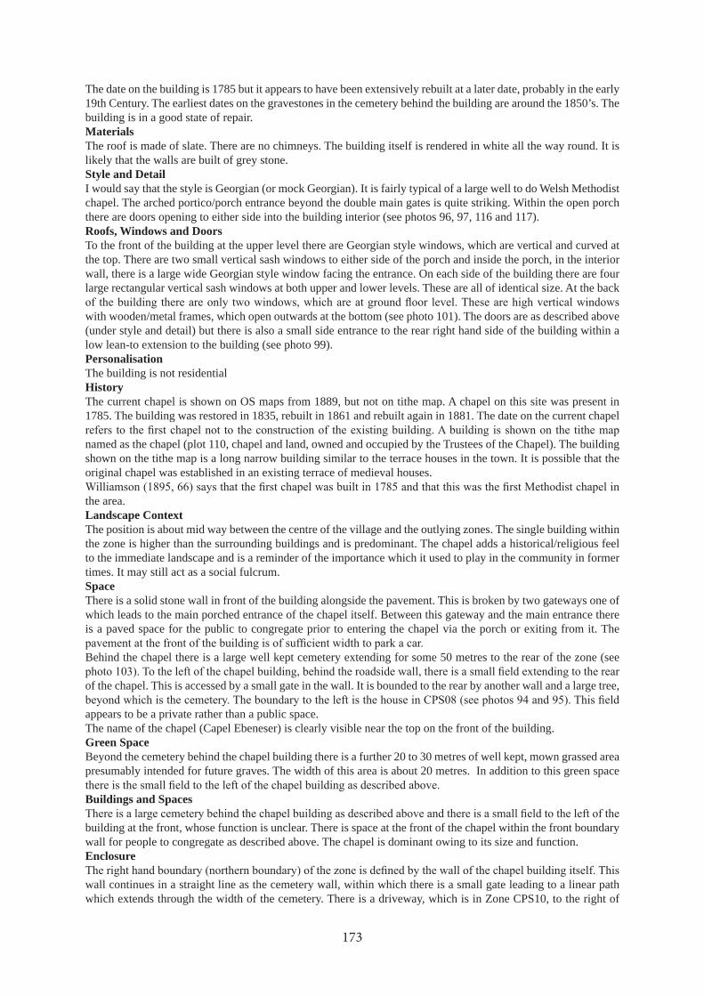
The date on the building is 1785 but it appears to have been extensively rebuilt at a later date, probably in the early 19th Century. The earliest dates on the gravestones in the cemetery behind the building are around the 1850’s. The building is in a good state of repair.MaterialsThe roof is made of slate. There are no chimneys. The building itself is rendered in white all the way round. It is likely that the walls are built of grey stone.Style and DetailI would say that the style is Georgian (or mock Georgian). It is fairly typical of a large well to do Welsh Methodist chapel. The arched portico/porch entrance beyond the double main gates is quite striking. Within the open porch there are doors opening to either side into the building interior (see photos 96, 97, 116 and 117).Roofs, Windows and DoorsTo the front of the building at the upper level there are Georgian style windows, which are vertical and curved at the top. There are two small vertical sash windows to either side of the porch and inside the porch, in the interior wall, there is a large wide Georgian style window facing the entrance. On each side of the building there are four large rectangular vertical sash windows at both upper and lower levels. These are all of identical size. At the back
with wooden/metal frames, which open outwards at the bottom (see photo 101). The doors are as described above (under style and detail) but there is also a small side entrance to the rear right hand side of the building within a low lean-to extension to the building (see photo 99).PersonalisationThe building is not residentialHistoryThe current chapel is shown on OS maps from 1889, but not on tithe map. A chapel on this site was present in 1785. The building was restored in 1835, rebuilt in 1861 and rebuilt again in 1881. The date on the current chapel
named as the chapel (plot 110, chapel and land, owned and occupied by the Trustees of the Chapel). The building shown on the tithe map is a long narrow building similar to the terrace houses in the town. It is possible that the original chapel was established in an existing terrace of medieval houses.
the area.Landscape ContextThe position is about mid way between the centre of the village and the outlying zones. The single building within the zone is higher than the surrounding buildings and is predominant. The chapel adds a historical/religious feel to the immediate landscape and is a reminder of the importance which it used to play in the community in former times. It may still act as a social fulcrum.SpaceThere is a solid stone wall in front of the building alongside the pavement. This is broken by two gateways one of which leads to the main porched entrance of the chapel itself. Between this gateway and the main entrance there is a paved space for the public to congregate prior to entering the chapel via the porch or exiting from it. The
Behind the chapel there is a large well kept cemetery extending for some 50 metres to the rear of the zone (see
of the chapel. This is accessed by a small gate in the wall. It is bounded to the rear by another wall and a large tree,
appears to be a private rather than a public space. The name of the chapel (Capel Ebeneser) is clearly visible near the top on the front of the building.Green SpaceBeyond the cemetery behind the chapel building there is a further 20 to 30 metres of well kept, mown grassed area presumably intended for future graves. The width of this area is about 20 metres. In addition to this green space
Buildings and Spaces
building at the front, whose function is unclear. There is space at the front of the chapel within the front boundary wall for people to congregate as described above. The chapel is dominant owing to its size and function.Enclosure
wall continues in a straight line as the cemetery wall, within which there is a small gate leading to a linear path which extends through the width of the cemetery. There is a driveway, which is in Zone CPS10, to the right of
173

the chapel building. This leads to a double gate directly ahead of it which gives vehicular access to the cemetery. Beyond this gateway and to the right of it there is stone wall surmounted by a wooden fence extending to the rear of the zone. This forms the boundary between CPS09 and CPS10 beyond the vehicular access. The remainder of the cemetery, to its rear and its southern side, is bounded by stone walls surmounted by hedges.
separating it from the main chapel entrance, the chapel itself, a stone wall to the rear separating it from the cemetery and the wall of the house in CPS08.Use, Activity and MovementAt the time of the survey there was no activity apart from one person leaving the cemetery. The main through A4080 highway passing through the village passes to the front of the zone. There was some evidence of pedestrian activity but it was not busy. Parking in this part of the village does not appear to be an issue although there were cars parked on the pavement in front of the zone.Materials, Street Furniture
measures in this part of the village.
Zone: CPS10, , Chapel StreetRecorded by: Chris Jones, on 26/09/2017Building Form and Street Context Ty Capel is the old chapel house set back one metre from the street and fronting on to the roadway. There is a one metre high stonewall separating the building from the public pavement with two narrow gateways giving access to the house by foot. To the right of the original chapel house in the same style there is an extension, which has been added at a later date, along the same line but with the roof at a slightly lower level. To the rear of this extension there is a more modern extension. There is a ‘Sunday school’ building behind and adjoining the original chapel house. The main part of the Sunday school building is at right angles to the chapel house and it extends some 10 metres to its rear. There is a side extension which is behind and parallel to the Chapel house with a three metre overlap to the left of the house viewed from the road. There is an outbuilding to the rear of the Sunday school which consists of toilets, a garage and a small brick walled yard.Building UseTy Capel is unoccupied. The Sunday school building is well maintained and appears to be in use, probably as a community centre.Age and Condition
adjoining zone. The side extension was possibly added in the early to mid 19th century. The further extension behind the side extension is more modern. The Sunday school building was probably built at the same time as the
and the garden to the front is overgrown with brambles and bushes.
Materials
various sizes cemented together with the larger boulders tending to be near the base and at the corners. The door and window lintels are of slate slabs.The Sunday School has a white rendering which matches the chapel in the adjoining zone.Style and Detail
cottage in style. It is double fronted with a window above the main doorway. The extension to the right is one up, one down with a doorway to the rear in the later extension. The original extension is in the same style as the original building but is clearly a later addition. There is a small archway to the right and to the rear of the extension leading to what appears to be a small outhouse or a privy. The style of the Sunday School is identical to the main chapel (Georgian) and appears to be part of that rather than the Chapel house.
similar in style to the chimneys on the farm house in CPS06.Roofs, Windows and Doors
extension has smaller windows with a dormer built into the roof at the front. The Sunday School has large vertical
174

side and four on the outer). There are three stylish narrow vertical windows at the back of the Sunday School, the one in the middle being higher than the one at each side.
accessed by a narrow gateway. There is also a small rear doorway round the back of the later extension.Personalisation
Rubbish has been thrown behind the wall and into both the front and side gateways. The wrought iron gates have been left open and are impossible to close. The impact on the neighbourhood is poor.HistoryTwo small buildings are shown on the site on the 1889 25 inch map but by 1900 the chapel house and Sunday school have been built. On the 1920 map the rear building is labelled as the Sunday School and the building on
No buildings are shown on this site on the tithe map.Ty Capel was partly built on the chapel land (plot 110) and partly on some of the adjacent plot (109, Tyn y pydew).Landscape ContextThe position of the zone is about mid way between the centre of the village and the southern edge of the village. The chapel house and the Sunday School provide a reminder of the place that they would have held in the local community in former times. The present ‘Sunday School’ building may still act as a social fulcrum.SpaceThere is a low narrow pavement alongside the main road in front of the wall separating the public from the
by. There is a lightly grassed driveway, with access from the road via double white metal gates, between the main chapel in CPS09 and the Sunday School, which leads to the outbuildings and cemetery to the rear of this zone and the adjoining CPS09 (see photo 118). The overgrown unattended garden and the accumulated rubbish in front of
left of the front door has fallen to an upside down position so that the name of the building is not easy to identify.Green SpaceThere is a green space to the rear of the Sunday School alongside the outbuildings in the form of a mown grassed area. The vehicle access to the cemetery in CPS09 via the driveway described above (in ‘Space’) leads to a further grassed area beyond.
off overgrown grassy area, which presumably would have been a lawn at one time. There is a small gate in a wall
walls is the only other green space in the zone.Buildings and Spaces
between the main chapel building in CPS09 and the buildings in this zone leading to the outbuildings at the back and the cemetery in CPS09. The buildings are of prime importance and dominate the zone.EnclosureViewed from the road the left hand boundary of the zone is the main chapel wall of CPS09 continued by the cemetery wall to the rear of the chapel as far as the vehicular access/gateway to the cemetery. The right hand
outbuildings behind the Sunday school. The rear wall of the outbuildings themselves continued by a wooden fence form the remainder of the boundary on this side of the zone. Within the zone there is a low stonewall, within which are set three gateways, alongside the public pavement and
off grassy area as described above (under ‘Green Space’).Use, Activity and MovementThe buildings in the zone did not have active frontages at the time of the survey but it is clear that the Sunday school building and the outbuildings are in use. The busy main through road, the A4080, passing through the village passes to the front of the zone. There was some evidence of pedestrian activity but it was not busy. Parking in this part of the village does not appear to be an issue although there was a car parked on the pavement in front of the zone thus impeding pedestrian activity.Materials, Street Furniture
175

measures in this part of the village.
Zone: CPS11, New houses, Off Chapel StreetRecorded by: Jade Owen and Megan Howe, on 05/02/2018Building Form and Street Context Detached, 3 two storey houses, two bungalows. All in a row on a cul de sac. All facing to road of the cul de sac but set back off the roadBuilding UseHouse, occupiedAge and ConditionVery modern, good conditionMaterialsSandy pebble-dash, red brick corners and under windows. Slate roofStyle and DetailDetached. All similar in style , similar to rest of village with pebbledashred brick is different.Bay windows in the bungalowsRoofs, Windows and Doorsslate roof, wooden windows and doors, each house has different layout of doors and windows.PersonalisationSome have solar panels. Each differently set out. Some with drives, others gardens. Although each has a different layout their exterior appearance/materials are similar.HistoryHouses built in 2015 or 2016. There was previously no building on this area. No buildings are shown on the 25 inch maps. This was plot 109 (Tyn y pydew) on the tithe map, but it had no buildings.Remains of a medieval building have been found in this zone. Also a possibly early medieval whetstone. Medieval town houses were probably across this plot some distance in from the present road.Landscape ContextNewly built area set away from street. Different/ more modern character than other buildings in the area.SpaceUse of small front gardens and red brick paving/drives to distinguish property boundary from pavement. Easily identify house names as they have been engraved on slate plaques and placed on houses front.Green SpaceSmall front gardens with some small plantsBuildings and SpacesAll buildings are detached from one another providing some privacyEnclosureNo walls built to separate front gardens from pavement but clear use of small garden and different paving material for drives/walkways to house to distinguish what is private/publicUse, Activity and MovementDomestic, own parking. Only though using properties would use road and pavement (cul de sac)Materials, Street Furnitureroad and pavement - concretedriveway and walkway - red brick
Zone: CPS12, Mor a Mynydd etc, Off Chapel StreetRecorded by: Building Form and Street Context Building UseAge and ConditionMaterialsStyle and DetailRoofs, Windows and DoorsPersonalisationHistoryHouses built in 2003. No buildings are shown in most of this area on 25 inch maps, but there was a small building under Y Bwthyn, on the 25 inch maps but not the tithe map and a range of outbuildings along the NW boundary, the latter also on the tithe map. These buildings were related to Bod Iorwerth.
176

Archaeological remains including a midden and stone surfaces and possibly the original road edge have been found in this zone.Landscape ContextSpaceGreen SpaceBuildings and SpacesEnclosureUse, Activity and MovementMaterials, Street Furniture
Zone: CPS13, Bod Iorwerth, Off Chapel StreetRecorded by: Building Form and Street Context Not accessibleBuilding UseAge and ConditionMaterialsStyle and DetailRoofs, Windows and DoorsPersonalisationHistoryThe present house was built around 1844 by Edward Hugh Owen, Glas-coed, but he died before going to live there (Owen 1952, 122). Williamson (in his notes dated 1894 for his Hanes Niwbwrch, Bangor University Archives Bangor MSS 7391) says that the house was built by Hugh Owen Edwards “50 years ago”, again placing it around 1844.Shown on OS maps from 1889, and on the tithe map. The building would have been new when the tithe map was drawn up. The tithe map shows outbuildings along the NW boundary of the property and a NW wing on the main house, as also shown on the 25 inch maps.Landscape ContextSpaceGreen SpaceBuildings and SpacesEnclosureUse, Activity and MovementMaterials, Street Furniture
Zone: CPS14, Cartref, Chapel StreetRecorded by: Jane Kenney, on 16/02/2018Building Form and Street Context Double fronted house on street frontage. House extends to right over what is probably now a garage with double doors but may have been an access passage to the rear of the house.Building UseDomesticAge and ConditionProbably 19th centuryMaterialsPebble-dashed wallsStyle and DetailStraight-forward, simple designRoofs, Windows and DoorsSlate roof, uPVC windows, wooden door and door to garagePersonalisationLight next to door, shrub in front of houseHistoryShown on OS maps from 1889, but not on tithe map.Landscape ContextOn street frontageSpace
177

Garden behind. Open yards of neighbouring properties to either side.Green SpaceRear gardenBuildings and SpacesEnclosureFronts directly on to pavement, no enclosure.Use, Activity and MovementOn busy roadMaterials, Street Furniture
Zone: CPS15, Garage, Chapel StreetRecorded by: Jane Kenney, on 16/02/2018Building Form and Street Context
Building UseThe main building is a dwelling but the adjacent buildings and extensions are related to the use of the property as a garage.Age and ConditionFairly modern. Extension has a slightly 50s feel.MaterialsPainted rough-cast render on the main house and other buildings. The house has a panel covered in planking for decorative effect.Style and DetailRoofs, Windows and DoorsModern UPVC windows and doors.PersonalisationDecorative panel in door, Michelin signHistoryThe buildings are shown on OS maps from 1889, but not on tithe map.Plot 107 in the tithe schedule is “Caeau Lliadiart” and is shown with a house. “Cay y Llidiard & house in Town” is listed in 1780 rents for the Borough of Newborough (Owen 1952, 30).Landscape ContextOn main street, open ground to side and rearSpaceTarmacked areas to side of house and behind used for storing vehiclesGreen SpaceVery littleBuildings and SpacesEnclosureNot enclosed, at least at the front, except by buildingsUse, Activity and MovementGarageMaterials, Street FurnitureNo waiting sign adjacent
Zone: CPS16, Kingslow Cottage etc, Chapel StreetRecorded by: Jade Owen and Megan Howe, on 05/02/2018Building Form and Street Context Terrace attached. Facing street, on the street. Similar to surrounding buildings. Double fronted, two storeyBuilding UseModern 19th century or earlier, good conditionAge and Conditionslate roof, stones painted yellowMaterialsTerrace attached. Small alcove attached, with tall metal gate with Shop furniture such as a fridge seen behind it. This feature marks the property as different from others on the street.Style and DetailSlate roof and UPVC windows, dark wooden door.
178
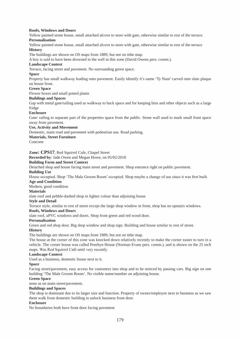
Roofs, Windows and DoorsYellow painted stone house, small attached alcove to store with gate, otherwise similar to rest of the terrace.PersonalisationYellow painted stone house, small attached alcove to store with gate, otherwise similar to rest of the terraceHistoryThe buildings are shown on OS maps from 1889, but not on tithe map.A boy is said to have been drowned in the well in this zone (David Owens pers. comm.).Landscape ContextTerrace, facing street and pavement. No surrounding green space.SpaceProperty has small walkway leading onto pavement. Easily identify it’s name ‘Ty Nant’ carved onto slate plaque on house front.Green SpaceFlower boxes and small potted plantsBuildings and SpacesGap with metal gate/railing used as walkway to back space and for keeping bins and other objects such as a large fridgeEnclosureGate/ railing to separate part of the properties space from the public. Stone wall used to mark small front space away from pavement.Use, Activity and MovementDomestic, main road and pavement with pedestrian use. Road parking.Materials, Street FurnitureConcrete
Zone: CPS17, Red Squirrel Cafe, Chapel StreetRecorded by: Jade Owen and Megan Howe, on 05/02/2018Building Form and Street Context Detached shop and house facing main street and pavement. Shop entrance right on public pavement.Building Use
Age and ConditionModern, good conditionMaterialsslate roof and pebble-dashed shop in lighter colour than adjoining houseStyle and DetailTerrace style, similar to rest of street except the large shop window in front, shop has no upstairs windows.Roofs, Windows and Doorsslate roof, uPVC windows and doors. Shop front green and red wood door.PersonalisationGreen and red shop door. Big shop window and shop sign. Building and house similar to rest of street.HistoryThe buildings are shown on OS maps from 1889, but not on tithe map.The house at the corner of this zone was knocked down relatively recently to make the corner easier to turn in a vehicle. The corner house was called Penrhyn House (Norman Evans pers. comm.), and is shown on the 25 inch
Landscape ContextUsed as a business, domestic house next to it.SpaceFacing street/pavement, easy access for customers into shop and to be noticed by passing cars. Big sign on one building ‘The Male Groom Room’. No visible name/number on adjoining house.Green Spacenone as on main street/pavement.Buildings and SpacesThe shop is dominant due to its larger size and function. Property of owner/employee next to business as we saw them walk from domestic building to unlock business front door.EnclosureNo boundaries both have front door facing pavement
179
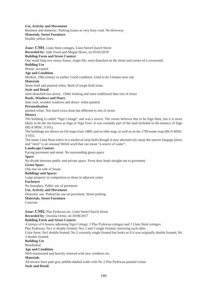
Use, Activity and MovementBusiness and domestic. Parking issues as very busy road. No drivewayMaterials, Street FurnitureDouble yellow lines.
Zone: CS01, Llain Stent cottages, Llain Stent/Church StreetRecorded by: Jade Owen and Megan Howe, on 05/02/2018Building Form and Street Context
Building UseHouse, occupiedAge and ConditionModern, 19th century or earlier. Good condition. Used to be 3 homes now oneMaterials
Style and Detailsemi-detached two storey . Older looking and more traditional than rest of streetRoofs, Windows and Doorsslate roof, wooden windows and doors- white paintedPersonalisationpainted white. Not much extra done but different to rest of street.HistoryThe building is called “Sign Cottage” and was a tavern. The owner believes this to be Sign Hare, but it is more likely to be the inn known as Sign or Sign Fawr. It was certainly part of the land included in the tenancy of Sign (BUA MISC 3/101). The buildings are shown on OS maps from 1889, and on tithe map, as well as on the 1799 estate map (BUA MISC 3/101).
and “stent” is an unusual Welsh word that can mean “a source of water”.Landscape ContextFacing pavement and street. No surrounding green spaceSpaceNo divide between public and private space. Front door leads straight out to pavement.Green SpaceOne tree on side of house.Buildings and SpacesLarge property in comparison to those in adjacent zonesEnclosureNo boundary. Public use of pavementUse, Activity and MovementDomestic use. Pedestrian use on pavement. Street parkingMaterials, Street FurnitureConcrete
Zone: CS02, Plas Pydewau etc, Llain Stent/Church StreetRecorded by: Owenna Orme, on 30/08/2017Building Form and Street Context
Plas Pydewau: No1 is double fronted, Nos 2 and 3 single fronted, mirroring each other.Llain Stent: No1 double fronted, No 2 currently single fronted but looks as if it was originally double fronted, No 3 double fronted.Building UseResidentialAge and ConditionWell-maintained and heavily restored with new windows etc.MaterialsAll terrace have pale grey pebble-dashed walls with No 2 Plas Pydewau painted cream.Style and Detail
180

This terrace was renovated by the Council so it has a uniform character.A white barge board runs the length of the 3 Plas Pydewau properties. Guttering in white plastic.Roofs, Windows and DoorsThe roofs are of slate with red ceramic ridge tiles and chimney pots. All windows white plastic.Slate canopies over the doors of the 3 Plas Pydewau cottages. Plas Pydewau No 1 has a white plastic door, while Nos 2 and 3 have brown plastic doors with brass letter boxes. Slate canopy over the door of Rhosyr. Llain Stent have dormer windows with slate covering.Rhosyr has 2 large windows and a small sash windowPersonalisationNo 1 Plas Pydewau and No 1 Llain Stent have street sign-type name plates high on the wall.Rhosyr has its own name plate on slate near the door.HistoryThe buildings are shown on OS maps from 1889, and on tithe map. This is plot 105 (Houses & Gardens) on the tithe map.Soar Independent chapel formerly stood on the gap at the end of the terrace.Owen (1952, 129) says that this land belonged to the Wynnes of Glyn-llifon some three centuries ago. The old thatched buildings were demolished around 1840 and William Owen, Gallt-y-rhedyn, built four houses in their place, giving his name to one of them.
The street is believed to be haunted by a woman called Mary who was murdered.Landscape ContextTerrace on a main street in the villageSpaceGreen SpaceThe houses have narrow strip gardens behind. There is a grassy area at the end of the terrace where the chapel used to be. There is a “no ball games” sign on the end wall of the terrace.Buildings and SpacesThe buildings open directly onto the street.EnclosureNo enclosures or boundaries visible at the front of the terrace.Use, Activity and MovementSome cars parked on the street but fairly quiet.Materials, Street Furniture
Zone: CS03, Soar Terrace/Rhenc Newydd, Llain Stent/Church StreetRecorded by: Owenna Orme, on 30/08/2017Building Form and Street Context A terrace of 9 identical Council-built 2 storeyed single fronted houses.Building UseAge and ConditionMaterialsStyle and DetailRoofs, Windows and DoorsSlate roofs with red ceramic ridge tiles, black chimneys with red chimney pots.
Windows all white plastic, doors white plastic with slate roofed canopies.PersonalisationHistoryA terrace is shown on OS maps from 1889 that closely resembles the current terrace but the style of the houses suggest that this must have been entirely rebuilt in the 20th century. There is a terrace on exactly the same line on tithe map, but these houses were entirely rebuilt so nothing of the earlier terrace is likely to survive. This is part of plot 105 (Houses & Gardens) on the tithe map.
here on land previously known as Llain-y-beiliaid (Bailiff’s Quillett) in about 1815 or 1816 (Owen 1952, 93, 130). Owen (1952, 130) says that everything was sold in 1866 and Soar Terrace was built in its place, but he also records vestry records where the sale of Rhenc Newydd is discussed in 1878 to fund the expansion of the cemetery (Owen 1952, 110).
181

Landscape ContextSpaceAt the back of the terrace is a very private concrete communal area.Green SpaceSmall front gardens, increasing in size from No 1 to SE. Gardens generally lawned with seasonal garden furniture and children’s toys.Buildings and SpacesEnclosureGardens enclosed by pebble-dashed walls.Use, Activity and MovementMaterials, Street FurnitureAway from the road.
Zone: CS04, Spier House etc, Church StreetRecorded by: Owenna Orme, on 30/08/2017Building Form and Street Context Terrace if 8 rather variable houses.
Coleg Bach and Coleg Mawr have a higher roof level and both are single fronted, but Coleg Mawr is much wider and was probably originally a double fronted house. Spier House No 1 has the highest roof of the terrace and is
Building UseResidentialAge and ConditionThey all have modern features but there are likely to be old houses behind the facades. The different roof lines suggest some were built at different periods and to different styles.MaterialsAll pale grey pebble-dashed except for Ysgubor Ddu No 1 which has rough cast render painted green and Coleg Bach is rendered and painted white.Style and DetailColeg Bach has decorative surrounds to the windows that may have been original features on several of the houses.Spier House No 1 is a well proportioned, symmetrical house, unlike the others.Roofs, Windows and DoorsAll roofs are of slate. All windows white plastic except Coleg Mawr, which has brown window frames, probably plastic. Doors generally plastic of different colours.PersonalisationCarreg yr Eglwys has a trellis for plants around the door with then house name over the door. Ysgubor Ddu No 2 has the house name next to the door. Ysgubor Ddu No 2 has red painted trellis on the walls.HistoryThe buildings are shown on OS maps from 1889, and on tithe map.Norman Evans suggests that the names College Mawr and College Bach come from this being the site of the priest’s house (collegium) at the time of the llys and that this name has been remembered in the names of the houses.
Landscape ContextSpaceAll have front yards, mostly with hard standing used for parking cars. The yard at the Spier Houses is neatly paved.Green SpaceCarreg yr Eglwys has small trees and shrubs in its front yard, Ysgubor Ddu No 1 has hanging baskets and window boxes. Ysgubor Ddu No 2 has potted shrubs.Buildings and Spaces
a narrow passageway.EnclosureYards enclosed by stone walls. Those of Carreg yr Eglwys are pebble-dashed but most of the others are exposed stone. Some have square gate pillars. A few of the pillars have concrete pyramidal caps. The Spier Houses have
182

fancy metal gates.Use, Activity and MovementMaterials, Street FurnitureThere is a lamp post in front of Ysgubor Ddu and the road has speed bumps.
Zone: CS05, Fairview, Church StreetRecorded by: Jade Owen and Megan Howe, on 05/02/2018Building Form and Street Context Semi detached, facing street, single fronted, two storeyBuilding UseHouse, occupiedAge and Conditionmodern and good conditionMaterialsslate roofs, pebble-dashed one lighter colour, one darker.Style and DetailSemi detached two storey. Different to each other in architectural style. But still similar to rest of street and each other in detail.Roofs, Windows and Doorsslate roofs and uPVC window and wood doors (one light blue, other dark) with glass panels.Personalisationnot much other than door colour.HistoryThe buildings are shown on OS maps from 1889, but not on tithe map.Landscape ContextZone facing pavement and street. No surrounding green space.SpacePavement and street front of property. Small walk ways and gates to mark entrance. No house names or numbers visible.Green SpaceNo green space. Small concrete space in front of house, small potted plants.Buildings and SpacesEnclosure
Use, Activity and MovementDomestic, public use of pavement in frontMaterials, Street Furnitureconcrete
Zone: CS06, Tan Rofft, Church StreetRecorded by: Jade Owen and Megan Howe, on 05/02/2018Building Form and Street Context Semi detached two storey, facing the street and small porch overhanging over front door.Building UseHouse, occupiedAge and ConditionModern and good conditionMaterialsSlate roofs, pebble-dashed, one white one not paintedStyle and DetailSingle fronted, two storey semi detached both similar in style and detail to each other and rest of the street. Small front gardensRoofs, Windows and DoorsSlate roofs and UPVC windows, wooden doors.Personalisation
HistoryThe current buildings are 20th century, not shown on 1920 map, but they were preceded by a terrace of houses
183

along the street which are shown on the 25 inch maps from 1889. There is also a row of houses shown on the tithe map.
Tan-yr-offt, were built by John Rowland and William Morris, the carpenter, around 1840 (Owen 1952, 130).“Rofft” is a spade so the name may indicate spade cultivated ground.Landscape ContextStreet facing, no green space surrounding property. More urban feel.Space
Green SpaceSmall front gardens some greenery and bushesBuildings and SpacesBoth same style buildings, pebble-dashed. Wire fencing used to separate both properties front spaces.Enclosure
private space.Use, Activity and MovementDomestic. Pedestrian pavementMaterials, Street FurnitureConcrete
Zone: CS07, Tan Rofft terrace, Tan RofftRecorded by: Jade Owen and Megan Howe, on 05/02/2018Building Form and Street Context Four terrace houses, attached. Facing side street. Small front gardens. Two storey.Building UseHouse, occupiedAge and ConditionModern/very recent. Good condition not necessarily well looked after.MaterialsSlate roof, pebble-dashed exterior.Style and DetailTerrace attached. Porches over front doors, same pebbledash as each other and others on street.Roofs, Windows and DoorsUPVC windows, doors and drains. Porches over front doorsPersonalisationNoneHistoryModern housing.Landscape ContextTerrace of four houses. No green space surrounding properties. More urban feel.SpaceZone facing pavement and street. Gates used to mark entrance to properties. Easy to identify house numbers as they were present on each front door.Green SpaceHedges in front, facing pavement. Some grass and small potted plantsBuildings and SpacesAll identically pebble-dashed. All relate to each other and conform to same style.Enclosure
Use, Activity and MovementDomestic. Road parking.Materials, Street FurnitureConcrete
Zone: CS08, Crud yr Awel, Crud yr AwelRecorded by: Jane Kenney, on 16/02/2018Building Form and Street Context
184

Development of bungalows around short streetsBuilding UseDomesticAge and ConditionLate 20th centuryMaterialsPale pebble-dash on the wallsStyle and DetailDecorative stone facing panel on the corner of many of the bungalowsRoofs, Windows and DoorsUPVC windows and doorsPersonalisationVariation in gardens. Some have decorative house numbers and names.History
Landscape ContextOn slight slope facing south with good views of the hillsSpaceSpacious development with gardens around the bungalows and broad streets.Green SpaceAll bungalows have small gardens, some now fairly mature.Buildings and SpacesEnclosurePebble-dashed walls around the gardens.Use, Activity and MovementVery quiet areaMaterials, Street FurnitureLamp-posts but few other items of street furniture and no road markings.
Zone: CS09, Forest Lodge etc, Church StreetRecorded by: Jade Owen and Megan Howe, on 05/02/2018Building Form and Street Context Detached oblong shaped house. Three facing the street and two not. All set back from the pavement and gardens in the front.Building UseHouses all occupied.Age and ConditionModern. All in relatively good condition. Very recent = being constructedMaterialsAll slate roofs. All pebble dashed with two painted over (white and yellowy cream)Some UPVC windows, some wooden.Style and DetailSome bungalowsSome two storeyOne balconyone with other accommodation (caravan) in gardenRoofs, Windows and DoorsSome UPVC windows, some wooden. Some solid wood doors, others glass panned. Some have skylightsPersonalisationAll very different houses in terms of style, detail and building materials. Some have more personalised garden than others. One has a balcony. Two houses have external painting one white, one yellowish.History
Landscape ContextZone on corner street leading to cul de sacSpace
pavement.
185

Green SpaceSome front gardens with few trees and bushes.Buildings and SpacesAll detached and don’t appear to relate to each other.Enclosure
Use, Activity and MovementDomestic. Sign of additional living spaces in front gardens e.g. caravansMaterials, Street Furniture
Zone: CS10, Hedd y Mynydd, Church StreetRecorded by: Jade Owen and Megan Howe, on 05/02/2018Building Form and Street Context Facing street. Detached two storey. Gabled roof. Nothing else like this in other zonesBuilding UseHouse occupiedAge and ConditionVery modern, good conditionMaterialsslate roof, red brick front, pebble-dashed sides- painted white. Pale brown brickwork around the windows.Style and DetailAttached garage, not like any other house on that street.Roofs, Windows and DoorsWooden windows and door all same colour. Seven windows of differing shapes and sizes.PersonalisationRed brick exterior. Very dominant house that stands out in comparison to the rest of those surrounding.History
Landscape Context
next to zone.SpaceDriveway to enter property. Stone wall to divide private garden space from pavement. Mane of house on slate plaque beneath the houses outside lightGreen SpaceLarge green garden. Hedges line one side of property not much else done in garden.Buildings and SpacesDominant due to its size and garden space.Enclosure
Use, Activity and MovementDomesticMaterials, Street FurnitureConcrete driveway.
Zone: CS11, Hendref, Church StreetRecorded by: Jade Owen and Megan Howe, on 05/02/2018Building Form and Street Context Detached two storey and extension. Far off the road, looks like a farm building with outhouses. Over looking the Straits.Building UseHouse/Farming, occupiedAge and ConditionModern 19th century or earlier. Good condition but not as well kept as others on the street.MaterialsSlate roof, pebble-dashed walls - greyer than rest of street.Style and Detail
186

Outbuildings/ barns
Roofs, Windows and DoorsSlate roof, extension UPVC windows and guttering. Old house wooden windows.PersonalisationExtension. Looks more rural and working farm like than rest of street which is more residentialHistoryThe buildings are shown on OS maps from 1889, and on the tithe map.
Hendre Fawr had a date stone marked W RT 1769 (Owen 1952, 126).Landscape ContextField in front of house. Property overlooking the Straits and mountain range. Very rural feel.Space
Green SpaceField in front of house. Shed/farm buildings on property.Buildings and SpacesAppears to be older farmhouse, which differs from the more recent on modern builds in adjacent zones.EnclosureField and private driveway set it back from public space.Use, Activity and MovementDomestic and perhaps some farming use.Materials, Street FurnitureConcrete
Zone: CS12, Corner of Church Street, Church Street/Malltraeth StreetRecorded by: Sian Barker, on 14/07/2017Building Form and Street Context Building on corner of Malltraeth street and Church Street.Building Use
church street. It is thought that a shop was part of original building.Age and Condition19th century building. Renovated 2 and a half years ago. Good condition. Previously, empty and neglected for twenty three years.MaterialsSlate roof Pebbledash walls. Black stone edging on corner.Style and Detail
Roofs, Windows and DoorsNew shop front PVC door and window. Also fronting Malltraeth street wooden door. Two PVC windows, one
“Cambrian House” recessed wooden door with red brick surround. Four PVC windows facing road.PersonalisationShop signage “Twinkle toes” details of services offered in foot health clinic. Three wall baskets, shop front contain
street.HistoryThe buildings are shown on OS maps from 1889. Most of the present buildings are those built in the 19th century to the SE of those shown on the tithe map but some current buildings do over lie those shown on the tithe map. The tithe map plot is 102 (White Lion).A shed in this zone is an old cottage shown on the tithe map that was used for marram grass working.The building on the street corner was known as Cambrian House (Owen 1952, 135). Cambrian House is thought to have been built as a shop at the same time as the White Lion pub in the late 18th century. It was renovated 2 1/2 years ago after having been empty and neglected for 23 years.Landscape ContextAt corner of central village crossroads opposite village store, next door to White Lion pub, at junction of road to
187

beach.SpaceChurch street sign.Green SpaceSome roses and shrubs growing at rear of side yard.Buildings and SpacesEnclosureWest end of zone iron gates, tarmac yard-single storey, new building east side attached to Cambrian house on west side attached to Coed An, abandoned outbuilding brick. Concrete walls at back of yard. Used as parking space.Use, Activity and Movement
Materials, Street FurnitureTarmac. Give way sign and street lamp in church street.
Zone: CS13, Coed Anna etc, Llain Stent/Church StreetRecorded by: Sian Barker, on 14/07/2017Building Form and Street Context Semidetached (2) facing street.Building UseOccupied residential dwellings.Age and ConditionPossibly late 19th century.MaterialsSlate roofs. Pebble dashed walls in contrasting colours.Style and DetailDouble fronted houses-tunnel entrance to back yard between them. “Bronant” window above entrance. Walled front gardens. Distinctive style.Roofs, Windows and DoorsSlate roofs, new uPVC windows. “Bronant” (West) canopy frames. “Coedana” canopied front door. Bronant-red wood and glass front door. Coedana-white wood door with small lass pane.Personalisation“Bronant” (West) overgrown front garden bushes climbers. Decorative plaques at front door-owe and ‘garden friends’. Red door grey pebble dashed. Canopy brackets at front door. “Coedana” window boxes pots, hanging baskets. Canopy over front door. Garden gates and satellite dishes.HistoryThe current buildings are shown on OS maps from 1889, but not on tithe map. The tithe map buildings were located a little further back from the present road edge. The zone covers parts of the tithe map plots 102 (White Lion) and 101a (house and garden).This was originally one house divided in two by the alleyway. There was a slaughter house behind this building. The original name of the house was Llaethdy.Landscape Context
SpaceTarmac road and pavement, yellow line on the road.Green Space
Coedana- window boxes, pots, and hanging baskets.Buildings and SpacesTunnel gap between houses leads to drive and open space, backed by old stone buildings, with new, attractive barn doors. View of well tended garden areas each side of concrete drive.Enclosure
Use, Activity and Movement
opposite and for customers of village shop and pub on crossroads. Coedana parking in zone CS12 yard.Materials, Street Furniture
188

Zone: CS14, Hen Blas etc, Llain Stent/Church StreetRecorded by: Sian Barker, on 14/07/2017Building Form and Street Context Terrace of four houses, facing street.Building UseResidential buildings seem occupied.Age and ConditionSite of old residential buildings see four houses bought and renovated by Newborough man sixty years ago. Good/reasonable condition.MaterialsSlate roofs, pebble dashed.Style and Detail
Roofs, Windows and DoorsuPVC windows, slate roofs. First two houses heading east have front porches with side doors and windows to front, other two have brick porches with recessed door. Slate roofs on all porches.PersonalisationFirst house, heading west has sign- “I Tir Ffynnon” This house has stone plant pots and garden gnome. The garden is open at east side to the rough drive that leads to backyard. Whitewashed stone wall at back of yard.History
from 1889. The tithe map shows a terrace on the same line as the present buildings. The zone covers parts of the tithe map plots 102 (White Lion) and 101a (house and garden).Landscape ContextVery near village centre. Busy road to beach. On road parking opposite. Frequent road congestion. Terrace houses (four.) View of long terrace opposite.SpaceNarrow pavement. Double yellow lines on the road. Mid-terrace-sign on boundary wall “HenBlasBach”Green SpaceEast end house has overgrown shrubs with walled garden. Each house has some shrubs or small tree in front.Buildings and SpacesTerrace. Third house heading east is double fronted, others single fronted. First and last house have two doors facing front one grants access to the house the other to the back garden.EnclosureWaist-high stones walls from each house to pavement. First three houses, heading to east, have concrete parking spaces in the front, Third house has double metal gates. Last house has pebble dashed wall at pavement. Also has garden gate with gate posts. At east end of terrace rough drive to the back.Use, Activity and MovementMain road from village centre to beach is very busy, often congested. Properties have from access, rear access at East end of Terrance. Busy with pedestrians in street as next to parking area (CS15) and residents’ parking on opposite site of main road. Three of the four houses have parking spaces off road. Fourth side drive.Materials, Street Furniture
Zone: CS15, Carpark, Church StreetRecorded by: Sian Barker, on 14/07/2017Building Form and Street Context Set some distance from street. Facing street.Building UseClosed public conveniences , purpose built. Eleven parking bays in front of building, sixteen parking bays behind access prohibited by concrete bollardAge and Condition
MaterialsSlate roof. Concrete between entrances, stone at each end.
189

Style and DetailFunctional. Stone wall is a feature.Roofs, Windows and DoorsHipped roof. Skylight windows small window east side. Three front entrance doors- 2 with iron grilles. Solid metal pack locked.Personalisation
especially at back of building.HistoryExcavation revealed the remains of a building on the street frontage, a midden and a ditch further back. The building remains suggest medieval houses in this gap.This zone lies within the tithe map plot 103 (Cae Llewelyn).Landscape ContextOne of the last buildings on the road to the beach. Busy setting between village centre and beach. Pedestrians and
SpaceCar-width entrance from road. Shrub border to Single yellow line on road, public space in front and to the side. Parking pays tarmac stone slabs near public convenience parallel stone walls in font of building with paving in between. 16 parking bays behind building.Green SpaceTall trees and shrubs border three sides of carpark. Small shrub border at edge of pavement. Attractive plants now overgrown signs of neglect.Buildings and SpacesView of section of carpark road to beach and terrace across the road.EnclosureParking bays at back. Entrance to them blocked by concrete bollard. Tarmac. On east side behind PC Collapsed wooden and wire fence.Use, Activity and MovementWall in front of pc is where young people often congregate to drink and smoke. Local residents use parking spaces. Main road to beach is busy, on road parking on other side of road means frequent hold ups.Materials, Street FurnitureTarmac single yellow line in road parking bays marked out in white lines. Sign posts “P, Llys Rhosyr, Institute, village centre” at entrance to carpark.
Zone: CS16, Dolfor etc., Church StreetRecorded by: Jade Owen and Megan Howe, on 05/02/2018Building Form and Street Context Semi detached and attached row of 3. Two storey, facing street, double frontedBuilding UseHouse occupiedAge and ConditionModern/ 19th century or earlier. All in good conditionMaterialsSlate roofs. Two pebble-dashed and painted (white and cream). One stone exterior.Style and DetailTwo storey, all the same style, double frontedRoofs, Windows and DoorsSlate roofs. One wooden and painted windows and door in mint green. UPVC windows in two and wooden doorsPersonalisationPainting of the pebbledash/stone exterior. Painted window and door frames. Small front garden.HistoryThe houses are shown on OS maps from 1889, but not on tithe map, though a small building behind the houses may have been used as a shed shown on the 25 inch maps. Ffynnon Wrallt, the main public well for the village, was located at the roadside just with this zone.
Landscape ContextOn street frontSpace
190

Green Spacesmall front areas with space for some small trees and plant potsBuildings and SpacesSemi detached and attached houses. No gaps. (terrace)EnclosureWalls/hedges to divide each properties garden from one another and from pavement.Use, Activity and MovementDomestic. Pedestrian activity in front. Road parkingMaterials, Street FurnitureConcrete
Zone: CS17, Awelon etc, Church StreetRecorded by: Jade Owen and Megan Howe, on 05/02/2018Building Form and Street Context
Building UseHouse occupiedAge and ConditionGood condition and well looked after. Modernish (20th century) House on right looks like it has a newer roof to the one on left due to its condition and skylightMaterialsSlate roof with skylight, sandy brown pebbledashStyle and DetailSemi-detached, similar to one next door. Porch over front door. 1.5 chimneys (1 shared), 3 in total. Skylight in right hand house. Single frontedRoofs, Windows and DoorsVertical windows, house on left has white UPVC windows and door = sash window. House on right has dark brown wooden frames and door. Porch on both and stepped access.Personalisation
appeared neat from front.HistoryThe buildings are shown on OS maps from 1889, but not on tithe map.Landscape ContextHouses slightly set back from street. Area appeared to be quiet and set away from the main part of the town.SpaceNames of houses appeared on the front of them so were easy to identify.Green Space
to divide space between both properties. Some patches of grass.Buildings and SpacesSemi-detached house, use of hedge to divide front space on Awelfon side, stone wall on other property side.EnclosureHedge and wall. Front area used for parkingUse, Activity and MovementPavement in front of house. Private parkingMaterials, Street FurnitureConcrete
Zone: CS18, Tyn’rallt, Church StreetRecorded by: Jade Owen and Megan Howe, on 05/02/2018Building Form and Street Context Detached bungalow with annex and garage. Facing street. Driveway, set back off roadBuilding UseHouse occupiedAge and ConditionModern and in good condition
191

MaterialsSlate roof, sandy pebble-dashed. Porch stone cladding in mismatched bond. Red brick small walls in stretcher bond.Style and DetailAnnex built into the house, possible single pile. Different to further down street.Roofs, Windows and Doors
PersonalisationStone cladding not seen elsewhere on street. No garden design, just grassHistory“Tyn rallt” is listed in 1780 rents for the Borough of Newborough (Owen 1952, 31).The current house is not shown on the 25 inch maps so was built after 1920. The buildings that are shown on the 25 inch maps in this plot were closer to the road and are also shown on the tithe map.In the mid 18th century Shôn Dafydd lived at Ty’n Rallt and held religious meetings in his house when the church was closed for repairs. This became the start of the Methodist movement in the area (Williamson 1895, 66).Landscape ContextSet back from road. Area appears quite and set away from main part of town.SpaceStreet and pavement in front of house. Private driveway.Green Space
have died.Buildings and SpacesDetached from others on street, very different appearance as it’s a large bungalow with an annex, garage and big front space.Enclosure
Use, Activity and MovementDomestic, private driveway and garageMaterials, Street FurnitureConcrete
Zone: CS19, Pengwern, Behind Church StreetRecorded by: Jade Owen and Megan Howe, on 05/02/2018Building Form and Street Context
but loops back to the road.Building UseHouse occupiedAge and ConditionModern and good conditionMaterialsslate roof, pebble-dashed, wooden windows and doorsStyle and DetailDetached bungalows and pebbledash. A lot of personalisationRoofs, Windows and Doorswooden windows and doors, slate roofPersonalisationgardens and potted plants. Children’s playhouse and big windowsHistory
Landscape ContextDetached and off the main road making it more private and ruralSpaceStone wall used to mark boundary of property from pavementGreen Spacelarge green space in front with evidence of some shrubbery and potted plants. Washing line and children’s play house to rear of house.
192

Buildings and Spacesset away from other buildingsEnclosurestone wall as a boundary from pavement. House positioned in centre of green space.Use, Activity and MovementDomesticMaterials, Street FurnitureConcrete
Zone: CS20, Ty’n-lon, Behind Church StreetRecorded by: Jade Owen and Megan Howe, on 05/02/2018Building Form and Street Context Detached bungalow off main street, accessible via public footpathBuilding UseHouse occupiedAge and ConditionModern, good conditionMaterialsslate roof, pebbledash painted white, UPVC windows and door with glass paneStyle and DetailDetached bungalow and pebble-dashed painted. L shaped building with possible annex, wooden shed, nothing like rest of street.Roofs, Windows and Doorsslate roof, UPVS windows and doors. Porch. Private access.PersonalisationPainted white pebbledashFairy lights and potted plants. Garden furniture. Wooden shed.HistoryThe buildings are shown on the tithe map and on the 25 inch maps from 1889.Landscape ContextSecluded property quiet and rural. Own private driveway/walkway leading to front door.Space
Green SpaceSome plants and hanging baskets near front entranceBuildings and SpacesMore secluded than others in surrounding zonesEnclosureStone walls and private paved garden. Public footpath on other side of wall which didn’t appear to be used often.Use, Activity and MovementDomesticMaterials, Street FurniturePublic footpathDriveway and street concrete
Zone: MS01, White Lion, Malltraeth StreetRecorded by: Sian Barker, on 14/07/2017Building Form and Street Context Facing street. Impressive frontage when viewed from across the street.Building UsePublic house. Originally built as hotelAge and ConditionLate 18th century, very good condition. Currently under renovation-new roof and windows.MaterialsSlate roof. Lime render walls.Style and Detailthree storey. Original front porch door to each side, window to the front. Two gabled dormer windows third storey, double wooden doors at original entrance through building to stable yard. Decoration around porch and dormer
193

windows, gargoyles above dormers, hipped slate rood on porch.Roofs, Windows and Doors
area. Access to yard now through building.PersonalisationCurrent free house owners started renovating 7 years ago. Still work in progress. Hope to re-render in lime.
red dragon, two chalk boards, neon sign with opening times in window. Solar lights among plants. Six hanging baskets and two wall baskets- colourful.HistoryThe White Lion is listed under that name in the tithe schedule (plot 102) and shown on the map but was entirely rebuilt in the 19th century and the current building, shown on the 25 inch maps from 1889, is larger than that on the tithe map. First mentioned in the parish registers in 1830. Said to have been built by John Jones, husband of Elin Morus Sign-hare. Around 1800 opposite the White Lion was a “carreg orchest” (feat stone) lifted as a trial of strength (Owen 1952, 135).Landscape ContextCentral location. Opposite village store next to foot health clinic. Near junction of road to beach. Restricted
SpacePrior to 1970’s building on wider road. In the 1970’s council built pavement and parking layby 30minute parking restriction.Green SpaceJuly 2017, potted plants installed in newly constructed wooden stands fronting all building.Buildings and SpacesEnclosureWooden walls and plants erected July 2017. Beer garden in previous stable yard at back of building. Access to garden through pub as original yard entrance is now a storage tunnel.Use, Activity and MovementFront access. Active frontage, restricted parking in layby in front of building- used by customers to shop opposite. Very busy junction/crossroads.Materials, Street FurnitureTarmac. Parking instructions signs-by council.
Zone: MS02, Hendre Terrace, Malltraeth StreetRecorded by: Louise Williams, on 22/07/2017Building Form and Street Context Terraced houses with stepped entrances facing the main road with available off-road parkingBuilding Use
Age and Condition
Materials
Style and DetailSimilar styles of houses, with the majority of houses being single fronted, with downstairs bay windows. Similar arch-frame design can be seen at the upstairs windows and the front doors. In some instances there are gaps within the front elevation where there is an alternative entrance to the particular buildingRoofs, Windows and Doors
Single fronted housesPebble-dashed houses
Chimneys – Stretcher bond style of overlap
hung casement windows can be seen in instances on the roof itself
194
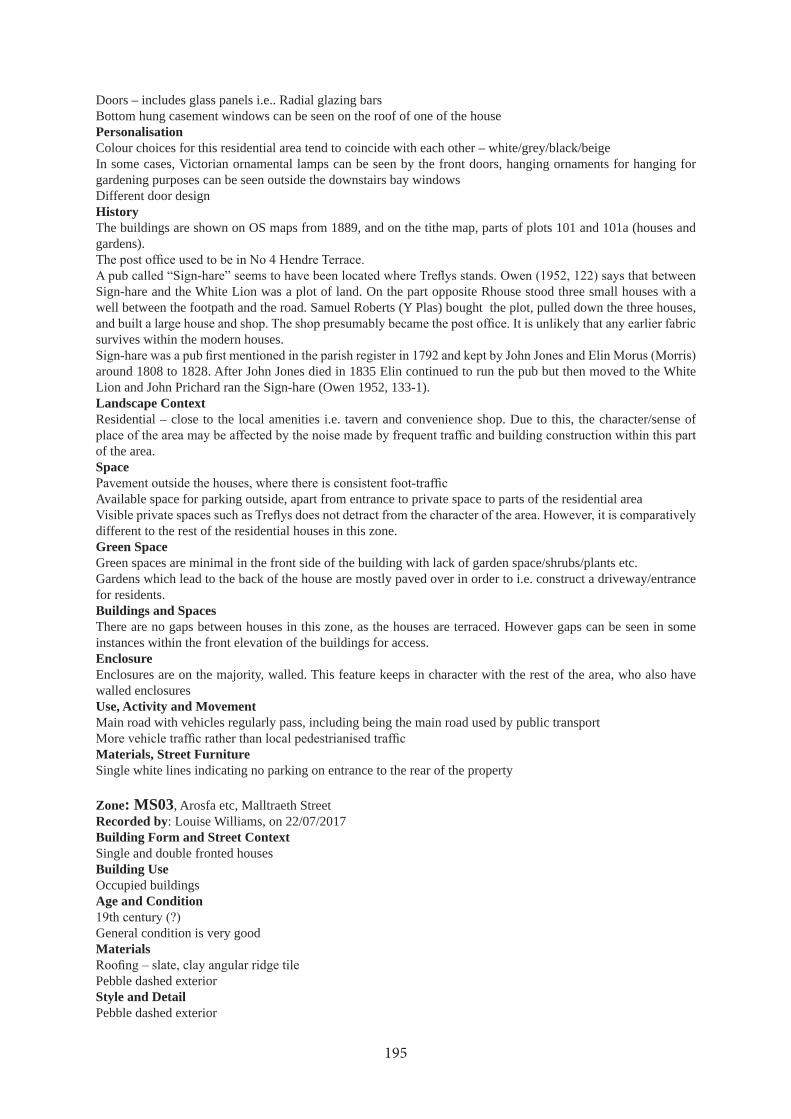
Doors – includes glass panels i.e.. Radial glazing barsBottom hung casement windows can be seen on the roof of one of the housePersonalisationColour choices for this residential area tend to coincide with each other – white/grey/black/beigeIn some cases, Victorian ornamental lamps can be seen by the front doors, hanging ornaments for hanging for gardening purposes can be seen outside the downstairs bay windowsDifferent door designHistoryThe buildings are shown on OS maps from 1889, and on the tithe map, parts of plots 101 and 101a (houses and gardens).
Sign-hare and the White Lion was a plot of land. On the part opposite Rhouse stood three small houses with a well between the footpath and the road. Samuel Roberts (Y Plas) bought the plot, pulled down the three houses,
survives within the modern houses.
around 1808 to 1828. After John Jones died in 1835 Elin continued to run the pub but then moved to the White Lion and John Prichard ran the Sign-hare (Owen 1952, 133-1).Landscape ContextResidential – close to the local amenities i.e. tavern and convenience shop. Due to this, the character/sense of
of the area.Space
Available space for parking outside, apart from entrance to private space to parts of the residential area
different to the rest of the residential houses in this zone.Green SpaceGreen spaces are minimal in the front side of the building with lack of garden space/shrubs/plants etc.Gardens which lead to the back of the house are mostly paved over in order to i.e. construct a driveway/entrance for residents.Buildings and SpacesThere are no gaps between houses in this zone, as the houses are terraced. However gaps can be seen in some instances within the front elevation of the buildings for access.EnclosureEnclosures are on the majority, walled. This feature keeps in character with the rest of the area, who also have walled enclosuresUse, Activity and MovementMain road with vehicles regularly pass, including being the main road used by public transport
Materials, Street FurnitureSingle white lines indicating no parking on entrance to the rear of the property
Zone: MS03, Arosfa etc, Malltraeth StreetRecorded by: Louise Williams, on 22/07/2017Building Form and Street Context Single and double fronted housesBuilding UseOccupied buildingsAge and Condition
General condition is very goodMaterials
Pebble dashed exteriorStyle and DetailPebble dashed exterior
195

Shrubbery covering the majority of the front elevation (Glan-Ffynnan)
Roofs, Windows and Doors
including top-hung casement on the outside area (Arosfa), curved top-hung casement windows (Glan-Ffynnan)Glass panel doorsHipped roof on the front entrance (Glan-Ffynnan)
PersonalisationBoth houses are colour co-ordinated apart from the white and brown window frames usedVine trees is seen in both houses. However, one house is minimal, with plants, shrubs etc.HistoryThe buildings are shown on OS maps from 1889, but not on the tithe map. Part of plot 101 (houses and gardens).Landscape Context
most active along Malltraeth StreetSpaceThere are white lines in some instance outside private entrances, indicating no parkingThe walls on the front access are similar in colour and shape
Green SpaceIn some instances, plantation seems to cover the front face of houses within this zone, although this feature increases the character of the building, as this feature does make the building stand out.Buildings and SpacesBoth houses (Glan-Ffynnan and Arosfa) are semi-detached, terraced houses, they both share the same wall
towards the garden of Glan-FfynnanEnclosureThe boundary on the front of the buildings are stone walledOn either side, houses are separated by hedges/shrubsUse, Activity and MovementActive frontages - only by residents of the buildings
Both houses have front access. However, Glan-Ffynnan has in addition a paved entrance for vehiclesMaterials, Street FurnitureThere are white lines indicating to keep access clear for entrancesNo yellow lines, apart from those that are on the opposite side of the street
Zone: MS04, Field with pump, Malltraeth StreetRecorded by: Louise Williams, on 22/07/2017Building Form and Street Context The pump is located in between two entrances to terraced houses on both sidesBuilding UseIt is a water pump for the village. However, this zone is overgrown with various plants, trees and shrubs, so it is unlikely that there has been any movement within this zone in regards to the pump being used/maintained. On the
Age and ConditionThe earliest mention of the construction of the pump – c.1902
MaterialsStyle and DetailRoofs, Windows and DoorsPersonalisationThe impact of overgrown plantation ruins the character of the area as unlike the rest of the village, this zone is
196
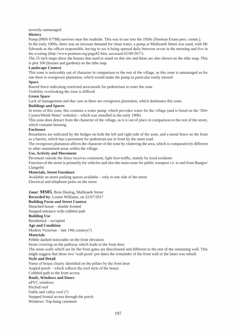
severely unmanaged.HistoryPump (PRN 67788) survives near the roadside. This was in use into the 1950s (Norman Evans pers. comm.).In the early 1900s, there was an increase demand for clean water, a pump at Malltraeth Street was used, with Mr
The 25 inch maps show the houses that used to stand on this site and these are also shown on the tithe map. This is plot 100 (houses and gardens) on the tithe map.Landscape ContextThis zone is noticeably out of character in comparison to the rest of the village, as this zone is unmanaged as for one there is overgrown plantation, which would make the pump in particular easily missed.SpaceBarred fence indicating restricted area/unsafe for pedestrians to enter the zone
Green SpaceLack of management and due care as there are overgrown plantation, which dominates this zone.Buildings and Spaces
Cymru/Welsh Water’ website) – which was installed in the early 1900sThis zone does detract from the character of the village, as it is out of place in comparison to the rest of the street, which contains housing.EnclosureBoundaries are indicated by the hedges on both the left and right side of the zone, and a metal fence on the front as a barrier, which has a pavement for pedestrian use in front by the main road.The overgrown plantation affects the character of the zone by cluttering the area, which is comparatively different to other maintained areas within the village.Use, Activity and Movement
Function of the street is primarily for vehicles and also the main route for public transport i.e. to and from Bangor/LlangefniMaterials, Street FurnitureAvailable on street parking spaces available – only to one side of the streetElectrical and telephone poles on the street
Zone: MS05, Bron Heulog, Malltraeth StreetRecorded by: Louise Williams, on 22/07/2017Building Form and Street Context Detached house – double frontedStepped entrance with cobbled pathBuilding UseResidential – occupiedAge and Condition
MaterialsPebble dashed noticeable on the front elevationStone covering on the pathway which leads to the front door The stone walls which are by the front gates are discoloured and different to the rest of the remaining wall. This might suggest that these two ‘wall-posts’ pre-dates the remainder of the front wall or the latter was rebuiltStyle and Detail
Cobbled path to the front accessRoofs, Windows and DoorsuPVC windowsPitched roof
Stepped frontal access through the porchWindows: Top-hung casement
197

PersonalisationThe building exterior is very well designed and colour co-ordinated, which balances greatly with the various plants and shrubs in the garden.The cobbled path matches the beige exterior of the houseWind-chimes located within the pillars of the porchTrees that are used are unusual in comparison to other trees within the area.HistoryThe house is shown on OS maps from 1900, but not on the 1889 map. The tithe map shows that there were earlier buildings on this site, although there was nothing shown in 1889. This is plot 99 (Tyn yr ardd) on the tithe map.Landscape ContextSetting of the zone is situated by the public walkway, the main road and a cross junctionActively this zone, because of the public walkway and the cross junction, will receive moderate level of vehicle
SpaceAvailable outside parking
Gates in front of houses for entry for vehicles and individuals
The private space in this zone does not detract from the overall character of the area as the gardens on the whole are managed, and contain various trees and plantsGreen SpaceThe front garden contains numerous trees and plants. In some instances, these can obstruct the view of the front elevation of the houses Ownership, the green space on the whole are privately owned i.e. private gardens.Buildings and SpacesThe gaps between buildings, separate by either hedges, stone walls or paved tarmac, they simply either provide parking for the occupant, or simply creating a barrier between housesEnclosureThe building are positioned facing the main roadThere are stone walls in front of the gardens, which seems to be a pattern within the areaDetached houses tend to acquire more space in terms of a private garden than terraced or semi-detached etc.Use, Activity and MovementNo active frontages There are pavements outside for pedestriansAs the zone is situated by the main road, there are vehicles and public transport passing on a regular basis
Properties in this zone tend to have front accessThere are no parking issues as there are no yellow lines etc., apart from the opposite side of the roadMaterials, Street FurnitureRoads surface is concrete/cementThe pavement height on the road is not consistent, with the lower dip ends to be in front of entrances, in order to provide ease of access to vehicles, wheelchair users and pedestrians.Pavement, roads etc., are generally well maintainedThere are telephone poles and light posts in various parts of the area.Yellow lines are situated on one side of the road
Zone: MS06, Marabella etc, Malltraeth StreetRecorded by: Louise Williams, on 22/07/2017Building Form and Street Context The buildings by the main road are semi-detached bungalows, whereas the other buildings are detachedFrom the main street, the front and back entrances for the buildings are on the either sides
ease of access.Building UseBuildings are occupied. However, Arfryn, there were no signs of this building being occupied i.e. lack of garden maintenance including uncut grass etc. On the other hand, there were no visible ‘For Sale’ signs outside the house,
198
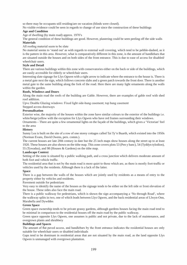
so there may be occupants still residing/are on vacation (blinds were closed).No visible evidence could be seen in regards to change of use since the construction of these buildingsAge and ConditionAge of dwelling (by main road) approx. 1970’sThe general condition of these buildings are good. However, plastering could be seen peeling off the side wallsMaterials
No material seems to ‘stand out’ as with regards to external wall covering, which tend to be pebble-dashed, as it is the pattern in this area. However, what is comparatively different in this zone, is the amount of handlebars that are situated outside the houses and on both sides of the front entrance. This is due to ease of access for disabled/wheelchair users.Style and DetailThere are various buildings within this zone with conservatories either on the back or side of the buildings, which are easily accessible for elderly or wheelchair users.Interesting slate signage for Llys Ogwen with a right arrow to indicate where the entrance to the house is. There is a metal gate next the sign, which follows concrete slabs and a green patch towards the front door. There is another metal gate to the same building along the fork of the road. Here there are many light ornaments along the walls within the garden.Roofs, Windows and DoorsAlong the main road the roofs of the building are Gable. However, there are examples of gable roof with shed roof addition.
Stepped access doorwaysPersonalisationExterior wise, the majority of the houses within the zone have similar colours to the exterior of the buildings i.e. white/beige/yellow with the exception for Llys Ogwen who have red frames surrounding their windows.Ornaments – There are quite a few ornamental lights on the façade of the buildings, which gives a ‘Victorian’ feel to the areaHistorySunny Lea is built on the site of a row of one storey cottages called Tai Ty’n Buarth, which existed into the 1950s (Norman Evans, David Owens, pers. comm.).The current houses are late 20th century in date but the 25 inch maps show houses along the street up to at least 1920. These houses are also shown on the tithe map. This zone covers plots 53 (Pen y banc), 54 (Tyddyn tylodion), 55 (Tywadus), and 98 (Houses & Gardens) on the tithe map.Landscape ContextSetting of the zone is situated by a public walking path, and a cross junction which delivers moderate amount of
vehicles used by the residents. Although there is a lack of the latter.SpaceThere is a gap between the walls of the houses which are jointly used by residents as a means of entry to the property either by vehicles and residents.Pavement outside for pedestriansVery easy to identify the name of the houses as the signage tends to be either on the left side or front elevation of the house. These sides also face the main road. There is a public walkway for pedestrians, which is shown the sign accompanying a ‘No through Road’, where the walkway splits in two, one of which leads between Llys Ogwen, and the back residential areas of Llwyn-Onn, Marabella and DywddesGreen SpaceGreen space ownership tends to be private grassy gardens, although gardens houses facing the main road tend to be minimal in comparison to the residential houses off the main road by the public walkway.Green space opposite Llys Ogwen, one assumes is public and not private, due to the lack of maintenance, and overgrown plants and shrubberyBuildings and Spaces
suitable for wheelchair users or disabled individualsGaps tend to be dominant in residential areas that are not situated by the main road, as the land opposite Llys Ogwen is unmanaged with overgrown plantation.
199

EnclosureBoundaries by the main road tend to be closed apart from the entrance gaps for the residential houses.Building plots by the main road (except Dywddes) tend to be single-storey which would be suitable for wheelchair users/elderly occupants. However, all houses within this zone have purpose built aids for elderly/wheelchair users.There are similar stone structure walls along the main roadPrivate residential areas away from the main road, are walled, although less in height than those on the main road. The residential area here also have a high amount of trees and shrubs obscuring the view of the houses.Use, Activity and MovementNo active frontages. However, it is occupied.
There are two front access points, for those houses situated by and off the main road. In some instances, there are three front and rear access i.e. Llys Ogwen which has two front access and another access through the conservatoryThere are no parking issues in this zone, as for being in a private residential, there is private parking and parking available on the street. However, ‘No Parking’ signage can be seen outside residential houses i.e. Llys OgwenMaterials, Street FurnitureConcrete slabs can be seen in some drive-waysThe roads and paths are well maintainedThere no yellow lines in the private residential area away from the main roads
Zone: MS07, Ty’n y Pant, Off Malltraeth StreetRecorded by: Marianne and Glyn Jones, on 01/09/2017Building Form and Street Context Detached property off main street and up narrow land. Porch running width of house with two canted bay windows and front doors. Slated gable roof.Building UseDomestic dwelling currently vacant. Could have been a small holding before modernisedAge and ConditionCould be 13th to 19th century, good condition.MaterialsBuilding could be stone construction and pebble-dashed. Gable slated roof. Chimney stack at both gables.Style and DetailThe canted bay windows are a feature and no similar properties on this lane.Roofs, Windows and DoorsWindows are vertical light brown uPVC. Front door is half glazed and is light brown uPVC.PersonalisationGarden to the side of the property. Very small concrete frontage with a low pebbledash wall.HistoryThe main house is shown on the 25 inch maps from 1889 but building to the NW is not present till 1920 then it is half its present size. The tithe map shows a small building in the SE corner of the plot. On the tithe map this plot is sub-divided into 4 strips (56 (Tyn y pant), 57 (Tyddyn tylodion), 58 (Tywadus), 59 (Tyn yr ardd)), with Tyn y
Landscape ContextThis house is situated on the side of a branch of the lane leading from the main Newborough street. This lane is also a public footpath that culminates at Llanddwyn Island.Space
Green Space
Buildings and SpacesThis house is detached and stands in its own grounds. It has a yard to the right hand side and out building to the back.EnclosureVery small pebble-dashed wall with curved coping. The house sits to the front of the plot. Garden to the side of house, small tarmac area to the front of house.Use, Activity and MovementThe house is up a land wit a property higher up. The property has side access and parking area.Materials, Street Furniture
200

measures.
Zone: MS08, Works, Off Malltraeth StreetRecorded by: Marianne and Glyn Jones, on 01/09/2017Building Form and Street Context Building is at the end of a cul-de-sac and is independent of any other building. It is the only commercial property
Building Use
Age and ConditionVery good condition. Building could have been built around 1990.MaterialsBuilding is constructed of half corrugated metal and half concrete blocks rendered in pebbledash.Style and DetailThis building is a typical industrial unit. No other unit in this area.Roofs, Windows and DoorsNo windows or doors in view.PersonalisationOnly commercial premises up this lane.HistoryModern.The land is part of plot 55 (Tywadus) on the tithe map.Landscape Contextthis workshop is situated up a cul-de-sac branching off the main Newborough street. Small narrow land.Space
cabyn. No name on property.Green Space
contractor business owned by Pant-y-Celyn occupies.Buildings and Spaces
EnclosureHigh wall surrounding premises, the worship is at the left-hand side of the plot. The yard is tarmacked.Use, Activity and MovementThe workshop is situated up a cul-de-sac, and on the left hand side of the lane. Large parking.Materials, Street FurnitureThe lane is tarmac, very well maintained. Very well maintained. No street lamp, no yellow lines no calming measures.
Zone: MS09, Hen Capel etc, Malltraeth StreetRecorded by: Marianne and Glyn Jones, on 01/09/2017Building Form and Street Context Terrance house facing street and in front of building line. Low sloping porch. Front door to the right hand side with three steps leading up to porch. An integrated garage to the right side of the house. Doors and windows are imitation leaded glass.Building UseOccupied domestic dwelling.Age and ConditionHouse could be 18th or 19th century. Well maintained and in good condition.MaterialsThe house is rendered in pebbledash. Likely to be of stone construction. Slated gable roof. Dormer windows have slated gabled roofs. One chimney stack on left hand side gable.Style and DetailThe sloping porch projects, and differs from the rest of the terrace.Roofs, Windows and DoorsVertical windows in brown uPVC with imitation leaded glass. Two dormer window upstairs with gabled slated
201
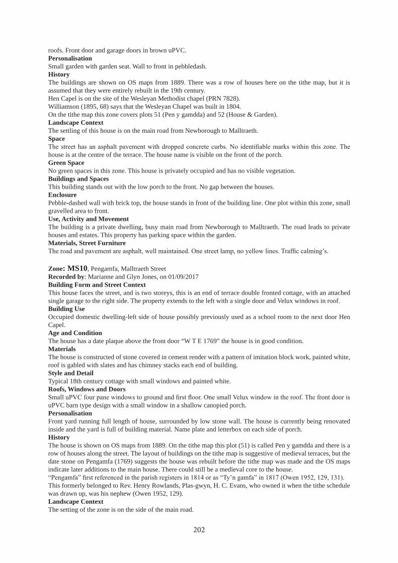
roofs. Front door and garage doors in brown uPVC.PersonalisationSmall garden with garden seat. Wall to front in pebbledash.HistoryThe buildings are shown on OS maps from 1889. There was a row of houses here on the tithe map, but it is assumed that they were entirely rebuilt in the 19th century.Hen Capel is on the site of the Wesleyan Methodist chapel (PRN 7828).Williamson (1895, 68) says that the Wesleyan Chapel was built in 1804.On the tithe map this zone covers plots 51 (Pen y gamdda) and 52 (House & Garden).Landscape ContextThe settling of this house is on the main road from Newborough to Malltraeth.Space
house is at the centre of the terrace. The house name is visible on the front of the porch.Green SpaceNo green spaces in this zone. This house is privately occupied and has no visible vegetation.Buildings and SpacesThis building stands out with the low porch to the front. No gap between the houses.EnclosurePebble-dashed wall with brick top, the house stands in front of the building line. One plot within this zone, small gravelled area to front.Use, Activity and MovementThe building is a private dwelling, busy main road from Newborough to Malltraeth. The road leads to private houses and estates. This property has parking space within the garden.Materials, Street Furniture
Zone: MS10, Pengamfa, Malltraeth StreetRecorded by: Marianne and Glyn Jones, on 01/09/2017Building Form and Street Context This house faces the street, and is two storeys, this is an end of terrace double fronted cottage, with an attached single garage to the right side. The property extends to the left with a single door and Velux windows in roof.Building UseOccupied domestic dwelling-left side of house possibly previously used as a school room to the next door Hen Capel.Age and ConditionThe house has a date plaque above the front door “W T E 1769” the house is in good condition.MaterialsThe house is constructed of stone covered in cement render with a pattern of imitation block work, painted white, roof is gabled with slates and has chimney stacks each end of building.Style and DetailTypical 18th century cottage with small windows and painted white.Roofs, Windows and Doors
uPVC barn type design with a small window in a shallow canopied porch.PersonalisationFront yard running full length of house, surrounded by low stone wall. The house is currently being renovated inside and the yard is full of building material. Name plate and letterbox on each side of porch.HistoryThe house is shown on OS maps from 1889. On the tithe map this plot (51) is called Pen y gamdda and there is a row of houses along the street. The layout of buildings on the tithe map is suggestive of medieval terraces, but the date stone on Pengamfa (1769) suggests the house was rebuilt before the tithe map was made and the OS maps indicate later additions to the main house. There could still be a medieval core to the house.
This formerly belonged to Rev. Henry Rowlands, Plas-gwyn, H. C. Evans, who owned it when the tithe schedule was drawn up, was his nephew (Owen 1952, 129).Landscape ContextThe setting of the zone is on the side of the main road.
202

Space
is at the end of the terrace and appears to be one of the oldest in the area. The house name is on the front porch.Green SpaceNo green spaces in this zone. The house is privately occupied and has a few plant pots at the front and a garden to the right hand side.Buildings and SpacesThis house is interesting due to its age, 1769. No gaps between houses.EnclosureStone wall curved cement top. The house is rectangular and is positioned set back from the boundary. Wide front concrete yard.Use, Activity and MovementThis building is privately occupied. On the busy road from Newborough to Malltraeth. The property has room for parking inside garden, no rear access.Materials, Street Furniture
calming.
Zone: MS11, Boston Terrace, Malltraeth StreetRecorded by: Marianne and Glyn Jones, on 01/09/2017Building Form and Street Context two storey house, a pair of terraced houses, facing the road, with small tiled yard to the front with a low brick wall surrounding them. No gates and is in line with the other houses.Building UseA pair of domestic dwellings, occupied. No evidence of change in use.Age and ConditionNo indication of age, possibly 19th century. Good condition. Built by the Boston estate.MaterialsStone buildings rendered in pebble dash gabled slate roofs, Number one with one chimney and number two having two chimneys and is double fronted.Style and DetailTypical plain terraced houses.Roofs, Windows and DoorsWindows are vertical uPVC with upper openings in white. Doors are brown half glazed uPVC.Personalisationplain featureless dwellings. House one and two have house numbers on the right hand side of the front doors.HistoryThe present buildings are shown on OS maps from 1889, but not on the tithe map. Both the 25 inch maps and the tithe map show a building that no longer exists to the SE of the present houses.In 1950s there was still the old cottage in the gap next to Boston Terrace. This was called Llain Cleddyf (sword
comm.). It is plot 50, “Llain y cleddau” on the tithe schedule.
Landscape ContextThe settling of these two terraced houses on the side of the main Newborough to Malltraeth road.Space
garden and enclosure walls leave the frontage exposed. The name plate is on number one house and the numbers are on both houses.Green SpaceNo green spaces in this zone, these two houses are privately owned and have no visible vegetation.Buildings and Spacesthey are semi-detached terraced in the same style. Both are the same. No gaps between buildings.Enclosurevery low brick walls to the front, boundary walls are out of character there are two plots in this zone. Pots are
Use, Activity and Movement
203

These are private dwellings, the houses are on the main through road. Street leads to private houses and estate on the Newborough to Malltraeth road . No front parking.Materials, Street FurnitureThe roads and pavement are asphalt, they are well maintained with white line down the middle. Street lamp in
Zone: MS12, Minffordd, Malltraeth StreetRecorded by: Marianne and Glyn Jones, on 01/09/2017Building Form and Street Context Two storey house, detached house facing main street, three steps to front door. Small concreted front garden surrounded by low stone wall. The house is in line with the other housesBuilding UseSingle domestic dwelling, the house is occupied. There is no evidence of change of use.Age and ConditionEstimate age is early 20th century and the house is in good condition.MaterialsThe house is brick built with spa-dash rendering. The roof is gabled and slate construction. Front of dwelling has some moulding, house has chimney stacks to each gable.Style and DetailThe house is villa style with a double canted bay window incorporating a porch with a sloping slate roof. This house is the only one with these features on this street.Roofs, Windows and Doors
PersonalisationThis house has a pattern of cream stucco moulding on front. Name of house and letterbox on the left hand side of the front door.HistoryThe buildings are shown on OS maps from 1889, and on the tithe map, although only the house is shown on the latter with no extension to the SW. Plot 50a (House and Garden) on the tithe schedule.Landscape ContextThe setting of the house is on the side of the main road to Malltraeth, and is on the outskirt of the village.Space
house is at the end of the terrace and is quite a substantial building. The house name is on the front above post box.Green SpaceThis building is the dominant one on this zone. It has a small gap between this house and next door. This house is privately occupied and has no visible vegetation.Buildings and SpacesThis building is the dominant one on this zone. It has a small gap between this house and next door. The gap provides access to back of house.EnclosureLow stone walls with vertical coping front and side. In keeping with rest of terrace. These is one plot within this zone, rectangular shape and is positioned centrally. Small gravelled area to front and side.Use, Activity and MovementThe building is a private dwelling. Busy main road from Newborough to Malltraeth. Street leads to private houses and estates. This property has off road parking to side and back.Materials, Street FurnitureThe roads and pavement are asphalt, they are well maintained with a white line down the middle. One street lamp
Zone: MS13, Rhoddfa Bach, Rhoddfa BachRecorded by: Natalie Herring, on 14/11/2017Building Form and Street Context A development of bungalows, most detached but two joined by their garage.Building UseDomestic, all appear occupiedAge and Condition
204
Less than 10 years old and in good condition.MaterialsWalls covered in painted render and/or pebble-dash. Slate roofsStyle and DetailModern style. Most painted white but one painted mint green.Roofs, Windows and DoorsPVC windows with double glazing. The windows are generally white but one has brown windows. Doors also PVC, matching windows.PersonalisationGardens have been personalised. Some low walls round the garden, some have hedges. One has a large hedge blocking the view of the house.History
Landscape ContextSpaceGreen SpaceBuildings and SpacesEnclosureUse, Activity and MovementMaterials, Street Furniture
Zone: MS14, Rhoddfa Meyrick, Rhoddfa MeyrickRecorded by: Natalie Herring, on 03/10/2017Building Form and Street Context A development of bungalows, some semi-detached, some detached and some joined by their garage.Building UseDomestic, all appear occupiedAge and ConditionLess than 10 years old and in good condition.MaterialsWalls covered in painted render and/or pebble-dash. Some with wooden ‘slat’ detailing on one side. Slate roofsStyle and DetailModern styleRoofs, Windows and DoorsPVC white windows with double glazing. Doors also white PVC.PersonalisationGardens have been personalised. Some have mainly lawns with a few bushes, some have hedges or large shrubs
History
Landscape ContextSpaceGreen SpaceBuildings and SpacesEnclosureUse, Activity and MovementMaterials, Street Furniture
Zone: MS15, Tyn y Cae, Tyn y CaeRecorded by: Natalie Herring, on 03/10/2017Building Form and Street Context Development of detached bungalows.Building UseDomestic - occupiedUnlikely to have altered.Age and ConditionLess than 10 years old and in good conditionMaterials
205

Pebble dashed, stripe of cream colour. Slate slab roof.Style and DetailSlightly modern in appearanceRoofs, Windows and DoorsWhite PVC double glazing. No visible door.PersonalisationTiled driveway. Some bushes and plant life.History
Landscape ContextSpaceGreen SpaceBuildings and SpacesEnclosureUse, Activity and MovementMaterials, Street Furniture
Zone: MS16, Gwel y Don, Malltraeth StreetRecorded by: Jade Owen and Megan Howe, on 05/02/2018Building Form and Street Context Detached bungalow/ two storey oblong. Outskirts of main village along main road set back with garden in front and driveBuilding UseHouse occupiedAge and ConditionModern and good conditionMaterialsPebbledash, slate roof similar to rest of area stone work around doorStyle and Detailoblong detached bungalow/two storey, very similar to rest of areaRoofs, Windows and Doorsslate roof, UPVC windows and doors with glass panePersonalisationstone work around door, metal gate to property. No other personalisation very similar to rest of area.History
Landscape Contextoutskirts of main town. Quiet areaSpace
number of houseGreen Spacegreen space in frontBuildings and Spacesdouble storey bungalow in keeping with other properties in surrounding zonesEnclosurestone walk and metal gateUse, Activity and Movementdomestic and quietMaterials, Street FurnitureConcrete
Zone: MS17, Rhosfair, Off Malltraeth StreetRecorded by: Jade Owen and Megan Howe, on 05/02/2018Building Form and Street Context off main road, accessed via public footpath. Unable to get clear photograph as obscured by trees. Detached two storeyBuilding Use
206

House occupiedAge and ConditionModern 19th century, good conditionMaterialsslate roof, rendering painted yellow/creamStyle and DetailDetached two storey similar to rest of areaRoofs, Windows and Doorsslate roofupvc windows and doorPersonalisationNot on main road, more hidden, big garden with lots of plants. More secluded. Painted rendering. Still similar in style to rest of area.History
part of this zone. This is shown on the 25 inch maps since 1889 and now seems to be reduced to sheds. Ty’n y Cae
Poole/1491), but the tithe map suggests that the original location of the farmhouse was further SE.Landscape Context
SpacePublic footpath leading to back of property but then stops with gate with sign ‘Beware, Bull in Field’Green SpaceLarge grassy back garden, potted plants, hedges, and treesBuildings and SpacesEnclosure
Use, Activity and MovementDomesticMaterials, Street FurnitureMuddy public footpath
Zone: MS18, Bryn Rhedyn, Bryn RhedynRecorded by: Jade Owen and Megan Howe, on 05/02/2018Building Form and Street Context Cul de sac, detached bungalows on both sides of the cul de sac. Outskirts of village. All facing the road set slightly off, some with gardens others drivesBuilding UseHouse occupiedAge and ConditionModern, some in better condition than others but generally good conditionMaterialsPebbledash, some painted others not. Slate roofs. Some red brick details (walls and porch)Style and DetailAll oblong bungalows all very similar some with conservatories or porches. The street very similarRoofs, Windows and DoorsRoof slate. Windows and doors all different, some upvc some wood. A few porches. A few with a slope/ path down to the front door.PersonalisationSome have painted white, cream, yellow. Some with red brick features. Some with gardens well kept/ overgrown.One house with a lot of garden ornaments and signs. Some with conservatories or porches. All look slightly different but very similar.History
Landscape Contextcul de sac. Outskirts of the village. Tight cluster of housesSpaceRoad leading off the main road into the cul de sac. Each property has own driveway, providing private space.
207

Some houses numbers were easy to identify other however were out of viewGreen Space
Buildings and SpacesAll quite closely placed together and similar mundane exterior.EnclosureSmall bungalows slightly set away from pavement. Private small front garden. Fencing and small walls used by some to distinguish private/ public space.Use, Activity and MovementDomestic. Relatively quiet. Houses had own driveways. On outskirts of town, therefore not much public use.Materials, Street Furnitureconcrete. Some slate chippings and stones used for driveways. No road markings
Zone: MS19, Bryn-felin, Malltraeth StreetRecorded by: Jade Owen and Megan Howe, on 05/02/2018Building Form and Street Context Building UseAge and ConditionMaterialsStyle and DetailRoofs, Windows and DoorsPersonalisationHistorySite of medieval windmill.The current house is shown on OS maps from 1889, and the tithe map has a circular symbol that is presumably the windmill on exactly the site of the house. There is also a small building shown on the tithe map to the south of the windmill.Owen (1952, 122) says that the windmill stood where the house now stands. The mill appears to be empty in 1856-7, because the taxes on the mill were forgiven for that year. Samuel Jones the tenant took the mill down and built the house.Landscape ContextSpaceGreen SpaceBuildings and SpacesEnclosureUse, Activity and MovementMaterials, Street Furniture
Zone: MS20, Ael-y-bryn, Malltraeth StreetRecorded by: Jade Owen and Megan Howe, on 05/02/2018Building Form and Street Context Building UseAge and ConditionMaterialsStyle and DetailRoofs, Windows and DoorsPersonalisationHistory
Landscape ContextSpaceGreen SpaceBuildings and SpacesEnclosureUse, Activity and MovementMaterials, Street Furniture
208

Zone: MS21, Caer Glyn and Fron Dirion, Malltraeth StreetRecorded by: Jade Owen and Megan Howe, on 05/02/2018Building Form and Street Context Building UseAge and ConditionMaterialsStyle and DetailRoofs, Windows and DoorsPersonalisationHistory
Landscape ContextSpaceGreen SpaceBuildings and SpacesEnclosureUse, Activity and MovementMaterials, Street Furniture
Zone: MS22, Bron Mellion, Malltraeth StreetRecorded by: Natalie, on 19/09/2017Building Form and Street Context Facing main road, enclosed with drive. Detached house very much stands alone.Building UseDomestic appearance.Age and ConditionHouse appears much older than these around it possibly 1800’s/ early 1900’s. Kept in good condition garden appears bright and tended.MaterialsStone, similar covering to others in area and possibly added later. Slate roof.Style and Detail
Roofs, Windows and DoorsDouble glazing white PVC windows. Door is on side possible small extension entrance. Roof slants heavily at back.PersonalisationGarage to back of house and driveway. Plain garden.History
Landscape ContextSpaceGreen SpaceBuildings and SpacesEnclosureUse, Activity and MovementMaterials, Street Furniture
Zone: MS23, Pen Rhos, Malltraeth StreetRecorded by: Natalie Herring and Bethany Crabtree, on 19/09/2017Building Form and Street Context Terrace of 6 houses, terrace of 3 houses and 2 semi-detached houses built around a cul-de-sac. The SW terrace faces onto Malltraeth Street and the other houses onto the cul-de-sac.Some with single-chimney.Building UseHouse/domestic. Unlikely evidence for change of use.Age and ConditionLikely late 1900’s by traditional appearance and uniform build.Materials
209

Covered stone painted. Slate roof.Style and DetailMinimalistic appearance. Same for entire section. All have enclosed front garden.Roofs, Windows and DoorsEvident double glazing, white PVC material.Personalisation
exteriors of houses within this zone were typically uniform, though some alterations were made for some such as one property having installed a safety rail and ramp for disabled access, and a few having built an extensions
beneath window by door.History
Landscape ContextSpaceGreen SpaceBuildings and SpacesEnclosureUse, Activity and MovementMaterials, Street Furniture
Zone: MS24, , Malltraeth StreetRecorded by: Natalie Herring and Bethany Crabtree, on 14/09/2017Building Form and Street Context Three pairs of semi-detached houses around a slightly curving cul-de-sac.Building UseHouse/domestic dwellings. Occupied with no sign of change or extensions since built.Age and ConditionModern and well kept. Likely less than 2 years old. Gardens cared for.MaterialsBuilding 1 - orange painted porch. Painted house. Brick and mortar construction, covered and painted. Building 2 - Red and white painted. Brick and mortar construction covered and painted for more modern appearance. Building 3 - Red painted porch catches eye. Cream painted house with exception of front. Bricks and mortar construction covered and painted.Style and DetailAll modern in style and use same construction . Uniform to those in zone MS24. Some differences in colours of porches.Roofs, Windows and DoorsAll Upvc windows. Differing door styles. Hipped style roof.PersonalisationGardens uniform. Varying porch colours provide some personalisation. Building 3 hanging light in front of house.History
new houses, which had been built by 01/06/2009.
house is shown on the tithe map on plot 232, then known as Llain y Plas. This house still existed by 1889, when
By 1900 the old house had gone.Landscape ContextSpaceGreen SpaceBuildings and SpacesEnclosure
210
Use, Activity and MovementMaterials, Street Furniture
Zone: MS25, Pen Bonc, Malltraeth StreetRecorded by: Natalie and Bethany, on Building Form and Street Context Detached house facing street (main road). A step in front (entrance). Wall enclosing. Two storeys tall, neglected garden space at front. Hipped roof.Building UseHome/Dwelling. Likely occupied with evidence of remodelling of extensions show change and enlargement of dwelling.Age and ConditionAppears un-modern. Signs of wear and tear. Single glazed windows suggest this building is of an older date to others in the area, and hasn’t been as well maintained. Other than possible extension there is no sign of the house being updated.MaterialsPossible slate roof. Brick chimney. Stone in back (for out buildings). Old barn structure in back (suggests older age) made from stone largely untouched. Front/sides appear pebble dashed, the back extension appears to be white washed.Style and DetailThree chimneys. Possible split into three at one point. Wall has white line, stripe along it. Barn at back of building as well as what appears to be a shed, barn looks to have been connected due to new looking double glazing windows on top.Roofs, Windows and DoorsAll windows uniform, looks single glazed. Canopied (stick out) wooden, white painted. Matching style door, all from the same time period - porch area small. Back barn has double glazed modern windows however like doors,
PersonalisationGarden seems abandoned and overgrown in front. Back looks white washed although the front does not. Rear garden also looks unkempt and has old buildings which still stand but also appear to have been abandoned.History
1952, 129).Owen (1952, 129) describes Pen y Bonc as built on a large terrace of sand at a higher level than the road. There were formerly two thatched houses here.The farm buildings are shown on OS maps from 1889, but not on the tithe map. However the tithe map does show a small building that appears to have been later converted into a barn that still survives. The small building must have been the original Pen y Banc house.Landscape ContextSpaceGreen SpaceBuildings and SpacesEnclosureUse, Activity and MovementMaterials, Street Furniture
Zone: MS26, Eglwys Bach, Malltraeth StreetRecorded by: David Elis-Williams, on 27/08/2017Building Form and Street Context Neuadd Cymunedol Eglwys Bach Community Hall. Arranged at corner of junction as to be visible and accessible to both roads. Telephone box in centre of splayed junction corner also visible from all direction except approaching from north west.Building UseEglwys Bach Community Hall. Evidently once a church or church schoolroom partly extended. Appears to have undergone three phases of development between late 19th century to 2000’s. Local stone, partly pebble dashed.Age and ConditionFair condition - Older parts could do with re-rendering. Caps of guttering missing in places.Materials
211

Original building appears to be greenish local stone (where visible). Phase 2 - has coped style especially re. buttresses to exteriorPhase 3 - very different and limestone walling does not suit original building. Slate roofs, all the same, appears to have been re-roofed. Plastic rainwater gutters, vanished wood frame windows.Style and DetailOriginal building is typical ecclesiastical architecture of 19th century. Arched windows, with moulded concrete surrounds. Buttresses appear stylised not structural. Bell tower and cross on top of phase 1, at south east corner, chimney at corner of phase 2. No similar buildings nearby. Modern ramps and handrails for access, benches and sculptures in garden area.Roofs, Windows and DoorsPhase 1 - North East three tall lance, arched topPhase 2 - North East end two rectangular, also doorway, rectangular top south eastPhase 3 - North West two arched window and arched doorway (main entrance)Phase 1 - SW end 2 lancet windows blocked off with concrete, these look like an original design feature.
PersonalisationNo resident as it is a community hall.HistoryPreviously St Thomas’s Mission Church.This mission room was built in 1870 by the popular vicar, Rev. Thomas Meredith, who revitalised the church in Newborough (Williamson 1985, 65).The tithe map shows a small building at the corner of the road.Landscape ContextLocated on corner-junction of Malltraeth Street and B4421 to Llangaffo and contains a former church - therefore focal point for immediate vicinity. Zone includes whole junction, and telephone box on corner facing former church building. Junction spaced at both sides (of B4421). Also bus stop at south east of zone.SpaceLarger than usual area around junction, with footways following junction splay includes litter bin and call box on north west corner, also 3 signposts on SE corner. Could be public space for people to meet. Former church is ‘Neuadd Cymunedol Eglwys Bach Community Hall’ and a public building and has gardens in surrounding land, so although bounded off these appears also as public space.Green SpaceGarden of Eglwys Bach is planted out with mainly low maintenance shrubs and a variety of plants meant enjoyment for the public. Some self-seeded plants also evident, not that much maintenance of plot. Many evergreen shrubs, would be a comfortable semi-public space at all times all year. Garden design by Jamie Cunliffe see building sheet.Buildings and SpacesPlot is denoted by Eglwys Bach.Enclosure
vegetation to east. North east mostly rendered brick wall bounds the building from the lane in BO1 zone. South east wood trellis bounds the Eglwys Bach gardens from Llys Alaw in zone MS27. South West zone boundary in road. Boundary of Eglwys Bach garden to pavement and road is mortared stone wall, mostly limestone to
Use, Activity and MovementNo frontage to Eglwys Bach but clearly has public access. Junction is with principal road eastward of Newborough therefore much coming and going.Materials, Street FurnitureTarmac on road and pavement, fair condition. Single yellow line around junction on all sides. Dropped kerb at
Zone: MS27, Llyswen etc, Malltraeth StreetRecorded by: David Elis-Williams, on 27/08/2017Building Form and Street Context Terrace of three at same level while street slopes, therefore Llys Alaw is at street level while the other two are above the street. Tyn Llan is slightly below street level, also Llyswen. All on common building line set back from street but parallel with it.
212
Building UseResidential. Bodawel may not be occupied.Age and Conditionearly 20th century. All similar design except central property has rectangular rather than angular bay - but may
may be extension. All in good condition.MaterialsSlate roofs. Pebble-dashed exteriors, Upvc windows, hard to distinguish what may be underneath. Llyswen has green slate cladding around front door.Side of Tyn Llan - brick visible where pebble-dash could not reach narrow gap - suggests brick construction of whole.Style and DetailThree of the houses for a single terrace in the same style. Bay windows add interest to the houses that would otherwise be very plain. Tyn Llan - double fronted. Llyswen - bay with roof coming out above adds some character to a plain house.Roofs, Windows and DoorsUpvc. Llys Alaw has what may be an original wooden doorLlyswen front door has slate canopy - this and the green slate cladding could be a later stylistic additions.PersonalisationLlys Alaw has hanging basket outside and Virginia creeper on outside of property adds some personal touch.HistoryLlys Alaw, Llwyn Llifon and Bodawel were previously known as Tal Braich Terrace (David Owens, pers. comm.).On the tithe schedule this is plot 217a “warehouse”. Owen (1952, 33, 37, 130) mentions “y rheinws” (jail) that was used in the early 19th century as a warehouse by grocer John Jones, possibly the same place, especially as the occupier in the schedule is William Jones. John Jones was using this as a warehouse by about 1820.Landscape ContextResidential zone on Malltraeth Street. Tyn Llan and Llyswen each detached (unlike on map) but only about 20cm between them.SpaceHigh pavement, even walk. Clear boundary wall to all properties, each with their own gate, marking of public and private space. All houses except Llys Alaw have name plates. No street name here.Green SpaceSmall front gardens at end of property - private space. Large garden behind not seen.Buildings and SpacesSingle terrace of three in the same style. Narrow passage behind Bodawel and Tyn Llan. Only minimal space between Tyn Llan and Llyswen.EnclosureBoundaries to rear of properties not seen. Front pavement - single limestone wall with crenulations. Corner of Llyswen given over to parking car and trailer, also has access to garage.Use, Activity and MovementNo shops, buildings solely residential. Street is main road. No parking to front, Llyswen only has garage and parking space within property. Alleyway to rear between Llyswen garage and Cae Coch (zone MS28). Ownership not clear except it has some paint colour at Llyswen garageMaterials, Street FurnitureTarmac street and pavement. Single yellow line. One lamp post.
Zone: MS28, Cae Coch Terrace, Malltraeth StreetRecorded by: David Elis-Williams, on 27/08/2017Building Form and Street Context Terrace of two. Parallel to street and on same building line as properties either side.Building UseResidential, no evidence of change of use.Age and Condition20th century.MaterialsSlate roofs, pebble-dashed, Upvc windows. Underlying building material not visibleStyle and DetailBoth double-fronted
213
Roofs, Windows and DoorsUpvc windows and doors. Tiled outside windowsills - suggesting 20th century rather than 19th.PersonalisationNone.HistoryThis terrace was built by William Owen, Gallt-y-rhedyn (Owen 1952, 123)Landscape ContextTerrace of two, residential.SpaceAs MS27 crenelated limestone wall separating public and private space (pavement/front garden). Two houses
2. This numbering is not as the map supplied.Green SpaceBoth front gardens are concrete slabs. Back garden not seen.Buildings and SpacesTerrace of two identical buildings.EnclosureFront wall divides front garden from pavement, both gated. Back boundary not seen.Use, Activity and MovementNo shops or parking. Alley to left of No 2 MS27 zone - ownership not obvious.Materials, Street FurnitureTarmac street and pavement. Single yellow line on MS27. Road sign and electrical distribution box on pavement at corner near boundary with MS29.
Zone: MS29, Rhouse, Malltraeth StreetRecorded by: David Elis-Williams, on 27/08/2017Building Form and Street Context Parallel to street, conforms to building line of properties either side. Possible derelict store building behind the small building, a wall only visible from the car park behind.Building UseSmall building to north east - former shop or workshop, derelictRhouse - residentialAge and ConditionSmall building - could be 18th century, no later than 19th century, but brick is visible and it looks as if it has been at least mended much more recently. Derelict and boarded up. Roof timbers sagging in centre.Rhouse - 19th centuryMaterials
mortared over then sealed. Rhouse - Random stone, mostly local green stone but also others. Repointed with mortar. Brick arches one door
Style and DetailSmall building - Bay display window walled in front of original windows suggests some sort of shop. Electric cable to former shop sign. Rhouse - double fronted and extension added to south side.Roofs, Windows and DoorsSmall building - now boarded up, but bays added in frontRhouse - upvc, slate sills, brick arch lintelsPersonalisationThe greatest impact the residents of Rhouse have had is not having the house pebble-dashed. Untidy front garden detracts from attractiveness of house.HistoryRhouse was supposed to be the oldest house in the village. In the early 19th century it was the home of the Corporation Bailiff and the corporation regalia was kept here until it was given to the Prichard Jones Institute (Owen 1952, 37). Williamson (1895, 71) says that at Gorphwysfa and House (Rhouse) recent houses have been erected on the site of old ones. He suggests that Rhouse was intended as the new Hall or Council House and Gorphwysfa as the Mayor’s house when he visited the town. He says that the town’s regalia was kept in Rhouse.
214

Landscape ContextResidential and former shop.SpaceAs MS27, 28, crenelated limestone wall divides public and private space. Small rubble wall between two properties. House name not shown.Green SpaceRhouse has untidy front garden, Large grassed area behind Rhouse, also visible from car park behind. Some trees here, mostly conifers.Buildings and SpacesRhouse is improving double-facing house. Different to others on the street because its not pebble-dashed.EnclosureLimestone wall facing pavement, rubble wall between properties. To south west of Rhouse is a car access (with dropped kerb), gateway through to garden behind.Use, Activity and MovementDerelict small building and may have been a shop or workshop. Main road passed properties. Car access to south west and Rhouse allows parking on driveway - gate behind but no garage.Materials, Street FurnitureTarmac road and pavement. Electricity/telephone pole not on street but within property. Single yellow line.
Zone: MS30, Gorphwysfa, Malltraeth StreetRecorded by: David Elis-Williams, on 27/08/2017Building Form and Street Context Buildings parallel to street and on common building line with neighbouring properties.Building UseResidential. May have been a shop at one time.Age and ConditionLate 19th centuryMaterialsSlate roof, pebble dashed extension, upvc windows except for single storey shed to rear has painted corrugated main roof, painted stippled cement walls.Style and Detail
may have been a garage but tastefully incorporated into style of main building. Shed to rear now painted in same colours as property in MS31 and may form part of that property.Roofs, Windows and Doorsupvc, two dormer windows above, with smaller window between them not a dormer.PersonalisationNone.HistoryLandscape ContextBorders residential and commercial zone in villageSpaceNorth end of block in zone MS28, 29: limestone wall, borders present front garden. But half way along property
House is named ‘Gorphwysfa’. Single storey shed to south east has double doors labelled ‘keep clear’ - but in front
Green SpaceFront garden is all hard standing. Back garden not seen.Buildings and SpacesSingle building - Gorphwysfa with extension to left then shed. No gaps.EnclosureBoundaries behind not seen. Limestone wall to front part of property, sets apart private space.Use, Activity and MovementNo active frontage, but parking bay allows access to shops in MS31 and nearby.Materials, Street FurnitureStreet is tarmacked as well as the pavement up to where the wall turns in.
215

Zone: MS31, Shop, Malltraeth Street/Pendref StreetRecorded by: David Owen, on 26/07/2017Building Form and Street Context The single storey part of the property was at one time the villages smithy.Building UseThe building now used as a general store. It is roofed in slate and store built. The rendering is painted.Age and ConditionProbably built in mid Victorian period although being lose to centre a building would probably of been on the site the borough was established.MaterialsThere is no parking area for customers and there is no pavement. An electricity pole is located adjacent o the south west gable. There is room for one small car to park alongside the part that was the old smithy.Style and DetailRoofs, Windows and DoorsPersonalisationHistoryIn the late 19th century there was a smithy in what is now part of the shop.Landscape ContextSpaceGreen SpaceBuildings and SpacesEnclosureUse, Activity and MovementMaterials, Street Furniture
Zone: PDS01, Idan House etc, Pendref StreetRecorded by: David Owen, on 26/07/2017Building Form and Street Context Idan House - Part of the building to the south west was a grocer’s shop and was converted to a dwelling c. 1995. It is stone built and slate roofed. The remainder was demolished in 1960 and rebuilt.Plas Newydd 1 and 2 - These properties were at a time a shop (No 1) and a family home (No 2) - which is now a ‘buy to let’ property and is unoccupied.Building UseIdan House - To the rear there are three sheds, one of which was used as a … at some point. There is a lawned garden to the front of Idan House and a concentrated area.Plas Newydd 1 and 2- There is off road parking and a small yard to the rear.Age and ConditionIdan House- To the front of the old shop. There is a large rear garden accessed via a side entry (north east)Plas Newydd 1 and 2 - The buildings are of stone with slate roof.MaterialsIdan House- There is a perimeter and painting restrictions. The property is surrounded by stone walls. An electricity supply pole is located adjacent to the old shop.Plas Newydd 1 and 2- The road to the front is paved and there is parking restrictions and in the layby to the south west of No 1.Style and DetailRoofs, Windows and DoorsPersonalisationHistoryIdan House had previously been known as Sign Sloop, suggesting that it had been a pub with the sign of a sloop (David Owens pers. comm.)Owen (1952, 131) also says that this building used to be a pub called Sign-sloop. It was also called Tafarn-Racs in
Landscape ContextSpaceGreen SpaceBuildings and SpacesEnclosureUse, Activity and Movement
216

Materials, Street Furniture
Zone: PDS02, , Pendref StreetRecorded by: David Owen, on 26/07/2017Building Form and Street Context Stone built, slate roofed.Building UseAge and ConditionMaterialsStyle and DetailRoofs, Windows and DoorsPersonalisationHistoryElm Grove was previously known as Pwllgro (gravelly pool). It is suggested that there was a pond next to the street here and there is a story that in the 1930s an Irish navvy drowned in the pond (presumably after coming out of the pub next door) (David Owens pers. comm.).Owen (1952, 130) also says that Pwll-Gro was the property next to Idan House.Landscape Context
Elm Grove - Previously Pwll Gro. Concreted front garden Moderate sixed.Space
access to rear other than through the house extension to rear (built 30 years ago).Green SpacePavement outside both houses (brick and paving stones) Parking restrictions (double yellow lines)Buildings and SpacesEnclosureUse, Activity and MovementMaterials, Street Furniture
Zone: PDS03, Carpark, Pendref StreetRecorded by: David Owen, on 26/07/2017Building Form and Street Context Building UseAge and ConditionMaterialsStyle and DetailRoofs, Windows and DoorsPersonalisationHistoryLandscape ContextSite of previous garage and house. House situated onto gable end of Bryn Gwalia.Space
Green SpaceLit at night. Sycamore tree to north west. Sometimes sight of criminal and antisocial behaviour.Buildings and SpacesEnclosureUse, Activity and MovementMaterials, Street Furniture
Zone: PDS04, Hafan etc, Pendref StreetRecorded by: , on Building Form and Street Context Row of 8/9 separate terraced dwellings with front gardens or spaces. All face the street with buildings opposite. They are all double storey dwellings. The gabled roof line may originally have been common across the terrace
217

but it now varies. Gwyndre appears to have been rebuilt: it now appears to be two separate dwellings merged into one. The original entrance to Gwynfa seems to have been altered but Genallt, Gwynfor and Tan-y-fron entrances seem to be original. Glascoed has been rebuilt and rendered.Building UseThe buildings all appear to be occupied but one or two may be holiday lets. There is little evidence of change of use: they are primarily dwellings.Age and ConditionProbably mid 19th Century. Their general condition is good but there are differences in upkeep. Chimneys vary in
Materials
stone. All are slate roofed but of differing age and quality. Some have clearly been recently replaced. Ridge tiles are fairly consistent but they are missing on the next but one cottage to the right end of the terrace.Style and DetailStyle as above: double storey terraced with gabled roof (of differing heights). Some upper stories have been replaced by Dormers with windows at a higher level than is the norm.The second property from the left end of the terrace has a two storey bay (with upper and lower windows) jutting out the whole height of the property up to the roof (see photo)Roofs, Windows and DoorsFour of the dwellings have Dormer windows, two of which stretch across their whole width i.e. they are built above the general roof level and adjoin one another. Most of the doorways have stepped access.PersonalisationThree of the buildings have front gardens but others have paved over the garden space and have used them for car Parking.HistoryLandscape ContextClose to the central cross-roads in the village fronting on to Pen Dref street.Space
under ‘Street Furniture’ below. There is a front pavement, alongside the road, outside the common boundary of the properties running the length of all the buildings in the zone. The boundary is marked variously by walls and front gates to the garden areas.Some private spaces to the front of the properties are used for parking cars. This detracts from the character of the zone as the original intention for these spaces must have been for gardens.It is quite easy to identify the names of the buildings.Green Space
bushes (rhododendrons) and palm trees which add to the general character of the zone.Buildings and SpacesAs above: see under ‘Space’. The buildings dominate but there are pleasing to the eye variations in size and style between the buildings.EnclosureSee above under ‘Space’. The boundaries are walls with metal gates, in one case wide enough to accommodate two cars.Use, Activity and MovementThe street is a side through road leading to the B4421. It did not appear to be very busy at the time of the survey. Properties have front access onto this street. There do not appear to be any Parking issues.Materials, Street FurnitureRoad and pavements are well maintained. It is an ordinary tarmacked road with double yellow lines on both sides of the road.
Zone: PDS05, Bryn Teg, Pendref StreetRecorded by: , on Building Form and Street Context Set from road as terrace to the left - inline on slight elevation . Detached house.Building UseResidential
218

Age and Condition
MaterialsSlate roof - brick - doorway 60’s style. Two bay window. Single storey.Style and Detail
Roofs, Windows and Doorsupvc two bay windows. Porch - brick gothic styleChimney - Two on gable ends.Personalisation“Cottage” feelHistoryShed in back garden was used for marram grass weaving (Einir Thomas pers. comm.).25 inch maps show a small narrow separate property on the NE side of the house. This is now part of the main building. The building used to originally be joined to the terrace to the SW, though slightly offset from that line, but it seems to have been reduced in size at this side to make it a detached property.Landscape ContextOpen space within a street setting.Bryn Teg - Double fronted bungalow built in 1960. Elevated position. Access to rear on south west side of property. Slate roof.SpacePavement with ‘bumps’. Double yellow line up to boundary. Small front garden along the front of the house. Stone boundary wall to the left of the boundary there is a driveway. Part of the boundary wall to the left is stone.Bryn Teg - No parking restrictions in road opposite. Views over Heol y Wal to Snowdonia and beyond.Green SpaceCottage style garden
Buildings and SpacesGap to left of house - access to back of property - house back yardGarden and house of equal dominanceBryn Teg - Front garden surrounded by brick/ concrete block wall.EnclosureRoad boundary wall - red brick rendered copping.Boundary wall - traditional stoneUse, Activity and MovementFoot-wayMaterials, Street FurnitureTarmac road and pavement
Zone: PDS06, Bryn Arfon, Pendref StreetRecorded by: , on Building Form and Street Context Two story double fronted detached property. Front door porch. Double gables to front. Front door to street. Set back. Very recent conservatory add-on. Older extension on other side.Building UseSold sign. Occupied.Age and ConditionPre-war. Well maintainedMaterialsPebble dashed. Slate roof. Ceramic ridge tiles.Style and DetailRound ridge tiles. Wooden barge boards. Very plain window openings.Roofs, Windows and DoorsModern plastic windows. Modern door with coloured glass.PVC plastic double glazing throughout. Brown PVC door - unlike windows.Personalisation
219
Large front garden .Many shrubs. Tending overgrowth. Slate chippings. House name. ‘Because of our very large hungry dog’ sign.HistoryThis house was formerly called Nyth Gôg (David Owen pers. com.).Landscape ContextView to mountains - through Heol y Wal. Residential street. Through road. Open space in front. Green park and playground opposite. Sound of sheep. Institute clock chimes.SpacePark and playground opposite. Sense of openness. Straits view beyond park.Green SpaceOvergrown. Many shrubs. Hedges and trees before mountain view.Buildings and SpacesGap opposite (Heol y Wal) gives views.EnclosureStone wall with cement repairs. Cement rendered gateposts in poor repair. Modern metal gates - farm style. Tarmac pavement and road. Slate chippings. High wooden fencing gate. Original shingle rendering on boundary wall (pre-war).Use, Activity and MovementMain through road. Front access. Parking to side and rear - lots of space.Materials, Street FurnitureSpeed bump and tarmac.
Zone: PDS07, PJI Cottage Homes, Pendref StreetRecorded by: Natalie Herring and Bethany Crabtree, on 08/07/2017Building Form and Street Context Six detached stone built cottages. Three on either side in unison. Facing war memorial.Building Use
Age and ConditionGood condition and well maintained presumably by a trust or charity. Built in 1905.MaterialsThe cottages are stone built with slate roofs. They are faced with ashlar masonry and have bay windows surrounded by blank dormers in a mock Tudor style. There are ornamental red ridge tiles and highly ornamented brick chimneys.Style and DetailRed brick chimneys and black and white painted timber accents on the gables.Roofs, Windows and DoorsSlate roofs and wooden window frames. Wooden doors white are painted black and white with handle under letter box.PersonalisationGardens done individually. Some houses have garden sheds. Otherwise they are all quite similar.HistoryBuilt in 1905 with the hall to house locals.Landscape ContextMain street on a residential area.SpaceStone walls with large open gate leading into/ out of the Pritchard Jones Hall/cottages. Park space gives clear indications of area - gives an open feel. Sign just by the hall giving its name clearly.Green Space
has four small potted shrubs, one on each corner framing it.Buildings and SpacesWall dominates the area with the six cottages framing it (three on each side) and the war memorial in the centre giving more presence to the hall.EnclosureStone walls along the edges of the boundary with the large gate helping frame the hall. Majority of the space in centre dedicated to parking both for cottage residents and public parking access for hall.Use, Activity and Movement
220

Hall used for public meetings/events and local library. Cottages are private residential homes.Materials, Street FurnitureStone walls which are well maintained with no damage. Tops and pillars made of different stone to main body. Tarmacked road and pavement seems well maintained. Speed bump before cottages end - reinforces residential area.
Zone: PDS08, Pritchard Jones Institute, Pendref StreetRecorded by: Natalie Herring and Bethany Crabtree, on 08/07/2017Building Form and Street Context Setback from main street on the north west side of Pendref Street. There are 6 cottage homes within the grounds,
windows covered but stone setting not removed. Detached. 3 chimneys.Building UseMeetings and libraryAge and ConditionBuilt 1905. Kept in good condition with functioning areas such as the library and clock tower.MaterialsLocal granite, rubble for lower part, half timbered above. Ruabon stone dressing throughout. Slate roof, red brick stack with moulded caps.Style and Detail
outside. Possible timer frames. Institutional building. Denticulated (2 prong) arch above main door.Roofs, Windows and DoorsSlate roof. Wooden window frames, portrait facing. Some windows with curved tops. Third story, right has mullioned windows. Sandstone lintel.Personalisation
HistoryLandscape ContextSpaceGreen SpaceBuildings and SpacesEnclosureUse, Activity and MovementMaterials, Street Furniture
Zone: PDS09, Tyddyn Abercyn etc, Pendref StreetRecorded by: Jade Owen and Megan Howe, on 05/02/2018Building Form and Street Context Detached two storey double fronted houses, facing the street but set back with front garden.Building UseResidentialAge and ConditionModern, good conditionMaterialsSlate roof, pebble-dashed. Rendering painted cream.Style and DetailOblong detached two storey houses similar to each other in style. Similar to other houses in the area. Porches differ slightly in both.Roofs, Windows and DoorsSlate roofs, uPVC windows and doors. One house has reddish windows ledges and bay windows.PersonalisationOne has garden ornaments and steps up to the front door, the other has a solar panel and more plants in the garden.History
Landscape ContextBuilt-up, residentialSpace
221
Pavement and small road. House names on front.Green SpaceSmall front green spaces. Hedges and potted plants. Garden ornaments.Buildings and SpacesBoth houses are relatively large. One has a more modern exterior with solar panels, the other may be 1970s or 80s.Enclosure
space for keeping bins.Use, Activity and MovementDomestic use. Pedestrian use of pavement.Materials, Street FurnitureConcrete.
Zone: PDS10, Stad Hen Ysgol, Off Pendref StreetRecorded by: Jade Owen and Megan Howe, on 05/02/2018Building Form and Street Context 3 sets of semi-detached two storey houses = 6 in total. Single fronted, in a cul-de-sac.Building UseResidentialAge and ConditionModern, good conditionMaterialsSlate roofs, pebble-dash.Style and DetailAll exactly the same.Roofs, Windows and DoorsSlate roofs, uPVC windows and doors. All exactly the same.PersonalisationNo personalisation except a bench outside one house and a bike outside another.HistoryOn the site of the British School. Originally part of plot 290 (Cae Coch) on the tithe map. Stad Hen Ysgol built on the site of the demolished school.
Check).Landscape ContextFairly densely built-up area. Cul-de-sac. Identical houses.SpacePaving and small road indicate entrance to cul-de-sac. House numbers on front.Green SpaceNo green space.Buildings and SpacesCu-de-sac, rows of two houses, all identical. Family homes, child’s bike outside, close to the school.EnclosureSmall step up to front door. Pebbles to indicate front space and parking for some.Use, Activity and MovementDomestic use. Own parking.Materials, Street FurniturePebbles - front space and parking.Concrete - pavement and road.
Zone: PDS11, Erw Goch, Pendref StreetRecorded by: Jan Hale, on 03/08/2017Building Form and Street Context Farmhouse, dairy and barn. Pigsty, byre, washroom outbuildings. Tin Barn.Building UseOccupied by Jane Hale. Used to be a farmhouse but is now just 1 acre. Frontage of dairy changed from large opening
Barn is still used as a barn. It is unclear what the ‘washroom’ may have been used for.
222
Age and Condition
c14/1500’s as told to by longhouse expert. Pigsty roof had collapsed, I reused the good slates and reslated one side in manner found albeit using tacks not wooden pegs and adding felt.MaterialsLocal volcanic stone - all but farmhouse partly pebble-dashed at some stage and roof altered. ‘A’ frame beams to farmhouse and dairy. Roof to farmhouse reroofed 2016 was slate with lime mortar covering. Barn and dairy
Style and DetailLots of stone walls. Slate well/pig water troughRoofs, Windows and DoorsPVC to farmhouse and dairy. Original window opening to barn endPersonalisationHistoryPreviously known as Cae Coch (OS 25 inch maps).Listed as “Cay Coch bach and the Dwelling house” in 1780 rents for the Borough of Newborough (Owen 1952, 31).Several suggestions as to the origins of the name by locals it has been suggested that it may have been that the owner use to grow carrots, it may have been the site of a bloody battle, or a red jasper in stonework.Landscape ContextSpaceGreen SpaceBuildings and SpacesEnclosureUse, Activity and MovementMaterials, Street Furniture
Zone: PDS12, Hilbre, Pendref StreetRecorded by: David Elis-Williams, Jade Owen and Megan Howe, on 22/01/2018, 05/02/2018Building Form and Street Context Detached dormer bungalow. Set back off road with small garden. Garage attached to rear right corner.Building UseResidentialAge and ConditionModern, good conditionMaterialsSome brick cladding visible, mostly pebble-dashed. Slate roof. Plastic cladding to dormer windows.Style and DetailRoofs, Windows and DoorsuPVC windows. Long dormer window across nearly the whole width of the front. Porch may be later addition.PersonalisationVery plain house and garden. Plant pots, bench outside.HistoryLandscape ContextSingle detached home set back from street.SpacePrivate driveway. House name easy to identify.Green SpaceGrassy garden. Flower beds in front of house. Trees to back of property.Small grassy verge in front of boundary wall.Buildings and SpacesSingle building in garden. Views of surrounding greenery.EnclosureStone wall between house and road is rather imposing and pout of character. Garden is mostly grassed in front.Use, Activity and MovementNo active frontage. Access to property with lots of parking space. Street here is a No Through Road.Materials, Street FurnitureTarmac road, narrow grass verge
223

Zone: PDS13, Gwel Fenai, Off Pendref StreetRecorded by: David Elis-Williams, Jade Owen and Megan Howe, on 22/01/2018, 05/02/2018Building Form and Street Context
Building UseResidentialAge and ConditionModern houses in good conditionMaterialsRendered in pebble-dash with slate roofs.Style and DetailAll the buildings are the same design.Roofs, Windows and DoorsuPVC windows and doors. Porches with slate roofs.PersonalisationHistoryLandscape Context
and smaller windows on the north side with the street access.SpaceOn street side there are parking spaces, grassed areas and footpaths, all apparently communal. Gwel Fenai clearly labelled and each property numbered.Green SpacePrivate enclosed gardens on S side. Birch trees on the street side provide character. At the far western edge of the zone is a disused gateway now very overgrown.Buildings and SpacesBuildings joined in two groups, one of 3 houses, one of 5 houses.EnclosureSome of the space in front of the houses is enclosed by brick walls. On the S side each property has a small enclosed yard/garden area.Use, Activity and MovementHouses on quiet cul-de-sac. No active frontage.Materials, Street FurnitureTarmac street, pavement and parking area. Concrete footpaths. 2 telephone poles in the street and 2 bollards at access to path between the buildings.
Zone: PDS14, Pen-dref, Pendref StreetRecorded by: David Elis-Williams, Jade Owen and Megan Howe, on 22/01/2018, 05/02/2018Building Form and Street Context 4 very different detached houses. 3 two storey houses and 1 bungalow. Building line not parallel to the road but all the buildings respect it.Building UseResidentialAge and ConditionLynwood - post 1945Pendref - 19th centuryNgong - post 1945Y Fron - late 20th centuryMaterialsLynwood is rendered and the rest are pebble-dashed. Ngong has wood cladding to the gable endStyle and DetailLynwood - originally a bungalow with a new wing added to rearPendref - double fronted two storey house with single storey extensionNgong - bungalow with loft conversionY Fron - two storey square house with possible extension.Roofs, Windows and DoorsSlate roofs, uPVC windows and doors
224

PersonalisationLynwood - dense hedge round gardenPendref - on-going workNgong - trees in potsY Fron - low maintenance gardenHistory
Landscape ContextFour houses of different styles on a small quiet road.SpaceNo footpath on this side of road. Each house has its own entrance and house name.Green Space
Buildings and Spaces4 buildings in different styles that don’t relate to each other. Pendref is the oldest and dominates.EnclosureBoundary walls in different styles. Mostly stone but Ngong has breeze block wall. Lynwood has a dense hedge.Use, Activity and MovementOwn off road parking.Materials, Street Furniture
Zone: PDS15, Llanerch/Rectory, Pendref StreetRecorded by: David Elis-Williams, Jade Owen and Megan Howe, on 22/01/2018, 05/02/2018Building Form and Street Context Detached 2 storey house, bigger than most in the area, set far back from the street. Double gabled house.Building UseResidentialAge and ConditionDatestone in porch A.D. 1876.Poor conditionMaterialsSlate roof, render painted cream.
Style and DetailAttractive chimney to left of porch.According to owner much preserved Victorian detail inside.Roofs, Windows and DoorsSlate roof, uPVC windowsPersonalisationWindow surrounds painted black, gargoyle on gate post.Blue painted shed.HistoryThe house now known as Llanerch was the rectory. The rectory is shown in its current form on the 25 inch maps from 1889, so it seems to have been little changed since it was built.There is a building shown on the 25 inch maps near the road that no longer exists. Local people thought that this used to be the tithe barn, but there was also a tradition that the tithe barn was across the road in the building next to Tyddyn Bercyn (David Owens pers. comm.). Both buildings are shown on the 25 inch maps and on the tithe map. Owen (1952, 135) says that the Rectory was built on the tithe barn plot, making the building near the road the tithe barn itself. This was used as an outbuilding for the Rectory and before the Rectory was built it was a house occupied by Rowland Thomas Sexton.Landscape ContextHouse set back from street with private track and high walls.SpacePrivate, separated from other houses on the street. Private track and gate.Green SpaceGarden around house and paddock between house and street.Buildings and Spaces
225

A very private space.EnclosureTall wall (c. 2.5m high) along street boundary. Lower wall round garden but also hedge.Use, Activity and MovementPrivate property, no public access, no active frontage.Materials, Street FurnitureTarmac road, no pavement on this side.
Zone: PDS16, Playground, Pendref StreetRecorded by: Natalie Herring and Bethany Crabtree, on 08/07/2017Building Form and Street Context Building UseAge and ConditionMaterialsStyle and DetailRoofs, Windows and DoorsPersonalisationHistoryThe original plans for the Prichard Jones Institute and almshouses show that this area was intended as gardens for
Institute by Lord Boston in 1904 for £120, partly because he was intending to sell most of his land in Newborough for building plots and this prevented building opposite the Institute (Bangor University Archives Lligwy Papers 261-282).Landscape ContextPark containing play equipment. Directly off main street with open grass area separating it. (park itself is enclosed)Across from historical building - library/meeting placeFamily friendly atmosphere giving sense of a close community.SpacePark is enclosed with gate keeping it separate from the road, it is just off of the main road. Street name is not visible from the park/main road in this zone. Name of park visible when entering (at entrance only)Green SpaceWalls cover three sides of the park, all of which have a type of vegetation more so in the lower eastern corner where there are large trees and bushes overgrowing the wall.Buildings and SpacesMost dominant building in the historical listed building across the main road from the park, however there are houses/residential areas surrounding the park, there is a blank area at the south eastern part of the park which allows for a view of the mountains across the water.EnclosureAll sides of the park are enclosed which is the entire zone which thick looking stone walls which appear to be of different stone. The park itself has an additional fence to cordon off the area further - silver metallic colour. There is a grassy area before reaching the park itself giving it a more open appearance.Use, Activity and Movement
those using the park only when crossing the road is a problem.Materials, Street FurniturePaths appear around side and partially the centre of the park, seemingly made from gravel. The items themselves are made from a variety of different materials including wood, metal and rope. The grass of the park seems to be well maintained and is not overgrown. There are wooden benches in the park as well.
Zone: PDS17, Heol y Wal, Off Pendref StreetRecorded by: , on Building Form and Street Context Modern development of four bungalows which are accessed by a private tarmac road. Each property has a single garage and off road parking space.Building UseResidentialAge and Condition
226

20th centuryMaterials
rendered.Style and DetailSimple modern style. Three of the buildings are of a similar style but Wentworth is older and different in style.Roofs, Windows and DoorsuPVC windows and doorsPersonalisationLlandelwyn has a conservatory to the south with lawned garden to front. Plas Pendref has stone chip front courtLodge Pendref has extensive bushes and plants.HistoryA rectangular building with small yard is shown in this plot on the 1889 and 1900 25 inch maps. By 1920 it had been extended to form a chunky L-shape. The original building was also shown on the tithe map so it must have been early 19th century in date at the latest. All traces of this building have now been lost under the modern development. On the tithe map this plot is 208 and called Tir Glascoed.Landscape Context
SpaceTurning space at end of road. No hard pavement.Green SpaceGenerally hard carparking in front of houses but one house has a small lawn running down to the roadBuildings and SpacesLodge Pendref has extensive views of Snowdonia.EnclosureThe perimeter of the development is enclosed by old boundary walls, that to the NE was originally the boundary to a garden for the Prichard Jones cottages.Use, Activity and MovementQuite cul-de-sac.Materials, Street FurnitureTarmac, no street furniture
Zone: PDS18, Rhianfa etc, Pendref StreetRecorded by: David Owen, on 26/07/2017Building Form and Street Context Terrace of three dwellings. Rhianfa probably built separately from the two Baron Hills.Building UseAge and ConditionAll three dwellings in good order.MaterialsRhianfa clearly stone built and all slate roofed. Baron Hill 1 and 2 pebble dashed.Style and DetailRoofs, Windows and DoorsPersonalisationHistoryLandscape Context
SpaceGreen SpaceNo separate access to rear at Rhianfa. No 2 Baron Hill has right of way to rear through gate to north east of No 1 off road car parking at No 1. Extensive rear gardens with out buildings. Views of Snowdonia to rear.Buildings and SpacesEnclosureCast iron railings around front spaces of No 1 and 2 Bron Hill.Use, Activity and MovementMaterials, Street FurnitureParking restrictions in road outside.
227

Zone: PDS19, Pant, Pendref StreetRecorded by: David Owen, on 26/07/2017Building Form and Street Context
Building UseAge and ConditionMaterialsStyle and DetailRoofs, Windows and DoorsPersonalisationHistoryLandscape ContextSmall concrete space to front. Extensive garden to rear. Access to rear via entry to north east of house.Space
Green SpaceIn good order. Front space enclosed by stone wall. Rear garden also enclosed.Buildings and SpacesEnclosureUse, Activity and MovementMaterials, Street Furniture
Zone: PDS20, Sain Delyn, Pendref StreetRecorded by: David Owen, on 26/07/2017Building Form and Street Context Site of two single storey cottages amalgamated into one dwelling about 40 years ago.Building UseAge and ConditionMaterialsTiled roof. Painted rendering. Gated.Style and DetailRoofs, Windows and DoorsPersonalisationHistorySain Delyn means the sound of the harp but Owen (1952, 130) has it as Sign-delyn, i.e. an inn called the harp. He says that it was occupied recently (recently to 1950) by a cobbler called David Owen, but before that there was a pub in the front of the house and the innkeeper was Edward Michael. A building is shown on a 1799 map in a plot called “Gardd gerig” (BUA MISC 3/101).The present building was two old single storey cottages, which were made into one dwelling about 40 years ago. These were probably built in the early 19th century and are the NE end of the terrace shown on the tithe map.Landscape ContextSpaceModerate sized garden to front, large to rear with views to Snowdonia. Garage and parking space on site.Green SpaceBuildings and SpacesEnclosureFront gardens surrounded by brick walls.Rear gardens enclosed by stone/earth walls.Use, Activity and MovementMaterials, Street FurnitureSpeed bump in road outside. Electricity substation adjacent to north east. Double yellow lines outside property.
Zone: PDS21, Llys Gwynedd etc, Pendref StreetRecorded by: David Owen, on 26/07/2017Building Form and Street Context
228

Semi detached probably Victorian dwellings.Building UseAge and ConditionMaterialsSlate roof. Walls of perhaps local gneissStyle and DetailRoofs, Windows and DoorsPersonalisationHistoryLlys Gwynedd - site of former police station. Old ‘’cell’’ still evident to rear. Llys Gwynedd used to be the police
Owens pers. comm.).
of Newborough (Owen 1952, 31).Landscape ContextSpaceGreen SpaceSmall front gardens in both houses. Extensive rear gardens. No separate access to rear gardens. No parking area. No space for storage of recycling bins in a non obvious situation.Buildings and SpacesIn good order with attractive views of Snowdonia from rear of properties.EnclosureWall front and rear gardensUse, Activity and MovementDouble yellow lines outside properties but space in car park opposite.Materials, Street Furniture
Zone: PDS22, Cermar/site of chapel, Pendref StreetRecorded by: David Owen, on 26/07/2017Building Form and Street Context Modern dormer bungalow on site of former Seion Baptist Chapel.Building UseAge and ConditionMaterialsStyle and DetailRoofs, Windows and DoorsRoof and external fabric in good condition.PersonalisationHistorySite of Seion Baptist Chapel. Old chapel plaque is mounted on wall facing road.Landscape ContextSpaceVehicles access to rear garden. Parking off road on site of old chapel house.Green SpaceLawned garden to rear.Buildings and SpacesEnclosureFront and rear gardens enclosed by back wall (front) and stonewall (rear)Use, Activity and Movement
double yellow lines.Materials, Street Furniture
Zone: PDS23, , Pendref StreetRecorded by: David Owen, on 26/07/2017Building Form and Street Context Two prominent buildings in the centre of the village.Building Use
229
Age and ConditionMaterialsFabric of slated roofs and walls in good order.Style and DetailRoofs, Windows and DoorsPersonalisationHistory
pharmacy, butcher, chip shop and wood shop (at various times in the past).Landscape ContextSpaceSurrounded by wide pavement. Parking bay adjacent. Not very prominent signage on pavement outside. No back garden but small concreted space in front of Victoria House.Green SpaceNo green spaceBuildings and SpacesEnclosureNo separate entrance to rear.Use, Activity and MovementNo off road parking. Double yellow lines of Victoria House. No space for refuse bins out of public view.Materials, Street FurniturePost box situated outside shop. Street lamp outside Victoria House.
230

18. APPENDIX VI: A SELECTION OF THE PHOTOGRAPHS TAKEN BY THE SCHOOL PUPILS AS PART OF THEIR EXHIBITION
231


Gwynedd Archaeological TrustYmddiriedolaeth Archaeolegol Gwynedd
Craig Beuno, Ffordd y Garth, Bangor, Gwynedd. LL57 2RT
Ffon: 01248 352535. Ffacs: 01248 370925. email:[email protected]
Copyright © 2022 FDOKUMEN