THE SHUILIAN CAVE IN THE UPPER REGION OF THE CHANG RIVERKARST OF NW YUNNAN, CHINA€ JAMA SHUILIAN V...
10
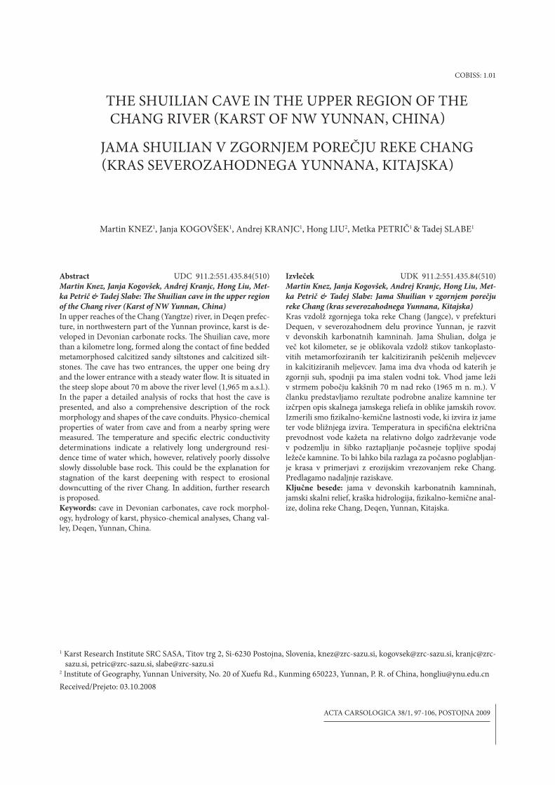
THE SHUILIAN CAVE IN THE UPPER REGION OF THE CHANG RIVER (KARST OF NW YUNNAN, CHINA) JAMA SHUILIAN V ZGORNJEM POREČJU REKE CHANG (KRAS SEVEROZAHODNEGA YUNNANA, KITAJSKA) Martin KNEZ 1 , Janja KOGOVŠEK 1 , Andrej KRANJC 1 , Hong LIU 2 , Metka PETRIČ 1 & Tadej SLABE 1 Izvleček UDK 911.2:551.435.84(510) Martin Knez, Janja Kogovšek, Andrej Kranjc, Hong Liu, Met- ka Petrič & Tadej Slabe: Jama Shuilian v zgornjem porečju reke Chang (kras severozahodnega Yunnana, Kitajska) Kras vzdolž zgornjega toka reke Chang (Jangce), v prefekturi Dequen, v severozahodnem delu province Yunnan, je razvit v devonskih karbonatnih kamninah. Jama Shulian, dolga je več kot kilometer, se je oblikovala vzdolž stikov tankoplasto- vitih metamorfoziranih ter kalcitiziranih peščenih meljevcev in kalcitiziranih meljevcev. Jama ima dva vhoda od katerih je zgornji suh, spodnji pa ima stalen vodni tok. Vhod jame leži v strmem pobočju kakšnih 70 m nad reko (1965 m n. m.). V članku predstavljamo rezultate podrobne analize kamnine ter izčrpen opis skalnega jamskega reliefa in oblike jamskih rovov. Izmerili smo fizikalno-kemične lastnosti vode, ki izvira iz jame ter vode bližnjega izvira. Temperatura in specifična električna prevodnost vode kažeta na relativno dolgo zadrževanje vode v podzemlju in šibko raztapljanje počasneje topljive spodaj ležeče kamnine. To bi lahko bila razlaga za počasno poglabljan- je krasa v primerjavi z erozijskim vrezovanjem reke Chang. Predlagamo nadaljnje raziskave. Ključne besede: jama v devonskih karbonatnih kamninah, jamski skalni relief, kraška hidrologija, fizikalno-kemične anal- ize, dolina reke Chang, Deqen, Yunnan, Kitajska. 1 Karst Research Institute SRC SASA, Titov trg 2, Si-6230 Postojna, Slovenia, [email protected], [email protected], kranjc@zrc- sazu.si, [email protected], [email protected] 2 Institute of Geography, Yunnan University, No. 20 of Xuefu Rd., Kunming 650223, Yunnan, P. R. of China, [email protected] Received/Prejeto: 03.10.2008 COBISS: 1.01 ACTA CARSOLOGICA 38/1, 97-106, POSTOJNA 2009 Abstract UDC 911.2:551.435.84(510) Martin Knez, Janja Kogovšek, Andrej Kranjc, Hong Liu, Met- ka Petrič & Tadej Slabe: e Shuilian cave in the upper region of the Chang river (Karst of NW Yunnan, China) In upper reaches of the Chang (Yangtze) river, in Deqen prefec- ture, in northwestern part of the Yunnan province, karst is de- veloped in Devonian carbonate rocks. e Shuilian cave, more than a kilometre long, formed along the contact of fine bedded metamorphosed calcitized sandy siltstones and calcitized silt- stones. e cave has two entrances, the upper one being dry and the lower entrance with a steady water flow. It is situated in the steep slope about 70 m above the river level (1,965 m a.s.l.). In the paper a detailed analysis of rocks that host the cave is presented, and also a comprehensive description of the rock morphology and shapes of the cave conduits. Physico-chemical properties of water from cave and from a nearby spring were measured. e temperature and specific electric conductivity determinations indicate a relatively long underground resi- dence time of water which, however, relatively poorly dissolve slowly dissoluble base rock. is could be the explanation for stagnation of the karst deepening with respect to erosional downcutting of the river Chang. In addition, further research is proposed. Keywords: cave in Devonian carbonates, cave rock morphol- ogy, hydrology of karst, physico-chemical analyses, Chang val- ley, Deqen, Yunnan, China.
-
Upload
independent -
Category
Documents
-
view
0 -
download
0
Transcript of THE SHUILIAN CAVE IN THE UPPER REGION OF THE CHANG RIVERKARST OF NW YUNNAN, CHINA€ JAMA SHUILIAN V...
THE SHUILIAN CAVE IN THE UPPER REGION OF THE CHANG RIVER (KARST OF NW YUNNAN, CHINA)
JAMA SHUILIAN V ZGORNJEM POREČJU REKE CHANG (KRAS SEVEROZAHODNEGA YUNNANA, KITAJSKA)
Martin KNEZ1, Janja KOGOVŠEK1, Andrej KRANJC1, Hong LIU2, Metka PETRIČ1 & Tadej SLABE1
Izvleček UDK 911.2:551.435.84(510)Martin Knez, Janja Kogovšek, Andrej Kranjc, Hong Liu, Met-
ka Petrič & Tadej Slabe: Jama Shuilian v zgornjem porečju
reke Chang (kras severozahodnega Yunnana, Kitajska)
Kras vzdolž zgornjega toka reke Chang (Jangce), v prefekturi Dequen, v severozahodnem delu province Yunnan, je razvit v devonskih karbonatnih kamninah. Jama Shulian, dolga je več kot kilometer, se je oblikovala vzdolž stikov tankoplasto-vitih metamorfoziranih ter kalcitiziranih peščenih meljevcev in kalcitiziranih meljevcev. Jama ima dva vhoda od katerih je zgornji suh, spodnji pa ima stalen vodni tok. Vhod jame leži v strmem pobočju kakšnih 70 m nad reko (1965 m n. m.). V članku predstavljamo rezultate podrobne analize kamnine ter izčrpen opis skalnega jamskega reliefa in oblike jamskih rovov. Izmerili smo $zikalno-kemične lastnosti vode, ki izvira iz jame ter vode bližnjega izvira. Temperatura in speci$čna električna prevodnost vode kažeta na relativno dolgo zadrževanje vode v podzemlju in šibko raztapljanje počasneje topljive spodaj ležeče kamnine. To bi lahko bila razlaga za počasno poglabljan-je krasa v primerjavi z erozijskim vrezovanjem reke Chang. Predlagamo nadaljnje raziskave.Ključne besede: jama v devonskih karbonatnih kamninah, jamski skalni relief, kraška hidrologija, $zikalno-kemične anal-ize, dolina reke Chang, Deqen, Yunnan, Kitajska.
1 Karst Research Institute SRC SASA, Titov trg 2, Si-6230 Postojna, Slovenia, [email protected], [email protected], [email protected], [email protected], [email protected]
2 Institute of Geography, Yunnan University, No. 20 of Xuefu Rd., Kunming 650223, Yunnan, P. R. of China, [email protected]
Received/Prejeto: 03.10.2008
COBISS: 1.01
ACTA CARSOLOGICA 38/1, 97-106, POSTOJNA 2009
Abstract UDC 911.2:551.435.84(510)Martin Knez, Janja Kogovšek, Andrej Kranjc, Hong Liu, Met-
ka Petrič & Tadej Slabe: !e Shuilian cave in the upper region
of the Chang river (Karst of NW Yunnan, China)
In upper reaches of the Chang (Yangtze) river, in Deqen prefec-ture, in northwestern part of the Yunnan province, karst is de-veloped in Devonian carbonate rocks. %e Shuilian cave, more than a kilometre long, formed along the contact of $ne bedded metamorphosed calcitized sandy siltstones and calcitized silt-stones. %e cave has two entrances, the upper one being dry and the lower entrance with a steady water 'ow. It is situated in the steep slope about 70 m above the river level (1,965 m a.s.l.). In the paper a detailed analysis of rocks that host the cave is presented, and also a comprehensive description of the rock morphology and shapes of the cave conduits. Physico-chemical properties of water from cave and from a nearby spring were measured. %e temperature and speci$c electric conductivity determinations indicate a relatively long underground resi-dence time of water which, however, relatively poorly dissolve slowly dissoluble base rock. %is could be the explanation for stagnation of the karst deepening with respect to erosional downcutting of the river Chang. In addition, further research is proposed.Keywords: cave in Devonian carbonates, cave rock morphol-ogy, hydrology of karst, physico-chemical analyses, Chang val-ley, Deqen, Yunnan, China.

ACTA CARSOLOGICA 38/1 – 200998
%ree of the largest East Asian rivers, Chang Jiang (Yang-tze), Lancang Jiang (Mekong), and Nu Jiang (Salween), take rise relatively close in the eastern part of a Tibetan high plateau, but reach the ocean thousands kilometers apart: Chang Jiang (Yangtze) in the Yellow Sea near Shanghai, Lancang Jiang (Mekong) in South China Sea at Hoshiminh in southern Vietnam, and Nu Jiang (Sal-ween) to Andaman Sea near Yangon (Myanmar). In the east, where the Himalayan arc narrows and turns southeast- and southward, the mentioned rivers cut in deep parallel valleys. At a length of 250 km they 'ow almost parallel, distant from one to the other for mere 20 – 50 km. %en Chang Jiang (Yangtze) turns east in its famous »First Bend«, while the other two rivers continue southeast resp. south. Characteristic for this section of the northwestern most part of the Chinese Yunnan province are parallel mountain chains consisting of peaks above 6,500 m, intermediate plains, and deeply cut (to 3,000 m depth) valleys of the mentioned rivers (Du 2007). Owing to geologic and physiographic reasons, landscape beauty, ecologic characteristics and extraordinary biologic di-versity China founded in this territory the %ree Parallel Rivers National Park, and in its frame a number of pro-tected areas that were inscribed in 2003 to the UNESCO World Heritage List as Protected Areas of the %ree Yun-nan Parallel Rivers (Fig. 1). %e core of the protected re-gion measures almost 9,400 km2, and the transitory zone additional 7,600 km2. It is situated between 28° 12’ and 26° 40’ north geographic latitude (UNESCO 2007).
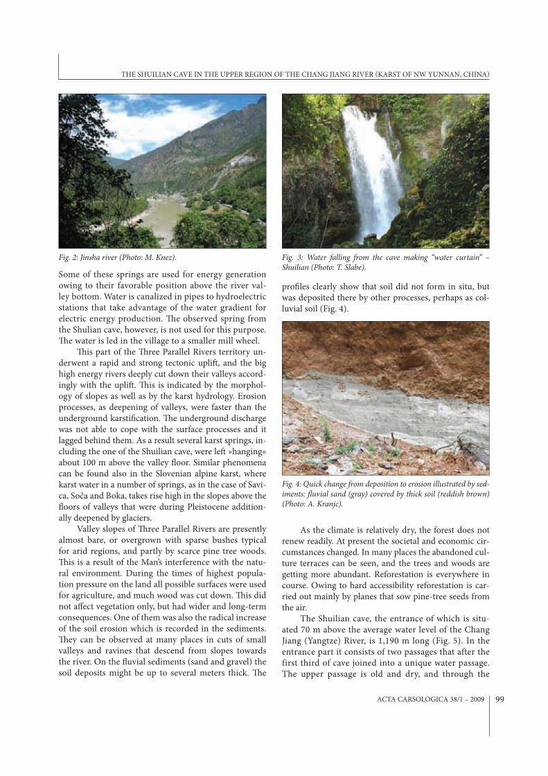
Among the rocks in this territory are also carbon-ates, and they are karsti$ed. One of the most well known landscape attractions is the narrow and deep gorge through which roars the Chang Jiang (called in this area Jinsha, meaning the Golden Sand), the canyon be-ing called the Tiger Leaping Gorge. A large part of the eastern slopes of the Jinsha river valley, several ten kilo-meters above the First Bend, consist of limestones. Ow-ing to very steep and uniform slopes the surface karst phenomena are rare, but the karst is manifested by the typical karst hydrology. Above the bottom of the valley, usually 50 – 150 m high, occur a number of strong karst springs from which the water 'ows in surface streams into the Jinsha river (Fig. 2).
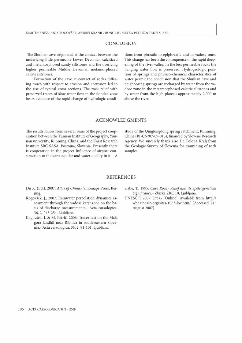
One among these karst spring is also the origi-nal Shuilian spring cave situated near town Zhongdian (county Zhongdian renamed into Xianggelila that is Shangri-La). %e river 'ows here in its bed which is part-ly cut into solid rock, and partly in alluviums. %e allu-vial gravel and sand bars are especially extensive in shel-tered sites. %e foot of slope, several tens of meters above the river, is gently inclined, and there extends the village of Chang Yue. Above it rise very steep the rocky slopes, interrupted at several places with vertical cli;s. About 70 m above the river open the two entrances to the Shuilian cave. From the lower entrance 'ows the brook that falls a little below as a waterfall several tens meters deep. About ten metres above it is the dry entrance. %e splashing waterfall (Fig. 3) gave the cave its name, Shuilian mean-
ing the Water Curtain. Hydrologic character-
istics of the wider area are strongly in'uenced by the position of the Chang Jiang (Yangtze) river and by the geologic contact of rocks of various permeability. %e river that plays here the re-gional erosion basis has cut down its bed deep into the metamorphic rocks. %ere-fore the contact of meta-morphosed sandy siltstones forming the hydrogeologic barrier with the overlying metamorphosed calcitic silt-sones extends in this area about 50 to 100 m above the river. At the contact occur springs discharging water from the carbonate aquifer.
INTRODUCTION
Fig. 1: Location of the studied area.
MARTIN KNEZ, JANJA KOGOVŠEK, ANDREJ KRANJC, HONG LIU, METKA PETRIČ & TADEJ SLABE
ACTA CARSOLOGICA 38/1 – 2009 99
pro$les clearly show that soil did not form in situ, but was deposited there by other processes, perhaps as col-luvial soil (Fig. 4).
As the climate is relatively dry, the forest does not renew readily. At present the societal and economic cir-cumstances changed. In many places the abandoned cul-ture terraces can be seen, and the trees and woods are getting more abundant. Reforestation is everywhere in course. Owing to hard accessibility reforestation is car-ried out mainly by planes that sow pine-tree seeds from the air.
The Shuilian cave, the entrance of which is situ-ated 70 m above the average water level of the Chang Jiang (Yangtze) River, is 1,190 m long (Fig. 5). In the entrance part it consists of two passages that after the first third of cave joined into a unique water passage. The upper passage is old and dry, and through the
Some of these springs are used for energy generation owing to their favorable position above the river val-ley bottom. Water is canalized in pipes to hydroelectric stations that take advantage of the water gradient for electric energy production. %e observed spring from the Shulian cave, however, is not used for this purpose. %e water is led in the village to a smaller mill wheel.
%is part of the %ree Parallel Rivers territory un-derwent a rapid and strong tectonic upli<, and the big high energy rivers deeply cut down their valleys accord-ingly with the upli<. %is is indicated by the morphol-ogy of slopes as well as by the karst hydrology. Erosion processes, as deepening of valleys, were faster than the underground karsti$cation. %e underground discharge was not able to cope with the surface processes and it lagged behind them. As a result several karst springs, in-cluding the one of the Shuilian cave, were le< »hanging« about 100 m above the valley 'oor. Similar phenomena can be found also in the Slovenian alpine karst, where karst water in a number of springs, as in the case of Savi-ca, Soča and Boka, takes rise high in the slopes above the 'oors of valleys that were during Pleistocene addition-ally deepened by glaciers.
Valley slopes of %ree Parallel Rivers are presently almost bare, or overgrown with sparse bushes typical for arid regions, and partly by scarce pine tree woods. %is is a result of the Man’s interference with the natu-ral environment. During the times of highest popula-tion pressure on the land all possible surfaces were used for agriculture, and much wood was cut down. %is did not a;ect vegetation only, but had wider and long-term consequences. One of them was also the radical increase of the soil erosion which is recorded in the sediments. %ey can be observed at many places in cuts of small valleys and ravines that descend from slopes towards the river. On the 'uvial sediments (sand and gravel) the soil deposits might be up to several meters thick. %e
Fig. 2: Jinsha river (Photo: M. Knez). Fig. 3: Water falling from the cave making “water curtain” – Shuilian (Photo: T. Slabe).
Fig. 4: Quick change from deposition to erosion illustrated by sed-iments: !uvial sand (gray) covered by thick soil (reddish brown) (Photo: A. Kranjc).
THE SHUILIAN CAVE IN THE UPPER REGION OF THE CHANG JIANG RIVER (KARST OF NW YUNNAN, CHINA)

ACTA CARSOLOGICA 38/1 – 2009100
Fig. 5: Survey of Shuilian cave by Erin Lynch.
MARTIN KNEZ, JANJA KOGOVŠEK, ANDREJ KRANJC, HONG LIU, METKA PETRIČ & TADEJ SLABE

ACTA CARSOLOGICA 38/1 – 2009 101
lower passage flows the water stream that discharges in the waterfall.
Position, shape, geologic, speleomorphologic and hydrogeologic investigations shed light on the way of the cave formation and the most important stages of its evo-
lution, but also on the characteristics of the karst aquifer, the waters that 'ow along the contact with less perme-able rocks, and the development of the rapidly incising canyon of the Chang Jiang (Yangtze) River.
GEOLOGIC STRUCTURE
In the narrow surroundings of the cave the Lower and Middle Devonian rocks are exposed. %e belt of Devo-nian beds extends southeast-northwest, and is separated from beds in northeast and in southeast by two deep faults. In the northeast Devonian rocks are in contact with the Upper Carboniferous limestones and shales, and in southwest with the Middle to Upper Silurian limestones and dolomites. All mentioned beds are strongly folded or tilted to almost vertical positions. Along both faults that delimit the Devonian beds compression occurred in geo-logic history which led to forming of a folded structure in which the beds dip on an average 80° in northeast, and between 30 and 60° in southwest.
%e cave formed at contact (Fig. 6) between the Lower and Middle Devonian rocks. %e lower Devonian rocks are calcitized and metamorphosed sandy siltstones, and the Middle Devonian ones high grade metamorphic calcitic siltstones of high carbonate content (Tab. 1).
Calcitized and metamorphosed sandy siltstones are $nely bedded and of red brown color owing to the pres-ence of iron oxides. Alizarine coloring is intense, calcite contents exceed 60% (Tab. 1, sample 1). %e preponder-ance of sparitic calcite is observable also macroscopi-cally. Aggregates of polycrystalline quartz attain 0.5 mm.
Quartz contents are estimated at 5-7%. Iron oxides im-pregnate the rock, and in addition they occur in irregu-lar aggregates and on original schistosity planes with muscovite and sericite particles. %e rock is cut by calcite veins of several generations.
Calcitized and metamorphosed sandy siltstones a few decimetres thick that lie just below the metamor-phosed limestones are $nely laminated, the laminas be-ing up to 2 mm thick. %e cross-bedding pinches out lentiformly at the contact with Middle Devonian beds. In areas where calcitization has not been entirely com-pleted, the rock is of alternating reddish brown and dark grey colors. Reddish brown lenses contain iron oxide minerals, most probably limonite. Coloration with alizarine red is very intense, the indicated calcite contents being high, between 80% and 90% of the total rock (Tab. 1, samples 2, 3). %e rock consists of sparitic calcite (at least 70%). In very low amounts polycrystal-line quartz (to 5%) is present, and in traces sericite-muscovite (up to 2%), the rest being represented by iron oxides, chie'y limonite. %e latter occurs as im-pregnations, and is concentrated on schistosity planes that apparently coincide with the bedding planes.
%e original rock of the calcitized and metamor-phosed sandy siltstone was most probably silty sand-stone or sandy siltstone. %e rock was metamorphosed, and most probably during speleogenesis strongly cal-citized.
%e highly metamorphosed calcitic siltstones of high carbonate contents (Tab. 1, samples from 4 to 9) higher in the cave pro$le are bedded with the beds up to several 10 cm thick. %e rock is strongly altered. %e original rock was sedimentary, most probably cal-citic siltstone and $ne grained sandstone that were later metamorphosed to a marble-like rock (Fig. 7). During this process the iron oxides separated from phyllosili-cates owing to substitution by calcite.
A smaller part of the lower extent of the passage was formed by erosional processes in less permeable beds of calcitized and metamorphosed sandy siltstones of red color. %e reason for high calcite contents in these beds are also abundant $ssures $lled with sparitic calcite.
Fig. 6: Contact of calcitized and metamorphosed sandy siltstones and highly metamorphosed calcitic siltstone (Photo: M. Knez).
THE SHUILIAN CAVE IN THE UPPER REGION OF THE CHANG JIANG RIVER (KARST OF NW YUNNAN, CHINA)

ACTA CARSOLOGICA 38/1 – 2009102
On dissected sides of the passage variable resistance of individual carbonate beds in the vertical direction is observable.
Rocks in this area became densely $ssured as a re-sult of intense tectonic activity. Later $ssures, mostly up to 1 mm wide, became $lled with calcite cement. A somewhat stronger fault, along which the shi< can be seen, occurred in the central part of the passage.
ROCK RELIEF OF CAVE AND SHAPE OF PASSAGES
%e cave rock relief and longitudinal and transversal sec-tions of the passages give insight into the way of water 'ow through the cave, the mechanism of shaping the cave and the most important stages of its development.
%e rock relief can be divided into two groups of rock features. %e $rst group assembles the rock features
that indicate slower water 'ow through the cave when it was inundated, and the second group features that indi-cate faster water 'ow velocities. %e second ones com-prise traces of the present water 'ow in the lower part of the water passage, and in conduits of smaller cross section, before the discharge, along the entire periphery. %e cave originated and has been shaped at the contact of underlying calcitized and metamorphosed sandy silt-stones and intensely metamorphosed calcitic siltstones of which consists the periphery of the passage’s upper parts. %e prevailing process in the lower parts is consequently mechanical erosion, and in their upper parts dissolution of rocks. With the $rst process the cave is evolving also today.
Traces of the water 'ow through the formerly 'ood-ed cave are large scallops and ceiling pockets (Fig. 8) as well as wall pockets. %ey were shaped by the slower wa-ter 'ow. %ey arose in the beds of metamorphosed calcit-ic siltstones. Large scallops (Slabe 1995) of diameters of up to 0.7 m, are the best preserved on passage walls. %e
deepest ones, to 15 cm, occur at bedding planes. %e most characteristic features are the pockets. %ey can be simple or composed. Some of them are several (up to 3) m high. %e deepest ones that formed at $ssures tend to narrow up-wards. %ey consist of sever-al 'oors, or their tops may be composed of several pockets. %ey are elongated along $s-sures, composed, they may be stringed one next to the other. In places they are fas-tened together into ceiling cupolas. On parts of ceiling that were shaped along a well expressed vertical $ssure, a
ceiling channel (Fig. 9) can form, the top of which devel-oped into pockets. %e ceiling channel is in places several meters high, while in other places it completely pinches out. On such places, on walls of ceiling channels and on walls of cupolas occur vertical and semi-circular notches that may be several meters long. At bedding planes and at the widest open parts of contacts of di;erent rocks wall pockets formed that are several meters deep. %eir upper part is of dome-like shape, but the lower part is more or less horizontal. Such shape is governed by the lower, less carbonate containing rock or sediments that deposited in the lower part of the wall pocket, and that preserved it from faster rock dissolution. Quite o<en several smaller pockets are connected into a wall cupola,
Fig. 7: Fine grained sandstone that were later metamorphosed to a marble-like rock (Photo: M. Knez).
Sample CaO (%) MgO (%) calcite (%) dolomite
(%)
total
carbonate
(%)
CaO/MgO
(%)
insoluble
residue
(%)
1 33.64 1.93 56.34 7.74 64.08 17.43 35.92
2 41.18 3.2 65.99 13.83 79.82 13.64 20.18
3 50.47 0.81 87.09 3.68 91.77 62.31 8.23
4 55.29 0.56 97.27 2.58 99.85 98.73 0.15
5 55.21 0.62 96.97 2.85 99.82 89.00 0.18
6 55.18 0.64 96.87 2.95 99.82 86.22 0.18
7 55.09 0.58 96.77 2.67 99.53 98.37 0.47
8 55.12 0.56 96.97 2.58 99.55 98.42 0.45
9 55.18 0.64 96.86 2.95 99.81 86.06 0.19
Tab. 1: Calcimetric data of rock samples. Samples from 1 to 3 are calcitized and metamorphosed sandy siltstones of lower Devonian age, rock samples 4 to 9 are Middle Devonian metamorphosed calcitic siltstones.
MARTIN KNEZ, JANJA KOGOVŠEK, ANDREJ KRANJC, HONG LIU, METKA PETRIČ & TADEJ SLABE

ACTA CARSOLOGICA 38/1 – 2009 103
and they rise, like connected into a vertical channel, one above the other.
Characteristic rock features are also the wall notch-es (Slabe 1995). %ey formed at contact of two di;erent rocks and at bedding planes. Some of them are asym-metrical and semicircular. %eir upper semicircular part is in metamorphosed calcitic siltstones and the 'at bottom on the underlying less permeable rock (Fig. 6). In other places are wall notches better developed in the lower, less carbonate rock, while the metamorphosed calcitic siltstone stands out as a projecting step in the wall. Elsewhere there are no morphologic features at the boundary between two rocks. %e wall notches are o<en ribbed with scallops and dissected by wall pockets.
Most of the upper part of the passage circumfer-ence has been shaped by water that has been lastingly condensing in the upper parts of passage. On ceiling and walls remains of sinter are found, an indication of the changed microclimatic conditions in the passage. %e cave obviously became wider opened to exterior in-'uences. %e surface of rock and of sinter is $nely dis-sected. At the better soluble parts of rock, mainly cut by $ne cracks that pass through rock in various directions, small etchings formed that reach up to 1.5 cm in depth.
%e lower parts of passage that are frequented by the water 'ow were shaped predominantly by mechanic ac-
tion of the water load that included also sand and smaller pebbles. Formed were potholes, scallop-like shapes and wall notches, wall pockets and 'oor channels. Longitu-dinal wall notches with a diameter of decimeter size are developed along bedding planes. Some of them deepen the small wall pockets. %eir diameters may attain half a meter. %ey are the result of mechanical action of wa-ter 'ow that tears o; the rock particles, and chisels the rock with the transported material it drives into whirl-ing. Along the entire water passage, and also on 'oor of dry parts of cave the 'oor channels can be traced. %ey represent the trace of cutting of the water 'ow into the rocky 'oor over the entire surface, and in broader parts of cave also of periodic smaller water streams that 'owed only over the lowest parts of the channel. %e surface of the channel has been mechanically smoothened and rounded, especially somewhat higher, from 1 m to 1. 5 m above 'oor, in the reach of higher waters. Into the 'oor of channel are chiseled potholes that measure up to ¾ metre in diameter. %e smaller ones measure only a few centimeters, however. In the prevailingly calcitized and metamorphosed sandy siltstones the water 'ow that whirls along the rough surface of the rock consisting of grains, excavates also scallop-like elongated, up to 3 cm long hollows. Also these features are mostly the conse-quence of mainly mechanical excavation of the rock by
Fig. 8: Ceiling pocket (Photo: T. Slabe). Fig. 9: Ceiling channel (Photo: T. Slabe).
THE SHUILIAN CAVE IN THE UPPER REGION OF THE CHANG JIANG RIVER (KARST OF NW YUNNAN, CHINA)

ACTA CARSOLOGICA 38/1 – 2009104
the mass of the water current which also carries insol-uble particles. In the entrance part of cave the walls and sinter are covered by mosses and liverworts that $nely dissect their surface.
From the transversal sections of passages various ways of formation of the cave at contact of two rocks can be deduced. Water that $lled the empty space in the 'ooded zone $rst percolated along the contact cut by vertical cracks. At the crack a vug formed that $rst spread along contact of beds of di;erent rocks, and then spread upwards into the $ssured upper part in the meta-morphosed calcitic siltstone. In the 'ooded zone conse-quently a cross-like shape formed with a larger, higher upper part (Fig. 10). A<er lowering of the water level the water current kept eroding only into the calcitized and metamorphosed sandy silstone, and it deepened and widened the lower part of passage. Certain smaller passages preserved the prevailingly round cross-sec-
tion. %eir larger part formed in the metamorphosed calcitic siltstone. In the lower, metamorphosed sandy siltstone, however, they formed below a semicircular 'oor channel (Fig. 11). Such passages did not form at distinct $ssures. %e cross-section of larger passages, on the other side, indicates that they originated from join-ing of several smaller circuits. %eir ceiling consists of several arches. %e contact of described rocks was not of uniform permeability, however. %e higher water per-meability at vertical $ssures was mentioned already. %e parts of highest permeability assumed the part of wa-ter conduit, while the impermeable parts of the contact remained preserved. In more spacious parts of the pas-sages pillars can be seen that are as a rule the narrowest at the contact, they are o<en indented by circular wall notches, while upwards they widen into the vault of the cave ceiling.
Fig. 10: Cross-like shape of cave passage (Photo: T. Slabe). Fig. 11: Cross section of the passage with larger upper part devel-oped in rock of higher carbonate content (Photo: T. Slabe).
HYDROGEOLOGICAL CHARACTERISTICS
At day of our visit the water 'owed from the Shuilian cave through the lower passage at 1,965 m a.s.l., while in1,965 m a.s.l., while in the interior we reached the water through the upper dry passage a<er approximately 150 m. %e discharge was not measured, but was estimated at about 100 to 200 l/s.
Measured were the basic physical parameters of water, and collected was a sample for chemical analy-sis. Also in the cave that has developed at contact of two lithologically di;ering rocks, the water current was cut into the underlying metamorphosed sandy siltstones. %ere were no appreciable discharges of percolating water through ceiling consisting of carbonate rocks at the day of our visit. An exception was a smaller trickle
of water in which the speci$c electric conductivity was measured.
%e river has several surface a?uents. Two of them encircle the recharge area of the Shuilian spring. In the $eld we visited the le< a?uent that 'ows into the riv-er about 1.5 km northwards. Also in this ravine that is equally cut into the metamorphosed sandy siltstones several springs were observed in the slope above the river bed. %e highest contribution to the 'ow of the surface stream comes from the larger spring near Shuilian (Tab. 2), situated higher up in ravine just above the river bed at the contact with metamorphosed calcitic siltstones (Fig. 12). At the spring the basic physical characteristics
MARTIN KNEZ, JANJA KOGOVŠEK, ANDREJ KRANJC, HONG LIU, METKA PETRIČ & TADEJ SLABE

ACTA CARSOLOGICA 38/1 – 2009 105
of water were measured (Tab. 2) and a sample for chemi-cal analysis collected. %e discharge of the spring was estimated to 200-300 l/s. %e described situation was re-corded in time of low to medium waters at the beginning of the rainy period. In view of climatic conditions higher 'ows can be expected a<er the rainy season peak toward the end of summer.
Above the river and the spring, the slope rises steep-ly, and it reaches about 10 km eastward the high plateau with altitudes above 4,000 m a. s. l. %ere are exposed rocks of very low permeability on which precipitation water collects in small lakes and surface streams. At con-tact with carbonate rocks of higher permeability it sinks underground. It is possible it 'ows also to the observed springs, but to verify this connection additional investi-gations would be needed.
RESULTS OF WATER ANALYSES
%e groundwater in the Shuilian cave sampled at the spring near entrance displayed on 28 May 2007 the tem-perature of 9.2°C and speci$c electric conductivity (SEC) of 154.4 µS/cm. %e low SEC value was con$rmed also by chemical analyses. Water contained only 1.73 meq/l
carbonates (106 mg HCO-3/l), and a total hardness of
1.72 meq/l (86 mg CaCO3/l). Calcium concentration was
1.48 meq/l (30 mg Ca2+/l), and followingly the ratio Ca/Mg = 6.4. Water contained only 2 mg Cl-/l and low sul-fates concentration, only a few mg/l (Tab. 2).
%e relatively low water temperature indicates a longer residence in the wide and high hinterland, and low SEC and hardnesses the absence of 'ow through the easily soluble carbonate rocks which would lead to dis-solution of carbonate minerals and higher values of their constituents in water.
A possible source of water is the surface stream from the area of very low permeable rocks on the high plateau about 2,000 m higher. With respect to chemical characteristics of water in the cave we presume a rapid 'ow through the metamorphosed calcitic siltstones re-spectively continuous 'ow along their contact with the metamorphosed sandy siltstones, not much di;erent from the 'ow in the Shuilian cave. In percolating water (Tab. 2) that is fed into cave through ceiling, a consid-erably higher value of SEC (355 µS/cm) was measured, which re'ects its percolation through a higher carbonate containing rock and a more abundant dissolution of car-bonates. Since the samples were collected at the begin-ning of the rainy season and considering our knowledge of water 'ow through the vadose zone in the Slovenian karst (Kogovšek 2007; Kogovšek & Petrič 2006) we pre-sume that the $rst rainfalls at the beginning of the rainy period were used mainly for $lling up the vadose zone of the karst part of the catchment that was drained dur-ing the previous draught period. For this reason the dis-charge from it was low at the time of our sampling, which resulted also in the chemical composition of the spring water. Probably a larger contribution of water from the vadose zone with a higher carbonates’ concentration can be expected in the rainy season. Of course this could be established only with appropriate additional measure-ments and analyses.
Also the larger spring, the Spring near Shuilian (Tab. 2) that feeds the le< a?uent of river 1.5 km northward, displays physico-chemical characteristics very similar to those of the spring from the Shuilian cave, as evident
from Tab. 2. %e close chemical cor-
respondence of the two ex-amined springs indicates very similar recharge areas (possibly some parts are common to both), and a very similar underground 'ow.
Fig. 12: Spring near Shuilian recharges the le" a#uent of the Jin-sha river (Photo: J. Kogovšek).
Tab. 2: Physico-chemical characteristics of the sampled waters: T-temperature, SEC-speci%c elec-tric conductivity, Ca+Mg-total hardness, Ca-calcium, Ca/Mg-ratio calcium/magnesium, Cl- -chlo-rides (28 May 2007).
Place T
ºC
SEC
µS/cm
Carbonates Ca+Mg Ca Ca/Mg Cl-
mg/lmeq/l
Water !ow in Shuilian 9.2 154 1.73 1.72 1.48 6.4 2
Spring near Shuilian 9.3 165 2.01 1.88 1.52 4.2 1
Percolating water 355
THE SHUILIAN CAVE IN THE UPPER REGION OF THE CHANG JIANG RIVER (KARST OF NW YUNNAN, CHINA)
ACTA CARSOLOGICA 38/1 – 2009106
%e Shuilian cave originated at the contact between the underlying little permeable Lower Devonian calcitized and metamorphosed sandy siltstones and the overlying higher permeable Middle Devonian metamorphosed calcite siltstones.
Formation of the cave at contact of rocks di;er-ing much with respect to erosion and corrosion led to the rise of typical cross sections. %e rock relief with preserved traces of slow water 'ow in the 'ooded zone bears evidence of the rapid change of hydrologic condi-
tions from phreatic to epiphreatic and to vadose ones. %is change has been the consequence of the rapid deep-ening of the river valley. In the less permeable rocks the hanging water 'ow is preserved. Hydrogeologic posi-tion of springs and physico-chemical characteristics of water permit the conclusion that the Shuilian cave and neighboring springs are recharged by water from the va-dose zone in the metamorphosed calcitic siltstones and by water from the high plateau approximately 2,000 m above the river.
ACKNOWLEDGMENTS
CONCLUSION
%e results follow from several years of the project coop-eration between the Yunnan Institute of Geographv, Yun-nan university, Kunming, China, and the Karst Research Institute SRC SASA, Postojna, Slovenia. Presently there is cooperation in the project In'uence of airport con-struction to the karst aquifer and water quality in it – A
study of the Qinglongdong spring catchment, Kunming, China (BI-CN/07-09-015), $nanced by Slovene Research Agency. We sincerely thank also Dr. Polona Kralj from the Geologic Survey of Slovenia for examining of rock samples.
REFERENCES
Du X. (Ed.), 2007: Atlas of China.- Sinomaps Press, Bei-jing.
Kogovšek, J., 2007: Rainwater percolation dynamics as-sessment through the vadose karst zone on the ba-sis of discharge measurements.- Acta carsologica, 36, 2, 245-254, Ljubljana.
Kogovšek, J. & M. Petrič, 2006: Tracer test on the Mala gora land$ll near Ribnica in south-eastern Slove-nia.- Acta carsologica, 35, 2, 91-101, Ljubljana.
Slabe, T., 1995: Cave Rocky Relief and its Speleogenetical Signi%cance.- Zbirka ZRC 10, Ljubljana.
UNESCO, 2007: Sites.- [Online]. Available from: http://whc.unesco.org/sites/1083-loc.htm/ [Accessed 21st
August 2007].
MARTIN KNEZ, JANJA KOGOVŠEK, ANDREJ KRANJC, HONG LIU, METKA PETRIČ & TADEJ SLABE