SEISMIC SURVEY - Yug-Neftegaz
24
SEISMIC SURVEY: FIELD WORKS, SEISMIC DATA PROCESSING AND INTERPRETATION
-
Upload
khangminh22 -
Category
Documents
-
view
2 -
download
0
Transcript of SEISMIC SURVEY - Yug-Neftegaz
SE
ISM
IC S
UR
VE
Y: F
IELD
WO
RK
S, S
EIS
MIC
DA
TA
PR
OC
ES
SIN
G A
ND
IN
TE
RP
RE
TA
TIO
N

ABOUT US
Yug-Neftegaz Private Limited is a modern high-tech company that has managed to incorporate purposeful and successful people striving for a continuous improvement and creating of new ideas and solutions.
A distinctive feature of the Company is its readiness to cope with any challenges and tasks both simple and complex, conventional or uncommon. Due to first-rate expert potential of our employees, we are capable of applying the most advanced technologies and innovations.
As of today, we:
- have reached a new qualitative level due to having developed and implemented an integrated management system including QHSSE, guided by the IAGC and IOGP recommendations likewise in compliance with the following standards:
ISO 9001 in quality management;
ISO 14001 in environmental management;
ISO 45001 in occupational health and safety management.
- successfully provide comprehensive services in prospecting oil & gas projects in Central and Eastern Europe, Southeast Asia, Central Asia, Middle East, and Africa.
- solve the most difficult geological problems and tasks set for seismic surveying due to new ideas and our proprietary innovations.
- have established our own seismic and borehole data processing and integrated interpretation center equipped with high-performance hardware and software.
- have teamed up splendid professionals in seismic surveying, latest seismic data processing and interpretation. Their work experience comprises:
2D seismic surveying:
3D seismic surveying:
2D seismic data processing:
3D seismic data processing:
2D seismic data interpretation:
3D seismic data interpretation:
more than 14,000 lin.km
more than 5,000 sq.km
more than 45,000 lin.km
more than 10,000 sq.km
more than 12,000 lin.km
more than 4,500 sq.km
OUR KEY VALUES
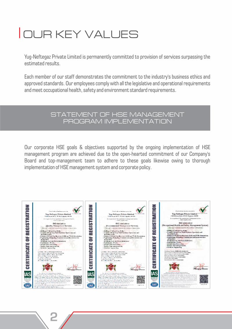
Yug-Neftegaz Private Limited is permanently committed to provision of services surpassing the estimated results.
Each member of our staff demonstrates the commitment to the industry's business ethics and approved standards. Our employees comply with all the legislative and operational requirements and meet occupational health, safety and environment standard requirements.
STATEMENT OF HSE MANAGEMENT PROGRAM IMPLEMENTATION
Our corporate HSE goals & objectives supported by the ongoing implementation of HSE management program are achieved due to the open-hearted commitment of our Company's Board and top-management team to adhere to these goals likewise owing to thorough implementation of HSE management system and corporate policy.
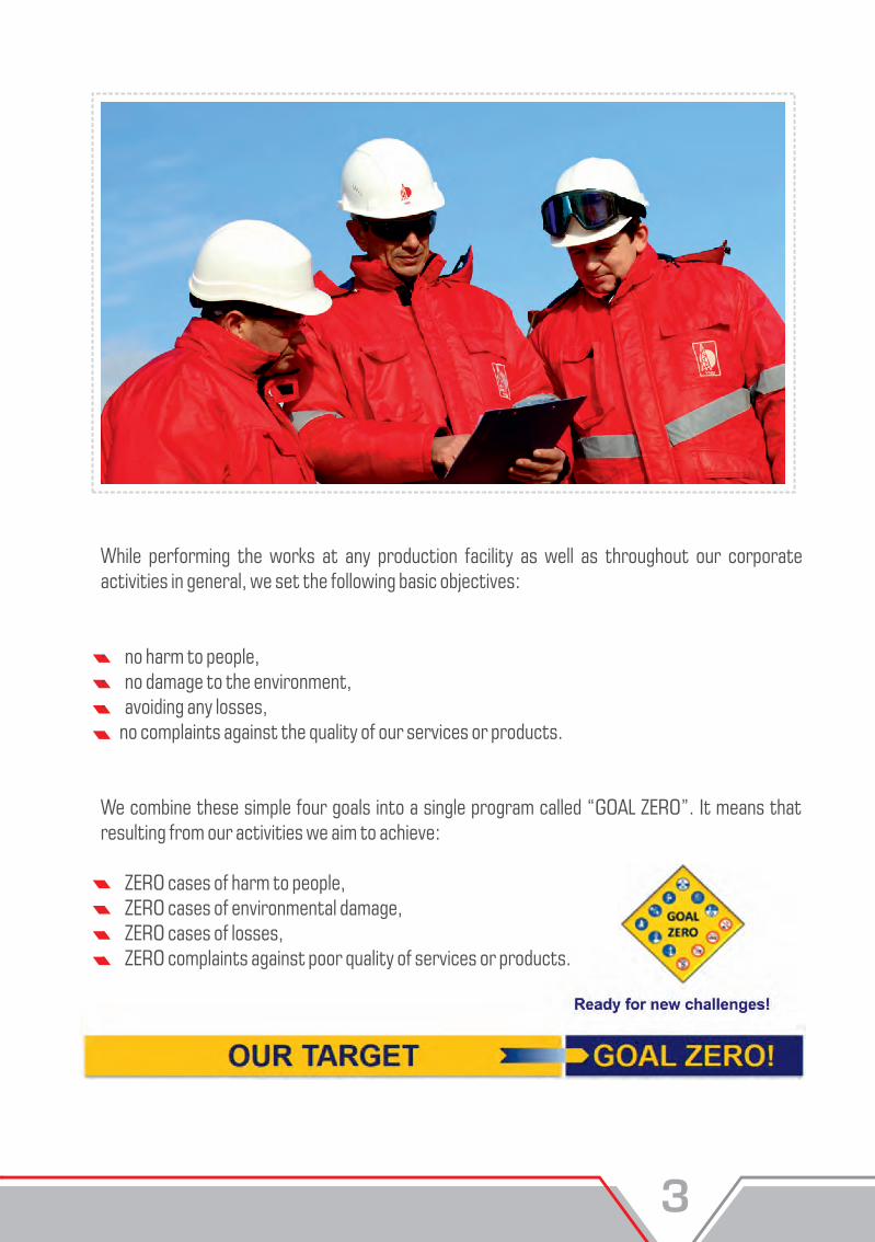
While performing the works at any production facility as well as throughout our corporate activities in general, we set the following basic objectives:
· no harm to people,· no damage to the environment,· avoiding any losses, no complaints against the quality of our services or products.
We combine these simple four goals into a single program called “GOAL ZERO”. It means that resulting from our activities we aim to achieve:
ZERO cases of harm to people,· ZERO cases of environmental damage,· ZERO cases of losses,· ZERO complaints against poor quality of services or products.
OUR KEY VALUES
Yug-Neftegaz Private Limited is permanently committed to provision of services surpassing the estimated results.
Each member of our staff demonstrates the commitment to the industry's business ethics and approved standards. Our employees comply with all the legislative and operational requirements and meet occupational health, safety and environment standard requirements.
STATEMENT OF HSE MANAGEMENT PROGRAM IMPLEMENTATION
Our corporate HSE goals & objectives supported by the ongoing implementation of HSE management program are achieved due to the open-hearted commitment of our Company's Board and top-management team to adhere to these goals likewise owing to thorough implementation of HSE management system and corporate policy.
While performing the works at any production facility as well as throughout our corporate activities in general, we set the following basic objectives:
· no harm to people,· no damage to the environment,· avoiding any losses, no complaints against the quality of our services or products.
We combine these simple four goals into a single program called “GOAL ZERO”. It means that resulting from our activities we aim to achieve:
ZERO cases of harm to people,· ZERO cases of environmental damage,· ZERO cases of losses,· ZERO complaints against poor quality of services or products.

SEISMIC SURVEY
Being well-equipped and employing highly qualified and experienced personnel, we are fully prepared for seismic surveying under various conditions both on-shore and in transition zones. We offer economically effective methodological and technological solutions that comply with international standards of high-quality and safe work performance.
Yug-Neftegaz Private Limited devotes special attention to environmental protection and commits itself to the concept of “ ”. We have developed a special technique green seismic surveyand designed special - purpose equipment for surveying in transition zones, marshland, shallow waters and other difficult-to-access areas. This innovation allows us to eliminate usage of explosives as a seismic source for transition zones. Presently, this technique enables us to acquire high-quality seismic data in shallow wetlands and marshlands without inflicting any harm to the environment!
OUR SERVICES:
seismic survey consulting, seismic survey planning and design, full range of "turn-key” 2D/3D on-shore seismic surveying of any level of complexity, full range of 2D/3D transition zone seismic surveying subject to the “green seismic survey” concept, supportive seismic methods: LVL surveying (refraction survey and uphole velocity survey), engineering seismics and micro-seismics.
DESERT AREA OPERATIONS
Seismic crew personnel are adequately trained and experienced for seismic surveying in desert areas. One of the advantages of Yug-Neftegaz Private Limited is that it has possessed the fleet of all necessary equipment ready to commence operations within the shortest possible time.

The industry's only fully scalable wireless seismic recording system with real-time and cable-free data transmission.The Wireless Remote Unit (WRU), is the heart of the RT System 2. These small units contain a complete seismic acquisition and radio relay system inside the waterproof aluminum case.The analog-to-digital converter is state of the art, one that has been widely adopted by most manufacturers of seismic systems because of its outstanding analog performance and low power consumption.
RT System 2
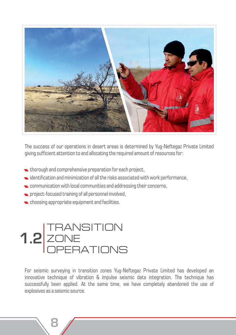
The success of our operations in desert areas is determined by Yug-Neftegaz Private Limited giving sufficient attention to and allocating the required amount of resources for:
thorough and comprehensive preparation for each project, identification and minimization of all the risks associated with work performance, communication with local communities and addressing their concerns, project-focused training of all personnel involved, choosing appropriate equipment and facilities.
For seismic surveying in transition zones Yug-Neftegaz Private Limited has developed an innovative technique of vibration & impulse seismic data integration. The technique has successfully been applied. At the same time, we have completely abandoned the use of explosives as a seismic source.
TRANSITION ZONE OPERATIONS
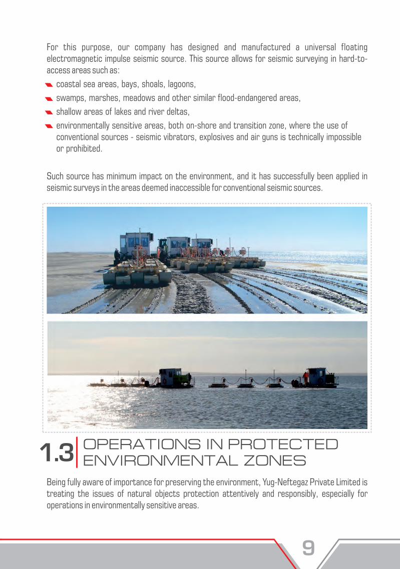
For this purpose, our company has designed and manufactured a universal floating electromagnetic impulse seismic source. This source allows for seismic surveying in hard-to- access areas such as: coastal sea areas, bays, shoals, lagoons, swamps, marshes, meadows and other similar flood-endangered areas, shallow areas of lakes and river deltas, environmentally sensitive areas, both on-shore and transition zone, where the use of conventional sources - seismic vibrators, explosives and air guns is technically impossible or prohibited.
Such source has minimum impact on the environment, and it has successfully been applied in seismic surveys in the areas deemed inaccessible for conventional seismic sources.
OPERATIONS IN PROTECTED ENVIRONMENTAL ZONES
Being fully aware of importance for preserving the environment, Yug-Neftegaz Private Limited is treating the issues of natural objects protection attentively and responsibly, especially for operations in environmentally sensitive areas.
The success of our operations in desert areas is determined by Yug-Neftegaz Private Limited giving sufficient attention to and allocating the required amount of resources for:
thorough and comprehensive preparation for each project, identification and minimization of all the risks associated with work performance, communication with local communities and addressing their concerns, project-focused training of all personnel involved, choosing appropriate equipment and facilities.
For seismic surveying in transition zones Yug-Neftegaz Private Limited has developed an innovative technique of vibration & impulse seismic data integration. The technique has successfully been applied. At the same time, we have completely abandoned the use of explosives as a seismic source.
TRANSITION ZONE OPERATIONS
For this purpose, our company has designed and manufactured a universal floating electromagnetic impulse seismic source. This source allows for seismic surveying in hard-to- access areas such as: coastal sea areas, bays, shoals, lagoons, swamps, marshes, meadows and other similar flood-endangered areas, shallow areas of lakes and river deltas, environmentally sensitive areas, both on-shore and transition zone, where the use of conventional sources - seismic vibrators, explosives and air guns is technically impossible or prohibited.
Such source has minimum impact on the environment, and it has successfully been applied in seismic surveys in the areas deemed inaccessible for conventional seismic sources.
OPERATIONS IN PROTECTED ENVIRONMENTAL ZONES
Being fully aware of importance for preserving the environment, Yug-Neftegaz Private Limited is treating the issues of natural objects protection attentively and responsibly, especially for operations in environmentally sensitive areas.

In order to minimize or fully mitigate the negative impact upon the environment during seismic surveys, the following measures are taken:
thorough training of all personnel for operation in environmentally sensitive areas addressing the specific features of each project, involvement of stakeholders responsible for environmentally sensitive objects in a region into the planning process, consideration of key environment features in production schedules for each case, seismic data recording with wireless systems only, the use of the light-weight transport vehicles only, manual execution of most operations in particular cases.
OPERATIONS IN POPULATED, INDUSTRIAL AND ARABLE AREAS
Yug-Neftegaz Private Limited possesses all the required experience and special-purpose equipment for successful operation in populated, industrial and arable areas. To perform seismic surveys in such areas and ensure safety, we use a range of measures, such as:
preliminary seismic survey approval by the operation site owners, careful and thorough assessment of HSSE issues to avoid damage to personnel, equipment, third parties and environment, risk identification and minimization, preliminary notification of local population as regards forthcoming operation with all available means, including local and regional media, the use of wireless seismic acquisition systems and combination of source types to mitigate the risk of damage.
SEISMIC AND BOREHOLE DATA PROCESSING AND INTEGRATED INTERPRETATION
Yug-Neftegaz Private Limited has its proprietary seismic and borehole data processing and integrated interpretation center residing in 500 m2 office premises.Our center is equipped with up-to-date, high-performance hardware and EmersonParadigm® software packages - the world's industry leader in geological prospecting survey solutions, enabling high - quality and fast data processing and interpretation.The center staff is the team of highly qualified geophysicists and geologists with extensive experience in processing and interpretation of seismic data acquired on-shore and off-shore. The operation portfolio of the center's experts comprises above 50 successfully completed oil & gas projects in Eastern and Central Europe, Central Asia, Africa, South America and the Middle East.Close co-operation and co-ordination between the business units of the center allow for choosing the most effective way of seismic data processing depending on geological tasks set.
DATA PROCESSING AND INTEGRATED INTERPRETATION CENTER PROVIDES THE FOLLOWING SERVICES:
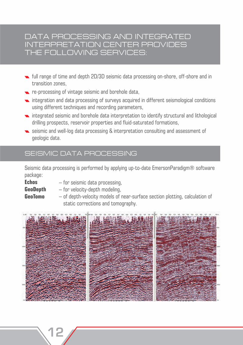
SEISMIC DATA PROCESSING
full range of time and depth 2D/3D seismic data processing on-shore, off-shore and in transition zones, re-processing of vintage seismic and borehole data, integration and data processing of surveys acquired in different seismological conditions using different techniques and recording parameters, integrated seismic and borehole data interpretation to identify structural and lithological drilling prospects, reservoir properties and fluid-saturated formations,seismic and well-log data processing & interpretation consulting and assessment of geologic data.
Seismic data processing is performed by applying up-to-date EmersonParadigm® software package: Echos GeoDepth GeoTomo
– for seismic data processing, – for velocity-depth modeling,– of depth-velocity models of near-surface section plotting, calculation of static corrections and tomography.
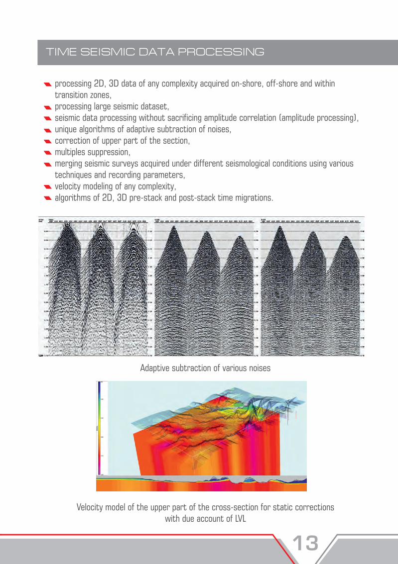
TIME SEISMIC DATA PROCESSING
processing 2D, 3D data of any complexity acquired on-shore, off-shore and within transition zones,processing large seismic dataset,seismic data processing without sacrificing amplitude correlation (amplitude processing),unique algorithms of adaptive subtraction of noises, correction of upper part of the section,multiples suppression,merging seismic surveys acquired under different seismological conditions using various techniques and recording parameters,velocity modeling of any complexity, algorithms of 2D, 3D pre-stack and post-stack time migrations.
Adaptive subtraction of various noises
Velocity model of the upper part of the cross-section for static corrections with due account of LVL
DATA PROCESSING AND INTEGRATED INTERPRETATION CENTER PROVIDES THE FOLLOWING SERVICES:
SEISMIC DATA PROCESSING
full range of time and depth 2D/3D seismic data processing on-shore, off-shore and in transition zones, re-processing of vintage seismic and borehole data, integration and data processing of surveys acquired in different seismological conditions using different techniques and recording parameters, integrated seismic and borehole data interpretation to identify structural and lithological drilling prospects, reservoir properties and fluid-saturated formations,seismic and well-log data processing & interpretation consulting and assessment of geologic data.
Seismic data processing is performed by applying up-to-date EmersonParadigm® software package: Echos GeoDepth GeoTomo
– for seismic data processing, – for velocity-depth modeling,– of depth-velocity models of near-surface section plotting, calculation of static corrections and tomography.
TIME SEISMIC DATA PROCESSING
processing 2D, 3D data of any complexity acquired on-shore, off-shore and within transition zones,processing large seismic dataset,seismic data processing without sacrificing amplitude correlation (amplitude processing),unique algorithms of adaptive subtraction of noises, correction of upper part of the section,multiples suppression,merging seismic surveys acquired under different seismological conditions using various techniques and recording parameters,velocity modeling of any complexity, algorithms of 2D, 3D pre-stack and post-stack time migrations.
Adaptive subtraction of various noises
Velocity model of the upper part of the cross-section for static corrections with due account of LVL
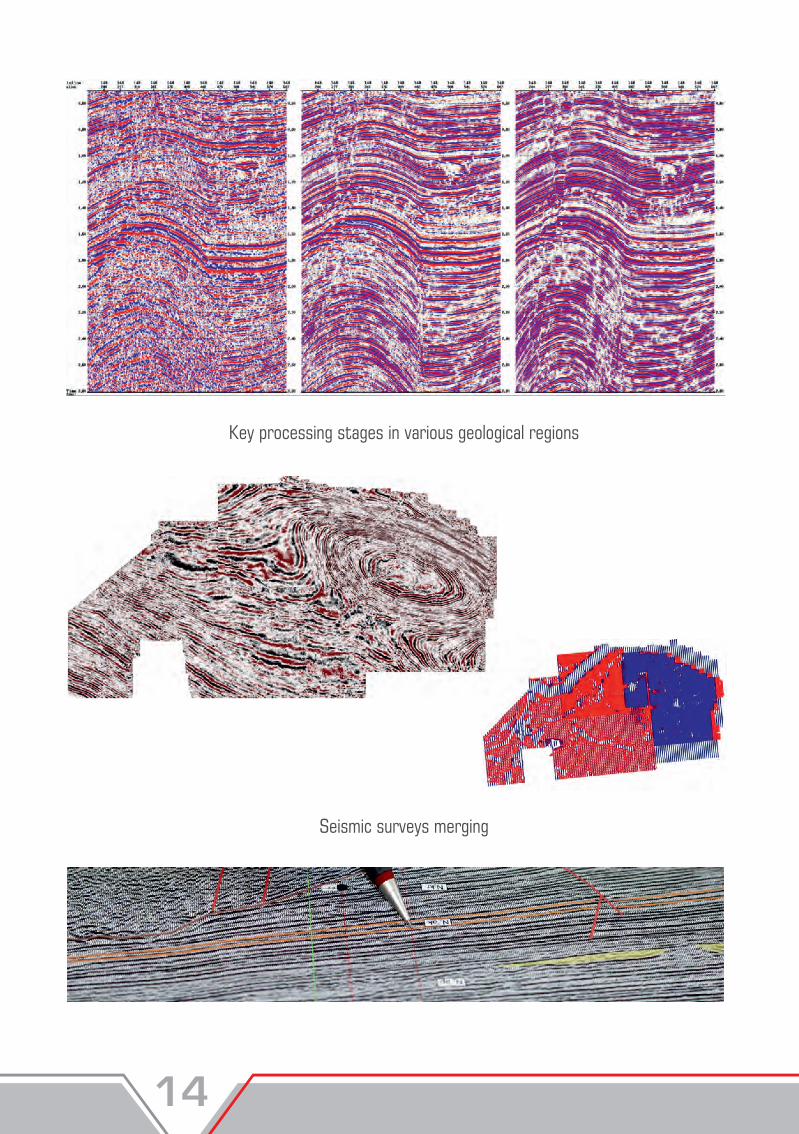
Key processing stages in various geological regions
Seismic surveys merging
DEPTH SEISMIC DATA PROCESSING
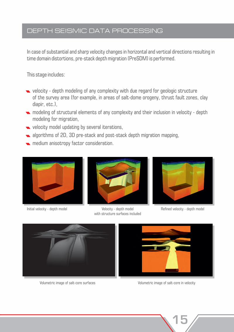
In case of substantial and sharp velocity changes in horizontal and vertical directions resulting in time domain distortions, pre-stack depth migration (PreSDM) is performed.
This stage includes:
velocity - depth modeling of any complexity with due regard for geologic structure of the survey area (for example, in areas of salt-dome orogeny, thrust fault zones, clay diapir, etc.), modeling of structural elements of any complexity and their inclusion in velocity - depth modeling for migration, velocity model updating by several iterations, algorithms of 2D, 3D pre-stack and post-stack depth migration mapping, medium anisotropy factor consideration.
Initial velocity - depth model Velocity - depth model with structure surfaces included
Refined velocity - depth model
Volumetric image of salt-core surfaces Volumetric image of salt-core in velocity
Key processing stages in various geological regions
Seismic surveys merging
DEPTH SEISMIC DATA PROCESSING
In case of substantial and sharp velocity changes in horizontal and vertical directions resulting in time domain distortions, pre-stack depth migration (PreSDM) is performed.
This stage includes:
velocity - depth modeling of any complexity with due regard for geologic structure of the survey area (for example, in areas of salt-dome orogeny, thrust fault zones, clay diapir, etc.), modeling of structural elements of any complexity and their inclusion in velocity - depth modeling for migration, velocity model updating by several iterations, algorithms of 2D, 3D pre-stack and post-stack depth migration mapping, medium anisotropy factor consideration.
Initial velocity - depth model Velocity - depth model with structure surfaces included
Refined velocity - depth model
Volumetric image of salt-core surfaces Volumetric image of salt-core in velocity

Comparison of time migration and time-scaled depth migration fragments
SEISMIC AND BOREHOLE DATA INTERPRETATION
SEISMIC DATA INTERPRETATION
Seismic and borehole data interpretation is carried out by applying EmersonParadigm ® software packages:
SeisEarthXVGeologStratimagicVanguard Geophysicist
- seismic data interpretation- petro-physical analysis and geological interpretation of well log data - seismic stratigraphic interpretation and seismic facial analysis - acoustic and elastic inversion
entry and tie of modern and vintage seismic data,
stratigraphic identification of reflectors (one-dimensional geo-seismic modeling using VSP data, acoustic logging and spike signal),
correlation of horizons,
analysis of reflectors time mis-tie at 2D survey line intersection,
faults identification on time cross sections,
areal tracking of faults and block tectonic modeling,
fault planes building.
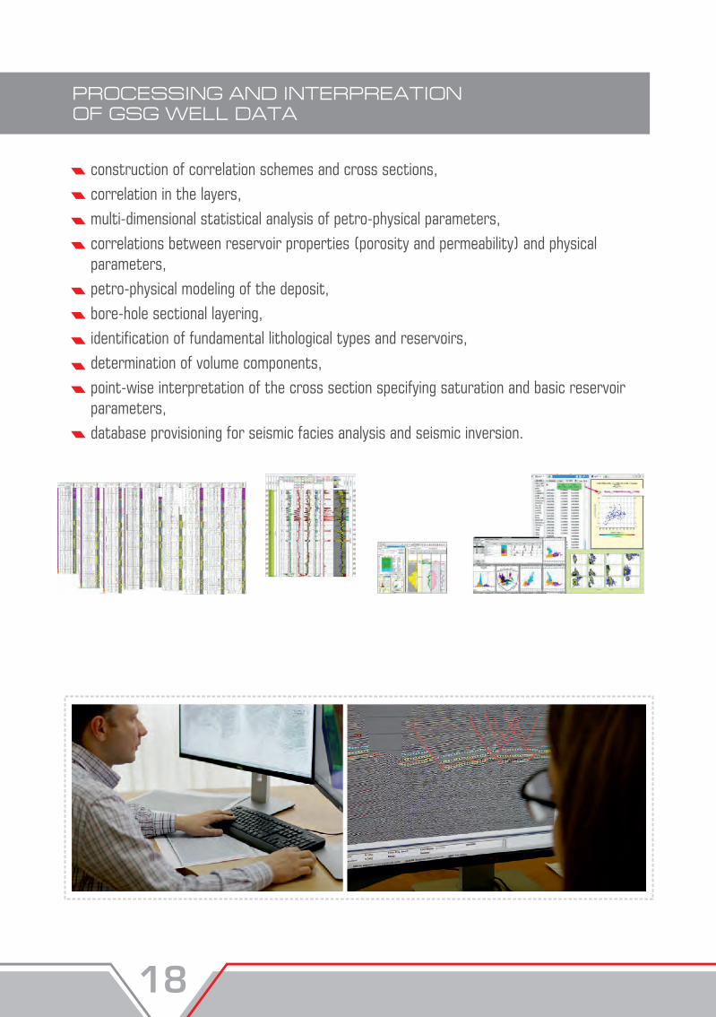
PROCESSING AND INTERPREATION OF GSG WELL DATA
construction of correlation schemes and cross sections,correlation in the layers,multi-dimensional statistical analysis of petro-physical parameters,correlations between reservoir properties (porosity and permeability) and physical parameters,petro-physical modeling of the deposit,bore-hole sectional layering,identification of fundamental lithological types and reservoirs, determination of volume components, point-wise interpretation of the cross section specifying saturation and basic reservoirparameters, database provisioning for seismic facies analysis and seismic inversion.
STRUCTURAL IMAGING
gridding, map smoothing and editing,
determining velocity models and choosing structural mapping techniques,
constructing of main horizons using results from the horizontal velocity analysis for accounting velocity heterogeneities of the upper part of the section,
structural mapping for reflective horizons and productive layers,
seismic sections imaging in critical directions.
SEISMIC FACIES ANALYSIS
identification of seismic stratigraphic sequences,detailed correlation within seismic sequences,lithofacies imaging, re-construction of deposit sedimentation,reservoir development zone estimates,identification of channel and barrier bodies.
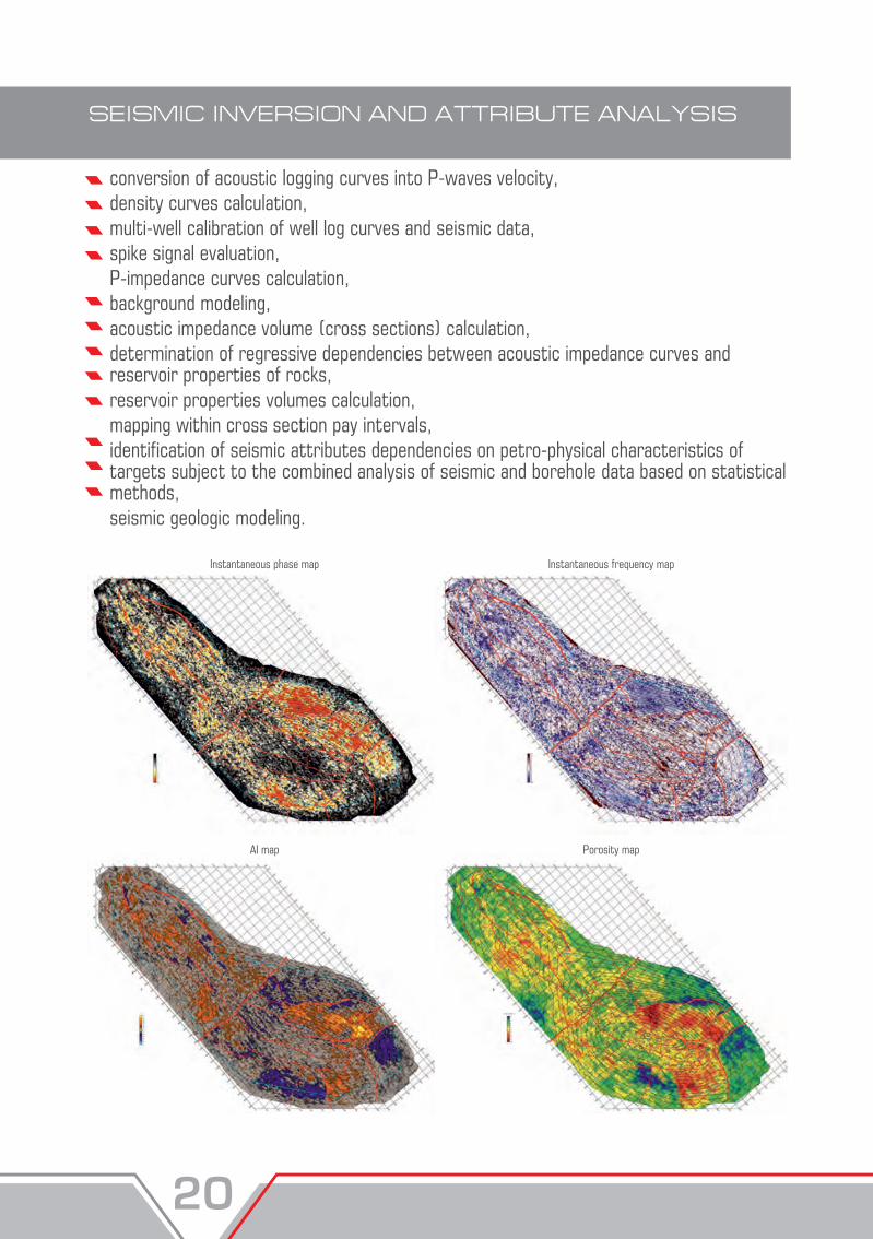
SEISMIC INVERSION AND ATTRIBUTE ANALYSIS
conversion of acoustic logging curves into P-waves velocity, density curves calculation, multi-well calibration of well log curves and seismic data, spike signal evaluation, P-impedance curves calculation, background modeling, acoustic impedance volume (cross sections) calculation, determination of regressive dependencies between acoustic impedance curves and reservoir properties of rocks, reservoir properties volumes calculation, mapping within cross section pay intervals, identification of seismic attributes dependencies on petro-physical characteristics of targets subject to the combined analysis of seismic and borehole data based on statistical methods,seismic geologic modeling.
Instantaneous phase map
AI map Porosity map
Instantaneous frequency map
PRESENTATION OF RESULTS, CONCLUSIONS AND RECOMMENDATIONS
The following model works execution report shall be submitted to the client
descriptive part, 2D and 3D time sections, time maps, color-coded structural maps, color-coded pay maps of productive layers, correlation schemes of well logs and geologic cross - sections, reservoir rock properties forecast map, the most informative seismic geologic and G&G cross - sections, data sheets for the prepared geological features, other additional materials on their demand.
SE
ISM
IC S
UR
VE
Y: F
IELD
WO
RK
S, S
EIS
MIC
DA
TA
PR
OC
ES
SIN
G A
ND
IN
TE
RP
RE
TA
TIO
N