PREPARATORY DOCUMENTS
350
A/CONF.13/37 United Nations Conference *" / on the Law of the Sea Official Records Volume I: PREPARATORY DOCUMENTS GENEVA 24 February — 27 April 1958
-
Upload
khangminh22 -
Category
Documents
-
view
4 -
download
0
Transcript of PREPARATORY DOCUMENTS

A/CONF.13/37
United Nations
Conference
*"/ on the Law of the Sea
Official Records
Volume I :
PREPARATORY DOCUMENTS
GENEVA
24 February — 27 April 1958


Mv United NationsSI.'ro Conference
^^ on the Law of the Sea
Official Records
Volume I:
PREPARATORY DOCUMENTS
GENEVA
24 February — 27 April 1958

A/CONF.13/37
UNITED NATIONS PUBLICATION
Sales Number : 58. V.4, Vol. I
Price: $(U.S.) 3.50; 25/- stg.; Swiss francs 15.(or equivalent in other currencies)

VolumeVolumeVolumeVolumeVolumeVolumeVolume
III
IIIIVV
VIVII
INTRODUCTORY NOTE
The Official Records of the United Nations Conference on the Law of the Sea comprise sevenvolumes, as follows:
Preparatory DocumentsPlenary MeetingsFirst Committee (Territorial Sea and Contiguous Zone)Second Committee (High Seas: General Regime)Third Committee (High Seas: Fishing, Conservation of Living Resources)Fourth Committee (Continental Shelf)Fifth Committee (Question of Free Access to the Sea of Land-locked Countries)
The Preparatory Documents contain:
(a) Studies prepared at the request of the Secretary-General of the United Nations by experts andthe secretariats of specialized agencies;(b) Memoranda by the Secretariat of the United Nations on questions relating to the work of theConference;(c) Observations by Governments and some specialized agencies on the draft articles adopted by theInternational Law Commission at its eighth session;(d) Documents concerning the preparation of the work of the Conference, including the provisionalagenda and the provisional rules of procedure.The Secretariat of the Conference has made a selection from these documents for this volume, which,
in addition, contains a complete list of the preparatory documents submitted to the Conference.
Symbols of United Nations are composed of capital letters combined with figures. Mention of sucha symbol indicates a reference to a United Nations document.
The Conference documents all bear the symbol A/CONF.13/..., followed by capital letters andfigures.
Abbreviations used in reference notes;Ser. L.o.N.P.: Series League of Nations PublicationsI.C.J. : International Court of Justice
i l l


LIST OF PREPARATORY DOCUMENTS
Note. — Document listed in bold type are reproduced in this volume.
Document No.
A/CONF.13/1
A/CONF.13/2andAdd.l
A/CONF.13/3
A/CONF.13/4
A/CONF.13/5 andAdd.l to 4
A/CONF.13/6 andAdd.l
A/CONF.13/7
A/CONF.13/8
A/CONF.13/9
A/CONF.13/10
A/CONF.13/11
A/CONF.13/12
A/CONF.13/13
A/CONP.13/14
A/CONF.13/15
A/CONF.i3 /16
Title Page
Historic bays 1
Scientific considerations relating to the continental shelf . . 39
The economic and scientific basis of the principle ofabstention, by Richard van Cleve 47
The law of the air and the draft articles concerning the lawof the sea adopted by the International Law Commissionat its eighth session, by E. Pepin 64
Comments by Governments on the draft articles concerningthe law of the sea adopted by the International LawCommission at its eighth session 75
A brief geographical and hydrographical study of straitswhich constitue routes for international.traffic, by Com-mander R. H. Kennedy 114
The relation between the draft articles concerning the lawof the sea adopted by the International Law Commissionand international agreements dealing with the suppressionof the slave trade 165
Pollution of the sea by oil 169
Provisional agenda
Observations
Provisional rules of procedure
Method of work and procedures of the Conference: reportof the Secretary-General 172
Technical particulars concerning the methods of fishingconducted by means of equipment embedded in the floorof the sea 176
Examination of living resources associated with the sea bedof the continental shelf with regard to the nature anddegree of their physical and biological association withsuch sea bed 187
Guide to instruments affecting the legal status of straits:document prepared by the Secretariat
A brief geographical and hydrographical study of bays andestuaries, the coasts of which belong to different states,by Commander R. H. Kennedy 198
The economic importance of the sea fisheries hi differentcountries 245
For the text of the agenda, asadopted at the 1st plenarymeeting of the Conference,see Official Records of theUnited Nations Conferenceon the Law of the Sea,vol. n
For the text of the rules ofprocedure, as adopted at the1st and 2nd plenary meetingsof the Conference, seeOfficial Records of theUnited Nations Conferenceon the Law of the Sea,vol. II
Mimeographed

Document No.
A/CONF. 13/17
A/CONF.13/18
A/CONF.13/19
A/CONF.13/20
A/CONF. 13/21 andAdd.l andCorr.l
A/CONF. 13/22 andCorr.l
A/CONF. 13/23
A/CONF.13/24
A/CONF. 13/25
A/CONF.13/26
A/CONF. 13/27
A/CONF. 13/28
A/CONF.13/29and Add.l
A/CONF. 13/30and Corr.l
A/CONF.13/31
A/CONF. 13/32
A/CONF.13/33
A/CONF.13/34and Rev. 1
Title Page
Bibliographical guide to the law of the sea: documentprepared by the Secretariat
Certain legal aspects concerning the delimitation of theterritorial water of archipelagos, by Jens Evensen . . . 289
Verbatim record of the debate in the Sixth Committee of theGeneral Assembly, at its eleventh session, relating toagenda item 53 (a)
Preparation of the Conference: report of the Secretary-General 303
Reference guide to resolutions and records concerning thelaw of the sea adopted by world-wide or regional inter-national conferences and meetings : document preparedby the Secretariat
Guide to decisions of international tribunals relating to thelaw of the sea : document prepared by the Secretariat
List in chronological order of international agreementsrelating to fisheries and other questions affecting theutilization and conservation of the resources of the sea:document prepared by the Secretariat
Information submitted by Governments regarding laws,decrees and regulations for the prevention of pollution ofthe seas
Recent developments in the technology of exploiting themineral resources of the continental shelf, by M. W.Mouton
The breadth of the safety zone for installations necessaryfor the exploration and exploitation of the naturalresources of the continental shelf, by M. W. Mouton
Supplement to the following three volumes of the UnitedNations Legislative Series: Laws and Regulations on theRegime of the High Seas, vols I and II, and Laws con-cerning the Nationality of ships
Resolutions by and communication from the InternationalCouncil of Scientific Unions concerning part II, section IIIof the articles concerning the law of the sea (continentalshelf): document transmitted by the United NationsEducational, Scientific and Cultural Organization
Question of free access to the sea of land-locked countries 306
Table of references to comments by governments on thearticles concerning the law of the sea adopted by theInternational Law Commission at its successive sessionsand to the relevant statements in the Sixth Committee atthe eleventh and previous sessions of the General Assembly
Comments by the International Civil Aviation Organizationon the draft articles concerning the law of the sea adoptedby the International Law Commission at its eighth session 336
Text of the draft articles concerning the law of the seaadopted by the International Law Commission at its eighthsession
Initial list of documents for the United Nations Conferenceon the Law of the Sea
Agenda adopted by the Conference at its 1st plenary meeting
Observations
Mimeographed
Mimeographed
Mimeographed
Mimeographed
Mimeographed
Mimeographed
Mimeographed
Mimeographed
To be printed as a specialSupplement in the UnitedNations Legislative Series
Mimeographed
Mimeographed
See Official Records of theGeneral Assembly, EleventhSession, Supplement No. 9(A/3159)
Mimeographed
See Official Records of theUnited Nations Conferenceon the Law of the Sea,vol. II
VI

Document No. Title Page Observations
A/CONF 13/35 Rules of procedure adapted by the Conference at its 1st and Ibid.2nd plenary meetings
A/CONF.13/3S Comments by the World Health Organization on draftarticle 66 concerning the law of the sea adopted by theInternational Law Commission at its eighth session . . 339
VH


Document A/CONF.13/1
HISTORIC BAYS
MEMORANDUM BY THE SECRETARIAT OF THE UNITED NATIONS
(Preparatory document No. 1)
CONTENTS
Paragraphs
INTRODUCTION
I. Object of the present study 1— 5
II. Definition of the subject 6— 8A. Bays and gulfs 6— 7B. " Historic bays " and " historic waters " . . 8
III. Origin and justification of the theory of historicbays 9— 10
PART I. T H E PRACTICE OF STATES; DRAFT INTER-NATIONAL CODIFICATIONS OF THE RULES RELATINGTO BAYS ; OPINIONS OF LEARNED AUTHORS
I. The practice of States: some examples ofhistoric bays 11— 47A. Bays the coasts of which belong to a single
State 12— 43B. Bays the coasts of which belong to two or
more States 44— 47II. International case-law 48 72
III. Draft international codifications of the rulesrelating to bays 73— 90A. Draft codifications prepared by learned
societies 74 84B. Draft codifications prepared under the
auspices of the League of Nations . . . 85— 90IV. Opinions of learned authors and of Govern-
ments 91 93
A. Opinions of learned authors 9 1 — 92B. Opinions of Governments 93
PART n . THE THEORY OF HISTORIC BAYS : ANANALYSIS
I. Legal status of the waters of bays regarded ashistoric bays 94 136A. Historic bays the coasts of which belong to
a single State 76—130
[Original text: French][30 September 1957]
Paragraphs
B. Historic bays the coasts of which belong totwo or more States 131—136
II. The constituent elements of the theory ofhistoric bays, and the conditions for theacquisition of historic title 137—198
A. First conception: " usage " the sole root ofhistoric title 139—1501. National usage per se a good root of
historic title 140—1432. National usage not a good root of
historic title unless recognized by theother States 144—150
B. Second conception : the vital interests of thecoastal State as the possible and sole basisof the right to a bay 151—158
C. Various elements considered in judicialdecisions dealing with the territoriality ofcertain bays or maritime areas 159—1631. International cases 159—1622. National cases 163
D. The proof of historic title 164—1891. The onus of proof 164—1662. The element of proof 167—1803. Evidence of international recognition . . 181—189
E. The time factor in the acquisition of ahistoric title 190—196
F. The notion of continuity in the formation ofa historic title 197—198
III. Scope of the theory of historic bays 199—206
PART III. VARIOUS SUGGESTIONS MADE AT THE FIRSTCODIFICATION CONFERENCE OF THE HAGUE (1930)FOR THE SOLUTION OF THE PROBLEM OF HISTORIC
BAYS 207—209
IntroductionI- Object of the present study
1. This study is intended for the United Nations^fren t h e L a w of t h e Sea, to be held in
l A
2. By the terms of that resolution, the GeneralAssembly has referred to the Conference, as the basisfor its proceedings, the draft articles concerning the lawof the sea adopted by the International Law Commissionat its eighth session. The Commission's draft article 7
21 February S ? ? ? 1 A s s e m b l y r e s o l u t i o n 1 1 0 5 C*1) o f deals with bays and reads as follows:
Session ?!„„] ,COrdsi iT of the General Assembly,n> SuPPlement No. 17 (A/3572), p. 54.
Eleventh
" 1. For the purposes of these articles, a bay is a well-markedindentation whose penetration is in such proportion to thewidth of its mouth as to contain landlocked waters and constitute

Preparatory documents
more than a mere curvature of the coast An indentation shallnot, however, be regarded as a bay unless its area is as largeas, or larger than, that of the semi-circle drawn on the mouthof that indentation. If a bay has more than one mouth, thissemi-circle shall be drawn on a line as long, as the sum totalof the length of the different mouths. Islands within a bayshall be included as if they were part of the water area ofthe bay.
"2. The waters within a bay, the coasts of which belong toa single State, shall be considered internal waters if the linedrawn across the mouth does not exceed fifteen miles measuredfrom the low-water line.
" 3. Where the mouth of a bay exceeds fifteen miles, aclosing line of such length shall be drawn within the bay.When different lines of such length can be drawn that lineshall be chosen which encloses the maximum water area withinthe bay.
" 4. The foregoing provisions shall not apply to so-called' historic' bays or in any cases where the straight baselinesystem provided for in article 5 is applied."l
3. As will be gathered from the provisions above,the Commission excluded the so-called "historic" baysfrom the scope of its general rules concerning ordinarybays. The question of this class of bays was, therefore,reserved by the Commission.
4. The object of this memorandum, prepared by theSecretariat of the United Nations, is to provide theConference with material relating to "historic bays".
5. Part I describes the practice of States by referenceto a few examples of bays which are considered to behistoric or are claimed as such by the States concerned.Part I then proceeds to cite the various draft codi-fications which established the theory of " historic bays ",and the opinions of learned authors and of Governmentson this theory. Part II discusses the theory itself,inquiring into the legal status of the waters of baysregarded as historic bays, and setting forth the factorswhich have been relied on for the purpose of claimingbays as historic. The final section is intended to showthat the theory does not apply to bays only but is moregeneral in scope.
II. Definition of the subject
A. Bays and gulfs
6. Dictionaries differentiate between the terms"bay" and "gulf", applying the former to a smallindentation of the coast and the latter to a much largerindentation; in other words, a bay would be a smallgulf. The distinction is not, however, reflected in geo-graphy. A cursory glance at an atlas will show thatcertain maritime areas are designated as bays althoughthey are of considerable size, while other relatively muchsmaller areas are described as gulfs. For example,despite its name, Hudson Bay is vast, whereas the Gulfof St. Tropez is not more than four kilometres acrossat its entrance.
7. This paper deals with both bays and gulfs, geo-graphical terms being immaterial to the subject. Thepages which follow contain numerous references to
penetrations of the sea inland, variously designated asbays and as gulfs without regard to their size. The usageof geographical nomenclature will be respected. In cases,however, where the text is not concerned with specificpenetrations, the word "bay" will be used to denoteboth bays and gulfs.
B. "Historic bays" and "historic waters"
8. As indicated in part II of this paper, the theoryof historic bays is of general scope. Historic rights areclaimed not only in respect of bays, but also in respectof maritime areas which do not constitute bays, suchas the waters of archipelagos and the water area lyingbetween an archipelago and the neighbouring mainland;historic rights are also claimed in respect of straits,estuaries and other similar bodies of water. There is agrowing tendency to describe these areas as "historicwaters", not as "historic bays". The present memo-randum will leave out of account historic waters whichare not also bays. It will, however, deal with certainmaritime areas which, though not bays stricto sensu,are of particular interest in this context by reason oftheir special position or by reason of the discussion ordecisions to which they have given rise.3
III. Origin and justification of the theory of historic bays
9. The origin of this theory is traceable to the effortsmade in the nineteenth century to determine, in bays,the baseline of the territorial sea. In view of the intimaterelationship between bays and their surrounding landformations and in the light of the provisions ofmunicipal law and of conventions governing the subject,proposals were made the object of which was to advancethe starting line of the territorial sea towards the openingof bays. The intention was that, in bays, the territorialsea should not be measured from the shore—themethod proposed in the case of more or less straightcoasts—but should, rather, be reckoned as from aline drawn further to seaward. On this point agreementwas virtually unanimous, though the exact location ofthe line from which the territorial sea was to bereckoned continued to be the subject of controversy.According to various proposals put forward, theterritorial sea was to be measured from a straight linedrawn across the bay at a point at which its two coastswere a specified distance apart (six miles, ten miles,twelve miles, etc.) ; the waters lying to landward of thatline would be part of the internal waters of the coastalState.
10. This attempt to restrict, in respect of bays, themaritime area claimable by the coastal State as part ofits internal waters conflicted with existing situations.There were bays of considerable size the waters of which
2 Ibid., Supplement No. 9 (A/3159) p. 15.
s A case in point is that of the maritime areas created bythe application of the " straight baselines " method which, asregards the Norwegian coast, was approved by the InternationalCourt of Justice in the Anglo-Norwegian Fisheries case (seeinfra, especially paras. 50-72) and which is the subject ofarticle 5 of the draft articles concerning the law of the seaadopted by the International Law Commission at its eighthsession (see infra, especially paras. 104-108).

Document A/CONF.13/1
w e r e wholly the property of the coastal States concernedm e territorial sea being accordingly reckoned, in
these cases, from the opening of the bay in questiontowards the sea. Hence, for the purposes of codification,the choice lay between two possible courses, viz.allowing for these cases by means of an exception tothe general rule to be formulated; and ignoring themby making the rule apply to all bays, regardless of theirde facto status. The second course was felt to bearbitrary, and capable, if applied in practice, of causinginternational difficulties. Most of the draft codificationswhich dealt with bays endorsed the first solution. Thereremained, however, and there still remains, the questionwhich bays are covered by the exception. The mere factthat a State claims the ownership of a bay which is notalready territorial by virtue of the general rule does notper se ensure acceptance of the claim. The claim wouldhave to be substantiated by reference to a specificcriterion. And, according to the theory as originallyconceived, this criterion was to be essentially historic.The modern view, however, has gone beyond this con-ception. According to one school of thought (which ismore particularly discussed elsewhere in this paper), theproprietary title may be founded either on considerationsconnected with history or else on considerations ofnecessity, in which latter case the historical elementmight be lacking altogether.
PART I
The practice of States; draft international codificationsof the rules relating to bays; opinions of learned authors
I. THE PRACTICE OF STATES :SOME EXAMPLES OF HISTORIC BAYS
11. The undermentioned bays, which are cited forthe purpose of illustration, are regarded as historic baysor are claimed as such by the States concerned. Theyare grouped under two headings, namely, bays the coastsof which belong to a single State, and bays the coasts ofwhich belong to two or more States.
A. Bays the coasts of which belong to a single StateSea of Azov
12. The Sea of Azov is ten miles across at itsentrance. It is situated entirely within the southern partol the territory of the Union of Soviet Socialist Republicsand extends a considerable distance inland, itsdimensions being approximately 230 by 110 miles. DeUissy* mentions the Sea of Azov among the gulfs
Causes cilehr^ du Droit maritime des Nations,* : I n a d d i t i °n to the Sea of Azov the writer
fm-on8 ***> Su l fs . . . which may be regarded as parth j i i i
of thl y g pt h e < L , e n ™ n ^ sea> subject to the jurisdiction and control ofin it? in y 7t f i h
?
t h e < L , ^ j lin it? inn y 7^tnQ o f m e r i S h t of self-preservation inherentthe nS? e p . e n (5 e n c e " ^ S e a o f Marmara, the Zuyder Zee andSt Lawi • G u I f s o f B o t h n i a and Finland, the Gulf of
^ America, part of the Gulf of MexicoSt Lawi(to theof that nSt m d l c a t e d in respect of each of the coastal Statesvicinity « J v • e i n n e r m o s t Part of the Adriatic Gulf in theNaples S»i m c £ T r i este, Rijeka (Fiume), etc., the Gulf ofLepanto Sc™0 ' a r a n t o ' CaBUa"> Thermal (Salonica), Coron,
"which may be regarded as part of the territorial sea".P. C. Jessup5 states that this contention "seemsreasonable and any such Russian claim would not becontested". A. N. Nikolaev regards the Sea of Azovas part of the "internal waters of the USSR" (see infra,para. 92). Gidel6 is of the opinion that certain maritimeareas — of which the Sea of Azov is one — should notbe treated as falling within the category of historicwaters "because, pursuant to the rules of the ordinaryinternational law of the sea, these areas are in any caseinternal waters " (see infra, paras. 32-34).
Bay of Cancale (or Granville Bay)
13. This bay (in the north-western part of France) isabout seventeen miles across at its entrance. In its replyto the inquiries advanced to Governments by thePreparatory Committee of the Conference on theCodification of International Law, 1930, the FrenchGovernment stated that " Granville Bay is recognized toconsist of territorial waters by the Fisheries Conventionof 2 August 1839, concluded with Great Britain(article 1) and by article 2 of the Fisheries Regulationsconcluded on 24 May 1843 with Great Britain."7
Gidel8 states that "the waters of Granville Bay arerecognized as French [territorial waters], even thoughthe bay is about seventeen miles across at its entrance".According to Jessup,9 the bay " seems to be claimed byFrance without objection. This may be due to thepractical appropriation of the bay through theexploitation of its oyster fisheries over a long period.By treaties of 1839 and 1867 Great Britain recognizedthe exclusive French fisheries in those waters".
Bay of Chaleur
14. This bay (between the Provinces of Quebec andNew Brunswick in Canada) does not exceed twelve milesin width; it is about 100 miles long. Its entrance intothe Gulf of St. Lawrence is sixteen miles across. In itsdecision concerning the status of the bay, given in thecase of Mowat v. McFee (1880), the Supreme Court ofCanada held that the Bay of Chaleur was included inits entirety "within the present boundaries of theProvinces of Quebec and New Brunswick, and withinthe Dominion of Canada".10
15. "The arbitral award in the North AtlanticFisheries case, 1910, upheld the British contention con-cerning the Bay of Chaleur".11 In that award, thetribunal appointed by the Permanent Court ofArbitration recommended that the limit of the bayshould be constituted by "the line from the light atBirch Point on Miscou Island to Macquereau Point
5 The Law of Territorial Waters and Maritime Jurisdiction,1927, p. 383.
« Droit international public de la Mer, 1930-1934, vol. Ill,p. 663.
7 Ser. L.o.N.P. 1929, v. 2, p. 160.
8 Op. cit., p. 657.
» Op. cit., pp. 385-386.
io Reports of the Supreme Court of Canada, vol. 5 (1880),p. 66.
« Gidel, op. cit., p. 659.

Preparatory documents
light".12 The recommendation was accepted by GreatBritain and the United States by the Treaty13 of 20 July1912 (article 2).14
Chesapeake Bay
16. This bay is twelve miles across at its entrance; itis nowhere more than twenty miles wide and is about200 miles long. Its status was considered in 1885 by theSecond Court of Commissioners of Alabama Claims inthe case of the " Alleganean ", a vessel which had beensunk by Confederate forces in the waters of the bay. TheCourt held15 that Chesapeake Bay was entirely withinthe territorial jurisdiction of the United States.
17. After citing the case-law of the English courtsconcerning the Bristol Channel and Conception Bay, andthe opinions of certain writers on the status of bays, theCourt proceeded:
" We must now examine the local circumstance touching thestatus of Chesapeake Bay, and then determine whether thoseshould be held to be the open ocean or jurisdictional waters ofthe United States in the light of these authorities.
"The headlands are about twelve miles apart, and the bayis probably nowhere more than twenty miles in width. Thelength may be 200 miles. To call it a bay is almost a misnomer.It is more a mighty river than an arm or inlet of the ocean. Itis entirely encompassed about by our own territory, and allof its numerous branches and feeders have their rise and theirprogress wholly in and through our own soil. It cannot becomean international commercial highway; it is not and cannot bemade a roadway from one nation to another.
"The second charter of King James I to the VirginiaCompany in the year 1609 granted: 'All those lands, countries,and territories situate, lying, and being in that part of Americacalled Virginia, from the point of land called Cape or PointComfort, all along the seacoast to the northward 200 miles,and all along the seacoast to the southward 200 miles, and allthat space and circuit of land lying from the seacoast of theprecinct aforesaid up into the land throughout from sea to sea,west and northwest, together with all the soils, grounds, havens,ports , . . . rivers, waters, fishings, etc '
" This language would seem to place Chesapeake Bay withinthe boundary lines of Virginia. A line running north (as nearas may be) from Point Comfort along the seacoast crosses themouth of the bay from Cape Henry to Cape Charles.
"By the King James Charter to Lord Baltimore in 1632,erecting the territory of Maryland, the southern boundary lineis made to cross Chesapeake Bay from Smiths Point, at themouth of the Potomac River, to Watkin's Point, on the easternshore, which apparently places a portion of this bay within theterritory of Maryland. Had this not been intended, the boundarywould presumably have followed the shore line around thebay.
!2 Scott, Hague Court Reports, First Series, 1916, p. 189.Gidel, op. cit., p. 659, explains this delimitation as follows :" This bay was considered British as far as a line sixteen mileslong drawn between the two lights at Birch Point towardsMiscou Island (Marquereau Point light)."
is Treaties and Conventions between the United States andother Powers, 1910-23, vol. HI, p. 2632.
i* Higgins and Colombos : The International law of the Sea,London, 1943, p. 119.
is Moore, J. B., A History and Digest of the InternationalArbitrations to which the United States has been a Party(Washington, 1898) vol. 4, pp. 4338-4341
" It is a part of the common history of the country that theStates of Virginia and Maryland have from their earliestterritorial existence claimed jurisdiction over these waters, andit is of general knowledge that they still continue to do so.
"The legislation of Congress has assumed Chesapeake Bayto be within the territorial limits of the United States. Theacts of 31 July 1789, ch. 5 ; 4 August 1790, ch. 35 ; and2 March 1799, ch. 128, section 11, establishing revenuedistricts, provided that ' the authority of the officers of thedistrict (Norfolk to Portsmouth) shall extend over all thewaters, shores, bays, harbours, and inlets comprehended withina line drawn from Cape Henry to the mouth of James River'.By section 549, Rev. Stat. U.S., the eastern judicial district forVirginia embraces the 'residue of the State' not included inthe western district. The boundaries of the State include all ofChesapeake Bay south of a line running from Smiths Point toWatkins Point, and hence the eastern district must embraceso much of the bay."
18. Referring to the decision of 1793 in respect ofDelaware Bay (see infra, para. 22) the Court noted:
" If it be said that the mere claims of a nation to jurisdictionover adjacent waters are to be accepted with some degreeof hesitation, then the action in reference to the Grange isof much weight, for there the claim made by the United Stateswas promptly acquiesced in by two great foreign Powers, whenpassions were excited, and when such acquiescence was greatlyagainst the immediate interest of one of the combatants, aswell as against the general interest of both.
" It will hardly be said that Delaware Bay is any the less aninland sea than Chesapeake Bay. Its configuration is not suchas to make it so, and the distance from Cape May to CapeHenlopen is apparently as great as that between Cape Henryand Cape Charles."
19. After stressing that the question to be adjudicatedwas "o f very considerable national impor tance" , theCourt concluded:
" Considering, therefore, the importance of the question, theconfiguration of Chesapeake Bay, the fact that its headlandsare well marked, and but twelve miles apart, that it and itstributaries are wholly within our own territory, that theboundary lines of adjacent States encompass i t ; that fromthe earliest history of the country it has been claimed to beterritorial waters, and that the claim has never been questioned;that it cannot become the pathway from one nation to another;and remembering the doctrines of the recognized authoritiesupon international law, as well as the holdings of the Englishcourts as to the Bristol Channel and Conception Bay, andbearing in mind the matter of the brig " Grange" and theposition taken by the Government as to Delaware Bay, we areforced to the conclusion that Chesapeake Bay must be heldto be wholly within the territorial jurisdiction and authority ofthe Government of the United States and no part of the'high seas' within the meaning of the term used in section 5of the act of 5 June 1872."
Conception Bay
20. This bay (in Newfoundland) is twenty milesacross at its entrance, has an average width of fifteenmiles and is some forty miles long. It has been claimedby Great Britain as being entirely within its jurisdiction,a claim which was upheld in 1877 by the Privy Councilin the case Direct United States Cable Co v. The Anglo-American Telegraph Co.16 The Privy Council said:
Higgins and Colombos, op. cit., p. 116.

Document A/CONF.13/1
"Passing from the common law of England to the generallaw of nations, as indicated by the text writers on internationaljurisprudence, we find an universal agreement that harbours,estuaries and bays landlocked belong to the territory of thenation which possesses the shores round them, but no agree-ment as to what is the rule to determine what is ' bay' forthis purpose.
" It seems generally agreed that, where the configuration anddimensions of the bay are such as to show that the nationoccupying the adjoining coasts also occupies the bay, it ispart of the territory; and, with this idea, most of the writerson the subject refer to defensibility from the shore as thetest of occupation: some suggesting, therefore, a width of onecannon-shot from shore to shore, or three miles; some, acannon-shot from each shore, or six miles; some, an arbitrarydistance of ten miles. All of these are rules which, if adopted,would exclude Conception Bay from the territory of Newfound-land ; but also would have excluded from the territory ofGreat Britain that part of the Bristol Channel which inRegina v. Cunningham was decided to be in the county ofGlamorgan. On the other hand, the diplomatists of the UnitedStates in 1793 claimed a territorial jurisdiction over much moreextensive bays, and Chancellor Kent, in his Commentaries,though by no means giving the weight of his. authority to thisclaim, gives some reason for not considering it altogetherunreasonable.
" It does not appear to their Lordships that jurists and textwriters are agreed what are the rules as to dimensions andconfiguration which, apart from other considerations, wouldlead to the conclusion that a bay is or is not a part of theterritory of the State possessing the adjoining coasts, and it hasnever, that they can find, been made the ground of judicialdetermination. If it were necessary in this case to lay downa rule, the difficulty of the task would not deter theirLordships from attempting to fulfil it. But in their opinion itis not necessary to do so. It seems to them that, in point offact, the British Government has for a long period exerciseddominion over this bay, and that their claim has beenacquiesced in by other nations, so as to show that the bayhas been for a long time occupied exclusively by GreatBritain, a circumstance which, in the tribunals of any country,would be every important. And, moreover (which in a Britishtribunal is conclusive), the British Legislature has by Actsof Parliament declared it to be part of the British territory,and part of the country made subject to the Legislature ofNewfoundland." 17
21. In its award, rendered on 7 September 1910, theNorth Atlantic Coast Fisheries Arbitral Tribunalrefrained from expressing any opinion on ConceptionBay,^ on the grounds that that bay had been providedfor by the above-mentioned decision of the PrivyCouncil, in which decision the United States hadacquiesced.10
Delaware Bay
22. The status of Delaware Bay, which is ten milesacross at its entrance and forty miles long from itsentrance to the mouth of the Delaware River, wasdetermined in connexion with the case of the Britishvessel Grange, captured in 1793 hi the waters of the bayby the French frigate L'Embuscade. The incident
P^&Scf , International Law, vol. I (1879),18 Scott, op. cit., p. 190.
^ a n d C o l o m bos , op. cit., p. 116, quoting de Martens,Recueil Gineral, 3rd ed. (1911), vol. 4, pp. 89-129.
occurred while Great Britain and France were at war,the United States being neutral. The Attorney-General,E. Randolph, consulted, rendered an opinion (fromwhich extracts are given below) to the effect that thevessel Grange had been captured in neutral territory:
" The essential facts are:
"That the river Delaware takes its rise within the limits ofthe United States;
" That, in the whole of its descent to the Atlantic Ocean,it is covered on each side by the territory of the UnitedStates;
" That, from tide water to the; distance of about sixty milesfrom the Atlantic Ocean, it is called the river Delaware ;
" That, at this distance from the sea, it widens and assumesthe name of the Bay of Delaware, which it retains to themouth;
" That its mouth is formed by the capes Henlopen and May ;the former belonging to the State of Delaware, in property andjurisdiction, the latter to the State of New Jersey ;
" That the Delaware does not lead from the sea to thedominions of any foreign nation;
" That, from the establishment of the British provinces onthe banks of the Delaware to the American Revolution, it wasdeemed the peculiar navigation of the British Empire;
"That, by the Treaty of Paris, on 3 September 1783, hisBritannic Majesty relinquished, with the privity of France, thesovereignty of those provinces, as well as of the otherprovinces and colonies;
"And that the Grange was arrested in the Delaware withinthe capes, before she had reached the sea, after her departurefrom the port of Philadelphia.
" . . . the corner stone of our claim is, that the United Statesare proprietors of the lands on both sides of the Delaware,from its head to its entrance into the sea.
" . . . These remarks may be enforced by asking, What nationcan be injured in its rights by the Delaware being appropriatedto the United States 7 And to what degree may not the UnitedStates be injured, on the contrary ground ? It communicateswith no foreign dominion; no foreign nation has, ever before,exacted a community of right in it, as if it were a main sea;under the former and present governments, the exclusivejurisdiction has been asserted; by the very first collectionlaw of the United States, passed in 1789, the county of CapeMay, which includes Cape May itself, and all the watersthereof, theretofore within the jurisdiction of the State ofNew Jersey, are comprehended in the district of Bridgetown.The whole of the State of Delaware, reaching to CapeHenlopen, is made one district. Nay, unless these positionscan be maintained, the bay of Chesapeake, which, in thesame law, is so fully assumed to be within the United States,and which, for the length of the Virginia territory, is subjectto the process of several counties to any extent, will becomea rendezvous to all the world, without any possible controlfrom the United States. Nor will the evil stop here. It willrequire but another short link in the process of reasoning, todisappropriate the mouths of some of our most importantrivers. If, as Vattel inclines to think in the 294th section ofhis first book, the Romans were free to appropriate theMediterranean, merely because they secured, by one singlestroke, the immense range of their coast, how much strongermust the vindication of the United States be, should theyadopt maxims for prohibiting foreigners from gaining, withoutpermission, access into the heart of their country.
" This inquiry might be enlarged by a minute discussion ofthe practice of foreign nations, in such circumstances. But Ipass it by; because the United States, in the commencement
Preparatory documents
of their career, ought not to be precipitate in declaring theirapprobation of any usages (the precise facts concerning whichwe may not thoroughly understand) until those usages shallhave grown into principles, and are incorporated into the lawof nations ; and because no usage has ever been accepted,which shakes the foregoing principles.
" The conclusion then is, that the Grange has been seized onneutral ground. If this be admitted, the duty arising from theillegal act is restitution." 20
23. France consented to release the Grange. "GreatBritain, by requesting the restoration of its capturedvessel, recognized that Delaware Bay was within thejurisdiction of the United States and France, byreturning the British vessel, tacitly accepted the decla-ration of territoriality made by the United States."21
Bay of El-Arab
24. This bay (in northern Egypt), which is onlyeighteen miles in depth, is seventy-five miles wide at itsopening into the sea. In its reply to questionnaire No. 2(1926) of the Committee of Experts for the ProgressiveCodification of International Law, the Egyptian Govern-ment stated that "the extent of Egyptian territorialwaters was fixed at three miles by the Decree-Laws of21 April 1926 on Fishing and Sponge-fishing, except inthe Bay of El-Arab, the whole of which, according tothe Decree-Law on Sponge-fishing, is included in theterritorial sea ".22
25. Articles 1 (b) and 4 (a) of the Egyptian Decreeof 15 January 195123 provide that the inland waters ofEgypt include the waters of all bays along the Egyptiancoasts, without specifying any limit.
26. The British Government protested, throughdiplomatic channels, against this Decree, stating that itwas unable to accept it as being in conformity with therules of international law. In its note of protest, theBritish Government pointed out that no historic bay" is situated in Egypt ",24
Hudson Bay
27. The dimensions of this bay are considerable; itsbreadth is about 600 miles and its length about 1,000miles. The Canadian writer, V. Kenneth Johnston25
gives the following information concerning the status ofHudson Bay:
" In 1906 . . . notwithstanding the assumption of the worldas to the status of Hudson Bay, the Government of Canadaplaced on its statute books a statute declaring the waters ofHudson Bay to be territorial waters of Canada (R.S.C. 1927,cap. 73, sec. 9, sub-sec. 10 ; Statutes of Canada, 1906, cap. 45,sec. 9 (12)). Tha t statute is still in force in Canada without,
20 Moore , op cit., vol. I (1906), pp. 735-739.
21 Fauchille, Traite de droit international public, vol. I (1925),p . 381.
22 Ser. L.oN.P. 1927, v. 1, p. 257.
23 Revue egyptienne de droit international, vol. 6 (1950),p . 175.
24 Ibid., vol . 7 (1951), p . 9 1 .
25 " Canada's title to Hudson Bay and Hudson Strait", inBritish Year Book of International Law, 1934, p. 2.
so far as is known, any protest having been made by anyforeign Government. This statute has been and presumablystill is being actively enforced in Canada and in Hudson Bayas part of Canada. The Government of Canada, therefore, hasappropriated and continues to appropriate Hudson Bay andpresumably Hudson Strait as Canadian national waters. . . . "
The writer maintains that, in accordance with therules of international law, Canada has, in respect of thatbay, a title based on occupation and on the acquiescenceof other States in that occupation.
28. Higgins and Colombos28 state that:
" . . . The British claim has not, so far, been expresslyadmitted by the United States."
And they add:
"The Treaty of 20 July 1912, which was concluded for thepurpose of carrying out the award of the Tribunal in the NorthAtlantic Fisheries Arbitration of 1910, provides ' that it isunderstood that the award does not cover Hudson Bay', thusreserving all existing British rights to the bay." 27
Miramichi Bay
29. "Miramichi Bay is situated in New Brunswick, and hasa headland width of 14.5 miles. By a New Brunswick Statuteof 1799 2B this bay was treated as being within the adjoiningcounty of Northumberland, and subsequent amending actshave confirmed this claim.29
" In no single instance has the jurisdiction of Great Britainover these bays been challenged by any other Power than theUnited States, and the objection of the United States has beenlimited to the sole question of the extent of the fishing libertiesgiven by the Treaty of 1818." 30
Bays of Laholm and Skelderviken
30. In its reply to questionnaire No. 2 (1926) of theCommittee of Experts for the Progressive Codificationof International Law, the Swedish Government stated:
" According to Swedish law, the whole area of any baywhich indents the coast to an appreciable extent is in everycase to be regarded as territorial water, and the exteriorterritorial waters are measured from a line drawn across thebay between the two extreme points where the bay merges intothe general coast-line. During the Great War, therefore, theSwedish Government always maintained that the Bays ofLaholm and Skelderviken, on the south-west coast of Sweden,were entirely Swedish territorial waters.
" In the case of the Bay of Laholm the Swedish argumentwas singularly strengthened by the provisions of a fisheriesconvention concluded between Sweden and Denmark. The rulehas also been adopted by Swedish jurisprudence." si
26 Op. cit., p . 117.27 F o r H u d s o n Bay, see also Balch " Is H u d s o n Bay a closed
or open sea ? " in American Journal of International Law,vol. 6 (1912), p . 409 ; P . C. Jessup, op. cit., pp . 411-12 ; Pitt-Cobbett , Cases in International Law, vol . I (1947), p . 162.
28 39 Geo. I l l , 5.29 50 Geo. I l l , c. 5 ; 4 Geo. IV ; c. 23 ; 9 and 10 Geo. IV,
c. 3 ; 4 Wm. IV, c. 31 .so F r o m the extract from the British case in the arbitration
concerning the Nor th Atlantic coast fisheries, 1909-1910,annexed to the Norwegian Counter-Memorial submitted tothe International Court of Justice in the 1951 Anglo-NorwegianFisheries case (vol. II , p . 271).
si Ser. L.O.N.P. 1927, v. 1, p . 232.

Document A/CONF.13/1
31. The position of Sweden in regard to the baysalong its coasts, and in particular to Laho'lm Bay, is setforth by Mr. Eliel Lofgren, then legal adviser to theMinistry of Foreign Affairs, in an opinion given on11 February 1925 in connexion with the capture on19 January 1925 by the Swedish authorities of theGerman trawler Heinrich Augustin, found trawling at aplace situated 1.4 distance minutes outside the closingline of Laholm Bay.32
The Zuyder Zee
32. " The Zuyder Zee in Holland lies in two portions, whichmay be designated the inner and outer. The latter wouldprobably not be considered a closed sea were it not for a fringeof islands which almost completely enclose it save for narrowpassages ; the body of water thus enclosed is about forty mileslong by twenty wide. From this area a narrow passage aboutnine miles wide leads into the inner portion, which is aboutforty-five miles long by thirty-five wide.
" These bodies of water are claimed by the Netherlands and,judging by the testimony of the writers, this claim has neverbeen called into question . . . " 33
33. Fauchille34 states:
"The Zuyder Zee, which is claimed by the Netherlands asits property and from the extremity of which the territorial seaextends, in the general view, to its classic distance, seems to usto be indeed a special sea, governed by the rules relating tobays, because (1) this sea is enclosed by a continuous fringe ofislands, separated from each other by narrow passages ; (2) itis comparable to a lake, for like a lake it freezes over, whereasthe sea resists freezing. The Netherlands claim in respect of theZuyder Zee has therefore been generally accepted."
34. The Netherlands title to this sea can be based notonly on a historic right proper but .also on ordinaryinternational law. A. Chretien,35 who does not admit thetheory of historic bays (see infra, para. 92) concedesnevertheless that certain small bays, among others theZuyder Zee, should be regarded as subject to the fulland absolute sovereignty of the coastal State. Gidel36
mentions the Zuyder Zee among the maritime areaswhich are sometimes designated as historic " but whichshould not be treated as falling within that category [ofhistoric waters] because pursuant to the rules of theordinary international law of the seas these areas are inany case internal waters".
Norwegian bays and fjords
35. In its reply to questionnaire No. 2 (1926) of theCommittee of Experts for the Progressive Codificationoi International Law, the Norwegian Governmentstated:
32 "Ti
7 opinion is reproduced in P. C. Jessup,Wni- \ "2 4 ' a l s o i n Fisheries Case (United Kingdom v.Annex 43 Judgement tL C J-3 o f 18. December 1951, vol. H,
3 p- C Jessup, Op. cit., p. 438.
• droit de VEtat sur la Mer territoriale " in Revuede Droit international public, vol. V (1893), p. 266.
s de Droit international public, part I, Paris, 1893,
°P> dt., p. 663.
" . . . The Norwegian bays and fjords have always beenregarded and claimed by Norway as forming part of theterritory of the Kingdom. This attitude is the necessary resultof history, of local conditions along the very indented Nor-wegian coasts with their remarkable geographical peculiarities,and of the capital importance of a rational exploitation of thefjords and coastal archipelagos (skjaergaard) from the pointof view of living conditions for the coastal population, andnational economy. By fjords we mean not only those sea areaswhich are bounded on both sides by the continental coast-line,but also areas bounded by a continuous series of islands or acoastal archipelago {skjaergaard). Norwegian law has alwaysheld from most ancient times that these bays and fjords arein their entirety an integral part of Norwegian territorial waters,even should the breadth at the seaward end exceed the moreor less arbitrary maxima breadths which certain countries, witha less characteristic coastline, have recently established forspecial purposes in view of their own needs and for verydissimilar reasons." 3?
36. These claims were formulated more strongly inthe Fisheries Case between the United Kingdom andNorway, decided by the International Court of Justicein its judgement given on 18 December 1951.38 It willbe noted that at the end of his oral reply the Agent ofthe United Kingdom Government stated:
" . . . Norway is entitled to claim as Norwegian internal waters,on historic grounds, all fjords and sunds which fall within theconception of a bay . . . whether the proper closing line of theindentation is more or less than ten sea miles long" (Con-clusion No. 5).39
37. In its judgement in that case, the Court con-cluded that the Svaerholthavet basin had geographicallythe character of a bay. As to the Lopphavet basin, how-ever, the Court, while not recognizing it as having thecharacter of a bay, agreed that the historic rights claimedby Norway in respect of it were sufficient justificationfor the line drawn by that country (infra., para. 69-72).
38. The Vestfjord,40 about 100 kilometres across atits entrance and 170 kilometres long, was the subject ofa diplomatic dispute when, in 1868, the French vesselLes Quatre Freres was seized by the Norwegianauthorities in the waters of the fjord. The FrenchGovernment having protested, the Minister of theInterior of Norway wrote a memorandum to the Nor-wegian Minister of Foreign Affairs in which the fol-lowing passage occurs:
" The fisheries in a gulf which is considered to form part ofthe territorial sea of Norway have been regarded as theexclusive property of this country; it would certainly not beconsistent with the principles of international law if it shouldbe possible to produce sudden changes in a legal situation whichis based on the tacit knowledge of several centuries."
39. J. Mochot,41 who quotes this passage from the
P-38
37 Ser. L .o .N.P . 1927, v. 1, p . 174.
38 See especially the N o r w e g i a n Counte r -Memor ia l , I.C.J.,Fisheries Case (United Kingdom v. Norway) Judgement of18 December 1951, vol. I , p p . 214-574.
3» Ibid., I.C.J. Reports, 1951, p . 121.
40 In its judgement in the Fisheries Case, the Internat ionalCour t of Justice noted that " t h e waters of the Vestfjord, asindeed the waters of all o ther Norwegian fjords, can only beregarded as internal waters " (loc. cit., p . 142).
41 Le Regime des baies et des golfes en droit international,Paris , 1938, p . 136.

8 Preparatory documents
Norwegian Minister's memorandum, says that " France,accepting the Norwegian contention, expressly statedthat it did so solely by reason of the special con-figuration of the coasts of Norway and in derogation ofall the rules of international law ".
40. Another fjord, the Varangerfjord, which is aboutthirty miles across at its entrance and fifty miles long,gave rise to difficulties between Great Britain andNorway. In 1911, the British trawler Lord Roberts wasarrested and sentenced by the Vardo court for trawlingin the waters of the fjord. After the British Governmenthad made representations, the Norwegian Governmentappointed a commission of inquiry. The commissionconcluded, on historic grounds, that the monopoly offisheries for the benefit of Norwegian nationals in theVarangerfjord was justified by long and unchallengedusage.42 43
41. Gidel44 says that the Norwegian claims in respectof the Vestfjord and the Varangerfjord should be con-sidered " as fully admitted, despite certain challenges(by France, in the case of the vessel Les Quatre Freres,1868-69 and by Great Britain in 1869 and most recentlyin April 1911)".
Bays the'coasts of which belong to Portugal
42. In its reply to the inquiry addressed to Govern-ments by the Preparatory Committee for the CodificationConference (1930), the Portuguese Government statedthat "Portugal regards as part of her European con-tinental territory the bays formed by the estuaries of theRivers Tagus and Sado, comprising the areas includedbetween Cape Razo and Cape Espichel and betweenCape Espichel and Cape Sines respectively " (see infra,para. 93).
Other examples of historic bays
43. The undermentioned maritime areas are likewiseregarded as historic bays or are claimed as such by theStates concerned:
Argentina: The River Plate estuary.45
Australia :Northern Australia: Van Diemen Gulf (opening: sixteen
miles) ; Buckingham Bay (opening: twenty miles); BlueMud Bay (opening : fifteen miles);
South Australia: Coffin Bay (opening: twelve miles);
42 Gidel, op. cit., pp. 661-2.
43 J. Mocho t ; op. cit., pp. 136-7.
44 Op. cit., p. 661.
45 Gidel, op. cit., pp. 653-4; Emilio Mitre, PrincipalesEscritos y Dircursos, 1910 ; Saavedra Lamas, La crise de lacodification et la doctrine argentine du droit international, vol. I,pp . 318-32. Both Argent ina and Ururguay a re r iparian Statesof the River Plate .
46 This list of Austral ian bays is given by Prof. A. H .Charteris in his Chapters on International Law, 1940, p . 99 ;quoted in the Norwegian Counter-Memoria l in the FisheriesCase (United Kingdom v. Norway), Judgement of 18 December1951, vol. I , pp . 445.
Streaky Bay (opening : fourteen mi les ) ; Spencer Gulf(opening: forty-eight mi les ) ; Investigator Strait withSt. Vincent 's Gulf (opening: twenty-eight mi le s ) ;
Western Australia: Exmouth Gulf (opening: thirteenmi l e s ) ; Roebuck Bay (opening: fourteen mi les ) ; SharkBay (opening : fourteen miles) ;
Queensland: Broad Sound (opening: fifteen miles);Upstar t Bay (opening: ten mi les ) ; More ton Bay(opening : ten mi les ) ; Hervey Bay (opening : thirty-eightmi l e s ) ;
Tasmania: Oyster Bay (opening: fifteen mi les ) ; StormBay (opening : thirteen miles).46
Dominican Republic: Bays of Samana, Ocoa and Neyba.47
France: Equatorial Africa: Bays of Mondah , Cape Lopez(opening: eighteen miles), Loango, Pointe Noi re andCorisco (Rio Muni) and the Estuary of the G a b o n ; EastAfrica: Tadjura Gulf (opening: over ten miles).48
Tunisia : Gulf of Tunis (opening: twenty-three miles),49 Gulfof Gabes (open ing : fifty miles).50
Union of Soviet Socialist Republics: Ka ra Sea, Laptev Sea,East Siberian Sea and Chukchi Sea.si
United Kingdom: Bristol Channel .5 2
United States of America: Monterey Bay,53 Long IslandSound.5*
47 Ac t N o . 3342 of 13 July 1952, article 2 (United NationsLegislative Series, Laws and Regulations on the Regime of theTerritorial Sea, ST/LEG/SER.B/6, p. 11).
48 Gidel , op. cit., p . 657.
48 Gidel , op. cit., p . 663 .
so Ibid.
si See A. N . Nikolaev, infra, para . 92.
52 T h e case of Regina v. Cunningham in 1859 : a collisionhad occurred three miles from the shore of the county ofGlamorgan in Wales in the neighbourhood of Cardiff at a spotwhere the width of the Bristol Channel is slightly m o r e thanten miles. I t was held by Cockburn, C. J., that the par t of thesea where the collision had occurred formed par t of the countyof Glamorgan. Then, using more general language, the learnedChief Justice s a i d : " T h e whole of this inland sea between thecounties of Somerset and Glamorgan is to be considered aswithin the counties by the shores of which its several parts arerespectively bounded " (Bell's Crown Cases, 72, 86).
T h e question of the juridical status of the Bristol Channelarose again in the case of the " F a g e r n e s " [1926] P . 185;[1927] P . 311 . (C.A.). A collision had occurred more thantwenty miles to the east of Lundy Island and some miles tothe eastward of a line d rawn from Bull Point in Devon to PortEynon in Glamorgan . T h e place where the collision hadoccurred was also roughly half way across the Bristol Channelfwhich in this a rea is about twenty miles wide. Hill, J., heldtha t the collision h a d taken place in British territory. However,his judgement was overruled by the Cour t of Appeal [1927]P . 311 , which was m u c h influenced by the fact that the Attor-ney-General , when asked by the Cour t whether the Crown didor did not claim that particular par t of the Bristol Channewhere this collision had occurred as being within the territorialjurisdiction of the King, replied that it did not. (See also:P . C. Jessup, op. cit., pp . 383-384 ; Mochot , op. cit., 126-127;Pi t t Cobbett , Cases on International Law, 6th ed., 1947,pp. 156-157, 160).
53 P . C. Jessup, op. cit., pp . 428-30.
54 See Mahler v. Transportation Co. Case (1886), 35 N.Y.352; /. Duffy Case (1926, D. C. Conn.) 14 F. (2nd) 426 ; P. CJessup, op. cit., pp. 424-7.

Document A/CONF.13/1
B Bays the coasts of which belong to two, or more States
Gulf of Fonseca
44. This gulf, which is bounded by the territories ofNicaragua, Honduras and El Salvador, is nineteen anda half miles across at its entrance between Cape Cosi-guina (Nicaragua) and Cape Amapala (El Salvador).By the Treaty of 5 August 1914 between the UnitedStates and Nicaragua, the latter country granted to theformer, for the term of ninety-nine years, certain rightsin a portion of Nicaraguan territory bordering on theGulf of Fonseca, as well as certain rights for the con-struction of an interoceanic canal. El Salvador disputedthe validity of the Treaty in proceedings institutedagainst Nicaragua in the Central American Court ofJustice. In its judgement, rendered on 9 March 1917,the Court held unanimously that the gulf in questionwas " an historic bay possessed of the characteristics ofa closed sea ".55
45. The grounds on which this decision was basedare important and, accordingly, in order that all theconsiderations underlying the Court's reasoning may befully presented, some extracts from its decision arequoted textually:
" In order to fix the international legal status of the Gulf ofFonseca it is necessary to specify the characteristics properthereto from the threefold point of view of history, geographyand the vital interests of the surrounding States.
" The historic origin of the right of exclusive ownership thathas been exercised over the waters of the Gulf during the courseof nearly four hundred years is incontrovertible, first, underthe Spanish dominion — from 1522, when it was discovered andincorporated into the royal patrimony of the Crown of Castile,down to the year 1821—then under the Federal Republic ofthe Centre of America, which in that year attained its inde-pendence and sovereignty, down to 1839 ; and, subsequently, onthe dissolution of the Federation in that year, the States ofEl Salvador, Honduras and Nicaragua, in their character ofautonomous nations and legitimate successors of Spain, incor-porated into their respective territories, as a necessarydependency thereof for geographical reasons and purposes ofcommon defence, both the Gulf and its archipelago, whichnature had indented in that important part of the continent, inthe form of a gullet.
During these three periods of the political history of CentralAmerica, the representative authorities have notoriously affirmedtheir peaceful ownership and possession in the Gulf; that is,without protest or contradiction by any nation whatsoever, and,tor its political organization and for police purposes, havePerformed acts and enacted laws having to do with the nationalsecurity, the observance of health and with fiscal regulations.A secular possession such as that of the Gulf could only have
en maintained by the acquiescence of the family of nations ;^ t h aSe h e f e a t i s s U e lt i s n o t ^ t h e consensus gentium
f r ° m a m e r e l y Pass*ve attitude on the part of thet h a t ? b e c a u s e t h e diplomatic history of certain Powers shows
estlhvi m ° r e 1han h a l f a centurV to^ h a v e b e e n seeking tooiish rights of their own in the Gulf for purposes of com-
own v P ° l l C y ' b u t a l w a y s o n t h e b a s i s o f r e s p e c t f o r ±e
virtu *P a n d P° s s e s s i°a w n i c h the States have maintained bye o t their sovereign authority." 56
46. The Court stated further:toregoing descriptions give an exact idea of how vital
P. ®fmeHcan Jou™al of International Law, vol. 11 (1917),56 Ibid., pp. 700-701.
is
are the interests guarded by the Gulf of Fonseca, and, if thoseinterests are of incalculable value in making up the charac-teristics of an ' historic bay' applicable thereto, there are otherfactors what determine even more clearly that legal status.These are:
" A. The projected railway that Honduras began and whichshe will not abandon until this great aspiration of hers shallhave been concluded. Over that railway will pass the inter-oceanic traffic that is to develop the rich and extensiveregions of the country. Its terminal stations, with theirwharves, etc., will be located very probably on one of theprincipal islands nearest the coast of the Gulf.
" B. El Salvador, in her turn has under her control a rail-road which, starting at the port of La Union, follows itscourse through important and rich departments of theRepublic to connect with lines entering from Guatemala atthe Salvadorean frontier.
" C. The long-projected prolongation of the Chinandegarailroad to a point on the Real Estuary on the Gulf ofFonseca to expedite and make more frequent communicationon that side with the interior of Nicaragua.
" D. The establishment of a free port decreed by theSalvadorean Government on Meanguera island.
" E. The Gulf is surrounded by various and extensivedepartments of the three riparian countries. These are of greatimportance because they are destined to great commercial,industrial and agricultural development; their products, likethose of the departments in the interior of those States, mustbe exported by way of the Gulf of Fonseca, and through thatGulf must come also the increasing importations.
" F. The configuration and other conditions of the Gulffacilitate the enforcement of fiscal laws and regulations andguarantee the full collection of imposts against frauds againstthe fiscal laws.
" G. The strategic situation of the Gulf and its islands isso advantageous that the riparian States can defend theirgreat interests therein and provide for the defense of theirindependence and sovereignty.
" Whereas: It is clearly deducible from the facts set forth inthe preceding paragraphs that the Gulf of Fonseca belongs tothe special category of historic bays and is the exclusiveproperty of El Salvador, Honduras and Nicaragua; this on thetheory that it combines all the characteristics or conditions thatthe text writers on international law, the international lawinstitutes and the precedents have prescribed as essential toterritorial waters, to wit, secular or immemorial possessionaccompanied by animo dornini both peaceful and continuousand by acquiescence on the part of other nations, the specialgeographical configuration that safeguards so many interests ofvital importance to the economic, commercial, agricultural andindustrial life of the riparian States and the absolute, indis-pensable necessity that those States should possess the Gulf asfully as required by those primordial interests and the interestof national defence." s?
47. By a majority vote, the Court held58 that thethree riparian States were co-owners of the waters of thegulf, "except as to the littoral marine league which isthe exclusive property of each". The Court said in thisrespect:
"The legal status of the Gulf of Fonseca having beenrecognized by this Court to be that of a historic bay possessedof the characteristics of a closed sea, the three riparian Statesof El Salvador, Honduras and Nicaragua are, therefore,
57 Ibid., pp. 704-5.
56 ibid., p. 693.

10 Preparatory documents
recognized as co-owners of its waters,, except as to the littoralmarine league which is the exclusive property of each, and withregard to the co-ownership existing between the States herelitigant, the Court, in voting on the fourteenth point of thequestionnaire, took into account the fact that as to a portion ofthe non-littoral waters of the Gulf there was an overlapping orconfusion of jurisdiction in matters pertaining to inspection forpolice and fiscal purposes and purposes of national security, andthat, as to another portion thereof, it is possible that no suchoverlapping and confusion takes place. The Court, therefore,has decided that as between El Salvador and Nicaraguaco-ownership exists with respect to both portions, since theyare both within the Gulf ; with the express proviso, however,that the rights pertaining to Honduras as coparcener in thoseportions are not affected by that decision." 59
II. INTERNATIONAL CASE-LAW
48. The important decision of the Central AmericanCourt of Justice in the case relating to the Gulf ofFonseca has already been mentioned (paras. 44-47above).
49. Another important case having a bearing onhistoric bays was the North Atlantic Coast FisheriesArbitration between the United Kingdom and theUnited States; the award, dated 7 September 1910,says:
" But the tribunal, while recognizing that conventions andestablished usage might be considered as the basis, for claimingas territorial those bays on this ground might be called historicbays, and that such claims should be held valid in the absenceof any principle of international law on the subject... ." 60
While the award mentioned historic bays incidentally,only Dr. Drago, in his dissenting opinion, consideredthe question of those bays at more length and tried toidentify their characteristic features. Dr. Drago's viewson the question are given elsewhere in this paper, inthe section on opinions of learned authors (infra,para. 92).
50. In the Fisheries Case between the United King-dom and Norway, decided by the International Court ofJustice in its judgement of 18 December 1951, thetheory of historic bays played an important part. Theparties dealt with it both in their written and in theiroral statements. And the judgement of the Court,although not treating the theory as a major issue, devotesmany pages to it. Nor does the theory receive lessprominence in the separate or dissenting opinions ofcertain judges. In this section, only the relevant portionsof the judgement will be cited.
51. The first noteworthy point is that the Court wasasked to rule, not on the territoriality of any particularbay or of specific maritime areas, but on a system ofdelimitation. The system laid down by the NorwegianRoyal Decree of 12 July 1935 included in the internalwaters of Norway certain sea areas which, in the viewof the United Kingdom, were part of the high seas. Theissue in dispute, between the two parties was whetherthis system of delimitation was in conformity with theapplicable rules of international law. And it was prin-
59 Ibid., p. 716.
en Scott, Hague Court Reports, First Series, New York,1916, p. 185.
cipally by relying on these rules for guidance that theCourt endeavoured to resolve the issue. While basing itsconclusions on the principles of general internationallaw the Court did not, however, fail to make certainstatements concerning the theory of historic rights.
52. In the course of the proceedings, both partiesreferred to the notion of historic title, but viewing itdifferently. The judgement, in the recital of facts,mentions this divergence of views.
53. The Norwegian Decree of 12 July 1935 sets outin the preamble the considerations on which its pro-visions on delimitation are based:61
"(1) Well-established national titles of right";
" (2) The geographical conditions prevailing on the Norwegiancoasts " ;
" (3) The safeguard ,of the vital interests of the inhabitantsof the northernmost parts of the country ".
The Decree "further relies on the Royal Decrees of22 February 1812, 16 October 1869, 5 January 1881and 9 September 1889".
54. Norway put forward the 1935 Decree as theapplication of a traditional system of delimitation, whichthat country claimed to be in conformity with inter-national law. Norway did not rely upon history "tojustify exceptional rights, to claim areas of sea whichthe general law would deny"; it invoked history,together with other factors, to justify the way in whichit applied the general law.62
55. "This conception of an historic title", said theCourt, "is in consonance with the Norwegian Govern-ment's understanding of the general rules of inter-nnational law. In its view, these rules of internationallaw take into account the diversity of facts and, there-fore, concede that the drawing of base lines must beadapted to the special conditions obtaining in differentregions."63
56. The United Kingdom also referred to the notionof historic titles, but considered such titles as derogationsfrom general international law. In its opinion, Norwaycould justify its claim to part of the waters in dispute"on the ground that she has exercised the necessaryjurisdiction over them for a long period withoutopposition from other States, a kind of possessio longitemporis, with the result that her jurisdiction over thesewaters must now be recognized although it constitutesa derogation from the rules in force. Norwegiansovereignty over these waters would constitute anexception, historic titles justifying situations which wouldotherwise be in conflict with international law".64
57. The waters which, in the British view, Norwaywas entitled to claim on historic grounds, are the subjectof Conclusions Nos. 5, 9 (a) and 11, and AlternativeConclusion II, presented by the Agent of the UnitedKingdom Government at the end of his oral reply. The
61 Fisheries Case (United Kingdom v. Norway) Judgementof 18 December 1951 : I.C.J. Reports (1951), p . 125.
62 Ibid., p . 133.
63 Ibid.
e* Ibid., pp . 130-131.

Document A/CONF.13/1 11
waters in question should, he argued, be regarded eitheras internal or as territorial waters. The text of theseConclusions is here cited in full:65
" (5) That Norway is entitled to claim as Norwegian internalwaters, on historic grounds, all fjords and sunds which fallwithin the conception of a bay as defined in international law(see No. (6) below), whether the proper closing line of theindentation is more or less than ten sea miles long.
" (9) (o) That Norway is entitled to claim as Norwegianterritorial waters, on historic grounds, all the waters of thefiords and sunds which have the character of legal straits.
"(11) That Norway, by reason of her historic title to fjordsand sunds (see Nos. (5) and (9) (a) above), is entitled to claim,either as internal or as territorial waters, the areas of waterlying between the island fringe and the mainland of Norway.In order to determine what areas must be deemed to lie betweenthe island fringe and the mainland, and whether these areas areinternal or territorial waters, the principles of Nos. (6), (7), (8)and (9) (b) must be applied to indentations in the island fringeand to indentations between the island fringe and the mainland— those areas which lie in indentations having the character ofbays, and within the proper closing lines thereof, being deemedto be internal waters ; and those areas which lie in indentationshaving the character of legal straits, and within the proper limitsthereof, being deemed to be territorial waters."
[Second Alternative Conclusion] " II. That Norway, byreason of her historic title to fjords and sunds, is entitled toclaim as internal waters the areas of water lying between theisland fringe and the mainland of Norway. In order to deter-mine what areas must be deemed to lie between the island fringeand the mainland, the principles of Nos. (6) and (7) above mustbe applied to the indentations in the island fringe and to theindentations between the island fringe and the mainland —those areas which lie in indentations having the character ofbays, and within the proper closing lines thereof, being deemedto lie between the island fringe and the mainland."
58. The Court defined "historic waters" in theseterms:
" By ' historic waters' are usually meant waters which aretreated as internal waters but which would not have thatcharacter were it not for the existence of an historic title." 66
59. After stressing the special character of the Nor-wegian coast, the Court noted that:
"In these barren regions the inhabitants of the coastal zonederive their livelihood essentially from fishing ".67
60. The Court then considered whether the straightbaselines method — the distinctive feature of the Nor-wegian system of delimitation which, as applied to theNorwegian coast, was approved of by the Court—wasapplicable to certain sea areas not possessing thecharacter of bays. The Court said:
" It has been contended, on behalf of the United Kingdom,p t N o rway may draw straight lines only across bays. The^-ourt l s unable to share this view. If the belt of territorialwaters must follow the outer line of the ' skjaergaard', and if
m e J h o d ° f straight baselines must be admitted in certainas ^ p 6 iS n ° V a l i d r e a s o n t o d r a w t n e m o m v across bays,island • t e m F m n m a r k ' and n o t also to draw them between
s, islets and rocks, across the sea areas separating them,
05 'bid., pp. 121-123.08 Ibid., p. 130.67 'bid., p. 128.
even when such areas do not fall within the conception of abay. It is sufficient that they should be situated between theisland formations of the ' skjaergaard', inter fauces terrarum.6B
61. The court likewise rejected the contention thatthe maximum permissible length of straight baselineswas ten nautical miles:
" . . . although the ten-mile rule has been adopted by certainStates both in their national law and in their treaties and con-ventions, and although certain arbitral decisions have applied itas between these States, other States have adopted a differentlimit. Consequently, the ten-mile rule has not acquired theauthority of a general rule of international law." 69
62. The Court did not look upon the Norwegiansystem of delimitation as exceptional but as theapplication of general international law to a specificcase:
" Furthermore, apart from any question of limiting the linesto ten miles, it may be that several lines can be envisaged. Insuch cases the coastal State would seem to be in the bestposition to appraise the local conditions dictating the selection.
" Consequently, the Court is unable to share the view of theUnited Kingdom Government, that ' Norway, in the matter ofbaselines, now claims recognition of an exceptional system '.As will be shown later, all that the Court can see therein isthe application of general international law to a specific case." 70
63. On the other hand, the Court said that thedelimitation of sea areas "has always an internationalaspect"; it cannot be dependent merely upon the willof the coastal State. Although it is true that the coastalState is alone competent to undertake it, it is equallytrue that the validity of the delimitation with regard toother States depends upon international law. Ac-cordingly, the Court indicated certain basic considerationsthat "bring to right certain criteria which, though notnecessarily precise, can provide courts with an adequatebasis for their decisions, which can be adapted to thediverse facts in question ".71
" Among these considerations, some reference must be madeto the close dependence of the territorial sea upon the landdomain. It is the land which confers upon the coastal State aright to the waters off its coasts. I t follows that while such aState must be allowed the latitude necessary in order to be ableto adapt its delimitation to practical needs and local require-ments , the drawing of baselines must not depart to anyappreciable extent f rom the general direction of the coast.
" Another fundamental consideration, of particular importancein this case, is the more or less close relationship existingbetween certain sea areas and the land formations which divideor surround them. T h e real question raised in the choice ofbaselines is in effect whether certain sea areas lying withinthese lines are sufficiently closely linked to the land domainto be subject to the regime of internal waters. This idea, whichis at the basis of the determination of the rules relating to bays,should be liberally applied in the case of a coast, the geogra-phical configuration of which is as unusual as tha t of Norway .
" Finally, there is one consideration not to be overlooked, thescope of which extends beyond purely geographical factors :tha t of certain economic interests peculiar to a region, the
68 Ibid., p . 130.
69 Ibid., p . 131.
70 Ibid.
71 Ibid., p . 133.

12 Preparatory documents
reality and importance of which are clearly evidenced by along usage." 72
64. After noting the existence and consolidation ofthe Norwegian system of delimitation, the origins ofwhich go back to 1812, the Court found "that thissystem was consistently applied by Norwegiari authoritiesand that it encountered no opposition on the part ofother States ".
65. The passages in the Court's judgement whichdeal with the continuity or consistency of the system ofdelimitation are here cited in full:
" The United Kingdom Government has, however, sought toshow that the Norwegian Government has not consistentlyfollowed the principles of delimitation which, it claims, formits system, and that it has admitted by implication that someother method would be necessary to comply with internationallaw. The documents to which the Agent of the Government ofthe United Kingdom principally referred at the hearing on20 October 1951, relate to the period between 1906 and 1908,the period in which British trawlers made their first appearanceoff the Norwegian coast, and which, therefore, merits particularattention.
" The United Kingdom Government pointed out that the lawof 2 June 1906, which prohibited fishing by foreigners, merelyforbade fishing in ' Norwegian territorial waters ', and it deducedfrom the very general character of this reference that no definitesystem existed. The Court is unable to accept this interpretation,as the object of the law was to renew the prohibition againstfishing and not to undertake a precise delimitation of theterritorial sea.
" The second document relied upon by the United KingdomGovernment is a letter dated 24 March 1908, from the Ministerfor Foreign Affairs to the Minister of National Defence. TheUnited Kingdom Government thought that this letter indicatedan adherence by Norway to the low-water mark rule contraryto the present Norwegian position. This interpretation cannotbe accepted; it rests upon a confusion between the low-watermark rule as understood by the United Kingdom, whichrequired that all the sinuosities of the coast line at low tideshould be followed, and the general practice of selecting thelow-tide mark rather than that of the high tide for measuringthe extent of the territorial sea.
" The third document referred to is a Note, dated 11 Novem-ber 1908, from the Norwegian Minister for Foreign Affairs tothe French Charge d'Affaires at Christiania, in, reply to arequest for information as to whether Norway had modifiedthe limits of her territorial waters. In it the Minister said:' Interpreting Norwegian regulations in this matter, whilst atthe same time conforming to the general rule of the Law ofNations, this Ministry gave its opinion that the distance fromthe coast should be measured from the low-water mark andthat every islet not continuously covered by the sea should bereckoned as a starting-point.' The United Kingdom Governmentargued that by the reference to 'the general rule of the Lawof Nations', instead of to its own system of delimitationentailing the use of straight lines, and, furthermore, by itsstatement that ' every islet not continuously covered by the seashould be reckoned as a starting-point', the Norwegian Govern-ment had completely departed from what it today describes asits system.
" It must be remembered that the request for information towhich the Norwegian Government was replying related not tothe use of straight lines, but to the breadth of Norwegianterritorial waters. The point of the Norwegian Government'sreply was that there had been no modification in the Norwegian
legislation. Moreover, it is impossible to rely upon a few wordstaken from a single note to draw the conclusion that the Nor-wegian Government had abandoned a position which its earlierofficial documents had clearly indicated.
" The Court considers that too much importance need notbe attached to the few uncertainties or contradictions, real orapparent, which the United Kingdom Government claims tohave discovered in Norwegian practice. They may be easilyunderstood in the light of the variety of the facts and conditionsprevailing in the long period which has elapsed since 1812, andare not such as to modify the conclusions reached by the Court.
" In the light of these considerations, and in the absence ofconvincing evidence to the contrary, the Court is bound to holdthat the Norwegian authorities applied their system ofdelimitation consistently and uninterruptedly from 1869 untilthe time when the dispute arose." 73
66. And in the passage which follows the Court foundthat the Norwegian system had not encountered " anyobjection from foreign States " :
" Norway has been in a position to argue without any contra-diction that neither the promulgation of her delimitation Decreesin 1869 and in 1889, nor their application, gave rise to anyopposition on the part of foreign States. Since, moreover, theseDecrees constitute, as has been shown above, the application ofa well-defined and uniform system, it is indeed this systemitself which would reap the benefit of general toleration, thebasis of an historical consolidation which would make itenforceable as against all States.
"The general toleration of foreign States with regard to theNorwegian practice is an unchallenged fact. For a period ofmore than sixty years the United Kingdom Government itselfin no way contested it. One cannot indeed consider as raisingobjections the discussions to which the " Lord Roberts " incidentgave rise in 1911, for the controversy which arose in thisconnexion related to two questions, that of the four-mile limit,and that of Norwegian sovereignty over the Varangerfjord, bothof which were unconnected with the position of baselines. Itwould appear that it was only in its Memorandum of 27 July1933 that the United Kingdom made a formal and definiteprotest on this point.
"The United Kingdom Government has argued that theNorwegian system of delimitation was not known to it and thatthe system therefore lacked the notoriety essential to provide thebasis of an historic title enforceable against it. The Court isunable to accept this view. As a coastal State on the NorthSea, greatly interested in the fisheries in this area, as a maritimePower traditionally concerned with the law of the sea andconcerned particularly to defend the freedom of the seas, theUnited Kingdom could not have been ignorant of the Decreeof 1869 which had at once provoked a request for explanationsby the French Government. Nor, knowing of it, could it havebeen under any misapprehension as to the significance of itsterms, which clearly described it as constituting the applicationof a system. The same observation applies a fortiori to theDecree of 1889, relating to the delimitation of Romsdal andNordmore, which must have appeared to the United Kingdomas a reiterated manifestation of the Norwegian practice.
" Norway's attitude with regard to the North Sea Fisheries(Police) Convention of 1882 is a further fact which must at oncehave attracted the attention of Great Britain. There is scarcelyany fisheries convention of greater importance to the coastalStates of the North Sea or of greater interest to Great Britain.Norway's refusal to adhere tp this Convention clearly raisedthe question of the delimitation of her maritime domain,especially with regard to bays, the question of their delimitationby means of straight lines, of which Norway challenged the
72 Ibid. 73 Ibid., pp. 137-138.

Document A/CONF.13/1 13
axifl length adopted in the Convention. Having regard tothe fact that, a few years before, the delimitation of Sunnmorehv the 1869 Decree had been presented as an application of theNorwegian system, one cannot avoid the conclusion that, fromthat time on, all the elements of the problem of Norwegiancoastal waters had been clearly stated. The steps subsequentlytaken by Great Britain to secure Norway's adherence to theConvention clearly show that she was aware of and interestedin the question.
"The Court notes that, in respect of a situation which couldonly be strengthened with the passage of time, the United King-dom Government refrained from formulating reservations.
"The notoriety of the facts, the general toleration of theinternational community, Great Britain's position in the NorthSea, her own interest in the question, and her prolongedabstention would in any case warrant Norway's enforcement ofher system against the United Kingdom." 74
67. The Court accordingly arrived at the conclusion:
" . . . that the method of straight lines, established in theNorwegian system, was imposed by the peculiar geography ofthe Norwegian coast; that, even before the dispute arose, thismethod had been consolidated by a constant and sufficientlylong practice, in the face of which the attitude of Governmentsbears witness to the fact that they did not consider it to becontrary to international law ".75
68. The Court proceeded to apply the principles thusset out to certain sectors of the Norwegian coast. TheUnited Kingdom Government had contended that certainbaselines prescribed by the Norwegian Decree of 1935did not follow the general direction of the coast or thatthey did not respect the natural connexion existingbetween certain sea areas and the land formationsseparating or surrounding them. These objectives relatedmore particularly to two sectors : the sector of Svaerholt-havet and that of Lopphavet.
69. With regard to the former, the Court said:" . . . The United Kingdom Government denies that the basin
so delimited has the character of a bay. Its argument is foundedon a geographical consideration. In its opinion, the calculationof the basin's penetration inland must stop at the tip of theSvaerholt peninsula (Svaerholtklubben). The penetration inlandthus obtained being only 11.5 sea miles, as against 38.6 milesof breadth at the entrance, it is alleged that the basin in questiondoes not have the character of a bay. The Court is unable toshare this view. It considers that the basin in question must becontemplated in the light of all the geographical factorsinvolved. The fact that a peninsula juts out and forms two widefjords, the Laksefjord and the Porsangerfjord, cannot deprivethe basin of the character of a bay. It is the distances betweenthe disputed baseline and the most inland point of these fjords,fifty and seventy-five sea miles respectively, which must be takenm t o acpount in appreciating the proportion between thePenetration inland and the width at the mouth. The Court con-cluded that Svaerholthavet has the character of a bay." 76
70. Of the sector of Lopphavet, the Court said:
wh 1 " T B L o p p h a v e t D a s m constitutes an ill-defined geographicIt i A C a n n o t b e regarded as having the character of a bay.isk ^ UP ° f a n e x t e n s i v e a r e a o f w a t e r dotted with largevarin 7- a r e s ePa rated by inlets that terminate in the
u s t ] o r d s- The baseline has been challenged on the ground
74 Ibid., p p . 1 3 8 . 1 3 9
75 » < * , P. 139.78 » ' * , P. 141.
that it does not respect the general direction of the coast. Itshould be observed that, however justified the rule in questionmay be, it is devoid of any mathematical precision. In orderproperly to apply the rule, regard must be had for the relationbetween the deviation complained of and what, according tothe terms of the rule, must be regarded as the general directionof the coast. Therefore, one cannot confine oneself to examiningone sector of the coast alone, except in a case of manifestabuse; nor can one rely on the impression that may begathered from a large-scale chart of this sector alone. In thecase in point, the divergence between the base line and the landformations is not such that it is a distortion of the generaldirection of the Norwegian coast." 77
71. The Court then went on to say:" Even if it were considered that in the sector under review
the deviation was too pronounced, it must be pointed out thatthe Norwegian Government has relied upon an historic titleclearly referable to the waters of Lopphavet, namely, theexclusive privilege to fish and hunt whales granted at the endof the 17th century to Lt.-Commander Erich Lorch under anumber of licences which show, inter alia, that the watersituated in the vicinity of the sunken rock of Gjesbaaen orGjesboene and the fishing grounds pertaining thereto wereregarded as falling exclusively within Norwegian sovereignty.But it may be observed that the fishing grounds here referredto are made up of two banks, one of which, the Indre Gjes-boene, is situated between the baseline and the limit reservedfor fishing, whereas the other, the Ytre Gjesboene, is situatedfurther to seaward and beyond the fishing limit laid down inthe 1935 Decree.
"These ancient concessions tend to confirm the NorwegianGovernment's contention that the fisheries zone reserved before1812 was in fact much more extensive that the one delimitedin 1935. It is suggested that it included all fishing banks fromwhich land was visible, the range of vision being, as isrecognized by the United Kingdom Government, the principleof delimitation in force at that time. The Court considers that,although it is not always clear to what specific areas theyapply, the historical data produced in support of this contentionby the Norwegian Government lend some weight to the ideaof survival of traditional rights reserved to the inhabitants ofthe Kingdom over fishing grounds included in the 1935 deli-mitation, particularly in the case of Lopphavet. Such rights,founded on the vital needs of the population and attested byvery ancient and peaceful usage, may legitimately be taken intoaccount in drawing a line which, moreover, appears to theCourt to have been kept within the bounds of what is moderateand reasonable." 78
72. There remains one further important point to benoted in the Court's judgement: this is the question ofthe status of a part of the waters of the skjaergaard,which the United Kingdom contended should constitute"territorial waters" and not "internal waters". Theseare, among others, the waters of the navigational routeknown as the Indreleia. The United Kingdom arguedthat the waters of this navigational route constituted astrait in the legal sense and, as such, should be treatedas territorial waters. The Court observed:
" . . . that the Indreleia is not a strait at all, but rather anavigational route prepared as such by means of artificial aidsto navigation provided by Norway. In these circumstances theCourt is unable to accept the views that the Indreleia, for thepurposes of the present case, has a status different from that ofthe other waters included in the skjaergaard." 7»
77 Ibid., pp . 141-142.78 Ibid., p . 142.79 Ibid., p . 132.

14 Preparatory documents
III. DRAFT INTERNATIONAL CODIFICATIONSOF THE RULES RELATING TO BAYS
73. The draft codifications concerning the law of thesea prepared since the end of the nineteenth century bylearned societies make specific provision for the bayswhich coastal States may claim as internal waters. Thesame is true of the draft codifications prepared underthe auspices of the League of Nations. The rules for-mulated in most of these drafts make allowance forhistoric bays. They do not contain special clauses dealingwith historic bays but, in most cases, mention themincidentally, in the form of an exception to the generalrule recommended for ordinary bays. Nevertheless, thelanguage used in the clause containing the exception,which differs from one draft to another, may offer someclue to the approach of the authors of the drafts to thetheory of historic bays.
Most of the drafts that mention historic bays con-template only the case of a bay the coasts of whichbelong to a single State.
A. Draft codifications prepared by learned societies
Institute of International Law
74. At its session held in Paris in March 1894, theInstitute of International Law adopted a number of rulesconcerning the definition and the regime of the territorialsea. In its draft article 3, the Institute recognizes thetheory of historic bays by using the terms " continuoususage of long standing " (usage continu et seculaire):
" Article 3. In the case of bays, the territorial sea follows thesinuosities of the coast, except that it is measured from astraight line drawn across the bay at the place nearest theopening toward the sea, where the distance between the twoshores of the bay is twelve nautical miles, unless a continuedusage of long standing has sanctioned a greater width." so .
75. However, in the draft regulations concerning theterritorial sea in time of peace, adopted by the Instituteof International Law at its Stockholm session in August1928, the theory of historic bays is expressed by thewords " international usage " :
" Article 3. The territorial sea is measured . . . ; in the caseof bays, from a straight line drawn across the bay at the placenearest the opening toward the sea, where the distance betweenthe two shores of the bay is ten nautical miles, unless inter-national usage has sanctioned a greater width.
" In the case of bays the coasts of which belong to two ormore States, the territorial sea follows the sinuosities of thecoast." si
76. The first draft of this clause had contained theexpression "unchallenged (inconteste) internationalusage". During the debate preceding the adoption ofthe article, ah amendment was proposed for the deletionof the word "unchallenged". The amendment wascarried and the word in question was dropped.82
International Law Association
77. The draft rules relating to territorial waters,adopted by the International Law Association at itsBrussels session in 1895, contain an article 3 whichreproduces textually the corresponding clause of the1894 draft of the Institute of International Law (exceptthat the width of twelve miles is replaced by tenmiles).83
78. The draft convention submitted in 1926 to theAssociation's thirty-fourth conference by the committeeappointed by the Executive Council to consider, interalia, maritime jurisdiction in time of peace, uses theexpression " established usage " :
" Article 7. With regard to bays and gulfs, territorial watersshall follow the sinuosities of the coast, unless an establishedusage has sanctioned a greater limit." 8*
79. The draft convention, as amended by the Con-ference, adopts the same expression, adding the terms" generally recognized by the nations ". In addition, itintroduces the idea of "occupation" into the savingclause:
"Article 7. With regard to bays and gulfs, territorial watersshall follow the sinuosities of the coast, unless an occupationor an established usage generally recognized by the nations hassanctioned a greater limit." 85
American Institute of International Law
80. Project No. 10, prepared in 1925 by the Com-mission set up by the American Institute of InternationalLaw for the codification of American international law,embodies the theory of historic bays. Article 6 uses theexpression " continued and well-established usage " :
" Article 6. For bays extending into the territory of a singleAmerican Republic the territorial sea follows the sinuosities ofthe coast, except that it is measured from a straight line drawnacross the bay at the point nearest the opening into the seawhere the two coasts of the bay are separated by a distanceof marine miles, unless a greater width shall have beensanctioned by continued and well-established usage."86
81. The project submitted in 1933 to the SeventhInternational Conference of American States by theAmerican Institute of International Law expresses thetheory of historic bays in the following terms:
"Article 11. The re a re excepted f rom the provisions of thetwo foregoing articles, in regard to limits and measure , thosebays or estuaries called historic, viz. those over which thecoastal State or States, or their consti tuents, have traditionallyexercised and mainta ined their sovereign ownership , either byprovisions of internal legislation and jurisdiction, o r by deedsor writs of the authori t ies ." 87
so Annuaire de I'Institut de Droit International, vol. 13(1894-95), p . 329.
si Ibid., vol. 34, Stockholm session, August , 1928, p . 755 .
82 Ibid., pp . 641-642.
83 T h e In terna t ional L a w Associat ion, Report of the Seven-teenth Conference, 1895, p . 115.
84 Ibid., Report of the Thirty-fourth Conference, 1926, p . 43.85 Ibid., p . 102.88 American Journal of International Law, 1926, Special
Supplement, vol. 20, p. 318.87 "Project on the Territorial Sea", submitted to the
Seventh International Conference of American States, 3 Deceflj"ber 1933 (Document for the Use of Delegates, No. ^pp. 38-41); quoted in I.C.J. Fisheries Case (United Kingdomv. Norway), Judgement of 18 December 1951, vol. Ill, N^wegian Reply, p. 455 ; Bustamante, The Territorial Sea, I93°ipp. 142-143.

Document A/CONF.13/1 15
(Article 16 of the project provides that the same ruleis to apply to straits).
Kokusaiho-Gakukwai
(Japanese International Law Society)
82. A draft codification adopted in 1926 by Koku-saiho-Gakukwai (The Japanese International LawSociety) employs the. expression " immemorial usage " :
" Article 2. In the case of bays and gulfs, the coasts of whichbelong to the same State, the littoral waters extend seawardsat right angles from a straight line drawn across the bay orgulf at the first point nearest the open sea where the widthdoes not exceed ten marine miles, unless a greater width hasbeen established by immemorial usage." 88
Harvard Research
83. The Harvard Research draft on territorial watersemploys the expression " established usage " :
"Article 22. The provisions of this convention relating tothe extent of territorial waters do not preclude the delimitationof territorial waters in particular areas in' accordance withestablished usage." BB
84. It will be noticed that this article is general inscope, and does not concern bays only. The commenton the article states:
" This article seems necessary because of historic claims madeby certain States and acquiesced in by other States withreference to certain bodies or with reference to particular areasof water. The simplest case is that of an historic bay such asChesapeake Bay or Conception Bay. It seems desirable that theconvention should not interfere with historic claims of thiskind based upon usage which has been established before thisconvention comes into force. Such claims may enlarge ordiminish the extent of territorial waters. Similarly it seemsdesirable that it should be recognized that usages with respectto other areas may become established in the future and thatwell-founded claims may be based upon such established usage.
" A State may have claimed for all of its marginal seas adifferent measure from that which is established by this con-vention. Some States for instance have for many years claimedfour miles as the limit of their marginal seas. This article isnot designed to protect such a general claim made by a Statewith reference to all of its marginal seas. However, in a par-ticular area an established usage might be proved which wouldentitle a State to include a wider area in its territorial waterstdan three miles of marginal sea."
B. Draft codifications
Prepared under the auspices of the League of Nations
1• Committee of Experts for the Progressive Codi-lication of International Law90
(a) Draft convention prepared by Mr. Schiicking
il T^ d r a f t u s e s t h e s a m e t e r m s as the 1894 draftm e Institute of International Law:
' R^gime des baies et des Sotfes en droit inter-1938, p. 144.
D in International Law, Harvard Law SchoolRe5P°™ibility of States, Territorial Waters), 1929,
" Article 4. Bays. In the case of bays which are bordered bythe territory of a single State, the territorial sea shall followthe sinuosities of the coast, except that it shall be measuredfrom a straight line drawn across the bay at the part nearestto the opening towards the sea, where the distance between thetwo shores of the bay is twelve marine miles, unless a greaterdistance has been established by continuous and immemorialusage.. . ." 91
(b) Draft convention amended by Mr. Schiicking inconsequence of the discussion in the Committeeof Experts
86. The text of article 4 of the amended draft issimilar to that of the original draft prepared by therapporteur, except that the width of twelve miles isreplaced by ten miles. In addition, the amended text ofarticle 4 expressly provides that the waters of the baysdefined in that article " are to be assimilated to internalwaters ".92
2. Conference on the Codification of International Law(1930)
(a) Preparatory Committee"
87. Basis of Discussion No. 8 prepared by this Com-mittee was worded as follows:
"The belt of territorial waters shall be measured from astraight line drawn across the entrance of a bay, whatever itsbreadth may be, if by usage the bay is subject to the exclusiveauthority of the coastal State : the onus of proving such usage isupon the coastal State." 94
The above provision relates only to historic bays,Basis of Discussion No. 7 being concerned with ordinarybays.95
P- 288.
s Committee was convened under a resolution adopted
by the Assembly of the League of Nat ions on 22 Septem-ber 1924.
A t its second session in January 1926, the Commit tee adoptedseven questionnaires on the subjects which, in its opinion, weresufficiently ripe for international regulation. QuestionnaireN o . 2 dealt with territorial waters. On 29 January 1926, theCommittee circulated to Governments for their comments aSub-Committee's report on territorial waters (questionnaireN o . 2). This report included, inter alia (1) a memorandum bvMr. Schiicking, rapporteur of the Sub-Committee, with a draftconvention annexed ; and (2) the draft convention amended byMr. Schiicking in consequence of the discussion in the Com-mittee of Experts.
91 Ser. L.o.N.P. 1927, v. 1, p . 58.
92 Ibid., p . 72 .
93 This Committee was appointed under a resolution adoptedby the Council of the League of Nat ions on 28 September 1927,with the terms of reference contained in a resolution of27 September 1927 of the Assembly. A t its session held atGeneva from 28 January to 17 Februa ry 1929, the Prepara toryCommit tee examined the replies of Governments to the requestfor information upon the three questions on the programme ofthe proposed Conference : territorial waters , etc. As a resultof tha t examination, the Commit tee drew up bases of discussionfor the use of the Conference.
94 Ser. L.O.N.P. 1929, v. 2, p . 45.
95 Basis of Discussion N o . 7 : " I n the case of bays thecoasts of which belong to a single State, the belt of territorialwaters shall be measured from a straight line drawn across theopening of the bay. If the opening of the bay is more than tenmiles wide, the line shall be drawn at the nearest point to theentrance a t which the opening does no t exceed ten miles."(Ibid.)

16 Preparatory documents
88. In its observation, the Preparatory Committeenoted that:
" The government replies appear to indicate that agreementcan easily be reached to extend the same method of calculationto bays of a greater breadth than ten miles where the coastalState is in a position to prove the existence of a usage to thateffect (historic bays)." °6
89. Bases of Discussion Nost 7 and 8 concern baysthe coasts of which belong to a single State. Basis ofDiscussion No. 9 concerns bays the coasts of whichbelong to two or more States :
" If two or more States touch the coast of a bay or estuaryof which the opening does not exceed ten miles, the territorialwaters of each coastal State are measured from the line oflow-water mark along the coast." 97
(b) Report of the Second Committee
90. In its report to the Conference, the SecondCommittee (Mr. Francois, Rapporteur), which had beenappointed to study the Bases of Discussion drawn upby the Preparatory Committee, said:
" One difficulty which the Committee encountered in thecourse of its examination of several points of its agenda wasthat the establishment of general rules with regard to the beltof the territorial sea would, in theory at any rate, effect aninevitable change in the existing status of certain areas of water.In this connexion, it is almost unnecessary to mention the baysknown as ' historic bays ' ; and the problem is besides by nomeans confined to bays, but arises in the case of other areasof water also. The work of codification could not affect anyrights which States may possess over certain parts of theircoastal sea, and nothing, therefore, either in this report or inits appendices, can be open to that interpretation." 98
IV. OPINIONS OF LEARNED AUTHORSAND OF GOVERNMENTS
A. Opinions of learned authors
91. The preceding section explained how the subjectof historic bays has been treated by expert bodies. Thepresent section will cite opinions expressed on historicbays by selected authors either in personal publications,or in connexion with judicial decisions or in the courseof collective efforts at codification. As far as possible,only those opinions will be cited which reflect approvalor disapproval of the theory of historic bays. The viewsof authors on other aspects of the problem will be takeninto account in part II of this memorandum.
92. The authors cited are listed in the chronologicalorder of the publication of their works.
Vattel (1758): »9
"All that we have said regarding the parts of the seaadjoining the coast is true more particularly and a fortiori ofroadsteads, bays, and straits, which lend themselves even moreeasily to occupation and are of greater importance to the
»6 Ibid.
•» Ibid.fls Ser. L.o.N.P. 1930.V.14, p. 125.9» Le Droit des Gens, 1758, Carnegie Institution of Washing-
ton, 1916, p. 251.
country's safety. I am only speaking, however, of bays andstraits which are small in size, and not of those large areas ofthe sea that are sometimes so described, such as Hudson Bayor the Straits of Magellan, where no imperium, much less aright of ownership, is exercisable. A bay which can be defendedat its entrance can be occupied and subjected to the Laws ofthe Sovereign; indeed, it should be so occupied, for any suchplace is much more likely to attract the trespasser than a coastopen to the winds and the turbulence of the waves."
Kent (1878) : ioo
" It is difficult to draw any precise or determinate conclusion,amidst the variety of opinions, as to the distance to which aState may lawfully extend its exclusive dominion over the seaadjoining its territories, and beyond those portions of the seawhich are embraced by harbours, gulfs, bays and estuaries, andover which its jurisdiction unquestionably extends. . . . Theexecutive authority of that country [the United States], in 1793,considered the whole of Delaware Bay to be within its territorialjurisdiction ; resting its claims upon those authorities whichadmit that gulfs, channels, and arms of the sea belong to thepeople with whose lands they are encompassed ; and it wasintimated that the law of nations would justify the United Statesin attaching to their coasts an extent into the sea, beyond thereach of cannon-shot.
" Considering the great extent of the line of the Americancoasts, their writers contend that they have a right to claim,for fiscal and defensive regulations, a liberal extension ofmaritime jurisdiction; nor would it be unreasonable, as theysay, to assume, for domestic purposes connected with theirsafety and welfare, the control of the waters on their coasts,though included within lines stretching from quite distant head-lands ; as, for instance, from Cape Ann to Cape Cod, and fromNantucket to Montauck Point, and from that point to the capesof the Delaware, and from the south cape of Florida to theMississippi. It is certain that their Government would be dis-posed to view with some uneasiness and sensibility, in the caseof war between other maritime Powers, the use of the watersof their coast, far beyond the reach of cannon-shot, as cruisingground for belligerent purposes. In 1793 the Government of theUnited States thought they were entitled, in reason, to as broada margin of protected navigation, as any nation whatever,though at that time they did not positively insist upon morethan the distance of a marine league from the sea shores ; and,in 1806, they thought it would not be unreasonable, consideringthe extent of the United States, the shoalness of their coast,and the natural indication furnished by the well-defined pathof the Gulf Stream, to expect an immunity from belligerentwarfare, for the space between that limit and the Americanshore. It ought, at least, to be insisted, they urged, that theextent of the neutral immunity should correspond with theclaims maintained by Great Britain around her own territory,and that no belligerent right should be exercised within ' thechambers formed by headlands, or any where at sea within thedistance of four leagues, or from a right line from one head-land to another.'"
R. Phillimore (1879): «i
" Besides the rights of property and jurisdiction within thelimit of cannon-shot from the shore, there are certain portionsof the sea which, though they exceed this verge, may, underspecial circumstances, be prescribed for. Maritime territorialrights extend, as a general rule, over arms of the sea, bays,gulfs, estuaries which are enclosed but not entirely surroundedby lands belonging to one and the same State. . ."
loo Kent's Commentary, 2nd ed. (1878), pp. 100-102.
!0i Commentaries upon International Law, vol. I, 3rd ed-1879, p. 284.

Document A/CONF.13/1 17
"It seems to be generally thought that straits are subject tothe same rule as the open sea; so that when they are morethan six miles wide the space in the centre which lies outsidethe limit of a marine league is free, and that when they areless than six miles wide they are wholly within the territoryof the State or States to which their shores belong. This doctrinehowever is scarcely consistent with the view, which is alsogenerally taken, that gulfs, of a greater or less size in theopinion of different writers, when running into the territory ofa single State, can be included within its territorial waters ;perhaps also it is not in harmony with the actual practice withrespect to waters of the latter kind. . . . In principle it isdifficult to separate gulfs and straits from one another; thereason which is given for conceding a larger right of appro-priation in the case of the former than of the latter, viz., thatall nations are interested in the freedom of straits, beingmeaningless unless it be granted that the State can prohibit theinnocent navigation of such of its territorial waters as vesselsmay pass over going from one foreign place to another. If thatcould be done, it might be necessary to impose a specialrestriction upon the appropriation of waters which by theirposition are likely to be so used. Such however not being thecase in fact, it is the power of control which has alone to belooked to ; and the. power of exercising control is not less whenwater of a given breadth is terminated at both ends by waterthan when it merely runs into the land. Of practice there is acurious deficiency, and there is nothing to show how manyof the claims to gulfs and bays which still find their place inthe books are more than nominally alive. It is scarcely possibleto say anything more definite than that, while on the one handit may be doubted whether any State would now seriouslyassert the right of property over broad straits or gulfs ofconsiderable size and wide entrance, there is on the other handnothing in the conditions of valid maritime occupation to pre-vent the establishment of a claim either to basins of con-siderable area, if approached by narrow entrances such as thoseof the Zuyder Zee, or to large gulfs which, in proportion to thewidth of their mouth, run deeply into the land, even when solarge as the Bay of Fundy, or still more to small bays, suchas that of Cancale."
A. Chretien (1893) :103
" I only recognize as integral parts of the maritime territoryof the State ports, harbours and roadsteads, bays and smallgulfs which penetrate into the land domain and man-madewaterways which run across it and connect two seas.
" In cases where the entrance to a gulf or bay is sufficientlynarrow to be wholly commanded by the cannon of the Stateholding the two shores, and where, in addition, the size of theoay or gulf is not considerable, the waters therein should beassimilated to ports, harbours and roadsteads indented into theland territory of a State. There are the same reasons forregarding them as subject to the complete and absolutesovereignty of the coastal State. This applies to the Bay of BrestHatt**"? t 0 J a d e B a y ' t h e F r i s c h e s H a f f a n d the KurischesandIT? y ' t 0 t h e Zuyder Zee in Holland, to the Danish
Norwegian fjords, and to other similar indentations.
nd bays of large size should be treated either asthe**1"?*? m t e r n a l s e a s o r a s °P e n seas> depending on whethertraditio i ° f **** e n t r a n c e i s s m a l l e r o r larger than twice thesixtv t ? n g e ° f c a n n o n ' $**• i s t o say six nautical miles of
o a degree. Consequently, the Gulf of Mexico, the Bay
2 International Law, 1880, pp. 127-129103 p_: .
PP. 100-103 Droit intemational P^lic, Paris, 1893,
of Biscay and the Gulf of Lions are open seas. The applicationof these principles to the Gulfs of Bothnia and of Finland inEuropa and to Delaware, Hudson and Conception Bays inAmerica would normally lead to the conclusion that they alsoare free waters. This solution, however, is not accepted by theRussian, American and English Governments, which declarethem to be wholly territorial waters."
Barclay (1894-95):"«
In explaining the exception contained in the finalclause of article 3 of the 1894 draft of the Institute ofInternational Law (supra, para. 74) this author states:
" . . . Bays are generally not used for navigation betweencountries other than the coastal countries. Headlands keep themoutside the open routes, separated from the high seas by aclearly defined line. There are, however, many bays which aremore than ten or even sixteen miles wide and yet mustnecessarily be regarded by reason of their position, as under theabsolute sovereignty of the coastal State. This is true of thefirths of Scotland. The Bay of Cancale is seventeen miles wide ;in Chaleur Bay, in Canada, the width is sixteen miles. All thesebays are regarded as under the exclusive dominion of thecoastal State. It is thus necessary to establish the principlethat the status of a bay differs from that of the terriorial seaproper."
A. Rivier (1896) :105
" . . . the portions of the sea, or the seas, which, by reasonof their configuration, are called gulfs or bays, are territorialif they border on the territory of a single State and theirentrance is sufficiently narrow to be wholly within the rangeof the coastal batteries. But where there are several coastalStates, the gulf is an open sea regardless of its width at theentrance. A gulf is also an open sea, even if it is surroundedby a single State, if its entrance is too wide to be dominatedfrom the coast. This is generally admitted to be the case wherethe distance between the two shores exceeds ten nautical miles.
" Territorial gulfs are governed by the principles of law whichalso govern internal seas not designated as gulfs. The littoralsea begins where the territorial gulf ends.
" The Frisches Haff and the Kurisches Haff are German, asare the Gulf of Stettin and Jade Bay. The Gulf of Riga isRussian. England has claimed territorial jurisdiction over Con-ception Bay (Newfoundland) and the Bay of Fundy(Canada)..."
"The Gulf of Bothnia is open sea, as are also the Gulf ofFinland — although Russia claims the latter to be Russian —and Delaware and Hudson Bays, despite the contrary opinionof the American and the English. The Behring Sea is opensea."
Drago (1910): "e
In his dissenting opinion in the North Atlantic CoastFisheries Arbitration between Great Britain and theUnited States (1910) (supra, para. 49), Dr. Dragostates:
i°* Annuaire de I'Institut de droit international, vol. 13(1894-95) p. 147.
105 Principes du Droit des Gens, vol. I, Paris (1896),pp. 154-155.
ice Scott, op. cit., pp. 199-200.

18 Preparatory documents
" So it may be safely asserted that a certain class of bays,which might be properly called the historical bays, such asChesapeake Bay and Delaware Bay in North America and thegreat estuary of the River Plate in South America, form a classdistinct and apart and undoubtedly belong to the littoralcountry, whatever be their depth of penetration and the widthof their mouths, when such country has asserted its sovereigntyover them, and particular circumstances such as geographicalconfiguration, immemorial usage and above all, the require-ments of self-defence, justify such a pretension. The rights ofGreat Britain over the bays of. Conception, Chaleur andMiramichi are of this description . . . "
Epitacio Pessoa (1910) : «*
This author's draft code of public international law,submitted to the Commission of Jurists of Rio deJaneiro in 1910, admits the theory of historic baysin these terms:
"Article 54. In gulfs and bays, the territorial sea shall bemeasured from a straight line drawn between the two extremepoints at the narrowest part of the mouth ; if this part has awidth exceeding ten miles, the measurement shall be taken inconformity with the preceding article and with due regard toacquired rights."
Westlake (1910):™»
" But although this is the general rule, it often meets withan exception in the case of bays which penetrate deep into theland and are called gulfs. Many of these are recognized byimmemorial usage as territorial seas of the States into whichthey penetrate, notwithstanding that their entrance is widerthan the general rule for bays would give as a limit to suchappropriation. Examples are the Bay of Conception in New-foundland, penetrating forty miles into the land and beingfifteen miles in average breadth, which is wholly British,Chesapeake and Delaware Bays, which belong to the UnitedStates, and the Bay of Cancale, seventeen miles wide, whichbelongs to France. Similar exceptions to those admitted forgulfs were formerly claimed for many comparatively shallowbays of great width, for example those on the coast of Englandfrom Orfordness to the North Foreland and from Beachy Headto Dunnose, which, together with the whole of the BristolChannel and various other stretches of sea bordering on theBritish Isles were claimed under the name of the King'sChambers. But it is only in the case of a true gulf that thepossibility of occupation can be so real as to furnish a validground for the assumption, of sovereignty, and even in thatcase the geographical features which may warrant theassumption are too incapable of exact definition to allow of theclaim being brought to any other test than that of acceptedusage. It is sometimes said and may be historically true that allsovereignty now enjoyed over the littoral sea or certain gulfsis the remnant of the vast claims which, as we have seen, wereonce made to sovereignty over the open sea and which it isheld have been gradually reduced to a tolerable measure throughsuch intermediate stages as that of the King's Chambers ; andthe impossibility of putting the claim to gulfs in a definitegeneral form may be thought favourable to that view. Nonethe less however the rights which are now admitted stand ona basis clear and solid enough to distinguish and support them."
Fauchille (1925) :109
"If the practice of many States thus seems to conflict with
the principle, which today seems to predominate among theauthorities and in treaty-made law, that the only territorialgulfs and bays are those which have an entrance not exceedingten miles in width, many authors and the statutes of someStates recognize that this principle should suffer at least oneexception. According to these, there exist certain gulfs andbays which, despite their great width, must be declared underthe sovereignty of the State which surrounds them. These gulfsand bays are what are called historic or vital bays, as distinctfrom others which are referred to as common or ordinary bays.What exactly is the correct definition of a historic or vital bay ?It is one of the large gulfs or bays the territorial character ofwhich has been recognized by long-established usage andundisputed custom . . ."
P. C. Jessup (1927): ii°
" Turning to the second point raised above, — namely,prescriptive rights, — one is forced to the rather unsatisfactoryconclusion that for large bays each case should be determinedon its own merits and that the status of any particular baymore than six miles wide rests upon the success with which thelittoral State has succeeded in pressing its claim to entire juris-diction over that body of water. It will appear below that thisgeneral theory in its specific application has been extremelyuseful and there is no doubt that in so far as alreadyestablished, it can not be discarded. Where the mouth of abay is not of very great extent but the bay itself opens upwidely well within the body of the country, — as is the casewith the Chesapeake and Delaware bays of the United States, —it seems highly proper that the littoral State should havecomplete authority over the water so lying within its territory.To make such a principle generally useful for universalapplication, it would practically be necessary for the nations ofthe world to meet in conference with the assistance of geogra-phic experts and to make a list of all the bays of the worldwhich were to be considered entirely the property of a singlecountry. There seems to be little chance that such a conferencecould be arranged or that its labours would be successful if itwere to be convoked. Holding in abeyance, then, the generalrule which is to govern all bays, it must be admitted that thereare certain bodies of water to which individual States bygeneral acquiescence or long usage have acquired the absoluteright or title."
The same author states in a later passage :
" It is believed that it will appear from a study of thismaterial that no established rule of international law exists as tobays except to the effect that bays not more than six mileswide are deemed territorial waters as well as those to which anation has established a prescriptive claim. Such a prescriptiveclaim may be established over bays of great extent; the legalityof the claim is to be measured, not by the size of the areaaffected, but by the definiteness and duration of the assertionand the acquiescence of foreign Powers. The evidence of inter-national practice and usage does not indicate that a claim to alarge bay is illegal."
Antonio Sanchez de Bustamante y Sirven (1930):ni
" A solution is required for the problem of historic bays, byvirtue of which the coastal State is recognized the right overthem, whatever the extent of their openings. There are manyin this case, both great Powers and countries less strong ormaterially not very great. As is natural, there is a tendency toconvert into a de jure rule this de facto situation."
107 A Codificagao Americana do Direito International,vol. m , p. 36.
"8 International Law, 2nd ed., Cambridge, 1910, pp. 191-192.loo Traite de droit international public, vol. I, Paris, 1925,
p. 380.
n° The Law of Territorial Waters and Maritime Jurisdiction,1927, pp. 362-363, 382.
111 The Territorial Sea, New York, 1930, p. 99.
Document A/CONF.13/1 19
Gidel (1930-1934): i«
" The theory of ' historic waters', whatever name it is given,"s a necessary theory ; in the delimitation of maritime areas, itacts as a sort of safety valve ; its rejection would mean theend of all possibility of devising general rules concerning thisbranch of the public international law of the sea."
G. Scelle (1946-1947): "3
"Without rejecting the automatic system altogether, Govern-ments have always made a reservation regarding 'historicbays', which are the widest and of the greatest importance totheir interests. They contend that these maritime areas whichthey have always claimed as reserved for their exclusive useand which are, in fact, closed to common traffic by animmemorial usage accepted by other States should be regardednot only as territorial waters but as internal waters. Accordingto this view, then, the claim rests on a form of prescription.
"We believe that there are valid grounds for recognizingprescription as a mode of acquiring rights in international law.Indeed, we think that in the international system prescriptionis even more fundamental than in municipal systems, inasmuchas it is very generally recognized that prolonged possession ofcontrol produces effects in law. In this, as in all primitive legalsystems, it is the occupation that lies at the root of the title.The essential difference between international law and municipallaw in this respect is that in the former the period ofprescription is indeterminate and is governed in each case by thetest of ' reasonableness'. In any event, the onus is on theclaimant State to prove its claim by showing ' immemorial'usage and ' acceptance', at least by implication, as well as theabsence of any suspension or interruption."
Pitt-Cobbett (1947):114
"Gulfs and bays running into the territory of a single Stateare also commonly regarded as ' territorial waters' and henceas subject to the sovereignty and jurisdiction of the territorialPower. It is universally admitted that this is so, if the widthof the gulf or bay at its point of actual junction with the opensea does not exceed six miles. The North Sea Convention of1882, already considered, extends this to ten miles. There are,however, territorial bays and gulfs whose entrance largelyexceeds this limit. Thus, as we have seen, Conception Bay, withan entrance twenty miles wide, was held to be part of Britishterritory, and Hudson Bay, with an entrance of fifty miles, isalso claimed as territorial water by Great Britain. So, too, theUnited States include in their 'territorial waters' ChesapeakeBay, the entrance to which is twelve miles from headland toheadland; Delaware Bay, which is eighteen miles wide ; andCape Cod Bay, which is thirty-two miles wide ; as well asother inlets of a similar kind. France, for special reasons,claims the Bay of Cancale, the entrance to which is seventeenmiles m width. Norway claims the Varanger Fjord, with anentrance of thirty-two miles, as territorial waters. Such claimswould probably be admitted by other States, subject to thebody of water in question exhibiting a well marked configurationas a gulf or bay ; and perhaps subject also to such claims beingcontirmed by prescription and acquiescence. But it would notxtend to a long curvature of the coast with an open face; or
P n i T SUCh ** t h o s e formerly made by the Crown incngiana as regards the ' Kings Chambers'; or to a claim such
P U t f o r w a r d by m e U n i t ed States in the Behring Seah?
as territorial, they will be subject alike to the sovereignty andjurisdiction of the territorial Power to the same extent and forthe same purposes as those already indicated in the case of thelittoral or marginal sea."
Higgins and Colombos (1952):115
" . . . The best rule appears to be that in the case of baysbounded by the territory of one and the same State, theordinary distance of territorial waters should be generallyapplied and therefore a limit of six marine miles should berecognized to the littoral State. This rule is subject to theexception that on historical or prescriptive grounds, or forreasons based on the special characteristics of a bay, theterritorial State is entitled to claim a wider belt of marginalwaters, provided that it can show affirmatively that such a claimhas been accepted expressly or tacitly by the great majority ofother nations."
M. Bowquin (1952) :116
". . . But we should note immediately that it would never bepossible to accept it [the ten-mile rule] without qualifying it byimportant exceptions. Its rigid application would so seriouslyupset the existing situation that it cannot even be contemplated.The number of bays the opening of which exceeds ten milesand which are nevertheless wholly within the internal waters ofthe coastal State is considerable. Unless we wish to accuse theStates to which they belong of infringing the rules of inter-national law, we must therefore validate their claims byrecognizing and exceptional rule."
A. N. Nikolaev (1954) : ™
"In areas containing internal maritime waters or othernational waters, the territorial sea is measured from the outerlimit of those waters. The internal waters of the USSR includethe Sea of Azov, the Gulf of Riga, the White Sea (to the southof a straight line drawn from Cape Svyatoy Nos to Cape KaninNos) and Cheskaya Bay (south of a line going from CapeMikulino to Cape Svyatoy Nos).
" The author of this work is in full agreement with the Sovietscholars who regard as ' historic' and subject to the regime ofthe internal waters of the USSR the seas which form bays inthe Siberian coast: the Sea of Kara, the Laptev Sea, the EastSiberian Sea and the Chukchi Sea. Many centuries were requiredby Russian navigators to establish mastery over these seas,which now constitute a national waterway of the Soviet State.Through these seas passes the northern maritime route fromMurmansk and Archangel to Vladivostok, which was onlyopened through the prodigious efforts of our heroic Sovietpeople. In this connexion, we should also recall the judgementdelivered on 18 December 1951 by the International Court ofJustice in the dispute between the United Kingdom and Nor-way : this judgement recognizes that the maritime route ofIndreleia, which follows the Norwegian coast and was onlyrendered navigable by special work executed by Norway, formspart of Norwegian internal waters."
Oppenheim ( 1955) : u s
" Such gulfs and bays as are enclosed by the land of one andthe same littoral State and have an entrance from the sea not
com? d by m e U n i t ed States in the Behring Seaersy. S o f a r as such bodies of water are rightly regarded
112 Op. cit., p. 651.
Pp"43?436 international Public> 2nd ed., Paris, 1946-47,
Cases on International Law, 6th ed., 1947, p. 158.
115 Higgins and Colombos, The International Law of theSea, London, 1943, p. 112. (French t&xt published in 1952.)
116 Les baies historiqu.es, Melanges Georges Sauser-Hall,1952, p. 38.
117 Problema territorialnykh vod v mezhdunarodnom prove(1954) pp. 207-208.
"8 International Law, 8th ed., 1955, pp. 505-508.
20 Preparatory documents
more than six miles wide are certainly territorial; those on theother hand, that have an entrance too wide to be commandedby coast batteries erected on one or both sides of it, eventhough enclosed by one and the same littoral State, are cer-tainly not territorial. These two propositions may safely bemaintained. . . .
" Gulfs and bays surrounded by the land of one and thesame littoral State whose entrance is so wide that it cannot becommanded by coast batteries, and, further, as a rule,* all gulfsand bays enclosed by the land of more than one littoral State,however narrow their entrance may be, are non-territorial.They 2 are parts of the open sea, the marginal belt inside thegulfs and bays excepted. They can never be appropriated;. . ."
" 1 For an exception to the rule. Bee the next note as to the Gulfof Fonseca."
" 2 This is not uncontested. A few writers — see, for instance,Twisse, i, sec. 181 — assert that narrow gulfs and bays surrounded bythe land of two different States are territorial, the central linedividing the territorial portions. However, the majority of writers donot accept this opinion, and it would seem that the practice ofStates likewise rejects it, except in the case of such bays as possessthe characteristics of a closed sea. Thus, in the case of San Salvadorv. Nicaragua, the International Court of the Central American Re-publics (A.J., 11 (1917) pp. 693, 700-717) decided in 1917 that,taking into consideration the geographical and historical conditionsas well as its situation, extent, and configuration, the Gulf of Fonsecamust be regarded as ' an historic bay possessed of the characteristicsof a closed sea ', and that it therefore was part of the territories ofSan Sa-lvador, Honduras and Nicaragua. The decision of this Courthas, of course, only force with regard to the three Central AmericanStates concerned ; but the United States acknowledges the territorialcharacter of this Gulf. The attitude of other States is not known.
" As regards the Bay of Fundy, see the Schooner Washington,British-American Claims Commission, 1853-1855, Report of Decisions,page 170 ; Scott, Cases, p. 229."
G. Balladore Pallieri (1956): *"
"As a further exception [to the foregoing principle], someStates have maintained or acquired sovereignty of certain baysknown as ' historic' bays. These are often quite spacious bays,the mouth being sometimes tens of miles wide, which certainlycannot be considered as part of the territorial sea on the basisof the rules governing that sea which will be set out hereunder.Claims made by States to sovereignty over such bays have thusa totally different basis and must be considered as a last andsomewhat pale remnant of the ancient claim to sovereignty overthe high seas. The legal basis of each of these claims to a' historic' bay is constituted by continued usage with theexplicit or implicit consent of the members of the internationalcommunity. As we shall soon see, however, these are exceptionaldepartures which do not in any way detract from the validityof the general principle [that the sea cannot form the subjectof an act of appropriation]. Furthermore, these exceptions areprogressively disappearing... At present, only the followingmaritime areas appear to remain subject to sovereignty as anexception to the general principle: Conception and ChaleurBays (Canada) ; Chesapeake and Delaware Bays, Monterey Bayand Long Island Sound (United States of America) ; the Baysof Fundy and Miramichi; Cancale or Granville Bay; theBristol Channel (United Kingdom); Vestfjord (Norway); theGulf of Tunis (Tunisia) ; the Gulf of Fonseca (Costa Rica,Honduras, Nicaragua and El Salvador); and the Zuyder Zee(Netherlands). In addition, the International Court has declared(judgement of 18 December 1951) that, under a recentlyestablished usage, Norway is authorized to measure its territorialsea from a baseline which is different from the normal baselineand by virtue of which it has more extensive sovereign rightsover maritime areas."
B. Opinions of Governments
93. Certain Governments expressed their opinion onthe subject of historic bays in their replies to the listof points prepared by the Preparatory Committee ofthe Codification Conference of 1930 (supra, para. 87):
Australia:120
" There are certain historic bays whose width exceeds six oreven ten miles which are regarded by general acquiescence asterritorial waters. In these cases, the coastal belt of territorialwaters is measured from a baseline drawn across the bay at thepoint so recognized as being the limits of national territory. Inthe case of bays whose coasts belong to two or more States,territorial waters should be measured from mean low-waterspring tide and follow the sinuosities of the coast."
Belgium:121
"Any claim by a State to a breadth of territorial watersgreater than that agreed upon in an international conventioncould only be accepted if justified by undisputed internationalusage based on a special geographical configuration."
Canada:122
" In the case of bays where the distance from headland toheadland is more than ten miles but the bay itself cannot beentered without traversing territorial waters, the waters of suchbays shall be national waters.
" In the case of bays where the distance from headland toheadland is more than ten miles and the bay can be enteredwithout traversing territorial waters, the base line is a straightline drawn across the bay at the place where the entrance firstnarrows to ten miles.
" An exception should be made in the case of bays which,for historic or geographic reasons, are considered as part of theinland waters of the coastal State. Here the base line is drawnfrom headland to headland."
France: 12s
" Granville Bay is recognized to consist of territorial watersby the Fisheries Convention of 2 August 1839, concluded withGreat Britain (Article 1), and by Article 2 of the FisheriesRegulations concluded on 24 May 1843 with Great Britain."
Germany:124
" As regards ' historic bays', it would seem right in prin-ciple to require the coastal State making such a claim in respectof bays exceeding six nautical miles in width to prove that thebay has acquired the status of ' inland waters' of the coastalState through long usage generally recognized by other States."
Great Britain:12*
" By general acquiescense, certain historic bays have beenrecognized as forming par t of the nat ional terr i tory, even thoughtheir width exceeds tha t indicated in the earlier pa r t of the
pp.s Diritto Internazionale Pubblico, 7 th ed. (revised) (1956),377-378.
120 Ser. L.o.N.P. 1929.V.2, p . 117.
121 Ibid., p . 120.
122 Ibid., Supplement (a), p . 2.
123 Ibid., p . 160.
124 Ibid., p . 111.
125 Ibid., p . 163.

Document A/CONF.13/1 21
nswer on this point. In the case of such bays, the territorialwaters are measured from a base line passing across the bayat the place recognized as forming the limits of the nationalterritory."
Japan : 126
" In the case of a bay or gulf the whole of which is regarded,by time-honoured and generally accepted usage, as belongingto the coastal State in spite of the fact that the distance betweenthe two coasts exceeds ten nautical miles, the territorial watersextend seawards at right angles from a straight line drawnacross the bay or gulf at the entrance."
Norway:127
" There is no rule in Norway regarding the maximum distancebetween the starting-points of the base lines from which thebreadth of the territorial waters is calculated. In choosing theplaces which, according to the Decree of 1812, are to beregarded as the extreme points, the particular circumstances ofeach part of the coast have to- be taken into account. There maybe historical, economic or geographical factors, such as atraditional conception of territorial limits, the undisturbedpossession of the right of fishing, exercised by the coastalpopulation since time immemorial and necessary for itssubsistence, and also the natural limits of fishing-grounds.
" In this connexion, it should also be observed that all fjords,bays and coastal inlets have always been claimed as part of theNorwegian maritime territory, whatever the width at theirmouth and no matter whether they are formed by the mainlandor by developments of the ' Skjaergaard'. In determining thestarting-points for calculating the breadth of territorial waters,the base line chosen is the lowest-water mark."
Netherlands:128
"The Netherlands see no reason to object to the recognitionof historic rights in respect of certain bays ; such rights would,however, have to be precisely defined in the proposed Con-vention."
Poland: 12»
". . . Regard should also be had to established usage. If aState exercises sovereignty over a bay and no objection hasbeen raised by other States, the waters of the bay should beregarded as territorial waters."
Portugal:130
"There are, however, bays with a breadth largely exceedinguie junuts previously suggested which nevertheless are regardedto v , e n t u "? t y a s P a r t o f the national territory of the Stateshi
W n i c h their shores belong. These are what are known as
legidat' T h i S e x c e p t i o n i s founded on the domesticn e . . °* the various States, their higher interests andthe «n ^S'i a U d ^^-established usages and customs. Moreover,judeem * P ° s l t i o n o f these bays has been recognized both in
s ments of the courts and in certain treaties. From a variety
126 Ibid., p . 168.127 Ibid., p . 174.128 Ibid., p . 177!128 Ibid., p . 1 8 2130 Ibid., p . 184.
of circumstances, the State to which the bay belongs finds itnecessary to exercise full sovereignty over it without restrictionor hindrance. The considerations which justify their claim arethe security and defence of the land territory and ports, and thewell-being and even the existence of the State.
"In addition, these bays are in some cases recognizedspawning- and breeding-grounds of certain species of fish ofhigh commercial and industrial value. These species wouldtend to disappear if no restrictions were placed on the methodsof fishing. Again, such bays may be very productive fishing-grounds, and for that reason it is absolutely essential that theindustry there should be regulated and controlled. As waspreviously stated, this would only be feasible if the sovereigntyof the bays was assigned to the State owning its shores.
" I t should be specially pointed out that regulation andcontrol of this kind would also be advantageous to other Statesas, owing to the well-known fact of the dispersion of species,the open sea would be abundantly stocked with fish.
" Moreover, the population on the shores of certain baysenjoy the exclusive right of fishing through immemorial andunbroken usage, and fishing is their best and most remunerativeoccupation. The retention of this exclusive right is a matter ofsupreme importance for such populations.
" In the case of any bay possessing some or all of thecharacteristics mentioned p.bove, no limitation is or can beplaced on its breadth reckoned along the lines joining theoutermost headlands. These bays belong wholly to the Statesconcerned and form an integral part of their territory, thebase line for calculating the belt of territorial waters being theline uniting the outermost points of the bay.
" In this way Portugal regards as part of her European con-tinental territory the bays formed by the estuaries of the riversTagus and Sado, comprising the areas included between CapeRazo and Cape Espichel and between Cape Espichel and CapeSines respectively."
PART II
The theory of historic bays: an analysis
I. LEGAL STATUS OF THE WATERS OF BAYSREGARDED AS HISTORIC BAYS
94. Are the waters of a bay which is regarded as ahistoric bay part of the "territorial sea", or are theyassimilated to "internal waters"? This question isvery important, for different rules govern the two partsof the sea, particularly as regards one point of vitalinterest in international law: the innocent passage offoreign vessels. As a general rule, States are not boundunder international law, to allow such passage in theirinternal waters.
95. For the purpose of determining the legal status ofhistoric bays, two distinct situations have to be con-sidered : (a) historic bays bordering on the shores of asingle State; and (b) those bordering on the shores oftwo or more States.
A. Historic bays the coasts of which belongto a single State
96. The distinction between the waters within historicbays surrounded by the territory of a single State andthe territorial sea seems to be a well established fact.Nevertheless, the distinction has not always been for-mulated with all the desirable clarity. For example, the

22 Preparatory documents
note addressed by the Norwegian Minister of theInterior to the Norwegian Minister of Foreign Affairsconcerning the Vestfjord, states that the fjord inquestion "is considered to form part of the territorialsea of Norway" (supra, para. 38). In its reply toquestionnaire No. 2 prepared in 1926 by the Com-mittee of Experts for the Progressive Codification ofInternational Law, the Norwegian Government statedthat "Norwegian bays and fjords have always beenregarded and claimed by Norway as forming part ofthe territory of the Kingdom ". In the same paragraph,however, the Norwegian Government added that"Norwegian law has always held from most ancienttimes that these bays and fjords are in their entiretyan integral part of Norwegian territorial waters"(supra, para. 35).
97. In its reply to the list of points prepared by thePreparatory Committee of the Codification Conference,1930, the French Government stated that "GranvilleBay is recognized to consist of territorial waters"(supra, para. 93). Similarly the Polish Governmentstated that " if a State exercises sovereignty over a bayand no objection has been raised by other States, thewaters of the bay should be regarded as territorialwaters" (supra, para. 93). The Egyptian Governmentsaid that " according to Egyptian public law, thebreadth of the territorial waters is . . . , except as regardsthe Bay of El Arab, the whole of which is, owing toits geographical configuration, regarded as territorialwaters." *31
98. Some of the authorities also seem—at least,that is the impression one obtains from the languagethey use — to confuse the waters of historic bays withthe territorial sea. For example, De Cussy regardscertain maritime areas such as the Sea of Azov, theZuyder Zee and the Gulf of Bothnia, as part of theterritorial sea (supra, para. 12). It may well be thatthe confusion is often due to the looseness of theterminology employed rather than to differences ofopinion on the actual principle.
99. Westlake states that many gulfs are " recognizedby immemorial usage as territorial sea of the Statesinto which they penetrate". Yet in citing certainexamples, he goes on to say: "The Bay of Con-ception . . . which is wholly British... Chesapeake andDelaware Bays, which belong to the United States, andthe Bay of Cancale... which belongs to France"(supra, para. 92).
100. Similarly, Pitt-Cobbett states that ConceptionBay "was held to be a part of British Territory"; thatHudson Bay "is also claimed as territorial water byGreat Britain"; that the United States "include intheir territorial waters" Chesapeake Bay, DelawareBay and others; that France "claims" the Bay ofCancale; and that Norway claims Varangorfjord " asterritorial waters " (supra, para. 92).
101. The terms in which these opinions are expressedwould hardly justify the conclusion that their authorsnecessarily assimilate the waters of historic bays tothe territorial sea. The distinction between these twoclasses of maritime area is often obscured by defective
terminology. Areas normally regarded as "internalwaters " are variously referred to as " territorial waters ","national waters" or "waters forming part of theterritory". The International Law Commission hasnow put an end to this terminological chaos by givingeach of the three parts of the sea a distinct designation:"the high seas", "the territorial sea" and "internalwaters ".
102. The distinction between the waters of historicbays and the territorial sea is always clearly drawn indraft codes. According to the draft codes, whetherprepared by learned societies or under the auspices ofthe League of Nations — all of which use more or lessthe same formula regarding the delimitation of theterritorial sea in bays — the line from which the terri-torial sea is to be measured in a bay is a straight linedrawn across the mouth at the point nearest to thesea where the width of the bay does not exceed a givendistance (ten miles, twelve miles, etc.).132 The factthat the territorial sea does not begin, in a bay, untila fictitious line drawn in the sea at a certain distancefrom the coast clearly implies that the waters situatedto landward of that line are not part of the territorialsea. The same applies, therefore, to the waters ofhistoric bays, the status of which is recognized by thesedraft codes as an exception (or as a possible exception)to the general rule applicable to ordinary bays. Thedraft convention amended by Mr. Schiicking in con-sequence of the discussion in the Committee of Experts(supra, para. 86) even states expressly, in article 4,that the waters of the bays defined in that article areto be assimilated to internal waters; and the baysdefined in that article are those which are borderedby the territory of a single State and in which theterritorial sea is measured from a straight line drawnacross the bay at the part nearest the opening towardsthe sea where the distance does not exceed ten miles"unless a greater distance has been established bycontinuous and immemorial usage ".
103. The draft articles prepared by the InternationalLaw Commission133 also draw a clear distinction be-tween the waters of bays and the territorial sea. TheCommission's draft assimilates the waters of ordinarybays, which it defines and for which it lays down the
Ibid., p. 125 ; see also supra, para. 24.
132 The same procedure for delimiting the territorial sea inbays is prescribed in many treaties and national statutes ; e.g.Treaty of 2 August 1939 between Great Britain and France,article 9 (de Martens, Nouveau recueil general de traites,vol. XVI, p. 254); Convention of 6 May 1882 between Ger-many, Belgium, Denmark, France, Great Britain and theNetherlands, article 2 {Ibid., 2nd series, vol. XIX, p. 510);Treaty of 27 March 1893 between Portugal and Spain, article 2(British and Foreign State Papers, vol. 85, p. 416); Treaty of31 December 1932 between Denmark and Sweden, article 2(League of Nations Treaty Series, vol. 139, p. 215).
National statutes : Brazil, Decree No. 5796 of 11 June 1940,article 17(1) (Collecgao das leis, 1940, vol. VI); Italy, Navi-gation Code of 30 March 1942, article 2 (Gazzetta UfficiaUNo. 75, 1942).
A number of statutes classify as internal waters all baysbordering on the country's shores ; some of these specify limitsothers do not. See for example, the Yugoslav Act of 1 Decem-ber 1948 (Sluzbeni List, vol. 4, No. 106, 8 December 1948,item 875, p. 1739).
las Official Records of the General Assembly, Eleven^Session, Supplement No. 9 (A/3159).

Document A/CONF.13/1 23
applicable rules, to internal waters. Article 7, whichis reproduced in its entirety above (para. 2), expresslystates that the waters within a bay, the coasts of whichbelong to a single State and the width of which at themouth does not exceed fifteen miles, shall be consideredinternal waters. In a bay with a wider opening, the onlywaters regarded as internal are those enclosed by aline drawn within the bay at the point where its widthdoes not exceed fifteen miles. The article also providesfor the case where different lines of a length of fifteenmiles can be drawn. In that case, that line should bechosen which encloses the maximum water area withinthe bay. Paragraph 4 of the same article then providesthat these rules do not apply to historic bays. Ac-cordingly, following the precedent of the draft codesreferred to in the preceding paragraph, the InternationalLaw Commission's draft recognizes that in the case ofthe so-called historic bays there may be some departurefrom the restrictive rules envisaged for ordinary bays.
104. The exception contained in article 7, para-graph 4, covers, in addition, certain other noteworthycases, namely those where the straight baseline systemprovided for in article 5 is applied.134 The full text ofarticle 5 reads as follows:135
" 1. Where circumstances necessitate a special regime becausethe coast is deeply indented or cut into or because there areislands in its immediate vicinity, the baseline may beindependent of the low-water mark. In these cases, the methodof straight baselines joining appropriate points may be employed.The drawing of such baselines must not depart to anyappreciable extent from the general direction of the coast, andthe sea areas lying within the lines must be sufficiently closelylinked to the land domain to be subject to the regime ofinternal waters. Account may nevertheless be taken, wherenecessary, of economic interests peculiar to a region, the realityand importance of which are clearly evidenced by a long usage.Baselines shall not be drawn to and from drying rocks anddrying shoals.
"2. The coastal State shall give due publicity to the straightbaselines drawn by it.
" 3. Where the establishment of a straight baseline has theeffect of enclosing as internal waters areas which previouslyhad been considered as part of the territorial sea or of the highseas, a right of innocent passage, as defined in article 15,trough those waters shall be recognized by the coastal Stateui all those cases where the waters have normally been usedtor international traffic."
105. In its dj-af therefore, the Commissionenvisages another category of waters which it likewisedescribes as internal waters. These are the maritimeareas lying to landward of straight baselines the drawingof Th Ch i s Justif ied °y ti^ special geographic features• m e co
£ast or, "where necessary", by economic'the reality and importance of which are
w p m evidenced by a long usage". These provisions^ re drafted on the basis of the judgement of theFiswf i ? C o u r t o f J u s t i c e in the Anglo-Norwegianthat It • ( 1 8 D e c e m b e r 1951)- The Court heldcriterif I t?m
ub a s i c considerations brought to light
basis fo+i?- C ° U l d P r o v i d e courts with an adequatetneir decision regarding the delimitation of
the territorial sea. In the light of these considerations,the Court approved the Norwegian system ofdelimitation (supra, para. 64) prescribed by the Decreeof 1935 on the grounds of " well-established nationaltitles of right", " the geographical conditions prevailingon the Norwegian coasts" and the "vital interests ofthe inhabitants of the northernmost parts of the coun-try". The Court held that the Norwegian waterssituated between the baseline and the land were internalwaters.136 137
106. Nevertheless, the provisions of the InternationalLaw Commission's draft governing this category ofinternal waters are so worded that, in certain cir-cumstances, these waters may not enjoy exactly thesame status as internal waters normally enjoy, forwithin these internal waters created by the drawingof straight baselines, the coastal State is bound torecognize the right of innocent passage in all caseswhere those waters "have normally been used forinternational traffic".
107. In effect, the Commission has propounded aprinciple which could be termed the principle of thehistoric right of innocent passage in a specified categoryof internal waters. It seems, however, that this principlecan only be invoked in wholly new situations. Thecommentary to article 5 states:
" The question arose whether in waters which become internalwaters when the straight baseline system is applied the right ofpassage should not be granted in the same way as in theterritorial sea. Stated in such general terms, this argument wasnot approved by the majority of the Commission. The Com-mission was, however, prepared to recognize that if a Statewished to make a fresh delimitation of its territorial seaaccording to the straight baseline principle, thus including inits internal waters parts of the high seas or of the territorial seathat had previously been waters through which internationaltraffic passed, other nations could not be deprived of the rightof passage in those waters. Paragraph 3 of the article isdesigned to safeguard that right."
108. Article 5, paragraph 3, which is the paragraphin which this principle is stated, was non-existent inthe draft articles on the regime of the territorial seaprepared by the Commission at its seventh session. TheCommission inserted this paragraph in its final draftin the light of observations made by Governments. Inthe comments submitted by the Government of theUnited Kingdom, it is stated that: 13s
" . . . H e r Majesty's Government regard it as imperat ive that ,in any new code which would render legitimate the use ofbaselines in proper circumstances, it should be clearly stated thatthe right of innocent passage should no t be prejudiced thereby,even though this may involve that , in certain cases, this rightshall become exercisable through internal as well as throughterri torial waters . Her Majesty's Gove rnmen t consider tha t theCommiss ion would be performing a most useful function if itwere to give mature considerat ion to the p rob lem how the useof baselines is to be reconciled with existing rights of passage.F o r their par t , H e r Majesty's Government can only say at this
7 ' p a r a g r a P h 4 > s e e suPra- P a r a- 2-^ of the General Assembly, EleventhNo. 9 (A/3159), pp. 13 and 14.
136 Fisheries Case (United Kingdom v. Norway), Judgementof 18 December 1951 ; I.C.J. Reports, 1951, p . 132.
137 See also the Court ' s rul ing o n the legal status of " historicwaters ", supra, para . 58.
138 Official Records of the General Assembly, Tenth Session,Supplement No. 9 (A/2934) , pp . 43 and 44.

24 Preparatory documents
stage that, in their view, in case of conflict, the right of passage,as a prior right and the right of the international community,must prevail over any alleged claim of individual coastal Statesto extend the areas subject to their exclusive jurisdiction."
109. In this connexion, it is pertinent to recall theUnited Kingdom's admission in the Anglo-NorwegianFisheries Case that Norway was entitled to claim asNorwegian internal waters, on historic grounds, allfjords and sunds which fell within the conception of abay (conclusion No. 5); and that, also on historicgrounds, Norway was entitled to claim as Norwegianterritorial waters all the waters of the fjords and sundswhich had the character of legal straits (conclusionNo. 9) (supra, para. 57). The United Kingdom con-tended, however, that part of those waters, includingthose forming the channel known as the Indreleia,constituted an international route and that, conse-quently, the right of innocent passage through it couldnot be denied. In dealing with this last submission,the Court held that the Indreleia was not a strait atall, but rather a navigational 'route prepared as suchby means of artificial aids to navigation provided byNorway. In those circumstances, the Court was unableto accept the view that the Indreleia had a statusdifferent from that of the other waters included in theskjaergaard. The Court did, however, qualify its rulingon the Indreleia by stating that it applied only "forthe purposes of the present case " {supra, para. 72).
110. It will be noted that, in this case, the UnitedKingdom, in talcing the view that the " historic waters "constituted an international navigational route, pro-posed that those waters should be assimilated not tointernal waters but to the territorial sea. Accordingly,the proposal took into account the legal incompati-bility between the concept of internal waters and thatof the right of innocent passage of foreign vessels. Onthe other hand, it constitutes a departure from therule that historic waters are internal waters.
111. The treatment of the waters of historic bays asinternal waters is recognized in the decisions of nationalcourts relating to certain bays, such as the Bay ofChaleur, Chesapeake Bay, Conception Bay and Dela-ware Bay (supra, paras. 14-23).
112. In their replies to the list of points prepared bythe Preparatory Committee of the Codification Con-ference, 1930, several Governments expressed theopinion that the waters of historic bays were internalwaters (see, for example, the replies of the Govern-ments of Germany,139 Canada,140 Great Britain,141
Japan142 and Portugal 143). The majority of the learnedauthorities take the same view.
113. Sir Cecil Hurst144 makes a special point ofshowing that the waters of bays are internal waters andnot part of the territorial sea. In support of his argu-
139 Ser. L.o.N.P. 1929.V.2, p . 111.
140 Ibid., Supplement (a), p . 2.
141 Ibid., p . 163.
142 ibid., p . 168.
143 ibid., p . 184.
144 " T h e Territoriality of Bays ", British Year Book of Inter-national Law, 1922-23, pp . 42-54.
ment, he cites, first, the opinion expressed by LordHale, in De Jure Marts (p. 1), which has been followedin various judicial decisions and which forms thesubstance of British doctrine on that subject:
" That arm or branch of the sea which lies within the faucesterrae where a man may reasonably discern between shore andshore is, or at least may be, within the body of a county andtherefore within the jurisdiction of the sheriff or coroner."
114. The author also cites some judicial decisions,among them those which determine the status ofConception Bay, Chaleur Bay and Chesapeake Bay.He concludes this part of his article by saying:
" The series of precedents and authorities quoted above, allworking back ultimately to Lord Hale's principle that watersintra fauces terrae may be within the body of a county, confirmthe proposition that the interior waters of a bay are nationalwaters 14s and not territorial waters, but the question of whatis for this purpose a bay, that is to say, what body of waterintra fauces terrae can be so appropriated as to become partof the national territory, must still be considered."
115. After considering the rules applicable to thebays which should be considered as forming part ofthe national territory, Sir Cecil concludes as follows:
" A bay for this purpose means a defined inlet, penetratinginto the land, moderate in size and with both shores subject tothe same sovereign. An inlet at the mouth of which one can seeclearly from shore to shore may be presumed to have beenappropriated as part of the national territory and will, there-fore, constitute a bay ; for working purposes this distance maybe taken as ten miles and the line will then pass from headlandto headland. In the case of a larger inlet, it lies on the territorialState to establish that it has been appropriated as part of thenational territory. Where this is not proved, the line from whichthe territorial waters are measured will not pass from headlandto headland but will cross the inlet at the spot where it firstnarrows to such an extent as to be obviously a bay ; in practicethis may be taken as the place where it first narrows to tenmiles.
" All the waters lying inwards from this base line are nationalwaters and form part of the national territory. They stand inall respects on precisely the same footing as the nationalterritory. Waters within the three-mile limit to seawards of thisbase line are territorial waters. In territorial waters foreignStates are entitled, to the extent recognized by internationallaw, to the exercise of the right of passage. In national watersthere is no such right."
116. Gidel146 firmly insists that the waters of historicbays, like those of ordinary bays whose width does notexceed the distance adopted for determining whetheror not an inlet constitutes a bay (in his opinion, tenmiles), are internal waters. He expresses himself asfollows:
" . . . a s ta tement tha t a bay, for example one within two head-lands fifty miles apa r t f rom each other , is a ' h i s t o r i c ' bay,means tha t all the waters of tha t bay enclosed by tha t fictitiousline be tween the two headlands a r e in ternal waters and thatonly f rom tha t line, represent ing the outer limit of ' internalwaters ', can the terri torial sea be measured . If the bay wereno t ' h i s t o r i c ' , the belt of terr i tor ia l sea would follow the
145 By " nat ional w a t e r s " the au tho r means " internalwaters ". H e uses the first of t he two expressions in order tod raw a clear distinction be tween the " marg ina l belt, commonlyknown as territorial waters, and the bay ".
146 Op. cit., pp. 624-627.

Document A/CONF.13/1 25
inuosities of the coast and, as long as those sinuosities createdsmall bays with a mouth wider than the distance adopted
f r determining whether an inlet constitutes a bay (in ourninion, ten miles), that bay would contain no internal waters
besides'the very small area between the low water mark andthe shore. When once a bay has been held to be ' historic', allof its waters become internal waters with all the consequenceswhich the status of internal waters entails. One consequence isthat the coastal State is no longer bound to admit the ' innocentpassage' of foreign vessels in the waters of that bay.
" It cannot be too strongly stressed, therefore, that ' historic'waters are not merely waters over which the coastal Stateclaims certain rights, certain powers taken from the aggregateof the powers which together constitute what is called' sovereignty'; there is nothing in common between theappropriation by a State of a certain area as ' historic waters'and the extension of some of that State's powers beyond itsmaritime territory into the part of the high seas known as thecontiguous zone. In a sea area which has acquired a ' historic'character, the coastal State may wholly deny to the othermembers of the international community any access whatsoeverto the subsoil, soil, mass and surface of the water, or the super-jacent air space. Furthermore, the limits of the maritimeterritory of that State are advanced by an equivalent distanceseawards, the baseline of the territorial sea coinciding with theouter limit of internal waters. Consequently, any claim by aState alleging a ' historic' title to a portion of the sea which isnot part of its maritime territory under the generally acceptedrules has extremely serious consequences for all the other States,without distinction.* "
" * As a rule, the coastal State will not in fact claim over the waterswhich it means to transfer to the ' historic' category all of the rightswhich a coastal State is entitled to exercise in its internal waters ;normally, only the exercise of the right of fishing (or, in the case ofcertain species of marine fauna, the right of hunting) will be claimedas the exclusive prerogative of its nationals or made conditional,without discrimination on grounds of nationality, on the previous issueof a licence. Such a prohibition against foreign fishermen in aspecified area of water does not prove that that area is regardedas internal waters, for international law permits the exclusion offoreign fishermen from waters forming part of the territorial Bea.Such a denial of the right to fish in areas where that right had untilthen been exercised implies that those areas are now regarded by thecoastal State as at least within its territorial sea; the coastal Statemust therefore show either that the breadth of its territorial sea hasbeen increased or that the baseline of its territorial sea — the breadthof which remains unchanged — has been carried seawards ; such anadvance of the baseline implies a corresponding extension of internalwaters. In practice, the coastal State will always adopt the lattermethod, which is much simpler than the former : for the extension ofinternal waters can be done administratively, by drawing new base-j"ieB, without disturbing the legislative provisions on the breadth ofWe territorial sea. The desired result can be attained by routinem^TireS ta lcei1 b y t h e executive. The final success of the operationwill depend on the nature and vigour of the reactions which it willprovoke among foreign States. The ensuing diplomatic discussions will
en provide the coastal State with the necessary opportunity to invoke,. mo.re o r less direct form, the theory of ' historic waters ', asordi ^ t h e i n c l u s i o n i n i t s internal waters of sea areas which theauth1^7 ^UleS ° f t i i e PUDlic international law of the sea do not
ome it to appropriate."
t'hr' * n a * a t e r P a s s aS e> Gidel stresses the incompa-uoiMy between the concept of internal waters and thexercise of the right of innocent passage by foreign
vessels.
water " aJW a y s necessary to remember, in dealing with ' historic^^ s , the essential point that those waters are internal waters,difficult 6 X p I a i n s m a n v aspects which would otherwise beto 'bav ' 8 r a s ]?' T h e t l l e o ry was originally evolved to applybays' h ' a • 1S S^^ referred to as the theory of ' historicin a reas 6 ^ 8 6 ** WaS n e v e r e n v i s a8ed that it might apply exceptn°t Used h> -by r e a s o n o f #tiieir configuration, are generallyEternal w^ m ^ ° r i n t e r n a t i o n a l r o u t e s of transit; the idea off°reien v ? &nd ^ r i g h t o f i n n o c e n t passage exercisable by
vessels are two incompatible concepts. The theory of
historic waters as internal waters has consequently never appliedexcept to waters where this right of innocent passage is but ofinsignificant practical interest. That was the idea in the mindof Judge Draper in the Alleganean case, when he emphasized,with reference to the ' historic' Chesapeake Bay, that that Baycould not be made a roadway from one nation to another(Moore's International Arbitrations, vol. IV, p. 4341). And,lastly, this explains why the doctrine of historic bays is, as ageneral rule, never invoked except in the case of bays enclosedby the territory of a single State. For where there are severalcoastal States around a given bay, freedom of passage becomesa necessity and, as there can be no question of innocent passagethrough internal waters, the theory of historic bays, which wouldassimilate such an area to internal waters, cannot apply. Neitherthe Committee of Experts nor any of the learned societies whichhave examined the question of ' historic bays' ever had inmind, in that context, any bay other than one bordering on theterritory of a single coastal State . . . "
118. L. Cavare147 maintains that since the juridicalregime of historic waters corresponds to that of internalwaters there can be no right of innocent passagethrough these waters. The State (he says) exercises overhistoric waters the totality of the rights which itpossesses in its internal waters. He presupposes,however, that "the existence of historic waters iscontingent on one general and social condition: thatthe waters in question do not constitute internationalwaterways. If they did, the position would be verydifferent and the coastal State would be unable toprevent innocent passage in such waters."
119. Higgins and Colombos148 express a similaropinion:
"The rights of jurisdiction of the littoral State over itsterritorial gulfs and bays should be considered to be the sameas over its national waters. The State is therefore entitled toreserve fisheries to its own subjects and to prescribe andregulate the admission and sojourn of foreign vessels therein,under the same conditions. Where, however, bays or gulfsconstitute an international highway, the right of innocent passageof merchant ships must be conceded by the territorial State."
120. Fauchille states the following:149
" . . . According to a generally accepted opinion, the status ofgulfs and bays varies, depending on whether they border on theland of one State or of several States, whether their entranceis or is not less than ten miles wide and whether they have orhave not a historic character. Gulfs and bays which are lessthan ten miles wide and are surrounded by a single State, aswell as those which, regardless of their width and the ownershipof the surrounding coast, are historic bays, form part of thenational territory of the countries on which they border; theothers are nothing other than a portion of the open sea. Thisdistinction is important in two respects : (1) From the point ofview of the rights of States in gulfs and bays. If they [the gulfsand bays] are part of the territory of the coastal country, thatcountry enjoys therein, in matters of navigation, fishing andjurisdiction, all the rights implicit in sovereignty, the scope ofthose rights depending on whether sovereignty is given anabsolute or a relative character. If they are parts of the opensea, they must, both in time of peace and in time of war,remain open to all ships of all nations without restrictions and,as they are not subject to the jurisdiction of any single State,
147 Le droit international public positif, vol. I I , Par is , 1951,p . 514.
148 Ibid., p . 120.
149 Op. cit., p p . 386-387.

26 Preparatory documents
the coastal State cannot enforce its fishing regulations therein ;the principle of the freedom of the seas is then applicable inits entirety. (2) From the point of view of the determination ofthe territorial sea in the gulfs and bays. If these are really partof the State territory, the most landward line from which thelittoral sea can be measured is the outer limit of that territory,which means from an imaginary line drawn between the outer-most extremities of the coast at the orifice of the gulf or bay.If they are simply a continuation of the high seas, the territorialsea will, on the other hand, have to be measured outwards fromthe coasts of the gulfs or bays, over their entire curvature,following the sinuosities of the coast."
121. Oppenheim considers as "territorial" such baysas are enclosed by the land of a single littoral State andhave an entrance not more than six miles wide (supra,para. 92). He defines the term "territorial" asfollows: 15°
" The expression ' territorial bay' must not be allowed toobscure the facts (1) that the waters contained in territorialbays, and in the territorial portions of bays not wholly territorial,are not territorial waters and part of the maritime belt, butnational waters ; and (2) that the limit of the national watersis the datum line for the measurement of the maritime belt."
122. In describing the juridical consequences of theterritoriality of bays, Oppenheim states:151
" As regards navigation, fisheries, and jurisdiction interritorial gulfs and bays the majority — rightly, it is believed —contend that the same rules of the Law of Nations are valid asin the case of navigation and fisheries within the territorialmaritime belt. The right of fishery may therefore be reservedexclusively for subjects of the littoral State.1 And navigation,cabotage excepted, must be open2 to merchantmen of allnations, though foreign men-of-war need not be admitted unlessthe gulfs or bays in question form part of the highways ofinternational traffic. But the matter is not settled, and thereare some who maintain that foreign vessels may be excludedaltogether from territorial gulfs and bays, or admitted only onpayment of dues, rates etc."
" l The Hague Convention concerning Police and Fishery in theNorth Sea, concluded on 6 May 1882, between Great Britain, Belgium,Denmark, France, Germany and Holland, by Article 2 reserves thefishery for subjects of the littoral States of such bays as have anentrance from the sea not wider than ten miles, but reserves likewisea maritime belt of three miles to be measured from the line wherethe entrance is ten miles wide. Practically, the fishery is thereforereserved for subjects of the littoral State within bays with an entrancemuch wider than ten miles. See Martens, N.B.G., 2nd ser., 9, p. 566."
" 2 But this is not universally recognized. See, for instance, Twissi, para 181 ; Calvo i, para. 367."
123. It may be pertinent to cite the opinions of somemembers of the Institute of International Law on thelegal status of internal waters created through thedrawing of straight baselines. In his report of the"distinction between territorial waters and internalwaters" submitted to the Tenth Committee of theInstitute at its 1954 session at Aix-en-Provence, Mr.Frede Castberg makes the following statement:152
" For the, purpose of calculating the outer limit of itsterritorial sea, and especially when the object is to establish theterritorial limit within which the right of coastal fishery isreserved exclusively to its population, a State may be entitledon historical, economic and social grounds, to draw long base-
lines between islands and rocks. Yet that State may conceivablydecide not to regard all the waters within those baselines asinternal waters, within the meaning attaching to this expressionin international law. It may deem it fair or convenient to permitvessels of other States, in time of peace, too, to exercise theright of passage in a portion of the waters situated within thebaselines."
124. In a footnote, Mr. Castberg refers to thefollowing statement by Raestad:153
" In any case, it is only natural for the foreign States con-cerned to object to a declaration that all the waters within thebaselines are internal waters in the strictest sense."
125. Later, in his conclusion No. 4, Mr. Castbergstates:154
" The limits of the internal waters of the coastal State maybe drawn differently for different purposes, pursuant to legis-lative provisions enacted by that State, provided always thatsuch a measure does not prejudice the rights of other States,especially the right of innocent passage through the territorialsea."
126. Sir Gerald Fitzmaurice, while sharing the viewexpressed by Mr. Castberg in conclusion No. 4, prefersto express the idea in the following manner:155
" . . . I would prefer to say that all waters inside the base linefrom which territorial waters are measured, are internal waters;but that a further distinction is to be drawn between thoseinternal waters which are genuinely inland waters (e.g., rivers,creeks, inland lakes, canals, etc.) and those which are not (e.g.,large bays and waters between the mainland and islands off thecoast). Generally speaking, there is no right of passage throughthe former waters, but there is, or should be, through the latter.(If this idea were adopted, the expressions ' internal waters'and ' inland waters ', instead of meaning the same thing, as theydo at present, would each have a distinct meaning.) Under nocircumstances should the extension of internal waters madepossible by the new base line method operate so as to impedethe right of innocent passage through what would be territorialsea if the older coast-line (or tide-mark) rule were still applied."
127. Mr. J. P. A. Francois, on the other hand,expresses a completely contrary opinion on this question.He states in this connexion (addressing his remarks toMr. Castberg, rapporteur) :156
" . . . The system which you advocate would lead to theadoption of three different zones of the sea: the territorial sea,internal waters and a third zone, which is neither territorial seanor internal waters, with a somewhat vague legal regime. 1would like to dispute the suggestion that international lawrecognizes the existence of this third zone. International law,in my opinion, bases itself on the assumption — which is,indeed, the most logical one — that the two lines coincide. Yourattempt to show the existence in international law of this thirdzone has not, in my opinion, succeeded. For it is not sufficientto show, as you have done, that certain States do not exerciseall their rights in internal waters over the area of those waters.A State is free at any time and in any part of its territory, notto exercise the plenitude of its rights, and this abstention doesnot produce any essential change in the juridical status of thatpart of the territory. An area of the sea within the limit of the
150 Op. cit., p. 505, footnote 1.
isi Op. cit., pp. 509-510.
152 Annuaire, vol. I (1954), pp. 126 and 127.
153 " j _ e probleme des caux territoriales a la Conference poutla codification du Droit international", Revue de Droit inter-national, 1931, VII , p . 134.
154 Annuaire, vol. I (1954), p . 172.
155 ibid., p . 206.
ise Ibid., p . 208.

Document A/CONF.13/1 27
territorial sea, drawn in conformity with the rules of inter-national law, remains internal waters, whether or not the coastalState chooses to exercise therein all the rights which it possesses.To create new ' zones' in such cases and to recognize, as youpropose, ' that the limit of internal waters may be drawndifferently for different purposes ' can only lead to confusion.Instead of recognizing different limits of infernal waters, weshould, in my opinion, maintain the clear and practical rule ofinternational law that the outer limit of internal waters coincideswith the inner limit of the territorial sea, without prejudice tothe freedom of the coastal State to abstain from exercising allof its sovereign rights over the whole extent of that zone."
128. Gidel also questions the views expressed byMr. Castberg on this point. He states:157
" The partitioning which you suggest in internal waters would,I fear, be most dangerous and would only introduce an elementof discord on a point on which we have the good fortune tosee agreement both in practice and among the authorities. Sucha partitioning would imply that each coastal State could, at itspleasure, invest its own internal waters with a special juridicalstatus; in this private regime governing internal waters, itwould retain all the powers which it might consider advantageouswhile disclaiming all those creating some liability. But a regimeconsistent with legal principles should compose a balancedwhole, in which the recipient of advantages also has to bearthe disadvantages. This concept is of particular importance ininternational law, where the members of the internationalcommunity should, in the eyes of the law, stand in a comparableposition in their mutual relations...."
129. Further on, Gidel adds:158
"The fact that a State chooses not to exercise in a givenpart of its internal waters all the prerogatives vested in it byordinary international law, neither produces any substantialmodification in the juridical status of that State's internal watersnor changes in any way the delimitation of those waters inrelation to territorial waters."
130. Gidel ends his criticism of Mr. Castberg'sconclusion No. 4 with these words:159
". . . It is not within the powers of a coastal State to investits internal waters with a special juridical status less favourableto it than the concept of ' internal waters', as understood ininternational law, necessarily implies. But the coastal Stateremains free to forgo, either by treaty or by legislative action,the exercise of any particular prerogative which ordinary inter-national law accords in its internal waters to the coastal Stateas such."
B. Historic bays the coasts of which belongto two or more States
131. The information on this category of bays is notvery plentiful. The draft codes prepared by learnedocieties and those drawn up under the auspices of the
jfague of Nations i6o consider solely the case of abay bordering on the shores of a single State.
167 Ibid., pp. 219 and 220.158 » « . , p. 221.158 Ibid., p. 223.
f G o / e r n m e n t s which replied to the Bases of Dis-b y fbB Preparatory Committee of the
case o f w V011?161"*. 1930, expressed the view that, in the^ breadth f ° I d e n n g o n m e territory of two or more States,low-water m v i t e r n t o r i a l sea should be measured from theObservation * T ° n g 1he c o a s t ( B a s i s o f Discussion No. 9 and
n s o t ^ e Committee: Ser. L.o.N.P. 1929.V.2, p 45).
The same is true of the draft of the International LawCommission, which does not deal with bays borderingon the coasts of two or more States because theCommission had not " sufficient data at its disposalconcerning the number of cases involved or the regu-lations at present applicable to them ".
132. The status of the Gulf of Fonseca, the watersof which abut on the territories of Nicaragua, Hondurasand El Salvador, was settled by the judgement deliveredon 9 March 1917 by the Central American Court ofJustice (supra, paras. 44-47). This judgement, althoughconfirming that the waters of the Gulf are of a historiccharacter, does not attribute to them the characteristicsof internal waters; rather, it tends to class them asterritorial sea. The judgement recognizes that the threeriparian States are "co-owners" of the waters of theGulf, except as to the littoral marine league, which isthe " exclusive property " of each. This means that thewaters of the Gulf are divided into two parts: the first,which begins at the shoreline and continues for adistance of one marine league, is the territorial sea ofeach of the coastal States; the second, containing allthe remaining ("non-littoral") waters of the Gulf, isan area of territorial sea belonging to the three Statesin common. The Court held that "as to a portion ofthe non-littoral waters* there was an overlapping orconfusion of jurisdiction in matters pertaining to in-spection for police and fiscal purposes and purposes ofnational security, and that as to another portion thereof,it is possible that no such overlapping and confusiontakes place". The Court decided, therefore, "that asbetween El Salvador and Nicaragua co-ownershipexists with respect to both portions, since they are bothwithin the Gulf; with the express proviso, however,that the rights pertaining to Honduras as coparcenerin those portions are not affected by that decision".
133. The judgement of the Central American Courtof Justice on the status of the Gulf of Fonseca containstwo essential points: (1) as historic waters, the watersof the Gulf belong to the coastal States; (2) thosewaters have the characteristics of the territorial seaand not of internal waters. With reference to the lastpoint, Gidel remarks:161
" The judgement of The Central American Court of Justice . . .attributes to the waters of the gulf the characteristics not ofinternal waters, which their status as a historic bay wouldnormally have required, but of the territorial sea. This is atruly remarkable departure from the logical rules governinghistoric bays."
134. Another relevant case is that of the Bay ofFundy, a ruling on the status of which was requestedfrom Umpire Bates, appointed under the Anglo-American Claims Convention of 1853, in consequenceof the seizure of the United States vessel " Washington "at a point ten miles from the shore. The umpire, indeciding that the Bay of Fundy was not a British bay,stated:162
"The Bay of Fundy is from 65 to 75 miles wide and 130 to140 miles long. It has several bays on its coast. Thus the wordbay, as applied to this great body of water, has the same
« i Op. cit., p. 627.
162 Moore, International Arbitrations, vol. 4 (1898), p. 4344.

28 Preparatory documents
meaning as that applied to the Bay of Biscay, the Bay ofBengal, over which no nation can have the right to assume thesovereignty. One of the headlands of the Bay of Fundy is inthe United States, and ships bound to Passamaquoddy mustsail through a large space of it. The islands of Grand Menan(British) and Little Menan (American) are situated nearly on aline from headland to headland. These islands, as representedin all geographies, are situate in the Atlantic Ocean. The con-clusion is, therefore, in my mind irresistible that the Bay ofFundy is not a British bay, nor a bay within the meaning of theword as used in the treaties of 1783 and 1818."
135. Dana,163 in an opinion expressed in Novem-ber 1877 to the Halifax Fishery Commissionersestablished pursuant to the Washington Treaty of 1871between Great Britain and the United States,commented on this decision in these terms:
"This decision was put partly upon its width, but the realground was that one of the assumed headlands belonged to theUnited States, and it was necessary to pass the headland inorder to get to one of the ports of the United. States."
136. Similarly, Fauchille164 states:"The arbitral award of 23 September 1854 regarding the
Bay of Fundy ruled that that Bay was an open sea, not onlybecause its opening is sixty-five to seventy-five miles wide butalso, and indeed principally, because its coasts do not allbelong to a single State ; one of its headlands is situated in theterritory of the United States, the other in the territory of GreatBritain."
II. THE CONSTITUENT ELEMENTS OF THE THEORY OFHISTORIC BAYS AND THE CONDITIONS FOR THEACQUISITION OF HISTORIC TITLE
137. The original purpose of the theory of historicbays was to exclude from the application of the generalregime of bays which was then being elaborated certainbays whose status had already been settled by history.In other words, its object was to ensure that, despitethe tendency to restrict the area within any large baywhich could validly be deemed internal waters, thestatus of those bays which had already been acceptedas wholly internal, on essentially historical grounds,would remain unchanged. Hence, under the theory asoriginally conceived, a State would be unable to layclaim to a particular bay except by relying mainly onhistorical evidence, by arguing from the fundamentalprinciple: this bay belongs to me because it has alwaysbelonged to me, or because it has belonged to me fora certain time. Today, however, the theory is no longerconceived in such limited terms. In order to placecertain bays outside the scope of the normally appli-cable rules, States no longer rely on factors of a purelyhistorical character; they also—and sometimes evenexclusively — rely on factors of a very different nature.The purpose of this inquiry is to discover the factorsrelied on for the purpose of determining which baysare to constitute exceptions to the rules generallyaccepted—or, at least, to be elaborated — withrespect to ordinary bays.
138. Municipal and international case-law, draftcodes and the works of the learned authorities reveal
two fundamentally different conceptions of this par-ticular point of the problem. These conceptions aremost clearly apparent in doctrine and in the worksof codification, as judicial decisons have always ruledon the territoriality of certain bays or certain sea areasstrictly in the light of the special circumstances ofeach case.
A. First conception: " usage " the sole rootof historic title
139. According to this conception, the right to abay which does not come under the general ruleapplicable to ordinary bays can only be founded on"usage". The supporters of this view do not, however,agree on the conditions which such usage should fulfil.One school of thought holds that national usage per seis a good root of historic title. Another school considers,on the contrary, that national usage cannot be a goodroot of historic title unless the usage was recognized,in one form or another, by the other States.
1. National usage per se a good root of historic title
140. Basis of Discussion No. 8 drafted by the Pre-paratory Committee of the First Conference for theCodification of International Law, 1930, in confirmingthe theory of historic bays, speaks only of "usage"(supra, para. 87).165 Other drafts also base the theoryexclusively on usage but take into account two addi-tional notions: "time" and "continuity".
141. The draft adopted in 1926 by the JapaneseInternational Law Society only takes into account thenotion of time. It limits itself to the expression"immemorial usage" (supra, para. 82). By contrast,certain other drafts contain both the notions simul-taneously. This is the case with the draft adopted bythe Institute of International Law (Paris session 1894)in which the word " usage " is qualified by " continuedand of long standing". The same expression recurs inthe draft prepared by the International Law Associa-tion at its Brussels session (1895) and a similar one inthe draft convention amended by Mr. Schucking inconsequence of the discussions in the Committee ofExperts. The same idea is taken up in Project No. 10prepared in 1925 under the auspices of the AmericanInstitute of International Law (supra, paras. 74, 78.80 and 85).
142. The definition of historic bays given in theproject submitted in 1933 to the Seventh InternationalConference of American States by the AmericanInstitute of International Law refers solely to theattitude of the coastal State. It provides that bays orestuaries called historic are those over which thecoastal State or States have traditionally exercised andmaintained their sovereign ownership (supra, para. 81)-
i63 Cited by Phillimore, International Law vol Tpp. 287-289. '
«* Op. cit., p. 384.
165 " Basis of Discussion No. 8, drafted by the PreparatoryCommittee, merely stated that a historic title was acquired by' usage'. This expression was doubtless intended to imply a
peaceful and continued exercise of sovereignty. It could n°'have been meant as a purely national usage, considered inde-pendently of the reactions which it provokes in the internationalcommunity." (1.CJ. Pleadings, Oral Arguments, DocumentFisheries Case (United Kingdom v. Norway), Judgement °i18 December 1951, vol. Ill, Rejoinder of Norway, p. 454).
Document A/CONF.13/1 29
143. In its Counter-Memorial submitted to theInternational Court of Justice in the Fisheries case,Norway stated:166
"What essential point must a State establish in order tosubstantiate its claim to a bay on historic grounds ? The firstnreprequisite of the coastal State's title is its assertion ofsovereignty. It is not in itself sufficient, but it is indispensable.The other factors are but ' special circumstances ', which supportand justify the claim."
2. National usage not a good root of historic titleunless recognized by the other States
144. The draft convention adopted by the' Inter-national Law Association in 1926 speaks of "estab-lished usage generally recognized by the nations"(supra, para. 79). The draft adopted at its 1928 sessionat Stockholm by the Institute of International Law usesthe expression " international usage ". The Institute alsoconsidered the possibility of further qualifying thisexpression with the word " uncontested" (inconteste).That word, however, was finally not included (supra,paras. 75 and 76). In its reply in the Fisheries Case, theUnited Kingdom stated:167
"It is true that the word inconteste was dropped, but theword ' international' was retained to express the principle thatunilateral national pretention is not sufficient. The nationalusage must have received international recognition."
145. During the debate in the Second Committee ofthe Codification Conference (1930) concerning thePreparatory Committee's Basis Discussion No. 8 (supra,para. 87), certain speakers emphasized the inadequacyof the concept of " usage " as the basis of the theoryof historic bays. In the opinion of the Japanese dele-gation, " a mere claim on the part of the State concerned—which seems to be the sole condition according to thepresent text, to judge from the words 'by usage' — isnot enough". For that reason, the Japanese delegationproposed that the words "long established and uni-versally recognized" should be inserted before theword " usage ".ies
146. A. Raestad makes the following obser-vation : 169
"In my opinion the most important point is not when andnow the occupation or usurpation of any given right in thecoastal sea took place. What matters is when and how othernations gave their express or tacit consent, which transformedmat occupation or usurpation into a legal title."
147. Fauchille gives the following definition ofnistonc or vital bays " : "o
whiri?? t g ^ a n d l a r g e b a y s t h e territoriality ofUT,H;7 r J n reo°enized by long-accepted usage and by"aaisputed custom."
Later, the same author adds: m
Similarly, it is the acquiescence of States which —so it has
168 Ibid., vol. I, p . 555.
*" lhid- vo1- H. pp. 623 and 624.
5^ - 1 6
been held in judicial decisions — accounts for the territorialityof historic bays."
In support of this statement, Fauchille cites thejudicial decisions regarding the Bays of Conception,Chesapeake and Delaware (supra, paras. 16-23). Then,after giving further examples of historic bays, he againstates:172
" In cases where the coastal State has claimed sovereigntyover such bays, it is the acquiescence of certain States and theabsence of protest on the part of other States that have madethose bays historic and have given them their territorialcharacter."
148. Jessup also contends that:173
" . . . the legality of the claim is to be measured, not by thesize of the area affected, but by the definiteness and durationof the assertion and the acquiescence of foreign Powers."
149. Gidel takes the following view:174
" . . . The mere fact that the coastal State advances the claimthat specified waters should be regarded as its property doesnot in itself oblige other States to accept that claim ; in theabsence of any organ formally established to examine suchclaims and expressly authorized by each of the States concernedto render decisions, such claims can only be borne out byevidence of international acquiescence; as a general rule,prolonged usage will afford the necessary proof."
150. Higgins and Colombos express the similar viewthat:1 7 5
" . . . the territorial State is entitled to claim a wider belt ofmarginal waters, provided that it can show affirmatively thatsuch a claim has been accepted expressly or tacitly by the greatmajority of other nations."
B. Second conception: the vital interests of the coastalState as the possible and sole basis of the right to a bay
151. According to Dr. Drago (supra, para. 92), abay can only be considered historic if there is proof ofboth of the following: (1) the assertion of sovereignty,which is the basic requirement; and (2) some " par-ticular circumstances" such as those cited by way ofexample, namely, geographical configuration, imme-morial usage or (in Drago's view " above all") therequirements of self-defence.
152. In article 7 of the draft international con-vention submitted to the Buenos Aires Conference ofthe International Law Association in 1922 by CaptainStorny the following definition of the theory of historicwaters is given:
" A State may include within the limits of its territorial seathe estuaries, gulfs, bays or parts of the adjacent sea in whichit has established its jurisdiction by continuous and immemorialusage or which, when these precedents do not exist, are un-avoidably necessary according to the conception of article 2 ;that is to say, for the requirements of self-defence or neutralityor for ensuring the various navigation and coastal maritimepolice services." n*
189 La mer territorial, 1913, p 167170 Op. cit., p. 380.171 Ibid.
"2 ibid., pp. 381 and 382.
"3 Op. cit., p. 382.
"« Op. cit., p. 651.
"5 Op. cit., p. 112.
ITS International Law Association, Report of the Thirty-firstConference, Buenos Aires, 1922, vol. 2, pp. 98 and 99.

30 Preparatory documents
153. According to Captain Storny, that article is:
" . . . of the greatest importance ; it affirms in a more decisiveform the last part of article 3 of the Project de definition etregime de la mer territoriale of the Institute of InternationalLaw. Clearly, too, it contains in synthesis the doctrine ofhistoric bays, according to the manner in which the old principlewas formulated by Drago. The final stipulation of the articleis perfectly explicable as regards the new nations — thethe American nations, for example — many of which possesslong and still very thinly populated coasts, and in respect ofwhich the condition of long-established dominion cannot beadduced, as in the case of nations which have already existedfor a thousand years or more."
154. When the Second Committee of the 1930 Con-ference considered Basis of Discussion No. 8 (supra,para. 87), the representative of Portugal proposed thatthe Basis of Discussion should be amended by theaddition of the following words:177
" or if it is recognized as being absolutely necessary for theState in question to guarantee its defence and neutrality and toensure the navigation and maritime police services."
155. Tn support of this amendment, the represen-tative of Portugal pointed out that the idea of usageenvisaged in Basis of Discussion No. 8 was no longerunanimously accepted and that some authors adducednot only usage but also other factors which should betaken into account in determining the character ofhistoric bays. After referring to the opinions expressedon this subject by Dr. Drago and Captain Storny, thePoftuguese representative stated:178
" Generally speaking, usage must be respected, but sometimesusage may be unjustified. Moreover, if certain States haveessential needs, I consider that those needs are as worthy ofrespect as usage itself, or even more so. Needs are imposed bymodern social conditions, and if we respect age-long andimmemorial usage which is the outcome of needs experiencedby States in long past times, why should we not respect theneeds which modern life, with all its improvements and itsdemands, imposes upon States ? "
156. Thus, according to this conception, the rightto a bay might derive either from usage or from thevital interest of the coastal State. The State would thenbe entitled to claim such a right by invoking circum-stances into which the historical factor does not evenenter. Gidel says:179
" In this way, the description ' vital bays' is gainingcurrency. This expression, which is placed on a footing ofequality with the expression ' historic bays', sums up in oneword the conditions of substance to be fulfilled by the areasin question, whereas the expression c historic bays' suggestedconditions of form only."
157. Expressing his opinion on the value of thenotion of " vital bays", Gidel states:1B0
".. . claims basedr purely and simply on the needs or interestsof the coastal State, capable of being cited as precedents byother States having coastlines with a different geographic orhydrographic configuration, would be arbitrary."
"7 Ser. L.o.N.P. 1930.V.16, p. 107.178 Ibid., p. 106.
i7» Op. cit., p. 629.
180 Ibid., p. 635.
158. Another significant comment is made byBourqu in : m
" . . . If the territorially of a bay is to be determined in thelight of all the circumstances which characterize each of themthen clearly the vital interests of the coastal State must be takeninto account. The formula proposed by Captain Storni andlater by the Portuguese Government tends perhaps to over-simplify the issue. Instead of embracing all the factors deter-mining the bay's character, it concentrates on only one, to whichit attaches, without any reservation or proviso, a decisiveinfluence. But whatever criticisms may properly be levelled atthe formula on that score, there seems little doubt that itexpresses something which is not only common sense but alsogood law, consistent with the practice of States, namely, thatthe vital interests of the State in the possession of a bayconsitute, side by side with historical tradition, one of the baseson which it may rely in claiming sovereignty therein.
" But why should this factor be considered strictly within thecontext of ' historic titles' ? However widely the concept of a' historic title' is construed, surely it cannot be claimed incircumstances where the historic element is wholly absent. The' historic title' is one thing; the ' vital interest' is another,Each has its place among the factors to be considered in deter-mining the regime applicable to bays, but they must not beconfused."
C. Various elements considered in judicial decisionsdealing with the territoriality of certain bays ormaritime areas
1. International cases
Permanent Court of Arbitration (1910)
159. In an award cited earlier in this paper (supra,para. 49), the special arbitral tribunal which decidedthe North Atlantic Coast Fisheries Case between GreatBritain and the United States (1910) recognized that" conventions and established usage might be consideredas the basis for claiming as territorial those bays...called historic bays." But this statement was only madeobiter and the tribunal did not go into the details ofthe theory which it upheld in principle.
160. It is pertinent, nevertheless, to quote from thetribunal's opinion the remarks relating to the notion of"bays" in general. The dispute concerned the inter-pretation of the Treaty concluded between GreatBritain and the United States in 1818 and the meaningof the term " b a y " was one of the contested pointsThe tribunal held that, for the purpose of determiningthe question of territoriality, the interpretation musttake into account all the individual circumstanceswhich were to be appreciated in the case of the bayin question:182
" . . . the relation of its width to the length of penetrationinland ; the possibility and the necessity of its being defendedby the State in whose territory it is indented ; the special valitfwhich it has for the industry of the inhabitants of its shores!the distance by which it is secluded from the highways ofnations on the open sea ; and other circumstances not possibl11
to enumerate in general."
isi Op. cit., p. 51.
182 Scott, op. cit., p. 187.

Document A/CONF.13/1 31
Central American Court of Justice (1917)
161. The judgement delivered by the CentralAmerican Court of Justice in 1917 regarding the Gulfof Fonseca (for an extract from this decision see supra,paras. 44-47) stated that that Gulf belonged to thecategory of historic bays because is combined all thecharacteristics that doctrine and. the practice of Stateshas prescribed as essential, namely: Secular or imme-morial possession accompanied by animo domini bothpeaceful and continuous and by acquiescence on thepart of other nations; the special geographical con-figuration that safeguards so many interests of vitalimportance to the economic, commercial, agriculturaland industrial life of the riparian States; and theindispensable necessity that those States should possessthe Gulf as fully as required by those primordial in-terests and the interest of national defence.
The International Court of Justice (1951)
162. The judgement delivered by the InternationalCourt of Justice on 18 December 1951 in the FisheriesCase between the United Kingdom and Norway con-tains some useful statements on this subject. In thatcase, the issue before the Court was not the territorialityof certain bays or maritime areas but the internationalvalidity of the Norwegian system of delimitation, whichwas disputed by the United Kingdom. The Court,however, in holding that the system was indeed con-sistent with the rules of international law, foundsupport for its findings in the historic titles whichNorway had claimed,183 together with other circum-stances, in order to justify its system.184 Some passagesfrom the judgement have already been cited (supra,paras. 58-67). They show the grounds on which theCourt based its finding that the Norwegian system ofdelimitation was valid and the circumstances which itheld justified Norway's contention that that systemwas binding on foreign States.
"3 Judge Hackworth declared that he concurred in theoperative part of the judgement but desired to emphasize that hedid so for the reason that he considered that the Norwegiangovernment had proved the existence of an historic title to thedisputed areas of water (Fisheries Case (United Kingdom v.I951i>ay)' Judgement °f 18 December 1951; I.C.J. Reports,
"TV.* S " \ G e r a l ( I Fitzmaurice makes the following comment:ihe point of vital interest regarding historic rights in the
£Js?er ies.case was that the Court recognized yet another basisi nistonc title — a right to certain waters, deriving not fromHistoric claim to a given area of sea, as such, but from a
evew v y s t e m o f delimiting territorial waters in general which,conn . w e r e otherwise contrary to international law, the StateIon? •• COuld b e s a i d t o h a v e acquired a right to employ byor l ^ i ? u s a g e a n d a c t i o n i n * a t sense, acquiesced in.P r r S P°^ o b i e c t e d to, by other States." (The Law ando f T , 7 ° f the International Court of Justice, 1951-54 : Point
1954 i*™' Tke BHtish Year Book of International
r,>tt ^ i c l e > S i r G e r a l d s t a t es : " It should . . . be noticedrin i i u r t h a d a l ready found that the general rules of
justify t h e ^ Wl a-S l a i d d o w n b v t h e C o u r t> d i d i n themselvesf°r it top- .O r w e£ia n delimitation, it was strictly unnecessaryCourt did * A * i s s u e o f Wstoric rights. Nevertheless, the^so Therp, , .ound i n favour of Norway on that questiondoctrine of w' however, an important difference between thefound bv th ? n C r i g h t s M p u t f o r w ard by Norway and asnational P r n T * ^ r t " ( T h e L a w a n d Procedure of the Inter-Sources of £l ^f^^' 1 9 5 1 " 5 4 : General Principles and
2. National cases
163. Decisions of municipal judicial bodies recog-nizing the territoriality of certain bays have invariablybeen based on the special circumstances of eachparticular case. The section of this paper whichdiscusses the practice of States reproduces the relevantpassages from the municipal judicial decisions con-cerning certain bays, e.g. Chesapeake Bay, ConceptionBay and Delaware Bay (supra, paras. 16-23).185
D. The proof of historic title
1. The onus of proof
164. Basis of Discussion No. 8 drafted by thePreparatory Committee of Codification Conference,1930, states that the onus of proving usage is uponthe State which seeks to rely on it (supra, para. 87).In replying to the list of points prepared by thatCommittee (supra, para. 93), the German Governmentexpressed the opinion that " as regards ' historic bays',it would seem right in principle to require the coastalState making such a claim in respect of bays exceedingsix nautical miles in width to prove that the bay hasacquired the status of 'inland waters' of the coastalState through long usage generally recognized by otherStates ".
165. Gidel comments on this point as follows:186
"The onus of proof rests on the State which claims thatcertain maritime areas close to its coast possess the characterof inland waters which they would not normally possess. Thecoastal State is the petitioner in this sort of action. Its claimsconstitute an encroachment on the high seas ; and it would beinconsistent with the principle of the freedom of the high seas,which remains the essential basis of the whole public inter-national law of the sea, to shift the onus of proof onto the Statesprejudiced by that reduction of the high seas which is theconsequence of the appropriation of certain waters by theclaimant State."
166. In the Fisheries Case, the United Kingdom andNorway were in agreement that the onus of proof wasupon the State claiming a historic title. Thev expresseddifferent opinions, however, on the conditions whichhave to be made in order to discharge that onus andespecially on the nature of the evidence to beproduced.187
2. The elements of proof
167. Since the basic element underlying the theoryof historic bays — at least as that theory was originallyconceived — is "usage", one must inquire how suchusage can be proved. Article 11 of the project sub-
iss These decisions were interpreted differently by the partiesin the Fisheries Case (see, in particular, the Counter-Memorialof Norway, I.C.J. Pleadings, Oral Arguments, Documents,Fisheries Case, Judgement of 18 December 1951, vol. I,paras. 541, 543 and 544 ; the Reply of the United Kingdom,ibid., vol. II, paras. 438, 440 and 441).
188 Op. cit., p. 632.187 I.C.J. Pleadings, Oral Arguments, Documents, Fisheries
Case, Judgement of 18 December 1951, vol. I, Counter-Memorial of Norway, p. 556 ; ibid., vol. II, Reply of the UnitedKingdom, p. 645.

32 Preparatory documents
mitted in 1933 to the International Conference ofAmerican States by the American Institute of Inter-national Law (supra, para. 81) regards as "historic"the bays over which the coastal States have traditionallyexercised and maintained their sovereign ownership,either by provisions of internal legislation and jurisdic-tion, or by deeds or writs of the authorities. Accordingto that definition, before a State can claim a historictitle to a bay it must have exercised its sovereigntyover that bay. The mere claim, of sovereignty does not,therefore, suffice; to satisfy the terms of the definition,sovereignty has to be exercised effectively. On the otherhand, the exercise of sovereignty can, according to thedefinition, be proved by reference to measures undermunicipal law.188
168. In the Fisheries Case, Norway made thefollowing statement:189
" It cannot be seriously questioned that, in the application ofthe theory of historic waters, the acts of municipal authorityby the coastal State occupy an essential place.
" The existence of a historic title necessarily implies theaccomplishment of such acts. The basis of the title is theexercise of sovereignty, which, provided that it is peaceful andcontinuous, gains international recognition and takes its placein the international legal order."
169. After an analysis of the title of ownership re-sulting from occupation and of the title which derivesfrom historic continuity, Norway contended that:
" In both cases, therefore, — in occupation and in prescription— the exercise of territorial sovereignty is essential.
" How can such sovereignty be asserted ? First and foremostby acts of municipal authority (laws, regulations, administrativemeasures, judicial decisions, etc.)."
170. In its Rejoinder, when explaining its positionregarding the importance of " international recognition "in the acquisition of a historic title, Norway added:190
" I t is certain tha t a State can only invoke a historic title ifit is in a position to prove the existence of a peaceful andcontinued usage. A State which asserted its sovereignty overcertain sea areas bu t failed to exercise that sovereigntyeffectively, or, because of the opposition of other States, didnot succeed in exercising a sufficient degree of sovereignty,cannot rely on such usage. Hence, the attitude of other Statesis an element which should be taken into consideration.
188 Bustamante, the author of the project in question, states :". . . when attempt is made to determine what is to be under-stood by the word ' h is tor ic ' , some Governments maintain thatto the traditional possession of the bay, there must be addedthe consent of other States.
" I t is very dangerous, because this last condition lends itselfto notable abuses. N o one specifies from how many and fromwhich States this conformity must proceed, or what is the legalvalue of one or various divergent opinions. In respect to acertain bay, the continuous possession of which is claimed bya coastal State by right of sovereignty, no controversies ordifficulties have ever arisen, either on account of its distancefrom the great mar i t ime and commercial currents of the Globe,because the opportunity of expounding and solving doubtfulquestions has not presented itself. I t is inadmissible that suchcircumstances should suffice to deprive the bay of its historiccharacter " {op. cit., pp. 99 and 100).
189 I.C.J. Pleadings, Oral Arguments, Documents, FisheriesCase (United Kingdom v. Norway), Judgment of 18 December1951, vol. I, Counter-Memoria l of Norway, para. 564, pp . 567and 568.
wo ibid., vol. I l l , paras . 574-576, pp. 452 and 453.
" But the Norwegian Government does not share the opinionof the Uni ted Kingdom Government either concerning theweight to be attached to that element or on the circumstancesin which it becomes relevant.
" The United Kingdom Government regards usage as merelyevidence of the acquiescence of other States. I n that Govern-ment's view, the decisive factor, indeed the only one capableof legitimating the claim of the coastal State, is the acquiescenceof other States.
" The Norwegian Government believes that the essence of ahistoric title can never be reduced to such a simple formula.
" In the explanation offered by the opposing Party, it isargued that the historic title is merged in the title based onrecognition (unilateral or by treaty). Yet the legal effects ofpeaceful and continued usage derive from a principle verydifferent from that applicable to recognition.
" In reasoning as it does, the United Kingdom Governmentseems to overlook the fact that in the creation of historic titleone of the essential factors is time.
" In recognition, time plays no part whatsoever. Juridically,recognition may be instantaneous. Nor does it lose any of itsforce thereby, because in recognition the decisive and onlyfactor is acquiescence.
" A historic title can never be acquired unless it is supportedby long usage. In such a title, the essential factor is duration,Admittedly, a usage which has acquired validity with thepassage of time must also have been peaceful and continuous.If it had not been, it would never have acquired validity. But— as the word itself shows clearly enough — a ' historic ' titlederives its force from history, that is to say from the passageof time.
"The United Kingdom Government, it is true, recognizesthat this time element is necessary ; but it only considers thiselement in the light of what it [that Government] considers thesole test: the acquiescence of other States. In its view, 'thepassage of time — that is the long duration of usage — is avital element in the title as supplying evidence of the implieiacquiescence of other States in the claim' (para. 511 (10)). (Ouritalics.)
"The acquisition of juridical force through the passage oftime is, however, based on something very different. It isexplained by the need for stability.
" A situation which has subsisted peacefully over a longperiod comes to be regarded as permanent; it becomes part ofthe general legal order, unless there are compelling reasons forexcluding it therefrom. In Fauchille's words ' Since the interestsof the international community demand peaceful relations, therights of States must, after a certain time, be made secureagainst any attack.' (Traite de Droit international public, vol. Ipart n , p. 757.)
" This principle, which stands on its own merits, independentlyof the acquiescence of States, certainly plays an important parlin the notion of historic titles."
171. By contrast, the reply of the United Kingdomstates: ^
" . . . Municipal decrees and other acts of municipal authorityhave no higher significance in an international tribunal than 8s
relevant facts which show an exercise of State authority wwhich may or may not be sufficient to establish an internationa
right to exercise the State authority. Whether or not municipdecrees and other acts of State authority in fact provioe
evidence of a title valid in international law necessarily
i»i Ibid., vol. II, Reply of the United Kingdom, paras.477, pp. 647-649.
475

Document A/CONF.13/1 33
o m y upon the nature of the municipal act but upon then 0 . i international law. In an international tribunal thefU *stion in each case must always be : ' what interpretation ispkced upon the municipal acts by international law ? ' "
172. Further on, the Reply continues:" The United Kingdom Government in effect maintains
that the assertion of State authority, though essential to thetablishment of a claim to maritime territory, is not sufficient
and that the rights of other States being affected, theiracquiescence is required . . . "
173. Later, under the title "An historic title to anarea of sea is acquired by prescription, not by occupa-tion" the Reply states:
"Where the claim of title is to land which is a res nulliusand in which, therefore, other States possess no legal interest,the mere peaceful exercise of State authority in regard to theland suffices to establish the occupation. The res nullius is inlaw susceptible of occupation by the first comer and theexercise of State authority in regard to the land( will be anexercise of exclusive State authority creating an appropriationbinding on other States. In these cases, the sole question iswhether the claimant State can establish, to use the words ofthe Permanent Court in the Eastern Greenland case (A/B 53,p. 46), ' I'intention et la volonte d'agir en qualite de souverain,et quelque manifestation ou exercise effectif de cette autorite.'The long period of the exercise of State authority in these casesmerely serves as confirmatory evidence of an occupation, whichis equally valid without the long period, provided that theoccupation already exists at the ' critical da te ' , namely, the datewhen another State seeks to assert a rival authority (see theEastern Greenland case (A/B 53, p. 45). No doubt the positionwill be much the same in a case where the dispute concerns aboundary the facts of which are confused or in a case where,as in the Island of Talmas Arbitration, the earlier status of theterritory is obscure. In these classes of case the acquiescence ofother States in the exercise of State authority upon which theclaim of title is founded is irrelevant. The acts of Stateauthority do not touch the rights of other States and the titleis valid ab initio. The acts of State authority are thus bothessential and sufficient to establish the title.
"Where, on the other hand, the claim is to waters of thesea which are not res nullius, the position is quite different. Itmatters not whether the legal status of the high seas be con-sidered to be a res communis, as is the opinion of Sir CecilHurst, or whether it be considered to be a res sui generis, as isthe opinion of Gidel. The legal incidents of the regime of thehigh seas are well understood. No one disputes that each andevery State has both a right to claim for its nationals rightsof navigation and fishing in the high seas and a competence toexercise exclusive jurisdiction over all vessels of its flag on the
gn seas. Hence, a claim to exclusive sovereignty over areasor sea beyond the generally recognized limits of maritimeterritory directly touches and derogates from the existing rightsor other States. Such a claim is not like a claim to a res nullius^occupation) because it interferes with established rights. It is
case of prescription and is open to the challenge that inof ft ^ 1S ** legal a n d invalid', as the Permanent Court said( A / B e 5 ? t t e m P t e d N o r w e g i a n occupation of Eastern GreenlandWas P ' 6 4 ' ) ' b e c a u s e a t the critical date Eastern Greenlandsuffic"0 ^ nullius- Where prescription is involved, it is notmunici i *? P r ° V e - t h e e x e r c i s e o f S t a t e authority by acts undertinuou •'" ^ *S n e c e s s a r y t o show both a long and con-eiPi-n- S e * e r c i s e o f State authority and also acquiescence in thatexercise by other States."
Sir A4" ^ h i s d i s s e n t ing opinion in the Fisheries Case,a Arnold McNair states: «2
of 18 n lel Case (United Kingdom v. Norway), Judgement7 Dece»iber 1951 ; I.C.J. Reports, 1951, p. 164.
". . . to constitute an historic bay it is not sufficient merelyto claim a bay as such, though such claims are not uncommon.Evidence is required of a long and consistent assertion ofdominion over the bay and of the right to exclude foreignvessels except on permission. The matter was considered by theBritish Privy Council in the case of Conception Bay in New-foundland in Direct United States Cable Company v. Anglo-American Telegraph Company (1877) 2 Appeal Cases 394. Theevidence relied upon in that case as justifying the claim of anhistoric bay is worth noting. There was a Convention of 1818between the United States of America and Great Britain whichexcluded American fishermen from Conception Bay, followedby a British Act of Parliament of 1819, imposing penalties upon' any person' who refused to depart from the bay when requiredby the British Governor. The Privy Council said :
' It is true that the Convention would only bind the twonations who were parties to it, and consequently that, thougha strong assertion of ownership on the part of Great Britain,acquiesced in by so powerful a State as the United States, theConvention, though weighty, is not decisive. But the Actalready referred to . . . goes further'. . . ' No stronger assertionof exclusive dominion over these bays could well be framed.'(This Act] ' is an unequivocal assertion of the British legis-lature of exclusive dominion over this bay as part of theBritish territory. And as this assertion of dominion has notbeen questioned by any nation from 1819 down to 1872, whena fresh Convention was made, this would be very strong inthe tribunals of any nation to show that this bay is byprescription part of the exclusive territory of GreatBritain . . . ' "
175. Later, Sir Arnold states :
"Another rule of law that appears to me to be relevant tothe question of historic title is that some proof is usuallyrequired of the exercise of State jurisdiction, and that theindependent activity of private individuals is of little valueunless it can be shown that they have acted in pursuance of alicence or some other authority received from their Govern-ments or that in some other way their Governments haveasserted jurisdiction through them."
176. Referring to the nature of the evidence whichis required, Gidel193 expresses the following opinion:
" It is hard to specify categorically what kinds of acts ofappropriation constitute sufficient evidence; the exclusion fromthese areas of foreign vessels and their subjection to rulesimposed by the coastal State which exceed the normal scopeof regulations made in the interests of navigation wouldobviously be acts affording convincing evidence of the State'sintent. It would, however, be too strict to insist that only suchacts constitute adequate evidence..."
177. Similarly, Bourquin194 states that:". . . The State which forbids foreign ships to penetrate the
bay or to fish therein indisputably demonstrates by such actionits desire to act as the sovereign.
" There are, however, some borderline cases. Thus, theplacing of lights or beacons may sometimes appear to be anact of sovereignty, while in other circumstances it may haveno such significance."
178. Gidel and Bourquin were referring to theaward of the special arbitral tribunal convened in 1909at The Hague to deal with the question of the delimita-tion of a certain part of the maritime boundary betweenNorway and Sweden. One of the circumstances which
633.193 Op. Cit.
194 Op. cit., p. 43.

34 Preparatory documents
the tribunal held to constitute evidence supporting theSwedish claim was:
". . . The circumstance that Sweden has performed variousacts in the [disputed waters], especially of late, owing to herconviction that these regions were Swedish, as, for instance, theplacing of beacons, the measurement of the sea, and theinstallation of a light-boat, being acts which involved con-siderable expense and in doing which she not only thought thatshe was exercising her right but even more that she was per-forming her duty." ifl5
179. In the Fisheries Case, the International Courtof Justice found that:
" The Norwegian Government has relied upon an historictitle clearly referable to the waters of Lopphavet [supra,para. 71], namely, the exclusive privilege to fish and huntwhales granted at the end of the 17th century to Lt.-CommanderErich Lorch under a number of licences which show, inter alia,that the water situated in the vicinity of the sunken rock ofGjesbaaen or Gjesbaene and the fishing grounds pertainingthereto were regarded as falling exclusively within Norwegiansovereignty..."
180. In his separate opinion, Judge Hsu Mo pointedout that:
" With regard to the licences for fishing granted on threeoccasions by the King of Denmark and Norway to Erich Lorch,Lieutenant-Commander in the Dano-Norwegian Navy towardsthe close of the 17 th century, I do not think that this issufficient to confer historic title on Norway to Lopphavet. Inthe first place, the granting by the Danish-Norwegian Sovereignto one of his subjects of what was at the time believed to be aspecial privilege can hardly be considered as conclusive evidenceof the acquisition of historic title to Lopphavet vis-a-vis allforeign States. In the second place, the concessions were limitedto waters near certain rocks and did not cover the whole areaof Lopphavet. Lastly, there is no evidence to show that theconcessions were exploited to the exclusion of participation byall foreigners for a period sufficiently long to enable the Nor-wegian Government to derive prescriptive rights to Lopp-havet." 186
3. Evidence of international recognition
181. It has been shown that, according to someschools of thought, international recognition is adecisive factor in the acquisition of historic title. Nowthe question is what form the recognition should take.Must it be universal? Must it be express, or can it beinferred from absence of opposition? And, in a casewhere a State has expressly recognized the territorialityof a bay, to what extent is that recognition valid vis-a-vis States which have abstained from lodging objec-tions ?
182. On this point Raestad says:197
" Since prescription, as it is known in municipal law, does notexist in international law, except where provision is made for itin treaties, a situation which has existed for a long period isonly recognized by the law of nations if the prolonged existenceof that state of affairs proves the tacit consent of States ; theconsent of the States most directly concerned, by reason ofproximity or other circumstance, binds also the States less
directly concerned and those which acquired an interest in thatstate of affairs subsequently..."
183. Fauchille198 makes the following comment:" As every State has the right to renounce any right vested in
it, we believe that States which have expressly consented torespect the territoriality of a bay which previously, because ofits size, constituted an open sea, and consequently an area inwhich they were entitled to navigate freely, would be estoppedfrom objecting to the coastal State's exercise of exclusivesovereignty in that bay. But should the territorial status of thatbay also be regarded as binding on States which simplyabstained from objecting ? Can such abstention be equivalentto consent ? This seems rather more doubtful. Many juristshave indeed disputed the soundness of the theory of historicbays. Perels, for example, states (in his Droit maritime, p. 35)that ' the unilateral exercise of alleged rights, even if it does notevoke any objections from other States (either because they areacting in collusion or because they are impotent to resist), cannever be placed against those which have not acquiesced, eitherexpressly or by conduct showing an unmistakable intention'..."
184. Gidel199 expresses the following opinion:" It is a particularly delicate matter to determine, in general
terms, the conditions which the established ' usage' must fulfil;it seems impossible to insist that the recognition of that usageshould either be ' universal' in the strict sense of the word, orexpress. A single objection formulated by a single State willnot invalidate the usage ; furthermore, all objections cannot beplaced on an equal footing, regardless of their nature, thegeographical or other situation of the objecting State. . ."
185. The judgement of the International Court ofJustice in the Fisheries Case contains some significantstatements on this subject {supra, para. 66).200 TheCourt held that the absence of " opposition on the partof other States" was a circumstance supporting thevalidity of the Norwegian system of the delimitation,of which it established "the existence and the con-stituent elements". The Court said in this connexion:
"The Court, having thus established the existence and theconstituent elements of the Norwegian system of delimitation,further finds that this system was consistently applied by Nor-wegian authorities and that it encountered no opposition on thepart of other States."
186. Some paragraphs later, the judgement says:" Norway has been in a position to argue without any contra-
diction that neither the promulgation of her delimitation Decreesin 1869 and in 1889, nor their application, gave rise to anyopposition on the part of foreign States. Since, moreover, theseDecrees constitute, as has been shown above, the application ofa well-defined and uniform system, it is indeed this system itselfwhich would reap the benefit of general toleration, the basis ofan historical consolidation which would make it enforceable asagainst all States.
"The general toleration of foreign States with regard to theNorwegian practice is an unchallenged fact . . ."
187. And in a subsequent passage, the Court adds:" The Court notes that in respect of a situation which could
only be strengthened with the passage of time, the United King'dom Government refrained from formulating reservations.
195 Scott, op. cit., p . 130.
196 Fisheries case (United Kingdom v. Norway), Judgementof 18 December 1951, I.C.J. Reports 1951, p. 157.
"7 Op. cit., p. 174.
"8 Op. cit., p. 382.lea Op. cit., p. 634.200 As regards the attitude of the Parties on this subject, see-
particularly, the Reply" of the United Kingdom (vol. 11(
pp. 652-659) and the Rejoinder of Norway (vol. Ill, pp. 45 ' '461).

Document A/CONF.13/1 35
"The notoriety of the facts, the general toleration of the1 ternational community, Great Britain's position in the NorthSea her own interest in the question, and her prolongedb tention would in any case warrant Norway's enforcement of
her system against the United Kingdom."
188. Sir Gerald Fitzmaurice, commenting on theCourt's judgement201 under the title "The criterion of'absence of opposition'", makes the following state-ment:
" It will be seen that in these passages202 the Court (incontradistinction to the more positive criteria of the minorityJudges) set up the test of absence of opposition by other States.How far is this test conclusive ? Clearly, absence of oppositionis relevant only in so far as it implies consent, acquiescence ortoleration on the part of the States concerned ; but absence ofopposition per se will not necessarily or always imply this. Itdepends on whether the circumstances are such that oppositionis called for because the absence of it will cause consent oracquiescence to be presumed. The circumstances are notinvariably of this character, particularly for instance where the
201 " The Law and Procedure of the International Court ofJustice, 1951-54: General Principles and Sources of Law",British Year Book of International Law, 1953, pp. 1-70.
202 The passages in question are extracts from the Court'sjudgement which the author cites in the preceding paragraphof his article in order to show the Court's attitude on theelement of " recognition " or consent. That paragraph reads asfollows:
" The consent of other States necessary. While finding infavour of Norway that other States — and in particular theUnited Kingdom — must be held to have acquiesced in theNorwegian system of delimitation, the Court did not adoptthe Norwegian theory of the. absolute and conclusivecharacter, as against all the world, of a long-continuednational usage per se. It considered the acquiescence, theconsent in some form, or at least the. toleration, of otherStates, to be necessary. This is apparent from such passagesas the following (I.C.J. Reports, 1951, pp. 136-7):
' The Court, having thus established the existence and theconstituent elements of the Norwegian system of delimitation,further finds that this system was consistently applied by Nor-wegian authorities and that it encountered no opposition on thepart of other States.'
and again (p. 138):
' From the standpoint of international law, it is now necessaryto consider whether the application of the Norwegian systemencountered any opposition from foreign States.'
Similarly (ibid.):
'The general toleration of foreign States with regard to theNorwegian practice IB an unchallenged fact.'
and (at p. 139) :
The notoriety of the facts, the general toleration of the inter-national community, . . . would in any case warrant Norway's en-forcement of her system
eBtiTrV ° 0 U r t " thUB led to c o n c l u d e tha* t h e method . . .tablished in the Norwegian system . . . had been consolidated by a
constant and sufficiently long practice, in the face of which theTOtude of governments bears witness to the fact that they did
* conB^er it to be contrary to international law.'The Judges delivering separate or dissenting opinions took
^ l e T ° t h l S p o i n t - T h u s ' J u d S e H s u M o (ibid-> P- 1 5 4 )' hi
re fer r^T x p i - T h u s ' J u d S e H s u M o (ibid-> P- 1 5 4)acaiiEL i°- lN;orway's 'consistent past practice which isJudge Read7 ±& international community as a whole'.
reeoenW ^ ^ ^ s h o w n t l l a t t t e Norwegian system has beenbecome th A • i n t e r n a t i o n a - l community, it follows that is haseither o doctrine of international law applicable to Norway,
" " as special or as regional law."
(at p. I95) j h e s p o k e Qf a N o r w e g i a n s y s t e m
^ f ° r a p p l i e d to the coasts in question; known tod acquiesced in by the international community.'
practice or usage concerned has not been brought to the know-ledge of other States, or at all events lacks the notoriety fromwhich such knowledge might be presumed : or again, if thepractice or usage concerned takes a form such that it is notreasonably possible for other States to infer what its truecharacter is. These proved to be the crucial points of thehistoric aspects of the Norwegian case." 203
189. Later, in a section entitled "Protests, Admis-sions ", Sir Gerald makes the following statement:204
" . . . in certain circumstances failure to protest may amountto an admission, and an admission may be implied from silenceor inaction."
The author develops this statement by citing passagesfrom the Court's judgements in the Fisheries Case, inthe Minquiers and Ecrehous Case (1953) and in thecase concerning the rights of United States of Americanationals in Morocco (1952).205
E. The time factor in the acquisition of an historic title
190. Is there some specified period of time whichmust elapse before an historic title is acquired? Ex-pressions such as "of long standing", "immemorial","confirmed by time" or "well-established", whichoccur both in judicial decisions and in the works ofauthors, all suggest a fairly long period but do not givea clear indication of its exact duration.
191. Scelle\206 who admits prescription as a modeof accrairing rights in international law, states that theperiod of prescription "is indeterminate [in inter-national law] and must in each case be submitted tothe test of reasonableness ".
192. Judee Alvarez.207 in his separate opinion inthe Anglo-Norwegian Fisheries Case, states that:
" International law does not lay down any specific durationof time necessary for prescription to have effect. A com-paratively recent usage relating to the territorial sea may be ofgreater effect than an ancient usage insufficiently proved."
193. Sir Gerald Fitzmaurice208 expresses thefollowing view on this subject:
" . . . the passage of an appreciable period of time is necessaryfor the acquisition or formation of historic rights, because ifthe essential role of the historic element is to supply aninference of acquiescence on the part of other States, arisingfrom their inactivity coupled with the passage of time — thentime must be allowed to pass."
194. After citing the extract from the separateopinion of Judge Alvarez quoted above, Sir GeraldFitzmaurice comments on it as follows:209
" If the emphasis is placed on the words ' compara t ive ly ' and' insufficiently p r o v e d ' , this p ronouncement is fully acceptable,bu t it is even so m o r e applicable to the case of the format ion
the
203 ibid., p . 33 .
204 ibid., p . 42.
205 ibid., pp. 42-47.
206 Op. cit., p . 435 .
207 Fisheries Case {United Kingdom v. Norway), Judgementof 18 December 1951; I.C.J. Reports, 1951, p . 152.
208 Op. cit., pp . 30-31.
209 Op. cit., p . 3 1 .

36 Preparatory documents
by usage of a new general rule of customary international lawthan to the acquisition of specific and special rights by anindividual State on a prescriptive basis. Professor Lauterpachthas recognized this distinction in the following passage: *
' However, assuming . . . that the emergence of the doctrineof sovereignty over the adjacent areas consituted a radicalchange in pre-existing international law, the length of timewithin which the customary rule of international law comesto fruition is irrelevant.2 For customary international law isnot yet another expression for prescription.3 A " consistent oruniform usage practised by the States in question " — to usethe language of the International Court of Justice in theAsylum Case [I.C.J. Reports, 1950, p. 276] — can be packedwithin a short space of years. The " evidence of a generalpractice as law " — in the words of Article 38 of the Statute— need not be spread over decades. Any tendency to exact aprolonged period for the crystallization of custom must beproportionate to the degree and the intensity of the changethat it purports, or is asserted, to effect.'
" A new rule of customary law based on the practice of Statescan in fact emerge very quickly, and even almost suddenly, ifnew circumstances have arisen that imperatively call for legalregulation — though the time factor is never wholly irrelevant:but the acquisition of prescriptive rights by individual States,contrary to the existing (and otherwise still subsisting) inter-national order, involves different considerations and criteria,that make the passage of time, and an appreciable period oftime at that, essential at any rate in all those cases (which arethe type of the true prescriptive or historic claim) where thepositive consent or express recognition of States cannot beshown."
" i ' Sovereignty over the Submarine Areas', British Year Book ofInternational Law, 27 (1950), p. 393."
" 2 Or perhaps not ao much irrelevant as not determinant per se."" 3 This is obviously correct, but the two have important features in
common. Both dep'end on the establishment of a practice or usage— one general and the other particular — and each derives its eventuallegal sanction from some form of consent on the part of States —either general acceptance in the one case, and in the other specificrecognition or tacit acquiescence. Apart from any difference in thetime factor, the method (practice and assent) is the same both forthe establishment of new customary law and for the acquisition ofprescriptive or historic rights."
195. Bourquin210 notes that, by contrast with muni-cipal law (where the prescriptive period for usucapionis laid down by precise rules), international law doesnot, for the purpose of the acquisition of historic title,contain any rule laying down a specific period. Headds:
" . . . As far as the so-called historic bays are concerned, thequestion is of no practical interest. The usage on which theState relies in such a case goes back to the most distant past.It is an immemorial usage, in the strict sense of that word.
" We should not forget that the general trend of the develop-ment of the law of the sea in modern times is characterized bya gradual shrinkage of the maritime territory of States.1 Inprinciple, it is not the sovereignty of the State which has spreadat the expense of the high seas but the high seas which havespread by absorbing areas previously subject to the authorityof the State. Consequently, the waters in respect of which anhistoric title is claimed are not waters which the coastal Statehas appropriated at a more or less recent date, but waters which
" 1 We are now witnessing — for reasons too elaborate to setforth here — a reverse trend, a reaction against any excessive re-duction of the prerogatives of the coastal State. But from the time ofthe Mare liberum Grotius until the Codification Conference of 1930the dominating influence had been the desire to extend the area of thehigh seas."
have always formed part of its territory and which have neverbeen a portion of the high seas . . . " 2 1 1
196. The author cites Baldoni,212 who says:
" . . . At the time when the rule of the freedom of the seas wasasserting itself, the Bays of Cancale, Chaleurs, Chesapeake,Conception, Delaware, Fonseca and Miramichi were alreadyunder the effective permanent sovereignty of the coastal States.The principle of the freedom of the seas had accordingly neverapplied to them. It is unnecessary, therefore, in order to explainthe coastal State's title thereto, to rely on any rules ofprescription or, as others believe, on some supposed specialrules created as exceptions to the principle of the freedom ofthe high seas. The status of these bays can be explained — byanalogy with our treatment of the other parts of the territorialsea — by the general rule governing occupation, the applicationof which, even in the present case, is not excluded by any ruleof an exceptional nature. Consequently, the status of historicbays is not, as the authorities generally contend, exceptional,Their status is normal, because it derives from a fundamentalprinciple of the law of nations. We may add, though strictly inpassing, that some of these bays, such as Chesapeake andDelaware, are of such configuration and size that they can sosurely be regarded as accessory to the coasts surrounding themthat no further inquiry of any kind is necessary to establish thatthey are not subject to the principle of the high seas."
F. The notion of continuity
in the formation of a historic title
197. As has been shown above (para. 141), somedraft codes qualify the " usage" which gives rise to ahistoric title by the adjective "continuous". In otherwords, according to these drafts a historic title cannotbe acquired without proof of "continuous usage".
198. In the Fisheries Case, the International Courtof Justice, after having established the existence andthe constituent elements of the Norwegian system ofdelimitation, held "that this system was 'consistently'applied by Norwegian authorities ". In that connexion,it considered the documents on which the United King-dom based its contention that the Norwegian Govern-ment had not consistently followed the principles ofdelimitation which, it claimed, formed its system. TheCourt concluded as follows:213
" T h e Cour t considers tha t too much importance need not beattached to the few uncertainties or contradictions, real orapparent, which the United Kingdom Government claims tohave discovered in Norwegian practice. They may be easilyunders tood in the light of the variety of the facts and con-ditions prevailing in the long period which has elapsed since1812, and are not such as to modify the conclusions reachedby the Court .
" I n the light of these considerations, and in the absence ofconvincing evidence to the contrary, the Cour t is bound to holdthat the Norwegian authorities applied their system of delimitat ion consistently and uninterruptedly from 1869 until th(
t ime when the dispute arose."
Op. cit., p . 49.
a n N o r w a y expressed a similar opinion in the Fisheries Cas(
(see Rejoinder, para . 561).
212 " L e s navires de guerre dans les eaux territorialesgeres ", Academy of International Law, Recueil des Cours,vol. m, pp. 221-222.
213 See supra, para . 65.

Document A/CONF.13/1 37
III. SCOPE OF THE THEORY OF HISTORIC BAYS
199 The application of the theory is not limited tobavs It t e n c l s t o b e aPPlie(* a l s o t o straits> t o t n e w a t e r s
within archipelagos and, generally, to the various areascapable of being comprised in the maritime domain ofthe State.
200. Article 2 of the draft covention adopted in1936 by the International Law Association refers toall such maritime areas in general terms, as follows:2U
" each maritime State shall exercise territorial jurisdictionwithin the limits hereinafter provided and not further, save tothe extent that jurisdiction is conferred b y . . . or establishedusage generally recognized by Nations."
201. At the eighth plenary meeting of the 1930 Con-ference on the Codification of International Law, Mr.Giannini, the Italian representative, said that the SecondCommittee:215
". . . recognized that there were historic situations — ' historic 'bays, although the use of the adjective was criticized. Thisconception was also extended from bays to certain historicwaters. It will be the first time that this adjective used in thissense will appear in official documents."
202. At the eleventh meeting of the Second Com-mittee of that Conference, Mr. Miller, the representativeof the United States of America, criticized the ex-pression "historic bays". In his view:216
" Both words are inaccurate — both ' historic ' and ' ba"ys '.It is a question, so far as the latter word is concerned, ofwaters, not merely waters that either from habit or technicaldefinition are called bays, but waters by whatever name theymay have generally or technically have been .called. Further-more, the word ' historic' is an inaccurate word, because it isnot only a question of history, it is also a question of thenational jurisdiction of the coastal State. That, I submit, is thequestion involved in regard to these waters, and the continualuse of the expression ' historic bays ', with mention of one ortwo bays here and there in different parts of the world, has ledto a great deal of confusion of thought as to the principleswhich are involved."
203. The United States delegation consequentlysubmitted an amendment to Basis of Discussion No. 8,in the following terms : 217
Waters, whether called bays, sounds, straits, or by someother name, which have been under the jurisdiction of thecoastal State as part of its interior waters, are deemed to con-toue a part thereof."
, 204- lt should be noted that in the Fisheries Casewe International Court of Justice recognized as con-sistent with international law the Norwegian argument
also a ^ P i O r r °f the Thirty-f°urth Conference, 1926, p. 43. Seeisunrn Of t h e d r a f t contained in Harvard Research1933 t o P f h V 3 ) ' a r t i c l e s 11 and 16 of the draft submitted in(suDra T ® n t h Internat ional Conference of Amer ican Statesthe PnrVf-ra" • ) a n d t h e R e P o r t of the Second Commit tee of
Edi f i ca t ion Conference, 1930 (supra, para . 90).215 Ser. L.o.N.P. 1930.V.14, p . 53 .216 Ser. L .o .N.P. 1930,V.16, p . 107217 Ibid.
that all the waters218 within the limits drawn by theDecree of 1935 were historically Norwegian waters.
205. A statement of special significance in thiscontext is that made by the Court regarding theLopphavet basin, which it refused to characterize as abay (supra, paras. 70-71):
" Even if it were considered that in the sector under reviewthe deviation was too pronounced, it must be pointed out thatthe Norwegian Government has relied upon a historic titleclearly referable to the waters of Lopphavet..."
206. Arid later:"The Court considers that, although it is not always clear
to what specific areas they apply, the historical data pro-duced . . . lend some weight to the idea of the survival oftraditional rights reserved to the inhabitants of the Kingdom . . .Such rights, founded on the vital needs of the population andattested by very ancient and peaceful usage, may legitimatelybe taken into account in drawing a line which, moreover,appears to the Court to have been kept within the bounds ofwhat is moderate and reasonable."
PART III
Various suggestions made at the First CodificationConference of The Hague (1930) for the solution ofthe problem of historic bays
207. The Preparatory Committee of the First Codi-fication Conference of The Hague (1930) suggestedthat "it would be convenient that at the Conferencethe Governments should state what are the bays whichthey claim to be historic bays and what are the road-steads for which they claim to have the territorial-waters belt measured from the exterior boundary ofthe roadstead".219
208. At the eleventh meeting of the Second Com-mittee of that Conference, held on 28 March 1930,Mr. Giannini, the Italian representative, submitted aproposal in the following terms :220
" The Conference expresses a voeu that the Communicationsand Transit Committee should appoint a special Committee tostudy what are the so-called historic bays, and what is theirpresent de facto and de jure situation, with a view to collectingthe data necessary to codify their legal status at a subsequentConference for the Codification of International Law."
209. In 1930, Antonio Sanchez de Bustamante ySirven prepared a study of the territorial sea221 whichwas transmitted, through the American Institute ofInternational Law, to the First Codification Conference
218 All the Norwegian coastal waters within the straight base-lines following the general direction of the coast. T h e Cour tstressed tha t the Norwegian coast m e a n t the outer contour ofthe " skjaergaard", i.e. " all the islands, islets, rocks andreefs . ..". Fu r the rmore , " within the ' skjaergaard', a lmostevery island has its large and its small bays ; countless a rms ofthe sea, straits, channels and mere waterways serve as a meansof communica t ion for the local populat ion . ..". (Fisheries Case(United Kingdom v. Norway), Judgement of 18 December 1951,I.C.J. Reports, 1951, p . 127).
219 Ser. L .o .N.P . 1929.V.2, p . 64.
220 Ser. L .o .N.P . 1930.V.16, pp . 112-113.
221 The Territorial Sea, 1930 (already cited).

38 Preparatory documents
of The Hague. In this study, the eleventh chapter ofwhich contains a "Project of Convention" on thejuridical regime of the territorial sea, the authorstates:222
" It appears necessary that the Convention should define thesehistoric bays, in order that it be their fundamental element, theexercise or uninterrupted sanction of their character, thatdetermines the recognition of this quality. The permanent rightof the coastal State may be proved, both by the provisions ofits internal legislation, if it has such, and by acts of jurisdictionand of government as well as by declarations previous to thesigning of the proposed Convention by the competent authorities.
" Some means must, however, exist so as to avoid futureabuses, as well as discussions and conflicts. With this aim, theProject of Convention establishes that every country havinghistoric bays, within the definition that it contains, shall spe-cifically state this on depositing its ratification. And as claimsfrom third parties may arise, the opportunity to try them andthe jurisdiction to decide them must not be passed over insilence. These claims we shall in due time discuss and formulatein view of the maximum extent of territorial waters." 223
Article 11 of the "Project of Convention" gives adefinition of historic bays (supra, para. 81). The otherrelevant articles are 18 to 25, which are worded asfollows:224
"Art. 18. Territorial sea has an exterior maritime zone threemiles wide, of sixty to the degree of longitude on the Equator,and starting from the interior limits indicated in this Con-vention.
" Art. 19. The contracting States which maintain, for allpurposes or for some, a greater extent which has been fixedprevious to the signing of the present Convention, shall declare
222 Ibid., p . 100.
223 ibid., pp. 109-111.
224 Ibid., pp. 143-144.
this extent when depositing their respective ratification or whenadhering to same.
" Art . 20. Such declaration shall be communicated at onceby the Secretariat of the League of Nations to all other con-tracting or adhering States, which may oppose it within a periodof six months from the notification, if not in accord with theconditions established in the foregoing article.
" A r t . 21 . Each State ratifying the present Convention oradhering thereto after the said declaration has been made, shallalso be notified in the same manner, and may oppose it withinthe six months that follow its notification or adhesion, or takepar t in the current legal procedure, save in the event of analready existing judicial or arbitrary decision.
" Ar t . 22. The opposition shall be communicated to theSecretariat of the League of Nations, which shall notify thereofthe remaining contracting parties or adherents.
" A r t . 23. The opposing State stall be obliged, within anothersix months following reception of advice of opposition by theSecretariat of the League of Nations, and if it has not solved thedifficulty through direct diplomatic negotiations between thoseinterested, to submit it to the decision of third parties, in themanner established in the Conventions which it has in force withthe opposed State, and, in the absence of this, to the PermanentCour t of International Justice, if both of them were signatoriesof the Statute. In the event that neither of these cases shouldbe applicable to them, the difference shall be submitted toarbitration.
" Art . 24. The procedure adopted according to the foregoingarticle, shall be immediately notified by the opposing State, andauthentic copies of documents recording the results shall befurnished to the Secretariat of the League of Nations, and thelatter shall also immediately transmit these copies and notifythe other contracting States or adhering to the Convention, thatmay take par t in the same procedure, although without inter-vening in the appointment of the arbitrary Cour t or in theorganization and constitution of any other means of conciliationor decision that may have been accepted.
" Art. 25. The rules established in the foregoing articles 19to 24 shall be applicable also to the bays, estuaries and straitscomprised in articles 11 and 16 of the present Convention."

Document A/CONF.13/2 and Add.l
SCIENTIFIC CONSIDERATIONS RELATING TO THE CONTINENTAL SHELF
MEMORANDUM BY THE SECRETARIAT OF THE UNITED NATIONS EDUCATIONAL,SCIENTIFIC AND CULTURAL ORGANIZATION
(Preparatory document No. 2)
CONTENTS
INTRODUCTION
I. Continental shelf as a legitimate concept
Paragraphs
1— 5
6—12
II. The problem of the borderline between the con-tinental shelf and the continental slope . . . . 13—28
III. The problem of irregularities in the shelf . . . 29—37
IV. The problem of " other submarine regionsadjacent to the coast 38—51
V. Addendum 52—57
Introduction
1. The United Nations Organization requested on18 April 1957 the preparation of a working documenton the subject of: Topographical and Geologicaldescription of the Continental Shelf and Other Sub-marine Regions adjacent to the Coast; the documentbeing envisaged for use during an International Con-ference of Plenipotentiaries charged with examining theLaw of the Sea.
2. To meet this request of the United Nations,UNESCO convened a meeting of experts (Drs. A.Guilcher, Nancy, France; P. H. Kuenen, Groningen,Netherlands ; F. P. Shepard, La Jolla, California, UnitedStates of America—Dr. V. P. Zenkovitch, Moscow,Union of Soviet Socialist Republics, also invited butunable to attend), to whom a preliminary draft textprepared under contract by Dr. Guilcher, with theadvice of Drs. P. Tchernia and M. Eyries, was sub-mitted for review. The present paper is the result oftne combined work of the above experts,1 who col-laborated in bringing about amendments to thepreliminary draft.
3. It appeared to the experts that a document carryingTfti u ^ r e ( l u e s t e d title would not be the most
tnat could be conceived for the projected Con-fk? i s n 0 t s o m u c h a s v s t e m a t i c description that
be furnished (such a description would be in any
purely ^ w ^ e n O t e d t h a t m e exPer*s limited themselves toshould nnt K ° c o n s i d e r a t i °ns and that the memorandumUNESPn considered as a statement of the views of
«-u regarding the legal questions involved.
[Original text: English][20 September 1957]
case either very long or very incomplete), as the elementsthat could lead to such a definition, and permitting theplenipotentiaries to choose, in full awareness of all thecircumstances, the borderlines or criteria for the border-lines, which they require, as well as the elements forevaluating the part of the sea-bottom situated beyondthe continental shelf for their juridical status.
4. For this reason, it was thought useful to modifythe title and the substance of the requested document,and to adopt the one used in the heading. It will befound that the report includes a descriptive part, ormore exactly, that precise examples are given withreference to each aspect of the problem to be examined.It is in fact necessary, since natural topographicalfeatures are concerned here, to go beyond abstractions.However, in principle, the report is not primarilydescriptive.
5. The following items are treated: the continentalshelf as a legitimate concept; the problem of the border-line between the shelf and the slope; the problem ofirregularities of the topography of the shelf; the problemof "other submarine regions adjacent to the coast",and of isolated submarine rises in the sea.
I. CONTINENTAL SHELF AS A LEGITIMATE CONCEPT
6. Attention is first drawn to the definitions adoptedby the International Committee on the Nomenclatureof Ocean Bottom Features, published by Wiseman andOvey (Definitions of features on the deep-sea floor,Deep-Sea Research, Vol. I, No. 1, Oct. 1953, p. 11-16).
" Continental shelf, shelf edge and borderland. The zonearound the continent, extending from the low-water line to thedepth at which there is a marked increase of slope to greaterdepth. Where this increase occurs, the term shelf edge isappropriate. Conventionally, its edge is taken at 100 fathoms,or 200 metres, but instances are known where the increase ofslope occurs at more than 200 or less than 65 fathoms. Whenthe zone below the low-water line is highly irregular, andincludes depths well in excess of those typical of continentalshelves, the term continental borderland is appropriate.2
Continental slope. The declivity from the outer edge of thecontinental shelf or continental borderland into great depths.
2 This point will be discussed further in paragraph 40.
39

40 Preparatory documents
Continental terrace. The zone around the continents,extending from the low-water line, to the base of the continentalslope.
Island shelf. The zone around an island or island group,extending from the low-water line to the depths at which thereis a marked increase of slope to greater depths. Conventionally,its edge is taken at 100 fathoms, or 200 metres.
Island slope. The declivity from the outer edge of an islandshelf into great depths."
7. In French, "continental shelf" is translatedequally often plateau continental and plateforme con-tinentale. " Continental slope " is traditionally translatedtalus continental, but it seems better to say pente con-tinentale, an expression which does not prejudge theorigin of this relief, which is still disputed and whichno doubt is not invariable. In fact, talus seems to implya built-up declivity. "Continental terrace", whichcomprehends both continental shelf and continentalslope, can be rendered by marge continentale (Bour-cart, Geographie du fond des mers, Paris, 1949;Guilcher, Morphologie littorale et sous-marine, Paris1954); besides, the expression "continental margin" isused in English (e.g. Umbgrove, The Pulse of the Earth,The Hague, 1949); this term seems to us even preferablein that language. The equivalents of other terms are:
" Shelf edge " : bord de la plate-forme ;
" Borderland " : bordure continentale ;
" Island shelf and slope " : plate-forme and pente insulate.
8. In spite of the difficulties of defining the border-line between the continental shelf and the continentalslope (see under section II below), it is incontestablethat the concept of continental shelf corresponds to areal feature. As a general rule, there exists in fact ashallowly submerged zone along the edge of continents,of which the mean slope is markedly less steep thanbeyond, leading to the deep-sea floor. The reality of thisfeature can be demonstrated by the percentages ofterrestrial surface occupied by three depth zones of theoceans (according to Svendrup, Johnson and Fleming,The Oceans, New York, 1942).
From 0 to 200 metres :„ 200 to 1000 metres :„ 1000 to 2000 metres :
7.6 per cent4.3 per cent I 8.5 per cent4.2 per cent )
9. Since the area covered by bottoms lying between0 and 200 metres is only slightly less than that between200 and 2,000 metres, a range of depth that is ninetimes as great, it is evident that the average slope ismuch steeper beyond 200 metres than nearer shore.These figures are liable to be somewhat modified bycontinued soundings in years to come, but it can beaffirmed that they will not change significantly, and thatthe general conclusions drawn from them will not bealtered.
10. The outer limit of the continental shelf will bediscussed in section II. Meanwhile the depthline of200 metres will be retained as the margin. Thus definedthe shelf is very unequally distributed around the con-tinents. It can be of a width of several hundred kilo-metres, as off the Guianas, and, in other cases, can belimited to 1 or 2 kilometres or even be completelylacking (western coast of Corsica, and off the Alpes-
maritimes, on the south-east coast of France). It isimportant however to emphasize that total absence ofthe continental shelf is a rare feature, and that the shelfusually exists not only off flat coasts like north Siberiaor south Argentina, but also off a number of moun.tainous coasts like that of Galicia on the north-west sideof the Iberian Peninsula, where the shelf extends to awidth of about twenty kilometres in spite of the factthat immediately inland there are found heights reachingfrom 400 to 600 metres. It is however true that is isparticularly off mountainous coasts that the shelf maybe missing (principle of the continuity of subaerial andsubmarine topographies).
11. It seems unnecessary to include in this reportseparate consideration of island shelves, since thejuridical problems raised by the continental shelf applyalso to them.
12. Finally the existence should be noted of shallowseas between islands and/or continents. These areasincontestably form parts of the continental shelf. Insome cases the islands form the raised margin of thecontinental shelf (e.g. Farilhoes off Portugal, Taiwanoff China, Aru Islands south of New Guinea). In othercases the area can be considered a flooded part of thecontinent (e.g. Gulf of Paria; Baltin; White Sea; NorthSea; Persian Gulf; sea between the Sunda Isles,Malacca and Gulf of Siam; Yellow Sea; Gulf ofTartafy; sea between New Guinea and Australia). Thoseareas merge imperceptibly and without any change incharacter morphologically or geologically with theadjoining shelves facing the wide oceans. Hence nodoubt can arise as to their belonging to the shelf.
II. THE PROBLEM OF THE BORDERLINE BETWEEN THECONTINENTAL SHELF AND THE CONTINENTAL SLOPE
13. Here the concern is with an essential problem:is it legitimate to fix the limit of the continental shelfalong the 200 metre line (or 100 fathom line whichcomes to almost the same thing) based on topographicdata? Can one adopt a line of demarcation topo-graphically or otherwise, that would be universallyvalid?
14. An examination of this problem applied to theseas of the world as a whole was made by Shepard(Submarine Geology, New York, 1948). Shepardreached the following conclusions (p. 143-144): theedge of the shelf, that is to say, the depth at which thegreatest change in the slope occurs, on the average at72 fathoms (133 metres); the average slope of the shelfis 0° 07% and is a little steeper in the inner half than inthe outer; on the continental slope, on the other hand,the average slope is 4° 17' for the first 1000 fathoms ofthe slope (ibid., p. 187). It appears therefore, accordingto these data, that the traditional limit of 200 metres istoo deep, at least for an average.
15. However, actual figures can depart considerablyfrom this average, and it is certain that the continentalshelf reaches depths varying very much from place toplace, and can in certain cases attain relatively greatdepths. Thus, around the Antarctic, " a depth of two tothree hundred fathoms (370 to 555 metres) is commonlyfound before the break of slope which marks the edge

Document A/CONF.13/2 and Add.l 41
of the continental shelf" (Ewing and Heezen, inAntarctica in the International Geophysical Year,American Geophysical Union, Washington, 1956, p. 75).Off western and north-western Australia, the SahulShelf descends to a depth of 555 metres (300 fathoms)in certain places, whereas in other places the shelf edgesare much shallower (R. W. Fairbridge, The Sahul Shelf,Northern Australia, Journ. Roy. Soc. West. Australia,XXXVII, 1953, p. 1-33.—M. A. Carrigy et R. W.Fairbridge, Recent sedimentation, physiography andstructure of the continental shelves of Western Australia,ibid., XXXVIII, 1954, p. 65-95). Other poorly soundedareas which may represent deep shelves could possiblybe included in continental borderlands which are dis-cussed later (para. 40). The continental shelf off Nor-way, where depths are fairly variable even in therelatively flat parts, can be considered as a "glaciatedshelf", which is a special type also discussed later(para. 20).
16. Furthermore, Bourcart has emphasized the greatdifficulty sometimes encountered, according to his view,of defining the outer edge of the shelf (Note sur ladefinition des formes du terrain sous-marin, Deep-seaResearch Vol. 2, January 1955, p. 140-144). He admitsthat there exists sometimes a very marked line ofdemarcation occurring at depths varying from place toplace, as has already been seen. The example can becited of the Arabian shelf in the Red Sea, 200 kilometressouth of Jidda, which is only 50-80 metres deep, andwhich suddenly drops off beyond this with a very sharpdiscontinuity of slope to depths of 640 to 730 metres,where there is a second step (Nesteroff and Guilcher,Morphologie et geologie du Bane Farson, Annales deI'Institut Oceanographique, Vol. 30, 1955, p. 1-100).However, Bourcart also says: " La cote frangaise de laMediterranee ne nous donne aucun exemple de plateaucontinental qui soit limite par un abrupt net. Le seulcase est celui des abrupts par ou se terminent vers lehaut les canyons". Thus, he continues, in the Gulf ofLions we have " une pente convexe qui debute vers100 metres et passe par un maximum a 500-600 metres.Elle devient concave vers 2000-2100 metres". He con-cludes that in many cases the distinction between thecontinental shelf and the continental slope is eitherGtfflcult or impossible.
17. This difficulty pointed out by Bourcart doescertainly exist in certain regions, but these are quiteexceptional. Even in the Gulf of Lions (Frenche Medi-
s e r H r ^ ° ° a S t ) ' ^ e c h a r t s P u b U s h e d by Bourcart him-u {Contribution a, la connaissance du socle sous-marine la France le long de la cote mediterraneenne,
^omptes rendus du 19e Congres Geologique Inter-™™™l, Alger, 1952, Section IV, p. 25-63) show that^ ™ s r eg l on the shelf and the slope can be separated.a me north-west Gulf of Mexico, of which a fine"art in t w o sheets has been published by Mrs. Gealy
^ upography of the continental slope in north-west GulfP 2m??^BulL GeoL Soc- America> Vol. 66, 1955,about n^t t h e s l o p e s n o w s a r a P i d increase beyondlimits /fh o m s (140 metres), and there again, thePorcun- I b e t r a c e d wi*11 s u f f i c i ent accuracy. Thecase nv116 i,ank ' Off I r e l a n d > i s a m u c h more delicatemade r , l c h s o u n d ings as yet unpublished have been
recently (March 1957). This bank has, generally
speaking, a long slope that is regularly convex towardsthe great depths of the Atlantic, which extends at leastto a depth of 800 metres. This feature may be seen also,for the south-western tip of this Bank, in the Chart ofthe north-east Atlantic published by Hill (Deep-SeaResearch, Vol. 3, No. 2, April 1956). To define theedge of this bank would be a difficult operation. Thisis an extreme case.
18. The difficulties seem to proceed in large measurefrom the fact that the continental margins (shelves andslopes) do not appear to have the same origin, and as aconsequence to have the same structure. For theproblem of origins, reference for details is made toShepard, op. cit., Bourcart, Geographie du fond desmers, Kuenen, Marine Geology, New York, 1950,Guilcher, op. cit. A first type, of which the existenceis established beyond doubt, is that formed by sedi-mentation of a few thousand metres thick on a subsiding
.foundation. A representative case is the shelf off theeast coast of the United States, well explored by meansof seismic prospecting methods. The base of theCretaceous deposits, which is 900 metres below sea-level at the entrance of Chesapeake Bay, is found to beat a depth of 3,900 metres at the outer edge of the shelf,with younger sediments on top in the shape of a wedgeforming the terrace. Likewise, the coastal shelf of thenorthern Gulf of Mexico, also well studied by manydeep wells and by seismic prospecting, is formed by amass of Tertiary sediment many thousands of metresthick. Salt rises up through these sediments from belowin the form of salt domes, forming slight mounds at thesurface. These cases of built-up shelves are not amongthose whose outlines are difficult to define.
19. A second type is due primarily to erosion, thecutting by waves of coastal terraces during times oflowered sea level caused by glaciers on the continents.The terraces were formed at various levels down toabout 100 metres below the present sea level. After thesea level returned the terraces have been partlysmothered by sediment but can still be found by anacoustic probe which shows the thickness of surficialsediments. Shelves of this type are mostly very narrow,a few kilometres wide. Examples are found off southernCalifornia and probably in many other areas.
20. A third type occurs off most glaciated coasts(Shepard, op. cit. chap. 5). These shelves are veryirregular, containing many basins and troughs whichhave depths greater than 200 metres even near thecoasts. (H. Holtedahl, On the Norwegian continentalterrace, primarily outside More-Romsdal, Bergen, 1955 ;O. Holtedahl, The submarine relief off the Norwegiancoast, Oslo, 1940). Shallow banks, including islands arefound on the outer parts of these shelves. These banksare important sources of fish, for example the GrandBanks.
21. A fourth type is that of flexured continentalmargins, caused by the bulging up of the continent andconcomitant downwarping of the submerged part.According to Bourcart {op. cit.) and Jessen (Die Rand-schwellen der Kontinente, Erganzungsheft 241 zu Peter-manns Mitteilungen, Gotha, 1943), this type is seenalong many coasts of the world, and in particular invarious points on the African coast: mountains found

42 Preparatory documents
along the periphery of this continent for instance inGabon and in Angola, would represent the projectingparts of the flexure, and at least for the case of Angola,this explanation appears to be correct. Bourcart believesthat the south-eastern coast of France (Provence,Nicois) is of the same type. He has proposed the samefor the Atlantic coast of Morocco, but there his con-clusions have been challenged by various authors. How-ever this may be, the flexured continental margins arenot in principle built up, at least not to the same degreeas the preceding type ; very gentle convexity of this edgemay be encountered.
22. A fifth type is that of margins consisting of aseries of step faults, probable examples of which arefound along the coasts of Queensland in Australia, andpossible examples along the Arabian coast on the RedSea, at least in certain places (Nesteroff and Guilcher,op. cit.). In this case, one finds immediately at the footof the shelf a deeper area of varying depth, intermediatebetween the shelf and the deep-sea floor. Sedimentationon this stepped area can obliterate the steps to a greateror smaller degree according to the case, but the sedi-mentation is not as thick as in the first type. Thedifficulties of delineation would often be quite small.
23. A sixth is the basin and range type, where thetopographic relief is formed by blockfaulting andpossibly folding. These basins and ranges run parallelor nearly parallel to the coast. The most typical exampleis found along the southern coast of California. (Shepardand Emery, Submarine Topography off the CaliforniaCoast, 1941, Special paper No. 31 - Geological Soc. ofAmerica). The question remains as to how far the wholearea consisting of crests and depressions forms part ofthe continental shelf: we will return to this question inpar. 40. In other regions folds may perhaps play a moreimportant role than faults. It has been suggested byBourcart and Glangeaud {Morphotectonique de la margecontinentale nord-africaine, Bull. Soc. Geol. 'de France,(6) IV, 1954, p. 751-772) that recent folds may havecontributed to form the Algerian coast.
24. In spite of these diversities of origin the con-tinental shelf has a remarkably even marginal depth,usually lying between 100 and 150 metres. Thisuniformity is probably the result of wave erosion duringglacial stages of low sea level and in part delta buildingat these same stages. Some scientists believe that thedepths represent the lowest level at which the waves cantransport sediments at present. Many shelves have beenaffected somewhat by crustal warping, particularly byslow subsidence. Others have been built up since theIce Age by deposition. In the coral sea areas as inNorthern Australia the growth of corals has greatlydecreased shelf depths.
25. Faced with these difficulties, should one adopta non-morphological and non-bathymetrical criterion,and base it for instance on the geological nature of thebottom or upon the aquatic inhabitants ? This does notappear feasible. As regards the nature of the bottom,it follows from the foregoing remarks how extreme thedifferences in composition must be. Rock of all kinds,coarse fragmentary matter, sand, coral reefs, mudcovering, etc., are all known to occur extensively. Asto bottom inhabitants, numerous organisms have a wide
range covering most of the shelf and the upper part ofthe slope.
26. It does not seem advisable on the other hand topropose a definition of boundaries corresponding to thetechnical possibilities of exploitation of the soil andsubmarine sub-soil, and this for two reasons. Firstly,rapid technical advances of exploiting the mineralresources of the sea are being made so that the limitthus defined would be on the outward move all thetime. Moreover, this limit would depend on localcurrent and wave conditions, so that there would be thegreatest confusion concerning the suggested definition.Secondly, the possibility, already realized, of exploitationby oblique drilling and mining from the land deprivethe suggested definition of all meaning.
27. In spite of the above, is it still possible to proposeto jurists a general rule for defining the boundaries?It is suggested to keep to the morphological criteria,notwithstanding the difficulties encountered in thisdomain. A few criteria are proposed that are at thesame time almost universally valid and in accordancewith the actual bottom relief.
Proposed Method for Defining the Boundary of theContinental Shelf
Case 1: The soundings are insufficient for tracing thedepth contours: in this case the continental shelf islimited by agreement to the depth of 100 metres untilthe establishment of charts with precise contours.
Case 2 : Soundings are sufficient, that is to say, thereare no points in the area in question which are morethan 5 kilometres distant from a line not parallel to thecoast along which the depth is known in a continuousmanner.
Case 2a: The great majority of continuous echosounding profiles running from the coast to oceanicdepths show a clearly marked break in slope at theouter edge of the shelf at less than — 600 metres. Oftenthis break is seen to be double, with the most markedangularity found in the deeper of the two. This point(in the case of two, the one most pronounced) marksthe edge of the shelf.
Case 2b: If any doubt exists as to the position ofexistence of such a break at less than — 600 metres, thefollowing procedure should be followed: The contoursare traced at depth intervals of 50 metres (or 25 fathoms)in the range between — 50 and — 800 metres. A set oflines normal to the contour is drawn, spaced at 10 kilo-metres intervals measured along the 200 metre contour.The two shallowest consecutive contours are selectedsatisfying the following condition: The distance betweenthe two contours, measured along the line of maximumslope, is less than 1/1 Oth of that, similarly measured,between the two extreme contours of — 50 and — 800metres. A border point is then marked on each of thelines mentioned, midway between the shallowest ofthose two contours and the next one on the shallopside. The outside limit of the continental shelf is definedby the broken line, traced on a chart based on theMercator projection, formed by joining by straight linesthe border points obtained in the above manner.
28. Remarks: In case 1, the 100 metre depth is

Document A/CONF.13/2 and Add.l 43
hosen because it is the shallowest normally found atth break of slope in imprecise charts. In case 2 b, the
osed r u | e w o u i d appear to permit the definition ofborderlines even where the outer edge of the shelf isgently rounded, that is, where a clear break in slope islacking- They can be applied validly also to islandshelves, whether they may be small islands or con-tinental islands of the Madagascar type.
The above rules are so devised as to provide anincentive for carrying out sounding surveys in less wellchartered areas of the shelf.
III. THE PROBLEM OF IRREGULARITIES IN THE SHELF
29. The term shelf or platform does not necessarilyimply an absolutely flat relief, but only a configurationwhere, except in glaciated areas, the unevenness is notvery considerable: 100 metres at most, and usually oflesser order. If we were to insist on absolutely flat areasbetween the coast and the outer limits suggested above,we would not find very many continental shelves in theworld. Besides, isolated rises and depressions of a muchgreater scale can be found on the shelves; but in con-tinental terminology, it is admitted that such heightsand depressions do not form part of the platform.
30. Shallowly embedded submarine valleys (some40 or 50 metres deep) that are found on the shelves indifferent parts of the world should certainly be con-sidered as integral parts of the shelves. Examples arefound on the shelf off the mouth of the Hudson River,in the Java Sea between Java, Sumatra and Borneo, inthe Arafura Sea, north of Australia, and in front ofGuinea. These valleys (so-called shelf channels), cut bysubaerial rivers during the Pleistocene period at a timewhen glaciation caused a lowering of the sea level, arebut a witness of the fact that the shelf is a borderlinearea alternately submerged and exposed, a true extensionof the neighbouring continents. Another evidence of themixed origin of the shelves is the existence on variousshelves of hills of glacial origin and of Quaternary Age(north-east coast of North America, North Sea, BalticSea). There are also channels of fluviatile or other origin,which have been excavated to greater or lesser extentby tidal current scour.
31. The case of isolated and narrow but deeperdepressions is more controversial. Such depressions aretound scattered in certain seas, examples being the Hurdueep m the English Channel (172 metres), and themultitude of small trenches in the North Sea (Devil'sUD t 07 a t C h W a y ' F l a d e n T r o u g h etc.—with depthsIn th p m e t r e s ) ' whose origin is not yet well known.. trie Baltic Sea also, there exist such isolated depres-
xamples being the Ulvo Trough, the Aland Sea(Giere, Die Entstehung der Ostsee, Konigsberg,
excp t- W l t h d e P t h s reaching 250 metres and inin th °JI ° a S e s e v e n exceeding 300 metres (355 metresSocial•V^nd T r o u gh , according to the Union of SovietIt wnl e p u b l i c s ' A t l a s , 2nd Edition, Moscow, 1955).isolated H° d o u b t b e unanimously agreed that theseembedd d P S f ° r m P a r t ° f t h e s h e l f i n w h i c h t h e y a r eVery srrMl S° *°n^ aS t b e y d o n o t OCCUPV m o r e than amurh ci?, P a r t o f the sea bottom and are encircled byu c i l shallower depths.
32. However, certain continental shelves are markedby much deeper and bigger depressions than those citedabove. Three categories can be distinguished: a) thedepressions that communicate with the deep sea beyondthe outer edge of the shelf only over a sill at the level,or nearly at the level of the shelf floor; b) wide flat-floored troughs lacking a sill in the outer part; c) thenarrow canyon-like valleys which slope out to the deep-sea floor.
a) The depressions of the first kind are frequent oncontinental shelves in higher latitudes that have beenglaciated. They are sometimes longitudinal and thusform a kind of large trough parallel to the generaldirection of the coast, for example around Norway(O. Holtedahl, op. cit.; H. Holtedahl, op. cit.), some-times transversal, and thus correspond to the openingsof fjords, for example, the coast of British Columbia(Shepard, op. cit.). The glaciers of the Ice Age areevidently responsible for the modelling.
b) The depression of the second type so far as knownare all off glaciated coasts, for example the Cabot StraitTrough, south of Newfoundland, discussed below(para. 35).
c) Depressions of the third type, much morenumerous but narrower, are the submarine canyons,concerning which a considerable literature is in existence(see general works already cited): they are valleys witha V-shaped cross-section, often ramified, deeplyembedded in the shelf, with relative depths of severalhundred metres, sometimes even exceeding 1,000metres. They are thus distinguished from the "shelfchannels " described in para. 30. Furthermore, they havea very steep and irregular longitudinal profile, but,generally, without very marked counter-slopes. Manysubmarine canyons only cut into the fringe of the con-tinental shelf without penetrating deeply into i t ; butothers traverse it almost completely and nearly reachthe coast or even enter the mouths of certain rivers, asis the case of the Congo Canyon on the west coast ofAfrica, the Gouf de Cap Breton, off the south-westerncoast of France; and the canyons off California.
33. The problem whether these various depressionsdo or do not form part of the continental shelf is onewhich will arise in many areas since submarine canyonsexist in a considerable number of regions; they areknown to be found on the coasts of both Americas,many Mediterranean coasts, coasts of east and westAfrica, off the entrance of the English Channel, in theBeaufort Sea, around the Philippines, Japan, etc. (chartof canyons known in 1939 in Shepard, op. cit., p. 210;this chart has now become very incomplete. Many otherexamples of canyons in the works, already cited, ofKuenen, Shepard, Bourcart, Guilcher). Though theexploitation by man of their bottom and sides are notas yet begun nor envisaged, it is foreseen that juristswill one day be faced with this problem.
34. From the morphological point of view, when adepression of the first type mentioned above is con-cerned, that is, one communicating with the ocean overa sill nearly level with the shelf, it would seemreasonable to consider this depression as constituting apart of the shelf, even if the depression is very deep. Inthis case the depression is perhaps anamalous to the

44 Preparatory documents
shelf, it is true, but totally enclosed therein. It issuggested that the depressions in the Norwegian shelfshould not be dissociated therefrom because they forman integral part of the shelf from the morphogeneticpoint of view and many continue far inside the coast-line as fjords. It is also suggested that the NorwegianTrough forms part of the North Sea Shelf because ofits sill.
35. A more difficult problem arises concerningdepressions of the second type, that is, extending acrossto the break in slope without a sill. A type example isprovided by the trough coming out of the Gulf ofSt. Lawrence through Cabot Strait. The depths alongthe entire length of this trough are in excess of those ofthe shelf on either side, and the trough has a width ofabout 100 kilometres. On the other hand, the trough ismorphologically related to the shelf. Furthermore, thedepths are not in excess of many of the basins on otherglaciated shelves and it would be difficult to draw a linebetween this trough and the numerous other troughs ofthe glaciated shelves. However, the problem of theinclusion of this kind of trough in the continental shelvesis more controversial than the preceding case.
36. The situation is very different from that of sub-marine canyons which tend to slope continuously outfrom their head to the deep-sea floor, thus forming partof the continental slope. The narrow upper part ofsubmarine canyons, although belonging technically moreto the slope than to the surface of the terrace, couldnevertheless be considered part of the surrounding shelffrom the point of view of convenience for internationallegislation.
37. In this regard, the notion of the straight baselinemight be taken into consideration. This is the baselinefrom which the width of territorial waters are calculatedin the case of deep coastal indentations.3 The questionwould then be to know what would be the width of theindentation in the shelf beyond which a straight lineshould be drawn from one side to the other, to definethe limits of the shelf at this point. The critical widthto be adopted should be discussed by jurists.
IV. THE PROBLEM OF " OTHER SUBMARINE REGIONSADJACENT TO THE COAST "
38. An attempt to furnish the scientific elementsthat would serve to define such regions puts one in adifficult position, since what " regions " exactly are inquestion? The commentaries concerning the article 67of the Articles concerning the Law of the Sea4 mightthrow some light on the matter. It is stated in para. (2)of the commentary on article 67 that the InternationalLaw Commission had envisaged the use of an expressionother than "continental shelf" for the case where" technical developments in the near future might makeit possible to exploit the resources of the seabed at adepth of over 200 metres.. .".
3 See article 5 of the Articles concerning the law of the seain the report of the International Law Commission covering thework of its eighth session, Official Records of the GeneralAssembly, Eleventh Session, Supplement No. 9 (A/3159), p. 13.
4 Ibid., p. 41.
39. The considerations discussed above make it clearthat only confusion could arise from such a procedure.If, notwithstanding, the future Conference on the Lawof the Sea should not limit legislation to the continentalshelf, it is obvious that morphological considerationswould then no longer play any part.
40. A special problem arises in the case of the con-tinental borderlands, concerning which the area offsouthern California provides the type example. Herethe basins and troughs are quite different from those ofthe glaciated shelves. They are clearly due to block-faulting and their depths are intermediate between shelfand deep sea. On the other hand, some of the ridgesrise to shelf depths and even include islands. It is alsoimportant to note that the feature corresponding to thecontinental slope lies seaward of the continental border-land. A case somewhat comparable to the borderland isfound in the Bahama Banks where even deeper troughsthan those off California are found in between some ofthe island banks.
41. If the legislation is not limited to the shelves andborderlands, it might be useful to attempt to define herethe notion of the continental slope, that is to say, thepart of the sea bottom immediately adjacent to theshelf, and constituting together with it the continentalmargin. The definition of the International Nomen-clature Committee was given in section I. As in thecase of the shelf, the question of the outer boundary isposed. This boundary is relatively easy to draw if onekeeps to general lines ; but if an exact borderline hasto be traced, serious difficulties are encountered, evengreater than in the case of the shelf. This stems fromthe state of our knowledge and from the nature ofthings.
42. Our knowledge of the sea bottom is the lessprecise as the depth and the distance from the coastincrease. At first the approaches of the coasts weresounded to meet the requirements of surface navigation;then the adjacent shelf was explored for fishing, forsubmarine navigation, with the view to eventualexploitation of the sub-soil, or because the scientificstudy thereof was fairly easy; going deeper, the availabledata rapidly dwindles due to the fact that the abovereasons do not apply, or at least do not apply to thesame degree. It is today quite in the domain of fancy tothink of defining exactly the outline of the base of thecontinental slope, except in rare and particularlyfavourable cases. We will not even venture to quote areference figure for the depth, since this varies in arange very much wider than in the case of the outeredges of the shelf.
43. In the favoured regions where precise sounding8
have been made, the slope appears to terminate in a
fairly gradual fashion, that is to say, with a concaveprofile and an easing off of the slope. This is notencouraging for those who would wish to trace a lifle
of demarcation separating the slope from the greatdepths. This arises, at least in part, from the existenceof very numerous submarine canyons cutting the slop'These canyons are the places where sediment slumpingand turbidity currents (spasmodic currents, formed oiwater charged with sediments) occur, sometimes the twotogether (numerous works of Kuenen on this subject;

Document A/CONF.13/2 and Add.l 45
•milarly those of Shepard, with somewhat differingS1 nclusions), which have either cut the canyons or atleast maintain them open by periodically evacuating the
diluents that tend to fill them. The two cases perhapsSexist: certain canyons can be attributed to othercauses than turbidity currents in their origin (subaerialerosion by rivers prior to submersion), specially wherethey cut through hard rock.
44. Great fans exist beyond some of the canyons.These are in general gentle sloping and smooth, but arecut by shallow valleys. Some of the latter are con-tinuations of the submarine canyons.
45. It must be said, however, that the study of theslope is very useful for the knowledge of the shelf. Infact the exploitation of the whole body underlying theshelf and slope, which comes to the same as saying theexploitation of the continental margin, can certainlyprofit greatly not only from drilling results, but alsofrom geophysical studies (which are made on the sur-face and do not require boring); but the latter can alsobe backed up by exploration of the natural sectionsconstituted by the canyons, where samples may be takenwhich reveal the internal structure of the margin.
46. It could also be said that the upper part of theslope is susceptible to exploitation from the viewpointof fisheries, but possibly not the whole slope. Offwestern Europe, it does not seem profitable to trawl atdepths exceeding 600 to 700 metres. This limit, how-ever, may not be the same everywhere.
47. Finally, another question is raised: that ofisolated rises and ridges occurring in oceanic basins.These accidents of topography are very numerous, andthey sometimes cover considerable,surfaces. When theyare situated very far from continents or islands, andwhen they are at the same time separated from them bydepths of several thousand metres, they would probablynot pose questions for the jurists, and it is not considereduseful to discuss them here. But all are not of this kind.
48. Thus, there exist rises isolated by great depthsbut relatively near to exposed lands that are inhabitedand appropriated. This is the case of the Rockall Bank,situated in the Atlantic, 57°N., separated from theBritish Isles by depths exceeding 1,000 metres overa width of several hundred kilometres, but located lessthan 400 kilometres away from the Outer Hebrides andess than 300 from St. Kilda. This bank is covered byless than 200 metres of water over a very wide area,and from it emerges a steep rock that is almostunapproachable, and is only suitable for a lighthouse-jype building (which has never been built). The United
ngdorn is said to claim sovereignty over this rockmust be verified by jurists) and in this case the
^ a l l Bank would be likened to an island shelf. Toae north-east of the Rockall Bank there exists another*nK (see Hill, Chart of the North East Atlantic cited
800 s e P a r a t e d from the former by depths of 700 toand {?• * ? ' w h o s e s l o P e s d o not seem to be very steep,500 m t k t 0 ° e x t e n d s o v e r a w i d e area at less thanbankT J P th> T h e q u e s t i°n is to know how far the"adtar north-east of Rockall can be considered
to be 7 - ? t h e c o a s t " i f t h e Rockall Bank is admittedstatus nfl • 1 S h e l f ; a n d i f R o c k a 1 1 d o e s not have the
o r an island, could its bank be considered to be
adjacent to the British Isles from its proximity to it, inspite of the depths that separate it? The same questioncan be raised for the Rosemary Bank, 59 °N (north-west of the Scottish coast). There again the problem isnot of a nature to be discussed here and solved, butmention of their existence is made for the reference ofjurists, and some topographical and bathymetricalelements are provided for their guidance. Comparisonin this case should be made with the southern Californiaborderland, where similar ridges exist.
49. As regards the ridges traversing oceanic basins,a good example is that of the Iceland-Faeroe Ridge,knowledge of which has recently been improved(Dietrich, Ueberstromung des Island - F'droer Ruckensin Bodenndhe ... Deutsche Hydrographische Zeitschrift,Vol. 9, 1956, pp. 78-89). This ridge, of a length ofabout 300 kilometres, is covered throughout by lessthan 500 metres of water, and in certain parts over theRosengarton Bank by less than 300 metres. The ridgeis, however, separated by a marked slope from the islandshelves of Iceland and of the Faeroes, which do notdescend below 200 metres. The question therefore is toknow whether they are not to be considered as anextension of those two shelves, and this would be areasonable conclusion if the rule 2 b proposed earlierfor defining the limits of the continental shelf is adopted.If the ridge is considered to be an extension of the shelf,it would mean that the criterion based on the break inthe slope is to be abandoned when dealing with theseisland shelves. This leads to a new difficulty, that ofstepped continental fringes: should the limit be at theedge of the first step, or the second ? If the second liesbelow 600 metres, it would be natural to leave it out,and this has been done for the coast of Saudi-Arabiaon the Red Sea (see section I I ) ; but in the case of theIceland-Faeroe Ridge, one may well hesitate becausethe depth is less.
50. In conclusion, the problems which the jurists willbe facing will often be very complicated and verydifficult to solve because a great variety of particularcases will be encountered. Nature does not lend itself— in fact, it is very far from lending itself—to clas-sification and to definition of strict borderlines as desiredby man, and that is why some of the questions raised inthis paper have been left open.
51. The report has summarized what is now knownabout the continental shelf, but it should be emphasizedthat this knowledge is very incomplete. Despite extensiverecent investigation of the sea floor, the need forunrestricted research along biological, geological, geo-physical and hydrographic lines is very acute. Theanswers to the foregoing problems as well as the intel-ligent utilization of the resources of the shelf aredependent on free investigations with as much inter-national co-operation as possible.
ADDENDUM
52. Professor V. Zenkovitch, of the Institute ofOceanology, Academy of Sciences of the USSR, whowas unable to take part in the discussions held betweenthe experts during the preparation of the paper, latersubmitted comments on the paper; these comments arereproduced in this addendum. His comments were

46 Preparatory documents
circulated to the authors of the paper, who submittedcounter-comments, the substance of which is also setforth below.
Comments by Professor V. Zenkovitch
53. It seems that the method of defining thelimits of the continental shelf proposed in paragraph 27,No. 2, is not suitable. There exist shelves which descendabruptly from the coast down to depths from 150 to200 metres and then extend in a broad flat platform.Shelves of this nature are known in the Barents Sea andthe Sea of Okhotsk. If they were to be defined accordingto the proposed method these platforms at depths ofbetween 200 and 400 metres would be excluded. Insuch complicated cases as these (where the borders ofthe shelf do not have a clear profile curve), it wouldno doubt be better to define the border by means ofconventional isobaths of 100 to 200 metres.
54. Furthermore, in order to solve the question ofirregularities of other sea bottoms (troughs, isolatedrises, depressions, including canyons), that wouldnecessitate inclusion in the area of the shelf, the juristswould have to know to what extent such irregularitiesare frequent, and what are their average and maximumdimensions. It seems that the absence of suchinformation is a shortcoming of the presented document,and that the specialists should be able to provide thenecessary data within a relatively short time.
Substance of counter-comments by Professor AndreGuilcher, Professor P. H. Kuenen and Dr. F. P. Shepard
55. Professor Guilcher considers that the transmissionof Professor Zenkovitch's comments to the UnitedNations should serve to fill gaps remaining in the report,at least partly, particularly in the case of the firstcomment. With regard to the second, Professor Guil-
cher's opinion is that sufficient explanations are givenin paragraphs 31 to 35 of the report.
56. Professor Kuenen writes as follows :
" Professor Zenkovitch has drawn attention to an importantpoint in our UNESCO shelf report, concerning the definitionin paragraph 27.
It seems to me that the deep platforms he mentions will notgive trouble in cases falling under 2a. For if there is a clearlymarked outer edge then this edge will be adopted as the outermargin. But if the outer edge of such a deep shelf is ill definedcase 2b arises and Professor Zenkovitch is right that in sucha case the definition would exclude this shelf, which in myopinion is clearly not the intention of our report. Perhaps onecould add after ' — 800 metres ' in the first sentence of case2 b : ' but leaving out of account the slope from the platformto the adjoining coast and thus only considering the outermargin of the shelf'.
I have no charts on which to judge this problem, but I hopethis addition would largely satisfy Professor Zenkovitch'sobjections, without upsetting the plan of the report."
57. Dr. Shepard's views are that, with regard to thefirst comment, the cases 2 a and 2 b dealt with in theproposed method of defining the shelf edge amply coverthe case of double break in slope to which ProfessoiZenkovitch draws attention. Dr. Shepard further pointsout that the situation of a shelf with depths between200 and 400 metres has been given due considerationin the report.
58. With regard to the second comment, the opinionis given that the details suggested for inclusion in thereport by Professor Zenkovitch would be extremelydifficult to give, and if they were provided in full, theywould prove to be too voluminous to be convenient foireference by the participants in the International Con-ference.

Document A/CONF.13/3
THE ECONOMIC AND SCIENTIFIC BASIS OF THE PRINCIPLE OF ABSTENTION
BY RICHARD VAN CLEVE, DIRECTOR AND PROFESSOR, SCHOOL OF FISHERIES,UNIVERSITY OF WASHINGTON
(Preparatory document No. 3 *)
CONTENTS
Paragraphs
INTRODUCTION 1— 2
I. The principle of abstention 3—18
II. The scientific basis of fisheries conservation . . 19—55
HI. The economic basis of the abstention principle . 56—91
IV. Summary 92—96
Annex:
Bibliography
Table I
Table II
Figure 1
Figure 2
Introduction
1. In response to a request by the Secretariat of theUnited Nations, the following report is presentedcovering the Economic and Scientific Basis of the Prin-ciple of Abstention. Preparation of this report hasrequired reference to a number of different articles.These are listed alphabetically by authors as a biblio-graphy at the end of the paper and are referred to atappropriate places by the author's name followed bytoe year in which the article was published. Theprincipal references have been the Papers presented atme International Technical Conference on the Con-servation of the Living Resources of the Sea1 and the
* * ° f ^ C o n f e r e n c e held at Rome in 1955 whichseiner Present an excellent summary of the basic
problems of world fisheries today. It seems essentialwever m dealing with a matter of such importance
abstention principle that the original sources ofition upon which the principle must be basedalso be listed.
2" Exajnination of the literature, as far as it has been
* This nnof the Unit H MWaS P r e p a r e d a t tb-e request of the Secretariatment nf ., e a .N a t ions but should not be considered as a state-
nt of the views of the Secretariat.Nations Publication, Sales No.: 1956.II.B.1.Nations Publication, Sales No. : 1955.II.B.2.
[Original text: English][4 October 1957]
possible for me to pursue the subject, indicates that nowork has been published which could be construed asfurnishing an economic basis for abstention. An informalconference of representative economists from Canadaand the United States of America and fisheries biologistsheld at the School of Fisheries, University of Washing-ton, on 15 May 1957 was completely concerned withreconciling differences in the basic thinking of the twogroups with regard to the development of methods ofconservation which would permit a more economicoperation of fishing fleets within the limits of restrictionsrequired to conserve a fishery and to maintain it at itslevel of maximum sustained yield. The economic basispresented below is founded primarily upon my personalviews, and is restricted by an apparent lack of work onthis subject by economists. Several brief references inthe International Law Commission's report covering thework of its eighth session3, in the report of the RomeConference and in the papers presented at that Con-ference are insufficient in my mind to provide aneconomic basis for the principle of abstention. Atpresent, therefore, it is my opinion that the principle ofabstention should be developed solely upon the so-called" scientific basis ", which is that of conservation of ourmarine resources and the production of the maximumamount of food from the sea. A short summary of theeconomic factors mentioned at various times in con-nexion with the abstention principle is included forreference.
I. THE PRINCIPLE OF ABSTENTION
3. The principle of abstention was first formulatedin the "International Convention for the High SeasFisheries of the North Pacific Ocean ", a treaty betweenCanada, Japan and the United States, signed in Tokyoin 1952. The full text of the treaty is reproduced in theUnited States Department of State publication, Treatiesand Other International Acts Series No. 2786, dated9 May 1952. The pertinent part of article IV is repro-duced below for ease of reference.
" 1. (b) With regard to any stock of fish which the Com-mission determines reasonably satisfies all the following
3 Official Records of the GeneralSession, Supplement No. 9 (A/3159).
Assembly, Eleventh
47

48 Preparatory documents
conditions, a recommendation shall be made as provided for inArticle III, Section 1 (b):
" (i) Evidence based upon scientific research indicates thatmore intensive exploitation of the stock will not provide asubstantial increase in yield which can be sustained year afteryear ;
" (ii) The exploitation of the stock is limited or otherwiseregulated through legal measures by each Party which issubstantially engaged in its exploitation, for the purpose ofmaintaining or increasing its maximum sustained productivity ;such limitations and regulations being in accordance withconservation programmes based upon scientific research ; and
" (iii) The stock is the subject of extensive scientific studydesigned to discover whether the stock is being fully utilizedand the conditions necessary for maintaining its maximumsustained productivity."
4. The principle of abstention was first placed beforethe International Law Commission in the report of theInternational Technical Conference on the Conservationof the Living Resources of the Sea at Rome (para. 61)as a special case of the problems created by new entrantsinto a fishery under conservation management.
" 6 1 . A special case exists where countries, through research,regulation of their own fishermen and other activities, haverestored or developed or maintained stocks of fish so that theirproductivity is being maintained and utilized at levels reasonablyapproximating their maximum sustainable productivity, andwhere the continuance of this level of productivity dependsupon such sustained research and regulation. Under these con-ditions, the participation of additional States in the exploitationof the resource will yield no increase in food to mankind, butwill threaten the success of the conservation programme. Whereopportunities exist for a country or countries to develop orrestore the productivity of resources, and where such develop-ment or restoration by the harvesting State or States isnecessary to maintain the productivity of resources, conditionsshould be made favourable for such action."
5. In paragraph 62 of the same report the provisionsof the International North Pacific Convention, underwhich abstention may be justified, are paraphrased asfollows:
" 62. Existing procedures. The International North PacificFishery Commission provides a method for handling the specialcase mentioned above. It was recognized that new entrants insuch fisheries threatened the continued success of the con-servation programme. Under these circumstances the State orStates not participating in fishing the stocks in question agreedto abstain from such fishing when the Commission determinesthat the stock reasonably satisfies all the following conditions :
"(a) Evidence based upon scientific research indicates thatmore extensive exploitation of the stock will not provide asubstantial increase in yield ;
" (b) The exploitation of the stock is limited or otherwiseregulated for conservation purposes by each party substantiallyengaging in its exploitation ; and
" (c) The stock is the subject of extensive scientific studydesigned to discover whether it is being fully utilized, and whatconditions are necessary for maintaining its maximum sustainedproductivity.
"The Convention provides that, when these conditions aresatisfied, the States which have not engaged in substantialexploitation of the stock will be recommended to abstain fromfishing such stock, while the States engaged in substantialexploitation will continue to carry out the necessary conservationmeasures. Meanwhile, the abstaining States may participate infishing other stocks of fish in the same area."
6. Comparison of section (a) as stated above withArticle IV, section 1 (b) (i) of the International NorthPacific Treaty indicates the omission in section (a) aboveof the last words in the corresponding section of thetreaty " which can be sustained year after year." Whilethe last three words are redundant if it is specified thatthe increase in yield must be sustained, this omissionwould defeat the purpose of the paragraph (a) as willbe shown below.
7. The comments by Canada on article 31 of theprovisional articles concerning the regime of the highseas4 repeat paragraphs 61 and 62 of the report of theRome Conference including the omission noted abovein paragraph (a).
8. The provisions of the International North PacificTreaty were designed to fit specific problems faced byCanada, Japan and the United States of America in theNorth Pacific Ocean. A more general proposal wasframed by the United States of America in its commentson the provisional articles concerning the regime of thehigh seas5 which rephrases the problem of abstentionand the requirements for application of the principle.The United States proposal was restated more clearly inthe presentation made by Mr. Edmonds at the 3 5 6thmeeting of the International Law Commission on30 May 19566 which outlined the following text forpart of article 27.
" 3. Where, within reasonable limits, the maximumsustainable yield under current conditions of any stock of fishis already being obtained and the maintenance and furtherdevelopment of such yield is dependent on the conservationprogramme, including research, development and conservationbeing carried on by the State or States whose nationals aresubstantially fishing such stock, States not so fishing or whichhave not done so within a reasonable period of time, exceptingthe coastal State adjacent to the waters in which this stock isfound, shall abstain from fishing such stock. In the event ofdisagreement as to whether a particular stock meets the abovequalifications for abstention, the matter shall be referred forarbitration as provided in article 31.
" 4. The arbitral commission shall reach its decision andmake its recommendations under paragraph 3 of this article onthe basis of the following criteria :
" (a) Whether by reasonably adequate scientific investigationit may be determined that certain conservation measures willmake possible the maximum sustainable yield;
" (b) Whether the stock is under reasonable regulation amcontrol for the purpose of making possible the maximumsustainable yield, and whether such yield is dependent upo"the programme of regulation and control; and
" (c) Whether the stock is, within reasonable limits, unds'such exploitation that an increase in the amount of fishipFwill not reasonably be expected to result in any substantialincrease in the sustainable yield."
9. The commentary on article 53 in the reportol
the eighth session of the International Law Commissio11
(A/3159, p. 35) is a composite of all of these ptfposals ; paragraphs (a) through (d) of section 4 ^section 5 of this commentary are set forth below:
4 Yearbook of the International Law Commissionvol. II (A/CN.4/SER.A/1956/Add.l), p. 42.
5 Ibid., p. 91.6 Ibid., vol. I (A/CN.4/SER.A/1956), p. 122-123.

Document A/CONF.13/3 49
"4 The report of the Rome Conference also described ancedure now in operation which provides a method for
handling this special case. This procedure, under the designation' principle of abstention', was proposed by certain Govern-
ents for inclusion in the Commission's fishery articles. Thisproposal provided that :
"(a) When States have created, built up, or restored pro-ductive resources through the expenditure of time, effort andmoney on research and management, and through restraintson their own fishermen, and
" (b) The continuing and increasing productivity of theseresources is the result of and dependent on such action by theparticipating States, and
"(c) Where the resources are being so fully utilized that anincrease in the amount of fishing would not result in anysubstantial increase in the sustainable yield, then:
" (d) States not fishing the resources in recent years, exceptfor the coastal State, should be required to abstain from fishingthese stocks as long as these conditions are fulfilled.
" (5) The Commission recognized that both this proposal,the purpose of which was to encourage the building up orrestoration of the productivity of resources, and the proposalsof some other Governments, based on the concept of vitaleconomic necessity, may reflect problems and interests whichdeserve recognition in international law. However, lacking thenecessary competence in the scientific and economic domainsto study these exceptional situations adequately, the Commission,while drawing attention to the problem, refrained from makingany concrete proposal."
10. Comment on the significance of variations inphraseology of the different proposals requires an under-standing of the scientific basis of fisheries conservationand the clarification of terms used. The scientific basisof fisheries conservation is in fact the scientific basis ofthe principle of abstention.
Definition of a stock
11. The principle of abstention in all the proposedversions is applied to "stocks of fish". The terms" stock " and " population " are considered by Schaefer(1955) * to be synonymous and are defined by him asa homogeneous group of members of the same speciesoccupying a continuous environment, interbreedingfreely within that environment and reacting as a unitto changes in population size whatever the cause ofsuch changes may be. In the report of the Rome Con-ference (para. 21) stocks are defined by inference as
independent or semi-independent populations, whichconstitute the natural biological units of the resource tobe dealt with by a conservation programme." (Inter-national Technical Conference - Rome, 1955). In thepractical application of conservation and in establishingjne principle of abstention the term " stock" must beinterpreted according to local conditions. These con-jfions may b e de&ied by the nature of a fishery, by
• t l o n s h i P s be tween the environment and thepecies of fish exploited, or by the relationships between
juaerent species of fish all of which are taken by a singleype or gear or which may be taken by several different
all *t g e a r w n ich operate as a series of fisheries onm the species together.
12- In the herring fisheries of the North Atlantic
i nd i cated with an * are to be found in theannexed to this document.
Ocean and of the Northeast Pacific the fishery is for allpractical purposes confined to a single species. The sameis true of the cod fishery of the North Atlantic, thehalibut fishery of the Northeastern Pacific, the king crabfishery of the North Pacific, and many others althoughall of these fisheries undoubtedly operate on a numberof separate stocks. The choice of species to be taken isentirely in the hands of the fishermen and in general theonly species taken is the one sought and for which thegear is best adapted. In these fisheries the strictdefinition of stocks given above, which applies only to aparticular group of members of a single species, wouldapply.
13. On the other hand, in many other fisheries severalspecies are unavoidably taken in a single type of gearoperated in a single locality. While some choice may beexercised by the fishermen in the depth at which thegear is operated, or in season or area of operation,practical considerations of management make itimpossible to separate the species in designing amanagement programme. Examples of such a fisherywould be the bottom trawl fisheries in the North Seaor in any locality, where all fish living on or close to thesea floor in the path of the trawl, and which are toolarge to escape through the trawl's mesh, will be at leastrepresented in the catch. The fishermen can obtaincatches that are predominantly of one species in someareas, and the more skilful ones can in some placestake almost pure catches of a desirable fish, butnormally the catches are mixed and management mustrecognize this mixture of species. Under such circum-stances the stock may be defined as a combination ofspecies that forms a fairly distinct population unit whichreacts as a whole to changes in population size of allspecies.
14. In other cases where one species is very muchmore important than all others taken, in both value andvolume of catch, management necessarily may be aimedprimarily at the conservation of that one species. Twoexamples of such a fishery are the salmon fishery ofBristol Bay in which all five species of Pacific salmonare taken but which is dominated by the single speciesof red salmon (Oncorhynchus nerkd). The salmonfisheries of the Fraser River also include all five speciesof Pacific salmon but are dominated by the large stocksof sockeye salmon (Oncorhynchus nerkd) and pinksalmon (Oncorhynchus gorbuschd).
15. The salmon fisheries in the boundary waters ofthe United States and Canada which exploit principallythe different species of salmon that spawn in the FraserRiver also exemplify the case of many types of gearfishing for several species but all of which comprise asingle fishery. The two most abundant species as notedabove are the sockeye and pink salmon. These are takenby purse seines, traps (on the southern end of Van-couver Island only), gill nets, and reef nets as theymigrate through the Strait of Juan de Fuca, through theSan Juan Islands, Strait of Georgia and finally into theFraser River. While the larger runs of the two speciesare somewhat separated in time of appearance in thefishery, the most practical method of regulation is byrestricting the time of fishing (aside from restrictionsimposed on gill net mesh size) to permit desiredescapement.

50 Preparatory documents
16. In multi-species fisheries, stocks have to bedefined on the basis of units of all the more importantspecies. This is justified since in most cases all of thesespecies react in somewhat the same manner as a stockcomposed of a single species. In this case, all of thespecies involved would have to occupy the same typeof environment (as in bottom fishes) or would have tobe of closely related species (as in the salmon fisheries).
17. A primary requisite for management of a fisheryis that the stock, whatever its nature, be capable of cleardefinition. That is, it must be possible to establish thegeographical limits of the area occupied by a particularstock. To be effective these geographical limits must bedefined whether or not the fishery covers the entirerange of the stock. During particular seasons, or periodsof the life history of a species, migrations of the stockmay take it out of range of the fishermen who seek it.This is true of the salmon stocks of the Pacific Coastof North America. The American net fisheries for thesespecies are restricted to a particular part of the salmonlife history since the fish spend much of their life in thePacific Ocean far out of range of the United States andCanadian fishing vessels which by law are required tooperate only along the eastern Pacific shores. In generalthe salmon only move into this restricted range of thefishermen as they reach maturity and full growth andbegin final migration to their spawning streams.
18. Application of the principle of abstention to astock of fish implies that the stock is capable of con-servation management and it was recognized by theInternational Technical Conference at Rome that thebasic unit for conservation management is the popu-lation or stock. It may be presumed that neither con-servation regulations nor the principle of abstentionwould be effective if applied to only parts of stocks offish. This would happen only if such stocks had not beendefined geographically, or were incapable of definitionat present, such as tuna stocks which, like the albacore,apparently range over wide reaches of the oceans.
II. SCIENTIFIC BASIS OF FISHERIES CONSERVATION
19. The scientific basis of fisheries conservation iscovered in some detail in the Papers presented at theInternational Technical Conference on the Conservationof the Living Resources of the Sea (see Michael Gra-ham, pp. 1 and 56, M. B. Schaefer, pp. 14 and 194)but will be summarized briefly here. The theory uponwhich this principle is founded was developed duringthe last forty years. Beginning with Baranov (1918)*,these principles were further elaborated and extendedby Hjort, Jahn and Ottestad (1933)*, E. S. Russell(1942)*, Graham (1935)*, Thompson and Bell(1934)*, Ricker (1944)*, Schaefer (1954 a and1954 b)* , and Beverton and Holt (1956)* and manyothers. The comparatively recent development of theseprinciples is associated with the growth of fisheriestechnology during the last thirty years which hasdeveloped such efficient fishing techniques that theireffect on the stocks of fish is unmistakable in somefisheries. Significant proportions of some fish popu-lations are now harvested and, when not controlled,fishing has resulted in reducing the size of some of those
populations so far as to make their harvest un-economical. The cost of capturing and landing fish atthe low levels of abundance which have resulted has insome cases been found to be greater than the value ofthe fish (see Thompson and Freeman (1930) *, Thomp-son, Dunlop and Bell (1931)*, and Thompson andBell (1934) *).
20. The science of fisheries biology has shown thatthis type of exploitation of our fishery resources is notonly uneconomical but is also wasteful since it preventsthese same stocks of fish from producing as much asthey can if they are utilized in accordance with theiiproductive capacities.
21. As will be noted in the simple example to bedeveloped below, a fishery may grow and expand formany years without experiencing either full developmentor depletion. It is well recognized that the growth of afishery requires a diminution in size of population whichis usually shown by a decrease in the average catch perunit of fishing effort. But this decline does not indicatethat the stock has been depressed below its level ofmaximum yield.
The theory of fishing and the productive capacity of astock of fish
22. The scientific basis of the principle of abstentionis identical with the theory of fishing and its relation-ship to the productive capacity of a stock of fish. It isshown by Schaefer (1955, page 34, equation (1)) * thatin its simplest terms the productive capacity of a stockof fish is determined by the balance which exists betweenthe rates of growth, reproduction (recruitment), naturalloss and fishing.
Growth rate
23. While the growth rate is limited by the geneticstructure of any species, it has been found to be less incrowded populations where the amount of food producedby the environment is not sufficient to meet the fullneeds of the population (Aim, 1946)*. As the popu-lation is thinned by fishing, growth increases (Ander-son, 1938) * until it reaches the maximum of which thespecies is capable in that environment.
Rate of natural mortality
24. Thinning a population by fishing also reducesthe rate of natural loss or mortality. This rate will t>e
at its maximum in a virgin population and will f all ^the number of old fish is reduced and as the populationbecomes composed of a larger proportion of younfivigorous, rapidly growing individuals. As noted tySchuck (1949)*, the rate of natural loss may be verylow in commercial sizes of fish which are subjected toan intensive fishery.
Rate of recruitment
25. The rate of reproduction or recruitment l!
affected by the density as well as by the size of $population. With the environment crowded to its fijcapacity, little room remains to support large nurab^of young fish and, even though the numbers of eg!?
Document A/CONF.13/3 51
produced may be great in such a population, thenumber of young fish which usually survive under suchconditions is relatively small. In addition, the number ofeggs produced by marine fishes, in general, is closelyrelated to size so that slow-growing females mature ata later age and, because of their smaller size at anyage, will produce fewer eggs than younger, faster-growing females in a population of reduced magnitude.The rate of reproduction in an efficiently fished popu-lation will, therefore, be greater because of the greaternumber of eggs produced by individual females whichgrow faster and mature younger than in a crowdedpopulation and, above all, because the survival rate ofthe young will also increase as more room becomesavailable for them.
Natural fluctuations
26. It is recognized that variations in the complexenvironment of fishes will result in variations in allthree of the above factors (growth, natural mortalityand rate of reproduction), particularly in the numbersof young fish which survive to adult sizes (Hjort, 1926,and Tait, 1955) *. These variations are recognized as"natural fluctuations" in population size and areusually expressed in the population itself as variationsin the relative number of survivors produced duringdifferent spawning years. A particularly favourable yearmay give rise to an abundant year class of fish whichin biological terms may become a " dominant yearclass" because it is present in larger numbers than boththe older and younger year classes, often for a periodof some years (Hjort, 1926) *.
27. In the most highly developed fisheries, the fisherytakes such a large proportion of the stock that its effectis of much more importance than the naturalfluctuations.
Changes in a fish population caused by a fishery
28. The response of a fish population to the develop-ment of a fishery can be measured by the total amountof the catch each year, by the changes in amount offish caught per standardized unit of fishing effort, andby correlated biological changes in the population itself.Most obvious among the biological changes are thenumber of fish of different ages that are taken in thecatches. Beginning with a virgin fishery which has notbeen previously fished, the following changes may beexpected over a period of years during which the totalamount of fishing is gradually increased: The total catchwill increase for a time; the catch per unit of fishinggear will decrease steadily as the number of units fishedis increased; the relative numbers of older and largerusn ui the catch will decrease steadily; with someanations to be expected if dominant year classes are
few t a n d i f t h e sPecies has a short life and only aabn y e a l c l a s s e s a r e present at one time. As indicatedeffecf' f SC ? h a n S e s wul be modified by the combinedof vn increase in growth rate and rate of survival
young and the decrease in rate of natural loss.
productivity during early development of a
• A fishery will reduce the size of the population
existing on a fishing bank. During its early development,the removal of old and diseased fish, the reduction incompetition for space and for food, and the reductionof the average age of the population will actuallyincrease the productive capacity of the population. Thisproductive capacity of the stock determines the weightof fish produced each year in excess of that which isrequired to maintain the stock at a constant size. In avirgin population which supports no fishery, there is noexcess, since the weight of fish produced is just sufficientto replace natural losses. However, as the stock size isreduced and the productive capacity increases asdescribed above, this excess weight will increase asgrowth increases and natural losses decrease.
Overfishing causes a decrease in productivity
30. If the intensity of fishing, or, in other words, thetotal amount of gear run in the area occupied by ourstock continues to increase each year, we can expectthat eventually a point will be reached where thegenetic potential for growth of the species will have beenfully expressed and no further increase in growth ratewill result from additional thinning of the stock. Inaddition, the capacity of the environment for producingfood will not be used to its fullest if the stock becomesso small that all of the food is not utilized. If the naturallosses are also reduced to zero or near zero on fish ofcommercial sizes, even though the production of youngis maintained, the population will have passed its pointof maximum productivity. Further increase of fishingwill remove fish at smaller and smaller sizes, will preventtheir full development through growth, and will thenresult in a decrease in the total catch. Thus, if a fisherywhich had been stabilized at its level of maximumproductivity were then subjected to a greater amount offishing, the total catch would fall to a lower level.Moreover, the amount of fall would be directly relatedto the increase in amount of fishing.
Illustration of the theory of fishing using a theoreticalmodel of a stock
31. These relationships are illustrated by the hypo-thetical population and fishery shown in table I andfigure 1. This model is constructed after a patternsimilar to that used by Graham (1955). But Graham'smodel merely shows that, under the assumed circum-stances, less fishing will yield a greater catch. Thepresent one is designed to illustrate the full cycle ofdevelopment of a fishery in a very simple and diagram-matic manner from a low fishing mortality rate of10 per cent to a condition of overfishing. This modelalso illustrates the benefit to be derived from adjustingthe amount of fishing to the stock's productive capacity.
Basic rates used for the model
32. Because of the lack of precise data on any onefishery concerning the exact interactions of all of thevarious rates, the model described below is a compositeof information taken from several publications dealingwith different species. The growth rate (average weightat each age) is that of the California sardine (Clark,

52 Preparatory documents
1928 and Phillips, 1948) *; the natural mortality of30 per cent at the lowest fishing intensity correspondswith an estimate made by Thompson and Bell* forhalibut in Western Alaska. The decrease in naturalmortality agrees roughly with Schuck's work * whichindicates that natural mortality is very low in commercialsizes of haddock on Georges Bank off the eastern coastof the United States, in a population being fished at arate of roughly 50 per cent per year. No change is madein number of fish in the youngest age class (rate ofrecruitment) at different levels of abundance nor is therate of growth altered. This would reduce the relativeincrease in productivity of the stock that would occurbecause of increased growth rate in the early stages ofthe developing fishery and would also slow down therate of decline at higher rates of fishing, because, exceptfor species which mature at a very young age, thespawning stock would be greatly reduced at the highestfishing levels and recruitment could be expected todecrease.
33. With these limitations, the model illustratesclearly the events that can be expected to occur withina population at different levels of exploitation by afishery. It shows the condition of the stock in terms ofthe relative numbers of each age of fish which surviveunder each set of conditions as well as the total catch,catch per unit of gear, and the relative number of unitsof gear that would be fished.
34. The situation illustrated in each column in table Iand shown by each set of points in figure 1 is commonlyknown as a "condition of stability". In other words,when a stock of fish is exploited at the same level offishing intensity year after year, it will become stabilizedin size, catch, catch per unit of effort, and number offish in each group if environment is relatively constantand natural fluctuations relatively small. Again, forsimplicity, we have assumed environmental effects andrecruitment to be constant. The length of time requiredfor a stock to become stabilized at a new level of fishingwill, in general, correspond to the number of ages offish that will be represented in the catch at the newlevel of fishing. If we were to assume that fishing andother factors were altered suddenly between the differentlevels shown in table I, we could expect the conditionsshown in each column to have become stabilized onlyafter the passage of a period of years corresponding tothe number of ages represented in each column. Forexample, if the rates of mortality were suddenly changedfrom F = 10%, N = 30% (columns 2 and 3), to theconditions shown in columns 4 and 5, a total of sixteenyears would be required before the total catch, catchper unit of effort, and relative numbers of fish at eachage would be as shown in columns 4 and 5. If the changewere to the condition shown in column 10, the changewould require only six years to have its full effect.Therefore if a fishery had changed, over a period ofyears, to assume exactly the different rates of fishingshown in table I and figure 1, and if the changes inpopulation size had brought about the changes indicatedin natural mortality, neither the total catch nor catchper unit of effort would have followed the exact courseindicated on figure 1. The values shown in each columnwould be approached gradually through a series ofchanges similar to those shown in table II and figure 2.
Manner of operation of various mortality rates
35. These various rates of mortality act in the samemanner as ordinary rates of compound interest, andtable I corresponds in general nature to the tablescomputed by insurance companies to determine rates ofsurvival and death in human populations. Computationof the catch uses the same principles and requires theuse of exponential rates to determine what portion ofthe total deaths (deaths caused by both natural andfishing losses) will appear in the catch. These processesare discussed in detail in Thompson and Bell *, Graham(1936)*, Baranov (1918)*, and Ricker (1944)* andwill not be dealt with further here.
Changes in the numbers of fish of each age in the stock
36. The most striking change that may be noted intable I in the populations (P) and the catch (C) are thenumbers of fish in the different ages that appear in boththe population and catch. These may be seen incolumns 3 to 20 in table I. In a stock that has a naturalmortality rate of 30 per cent but is fished at a rate ofonly 10 per cent per year, eighteen different age classesare represented in the population and in the fishery asis shown in columns 2 and 3. As the natural mortalityrate decreases and the rate of fishing increases, the totalnumber of age classes represented in both the catch andthe population decreases until, at a rate of 50 per centfishing with no natural mortality, only twelve ageclasses are represented in the stock. If the fishingmortality is raised to 80 per cent, the number of ageclasses present in the stock and in the catch is reducedto six. In a very intensive fishery, the fish are caughtbefore they can grow very old so that the stock iscomprised entirely of very young fish.
37. The effect of this change in the relative numbersof fish of different ages is shown in the total catch thatappears at the bottom of each column in the table andis also illustrated in figure 1. As the intensity of fishingincreases, the total catch increases from approximately45,000 units at a fishing level of 10 per cent to a totalcatch of 165,000 units at a rate of fishing of 50 percent. At still higher levels of fishing, however, the effectsof the rapid decline in numbers of older fish in thepopulation begin to appear so that the total catchdeclines at fishing rates above 50 per cent.
38. In this particular model, therefore, the maximumyield in the total weight of fish caught occurs somewherein the neighbourhood of a fishing rate of 50 per centThe model illustrates that at levels below 50 per centan increase in the rate of fishing will result in an increasein yield, and this increased yield can be maintained yearafter year indefinitely as long as the rate of fishing i8
not increased beyond the rate of about 50 per cent peryear. However, a stock that conforms in all respects tothis model, and for which the rate of fishing has beenestablished at a level of at least 50 per cent per yeaiiwill produce a smaller catch if the rate of fishing $increased beyond 50 per cent.
Changes in the average catch per unit of fishing effort
39. It has been shown by Baranov (1918)* *&others that the rate of fishing — that is, the number ot

Document A/CONF.13/3 53
units of gear that are run per unit of time in a particularaiea occupied by a stock of fish — will be proportionalto the exponential rate of fishing. Thus, in the model,the relative amount of fishing, that is the relativenumbers of units of gear that would be fished each year,would correspond to an exponential rate of fishing thatcan be calculated from the logarithms of the annual ratesindicated at the head of each column by methods givenby Baranov. Dividing these figures for number of unitsof gear into the total catch taken at each level of fishinggives the average catch per unit of effort. This again hasbeen shown to be directly proportional to the averagestock present in any fishing season (Beverton and Holt(1956) *). This average catch per unit, as is shown ineach column in table I and also in figure 1, decreasesuniformly from the high point which corresponds to thelowest rate of fishing to a minimum which correspondsto the highest rate of fishing. In other words, the totalweight of fish present on the banks decreases uniformlyas the intensity of fishing increases. The intensity offishing or number of units of gear fished is representedby the line of figure 1 labelled "effort".
Comparison of total yield, catch per unit of effort andeffort expended
40. The different values assumed by total catch andcatch per unit of effort at different levels of fishing arethe result of all the complex factors which act upon thestock. In the model, the fishery was assumed to be theprincipal variable. This is true in many fisheries. Evenin those fisheries where natural changes may be of greatimportance, changes in rate of fishing would have thesame effect on rates of mortality, catch and stock,although an increase in importance of natural changescould superimpose fluctuations upon those caused bythe fishery and might result in random changes thatwould have no relationship to changes in fishing. Thiswould tend to obscure the effects of fishing on the stockand would increase the difficulty of measuring thoseeffects but would not necessarily make such measure-ment impossible.
41. The important relationship is seen in the existenceof a level of fishing at which the yield of the stock is amaximum. Below that level of fishing the yield increaseswith more fishing and above that level the yielddecreases as the amount of fishing increases.
fi i? ^ e c o u r s e o f events is also reversible. If ansnery has become stabilized at a high level of effortcorresponding in our model to a fishing rate greaterJuan 50 per cent per year, the total catch can be^creased by the expenditure of less effort. This apparentParadox has been illustrated by the regulation of theraciuc halibut fishery (Dunlop, 1955) *.
to V' H ^ e f f o r t i s r e d u c e d sufficiently in the modelthe w i ^ r a t e o f f i s h i n s b e l o w 5 0 p e r c e n t P e r v e a r
fishirT J i e l d - W i U t h e n d e c r e a s e - ° n the contrary if thebecrTS i s h e l d c o n s t a n t a t any level, the stock willPerinT * d j u s t e d t o ^ a t level of fishing and after aremain t m e t h e c a t c h w U 1 b e c o m e constant andIf it i? i ^ ? ^ 1 1 1 a s J°ng as the yield is held constant,has u p
a e s i r e d to increase the yield from a fishery thatWhich p s t a b i l i z e d a t a population level below that
corresponds to its maximum level of productivity
(i.e., above 50 per cent annual fishing rate in the model)it would be necessary to take less than the sustainableyield at the current stock level. For example, in table Ithe sustainable catch at the 70 per cent level of fishingis 131,308 units per year. To increase the productivelevel of this stock it would be necessary to take less than131,308 units for several years. The excess weightproduced by the stock would be added to the populationand would result in a larger population with a largerpotential yield. This is just a different way of sayingthat the rate of fishing would have to be reduced toincrease the yield in this stock which was being fishedat a rate of 70 per cent per year.
Effects of heavier fishing on the production of spawn
44. While the above relationships are most importantin understanding the effects of different amounts offishing upon a stock, it may be of interest to digress fora moment and to consider the resulting changes in thenumbers of fish of different ages which will berepresented in the stock when it is stabilized at differentfishing intensities. It may be seen in table I that thelargest number of age classes is found at the lowest rateof fishing and the smallest number at the highest rate offishing. The increase in weight of catch from the lowestfishing rate to that of 50 per cent per year is associatedwith an increase in the numbers of fish caught. How-ever, at rates above 50 per cent the total weight caughtdecreases in spite of the capture of the same number offish at all levels of fishing. There is no need to discussthese rather complex relationships further except to notethat the greatest change in numbers of fish is in the olderage classes which are responsible for the production ofspawn.
45. The change that occurs in weight of fish in thestock is great because the larger, older fish which weighmore, feel the full effect of any change in fishingthroughout their life span. A change in rate of fishinghas a cumulative effect with increasing age. This facttakes on greater significance as the number of ageclasses represented in population increases and as theage at which maturity is attained and eggs are firstproduced increases. Thus, the female halibut of theNortheast Pacific first matures at an age of eight years.Since they are first taken in the fishery at about fouryears of age, an increase in mortality rate would beeffective for at least four years before the females beginto produce eggs. The egg-producing capacity of thisspecies increases in proportion to their weight androughly in proportion to the cube of their length. Thus,Thompson and Bell * calculated that an increase of from20 per cent to 40 per cent in fishing rate would resultin decreasing the weight of halibut older than eight yearsof age in the population, the age of first maturity, toabout 15 per cent of their total weight at the lower rateof fishing. In the example shown in table II, the increaseof fishing rate from 50 per cent per year to 70 per centper year completely eliminates the fish above age seven.The number of eggs and young produced each yearwould be in proportion to the total weight of the olderfish in the population.
46. The reduction in amount of spawn produced athigher levels of fishing may not be important if survival

54 Preparatory documents
rates are high in young fish or if the amount of spawnproduced, even by small numbers of spawners, is suf-ficient to provide the number of young required. It canaccelerate the decline in size of population and hencethe decline in total catch at high levels of fishing if theproduction of spawn is lowered sufficiently to affectrecruitment. This may be seen in various salmonfisheries and was apparently approached in one groupof halibut stocks (Thompson and Van Cleve, 1937) *.
Effect of a sudden change in rate of fishing; thetemporary increase in total yield
47. The relationship illustrated in table II andfigure 2 are the basis for the provision in the Inter-national Convention for the High Seas Fisheries of theNorth Pacific Ocean (article IV, section 1 (J?) (i)) that:" Evidence based upon scientific research indicates thatmore intensive exploitation of the stock will not providea substantial increase in yield which can be sustainedyear after year." The last phrase was omitted in thereport of the Rome Conference (para. 38, sentence (a));but this phrase forms an essential part of this concept.This is illustrated by the changes that would take placein total catch if a fishery, stabilized at the level shownin columns 10 and 11, were suddenly subjected to anincrease in fishing that would raise the fishing mortalityrate of 70 per cent (columns 14 and 15). These changesare shown in table II and figure 2. The first year afterthe rate of fishing is increased from 50 per cent peryear to 70 per cent per year, the total catch is about1,500 units or 9 per cent higher than before althoughthe catch per unit of effort falls to about 50 per cent ofits value before the change. The changes that take placein the catch per unit of effort measure the changesoccurring in the average total weight of stock presenton the banks during each fishing season following thechange in the rate of fishing and these values fallsteadily as soon as the rate of fishing is increased. Butat any level of fishing, a sudden increase of fishingintensity will be followed by an increase in total catch.This increase is because of the capture of fish whichotherwise would have formed a part of residual popu-lation remaining on the banks after fishing is completed.It furnishes evidence that the population is being reducedin size.
48. If the increase in fishing rate is between fishinglevels below those which result in the maximumsustained yield, a permanent increase can be expected.If fishing is already at or above the level of maximumsustained yield, an increase in fishing rate will result inonly a temporary increase in total yield. This increasewill be followed by a decline in yield to a level lowerthan was obtained at the lower rate of fishing.
The relation of conservation to abstention
49. It may be inferred from the above discussion thatthe definition of the level of maximum sustained yieldor of the relationship between yield and amount offishing for any stock would require a profound know-ledge of the biology of the stock as well as of thecharacteristics of the fishery to which that stock issubjected. Application of this knowledge in an effectivemanagement programme would certainly involve
restraints on the fishermen to control the rate of fishingif the productivity of the resource required rebuilding orif it were desired to stabilize the stock at any level ofyield. This would require a programme of research andmanagement using the most modern techniques offisheries biology and would involve the expenditure ofa great deal of effort, time and money to acquire thenecessary data, perform the required analyses, and todesign, put into effect and establish adequate checkson the management programme of almost any stock ofmarine fish (A/3159, p. 35, commentary to article 53,para. 4 (a)).
50. There is some question whether absolute proofcould be established that " the continuing and increasingproductivity of these resources is the result of anddependent on such action by the participating states",(A/3159, p. 35, commentary to article 53, para. 4(6)).This proof is not required in the North Pacific Con-vention. In the latter it is only required to prove byscientific research that more intensive exploitation ofthe stock will not result in a substantial increase in thesustained yield and that the fishery is being regulatedthrough legal measures, etc. and that such regulationsare based upon scientific research. The abstentionrequirements referred to in the International Law Com-mission report are therefore much more stringent thanare those provided in the treaty.
51. If proof should be available that the productivityand condition of the stock is a result of the programmeof research and management, it would in most casesonly become clear after some years of regulation of thefishery. One exception would be found in proof of theeffect of the management of salmon stocks. The resultof restricting salmon fishing may be immediately evidentin the number of spawning fish which are permitted toescape the fishery. Lack of regulation can prevent theescapement of any salmon or of too few fish to maintainthe stock. On the other hand, many years of carefulstudy would probably be required to prove the relation-ship for a stock of slowly growing fish like the halibutwhich may have as many as twenty or more age classesrepresented in the catch.
52. It is evident from the discussion above that, ifsufficient data were available to determine the relation-ship of the yield to stock size and intensity or amountof fishing, it could be established whether the " resourcesare being so fully utilized that an increase in the amountof fishing would not result in any substantial increase inthe sustainable yield" (A/3159, p. 35, commentary toarticle 53, para. 4(c)). To qualify for abstention underthis requirement the fishery would have to be stabilizedat or above the level of maximum sustained yield. I"the model this would correspond to a fishing rate o*50 per cent or more per year. Under this condition #noted above an increase in the amount of fishing wouldcause a decline in the sustained yield after a temporaryincrease in catch.
Application of the model to the principle of abstentW
53. Let us consider the hypothetical case of aof fish which has been exploited for many years by o$or two States. The fishery, we will assume, has passethrough the normal history of rapid development to J

Document A/CONF.13/3 55
state of over-fishing so that the catch as well as the yieldper unit of effort has declined. The States involved hadthen undertaken an extensive programme of biologicalinvestigation of the stock which proved that the reasonfor the decline in production had been excessive fishing.Following this discovery, let us say that the States hadagreed upon a programme of regulation based upon theresults of their research programme which provided forthe limitation of fishing through such devices aslimitation of the total catch that could be taken eachyear, prohibiting the use of destructive fishing gear,prohibiting the capture of undersized fish, and theclosure of spawning grounds, spawning seasons, andnursery areas to fishing, etc. As a result of these regu-lations which were carefully monitored by an extensiveand continuing research programme, the stock wasrebuilt and stabilized at a level which was producingthe maximum yield of which the stock was capable. Thestock would comply, therefore, in all respects with therequirements of abstention, the research programme ful-filling in general the requirements set up by Schaefer(1955) *.
54. If now, another State should desire to share inthe fishery and should begin fishing this stock whichhistorically had been conserved and maintained by theoriginal fishing States through the expenditure of largeamounts of money and much effort on research and byrestrictions imposed on their fishermen, there is littledoubt that the entire conservation programme wouldbe in danger and the continued productivity of the stockwould be imperilled.
55. If the abstention principle were applied, how-ever, the new State would refrain from taking the speciesunder regulation but would be free to exploit otherspecies in the same area which did not fulfil the require-ments of abstention. The original fishermen would con-tinue to obtain the maximum yield which the stock inquestion was capable of producing. In addition, any newfishermen could produce additional food from the otherspecies available on the same fishing grounds. Theworld's food supply would be increased, and the fisher-men of all participants would be benefited. A goodexample of such a situation is found in Bristol BaywJjere the Japanese and Canadians abstain from fishingsalmon which are taken by fishermen of the United
in JhS- ? ' ° n ^ o t b e r h a n d ' ^ Japanese participatem e hsnery for king crab (Paralithodes camtschatica).
UI- THE ECONOMIC BASIS OF THE ABSTENTIONPRINCIPLE
to he' M*?y p u r e l v economic reasons are consideredmarket C 1?n t r e a s o n f o r controlling fisheries. Whereglut r T ed a sudden influx of fisn can cause a
coUanse f a-1On ° f u n r e s t r i c t e d fishing will cause awaste of f u T t 0 f i s h e r m e n and may result in thewilful wa t * y c o n s e r v at ion systems prohibit themay b e T \ A a n d t 0 P r e v e nt such waste the catch^e a m o 3 t e ° - M o r e °rten the industry itself may limito r if thev n I t h e y w i U Purchase from fishermenfishennen ma* * e
kb o a t s a n d S e a r w i l 1 limit the catch the
57 T• « addition, the price of fish is usually related to
the size of the fish taken in the catch. Limits may beplaced by the buyers and by fishermen on the numbersof small fish that may be landed because of the highercost of handling the small fish and because of thesmaller price they command in the market. This issimilar to other closures that may be imposed by theindustry or by conservation agencies to prevent thecapture of fish during seasons or in areas where theircondition is unsuitable for marketing. This would applyto closed seasons for the Dungeness crab of the EasternPacific (Cancer magister) during periods of the yearwhen large numbers of them shed their carapace, andthe quality of the meat becomes too poor to market.
58. Closures may also be imposed to prevent lossesincurred through dangerous conditions during stormyperiods of the year. These also relieve the industryfrom the expense of maintaining crews to handle smallamounts of fish that may be brought in by moreventuresome fishermen. These small amounts cannot behandled or marketed economically, but if one dealercontinues to handle fresh fish during a period of reducedlandings, all of his competitors will be forced to dolikewise to prevent loss of market outlets. This wasprobably the original reason for the imposition of awinter closed season on the Pacific halibut in theprovisions of the original treaty between the UnitedStates of America and Canada on this species (seeparagraph 86 below).
59. There are also many economic ramifications ofany programme of conservation. For example, in somecases if no programme of conservation were institutedan entire industry can suffer economic extinction. More-over, stabilization of the catch of any species of fish ata certain level will have widespread ramifications in thestabilization of the fishery that depends upon thatspecies, as well as upon the entire processing andmarketing organization that places the product in thehands of the consuming public. Promotion of the mostefficient utilization of a fishery would fall into this class.The most efficient utilization of a fishery infers fullutilization of boats and gear to obtain a catch that willbring the largest return on the investment in time andgear to the most fishermen. Many complicated problemsare involved in determining the desirable level at whichany fishery should be stabilized to bring about thisresult. One of the greatest sources of trouble would, ofcourse, be the variations with time, in ratio of cost ofoperations to value of catch. In addition, economiclevels vary in different countries, and some States arefaced with the need of providing work for the mostmen even though at a low income level. Others aremore concerned with the more efficient use of man-power through use of as much mechanical equipmentas possible.
60. It appears to be impossible at the present time tocover all, or even a significant part, of the possiblevariations in these situations in general provisions thatwould permit the use of this criterion as a basis forabstention. The present state of knowledge in the fieldof fisheries economics is summarized by Crutchfield(1956) *.
61. It is difficult to visualize how such situationscould be used as a basis for the principle of abstention

56 Preparatory documents
and it is my personal view that attempts to found thisprinciple on such a basis would lead only to confusion.Economic conditions vary widely from one State toanother and a condition of glut in a fishery of one Statemight be relieved by the participation of another. Thesame may be said for the other economic reasons forregulation mentioned above.
Vital economic necessity
62. The only purely economic reason which, in thewriter's opinion, might justify application of the prin-ciple of abstention is that of vital economic necessity,an example of which is described by Paul Hansen(1955)* in his report presented to the Rome Con-ference. The situation described by Paul Hansenindicates that the natives of Greenland are entirelydependent for the necessities of life on the fish andmammals living along the coast. Under the primitiveand strenuous conditions of their life, the natives cannotcompete with fishermen from other countries whoinvade the Greenland waters and their very existencewould be threatened if the living resources of the sea,upon which they depend, were over-exploited.
63. A similar situation is described by Gilbert andO'Malley (1921) from a survey made of the YukonRiver in Alaska in 1920 to investigate the possiblerelationship of the operation of a commercial canneryin the mouth of the Yukon River in 1919 and thefailure of the natives inhabiting the Yukon drainage toobtain sufficient salmon for their winter needs in thatyear. Conditions for commercial fishing at the mouthwere found to be less favourable in 1920 and the catchof salmon by the cannery and used for export fromAlaska was much less than in 1919. The conclusionwas reached that if the cannery had not operated onthe Yukon in 1919 there would have been enoughsalmon to supply the needs of the natives. Moreover, itwas found that the only reason there was sufficient fishin 1920 for both cannery and native use was because ofa larger run and the smaller take by the cannery.
64. The place salmon play in the economy of theinhabitants is described vividly by the followingexcerpts from their report.
" Taking the river as a whole, a distinct hardship is imposedon whites and natives alike when the king salmon run is belownormal.
" Unquestionably, however, the chum furnishes by far thelarger share of the dried salmon. Along some stretches of theriver almost complete dependence is placed on this species,locally known as the dog salmon and the ' silvers.' The highergrade of chums, known as ' silvers', form the staple dog foodthroughout the Yukon country. All traders handle them andmay deal in from 5 to 50 tons in a year.
" The dependence of the native and white population on thesalmon supply of the Yukon admits of no question in the mindsof any who have acquaintance with the conditions of life inthe great interior of Alaska. The natives have other sources offood, but the salmon form their main provision for the winter— their insurance against starvation when other sources of foodfail them, as they not infrequently do. No one who inquiresinto the matter can doubt that if the supply of Yukon salmonshould become seriously curtailed widespread suffering anddeath would in many seasons be visited on the natives.
" The whole scheme of things in the sparsely populatedYukon wilderness is predicated on the dog, and the use of thedog necessitates dried salmon.
" The dog is as essential in Alaska as is the horse in otherregions, and the only acceptable dog feed is dried salmon.Various substitutes have been tried out when salmon could notbe procured. They were used extensively by the ' dog-mushers'of 1919, when dried salmon often could not be had at anyprice. Fresh meat was used, and enormous numbers of caribouand moose were slaughtered for this purpose. But it isimpossible to carry sufficient meat for many days, and thesupply is precarious. Furthermore, the dogs do not thrive andwork well on this diet. A diet of cereals and fat in some formwas extensively used. Stocks of rice, flour, corn meal and baconwere heavily drawn on. Dogs traveled well on a ration of cornmeal and bacon, but the expense was almost prohibitive, andthere was the labor of cooking up each night in camp a mealfor the dogs after the exhausting travel of the day with thetemperature perhaps 50° below zero and a weary famished teamwaiting to be fed. Dried salmon forms a light condensed foodwhich contains all the elements needed to keep a hard-workingteam in excellent condition, and it is always ready to be fedwithout preparation. There is no acceptable substitute, and thereis not in Alaska any divergence of opinion on this subject. Nosingle need in the interior of Alaska is more generally or moreurgently felt than dried salmon for its various uses."
65. On the basis of their survey, Gilbert and O'Malleyrecommended that fishing for export from the area beprohibited on the Yukon and off its mouth. As a resultof this recommendation and of annual surveys madesince then by the United States Government, commercialfishing for export from Alaska has been restricted inthe area of the Yukon River. During 1957, the com-mercial fishermen of the United States were limited toa catch of 65,000 king salmon in the Yukon River andto 6,000 kinds in the Kuskokwim River. It is estimatedthat in the same year the native fishermen took about250,000 king salmon and about 1,000,000 chum salmonfrom the Yukon River alone for their personal use. Thisrepresents a total catch of between 15,000,000 and16,000,000 pounds of fresh salmon from this river.
66. Still another situation is presented by Iceland,whose people are dependent upon the fisheries for theirlivelihood. As stated by the delegation of Iceland to theUnited Nations in the Sixth Committee7: " The coastalfishing grounds have always been the foundation "'Iceland's economy and it can be said, without anjhesitation, that without them the country would not tohabitable." While Iceland recognizes the benefit to hderived from ensuring the maximum sustained yi^from a stock, they are faced with a situation where ttorequirements of the coastal State and of the other State1
fishing in the coastal area are not satisfied by $maximum yield. Under such circumstances, they propo51
that the coastal State should have exclusive jurisdictiojover the fisheries for a distance from the coast suffiwto meet their needs. Iceland also stated8 that "theflhas to be a clear-cut distinction between two things, tc
the conservation problem and the utilization P r0^efIf there is a conflict of interests as to the latter, &coastal State should have priority up to a reasona^distance regardless of whether that area is called tef
7 Official Records of the General Assembly,Session, Sixth Committee, 494th meeting.
s Ibid.

Document A/CONF.13/3 57
'torial sea, contiguous zone, superjacent waters of thecontinental shelf or something else."
67. Obviously, Iceland, in separating the problems ofutilization and conservation and by holding for exclusivejurisdiction over a limited part of the continental shelfis not intending to deal with whole stocks of fish. Theiroroblem presents conditions which differ from thosecovered by all forms of the proposed abstention prin-ciple since its solution involves exclusive use by thecoastal State regardless of the length of time otherStates have participated in their fisheries.
68. There are probably very few isolated localitiesin which vital economic necessity would be as clearlyevident as in the Greenland and Yukon River areas.Undoubtedly, the fisheries along such shores as thecoast of India could be shown to be vitally necessary tothe villages of fishermen that use them. The fisheriesof Iceland present still another degree of economicimportance to an entire nation. However, to meet therequirements of the proposed abstention principle, itwould be necessary to question whether the dependentStates or fishermen were fully utilizing the fish stocksor were only fishing a part of them. The same questionswould then have to be answered, the same data collected,and the same problems solved as in establishing thescientific basis of abstention. It does not appear, there-fore, that abstention as proposed could be justified upona basis of vital economic necessity alone.
69. Other methods probably could be found whichwould be better suited to protect the interests of peoplewho may be economically dependent upon fishing partor even all of a stock of fish but who could notnecessarily comply with the requirements of fullutilization and detailed knowledge of the biology of thestock and of its fishery. Some other method certainlyshould be used to cover problems involving exclusivejurisdiction over coastal fisheries when the coastal Statecontinues to share any part of the stock with others,and where the interests of the coastal State takeprecedence over priorities of others in the exploitationof the stocks.
Examples of the application of the principleof abstention
70. A greater understanding of the principle ofabstention may be gained from the history of thefisheries to which it has been applied. Consideration ofaU of the fisheries covered by the International Con-vention for the High Seas Fisheries of the North Pacificucean would require several volumes. Sufficient back-ground should be provided by a brief description of twoexamples; the salmon fisheries of Bristol Bay and thenaiibut fishery of the Northeastern Pacific, both ofWinch are well documented.
(a) The salmon fisheries of Bristol Bay
^ r i s t o 1 BaV i s located to the north of the Alaskaula and is the southeastern extremity of the
T h e n a m e i s u s u a l l y applied to the areaS S t o f a l i n e running north from Port Moller toNewenham.
72. All five species of the Pacific salmon (genus
Oncorhynchus) found on the Pacific Coast of NorthAmerica are taken in Bristol Bay. These are the chum(Oncorhynchus keta), the coho (Oncorhynchus kisutch),pink (Oncorhynchus gorbuscha), king (Oncorhynchustschawytscha), and red (Oncorhynchus nerka). The redsalmon are by far the most important species, makingup an average of about 95 per cent of all salmon takenin that area. As far as can be determined from publisheddata, the relative importance of the other four speciesin the fishery is a measure of the varying sizes of theruns as they occur in the Bay.
Development of the fishery
73. The salmon has always been important in thediet of the natives of Alaska, but in 1880, about thirteenyears after the purchase of Alaska from Russia by theUnited States, a commercial fishery was started onBristol Bay for the purpose of salting salmon. The firstcannery was established there in 1884. The ease ofhandling and marketing canned salmon and itsacceptance by the public resulted in the steady growthof production from 400 cases packed in 1884 to133,418 cases in 1891 (Moser, 1901)*. The increasein pack was more rapid after 1892 and reached a peakof over 25 million fish in 1917, of which almost 98 percent was red salmon.
74. The numbers landed in succeeding yearsfluctuated widely, almost reaching the 1917 level inseveral years. The catch finally rose to another peak in1938 when over 24.7 million red salmon were packed.Since 1938, the total catch of all species and especiallyof red salmon in Bristol Bay has shown a downwardtrend.
75. This decline in catch was not because of adecline in fishing effort or interest but has beenassociated with a decline in the size of the runs. It hasalso been due in part to a gradual restriction of thefishery by more strict regulations designed to providean adequate escapement of adult fish to the spawninggrounds. The regulations up to 1924 are outlined byRich and Ball (1929) * and show that the first measuresprotecting adult salmon in Alaska were adopted by theUnited States Congress on 2 March 1889 and prohibitedthe erection of dams or other obstructions in salmonstreams. The regulations increased in complexity andeffectiveness each year from that time onward as thefishery became more intense throughout the territory ofAlaska and as knowledge of the life history of thesalmon and the relation of fishing practices to its con-servation became clarified.
76. The method of approach to regulation was alteredby the passage of the so-called White Act in 1924, whichgave the Secretary of Commerce broad powers to limitthe size and character of fishing gear, limit the catch,limit the time, means, methods and extent of fishing,and also required that not less than 50 per cent of allfish running into streams where counting stations weremaintained must be allowed to pass through the fishery,enter the streams, and spawn. The provisions of this actgave more effective protection to the salmon than hadbeen given previously.
77. The continued development of improved fishingtechniques and increase in the amount of fishing gear

58 Preparatory documents
more than compensated for the growing restrictions offishing and were at least partially responsible for theextreme variations in yield noted above as well as forthe steady decline in size of the runs after 1938.
Entrance of the Japanese into Bristol Bay
78. During the early 1930's, the Japanese beganfishing for king crab and trawling for bottom fish in theBering Sea along the western boundary of Bristol Bay.The Japanese soon began to show interest in takingsalmon as well and in 1936 began a research programmeto investigate the salmon fisheries of Bristol Bay.
79. With a catch that seemed to be more variableeach year, with rising costs of production and facedwith continued increases in regulatory restrictions, thefishing industry of the United States objectedstrenuously to the entrance of a new group of fishermeninto a fishery which they had previously fished aloneand which they had developed. Moreover, in order topreserve the fishery they were sacrificing fishing timeand fishing areas, and were submitting to many otherrestrictions to reduce the strain on the stocks. Feelingran high, forcing the Governments of the United Statesand Japan to intervene (U.S. Department of State,1954 a )* with the result that in 1938 the JapaneseGovernment agreed informally not to fish or to"investigate" further the salmon fisheries of BristolBay (U.S. Department of State, 1954 b) *. There wasat no time any question of the right of the Japanese tofish king crab or bottom fish in this area althoughUnited States fishermen had also participated in thesefisheries to a limited extent; the protest against newfishermen was confined entirely to the salmon fisherieswhich had a long history of development and regulation,and had proven to be clearly limited in its potentialproductivity.
80. At the end of World War II, the Salmon Industryof Alaska viewed with concern the continued failure ofincreasing governmental restrictions on fishing in BristolBay to halt the decline in abundance of the species andin 1947 undertook to assess themselves to support abiological investigation of the Bristol Bay fisheries. Theirobjective was to supplement the work that had been inprogress since the beginning of the fishery by the UnitedStates Government, to discover the causes of the declinein salmon stocks, and to assist in developing methodsof rebuilding the stocks to their level of maximumproductivity.
81. This programme has been performed by a groupof scientists from the University of Washington,operating under a contract with the Alaska SalmonIndustry. It has been supported by the canners ofBristol Bay who, each year, donate to the programmea certain amount of money for each case of salmonpacked. These funds have supported a programme thatis closely co-ordinated with the work of biologists of theUnited States Fish and Wildlife Service, and is nowassisting in providing answers to many puzzling facetsof salmon biology. It now appears that these twoprogrammes will furnish a basis for the formulation ofmethods of regulation that will permit the rebuilding ofthe Bristol Bay salmon runs.
Life history of the salmon
82. The difficulties involved in accomplishing thisend are directly related to the biology of the Pacificsalmon. While the life history of the five Americanspecies varies in detail, they agree in that all speciesspawn in fresh water streams. The adults enter thesestreams from the sea and migrate varying distancesupstream to lay their eggs and fertilize them in holesthey dig in the gravelly stream beds. The eggs arecovered over again by the digging activity primarily ofthe female salmon. After spawning, the adults of bothsexes of all Pacific salmon invariably die. After a fewweeks or months in the gravel, the young salmon hatchfrom the eggs; and, remaining in the gravel until thestored food is used up, they then work their way outof the gravel into the stream. In the case of coho, kingand sockeye (as well as chum salmon in the YukonRiver), the spawning locality may be hundreds or evenseveral thousand miles from the sea. After differentperiods of time, the young salmon make their way backto the sea where they complete most of their growthand on maturity return to the same stream from whichthey arose as young, to complete the spawning act anddie.
The relation of salmon life history to conservation
83. The important peculiarities of the Pacific salmonlife history are that they spawn only once, that allspecies require access to fresh water to spawn andreproduce, and that individual runs or races of salmonmove into specific areas or streams at certain times eachyear. This peculiar life history requires careful adjust-ment of fishing operations to permit the escapement ofa part of each race. The proportion of each race thatcan be taken will vary but indiscriminate fishing in areaswhere races are not separated can result in the over-fishing of certain races. To avoid this result, the UnitedStates fisheries officials have now undertaken to restrictBristol Bay fisheries to areas where they have foundthat the races bound for the different rivers are almostcompletely isolated. Regulation of these unit fisheriesis then formulated to permit escapement of the desirednumbers of all segments of these runs. Canadian andUnited States net fishermen have been restricted by laflto operate within coastal waters along the Pacific Coastof North America. While it has been found possible tocapture commercial quantities of salmon on their feedinggrounds on the high seas, these two Governments con-sider that effective conservation of salmon requires thecontrol of fishing as far as possible on separate stocksso that sufficient escapement may be permitted froDl
each one. This is found to be almost impossible whenthe fish are exploited by nets on the high seas wh^5
the stocks seem to intermingle widely.
84. Here then is a fishery that historically has beeflfished by one nation. It is particularly vulnerableover-exploitation because the entire stock moves wstreams for breeding purposes. As this migration pas^into the accessible inshore waters and finally into *shallow streams it could easily be fished out ™unrestricted fishing. As the fishery has developed $has demonstrated its effects upon the stocks of ™regulations have been developed, based upon b

Document A/CONF.13/3 59
research, which are aimed at permitting the fullest useof the stocks commensurate with their productive capa-cities. During recent years, the industry itself hassupported its own programme of biological research toassist the responsible government agency in solving themany difficult problems associated with stabilizing thefishery and stocks at the level of maximum sustainedyield. As a matter of interest, the amounts spent by theUnited States Government during the last thirty yearsfor management and research on Alaska salmon resourceshave been over $18,000,000. Since 1947, the AlaskaSalmon Industry has provided more than $800,000 forthe support of biological research on Bristol Bay stocksof salmon alone. Additional funds also have been spentby the industry for research on salmon stocks in otherareas of Alaska.
(b) The halibut fishery of the North-eastern Pacific
85. The history of the halibut fishery of the westcoast of the United States, Canada and Alaska wasreviewed by Dunlop (1955) * at the InternationalTechnical Conference at Rome. He described how thefishery was developed by Canadian and United Statesfishermen beginning in 1888 when railroads werecompleted to West Coast ports permitting rapid shipmentof fresh halibut to the large eastern United States andCanadian market centres.
86. The fishery developed rapidly as the technologyof handling the product and of fishing was developed.By 1915, sufficient concern had arisen from the growingscarcity of halibut on more accessible banks along thecoast of British Columbia to cause the Government ofthat province to sponsor a biological investigation todetermine the cause. The final result of that investigationand of later developments in the fishery was a fisheriestreaty between Canada and the United States of Americawhich was concluded in 1923.
87. A commission was appointed by the two Govern-ments to give effect to the treaty, and this commissionundertook to sponsor a biological research programmeof its own, beginning in 1924. The investigations thatfollowed were supported equally by the Canadian andUnited States Governments and formed the basis for anew treaty, adopted in 1930, that gave the commissionpower to regulate the fishery. Another treaty in 1937and still another in 1953 modified regulatory proce-dures as the investigations of the commission's staffdeveloped a better foundation for management throughan increasing understanding of the biology of the stocks,fcacri succeeding treaty has broadened the regulatorypowers of the commission, enabling it, in each case, toof tit' r reSulations m o r e closely to the peculiarities
tne fishery and to mould the regulations into a patternstocks° Y "* k e e p i n g ^ ^ ^ b io l°gical n e e d s o f t n e
theS8 r e s u l t s o f t h i s w o r k a r e w e l 1 known sincetheS
s p ? a r e * e first and, as yet, only stocks of a marinebask f t h a t a r e related successfully on a soundstock* S C l e n t i f i c research. The recovery of the halibutto thr + ° m t h e l o w l e v e l o f a b u n ( iance reached in 1930andS ^ t s t h a t l e v e l o f f t h e c o a s t o f B r i t i s h Columbia
?516™ A l a s k a ' ^ t o t w i c e t h a t l e v e l m thehof has been associated with a marked
increase in the total catch. The improved regulations of1954 which enabled the better use of all stocks on thebanks raised the catch to 71.2 million pounds. This mustbe compared with the 44.2 million pounds produced bythe full effort of the fishing fleet in 1931. The increasein abundance has been sufficient to permit taking thisgreater amount of fish with only a fraction of the effortrequired in 1931. This fraction was 50 per cent inArea 2 and 65 per cent in Area 3.
89. The variations of total catch and catch per unitof effort during the past decade indicate that the fisheryis now just about at the level of maximum sustainedyield. This cannot be stated definitely now because ofdeficiencies in our knowledge of the complex relation-ships between the stocks of fish, their environment andthe fishery. The continuing studies of the commission,with observations of the results of management, shouldin themselves go far to measure these relationships, justas they furnished the first demonstration of the validityof the concepts of fisheries population dynamicselucidated by Baranov.
Significance of abstention in the halibut fishery
90. The important fact concerning this fishery is thatit has been regulated for twenty-six years by an inter-national commission which is operating under a treatybetween the two countries which share in the fishery.These regulations, based upon detailed biologicalinvestigations, have been directly responsible forrebuilding this fishery from a depleted state which hadresulted from a prior lack of regulation and lack ofknowledge concerning the productive capacity of thestocks. These regulations have been successful becauseof sacrifices made by United States and Canadian fisher-men. The two fleets, at any time since regulations havebeen imposed, have been capable of taking much morehalibut than has been permitted by the commission. Theefficient use of the halibut stocks, and the most efficientuse of the world's fishing fleets, would seem to point tothe application of the principle of abstention in thisfishery where new, outside effort would not only lowerthe efficiency of the two fleets already operating onthese stocks but could result in no increase in theproduction of fish.
91. It is of interest that since 1924 a total of over$2,500,000 has been appropriated by Canada and theUnited States for biological research and management ofthe halibut fishery.
IV. SUMMARY
92. The scientific basis of the principle of abstentionlies in the fundamental laws of fisheries populationdynamics, according to which if a fishery is stabilizedat its level of maximum yield, it will produce less fishif the intensity of fishing is increased. However, a suddenincrease in fishing will result in a temporary rise in totalcatch while the stock is being reduced in size to a newlow level.
93. The economic problems in the world's fisherieshave not been investigated sufficiently to provide asound basis for abstention on this ground except perhaps

60 Preparatory documents
in the restricted field of vital economic necessity. Thiswould include only those fisheries which are essentialfor the support of a particular group of people. How-ever, even this criterion would require evidence ofcomplete utilization which in turn would involve thesame information as the scientific basis of abstention. Itappears that other and better methods might be foundof protecting the rights of people in case of vitaleconomic need.
94. In any application of the principle of abstentionthe stocks concerned must be clearly defined geogra-phically. Sufficient data must have been gathered toprove the need for conservation, and research andmanagement programmes must be in force which meetthe most rigid requirements so far set for any con-servation programmes. These requirements are that itmust be possible to demonstrate that the regulations areresponsible for stabilizing and restoring the stocks.Moreover, the research programme must establish thesize of the maximum sustainable yield. The principleprovides a simple solution of problems involving themost efficient use of fisheries, the production of the mostfood from the sea, and the establishment of conditionsconducive to intelligent conservation and use of ournatural marine resources.
95. As set forth in the report of the International LawCommission, it prohibits the whimsical exclusion ofenterprising fishermen from under-exploited fisheries.It can actually stimulate a more intelligent approach tofisheries exploitation as well as management through therequirement of scientific proof of the validity of regu-lations, of the condition of the fishery, and of thegeographic range as well as conditions of stocks of fishon which it is based, as well as requiring establishmentof the level of maximum sustained yield for the stocksin question. With this stimulus, many fisheries researchprogrammes now in progress would have to be examinedmore carefully for objectives, methods and scope. Manywould have to be completely altered to fulfil the require-ments outlined by the International Technical Con-ference in Rome. As a result, many fisheries which arenow producing far below their potential because of lackof management or even because of mismanagement,could probably be brought back to a substantial levelof production.
96. To a conservationist, it seems regrettable thatall fisheries management programmes cannot be placedunder the same requirements of practical accomplish-ment as are demanded of anyone requesting abstentionfor any fishery. It would raise the scientific level of mostfisheries programmes and at the same time wouldimpose a heavy penalty on improperly conceived,inadequately supported or poorly executed research ormanagement programmes.
ANNEX
Bibliography
Aim, G.5 1946 : Reasons for the Occurrence of Stunted FishPopulations — with Special Regard to the Perch. SwedishState Institute of Fresh Water Fishery Research, Report,No. 25 (Drottningholm, Sweden, 1946).
Anderson, K. A., 1938 : An Investigation into the Alterationsin the Growth-Rate of the Haddock. Conseil Permanent Inter-national pour l'Exploration de la Mer, Rapports et Proces-Verbaux des Reunions, vol. 108 (Copenhagen, 1938).
Baranov, F. I., 1918: On the Question of the BiologicalFoundation of Fisheries. U.S.S.R. Bureau of Fisheries,Bulletin, vol. 1, No. 1 (Leningrad, 1918).
Beverton, R. J. H., and Holt, S. J., 1956: The Theory ofFishing. In Graham, M., ed., Sea Fisheries, Their Inves-tigation in the United Kingdom (London, 1956).
Clark, F. N., 1928 : The Weight-Length Relationship of theCalifornia Sardine (Sardina caerulea) at San Pedro, CaliforniaDepartment of Fish and Game, Fish Bulletin, No. 12 (Sacra-mento, California, 1922).
Crutchfield, J. A., 1956: Common Property Resources andFactor Allocation. Canadian Journal of Economics andPolitical Science, vol. 22, No. 3 (Toronto, August, 1956).
Dunlop, H. A., 1955 : Management of the Halibut Fishery ofthe Northeastern Pacific Ocean and Bering Sea. PapersPresented at the International Technical Conference on theConservation of the Living Resources of the Sea, Rome,18 April to 10 May 1955, United Nations Publication, SalesNo : 1956.II.B.1 (New York, 1956).
Gilbert, C. H., and O'Malley, H., 1921 : Investigation of theSalmon Fisheries of the Yukon River. In Alaska Fishery andFur Seal Industries in 1920, U.S. Bureau of Fisheries,Document, No. 909 (Washington, 1921).
Graham, M., 1935 : Modern Theory of Exploiting a Fisheryand Application to North Sea Trawling. Conseil PermanentInternational pour l'Exploration de la Mer, Journal, vol. 10(Copenhagen, 1935).
, 1955 : A First Approximation to a Modern Theory ofFishing. Papers Presented at the International TechnicalConference on the Conservation of the Living Resources ojthe Sea, Rome, 18 April to 10 May 1955, United NationsPublication, Sales N o : 1956.II.B.1 (New York, 1956).
Hansen, P., 1955 : The Importance of Conservation of Stocksof Fish and Sea Mammals in Arctic Waters. Papers Presentedat the International Technical Conference on the Con-servation of the Living Resources of the Sea, Rome, 18 Aprilto 10 May 1955, United Nations Publication, Sales No:1956.II.B.1 (New York, 1956).
Hjort, J., 1926 : Fluctuations in the Year Classes of ImportantFood-Fishes. Conseil Permanent International pour l'Explo-ration de la Mer, Journal, vol. 1 (Copenhagen, 1926).
Hjort, J., Jahn, G., and Ottestad, P., 1933 : The OptimumCatch No. 7, Essays on Population Hvalridets Skriftet.Scientific Results of Marine Biological Research (Oslo, 1933).
Moser, J. F., 1901 : Alaska Salmon Investigations in 1900 <d1901. U.S. Fish Commission, Bulletin, vol. 21 (Washington.D.C., 1902).
Phillips, J. B., 1948: Growth of the Sardine (SardinopScaerulea), 1941-42 Through 1946-47. California Departmen'of Fish and Game, Fish Bulletin, No. 71 (SacramentoCalifornia, 1948).
Rich, W. H., and Ball, E. M., 1929 : Statistical Review of *Alaska Salmon Fisheries, Part I: Bristol Bay and the AI&WPeninsula. U.S. Bureau of Fisheries, Bulletin, vol.(Washington, D.C., 1929).
Ricker, W. E., 1944: Further Notes on Fishing Mortality &*Effort. Copeia, No. 1 (New York, 1944).
Russell, E. S., 1942: The Overfishing Problem. The 10**Lectures, Cambridge University Press (1942).
Schaefer, M. B., 1954 (a) : Some Aspects of the Dynamics fPopulations Important to the Management of the ComrneT^

Document A/CONF.13/3 61
Marine Fisheries. Inter-American Tropical Tuna Commission,Bulletin, vol. 1, No. 2 (La Jolla, California, 1954).
___ 1954 (b): Fisheries Dynamics and the Concept ofMaximum Equilibrium Catch. Gulf and Caribbean FisheriesInstitute, Proceedings, 6th Annual Session (Coral Gables,Florida, 1954).
t 1955 ; The Scientific Basis for a Conservation Programme.Papers Presented at the International Technical Conferenceon the Conservation of the Living Resources of the Sea,Rome, 18 April to 10 May 1955, United Nations Publication,Sales No: 1956.II.B.1 (New York, 1956).
Schuck, Howard A., 1949 : Relationship of Catch to Changesin Population Size of New England Haddock. AmericanStatistical Association, Biometrics, vol. 5, No. 3 (Ottawa,September, 1949).
Tait, I. B., 1955 : Role of the Environment in the Biology ofEconomically Valuable Stocks. Papers Presented at the Inter-national Technical Conference on the Conservation of theLiving Resources of the Sea, Rome, 18 April to 10 May1955, United Nations Publication, Sales N o : 1956.II.B.1(New York, 1956).
Thompson, W. F., and Bell, F. H., 1934 : Biological Studies ofthe Pacific Halibut Fishery : 2. Effect of Changes in Intensity
upon Yield and Yield per Unit of Gear. InternationalFisheries Commission, Report, No. 8 (Victoria, B.C., 1934).
Thompson, W. F., Dunlop, H. A., and Bell, F. H., 1931 :Biological Statistics of the Pacific Halibut Fishery:1. Changes in Yield of a Standardized Unit of Gear. Inter-national Fisheries Commission, Report, No. 6 (Vancouver,B.C., 1931).
Thompson, W. F., and Freeman, N. L., 1930 : History of thePacific Halibut Fishery. International Fisheries Commission,Report, No. 5 (Vancouver, B.C., 1930).
Thompson, W. F., and Van Cleve, R., 1937 : Life History ofthe Pacific Halibut: 2. Distribution and Early Life History.International Fisheries Commission, Report, No. 9 (Van-couver, B.C., 1956).
United States of America, Department of State, 1951 (a): TheSecretary of State to the Ambassador in Japan (Grew) -No. 1262 with Enclosure-Memorandum. Foreign Relationsof the United States, Diplomatic Papers, 1937, vol. 4, FarEast (Washington, D.C., 1954).
, 1954 (b): Communication from the Ambassador in Japan(Grew) to the Secretary of State, Tokyo, December 22, 1937.Foreign Relations of the United States, Diplomatic Papers,1937, vol. 4, Far East (Washington, D.C., 1954).
TABLE I
Number of fish in the population (P) and numbers caught (C) from each age class in a populationshowing the average weights at each age given hi column 1, with constant recruitment of 2000 at age 1.
The numbers shown correspond to values that could occur at each level of natural (N) and fishing (F) mortalityafter the population and fishery had become stabilized at that level.
1 Wt. 2 Age
5186122151163174189199205208215220230235243250
Nun——~-^_
123456789101112131415161718
Total weight
— — •
caught•
Catch inweight/unit
Number ofts of gear
N = 30%F = ]
3P
200012607945003151981257950312012853211
0%
4C
1691066742261711743211
1
457
45,486
431.7
105
N = :15%F = 20%
5P
20001200720432259156935633201274
11
6C
3492101267545271610632,1
2
872
82,577
370.1
223
N =F =7P
200011206273511971106234191163
11
20%30%
8C
541303170955330179532
2
1230
110,136
308.8
357
N =F =9P
200010805833151709250271484211
10%40%
IOC
7624122221206535191053
3
1656
144,073
282.0
511
N =F =IIP
200010005002501256231168421
165,
050%
12 C
10005002501256231168421
2000
162
238.3
693
N =F =13 P
200080032012851208311
060%
14 C
120048019277311252
)^ 1
2000
146,222
159.6
916
N =F =15 P
2000600180541651
131,
070%
16 C
1400420126381141
2000
308
109.1
1,204
N =F =17 P
20005001253182
075%
18 C
1500375942362
2000
125,017
1,
90.2
386
N =F =
19 P
2000400801631
080%
20 C
1600320641321
2000
119,391
1,
74.2
609

62 Preparatory documents
TABLE II
Changes occurring in total catch, catch per unit of effort, and in population following a change in rate of fishing.
The number of fish of each age which would occur in the population (P) and which would be taken in the catch (C) atdifferent rates of fishing are shown in each column for each year after the sudden change in fishing rate.
Years following sudden change
Annual fishingrate
Annual naturalmortality
1 Wt.
5186
122151163174189199205208215220
Stock
Numbei
Weight
2 Age
123456789
101112
r caught
caught
Catch/unit
FN
3 P
20001000500250125623116
8421
3999
165,
= 50= 0
4 C
1000500250125
6231168421
2000
162
238.3
FN
5 P
200060030015075381995211
3200
1
= 70= 0
6 C
14004202101055227136311
2237
166,653
138.4
7 P
2000600180
904522116311
2959
2
8 C
1400420126633115
8421
2070
142,994
118.8
9 P
2000600180
542713
7321
2887
3
IOC
1400420126
381995211
2020
134,841
112.0
I I P
2000600180
5416
84211
2866
4
12 C
1400420126
3811
6311
2006
132,438
110.0
13 P
2000600180
54165211
2859
131,
5
1 4 C
1400420126
3811
311
2000
333
109.1
15 P
20006001805416
521
2858
131,
6
16C
1400420126
3811
311
2000
333
109.1
17 P
2000600180
541651
2856
131,
7
18C
1400420126381131
2000
134
108.9
FIGURE 1
Total catch, catch per unit of effort, and total amount of gear run at different rates of fishing in a model fishery
EFFORT
EOO
160
CATCHPER TOTAL
U N I T CATCH
380
300
220
140
60
£.\J\J
160
20
80
4 0
O
\\
\N
y
//
• ^ .
x
. 1 ) I ; 1 , 1
120
8 0
4 0
TOTAL CATCH
CATCH PER U N I T
• • EFFORT
N » .30 .25 20 10 0 O O OF * .10 .20 .30 .40 .50 .60 .70 .BO
ANNUAL NATURAL (N) AND FISHING MORTALITY RATES

Document A/CONF.13/3 63
FIGURE 2
Changes that could be expected to occur in total catch, catch per unit of effort, and amountof gear run each year (effort) in the years immediately following a sudden change in the
rate of fishing from 50 per cent per year to 70 per cent per year
CATCHPER TOTAL
UNIT CATCH
280 170
240 160
200 150
160 140
120 130
80 120
EFFORT
160
2 3 4 5
YEARS AFTER CHANGE
TOTAL CATCH
CATCH PER U N I T
EFFORT

Document A/CONF.13/4
THE LAW OF THE AIR AM) THE DRAFT ARTICLES CONCERNING THE LAWOF THE SEA ADOPTED BY THE INTERNATIONAL LAW COMMISSION AT
ITS EIGHTH SESSION
BY E. PEPIN, DIRECTOR OF THE INSTITUTE OF INTERNATIONALAIR LAW, McGILL UNIVERSITY
(Preparatory document No. 4) *
[Original text: French][4 October 1957]
CONTENTSParagraphs
INTRODUCTION 1— 4
PART I. THE AIRSPACE ABOVE THE TERRITORIAL SEA . . 5—24I. The juridical status of the airspace above the
territorial sea 5—16II. Conditions applicable to air navigation above the
territorial sea 17—24PART II. THE AIRSPACE ABOVE THE HIGH SEAS . . . . 25—75
I. Freedom to fly over the high seas 25—49II. Articles of the draft which refer to aircraft or
to the airspace 50—69A. Piracy 50—54B. Right of hot pursuit 55—58"C. Pollution of the airspace 59—60D. Continental shelf 61—69
III. Other articles of the draft 70—75A. Nationality 71B. Immunity of warships and other government
ships 72C. Duty to render assistance 73—75
Introduction
1. The articles concerning the law of the sea whichthe International Law Commission (hereinafter called"the Commission") adopted at its eighth session con-tain many references both explicit and implicit, to theinternational law of the air currently in force. Inaddition, the effect of some of the articles is to extendto aircraft and to air navigation certain notions hithertoapplied only to ships and to sea navigation.
2. In its commentaries, the Commission points outthat it did not "study the conditions under whichsovereignty over the airspace [above the territorialsea ] . . . is exercised", and that it also " refrained fromformulating rules on air navigation " over the high seas,because " the task it set itself in the present phase of itswork is confined to the codification and developmentof the law of the sea ".
3. In order to enable the Conference which is toconsider the draft articles adopted by the Commission(hereinafter called "the draft") to appreciate therelationship between these articles and the law of the air,it may be useful to make a comparative study of therelevant provisions of air law contained in internationalconventions now in force, in the national legislation ofcertain countries, in the rules prepared by internationalorganizations or by specialized agencies of the UnitedNations in pursuance of their powers under internationalconventions and, finally, in certain rules and practicesestablished by custom.
4. This study will be divided into two parts, cor-responding to the two parts of the draft, since thereexists between the airspace above the territorial seaand the airspace above the high seas the same essentialdifference — as noted by the Commission in its com-mentary to article 1 — as between the regime of theterritorial sea and that of the high sea.
PART I
The Airspace above the Territorial Sea
I. THE JURIDICAL STATUS OF THE AIRSPACE ABOVE THI
TERRITORIAL SEA
5. The principles set forth in articles 1 and 2 of thidraft are — as stated by the International Law Commission in its commentary to article 1—those undtflying a number of multilateral conventions whipconstitute the basis of existing air law; the territorysea is assimilated to other parts of the territory ofsovereign State and the State's sovereignty consequent!extends to the airspace over the territorial sea.
6. These fundamental principles are stated in articleof the Paris Convention relating to the Regulation c
Aerial Navigation (13 October 1919) :*
* This paper was prepared at the request of the Secretariatof the United Nations but should not be considered as a state-ment of the views of the Secretariat.
i The report submitted by the Legal, Commercial ^Financial Sub-Commission to the Aeronautical Commission fthe Peace Conference explains the origin of this articlefollows: t
" The first question before the Sub-Commission was whe10
to accept the principle of the freedom of the air or that
64

Document A/CONF.13/4 65
"Article 1- The High Contracting Parties recognize that everyPower has complete and exclusive sovereignty over the air spaceabove its territory.
For the purpose of the present Convention, the territory ofState shall be understood as including the national territory,
h th that of the mother country and of the colonies, and theterritorial waters adjacent thereto." 2The same text appears in article 1 of the Ibero-AmericanConvention relating to Air Navigation signed at Madridon 1 November 1926. The Pan-American Conventionon Commercial Aviation, signed at Havana on20 February 1928, reproduces only the first paragraphand makes no reference to territorial waters.3
7. Finally, the Chicago Convention on InternationalCivil Aviation of 7 December 1944, at present in force,contains the following two articles:"Article 1. The Contracting States recognize that every Statehas complete and exclusive sovereignty over the airspace aboveits territory."Article 2. For the purposes of this Convention the territoryof a State shall be deemed to be the land areas and territorialwaters adjacent thereto under the sovereignty, suzerainty,protection or mandate of such State."
8. The language of the articles of the various inter-national conventions cited above is generally regarded asshowing that the Contracting States expressly recognizeda rule of customary international law.4
9. According to these texts, the subjacent State'ssovereingty is "complete and exclusive", i.e. un-restricted. During the discussion of the draft at theseventh session of the International Law Commission(1955), the question arose, following an observation ofthe Netherlands Government, whether article 2 shouldcontain a second paragraph similar to that in article 1("This sovereignty is exercised subject to the conditionsprescribed in these articles and by other rules of inter-sovereignty over the air. The Paris Convention of 29 June 1910had not taken any decision on this point. The new text proposesa solution. But whereas the opinion held in the majority ofcountries before the war favoured the principle of the freedomof the air, the present proposal of the Legal Sub-Commissionwould make the airspace subject to the complete and exclusivesovereignty of the subjacent territory. It is only where thecolumn of air lies over a res nullius or res communis, like thesea, that the air becomes free.
+k'CCOrdingly' * e a i r s P a c e is subject to the same legal regimeas the subjacent territory. Where such territory is that of ath t Q S ta te> ^ a i r s P a c e i s subject to the sovereignty ofmat state. In the case of the high seas, which are subject to nosea h If » e r e i g n t y ' ^ a i r sP a ce above the sea is as free as the
Recueil des Actes de la Conference de la Paix, part VII. A (1)Aeronautical Commission, pp. 428-429).in n P a r i s C o n v e n t i ° n and the other Conventions mentionedCom — a p 6 u s e t h e t e r m "territorial waters", which the
ummission has replaced by the more accurate term " territorial
session Vhld ?
versions of these two Conventions appear as»>-asion t 1 ^ ^ *° ^ e d r a ^ minutes of the extraordinaryheld in ? International Commission for Air Navigation7 m June 1929 (ICAN Publications).
53)» preD^T?*18 ' f i r s t r e p o r t o n ^e territorial sea (A/CN.4/Law C o m - • t n e f o u r t n session (1952) of the InternationalAfter s e v i S 1 O n ' d i d n o t c o n t a in any reference to the airspace,sovereignty m e m b e r s h a d pointed out that the coastal State'sacknowled T'** t h e a i r s P a c e above the territorial sea wasc°nventinn a s a ru^e °^ international law by internationalof the TVTP a e 3 o f t h e f i r s t d r a f t (which became article 2Paras vP+&nL r a f t ) w a s d u l y amended. See A/CN.4/SR.165,
• J / to 73 ; A/CN.4/SR.172, paras. 14 to 32.
national law"). After a discussion, the Commissionheld that there existed in international law no limitationon the sovereignty exercised over the airspace5 anddecided not to add a second paragraph.
10. Article 2 of the draft is therefore fully consistentwith existing air law. The commentary to that articlenevertheless calls for an observation. The commentarystates that "this article is taken, except for purelystylistic changes, from the regulations proposed by the1930 Codification Conference". In reality, however, thenext text introduces a change of terminology which, atleast as far as the French version is concerned, is not"purely stylistic".
11. Article 2 of the draft contains the expressionespace aerien whereas in article 2 of the 1930 draftregulations we find the expression espace atmosphe-rique* The expression espace atmospherique was theone consistently used by the Aeronautical Commissionwhen drafting the 1919 Convention7 and the one whichnaturally appears in article 1 of that instrument. Thesame expression has been used by various States in theirnational legislations.8 At the Chicago Conference, thematter was never discussed by the Conference itself andthe Drafting Committee, working in English, merelyreproduced the English text of article 1 of the ParisConvention with the sole difference that " airspace " wascondensed into a single word.9 No definition of airspace{espace atmospherique or espace aerien) can be foundin any international convention whatsoever.
12. During the fourth session of the InternationalLaw Commission, Mr. Hudson expressed doubts whetherthe term " airspace " {espace aerien) was appropriate inthe light of modern developments in the aeronauticalfield; he added that a United States writer had recentlysuggested that " airspace " should be replaced by " flight-space" {espace de vol). This new term received nosupport whatsoever.10
13. Ever since the attention of jurists was first drawnto the progress made in aeronautics and astronautics,and particularly since the announcement of the launchingof man-made satellites and of plans for inter-planetarytravel, the term " airspace" {espace aerien) has givenrise to much controversy and to varying interpretationsregarding its upper limit.
14. The term espace atmospherique cannot, ofcourse, indicate accurately the height to which thesubjacent State's sovereignty may extend, inasmuch asthe upper limit of the atmosphere varies from one part
s A/CN.4/SR.295, paras. 22 to 34.e The English texts of article 2 of the draft and article 2 of
the 130 draft regulations both use the expression "airspace".' Recueil des Actes de la Conference de la Paix, part VII.
A (1), Aeronautical Commission.8 E.g., Bolivia, Colombia, Ecuador and Spain.9 At Chicago, the only authentic text signed by the repre-
sentatives was the English text. The trilingual text provided forby the Convention itself has never been drafted. For purposesof publication of the Convention in the United Nations TreatySeries, however, the Secretariat prepared a French text usingthe expression espace aerien. This text has since been used,pursuant to a resolution adopted on 19 February 1952 by theCouncil of the International Civil Aviation Organization(ICAO), for the internal purposes of that organization and inits communications with member States.
10 A/CN.4/SR.172, para. 31.
66 Preparatory documents
of the globe to another and scientists differ in theirestimates of its thickness. But the term espace aerien ismost commonly construed to mean the space extendingad injinitum. ICAO itself seems to support this inter-pretation; its technical rules, adopted by the ICAOCouncil in pursuance of its powers under the ChicagoConvention and called "Annexes" or "Standards andRecommended Practices ", contain definitions, applicableto the rules themselves, in which the terms "controlzone " and " control area " are defined as " a controlledairspace extending upwards from the surface (or froma specified height above the surface) of the earth".11
The English text is clearer in this respect than theFrench.12 The same idea is to be found in various ICAOpublications, especially in the regional plans adopted bythe Council which describe the control zones, controlareas and controlled airways; the altitude to whichcontrol extends is sometimes stated to be unlimited,although the effective exercise of control is obviouslydependent on the equipment available.
15. Despite its vagueness, the term espace atmosphe-rique justifies the inference — at least in theory—thatabove the atmosphere air traffic is free. By contrast, theuse of the term espace aerien, interpreted as extendingusque ad injinitum, could hinder the future progress ofaeronautics and astronautics. Admittedly, the ChicagoConvention applies at present to conventional aircraftonly (balloons, airships, aeroplanes and helicopters). TheConvention itself does not define the term " aircraft"and the ICAO Council has adopted a definition similarto that contained in the Paris Convention (annex A),viz'- "any machine that can derive support in theatmosphere from the reactions of the air". Thisdefinition, which appears in various annexes to theChicago Convention,13 is not applicable to man-madesatellites, to rockets (whether guided or unguided) or toany other device capable of moving through spacewithout requiring support from the reactions of the air;in any event, there are at present no regulationsgoverning the movement of such devices or objects —which are not aircraft within the meaning of thedefinition adopted by ICAO — even through theatmosphere. Article 8 of the Chicago Convention, whichforbids the flying of pilotless aircraft over the territoryof a Contracting State without its authorization, is notapplicable, since these objects are not aircraft. Tworemarks, however, seem pertinent. In the first place,the annexes to the Convention (with one exceptionwhich will be noted later in connexion with the highseas) are not binding on States ; States may consequentlyadopt definitions and rules different from those adoptedby ICAO provided they give notification to thatorganization of the departures in question. Secondly,the Council, having the powers to amend any rule orannex, can prepare a new definition of " aircraft" whichwill include all the other objects and thus make thearticles of the Convention, and the annexes thereto,applicable ipso facto to such objects.
16. This is not the solution generally envisaged byjurists, who prefer to suggest a division of the airspaceinto superimposed zones and a consequent restrictionof the extent thereof subject to the absolute sovereigntyof the subjacent State. This question, however, whichhas already been discussed in writing by severalauthorities,14 does not appear to be strictly pertinent inconnexion with article 2 of the draft, since the draftmerely states that the sovereignty of a coastal State overthe territorial sea extends also to the airspace above theterritorial sea. In any event, it seems that the problemsraised by the movement through outer space of variousdevices used chiefly for purposes of scientific observation— though ultimately also for transport—should beregulated by a convention. Such a procedure appears tohave the unanimous support of the jurists who haveexamined the question. President Eisenhower referredto it in his State of the Union Message of 10 January1957, and Mr. Henry Cabot Lodge mentioned thequestion in the disarmament programme submitted tothe United Nations on 14 January 1957.
II. CONDITIONS APPLICABLE TO AIR NAVIGATION ABOVETHE TERRITORIAL SEA
17. The Commission did not examine the conditionsgoverning the exercise of sovereignty over the airspaceabove the territorial sea. A summary of these con-ditions, as set forth in the Chicago Convention and itsannexes, may therefore be of assistance in the discussionof article 2 of the draft and of other articles of part I,especially those relating to the right of innocent passage,
18. Since the airspace above the territorial sea iswholly assimilated to the airspace above the territory,the movements of aircraft (flight, take-off and landing)in both spaces are subject to identical conditions. Air-craft, do not enjoy in the airspace above the territorialsea the right of innocent passage enjoyed by ships in theterritorial sea itself.
19. During the discussion of the draft in the Com-mission, a member asked the Rapporteur whether hemight not consider the possibility of extending the rightof innocent passage to the airspace. Mr. Francois repliedthat the conventions on air navigation did not recognizethe principle of innocent passage, and that it had beenrecognized at the 1930 Hague Codification Conferencethat there was no customary law on innocent passagethrough the air above a territory.15
20. It is true that the Paris Convention of 19^stipulated in article 2 that "each Contracting Stateundertakes in time of peace to accord freedom of
innocent passage above its territory to the aircraft of tl»other Contracting States, provided that the conditions
« See chapter 1 (Definitions) of annex 2 (Rules of the Air)and of annex 11 (Air Traffic Services).
12 Espaces aeriens controles s'etendant verticalement a partirde la surface (ou d'un niveau determine par rapport a la sur-face).
is Annexes 6, 7 and 8.
14 See John C. Hogan, "Space Law Bibliography". "|23 Journal of Air Law and Commerce (1956), pp. 3 l.7 JJohn C. Hogan, " Legal terminology for the upper regions ^the atmosphere and for the space beyond the atmosphereAmerican Journal of International Law (1957), pp. 362-3 'Myres S. McDougal, " Artificial satellites : a modestin American Journal of International Law (1957), PP-See also the letters addressed to the editor of The W(London) by Mr. John C. Cooper and Mr. Christopher b&cross, in the issues of 2 and 5 September 1957.
is A/CN.4/SR.172, paras. 18, 21 and 22.

Document A/CONF.13/4 67
laid down in the present Convention are observed". Itis also true that the Madrid Convention of 1926(article 2) and the Havana Convention of 1928 (article 4)contained similar provisions. But all these provisionsconstituted contractual undertakings between States andnot an act of recognition of a rule of international law,as was the case with the provisions on sovereignty overthe airspace.
21. None of the articles of the Chicago Conventionof 1944 gives a right of innocent passage to aircraft ofthe Contracting States; the Convention contains, how-ever, numerous provisions concerning the movements ofaircraft, especially part I (Air Navigation) and article 68in part III (route to be followed above the territory ofa State). All these provisions imply that the subjacentState enjoys complete and exclusive sovereignty.
22. In the first place, certain categories of aircraftmay not fly over the territory of another ContractingState except with its permission or authorization andmust comply with the stipulated conditions. Thecategories of aircraft in question are the following:
(a) State aircraft (military, customs and police air-craft (article 3, para, (c)) ;16
(b) Civil aircraft engaged in " scheduled internationalair services ", which are also required, when within theterritory of a Contracting State, to follow the route anduse the airports designated by that State (article 68);
(c) Pilotless aircraft.
23. Aircraft of Contracting States not engaged in" scheduled international air services " are the only oneswhich, under article 5 of the Convention, have "theright... to make flights into or in transit non-stop acrossits [a Contracting State's] territory and to make stopsfor non-traffic purposes without the necessity ofobtaining prior permission". This right, however, ismade subject to so many conditions and saving clausesdesigned to safeguard the sovereign rights of States thatits value is greatly restricted.17
24. Aircraft of all categories, whether or notrequiring prior permission for the purpose of enteringthe airspace of a Contracting State, must also complywith the various conditions laid down in the Convention;
.. ^though article 3, para, (a), states that the Conventionau be applicable only to civil aircraft and shall not be
applicable to State aircraft, para, (c) of the same article laysuown a rule concerning State aircraft specifically,of th v. 5" " E a c h Contracting State agrees that all aircraftsch^ f i j - 6 1 C o n t r acting States, being aircraft not engaged inLaeauied international air services, shall have the right, subject
flight -0^ s e r v a n c e o f the terms of this Convention, to makemake*! *r m t r a n s i t non-stop across its territory and toobtainin • n o n " t r a f f i c purposes without the necessity offlowii P n ° r p e r m i s s i o n > and subject to the right of the Statethele^ f t o r e c l u i r e landing. Each Contracting State never-reqS-1 re?ervej> the right, for reasons of safety of flight, tomacceLw desiring to proceed over regions which arefollow i °l W l t h o u t adequate air navigation facilities toSUca flight d r o u t e s ' o r t o obtain special permission for
cargo or m1T^r*^t' ^ engaged in the carriage of passengers,internatin i • remuneration or hire on other than scheduledof article 7 I11" se rv ices> s^a11 also, subject to the provisionsPassengers e t h e P r i v i l eS e of taking on or dischargingSU(* embarW0 ' m a i l ; subJfcCt t o the right of any State whereregulations "• -° r d i s c h a r S e takes place to impose suchdesirable"' c o n d l t i o n s o r limitations as it may consider
here again, the primary emphasis is on State sovereignty.Aircraft must, as a general rule, observe the laws andregulations of the subjacent State (see in particulararticles 11, 12 and 13). They must respect the prohibitedor restricted areas which States have the right toestablish above their territories for various reasons(article 9).18 The competent authorities of a State havethe right to search aircraft of the other ContractingStates on landing and departure, and to inspect thecertificates and other necessary documents (article 16).The ICAO Council admittedly has the power, underarticle 54(1) of the Convention, to adopt internationalregulations designated as annexes or internationalstandards and recommended practices but, with oneexception to which reference is made later (see para. 33),these regulations are not ipso facto binding on States.19
Various articles of the Convention naturally enjoin eachContracting State to observe them, but only " so far asit may find practicable " (article 28) or " to the greatestpossible extent" (article 12); States can consequentlydepart from the provisions adopted internationally,provided they notify ICAO of the differences betweentheir regulations and the international standards.
PART II
The Airspace above the High Seas
25. The articles of the draft regarding the high seastouch upon air law in several different ways. One articleseeks to confirm in explicit terms a principle of existingair law which has never yet been formulated in anytreaty, namely, the freedom to fly over the high seas.Other articles which contain explicit references to air-craft, air traffic and the airspace tend to establish newrules of air law; this applies to the articles on piracy,hot pursuit, pollution of airspace and the continentalshelf. Finally, certain articles which do not themselvesrefer to the airspace or to aircraft deal with subjectsalready covered by existing rules of air law which areworth summarizing.
I. FREEDOM TO FLY OVER THE HIGH SEAS
26. Neither the Paris Convention, nor the Madridand Havana Conventions, nor the Chicago Convention,contain any provision confirming the freedom of flightover the high seas.
27. The Aeronautical Commission of the PeaceConference (1919) had, however, stated in the reportof its Legal, Commercial and Financial Sub-Com-mission20 that "i t is only where the column of air liesover a res nullius or res communis, like the sea, that the
18 Numerous prohibited or restricted areas are situated aboveterritorial seas, especially around military ports ; some of theseeven extend into the high seas (see para. 40).
is This is the difference between the annexes to the ChicagoConvention and the annexes to the Paris Convention, theprovisions of which, together with any amendments introducedthereto by the International Commission for Air Navigation,were binding on the Contracting States as from the date oftheir notification.
20 Recueil des Actes de la Conference de la Paix, part VTJI.A (1), Aeronautical Commission, pp. 428-429.

68 Preparatory documents
air becomes f ree . . . " and that "the airspace above thesea is as free as the sea itself ".
28. During the discussions in the International Com-mission for Air Navigation at its extraordinary sessionof June 1929, the Commission "recognized that flightover the sea, outside territorial waters, is free".21
29. The minutes of the Chicago Conference containno record of any discussion on this subject, but therepresentatives present seem to have regarded theprinciple as already established for, under article 12 ofthe Convention, the right to make rules relating to theflight and manoeuvres of aircraft over the high seas isvested not in the Contracting States but in ICAO;furthermore, the rules established by ICAO are bindingon the said States.
30. Article 27 of the draft contains in its secondsentence the following statement:
" Freedom of the high seas comprises, inter alia :
" (4) Freedom to fly over the high seas."This provision confirms a principle of customary
international law, which the Commission itselfemphasizes in the first paragraph of its commentary toarticle 27 :
" Freedom to fly over the high seas is expressly mentionedin this article because the Commission considers that it followsdirectly from the principle of the freedom of the sea." 22
31. Paragraph (5) of the same commentary toarticle 27 states:
"Any freedom that is to be exercised in the interests of allentitled to enjoy it must be regulated. Hence, the law of thehigh seas contains certain rules, most of them alreadyrecognized in positive international law, which are designed,not to limit or restrict the freedom of the high seas, but tosafeguard its exercise in the interests of the entire internationalcommunity."
This statement applies mutatis mutandis to the free-dom to fly over the high seas.
32. Article 12 of the Chicago Convention (vide supra,para. 29) contains a provision governing the flight of
21 See International Commission for Air Navigation, Extra-ordinary Session of June 1929, draft minutes, p. 217, annex K,under article 1.
22 Mr. Francois' first reports on the high seas contained noreference to the freedom to fly over the high seas. At theCommission's seventh session, however, it was proposed thatthe draft should contain an enumeration of certain freedoms,including — in second place — the " freedom to fly over thehigh seas for peaceful purposes ". The drafting Committee atthe same session maintained that provision, but listed it as thefourth freedom (see A/CN.4/SR.293, paras. 43, 44, 45, 52 ;A/CN.4/SR.320, para. 23). During the examination of theCommission's draft report on the work of the session, thequestion of including in article 27 the freedom to fly over thehigh seas was discussed again. The provision was finallymaintained after the Rapporteur had stated that the followingcommentary would be inserted:
" The Commission did not examine the question of freedomto fly over the high seas because that matter will be dealt withwhen the Commission comes to codify air law."
After some redrafting, the text finally adopted is the onewhich appears under article 27 (commentary (1) ; it reads asfollows :
" . . . the Commission has, however, refrained from for-mulating rules on air navigation, since the task it set itself inthe present phase of its work is confined to the codification anddevelopment of the law of the sea."
(see A/CN.4/SR.326, paras. 32 to 52, and A/CN.4/SR.329).
aircraft over the high seas. This article provides that"each Contracting State undertakes to adopt measuresto ensure. . . that every aircraft carrying its nationalitymark, wherever such aircraft may be, shall comply withthe rules and regulations relating to the flight andmanoeuvre of aircraft there in force. . . Over the highseas, the rules in force shall be those established underthis Convention. Each Contracting State undertakes toinsure the prosecution of all persons violating theregulations applicable".
33. The rules which the aircraft of Contracting Statesmust observe over the high seas are contained inannex 2 to the Chicago Convention (Rules of the Air),This is confirmed in the ICAO Council's resolutions ofadoption of annex 2 (April 1948) and amendment No. 1to the said annex (November 1951). In any case, theforeword to the annex expressly provides that " over thehigh seas . . . these rules apply without exception ", whichmeans that Contracting States can only enact regulationsconsistent with them and may not notify ICAO of anydepartures therefrom.23
34. Annex 2 contains some general rules which areof a mandatory nature only in the airspace above thehigh seas but which could equally well apply—providedthey do not conflict with the rules enacted by the suh-jacent State—in the airspace above land and theterritorial sea. It also contains some specific rules con-cerning operations by aircraft on the surface of thewater, including the high seas; these rules are designedto prevent collisions with other aircraft or with shipsand the annex expressly extends to aircraft the Inter-national Regulations for Preventing Collisions at Seaadopted by the International Conference on the Safetyof Life at Sea (1948). Finally, an appendix specifies thelights to be displayed by aircraft on the surface of thewater.
35. Other annexes to the Convention which containprovisions on the movement of aircraft above the highseas include the following:
Annex 11 (Air Traffic Services);Annex 12 (Search and Rescue);24
Annex 6 (Operation of Aircraft — InternationalCommercial Air Transport).25
36. The only rules so far enacted by the Council ofICAO pursuant to article 12 which are mandatory j"the airspace over the high seas are those contained inannex 2, although the documents of the Chicago Con-ference would seem to indicate that the authors of theConvention had more ambitious intentions. Some of theprovisions of annex 2, however, themselves implicitlyrequire strict compliance with other rules of '
23 Governments generally make these rules compulsory eye"for their military pilots. See Supplementary Flight InformationDocument (North Atlantic Zone) of the United States Air Fort*and the Royal Canadian Air Force (section V - A 3 («))• s falso the article by Prof. H. Drion entitled " The Council JICAO as international legislator over the high seas ", in the sof articles published in honour of A. Ambrosini, Milan, I"5'
a* This annex provides for the establishment and op^rati^of search and rescue services and reproduces the provisionsthe International Convention of 1948 on the Safety of LiftSea.
25 This annex, which lays down regulations for the operof aircraft, contains provisions on flights over water.

Document A/CONF.13/4 69
'moortance to the safety of aircraft over the high seas;thus for example, the pilot in command of an aircraftmUSt comply with instructions received from the airtraffic control services set up by virtue of annex 11.
37. These services, generally set up on the recom-mendation of ICAO, control aircraft movements notonly over the territories of the member States of ICAO,but also over great stretches of the world's seas whichfall within the various control regions or control zonesor are traversed by controlled airways. This is par-ticularly true over the North Atlantic and the NorthPacific,26 where aircraft are subject to control regardlessof the altitude at which they may be flying.
38. The rules contained in annex 2 and the trafficcontrol measures, both of which in effect representrestrictions on the absolute freedom of flight, are alldesigned to insure the safety of aircraft over the highseas. They are being applied without any difficulty byall the States Parties to the Chicago Convention. Theycorrespond to the regulations which article 34 of thedraft requires States to issue with respect to ships.
39. Controversies have, however, arisen with regardto certain rules governing flight over the high seas whichStates have enacted unilaterally. The controversialissues, which may come up at the Conference, are thefollowing:
(a) The establishment on the high seas of prohibited,restricted or dangerous areas ; and
{b) The establishment of off-shore identificationzones, extending into the high seas, wherein every air-craft must identify itself on entry.
40. In certain zones established in various parts ofthe world, generally near the coasts but also sometimesover parts of the high seas, flight is either restricted orwholly prohibited; the restriction or prohibition may bepermanent or limited to a specified period, specifieddays or specified hours. These zones are generally usedfor the training of military pilots or for firing exercises,and sometimes for combined air-naval operations. Thenotices to airmen announcing the establishment of thesezones do not appear to have elicited any protests fromother States, any more than notices to marinersregarding naval manoeuvres.27
P 'fi ^ C a t o n u c weapons tests conducted in theJjacinc since 1947 have, however, given rise to much^scussion. After the United States authorities had
30 Onn E m w e t o 1 ^ A t o U f o r t h e s e tests> a n a r e a o f s o m e
to h s c l u a r e miles above the high seas- was declaredwa a
1 r a n g e r a r e a f o r a period of one year; this period19SlS lT e q U e i l t l y e x t e n d e d "until further notice". In
3 ^ a r e a itself was extended to include Bikini atollto 50,000 square miles. Finally, in
the danger area was further extended to
: ICAO document 7674, Air Navigation Plan, North77on A°n'xTChart A T S 2 a n d t a b l e l» a n d I C A 0 d°cu-
87 Thus a vj^sation Plan, Pacific Region, chart ATS 2.a lar8e part P / ° ^ ? l t e d z o n e of more than 6,000 square miles,Australian n * w l u c i l extends over the sea, was set up by theBelI° Islandfr5?Ce A c t of 19.52 i n t h e r e S i o n of t h e M o n t e
^apons Per s t e r n Australia) as a site for tests of atomic"a t le to pena1?-nS e n t e r i n S the zone without permission aremeasure HOPB * a s h i g h a s s e v e n years> imprisonment. This
oes not seem to have elicited any protest.
cover 400,000 square miles. In 1957, the United King-dom authorities, in their turn, established a danger areaaround Christmas Island, which is at least as large asthe BiMni-Eniwetok area. There has been muchcontroversy among jurists as to whether the establish-ment of such areas is compatible with the freedom ofthe seas ;28 protests have been made, particularly by theJapanese Government, and questions have been askedin the House of Commons in London.29
42. In considering these danger areas, we must lookinto the relevant provisions of the law of the air andthe regulations at present governing air traffic. Althoughthe Chicago Convention (article 9) gives each Con-tracting State the right, for certain purposes, to prohibitor restrict air traffic over some areas of its territory,there are no provisions in this or any other Conventiongiving States such rights over the high seas. Annex 2,which prescribes flight rules to be observed by aircraft,contains a provision (standard 3-1-6) stating that " air-craft shall not be flown over areas where there are flightrestrictions, the particulars of which have been dulypublished, except in accordance with the conditions ofthe restriction or by permission of the appropriateauthority of the State imposing the restriction".According to the definitions contained in chapter 1 ofannex 2, a prohibited area or a restricted area means" a specified area within the land areas of a State orterritorial waters adjacent thereto". Annex 2 thuscontains no indirect recognition of a right to establishprohibited or restricted areas on the high seas.
43. In the Pacific Ocean, however, the Governmentsof the United States and of the United Kingdom havenot established any prohibited or restricted areas; theyhave only established "danger areas", the extent ofwhich has been announced in ordinary notices to air-men. The notion of a "danger area", which is notmentioned in the Chicago Convention, was introducedinto the ICAO regulations by the Council, which gavethe following definition of the term in chapter I ofannex 2 : " A specified area within or over which theremay exist activities constituting a potential danger toaircraft flying over it".30 Since this definition does notspecify that such areas must be situated within the limitsof a State's land domain or territorial sea, a State is freeto establish them also on the high seas. There is, how-ever, no provision in annex 2 which makes it compulsoryfor aircraft to respect these areas.
44. The protests made in this connexion concentratenot so much on the alleged illegality of the establishmentof such areas under international law as on thedangerous consequences of atomic tests: the pollutionof the airspace, the contamination of the sea and of thefish, the danger of accidents to persons venturing into
28 See, in particular, two articles which appeared in the YaleLaw Journal (April 1955, pp. 629-710): one by Mr. EmanuelMargolis, entitled " The hydrogen bomb experiments and inter-national law" and the other by Prof. Myres S. McDougal,entitled " The hydrogen bomb tests in perspective: lawfulmeasures for security ".
29 See Parliamentary Debates (Hansard), House of Commons,vol. 550, col. 29 (12 March 1956).
so There are, throughout the world, several hundreds dangerareas ; the extent of these and the reasons for their establish-ment are given in navigation manuals citing the relevant noticesto airmen.

70 Preparatory documents
such areas, etc. The Commission, in mentioning thissubject, merely states in paragraph 3 of its commentaryto article 27: " Nor did the Commission make anyexpress pronouncement on the freedom to undertakenuclear weapon tests on the high seas. In this connexion,the general principle enunciated in the third sentence ofparagraph 1 of this commentary is applicable"; theprinciple mentioned is that " States are bound to refrainfrom any acts which might adversely affect the use ofthe high seas by nationals of other States".
45. In this connexion, we should point out that,strictly from the point of view of air transport — andleaving aside the consequences of the nuclear tests them-selves — the damage caused to aviation by the establish-ment of these danger areas in the Pacific appears tohave been very slight. There are no scheduled airlinesin the immediate vicinity of the Christmas Island area.As to the Bikini-Eniwetok area, the route followed bythe aircraft of a United States airline between Guamand Wake Island had to be deflected well to the northof the danger area, making it necessary for two or threeflights weekly to follow a route fifty miles longerthroughout the duration of the 1954 tests.31
46. There is also another danger area in theCaribbean and South Atlantic region, which is used asa proving-ground for rockets and guided missileslaunched into space from sites in Florida. This vastfiring-range, which was established by successive agree-ments between the United Kingdom and the UnitedStates,32 at first covered only the Bahamas, but was laterextended to St. Lucia and finally to Ascension Island.It now extends farther than 4,000 miles from Floridaand can be used for tests with inter-continental missiles.Although many airlines of various nationalities crossthis zone, it does not appear to have given rise to anyprotests.
47. The identification zones mentioned in para-graph 39 above also restrict the freedom to fly over thehigh seas, but it can hardly be said that their purposeis to ensure the safety of air traffic. These zones, knownas air defence identification zones, were established in1950-1951 by the Governments of the United Statesand Canada off their coasts on both the Atlantic andthe Pacific Oceans (the United States zones are nowcalled ADIZ and the Canadian zones CADIZ). TheCanadian zones are some 100 nautical miles wide andthe United States zones between 200 and 300 mileswide. These zones extend as follows: on the Atlanticside, from 66° North (Baffin Land) to 28° North(Florida); on the Pacific side, from 53° North (northof Vancouver) to 28° North (Mexican frontier) andaround Alaska.33
31 See Myres S. McDougal , op. cit., p . 683.32 See Agreement of 21 July 1950 (United Nations Treaty
Series, vol. 97, N o . 1351) ; Agreement of 15 January 1952(Ibid., vol. 127, No . 1697) ; Agreement of 24 February and2 M a r c h 1953 (Ibid., vol. 172, N o . 2 2 4 9 ) ; Agreements of25 June 1956 (United Kingdom C o m m a n d Papers N o s . 9810and 9811). See also the article in the New York Times of25 March 1957 entitled " Little peril seen in missiles tests ".
33 F o r a complete description of the Uni ted States zones seepa r t 620 of the Civil Aeronautics Regulations (sub-part C ) ; theCanadian zones are described in section 2.11 of the rulespublished in N O T A M 22 /1955 .
48. The rules which must be observed by aircraftwishing to enter or present in these zones are set forthin the following documents: as regards Canada, in theRules for the Security Control of Air Traffic, publishedin the form of a Notice to Airmen (NOTAM);34 ^regards the United States, in the regulations made bythe Civil Aeronautics Administration pursuant to anExecutive Order issued by the President in the exerciseof his powers under the Civil Aeronautics Act of 1938,Under these regulations, all aircraft about to enter orpresent in a United States or Canadian air identificationzone must inform the competent authorities of theiridentity and flight plan and comply with a number offormalities. In the Canadian zones identification iscompulsory for all aircraft, but in the United Stateszones it is only required of aircraft bound for UnitedStates territory. In the latter case, there are also someexceptions in the case of aircraft flying below a certainaltitude or operating at reduced speeds. In Canada,non-compliance with these regulations renders an air-craft liable to interception by military aircraft; in theUnited States, such breaches are punishable with a finenot exceeding $10,000 or imprisonment not exceedingone year, or both such fine and imprisonment.
49. The statutory instruments relating, respectively,to the ADIZ and the CADIZ each state that they con-tain "rules which have been found necessary in theinterest of national security to identify, locate andcontrol" all civil aircraft operated within the areas inquestion.35 Commentators have endeavoured to justifythese rules by invoking the doctrines of necessity and ofself-defence; they have tried to prove that the rules inquestion do not conflict with the Chicago Conventionor with any rule of positive international law and thatthey do not injure the interests of other States.36 It isdoubtful, however, whether they are compatible withthe articles of the draft. One commentator describesthese zones as " contiguous air space" zones and, insupport of his contention defending their lawfulcharacter, cites a statement by Professor Gidel.37 Hwould nevertheless seem that the air inspection zones
34 The legality of these rules has been questioned because thepowers of the Minister of Transpor t under the Aeronautics M(sections 3 and 4) are not exercisable beyond the limits dCanadian territorial waters.
35 Uni ted States Regulat ions, p a r t 620.1 (b) ; Canadian Ru^section 1.1.
36 See, especially S /Ldr . John Taylor Murchison, The Co"tiguous Air Space Zone in International Law, a generalpublished by the D e p a r t m e n t of Na t iona l Defence,December 1955. See also Myres S. McDouga l , op. cit., P 671
37 The commentator in question is S/Ldr . Murchison ana vpassage h e cites states : -
" The speed of aircraft, the altitude at which they fly and «Jpossibilities of using telephotography for illicit reconnaissanare such that the coastal State must be in a position, in ° r .to safeguard its security, to take in the airspace much mstringent measures of protection than those which SU^ICS^dealing with ships. Consequently, it is no t only the air overcontiguous zone, where the coastal State has already introdi) jmeasures in the interests of its security, that should be rega'as the " contiguous airspace " in which that State may uthe controls or prohibit ions necessary to protect theits land domain or territorial sea against trespassing forai rcraf t ; this " contiguous airspace " is something considervaster, the extent of which m a y be determined by the coState in terms tha t forestall the trespass." (Gidel, Le droit"'national public de la mer, vol. I l l , book III, p . 461.)

Document A/CONF.13/4 71
TADIZ and CADIZ) can hardly be regarded as airspacesonnected with the sea areas which the Commission
terms " contiguous zones " since, according to article 66of the draft, the latter areas may not extend beyondtwelve miles and the coastal State may only exercisecontrol therein for the purpose of preventing andpunishing infringements of its customs, fiscal or sanitaryregulations. The Commission clarifies its views on thispoint in paragraph 4 of its commentary to article 66,when it states:
" (4) The Commission did not recognize special security rightsin the contiguous zone. It considered that the extreme vaguenessof the term ' security' would open the way for abuses and thatthe granting of such rights was not necessary. The enforcementof customs and sanitary regulations will be sufficient in mostcases to safeguard the security of the State. In so far asmeasures of self-defence against an imminent and direct threatto the security of the State are concerned, the Commissionrefers to the general principles of international law and theCharter of the United Nations."
The unilateral measures taken by Canada and theUnited States should consequently be judged in the lightof these general principles. We should add that, sincetheir adoption in 1950, these measures have not givenrise to any protest.
II. ARTICLES OF THE DRAFT WHICH REFER TO AIRCRAFTOR TO THE AIRSPACE
A. Piracy
50. According to articles 38 to 49 of the draft, it ispossible for an aircraft to commit acts of piracy in thesame manner as a ship and so to become a pirate air-craft, liable to all the resulting consequences.
51. There is, as yet, no treaty provision whichmentions the possibility of an aircraft being considereda pirate aircraft. The 1927 report on piracy of the Sub-Committee of the League of Nations' Committee ofExperts for the Progressive Codification of InternationalLaw contains no reference to aircraft,38 although theRomanian reply to the Committee's questionnairestated:
" Nevertheless, the word ' aircraft' might be added,especially as it is quite possible that piracy may be practised inthe future by means of hydroplanes. Though confined at presentto the high seas and unowned territory, the notion of piracy byaircraft may find a new application in the future if certainregions of the air above State territory are ultimately to beregarded as free." 3»
References to aircraft can also be found in the articlesrelating to piracy in the Spanish Penal Code of 8 Sep-7 . b 5 1 9 2§ (article 252) and the Mexican Penal Code01 1 3 August 1931 (article 146).40
r " J n e notion of pirate aircraft was first expresslyvenr e d a t t h e mtemational level in the draft con-HarvO1\On Piracy prepared in 1932 by a group of theu m f e i S c h ° o 1 R e s e a rcn in International Lawthe art-i d i r e c t i o n o f Professor Joseph Bingham. Allpars77 r e f e r t o s h iP s ' w h i c h a r e defined in article 1,
D a s follows : " The term ' ship' means any water
0 See fhe"
craft or aircraft of whatever size". The comment toarticle 1 adds that "In time aircraft may become themost efficient means of piratical attack".41
53. In this sixth report on the regime of the highseas, Mr. Francois reproduced a part of the Harvarddraft convention and extended the notion of piracy toattacks committed in the air or from the air. Thisextension gave rise to lengthy discussions in the Com-mission, resulting in the adoption of articles 38 to 45 ofthe draft and the relevant commentaries. These may besummarized as follows:
(a) Acts of piracy can be committed by aircraft, ifsuch are directed against ships on the high seas;
(b) Acts of piracy committed by an aircraft againsta ship on the high seas are assimilated to acts committedby a pirate ship ;
(c) Acts committed in the air by one aircraft againstanother aircraft can hardly be regarded as acts of piracy(the Commission adds: " In any case, such acts areoutside the scope of these draft articles " ) ;
(d) The definition of a pirate ship applies also to apirate aircraft;
(e) A pirate aircraft, like a pirate ship, retains itsnational character, except where the legislation of theState of registration regards piracy as a ground for lossof nationality;
(f) A seizure on account of piracy may only becarried out by warships or military aircraft.
54. This extension to aircraft of the provisionsrelating to piracy has not yet evoked any observation orcriticism on the part of the States to which the draftwas submitted.
B. Right of hot pursuit
55. The right of pursuit, which is not disputed ininternational law, was the subject of article 11 of thedraft adopted by the Second Committee of the 1930Codification Conference. That article, however, did notelaborate on the nature of the pursuing craft. The firsttexts prepared by the Rapporteur of the Commissionrefer to the exercise of the right of pursuit by shipsonly. The question of pursuit by aircraft was raised atthe Commission's eighth session, by the Governmentsof Iceland, Norway and the United Kingdom.42 It waspointed out that many countries at present used aircraftto patrol their territorial seas, particularly for fisheryprotection purposes, that when they spotted an offender,the aircraft normally summoned surface craft to carryout the pursuit and that such use of aircraft wasgradually becoming widespread.
56. After lengthy discussions,43 the Commissionadopted a text (article 47, para. 4 of the draft)stipulating that the right of hot pursuit may be exercisednot only by warships or other ships on governmentservice specially authorized to that effect, but also bymilitary aircraft or other aircraft on government servicewith the same authority. The Commission notes, inparagraph 2 id) of the commentary to article 47, that it
^ o f t h e s e articles in American Journal of Inter-October 1932, section 2, pp. 780 and 1009.
41 Ibid., p . 768 .42 See Yearbook of the International Law Commission (1956),
vol. I (A/CN.4/SER.A/1956), p. 52, para. 35.« Ibid., pp. 52-58.

72 Preparatory documents
"dealt with the right of hot pursuit of a ship by air-craft" and that "in spite of the dissenting opinions ofsome of its members, it felt able to recognize the law-fulness of such a practice, provided it is exercised inaccordance with the principles governing its exercise byships ".
57. The provisions relating to the lawful exercise ofthe right of hot pursuit by an aircraft are contained inarticle 47, paragraph 5. The ship pursued must havebeen ordered to stop while it was still in the territorialsea or the contiguous zone (depending on the nature ofthe suspected offence) and the aircraft must have beenin a position to give a visible and comprehensible signalto that effect, signals by wireless being barred. Thisquestion of the signal to be given is one on which inter-national agreement is especially desirable, in order toavoid confusion with the signals which civil aircraft arerequired to give in conformity with ICAO rules. Thecommentary also recommends (para. 2 (e)) that the air-craft should establish the position of the ship pursuedat the moment when hot pursuit commences and markthat position by physical means — for example, bydropping a buoy.
58. Finally, aircraft are not merely granted a generalauthority to co-operate with ships of the same State inthe pursuit of a ship which has committed an offenceor is suspected of having committed one; the aircraftgiving the order to stop is also expressly requiredactively to pursue the ship until a ship of the coastalState, summoned by the aircraft, arrives to take overthe pursuit, unless the aircraft is itself able to arrest theship (article 47, para. 5 (by).
C. Pollution of the airspace
59. No comment is necessary, from the point of viewof air law, on the recommendation, contained inarticle 48, paragraph 3, that all States should co-operatein drawing up regulations with a view to the preventionof pollution of the airspace above the seas, resultingfrom experiments or activities with radioactive materialsor other harmful agents.
60. In preparing such regulations, the possible effectsof the pollution of the airspace on the safety of aircraftmust no doubt be taken into account.
D. Continental shelf
61. Articles 67 to 73 of the draft, particularlyarticles 69, 71 and 73, also raise issues of air law.Article 69 expressly refers to the airspace above thesuperjacent waters of the continental shelf; article 71deals with installations constructed on the continentalshelf by the coastal State, the safety zones around themand the measures necessary for their protection; andarticle 73 provides for the settlement of disputes thatmay arise concerning the interpretation or applicationof the preceding articles.
62. In the course of the discussion on Mr. Francois'second report on the regime of the high seas,44 in 1951,the Commission decided that it would be desirable,although not strictly indispensable, to indicate that there
must be no interference with the freedom of the air inthe airspace above the super jacent waters of the con-tinental shelf. On the proposal of Mr. Hudson, thefollowing text was adopted:
" The exercise by a coastal State of control and jurisdictionover the continental shelf does not affect the legal status of theairspace above the superjacent waters."
This text became article 4 of the draft articles on thecontinental shelf contained in an annex to the Com-mission's report on the work of its third session;45 thetext was accompanied by the following commentary:
" The object of article . . . 4 is to make it perfectly clear thatthe control and jurisdiction which may be exercised over thecontinental shelf for the limited purposes stated in article 2[exploitation and exploration of its natural resources] may notbe extended to . . . the airspace above them [the superjacentwaters]."
63. At its fifth session (1953), after consideration ofthe comments of Governments, the Commissionadopted46 a slightly amended text. Then, at its eighthsession, the text was again revised and became article 69of the present draft:
" The rights of the coastal State over the continental shelf donot affect the legal status of the superjacent waters as high seaaor that of the airspace above those waters."
The following commentary explains the full significanceof article 69 :
" Article 69 is intended to ensure respect for the freedom ofthe seas in face of the sovereign rights of the coastal State overthe continental shelf. It provides that the rights of the coastalState over the continental shelf do not affect the legal status ofthe superjacent waters as high seas or of the airspace above thesuperjacent waters. A claim to sovereign rights in the continentalshelf can only extend to the sea bed and subsoil and not to thesuperjacent waters ; such a claim cannot confer any jurisdictionor exclusive right over the superjacent waters, which are andremain a part of the high seas. The articles on the continentalshelf are intended as laying down the regime of the continentalshelf, only as subject to and within the orbit of the paramounlprinciple of the freedom of seas and of the airspace above themNo modification of or exceptions to that principle are admissibleunless expressly provided for in the various articles."
64. The text of article 69 thus confirms that theregime of the airspace above the high seas is thatrecognized implicitly in the Chicago Convention.
65. Article 71 provides for certain exceptions to thegeneral principle laid down in article 69. It states that"the coastal State is entitled to construct and maintainon the continental shelf installations necessary for theexploration and exploitation of its natural resources.and to establish safety zones at a reasonable distant*around such installations and take in those zoi$measures necessary for their protection ". Paragraph 3specifies that such installations do not possess the tWof islands and have no territorial sea of theirwhile paragraph 4 adds that the State concerned
A/CN.4/L.42.
45 Official Records of the General Assembly, SixthSupplement No. 9 (A/1858), p. 18.
46 See A/CN.4/60 and Official Records of theAssembly, Eighth Session, Supplement No. 9 (A/2456). Vthe fifth session, Mr. Cordova pointed out that the W ^American Juridical Committee had recently made a s t u Lfithe subject of the continental shelf and had produced a ^recognizing that the sovereignty of the coastal State eX^e,otfto the continental shelf and to the elements above and Dei

Document A/CONF.13/4 73
give due notice of any such installations constructedand maintain permanent means for giving warning oftheir presence.
66. Article 71, paragraph 5, and the relevant com-mentary, make it clear that the exploration of thecontinental shelf and the exploitation of its naturalresources must not result in any unjustifiable inter-ference with navigation, and that neither the installationsthemselves nor the safety zones around them may beestablished in narrow channels or where interferencemay be caused in recognized sea lanes essential to inter-national navigation. In the opinion of the Commission,safety zones should not exceed a radius of 500 metres.Neither article 71 nor its commentary, however, referto air traffic and, consequently, a safety zone establishedaround installations situated on the surface of the seacan presumably include part of the superjacent airspace.Such a safety zone or space may thus be assimilated toa prohibited, restricted or danger area, depending onthe regulations enacted by the State concerned, and mayeven have no upward limit. We saw above that, on thehigh seas, such areas have been established in practicealthough there is no treaty provision authorizing theirexistence.
67. Naturally, the provisions of paragraph 5 shouldapply equally to air navigation, and safety zonesextending upwards above the installations on the con-tinental shelf should not interfere with recognized airroutes.
68. Finally, we should mention the current con-struction, about 150 miles off the United States coasts,of a chain of radar towers, called "Texas towers",which resemble the oil installations in the Gulf ofMexico; the first of these towers is now in place. Thesestructures, affixed to the sea bed, are not intended forthe exploration or exploitation of the resources of thecontinental shelf and cannot therefore be assimilated tothe installations referred to in article 71 of the draft.Neither are they islands within the meaning of article 10,since the commentary to that article states that technicalinstallations built on the sea bed are not consideredislands.47
69. Article 73 makes provision for the settlement ofdisputes that may arise concerning the interpretation orTpkcation of the articles relating to the continentalStoMh ? a t i s t 0 S a y a r t i c l e s 69 and 71 discussed above.
? U t e S a r e t o b e s u b m i t t e d to the Internationalof Justice at the request of any of the parties,Jtey agree on another method of peaceful settle-
K f „ r t a i n disputes concerning air navigation maywhich- O u t s i d e t h e competence of the ICAO Council,arisb 1S 0 D l y e n t i t l e d t o a c t m connexion with disputesChica2 0 1 r ° f t h e i n t e r P r e t a t i o n and application of theof cnn C o n v e u t i o n and its annexes; the parties can,such f voluntarily refer the dispute to the Council,
1 n ° e b d n g " a n o t h e r m e t h o d o f peaceful
III. OTHER ARTICLES OF THE DRAFT
70. As far as the other articles of the draft areconcerned, those relating to penal jurisdiction in mattersof collision,48 the slave trade, the right of visit, fishingand submarine cables and pipelines are solely concernedwith the law of the sea. On the other hand, theprovisions of the articles relating to the nationality ofships, the immunity of warships and other governmentships, and the duty to render assistance, have theircorresponding provisions in air law.
A. Nationality
71. The Chicago Convention contains provisionsconcerning the nationality of aircraft which are similarto those of article 29 of the draft: aircraft have thenationality of the State in which they are registered, andregistration must be made in accordance with thenational legislation of the State concerned (articles 17and 19). Unlike article 31 of the draft, however,article 18 of the Chicago Convention provides that anaircraft cannot be validly registered in more than oneState, which means that it cannot possess more thanone nationality.
B. Immunity of warships and of other government ships
72. Article 32 of the Paris Convention of 1919stipulated that a military aircraft authorized to fly overthe territory of another Contracting State enjoyed inprinciple, in the absence of special stipulation, theprivileges customarily accorded to foreign warships. Nosimilar provision is contained in the Chicago Con-vention, but the question is usually covered by bilateralarrangements.
C. Duty to render assistance
12). In accordance with article 25 of the ChicagoConvention, each Contracting State undertakes toprovide such measures of assistance to aircraft in distressin its territory as it may find practicable.49 Article 25adds that "each Contracting State, when undertakingsearch for missing aircraft, will collaborate inco-ordinated measures which may be recommendedfrom time to time pursuant to this Convention". Sincethe signing of the Chicago Convention, ICAO has setup a vast network of search and rescue servicescovering not only the territories of the ContractingStates but also the high seas.
74. Finally, as a result of the work of the Inter-national Technical Committee of Aerial Legal Experts(CITEJA), a Convention for the Unification of CertainRules relating to Assistance and Salvage of Aircraft orby Aircraft at Sea was signed at Brussels on 29 Sep-tember 1938. The provisions of this Convention, whichare similar to those of the first part of article 36 of thedraft, read as follows:
status of Srlaart-Cile b y M r " 9ac°Pardo on the international legal
PP- 1201-1214 m Rivista Aeronautica, November 1955,
48 A draf t convent ion on collisions between aircraft has beenp r e p a r e d by the Legal Commi t t ee of I C A O ; one of its articlesdeals wi th jurisdict ion in cases of collision o n t h e high seas.See ICAO document LC/Working Draft 544 (article 10).
49 The Paris Convention of 1919 merely provided that " withregard to the salvage of aircraft wrecked at sea the principlesof maritime law will apply, in the absence of any arrangementto the contrary ".

74 Preparatory documents
"Any person exercising the functions of commanding officeraboard an aircraft shall be bound to render assistance to anyperson who is at sea in danger of being lost, in so far as suchperson may do so without serious danger to the aircraft, hercrew, her passengers, or other persons.
" Every captain of a vessel shall be bound. . . to renderassistance to any person who is at sea in danger of being loston an aircraft or as the consequence of damage to an aircraft."
Unfortunately, this Convention never came into force.50
75. There is no doubt that article 36 of the draft
applies to any person found at sea in danger of beinglost aboard an aircraft or in distress as a result of anair accident.
so In 1948 and 1949, the Legal Committee of ICAO, at therequest of the ICAO Council, resumed the study of the problemwith a view to the preparation of a new convention; a reportwas submitted to the Council, but no action was taken. For asummary of the discussions, see ICAO document LC/WorkingDraft 106, pp. 2-5.
Document A/CONF.13/5 and Add. 1 to 4
COMMENTS BY GOVERNMENTS ON THE DRAFT ARTICLES CONCERNING THE LAW OFTHE SEA ADOPTED BY THE INTERNATIONAL LAW COMMISSION
AT ITS EIGHTH SESSION
(Preparatory document No. 5)
[Original text: Various][23 October 1957]
CONTENTS
Page
NOTE BY THE SECRETARY-GENERAL 75Comments by Governments :1. Austria 752. Canada 753. Chile 774. Cuba 795. Czechoslovakia 806. Denmark 817. Germany, Federal Republic of 858. Iceland 869. India 89
10. Italy 9111. Morocco 9212. Nepal 9213. Norway 9314. Peru 9715. Poland 9816. Sweden 9917. United Kingdom of Great Britain and Northern
Ireland 10118. Netherlands 10519. China 11020. Ethiopia I l l21. Thailand 112
NOTE BY THE SECRETARY-GENERAL
1. The General Assembly at its eleventh session, on21 February 1957, in connexion with the agenda item
report of the International Law Commission on thework of its eighth session: (a) final report on the regimeor the high seas, the regime of the territorial sea andrelated matters ", adopted resolution 1105 (XI). By thatresolution it was decided that an international con-erence of plenipotentiaries should be convoked toexamine the law of the sea. In paragraph 7, theecretary-General was requested to invite appropriate
th? ntS tO a d v i s e a n d a s s i s t t h e Secretariat in preparing,, Lonference, with terms of reference, inter alia:
appr ^ ° o b t a i n ' i n ^ manner which they think mostany fjf!!*te> f r o m t h e Governments invited to the conferencet o m 7^ Provisional comments the Governments may wish
on the Commission's report and related matters . . . "
a iettAccordinS1y) after consultation with the experts,
Secret* WaS Sen t On 2 5 M a r c h 1 9 5 7 ' o n b e h a l f o f t h e
etary-General, to the Governments invited to the
Conference, requesting them to send to him before31 July 1957 any further provisional comments theymight wish to make.
3. The present document reproduces the texts ofcomments received from the following Governments:Austria, Canada, Chile, Cuba, Czechoslovakia, Den-mark, Germany, Federal Republic of, Iceland, India,Italy, Morocco, Nepal, Norway, Peru, Poland, Swedenand the United Kingdom of Great Britain and NorthernIreland.
4. Comments received after 22 October 1957 arereproduced as addenda to the present document, asfollows: Netherlands (A/CONF.13/5/Add.l), China(A/CONF.13/C.5/Add.2), Ethiopia (A/CONF.13/5/Add.3) and Thailand (A/CONF./13/5/Add.4).
COMMENTS BY GOVERNMENTS
1. Austria
LETTER FROM THE PERMANENT MISSION OF AUSTRIATO THE UNITED NATIONS, DATED 20 AUGUST 1957
[Original: English]In connexion with articles 29 and 30 of the draft
codification of the law of the sea, the Austrian Govern-ment would like to suggest consideration of the principlethat Governments may have the right to grant per-mission to fly the national flag when their own nationalscharter an unmanned and unequipped ship registered ina foreign port (bare boat charter).
In the Austrian federal law of 17 July 1957, regardingthe right to fly the flag of the Republic of Austria, thisprocedure is provided in the case that an Austriannational charters such a ship for a term not shorter thanone year.
2. Canada
NOTE VERBALE FROM THE DEPARTMENT OF EXTERNALAFFAIRS OF CANADA, DATED 10 SEPTEMBER 1957
[Original: English]The Canadian Government desires to say that it
considers that the increased interest of States in theexploitation of the resources of the sea, and the con-
75

76 Preparatory documents
sequent need for conservation and regulation of theseresources along with the need to preserve the principleof the freedom of the seas, calls for a reappraisal of theexisting law of the sea and subsequent agreement ongenerally accepted rules, whether they be existing rulesreaffirmed or revised or entirely new rules. Accordingly,the Canadian Government welcomes the convoking ofan international conference to examine the law of thesea and proposes to be represented at this Conference,as the Secretary of State for External Affairs informedthe Secretary-General on 17 April 1957. Regarding theInternational Law Commission's report on the law ofthe sea, the following are the views of the CanadianGovernment on some of the recommendations of theCommission:
A. Breadth of the territorial sea and contiguous zone(articles 3 and 66)
The Canadian Government considers that any newrules must meet the essential needs of coastal States.The three-mile limit is not adequate for all purposes. Itis not adequate for the enforcement of customs, fiscaland sanitary regulations. It is also not adequate for theprotection and control of fisheries. The Commission hasrecognized in article 66 the need for extended juris-diction in respect of the enforcement of customs, fiscaland sanitary regulations. The Canadian Governmentconsiders it to be fully as important that the rules ofinternational law should provide adequately for theregulation and control of fisheries off the coast of anyState. One way of providing for this would be byaccepting, for general application, the twelve-milebreadth for the territorial sea. That would allow forcomplete fishery, customs, fiscal and sanitary controland regulation within that limit and dispense with theneed for any provisions along the lines of those con-tained in article 66. It is recognized, however, that ageneral extension of the breadth of the territorial seato twelve miles could have consequences of importancewith regard to the freedom of sea and air navigation.Instead, therefore, of having a general adoption of thetwelve-mile breadth for the territorial sea, an alternativeapproach which would not affect the rights of navigationby sea or by air would be to agree on a contiguous zoneof twelve miles as recommended by the Commission,but with the modification that, within that zone, thecoastal State should have the exclusive right ofregulation and control of fishing. Rights over fisheriesaccorded by such a zone should, in the view of theCanadian Government, be as complete as those that areafforded to a coastal State within the limits of territorialwaters.
B. Straight baselines (article 5)
This recommendation is acceptable to the CanadianGovernment as reflecting the decision of the Inter-national Court of Justice in the Anglo-NorwegianFisheries Case.1 The Canadian Government agrees thatthe employment of straight baselines as outlined by theCommission should be recognized universally as beinga proper means of establishing the datum-line for
i Fisheries Case, Judgment of 18 December 1951, I.CJ.Reports 1951, p. 116.
measuring the territorial sea or contiguous zone, ^appropriate cases.
C. Continental shelf (article 67)
In its final report on the law of the sea, (A/ 3159,section III, para. 2, p. 40), the International Lay!Commission stated that it " accepted the idea that thecoastal State may exercise control and jurisdiction overthe continental shelf, with the proviso that such controland jurisdiction shall be exercised solely for the purposeof exploiting its resources..." The Commissionbelieved, however, that the legal boundary of the con-tinental shelf should be a fixed limit in terms of thedepth of the super jacent waters because a boundarydefined in terms of the admissibility of exploitation, asthe Commission's first draft of 1951 proposed, would"lack the necessary precision and might give rise todisputes and uncertainty". The 200-metre depth wasselected by the Commission as the limit of the con-tinental shelf because it considered that this depth iswhere the continental shelf in a geological sense" generally " comes to an end and that the limit proposedwould be sufficient for all practical purposes at present,
Against the contingency that exploitation of the seabed at depths greater than 200 metres might provetechnically possible, the Commission recommended atits eighth session that the continental shelf in the legalsense might be considered as extending beyond the200-metre depth mark to areas at greater depths wherethe super jacent waters admit of the exploitation of theresources of the sea bed of these areas.
This additional provision reintroduces the uncertaintywhich led the Commission to favour a fixed limit interms of the depth of super jacent waters for determiningthe legal boundary of the shelf. It is considered that theforeseeable possibilities of exploitation at greater depthsthan 200 metres might be provided for withoutsacrificing the element of certainty concerning the extentof States' rights to exploit the resources of the sea bed,It is understood that in 90 per cent of instances,excluding polar regions, the edge of the continental shelfis well-defined geographically. It is suggested, therefore,that in these cases the boundary of the shelf should beits actual edge. Where, however, the edge of the shelfis ill-defined, or where there is no shelf in a geogra-phical sense, the boundary might be set at such a depthas might satisfy foreseeable practical prospects oiexploitation.
It should be added that this suggestion might alsosolve the special problem raised by the InternatiorpLaw Commission regarding submerged areas of a deppless than 200 metres which are separated from the rnashelf by narrow channels. While the scarcity *soundings in many areas makes it impossible to Wdefinite concerning the number of such submerged areit is thought that if the actual edge of the shelf we#considered to be the boundary, by far the greateI
number of these " islands" would then be included fpart of the shelf and would so not create a specl
problem.
D. High seas fishing (articles 51, 52, 53 and 56)
Article 51There is a possibility that, in a given area, ,
nationals of one State could be exploiting one kind

Document A/CONF.13/5 and Add. 1 to 4 77
living marine resource and, at the same time, theationals of another State could be exploiting another
jcind of resource. The article, as presently drafted, doesn o t seem to take account of such a situation. It refersto an area rather than to a particular resource. A moreexplicit statement appears to be desirable.
Article 52The article, as drafted, might be interpreted as
applying only to a case where the nationals of two ormore States fished the same stock or stocks of fish inany one area. In some instances, to provide adequateconservation measures it would be desirable to havethem applied to the same stock of fish even though itwere fished in different areas. A clarification in wordingis therefore suggested.
The criterion suggested by the Commission (seepara. 1 of its commentary to article 52) for invokingthe procedure envisaged in this article is that a Statebe "regularly engaged in fishing". Under article 53, anexisting regime does not apply to a newcomer unless heis engaged in substantial fishing (see para. 2 of theCommission's commentary on article 53). It would seemreasonable therefore that under article 52 a State oughtonly to be allowed to call for the establishment of aregime if it is engaged in substantial fishing, subject ofcourse to articles 54, 55 and 56.
Article 53The article, as drafted, would make conservation
measures adopted pursuant to articles 51 and 52applicable to other States only in the case of fishing forthe same stocks of fish in the same area. From theconservation point of view, the provision.is inadequate.It is the stocks of fish which must be protected regard-less of the fact whether they are fished in the same areaor not.
In paragraph 2 of the Commission's comment on thisarticle, it is stipulated that the regulations should beapplicable to newcomers only if they engage in fishingon a scale which would substantially affect the stock orstocks in question. It would be preferable to have thisstipulated in the article, for instance, by adding after
any of the interested parties" in paragraph 2 thewords, " engaged in the fishing on a substantial basis ".Article 56
Although there may, in certain circumstances, besome justification for a State not engaged in fishing in|? a r e a n o t contiguous to its coast requesting a fishing
ate to take certain conservation measures, care shouldItaken.that this request would not extend to measures
aecessanly having to be taken within the boundaries off S t a t e - T h i s ^ i d ^ therefore, should be
to indicate that the fishing State would bebound °° o b l i g a t i o n t o t a k e measures within its
o f C a n a d a is of the opinion that thethe " KS1°nS a r t i c l e s o n f i s h i n S s h o u l d b e s u b J e c t t o
T e c h . s^n,tion principle " which was considered at theResoH C ( ? n f e r e n c e °n the Conservation of the Livingis statp5e-S °lthe S e a h e l d i n R o m e m 1 9 5 5 a n d w h i c h
namely m r e p o r t o f t h e Conference 2 (paras. 61-62),
\ ^ International Technical Conference on thec , the
rLivinZ ^sources of the Sea (United Nations
' Sales No ; 1955.II.B.2.) p. 7.
" 6 1 . A special case exists where countries, through research,regulation of their own fishermen and other activities, haverestored or developed or maintained stocks of fish so that theirproductivity is being maintained and utilized at levels reasonablyapproximating their maximum sustainable productivity, andwhere the continuance of this level of productivity dependsupon such sustained research and regulation. Under these con-ditions, the participation of additional States in the exploitationof the resources will yield no increase in food to mankind, butwill threaten the success of the conservation programme. Whereopportunities exist for a country or countries to develop orrestore the productivity of resources, and where such develop-ment or restoration by the harvesting State or States is necessaryto maintain the productivity of resources, conditions should bemade favourable for such action.
" 62. The International North Pacific Fishery Commissionprovides a method for handling the special case mentionedabove. It was recognized that new entrants in such fisheriesthreatened the continued success of the conservation programme.Under these circumstances the State or States not participatingin fishing the stocks in question agreed to abstain from suchfishing when the Commission determines that the stockreasonably satisfies all the following conditions :
" (a) Evidence based upon scientific research indicates thatmore extensive exploitation of the stock will not provide asubstantial increase in yield ;
" (6) The exploitation of the stock is limited or otherwiseregulated for conservation purposes by each party substantiallyengaging in its exploitation ; and
" (c) The stock is the subject of extensive scientific studydesigned to discover whether it is being fully utilized, and whatconditions are necessary for maintaining its maximum sustainedproductivity. The Convention provides that, when these con-ditions are satisfied, the States which have not engaged insubstantial exploitation of the stock will be recommended toabstain from fishing such stock, while the States engaged insubstantial exploitation will continue to carry out the necessaryconservation measures. Meanwhile, the abstaining States mayparticipate in fishing other stocks of fish in the same area."
All the above comments are, of course, provisionalat this stage. The fact that comments have not beensubmitted on other matters does not indicate that theremainder of the draft articles are necessarily acceptableto the Canadian Government as they now stand. Thecomments are submitted with a view to facilitating theexchange of views among countries that will be essentialin working out agreed provisions on the law of the sea.
3. Chile
LETTER FROM THE PERMANENT MISSION OF CHILE TO
THE UNITED NATIONS, DATED 19 JULY 1957
[Original: Spanish]
Before proceeding to the substance of my reply, Iwish to place on record expressing our Government'sgreat appreciation for the work done by the Inter-national Law Commission. The study entrusted to itwas not an easy one. It related to a subject which iscomplex in itself and to a field of law which has beenconstantly influenced in its development by interests ofvarious kinds, where it has not always been possible tosay definitely what rules are capable of being codifiedand what rules are still in the stage of progressivedevelopment. Finally, this field of the law has, in recentyears, received the impact of new trends which havetheir origin in the same considerations as those that have

78 Preparatory documents
traditionally guided the development of the law of thesea and which are now striving to find definiteexpression in rules of law.
The International Law Commission, thanks to itsability, wisdom and diligence, succeeded in preparingdraft articles of exceptional merit on the subject; theconclusions it reached constitute, for the greatest part,the most felicitous formulation of definitively establishedprinciples of international law ; and if, in some respects,the results of its studies were not satisfactory, at leastfrom our point of view, the reason is that the Com-mission wished to adhere too strictly to the rulesregarded as classical, without giving due weight, as itwas not authorized to do, to new aspects which affectpresent needs and which demand that the principle oflaw giving them the necessary protection should be dulyformulated.
The chief difficulty encountered by the InternationalLaw Commission in its task was how to define thebreadth of the territorial sea; and if we could analysethe causes of this difficulty in detail we would find thatthe statement made in the previous paragraph is fullyjustified. The Commission recognizes that internationalpractice is not uniform as regards the delimitation ofthe territorial sea; it makes the a priori affirmation thatinternational law does not permit an extension of theterritorial sea beyond twelve miles; and it adds thatmany States do not recognize a breadth greater than thatof their own territorial sea. In the light of the diversityof the rules of law governing the subject, it concludesthat it cannot take any decision as to the breadth of theterritorial sea.
The considerations underlying these conclusions onthe part of the International Law Commission wereprimarily of a legal character. Nor could they have beenotherwise, for the Commission's task was essentiallylegal in character. There are, however, other con-siderations — including economic and political con-siderations — and it is these which account for thedecision to broaden the scope of the forthcomingconference on the law of the sea. If, on the one hand,we consider the problem of the territorial sea from theeconomic aspect, we enter immediately into the problemof the conservation of marine resources, the problemwhich has caused many States to extend the breadth oftheir territorial sea. If, on the other hand, we study itfrom the political point of view, we enter into theproblem of freedom of navigation, which is of interestchiefly to the great naval Powers.
Taking these aspects into account, one can readilyappreciate how difficult it is to work out a formula that,in keeping with what are known as classical ortraditional principles, succeeds simultaneously in solvingthe various problems involved in the extension of theterritorial sea. The difficulty is even greater if oneconsiders that the great naval Powers are also theowners of large fishing fleets. Hence, there is a conflictwhich cannot be composed by juridical formulae solong as — before any attempt is made to solve it inlaw — its true causes are not duly inquired into. As thelaw gradually evolves new rules to deal with eachproblem of the sea, particularly the problem of theconservation of marine resources, the extent of theterritorial sea will become less important and it will beeasier to arrive at a uniform agreed solution for all
countries in conformity with present trends of inter-national law.
Meanwhile, my Government considers that there isnot at present any generally accepted rule of inter-national law determining the extent or breadth of theterritorial sea and, furthermore, that there areabsolutely no grounds for considering that internationallaw does not permit an extension of the territorial seabeyond twelve miles.
Article 7, paragraph 2, of the International LawCommission's report provides that, for the purpose ofthe waters within a bay being considered internalwaters, the mouth of the bay, the coasts of which belongto a single State, should be fifteen miles wide. In ouropinion this distance is exceedingly short, especially ifit is borne in mind that not even a moderately precisedefinition has been given of " historic " bays, a definitionwhich is absolutely necessary in order that States mayspecify what is their position concerning this point.
With reference to articles 8 and 9 of the draft,concerning ports and roadsteads, my Governmentconsiders that, inasmuch as in certain localities it isdifficult to draw any precise distinction between a portand a neighbouring roadstead, roadsteads should havethe same legal status as ports and their waters shouldbe treated, like those of ports, as internal waters.
With regard to groups of islands (article 10), a subjecton which the Commission was unable to agree, myGovernment considers that where the islands of anarchipelago are separated by narrow passages andsurrounded by treacherous waters navigable only byships of small tonnage, those waters should constituteinternal waters.
In cases where both coasts of a strait belong to oneand the same State along their entire length, then, underarticle 12, paragraph 3, the whole strait will belongexclusively to the single coastal State, irrespective of thedistance separating the two coasts; neverthelessinnocent passage should be allowed to vessels of otheiicountries if the strait in question normally serves forpurposes of navigation between two parts of the highseas or constitutes the entrance to a gulf or bay whicthas other coastal States.
In part II of the Commission's report, article 2/states that the freedom of the high seas comprises, irt®alia, freedom of navigation, freedom of fishing, freedomto lay submarine cables and pipelines and freedomw
fly over the high seas. On this article my Governm6"1
would not have to offer any comment were it notMpoint out that it should be provided that these freedom!are or may be subject to restrictions. In that way tb^would be a clear stipulation laying down a princ^which the International Law Commission itself acceptsin its report when it drew up rules that affect, w*cipally, the freedom of navigation—the only ^damental freedom on the seas.
As regards article 29, more elaborate ProV*sJ?2would be necessary to specify the characteristics wfra vessel should possess for the purpose of being &to have the nationality of a particular State.
The provisions of article 47 on the right of hotalso need to be supplemented. The article should cosome provision dealing with the exercise of the rigbhot pursuit in case of breach of the rules which niayin force in specified areas to ensure the conservation

Document A/CONF.13/5 and Add. 1 to 4 79
rine resources. Furthermore, since reference is madeto hot pursuit of a ship by an aircraft and since thefreedom to fly over the high seas has been included as
of the freedoms of the sea, some provision shouldbe added to deal with hot pursuit of an aircraft byanother aircraft.
Articles 49 to 59, inclusive, of the report concern theright to fish and the conservation of the living resourcesof the sea. My Government considers that these articlestreat of the principal problem to be discussed at thecoming conference. It will depend on the manner inwhich this problem is dealt with and on the way inwhich it is resolved whether or not it will be possible towork out agreements concerning the other aspects of thelaw of the sea, particularly the delimitation of theterritorial sea. We recognize that these provisionsconstitute a great advance, striking evidence of the speedof the evolution of this branch of the law of the sea;but this evolution has not reached the end of its course.It is not sufficient to recognize the special interest ofthe coastal State in the maintenance of the productivityof the living resources in any area of the high seasadjacent to its territorial sea; it is also necessary toproclaim the coastal State's right to conserve the marineresources in a zone lying off its coasts which is delimitedin the light of technical or scientific considerations.One cannot claim to place on a footing of virtualequality distant States which, by reason of the freedomof the high seas and the freedom to fish, seek to protectthe financial interests of large concerns, and the coastalState, which, while also actuated by motives of financialgain, is in addition concerned with the subsistence andthe common weal of its population.
Lastly, in connexion in particular with the contiguouszone and the continental shelf, my Government wishesto reiterate the comments made in a letter dated8 April 1952.3
In replying in the above terms to your request, myGovernment wishes to state that the opinions expressedat this juncture are of a provisional character and maybe superseded by the view which may be formed con-cerning these problems, in consequence of fresh evidenceor situations, in the course of the discussions in theconference convened for March 1958.
4. Cuba
TRANSMITTED BY A LETTER FROM THE PERMANENTMISSION OF CUBA TO THE UNITED NATIONS, DATED1 MAY 1957
[Original: Spanish]
I. Territorial seaA- Juridical status
t hT?3e Government of Cuba notes with satisfaction that
sov . a t i o n a l Law Commission has recognized thethe h if1 c h a r a c t e r o f the rights enjoyed by the State in"territ • S e a a d J a c e n t t 0 its coast, described as themarS S ^ " " S u c h a c o n c ePtion of the status of this
In& area is consistent with the practice of States and
°f the General Assembly> EiShth Session,
was expressly confirmed by The Hague CodificationConference of 1930. Not only does sovereignty con-stitute the characteristic feature of the territorial sea,but it is indeed the essential element which distinguishesthat sea from other marine areas, where the coastal Stateis accorded other rights.
The sovereignty of the coastal State over its territorialsea is subject to one single fundamental limitation: itmust not hamper innocent passage by ships of foreignnationality. In this connexion, the Government of Cubais also of the opinion that the provisions contained inarticle 15 et seq. of the Commission's draft are con-sistent with international law and practice.
B. Breadth and limits of the territorial sea
The Government of Cuba is aware of the difficultieswhich the Commission encountered in trying toformulate a rule on this matter. It recognizes that, asregards the delimitation of the territorial sea, thepractice of States is not uniform and that the problemshould be considered further with a view to finding asatisfactory solution.
In the opinion of the Cuban Government, the Con-ference, in considering article 3 of the Commission'sdraft, will have to take into account, inter alia, thefollowing principles and considerations:
1. The question of the breadth of the territorial seais not a domestic matter but one of international lawThe coastal State is not free to fix the breadthunilaterally since, in the words of the InternationalCourt of Justice in the Anglo-Norwegian Fisheries Case,"the validity of the delimitation with regard to otherStates depends upon international law".4
2. Any extension beyond the traditional limits musttake into account not only the interests of the coastalState but also the general interests of the internationalcommunity. In particular, due regard should be paid tothe " historic " fishing rights of third States the nationalsof which have, since time immemorial and withoutinterruption, engaged in fishing in the areas of the highseas affected by the extension.
3. Within the territorial sea the coastal State not onlyenjoys rights but is also bound to discharge certainobligations and responsibilities.
4. In present-day conditions, having regard to thedevelopment of the international law of the sea, thecoastal State also enjoys or may be accorded otherrights, beyond the outer limit of its territorial sea. Theserights include the State's rights in the "contiguouszone", the rights necessary for the exploitation of thecontinental shelf, of submarine areas contiguous toislands (the "insular" shelf) and of other submarineareas, and the rights relating to the conservation of theliving resources of the sea. Without doubt, the existenceor recognition of these rights may render an extensionof the territorial sea unnecessary and unjustifiable.
5. Where the breadth fixed by a coastal State for itsterritorial sea gives rise to a conflict between theinterests of the coastal State and those of third States,the dispute should be submitted for settlement inaccordance with the methods and procedures prescribed
4 I.C.J. Reports 1951, p. 132.
80 Preparatory documents
by international law for the peaceful settlement ofdisputes between States.
C. Groups of islands (archipelagoes)
The Government of Cuba regrets that the Commissionwas unable to formulate a provision concerning thedelimitation of the territorial sea around a group ofislands or archipelago. The Government of Cuba hastaken note of paragraph 4 of the commentary toarticle 10 of the draft, in which the Commission pointsout that article 5, concerning straight baselines, may beapplicable to groups of islands lying off the coast. It isto be hoped, however, that the Conference will completethe text with a provision envisaging groups of islandspure and simple, and that it will set forth an objectivecriterion analagous to the one now applicable to off-shore archipelagoes. The case for which provision hasto be made is that of groups of islands or archipelagoesconstituting a single geographical and economic entity;this naturally excludes shoals and islands which, eventhough forming part of the territory of the State, arewidely dispersed and outside the area occupied by theprincipal group. The latter cases will continue to begoverned by the traditional rule, which recognizes thatevery island has its own territorial sea.
/ / . The continental shelf and other submarine areas
A. Nature and scope of the rights enjoyed by thecoastal State
The Government of Cuba accepts the criterionadopted by the Commission in defining the submarineareas over which the coastal State enjoys rights andagrees that those rights are of a sovereign nature. Onthis point, it should be noted that the definition inarticle 67 corresponds in essentials to that approved bythe Inter-American Specialized Conference at CiudadTrujillo5 and that it ensures equality among all coastalStates.
Furthermore, the Government of Cuba noted withspecial satisfaction the Commission's, recognition of thefact that the coastal State enjoys sovereign rights solelyfor the purpose of exploring and exploiting the naturalresources of those areas and that, consequently, thoserights do not affect the legal status of the superjacentwaters as high sea, or that of the airspace above thosewaters. Certain States have claimed that those rightsextend to the so-called " epicontinental" waters, but thegreat majority of States have shown themselves opposedto that claim and consider that such waters are partof the high seas and are subject to the legal rulesapplicable thereto.
B. Natural resources of the submarine areas
The text of the draft (article 68) refers merely to the"natural resources" of the continental shelf, whereasthe commentary explains that the term includes"mineral resources" and the species known as" sedentary ", that is to say those permanently attached
5 Final Act of the Inter-American Specialized Conference on"Conservation of Natural Resources: The Continental Shelfand Marine Waters", Ciudad Trujillo, March 15-28, 1956(Washington, D.C., Pan-American Union, 1956).
to the bed of the sea, but does not cover bottom-fishand other fish which occasionally have their habitat atthe bottom of the sea or are bred there. The Govern-ment of Cuba accepts this criterion, but hopes that theConference, when it comes to a scientific study of thesubject, will include this specification in the articleproper, in order to eliminate all future doubt regardingthe living species which belong to the sea bed and thosewhich are subject to the rules applicable to the super-jacent waters.
/ / / . Conservation of the living resources of the high seas
The provisions of the Commission's draft on thissubject certainly represent a radical departure from thetraditional concept of the freedom of fishing. TheGovernment of Cuba recognizes, however, that theproblem of the conservation of those resources and thedevelopment of modern fishing methods have made itnecessary to revise the traditional concept, whichallowed absolute and unrestricted freedom in theexploitation of such marine wealth. The provisions ofthe draft represent an effort to subordinate the rightaccorded to the coastal State to certain conditions andlimitations, designed to guarantee the rights of othersagainst excesses or abuses on the part of the coastalState and against the unilateral adoption of conservationmeasures which might prove unnecessry or in-appropriate. The stipulation of such conditions andlimitations would secure to the other States a safeguardwithout which the practical success of the draft mightbe prejudiced.
The Conference should carefully consider, amongother provisions, paragraph 2 of article 58, under whichmeasures unilaterally adopted would remain in forcepending a decision by the arbitral commission for whichprovision is made in the draft. It is submitted thatunilateral measures to which any of the States affectedby them has entered an objection should not becomeobligatory until the arbitral commission has convenedand approved them.
Furthermore, the Government of Cuba considers thatthe draft should contain a provision to the effect thatthe measures referred to in article 53 should not beapplicable to new participants in the exploitation of anygiven stocks of fish or other marine resources unless theyengage in fishing on a scale which substantially affectsthe stocks or resources in question. Such a recom-mendation had already been made by the Commissionitself, in paragraph 2 of the commentary to article 53.
5. Czechoslovakia
LETTER FROM THE PERMANENT MISSION OF CZECHO-SLOVAKIA TO THE UNITED NATIONS, DATED 5 AuGysT
1957
[Original: English
The comments of Czechoslovakia with regard to tbe
draft codification of the rules of international W*applying to the regime of the sea, as well as its views00
general issues related to the question of the codificati011
of the law of the sea, were submitted by the Czecb^Slovak delegation to the eleventh and to precede

Document A/CONF.13/5 and Add. 1 to 4 81
essions of the General Assembly during the con-S"deration of the report of the International Law Com-mission on the work of its eighth session and on the
ork of its preceding sessions. The CzechoslovakGovernment requests that these comments be taken intoaccount in the elaboration of the repertory prepared bythe group of experts.
The Czechoslovak Government reserves its right tosubmit its observations and eventual proposals regardingthe legal regulation of the question of free access to thesea of land-locked countries at a later time after a moredetailed study of all the aspects of this matter.
6. Denmark
TRANSMITTED BY A LETTER FROM THE PERMANENTMISSION OF DENMARK TO THE UNITED NATIONS,DATED 5 AUGUST 1957
[Original: English]
The following comments are intended to replace theobservations previously made by the Danish Govern-ment on the provisional reports of the International LawCommission.
Article 1
According to this article, the sovereignty of a Stateextends to a belt of sea adjacent to its coast, describedas the territorial sea.
This principle is acceptable, provided that it does notpreclude the possibility of fixing the breadth of the beltdifferently for the different relations in which a Stateexercises sovereignty over the parts of the sea nearestto its coast. According to Danish law and practice,Denmark maintains, for the purpose of customs control,a limit of the territorial sea which is normally fournautical miles from the coast, while in other respects thelimit of the territorial sea is generally three nautical milesfrom the coast. In other words, the territorial sea as aconcept of international law should not necessarily beregarded as a uniform concept, but should be variableaccording to the different functions it serves.
Article 2
No comment.
Article 3
In the opinion of the Danish Government it would bedesirable — as recommended by the InternationalUiamber of Shipping in its statement of 27 April 1955 •
to reach international agreement on a definite andnot too wide limit of the territorial sea. However, the
anish Government are in agreement with the Com-nussion's statement to the effect that no uniform inter-zonal practice can be shown to exist as regards the
breadth of the territorial sea.n.these circumstances and in the light of existing
Practice, the Danish Government take the following
com I e x i s t i n S legal position is not tantamount toof it . f r e e d o m f°r each State to decide the breadth
s territorial sea. This was the opinion expressed by
The ShiPping World, vol. 132, p. 486.
the International Court of Justice in its decision of theAnglo-Norwegian Fisheries Case. Thus, a State cannot,by altering the rules which it has so far applied for thedelimitation of its territorial sea, incorporate any largeareas which have hitherto been high seas into its ownterritorial waters, to the detriment of the interests ofother States. On the other hand, it cannot be equitableto bind those States which have so far maintained aterritorial sea of, say, three nautical miles to that limitindefinitely, irrespective of other States maintaining aconsiderably broader territorial sea. Hence, a certainlimited extension by a State of its territorial sea cannotbe considered unreasonable when such extension ismotivated by weighty national considerations, and it canbe effected without infringing upon the establishedinterests of other States in the waters involved. Suchextensions should not, however, exceed the limitsgenerally observed in neighbouring waters and it shouldnot be exorbitant as compared with the rules practisedby other States, notably those whose coasts are adjacentto the waters in question.
One of the essential elements in the determination ofthe breadth of the territorial sea must necessarily be theeconomic importance of the territorial sea to the coastalpopulation. In its decision of the Fisheries Case, theInternational Court of Justice recognized that sucheconomic factors were relevant to the application of asystem of straight baselines. Under such a system,maritime areas which would otherwise belong to thehigh sea may be included in the territorial sea, with theconsequence that the economic exploitation of theseareas are reserved for nationals of the coastal State.Once the relevance of such economic factors has beenrecognized, it seems hardly justifiable to limit theapplication of this principle to the problem of straightbaselines. Vital economic interests of the coastalpopulation may require that the areas of the sea reservedto that population be extended by other means than asystem of long baselines, in particular by the adoptionof a wider breadth of the territorial sea. This would bethe case, for instance, outside a coast which has nohinterland offering reasonable means of existence to thelocal population, in particular the coasts of isolatedislands or groups of islands of which the inhabitantspractically entirely depend upon the natural resourcesof the sea for their livelihood. In such exceptionalcircumstances it would seem reasonable to allow thecoastal State to fix a wider breadth of the territorial seathan the breadth normally adopted for other coastalareas.
In view of the fact that a State not only has certainrights but also a number of obligations in respect of itsterritorial sea, the Danish Government suggest that itshould be provided expressly that a State shall not limitits territorial sea to less than a breadth of three nauticalmiles.
Article 4No comment.
Articles 5 and 7These two articles seem to cover certain identical
situations. A special rule on bays which, on the basis ofgeometrical computations, lays down general conditionsfor drawing a baseline across the mouth of an

82 Preparatory documents
indentation, will hardly provide a satisfactory solutionto the problems posed by the widely different geo-graphic conditions which obtain where coastlines areirregular. It should be considered whether the rule laiddown in article 5 would not be adequate for all cases ofirregular coastlines and thus make it possible to dispensewith article 7 altogether. If necessary, the word"deeply" before "indented" in the second line ofarticle 5 could be deleted.
In particular, objections may be raised to theprovisions of paragraphs 2 and 3 of article 7, which laydown that the baseline at the mouth of a bay shouldnot exceed fifteen miles. Such a rule does not sufficientlytake account of the great varieties of geographic con-ditions which may obtain where coasts are indented.Although there may not normally be any need forbaselines longer than fifteen nautical miles, it may incertain circumstances be justifiable to draw a longerclosing line, for instance where geographical conditionsare such that no other baseline would be easilyrecognizable by the navigator on the spot. Furthermore,economic and defence factors, which may legitimatelybe taken into consideration, may in certain cases requirethe application of a baseline exceeding fifteen miles.
The last phrase of paragraph 1 of article 5 providesthat "baselines shall not be drawn to and from dryingrocks and drying shoals". It will be very difficult toimplement a provision of this nature on coasts wherethe range of the tide is considerable. At least in Danishtheory and practice such rocks and shoals are used inseveral cases — and this is believed to be in full con-formity with international law—as basis for thecalculation of limits of fishing zones, etc. Further thesaid rule does not appear to be compatible with the rulein article 4, which establishes that the breadth of theterritorial sea is measured from the low-water mark.For these reasons the phrase should be deleted.
Articles 6 and 8No comment.
Article 9Since 1912 the Roads of Copenhagen have been
declared Danish internal waters, cf. Royal DecreeNo. 293 of 20 December 1912, Sect. 1 (c), paragraph 2,and Royal Ordinance No. 356 of 25 July 1951governing the admission of foreign warships and serviceaircrafts to Danish territory in time of peace, para-graph 3.
Article 10
In its comments on article 10, the International LawCommission mentions the question of formulating aspecial rule for groups of islands. In the opinion of theDanish Government it should not be necessary toformulate such a rule, because the principle underlyingarticle 5 implies that straight baselines may be drawnbetween the islands of a group. Article 5 should possiblybe amended so as to preclude any doubt. It would notappear reasonable to make a distinction between islandslying off a coast and islands forming an independentgroup. Incidentally, any such distinction would bedifficult to maintain from a geographical point of viewbecause an island may be so large that in the applicationof the said principle it should rank equally with amainland.
Article 11No comment.
Article 12With regard to straits whose coasts belong to the
same State it must be permissible, under the generalprinciple laid down in article 5, to draw straight base-lines across the strait near its mouths. The drawing ofsuch baselines should not affect the normal right of freepassage through the strait, cf. article 5, paragraph 3.
Articles 13 and 14No comment.
Articles 17 and 24Paragraph 4 of article 17 refers to the right of
innocent passage through international straits. Theprovision applies to all vessels, including warships. TheDanish Government fully accept the basic principle ofthe right of innocent passage through internationalstraits, but would find it very desirable that theprovision be drafted so as to indicate, in exact terms,that the right of passage through an international straitdoes not imply permission for any navigation other thanpassage, and applies only in the normal sailing route,This could be achieved by formulating the paragraph asfollows:
" There must be no suspension of the innocent passage offoreign ships through those parts of a strait which are normallyused for international navigation between two parts of the highseas."
The Danish Government thus agree that, in time ofpeace, warships should be accorded the right of innocentpassage through international straits. It is the view ofthe Danish Government, however, that the recognitionof this right does not debar a State from taking, incertain areas, reasonable measures for the protection ofits security, provided that such measures do not amountto a prohibition or to a suspension of the right ofinnocent passage, cf. paragraph 4 of article 17. Therequirement of previous notification, for example, wouldbe within the scope of such reasonable measures. Hence,the Danish Government believe that the Commission hasgone too far by suggesting, in its commentaries onarticle 24, that the coastal State " may not make thepassage of warships through such straits subject to anyprevious authorization or notification".
In the view of the Danish Government it cannot teregarded as an interference with the innocent passageof a warship through an international strait when fof
special reasons, for instance security reasons, suclpassage is made subject, not to any authorization, butmerely to previous notification through diplomatschannels. Such notification would only serve to gfl*evidence of the innocent character of the intendedpassage.
Articles 18 and 19The Danish Government regret that the provision
against discrimination referred to in the commentaryon these articles have not been included in the rujformulated by the Commission, especially in article l i
Irrespective of the reasons given in the cornrnentaflfor omitting these provisions, the Danish Governmmaintain that it would be useful to have the principof non-discrimination clearly established.

Document A/CONF.13/5 and Add. 1 to 4 83
Article 20It would be desirable if two additional sub-para-
graphs (d) and (e), of the following tenor could beinserted in paragraph 1 of this article after sub-para-graph (c):
" (d) If the crime has been committed by or against anyother person than the captain of the ship or a member of thecrew or by or against any person who is a national of thecoastal State ; or
" (e) If the crime committed is homicide or another felonyinvolving risks or serious bodily harm."
The Danish authorities are aware that the proposedprovisions appear to be at least partially covered bysub-paragraphs (a) and (b), but nevertheless consider itreasonable to have the jurisdiction of the coastal Stateunambiguously established in the case mentioned.
Articles 21-23 and 25-28No comment.
Article 29The Danish Government welcome the proposal for
establishment of international rules to ensure that shipsare not registered under the flag of a State on the basisof purely formal consideration; the nationality indicatedby the registration and flag of a ship should representa genuine link between the ship and the country ofregistration, the latter assuming responsibility for theobservance of certain standards, notably with regard tothe inspection of and the service on board such ships.In this connexion, the Danish authorities emphasize thatthe implementation of the proposed rules, which assumesthe existence of certain guarantees or evidence of theactual relationship of the ship with the State concerned,may serve to support the various endeavours of inter-national shipping circles (including the Danish shippingtrade) to prevent the nationality and registration of aship from being established on the basis of such mereformalities as to come within the concept of "flag ofconvenience ".
In one particular relation this question has been dis-cussed at the Preparatory Technical Maritime Con-ference held in Londen in September/October 1956:viz. in relation to the International Labour Organisationand the maritime conventions adopted under theauspices of the ILO. The Conference adopted a draftresolution which emphasizes the responsibilities that thecountry of registration should assume with regard to thesafety and social conditions of mariners employed instops flying the flag of the country.7
Articles 30-32
No comment.
Article 33
The Danish Government cannot accept that State-owned vessels used in commercial service should beallowed, in any field whatsoever, a more favourablejatus in international law than privately-owned mer-sWf- S l l ipS ' T t i e qu^ti0 1 1 i s o f a great practicalStet ° a n C e i n a s m u c h a s t h e merchant fleet of several
lf 1 r?S t b e r e S a r d e d a s State-owned. In the opinionie Danish Government State-owned and privately-
^ L a b o u r Organisation, Preparatory Technical, o f e r e n c e ' RePorts III/l, III/2: Flag Transfer into Social Conditions and Safety, Geneve, 1956.
owned merchant ships should have equal status in allrespects.
Article 34Regardless of the broad general scope of this article,
the Danish authorities feel that it has the practicalsignificance of impressing upon those States which havenot ratified or carried into effect such internationalregulations as the Safety Convention of 1948 theimportance of observing a certain minimum standard,cf. the commentaries on article 29 above.
Article 35Although objections may be raised against the rule
contained in this article to the effect that disciplinary orpenal proceedings may only be instituted against theperson responsible before the authorities of the flagState or of the State of which the person concerned isa national, the Danish Government will not oppose thisrule.
Articles 36-46
No comment.
Article 47Paragraph 2 of this article provides that " the right of
hot pursuit" ceases as soon as the ship pursued entersthe territorial sea of its own country or of a third State.It would not appear to be reasonable if the resumptionof pursuit should be precluded by the pursued shipseeking temporary refuge, in sight of the pursuer, in theterritorial sea of a third country. To discontinue theright of pursuit a real stay in the territorial sea of athird country of say twenty-four hours or a stay in port,however short, should be required. Any such stay inport could be substantiated by means of the clearancepapers of the ship.
Paragraph 3 of this article provides that hot pursuitshall not be deemed to have begun unless the pursuingship has " satisfied itself by bearings, sextant angles orother like means that the ship pursued or one of itsboats is within the limits of the territorial sea or, as thecase may be, within the contiguous zone". In theopinion of the Danish Government teletechnical aids(radar, decca, loran, etc.) should also be mentionedexpressly; these new aids for the fixing of a ship'sposition must be regarded as being at least as accurateas those used so far, and in several cases even moreaccurate.
Moreover, it does not appear to be sufficiently clearwhether the provision also applies to cases where pursuitof a foreign ship is commenced in the territorial sea bya ship of the pursuing State on account of offencescommitted previously. According to the internal rulesapplied by the Danish Fisheries Inspection Service suchpursuit is permissible.
Insofar as cases of this nature may be regarded ascovered by the general rules of the draft, it would bedesirable if specific rules were introduced laying downcertain time-limits, inter alia, because it will often bedifficult after the lapse of several years to procure theevidence required. Several countries thus require ship'slogs to be preserved for short periods, ranging from twoto five years.
Article 48No comment.

84 Preparatory documents
Articles 49-60In the opinion of the Danish Government, the par-
ticular Danish interest in the preservation of the faunaof the arctic regions makes it very desirable that theproposed convention should apply to marine mammalssuch as whales, walruses and seals in conformity with itspurpose of protecting and developing the living resourcesof the sea. It has been noted with satisfaction that thishas been expressed in the present draft, and the DanishGovernment can, therefore, on the whole accept theprinciples embodied in these articles.
Article 59According to this article, the decisions of the arbitral
commission shall be binding. On the other hand, thearticle leaves the following questions open: who is tosupervise the observance of the provisions, and whatcoercive measures may be applied against countrieswhich refuse to abide by the decisions and against thefishermen of such countries. In the opinion of the DanishGovernment, the efficacy of the whole arbitral systemwill depend on a satisfactory solution of these questions.
Articles 60-65No comment.
Article 66The Danish Government wishes to point out that the
report of the International Law Commission leaves opena problem which is of particular interest to Denmark,namely, the scope of the jurisdiction accorded to acoastal State by reason of its responsibility to takemeasures for the safety of navigation.
As the waters round the Danish coasts are com-paratively shallow at a great distance from the nearestcoast and contain many shoals and reefs constituting adanger to navigation, the Danish Government haveassumed responsibility for marking the fairways bymeans of light-vessels, buoys, etc., far beyond theDanish territorial sea. This particular responsibility restspartly on an old-established practice and partly on theexpress provision contained in article 2 of the Treatyof 14 March 1857, on the Abolition of the Sound Dues,under which the Danish Government were obliged topreserve and maintain ". . . the buoys and beacons nowexisting which serve to facilitate navigation in theKattegat, the Sound and the Belts " and, moreover, " infuture, as heretofore, in the general interest of navigationto take up for serious consideration whether it might beuseful and convenient to alter the location and form ofthese... buoys and beacons or to increase their number,everything without any charge to foreign shipping ". Byagreements between the Danish Lighthouse Authorityand the corresponding authorities of the neighbouringcountries, the area for which each country is responsiblehas been delimited for the waters outside the territorialsea.
In order to meet this responsibility efficiently andsafely, the Danish authorities must be able to ensurethat the regulations they have issued for this purposecan be enforced against everyone navigating the saidwaters, irrespective of nationality. As examples of suchregulations may be mentioned:
(a) Prohibition of jettison of rubbish, cargo, ballast,ashes or the like in places where it may cause areduction of the depth of the fairway to such a degreeas to endanger free navigation;
(b) Rules on the placing of pound net stakes,including prohibition against placing such stakes infairways where they may constitute a danger tonavigation;
(c) Prohibition of establishing, without permission,such sea-marks and similar objects in the fairways asmay obstruct navigation;
id) Prohibition against destruction or damage ofestablished sea-marks and against using sea-marks formooring or for securing fishing tackle, etc.;
(e) Rules on the removal of wrecks and renderingthem harmless, including the right of making the salvageof wrecks abandoned by the owner conditional onspecial permission by the Danish authorities. (Onlysuch rules will provide the necessary assurance that thesalvage contractor carries out the salvage with dueregard to the safety of navigation and, particularly,provides the necessary depth of water over any wreckageleft.)
Under general rules of international law, it is beyonddoubt that such regulations can be enforced againstDanish nationals outside the territorial sea. It is, how-ever, obvious that the efficacy of the rules would bematerially impaired if objection is raised to theirenforcement by the Danish authorities against foreignnationals. Experience — especially since 1945—hasproved the need for regulating and supervising thesalvage of wrecks by foreign contractors in those partsof the high seas where Denmark is responsible for thebuoying of the fairways.
The Danish Government would therefore propose theaddition of a new article worded as follows:
" A State which by international agreement or custom hasassumed responsibility for buoyage and similar measures toensure the safety of navigation in fairways outside the territorialsea shall be entitled to issue such regulations as are necessaryto meet this responsibility and to enforce them against anybody,irrespective of nationality, who navigates in these waters."
Articles 67-70No comment.
Article 71According to this article the exploitation of the
continental shelf must not result in " any unjustifiableinterference with navigation, fishing or the conservationof the living resources of the sea ". The Danish Govern-ment attach great importance to this overriding prifl'ciple and, in particular, to the provision of paragraph 4according to which due notice must be given of anyinstallations constructed on the continental shelf. Witrespect to the safety zones around such installations,seem preferable to provide expressly in the article, his now mentioned in the commentaries only, that theradius of such safety zones should not exceed500 metres.
Articles 72 and 73No comment.

Document A/CONF.13/5 and Add. 1 to 4 85
7. Germany, Federal Republic of
NOTE VERBALE FROM THE OFFICE OF THE PERMANENTOBSERVER OF THE FEDERAL REPUBLIC OF GERMANY,DATED 18 SEPTEMBER 1957
[Original: German]
In view of the short time at its disposal, the FederalGovernment has not been able to study more than a fewof the questions to which the draft articles relate.Accordingly, the Federal Government reserves the rightto make further comments at a later stage, particularlyregarding the problems of the continental shelf and theterritorial sea.
The Federal Government would like the order of theindividual articles to be carefully reconsidered andwould suggest that parts I and II (dealing, respectively,with the territorial sea and the high seas) should bepreceded by a general part containing provisions relatingto all questions common to the territorial sea and thehigh seas, e.g., the nationality and the immunity of ships.
In addition, the Federal Government would like tosubmit the following comments and suggestions con-cerning the articles specified below:Article 5, paragraph 1
While reserving more specific comment concerningthis article for a subsequent occasion, the FederalGovernment would like to ask already at this juncturewhether it might not be advisable to delete the words"to any appreciable extent" in the third sentence.Article 15
The Federal Government considers it desirable thata general saving clause should be inserted concerningthe validity of the rules contained in existing agreementsrelating to the laws of war and neutrality.Article 15, paragraph 3
The Federal Government proposes the following textfor article 15, paragraph 3 :
Passage is innocent so long as the ship does not use theterritorial sea for committing any acts prejudicial to the securityof the coastal State or contrary to the present rules."
Article 17, paragraph 1The Federal Government is somewhat critical of the
present wording:• • • or to such other of its interests as it is authorized to
protect under the present rules and other rules of internationallaw.. m"t
and would suggest that the question whether this text isreally consistent with the principles underlying theonvention should be more closely examined and that
^ article should be drafted in more precise terms.Article 20
exa • ? e d e r a l Government would welcome anthek a t l ° n ° f **** c o mPa t i b i l i ty o f the provisions inobliir , ? r e s e n t f o r m with certain more far-reachingextrS?n s a r i s inS o u t o f bilateral or multilateral^tradition agreements.Article 22
T h T?" shim f
e r a l Government proposes that the wordsthe word tf
0^mercial Purposes" should be replaced byc o n n t ^ S. Ps operated for purposes other than those
Wltn the exercise of government functions ".
Article 23The Federal Government ventures to suggest that
perhaps this article should deal also with the immunityof government ships operated for purposes connectedwith the exercise of government functions.
In addition, the Federal Government proposes thatthe present wording should be amended to read:
" The rules contained in sub-section A and in article 19 shallalso apply to government ships operated for purposes connectedwith the exercise of government functions."
Article 24The Federal Government proposes the following text
for article 24:" The coastal State may make the passage of warships through
the territorial sea subject to previous notification. The provisionsof articles 17 and 18 shall apply mutatis mutandis. Suchnotification shall not be required for passage through straitsnormally used for international navigation between two partsof the high seas."
A further point to be considered is whether this articleis not also the proper context for a provision relating tothe immunity of warships (this observation would not,of course, apply if the convention should be precededby a general part dealing with these questions, whichare common to the territorial sea and the high seas).
Article 28As the provisions in this article do not apply to the
high seas only, the Federal Government proposes thefollowing wording:
" Every State has the right to sail ships under its flag."
Article 29, paragraph 1The Federal Government considers that it would be
desirable if the third sentence of paragraph 1 could beamended to read:
" Nevertheless, for purposes of recognition of the nationalcharacter of the ship by other States, there must exist a genuinelink between the State, the ship and its owner."
Article 30The Federal Government suggests that perhaps the
following sentence should be added, to take account ofthe prevailing practice:
" At the request of a warship, the flag shall be shown."
Article 31The Federal Government points out that the treatment
of ships without a nationality is not regulated by thisarticle; some express provision governing the status ofsuch ships is probably desirable.
Article 32, paragraph 2The Federal Government considers that the words
" for the purposes of these articles " should be replacedby the words " for the purposes of this convention " andsuggests that this paragraph, amended as proposed,should be transferred from article 32 to article 24.
Article 33The Federal Government proposes that the words
"whether commercial or non-commercial" should bedeleted, and that the passage should read:
" . . . used only on government service for purposes connectedwith the exercise of government functions . ..".

86 Preparatory documents
Article 35The Federal Government would point out that
article 35 departs in certain respects from the provisionsof articles 1, 2 and 3 of the Brussels Convention for theUnification of Certain Rules relating to Penal Juris-diction in matters of Collision or other Incidents ofNavigation (1952).
Article 41The Federal Government would like to inquire
whether the words " it is intended " are designed to referexclusively to subjective elements (mens red). Perhapsthe wording should be reconsidered.
Article 45The Federal Government proposes the following text:" A seizure on account of piracy may only be carried out
by warships, government ships exercising special supervisoryfunctions or military aircraft."
Article 47, paragraph 1, second sentenceThe Federal Government suggests that the second
sentence of article 47, paragraph 1, should be redraftedto read:
" Such pursuit must be commenced when the foreign ship orone of its boats is within the internal waters or the territorialsea of the pursuing State and may only be continued outsidethe territorial sea if the pursuit has not been interrupted."
Article 48, paragraph 1The wording of paragraph 1 does not appear to be
adequate. Accordingly, in view of the terms of article 50,the Federal Government suggests that considerationshould be given to the question whether this paragraphmight be re-worded to cover other kinds of waste waterharmful to the living resources of the high seas.
Article 51 et seq.The Federal Government welcomes regional agree-
ments for the conservation of the living resources of thehigh seas and considers that such regional agreementscan be reconciled with the principles of the freedom ofthe seas and their common use by all. The FederalGovernment is carefully considering whether this objectcan be achieved by the provisions of sub-section B. Itwarmly welcomes the idea of instituting arbitrationprocedure to settle this problem. So far as the individualarticles of sub-section B are concerned, however, theFederal Government reserves detailed comment.
Article 61-65In the opinion of the Federal Government it would,
perhaps, be desirable to add a provision specifying thatthe laying and re-laying of submarine cables and pipe-lines must not improperly obstruct shipping, fisheriesand other activities utilizing the waters in question.
8. Iceland
NOTE VERBALE FROM THE MINISTRY FOR FOREIGNAFFAIRS OF ICELAND, DATED 7 AUGUST 1957
[Original: English]
The Government of Iceland accepts the invitation toparticipate in the Conference.
The views of the Icelandic Government concerning
the report of the International Law Commission werestated by the Icelandic representative in the Sixth Com-mittee on 10 December 1956 (reproduced below).
On this occasion the Ministry would once more drawattention to the following:
The most important problem as far as the IcelandicGovernment is concerned is the question of coastaljurisdiction over fisheries. Necessary conservationmeasures should of course be adopted, but the coastalState should have a priority on the utilization of thecoastal fisheries up to a reasonable distance regardlessof whether that area is called territorial sea, contiguouszone, superjacent water of the continental shelf orsomething else. The distance might very well vary indifferent countries in view of economic, geographic,biological and other relevant considerations. This matteris particularly clear where the coastal population as inthe case of Iceland is dependent on the coastal fisheriesfor its livelihood.
Statement by the Icelandic representative in the SixthCommittee on 10 December 1956, on the subject o\the report of the International Law Commission
It will be recalled that, in 1949, the Icelandicdelegation to the Assembly emphasized the fact that allthe aspects of the law of the sea were so closely relatedthat only a study of all those aspects would give acomplete picture of the various problems involved. Atthat time, and again in 1953 and 1954, some delegationswere of the opinion that the various problems could beseparated and dealt with independently. Some main-tained, e.g., that the problem of the seabed and subsoilof the continental shelf could be dealt with as such. Mydelegation from the beginning insisted that this was notthe correct view. In its comments to the InternationalLaw Commission in 1952, the Icelandic Governmentpointed out that it considered it unrealistic that for-eigners could be prevented from pumping oil from thecontinental shelf but that they could not in the samemanner be prevented from utilizing or even destroyingother resources which are based on the same seabed,In order to prevent any prejudicing effects in thismatter, the Icelandic delegation opposed separate treat-ment of the seabed and subsoil of the continental shelf.
It seems fortunate that the Assembly, on the adviceof the Sixth Committee, consistently decided that theunity should be preserved when those problems werebeing dealt with. Indeed, in the report of the Intel-national Law Commission covering its eighth session,it is stated:
"Judging from its own experience, the Commission con-siders — and the comments of Governments have confirmed tD»view — that the various sections of the law of the sea h°Jtogether, and are so closely interdependent that it wouldextremely difficult to deal with only one part and leave tnothers aside."
In the consolidated draft on the law of the se&numerous difficult problems are dealt with in a Vwhich is quite acceptable to my delegation. G espeaking, the draft — as far as it goes — is a valu&D
contribution to this very difficult area of internatiofllaw.
8 Official Records of the General Assembly, Eleve
Session, Supplement No. 9 (A/3159), chap. II, para. 29.

Document A/CONF.13/5 and Add. 1 to 4 87
Tn our opinion some of the proposed articles can beunproved, e.g., the provisions concerning drying rocksas base-points. But generally speaking, the Commission'sdraft is worthy of support.
In one extremely important matter, however, theCommission has not proposed a definite solution. I amhere referring to the problem of the extent of coastaljurisdiction over fisheries. The Commission hasrefrained from drafting definite articles concerning thisproblem, partly because it felt that it did not havetechnical competence to do so and partly, perhaps,because it felt that political considerations were involved.Thus, the problem remains unsolved and a solution mustbe found. Since this is a problem to which the IcelandicGovernment has drawn attention from the beginning,my delegation will limit its observations at the presentstage to this fundamental aspect of the draft.
At first there seemed to be a tendency within theCommission to ignore or at least to. deal very un-realistically with the problem of jurisdiction overfisheries. The Commission in those earlier stages seemedto think that the problem of jurisdiction over fisheriescould be solved by, on the one hand, the exclusive rightsof the coastal State within its territorial sea and, on theother, the adoption of articles concerning conservationmeasures on the high seas which would be equallybinding to all nations fishing in a given area. In otherwords, within the territorial sea the coastal State wouldhave privileges as far as fishing was concerned. Outsidethe territorial sea all parties, including the coastal State,would be in the same position as far as fishing wasconcerned. At first sight this may seem very reasonable,but from a practical point of view the questionimmediately arises : What if the breadth of the territorialsea has not been determined in any way whatsoever withregard to fisheries? Of course it is necessary and toeveryone's benefit to ensure the maximum yield of thefish stocks both within and outside the territorial sea.But what if the requirements of the coastal State andother States in the coastal area are not satisfied by themaximum yield ? Why then should the priority positionof the coastal State be limited to a certain area calledthe territorial sea if the breadth of the territorial sea hasnot been determined with any regard whatsoever to thisfundamental matter ?
In the report of the Commission on the work of itseighth session it is fair to say, this problem meets withmuch more understanding than before. On page 38 oftoe report the following statement is found:
The Commission's attention had been directed to a proposala where a nation is primarily dependent on the coastal
^snenes for its livelihood the State concerned should have theis t o exercise exclusive jurisdiction over fisheries up to alocal* • d i s t a n c e f r o m th& c o a s t n a v i n S regard to relevantof th COns!dera.tions> w n e n this is necessary for the conservationIt w eSe f i s n e r i e s a s a means of subsistence for the population.
^ jfOposed iilai i n s u c h cases the territorial sea might be° r a s p e c i a l z o n e established for the above-mentioned
realiz d " S O m e ' discussion of this problem the Commissionunplic t" ^ ** WaS n o t i n ^ P ° s i t i o n frUy t o examine itsXhe p lOns. a n d m e elements of exclusive use involved therein.the c a
0 Q l m i s s i°n recognized, however, that the proposal, as inarticle <tt? ^ e Prmc*Ple of abstention (see commentary to
^ ^ r e ^ e c t problems and interest which deservein international law. However, lacking competence
in the fields of biological science and economics to adequatelystudy these exceptional situations the Commission, while drawingattention to the problems, has refrained from making anyconcrete proposals."
My delegation would certainly agree with theproposition that, where a nation is primarily dependenton the coastal fisheries for its livelihood, the Stateconcerned should have the right to exercise exclusivejurisdiction over fisheries up to a reasonable distance inview of local conditions and it does not matter to uswhether the area in question is called the territorial seaor not. We would also agree with the abstention prin-ciple. As a matter of fact the quotation from the reportwhich I have just made, represents the crux of theproblem as my delegation sees it. There has to be aclear-cut distinction between two things, i.e., the con-servation problem and the utilization problem. If thereis a conflict of interests as to the latter, the coastal Stateshould have priority up to a reasonable distance regard-less of whether that area is called territorial sea,contiguous zone, superjacent waters of the continentalshelf, or something else.
The distance might very well vary in the differentcountries. Some might be content with three miles,others — and certainly the majority — would want more.We think that the statement of the Icelandic Govern-ment of 1952 is still correct. It reads as follows:
" The Government of Iceland does not maintain that the samerule should necessarily apply in all countries. It feels ratherthat each case should be studied separately and that the coastalState could, within a reasonable distance from its coasts,determine the necessary measures for the protection of itscoastal fisheries in view of economic, geographic, biologicaland other relevant considerations."
This, in our view, would be the only realistic way ofdealing with this matter.
If Iceland is taken as an example of the issueinvolved it is easy to get a clear picture of the problem.
It is a well-known fact that Iceland is a barrencountry. No mineral resources of forests exist, andagriculture is limited to sheep-raising and dairy-farmingand the products are barely sufficient for local con-sumption. Consequently, most of the necessities of lifehave to be imported and financed through exports,97 per cent of which consist of fisheries products.Indeed, it is as if nature had intended to compensate forthe barrenness of the country itself by surrounding itwith rich fishing grounds. Iceland is situated on aplatform or continental shelf, whose outlines roughlyfollow those of the coast itself and which provides idealconditions for spawning areas and nursery grounds, thusensuring, if over-fishing is prevented, a continuoussupply of important food fishes.
The coastal fishing grounds have always been thefoundation of Iceland's economy and it can be said,without any hesitation, that without them the countrywould not be habitable. Therefore, there is no doubt thatif the survival of the Icelandic people is to be secured,it is of fundamental importance to conserve the fishstocks in Icelandic waters.
In view of these facts it is of importance to note that,although the protection of fish stocks in Icelandic waterswas quite adequate in former times, it was disastrouslyreduced at the very time when it was most needed. Thisunfortunate development can be briefly summarized.

88 Preparatory documents
The Icelandic Government has on several occasionsdrawn attention to the fact that, from 1631 to 1662,foreigners were prohibited from fishing to a distance ofat least twenty-four miles (four leagues) from the coast,and at that time all bays were also closed to foreignfishing. From 1662 to 1859, the distance was reducedto sixteen miles. The development may also be describedby saying that, in the seventeenth, eighteenth and partof the nineteenth century, the Icelandic fishing limitswere four leagues, the league at first being the equivalentof eight miles, later six and finally four miles. In thelatter part of the nineteenth century, the enforcement ofthe prevailing limits by the Danish authorities becameinefficient and, in 1901, they concluded an agreementwith the United Kingdom which specified the ten-mile" ru le" for bays and three miles fishery limits aroundIceland. These limits were applied until the agreementwas terminated in 1951, after the Icelandic Governmenthad given due notice in accordance with the terms ofthe agreement. For many years it had then been clearthat the fish stocks were rapidly decreasing due to over-fishing, so that if positive steps were not taken thecountry's economic foundation would be faced with ruin.Therefore, the Icelandic Parliament in 1948 adopted alaw authorizing the Ministry of Fisheries to establishexplicitly bounded zones within the limits of the con-tinental shelf of Iceland and to issue the necessaryregulations for the protection of the fish stocks withinthe zones. It was considered reasonable to use thecontinental shelf in this connexion because the outlinesof the shelf follow those of the coast, and a topographicchart shows quite clearly that the continental shelf is theplatform of the country and must be considered to be apart of the country itself. On this platform are foundsome of the most valuable spawning grounds andnursery areas in the world. It is a fact well known to allfishery biologists that these shallow areas constitute thesource on which the great off-shore fisheries in Icelandare based. In 1952, regulations were issued on the basisof this continental shelf law, where straight baselineswere drawn across the bays and the fishery limits weredrawn four miles seaward from these baselines. Withinthese limits, all foreign fishing has been prohibited aswell as Icelandic trawl and seine fishing. Although theseregulations were opposed by four European countriesthey have been strictly enforced, and it is the consideredopinion of experts in this field that these protectivemeasures have resulted in a complete reversal of thedevelopment.
The decline of the fish stocks before the conservationmeasures were taken was clear and followed the samepattern as the decrease of the stocks between the twoWorld Wars, when the total catch of haddock and plaicein this area was reduced by about 80 per cent.
The beneficial effects of the measures appearedalmost immediately and have been enjoyed by all nationsfishing at Iceland for more than four years now.
In a memorandum issued by the Icelandic Govern-ment in October 1955, it was emphasized that the totalcatch of demeral fish taken from Icelandic waters rosesharply in 1953 and the catch per unit of effort alsoshowed a clear upward trend for the most important ofthe species which make the main basis of the fisheriesoff Iceland.
If we consult the latest statistical figures regarding the
most important food fishes, we find that there is still aclear improvement from 1954 to 1955.
Nobody who is concerned with fishing in Icelandicwaters would like to imagine how the situation wouldbe now if no conservation measures had been taken.We know the evil development before 1914, we alsoremember the steady decrease of the fish stocks betweenthe wars and, indeed, we were faced with rapidlyapproaching ruin in the beginning of the fifties. As timepasses it becomes more and more evident that thesteady, general and increasing improvement cannot beascribed to stock fluctuations. It is the fruit of the con-servation—of the protection of the young fish.
As already stated, the measures which have beentaken are based on the continental shelf law so that theycan only be considered partial steps within a wider frame-work. Further measures have for some years been underconsideration, and there is not the slightest doubt in themind of the Icelandic Government that, as far as inter-national law is concerned, it would be perfectly legaland a matter of self-preservation to extend the presentfour-mile limits considerably. While, for instance, twelvemiles would undoubtedly be perfectly legal, no specificdistance has been decided upon as yet.
The policy of the Icelandic Government in thesematters has met with objections in some quarters whereparticularly conservative notions are cherished in thisfield. It has been said that this policy is contrary tointernational law, that international law in generalspecifies the so-called ten-mile rule in bays and aterritorial sea of three miles, that outside those limitsfishing is free for all, and that all that is required is toadopt conservation measures through internationalagreements which would be equally applicable to all. Itseems clear that these ideas are most strongly advocatedby nations who are more interested in fishing off thesnores of other countries and these ideas are thereforeclearly based on their own self-interest. If that particularself-interest were common to a great majority of themembers of the international community, then it wouldprobably find expression in the rules of internationallaw. Whatever may have been the situation in the pastmy delegation is firmly convinced that today the over-whelming majority of the Members of the UnitedNations do not support these ideas and consider that, ithey were ever valid as rules of international law, theyare now quite obsolete.
In this connexion, a fundamental distinction must, $already stated, be made between two different thing5
On the one hand there is the problem of conservationof the fish stocks. From a scientific point of view thej*seems to be pretty common agreement as to wnaimeasures are required to ensure thesustainable yield. Theoretically, such measures cotaken either unilaterally or through international agrt*jments with exactly the same effect. From a P r a ? ^point of view, however, experience has shown that it nbeen extremely difficult to get nations to agree onadoption of measures of this kind. The Over-fis^Conventions of 1937 and 1946 provide clear exanfof this nature. As a matter of fact, while the n ^concerned were debating these matters for a perioasome fifteen years, the people of Iceland watchedsystematic destruction of the fish stocks in the vzFj®,^regarding which the over-fishing problem was t>e
Document A/CONF.13/5 and Add. 1 to 4 89
debated on the international level. With that experience. mind, my delegation feels that the coastal State,having the greatest interest in maintaining the resource,is in the best position to adopt and enforce the necessarymeasures although, of course, international agreementswill have to complete the picture as far as the actualhigh seas are concerned. In that sense, the conservationarticles of the International Law Commission draftwould be a valuable contribution as a supplement tocoastal jurisdiction.
The other problem to which I referred relates to thesituation where, in spite of adequate measures to sustainthe maximum yield, that maximum yield is not sufficientto satisfy the requirements of all those «vho areinterested in fishing in a given coastal area. In that case,which is the crux of this entire matter, we maintain thatthe proper solution is not to take some arbitrary numberof miles equally applicable to all coasts and call it theterritorial sea on the basis of some considerations whichhave nothing to do with fisheries, and say that withinthat area the coastal State has priority but outside it thesituation is the same for all. This procedure seems soclearly unreasonable that it should not be necessary toprovide any further arguments. The different coastalareas are so variable that it is neither reasonable norrealistic to put them all in the same strait]acket and ourcontention is, as already stated, that each coastal Stateshould itself determine its fishery limits on the basis ofall relevant considerations. The standard objection againstthis proposition is that such a formula would lend itselfto abuse so that excessive demands would be made evenin the absence of any real need. From that point of viewit has been suggested that some arbitral body should beempowered to make the final decision. Variousproposals of this nature were defeated within the Inter-national Law Commission itself and it would indeed bedifficult, if not impossible, to entrust this task to sucha body unless the criteria upon which a decision shouldbe based were quite specific. On the other hand, if suchspecific criteria can be found, the need for thearbitration body diminishes accordingly. For instance, inthe case of Iceland nobody can dispute the fact that theentire economy of the people is based on the coastalfisheries. Also, it is clear that the country is situatedtar away from other countries, and that the platform orcontinental shelf provides the necessary environment toproduce the fisheries resources. In such a case it wouldseem quite reasonable to do exactly what the IcelandicGovernment has already done, which is to claim thenecessary control over the fisheries within the limits of^cont inental shelf and to exclude foreign fishingth T i h a t a r e a a s f a r a s i s n e c e s s a r y in o r d e r t o satisfy
vi iC r e c l l l i r e i n e n t s o n a priority basis.n 3 y Government has followed the work of the Inter-inter Dt t C o m m i ss ion in this field with the greateststand' u m a D y y e a r S l J t h a s a l w a y s b e e n o u r under-renort f ? t h e i n t e n t i o n w a s t o d e a i w i t n the complete1949 th C o m m iss ion at the General Assembly. InC • s s e m b l y Passed a resolution requiring the
1011 t 0 S t u d y simultaneously the regime of thea t e d h
r i tor!1953 th W
AaterS a n d t h e regime of the high seas. In
effect th t • s s e m b l v Passed another resolution to the! l d
effect th t •
battersiut! W ° U l d n O t d e a l w i t h ^ a s p e c t o f t h e s eby the r t h e P r o b l e m s involved had been studied
c o ithe rcommission and reported upon by it to the
Assembly. And, finally, in 1954 as we all know, theAssembly passed still another resolution, the firstoperative paragraph of which:
" Requires the International Law Commission to devote timeto the study of the regime of the high seas, the regime ofterritorial waters and all related problems in order to completeits work on these topics and submit its final report in time forthe General Assembly to consider them as a whole inaccordance with resolution 798 (VII) at its eleventh session ".
Consequently, we have taken it for granted that theAssembly would deal with this whole matter. On theother hand, the Commission itself has suggested that aspecial conference be convened to consider some of theproblems involved. Several of the previous speakers havesupported this view, and we now have before us a draftresolution proposing this procedure. The main argumentseems to be that many technical questions are involvedin which expert advice would be needed, and it couldnot be expected that lawyers should have the necessarycompetence in this respect. As we see the problem, itwas never expected that the International Law Com-mission would have technical qualifications regarding allthe problems and, indeed, during its course of labourthe Commission has had the benefit of advice fromexperts in geography on its own initiative and, not solong ago, a special world conference was called to dealwith the problem of the living resources of the sea inorder that the Commission might benefit from technicaladvice in that particular field. If the Commission feltthat it needed expert advice in some other field duringthe many years of its work on this subject, it surelycould have said so before now. Be that as it may, surelyall the Governments who are interested in this problemknow what their views are and, as far as we can see,their views could be submitted through this Committeejust as well as through a special international conference.The main argument for that course of action is that anunnecessary delay would be prevented and in this fieldsuch a delay becomes even more dangerous. Within avery short time we may see huge factory ships equippedwith electrical apparatus capable of inflicting tremendousdestruction upon the fish stocks, and we may also seevarious other modern devices which will make thepresent regulations for the size of meshes of fishing netscompletely inadequate and unrealistic. Developments inthis field are extremely rapid and certainly the time hascome to face these problems and do something aboutthem. That is why in this question of vital interest theIcelandic delegation as a matter of principle has beeninstructed to vote against the proposal for a specialconference which has been submitted to us.
9. India
NOTE VERBALE FROM THE MINISTRY OF EXTERNALAFFAIRS OF INDIA, DATED 12 AUGUST 1957
[Original: English]
In respect to the question of conservation of livingresources of the seas, the Government of India feel thatit is appropriate to make a distinction between suchareas of the high seas which are within a belt of100 miles from the territorial sea of a coastal State orStates (to be known as coastal high seas), on the one

90 Preparatory documents
hand, and such portions of the high seas which do notfall within such belt on the other. As regards the coastalhigh seas, the principles that may be adopted may wellbe as follows:
(a) The coastal State shall have the pre-emptive rightto take conservation measures in specified areas withinall such belts for the purpose of preservation of livingresources;
(b) If such measures are taken by a coastal State,other States fishing or interested in fishing in that areamay approach the coastal State for negotiations withregard to adoption of such measures;
(c) Any measures adopted by the coastal State forpreservation of living resources shall be applicableequally to the nationals of the coastal State and nationalsof other States that may be fishing or may wish to fishin that area;
(d) If the coastal State has not adopted any measuresfor conservation of the living resources, any State fishingor interested in fishing in any area may approach thecoastal State for taking conservation measures in suchareas.
The reasons for such views are:(i) A coastal State has naturally a more vital interest
in the preservation of living resources of the coastalhigh seas as its nationals are more dependent on suchliving resources for their food;
(ii) Measures taken by a coastal State can be moreappropriately enforced by such a State than any otherState;
(iii) Enforcement of conservation measures framedby any State or States other than the coastal State maylead to political, legal and other disputes between theStates concerned;
(iv) Since a coastal State has a special interest in thecoastal high seas as already recognized by the Inter-national Law Commission, it would be unfair on coastalStates if such States are not given the first opportunityor enforcing the conservation measures.
These comments are, however, provisional andGovernment of India reserve the position as to theirstand during the international conference of pleni-potentiaries.
Territorial seaArticle 3
In view of the differing views held by variouscountries on the question of the breadth of the territorialsea, the Government of India are of the view that themaximum breadth of the territorial sea should be fixedat twelve miles and, within that limit, each country,whatever the geographical configuration of its coastline,should have freedom to fix a practical limit. TheGovernment of India are greatly interested in thisquestion and are strongly of the view that the traditionallimit of three miles is not sufficient in the presentcircumstances. But, at the same time, they are of theopinion that any extension of territorial sea beyondtwelve miles is not justified. The Government of Indiahave recently extended the breadth of India's territorialsea to the extent of six miles.
Articles 7, 8 and 9The provisions of these articles are still under con-
sideration of the Government of India.
Article 13In view of the position of some riverline ports where
the conditions in the estuary are peculiar, a provisoshould be added to this article to the following effect:
" Provided that if there is a port located at or near the mouthof a river or the estuary into which a river flows, the territorialsea shall be measured from the outermost limits as may benotified by the Government or the port authority of its juris-diction over the port, in the interest of pilotage and safenavigation to and from the ports."
Article 15The Government of India are of the view that the
following clause ought to be added at the end of para-graph 1 :
" except in times of war or emergency declared by the coastalState."
Article 18The Government of India are of the view that the
words "with the laws and regulations relating totransport and navigation " should be omitted and in theirplace the following clauses should be substituted:
" (a) The traffic in arms, ammunition and implements of warand to such traffic in other goods and materials as is carriedon directly or indirectly for the purpose of supplying a militaryestablishment;
" (b) The safety of traffic and the protection of channel andbuoys;
" (c) The protection of the waters of the coastal Statesagainst pollution of any kind caused by ships ;
" (d) The conservation of the living resources of sea;" (e) The rights of fishing, hunting and analogous rights
belonging to the coastal States ;" (/) Any hydrographical survey."
Article 19The Government of India would like to reserve com-
ments on this article.
Regime of the high seasArticle 27
The Government of India are of the view that it i»desirable to clarify that the freedoms enumerated in thisarticle are to be enjoyed in conformity with the rules ofinternational law. The position as it exists today is thatthe freedom of the high seas is subject to certainrecognized exceptions in international law, including theright of a coastal State to adopt measures necessary forself-defence. Some of these exceptions find place in thesubsequent articles, and it does not appear to be theintention of the International Law Commission t°introduce any basic changes in the existing position. Toput the matter beyond controversy, the Government oiIndia would suggest the insertion of the following clauseat the end of this article:
" These freedoms shall be enjoyed in conformity with fjprovisions of these articles and other rules of international
It would appear that a similar provision has beenin article 1, paragraph 2, relating to the regime ofterritorial sea.
Articles 49 to 56The Government of India are greatly interested in
provisions of these articles and, whilst they havecomments to offer on the provisions of articles 49 '<50, the Government of India are of the view that

Document A/CONF.13/5 and Add. 1 to 4 91
basis of articles 51, 52, 53 and 56 are unacceptable.Although article 54 recognizes the fact that a coastalState has a special interest in the maintenance of theproductivity of the living resources in any area of thehigh seas adjacent to its coasts and the right of such aState to take conservation measures under article 55, thearticles do not go far enough to protect the legitimateinterests of the coastal State and, in particular, of theunder-developed areas with expanding population andincreasingly dependent for food on the living resourcesof the seas surrounding the coasts. The Government ofIndia are of the view that a coastal State should havethe pre-emptive right of adopting conservation measuresfor the purpose of protecting the living resources of thesea within a reasonable belt of the high seas contiguousto its coasts. Unless such a right of the coastal States isrecognized, States with well-developed fishing fleets mayindulge in indiscriminate exploitation of the livingresources of the sea contiguous to the coast of anotherState, much to the detriment of that State and its people.The Government of India consider that it will beundesirable to confer a right on a State to adopt con-servation measures or establish conservation zones inseas contiguous to the coasts of another merely becauseits nationals have engaged in the past in fishing in suchareas. The primary right and duty of conservation ofliving resources should rest with the coastal State inrespect of areas contiguous to the coasts. The Govern-ment of India do not deny the right of other States tofish in the high seas contiguous to the coast of anotherbut, where conservation measures have been adopted bythe coastal State, other States should approach the latterfor suitable agreement in this regard. The Governmentof India feel that the exercise of such a right by acoastal State will be in general interest of the inter-national community and will not in any way interferewith the freedom of bona fide fishing in the high seasenjoyed by all the States.
Articles 57 and 59
The Government of India would consider thesearticles after a decision has been reached on the questionof arbitral procedure.
Article 60
The Government of India would prefer to reserveweir comments on this article.
Continental shelfArticle 73
D J J e . Government of India are of the view that the^visions or article 73 may not be suitable for adoption
accem CaSC a n d l I } i s s h o u l d b e s u b J e c t t o t h e
of T» T n c e , o f t h e Jurisdiction of the International CourtOt J u s t l c e by each country.
10. Italy
BY A NOTE VERBALE FROM THEJT MISSION OF ITALY TO THE UNITED NATIONS,
DATED 7 AUGUST 1957
[Original: French]f the territorial sea
egard to the many opinions expressed on this
subject and mindful of the fact that a useful comparisonof the various views can only be made at a generalconference, the Italian Government reserves its right tomake concrete suggestions at the forthcoming conferenceitself.
Nationality of shipsSome further clarification seems necessary of the
notion of the "genuine link" mentioned in article 29.The article should therefore enumerate, not as formalrequirements but by way of illustration, some of theconditions which have to be fulfilled before that" genuine link" can be said to exist. It should bepossible to determine these conditions from a com-parative study of the provisions in force in the principalmaritime States, and in that way it should be possibleto arrive at a common denominator acceptable to themajority.
Immunity of other government shipsIt is apparent from the text of article 33 that the
Commission decided to assimilate ships used oncommercial government service to warships for purposesconnected with the exercise of powers on the high seasby States other than the flag State.
We consider that the assimilation is not sufficientlyjustified, for in the case in question the activities carriedon by those using the ship might be of an essentiallyprivate nature.
Hence the category of State ships should be keptwithin the limits laid down by the Brussels Conventionof 10 April 1926 concerning the immunity of State-owned vessels.
PiracyArticle 39 of the draft states that illegal acts (of
violence, etc.) committed by the crew or the passengersof a private ship or a private aircraft against a ship onthe high seas or in territory outside the jurisdiction ofany State are acts of piracy. But it does not provide forthe converse: namely, that the illegal acts in questiondirected by a private ship against an aircraft are also tobe considered piracy.
We think it advisable to draw the Commission'sattention to this point because the commentary on thearticle shows that this particular case has not yet beenstudied.
The ships or aircraft which should be considered pirateships or aircraft:
To prevent the definition of pirate ships given inarticle 41 from covering only ships permanently engagedin acts of piracy, it would be advisable to replace theprinciple of intended use by that of actual use, whichhas the advantage of making provision also for the caseof occasional use for piracy.
Seizure on account of piracy:As far as article 45 is concerned, we propose that the
power of seizure should be extended also to ships per-forming official duties, such as customs control andpolicing; this would be consistent with the provisionsof article 47, paragraph 4.
Living resources of the high seas:In order to limit the excessive prerogatives extended
92 Preparatory documents
to the coastal State by article 55, we propose two alter-native solutions:
(a) The coastal State should not be entitled to adoptthe measures referred to in article 55 until after afavourable arbitral decision; or
(b) The measures adopted unilaterally by the coastalState should be suspended de jure as soon as any otherState lodges objections.
Composition of the arbitral commission:
We propose, as a means of improving and expeditingthe arbitral procedure envisaged in article 57, that thenames of members qualified to serve on the arbitralcommission should be kept on a panel drawn up afterconsultation with States, in a manner analogous to thatemployed in the Permanent Court of Arbitration.
Submarine cables and pipelines
As regards article 61, paragraphs 1 and 2, we con-sider that provision should be made, in view of technicaladvances, not merely for the laying of telegraph ortelephone cables and oil pipelines, but rather, by a moregeneral wording, for the laying of any kind of submarinecable or pipeline.
Contiguous zone
The rule concerning the contiguous zone is notacceptable in its present form, chiefly because it doesnot satisfy the requirements of action to curb smuggling.
It may be pointed out that Italy has a territorial seasix miles wide, but its customs supervision zone extendsup to twelve miles from the coast. In the latter zone fulljurisdiction to enforce the customs laws is nowexercised.
In view of Italy's geographical position and theconfiguration of its coasts, the diminution, as providedfor in the draft, of the powers granted to the coastalState in the contiguous zone would make the measuresfor the prevention and punishment of smuggling in-effectual.
The draft article concerning the contiguous zonecould be accepted by Italy if it was amended to read asfollows:
" On the high seas adjacent to its territorial sea the coastalState may exercise the control necessary to prevent and punishinfringement of its customs, fiscal or sanitary regulations. Suchcontrol may not be exercised at a distance beyond twelve milesfrom the baseline from which the breadth of the territorial seais measured."
This question also has a bearing on article 47.According to the commentary to that article, themajority of the Commission considers that the mostfavourable construction that can be placed on the drafttext, from the point of view of the coastal State, is thatpursuit may only be undertaken if the ship committedthe offence in question in internal waters or in theterritorial sea; " acts committed in the contiguous zonecannot confer upon the coastal State a right of hotpursuit".
We consider that, as far as customs control is con-cerned, such an interpretation appears excessivelyrestrictive and that the right of hot pursuit should be
recognized also in cases where the ship committed theoffence in the contiguous zone.
Finally, we consider that the convention shouldcontain transitional provisions to deal with the situationprevailing at the time when the rules applicable at theentry into force of the convention are to be supersededby the new regime established by the convention itself,
11. Morocco
NOTE VERBALE FROM THE MINISTRY OF FOREIGNAFFAIRS OF MOROCCO, DATED 2 AUGUST 1957
[Original: French]
. . . the Ministry has the honour to state that, as yet,no limit to the territorial sea has been laid down inMorocco, except that for fishing purposes the limit ofterritorial waters was fixed at six (6) sea miles by anarticle of a Dahir {Dahir of 31 March 1919).
This state of affairs seems, therefore, to be eminentlyfavourable and should enable our country to discussinternational agreements concerning the law of the seaand to accede to the international conventions beingprepared, since it is bound by scarcely any precedents,
It would seem that whatever comments could hemade on the text proposed by the International LawCommission have been made, and the draft submittedby that Commission at its eighth session is apposite, withthe exception of article 3, which remains vague and willrequire further elaboration during the forthcomingdiscussions.
Nevertheless, despite its undoubted interest in theconference, Morocco will be unable to considerparticipating in it.
12. Nepal
LETTER FROM THE MINISTRY FOR FOREIGN AFFAIRSOF NEPAL, DATED 12 JUNE 1957
[Original: EngliM
Though international law does not seem so far toprovide for the right of free access to the sea for land"locked countries, it has been granted in practice tycommon courtesy or convention. What is conceded inactual practice should, in our opinion, be put in wform of law because such a step alone can ensure tWjreal protection of this vital right of the land-lock^countries. The persons concerned with the codificatioof international law should consider the possibility oinserting suitable clauses in the codification of the 1*of the sea with regard to the right of access to sea of $land-locked countries. The study of this question >$been neglected in the past and this important rigW ^not yet been incorporated in international law. This Wthe line of argument adopted by our representativ
when the subject came up for discussion in the Stfand Second Committees at the eleventh session of ®General Assembly. It was further urged by °representatives that the land-locked States should

Document A/CONF.13/5 and Add. 1 to 4 93
titled, not only to the normal right to communication,tft also to the right of free passage without restrictions• the territorial seas and the related right of freepassage over land.
13. Norway
LETTER FROM THE PERMANENT MISSION OF NORWAYTO THE UNITED NATIONS, DATED 12 AUGUST 1957
of the territorial sea are incompatible with this basicconcept.
On the other hand, the Norwegian Government wouldconsider it futile to seek general agreement on rulesgoverning the extent of the territorial sea which woulddeprive any country of stretches of its territorial sea overwhich today it enjoys uncontested jurisdiction. Thus theNorwegian Government would find it impossible toaccept a breadth of less than four miles for its owncoasts.
[Original: English] Article 5, paragraph 1
These comments should replace all commentspreviously submitted by Norway to the InternationalLaw Commission's different draft articles on the law ofthe sea. Such previous Norwegian comments, both inwriting and orally, in the Sixth Committee of the GeneralAssembly, should accordingly be disregarded in thepreparation of the systematic review of the comments ofGovernments to the draft.
General
The International Law Commission, in paragraph 32of its report (cf. its commentary to part I, section III),confirms that " the draft regulates the law of the sea intime of peace only ". This should be made clear in thetext itself.
It would facilitate the reading and application of thetext if it opened with a definition of certain frequentlyrecurring terms.
In the first place, the terms " territorial sea", " highseas" and "internal waters" (of which the two latterare now defined in article 26) might be defined in anopening article. It should anyway be stated expresslyin the text that the term "territorial sea" does notinclude internal waters.
Similarly, the terms "merchant vessel", "privatevessel" (used in articles 39 and 40) and " governmentship" should be defined and then used consistently. Inthis connexion, it should be made clear that the term
merchant vessel" includes fishing vessels (cf. thecommentary to article 15) and other private vessels not
h i , t r a d i n g PurPoses. It should also be made clearwnether the term "merchant vessel" includes govern-ment ships used for commercial purposes. As for theterm government ships", reference is made to theNorwegian comments to articles 33 and 23.
Article 3
The Norwegian Government wishes to support efforts^n t u n r e a s o n a b l e extensions of the breadth of the
s e a I i t i it e r rk^ e a s o n a b l e extensions of the breadth of thet e r r i:° . s e a - I n i t s opinion a close proximity to thesea T - 1 S - l n h e r e n t i n t h e very concept of territorialCase tin1
T] U d g e m e n t i n t h e Anglo-Norwegian Fisheries
one 'Jl I n t e r n a t i o na l Court of Justice pointed out thatof th J considerations inherent in the natureterritor- i r n t O r i a l S e a " i s " t h e dependence of theconfer S e a U p o n t h e l a n d d o i n a m - Xt is the land which^ ^ ° V h e COastal State a riSht to the waters off
Exhorbitant claims in regard to the breadth
/ l C j - RePorts 1951, p. 133.
It does not appear clearly from the text of the articlethat the fourth sentence ," Account may . . . " etc.)establish and exception to the third sentence only andnot to the condition laid down in the first sentence, (cf.para 4 of the commentary.)
The last sentence of paragraph 1, providing thatdrying rocks and drying shoals cannot be used as pointsof departure for the drawing of straight base lines,should be deleted. Its content is contrary to obtainingprinciples of international law. The International Courtof Justice, in its judgement in the Anglo-NorwegianFisheries case, held that the method employed for thedelimitation of the Norwegian fisheries zone and thebaselines fixed in application of this method are inconformity with international law.10 Some of these base-lines are drawn from drying rocks (the InternationalLaw Commission does not appear to have been awareof this fact (see Yearbook, 1956, I, p. 185, and II,p. 25)). Reference is made especially to the discussion ofdrying rocks in the judgement.11
If the question is viewed from the standpoint of theprogressive development of international law, there doesnot seem to be any reason for the introduction of adevelopment of the proposed kind. The Commission, inparagraph (8) of its commentary, argues that, if dryingrocks are used as basepoints, " it will not be possible athigh tide to sight the points of the baselines ". The samedifficulty will arise, however, when drying rocks areused as points of departure for measuring the extensionof the territorial sea as proposed in article 11. Seafarersmust anyway acquaint themselves with the position ofdrying rocks in order to avoid them.
Article 7, paragraph 1
Paragraph 1 of this article is not clear and does notreflect obtaining principles of international law. Theorder of the last two sentences of paragraph 1 should inany case be reversed, in order to make it clear that thesentence beginning with the words "Islands within"relates to the second sentence.
Articles 7 to 9
The object of these articles must be to establishmaximum limits which the coastal State is not allowedto exceed. The word "shall" in articles 7, paragraph I,7, paragraph 3, and 8 and the words " are included " inarticle 9 should be amended accordingly.
10 ibid., p. 143.11 Ibid., p. 128.

94 Preparatory documents
Article 12, paragraph 1
It is stated in paragraph (7) of the commentary that"the rule established by the present article does notprovide any solution for cases in which the Statesopposite each other have adopted different breadths fortheir territorial seas". It is difficult to see how thiscommentary could be reconciled with the actual wordingof the article.
As now drafted, the article would seem to applyregardless of whether the two States in question haveadopted the same or different breadths for theirterritorial seas, the only condition being that their coasts" are opposite each other at a distance less than theextent of the belts of territorial sea adjacent to the twocoasts ".
It is clear, however, that if the two States maintaindifferent breadths, the rule will in some instances leadto an absurd result. Suppose two States, of which oneclaims six and the other three miles, oppose each otherat a distance of eight miles. The proposed rule wouldin that case lead to the surprising result that the latterState would get a broader territorial belt than it claims.
And such cases could arise irrespective of whether ornot agreement is reached on a maximum breadth of theterritorial sea. Different breadths would still be possible,inasmuch as the actual delimitation of the territorialsea, within the maximum limits imposed by internationallaw, must be left to the discretion of each individualState.
The foregoing should make it reasonably clear thatit is impossible actually to determine the dividing linebetween the territorial seas of two opposing States by arule of international law.
The natural solution for the problems of conflictingclaims in such cases would seem to be a provision tothe effect that no State is entitled to extend the boundaryof its territorial sea beyond the median line or, to put itdifferently, that no State is entitled to include in itsterritorial sea waters which are closer to the baseline ofanother State than to its own.
Article 14
The article gives rise to the same difficulties in respectof States which have adopted different breadths of theirterritorial seas, as does article 12, paragraph 1. Indeed,if the common land frontier ends at the inland end of abay, there may be no clear-cut difference between thetwo cases. The boundary proposed by the InternationalLaw Commission would stop at the outer edge of theterritorial sea of the State claiming the lesser breadth,and would therefore not prevent the State claiming awider breadth from including in its territorial sea coastalwaters lying closer to the coast of the former State thanto its own.
For the same reasons as outlined in the Norwegiancomments to article 12, paragraph 1, article 14 mustprovide a workable rule also for cases in which theStates concerned have adopted different breadths fortheir territorial sea. The article should not attempt todetermine where the boundary line goes, but merely laydown the maximum limit beyond which the Statesconcerned may not extend their territorial seas. Likearticle 12, paragraph 1, this article should confine itself
to providing that no State is entitled to extend theboundary of its territorial sea beyond the median line{i.e., the line of equidistance).
Since the problems treated in articles 12, paragraph 1and 14 are substantially the same, it would seem moreappropriate to merge the articles into one.
The general principle enunciated above does indeedafford a basis for the settlement of conflicting claims inrespect of the delimitation, not only of the territorialseas, but also of the contiguous zones, the continentalshelves and the zones in which coastal States mayexercise special rights in respect of fisheries (articles 54,55 and 60). It might therefore be worth consideringwhether it would not be best to solve all such conflictsin one single article applicable to them all.
Article 20, paragraph 1
There does not seem to be sufficient reason why thecoastal State should be allowed to exercise jurisdictionas envisaged, in sub-paragraph (a) unless the con-sequences of the crime extend to its territory.
If this point of view is adopted, sub-paragraphs (o)and (b) might as well be amalgamated and be so wordedas to provide that the coastal State may exercise penaljurisdiction if the consequences of the crime extend toits land or sea territory.
The particular cases, referred to in paragraph (5) oithe commentary, where the flag State might be interestedin the exercise of jurisdiction by the coastal State, wouldseem to be adequately covered by sub-paragraph (c) ofthe article.
Article 21
It should be provided that the owner of the vessel isentitled to compensation if the claim for which arrestwas made is disallowed by final judgement (4articles 44 and 46, para. 3).
Article 23
It ought to be made quite clear whether governmentships used for non-commercial purposes are to enjoy ttesame immunity as warships in the territorial sea. If tto|is the intention, it would seem natural to give the coastalState the right in their case also (cf. article 24) t0
make the passage subject to previous authorization ofnotification.
Article 33
While it would seem to follow from articles 22 a d 2
that government ships are to enjoy immunity fromin the territorial sea only if operated for non-comm^purposes, article 33 provides that on the high s e a S j jimmunity shall extend to all " ships owned or °Pera^by a State and used only on government service, wh$j'commercial or non-commercial". The Norwei?Government is of the opinion that government sbi?used for commercial purposes must be assimilatedprivate ships, not only in territorial waters, but alsothe high seas. This should at least be the rule in iespjof the contiguous zone. There is no reason whyimmunity rule should not be the same in the t r r t 0
sea and the contiguous zone.

Document A/CONF.13/5 and Add. 1 to 4 95
In view of its categorical formulation ("for allourposes")? article 33 could also easily be construedto imply a restriction of the right of hot pursuitenunciated in article 47. If differential immunity rulesare maintained, it should be made clear that it is therule to which the ship is subject at the spot where thepursuit is commenced which is determinative.
While articles 22 and 23 speak of "governmentships", article 33 speaks of "ships owned or operatedby a State, etc.". If this difference in wording is intendedto convey any difference in meaning, this should bemade clear. As far as the Norwegian Government is ableto judge, there is no valid reason for not using the sameform of words in both contexts.
It should be specified that if the ship does not havethe clear appearance of a warship, officials of the Stateentitled to exercise jurisdiction may board the ship, ifthis is necessary in order to verify its status, cf.article 46, paragraph 2.
Article 44
It appears from the International Law CommissionYearbook, 1956, II, pp. 19-20, and I, p. 48, that theCommission decided to bring the wording of article 44(then article 19) into line with article 46, paragraph 3(then article 21, paragraph 3). This decision, however,has not been implemented in the text of article 44,which still retains the terms "without adequategrounds " and " State ".
Articles 49 to 59
The Norwegian Government wishes to present thefollowing general comments:
1. Fisheries are at present regulated by a number ofregional agreements concluded in most cases between allor the majority of the States fishing in the area con-cerned. Whaling is regulated on a global basis by anagreement adhered to by seventeen Governments,including all States engaged in pelagic whaling.
It would seem to be a consideration of primaryimportance that the proposed over-all internationalregulation must not in any way hobble or hinder thee™ctiveness of existing and future special agreements,ana that it should promote the conclusion of new specialagreements when required for conservation purposes,ine over-all regulation must in particular be so worded^ to make it clear that the new rights created by theproposed articles cannot be exercised as between theParties to any special agreement which already coversq u e s ^ n s e r v a t i on of the stock of fish and the area in
State K c ° n s e r v a t i ° n measures are to be binding upon(artirl ° ^ e r t h a n t h o s e w h i c h established themcondhf ' f a r a 8 r a P h 2> 5 3 and 55), they must satisfyleave n m U S t b e d e f i n e d precisely in order todiscreti J?.Oie r o o m t h a n absolutely necessary forgraph 2 •u c r i t e r i a formulated in article 55, para-suggested T re ference to a special case, or thoset o article' SR F n e r a l application, in the commentary
the arbitral commission, provided for in article 57, withan extremely difficult task.
3. The conservation measures cannot be based onbiological criteria alone, as apparently envisaged in thepresent draft (articles 55 and 58). In this connexion, theNorwegian Government wishes to draw attention to twoimportant difficulties.
During the Rome Conference on the Conservation ofthe Living Resources of the Sea, it was demonstratedthat very detailed and extensive investigations will oftenbe necessary in order to determine the need for con-servation measures, and that further development ofmaritime research will be required to provide sufficientlyreliable scientific evidence. But even if those conditionsare met, the scientists may still find room for doubt inregard to the conclusions to be drawn from such findingsand in regard to what measures of conservation theymight indicate.
Account must also be taken of the technical andeconomic conditions of the fishing industries of thecountries concerned, as has been done in the existingspecial agreements and in the regulations adopted underthese. The matter is complicated by the great differenceswhich exist in the various countries in regard to methodsof fishing and fish processing, consumption habits andmarketing conditions. Thus, one particular restrictionmay hit one country hard, while it may affect othercountries to a far lesser extent. Consequently aregulation may be discriminatory in fact, even if it isnot discriminatory in form.
4. It seems difficult to reconcile the wording ofarticle 53, paragraph 1, with the interpretation given inparagraph (2) of the commentary.
5. As long as no conclusion has been arrived at inregard to the breadth of the territorial sea, the Nor-wegian Government must reserve its position on theproposal in article 55 that the coastal State beempowered to adopt measures of conservationunilaterally.
The Norwegian Government would at all events beunable to agree to such an encroachment on the free-dom of the high seas unless the proposed right ischecked by an unqualified right for interested States totext by arbitration whether the conservation measuresconform to the prescribed criteria. The privilege should,moreover, be confined to apply within a certain,reasonable, distance from the coast and should neverapply to waters which are closer to the coast of anotherState (cf. the Norwegian comments to article 14).
A reasonable geographical limitation appears all themore necessary after the deletion, at the eighth sessionof the International Law Commission, of thequalification (contained in the corresponding article ofthe draft adopted at the seventh session) to the effectthat the right should pertain only to the coastal State"having a special interest in the maintenance of theproductivity of the living resources in any area of thehigh seas contiguous to its coasts ".12 It was precisely inreliance on this proviso that the Commission, at its
12 Official Records of the General Assembly, Tenth Session,Supplement No. 9 (A/2934), p. 14, art. 5.

96 Preparatory documents
seventh session, deleted an express geographicallimitation (cf. A/3159, p. 33, para. 15).
Another — apparently unforeseen — consequence ofthis deletion may be that the right could be exercisedeven in respect of coasts in the Antarctic, where thereis no population whose interests require protection. Inthis region, there does not seem to be any conceivableground for conferring such a right on the coastal State.And the extension of the rule to this particular regionwould probably lead to frustration of the conservationmeasures established through the International WhalingConvention.
The proposed articles appear to have been draftedprimarily with a view to fishing. The special problemswhich arise in respect of whaling and seal-catching donot seem to have been taken sufficiently into account.Being operated by a small number of catching units,whaling is amenable to other methods of conservationand control than those applied to fisheries.
Attention is also drawn to the problems which wereraised at the eighth meeting of the International WhalingCommission at London in July 1956, and which aresummarized in the report of its Technical Committee(see annex).
Article 60
The article fails to specify the kind of regulationswhich are envisaged and the purpose for which theymay legitimately be enacted and enforced. Inasmuch asarticles 50-59 are generally applicable to all con-servation measures, it is natural to assume that article 60must concern regulations of a different kind. The naturalinterpretation would seem to be that the article relatesto the technical questions concerning the safeguardingof fishing equipment, the prevention and reconciliationof conflicts between fishermen and between fishermenand other users of the sea. On this point, however, thearticle must be made clear.
The article is, by its terms confined to equipmentembedded in the floor of the sea. At least in the NorthAtlantic Ocean, however, the most important practicalproblems are connected with fishing gear, such as longlines and nets, anchored to the floor of the sea, but notpermanently embedded in it. Such gear is very oftendestroyed by trawlers and other vessels passing over.If a special right is accorded to the coastal State inregard to equipment embedded in the floor of the sea, itis difficult to see why this right should not also beextended to apply, in the same circumstances, to longlines and nets.
In its present form the article imposes no clearlimitations on the right of the coastal State. The rightshould at least be subject to the same limitations as therights which may be conceded in respect of the con-tinental shelf. In particular, geographical maximumlimits must be laid down.
Article 62
The terms "necessary precautions" in the lastsentence appear too restrictive.
Article 63
If it is intended to establish a responsibility which will
be independent of culpability, certain limitations oughtto be considered, e.g., in respect of the responsibility ofowners of older cables vis-a-vis owners of newer cables,
Article 66
It should be made clear, preferably in a generalprovision, that the control may not be exercised ^waters which are closer to the baseline of another Statethan to the baseline of the State exercising the controlcf. the Norwegian comments to article 14.
Articles 67 and 68
These articles fall within the province of progressivedevelopment of international law, and constitute a stillfarther departure from the obtaining rules than thecomparable articles on fisheries in articles 49-59.
The Norwegian Government has some difficulty forits part in seeing the necessity of granting to the coastalState "sovereign rights" for the purpose of exploitingthe natural resources of the continental shelf. Whetherand to what extent it will be necessary or reasonable togrant special privileges of the proposed kind to thecoastal State seems to be a question which is intimatelydependent on the solution which is given to the problemof the breadth of the territorial sea.
If such rights are to be granted to the coastal State,it would seem to be an indispensable condition that thezone within which they would be exercised, should befar more clearly defined than in the present wording ofarticle 67. In view of the uncertainty of geologicalcriteria, and in view of the fact that the reasonsadvanced in favour of these special privileges for thecoastal State apply only in the neighbourhood of itscoast, it might seem preferable to define the zone by afixed maximum distance from the coast. The problemof reconciling the non-geological interpretations, givenby the Commission in its commentary, with the text ofthe article, would then not arise.
Article 72
Reference is made to the Norwegian comments toarticles 12, paragraph 1, and 14 on the delimitation ofthe territorial sea of two opposing States. Like thesearticles, article 72 is unnecessarily complicated, becauseit attempts to determine the actual border line, ratherthan to lay down the maximum limit beyond which noneof the States concerned may extend their jurisdiction'The natural and adequate way of proceeding would toto provide that no country is entitled to extend $continental shelf so as to comprise any part of the seawhich lies nearer to the coast of another State, or,aS
suggested in the Norwegian comments to article 14,t0
rely on a general provision to that effect, applicable toall rights of the coastal State.
Article 73
The Norwegian Government agrees entirely that the#must be no question of according special privileges °the proposed kind to the coastal State unless the rig11,,inherent in the concept: "freedom of the high seas
are safeguarded by appropriate provisions for cOlD
pulsory judicial settlement of disputes.

Document A/CONF.13/5 and Add. 1 to 4 97
Annex
INTERNATIONAL WHALING COMMISSION
Report of the technical committee
1 The Committee met five times and was attended by therepresentatives nominated at the first plenary meeting of theCommission by the following delegations:
Australia, Canada, Japan, Netherlands, Norway, Panama,Union of South Africa, United Kingdom of Great Britain andNorthern Ireland, United States of America and Union ofSoviet Socialist Republics.
Report of the eighth sessionof the International Law Commission
37. The Norwegian Commissioner referred to the cor-respondence between the Secretary of the Commission and theUnited Nations Organization about the deliberations of theInternational Law Commission in relation to the draft articlesprepared by them on the regime of the high seas. He recognizedthat it was not possible for the Technical Committee, or forthe Commission itself, to take any positive action with regardto the eighth session report (copies of which had been madeavailable to Commissioners) but he felt it would be useful todraw the attention of Commissioners to it and to ask them todiscuss its recommendations, from the point of view of thewhaling industry, with their Governments.
38. The Committee agreed that it was not empowered tomake any recommendations regarding the substance of theInternational Law Commission's report nor to discuss its merits.All it could do was to draw attention to the ways in which thedraft articles contained in the report might affect the whalingindustry. In discussion, the following points were made :
(a) Article 26 of the regime of the high seas " referred toarbitration arrangements for States engaged in fishing the samestocks of fish in any area of the high seas. If these articleswere brought into force, was it possible that such States couldtake a disagreement to arbitration even if that disagreementarose within a commission ?
(b) Article 29 n enabled a coastal State to take the initiativein undertaking conservation measures. Might other countrieshave to conform to these measures, even if they were membersor a convention in force in the area of the seas concerned ?
u (c) The comment on article 27 « m a de reference to theprinciple of abstention ". Could the whale fishery be regarded
°n an example of a fishery where this principle might apply ?(d) In the seventh Session report, article 29 had only pro-
wed tor coastal States to take unilateral action to introducea ^ a i t l O n m e a s u r e s i f meY could demonstrate that they hadthe & 1JJ teres t in the conservation of the living resources of
6 a t h e h i g h s e a s concerned. This condition had nowamoved from the article.
articlest h e Provisions for arbitration contained inarticles 2S P s for arbitration contained in
conventi P A>H [t s e e m e d t hat there might be two or moreProvision S * Particular area of the high seas whose
S
Provisionh S
high-e n O t i d e n t i c a l - T l l e question then arose as to1 W 0 U l d b e b i n d i n S o n newcomers to the areas
r e f e r r e d t 0 ihe interest of the coastal State buta n y d e f i n i t i o n a s t o the area of the high seasregarded as adjacent to the territorial sea of
15 Article 53.18 Articles 52 to 59.
d r a f t
the State concerned. Might the fact that no limitation onadjacent waters was defined enable two or more States to seekto impose unilateral conservation action in the same area ofthe high seas ?
39. The Australian Commissioner objected strongly to thediscussion and considered that the matter was outside the juris-diction of the Commission.
14. Peru
LETTER FROM THE MINISTRY OF FOREIGN AFFAIRS OFPERU, DATED 5 AUGUST 1957
[Original: Spanish]
The subsequent comments on some of the regulationsproposed therein should be construed and understoodin a spirit of appreciation and esteem for the workaccomplished by the Commission. These comments, inkeeping with the request made, are of course strictlyprovisional and do not commit or limit the position andattitudes which the Government of Peru may considerdesirable to adopt at the prospective conference.
First, I should mention that the draft is not concernedsolely with codification, in the limited sense of the word,but includes completely new chapters and provisions.It is both a codification and an instrument de legeferenda.
With reference to this latter aspect, the Governmentof Peru would have preferred the document to makemore extensive and fuller allowance for the newdevelopments in international law which favour thecoastal State. With respect to the utilization of themineral resources of the continental shelf, the Com-mission accords to the coastal State those broader rightswhich it denies that State in the matter of the con-servation and exploitation of the living resources of thesea adjacent to its coast. We may take it that it did notdo so because it was not within its scope to consider thetechnical, biological, economic and political aspects,which are to be dealt with in the forthcoming con-ference.
A fundamental problem in any formulation of the lawof the sea is the determination of the breadth of theterritorial sea. From the discussion in the Commissionand the General Assembly it is evident how difficult itis to agree on a single general rule applicable equallyto all countries, in all cases and in all seas. Article 3 ofthe draft doubtless represents an advance over the onethe Commission had previously approved. Although notcontaining a precise rule, nor really constituting aregulation, nor offering a solution to the problem, theprovision still inclines toward a rule that is to be validerga omnes. The Commission concludes "that inter-national practice is not uniform as regards thedelimitation of the territorial sea" (article 3, para. 1)but considers that the breadth of the territorial seashould be fixed by an international conference. In thisrespect, the Government of Peru favours the rule laiddown in the "Declaration of Mexico City of the Prin-ciples governing the Regime of the Sea "17 and believes
17 Final Act of the Third Meeting of the Inter-AmericanCouncil of Jurists, Mexico City, Mexico, January 17-February 4,1956 (Washington D.C., Pan American Union, 1956), p. 36.

98 Preparatory documents
that, in conformity with present reality and with therecognition that "practice is not uniform", one oughtto recognize that "each State is competent to establishits territorial waters within reasonable limits, taking intoaccount geographical, geological and biological factors,as well as the economic needs of its population, and itssecurity and defence ".
The single rule of an invariably identical breadth isbased primarily on considerations of juridical inter-pretation. Yet, if the problem is to be settled justly andrealistically in the rules under discussion, other factors,too, must be taken into account, including economicand political factors. As the development of inter-national law produces rules which settle the variousproblems of maritime law, especially those concerningconservation and the rights of the coastal States, it willbecome easier to solve the problem of the breadth of theterritorial sea.
The Commission itself has recognized the inter-dependence of these two problems. Politically, theirconnexion is evident and they may be solved by meansof a frank approach in the light of present realities. If itshould prove possible to recognize an authentic rightvested in the coastal State by virtue of which that Stateis able to protect effectively the resources in the vicinityof its coast, then the question of the determination ofthe breadth of the territorial sea would not present thecharacteristics which it now displays. Unfortunately,there was some reluctance to deduce the rules whichflow logically from the recognition of the coastal State'sinterest. '
The Commission, at its eighth session and in itsreport, admitted for the first time the special interest ofthe coastal State — a special interest peculiar to thecoastal State qua coastal State and not shared by otherStates. It has therefore an objective character, notrequiring proof.
Article 54, paragraph 1, clearly and categoricallyconfirms the principle, but the regulations relating to thecoastal State's acknowledged right, which is the con-sequence of its special interest, do not really fulfil theirpurpose. The number of nature of the conditions bywhich this right is hedged about are such as to render itpractically nugatory. The stipulation that there must bean "urgent need" for the measures and the provisothat there must be prior negotiations with other Statesdeprive the coastal State's right to adopt measures ofconservation of all practical value. If the problem isconsidered in terms of present political realities and notin purely theoretical terms, these conditions will makeit impossible for a small State to adopt successfully anynecessary conservation measures if these are capable ofaffecting the commercial interests of a great Power. Theprovisions proposed by the Commission are of littlepresent or practical value to the coastal States; theyseem to be inspired by the interests of the fishing enter-prises and to reflect the now very dubious notion of theinexhaustibility of the sea's resources. Present realitiesand the new destructive methods of fishing demanddifferent rules, rules safeguarding the definite interestof the coastal State, which cannot remain indifferent tothe prospect of extinction of the resources of its coastalwaters. Once the coastal State's interest, which coincides
with mankind's, is recognized, the acknowledged pciple should be incorporated in regulations in such away that the coastal State has the power under certainconditions to adopt unilateral conservation measures inthe high seas contiguous to its coastal waters.
15. Poland
LETTER FROM THE PERMANENT MISSION OF POLAND
TO THE UNITED NATIONS, DATED 3 OCTOBER 1957
[Original: French]
The comments contained in the enclosed documenthave only a preliminary character and do not exhaustthe observations arising in connexion with the report ofthe International Law Commission.
One of the important problems dealt with in the draftis that of the breadth of the territorial sea. The workof the International Law Commission represents asubstantial achievement, but article 3 of the draft is stillopen to reservations.
The comments of maritime States which the Inter-national Law Commission took into account are of greatdiversity; they range from the proposition that theuniform breadth of the territorial sea should be fixed atthree miles to the proposition that the territorial seashould be coextensive with the continental shelf or thatits breadth should be fixed at 200 miles. This diversityproves that international law has not, as yet, recognizedthe existence of any rule established by custom or bytreaty stipulating a uniform breadth of the territorial seafor all countries. The present situation derives from thehistorical development of national practice in this field,which has always sought to safeguard the political andeconomic interests of the coastal State and to ensure thefreedom of navigation and fishing. The right of coastalcountries to establish the breadth of their territorial seawas confirmed by the decision of the International Courtof Justice of 18 December 1951 in the Anglo-NorwegianFisheries Case.18
The International Law Commission's draft veryrightly recognizes the institution of a contiguous zone,which permits the coastal State to assert, outside $territorial sea, certain clearly defined rights againsjforeign ships. However, the draft concedes to the coastalState only such rights as are necessary for the protectionof its customs, fiscal and sanitary interests. This formuladoes not take into account the recognized practice of anumber of States which have established a contigu0^zone for the additional purposes of coastal defence &®safeguarding their security, which are matters °jconsiderable importance to States with a narrow belt otterritorial sea.
It should be recognized that in the contiguous z°D6
the coastal State enjoys the right to make provision i°
I.C.J. Reports 1951, p. 116.

Document A/CONF.13/5 and Add. 1 to 4 99
•ts coastal defence and security in the same manner as\ is entitled to protect its customs, fiscal and sanitary'nterests. The validity of this argument is borne out bythe time-honoured practice of a number of countriesand by the opinion of learned authors on internationallaw.
For States which base their economic system onsocialist State ownership, the immunity of State-ownedships is an important matter. Economic activity,including the commercial operation of ships constituteone of the essential functions of the socialist State. Thatactivity should therefore enjoy the same protection asis extended to all other official State activities and anycommercial vessel performing economic functions whichis the property of a socialist State should be consideredimmune.
The principle of the immunity of State-ownedproperty should be recognized as a rule of internationallaw which is supported by numerous decisions ofmunicipal counts. The immunity of State ships operatedfor commercial purposes is especially important at atime of coexistence of countries with different economicsystems. The principle of the immunity of those shipsbecomes one of the fundamental elements of the peace-ful use of the seas.
The International Law Commission's draft does notrecognize the validity of this principle in all of themaritime areas covered by the codification. State shipsoperated for commercial purposes have very rightly beenrecognized as immune on the high seas ; the^e, theyenjoy the same absolute immunity as warships. In theterritorial sea, however, this just principle is said not toapply. As the draft stands, the special rules governingthe rights of innocent passage of merchant ships andparticularly those concerning criminal and civil juris-diction apply also by virtue of article 22, to govern-ment ships operated for commercial purposes. In thatrespect, therefore, the proposed article 22 is open toreservations.
Some reservations must also be expressed with regardto the definition of piracy. The classical form of piracycommitted for gain is now largely a thing of the past.The period between the two World Wars witnessed theappearance of new forms of piracy, such as the acts ofPiracy committed during the Spanish Civil War in theyears 1936-1938 and those perpetrated in the China seasin recent years, the victims of which have included twopolish merchantmen. The definition adopted in article 39aoes not cover these modern forms of piracy, which arexpressly declared to constitute piracy in a number of
international agreements.
recrp % P o l i s h G o v e r n m e n t also has certain misgivingsgaming some of the rules on the protection of the
r e S ° U r c o f t h e s e a and ^serves its right top r o p o s a l s t h e r e o n a t the forthcoming
PreiudP p r e l i l n i n a r y comments are submitted withoutPolish P V h e P o s i t i o n o f th& Government of thePurtherrne0P I R e P u b l i c a t the Conference itself.t o state it ! P o l i s h Government reserves its rightand on ™!V l e w b o t h o n t n e questions mentioned above
u °n other points.
16. Sweden
LETTER FROM THE MINISTRY OF FOREIGN AFFAIRSOF SWEDEN, DATED 31 AUGUST 1957
[Original: French]
The views of the Swedish Government on the earlierversions of the International Law Commission's draftwere communicated in its three letters of 7 May 1953,19
12 April 195520 and 4 February 1956.21 While stilladhering to the opinions stated in those communications,the Swedish Government wishes to make the followingadditional comments on some of the articles of the finaldraft.
Article 3
In its earlier communications mentioned above, theSwedish Government contended, and is still of theopinion, that there is no uniform, measurement of theterritorial sea applying equally to all States, but thatcertain limits established by practice are neverthelessgenerally accepted and cannot be exceeded withoutviolation of the principle of the freedom of the seas. TheSwedish Government is of the opinion that the principaltraditional limits of the breadth of the territorial sea arethose of three, four and six nautical miles, which haveall been claimed by different countries for many years.The Swedish Government itself has maintained the four-mile limit since 1779.
The Swedish Government does not consider that ageneral limit of twelve miles is justified by internationallaw. It supports the solution proposed by Mr. J. P. A.Francois, the Special Rapporteur, in his first report onthe territorial sea (A/CN.4/53) viz. that the territorialsea of a coastal State cannot be extended beyond sixmiles. A maximum limit of six miles would not only beconsistent with international practice but, in the SwedishGovernment's view, would also eliminate the risks of aninfringement of the principle of the freedom of the seasby certain States claiming an exaggerated extension oftheir territorial limits.
Article 5
The wording of this article has also been fullycommented on by the Swedish Government in its earliercommunications. The Swedish Government tried toshow, in particular, and again wishes to stress, that thenotion of internal waters is, first and foremost,geographical. The expression "internal waters" meansthe stretches of the sea which are so closely linked tothe land domain that they can be assimilated thereto.This has certain immediate consequences in law. Byreason of the homogeneity of these waters and the landdomain the two are governed by the same rules. Con-sequently, there can be no right of innocent passage ininternal waters, as there is in the territorial sea; and it
i9 A/CN.4/7I/Add. 1.so Official Records of the General Assembly, Tenth Session,
Supplement No. 9 (A/2934), p. 37.21 Yearbook of the International Law Commission, 1956,
vol. II (A/CN.4/SER.A/1956/Add.l), p. 70.

100 Preparatory documents
is also self-evident that the straight baselines whichconstitute the outer limits of internal waters must, inthe same way as the land domain, serve as points ofdeparture for the delimitation of the territorial sea.
The International Law Commission's draft, however,although essentially based on these principles, also statesthat account may be taken, where necessary, of theeconomic interests of the coastal population. TheSwedish Government stressed in its communication of4 February 1956 that it considers this provision in thedraft to be very debatable. If the aim is to serve theinterests of the coastal fishermen or, more exactly, tofavour the fishermen of one coastal State at the expenseof the fishermen of other coastal States, a more satis-factory solution would seem to be to provide in explicitterms for what is intended in the final analysis: namely,an extension of the outer limits of territorial waters.
In addition, the Swedish Government has certainreservations regarding the rule proposed by the Com-mission under which baselines may not be drawn to andfrom drying rocks or drying shoals. Such features areused in certain instances for the drawing of the baselinesof the Swedish territorial sea and any change in thepresent system would create some difficulties. TheSwedish Government believes that the imposition of sucha rule is not warranted and would, therefore, prefer tosee the draft amended to state that baselines may bedrawn to and from such features. This amendmentwould have the further advantage of bringing the articlein question into line with the corresponding provisionsof article 11, which states that drying rocks and shoalswhich are within the territorial sea may be taken aspoints of departure for measuring its extension.
Articles 51-53, 55, 56, 57, 58
As regards the regime of the high seas envisaged inthe Commission's draft, the Swedish Government wishes,in the first place, to stress that it regards the introductionof measures for the conservation of the living resourcesof the high seas as absolutely essential. It is, accordingly,prepared to endorse the principles stated in articles 51to 53 of the Commission's draft. It is constrained, how-ever, to object strongly to article 55, which provides thatthe coastal State may adopt unilateral measures affectingfishing in any area of the high seas adjacent to itsterritorial sea. In certain circumstances, those measureswould even be binding on other States.
In the opinion of the Swedish Government, there isno reason whatsoever for granting to the coastal State,any more than to any other State, the right to takemeasures for the regulation of fishing outside the limitsof its territorial sea, that is to say in free waters. Onthe high seas, the right to engage in fishing is enjoyedon a footing of equality by the nationals of all States.This principle is indeed recognized in article 55, for itstates that the special measures which may be adoptedby the coastal State on the high seas must notdiscriminate against foreign fishermen. In any case, theCommission's draft contains in articles 51 to 53, severalprovisions regarding the measures to be taken for theconservation of the stocks of fish in the high seas. Sincethese provisions apply to the sea up to the limits of theterritorial sea of the States concerned, including, there-fore, the maritime areas situated near to the coast, those
areas would be subject to two sets of rules: those setforth in articles 51 to 53 and those contained inarticle 55. This would inevitably create difficultiesparticularly as no provision delimits the maritime areain which the coastal State is competent to take measuresin pursuance of article 55. The Swedish Governmentconsiders that the provisions set forth in articles 51 to 53are fully adequate in themselves, especially in view ofthe fact that every coastal State may take advantagethereof, on the condition that its nationals engage infishing; and furthermore, if that State has a specialinterest in the conservation of the living resources of anarea adjacent to its territorial sea, the provisions setforth in article 56 seem to provide the necessary safe-guards and to render article 54 superfluous.
The Swedish Government is consequently notdisposed to accept the content of article 55. Considering,however, that some States which favour the adoption ofthat article refuse to accept the arbitral proceduredescribed in article 57, the Swedish Government wishesto add a few comments on that last point.
The fishing regulations which a coastal State wouldbe able to enact under article 55 would affect maritimeareas which would nevertheless continue to be governedby the principle of the freedom of the seas. The rightof the coastal State to enact regulations of this kind hasnaturally been made subject to certain conditions, suchas the production of scientific evidence showing anurgent need for such measures and the obligation toensure that they do not discriminate against foreignfishermen. If those conditions remain unfulfilled, thecoastal State is not entitled to take the measures inquestion. The onus of proving that the required con-ditions are fulfilled should therefore lie on the coastalState which has taken the measures, and other States areobviously not bound to accept the statements of thecoastal State unless they are fully substantiated. Hence,it seems reasonable that these other States, in so far asthey do not desire to acquiesce in the measures takenby the coastal State in pursuance of article 55, shouldnot be obliged to comply with them until an impartialtribunal has ruled that the conditions specified in thearticle are fulfilled. That is why the Swedish Govern-ment believes that the enactment of any regulations inconformity with the ideas contained in article 55 is onlyconceivable if there exists a system of arbitration suchas that provided for in article 57. A system of that kindshould, however, be rounded off (with a consequentialamendment in article 58, paragraph 2) by a provisionstipulating that a State which has referred a dispute toan arbitral commission should not be bound to observethe measures adopted until that commission has giveD
its decision. This comment is equally applicable to themeasures specified in article 53 of the draft.
Finally, the Swedish Government considers that theremay be some contradiction, in article 57, between, fthe one hand, the period of three months specified $paragraph 2 — which states that, failing agreement °the choice of the members of the arbitral c o i s s ithey shall be nominated by the Secretary-General ofUnited Nations after consultation with certain ofunctionaries — and, on the other hand, paragraph •which stipulates that the arbitral commission shall in ,cases be constituted within three months. This wo^

Document A/CONF.13/5 and Add. 1 to 4 101
m t 0 leave the Secretary-General no time for hisconsultation.
Article 66This article deals with the right of a coastal State to
take certain measures of control in a twelve-mile zoneof the high seas contiguous to its territorial sea. TheSwedish Government, in its earlier communications,expressed its objections to a provision of this kind,pointing out that it had no support in international law.The Swedish Government still adheres to that opinionand wishes to repeat that, in the past, States wishing toexercise control over foreign vessels beyond theirterritorial limits concluded treaties with the foreignStates concerned in order to obtain the necessary power(e.g., the so-called United States Liquor Treaties or theHelsingfors Treaty of 1925 between the Baltic States).
Articles 67-73
As regards the provisions concerning the continentalshelf, the Swedish Government also wishes to refer tothe opinion which it expressed before and which,according to article 69, the Commission apparentlyshares, namely, that the principle of the high seas mustprevail even in the epicontinental waters and that thequestion of the continental shelf cannot be linked withthat of the breadth of the territorial sea. The SwedishGovernment has admittedly expressed its readiness toaccept certain rules designed to facilitate exploitation ofthe natural wealth of the continental shelf. It is never-theless opposed to the suggestion that the rights whichare conceded to the coastal State for this purpose shouldbe described— as they are in article 68 — as " sovereignrights". The exercise of sovereign rights over the shelfby the coastal State might, among other things, impedefree scientific research, such as that carried on in theinterests of fishing at the bottom of the sea and in thesedimentary deposits. In addition, the Swedish Govern-ment would like the right of the coastal State to exploitthe continental shelf to be restricted to the exploitationof inorganic natural resources. The Swedish Governmentwould thus welcome a provision excluding from theapplication of articles 67 to 73 all forms of fishing andaj[r exp!oitation of the organic wealth'of the continentalsneli. If the principle of the freedom of the seas is to berespected, such exploitation must remain open to thenationals of all States.
In the above comments, the Swedish Government hasoncentrated on certain specific provisions of the Inter-
D a i f i Commission's draft which seem to deserveparticular attention. It wishes to state, however, that itsiorKPr°P?Se c e r t a i n amendments or additional provi-
us at the forthcoming conference.its ™!ffy' t h e S w e d i s n Government would like to statein t h e ? n ° n t h e G e n e r a l Assembly's wish as expressedquestin V a n t r e s o l u t i o n > that, besides dealing with themission' a p p e a r i n S i n the International Law Com-the nujf
rePort> the conference should also considerc°untries A t h e f r e e a c c e s s t o t h e s e a o f l a n d - l° ckedmade no t h e I n t e m a t iona l Law Commission hasyet> no barOP°fal ° n t h i s subJect> a n d there is thus, asbaling wit>!S- d l s c u ssion to assist the conference ina t thisTstao1 \ C e i t a i n d i f f i c u l t ies are apt to arise. Even
g e ' n°wever, the Swedish Government wishes
to point out that the question seems to belong in a fieldwhich is governed by several conventions concludedunder the auspices of the League of Nations: the Con-vention and Statute on Freedom of Transit and on theRegime of Navigable Waterways of InternationalConcern, signed at Barcelona on 20 April 1921 ; theDeclaration recognizing the Right to a Flag of Stateshaving no Sea-coast; and the Convention on the Inter-national Regime of Maritime Ports, adopted at Genevaon 9 December 1923. If these conventions should beconsidered insufficient, they could, in the SwedishGovernment's opinion, serve as a point of departure forany supplementary agreement which the conference maydecide to prepare.
17. United Kingdom of Great Britain andNorthern Ireland
TRANSMITTED BY A NOTE VERBALE FROM THE PER-MANENT MISSION OF THE UNITED KINGDOM OFGREAT BRITAIN AND NORTHERN IRELAND, DATED20 SEPTEMBER 1957
[Original: English]
I. Introduction
Her Majesty's Government consider that the Inter-national Law Commission's report constitutes a valuablepiece of work which will contribute materially towardsthe conclusion of possible conventions or otherinstruments on the law of the sea. They believe that, inthe necessary spirit of general co-operation, agreementson such a result can be reached, and that it would in itsturn materially contribute to diminishing internationalfriction.
In the opinion of Her Majesty's Government, the trueinterests of all nations are best served by the greatestpossible freedom to use the seas for all legitimateactivities. From this point of view increasing encroach-ments on areas which should properly be regarded ashigh seas cannot but be matters of serious concern.
Many problems connected with the law of the sea arein the first instance problems of definition. This isparticularly so in respect of the outer limits of theterritorial sea, international boundaries for the territorialsea, and the international boundaries of contiguous zonesand the continental shelf. Ideally, these definitionsshould be subject to precisely defined and agreed rulesof hydrographic procedure, so that the competentauthorities all over the world will be able to producethe same results in drawing particular limits orboundaries on charts.
// . Comments on the draft articles
These comments should not be taken to mean thatHer Majesty's Government are necessarily fully satisfiedwith articles not commented on.
Article 3
Her Majesty's Government wish to draw attention tothe comments they have already made on this article

102 Preparatory documents
and, in particular, to emphasize that the determinationof the breadth of the territorial sea is a matter which isgoverned by international law, so that the limits of itsterritorial waters cannot be fixed by each State at itssole discretion. They believe that a uniform solution ofthis problem is necessary. A solution on a regional orlocal basis, which would result in varying limits ofterritorial waters in different parts of the world wouldnot only lead to great practical difficulties, but wouldonly serve to perpetuate existing uncertainties, andwould undoubtedly lead to the whole question beingthrown open again in a few years time.
As regards the question of breadth, wide extension ofthe limits of territorial waters cannot but prejudice theprinciple of the freedom of the seas, since any suchextension must impinge on the free availability of theseas for the common use of mankind. The only uniformlimit which has received a wide measure of recognition(from the practice of States, the decisions of inter-national tribunals and the opinion of other authorities) isthat of a three-mile breadth of territorial waters. Anyextension of territorial waters beyond that limit mustgive rise to difficult problems. There is, for example, theproblem of straits; any extension of territorial watersbeyond the three-mile limit would be likely to make anumber of straits wholly part of the territorial waters ofthe riparian State or States, and in some cases mightresult in existing high seas becoming entirely territorialwaters. A more serious result would ensue where thehigh seas at either end of the strait disappeared intoterritorial waters so that the strait lost its character ofan international strait joining two parts of the high seas.
A second aspect of any extension of territorial watersis that it would extend the area in which the coastalState would be able to exercise jurisdiction over themerchant vessels of other States, with a possibility ofresultant delays and hindrances to the freedom ofnavigation. Thirdly, any such extension cannot but affectfreedom of air navigation, since it will affect the areaclaimed by States as the air space above their territories.Fourthly, there are practical problems which would arisefrom any extension of territorial waters, and wouldparticularly affect the smaller vessels of all countries.For instance, a limit of more than three miles wouldmake it more difficult for small fishing vessels accuratelyto fix their position from the shore; and radar andlighthouses will, because of increased distance, be lesseffective as aids to navigation.
The arguments that are advanced in favour of moreextended limits of territorial waters, and sometimes infavour of varying limits for different States, are basedon the existence of problems which, it is believed, canbe more satisfactorily resolved by other means. Thedevelopment by a coastal State of the resources of thesea bed and subsoil of the continental shelf can takeplace without any extension of territorial waters, andthe problems arising from the necessity of conservingfisheries adjacent to territorial waters can best be solvedby international agreement, taking account of thevarying circumstances of the fisheries and directed toparticular needs, and not by an extension of the limits ofterritorial waters. For customs and fiscal purposes theestablishment of a contiguous zone beyond a three-milelimit of territorial waters, and extending for not more
than twelve miles from the coast, would meet al]reasonable needs of the coastal State.
Article 5
Straight baselines
Certain phrases used in this article appear to beinsufficiently precise, and so to give rise to difficulties.For example, the phrase " where there are islands in its[the coast's] immediate vicinity" could be used asjustifying the use of straight baselines to join the coastto single isolated islands, whereas the decision of theInternational Court of Justice on the Anglo-NorwegianFisheries Case was based on the existence of a con-tinuous island fringe along the stretch of coast concerned.Furthermore, as this article reads at present, it wouldseem to mean that if there are any islands off a coast,a straight baseline system "joining appropriate points"may be used along the whole coast. A more precisewording seems therefore to be required to ensure thatthe straight baselines are drawn only in order to jointhe natural entrance points of the "deep indentations"and between the natural entrance points of the straitsformed in a string of islands lying close off shore.
It is also considered that the requirement, which wasone of the conditions laid down by the InternationalCourt in the Fisheries Case, that straight baselinesshould only enclose waters strictly inter fauces terrarum,should be introduced into this article in order to ensurethat the baselines are not automatically jointed fromheadland to headland, and that, when dealing withstrings of islands, the lines are not invariably used tojoin the outermost point of one island to that ofanother.
The article also states that the baseline must notdepart to any appreciable extent from the generaldirection of the coast. There is, however, no guidanceon how this expression is to be interpreted; this wouldappear to be essential before baselines can be drawn oncharts. The most practical way of ensuring that baselinesdo not depart from the general direction on the coastwould appear to be to place a limit on their maximumlength, a limit which might correspond to that whichmay be agreed upon for the closing of bays, and toensure that no base point isolated from the true coast-line is used in the straight line system.
Internal waters
The article also states that the sea areas enclosed must
be sufficiently closely linked to the land domain to besubject to the regime of internal waters. The Inter"national Law Commission was not able to examineclosely the problems involved in defining intern^waters, and a satisfactory assessment of the justificati°n
of straight baselines along a particular coast will there-fore depend on a fuller definition of internal watersthan that provided in the commentary to article 26. _
There would seem to be advantage in including &article 5 itself the point made in paragraph 7 of v&commentary, i.e., that straight baselines may be onlydrawn between points situated on the territory °*single State.
Article 7In paragraph 1 of this article, it is not clear as rega*

Document A/CONF.13/5 and Add. 1 to 4 103
the criteria for deciding whether an indentation is a bayor a curvature of the coast, whether, in determining thearea to be assessed, the boundary at the landward endis to be by the high-water or the low-water mark. Therewould seem to be advantage in using the low-watermark. In paragraph 3, no mention is made as to whetherthe closing line is to be measured between high-watermarks or low-water marks; again, it would seempreferable to select a low water mark.
In the same paragraph, the maximum length of theclosing line is stated to be fifteen miles. This isconsidered to be too great. There are many practicalarguments in favour of a ten-mile closing line. Even ifthe view is accepted that the ten-mile rule had notacquired the authority of a general rule of internationallaw, it can nevertheless be justified both by historicalpractice and by the fact that it can more easily be relatedto the range of vision at sea.
In paragraph 4 of the article, the words following"historic bays" require modification. As at presentdrafted, they might be held to imply (although this isclearly neither the intention nor the practice) that allstraight baselines can have a minimum length of fifteenmiles. The conditions laid down by the InternationalCourt would clearly require, in many cases, and havealready resulted in, much shorter baselines.
There would seem to be advantage in including in thearticle, as a separate paragraph, the statement in thesecond paragraph of the commentary that "islands atthe mouth of a bay cannot be considered as ' closing'the bay if the ordinary sea route passes between themand the coast".
Article 21
Her Majesty's Government have recently passed theAdministration of Justice Act, 1956, for the purpose ofimplementing the Brussels Convention of 1952 for theUnification of Certain Rules relating to the Arrest ofSeagoing Ships, and is on the point of ratifying theConvention. Her Majesty's Government could not there-fore accept a further international instrument coveringthe same ground. To accept the article as it stands atpresent drafted would, in any case, be impossiblebecause it does not agree with the terms of the Con-vention. Paragraph 2 of the article, which sets out thecircumstances in which a ship may be arrested for thepurpose of exercising civil jurisdiction, other than whenit is lying in the territorial sea or passing through it afterleaving internal waters, is drafted in such a way as nott0 coincide with the terms of the Convention. Para-graph 3 appears to remove every limitation of arrest inc a s e s where a ship is lying in the territorial sea or iswVV?rd ^ound through it (the very circumstances inwnich such arrests usually take place). The arrest need£ot be limited, as in paragraph 2 of the article, toproceedings in respect of obligations incurred by the
P itself, or for the purpose of its voyage. The
accVlH°n tha-1 a S t a t e m a y e f f e c t s u c h ^ a r r e s t i n
rdance with its laws gives support to indiscriminateprQ
est under local laws, and could therefore cause dis-^ P°rtionate dislocation and inconvenience to ships;defe t ° l e °f paragraph 3 is inconsistent with, and would
a t the purpose of, the Brussels Convention.
Article 26
In paragraph 2 of the commentary to this article,reference is made to large stretches of water entirelysurrounded by land, and the succeeding sentence statesthat " such " stretches of water, when they communicatewith the high seas by strait or arm of the sea areconsidered as internal seas. A small drafting changewould seem to be required here, since seas cannotcommunicate with the high seas at all if they are entirelysurrounded by land. In any case, a clearer definition ofthe distinction between a gulf and an internal sea maybe desirable.
Article 34
The subject of this article is already covered in inter-national agreements to which Her Majesty's Govern-ment, together with nearly all other maritime States, arealready party. These international agreements are:
International Regulations for Preventing Collisions atSea, 1948 ;
The International Convention respecting Load Lines,1930;
The International Convention for the Safety of Lifeat Sea, 1948.They cover their subjects fully and to the greatestpractical degree and make provisions for amendments tokeep them up to date and abreast of new developmentsand techniques. Even so, they do not go so far as thedraft articles in some respects. They do not, for example,regulate the actual construction of cargo ships, butcontrol it indirectly by means of regulations relating toload-lines and seaworthiness. The need to control theconstruction of cargo ships has not yet been proved andis certainly not pressing. It is not possible even for theUnited Kingdom, who have a long experience and highstandards on the subject, to embody every aspect of sea-worthiness in regulations.
As regards paragraph (b) of the article, the UnitedKingdom could not sign or accept a Convention con-taining this provision. Although the Government ensureby regulation that British ships shall observe certainminimum standards of food and accommodation fortheir crews, the conditions under which masters, officersand men are employed are a matter for the shipowners'and seafarers' organizations and are not the subject ofgovernment regulations. Even as a statement of generalprinciple, the commitment to internationally acceptedstandards or to reasonable labour conditions is too vagueto be practicable when it has to be undertaken as partof a binding international instrument. The United King-dom has never found it practicable or desirable tolegislate as to the adequacy of a ship's crew, butmaintains a sufficient control by means of the power todetain a ship which is unseaworthy as a result of under-manning.
Article 35
As regards paragraph 2 of the commentary on thearticle, it should be noted that damage to an installationon the continental shelf necessary for the explorationand exploitation of natural resources (article 71) canequally be considered " an incident of navigation ".

104 Preparatory documents
Articles 35, 36 and 48
The subject matter of these articles is either whollyor partly dealt with in existing conventions. Where thisis the case it is questionable whether it should be doneagain.
Article 47
This article, in allowing hot pursuit from thecontiguous zone, ignores the status of the zone as highseas. It is considered that the right of hot pursuit shouldbe permitted only from within the territorial sea.
Articles 49-60
Her Majesty's Government welcome in principle thisset of articles and consider that they should provide abasis for future agreements and allay the often legitimatefears of States for the conservation of marine resourcesalike in coastal waters and in the deep seas. They wouldagree without reserve with these basic propositions whichthe articles embrace:
(i) That fishing activities upon any marine resourceshould be regulated where this is needed for conservationpurposes;
(ii) That all States fishing any marine resource onthe high seas should be required to seek agreement uponany conservation measures that may be required;
(iii) That a State newly entering a high seas fisheryshould be initially bound by any measures of con-servation already in force;
(iv) That a State which is a coastal State in relationto any high seas fishery, whether or not it is currentlyengaged in that fishery, should be enabled to participateon an equal basis with other States in any plan ofresearch or system of regulation of the fishery forconservation purposes.
Her Majesty's Government accept in principle therequirements that where States have failed to reachagreement on any issue arising from the above pro-positions they should resort to arbitration of anappropriate character which shall be binding upon them.Speedy arbitral decisions would, however, be essential,as unsettled controversy over the conservation of marineresources may, if at all prolonged, easily bring aboutloss to the fishermen as well as damage to the resource.Her Majesty's Government are therefore glad to note theproposals for short time-limits in respect of action upona respect for arbitration, the constitution of a com-mission to consider the disagreement, and the renderingof the arbitral decision. These would be the moreessential in the event of its being considered possible togive the coastal State a right to take unilateral measuresof conservation which could only be upset by subsequentarbitration, and the commission deciding not to suspendthe measures of the coastal State pending its arbitralaward as article 58 would empower it to do.
Articles 54, 55 and 58 are designed to meet what areunderstood to be the particular needs and fears of thecoastal State in regard to the safeguarding of the Livingresources of the sea. Her Majesty's Governmentrecognize that both the needs and the fears may bematerial whether or not the coastal State has yet begun
to share in the harvesting of those resources; thisrecognition is the keener because Her Majesty's Govern-ment are themselves responsible for the interests ofmany such territories which are now engaged inexpanding their fishing industries in order to augmenttheir food supplies. At the same time, Her Majesty'sGovernment consider that these articles require muchfurther study from various technical fishery aspectsbefore it can be judged whether, and if so in whatcircumstances, an acceptable formulation can be devisedfor the fundamentally new principle which is proposed,namely, that individual States may apply measures, andon the high seas, that are operative against otherinterested States without their agreement and in advanceof arbitration on the merits of the measures in question.
Among the technical fishery aspects requiring studyare these:
(a) There is an implicit assumption that stocks ofmarine resources are capable of localized definition. Butfish, and other marine resources, have migratorymovements extending over great distances. A stock maybe local to a particular State at one period of the year,and local to another State, or entirely oceanic, at otherperiods. To confine the action of a coastal State to " anyarea of the high seas adjacent to its territorial sea" maymake that action quite ineffective; to permit itsextension further may be demonstrably unwarrantable.There will be a wide range of circumstances, dependingon the species or stock of the marine resource inquestion, and it is by no means clear under article 55where the line could be drawn beyond which unilateralconservation was not permissible.
(b) There is an implication that the coastal State isalways confronted by a wide expanse of ocean. Thatmay not be the most usual situation. Many countriesare grouped around the margin of seas — the Baltic, theMediterranean and the North Seas are examples inEurope and there are others elsewhere — which may besmall in area. This reality has to be taken into accountalong with the migratory characteristics of fish and othermarine resources. The conclusion would seem inescapablethat in many parts of the world there will be severalcountries in a given area which might properly regardthemselves as coastal States within the compass ofarticle 55, and which might take conflicting unilateralaction. This could well bring about a state of chaos inthe fisheries.
(c) There are many international conservation bodiesin existence for specific areas, or for certain kinds ofmarine resources, which have conservation programmein operation and of which coastal States concerned haveor can become members. The position of these bodiesin relation to the proposed articles seems to requiredefinition.
id) Under article 55, the unilateral measures of a
coastal State would apply to other States, in advance oireference to arbitration, if the stated requirements werefulfilled, and would remain obligatory upon all pendingthe arbitral decision. If this is to be an effectiveprovision, the implication exists that not only showother States concerned undertake to see that the"nationals observe the measures in question, but also tbathe enforcement of those measures should be supervisedparticularly on the high seas. The questions arise, Dy

Document A/CONF.13/5 and Add. 1 to 4 105
whom should the measures be supervised, and whetherthe other States affected would be expected or requiredto enforce against their own nationals the unilateralmeasures of the initiating State from which they mightdissent, and over which they might be intending to go toarbitration. Alternatively, it may be asked whether it isintended that the State introducing the unilateralmeasures should be entitled to enforce them againstvessels of other flags on the high seas. Her Majesty'sGovernment would observe that agreement on thecollective or the international enforcement of fisheryconservation measures has so far been slow in forth-coming, and that the possibilities for the unilateralenforcement of controversial measures would not appearpromising.
Article 67
The last phrase of this article is somewhat ambiguous,in that this may refer to detached parts of the shelf withdepths of less than 200 metres situated beyond the shelfimmediately adjacent to the coast with depths greaterthan 200 metres intervening. This is particularly so inview of the alternative meanings of the words"adjacent" and "contiguous" which, beside meaning"lying alongside" and "touching", may also have thesense " neighbouring " or " in close proximity to ". It isappreciated that the question of "detached parts" iscovered by paragraph 8 of the commentary on thisarticle, but the final article itself should make it clearthat" detached parts " are exceptions to the general rule,since this is a matter of substance rather than ofcomment.
Article 69
It is considered that the intention of this article couldbe more clearly expressed by substituting the phrase"in no way affect" for " do not affect".
Article 71
Paragraph 2 of the article refers to the establishmentof "reasonable safety zones", without qualifying thebreadth of the safety zone itself. It is felt that it wouldbe preferable to include in the article a stated breadth,at present only included in the commentary. The articleshould also include the provision contained in para-graph 5 of the commentary, that abandoned or disusedinstallations must be entirely removed.
Article 72
era if d e s c r i P t i o n of the median line contained in para-bette a n d 2 ° f t h i s a r t i d e c o u l d ' i l i s b e l i e v e d > b e
£ X p r e S S e d aS " 6Very point of which isifromt£ y p q
width f n e a r e s t Point on the baselines from which the« A ol the territorial sea is measured".This rendering conforms to that in articles 12 and 14.
eitheri }
that a frrt*1^ c lause be a d d e d t0 the
either , median lines be permanently markedin r } ° n t h e ground or on charts or be fully described
and thu f ? f l X e d m a r k s o n t h e g r o u n d - C o a s t Jiaes.ritori i b a s elines for measuring the width of
Boundari W a! e r s ' a r e l i a b l e to alter in the course of time.SUsceptih] S o u S h continental shelves should not be
e t o any movement depending on nature.
Proposals for additional provisions
Her Majesty's Government believe also that there arethe following problems of a technical nature which theInternational Law Commission did not deal with, andwhich might usefully be studied at the InternationalConference.
(a) The question of access to ports which can onlybe reached by traversing the territorial waters of anothercountry;
(b) The division of territorial waters in bays wherethe coasts belong to two or more States, mentioned bythe Commission in paragraph 7 of their commentary onarticle 7 ;
(c) The limits of territorial waters of ice-boundcoasts;
{d) The use of "methods of equidistance" in thedrawing of median lines, etc.;
(e) The selection of charts for the drawing ofboundaries between adjacent and opposite States.Article IV specifies "large-scale charts officiallyrecognized by the coastal State"; but in boundaryproblems at least two States are involved and their" officially recognized " charts may not agree ;
(/) International boundaries through the contiguouszone. The Commission referred to this in paragraph 8 oftheir commentary in article 6 6 ; cases are not asexceptional as they suggested;
(g) The account to be taken of islands in dividing thecontinental shelf between adjacent or opposite States.For example, a small island may lie near the centre lineof a gulf, the whole of which forms part of the con-tinental shelf. If this island should be used as a basepoint of measurement for one State or another, themedian line would be switched from the centre of thegulf to a position nearly three-quarters of the wayacross it.
(h) The division of wide continental shelves or oceansby the method of the median line a simple drawingmethod should be devised since all " legs " of the medianline as well as distances from them to be baselines formeasurement form parts of " great circles ".
Land-locked States
This is an important problem to which Her Majesty'sGovernment are devoting careful and sympatheticattention, but they are not yet in a position to commenton it.
18. Netherlands32
LETTER FROM THE PERMANENT MISSION OF THENETHERLANDS TO THE UNITED NATIONS, DATED17 OCTOBER 1957
[Original text: English]
General
The Netherlands Government has carefully studiedthe final draft of the International Law Commission on
22 Circulated as document A/CONF. 13/5/Add. 1, dated7 November 1957.

106 Preparatory documents
the law of the sea as embodied in chapter II of thereport of the Commission on the work of its eighthsession (A/3159). The Netherlands Government isgrateful to the Commission for its efforts to bring moreprecision and clearness into the various rules and guidingprinciples in the domain of the law of the sea. In doingso the Commission has made good use, in particular, ofthe results of the 1930 Codification Conference held atThe Hague and of various international technical con-ferences (e.g. the Conference on the Conservation ofthe Living Resources of the Sea held at Rome in 1955).At the same time, it has consistently based itself on theviews of the Governments and experts consulted, whiletaking into account the observations of the specializedagencies and of other inter-governmental as well as non-governmental bodies concerned, thus bringing manyproblems connected with the codification and develop-ment of the law of the sea considerably nearer to aformulation acceptable to all nations concerned. That iswhy the Netherlands Government — as has already beenstated by the Netherlands representative in the SixthCommittee at the eleventh session of the GeneralAssembly — considers the final report of the Inter-national Law Commission on the law of the sea to be anexcellent basis for discussion at the conference to beconvened in accordance with General Assemblyresolution 1105 (XI).
In view of the disturbing tendency on the part ofcertain States to issue regulations unilaterally in dis-regard of the interests common to all nations, asexpressed in the universal rule of the freedom of thehigh seas, the Netherlands Government considers it tobe essential that rules of international law should soonbe established or reaffirmed on these matters, togetherwith adequate guarantees for their effective imple-mentation. The Netherlands Government is confidentthat the conference will succeed in making a substantialcontribution towards this end.
The Netherlands Government has noted with satis-faction that a number of observations made in its earliercomments have been taken into account in the presentdraft. For the sake of convenience, the earlier writtencomments made by the Netherlands Government have,in so far as they are still applicable, been included in anabridged form among the comments on the latest versionof the draft articles. The following comments thereforegive a provisional summary of the Netherlands Govern-ment's views on the entire draft of the International LawCommission.
Comments on the draft articles
Article 2This article should be incorporated in paragraph 1 of
article 1 in order to make it clear that the qualificationlaid down in paragraph 2 of article 1 also applies towhat is now article 2 of the draft.
Article 3This article deals with two important matters,
namely: (1) the uniformity of the delimitation of theterritorial sea along all coasts and (2) the breadth of theterritorial sea.
1. The Netherlands Government agrees with the
International Law Commission that it is the task of theconference to fix a uniform breadth of the territorialsea. Only in very exceptional cases where this is justifiedby history and customary law should it be permitted tothe conference to depart from this general rule and tofix a breadth greater than three miles for clearlyspecified coastlines.
2. The Netherlands laws and regulations on thematter are based on the rule of a three-mile limit to theterritorial sea. In the Netherlands Government's viewthis breadth is the only acceptable one and the only onerecognized by international law. The freedom of the seasis a universal and fundamental rule; departures fromthis rule, such as the sovereignty of the coastal Stateover territorial waters, can only result from anothergenerally accepted rule of equal authority. As has beenrightly pointed out, no such rule exists beyond theprinciple that three miles is the breadth of the territorialsea. No extension of the territorial sea beyond the three-mile limit has received unquestioned acceptance as beingallowed by the rules of international law.
The Netherlands Government has noted that theCommission seems in its latest report to be at first sighta little less definite about the three-mile limit than inits earlier reports. In 1955, the Commission stated inparagraph 3 of article 3 that " international law does notrequire States to recognize a breadth beyond threemiles".23 In the latest draft (para. 3) it is only statedthat " many States do not recognize such a breadth (i.e.,extending beyond three miles) when that of their ownterritorial sea is less ". But this statement should be readin conjunction with the Commission's commentary, inparticular where it is said (para. 4, last sentence): " theCommission... declined to question the right of otherStates not to recognize an extension of the territorialsea beyond the three-mile limit". In other words, as longas no agreement has been reached on any such extensionof the territorial sea limit, there is, according to theCommission, which has in fact reaffirmed its opinion of1955, no obligation to recognize the legal consequencesof an extension of its sovereignty by a State over partsof the sea which other States are entitled to regard asbelonging to the high seas. The Netherlands Govern-ment firmly adheres to this view.
Obviously, the basic principle of the free availabilityof the seas for the common use of all mankind does notexclude taking into account the legitimate interests ofcoastal States with regard to the exploitation of theseabed and its subsoil, the conservation of the livingresources of the sea, customs, fiscal and sanitaryregulations, etc. In order to satisfy these special needsthe International Law Commission has formulatedseveral proposals in respect of the continental shelf)fisheries, the "contiguous zone", etc. which, in ^e
opinion of the Netherlands Government, may pave theway to a codification of the regime of the high seas, thusproviding satisfactory solutions to the problems indicatedand affording an acceptable balance of all interestsinvolved. The Netherlands Government considers thisapproach to be more in line with the concepts of intef"
23 Official Records of the General Assembly, Tenth SessionSupplement No. 9 (A/2934), p. 16.

Document A/CONF.13/5 and Add. 1 to 4 107
tional law than the extending of the limits of theterritorial sea belt.
The problem of striking a balance between the special• terest of the coastal State and the general interests ofall seafaring peoples is one that concerns all nations. Aoeneral and universally acceptable agreement should bearrived at which would provide the only means ofnutting an end to present unilateral practices. No effortshould be spared to arrive at such a solution, and theNetherlands Government therefore welcomes any furtherefforts by the conference to create order in the presentrather chaotic situation by formulating proposals to thisend.
Article 5
The Netherlands Government regards it as animprovement that the article is now so worded that themethod of the straight baselines is not justified if appliedsolely for the protection of economic interests.
The Netherlands Government further welcomes theaddition of the third paragraph to the article whichprovides the necessary guarantee that existing rights ofpassage are not to be encroached upon by application ofthe straight baselines system.
Because disputes may easily arise when the provisionsof this article are applied in actual practice, it wouldseem desirable to provide for a system for the settlementof disputes regarding this matter. (See also the commentson article 73 on the desirability of a system for thesettlement of disputes with respect to any of theprovisions of the draft.)
Article 7
A study on the width, location, etc., of existing bayswould be of great assistance in deciding upon the mostappropriate width for determining the extent of theinternal waters in bays. In this respect the NetherlandsGovernment would like to reserve its position.
Furthermore the Conference will have to draw uprules applicable to the status of what are called inter-national bays, i.e. bays the coasts of which belong tomore than one State. According to paragraph 7 of thecommentary, the International Law Commissionretrained from drawing up rules with regard to thisquestion. The Netherlands Government would, withoutcommitting itself as to the place where they shouldeventually be incorporated in the draft, suggest thefollowing rules:
and h W l t h o u t Preiudice to the status of those parts of gulfsmust b Whi0h a r e tO b e d e e m e d P ^ o f to hi£h seas, thereforeie &w° SUspens ion of the right of innocent passage ofto mor iPS t h r o u g h gu l f s a n d baVs ti« coasts of which belongto or f6 ? °n e S t a t e ' i n s o f a r M toese sh iPs a r e Proceeding
„ m foreign ports situated on those gulfs and bays.graph J^ i ^Ulfs a n d b a y s r e f e r r ed to in the preceding para-seJ », * delude the straits connecting them with the high
> however narrow the entrance may be."
Article lj
" as mea? t h! i r l a n d s G o v e r n m e n t understands the wordstoat the I t m t h e m a i n l a n d or an island " to meanarticle ma h 0 1 1 o f t h e territorial sea permitted in this
y oe resorted to only once so that any drying
rocks or drying shoals lying within this extension shallnot again be taken as points of departure for freshextensions.
Article 12
The Netherlands Government accepts the system of" the median line " as a basis for delimiting the territorialsea between States the coasts of which are opposite eachother at a distance less than the sum of the breadths oftheir respective territorial sea belts. Further, it is, forthe same reason as stated in the comments on article 5,considered to be desirable that provision be made forthe settlement of disputes which may arise in connexionwith the application of article 12. (See also commentson article 73.)
Article 14
The Netherlands Government wonders whether therules contained in this article also purport to provide asolution for such complicated questions as may arise incases where at the frontier between two States a riverflows into the sea.
Article 15
As in this article, except in the first and the last para-graph, " innocent passage " is defined rather than " theright of innocent passage " (the latter being substantiallydefined in article 16 f.f.), a more logical title of thisarticle would be "Meaning of innocent passage". Thefirst and the last paragraph would then have tobe grouped together in a separate article precedingarticle 15. Furthermore, a clearer wording of the articlewould result if the order of paragraphs 3 and 4 werereversed.
Article 17
The Netherlands Government would suggest that toparagraph 4 be added: "or between one part of thehigh seas and the territorial sea of a foreign State ".
Article 21
The same subject-matter has been included in theBrussels Convention of 10 May 1952, relating to thearrest of sea-going ships. It is to be recommended that,in any convention to be concluded, the relationshipbetween that convention and the Brussels Conventionbe clearly stated.
Article 24The Netherlands Government would wish to see the
wording of article 26 (paras. 1 and 2) of the report ofthe International Law Commission of 1954 restored.The Netherlands Government does not see any groundsfor altering the earlier draft because, in its view, thisdraft fully met the requirements of actual practice. Asfar as the Netherlands is concerned this practice hasnever produced any difficulties. The argument advancedby the Commission for altering the existing text(point 2 of its commentary), namely "the passage ofwarships through the territorial sea of another State canbe considered by that State as a threat to its security..."does not seem to have much validity since in cases ofinnocent passage, which in particular must comply with

108 Preparatory documents
the criteria laid down in paragraph 3 of article 15, suchfears are obviously unjustified. Moreover, paragraphs 1and 3 of article 17 and article 25 also afford sufficientguarantees to coastal States in this respect. Furthermore,to make the right of passage of warships through theterritorial sea subject to previous authorization mightendanger the safety of navigation and in particular incase of bad visibility, would make Coastal Navigationby means of bearings impossible.
Article 29
The new text of this article shows that the detailedobservations made by the Netherlands Government onthis matter in its previous comments have, in general,been taken into account. For instance, article 29 nolonger lists some of the special conditions which shipshave to fulfil in order to acquire the nationality of acertain State. It now only contains the principle thatthere must exist a genuine link between the State andthe ship.
In the article it is stated that the above-mentionedcondition must be fulfilled " for purposes of recognitionof the national character of the ship by other States".The question now arises what legal consequences non-recognition of the nationality of a ship may have. In thetext it might, inter alia, on the analogy of the decisionof the International Court of Justice in the so-called"Nottebohm Case",24 be explicitly stated that a Stateneed not recognize claims by States whose flags areunlawfully flown in so far as these claims are based onthe use of the flag (e.g., the right to exercise juris-diction). In so far as rules of international law areunrelated to the nationality of the ship they shall ofcourse continue to apply. Thus, for instance, the penaljurisdiction of a State over all persons on board whopossess its nationality shall not be impaired.
The Netherlands Government would, moreover, liketo make the following observations on the wording ofthe article.
In the second sentence it is stated that "ships havethe nationality of the State whose flag they are entitledto fly". It is not quite clear whether the drafters havewished to give an exhaustive definition of the conceptof " nationality of ships". If such were the intention,only ships entitled to fly the flag of a certain State havethe nationality of that State, thus excluding ships towhich the right to fly its flag has not been explicitlygranted by the regulations of the flag State. If the secondsentence should indeed be interpreted as providing anexhaustive definition of the concept of " nationality ", itis not clear why in the first sentence "nationality ofships " should be referred to as something separate from" the right to fly its flag ". The question then arises whathas been meant by " nationality " in the first sentence:solely a pleonasm, or a concept other than nationalityin the sense of international law (for instance, forpurposes of national legislation) ?
Another possible interpretation of the second sentenceis that it is at any rate beyond doubt that ships that have(explicitly) been granted the right to fly the flag of a
24 Nottebohm Case (Second Phase), Judgment of April 6,1955, I.C.J. Reports 1955, p. 4.
certain State possess the nationality of that State, butthat it is not excluded that other ships also possess thatnationality. For instance, there are no legal regulationsin the Netherlands granting fishing craft the right to flythe Netherlands flag: they possess Netherlandsnationality, but they have not been granted an exclusivefright to fly the Netherlands flag, at least not by law. Therule, thus interpreted, may entail some practical dif-ficulties, since it is precisely the flag — and a flag thatforeign ships are by law not entitled to fly — which isthe indication par excellence of a ship's nationality.
The Netherlands Government wishes to draw attentionto the fact that in the first sentence it does not say " mayfix the conditions" as in the previous draft, but " shallfix the conditions ". This would mean that such Statesas have not yet exhaustively regulated the right to flytheir flag will have to lay down additional legalprovisions. If this is the case, the difficulties referredto in the preceding paragraph will make themselves feltto a less extent because the right to fly their flag is thenlaid down by law with respect to all their ships, whichwill make it impossible for other ships than thoseentitled to fly their flag to claim the nationality inquestion.
Consequently, the Netherlands Government is of theopinion that article 29 gives rise to a number ofquestions and that it will be desirable to arrive at aclearer wording of the text of this article in the courseof a further exchange of views. The NetherlandsGovernment would at any rate suggest that the phrase" the national character of the ship " in the last sentenceof paragraph 1 be replaced by the term " nationality",which is used in the preceding sentence and to whichthe third sentence of paragraph 1 probably refers.
Furthermore, article 29 touches upon a highly contro-versial matter, namely, the practice of some States togrant great fiscal and other facilities to ships that registerin these States without their having any links with them.This matter is viewed with concern in shipping circlesin other countries. It is feared that if ships avail them-selves of these facilities to an ever-increasing extent thecompetitive position of other countries will be under-mined and that the lack of supervision by the flag Statewill be detrimental to the safety of navigation. TheNetherlands Government is of the opinion that theconference will also have to investigate this matter. IDthis connexion, attention may be drawn to the fact thatthis matter is now being studied by, inter alia, theMaritime Transport Committee of the Organization forEuropean Economic Co-Operation (OEEC). Pending theresults of this study, the Netherlands Government doesnot deem it appropriate to enter into the matter anyfurther at this stage.
Article 30The Netherlands Government would suggest that the
second sentence of this article be deleted. In the Nether-lands Government's view, article 29 allows to withholdrecognition to a mala fide change of flags. This provisionalso applies to a mala fide change should it take place
during a voyage.
Article 33The Netherlands Government maintains the vie

Document A/CONF.13/5 and Add. 1 to 4 109
eXpressed in its comments on the 1955 draft (article 8)that, as regards immunity, a distinction should be madebetween ships on commercial government service andships on non-commercial government service. In theNetherlands Government's view, there is no reason whygovernment vessels which are operated for purelycommercial purposes should be assimilated, with regardto immunity of jurisdiction, to warships. In accordancewith a general tendency in international law theimmunity of foreign States is not recognized in so far asthey act in a private capacity. In that connexion mentionmay be made of the convention and statute respectingthe international regime of maritime ports, which wassigned at Geneva on 9 December 1923, of the inter-national convention for the unification of certain rulesrelating to the immunity of State-owned vessels, signedat Brussels on 10 April 1926, of the convention draftedby the Hague Codification Conference of 1930 and ofarticle 22 of the present draft. The same tendency isrevealed by the practice of States. Some Governmentswhich for quite a long time have advocated the principleof an unlimited immunity of foreign States have recentlychanged their attitude (cf. Bulletin of the Departmentof State, Volume 26, 23 June 1952, p. 984). OtherStates, e.g., the Soviet Union, have concluded bilateraltreaties in which the principle of a limited immunity wasrecognized.
Besides, in view of the fact that in some countriescommerce and shipping are wholly in the hands ofState-owned enterprises, the principle of unrestrictedimmunity would mainly benefit such States.
For these reasons the Netherlands Government wouldprefer, in accordance with the Brussels Treaty, thewords "on government service, whether commercial ornon-commercial" to be replaced by the words " on non-commercial government service".
Article 34
The Netherlands Government doubts if the phrase"ships under its jurisdiction" is the correct term here.In the Netherlands Government's view, there are onlyreasons for imposing the obligation referred to in thisarticle on States with regard to ships flying their flag.The phrase " ships under its jurisdiction" would, how-ever, also include ships of foreign nationality as soonas they are in the territorial sea of a particular State.It would be going much too far to impose on the coastalktate the obligation to make regulations as referred tounder (b) and (c) with regard to such foreign ships. Thetitle of part II, " High seas ", suggests that ships undertne territorial jurisdiction of the foreign State cannotnave been meant here. That is why the Netherlandsgovernment would suggest that the phrase " ships underflaJ"nSdlCti(>n" be replaced by "ships sailing under its
Article 39
. y limiting acts of piracy to acts committed for? endS) a c t s Perforaied in an official capacity are
exclded from the definition. On the other hand,f r o m a r t i c l e 40> such exclusion is not
of a a c t s ^ n ^ t t e d for private ends by the crewther fOvernment ship or a government aircraft. It seems,
reiore, wise to delete the word "private" before
"ship" and "aircraft" in the first sentence of para-graph 1.
In connexion with what is stated by the InternationalLaw Commission in paragraph 6 of its commentary onarticle 39, it may be observed that many writers of notehold a different opinion on the subject of mutiny (cf. forinstance: Higgins-Colombos, Ortolan, Oppenheim-Lauterpacht 1955, Gidel; cf. also a decision of the PrivyCouncil in the case of the Attorney-General Hong Kongv. Kwok-a-Sing). The Netherlands Government is, how-ever, of the opinion that the Commission's view iscorrect. The community of States need not interfere witha change of authority on board the ship so long as theacts of the mutineers concern the ship only.
Article 43In the Harvard Draft (Research in International Law,
1932 ; see American Journal of International Law 26(1932), Special Supplement, p. 743, f.f.) more detailedregulations concerning piracy are given than in thepresent draft. As instances may be adduced article 13concerning the rights of third parties acting in good faithand article 14 concerning a fair trial. The concise natureof the present draft precludes the laying down of detailedregulations on these points. It might be desirable, how-ever, to draw attention to the obligation of States toobserve the principles just mentioned.
Article 44The question arises why the wording of this article
should be different from that used in paragraph 3 ofarticle 46, as probably the same is meant in both articles.
Articles 54 and 55
It is assumed that, subsequent to the adoption ofconservation measures, article 54 grants rights to thecoastal State analogous to those granted in article 53 toStates whose nationals are engaged in fishing. From thisit follows that existing regulations cannot be put asideunilaterally by the coastal State invoking article 55. Theapplication of such measures can only be suspended bya decision (interim or final) of an arbitral commission.
Furthermore, the Netherlands Government deems itdesirable to impose upon coastal States contemplatingthe adoption of the measures referred to in article 55,the obligation to satisfy, prior to the adoption of thesemeasures, a competent international body (e.g., theFisheries Division of the Food and AgricultureOrganization of the United Nations) that the conditionsreferred to under (a) and [b) of this article have indeedbeen complied with.
Article 60The Netherlands Government is of the opinion that in
this article an obligation to submit disputes to thearbitral provisions of articles 57-59 can hardly bedispensed with. If States can oppose unilateral measuresof a coastal State with regard to the conservation offisheries in a certain area adjacent to its coast, thisshould also be possible if regulations concerning fisheriesconducted by means of equipment embedded in the floorof the seas are laid down for the same area by thatcoastal State. (See also comments on article 73.)

110 Preparatory documents
Articles 61 and 70
It is not clear to the Netherlands Government why, inaddition to article 61, in which this matter is exhaustivelyregulated, there should still be a need for the specificprovision of article 70, which, moreover, is wordeddifferently.
The Netherlands Government would, however, preferthe definition of cables used in article 70 (" submarinecables") to the detailed enumeration of the differentkinds of cables in article 61.
Article 66
In the Netherlands Government's view, the phrase" admission of foreigners" will have to be added toparagraph (a), because it does not come under " customs,fiscal or sanitary regulations" and because in manyStates the admission of foreigners cannot be properlysupervised as soon as they have gone ashore.
Article 67
The addition that the limit of the continental shelfmay be fixed beyond the limit of 200 metres if thesea bed beyond this limit admits of the exploitation ofits natural resources may create a dangerous situationin the future, because if in the future an exploitation ofminerals at ocean depths might be possible by means ofa dredging installation installed on a ship, the coastalState must be prevented from claiming a monopoly bybasing itself on the present text. This kind of exploitationmust remain free in principle, just as at present fishingis free for any State.
Article 71
The phrase " unjustifiable interference with navigation,etc." in paragraph 1 is rather vague. The NetherlandsGovernment wishes to emphasize from the outset thatin the balancing of the various interests involved theinterests of navigation should take precedence. More-over, the article should include detailed provisions onnotifications and warnings, and should, in particular,specify to whom the notifications are to be addressed. Apenalty should be established for failure to observe suchprovisions. In any event there should be a guaranteethat the notification shall always be given before theinstallations are constructed. In addition, in order toprotect navigation, special rules should be madegoverning the construction and equipment of theinstallations.
The term " reasonable distance " for the safety zonesin paragraph 2 is too vague. The Conference will haveto lay down a clearly defined distance for these zones.
Article 72
As in the case of the boundaries of the territorial sea(see comments on article 12) the Netherlands Govern-ment supports the principles embodied in article 72 withregard to the delimitation of the continental shelf. TheNetherlands Government would like to emphasize thenecessity of an internationally accepted rule for thesedelimitations, together with adequate safeguards forimpartial adjudication in the case of disputes, as it willnot be sufficient simply to express the hope that theStates concerned will reach agreement on this matter.
Article 73
This article provides for the settlement of disputesconcerning articles 67-72. Other articles of the draft alsoprovide for an incidental settlement of disputes. TheNetherlands Government would greatly appreciate it ifit would be possible to include provisions regarding thesettlement of disputes with respect to all articles in anyconvention(s) to be concluded on the present subjectmatter.
19. China25
LETTER FROM THE PERMANENT MISSION OF CHINATO THE UNITED NATIONS, DATED 27 JANUARY 1958
[Original text: English]
Article 3
The Government of China would welcome a generallyacceptable rule for the breadth of territorial sea, whichwould reasonably satisfy the demands of the coastalStates on the one hand and would not impair unduly thefreedom of the high seas on the other. However, in viewof the divergent views concerning this subject expressedin the course of the debate in the Sixth Committeeduring the eleventh session of the General Assembly, itcannot help entertaining doubt on the possibility of auniform rule to be adopted at the forthcoming con-ference. Under these circumstances, the conference mayprobably establish a maximum permissible breadth basedon the findings of the International Law Commissionand, at the same time, leave to each State the right ofnot recognizing the breadth fixed by any other State,which, though not exceeding the maximum permissiblelimit, is greater than that of its own.
Article 5
The Government of China is in agreement with theprinciples of straight baselines established in this articlebased on the judgement of the International Court ofJustice on the Anglo-Norwegian Fisheries Case. It isfelt, however, that the conditions laid down in para-graph 1 of the article are rather vague. They could notbe applied without the difficulty of judging whether ornot the configuration of a coast justifies the use of thestraight baseline method. In order to be applied satis-factorily as a working rule of international law, and toavoid confusion and dispute, the provisions of thisarticle require greater precision. Since there seems to tono precise way to describe the configuration of a coastwhich shall justify the straight baseline method, the onlyway possible for these purposes seems to be to set Ujfigures a maximum permissible length of the straigpbaseline. The International Law Commission had ^fact adopted at its sixth session a paragraph containingthe maximum length of the straight baseline and i[s
maximum distance from the coast, the text of which 'reproduced on page 14 of the Commission's report(A/3159). This paragraph was later deleted at jjseventh session for reasons which, in the opinion of tb
25 Circulated as document A/CONF.13/5/Add.2,29 January 1958.

Document A/CONF.13/5 and Add. 1 to 4 111
Government of China, are not very convincing. It isconsidered as desirable to reinstate the said paragraph.
It is further felt that the special rules for bays asprovided in article 7 would serve no purpose in theabsence of a limit for the length of straight baselines.According to article 7, paragraph 4, the rules for baysshall not apply in cases where the straight baselinemethod is applied. A bay which satisfies thequalifications set forth in article 7, paragraph 1, wouldnormally justify the application of the straight baselinemethod, and the water area within the bay becomesinternal waters by the application of that method regard-less of the rules concerning the closing line of a bay.Under these circumstances, the rules for bays would beapparently insignificant if there is no limit for the lengthof straight baselines.
Article 7
The maximum length of the closing line of a bayshould be no less than twice the maximum permissiblebreadth of territorial sea, if the latter is adopted at theconference.
As has been stated in the comments on article 5above, the rules for bays can only be useful if there isa limit for the length of straight baselines. In the absenceof such a limit, article 7 may very well be deleted.
Article 26
Paragraph 2 of article 26 defines the term "internalwaters". This definition should appear earlier in thedraft articles as references to the term " internal waters "have been made in a number of instances in thepreceding articles. In view of the connexion betweeninternal waters and baseline from which the breadth ofterritorial sea is measured, it may be appropriate to laydown this definition in article 4. Article 26, which hasfor its title " definition of the high seas ", does not seemto be the proper place for a definition of internal waters.
Article 29
The Government of China supports the principle thatthere must be genuine link between ships and their flagiates: ^ *s fefr' however, that the relevant provisions
of article 29 are not precise enough and would give riseto controversies which might prove to be harmful to theinterests of international nagivation. If the conferenceIf t o approve this principle, elaboration on the term
genuine link" may be desirable and necessary.
Article 39
The International Law Commission has correctlyconcluded that acts committed on board a ship by the
r e w o r passengers and directed against persons orproperty on board the ship cannot be regarded as actst h
p l r aJv- However, if the acts so committed involvesh°se . o f navigating or taking command of the ship, theysuee t A d e e m e d as acts of piracy. It is therefore
ggested that a new sub-paragraph be added to para-S^phl of article 39 as follow!:
ship if f h i g h s e a s ' aSa inst persons or property on board theact nav" ° r ends, the person or persons committing such
yigate or take command of the ship."
Article 40
The following new text of article 40 is suggested:"The acts referred to in article 39 committed by the crew
or passengers of a government ship or aircraft, who haverevolted and taken control of the ship or aircraft, are assimilatedto acts committed by the crew or passengers of a private ship."
It is to be pointed out that the original text of thisarticle is not satisfactory in that it envisages only themutiny of the crew of a government ship or aircraft.Actually, the passengers of a government ship or aircraftcould also revolt and engage in piratical acts, whichshould likewise be assimilated as acts committed by thepassengers of a private ship or aircraft.
Article 47
It is generally recognized that hot pursuit must com-mence in the territorial sea of the pursuing State. Butthere has been the practice that in connexion withcertain matters a State was authorized by treaty to seizea foreign ship in an area beyond the territorial sea ofthat State. Under this circumstance, the right of hotpursuit may be exercised even if the pursuit is com-menced when the ship pursued is found in such an area.For these considerations, it is suggested that thefollowing phrase be inserted before the second sentenceor article 47, paragraph 1:
" Unless otherwise authorized by treaties or agreementsentered into by the pursuing State and the flag State of theship pursued," . . .
Article 66
The Government of China supports the idea advancedin the course of the debate in the Sixth Committee atthe eleventh session of the General Assembly thatcoastal States should have exclusive fishing right in theircontiguous zones, and would like to see a paragraphcontaining provisions to this effect to be included inarticle 66.
20. Ethiopia26
NOTE FROM THE MINISTRY OF FOREIGN AFFAIRS,DATED 24 FEBRUARY 1958
[Original text: English]
The Ethiopian Government will not be representedat the international conference of plenipotentiaries to beconvened at Geneva on 24 February 1958 for thepurpose of considering the draft rules of the sea preparedby the International Law Commission. However, theEthiopian Government has carefully considered theproposed convention, and in this memorandum sets forthits views with respect to certain of the provisions con-tained therein.
In reviewing the draft Convention and preparing itscomments on it, the Ethiopian Government has beenguided my two basic principles which might well beadopted by the Conference in guiding the conferees intheir work. First, it is, of course, essential that the
26 Circulated as document A/CONF.13/5/Add.3, dated3 March 1958.

112 Preparatory documents
convention guarantees, and to the greatest extentpossible should be based upon, the fundamental prin-ciple of freedom of the seas. The Ethiopian Governmentconsiders that, as regards this principle, the present draftprovides an excellent working document upon whichdiscussions can proceed. But, second, it is of equalimportance that the conference should produce a con-vention which will be a practical and workableinstrument. The measure of the conference's success inachieving this objective will be determined by thenumber of States which adhere to the convention. Aconvention which resolves every problem and settles themost hotly disputed issues, but to which only a handfulof States adhere, is a failure and, accordingly, theconference should be assiduous in working out solutionsto the problems involved in the convention which willbe acceptable to the greatest number of States.
There are several questions of major significancewhich arise out of the present draft to which theEthiopian Government would like to address itself andwhich will undoubtedly receive careful attention at theforthcoming conference.
As regards the breadth of the territorial sea, theEthiopian Government recognizes the legitimate interestswhich have persuaded some States to adopt a twelve-mile limit and others to define their territorial sea interms of three miles. Ethiopia has herself laid down ingeneral a twelve-mile limit. The Ethiopian Governmentsees major difficulties in reaching agreement on a singledefinition as to the breadth of the territorial sea. Inkeeping with its statements above, the Ethiopian Govern-ment expresses the hope that some compromise solutionwill be found which will in some degree satisfy adherentsof both views and permit States representing both viewsto accept the convention. As a matter of principle, theEthiopian Government would prefer to see this questionleft aside, if that were possible, rather than have theconvention embody a statement which would beunacceptable to any large group of States.
By and large, the draft convention has avoided theuse of vague and indefinite language. One notableexception exists, however, namely article 29, whichspeaks of the requirement that a " genuine link " shouldexist between the State and the ship before other Statesneed accept the national character of the ship.
Clearly, the necessary jurisdiction and control overa vessel requires the existence of a connexion betweenthe State and the ship closer than that which is createdby virtue merely of registration or the grant of acertificate of registry. However, the use of the phrase"genuine link" does not much improve the matter.Leaving complete leeway for States to determine howthis requirement is satisfied will undoubtedly result in aplethora of conflicting definitions, with different testsbeing adopted for different purposes, depending uponthe context in which the question arises. If it is the factthat no greater precision is possible, there would appearto be no reason for recourse to a standard so vague andimprecise as to be virtually meaningless.
The Ethiopian Government is in full agreement withthe spirit of article 34 as promoting increasingly highstandards regarding the safety of navigation. TheEthiopian Government, which is in the process ofcodifying various laws touching on these, among other
matters, will make every effort to ensure that standardswhich are obtaining increasing international acceptancewill be applied as regards merchant shipping flying theEthiopian flag. However, it is felt that a too suddenapplication of such standards to countries which havea limited merchant fleet and which have been accustomedto operate in areas where standards are perhaps some-what less than the desired optimum would have anunnecessarily disruptive and inhibiting effect.
It is, accordingly, suggested that article 34 be couchedin terms of goals to be attained over a period of timerather than as standards to be placed in immediateoperation. If desired, an additional clause could beadded to the article whereby States adhering to theconvention would pledge themselves to move with a]]deliberate speed to the attainment of the specifiedstandards.
21. Thailand27
TRANSMITTED BY THE DELEGATION OF THAILAND TO THEUNITED NATIONS CONFERENCE ON THE LAW OF THE SEA
[Original text: English]
Article 35
The purpose of draft article 35 is to attempt to protectthe interests of all those who are involved in a collisionor any other incident of navigation concerning a shipon the high seas. Normally it is the flag State which isthe most competent to deal with a ship in matters con-templated in article 35 since international law recognizesthat generally a ship is part of a floating territory of theState to which it belongs.
Article 45
The Thai delegation is of the opinion that thefollowing should be added to article 45 :
"or other ships or aircraft on government serviceauthorized to that effect."
This addition, though it departs from the commentaryof article 45 in that it permits not only warship andmilitary aircraft to make the arrest, will not causefriction between States, since each State will have care-fully considered whether it would be proper to authoriz6
a certain ship to make the arrest or seizure on accountof piracy. It is necessary to point out in this connexionthat conditions in the Far East and in other parts of theworld are very different. The fact that pirate juntooperate on the high sea of the Far East makes ijessential, in the Thai delegation's view, for the scope ofarticle 45 to be widened to include the use of police andcustoms patrol boats.
Article 57
The Thai delegation does not agree with theof compulsory arbitration. Arbitration generally
27 Circulated as document A/CONF.13/5/Add.4,18 March 1958.

Document A/CONF.13/5 and Add. 1 to 4 113
onsent of the parties to the disputes. The PermanentCourt of International Justice in 1923 said: "It is wellestablished in international law that no State can, with-out its consent, be compelled to submit its disputes withother States either to mediation or to arbitration, or toany other kind of pacific settlement". Article 57 of thedraft thus contradicts the basic idea upon whichtraditional arbitration is founded.
The Thai delegation considers that, since there existsthe International Court of Justice under Article 33 ofthe Charter of the United Nations, disputes arising underarticles 52, 53, 54, 55 and 56 should be submitted tothe International Court of Justice at the request of anyof the parties, unless the parties agree on some othermethod of peaceful settlement. This is in effect to adoptthe language of article 73.

Document A/CONF.13/6 and Add. 1
A BRIEF GEOGRAPHICAL AND HYDRO GRAPHICAL STUDY OF STRAITS WHICHCONSTITUTE ROUTES FOR INTERNATIONAL TRAFFIC
BY COMMANDER R. H. KENNEDY
(Preparatory document No. 6) *
CONTENTS
INTRODUCTION
1.2.3.4.5.6.7.8.9.
10.11.12.13.14.15.16.17.18.19.20.21.22.23.24.25.26.27.28.29.30.31.32.33.
Straits of Bab el MandebStrait of GibraltarZanzibar ChannelThe Serpent's MouthThe Dragon's MouthSt. Lucia ChannelStrait between St. Lucia and St. Vincent .Dominica ChannelStraits between Dominica and Guadeloupe .Magellan Strait (Estrecho de Magallanes) .Strait of Juan de FucaChosen StraitHainan StraitPalk StraitStrait of MalaccaOmbae StraitSoenda StraitSan Bernardino StraitSurigao StraitStrait of HormuzSt. George's Channel (Bismarck Archipelago) . . .Cook StraitFoveaux StraitKaiwi ChannelDover StraitCanal de MenorcaStrait of MessinaStrait of BonifacioThe Dardanelles, Sea of Marmara and the BosphorusKithera StraitCarphatos StraitThe SoundSingapore Strait
Annex: Maps
Page114115115116116117118118119119120122123125125125126127128129129130131132133134135135136137140141142143
Introduction
In the following study of certain straits constitutingroutes for international traffic, a small plan of eachstrait is included showing the essential features to assistin identification. Should, in any particular case, a moredetailed study be required, references are given to therelevant Charts and Pilots. These references are to the
[Original text: English][23 October 1957]
* This paper was prepared at the request of the Secretariatof the United Nations but should not be considered as astatement of the views of the Secretariat.
Charts and Sailing Directions issued by the Hydro-graphic Department of the British Admiralty. It shouldbe borne in mind that when consulting the Pilots (SailingDirections), the latest supplement to those volumesshould be read in conjunction with them.
Miles referred to in the descriptions are sea miles,each constituting one-sixtieth of a degree of latitude inthe area.
No account has been taken of the varying breadthsof the territorial sea as at present claimed by thedifferent States. The references to " high seas" in thedescriptions are based on an assumed maximum claim oftwelve miles to a breadth of territorial sea. With anylesser breadth, the high seas will encroach into thestraits and may alter the sense of the descriptive text,The remark that a strait connects the high seas lying ateach end of it does not necessarily imply that there isno passage on the high seas through the strait.
In the directive for this study, straits of a width oftwenty-six miles or less were to be considered. Certainstraits are wider than this measurement at their ends;accordingly, only that part lying within this breadth hasbeen considered. In certain other cases, however, thestraits embraced by these measurements widen abruptlyat their ends into the high seas, the area considered hastherefore been that lying between the outermost inter-sections of twelve-miles arcs centred on the coastlines ofthe opposite States, at each end of these straits.
The following additional general remarks may also beof assistance when considering this study:
(i) When considering these straits, drying featureshave been described if they lie within twelve miles of
the coastline of the mainland or of a feature permanencyabove water, with a view to taking them into accentfor the extension of the belt of territorial sea. This 0on the assumption of a maximum breadth fc>r *territorial sea of twelve miles. With lesser breadths m3^of these features described will not lie within a d i ^ jfrom permanently dry land equivalent to the breadththe territorial sea; accordingly, such features will Dqualify to form base points for the extension oflimits of the territorial sea.
(ii) Certain references have been made in the textnavigation through the straits in relation to median jj*!'When assessing the positions of the median lines, dfeatures lying within twelve miles of each shore
114

Document A/CONF.13/6 and Add. 1 115
been taken into account except in those cases wheresuch features He in an overlap of the two limits, wherethey would qualify to extend the limit from both shores.
(iii) In straits wider than the sum of the breadths ofthe territorial sea claimed by opposite States, theseparation of the territorial sea limits is not necessarilyequal to the distance between opposite coasts less thesum of the breadth of belts of the territorial seas, as itis the prominent points or headlands and, in certaincases, drying features which control the limits of thebelts.
(iv) Whatever the status of the waters of a strait it isobligatory, in order to reach a port therein, to passthrough the territorial sea of the State in whose territorythe port lies.
1. Straits of Bab el Mandeb (Annex, map No 1)
water varying from about 100 fathoms or more in themiddle to approximately 3 to 6 fathoms close off thecoastal reefs. There are no navigational dangers through-out its length. Small Strait has depths varying from 12to 5y2 fathoms and is free from dangers in the fairway.Tidal streams are, however, strong and irregular and,as many casualties have occurred there, the use of LargeStrait is recommended.
5. In addition to Perim Island and Jezirat Sebadescribed above, the only island in the area is Dumeira,the outer edge of which lies about a mile from theAfrican coast and about 14 miles west-north-westwardof Perim Island.
There are no ports within the area.6. Navigation is possible on both sides of median
lines drawn through the main strait and through Largeand Small Straits.
References : Charts Nos. 6, 1925 and 2592.Red Sea and Gulf of Aden Pilot, Tenth Edition,1955.
1. These straits join the high seas of the Gulf ofAden to those of the Red Sea and form part of theinternational route from the Mediterranean to the FarEast. The name is strictly applied to the waters lyingbetween Ras Bab el Mandeb and Ras Si Ane about\Al/2 miles south-westward and comprising the LargeStrait between Perim Island and the African coast andthe Small Strait between that island and Arabia. LargeStrait is about 9*4 miles wide and Small Strait aboutiy2 miles in breadth. For the purposes of this study,however, the water area in the vicinity less than 26 mileswide will be considered. This extends from Mokha inthe north to a position about 20 miles eastward of RasBab el Mandeb, a distance of approximately 50 miles.
2. The following States border these Straits:On the south-west, Ethiopia and French Somaliland.On the north-east, Yemen and Aden Protectorate.In the Straits, Perim Island (part of the Britsh Colony
of Aden).
3. (a) The length of the Straits may be considered as50 miles.
(.b) The general width of the Straits is 19y2 miles buth fi,Width i s r e s t r i c t e d over a distance of about 7 milesootn by the peninsula of which Ras Bab el Mandeb
™ T s o u t h e r n e n d on the northern side, and bym Island, which divides the main strait into two —
Strait and Small Strait.S^11 S t r a i t b e t w e e n Perim Island and Ras Babu 1S a b o u t 3 miles long and varies in width
about 3 miles to 1% milesW Large Strait between Perim Island and the
width**1 fCOaSt i s a b o u t 1 0 m i l e s l o n S ' w i t h a general
91/ n o t at>out 10y2 miles. The narrowest part is
Island rf TWlC?e b e t w e e n t h e southern end of Perim
b 6 -i Z i r a t ^e^a ' a ^OUP °* s i x islands extending, J .es f r o m t n e African coast and south-south-rd of Perim Island.
Strait Tf!f Wht°le s t r a i t ' ™th t h e exception of Small' Lnrougaout its length of about 50 miles, is deep
el
2. Strait of Gibraltar (Annex, map No 2)
References: Chart No. 142.West Coasts of Spain and Portugal Pilot, ThirdEdition, 1946.
1. The Strait of Gibraltar runs in a general east-westdirection and is the only connexion of the high seas ofthe Atlantic Ocean to those of the Mediterranean Sea;it embraces a much used route for international shipping.
The Strait is bounded on the north by the coasts ofSpain and by Gibraltar, and on the south by Moroccoand by the Spanish territory of Ceuta.
To the west, Cabo Trafalgar and Cabo Espartel(Spartel) form the natural entrance points and those onthe east are Europa Point (Gibraltar) and Ceuta.
2. (a) The length of the Strait is about 33 miles.(b) The breadth at the western end, the widest part
from Cabo Trafalgar to Cabo Espartel is about 24 miles.(c) The breadth at the eastern end from Europa
Point, the southern tip of Gibraltar, to Ceuta is 13 miles.(d) The narrowest part of the Strait is about 10 miles
west of Ceuta, where the distance between its low-waterlines of the north and south sides is iy2 miles.
(e) In general, the Strait may be said to narrowuniformly from its western end for a distance of about18 miles to a width of about 8% miles on a line runningsouth-east from Isla Tarifa, thence eastwards it retainsthis general width for about 6 miles (embodying thenarrowest part of 7y2 miles) and then widens again toits eastern end.
3. The Strait is deep. Navigation presents no dif-ficulties ; the least navigable width between the10-fathom lines is about 7 miles and depths in placesreach over 600 fathoms.
There are no islands or drying banks in the Straitother than a few detached drying rocks very closeinshore.
Vessels often navigate towards the sides of the Straitrather than in its middle in order to benefit from thecurrents and tidal streams to the maximum possible.

116 Preparatory documents
4. The following ports He within the Strait:(i) On the northern shore: Barbate, a small fishing
port; Tarif a, an open anchorage; Algeciras; andGibraltar.
(ii) On the southern shore: Tangier ; Ceuta.5. Navigation would be possible on either side of
median lines drawn through the Strait between the low-water lines of the various coastal States.
3. Zanzibar Channel (Annex, map No 3)
References : Charts Nos. 664, 640 A, 640 B.Africa Pilot, Volume 111, Eleventh Edition,1954.
1. The Zanzibar Channel separates the island ofZanzibar from the mainland of Africa. It connects thehigh seas of the Indian Ocean southward of Zanzibarwith Pemba Channel, from 30 to 20 miles wide, betweenthe island of Pemba and the coast of Africa. There isalso a connexion to the high seas from the northern endof the Zanzibar Channel through the strait, with amaximum width of 2iy2 miles, between Zanzibar Islandand Pemba.
The island of Zanzibar fronts a bight in the Africancoast and, in general, the western coast of the islandconforms to the shape of the African shoreline, fromwhich it is separated by distances of from about 16 to24 miles. Thus, but for various reefs and islets studdingeither side which at one place reduce the navigable widthto about 4 miles, the strait is of a comparativelyuniform breadth.
This channel is out of the direct route along theAfrican coast and would not generally be used otherby vessels coasting, calling at ports within these twochannels, or by vessels seeking shelter.
2. The channel is bordered on the west byTanganyika and on the east by Zanzibar.
3. (a) The length of the Zanzibar Channel isapproximately 80 miles and the continuation northwardthrough Pemba Channel is a further 60 miles.
(b) The widths at both the southern and northernentrances of the Zanzibar Channel between the low-water lines of Zanzibar Island and the African coast are24 miles. About 20 miles within the southern entrancepoint this width is restricted to about 16 miles, and itswidest part some 24 miles further northward is 24 miles,
4. The depths in the Channel, except near the coastalbanks and reefs, in general vary from about 10 to40 fathoms; there is a least depth of 14 fathoms in thefairway. Both the African shore and that of Zanzibarare fringed with detached coral reefs; those off theformer lie in places up to 5y2 miles and those offZanzibar as far as Sy2 miles offshore.
About 24 miles within the southern entrance thefairway narrows and is restricted by detached dryingpatches over a distance of about 8 miles to a width ofabout 5 miles. The narrowest part is about 4 miles widebetween a one-fathom shoal and a drying reef west-north-westward of it.
5. Navigation is somewhat difficult owing tovariations in the tidal streams and in the current, which
is affected by the monsoons. In addition, at times, thereefs on the mainland side of the channel are difficultto distinguish through the muddy water brought downby the rivers. There is also a great difference in thespring and neap ranges of the tides which makes achange in appearance of the reefs. It is recommendedin the Sailing Directions that passages new to thenavigator should be taken at low water.
6. Ports within the Zanzibar Channel are:(a) On the mainland: Dar-es-Salaam at the southern
end of the channel: Pangani abreast the northern endof Zanzibar Island (and Tanga in the Pemba Channel).
(b) On Zanzibar Island: Zanzibar, about the middleof the west coast of the island. Zanzibar is approachedthrough the narrow passes between the reefs.
7. The drawing of a median line to divide the channelis complicated here by the existence of drying reefs. Thevarying effects which these have on a median line isdependent on the breadth which is allocated to theterritorial sea. With wider breadths reefs will fall withinthe overlap of territorial waters as measured from thelow-water line of land permanently above water.
This problem is more fully discussed in the preface tothis paper and, as recommended there, all dryingfeatures lying within the overlap of territorial watersshould be neglected as base points for measurement.
Navigation would be possible on both sides of themedian line drawn on a basis of a 12-mile territoriallimit, although it would probably be necessary to erectnavigational marks on many more of the reefs tofacilitate the passage of vessels on one side or the otherof it, should innocent passage be restricted.
4. The Serpent's Mouth (Annex, map No 4)
References : Charts Nos. 481, 483 A and 1480.West Indies Pilot, Volume 11, Tenth Edition,1955.
1. The Serpent's Mouth is the name given to thenarrow southern entrance to the Gulf of Paria betweenthe south-west point of the island of Trinidad and thecoast of Venezuela. For the purposes of this description)however, the "funnel-shaped" approach between thesouthern coast of Trinidad and Venezuela will also beincluded. This strait connects the high seas of the Nor"1
Atlantic Ocean with those of the Gulf of Paria.Abreast Cape Casa Cruz, about \\y2 miles west of
the south-eastern point of Trinidad, the strait hasa
width of 26 miles and narrows in a comparativelyuniform manner to a breadth of 9 miles about 25 i$further westward off Punta Bombeador. Theshore then recedes southward to form the estuary otRio Macareo, where the strait broadens to a widthabout 1514 miles. Thence is narrows again overdistance of 17 miles to the Serpent's Mouth, which n»a breadth south-westward of Icacos Point, the souwestern tip of Trinidad, of 8 miles. Thence the snwidens abruptly into the Gulf of Paria. Extending ^ward of Icacos Point are a number of groups ^detached rocks and shoals which restrict the entranc
the strait into five separate narrow channels.

Document A/CONF.13/6 and Add. 1 117
2 Depths within the strait are comparatively deep.Near its middle they vary from over 20 to about51/ fathoms in patches; nevertheless, it would benossible to carry a depth of 14 fathoms from theAtlantic to the Gulf of Paria.
From the middle of the strait towards its northernand southern shores the depths decrease comparativelyevenly, although they are much steeper off the coast ofTrinidad than off the southern shore, where coastal flatswith depths of less than 6 fathoms extend up to nearly5 miles in places. The estuary of the Rio Macareo isvery shallow, and there is a long dredged channelthrough it.
Near the middle of the western approach to theSerpent's Mouth lie a group of above-water and dryingrocks surrounded by shoals. The most conspicuous ofthese is Soldato rock, 117 feet high, which lies about5 miles west of Icacos Point. Between this group andthe mainland of Venezuela and Trinidad are a numberof submerged shoals with navigable channels betweenwhich will now be briefly described:
(i) Eastern Channel, close under Icacos Point betweenthe mainland and Wolf Rock, has a minimum width ofabout 400 yards and a least depth of 21 feet.
(ii) Second Channel lies between Wolf Rock andThree Fathom Bank, has a minimum width of abouthalf a mile and a least depth of 23 feet.
(iii) Middle or Third Channel, lying between ThreeFathom Bank and the dangers off Soldato Rock, isabout 214 miles wide, with a least depth of 19 feet. Itis possible, however, to carry a depth of 26 feet throughthis channel.
(iv) Western Channel is situated between the dangerssouth-westward of Soldato Rock. Some detached patcheswith least depths of iy2 fathoms lie about iy2 milesfurther south-westward. Depths of 9 to 18 fathoms ,liein the fairway.
(v) There is an unnamed channel lying between thedetached patches south-westward of the dangers offSoldato Rock and the coastal flats off the Venezuelansnore. This is about 400 yards wide between theD-fathom lines and is comparatively deep.
t h ^ i t h e S e c h a n n e l s a r e buoyed, with the exception ofJJtet last-mentioned, and there is a light structure oniflree Fathom Bank. Middle Channel is that generallyrecommended for vessels of suitable draught. Eastern
annel1S narrow and is often obstructed by vessels at^cnor. Western Channel, although wide and deep, istimes C ? m m e n d e d ) a s t h e north-westerly current runs aton it Fa t eS UJ> t o 4 k n o t s o v e r t h & d a n g e r o u s patcheschann 1 ? o u t h " w e s t e r n side.. The south-westernmostPassae th n a r r o w md t h e current runs strongly soWell kn , u S h it would not be feasible unless it was^ b u o y e d on both its sides.may be £ ^ n o p o r t s w i t m n this strait; anchoragefedge in ° ; a i n e d ' however, by vessels with local know-dredge;! fcW b a y s o f f t h e s o u t h coa&t of Trinidad. Theaccess toCp e l a t t h e m o u t h o f R i o M a c a r e o S i v e s
which ve* 1 rt° O r d a z> about 150 miles up that river,
The S ? P tO a ^ ^ of 2 4 feet can reach-e ? e n t s M o u t h is not considered so safe as the
fCe t o t h e ^^ > b u t bY 'lis u s e vesselst r o n i Port of Spain to Demerara will
materially shorten the time of passage by avoiding muchof the adverse current experienced on the usual routeround the northern side of Trinidad, although thedistance is about the same.
4. A treaty was signed in 1942 between the Govern-ments of the United Kingdom and of Venezuela layingdown the international limit of the submarine areas ofthe Gulf of Paria. This limit passes through the Serpent'sMouth to a position in the middle of the Strait about26 miles east-south-eastward of Icacos Point. Thisboundary has since been laid down by a boundarycommission but, to date (1957), has not been ratified.Navigation is possible both sides of this line, although itwould entail the use of the south-westernmost of thechannels (see paragraph 2(v) above).
5. The Dragon's Mouth (Annex, map No 5)
References : Charts Nos. 484 and 483 A.West Indies Pilot, Volume 11, Tenth Edition,1955.
1. The Dragon's Mouth separates the north-easterntip of Trinidad from the coast of Venezuela aboutioy2 miles westward. Three islands lie within this areadividing the waters into four channels which connectthe high seas of the Caribbean to those of the Gulf oiParia. These three islands — Chacachacare, Huevos andMonos — are under the administration of Trinidad. IslaPatos, in the south-western approach to the westernchannel, is Venezuelan.
2. The greatest length of the Dragon's Mouth maybe considered as from abreast La Isletta, off thenorthern point of Promontorio de Paria, to abreast IslaPatos, a distance of 7y2 miles.
3. The four mouths or "bocas" will now bedescribed:
(i) Boca de Monos lies between the north-westernpoint of Trinidad and the eastern coast of Monos Island.It is about 2 miles long; the fairway is of comparativelyuniform width, is straight and has a least breadth ofabout 400 yards in which depths vary from over 50 to22 fathoms. Eddies off the points in this channel arestrong and irregular. The passage has a lighthouse at itssouthern end. Gaspar Grande island lies in the south-eastern approach off the entrance to Chaguaramas bay.
(ii) Boca de Huevos is situated between the westerncoast of Monos island and the eastern coast of Huevosisland. This strait has a length of about 2 miles. Itsnorthern end is shaped like that of a wide funnel by thecontracting north-western and north-eastern coasts ofthe two islands. Over a distance of about iy4 miles thechannel has a comparatively uniform breadth of aboutthree quartes of a mile. The channel is deep, reachingdepths of over 90 fathoms. There are no dangers within.There is a navigational light on the southern end ofHuevos island which serves both for this and Boca deNavios.
(iii) Boca de Navios lies between the south-westerncoast of Huevos island and the north-eastern coast ofChacachacare island. It is about 1% miles long,' has amaximum width of a little over a mile and a minimum

118 Preparatory documents
width at its southern end of just over half a mile. Thereare no navigational dangers and the channel is deep,with depths of 135 fathoms in its middle. The nearesVanchorage is in Chacachacare bay, at the southern endof the island of that name. There is a leper establishmenton this island.
(iv) Boca Grande is the strait between the westerncoast, nearly two miles long, of Chacachacare islandand the east coast of the Venezuelan promontory ofParia. From La Islette to abreast Isla Patos its lengthis about 714 miles. At the northern end, the width is5% miles; at the southern end between the south-western end of Chacachacare island and Isla Patos itis the same — the greatest breadth is about iy2 miles.Isla Patos lies about 2% miles off the Venezuelan coast.The channel is deep, and depths generally exceed100 fathoms. In the middle, however, is a bank with lessthan 50 fathoms having an isolated depth of about8 fathoms.
A high-power lighthouse at the northern end ofChacachacare island assists identification and navigationin this strait.
There are no dangers in the main part of the strait.Diamond rock, on which is a light structure, is sub-merged, it lies about a quarter of a mile off the south-western end of Chacachacare island with Bolo rocks,80 feet high, between. Garza rocks, small but rising toa height of 217 feet, are situated about 800 yards offthe Venezuelan coast about 3 miles north of Isla Patos.Strong tide rips occur about half a mile south-eastwardof Isla Patos and about 2 miles north-eastward of thatisland in the middle of the strait.
4. Tidal streams and currents in all these straits arecomparatively strong, and when combined in directionmay reach a rate of up to 4 knots.
5. There are no ports or roadsteads of any importancewithin the limits of the straits.
6. Navigation is possible both sides of a median linedrawn through Boca Grande, the only one of the straitshaving an international character.
7. The 1942 treaty between the United Kingdom andVenezuela relating to the division of the submarineareas of the Gulf of Paria does not extend into the areaof the Dragon's Mouth.
6. St. Lucia Channel (Annex, map No 6)
References: Charts Nos. 956, 371 and 1273.West Indies Pilot, Volume 11, Tenth Edition,1955.
1. St. Lucia Channel separates the French island ofMartinique from the British possession of St. Lucia. Thisstrait joins the high seas of the North Atlantic Oceanto those of the Caribbean Sea. For the purposes of thisdescription, the strait will be considered to extend onthe east from a line joining Cape Ferre in Martinique toCape Marquis in St. Lucia, a distance of 25 miles, toa line on the west joining Morne du Diamant onMartinique to the northern entrance point of PortCastries in St. Lucia, a distance of 26 miles. Between
these lines the strait has a length of between 8 and13 miles.
From Cape Marquis, the north-east coast of St. Luciaruns in a north-westerly direction for about 4 miles toHardie Point, and from Port Castries the north-westerncoast runs in a north-north-easterly direction for about614 miles to Pointe du Cap. Thus the southern shore ofthe true strait lies between Hardie Point and Pointe duCap, a distance of \y2 miles.
The southern shore of Martinique forms a bightbetween the coast south of Morne du Diamant and IsletCabrit, an islet close off the southern point of Mar-tinique, about 12 miles eastward; this part of the coastforms the northern shore of the true strait.
The narrowest part of the channel is 17^4 miles wide,and lies between Islet Cabrit and Hardie Point at thenorth-eastern end of St. Lucia. The widest part of thetrue strait is northward of Pointe du Cap and is about2214 miles wide.
2. The strait is deep, but depths of less than100 fathoms are found within about 5 miles of thenorthern end of St. Lucia. A coastal bank with depthsunder 10 fathoms extends off the south coast of Mar-tinique. The only navigational danger in the strait isBane du Diamant, a patch with 4% fathoms over it,situated 1% miles from the coast south of Morne duDiamant and about three quartes of a mile from Rocherdu Diamant.
3. The only islands and drying rocks within the areawhich may affect the territorial water limits or a divisionof the strait are as follows:
(i) Off St. Lucia: Pigeon Island with Burgot rocks,37 feet high, close northward, about iy2 miles south-westward of Pointe du Cap; and Fous islets with Rochesaux Fous close northward about \y2 miles southwardof Hardie Point.
(ii) Off Martinique: Rocher du Diamant, 574 feethigh nearly a mile south-eastward of the coast south ofMorne du Diamant and Islet Cabrit, on which is a light-house, about 700 yards southward of the southernmostpoint of Martinique.
4. There are no ports within the area, anchorage maybe obtained, however, off several of the villages in thesmall bays and indentations on the south coast ofMartinique and off the north-west coast of St. Lucia inSt. Croix Roads, south of Pigeon Island and in Anse duChoc, a wide bay north of Port Castries.
5. Navigation through the strait presents no dif-ficulties.
6. A median line drawn through the straits penmts
navigation on both its sides.
7. Strait between St. Lucia and St. Vincent(Annex, map No 7)
References : Charts Nos. 956, 791 and 1273.West Indies Pilot, Volume 11, Tenth Editi°0'1955.
1. This strait between St. Lucia and St. Vincent, botjBritish possessions, is bounded on the north by ^

Document A/CONF.13/6 and Add. 1 119
them coast of St. Lucia between Cape Moule arWaue and Beaumont Point about 10 miles north-west-
rd This stretch of coast is comparatively straight,with the exception of Vieux Fort Bay and Laborie Bay,two indentations each about V/2 miles across, of whichthe former qualifies as a " bay " under article 7 of the1956 report of the International Law Commission.1
The southern shore of the strait is formed by thenorthern coast of St. Vincent between Espagnol Pointon the east and De Volet Point nearly 4% miles west-ward. Between these two points, the coast projects intothe strait approximately along the arc of a circle.
The length of the strait can be said to vary betweenabout 4J/2 and 10 miles.
2. At the eastern and of the strait is 2 3 ^ miles wide,at its western end it is 21l/2 miles wide. Its narrowestpart is toward its eastern end, where it is 22 milesbetween the southern point of Moule a Chique and theCow and Calves, some detached above-water rocks closeto the north-eastern point of St. Vincent.
3. The strait is deep and in general varies from about100 to 1,000 fathoms; depths of less than 100 fathomsextend for 4l/2 miles off the south-eastern end ofSt. Lucia, and 57 fathoms have been reported near themiddle of the eastern end. The current runs north-westerly through the strait up to a rate of iy2 knots.There is a high-powered lighthouse at the southern endof St. Lucia and navigation presents no difficulties.
4. There is a small port at Vieux Fort Bay wherevessels with a draught of 18 feet and a length of 500 feetcan berth. Also close inshore on thp south-western coastof St. Lucia are one or two open anchorages. There arenone on the north coast of St. Vincent.
5. Navigation is possible on both sides of a medianline through the strait.
8. Dominica Channel (Annex, map No 8)
References: Charts Nos. 956, 371 and 697.
West Indies Pilot, Volume 11, Tenth Edition,1955.
1. This strait lies between British and Frenchcoat f lt iS b o u n d e d o n t h e n o r t h by t h e south-easterneaste . o m i n i c a between Petit Savanne, the south-
m P ° m t o f D o m m i c a , and the south-western point,£ -°r S c o t t H e a d ' a b o u t llA miles distant. On
tiniamT ll 1S b o u n d e d by the northern coast of Mar-Pechen W e e n B a s s e P o i n t e on the east and Pointe du
eur on the north-western coast of the island.
^ T h e length of the strait between these limits is
coast ofTh
o f t h e s t r a i t a t i t s eastern end isW e s t e m e n d 2 5 % m U e s -S n a r r o w e d by the curving northern
« f ^ J ^ q u e , and has a minimum width near its0 I 22 miles.
3 TV— ^ _ _ * s a safe passage in spite of there being no
Sessi°n, SipoS^°rd\ of the General Assembly, Eleventh"PPlement No. 9 (A/3159).
navigational aids. There are no dangers within the strait,which is deep, with depths reaching well over1,000 fathoms. The current runs in a westerly direction,and tidal streams close to the coasts are not strong.There is, however, a tide rip close to the shore off thesouthermost point of Dominica.
4. There are no detached drying rocks or banks toextend territorial waters but there is one islet, La Perle,86 feet high, situated about 400 yards off the north-western side of Martinique, and two small above-waterrocks very close offshore on the south-eastern coast ofDominica.
5. There are no ports within the strait. Anchoragemay be obtained in Grand Bay on the south-eastern sideof Dominica. This bay does not fall within the definitionof a bay by article 7 of the 1956 report of the Inter-national Law Commission.
6. Navigation is possible both sides of the medianline.
9. Straits between Dominica and Guadeloupe(Annex, map No 9)
References : Charts Nos. 956, 697 and 885.West Indies Pilot, Volume II, Tenth Edition,1955.
1. The water area between Dominica and Guadeloupeis formed into six passages by the islands of Petite Terre,Marie Galante and the group of small islands and isletsnamed lies des Saintes, while eastward of the easternextremity of Guadeloupe lies the island of Desirade withyet another strait between. These will primarily bedescribed as two main straits for a transit from west toeast. These waters join the high seas of the CaribbeanSea to those of the Atlantic Ocean.
2. Dominica is British, and Guadeloupe, togetherwith the other above-named islands, are French.
3. The sea area lying between the north coast ofDominica and the south coast of Guadeloupe is dividedinto two by Isles des Saintes and by Marie Galante,about 14 miles eastward.
(i) The southern of these two straits is about 25 mileslong between a line joining Rollo head on the north-westcoast of Dominica to the western point of lies desSaintes and that joining Crumpton point on the north-east coast of Dominica to the western extremity of MarieGalante.
The width at the western end is 2 0 ^ miles, and atthe eastern end about 2114 miles. The narrowest partbetween the northern point of Dominica and thesouthern point of lies des Saintes is 13 miles, while thatbetween the north-east coast of Dominica and MarieGalante is 16 miles.
The strait is deep and entirely free from navigationaldangers. With the exception of a few detached rockswithin about 200 yards of the coast of Dominica andsome similar ones off the coast of Marie Galante, thereare no features to extend the limits of the territorial seabeyond those based on the low-water lines of the islands.
There are no ports of any size within the area, but

120 Preparatory documents
vessels may anchor off Grand Bourg on the south-western side of Marie Galante.
(ii) The northern of the two main straits may beconsidered as the area between the coast of Guadeloupeon the north and lies des Saintes and Marie Galante onthe south, as well as that between the latter island andPetite Terre.
The length of the strait is about 36 miles.The breadth at the western end is 7 miles; the
minimum width between lies des Saintes and the southcoast of Guadeloupe is 514 miles; the minimum widthbetween Marie Galante and Guadeloupe is 14 miles; themaximum breadth between Marie Galante and Guade-lopue is 16 miles to the entrance to Petit Cul-de-SacMarin; the minimum breadth between Marie Galanteand Petite Terre is 12y2 miles and the breadth at theeastern end between the easternmost points of MarieGalante and Petite Terre is 1514 miles.
The middle of the strait is deep; a coastal bank withdepths of less than 20 fathoms extends from the south-east coast of Guadeloupe and embraces Petite Terre. Onthis bank, and about 9 miles westward of Petite Terreis a dangerous shoal with a depth of 3% fathoms. Thereare a few detached drying rocks and reefs off the south-eastern coast of Guadeloupe and off the islands fromwhich the width of the territorial sea would be extended ;all these lie within about half a mile of the low-waterlines of the coasts. Petit Cul-de-Sac Marin, however, iscluttered with such obstructions to navigation and withshoals; this indentation conforms to the definition of a" b a y " in article 7 of the 1956 report of the Inter-national Law Commission, so these features are insideinternal waters.
The only port of any consequence within the area isPointe a Pitre near the head of Petit Cul-de-Sac Marin ;it is the principal port of Guadeloupe. The channelthereto is narrow and intricate, but is marked andvessels drawing 26 feet may lie at the wharves. Thereare a number of anchorages off the small towns andvillages on the south-east coast of Guadeloupe availablefor small craft with local knowledge. There is alsoanchorage amongst lies des Saintes and off St. Louis onthe west coast of Marie Galante suitable for small craft.Navigation through the strait is not difficult; to assistthis at night there are high-powered lights on the south-western end of Guadeloupe, on Petite Terre, in theapproach to Pointe a Pitre and on Desirade.
The general run of the current is in a westerlydirection.
(iii) Brief descriptions of the straits between theislands, etc., are as follows:
(a) Between lies des Saintes and Marie Galante:Runs in a northerly direction; length, about 6]/2 miles;breadth, 1 3 ^ miles; deep water with a bank of29 fathoms in the middle of the northern end.
(b) Between Petite Terre and the south-eastern pointof Guadeloupe: Runs in an easterly direction; length,about 3 miles; breadth, nearly 5 miles; depths 10 to18 fathoms; no navigational dangers except for the3% fathom patch in the western approach about 9 mileswest of Petite Terre and referred to above.
(c) Between Petite Terre and Desirade, an islandlying east of the south-eastern end of Guadeloupe: Runs
in a north-easterly direction; length, about 6% miles;minimum breadth, 6l/2 miles; depths, from about 14 to5y2 fathoms; high-powered lights on Petite Terre andon Desirade would assist in its passage at night.
(d) Between Guadeloupe and Desirade: Runs in anortherly direction; length, about 2 miles; breadth,5 miles; depths, from about 10 fathoms in the southernapproach to over 200 fathoms in the middle ; a westerlycurrent may at times set across this strait.
10. Magellan Strait (Estrecho de Magallanes)(Annex, maps Nos. 10 and 11)
References : Charts Nos. 554, 1336, 1337, 21, 887, 631.South America Pilot, Part II, Thirteenth Edition,1942.
1. The Magellan strait towards the southern end ofSouth America joins the high seas of the South AtlanticOcean to those of the Pacific Ocean; it is used as aroute for international shipping. It separates Tierra delFuego from the rest of South America. Article 5 of theBoundary Treaty of Buenos Ayres, 1881, between Chileand the Argentine Republic stipulates that the Strait ofMagellan shall be open to the vessels of all nations. Thedistance between the eastern and western entrances ofthe strait through the various channels is about 310 milesand it takes a number of days to pass through the strait.Although the strait is provided with lighthouses, it isrecommended, for those not accustomed to traverse it,that in general daylight passages should be made andanchorage found for the nights. This is on account ofthe strong tidal streams, the prevalence and unpredic-tability of bad weather, gales, rain, snow and fog, andthe generally foul and rocky nature of the anchoragesThe difference in the duration of daylight in theselatitudes between summer and winter is also animportant consideration in the navigation of the strait.The range of the tide varies from nearly 40 feet towardsthe eastern end of the strait to only a few feet at thewestern end. In the western entrance a heavy swell isnearly always encountered even on a calm day.
2. The eastern entrance to the strait lies betweenCabo Virgenes (Cape Virgins) and Cabo Espiritu Santoabout 22 miles south-southwestward. The westernentrance may be considered as between Cape Deseado,the westernmost point of Desolation Island, and L°s
Evanjelistas, a group of above-water rocks, 24 mi*5
north-westward and about 10 miles from the general^of the coast.
3. The northern side of the strait towards the east isformed by the southern coast of Patagonia and by t?eastern and south-western sides of its termination, ^Brunswick Peninsula. The northern side at the westejend consists of the south-western side ofMunoz Gamero, Providence Island, Tamar Island,the islands of Archipelago of Queen Adelaide. BeW ^the two peninsulas the northern side of the straiformed by the south-western coast of Cordova ^en^s^6
at the southern end of Isla Riesco. This side otchannel is considerably indented.
4. The southern side of the strait is formed ateastern end by the north-eastern, northern and no

Document A/CONF.13/6 and Add. 1 121
western sides of Tierra del Fuego, further west it isformed by the west coast of Isla Dawson, and the north-eastern coasts of the large islands of Capitan Aracena,Clarence, Santa Ines, Jacques and Desolation, withmany islands lying between them. This southern sideforms a deeply indented coastline with innumerablebays, sounds and straits.
5 The whole of the strait lies within the territory ofChile with the exception of the eastern end. Here, onthe south side, the international boundary across Tierradel Fuego between Chile and the Argentine Republicmeets the coast at Cabo Esperitu Santo, while on thenorth side of the strait the boundary between these twoStates meets the coast in a position close eastward ofDungeness, which lies about 5 miles south-south-west-ward of Cabo Virgenes.
6. The total length of the strait is about 310 miles.
The breadth at the eastern entrance is 22 miles; thisnarrows about 15 miles within to a breadth of about12 miles. Some 35 miles west of Dungeness, the strait isconstricted by First Narrows of Primera Angostura.These Narrows, mostly between low cliffs, have abreadth of about 2 miles for a distance of 16 miles.Beyond the First Narrows, the strait widens again to ageneral width of 15 miles for a distance of about19 miles, then to be restricted by the Second Narrows,or Segunda Angostura, to an average width of 5 milesfor a distance of 12 miles. Southward of Second Narrowsthe strait is about 18 miles wide, but is divided intothree channels by a group of islands; the two westernchannels are narrow, the easternmost forms the recom-mended track and has a width of about 7 miles. South-ward of these islands is Broad Reach, having a lengthof about 35 miles and a general breadth of 16 miles.The continuation of this reach is Famine Reach betweenthe Brunswick Peninsula, with Cape Froward at itssouthern extremity, and Isla Dawson; this reach is about27 miles long with a narrowest breadth of 5 miles.
Abreast Cape Froward the strait turns from asoutherly to a general north-westerly direction to thepacific Ocean. The next reach is Froward Reach, whichaas a length of about 30 miles and a comparativelyuiutorm breadth of about 514 miles. At the end of thisT° u s i s l a n d s> Isla Carlos III, and several others
the strait. English Reach forms the recommendedof these islands; it is 19 milesIon ^ f ^ a s t w a r d s of these island
of n , 1 W i d t h s f r o m a b o u t 3 t o lV4 m i l e s - S o u t h
2 ^ a r l e s elands the channel has a breadth of aboutCarlnTTT k i s r e s t r icted south-westward of Islaof Islp r l? U n d e r h a l f a m i l e i n w i d t h - North-westwardReach H T I I I j t h e s t r a i t continues through Crookedwith a g R e a c h f o r a d istance of about 40 miles,
t . e r a l b r e a d t h of about 2% miles and with thewest part only iy2 m U e s wide.
d ^ t l o f L o n S R e a c h i s S e a R e a c h > w h i c h
far as T P a c i f i c O c e a n - F o r i t s f i r s t 2 5 miles, a s
4l/2 to 6 V - 1 S l a n d ' i l h a s a S e n e r a l w i d t h f r o m a b o u t
of !2 to 1-2 -es' thence it opens out to a general width^ northP
m i l e s ' H o w e v e r , northward of Cape Pillar,Iestricted t P O l l l t Of D e s o l a t i o n Island, the channel isbank IWldth ° f a b ° U t 71/2 miles by a s u b m e r S e dk of ro I / 2 y S
m the A ° S a n d f o u l ground extending southwardArchipelago of Queen Adelaide.
At the south-eastern end of Sea Reach is the southernentrance to Smyth Channel which leads towards Golfode Penas.
7. Depths: In the approach to the eastern end of thestrait, extending from the coast off Cape Virgenes in asouth-easterly direction for about 18 miles, is a bankwith general depths of 5*4 to 9 fathoms; southward ofthis there are depths of up to 40 fathoms. Thence, inthe fairway to the First Narrows, depths are about20 fathoms, deepening within the Narrows to about40 fathoms. In the fairway between the First and SecondNarrows, depths are from 14 to 27 fathoms, but in boththe northern and southern parts of this area, clear of thefairway, are a number of dangerous banks and shoals.
The Second Narrows has depths up to 29 fathoms.The three channels formed by islands southward ofthe Second Narrows have the following depths in theirfairways: the western (Pelican passage) 4i/4 fathoms;the middle (Queen channel) 12 fathoms; the eastern(New channel) 22 fathoms.
Broad, Famine and Froward Reaches are deep, thefew depths charted near the fairway range from45 fathoms to nearly 300 fathoms. English, Crooked,Long and Sea Reaches are also deep, depths near themiddles of these channels vary from 52 fathoms inEnglish Reach to over 400 fathoms in Long Reach. InSea Reach, abreast Tamar island and about three-quarters of a mile southward of the recommended track,are some isolated shoal patches, one with a least charteddepth of 11 fathoms on which the sea often breaks.
8. The only port within the Strait is Punta Arenas,situated on the western side of the strait about 27 milessouthward of the southern end of the Second Narrows.Anchorage in the roadstead off the port is good and iswell sheltered from the prevailing winds. In 1956 it wasreported that only one mole was available for shipping;this can accommodate vessels of 5,000 tons and of adraught of 24 feet.
There are numerous anchorages, mostly close to thecoasts, available for shipping seeking shelter and fortemporary anchorage over night. At some of these aresmall settlements having either a pier or jetty. In general,these anchorages are small and the bottoms there areirregular; their use requires extreme vigilance, not onlyon account of the inadequate surveys but also becauseof the frequent squalls or " williwaws " which are likelyto blow from any direction without warning. Tidalstreams in places may also be strong. Many of thesubmerged rocks which are dangers to navigation havekelp growing on them, the floating parts of this formvery useful marks as to the position of the rocks.
9. The only parts of the Strait wider than 8 milesare the eastern and western ends, the area between theFirst and Second Narrows, Broad Reach, the northernend of Famine Reach and the approach to MagdalenSound which lies between Isla Dawson and Isla CapitanAracena. In consequence, as it is only in these areas thatdrying rocks or shoals can under any circumstancesaffect the limit of territorial waters in excess of 3 miles,only such features in these areas will be described:
(i) The eastern entrance: Nassau rock, which driesat low water of extraordinary low spring tides, lies3 miles south-eastward of the low-water line of Virgenes.

122 Preparatory documents
(ii) Between the entrance and First Narrows:Plumper bank, which dries, lies parallel to the coast andabout 2% miles from it close northward of the northernapproach to the First Narrows.
(iii) Between the First and Second Narrows: Thereare no drying features charted beyond the low-waterlines of the coasts.
(iv) Broad Reach and the northern end of FamineReach: at the northern end of Broad Reach is a smalldrying bank about a quarter of a mile north of IslaSanta Marta, the north-easternmost islet of the group ofislands south of the entrance to the Second Narrows.Islands in this group are Elizabeth island, from \l/2 to4% miles from the western coast of the Strait; IslaSanta Marta, about 1% miles eastward of the north-eastern end of Elizabeth island and about 6% milesfrom the south-eastern extremity of Second Narrows;Isla Santa Magdalena, about Ay2 miles east of Elizabethisland and iy2 miles from the eastern shore of BroadReach.
(v) That part of the Strait east of Cape Frowardwhich forms the approach to Magdalen Sound: Off thewestern extremity of Isla Dawson are a few rocky islets,the most western lies about 1% miles from the easternshore of the Strait. On the opposite side of the Strait,and about 8y4 miles north-eastward of Cape Froward,is a small islet in the middle of the small bay, BahiaSan Nicolas; this is about a quarter of a mile offshore.The distance between these two islets is 714, miles.
(vi) The western end of the Strait, Sea Reach north-westward of Isla Tamar:
Northern side; within a distance of half a mile westof Isla Tamar are several above-water and drying rocks ;about 1% miles in the same direction another rock ischarted. Above-water and drying rocks lie within three-quarters of a mile of the southern end of Isla ManuelRodriguez. There are also a number of similar rocks inthe approach to Parker bay and others within half amile of Parker island. North-westward of Parker island,and within a distance of 21 miles of it, lie numeroussmall above-water and drying rocks ; these in effect formthe north-eastern side of the Strait.
Southern side : from abreast Isla Tamar to Cape Pillarthe coast is fronted by a number of above-water anddrying rocks ; these do not extend more than hah1 a milefrom the coast. The north-westernmost of these are closenorth of Cape Pillar.
10. In the wider parts of the Strait of Magellannavigation is possible on both sides of a median line.
11. Strait of Juan de Fuca (Annex, map No 12)
References : Charts Nos. 2941, 2689.British Columbia Pilot, Volume II, SeventhEdition, 1951.
1. The Strait of Juan de Fuca on the west coast ofAmerica separates Canada on the north from the UnitedStates of America on the south. Its northern shore isformed by the coast of the southern end of VancouverIsland and the southern shore is the coast of the State of
Washington. At its western end are the high seas of thePacific Ocean; its eastern end divides into channelsleading southward to Admiralty Inlet, Puget Sound andHood Canal and to others leading northward into theStrait of Georgia which, in turn, leads to narrowchannels running up the eastern side of VancouverIsland to connect again with the high seas of the ocean.
Traffic through the Strait of Juan de Fuca is con-siderable for, in addition to the local coasting traffic, anumber of steamship companies operating across thePacific and through the Panama Canal have their terminiin the Strait of Georgia or in Puget Sound.
2. The ends of the Strait may be considered as, onthe west, a line joining Cape Flattery, the north-westpoint of the State of Washington, to Pachena point onVancouver Island and about 25 miles north-westwardand, on the east, a line joining New Dungeness inWashington to Gonzales point, the south-easternextremity of Vancouver Island, about 16 miles north-westward.
The Strait is thus about 70 miles in length.
3. Northward of Cape Flattery, the Strait is\0y2 miles wide ; thence it gradually widens to a breadthof 12 miles off Pillar point, 27 miles south-eastward ofthat Cape; thence it retains this general width for15 miles, where it becomes constricted, southward ofBeechey head, to its narrowest width of 9 miles; thisgeneral width continues for about 9 miles. The Straitthence widens again to its maximum breadth of 17 milessouthward of a closing line across the entrance toEsquimalt and Victoria harbours, where the coastlineconforms to the definition of a " bay " as laid down inarticle 7 of the 1956 report of the International LawCommission.
4. Beyond a distance of half a mile from the low-water lines of the coasts the whole Strait is deep andin places reaches depths of more than 100 fathoms. Ingeneral, the 10-fathom contour lies about half a mileoffshore, but this distance is increased to about 11/2 milesoff the middle of the northern shore and off the southerncoast towards the south-eastern end of the Strait. Racerocks, remarked on below, lie on a bank with less than10 fathoms which is about a mile long at right angles tothe northern shore. In the north-western entrance the50-fathom contour extends for about 12 miles off thenorthern shore; close within its outer edge is Swiftsurebank, with a least depth of 19 fathoms. A light-vesselis stationed near this bank.
5. The Strait is well lighted, and in clear weather itsnavigation is simple. However, every precaution niusbe taken in thick weather for the currents and tida1
streams are irregular. The Strait is also subject to suddenchanges in weather which is exceptionally severe off *$entrance in winter. The rise and fall of the tide is abo«8 feet.
.La
6. Esquimalt and Victoria, both close together at "*south-east end of Vancouver Island, are the P 1* 1 1^ports in the Strait. The former is a naval port, wltfthere is plenty of accommodation alongside with depup to 31 feet and a graving dock; the latter port ^accommodation for large ocean vessels, depths atpiers are up to 38 feet.

Document A/CONF.13/6 and Add. 1 123
Min°r ports within the Strait are: Port San Juan, aninlet 13 miles north-eastward of Cape Flattery withport Renfrew on its eastern side. There is goodanchorage and a pier with 18 feet of water at its head.Sooke Harbour near the southern end of VancouverIsland has a bar with 13 feet of water over it, thechannel within is narrow, but there is anchorage forsmall vessels and a jetty. Port Angeles on the southernshore and about 12 miles west of New Dungeness is wellsheltered except from eastward, there are wharves andpiers with up to 34 feet of water alongside. Neah Bay,also on the southern shore, and about 4 miles withinthe entrance of the Strait, is much, used as a harbour ofrefuge during westerly and southerly gales. It has abreakwater, several mooring buoys and a pier with18 feet alongside.
7. There are few islands or drying rocks within theStrait which qualify to extend the territorial water limitsfrom those based on the low-water lines of the coasts.On the southern side there are but three, namely:Duncan rock, small, low and over which the sea nearlyalways breaks, lies about \l/2 miles north-north-west-ward of Cape Flattery with an islet and several rocksbetween; Seal rock, which is small in area but 100 feethigh, lies a quarter of a mile from the coast, 2 milessouth-eastward of Neah Bay; and, lastly, a drying rockwhose seaward edge lies about a fifth of a mile from thecoastal low-water line about \l/2 miles south-eastwardof Pillar Point.
On the northern side: About 8 miles north-westwardof Port San Juan is a rock which dries, the outer edgeof which lies about a quarter of a mile offshore; asimilar one is situated about 25 miles south-eastward ofthat point. Donaldson island, small and 100 feet high, issituated about 400 yards off the coast close south-east-ward of Sooke Harbour; Church Island, small and39 feet high, lies 300 yards offshore about 5 milessouth-eastward; Race Rocks are a group of low barerocks, the outermost being about iy2 miles off thesouthern tip of Vancouver Island; Trial Islands lie abouta mile southward of Gonzales point, the extremity of^ , s o u t h e r n a n d l a rS er of the two is almost a mile
ottshore, there is a drying rock within a quarter of a mileoi Gonzales point.
8. The international boundary through-this Strait wasdetermined by an arbitration award made in 1872 by the
mperor of Germany. A treaty between the United
S and tht United States of America in 1908
area f ught a m e n d r nen t to the line, but outside thed oi this Strait. The Treaty referred to the boundary
senarT111? " a l o n g t h e middle o f ^ channel whichaward H S f - ° U V e r ' s I s l a n d f r o m t h e m a m I a n d " - T h e
An exa • d t h e b o u n d a r y as a series of straight lines,is n o t
a ? 1 I l a t l o n o f the chart shows that the boundaryfte are e ^ e n t r e ^ n e °f the navigation channel nor ofMedian r ^ e e n t h e opposite coast lines, nor theseries of w J t w o u l d s e e m t o b e m a d e UP o f a
°ne side * ? a r y straight lines which, borrowing fromaPPearanr> * t l l e o t l l e r i n various parts, gives the
n c e o f a fair division.
^ ^ t h r o ^ h 1 ^ 1 1 6 a w a r d e d m 1 8 7 2 continued north-pOsition in"?? o r ° S t r a i t a n d B o u n d a r y Pass to a
m e S t r a i t of Georgia on what was, in that
year, the 49th parallel of latitude, and midway alongthis parallel between the mainland and VancouverIsland, thence along that parallel to the mainland. (Morerecent geodetical observations have moved the 49thparallel sligthly, but the boundary remains the same onland).
9. Navigation is possible on both sides of the inter-national boundary through the Strait.
12. Chosen Strait (Annex, map No 13)
References : Charts Nos. 358, 3366, 127, 2385.South and East Coasts of Korea, East Coast ofSiberia, and Sea of Okhotsk Pilot, Fourth Edition,1952.
1. Chosen Strait, also known as Korea Strait, ChosonHaehyop and Tsushima Kaikyo, joins the high seas ofthe East China Sea to those of the Sea of Japan: it liesbetween the south coast of Korea and the north-westernside of Kyushu and the islands offlying it. The Strait isdivided into two channels by Tsu Shima, a group ofJapanese islands.
International traffic through the Strait is considerable.Only those parts of the channels which have a breadthof 26 miles or less will be described.
2. The western channel:
(i) The portion of this channel which has widths of26 miles or less is bordered on the south-east by thenorth-west side of Tsu Shima between Ina Zaki, a capein latitude 34° 34' N., and Mi tsu Shima, an islet lyingoff the northern end of Tsu Shima: the north-westernside is formed by the following small islands; VashonRock, within a mile of Makino Shima, which frontsPusan (Fusan); Blakeney Island, about 6 miles south-westward ; Aunt Islands, 3 miles south-south-westwardof the latter; Craigie Island, a further 3 miles in thesame direction; and South Atalante Island, 16 milesfurther south-south-westward.
The length of the channel varies between 15 miles onits south-eastern side to 26 miles on its north-westernside.
(ii) The widths of the channel are formed by thedistances between the above-named islands and the coastof Kamino Shima, the largest of the Tsu Shima groupand are as follows:
South Atalante Island to Ina Zaki 26 milesCraigie Island to Kamino Shima 22.8 milesAunt Islands to Kamino Shima 24 milesBlakeney Islands to Kamino Shima 25% milesVashon Rock to Mitsu Shima 25 miles
At the southern end of the channel the least distancebetween 12-mile arcs of circles drawn on South AtalanteIsland and Ina Zaki is 2 miles; however, northward ofthis least distance the separation of the arcs from SouthAtalante Island and those from Tsu Shima increases toreach a maximum of 3*4, miles where the arc from
(.Note : Although all of the above features on the north-west are named" island ", each in fact consists of a group of isolated rocks.)

124 Preparatory documents
Craigie Island intersects that from South AtalanteIsland.
(iii) The channel is bordered on the north-west byKorean territory and on the south-east by Japaneseterritory.
(iv) The Strait is deep and varies in depth from34 fathoms to over 100 fathoms. There are nonavigational dangers therein. There are two high-powered lights at the northern end and one at the south-western end of the Strait to assist navigation at night.The combined tidal streams and current may at timesset north-eastward at a rate up to 3]/2 knots.
(v) On the mainland of Korea, westward of the Straitare the ports of Pusan, Chinkai and Masan.
(vi) Above-water drying rocks which qualify toextend the limits of territorial waters are few and are allsituated within about 200 yards of the coastline, with theexception of the rocks in the vicinity of Mitsu Shimawhere they are all within 1]^ miles of the main coast ofKamino Shima, the largest island of the Tsu Shimagroup.
3. The eastern channel:The eastern channel lies between Tsu Shima on the
north-west and Kyushu on the south-east. Dividing thischannel into two are the islands of Okino (or Xotsu)Shima and Iki Shima; Iki Channel separates the latterisland from Kyushu.
Okino Shima lies about 34 miles east of the middle ofTsu Shima and about 25 miles from O Shima, an islandabout 3 miles off the north-west coast of Kyushu.
The channels where less than 26 miles wide will bedescribed in the following order: (a) between Tsu Shimaand Iki Shima; (b) between Iki Shima and Kyushu; and(c) between Okino Shima and O Shima.
(a) The channel is bordered on the north-west byabout 3 miles of the extreme south-east coast of TsuShima and on the south-east by the north-west coast ofIki Shima limited by the extreme northern islet of thecoast and Tenaga Shima, another islet about 2% milessouthward. There is a length of Strait of 8 miles wherethe separation of the 12-mile arcs from the oppositecoasts is 2 miles or less.
The maximum width over this portion of the mainstrait is 26 miles and the minimum width 25 miles.
Depths in the whole strait are deep, varying from20 to 65 fathoms. There are no navigational dangers.A high-powered light on each side of the strait aidsnight-time navigation. There are no ports or roadsteadsof any consequence within the area.
(b) The channel between Iki Shima on the north andthe coast of Kyushu on the south is bordered on itssouthern side by a number of islands and islets; theprincipal of these from west to east are Azuchi ShimaMadara Shima and Kakata Shima which lie from 8 to4 miles offshore. Within a distance of 6 miles eastwardof the south-eastern end of Iki Shima are a number ofabove-water and drying rocks. Towards the middle ofthe channel, at the western end, is Futagami Jima withtwo above-water rocks within 2 miles westward of it;towards the eastern end of the channel is Yeboshi Jima.
Both these small high rocks have powerful navigationlights on them. 13 miles eastwards of the north-easternend of Iki Shima is the small island of Oro Shima, and1814 miles further eastward is O Shima, close off thecoast of Kyushu.
The length of the channel from abreast Futagami Jimato the line joining Oro Shima to O Shima is about40 miles.
The breadths of the channels are best described bygiving the distances between the bordering islands asfollows:
Futagami Jima to Iki Shima 6% milesFutagami Jima to Azuchi Shima 5x/z milesMadara Shima to Iki Shima 7% milesKakata Shima to rocks eastward of Iki Shima . 6% milesYeboshi Jima to rocks eastward of Iki Shima . Axk milesYeboshi Jima to islet off Kyushu 6% milesYeboshi Jima to Oro Shima 10% milesOro Shima to rock off Kyushu 11 milesOro Shima to O Shima 18^ miles
From the point of view of the extension of territorialwaters, the positions of the islands and above-waterrocks can best be seen on the chart (the most importanthave been named above). There are few drying rocksother than those close off the coasts or off the islands.Two, however, are isolated and may have someimportance. The first lies 8% miles east of Yeboshi Jimaand 3y2 miles from the coast of Kyushu, the nearestabove-water rock to it is small, 3 feet high and 3.1 milesaway. The second consists of two close together,11% miles east-south-eastward of Oro Shima and5y2 miles from the nearest land permanently abovewater.
Depths in the fairways vary between 40 and12 fathoms; there are a few isolated shoals, but themost restricted part of the fairway is west-north-west-ward of Yeboshi Jima, where its navigable breadth isreduced to 3% miles.
The only ports within the area worthy of note areKaratsu Ko and Fukuoka, both on the coast of Kyushu.
(c) The strait between Okino Shima on the north-west and O Shima on the south-east has a minimurflbreadth of 25 miles. Its length between limits where12-mile arcs of circles from its opposite shores areseparated by 2 miles or less is 9 miles. The 12-milearc from Oro Shima passes through the south-westernof these limits.
Depths in the strait vary from about 20 to 50 fathoms.There are no navigational dangers and there are goo"lights on both the islands for night navigation.
There are no features to extend the limits of theterritorial sea from those based on the low-water line 01the land permanently above water other than a sm^rock within half a mile of O Shima, and perhaps, ft*01
small rocks, the highest being 9 feet high, nearly three-quarters of a mile south of Okino Shima, should alsobe mentioned, as they are not clearly shown on ^chart.
There are no ports in the area.East-south-eastward of the strait is ShimonoseP
Kaikyo, the strait leading between Kyushu and HODS'1
into the Inland Sea of Japan.

Document A/CONF.13/6 and Add. 1 125
13. Hainan Strait (Annex, map No 14)
References : Charts Nos. 3892, 3010.China Sea Pilot, Volume I, Second Edition: 1951.
1 Hainan Strait separates the Chinese Island ofHainan from the mainland of China and joins the highseas north-east of the island to those of the TongkingGulf on the west. It is frequently used by internationalshipping-
The Strait runs in an east-north-easterly direction andis comparatively straight. Its northern side is formed bythe southern coast of Lui-Chow Peninsula and itssouthern side by the north coast of Hainan Island.
2. The length of the Strait between the intersection atits east and west ends of 12-mile arcs drawn from theopposite coasts is about 61 miles, but between its naturalentrance points the true strait is about 40 miles long.
3. The breadth of the true strait at its western end isI314 miles ; 5 miles within it widens to 19 miles ; thenceit reduces in width to 10.2 miles at about 13 mileswithin the western entrance. It retains this width forabout 3 miles then widens again to 15 miles, thence tobe constricted once more to its narrowest part of9.8 miles at a distance of 24 miles east of its westernentrance. Thence, in general terms, the strait widensagain to a breadth of 19 miles at its eastern entrance.
4. Depths in the fairway of the true strait arecomparatively deep and range from about 17 fathomsto 40; there are dangerous shoals, however, on both thenorth and south sides, particularly within the headlandsof the bays there. Dangerous shoals and sandbanks alsoexist in the middle of both approaches to the Strait;these are more dangerous in the eastern approach, wheremany of them break if there is any swell. Threenavigational channels are charted through the shoals atthe east end leading to the strait, the middle of these ismarked by buoys. There are a number of navigationallights in the strait. The tidal streams are strong and attunes may attain a rate of 4 knots; overfalls and tide-nps also occur. Visibility during the north-east monsoonmay be reduced to 2 miles or less by drizzle or mist,wishing stakes may be encountered in places, up to4 miles offshore.
b rtk **.°*~I*OW> which has a roadstead and no alongsideerths, is the only port within the area ; it is the sea-port
s n \ ^ U n g c h o w ' t h e c a P i t a l o f Hainan, about 2 milesjoutnward. Sheltered anchorage may also be found inwe bays on both the north and south sides of the straitaccording to the direction of the wind.
extP* J^u16 a r e f e w f e a t u r es which may qualify toon Sf 1 U m i t s o f t h e toritona1 s&a from those basedfeatu l o w " w a t e r line of permanently dry land. Suchof ;Vre.s a r e Parted as follows: (a) about 214 miles eastpoint ^ H e a < ? ' t h e south-eastern natural entrancebanlcc 1 • strait, there are several small drying sand-
extensiv! °* H a i n a n H e a d B a n k > (&) L o T a o Sha> ^to the If . r y m S sandbank, lies in the eastern entrance
ward of ft W l t h i t s o u t e r l i m i t a b o u t 5 % m i l e s e a s t "-—.its in
south-eastern coast of Lui-chow Peninsulae ^ i s a b o u t 4 % m i l e s offshore; (c) on theside of the Strait there are two rocks which dry
at low water, situated almost a mile southward ofHongham point, which is 18*4 miles north-westward ofHainan Head; (d) on the northern shore of the Strait,and about 11 miles within the western entrance, an islet,20 feet high, lies within a distance of a quarter of a mileoffshore. The low-water line of the south-western end ofthis islet is about three-quarters of a mile from that ofthe mainland. About half a mile further westward aretwo other detached rocks or islets.
14. Palk Strait (Annex, map No 15)
References : Chart 68 A.Bay of Bengal Pilot, Eighth Edition, 1953.
1. Palk Strait forms the northern entrance to PalkBay and lies between the northern coast of Ceylon andthe eastern coast of India. As this Strait is 29 mileswide at its narrowest part and there are no islands, isletsor drying features in that area which qualify anyextension of the limits of the territorial sea beyond thosebased on the low-water lines of the mainland, this Straitwill not be described.
1. The southern end of Palk Bay is separated fromthe Gulf of Mannar by Pamban island, Adam's Bridgeand Mannar island. Pamban island is connected to themainland of India by a causeway having a railway anda road. A cutting through the causeway, over whichthere is a rolling lift bridge, is 200 feet wide and allowspassage for small coasting vessels of from 200 to800 tons, about 200 feet in length.
1. The channels through Adam's Bridge, which is anarrow ridge of sand and rocks connecting Pamban toMannar Island, are but 3 or 4 feet deep and passagethrough them is dangerous owing to the shifting natureof the sand and the strong currents and confused sea inthe vicinity. Between Mannar island and Ceylon is aboat channel only, spanned by a railway bridge and aroad bridge. There is a regular steamer ferry servicebetween Pamban and Mannar islands.
15. Strait of Malacca (Annex, map No 16)
References : Charts Nos. 1358, 794, 795.Malacca Strait Pilot, Third Edition, 1946.
1. The Strait of Malacca separates Sumatra fromMalaya, and forms a much used route for internationalshipping passing from the high seas of the Indian Oceanto those of the South China Sea. Only those parts of theStrait where 12-mile limits from opposite shores overlapor are separarted by less than 2 miles will now bedescribed. In addition to Singapore Strait, which isremarked on as a separate item, these areas are threein number: (a) abreast the Aruah Islands ; (b) betweenCape Rachado and Tanjong Medang; and (c) betweenCape Tohor and Tanjong Pant.
2. (a) The Aruah Islands (latitude 2° 53 ' N.) are agroup of islets situated on the western side of the axisof the Strait and are Indonesian territory. The channelbetween them and the coast of Sumatra south-westward
126 Preparatory documents
is 21 miles wide and has a length of about 20 miles.Westward of the islands the fairway is deep with depthsup to 24 fathoms, but within 6 miles southward of themdepths vary between 3 and 7 fathoms. There are nodrying features from which the territorial sea limits canbe extended.
North-eastward of the islands is the main fairway ofthe Strait which lies between them and North Sands,extensive submerged sandbanks running parallel withthe Strait. Between these sands and the Malayan coastis Pulau Angsa, an islet on an extensive drying sand-bank, 4% miles offshore. On North Sands, and1 1 ^ miles westward of Pulau Angsa low-water line,is a patch which dries 3 feet, named Batu Kinching. Thispatch is separated from the eastern islet of AruahIslands by 24% miles. The length of this part of theStrait where the 12-mile arcs from Aruah Islands andBatu Kinching are separated by 2 miles or less is about10 miles. The deep-water fairway of the Strait, withdepths of 16 to 20 fathoms, lies within about 13 milesof Aruah islands.
At the southern end of North Sands, on the north-eastern side of the fairway and south-eastward of thearea now being described, is One Fathom Bank, with alight-structure on it; there is another dangerous3%-fathom patch about 2*4 miles further southward.The deep-water fairway is restricted in the vicinity ofthese patches by South Sands, submerged sandbankslying off and parallel to the coast of Sumatra; the widthof the navigable channel here is about 4 miles.
Port Swettenham is situated on the Malayan coast dueeast of this area.
Note: Any width of territorial sea less than 11V2 miles" incapacitates " Batu Kinching as a base point for measurementand at the same time increases the breadth of the navigable partof the Strait outside the territorial sea limit as measured fromAruah Islands.
(b) Abreast Cape Rachado (latitude 2° 24' N.) on theMalayan coast, the Malacca Strait is reduced in width toa distance of 20 miles between that point and Medang,an island separated by a creek from Rupat, a largeisland lying close off the coast of Sumatra.
The length of this part of the Strait where its shoresare separated by a distance of 26 miles or less is28 miles. The 12-mile arcs from the opposite coastsoverlap.
Southward of the adjacent islands of Medang andRupat, the Strait has a general width of 30 miles, andnorthward of them the breadth is about 40 miles fromshore to shore. The narrow part of the area betweenMedang and the Malayan shore varies between 20 and25 miles in width over a distance of about 14 miles.
The Strait here is deep, varying from 9% to over30 fathoms. There is, however, a dangerous shoal with2y2 fathoms of water over it near the middle. This canbe passed on either side, but the main fairway liesnorth-eastward of it and within 12 miles of the Malayancoast. Navigation of this part of the Strait presents nodifficulties; it is well marked and lighted, and the tidalstreams and current, although reaching a maximum rateof 3 knots at springs, run true to the fairway.
There are a number of small islets and drying reefswhich qualify to extend the limits of the territorial sea,close to the Malayan coast; the most seaward of theseare Batu Tengah and Pulau Batu Besar which both lieabout iy2 miles offshore. On the south-western side ofthe Strait, on the coastal bank extending north-westwardfrom Medang, are several drying mud banks; the mostseaward of these is 6 miles north-west of Medang and4]/2 miles from the low-water line of the nearestpemanently above-water feature. Further north-west-ward are other drying banks on the southern end ofSouth Sands, but these do not affect the territorial sealimits of this narrow part of the Strait.
Port Dickson, on the Malayan coast, lies at thenorthern end of the area and the roadstead of the Portof Malacca eastward of the area. To the east of Medangand Rupat is the approach to Bengkalis Strait, whereinis the settlement of Bengkalis with its small roadstead.Navigation is possible on both sides of the median lineof this part of the Strait.
(c) Between Tanjong Tohor (latitude 1°51'N.) onthe Malayan coast and Tanjong Park, the north-easternextreme of Bengkalis, an island off the Sumatra coast,the Strait again narrows to a width of less than 26 milesover a distance of about 11 miles. The minimum breadthof the Strait between the low-water lines of these pointsis 24 miles, so 12-mile arcs from each side just touch,There are no islets or drying features in the vicinity fromwhich the limits of the territorial sea can be extended.The Strait between these points varies in depth from13 to 26 fathoms, but south-eastward of it, near themiddle of the channel and parallel to its axis, is LongBank, with depths of about 3 fathoms over it; there aresimilar banks some with less depths, between it and theislands close off Sumatra. The fairway thus lies nearerto the Malayan shore than the centre line of the Strait.
Eastward of the area is the roadstead and small portof Batu Pahat.
16. Ombae Strait (Annex, map No 17)
References : Charts Nos. 1697 and 3244.Eastern Archipelago Pilot, Volume II, SixthEdition, 1949.
1. Ombae Strait separates the south coasts of theAlor islands from the north-west coast of Timor and theeast coast of Alor from Atauro or Kambing. The Alorislands are Indonesian territory, and the north easternend of Timor is Portuguese. Only that part of the Straithaving a width of 26 miles of less will be described,together with the extreme western end of Wetar Strait)which also is less than 26 miles wide.
The western approach to the Strait is funnel-shapeo>and about 30 miles west of Tanjong Laisoemboe, thesouth-eastern extremity of Alor, it has a width of abou32 miles, while about 23 miles west of that point thewidth between the south coast of Alor and TanjonSParimbala, a prominent point where the coast of Tim0
turns from a general westerly to a southerly direction*26 miles.
At the western end of Wetar Strait and in the south'

Document A/CONF.13/6 and Add. 1 127
eastern approach to Ombae Strait lies the Portugueseisland of Atauro; it is separated from Timor by adistance of 12% miles and from Liran, an island south-west of Wetar, by 7 miles.
The Strait joins the high seas of the Savu Sea, south-westward, to those of the Banda Sea, northward. It is aroute frequented by sailing vessels. The maximumobserved rate of tidal streams is 3 knots.
2. The length of the Strait to the northern exitbetween Alor and Atauro, where its breadth is less than26 miles, is 40 miles. Its length into the Wetar Strait isabout 55 miles.
The minimum breadth between the south-east pointof Alor and the north-west coast of Timor is 16% miles ;that between Alor and Atauro is 21% miles, andbetween the latter island and Timor is 12% miles. Thereis no point in the strait proper further than 12 milesfrom the land.
3. The Strait is very deep, having charted depths ofover 1,700 fathoms. There are no navigational dangers,and the coasts are all steep-to. There are but twonavigational lights in the whole area.
4. Only two offshore features which would qualify toextend the limits of the territorial sea are charted. Theseare both very close to the coasts; the first is off Alorand about 14 miles west of the south-eastern point ofthat island, and the second is off Timor and about414 miles north-eastward of Parimbala and is thesouthern point of the shortest distance between Timorand Alor.
5. The only roadstead worthy of note within the areais off Dilly, a settlement on the north coast of Timorand about 27 miles eastward of Tanjong Parimbala;anchorage may be found when necessary close to thecoast off most of the villages along the coasts.
6. Navigation is possible on both sides of the medianline both through the strait proper and the approach toWetar Strait.
17. Soeiida Strait (Annex, map No 18)
References : Charts Nos. 1653 A, 2056.
Eastern Archipelago Pilot, Volume II, SixthEdition, 1949.
I- The Soenda Strait separates Sumatra from Java.a £°Ute m u c h u s e d b y international shipping, and!?6 P ^ 1 i b h h i h f
fom £the T !?6 P ^ P 8 1 connexion between the high seas ofnorth U ° c e a n a n d t h o s e o f t h e J a v a Sea- T h e
Cntrance P° i n t is about 5 0 miles west of
Taiiin W£Stern en t rance to the Strait lies betweensouth L e d e h ' t h e western extremity of Java, on theof Sum? a n d B a l i m b m g Pamantjasa, on the south side
umatra, about 64 miles north-westward.Tin P
to a brP H^1 is w i d e a t i t s w e s t e m end> b u t is constrictedshore f o i ) f a b o u t 1 4 m i l e s a t t h e eas t- T h e northernPrimarilw b y t h e s o u t n e m coast of Sumatra, consists
uy 01 two large bays, with entrances about 26 and
30 miles wide. About mid-way between the western andeastern entrances, and borrowing towards the northernshore, is a group of islands of which Rakata, onceknown as Krakatau, the famous volcano, is the mostsouthern. The narrow part of the Strait at the easternend is also encumbered by islands and rocks. Themaximum separation of islands in the group towards themiddle of the Strait and between these islands and thesouth coast of Sumatra is 7l/2 miles. The channelsthrough this group will therefore not be described indetail.
About 4 miles northward of the north-westernextremity of Java lies the island of Panaitan, between isBehouden Passage, deep and 13 miles long, forming anentrance to the Strait from southward. Only that partof the Strait where the main channel has a breadth of26 miles or less will be remarked on; this extends fromnorthward of Panaitan at the western end to a position13 miles northward of Tanjong Podjok, the cape at thejunction of the north and west coasts of Java.
2. (i) The Strait between the above limits runs in ageneral north-easterly direction and is about 63 miles inlength.
(ii) At the western end, between Rakata on the northand Panaitan, the breadth is about 23 miles. On thecoast of Java and due south of Rakata is WelkomstBaai; from Rakata to the entrance of this bay is31 miles, this forms the widest part of the Strait (seealso paragraph 5 below). South-eastward of Rakata thedistance to Tanjong Lesung on the Java coast is22 miles, and it is about the same distance to the Javacoast eastward of that island. From Tanjong Tua, themost southerly tip of the eastern end of Sumatra, thedistance to Karang Tjikoneng, a point opposite on theJava coast, is 14 miles. The Strait thence runs in anorth-north-easterly direction, retaining this generalwidth, for about 14 miles to abreast Tanjong Podjok,where the Java coast turns abruptly eastwards.
In this narrow neck are a number of islands and rockswhich divide the Strait; the largest of these is Sangianlying near its middle. Close off the Sumatra coast is achain of islets and rocks, the most distant being 2*4 milesoffshore and 414 miles north-west of Sangian; there isa small rock, just above water, about mid-way betweenSangian and this chain of islands.
The distance between the southern point of Sangianand the Java coast south-eastward is about 5% miles.Some 4% miles east-south-eastward of this point, andabout 114 miles from the Java coast, is a small highrock, while 5 miles north-eastward of Sangian, andabout 4 miles from the Java coast, is a similar but higherrock with a naviational light on top.
Thus, the narrowest part of the Strait proper liesbetween the outermost of the chain of islands offSumatra and the coast of Bava, a distance of 12 miles,while the narrowest navigational channel is 1% mileswide between Sangian and the small above-water rocknorth-westward.
3. The main Strait throughout its length is deep,varying from over 60 fathoms to about 16. However,amongst the islands north of Rakata there are manydangerous shoals charted and vessels are cautioned to
128 Preparatory documents
avoid that area as depths are liable to alteration due tovolcanic eruption.
Near the middle of the Strait, and 4 miles north-east-ward of Sangian, is a 3-fathom patch.
There are two navigational lights in the narrower partof the Strait and one in Behouden Passage.
Tidal streams are generally strong; near the smallabove-water rock north-westward of Sangian a rate of6 knots has been reported with strong eddies anddiscoloured water.
The rise and fall of the tide is small.There are no difficulties in the navigation of the
Strait; the main channel south of Rakata is thatgenerally used, as is that southward and eastward ofSangian.
4. There are no drying features charted which couldqualify to extend the limits of the territorial sea. Thepositions of the islands can be best be seen on thechart.
5. Inside the western end of the Strait and southwardof Rakata, 12-mile arcs of circles drawn from thatisland, from Papaitan and from the coast of Java do notoverlap or meet, but a small triangular area is leftbetween them. This area has arcs as sides, the maximumlength of sides from apex to apex is 514 miles and thedistance from the apex to the base of the triangle is4 ^ miles. 13-mile arcs from the base points do just notmeet or overlap.
6. The only port of note within the area is Pandjangon the eastern side of the two large bays in the southcoast of Sumatra; here there is sheltered anchorage,some mooring buoys and a quay 540 feet long with26 feet of water alongside. On the Java coast, about5 miles south of Tanjong Podjok, is a shelteredanchorage inside the island of Merak Besar, close to thesettlement of Pulomerak, the terminus of the railway.A steamer ferry service is maintained between thissettlement and Pandjang.
18. San Bernardino Strait (Annex, map No 19)
References : Charts Nos. 3808, 3370, 3818.Eastern Archipelago Pilot, Volume I, SixthEdition, 1950.
1. San Bernardino Strait separates the south-easternend of Luzon from the north-western part of Samar andis the eastern of the several straits through the PhilippineIslands on one of the principal routes joining the highseas of the Pacific Ocean with those of the China Sea.
The Strait is shaped somewhat like a curved funneland is wider at the east than at the west.
Its western side is formed by the comparativelystraight stretches of the east and south coasts of thesouth-eastern end of Luzon, between Bingay Point onthe north and Sujak Point on the south. The easternside consists of the western coasts of the BalicuatroIslands, 24 miles south-south-eastward of Bingay Pointand the north-western part of Samar ; the south-eastern
side is formed by the north coasts of the islands ofDalupiri, Kapul and San Andres, the northern of theNaranjo Islands.
The San Bernardino Islands, two in number, smalland about 160 feet high, with two small above-waterrocks within a quarter of a mile eastward of them, lieclose inside the north-eastern entrance to the Strait andnear mid-channel.
The western end of the Strait leads into Tikao Pass,north-westwards, and also into the Samar Sea throughDalupiri, Kapul and Naranjo Passes situated between theislands of those names.
Off the south-east corner of Luzon the breadth of theStrait is restricted by a chain of islands, with TiklinStrait, with a least width of about 350 yards, betweenLuzon and the islands.
2. (i) The length of the Strait is about 35 miles.
(ii) The breadth of the Strait between the north-eastern natural entrance points of Bingay Point and theBalicuatro Islands is 24 miles ; this is divided into twoby the San Bernardino Islands which lie 5 V2 miles north-west of Balicuatro Islands and within 8 miles of thenearest point of the east coast of Luzon, westward.
Between the north-western tip of Samar and the chainof islands off the south-east coast of Luzon the breadthof the Strait is 7l/2 miles. Between the chain of islandsand the northern point of Kapul is the narrowest partof the Strai t ; it is 3 % miles wide.
Between San Andres Island and the most southernrock of the chain of the islands off south-east Luzon is6 % miles ; between San Andres and the coast of Luzonnorthward is about 7^4 miles and between that islandand Sujak Point is 8% miles.
The least breadth of Dalupiri Pass is under 2 miles,of Kapul Pass is 3 % miles and of Naranjo Pass is4 % miles. Tikao Pass has a least breadth of 9 miles andthe waters between Naranjo Islands and Masbate Islandwestwards are 11 miles wide.
3. The San Bernardino Strait is deep, depths ingeneral being between 30 and over 100 fathoms. Thereis, however, a dangerous shoal on a bank with less than6 fathoms of water over it which extends about three-quarters of a mile south-eastward from the southernrock of the chain of islands of the Luzon coast, whichreduces the navigable width of the Strait to 3*4 miles.Depths of less than 6 fathoms also extend north-west-wards of the northern point of the Balicuatro Islandsand the same distance eastwards of the San BernadinoIslands.
Tiklin Strait is deep but there are shoal patches atboth its ends ; navigation therein is not recommended onaccount of its narrowness and the strong tidal streams.
4. Fo r navigation at night there are high-poweredlights on San Bernardino Island, at the north end »Kapul and on the southernmost rock of the chain »islands off Luzon.
Caution is required in the navigation of the — -not so much on account of the dangers, but because^the strong tidal streams which may run in thepart u p to a rate of 8 knots. There are many strong

Document A/CONF.13/6 and Add. 1 129
eddies and tide rips and towards the south-western endthere are cross sets either in or out of the various passesbetween the islands. Heavy seas are encountered duringthe north-east monsoon.
There are no major ports or anchorages within thearea. Anchorage may be obtained off Allen on thenorth-western part of Samar and off Port Gubat, onLuzon, about 10 miles south of Bingay Point.
5. No drying features, other than the low-water linesof permanently above-water land, appear to be charted.There are a few above-water rocks around the coastsbut nearly all are within a quarter of a mile of the low-water lines of the islands. Exceptions to these are in thechain of islands off the south-east coast of Luzon:
(i) Calantus, the southernmost rock; this is 5 feethigh, has a navigation light on it, and is situated\y2 miles south of Luzon and a mile from the nextisland north-eastward.
(ii) Magtimua Rock, about half a mile south-eastwardof the northern island in the chain and about 2 milesfrom the main coast of Luzon.
19. Surigao Strait (Annex, map No 20)
References: Charts Nos. 3810, 3826.Eastern Archipelago Pilot, Volume I, SixthEdition, 1950.
1. Surigao Strait somewhat resembles in shape that ofa hook. It connects the high seas of the Pacific Oceanto those of Leyte Gulf and those of the Mindanao Sea,the latter in turn being connected westward to the SuluSea and north-westward through the various straits ofthe Philippines to the China Sea. It forms a regular routefor international shipping.
The entrance to the Strait on the Pacific side isbetween Suluan Island on the north and the island ofDinagat on the south. The northern side is formed bySuluan and Homonhon Islands; the western side isformed by the south-eastern sides of Leyte and PanaonIsland; the eastern side consists of the west coasts ofD«iagat and of the islands southward between it and thenorth end of Mindanao. The southern entrance liesbetween the south end of Panaon Island and Bilaa Point,m e northern extremity of Mindanao.
Westward of the northern end of Dinagat, the islandsoi Hibuson and Little Hibuson divide the Strait into twoPassages; the eastern of these is obstructed towards itstu* e™ s i d e b v t w o rocky islets with various shoals intQe vicinity.
Towards the southern end of the Strait is Hinatuan*5sage leading, between the north coast of Mindanao
p .:. lslands northward, to Dinagat Sound and to thec«ic Ocean south-eastward of the island of Siargao.
Panaon Island and Leyte is Panaon Strait,sage leading to Sogod Bay at the south-f Leyte.
2. (-j\ T ,Point* • , ^ g t h of the Strait between its entranceV * t s l s about 70 miles.
T h e breadth of the Strait at the Pacific end
between Suluan Island and the north coast of Dinagat is26 miles. North of Dinagat the width is 14*4 miles toHomonhon. The passage between Dinagat and HibusonIsland is 3 % miles wide and that between Little HibusonIsland and Leyte is I2y2 miles wide. Between an isletoff the west coast of Dinagat and the closing line ofKabalian Bay in the south-east coast of Leyte is about13y2 miles.
The narrowest part of the main Strait is 8*4 mileswide and lies between the south-eastern corner of Leyteand Sumilon Island, a small island at the north-westernend of Hinatuan Passage. The width of the Straitbetween its southern natural entrance points isIO14 miles, while that between Limasawa Island, westof Panaon Island and off the entrance to Sogod Bay,and the nearest point on the north-west coast ofMindanao is 21 miles.
(iii) The Strait is deep; in the northern half depthsvary between 18 and 60 fathoms, while the southernhalf is deeper with depths up to 770 fathoms in thesouthern entrance. Towards the middle of the northernentrance, however, is a 10-fathom patch which it wouldbe prudent to avoid in dirty weather. Lesser depths alsooccur over the coastal bank, which extends about214 miles westward of the northern end of Dinagat.
3. There are no dangers in the fairway of the Straitand in daylight navigation should prove simple. Thereare no lights, however to assist navigation at night.
The tidal streams are charted as running true to thefairway; in the vicinity of Hibuson Island they arestrong and may attain a rate of 5 or 6 knots at springtides. Tide rips are found near the prominent points ofthe coasts in the Strait and amongst the islands on itseastern side.
There are no ports within the Strait. Surigao, thecapital of the province of that name and a place ofconsiderable importance, is situated on the north coastof Mindanao and about 5 miles within the entrance ofHinatuan Passage leading eastward off the Strait at itssouthern end. There is a wharf with 21 feet of water atits head and good anchorage may be obtained nearby.Sheltered anchorage close to the coast may be found byvessels with local knowledge in several of the bays inthe west coast of Dinagat and in Kabalian andHinunangan Bays on the south-east coast of Leyte.
4. No drying features are charted from which thelimits of the territorial sea could be extended. Thepositions of the above-water islets from which suchmeasurements are made can best be seen on the chart;with the exception of those named above and thosesouth-south-westward of Dinagat, none are more than2!/4 miles offshore.
20. Strait of Hormuz (Annex, map No 21)
References : Chart No. 753.Persian Gulf Pilot, Tenth Edition, 1955.
1. The Strait of Hormuz joins the high seas of theGulf of Oman to those of the Persian Gulf; a con-siderable amount of international traffic passes through

130 Preparatory documents
it. The Strait lies between Iran on the north and north-west and Oman on the south. Its northern shores areformed by the eastern part of Qishm Island togetherwith its off-lying islands of Jezirat Larak and JeziratHenjam. Its southern shores are formed by the westernand northern sides of Musandam Peninsula, the mostnortherly part of the mainlaind of Oman, and its off-lying islets.
From the Gulf of Oman the approach to the Strait isin a northerly direction and is about 30 miles wide. TheStrait itself runs in a general south-westerly direction;it is constricted to a breadth of 20% miles at the north-eastern end between Jezirat Larak and Great Quoin, anislet 8y2 miles northward of Musandam Peninsula;thence between this peninsula and the eastern coast ofQishm Island the general width is about 28 miles.
Qishm is an island about 60 miles long lying parallelto the Iran coast and separated from it by the narrowand intricate Clarence Strait. Jezirat Henjam, an islandabout 5 miles across, lies close off the middle of itssouth-eastern coast. Jerizat Larak, about 5*4 miles long,is situated about 414 miles south eastward of the easternextremity of Qishm.
Salamah Wa Binatahan, also known as the Quoins,is a group of three high islets, lying between iy2 and9 miles northward of the north-east point of MusandamPeninsula. Within 2% miles of the northern side of thispeninsula are a number of islets varying in height froma few feet to over 800 feet.
The only part of the Strait now to be considered isthat having a breadth of 26 miles or less ; this is situatednorth-north-westward of Salamah Wa Binatahan.
2. (i) The length of that part of the Strait having abreadth of 26 miles or less is 16y2 miles. The 12-milearcs from the nearest points on opposite shores overlapover a distance of 13 miles.
(ii) The breadth of the Strait between Great Quoin tothe south, and the eastern end of Jezirat Larak is2214 miles, that between Great Quoin and the south-western end of Jezirat Larak is 2iy2 miles, that betweenPerforated Rock, an islet close off the north-western tipof Musandam Peninsula and the south-western end ofJezirat Larak is 26 miles. The shortest distance acrossthe Strait, between Great Quoin and the nearest pointon Jezirat Larak, is 20% miles.
(iii) Depths in that part of the Strait now beingconsidered vary between 32 and 50 fathoms. Furtherwestward in the Strait and north of its axis is PatrickStewart Bank with a depth of 14 fathoms. About1% miles south-westward of Little Quoin a 9-fathomsounding is charted.
3. Navigation through the Strait presents littledifficulty but the tidal streams, which are strong and attimes set across the Strait, must be guarded against.
Strong breezes may set in and sudden shifts of windmay occur with little or no warning. During a Shamalin summer and also while the Nashi is blowing in winter,the very hazy atmosphere may so completely obscurethe land that surf on the beach may be the firstindication of its proximity.
There is a high-powered light on Little Quoin, the
southern of the islets of Salamah Wa Binatahan, toassist navigation at night. The channel southward ofLittle Quoin, between it and the islets off-lyingMusandam Peninsula, which is about 10 miles long witha least breadth of 4% miles, is often used in preferenceto the main Strait northward.
There are no ports or roadsteads within the area.There are roadsteads, however, off Qishm, a small townon the north-eastern coast of the island of that name,and at Bandar Abbas, on the mainland of Iran, north-ward of the eastern end of Qishm Island. Anchoragemay also be found north of Jezirat Larak.
4. There are no drying features in the area fromwhich the limits of the territorial sea may be extended.There is a small above-water rock, not shown on thechart, situated less than 100 yards from the north sideof Great Quoin.
5. Navigation is possible on both sides of a medianline through the Strait and its approaches.
21. St. George's Channel (Bismarck Archipelago)(Annex, map No 22)
References : Charts Nos. 3553, 1574, 2015, 2135, 524.Pacific Islands Pilot, Volume I, 1946.
1. St. George's Channel in the Bismarck Archipelagoseparates New Ireland from New Britain and joins thehigh seas of the Solomon Sea southward to those of theBismarck Sea north-westward. International shippingpassing to and from Rabaul, a port on the New Britainside of the channel, use both its southern and northernentrances.
The Channel, about 40 miles wide at its southern endbetween the south point of New Ireland and the coastof New Britain westward, gradually narrows towards itsnorthern end, where it is split into two unequal partsby the Duke of York Group, a group of 13 islands ofwhich Duke of York Island is the largest.
The channel eastward of this group continues in anortherly direction along the coast of New Ireland; thatwestward takes a north-westerly direction past theentrance to Blanche Bay wherein is the port of Rabaul.Credner Islands, two in number, both small and low, h'e
in about the middle of the western channel and south-westward of the Duke of York Group.
Both New Britain and New Ireland are underAustralian trusteeship. Only that part of the Channelwhich has a breadth of 26 miles or less will be remarkedon here.
2. (i) At the southern end the breadth of the Channelnarrows to 26 miles abreast Watarea Rock, a small rocabout a quarter of a mile offshore 834 miles northwarjof the south point of New Ireland. At the northern e°°the Channel is 26 miles wide north-eastward of CapTawui, the most northerly point of New Britain- Tfllength of the Channel between these limits past tneastern side of the Duke of York Group is ^°°.55 miles and that past the western side of the Groupabout 48 miles.

Document A/CONF.13/6 and Add. 1 131
(ii) The breadth of the Channel towards its southernj a s stated above, is 26 miles ; about 10 miles further
6 "thin its narrows to 18 miles; abreast Cape Gazelle,17 miles further north, the width is about 16 miles ;
thence the Channel divides around the Duke of YorkGroup. To the east of the Group, the narrowest part ofthe Channel is 8 miles north-eastward of the middle ofthe eastern coast of Duke of York Island; thence thisbranch widens to about 12 miles north-east of MaitUnanga, the northern of the two islets north-westwardof the most northerly point of Duke of York Island.
The branch of the Channel passing west of the Dukeof York Group has a width of Ay2 miles between CapeGazelle and the southern islet of the Group. Betweenthe south-western island of the Group and the easternof the Credner Islands is a distance of nearly 3 miles,and between the latter and the coast of New Britainsouthward is 3l/2 miles. From the western CrednerIsland to Praed Point, the northern entrance point toBlanche Bay is Sy2 miles. From Cape Tawui to MakadaIsland, the north-western of the Duke of York group is
(in) The Channel is deep; it has not been wellsurveyed but is apparently free from dangers. The fewdepths that are charted are between 116 and1,600 fathoms and are mostly over 1,000 fathoms ; oneshoal sounding of 31 fathoms was reported in 1917 tolie 214 miles off the west coast of New Ireland. Thecoastal bank with shallower depths does not extend morethan about half a mile off the eastern and western sidesof the Channel.
3. Navigation within the Channel is simple, nodangers are charted; except, however, for lights insideBlanche Bay, there is but one navigational light for usein night time passages, this is on Cape Gazelle. Currentsmay run at a rate of from 2 to 3 knots, their directionbeing dependant on the monsoons. Off Cape Gazelletide rips are charted.
The entrance to Blanche Bay is 2% miles wide.
pie only port of any consequence within the area isKabaul within Blanche Bay. Here there is a berth for amaximum draught of 30 feet, and anchorage may beobtained in any suitable depth. Rabaul is the seat ofJjovernment and the port of entry for New Britain,inere are l p yinere are several open anchorages for vessels with localknowledge close inshore in the small bays of both theoasts of New Britain and New Ireland, and also
w e e n the islands of the Duke of York Group.J N J offshore drying features are charted from
the limits of the territorial sea can be extended.
22. Cook Strait (Annex, map No 23)
References: Charts Nos. 695, 1493.
New Zealand Pilot, Eleventh Edition, 1946.
New £0<?k ? t r a i t seParates North and South Islands ofSea norti a n d c o n n e c t s ^ e high seas of the TasmansouthwardT rd W i t h t h o s e o f t h e S o u t h P a c i f i c O c e a n
Uational si,- • m s a m u c h f r e c lu e n ted route for inter-snipp ing t o a n d f r o m thQ p r i n c i p a l p o r t s o f
New Zealand. In general terms, the Strait is wide at itsnorthern end, narrows towards its middle where itretains a comparatively uniform width over a distanceof about 14 miles and then widens again to its southernentrance.
The eastern side is formed by the coast of NorthIsland from the mouth of the Waikanae River to CapeTerawhiti, 30 miles south-westward and thence to CapePalliser about 35 miles south-eastward of that cape. Thewestern side extends from Stephens Island, situatedabout 46 miles west-north-westwards of the mouth ofthe Waikanae River to The Brothers, 33 miles south-eastward, thence to Cape Campbell, 37 miles southward.The southern entrance is 46 miles wide, and the wholeStrait has a length of about 60 miles.
The part here to be considered is that where theseparation of the opposite shores is 26 miles or less.This area is bounded on the north by a line joiningWalker Rock, a small rock, 3 feet high, lying one mileoff Cape Jackson and about 9 miles north-westward ofThe Brothers, to the southern end of Kapiti Islandsituated 3 miles off the coast of North Island and west-ward of the mouth of the Waikanae River. The southernlimit is formed by a line from Karori Rocks, about aquarter of a mile off the coast of North Island and3l/2 miles southward of Cape Terawhiti, to White Bluffson the coast of South Island and about 30 miles south-south-westward of The Brothers.
2. (i) The length of the middle of the Strait betweenthese limits is about 37 miles.
(ii) The breadth at the northern end is 26 miles.Abreast The Brothers, two islands about 235 feet highwith some outlying rocks, lying 7\/2 miles off ArapawaIsland on the western side of the Strait, the width toMana Island, eastwards is 15 miles. Mana Island liesabout iy2 miles offshore and 12 miles south of KapitiIsland. Between The Brothers and Ohau Point 10 milessouth-westward of Mana Island, the breadth of theStrait is just under 12 miles. The narrowest part of theStrait is between Wellington Head, the south-easternextreme of Arapawa Island, and the coast of NorthIsland between Ohau Point and Cape Terawhiti3y2 miles southward; it there has a breadth of11% miles. From Cape Terawhiti to Rununder Pointon the coast of South Island westward, the width is17 miles; while from the same point to the coast in themiddle of Clowdy Bay, situated northwards of WhiteBluffs, is 27% miles. Between Karori Rock and WhiteBluffs is 26 miles.
(iii) The Strait is in general deep and for the mostpart the 20-fathom depth contour lies within a mile ofthe coast; depths near the axis of the Strait are greatand in places reach more than 200 fathoms. ClowdyBay has, however, less water and the 20-fathom contourthere lies up to iy2 miles from its shore. There are afew isolated rocky patches in the area, notably a9-fathom bank about 5*4 miles south-south-westwardof Kapiti Island and 4% miles offshore; a 5^-fathompatch in the middle of the Strait, just north of a linejoining The Brothers to Mana Island; a rock awash atlow-water, 3% miles north of The Brothers; and tworocks which dry 6 feet about 22/4 miles south of TheBrothers and the same distance off the western shore.
132 Preparatory documents
The rise and fall of the tide is about 6 feet.3. There are few off-lying dangers in the Strait, which
has plenty of sea-room and navigation should notnormally present any difficulty. However, the area issubject to heavy gales, both from the north-west andsouth-east, which are often accompanied by lowvisibility. The tidal streams and currents are reported tobe variable and may be strong; when these are in theopposite direction to the wind a heavy turbulent sea israised which may be dangerous. Heavy tide-rips oftenoccur off many of the prominent points and also in themiddle of the Strait between Cape Terawhiti andWellington Head.
To assist night time navigation there are ample high-powered lights on both sides of the Strait.
Port Nicholson, a large land-locked harbour, withWellington, the capital of New Zealand, on its westernside, is situated near the south-western extreme ofNorth Island and about 8 miles eastward of KaroriRock, the south-eastern limit of that part of the Straithere being remarked on. There is alongside accom-modation in the port for large vessels with a draught upto 36 feet.
The western side of the Strait has several secureanchorages where shelter may be found. There is alsoanchorage on the eastern side, in the lee of Kapiti andMana Islands.
4. The positions of the islands in the Strait are bestseen on the chart. The following small isolated above-water and drying rocks within the Strait which mayextend the limits of the territorial sea are especiallymentioned; those on the east side will first be described :
(i) There is a drying rock about a quarter of a milewestward of the south-western end of Kapiti Island.
(ii) Detached rocks are charted as extending for about300 yards from the coast about 21,4 miles north-east-ward of Ohau Point.
(iii) Rocks extending the same distance offshore lieoff the coast 1% miles south-westward of the samepoint.
(iv) Toms or Thorns Rock, awash at low water, liesabout a mile south-eastward of Karori Rock and nearlythree-quarters of a mile offshore. Karori Rock, small,10 feet high with a navigational light on it, lies abouthalf a mile offshore and 3y2 miles south-eastward ofCape Terawhiti.
{Note : Toms Rock will not extend the limit of the territorialsea unless rocks which are awash at low-tide are accepted intothe same category as those that dry between the tides.)
Those rocks situated on the west side are as follows:(i) Walker Rock, small and 3 feet high, and Jackson
Head Rock, 6 feet high, lie within a mile north-eastwardof Cape Jackson. The latter rock has a navigationallight on it.
(ii) White Rocks consisting of 6 small above-waterrocks, the highest being 53 feet high, he just within theentrance to Queen Charlotte Sound and about a milenorth-westward of its southern entrance point.
(iii) Cook Rock, 3% miles northward of The
Brothers, is charted as awash at low-water (see Noteagainst 4, (iv) above). This rock is occasionally visiblewhen the sea breaks over it in strong winds.
(iv) The Brothers have been described in paragraph 2above. There are some drying rocks lying within aquarter of a mile eastward and others south-eastward ofthe southern of these.
(v) Two rocks named " Awash ", in fact, dry 6 feetat low-water; these are situated about 2% miles southof The Brothers and about the same distance from thewestern side of the Strait.
(vi) Off several of the points on the western side ofthe Strait small above-water rocks are found on thedrying reefs extending from the points.
(vii) Off White Bluffs, drying rocks are chartednearly half a mile from the coast.
5. Clowdy Bay between White Bluffs and RununderPoint is just a " bay " within the definition in article 7of the 1956 report of the International Law Commission,with a closing line of 15 miles.
The distance across the Strait to the northern entrancepoint of this bay is 18% miles.
23. Foveaux Strait (Annex, map No 24)
References: Charts Nos. 3634, 1915, 3484.New Zealand Pilot, Eleventh Edition, 1946.
1. Foveaux Strait, at the southern end of NewZealand, lies between the southern side of South Islandand Stewart Island; it connects the high seas of theTasman Sea with those of the South Pacific south-east-ward. The Strait is not frequently used except forpassage to and from Bluff Harbour, the port for Inver-cargill, situated near the middle of its northern shore.
The western entrance to the Strait is but imperfectlysurveyed and the scale of the chart is small.
The western limit may be considered as lying betweenRuggedy Point at the north-west end of Stewart Islandand Pahia Point, about 23 miles northward, at aboutthe middle of the south coast of South Island. The
eastern limit lies between Cape Edwardson (East Head),at the north-east end of Stewart Island, and Waipap*Point, about 33 miles north-eastward on South Island.Ruapuke Island lies near the middle and just inside theeastern entrance to the Strait, thus dividing it into twoportions each less than 26 miles wide. Ruapuke Islandis surrounded by islets and reefs.
The Strait for about three-quarters of its leng*measured from its western end has a comparative;uniform breadth of about 17 miles from shore to sh°jjjand then widens to its eastern entrance; the naviga"width, however, is considerably reduced by rocks &shoals.
Towards the western end of the Strait and fourfrom its northern shore lies Centre Island, with E JReefs about the same distance eastward. Towardseastern end, the Stewart Island coast is fronted 7numerous islets and rocks up to a distance of ®°5 miles.

Document A/CONF.13/6 and Add. 1 133
2 (i) The length of the Strait between its entrancesdescribed above is about 45 miles.
(]i) The breadth at the western end is 23 miles. About5 miles within lies Centre Island, about 4 miles from thenorthern shore with a number of rocks and dangersbetween; these reduce the navigable width to aboutilV miles. The distance from Escape Reefs, someabove-water rocks surrounded by reefs and shoals lyingabout 4 miles east of Centre Island, to the north coastof Stewart Island is about 12 miles. Near the middle ofthe Strait the northern shore is formed by an extensivepeninsula forming the south-west side of Bluff Harbour;the least distance from this peninsula to the coast ofStewart Island is 14% miles. From the south-easternend of this peninsula to Ruapuke Island is 9l/2 miles;Dog Island, with a shallow bank eastward of it, situatedabout 3 miles south-east of the end of the peninsula,reduces the navigable width here to under 5 miles.
From Ruapuke Island to Waipapa Point is 13% miles ;rocks and shoals north-east of the island reduce the widthof the fairway to 63
/4miles. Between Ruapuke Islandand Stewart Island south-eastward is a distance ofHy2 miles; islets, above-water rocks and shoals extendfor nearly 6 miles from the island and the same distancefrom the coast of Stewart Island, to reduce the fairwayto a width of less than 3 miles.
(iii) Depths throughout the Strait are somewhatirregular; in the western half, south and east of CentreIsland, they are from about 20 to 25 fathoms, whilefurther eastward they range from 12 to 20 fathoms.Between Ruapuke Island and the coast of South Islandnorthward depths are in general 10 fathoms and less.The fairway south of that island has depths up to20 fathoms but it is bordered by shoals with less than5 fathoms over them.
3. There is plenty of sea-room in the Strait and thereare ample landmarks and navigational lights to assist inits navigation. However, this part of New Zealand isconstantly subject to violent gales from the south-westjo north-west which may continue for days on end withtolls of ony a few hours between. These gales bring rainand thick dirty weather and so navigation is hampered,i . t l d a l streams run up to a rate of about 3 knots and,
m the opposite direction to the winds, a steep sea mayesuit Abnormal magnetic variation has been reported
m the Strait.
^ uit Harbour is the only port of consequence withine j , f
a r e a - lt lies on the northern shore towards the^tern end of the Strait and is the port for Invercargill,3 7Oo
apfltal o f t h e county of Southland. There are over
20 t n ^et_ o f wharfage with depths alongside of from° J J feet.
a n c h o r a S e may often be found in the leeIsland and in the indentations of its coast.
of the te W . d r v i n g features that could extend the limits
a half m7 t O r- a l S e a a i e c h a r t e d o t h e r t h a n those withinbands'and • , l s t a n c e f r o m t h e c o a s t s o f t h e mainland,°f which 1S Permanently above water, the positions
There a r e ^ b e S t b e s e e n o n t h e l a r g e r s c a l e c h a r t s -which, althS°me' n o w e v e r > ^ d s o m e i s l e t s ^ d rocks,Qot cleajl if sma& m aY b e of importance and are
I r 0 W l 1 o n t h e chartlet. The outermost ofas follows:
Hapuka Rock, which dries 3 feet, is situated abouta mile south-westward of Centre Island.
Bishop and Clerks, an above-water rock with anumber of drying rocks around it, lie about 3% mileswestward of Black Rock Point, the most northerly pointof Stewart Island, and about ll/2 miles offshore.
Pig Island, with a one-foot high rock hah0 a milesouthward, is situated about 41
//> miles north of EscapeReefs and 2]/2 miles offshore.
Half Way Rocks, above-water and drying, lie about8*4 miles eastward of Escape Reefs and 3*4 milesoffshore.
Half Passage Rock, above-water with drying rocksabout a quarter of a mile south-eastward of it, is situatedabout 4 miles south-west of Ruapuke Island.
At the western end of the Strait and on the southernside are Ruggedy Isles, a group of high craggy rocks,lying about V/2 miles off Ruggedy Point.
24. Kaiwi Channel (Annex, map No 25)
References: Charts Nos. 1510, 1378.Pacific Islands Pilot, Volume III, SeventhEdition, 1946.
1. Kaiwi Channel, situated in the Hawaiian Islands,separates Oahu from Molokai and joins the high seasnorth of those islands to the high seas south of them.It is a route much used by international shipping.
The shores of the channel are formed by the south-east coast of Oahu between Makapuu Point and KokoHead, 4]/2 miles south-westward, on the west, and thewest coast of Molokai between Ilio Point and LaauPoint, 8 miles south-south-westward, on the east.
Both these coasts are comparatively straight.
2. (i) The length of the channel may be consideredas about 15 miles.
(ii) The breadth of the channel at its northern endbetween Makapuu Point and Ilio Point is 22*4 miles ;at its southern end between Koko Head and Laau Point,which forms its widest part, its width is 23% miles. Thenarrowest part of the channel lies between MakapuuPoint and Kaunalu, on Molokai, and about 2 milesnorthward of Laau Point; here the breadth is 22 miles,
(iii) The channel is deep; near its axis soundings arecharted up to 350 fathoms. On the western side depthsof less than 10 fathoms are found up to about half amile offshore, and abreast Makapuu Point depths of lessthan 100 fathoms, and in general between 30 and70 fathoms, extend up to 5 miles from the coast. On theeastern side a bank, with general depths of between20 and 30 fathoms, extends south-westward for about29 miles from Laau Point across the entrance to thechannel from southward. Off the coast between Laauand Ilio Points the 100-fathom contour runs from about5 to 3 miles offshore.
3. There are no dangers within the channel; itsnavigation presents no difficulties. There are high-powered navigational lights to assist passage at night onMakapuu Point and Laau Point.

134 Preparatory documents
The channel lies within the area of the North-EastTrade Wind.
The current is not strong but it may be irregular.
The rise and fall of the tide is small.
There are no ports within the channel; Honolulu andPearl Harbour, with accommodation for large ships, aresituated on the south coast of Oahu, within a distanceof about 20 miles westward of the southern entrance tothe channel.
Papohaku Roadstead on the west coast of Molokai,and about 2]/2 miles southward of Ilio Point, affordsgood anchorage in fair weather; the 10-fathom contourlies about half a mile offshore in this vicinity.
4. No drying features, from which the limits of theterritorial sea can be extended, are charted other thana few rocks off the coast of Oahu, all of which liewithin a distance of 200 yards of the main coastline.
Within P/2 miles north-north-westward of Makapuupoint, and just outside the limits of the channel, are twosmall islets.
25. Dover Strait (Annex, map No 26)
References : Charts Nos. 2675, 1895, 1406.Channel Pilot, Part I, Thirteenth Edition, 1947.Channel Pilot, Volume II, Eleventh Edition,1952.
1. The Dover Strait, situated between the south-eastcoast of England and the northern coasts of France,connects the high seas of the English Channel to thoseof the North Sea. It is a much frequented route forinternational shipping.
The Strait, and its approaches as a whole, somewhatresemble in shape that of two funnels, end to end. Thepart now to be considered, however, is the narrowerportion where it does not exceed 26 miles in breadth.At the south end this distance separates Dungeness onthe English coast from Cap d'Alprech, on the Frenchcoast about iy2 miles south of Boulogne. At thenorthern end this distance extends from near the Englishtown of Deal to a position on the low-water line of theFrench coast about 6 miles east of Calais. The Frenchcoast trends northward from Cap d'Alprech for about11 miles to Cap Gris Nez, then turns north-eastwardfor about the same distance to Calais, whence it trendseast-north-eastwards.
Between Dungeness and Folkestone, about 13 milesnorth-north-eastward, the English coast forms a bightwith a penetration inland of about 3% miles. Thence ittrends north-eastward to South Foreland where it turnsto a northerly direction to Deal and the North Foreland.
2. (i) The length of the Strait where the separationof its coasts is 26 miles or less is about 25 miles.
(ii) The breadths at the southern and northern ends,as stated, are 26 miles. The breadth from Cap Gris Nezto the middle of the bight north of Dungeness is about24 miles ; between Cap Gris Nez and Folkestone is19y2 miles, and between the low-water line close north-ward of Cap Gris Nez and the breakwater at Dover is
17 miles; this is the shortest distance across the Strait
Between South Foreland and the low-water line of theFrench coast about midway between Cap Gris Nez andCalais is 17 y2 miles, and from South Foreland to Calaisbreakwater is 20 miles. From Deal to Calais breakwateris 22 miles.
(iii) On the whole, that part of the Strait now underdiscussion is comparatively deep, with general depthsvarying from 11 to 20 fathoms outside the coastal banks.There are, however, some long sand ridges or bankslying in the middle and roughly parallel with the axis ofthe Strait and its approaches which restrict navigation.There are two of these within the area, namely TheRidge or Le Colbert, and The Varne; the former hasa least depth of one fathom and the latter of2y2 fathoms.
In the northern approach are the Goodwin Sandsabout 6y2 miles off Deal; their southern end lies withinthe area; these sands dry in places, including one smallpatch within the area. South Falls, with 2>y2 fathomsover them, lie about Sy2 miles east-north-east of theGoodwin Sands; Sandettie Bank has 3 ^ fathoms overit and is about 10 miles east of the Goodwin Sands,with Outer Ruytingen and West Dyck, with \y% and3 fathoms over them respectively, lying roughly parallelto and 7y2 and 4 miles from the French coast.
In addition, towards the English and French coaststhere are a number of submerged wrecks with varyingdepths over them.
3. Navigation through the Strait presents little dif-ficulty, as there are many landmarks on both sides andthe dangers are all well marked by buoys and light-vessels. Tidal streams may run up to a rate of 3 knotsin places, but are in general true to the fairway. Thereare overfalls in places and a steep sea may arise whenthe wind is in opposition to the stream. If compelled toanchor in the Strait, care must be taken to avoid thenumerous submarine cables which cross the area in alldirections.
Navigation at night is facilitated by several high-powered lights, by light-vessels and by numerous light-buoys.
There is a rise and fall of tide of about 18 feet.
The ports of Folkestone and Dover are situatedwithin the area on the English coast and Boulogne andCalais on the French coast; all are sheltered by break-waters and are termini for cross-channel ferry services-Boulogne is a large fishing centre and Calais is connectewith the main canal system of France. Good sheltereanchorage may be obtained in The Downs, between t&ecoast in the vicinity of Deal and the Goodwin Sanos.Vessels can also anchor off Boulogne and Calais, DU
shelter here is not so good.
4. Drying features from which the limits of ^territorial sea might be extended are few. South C 3 - ^on the English side at the southern end of the GoodSands is a sandbank about a mile long whicn ^2 feet; this is situated about 5 miles off the coaway between South Foreland and Deal. On theside, about mid-way between Cap d'Alprech ailu 'southern breakwater of Boulogne, a small gr°uP

Document A/CONF.13/6 and Add. 1 135
ing rocks lies about 200 yards from the low-waterVc of the coast which is there about half a mile fromthe high-water mark. About 3 miles north of Boulogne• a small sandbank which dries 2 feet; its outer edgelies about 200 yards seaward of the low-water line ofthe coast and nearly half a mile from the high-waterline.
About a mile eastward of Cap Gris Nez the low-waterline is situated about three-quarters of a mile offshore,and about 2 miles eastward of that cape a detacheddrying bank is charted about 300 yards from the low-water line and about three-quarters of a mile offshore.Les Gardes, rocks which dry 8 feet, are situated withtheir outer edge 4y2 miles north-east of Cap Gris Nezand half a mile from the high-water mark.
East of Calais the low-water line, which is there abouta quarter of a mile from the coast, extends furtheroffshore, and about 3l/2 miles from that port it is nearlya mile from the high-water line of the coast.
5. Navigation is possible on both sides of a medianline through the Strait.
26. Canal de Menorca (Annex, map No 27)
References: Chart No. 1317.Mediterranean Pilot, Volume I, 1951.
1. Canal de Menorca separates the Spanish island ofMallorca from that of Menorca and connects the highseas of the Mediterranean north-westward and south-eastward of them. The approach from south-eastwardlies between the eastern coast of Mallorca and thesouth-western coast of Menorca; the Strait itself isbetween the north-east coast of the former island andthe west coast of the latter. The north-east coast ofMallorca is indented by Alcudia and Pollensa Bays,separated by a narrow neck of land; the distancebetween the entrance points of the former is 9 miles,of the latter about 4 miles, and of the combined area12 miles. As both the individual bays and also the areaor them combined conform to the International LawCommission's definition of a " b a y " in article 7 of its. . ? rePort, the closing line of the combined bays,joining the natural entrance points, will be considered^ coastline " in this description.
f2 ' ( i ) The length of the Strait where it has a width
east m ° f l e s s v a r i e s f r o m a b o u t 8 m i l e s o n i t s
astern side to about 16 miles on its western side.
26 ( m-i T h t b r e a d t h o f t h e S t r a i t a t the southern end isMaJW b e*w e e n Cabo del Pinar on the eastcoast ofPera th C a b o D a r t u c h o n Menorca. Between CaboI>artur}TtkI1Ortll~easl: c o r n e r o f Mallorca, and Caboabout 2 -i W l d t h i s 201 /2 m i l e s - F r o m C a b o d e l F r e u>
n« n ° r t h o f C a b o P e r a> to Cabo Dartuch is"west part of the Strait, a distance of 19% miles.
w ^cudf S a b ° F a r r u c h > the southern entrance pointdistance bet l° C a b o D a r t u c h i s 231/4 miks- T h e
°n the CIOQ- 6 e ? a p o i n t a b o u t 9 m i l e s north-westward,Bajoli de M g o f A l c u d i a ^ d Pollensa Bays, toclosing line f0T™ <CaPe Minorca) is 26 miles. (TheFormentor tv, b a y s J o i n s C a b o Farruch to Cabo
' n e north-east point of Mallorca.)
(iii) The strait is deep; depths vary between 24 and80 fathoms. AH the points on both coasts are steep-to.
3. Navigation through the Strait is simple as thereare no dangers, there is plenty of sea-room and manylandmarks on each side. There are high-powerednavigational lights on both sides of each end of theStrait to assist passage at night.
Northerly winds, however, raise a very heavy sea inthe channel. There are no ports of any note within thearea. Anchorage may be found anywhere in Alcudia andPollensa Bays in suitable depths according to draught.Both these bays are, however, open eastward and areexposed to the frequent gales originating in the Gulf ofLions; the northern part of Alcudia Bay is somewhatmore protected than is Pollensa Bay.
With offshore winds anchorage may also be obtainedoff Ciudadela and off Cabo Bajoli de Menorca, both onthe west coast of Menorca.
4. There are no drying features from which the limitsof the territorial sea may be extended, as the rise andfall of the tide is negligible. The only off-lying detachedabove-water rock in the areat is Farayo de Aubarea, offthe north-east coast of Mallorca; this is small in extent,75 feet high, and is situated nearly half a mile offshoreabout 5 miles north-westward of Cabo del Freu.
27. Strait of Messina (Annex, map No 28)
References: Charts Nos. 3935, 177, 1976.Mediterranean Pilot, Volume I, Eighth Edition,1951.
1. The Strait of Messina separates the Italian islandof Sicily on the west from the Italian mainland on theeast, and joins the high seas of the Tyrrhenian Sea,northward, with those of the Ionian Sea, southward.
It is a Strait much used by international shipping.
Its shores are formed by the comparatively straightand converging coasts of the north-eastern end of Sicilyand of the western end of the " t o e " of Italy. Thenorthern limit of the Strait proper lies between CapoPeloro, the north-eastern tip of Sicily, at which thenorthern coast trends westwards, and Scilla on themainland, about 3 miles eastward; its southern limitlies between Capo d'Ali, a point on the Sicily coastabout 18 miles south-westward of Capo Peloro, andPunta Pellaro on the mainland about 9 miles eastwards.The northern approach may be considered as betweenCapo Rasocolmo, about 5 miles west of Capo Peloro,and Capo Barbi, about 8% miles north-north-east ofScilla. The southern approach is between Capo SanAndrea, on the coast of Sicily, about 12 miles south-south-west of Capo d'Ali and a point about 2 mileseast-south-eastward of Capo del'Armi, about 20 mileseastward where the mainland coast turns to a generaleasterly direction. These limits of the approaches havebeen taken as the points from which 12-mile arcs struckfrom the opposite coasts intersect furthest from the land.
2. (i) The length of the Strait and its approaches isabout 30 miles.
(ii) The breadth of the approach to the Strait at its
136 Preparatory documents
southern end is about 20 miles. The breadth of the Straitproper at its southern end between Punta Pellaro andCapo d'Ali is 9 miles, while the shortest distance fromPunta Pellaro to the Sicily coast is iy2 miles ; about5 miles within, the Strait is 5% miles wide.
Abreast Messina, a port on the Sicily coast, thebreadth is reduced to just less than 3 miles. Thenarrowest part, about 2% miles southward of CapoPeloro and 3l/2 miles north-eastward of Messina, is1% miles wide, which general width is maintained for214 miles to abreast Capo Peloro. Thence the Straitwidens to 3 miles between that cape and the coast atScilla, and the approach continues widening to reach awidth of about 15 miles at its northern end.
(iii) The whole of the Strait is deep; except in theimmediate vicinities of its shores, depths in the southernpart and that approach exceed 300 fathoms, while atthe northern end and in the northern approach they arein general over 150 fathoms. Towards the northern endat the narrower part of the Strait, a submarine ridgecrosses it on which depths are less than 100 fathoms,with a least depth of 38 fathoms; this ridge isinstrumental in setting up "Tagli" or "bores" in thatpart of the Strait (similar to those set up in certainrivers).
3. The approach and southern part of the Straitpresent no difficulties in their navigation, there are nodangers and plenty of landmarks. There are high-powered lights at both ends and at Messina fornavigation at night. In the narrower part, however, thetidal streams and currents are very strong, they resultin eddies and whirlpools, famous from antiquity;caution in navigation is therefore necessary. In additionnear the high land on either side of the Strait ships maybe exposed to violent squalls which descend through thevalleys of the mountains, and may be of such strengthat times as to inconvenience steamers. Should the windbe against the "Tagli" or "bores", a short high sea,dangerous for small craft, may result.
From Capo Peloro an overhead cable, with aclearance of 230 feet, crosses the northern end of theStrait.
Messina, on the Sicily coast, is the most importantport within the area. It is most secure and commodious ;there is water for deep draught ships throughout theharbour and vessels can load and unload close to thequays, where depths alongside are 25 to 30 feet. Avessel of 45,000 tons has used this harbour. There aremooring buoys.
Reggio on the mainland coast is small, but is protectedby a mole; it has 1,600 feet of quayage with depths offrom 19 to 26 feet. A train ferry runs across the Straitfrom this port to Messina. Villa San Giovanni is alsosmall and protected by a mole, which is quayed on itsinner side, where there are depths of from 16 to 25 feet.A ferry service is maintained to Messina.
Open anchorage may be obtained by vessels withlocal knowledge in several places on either side of theStrait, the most sheltered place is north of the harbourentrance at Messina.
4. There are no drying or off-lying above-waterfeatures in the Strait or its approaches from which thelimits of territorial sea may be extended.
28. Strait of Bonifacio (Annex, map No 29)
References: Charts Nos. 1189, 1131, 1780, 161 B, 429.Mediterranean Pilot, Volume I, Eighth Edition1951.Mediterranean Pilot, Volume II, Eighth Edition1952.
1. The Strait of Bonifacio separates the French islandof Corsica from the Italian island of Sardinia, and joinsthe high seas of the Mediterranean Sea eastwards andwestwards of the islands. The Strait lies between thesouthern coast of Corsica and the northern coast ofSardinia, and is obstructed by numerous islands androcks which are divided into two groups by the mainpassage known as Bocca Grande. The internationalboundary passes through this passage and is marked bythe alignments of two pairs of beacons, the first pair,bearing about 104°, being on Maddalena and BudelliIslands, and the second pair, bearing about 221°, beingon Punta Marmorata on the north coast of Sardinia.
This Strait is much frequented by internationalshipping.
For the purposes of this description the Strait and itsapproaches will be considered as extending, at both theeast and west ends, from the positions of the centres ofarcs of 12-miles radius drawn from the French andItalian territory where such arcs intersect furthest fromthe land. On the eastern side, the centres he on ToroRocks to the north-east and on the south-east fromCorcelli Island. Toro Rocks are an isolated group ofrocks, the highest 131 feet high, situated about 4% milesoff the south-east coast of Corsica. Corcelli Island is theoutermost small islet at the north-east end of theArcipelago della Maddalena, the southern group ofislands and rocks extending about 6% miles from thenorth coast of Sardinia.
On the western side, the centres lie on the southern-most above-water rock of Les Moines to the north-westand on Caneddi Islet close off Sardinia. Les Moines area group of detached above-water and submerged rockssituated 2% miles south-westward of the south-westcoast of Corsica. Caneddi Islet is a small detachedabove-water rock within about 200 yards of the coastabout 9 miles south-west of Capo Testa at the north-west corner of Sardinia.
Both the western and eastern approaches to the Straitare funnel-shaped. The western end of the Strait properlies between a line joining Cap de Feno, to the west 01the southern coast of Corsica, and Capo Testa at the
north-west corner of Sardinia; the eastern end $between Isolotto La Pressa, the most northerly islet lflArcipelago della Maddalena, and Pointe Capicciole_oflthe Corsican coast about 8 y2 miles north-westward. Tne
Corsican coast south-westward of Pointe Capicciole **fronted by a group of islands and rocks extending up £314 miles offshore; these form the northern and nortD'western sides of Bocca Grande. ,
The various narrow channels between the islandsArcipelago della Maddalena and those in the gr°uP^islands southward of Pointe Capicciole will n o t -described. The positions of these islands can best be son the chart.
2. (i) The length of the Strait and its appro

Document A/CONF.13/6 and Add. 1 137
'thin the above limits is about 22 miles; that of theStrait proper is about 10% miles.
(ii) The breadth at the western end of the approach. 20 miles ; that at the western end of the Strait proper(Cabo Testa to Cap de Feno) is 9 miles. The widthbetween the northern point of Sardinia and Ecueil deLavezzi, the southernmost above-water rock of the'slands 'and rocks on the northern side of the channel is31/ miles. Between this rock and Isola Razzoli, thenorth-western of the islands in Arcipelago della Madda-lena is just over 3 % miles, and it is the same distancefrom Isola Razzoli to the outlying rocks off He Lavezzi.The narrowest part of the channel is 3.4 miles widebetween an above-water rock, close northward of IsolaRazzoli, and Ecueil de Perduto, a small rock whichdries one foot, 3% miles from the Corsican coast and2% miles north-east of lie Lavezzi.
The breadth in the eastern approach (Toro Rocks toCorcelli Island) is 12 miles.
(iii) The Strait is deep; depths in the westernapproach are between 80 and 27 fathoms; in the Straitproper they vary in the fairway between 27 and40 fathoms and in the eastern approach they are between40 and 50 fathoms.
About half a mile southward of Ecueil de Lavezzi isa 4%-fathom patch with shoaler water between. A depthof 414 fathoms is charted nearly half a mile north-west-ward of Isola Razzoli. There is a bank with less than20 fathoms over it about 1% miles south of Ecueil dePerduto.
3. Navigation through the main channel of the Straitpresents no difficulties; there are plenty of landmarksfor fixing and no dangers outside a distance of half amile from its shores. The Strait is well lighted fornavigation at night. However, in gales, particularly fromthe north-westward, the sea breaks everywhere in thepassage. After prolonged blows a current may beexperienced in the Strait. There are no ports as suchwithin the area. Close southward of the area there is anaval base at Maddalena on the southern side of theisland of that name. Anchorage could be obtained incase of necessity in several small bays in the northerncoast of Sardinia and amongst the islands of Arcipelagodella Maddalena.
4 The rise and fall of the tide in this part of theMediterranean is very small; charted drying featureswnich would affect the outer limit of the territorial seaare accordingly few. In the area of this Strait there isout one, Ecueil de Perduto, a rock which dries one foot,plated about half a mile south-eastward of He Perdutownicn itself lies 314 miles off the south-east coast ofCorsica with other islands in between.o fT^ e coasts of Sardinia, Corcisa and the two groupsbest h m e n t i o n e d a b°ve the positions of which can
abov s e e n o n t h e c h a r t ' a r e f r o n t e d by m a n y s m a uof tk
a t e r r o c k s ; most of these lie within 400 yardsalthrm Ci?aStS a n d a r e t o ° numerous to mention in detailterrito • m a n y W i U a f f e c t t h e o u t e r l k n i t s o f t h e
as fouo ^ a " T h o s e a t a S r e a t e r distance offshore are
(l) Off the coast of Sardinia:
solotto Municca, a small islet close offshore about
1% miles east of Capo Testa, is fronted by rocks themost seaward of which is about 650 yards off the coastof Sardinia.
East of Punta Marmorata are rocks about the samedistance offshore, and others lie within 800 yards of thecoast about 2 miles south-eastward of that point.
Scoglio Callot, although only 300 yards offshore, isparticularly mentioned as it lies near the narrowest partof the Strait; it is northward of the northern end ofIsola Razzoli, with a similar rock the same distanceeastward of it.
Three hundred yards north-westward of Isola LaPressa is another small rock mentioned for the samereason.
(ii) Off the coast of Corsica :
Les Moines (Monachi Rocks) are a group of rockslying between iy2
a n d 2% miles south-westward of thesouth-western coast of Corsica in the western approachto the Strait.
Le Pretre, north-eastward of Les Moines and abouthalf a mile offshore is a rocky patch on which is amasonry beacon-tower; it is not known whether thisrock itself dries, or if it is above or below water.
lies Bruzzi, about 2y2 miles south-eastward of LePretre, is a group of above-water rocks extending abouta quarter of a mile offshore.
Testa de Gatto is a small rock, 2 feet high, about700 yards off the coast about 4% miles south-east ofLe Pretre.
5. Navigation would be possible on both sides of amedian line through the Strait; the internationalboundary has, however, been fixed and is marked by thealignment of two pairs of beacons as stated in para-graph 1 above.
29. The Dardanelles, Sea of Marmara and theBosphonis
References: Charts Nos. 224, 1086, 2429, 1198.Black Sea Pilot, Tenth Edition, 1955.
Note. The names used in this description will be primarilythose on Admiralty Chart No. 224 which are not necessarilythe local names or those used in the Black Sea Pilot.
1. The Dardanelles join the Mediterranean Sea to theSea of Marmara, and the Bosphonis joins the latter tothe Black Sea.
The whole forms a route much frequented by inter-national shipping and is subject to the Regulations ofthe Montreux Convention of 1936.
The approach to the Dardanelles from westward isbetween the islands of the Aegean and, although theseparation of the nearest of these to the entrance is from25 to 12 miles, they will not be remarked on here.
The total length of the passage from the Mediterraneanto the Black Sea is about 160 miles. The territory onboth sides of it is Turkish. This passage will be describedin three parts: (A) the Dardanelles; (B) the Sea ofMarmara; and (C) the Bosphorus.

138 Preparatory documents
A. The Dardanelles (Annex, map No 31)
2. The south-western entrance lies between CapeHelles, the south-western tip of the Gallipoli Peninsulaand Kum Kale about 2y2 miles south-eastward. Thenorth-western shore is formed by the coast of theGallipoli Peninsula and the south-eastern shore by themainland of Asia Minor. The north-eastern end alsoforms the north-eastern end of the Gallipoli Strait, whichlies between the coast in the vicinity of the town ofGallipoli (Gelibolu) and the opposite shore. The line ofdivision between the Gallipoli Strait and the Sea ofMarmara may be considered as that joining CankayaBurnu on the north-west to Fanous on the south-east.
(i) The length of the Dardanelles between the abovelimits is about 36 miles.
(ii) The width at the entrance is iy2 miles; about5 miles within it reaches a width of 4 miles, to becomerestricted again to i y 2 miles about 8"i/2 miles within theentrance. Thence the passage trends northwards forabout 6l/2 miles to form The Narrows, having generalwidths of from one to 2 miles and a least width abreastCanakkale of about three-quarters of a mile. At thenorthern end of The Narrows, the breadth is one mile;thence the passage continues north-eastwards to theGallipoli Strait, a distance of about 16 miles with generalwidths of about 2 miles, a least width of \y2 miles anda maximum of 3 miles. The Gallipoli Strait, about4y2 miles long, has a least width of 1% miles abreastthe town of Gallipoli; its width on joining the Sea ofMarmara is 2y2 miles.
(iii) The Dardanelles are deep; depths in the fairwayvary between 25 and 50 fathoms. The coastal bankextends further from the south-east shore than from thenorth-west shore in the wider parts of the Strait, but the6-fathom contour in general is inside half a mile fromthe shores.
(iv) There is no difficulty in navigating the Darda-nelles. Vessels should in general keep in the middle toavoid the current which runs from about one to 2 knotsexcept near The Narrows where the rate may be up to4 knots. As is usual in confined channels, cross sets mustbe expected near the sharper bends.
There are many lights to assist in navigation at night.
There is a speed restriction enforced for vesselspassing through the Dardanelles.
The only ports worthy of mention are Canakkale inThe Narrows and Gallipoli or Gelibolu. The former hasanchorage off the town in depths of from 16 feet to17 fathoms, and one jetty capable of berthing a vesselof 7,000 tons gross. The latter has well shelteredanchorage in depths of from 15 to 23 fathoms about aquarter of a mile offshore ; lighters are used for loadingand unloading.
As a rule vessels can find temporary anchorage in anypart, but the Asiatic side is the better as it is not so deepor steep-to ; the holding ground is good. In strong north-easterly winds there is little shelter to be found fromwind or sea north-eastward of The Narrows.
(v) There are no outlying or above-water rocks.
B. The Sea of Marmara (Annex, map No 30)
3. The Sea of Marmara is entered from theMediterranean by way of the Dardanelles and from theBlack Sea by the Bosphorus and is situated betweenTurkey in Europe and Turkey in Asia.
On the European side the coastline of the Dardanellescontinues in a general north-easterly direction for about65 miles to Erekli, thence trends eastward for about47 miles to the entrance to the Bosphorus. Erekli issituated at the eastern extreme of a wide-basedpromontory separating two extensive indentations orcurvatures of the coast. That on its western side has abreadth of about 20 miles and a penetration inland of6y2 miles; that on the eastern side has a breadth of27 miles and a penetration inland of 6% miles. Neitherof these indentations conform to the definition of a" b a y " given in article 7 of the 1956 report of theInternational Law Commission. The coastline on theAsiatic side is more complicated. From the entrance tothe Dardanelles, the coast trends eastwards for about25 miles to Kara Burnu forming, with the Europeancoast, a funnel-shaped approach to the Dardanelles withan eastern entrance about 10 miles wide. From KaraBurnu the coast continues in a south-easterly and thenan easterly direction for about 27 miles to the base ofthe large Kapu Dagh Peninsula whence it turns north-westward for 12 miles to the western extremity of thatpeninsula, thus forming the Gulf of Artaki.
The entrance points of this gulf are separated by1814 miles, but between them are four islands allseparated by less than 10 miles either from each otheror the outer ones from the headlands forming theentrance points of the gulf. The sum of their separationsis about 14 miles. The gulf would therefore appear toconform to the definition of a " bay " in article 7 of the1956 report, and so may be closed by closing lines.
Northward of these islands lies Marmara Island.
From the eastern side of the base of KapuPeninsula the coast trends eastward for 56 miles to thehead of Indjir Liman or Gulf of Mudania. About mid-way along this stretch of coast Kalolimno Island (Imrali)lies about 7 miles offshore. This island is separated fromthe eastern extremity of the Kapu Dagh Peninsula by22 miles and from the north-western entrance point ofIndjir Liman by 10% miles. Closing lines drawn fromthis island across the entrance to Indjir Liman enclosewaters conforming to the definition of a " bay " in «*Law Commission's report. The waters west of the island,however, do not do so.
From Boz Burnu, the north-western entrance point 0Indjir Liman, the coast trends north-eastwards for abofl12 miles and thence eastwards for about 42 miles to tnhead of the narrow Gulf of Ismid. This gulf proper n»an entrance 3% miles wide and a length of 26 mile •The approach, however, is funnel-shaped and a groljPof islands, named Princes Islands, lies on its n o r \ t0
side. Closing lines can be drawn from these islandsthe coasts southward and north-eastward of the midof these having a sum total length of 15 miles. The &enclosed by these lines and the islands conforms toLaw Commission's definition of a " bay ".
Princes Islands, nine in number, lie not only oD the

Document A/CONF.13/6 and Add. 1 139
hern side of the approach to the Gulf of Ismid, but^ o n the south-eastern side of the approach to theBosphorus. Oxia, a small rock, 300 feet high, is themost seaward of these islands and lies due south of theBosphorus; it is about 6 miles from the Asiatic shoreand 7 miles from the European shore.
The approach to the Bosphorus is also funnel-shapedand its southern end may be considered as lying betweenStephano Point on the European coast and Mai TepeBurnu, a cape abreast the largest of the Princes Islandsand about 14% miles south-eastward of Stephano Point.The length of this approach is about 5 miles.
(i) The extreme length of the Sea of Marmara isnearly 150 miles and its breadth in its widest part isabout 40 miles.
(ii) The Sea of Marmara is deep. Depths in theapproach to both the Dardanelles and the Bosphorus arein general between 15 and 40 fathoms ; depths near themiddle of the sea are in places more than 700 fathoms.The coastal banks are comparatively flat, with depthsvarying between 25 and 50 fathoms; that off thenorthern shore is the narrower and varies in widthbetween one and 6 miles, while that off the southernshore is between 9 and 17 miles wide except in theapproach to the Gulf of Ismid, where the banks extendfor only about a mile offshore.
(iii) There are no drying features charted from whichthe limits of the territorial sea may be extended. Smalloutlying above-water rocks etc. which affect this limitare as follows:
A small islet, about 2 miles west of Marmara Island.
A small rock, about three quarters of a mile eastwardof that island.
The north-eastern islet of the group lying about3% miles east of the north-eastern end of the KapuDagh Peninsula.
Oxia, the outer and north-eastern of the Princesislands.
A small islet, about a mile south-eastward of Oxia.
Proti, the northern islet in the Princes Islands.
Venedek Tash, a rock one foot high, about a quarteror a mile southward of the promontory in the middle ofwe northern shore on which is Erekli.
(iv) Navigation through the Sea of Marmara presentsn o dlfficulty. There are no off-lying dangers, with thexception of some detached shoals lying up to a mileusjiore at the south-western end of the approach to theardanelles, and a bank with less than 5 fathoms over
an °utlng a b o u t a m i l e f r o m t h e Asiatic side of thePProach to the Bosphorus. There are ample navi-
B uonal lights to assist night-time passage. The routebut t h 0 m m O n l y U s e d i s t h a t n o r t h o f Marmara Island,thoJi • a l t e m a t i v e passage between that island andused i i m t h e e n t r a n c e t o t h e °ulf of Artaki is often
m c l e a r weather by west-bound vessels.
LSfnera l s e t o f t h e c u r r e n t throughout the sea iscast to west at rates of from half to one knot.Thi ? a r e n o m a J o r P o r t s within the Sea of
tne smaller ports of note are:
On the southern side :
Bandirma, on the east side of the root of Kapu DaghPeninsula; Mudania, on the south side of Indjir Limanand Gemlik at the head of that gulf; Golcuk, a navalport and dockyard, Ismid and Derince Burnu, all nearthe head of the Gulf of Ismid.
On the northern side :
Tekirdag, at the head of the bight, westward of thepromontory on which is Erekli; and Erekli, at thesouth-east corner of the promontory.
Temporary anchorage may be obtained by vesselswith local knowledge off most of the towns and villagesalong both shores of the sea.
(vi) Twelve-mile arcs of circles centred on thenorthern and the southern coasts and on the islands donot overlap in two places near the middle of the Sea,but leave irregular-shaped areas between. The first andlarger of these is east-north-eastward of MarmaraIsland; it has a maximum length of 2 7 ^ miles in aneast-west direction and a maximum breadth ofI414 miles in an approximate north-south direction. Thesecond area is north-east of Kalolimno Island. Here the12-mile arcs from the coast and Kalolimno are separatedby an irregular-shaped area with a maximum length ofabout 6 miles and breadth of about l1/^ miles. If aclosing line be allowed, as indicated above, for IndjirLiman, the area not enclosed by 12-mile arcs almostentirely disappears.
C. The Bosphorus (Annex, map No 31)
4. The Bosphorus, as stated above, joins the Sea ofMarmara to the Black Sea and trends in a generalnorth-north-easterly direction. Its southern entrance maybe considered as a line joining Seraglio Point on theEuropean side to Moda Burnu on the Asiatic shoreabout 2*4, miles south-eastward. Its northern entrancelies between Cape Rumili and Yum Burnu about2y2 miles eastward.
The Bosphorus somewhat resembles a river in beingnarrow with abrupt and angular windings and a strongcurrent.
The western shore is formed by the coast of Turkeyin Europe and the eastern shore by Turkey in Asia.
Close inside the southern entrance on the Europeanside is the Golden Horn, a creek, forming the harbourof Istanbul which is situated on its southern side. Theharbour is about 3 miles long, with an average width ofa quarter of a mile.
(i) The length of the Bosphorus is about 17 miles.
(ii) The width at the southern entrance is 2% miles;about 114 miles within and abreast the southern entrancepoint of the Golden Horn the breadth of the Strait israther less than a mile. The entrance to the GoldenHorn is about a quarter of a mile wide. From theGolden Horn the strait narrows over a distance of314 miles north-eastward to a breadth of about half amile; it then trends in a general northerly direction forabout 4y2 miles with some sharp bends, and is lesswide; its minimum width of 750 yards is close north-

140 Preparatory documents
ward of Anadolu Hissari, a town on the Asiatic sideabout 5*4 miles beyond Istanbul. The strait then turnsnorth-westward for about 2% miles, with an averagewidth of about three quarters of a mile, after which itcontinues in a north-easterly direction for about 6 milesto its northern entrance. This part is narrowest abreastMadschiar, where it is 900 yards wide; beyond this thestrait in general widens to reach a width of about214 miles at its northern entrance.
In some of the wider parts the navigable widths arereduced by a few shoals, but in no part is the navigablewidth less than the narrowest part of the strait, viz.750 yards.
(iii) Depths in the fairway of the strait are con-siderable and in places reach over 40 fathoms. Theshores are for the most part steep-to. Depths siutablefor anchorage may be found, however, in a number ofthe bays in the lee of the prominent points.
In the southern entrance the coastal banks extendabout 400 yards from each side. On the coastal bankoff Scutari, on the Asian side abreast the entrance tothe Golden Horn, and about 200 yards offshore isLeander's Tower, a small rock about 23 feet high onwhich is a light-structure.
There are a few detached dangerous shoals in thestrait, of these two are on the western side of thechannel lying close offshore about 4 miles within thesouthern entrance, others lie across the entrance toUmur Bay on the eastern side about 5l/2 miles withinthe northern entrance, and another about 400 yardsoffshore on the western side about 3y2 miles withinthat entrance.
(iv) There are but few dangers in the strait andpassage through it presents little difficulty in daylightbut, in spite of a number of navigational lights andbuoys, passage at night is not recommended for astranger.
The main current sets southward and through thenarrowest parts it may attain a rate of 5 knots; at theturns in the channel the current is deflected by thepoints and in many places counter currents withresultant eddies are set up.
The prevailing wind is north-easterly.About 4. miles within the northern entrance sub-
merged obstructions have been established from bothshores; their ends are marked by light buoys leaving anarrow passage between, through which vessels mustpass. There are also several areas where anchoring andfishing are prohibited. A number of submarine cablescross the strait. There is a speed restriction enforced.
The principal ports within the area are Istanbul, onthe shores of the Golden Horn, and Haidar Pasha onthe Asiatic shore in the southern entrance to the strait.Istanbul is an open port, is accessible to and hasaccommodation for the largest vessels. There are manymooring buoys and much of both sides of the GoldenHorn is quayed.
Haidar Pasha is formed by a detached breakwater;there are quays with depths alongside of about 21 feetand some mooring buoys. This port is the terminus ofthe Anatolian railway.
Anchorage may be obtained in suitable depths north
of the entrance to the Golden Horn, in Beikos Bay onthe Asiatic side about 8 miles within the southernentrance, and in Buyukdere Bay on the European sideabout 6 miles within the northern entrance. The last isthe quarantine anchorage for vessels entering from thenorth. When taking up anchorage near other vessels,due allowance must be made for the strong currenteddies which are seldom constant and frequently change.In consequence vessels may swing in opposite directionsand collide if insufficient room be allowed. This isparticularly so near the entrance to the Golden Horn.
30. Kiihera Strait (Annex, map No 32)
References : Chart No. 1685.Mediterranean Pilot, Volume IV, Eighth Edition,1955.
1. Kithera Strait situated between the southern sideof Kithera Island and the northern end of AntikitheraIsland, joins the high seas of the Mediterranean on thewest to those of the Aegean Sea on the east. It is themiddle one of three straits separating the islands lyingbetween the north-western end of Crete and the main-land of Greece.
Both Kithera and Antikithera are Greek territory.Kithera Strait is much used by international shipping.The distance between Kithera and Antikithera Islands
is about 1714 miles, but southward of Kithera Islandare three islets, and northward of Antikithera are otherswith some rocks which will be described later. Thenavigable channel is thus reduced in width to a distanceof about 10 miles.
2. (i) The length of the Strait proper may be con-sidered as, at the northern end, about 10 miles: at thesouthern end, the distance between the most outlying ofthe rocks off the northern end of Antikithera Island,viz. 3 miles.
If, on the other hand, the length of the Strait beconsidered as that within the territorial sea and themaximum breadth of 12 miles be allowed for this, itwould be between 24*4 and 30 miles between the arcsof that radius.
(ii) The width of the strait at its western end betweenOvo Islet, the most western of the islets off the southcoast of Kithera, and Nautilus Rock, the most westernof those north of Antikithera, is 1314 miles.
At the eastern end between Anti-Dragonera, an islet
off the eastern coast of Kithera Island, and Porinorth of Antikithera, the width is 16% miles.
The narrowest part lies between the southern ofKupho Islets lying south-east of Kithera IslandPori Islet, a distance of about 10y2 miles.
(iii) Depths in the strait are deep. A narrowridge with depths of less than 100 fathoms risingdepths of about 300 fathoms connects Kitherato Antikithera Island. The least charted depths on ijexcept in the immediate vicinity of the coasts, isletsrocks, are 39 fathoms charted nearly 2 miles soeastward of Kupho Islets, and a rock with 4 fatno

Document A/CONF.13/6 and Add. 1 141
v e r it, about three quarters of a mile northward ofPori Islet.
3 Navigation through the Strait has no difficulties indaylight, when the recommended track is betweenKithera 'island and Ovo Islet and thence southward ofKupho Islets. There are no high-powered navigationallights in the strait to assist passage at night. Such apassage should be made by passing south of Ovo Isletand of the Kupho Islets; the arc of visibility of the lighton Anti Dragonera, off the eastern end of KitheraIsland, will indicate when the latter have been passed.
For the positions of the small above-water rockswhich form dangers see paragraph 4 below.
There are no ports within the area. Anchoragesheltered from all but southerly and south-easterly windscan be obtained in Kapsali Bay, a rectangular-shapedbay about three-quarters of a mile across, in the southcoast of Kithera Island. Anchorage sheltered from thenorth and west can also be obtained in St. Nikolo Bayon the south-east coast of Kithera Island. Lights of smallpower assist vessels to approach these anchorages atnight.
4. There are no drying features from which the limitsof the territorial sea may be extended; the rise and fallof the tide is not appreciable. The following are smallabove-water features which do affect the limits:
On the northern side of the strait :
Ovo Islet, small, rocky and 647 feet high, is situatedabout 2 miles south of the southern end of KitheraIsland.
Kupho Islets, two in number, are small flat rocks, thenorthern and larger being 33 feet high; they lie about5 miles east of Ovo Islet and about 2% and 3 milesoffshore.
On the southern side of the strait :
Nautilus Rock, small, 10 feet high, is the westernmostdanger, it lies 234 miles north-westward of Psira Rock,a small rock lying about half a mile off the northernend of Antikithera Island.
Poretti Islet, small, 130 feet high and cliffy, with arock above water close off its western end, lies about1 k miles northward of Nautilus Rock.
Pori Islet, small but somewhat larger than the othersZ. * r ea ' l s 4 1 0 fee* high; it lies about 2% miles north-eastward of Nautilus Rock and about 4 miles northwardof Antikithera Island.
31. Carpathos Strait (Annex, map No 33)
References; Charts Nos. 2606, 236, 872, 1667, 2824.
Mediterranean Pilot, Volume IV, Eighth Edition,1955.
Strait art ? a r p a t h o s S t ra i t> a l s o known as Scarpantostraits 7 T . * e n o n Karpathou, is the eastern of the twothose of II J ° i n L the high seas of ^ A e S e a n Sea t0
in a i l * t n e Eastern Mediterranean Sea. The Strait
and Sana, and its eastern side by the west coast ofRhodes Island and the south and west coasts of KhalkiaIsland together with the offlying islets and above-waterrocks. The southern end of the Strait proper is a linejoining Cape Praso Nisi, the southern point of RhodesIsland to the south-eastern end of Carpathos, a distanceof 35 miles. The northern end is a line joining MyrtosPoint, the south-west corner of Khalkia Island, to CapeParaspori, the northern point of Saria, a distance of2314 miles. The only part of the Strait to be consideredhere is where the Strait has a width of 26 miles or less;at the southern end, this distance occurs between CapePraso Nisi and a cliffy point charted with the name Gria,about 1% miles south of the north-eastern end ofCarpathos.
It is Greek territory on both sides of the strait.
2. (i) The length of the Strait between the above limitand the line joining Khalkia Island to Cape Parasporivaries from about iy2 miles on the western side to about
miles on the eastern side.
runsn o r t h - s o u t h direction. Its western sidethe east coasts of the islands of Carpathos
(ii) The breadth of the Strait at the southern limitnow under consideration is 26 miles. The narrowest partoccurs between Karavolos, a small rocky islet about4 miles northward of Cape Praso Nisi and three-quartersof a mile offshore, and the north-eastern point of Saria;the distance is 23 miles. Between Octonya Nisi, anothersmall rocky islet about 3% miles north of Karavolos and2 miles offshore, and the north-eastern end of Saria,the strait is 23% miles wide. Thence it widens to26 miles between Cape Monolithos, the most westerlypoint of Rhodes Island, and Saria, to narrow again to2314 miles at the northern entrance between MyrtosPoint on Khalkia Island and the north end of Saria.
(iii) Depths in the strait are generally deep and inplaces exceed 700 fathoms. The coastal bank, with lessthan 100 fathoms over it, extends up to three-quartersof a mile off Carpathos and Saria, from 2 to 4 miles offRhodes Island and about a mile off Khalkia Island. The10-fathom contour in general is close to the shores onboth sides of the strait. In the middle of the strait thereis a bank with a depth of 25 fathoms which has not yetbeen closely examined, while midway between this andSaria a depth of 13 fathoms is charted.
3. There are no drying features from which the limitsof the territorial sea may be extended. In addition to theislets previously described in paragraph 2(ii), above,there are a few small above-water rocks lying off thecoasts. The principal of these are as follows:
Off Carpathos:
A small rock lying about a quarter of a mile southof the entrance to the very narrow shallow channelseparating Saria from Carpathos, and about 200 yardsoffshore.
Off Saria :
Two small rocks lying close offshore and about halfa mile south of the north-east point of Saria.
Off Rhodes Island:
A small islet, nearly half a mile off the coast, aboutmiles south-south-eastward of Cape Monolithos.

142 Preparatory documents
Gria Nisi, another small islet, close offshore abouthalf a mile south-eastward of that point.
Nipuri, an islet about 2% miles northward of CapeMonolithos and the same distance east-south-eastwardof the south-east end of Khalkia Island.
5. The 12-mile arcs centred on (i) the north-eastpoint of Saria; (ii) on Myrtos Point, the south-east pointof Khalkia Island; and (iii) on Ocotya Nisi, the islet offthe west coast of Rhodes Island, do not overlap, butenclose an area with a maximum length of 2% milesand a maximum breadth of one mile.
32. The Sound (Annex, map No 34)
References: Charts Nos. 2115, 2114, 2150.Baltic Pilot, Volume I, 1944.
1. The Sound, named by the Swedes 0resund andby the Danes Sundet, is the eastern of the passagesconnecting the high seas of the Kattegat with those ofthe Baltic. It runs in an approximate north-southdirection, with Sweden forming its eastern shore and theDanish island of Sjaeland its western shore.
It is much used by international shipping as it formsthe shortest route from the North Sea to the eastern partof the Baltic. It is, however, only available for vesselsof moderate draught, as the depths in the southern partdo not exceed 26 feet. Deep draught vessels from thenorthward can reach K0benhavn on the Danish shoreand Malm0 on the Swedish side.
The northern entrance is funnel-shaped and theremainder somewhat resembles the shape of a horn.
Two islands, Ven and Saltholm, lie near the axis ofthe strait; the former is Swedish and the latter Danishterritory. There are fairways on both the east and westsides of these islands.
The strait is entered from northward between GilbjergHoved, the north point of Sjaeland, and Kullen, aprominent point on the Swedish coast about 11%.milesnorth-eastward. From southward it is entered betweenStevns Klint, a point towards the southern end of theeast coast of Sjaeland, and Falsterbo Udde, the south-Western extreme of Sweden, about 13y4 miles east-north-eastward.
An agreed international boundary divides the strait.
(i) The length of the strait between the above limitsis about 58 miles. If, on the other hand, the length beconsidered as the distance between the most seawardintersections of 12-mile arcs centred on Denmark andSweden at both ends of the strait, it is 80 miles long,for at the southern end the strait would be additionallylengthened by the inclusion therein of the eastern andnorthern coasts of M0en, an island lying south-eastwardof Sjaeland.
(ii) The breadth of the strait at its northern entranceis 11% miles; 10 miles within the breadth is 3 miles;a further 4 miles within between Helsingor and Helsing-borg the strait is constricted to its narrowest part and is2 miles wide. Thence the strait widens. About 8 milessouth of Helsingor the strait is nearly 8 miles wide, butis divided into two channels by the island of Ven; the
channel on the west is 4% miles wide and that on theeast is 314 miles wide. The strait continues generally towiden to a breadth of 15% miles abreast K0benhavn,about 12 miles south of Ven. Thence it is restricted byAmager, an island separated from Sjaeland by a narrowchannel, and also by Saltholm. The shortest distancebetween Amager and the coast of Sweden is ll/2 milesand the channels east and west of Saltholm havebreadths of 3% and 214 miles respectively.
Southward of Amager is K0ge Bugt, a bay con-forming to the definition in article 7 of the InternationalLaw Commission's report of 1956. The width of thestrait combined with the "depth" of the bay is about26 miles. Southward of this bay the strait is againconstricted to its southern entrance between StevnsKlint and the rocks off-lying Falsterbo Udde to abreadth of 13% miles.
The southern approach to the strait has a breadth atits southern end between M0en and the rocks offFalsterbo Udde of about 23 miles and a maximum widthof 27 miles.
(iii) Depths in the fairway of the northern part of theSound as far south as K0benhavn and Malm0 varybetween about 7 and 14 fathoms. In the wider parts thecoastal banks, with less than 6 fathoms over them,extend up to about 3*4 miles offshore in places. In thenarrower parts these distances are considerably less.
About iy2 miles north of Helsingor, on the westernside of the fairway, is a detached bank with 2% fathomsover it and on the axis of the strait about a mile southof Helsingor is a bank, about 3 miles long, with lessthan 6 fathoms over it and a least depth of 4% fathoms.The coastal bank around Ven is narrow.
In general, depths between Amager, Saltholm andthe Swedish coast south-eastward are less than6 fathoms, with numerous shoal patches some of whichhave less than one fathom over them. The DrogdenChannel between Saltholm and Amager has beendredged to allow a narrow passage with depths of26 feet. South-west of Saltholm, by keeping on a leadingline, depths of 23 feet can be carried from the deeperwater north-east of the island to the Baltic.
West of a line joining the edge of the coastal bankabout 4 miles south of Amager to the edge of thecoastal bank about 6 miles south-west of Falsterbo Uddethe general depths are between 6*4 and 12 fathoms.
Channels have been dredged through the coastalbanks where necessary to give access to the ports withinthe Sound.
3. Navigation through the Sound presents no pa|*ticular difficulties in clear weather. There are ampnavigational lights and light-vessels, and the channels intheir narrower parts are well buoyed. There are severalradio aids.
Although there is no appreciable tide the waterleyeis liable to considerable seasonal variations and may &or fall as much as 7 feet above or below the mean tev6_Continued strong winds in the Baltic or northeapproaches to the Sound have considerable effect onlevel.
Signals are displayed in various places to indicatevariation in level.

Document A/CONF.13/6 and Add. 1 143
The currents in the Sound are uncertain and varied;. general they are north-going and south-going, theformer predominating. Their direction and rate areconsiderably affected by air pressure and winds and overthe shoaler areas by the changes in the water level, butmostly they conform to the main directions of the fair-ways. In the narrow part off Helsingor their rates mayattain at times 4 or 5 knots.
There are a number of ports in the Sound. In thewinter these are kept clear of ice. K0penhavn, thecapital of Denmark, is situated on the western side closenorth of Amager. Here there are depths of up to 39 feetin the roadstead, plenty of alongside accommodationand all modern port facilities; alongside berths havedepths up to 32% feet.
On the Swedish side are Malm0, Landskrona, Hel-singborg, Limhamn and Hoganas.
Malm0, east of Saltholm, has depths in the roadsteadof about 8 fathoms and ample alongside accommodationin depths up to 30 feet with all necessary facilities.
Landskrona, about 15 miles north of Malm0, hasdepths in the roads up to 36 feet; in the port there isplenty of quayage with depths alongside of from 20 to30 feet.
Linhamn, about 3 miles south-west of Malm0, hasdepths at its quays of approximately 25 feet; at thetanken quay two or three vessels of 16-18,000 tons canberth simultaneously.
Helsingborg, on the eastern side towards the narrownorthern end of the Sound, has quayage with depthsalongside up to 32 feet and all facilities.
Hoganas, 13 miles north of Helsingborg, is a smallharbour with depths of between 14 and 21 feet.
A canal with depths of 23 feet has been cut throughthe isthmus of the peninsula of which Falsterbo Uddeforms the south-west end. Considerable driftnet fishingtakes place in the Sound during certain months of theyear.
4. There are no drying features charted from whichthe limits of the territorial sea can be extended, as thereis no tide. The following are small above-water rockswhich qualify to do so:
On the western side:
Middlegrund Fort, nearly 2]/2 miles east of thenorthern end of K0benhavn.
Flak Fort, about 4 miles east of K0benhavn and1 miles north of Saltholm.
Sa]thniUmber ° f S m a 1 1 r o c k s c l o s e o f f t h e n o r t h e n d o f
east f L a n d a n u m b e r of similar ones east and south-si ot the south-eastern end of that island. The most
Mant is U/2 miles offshore.
On the eastern side :
small rock nearly a mile south of Landskrona.off t ^
U m b e r o f s°iall rocks lying up to a mile offshorethe cna *?orth~easteni shore of a bay or indentation of
°ast5 north-eastward of Falsterbo Udde.of a S U p o f s m aU rocks, lying between three quarters
"uie ^ 1% miles southward of Falsterbo Udde.
33. Singapore Strait (Annex, maps Nos. 35 and 36)
References : Charts Nos. 2403, 1353.Malacca Strait Pilot, Third Edition, 1946.
1. For the purpose of this study the Singapore Strait,which separates the Indonesian islands lying off theSumatra coast from the southern coasts of Johore andSingapore Island, will be considered as the continuationof the southern end of the Strait of Malacca lyingbetween the intersection of 12-mile arcs centred on theopposite shores at the north-western and eastern endsof the Strait. The Strait is a focal point for internationalshipping, and joins the high seas of the Malacca Straitsto those of the South China Sea. The Durian Strait,Sugi Strait, Chombol Strait and Riouw Strait all leadsouth-eastward to the South China Sea between theIndonesian islands on the southern side of the SingaporeStrait.
2. The western end of the Strait may be consideredas the intersection of 12-mile arcs centred on TokongBelanda, an above-water rock about 3 miles north-westof Groot Karimun, and Pulau Pisang, about 19 milesnorthward, and the eastern end as the intersection ofsimilar arcs centred on the low-water line of TanjongBerakit and on the easternmost drying rock of thegroup of above-water and drying rocks on which standsthe Horsburgh Lighthouse, which is maintained by theGovernment of Singapore. This group lies 7 miles northof Pulau Bintan and about 5% miles east-south-east ofStork Reef, a drying reef 2 miles off the Johore coast.
3. The length of the Strait between the above limitsis about 75 miles.
(a) The Strait at the western end first narrows to awidth of 7% miles between Pulau Iju and Pulau Kukub.Distances within the Strait will be given from the linejoining these islands.
(b) 6 miles within, the breadth is 8% miles andthence it widens rapidly, with the entrances to Durian,Sugi and Chambol Straits on the south side and thewestern approach to the Johore Strait on the north side.
(c) 17 miles within, the Main Strait is restricted toa breadth of 4 miles between the reef on which is PulauNipa and Pulau Pawai, 6l/2 miles south of SingaporeIsland.
(d) 22 miles within, the breadth is just under 3 milesbetween Pulau Takong and the islet on which is RafflesLighthouse.
(e) For the next 10 miles, a general breadth ofbetween 2l/2 to 3 miles is maintained between the isletsand the drying reefs lying off Pulau Batam on the southside and Singapore Island on the north.
if) About 41 miles within, the Strait is 8 miles widebetween Pulau Batam and Singapore Island, it thencewidens into the eastern approach to Johore Strait andKuala Johore, and narrows again to about the samewidth a further 7 miles within.
(g) Thence the Strait widens with the approach toRiouw Strait on the southern side after which it retainsa general width between Pulau Bintan and the south-eastcoast of Johore of about 12 miles over a distance ofabout 9 miles.
(h) Towards the eastern end, the group of rocks on

144 Preparatory documents
which stands Horsburgh Light divides the Strait intotwo. South Channel, the southern part, is 514 miles widebetween the north coast of Pulau Bintan and a dryingrock iy2 miles south-west of the Horsburgh group, and9% miles wide between the group and Tanjong Berakit.Middle Channel, the northern part, is 5% miles widebetween the Horsburgh group of rocks and a drying reef2 miles off the south-eastern point of Johore.
4. The main fairway of the Strait runs between theterritory of Indonesia and that of Malaya and Singapore ;it is comparatively deep and depths in general vary from10 to 30 fathoms, although there are a few shoalpatches. It is well marked for both day and nightnavigation. There are a number of drying reefs on bothsides of the Strait, but these lie within short distancesof land permanently above water. The rise of the tideis about 9 feet; tidal streams may be strong with many
overfalls and eddies. Heavy rain squalls frequentlyreduce the visibility.
5. Ports within the area on the northern side areSingapore, with a roadstead and alongside accom-modation with all modern facilities for vessels up to33-feet draught; Pulau Bukom and Pulau Sebarok,5 miles south-west of Singapore, with oil loading anddischarging facilities and depths alongside up to4514 feet and 38 feet respectively. On the southern sideare Pulau Sambo, about 9]/2 miles east of Raffles Light-house, with oil loading and discharging facilities anddepths alongside up to 30 feet; Tandjong Uban, closewithin the Riouw Strait, with alongside depths up to41 feet.
6. Navigation would be possible on each side of amedian line through the Strait.
Document A/CONF.13/6 and Add. 1 145
ANNEX
MAP NO. 1Straits o£ Bab el Mandeb
' Mokha
13°
E th i opi a
Aden Protect o ra ft
43° E
MAP NO. 2Strait of Gibraltar
£> tola Tarlfa
C&uta

146 Preparatory documents
MAP NO. 3Zanzibar Channel
Tandanio
P&mba Channel
33° E J)ar-es-SalaanI
MAP NO. 4Serpents Mouth

Document A/CONF.13/6 and Add. 1 147
MAP NO. 5
Dragons Mouth
° Garzs HochaChacachacare
Miles3 4 5
6I%5.'W
MAP NO. 6St. Lucia Channel
Cape. Farre
Hardie. Tolnt
Cape Marquia

148 Preparatory documents
MAP NO. 7Strait between St. Lucia and St. Vincent
T
Besumont P+.
,& ,ov Cape. Moule. a Chitjue
1° W
MAP NO. 8Dominica Channel
"Pointe. du Peche

Document A/CONF.13/6 and Add. 1 149
MAP NO. 9Straits between Dominica and Guadeloupe
Guade I
c-3
St. Louis
Grand Bourg
lies des Sainf&s
£^r>' •Deairade.
Petite. Tkrre
16"
Marie Gal ante
Hollo Head
Miles
Crumpton "Point

150 Preparatory documents
MAP NO. 10Magellan Strait (Western Part)
MAP NO. 12Strait of Juan de Fuca
V a n c o u v e r I s l a n d

Document A/CONF.13/6 and Add. 1 151
MAP NO. 11Magellan Strait (Eastern Part)
Tata
MilesO IO £O 4O to
MAP NO. 13Chosen Strait
•. • : • ;

152 Preparatory documents
MAP NO. 14Hainan Strait
MAP NO. 15Palk Strait

Document A/CONF.13/6 and Add. 1 153
MAP NO. 16Strait of Malacca
Pu.
Batu
Aruah
Kinching North
Sands
islands
S u m a t r a
MileaIO to to 4O 5O
MAP NO. 17Ombae Strait

154 Preparatory documents
MAP NO. 18Soenda Strait
5 u m a f r 3
Batimbing— Pamantjasa •
105° Z
MAP NO. 19San Bernardino Strait

Document A/CONF.13/6 and Add. 1 155
MAP NO. 20
Surigao Strait
126" E
Mile.BID So 30 4-tiI I I I
3 4tI . . . i I . i i , I
IQ'N
MAP NO. 21
Strait of Hormuz

156 Preparatory documents
MAP NO. 22
St. George's Channel (Bismarck ArcMpelago)
Solomon S e a

Document A/CONF.13/6 and Add. 1 157
MAP NO. 23
Cook Strait
& Stephens Island
Walker RockCape Jackson
Kapii-i I
Wh'tta ReeMs
.'The Brothers
3 Awash Recks
Wellington Head
Ohau
C. Terawhiti
Xarori Recks
S o u t h
I s l a n dCape Campbell
IO
41°
Cape Pslliser
20. l •
175*

158 Preparatory documents
MAP NO. 24Foveaux Strait
47°
I6S E
MAP NO. 25Kaiwi Channel
2 I C
w
Mile

Document A/CONF.13/6 and Add. 1 159
MAP NO. 26Dover Strait
North Foreland
•? j »; Goodwin
The y Sand,
Doivna /,< Sooth CJlliper
South Foreland
/Sunganass
Cap Gris Nex.
Cap d Alptech
a E
MAP NO. 27
Canal of Menorca
Bajoli dc Menen
Cabe Dar+uch
Miles
4 E

160 Preparatory documents
MAP NO. 28
Strait of Messina
STRAIT OF MESSINA
MAP NO. 29
Strait of Bonifacio
lent

Document A/CONF.13/6 and Add. 1 161
MAP NO. 30Sea of Marmara
MAP NO. 31The Dardanelles and Bosphorus
162 Preparatory documents
MAP NO. 32Eithera Strait
Oo,cA
<ti Drsganerm
' Kupho It
tf-Poril.
JPoreHI I.
Nautilus Rock •-
Paira Rock.
AnHkith&ra
MAP NO. 33Carpathos Strait
Document A/CONF.13/6 and Add. 1 163
MAP NO. 34The Sound
Kullen
5G"

164 Preparatory documents
MAP NO. 35Singapore Strait (Eastern Part)
VflT
MAP NO. 36Singapore Strait (Western Part)
S IO 16 CO
103° E

Document A/CONF.13/7
THE RELATION BETWEEN THE ARTICLES CONCERNING THE LAW OF THE SEAADOPTED BY THE INTERNATIONAL LAW COMMISSION AND INTERNATIONAL
AGREEMENTS DEALING WITH THE SUPPRESSION OF THE SLAVE TRADE
MEMORANDUM BY THE SECRETARIAT OF THE UNITED NATIONS
(Preparatory document No. 7)
CONTENTS
ParagraphsINTRODUCTION 1— 5
I. INTERNATIONAL TREATIES AND CONVENTIONS DEALINGWITH THE SUPPRESSION OF THE SLAVE TRADE PRIORTO THE SECOND WORLD WAR 6—16
General Act of Berlin of 1885 9
General Act of Brussels of 1890 10—12
Convention of St. Germain-en-Laye of 1919 . . 13—14
Slavery Convention of 1926 15—16
II. SUPPLEMENTARY CONVENTION OF 7 SEPTEMBER 1956ON THE ABOLITION OF SLAVERY, THE SLAVE TRADEAND INSTITUTIONS AND PRACTICES SIMILAR TO SLAVERY 1 7 — 2 5
INTRODUCTION
1. The draft articles concerning the law of the sea,prepared by the International Law Commission at itseighth session, contain, in articles 37 and 46, provisionsdealing with the slave trade.
2. During the consideration of the report of the Inter-national Law Commission on its eighth session1 at theeleventh session of the General Assembly, the questionor the relation between any future code of the law ofne sea and existing treaties and conventions on certain
jttpects of maritime law was raised. It was recognizedflat this question would arise, inter alia, in regard to theslave trade and the right of visit.*
• In the discussion, the representative of Egyptrew attention to the need for revising article 46,
P ragraph l(b), which gave warships the right, ins a i n specified maritime zones, to board vessels,r a J j ) e c t e d o f engaging in the slave trade. Conditions hadof 189n C h a n g ? d s i n c e ^ adoption of the Brussels Actjj r i,0n w n i c n the provision in question was based,of 19?Q t h a t t h e c°nvention of St. Germain-en-Layen o ™ a n d tr |e Slavery Convention of 1926 containedfor in l P.rov^s^on a n d that a similar provision proposed
^elusion in the Supplementary Convention on the
Sl<PPbLCJal 1*ecords of the General Assembly, Eleventh Session,
* / S 9 (A/3159)-1 •' Annexes, agenda item 53, document A/3520, para. 43.
[Original text: English][29 October 1957]
Abolition of Slavery, the Slave Trade and Institutionsand Practices Similar to Slavery, signed on 7 September1956, was omitted in the final text. In its final form, therelevant provision stated merely that States partiesshould take effective measures to prevent ships andaircraft authorized to fly their flags from conveyingslaves and to ensure that their ports, airports and coastsare not used for the conveyance of slaves and that theyshould exchange information with a view to stampingout the slave trade. Some similar provision should beincluded in the codification of the law of the sea.3
4. The Special Rapporteur of the International LawCommission, in reply, pointed out that article 46 wasnot concerned with the slave trade (which was dealt within article 37), but only with the visit of ships suspectedof engaging in the slave trade. The Commission hadrestricted the right of visit to special zones in order toavoid abuses.4
5. The object of this paper is to present a survey ofthe important treaties and conventions concerningslavery and the slave trade. The main provisions ofsome of these instruments, particularly those whichrelate to the repression of the slave trade by sea, willbe summarized or reproduced.
I. INTERNATIONAL TREATIES AND CONVENTIONS DEALING
WITH THE SUPPRESSION OF THE SLAVE TRADE CONCLUDEDPRIOR TO THE SECOND WORLD WAR
6. A large number of international treaties andconventions have been concluded since the nineteenthcentury on the abolition of slavery and the suppressionof the slave trade.
7. The early nineteenth century treaties anddeclarations—such as the Peace Treaties of Paris of1814 and 1815, the Declaration of Vienna of 1815, andthe Declaration of Verona of 1822 — embodied thegeneral principle that the slave trade is repugnant to theprinciples of justice and humanity, exhorted the com-munity of nations to prohibit the slave trade and called
3 Ibid., Sixth Committee, 498th meeting, para. 16.4 Ibid., 500th meeting, para. 44.
165

166 Preparatory documents
upon the signatory States to take separate action againstthat trade.
8. In the middle of the nineteenth century, between1830 and 1870, a number of international treatiesconcerning the suppression of the slave trade wereconcluded, such as the Treaties of 1831 and 1833between France and Great Britain, the Treaty of Londonof 20 December 1841 for the suppression of theAfrican Slave Trade, which was signed by Austria,Great Britain, Prussia and Russia as well as by France(France did not, however, ratify this treaty), and theTreaty of Washington of 1862 between Great Britainand the United States of America. These treaties dealtmainly with joint action at sea to suppress the slavetrade and provided for mutual rights to visit, search andcapture ships suspected of engaging in the slave trade.
General Act of Berlin of 1885
9. The Conference of Powers on the problems ofCentral Africa which met in Berlin in 1885 (BerlinCongo Conference) included in its General Act thefollowing provision concerning slavery and the slavetrade:
"Article 6
"All Powers exercising rights of sovereignty or an influencein the said territories engage themselves to watch over theconservation of the indigenous populations and the ameliorationof their moral and material conditions of existence and to strivefor the suppression of slavery and especially of the Negro-slavet rade . . .
"Article 9
" Seeing that trading in slaves is forbidden in conformity withthe principles of international law as recognized by the signatoryPowers, and seeing also that the operations which, by sea orland, furnish slaves to the trade ought likewise to be regardedas forbidden, the Powers which do or shall exercise sovereignrights or influence in the territories forming the conventionalbasin of the Congo declare that these territories may not serveas a market or way of transit for the trade in slaves of any racewhatever. Each of these Powers binds itself to employ all meansat its disposal for putting an end to this trade and for punishingthose who engage in it."
General Act of Brussels of 1890
10. On 2 July 1890, the General Act for theRepression of African Slave Trade was adoptedby the Anti-Slavery Conference held in Brussels from18 November 1899 to 2 July 1890. This was the mostdetailed and comprehensive international agreementconcerning slavery and the slave trade which was inforce at the outbreak of the First World War. TheGeneral Act was signed and ratified by seventeenStates and provided for a number of military, legislativeand economic measures for the suppression of the slavetrade.
11. Chapter III of the General Act (articles 20-61)contained detailed provisions concerning the repressionof the slave trade by sea within a defined maritime zonein which the slave trade was still in active existence onthe coasts of the Indian Ocean and the Red Sea. Thetext of articles XX-XXIX read as follows:
" Article XX
" The signatory Powers recognize the desirability of takinsteps in common for the more effective repression of the slav&!trade in the maritime zone in which it still exists."
"Article XXI
" This zone extends, on the one hand, between the coasts ofthe Indian Ocean (those of the Persian Gulf and of the Red Seaincluded), from Beloochistan to Cape Tangalane (QuilimaneVand, on the other hand, a conventional line which first followsthe meridian from Tangalane till it intersects the 26th degreeof South latitude ; it is then merged in this parallel, then passesround the Island of Madagascar by the east, keeping twentymiles off the east and north shore, till it intersects the meridianat Cape Ambre. From this point the limit of the zone i$determined by an oblique line, which extends to the coast ofBeloochistan, passing twenty miles off Cape Ras-el-Had.
"Article XXII
" The signatory Powers of the present General Act, amongwhom exist special conventions for the suppression of the slave-trade, have agreed to restrict the clauses of those conventionsconcerning the reciprocal right of visit, of search and of seizureof vessels at sea, to the above-mentioned zone.
"Article XXIII
" The same Powers also agree to limit the above-mentionedright to vessels whose tonnage is less than 500 tons. Thisstipulation shall be revised as soon as experience shall haveshown the necessity thereof.
"Article XXIV
" All other provisions of the conventions concluded for thesuppression of the slave-trade between the aforesaid Powersshall remain in force provided they are not modified by thepresent General Act.
"Article XXV
" The signatory Powers engage to adopt efficient measuresto prevent the unlawful use of their flag, and to prevent thetransportation of slaves on vessels authorized to fly &te
colours.
"Article XXVI
"The signatory Powers engage to adopt all measuresnecessary to facilitate the speedy exchange of informatiocalculated to lead to the discovery of persons taking part»»operations connected with the slave-trade.
"Article XXVII
" At least one international bureau shall be created ; i t s
be established at Zanzibar. The high contracting parties eng S»to forward to it all the documents specified in article ^ ' ^well as all information of any kind likely to assist iQsuppression of the slave trade.
"Article XXVIII
" Any slave who has taken refuge on board a ship ^bearing the flag of one of the signatory Powers, *^eVefi
immediately and definitively set free. Such freedom, 0° ^shall not withdraw him from the competent jurisdictionhas been guilty of any crime or offence at common law.
"Article XXIX
"Any slave detained against his will on board of a

Document A/CONF.13/7 167
I have the right to demand his liberty. His releaseI gv be ordered by any agent of any of the signatory Powerswhom the present General Act confers the right of
° ertaining the status of persons on board of such vessels,Ithough such release shall not withdraw him from the com-tent jurisdiction if he has committed any crime or offence at
common law."
12. The remaining articles of chapter III (articles30-61) set out rules concerning the use of the flag bynative vessels, the stopping of suspected vessels, and theexamination and trial of vessels seized.
Convention of St. Germain-en-Laye of 1919
13. By a Convention signed at St. Germain-en-Layeon 10 September 1919 by the United States of America,Belgium, the British Empire, France, Italy, Japan andPortugal, and ultimately ratified by all the signatories,the General Act of Berlin of 1885 and the General Actof Brussels of 1890 were abrogated as between thePowers who were parties to the new Convention.
14. The Convention of St. Germain contained thefollowing provisions (article II, paragraph 1) on slaveryand the slave trade: " The Signatory Powers exercisingsovereign rights or authority in African territories willcontinue to watch over the preservation of the nativepopulations and to supervise the improvement of theconditions of their moral and material well-being. Theywill, in particular, endeavour to secure the completesuppression of slavery in all its forms and of the slavetrade by land and sea."
Slavery Convention of 1926
15. On 25 September 1926 the Slavery Conventionwas adopted by the Assembly of the League of Nationsand signed on the same date by the representatives ofthirty-six States. Article 3 of the Convention, whichdeals with the slave trade, reads as follows:
"Article 3
"The High Contracting Parties undertake to adopt allappropriate measures with a view to preventing and suppressing™e embarkation, disembarkation and transport of slaves in their^mtorial waters and upon all vessels flying their respective
as . H l g h Contracting Parties undertake to negotiate as soonwhf? • *• 8 e n e r a l convention with regard to the slave trade
Wl11 8 i v e t h e m rights a n d impose upon them duties of the17 J nature as those provided in the Convention oftarti ?De 1925> r e l a t i v e to the International Trade in Armssecfo TT
12' 2 0 ) 2 1 ' 2 2 ' 2 3 ' 2 4 a n d P^agraphs 3, 4, 5 of^der * a n n e x n ) w i t h the necessary adaptations, it being(even f ^ t h i s g e n e r a l convention will not place the shipsPosition H?aU t o i m a 2 e ) o f any High Contracting Parties in aParties r e n t f r o m tnat of the other High Contracting
f°rce of th-° U n d e r s t o o d that* before or after the coming into^ entirel 1SfrSeiieral c o n v e n t i o n > t n e H i § h Contracting Partiesever, deroy -& l° c o n c l u d e between themselves, without, how-Para'granh n S ^ r o m e Principles laid down in the precedingPeculiar sit
SU-°h s p e c i a l agreements as, by reason of theirabout a s s
Uatlon> might appear to be suitable in order to bringsiave trade°°n M P°ssible the complete disappearance of the
16. The Slavery Convention of 1926 was amendedby a Protocol adopted on 23 October 1953 by theGeneral Assembly of the United Nations, which trans-ferred the functions undertaken by the League of Nationsunder the Convention to the United Nations. By30 September 1957, thirty-seven states had becomeParties to the 1926 Convention,5 as amended by theProtocol of 1953.
II. SUPPLEMENTARY CONVENTION OF 7 SEPTEMBER 1956ON THE ABOLITION OF SLAVERY, THE SLAVE TRADE AND
INSTITUTIONS AND PRACTICES SIMILAR TO SLAVERY
17. The most recent international instrument dealingwith the question of the slave trade is the SupplementaryConvention on the Abolition of Slavery, the Slave Trade,and Institutions and Practices Similar to Slavery(E/CONF.24/23), which was adopted and opened forsignature on 7 September 1956 by a Conference ofPlenipotentiaries convened in Geneva under the auspicesof the United Nations.
18. The Convention was signed by thirty-nine Statesand, as of 30 September 1957, had been ratified oracceded to by the following seven States: ByelorussianSoviet Socialist Republic, Cambodia, Laos, Jordan,Sudan, Union of Soviet Socialist Republics and theUnited Kingdom of Great Britain and Northern Ireland.It entered into force on 30 April 1957.
19. Articles 3 and 4 of the Convention, which dealwith the slave trade6, read as follows:
"Article 3
" 1. The act of conveying or attempting to convey slavesfrom one country to another by whatever means of transport,or of being accessory thereto, shall be a criminal offence underthe laws of the States Parties to this Convention and personsconvicted thereof shall be liable to very severe penalties.
" 2. (c) The States Parties shall take all effective measures toprevent ships and aircraft authorized to fly their flags fromconveying slaves and to punish persons guilty of such acts orof using national flags for that purpose.
" ( i ) The States Parties shall take all effective measures toensure that their ports, airfields and coasts are not used forthe conveyance of slaves.
" 3. The States Parties to this Convention shall exchangeinformation in order to ensure the practical co-ordination of themeasures taken by them in combatting the slave trade and shallinform each other of every case of the slave trade, and of everyattempt to commit this criminal offence, which comes to theirnotice.
" Article 4
"Any slave who takes refuge on board any vessel of a StateParty to this Convention shall ipso facto be free."
s The number of Parties to the original convention is forty-six.
6 Article 7 (c) defines " slave trade " as including " all actsinvolved in the capture, acquisition or disposal of a person withintent to reduce him to slavery; all acts involved in theacquisition of a slave with a view to selling or exchanging him ;all acts of disposal by sale or exchange of a person acquiredwith a view to being sold or exchanged ; and, in general, everyact of trade or transport in slaves by whatever means ofconveyance ".

168 Preparatory documents
20. There was considerable discussion7, at the Con-ference concerning the question of including in theConvention provisions relating to the right of visit,search and seizure with respect to vessels suspected ofengaging in the slave trade. The debate centred on thetext of article 3 of the draft supplementary conventionprepared by an ad hoc committee appointed by theEconomic and Social Council and used by the Conferenceas the basis of its discussions.8 The text of that draftarticle was as follows :
" (a) The act of conveying or of attempting to convey slaveson the high seas, or being accessory thereto, shall be acriminal offence under the laws of the States Parties to thisConvention and persons convicted thereof shall be liable topenalties as severe as those generally applied to acts of piracy.
" (b) While on the high seas in the area of the Indian Ocean,including the Red Sea and the Persian Gulf, bounded on thesouth by the twenty-sixth degree south latitude and on the eastby the sixty-second degree east longitude, warships or militaryaircraft under the control of Parties to this Convention shallhave the same right of visit, search and seizure in relation tovessels of Parties to this Convention suspected on reasonablegrounds of being engaged in the act of conveying slaves as theyhave in relation to vessels so suspected of being engaged in actsof piracy.
" (c) (i) Any vessel seized in accordance with this article shallbe brought in for adjudication by a court of the State which hasmade the seizure. This State, may, however, request any otherState Party to this Convention, or to the Slavery Convention of1926, to refer the case to one of its courts if, in its view,practical or other reasons make this advisable.
" (ii) Any slave who is found on board a vessel shall beimmediately set at liberty.
" (iii) Any person found on board any vessel searched inaccordance with this article who is reasonably suspected ofhaving committed any of the offences specified in paragraph (a)of this article shall be handed over for trial to the authoritiesof the State of which he is a national or, if practical or otherreasons make this advisable, he may be brought to trial by theauthorities of the capturing State, or, subject to the consent ofthe State of which he is a national, by the authorities of anyother State Party to this Convention or to the Slavery Con-vention of 1926.
" (d) In this article ' slave ' means any person over whom anyor all powers attaching to the right of ' ownership ' are exercisedand includes any person intended to be dealt with as a slave."
21. The provision relating to the right of visit, searchand seizure encountered strong opposition at the Con-ference. It was maintained that such provision wouldinfringe the national sovereignty of States and violatethe principle of freedom of navigation. The articlewould be a potential source of controversy; the rightsit conferred could be so abused as to endanger inter-national peace and security. It was unnecessary toemploy warships and aircraft to combat the slave trade.Traffic in slavery would cease as soon as the economicand social conditions causing it were improved. It wasfurther pointed out that the 1926 Slavery Conventiondid not provide for the right of visit, seach and seizure.
22. The draft article was also criticized as discrimi-natory in that it singled out a particular maritime zone
7 See E/CONF.24/SR.5-SR.8, SR.17 and SR.22.8 Official Records of the Economic and Social Council,
Twenty-first Session, Annexes, agenda item 12, documentE/2824.
for special regulation. Reference to a particular areawould imply that the countries on the borders of thatarea allowed the slave trade in some form or other. Theassumption was without foundation, since no up-to-datereliable information concerning the slave trade wasavailable. The proposed provision was based on theGeneral Act of Brussels of 1890 which could no longerbe regarded as an international standard. Not only hadthe Brussels Act been abrogated by the Convention ofSt. Germain-en-Laye, but great changes had taken placein Asia and North East Africa since the conclusion ofthat Act in 1890. It was also pointed out that the areadescribed in the proposed article was larger than thatdefined in the Brussels Act. Moreover, while the BrusselsAct restricted the right of visit and seizure to vessels ofless than 500 tons, there was no similar restriction in thedraft article.
23. On the other hand, a number of representativesmaintained that the form of international control envis-aged in the proposed article was essential in order tocombat illicit traffic in slaves effectively. Even if StatesParties to the Convention most vigilantly watched theirports and coasts, small boats could evade such vigilance.These boats might come to the notice, on the high seas,of naval vessels under the control of other States. Ifnothing was done to verify on the spot the suspicionthat they were engaging in the slave trade, no effectiveaction was likely to be taken against them. If the rightof visit, search and seizure were granted by treaty, therewas no question of infringing national sovereignty,since matters regulated by international agreementscould no longer be regarded as coming within theexclusive domestic jurisdiction of the States Partiesconcerned. The misgivings expressed concerning thepossible abuses to which the granting of the right mightlead appeared to be groundless. It was pointed out thatin the case of piracy the right of visit, search and seizurehad long been recognized, but it had not given rise toabuses. In reply to the objection that the proposedarticle singled out a particular area, it was explained thaton practical grounds it was desirable to confine thearea in which vessels could be searched to those partswhere there was reason to believe that the slave tradestill existed. It was important that the freedom of theseas should be limited to the minimum extent possible.
24. In an attempt to meet some of the objections tothe draft article, a revised text was prepared by therepresentatives of Belgium, France, Turkey and theUnited Kingdom (E/CONF.24/L.25) which omitteareference to any particular maritime zone, eliminatethe right of seizure and restricted the right of visit ansearch to vessels of less than 500 tons, and left respoB"sibility for further action against the offending vessto the State Party under whose flag it was sailingHowever, for lack of support, this revised text wwithdrawn by the sponsors.
25. The Conference adopted the text proposed ^Egypt, India and the Soviet Union, as amended by "and Portugal, which left it to each State Party toeffective measures to prevent ships or aircraft ^W°^c
flag from conveying slaves and to ensure that itsairports or seacoast were not used for theof slaves. The text of the article, as adopted, isduced in paragraph 19 above.

Document A/CONF.13/8
POLLUTION OF THE SEA BY OIL
MEMORANDUM BY THE SECRETARIAT OF THE UNITED NATIONS
(Preparatory document No. 8)
CONTENTS
ParagraphsI. Work done on the international level before the
Second World War
II. Work done by the United Nations, 1950-1954 . .
III. The International Conference on Pollution of theSea by Oil, London, 16 April-12 May 1954 . .
IV. Work done by the United Nations since theLondon Conference, 1954 22—24
1—13
14—18
19—21
I. WORK DONE ON THE INTERNATIONAL LEVEL BEFORETHE SECOND WORLD WAR
1. The problem of pollution of the sea by oil has beenunder study for many years and has been considered bynational and international bodies and by Governments.
2. At the invitation of the Government of the UnitedStates of America, an international conference of ex-perts, the Preliminary Conference on Oil Pollution ofNavigable Waters, met at Washington in June 1926.The object of this Conference was " to facilitate an ex-change of views on technical matters and to consider theformulating of proposals for dealing with the problem°f oil pollution of navigable waters through inter-national agreement". Although the text of a draft con-vention was adopted at the Conference, no agreementwas signed.
3. The United Kingdom Government, having con-sidered that the pollution of the sea owing to theischarge of oil or oily water was increasing, decided to
subnet this matter to the League of Nations. A letter,L d 1 9 J u l y 1934, was sent by that Government to theco
ea^ue ' drawing attention to the pollution of the seaandin t l l e ^ m t e d Kingdom, damage to inshore fisheriesooa destruction of sea birds caused by discharge of oil
vessels at sea.
t; * e fifteenth ordinary session of the Assembly6 g U e ( 1 9 3 4 ) ' j t w a s a g r e e d t h a t t h e Commu-
d T r .a n s i t Organization of the League woulde a n iritial inquiry on th u n d t d i t h tinquiry, on the understanding that
committee of experts from varioust 0 s ^dy the problem more closely.
C o i n m i t t e e ' c o m P o s e d o f experts fromn c e > I t a l y ' J a P a n ' t h e U n i t e d Kingdom and
States, met at Geneva in November 1934.
[Original text: French][29 October 1957]
On the basis of information describing the conditions inthe ports and waters of various countries, the expertsagreed that considerable damage was done by pollutionof sea water by oil.
6. The Communications and Transit Organization, inpursuance of the work and findings of the Committee,submitted a resolution to the Council of the Leagueconcerning the conclusion of an international conventionon this subject. The object of such a convention was tofind, by international agreement, some methods wherebyoil-burning and oil-carrying ships might be preventedfrom discharging oil or oily mixtures in coastal areas,since these substances might drift and travel sometimesfor considerable distances, depending on the wind andtide conditions then prevailing, and cause the pollutionof the surrounding sea waters. It was admitted, however,that no remedy could prevent pollution caused bydischarge of oil resulting from collisions and shipwreckor from vessels in order to calm the seas during stormsand to facilitate rescues.
7. After having studied the Communications andTransit Organization's recommendation, the Council ofthe League adopted, in January 1935, the followingresolution:
" The Council
"Authorizes the Communications and TransitOrganization to make all the necessary preparatorystudies with a view to facilitating the future conclusionof an international convention in regard to the pollutionof the sea by oil."
8. In order to give effect to the resolution adopted bythe Council, the Secretary-General, on 23 January 1935,addressed a circular letter, together with a questionnaire,to all States Members of the League and to non-memberStates, a total of sixty-nine Governments.
9. The replies received showed that, on the whole, theproblem was of a serious nature and would justify aninternational convention. The Assembly, therefore, at itssixteenth session, adopted a resolution (24 September1935) by which, inter alia, the Council was requested" to instruct the Communications and Transit Organi-zation to take as rapidly as possible, and with theassistance of expert advice, if required, the necessarysteps to complete the preparation of a draft conventionand to submit that draft to Governments for considera-tion". The Council was also invited " in the light of
169

170 Preparatory documents
the observations received from Governments to convenean international conference on oil pollution at anappropriate time ". The Council subsequently adopted aresolution on 27 September 1935, by which it instructed"the Communications and Transit Organization tocomplete the preparation of a draft convention on thissubject for the consideration of Governments and toreport to the Council when the observations from theGovernments have been received ".
10. In order to give effect to the above-mentionedresolutions, the Committee of Experts was reconvenedand held its second session in October 1935, at Geneva.The Committee prepared a new draft convention and adraft final act on the basis both of the draft WashingtonConvention of 1926 and of the answers received fromGovernments to the questionnaire mentioned above.
11. The Advisory and Technical Committee forCommunications and Transit, at its nineteenth session(November 1935), adopted a resolution by which itdecided to transmit these drafts to the Governmentswith the request that they should send to the Secretary-General of the League of Nations any observations theymight see fit to make, at the same time informing himwhether they were prepared to attend, on the basis ofthese drafts, an international conference convened forthe purpose of concluding such a convention. Nearly allthe replies received from the States with sea coasts werein favour of concluding such a convention, and all theimportant maritime countries which replied were pre-pared to participate in the proposed conference.
12. The Council, at its ninety-fourth session, decidedto convene an international conference to adopt thedraft convention.
13. This conference never took place, because threeimportant maritime countries — Japan, Germany andItaly — whose participation was considered necessaryfrom a technical point of view, were not in a positionto be invited to attend a conference convened under theauspices of the League of Nations. Finally, on accountof the war, the matter was not further pursued.
II. WORK DONE BY THE UNITED NATIONS, 1950-1954
14. The question of pollution of the sea was broughtbefore the United Nations Transport and Communica-tions Commission at its fourth session (March-April1950). Since the time when the League of Nations haddealt with the matter, considerable changes had takenplace both in the fuels used by the merchant marineand in the quantity of oil transported by sea. Thosechanges only made the question more acute.
15. The Commission decided that the Inter-govern-mental Maritime Consultative Organization (IMCO),when it had started functioning, would be the competentagency to handle this subject. It considered, however,that in the meantime it would be appropriate to askGovernments if they were interested in theproblem and, if so, which aspects of it seemed to themto deserve special attention. The Commission also dis-cussed the question whether this study should includethe pollution of sea water by atomic waste from fuelused by ships.
16. At its eleventh session (July-August 1950), theEconomic and Social Council adopted a resolution inconformity with the Commission's recommendationsand invited the Governments possessing the technica[faculties to do so to undertake research studies on theproblem.
17. At its fifth session (March 1951), the Transportand Communications Commission took note of thereplies received from Governments in response to thisinvitation. At its sixth session (February 1953), it pro.posed that a committee of experts should be established,and this proposal was endorsed by the Economic andSocial Council in resolution 468 B (XV).
18. In the course of his consultations on the estab-lishment of this committee of experts, the Secretary-General had been informed by the Government of theUnited Kingdom that, in view of the increasing serious-ness of the pollution of its coasts, and following con-sideration of the recommendations of a committee it hadappointed to consider the matter, the United KingdomGovernment intended to issue invitations to the majormaritime Powers to attend an ad hoc diplomatic confer-ence in London in April-May 1954. It had furtherstated that any agreement which might emerge fromthe conference would be brought within the scope ofIMCO when it was set up.
III. THE INTERNATIONAL CONFERENCE ON POLLUTIONOF THE SEA BY O I L , LONDON, 16 A P R I L - 12 MAY 1954
19. The London Conference, which was attended byrepresentatives of forty-two countries and at which theSecretary-General of the United Nations was represent-ed, adopted an International Convention for the Pre-vention of Pollution of the Sea by Oil. The Conventionwas signed by twenty countries.1 It will come intoforce twelve months after the date on whichnot less than ten Governments have become parties tothe Convention, including five Governments of coun-tries each with not less than 500,000 gross tons oftanker tonnage. Under article XXI of the Convention,the duties of the proposed Bureau will be carried out bythe Government of the United Kingdom unless anduntil IMCO comes into being. Thereafter the dutiesof the Bureau will be carried out by that Organization.
20. In addition, the Conference adopted a Final Actembodying eight resolutions, one of which (resolution8) invites the United Nations to "undertake the col-lection, analysis and dissemination of information aboutoil pollution in various countries, and in particulartechnical information about port facilities for the re-ception of oily residues and the results of research w°the problem of oil pollution generally ". The resolutionalso invites the United Nations to keep the problemunder review.
21. The number of ratifications required for t jentry into force of the Convention has recently
i These countries are : Belgium, Canada, CeylonFinland, France, Federal Republic of Germany, Greece, ^ l j oItaly, Japan, Liberia, Mexico, Netherlands, New Zealand' iway, Sweden, Union of Soviet Socialist Republics, uKingdom of Great Britain and Northern Ireland, Yugoslav •

Document A/CONF.13/8 171
attained for, on 20 Septembercountries had ratified it:
United Kingdom
Mexico
Sweden
Federal Republic of Germany
Denmark
Canada
Norway
Ireland
Belgium
France
Consequently, the Conventionon 26 July 1958.
1957, the following
Date of deposit of instrumentof ratification
6 May 1955
10 May 1956
24 May 1956
11 June 1956
26 November 1956
19 December 1956
26 January 1957
13 February 1957
16 April 1957
26 July 1957
will enter into force
IV. WORK DONE BY THE UNITED NATIONS SINCE THELONDON CONFERENCE, 1954
22. The results of the London Conference werebrought to the attention of the Economic and SocialCouncil which, on 30 June 1954, adopted resolution
537 A (XVIII) to the effect that it was unnecessary toestablish the committee of experts foreseen in re-solution 468 B (XV) and that it would be appropriateto give effect to the recommendation made by theLondon Conference in its resolution No. 8.
23. Pursuant to this resolution, the United NationsSecretariat addressed an inquiry to the forty-two Gov-ernments which had taken part in the London Confer-ence, the purpose being to collect the informationmentioned in resolution 8 of that Conference. It thenanalysed the-information thus obtained and published itin 1956 in a document entitled: " Pollution of the Seaby Oil" (ST/ECA/41). This document was circulatedto Governments. Part V of the document gives infor-mation on the laws and regulations adopted on thesubject or in preparation in a number of countries.
24. It should be pointed out that the EconomicCommission for Europe, a United Nations body, is nowgiving attention to the problem of the pollution of thesea. Subsequent upon a consultation with experts whichtook place in February 1957, this Commission adopteda resolution requesting the Secretariat to continue tostudy this problem in co-operation with the secretariatsof the World Health Organization and the Food andAgriculture Organization, and with the assistance of anumber of experts.

Document A/CONF.13/11
CONTENTS
Paragraphs
I . Provis ional agenda of t he Confe rence . . . . 2 — 8
II . Provis ional rules of p rocedu re of the Conference 9—29
II I . W o r k i n g schedule of t he Conference 30
1. In accordance with paragraph 1 (b) of resolution1105 (XI), adopted by the General Assembly on21 February 1957, the Secretary-General, with the ad-vice and assistance of a group of experts i, prepared thepresent memorandum concerning the method of workand procedures of the Conference. The provisionalagenda and the provisional rules of procedure, to whichthis memorandum refers, are being circulated as separatedocuments (A/CONF.13/9 and 10).
METHOD OF WORK AND PROCEDURES OF THE CONFERENCE:REPORT OF THE SECRETARY-GENERAL
[Original text: English][5 November 1957]
contained in General Assembly resolution 374 (IV), theCommission decided to begin work also on the regimeof the territorial sea. At its eighth session (1956), theCommission completed its work on both these topicsand submitted to the General Assembly seventy-threearticles concerning the law of the sea as a whole, ofwhich twenty-five (part I) related to the territorial sea,and forty-eight (part II) to the high seas.2
4. At the same time the Commission recommended" that the General Assembly should summon an inter-national conference of plenipotentiaries to examine thelaw of the sea, taking account not only of the legal butalso of the technical, biological, economic and politicalaspects of the problem, and to embody the results of itswork in one or more international conventions or suchother instruments as it may deem appropriate."3
5. At no time, however, did the Commission studythe question of free access to the sea of land-lockedcountries, as established by international practice ortreaties. The decision to recommend the Conference tostudy this specific question, as well as to examine thelaw of the sea generally, was taken by the GeneralAssembly at its eleventh session on the advice of theSixth Committee. There being already before the SixthCommittee a twenty-two Power draft resolution, re-commending that an international conference of pleni-potentiaries should be convened to examine the law ofthe sea along the lines recommended by the Inter-national Law Commission (A/C.6/L.385 and Add.1-3),amendment was introduced (A/C.6/L.393) recommend-ing that the Conference should also study the problemof free access to the sea of land-locked countries.This amendment, proposed by Afghanistan, Austria,Bolivia, Czechoslovakia, Nepal and Paraguay, was ac-cepted by the sponsors of the original draft resolutionand was included in the resolution as adopted by theSixth Committee, and thereafter by the GeneralAssembly.
6. It is to be noted that the resolution contains njspecific recommendation to the Conference, as it d 0
in the case of the law of the sea, to embody in an iflte
national convention or other instruments the resultsits study of the question of free access to the sea of I3"locked countries. At the same time, there wouldto be no reason why the Conference should not ebody the results of its work on this question &
I. PROVISIONAL AGENDA OF THE CONFERENCE
2. The provisional agenda must be considered inrelation to the purposes of the Conference. These havealready been defined in resolution 1105 (XI). They aretwofold, namely:
(i) " To examine the law of the sea, taking account not onlyof the legal but also of the technical, biological, economic andpolitical aspects of the problem, and to embody the results ofits work in one or more international conventions or such otherinstruments as it may deem appropriate" (resolution 1105 (XI),para. 2); and
(ii) " To study the question of free access to the sea of land-locked countries, as established by international practice ortreaties" (resolution 1105 (XI), para. 3).
3. It is believed that the distinction between the twotasks is not a fundamental one, but arises merely fromthe circumstances under which they were allotted to theConference. The work of the Conference connectedwith an examination of the law of the sea is a sequelto that of the International Law Commission. That Com-mission itself, at its first session (1949), drew up aprovisional list of topics whose codification it considerednecessary and feasible. Among the items in this listwere the regime of the high seas and the regime of theterritorial sea. The Commission itself included theregime of the high seas among the topics to be givenpriority and began work on it. Subsequently, at its thirdsession (1951), in pursuance of a recommendation
1 See below, report of the Secretary-General on thepreparation of the Conference (A/CONF. 13/20), p. 303.
2 Official Records of the General Assembly,Session, Supplement No. 9 (A/3159), chapter II.
3 Ibid., para. 28.4 Ibid., Annexes, agenda item 53, document
paras. 13 and 14.
lhEleven
A/3520,
172

Document A/CONF.13/11 173
uitable fonn of instrument if it considers it appropriateto do so.
7 it is believed, therefore, that no difference of pur-nose exists with regard to the two tasks of the Confer-ence. Nevertheless, in view of the different origin andhackaround of the two tasks, it seems desirable todistinguish between them when it comes to adoptingthe agenda of the Conference. Thus, in the provisionalagenda, item 10 is listed as "Examination of the lawof the sea in accordance with resolution 1105 (XI)adopted by the General Assembly on 21 February1957 ", and item 11 is listed as " Study of the questionof face access to the sea of land-locked countries inaccordance with resolution 1105 (XI) adopted by theGeneral Assembly on 21 February 1957."
8. The provisional agenda of the Conference re-quires little explanation beyond that which has alreadybeen given. Most of the items, as well as the order inwhich they are listed, become clear upon a consider-ation of the provisional rules of procedure. For example,the convening of the Main Committees and of theSpecial Committee on the Question of Free Access tothe Sea of Land-Locked Countries for the purpose ofelecting Chairmen, which appears as item 6 on theagenda, precedes the election of Vice-Presidents. Thisorder has been thought desirable to secure adequaterepresentation on the General Committee.
II. PROVISIONAL RULES OF PROCEDURE OF THECONFERENCE
9. These rules for the most part follow the standardpattern of rules of procedure for international confer-ences. It may, however, be of interest to draw attentionto certain features of the United Nations Conference onthe Law of the Sea, and to consider those features inrelation to the provisional rules of procedure of theConference.
10. First, there is the unusually wide scope of theConference. Leaving aside for the moment the questionof free access to the sea of land-locked countries, theConference is required " to examine the law of the sea,taking account not only of the legal but also of thetechnical, biological, economic and political aspects ofthe problem..." This feature of the Conference ren-ders necessary, not merely the organization of the work"} s"ch a way that these questions can be examined inall their various aspects, but also — and above all — theProvision of exceptionally good machinery for co-ordi-
J 1 - Secondly, there is the consideration that, not-Knstanding the wide scope of its examination of the
call l ' t h e C o n f e r e n c e i s charged also with a specifi-y legal task and, moreover, one requiring peculiarg
''the *e x a c t i t u d e - T h i s i s t h e t a s k o f embodyingyg
conv r?-Sults o f i t s w o r l c m o n e o r m o r e internationala entl.°ns or such other instruments as it may deem
S ° P n a t e " " T h i s Mature of the Conference renders
\
^ he provision of exceptionally good arrange-for drafting.
t0
^ ' t n e n u m D e r a n d diversity of the prob-w h i c h the Conference will have to deal seemthat it should be free to adopt a number of
different kinds of instruments according to its discretion,and should not necessarily try to compress all the resultsof its work in a single instrument. At the same time thepossibility of a single instrument should not be exclud-ed, if the Conference deems such a solution to bepreferable.
13. Those features of the United Nations Conferenceon the Law of the Sea will now be considered in relationto the provisional rules of procedure which the Secre-tary-General will submitt to the Conference.
14. First, the very wide scope of the Conference ren-ders it essential that the greater part of the work shouldbe done in committee, and it is assumed that there willnot be a general debate in the plenary meetings of theConference.
15 The provisional rules of procedure envisage thesetting up of four Main Committees, to each of whichis allocated a specific part of the articles concerning thelaw of the sea prepared by the International Law Com-mission. This should ensure that the task of the Confer-ence is tackled in a uniform and systematic manner, andit takes into account the fact that the General Assemblyhas referred to the Conference as its basis of discussionthe report of the International Law Commission.
16. According to this plan, the Main Committeeswould be established, and their work divided, as follows:
(a) First Committee (Territorial Sea and Contiguous Zone) :articles 1-25 and 66 ;
(b) Second Committee (High Seas: General Regime):articles 26-48 and 61-65 ;
(c) Third Committee (High Seas: Fishing, Conservationof Living Resources) : articles 49-60 ;
(d) Fourth Committee (Continental Shelf): articles 67-73.
17. It is recommended that the four Main Committeesshould organize their discussion of the articles of theInternational Law Commission in two stages.
18. The first stage would consist of a short generaldebate on those articles referred to the Committee, or adiscussion of them article by article, or even a combi-nation of both of these methods. At this stage, represent-atives would express their views on the articles and, sofar as possible, put forward any proposals or amend-ments which they may wish to make regarding them.A decision on the articles, or on the proposals or amend-ments put forward, would not necessarily be made atthis stage. However, provisional votes could be takenwhen desirable and in so far as it should be necessary totake decisions of principle in order to facilitate subse-quent stages of the work of the Committee. The processof formulation of texts or the consideration of particularproblems might well be referred to sub-committees setup for those purposes. It may be hoped that this firststage would be completed by the end of the third weekof the Conference.
19. The second stage would involve taking the articlesseriatim and, at this stage, final decisions should bereached on the texts to be recommended by the Com-mittee to the plenary meeting of the Conference. Itwould be desirable if, at this stage, each Committeecould indicate the extent to which reservations to thetexts recommended by it would be permissible if suchtexts were incorporated in a convention or other appro-priate instrument.

174 Preparatory documents
20. The separate background to the question of freeaccess to the sea of land-locked countries seems toindicate that the task of the Conference can best beaccomplished by establishing a Special Committee toconsider this question, distinct from the Main Com-mittees which will examine the law of the sea. It is notsuggested, however, that the difference in title shouldbe more than nominal, or that the status of the SpecialCommittee on the Question of Free Access to the Seaof Land-Locked Countries should be in any way inferiorto that of the four Main Committees dealing with thelaw of the sea.
21. It is thus provided in rule 48 that each Stateparticipating in the Conference may be represented byone person on the Special Committee no less than onthe four Main Committees. It is realized that someStates may find it difficult to be represented in all thecommittees. It is, however, important that the questionof free access to the sea of land-locked countries shouldnot be considered as a question of interest only to theland-locked countries themselves and their immediateneighbours with seaboards. It is a question of consider-able significance to international law as a whole, witha direct bearing on the law of the sea. For these reasons,the Special Committee will not be able to do its worksatisfactorily unless its membership is broadly represent-ative of (a) the land-locked countries themselves; (b)their neighbours ; and (c) other countries.
22. The fact that this Special Committee will nothave before it a section of the articles of the Inter-national Law Commission upon which to base its delib-erations necessarily poses certain problems peculiar tothat Committee. A partial solution may well be foundif Governments could submit proposals in advance ofthe Conference; accordingly, Governments are earnestlyinvited to follow such a course.
23. The magnitude of the task allotted to each com-mittee renders it essential that they should be given thepower to establish such sub-committees or workinggroups as may be necessary, and this has been providedfor in rule 46 of the provisional rules of procedure.
24. The necessary division of work between so manycommittees, not to mention the sub-committees whichthese committees may themselves see fit to appoint,makes it indispensable that the Conference should haveadequate machinery for co-ordinating its work. Theneed for co-ordination is emphasized by the inter-dependence of the parts of the articles allocated to thefour Main Committees. It has been sought to meet thisneed in rules 15 and 50 of the provisional rules ofprocedure, particularly by providing for the holding ofjoint meetings of committees or sub-committees and theestablishment of joint working groups.
25. Secondly, since the Conference is to embody theresults of its work in one or more international conven-tions or such other instruments as it may deemappropriate, it is desirable that it should have in mind,from the very beginning, the problem of drafting.Profiting from the experience of earlier conferences,which have been similarly confronted with the respon-sibility of framing rules of international law on a largescale, there would seem to be no doubt that the Confer-ence should appoint at an early stage a drafting com-
mittee.5 This committee, which is provided for in rule49, should have no responsibility for the substance ofthe provisions to be approved by the Conference. itsduties, as suggested in the rules, should be rather those ofensuring consistency within one and the same instru-ment, and co-ordination between different instrumentsto be adopted by the Conference. It would also beresponsible for preparing the Final Act of the Confer-ence, and it might render valuable assistance in draftingthe preambular and final clauses of the various conven-tions and other instruments that might be adopted.
26. In order that the drafting committee maydischarge these responsibilities properly, it is consi-dered essential that its membership should not be undulylarge. For this reason a membership of nine has beenproposed. Moreover, although it is desirable that thevarious languages and legal systems should be adequate-ly represented on this committee, the main qualificationfor appointment should be experience in legal drafts-manship. It would also be desirable that a member ormembers with scientific qualifications be included in thecomposition of this committee.
27. Thirdly, since, as already indicated in paragraph12, the Conference should have complete liberty indeciding upon the form of the instruments in which itwill embody the results of its work, it is not consider-ed necessary to provide in the rules of procedure for theform of the instruments which the Conference mayeventually adopt.6 It might, however, be wise for theseinstruments to contain an article stating clearly that it isthe intention of the signatories that the rules contained
5 The conferences whose experience would seem to beespecially valuable in this connexion are (i) The Hague PeaceConference of 1907 ; (ii) the London Naval Conference of1908-1909 ; and (iii) the Conference for the Codification ofInternational Law held at The Hague in 1930.
e It may be recalled that the rules of procedure of The HagueCodification Conference in 1930 contained rather elaborateprovisions in this connexion. Thus, article XX of these rules ofprocedure provided separately for conventions, protocols, specialprotocols, recommendations and vceux. It reads as follows:
" Each Committee may draw up one or more draft con-ventions or protocols and may formulate recommendationsor vceux.
" A Committee may embody in the draft conventions oiprotocols any provisions which have been finally voted bymajority containing at least two-thirds of the delegationspresent at the meeting at which the vote takes place.
" In the case of provisions which have secured oDty *simple majority, a Committee, at the request of at least fldelegations, may decide by a simple majority whether suprovisions are to be made the object of a special pr°toc
open for signature or accession." The provisions referred to in the two preceding. P ^
graphs, if they are not embodied in a draft convenuonprotocol, shall be inserted in the Final Act of the Confer ^
" Each convention or protocol shall contain a &° ^expressly showing whether reservations are permitted,if so, what are the articles in regard to which reservmay be made. , ie
" Recommendations and vceux may be adopted by a s
majority." jjyM o r e o v e r , the rules of p r o c e d u r e , as or iginal ly ^ r a W ? o B s J°
the preparatory committee, provided also for declaraji ^which would be set forth " the principles regarded at $a majority of the delegations represented on the <-'.omI
oVisiofljthe expression of existing international law." This Phowever, was not adopted by the Conference.

Document A/CONF.13/11 175
JJJ the instrument shall be applicable in the futurewithout prejudice to the question whether they are orare not existing rules of customary international law.
28. The question of voting in the plenary meetingsis dealt with in rule 35 of the provisional rules ofprocedure. A distinction is made between matters ofsubstance and matters of procedure, the former requiringa two-thirds majority of the representatives present andvoting and the latter a majority of the representativespresent and voting. In cases of doubt the President ofthe Conference shall rule on the question and his rulingstands unless overruled by a majority of the represent-atives present and voting.7
7 There are a great variety of precedents in the matter ofvoting rules, for instance, the systems enumerated below :
(a) The system of the United Nations Conference on Inter-national Organization, San Francisco, 1945, according towhich decisions on questions of procedure were taken by asimple majority and decisions on all other questions weretaken by a two-thirds majority ;
(b) The system of the General Assembly of the UnitedNations (Article 18 of the Charter) according to whichdecisions on important questions are taken by a two-thirdsmajority, and decisions on other questions by a simplemajority ;
(c) The system of many international conferences (e.g.,the United Nations Maritime Conference, 1948 ; the Con-ference on Freedom of Information, 1948 ; the UnitedNations Conference on Road and Motor Transport, 1949 ;the Conference on Declaration of Death of Missing Persons,1950; the Conference on the Status of Refugees and StatelessPersons, 1951 ; the Conference on Maintenance Obligations,1956 ; and the Conference on a Supplementary Conventionon the Abolition of Slavery, the Slave Trade, and Institutionsand Practices Similar to Slavery, 1956), according to whichdecisions on all questions are made by a simple majority ;and
(d) The system of the Conference on the Statute of theInternational Atomic Energy Agency, 1956, according towhich decisions to amend the provisions of an existing draft
29. As in the case of the General Assembly, it issuggested in rule 53 of the provisional rules ofprocedure that committees and sub-committees shouldarrive at their decisions by a simple majority. At TheHague Codification Conference in 1930 the rulewas adopted that committees should adopt recommen-dations and voeux by a simple majority, and draftconventions and protocols by a two-thirds majority;whilst the conference itself could adopt by a simplemajority draft conventions and protocols, recommen-dations and voeux presented by the committees. In viewof the system of voting recommended in rule 35, it issuggested that there is no reason why committees of theConference should not in every case arrive at theirdecisions by a simple majority.
III. WORKING SCHEDULE OF THE CONFERENCE
30. The facilities available to the Conference and thedesire to enable all States participating to be representedon the committees demand that the times of meetingsshould be so arranged as to ensure that not more thanthree meetings take place at the same time. As to work-ing hours there will normally be meetings twice a day,Monday through Friday, from 10.30 a.m. to 1 p.m. andfrom 3 p.m. to 6 p.m. However, the rule should beregarded as having sufficient flexibility to allow forvariation when the work of a committee demands it.
were taken by a two-thirds majority and — unless otherwiseprovided for — all other decisions were taken by a simplemajority. In the present instance the application of such asystem would mean that decisions to amend definite proposalscontained in the International Law Commission's draft wouldbe taken by a two-thirds majority and all other decisions(including decisions to adopt the Commission's proposals)would be taken by a simple majority.

Document A/CONF.13/12
TECHNICAL PARTICULARS CONCERNING THE METHODS OF FISHING CONDUCTEDBY MEANS OF EQUIPMENT EMBEDDED IN THE FLOOR OF THE SEA
MEMORANDUM BY THE FOOD AND AGRICULTURE ORGANIZATION OF THE UNITED NATIONS
(Preparatory document No. 9)
CONTENTS
PageINTRODUCTION 176
DESCRIPTION OF GEAR :
1.1 Barricades and hedges 177
1.2 Weirs and corrals 177
1.3 Staked gill nets 177
1.4 Fixed staked traps 177
1.5 Staked bag nets 178
1.6 Fish culture racks 178
2.1 Floating salmon traps (solid frame of floating logs) 178
2.2 Mediterranean tuna traps 179
2.3 Japanese set nets 179
2.4 Diverse types of pound nets and simple floating
traps 179
2.5 Anchored bag nets (" dolnets ") 179
2.6 Anchored lures ("rumpon", " kannizzati ") . . . 180
3.1 Stow nets (held open by rigid frame or beams) . . 180
3.2 Bottom-set gill nets and tangle nets 180
3.3 Bottom-set longlines 180
3.4 "Pots" for scale fish, lobster, crabs, etc. . . . 181
ANNEX :
Figures 0-12
INTRODUCTION
The paper gives a description of the principal typesof gear attached to the bottom of the sea. Details as toconstruction and operation are given of representativeexamples of each type but, although in some instancesother similar gear is mentioned as being used in variouscountries or regions, no attempt has been made to givea full account of the many minor variations in con-struction, nor to list all the local names of such diversegear in various countries.
These principal gear types have been arranged belowaccording to their degree of permanence, i.e. how longthey generally remain fixed in one position and accord-ing to the means by which they are attached to the floorof the sea:
1. Gear with supporting members embedded in thesea floor, constructed on a site and left there to operate
[Original text: English][6 November 1957]
for prolonged periods (some parts left embed-ded in — or resting on — the sea bottom for severalseasons, or even permanently).
A common feature of this gear is that stakes arerammed into the floor of the sea to remain there forextended periods of time, and also large boulders areoften used and these are generally not retrieved, butremain permanently embedded in or resting on the seafloor, seriously interfering with such fishing methods astrawling and gill netting. There are, however, exceptionsto this: for instance, stakes are often pulled up betweenfishing seasons to avoid damage by storms, ice or marineborers.
2. Gear tied to anchors or weights embedded in thefloor of the sea, normally set for several weeks or afishing season; the catch can be removed withoutlifting the entire.installation.
The gear listed in this group is normally completelyremoved from its position at the end of each fishing sea-son, although there are also exceptions to this — e.g.,big boulders used to anchor bagnets and floating shadelures are frequently not retrieved.
3. Gear held in one place by anchors or weightsembedded in, or resting on, the floor of the sea, but liftedin toto for removing each catch.
This gear is normally totally retrieved at the end ofeach fishing operation (usually daily), leaving n°permanent mark on the bottom of the sea and causingno interference with navigation or fishing, except whenactually in use.
The location and operation of "fixed gear" aS
discussed under (1) and (2) is governed by regulationsin many countries, specifying markings and lights treduce navigational hazards. Large stake nets ananchored traps, which extend far out from the coas,are sometimes marked on sea charts.
DESCRIPTION OF GEAR
Gear with supporting members embedded in the sfloor, constructed on a site and left there to opej
for prolonged periods (some parts left embed f
in — or resting on — the sea bottom for se
seasons, or even permanently).
176

Document A/CONF.13/12 177
11 Barricades and hedges
(a) Construction: Walls or fences built of stone,oOd etc.; with or without labyrinths and/or collect-
• a pounds of wicker or network. Brushwood and/ortones are heaped between stakes driven in the ground,
screening the water during ebb.(b) Dimensions: The height depends on the fall of the
tide; extension is largely a matter of the natural topo-eraphy of the area where the gear is built and of the flowof the tide.
(c) Mobility: The nature of this gear makes itpractically immovable, and generally it stays in itsinitial position as long as it lasts, sometimes for severalyears, if maintained.
(d) Location: Usually set up in non-navigatedestuaries, creeks, etc., in a position where they becomedry at low water (L.W.), or slightly below L.W.-mark.
(e) Operations: The barrier is submerged duringhigh water (H.W.). During the ebb it blocks the returnto the sea for fish and crustaceans from the momentthe barrier becomes awash. Water can still run outthrough screened openings, so that, at L.W., the catchcan be retrieved.
(/) Navigation: In nearly all cases it is constructedin non-navigable waters; it can, however, cause ob-struction and damage to vessels sailing outside of thenormal channels at high tide. It is usually connectedwith some form of fishing rights and practicallyexcludes the use of other fishing gear for that area.
(g) Geographic distribution: To be found nearly allover the world where suitable non-navigable flats havean appropriate tidal range.
1.2 Weirs and corrals (see Fig. 0)
(a) Construction: Wooden stakes, rammed into thebottom and connected with brushwood, wicker, etc., toform a screen; the whole structure is usually set out ina V-shape and may have staked webbing leaders. Oneor more retrieving pounds with their apex towards theebb-direction, are built in. Extensive rebuilding is oftenrequired before each season.
{b) Dimensions: The height depends on the depthin which the gear is set and the tidal range of the area.The length of the wings can exceed 1,000 feet(300 m.)
(c) Mobility: As the gear is held down by stakesdriven into the sea floor, it is practically immovable.
(d) Location: The structure is often set in estuarine°ays, etc., where there is a fairly strong tidal flow. Alsofound in shallow waters offshore, yet rarely or neverfurther than about 3 miles from the L.W.-mark.
(e) Operation: During the flood tide, the fish is leduPstream past the corral wings. During the ebb, theWlngs lead the fish to the collecting pounds at the apex?* the structure, or to non-return pockets built in, atmtervals, along the wings.
CO Navigation: Usually erected in shallow, non-naVigable waters, the gear can reach further into openWate than a barricade. As such, it can be a hindrance
to vessels sailing outside of the normal navigationchannels. Usually connected with some form of fishingrights and practically excludes the use of other fishinggear in that area.
(g) Geographic distribution: Found in the PersianGulf, Red Sea, South-Eastern Asia, Mediterranean,America and other regions.
1.3 Staked gill nets (See Fig. 1)
(a) Construction: Sections of webbing are hungbetween stakes which are driven into the sea floor. Thestakes are commonly at about 20 foot-intervals and thenets are submerged only at high water.
(b) Dimensions: The height depends on the tidalrange and the length on the topography of the bays orflats where the nets are fished.
(c) Mobility: Stakes are firmly embedded andbraced with pegged stays; therefore practically immov-able.
id) Location: Estuaries, tidal flats.
(e) Operation: During the high tide the nets aresubmerged. Fish are gilled or entangled in the webbingbetween the stakes. When the water retreats during theebb, the nets dry out and the fish can be removed.
(f) Navigation: The gear is normally outside of na-vigation channels; unlikely to cause serious obstructionto other types of fishing gear.
(g) Geographic distribution: Found in many partsof the world.
Example: in Bay of Fundy area in Nova Scotia, Canada,stakes 10 to 15 ft. (3 to 4.6 m.); depth of webbing 6 ft.(1.8 m.); tidal range up to 50 ft. (15 m.) in some areas ; catchis retrieved at low water by driving along the line of stakes withhorse and cart.
1.4 Fixed staked traps (See Fig. 2)
(a) Construction: The trap commonly consists of achamber or heart which leads to the inner chamber orpocket; built on stakes rammed into the sea floor; wireor fibre webbing is hung between the stakes, formingthe walls of the chambers. A leader fence, staked orfloating, leads shoreward. The inner chamber often hasbottom webbing.
(b) Dimensions: The heart can measure up to 100ft. (30 m.) across, while the leader, extending shore-wards, can be 1,000 ft. (300 m.) long. In some casesa series of traps may form a string extending severalmiles out from the coast.
(c) Mobility: Constructed on stakes firmly embed-ded in the sea bottom, it is practically immovable.
(d) Location: In shallow areas close to shoreand across the established routes of migratory fish;usually less than 3 miles from shore.
(e) Operation: The fish travelling along the shorestrike the leader and follow the webbing which leadsthem into the heart of the trap. From here, they are ledto the inner chamber where they can be retrieved, bybrailing, by a spiller or by hauling up the bottom web.

178 Preparatory documents
(/) Navigation: Usually built outside navigationroutes and clearly visible, they generally cause nodanger, but conceivably may cause some obstruction tonavigation and fishing with other gear.
(g) Geographic distribution: Used in U.S.A.,Canada, Denmark, Baltic countries, Japan and othereastern countries.
Example (A): fixed Alaska salmon trap. Set traps used inAlaska are stationary and constructed on stakes outward fromthe shore line. The stakes are connected by wooden stringersused primarily for the hanging of the leading webbing and toform walks from the shore to the pot of the trap. At presentthe maximum length of the lead and trap is 1,000 ft. (305 m.).The trap is V-shaped and so constructed that its walls lead thesalmon to the pot or spiller. It may have hearts on only oneside, or hearts on both sides or any arrangement applicable tolocal conditions, as the construction depends largely on thedirection and strength of tides. Three-inch (76 mm.) mesh isused throughout the net.
Example (B): Danish staked traps. On the east coast ofNorthern Jutland numerous rows of staked traps extend a fewmiles offshore, with approximately 300 ft. (100 m.) betweenpounds. The wooden (or sometimes iron) stakes are rammedabout 3-6 ft. (1-2 m.) into the sea floor and tarred cottonwebbing is hung thereon. During the summer the webbing mustbe removed at least once a month for cleaning and drying. Thestakes are generally pulled up in the fall to avoid damage byice in the winter. The catch (mainly cod, herring, mackerel) isremoved daily from the pound. In Denmark and Swedenregulations prohibit the building of such traps in many placeswhere they would obstruct navigation. The location of fixedtraps in Northern Kattegat is shown on sea-charts.
1.5 Staked bagnets (see Fig. 3)
(a) Construction: Two stakes driven into the seafloor are braced by anchors or stones. A conical bagnetis attached between the stakes, so that the tide flowsthrough the net.
(b) Dimensions: The distance between the stakescan be up to 120 ft. (36.6 m.) and the stakes rise justabove H.W.-mark. As many as a hundred such stakesmay stand out in a row, each fishing crew working twonets.
(c) Mobility: The stakes are firmly embedded andfixed with large boulders. Every year after the fishingseason the boulders are cut loose and the stakes broughtin.
id) Location: Normally the stakes are set in shallowtidal waters, such as estuaries, etc. In India, however, thestakes may be set as far as 15 miles offshore, in depthsof up to 12 fathoms (22 m.). Positions are permanentyear after year and net locations are protected byheritage or family rights.
(e) Operation: The bagnet, attached to the stakeswith sliding rings, is lifted at every tide and the catchretrieved. It is then reset in the opposite direction forthe following tide. Stakes are removed only during themonsoon periods.
(/) Navigation: Stakes are normally clearly visibleto approaching vessels. Nets may, however, be danger-ous to ships' propellers, especially during the seasonswhen the headlines are kept just below the surface. Theanchoring boulders prevent fishing with other gear,
such as trawls and gill nets in these offshore waterseven when the stakes have been pulled out. '
(g) Geographic distribution: India and other Far
Eastern countries.
1.6 Fish Culture Racks built on stakes embedded inthe sea floor. Oyster and Mussel Racks
(a) Construction: Platforms are built on stakesdriven into the sea floor, from which trays carryingoyster seed (spat) are lowered into the sea. The wholeconstruction is usually surrounded by a protec-tive screen of wire netting. For mussel culture, ropes orsticks, carrying the mussel seed, are suspended from theplatforms.
(b) Dimensions: Rows of stakes carrying the plat-forms range from a few yards to more than a hundredyards (90 m.) in length. The platform is above H.W.and usually well visible.
(c) Mobility: The structures, when built aroundembedded stakes, may be regarded as immovable; butwhen constructed as floating anchored rafts they can bemoved to other suitable anchorage.
id) Location: Mostly set up in low-range tidalwaters less than one mile offshore, often close enoughto have a fixed gangway to shore.
(e) Operation: Not a fishing gear, but equipmentused in the culture of oysters and mussels which aregrown under constant surveillance.
if) Navigation: Built or anchored near the shore,they normally present no danger or hindrance tonavigation or fishing.
(g) Geographic distribution: Northern and WesternEurope, Mediterranean Region, Japan, America.
2. Gear tied to anchors or weights embedded in thefloor of the sea, normally set for several weeks or afishing season, and the catch can be removed withoutthe need to lift the entire installation.
2.1 Floating Salmon Traps (see Fig. 4)
(a) Construction: The trap is constructed of floatinglogs which are solidly bolted together. Webbing is hungfrom this framework and forms the walls of the heartand trailing chamber. The whole construction is a*chored offshore and held in place by several large an-chors. A leader joins the trap to the shore and consisof a buoyed cable from which a wall of webbing is W^and held vertically by the weight of heavy s t o n e s-set in deep water, all chambers have bottom we
(b) Dimensions: The heart can measure up to 100 •(30 m.) across, while the leader, extending shorewaro.can have 1,000 ft. (305 m.) length.
(c) Mobility: Because of the size and ^ 2struction, the traps are built as permanent sHowever, they are only fastened to the sea floor
heavy anchors, so that the trap actually can be mov
another anchorage, but this is rarely done.
(d) Location: Set across known migration rou e ^the fish along the coastline, often about l,u
(305 m.) offshore.

Document A/CONF.13/12 179
(e) Operation: The fish, swimming against the tide,trike the leader and, following it, are led into the heart
Sf the trap from whence they are led into the innerchamber or pocket. From here they are removed bybrailing or spilling.
(/) Navigation: The traps are placed outside thenavigation channels and normally cause no hindrance.
(P) Geographic distribution: Used in Alaska (pro-hibited in Canada).
Example: In a typical average-sized Alaska trap, the leaderis 400 ft. (122 m.) long ; the wings, which form the heart, are70 ft. (21.3 m.) long, while the pocket or brailing piece is 22 by28 ft. (6.7 X 8.5 m.).
2.2 Tuna Traps (see Fig. 5)
(a) Construction: Walls of webbing, hung fromheavy ropes, are held up by floats and weighted downby heavy hawsers and stones, form an enclosing struc-ture (body) comprising several chambers. The lastchamber (death chamber) has a bottom section whichcan be lifted. A vertical leader of webbing extendstowards the shore and leads the fish to the entrance. Thewhole structure is firmly anchored. These tuna traps aswell as the Alaska salmon traps and big Japanese setnets are the largest and costliest fishing gear in use.
(b) Dimensions: The trap is about 100 ft. (30 m.)broad and often has a length of about 1,300 ft. (400m.). The shore leader can be 5^2 miles (10,000 m.) inlength, depending on the locality where the trap is set.
(c) Mobility: The trap and leader are held inposition by a large number of heavy anchors, 165 to1,100 lbs. (75 to 500 kg.) each, and is a permanentfixture during a fishing season.
(d) Location: The distance from the shore dependson the trail the tuna follow during their migrations.
(e) Operation: The fish striking the leader net areled into the trap and pass through the successivechambers into the death chamber. Several boats are em-ployed to lift the bottom of this chamber to retrieve thecatch, which is done eight-twenty times during eachseason.
if) Navigation: Form a dangerous obstruction tovessels sailing inshore. The traps are usually marked byjights at night depending on local regulations. Traplocations are sometimes shown on sea-charts and men-tioned in Pilot-books.
(g) Geographic distribution: To be found from thesouthern coasts of Portugal, Spain, in the Mediterraneanto the Black Sea.
th Exan}ple; I n a typical Mediterranean " Tuna Trap ",ne webbing may weigh as much as 100 tons and isupported by a frame of 22 mm. wire. Total length of
ionT1 ls from 1'000 to l5300 feet ( 3 0 ° to 400 m-);
u t . l a r S e anchors are used. The leader may beI H L J
m i l e s i n l ength, while the trap itself may beC a t e d UP to 5 miles offshore.
JaPanese Set Nets (see Fig. 6)
? C°nstruction •' This type of trap consists of aentrapping webbing structure, held up with floats,
and heavily anchored offshore. A vertical wall ofwebbing extends towards the shore and leads the fishto the trap. The gear is anchored with a great numberof heavy stones or sandbags.
(b) Dimensions: The size of these nets differs verymuch. A typical Japanese set net (Otoshi-ami) has aleader net often over 3,000 feet (915 m.); length ofthe trap itself ranges up to over 1,800 feet (550 m.)and the depth to over 200 feet (61 m.).
(c) Mobility: Owing to its size and the amount ofboulders or sandbags required to anchor it firmly, it canbe termed a permanent fixture — during each fishingseason.
Of) Location: Anchored offshore, across the knownfish migration routes. In Japan, special permits areneeded for operating these big traps and their numberand exact location is strictly regulated.
(e) Operation: The heart of the net is lifted, atintervals of one or more days, by a large number of menin small boats to retrieve the catch, which consists ofvarious species.
(/) Navigation: Placed near the shore, outside ofnormal shipping routes. Causes some hindrance tofishermen using other gear.
(g) Geographic distribution: Mainly found in Japan.Recently being introduced experimentally in neigh-bouring countries, such as the Philippines and Thailand.
2.4 Diverse types of Pound Nets and Simple FloatingTraps
Other smaller set nets and traps than those mentionedunder 2.1, 2.2, and 2.3 differ widely in size, shape andconstruction, but all are non-rigid, buoyed and anchorednets. They are generally located rather close to shore.Among these belong:
Newfoundland Cod Traps,
Nova Scotia Mackerel Traps,
Various U.S.A. Pound Nets, e.g. in Virginia andGreat Lakes,
Japanese Koko-ami Nets (also used in the Balticcountries),
An infinite variety of anchored traps are usedthroughout the Indo-Pacific region.
Smaller trapnets, such as fykenets (often not floating,but resting on the sea floor) are used for catching eeland shrimp in Northern Europe; mainly in estuarineand shallow waters.
2.5 Anchored Bag Nets (dolnets) (see Fig. 7)
(a) Construction: Two large buoys are firmlyanchored about 120 feet (37 m.) apart. Between thebuoys, and attached to the anchor cables, a large bagnet is held open so that the tide can flow through.
(b) Dimensions: Same as for the staked bag nets,under 1.5.
(c) Mobility: Anchors are lifted once a year(during monsoon period) for renewal of cables. Veryoften small anchors are used, together with large boul-ders, the latter are cut loose when the buoys are lifted.
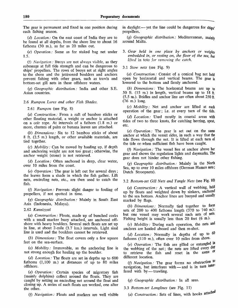
180 Preparatory documents
The gear is permanent and fixed in one position duringeach fishing season.
(d) Location: On the east coast of India they are tobe found at all depths, from the shore line to about 16fathoms (30 m.), as far as 20 miles out.
(e) Operation: Same as for staked bag net under1.5.
(/) Navigation: Buoys are not always visible, as theysubmerge at full tide strength and can be dangerous toships' propellers. The rows of buoys set at right anglesto the shore and the jettisoned boulders and anchorsprevent fishing with other gears, such as trawls andbottom-set gill nets in these offshore waters.
(g) Geographic distribution: India and other S.E.Asian countries.
2.6 Rumpon Lures and other Fish Shades.
2.61 Rumpon (see Fig. 8)
(a) Construction: From a raft of bamboo sticks orother floating material, a weight or anchor is attachedon a coir rope. At intervals of a fathom (1.8 m.) ormore, clusters of palm or banana leaves are attached.
(b) Dimensions: Six to 12 bamboo sticks of about8 ft. (2.5 m.) length, or other available materials, aretied together.
(c) Mobility: Can be moved by hauling up, if depthand anchoring weight are not too great; otherwise, theanchor weight (stone) is not retrieved.
(d) Location: Often anchored in deep, clear water,over 10 miles from the coast.
(e) Operation: The gear is left out for several days;the leaves form a shade in which the fish gather. Liftnets, encircling nets, etc., are then used to catch thefish.
(jf) Navigation: Presents slight danger to fouling ofpropellers, if not spotted in time.
(g) Geographic distribution: Mainly in South EastAsia (Indonesia, Malaya).
2.62 Kannizzati
(a) Construction: Floats, made up of bunched corkswith a small marker buoy attached, are anchored off-shore with heavy boulders. Several such floats are set upin line, at about 2-mile (3.7 km.) intervals. Light sisalline is used and the boulders cannot be retrieved.
(b) Dimensions: The float covers only a few squarefeet on the sea-surface.
(c) Mobility: Immovable, as the anchoring line isnot strong enough for hauling up the boulder.
(d) Location: The floats are set in depths up to 600fathoms (1,100 m.) at distances of up to 80 milesoffshore.
(e) Operation: Certain species of migratory fish(mainly dolphins) collect around the floats. They arecaught by setting an encircling net around the float andclosing up. A series of such floats are worked, one afterthe other.
(/) Navigation: Floats and markers are well visible
in daylight — yet the line could be dangerous for ships'propellers.
(g) Geographic distribution: Mediterranean, mainlyaround Malta.
3. Gear held in one place by anchors or weightsembedded in, or resting on, the floor of the sea, butlifted in toto for removing the catch.
3.1 Stow nets (see Fig. 9)
(a) Construction: Consist of a conical bag net heldopen by horizontal and vertical beams. The gear islowered to the bottom and firmly anchored.
(b) Dimensions: The horizontal beams are up to50 ft. (15 m.) in length, vertical beams up to 18 ft.(5.5 m.). Bridles and anchor line are often about 250 ft.(76 m.) long.
(c) Mobility: Net and anchor are lifted at eachoperation of the gear; i.e. at every turn of the tide.
(d) Location: Used mostly in coastal areas withtides of two to three knots, for catching herring, sprat,etc.
(e) Operation: The gear is set out on the sameanchor at which the vessel rides, in such a way that thetide flows through the net. It is lifted at each turn ofthe tide or<when sufficient fish have been caught.
(f) Navigation: The vessel lies at anchor above hergear and shows the regulation lights and daymarks. Thegear does not hinder other fishing.
(g) Geographic distribution: Mainly in the NorthSea, up to over 10 miles offshore (German Hamen nets;Dutch Stroopnets).
3.2 Bottom-set Gill Nets and Tangle Nets (see Fig. 10)
{a) Construction: A vertical wall of webbing, heldup by floats and weighted down by sinkers, anchoredto the sea bottom. Anchor lines are buoyed and usuallymarked by flags.
(b) Dimensions: Normally tied together to formsets of 200 to 400 fathoms length (370 to 740 m.);but one vessel may work several such sets of nets.Fishing height is usually less than 20 feet (6 m.).
(c) Mobility: During each operation, the nets andanchors are hauled aboard and then re-shot.
(d) Location: Normally in depths of up to 60fathoms (110 m.), often over 10 miles from shore.
(e) Operation: The fish are gilled or entangled '&the webbing of the net; the nets are lifted every dayto retrieve the fish and reset in the same odifferent location.
(/) Navigation: The gear forms no obstruction tonavigation, but interferes with — and is in turn mte
fered with by — trawling.
(g) Geographic distribution: In all seas.
3.3 Bottom-set Longlines (see Fig. 11)
(a) Construction: Sets of lines, with hooks attach

Document A/CONF.13/12 181
branch lines, at regular short intervals, set out on orbove the sea floor and maintained stationary with
Anchors at each end; each anchor is normally attachedto a marker buoy, and surface floats are attached to theline, every 200-400 fathoms.
(b) Dimensions: A single string of set longline isnormally several miles long and can measure over 10miles in length with over 15,000 baited hooks.
(c) Mobility: The anchors are usually lifted duringeach operation of the gear; the lines are then reset inthe same or a different location.
(d) Location: In depths to over 200 fathoms(370 m.) and up to 100 miles from shore.
(e) Operation: The lines are lifted at regular inter-vals, usually daily, to retrieve the catch.
if) Navigation: The gear forms no obstruction tonavigation (in Northern Europe, the marker buoys showlights at night). It does interfere with, and is oftenseriously interfered with, by trawling.
(g) Geographic distribution: In all seas.
3.4 "Pots" for scale fish, lobster, crabs, etc. (see Fig.12)
(a) Construction: Crate-formed traps of variousshapes, having non-return entrances; made of wood,wicker, wire-netting, metal, etc.
(b) Dimensions: Very small, only a few feet across.
(c) Mobility: The pots are weighted down bystones and lifted periodically.
{d) Location: Mainly on rocky or firm bottom; inup to 50 fathoms (90 m.) depth and up to 10 milesoffshore.
(e) Operation: Pots are held down by stones, etc.,and carry small marker floats. They are lifted at regularintervals (every day or every few days) to retrieve thecatch.
(/) Navigation: Cause no obstruction; as they arenormally used on rocky patches, they rarely cause anyhindrance to other fishing methods.
(g) Geographic distribution: In all waters.

182 Preparatory documents
ANNEX
FIGURE 0. A fish weir at low water
FIGURE 1. Staked gill nets
FIGURE 2. Cannery tender brailing salmon into scow from an Alaskasalmon set trap (detail of brailer shown in insert)
FIGURE 3. Staked bag net
(Courtesy R. J. Ederer Co.)

FIGURE 4. Alaska floating trap
Seiner-type tender" trailing " an Alaska
salmon floating trapTrap nets
The floating trap is constructed of logs which are solidly braced andbolted together. It is anchored offshore and held in place by several5 and 6 ton anchors. A long cable from which the lead is hung joins thelog construction of the trap and the shore line. The netting is suspendedfrom the floating surface of the trap and weighted by heavy rocks.

184 Preparatory documents
FIGURE 5. Tonnara
Body
FIGURE 6. Common type of 1 mouth 1 bag trap net
Bag
Funnel
Playground
Mouth
FIGURE 7. Anchored bag net

Document A/CONF.13/12 185
FIGURE 8. Coconut frond lure " Tendak ", " Rompon "
Stones
FIGURE 9. Stow net
FIGURE 10. Bottom-set gill nets
K C ^ ^ COt^^^

186 Preparatory documents
FIGURE 11. Bottom-set longlines
• < 0 • • ' . • / • - • ; : y - ' • ' • ' . : • • • : : : h : . • • •.& 5 ^ ^ ^ I:
The set usually has marker buoys at each extremity and floats every 100-400 fathoms or so.In European countries the marker buoys carry a light at night.
FIGURE 12.
i,uudi^ij <ub uiugui iii oinaii WUUUEU Liapo ui jjuia, Wlliuii die
baited with fish and lowered to the bottom at depths of 1 to30 fathoms. Usually the traps are set singly, but in somelocalities, a trawl of as many as 12 traps may be fished. Thetraps are hauled' daily or as often as conditions allow. A fisher-man may operate 200 or more single traps, but the average isless than 100.

Document A/CONF.13/13
EXAMINATION OF LIVING RESOURCES ASSOCIATED WITH THE SEA BED OF THECONTINENTAL SHELF WITH REGARD TO THE NATURE AND DEGREE OF THEIR
PHYSICAL AND BIOLOGICAL AS SOCIATION WITH SUCH SEA BED
MEMORANDUM BY THE FOOD AND AGRICULTURE ORGANIZATION OF THE UNITED NATIONS
(Preparatory document No. 10)
CONTENTS
Page
Foreword 187
Examination of living resources associated with the seabed of the continental shelf with regard to the natureand degree of their physical and biological associationwith such sea bed 187
Table 1 A : Examples of different types of relation ofeggs with the shelf 188
Table 1 B : Examples of different types of relation oflarvae and young with the shelf . . . . 189
Table 1 C : Examples of different types of relation ofnature animals with the shelf 189
Table 2 : The association with shelf of various repre-sentative organisms during diffefent phasesof life 190
Table 3 : Classification of organisms normally occur-ring as members of shelf communities inadult phase, with indication of habitat,etc., of juvenile phases . . . . . . . 194
List of special terms 196
t
FOREWORD
The United Nations has requested the Food andAgriculture Organization to prepare a statement on therelations of living aquatic resources with the sea bed ofllje Continental Shelf as defined in article 67 of theE ! ? P o n c e r n m g the law of the sea, adopted by the
ational Law Commission at its eighth session, inThe following paper has been prepared in answer
me V 6 ^ 6 ^ a n d although not an exhaustive treat-the t h e S u e s t i o n ft d o e s endeavour to show fully
complexities of the situation under examination.betw
r indlcating the kinds of relation that may existCont^
en ^ individual organism and the bed of therelati Uen f1 Snelf> it examines the changes in this
individ 1 a t m a ? t a k e p l a c e t h r o u g h o u t t h e m* o f w-extens"U o r ^ a n i s m - ^ then, making use of the veryof tjje
e w? rk on this subject, submits a classificationrcTD" normally occurring as members of shelf
adult phase with an indication of theof the juvenile phases of these adults.
[Original text: English][6 November 1957]
Every effort has been made in preparing this paperto preserve a simplicity of language, but the subject issuch that it has been necessary to employ certain termswhich may not be familiar to the lay reader. It has,therefore, been thought advisable to append a briefglossary.
EXAMINATION OF LIVING RESOURCES ASSOCIATED WITHTHE SEA BED OF THE CONTINENTAL SHELF WITHREGARD TO THE NATURE AND DEGREE OF THEIRPHYSICAL AND BIOLOGICAL ASSOCIATION WITH SUCH
SEA BED
In considering the relations of living organisms withthe continental shelf it is important to remember thatthis shelf is not merely a platform within or upon whichthere is a resting place for an organism for part or allof its life. The position of the shelf in relation to thecontinental (or island) land mass on the one hand, andto the continental slope and the abyssal bed on theother, causes it to exercise an influence on the play ofhydro-dynamic forces in the water-masses that overlieit, and these are related to the forces operating inadjacent water-masses, both those of the ocean and thewater outflowing from the continent. Moreover, theshelf receives, and provides a storage place for, a greatdiversity of materials. As a consequence the shelf is notmerely a passive platform, but contributes to the cre-ation of particular physical and chemical conditions thatare of considerable significance to the living organisms.Conversely, the organisms exercise some influence onthe characteristics of the shelf and contribute to creationof a milieu that is unique to those areas of the earth'ssurface where the shelf exists. Such facts are of impor-tance because of their relation to the simple yet easilyoverlooked fact that whatever association aquatic organ-isms have with the shelf proper, they nevertheless live inwater. Discussion of these associations therefore mustrecognize the role of the waters overlying the shelf aswell as that of the physical shelf.
A discussion of the association of living aquaticresources with the continental shelf should then beginwith an analysis of the types of relation or connexionthat may exist, such relations being direct with thephysical shelf proper, or indirectly with it through the
187

188 Preparatory documents
overlying water. The importance of this analysis willbecome clear when it is recognized that the existence ofeach organism may involve several different kinds ofrelation, and that the pattern of relations may vary asbetween different life phases. The value of this analysiswill be made even more apparent when we come, later,in this paper, to consider a conventional classificationof the organisms that make up bottom communities.
The relations involved can be classified with respectto the organism's requirements (1) for appropriateliving space, (2) for its general physiological functions,(3) for its food and nutrition and (4) for reproduction.Although nutrition and reproduction, of course, arephysiological functions and could be included under thesecond heading, and conversely, the second headingcould be divided into many particular functions, webelieve that the present plan is most convenient forpresent purposes, and most clearly reveals the nature ofthe relations involved. This plan can be elaborated, asfollows:
A. Living space
The organism lives:
(a) Within bottom materials,
(b) On bottom materials, by attachment,
(c) On the bottom surface, lying,
(d) On the bottom, but moving,
(e) In the water overlying the shelf.
B. General physiological functions
The organism finds physical and chemical conditionsappropriate to its metabolism, movement and behaviour;included are factors such as temperature, salinity, light-intensity, water movement, and the nature and particle-size of the bottom materials.
C. Nutrition
Food supply of the organism is provided by:(a) Bottom detritus,
(b) Bottom living organisms,
(c) Organisms that live in shelf water.
D. Reproduction
The organism finds:
(a) Conditions for maturation and spawning only onthe shelf,
(b) Favourable situation for placement of eggs in thebottom material or on it,
(c) Conditions for larval development (after hatching)only on the shelf and in the water above it.
These organisms that have a " living-space" depen-dence on the shelf (especially those that live within, orfastened to bottom materials) find there, also, theirgeneral physiological nutritional and reproductive re-quirements, and thus are completely dependent upon theshelf. For this reason where examples are given of theserelations, in Table 1 below, we combine the spatial andphysiological relations. In contrast, other organisms haveonly one or more of the other relations with the shelf,as, for example, by visiting it for a brief period tospawn; nevertheless the importance of these otherrelations to the organism should not be underestimated.The denial or destruction of a breeding ground couldpresumably lead to the extinction of the stock that madeuse of it.
In only very few species of aquatic organisms is theentire life of each individual spent in close associationwith the shelf sea bed and the water lying immediatelyabove i t ; in most organisms there is a free-swimmingphase, in middle or surface waters. However, since inmost cases the conditions of life for such a pelagic phaseare found only in shelf waters, there continues to be forthem a necessary and dependent relation between theorganism and the shelf even in the free-swimmingphase. This pelagic phase probably is a distributionmechanism which at the time may be very wasteful, be-cause often large numbers of pelagic larvae drift fromthe shelf and are doomed to die.
TABLE 1 A
Examples of different types of relation of eggs with the shelf
Living Space (and General PhysiologicalFunctions)
1. Within bottom
2. Fastened to bottom
3. Surface of bottom and waterimmediately above it . . . .
4. Supernatant waters at various depths
Eggs deposited in nests or cavities (rare). E.g., the amphipod Corophiumarenarium deposits eggs in small buried brood-tubes.
Eggs fastened to stones, or vegetation (e.g., Pacific herring), deposited incapsules, fastened to substratum (e.g., Periwinkle, Littorina litorea), orin gelatinous layers fastened to substratum (e.g., Littorina obtusata).
Eggs deposited loose on bottom (e.g., Atlantic herring), or in gelatinousmasses (e.g., Nemerteans), or in capsules (e.g., rays) or encrusted witflsand (e.g., Naticidae). Brood protection common.
Many species, from all taxonomic groups of neritic, oceanic anbenthonic animals have planktonic (freely floating) eggs ; (e.g., nearlyall starfish (echinoderms) and clams (bivalves) ; most Actinia, severalpolychaetes).

Document A/CONF.13/13 189
TABLE 1B
Examples of different types of relation of larvae and young with the shelf
Living Space (and General PhysiologicalFunctions)
1. Within bottom
2. Fastened to bottom
3. Surface of bottom and waterimmediately above it . .
4. Supernatant waters at various depths
Nutrition1. Bottom detritus
2. Bottom organisms
3. Neritic nekton and plankton . . .
This is a rare relation, found in the fauna of sand and of the intertidalzone. E.g., Bledius spectabilis and eunicid of polychaeto-Dj'opafraneapolitana.
This also is a rare relation (e.g., a few tunicates).
All non-pelagic larvae, e.g., larvae of most sand-fauna (e.g., ostracods,copepods), the young of haddock and of species whose young developin egg-capsules deposited on bottom.
Planktonic larvae and young of majority of shelf organisms. (Most larvaefeed while living planktonic life, some larvae however do not feed, butare planktonic only for distribution.*)
Relatively rare (e.g., the feeding of settled larvae and those developedin the bottom substrata).
E.g., the feeding of young of haddock, and of the young of mostorganisms with non-pelagic larvae.
Majority of pelagic larvae feed on phytoplankton, some exclusively onzooplankton (e.g., decapod larvae).
• That is to say, the significance of their sojourn in the planktonic community lies in the distribution brought about by the transport of theplankton by currents, sometimes resulting in the plankton being carried into unfavourable situations where it dies.
TABLE 1 C
Examples of different types of relation of mature animals with the shelf
Living Space (and General PhysiologicalFunctions)
1. Within bottom
2. Fastened to bottom
3. Surface of bottom and water
immediately above it . .
4. Shelf-waters at various depths
Nutrition1. Bottom detritus (and micro-
organisms living in it) . .
2. Bottom organisms .
3. Neritic nekton and plankton
^production1- Maturation and spawning .
2- Deposition of eggs . . .
3- Embryonic development
Organisms buried in bottom material through which they can move ; orliving in cavities or holes e.g. certain molluscs ; or in tubes they haveconstructed e.g. worms.
Organism with root or anchorage in the bottom, or with outer skeletoncemented or in some way fastened to rock or other hard bottom.
Immobile organisms lying on bottom (forams and some oysters);partially mobile but not swimming.
Strictly neritic forms, which include the majority of demersal fish.
Most animals which are buried in the sediment feed on the detritus ;there are also animals which pick detritus particles from the surfaceof sediment (e.g. polychaetes (worms), gastropods (shellfish), somedecapods (crabs) etc.).
Hunting animals, e.g. starfish, species of fish (e.g. plaice and cod) feedon small bivalves and crustaceans.
Many sessile animals, e.g. clams, oysters etc. (filter feeders and" lurkers " ) ; animals which visit bottom for rest and protection (e.g.shrimp); many fish species.
Many viviparous organisms and organisms which have brood protection,are benthonic because, perhaps, of a need for support. Many otherwisepelagic species spawn on coastal areas.
In bottom (rare), loose on bottom in capsules or gelatinous masses, fixedto it, with gelatinous masses or capsules fixed with strings, or depositedin cavities.
Brook protection is common among benthonic organisms. In pelagiclarvae development occurs in the pelagic stage. Waters overlying theshelf usually have higher turbulence, which is important for pelagiclarvae and young.

190 Preparatory documents
We have referred above to the existence of a specialshelf (or neritic) environment, established by virtueof the presence and particular form of the shelf inrelation with the continental land-mass on one hand andwith oceanic water masses on the other; we also re-ferred to the contribution made by the living organismsto the particular characteristics of this environment. Itis necessary at this point to say something further aboutthese two aspects.
Firstly, with respect to the identity (and in somecases autonomy) of a shelf environment. As indicatedin earlier paragraphs, it should not be thought that thereis to be found overlying the shelf a mass of water thatderives its characteristics exclusively from the shelf andremains unaffected by influences exerted by watermasses and current systems of the oceanic side. On thecontrary, the shelf water characteristics may be veryconsiderably affected by the oceanic waters, as indeedthey are by the outflow from the continent. Again, thelimits of a " shelf environment" may not be assumedto coincide with the limits of the shelf itself, as thatmight be defined in geographic and geological terms;instead, the limits may extend seawards beyond the edgeof the shelf, or be confined landwards, according to theinterplay of oceanic continental influences.
Secondly, with respect to the part played by aquaticorganisms in determining the characteristics of the shelfand its overlying waters. In perhaps the most obviouscase, the reef-building corals make very great bottomstructures; other organisms make similar incrustationsstill others contribute, by their dead-shells, to the for!mation of enormous deposits; in a different kind thereare the rock-boring organisms. Of quite different signifi.cance is the presence of a considerable population ofmicro-organisms living on the surface and in the super-ficial layers of sediments; these include bacteriabenthonic diatoms, and other forms, all of which serveas food for filter-feeding organisms. Finally, we may notoverlook the effect on the water of the physiologicalactivity of the great mass of living material which isfeeding, respiring and excreting, and thus causing aconstant flux in the chemical characteristics of thiswater.
Having given in Table 1 examples of the variouskinds of relation, in each life phase, regardless of anyconnexion between successive stages, we now give, inTable 2, examples of the changing pattern of rela-tions as between the life phases of an individualorganism.
TABLE 2
The association with shelf of various representative organisms during different phases of life
Organism
Sponges and Hydroids(general)
Ficulina ficus
Cliona celata
Tubularia larynx . . . .
Corals(general)
Ceriantharia
Lophohelia prolifera
Sagartia troglodytes . . .
Nemertiiies (worms)(general)
Lineus ruber
Eggs
Usually pelagic. Asexual re-production also occurs.
Pelagic (asexual reproductionalso occurs).
Pelagic.
Brood protection.
Asexual reproduction com-mon ; pelagic eggs alsooccur.
Pelagic.
Mostly asexual reproductionby budding.
Pelagic in some localities, vivi-parous or larviparous inother places.
Usually in lumps on the bot-tom, but many species havepelagic eggs.
Deposited in lumps in a greengelatinous mucus on thebottom.
Larvae and young
Short pelagic life of larvae.
Pelagic (relatively short time).
Pelagic (relatively short time).
Pelagic.
Mostly pelagic.
Pelagic, feeding on plankton.
The larvae of sexual pro-duction pelagic ?
Pelagic eggs develop intopelagic larvae that feed onplankton. Viviparous larvaeare benthonic crawlingaround the bottom.
Species with non-pelagic deve-lopment are rare; specieswith pelagic larvae,* someof which feed on plankton,are common.
Non-pelagic larvae develop onthe bottom.
Adults
Fixed on rocky bottom or on shells,plants, etc. Filter feeders ofsuspended matter and plankton.
The young settle on empty musselshells (usually Astarte) which lieloose on the bottom around them.
Burrows into limestone or into greatmussel shells.
Fixed on rocky bottom or on stonealying on bottom.
Usually fixed to bottom or on hardobjects on it.
Usually live in sand. Important asfish food. Detritus feeders.
Fixed to the bottom. Reef-buildiDgcoral in deep cold waters.
Fixed to hard bottom or to hard
objects on it.
Live mostly on bottom, but can afeomove through water ; most speciflive among seaweeds. F e e d
edetritus and small algae. Many *»carnivorous, attacking Polycnae* •
Lives on muddy bottom in ^ ^ j ]water. Feed on detritus and swalgae.
* The asterisk refers to larvae that do not take in food, but derive their nourishment from the remaining yolk material of their egg. Suchare known as lecithotrophic.

Document A/CONF.13/13 191
TABLE 2 (continued)
Organism
Cephalothrix linearis .
Cerebratulus marginatus
Bryozoa (sea mosses)
(general)
Alcyonidium albidum .
Flustella hispida . . .
Polychaetes (worms)
(general)
Scoloplos armiger . .
Nereis diversicolor . .
Nereis pelagica .
Nephthys caeca . . .
Crustaceans(shrimps, lobsters, etc.)
HARPACTICOIDS . .
CUMACOA
AMPHIPODS
(general)
( shrimp)
Eggs
Deposited on the bottom.
Deposited on the bottom.
Mostly viviparous, but egg-laying species also occur.
Pelagic ?
Pelagic ?
Few viviparous. Usually eggsfastened to the opening oftubes or are truly pelagic.Asexual reproduction alsooccurs. Some species canchange the mode of repro-duction according to thesurrounding conditions.
Laid in gelatinous, pearshapedcocoons and attached to thesand by a rough string.
Either loose on the bottom orpelagic.
Both pelagic, and lying on thebottom.
Ova are well developed in thecoelom of a female beforerelease into the water.
Mostly pelagic.
Brood protection common.
Brood protection common.
Brood protection common.
Brood protection and alsopelagic eggs.
Brood protection.
Larvae and young
Pelagic*
Free swimming feeding onplankton.
Short time pelagic larvae * aremost common, but larvae offew egglaying species arelong time pelagic feeding onplankton.
Pelagic feeding on plankton.
Pelagic*
Mostly pelagic and plankto-trophic. Larvae of non-pelagic development inabout 25% of species. Pela-gic larvae * also occur.Polychaete larvae are eatenby herring, actinians, amphi-pods and Cumacea.
Larvae hatch from the cocoonin the crawling stage, with-out any pelagic life.
Short time pelagic*
Developing on bottom in acrawling stage or pelagicfeeding on plankton.
Long time pelagic feeding onplankton.
Mostly pelagic and feeding onplankton.
Usually pelagic.
Usually pelagic.
Mostly pelagic.
Most larvae have long pelagiclife and are feeding onsmaller zooplankton orga-nisms.
Pelagic feeding on plankton.
Adults
Lives usually among sea-weeds.
Lives in deeper waters on hard bot-tom. Can also swim in the water.
Fastened, mostly on hard bottom.Filter feeders.
Fastened on hard bottom. Filteifeeders.
Fastened on sea-weeds.
Mostly live in bottom materials.Some species can leave the bot-tom for spawning in water mass.Detritus feeders.
Lives in mud and muddy sand. Catchmicrofauna and organic detritus.Very important as food fordemersal fish.
Lives in sandy mud. Leave the bot-tom during spawning, which occursnear the surface.
Lives on rocky bottom, but can alsoswim in the water.
Digs into the mud, but can alsoswim in the water.
Live mostly on all kinds of bottom,but can also swim ; mostly detritusfeeders.
Fixed on stones, ships, etc. Filterfeeders.
Live mostly on bottom, but occursometimes in water mass. Im-portant as fish food; detritus andplankton feeders.
Most species pelagic, some species onbottom substrata with ability toswim (e.g. Gammarus locusta onsea-weeds), some living in bottomsubstrata (e.g. Hippomedon, Hap-loops, etc.). Bottom living speciesare detritus feeders.
Mostly live on bottom as well as inthe water above, but also crawlingonly on bottom. Many species ofgreat economic importance. Mostlydetritus and plankton feeders.
Lives mainly on bottom, feeds onsmaller organisms and partly onorganic detritus. During the nightmay swim around.
p. i9 0 .

192 Preparatory documents
TABLE 2 (continued)
Organism Eggs Larvae and young Adults
Carcinus maenas(beach crab) . .
Eupagurus bernhardus(eremite crab) . .
Homarus vulgaris (lobster)
MulluscsGASTROPODS
(general)
Littorina littorea(periwinkle)
Littorina obtusata
Gibbula cineraria
BIVALVES (mussels)(general) . .
Nucula nitida
Mytilus edulis(edible mussel)
Ostrea edulis (oyster)
Cyprina islandica
Teredo megotara(shipsworm) . .
CEPHALOPODS
(Squids and octopi)
Part-time brood protection.Eggs are released in anadvanced state of develop-ment.
Brood protection.
Most deposit their eggs incapsules which are fastenedto the bottom. Few generaspawn their eggs in a gela-tinous layer, attached to asubstratum. Primitive gas-tropods spawn eggs freelyinto the water. Egg andbrood protection as well asviviparous species occur.
Deposited in capsules whichusually are pelagic but mayalso be fastened to the bot-tom.
Deposited in gelatinous mucus,fastened to stones or sea-weeds.
Pelagic.
Brood protection is common.On the bottom fastened eggsas well as pelagic eggsoccur.
Pelagic.
Pelagic.
Egg and brood protection(Embryos develop in mantelcavity to veliger stage).
Pelagic.
Brood protection.
Eggs usually lying on bottomin long capsules.
Pelagic feeding on plankton.
Pelagic.
Pelagic.
The larvae, developed fromgelatinous eggs or fromcapsules, usually remain onthe bottom. More than halfof -the species have larvaewith long pelagic life, spe-cies of short pelagic life arerelatively rare. The gastro-pod larvae are eaten e.g. byherring, mackerels, etc.
Pelagic feeding on plankton.
Larvae develop to crawlingstage with small shell withinthe gelatinous mucus, onbottom.
Pelagic.
Mostly pelagic. The young ofbivalves, unable to move inadult stage, are for a longtime able to move in watermass or crawl on the bot-tom.
Pelagic.
Pelagic, feeding on plankton.
Pelagic.
Pelagic, planktotrophic.
Pelagic.
Pelagic.
Lives usually on sandy bottom inshallow water.
Lives in empty gastropod shells (e.g.Littorina) crawling around the bot-tom in this shell; important fishfood.
Lives under stones and among sea-weeds. Economically exploited.
Different species are adapted for dif-ferent conditions of life. Mostspecies live in bottom substrata orlie on i t ; crawling gastropods alsoexist. Mostly detritus feeders.
Lives on bottom in shallow water.
Crawls slowly on the bottom or lyingon it.
Lives on hard bottom. Good fishfood.
Majority occur in bottom substrataand fixed on it. Several crawlingspecies exist. Many species im-portant as fish food and as foodfor man (oysters, edible mussel,etc.). Detritus feeders.
Lives in soft bottom.
On hard bottom fastened to bottomsubstrata in shallow water to &depth of ca. 50 m., or lying looseon it.
In shallow water and on tidal flats-fastened or on artificial support, iscultivated. Filter feeder.
Buried in the fine sandy mud ofsand. The siphon reaches the sewment surface. Important asfood.
Burrows into wood, often doing nflWdamage to wooden ships, narDoconstructions, etc.
Most species pelagic ; some l
bottom substrata only ; lar&e
live on and in bottom uand can also swim-feeders, and feeders onbenthonic animals.

Document A/CONF.13/13 193
Organism
Echinoderms(eeneral)
Asterias mulleri ( s ta r f i sh)
Solaster endeca . . . .
Ophiura robusta( b r i t t l e - s t a r ) . . . .
Tunicates
Pisces (fish)Rays and S h a r k s . . . .
Herrings
Plaice
Haddock
TABLI
Eggs
Usually the eggs are pelagic,brood, protection occurs,specially in colder areas;few species are viviparous.
Brood protection.
Pelagic, floating singly at thesurface.
Pelagic.
Mostly asexual reproduction.Eggs are pelagic but broodprotection occurs in somespecies.
Eggs deposited in capsules onthe bottom.Most species have pelagic eggs
(e.g. pilchard, sprat, men-hadden). By some specieslying on bottom (Atlanticherring) or fastened to thevegetation (Pacific herring).
Pelagic.
Pelagic.
i 2 (continued)
Larvae and young
Usually with long pelagicplanktotropic life, but alsopelagic lecithotrophic lifeoccur.
The young leave the motheras fully developed youngbottom stages.
Pelagic*
Pelagic feeding on plankton.
The larvae of sessile tunicatesare mostly fixed to bottomsubstrata; larvae are pela-gic for only a very shorttime.
Larvae developed in capsules ;young live on bottom.
Pelagic, feeding on.
Pelagic.
Pelagic, young lie often onbottom, feeding on bottomanimals.
Adults
Most species crawl on bottom feedingon other benthonic animals. Somelive in the bottom substrata andsome are fixed on it.
Crawls on the bottom.
Crawls on the bottom.
Lives mainly on bottom.
Most species are pelagic, only Asci-dians are fixed on hard bottom.Filter feeders.
Often on bottom substrata feedingon other benthos animals.
Pelagic.
Spend most of their life on bottom,feeding mostly on benthonicanimals.
Often on bottom, feeding partly onbenthonic animals.
* See footnote p . 190.
It will be seen that the task of examining the asso-ciation between organisms and the continental shelf iscomplicated by two principal considerations. Firstly,there is the difficulty of biologically designating pre-cisely the limits of the shelf and the limits of theinfluence exerted by it. Especially is this so since,remembering that the organisms concerned live only inaquatic medium, the shelf cannot be considered only interms of the solid materials of which it is constructed:the water overlying the shelf is as important as the shelf-material. Secondly, there is the complication of thedifferences of relations for different life-phases; thiscomplication is the greater because of the diversity oforganisms in this zone: most principal groups ofanimals, and many groups of plants, are represented intoe shelf-communities.
The conventional approach to the analysis of thecomplex communities of the shelf is to consider the
organisms which normally appear in these communities,chiefly in adult form, and to classify them according tohabits and normal habitat. Several classifications havebeen made along these lines; table 3 sets out in thefirst column a classification drawn up in accordancewith the more generally accepted views on this question.The second column describes the habits and habitats ofdifferent groups of adult organisms that enter or live inthis zone. The organisms in the first three classes haveliving space dependence on the shelf, both materials andwater, during their adult life; those of the fourth classhave other kinds of dependence on the shelf duringadult life, and these are chiefly with water overlyingthe shelf, but sometimes with shelf-material. The thirdcolumn shows the habitat, habits, etc., of the eggs, larvaeand young of certain organisms representative of eachgroup where their young stages are associated with theshelf.

194 Preparatory documents
TABLE 3
Classification of organisms normally occurring as members of shelf communities in adult phase,with indication of habitat, etc., of juvenile phases
Classification Definitions, examples, habits and habitats Larval life
A) In-biota . .
(a) Meso-biota
(b) Endo-biota
B) Epibiota . .
(a) Fixo-sessilo .
(b) Rhizo-sessilo
C) Suprabiota
[a) Libero-sessilo
(6) Hemi-sessilo
(c) Reptovagilo
Organisms which spend all their post-larval life within thematerial of the bottom, feeding and growing there.
Animals which are completely buried in the substratumitself; some in its interstitial spaces. They may movewithin this medium by digging while feeding, for example,or move about within the interstices. Some examples ofanimals in this group are: certain annelid worms, suchas Polygordius and Protodrilus; certain copepods (crus-taceans), Paramesochra, Evansula; and certain bivalvedmolluscs and gastropods.
Animals which live in cavities or holes and tubes which theyconstruct in the bottom substratum. It is possible for someof them to leave these holes or tubes if, for example, theimmediate environment becomes unfavourable, or in orderto spawn. Examples are: certain annolids, such as Areni-cola; certain clams, such as Mya, and boring isopods,such as Sphaeroma. Others, such as the boring clams orPholadidea, bore into rocks and become prisoners in theirown cavities. There are also animals such as the seacucumber, Cucumaria pseudopopulifera, which, becauseof growth after entrance, may become imprisoned in theold burrows of rock-boring clams.
Organisms that in post-larval form are fixed to the bottomand feed, grow and reproduce there.
Organisms which fasten themselves to the hard bottomsubstratum or to hard objects on it (such as stones, bigshells etc.) during their entire adult life or during a greatportion of it. There are organisms that fasten themselvesto the substratum by means of their outer skeleton or bysecretions ; the hydroids (Hydrozoa) fasten themselves bymeans of their chitinous periderm ; gooseneck barnacleshave a leathery stalk ; the tunicates are fixed by theircellulose-like test; certain molluscs fasten themselves bymeans of calcareous shells ; sea mussels (edible mussels),such as Mytilus, use a byssus (a bundle of threads secretedby the foot). The large brown algae (kelps) are held to thesubstratum by a root-like hold fast.
Organisms which are fastened to the soft bottom (sand ormud) by various means. For example, a root-shapedplexus is formed by the crinoid, Rhizocrinus ; alcynona-rians, such as Pennatularia, have a basal stalk which isembedded in the sand or mud. Higher plants, such asZostera, have rhizomes and roots for attachment.
Organisms that lie on or more freely about on the bottomand feed, grow and reproduce there.
Organisms that lie on the sea bed in the adult stage, but arenot fixed to it, and are incapable of active travel.Examples are: flat oysters and foraminifera.
Organisms which, although capable of moving on the sub-stratum during their adult life, usually settle in one placeand remain there for variable periods of time, or do notmove very far away. The animals are sessile duringfeeding, but move when disturbed. Change of locationmay be caused by environmental conditions adverse forcertain purposes, e.g. breeding, etc. Some of these orga-nisms (as certain annelids) may encase themselves in fixedtubes. Some are held against the substratum by spinousprojections. Chitons, limpets and other molluscs crawlslowly over very small distances only — although somemay be almost sessile on a so-called foot.
Organisms which during their adult stages are capable ofmovement, but only on the sea bed. This group of orga-misms includes forms such as starfish and some largeCrustacea (e.g. large crabs) and octopi which range morewidely than do the forms described above and which donot hold themselves in one place for long periods of time.
The majority of animals living in sanddeposit their eggs in the sand and thelarvae develop there or in the over-lying water. Mesobiota living in mudusually have pelagic larvae, but vivi-parity and brood protection also occur.
Spawning often on the surface of sandand mud or in free waters. Eggs canalso be deposited in the tubes in themud (e.g. Corophium arenarium) or incapsules and in gelatinous masses onthe surface or near the mouth of theirtubes (e.g. some polychaetes). Pelagiclarvae are most common for theseanimals. Asexual reproduction occurs.
Asexual reproduction occurs in manyspecies. The larval stage is usuallyneritic-pelagic. Feeding on plankton.Viviparity occurs in this group. Beforesettlement the young of many speciescan crawl along the bottom.
The larval stage is usually neritic-pelagic,feeding on plankton. Asexual repro-duction occurs in many species as wellas viviparity. Many species have non-pelagic larvae.
Larval stage usually planktonic. Brood-protection also common. The non-pelagic larvae and young can crawlaround on the bottom.
Most eggs and larvae are pelagic. Eggscan be shed singly and adhering sepa-rately to substrata. Brood protectionoccur. Planktonic, lecithotrophic lar-vae are rather common in this group.
Brood protection common, but ^ ^have pelagic eggs and larvae. TB .vae feed usually on phytoplankton,in some groups also on zoopian*(e.g. decaped larvae).

Document A/CONF.13/13 195
TABLE 3 (continued)
Classification— •
(d) Bivagile
Definitions, examples, habits and habitats Larval life
D) Swimmingorganisms .
I. PERMANENT ANDSEMIPERMANENT
1. Demersal fish
(c) Flatfish
(b) Gadids
(c) Percomorphs . .
2. Pelagic fish . .
(a) Clupeoias (and eco-logically related spe-cies)
Others
- VISITORS
To reproduce
Organisms which can crawl on the bottom and also movefreely through the waters. As examples are: Cumacea,some shrimp species, Mesidotea entomon, Gammaruslocusta, etc. To this group belong also haptic animalswhich are vagile on the bottom while searching for food,but attach themselves when disturbed (e.g. tardigradeBatillipes, annelid Diuredrilus).
Organisms that swim freely in the shelf water, some of whichremain in the shelf water all their post-larval life whilstothers visit these waters for only part of the post-larvallife ; of the former, some spend most of the time on ornear the bottom or even in it whilst others live in middleand/or surface waters ; of the latter, some visit for repro-ductive purposes, others for feeding, some for both thesepurposes, and others merely cross these waters.
Fish which spend most of their post-larval life over the shelfand close to the bottom or on the bottom substrata andfeed mainly on the benthonic organisms. This group canbe divided into three sub-groups :
Fish which have very flattened bodies, and spend much oftheir time on the sea floor. The main food is taken fromthe bottom. Generally, but not always, the range ofmigration of these fishes is smaller than of the followingsub-groups. Examples are the plaice, soles, halibuts, tur-bots, flounders, etc.
Cod-like fishes closely related to the sea bed, but whichmove from deep to middle or shallow waters usually forfeeding and breeding purposes. Some species migrate longdistances over deep oceanic areas (e.g. cod). Part of thefood is taken from the bottom and part from the watermass. Examples of this sub-group are: cods, haddock,whitings, pollacks, etc.
Perch-like fishes which live preferably in rocky or coralbottom or wherever they may find shelter and food nearthe sea bed. (E.g. perches, croakers, breams, basses.)
Fishes which spend most of their life in the upper layers ofthe water and feed mainly on plankton or other pelagicfish. Here two sub-divisions can be made:
Herring-like fishes which live comparatively near to theshore, dwelling either at or near the surface are: her-rings, sardines, sprats, anchovies, menhaden, etc. Theymake extensive wanderings comparatively close to thecoasts, appearing at certain times and places for thepurposes of feeding and spawning.
Other examples of fishes which live in bays, inlets, channelsand offshore at or near the surface are: jacks, pompanos,amberjacks, etc. Oceanic pelagic fish (e.g. tunas, macke-rels, sharks) may in most places live in the waters abovethe continental shelf where there in higher concentrationof food available.
Fish and mammals which migrate to coastal areas forspawning. E.g. Pacific herring which fastens its eggs tothe vegetation near coast and in estuaries, channels (milk-fish), which spawns in coastal areas. Mullets spend mostof their life in coastal lakes, rivers and bays, spendingonly short periods in marine waters, spawning probablyoccurring in sea water, near the coast. Coastal breedersof aquatic mammals which give the birth to the young oncoast or on ice, belong to this group. They migrate longdistances and feed mainly on fish (e.g. seals).
Mostly pelagic eggs and pelagic plankto-trophic larvae.
Mostly pelagic egg and larvae. Thefloating eggs are found in differentlayers of water.
Mostly pelagic egg and larvae. E.g. theegg of the hake floats freely to thesurface from deep or shallow waters,where they are laid. They drift on thesurface, where they hatch. Fewdermesal larvae also occur (e.g. had-dock).
Eggs lying on the bottom or fastened toit or are pelagic. E.g. the Pacific her-ring which lays adhesive eggs incoastal waters, attached to vegetationor which deposits them on the seafloor (Atlantic herrings). Sardines' eggsdrift in the upper layers of the water.Mostly pelagic egg and larvae.

196 Preparatory documents
TABLE 3 (continued)
Classification
2. To feed
3. In transit . . . .
Definitions, examples, habits and habitats
Most demersal fish and majority of pelagic species feed oncontinental shelf, either on the benthonic animals(demersal fish) or on the rich plankton crop (pelagic fish).
Fishes which move from the sea to the fresh water, or fromfresh water to the sea for spawning purposes. (E.g. salmon,anadromous fish and eel, Anguilla, catadromous fish).Shads and smelt are other examples. Lagoon and brackishwater fish can also be considered as a sub-group ofmigratory fish. This group of fish live near the bottom incoastal waters and brackish water bays in river mouths,but migrate for certain periods into sea water.
Larval life
Most pelagic larvae feed on the planktonin the waters above continental shelfwhich is generally more productivethan offshore areas.
Salmon spawn in fresh water (most spe-cies in rivers). The young develop alsoin fresh water. Eels cover vast oceanicareas during their spawning migra-tions, and spawning takes place ondefinite grounds in the ocean at midwater.
List of Special Terms
Abyssal (adj.)
Amphipod (n.)
Anadromous fish
Asexual (adj.)
Benthonic (= benthic) (adj.)
Benthos (n.)
Biota (n.)
Bivagile (adj.)
Bivalves (n.)
Brood protection
Byssus (n.)
Catadromous fish
Chitin (n.)
Clupeoids (n.)
Coelom (n.)
Community (= association) (n.)
Copepod (n.)
Demersal animals, (fish, etc.)
Detritus (n.)
Echinoderm (n.)
Endo-biota (n.)
Epi-biota (n.)
Fixo-sessile (adj.)
Gastropod (n.)
Habitat (n.)
Of the deep sea (usually below 1,000 m. depth).
A group of crustaceans.
Fish which spend most of their adult life in salt water, but peri-odically migrate into fresh water for spawning purposes.
Sexless ; without involving sexual differentiation.
Pertaining to benthos.
Aquatic animals and plants spending most or all of their life on orin the bottom.
Plants and animals, generally referred to a region or a special environ-ment.
Of organisms which can crawl on the bottom and also move throughthe free water.
Two-valved aquatic animals, such as clams, mussels.
Protection of eggs after being shed from the ovary until hatching, oruntil the young are able to move and feed.
A bundle of threads by which certain mussels adhere to rocks or othersubstrate.
Fish which spend most of their adult life in fresh water, but migrateinto the sea (salt water) for spawning.
A horny substance, forming the harder part of the outer integumentof insects, crustaceans, etc.
Herring-like fishes ; (adj. — clupeoid).
The body cavity.
A group of species living under the particular conditions offered bya particular situation (in a biotope).
A minute crustacean, belonging to the family Copepoda.
Animals which spend most of their life close to or on the bottom.
Non-living particulate matter in the water.
A member of the phylum Echinodermata, marine organisms includingstarfishes, sea urchins and their allies.
Organisms, which live in cavities, or holes and tubes which theyconstruct, in the bottom.
Organisms which occur entirely above the bottom surface, but arefixed to it or have some special anchoring organ sunk in the bottom.
Of organisms that fasten themselves to the hard bottom or on hardobjects on it, during their entire adult life or the greater part of it.
A member of large class of molluscs, which includes most forms mathave a univalve shell.
The site in which an organism normally lives ; refers also to theenvironment to be found at that site.

Document A/CONF.13/13 197
Haptic Hemi-sessile (adj.)
In-biota (n.)
Intertidal zone
Larviparous (adj.)
Libero-sessile (adj.)
Lurker (n.)
Meso-biota (n.)
Nekton (n.)
Neritic (adj.)
Pelagic (adj.)
Periderm (n.)
Phytoplankton (n.)
Plankton (n.)
Planktonic (adj.)
Planktotrophic (adj.)
Polychaet (n.)
Repto-vagile (adj.)
Rhizo-sessile (adj.)
Sedentary (adj.)
Sessile (adj.)
Supra-biota (n.)
Suspended matter
Turbulence (n.)
Vagile (adj.)
Viviparous (adj.)
Zooplankton (n.)
Of organisms which, although capable of moving on the bottom duringtheir adult life, usually settle in one place and remain there forextended periods and do not move far away.
Organisms which spend most of their post-larval life within the seabottom material.
The area between high and low water.
Of organisms in which embryonic development proceeds to larvalstage within the body, the young being produced as larvae whichcontinue development outside the body of the parent.
Of organisms which lie on the sea bed in the adult stage, but notfixed to it, although incapable of active travel.
An animal whose feeding habit is to lie in wait for prey.
Organisms completely buried in the bottom itself or living in itsinterstitial space.
The free-living actively swimming organisms (e.g. fish).
Of or pertaining to the coastal and shallow waters of the aquaticenvironment above the continental shelf.
Of or pertaining to surface waters ; e.g. pelagic fish — fish which spendmost of their life in the upper layers of the water.
The cortical tissue derived from the phellogen growth.
See plankton.
Small organisms suspended in the water mass without or with onlyvery limited mobility :phytoplankton — plant plankton,zooplankton — animal plankton.
Of or pertaining to plankton.
Of organisms feeding on plankton.
An organism belonging to the order of annelide worms, Polychaeta.
Of organisms which during their adult stage are capable of movementonly on the sea bed.
Of organisms which are held to the soft bottom (mud or sand) byvarious means.
Of bottom living organisms which, although not fixed to the bottom,move little if at all.
Attached and not free to move about.
Organisms which lie on or move freely about on the bottom sub-stratum.
Particulate matter in the water.
Irregular nonlinear movement of water particles in a water mass.
Wandering, mobile.
Of organisms in which development in the parent body continues toassumption of adult form.
See plankton.

Document A/CONF.13/15
A BRIEF GEOGRAPHICAL AND HYDRO GRAPHICAL STUDY OF BAYS AND ESTUARIESTHE COASTS OF WHICH BELONG TO DIFFERENT STATES
BY COMMANDER R. H. KENNEDY
(Preparatory document No. 12) *
[Original text: English][13 November 1957]
INTRODUCTION
I. AFRICA
1. Waterway at 11° N. ; 15° W. (approx.) betweenFrench Guinea and Portuguese Guinea . . . 199
2. Estuary of the Kunene River 1993. Estuary of the Kolente or Great Skarcies River 2004. The mouth of the Manna or Mano River . . . 2005. Tana River 2006. Cavally River 2007. Estuary of the Rio Muni 2008. Estuary of the Congo River 2019. Mouth of the Orange River 201
II. AMERICA
1. Passamaquoddy Bay 2012. Gulf of Honduras 202
3. Gulf of Fonseca 2034. Salinas Bay 2035. Chetumal Bay 2046. San Juan River 2047. Mazanillo Bay 2048. Gulf of Paria 2059. Bay of Ancon de Sardinas 205
10. Bay of Oyapok 20611. Estuary of the Maroni River 20612. Estuary of the Corentyn River 20613. Boca de Capones 20714. Rio de la Plata 20715. Estuary of the Coco (Wanks) River 20816. Rio Grande 208
III. ASIA
1. Gulf of Aqaba 208
CONTENTSPage
198Page
2. Shatt al-Arab 2093. Khor Abdullah 2094. T h e Sunderbans (Hariabhanga and Raimangal
Rivers) 2095. Sir Creek 2106. Naaf River 2107. Estuary of the Pakchan River 2108. Sibuko Bay 211
IV. CHINA
1. The Hong Kong Area 212(a) Deep Bay 212(b) Mirs Bay 212(c) The Macao Area 213
2. Yalu River 2133. Mouth of the Tyumen River 214
V. E U R O P E
1. Gulf of Trieste 214
2. Ems and Dollart 214
3. Lough Carlingford 2 l5
4. Lough Foyle5. Flensborg Fjord or Flensburger Forde . . .6. Estuary of the Bidasoa River7. The mouth of the River Mino
216216217218718Idefjord and its approaches
9. H e a d of Bottenviken . . .10. T h e A r e a of Viro Lacht i . .11 . Es tuary of River Guad iana .12. T h e mouths of the River Evros
A N N E X :
Maps
219220220220
222
INTRODUCTION
The International Law Commission, in paragraph 7 ofits commentary to article 7 (Bays)1 stated that it"felt bound to propose only rules applicable to baysthe coasts of which belong to a single State ". The Com-mission continued that, as to other bays, it "does not
have sufficient data at its disposal concerningfrequency of such cases or the regulations at pre
* This paper was prepared at the request of the Secof the United Nations but should not be considered as ament of the views of the Secretariat.
i Official Records of the General Assembly,Session, Supplement No. 9 (A/3159), p. 16.
198

Document A/CONF.13/15 199
nplicable to them". A similar difficulty was expe-d in drafting article 13 (Delimitation of the
tenceterritorial sea at the mouth of a river) and, as the com-ment on paragraph 2 of that article makes clear, the rulecontained in article 13 is, due to a similar lack of thenecessary data, confined to cases where the coasts of anestuary belong to a single State.
The purpose of the present study is, therefore, toprovide a brief geographical and hydrographical descrip-tion, together with maps, of bays and estuaries thecoasts of which belong to different States. It is hopedthat, by so doing, the Conference might have sufficientdata upon which to base a broader formulation of therelevant rules.
It will be apparent from the study that it does notpretend to comprehend all such bays and estuariesthroughout the world; nor are those included necessa-rily suitable for navigation. However, within practicallimits, each bay or estuary is described in its essentialfeatures and references are given to assist in a moredetailed examination should it be required. Thereferences are to Charts and Sailing Directions publishedby the Hydrographic Department of the BritishAdmiralty; when using the Sailing Directions (Pilots),their latest supplements should also be consulted.Miles referred to in the descriptions are sea miles, eachconstituting one sixtieth of a degree of latitude at theplace being described. Special regulations regardingnavigation, etc. in the few places where they are knownto exist have been included; in the others it has beenassumed that the only rules which apply are thosecustomary for " innocent passage ".
The configuration of the coasts on the sides ofcertain bays or gulfs may affect the size of any arealying between the belts of territorial sea therein. Thearcs of circles from the prominent points on the coast,or from certain features which dry between tides, controlthe limits of these belts. They may thus reduce theseparation of the limits from a distance equal to themaximum width of the bay less the sum of the breadthsof the belts of territorial sea.
Although these are primarily physical studies, thepositions of international boundaries, either as termi-nations of the land boundaries or those through the sea,nave been mentioned; these positions, where given,must, however, be considered as approximate only. Nocomments or suggestions have been offered regardingtne continuation of the land boundaries to the highseas. These studies should prove useful examples for theonsideration of wider problems of bays and estuariesn general if the existence of the state boundaries be
neglected.
I. AFRICAx- Waterway at 11°N.; 15°W. (approx.) between French
Guinea and Portuguese Guinea (Annex, map No 1)References : Chart No. 600
Africa Pilot, Volume I, Eleventh Edition, 1953Th
I5J1(j 5 a r e^ i n t h e vicinity of the position where theundary between Portuguese and French Guinea
meets the sea is low and swampy and, as it lies in theproximity of the deltas of several rivers, is liable tochange in configuration; the chart is based on an oldsurvey and the scale is small; exact present-day detailsare not available.
As charted, the terminus of the land boundary is onthe north side of the River Tristao, a creek about three-quarters of a mile wide, running in a north-west, south-east direction. This creek joins the Kasset River to themouth of the River Camponi and separates Aube Islandfrom the mainland; it is about 8 miles long. The KassetRiver, flowing past the northern end of Aube Island, isthe southern end of the creek separating Katak Islandfrom Aube Island and the mainland; it is nearly a milewide.
Katak Island and the mainland northward and east-ward of it are Portuguese territory; Aube Island isFrench.
The approach to Kasset River is eastward of Seneand Samba, two sandy islets joined by a drying bank,between 6y2 and 3 miles south-westward of KatakIsland, and westward of the breakers which extend upto 8 miles south-westward of Aube Island. Depths inthis approach are charted between \y2 and 4 % fathoms,but no depths are shown in the Kasset or Tristao Riversor in the south-eastern approach to the latter.
About 15 miles south of Sene Islet lie Alcatraz Isletand Reef; the islet is a small volcanic rock, 40 feethigh. A little over a mile south-westward of this islet,Wreck Islet is charted; this was reported in 1904 tohave disappeared and a depth of 2 fathoms was obtainedin its position. The reefs and fould ground extend 7miles south-westward from Alcatraz Islet and are knownas Alcatraz Reef.
Conflict Reef, with numerous rocky and sandy dan-gers, some above water and others below, lies 19 milessouth-eastward of Alcatraz Islet and about the samedistance southward of the south-eastern end of AubeIsland. No soundings are charted between.
There is no entry or anchorage for ships of any sizein the River Tristao.
As no detailed survey has been made of the area,there may be many undiscovered dangers there.
2. Estuary of the Kunene River (Annex, map No 2)
References : Chart No. 1806Africa Pilot, Part II, Tenth Edition 1951
The Kunene, or Cunene, River separates Angola fromSouth West Africa. Near its mouth, it passes through asandy desert region which is almost rainless, althoughat times there are heavy dews. It only reaches the seaduring the inland rainy season, at other times it iseffectually barred by a sandbank on which the sea breaksfuriously. The coasts on both sides of the mouth arecomparatively straight, but in its immediate vicinitythere is a slight inward curvature over a distance lessthan 5 miles with a penetration from the general lineof less than a mile. Roughly half the coastline of theindentation is Portuguese. The area is uninhabited andthere are no navigable channels. Great caution is neces-

200 Preparatory documents
sary in navigating near the coast as the surveys are veryimperfect.
3. Estuary of the Kolente or Great Skarcies River(Annex, map No 3)
References : Charts Nos. 601, 686Africa Pilot, Part I, Eleventh Edition, 1953
This estuary may be considered to lie betweenSallatuk Point in French West Africa and Ballo Pointin Sierra Leone, about 15y2 miles south-south-eastward.The coast is low, fronted by trees and mangroves andis cut into by many creeks. The Great Skarcies andLittle Skarcies, or Kabra, River enter the estuary at itssouth-eastern end. From the mouth of the latter, thecoast trends 17*4 miles north-westward to Sallatuk Pointand iy^ miles westward to Ballo Point. The whole ofthe area is shoal and is cluttered with drying mudbanks,the natures of which are continually changing. Thereare many breakers hi the area. Yelibuya Island, low andabout 3 miles across, lies close offshore about 5 milessouth east of Sallatuk Point; Kortimaw Island, with anextensive drying bank seaward of it, lies V-/2 milesfurther south-eastward, with an islet between it and thecoast north-eastwards. In 1933 there was an above-water mudbank 3 miles south-westward of KortimawIsland ; the drying portion of this bank extended 2 mileswestward and nearly 3 miles south-westward. The mainentrance channel to the rivers allows access to smallcraft of 9-foot draught; it lies between Yelibuya andKortimaw Islands and thence between the latter and thecoast. Another channel leads between Kortimaw Islandand Ballo Point, an extensive bar of shoals, shiftingsand and mud, renders it difficult of access.
The boundary between Sierra Leone and French WestAfrica follows the Kolente River for a considerable waybut, before reaching the estuary, branches westward tomeet the coast about a mile south-eastward of SallatukPoint.
4. The mouth of the Manna, or Mano, River(Annex, map No 4)
References : Charts, Nos. 1363, 2478Africa Pilot, Volume I, Eleventh Edition, 1953
The boundary between Sierra Leone and Liberiareaches the sea at the mouth of the Manna, or Mano,River. The coast on both sides is comparatively straight,and runs in a general north-westerly and south-easterlydirection for a number of miles. For the last iy2 milesof its journey, the river flows north-westwards parallelto the coast and is separated from the sea by a narrowstrip of tree-covered sand. The mouth, of the river is, ineffect, closed, and breakers extend around its mouth.The remains of an old factory can be seen near themouth.
5. Tana River (Annex, map No 5)
References : Chart No. 1359Africa Pilot, Volume I, Eleventh Edition, 1953
The boundary between Ghana and French West
Africa follows the Tana River to the Tana or TendoLagoon, the northern coast of which is French territoryand the eastern end of the southern coast is the territoryof Ghana. The French boundary crosses the lagoon ina southerly direction to meet the land boundary whichcrosses the low spit, about 1*4 miles wide, separatingthe lagoon from the sea, in a southerly direction, toreach the coast close west of the village of Newtown.
The sea coast is comparatively straight for manymiles. Access to the lagoon from the sea is about7 miles west of Assini, situated \2y2 miles west ofNewtown. Owing to the nature of the bar there, passageinto the lagoon is only possible during the Harmattanseason.
6. Cavally River (Annex, map No 6)
References : Charts, Nos. 1980, 1365Africa Pilot, Volume I, Eleventh Edition, 1953
The "thalweg" of the Cavally River forms theboundary between Liberia on the west and French WestAfrica on the east. The river, about 100 yards wide onlyon its entrance to the sea, cuts at right angles througha straight length of coastline about 9 miles long, whichat both ends bends away in a convex curve. The entranceto the river is between two sandbanks about 20 feet high.There are submerged rocks about a quarter of a mileoffshore and three-quarters of a mile south-westward ofthe entrance.
It is reported that the river can be navigated by smallpower vessels for about 50 miles ; the entrance channel,however, is constantly changing, and its bar has thereputation of being the most dangerous on the coast;surf boats are often capsized and many lives lostannually. Vessels can anchor in depths of 7 to 9 fathomsabout a mile south of the entrance. There is a Frenchcustoms house close to the entrance.
7. Estuary of the Rio Muni (Annex, map No 7)
References : Charts, Nos. 1356, 1887Africa Pilot, Part II, Tenth Edition, 1951
The " thalweg " of the Rio Muni where it enters thesea forms the boundary between Spanish Guinea andFrench Equatorial Africa. The Rio Muni flows into thenorth-east corner of Corisco Bay, and the River Mondahinto the south-east corner. This bay has an entrance33 miles wide and a penetration inland of 17 miles. Thecoast at the north-east corner of the bay is roughly inthe shape of a semi-circle with a diameter of 12% miles,the Rio Muni enters through the south-eastern side. Thebreadth across the mouth of the river is about a mUe-Within about 5% miles south-westward of the mouthare the two Spanish islands of Elobey. Isla de Coriscolies midway between the entrance points of Corisco Bay-
Depths in the bay are for the most part shallow, withthe exception of the approaches to the two rivers; theapproach to Rio Muni has a least depth of dboQ4 fathoms and runs in a straight line, passing abou2y2 miles south of the southernmost point of the coasat the northern end of the bay; the approach to tn

Document A/CONF.13/15 201
jv Mondah passes north and east of Isla de Corisco;both these channels are buoyed.
Other islets in the bay are: Leva, about a mile southof Isla de Corisco ; Conga, with a small drying rock halfa mile south-westward, 3% miles south-south-eastwardof Isla de Corisco; Bane, with detached drying banksup to 1% miles eastward and 2% miles north-eastward,about 5y2 miles south-east of Isla de Corisco. Otherdrying banks are: Bane Acanda, \y2 miles north of thewestern entrance point of River Mondah; RecifeBuyumba, about \y2 miles offshore and about\Q\/2 miles east of Isolote Bane; a bank and reefsextending 1% miles south of Isla Elobey Chica andabout a mile east of Isla Elobey Grande; and PiedraUgoti, about 1 4 miles offshore westward of PuntaCorona, at the north-western end of the bay.
Both the whole of Corisco Bay and the bay formingits north-eastern end formed between Punta Mosquitosand Pointe Elobey conform to the International LawCommission's definition of a " bay " in article 7 of the1956 report. About a fifth of the coastline of thissmaller bay is French; about a third of the coastline ofthe whole of Corisco Bay (excluding that of the islandsand islets) is Spanish.
There are no ports in the bay; there are anchoragesoff the various settlements in the rivers.
8. Estuary of the Congo River (Annex, map No 8)
References : Charts, Nos. 604, 638Africa Pilot, Part II, Tenth Edition, 1951
The river Congo flows in a westerly direction to itsmouth; the northern side is Belgian territory and thesouthern is Portuguese. For the purpose of thisdescription the estuary will be considered as seaward ofa line joining Pointe Bulabemba on the northern bankto the entrance to the Rio do Fuma-Fuma on thesouthern bank, about 2% miles southward. The northernside comprises the entrances to two creeks lying betweenPointe Bulabemba and Pointe Francaise about 2% mileswest-north-westward, thence the south-west coast ofPresqu'Ile de Banana which continues in a north-westerly direction for 23 miles to Ponta N'gelo, nearwhich is the boundary with the Portuguese territory ofCabinda. The southern side continues in a westerlydirection from the mouth of the Rio do Fuma-Fuma for8 miles, thence turns north-north-eastward for 2y2 milesto Ponta do Padrao, whence it turns abruptly south-westwards for \Y/2 miles to Ponta da Moita Seca. Thus,the entrance to the estuary between Ponta N'gelo andPonta da Moita Seca is 25 miles wide; the widthbetween Ponta do Padrao and the low-water line ofPointe Francaise is 5% miles, and the breadth south-ward of Pointe Francaise is 4^4 miles. The penetrationinland from the line joining the entrance points is about11% miles.
There are no islands in the estuary; drying banksclose to the low-water line of the coast are charted offthe mouth of the Rio do Fuma-Fuma, and in the mouths°f rivers 2% and 5 miles westward of that river; theirouter edges do not lie more than half a mile offshore.The low-water line of Pointe Francaise is situated nearlyhalf a mile southward of that point.
Depths from the coast graduate to the 10-fathomcontour, and then descend abruptly into a deep gullyrunning eastward from ocean depths right into theentrance to the river; depths in this gully, inside theestuary, exceed 300 fathoms in places.
Vessels approaching from north-westward shouldkeep at least 5y2 miles off the shore north of the riverentrance until within about 3 miles of Ponta do Padrao,when course may be shaped for the river mouth. Beyonda position south-eastward of Pointe Francaise, the RiverCongo is well buoyed.
On the northern side the principal port in theestuary is Banana, in the creek east of Presqu'Ile deBanana, where there is anchorage in 3 fathoms and awharf; there is a bar to cross with 18 feet of water overit; tidal streams are very strong. It is a pilot station forthe River Congo. Vessels bound to and from ports inthe Belgian Congo must enter or clear there and passthe health officer. On the southern side is the Portugueseport of Santo Antonio do Zaire, the principal town ofthe district. It lies about three-quarters of a mile withina creek south-east of Ponta do Padrao. There is a barwith only 7 feet of water over it and the river currentflows strongly across the entrance.
Vessels awaiting daylight to make the entrance canfind good anchorage one to two miles off Ponta daMoita Seca, also half a mile off shore south-west ofPonta do Padrao and 2% miles west of Pointe Francaise.
9. Mouth of the Orange River (Annex, map No 9)
References : Charts Nos. 897, 632Africa Pilot, Part II, Tenth Edition, 1951
The Orange River, near its mouth, separates SouthWest Africa, on its western and northern sides, from theUnion of South Africa. The river, within its mouth, isover a mile wide but is full of ready islets; in the dryseason shoals and sandbanks are everywhere visible inits channel. The river breaks through a long sandy spitto reach the sea; its mouth is only about 175 yardswide, and the sea breaks right across it. For many milesnorth-westward of the entrance, the coast is comparative-ly straight and sandy. This nature continues south-east-ward for about 2 miles when the coast is fronted bydrying rocky ledges. About 7 miles from the mouth, thecoast turns from its general south-easterly trend to asouth-south-westerly direction for 2 miles to formPeacock Roadstead, where it is reported that someshelter from the swell and the prevailing south-south-westerly wind may be obtained. The boundary is thenorth and west bank of the River.
H. AMERICA
1. Passamaquoddy Bay (Annex, map No 10)
References : Chart No. 464Nova Scotia and Bay of Fundy Pilot, NinthEdition, 1947
The boundary between the United States of Americaand Canada passes through Passamaquoddy Bay to thesea. The entrance to the bay lies between West Quoddy

202 Preparatory documents
Head and Bliss Island, 13 miles north-north-eastward,and is obstructed by Campobello and Deer Islands, bothlarge, and by numerous smaller islands and dangers. Thepenetration inland of the bay varies between about 10and 18 miles.
There are three navigable approaches to the inner partof the bay which gives access at its north-western endto the St. Croix River, down which the boundary runs,viz (i) between the coast north-westward of WestQuoddy Head and the south end of Campobello Island,thence between the latter island and Moose Island,thence between the latter island and the south-westernend of Deer Island; (ii) north of Campobello Island,thence between that island and the east coast of DeerIsland and then between the south-west coast of thelatter and Moose Island; (iii) between MacmasterIsland, with the islets and dangers south-eastward, alllying northeast of the northern end of Deer Island, andthe mainland coast further north-eastward. Least depthsin the fairways of these channels are: (i) dredged to12 feet over a width of 500 feet; (ii) 17 fathoms; and(iii) 4% fathoms. Local knowledge is essential for thenavigation of (i) and (iii) for, besides being narrow,these fairways are tortuous and the tidal streams arestrong. The rise and fall of the tide is about 20 feet.In general, depths in the middle of the main part ofPassamaquoddy Bay are between about 10 and 24fathoms.
At the south-western end of the bay, south of MooseIsland, is the only entrance to Cobscook Bay and severalother irregular-shaped bays cluttered with islands.
Small ports within the area are: On the UnitedStates side — Lubec, opposite the south-west end ofCampobello Island and Eastport on the south-east ofMoose Island. On the Canadian side — St. Andrews, onthe south-east side of the entrance to St. Croix River;Chamcook Harbour, about 3 miles north of St. Andrews;Welshpool, on the western side of Campobello Island;and Lords Cove on the north-eastern side of Deer Island.
Very approximately, about a third to a half of thecoastline of the bay is United States territory (excludingthat of the islands).
The Wolves, a group of five islands and a number ofrocks, front the entrance to the bay towards the northernend. The southernmost is situated approximately12 miles north-east of West Quoddy Head and thenorthern about 6% miles east of Bliss Island and414 miles offshore.
The sum of the lengths of possible closing linesbetween West Quoddy Head - Campobello Island-Bliss Island could be 8 miles. The bay conforms to theLaw Commission's definition in article 7 of the 1956report.
The sum of the lengths of possible closing linesbetween West Quoddy Head - Wolves - Bliss Islandtotal about 19 miles, and so the bay in this case wouldfall outside that definition.
The boundary from the St. Croix River passes in astraight line to the passage between Deer Island and theAmerican coast, thence about midway between thatisland and Moose Island; after which it continues instraight lines about midway between Moose Island and
the southern end of Campobello Island, to continue be-tween the south-western end of the island and themainland coast to the Bay of Fundy. About midwaybetween the coast of Campobello Island and GrandManan Island, it turns south-westward and then runsmidway between the latter island and the United Statescoast.
The boundary lines towards the south-west end ofCampobello Island were established after considerationof the fishing and other interests of the two States anddo not form a median line or "thalweg". The navi-gable part of the channel at one place is on the UnitedStates side of the boundary.
2. Gulf of Honduras (Annex, map No 11)
References : Charts, Nos. 1573, 1219West Indies Pilot, Volume I, Tenth Edition, 1941
The Gulf of Honduras at the western end of theCaribbean Sea is about 50 miles across at its entranceand penetrates about 46 miles. At the south-westernend is Honduras Bay, roughly rectangular in shape, withan entrance 12% miles across between Cape ThreePoints and Orange Point and a penetration of 12 % milesin a south-westerly direction and about 20 miles in asoutherly direction. The boundary between BritishHonduras and Guatemala is the River Sarstoon, whichenters the bay on its western side about 12 miles south-westward of Orange Point. From Cape Three Points thecoast trends in a straight line south-eastward for about33 miles, then turns abruptly north-eastward for27 miles. About 21 miles south-east of Cape ThreePoints, the Rio Moncagua enters the sea; this is theboundary between Guatemala and Honduras.
Fronting the coast of British Honduras up to adistance of about 5 miles off shore for a distance of18 miles north-eastward of Orange Point are a numberof sand cays and shoals. Depths in the bay shoal fromabout 12 fathoms in the middle gradually to the shore.A dangerous spit extends about iy2 miles off shore froma position 7 miles south-south-eastward of Cape ThreePoints. There are several detached shoals charted.
From a position about 17 miles north of the mouth ofthe Rio Moncagua, a string of sand cays, reefs anddangers extends north-north-eastwards and northwardsto front the coast of British Honduras up to 20 miles off-shore. The main shipping tracks to Honduras Bay andnorthwards to Belize and other ports of British Honduraspass between the cays and dangers on the northern sideand the mainland southward.
The coast trends south-eastwards from the mouth 01the Rio Moncagua for about 6 miles and then turnsnorth-eastward to Omoa Harbour. The distance from we
mouth of the river to the harbour is 15 miles, but thebight does not conform to the definition of a "bayin the Law Commission's 1956 report.
There are no islands or drying features inBay nor in the vicinity of the coast near the mouththe Rio Moncagua.
Guatemalan ports within Honduras Bay areLivingstone at the entrance tot the River Dulce, ^to an extensive lake — vessels drawing more than

Document A/CONF.13/15 203
off; Santo Tomas, in a small bight in the south-TsTcorner of the bay, has a channel dredged to 30 feetLading t 0 a w n a r^ '» Puerto Barrios, in the same bight,has a pier with a berth of 25 feet alongside.
Xhe coastline of Honduras Bay measures veryapproximately about 70 miles, out of which about 14miles are in the territory of British Honduras.
3. Gulf of Fonseca (Annex, map No 12)
References : Charts, Nos. 1960, 1049West Coasts of Central America and UnitedStates Pilot, Sixth Edition, 1950
The entrance to this gulf lies between PuntaCosequina on the south and Punta Amapala,i!9 milesnorth-westward. The gulf is shaped somewhat like thatof a hand with "fingers" formed by a bay in whichis Puerto La Union, Bahia Cismuyo, Bahia San Lorenzoand the "thumb" by the indentation in which isMoneypenny Anchorage and into which the NegroRiver, Estero Blanco and Estero Real flow. Thepenetration inland from the line joining the entrancepoints to the various "fingers" are: 30, 27, and 32;it is 32 miles to the end of the " thumb ".
A large proportion of the coastline of the gulf ismangrove swamp, while other parts form the steepcoastline round nearby volcanos. There are a number ofislands in the gulf, the principal ones are: Farallones,about 9 miles within the entrance and 5 miles from theeastern shore; Meanguera and Meanguerita, near themiddle of the "palm" 10 miles within the entrance and6 miles from the north-west shore; Conchaguita, mid-way between Meanguera and the shore and the shorenorth-westward; Tigre, about 3% miles north-east ofMeanguera; Martin Perez, 2 miles north of Concha-guita, with Isla Punta Sacate three-quarters of a milenorth-westwards and the same distance off shore;Exposicion, about l]/2 miles north-west of Tigre withInglesera, Violin, Coyote and Garova within 2% mileswestward of it, and all lying in the approach to BahiaCismuyo; Sacate Grande, about a mile north of Tigre,between Bahia Cismuyo and Bahia San Lorenzo andseparated from the mainland by a narrow creek.
The boundary between El Salvador and Hondurasmeets the gulf in the entrance to Rio Goascoran, on thenorth side of the " finger " in which is Puerto La Union ;jjie boundary between Honduras and Nicaragua meetstoe sea in the " thumb " in the vicinity of the mouthsor the Negro River and Estero Blanco. Of the islands,Meanguera, Conchaguita, Martin Perez and Isla Puntavacate are territory of El Salvador and Sacate Grande,igre, Exposicion, Inglesera, Violin, Coyote and Garova
are territory of Honduras.
fPJ in the entrance to the gulf are aboutnnrtif ' t h e s e i n S e n e r a l graduate to the shores;ortn-eastwards, northwards and north-westwards of
In J?81?1? d eP t l l s are everywhere less than 6 fathoms.as n/ fingers" drying banks extend off shore as farid ui II^ les m Places> with shallow depths a con-
^erable way seaward of the low-water lines. Nearlyof the western side of Bahia San Lorenzo
by an extensive detached drying bank. Anotheris
small drying bank lies south of this bay and 3y2 mileseast of Tigre. Except for a few channels, the whole ofthe northern end of the gulf is shallow.
Ports within the gulf are: Amapala, a port of entryand the only accessible one on the Pacific coast ofHonduras, at the north-west corner of Tigre. It has anopen anchorage in depths of 7 fathoms, but limitingdepths in the approach are 3% fathoms. The fairwayslie on either side of Meanguera.
Puerto La Union, or Cutuco, in the north-west"finger" of the gulf, is a land-locked harbour and theprincipal port of entry for El Salvador; there is a wharfwith 30 feet of water alongside, but the limitmg depthis 24 feet on the bar in the approach; the fairway runsbetween Conchaguita and the mainland westward.
Estero Real in Nicaragua is navigable for about 20miles by vessels which can cross the bar, which has 18feet over it. There are a few trading stations in thisriver. Well-sheltered anchorage may be obtained inMoneypenny Anchorage in the approach to this river.
As a very approximate estimation, about half thecoastline of the gulf is territory of Honduras and theother two States have about a quarter each.
In 1916-1917 the question of the status of the Gulfwas brought before the International Court of CentralAmerican Republics. Briefly, the Court in its Judge-ment stated that the gulf was an "historic pos-sessed of a character of a closed sea", and that, outsidethe three-mile limits of territorial waters enclosing theexclusive property of each of the three States, co-partnership should exist in the ownership of theremaining waters.
4. Salinas Bay (Annex, map No 13)
References : Charts, Nos. 587 (Plan), 1049, 2145West Coasts of Central America and UnitedStates Pilot, Sixth Edition, 1950
The boundary between Costa Rica and Nicaraguameets the sea on the northern side of Salinas Bay on thePacific side of Central America.
The bay, running in a general east-south-easterlydirection, is entered between Punta Sacate and PuntaArranca Barba about 2]/2 miles north-north-westward.It has a length of 4]/2 miles, and minimum and maximumwidths of 2 and 3 miles. About 1*4 miles east of PuntaSacate, and three-quarters of a mile off shore, lies theisland of Salinas; south-eastward of this, and extendingup to hah6 a mile off shore, lies a group of detacheddrying rocks. A group of smaller rocks, some above-water and others drying, lies 400 yards off shore, halfa mile east of Punta Arranca Barba. The head of thebay dries out in places for nearly half a mile.
Depths in the entrance are from 11 to 15 fathoms,further in towards the middle of the bay, they are 6 to9 fathoms; the coastal banks, with less than 3 fathomsover them, extend up to half a mile off shore and rathermore than a quarter of a mile east and south of the islandof Salinas. On the latter, and 200 yards north-west of theisland, is a small above-water rock and a drying rockabout 400 yards east of the island. Good shelteredanchorage from, a westerly blow may be obtained south-
204 Preparatory documents
south-westward of the island of Saunas. There are noports in the bay.
The international boundary meets the coast abouttwo-thirds of the way along the northern shore, thusabout one-third of the coasthne is Nicaraguan territory.
The bay conforms to the definition in article 7 ofthe Law Commission's 1956 report.
A promontory, of which Punta Sacate forms thenorthern point, separates Salinas Bay from Elena Bay,the south-western entrance point of which is PuntaBlanca, about 11 miles south-westward of Punta Sacate.A line 15 miles long running northwards tothe Nicaraguan coast, would enclose an area of seawhich conforms to the Law Commission's definition ofa " bay " in its 1956 report. Considering these two baysas one indentation, about one-quarter of the coastlinewould form Nicaraguan territory.
5. Chetumal Bay (Annex, map No 14)
References: Chart No. 1204West Indies Pilot, Volume I, Tenth Edition, 1941
Chetumal Bay, the entrance to which lies about 25miles north of Belize, runs in a general northerly di-rection. Its western side is formed by the coasts ofBritish Honduras and Mexico, its eastern side by theMexican coast and by the west coast of Ambergris Cay,which is territory of British Honduras. The entrance tothe bay lies between the south end of Ambergris Cayand the coast of British Honduras 12 miles westward.The penetration of the bay is 57 miles. The generalwidth is about 13 miles and the extreme width about20 miles.
Ambergris Cay is about 19 miles long in a north-north-easterly direction, and has an average width ofabout 314 miles; between this and the mainland are anumber of cays, the principal of which are Mosquito,Guana, Blackadore Swab and Deer Cays. Other isletsare Shipstern Cay, close to the mainland coast of BritishHonduras and 24 miles within the entrance; TamalcaIsland on the west side, close off the Mexican coast and43 miles within the entrance; also an unnamed cay,about a mile north-west of Ambergris Cay.
Rivers flowing into the bay, each forming a highwayfor inland communication, are, on the west side, NewRiver, Hondo River and Rio S. Jose ; on the north side,Rio Kirk. New River is in British Honduras ; the HondoRiver forms the land boundary and the others are inMexico.
The whole of the bay is shallow. A bar of mud, withdepths of 5 feet over it, extends right across theentrance to the bay; channels within the bay leading tothe mouths of the rivers are marked by beacons andhave depths of from 8 to 12 feet.
There are settlements at Corosal near the mouth ofthe New River and at Consejo, about 6 miles north-eastward, in British Honduras; and at Payo Obispoor Chetumal, close north of the Hondo River, atCalderitas and Ubero, about 4 and 10 miles, respec-tively, northward of that river, in Mexico.
The boundary through the bay has been laid down
in straight lines as indicated on the chartlet; it meetsthe sea after passing through the narrow channel, namedBoca Bacalar, between the north end of Ambergris Cayand the southern tip of the Mexican coast. A narrowcanal is charted cutting through this southern tip of theMexican coast and thus giving access to the Mexicanpart of the bay entirely through Mexican territory.
Very approximately, half the coastline is in theterritory of each state.
6. San Juan River (Annex, map No 15)
References: Chart No. 1139West Indies Pilot, Volume I, Tenth Edition, 1941
The San Juan River forms the boundary betweenCosta Rica and Nicaragua on the Caribbean side of Cen-tral America. The river reaches the sea through a deltaand the boundary follows the principal branch, close tothe mouth of which is the small port of San Juan delNorte or Greytown Harbour. Owing to silting, thisport is almost disused now. Southward of the delta, thecoast runs in a south-south-easterly direction for manymiles and is comparatively straight. The coast, at thedelta itself, trends at right angles to this stretch for about5 miles whence the main coasts run northwards andnorth-north-eastward to form a narrow indentation witha length across its entrance of nearly 40 miles and amaximum penetration of about 12 miles. This in no wayconforms to the definition of a "bay" in article 7 ofthe Law Commission's 1956 report.
The delta is formed primarily of swamp, low sandand mud bars, and is fronted by spits, on which the seacontinually breaks heavily, enclosing shallow lagoons;all are liable to frequent changes. In 1937, the mainchannel entrance had but 5 feet over the bar.
The best anchorage is about iy2 to 3 miles north-ward of a disused light tower towards the western endof the delta, in depths of about 10 fathoms, and alwaysat least a mile outside the breakers, which extend up tohah0 a mile off shore. Eastward and southward of thedelta, depths of 100 fathoms lie 7 or 8 miles off shore,but 5 miles northward they are 15 miles off. There areno dangers in the approach other than the coastal banks.
7. Mazanillo Bay (Annex, map No 16)
References : Charts, Nos. 463, 486 ; U.S.H.O. No. 2646West Indies Pilot, Volume III, Fourth Edition,1946
Mazanillo Bay may be considered to lie betweenIcacos Point and the eastern extreme of the entrance toFort Liberte Bay about 6 miles south-westward, and tolie in the angle of the coast where the north coast of theDominican Republic turns from a general south-westerlydirection to the westerly direction of the coast of Haiti-The penetration inland is 5 miles. Icacos Point issituated on the north-west side of a peninsula of whichMonzillo Point is the southern extreme. For this extreme,the coast turns north-north-eastwards for 2y2 miles anothence trends southward for about 5% miles to theentrance to Estero Balza, a shallow lagoon, the entranceof which is now closed by mangroves, thence the coa

Document A/CONF.13/15 205
flflis abruptly westward. The mouth of the MassacreRiver, which forms the boundary between the DominicanRepublic and Haiti, is \y2 miles west of the entranceto Estero Balza.
Mangrove swamps form the northern and eastern sidesof the bay; in the latter side are two shallow inden-tations or lagoons, most of which lie behind the coast,the southern of these is fronted by a mangrove isletnamed Barriga de Vaca.
The bay is deep except on its northern and easternsides. There are depths of 320 fathoms in the entrance,and depths of 100 fathoms are found less than hah5 amile from the southern shore, within a mile of Monzillopoint and about 1% miles from the south-east cornerof the bay. East and south-east of the promontory onwhich is Monzillo Point is a shallow coastal bank withdepths of less than 3 fathoms; depths to 10 fathomsextend up to half a mile from this bank. About a mileeast of the mouth of the Massacre River is PuertoLibertador, a small settlement with a pier, 745 feetlong, having a depth of 46 feet at its outer end,decreasing to 10 feet at its inner end.
Approximately one-third of the coastline of the bayas described above lies in the territory of Haiti.
North and north-west of the promontory at thenorthern end of the bay are the Seven Brothers, smallislets lying at the western end of the extensive shallowMonte Cristi Bank. Arenas, the outermost, lies 7 milesoffshore and Torotu, the innermost, is iy2 miles off-shore.
Close beyond the bay westwards is the narrowentrance, about ll/2 miles long, leading to Fort LiberteBay, which is land-locked with a length of about 5 milesand a general width of about a mile. There is a goodanchorage in depths of 9 fathoms off the settlement ofFort Liberte.
8. Gulf of Paria (Annex, map No 17)
References : Charts, Nos. 1480, 1801, 483AWest Indies Pilot, Volume II, Tenth Edition,1955
The Gulf of Paria is an extensive gulf roughlyrectangular in shape, with an east-west length of about/u .mues and a north-south breadth of about 30 miles.Jt is entered near its north-east corner through the^agon's Mouth, and near the middle of the southernside through the Serpent's Mouth. Both these entrancesare described in the study on "Straits which constitute
outes f°r International Traffic" (A/CONF.13/6)2.
soivrtf no r th"eas tern, eastern and approximately hah3 theutnern shore are formed by the coasts of Trinidad and
remainder by the coast of Venezuela.e m i d d l e o f t h e G u K a r e hom 16 to 10
k w e s t e r n aQd south-western shores areless th extensive> shallow coastal banks, depths ofoffshoan T f a t^ o m s t>emg found in places up to 10 milesof tv.Q
reJ , western and south-western sides form parti n e delta of the Orinoco River.
Supra, P- 114.
Guiria, on the Venezuelan coast on the north side ofthe Gulf, is a port of entry for the San Juan River whichempties into the western end of the gulf. There is a pier200 feet long with a depth of 15 feet alongside. Theimportant oil shipping of Caripito is 53 miles up theSan Juan River; vessels with a draught of 32 feet infresh water can berth there.
Pedernales and Capure on the south side of the Gulfhave important oil installations near them.
Ports in Trinidad are Point Fortin and Brighton onthe south shore, Point a Pierre on the east shore andPort of Spain on the north-east shore. All are oil-loadingports and can accommodate deep draught vessels.
In 1942, a treaty was signed between the Govern-ments of the United Kingdom and Venezuela divid-ing the submarine areas of the Gulf. This dividing lineruns approximately in a straight line from the south-western end of the Dragon's Mouth to the Serpent'sMouth. This has no relation to the status of the watersabove the continental shelf.
The following regulations are enforced by Vene-zuela: in Venezuelan territorial waters the Venezuelanflag must be displayed continuously at the fore; atnight, on demand, the name of the vessel must besignalled by morse lamp.
9. Bay of Ancoe de Sardtmas (Annex, map No 18)
References: Chart No. 2257South America Pilot, Volume III, Fourth Edition,1954
Bahia de Ancon de Sardinas is a shallow bight in thecoast between the mouth of Rio Vainillita and PuntaMangles, 33 miles north-north-eastward. Its penetrationis about 12 miles. In the bight are four large openingswhich resemble river mouths and are the entrances to acomplex system of creeks resembling a delta.
From south to north these are: R. Santiago, theentrance to which is reputed to be shallow; La posa delPuerto, about 4 miles long in a south-easterly directionand three-quarters of a mile wide, with depths of from2l/z to 4 fathoms, but depths in the approach are2 fathoms; Bahia San Lorenzo, also with depths of2 fathoms in the approach, is about 4 miles long withwidths varying between iy2 miles and half a mile andit has depths of from 6 to 10 fathoms; Panguapi Bay,about 2 miles wide, is the estuary of the River Matajewhich forms the boundary between Ecuador andColombia; no details are available, but the estuaryappears to be shallow. North of Panguapi Bay is thesouthernmost mouth of the delta of the River Ancon.
The whole of the eastern side of the bay is filled withshallow and drying banks and local knowledge fornavigation tot the entrances named above is essential;the whole coast is low and featureless. Vessels should notnormally approach the coast within depths of 10 fath-oms, which lie between 4 and 8 miles offshore.
Poblacion de la Tola, a small port, lies about a milewithin the River Santiago. Puerto de San Lorenzo liesat the head of Bahia San Lorenzo and about 12 mileseast-north-east of La Tola; it has rail communicationwith Quito, the capital of Ecuador.
206 Preparatory documents
Including only the most seaward coastlines of theouter islands, about one-third of the coastline of the baylies in Colombia.
Available charts are inadequate for a fuller descrip-tion.
10. Bay of Oyapok (Annex, map No 19)
References : Chart No. 1802West Indies Pilot, Volume II, Tenth Edition,1955
The Bay of Oyapok is the estuary of the RiverOyapok which forms the boundary between FrenchGuiana on the west and Brazil on the east. The coastof the estuary on its eastern side trends north-north-eastwards to Cape Orange, the natural entrance point,where it turns south-eastwards ; that on the western sidetrends northward to a prominent point abreast Montd'Argent, and then trends north-westwards, past a pointfronting a hill called Fausse Mont d'Argent, about 5miles from Mont d'Argent. With the exception of thesehills, the whole coast is low and fronted with mangroves.Cape Orange is a rounded cape; the low-water line ischarted as lying up to 3 miles northward of it.
The entrance to the estuary may be considered aslying between the low-water line off Cape Orange andthe point close to Mont d'Argent, a distance of 10 miles,or between that cape and the coast off Fausse Montd'Argent, a distance of about 12*4 miles. Thepenetration to where the River Oyapok narrows to about2 miles is in the first case about 12 miles, and in thesecond about 15 miles.
The River Uassa enters the estuary on the eastern sideabout 6 miles south-south-west of Cape Orange; it hasdepths in its entrance of 8 feet.
The River Uanares flows into the western side of theestuary about 8 miles south of Mont d'Argent; it alsois shallow.
The estuary is encumbered with shoals on which thesea breaks heavily during the winter; it has not beencompletely surveyed and navigation in it is difficultand dangerous. The 3-fathom depth contour is charted7 miles offshore in the approaches. Two drying banksare charted off the mouth of the River Uanares, but thesurvey is old and there is little doubt that depths anddrying features in the estuary are liable to frequentchanges.
Vessels of less than 10-foot draught can anchor abouta mile off the coast near Point d'Argent, where there isa small jetty. Vessels of light draught can ascend theRiver Oyapok for about 30 miles to St. George.
About half the coastline is Brazilian territory.
11. Estuary of the Maroni River (Annex, map No 20)
References : Charts, Nos. 534, 1802West Indies Pilot, Volume II, Tenth Edition,1955
The River Maroni forms the boundary, near itsmouth, between French Guiana and Surinam; it entersthe sea through a comparatively straight stretch of coast-
line which runs in a general west-north-westerly direc-tion for many miles. The entrance to the river properlies between Pointe Francaise on the east and GalibiPoint about 2 miles westward. From the latter point thecoast runs north-north-westward for 5% miles to Kaai-manshoofd, the western natural entrance point of theestuary, and thence turns westward. From Pointe Fran-caise, the coast turns abruptly east to form the mouthof Riviere La Mana which, flowing west-north-west-wards, is separated from the sea by a narrow neck ofland terminating at Pointe Isere, the eastern natural en-trance point, about 3 miles east-north-east of PointeFrancaise. The low-water lines of the coast extend about\V2 miles and half a mile north of Pointe Isere andKaaimanshoofd respectively. The estuary thus has anentrance about 8V2 miles wide, with a penetration ofabout 4i/£ miles.
The estuary is shallow, but the tide rises about 8 feetat spring tides. It is approached between Tijger Bank onthe west and Bane Franc,ais on the east. The former,with depths of less than 6 feet, extends about 8 milesnorth of Galibi Point—there is a drying patch about3 Vz miles north of that point; the latter, with similardepths, extends about 6 miles north of Pointe Frangaise,In 1955, least depths on the recommended track throughthe estuary were 7 feet, and ships of about 15-footdraught could reach Albina in Surinam and St. Laurentin French Guiana, both about 15 miles above GalibiPoint, Riviere La Mana can be navigated by vessels ofabout 12-foot draught to Mana, a French settlement,about 10 miles within Pointe Isere.
The recommended track into the Maroni Riverpasses close to the French shore at and within PointeFrancaise. The track from seaward is marked by buoys,which are moved to conform with the alterations indepths between and over the banks. Local knowledge isessential.
About one-third of the coastline of the estuary isFrench.
12. Estuary of the Coremtyn River(Annex, map No 21)
References : Charts, Nos. 99, 1801West Indies Pilot, Volume H, Tenth Edition,1955
The boundary between British Guiana and Surinamfollows the Corentyn River near its mouth. The estuaryof the river may be considered to extend seaward froma line joining Bluff Point on the east bank to a positionon the British Guiana coast 4 V& miles westward. The coastfrom Bluff Point trends north-eastward for 7 miles, andthen turns eastward; Turtle Bank, which dries, extendsup to 2i/2 miles offshore from this latter bend in "£coast. The Nickerie River enters the estuary on its s0^|r"eastern side about 3 miles north-east on Bluff Point. Tncoast from opposite Bluff Point trends northward torabout 5 miles, and then gradually trends in a curvnorth-north-westward and north-westward. The oue
end of the estuary may be considered as a line join* j»the north-west corner of Turtle Bank to a position othe coast of British Guiana 15 miles west-north-wes -ward.

Document A/CONF.13/15 207
The estuary is shallow; the 3-fathom contour liesabout 2 miles north of Turtle Bank and continues in anorth-westerly direction across the approach to theestuary; at the north-western end it is about 8 V£ milesoff shore. Near the middle of the estuary are two banks,close together and shallower than the rest of the estuary;navigation channels lie both east and west of them.Depths in the channels across the bar are about 8 feetand the rise of the tide is about 81/2 feet. Tidal streamsare strong near the river mouths.
Five drying banks are charted in the estuary; theselie 13/4 miles north-west of Bluff Point; 4 miles west-north-west of that point and three-quarters of a mile offshore; 514 miles north-west of the point and threequarters of a mile off shore ; 5 V2 miles north-west of thepoint and nearly IV2 miles off shore; and 4% milesnorth-west of the point and 2% miles off shore.
In the winter, heavy seas occur in the estuary andships of 9 feet draught only can enter the river — inthe summer a draught of 16 feet is possible. The rivergives access to the settlement of Tropica in Surinamabout 60 miles up the river.
The small ports of Niew Nickerie and Wageningenlie about 21/2 and 24 miles within the Nickerie River.Theycan be reached by vessels with a 131/2 -foot draught.
About half the coastline of the estuary is Surinamterritory.
13. Boca de Capones (Annex, map No 22)
References: Charts, Nos. 586, 1813South America Pilot, Volume III, Fourth Edition,1954
The boundary between Peru and Ecuador runs north-wards to meet the coast in Boca de Capones, a narrowinlet running approximately east and west between themainland on the south side of Golfo de Guayaquil andseveral islands close off shore. The eastern end of Bocade Capones connects with Estero Grande, a similar, butwider inlet, and its western end with the Pacific Ocean.
Abreast the termination of the land boundary, thewaterway is about a mile wide between the mainlandand the south side of Isla Templeque, but is obstructednear its middle by an islet about a mile long and halfa mile wide. About a mile west of the boundary, thewaterway is constricted to about half a mile in width. Itjn continues westward between the north side of Isla
P a l ° a n d t h e s o u t h c o a s t o f a n u n n a m e d island ofPunta Payana is the north point; Boca Payana
Parates this island and Isla Templeque. The waterwayanri106 w i d e n s t o a general breadth of nearly 114 milesna continues westward for about 3V2 miles; it is, how-ver, obstructed by Isla Correa, about 3 miles long and
of tif ^ W i d e ' a n d b v t h r e e i s l e t s i n t h e c h a n n e l s o u t n
north 1 ? a n d ^n d t W 0 i s l e t s a n d t w o dry inS m u d flats
north ^ e ^ a n d - The waterway thence continuesthe P~^f-StWard f o r a b o u t 2 m i l e s t o i t s entrance intohalf •' h a v i n § a general breadth of rather more thanOf t t
a m^ e- Within three-quarters of a mile seawardCone e n t r a n c e a r e t w o drying mud banks. South of Islaw™«a' a c r e e k n amed Estero del Salto leads west-south-
S t W a r d to Bahia de Tumbes.
Depths in both Boca de Capones and Estero Grandeare shallow and in general vary between one and 7 feet.The rise of the tide is about 6 feet.
It is most probable that the coastline and depths in thearea are subject to continual change.
There are no ports within the area.
Accepting that the islands north of Boca de Caponesare territory of Ecuador, the coastlines are about equallydivided between that state and Peru.
14. Rio de la Plata (Annex, map No 23)
References : Charts, Nos. 2522, 3064, 3561, 1749, 2039South America Pilot, Part I, Ninth Edition, 1945
Rio de la Plata is an extensive, funnel-shaped estuaryformed by the confluence of Rio Parana and RioUruguay; the latter river forms the boundary betweenUruguay and Argentina. The northern shore of theestuary is Uruguayan territory and the south-westernArgentinian. As generally accepted, the entrance lies be-tween Punta del Este and Cabo San Antonio, 120 milessouth-westward; the penetration inland is about 160miles. The estuary is remarkably shallow. The outer partseaward of Montevideo and Punta Piedras, about 57miles south-westward, is divided into two channels bythe extensive shoals Rouen Bank, 50 miles north-east ofCabo San Antonio, and Banco Ingles, together withArchimedes Bank, about 35 miles further northward.Several islets lie off the Uruguayan coast between Puntadel Este and Montevideo, the most seaward of these areI. de Lobos, 4V£ miles south-south-east of Punta del Este,and I. de Flores, about 6 miles off shore and about 12miles east of Montevideo.
The inner part is encumbered with extensive shallowbanks with less than 3 fathoms over them, which almostfill the estuary. The principal of these are Banco Ortiz,extending from the northern shore; Banco Chico, mid-way between that bank and the coastal bank extendingfrom the Argentinian shore; and Playa Honda, fillingthe north-western end of the estuary. Channels, markedby buoys and beacons, have been dredged through thesebanks to give access to the various ports.
Isla Farallon, the most seaward of a group of islands,lies 3V& miles west of Colonia, about 88 miles aboveMontevideo; the estuary here is about 20 miles wide.About 24 miles north-west of this island is Isla MartinGarcia; this lies in the mouth of the Rio Uruguayand abreast the delta of the Rio Parana. The estuary ishere about 123^ miles wide. About 10 miles further north,the mouth of the Rio Uruguay narrows to a width ofabout 4 miles.
The principal ports in the estuary are:
On the coast of Uruguay: Montevideo, about 60miles west of Punta del Este, channel dredged to33 feet; Colonia Roads, about 88 miles above Monte-video, which vessels with draughts of less than 15 feetcan reach.
On the coast of Argentina: La Plata, about 21 milessouth of Colonia, channel dredged to 25V2 feet;Buenos Aires, 27 miles north-westward of La Plata,dredged to 27 Va feet.

208 Preparatory documents
Depths are maintained in the entrance to the RioUruguay to allow vessels drawing up to 23 feet to enterand navigate for about 100 miles.
Pilotage is compulsory in the estuary, except forcoasting vessels, beyond a line joining Montevideo toPunta Piedras. A vessel bound for an Uruguayan porton Rio Uruguay should either pick up an Uruguayanpilot at Montevideo or take an Argentine pilot, who willconduct her as far as the roadstead of the Uruguayanport.
About half the coastline of the estuary is Uruguayan.
15. Estuary of the Coco (Wanks) River(Annex, map No 24)
References: Charts, Nos. 2425, 1218West Indies Pilot, Volume I, Tenth Edition, 1941
Information regarding the estuary is scanty and old;it is known that the coastline and depths are liable tofrequent changes due to the alluvial deposits from thislarge river.
The river near its mouth forms the boundary betweenHonduras on the north and Nicaragua, on the south. Theland everywhere near the entrance is low and swampyand covered with trees.
Almost filling the entrance in the delta is IslaMartinez, an island about 1 % miles long and nearly amile wide. The main entrance to the river, less thana quarter of a mile wide, lies southward of this island,between it and Isla San Pio, a long narrow islet. South-ward of the latter is a shallow lagoon about 1 ^ mileslong and half a mile wide, almost enclosed by otherislets. There is a secondary narrow and shallow entrancechannel west of Isla Martinez.
Within a mile eastward and south-south-eastward ofIsla Martinez lie other islets. Depths of less than 3 fath-oms are charted within 1 34 miles north, east and south-east of Isla Martinez and these shallow depths are re-ported to be extending. A shifting bar fronts the riverentrances, having depths from 3 to 6 feet, and the seaconstantly breaks on it. At high water, vessels drawing4 feet can at times cross the bar to reach Puerto CaboGracias a Dios on the south side of Isla Martinez.
16. Rio Grande (Annex, map No 25)
References : Charts, Nos. 3980 ; U.S.C. and G. 1117West Indies Pilot, Volume I, Tenth Edition, 1941
The Rio Grande separates Mexico on the south fromthe United States of America on the north. The riverenters the sea in a north-easterly direction through acomparatively straight stretch of coastline running in ageneral north-south direction for many miles. The rivermouth is narrow, and is fronted by a bar over which itis reported that a depth of about 4 feet can be carried.No recent survey has been made and the channel ischangeable.
By international agreement the river is not used fornavigation, and special permission is necessary for anyboat to enter it. The port of Brownsville lies on the
northern bank about 55 miles from the mouth by riverbut about 20 miles in a direct line. This port is reachedby a canal leading from Brazos Santiago, about 6 milesnorth of the river entrance. Brazos Santiago is a narrowpass leading into Laguna Madre, an extensive, shallowlagoon, separated from the sea by Brazos and PadreIslands, two long and very narrow strips of land. Theformer, in 1940, was no longer an island, but joined themainland immediately north of the mouth of the RioGrande.
m. ASIA
1. Gulf of Aqaba (Annex, map No 26)
References : Charts, Nos. 756, 3595Red Sea and Gulf of Aden Pilot, Tenth Edition,1955
The Gulf of Aqaba is a long narrow gulf on theeastern side of the Sinai Peninsula. The western shoreis Egyptian, the eastern shore is Saudi-Arabian and thehead of the gulf is Israeli and Jordanian territory.The islands of Tiran and Sinafar front the entrance. Thelength of the gulf is about 96 miles. The breadth at theentrance between Nabq and Ras Fartak is 5 $4 miles.About 17 miles above Ras Fartak the breadth is 14^miles, which is the widest part of the gulf; thenceabreast El Kura it is 12V& miles wide, abreast El Mam-lah, the width is 9 miles, thence this general width ismaintained, varying from between 8 Yz and 11 miles, towithin 15 miles of the head. The head then narrows toa width of 4 miles abreast Ras el Masri, whence ageneral width of about 3 miles is maintained for 4 milesto the head.
The whole of the gulf is deep; depths of over800 fathoms occur near its middle.
The only islets inside the gulf are Humaidha andFara Un, both close inshore, the former off the easternside 20 V miles from the head, and the latter off thewestern side 7V£ miles from the head.
Tiran Island, in the approach, is separated from theEgyptian coast by the Strait of Tiran, about 3 mileswide; it lies about AVz miles south of Ras Fartak;Sinafar Island lies about 11/2 miles east of Tiran, with areef in between. The north-west, north and east coastsof these islands are fronted by drying coral reefs. Aboutmidway between the west side of Tiran Island and tbe
Sinai coast, westward, a line of drying coral reefs tfeS
diagonally across the strait, forming on the west, theEnterprise Passage and, on the east, the GraftonPassage. The former has a minimum breadth °j1,300 yards, and the latter a minimum breadth °*950 yards between the central reefs and those extendingfrom the coasts. Both these passages are deep. East andnorth of Sinafar and Tiran islands there would app^to be a tortuous channel between the coral reefs into thegulf, with a least depth of 9 fathoms and a width of tesS
than half a mile; this area has not been surveyed 1°detail, and the available information is very old.
The Jordanian port of Aqaba lies on the eastern side
at the head of the gulf, and the Israeli port of Eilatn $on the western side of the head.

Document A/CONF.13/15 209
Of the coastline, over 100 miles are in the territoryof both Egypt and Saudi Arabia, while about 3 Yz milesare territory of Jordan and about 6 miles are territoryof Israel.
2. Shatt al-Arab (Annex, map No 27)
References : Charts, Nos. 2884, 3842Persian Gulf Pilot, Tenth Edition, 1955
The Shatt al-Arab is a large river combining the watersof the Rivers Tigris and Euphrates, which enter the headof the Persian Gulf. Near its mouth, its eastern bankforms the boundary between Iraq to the west and Iranto the east.
The river mouth is funnel-shaped; at Fao, the riveris about half a mile wide, it thence widens gradually overa distance of 51/2 miles to its mouth, where it is about4% miles wide, between Ras al Bishr and Ras al Abadannorth-eastward. Both banks are very low and swampyand are fringed with drying mud banks.
Extensive drying mud banks extend south-eastwardfrom Ras al Bishr and Ras al Abadan; the former,Maraqqat Abdullah, up to &H miles offshore, and thelatter, Maraqqat Abadan, up to 6V2 miles ; it is probablethat both extend to seaward. Depths under 3 fathomsextend for about 4 V2 miles further seaward of these banksand form a bar. For a considerable distance seaward ofthe bar, depths are irregular. An artificial channel,marked by buoys, beacons and lights, has been dredgedacross the bar, giving access to vessels of about 32-footdraught at high water spring tides. The rise of the tideis about 91/2 feet.
The principal ports in the river which can be reachedby vessels of the above-mentioned draught are Fao andBasrah on the Iraqi side and Abadan and Khorramshahron the Iranian side. Abreast the two latter ports, theinternational boundary leaves the bank and runs in thethalweg of the river.
Pilotage is compulsory within the river and its directapproach. The limits of the port of Basrah extend fromthe sea for 88 miles up the river. There are variousregulations in force regarding speed, overtaking, enter-mg the dredged channels on a falling tide, etc.
The amount of coastline at the river mouth appertain-^g to Iraq and Iran is about equally divided, but itshould be remarked that the international boundary isthe Iranian bank of the river.
3. Khor Abdullah (Annex, map No 28)
References: Chart No. 2884Persian Gulf Pilot, Tenth Edition, 1955
Khor Abdullah separates the eastern side of the largeJ^and of Jazirat Bubiyan from the mainland of Iraq;jUjor Sabya, a narrow creek only available for boats atair-tide, runs between the island and the mainland of
a sT h e entrance to Khor Abdullah may be considered
N ^°^nmS the southern corner of Maraqqat, the extensive mudbank fronting the coast of
Iraq westward of Ras al Bishr, and the edge of the dryingmudbank off Jazirat Bubiyan, about 6Y2 miles southof Ras al Qaid. The breadth of the entrance is thus about14 miles. The inner end of the Khor may be consideredas where the waterway divides to pass on each side ofJazirat Warba; the penetration is thus 23 miles. Bothbanks are low, alluvial land covered in places with reedsand grass; drying mudbanks extend into the Khor forabout 1% miles from the line of the coast, except offthe south-east end where the bank itself continues in asouth-easterly direction for about 8 miles between theKhor and the approach to the Shatt al-Arab.
Depths across the entrance are varied; there are anumber of shoals with depths of less than 3 fathomslying in line with the main direction of the Khor. Fashtal Aik, a small bank lying about 6 $4 miles east-south-eastward of Ras al Qaid, dries 3 feet; a similar banklies 314 miles eastward of the same point, and one drying4 feet lies between the latter and that point. The leastdepth charted in the main channel and its approach is22 feet. Buoys mark the line of the channel. In 1955,this marked channel entered the Khor near its middle,but about 3 V2 miles above Ras al Qaid it lay nearer toJazirat Bubiyan than the Iraqi shore.
Anchorage may be obtained by vessels with localknowledge anywhere in the Khor, according todraught, but anchorage should not be taken up at theeast-south-eastern end on account of submarine cables.Vessels may also find anchorage off Umm Qasr, wherethere is a jetty, about 12 miles above the eastern end ofJazirat Warba.
The boundary between Kuwait and Iraq runs throughthe Khor Abdullah, so about half the low-water coastlineis in the territory of each state.
The Iraqi waters of the inlet are included in the portof Basrah.
4. Tlie Siimderbams (Hariabhaiiga and RalmangalRivers) (Annex, map No 29)
References : Chart No. 859Bay of Bengal Pilot, Eighth Edition, 1953
The boundary between India and East Pakistanreaches the sea in the vicinity of the mouths of theHariabhanga and Raimangal Rivers, two of the riversforming part of the delta of the River Ganges.
These two rivers meet in a common estuary, with anentrance about 4V2 miles wide, and are separatednear their mouths by an island 12^2 miles long in a north-south direction with a general width of about 2V2 miles.The southern end of this island lies back about 5 milesfrom the general line of the coast formed by the otherislands of the delta. Thus, the estuary of the two rivershas a penetration of about 5 miles, a width at theentrance of about 4V2 miles and a maximum width of7% miles. The breadth of the Hariabhanga River whenit enters the estuary at the north-west corner is about2 miles wide and the breadth of the Raimangal River inthe north-east corner is 21/2 miles.
The deep channels from the river mouths, withdepths of from 4 to 10 fathoms, lie towards the sidesof the estuary, leaving a shallow bank between and south

210 Preparatory documents
of the island separating the rivers. A small area, dry atlow water, is charted on this bank and about a milesouth of the island; depths of between a half and 3fathoms extend from the island as far southward as theentrance to the estuary. Seaward of the entrance, thechannels unite to form a single approach over a distanceof about 15 miles between the coastal banks, withdepths of less than 3 fathoms. The general breadth ofthe approach channel is 1 i/2 miles; depths therein arefrom 31/2 to 8 fathoms. On the western coastal bank arethree patches, marked by breakers and which probablydry at low water ; these lie 1V2, 5 and 10 miles south ofthe entrance to the estuary.
Tidal streams are almost certainly strong andlocal knowledge is essential for navigating in the vicin-ity, as the banks are subject to change; the land is lowand there are no navigational marks.
About half the coastline of the estuary is Indian andthe remainder Pakistan.
5. Sir Creek (Annex, map No 30)References: Chart No. 118
West Coast of India Pilot, Ninth Edition, 1950
The north-west bank of the Sir River forms theboundary between Pakistan and India. This river formsone of the mouths of the delta of the River Indus.
The coast is low and flat throughout and partiallyflooded at high water to a considerable distance inland.It was reported in 1952 that the whole of the Indus deltacoastline, coastal flats and depth contours had extendedseaward as much as 5 miles in places ; that the sea-facewas generally formed by a narrow belt of low sand hills,fronted by drying sandbanks and backed by mangroveswamps interspersed by mud-banked tidal creeks. Inconsequence, therefore, the following description fromthe existing chart, based on an old survey, must betreated with reserve. It is not normal for any vesselsexcept of light draught and UD-to-date local knowledgeto approach the coast within depths of 10 fathoms.
The following description is from the chart:The entrance was funnel-shaped and ran in a north-
easterly direction from the general north-westerly trendof the coast of the Indus delta. Its southern entrancepoint, which was low, flat land about 2 feet high, wasfronted up to a distance of about 2 miles by a sandbankwhich dried in places. The north-western entrance pointwas formed by an islet from 2 to 4 feet high, about 8miles north-west of the southern entrance point. Thepenetration of the inlet was about 6 miles to therestriction of the creek to a breadth of about 1 % miles.The northern shore consisted of sand and mud whichdried from 2 to 5 feet, the south-eastern side was ofsand and mud with scattered mangroves intersected bycreeks. Extending from the northern side was anextensive flat with depths of only a few feet and on whichwere these drying banks. The entrance channel, withdepths of up to 7 fathoms, lay close to the southernshore and was about a mile wide, but approach theretowas restricted by an extensive bar lying seaward of theestuary, over which there was a limiting depth of2 fathoms. There are no ports within the estuary. It waspossible for light draught craft which could cross the barto navigate the Sir River for a considerable distance.
During the south-west monsoon, the whole of the coastis fronted by breakers when the sea breaks in depthsgreater than 3 fathoms, which are found many miles offshore.
Rather more than half the coastline of the estuary lieson the Pakistan side.
6. Naaf River (Annex, map No 31)
References : Chart No. 3493Bay of Bengal Pilot, Eighth Edition, 1953
The Naaf River near its mouth forms the boundarybetween Pakistan and Burma. The river discharges intothe sea between Shahpuri Point and Cypress Point, abouta mile east-south-eastward. An extensive drying sandand mud flat extends about IV2 miles southwards andnearly 2 miles south-eastwards of the latter point: onthis flat and about half a mile south of the pointis a small, low islet. Off the northern side of the entrancethere are no drying features. Inside the entrance, theriver has a comparatively uniform width of about a milefor a distance of 10 miles, and runs approximatelyparallel to the coast; depths in the middle vary between12 and 5*4 fathoms; thence the river widens andbecomes shallower.
A closing line tangential to the low water lines of thecoast on either side of the river entrance has a length ofabout 3 V2 miles, and the penetration from this to the linejoining the natural entrance points of the river is three-quarters of a mile.
The entrance is fronted by shallow flats which forma bar; that south-west of Shahpuri Point is namedShahpuri Flat and that south of Cypress Point, CypressSands. These have depths of less than 3 fathoms overthem and extend for AV2 miles southward and westwardof the former point, their least depths in places are abouta foot. St. Martin's Island, consisting of an island about3 miles long and two islets southward of it, all joined bya reef, is connected to the south-western end of CypressSands and lies about 5Yz miles south-south-west ofShahpuri Point. St. Martin's Reef, a ridge of sunkenrocks, lies about 5 % miles west of the northern end of theisland. Sitaparokia Patches, with about 11/2 fathoms overthem, lie from 41/2 to 8 miles south-east of the island.
In 1944, there were two channels across the bar, onenorth-west of St. Martin's Island, had a least depth of 8feet, the other, named Patrick's Gut, had a depth of 11feet and lay north-east of the island; the latter ismarked by a buoy. The tidal streams set across theapproaches to the bar at about one knot.
The principal anchorage is off Maungdaw, a town ona creek in the eastern bank of the river about 7 milesabove the entrance. Depth of water there is about 4yzfathoms.
7. Estuary of the Pakchan River (Annex, map No 32)
References : Charts, Nos. 3051, 3052Bay of Bengal Pilot, Eighth Edition, 1953
The Pakchan River, near its mouth, forms the boun-dary between Burma and Thailand. The river entrantlies between Victoria Point, the southern extreme

Document A/CONF.13/15 211
Burma, and the low-water line of the mainland about314 miles southward. Pulau Ru lies between one and 3 Yimiles south-south-westward of Victoria Point and frontsthe river entrance, Pulau Ganga lies about 2 miles westof the island. South-south-westward of this island, achain of islands and islets fronts the Thailand coast upto a distance of 10 miles off shore; the longest of thesea r e : Pulau Pingngwe, Goh Chang and Goh Piam. Westand north-west of Victoria Point lies another group ofislands extending up to 5Vz miles off shore; the principalof these are Pulau Besin, Pulau Perlin, Pulau Jungis andPulau Tonton, the last connected to the coast by adrying bank. Fifteen miles west of Victoria Point isSt. Mathew's Island, a large island forming one of anextensive chain fronting the coasts of both Burma andThailand.
The river, for about 9 miles within, has a generalbreadth of about 2 V4 miles, with depths of from 4 Yz to 11fathoms. The approaches to the river mouth are encum-bered by numerous islands, reefs and shoals ; depths ofless than 3 fathoms extend up to 9 miles north-west, 5 Yimiles west and 8V§ miles south-west of Pulau Ru, butthere are three main channels of approach. The northernpasses between Pulau Jungis and Pulau Tonton, thencenorth of Pulau Ru ; this channel has a least depth of11 feet; the western lies between Pulau Perlin and areef less than a mile southward of that island, thencenorth of Pulau Ru, and this channel has a least depthof 20 feet in i t ; the southern passes between Goh Changand the shallower water south of Pulau Pingngwe, theneast of that island, of Pulau Saung Kharan and the isletssouthward and eastward of it, and thence south-eastwardof Pulau Ru, the least depth in this channel is 30 feet.As none of these channels are buoyed, great caution isnecessary in their navigation.
Vessels usually anchor about half a mile south ofVictoria Point in depths of from 5 to 10 fathoms. Smallcraft can also anchor in Victoria Point Harbour, a smallarea with depths of about 15 feet close north-east of thepoint or in similar depths off the entrance to Ra-NohngCreek. The Burmese settlement of Kawsong is onVictoria Point and the Thai town of Ra-Nohng is about2 miles up the creek of that name.
The international boundary runs eastward and south-eastward of Victoria Point, thence east of Pulau Ru,Jnence between that island and Pulau Saung Kharong.Goh Chang and Goh Piam are Thai territory.
. Mathew's Island, with the islands lying within 17ile south-south-westward of it, are Burmese territory.
8. Sibuko Bay (Annex, map No 33)
References: Charts, Nos. 2576, 2099, 1861Eastern Archipelago Pilot, Volume I, SixthEdition, 1950
Sibuko Bay is a large indentation in the coast oforneo between Bum-Bum Island and Mandul Island,
is t .es s°uth-westwards. The northern part of the bayInd[emt? ry o f N o r t h Borneo and the southern part isent n e s i a n - Bum-Bum Island, also forming the southernmai ?Ce P ° i n t t 0 D a r v e l BaY> i s separated from the
m a n d by a channel about half a mile wide, and is
fronted on its south side by extensive reefs lying upto IY2 miles from it. Mandul Island is a large island inthe delta of the Sungei Sesayap. The coast of the westernpart of the bay is cut into by the mouths of numerousrivers, the largest of which are the Simengaris andSibuko on the south-western side and the Kalabakang.The penetration of the bay is about 43 miles. The innerportion is almost completely filled by the large islandsof East Nunukan and Sibetik. The former is separatedfrom the islands south-east of the delta of SungeiSibuko by a channel about 21/2 miles wide, from SibetikIsland by a channel 4 miles wide which is nearlyfilled by an island. Sibetik Island is about 19 miles long,and is separated from the mainland northward bydistances varying between 4 and 51/2 miles. The waterextending off the north-eastern and northern coasts ofthe island and north-westwards as far as the mouths ofthe Kalabakang River is known as Cowie Bay. Thenorth-western and western coasts of Sibetik Island areseparated from the mainland by Coalmine Reach, anarrow channel with a least width of about half a mile.
The northern coast of Sibuko Bay is fronted by coralreefs; the principal of these are Ligitan Reefs, lyingfrom about 5 miles south-westward to 12 miles west-south-westward of the southern end of the reef extendingfrom Bum-Bum Island, and about 4*/2 miles from themainland coast; several other reefs lie within 7 mileswest-south-westward of these. There are numerousdangers lying up to 11Y2 miles off shore. A rock, whichdries one foot, lies about 9*/2 miles south-east of theeastern end of Sibetik Island, and Makasser Banks, whichare awash at low water, lie 5 miles east-south-eastwardof the south end of the island. Drying spits extend about3 miles south-east of East Nunukan and about 4V£ milesfrom Ahus, an island about 4 miles north of Mandul.
Depths at the northern end of the outer part of thebay are over 100 fathoms; the whole of the southernhalf is shallower and depths vary between about 30 and4 fathoms. The channels south and north of East Nunu-kan Island are from 4 to 7 fathoms ; in the approach toand in Cowie Bay the depths are from 4 to 10 fathoms,but there are depths, however, up to 17 fathoms in thatpart off Tawau; in the north-west end of Cowie Bay,which part has not been surveyed in detail, depthswould appear to be shallower. In Coalmine Reach depthsare between 6 and 12 fathoms; the channels leadingsouth-eastward from it to that between Sibetik and EastNunukan Islands are shallower and have depths of about2 fathoms.
Tawau, on the North Borneo coast opposite themiddle of Sibetik Island, is the only port of consequencein the area. It has a pier with 17 feet of water alongside.Vessels also load logs at an anchorage at the north-eastend of Coalmine Reach. Semporna, in the channel be-tween Bum-Bum Island and the mainland, is a smallfishing port.
Tidal streams in Cowie Bay and its approach run upto 234 knots. There are several beacons marking some ofthe reefs and there are navigational lights at Tawau andon the coast about 6 miles eastwards to assist approachat night.
Cowie Bay and its approach have a breadth at theentrance, from the east end of Sibetik Island to the main-

212 Preparatory documents
land north-north-eastward, of about 11V^ miles and apenetration of 29 miles.
The international boundary runs through the SinoSolan River, thence midway between its eastern en-trance point and the north end of East Nunukan Islandto the parallel of 4° 10' North, thence it crossesSibetik Island on this parallel.
Thus, in Cowie Bay and its approaches about one-eighth of the coastline is Indonesian and the remainderterritory of North Borneo. In Sibuko Bay as a whole,when including the coastline of Sibetik and NunukanIslands, as a rough approximation about half the coast-line belongs to each State.
IV. CHINA
1. The Hong Kong area
References : Charts, Nos. 3026, 2562, 3605China Sea Pilot, Volume I, Second Edition, 1951
The Hong Kong area involves the territories of threestates, that of China, the Portuguese territory of Macaoand the British territory of Hong Kong and its leasedterritory; these will be dealt with in three parts:(a) the China and Hong Kong territory on the west;(b) the China and Hong Kong territory on the east;and (c) Macao.
(a) Deep Bay (Annex, map No 34)
On the west, the Treaty boundary between China andHong Kong crosses the neck of the promontory at thesouthern end of which is the island of Hong Kong, andreaches the coast close westward of the mouth ofthe river which enters the seat at the head of Deep Bayor Hau Hoi Wan. The boundary thence follows thehigh water line of the northern and western shores ofthe bay to South-West Point, its northern natural en-trance point.
Deep Bay is entered between South-West Point andBlack Point, 4 miles southwards, and has a penetrationof about 8V2 miles. The narrowest part of the bay liesabout 4 miles within the entrance and is 2 miles wide.Mud flats, which dry, extend up to about three-quartersof a mile from the coast on all sides of the inner partof the bay. About 3 % miles within South-West Point, andabout a mile from the north-west shore, is a small dryingrock; a similar rock lies nearly half a mile off the south-east shore and about 6 % miles within Black Point.
North-west of the bay lies the entrance to the ChuChiang or Canton River. Near the middle of this en-trance, and fronting Deep Bay, is the Chinese island ofNei-Ling-Ting; this island is 5 miles south-west of thenorthern entrance point of Deep Bay and 4% miles westof its southern entrance point. About 2 miles south-westof Black Point is Tung Kwu, an islet, the northern of agroup extending about 2Y2 miles southward, all of whichare Hong Kong territory.
Depths in the bay are between one and 3 fathomsat the south-western end and less than one fathom atthe head of the bay. A deep channel leading past thenorth end of Lantao, from the waters of Hong Kong
harbour, leads across the entrance to the bay and east-wards of an extensive bank with less than 3 fathoms overit, on which lies Nei-Ling-Ting, into the Chu Chiang.
There are no ports within the bay.Approximately half the high water coastline of the
bay is in Chinese territory and the remainder is territoryof Hong Kong.
(b) Mirs Bay (Annex, map No 35)
On the east, the Treaty boundary between Chineseand Hong Kong territory meets the coast close eastwardof Sha Tau Kok, a village near the head of Starling Inlet,an indentation at the north-west end of Mirs Bay. Theboundary thence runs north-eastwards along the highwater line of Mirs Bay to Chun Pei Ngaam, the easternnatural entrance point of Mirs Bay.
Mirs Bay is entered between Chun Pei Ngaam andTarn Long Sui, a headland about 5% miles west-south-westward. The penetration of the bay to its north-west-ern end is about 14 miles. Its eastern and northern shoresare comparatively regular, but the western side hasmany deep indentations. The principal of these are ToloChannel and Starling Inlet.
Tolo Channel, about the middle of the west coast ofthe bay, is about 6 miles long and about three-quartersof a mile wide; its south-western end widens into anarea about 5 V2 miles long, with a maximum width of about3 miles, somewhat encumbered with islands, formingTolo Harbour, Plover Cove and Tide Cove.
Starling Inlet at the north-west end of the bay runsin a south-westerly direction for about 3V£ miles, with ageneral breadth of about three-quarters of a mile.
There are a number of islands and islets in Mirs Bay;the most important of these are as follows:
Gau Tau, an islet, near the middle of the bay and2 34 miles within the entrance; a drying rock lies abouthalf a mile south-west of it.
South Gau, about 214 miles within the entrance andmore than a mile off the western shore.
Peng Chan, about 6M miles within the entrance andabout 1M miles from the north-east shore.
Peak Rock, near the middle of the northern side ofthe bay and a third of a mile off shore.
In the southern approach to Tolo Channel are TapMun Chau and Chik Chau, with several islets near them-
Between Tolo Channel and Starling Inlet are Ngo MeiChau, Pak Sha Chou and Crooked Island with otherislets and rocks between them and the mainland.
Depths in Mirs Bay are in general between 7 and 12fathoms, but are less in Tolo Harbour, Starling Inlet andthe various coves around the bay. In general, the coastsare steep-to, but the ends of Tolo Harbour, Tide Coveand Starling Inlet all dry out.
Navigation within the bay is not difficult, but caremust be taken to avoid numerous fishing stakes, someof which are situated in depths up to 9 fathoms. Thereare no ports in the bay, but there are several snuganchorages for vessels with local knowledge. Gooanchorage may be obtained in the bay during typhoons-

Document A/CONF.13/15 213
Excluding the coastlines of the many islands and thatof the inlet of Tolo Channel, about half the high watercoastline of the bay is Chinese and the other half theterritory of Hong Kong.
(c) The Macao area (Annex, map No 36)
The Portuguese settlement of Macao consists ofthe small peninsula at the south-eastern end of AomenTao, a large Chinese island towards the south end of thedelta of the Chu Kiang, Ilha de Taipa and Ilha deColoane. The northern boundary is on the narrowisthmus joining the peninsula to Aomen Tao. Thepeninsula is about 21/2 miles long and about IV2 mileswide. I. de Taipa lies about 1V2 miles southwards of thesouthern extremity of the peninsula and I. de Coloaneabout a mile southward of the I. de Taipa.
A breakwater extends nearly 2 miles south-eastwardfrom the south-eastern end of the peninsula, and off itsend there is a short detached breakwater parallel to it.A drying bank surrounds I, de Taipa, and a similar bankconnects I. de Coloane to the Chinese islands north-westward and westward of it. Between the peninsula andI. de Taipa, a narrow drying spit extends eastward fromthe southern side of the island close westward of thepeninsula. Close off the eastern end of I. de Taipa is asmall rock 36 feet high and, nearly a mile northwardof it, is a drying rock.
The whole of the area lies within the one-fathomdepth contour, and the port is liable to silting. At highwater, vessels of less than 14-foot draught can enter;the rise of the tide is about 9 feet at springs.
About 31/2 miles north-east of the peninsula, and up to2 miles off shore, lie the Chinese islets of Ta-Chou-Chou.About 2^4 miles south of the southern side of I. deColoane is the south-east extremity of the Chinese islandof Ta-Heng-Chin. About 8 miles eastward of the extre-mity of the breakwater lies the Chinese islet of ChingChou; this is the northern of a chain of islets whichextends about 10 miles south-south-westward.
Pilotage is compulsory in the port of Macao.
2. Yalu River (Annex, map No 37)
References: Charts, Nos. 1256, 1257, 3652China Sea Pilot, Volume III, Second Edition,1954
Jhe Yalu River forms the boundary between ChinaJ?a North Korea and flows into the northern side of the«wang Hai or Yellow Sea. Its estuary may be consideredas lying north of a line joining Tefa To, an island 8^es south of the southern extremity of Chorusan
m ^ u l on the east side of the estuary, to Kulungshanw e s t e r n s n o r e a D 0 U t 3 4 m i l e s north-west-
trat ^ e e s t u a r v is funnel-shaped and has a pene-uon northwards of about 17 miles to where the river
narrows to a width of 3 miles.
of islands and islets lie within the estuary,Prmcipal of these are:
Ka To and several islets lying between the ChorusanPeninsula and Tefa To.
Banjo Islands, 6 in number, about 10 miles west of thewestern coast of the Chorusan Peninsula.
Oyan To, about midway between Ka To and theBanjo Islands.
Un To, about 2V2 miles north of the western islandsin the Banjo group.
Katchiri To, about 3 V2 miles north-east of Un To.Tashi To, about 4 miles north of Un To.Shinto Islands, comprising a large island and several
islets, about 11 miles north-west of the Banjo Islandsand about 6 miles from the western shore of the estuary.Northward of these islands towards the part where theestuary rapidly narrows are several low, flat, swampyislands.
The Banjo Islands lie on a large drying bank whichextends 4 miles southward of them. Westward and north-ward of this bank, almost the whole of the estuary isfilled with numerous banks of sand and mud, most ofwhich dry; these banks are intersected by many chan-nels which are constantly shifting. Drying mud flats alsoextend up to 3 miles from the western side of ChorusanPeninsula; between these and the banks off the BanjoIslands are two deep-water channels which are ob-structed by flats at the northern ends.
There are only two practical channels into the river,one west of the Banjo Islands and the other west of theShin To Islands ; the former is that more generally used,as the northern end of the latter is liable to shift. Thefairways and depths in the river vary from month tomonth, and the limiting draught of vessels using themare determined from time to time by the pilots. Vesselswith a draught of 13 feet can usually reach Ryuganpoon the east bank, about 10 miles above the ShinTo Islands, and those with a 10-foot draught might reachShingishu on the east bank and Antung on the westbank about 13 miles further up river. There is anchoragenear Tashi To, to which goods are transported bylighter. Close north-eastward of this, on reclaimed landextending from the mainland, is an artificial port withdepths up to 30 feet alongside, whence iron andaluminium are shipped. This was still being completedin 1949 when the depth in the approach channel was20 feet. In the estuary, the rise of the tide at springsis about 21 feet and at Antung it is about 10 feet. Thechannels are marked by buoys and beacons which arefrequently moved as the channels alter. Tidal streamsin the estuary are strong and may run at a rate of 3 Hknots, while in the river at time of floods, a rate of 5knots with the ebb may occur. From the end of Octoberto the beginning of May, the river may be closed byice. It is dangerous to take the ground in the estuary orriver as the sand banks are very steep and with a fallingtide a vessel is liable to capsize; this is a particulardanger owing to scour should a vessel be groundedathwart the channel. All vessels should employ a pilot.
The international boundary lies towards the westernside of the estuary. Approximately one-third of thecoastline of the mainland of the estuary lies in Chineseterritory.

214 Preparatory documents
3. Mouth of the Tyumen River (Annex, map No 38)
References : Chart No. 2432South and East Coasts of Korea, East Coast ofSiberia and Sea of Okhotsk Pilot, Fourth Edition,1952
The Tyumen River near its mouth forms the boun-dary between North Korea on the south and the Unionof Soviet Socialist Republics on the north. The westernbank is high, but the eastern bank is a marshy plain.At the time of the survey for the chart, the river had anentrance about 1 y± miles wide which was nearly closedby a narrow islet about three quarters of a mile long,the seaward coast of which followed the general direc-tion of the shore. There were only narrow channels oneach side of the islet leading into the river and that onits north-eastern side was the wider. Within this islet,and towards the Korean side, were several other isletsextending about 1 §4 miles up the river.
Depths close off the islet in the entrance are chartedas 3 and 1 % fathoms, but in 1923, the date of the lastavailable information, the average depth in the entrancewas about 6 feet. Small craft with local knowledge couldthen enter the river in calm weather. The river is muchswollen in spring when the snow melts and after heavyrains; it is frozen over for several of the winter months.A high-power coastal navigational light is situated onthe eastern side of the mouth of the river; there isanother about 3 miles south-west of it.
It is believed that the international boundary passesthrough the channel on the north-eastern side of theislet in the entrance.
V. EUROPE
1. Gulf of Trieste (Annex, map No 39)
References : Charts, Nos. 201, 1434Mediterranean Pilot, Volume III, SeventhEdition, 1946
The Gulf of Trieste lies at the north-east corner ofthe Adriatic Sea. The international boundary betweenItaly and Yugoslavia meets the sea in a small bayformed between Grossa Point and Sottile Point on itssouth-eastern side.3
The Gulf may be considered to extend from SalvorePoint, the north-westernmost point of the Istria Penin-sula and Porto Grado about 12 miles north-north-west-ward. The gulf is roughly in the shape of a rectangle,and has a penetration of about 13 V£ miles. The narrowestpart is about 9V£ miles wide. Its south-eastern shore issteep-to and is indented by several small bays, theprincipal being Perano Bay, Capo D'Istria Bay, SanBartolomeo Bay and Muggia Bay. The north-easternshore is also steep-to and is comparatively straight; thenorth-western shore is low, swampy, intersected by a
3 See now the Memorandum of Understanding between Italy,the United Kingdom, the United States of America and Yugo-slavia regarding the Free Territory of Trieste, London, 5 Octo-ber 1954. Annex I to this Memorandum gives the new agreedboundary. U.K. Cmd. 9288, Miscellaneous No. 30 (1954)Trieste.
number of creeks and is fronted by a drying mud bank.Panzano Bay, about 3 miles across, cuts into the northcorner of the gulf.
Depths in the gulf are in general between 12 and8 fathoms. In the small bays on the south-eastern shore,they are slightly less, and depths less than 6 fathomsextend up to 3 miles from the north-western side.About 3 miles east of the entrance to Porto Grado thedrying mud bank extends up to a mile offshore, and offthe mouths of the Izonzo River, about 6 miles north-eastward, the drying banks extend up to a similardistance.
The modern port of Trieste lies on the coast closenorthward of Muggia Bay which also forms part of it.This bay is partially enclosed by a detached breakwater.The largest ships can be accommodated. Trieste is a freeport. Monfalcone lies inside the head of Panzano Bayand is the centre of a ship-building industry.
The international boundary meets the coast near thehead of San Bartolomeo Bay, which lies 10 miles north-eastward of Salvore Point. It is a small indentation be-tween Grossa Point and Sottile Point about a milenorth-eastward, the penetration is a little more thanhalf a mile, but does not conform to the definition of abay in article 7 of the International Law Commission's1956 report. The Italian quarantine station for Triesteis situated at the northern end of the bay.
Other than the banks and shallows on the north-western side and a few submerged wrecks, there are nonavigational dangers in the Gulf and navigation issimple. For night navigation there are ample high-powered lights. There is a rise of only one to 2 feetin tide, but the general water level, with prolongedwinds, may alter by several feet. The Gulf is subject toBoras, which are gale force winds and violent squallsfrom between north and east which frequently setin with little or no warning and may blowfor several days.
Very approximately, a quarter of the coastline of theGulf is in Yugoslav territory.
2. Ems and Dollart (Annex, map No 40)
References : Charts, Nos. 2181, 3761, 3509North Sea Pilot, Part IV, Tenth Edition, 1950
The estuary of the River Ems, between the high waterlines, is shaped roughly like a bent funnel, and for themain part lies between the East Friesian coast oiGermany and the Groningen coast of the Netherlands.Its seaward limit may be considered as extending froj*1
Norddeich on its northern side to the Netherlandscoast about 18 miles south-westward. The penetration in-land is about 20 miles. The coasts on both sides arei lowand flat and for considerable distances are formed ydykes. That from Norddeich trends south-south-wesi-wards and southwards for about 18 miles to Knock, &»then turns abruptly eastward for about 7 miles tomouth of the River Ems, which is about three-quarters ^a mile wide. At the river mouth, the coast turns tosoutherly direction for about 5V& miles, thence west™$for about 5 miles, and thence in a curve northwardnorth-westward for a similar distance to form

Document A/CONF.13/15 215
Dollart. From the western entrance point of The Dol-lart the coast turns to a west-north-westerly direc-tion for about 6 miles to Delfzijl, and thence in anortherly direction for the same distance, whence it turnswest-north-westward for about 6 miles to the south-western end of the estuary. The coast then continueswestward and west-south-westwards. Thus The Dollart isa bay at the inner end of the estuary, roughly squarein shape with an entrance about 5 miles wide, a pene-tration of a similar distance and a maximum width ofjust over 6 miles.
A number of islands front the estuary. The most im-portant is Borkum, lying about 12 miles west ofNorddeich and about 6 miles from the Netherlandscoast. This island lies on a drying bank which extendsabout 6 miles south-eastwards from it and into theestuary. About 2M> miles north-east of Borkum lies theisland named Memmert Sand, with the western end ofJuist about half a mile northward of it. Both theseislands lie on an extensive drying bank which stretchesup to 10 miles from the coast south-south-westwardsfrom Norddeich. Rottumer Oog, with RottumerPlaat 114 miles westward, lies about 3 miles south-westof Borkum on the extensive drying bank which stretchesnearly 71/2 miles northward of the Netherlands coast atthe western end of the estuary as described above.
Detached drying sand banks lie up to 2 V miles north-west of Borkum. Inside the estuary at its northern end,the low water line is situated about a mile from thecoasts on either side, but further in, from Knock east-wards and off Delfzijl, it is close to the coast. Parallelto the coast, off the latter port, however, there arethree extensive detached drying banks which nearly fillthe estuary. The narrow channel leading to Emden andthe River Ems is confined on its southern side by alarge drying bank extending from the east shore of TheDollart, which bay or indentation is almost completelyfilled by a drying bank.
Except for the main navigational channels, depths inthe estuary are shallow. Shoal water also extends 10miles west and 6 miles north-west of Borkum. Thereare channels on both sides of Borkum, that on the northis named Oster Ems and that on the south Wester Ems ;|he former is not of importance to sea-going traffic, thelatter is divided into two by a shallow bank. Depths inau the channels in the estuary are liable to frequentjttange. Between Knock and Emden the channel ishedged over a narrow width and a depth of 23 feet ismaintained. Vessels drawing up to 29 feet can, at high
ater, reach Emden on the north side of the estuary andb&riv ° n t h e w e s t e r n side"> b o t n t n e s e P o r t s h a v e
both ^ a c c o m m o d a t i o n a n d a11 modern facilities. TheyDelf "i1Ve a c c e s s t o extensive inland canal systems,
iizijl can be reached by the deeper draught vessels bydef "Jf ,east> south and then west of the extensivedrauh d f y i n g b a n k s l y i n g o f f t h i s Port>or by Kghtthe vr ,v e s s e l s by a direct channel between them andbuov rf l a n d s c o a s t- T h e main channels are all welltiie *?? a.nd marked by beacons and lights. The rise ofchann 1 IS a b o u t 1 0 f e e t a t sprmg t ides- ^ winter theis stron 1 ^ s e l d o m completely frozen over. Pilotageledge olh r e c o m m e n d e d for ships without local know-Whih h S m a U p o r t s ^ t h e e s t u a ry M e Norddeich,
nas a depth of about 7 feet in the approach;
Termunterzijl, about 4 miles east-south-east of Delfzijl,which has about 4 feet in the approach channel, andNieuwe Statenzijl in The Dollart; both the latter portsgive access to the Netherlands inland waterway system.The River Ems is navigable for sea-going vessels forabout 22 miles.
The international boundary between Germany andthe Netherlands meets the coast near the south-eastcorner of The Dollart, thence runs northward to a linejoining the entrance points of that inlet, whence it turnswestward along this line and continues westwards andnorthwards near the Netherlands coast to a positionabout 5 miles north of Delfzijl; it there leaves theimmediate vicinity of the coast and continues seawardin a curve to a position between the islands of Borkumand Rottumer Oog.
3. Lough Carlingford (Annex, map No 41)
References : Charts, Nos. 44, 2800, 2810Irish Coast Pilot, Tenth Edition, 1954
Lough Carlingford lies between Eire and NorthernIreland; the international boundary meets the westbank of the Newry River about l\i miles aboveWarrenpoint at the head of the lough. The entrance tothe lough is between Cranfield Point in NorthernIreland and Ballagan Point in Eire, 2 miles south-west-ward. The lough is restricted 2 miles within the entranceto a width of one mile and thence abruptly widens to3 miles. A general width between one and 2 miles isthence maintained to the head into which the NewryRiver flows abreast Warrenpoint. The penetration of thelough is about 8 miles.
The low-water line extends for about 300 yards offCranfield Point and a drying rock lies about 400 yardsfurther seaward. Off Ballagan Point, the low-water lineextends as a spit about half a mile south-eastwards;there are a few detached drying rocks within 300 yardsof the end of this spit. Close within the entrance, thelough is almost completely obstructed by shoals anddrying rocks lying near the middle, whose positions canbest be seen on the chart; on the largest of these is asmall island named Block House Island. About 1H mileswithin, towards the north-eastern side, is Green Island,with drying rocks between it and the coast eastwards.Northward of this island, where the lough widensabruptly, the low water lines extend from the easternshore for about 1V4 miles and from the western for aboutthree-quarters of a mile ove r a distance of about 1 Yz miles;there are several drying patches near the middle of thelough here. Elsewhere within the lough, the low waterline is, in general, less than a quarter of a mile off shore.
The following small ports lie within the lough:(i) On the Eire side: Greenore, with about 14 feet
of water at its pier, lying about 2 miles within theentrance ; Carlingford, about 1 94 miles further in wherethere is a small tidal harbour which dries out.
(ii) In Northern Ireland: Warrenpoint, at the headof the lough on the eastern side of the Newry River,where there are small quays which dry out and a patentslip; Victoria Lock, 2V& miles within the Newry Riverand at the entrance to a ship canal, where there are

216 Preparatory documents
quays with 16 feet of water alongside; and Port Newry,5 Vi miles north-west of Warrenpoint and reached by theship canal, where there is a wet dock with a depth of13 feet.
There are two approach channels to the lough betweenshoals lying in the entrance; the eastern is that mostgenerally used and it runs about a quarter of a mile westof the low water line off Cranfield Point; a depth of 17feet is maintained therein by dredging. The channelthence passes eastward of Block House Island and thedrying rocks in the entrance. Sheltered anchorage maybe obtained in depths of from 7 to 10 fathoms betweenthese rocks and those off Green Island. Above Greenore,there is a bar across the lough with a least depth of 11feet on the leading line. Above this, the depths nearthe middle of the lough increase to between 30 and 42feet in the fairway. For 2V£ miles from the head of thelough, the water shoals gradually to a depth of about4 feet off the entrance to the Newry River. The intricatechannels into the lough are well marked by buoys andnavigational lights. The rise of the tide is 15 feet atsprings. Tidal streams are stong; in the entrance theymay run up to a rate of 3V£ knots, and off Greenoreup to 5 knots. It is recommended that vessels take apilot.
Approximately half the coastline of the lough isterritory of Eire.
4. Lough Foyle (Annex, map No 42)
References : Charts, Nos. 46, 2499, 2486Irish Coast Pilot, Tenth Edition, 1954
Ont he north coast of Ireland, the boundary betweenEire and Northern Ireland meets the coast in the south-west corner of Lough Foyle. This lough is the extensiveestuary of the River Foyle which flows into its head.It is entered between Magilligan Point in NorthernIreland and the Eire coast little more than half a milenorth-westward; the penetration is about 12V£ miles.From Magilligan Point, the lough gradually broadensto reach a maximum breadth of 6% miles about 7 mileswithin the entrance; it then gradually narrows againto the head where the River Foyle, at its entrance, isabout half a mile wide. The greater part of the lough isoccupied by shoals. The low-water line on the easternside of the lough extends up to 1V£ miles off shore inplaces, while off the north-western shore it is compara-tively close in. There are a number of drying patcheswithin the lough, the principal of these are on thefollowing banks, the positions of which can best be seenon the chart; the sizes, shapes and exact positions of thedrying patches are liable to frequent changes:McKinneys Bank, North Middle Bank, Great Bank,South Middle Bank and Roof Banks.
The channel through the entrance is deep andcontinues for a distance of about 4 miles, having anaverage width of about half a mile, with depths greaterthan 6 fathoms; this area affords secure anchorage forlarge vessels and there are a number of mooring buoys.The navigational channel thence continues between thecoastal bank on the north-west side of the lough andthe North Middle and Great Banks to the entrance to theRiver Foyle. The axis of this channel lies at a maximum
distance of just over half a mile from the low water lineoff the Eire shore. A constant depth of 20 feet at lowwater is maintained in the channel by dredging operationscarried out by the Londonderry Port and Harbour Com-missioners. The rise of the tide at springs is about 8feet. Tidal streams run at maximum rates of between 2and 3Y2 knots, the latter rate in the entrance. Thischannel is amply marked by beacons carrying navi-gational lights.
The area south-east of this main channel consistsprimarily of sand and mud banks with little or no wateron them at low tide, interspersed with channels runningin the general direction of the lough; none of these,however, give access to the River Foyle.
Londonderry is the only port within the lough; itlies in Northern Ireland about 5 miles up the RiverFoyle. There are berths there with modern facilitieswhich can accommodate vessels up to 23 \k -foot draught.Moville is a town on the Eire coast about 214 mileswithin the entrance, it has a small boat harbour andlanding can be effected.
Pilotage is compulsory within the lough. The pilotstation is close southward of Inishowen Head (seebelow).
The land boundary between Eire and NorthernIreland meets the coast in the vicinity of Muff, on thewestern side of the lough near its head.
Rather more than half the coastline of the loughis territory of Northern Ireland.
Outside the entrance to the lough, the Eire coastcontinues in a north-easterly direction for about 2V&miles to Inishowen Head and thence turns north-westwards ; the coast of Northern Ireland at MagilligaiiPoint turns south-eastwards and eastwards in a curve forabout 81/2 miles ; it then trends northward and north-east-wards to Ramore Head, whence it takes a generaleast-north-easterly direction. The approach to LoughFoyle may be considered as lying between InishowenHead and Ramore Head, 9 miles eastward. Northwardsof Magilligan Point, a shallow bank named The Tunsextends for 3 miles with its western edge parallel to andabout three-quarters of a mile from the Eire coast. Thisbank is separated from the coast of Northern Ireland bya narrow channel with a least depth of 12 feet. Thechannel between the bank and the Eire bank is deep andis that normally used. Eastward of The Tuns is atrawling ground.
5. Flensborg Fjord or Flensburger Forde(Annex, map No 43)
References: Charts No. 3562, 2117Baltic Sea Pilot, Volume I, Seventh Edition.1944
The Flensborg Fjord or Flensborger Forde, as kto the Germans, is a narrow, winding fjord projectingwestwards into the land from the extensive water aresouth of the Little Belt in the western end of the BalWIts entrance points may be considered as P0ls Huk,south-eastern extreme of the Danish island of Als, &'

Document A/CONF.13/15 217
Falshoft, the north-western entrance point of Kiel Bayabout 7 miles south-westward. The entrance is rapidlynarrowed to a width of about 3 Vz miles between Kegnes,a peninsula on the south side of Als, and Birknack, a.prominent point on the German mainland whichforms the north-eastern entrance point of GeltingerBucht. The fjord is then widened to its maximumbreadth of 9% miles by Geltinger Bucht on the southside and S0nderborg Bucht on the north. The formerbay has an entrance 4 miles wide and a penetration of2 3 miles; the latter has a breadth at its entrance of 5miles and a penetration of about 3 V2 miles; Als Sund,the narrow strait separating the island of Als from themainland of Denmark, leads from the head of the bay.West of these bays and 9Yz miles within the entrance,the fjord narrows to a breadth of about 154 miles ; thencegeneral widths of one to 1% miles are retained toits head. About 14 miles within its entrance, the fjordchanges its general westerly direction to a northerly onefor about 2 VA miles; thence, doubling round the northernend of the peninsula of Holnis, it takes a general south-westerly direction for about 7 V2 miles to its head. Northof Holnis, the northern shore is indented by Nyb0l Nor,a sheet of water about 2 miles long and nearly a milewide which is entered by the very narrow Egernsund.West of Holnis is the narrowest part of the fjord, whereit is about three-quarters of a mile wide. There are twoislands within the fjord; these lie close together withtheir extremes about half a mile from the Danish shore,about midway along the innermost reach of thefjord.
Depths in the fairway through the outer part of thefjord as far as the western extreme of S0nderborg Buchtare no less than 10 fathoms, thence they decrease togeneral depths of more than 5 fathoms, except in thenarrows off Holnis where there are some shoals, the leastdepth on the leading line there is about 22 feet. Underordinary conditions, vessels with a draught of 191/2 feetcan berth at Flensburg. Shoal water, in general, extendsseaward off most of the prominent points. An extensivebank, with less than 6 fathoms over it and a least depthor one fathom, lies in the middle of the entrance totoe fjord, the main approach channel for largersnips leads south of this. The main fairway through theJjord ls well marked by buoys and leading beacons.
nere are ample lights for night navigation.
There is no appreciable tidal movement, but the waterlevel may alter dependent on the direction, strengthand duration of the wind. The ordinary variation is only
out a foot, but prolonged gales between west andnorth-west lower it, at times, from 5 to 7 feet below the
^an *eYel- The fjord freezes completely over only inrZelf winters> when it may be closed from one to twomonths.
p o r t s w i t n i n t n e a r e a a r e Flensburg, on the-Side' a n d s0nderborg and Egernsund on the
fishhi hlde" B e s i d e s tnese> t n e r e a r e a number of smallother g i u r s a n d p i e r s f o r t n e shiPPmS o f t i l e s a n d
qUa l 0 c a l manufactures. Flensburg has considerable
a i / ge a n d can berth vessels drawing 19Y2 feet; theredeh ^cih'ties and repairs can be executed.nT •' l y i n g c l o s e witnin A^ S u nd, has piers and
es Wltn depths of from 8 to 24 feet alongside and
other facilities. Egernsund has a number of small pierswith depths alongside of from 12 to 15 feet.
The international boundary meets the coast at thenorth-western corner of the head of the fjord, and thencecontinues eastwards to approximately the axis of thefairway through the fjord, which it follows to the en-trance. The boundary is marked for the most part byleading beacons and lights.
Both German and Danish pilots may serve in thewaters of either country but a vessel may be piloted intoa harbour only by a pilot of the country which owns theharbour.
Vessels navigating in the fjord are forbidden to closeeither the German or Danish coasts within a distance of200 metres without special permission, except in thecase of ordinary navigation through the narrow channelwest of Holnis. Navigation is also forbidden in thewaters between the northern side of the Kegnes Penin-sula and the coast northwards. Landing from Danishterritorial waters may only be effected at S0nderborg,Egernsund and Graasten, and police permission isrequired to do so. The above regulations apply west ofa line joining the south-east extremity of Kegnes andBirknack.
Intensive fishing is carried out throughout the yearin the whole fjord.
Approximately half the coastline is Danish and theother half is German.
6. Estuary of the Bidasoa River (Annex, map No 44)
References : Chart No. 2665 and planBay of Biscay Pilot, Fourth Edition, 1956
The Bidasoa River for the last few miles of its courseforms the international boundary between France andSpain. At the international bridge at Hendaye, the riverflows into an estuary almost completely filled withbanks which dry several feet at low water. This estuaryis about 1% miles long and has a maximum width ofabout three-quarters of a mile; its seaward end isconstricted to a width of about a quarter of a mile bya low sand spit terminating in Pointe Francaise. Thereare breakwaters from this point and the opposite shore.The estuary then opens out into a bay named HiguerRoad. The entrance to this bay lies between CaboHiguer, the northern point of an islet on a drying ledgeextending from the northern end of Punta Erdico onthe Spanish coast, and Pointe Ste. Anne on the Frenchcoast nearly two miles, east-south-eastward. The pene-tration of the bay to Pointe Francaise is about 1 \A miles.Les Briquets are detached rocks, which dry 6 feet withtheir outer edge three-quarters of a mile north of PointeSte. Anne; Roches Noire are some small detachedabove-water rocks lying on a drying ledge which extendsabout a quarter of a mile northward of that point.
Depths in the entrance to the bay are about 11 fath-oms. These depths decrease to the head where the dryingbanks intersected by the winding channel from the riverextend nearly half a mile northward of Pointe Francaiseand for a similar distance from the south-western shore.The narrow channel into the river has about a foot ofwater in it at low tide.

218 Preparatory documents
Anchorage may be obtained in the bay, shelteredfrom winds from the east through south to west. Withwinds from seaward this anchorage is unsafe. There isa small harbour of refuge formed by two short molesabout a quarter of a mile southward of Punta Erdico;its entrance is 100 feet wide and depths within from 9to 20 feet. The rise of the tide at springs is about 14feet.
Fuenterrabia is a small fishing centre on the Spanishside of the estuary nearly opposite Hendaye.
Within the bay is a "neutral area" for the use ofboth French and Spanish vessels; this is marked by thealignment of beacons on the shore. This area to the low-water line at the head of the bay is less than three-quarters of a mile long and nearly a mile wide andencloses the best anchorage. From the northern end ofthis area, the international boundary through the terri-torial sea passes northward about equidistant from CaboHiguer and Les Briquets.
About half the coastline is French and the other halfis Spanish.
7. The mouth of the River Mino (Annex, map No 45)
References : Chart 1752West Coasts of Spain and Portugal Pilot, ThirdEdition, 1946
Owing to the small scale of the available charts, thisdescription is perforce brief.
The lower reaches of the River Mino form the boun-dary between Spain on the north and Portugalon the south. The entrance lies between Punta de losPicos and Ponta Ruiva about three-quarters of a milesouthward. About a quarter of a mile westward of thelatter point is a low islet with a fort on it, named IlhaInsua. The river mouth is fronted by a rocky bar; thereare, however, channels leading on both sides of IlhaInsua; that on the north is widest and is encumberedwith rocks but has a depth of about 10 feet in the fair-way at high water springs; that on the south side alsohas many shoals and a depth of 13 feet at high-watersprings. The sea breaks across both channels if there isany swell; the depths are variable.
Within the river are many shifting shoals and banks;entry and passage can, however, be made by lightdraught craft with the aid of an experienced pilot. AboutIVz and 2 miles within the entrance are two fishingvillages one on each bank of the river; anchorage maybe obtained off them in depths of about 10 feet.
Both Spanish and Portuguese pilots can be obtained.
8. Idefjord and its approaches (Annex, map No 46)
References: Charts Nos. 3160, 2330, 121Norway Pilot, Part I, Seventh Edition, 1948
The boundary between Sweden and Norway meetsthe sea near the western side of the head of Idefjord,thence passes through this fjord, through Ringdalsfjord,Svinesund, Saekken and thence seaward through theislands and rocks off-lying the coast. This descriptionwill follow the above order.
Idefjord is a long, straight fjord, running in a north-north-westerly direction, about 9 miles long with ageneral width of less than half a mile. Its maximum andminimum breadths are three-quarters of a mile andabout 300 yards. Its general depths are from 18 to 5y2fathoms, except for about 1 % miles from the head whichshoals from depths of 2 fathoms. The small islet ofHalleholm lies about 6 miles from the head towards theeastern side and is territory of Sweden.
The north-eastern end of the fjord widens somewhatbut is partially filled by the islands of Bratt0en andSau0en, both of which lie on the Norwegian side of theboundary. At the north-eastern corner of the fjord liesthe small port of Halden, where there are berthsalongside in 16 to 25 feet.
At the north-western end of Idefjord, the waterwayturns abruptly south-westwards to become RingdalsFjord and then Svinesund. Ringdals Fjord is about 1%miles long with a general width of about a quarter ofa mile. The channel is restricted at the north-western endto a breadth of little more than 100 yards by theNorwegian islet of Knivs0.
Svinesund joins Ringdals Fjord to Saekken; it isabout 2Yz miles long and is extremely narrow. Abouthalf way along it is crossed by a bridge with a heightof 190 feet. Westward of this is a dredged partof the channel having a breadth of 128 feet with adepth of 23 feet.
Saekken is the continuation of the channel seaward.This cuts across the southern end of the sheet of waterlying between the mainland and the islands of Kirk0 andSingl0, known as Single Fjord, thence continues ina south-south-westerly direction between the Norwegianislands of North and South Sand0 and the Swedish main-land, and thence between the Norwegian island ofHerf0l and the Swedish islets of Tjurholm and NorthHalls0 to the northern end of Koster Fjord.
This stretch of the channel is about 8 miles long andhas a maximum width of rather less than half a mile;it is deep with depths of from 25 to 60 fathoms. Herf0l,South and North Sand0, with a few rocks lying off them?are the south-easternmost of a chain of islands andislets of which Kirk0 and Vester0 are the largest, ex-tending 11 miles north-westward from the Swedishmainland and about 7 miles southward of the Norwegianmainland.
Tjurholm and N. Halls0 are the northernmost of achain of islands extending southwards for many mfleS)
separated from the Swedish mainland and each otherby very narrow channels. In general, their westernextremities lie from about 1 Vz to 3 miles from the main-land.
Seaward of Herf0l and N. Halls0, the channel dboundary take a west-south-westerly direction for8 miles to the main waters of the S k a g g ^close northward of Grisbadarna, a group of shoals witna least depth of one fathom.
South-westward of the chain of islands of vf.Herf0l forms the southernmost, and on the Norwegi^side of the boundary, are a number of shoals &{*detached above-water rocks and islets; these lie in *j?groups. The inner group extends about 2 miles nor^

Document A/CONF.13/15 219
tward and lies from about 2 to 3 Yi miles westwards*f Heif^l' the largest islet is Tisler, and the mostoutbern above-water rock is Svarteskjoer, which lies
Sbout 2 miles from Herf0l and a mile north of theboundary. The outer group, enclosed within an areaabout three-quarters of a mile wide, extends about 4juiles north-westwards from Knubben, a small above-water rock close south of Heia, the largest in the group,lying about 5*4 miles west-south-westward of Herf0l.Heifluene is a group of sunken rocks, some of whichare awash at low water, lying up to half a mile south-east of Knubben.
On the Swedish side of the border, a chain of islands,islets and rocks lies approximately parallel to the outeredge of the islands mentioned above, lying south ofTjurholm and close to the mainland coast; Koster Fjordabout IV2 miles wide separates these two chains. Thisouter group extends southward for about 11 miles fromKostersten, a small above-water rock, lying 2 milessouth-west of N. Halls0. The largest islands in thegroup are N. Koster and S. Koster; the most north-western above-water rock is St. Drammen; this liesabout 2i/4 miles south-west of Kostersten and just overa mile from the international boundary. About 3 mileswest of this rock are the Grisbadarna shoals.
On the Swedish mainland coast about 5 miles east ofKostersten is the small port Str0mstad. On the Norwe-gian mainland about 10 miles north-west of theentrance to Svinesund is the port of Frederikstad.
The international boundary for about 4 miles fromGrisbadarna is marked by buoys, and thence by leadingbeacons.
South-eastward of the boundary, between Gris-badarna and North Koster, is a fishing ground in whichit is prohibited to anchor.
9. Head of Bottenviken (Annex, map No 47)
References : Chart 2302Baltic Pilot, Volume III, Fourth Edition, 1951
The boundary between Sweden and Finland meetsthe coast at the mouth of the Torne River, whichdischarges into the head of Bottenviken; it thence con-tinues southward between the numerous islets lying offthat part of the coast. The river mouth, about a quarter°i a mile wide, enters the sea between the Swedishmainiand and the Finnish island of Pirkkio and aboutln miles south of the Finnish town of Turnio. Sellei isa!J l s l a nd close south of Pirkkio; its southern end isaDout 5 miles south of Turnio.
From the river mouth, the mainland coast of Finland5s m a general south-easterly direction for about 17
lancf t 0 a P r o m o n t o r y named Maksniemi; the main-ly <iOast °^ S w e den runs in a general west-south-^steriy direction from the river mouth for about 25front ^ *ar^e n u m D e r °f islands and above-water rocksthei .<Toast UP t o a distance of nearly 14 V2 miles,Pri
r Portions can best be seen on the chart; only thec lP a l ones will be mentioned here.
is S* l l a r g e s t is lands, 31/2 miles long and 3 miles wides&ar lying 10 miles south-west of the river mouth.
Puukko is a small islet about 1 Yz miles southward. About11 miles southward of Seskar is Maloren, the southern-most in this area. Sandskar lies about 5 miles north-eastof Maloren, with Seskarfuro between it and Seskar.About 10 miles east-north-east of Sandskar, with severalislets in between, lies the islet of Sarvi, with anotherclose north-eastward. These latter two are close west-ward of the Swedish-Finnish boundary which runs aboutmidway between them and a group of four islets abouthalf a mile eastward, the north-eastern of these isMaasarvi. Moyly, a small above-water rock, lies 4 milessouth-eastward of this group and is the southernmostFinnish above-water feature in the area now described;it lies about 10 miles west-south-westward of Mak-sniemi.
Other islets and rocks lying near the boundary are:Knifskar, two islets and a rock, 3 miles north of Sarvion the Swedish side; a group of five islets and rocksof which Pensaskari is the largest, about 1Yz miles eastof Knifskar; Kataja, an islet 2 miles north of Knifskarwith the two islets of Hamnskar westward and a groupof four islets and rocks close south-south-westward, thelargest of which is Inakari. The boundary passes west ofthe islet close southward of Inakari, thence be-tween them and thence east of Kataja. Northward ofKataja, a chain of above-water rocks extends for 2 miles,the northernmost of these is named Launikari. About 1 Yzmiles eastward of Launikari and within a milesouthward of Sellei, on the Finnish side of the boun-dary, lies a chain of rocks extending from the latterisland. The boundary runs between Sellei and two isletslying about half a mile west of its western extreme.Kraseli and another Swedish islet close northward lie offthe mouth of the Torne River.
Two buoys mark the outer line of the boundary be-tween Maasarvi and Knifskar, thence to the Torne Riverthe boundary is indicated by the alignments of pairs ofbeacons set up on the islets and rocks.
The whole area is encumbered with innumerableshoals and dangers; the fairways in use between themare marked by beacons, buoys and lights. The area islikely to be closed by ice from the middle of Novemberto the middle of May. With strong and prolongedwinds from the northern quarters the water level isliable to drop by several feet; conversely, with windsfrom the southern quarters, it is likely to rise. There isno tide as such.
The principal ports within the area are:
On the Finnish side, Kemi, about 11 Yz miles south-east of the entrance to the Torne River, where there aredepths at the quays of from 10 to 21 feet and in theroads up to 24 feet; Roytta, the port for the town ofTornio lying a short way up the river, which is on thewest side of Sellei and where there are depths of 20 feetat the quays.
On the Swedish side, Haparanda, on the mainlandopposite Tornio, where there is a quay with a depthof 19 feet alongside, and Neder Kalix, about 24 mileswest of Tornio, where there is a depth in the roads of27 feet. There are several landing places between Kemiand Roytta and also on the Swedish coast west of theriver entrance.
220 Preparatory documents
Pilotage is compulsory for navigation in both Finnishand Swedish waters. Finnish customs regulations pre-scribe that vessels bound for Kemi must adhere to theroute past Kemi lightvessel, or past Ulkokrunni and, ifbound for Tornio, to the route past Maloren lighthouseand Puukko in Swedish waters or past Kemi lightvesselto Roytta.
The area is likely to be closed by ice from Januaryto April. y
There is no tide, but prolonged winds from east orwest are liable to effect a change in water-level.
Pilotage is compulsory in both Finnish and USSRwaters.
10. Tlie area of Viro LacM (Annex, map No 48) 1 L E s t a a r y o£ Biwa Giiadiam (Annex, map No 49)
References : Chart No. 2247Baltic Pilot, Volume III, Fourth Edition, 1951
The boundary between Finland and the USSR cutsthe coast in the south-east corner of Viro Lachti, anindentation lying between Gevonemi and a point on themainland 3 miles north-north-eastward. Extending5 miles seaward of the latter point are the islands Laid-salm, Padio and Pukion Sari, all territory of the USSR,these are separated by very narrow channels. The pene-tration of Viro Lachti, from a line joining Gevonemi tothe west extreme of Padio, is 5% miles. Within theselimits about one-third of the coastline is USSR territoryand two-thirds is Finnish.
Numerous islets lie within 3 miles of the coast west-ward of Gevonemi and east and south-east of Padio andPukion Sari, which can best be seen on the chart. Lessthan half a mile south-east of Gevonemi is the Finnishislet of Vango with the USSR islet of Martin close south-east of it. Three-quarters of a mile west of the latterlies Santio, a Finnish islet, with Parrio another closewestward. About 1 *4 miles south of Parrio lies the isletof Kinnar, the largest of a group of islets and rocks, andthe boundary runs through the group. About a milesouth of this group is another cluster of above-waterand submerged rocks, the largest of which is Gouor; theboundary passes northward, eastward and southward ofit. Five and one-quarter miles southward of this clusteris Hallikarti, a smaller group, with Kivikari and Mata-karti, two similar groups, lying 1 V£ and 2 }4 miles north-westward and westward respectively of the latter, withthe boundary passing between. The southern end of thedemarcated boundary lies 4 miles south-south-westwardof Matakari and about midway between the island ofSommars and Itakari, the easternmost of a large groupof Finnish islands and rocks 9V& miles north-westward.The boundary throughout is marked by buoys andbeacons.
Depths throughout the whole area are irregular andthere are many shoals and submerged rocks ; Viro Lachtiitself is encumbered by islets, above-water rocks andshoals.
There are no ports of any consequence; aloading place is situated about 1 4 miles withinGevonemi which vessels drawing 24 feet can reach; anauthorized track for vessels drawing up to 10 feet leadsto the head of the bay. Shtandar or Kavo Road, situatedbetween Martin and Padio, is sheltered except for thesouth-eastern quarter and there are depths of from 8 to10 fathoms.
Anchorage may be obtained in Finnish waters northof Santio in depths of about 7 fathoms. The dangers inthe approaches to both these anchorages are buoyed.
References : Charts, Nos. 2680, 92West Coasts of Spain and Portugal Pilot, ThirdEdition, 1946
The River Guadiana for the last few milesof its course forms the boundary between Portugal andSpain. It discharges through a comparatively straightstretch of coast running in an east-north-easterly direc-tion for about 20 miles. About 1 1/2 and 2*4 miles withinthe entrance, two narrow creeks lead eastward off themain river to discharge into the sea through the RiverHiguerita, about 21/2 miles eastward of the main mouth,thus forming the islands of Canela and Salon; both thesechannels almost dry at low water.
On the western side of the entrance to RiverGuadiana, a drying sandspit extends nearly 214 milessouth-eastward, and drying banks extend about aquarter of a mile south of Isla Canela. The distance be-tween the end of this spit and the drying banks is aboutthree-quarters of a mile. This entrance is fronted by abar composed of sand banks which completely changeat times of heavy floods in winter and of onshore gales.At times, some of these banks may be above water.The entrance channel is marked by buoys which aremoved after alterations in the channel.
The small port of Villa Real de Santo Antonio lieson the Portuguese side about a mile within the entrance.Vessels drawing up to about 18 feet can reach thisport and those drawing 17 feet can reach the piers atPomarao about 22 miles up river. Tunny fishing netsmay be found at times up to 5 Vz miles off: shore and alarge sardine fishery takes places near the river entrance.
The rise of the tide is about 11 feet at springs.Pilotage is compulsory.
12. The mouths of the River Evros(Annex, map No 37)
References : Chart No. 1086Mediterranean Pilot, Volume IV, Eigth Edition,1955
The principal mouth of the River Evros, known tothe Turks as Meric and once known as Maritsa, forrnsthe boundary between Greece and Turkey. The river dis-charges through a delta on the eastern side of a owlying between the coast about 3 miles north-westGremea Burnu and Ak Makri about 20 miles north-west-ward. The penetration of this bight is 6Y2 miles. T-island of Samothraki, about 21 miles off shore, I*0111
the bight.The coast of the delta extends for about 6 V2
the northerly direction. The principal of the

Document A/CONF.13/15 221
mouths lies at the southern end. The mouths throughthe delta and its coast are liable to alteration. At thetime of the survey for the chart, several low, narrowislets fronted the delta, lying up to half a mile off shore.
On the eastern side of the bight, depths of less than3 fathoms are found up to IVz miles off shore, thenorthern side is comparatively steep-to.
Depths on the bar of the principal mouth are usually
about 3V6 feet. There is trade by small craft with theTurkish town of Enez, 2 miles within the principalmouth; Edirne, 70 miles up river, can be reached bybarges. The port of Alexandroupolis, which has a smallharbour with depths of about 18 feet, lies about 7 mileseast of Ak Makri.
About a quarter of the coastline of the bight describedabove is in Turkish territory.

222 Preparatory documents
ANNEX
MAP NO. 1
Waterway at 11°N, 15°W (approx.) between French and Portuguese Guinea
Por-hugue-sa Guinea
Miles
MAP NO. 2
Estuary of Kunene River
15'E
Conflict Reef
MAP NO. 3
Estuary of Kolente or Great Skarcies River
Sallatuk Point
Yelibuya I. {
Miles 5e

Document A/CONF.13/15 223
MAP NO. 4
Mouth of Manna or Mono Sliver
_.S i a r r a L
Liberia
MAP NO. 5
Tana River
o
'L
West
Miles3
r
X
X-—'
\
n-o
<
o
"V%
?
F r e n c
I——^^
*" rcncQ
G h a- ~ _
h
-—
n a
(
lago
\
3"W1
M e
— - /
1
a /
y
•J \
'——.
*•
(
"A
Africa
Da o ,j
1)
"- .
•R
aa
— ^ .
n s
5"N
MAP NO. 6
Cavally River

224 Preparatory documents
MAP NO. 7
Estuary of Rio Muni
Picdra Ugcf, I ?°
Is/a de Corisco
C o r i s c o
"Leva
I. Bane
•'Conpa
Bane •::
Acanda .
MAP NO. 8
Estuary of Comgo River
Ponta N'gelo
Ponta da
MilesO 10 20
1
(\
Moffe 5eca\
\
If*"
u ^ . < *
\ °\
\
\
/
T3 i
n g° 1 a
~^~
S

Document A/CONF.13/15 225
MAP NO. 9
Mouth of the Orange River
MAP NO. 10
Passamaquoddy Bay

226 Preparatory documents
MAP NO. 11
Gulf of Honduras
16°
H o n d u r a S
Mi/soIO 2O SO 4O SO
MAP NO. 12
Gulf of Fonseca
El Salvador
A / / c a r a g u a

Document A/CONF.13/15 227
MAP NO. 13
Salinas Bay
ip
MAP NO. 14
Chetumal BayMAP NO. 15
San Juan River

228 Preparatory documents
MAP NO. 16
Mazanillo Bay
7l°5o'W
Arenas o Seven B i-o-hh e ,
o Toru
MAP NO. 17
Gulf of Paria
Mi lasin 3f> 4O 5o
' ' 6a*

Document A/CONF.13/15 229
MAP NO. 18
Bay of Ancon de Sardinas
NColombia
15 20 79°
Ecuador
MAP NO. 19
Bay of Oyapok
Miles'a 20 so 40 Bo
I,,. I . , . , - I
MAP NO. 20
Estuary of Maroni
I54." W
5 u r i n a m
Miles
Guiana

230 Preparatory documents
MAP NO. 21
Coremtyn River
MAP NO. 22
Boca de Capones
MAP NO. 23
Rio de la Plata

Document A/CONF.13/15 231
MAP NO. 25
Rio Grande
MAP NO. 24
Estuary of Coco (Wanks) River
-3
Miles

232 Preparatory documents
MAP NO. 26
Golf of Aqaba
/O
e
A**<v <f J
lay 1
3
/
i% ....- ..iVfi
' ^
0
/
•> '• • ' j o•• "'&..£>>
(
r
/
/^^S^ /
^ / r* / /
/ :
//
/ Milesa IO
J
///—
i i i . 1

Dociimemt A/CONF.13/15 233
MAP NO. 27
Shaft al-Arab
MAP NO. 28
Khor

234 Preparatory documents
MAP NO. 29
The Sundarbans (Hariabhanga and Raimangal Rivers)
Silt and sand bankscovered at high tide
MAP NO. 30
Sir Creek
66'is'E

Document A/CONF.13/15 235
MAP NO. 31
Naaf River
St. Martins Island
Sittpmrokia
Patches
MAP NO. 32
Estuary of Pakchan River

236 Preparatory documents
MAP NO. 33
Sibuko Bay
5/buko B ay
h i, Unarang Roc*
MAP NO. 34
Hong Kong - Deep Bay

Documemt A/CONF.13/15 237
MAP NO. 35
Homg Kong - Mks Bay
MAP NO. 36
Macao Area
or y 1
MAP NO. 37
Yalu River
MAP NO. 38
Tyumen River

238 Preparatory documents
MAP NO. 39
Gulf of Trieste
MAP NO. 40
Ems and Dollart

Document A/CONF.13/15 239
MAP NO. 41
Lough Carliiigford
MAP NO. 42
Lough Foyle
E i r e
Imshowen Head
A... M
Gre.
r-.
li-
nkSaurh
Middle
Sink ,;
i • ' • • • <
•....''
"jRooY;Banks..
\
Northern Ireland
7°WMiles

240 Preparatory documents
MAP NO. 43
Fiensborg Fjord
MAP NO. 44
Bidasoa River
Fueni-errAbiaifc^Jt ) f^~ .WHcndaye
S p a i n
O 1 2
45'W
43°25'N
*.,^, France

Document A/CONF.13/15 241
MAP NO, 45
River Miflo
' w
MAP NO. 46
Idefjord
N o r w a y
53°
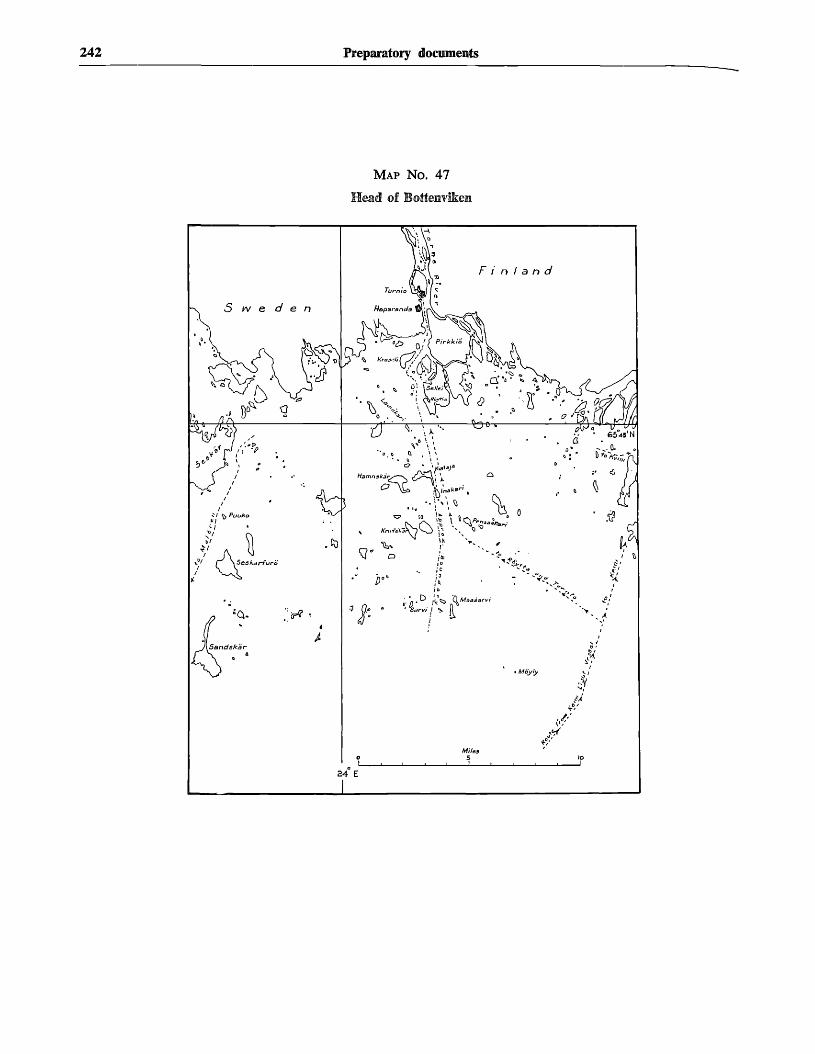
242 Preparatory documents
MAP NO. 47
Head of Bottenvikem
land
24 E

Document A/CONF.13/15 243
MAP NO. 48YIro Lachti Area
F i n l a n d
y
Miles
• 'p
MAP NO. 49River Guadiana
MAP NO. 50River Evros
.5arnothraki
Milt,
1


Document A/CQNF.13/16
THE ECONOMIC IMPORTANCE OF THE SEA FISHERIES
MEMORANDUM BY THE FOOD AND AGRICULTURE ORGANIZATION OF THE UNITED NATIONS
(Preparatory document No. 13)
CONTENTSPage
I. THE ECONOMIC IMPORTANCE OF THE SEA FISHERIES IN
DIFFERENT COUNTRIES 2 4 5
n. TABLES
Sources 251Table 1 Product of the sea fisheries as percentage of
aggregate domestic product and otherindicators of the economic importance ofthe sea fisheries in selected countries 252
Table 2 Indicators of the economic importance ofthe sea fisheries in different countries . . . 254
Table 3 Disposition of catch by countries, 1955 . . . 260
HI. MAPS AND GRAPHS
I World catch: by major fishing areas, 1956 262
II Catch of fish, crustaceans, molluscs, etc., regionaltotals, 1956 263
III Catch of fish, crustaceans, molluscs, etc., for the34 largest producing countries, 1956 264
IV World catch: by groups of species, 1938, 1948,1953-56 265
V Catch of fish, crustaceans, molluscs, etc., bycontinents and groups of species, 1956 266
VI Disposition of world catch 267
VII Selected processed and preserved fishery com-modities 268
" • SUMMARIES OF CATCH AND LANDINGS: WORLD
A-l World catch: by continents and by regions . . . 270
A-2 World catch: by groups of species 272
A-3 World catch: by major fishing areas 273
A-4 World catch and landings: by countries arrangedby continents 275
A-5 World catch and landings: by countries arrangedby regions 281
PART I
fhe economic importance of the sea fisheriesin different countries
on " t 1 lI n
Tp r e p a r a t i o 1 1 for the United Nations Conference
U M ^ ° f t h e S e a ' t h e Sec re t a ry-General of theg^. Nations has requested the Food and Agriculture
Nation (FAO) to prepare a working document for
[Original text: English][20 November 1957]
a statistical examination of the economic importanceof fisheries in the different countries. It has not beenpossible for FAO to undertake a special study for thispurpose, but a group of tables has been compiled on thebasis of readily available data and is here presentedalong with some remarks and explanations which maybe of assistance in the proposed examination. As faras possible the statistical data relate to the sea fisheriesonly since it is these that come within the terms ofreference of the Conference.
2. The importance of sea fisheries in the economyof a country may be judged in a variety of ways. Themost general statistical indicator of this importance isthe proportion of the national income derived from thefisheries. It is calculated by relating the gain from theproductive activity of the sea fishing sector of the economyto that arising out of all the productive activities of acountry or its nationals. The gain referred to includesoperating profits, interest and rent earned by enterprisesas well as compensation to employees. There are severalvariants of this indicator, but the differences betweenthem are unlikely to affect substantially the classificationof countries shown in section 1 of table 1. Only a fewcountries report their national income statistics insufficient detail to permit calculation of one or more ofthese variants, but the ratio of the value of fish landingsto the gross domestic product (which can be calculatedfor many more) is in most cases a sufficient approxima-tion, though it somewhat overstates the importance ofthe sea fisheries.
3. Section 1 of table 1 presents the results of thecalculations for nearly 40 countries to the nearest fullper cent and is summarized below. The percentages areintended to reflect approximately the contribution madeby the sea fisheries to the national income of each ofthe countries shown. It will be seen that in the majorityof cases the reported income from the sea fisheries isless than one per cent of the total income of the country.Five countries report about one per cent, four (HongKong, Japan, Malaya and Portugal) two per cent andfour (China (Taiwan), the Philippines, Norway andThailand) three per cent. Only Iceland reports fishingincome well in excess of three per cent of the total. Itshould be noted, however, that the section does not showvalues for some other countries, such as the FaeroeIslands and Greenland, known to be heavily dependenton the sea fisheries for their national income.
245

246 Preparatory documents
Summary Extract from Table 1, Section 1: Product of the SeaFisheries as Percentage of Aggregate Domestic Product in SelectedCountries
Percentage
Less than
Over
1%
2%3%
3%
Countries (Number)
Various (25)Tunisia; Korea (South); Denmark;
Greece; Spain (5)Hong Kong; Japan; Malaya; Portugal (4)China (Taiwan); Philippines; Thailand;
Norway (4)Iceland (1)
4. In order to obtain some idea of the role playedby the sea fisheries in the economy of the many countriesthat could not be included in section 1 because of lackof data, recourse must be had to other more readilyand widely available statistical information which maybe expected to bear some relationship to the percentagein section 1 of table 1. In this connexion, it is helpfulto regard this percentage as the resultant of the factorsshown in sections 2 and 3 of tables 1 and 2. They are,on the one hand, the quantity of sea fishery landingsper head of the population and the unit value of landings,which may be combined as value of landings per headand, on the other, the national income per head.
5. Where statistics of all these factors are available,the importance of the sea fisheries can be indicated asin section 1 of table 1, but even incomplete informationmay be of help to users of the tables in making someassessment of the importance of the sea fisheries in themany countries not included in section 1 of table 1because of lack of data, but for which some of thefactors are given in sections 2 and 3 of table 2. If, forinstance, the sea fishery landings per head of the popula-tion are high, this may be taken as a prima facie indica-tion of economically important sea fisheries, thoughthis first estimate may have to be modified in the lightof what is known or surmised about the price or unitvalue of the fish landed, and about the general level ofthe national economy as indicated by national incomeper head. The economic importance of the fisheries willclearly be greater if the fish landed is high priced thanif it is of low value. Again, fish landings of a givenvalue per head will mean more to the national economyin a poor country than in one with high average incomes.
6. Before such assessments for the majority of thecountries listed in table 2 are attempted, it may behelpful to refer to sections 2 and 3 in table 1 and tosee how the factors shown there determine the indicatorof importance in section 1. In doing so, it should benoted that the dollar values in section 2 are computedon the basis of official rates of exchange. These ratesare sometimes applicable only to a limited range offoreign exchange transactions and may not give a truepicture when used to convert values of domestic fishproducts. The dollar values in section 3 also are to beused with caution and reference should be made to thesources of the computations.
In section 2 (a) it will be found that fish landings perhead in Iceland are, as one would expect, exceptionallyhigh and, although the unit value is only in the $100-per-ton class and the general level of incomes is high,
the result is an exceptionally high contribution by thefisheries to the national income. Norway's landings perhead, though much less than Iceland's, are still veryhigh compared with those of other countries shown inthe table. Again the unit value is comparatively lowand average incomes high and the fishery contributionto the national income is about three per cent. It isinteresting to compare these characteristics with thoseof the other countries in the three per cent class. Theyare the three Eastern countries, China (Taiwan), thePhilippines and Thailand. The fish they land per headof their population is a mere fraction of the Norwegianper caput production, but the unit value is high — ageneral characteristic of countries with comparativelyprimitive production methods — and the level of incomesis characteristically low so that these comparativelysmall per- capita landings are relatively as importantto their national economies as the many times greaterlandings in Norway are to that country's income. Japan,on the other hand, lands much more sea fish per headthan the three Eastern countries just mentioned, but theunit value is much lower and, with an average nationalincome of the same order, Japan ends up somewhatlower in the scale, in the two per cent class. Canada withlandings per head and unit values very similar to thoseof Japan comes out in the lowest class (below one percent of the national income), because of its much higheraverage incomes.
The general conclusions one may read from an examina-tion of the table are as follows: Countries with highlydeveloped production methods producing fish cheaplyand having income levels normally need to land aboutten tons of sea fish or more per 100 inhabitants to comeinto the class with three per cent or more of the nationalincome contributed by the fisheries. Countries of thistype are likely to derive substantially more than threeper cent of their national income from the sea fisheriesonly if they have exceptionally high catch figures of theorder of 100 tons per 100 people or more. Countrieswith comparatively primitive production methods, highfish prices and low average incomes are likely to fallinto the two or three per cent classes if their sea fisherylandings are well over one ton per 100 inhabitants. Theapplication of these conclusions in the interpretation ofsections 2 and 3 of table 2 requires some individualjudgments and must be left to users of the tables. Thesummary table below may be of assistance in thisconnexion.
7. Only the primary phase of the sea fisheries hasbeen considered in the sections so far discussed. Ideally,the income from processing and perhaps also froffltransporting and distributing sea fishery products shouldalso be considered when the economic importance ojthe sea fisheries is being examined. However, statisticaldata are very scarce and often these activities involvefish along with other foods so that the relevant incomefigures cannot easily be segregated. It is clear, nevertheless,that where most or all of the sea fish is marketed at oncin the form in which it is landed, little or no allowanneed be made for income from processing, whereascases where the bulk of the catch is frozen, c^Jf^L
dried or reduced, e.g., for export, the value addeprocessing is likely to be very considerable. In . ^which is a good example of the latter case, it is estiina ^that processing adds about 90 per cent to the value

Document A/CONF.13/16 247
Summary extract from table 2, sections 2 and 3: sea fishery landings per 100 inhabitantsand national income per head for selected countries
Landings(landed weight) per 100 inhabitants
Up to 1 ton
Over 1 ton but under 10 tons . . .
10 tons - 99 tons
100 tons or more
National income per head
$1,000 or more
Australia
Canada (incl. New-foundland)
United States (incl.Alaska)
SwedenNew Zealand
S500-S900
ArgentinaVenezuela
Israel
BelgiumFrance
DenmarkFinlandGermany, Federal
Republic ofNetherlandsUnited Kingdom
Norway
Iceland
Under $500
Belgian Congo BrazilEgypt ColombiaGhana Ecuador
Kenya BurmaMauritius CeylonMorocco (A) IndiaTunisia Lebanon
PakistanCuba SyriaMexico ThailandPanama TurkeyPuerto Rico
GreeceIreland, Republic ofItaly
Union of South Africa China (Taiwan)Japan
Chile Korea (South)Peru Malaya, Federation of
PhilippinesHong KongPortugalSpain
Summary extract from table 2, section 2: sea fishery landings per 100 inhabitants:countries for which no national income figures are available
Landings(landed weight) per 100 inhabitants
Up to 1 ton
Over 1 ton but under 10 tons . .
---__l 0 ^ tons
"\r\r\ • .
l^^s^niore
AlgeriaBritish SomalilandCameroons (Br. Adm.)Cameroons (Fr. Adm.)Cape Verde IslandsEthiopia and Eritrea, Fed. ofFrench Equatorial Africa'French West AfricaGambiaLiberiaLibyaMadagascarMozambiqueNigeriaPortuguese GuineaReunionSao Tome and PrincipeSierra LeoneSomalia (Ital. Adm.)Spanish GuineaSudanTanganyikaTogoland (Fr. Adm.)
AngolaFrench SomalilandMorocco (B)Morocco (C)St. HelenaSeychellesSpanish West AfricaZanzibar and Pemba
South West AfricakJvULLL TV VJL n i l l v A
Greenland
Tristan da Cunha
Countries
British HondurasCosta RicaDominican RepublicEl SalvadorGuadeloupeGuatemalaHaitiHondurasNetherlands AntillesNicaraguaPanama (Canal Zone)JamaicaTrinidad and TobagoBritish GuianaSurinamUruguay
China (mainland)CyprusIndonesiaIranIrakJordan
Bahama IslandsBarbadosBermudaLeeward IslandsMartiniqueVirgin Islands (UK)Virgin Islands (US)Windward Islands
Falkland IslandsFrench Guiana
lYXCllUlYV XJlM 1 l\ 1 3
St. Pierre and Miquelon
Portuguese TimorSaudi ArabiaSingaporeViet-NamWest New GuineaYemen
AlbaniaBulgariaGermany (Eastern)Malta and GozoPolandRomaniaYugoslavia
GuamNew Guinea (Austr. Adm.)
USSR
AdenBruneiCambodiaKorea (North)MacauNorth BorneoRyukyu IslandsCook IslandsFrench OceaniaHawaiiNew Caledonia
American Samoa
Faeroe Islands

248 Preparatory documents
the fish as landed. Table 3 gives available informationon the disposition of the catch in various countries andmay be helpful in estimating approximately the valueadded in processing. As with the estimates called forat the end of the preceding section, the necessary judg-ment must be left to the users of the tables.
8. The economic importance of the fisheries may alsobe considered in respect of the external trade of a country.Section 4 of Table 2 shows for over 100 countries, forwhich data are available, the percentage of the totalvalue of imports and of exports contributed by fisheryproducts. It has not been possible to separate sea pro-ducts from those of the fresh-water fisheries, but theoverstatement of the importance of the sea fisheries inexternal trade, which might have resulted in a fewcases, is likely to be too small to show in the roundedpercentages given in the table. The situation issummarized below. On the import side, only two smallisland groups have more than five per cent fish, by value,in their total merchandise purchases from abroad.Over 60 countries show fish valued at between one andfive per cent of total import trade and the remaining40 report less than one half of one per cent. On theexport side, the picture is more diversified. The exportsof six countries consist to the extent of more than one-fifth of fishery products. The Faeroes and Iceland exportvery little else and the small island groups of St. Pierreet Miquelon and the Falklands have, respectively, 77 and63 per cent fish exports. Greenland has 33 per cent andNorway 24 per cent. Eight other countries report overfive per cent fishery products in their export totals:Angola, the Bahama Islands, Iran, Japan, Morocco,Panama, Portugal and South West Africa. There are32 countries with fishery products contributing betweenone and five per cent of export trade and 57 with stillsmaller fish exports, or none at all.
In interpreting these results, it should be borne inmind that some countries include landings by theirfishing vessels in foreign countries in their export statistics,while others do not. Similar differences occur in thetreatment of landings by foreign vessels whether fordomestic consumption or for export.
Summary extract from table 2, section 4: external trade in fisheryproducts as percentage of total merchandise trade, 1953
Percentage
Less than i % .
1% to 5% . . .
6% to 20% ..
Over 20% . . . .
Countries (Number)
Imports
Various (41)
Various (61)
Sao Tome (1)
FalklandIslands (1)
Exports
Various (57)
Various (32)
AngolaBahama IslandsIranJapanMorocco (A and B)PanamaPortugalSouth West Africa (8)
Falkland IslandsFaeroe IslandsGreenlandIcelandNorwaySt. Pierre and Mi-
quelon (6)
9. The retention of fishery products in a countrywhich is largely a function of domestic production andexternal trade, may also be of interest in an examinationof the economic importance of its fisheries. The statisticsand estimates, as available, are rather rough and con-siderable refinements would be necessary to make exactcomparisons between countries possible. However, mostof the countries listed in Table 2 can with some degreeof confidence be placed in one of the classes shown insection 5. Some twenty countries and territories — manyof them very small — retain 20 or more kilogrammes offish (landed weight) per head of the population. Theyinclude a group of countries in the Far East consistingof Japan, China (Taiwan), Korea (North), Hong Kongand Macau, and, in Europe, Iceland, Norway, Portugal,Sweden and the United Kingdom. Approximately thesame number of countries are found in the next class,retaining 10 or more, but less than 20, kilogrammes offish. Here are found some more Eastern countries, e.g.,Indonesia, Korea (South), Malaya, the Philippines, andNorth Borneo and Sarawak and, in the European region,Denmark, Germany (Federal Republic), the Netherlands,Spain and the USSR. Also in this class are many territoriesin the Caribbean area. The rest of the countries forwhich an estimate could be made have been allocatedto the two lowest classes with retention of less than10 kilogrammes per head.
10. As background material for reference purposes,some maps, graphs and tables taken from the FA0Yearbook of Fishery Statistics 1955-56 have also beenincluded with the statistical material attached to thisdocument. Figures are given and illustrated for theworld catch and landings of fish and other aquaticanimals (except baleen and sperm whales) by continents,regions, countries, groups of species and major fishingareas.
11. In conclusion, attention may be drawn to limita-tions in the usefulness of the statistical material presented.Some of these limitations have already been mentioned.Both national income statistics and fishery statistics areas yet very far from perfect even in those countries whereconsiderable efforts have been made to improve them.In many cases the figures are only very rough estimatesthat may well be seriously off the mark. It is for thisreason that the tables give ratios in preference toabsolute values and that the figures have been roundedand presented in broad classes. This procedure eliminatessome of the inaccuracies, but others undoubtedly remainThe precision of the data is, in any event, too low topermit more detailed computation and analysis tnotherwise would be desirable. Additional stat*st?(Tinformation, at present not internationally availablywould also be highly desirable, e.g., the amount of capi Jinvested and labour employed in a fishing industryrelation to the rest of the economy.
Apart from these and other limitations of the s ta t i s£ct0
material, there are conceptual limitations in regarthe subject matter of the Conference. When the econo ^effect on a country of changes in its sea fisheries is ^considered, the importance of the sea fisheries l ^national economy at the time of the change is ^ ^ e
significant as the sensitiveness or vulnerability . tofS
fishing industry to such changes. Measures or in * ^of the economic importance of the whole oi ^fisheries in relation to the whole of the economy

Document A/CONF.13/16 249
ally helpful only when the changes envisaged are*e J j c a nd sudden contractions. The impact of a sudden
mplete destruction of the fish stocks within reach ofthe fishing fleet of a country, for instance, would belose to a loss of the total income derived from these
fisheries and, from the point of view of the nationaleconomy, would be commensurate with the importanceof the total income from the fisheries in the nationalincome as a whole, since such complete and suddendestruction would leave the capital and labour engagedm the sea fisheries idle and without income. But completeand sudden destruction is only a remote possibility andthe changes which are of practical importance are morepartial and gradual. The economic effect of such changesjs only indirectly related to the importance, within thenational economy, of the fishery in question. It willprimarily depend on the difficulty in the way of shiftingcapital and labour into and out of the fishery and on thedemand for its product. A scarcity of fish on the groundsmay lead to heavy loss of income in one case where thereis very little alternative employment for boats, gear,plants and men in a highly specialized fishing area sellingits catch in a competitive, unprotected market and wherethe industry is therefore vulnerable. The same kind ofscarcity might have very much less effect on incomesin another case where there are alternative uses for someequipment, some labour can find employment easilyoutside the fisheries and the reduced production can besold at a better price, for instance, by curtailing onlythe least remunerative use of the fish. It may well be thateven though the importance of the fishery in the nationaleconomy may have been less in the first case mentionedabove than in the second, nevertheless the economiceffect of the scarcity of fish would be greater not onlyfor the area directly affected but even for the countryas a whole.
A drastic and sudden increase in the fish stocks withinreach of a fishing fleet, for instance through discoveryof important new fishing grounds, is less exceptional thansudden destruction of stocks. But neither it, nor themore common case of greater stocks gradually becoming
available to the fishing fleet is likely to produce incomechanges that are at all closely related to the importanceof the fisheries in the national economy before thechange. Rather, the factors mentioned before, thedemand for the product and the availability of capitaland labour will be the determining ones. Where, forinstance, demand is not favourable, newly discoveredcatchable fish stocks may not be utilized and may haveno effect at all, no matter how important the sea fisheryhappens to be in the national economy. Unfished stocksand schemes to limit catching in order to maintainprices exist in many places.
It is clear from these examples alone that in orderto assess the effect on national economies of most ofthe changes likely to occur in a fishery, one would needinformation on what is technically known as the mobilityof factors, i.e., the costs involved in diverting capital,labour and other factors of production to other uses(and vice versa) and on the elasticity of demand. Hardlyany such information is available and it is certain thatmuch research would be needed to obtain it. If economicconsiderations were to be taken into account objectivelyin determining legal questions connected with the seafisheries or in regulating these fisheries, there would beneed for much greater knowledge of the relevant economicfactors and consequently for a very great deal of economicinvestigations. This conclusion is perhaps not surprisingin view of the great effort that has been expended overmany years now in biological investigations with thepurpose of obtaining adequate and reliable informationon the biological factors affecting the fisheries.
As indicated at the beginning, this working paper isconcerned only with the economic importance of thefisheries in different countries, which is measured interms of income. Other measurements, for instance interms of capital investment and of employment, are notat present available. It may also be noted that if thegeneral importance of the fisheries were to be discussed,aspects, other than economic, e.g., social, nutritional andstrategic importance, would have to be taken into account.


Document A/CONF.13/16 (continued)
PART II
Tables
SOURCES FOR TABLES 1 TO 3
United Nations, Statistical Office: Statistics of national income and expenditure, Statistical Papers,Series H, No. 10, New York, January 1957.
United Nations, Statistical Office: Per capita national product of fifty-five countries: 1952-54,Statistical Papers, Series E, No. 4, ISTew York, 1957.
United Nations, Statistical Office : Direction of international trade, Statistical Papers, Series T,New York, monthly.
International Monetary Fund: International financial statistics, Washington, D.C., monthly.
United Nations, Statistical Office: Statistical yearbook, 1956, New York, 1956.
United Nations, Statistical Office: Yearbook of international trade statistics, 1955, New York,1956.
Organization for European Economic Co-operation: Fish marketing in OEEC countries, Paris,1951.
Food and Agriculture Organization: Yearbook of fishery statistics: 1955-56, Vol. VI — Produc-tion and Fishing Craft, Rome, 1957.
Food and Agriculture Organization: Yearbook of fishery statistics: 1952-53, Vol. IV, Part 2 —International Trade, Rome, 1955.

TABLE 1. Product of the sea fisheries as percentage of aggregate domestic product and other indicators of the economic importance of the sea fisheries in selected countries 1
Countries
Section 1Product of the sea fisheries
1953-1955
Per cent of aggregate domesticproduct
1 % 2% 3 %& over
Notes
Section 2Sea fishery landings
1955
(a) Metric tons(landed weight)
per 100 inhabitants
10& over
(&) 100 U.S. dollars per ton(landed weight)
4& over
(c) U.S. dollars per inhabitant
i ! 4& over
Notes3
Section 3National income
1952-54
ThousandU.S. $ perinhabitant
Notes4
Africa
AngolaMorocco (A)Morocco (B)TunisiaUnion of South AfricaZanzibar and Pemba .
America, North
Canada
United States
America, South
ArgentinaBrazil . . .Chile . . . .ColombiaVenezuela
Asia
China (Taiwan)Hong Kong . . .IndiaIsrael
Japan
AA
AAAFA
BBFAA
1.01.2
0.3
0.40.3
0.1.0
0.20.1
1.6
1.91.8
6.8
2.63.2
5.4
3.2
5.5
0.2
0.3
0.3
0.90.7
1.01.2
0.9
1.1
2.0
2.9
2.4
1.8
1.5
2.8
4.0
4.5
0.3
0.1
1.40.90.80.90.8
0.9
1.0
0.5
1.9
1.8
2.7
6.4
5.4
5.3
6.1
a
bc i o
a
aaa
0.2
0.10.3
1.31.9
0.50.20.40.30.5
0.10.20.10.50.2

Turkey
Europe
BelgiumDenmarkFinlandFrance (incl. Algeria)Germany, Fed. Rep. of
GreeceIcelandIteland, Rep. of .Italy
'Malta and Gozo
NetherlandsNorway . . . .Portugal . . .SpainSweden
United KingdomYugoslavia
Oceania
AustraliaHawaiiNew Zealand
14
AAABA
FBAA 0.4
0.3
0.1
0.8
1.10.91.4
0.7
0.8
0.61.3
2.3
2.0
2.5
3.3
2.7
1.7
9.3
257.7
48.1
§
0.8
0.8
0.8
0.90.5
1.2
1.3
1.6
2.4
1.6
1.51.6
1.9
2.9
2.8
3.1
4.7
3.94.5
0.3
... |
1.3
1.1
1.31.11.4
2.2
2.62.6
3.2
2.6
2.6
3.2
7.4
206.2
24.15.03.7
5.8
= "- Ta. '
baabb
abba 1 2
b
aaab 1 4
a
ba
a i a
bb
0.80.80.70.70.5
0.20.80.40.3
0.20.31.0
0.8
1.0
1.0
doo
no
Notes :
1 See table 2 for data on external trade and per capita retention of fishery products.2 A — Value of landings: Gross domestic pioduct, at current market prices.
B — Value of landings: Gross national product, at current market prices.C — Value of landings: Net domestic product, at current factor cost.D — Value of landings: Gross material product, at current market prices.E — Gross product of the fisheries: Gross domestic product, at current factor cost.F — Net product of the fisheries: Net domestic product, at current factor cost.
3 a — Sea fishery landings as reported by the countries.b — Total landings as reported by the countries, assumed equal to sea fishery landings,c — FAO estimate.
4 National income: 1952-54 average; population: mid-year 1953. Exceptions are footnoted.
5 Refers to 1954.
8 Value data refer to 1953.
7 Refers to 1953.
8 Conversion by the method described in "Per Capita National Product of Fifty-five Countries: 1952-1954", Statistical Papers series E, No. 4, United Nations, New York, pp. 10-12.
9 Value data in (£>) refer to total landings in 1954.10 Value data refer to 1956.11 Value data refer to 1954.13 Value data in (6) refer to total landings.13 Refers to 1952.14 Refers to 1955.

TABLE 2. Indicators of the economic importance of the sea fisheries in different countries 1
Section 5Retention of sea fishery product
1955
Kg. — (landed weight)per inhabitant
Countries
Section 2Sea fishery landings
1955 2
(a) Metric tons (landed weight)per 100 inhabitants
10& over
Notes 3
Section 3National income
1952-54
ThousandU.S. $ perinhabitant
Notes*
Section 4External trade in fishery products
as percentageof total merchandise trade,
1953
Imports%
Africa
AlgeriaAngolaBasutolandBechuanalandBelgian Congo
British SomalilandCameroons (British Adm.)Cameroons (French Adm.)Cape Verde IslandsEgypt
Ethiopia and Eritrea, Fed. of . . . .French Equatorial AfricaFrench SomalilandFrench West AfricaGambia
GhanaKenyaLiberiaLibyaMadagascar
MauritiusMorocco (A)Morocco (B)Morocco (C)Mozambique
NigeriaPortuguese GuineaReunionRhodesia and Nyasaland, Fed. ofRuanda-TJruiidi
Setyebaliea . . . . . . . . . . . . . . • •Sierra. JLeone . . . . . . . . . . .
Somalia (Italian Adm.)
South West Africa
0.3
0
0.20.20.2
0.1
0.10.1
0.40.4
0.40.10.10.20.1
0.4
0.1
0.10.10.3
6.8
0.9
1.3
1.01.21.1
0,7
52.3
0.1
ccaba
babcc
1abcc
bbbcb
ccb
0.1
0.10.1
0.20.2
0.1
ReunionRhodesia and Nyasaland, Fed. ofRuanda-Urundi
JSreEaaat -• •„;.«. . • T . " ! - . - J •.-••:Sierra Leone , .Somalia (Italian Adm.)
South West AfricaSpanish GuineaSpanish West AfricaSudanSwaziland
TanganyikaTogoland (French Adm.)Tristan da CunhaTunisiaUganda
Union of South Africa
Zanzibar and Pemba
America, North
Bahama IslandsBermudaBritish HondurasCanada (incl. Newfoundland)Costa RicaCubaDominican RepublicEl SalvadorGreenlandGuadeloupe
GuatemalaHaitiHondurasMartiniqueMexico
Netherlands AntillesNicaraguaPanamaPanama (Canal Zone)Puerto Rico
St. Pierre and MiquelonSwan IslandsUnited States (incl. Alaska)Virgin Islands (U.K.)Virgin Islands (U.S.)
0.3
0.10.2
0.3
0 . 7
0.1
0.200
00.10.2
0.3
0.40
0.30.20.1
0.6
0.8
1.4
1.81.7
1.6
2.0
5.4
2.63.2
5.4
3.0
52.3
99.2
136.0
0.1*••
,,.
0.1
0.3
1.3
0.3
...
0.2
...
0.3
0.4
1.9
10
1 20
° 10
00
0
0
2
0
100
1
221
—0
3
0
00
1
2
I --
' "' 43
13
1
12
3
30
11—
13
0—
0
33—
0
7
00
12
77
0
1 11 x 1
X \
X I
XX
X
XX
X
X
X
XX
XXX
X
XXX
xjI\
X
X
X
X
X
X
\
\
\\
X
X
X
X
X
1/I\\
X '
X
X
X
X
X
For footnotes, see end of table.

TABLE 2. Indicators of the economic importance of the sea fisheries in different countries 1 (continued)
Countries
Section 2Sea fishery landings
1955 2
(a) Metric tons (landed weight)per 100 inhabitants
0 1 2 5 10& over
Notes 3
Section 3National income
1952-54
ThousandU.S. S perinhabitant
Notes 4
Section 4External trade in fishery products
as percentageof total merchandise trade,
1953
Imports%
Exports%
Notes
Section 5Retention of sea fishery products,
1955
Kg. — (landed weight)per inhabitant
< 5 < 10 < 20 above20
America North (continued)
West IndiesBarbadosJamaicaLeeward IslandsTrinidad and Tobago ,Windward Islands
America, South
Argentina ,BoliviaBrazilBritish GuianaChile
ColombiaEcuadorFalkland IslandsFrench GuianaParaguay
PeruSurinamUruguayVenezuela
Asia
AdenAfghanistanBahrain IslandsBhutanBoron Islands
maa"*^"11 "* •"'*"'"""Cambodia . . .Ceylon •China (Mainland)
China (Taiwan)
0.3
0.4
0.2
00.4
0.2
1.2
1.20.51.1
0.7
1.0
1.0
2.0
3.2
5.07.1
4.4
O.4O.3
1.9
a
cbb
cbcb
bcba
0.5
0.2
0.4
0.30.2
0.1
0.1
0.5
0 . 1
2030
01
21
00
0—
63

Ceylon
China (Mainland)
China (Taiwan)CyprusHong KongIndiaIndonesia
IranIraqIsraelJapanJordan
Korea (North)Korea (South)KuwaitLaosLebanon
MacauMalaya, Fed. ofMaldive IslandsMongolian People's RepublicMuscat and Oman
NepalNorth BorneoPakistanPhilippinesPortuguese India
Portuguese TimorQatarRyukyu IslandsSarawakSaudi Arabia
SingaporeSyriaThailandTrucial OmanTurkey
Viet-NamWest New GuineaYemen
O.4
0.3
0.1
0.2
0.10.10.1
0
- -0.1
0.1
0.1
0.1
0
0.4
0
0.5
1.2
0.5
0.8
0.50.5
1.9
1.8
1.8
1.6
1.7
1.7
5.5
3.7
2.8
22.5
0.1
0.20.1
0.50.2
0.1
0.3
0.3
caa
c
b
c
bca
a
bbc
0.10.2
0.20.1
0.2
4120
1
0
1110
" \
X
X
X
X
X
X
X
X
X
X
X
X
X
X
X
X
~ \
X
X
• \
\
X
X
X
X
X
X
XX
X
X
For footnotes, see end of table.

TABLE 2. Indicators of the economic importance of the sea fisheries in different countries 1 (continued)
Countries
Section 2Sea fishery landings
1955 2
(a) Metric tons (landed weight)per 100 inhabitants
10& over
Notes 3
Section 3National income
1952-54
ThousandU.S. S perinhabitant
Notes 4
Section 4External trade in fishery products
as percentageof total merchandise trade,
1953
Imports%
Exports Notes
Section 5Retention of sea fishery products,
1955
Kg. — (landed weight)per inhabitant
< 5 < 10 < 20 above20
Europe
AlbaniaAndorraAustriaBelgiumBulgaria
CzechoslovakiaDenmarkFaeroe IslandsFinlandFrance
Germany (Eastern)Germany, Fed. Rep. ofGibraltarGreeceHungary
IcelandIreland, Rep. ofItalyLiechtensteinLuxembourg
Malta and Gozo
Monaco
NetherlandsNorwayPoland
PortugalRomaniaSan MarinoSpainSv/eden
Oceania
0.2
0.1
0.1
0.4
0.3
0.4
0.2
0.8
1.11.0
1.4
0.7
0.
2.3
9.3
2.5
3.3
2 . 7
-trrr
320.0
257.7
48.1
bb
a
aab
a13
b
a
bba
0.40.8
0.8
0.70.7
0.5
0.2
0.80.40.3
0.9
aab
a
c
ba
00
0
0i
.5
.7
.2
.3
.0
1311
0
2
02
499
00
0
2
9611
124
11

Oceania
American SamoaAustralia ..Cook. IslandsFrench Oceania •.Guam
HawaiiNew CaledoniaNew Guinea (Australian Adm.)New Zealand
U.S.S.R
0.1
0.6
0.6
1.31.1
0.9
1.7
5.02.6
21.4
a
babbb
bbbb
a
1 .U
1.0
1.0
\ j
1
1
11
i i
1
0
101
-
__ . j i i "
X
X
X
X
\
X
X
X
XX
Notes:0 = above zero, but negligible.1 For section 1 (Product of the Sea Fisheries as Percentage of Aggregate Domestic Product) see table 1
(selected countries).2 For sections 2 (6) and 2 (c) see table 1 (selected countries).3 a — Sea fishery landings as reported by the countries.
b — Total landings as reported by the countries, assumed equal to sea fishery landings,c — FAO estimate.
4 National income: 19S2-S4 average; population: mid-year 1953. Exceptions are footnoted.5 Ruanda-Urundi is included with Belgian Congo.
6 Conversion by the method described in "Per Capita National Product of Fifty-five Countries: 1952-1954 ", Statistical Papers series E, No. 4, United Nations, New York, pp. 10-12.
7 Refers to 1955.8 Uganda is included with Kenya.B Refers to 1954.10 Refers to 1953.11 Refers to 1952.12 Including Algeria.13 Refers to 1951.
©naB
stno
i

TABLE 3. Disposition of catch by countries, 1955
(A = thousand metric tons. B = percentages)
CountriesTotal catch Marketing fresh Freezing Curing Canning Reduction Miscellaneous
purposes
AfricaUnion of South Africa
America, NorthCanada (excl. Newfoundland)Canada (Newfoundland only)United States (incl. Alaska) .
America, SouthArgentinaChileColombiaVenezuela
AsiaIndiaJapan °Korea (South)PhilippinesTurkey
EuropeBelgiumDenmarkFaeroe IslandsFinlandFrance (incl. Algeria)
GreeceIcelandIreland, Rep. ofItalyNetherlands •
NorwaySpainUnited Kingdom
OceaniaAustralia °
378.2 100
654.3 100290.2 100
2 738.9 100
78.9 100208.6 100
18.0 10069.9 100
839.0 100A 162.6 100
259.2 700384.7 100111.5 700
76.7 700425.3 700105.6 70063.3 700
524.2 700
60.0 700480.3 70023.6 700
218.0 700219.5 700
1 813.4 700760.1 700
1 225.2 700
47.3 700
71.7 19
150.56.9
856.7
42.295.98.4
25.0
358.31.441.9209.4241.772.1
57.799.67.543.9312.82
56.015.118.9186.5126.0
222.0457.9945.4
35.8
23231
54464736
4331816365
75237
6960*
933808540
126077
76
17.3
148.3 2399 A 34269.8 70
0.7 70.3 0
391.40.3
4.2
6.044.62.12.52
1.0223.80.32.17.6
139.7
80.2
7.2
81124
247112
54.0 14
119.8155.533.0
1.41.58.2
27.5
425.4241.636.5143.025.0
9.611.695.98.6
153.9
2.5232.42.321.3115.2
465.0218.047.3
18541
214539
5147143722
123911429
448101036
26294
44.6 12
67.1 700.3 0
611.4 22
29.327.5
15
378.79.2
1.2
2.217.9
0
0.857.5
0.50.40.18.124.8
54.2.78.816.3
3.6
3713
VIA 25
340
777
70
0
48
3101
189.9 50
148.1 23
942.5 35
3.5 483.4 40
55.3 6251.5 5
8.5
1.2 2207.6 490.1 07.5 12
8.60.7
22.1
915.25.4
110.4
5019
0.7
20.528.125.5
1.8
1.4
57.53.8
0.5
44.0
0
1.3
.23.8
17.3
25.6
0.7
3101
10
= above zero, but negligible. 1 Data refer to 1956. a "Marketing fresh" includes "Freezing".

Document A/CONF.13/16 {continued)
PART III
Maps and Graphs

262 Preparatory documents
I
World Catch:By major fishing areas, 1956
I
Quantites pech£es dans le monde:par priecipales zones de peche, 1956
E: 5000001. >;#3 I H: 1200001.
I N:
MARINE AREAS ZONES MARITIMES
ATLANTIC.NORTHWESTERN A ATLANTIQUE. NORD-OUEST
ATLANTIC. NORTHEASTERN B ATLANTIQUE. NORD-EST
MEDITERRANEAN AND BLACK SEA C MEDITERRANEE ET MER NOIRE
PACIFIC. NORTHWESTERN D PACIFIQUE. NORD-OUEST
PACIFIC.NORTHEASTERN E PACIFIQUE.NORD-EST
ATLANTIC. WESTERN-CENTRAL F ATLANTIQUE. OUEST-CENTRAL
ATLANTIC. EASTERN-CENTRAL G ATLANTIQUE. EST-CENTRAL
INDIAN OCEAN. WESTERN H OCEAN INDIEN.OUEST
INDO-PACIFIC AREA, . , I ZONE INDO-PACIFIQUE
PACIFIC. EASTERN-CENTRAL J PAdFIQUE. EST-CENTRAL
ATLANTIC. SOUTHWESTERN K ATLANTIQUE. SUD-OUEST
ATLANTIC. SOUTHEASTERN L ATLANTIQUE. SUD-EST
PACIFIC. SOUTHWESTERN M PACIFIQUE. SUD-OUEST
PACIFIC.SOUTHEASTERN N PACIFIQUE. SUD-EST
FRESHWATER AREAS ZONES D*EAU DOUCE
AFRICA I ...AFRIQUE
AMERICA. NORTH .... II ....AME^RIQUE DU NORD
AMERICA. SOUTH Ill ...AMERIQUE DU SUD
ASIA IV . . .ASIE
EUROPE V ...EUROPE
OCEANIA VI . . . . O C E " A N I E
U.S.S.R VII....U.R.S.S.
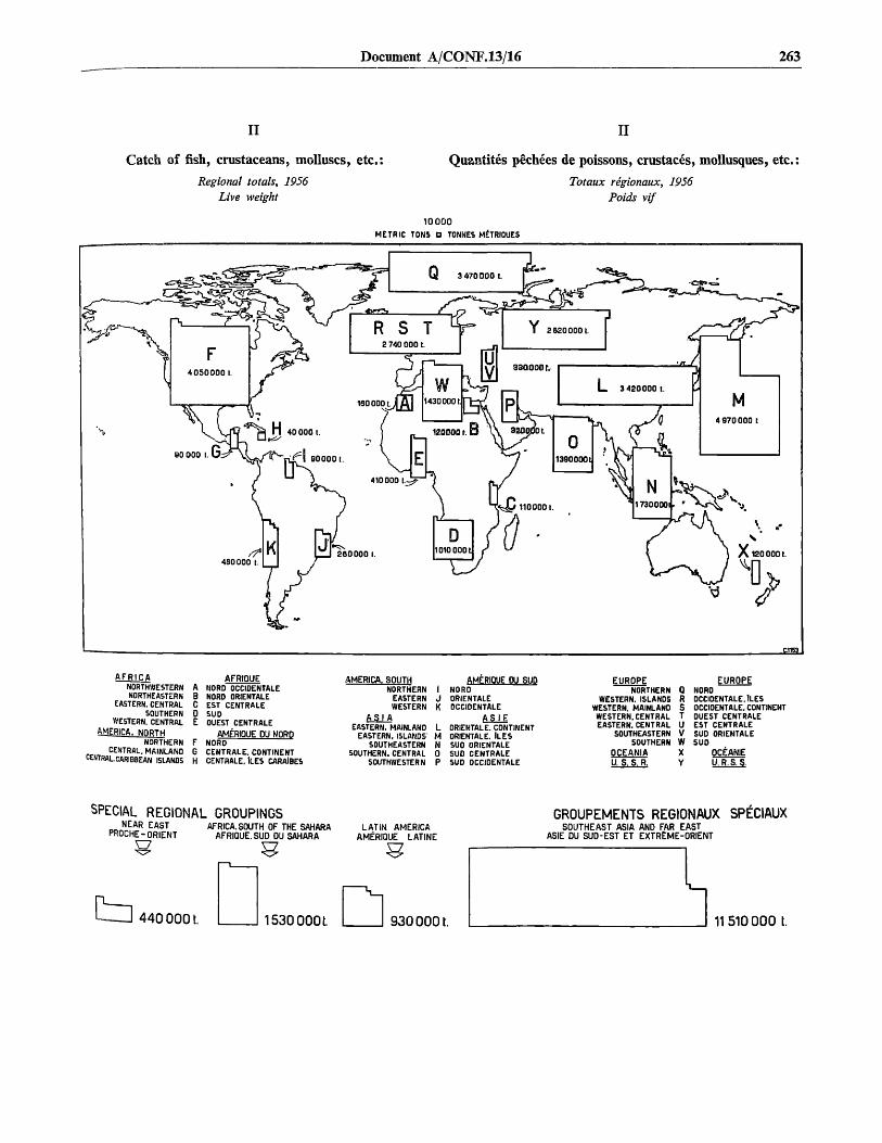
Document A/CONF.13/16 263
II II
Catch of fish, crustaceans, molluscs, etc.:
Regional totals, 1956Live weight
Quantites pechees de poissons, crustaces, mollusques, etc.
Totaux regionaux, 1956Poids vif
10000METRIC TONS D TONNES METRIQUES
A F R I C ANORTHWESTERNNORTHEASTERN
EASTERN, CENTRALSOUTHERN
WESTERN. CENTRALAMERICA. NftRTH
NORTHERNCENTRAL. MAINLAND
CENTRAL.CARIBBEAN ISLANDS
ABCD
FGH
AFRIQUENORD OCCIDENTALENORD ORIENTALEEST CENTRALESUDOUEST CENTRALE
AMERIQUE DU NORDNORDCENTRALE. CONTINENTCENTRALE. ILES CARAiBES
AMERICA. SOUTHNORTHERN
EASTERNWESTERN
A S I AEASTERN. MAINLAND
EASTERN. ISLANDS'SOUTHEASTERN
SOUTHERN. CENTRALSOUTHWESTERN
1JK
LMN0P
AMERIOUE OU SUDNORDORIENTALEOCCIDENTALE
A S I EORiENTALE. CONTINENTORIENTALE. ILESSUO ORIENTALESUD CENTRALESUD OCCIDENTALE
EUROPENORTHERN 0
WESTERN. ISLAND5 RWESTERN. MAINLAND SWESTERN. CENTRAL TEASTERN. CENTRAL U
SOUTHEASTERN VSOUTHERN W
OCEANIA XU. S. S. R. Y
EUROPENORDOCCIDENTALE, ILESOCCIDENTALE. CONTINENTOUEST CENTRALEEST CENTRALESUD ORIENTALESUD
OCEANIEU.R.S. S.
SPECIAL REGIONAL GROUPINGSNEAR EAST
PROCHE-ORIENTAFRICA. SOUTH OF THE SAHARA
AFRIQUE. SUD DU SAHARA
4400001. 1530000L
LATIN AMERICAAMERIQUE LATINE
GROUPEMENTS REGIONAUX SPECIAUXSOUTHEAST ASIA AND FAR EAST
ASIE DU SUD-EST ET EXTREME-ORIENT
9300001. 11510 000 t.

264 Preparatory documents
III
Catch of fish, crustaceans, molluscs, etc.:
For the 34 largest producing countries, 1956Live weight
III
Quantites pechees de poissons, crustaces, mollusques, etc.
Pour les 34 plus importants pays producteurs, 1956Poids vif
1. Japan Japon
2. United States (Incl. Alaska) Etats-Unis (y comprisI1 Alaska)
China (mainland) Chine (continental) . . .
4. U.S.S.R U.R.S.S.
5. Norway Norvege
:1 ;
•
j ^ 763 0() 0
J•
U 2 9\ • f \ i
•: ... .1 \ i :^ J 2 (540 000
} J fJ i
j 2 61 7 000} I , E 1 i • 1
r : " " V ::. ' :]•::!:::::::£:::: L \ r .J 2 129 OOC
• ;
. . :
6. Canada (Incl. Newfoundland) Canada (y comprls TerrNeuve)
X1 077 000
7, United Kingdom Royaume-Uni
8. India Inde
X050 000
9. Germany, Fed. Rep. of . . . . Allemagne, R6p. Fe'd. d' . .
10. Spain Espagne
1 1. Indonesia Iiinonisie
Union of South Africa Onion Sud-Afrlcaine (y com-llncl. S.W. Africa) prlfl le Sud-Ouest africaln). .
13. France France (y comprlBl'Algetic)
14. Iceland Islande
15 Portugal Portugal
IE. Denmark Danemark
17. Angola Angola
IB. Philippines Philippines
19. Korea (North) Coree (Nord)
20. Korea (South) Coree (SuoJ
21. Netherlands Pay 6-Baa
22. Pakistan Pakistan
23. Peru Parou
24. Italy Italle
25. Thailand Thallande
26. Sweden Su£de
27. China (Taiwan) Chine (Taiwan)
28. Chile Chill
29. Brazil Breail
30. Turkey Turquie
31. Malaya. Fed. of Malaisie, FEd. de
32. Poland Pologne
33. Faeroe Islands ties Feroe
34. Morocco Maroc
All other countries each producing less than 100 000 tons
Tous les autrea payschacun produisant molns de 100 000 tonnes
tI 012 000
::F.:.:..:.I 771 O O O
IZE I-'- -1 749 0 0 0
652 0 0 0 (1955)
1 555 000
_LJ 538 000: ::N 517 000
X 3 471 000
i i 463 000
L J_ - 3 11 421 000
416 000
383 000 JgbEe/iHili)i! I 341 000
i • •• i i
29B 000277 000
1. •••TTT.JI 2 5 0 0 0 0
X3 219 0 0 0
J3 216 0 0 0
:.! 197 000
X J 193 000•! 1 188 000
A I 172 0 0 0 (1994)
I i I 140 0 0 0
137 0 0 0 (1955)
127 000
116 000
t H 108 000
100 000metric ton6.tonnes meinques
•i "•! I I2 200 000

Document A/CONF.13/16 265
IV
World catch
By groups of species, 1938, 1948, 1953-56Live weight
IV
Quantites pechees dans le monde
Par groupes d'espices, 1938, 1948, 1953-56Poids vif
Million metric tonsMillions de tonnas mdtriquee
FRESHWATER FISHESPOISSONS D' EAU DOUCE
SALMONS, TROUTS, SMELTS, ETC.
SAUMONS, TRUITES. EPERLANS. ETC.
FLOUNDERS, HALIBUTS, SOLES, ETC.FLETS. FLETANS, SOLES, ETC.
CODS. HAKES, HADDOCKS. ETC.
MORUES, MERLUS, EGLEFINS. ETC.
1938 1948 1953 1954 1955 1956
HERRINGS, SARDINES, ANCHOVIES, ETC.HARENGS. SARDINES, ANCHOIS, ETC.
TUNAS, BONITOS, MACKERELS, ETC.THONS, BONITES, MAQUBREAUX. ETC.
MISCELLANEOUS MARINE TELEOSTEANSTELE'OSTE'ENS MARINS DIVERS
SHARKS, RAYS, ETC.SQUALES. RAIES. ETC.
MIXED AND UNIDENTIFIED FISHESPOISSONS MDCTES ET NON IDENTIFIES
CRUSTACEANSCRUSTACE'S
MOLLUSCSMOLLUSQUESAQUATIC ANIMALS, N. E. S.ANIMAUX AQUATIQUES N.C.A.
AQUATIC PLANTSPLANTES AQUATIQUES

266 Preparatory documents
Catch of fish, crustaceans, molluscs, etc.:
By continents and groups of species, 1956 (live weight)Million metric tons
Quantites pechees de poissons, crustaces, mollusques, etc.
Par continents et groupes d'espices, 1956 (poids vif)Millions de tonnes metriques
'W///////////////PA O.3B
O.OB
3 0.6023 0.11
0.25
0.3710.02
AFRICA-AFRIQUE
0.120.23
0.13
0.15^ 0.21
0.733 1-45
0.68 AMERICA.NORTHAMERIQUE DU NORD
10.04
m o.ioZZH 0.157WH 0.16m 0.07^ 0
aasfflMa o,22
3 0.04 AMERICA. SOUTHAMERIQUE DU SUD
aaaftftaa 0 .18V itt.i_,rJii 1 Q 1 7
BBBBIIBH 0
1 0.16
gillllllllllllHNIimKH
.31
0.35
* 0.40
1 06. 02
ASIA
%%%%%%%& 1.78
-ASIE
M 0.09^ 0.08
BnunffiMiilliMilim o.ioS3SI 0.13.'••'.'.V..1 0 . 2 2i 0.05
Hnm
B 0.48
^ 0.55
IF• • • • ! !
IBliflQBBBBlBBEflBSBBEli5192
i.95 '
EUROPE
I 0.021 0.04
j 0.02] 0.02
2 0
LEGEND-LEGENDE
!HSSE
g 0.059 0.04
0.2015BEMi
u.u.
(ft?
sR
i o.
.s
.sRS
66
0.74
OCEANIA-OCEANIE
FKE3HWATER FiaiES
SALMONS, TROUTS, SMELTS, ETC. - -
FLOUNDERS, HALmVTB. BOLES. ETC.
CODS, HAKES. HADDOCKS. ETC. •-•
KERR1BO8. SARDDIES. ANCHOVIES. ETC. | . ' . ' • '-I
TUNAS. BONITO3. MACKERELS. E T C - -
mSCELLANEOIIB MARINE TELEO3TEANS
SHARKS, RAYS. ETC - -
MIKED AMD UNIDEHTIFIED FISiES
CRUSTACEANS
MOLLUSCS - .
AJQUATIC ANDIALS, N. B. B., AND PLANTS
MHB.IQIBLB QUAirnTIES
POISSONS D' EAU DOUCE
SAUMONS, TRUTTES. EPERLANS. ETC.
FLET3. FLETANS. SOLES. ETC.
MORUES, MERLUS, EOLEFINS, ETC.
HARE7JCS. BARDINES, ANCUOQ, ETC.
THONB, BOHTTES, MAQUEREAUX, ETC.
TELEOSTEEIIS MARINB DIVERS
SQUALEB, RAIES. ETC.
POISSOIIS MECTE3 ET NON n>EHTDTE8
CRUSTACES
UOLLUSQUS9
ANOIAUX AqDATHUES B. C. A. ET PLAJITE3 AQUATKIUES
qUANTITES NEOLUBABLtS

Document A/CONF.13/16 267
VI
Disposition of world catch
Live weight
VI
UtiEsation des quantites pechees dans le monde
Poids vif
Million metric toMillion! «• tsniwi
100
10
1938 1948 1953 1954 1955 1956 1938 1948 1953 1954 1955 1956
LEGEND - LEGENDEMARKETING FRESH
FREEZING
CURING YfflX S^CHAGE, FUMAGE, SALAISON. ETC.
CANNING Ulllllll CONSERVESREDUCTION TO MEAL. OIL, ETC. R ^ B FABRICATION DE FARINE, HU1LE, ETC.
MISCELLANEOUS B&SSa UTILISATIONS DIVERSES
f;."v.;.v| MAREE FRA1CHE
I I CONGELATION

268 Preparatory documents
VII
Selected processed and preserved fishery commodities
Net product weight
VII
Certains produits de la peche conserves et traites
Poids net du produit
FISH, FROZEN
POISSONS CONGELES
CODS, HAKES, HADDOCKS.ETC. . SALTED
MORUES. MERLUS, EGLEFINS,ETC. SALES
HERRINGS, SARDINES, ANCHOVIES,ETC. . DRIED OR SALTED
HARENGS, S.ARDINES. ANCHOIS,ETC. , SECHES OU SALES
CRUSTACEANS AfoD MOLLUSCS.FROZEN
CRUSTACES ET MOLLUSQUES.CONGELES
FISH, CRUSTACEANS. MULLUSCS.ETC. , CANNED
POISSONS, CRUSTACES, MOLLUSQUES.ETC. , EN CONSERVE
FISH BODY OILS.
HUILES DE CHAIR DE POISSON
19481953199419551956
193819461953195419551956
193619461953195419951996
FISH MEALS AND SOLUBLES
FARINES ET SOLUBILISES VE POISSONS
194619931654ISBB1056
19361946199319541955199 6
1936194 6199319941955195 6
550 0003 B07 000
~ 980 000
I 296 000
ZH3 322 0003 286 000•• •:•:•••! 3 7 5 0 0 0
••:•••:•:>! *Tfi O 0 0
:::::-::-i 404 000::-::::::-s 424 ooo
i::::::-::-::-:-::-:::-:-:-:-:-::-:-:^ 758 000• ••••••••••••••:-:-.-.-.-.-.-.-.-.;T5Z3 6 3 9 0 0 0. ; • : • ; • ; • • • • • • • ; . • • • • - • • • : • • • : • : . • • • • • • - • : • : . • • • , : . : . : - : . - . - . i 6 4 4 0 0 0
•:•:•: : : : : - : - : : : : : : : : : : : : : : ; : : : ; . : . : . ; i : : - : . . . : i 8 6 a 0 0 0• : : : : : : : : : - : : : : : : : : : : : : : : : : : : r : : : : : : : : : : : - : i ©re 000
19481953196419991996
ma S3 000:•:•:•:•! 91 0 0 0TTTTn 6 6 000• • • • • • • • ' 1 0 6 0 0 0
:•:•:••••:-;< 113 0 0 0
023 000TTTl | 132 000•••:-:-:-:-i I |g2 000
1303000
II 273 000161 OOP
:---i 239 000::::;-::- i 333 000:-:-:-:-:-:-:-:-i 347 000• • • • • • • • • • • • • • • • i 3 4 3 0 0 0
.;••••• • • • • • • • • rn 6 6 1 0 0 0
3 960 000Z2D I 045 000
I 215 0003 I 239 000
3 1381000
- i 1 1 1 1 1—
100 200 300 40C 900
Thousand metric tons
—1 1 1 1 r1000
Mtlliers de tonnes metriques
IBOO

Document A/CONF. 13/16 {concluded)
PART IV
Summaries of catch and landings : world
GENERAL NOTES ON TABLES A-l TO A-S
The figures are intended to refer to either catches or landings of all aquatic animals {exceptbaleen and sperm whales), plants and residues from both commercial and subsistence fishing.
Country data are given to the nearest hundred metric tons and aggregates to the nearest tenthousand metric tons.
For a number of countries, the national statistics do not allow substantial quantities to bebroken down by groups of .species. These quantities are shown as " Mixed and unidentified fishes ".If these quantities could be distributed according to groups of species most of the group totalswould probably be significantly higher than shown.

270 Preparatory documents
TABLE A-l
WORLD CATCH:By continents and by regions
Live weight, i.e., whole fresh weight
TABLEAU A - l
QUANTTTES PfiCHES DANS LE MONDE:par continents et par regions
Poids vif: poids brut du poisson frais
Continent, region 1938 1948 1953 1954 1955 195 Continent, region
World grand total
Africa
NorthwesternNortheasternEastern, centralSouthernWestern, central
America, North
NorthernCentral, mainlandCentral, Caribbean Islands ..
America, South
NorthernEasternWestern
Asia
Eastern, mainlandEastern, islandsSoutheasternSouthern, centralSouthwestern
Europe
NorthernWestern, islandsWestern, mainlandWestern, centralEastern, centralSoutheasternSouthern
Oceania
U.S.S.R
SPECIAL REGIONAL GROUPINGS
Near Easta
Africa, south of the Sahara b . .Latin America c
Southeast Asia and Far Eastd .
Million metric tons — Millions de tonnes metriques
20.47 19.16 24.75 26.69 27.94 29.33
0.540.100.060.050.120.21
3.15
3.100.020.03
0.24
0.040.160.04
9.35
3.283.671.210.930.26
5.55
1.761.210.810.780.070.080.84
0.09
1.55
0.320.380.299.09
0.520.130.070.060.310.25
3.59
3.490.070.03
0.45
0.110.220.12
6.58
1.602.531.170.980.30
6.14
2.541.230.800.410.090.090.98
0.09
1.49
0.370.620.556.28
1.610.190.090.100.880.35
3.57
3.400.070.04
0.56
0.090.240.23
10.00
2.314.661.541.150.34
6.98
2.671.140.920.730.140.121.26
0.11
1.98
0.431.330.679.66
1.620.150.100.100.900.37
3.88
3.160.080.04
0.64
0.080.260.30
10.70
2.834.711.651.180.33
7.48
3.231.090.890.680.160.131.30
0.11
2.26
0.431.370.76
10.37
1.67
0.150.110.100.920.39
3.85
3.730.080.04
0.77
0.100.260.41
11.45
3.145.111.691.200.31
7.59
3.101.120.900.780.170.131.39
0.11
2.50
0.421.410.89
11.14
1.810.160.120.111.010.41
4.18
4.050.090.04
0.80
0.090.260.45
11.83
3.424.971.731.390.32
7.97
3.471.080.880.780.190.141.43
0.12
2.62
0.441.530.93
11.51
Total general mondial
Afrique
Nord-occidentaleNord-orientaleEst-centraleSudOuest-centrale
Amerique du Nord
NordCentrale, continentCentrale, iles Caraibes
Amerique du Sud
NordOrientaleOccidentale
Asie
Orientale, continentOrientale, ilesSud-orientaleSud-centraleSud-occidentale
Europe
NordOccidentale, ilesOccidentale, continentOuest centraleEst-centraleSud-orientale
Sud
Oceanie
U.R.S.S.GROUPEMENTS RiGIONAUX SPECIAUX
Proche-Orient B
Afrique, sud du Sahara b
Amerique latine c
Asie du Sud-Est et Extreme-Orientd
Document A/CONF.13/16 271
TABLE A-l (concluded)
WORLD CATCH:By continents and by regions
live weight, i.e., whole fresh weight
TABLEAU A - l (fin)
QUANTITES PECHES DANS LE MONDE:par continents et par regions
Poids vif: poids brut du poisson frais
Continent, region 1938 1948 1953 1954 1955 1956 Continent, region
World grand total
Africa
NorthwesternNortheasternEastern, centralSouthernWestern, central
America, North
NorthernCentral, mainlandCentral, Caribbean Islands
America, South
NorthernEasternWestern
Asia
Eastern, mainlandEastern, islandsSoutheasternSouthern, centralSouthwestern
Europe
NorthernWestern, islandsWestern, mainlandWestern, centralEastern, centralSoutheasternSouthern
Oceania
U.S.S.R
SPECIAL REGIONAL GROUPINGS
Near Easta
Africa, south of the Sahara b .Latin America c
Southeast Asia and Far East d
100 707
27
96
667786833984
15 5515 890 290 100
53367333
46 14216 20518 1456 1035 951 87
906998
4 101190
788986
0 100
8 104
2 862 611 53
44 145
Percentages * — Pourcentages '
A B A B A B A B
100 100
4 100
1 7000 7000 7002 7001 700
19 700
18 7000 7000 700
2 700
0 7001 7001 700
34 700
8 70013 7006 7005 7002 700
32 700
13 700100100100100100100
1 700
8 700
2 7003 7003 70033 700
100 129
1 196
1 1460 1290 1674 2841 740
14 98
14 970 1000 133
2 724
0 821 7091 792
40 752
9 14419 1846 7525 7771 113
28 774
11 7055 934 7753 7750 1560 1335 729
1 722
8 133
2 7755 2753 72239 154
100 759
6 795
1 7750 7450 7573 2901 745
14 705
14 70S0 7440 755
2 742
0 731 7751 250
40 755
11 77718 7556 7474 7201 770
28 722
12 7274 893 7773 7551 7750 7445 755
1 722
2 752
2 7755 2273 75539 755
100 745
6 204
1 7751 7570 7573 2971 755
14 707
13 7070 7740 755
3 777
0 971 7751 342
41 774
11 79519 2026 7444 7221 705
27 724
11 7224 973 7753 7901 7590 7445 742
0 722
2 755
2 7745 2273 75240 777
100 755
6 227
1 7250 7770 7553 3261 754
14 775
14 7750 7290 755
3 775
0 821 7752 375
41 750
12 27417 7956 7455 742
707
27 750
12 7574 553 7703 7900 2770 7555 745
0 755
2 775
2 7795 2473 75939 755
Total general mondial
A/rique
Nord-occidentaleNord-orientaleEst-centraleSudOuest-centrale
Amerique du Nord
NordCentrale, continentCentrale, iles Caraibes
Amerique du Sud
NordOrientaleOccidental
Asie
Orientale, continentOrientale, ilesSud-orientaleSud-centraleSud-occidentale
Europe
NordOccidentale, ilesOccidentale, continentOuest-centraleEst-centraleSud-orientale
Sud
Oceanie
U.R.S.S.GROUPEMENTS R&JIONAUX
SP£CIAUX
Proche-Orienta
Afrique, sud du Sahara ft
Am6rique latine c
Asie du Sud-Est et Extreme-Orient d
Source: Table A-5.
100 .PerceiJtages in the columns marked " A " based on World Grand Total =194R K e y e a r - Percentages (in italics) in the columns marked " B " based 6n' " o ngures = 100.
* Northeastern Africa and Southwestern Asia.o ^ t e m , central; Southern; and Western, central.
of N^MVT i^mer 'can regions and Central regions (mainland and Caribbean Islands)i''urm America,
the Asian regions except the Southwestern.
Source: Le tableau A-5.* Les pourcentages dans les colonnes « A » sont bas£s sur le total general mon-
dial = 100 pour chaque ann&e. Les pourcentages (en italiques) dans les colonnes«B » sont bases sur les chiffres de 1948 = 100.
11 Afrique nord-occidentale et Asie sud-occidentale.b Est, centrale; Sud; Ouest, centrale.0 Regions de P Amerique du Sud et regions centrales de P Amerique du Nord
(continent et iles Caraibes).d Toutes les regions de l'Asie a Perception de la region sud-occidentale.

272 Preparatory documents
TABLE A-2
WORLD CATCH:By groups of species
Live weight, i.e., whole fresh weight
TABLEAU A-2
QUANTITIES PECHEES DANS LE MONDE:par groupes d'especes
Poids vif: poids brut du poisson frais
Group of species
World grand total
Freshwater fishesSalmons, trouts, smelts, etcFlounders, halibuts, soles, etcCods, hakes, haddocks, etcHerrings, sardines, anchovies, etcTunas, bonitos, mackerels, etcMiscellaneous marine teleosteansSharks, rays, etcMixed and unidentified fishesCrustaceansMolluscsAquatic animals, n.e.sAquatic plants
World grand total
Freshwater fishesSalmons, trouts, smelts, etcFlounders, halibuts, soles, etcCods, hakes, haddocks, etcHerrings, sardines, anchovies, etcTunas, bonitos, mackerels, etcMiscellaneous marine teleosteans .Sharks, rays, etcMixed and unidentified fishesCrustaceansMolluscsAquatic animals, n.e.sAquatic plants
1938 1948 1953 1954 1955 1956
Million metric tons — Millions de tonnes mdtrigues
20.47 19.16 24.75 26.69 27.94 29.33
2.30 1.96 2.61 2.87 3.04 3.070.85 0.47 0.58 0.56 0.68 0.690.33 0.48 0.53 0.53 0.60 0.643.20 3.51 3.78 4.18 4.67 4.885.34 4.82 6.24 6.69 6.41 6.990.92 0.90 1.33 1.46 1.52 1.710.86 1.08 2.22 2.30 2.64 2.730.23 0.35 0.31 0.30 0.28 0.284.26 3.59 4.41 4.77 5.02 5.240.49 0.51 0.65 0.76 0.74 0.781.14 1.28 1.68 1.83 1.87 1.850.06 0.03 0.05 0.06 0.07 0.070.49 0.18 0.36 0.38 0.40 0.40
A — Percentages (Totals = 100) — Pourcentages(Totaux = 100)
100 100 100 100 100 100
11 10 11 11 11 114 2 2 2 2 22 2 2 2 2 2
16 18 15 16 17 1726 25 25 25 23 245 5 5 5 6 64 6 9 9 9 91 2 1 1 1 1
21 19 18 18 18 182 3 3 3 3 36 7 7 7 7 60 0 0 0 0 0
2 1 2 1 1 1
B — Percentages — Pourcentages (1948 = 100)
107 100 129 139 146 153
117 100 133 146 155 157181 100 123 119 145 14769 100 110 110 125 13391 100 108 119 133 139
111 100 129 139 133 145102 100 148 162 169 19080 100 206 213 244 25366 100 89 86 80 80
119 100 123 133 140 14696 100 127 149 145 15389 100 131 143 146 145
200 100 167 200 233 233272 100 200 211 222 222
Groupe d'especes
Total gendral mondial
Poissons d'eau douceSaumons, truites, eperlans, etc.Flets, fletans, soles, etc.Morues, merlus, aiglefins, etc.Harengs, sardines, anchois, etc.Thons, bonites, maquereaux, etc.Teleosteens marins diversSquales, raies, etc.Poissons mixtes et non identifiesCrustacesMoIlUsquesAnimaux aquatiques n.c.a.Plantes aquatiques
Total general mondial
Poissons d'eau douceSaumons, truites, eperlans, etc.Flets, fletans, soles, etc.Morues, merlus, aiglefins, etc.Harengs, sardines, anchois, etc.Thons, bonites, maquereaux, etc.Teleosteens marins diversSquales, raies, etc.Poissons mixtes et non identifiesCrustacesMollusquesAnimaux aquatiques n.c.a.Plantes aquatiques
Total general mondial
Poissons d'eau douceSaumons, truites, eperlans, etc.Flets, fletans, soles, etc.Morues, merlus, aiglefins, etc.Harengs, sardines, anchois, etc.Thons, bonites, maquereaux, etc.Teleosteens marins diversSquales, raies, etc.Poissons mixtes et non identifiesCrustacesMollusquesAnimaux aquatiques n.ca.Plantes aquatiques
Source: Table A-7; see also tablo A-6. Source: Le tableau A-7; voir dgalement le tableau A-6.

Document A/CONF.13/16 273
TABLE A-3
WORLD CATCH:By major fishing areas
Live weight, i.e., whole fresh weight
TABLEAU A-3
QUANTITES PECHEES DANS LE MONDE:par principales zones de peche
Poids vif: poids brut du poisson frais
Fishing area 1938 1948 1953 1954 1955 1956 Zone de p£che
World grand total
FRESHWATER AREAS
AfricaAmerica, NorthAmerica, SouthAsiaEuropeOceaniaU.S.S.R
MARINE AREAS
Northern Hemisphere areas a
Atlantic, northwesternAtlantic, northeastern b
Mediterranean and Black SeaPacific, northwesternPacific, northeastern
Tropical areas
Atlantic, western-centralc
Atlantic, eastern-centralIndian Ocean, western d
Indo-Pacific areaPacific, eastern-central
Southern Hemisphere areas e
Atlantic, southwesternAtlantic, southeasternPacific, southwesternf
Pacific, southeastern
Million metric tons — Millions de tonnes mitriques
20.47 19.16 24.75 26.69 27.94 29.33
2.30 1.96 2.61 2.87 3.04 3.07
0.180.070.041.270.13
00.61
18.17
0.210.070.050.910.08
00.64
0.330.110.041.470.09
00.57
0.340.110.031.610.10
00.68
0.360.120.041.720.09
00.71
0.380.120.041.780.09
00.66
17.20 22.14 23.82 24.90 26.26
14.62.24.90.66.30.6
3.3
0.50.10.21.80.7
0.3
0.10.10.1
0
13.12.65.50.63.90.5
3.4
0.70.10.21.80.6
0.7
0.20.30.10.1
16.82.86.50.86.30.4
4.1
0.80.10.32.40.5
1.2
0.20.80.10.1
18.03.07.20.86.60.4
4.5
0.90.10.32.60.6
1.3
0.20.90.10.1
18.93.07.30.87.40.4
4.6
0.90.10.32.70.6
1.4
0.20.90.10.2
19.83.27.80.97.40.5
5.0
1.00.10.32.90.7
1.5
0.21.00.10.2
Total general mondial
ZONES D'EAU DOUCE
AfriqueAmerique du NordAmerique du SudAsieEuropeOc6anieU.R.S.S.
ZONES MARITIMES
Zones de VHemisphere nord a
Atlantique, nord-ouestAtl antique, nord-estb
M6diterranee et mer NoirePacifique, nord-ouestPacifique, nord-est
Zones des Tropiques
Atlantique, ouest-central °Atlantique, est-centralOcean Indien, ouest d
Zone indo-pacifiquePacifique, est-central
Zones de VHemisphere sude
Atlantique, sud-ouestAtlantique, sud-estPacifique, sud-ouest'Pacifique, sud-est

274 Preparatory documents
TABLE A-3 {concluded)
WORLD CATCH:By major fishing areas
Live weight, i.e., whole fresh weight
TABLEAU A-3 {fin)
QUANTITES PECHEES DANS LE MONDE:par principales zones de peche
Poids vif: poids brut du poisson frais
Fishing area 1938 1948 1953 1954 1955 1956 Zone de peche
World grand total
FRESHWATER AREAS . . . .
Africa
America, North
America, South
Asia
Europe
Oceania
U.S.S.R
MARINE AREAS
Northern Hemisphere areas a .
Atlantic, northwestern . . . .
Atlantic, northeastern b . . .
Mediterranean and Black Sea
Pacific, northwestern
Pacific, northeastern
Tropical areas
Atlantic, western-centralc .
Atlantic, eastern-central . . .
Indian Ocean, western a . . .
Indo-Pacific area
Pacific, eastern-central . . . .
Southern Hemisphere areas e
Atlant ic , southwestern . . . .
Atlant ic , southeastern . . . .
Pacific, sou thwes te rn f . . . .
Pacific, southeastern
A B
.. . 107
100 117
8 86
3 700
2 SO
55 140
6 163
0 0
26 95
100 106
80 HI
12 55
27 89
3 100
35 162
3 120
18 97
3 71
0 100
1 700
10 700
4 777
2 43
1 50
1 33
0 700
0 0
Percentages * —
A B A B
.. . 100
100 700
11 700
700700
46 700
4 700
0 700
33 700
100 700
76 700
15 100
32 700
3 700
23 700
3 700
20 700
4 700
1 700
1 700
11 700
3 700
4 700
1 700
2 700
1 700
0 700
.. . 129
100 133
13 757
4 757
2 80
56 162
3 113
0 0
22 89
100 129
76 725
13 705
29 775
4 133
28 162
2 80
IP 727
4 114
1 700
1 750
11 133
2 83
5 777
1 700
4 267
0 700
0 700
Pourcentages *
A B A
139
100 146
12 752
4 757
1 60
56 777
3 725
0 0
24 705
100 755
76 737
13 775
30 737
3 733
28 759
2 80
19 732
4 729
0 700
1 750
11 144
3 700
5 755
1 700
4 300
0 100
0 100
146
100 755
12 777
4 777
1 50
57 759
3 773
0 0
23 777
100 745
76 144
12 775
29 733
3 733
30 790
2 80
18 735
4 729
0 700
1 750
11 750
2 700
6 200
1 700
4 300
0 700
1 200
A B
.. . 153
100 757
12 757
4 777
1 80
58 795
3 773
0 0
22 703
100 753
75 757
12 723
30 142
3 750
28 790
2 700
19 747
4 143
0 100
1 750
11 757
3 777
6 214
1 700
4 333
0 700
1 200
Total mondial general
ZONES D'EAU DOUCE
Afrique
Amerique du Nord
Am6rique du Sud
Asie
Europe
Oceanie
U.R.S.S.
ZONES MARITIMES
Zones de V Hemisphere norda
Atlantique, nord-ouest
Atlantique, nord-est b
Mediterranee et mer Noire
Pacifique, nord-ouest
Pacifique, nord-est
Zones des Tropiques
Atlantique, ouest-central c
Atlantique, est-central
Ocean Indien, ouest d
Zone indo-pacifique
Pacifique, est-central
Zones de VHemisphere sud e
Atlantique,. sud-ouest
Atlantique, sud-est
Pacifique, sud-ouestf
Pacifique, sud-est
Source: Tables A-5, A-6, and B-2 supplemented by FAO estimates.Note: Quantities under " Freshwater areas " identical with catches of fresh-
water fishes (see tables A-2, A-6 and A-7). Some freshwater or anadromous fishesincluded in other species groups shown under " Marine areas ".
0 = above zero, but negligible.* Percentages in the columns marked " A " are based on the two subtotals
(one for " Freshwater areas " and one for " Marine areas "); each of these twosubtotals = 100 in each year. Percentages (in italics) in the columns " B " basedon 1948 figures = 100.
•• Arctic waters included in adjacent areas.> Includes the North Sea and the Baltic.c Includes the Caribbean area.d Includes the Red Sea and the Arabian Sea.e Antarctic waters included in adjacent areas.' Includes the southeastern Indian Ocean.
Source; Les tableaux A-5, A-6, B-2 et estimations de la FAO.Note: Les quantites figurant sous « Zones d'eau douce » sont identiques aux
quantites pechees de poissons d'eau douce (voir les tableaux A-2, A-6 et A-7).Certaines quantites de poissons d'eau douce ou de poissons anadromes comprisesavec d'autres groupes d'especes figurent sous «Zones maritimes ».
0 = superieur a zero, mais negligeable.• Les pourcentages dans les colonnes « A » sont bases sur les deux sous-totaux
(l'un pour « Zones d'eau douce » et l'autre pour « Zones maritimes »); chacunde ces deux sous-totaux = 100 pour chaque annee. Les pourcentages (en italiques)dans les colonnes «B » sont bases sur les cbiffres de 1948 = 100.
» Les zones de l'Arctique sont comprises avec les territoires limitrophes.b Y compris la mer du Nord et la Baltique.e Y compris la zone des Caralbes.a Y compris la mer Rouge et le golfe Arabique.8 Les zones de l'Antarctique sont comprises avec les territoires limitrophes.' Y compris 1'ocean Indien du Sud-Est.

Document A/CONF.13/16 275
TABLE A-4
WORLD CATCH AND LANDINGS:By countries arranged by continents
C — Catch (live weight, i.e., whole fresh weight)L — Landings (landed weight)
CL — Catch and landings identical
TABLEAU A-4
QUANTITES PECHEES ET DEBARQUEES DANS LE MONDE:par pays classes par continents
C — Quantites pechees (poids vif: poids brut du poisson frais)L — Quantitis debarguees (poids debargue)
CL — Quantites pechees et debarguees sont identiques
Continent, country 1938 1948 1953 1954 1955 1956 Continent, pays
W o r l d g r a n d t o t a l . . . .
A f r i c a
Algeriaa
AngolaBasutolandBechuanalandBelgian Congo b
British Somaliland c
Cameroons (British Adm.) d
Cameroons (French Adm.) .
Cape Verde IslandsCeutae
Comoro IslandsEgyptEthiopia and Eritrea, Fed. of
French Equatorial Africa ..French SomalilandFrench West AfricaGambiac
Ghanaf
KenyaLiberiac
LibyaMadagascar *Mauritius
Melillae
Morocco (A)Morocco (B)Morocco (C)Mozambique
Nigeria d
Portuguese Guinea
Reunion
Rhodesia and Nyasaland,Fed. of
Ruanda-UrundiSt. Helena h
Sao Tome and Principe . . .Seychelles *
Sierra LeoneSomalia (Italian Adm.) . . . .
South West Africa i
Spanish GuineaSpanish West AfricaSudan
cc
CLCLCLCLCL
CLCL
CL
CLCLCLCLCL
CLCLCLCLCL
CLCLCLCLCL
CLCLCLCLCL
CLCL
CL
CLCLCLCLCL
CLCL
CL
CLCLCL
Thousand metric tons
20 470.0
540.0(21.1)26.2
0.9
18.018.0
0.4
38.1
2.0
2.0
30.7
2.0
4.03.4
0
8.8
19 160.0
820.0(30.0)113.2
17.5
22.022.0
0.6(5.1)
42.8
...20.0
2.2
2.0
(9.2)55.710.9
3.9
0.3
2.02.3
0.2
3.0
9.88.3
06.0
11.4
24
1
— Milliers
750.0
610.0(23.1)220.4
66.6
1.0
30.330.3
1.4(3.2)
52.120.5
100.00.5
70.01.0
20.0
18.70.32.52.62.2
(6.3)128.010.8
3.8
42.0
1.20.5
4.64.2
0.31.5
5.07.4
275.4274.5
03.6
12.1
26
1
de tonnes metriques
690.0
620.0
(21.1)261.2
65.7
37.236.8
1.7(4.2)
56.725.2
100.00.9
20.0
17.6
2.1
(6.8)93.110.4
3.7
1.60.7
6.95.6
1.5
5.05.3
263.5262.7
0
4.012.9
27 940.0
1 670.0(26.2)290.4
80.6
42.041.5
1.6(5.3)11.163.418.1
100.00.8
20.0
12.70.6
2.2
(7.4)81.712.6
3.3
1.50.7
8.85.6
1.5
5.09.5
240.5239.4
04.5
13.6
29
1
330.0
310.0(22.3)420.5
43.542.9
(4.5)
70.3
100.00.5
20.0
12.71.0
2 .2
(8.4)99.1
9.1
1.80.9
9.7
0.1
17.1
268.0266.7
13.5
Total general mondial
Afrique
Algerie a
AngolaBasutolandBechuanalandCongo beige b
Somalie britannique c
Cameroun (adm. britannique) d
Cameroun (adm. francaise)
lies du Cap-VertCeuta e
ComoresEgypteEthiopie et Erythree, Fed. d'
Afrique-Equatoriale francaiseSomalie francaiseAfrique-Occidentale francaiseGambie °Ghanaf
KenyaLiberia c
LibyeMadagascar B
lie Maurice
Melilla e
Maroc (A)Maroc (B)Maroc (C)Mozambique
Nigeria d
Guin6e portugaise
Reunion
Rhodesie et Nyassaland, Fed.de
Ruanda-UrundiSainte-Helene h
Saint-Thomas et PrinceSeychelles i
Sierra LeoneSomalie (adm. italienne)
Sud-Ouest africain *
Guinee espagnoleAfrique-Occidentale espagnoleSoudan

276 Preparatory documents
TABLE A-4 {continued)
WORLD CATCH AND LANDINGS:By countries arranged by continents
C — Catch (live weight, i.e., whole fresh weight)L — Landings (landed weight)
CL — Catch and landings identical
TABLEAU A-4 (suite)
QUANTITES PECHEES ET DEBARQUEES DANS LE MONDE:par pays classes par continents
C — Quantites pechees (poids vif: poids brut du poisson frais)L — Quantites debarquees (poids debarque)
CL — Quantites pechees et debarquees sont identiqms
Continent, country 1938 1948 1953 1954 1955 1956 Continent, pays
Africa {continued)
SwazilandTanganyika
Togoland (French Adm.) ..Tristan da CunhaTunisia
Uganda
Union of South Africa . . . .
Zanzibar and Pemba
America, NorthBahama IslandsBermuda k
British HondurasCanada (excl. Newfoundland
Canada (Newfoundlandonly)
Costa Rica1
CubaDominican RepublicEl SalvadorGreenland m
GuadeloupeGuatemalaHaitiHondurasMartinique
Mexico n
Netherlands AntillesNicaraguaPanamaPanama (Canal Zone)
Puerto RicoSt. Pierre and Miquelon . . .Swan IslandsUnited States (incl. Alaska)Virgin Islands (U.K.)Virgin Islands (U.S.)
West IndiesBarbadosJamaica °Leeward Islands
AnguillaAntiguaMontserrat 'St. Kitts-Nevis
Trinidad and Tobago . . .Windward Islands
DominicaGrenadaSt. LuciaSt Vincent
Thousand metric tons — Milliers de tonnes metriques
CLCL
CLCLCLCL
CL
CL
CCLCLCLCL
CL
CLCLCLCLCL
CLCLCLCLCL
CLCLCLCLCL
CLCLCLCLCLCL
CLCL
CLCLCLCLCL
CLCLCLCL
16.0
3.0
9.6
61.955.37.5
3 150.0
0.3518.5489.1
318.3271.4
1.010.00.30.14.7
0.40.41.5
2.5
17.10.10.10.7
1.41.9
2 253.10.20.3
0.54.5
0.10.30.10.22.7
1.20.30.20.4
22.0
3.1
12.211.0
170.1160.6
7.7
3 590.0
0.5
717.7666.0
335.2293.5
1.08.30.50.4
21.0
0.90.61.6
2.5
68.40.10.10.7
2.32.2
2 409.90.3
1.0
0.1
0.9
50.0
3.30.6
11.523.4
358.1352.6
8.8
3 510.0
1.10.60.5
661.5622.8
263.6228.3
1.010.20.70.4
25.0
1.70.7
2.62.5
67.30.2
1.0
2.45.9
2 437.50.31.0
3.7
0.1
3.0
0.80.43.00.3
50.0
3.20.7
24.4
353.6346.8
8.7
3 880.01.70.6
705.2665.1
320.6290.8
1.011.5
24.9
1.80.7
2.62.6
0.8
2.0
2.56.8
2 706.40.3
2.8
0.1
5.1
0.80.42.10.4
52.4
3.50.8
25.0
361.5355.3
8.8
3 350.01.50.7
663.9622.1
290.2262.3
1.012.8
25.8
1.90.7
2.63.4
0.8
2.8
2.66.8
2 738.90.2
2.8
0.10.9
0.43.9
0.60.42.00.5
55.0
3.6
34.3
287.2283.2
8.8
4 180.0
1.60.7
778.9728.2
298.0269.1
1.315.6
27.4
1.70.7
2.43.8
0.6
3.6
2.79.3
2 935.90.20.3
3.25.3
0.10.9
0.13.6
0.4
0.6
Afrique (suite)
SwazilandTanganyika
Togo (adm. francaise)Tristan da CunhaTunisieOuganda
Union Sud-Africaine
Zanzibar et Pemba
Amerique du Nord
lies Bahamalies Bermudes k
Honduras britanniqueCanada (non compris Terre-
Neuve)
Canada (Terre-Neuve seule-ment)
Costa-Rica1
CubaRepublique DominicaineSalvadorGroenland m
GuadeloupeGuatemalaHaitiHondurasMartinique
Mexique n
Antilles neerlandaisesNicaraguaPanamaPanama (Zone du Canal)
Porto-RicoSaint-Pierre-et-Miquelonlies SwanEtats-Unis (y compris 1'Alaska)lies Vierges (R.-U.)lies Vierges (E.-U.)
Indes occidentalesBarbadeJamaique °lies sousle Vent
AnguillaAntiguaMontserratSaint-Christophe-Nevis
Trinity et TobagoHes du Vent
DominiqueGrenadeSainte-LucieSaint-Vincent

Document A/CONF.13/16 277
TABLE A-4 (continued)
WORLD CATCH AND LANDINGS:By countries arranged by continents
C — Catch (live weight, i.e., whole fresh weight)L, •— Landings (landed weight)
CL — Catch and landings identical
TABLEAU A-4 (suite)
QUANTITES PECHEES ET DEBARQUEES DANS LE MONDE:par pays classes par continents
C — Quantites pechees (poids vif: poids brut du poisson frais)L — Quantites debarquees (poids debarque)
CL — Quantites pechees et debarquees sont identiques
Continent, country 1938 1948 1953 1954 1955 1956 Continent, pays
America, South
ArgentinaBoliviaBrazil PBritish Guiana
Chile
ColombiaEcuador <*Falkland IslandsFrench GuianaParaguay
PeruSurinamUruguayVenezuela »
Asia
AdenAfghanistan . . ,Bahrain IslandsBhutanBonin Islands
BruneiBurma c
Cambodia r
CeylonChina (mainland) B
China (Taiwan)Cyprus
Hong Kong
IndiaIndonesia *Iran c
IraqIsrael '.'.'.'.'.'.'.'.
JapanJordanKorea (North) cc
Korea (South)Kuwait '...'...
LaosLebanonMacauMalaya, Fed. ofMaldive Islands
Mongolian People's Repub.Muscat and Oman
Thousand metric tons — Milliers de tonnes metriques
CLCLCLCL
CL
CLCLCLCLCL
CLCLCLCL
CLCLCLCLCL
CLCLCLCLCL
CLCL
CL
CLCLCLCLCL
CLCLCLCLCL
CLCLCLCLCL
CLCL
240.0
55.30.7
103.3
32.230.1
10.01.80.1
0.3
0.43.6
21.7
9 350.0
(1 500.0)
89.5
472.0
3.51.7
3 562.0
925.2832.0
450.0
71.20.8
144.8
64.664.4
15.03.40.1
0.4
47.70.53.5
92.3
6 580.0
24.0(448.0)
83.50.6
34.324.7
25.04.02.5
2 431.4
(275.0)284.6
1.97.2
139.0
560.0
77.20.9
160.72.9
107.2106.8
16.09.1
2.00.4
117.81.63.4
63.3
10 000.0
75.8
100.0
25.51 890.0
130.40.4
39.635.4
819.0616.925.0
5.57.7
4 521.60.5
122.0257.3
4.1147.020.0
640.0
78.10.9
172.02.7
143.5143.5
16.012.5
2.00.4
146.11.94.0
51.8
10 700.0
51.9
0.5100.061.029.7
2 294.0
152.20.5
46.743.0
828.5628.525.0
5.49.2
4 544.60.3
235.0247.2
4.9137.3
770.0
78.9
3.6
214.3214.3
18.015.0
2.0
183.32.54.9
69.6
11 450.0
34.8
0.7100.028.231.3
2 518.0
180.30.6
45.942.6
839.0651.525.0
5.410.3
4 912.80.5
312.0259.3
5.5136.8
800.0
75.1
3.6
188.3188.3
21.2
2.4
250.03.35.4
61.3
11 830.0
21.8
1.3100.030.040.3
2 640.0
193.20.5
1 012.3
25.08.5
10.3
4 762.60.4
(383.0)340.9
Amerique du Sud
ArgentineBolivieBresil»Guyane britannique
Chili
ColombieEquateur ilies FalklandGuyane francaiseParaguay
PerouSurinamUruguayVenezuela P
Asie
AdenAfghanistanlies BahreinBhoutanlies Bonin
Brun6iBirmanie c
Cambodge r
CeylanChine (continental)
Chine (Taiwan)Chypre
Hong-Kong
IndeIndonesie *Iranc
IrakIsrael
JaponJordanieCoree (Nord) cc
Coree (Sud)Koveit
LaosLibanMacaoMalaisie, F6d. delies Maldives
Republique populaire mongoleMascate et Oman

278 Preparatory documents
TABLE A-4 (continued)
WORLD CATCH AND LANDINGS:By countries arranged by continents
C — Catch (live weight, i.e., whole fresh weight)L — Landings (landed weight)
CL — Catch and landings identical
TABLEAU A-4 (suite)
QUANTITES PECHEES ET DEBARQUEES DANS LE MONDE:par pays classes par continents
C — Quantitis pechees (poids vif: poids brut du poisson frais)L — Quantites debarquies (poids debarque)
CL — Quantites pechies et debarquees sont identiques
Continent, country 1938 1948 1953 1954 1955 1956 Continent, pays
Asia (continued)
NepalNorth BorneoPakistan
Philippines u
Portuguese IndiaPortuguese TimorQatarRyukyu Islands
SarawakSaudi Arabiac
SingaporeSyriaThailand
Trucial OmanTurkeyViet-NamWest New GuineaYemen
Europe
AlbaniaAndorraAustria
Belgium
BulgariaCzechoslovakia
Denmarkv
Faeroe Islands
Finland
France (incl. Algeria) . . .
Germany, Fed. Rep. of w
Germany (Eastern)
GibraltarGreeceHungary
Iceland
Ireland, Rep. of
ItalyLiechtenstein
Thousand metric tons — Milliers de tonnes mitriques
CLCLCL
CLCLCLCLCL
CLCLCLCLCL
CLCLCLCLCL
CLCLCL
CL
CLCL
CL
CL
CLCL
CL
CLCLCLCL
CL
CL
CLCL
80.9
12.0
161.0
76.0180.0
3.5
5 550.0
3.3
2.0
42.840.9
5.63.0
97.189.0
63.028.6
44.4530.3
~ 463.1
776.5714.3
25.07.0
274.3...
12.812.1
181.2
5.9
195.1
0.4
7.7
2.31.0
161.0
2.5
6 140.0
2.5
0.3
70.865.8
6.43.5
225.9217.0
92.353.9
46.1467.5All.9
408.7368.2
33.64.0
478.1413.5
25.824.5
156.6
249.0
311.9
8.8
4.05.7
205.0
102.5
3.5
6 980.0
3.0
1.8
74.468.5
5.67.1
342.8331.3
88.848.7
62.1520.3459.1
730.4693.2
46.04.0
424.7360.8
19.017.7
208.4
259.7
364.6
15.1
6.3
229.8
119.4
3.5
7 480.0
2.0
72.065.7
9.16.1
359.4352.5
89.454.7
65.5500.2444.9
678.0641.9
52.5
455.4384.2
21.520.4
217.6
270.9
385.2
13.6
6.2
213.0
111.5130.0
3.6
7 590.0
2.3
80.073.0
6.86.4
425.3417.9
105.649.9
63.3522.7459.1
776.9734.1
60.0
480.3407.2
23.622.4
218.0
277.0
416.0
13.7
217.9
139.5
3.2
7 970.0
2.8
69.162.2
463.0455.8
116.364.6
60.2537.9478.6
770.8676.4
65.0
517.3443.7
30.529.1
218.6
Asie (suite)
NepalBorneo du NordPakistan
Philippines u
Inde portugaiseTimor portugaisKatarlies Ryu-Kyu
SarawakArabie saoudite c
SingapourSyrieThailande
Oman sous regime de traitdTurquieViet-NamNouvelle-Guinee occidentaleYemen
Europe
AlbanieAndorreAutriche
Belgique
BulgarieTchecoslovaquie
Danemark v
lies Feroe
FinlandeFrance (y compris l'Algeiie)
Allemagne, Rep. Fed. d' w
Allemagne (orientale)GibraltarGreceHongrie
Islande
Irlande, Rep. d'
ItalieLiechtenstein
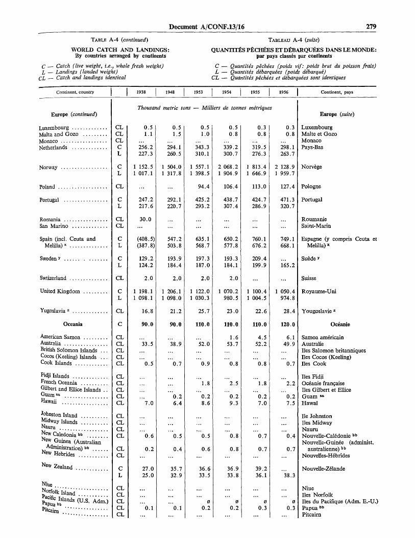
Document A/CQNF.13/16 279
TABLE A-4 (continued)
WORLD CATCH AND LANDINGS:By countries arranged by continents
C — Catch (live weight, i.e., whole fresh weight)L, — Landings (landed weight)
CL — Catch and landings identical
TABLEAU A-4 (suite)
QUANTTTES PECHEES ET DEBARQUEES DANS LE MONDE:par pays classes par continents
C — Quantites pechies (poids vif: poids brut du poisson frais)L — Quantites debarquees (poids debarque)
CL — Quantites pechees et d&barquies sont identiques
Continent, country 1933 1948 1953 1954 1955 1956 Continent, pays
Europe (continued)
LuxembourgMalta and GozoMonacoNetherlands
Norway
Poland
Portugal
RomaniaSan Marino
Spain (incl. Ceuta andMelilla)x
Sweden *
Swtizerland
United Kingdom
Yugoslavia z
Oceania
American SamoaAustraliaBritish Solomon Islands .Cocos (Keeling) Islands .Cook Islands
Fidji IslandsFrench OceaniaGilbert and Ellice IslandsGuam Ba
Hawaii
Johnston IslandMidway Islands . . . . . . . .NauruNew Caledonia b b
*few Guinea (Australian'Administration) b b
N ew Hebrides " "
Zealand
Niue . .
N Island
Thousand metric tons — Milliers de tonnes metriques
CLCLCLCL
CL
CL
CL
CLCL
CL
CL
CL
CL
CL
C
CLCLCLCLCL
CLCLCLCLCL
CLCLCLCL
CLCL
CL
CLCLCLCLCL
0.51.1
256.2227.3
1 152.51 017.1
247.2217.6
30.0
(408.5)(387.8)
129.2124.2
2.0
1 198.11 098.1
16.8
90.0
33.5
0.5
7.0
0.6
0.2
27.025.0
0.1
0.51.5
294.1260.5
1 504.01 317.8
292.1220.7
547.2503.8
193.9184.4
2.0
1 206.11 098.0
21.2
90.0
38.9
0.7
0.26.4
0.5
0.4
35.732.9
0.1
0.51.0
343.3310.1
1 557.11 398.5
94.4
425.2293.2
635.1568.7
197.3187.0
2.0
1 122.01 030.3
25.7
110.0
52.0
0.9
1.8
0.28.6
0.5
0.6
36.633.5
00.2
0.50.8
339.2300.7
2 068.21 904.9
106.4
438.7307.4
650.2577.8
193.3184.1
2.0
1 070.2980.5
23.0
110.0
1.653.7
0.8
2.5
0.29.3
0.8
0.8
36.933.8
00.2
0.30.8
319.5276.3
1 813.41 646.9
113.0
424.7286.9
760.1676.2
209.4199.9
1 100.41 004.5
22.6
110.0
4.5
52.2
0.8
1.8
0.27.0
0.7
0.7
39.236.1
00.3
0.30.8
298.1263.7
2 128.91 959.7
127.4
471.3320.7
749.1668.1
165.2
1 050.4974.8
28.4
120.0
6.149.9
0.7
2.2
0.27.5
0.4
0.7
38.3
00.3
Europe (suite)
LuxembourgMalte et GozoMonacoPays-Bas
Norvege
Pologne
Portugal
RoumanieSaint-Marin
Espagne (y compris Ceuta etMelilla) *
Suede *
Suisse
Royaume-Uni
Yougoslavie z
Oceanie
Samoa americainAustralielies Salomon britanniqueslies Cocos (Keeling)lies Cook
lies FidjiOceanie francaiselies Gilbert et ElliceGuam aa
Hawai
He Johnstonlies MidwayNauruNouvelle-Caledonie bb
Nouvelle-Guinee (administ.australienne) bb
Nouvelles-H6brides
Nouvelle-Z61ande
Niuelies Norfolklies du Pacifique (Adm. E.-U.)Papua bb
Pitcaim

280 Preparatory documents
TABLE A-4 (concluded)
WORLD CATCH AND LANDINGS:By countries arranged by continents
C — Catch (live weight, i.e., whole fresh weight)L — Landings (landed weight)
CL — Catch and landings identical
TABLEAU A-4 (fin)
QUANTITES PECHEES ET DEBARQUEES DANS LE MONDE:par pays classes par continents
C — Quantites pechees (poids vif: poids brut du poisson frais)L — Quantitis debarquees (poids dibarque)
CL — Quantites pechees et dibarquies sont identiques
Continent, country 1938 1948 1953 1954 1955 1956 Continent, pays
Oceania (continued)
Tokelau IslandsTongaWake IslandWestern Samoa
U.S.S.R.dd
U.S.S.R
Thousand metric tons — Milliers de tonnes metriques
CLCLCLCL
CL
1 550.0
1 523.0
1 490.0
1 486.0
1 980.0
1 983.0
2 260.0
2 258.0
2 500.0
2 498.0
2 620.0
2 617.0
Oceanie (continued)
lies TokelaouTongaHe WakeSamoa occidental
U.R.S.S.dd
U.R.S.S:
Source: Tables B-l, B-2, and C-l through C-13. See also table A-5 for a diffe-rent arrangement of these country totals.
Note: In the computation of aggregates the data shown have been supple-mented by FAO estimates where (...) indicate that no official figures are availablefor particular years or countries.
0 = above zero, but negligible.» Also included with France.b Excludes Ruanda-Urundi.« FAO estimate.« Nigeria includes Cameroons (British Adm.).B Also included with Spain.' Before 6 March 1957, data refer to the Gold Coast and Togoland under
British administration.* Excludes Comoro Islands.11 Includes Ascension.1 Includes dependencies. FAO estimate.i Includes Walvis Bay area.k Marine fisheries only. All figures are estimated and are considered to be
within 10 % of the actual catch.1 FAO estimate. Excludes tuna caught by foreign boats, landed in Costa Rica
and shown by Costa Rica as exports.m Data do not include quantities landed by foreign fishing craft in Greenland
ports, which in 1955 amounted to about 33,000 metric tons. Greenland fishingcraft do not land fish in foreign ports.
n Figures for Mexico exclude " via la pesca ", i.e., quantities caught by foreignfishermen (usually from the United States) under Mexican permits. These quanti-ties are included in the United States landings statistics; Mexico includes themin its export statistics, but they are excluded from the United States import sta-tistics.
° Includes Cayman Islands and Turks and Caicos Islands.» Data shown under 1938 refer to 1939.i Includes Galapagos Islands. Excludes catch by foreign craft (which fish
tuna in this area).
1 Freshwater fish only. Total catch estimated at 150,000 metric tons.
» Data shown under 1938 refer to 1936. Data shown under 1948 refer to 1949.
* 1938, Netherlands East Indies. 1948, 1953-56. excludes West New Guinea.
« Exclude molluscs used for duck feed: 750,700 metric tons in 1953, 821,300in 1954, 876,000 in 1955, and 1,068,000 in 1956.
T Excludes Faeroe Islands and Greenland.» 1938 data for Germany, Fed. Rep. of, include Germany (Eastern) and other
areas according to prewar boundaries.* Data shown under 1938 refer to 1934.7 Catch and landings data do not include an estimated 14,000 metric tons of
fish caught annually in rivers and lakes.
1 1938, prewar territory.« Data shown under 1948 refer to 1949.•>•> Export data.00 Data shown under 1948 refer to 1949. Data shown under 1956 refer to plan
target." The 1938 " continental " figure for the U.S.S.R. includes the catches of
Estonia (15,400 tons), Latvia 13,900 tons), and Lithuania (1,700 tons).
Source: Les tableaux B-l, B-2 et C-l a C-13. Voir egalement le tableau A-5ou ces totaux nationaux sont presentes diSeremment.
Note: Les totaux comprennent des estimations de la FAO lorsque les chiffresofficiels manquaient, ce qui est indique dans la colonne par le signe (...).
0 = superieur a zero, mais negligeable.1 Compris egalement avec la France.11 Non compris le Ruanda-Urundi.0 Estimation de la FAO.a La Nigeria comprend le Cameroun (Adm. britannique).e Compris egalement avec l'Espagne.* Avant le 6 mars 1957 les donnees se referent a la C6te-de-l'Or et au Togo
sous administration britannique.* Non compris les Comores.h Y compris Ascension.1 Comprend les d6pendances. Estimation de la FAO.J Comprend la region de Walvis Bay.k Pfiche maritime seulement. Tous les chiffres sont des estimations correspon-
dant a 10 % pres a la verite.I Estimation de la FAO. Ne comprend pas le thon pechfe par des bateaux
etrangers, d6barque a Costa Rica et apparaissant dans les expectations de CostaRica.
m Les donnees ne comprennent pas les quantites debarquees par les bateauxetrangers dans les ports groenlandais, qui en 1955 ont atteint a peu pres 33.000tonnes metriques. Les bateaux de peche groenlandais ne d&barquent pas de pois-son dans les ports etrangers.
II Les chiffres pour le Mexique ne comprennent pas « via la pesca », e'est-a-direles quantites pechees par des pecheurs etrangers (gen6ralement des Etats-Unis)avec l'autorisation mexicaine. Ces quantites sont comprises dans les statistiquesdes Etats-Unis relatives aux quantites debarquees; le Mexique les comprend dansses statistiques d'exportation, mais elles ne sont pas comprises dans les statis-tiques d'importation des Etats-Unis.
0 Y compris les iles Cayman et les iles Turques et Caiques.i> Les donnees pour 1938 se r6ferent a 1939.1 Y compris les iles Galapagos. Les quantites pechees par les bateaux etrangers
ne sont pas comprises (ces tableaux pechent du thon dans cette zone).1 Poissons d'eau douce seulement. La quantite totale pechee est estimee a
150.000 tonnes metriques.• Les donnees pour 1938 se referent a 1936. Les donnees pour 1948 se r6ferent
a 1949.* 1938, Indes orientales neerlandaises. 1948, 1953-56, non compris la Nou-
velle-Guin£e occidentale.» Non compris les mollusques utilises pour l'alimentation des canards: 750.700
tonnes metriques en 1953, 821.300 en 1954, 786.000 en 1955 et 1.068.000 en 1956.7 Non compris les iles Feroe et le Groenland.w Les donnees pour 1938 de l'Allemagne, Rep. Fed. d', comprennent l'Alle-
magne (orientale) et d'autres regions selon les frontieres d'avant guerre.* Les donn6es pour 1938 se referent a 1934.r Les quantites pechees et les quantites debarquees ne comprennent pas une
quantite estim6e a 14.000 tonnes metriques de poisson, pech£e annuellementdans les rivieres et les lacs.
1 1938, territoire d'avant guerre.aa Les donnees pour 1948 se referent a 1949."i> Donnees d'exportation.« Les donnees pour 1948 se referent a 1949. Les donnees pour 1956 se referent
a I'objectif fixe." Le chiffre « continental» pour 1938 pour 1'U.R.S.S. comprend les quantity
pechees par 1'Estonie (15.400 tonnes), la Lettonie (13.900 tonnes) et la Lituanie(1.700 tonnes).

Document A/CONF.13/16 281
TABLE A-5
WORLD CATCH AND LANDINGS:By countries arranged by regions
C — Catch (live weight, i.e., whole fresh weight)L — Landings (landed weight)
CL — Catch and landings identical
TABLEAU A-5
QUANTITES PECHEES ET DEBARQUEES DANS LE MONDE:par pays classes par regions
C — Quantites pechies (poids vif: poids brut du poisson frais)L — Quantites debarquees (poids debarque)
CL — Quantites pechees et debarquees sont identiques
Continent, region, country 1938 1948 1953 1954 1955 1956 Continent, region, pays
World grand total
Africa
Northwestern
Algeria a
Ceutab
Melillab
Morocco (A)Morocco (B)Morocco (C)Spanish West AfricaTunisia
Northeastern
British Somaliland c
EgyptEthiopia and Eritrea,
Federation ofFrench SomalilandLibyaSomalia (Italian Adm.) . .Sudan
Eastern, central
KenyaMauritiusSeychelles d
TanganyikaUgandaZanzibar and Pemba
Southern
AngolaBasutolandBechuanalandComoro IslandsMadagascar e
Mozambique
Reunion
Rhodesia and Nyasaland f
St. Elena s
South West Africa h
SwazilandTristan da Cunha
Union of South Africa ..
Western, central
Belgian Congo *Cameroons (British Admi-
nistration) i
c
c
cCLCLCLCLCLCLCLCL
C
CLCL
CLCLCLCLCL
C
CLCLCLCLCLCL
C
CLCLCLCLCLCL
CL
CLCL
CL
CLCL
CL
C
CL
CL
Thousand metric
20 470.0
540.0
100.0
21.1
30.7
9.6
60.0
38.1
2.0
8.8
JO.O
2.0
16.0
7.5
120.0
26.2
2.0
4.03.4
61.955.3
210.0
0.9
19 160.
820.
130.
30.5.9.
55.10.
6.12.
70.
42.
2.
11.
60
...2
22117
310
113
> • •
3
2
98
170160
250
17
tons
0
0
0
01279
02
0
8
5
4
0
0
007
0
2
9
.0
.8
.3
.1
.6
.0
.5
24
1
— Milliers
750.0
610.0
190.0
23.13.26.3
128.010.8
3.611.5
90.0
1.052.1
20.50.52.57.4
12.1
100.0
18.72.21.5
50.023.4
8.8
880.0
220.4
2.63.8
1.20.5
4.6
275.4274.5
0.6
358.1352.6
350.0
66.6
26
1
de tonnes metriques
690.0
620.0
750.0
21.14 .26.8
93.110.4
4.0
100.0
56.7
25.20.9
5.312.9
100.0
17.62.11.5
50.024.4
8.7
900.0
261.2
3.7
1.60.7
6.9
263.5262.7
0.7
353.6346.8
370.0
65.7
27 940.0
1 670.0
150.0
26.25.37.4
81.712.6
4.5
110.0
63.4
18.10.8
9.513.6
100.0
12.72.21.5
52.425.0
8.8
920.0
290.4
11.1
3.3
1.50.7
8.8
240.5239.4
0.8
361.5355.3
390.0
80.6
29
1
1
330.
810.
160.
22.4.8.
99.9.
20.
70.
0.
1713
110
122
5534
8
010
420
10
90
268266
287283
410
0
0
0
35411
0
3
5
15
0
72
038
0
5
89
71
0.7
.2
.2
.0
Total general mondial
Afrique
Nord-occidentale
Algerie a
Ceuta b
Melilla b
Maroc (A)Maroc (B)Maroc (C)Afrique-Occident. espagnoleTunisie
Nord-orientale
Somalie britannique c
EgypteEthiopie et Erythree, Fede-
ration d'Somalie francaiseLibyeSomalie (adm. italienne)Soudan
Est-centrale
KenyaHe MauriceSeychelles d
TanganyikaOugandaZanzibar et Pemba
Sud
AngolaBasutolandBechuanalandComoresMadagascar e
Mozambique
Reunion
Rhodesie et Nyassalandf
Sainte-Helene B
Sud-Ouest africain h
SwazilandTristan da Cunha
Union Sud-Africaine
Ouest-centraleCongo beigei
Cameroun (administrationbritannique) 1

282 Preparatory documents
TABLE A-5 {continued)
WORLD CATCH AND LANDINGS:By countries arranged by regions
C — Catch (live weight, i.e., whole fresh weight)L — Landings (landed weight)
CL — Catch and landings identical
TABLEAU A-5 {suite)
QUANTITES PECHEES ET DEBARQUEES DANS LE MONDE:par pays classes par regions
C — Quantites pechees (poids vif: poids brut du poisson frais)L — Quantites debarguees (poids debargue)
CL — Quantites pechees et debarguees sont identiques
Continent, region, country 1938 1948 1953 1954 1955 1956 Continent, region, pays
Africa {concluded)
Western, central (concluded)
Cameroons (French Adm.)
Cape Verde IslandsFrench Equatorial AfricaFrench West AfricaGambiac
Ghana k
Liberiac
Nigeria JPortuguese GuineaRuanda-UrundiSao Tome and Principe .Sierra LeoneSpanish GuineaTogoland (French Adm.).
America, North
Northern
BermudaJ
Canada(excl. Newfoundland) .
Canada (Newfoundlandonly)
Greenland m
St. Pierre and Miquelon .United States (incl.
Alaska)
Central, mainland
British HondurasCosta Rica n
El SalvadorGuatemalaHondurasMexico °NicaraguaPanamaPanama (Canal Zone) . . .
Central, Caribbean Islands .
Bahama IslandsCubaDominican Republic . . . .GuadeloupeHaitiMartiniqueNetherlands Antilles . . . .Puerto RicoSwan IslandsVirgin Islands (U.K.) . . .Virgin Islands (U.S.)West Indies
BarbadosJamaica "
cL
CLCLCLCLCLCLCLCLCLCLCLCLCL
C
CCLCL
CL
CLCL
CL
CCLCLCLCLCLCLCLCLCL
CCLCLCLCLCLCLCLCLCLCLCL
CLCL
Thousand
18.018.0
0.4
03.0
3 150.0
3 100.0
518.5489.1
318.3271.4
4.71.9
2 253.1
20.0
0.31.00.10.4
17.10.10.7
30.0
...10.00.30.41.52.50.11.4
0.20.3
0.54.5
metric tons -
22.022.0
0.6
20.0
0.32.30.23.0
03.1
3 590.0
3 490.0
0.5717.7666.0
335.2293.5
21.02.2
2 409.9
70.0
1.00.40.6
68.40.10.7
30.0
8.30.50.91.62.50.12.3
0.3
1.0
3
3
2
— Milliers
30.330.3
1.4100.070.0
1.020.0
0.342.0
4.20.35.0
0
3.3
510.0
400.0
0.6661.5622.8
263.6228.3
25.05.9
437.5
70.0
0.51.00.40.72.6
67.3
1.0
40.0
1.110.20.71.7
2.50.22.4
0.31.0
3.7
3
3
2
de tonnes
37.236.8
1.7100.0
20.0
5.6
5.00
3.2
880.0
760.0
0.6705.2665.1
320.6290.8
24.96.8
706.4
80.0
1.0
0.72.6
2.0
40.0
1.511.5
1.8
2.60.82.5
0.3
2.8
metriques
42.041.5
1.6100.0
20.00.6
5.6
5.00
3.5
3 850.0
3 730.0
0.7663.9622.1
290.2262.3
25.86.8
2 738.9
50.0
1.0
0.72.6
2.8...
40.0
1.712.8
1.9
3.40.82.6
0.2
2.8
43.42.
100.
20.1.
3
4 180
4 050
0778728
298269
279
2 935
90
1
02
3
40
115
1
302
00
35
59
0
00
6
0
0
792
01
43
9
0
3
74
6
.0
.6
.6
.7
.8
.6
.7
.2
.3
.2
.3
Afrique {fin)
Ouest-centrale (fin)
Cameroun (adm. francaise)
lies du Cap-VertAfrique-Equatoriale franc.Afrique-Occidentale franc.Gambie c
Ghana k
Liberia c
Nigeria]
Guinee portugaiseRuanda-UrundiSaint-Thomas et PrinceSierra LeoneGuinee espagnoleTogo (adm. francaise)
Amerique du Nord
Nord
lies Bermudes1
Canada (non compris Terre-Neuve)
Canada (Terre-Neuve seule-ment)
Groenland m
Saint-Pierre-et-MiquelonEtats-Unis (y compris
l'Alaska)
Centrale, continent
Honduras britanniqueCosta-Rica n
SalvadorGuatemalaHondurasMexique °NicaraguaPanamaPanama (Zone du Canal)
Centrale, ties Caralbes
lies BahamasCubaRepublique DominicaineGuadeloupeHaitiMartiniqueAntilles neerlandaisesPorto-Ricolies Swanlies Vierges (R.-U.)lies Vierges (E.-U.)Indes occidentales
BarbadeJamaique *
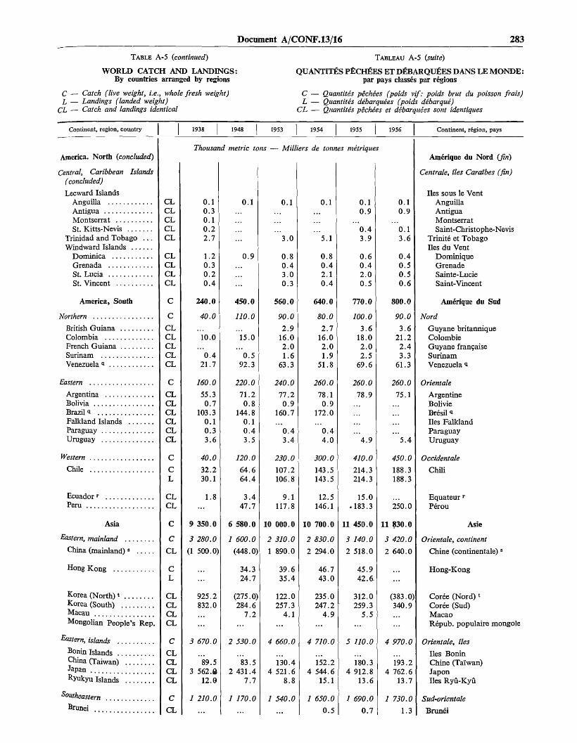
Document A/CONF.13/16 283
TABLE A-5 (continued)
WORLD CATCH AND LANDINGS:By countries arranged by regions
C — Catch (live weight, i.e., whole fresh weight)L — Landings (landed weight)
CL — Catch and landings identical
TABLEAU A-5 (suite)
QUANTITES PECHEES ET DEBARQUfiES DANS LE MONDE:par pays classes par regions
C — Quantites pechees (poids vif: poids brut du poisson frais)L — Quantites debarquees (poids debarque)
CL — Quantites pechees et debarquees sont identiques
Continent, region, country 1938 1948 1953 1954 1955 1956 Continent, r£gion, pays
America. North (concluded)
Central, Caribbean Islands(concluded)
Leeward IslandsAnguillaAntiguaMontserratSt. Kitts-Nevis
Trinidad and Tobago . . .Windward Islands
DominicaGrenadaSt. LuciaSt. Vincent
America, South
Northern
British GuianaColombiaFrench GuianaSurinamVenezuela a
Eastern
ArgentinaBoliviaBrazil *Falkland IslandsParaguayUruguay
Western
Chile
Ecuadorr
Peru
Asia
Eastern, mainland
China (mainland) B
Hong Kong
Korea (North) *Korea (South)MacauMongolian People's Rep.
Eastern, islands
Bonin IslandsChina (Taiwan) . . . .JapanRyukyu Islands
SoutheasternBrunei
Thousand metric tons — Milliers de tonnes metriques
CLCLCLCLCL
CLCLCLCL
C
C
CLCLCLCLCL
C
CLCLCLCLCLCL
C
CL
CLCL
C
cCL
CL
CLCLCLCL
C
CLCLCLCL
C
CL
9
3
(1
3
3
1
0.10.30.10.22.7
1.20.30.20.4
240.0
40.0
10.0
0.421.7
160.0
55.30.7
103.30.10.33.6
40.0
32.230.1
1.8
350.0
280.0
500.0)
925.2832.0
670.0
89.5562.8
12.0
210.0
6
1
2
2
1
0.1
0.9
450.0
110.0
15.0
0.592.3
220.0
71.20.8
144.80.10.43.5
120.0
64.664.4
3.447.7
580.0
600.0
(448.0)
34.324.7
(275.0)284.6
7.2
530.0
83.5431.4
7.7
170.0
10
2
1
4
4
1
0.1
3.0
0.80.43.00.3
560.0
90.0
2.916.02.01.6
63.3
240.0
77.20.9
160.7
0.43.4
230.0
107.2106.8
9.1117.8
000.0
310.0
890.0
39.635.4
122.0257.3
4.1
660.0
130.4521.6
8.8
540.0
...
10
2
2
4
4
1
0.1
5.1
0.80.42.10.4
640.0
80.0
2.716.02.01.9
51.8
260.0
78.10.9
172.0
0.44.0
300.0
143.5143.5
12.5146.1
700.0
830.0
294.0
46.743.0
235.0247.2
4.9
710.0
152.2544.615.1
650.0
0.5
11
3
2
5
4
1
0.10.9
...0.43.9
0.60.42.00.5
770.0
100.0
3.618.02.02.5
69.6
260.0
78.9
4.9
410.0
214.3214.3
15.0183.3
450.0
140.0
518.0
45.942.6.
312.0259.3
5.5
110.0
180.3912.8
13.6
690.0
0.7
0.10.9
0.13.6
0.4
0.6
800.0
90.0
3.621.22.43.3
61.3
260.0
75.1
5.4
450.0
188.3188.3
250.0
11 830.0
3 420.0
2 640.0
(383.0)340.9
4 970.0
193.24 762.6
13.7
1 730.0
1.3
Amerique du Nord (fin)
Centrale, ties Caralbes (fin)
lies sous le VentAnguillaAntiguaMontserratSaint-Christophe-Nevis
Trinite et Tobagolies du Vent
DominiqueGrenadeSainte-LucieSaint-Vincent
Amerique du Sud
Nord
Guyane britanniqueColombieGuyane francaiseSurinamVenezuela i
Orientate
ArgentineBolivieBr6sil alies FalklandParaguayUruguay
Occidentale
Chili
Equateur'Perou
Asie
Orientate, continent
Chine (continent ale)
Hong-Kong
Coree (Nord) *Coree (Sud)MacaoRepub. populaire mongole
Orientate, ties
lies BoninChine (Taiwan)Japonlies Ryu-Kyu
Sud-orientale
Brunei

284 Preparatory documents
TABLE A-5 (continued)
WORLD CATCH AND LANDINGS:By countries arranged by regions
C — Catch (live weight, i.e., whole fresh weight)L — Landings (landed weight)
CL — Catch and landings identical
TABLEAU A-5 (suite)
QUANTITES PECHEES ET DEBARQUEES DANS LE MONDE:par pays classes par regions
C — Quantitis pechees (poids vif: poids brut du poisson frais)L — Quantitis debarquies (poids dibarqui)
CL — Quantites pechees et debarquees sont identiques
Continent, region, country 1938 1948 1953 1954 1955 1956 Continent, region, pays
Asia (concluded)
Southeastern (concluded)
Burmac
Cambodiau
Indonesia v
LaosMalaya, Fed. ofNorth BorneoPhilippinesw
Portuguese Timor . . .SarawakSingaporeThailandViet-NamWest New Guinea . . .
Southern, central
BhutanCeylonIndiaMaldive IslandsNepalPakistanPortuguese India . . . .
Southwestern
AdenAfghanistanBahrain IslandsCyprusIran c
IraqIsraelJordanKuwaitLebanonMuscat and Oman ..QatarSaudi Arabia °SyriaTrucial OmanTurkeyYemen
Europe
Northern
Denmark x
Faeroe Islands
Finland
Iceland
Norway
Thousand metric tons — Milliers de tonnes metriques
CLCLCLCLCLCLCLCLCLCLCLCLCL
C
CLCLCLCLCLCLCL
C
CLCLCLCLCLCLCLCLCLCLCLCLCLCLCLCLCL
C
ccL
CL
CL
CL
CL
472.0
80.9
161.0180.0
3.5
930.0
260.0
3.51.7
• . •
76.0
5 550.0
1 760.0
97.189.0
63.028.6
44.4
274.3
1 152.51 017.1
139.05.9
195.10.4
2.3161.0
2.5
980.0
24.0
300.0
0.625.04.02.5
1.9
1.0
6 140.0
2 540.0
225.9217.0
92.353.9
46.1
478.1413.5
1 504.01 317.8
100.0
616.9
147.0
311.9
5.7205.0
3.5
1 150.0
25.5819.020.0
249.0
340.0
75.8
0.425.05.57.70.5
4.0
102.5
6 980.0
2 670.0
342.8331.3
88.848.7
62.1
424.7360.8
1 557.11 398.5
100.061.0
628.5
137.3
364.6
6.3229.8
3.5
1 180.0
29.7828.5
259.7
330.0
51.9
0.525.05.49.20.3
119.4
7 480.0
3 230.0
359.4352.5
89.454.7
65.5
455.4384.2
2 068.21 904.9
100.028.2
651.5
136.8
385.2
6.2213.0130.0
3.6
1 200.0
31.3839.0
270.9
310.0
34.8
0.625.05.4
10.70.5
111.5
7 590.0
3 100.0
425.3417.9
105.649.9
63.3
480.3407.2
1 813.41 646.9
100.030.0
416.0
217.9
3.2
1 390.0
40.31 012.3
277.0
320.0
21.8
025
8100
139.5
7 970.0
3 470.0
463.0455.8
116.364.6
60.2
517.3443.7
2 128.91 959.7
Asie (fin)
Sud orientate (fin)
Birmanie °Cambodge u
Indonesie v
LaosMalaisie, F6d. deBorn6o du NordPhilippines w
Timor portugaisSarawakSingapourThallandeViet-NamNouvelle-Guinee occidentale
Sud centrale
BhoutanCeylanIndelies MaldivesNepalPakistanInde portugaise
Sud occidentale
AdenAfghanistanlies BahreinChypreIranc
IrakIsraelJordanieKoveitLibanMascate et OmanKatarArabie saoudite c
SyrieOman sous regime de traiteTurquieY6men
Europe
Nord
Danemark x
lies Fe"roe
Finlande
Islande
Norvege

Document A/CONF.13/16 285
TABLE A-5 {continued)
WORLD CATCH AND LANDINGS:By countries arranged by regions
C — Catch (live weight, i.e., whole fresh weight)L — Landings (landed weight)
CL — Catch and landings identical
TABLEAU A-5 (suite)
QUANTTTES PECHEES ET DEBARQUEES DANS LE MONDE:par pays classes par regions
C — Quantitis pechees (poids vif: poids brut du poisson frais)L — Quantitis debarquies (poids dibarque)
CL — Quantitis pechies et dibarquies sont identiques
Continent, region, country I I 1938 1948 1953 1954 1955 1956 Continent, region, pays
Europe (concluded)
Northern (concluded)
Sweden y
Western, islands
Ireland, Republic of
United Kingdom
Western, mainland
Belgium
France (excl. Algeria) . . .
Luxembourg
MonacoNetherlands
Western, centralAustriaGermany, Fed. Rep. ofz
LiechtensteinSwitzerland
Eastern, central
CzechoslovakiaGermany (Eastern)HungaryPoland
Southeastern
AlbaniaBulgariaGreeceRomaniaYugoslavia Ba
Southern
AndorraGibraltar ..ItalyMalta and Gozo
Portugal
san Marino
sPain (exd. Ceuta andMeliUa) »>»
Thousand metric tons — Milliers de tonnes mitriques
cL
C
CL
CL
C
CL
CL
CLCL
CL
C
CLCL
CLCL
C
PP
PP
C
CLCLCLCLCL
Cdddd
cL
CL
CL
129.2124.2
1 210.0
12.812.1
1 198.11 098.1
810.0
42.840.9
509.2442.0
0.5
256.2227.3
780.0
2.0776.5714.3
2.0
70.0
3.0
7.0
80.0
3.35.6
25.030.016.8
840.0
181.21.1
247.2217.6
408.5387.8
193.184.
/ 230.
25.24.
1 206.1 098.
800
7065
437391
0
294260
410
0408368
2
90
3
4
90
26
33
21
980
1561
292220
532489
94
0
85
10
0
88
59
5
15
0
372
0
.0
5
.0
.0
.5
.4
.6
.2
.0
.6
.5
.1
.7
.9
.5
11
1
197.3187.0
140.0
19.017.7
122.0030.3
P20.0
74.468.5
497.2436.0
0.5
343.3310.1
730.0
1.8730.4693.2
2.0
140.0
7.1
4.094.4
120.0
3.05.6
46.0
25.7
260.0
208.41.0
425.2293.2
625.6559.2
193.3184.1
1 090.0
21.520.4
1 070.2980.5
890.0
72.065.7
479.1423.8
0.5
339.2300.7
680.0
2.0678.0641.9
2.0
160.0
6.1
106.4
130.0
9.152.5
23.0
1 300.0
in. 60.8
438.7307.4
639.2566.8
1
11
1
209.4199.9
120.0
23.622.4
100.4004.5
900.0
80.073.0
496.5432.9
0.3
319.5276.3
780.0
2.3776.9734.1
170.0
6.4
113.0
130.0
6.860.0
22.6
390.0
218.00.8
424.7286.9
747.4663.5
165.2
1 080.0
30.529.1
1 050.4974.8
880.0
69.162.2
515.6456.3
0.3
298.1263.7
780.0
2.8770.8676.4
190.0
127.4
140.0
65.0
28.4
1 430.0
218.60.8
471.3320.7
736.2655.2
Europe (fin)
Nord (fin)
Suede v
Occidentale, iles
Irlande, R6publique d'
Royaume-Uni
Occidentale, continent
Belgique
France (non compris l'Alg6rie)
LuxembourgMonaco
Pays-Bas
Ouest-centrale
AutricheAllemagne, Rep. F6d. d' z
LiechtensteinSuisse
Est-centrale
TchecoslovaquieAllemagne (orientale)HongriePologne
Sud-orientale
AlbanieBulgarieGreceRoumanieYougoslavie BB
Sud
AndorreGibraltarItalieMake et Gozo
Portugal
Saint-Marin
Espagne (non compris Ceutet MeliUa) bb

286 Preparatory documents
TABLE A-5 {concluded)
WORLD CATCH AND LANDINGS:By countries arranged by regions
C — Catch (live weight, i.e., whole fresh weight)L — Landings (landed weight)
CL — Catch and landings identical
TABLEAU A-5 (Jin)
QUANTITES PECHEES ET DEBARQUEES DANS LE MONDE:par pays classes par regions
C — Quantites pechees (poids vif: poids brut du poisson frais)L — Quantites debarquees (poids debarque)
CL — Quantites pichees et debarquees sont identiques
Continent, region, country 1938 194S 1953 1954 1955 1956 Continent, region, pays
Oceania
American SamoaAustraliaBritish Solomon Islands .Cocos (Keeling) Islands .Cook IslandsFidji IslandsFrench OceaniaGilbert and Ellice IslandsGuamcc
HawaiiJohnston IslandMidway IslandsNauruNew Caledonia dd
New Guinea (AustralianAdminist.) dd
New Hebrides
New Zealand
NiueNorfolk IslandPacific Islands (U.S.
Administration)Papua dd
PitcairnTokelau IslandsTongaWake IslandWestern Samoa
U.S.S.R. ee
U.S.S.R
Thousand metric tons — Milliers de tonnes metriques
CLCLCLCLCLCLCLCLCLCLCLCLCLCL
CLCL
CL
CLCL
CLCLCLCLCLCLCL
C
CL
90.0
33.5
0.5
7.0
0.6
0.2
27.025.0
0.1
1 550.0
1 523.0
90.0
38.9
0.7
0.26.4
0.5
0.4
35.732.9
0.1
1 490.0
1 486.0
110.0
52.0
0.9
1.8
0.28.6
0.5
0.6
36.633.5
00.2
1 980.0
1 983.0
110.0
1.653.7
0.8
2.5
0.29.3
0.8
0.8
36.933.8
00.2
2 260.0
2 258.0
110.0
4.552.2
0.8
1.8
0.27.0
0.7
0.7
39.236.1
00.3
2 500.0
2 498.0
120.0
6.149.9
0.7
2.2
0.27.5
0.4
0.7
38.3
00.3
2 620.0
2 617.0
Oceanie
Samoa americainAustralielies Salomon britanniqueslies Cocos (Keeling)lies Cooklies FidjiOceanie francaiselies Gilbert et ElliceGuamce
HawaiHe Johnstonlies MidwayNauruNouvelle-Caledonie dd
Nouvelle-Guinee (administ.australienne) dd
Nouvelles-H6brides
Nouvelle-Zelande
NiueHe Norfolklies du Pacifique (admin.
E.-U.)Papua dd
Pitcairnlies TokelaouTongaHe WakeSamoa occidental
U.R.S.S. ee
U.R.S.S.
Source: Tables B-l, B-2, and C-l through C-13. See also table A-4 for a diffe-rent arrangement of these country tables.
Note: In the computation of aggregates the.data shown have been supple-mented by FAO estimates where (...) indicates that no official figures are avail-able for particular years or countries.
0 = above zero, but negligible.• Also included with France.b Also included with Spain.° FAO estimates.d Includes dependencies. FAO estimate.e Excludes Comoro Islands.' Federation of.« Includes Ascension.•> Includes Walvis Bay area.» Excludes Ruanda-Urundi.1 Nigeria includes Cameroons (British Adm.).11 Before 6 March 1957, data refer to the Gold Coast and Togoland under
British Administration.I Marine fisheries only. All figures are estimated and are considered to be with-
in 10 % of the actual catch.m Data do not include quantities landed by foreign fishing craft in Greenland
ports, which in 1955 amounted to about 33,000 metric tons, Greenland fishingcraft do not land fish in foreign ports.
II FAO estimate. Excludes tuna caught by foreign boats, landed in Costa Ricaand shown by Costa Rica as exports.
Source: Les tableaux B-l, B-2 et C-l a C-13. Voir egalement le tableau A-4pour une ventilation differente des totaux pour ces pays.
Note: Dans le calcul des totaux generaux, on a introduit des estimations de laFAO lorsque les chiffres officiels manquaient, ce qui est indique dans la colonnepar le signe (...).
0 = sup&rieur a zero, mais negligeable.» Compris egalement avec la France.b Compris egalement avec l'Espagne.0 Estimation de la FAO.d Comprend les dependances. Estimation de la FAO.e Non compris les Comores.' Federation de.s Y compris Ascension.11 Comprend la region de Walvis Bay.1 Non compris le Ruanda-Urundi.' La Nigeria comprend le Cameroon (Adm. birtannique).i Avant le 6 mars 1957 les donnees se referent a la Cote-de-l'Or et au Togo
sous administration britannique.' Peche maritime seulement. Tous les chiffres sont des estimations correspon-
dant a 10 % pres a la verite.m Les donnees ne comprennent pas les quantites debarquees par les ^SQQQ
etrangers dans les ports groenlandais, qui en 1955 ont atteint a peu P r e ! , 'o j j .tonnes metriques. Les bateaux de p6che groenlandais ne debarquent pas oe Pson dans les ports 6trangers.
a Estimation de la FAO. Ne comprend pas le thon peche par des bateaux &*angers, debarque a Costa Rica et apparaissant dans les exportations de Costa

Document A/CONF.13/16 287
° Figures for Mexico exclude " via la pesca ", i.e., quantities caught by foreignfishermen (usually from the United States) under Mexican permits. These quanti-ties are included in the United States landings statistics; Mexico includes themin its export statistics, but they are excluded from the United States import sta-tistics.
p Include Cayman Islands and Turks and Caicos Islands,a Data shown under 1938 refer to 1939.i Includes Galapagos Islands. Excludes catch by foreign craft (which fish
tuna in this area),a Data shown under 1938 refer to 1936. Data shown under 1948 refer to 1949.
i Data shown under 1948 refer to 1949. Data shown under 1956 refer to plantarget.
0 Freshwater fish only. Total catch estimated at 150,000 metric tons.
v 1938, Netherlands East Indies. 1948, 1953-56, excludes West New Guinea.
* Excludes molluscs used for duck feed: 750,700 metric tons in 1953, 821,300in 1954, 876,000 in 1955, and 1,068,000 in 1956.
1 Excludes Faeroe Islands and Greenland.r Catch and landings data do not include an estimated 14,000 metric tons of
fish caught annually in rivers and lakes.
z 1938 data include Eastern Germany and other areas according to prewarboundaries.
« 1938, prewar territory.•»> Data shown under 1938 refer to 1934.« Data shown under 1948 refer to 1949.a a Export data.68 The 1938 " continental" figure for the U.S.S.R. includes the catches of
Estonia (15,400 tons), Latvia (13,900 tons), and Lithuania (1,700 tons).
0 Les chiffres pour le Mexique ne comprennent pas « via la pesca », c'est-a-dire les quantites pechees par des pecheurs etrangers (gdneralement des Etats-Unis) avec l'autorisation mexicaine. Ces quantites sont comprises dans les sta-tistiques des Etats-Unis relatives aux quantites debarquees; le Mexique les com-prend dans ses statistiques d'exportation; mais elles ne sont pas comprises dansles statistiques d'importation des Etats-Unis.
p Y compris les iles Cayman et les lies Turques et Caiques.1 Les donnees pour 1938 se referent a 1939.i Y compris les iles Galapagos. Les quantites pechees par les bateaux etrangers
ne sont pas comprises (ces bateaux pechent du thon dans cette zone).« Les donnees pour 1938 se referent a 1936. Les donnees pour 1948 se referent
a 1949.» Les donnees pour 1948 se referent a 1949. Les donnees pour 1956 se referent
a l'objectif fixe.n Poissons d'eau douce seulement. La quantite totale pechee est estimde a
150.000 tonnes metriques.* 1938, Indes orientales neerlandaises. 1948, 1953-56, non compris la Nouvelle-
Guinee occidentale.* Non compris les mollusques utilises pour ralimentation des canards: 750.700
tonnes metriques en 1953, 821.300 en 1954, 876.000 en 1955 et 1.068.000 en 1956.* Non compris les iles Fero6 et le Groenland.r Les quantites pechees et les quantites debarquees ne comprennent pas une
quantite estimee a 14.000 tonnes metriques de poisson, pfichee annuellementdans les rivieres et les lacs.
z Les donnees pour 1938 comprennent l'Allemagne orientale et d'autresregions selon les frontieres d'avant guerre.
« 1938, territoire d'avant guerre.»b Les donnees pour 1938 se referent a 1934.o" Les donnees pour 1948 se referent a 1949."i Donnees d'exportation.ee Le chiffre « continental» pour 1938 pour l'U.R.S.S. comprend les quantitds
pechees par 1'Estonie (15.400 tonnes), la Lettonie (13.900 tonnes) et la Lituanie(1.700 tonnes).


Document A/CONF.13/18
CERTAIN LEGAL ASPECTS CONCERNING THE DELIMITATIONOF THE TERRITORIAL WATERS OF ARCHIPELAGOS
BY JENS EVENSEN, ADVOCATE AT THE SUPREME COURT OF NORWAY
(Preparatory document No. 15) *
[Original text: English][29 November 1957]
CONTENTS
pageINTRODUCTION 289
I. STUDIES OF INTERNATIONAL BODIES AND VIEWS OF
INTERNATIONAL LAW PUBLICISTS
1. Institut de droit international 290
2. International Law Association 291
3. American Institute of International law . . . . 291
4. Harvard Research in International Law . . . 291
5. The Hague Codification Conference of 1930 . . 292
6. International Law Commission 292
7. Views expressed by international law publicists 294
II. STATE PRACTICE
1. State practice concerning coastal archipelagos
Norway 295
Iceland 295
Denmark 295
Sweden 296
Finland 296
Yugoslavia 296
Saudi Arabia 296
Egypt 296
page
Cuba 296United Kingdom 297Australia 297United States of America 297
2. State practice concerning outlying (mid-ocean)archipelagos
The Faeroes 297The Svalbard Archipelago 298Iceland 298The Bermudas 298The Galapagos 298The Philippines 298The Fiji Islands 299Cook Islands 299Hawaiian Islands 299
III. JUDGEMENT OF 18 DECEMBER 1951, BY THE INTER-NATIONAL COURT OF JUSTICE AND THE LEGAL IMPLI-CATIONS THEREOF 300
IV. CONCLUSIONS
A. Coastal archipelagos 301B. Outlying archipelagos 301
Introduction
A. For the purpose of this paper the term " internalwaters" means sea areas which are sufficiently closelylinked to the land domain to be subject to the regimepf internal waters.1 The waters between and inside theislands and islets of an archipelago may be subject tothis regime.
The term "marginal seas" means the belt of water* miles in width outside and parallel to the coastline°r outside and parallel to the outer limits of the internalhaters where such internal waters exist.
The term " territorial waters" is applied asterm inclusive of both the internal waters and the
marginal seas of a State.
T ' The very excellent research carried on by the^national Law Commission and its Special Rappor-
* TVof t}je jl PaPer was prepared at the request of the Secretariatment Vn*ted Nations but should not be considered as a state-
o r t n e views of the Secretariat.
teur on the various aspects of the extent and delimitationof territorial waters has clearly demonstrated the com-plexity of the problems involved. The practices of andviews advocated by coastal States vary infinitely, as dothe views held by various international authorities andinternational law publicists.
The legal aspects of the problem are mingled withand dependent upon various factors of a geographical,economical, historical and political nature. Such factorshave lately been increasingly invoked by coastal Statesfor the concrete delimitation of their territorial watersand for the solution of the various other problemsconcerning the seas adjacent to their coasts. And,though the broad principles expressed by the Interna-tional Court of Justice in the Anglo-NorwegianFisheries Case2 to the effect that:
"The delimitation of sea areas has always an internationallaw aspect: it cannot be dependent merely upon the law of the
1 Judgement rendered on 18 December 1951, by the Inter-national Court of Justice. I.C.J. Reports, 1951, p. 133.
2 Ibid., p. 132.
289
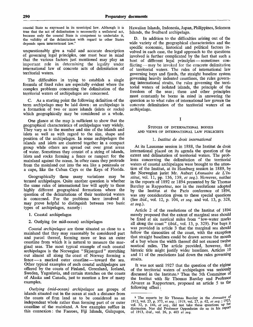
290 Preparatory documents
coastal State as expressed in its municipal law. Although it istrue that the act of delimitation is necessarily a unilateral act,because only the coastal State is competent to undertake it,the validity of the delimitation with regard to other Statesdepends upon international law."
unquestionably give a valid and accurate descriptionof governing legal principles, one must bear in mindthat the various factors just mentioned may play animportant role in determining the legality underinternational law of concrete acts of delimitation ofterritorial waters.
The difficulties in trying to establish a singleformula of fixed rules are especially evident where thecomplex problems concerning the delimitation of theterritorial waters of archipelagos are concerned.
C. As a starting point the following definition of theterm archipelago may be laid down: an archipelago isa formation of two or more islands (islets or rocks)which geographically may be considered as a whole.
One glance at the map is sufficient to show that thegeographical characteristics of archipelagos vary widely.They vary as to the number and size of the islands andislets as well as with regard to the size, shape andposition of the archipelagos. In some archipelagos theislands and islets are clustered together in a compactgroup while others are spread out over great areasof water. Sometimes they consist of a string of islands,islets and rocks forming a fence or rampart for themainland against the ocean. In other cases they protrudefrom the mainland out into the sea like a peninsula ora cape, like the Cuban Cays or the Keys of Florida.
Geographically these many variations may betermed archipelagos. Quite another question is whetherthe same rules of international law will apply to thesehighly different geographical formations where thequestion of the delimitations of their territorial watersis concerned. For the problems here involved itmay prove helpful to distinguish between two basictypes of archipelagos, namely:
1. Coastal archipelagos
2. Outlying (or mid-ocean) archipelagos
Coastal archipelagos are those situated so close to amainland that they may reasonably be considered partand parcel thereof, forming more or less an outercoastline from which it is natural to measure the mar-ginal seas. The most typical example of such coastalarchipelagos is the Norwegian "Skjaergard" stretchingout almost all along the coast of Norway forming afence — a marked outer coastline — toward the sea.Other typical examples of such coastal archipelagos areoffered by the coasts of Finland, Greenland, Iceland,Sweden, Yugoslavia, and certain stretches on the coastsof Alaska and Canada, just to mention a few of manyexamples.
Outlying (mid-ocean) archipelagos are groups ofislands situated out in the ocean at such a distance fromthe coasts of firm land as to be considered as anindependent whole rather than forming part of or outercoastline of the mainland. A few examples suffice inthis connexion: the Faeroes, Fiji Islands, Galapagos,
Hawaiian Islands, Indonesia, Japan, Philippines, SolomonIslands, the Svalbard archipelago.
D. In addition to the difficulties arising out of thewide variety of the geographical characteristics and thespecific economic, historical and political factors in-volved in each case, the legal approach to the questionsinvolved is further complicated by the fact that such ahost of different legal principles — sometimes con-flicting— may be invoked for the concrete delimitationof territorial waters. The rules of international lawgoverning bays and fjords, the straight baseline systemgoverning heavily indented coastlines, the rules govern-ing international straits, the rules governing the terri-torial waters of isolated islands, the principle of thefreedom of the seas; these and other principlesmust constantly be borne in mind in answering thequestion as to what rules of international law govern theconcrete delimitation of the territorial waters of anarchipelago.
STUDIES OF INTERNATIONAL BODIESAND VIEWS OF INTERNATIONAL LAW PUBLICISTS
1. Institut de droit international
At its Lausanne session in 1888, the Institut de droitinternational placed on its agenda the question of theextent and delimitation of territorial waters. The prob-lems concerning the delimitation of the territorialwaters of coastal archipelagos were brought to the atten-tion of the Institut, at its Hamburg session in 1889, bythe Norwegian jurist Mr. Aubert (Annuaire de L'In-stitut, vol. 11, pp. 136, 139, et seq.). However, neitherin the reports of 1892 or 1894 presented by Sir ThomasBarclay as Rapporteur, nor in the resolutions adoptedby the Institut at the Paris conference of 1894,was any consideration given to these special questions(See ibid., vol. 12, p. 104, et seq. and vol. 13, p. 328,et seq.).
Article 2 of the resolutions of the Institut of 1894merely proposed that the extent of marginal seas shouldbe fixed at six nautical miles from "low-water marksall along the coast" (ibid., vol. 13, p. 329). For bays itwas provided in article 3 that the marginal sea shouldfollow the sinuosities of the coast, with the exceptionthat straight baselines could be drawn across the mouthof a bay where the width thereof did not exceed twelvenautical miles. The article provided, however, thathistoric title might justify wider baselines. Articles 10and 11 of the resolutions laid down the rules governingstraits.
It was not until 1927 that the question of the regimeof the territorial waters of archipelagos was seriouslydiscussed in the Institute.3 Thus the 5th Committee ofthe Institut with Sir Thomas Barclay and ProfessorAlvarez as Rapporteurs, proposed an article 5 to thefollowing effect:
3 The reports by Sir Thomas Barclay in the Annuaire of1912, vol. 25, p. 375, et seq. ; 1919, vol. 27, p. 62, et seq. ; 1925,vol. 32, p. 146, et seq., did not take these questions up i°*discussion. Nor did Professor Oppenheim do so in his reportof 1913, ibid., vol. 26, p. 403 et seq.

Document A/CONF.13/18 291
" Where a group of islands belongs to one coastal State andwhere the islands of the periphery of the group are not furtherapart from each other than the double breadth of the marginalsea, this group shall be considered a whole and the extent ofthe marginal sea shall be measured from a line drawn betweenthe uttermost parts of the islands." (Ibid., vol. 33, part 1, 1927,p. 81) (unofficial translation).
As the extent of marginal sea proposed by the Com-mittee was six nautical miles, it follows that a twelve-mile maximum was provided for baselines drawnbetween the outermost points of an archipelago.
During the Stockholm Conference of 1928, an amend-ment was proposed to article 5 by the Swedish juristReuterskibld with special relevance to coastal archipela-gos, as follows:
" In case an archipelago is situated along the coast of acountry the extent of the marginal seas shall be measured fromthe outermost islands and rocks, provided that the distance ofthe islands and islets situated nearest to the coast does notexceed the double breadth of the marginal seas." (unofficialtranslation).
This proposal did not contain any maximum distancebetween the islands and islets of an archipelago, butproposed a distance of twice the breadth of the marginalsea between the nearest island or islets of the archipe-lago and the mainland. However, the final resolution ofthe Institut contained the following proposal in article 5,paragraph 2:
"Where archipelagos are concerned, the extent of themarginal sea shall be measured from the outermost islands orislets provided that the archipelago is composed of islands andislets not further apart from each other than twice the breadthof the marginal sea and also provided that the islands and isletsnearest to the coast of the mainland are not situated further putthan twice the breadth of the marginal sea." (Ibid., vol. 34,p. 673) (unofficial translation).
It must be borne in mind in this connexion that, bya small majority (23-21), the Institut at the Stockholmmeeting substituted three nautical miles for the six milespreviously proposed by the Institut as the extent of themarginal sea.
2. International Law Association
At its 15th conference at Genoa in 1892, the reportof Sir Thomas Barclay to the Institut de droitinternational was submitted to the International LawAssociation for discussion. At the Brussels Conferenceof the Association in 1895, the reports and resolutionsof the Institut were likewise discussed (see Report ofthe 15th Conference of the International Law Associa-tion, 1892, pp. 182 et seq., Report of the 17th Confer-ence in 1895, pp. 102 et seq. See also Report of the27th Conference, Paris, 1912). In 1924 the InternationalLaw Association appointed a " Neutrality Committee ",with Professor Alvarez as Chairman, to consider thequestion concerning territorial waters. At the Associa-kon meeting in Stockholm in 1924, the CommitteePresented a report and draft convention on " The Lawsof Maritime Jurisdiction in Time of Peace ". ProfessorAlvarez submitted a special draft convention differing*B certain respects from the Committee's proposalWeport of 33rd Conference, Stockholm, 1924, pp. 259et seq)
The draft of the Committee contained no specificprovisions concerning the territorial waters of archipela-gos (ibid., pp. 262 et seq.), but it provided, in article2, that "States shall exercise jurisdiction over theirterritorial waters to the extent of three marine milesfrom low water mark at spring tide along their coasts ".Article 3 provided that, in case of islands situated out-side " the territorial limit of a State, a zone of territorialwaters shall be measured round each of the saidislands". In article 4, a twelve-mile maximum wasproposed for baselines across the mouths of bays.Articles 13 to 16 contained proposals as to straits.
Professor Alvarez, however, in article 5 of his draft,included the following proposals concerning islands andarchipelagos:
" As to islands situated outside or at the outer limit of aState's territorial waters, a special zone of territorial watersshall be drawn around such islands according to the rulescontained in article 4.
" Where there are archipelagos the islands thereof shall beconsidered a whole, and the extent of the territorial waters laiddown in article 4 shall be measured from the islands situatedmost distant from the centre of the archipelago." (Report ofthe 33rd Conference in 1924, p. 266 et seq.) (unofficial trans-lation)
In article 4 of his draft, Professor Alvarez proposeda zone of marginal seas of six nautical miles from low-water marks. Though Professor Alvarez also proposeda twelve-mile maximum for baselines across the mouthsof bays (article 5), no maximum was suggested re-garding the distance between the islands of an archi-pelago.
At the 34th Conference of the Association at Viennain 1926, the question of the territorial waters of archipe-lagos was discussed. The draft convention as amendedby the Conference contained no reference to archipelagos.{Report of 34th Conference, Vienna, 1926, pp. 40 etseq.)
3. American Institute of International Law
The American Institute of International Law pro-posed in Article 7 of its project No. 10 (NationalDomain) the following:
" In case of an archipelago, the islands and keys composingit shall be considered as forming a unit and the extent ofterritorial waters referred to in article 5 shall be measured fromthe islands farthest from the center of the Archipelago."(American Journal of International Law, Spec. Suppl. 20, 1926,pp. 318, 319.)
This formula corresponded closely to the one sug-gested by Professor Alvarez to the InternationalLaw Association in 1924. As we have seen, it did notprovide for any maximum distance between the islandsof an archipelago.
4. Harvard Research in International Law
The Harvard Research in International Law (1929)had in its draft convention on territorial waters no pro-visions concerning archipelagos. Article 7 thereof con-tained certain provisions as to isolated islands to theeffect that "the marginal sea around an island or

292 Preparatory documents
around land exposed only at some stage of the tide ismeasured outward three miles therefrom in thesame manner as from the mainland".
In the comments to this article it was stated, interalia:
" In any situation where islands are within six miles of eachother the marginal sea will form one extended zone. Nodifferent rule should be established for groups of islands orarchipelagos except if the outer fringe of islands is sufficientlyclose to form one complete belt of marginal seas." {AmericanJournal of International Law, Spec. Suppl. 23, 1929, pp. 241,276).
5. The Hague Codification Conference of 1930
In the amended draft convention prepared by theGerman jurist Schiicking for the Committee of Experts,4
the following provisions as to archipelagos were in-cluded in article 5, paragraph 2 :
" In the case of archipelagos, the constituent islands areconsidered as forming a whole and the width of the territorialsea shall be measured from the islands most distant from thecenter of the archipelago." (League of Nations document C-196,M-70, 1927, V., p. 72. See also American Journal of Inter-national Law, Spec. Suppl. 20, 1926, p. 142.)
These provisions contained no maximum as to thedistance between the islands of an archipelago, whilein the case of bays the draft (article 4) suggesteda maximum length of ten nautical miles for baselines.
Article 5 of the draft was applicable to outlyingarchipelagos as well as to coastal archipelagos. Wherecoastal archipelagos were concerned, article 5, para-graph 1, containing the following provisions, was alsoapplicable:
" If there are natural islands . . . situated off the coast, theinner zone of the sea shall be measured from these islands,except in the event of their being so far distant from the main-land that they would not come within the zone of territorialsea if such zone were measured from the mainland. . . ."
As set forth in the Basis of Discussion No. 12,on Territorial Waters (Ser. L.o.N.P. 1929. V.2, pp. 50et seq.) the replies of the various Governments to theproposals quoted above show a great diversity of views.
Certain Governments rejected the idea that archipe-lagos should be considered as a single unit. Accordingto their view each island has its own territorial waters.That the territorial waters of two islands might overlap,when they are situated near to each other, had, in theiropinion, no legal bearing whatsoever. Other Govern-ments held the view that a single belt of territorialwaters could be drawn around archipelagos providedthat the islands and islets of the archipelago were notfurther apart than a certain maximum. The suggestionsas to such a maximum varied in different replies.
Finally, certain Governments were of the opinionthat archipelagos must be regarded as a whole where thegeographical peculiarities warranted such treatment.They advocated no particular maximum distance, butheld that the geographical facts of each concrete casemust be taken into account.
4 Appointed by the League of Nations in 1924 to prepare aconference for the codification of international law.
Another question discussed in this same connexionwas whether the waters enclosed within the archipelagoshould be regarded as internal waters or as marginalseas.
As " a possible basis of discussion which would bea compromise" the Preparatory Committee proposedthe following as Basis of Discussion No. 13 :
" In the case of a group of islands which belong to a singleState and at the circumference of the group are not separatedfrom one another by more than twice the breadth of territorialwaters, the belt of territorial waters shall be measured from theoutermost islands of the group. Waters included within thegroup shall also be territorial waters.
" The same rule shall apply as regards islands which lie ata distance from the mainland not greater than twice the breadthof territorial waters." (Ibid., p. 51 ; also American Journal ofInternational Law, Spec. Suppl. 24, 1930, p. 34.)
The compromise thus suggested by the PreparatoryCommittee proposed to consider the archipelagos as aunit but laid down a distance of twice the breadth ofmarginal seas as the maximum distance between theislands and islets of an archipelago. The Committeefurther proposed that the waters enclosed within theislands and islets of the group should not be consideredinternal waters but marginal seas. (The Committee usedthe term " territorial waters ".)
The success of the Codification Conference on thistopic was not spectacular. The question of the territorialwaters of archipelagos, together with certain other of themore controversial problems pertaining to the deli-mitation of territorial waters, was referred to the SecondSub-Committee of the Second Committee of the Confer-ence for further consideration. The Second Sub-Com-mittee, however, was unable to reach an agreement onthis point and consequently abandoned "the idea ofdrafting a definite text on this subject". It merely statedas its " observation " that:
" With regard to a group of islands (archipelago) and islandssituated along the coast, the majority of the Sub-Committeewas of the opinion that a distance of ten miles should beadopted as a basis for measuring the territorial sea outward inthe direction of the high sea. . . . The Sub-Committee did notexpress any opinion with regard to the nature of the watersincluded within the group. (Report of the Second Commission,Ser. L.o.N.P. 1930.V.16, p. 219.)
Thereafter the problems of the territorial waters ofarchipelagos were not taken up for discussion in theplenary meetings of the Conference.
6. International Law Commission
In his first report on " The Regime of the TerritorialSea" (A/CN.4/53) the Special Rapporteur, ProfessorJ. P. A. Francois, included certain proposals on coastalarchipelagos in article 10 and article 5, paragraph 2. Inarticle 10 it was provided:
" With regard to a group of islands (archipelago) and islandssituated along the coast, the ten-mile line shall be adopted asthe baseline for measuring the territorial sea outward in tke
direction of the high sea. The waters included within the groupshall constitute inland waters."
The proposed article 5 concerning "baselinesstated in paragraph 2, inter alia:

Document A/CONF.13/18 293
" Nevertheless where a coast is deeply indented or cut into, orwhere it is bordered by an archipelago, the baseline becomesindependent of the low water mark and the method of baselinesjoining appropriate points on the coasts must be employed.. . ."
In his second report (A/CN.4/61), Professor Fran-cois, as Special Rapporteur, made certain amendmentsto these articles.
In article 5, paragraph 2, he made the followingamendment, inter alia:
" As an exception where circumstances necessitate a specialregime because the coast is deeply indented or cut into, orbecause there are islands in its immediate vicinity, the baselinemay be independent of the low water mark. . .."
He advocated a ten-mile maximum both for baselinesdrawn across the mouths of bays (article 6) andfor baselines drawn between islands and islets of anarchipelago (article 10). Thus his amended article 10stated:
" With regard to a group of islands (archipelago) and islandssituated along the coast the ten-mile line shall be adopted as tobaselines."
The above-quoted proposal was at variance with thegoverning principles of international law as expressedby the International Court of Justice in the above-citedJudgement of 18 December 1951 in the Anglo-Nor-wegian Fisheries Case. The Rapporteur stressed in hisfirst as well as in his second report that he had " insertedarticle 10 not as expressing the law at present in force,but as a basis of discussion should the Commission wishto study a text envisaging the progressive developmentof international law on this subject".
With regard to isolated islands, the reports of theSpecial Rapporteur contained in article 9 the followingproposal:
" Every island has its own territorial sea. An island is an areaof land surrounded by water, which is permanently above high-water mark." (A/CN.4/61)
In his third report (A/CN.4/77), Professor Francoismaintained his views as to straight baselines for deeplyindented coastlines including coastal archipelagos. How-ever, with regard to the more specific principlesconcerning archipelagos the Rapporteur advanced, inarticle 12, an entirely new set of rules, thus illustratingin an interesting way the complexity and uncertaintyinvolved in regard to rules governing archipelagos.Article 12 of the new draft provided:
" 1. The term ' groups of islands', in the juridical sense,shall be determined to mean three or more islands enclosing aPortion of the sea when joined by straight lines not exceedingfive miles in length, except that one such line may extend to amaximum of ten miles.
"2 . The straight lines specified in the preceding paragraphshall be the baselines for measuring the territorial sea. Waterslying within the area bounded by such lines and the islandsthemselves shall be considered as inland waters.
3. A group of islands may likewise be formed by a stringot islands taken together with a portion of the mainland coast-T*e. The rules set forth in paragraphs 1 and 2 of this articlesnail apply pari passu»
No indication was given in the report as to how theProposed maximum length of five miles for the straight
baselines of archipelagos was arrived at; nor were thereasons given for the proposal that one straight baseline,and one only, could be ten miles in length. The pro-posed article applied to coastal as well as to outlyingarchipelagos. The rules here proposed seem to be ratherstrict, especially in view of the wide variety ofgeographical differences and peculiarities where archi-pelagos are concerned.
In its first draft of " Provisional Articles concerningthe Regime of the Territorial Sea" adopted in 1954,5
the International Law Commission proposed — in article5 concerning straight baselines — provisions more orless similar to those suggested by the Rapporteur.It provided for straight baselines where a coast wasdeeply indented or cut into, or where islands weresituated in its immediate vicinity. The Commissionalso maintained in its first draft the ten-mile distanceas the maximum permissible length for straight base-lines. Article 10 of the draft concerning isolated islandscontained provisions similar to those proposed by theRapporteur. But the Commission refrained from makingany specific proposals as far as groups of islands wereconcerned.
In its amended draft articles as set forth in the reporton the seventh session (1955) of the InternationalLaw Commission,6 the Commission likewise refrainedfrom drafting any special provisions on groups ofislands. Article 10 contained rules concerning isolatedislands, while article 5 admitted the use of straight base-lines, inter alia, "where circumstances necessitate aspecial regime because the coast is deeply indented orcut into, or because there are islands in its immediatevicinity..." Article 5 was thus applicable to coastalarchipelagos, and in its second draft the Commission didnot provide for any fixed maximum as to the length ofsuch baselines. Article 5 implicity assumed that thewaters inside the baselines should be considered internalwaters. As far as bays were concerned, article 6 of the1955 draft contained maximum lengths for straightbaselines across the mouths of such bays of twenty-fivenautical miles except in the case of historic bays.
In its final draft " Articles concerning the law of thesea" adopted in 1956,7 the Commission also refrainedfrom presenting any specific provisions concerningarchipelagos.
Article 10 contains certain provisions concerningisolated islands to the effect that:
" Every island has its own territorial sea. An island is anarea of land, surrounded by water, which in normal circum-stances is permanently above high-water mark."
In its comments on this article, the Commissionmade the following observations as to archipelagos:
" The Commission had intended to follow up this article witha provision concerning groups of islands. Like The HagueConference for the Codification of International Law of 1930,the Commission was unable to overcome the difficultiesinvolved. The problem is similarly complicated by the different
5 Official Records of the General Assembly, Ninth Session,Supplement No. 9 (A/2693).
e Ibid., Tenth Session, Supplement No. 9 (A/2934).
7 Ibid., Eleventh Session, Supplement No. 9 (A/3159).

294 Preparatory documents
forms it takes in different archipelagos. The Commission wasalso prevented from stating an opinion, not only by disagree-ment on the breadth of the territorial sea, but also by lack oftechnical information on the subject...
" The Commission points out for purposes of informationthat Article 5 may be applicable to groups of islands lying offthe coast." 8
In article 5 the drawing of straight baselines wasprovided for, inter alia: " where circumstances neces-sitate a special regime because the coast is deeplyindented or cut into, or because there are islands in itsimmediate vicinity".
In this final draft, the Commission proposes a maxi-mum of fifteen miles for straight baselines drawn acrossthe mouths of bays except in the case of historic bays.
As shown in the foregoing, and as especially shownby the various comments made by Governments on theproposals of the Special Rapporteur and the Inter-national Law Commission, the wide variety of rules andof state practice prevented the Commission from draftingspecific articles concerning the extent and delimitationof the territorial waters of archipelagos. As far as coastalarchipelagos are concerned, article 5 of the draft endeav-ours to embody the principles laid down by the Inter-national Court of Justice in its 1951 Judgement in theAnglo-Norwegian Fisheries Case. Where outlying(mid-ocean) archipelagos are concerned, the draftarticles of the International Law Commission do notgive any specific guidance as to the governing principlesof international law.
7. Views expressed by international law publicists
The views expressed by international law publicistsconcerning the territorial waters of archipelagos aremostly brief statements made more or less incidentallyin connexion with general observations on the extentand delimitation of territorial waters.9
e Ibid., p. 17.
9 See inter alia, the statements made by W. E. Hall in ATreatise on International Law, para. 38 :
" Certain physical peculiarities of coasts in various parts of the world,where land impinges on the sea in an unusual manner, require to benoticed as affecting the territorial boundaries."
As examples are mentioned the Florida Keys, the Bahamasand the Cuban Cays.
H. Wheaton in Elements of International Law, 1866,para. 178, expresses himself in a similar manner as follows :
" The term ' coasts ' includes the natural appendages of the territorywhich rise out of waters, although these islands are not of sufficientfirmness to be inhabited or fortified."
See also Halleck in International Law, 4th Edition, London,1908, vol. I, p. 147 :
" The term ' coasts' does not properly comprehend all the shoalswhich form sunken conditions of the land perpetually covered by waters,but it includes all the natural appendages of the territory which riseout of waters."
The German author Munch in Die Technischen Fragen desKiistenmeers (The Technical Questions regarding TerritorialWaters) (Kiel, 1934) also proceeded to regard archipelagos asunits. At page 108, et seq., he made various suggestions as toa possible approach to the concrete delimitations of sucharchipelagos, with geometric constructions and formulas,proposals which at present seem to be mostly of theoreticalinterest.
Where the authors have taken up the problems ofarchipelagos for special discussion they mostly tend tolook upon such formations as units with the ensuinglegal implications as far as the delimitation of territorialwaters is concerned.
Thus Jessup, in his book The Law of TerritorialWaters and Maritime Jurisdiction (New York, 1927),adopted the following rule (p. 457, see also p. 477):
" In the case of archipelagos the constituent islands areconsidered as forming a unit and the extent of territorial watersis measured from the islands farthest from the center of thearchipelagos."
No maximum is proposed as to the distance betweenthe islands and islets of such archipelagos.
Hyde, in his book International Law, 2nd ed., vol. I(Boston, 1947), also seems to advocate in a cautiousway the view that archipelagos may juridically be con-sidered a unit. He states (p. 485) inter alia:
" Where, however, a group of islands forms a fringe orcluster around the ocean front of a maritime State it may bedoubted whether there is evidence of any rule of internationallaw that obliges such State invariably to limit or measure itsclaims to the waters around them by the exact distance whichseparates the several units."
In International Law of the Sea (3rd Edition),Colombos states as follows (pp. 90-91):
" The generally recognized rule appears to be that a group ofislands forming part of an archipelago shall be considered asa unit and the extent of territorial waters measured from thecentre of the archipelago. In the case of isolated or widelyscattered groups of islands, not constituting an archipelago, eachisland will have its own territorial waters, thus excluding asingle belt for the whole group. Whether a group of islandsforms or not an archipelago is determined by geographicalconditions but it also depends in some cases on historic andprescriptive grounds." 10
Schwarzehberger's International Law, Vol. I (1949),p. 156, likewise states that "if islands form an archi-pelago they may in certain circumstances be regardedas a unit in law ".
The French jurist Gidel, in his well-known workLe Droit International Public de la Mer (The PublicInternational Law of the Sea), has given the mostdetailed examination of the problems here involved(vol. Ill, Paris, 1934, p. 706-727).
As far as coastal archipelagos are concerned, Gidelaccepted the rule that such archipelagos shall be treatedas a unit. (See pages 718-726.) Gidel, however, fav-oured a maximum of ten nautical miles for the baselinesbetween the islands and islets of the group or betweenthe mainland and the nearest island of the group.Longer baselines could be justified on "the theory ofhistoric waters ". As to the status of the waters lying be-tween the individual islands of a coastal archipelago, orbetween the archipelago and the mainland, Gidel
io The statement that the extent of territorial waters shall be" measured from the centre of the archipelago " is not entirelyclear. The meaning, however, must obviously be that a lineshall be drawn around the islands and islets of the archipelagoso as to measure the belt of marginal sea from this lineenveloping the group.

Document A/CONF.13/18 295
suggested that they be considered not as internalwaters but as waters subject to the rules governingmarginal seas (ibid, p. 724).
As to outlying (mid-ocean) archipelagos, the viewsexpressed by Gidel were somewhat more ambiguous(Ibid., p. 718):
" In the case of an archipelago situated far from land (mid-ocean archipelago) the measuring of territorial waters must bemade in conformity with the ordinary rules, individuallyaround each island ; exceptions to these rules may follow fromthe theory of historic waters. However, pockets of high seasinside the archipelago may be eliminated by the analogousapplication of the ten mile rule applicable to bays." (unofficialtranslation)
With this latter addition, viz. the analogous appli-cation of straight lines of ten miles, there does notseem to be much difference between the suggestionsmade by the author as to the rules of law applicableto coastal archipelagos and outlying archipelagosrespectively.
II
STATE PRACTICE
The practices of the various coastal States in delimit-ing the territorial waters of their archipelagos may haveconsiderable bearing on the establishment of principlesof international law in this field.
The following survey does not purport to be exhaustivebut it endeavours to give a representative account of theviews held, and methods applied, by different States.
1. State practice concerning coastal archipelagos
Norway
Due to the special geographical peculiarities of theNorwegian coastline and also to the fact that the Inter-national Court of Justice, in its Judgement of 18 De-cember 1951, expressed its opinion on the legalityof Norwegian enactments, the state practice of Norwayconcerning the delimitation of territorial waters outsideits coastal archipelagos offers particular interest.
The special features of the Norwegian coastline are— aside from its profusion of fjords and bays — theNorwegian coastal archipelago called the "Skjaer-gaard". It consists of some 120,000 islands, islets androcks, and extends along most of the coast. The so-called Norwegian system or Scandinavian system forthe delimitation of territorial waters consists in regard-ing the coastal archipelago as the real outer coastline.The main features of this system — the straightbaseline system — are the following:
(a) A continuous line of straight baselines is drawnall along the coast. The outermost points of the coastalarchipelago, including drying rocks, are used as base-points.
(b) There are no maximum lengths for such base-lines. Each of them is dependent upon the geographicalconfiguration of the coastline.
(c) The baselines follow the general direction of thecoast.
(d) There is no connexion between the length ofthe baselines and the breadth of the marginal sea.
(e) The waters inside the baselines are consideredinternal waters. Thus, the waters of fjords and baysand the waters between and inside the islands,islets and rocks of the " Skjaergaard" are internalwaters.
(/) The outer limits of the marginal sea are drawnoutside and parallel to such baselines at the distance offour nautical miles.
By Royal Decrees of 12 July 1935 and 18 July 1952the base points and baselines have been fixed in detailall along the Norwegian coasts. All in all, 123 continiousbaselines are drawn. The longest lines are 45.5 nauticalmiles, 44 nautical miles, 40 nautical miles and 38.8nautical miles. Fifty more baselines are ten nauticalmiles or more in length.
By a Judgement rendered on 18 December 1951, theInternational Court of Justice held that the Norwegiansystem laid down in Royal Decree of 12 July 1935drawing baselines along the outer points of the Nor-wegian coastal archipelago was not contrary to inter-national law.
Iceland
Iceland has likewise applied the straight baselinesystem for delimiting its waters. By Fisheries Regulationsof 19 March 1952, forty-seven consecutive baselines aredrawn around the coasts of Iceland, enclosing the watersof its coastal archipelagos, islands and rocks within theselines. No maximum is stipulated for the lengths ofbaselines. They vary in length according to theparticular geographic features. The longest baselines are66 and 41 nautical miles (those across the Faxa Bayand Breidi fjords respectively). Fifteen more linesmeasure 20 nautical miles or more.
A four-mile zone of marginal seas is drawn outsideand parallel to the baselines. The waters inside thebaselines, including the waters inside or between theislands and islets of coastal archipelagos, are consideredinternal waters.
Denmark
By various Danish regulations and decrees, the watersbetween and inside the Danish coastal archipelagos areconsidered Danish internal waters (see, e.g., NeutralityDecrees of 27 January 1927 and 11 September 1938,and enactments concerning Fishing and Hunting inGreenland Waters of 1 April 1925, 27 May 1950,7 June 1951 and 11 November 1953). Denmark seemsto apply straight baselines for such delimitation and aten-mile maximum for baselines is provided for in cer-tain of these enactments.11 The three main passages tothe Baltic formed in part or in whole by the Danisharchipelagos, namely, the Sound formed by the Swedishcoast and the Danish island of Sjaeland, the Great Belt
n It should be borne in mind in this connexion that Den-mark — but not Norway, Sweden, Iceland or Finland — is aparty to the North Sea Fisheries Convention of 1882 providingfor a ten-mile maximum for baselines drawn across the mouthsof bays and fjords.

296 Preparatory documents
formed by Danish islands and the Little Belt formed byislands and Jutland, are held to be international straits.They are thus open to navigation though these watersare situated between and inside the Danish archipelagos.
Sweden
Sweden applies the straight baseline system for thedelimitation of its territorial waters, enclosing within thebaselines the waters between the islands of a coastalarchipelago and between the islands and the mainland.Customs regulations of 7 October 1927, together withRoyal Letter of 4 May 1934, laid down the concretebaselines — these baselines probably prevail also forpurposes other than customs. No maximum has beenfixed for the length of such baselines : thus various linesexceed ten nautical miles. However, none of thesebaselines are comparable in length to some of thelongest lines in force along the coastal archipelago ofNorway or Iceland. A four-mile limit of marginal seasis drawn outside and parallel to the baselines. The watersinside the baselines are internal waters.
Finland-Finland also applies a straight baseline system en-
closing the waters of its numerous islands and coastalarchipelagos, such as the Aaland archipelago and theTorneaa archipelago, within these lines.
By Act of 18 August 1956, and by Presidential De-cree of the same date, baselines were fixed for the wholeof the Finnish coast. The act provides for a maximumlength of baselines of "twice the breadth of themarginal seas", corresponding to eight nautical milessince the breadth of Finland's marginal seas is fournautical miles. The Act further provides that archipela-gos situated too far out at sea to be included in the outercoastline shall have their own territorial waters. Suchoutlying archipelagos are also considered as a whole.Baselines in length twice the breadth of the marginalseas shall be drawn around such archipelago. However,according to article 6 of the Act, the breadth of marginalseas for such outlying archipelagos is three nauticalmiles. Consequently the maximum length of baselinesin these cases is six miles. The waters between andinside the islands or islets of Finnish archipelagos areconsidered as internal waters.
Yogoslovia
Yogoslavia is also among the nations which includethe coastal archipelagos situated almost all along itscoast within its outer coastline by the drawing of straightbaselines.
By enactment of 1 December (28 November) 1948,baselines have been drawn along the outer fringes ofthese archipelagos (article 3). The belt of marginal seasof six nautical miles is drawn outside and parallel tothese baselines. No express maximum is given or isindicated in the Act as to the length of the baselines,while in certain circumstances a maximum of twelvenautical miles is given as the length of baselines acrossthe mouths of bays and estuaries (article 3, para. 6).The waters between the islands of a Yugoslav coastalarchipelago and between the islands and the mainlandare considered internal waters.
It may be of interest in this connexion to drawattention to the proposals concerning archipelagos madeby the Yugoslav Government in its commentsof 20 March 1956 on the draft articles of the Inter-national Law Commission. In its comments on article 5it proposed the following additions concerning archi-pelagos:
" If a group of islands (archipelago) is situated along thecoast the method of straight baselines joining appropriate pointson the islands facing the high sea will be applied. The parts ofthe sea closed in by these lines, islands and coast of the main-land will be considered as internal waters.
" 3 . If the provision of paragraph 2 of this article cannot beapplied to the group of islands (archipelago) due to a greatdistance from the mainland, the method of baselines will beapplied which join appropriate points of the coast towards thehigh seas. Parts of the sea enclosed by these lines and islandswill be considered as internal waters of the archipelago." 12
The proposal referred to outlying as well as coastalarchipelagos. It purports to regard such archipelagosas units and to apply straight baselines "joining theappropriate points" of the several islands and isletsof such an archipelago. The waters between and insidethe islands and islets of such an archipelago are consid-ered internal waters according to the proposal.
Saudi Arabia
Under articles 4 and 6 of Royal Decree of 28 May1949, islands and coastal archipelagos are made part ofthe outer coastline of Saudi Arabia by drawing straightbaselines. The maximum length of such baselines istwelve nautical miles. The waters lying between islands,islets and the mainland are internal waters.
Egypt
Article 4 of Royal Decree of 18 January 1951provides that straight baselines of a maximum length oftwelve nautical miles shall be drawn between the main-land and islands and from island to island, thus includingcoastal archipelagos within the outer coastline. Thewaters inside such archipelagos are internal waters.
Cuba
The Cuban Cays (string of islands, islets and reefs)extending out into the ocean along the Cuban mainlandare likewise by established practice, as expressed invarious legislative enactments, regarded as Cuba's outercoastline. Thus article 6, paragraph 2, of the Decree of8 January 1934, provides:
" The waters situated between the islands, islets or cays andthe mainland of Cuba are internal waters."
The examples given above refer to countries thatregard coastal archipelagos as a unit forming an outercoastline from which to measure the marginal sea. They
12 Yearbook of the International Law Commission, 1956,vol. II, p. 100. See also observations made by the YugoslavGovernment in its comments dated 15 March 1955, printed i°the report of the International Law Commission its seventnsession, 1955 (Official Records of the General Assembly, TentnSession, Supplement No. 9), pp. 46 et seq.

Document A/CONF.13/18 297
all seem to apply straight baselines for suchdelimitation, though some of them lay down a certainmaximum for the length of such baselines. The watersinside such baselines are considered internal waters, thuspresumably giving the coastal State the right to closesuch waters for navigation by foreign vessels unless thepassage concerned is an international strait.
There are, however, a number of States that applyother and different methods for the delimitation of theirterritorial waters where coastal archipelagos are con-cerned.
United Kingdom
The stand taken by the United Kingdom as to thearchipelagos has traditionally been a very strict one. Inthe Anglo-Norwegian Fisheries Case, it did not recog-nize the Norwegian claims to measure Norway'smarginal seas from straight baselines drawn along theoutermost points of coastal archipelagos. The UnitedKingdom, on the contrary, advocated the arcs of circlesmethod, measuring the territorial waters from low watermarks by a consecutive line of intersecting arcs ofcircles. Each island had, according to the English view,its own territorial waters. But where two islands werenot further apart than twice the breadth of the marginalseas the arcs of circles would intersect. In its lastwritten pleadings the United Kingdom somewhat changedits stand. It stated that if, contrary to its belief, customaryrules of straight baselines had developed for archipela-gos, such rules must be "subject to an absolute limitof ten miles of the length of the baselines".I.C.T., Pleadings, Oral Arguments, Documents, FisheriesCase, Judgement of 18 December 1951, vol. II,p. 361). After the Judgement of 18 December 1951by the International Court of Justice, the United King-dom has somewhat modified its original views (see forexample its comments of 1 February 1955, on draftarticle 5 in the report of the International Law Com-mission on its seventh session13). In this connexion,mention may also be made of the comments of theUnited Kingdom dated 15 March 1956, where inconnexion with draft article 10 (the regime of theterritorial sea) concerning isolated islands it states asfollows:
" The United Kingdom Government approve this article. Theydo not consider that there is any need to make special provisionstor groups of islands as such, and agree in principle with thelast sentence of the Commission's comment upon this article.They consider that the ordinary rules, in conjunction with theJudgement of the International Court of Justice in the Anglo-Norwegian Case, are adequate to cover this case." i*
. In a few exceptional cases the United Kingdom has,P dealing with overseas territories, treated groups ofislands as a unit. Thus, in connexion with the delimita-tion of the territorial waters of Jamaica, the LawOfficers of the Crown maintained in 1864 that " inPlaces where the possession of particular rocks, reefs or°anks, naturally connected with the mainland of any
Official Records of the General Assembly, Tenth Session,Supplement No. 9, p. 41 et seq.
Vnl4 Yearbook of the International Law Commission, 1956,vo1- II, p. 85.
part of Her Majesty's territory is necessary for the safeoccupation and defense of such mainland, HerMajesty's Government also claim the waters enclosedbetween the mainland and those rocks, reefs or banks;whatever may be the distance between them and thenearest headland". (I.C.J., Pleadings, Oral Arguments,Documents, Fisheries Case, Judgement of 18 December1951, vol. II, p. 533)
On the other hand the United Kingdom has not madeclaims to the waters situated between the coastal islands,islets and archipelagos lying off the coast of BritishHonduras and the mainland. (Ibid., pp. 524-525)
A ustralia
During the Anglo-Norwegian Fisheries Case theUnited Kingdom, with the consent of Australia, assertedas to the Barrier Reef—a coastal archipelago situatedoff Queensland — that, " Queensland has no legislativeauthority over the sea beyond the distance of threemarine miles from low water mark of the mainland andthe islands respectively" (ibid., p. 523). Thus, thewaters situated between these reefs and the mainlandoutside the three-mile limit are considered high seas.
United States of America
This country has been one of the staunchest advocatesof the view that archipelagos, including coastal archipe-lagos, cannot be treated in any different way fromisolated islands where the delimitation of territorialwaters is concerned. Thus, according to informationreceived, the practice of the United States in delimiting,for example, the waters of the archipelagos situated out-side the coasts of Alaska is that each island of sucharchipelagos has its own marginal sea of three nauticalmiles. Where islands are six miles or less apart themarginal seas of such islands will intersect. But noteven in this case are straight baselines applied forsuch delimitation.
That the Florida Keys have been considered a unit isactually no exception to this practice. The several islandsof the Keys are situated so close together and the watersin between are so shallow that they must naturally beconsidered as a continuous whole.
2. State practice concerning outlying (mid-ocean)archipelagos
The highly varied practices of States where outlyingarchipelagos are concerned clearly illustrate the con-fusion reigning in this field of international law. Thefollowing examples are indicative of the profusion ofdifferent views and approaches with regard to thedelimitation of the territorial waters of outlying archi-pelagos.
The Faeroes
This archipelago, consisting of eighteen inhabitedislands and numerous islets, skerries and rocks, issituated in the North Atlantic, north of the Britis Isles.By agreement of 22 April 1955 between Denmark andthe United Kingdom, the exclusive fishery zones of thismid-ocean archipelago were drawn up in a very

298 Preparatory documents
interesting way. The Faeroes are treated as a unit andthe outer limit of territorial waters is drawn by meansof a mixed system of arcs and straight lines. Straightlines are used to a great extent for the delimitation ofthe outer limits of the fishery zones, but arcs of circleshave been applied to round off the limits where twostraight lines meet. Though the straight baseline systemis not expressly applied, it seems apparent that theagreement of 22 April 1955, viewed as a whole is aninteresting application of the rule laid down by the Inter-national Court of Justice in its Judgement of 18December 1951, namely, that with heavily indentedcoastlines the outer limits of territorial waters need notnecessarily follow all the sinuosities of the coast, butcan be drawn in such a manner as to follow thegeneral direction thereof.
The Svalbard Archipelago
This archipelago situated between 74° 8' N. Lat. and10° 35' E. Long, consists of numerous islands, islets androcks. The coastline of the archipelago is heavilyindented by fjords, bays and sounds. By the SpitzbergenTreaty of 9 February 1920, the Contracting Partiesrecognized "the full and absolute sovereignty of Nor-way " to the archipelago. Under the treaty the ships andnationals of the Contracting Parties shall enjoy equalrights of fishing and hunting and have equal liberty ofaccess and entry to the territorial waters of thearchipelago.
Norway has not yet laid down the limits of theterritorial waters of Svalbard. But it seems reasonable toassume that the Norwegian Government considers thearchipelago as a unit and will apply its straight baselinesystem around the archipelago for such delimitation.
Iceland
Iceland, together with its coastal islands, islets andskerries, may properly be regarded as a mid-oceanarchipelago. As previously mentioned, the Icelandicauthorities have drawn a consecutive line of straightbaselines all along the coast from the outermost pointsthereof, including the outermost points of islands andislets. However, the Icelandic Government has notapplied this appoach to the extreme. It has not in-cluded in this line islands Ivine; far out at sea, such asthe islands of Grimsey, Kolbeinsey, Hvalsbakur andGeirfugladrangur. Each of these islands has beenconsidered to have its own territorial waters.
Mention may further be made of a note verbaledated 25 March 1955, from the Icelandic Government,commenting on the draft articles of the InternationalLaw Commission. As to outlying archipelagos, the Ice-landic Government stated that such groups "wouldhave an independent baselines system" in conformitywith the "general criteria formulated by the Inter-national Court of Justice" in the Anglo-NorwegianFisheries Case.15
The Bermudas
This archipelago, situated in the North Atlantic
between 32° 14' - 32° 25' N. Lat. and 64° 38' - 64° 52'W. Long., consist of some 365 islands and islets of coralformation. According to statements presented by theUnited Kingdom during the Anglo-Norwegian FisheriesCase, it has asserted its authority over the coastal waterswithin this archipelago "up to a distance of threenautical miles from the outer ledges " (I.C.J., Pleadings,Oral Arguments, Documents, Fisheries Case, Judgementof 18 December 1951, vol. II, p. 532).
The Galapagos
This archipelago (also called the Colon archipelago)is situated some 600 miles out in the Pacific west of themainland of Ecuador and between 1 ° 42' N. Lat. - 1 ° 25'S. Lat. and 92°-89° 16' W. Long. It comprises somefifteen larger islands and a series of smaller islands andislets. According to Presidential Decrees concerningFisheries of 2 February 1938 and of 22 February 1951,the Government of Ecuador considers this archipelagoas a unit, and delimits its territorial waters by drawingstraight baselines between "the most salient points ofthe outermost islands forming the contour of thearchipelago of Galapagos" (See the Decree of 1951,article 2, para. 2).
Accordingly, the lengths of the baselines thus drawnaround the archipelago are the following:
(a) The baseline from the island of Espanola to theisland of Santa Maria is some 48 nautical miles.
(b) The baseline from Santa Maria to Isabella issome 62 nautical miles.
(c) The baseline from Isabella to Darwin is some32 nautical miles.
(d) The baseline from Fernandina to Darwin is some124 nautical miles.
(e) The baseline from Darwin to Genovesa is some147 miles.
(/) Te baseline from Genovesa to San Cristobal issome 76 nautical miles.
(g) The baseline from San Cristobal to Espanola issome 47 nautical miles.
According to article 2 of the 1951 Decree, the outerlimits of marginal seas are drawn at a distance of 12nautical miles outside and parallel to the above-mentioned baselines. Inside these limits fishing is re-served for nationals and domiciliaries of Ecuador.18
Whether the waters lying between and inside thearchipelagos (that is inside the above-mentioned base-lines) are considered internal waters or marginal seasis not known.
The Philippines
This archipelago, situated in the Pacific betweenabout 116°- 127° E. Long, and about 5°-20° N. Lat.,is a group of some 7,100 islands scattered over a largeexpanse of water. According to the notes verbalespresented by the Philippine authorities commenting on
15 Official Records of the General Assembly, Tenth Session,Supplement No. 9, p. 29.
16 Lately even more extensive claims have been made byEcuador (a limit of 200 nautical miles as the limit of Ecuador smarginal seas).

Document A/CONF.13/18 299
the draft articles of the International Law Commission,the Philippine Government seems to delimit the ter-ritorial waters of the country in a somewhat uniquemanner (see note verb ale, dated 7 March 1955,17 andnote verbale dated 20 January 195618).
In these notes it is stated, inter alia:
" All waters around, between and connecting different islandsbelonging to the Philippine Archipelago, irrespective of theirwidth or dimension, are necessary appurtenances of its landterritory, forming an integral part of the national or inlandwaters, subject to the exclusive sovereignty of the Philippines." i»
It is not clear from the above-quoted statementwhether the large expanse of water called the Zulu Seabordered in the east, west and north by the PhilippineArchipelago and in the south by North Borneo, andcovering tens of thousands of square miles of seas, isclaimed as internal waters by the Philippine authorities.
In addition to the "national or inland waters", thePhilippine authorities, according to the above citedstatements, further claim that:
"All other water areas embraced within the lines describedin the Treaty of Paris of 10 December 1898, the Treaty con-cluded at Washington, D.C., between the United States andSpain on 7 November 1900, the Agreement between the UnitedStates and the United Kingdom of 2 January 1930, and theConvention of 6 July 1932 between the United States and GreatBritain, as reproduced in section 6 of Commonwealth ActNo. 4003 and article 1 . . . of the Philippine Constitution, areconsidered as maritime territorial waters of the Philippines forpurposes of protection of its fishing rights, conservation of itsfishery resources, enforcement of its revenue and anti-smugglinglaws, defence and security, and protection of such other interestsas the Philippines may deem vital to its national welfare andsecurity, without prejudice to the exercise by friendly foreignvessels of the right of innocent passage over those waters." 20
The lines here referred to are the boundaries of theCommonwealth of the Philippines as laid down in thevarious conventions mentioned above. They are drawnalong certain degrees longitude east and latitude north.The present stand of the Philippine Government seemsto be that all the waters situated inside these inter-national treaty limits are to be considered as themarginal seas of the Philippines.
It is not known to what extent the Philippineauthorities recognize that the numerous passages betweenthe islands and islets of the Philippine archipelagoform international straits which under international laware open to navigation for foreign ships.
The examples given above show that a number ofoutlying archipelagos are treated by the respectivenational authorities concerned as units with regard tothe delimination of their territorial waters.
17 Official Records of the General Assembly, Tenth Session,Supplement No. 9, pp. 36-37.
18 Yearbook of the International Law Commission, 1956,v°l- n , pp. 69-70.
19 Ibid., p . 70.20 Ibid.
There are, however, on the other hand, a host ofcases where outlying archipelagos have not been treatedin such a manner by the competent authorities..
Thus, it is clear that usually neither the United King-dom Government nor the United States Governmenthave proceeded to consider their various insularpossessions, for example in the Pacific, as units wherethe delimination of territorial waters is concerned. Thepractice generally followed by these States has been todraw a separate belt of territorial waters around eachindividual island of an archipelago, thus leaving stretchesof high seas in between, provided that the distance be-tween the various islands of the group is wider thantwice the breadth of the marginal seas. A few examplessuffice in this connexion.
The Fiji Islands
This group of islands, situated in the Pacific between16° - 19° 20' S. Lat. and 178° W. Long-177° E. Long.,contains some 250 islands and islets. According tostatements made by the United Kingdom Government inthe Anglo-Norwegian Fisheries Case, this archipelagois not treated as a whole for the delimitation of ter-ritorial waters. A separate belt of territorial waters hasbeen drawn around each individual island (I.C.J.,Pleadings, Oral Arguments, Documents, Fisheries Case,Judgement of 18 December 1956, vol. II, p. 524).According to information received, the SolomonArchipelago has been treated in a like manner.
Cook Islands
According to statements made by the United Kingdomin the Anglo-Norwegian Fisheries Case, the NewZealand Government has not drawn a continuous beltof territorial waters around each separate islandthereof (Ibid., pp. 523,524).
Hawaiian Islands
It seems that the Hawaiian Islands were formerlyconsidered as a whole where the delimination ofterritorial waters was concerned. Thus, by a NeutralityProclamation of 16 May 1854, the "King of theHawaiian Islands" proclaimed that "our neutrality isto be respected... to the full extent of our jurisdiction ",and further proclaimed that this included " all thechannels passing between and dividing said islands fromisland to island". Similarly, in a Neutrality Proclama-tion of 29 May 1877, it was provided that no hostileacts could be committed within the Kingdom including" all its ports, harbours, bays, gulfs, skerries and islandsof the seas cut off by lines drawn from one headland toanother".21 However, it seems clear that the presentpractice of the Government of the United States is notto draw a continuous belt of territorial seas around thearchipelago, but to give each island its own belt ofterritorial waters so as to leave stretches of high seas inthe middle of the numerous channels and waterwaysseparating the islands of this archipelago.
See Crocker, The Extent of the Marginal Sea, pp. 595-596.

300 Preparatory documents
III
JUDGEMENT OF 18 D E C E M B E R 1951 BY THE INTER-
NATIONAL COURT OF JUSTICE AND THE LEGALIMPLICATIONS THEREOF
As shown above, little or no guidance as to thegoverning principles of international law can be drawneither from the practice of the various States or from theviews expressed by various international bodies andinternational law publicists. The results to be derivedtherefrom, if any, are — in the writer's opinion — thatno hard and fast rules seem to exist as to the delimitationof the territorial waters of archipelagos.
The question arises as to whether this implies that weare left without guidance with regard to the governingprinciples of international law in this respect. Theanswer is, as was stressed by various Governmentsin their comments to the draft articles of the Inter-national Law Commission, that the rules and principleslaid down by the International Court of Justice in itsJudgement of 18 December 1951 in the Anglo-Norwe-gian Fisheries Case may prove to be of far-reachingimportance. Admitting that the Court's decisions arenot binding for States other than the two parties to thecase and, further, that the specific elements of theparticular case before the Court will always weighheavily in deciding the case, it is equally true, however,that in the above-mentioned Judgement the Court ex-pressed clearly and repeatedly its opinion on broadprinciples of international law, principles also applicableto the problems here discussed.
One of the main questions before the Court was thestatus of the waters of the coastal archipelagos ofNorway, called the " Skjaergaard". These problemswere argued before the Court and were decided upon inits Judgement. Thoueh the opinions expressed by theCourt in this respect dealt with a special type of coastalarchipelago, it would — in the writer's opinion — beerroneous to assume that the principles there laid downwere devoid of importance for the delimitation of theterritorial waters of other coastal archipelagos and ofoutlying (mid-ocean) archipelagos.
Thus, the Court's rejection of the British contentionregarding the strict coastline rule "requiring the coast-line to be followed in all its sinuosities " and the furtheremphatic statement by the Court that the so-called " arcsof circles method" advocated by the United Kingdom" is not obligatory by law " are obviously also applicableto outlying archipelagos (I.C.J. Reports 1951, p. 129).
Likewise the main principle adopted by the Court,a principle that may perhaps be properly designated as"the general direction of the coast rule", seemsaplicable to coastal and outlying archipelagos alike. Thecourt stated in this connexion:
" The principle that the belt of territorial waters must followthe general direction of the coast makes it possible to fix certaincriteria valid for any delimitation of the territorial sea ; thesecriteria will be elucidated later. The Court will confine itselfat this stage to noting that, in order to apply this principle,several States have deemed it necessary to follow the straightbase lines method and that they have not encountered objectionsof principle by other States." (italics supplied) (Ibid., p. 129)
The principle of the general direction of the coast wasreverted to later in the Judgement. Thus on page 133the Court, in connexion with the straight baselinesystem, stated that "the drawing of baselines mustnot depart to any appreciable extent from the generaldirection of the coast". And, along the same lines, itfurther stated (pp. 141-142) with regard to a baselineforty-four miles long that:
" The baseline has been challenged on the ground that it doesnot respect the general direction of the coast. It should beobserved that, however justified the rule in question may be, itis devoid of any mathematical precision. In order properly toapply the rule, regard must be had for the relation between thedeviation complained of and what, according to the terms of therule, must be regarded as the general direction* of the coast.Therefore, one cannot confine oneself to examining one sectorof the coast alone, except in a case of manifest abuse."
Among the general criteria stressed by the Court fora State's delimitation of its territorial waters thefollowing may be noted: the Court emphasized thatthere existed "certain basic considerations inherent inthe nature of the territorial sea " ; that the criteria werenot " entirely precise" but would provide " courtswith an adequate basis for their decisions, which canbe adapted to the diverse facts in question" (Ibid.,p. 133). Among these considerations, the Court men-tioned " the close dependence of the territorial sea uponthe land domain. It is the land which confers upon thecoastal state a right to the waters off its coasts"(Ibid., p. 133).
Among the criteria given by the Court for decidingwhether an area of water may be considered inter-nal waters or not the Court stressed as follows:
" Another fundamental consideration, of particular importancein this case, is the more or less close relationship existingbetween certain sea areas and the land formations which divideor surround them. The real question raised in the choice ofbaselines is in effect whether certain sea areas lying within theselines are sufficiently closely linked to the land domain to besubject to the regime of internal waters." (Ibid., p. 133)
The criteria here laid down by the Court are equallyapplicable to outlying archipelagos and coastal archipe-lagos and the statements thus made are couched ingeneral terms expressing basic principles of in-ternational law in this field.
Another principle emphasized by the Court was that:" A State must be allowed the latitude necessary in order to
be able to adapt its delimitation to practical needs and localrequirements." (Ibid., p. 133)
With a special view to the delimitation of theNorwegian coastal archipelagos, the Court stressed the"geographical realities" which forced it to considersuch archipelagos as " a whole with the mainland" tothe end that " i t is the outer line of the 'skjaergaard'which must be taken into account in delimiting the beltof Norwegian territorial waters" (Ibid., p. 128). As aconsequence thereof, the Court stated:
" If the belt of territorial waters must follow the outer line ofthe ' skjaergaard', and if the method of straight baselines beadmitted in certain cases, there is no valid reason to draw themonly across bays . . . and not also to draw them between islands,islets and rocks, across the sea areas separating them, even whensuch areas do not fall within the conception of a bay. It 1S
sufficient that they should be situated between the island

Document A/CONF.13/18 301
formations of the ' skjaergaard', inter fauces terrarum." {Ibid.,p. 130)
In connexion with such baselines, as well aswith baselines in general, the Court expressly rejectedthe British contention to the effect that under inter-national law there existed a principle limiting the lengthof baselines to ten nautical miles. The Court emphasizedthat " the ten-mile rule has not acquired the authority ofa general rule of international law" {Ibid., p. 131).
And, with a special view to baselines drawn betweenthe islands, islets and rocks of coastal archipelagos, theCourt stated along the same lines as follows:
" The Court now comes to the question of the length of thebaselines drawn across the waters lying between the variousformations of the ' skjaergaard'. Basing itself on the analogywith the alleged general rule of ten miles relating to bays, theUnited Kingdom Government still maintains on this point thatthe length of straight lines must not exceed ten miles.
" In this connexion, the practice of States does not justify theformulation of any general rule of law. The attempts that havebeen made to subject groups of islands or coastal archipelagosto conditions analogous to the limitations concerning bays(distance between the islands not exceeding twice the breadth ofthe territorial waters, or ten or twelve sea miles), have not gotbeyond the stage of proposals." {Ibid., p. 131)
Though the statement here made by the Court wasmainly directed at coastal archipelagos it seems equallyapplicable to outlying archipelagos.
The court further held that the waters lying betweenand inside the coastal archipelagos in question, that isinside the straight baselines, must be regarded as inter-nal waters (Ibid., p. 132). In this connexion, however,it must be noted that the result would probably havebeen a different one if the passage between the islandsof the "skjaergaard" had formed a "strait". Thequestion was raised before the Court in regard tothe inland water route called "Indreleia", a shelteredwaterway lying between the "skjaergaard" and themainland of Norway. The British contention was thatthe waters of this inland waterway could not have thestatus of internal waters, but rather should be lookedupon as marginal seas.
The Court's answer to these contentions was asfollows:
"The Court is bound to observe that the Indreleia is not astrait at all, but rather a navigational route prepared as suchby means of artificial aids to navigation provided by Norway.In these circumstances the Court is unable to accept the viewthat the Indreleia, for the purposes of the present case, has astatus different from that of the other waters included in the'skjaergaard'." {Ibid., p. 132)
Though couched in rather broad terms this statementobviously implies that the result might have been adifferent one had the "Indreleia" passage been a
strait".
rvCONCLUSIONS
territorial waters of archipelagos. In view of the greatvariety of geographical, historical and economical fac-tors involved, it would hardly be feasible, or evendesirable, to try to lay down such hard-and-fast rules inan international convention; rules which might easilyprove to be too inelastic to give reasonable weight tothe many differences and peculiarities of each individualcase. However, this does not mean that rules andprinciples do not exist, or should not be established, butthat such rules ought to have a certain flexibility. Withsuch considerations in mind, the writer ventures to setforth the following suggestions as to the principles ofinternational law which govern this question.
A. Coastal archipelagos
Article 5 of the draft articles concerning the law ofthe sea by the International Law Commission seemsreasonably to embody the governing rules and prin-ciples laid down by the International Court of Justice inits 1951 Judgement, and also seems to give reasonableweight to the special problems arising out of thedelimitation of territorial waters of coastal archipelagos.
However, in view of the special problems involved,the following changes in article 5 may perhaps provedesirable.
According to draft article 5, paragraph 1, first sentence,straight baselines may be used where a coastline is"deeply indented or cut into or because there areislands in its immediate vicinity". If the word" islands " was interpreted strictly, it would prevent thedrawing of straight baselines in many cases where sucha method seems called for; for example where a stringof islets, skerries and rocks (but not islands) is situatedin the immediate vicinity of the coast or where acoastal archipelago consisting of islets, skerries androcks as well as islands is situated along the coast of themainland. Therefore, the writer ventures to suggestchanges in the first sentence of article 5, paragraph 1,so that it will provide as follows:
" Where circumstances necessitate a special regime becausethe coast is deeply indented or cut into or because there arearchipelagos, islands or islets in its immediate vicinity, the base-line may be independent of the low water mark." 22
B. Outlying archipelagos
Where outlying (mid-ocean) archipelagos are con-cerned, the following principles may be set forth — inthe writer's opinion — as the governing principles ofinternational law.
No hard-and-fast rules exist whereby a State is com-pelled to disregard the geographical, historical (andeconomical) peculiarities of outlying archipelagos.
he conclusions which may reasonably be drawnrom the foregoing—in the writer's opinion—that
n o h a r d and fast rules exist as to the delimitation of the
22 Furthermore the writer would suggest an additional changein article 5, paragraph 1. The last sentence of paragraph 1should be deleted. The Court in its 1951 judgement did not findit contrary to international law to use drying rocks or dryingshoals as base points for straight baselines. No valid reasonseems to exist for a deviation from the judgement in this respectespecially as, in article 11 of the draft, drying rocks and dryingshoals may be taken as points of departure for measuringterritorial waters where methods other than straight baselinesare applied.

302 Preparatory documents
Frequently the only natural and practical solution is totreat such outlying archipelagos as a whole for thedelimitation of territorial waters by drawing straightbaselines from the outermost points of the archipe-lago— that is from the outermost points of the con-stituent islands, islets and rocks — and by drawing theseaward limit of the belt of marginal seas at a distance ofX nautical miles outside and parallel to such baselines.Thus the archipelago viewed as a unit has a continuousarea of territorial water. Whether or not an outlyingarchipelago should be treated in such a manner will, toa large extent, depend on the geographical features ofthe archipelago. The following criteria may be of im-portance for the delimitation of territorial waters in anyparticular case:
(a) Though a State in delimiting the territorial watersof its outlying archipelagos must be allowed the latitudenecessary in order to be able to adapt its delimitationto practical needs and local requirements, it is equallyclear that such delimitation has international lawaspects and such aspects may be especially delicatewhere outlying archipelagos are concerned.
(b) In any given case, the more or less closedependence of the territorial sea upon the land domainof the archipelago will always be of paramount im-portance.
(c) The drawing of the baselines must not departto any appreciable extent from the general direction ofthe coast of the archipelago viewed as a whole.
(d) While the distance between the various islands,islets and rocks of an archipelago obviously may playan important role in the question of whether thedrawing of straight baselines is appropriate, no fixedmaximum exists as to the length of such baselines. Onthe other hand it is also obvious that exorbitantly longbaselines, closing vast areas of sea to free navigationand fishing, are contrary to international law. Insuch instances there will not be a sufficiently closedependence between the land domain and the waterareas concerned.
(e) The question as to whether the waters situatedbetween and inside the islands and islets of an archipe-lago may be considered as internal waters depends uponwhether such water areas are so closely linked to thesurrounding land domain of the archipelago as tobe treated in much the same manner as the surroundingland. Each case must be treated on its individual meritsin this respect. The geographical configuration of thearchipelago concerned will be of primary importance forsuch determination, though other factors — such ashistorical and economical factors — may play a role.
if) Even where the waters between and inside theconstituent parts of an archipelago are sufficientlyclosely linked to the land domain to be considered asinternal waters, such waters may form a "strait" andconsequently be subject to the rules of international lawgoverning "straits" established for the benefit of freenavigation and innocent passage of foreign ships. Inview of the foregoing, the writer ventures to proposethe following additional article on outlying archi-pelagos :
" 1 . In the case of an archipelago which belongs to a singleState and which may reasonably be considered as a whole, theextent of the territorial sea shall be measured from the outer-most points of the outermost islands and islets of the archipelago.Straight baselines as provided for under article 5 may be appliedfor such delimitation.
" 2. The waters situated between and inside the constituentislands and islets of the archipelago shall be considered asinternal waters with the exceptions set forth under paragraph 3of this article.
" 3. Where the waters between and inside the islands andislets of an archipelago form a strait, such waters cannot beclosed to the innocent passage of foreign ships."
According to this proposal, straight baselines may beused for delimiting the territorial waters of an archipe-lago which may be looked upon as a whole. However,it is possible to apply other methods: for example, amixture of straight baselines and arcs of circles.
In the writer's opinion, the waters between and insidethe islands and islets of the above-mentioned type ofarchipelago must be considered as internal waters. But,where the waters of such an archipelago form a strait,it is in conformity with the prevailing rules of inter-national law that such a strait cannot be closed totraffic. Whether a water passage is to be considered astrait or not, must be decided in each specific case.Though no definition is universally accepted,23 a straitis usually defined as a water passage connecting twostretches of open sea with the territorial waters of aState.
The writer has refrained from taking up for discus-sion the question concerning the breadth of themarginal sea. This highly controversial topic is not aproblem peculiar to archipelagos and consequently—inthe writer's opinion — it does not belong in the pre-sent paper.
23 But see the criteria applied by the International Court ofJustice in the Corfu Channel Case, I.C.J. Reports 1949, p. 28et seq.

Document A/CONF.13/20
PREPARATION OF THE CONFERENCE: REPORT OF THE SECRETARY-GENERAL
CONTENTS
Paragraphs
I. Invitations to Governments, specialized agencies,and inter-governmental bodies 2
II. Date and site of the Conference 3
III. Consultation with experts and preparatory docu-mentation A—15
IV. Staff and facilities 16
V. The question of land-locked countries 17
VI. Attendance at the Conference 18—19
1. This report is an account of the preparation forthe United Nations Conference on the Law of the Seain implementation of resolution 1105 (XI), adopted bythe General Assembly on 21 February 1957.
I. INVITATIONS TO GOVERNMENTS, SPECIALIZEDAGENCIES AND INTER-GOVERNMENTAL BODIES
2. Paragraphs 5 and 6 of resolution 1105 (XI) readas follows:
" {The General Assembly]
" 5. Invites all States Members of the United Nations andStates members of the specialized agencies to participate in theconference and to include among their representatives expertscompetent in the fields to be considered;
6. Invites the interested specialized agencies and inter-governmental bodies to send observers to the conference ; "
In accordance with paragraph 5, notification ofthe conference was sent on 25 March 1957 to all Mem-bers of the United Nations, as well as to the followingJ»ates members of specialized agencies: Federalrepublic of Germany, Republic of Korea, San Marino,Monaco, Switzerland, Viet-Nam and Vatican City,similarly, in order to implement paragraph 6, notifi-J tion of the forthcoming conference was sent on 25/26t l J n 1 9 5 7 t 0 aU t h e specialized agencies (includingTa • t t ^ t o g P a r t ies to the General Agreement on
<jnus and Trade and the Interim Commission for themen?1!*?nal T r a d e Organization, and the Inter-Govern-as to th t i m e . C o n s u l t a t i v e Organization), as well
the following inter-governmental organizations:Organization of American States;I
[Original text; English][30 January 1958]
International Commission for the Northwest AtlanticFisheries;
International Council for the Exploration of the Sea;International Pacific Halibut Commission;International Pacific Salmon Fisheries Commission;International North Pacific Fisheries Commission;International Whaling Commission;
International Commission for the Exploitation andConservation of the Maritime Resources of the SouthPacific;
Permanent Commission under the International Over-fishing Convention of 1946;
Institut international pour runification du droit prive;Conseil general des peches pour la Mediterranee;Commission internationale pour l'exploration scienti-
fique de la mer Mediterranee;Bureau hydrographique international;Asian Legal Consultative Committee1
II. DATE AND SITE OF THE CONFERENCE
3. In paragraph 4 of resolution 1105 (XI), theSecretary-General was requested to convoke the confer-ence early in March 1958. The question of a precisedate and place for the conference was not, therefore,settled by the resolution itself. Before voting on theresolution, the General Assembly approved the sugges-tion of the President that this question, involving adecision between Rome and Geneva, should be left tothe Secretary-General. After careful consideration of thefinancial and administrative problems involved, theSecretary-General decided to convene the conference atthe European Office of the United Nations in Genevaon Monday, 24 February 1958, at 3 p.m. This deci-sion was communicated to Governments, specializedAgencies and inter-governmental bodies invited to theconference by a letter dated 26 August 1957.
III. CONSULTATION WITH EXPERTS AND PREPARATORYDOCUMENTATION
4. Paragraph 7 of resolution 1105 (XI) reads asfollows:
" [The General Assembly]
Fisheries Council;hter-American Tropical Tuna Commission;
1 The invitation to the Asian Legal Consultative Committeewas sent on 22 April 1957.
303

304 Preparatory documents
" Requests the Secretary-General to invite appropriate expertsto advise and assist the Secretariat in preparing the conference,with the following terms of reference :
" (a) To obtain, in the manner which they think mostappropriate, from the Governments invited to the conferenceany further provisional comments the Governments may wish tomake on the Commission's report and related matters, and topresent to the conference in systematic form any commentsmade by the Governments, as well as the relevant statementsmade in the Sixth Committee at the eleventh and previoussessions of the General Assembly ;
" ib) To present to the conference recommendations con-cerning its method of work and procedures, and other questionsof an administrative nature ;
" (c) To prepare, or arrange for the preparation of, workingdocuments of a legal, technical, scientific or economic nature inorder to facilitate the work of the conference ; "
5. The terms of paragraph 7 envisaged the invitation,by the Secretary-General, of a group of experts to adviseand assist the Secretariat in preparing the conference.Before dealing with the preparatory work whichdeveloped from the consultation between this group ofexperts and the Secretariat, mention should be made ofcertain aspects of the normal work of the Secretariatwhich constitute an important part of the backgrounddocumentation of the conference.
6. This work has included the publication of thesummary records of the International Law Commissionduring its eighth session2 and of the documents of theeighth session, including the report of the Commissionto the Assembly,3 in English, French and Spanish. Thework of the Secretariat has also included the publicationof a new volume on "Laws and Regulations of theRegime of the Territorial Sea" in the United NationsLegislative Series (ST/LEG/SER.B/6) and of a supple-ment (A/CONF. 13/27) to three existing volumes inthat series, namely "Laws and Regulations on theRegime of the High Seas", volumes I- and II-(ST/LEG/SER.B/1 and 2) and " Laws concerning theNationality of Ships" (ST/LEG/SER.B./5). A biblio-graphy on the law of the sea has been prepared(A/CONF. 13/17) and also a reference guide to deci-sions of international tribunals relating to the law of thesea (A/CONF. 13/22).
7. Apart from the preparation undertaken by theSecretariat in the normal course of its work, much ofthe preparation for the conference was the outcome ofconsultation between the Secretariat and the expertswhom the Secretary-General was requested to invite byparagraph 7 of resolution 1105 (XI).
8. The persons invited by the Secretary-Generalto advise and assist the Secretariat were the following:
Name
Mr. Kenneth H. BaileyMr. Jorge CastafiedaMr. B. N. ChopraMr. W. V. J. Evans
Nationality
AustraliaMexicoIndiaUnited Kingdom of Great
Britain and Northern Ire-land
Mr. J. P. A. FrancoisMr. F. V. Garcia AmadorMr. Hamed Abdul Fattar GoharMr. Luis Melo LecarosMr. Karel PetrzelkaMr. William Sanders
NetherlandsCubaEgyptChileCzechoslovakiaUnited States of America
9. Ten meetings between these experts and theSecretariat were held between 25 February and 6 March1957 and a further eight between 7 October and ^ O c -tober 1957. During the course of these meetings, theterms of reference set out in paragraph 7 of resolution1105 (XI) were adopted as items of the agenda for themeetings, and the following is an account of the workdone under each head of paragraph 7.
(a) In consultation with the experts, a letter was senton 25 March 1957 on behalf of the Secretary-Generalto the Governments invited to the conference, request-ing them to send to him before 31 July 1957 anyfurther provisional comments they might wish to makeon the International Law Commission's report and re-lated matters. Further provisional comments were re-ceived from nineteen Governments and these are to befound in documents A/CONF. 1^/5 and Add.1-2.4 Inorder that this and other relevant material should beavailable in systematic form a further document(A/CONF. 13/30) contains a complete reference guideto these and earlier comments as well as to the statementsmade by Governments in the Sixth Committee at theeleventh and previous sessions of the General Assembly.Both documents were prepared by the Secretariat of theUnited Nations.
ib) The outcome of the work of the Secretariat inconsultation with the experts on the method of work andprocedures of the conference, and other questions of anadministrative nature, is to be found in the provisionalagenda of the conference (A/CONF. 13/9), the provi-sional rules of procedure (A/CONF. 13/10), and thememorandum concerning the method of work andprocedure of the Conference (A/CONF. 13/11). Thismemorandum contains certain general observations andrecommendations, and explanatory notes on the provi-sional Agenda and the provisional rules of procedure.These three documents embody, in most cases, theconsensus of views of the experts; but the finaldecision as to both the form and substance of thesedocuments was the Secretary-General's.
(c) In the course of the first series of meetings be-tween the experts and the Secretariat agreement wasreached on a list of suggested titles for working docu-ments which might be prepared by experts and pre-sented to the conference.
10. In some cases the Secretariat of the UnitedNations was itself able to undertake the preparation ofworking documents; in other cases arrangement wasmade for their preparation by independent experts onthe recommendation of the experts in consultation withthe Secretariat. The aim has been to provide documentsin the nature of factual studies. In all cases where thedocuments have been prepared by independent t
2 Yearbook of the International Law Commission, 1956,Vol. I.
3 Ibid., 1956-, Vol. II.4 Further comments were later received from two othe
Governments (A/CONF.13/5/Add.3 and 4).

Document A/CONF.13/20 305
the views therein contained must be regarded as thoseof the experts concerned and not necessarily of theSecretary-General.
11. Two other paragraphs, 9 and 10, of resolution1105 (XI) call for mention here. Though distinct fromparagraph 7, they do, in fact, relate to the preparatorydocumentation of the conference.
Paragraph 9
" Refers to the conference the report of the International LawCommission as the basis for its consideration of the variousproblems involved in the development and codification of thelaw of the sea, and also the verbatim records of the relevantdebates in the General Assembly, for consideration by theconference in conjunction with the Commission's report; "
12. The report of the Commission5 has been regard-ed, throughout the preparatory work of the Secretariatand the experts in consultation with the Secretariat, asthe basis of the work of the forthcoming conference. Thearticles concerning the law of the sea contained in thatreport have been presented in a reference guide(A/C.6/L.378)6 which explains the development ofeach of the articles through successive stages of the Com-mission's work and which also gives the comparablearticles in the 1930 draft of The Hague Conference. Thememorandum concerning the method of work andprocedures of the Conference (A/CONF. 13/11) con-tains recommendations which are expressly based on theassumption that the articles concerning the law of thesea will constitute the basis of the work of the Confer-ence.
13. The verbatim records of the relevant debate inthe plenary meeting of the General Assembly are to befound in the Official Records of the General Assembly.Eleventh Session, Plenary Meetings, 658th meeting. Therelevant verbatim records of the Sixth Committee havebeen published in two volumes as A/CONF. 13/19.7
Paragraph 10
" Requests the Secretary-General to transmit to the conferenceall such records of world-wide or regional international meetingsas may serve as official background material for its work ; "
14. These records are before the Conference inA/CONF. 13/21, which gives the actual texts of recordswhich are not easily available, and references to therecords of meetings which are generally availablefor consultation. A separate document has been submit-ted by the Organization of American States, entitled•Background Material on the Activities in theOrganization of American States relating to the Law ofthe Sea".
Official Records of the General Assembly, Eleventhsession, Supplement No. 9 (A/3159).
Ibid., Eleventh Session, Annexes, agenda item 53.R
T j 6 o f f i c i a l summary records are contained in the OfficialCn, . °f the General Assembly, Eleventh Session, SixthCommittee, 485th to 500th meetings.
15. A complete list of all the documents prepared forthe Conference has been prepared as A/CONF. 13/33.
IV. STAFF AND FACILITIES
16. Paragraph 8 of resolution 1105(XI) reads:
" Requests the Secretary-General to arrange also for thenecessary staff and facilities which would be required for theconference, it being understood that the technical services ofsuch experts as are needed will be utilized ; "
Suitable arrangements have been made to provide thenecessary staff and facilities. In addition, three expertadvisers, each having long experience in their respectivefields, have been invited to assist the Secretariatwith their technical services; they are: ProfessorJ. P. A. Francois (Netherlands), Dr. B. N. Chopra(India) and Mr. Milner B. Schaefer (United States ofAmerica).
V. THE QUESTION OF LAND-LOCKED COUNTRIES
17. Paragraph 3 of resolution 1105 (XI) states thatthe General Assembly:
" Recommends that the conference should study the questionof free access to the sea of land-locked countries, as establishedby international practice or treaties ; "
This particular question was not covered by thearticles concerning the law of the sea contained inthe International Law Commission's report. One of thepreparatory documents by the Secretariat entitled " Thequestion of free access to the sea of land-locked coun-tries " (A/CONF. 13/29) has been prepared with aview to placing certain basic facts regarding thisquestion before the Conference.
VI. ATTENDANCE AND OFFICE SPACEAT THE CONFERENCE
18. In paragraph 12 of resolution 1105 (XI) theGeneral Assembly expressed the hope that the confer-ence would be fully attended. A letter, dated 6 De-cember 1957, was sent to all Governments invited to theconference which had not, prior to that date, indicatedtheir acceptance of the invitation, asking them to in-form the Secretary-General of their decision not laterthan 31 December 1957. That letter drew attention tothe importance of an accurate estimate of the numberof attendances in view of the need to provide adequatefacilities. By a further letter, dated 16 December 1957,a circular was sent to all Governments invited tothe conference requesting them to communicate their re-quests for office space to the Office of ConferenceServices at the European Office of the United Nations,not later than 10 January 1958.
19. A list of attendances at the Conference byGovernments and specialized agencies will be pub-lished at the beginning of the conference.

Document A/CONF.13/29 and Add. 1
QUESTION OF FREE ACCESS TO THE SEA OF LAND-LOCKED COUNTRIES
MEMORANDUM BY THE SECRETARIAT OF THE UNITED NATIONS
(Preparatory document No. 23)
[Original text: French][14 January 1958]
CONTENTS
INTRODUCTION
CHAPTER I. T H E QUESTION OF FREE ACCESS OF LAND-LOCKED COUNTRIES TO THE SEA : DISCUSSIONS INUNITED NATIONS BODIES
1. D i s c u s s i o n s i n t h e S i x t h C o m m i t t e e of t h eG e n e r a l A s s e m b l y ( E l e v e n t h sess ion) . . . .
2 . D i s c u s s i o n s i n t h e S e c o n d C o m m i t t e e of t h eG e n e r a l A s s e m b l y ( E l e v e n t h sess ion) . . . .
3 . D i s c u s s i o n s i n o t h e r U n i t e d N a t i o n s b o d i e s . .(a) General Agreement on Tariffs and Trade
(GATT)(b) The Havana Charter(c) The Economic Commission for Asia and
the Far East and the question of land-locked countries
CHAPTER II. THE RIGHT OF ACCESS TO THE SEA :THEORETICAL SOLUTIONS
1. Theories based on natural law2. Theories based on the principle of the freedom
of the sea3. Theory of public law servitude
CHATPER III. THE PROBLEMS OF TRANSIT AND ACCESSTO THE SEA : SOLUTIONS OFFERED BY BILATERALAGREEMENTS
1. Provisions from some older treaties . . . .
2. Some conventions concluded in consequence ofthe Treaty of Versailles and of the Conferencesof Barcelona and Geneva
3. Examples of Latin American treaties . . .
4. Examples of treaties effective in Africa andAsia
5. Treaties concluded since the World War of1939-1945
Paragraphs Paragraphs1— 4 CHAPTER IV. THE PROBLEMS OF TRANSIT AND ACCESS
TO THE SEA : SOLUTIONS OFFERED BY MULTILATERALTREATIES 104 169
1. International rivers : the regime of the Rhine . 109—1152. Multilateral agreements on transit and related
questions 116—169(c) Relevant provisions of the Covenant of the
League of Nations 117—118(b) General Conferences on communications
and transit held at Barcelona (1921) andGeneva (1923) and the Conventionsadopted by them 119—169(i) Convention and Statute on Freedom of
Transit 123—146(ii) Convention and Statute on the Regime
of Navigable Waterways of Inter-national Concern 147—155
(iii) Declaration recognizing the right to aflag of States having no sea coast . . 156—159
(iv) Recommendations relating to the Inter-national Regime of Railways and toports placed under an internationalregime ; subsequent treaties . . . . 160—168
(v) Clauses relating to state of emergency
and war 169
CONCLUSION .- 170—176
Addendum 177
1. Additional information concerning paragraphs 77-812. Communications Agreement between the Polish People's
Republic and the Czechoslovak Republic, signed at Prague,on 13 January 1956
3. List of clauses having a bearing on the question of freeaccess to the sea of land-locked countries, contained in thetreaties establishing an economic union between Belgium andLuxembourg and between the Benelux group of States
5— 34
5— 11
12— 1920— 34
21— 2324— 26
27— 34
35— 44
36— 37
38— 4041— 44
45—103
45— 50
51— 7576— 81
82— 91
92—103
adopted on 21 February 1957, it included the specificrecommendation that the conference should study thequestion of free access to the sea of land-locked coun-tries, as established by international practice or treaties.
2. Chapter I of this study contains a summary of _ thediscussions held on the subject in certain United
w ^ u ^ u u u ^ o iu ..*«, mattvi yjL uaii.ii. Lmuw. J.U Nations bodies. Chapter II consists of an analysis oi &
resolution 1105 (XI) on the international conference few theoretical aspects of the problem, while chapter-Uof plenipotentiaries to examine the law of the sea, discusses certain bilateral agreements, some of bic
Introduction
1. By resolution 1028 (XI) concerning land-lockedcountries and the expansion of international trade,adopted on 20 February 1957, the General Assemblyinvited Member States to recognize the needs of land-locked countries in the matter of transit trade. In
306

Document A/CONF.13/29 and Add. 1 307
were concluded before and some after the World Warof 1939-1945.
3. The free access of land-locked countries to thesea is inseparably linked with the more general questionof transit, as persons and goods proceeding from thosecountries to the coast must pass through interjacentStates. It is for this reason that chapter IV gives anaccount of the work done in this field by the Leagueof Nations and refers to the multilateral agree-ments concluded under its auspices, especially the Bar-celona Convention.
4. The sole object of this memorandum is to indicatethe present position of the problem of free access ofland-locked countries to the sea and to describe pastefforts to solve the problem.
CHAPTER I
The question of free access of land-locked countriesto the sea: discussions in United Nations bodies
1. DISCUSSIONS IN THE SIXTH COMMITTEEOF THE GENERAL ASSEMBLY (ELEVENTH SESSION)
5. In chapter II of its report on the work of its eighthsession1 (23 April to 4 July 1956), the International LawCommission submitted draft articles on the law of thesea and, being of the opinion that its work had suffi-ciently prepared the ground, recommended that theGeneral Assembly should summon an internationalconference of plenipotentiaries to examine the law of thesea. The draft articles did not, however, contain anyprovision regarding land-locked countries.
6. The Commission's report was considered by theSixth Committee of the General Assembly at its 481stmeeting on 21 November 1956 and from its 485th to505th meetings (28 November to 20 December 1956).
7. A draft resolution (A/C.6/L.385 and Add. 1 to 3)submitted by twenty-two Powers endorsed the Com-mission's recommendation and proposed, inter alia, thecalling of a conference of plenipotentiaries.
8. An amendment submitted by Afghanistan,Austria, Bolivia, Czechoslovakia, Nepal and Paraguay(A/C.6/L.393) proposed the addition of a new para-graph as follows:
"9. Recommends that the conference of plenipotentiariesstudy the problem of free access to the sea of land-lockedcountries as established by international practice or bilateraltreaties."
This text now appears, with only slight amendments,as operative paragraph 3 of resolution 1105 (XI)adopted by the Assembly on 21 February 1957. Theparagraph now reads as follows:
" 3. Recommends that the conference should study thequestion of free access to the sea of land-locked countries, asestablished by international practice or treaties."
9. During the debate several references were made, par-ticularly by representatives of land-locked States, to theneed for giving express recognition in any future con-vention to the rights of such countries, including notonly the right of navigation on the high seas, but also
" a right of free passage without restrictions in theterritorial sea" and "the related right of free pas-sage over land".2
10. During the discussion on the draft resolution andthe various amendments, many representatives expressedsympathy with the object of the amendment submittedby certain land-locked States. The importance of theproblem was duly stressed and attention was drawn tothe fact that one-sixth of all the States in the world haveno sea coast. The Committee generally agreed that itwould be only just to recognize the rights of those Statesin any codification of the law of the sea and that thesolution of the problem should not present any insur-mountable difficulties, because " the rights of these Stateswere already recognized in international practice and ininternational treaties, and it would largely be a questionof confirming these rights ".3
11. The principal arguments advanced during thedebate in the Sixth Committee by the advocates of theright of free access to the sea are summarized below:
(a) The representative of Paraguay stated that " allStates, including those with no coasts of their own, wereentitled freely to engage in trade and to have access tothe worlds markets and to the raw materials necessaryfor their economic prosperity".4 He added: "...thesecurity of a land-locked country was inevitably con-nected with that of its maritime neighbours..."
(b) At the 497th meeting, the representative ofCzechoslovakia,5 recalling that merchant ships flying theCzechoslovak flag were taking part in maritime traffic,stressed that:
(i) Any universal agreement on those questionswould have a favourable influence on the furtherdevelopment of international relations;
(ii) Increasing economic co-operation tended to re-duce the importance of the distinction between maritimeStates and land-locked States;
(iii) A code of rules governing the law of the seashould therefore confirm the right of land-locked Statesto utilize the sea, in common with the maritime States,as a means of communication and as a source of naturalwealth;
(iv) The most important problem in such a code was
* Official Records of the General Assembly, Eleventh Session,wpplement No. 9 (A/3159).
2 Ibid., Annexes, agenda item 53, document A/3520,para. 56.
3 Ibid., A/3520, para. 79.4 Official Records of the General Assembly, Eleventh Session,
Sixth Committee, 491st meeting, para. 32. At the twelfth sessionof the General Assembly (681st plenary meeting) the Para-guayan representative referred to the problem of land-lockedcountries in the following words :
" The country's most serious problem, from its earliest days as anindependent nation, has been the fact that it is land-locked. My Govern-ment feels that it is entitled to raise the problem in the United Nationsand to request the latter's assistance in solving it."
At the same time, the same representative stressed that theBrazilian Government had financed the construction of inter-national highways giving Paraguay access to the sea, providedParaguay with free port facilities on the Atlantic and built aninternational bridge over the Parana which would makeavailable to Paraguay the benefits of Brazil's sea coast.
5 Ibid., 497th meeting, paras. 31, 32 and 38.

308 Preparatory documents
how to reconcile the sovereignty of the coastal Statewith the interests of other States using the high seas;
(v) Under international law, inland States had theright to sail ships under their flags on the high seas.
(c) At the 499th meeting, the representative ofAfghanistan contended6 that no convention on the lawof the sea would be complete unless it guaranteed theright of States which had no sea coasts; indeed, he said,without such a guarantee it would be valueless, because:
(i) No State could survive without an outlet to thesea;
(ii) Maritime communications were indispensable toall States;
(iii) The right of innocent passage had been recog-nized for centuries and the Treaty of Versailles, likeother bilateral agreements in force, had established therights of States which had no sea coast;
(iv) No country could claim absolute sovereigntyover historic sea lanes.
(d) At the same meeting, the representative ofBolivia7 emphasized that the rights of access of land-locked States to the sea included the right of freetransit over land and that the right of free passageshould apply without restrictions in the territorial sea, inchannels open to trade and in the approaches to thesea itself.
(e) Also at the 499th meeting, the representative ofNepal8 associated himself with those who had demandedguarantees of the rights of land-locked States.
if) At the 502nd meeting, the representative of Chilesaid that, under the terms of the Treaty of 1904, Chile'sneighbour Bolivia enjoyed "the fullest rights of pas-sage through Chilean territory, both for merchandiseand persons, and both upon entry and exit".9
(g) The representative of Argentina10 supported thedraft resolution on the rights of land-locked States(A/C.6/L.393), saying that it was in conformity withthe principles applied by Argentina in its relations withBolivia and Paraguay.
(b) The representative of Bolivia,11 amplifying hisearlier statement, said that, as juridical equals, all Stateshad the right to free access to the sea. He added: " Itwould be the conference's responsibility to define thatright, which should be complete and attended by thenecessary guarantees."
(0 Similarly, the representative of Czechoslovakia12
stated that:" Under international law, all States enjoyed freedom of
navigation on the high seas and the right of innocent passagein the territorial sea. It was a condition of the effective exerciseof those rights by land-locked countries that their right of freeaccess to the sea should be recognized."
e Ibid., 499th meeting, para. 9.7 Ibid., para. 15.8 Ibid., para. 25.» Ibid., 502nd meeting, para. 7.10 Ibid., para. 15.11 Ibid., para. 19.12 Ibid., para. 23.
0') Lastly, the representative of Peru13 recalled that,under a treaty between Peru and Bolivia, the latter hadthe right of free transit through Peruvian territory.
2. DISCUSSIONS IN THE SECOND COMMITTEEOF THE GENERAL ASSEMBLY (ELEVENTH SESSION)
12. The problem was discussed in the Second Com-mittee (443rd, 444th and 445th meetings), in con-nexion with the report of the Economic and SocialCouncil. The principal points raised by representativesare briefly summarized below.
13. At the 443rd meeting of the Second CommitteeAfghanistan, Bolivia, Laos and Nepal presented a draftresolution (A/C.2/L.332) proposing that the GeneralAssembly should recognize ". . . the need of land-lockedStates and States having no access to the sea for adequatetransit facilities..." by urging Governments to givefull recognition to the needs of land-locked MemberStates and Members having no access to the sea in thematter of transit trade and recommending ". . . thatadequate facilities therefore be accorded in terms ofinternational law and practice in this regard ".
14. In the light of the discussion which took placeduring the 444th meeting, a revised text of the draft re-solution, of which Paraguay became a fifth sponsor, wasapproved by the Committee at its 445th meeting. Thetext was finally adopted by the General Assembly on20 February 1957.
15. Under the terms of that resolution (1028 (XI)),the General Assembly recognized:
"... the need of land-locked countries for adequate transitfacilities in promoting international trade ..."
and invited the Governments of Member States
".. . to give full recognition to the needs of land-lockedMember States in the matter of transit trade and, therefore, toaccord them adequate facilities in terms of international law andpractice in this regard, bearing in mind the future requirementsresulting from the economic development of the land-lockedcountries."
16. In introducing the draft resolution, the represen-tative of Afghanistan emphasized:15
(i) That the economic development of land-locked countriesdepended on their ability to export agricultural products and toimport essential equipment and manufactured goods ;
(ii) That an increase in the transit facilities available to themwould help them to expand their foreign trade and would thuscontribute to the growth of world trade as a whole;
(iii) That a resolution on the same subject had already beenadopted in 1956 by the Economic Commission for Asia andthe Far East.
17. The representative of Laos16 stated that, despitethe excellent relations between his country &*&its neighbours, "Laos' foreign trade was considerably
is Ibid., para. 53.14 Official Records of the General Assembly, Eleventh
Session, Annexes, agenda item 12, document A/3545, para.15 Ibid., Second Committee, 443rd meeting, paras. 62 and 63.i« Ibid., para. 65.

Document A/CONF.13/29 and Add. 1 309
handicapped by the natural obstacles which made itgeographically dependent on its neighbours "
At the same meeting, the Peruvian representativepointed out that the problem was both economic andjuridical in nature.17
18. At the 444th meeting, the representative ofParaguay,18 another land-locked country, recalled thatArgentina had made available bonded warehouse facili-ties at Rosario and Buenos Aires, and that Brazil hadprovided technical and financial assistance for the con-struction of a first-class road linking Paraguay with anAtlantic port to be built shortly.
19. The representative of China19 expressed the viewthat there were no established principles of internationallaw in the matter. Land-locked countries were entitled toclaim access to the sea and surrounding countries wereunder a duty to accord them adequate facilities, but (hesaid) bilateral agreement seemed to be the solution mostfrequently adopted.
3. DISCUSSIONS IN OTHER UNITED NATIONS BODIES
20. The question has also been discussed from time totime in other United Nations bodies, either in the moregeneral context of transit or as a specific problem con-fronting land-locked countries. Some of the relevantdocuments are summarized below.
(a) General Agreement on Tariffs and Trade (GATT)20
21. Although the relevant provisions' of the GeneralAgreement refer to transit, without any specific refer-ence to land-locked countries, they are of sufficientimportance to warrant summarizing at this point. TheAgreement entered provisionally into force on 1 Janu-ary 1948,21 and was, according to the Final Act,"... directed to the substantial reduction of tariffs andother trade barriers and to the elimination of preferen-ces, on a reciprocal and mutually advantageous basis."22
22. The provisions which have most bearing on thesubject under discussion are contained in article V ofthe General Agreement; this article provides:
(i) Goods, including baggage, and also vessels andother means of transport, shall be deemed to be intransit when the passage across the territory of a con-tracting party is only a portion of a complete journeybeginning and terminating beyond the frontier of thatcontracting party;
(ii) There shall be freedom of transit through theterritory of each contracting party for traffic in transitto or from the territory of other contracting parties.The principle of non-discrimination must be observed;
17 Ibid., para. 68.18 Ibid., 444th meeting, para. 9.10 Ibid., para. 22.
f United Nations Treaty Series, vol. 55, 1950, No. 814, I. PP. 194 et seq.21 See Protocol of Provisional Application of the General
n A e m e n t o n Tariffs a n d Trade, signed at Geneva onU October 1947. Ibid., No. 814, I (c), p. 308.
22 Ibid., No. 814, I (a), p. 188.
(iii) Although any contracting party may requirethat traffic in transit through its territory be entered ata custom house, such traffic shall be exempt fromcustoms duties and from all transit duties or othercharges imposed in respect of transit, except charges fortransportation or those commensurate with admi-nistrative expenses entailed by transit or with the cost ofservices rendered;
(iv) All charges and regulations imposed on trafficin transit shall be reasonable;
(v) As far as traffic in transit and the applicablerates are concerned, each contracting party shall accordto every other contracting party most-favoured-nationtreatment;
(vi) The foregoing provisions, while not applicableto the operation of aircraft in transit, are to apply to theair transit of goods, including baggage.
23. Article V of the General Agreement restates toa large extent the principles adopted at the BarcelonaConference (1921) and incorporated in the BarcelonaConvention.23 The point to be noted here, however, isthat both the General Agreement and the BarcelonaConvention and Statute on Freedom of Transit pre-scribe favourable treatment only for traffic proceedingto or from a contracting party. This seems to show thatthe signatories regarded freedom of transit less as arule of the law of nations than as a right to be affirmedin multilateral or bilateral treaties.
(b) The Havana Charter
24. Article 33 of the Havana Charter for an Inter-national Trade Organization establishes under the title"Freedom of Transit", some principles very similar tothose contained in the General Agreement. It is worthnoting, however, that paragraph 6 of this article author-izes the Organization to:
" . . . make recommendations and promote international agree-ment relating to the simplification of customs regulations con-cerning traffic in transit, the equitable use of facilities requiredfor such transit and other measures designed to promote theobjective of this article." 24
Annex P of the Havana Charter, entitled "Interpre-tative Notes", makes an express reference to the land-locked countries in the commentary to article 33,paragraph 6. It states, among other things, that:
" If, as a result of negotiations in accordance with para-graph 6, a Member grants to a country which has no directaccess to the sea more ample facilities than those alreadyprovided for in other paragraphs of article 33, such specialfacilities may be limited to the land-locked country con-cerned. . . ." 25
25. By admitting this principle, the Havana Charterclearly intended to facilitate the conclusion of agree-ments favourable to land-locked countries.
23 See chapter IV, infra.
24 See United Nations Conference on Trade and Employment,Final Act and Related Documents, Havana , March 1948, p . 27.
25 Ibid., p . 64.

310 Preparatory documents
26. Despite the similarity between GATT and theHavana Charter, there are also certain differences be-tween them which should be briefly mentioned:
(i) The interpretative note on article V of GATT isless general in scope than that on article 33 of theHavana Charter, especially on the point of specialfacilities for land-locked countries;
(ii) The paragraph from the Havana Charter citedabove regarding the right of the Organization to under-take studies, make recommendations, and so forth, doesnot appear in GATT in any form whatsoever.26
(c) The Economic Commission for Asia and the FarEast and the question of land-locked countries
27. At its eighth session (24 to 31 January 1956)the Committee on Industry and Trade of the EconomicCommission for Asia and the Far East (ECAFE)approved a resolution in which it recommended:
" . . . that the needs of land-locked Member States andMembers having no easy access to the sea in the matter oftransit trade be given full recognition by all Member States andthat adequate facilities therefor be accorded in terms of inter-national law and practice in this regard." 27
28. At its twelfth session (2 to 14 February 1956)ECAFE approved the Committee's resolution.28
29. The secretariat of the Commission then prepareda report entitled "Problems of trade of land-lockedcountries in Asia and the Far East".29
After tracing the history of the question and referringthe relevant multilateral and bilateral treaties,30 the re-port makes certain recommendations which can besummarized as follows:
(i) That countries which have not so far acceded tothe Barcelona Statute on Freedom of Transit be urgedto do so;
(ii) That countries be urged to negotiate and con-clude bilateral agreements in conformity with theprinciples of the Barcelona Statute,- the Havana Charterand GATT as a means of facilitating the implemen-tation of the basic principles of freedom of transit;
(iii) That the officials and personnel handling ordealing with the various phases of transit trade shouldreceive proper training, not only in the principles oftransit trade but also in the relevant administrativeaspects.
30. The secretariat's report was considered at theninth session of ECAFE's Committee on Industry andTrade (Bangkok, 7 to 15 March 1957).
26 F o r a more detailed discussion of the differences betweenGATT and the Havana Charter see ECAFE/I and T/Sub.4/2,paras. 6-16. See also the List of Multilateral Conventions,Agreements, etc. on Communications and Transport, publishedby the League'of Nations (Geneva, 1945).
27 E/CN. 11/425, para. 10328 Official Records of the Economic and Social Council,
Twenty-second Session, Supplement No. 2, para. 271.2B ECAFE/I and T/Sub.4/2.
so The bilateral treaties in question relate to Asian countries.They will be briefly considered in chapter III.
31. At that session, this Committee received areport31 from its Sub-Committee on Trade, in whichthe latter expressed general agreement with thesecretariat's suggestions.
32. In its report to the Commission itself,32 theCommittee on Industry and Trade recommended thatland-locked countries should be given transit facilitiesin accordance with the provisions of the BarcelonaStatute and GATT, irrespective of membership.
33. In its annual report, ECAFE33
". . . endorsed the recommendation of the Committee [onIndustry and Trade] that land-locked countries should be giventransit facilities in accordance with the Barcelona Conventionand GATT, irrespective of membership, and recognized that thiswas a constructive step forward."
The Commission also took note of General Assemblyresolution 1028 (XI), cited in paragraph 1 of thepresent memorandum.
34. In its report covering the period from 10 August1956 to 2 august 1957, the Economic and SocialCouncil34 notes, without elaborating, that the Commit-tee on Industry and Trade of ECAFE "...alsoconsidered questions of shipping facilities and freightrates and transit problems of land-locked countries".
CHAPTER II
The right of access to the sea: theoretical solutions
35. Although the access of land-locked countries tothe sea is essentially a practical problem, it appearsworth while to devote a few pages to a review of thetheoretical foundations on which various writers havebased their proposed solutions.
1. THEORIES BASED ON NATURAL LAW
36. Charles De Visscher, in his important work onthe international law of communications,35 states thatthe problem of free access to the sea is created by theclash of two great ideas which have always conflicted,that of ". . . freedom of communications, the expres-sion of a universal community of interests . . ." and thatof territorial sovereignty which, for its part, " . . . opposesby its particularism the indefinite extension of inter-national regulation...". The function of internationallaw is, accordingly, to strike ". . . a balance, reconcilingthese naturally opposing principles". The sea, saysDe Visscher, has at all times been regarded as a rescommunis of mankind, and this is the origin of theidea — which underlies the rules governing the right ofriparian States to navigate on rivers passing throughmore than one State — that
si E/CN. 11/I and T/129, paras. 82 et seq.
»2 See Official Records of the Economic and Social CouncilTwenty-fourth Session, Supplement No. 2 (E/2959), para. "2.
33 Ibid., para. 240.
3* Official Records of the General Assembly, Twelfth Session,Supplement No. 3 (A/3613), para. 328.
35 Charles De Visscher, Le droit international des commu-nications, 1924, Ghent and Paris, pp. 6 et seq.

Document A/CONF.13/29 and Add. 1 311
" . . . simple passage through one of the lower reaches of awaterway is a natural right which an enclosed country cannotlegitimately be denied. This is the idea inherent in the statutoryright of way, exercisable by reason of enclosure, which is knownto the jus civile. In this respect, the river participates of thestatus of the sea to which it provides sole access...".
37. This view of free access to the sea as a naturalright has been sustained by many jurists, Grotius firstand foremost, and by such statesmen as Thomas Jeffer-son, who relied on it in 1792 when stating the claimsof the United States with regard to free navigation atthe mouths of the Mississippi. The French RevolutionaryConvention likewise expressed it, in eloquent terms, inthe famous Decree of 20 September 1792 concerningfreedom of navigation on the Scheldt and the Meuse.
2. THEORIES BASED ON THE PRINCIPLE OF THE FREEDOMOF THE SEA
38. Sibert defends the right of access of land-lockedcountries to the sea as a logical consequence of the free-dom of the seas:
" Since the high seas form an asset the use of which iscommon to all, it would appear that the right to navigate freelyon the high seas should be enjoyed by all members of the inter-national community, including those which have no coastline." 36
In his view, the right is a consequence of the"higher right" of every State to preserve itself and todevelop, and hence it is in the interest of internationalpeace itself that " . . . the forms of economic friction towhich the position of an enclosed State may give riseshould be removed".87
39. The view stated above is shared by GeorgesScelle. Regarding the sea as the international public do-main par excellence, he affirms that it should be acces-sible for navigation even to the nationals of a land-lockedState. " A rule to the contrary", he observes, "underwhich the use of the sea would be denied to peopleshaving no maritime frontiers would plainly conflict withthe nature of an international public domain... ",38 andthe principle thus laid down applies mutatis mutandisto ports, roadsteads and places of shelter, which shouldbe open to ships of all countries without discrimination.
40. Similarly, Hyde3B seems to agree with the writerscited above, for he holds that:
" . . . the principle which the international society invokes inl t s demand that the territory of each of its members beaccessible to and from the sea is broad enough to affect the useof any appropriate channel of communication, and is not^capable of practical application to modes of transit by landas well as water ".
He emphasizes elsewhere40 that no State, howeverremote from the sea, should be isolated from it by the
s* Marcel Sibert, Traite de droit international public, vol. I,^aris, 1951, p. 660, paragraph 397.
37 Ibid., p. 660, paragraph 399.
-D \ Gorges Scelle, Manuel de droit international public, 1941,p a r t I, P. 389.
D ~harles Cheney Hyde, International law, chiefly as inter-y eted °nd applied by the United States, 1947, vol. I, p. 618.
40 ^id p. 512.
will of the riparian State; but these, according to Hyde,are not principles recognized by international law butarrangements made by agreement.
3. THEORY OF PUBLIC LAW SERVITUDE
41. Lastly, many writers liken the right of transit ofland-locked States to an easement or right of way underpublic law. Scelle for example says:41
" Under French municipal law, enclosed properties have bystatute access to means of communication . . . the same rule wasnecessary, mutatis mutandis, in international law as regards theaccess of peoples to the sea, with the corollary that land-lockedStates may, consequently, have a maritime flag."
Scelle claims for this thesis the merit that it makesthe right of passage of land-locked States over territoriesseparating them from the sea independent of any treatyand, in theory, even of an international agreement.The right of transit belongs to the "dominant tene-ment " by virtue of its geographical position in relationto the " servient tenement"; the right will disappearif a union is formed between the two countries con-cerned, and will revive in the event of secession.
42. Some of the writers who have supported thisdoctrine and others who have questioned its validity arecited below.42
43. The "international servitude" is defined by oneof its principal supporters43 in these terms:
" A n internat ional servitude is a real right, based on anagreement between two or more States under which the territoryof one State is subjected to the permanent use of another Statefor a specified purpose. The servitude may be permissive orrestrictive, but it never creates a positive obligation to do some-thing . . . I t establishes between one territory and another ap e r m a n e n t relationship in law which cannot be affected by thetransfer of sovereignty over either territory to other States. I tcannot be terminated except by agreement, by renunciation onthe par t of the dominant State, or by the consolidation of theterritories concerned under a single sovereign."
41 Scelle, op cit., p . 389.
42 (a) Geouffre de Lapradelle, " Le droit de VEtat sur la merterritoriale", Revue generate de droit international public,vol. V, 1898, pp . 264 et seq.
(b) Pitman B. Potter, "The Doctrine of Servitude in Inter-national Law ", American Journal of International Law, vol. 9,1915, p. 627.
(c) Hall, International Law, p. 43.{d) G. Crusen, " Les servitudes internationales", Academie
de droit international, Recueil des Cours, 1928, II, pp. 5-74.(e) Helen Dwight Reid, " Les servitudes internationales",
Academie de droit international, Recueil des Cours, 1933, III,pp. 5-68.
(/) F. A. Vali, Servitudes of International Law, London, 1933.(g) Claude Merrier, Les servitudes internationales, Doctoral
thesis, Lausanne, 1939.(h) Fauchille, Traite de droit international public, vol. I,
part I, 1922 edition, pp. 668 et seq.(0 McNair, "So-called State Servitude", The British Year
Book of International Law, 1925, pp. I l l et seq.(/) H. Lauterpacht, Private Law Sources and Analogies of
International Law.43 Helen Dwight Reid, op. cit., p. 15.

312 Preparatory documents
McNair,44 who opposes this theory, asserts that itsobject is to bind in advance third States into whosehands the territories concerned may come. This object,however, will not be achieved (he says), for toenumerate a list of restrictions on territorial sovereigntyand to call them servitudes proves nothing at all; andhe draws the following conclusions:45
" (a) International law recognizes the existence of con-ventional restrictions upon territory which differ in juridicalnature from the obligations in personam normally created bya treaty.
" (6) The main guide as to the juridical nature of any par-ticular obligation must be the intention of the parties to theinstrument creating it. Did they intend it to be permanent,objective, and irrespective of changes of sovereignty . . . ?
" (c) When the treaty creating the restriction is of the natureof an international settlement or of a dedication urbi et orbiof some natural advantage or facility, the presumption is thatthe territorial restrictions created by it are intended to formpart of the body of public international l a w . . .
" (d) The attempt to apply to these restrictions the ter-minology and conceptions of the Roman law of servitudes is alegacy of a states system that has passed away and will probablydo more harm than good."
44. It should be noted, lastly, that the theory hasbeen mentioned in several cases in which the partiespleaded the existence of international servitudes.48 Inall these cases, with the exception of the Netherlandscoal mines case, the adjudicating bodies did not rulespecifically on the question whether servitudes infact existed under international law.
CHAPTER III
The problems of transit and access to the sea:solutions offered by bilateral agreements
1. PROVISIONS FROM SOME OLDER TREATIES
45. Among the older bilateral treaties designed tofacilitate transit the first noteworthy one is that of16 March 181647 between Sardinia, the Swiss Confeder-ation and the Canton of Geneva, which contains someprovisions concerning the transit of Savoyard goodsthrough the territory of the Canton in consignment to
44 McNair, op. cit., p. 123.« Ibid., p. 126.46 For example :(a) The North Atlantic Coast Fisheries case. References :
Revue generate de droit international public, vol. XIX, 1912,pp. 421 et seq. ; and Fisheries Arbitration Argument of ElihuRoot, ed. J. B. Scott, World Peace Foundation, 1912,pp. 239-288 ;
(b) The case of the Netherlands coal mines in Prussianterritory. References : American Journal of International Law,1914, vol. VIII, p. 858, and Zeitschrift fur Volkerrecht,vol. VIII, 1914, p. 433 ;
(c) The Aaland Islands Question. References: League ofNations, Report of the International Commission of Juristsentrusted by the Council of the League of Nations with theTask of giving an Advisory Opinion upon the Legal Aspects ofthe Aaland Islands Question, Council Document 69, 20/4/238 ;
(d) The case of the S.S. " Wimbledon". References:Publications of the Permanent Court of International Justice,Series A, No. 1.
47 D e Mar tens , Nouveaux Supplements au Recueil de traites,vol. I, 1761-1829, N o . 69, p . 473 .
the city of Geneva. Article V exempts from all transitduties goods and produce from the free port of Genoacarried over the Simplon route, through the Canton ofValais and the State of Geneva. Article VI provides thatcustoms duty is chargeable on these goods but that if,on entering Swiss territory, they are declared to be intransit, the duty is reimbursable at the point of departurefrom Swiss territory. Lastly, article VIII safeguarded thefreedom of trade communications between the pro-vinces of Savoy through the State of Geneva.
46. Under article V of a treaty48 between GreatBritain and Ethiopia signed at Addis Ababa on 15 May1902 relative to the frontiers between the latter countryand the Sudan, His Britannic Majesty's Government wasgranted the right to construct a railway through Abys-sinian territory to connect the Sudan with Uganda.
47. A Convention of 24 July 189049 between GreatBritain and the South African Republic for the Settle-ment of the Affairs of Swaziland recognized, in article 7,the right of the South African Republic to constructrailways in Swaziland and to navigate and make water-ways. Under article 8 the South African Republic waspermitted to acquire the ownership of land for the pur-pose of construction of a railway across Swaziland,while Her Majesty's Government retained the right ofpassage across the land so acquired and the railwayconstructed by the South African Republic.
48. An Agreement concluded between Great Britainand Portugal50 on 14 November 1890 related to thefreedom of navigation of the Zambesi. Under article II,the King of Portugal engaged to permit and facilitatetransit over the waterways of the Zambesi, the Shireand the Pungue, and also over the land-ways wherethose rivers are not navigable. Under article III, theKing of Portugal further engaged to facilitate com-munications between Portuguese ports and the territoriesincluded in the sphere of action of Great Britain,especially as regards the transport service and postaland telegraphic communications.
49. On 2 August 1929, a Convention was concludedbetween Italy and Ethiopia51 concerning, firstly, theconstruction of a motor road from Assab to Dessie and,secondly, the grant to the Ethiopian Government of afree zone in the port of Assab. Since at the timeEthiopia had no direct access to the sea this Conventionis of some interest.
50. The Ethiopian Government undertook to build thesector of the motor road running from Dessie to itsfrontier and the Italian Government that from thefrontier to Assab (article 2). An Italo-Ethiopian com-pany was formed which was to have the monopoly ofthe carriage of goods and passengers (article 31). I*1
addition, the Italian Government ceded to the EthiopianGovernment, for a term of 130 years, a zone in the portof Assab suitable as an anchorage and undertook to givesympathetic consideration to any request addressed to
48 De Martens, Nouveau Recueil general de traites, troisiemeserie, vol. II, p. 826.
4» Ibid., deuxieme serie, vol. XVI, pp. 905 et seq.
so Ibid., p. 942.
si Ibid., troisieme serie, vol. XXX, pp. 335 et seq.

Document A/CONF.13/29 and Add. 1 313
it by the Ethiopian Government in the future for theenlargement of that zone. The Ethiopian Governmentwas permitted to build a warehouse in the zone, andgoods stored therein were to be exempt from all customsduties.
2. SOME CONVENTIONS CONCLUDED IN CONSEQUENCE OFTHE TREATY OF VERSAILLES AND OF THE CONFER-ENCES OF BARCELONA AND GENEVA
51. One of the first of these conventions was thatconcluded on 21 April 1921 between Germany, Polandand the Free City of Danzig concerning freedom oftransit between East Prussia and the rest of Germany.52
East Prussia had been separated from the rest of theReich by the "Polish corridor", which gave Polandfree access to Danzig and to the sea but which madeEast Prussia a German encalve in foreign territory. TheConvention's eleven chapters deal with the followingsubjects:
General clauses (chapter I)
Railways (chapter II)
Military transit (chapter III)
Posts, telegraphs and telephone (chapter IV)
Navigation (chapter V)
Motor cars and motor cycles (chapter VI)
Customs (chapter VII)
Passports (chapter VIII)
Supplementary clauses (chapter IX)
Rules for the application of the Convention (chap-ter X)
Final provisions (chapter XI).
52. Inasmuch as only the principles adopted by theparties are relevant to the purpose of this memorandum,the passages which follow will do no more than summar-ize succinctly the principles embodied in this longConvention.
53. Article 1 laid down the guiding principle of theConvention, viz. Poland accorded to Germany freedomof transit over the territory (including territorial waters)ceded by Germany in virtue of the Treaty of Versailles ;it was provided that this freedom of transit was to ex-tend " . . . to all ways of communication and all meansand methods of transport by land or by water. Amongother matters it shall extend to the postal, telegraph andtelephone services."
The same obligation was laid on the Free City ofUanzig, while Germany promised Poland and Danzig. e s a r n e freedom of transit over German territory
situated on the right bank of the Vistula. Goods in transitw e r t b " gwere^to be "exempt from all customs or other similar
ues" (article 2) and, subject to special provisions, no^crimination was to be exercised in respect of the
lonality o f individuals and goods, the origin of goodsJ- their destination (article 3). The same privilege wasguaranteed to travellers, who were to enjoy in addition
the special protection of the local authorities concerned(article 6). It was stipulated that the provisions of theConvention were not ipso facto to be rendered invalidin the event of war (article 9), and disputes arising outof the interpretation and application of the Conventionwere to be referred to a Tribunal of Arbitration sittingin Danzig (article 11).
54. With regard to railways, Poland undertook to for-ward by its own means traffic proceeding throughthe territory from one part of Germany to the other(article 22), and the parties undertook to maintain ingood condition the railway lines employed for transit(article 25). Poland further undertook to develop thecapacity of its railways so as to enable it to comply withthe obligations it had assumed. The transit of soldierswas regulated in detail in the rules for the applicationof the Convention and in articles 44 to 49. In this contextit is sufficient to say that under article 44, paragraph 6,one military goods train per week was permitted to runin each direction.
55. Germany had the right to use the railway linesappointed for transit in accordance with the requirementsof its postal traffic (articles 50 and 51), and telegraphicand telephonic communication in transit was to beeffected by means of the appropriate direct lines (article62).
56. With regard to navigation the Conventionprovided:
" There shall be free transit between East Prussia and the restof Germany by water on all waterways suitable for navigationor rafting in the territory ceded by Germany..." (article 67)
No dues were to be collected on the voyage (article 68).
57. Motor cars and motor cycles in transit were touse such roads as were appointed for the purpose by theauthorities of the country through which they passed(article 75).
58. With regard to customs, it was provided thatgoods trains would travel under the seals of the parties(article 79); passengers in transit and their luggagewere exempt from all customs duties or other similarduties (article 81). Such passengers did not requireeither passports or identification papers (article 97).53
59. On 9 November 1920 Poland also concluded aTreaty concerning its relations with the Free City ofDanzig54 articles 8, 10, 18, 24 and 26 of which containprovisions pertinent to the subject of this memorandum.Under article 8 Poland was permitted to establish atDanzig " the necessary Polish administrative organisa-tion. . . for the registration and for the inspection of theseaworthiness of Polish ships, and for the engagementof crews." Under article 10, the Free City of Danzigagreed to grant to Polish ships the same treatment inthe port as that given to ships flying the flag of Danzig.Under article 18, an existing free zone in the port of
52
PDT
Aeague °f Nations Treaty Series, vol. XII, 1922, No. 308,j et seq.
53 Cf. also Polish-German Agreement of 24 June 1922regarding Privileged Transit Traffic between Polish UpperSilesia and the Remainder of Poland through German UpperSilesia (text in League of Nations Treaty Series, vol. XXVI,1-4, 1924, N o . 653, pp. 313 et seq.).
54 D e Martens , Nouveau Recueil general de traites, troisiemeserie, vol. XIV, pp . 45 et seq.

314 Preparatory documents
Danzig was to be maintained and placed under the ad-ministration of a "Danzig Port and WaterwaysBoard" composed of an equal number of Polish andDanzig representatives (article 19). One of the Board'sfunctions was to assure the free passage of immigrantsand emigrants from or to Poland (article 24); inaddition, the Board was to guarantee to Poland "thefree use and service of the port and the means ofcommunication referred to in article 20,55 without anyrestriction and in so far as may be necessary for Polishimports and exports "
60. Another convention of interest in this context isthat of 28 October 1922 between Finland and theSoviet Union concerning free transit through theterritory of Petsamo.56
61. Under article 1, Finland granted to the Russianauthorities and to Russian nationals free passagethrough the said territory from Russia to Norway andvice versa. The same principle was applicable to goods.Goods and cattle in transit were free of customs dutiesand transit or other dues (article 3) and persons andconsignments of goods were not to break their journeyunless it was necessary for them to do so in theordinary course of travel. Unarmed Russian aircraftwere granted the right to carry on air traffic betweenRussia and Norway over the said territory (article 9).
62. Of particular interest is the Convention betweenGreece and the Kingdom of the Serbs, Croats andSlovenes for the regulation of transit via Salonika,signed at Belgrade on 10 May 1923.57
63. Under article 1 of this Convention, the GreekGovernment ceded to the Yugoslav Government58 fora period of fifty years " . . . a site in the port of Salonika,which shall be set apart for the use and placed under thecustoms administration of (Yugoslavia)". While re-maining an integral part of Greece and subject toGreek laws, the said zone was to be administeredby the Yugoslav customs authorities (article 2), whichwere to appoint all the officials and staff of the zone(article 4). Tn addition,
" the berthing of vessels, the supervision of all loading andunloading operations, and, speaking generally, all harbour-master's duties, shall be carried out by an official who shall bea Serbian subject, but under the control of the Governor of theport of Salonika." (Ibid.)
Only the Governor of the port was allowed to enterthe zone in order to ensure the carrying out of the policeand judicial services (Ibid.).
64. All goods dispatched from the Yugoslav frontierto the zone and vice versa were regarded, from theGreek point of view, as goods in transit (article 5) andnothing could be done to hamper this passage.
55 U n d e r this article, the Board was entrusted with theadminis t ra t ion and exploitat ion of the por t and waterways andthe whole ra i lway system specially serving the por t .
so League of Nations Treaty Series, vol. X I X , 1923, N o . 493 ,pp . 208 et seq.
57 Ibid., vol. X X V , pp . 442 et seq.58 F o r the sake of convenience, the expression " Yugoslav "
is used instead of " Kingdom of the Serbs, Croats andSlovenes ", which was the official name of Yugoslavia a t thetime of the Convent ion .
65. The cost of the operations and construction to becarried out in the zone were to be borne by theYugoslav Government, the existing installations beingceded to that Government (article 6).
66. In addition to these benefits, it was provided byarticle 8 that the Yugoslav Government was to begranted most-favoured-nation status in the case of anyother free zones which might be created.
67. Article 12 vested in the Permanent Court ofInternational Justice competence to settle any disputearising in regard to the application of the agreement.
68. A " Protocol A" regulated railway traffic be-tween the two countries, which was to be governed bythe International Convention of Berne, 1890, the Inter-national Convention signed at Stresa in 1921 and theBarcelona Convention on Freedom of Transit (article 3).
69. A "Protocol A.2" regulated postal, telegraphand telephone communications in a very liberal spirit,and " Protocol C" dealt with customs formalities: inthe zone, the customs service was to be operated byYugoslav officials (article 1) who were to affix customsseals to the wagons at the dispatching station (article 3).No customs examination by Greek customs offices waspermitted (article 4) but the Greek officials were,without charge, to affix customs seals at the exit orentrance stations besides the seals affixed by theYugoslav customs officials (article 6). Vessels calling atthe zone were entitled to do so without previousnotification to the Greek authorities and without under-going any control or supervision on the part ofthese authorities (article 8).
70. These, in outline, are the provisions of thisfamous Convention, which has been the subject of muchcomment. It was supplemented, over the years, by sev-eral protocols which interpreted and regulated the appli-cation of a number of clauses. It seems unnecessary todiscuss them more fully in this memorandum.59
71. An important convention relating to ports is thatbetween Italy and Czechoslovakia of 23 March 1921regarding concessions and facilities to be granted toCzechoslovakia in the port of Trieste.60
72. By virtue of this Convention Czechoslovakia ob-tained the use of a shed to be utilized for the loadingof goods to be exported immediately and for the un-loading of goods to be forwarded immediately byrail; the Italian Government ceded the shed to Czecho-slovakia to be administered by the latter for a rentalwhich was calculated in accordance with the provisionsof article 8 of the Agreement. Under article 11, theItalian Government guaranteed to Czechoslovaknationals equality of treatment with Italian citizens; thesame article contains a most-favoured-nation clause.Czechoslovakia installed its own customs office in thewarehouses in question and the Italian administrationpermitted the use of a Czechoslovak transit customs seal
59 The text of these instruments is reproduced in De Martens.Nouveau Recueil general de traites, troisieme serie, vol. XX >pp. 708 et seq.
eo League of Nations Treaty Series, vol. XXXII, 1925.pp. 250 et seq.

Document A/CONF.13/29 and Add. 1 315
affixed to vehicles coming from the port and crossingItalian territory.
73. Another pertinent convention is that of 8 March1923 between Hungary and Czechoslovakia concerningthe passage of Czechoslovak trains over the Hungariansection of the Cata-Lucenec line.81
74. Under article 1, passage over the said line wasguaranteed to passengers and goods of all kinds pro-ceeding from Czechoslovakia. These consignments en-joyed
" . . . treatment at least as favourable, in all respects, as thatenjoyed by consignments which are Hungarian as regards origin,country of export, ownership or dispatching station."
This free passage was granted, under article 2," . . . irrespective of the nationality of travellers, theorigin or destination of goods, or the nationality of thesender or addressee".
The goods remained exempt from all duty and taxeson Hungarian territory (article 3). The passengers andluggage in transit were to be under the " specialprotection " of the country crossed in transit (article 9),but military transports could be made only with theconsent of, and subject to the conditions laid down by,the Hungarian Government.
75. Many of the provisions of the Convention werepurely technical and hence will not be commented onhere ; reference should, however, be made to the arbi-tration clause (article 15) under which each of theContracting Parties could refer disputes concerning theinterpretation or carrying into effect of the Conventionto a court of arbitration empowered to decide theissue " . . . in accordance with the provisions of thepresent Convention and general principles of law andequity ".
3. EXAMPLES OF LATIN AMERICAN TREATIES*
76. In Latin America, Bolivia, a land-lockedcountry, has concluded a number of treaties with itsneighbours assuring it of free communication with thesea. Some pertinent clauses extracted from these in-struments are reproduced below.
Treaties between Bolivia and Argentina
77. Article 3 of the Convention concerning thetransport of petroleum provides : 6 2
"No transit dues or charges of any kind, whether national,Provincial of municipal, shall be levied on petroleum, or on anypetroleum product, which originates in Bolivia and passesthrough Argentine territory. The petroleum and petroleumProducts in question shall be loaded in tank-cars or drums andtransported to the territory of Bolivia solely by the State Rail-ways. Rail charges for this transport shall not be greater thanthose paid in Argentina by Yacimientos Petroliferos Fiscalesunder similar conditions."
61 League of Nations Treaty Series, vol. XLVIII, 1926,N ° - 1167, pp. 258 etseq.
* ?°J Paragraphs 77 to 81, see also the additional information=.£P b y t h e delegation of Bolivia and contained in theaddendum to this document.
62 Da ted 19 N o v e m b e r 1937 ; text in Coleccion de tratadosrentes de la Republica de Bolivia, vol. 4, p . 121.
The Treaty of Friendship, Commerce and Naviga-tion of 9 July 1868 contains some clauses whichare of interest in this context:63
"Article 11. The two Contracting Parties declare andrecognize the free transit of home and foreign articles of com-merce which exists and may exist by the sea and river ports ofthe one and the other Republic, by road, and by the railwayswhich may be established, without further charges than the verymoderate charges of storage, and bridge and road tolls which,on their creation, shall be respectively communicated by theGovernments, in order that they may be subject to the strictestreciprocity. For this purpose the two Governments will, in duecourse, designate in a special Agreement the sea and river portsand depots, and the overland places of entry and depots onwhich they may agree, stipulating at the same time theformalities of transit, and all other conditions which may benecessary, with a view to the most ample privileges.
" Article 12. The Contracting Parties concede mutually toone another the free navigation of the river Plata and itsrespective tributaries, in accordance with arrangements to beagreed on in a special Convention.
" There will not be imposed on Bolivian ships in Argentineports, nor on Argentine ships in Bolivian ports, other or higherdues for tonnage, lightage, anchorage or other dues, affectingthe hull of the ship, than those which, in the same circum-stances, are recoverable from ships of the nation to which theport belongs.
"The importation or exportation of merchandise or effectswhich it is or may be lawful to import or export from either ofthe territories of the Contracting Parties will pay the sameduties, whether made in Bolivian or Argentine ships ; and therebates and exemptions to which merchandise or effectsimported or exported in ships of the country may be entitled,will be extended to those imported or exported in ships of eachof the contracting countries respectively.
" No prohibition, restriction or charge may be imposed onthe reciprocal commerce of both countries, unless in virtue of ageneral arrangement applicable to the commerce of all othernations. If this prohibition, restriction or charge should devolveon importation or exportation, the ships of the respectivecountries will not be subject to it unless it is also applicable toimportation or exportation in ships of the country itself.
" Bolivian and Argentine ships respectively will be permittedto enter all ports of each other's territory to which entry ispermitted to ships of that country."
Treaties between Bolivia and Brazil
78. For some time now Brazil and Bolivia haveregulated by contractual provisions the transit rightsgranted to Bolivia in Brazilian territory. Mention shouldbe made firstly of articles 6 to 9 of the Treaty ofFriendship, Commerce, Navigation and Extradition of27 March 1867, which read as follows:84
"Article 6. The Republic of Bolivia and His Majesty theEmperor of Brazil agree in declaring the communicationbetween the two countries to be free over the common frontier;and the transit of passengers and of luggage over the sameexempt from every national or municipal impost, and onlysubject to the police and fiscal regulations which each of thetwo Governments will establish in its territories.
" Article 7. His Majesty the Emperor of Brazil permits, as aspecial favour, the waters of the navigable rivers runningthrough Brazilian territory, to the ocean, to be free to thecommercial navigation of the Republic of Bolivia.
63 ibid., p. 35.
64 Ibid., p. 175.

316 Preparatory documents
" The Republic of Bolivia also reciprocally permits thenavigable waters of its rivers to be free to the trade andcommercial navigation of Brazil.
" It is, however, understood and declared that this navigationdoes not include that from port to port of the same nation, orthe river coasting trade, which the High Contracting Partiesreserve for their subjects and citizens.
" Article 8. The navigation of the river Madeira, from thewaterfall of Santo Antonio upwards, shall only be permitted tothe two High Contracting Parties, even should Brazil open thesaid river up to that point to third nations. Nevertheless, thesubjects of these other nations shall enjoy the privilege ofloading merchandise in Brazilian or Bolivian vessels employedin that trade.
"Article 9. Brazil undertakes to grant at once to Bolivia,under the same police and excise conditions as those imposedon its own subjects, saving the fiscal dues, the use of any roadwhich it may hereafter open from the first waterfall, on theright bank of the river Mamore, to that of Santo Antonio onthe river Madeira, in order that the citizens of the Republic mayavail themselves of the means which Brazilian navigation mayafford, below the said waterfall of Santo Antonio, for thepassage of persons and carriage of merchandise."
Article 7 of the Treaty of Petropolis, which deals withthe construction on Brazilian territory of a railwayusable by Bolivia for its communications with the portof Santo Antonio, is also relevant. It reads as follows :65
" Article 7. The United States of Brazil undertakes to con-struct on Brazilian territory, either as a public or a privateundertaking, a railway from the port of Santo Antonio on theriver Madeira to Guajara-Mirim, on the Mamore, with a branchwhich, passing through Villa-Murtinho or some spot near (Stateof Matto-Grosso), shall reach Villa-Bella (Bolivia) at theconfluence of the Beni and the Mamore. Both countries shallmake use of this railway, which Brazil shall endeavour to finishwithin four years, with equal rights as to tariffs and privileges."
The question of river navigation is dealt with in someimportant clauses of the Bolivian-Brazilian Treatyof Commerce and River Navigation of 12 August1910 :66
" Article 1. The Republic of Bolivia and the United States ofBrazil, persevering in the sincere desire to provide all possiblefacilities and guarantees for the most complete freedom of landand river transit for each of the two nations in the territory ofthe other, this being the right of free transit which the HighContracting Parties recognized reciprocally in perpetuity inarticle 5 of the Treaty of 17 November 1903, agree to declarethe transit of passengers, baggage and merchandise exempt fromany national, state or municipal charges, subject to observanceof the fiscal and police regulations now or hereafter in force,such regulations not to conflict, however, with the generalityof the rights reciprocally recognized.
" Article 2. As a consequence of the principle laid down inarticle 5 of the Treaty of 17 November 1903, merchant vesselsof all nations may freely navigate not only, as at present, theParaguay river, between the Bolivian-Brazilian frontier south ofCombra and the Brazilian port of Corumba, but the Tamengocanal and Lake Caceres between Corumba and the Bolivianport of Guachalla, on the said lake.
" Article 3. By virtue of the same principle, Bolivian andBrazilian vessels may freely navigate the rivers, lakes and canalsrecognized as common to Bolivia and Brazil under the aforesaidTreaty of 17 November 1903 ; and Bolivian vessels shall have
free access to the ports of Bolivia and free exit from them tothe ocean through the river waters which are under the exclusivesovereignty of Brazil.
"Article 4. In the exercise of the right affirmed in thepreceding articles, Brazilian merchant vessels may proceed freelythrough the Brazilian waters of the Paraguay river fromCorumba to the Mandiore, Gahyba and Uberaba lakes, as soonas Bolivia has established, after six months' prior notice,customs posts on any of these lakes for which correspondingBrazilian fiscal stations shall be established.
" Article 8. No charge shall be levied on the merchandise intransit carried on the Amazon, Madeira and Paraguay riversfrom or to Bolivia in vessels of any nationality, or carried intransit on the other rivers to which this Treaty refers inBolivian or Brazilian vessels, even if it is necessary to trans-ship such merchandise from one vessel to another in thecustoms ports of the two countries or it is necessary for themto pass through and wait at intermediate ports or river and landdepots whence they are to be forwarded by another vessel.
" In the latter case, warehousing and labour charges shall belevied in accordance with the legislation of each country.
"Article 14. With the exception of labour and warehousingcharges (article 8) and the document or stamp duties referredto in article 10, no charge of any kind, either direct or indirectand regardless of its name or purpose, shall be levied in respectof either land or river transit."
Treaties between Bolivia and Chile
79. Bolivia has also entered into some importanttreaties with Chile. The first of these is the Treaty ofPeace and Friendship of 20 October 190467 whichcontains the following provisions:
" Article 3. With the object of strengthening the political andcommercial relations of both Republics, the High ContractingParties engage to unite the port of Arica with the Alto de laPaz by a railway the construction of which will be contractedby the Chilean Government at its own cost within the term ofone year to be reckoned from the ratification of the presentTreaty.
" The property of the Bolivian section of this railway shallbe vested in Bolivia at the expiration of fifteen years to bereckoned from the day of its completion.
" For the same purpose Chile engages to pay the obligationsthat might be incurred by Bolivia for guaranteeing up to 5 percent on the capital invested in the following railways, theconstruction of which may be undertaken within a term of thirtyyears : Uyuni to Potosi; Oruro to La Paz ; Oruro, via Cocha-bamba, to Santa Cruz ; from La Paz to the Beni region; andfrom Potosi, via Sucre and Lagunillas to Santa Cruz.
" This obligation cannot bind Chile to an outlay larger than£100,000 sterling annually nor exceed the sum of £1,700,000sterling, which is fixed as the maximum amount that Chile shallassign to the construction of the Bolivian section of the railwayfrom Arica to the Alto de La Paz, and to the guarantees abovereferred to, and shall be null and void at the end of the saidthirty years.
" The construction of the Bolivian section of the railway fromArica to the Alto de La Paz, as well as that of the other rail-ways that may be constructed with the guarantee of the ChileanGovernment, shall be made the subject of special Agreementsbetween the two Governments, and therein shall be taken intoconsideration the facilities that should be given to the com-mercial intercourse between the two countries.
"The cost of the said section shall be regulated by the
65 Trea ty dated 17 November 1903, Ibid., p . 198.66 Ibid., p . 226. 67 Ibid., p . 394 .

Document A/CONF.13/29 and Add. 1 317
amount of the tender which may be accepted in the respectivecontract for construction.
" Article 6. The Republic of Chile recognizes in favour ofthat of Bolivia, and in perpetuity, the fullest and mostunrestricted right of commercial transit through its territory andports on the Pacific.
" Both Governments will make, by special Agreements, thenecessary regulations to insure, without prejudice to theirrespective fiscal interests, the purpose above referred to.
"Article 7. The Republic of Bolivia shall have the right toestablish custom-house agencies at such ports as it may selectfor carrying on its trade. For the present it selects as such portsfor its trade Antofagasta and Arica.
" The agencies shall take care that the goods intended fortransit are sent direct from the pier to the railway station, andthat they are conveyed to the Bolivian custom-houses in closedand sealed wagons, and accompanied by way-bills indicating thenumber of packages, weight and mark, number and contents,which shall be delivered against exchange way-bills.
"Article 8. Until the High Contracting Parties shall haveconcluded a special Commercial Treaty, the commercial inter-course between the two Republics shall be regulated by rules ofthe strictest equality with those applied to other nations, andunder no consideration shall the products of either of the twoParties be placed in conditions of inferiority to those of a third.In consequence, the raw and manufactured products of Bolivia,as well as those of Chile, shall be subject, on being importedand consumed in one or the other country, to the payment ofthe same dues as those levied on those of other countries, andany favours, exemptions and privileges that either of the twoParties may grant to a third may, the conditions being the same,be claimed by the other.
" The High Contracting Parties mutually agree to apply tothe national products of one or the other country carried overall the railways crossing their respective territories the sametariff that they may resolve to apply to the most favourednation."
Further provisions relating to the subject of transit arecontained in the Bolivian-Chilean Treaty of Commerceof 6 August 1912,68 article 1 of which refers to theTreaty of Peace (see above). Articles 1 and 14 of theTreaty of 1912 provide:
"Article 1. The Government of Chile, in conformity witharticle 6 of the Treaty of Peace of 1904, guarantees free transitthrough its territory of foreign merchandise which is dis-embarked therein with destination for Bolivia, or which,proceeding from Bolivia, is embarked at any of the principalports of the Republic of Chile with destination for foreigncountries.
" Article 14. The exportation of Bolivian products fromChilean ports shall be made without any other formality thanthat of exhibiting to the Chilean customs authorities on thewharf the marks, numbering and quantity of packages, togetherwith the manifest for the goods in bulk or the certificate ofcarriage by the railway which shall be vised beforehand by theBolivian customs agency. If the goods are not to be embarkedytimediately they shall be deposited in the warehouses for goods111 transit, the exhibition of their markings, etc., being madewhen the goods are unloaded.".
Similarly, article 1 of the Convention concerningtransit »> reaffirms a principle which is laid in severalor the bilateral treaties cited above. This article reads aslollows:
°8 ibid., p . 463.69 Dated 16 August 1937 ; text ibid., p. 499.
"Article 1. The Government of Chile, in conformity witharticle 6 of the Treaty of Peace and Friendship of 1904,recognizes and guarantees the fullest and most unrestricted rightof transit through its territory and major ports for passengersand freight crossing its territory to and from Bolivia. Withinthe provisions in force between Bolivia and Chile, free transitshall be understood to extend to every kind of freight at anytime, without any exception."
Treaties between Bolivia and Paraguay
80. The Treaty of Peace and Friendship entered intobetween Bolivia and Paraguay on 21 July 193870 con-tains similar provisions:
" Article 7. The Republic of Paraguay guarantees the fullestfreedom of transit through its territory, and especially throughthe zone of Puerto Casado, for merchandise arriving fromabroad for Bolivia and for products leaving Bolivia for ship-ment abroad through the said zone of Puerto Casado. Boliviashall be entitled to establish customs offices and to constructdepots and warehouses in the zone of the said port.
" Regulations for the application of this article shall beembodied in a commercial convention to be concluded laterbetween the Governments of the two Republics."
Treaties between Bolivia and Peru
81. Bolivia has also signed several treaties with Peruguaranteeing its right of transit; for example, theTreaty of Peace and Friendship of 5 November 186371
contains the following provisions :
" Article 24. Both the Contracting Parties bind themselves toenter, after the conclusion of the present Treaty, and at thelatest within four months from its having been signed by thePlenipotentiaries, into a Treaty of Commerce and Customs, inwhich a Consular Convention shall be included, and it is under-stood that from now the establishment of consuls is permitted,as is the case with the most favoured nations, and with theirrespective consular assistants.
" They also agree to give the most ample freedom for thereciprocal commerce of both countries, and to establish fullexemption from duties on the natural products of both. Con-sequently, only those [duties] shall be collected which are knownas ' municipal', such as highway, bridge and other dues reputedas a remuneration for services which the merchant receives andnot as an imposition."
The Treaty of Commerce and Customs of 27 No-vember 190572 contains the following provisionsrelating to transit:
"Article 1. Bolivia and Peru establish their commercialrelations on the basis of the most complete reciprocity.
" Article 2. Both countries agree to free commercial transitfor all the natural products and industries of the two countries,and for the foreign products which are introduced by the routesof Mollendo and Puno to La Paz, and of Mollendo to Pelechucovia Cojata or vice versa.
"Article 4. Both countries bind themselves to grant reci-procally the same advantages or commercial immunities whichthey concede to the most favoured nation, in such a mannerthat if one of the Contracting Parties stipulates or has stipulatedwith a third Power that its natural, industrial or manufacturedproducts shall be introduced into its territories free of import
70 Ibid., p . 3 3 1 .71 Ibid., p . 373 .72 ibid., p . 420.

318 Preparatory documents
or consumption duties, or that those to be paid are less thanthose which have to be paid on merchandise of the otherContracting Party, the latter will at once have the right to enjoythe same reductions, immunities and concessions ; therefore, inno case can either of the Contracting Nations be charged by theother with higher taxes, duties, charges or tariffs than thosealready existing for similar products of the most favourednation, nor shall they be placed in a less advantageous positionthan those of any other country."
The Convention of 21 January 191773 concerningcommercial traffic through Mollendo (Peru) containscertain guarantees in favour of Bolivia:
"Article 1. The Government of Peru guarantees free transitthrough its territory in respect of merchandise arriving at theport of Mollendo which is consigned to Bolivia and in respectof products originating in Bolivia which are to be shippedthrough Mollendo, in conformity with the provisions of theTreaty of Commerce and Customs of 27 November 1905.
" Article 19. This Convention shall apply to traffic throughthe port of Ho or through any other port which the Governmentof Peru designates for transit traffic to Bolivia."
A protocol of 2 June 191774 concerning traffic throughSantiago de Huata is also of interest in this connexion.It consists of the following single clause:
" Single article. Meeting in the Ministry of Foreign Affairsat La Paz on 2 June 1917, their Excellencies, Mr. PlacidoSanchez, Minister of Foreign Affairs of Bolivia, and Mr. Felipede Cama, Envoy Extraordinary and Minister Plenipotentiary ofPeru, have agreed that the rules established by the Conventionsigned on 21 January 1917 shall be extended to imports broughtin through Santiago de Huata and to exports shipped from thatport; it being understood that, until the Government of Peruappoints a customs agent to be on duty at Santiago de Huata,the return receipt referred to in article 11, signed by the customsofficer of Santiago de Huata, shall constitute a sufficiently validdocument."
The last provisions to be cited in this section are takenfrom the Treaty of Friendship and Non-aggressionentered into between Bolivia and Peru on 14 Sep-tember 1936,75 by which the two Parties grant eachother the fullest freedom of transit through theirrespective territories:
"Article 5. In conformity with tradition and with the prin-ciples guiding their international relations, Bolivia and Perugrant and guarantee to each other the most complete freedomof transit through their respective territories for persons,merchandise and material of any kind crossing those territoriesen route for or proceeding from either State or other countries.If necessary, the application of this Treaty shall be regulated byspecial treaties or regulations, but the absence or lapse of suchtreaties or regulations shall not suspend or restrict the applicationof this Treaty.
" Article 6. Bolivia and Peru grant to each other the mostcomplete freedom of commerce and navigation on their commonrivers, subject only to fiscal, police and health regulations."
4. EXAMPLES OF TREATIES EFFECTIVE IN AFRICAAND ASIA
82. The first convention to be mentioned hereis that of 17 June 1950 between the United Kingdom
and the Republic of Portugal relative to the Port of Beiraand Connected Railways,76 the purpose of which wasto secure additional outlets to the sea for some Africanterritories under British administration, viz. Be-chuanaland, Nyasaland, Southern Rhodesia, NorthernRhodesia, Basutoland and Swaziland.*
83. The Contracting Governments undertook not topermit any discrimination in railway freight rates with-in the territories concerned or alterations of railwayfreight rates which might contribute materially to thediversion of normal traffic from the Port of Beira(article II).
84. The Portuguese Government undertook to main-tain the Port of Beira and the Beira Railway in a stateof efficiency adequate to the requirements of the trafficproceeding to or from Southern Rhodesia, NorthernRhodesia and Nyasaland (article III). In the interestof these territories, a free zone was established in thePort of Beira (article VII). The Portuguese Govern-ment undertook to establish an Advisory Board toadvise on the best means of developing the trafficpassing through the Port of Beira and on related matters(article X).
Treaty of Commerce between India and Nepalof 31 July 1950"
85. In article 1, the Indian Government recognizedin favour of the Government of Nepal full and un-restricted right of transit of all goods and manufacturesthrough the territory of India. Such commodities maybe transmitted across Indian territory to such placesin Nepal as may be approved by the two Govern-ments (article 2). Furthermore, goods and merchandiseof Nepalese origin in transit through India areexempted from excise and import duties (articles 3 and4). Civil aircraft of either country are permitted tofly over the territory of the other.
Customs Agreement between Thailand and Laos78
86. Goods in transit to the territory of either Partyare accorded, in the territory of the other Party, thein-transit rights in accordance with the principles of the"Statute on Freedom of Transit" of the BarcelonaConvention (article I). The goods in question remainsubject, however, to customs tariffs and formalities inconnexion with exchange control as well as to otherlaws of the country through which they pass (articleII). In addition, the two States agreed that they wouldtake steps to prevent smuggling.
73 Ibid., p . 452.74 Ibid., p . 4 6 1 .75 Ibid., p . 493 .
76 H.M. Stationery Office, Cmd. 8061 (London).
* Note by the Secretariat: At the 6th meeting of the FifthCommittee held on 14 March 1958, the representative of theUnited Kingdom drew attention to the fact that, in the preambleto the convention, it was stated that the purpose of the con-vention was to give effect to the desire of the parties " toco-operate fully with a view to the development of the resourcesof Mozambique on the one hand and of Southern Rhodesia,Northern Rhodesia and Nyasaland on the other ".
77 E C A F E / I and T/Sub.4/2 .
78 Ibid.

Document A/CONF.13/29 and Add. 1 319
Treaty between the Government of Afghanistan and theBritish Government for the Establishment ofNeighbourly Relations, of 22 November 1921 ™
87. The provision of this Treaty which is most perti-nent is article 6, by which the British Governmentagreed that "whatever quantity of material is re-quired for the strength and welfare of Afghanistan...which Afghanistan may be able to buy from Britain orthe British dominions, or from other countries of theworld, shall ordinarily be imported without letor hindrance by Afghanistan into its own territoriesfrom the ports of the British Isles and British India".Similarly, the British Government acquired the right topurchase and export to India every kind of goods fromAfghanistan.
88. With a view to carrying that provision intoeffect, the Parties also agreed that: " No customs dutiesshall be levied at British Indian ports on goods importedunder the provisions of article 6 . . ." (article 7).Customs duties levied upon entry into India on goodsintended for Afghanistan were to be reimbursed in full.
Anglo-Afghan Trade Convention of 5 June 1923™
89. The Trade Convention of 5 June 1923, with twoappendices, supplemented the Treaty of 22 November1921.
Agreement between the Government of the Union ofSoviet Socialist Republics and the Royal AfghanGovernment on Transit Questions, of 28 June 195581
90. Under the terms of article 1, the Union of SovietSocialist Republics granted to Afghanistan the right offree transit of goods through its [USSR] territory"... on the same conditions applicable to transit ofgoods belonging to third countries through the territoryof the Union of Soviet Socialist Republics".82 Thisright was extended to all categories of goods, regard-less of their origin or destination.
91. Afghanistan granted the same right to goods ofUSSR origin (article 2). The transport and consignmentdues for transit goods axe to be calculated according tothe lowest tariffs applicable at the sites where dis-patching and consignment of goods are carried out(article 3). The right of free transit also applies tounaccompanied private property of citizens of the twocountries (article 6).
5. TREATIES CONCLUDED SINCE THE WORLD WAR*OF 1939-1945
92. Among the treaties concluded since the WorldWar of 1939-1945, attention should be drawn to theConvention regarding the Regime of Navigation on the
79 Ibid.80 League of Nations Treaty Series, vol. XXI, p. 113.81 ECAFE/I and T/Sub.4/2.82 Ibid.
For paragraphs 92 to 102, see also the additional infor-c!r
t.1°? supplied by the delegation of Czechoslovakia andntamed i n the addendum to this document.
Danube, of 18 August 1948,83 and to various pertinentprovisions of the Treaties of Peace.84
Another instrument which should be briefly con-sidered is the Communications Agreement between thePolish Republic and the Czechoslovak Republic,85 ap-pearing as annex No. 6 to a Convention for ensuringeconomic co-operation concluded between those twocountries on 4 July 1947.86
93. In the preamble, the two countries express theirdesire to guarantee one another the most advantageousconditions with regard to all types of communications,while in article I, referring to article III of the Con-vention itself87 they agreed to establish a "Polish-Czechoslovak Communications Commission" to ensureco-operation with regard to communications.
94. The question of transit is dealt with in article IIand the subsequent articles of the Agreement. TheContracting Parties undertook (article II, paras. 2 and3) to apply on this point: "the provisions of validbilateral and multilateral conventions to which theyhave acceded or may in future accede". "In inter-national transit communications, the provisions of theConvention and Statute on Freedom of Transit, signedat Barcelona on 20 April 1921 [shall be applied] ".8B
This provision is in agreement with that of articleXXII of annex No. 1 to the Convention, which isa Treaty of Commerce between the two countries.
95. As regards seaports, Poland agreed to permit theuse by Czechoslovakia of the seaports of Stettin andGdynia-Gdansk ". . . as technical shipping bases forCzechoslovak merchant vessels" (article XVIII of theAgreement in annex No. 6).
96. Pursuant to this Agreement, the Polish Govern-ment leased to Czechoslovakia certain sectors of theCustoms-free zone in the port of Stettin (article XIX).Furthermore, under article XXI of the Agreement,Czechoslovakia or the Czechoslovak agencies designatedfor that purpose received the right, in Polish seaports,"to the exclusive use under lease of strictly delimitedstretches of water adjacent to the port areas or ware-houses leased to them".
97. Under article XXVII of the Agreement, each ofthe Contracting Parties undertook to accord to the other,in the seaports under its sovereignty, treatment equal tothat accorded to its own shipping firms, " as regardsfree access to and use of ports and unrestricted enjoy-ment of the facilities granted to shipping firms, thecommercial operations of vessels, their crews, cargoesand passengers . . ."
83 United Nations Treaty Series, vol. 33, 1949, No . 518,pp. 197 et seq.
84 Ibid., vol. 41 , Nos. 643 and 644.
85 Ibid., vol. 85, 1951, pp. 262 et seq.
86 Ibid., No . 1146, pp. 204 et seq.
87 Ibid., N o . 1146, p . 208.
88 The relevant references are : League of Nations TreatySeries, vol. VII , p. 11 ; vol. XI , p. 407 ; vol. XV, p . 305 ;vol. XIX, p . 279 ; vol. XXIV, p . 155 ; vol. XXXI , p . 245vol. XXXV, p . 299 ; vol. XXXIX, p . 166 ; vol. LIX, p . 344vol. LXLX, p . 70 ; vol. LXXXIII , p . 373 ; vol. XCII , p . 363vol. XCVI, p . 181 ; vol. CIV, p . 495 ; vol. CXXXIV, p . 393vol. CXLII , p . 340.

320 Preparatory documents
98. The nationality of a vessel is to be determined" in accordance with the laws of the State to which thevessel belongs " (article XXXII).
99. Article XXXIII states that vessels shall becompletely exempt from customs duties and all importand export charges, provided that "they enter theCustoms zone... as conveyances for the carriage ofgoods or passengers and leave again — either with orwithout a cargo...."
100. Article XXXIX and the subsequent articles ofthe Agreement cover inland navigation and inlandports. As in the case of seaports, special undertakingsmay be established for purposes of navigation and theContracting Parties agreed to accord to each othermost-favoured-nation treatment. Czechoslovakia was au-thorized to establish and operate an inland navigationundertaking on the river Oder.
101. Under article L a Polish-Czechoslovak Com-mittee of Studies for Oder-Danube Waterway Problemswas to be established to deal with the technical, organi-zational and economic problems connected therewith.
102. These, very briefly summarized, are some ofthe pertinent provisions of this important Agreement.
103. Another important instrument is the Agree-ment between Austria and Italy regarding theUtilization of the Port of Trieste89 (text in Bundes-gesetzblatt of 3 February 1956). Article 7 of theAgreement provides that goods proceeding to and fromAustria which are in transit through the port of Triesteshall be accorded most-favoured-nation treatment in thesaid port with respect to duties and taxes and handlingoperations, whether they are carried in vessels flyingthe Italian, the Austrian, or any other flag. Further-more, the port of Trieste may be used as the home portof merchant vessels flying the Austrian flag (article 8).In the perimeter of the "Free Port", appropriate ware-houses shall be made available to the Austrian Govern-ment at a reduced rent (article 9). The transit of goodsproceeding from Austria through Trieste to a destina-tion overseas is free (article 11), "in conformity withmultilateral international agreements".
CHAPTER IV
The problems of transit and access to the sea:solutions offered by multilateral treaties
104. As was pointed out in the introduction, theaccess of land-locked countries to the sea is but oneaspect of the more general problem of the transit ofpersons and goods from one State across the territoryof one or several other States.
105. There have been numerous attempts to find ageneral solution of this vast question. Especiallyvigorous efforts were made after the First World Warunder the auspices of the League of Nations, which hadreceived instructions to that effect under the Treaty ofVersailles.
106. It may be appropriate, at this stage, to outlinethe League's considerable accomplishments in this field,
particularly in connexion with the Barcelona Con-ference. The land-locked States were represented at theConference; they defended their interests vigorouslyand succeeded in securing recognition of their right toa flag in a solemn declaration.
107. The main object of this chapter is to sum upthe work of that Conference and the agreements result-ing from it.
108. Before dealing with those instruments, however,some mention should be made of the position of the so-called "international" rivers, which provided the basisfor the earliest international solutions of the problemsof transit and access to the sea.
1. INTERNATIONAL RIVERS: THE REGIME OF THE RHINE
109. The problem of the access of land-lockedStates to the sea acquired great importance in conse-quence of the Peace of Westphalia, which divided Cen-tral Europe into a large number of States, some ofwhich — by no means the smallest — had no sea coast.
110. The principal and, in any event, the mosteconomical means of communication at the time wasoffered by the rivers which crossed the territories ofseveral adjacent States and debouched into the sea.Consequently, the practice of States and the evolutionof international law in the matter of transit are rootedin the law relating to rivers and the regimes graduallyestablished with a view to the utilization of these water-ways on a footing of equality.
111. This is not the context for a detailed treatmentof this extremely interesting and important question.Brief reference must, however, be made to the rules ofthe law relating to rivers which developed and are stillapplicable.
112. This section will be confined to a succinctdescription of the regime of the Rhine. This Europeanriver has been selected as the best example, becausethe regulation of navigation thereon and relatedproblems have been the object of sustained efforts bythe riparian States for several centuries. It is also theriver whose regime has attained relatively the greatestdegree of perfection.90
113. In brief, the Powers which in 1814 conceivedfor the first time in history a regime applicable to theentire navigable portion of the Rhine agreed that thewaterway should be governed by the following prin-ciples :
(i) Navigation should be free along the entirenavigable section, both up and down stream;
(ii) The right to navigation could not be denied tothe nationals of any State;
(iii) Any charges which a riparian State was author-ized to levy should be the same for all and should notbe such as to impede international trade;
89 ECAFE/I and T/Sub.4/2.
so This is not to say that the regimes of other European andAfrican rivets, and the principles applied in Latin America arenot of interest; this analysis is only confined to the regime orthe Rhine because the rules applicable to that waterway have
been developed in the greatest detail and useful lessons maytherefore be learned from them.

Document A/CONF.13/29 and Add. 1 321
(iv) These rules should be applicable to all riverscrossing or separating several States.
114. These principles, reaffirmed in practice in thevarious treaties concluded on the subject of navigationon the Rhine, now constitute an established set of rules,the main features of which, as amended by the Treatyof Versailles, may be summarized as follows:91
(i) Navigation on the Rhine between its mouths andBasel is free;
(ii) All States have the right to issue boatmen'slicences;
(iii) It is the duty of the riparian States to maintaintowing paths and the navigable channel of the river ingood condition; they must refrain from carrying outany works which would impede navigation; if they aresituated opposite each other, they must inform eachother of any hydrotechnical projects the execution ofwhich might have a direct effect on the part of the riverbelonging to them;
(iv) There is a "Central Commission" competentto supervise the application by the Parties of regulationsagreed upon by the Governments of the riparian States,to consider proposals of these Governments designedto promote navigation on the Rhine, and to hear appealsfrom judgements of courts of first instance relating tosuch navigation;
(v) The Central Commission is composed of repre-sentatives of the riparian States and of the followingnon-riparian States: the United Kingdom, Italy andBelgium;
(vi) All vessels, of whatever origin, and their cargoesenjoy the rights and privileges accorded to the vesselsregularly engaged on Rhine traffic.
115. Charles De Visscher92 describes the principlesunderlying this regime in the following terms:
" . . . freedom of transit means that any transport which isobliged to traverse a foreign territory . . . shall not, during thisunavoidable passage through an intermediate country, encounterany obstacles, or difficulties, or be subject to any charges whichwould not have been encountered or imposed if the entirejourney had been effected in the territory of one and the sameState."
It may be added that it is in the interests of theriparian States to undertake jointly to maintain thenavigable part of the river in a condition meetingthe requirements of modern technology, and that theestablisment of a central organ competent to draw upregulations and technical projects relating to the navi-gable portion of the river, to supervise the applicationof the treaty and of regulations and decisions taken inconcert and to exercise certain judicial powers, wouldseem to be an excellent method of ensuring freedom oftransit through the territories in question.
2. MULTILATERAL AGREEMENTS ON TRANSITAND RELATED QUESTIONS
116. The Powers which met at Versailles after thewar of 1914-1918 attached great importance to thesolution of the problem of freedom of transit. Severalarticles of the Treaty of Versailles refer to that problemand the future League of Nations was entrusted with itssolution.
(a) Relevant provisions of the Covenant of the Leagueof Nations
117. Article 23 (e) of the Covenant, which containsthe relevant provisions, reads as follows :
" Subject to and in accordance with the provisions of inter-national conventions existing or hereafter to be agreed upon,the Members of the League :
" (e) will make provision to secure and maintain freedom ofcommunications and of transit and equitable treatment for thecommerce of all Members of the League. In this connexion, thespecial necessities of the regions devastated during the war of1914 to 1918 shall be borne in mind".
118. The development of freedom of transit resultingfrom this provision has been described in a great manyworks, some of which are mentioned in the presentstudy. This development was also summarized in the" Preparatory Documents " published by the League ofNations in connexion with the Barcelona Conference,extracts from which will be cited in the summary thatfollows.93 It should also be noted that part XII of theTreaty of Versailles, although applicable particularly toGermany, contained a statement of principles which theAllied and Associated Powers were desirous of carryinginto effect with a view to a solution of the problem offreedom of transit as a whole, and this naturally impliedacceptance of the principles by all European States and,if possible, by all the nations in the world.
(b) General Conferences on communications and transitheld at Barcelona (1921) and Geneva (1923) andthe Conventions adopted by them
119. By a resolution of 19 May 1920, the Councilof the League of Nations invited the Members of theLeague to send representatives to a General Conferenceto draw up the measures which might be taken in ful-filment of Article 23 (e) of the Covenant (text citedabove) as well as the conventions on the regime ofports, waterways and railways referred to in articles338 and 379 of the Treaty of Versailles.
The Conference was also invited to organize a Per-manent Communications Committee to consider andpropose "measures calculated to assure freedom ofcommunications and transit at all times ..."94
si The b a s j c document is the Statute of Mannheim of17 October 1868 (De Martens, Nouveau Recueil general detraitis, vol. XX, pp. 356 et seq.).
92 De Visscher, " Le droit international des communications ",iem and Paris, pp. 11-12.
83 League of Nations, Document 20/31/58, First GeneralConference on Freedom of Communications and Transit,Preparatory Documents. See also, in addition to the worksalready cited, Jean Hostie, " Le role de la Societe des Nationsen matiere de communications et de transit", Revue de droitinternational et de legislation comparee, 1921 Third Series,Vol. II, Nos. 1-2, pp. 83-124.
94 League of Nations, General Conference, op cit., page 3.

322 Preparatory documents
120. A second resolution of the same date* defined therelations between the Council and the Assembly of theLeague and the technical organizations concerned withcommunications and transit set up by the League.95
121. The Commission of Enquiry on Freedom ofCommunications and Transit, established under the re-solution of 19 May 1920, submitted a report to theConference in which it stated its implicit belief that theConference would be " inspired by just those principlesof freedom in the loftiest sense, and of equal respectfor the rights and interests of every nation, which theCommission, in spite of the difficulties presented bytechnical questions, and of the complex... nature ofexisting conditions, has never failed to maintain andassert ".B0
122. The Commission submitted the following docu-ments 97 to the General Conference:
(i) Draft convention on freedom of transit;
(ii) Draft convention on the international regime ofnavigable waterways;
(iii) Draft convention on the right to a flag of Statesnot possessing a sea coast;
(iv) Draft convention on the international regimeof railways;
(v) Resolution relative to an international regimefor ports;
(vi) General scheme for the organization of theGeneral Communications and Transit Conference andof the Permanent Communications and Transit Com-mittee.
Each of these texts was accompanied by an article-by-article commentary, extracts from which will becited below wherever they are helpful for a betterunderstanding of the provisions in question.
(i) Convention and Statute on Freedom of Transit08
123. In article 1 of this Convention, as adopted atBarcelona, the Contracting Parties declarp that theyaccept " the Statue on Freedom of Transit" annexed toand deemed to constitute an integral part of the Con-vention. In the preparatory Commission's draft, therelevant provisions were contained in the Conventionitself and not in a separate annex.
124. Article 1 of the Statute, which repeats almostverbatim article 1 of the original draft of the Conven-tion, explains that the following shall be deemed to bein transit across the territory of the Contracting States:
" Persons, baggage and goods, and also vessels, coaching andgoods stock, and other means of transport... when the passageacross such territory . . . is only a portion of a complete journey,beginning and terminating beyond the frontier of the Stateacross whose territory the transit takes place."
125. In its general commentary, the Commission ofEnquiry on Freedom of Communications and Transit(hereinafter referred to as "the Commission") statedthat goods in transit
" crossing national territory but originating in and destinedfor places outside that territory cannot be impeded or restrictedat the will of the State exercising sovereignty over such territory,without resultant injury to other States . . . [which is] inadmis-sible in iself. . . Just as, under existing legislation in mostcountries, a person who has to cross his neighbour's propertyin order to leave his house and reach the thoroughfare enjoysa right of way over the property, in the same way every Statewhose external trade is absolutely or virtually forced to passacross neighbouring territory ought likewise to enjoy a guaran-teed right of freedom of transit across that territory." 89
126. These were the guiding principles in thedrafting of the Conventions adopted by the BarcelonaConference; even today these principles might serveas the basis of an international regulation concerning theright of access of land-locked countries to the sea acrossthe territory of surrounding countries.
127. Article 2 of the Statute lays down the principlethat free transit should be facilitated by the Statesconcerned "on routes in use convenient for inter-national transit" ; it also stipulates that no distinctionsof any kind are to be made between the States usingthe routes in question.
128. Broadly speaking, the article is in keeping withthe draft prepared by the Commission, which, in itscommentary,100 explained that the words quoted in thepreceding paragraph had been inserted because of itsdesire to lay down that the right of free transit may notbe exercised except over routes in existence, and thata demand may not be made for the construction ofnew routes "but only for freedom to use those which,at a given moment, and taking into account all con-siderations of traffic, congestion, etc., are the mostsuitable for international traffic..."101
129. Article 2 of the Commission's draft conventionincludes the following phrase:
". . . it being understood that the crossing of territorial watersis free." 102
The text adopted by the Conference modified thisprovision as follows:
" In order to ensure the application of the provisions of thisarticle, Contracting States will allow transit in accordance withthe customary conditions and reserves across their territorialwaters."
130. The Swiss delegation had proposed, with regardto the words "flag flown by vessels" appearing toarticle 2, that the text should include a recognition ofthe right to a flag on the part of land-locked States.The Commission considered the treatment of thatsubject to be out of place in the Convention.103
B5 Ibid., p. 5.
Be Ibid., p. 11.
87 Ibid., pp. 103 to 153.
98 League of Nations, Treaty Series, Vol . VII , 1921-1922,Nos . 1-3, pp . 11 et seq.
99 League of Nations, Preparatory Documents, op clt"p. 33 .
io» Ibid., p . 35.
101 Ibid.
102 ibid., p. 113.
103 Ibid., p. 43.

Document A/CONF.13/29 and Add. 1 323
131. According to the Commission's commentary, thearticle should be read in conjunction with the otherprovisions, in particular article 6, which provides forlimitations on freedom of transit.104 Article 6 stipulatesthat the Convention does not impose any obligation togrant freedom of transit to a non-contracting State,"except when a valid reason is shown'for such transitby one of the other Contracting States concerned. It isunderstood that, for the purposes of this article, goodsin transit under the flag of a Contracting State shall, ifno transhipment takes place, benefit by the advantagesgranted to that flag".
132. According to the commentary,105 this wordingrepresents a compromise between States which, likeSwitzerland and the Netherlands, proposed to treat allnations on a basis of perfect equality whether theyadhered to the Convention or not, and those whichopposed such liberal treatment.
133. Article 3 of the Convention laid down theprinciple that traffic in transit should not be subject toany special dues, except " dues intended solely to de-fray expenses of supervision and administration entailedby such transit...", the rate of such dues correspondingwith the expenses which they are intended to cover.
134. Article 4 deals with the charges generallyapplicable to the routes used in the transit traffic andstipulates that they should be "reasonable as regardsboth their rates and the method of their application..."and article 5 authorizes the Contracting States to prohibitthe transit of passengers or goods the admission ofwhich into its territory is prohibited.
135. These articles should be read in the light ofthe Commission's comment:106
" Freedom of transit implies equality in the conditions oftransit... without this equality freedom of transit would be butan empty phrase.. . The equality which it has been theunanimous hope of the Commission to see realized is equalitybetween all nations. Nevertheless, the Commission did notconsider it equitable to insert this idea in the Convention.. ."
The principal reason for this restrictive interpretationof freedom of transit seems to have been the fact that,since the conventions covered by the Commission'sreport were open to accession by all nations, "it wasonly reasonable to reserve their benefits to those whohad assumed their obligation..."107
The primary purpose of the other articles summarizedin paragraph 134 above was to add " other more preciseguarantees as to the reasonable regulation of transit, andthe economic and financial obligations to which it maybe subjected".108
136. Under the terms of article 7, temporary re-strictions on freedom of transit are permitted in case ofan emergency " affecting the safety of the State or thevital interests of the country", while the subsequentarticles (9-12) refer to the rights and duties of bellige-
104 Ibid., p. 41.105 Ibid., p . 49 .108 Ibid., p . 35 .107 Ibid., p . 37 .108 Ibid.
rents, to the non-abrogation of treaties on the samesubject concluded by the Contracting Parties before thesigning of the Barcelona instrument and to privilegestemporarily granted to States whose territory had beendevastated during the war. These articles require nocomment.
137. On the other hand, closer attention must begiven to article 13, the subject of which is the settlementof disputes which may arise between the ContractingStates as to the interpretation or application of theStatute.
138. This article provides in such cases for thecompulsory jurisdiction of the Permanent Court ofInternational Justice, "unless, under a special agree-ment or a general arbitration provision, steps are takenfor the settlement of the dispute by arbitration or someother means ". In order to settle such disputes, however,in a friendly way as far as possible, the ContractingStates undertook to submit them "to any body estab-lished by the League of Nations as the advisory andtechnical organization of the Members of the League inmatters of communication and transit".
139. Ordinarily, therefore, the Contracting Stateswould have at their disposal two successive meansof recourse: an attempt at friendly conciliation beforethe " body " established by the League of Nations and,if this attempt proved a failure, the obligatory jurisdic-tion of the Permanent Court of International Justice.
140. This " advisory organization" was the Perma-nent Communications and Transit Committee, theframework for which was proposed by the Commissionin its " General Scheme for the Organization of theGeneral Communications and Transit Conference of thePermanent Communications and Transit Committee ".109
141. It should be mentioned briefly that article 376of the Treaty of Versailles provided that disputes whichmight arise between the interested Powers with regardto the interpretation and application of part XII of theTreaty " shall be settled as provided by the League ofNations", while article 37 of the Statute of the Per-manent Court stipulated that in all cases where a treatyprovided for the reference of a matter "to a tribunalto be instituted by the League of Nations, the Court willbe such tribunal". The technical communicationsorganization was established in pursuance of the above-mentioned resolution of the Council (of the League ofNations) of 19 May 1920,110 under the name "Per-manent Communications Committee " ; under the termsof that resolution the Committee was required, interalia,
". . . [to undertake] the investigation of any disputes whichmay be referred to the League under Articles 336, 376 and 386of the Treaty of Versailles, and corresponding articles in theother Treaties of Peace, and [to] endeavour to adjust suchdisputes whenever possible by conciliation between the Parties ;in the event of such disputes being brought before the PermanentCourt of International Justice, the Committee may be calledupon to assist the Court."
142. The Committee itself was a subordinate body
Ibid., p. 103.
Ibid., p. 3.
324 Preparatory documents
of the " General Communications and Transit Confer-ence", one of the purposes of which was, within itsdomain, to draw up general conventions to be submittedfor the ratification of members of the League.111
143. According to De Visscher,112 this system was inharmony with the character of the League of Nationswhich, not having the power to compel Members tocomply with the provisions of the Convention, couldoffer no guarantee of observance except the recognizedright of all Contracting Parties to treat alleged violationsas the basis of a claim which could be referred foradjudication to an impartial tribunal.
144. It should also be mentioned that in a resolutionadopted 21 June 1946,113 the United Nations Economicand Social Council decided to establish a "Transportand Communications Commission ", empowered, amongother things:
" (/) On instructions of the Economic and Social Council andwhen so authorized by convention or agreement between theparties, to perform the task of conciliation in cases of disputesbetween States and (or) specialized agencies, on problems con-cerning international transport and communications where notdealt with by other means." 114
145. The system established by the Convention onFreedom of Transit affords clear proof of the firmdetermination of the States represented at the BarcelonaConference to recognize the right of the land-lockedcountries to transit through surrounding territories, aright supported by strong guarantees regarding equalityof treatment and permanent enjoyment and bymachinery for the settlement of disputes to which itsimplementation might give rise.
146. Lastly, it should be noted that most of the LatinAmerican representatives at the Barcelona Conference"took pains to point out that the drafts submitted tothem were too exclusively European in character anddid not take sufficient account of the special position,in fact and in law, of the States of the New World ".115
(ii) Convention and Statute on the Regime of NavigableWaterways of International Concern116
147. By this Convention which, like the precedingone, was adopted at Barcelona on 20 April 1921, thesignatories undertook to comply with the Statuteannexed to the Convention; the Statute itself wasapproved by the Conference on 19 April and is there-fore an integral part of the Convention. The Convention,as provided in its article 2, did not affect the rights andobligations arising out of the Treaty of Versailles. Itwas open to accession by States Members of the Leagueof Nations and to States not Members of the League"to which the Council of the League may decideofficially to communicate the present Convention". It
i n Ibid., pp. 19-21.
"2 De Visscher, op. cit., pp. 23 and 24.
us Journal of the Economic and Social Council, First Year,13 July 1946, No. 29, pp. 515 et seq.
"4 Ibid., p. 516.
us De Visscher, op. cit., p. 95.118 League of Nations, Treaty Series, vol. VII, pp. 36 et seq.
made provision for denunciation by any Party after theexpiry of five years from its entry into force (article 8).
148. Article 1 of the Statute defines "navigablewaterways of international concern" in these terms:
" 1. All parts which are naturally navigable to and from thesea of a waterway which in its course, naturally navigable toand from the sea, separates or traverses different States, andalso any part of any other waterway naturally navigable to andfrom the sea, which connects with the sea a waterway naturallynavigable which separates or traverses different States . . .
" (b) Any natural waterway or part of a natural waterway istermed ' naturally navigable' if now used for ordinary com-mercial navigation, or capable by reason of its natural con-ditions of being so used. . . ; by ' ordinary commercialnavigation' is to be understood navigation which, in view ofthe economic conditions of the riparian countries, is commercialand normally practicable."
" 2. Waterways or parts of waterways, whether natural orartificial, expressly declared to be placed under the regime ofthe General Convention regarding navigable waterways of inter-national concern..."
149. In its commentary, the Preparatory Com-mission117 says that, in preparing the draft, it wasguided by the relevant principles in force in thelegislation of European States. It described the draftconvention which it submitted to the Barcelona Con-ference as a "Revised Act of Vienna", though thedocument differs substantially from these earlier instru-ments. The commentary states:
(1) Navigation on "rivers accepted as internationalby the Congress of Vienna... is now only one elementin interior international navigation". Hence, the pre-amble extends the principle of freedom of communica-tions to national waterways. [This preamble does notappear to have been adopted by the Conference.]
(2) As a consequence of the technical evolutionsince the Congress of Vienna it is now possible to useriver waters either as a source of electric power or forpurposes of agriculture, forestry and fishing. Cases maytherefore arise where the carrying out of such works,although harmful to the interests of navigation, wouldnevertheless be legitimate..
150. Article 2 of the Statute defines as navigablewaterways of international concern, for the purpose ofarticles 5, 10, 12 and 14 of the Statute, "navigablewaterways for which there are international commissionsupon which non-riparian States are represented", andthose "which may hereafter be placed in this cate-gory". Articles 3 and 4 of the Statute call for equalityof treatment for all users of the river, and article 5authorizes the riparian States, except those referred to inarticle 2, to reserve cabotage between ports in their ownterritory for their own flag. Article 10 of the Statutestates the principle that riparian States are bound "torefrain from all measures likely to prejudice the naviga-bility of the waterway or to reduce the facilities fornavigation " In addition, it imposes on the riparianStates the duty to execute such works as are necessaryfor the maintenance and improvement of navigability," . . . in the absence of legitimate grounds for opp°"
i17 League of Nations, Preparatory Documents, op- clt"pp. 59 et seq.

Document A/CONF.13/29 and Add. 1 325
sition by one of the riparian States... based either onthe actual conditions of navigability in its territory oron other interests such as . . . the maintenance of normalwater-conditions, requirements for irrigation, the use ofwater-power, or the necessity for constructing other andmore advantageous ways of communication " (para-graph 3)
The riparian State may, by agreement with otherriparian States, entrust such other States with works ofupkeep (paragraph 4). Where there is a river com-mission, " decisions in regard to works will be made bythat Commission" (paragraph 5). The settlement of anydispute arising as a result of these decisions may berequested " on the grounds that these decisions are ultravires, or that they infringe international conventionsgoverning navigable waterways..." in the manner spe-cified in article 22 of the Statute, i.e. by arbitration andconciliation or by reference to the Permanent Court ofInternational Justice. This provision is similar to thatreferred to above in connexion with article 13 of theStatute on Freedom of Transit.
151. Article 12 of the Statute gives the riparianStates, in the absence of an agreement to the contrary,the right of independent administration over the part ofthe international navigable waterway which traversestheir territory and, among other things, the right topublish the necessary regulations.
152. Article 14 of the Statute provides for cases wherethere is an international commission, which is directed" to have exclusive regard to the interests of navigation "and which is described as "one of the organizationsreferred to in article 24 of the Covenant of the Leagueof Nations..." This article states that " there shall beplaced under the direction of the League the interna-tional bureaux already established by general treaties ifthe parties to such treaties consent".
153. It may be useful to summarize briefly the pro-visions of the Statute regarding equality of treatment ofthe States Parties to the Convention:
(1) No dues of any kind may be levied anywhereon the course or at the mouth of the waterway, otherthan those intended to cover expenditure actuallyincurred in maintenance and improvement (article 7);
(2) Article 8 lays down the principle that personsand goods in transit on an international waterwayshould be exempted from customs formalities ;
(3) Article 9 guarantees to users who are nationalsof Contracting States treatment equal to that accordedto the nationals of the riparian State in all that concernsuse of ports, port installations and the like.
154. An additional Protocol, signed at Barcelona on20 April 1921H8 by Albania, Belgium, the BritishEmpire, Chile, Czechoslovakia, Denmark, Finland,Greece, India, New Zealand, Norway, Portugal, Spainand Sweden, provided that those States would, oncondition of reciprocity, concede on all navigableWaterways and naturally navigable waterways " . . . which• • • are accessible to ordinary commercial navigationto and from the sea, and also in all the ports situated
118 League of Nations Treaty Series, vol. VII, pp. 67 et seq.
on these waterways, perfect equality of treatment forthe flags of any State signatory of this Protocol asregards the transport of imports and exports withouttranshipment "
155. It should be noted that article 3 of the draftConvention,119 entitled "Equality of Treatment", in-cluded a reference to land-locked States. It stated that,in applying the article ". . . the High Contracting Partiesshall recognize the maritime flag of vessels belongingto any High Contracting Party not possessing a seacoast " This provision was originally inserted at therequest of the Swiss delegation120 and extended to thesignatories of the Convention the provisions of article273, final paragraph, of the Treaty of Versailles and ofarticle 225 of the Treaty of St. Germain, which read asfollows:
" The High Contracting Parties agree to recognize the flagflown by the vessels of an Allied or Associated Power havingno sea coast which are registered at some one specified placesituated in its territories and such place shall serve as the portof registry of such vessels." 121
This provision is included, in more general terms, inarticle 4, last paragraph, of the Statute, which states:
" No distinction shall be made in the said exercise [ofnavigation], by reason of the point of departure or ofdestination, or of the direction of the traffic."
Although this clause does not refer directly to the flagof nations having no sea coast, it follows from it thatpersons and goods proceeding from or to those Statesare to enjoy freedom of transit along internationalnavigable waterways. The question of the "flag" was,in fact, dealt with in a solemn "Declaration" adoptedby the Conference, which will be discussed below.
(iii) Declaration recognizing the right to a flag of Stateshaving no sea coast122
156. The text of this Declaration resembles that ofthe provision in the Treaty of Versailles which wasbriefly commented on in the preceding paragraph. Forthe sake of greater clarity, the Declaration adopted bythe Conference is quoted below:
"The undersigned, duly authorized for the purpose, declarethat the States which they represent recognize the flag flown bythe vessels of any State having no sea coast which are registeredat some one specified place situated in its territory; such placeshall serve as the port of registry of such vessels."
157. In order to settle this question generally, that is,in order to render these clauses of the Treaties ofVersailles and St. Germain applicable to all nations, theCommission123 had proposed the special instrument
119 League of Nat ions , Preparatory Documents, op. cit.,p . 125.
120 ibid., p. 69.121 D e Mar tens , Nouveau recueil general de Traites, Th i rd
Series, vol. X I , pp . 533 and 773 .122 League of Nat ions , Barce lona Conference, Verbatim
Records and Texts relating to the Convention on the Regimeof Navigable Waterways of International Concern and to theDeclaration recognizing the Right to a Flag of States havingNo Sea Coast, Geneva 1921, p . 462.
123 Ibid., p . 421 , and League of Nat ions , Preparatory Docu-ments, op. cit., p . 69 .
326 Preparatory documents
quoted above. Tn the course of the discussion of thedraft submitted by the Commission — which wasadopted unanimously124 — the representative of GreatBritain observed that
" Certain difficulties are attendant upon the making of aConvention on this subject. . . . It may be claimed that the rightto a flag cannot be granted in a Convention which is open todenunciation. Legal difficulties might ensue. The vessels flyingthe flag of Switzerland, for example, might be considered aspirates. The opinion of the jurists is then that a declarationmust be drafted."
158. The Conference concurred with this point ofview and at it thirtieth meeting Mr. M. Valloton statedin his report, which was adopted unanimously, that theCommittee on Navigable Waterways, after havingadopted unanimously and without discussion the juridi-cal principle contained in the draft convention, consid-ered "that by means of an international declaration ofa permanent character a higher juridical value could besecured for this recognition of the right to a flag ofStates which do not possess a sea coast ",125
159. In consequence of this Declaration, the SwissConfederation took the necessary action to give practicaleffect to these principles. The relevant texts have beenpublished by the Swiss Federal Chancellery.126
(iv) Recommendations relating to the InternationalRegime of Railways and to ports placed under aninternational regime;121 subsequent treaties
Railways
160. The Barcelona Conference adopted, in addition,recommendations relating to the two matters mentionedabove. The Conference proposed, with respect to rail-ways, that States should adopt the following principlesto govern railway traffic:128
(1) The international transport of goods should be facilitatedby measures providing for :
(a) Through transport on the basis of a single waybill, subjectthroughout to the same obligations ;
(b) Treatment of goods during the journey ;
(c) Transhipment ;
(d) The form in which international tariffs are to beestablished and the conditions of their application ;
(2) The adoption by the Contracting States of measures tofacilitate the international transport of passengers ;
(3) The adoption by States of measures to facilitate theexchange of their rolling-stock ;
(4) The adoption of the principle of non-discrimination withrespect to passengers and goods ;
124 League of Nations, Conference of Barcelona, VerbatimRecords and Texts, etc., sixteenth meeting of the Committee onNavigable Waterways, pp. 380 et seq.
12s Ibid., p. 384.126 Recueil systematique des lois et ordonnances 1848-1947,
Berne 1951, vol. 7, pp. 502 et seq.
127 League of Nat ions , Barcelona Conference, VerbatimRecords and Texts of the Recommendations Relative to theInternational Regime of Railways and of the RecommendationsRelative to Ports Placed under an International Regime,Geneva 1921.
128 ibid., pp. 216-217.
(5) The creation of international bureaux which shallexchange any useful information relating to the exercise of theirfunctions with the League of Nat ions .
161. These principles received concrete expression atthe Second General Conference on Cumminications andTransit (Geneva, 15 November to 9 December 1923)in a Convention adopted by that Conference.129 Like theConventions on Freedom of Transit and the Regime ofNavigable Waterways {vide supra), the Convention onthe International Regime of Railways consists of the textof the Convention itself and of the Statute which,according to article 1 of the Convention, constitutes anintegral part of the latter. It is hardly necessary at thispoint to discuss the instrument in detail; it consists offorty-four articles and its object is to give effect to theprinciples concerning transit laid down by the BarcelonaConference.
162. It should be noted, however, that by virtue ofarticle 4, paragraph 2, the Contracting States undertook" . . . to give reasonable facilities to international trafficand to refrain from all discrimination of an unfair naturedirected against the other Contracting States, theirnationals or their vessel"; that the same provisionrecurs in article 20 (in the section dealing with scalesof charges); that articles 35 and 36, contain thestipulations (considered above in another context)dealing with the settlement of disputes — conciliationand, if conciliation should fail, jurisdiction vested in thepermanent Court of International Justice; and that theProtocol of Signature states: " that any differentialtreatment of flags based solely on the consideration ofthe flag should be considered as discrimination of anunfair nature in the sense of articles 4 and 20 of theStatute. . ."
Ports placed under an international regime 130
163. The Barcelona Conference, while consideringthat the moment had not yet arrived for the conclusionof a general convention on the regime of ports, recom-mended that the following provisions should be applied:
" to the ports or parts of ports, with or without free zones,which may be placed under an international regime . . .
" (i) The nationals, property and flags of all nations shallenjoy complete freedom in the use of the port and shall betreated on a footing of absolute equality (article 1) ;
" (ii) This principle of equality shall also apply to chargesimposed for the use of the port (article 2);
" (iii) In principle, the State in whose territory the port issituated shall be under an obligation to take measures tofacilitate the operation of vessels in the port and to undertakeworks for upkeep and improvement (articles 3 and 4);
" (iv) In principle, the State which exercises sovereignty overthe port shall be responsible for its administration. Similarly,the jurisdiction in administrative, civil, commercial or penalmatters shall be that of that State (articles 5 and 6);
129 League of Na t ions , D o c u m e n t C.28.M.14.1924.VH1,pp . 85 et seq., and official text in League of Nations TreatySeries, 1926, vol. X L V I I , p p . 57 et seq.
130 League of Nations, Barcelona Conference, VerbatimRecords and Texts Relative to . . . the Recommendations Relativeto Ports Placed under an International Regime, Geneva 1921,pp. 241-244.
Document A/CONF.13/29 and Add.l 327
" (v) With respect to free zones, persons, goods, etc. pro-ceeding to such a zone or to a third State shall be considered intransit across the territory of the State in which the port issituated (article 11);
" (vi) Any dispute concerning these principles shall be sub-mitted to arbitration and, if necessary, to the judgement of thePermanent Court of International Justice (article 15)".
164. These principles were incorporated in a Con-vention and a Statute on the International Regime ofMaritime Ports, which were adopted at the SecondGeneral Conference on Communications and Transit(Geneva, 15 November to 9 December 1923).131
165. This Convention, like those summarized above,referred in its preamble to article 23 (e) of the Cove-nant of the League of Nations and declared that thesignatory States were desirous of ensuring, in thefullest measure possible, freedom of communications" by guaranteeing in the maritime por t s . . . for pur-poses of international trade equality of treatment be-tween the ships of all the Contracting States, theircargoes and passengers ".
166. The signatories adopted the Statute annexed toand forming an integral part of the Convention. Theprovisions of the Convention are, mutatis mutandis,similar to those of the Convention on the InternationalRegime of Railways.
167. Article 1 of the Statute defines "maritimeports" in these terms: " All ports which are normallyfrequented by sea-going vessels and used for foreigntrade. . ." All vessels in these ports are guaranteed thefullest equality of treatment — subject to the principleof reciprocity — " . . . a s regards freedom of access tothe port, the use of the port and the full enjoyment ofthe benefits as regards navigation and commer-cial operations which it affords to vessels, their cargoesand passengers" (article 2). By article 8, paragraph 1,the signatories reserved the power of suspending thebenefit of equality of treatment from any vessel ofa State which does not apply the provisions of theStatute. Article 5 states that equal treatment shall begiven to vessels of all flags in the assessment andapplication of customs dutias. In addition, articles 4, 20,21 and 22 of the Statute on the International Regimeof Railways {vide supra) are declared to be applicable"in order that the principle of equal treatment inmaritime ports laid down in article 2 may not be renderedineffective..." (articles 5 and 6). Unless there arespecial reasons justifying an exception, the customsduties levied in the ports may not exceed those leviedat customs frontiers (article 7).
The Statute applies to all vessels, whether publiclyor privately owned, with the exception, however, ofwarships or vessels performing police or administrativefunctions (article 13). Article 21 contains the customaryclause respecting arbitration and the compulsory juris-diction of the Permanent Court of International Justice.
168. Some of the provisions of the Protocolo t Slgnature should be mentioned. For example, para-graph 1 states that the Statute applies " t o ports
of refuge specially constructed for that purpose", andparagraph 4 is of direct interest to States not having asea coast, for it states :
" (4) It is understood that the conditions of reciprocity laiddown in article 2 of the Statute on the International Regime ofMaritime Ports shall not exclude from the benefit of the saidStatute Contracting States which have no maritime ports anddo not enjoy in any zone of a maritime port of another Statethe rights mentioned in article 15 of the said Statute ",132
(v) Clauses relating to state of emergency and war
169. All the instruments discussed above containclauses in analogous terms relating to the right reservedto the Contracting States to suspend or restrict, in cer-tain circumstances, the application of the liberal regimein question. For example, article 16 of the Statute onMaritime Ports provides:
" Measures of a general or particular character which a Con-tracting State is obliged to take in case of an emergencyaffecting the safety of the State or the vital interests of thecountry may, in exceptional cases, and for as short a period aspossible, involve a deviation from the provisions of articles 2to 7 inclusive ; it being understood that the principles of thepresent Statute must be observed to the utmost possible extent."
and article 18 states:
" This Statute does not prescribe the rights and duties ofbelligerents and neutrals in time of war. The Statute shall,however, continue in force in time of war so far as such rightsand duties permit."
Conclusion
170. This study has dealt with certain aspects of theproblems of the access of land-locked countries to thesea, both from the theoretical and from the practicalpoint of view. The subject is vast and touches on alarge number of related questions — freedom of the sea,freedom of passage across the territorial sea, the use ofmaritime ports open to commerce, the equal treatmentof the users of those ports, communication by road, railand air across countries whose territories block theaccess of other countries to the sea.
171. The learned authorities have built up manytheories to provide the access to the sea with a basis indoctrine. Some hold that access is a right conferred bynature on every country; others consider that theprinciple of the freedom of the sea is the foundation ofaccess ; and yet others take the view that a country with-out a sea coast is the beneficiary of a servitude ofpassage across a country having a sea coast.
172. In this connexion, the multilateral conventionsconcluded under the auspices of the League of Nationsat Barcelona and Geneva testify to the progress of theidea that land-locked countries should be assured of freeaccess to the sea and that such access should be provided
o f N a t i o ns> Document C.29.M.15.1924.VIII,i n l ? 1 a n d LeaSue of Nations Treaty Series, vol. LVIII,
-1927, No. 1379, pp. 287 et seq.
132 Article 15, paragraph 1, provides :" When in virtue of a treaty . . . or agreement, a Contracting State
has granted certain rights to another State within a defined area in anyof its maritime ports for the purpose of facilitating the t ransi t . . . noother Contracting State can invoke the stipulations of this Statute insupport of any claim for similar special rights."

328 Preparatory documents
for both in their interest and in the interest of the inter-national community.
173. The practice of States has evolved a number ofprinciples which find tangible expression in multilateraland bilateral treaties and of which the most importantare:
(1) The principle of freedom of transit;
(2) The principle of non-discrimination, irrespectiveof the origin and destination of the goods and passengersin transit;
(3) The principle that persons and goods in transitshould not be subjected to any vexatious formalities andthat the charges payable by or in respect of them shouldbe the same as those payable by other users.
In principle, these rules apply to traffic by whatevermeans of communication are chosen — rail, air or river.Ever since the Congress of Vienna, rivers have beengoverned by various regulations. International rivercommissions have been set up, composed of riparianand non-riparian States, which possess virtual administra-tive, police and regulatory powers and a very largemeasure of autonomy vis-a-vis the Governments whichformed them. These bodies have proved their usefulnessas instruments for carrying out the collective will of
the States in a field which is of particular importancefor the well-being of all.
174. Lastly, it should be noted that all the con-ventions referred to above contain general clauses pro-viding for conciliation, arbitration and recognition ofthe compulsory jurisdiction of the Permanent Court ofInternational Justice. These are useful provisions, fortransit and access to the sea are capable of beingdivorced, in the interest of all States, from ephemeralpolitical considerations and of forming the subject of ar-bitration— in the broard sense of the term—in theevent of disputes between States.
175. Altogether, despite the imperfections discerniblein it, the work accomplished under the auspices of theLeague of Nations is of undeniable value and the prin-ciples laid down in the instruments referred to can serveas a starting point for fresh advances in the field of free-dom of transit, a freedom which is indispensable to thepeaceful development of international relations.
176. From the numerous treaties and conventionsconsidered, it would appear that there are a few, butsufficiently clear, rules which could no doubt serve asa basis for the framing of new provisions allowing toland-locked States an unquestioned right of access toports and to the open sea — a right which those Statesneed if they are to achieve full economic development.
ADDENDUM *
177. The following additional information was received from the delegationsof Bolivia, Czechoslovakia and Luxembourg after the memorandum (A/CONF.13/29) had been issued.
1. Additional information concerning paragraphs 77-81
(Paragraph 77) Treaties between Bolivia and ArgentinaUnder article 21 of the Convention on Economic,
Financial and Cultural Co-operation of 26 March 1947,"the means of transport of each of the High Con-tracting Parties shall enjoy in the territory of the otherthe most favourable treatment permissible under theirrespective laws". Under article 23, the two countriesagreed to grant each other for a period of fifty yearsfreedom of transit for all kinds of products and goodsimported through their territories from third countries.This privilege also applied to the products and goodsof either country entering the other in transit when re-turning to their country of origin. Under article 24, eachcountry granted the other the necessary permission and
* Circulated as document A/CONF. 13/29/Add. 1, dated3 March 1958.
133 Supplied by the Bolivian delegation.
facilities to establish special zones and free warehousesin its river or inland ports, subject to local laws andregulations. Subsequent amendments to the above-mentioned Convention by the two Governments did notaffect the provisions concerning transport and transit.
On 9 September 1954 an Economic Union Agreementwas concluded, subsequently amended by the Argentine-Bolivian Commercial and Payments Agreement of HDecember 1956. Under article 1 of the latter, the twocountries agreed to take the necessary steps to facilitatethe import and export of their goods and productsin which they normally trade. They also agreed to co-ordinate transport services in such a way as to promotesuch trade.
Lastly, it was agreed by an Exchange of Notes of 21December 1957, signed on the occasion of PresidentAramburu's visit to Bolivia, to convene a meeting oi

Document A/CONF.13/29 and Add.l 329
government representatives and railway, customs andimmigration experts from Bolivia and Argentina to workout a system and propose a Rail Traffic and Rolling-Stock Agreement which, in keeping with the best inter-national practices as regards combined railway services,would enable the railway lines of both countries to bemore fully co-ordinated. Apart from these provisions, itshould be noted that on various occasions the ArgentineGovernment has offered to grant free warehouses andzones in the port of Rosario to facilitate Bolivian im-ports and exports through that port.
(Paragraph 78) Treaties between Bolivia and Brazil
The Treaty on the Export and Supply of BolivianPetroleum, concluded at Rio de Janeiro on 25 February1938, granted the fullest possible transit facilities, in ac-cordance with international doctrine and existing treatiesbetween Bolivia and Brazil, for the export of Bolivianpetroleum and its derivatives through Brazilian territory.It was agreed that no national, State or municipal taxesshould be levied on Bolivian liquid fuels in transitthrough Brazil and that Brazilian railway tariffs for theircarriage should in no case be higher than those appliedto petroleum and its derivatives from other sourcesconsigned to Brazil.
By note of 28 June 1943, the Republic of Brazil in-formed Bolivia of its intention to establish in the portof Santos a free zone for the warehousing of goodsconsigned to or from Bolivia as soon as the Brazil-Bolivia railway came into public service.
At a meeting of the Bolivian and Brazilian economicdelegations held at La Paz from 11 January to 23February 1957, an instrument was signed (on 22February) whereby the two Governments were recom-mended to conclude a Frontier Trade Agreement and anAgreement for the Establishment at Santos of FreeWarehouses and Wharfs for Goods exported or importedby Bolivia. It was also recommended that an Exchangeof Notes be signed laying down rules concerning free-dom of transit between the two countries, additional tothe provision then in force.
(Paragraph 79) Treaties between Bolivia and Chile
On 1 and 2 June 1950, Mr. Walter Larrain, theChilean Chancellor, and Mr. Alberto Ostria Gutierrez,Ambassador at Santiago, exchanged Notes in which-p- after referring to the orientation of Chile's interna-tional policy with respect to Bolivia's desire to obtain itsown outlet to the Pacific Ocean, and recalling the termsof the Treaty of 18 May 1895 and the instrument of10 January 1920, signed but not ratified bythe legislatures ; and the statements made by Mr AgustinEdwards, Chilean delegate to the League of Nations, in1920, by President Arturo Alesandri in 1922, and byMr. Luis Izquierdo, Minister for Foreign Affairs, in1923 ; and als© the reply by Mr. Jorge Matte to Mr.Secretary of State Kellogg's proposal of 15 April 1926that Chile and Peru should cede Tacna and Arica to Bo-livia —Mr. Walter Larrain stated that his Government,hearing this situation in mind, and imbued with frater-nal sentiments towards Boh"via, "is prepared formallyto enter into direct negotiations with a view to seeking
a formula whereby Bolivia can be given its own sove-reign outlet to the Pacific Ocean, and Chile can obtaincompensation not of a territorial character but in a formwhich effectively meets its interests". In the above-mentioned Note, Chile offered to consult with Peruunder the Protocol of 3 June 1929 to that end.
In January 1953, as the outcome of talks held atArica, Mr. Guevara and Mr. Olavarria, the Chancellorsof Bolivia and Chile respectively, signed an instrumentstating that Bolivian goods in transit through Chileanterritory should not be subject to the jurisdiction of theChilean administrative and judicial authorities.
The Treaty on Bolivian-Chilean Economic Co-ordina-tion, signed at Arica on 3 January 1955, provided thatan agreement should be concluded, broadening andsimplifying the present system of freedom of transit forgoods exported from either country through the terri-tory of the other to third countries. "The saidsystem would likewise include the necessary facilitiesfor the conveyance from either country through theterritory of the other of goods coming from third coun-tries ". At the same time, in view of its importance forthe economies of both countries, and in accordance withexisting treaties on freedom of transit, both Govern-ments agreed to grant each other facilities for the con-struction and operation by the Yacimientos PetroliferosFiscales Bolivianos of a pipeline between Oruro andArica, to supply petroleum to consumers in Chile andprovide an outlet to other markets.
Under the Additional Protocol signed at La Paz on14 October 1955, the provision concerning the con-struction of the pipeline was amplified in the followingterms: " Both Governments agree to provide all thenecessary facilities for the construction, maintenance andoperation, by the Yacimientos Petroliferos Fiscales Bo-livianos or by any private undertaking licensed by theGovernment of Bolivia, of pipelines linking Bolivian ter-ritory with the port of Arica or any other Chilean port".Under the same Protocol, Chile had first claim onBolivian petroleum conveyed by the said pipelines.Methods of payment, in United States dollars, for Bo-livian petroleum imported by Chile were laid down inan Exchange of Notes of 16 April 1956.
Referring to the above-mentioned documents, andannouncing their approval by the Chilean National Con-gress, the Chilean Embassy at La Paz informed the Bo-livian Chancellery, by Note of 22 March 1957, that theneed for ratification by the Chilean Congress, an inter-nal legal requirement in Chile, did not affect the Treatyand Additional Protocols or "the obligations concern-ing freedom of transit solemnly contracted by Chile withBolivia in conformity with the existing Treaties be-tween the two countries"; nor did it " affect thegeneral facilities for pipelines constructed and operatedby the Yacimientos Petroliferos Fiscales Bolivianos, orby any private undertaking licensed by the Governmentof Bolivia, to terminate at Arica or any otherChilean port".
Lastly, by Notes of 23 April 1957 concerning de-tails of the pipeline from Sicasica to Arica in the Chileansector it was provided that the works should as faras possible be constructed on Chilean fiscal territory, theland being granted free of charge to the Yacimientos

330 Preparatory documents
Petroliferos Fiscales Bolivianos in the form of a con-cession for the. period during which the pipeline was inoperation and that, should it become necessary toexpropriate or to impose obligations, the ChileanGovernment would lease the land to the YacimientosPetroliferos Fiscales Bolivanos, which would pay anycompensation involved.
(Paragraph 80) Treaties between Bolivia and Paraguay
On 20 October 1939, the Protocol on Economic Co-operation and Transit Facilities was signed, underwhich, for the purpose of promoting the development ofnatural resources, transit and trade between the two Re-publics, it was agreed to construct an overland means ofcommunication between them.
The Joint Bolivian-Paraguayan Commission, whichmet on 10 November 1939, recommended a study offreedom of transit in accordance with the Peace Protocolof 12 June 1935 and the Final Treaty on Peace, Friend-ship and Boundaries of 21 July 1938.
An Agreement for the Construction of a Pipelinethrough the Paraguayan Chaco for the conveyance ofBolivian petroleum to a navigable port on the RiverParaguay was signed on 16 November 1943. On thesame date, Bolivia and Paraguay signed a Protocol onInternational Co-operation, under which the twoGovernments, bearing in mind the difficulties involvedin the land-locked position in which their countrieswere situated " agreed on co-operation and mutual aid
in their friendly negotiations, in accordance withexisting international covenants and in harmony andsolidarity with the other nations of the continent". Inaddition, by an Exchange of Notes also signed on 16November 1943, it was agreed to set up a Joint Bolivian-Paraguayan Commission for the implementation ofarticle 7 of the Treaty on Peace, Friendship and Boun-daries of 21 July 1938, which definitively proclaimedthat " Paraguay guarantees the fullest freedom of transitthrough the Puerto Casado zone for products from andto Bolivia, with the right to establish customs officesand to construct depots and warehouses ".
The Agreement on Pipelines and Petroleum to Para-guay, concluded between the two countries on 21 De-cember 1956, repeated the undertaking that the fullestfreedom of transit would be afforded for Bolivianpetroleum through Paraguayan territory.
(Paragraph 81) Treaties between Bolivia and Peru
Under the Declaration signed at Lima on 30 July1955, in which the Governments of Bolivia and Perureiterated their intention to develop and improve com-munications between the two countries, it was agreed toconclude a Treaty on Common Traffic which "in thelight of the reciprocal facilities already available to bothcountries, will take due account of the future utilizationof the proposed highways and railway and will explicitlyprovide full and unrestricted freedom of transit betweenthe two countries, so that Bolivia will be able to use allports and means of communication in Peru".
2. Communications Agreement between the Polish People's Republic and the Czechoslovak Republic,signed at Prague on 13 January 1956
This Agreement abrogated and superseded theAgreement concluded between the two countries on4 July 1947 (see paras. 92-102 of the memorandum).
Considering the general development of economic co-operationbetween Poland and Czechoslovakia, particularly in the fieldsof maritime and inland waterway navigation and railwaytransport, the State Council of the Polish People's Republic andthe President of the Czechoslovak Republic have decided toreplace the Polish-Czechoslovak Communications Agreement,signed at Prague on 4 July 1947, by a new communicationsagreement designed to meet the present economic requirementsof the two States and have appointed for that purpose as theirplenipotentiaries :
The State Council of the Polish People's Republic:Mr. Mieczyslaw Popiel, Minister of Navigation ;
The President of the Czechoslovak Republic :Mr. Antonin Pospisila, Minister of Communications,
Who, having exchanged their full powers, found in good anddue form, have agreed on the following provisions :
SECTION I
Sea transport
Article 1
(1) The two Contracting Parties shall, in accordance with
their economic requirements, create the conditions necessary forthe proper utilization of Polish and Czechoslovak sea-goingvessels.
(2) Poland shall, in accordance with its economic require-ments, provide in Polish seaports the facilities necessary forCzechoslovakia to derive the greatest possible benefit from thoseports.
Article 2
(1) Merchant vessels flying the Czechoslovak flag, hereinafterreferred to as " Czechoslovak vessels ", shall be permitted touse Polish seaports as technical shipping bases.
(2) In particular, Poland shall make available to Czecho-slovak vessels space for the storage of materials necessary fortheir operation and maintenance, and shall permit them to usethe repair services in workshops and dockyards and all othertechnical and classification services and to take on the necessarysupplies of fuel, food, water, etc.
Article 3
(1) Czechoslovak vessels, vessels chartered by Czechoslovakundertakings and the cargoes of such vessels shall be accordedin the Polish seaports and in Polish internal maritime watersand territorial waters the same treatment as Polish vessels andcargoes.
(2) The vessels mentioned in the preceding paragraph shallnot be entitled to engage in coastal shipping, fishing or any

Document A/CONF.13/29 and Add.l 331
other maritime operation in Polish internal maritime waters andterritorial waters, nor shall they perform in Polish ports androadsteads and on beaches such functions as piloting, towing,salvage and subsidiary services.
Article 4
Without prejudice to the provisions of article 5, the vesselsmentioned in article 3 (1) shall be subject in Polish seaports andin Polish internal maritime waters and territorial waters to theprovisions of Polish law, especially the provisions concerningpublic order and security, customs, foreign exchange, publichealth, veterinary services, plant protection, etc.
Article 5
(1) The national character of Czechoslovak vessels shall hedetermined in conformity with the provisions of Czechoslovaklaw.
(2) In Polish seaports and in the internal maritime watersand territorial waters of the Polish People's Republic, Czecho-slovak vessels shall be subject to the provisions of Czechoslovaklaw concerning the fitting-out, installation, rescue equipment,measurements and seaworthiness of vessels, provided that thoseprovisions do not conflict with the generally accepted principlesof international law.
(3) Czechoslovak vessels shall not be subject in Polish sea-ports to any new measurement requirements and the amountsof port charges shall be determined on the basis of the measure-ment certificate issued or recognized by the Czechoslovakauthorities.
Article 6
(1) Each of the Contracting Parties shall be entitled, inaccordance with the economic requirements of the two States,to establish and maintain in the territory of the other Con-tracting Party undertakings the activities of which are connectedwith sea transport, provided that such undertakings comply withthe legal provisions in force in that territory.
(2) Undertakings of either Contracting Party which engagein activities connected with sea transport may, provided thatthey comply with the conditions mentioned in the precedingparagraph, establish and maintain in the territory of the otherContracting Party enterprises, agencies, branches and otherplaces of business.
Article 7
As regards free access to ports, commercial facilities grantedin connexion with vessels and their cargoes, the facilitation ofloading and discharging and the like, Poland shall accord to theCzechoslovak undertakings and places of business specified inarticle 6 the same treatment as it accords to Polish undertakingsand places of business.
Article 8
(1) In effecting shipments of merchandise, the undertakingsof the two Contracting Parties specified in article 6 shall actin close economic co-operation. Such co-operation shall alsoextend to mutual assistance and collaboration in the purchase,construction and repair of vessels, in the storage of cargoes, inSwing assistance in the case of accidents, in the replacement of
e w shortage and in granting pratique to sea-going merchantvessels.
1 y, scoPe and conditions of the co-operation referred to° f Preceding paragraph shall be agreed upon by the above-
entioned undertakings. Where necessary, such undertakingssnail hold joint consultations.
SECTION II
Transport on Inland Waterways
Article 9
(1) Each of the Contracting Parties shall grant inlandnavigation undertakings of the other Contracting Party the rightto use specified inland waterways in its territory for the con-veyance of goods, passengers and baggage between the twoStates and for transit traffic.
(2) Transport routes shall be determined by special agree-ment.
Article 10
Navigation on the inland waterways of either ContractingParty shall be open to vessels which are registered at a port ofone of the Contracting Parties and which conform to thetechnical shipping standards required on the waterway con-cerned.
Article 11
Inland navigation vessels of either Contracting Party mayuse the inland ports of the other Contracting Party as technicalshipping bases.
Article 12
(1) Vessels of either Contracting Party shall be subject to thelegal provisions in force in the territory which they aretraversing.
(2) The shipping traffic organized in the territory of one ofthe Contracting Parties by an inland navigation undertaking ofthe other Contracting Party shall be subject only to therestrictions arising out of legal provisions regarding public orderand security, customs, public health, veterinary services andplant protection.
Article 13
In the event of accident, collision or other like occurrence,the two Contracting Parties shall give each other all possibleassistance, including assistance in workshops and shipyards. Theamount of assistance thus given shall be sufficient to enable thevessel concerned to return safely to its own waterways system.
Article 14
Ships' documents and documents concerning crews issued bythe competent authorities of one of the Contracting Parties shallbe recognizing by the other Contracting Party.
Article 15
The inland navigation undertakings of either ContractingParty may establish and maintain in the territory of the otherContracting Party :
(a) Representatives' offices, agencies and branches ;(b) Repair yards ; and(c) Stores of technical supplies and materials,
provided that they comply with the legal provisions in force inthat territory.
Article 16
As regards the use of river and sea ports, specific transportroutes, repair possibilities, supplies and the like, each of theContracting Parties shall accord to the vessels and cargoes ofinland navigation undertakings of the other Contracting Partyand to their places of business as specified in article 15 thesame treatment as it accords to the vessels and cargoes of itsnational undertakings and to their places of business.

332 Preparatory documents
SECTION m
Railway transport
Article 17
With a view to the further improvement of railway com-munications and the proper utilization of rolling stock, eachof the Contracting Parties shall:
(a) Endeavour to ensure convenient railway connexions formutual and transit communications ;
ib) Ensure the speedy completion of all formalities connectedwith the conveyance of passengers, baggage and goods throughfrontier crossings and, by mutual agreement, endeavour tosimplify those formalities in such a manner that trains shall passthrough frontier stations with the minimum of delay ;
(c) Provide for the rapid, safe and regular railway transportof passengers, baggage, goods and express consignments ;
(d) Arrange for the speedy return of railway cars of theother Contracting Party which are present in its territory.
Article 18
The two Contracting Powers shall endeavour to fix thenumber of routes and frontier crossings, as well as the time-tables, that shall ensure the most favourable conditions for rail-way transport.
SECTION IV
Joint provisions
Article 19
Each Contracting Party shall submit to the other ContractingParty all plans concerning the transit of goods through itsterritory. The volume of goods covered by such plans shall bedetermined by mutual agreement with due regard to theeconomic requirements of the country effecting transit and tothe capacity of the means of transport and installations at thedisposal of the country through which transit is effected.
Article 20
Undertakings and places of business of each of the Con-tracting Parties, as specified in articles 6 and 15, shall beentitled to employ in the territory of the other Contracting Partynationals of either Contracting Party and nationals of thirdcountries, subject to the regulations concerning the crossing ofthe State frontier and residence in the territory of the otherContracting Party.
Article 21
Holders of Czechoslovak seamen's books and, in the case ofnavigation on inland waterways, holders of boatmen's books orpersons whose names have been entered therein, shall be entitledto cross the State frontier at places designated for that purpose,in conformity with the provisions stipulated in a special agree-ment.
Article 22
(1) Undertakings and places of business of each ContractingParty, as specified in articles 6 and 15, shall be exempt in theterritory of the other Contracting Party, on a basis of reci-procity, from taxes on income from and turnover of transportactivities in the territory of the other Contracting Party andfrom taxes on their property in that territory.
(2) Save as provided by special agreements, the above-mentioned exemption shall not apply to any activity which isnot directly connected with transport effected by the under-
takings and places of business specified in the preceding para-graph or to any non-transit transport which they may effectbetween river ports of the other Contracting Party (cabotage).
Article 23
(1) Subject to compliance with the regulations concerningpublic order and security, health, and animal and plant pro-tection, the two Contracting Parties shall grant each othermutual exemptions from customs duties and customs chargesand from restrictions on imports and exports in respect of :
(a) Sea-going and non-sea-going vessels with standard equip-ment and fittings, spare parts, instruments, fuel, lubricants inquantities corresponding to normal requirements, food suppliesfor the crew and other necessary supplies for use on the vessel;
(b) Cargoes imported by any means of transport belongingto one of the Contracting Parties and conveyed through theterritory of the other Contracting Party ;
(c) Articles conveyed for the equipment, maintenance orrepair of sea-going or non-sea-going vessels and articles importedfor the equipment of shipping undertakings or their represen-tatives' offices, agencies, branches or other places of businesswith a view to conducting shipping business.
(2) Detailed provisions concerning the customs exemptionsreferred to in the preceding paragraph shall be drawn up byagreement between the customs authorities of the two Con-tracting Parties.
(3) The customs authorities of the two Contracting Partiesshall reach a mutually satisfactory agreement regarding customsconcessions and exemptions to be granted to members of crewsand the members of their families importing articles forpersonal use.
Article 24
(1) The exemption from customs duties and customs paymentsshall not apply to fees for services.
(2) Articles which have been exempted from customs dutiesand customs payments may not be resold to any other personin the territory into which they have been imported. Thecustoms authorities may take measures to ascertain whethersuch articles have been used for the declared purpose.
(3) The customs offices of the country of transit may examineany transit cargo or order that it be accompanied by an officialguard.
Article 25
In order to ensure that this Agreement is duly carried intoeffect and to create conditions conducive to the further develop-ment of co-operation, the interested authorities and the under-takings of the two Contracting Parties shall hold jointconsultations ; such consultations shall be called at the requestof either Party.
SECTION V
Final provisions
Article 26
If at any time during the term of this Agreement either ofthe Contracting Parties asks for a revision of all or any of theprovisions thereof, the other Contracting Party shall be boundto open negotiations not later than three months from the dateof submission of a proposal for revision.
Article 27
This Agreement is subject to ratification and shall enter into

Document A/CONF.13/29 and Add.l 333
force on the date of the exchange of the instruments of rati-fication, which shall take place at Warsaw.
Article 28
This Agreement is concluded for a period of five years fromthe day of its entry into force. It shall be automatically extendedfor successive periods of five years, unless one of the Con-tracting Parties denounces the Agreement not later than oneyear before the expiry of any given five-year period.
Article 29
This Communications Agreement shall supersede the Polish-Czechoslovak Communications Agreement signed at Prague on4 July 1947.
On the entry into force of this Agreement, all Polish-Czecho-slovak agreements concluded in connexion with the aforesaidCommunications Agreement of 4 July 1947 shall cease to haveeffect.
This Agreement was drawn up at Prague on 13 January 1956,in duplicate, in the Polish and Czech languages, both texts beingequally authentic.
IN FAITH WHEREOF the aforesaid plenipotentiaries havesigned this Agreement and have affixed thereto their seals.
For the Polish People's Republic:
(Signed) M. POPIEL
For the Czechoslovak Republic :
(Signed) A. POSPISILA
Government declaration of 16 November 1956 concerningthe exchange of the instruments of ratification of the Com-munications Agreement between the Polish People's Republicand the Czechoslovak Republic, signed at Prague on 13 January1956.
Notice is hereby given that, pursuant to article 27 of theCommunications Agreement between the Polish People'sRepublic and the Czechoslovak Republic, signed at Prague on13 January 1956, the exchange of the instruments of rati-fication of the aforesaid Agreement took place at Warsaw on14 September 1956.
For the Minister of Foreign Affairs :(Signed) J. WINIEWICZ
3. List of Clauses having a bearing on the question of free access to the sea of land-locked countries, containedin the treaties establishing an economic union between Belgium and Luxembourg and between the BeneluxGroup of States
In the Convention of 25 July 1921 establishing aneconomic union between Belgium and Luxembourg, thisquestion is governed by articles 3 and 9, which read asfollows:
Article 3
Except as otherwise provided in the present Treaty, commercebetween the countries of the Union shall be entirely free andunrestricted and subject to no import, transit or exportlimitations or prohibitions nor to duties or charges or any kind.
The subjects of one of the States of the Union, who aresettled or reside temporarily in the territory of the other State,or make use of the territory of that State or its land, water orair transport installations, may not be subjected in the latterState, either in respect of the produce of their agriculture, trade,industry, capital or labour, or in respect of the agricultural,commercial, industrial or financial operations, or of the tradesand professions which they practise in that State, or in respectof the transport of their merchandise, persons or property, tomethods of taxation, traffic regulations, duties, charges, tariffs,taxes or licences, under whatever name they may be described,other than those which may be applied to nationals ; and thePrivileges, immunities or benefits of any description whateverenjoyed by the nationals of one of the Contracting Parties asregards trade or industry shall be shared by the nationals of theother.
Merchants, manufacturers and their representatives who areestablished in one of the contracting States may make purchases111 the other State to meet their commercial and industrialrequirements and may obtain orders, with or without samples,out without actually introducing the goods for sale, and theyshall not be liable in that State to any trade licence or tax ifkey furnish satisfactory proof that they themselves, or the firm
134 This list was supplied by the delegation of Luxembourg.
which they represent, have complied with all the obligationsimposed in this connexion by the country in which they areestablished.
Article 9
Each of the High Contracting Parties reserves the right toissue such decrees prohibiting traffic and movement as it maydeem necessary in the interests of law and order or for sanitaryreasons, more particularly to prevent the spread of epidemicsand epizootic diseases or to protect agriculture from the intro-duction or propagation of noxious insects, provided always thatsuch prohibitions do not affect traffic between the ContractingStates in any other way, or affect it more injuriously than theyaffect the internal traffic of the State which has resorted tothem.
Licences or permits for the transport of dangerous goods,such as explosives, which have been issued by the competentauthorities in Belgium shall be valid for the Grand-Duchy ofLuxembourg and vice versa.
The movement of goods which are consigned to one of theStates of the Union and are in transit through the territoryof the other may under no condition be subjected to anyhindrance or prohibition.
In the draft treaty establishing the Benelux EconomicUnion, the question of communications is governed bythe articles reproduced below:
Article 2
1. The nationals of each of the High Contracting Partiesshall be entitled to enter and leave the territory of the otherContracting Parties.
2. They shall enjoy, in that territory, the treatment accordedto nationals in regard to :

334 Preparatory documents
(a) Movement, sojourn and establishment;
(6) Economic and professional activities, including provisionof services ;
(c) Transactions relating to capital;
(d) Conditions of work ;
(e) Benefit of social security ;
(/) Taxes and dues of all kinds ;
(g) Eenjoyment of civil rights and legal and judicial pro-tection of their person, rights and interests.
Article 3
1. The movement of goods, without distinction as to origin,place of consignment or destination, between the territories ofthe High Contracting Parties shall be exempt from all importand excise duties and from all other taxes, dues, fees or chargeswhatsoever.
2. Such movement shall also be exempt from all economicand financial prohibitions or limitations including quantitative,qualitative and exchange restrictions.
3. Goods originating in the territory of one of the HighContracting Parties shall enjoy, in the territory of the otherContracting Parties, the treatment accorded to national goods.
Article 4
The movement of capital between the territories of the HighContracting Parties shall be exempt from all prohibitions orlimitations.
Article 5
1. The movement of services between the territories of theHigh Contracting Parties shall be exempt from all taxes, dues,fees or charges whatsoever.
2. Such movement shall also be exempt from all economicand financial prohibitions or limitations, including quantitative,qualitative and exchange restrictions.
Article 6
Without prejudice to the provisions of articles 2 to 5 inclusiveof the present Treaty, the High Contracting Parties shall takejoint action to ensure that freedom of movement is not undulyrestricted by any legislative provision or regulation or any otherprovision of public law, including sanitary regulations.
Article 7
The High Contracting Parties shall take joint action to ensurethat conditions of competition in their territory are not distortedby any legislative provision or regulation or any other provisionof public law.
Article 85
The conditions under which nationals of the High ContractingParties not settled in the territory in which they wish to offertheir services may use national transport by road or inlandwaterway shall be determined by the Committee of Ministers.
Article 86
1. Transport of goods by road and occasional transport ofpassengers by road between the territories of the High Con-tracting Parties shall be subject to common rules for operationand supervision laid down by the Committee of Ministers. Witha view to promoting the harmonious development of suchtransport of goods, the Committee of Ministers shall also adoptany necessary measures, including price-fixing measures.
2. The regime of regular transport of passengers by roadbetween the High Contracting Parties shall be determined bythe Committee of Ministers.
Article 87
1. In regard to international transport by road, except foroccasional passenger transport, leaving the territory of a HighContracting Party for a country not a party, the Committee ofMinisters shall lay down the conditions for admission ofnationals of the High Contracting Parties not settled in theterritory of that High Contracting Party.
2. The Committee of Ministers shall lay down rules for theoperation and supervision of occasional transport of passengersby road leaving the territory of one of the High ContractingParties for a country not a party.
Article 88
In regard to transport by road or inland waterway operatedby nationals of the High Contracting Parties, each Party shallguarantee persons not settled in its territory treatment at leastas favourable, compared with persons settled there, as thetreatment accorded when the present Treaty enters into force.
Article 89
In regard to air transport, each of the High ContractingParties shall pursue, without prejudice to the provisions ofarticle 5 of the present Treaty, a liberal policy on the grantingof commercial air rights to other Contracting Parties for theoperation of regular international air services traversing itsterritory or within its territory.
Articles 34 and 35 of the Transitional Conventionand article 9 of the Protocol giving effect to the Treatyof Union:
Article 34
Within a period not exceeding three years, the High Con-tracting Parties shall progressively abolish quantitativerestrictions :
(a) Relating to transport of goods by road and occasionaltransport of passengers by road between their territories ;
(b) Relating to occasional transport of passengers by roadfrom the territory of one of the High Contracting Parties to acountry not a party.
Article 35
During a period of five years, the transport by water of riversand and gravel imported from the Netherlands into Belgium,may be carried on, as regards the utilization of river craft, inaccordance with the procedure applicable to the import of sandand gravel at the time when the Treaty of Union entered intoforce.
Article 9
1. With a view to the implementation of articles 2, 5, 6, 7,85 and 87 of the Treaty of Union, the High Contracting Partiesshall endeavour to harmonize their legislative provisions andregulations and other provisions of public law relating tonational transport by rail, road and inland waterway.
2. For the implementation of article 7 of the Treaty of Union,the High Contracting Parties shall abolish all measures ofsupport or protection, operating through internal transport andfavouring one or more undertakings or industries. This Pr0"vision shall not apply to competitive rates.
3. When the Communications Commission, acting within itsterms of reference, examines particular cases coming within tne

Document A/CONF.13/29 and Add.l 335
scope of paragraph 2 above, it shall receive, confidentially, atthe request of the delegates of one of the High Contractingparties, any information required concerning the prices andconditions of transport applied.
4. For the purposes of article 68, paragraph (a), of the Treatyof Union, " charges " shall be understood to mean charges borneby transport undertakings which are in fact chargeable to thecommunity, and taxes which are liable to distort conditions ofcompetition between the different modes of transport." Advantages " shall be understood to mean charges borne bythe community which are in fact chargeable to transport under-takings.
5. No provision of the Treaty of Union shall prejudice :(a) Measures taken or to be taken to implement principles
adopted before the Treaty of Union entered into force by oneof the High Contracting Parties, with a view to the financialreform of the national railways, provided that such measures
are in conformity with the provisions of article 68 of the Treatyof Union ;
(b) Credit facilities or other measures to promote the develop-ment or modernization of a particular mode of transport,provided that such facilities or measures do not affect com-mercial relations between the High Contracting Parties in amanner incompatible with the aims of the Union.
6. In regard to air transport, the High Contracting Partiesshall apply the provisions of article 9 of the Treaty of Union,in particular to technical questions under study or discussionby international civil aviation organizations. At the request ofone of the High Contracting Parties they shall examine thepossibility and advisability of extending the co-ordination ofpolicies to other questions and in particular to their relationswith countries not Parties to the present Treaty.
Luxembourg, 21 November 1957.

Document A/CONF.13/31
COMMENTS BY THE INTERNATIONAL CIVIL AVIATION ORGANIZATION ON THEDRAFT ARTICLES CONCERNING THE LAW OF THE SEA ADOPTED BY THE
INTERNATIONAL LAW COMMISSION AT ITS EIGHTH SESSION *
1. The articles concerning the Law of the Sea pre-pared by the International Law Commission containcertain provisions which either directly relate to inter-national air navigation and the right to fly, or arespecifically stated as applying to aircraft, or, althoughintended to apply to ships, are so drafted that they couldeither by interpretation or by analogy be considered ascapable of application to aircraft also. Insofar as concernsthe aforementioned provisions of the articles inquestion, comments are made hereunder with a view toinviting attention to the provisions of the Conventionon International Civil Aviation, 1944, on correspondingtopics. Seventy-two States are parties to that Convention(see annex).
Article 1
2. As has been pointed out by the Commission in itsCommentary, the Convention on International CivilAviation of 1944 treats the territorial sea in the sameway as other parts of State territory. The Conventionuses the expression "territorial waters" and includeswithin the territory of a State the land areas and terri-torial waters adjacent thereto. The actual text (article 2)of the Convention reads as follows:
" For the purposes of this Convention the territory of a Stateshall be deemed to be the land areas and territorial watersadjacent thereto under the sovereignty, suzerainty, protection ormandate of such State."
Article 2
3. The rule of sovereignty over airspace is stated inarticle 1 of the Convention on International Civil Avia-tion, 1944, as follows:
" The contracting States recognize that every State has com-plete and exclusive sovereignty over the airspace above itsterritory."
Since "the territory" includes the territorial sea, thelegal status of the airspace above the territorial sea is,under the Convention on International Civil Aviation,the same as that of the airspace over other parts of theterritory of a State.
Articles 15, 16 and 17
4. The Convention on International Civil Aviationmakes no distinction, in regard to passage by foreign
[Original text: English][24 January 1958]
aircraft through the airspace above the territory of aState, as between the subjacent area being the land areaof that State or the territorial sea. States participating inthe Convention have agreed to one another's civil air-craft1 making flights through their airspace when suchaircraft are not engaged in scheduled air services, inaccordance with the terms of article 5 of the Con-vention.2 Except within the limits of the grant underthat article or under some special authorization,a foreign aircraft does not enjoy a right of aerial passageover the land area of a State or over the adjacent terri-torial sea.
Article 18
5. Foreign aircraft flying through the airspace abovethe territory of a State, including the territorial sea, must,under the terms of the Convention on International CivilAviation,3 comply with the air regulations of the coastal
* This document contains comments transmitted to theSecretariat of the United Nations by a letter from the Secretary-General of ICAO, dated 17 January 1958.
1 This does not apply to State aircraft, that is to say aircraftused in military, customs and police services as to whichArticle 3 (c) of the Convention provides :
" No state aircraft of a contracting State shall fly over the territoryof another State or land thereon without authorization by special agree-ment or otherwise, and in accordance with the terms thereof."
2 Article 5 of the Convention on International Civil Aviation,1944, reads:
" Each contracting State agrees that all aircraft of the other con-tracting States, being aircraft not engaged in scheduled internationalair services shall have the right, subject to the observance of the termsof this Convention, to make flights into or in transit non-stop across itsterritory and to make stops for non-traffic purposes without thenecessity of obtaining prior permission, and subject to the right of theState flown over to require landing. Each contracting State neverthelessreserves the right, for reasons of safety of flight, to require aircraftdesiring to proceed over regions which are inaccessible or withoutadequate air navigation facilities to follow prescribed routes, or toobtain special permission for such flights.
" Such aircraft, if engaged in the carriage of passengers, cargo, ormail for remuneration or hire on other than scheduled international airservices, shall also, subject to the provisions of Article 7, have theprivilege of taking on or discharging passengers, cargo, mail, subjectto the right of any State where such embarkation or discharge takesplace to impose such regulations, conditions or limitations as it mayconsider desirable."
3 See articles 11 and 12 of the Convention, which read asfollows :
" Article 11 - Subject to the provisions of this Convention, the lawsand regulations of a contracting State relating to the admission to ordeparture from its territory of aircraft engaged in international airnavigation, or to the operation and navigation of such aircraft whilewithin its territory, shall be applied to the aircraft of all contractingStates without distinction as to nationality, and shall be complied withby such aircraft upon entering or departing from or while within theterritory of that State.
" Article 12 - Each contracting State undertakes to adopt measures toinsure that every aircraft flying over or maneouvering within itsterritory and that every aircraft carrying its nationality mark, wherever
336

Document A/CONF.13/31 337
State, but such regulations are to be applied to the air-craft of all contracting States without distinction as tonationality.
Article 19
6. The Convention on International Civil Aviation,while specifying certain conditions relating to airportand similar charges, provides: " No fees, duties orother charges shall be imposed by any contracting Statein respect solely of the right of transit over or entry intoor exit from its territory of any aircraft of a contractingState or persons or property thereon."4
Article 20
7. The question of crimes committed on board air-craft engaged in international air navigation and thedetention and arrest of offenders is at present beingstudied by the Legal Committee of the InternationalCivil Aviation Organization which has the function,among others, of preparing drafts of international airlaw conventions. No firm principles or draft articles onthis subject have yet been developed.
Article 27
8. This article enunciates the principle of freedom tofly over the high seas. The existence of such freedomwould not be denied if its exercise were subject to inter-national regulations concerning safety of air navigation.Thus, with respect to the rules relating to flight andmaneouvre of aircraft, the Convention provides:"Over the high seas, the rules in force shall be thoseestablished under this Convention" (See article 12" ofthe Convention reproduced in footnote (3)). Accord-ingly, the Council of ICAO has adopted Annex 2 to theConvention on International Civil Aviation, entitled"Rules of the Air" and has specified that the Annexconstitutes rules relating to the flight and maneouvreof aircraft within the meaning of article 12 of the Con-vention and that, therefore, over the high seas thoserules apply without exception.
Articles 28, 29, 30 and 31
9. The Convention on International Civil Aviationcontains the following provisions concerning nationalityand registration of aircraft:5
"Article 17 - Aircraft have the nationality of the State inWhich they are registered.
Article 18 - An aircraft cannot be validly registered in morethan one State, but its registration may be changed from oneState to another.
Article 19 - The registration or transfer of registration of
r e , aircraft may be, shall comply with the rules and regulationsc ., lng . *° t n e flight and manoeuver of aircraft there in force. Eachres r a ^ t l n g S t a t e undertakes to keep its own regulations in thesefrom +-S U n i f o r m ' to t h e greatest possible extent, with those establishedin fo *° t i m e u n d e r t n i s Convention. Over the high seas, the rulestracti^15 q b e t n o s e established under this Convention. Each con-viniot^^ State undertakes to insure the prosecution of all persons
J a t l n s t he regulations applicable."* See article 15 of the Convention.
Co . . n e x 7 to the Convention on International Civil AviationTPO; i l n s . d e t a U e d provisions concerning aircraft nationality andiegistration marks.
aircraft in any contracting State shall be made in accordancewith its laws and regulations.
" Article 20 - Every aircraft engaged in international airnavigation shall bear its appropriate nationality and registrationmarks."
Article 34
10. Certain provisions concerning water operationsof aircraft, particularly concerning avoidance of collisionand lights to be displayed, are included in Annex 2(Rules of the Air) to the Convention on InternationalCivil Aviation mentioned above.6
Articles 39, 40, 45 and 47
11. In the English text of these articles of the draft,the following expressions are used: "private aircraft","government aircraft", "military aircraft" and" aircraft on government service ". The Convention onInternational Civil Aviation uses the expressions " civilaircraft" and " state aircraft", the latter being definedas follows (article 3 (b)):
" Aircraft used in military, customs and police services shallbe deemed to be state aircraft."
12. An aircraft can be a " civil aircraft" even if itis owned and operated by a government. As a matter ofhistorical interest, it may be stated that the ConventionRelating to the Regulation of Aerial Navigation (Paris,1919) used the term "private aircraft" to describe allaircraft other than "military, customs and police air-craft",7 but that is otiose. In modern aviation practice,the expression "private aircraft" is used to describesuch "civil aircraft" as are engaged in "privateflying ", which means flights which are performed with-out any remuneration by a person who does not operatea scheduled air transport service. A "civil aircraft",even if owned and operated by a government, is subjectto the provisions of the Convention on InternationalCivil Aviation (and also other international conventionson air law, such as the International Air ServicesTransit Agreement of 1944 and the Convention onDamage Caused by Foreign Aircraft to Third Partieson the Surface of 1952).
13. In the French text of the draft, however, theterm " aeronef d'Etat" is used to describe governmentaircraft.
14. In drafting the proposed Convention on the Lawof the Sea, note might be taken of the modernaeronautical practice and of the expressions "civilaircraft" (instead of "private aircraft") and "stateaircraft" used in the Convention on International CivilAviation, as explained above.
6 In para. 3.2.7.3 of the Annex it is provided that " In areasin which the International Regulations for Preventing Collisionsat Sea are in force, aircraft on the water shall, in addition. . .comply with such other of the Regulations as are pertinent."
i Article 30 of the Paris Convention of 1919 read as follows :" The following shall be deemed to be state aircraft:" (o) Military aircraft;" (6) Aircraft exclusively employed in state service, such as posts,
customs, police." Every other aircraft shall be deemed to be a private aircraft." All state aircraft other than military, customs and police aircraft
shall be treated as private aircraft and as such shall be subject to allthe provisions of the present Convention."

338 Preparatory documents
Article 42
15. This article appears to be consistent with theprovisions of articles 17 and 19 of the Conventionon International Civil Aviation (see paragraph 9above).
Article 48, paragraph 3
16. Pollution of the airspace above the seas resultingfrom experiments or activities with radioactive materialsor other harmful agents could be significant in respectalso of the safety of aircraft operations.
APPENDIX
List of Parties to the Convention on International Civil Aviation
Afghanistan
Argentina
Australia
Austria
Belgium
Bolivia
Brazil
Burma
Cambodia
Canada
Ceylon
Chile
China
Colombia
Cuba
Czechoslovakia
Denmark
Dominican Republic
Ecuador
Egypt
El Salvador
Ethiopia
Finland
France
Germany (Federal Republic of)Ghana
Greece
Guatemala
Haiti
Honduras
Iceland
India
Indonesia
Iran
Iraq
Ireland
Israel
Italy
Japan
Jordan
Korea (Republic of)
Laos
Lebanon
Liberia
Libya
Luxembourg
MexicoMorocco
NetherlandsNew Zealand
Nicaragua
Norway
Pakistan
Paraguay
Peru
Philippines
Poland
Portugal
Spain
Sudan
Sweden
Switzerland
Syria
Thailand
Tunisia
Turkey
Union of South AfricaUnited Kingdom of Great Britain and
Northern IrelandUnited States of AmericaUruguayVenezuelaViet Nam (Republic of)

Document A/CONF.13/36
MEMORANDUM BY THE WORLD HEALTH ORGANIZATION ON DRAFT ARTICLE 66CONCERNING THE LAW OF THE SEA ADOPTED BY THE INTERNATIONAL LAW
COMMISSION AT ITS EIGHTH SESSION
1. Under article 66 of the draft concerning the lawof the sea adopted by the International Law Commissionat its eighth session, a coastal state would be entitled toexercise, within a zone of the high seas contiguous to itsterritorial sea, certain rights regarding the enforcementof its sanitary regulations.
2. In this connexion, the World Health Organizationwould wish to draw the attention of the Conference tothe International Sanitary Regulations,1 adopted by theWorld Health Assembly under article 21 (a) of theConstitution of the World Health Organization. TheseRegulations, which have as their object to ensure themaximum security against the international spread ofdisease with the minimum interference with world traf-fic, replace in whole or in part thirteen earlier con-ventions, agreements and protocols, including in par-ticular the International Sanitary Convention signed inParis on 21 June 1926.
3. With regard to the sanitary measures which arepermissible under these Regulations as applicable tointernational traffic, attention is drawn in particular tothe following articles;
"Article 23 - The sanitary measures permitted by these Regu-lations are the maximum measures applicable to internationaltraffic, which a State may require for the protection of itsterritory against the quarantinable diseases."
'Article 32 - 1. No sanitary measure shall be applied by aState to any ship which passes through its territorial waterswithout calling at a port or on the coast.
2. If for any reason such a call is made, the sanitary laws
Official Records of the World Health Organization, 37,Pp- 316> 335. The Eighth and Ninth World Health Assembliesv V a n d 1 9 5^' a m e n d e t i the Regulations as regards thea rltfc ffver provisions, the sanitary control of pilgrim trafficna the international certificate of vaccination or revaccination
against smallpox.
[Original text: English][28 February 1958]
and regulations in force in the territory may be applied withoutexceeding, however, the provisions of these Regulations."
"Article 44-1. Except as provided in paragraph 2 of thisArticle, any ship or aircraft, which is unwilling to submit to themeasures required by the health authority for the port or air-port in accordance with these Reuglations, shall be allowed todepart forthwith, but it shall not during its voyage call at anyother port or airport in the same territory. Such a ship or anaircraft shall nevertheless be permitted to take on fuel, water,and stores in quarantine. If, on medical examination, such aship is found to be healthy, it shall not lose the benefit ofArticle 33.
" 2. A ship or an aircraft arriving at a port or an airportsituated in a yellow-fever receptive area shall not, in thefollowing circumstances, be allowed to depart and shall besubject to the measures required by the health authority inaccordance with these Regulations —
" (a) If the aircraft is infected with yellow fever ;
" (b) If the ship is infected with yellow fever, and A'e'desaegypti have been found on board, and the medical examinationshows that any infected person has not been isolated in goodtime."
4. In the light of the limitation of the sanitarymeasures which may be applied by States to shipping,the World Health Organization would understandarticle 66 of the articles concerning the law of the seaas not implying the right of States to extend existingpermissible sanitary measures, in particular in respect totransit traffic. Moreover, since medical inspection ofships and any consequent sanitary measures such asdisinfecting or deratting can only be carried out effec-tively in ports equipped for the purpose, the WorldHealth Organization believes that careful considerationshould be given to the actual need for the special pro-visions envisaged in article 66 insofar as sanitarymeasures are concerned.
5. The States and territories bound by the Inter-national Sanitary Regulations are listed in the Annex.
339

340 Preparatory documents
ANNEX
List of States and territories to which article 32 of the International Sanitary Regulations applies
Aden ColonyAden ProtectorateAfghanistanAlbaniaAmerican SamoaAngolaArgentinaAustriaBahamasBahreinBarbadosBasutolandBechuanalandBelgian Congo and Ruanda UrundiBelgiumBermudaBoliviaBrazilBritish GuianaBritish HondurasBritish Solomon Islands ProtectorateBritish Virgin IslandsBruneiBulgariaCambodiaCameroonsCanadaCape Verde IslandsCeylonChinaColombiaComoro IslandsCook IslandsCosta RicaCubaCyprusCzechoslovakiaDenmarkDominica (Windward Islands)Dominican RepublicEcuadorEgyptEl SalvadorEthiopiaFalkland IslandsFiji and DependencyFinlandFranceFrench Equatorial AfricaFrench Settlements in OceaniaFrench SomalilandFrench West AfricaGambiaGermany, Federal Republic ofGhanaGibraltar
Gilbert and Ellice Islands ColonyGreeceGrenada (Windward Islands)GuamGuatemalaHaitiHondurasHong KongIcelandIndiaIndonesiaIranIraqIrelandIsraelItalyJamaicaJapanJordan, Hashemite Kingdom ofKenyaKorea, Republic ofKuwaitLaosLebanonLeeward IslandsLiberiaLibyaLuxembourgMacaoMadagascar and dependenciesMalayaMaldeve IslandsMauritiusMexicoMonacoMoroccoMozambiqueNepalNetherlandsNetherlands AntillesNew Caledonia and dependenciesNew HebridesNew ZealandNicaraguaNigeria, Federation ofNorth BorneoNorwayPacific Islands (United States Trust
Territories)PakistanPanamaPanama Canal ZoneParaguayPeruPhilippinesPitcairn Islands
PolandPortugalPortuguese GuineaPortuguese IndiaPortuguese TimorPuerto RicoQuatarRhodesia and Nyasaland,
Federation ofRomaniaSao Tome and PrincipeSarawakSaudi ArabiaSeychelles IslandsSierra LeoneSomaliaSomaliland ProtectorateSouth West AfricaSpainSpanish GuineaSpanish West AfricaSt HelenaSt Lucia (Windward Islands)St Pierre and MiquelonSt Vincent (Windward Islands)SudanSurinamSwazilandSwedenSwitzerlandSyriaTanganyikaThailandTogo
Tonga IslandsTrinidad and TobagoTrucial StatesTunisiaTurkeyUganda
Union of South AfricaUnion of Soviet Socialist RepublicsUnited Kingdom of Great Britain
and Northern IrelandUnited States of AmericaUruguayVatican CityVenezuelaViet NamVirgin IslandsWest New GuineaWestern SamoaYemenYugoslaviaZanzibar