
Integrating Geospatial and CCTV Technologies for Security ...
Upload
khangminh22Category
view
1download
0
Company confidential Company confidential
The Importance of Reliable Information to Make Decisions Around Sustainability Latin America Geospatial Forum
Presented by Marcio Andrade
Sr. Product Manager Brazil
September 2013
2 2
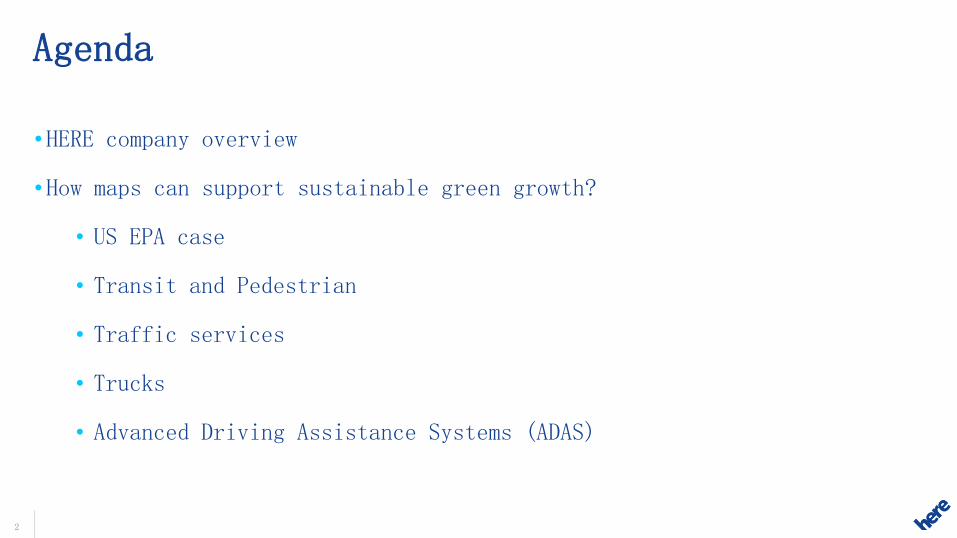
Agenda
• HERE company overview
• How maps can support sustainable green growth?
• US EPA case
• Transit and Pedestrian
• Traffic services
• Trucks
• Advanced Driving Assistance Systems (ADAS)

3 3
Building the Location Company
1985 – 2008> 2009 - 2012 2012 onwards
+
Services
+ Earthmine
+
+
1985: Company Founded
1994: First EU factory-installed vehicle navigation system
1996: First NA factory-installed vehicle navigation system
1995: First Internal portal customer
2008: Nokia acquires NAVTEQ

5 5
HERE: A Superior Map and Unmatched Capabilities
196 countries
4of5 cars*
*cars with integrated navigation powered by HERE map content; devices using HERE map content
47m km road
20b probe points/month
230m transactions/day
1b devices in use*
85m places
250m annual investment
2.7m map changes/day

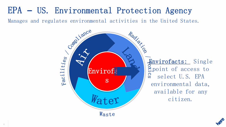
US – Environmental Protection Agency
Case
8
Manages and regulates environmental activities in the United States.
EPA – US. Environmental Protection Agency
Envirofacts
Envirofacts: Single point of access to select U.S. EPA
environmental data, available for any
citizen.

EPA – EnviroMapper by Bing / HERE Maps
1. Search for a location
2. Select an option to map: • Air • Water • Waste • Land • Toxics • Radiation
3. Results –
Locations in the map
4. Results – Access
the reports
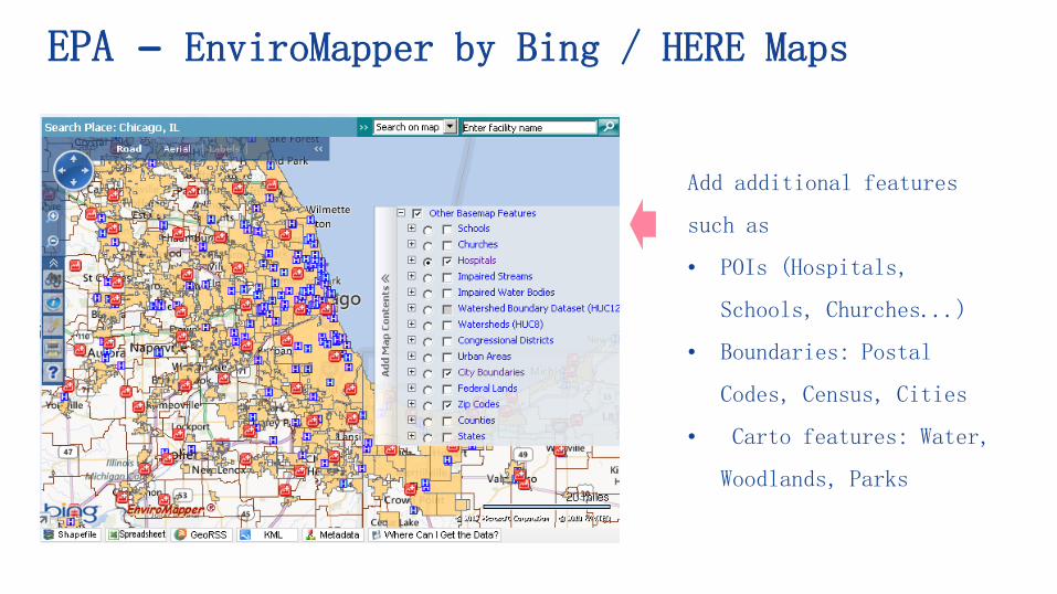
EPA – EnviroMapper by Bing / HERE Maps
Add additional features
such as
• POIs (Hospitals,
Schools, Churches...)
• Boundaries: Postal
Codes, Census, Cities
• Carto features: Water,
Woodlands, Parks
11 11
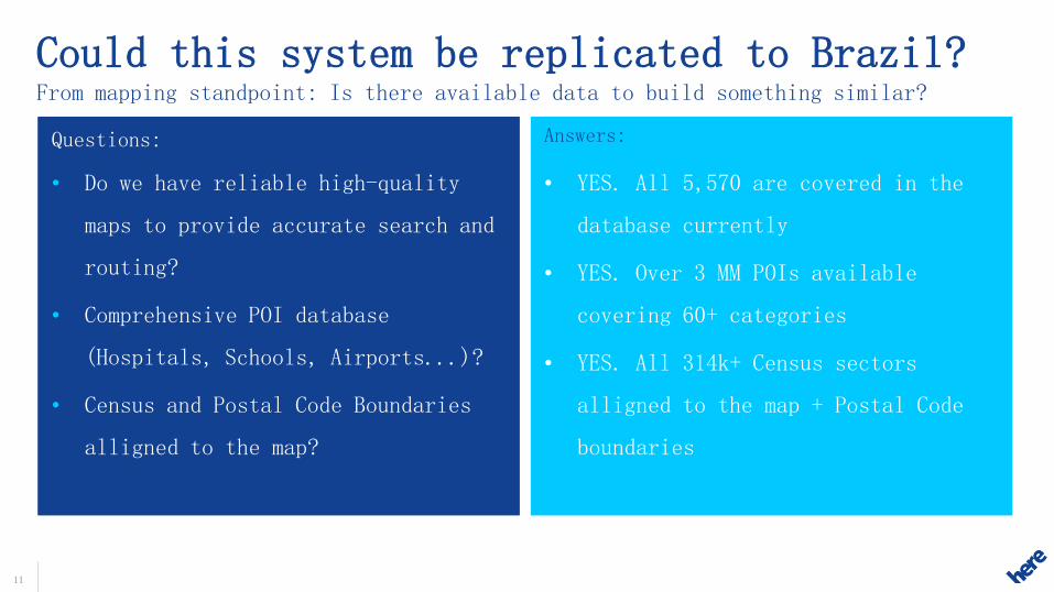
Answers:
• Do we have reliable high-quality
maps to provide accurate search and
routing?
• Comprehensive POI database
(Hospitals, Schools, Airports...)?
• Census and Postal Code Boundaries
alligned to the map?
Questions:
• YES. All 5,570 are covered in the
database currently
• YES. Over 3 MM POIs available
covering 60+ categories
• YES. All 314k+ Census sectors
alligned to the map + Postal Code
boundaries
Could this system be replicated to Brazil? From mapping standpoint: Is there available data to build something similar?
What else could be done?
• Help people to get to their destination with Public Transport
• Help drivers to spend less time and fuel in Traffic
• Help Truck drivers do smarter routes and find less pollutant fuels
such as Diesel S50
• Increase fuel efficiency of cars and trucks through Eco- Routing
and Predictive Cruise Control
Transit and Pedestrian
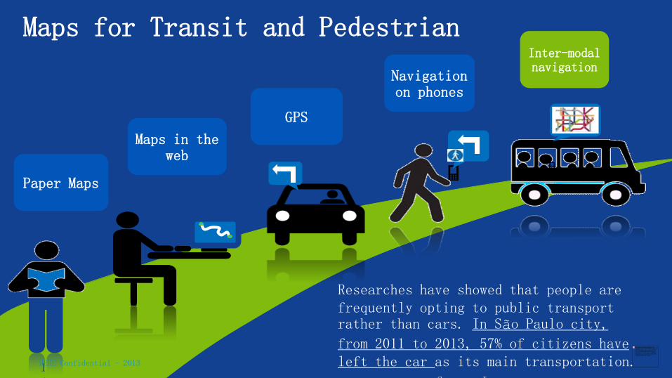
Maps for Transit and Pedestrian
14
Paper Maps
Maps in the web
GPS
Navigation on phones
Inter-modal navigation
Researches have showed that people are frequently opting to public transport rather than cars. In São Paulo city,
from 2011 to 2013, 57% of citizens have left the car as its main transportation. Source: Ipespe
HERE Confidential - 2013

Complete pedestrian experience
Sideways and accesses
Virtual connections
Stairways, brigdes and tunnels
Crossings Transit stations
Itineraries and time tables
Not only the transit info is important, but how to get to the stations.
HERE Confidential - 2013

16 16
Bairro de Fatima – RJ – Pedestrian route
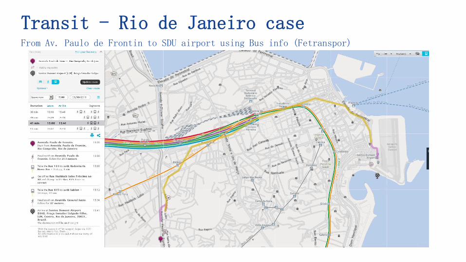
Transit - Rio de Janeiro case From Av. Paulo de Frontin to SDU airport using Bus info (Fetranspor)

Traffic
19 19
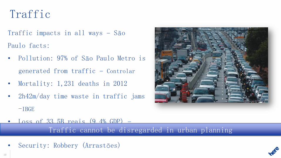
Traffic
Traffic impacts in all ways – São
Paulo facts:
• Pollution: 97% of São Paulo Metro is
generated from traffic – Controlar
• Mortality: 1,231 deaths in 2012
• 2h42m/day time waste in traffic jams
-IBGE
• Loss of 33.5B reais (9.4% GDP) –
FGV2008
• Security: Robbery (Arrastões)
Traffic cannot be disregarded in urban planning
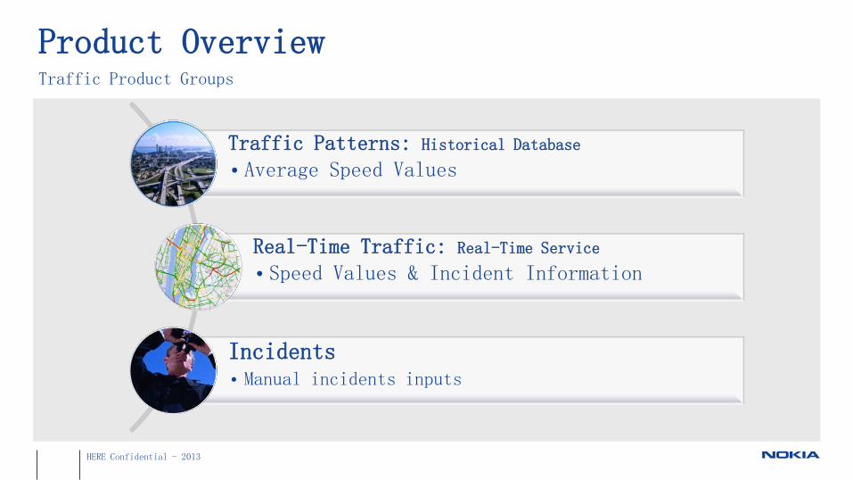
Product Overview Traffic Product Groups
Traffic Patterns: Historical Database • Average Speed Values
Real-Time Traffic: Real-Time Service • Speed Values & Incident Information
Incidents • Manual incidents inputs
HERE Confidential - 2013
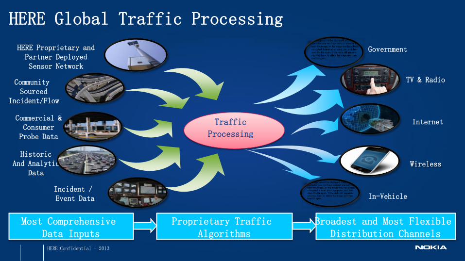
HERE Global Traffic Processing
Proprietary Traffic Algorithms
In-Vehicle
Broadest and Most Flexible Distribution Channels
Government
Incident / Event Data
Community Sourced
Incident/Flow
HERE Proprietary and Partner Deployed Sensor Network
Most Comprehensive Data Inputs
Commercial & Consumer Probe Data
Historic And Analytic
Data
Internet
Wireless
Traffic
Processing
TV & Radio
HERE Confidential - 2013
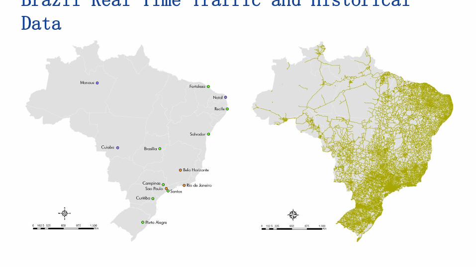
Brazil Real-Time Traffic and Historical Data
23 23
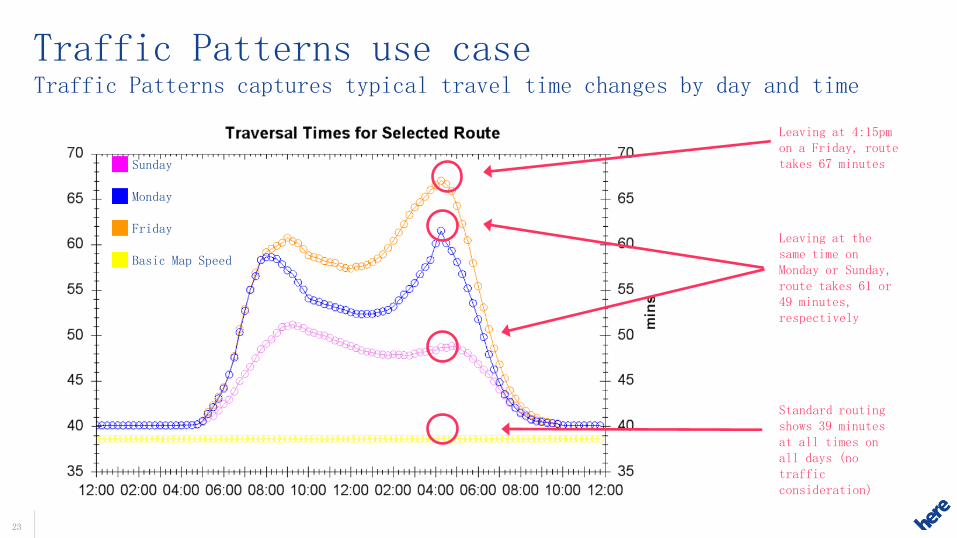
Traffic Patterns captures typical travel time changes by day and time
Traffic Patterns use case
Leaving at 4:15pm on a Friday, route takes 67 minutes
Leaving at the same time on Monday or Sunday, route takes 61 or 49 minutes, respectively
Sunday Monday Friday Basic Map Speed
Standard routing shows 39 minutes at all times on all days (no traffic consideration)
24 24
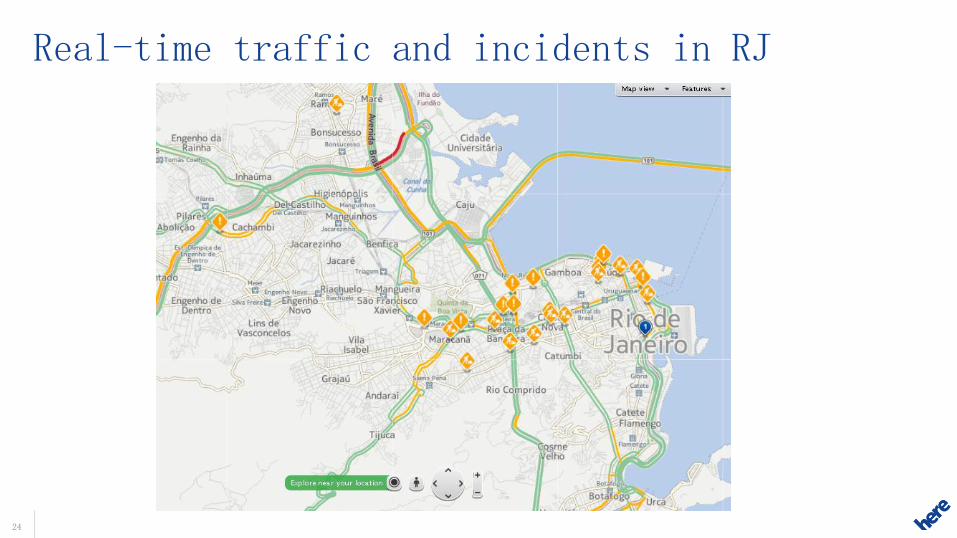
Real-time traffic and incidents in RJ

Trucks
26 26
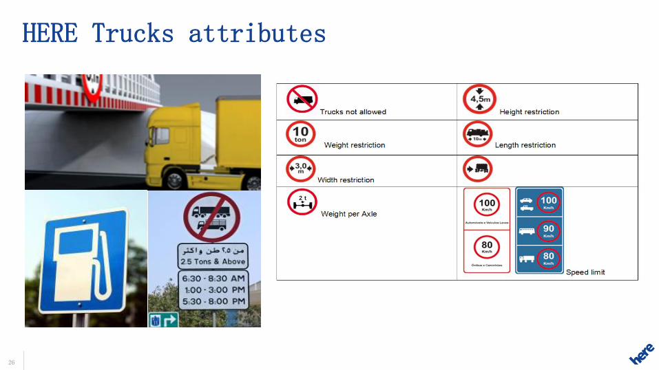
HERE Trucks attributes

27 27
HERE Trucks- Brazil attributes
• Rodízio São Paulo
• Speed Limits Trucks
• Truck POIs
• Dealerships
• Weight Stations
• Distance Markers
• Fuel Types (including Diesel S50)
• Toll Cost
28 28
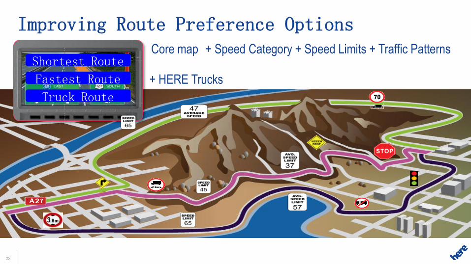
+ Speed Category + Speed Limits + Traffic Patterns Core map
+ HERE Trucks
Improving Route Preference Options
Truck Route
Shortest Route
Fastest Route
Shortest Route
Fastest Route
Truck Route

ADAS
30
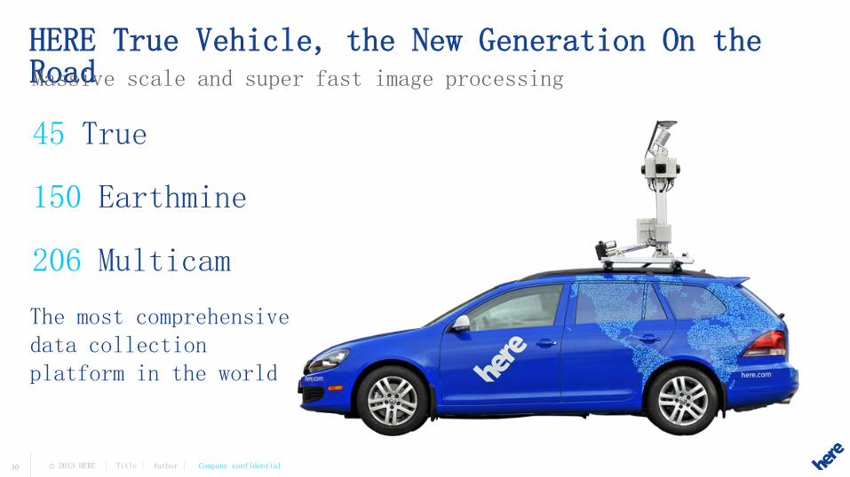
HERE True Vehicle, the New Generation On the Road
The most comprehensive data collection platform in the world
45 True 150 Earthmine 206 Multicam
Massive scale and super fast image processing
© 2013 HERE | Title | Author | Company confidential

What lies beyond the bend in the road?
31
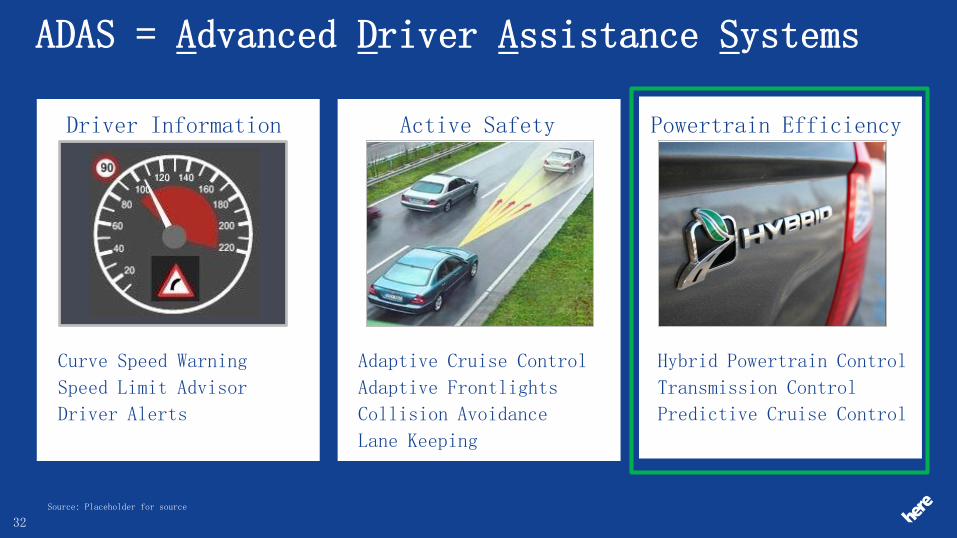
ADAS = Advanced Driver Assistance Systems
Curve Speed Warning
Speed Limit Advisor
Driver Alerts
Driver Information
Adaptive Cruise Control
Adaptive Frontlights
Collision Avoidance
Lane Keeping
Active Safety
Hybrid Powertrain Control
Transmission Control
Predictive Cruise Control
Powertrain Efficiency
Source: Placeholder for source
32
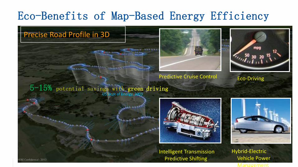
Eco-Benefits of Map-Based Energy Efficiency
Eco-Driving Predictive Cruise Control
Intelligent Transmission Predictive Shifting
Hybrid-Electric Vehicle Power Management
Precise Road Profile in 3D
5-15% potential savings with green driving US Dept of Energy, 2009
HERE Confidential - 2013
Copyright © 2022 FDOKUMEN