Uplift and active tectonics of southern Albania inferred from incision of alluvial terraces
Magdalena 1
Plant Recruitment and Plant Succession as the Major Soil Forming Factor for Young Terraces
in the Pino Wash during the Late Holocene
EPS 485L 001 Soil Stratigraphy and Morphology
Dr. Leslie McFadden University of New Mexico
Melanie E Magdalena 05 December 2013
Magdalena 2
INTRODUCTION
Hans Jenny integrated the CLORPT approach into soil studies, or pedology. His
methodology for the study of soils entails the recognition of several factors, including climate
(CL), vegetation or organics (O), relief (R), parent material (P), and time (T), which must be
considered to interpret the development of soils. Fluvial processes and erosion have modified the
landscape producing new geomorphic features, such as terraces. During the late Holocene,
climate and vegetation in New Mexico have changed, and these changes likely affected soil
development. Plant recruitment and plant succession are linked to the “O” factor, and may be a
major soil forming factor influencing soils young terraces during the late Holocene. The purpose
of this study is to analyze the soils and vegetation communities of two terraces of the Pino Wash
to determine if plant recruitment and succession play a role in soil development during the late
Holocene.
STUDY AREA
Pino Wash lies on the western flank of the Sandia
Mountains and along the eastern edge of the Albuquerque
basin and Rio Grande rift (Connell & Love, 2009). The area
is characterized by ridges and valleys. The higher topography
breaks down due to weathering. Sediment is swept down the
slopes and it accumulates on the floodplain and alluvial fans.
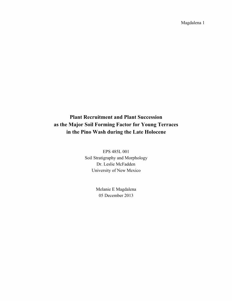
These surfaces represent geomorphically stable areas where Figure 1: Granite is one of the
soil formation is favored. primary parent materials of the study area.
Magdalena 3
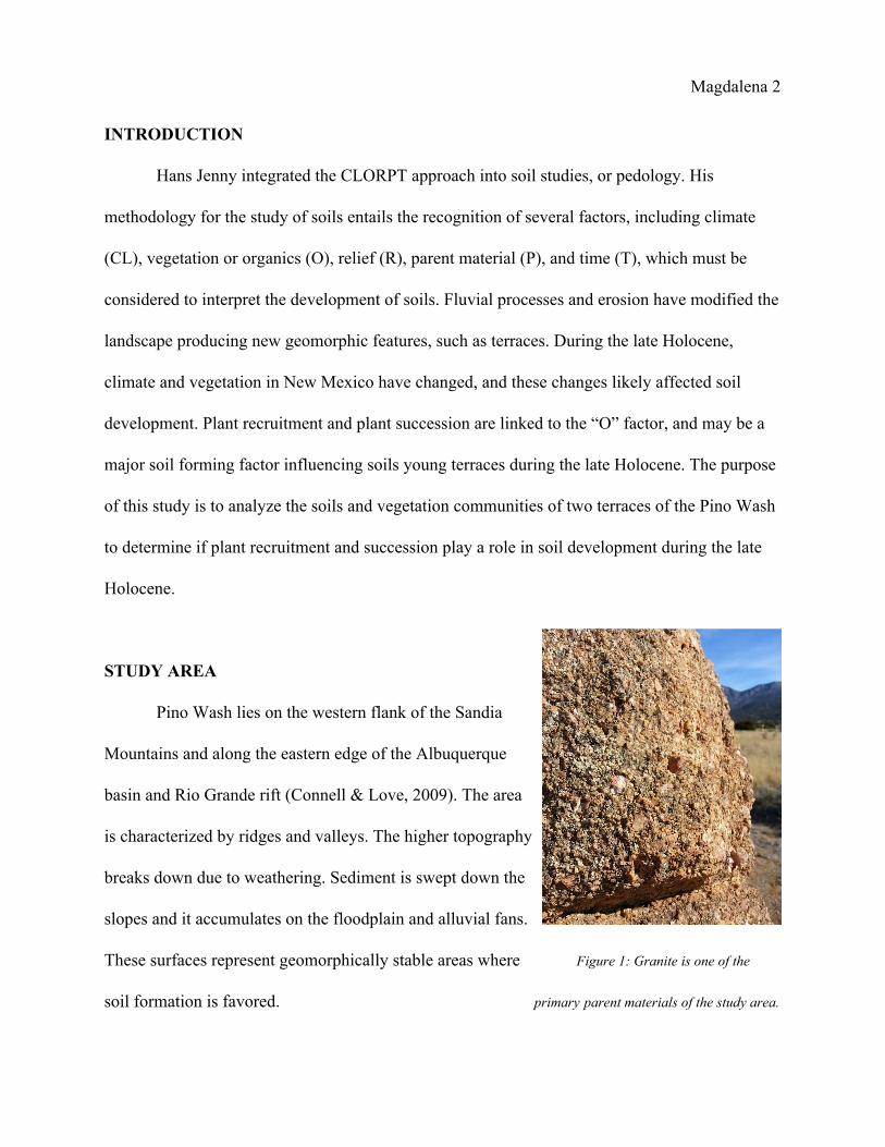
Figure 2: Elena Gallegos Regional Open Space, NM, entrance to Pino Trail.
Figure 3: Location of the study area along the Pino Wash Trail at Elena Gallegos Regional Open Space, NM.
Magdalena 4
Rocks in the Sandia Mountains include Phanerozoic sedimentary and Proterozoic
crystalline rocks (Connell, 1997). One of the most important and widespread rock type in this
area is granite, which forms as a plutonic rock well below the Earth’s surface when magma
solidifies. Minerals in granite strongly influence soil formation: feldspar, biotite, and quartz. The
second parent material in the area is limestone. Formed from calciterich organisms 300 million
years ago, New Mexico was submerged under ocean water (Connell & Love, 2009). Limestone
is rich in calcite, a mineral which effervesces when exposed to hydrochloric acid. Calcium
carbonate in arid soils crystallizes, from a dissolved form, as soil dries (Monger, 1991).
The study area has a warm, arid to semiarid climate (Hacker, 1977). The mean annual
temperatures range from 4°C (~40°F) at the Sandia Crest, 10°C (~50°F) at the foothills, and
14°C (~57°F) in Albuquerque (Connell, 1997). Precipitation is concentrated in the winter;
moisture is supplied by the Gulf of Mexico circulation (Hacker 1977). Mean annual precipitation
is 178 to 254 mm (7 to 10 in) in Albuquerque, 254 to 356 mm (10 to 14 in) in the foothills, and
635 to 762 mm (25 to 30 in) in the mountains (Connell, 1997).
Vegetation, though sparse, consists of grasses which acidify the soil water (Bouteloua
gracilis, Bouteloua eriopoda, Bouteloua curtipendula, and Hilaria jamesii), juniper (Juniperus)
and piñon (Pinus edulis) trees, shrubs (Cercocarpus montana and Fallugia paradoxa), and cacti
(Opuntia polycantha). Piñonjuniper (PJ) woodland increases in density with elevation (Pieper,
2008). This plant community is typical of areas with 3035 cm of rainfall a year. The PJ
community is also typical of semiarid climate with an elevation of four to six thousand feet.
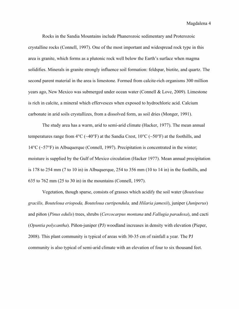
Magdalena 5
Figure 4: Terrace plant communities (preWinter) within Pino Wash, Elena Gallegos Regional Open Space, NM.
In the foreground, Terrace 2, inset into an older terrace, has a visible plant community, primarily smallleaf shrubs.
There are three terraces in the study area; the surface in the far background is not included in this study.
inset into Terrace 1. The terraces are part of a fluvial landscape associated with river
and stream processes which when active can carry very large sediment loads, including
boulders during rare large flow events. The height of the terraces is related to their age: older
terraces occur at a greater height above the active channel due to a longer period of exposure to
incision by fluvial processes.
A total of three pits were excavated in Terrace 1 and one pit in Terrace 2. In order to gain
an accurate depiction of the soils in Terrace 1, test pits were placed along the flat top at
approximately 10m intervals. Terrace 2 is small, so one pit was placed at the center under the
Magdalena 6
assumption that it is the least altered portion of the terrace away from any active flow in the
channel (the sides are weathering away). Pit depths ranged from 80 cm to 1 m.
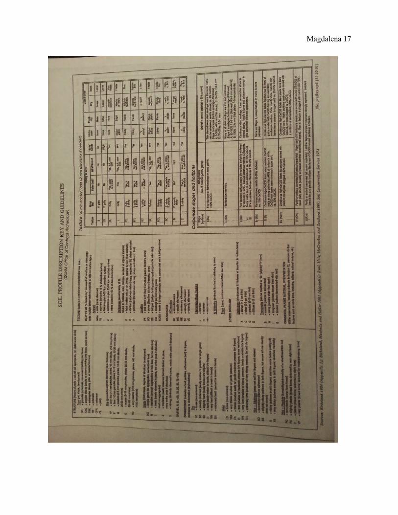
Soil profiles were described using the Soil/Stratigraphy Profile Worksheet, provided by
UNM Office of Contract Archaeology. Soil horizons were determined on the basis of structure
(type, size, and grade), Munsell color (dry and moist), percentage of gravel, consistence (dry and
moist), plasticity and stickiness when wet, texture, clay films, and carbonate morphology. Depth
for the upper and lower boundary were recorded, including distinctness and topography for the
lower boundary. Vegetation around the pits were recorded. Clayey argillic horizons of
welldeveloped soils can hold more water than sandy layers, which can influence to the plant
community: redistribution of water allows the growth of shrubs and trees rather than only
grasses. (McAuliffe). Along with parent material, these two factors have a large impact on soil
development.
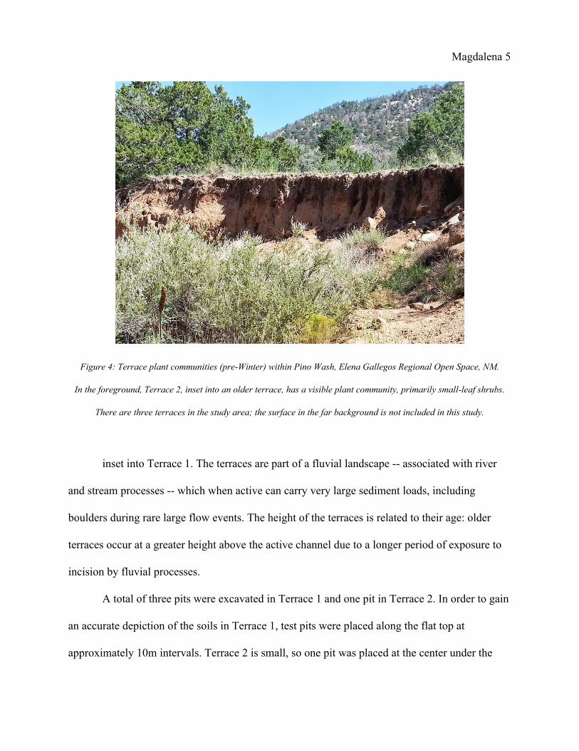
Figure 5: Smallleaf plants from both terraces studied at Pino Wash, Elena Gallegos Regional Open Space, NM.
On right, specimen is found on both terraces. On left, specimen is from Terrace 1.
Magdalena 7
Terrace 1 is dominated by juniper and pinon trees and large boulders ranging from the
size of a fist to half a meter in diameter, primarily granite. The surface color (dry) is 10YR 2/1.
Terrace 2 has a plant community dominated by smallleaf shrubs and granite gravel. The surface
color (dry) is 10YR 4/3. Facing south, there is a third terrace, not included in this study, which
has a grassdominant plant community and a thick, visible Bk horizon.
RESULTS
Terrace 1
Located at 2035 m above sea level, Terrace 1 is dominated by large piñon and juniper
trees and spotted with prickly pear cacti, yucca, and moss. Soil pits were spread out across the
top three meters apart in a line. Avoiding large granite boulders and wildlife, at the center was
the one meter pit flanked by 80 cm pits on either side. As seen in Tables 1, 2, and 3, TA has an O
horizon 10YR 2/1 in color (both dry and moist) with finegrained subangular blocky structure.
The soil is very friable when moist and has slightly sticky and slightly plastic consistency. The
horizon ends smoothly and abruptly at 3 cm.
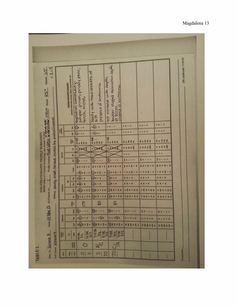
The easternmost pit “Wonky” (see Table 1) has an A/C horizon over a C/A. Coarse
grained and granular structure throughout, neither of these horizons is sticky or plastic. Both wet
and dry, they retain a noncoherent consistency and are more gravelly than sandy. Gravel
percentage is around 80% and there is no evidence of clay films or visible carbonate reactions
with hydrochloric acid. The loamy sand A/C horizon starts at 3 cm and ends gradually with a
wavy lower boundary at around 70 cm; it has a color of 7.5YR 3/3 dry and 7.5YR 3/2 wet. The
C/A horizon is 5YR 4/4 dry and 5YR 3/2 wet, starting at around 70 cm. Granite boulders and
Magdalena 8
roots prevented digging past 80 cm. With depth, the amount of finegrained material increased,
likely silt, and the undersides of rocks at least 5 cm in size had visible reactions to HCl on their
undersides.
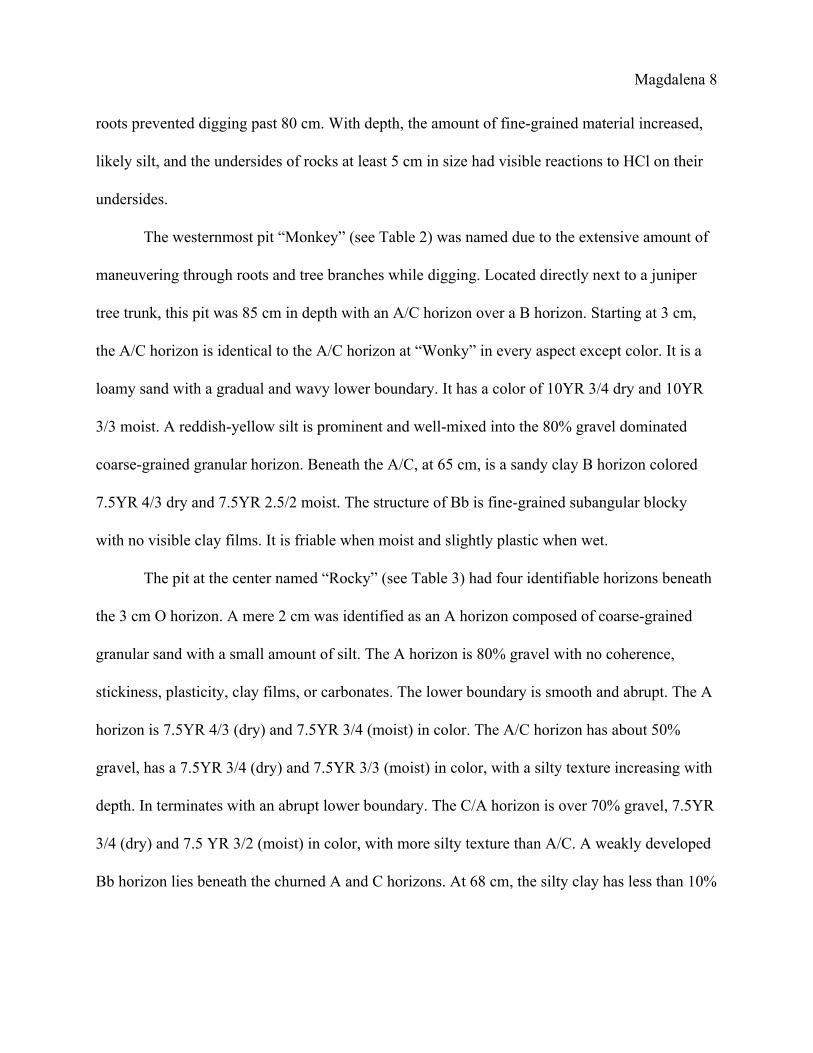
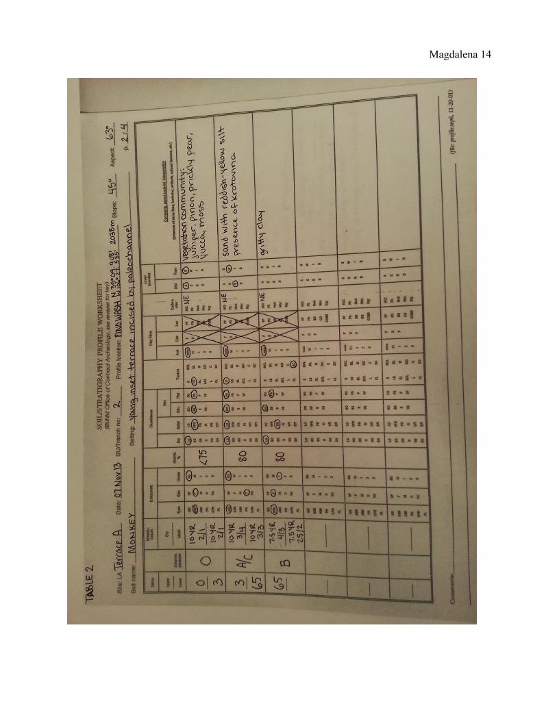
The westernmost pit “Monkey” (see Table 2) was named due to the extensive amount of
maneuvering through roots and tree branches while digging. Located directly next to a juniper
tree trunk, this pit was 85 cm in depth with an A/C horizon over a B horizon. Starting at 3 cm,
the A/C horizon is identical to the A/C horizon at “Wonky” in every aspect except color. It is a
loamy sand with a gradual and wavy lower boundary. It has a color of 10YR 3/4 dry and 10YR
3/3 moist. A reddishyellow silt is prominent and wellmixed into the 80% gravel dominated
coarsegrained granular horizon. Beneath the A/C, at 65 cm, is a sandy clay B horizon colored
7.5YR 4/3 dry and 7.5YR 2.5/2 moist. The structure of Bb is finegrained subangular blocky
with no visible clay films. It is friable when moist and slightly plastic when wet.
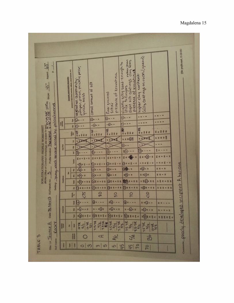
The pit at the center named “Rocky” (see Table 3) had four identifiable horizons beneath
the 3 cm O horizon. A mere 2 cm was identified as an A horizon composed of coarsegrained
granular sand with a small amount of silt. The A horizon is 80% gravel with no coherence,
stickiness, plasticity, clay films, or carbonates. The lower boundary is smooth and abrupt. The A
horizon is 7.5YR 4/3 (dry) and 7.5YR 3/4 (moist) in color. The A/C horizon has about 50%
gravel, has a 7.5YR 3/4 (dry) and 7.5YR 3/3 (moist) in color, with a silty texture increasing with
depth. In terminates with an abrupt lower boundary. The C/A horizon is over 70% gravel, 7.5YR
3/4 (dry) and 7.5 YR 3/2 (moist) in color, with more silty texture than A/C. A weakly developed
Bb horizon lies beneath the churned A and C horizons. At 68 cm, the silty clay has less than 10%
Magdalena 9
Figure 6: Terrace A test pit “Wonky” Figure 7: Soil samples from Terrace A test pit “Monkey”
gravel, 7.5YR 3/4 (dry) and 10YR 3/2 (moist) in color. It is weakly coherent (dry) and friable
(moist). The soil is sticky and slightly plastic with no evidence of clay films. Igneous rocks
encountered have calcium carbonate coatings but peds have no visible effervescence.
Terrace 2
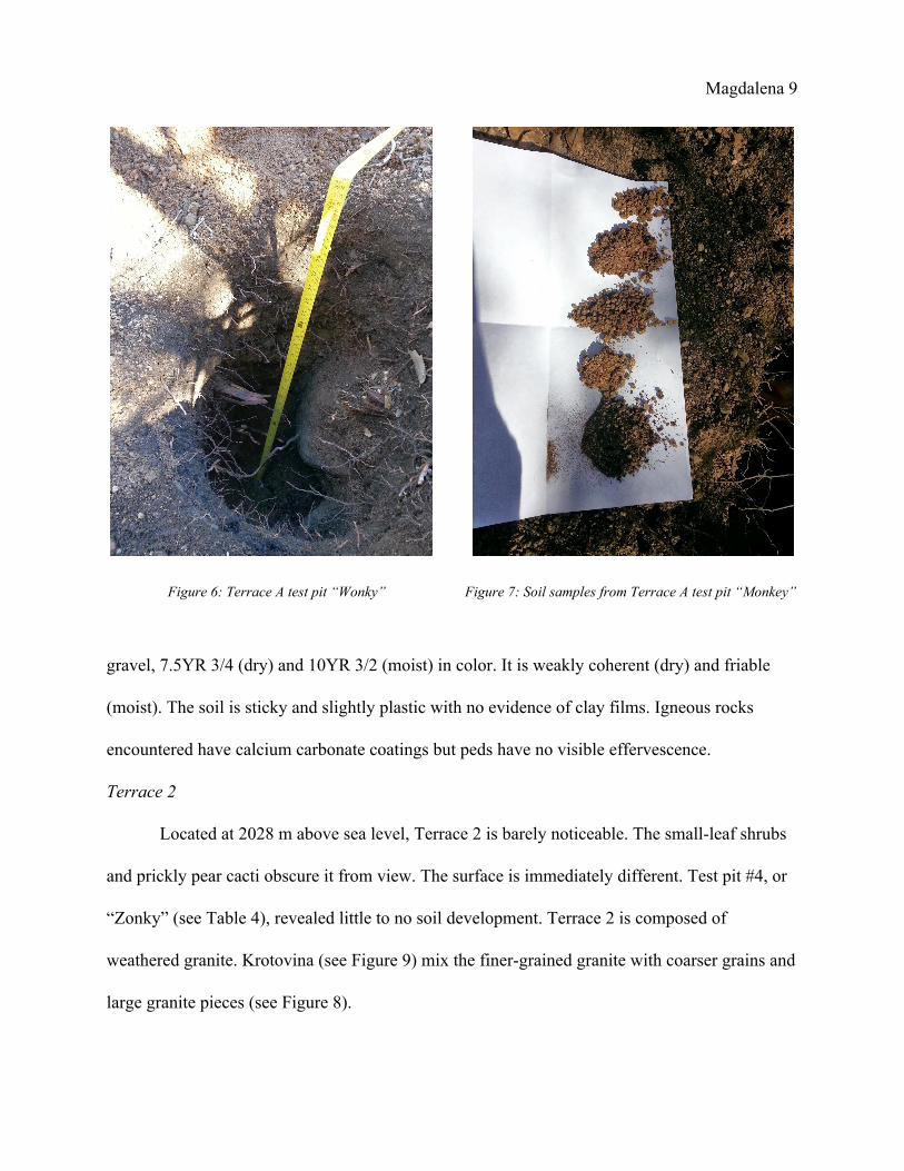
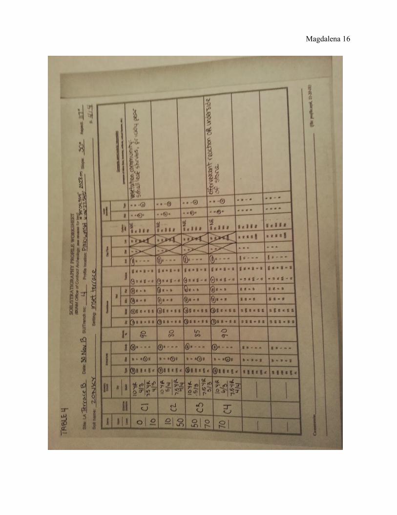
Located at 2028 m above sea level, Terrace 2 is barely noticeable. The smallleaf shrubs
and prickly pear cacti obscure it from view. The surface is immediately different. Test pit #4, or
“Zonky” (see Table 4), revealed little to no soil development. Terrace 2 is composed of
weathered granite. Krotovina (see Figure 9) mix the finergrained granite with coarser grains and
large granite pieces (see Figure 8).
Magdalena 10
Figure 8: Granite gravel parent material. Figure 9: Close up of test pit “Zonky” soil profile.
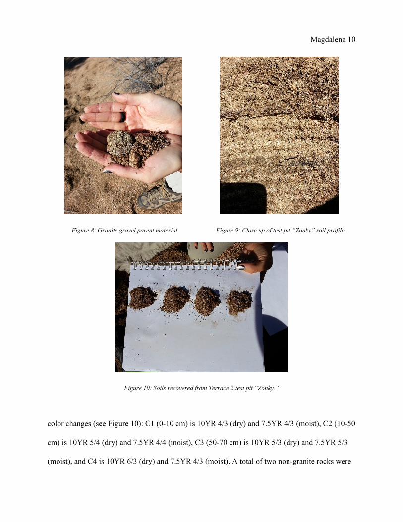
Figure 10: Soils recovered from Terrace 2 test pit “Zonky.”
color changes (see Figure 10): C1 (010 cm) is 10YR 4/3 (dry) and 7.5YR 4/3 (moist), C2 (1050
cm) is 10YR 5/4 (dry) and 7.5YR 4/4 (moist), C3 (5070 cm) is 10YR 5/3 (dry) and 7.5YR 5/3
(moist), and C4 is 10YR 6/3 (dry) and 7.5YR 4/3 (moist). A total of two nongranite rocks were

Magdalena 11
recovered from C3 and C4, each having a visible effervescent reaction. Around the test pit were
many large pieces of granite and very little evidence of any other possible parent material
present.
DISCUSSION & CONCLUSIONS
A semiarid ustic regime can form A horizons in several decades or centuries. Currently,
Terrace A has an incipient A horizon, bioturbated with the parent material (C horizon). Prior to
the active paleochannel, which incised the study area, a developed soil was near the surface. This
clayrich soil is fertile and the larger plants grow where it is located. Juniper trees were
concentrated on Terrace A and none were on Terrace B. This interpretation of the observed
abundance of active vegetation on the terrace with a waterrich soil is supported by studies J. R.
McAuliffe (2000).
Active transport in the channel of large sediment loads and boulders are easily depositing
weathered granite from the eroding pediment to the east onto Terrace 2. Terrace 2 lightens with
depth suggesting soil forming processes are at work but not enough time has passed to see any
development with the unaided eye.
Parent materials affect what plant communities can thrive in the area. Climate influences
the magnitude of mineral breakdown in the parent materials. The fluvial deposits composed
mainly of granitoid material is breaking down into soil and has provided a home for plant
communities requiring less moisture. The buried soil is providing extra water for larger plants,
such as the PJ community. The presence of grasses and shrubs only on Terrace 2 is evidence that
this plant community can adapt to the lack of soil development. The clayeyrich Bb horizon on
Magdalena 12
Terrace 1 may mean that extra moisture in the soil permits this plant community’s success.
Future research should look for Terrace 1’s Bb as a possible match in the older terrace
across the channel and study the plant community to see if the tendency for increased plant
abundance and size continues. Research may reveal that the primary factor influencing plant
success is time rather than the presence of clayey rich soils. This is not to mean that increased
moisture is not beneficial, but that there may be multiple factors at play. Future study of the
terraces and more in depth study of the deeper soils and plant communities on terraces at Pino
Wash will increase the collective knowledge available to the scientific community about the late
Holocene.
Magdalena 13
Magdalena 14
Magdalena 15
Magdalena 16
Magdalena 17
Magdalena 18
REFERENCES
Birkeland, P.W., 1999. Soils and Geomorphology: New York, Oxford University Press, 429 p.
Connell, S. D., 1997. Geology of the Alameda 7.5Minute Quadrangle, Bernalillo and Sandoval
Counties, New Mexico. New Mexico Bureau of Mines and Mineral Resources, OpenFile
Report DGM10, 11p.
Connell, S. D., Love, D., 2009. Geology and Landscape of the Albuquerque Region. in Greer
Price, L., Bland, D., Johnson, P. S., and Connell, S. D. eds., Water, Natural Resources,
and the Urban Landscape: The Albuquerque Region. New Mexico Bureau of Geology
and Mineral Resources. p. 1017.
Hacker, L.W., 1977. Soil survey of Bernalillo County and parts of Sandoval and Valencia
County, New Mexico: U.S. Department of Agriculture, Soil Conservation Service.
Jenny, H., 1994. Factors of Soil Formation: A System of Quantitative Pedology. New York,
Dover Publications, Inc., 191 p.
McAuliffe, J. R., 2000. Desert Soils. A Natural History of the Sonoran Desert. University of
California Press/ASDM Press.
Monger, H. C., et al, 1991. Microbial precipitation of pedogenic calcite. Geology 19. p.
9971000.
Pieper, R. D., 2008. Ecology of PiñonJuniper Vegetation in the Southwest and Great Basin.
Ecology, Management, and Restoration of PiñonJuniper and Ponderosa Pine
Ecosystems: Combined Proceedings of the 2005 St. George, Utah and 2006 Albuquerque,
New Mexico Workshops. U.S. Department of Agriculture, Forest Service: Proceedings
RMRSP51. p. 310.
Copyright © 2022 FDOKUMEN