Off-site Rule Implementation - US Environmental Protection ...
Upload
khangminh22Category
view
0download
0
Phase I Environmental Site Assessment
For
4435-4445 Military Road
Town of Niagara, Niagara County, New York
Prepared by:
C&S Engineers, Inc.
141 Elm Street Suite 100
Buffalo, New York 14203
Prepared for:
Niagara County Center for Economic Development
Vantage Center, Suite One
6311 Inducon Corporate Drive,
Sanborn, NY 14132
June 2017 C&S Project No:
Q47.001.001

Phase I Environmental Site Assessment
4445 Military Road Town of Niagara, Niagara County, New York
June 2017 Page i
EXECUTIVE SUMMARY V
1.0 INTRODUCTION 1
1.1 SCOPE OF SERVICES 2 1.2 LIMITATIONS AND EXCEPTIONS 2
2.0 SITE DESCRIPTION 4
2.1 LOCATION AND LEGAL DESCRIPTION 4 2.2 SITE CHARACTERISTICS 4 2.3 ADJOINING PROPERTIES 5
3.0 USER PROVIDED INFORMATION 6
4.0 RECORDS REVIEW 7
5.0 PHYSICAL SETTING 8
5.1 PHYSICAL SETTING – DESCRIPTION 8 5.1.1 TOPOGRAPHY 8 5.1.2 GENERAL GEOLOGIC SETTING 8 5.1.3 GENERAL HYDROGEOLOGIC SETTING 9 5.1.4 FLOOD PLAIN SETTING 9
6.0 HISTORICAL USE ASSESSMENT 11
6.1 HISTORICAL AERIAL PHOTOGRAPHY 11 6.2 HISTORICAL TOPOGRAPHIC MAPS 12 6.3 HISTORIC SANBORN® MAPS 13 6.4 EDR CITY DIRECTORY ABSTRACT 13 6.5 BUILDING/ZONING RECORDS 15 6.6 HISTORIC USE ASSESSMENT CONCLUSIONS 16
7.0 ENVIRONMENTAL RECORDS SEARCH 17
7.1 ENVIRONMENTAL RECORD SOURCES 17 7.1.1 SUBJECT PROPERTY 17 7.1.2 ADJACENT PROPERTIES 18 7.1.3 UNMAPPED SITES 20 7.2 VAPOR ENCROACHMENT SCREENING 20

Phase I Environmental Site Assessment
4445 Military Road Town of Niagara, Niagara County, New York
June 2017 Page ii
7.3 DATABASE RECORDS AND VAPOR ENCROACHMENT SCREENING REVIEW CONCLUSIONS 21
8.0 SITE RECONNAISSANCE 23
8.1 EXTERIOR OBSERVATIONS - SUBJECT PROPERTY 23 8.1.1 OTHER RELEVANT EXTERIOR FEATURES - SUBJECT PROPERTY 24 8.2 INTERIOR OBSERVATIONS – SUBJECT PROPERTY 25 8.3 SITE RECONNAISSANCE CONCLUSIONS 26
9.0 INTERVIEWS 27
9.1 INTERVIEW WITH CLIENT/USER 27 9.2 INTERVIEW WITH FORMER KEY SITE MANAGER/OWNER 27 9.3 INTERVIEWS WITH LOCAL GOVERNMENT OFFICIALS 27 9.4 INTERVIEW CONCLUSION 28
10.0 FINDINGS AND RECOMMENDATIONS 29
10.1 SITE BACKGROUND 29 10.2 RECOGNIZED ENVIRONMENTAL CONDITIONS 29 10.3 CONTROLLED RECOGNIZED ENVIRONMENTAL CONDITIONS 30 10.4 HISTORICAL RECOGNIZED ENVIRONMENTAL CONDITIONS 30 10.5 DE MINIMUS CONDITIONS 30 10.6 DATA FAILURE 30 10.7 DATA GAP 30 10.8 OPINION ON FINDINGS 30
11.0 DISCLAIMER 32
FOLLOWING TEXT Environmental Professional Statement and Qualifications and Resume
FIGURES Figure 1 Site Location Figure 2 Site Plan
APPENDICES Appendix A Client/User Questionnaire Appendix B EDR Radius Map Report with GeoCheck

Phase I Environmental Site Assessment
4445 Military Road Town of Niagara, Niagara County, New York
June 2017 Page iii
Appendix C Historical Aerial Photography Appendix D Historical Sanborn Fire Insurance Mapping Appendix E Historical Topographic Mapping Appendix F City Directory Abstract Appendix G Phase I Environmental Site Assessment Checklist Appendix H Site Photographs Appendix I FOIL Correspondence Appendix J Vapor Encroachment Screening Report
LIST OF SELECTED ACRONYMS FOR FEDERAL, STATE AND TRIBAL ENVIRONMENTAL DATABASES
Federal Records
Abbreviation Description NPL National Priority List
Proposed NPL Proposed National Priority List Sites
De-listed NPL National Priorities List Deletions
NPL LIENS Federal Superfund Liens
CERCLIS Comprehensive Environmental Response, Compensation, Liability Information System.
CERCLIS-NFRAP CERCLIS- No further Remedial Action Planned
CORRACTS Corrective Action Report
RCRA Resource Conservation and Recovery Act
ERNS Emergency Response Notification System
RCRA-TSDF RCRA- Treatment, Storage and Disposal Facility
RCRA-LQG RCRA- Large Quantity Generators
RCRA- CESQG RCRA- Conditionally Exempt Small Quantity Generators
RCRA-NonGen RCRA- Non Generating Sites
US Brownfield A listing of Brownfield Sites
ROD Records of Decision
FINDS Facility Index System/Facility Registry System
State Records
Abbreviation Description SHWS Hazardous Waste Cleanup Act Sites List

Phase I Environmental Site Assessment
4445 Military Road Town of Niagara, Niagara County, New York
June 2017 Page iv
SWF/LF Licensed Solid Waste Facilities
SWRCY Registered Recycling Facility List
LTANKS Leaking Storage Tank File
UST Underground Storage Tank File
HIST UST Historic Underground Storage Tank File
AST Listing of PA Regulated ASTs
NY Manifest Manifest Information
NY Spills NYSDEC Spill Report Database
NY Hist Spills NYSDEC Historic Spill Report Database
ENG CONTROLS Engineering Controls Site List
INST CONTROL Institutional Controls Site Listing
VCP Voluntary Cleanup Sites
DRYCLEANERS Drycleaners Facility Locations
BROWNFIELDS Brownfield Sites
Tribal Records
Abbreviation Description INDIAN LUST Leaking Underground Storage Tanks
INDIAN UST Underground Storage Tanks
EDR Proprietary Records
Abbreviation Description MGP Manufactured Gas Plants
HAS Historical Auto Stations
HCL Historical Cleaners
Note: A complete list of acronyms and detailed descriptions are provided in the EDR Radius Map Report in Appendix C.

Phase I Environmental Site Assessment
4445 Military Road Town of Niagara, Niagara County, New York
June 2017 Page v
EXECUTIVE SUMMARY At the request of the Niagara County Department of Economic Development, C&S Engineers, Inc. (C&S) has prepared this Phase I Environmental Site Assessment Report (ESA) of Niagara County Tax Map ID No. 131.10-2-29 which is located at 4435-4445 Military Road, Town of Niagara, NY. The Subject Property is approximately 1.2 acres and is owned by Paul A. Grenga. For this Phase I ESA, both the property and structures are referenced as the “Subject Property.” A site visit was conducted on July 21, 2016 by C&S, with observations included in this Phase I ESA. The remainder of this Phase I ESA includes information collected from various federal, state and local agencies provided by Environmental Data Resources, Inc. (EDR), and reasonably ascertainable historical records such as tax records, aerial photographs, and topographic maps.
Findings The following findings were made in this Phase I ESA:
1. The Subject Property consists of Niagara County Tax Map ID No. 131.10-2-29 which is located at 4435-4445 Military Road, Town of Niagara, NY. The Subject Property is approximately 1.2 acres and is owned by Paul A. Grenga.
2. The Subject Property contains one commercial structure that includes Culbert’s Wholesale Tire and vacant uses, an asphalt pavement area, and a forested area with grass cover.
3. Scott Furniture & Interiors is adjacent to the south, Children of Niagara Child Care is adjacent to the west, forested area is adjacent to the north, and residential use surrounds the Subject Property.
4. The Subject Property was first developed prior to 1978. According to historical records, the Subject Property was used for various commercial operations including Tire Shoppe Ltd and Pure Water Systems.
5. Development surrounding the Subject Property included Muscarello Cleaner & Tailors, Rays Barber Shop, Pete’s Pizzeria, Military Appliance Sales and Service, Pooley S.H. Belting Company, and Scott Furniture.
6. There were no hazardous or regulated materials observed on the Subject Property except for the AST.
7. Based on the date of construction at the Subject Property prior to 1980, there is some risk for asbestos and lead containing materials to be present on site.
8. The Subject Property is not located within the mapped limits of either the 100-year or 500-year flood zones so there is minimal risk of flooding.
9. There are groundwater wells located at the Subject Property. 10. The Subject Property was identified in federal and state databases including
SEMS, NY SPILLS, US BROWNFIELDS, FINDS, ECHO, and EDR Historical Auto Stations.

Phase I Environmental Site Assessment
4445 Military Road Town of Niagara, Niagara County, New York
June 2017 Page vi
Opinion on Findings Recognized Environmental Conditions were identified during this Phase I ESA. Historic uses of the Subject Property in automotive service and dry cleaning are considered a REC in this environmental site assessment due to the potential for release of contaminants into the environment and migration onto the Subject Property. The Subject Property was also listed in US BROWNFIELDS because the site was used for commercial purposes that included automobile businesses and dry cleaners for more than 50 years. Contaminants included petroleum and hazardous material, as well as radioactive material. This is also considered an REC in this environmental assessment. The presence of groundwater wells is indicative of a Recognized Environmental Condition as is the presence of a tank without inspection and various drums. Based on site inspection and review of current and surrounding environmental conditions, C&S concludes that further environmental assessment of the Subject Property is warranted.

Phase I Environmental Site Assessment
4445 Military Road Town of Niagara, Niagara County, New York
June 2017 Page 1
1.0 INTRODUCTION At the request of the Niagara County Department of Economic Development, C&S Engineers, Inc. (C&S) has completed a Phase I Environmental Site Assessment on the Subject Property located at 4435-4445 Military Road, in the Town of Niagara, Niagara County, New York. A commercial structure is situated on a parcel located on the corner of Military Road and Grauer Road. This parcel and the associated structure will be referenced as the “Subject Property” in this report. The Phase I Environmental Assessment was performed consistent with American Society of Testing and Materials (ASTM) E-1527-13 Standard Practice for Environmental Site Assessment Process, except as noted below. The purpose of this Phase I Environmental Site Assessment is to identify:
Possible environmental contaminants;
The proximity of sensitive receptors;
Past and present uses on or adjacent to the Subject Property that may be qualified
as a Recognized Environmental Condition (REC);
Hazardous material and waste storage or disposal practices.
The intent of this report is to provide appropriate due diligence for the sale of the Subject Property to satisfy the standard for CERCLA’s “All Appropriate Inquiry” as described in Section 1.1: Scope of Services. The work conducted in the process of this Phase I ESA was completed in accordance with the applicable guidelines developed in the ASTM Standard E 1527-13. The purpose of this Phase I ESA is to help establish the innocent landowner defense to identify potential environmental issues which may affect future development of the Subject Property. As such, this practice is intended to permit a user to satisfy one of the requirements to qualify for the innocent landowner, contiguous property owner, or bona fide prospective purchaser limitations on CERCLA liability: that is, the practice that constitutes “all appropriate inquiry into previous ownership and uses of the property consistent with good commercial or customary practice as defined at 42 U.S.C. 9601(35) (B).” This Phase I ESA will evaluate whether current or historical activities on or adjacent to the Subject Property may have resulted in significant contamination by hazardous materials and/or wastes, which is subsequently referred to in this report as an REC. The standard ASTM E1527-13 defines three types of RECs as follows:
Recognized Environmental Condition: “The presence or likely presence of any hazardous substances or petroleum products in, on, or at a property: (1) due to any release to the environment; (2) under conditions indicative of a release to the environment; or (3) under conditions that pose a material threat to the environment.”
Phase I Environmental Site Assessment
4445 Military Road Town of Niagara, Niagara County, New York
June 2017 Page 2
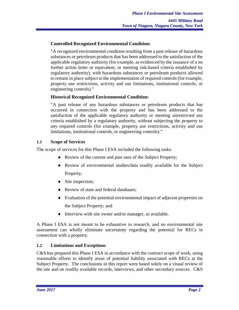
Controlled Recognized Environmental Condition: “A recognized environmental condition resulting from a past release of hazardous substances or petroleum products that has been addressed to the satisfaction of the applicable regulatory authority (for example, as evidenced by the issuance of a no further action letter or equivalent, or meeting risk-based criteria established by regulatory authority), with hazardous substances or petroleum products allowed to remain in place subject to the implementation of required controls (for example, property use restrictions, activity and use limitations, institutional controls, or engineering controls).”
Historical Recognized Environmental Condition: “A past release of any hazardous substances or petroleum products that has occurred in connection with the property and has been addressed to the satisfaction of the applicable regulatory authority or meeting unrestricted use criteria established by a regulatory authority, without subjecting the property to any required controls (for example, property use restrictions, activity and use limitations, institutional controls, or engineering controls).”
1.1 Scope of Services The scope of services for this Phase I ESA included the following tasks:
Review of the current and past uses of the Subject Property;
Review of environmental studies/data readily available for the Subject
Property;
Site inspection;
Review of state and federal databases;
Evaluation of the potential environmental impact of adjacent properties on
the Subject Property; and
Interview with site owner and/or manager, as available.
A Phase I ESA is not meant to be exhaustive in research, and no environmental site assessment can wholly eliminate uncertainty regarding the potential for RECs in connection with a property.
1.2 Limitations and Exceptions C&S has prepared this Phase I ESA in accordance with the contract scope of work, using reasonable efforts to identify areas of potential liability associated with RECs at the Subject Property. The conclusions in this report were based solely on a visual review of the site and on readily available records, interviews, and other secondary sources. C&S

Phase I Environmental Site Assessment
4445 Military Road Town of Niagara, Niagara County, New York
June 2017 Page 3
has made no independent investigation of the accuracy of these secondary sources and has assumed them to be accurate and complete. C&S does not warrant the accuracy of completeness of the information provided by the secondary sources. C&S does not warrant that contamination that may exist on the site has been discovered, that the site is suitable for any particular purpose, or that the site is clean or free of liability. Consistent with ASTM E 1527-13, the following items were beyond the scope of this Phase I Environmental Site Assessment:
Asbestos-Containing Materials
Mold
Industrial Hygiene Radon
Health and Safety Lead-Based Paint
Ecological Resources
Lead in Drinking Water
Endangered Species Wetlands
Indoor Air Quality Regulatory Compliance
Biological Agents Cultural and Historical
Resources

Phase I Environmental Site Assessment
4445 Military Road Town of Niagara, Niagara County, New York
June 2017 Page 4
2.0 SITE DESCRIPTION A description of the location, site characteristics and land use of the Subject Property included in this section was obtained from the following sources:
Niagara County Web Mapping System
GIS parcel data for Niagara County
2.1 Location and Legal Description The Subject Property is located within the Town of Niagara, Niagara County, New York. The Subject Property was identified through tax records from Niagara County Web Mapping as SBL #131.10-2-29. The list below describes the roads located immediately surrounding the Subject Property from each cardinal direction:
North- Approximately 868 feet to Sweet Home Road East- Approximately 2475 feet to Hermitage Road South- Grauer Road West- Military Road
2.2 Site Characteristics The Subject Property consists of a single parcel located on the northeast quadrant of the intersection of Military Road and Grauer Road. The Subject Property is classified for commercial use and consists of one commercial structure divided into halves which are further subdivided. Culbert’s Wholesale Tire formerly used the southern building for specialized auto equipment and repair while the northern section was used for storage. Currently, the whole building is unoccupied. The Subject Property exterior near the buildings is primarily comprised of an asphalt pavement area. The northeastern most portion of the Subject Property includes a forested area and some grass cover. Based on parcel data from Niagara County GIS, the Subject Property is approximately 1.2 acres and is owned by Paul A. Grenga. The following utilities are available in the vicinity of the Subject Property:
Electric: National Grid
Natural Gas: National Fuel
Sanitary Sewer: Town of Niagara
Potable Water: Town of Niagara
Figure 1 shows the approximate location of the Subject Property and surrounding lands while Figure 2 is an aerial photograph of the Subject Property site plan and adjacent properties.

Phase I Environmental Site Assessment
4445 Military Road Town of Niagara, Niagara County, New York
June 2017 Page 5
2.3 Adjoining Properties Property class codes and ownership information were obtained from the Niagara County Internet Mapping System. The Subject Property is classified for commercial use. The Subject Property is located near commercial and residential land uses. Land uses immediately adjacent to the Subject Property are summarized in Table 2-1: Adjoining Properties below.
Table 2-1: Adjoining Properties DIRECTION LAND USE DESCRIPTION
North Residential and Forested Area South Commercial (Scott Furniture & Interiors) and Residential East Residential West Commercial (Children of Niagara Child Care) and Residential

Phase I Environmental Site Assessment
4445 Military Road Town of Niagara, Niagara County, New York
June 2017 Page 6
3.0 USER PROVIDED INFORMATION The Client/User Questionnaire is provided in Appendix A. Amy Fisk, of the Niagara County Department of Economic Development, completed the User Questionnaire on August 2, 2016. The Client / User Questionnaire includes questions relative to environmental liens and use limitations, specialized knowledge, valuation reduction for environmental issues, etc. The responses indicate Recognized Environmental Conditions based on known past uses of the property as a dry cleaner, gas station, and automotive repair.

Phase I Environmental Site Assessment
4445 Military Road Town of Niagara, Niagara County, New York
June 2017 Page 7
4.0 RECORDS REVIEW A records review was conducted by Environmental Data Resources, Inc. (EDR) for the Subject Property and the surrounding area. Records complied by EDR are consistent with standards outlined in ASTM E1527-13 for records that are:
1. Within the approximate minimum search distance
2. Reasonably ascertainable and are from standard sources
3. Provide records under reasonable time and cost constraints
The results of the records review are summarized in the following sections and are provided in the following appendices:
EDR Radius Map Report with GeoCheck® (Appendix B)
Historical Aerial Photography (Appendix C)
Historical Sanborn Fire Insurance Maps (Appendix D)
Historical Topographic Maps (Appendix E)
City Directory Abstract (Appendix F)
Vapor Encroachment Screening Report (Appendix J)

Phase I Environmental Site Assessment
4445 Military Road Town of Niagara, Niagara County, New York
June 2017 Page 8
5.0 PHYSICAL SETTING The following informational resources were used to help identify the physical setting of the Subject Property.
United States Geologic Survey (USGS) Quadrangle as located within a private
collection retained by C&S Engineers, Inc. (Figure 1).
Surficial Geologic Map, Niagara Sheet, compiled by Ernest H. Muller and
Donald Caldwell, New York State Museum – Geological Survey dated 1986.
Geologic Map of New York State, Niagara Sheet, compiled by L.V. Richard and
Donald W. Fisher, New York State Museum and Science Service, 1970.
Unconsolidated Aquifers in Upstate New York, Niagara Sheet, by Todd S.
Miller, United States Geological Survey.
Natural Resource Conservation Service (NRCS) / US Department of Agriculture
(USDA) Web Soil Survey,
http://websoilsurvey.nrcs.usda.gov/app/WebSoilSurvey.aspx.
5.1 Physical Setting – Description
5.1.1 Topography EDR provided topographic map coverage and analysis for the Subject Property. The topography in the vicinity of the Subject Property is generally flat and slightly sloped to the southwest and is at an approximate elevation of 600 feet above mean sea level.
5.1.2 General Geologic Setting Soils at the Subject Property consist of silty clay loam. The dominant soil type identified by the Natural Resources Conservation Service (NRCS) was Odessa silty clay loam, 0 to 2 percent slopes. This soil type is naturally somewhat poorly drained and has very slow infiltration rates. According to the Geologic Map of New York, Niagara Sheet, the bedrock underlying the site is classified as the Lockport Group consisting of Guelph, Oak Orchard, Eramosa, and Goat Island Dolostones and Gasport Limestone-local bioherms from the Upper Silurian period. Surficial deposits in the vicinity of the Subject Property, according to the New York State Surficial Map, Niagara Sheet, consist of till of variable texture (boulders to silt) that is usually poorly sorted sand-rich diamict, deposited beneath glacier ice, and whose permeability varies with compaction. These deposits vary in thickness up to 50 meters thick.

Phase I Environmental Site Assessment
4445 Military Road Town of Niagara, Niagara County, New York
June 2017 Page 9
Unconsolidated Aquifers in Upstate New York, Niagara Sheet, illustrates that the region is not underlain by a confined aquifer.
5.1.3 General Hydrogeologic Setting The Subject Property is located approximately 1787 feet east and 2657 feet south of Gill Creek. The Subject Property is also approximately 3735 feet south of the power reservoir. Based on the interpretation of the USGS Topographic Map, groundwater in the area is assumed to move generally to the west. Groundwater flow specific to the Subject Property is unknown and may be different from the regional flow direction. Potential influences include local drainage features, seasonal groundwater level fluctuations, subsurface geology, surface topography, and/or other local site features. No U.S. Fish and Wildlife Service National Wetland Inventory (“NWI”) wetlands are shown on the Subject Property. NWI wetlands mapped within 1 mile of the Subject Property include:
• Three Palustrine Forested Saturated Partially Drained/Ditched wetlands (0.36 miles north-northeast, 0.67 miles northeast, and 0.72 miles southeast)
• Three Palustrine Scrub-Shrub wetlands (0.26 miles south, 0.26 miles northeast, and 0.60 miles northeast)
• One Palustrine Unconsolidated Bottom wetland (0.80 miles northeast)
• Three Palustrine Scrub-Shrub Broad-Leaved Deciduous Saturated Partially Drained/Ditched wetlands (0.52 miles east-northeast, 0.92 miles east-northeast, and 0.76 miles southeast)
• One Palustrine Emergent Persistent Temporary Flooded Partially Drained/Ditched wetland (0.31 miles east-southeast)
• Two Palustrine Forested Broad-Leaved Deciduous Saturated wetlands (0.57 miles east-southeast and 0.92 miles west-southwest)
• Four Palustrine Forested Temporary Flooded wetlands (0.55 miles southeast, 0.53 miles southeast, 0.44 miles southwest, and 0.35 miles west)
• One Palustrine Emergent Seasonally Flooded/Saturated wetland (0.88 miles south)
• One Palustrine Unconsolidated Bottom wetland (0.90 miles south-southwest)
• One Palustrine Emergent wetland (0.51 miles southwest)
5.1.4 Flood Plain Setting Flood plains are described as areas adjoining a river, stream, drain, or lake that transmit floodwaters during high water conditions. Under the National Flood Insurance Program, they are categorized as either 100-year or 500-year flood zones.

Phase I Environmental Site Assessment
4445 Military Road Town of Niagara, Niagara County, New York
June 2017 Page 10
Based on information provided by Flood Insurance Rate Maps developed by the Federal Emergency Management Association (“FEMA”), Subject Property is located in Zone X, indicating that there is minimal risk of flooding.

Phase I Environmental Site Assessment
4445 Military Road Town of Niagara, Niagara County, New York
June 2017 Page 11
6.0 HISTORICAL USE ASSESSMENT Historical information was used to develop a history of the previous uses of the Subject Property and surrounding area. Historical sources of land use pertaining to the Subject Property were obtained primarily from historic topographic maps, historic aerial photographs and Sanborn Fire Insurance Maps. These sources were used to help identify the possibility of past land uses contributing to recognized environmental conditions in regard to the current Subject Property. These historical sources satisfy the standard for CERCLA’s most “reasonably ascertainable” information available. ASTM Standards define “reasonably ascertainable” as information that is publicly available, obtainable within reasonable time and cost limits, and practically reviewable. This assessment used the following informational resources to help identify past and present site uses upon and surrounding the Subject Property.
Aerial photography
Historical Topographic Maps
Historical Sanborn Maps
EDR City Directory Abstract
Table 6-1: Historical Information Summary SECTION HISTORICAL SOURCE DATE(S) SOURCE/COMMENTS 6.1 Aerial Photographs 1938, 1953, 1972, 1978,
1981, 1985, 1995, 2006, 2008, 2009, 2011
Environmental Data Resources
6.2 Topographic Maps 1894, 1896, 1897, 1900, 1901, 1950, 1965, 1980, 2013
Environmental Data Resources
6.3 Sanborn Fire Insurance Maps
N/A Environmental Data Resources
6.4 City Directories 1964, 1968, 1972, 1976, 1982, 1987, 1992, 1995, 1999, 2003, 2008, 2013
Environmental Data Resources
6.1 Historical Aerial Photography A search for historical aerial photographs was conducted by EDR with coverage of the Subject Property (SP) and its surrounding area. Historical aerial photographs were found for years shown below. Details of this review can be found below in Table 6-2: Historical Aerial Photographs. A copy of Historical Aerial Photographs can be found in Appendix C.

Phase I Environmental Site Assessment
4445 Military Road Town of Niagara, Niagara County, New York
June 2017 Page 12
Table 6-2: Historical Aerial Photographs YEAR SCALE OBSERVATIONS 1938 1 inch = 500 feet The SP appears to be vacant and undeveloped with trees on the site. The
adjacent properties to the north, east, and south are undeveloped with some residential development to the west. The region is comprised of agricultural use with a populated residential area to the west.
1953 1 inch = 500 feet The aerial photograph is grainy and in poor quality. The SP appears unchanged from the previous aerial photograph except that there may be some development and there is now a road directly south of it. The adjacent properties have been developed for residential use to east, south, and west. The properties northwest along the road are used for commercial purposes while the property north is still used for agricultural purposes. Regional residential development has increased.
1972 1 inch = 500 feet The aerial photograph is in poor quality. The SP appears unchanged from the previous aerial photograph. The adjacent properties are relatively unchanged. Regional development appears relatively the same except for a new paved lot in the northwest and an expressway in the southwest.
1978 1 inch = 500 feet The SP is now comprised of two buildings on the southern portion of the parcel. The adjacent properties are unchanged and consistent with the surrounding commercial and residential uses of the region. The northeastern and southern regions are still undeveloped and used for agriculture.
1981 1 inch = 1000 feet The aerial photograph is in poor quality. The SP and adjacent properties appear unchanged from the previous photograph. The scale of this photograph revealed the reservoir to the north.
1985 1 inch = 500 feet The SP and adjacent properties are unchanged from the previous aerial photograph. There is additional commercial development to the southeast. The region appears relatively unchanged.
1995 1 inch = 500 feet The SP and adjacent properties are relatively unchanged from the previous aerial photograph. There is additional residential development in the north.
2006 1 inch = 500 feet The SP and adjacent properties are relatively unchanged from the previous aerial photograph.
2008 1 inch = 500 feet The SP and adjacent properties are relatively unchanged from the previous aerial photograph. There appears to be additional development northeast of the SP where a portion of land appears tilled and contains no vegetation cover.
2009 1 inch = 500 feet The SP and adjacent properties are relatively unchanged from the previous aerial photograph.
2011 1 inch = 500 feet The SP and adjacent properties are relatively unchanged from the previous aerial photograph.
6.2 Historical Topographic Maps As part of this ESA, a search for historic topographic maps with coverage of the Subject Property was conducted by EDR. Details of this review can be found below in Table 6-3: Historical Topographic Maps. A copy of the Historical Topographic Mapping is provided in Appendix E.

Phase I Environmental Site Assessment
4445 Military Road Town of Niagara, Niagara County, New York
June 2017 Page 13
Table 6-3: Historical Topographic Maps YEAR OBSERVATIONS 1894 Tributaries and rivers located on the western side of the SP. Only
main roads are mapped. 1896, 1897 No changes relative to the SP were noted in association with this
map. A previously unmapped area was added to the east of the SP. 1900 No changes relative to the SP were noted in association with this
map. Additional mapped roads revealed increased regional residential development in the southwest.
1901 No changes relative to the SP or the region were noted in association with this map.
1950 No changes relative to the SP were noted in association with this map. There is a new road immediately south of the SP. Additional mapped roads revealed increased regional residential development. Additional tributaries were mapped extending north and southeast from Gill Creek.
1965 Changes relative to the SP included the addition of two onsite structures. There is increased commercial and residential development in the region, including Interstate 190 and its interchanges. The Power plant, along with its reservoir and aqueducts, are new additions to the region.
1980 No changes relative to the SP were noted in association with this map. The region further increased in development.
2013 No changes relative to the SP or region were noted in association with this map. This map was simplified with only major landmarks, roads, and water bodies to better display the topographic changes.
6.3 Historic Sanborn® Maps A search for historical Sanborn Fire Insurance Rate Maps was conducted by EDR with coverage of the Subject Property and its surrounding area. The report stated that the Subject Property was an unmapped property. A copy of the Historical Sanborn Mapping Report is provided in Appendix D.
6.4 EDR City Directory Abstract An EDR City Directory Abstract was prepared for C&S by EDR. The City Directories were used to evaluate the historic uses of the Subject Property listed in Polk City Directories and Cole Information Services. EDR reviewed business directories for the years spanning 1964 through 2013. A summary of significant entries is provided below. Information from the directories is provided with this Phase I ESA as Appendix F. The city directory listings were reviewed for the Subject Property’s historic and current addresses which include 4435-4457 Military Road. These listings are shown in Table 6-4: City Directory.

Phase I Environmental Site Assessment
4445 Military Road Town of Niagara, Niagara County, New York
June 2017 Page 14
Table 6-4: City Directory YEAR PROPERTY ADDRESS OWNERSHIP 1982 4435 Military Road Tire Shoppe Ltd (sales and service) 4445 Military Road Pure Water Systems 4449 Military Road Muscarello Cleaners & Tailors 4453 Military Road Ray’s Barber Shop 4457 Military Road Pete’s Pizzeria 1987 4435 Military Road Grenga Paul Tire 4445 Military Road Pure Water Systems 4449 Military Road Grenga Paul Tire (additional space) 4453 Military Road Ray’s Barber Shop 4457 Military Road Pete’s Pizzeria 1992 4435 Military Road Superline Alignment & Auto Service 4445 Military Road Culbert’s Wholesale Tire (wholesale tire) 4449 Military Road Man on Wheel’s Inc. 4453 Military Road Ray’s Military Barber Shop 4457 Military Road Donnaz Pizzeria 1995 4435 Military Road Superline Alignment & Auto Service 4445 Military Road Culbert’s Wholesale Tire (wholesale tire)
4449 Military Road Jean’s Tailoring II & Dry Cleaning Nia-Seal Manufacturing Corporation Tire Liner
4453 Military Road Ray’s Military Barber Shop 4457 Military Road Donnaz Pizzeria 1999 4435 Military Road Superline Alignment & Auto Service 4445 Military Road Culbert’s Wholesale Tire 4453 Military Road Ray’s Military Barber Shop 2003 4435 Military Road Occupant Unknown
Superline Alignment & Auto Service 4445 Military Road Culbert’s Wholesale Tire
Occupant Unknown 4453 Military Road Steve Coveland 2008 4435 Military Road Deyos Auto
Superline Alignment & Auto Service 4445 Military Road Not listed in City Directory 2013 4435 Military Road Not listed in City Directory 4445 Military Road Culbert’s Wholesale Tire
Adjacent property uses were consistent with the commercial and residential uses of the region. It was determined that the properties to the east along Grauer Road were residential. A summary of significant adjacent property uses from 1982 to 2013 is provided below in Table 6-5: Adjacent Properties City Directory.
Table 6-5: Adjacent Properties City Directory YEAR DIRECTION PROPERTY
ADDRESS OWNERSHIP
1982 North 4501 Military Road Hilts Ralph J. South 4419 Military Road Scott Furniture
Bullock Mark West 4424 Military Road Military Appliance Sales & Service (electric
appliances)

Phase I Environmental Site Assessment
4445 Military Road Town of Niagara, Niagara County, New York
June 2017 Page 15
Pooley S. H. Belting Company 1987 North 4501 Military Road Hilts Ralph J. South 4419 Military Road Scott Furniture West 4424 Military Road Military Appliance Sales & Service (electric
appliances) Exotic Pets (pet shop and supplies)
4416 Military Road Creative Learning Montessori Preschool 1992 North 4501 Military Road Waldeck, David L, Jr. South 4419 Military Road Scott Furniture Company West 4424 Military Road Military Appliance Parts & Service 4416 Military Road Children of Niagara Child Care 1995 North 4501 Military Road Not listed in City Directory South 4419 Military Road Scott Furniture Company West 4424 Military Road Images Hair Designs
Military Appliance Parts & Service 4416 Military Road Children of Niagara Childs Depot 1999 North 4501 Military Road Jerauld Day South 4419 Military Road Scott Furniture Company West 4424 Military Road Not listed in City Directory 4416 Military Road Children of Niagara Childs Depot 2003 North 4501 Military Road M. Schroeder South 4419 Military Road Occupant Unknown
Scott Furniture & Interiors, Inc. West 4424 Military Road Not listed in City Directory 4416 Military Road Children of Niagara Childs Depot 2008 North 4501 Military Road Jerauld Day South 4419 Military Road Scott Furniture & Interiors, Inc. West 4424 Military Road Dynamic Ceramics
Fullone Trucking, Inc. Occupant Unknown
4416 Military Road Children of Niagara Childs Depot Vanoni Jacquie
2013 North 4501 Military Road Jerauld Day South 4419 Military Road Scott Furniture & Interiors West 4424 Military Road Dynamic Ceramics
Occupant Unknown 4416 Military Road Children of Niagara Child Care
6.5 Building/Zoning Records A zoning map for the Town of Niagara, Niagara County, NY by O’Brien & Gere Engineers, Inc. dated December, 2003 revealed that the Subject Property was located in the Business District. In addition, the property type classification was an Auto Body, Tire Shops, and Other Related Auto Sales Specialized auto equipment and repair. Subject Property violation letters and photos from the Town of Niagara were received in reply to a FOIL Request. More information regarding this information can be found in Section 9.3 Interviews with Local Government Officials.

Phase I Environmental Site Assessment
4445 Military Road Town of Niagara, Niagara County, New York
June 2017 Page 16
6.6 Historic Use Assessment Conclusions Historical records ranging from 1894 to 2013 were reviewed for this Phase I ESA. Aerial photographs indicate the presence of a structure on the Subject Property that appears to remain relatively unchanged from 1978 to 2011. The most recent uses of the Subject Property include commercial use as Culbert’s Wholesale Tire formerly used the southern building for specialized auto equipment and repair while the northern section was used for storage. Currently, the whole building is unoccupied. Historic uses of the Subject Property in automotive service and dry cleaning are considered a REC in this environmental site assessment. Nearby Properties Surrounding properties were consistent with expected commercial and residential uses of the region. It was determined that the properties to the east and north were residential, properties to the south were commercial for furniture retail, and properties to the west were commercial comprised of retail and community services. Historic uses of the surrounding properties are not considered RECs in this environmental site assessment.

Phase I Environmental Site Assessment
4445 Military Road Town of Niagara, Niagara County, New York
June 2017 Page 17
7.0 ENVIRONMENTAL RECORDS SEARCH To comply with the USEPA’s requirements for “All Appropriate Inquiry”, C&S requested a federal and state database search for the Subject Property from EDR. EDR compiles up-to-date information from federal, state, and local agencies, including the United States Environmental Protection Agency (“USEPA”). The EDR Radius Map Report with GeoCheck® can be found in Appendix B and is summarized in the following sub-sections.
7.1 Environmental Record Sources The database search resulted in several listings. Table 7-1: Environmental Database Review lists those databases that produced results that were identified as the most critical to evaluating potential off-site and on-site conditions.
Table 7-1: Environmental Database Review
DATABASE SEARCH DISTANCE (MILES)
SITES WITHIN RADIUS
LTANKS 0.5 9 HIST LTANKS 0.5 0 NY SPILLS 0.125 2 NY Brownfields 0.5 0 UST 0.25 3 RCRA 0.25 1 AST 0.25 0 CBS 0.25 0 CERCLIS NFRAP 0.5 0 NY SHWS 1.0 4 NPL 1.0 1
7.1.1 Subject Property The Subject Property was listed in the following local, state or federal database searched by EDR:
Table 7-2: Subject Property Listings SITE DATABASE COMMENTS
4435-4445 Military Road SEMS Listed in SEMS as a removal only site such that no site assessment work was needed.
Behind Old Garage NY SPILLS
Listed in SPILLS under Spill #1204052 that met cleanup standards and was closed on 06/02/2014. Spill was caused by a drum of motor oil left behind an old garage that leaked onto the ground whenever it rained. The area was remediated and the drum was disposed of.
4435-4445 Military Road Property
US BROWNFIELDS
Listed in US BROWNFIELDS because the site was used for commercial purposes that

Phase I Environmental Site Assessment
4445 Military Road Town of Niagara, Niagara County, New York
June 2017 Page 18
included automobile businesses and dry cleaners for more than 50 years. Contaminants included petroleum and hazardous material, as well as radioactive material.
4435-4445 Military Road Property FINDS, ECHO
listed in FINDS which is the US EPA Assessment, Cleanup, and Redevelopment Exchange System (ACRES) online database for Brownfield Grantees to electronically submit data directly to the EPA.
4435 Military Rd EDR HIST AUTO
The Subject Property was The Subject Property was listed in EDR HISTORICAL AUTO STATIONS as Superline Alignment & Auto Service from 1999 to 2006 and 2009, and Deyos Auto Repair in 2008 and 2010.
7.1.2 Adjacent Properties Based on the ASTM specified records reviewed, 18 sites were identified to be within the specified search radii at elevations equal to or relatively higher than the Subject Property. These properties are described in Table 7-2: EDR Radius Map Review Adjacent Properties.
Table 7-2: EDR Radius Map Review Adjacent Properties SITE DATABASE COMMENTS
On The Roadway 4519 Military Rd SPILLS
Approximately 430 feet north-northwest. Spill #0413490 met cleanup standards and was closed on 08/15/2005. A large spill of oil based paint occurred on the highway. All other information was unknown and caller was unsure who should do cleanup.
Good Guys Auto 4627 Military Rd
UST, LTANKS, HIST UST, LIENS
Approximately 812 feet northwest. Listed in UST with Id# 9-382663 with status as unregulated and three tanks closed/removed in 1988 and two tanks closed/removed in 1999. Listed in LTANKS with Spill #8710327 that met cleanup standards and was closed on 05/17/1988. Two 4000 gallon tanks failed the system test, and were removed with very little contaminated soil.

Phase I Environmental Site Assessment
4445 Military Road Town of Niagara, Niagara County, New York
June 2017 Page 19
Sunoco Service Station 4627 Military Rd
FINDS, RCRA NonGen/NLR,
ECHO
Approximately 812 feet northwest. Listed in RCRA NonGen/NLR as a non-generator in 2007. Listed as a large quantity generator in 1980, and a verified non-generator in 1999 and 2006. Listed in FINDS database that supports RCRA program by tracking events and activities related to facilities that generate, transport, and treat, store, or dispose of hazardous waste.
GKG Mart, Inc. 4719 Military Rd UST, LTANKS
Approximately 1164 feet northwest. Listed in UST with Id# 9-088684 with status as unregulated/closed such that three tanks closed in 1991 and three tanks closed in 1989. Listed in LTANKS with Spill #0905447 that met cleanup standards and closed 08/26/2010. Tank test resulted in two failed tanks that were farthest away from the building due to needed pipe replacement.
Unimart Corp. 4719 Military Rd
FINDS, RCRA NonGen/NLR,
ECHO
Approximately 1164 feet northwest. Listed in RCRA NonGen/NLR as a non-generator in 2007. Listed as a small quantity generator in 1997, and a verified non-generator in 1999 and 2006. Listed in FINDS database that supports RCRA program by tracking events and activities related to facilities that generate, transport, and treat, store, or dispose of hazardous waste.
David Bundy 1025 Saunders Settlement LTANKS
Approximately 2204 feet north-northeast. Listed in LTANKS with Spill# 0010814 that met cleanup standards and was closed on 08/20/2001. An aboveground 275-gallon tank bottom let go so 200 gallons of petroleum were spilled on the ground around the tank. Soil was excavated.
Airco Properties, Inc. 4201 Witmer Road
RCRA-LQG, NY MANIFEST, SHWS, ENG CONTROLS,
INST CONTROL
Approximately 2552 feet west-northwest. Listed in RCRA-LQG as a large quantity generator in 2012. Listed as a large quantity generator in 2003 and 2004, a small quantity generator in 2006, and a verified, non-generator in 2007. Listed in NY MANIFEST for transportation of reactive waste for treatment in 2012, and unreported waste for landfilling in 2011 and 2003. Listed in SHWS as a site that was properly closed but requires continued management. The landfill was fenced and properly capped. ENG Controls and INST Controls created to outline monitoring plan, site management plan, land use

Phase I Environmental Site Assessment
4445 Military Road Town of Niagara, Niagara County, New York
June 2017 Page 20
restrictions, and other measures to protect the public and environment.
Town of Niagara 7105 Lockport Rd
NY MANIFEST, SHWS, SWF/LF
Approximately 5212 feet east-southeast. Listed in NY MANIFEST for transportation of unreported waste for incineration in 2015. Listed in SHWS as a significant threat to the public health and/or environment so action was required. Listed in SWF/LF as an inactive landfill. Listed in UST with Id# 9-040436 with an active status. Three tanks closed and removed in 1989.
Due to their regulatory status, listings in databases that do not indicate a spill, or rather a spill that poses a concern, distance to the site, groundwater and surface water flow, and/or cross-gradient location, these listings do not appear to represent an environmental concern relative to the Subject Property. Many additional properties were listed within the specified search radii but are listed in databases that generally would not pose a concern, have had spills occur that were closed as meeting regulatory requirements, or are located relatively lower than the Subject Property. Due to the above, as well as their distance and elevation, it is our opinion that the additional sites do not pose a significant environmental concern relative to the Subject Property.
7.1.3 Unmapped Sites C&S also reviewed the Orphan List at the rear of the database report. An “Orphan Site” is a record that has insufficient information to be mapped by the GIS system. Our review of that list of 6 sites consisted of a comparison of the identified “Orphan” address to roadway mapping of the area surrounding the Subject Property. Based on that evaluation, it is our opinion that none of the identified "Orphans" adjoin the Subject Property. All of the sites are located outside of the relevant ASTM search radii or downgradient (Niagara Town Landfill site), and do not suggest a release at or proximal to the Subject Property.
7.2 Vapor Encroachment Screening The EDR Vapor Encroachment Screening Report can be found in Appendix J and provides data from the EDR database search within 1/3 mile of the Subject property and provides a software application that organizes the data for screening by the environmental professional with respect to the potential for vapor encroachment. This screening includes subjective consideration by the environmental professional of diverse factors such as distance, relative elevation, depth to groundwater, locations and types of structures present, and soil types. The report provided 21 candidate locations and / or incidents within 1/3 mile of the Subject Property. The Subject Property was identified in SEMS, ECHO, FINDS, US BROWNFIELDS, NY SPILLS, and EDR Historical Auto Stations.

Phase I Environmental Site Assessment
4445 Military Road Town of Niagara, Niagara County, New York
June 2017 Page 21
Within a 1/3-mile radius, candidate locations / incidents at an elevation higher or equal to that of the Subject Property increase to include Good Guys Auto and GKG Mart, Inc. All other locations / incidents are at an elevation lower than the Subject Property.
Table 7-3: Vapor Encroachment Screen Property Listings SITE ADDRESS DISTANCE
(mi)/DIRECTION COMMENTS
Good Guys Auto 4627 Military Rd 1/10 – 1/3 NW Listed in UST, LEINS, HIST UST, and LTANKS.
GKG Mart, Inc. 4719 Military Rd 1/10 – 1/3 NW Listed in UST and LTANKS. Brading Residence 4810 Isherwood Ave 1/10 – 1/3 SW Listed in LTANKS. Anchor Motor Freight 4749 Witmer Rd 1/10 – 1/3 NW Listed in LTANKS, NY
SPILLS, and LTANKS. NYSDOT Witmer Rd 1/10 – 1/3 NNW Listed in LTANKS.
Leaseway Motorcar Transport 4749 Witmer Rd 1/10 – 1/3 NW
Listed in FINDS, ECHO, RCRA-CESQG, MANIFEST, NY SPILLS, SPDES, and LTANKS.
Armand Cerrone, Inc. 4625 Witmer Rd 1/10 – 1/3 NW
Listed in RCRA-CESQG, FINDS, ECHO, UST, MANIFEST, NY SPILLS, and LTANKS.
Kach’s Auto Service 4800 Witmer Rd 1/10 – 1/3 NW Listed in NY SPILLS and SWF/LF.
4324 Military Road 4324 Military Rd 1/10 – 1/3 SSE Listed in EDR Historical Auto Stations (gas station).
7.3 Database Records and Vapor Encroachment Screening Review Conclusions Database Conclusion The Subject Property was listed in SEMS, SPILLS, US BROWNFIELDS, FINDS, ECHO, and EDR HISTORICAL AUTO STATIONS. The EDR Historical Auto Stations database indicated that the Subject Property was the location of an auto station from 1999 to 2010. This is considered an REC in this environmental assessment. The Subject Property was also listed in US BROWNFIELDS because the site was used for commercial purposes that included automobile businesses and dry cleaners for more than 50 years. Contaminants included petroleum and hazardous material, as well as radioactive material. This is also considered an REC in this environmental assessment. The listings in the environmental databases do not appear to represent an environmental concern relative to the Subject Property due to their regulatory status, distance to the site, and/or cross-gradient or downgradient location. Therefore, based on the database listings, no nearby properties were indicative of RECs in association with the Subject Property.
Vapor Encroachment Screening Conclusion The report provided 21 candidate locations and / or incidents within 1/3 mile of the Subject Property. The Vapor Encroachment Screening Report indicates that soil types in the vicinity of the Subject Property are silty clay loams that have very slow infiltration

Phase I Environmental Site Assessment
4445 Military Road Town of Niagara, Niagara County, New York
June 2017 Page 22
rates and are somewhat poorly drained. Soils in the general area are comprised of silt loams and silty clay loam. Based on the groundwater flow direction, vapor intrusion from offsite does not appear to pose a concern for the Subject Property building.

Phase I Environmental Site Assessment
4445 Military Road Town of Niagara, Niagara County, New York
June 2017 Page 23
8.0 SITE RECONNAISSANCE Mr. Cody Martin from C&S performed a site visit of the Subject Property on July 21, 2016. Site observations were documented on the Phase I Environmental Site Assessment Checklist provided in Appendix G and a photographic log detailing the Subject Property and surroundings provided in Appendix H. The objective of the site visit was to identify physical and/or visual evidence indicative of an obviously recognizable environmental condition, such as:
Soil discoloration
Stained surfaces
Stressed and/or dead vegetation
Spills, leaks, leachate, and/or discolored surface waters
Evidence of previous fire damage
Evidence of waste disposal
Barrels, drums, or other containers
Areas of subsidence or fill
In addition, there are a variety of physical and visual signs that may potentially indicate the presence of an obviously recognizable subsurface condition, such as:
Vent pipes or fill ports associated with underground storage tanks
Aboveground storage tanks
Pipelines
Electrical transformers and abandoned pads
Rail yards
Well casings or riser pipes associated with groundwater monitoring wells
Landfills or dumps
Surface impoundments or lagoons
8.1 Exterior Observations - Subject Property General Observations The Subject Property is located on the corner of Military Road and Grauer Road. The Subject Property is classified for commercial use and consists of one commercial structure divided into halves which are further subdivided. Culbert’s Wholesale Tire formerly used the southern building for specialized auto equipment and repair while the

Phase I Environmental Site Assessment
4445 Military Road Town of Niagara, Niagara County, New York
June 2017 Page 24
northern section was used for storage. Currently, the whole building is unoccupied. The Subject Property exterior near the buildings is primarily comprised of an asphalt pavement area. The northeastern most portion of the Subject Property includes a forested area and some grass cover.
8.1.1 Other Relevant Exterior Features - Subject Property Consistent with ASTM E-1527-13 the following items are to be documented during the course of the exterior grounds investigation:
Aboveground and Underground Storage Tanks There was no evidence of underground storage tanks (UST), but there was evidence of an aboveground storage tank (AST) at the Subject Property. A tank was observed in Building Three. While there is no visual evidence that an underground tank currently exists on-site, a patched concrete area in the parking lot west of the building near Military Road suggests a tank was once located there.
Noxious Odors At the time of the site visit, no noxious odor was detected.
Drums and Containers At the time of the site visit, various drums and containers were at the Subject Property. Numerous drums were scattered throughout the buildings with uses for waste. No evidence of releases was observed. Various small fluid containers, paint cans, and buckets were observed throughout the structure.
Hazardous and Regulated Materials At the time of the site visit, no evidence indicated that the Subject Property currently contained hazardous and regulated materials except for the AST.
PCB-Containing Equipment Polychlorinated biphenyls (PCBs) are typically associated with fluid-cooled (wet) electrical transformers, large capacitors, wet switchgear, fluorescent light ballasts, window caulking, and hydraulic oils manufactured between the early 1940s and the late 1970s. The presence of PCBs is possible given the age of the building.
Pits, Ponds or Lagoons At the time of the site visit, no pits, ponds or lagoons were observed.
Stained or Discolored Soil or Pavement At the time of the site visit, no stained or discolored soil or pavement was observed.

Phase I Environmental Site Assessment
4445 Military Road Town of Niagara, Niagara County, New York
June 2017 Page 25
Stressed Vegetation Evidence of stressed vegetation was observed at the time of the site visit. Stressed vegetation was observed near the building on the Subject Property. However, this may be due to dry weather conditions.
Evidence of On-Site Disposal of Solid Waste At the time of the site visit, no evidence of solid waste disposal or dumping was observed at the Subject Property.
Wastewater and Stormwater Management Wastewater is discharged to the Town of Niagara sewer.
Wells (dry wells, irrigation, monitoring, water supply, etc.) Six groundwater wells were observed on the Subject Property. Three wells were located in the pavement to the west of the building, two to the south, and one to the east. There was supposedly a seventh well on-site near the forested area; however, it was never found.
Potable Water Supply The Subject Property obtains its potable water supply from the Town of Niagara.
Pools of Liquid At the time of the site visit, no pools of liquid were observed.
Drains or Sumps Stormwater catch basins are located throughout the pavement areas and the building.
Asbestos The use of asbestos in building materials was largely banned by 1980. Due to the presence of the structure on the Subject Property before the 1980s, it is possible that asbestos-containing materials are on site.
Lead-Based Paint The use of lead-based paint (LBP) is typically associated with buildings constructed before 1977. Due to the presence of a built structure at the Subject Property and evidence of painted walls, LBP is possible.
Septic Systems At the time of the site visit, no septic systems were observed at the Subject Property.
8.2 Interior Observations – Subject Property The Subject Property is classified for commercial use and consists of one commercial structure divided into halves which are further subdivided. Formerly, Culbert’s Wholesale Tire formerly used the southern building for specialized auto equipment and repair while the northern section was used for storage. However, the whole building is now unoccupied.

Phase I Environmental Site Assessment
4445 Military Road Town of Niagara, Niagara County, New York
June 2017 Page 26
The south half consists of former Culbert’s Wholesale Tire which is a single-story structure. It is constructed with concrete floors, wood-framed walls with painted brick on the exterior, siding on the front, and an old roof with shingles. The interior was used for office space and the garages used for repair. The north half consists of a vacant building is a single-story structure. This section is in disrepair and was previously used for storage by the automobile business. This building is constructed with concrete floors, concrete block walls with a section consisting of wooden vertical siding and a stucco finish, and a flat roof. The interior is generally finished with concrete block walls and some wooden panel covered walls, some exposed ceilings, and concrete flooring. This building is further subdivided into various sections.
8.3 Site Reconnaissance Conclusions A site visit of the Subject Property was performed on July 21, 2016. The presence of groundwater wells is indicative of a Recognized Environmental Condition. The presence of a tank without inspection and various drums is also considered a REC.

Phase I Environmental Site Assessment
4445 Military Road Town of Niagara, Niagara County, New York
June 2017 Page 27
9.0 INTERVIEWS The objective of conducting interviews is to obtain information indicating Recognized Environmental Conditions in connection with the Subject Property. During the course of the Phase I ESA, C&S conducted interviews with the persons as seen in Table 9-1: Interview Log below with summaries of these interviews provided in subsequent sections.
Table 9-1: Interview Log NAME AFFILIATION DATE
Amy Fisk Niagara County Department of Economic Development 08/02/2016
FOIL Coordinator NYSDEC Region 9 FOIL Department 08/23/2016
Joseph A. Jastrzemski Niagara County Clerk 08/11/2016
Sylvia Virtuoso Town Clerk/Tax Collector for the Town of Niagara 08/12/2016
9.1 Interview with Client/User The Client/User Questionnaire is provided in Appendix A and was completed by Amy Fisk from the Niagara County Department of Economic Development, on August 2, 2016. The responses indicate Recognized Environmental Conditions based on known past uses of the property as a dry cleaner, gas station, and automotive repair.
9.2 Interview with Former Key Site Manager/Owner The Subject Property is currently unoccupied; therefore, no one was interviewed regarding reconnaissance observations.
9.3 Interviews with Local Government Officials A Freedom of Information Law (FOIL) request was submitted to the New York State Department of Environmental Conservation (NYSDEC) on July 26, 2016. On August 23, 2016, the Department responded that there were no NYSDEC-regulated freshwater wetlands within or adjacent to the Subject Property. Additionally, the NYSDEC provided the following documents pertaining to 4435-4445 Military Road:
• July 25, 2012 – Spill #1204052 where a drum of petroleum overfilled and leaked onto the ground after rain events
• July 27, 2012 – Email from Paul Dicky about Spill #1204052 inspection about overflowing 35-gallon drum and numerous tires on-site
• July 31, 2012 – Letter from the Niagara County Department of Health (NCDOH) to Mr. Paul Grenga regarding oil spill and waste tires
• February 4, 2013 – Email from Paul Dicky about Spill #1204052 inspection update
• December 23, 2013 – National Vacuum Corporation disposal receipt

Phase I Environmental Site Assessment
4445 Military Road Town of Niagara, Niagara County, New York
June 2017 Page 28
• Inspection photographs of drum, waste, and other debris along building edge o July 26, 2012, July 11, 2013, and November 5, 2013
• January 2014 – Draft Phase II Environmental Site Assessment for the Niagara County Department of Economic Development by Panamerican Environmental, Inc. concluded elevated metals in some soil samples, along with proper waste disposal, and mitigation of asbestos and lead based paint materials, before redevelopment
• Correspondence Letters from the NYS DEC Division of Environmental Remediation and Mr. Paul Grenga about Spill#1204052
o May 22, 2013 spill notification and cleanup requirements (4 separate addresses)
o July 12, 2013 response request concerning submitting a work plan and schedule (3 separate addresses)
o April 11, 2014 disposal receipt for the contaminated material at the spill site
The documents, included in Appendix I, include various reports, photographs, and correspondence associated with the Subject Property and the oil drum spill, inspections, data, and remedial actions. Spill#1204052 met regulatory standards and was closed. This spill is therefore considered a Historical REC. No RECs were further identified from review of this documentation. A FOIL request was also submitted electronically to the Niagara County Clerk’s Office and to the Town of Niagara Clerk’s Office on August 10, 2016. Sylvia Virtuoso, the Town Clerk/Tax Collector for the Town of Niagara, received the FOIL request and forwarded it to the proper departments. A Phase II ESA report and violation letters with photos were gathered. The Notice letter of May 2011 was for litter violations due to debris such as wood pallets, mattress, tires, boat, tarps, oil drums, brush pile, vehicle parts, and gas tanks onsite. The letter of February 2012 was a declaration that the structure at 4445 Military Road was an unoccupied hazard due to a man-door that was partially missing and rotted which resulted in the building being unprotected from unwanted entry. Joseph A. Jastrzemski, Niagara County Clerk, received the FOIL request by email. The request was denied because the requested records were not filed in the County Clerk’s office.
9.4 Interview Conclusion Based on the information obtained during the interviews, it appears that a Recognized Environmental Condition exists in relation to the historical site uses.

Phase I Environmental Site Assessment
4445 Military Road Town of Niagara, Niagara County, New York
June 2017 Page 29
10.0 FINDINGS AND RECOMMENDATIONS C&S Engineers, Inc. completed this Phase I Environmental Site Assessment consistent with the scope and limitations of ASTM E 1527-13. Based on information gathered during the course of this Phase I Environmental Site Assessment of the Subject Property, including a database search report, the site reconnaissance, and interviews documented in this report, the following has been identified:
10.1 Site Background 1. The Subject Property consists of Niagara County Tax Map ID No. 131.10-2-29
which is located at 4435-4445 Military Road, Town of Niagara, NY. The Subject Property is approximately 1.2 acres and is owned by Paul A. Grenga.
2. The Subject Property contains one commercial structure that includes Culbert’s Wholesale Tire and vacant uses, an asphalt pavement area, and a forested area with grass cover.
3. Scott Furniture & Interiors is adjacent to the south, Children of Niagara Child Care is adjacent to the west, forested area is adjacent to the north, and residential use surrounds the Subject Property.
4. The Subject Property was first developed prior to 1978. According to historical records, the Subject Property was used for various commercial operations including Tire Shoppe Ltd and Pure Water Systems.
5. Development surrounding the Subject Property included Muscarello Cleaner & Tailors, Rays Barber Shop, Pete’s Pizzeria, Military Appliance Sales and Service, Pooley S.H. Belting Company, and Scott Furniture.
6. There were no hazardous or regulated materials observed on the Subject Property except for the AST.
7. Based on the date of construction at the Subject Property prior to 1980, there is some risk for asbestos and lead containing materials to be present on site.
8. The Subject Property is not located within the mapped limits of either the 100-year or 500-year flood zones so there is minimal risk of flooding.
9. There are groundwater wells located at the Subject Property. 10. The Subject Property was identified in federal and state databases including
SEMS, NY SPILLS, US BROWNFIELDS, FINDS, ECHO, and EDR Historical Auto Stations.
10.2 Recognized Environmental Conditions Recognized Environmental Conditions were identified during this Phase I ESA. Historic uses of the Subject Property in automotive service and dry cleaning are considered a REC in this environmental site assessment due to the potential for release of contaminants into the environment and migration onto the Subject Property.

Phase I Environmental Site Assessment
4445 Military Road Town of Niagara, Niagara County, New York
June 2017 Page 30
The Subject Property was also listed in US BROWNFIELDS because the site was used for commercial purposes that included automobile businesses and dry cleaners for more than 50 years. Contaminants included petroleum and hazardous material, as well as radioactive material. This is also considered an REC in this environmental assessment. The presence of groundwater wells is indicative of a Recognized Environmental Condition as is the presence of a tank without inspection and various drums.
10.3 Controlled Recognized Environmental Conditions No Controlled Recognized Environmental Conditions were identified during this Phase I ESA.
10.4 Historical Recognized Environmental Conditions A Historical Recognized Environmental Conditions was identified during this Phase I ESA. After Spill#1204052 met regulatory standards and was closed, it was considered a Historical REC.
10.5 De minimus Conditions De minimus conditions are defined as conditions that generally do not present a threat to human health or the environment and would not be subject to action of appropriate governmental agencies. A de minimus condition is not considered a REC. No de minimus conditions were found on the Subject Property.
10.6 Data Failure ASTM 1527-13 defines a data failure as a failure to achieve the historical research objectives of all appropriate inquiry even after reviewing the standard historical sources that are reasonably ascertainable and likely to be useful. Specifically, the historical research objectives include identifying all obvious uses of the Site from the present, back to the Site’s first developed use, or back to 1940, whichever is earlier. A data failure was not encountered within Scope of Work of this assessment.
10.7 Data Gap ASTM 1527-13 defines a data gap as a lack of or an inability to obtain information required by this practice despite good faith efforts by the environmental professional to gather such information. Data gaps may result from incompleteness in any of the activities required by this practice, including, but not limited to site reconnaissance, interviews, data failure, or lack of a User Questionnaire. No data gaps were encountered in this Phase I ESA.
10.8 Opinion on Findings Recognized Environmental Conditions were discovered during this Phase I Environmental Site Investigation.

Phase I Environmental Site Assessment
4445 Military Road Town of Niagara, Niagara County, New York
June 2017 Page 31
Based on site inspection and review of current and surrounding environmental conditions, C&S concludes that further environmental assessment of the Subject Property is warranted. In addition, formal asbestos-containing materials (ACM) and lead-based paint (LBP) surveys should conducted in accordance with the applicable standards prior to any future demolition or renovation activities.

Phase I Environmental Site Assessment
4445 Military Road Town of Niagara, Niagara County, New York
June 2017 Page 32
11.0 DISCLAIMER C&S’s conclusions are based on conditions that existed on the Subject Property on July 21, 2016. Past and present conditions that could not be observed were established on the basis of documents. C&S cannot attest to the completeness of accuracy of these materials. This report was prepared by C&S expressly and exclusively for use by the City of Jamestown and its successors and/or assigns. Except where specifically stated to the contrary, the information contained herein was provided to C&S by others and has not been verified independently or otherwise examined to determine its accuracy, completeness, or feasibility. In addition, C&S may have had to rely upon the assumptions, especially as to future conditions and events. Accordingly, neither C&S nor any person acting on its behalf (a) makes any warranty or representation, whether expressed or implied, concerning the usefulness of the information contained in this report, or (b) assumes liabilities with respect to the use of or for damages resulting from the use of any information contained in this Environmental Site Assessment (ESA) report. Further, C&S cannot promise that any assumed conditions will come to pass. No one is authorized to rely on this report for any purpose, except to the extent that such reliance is specifically authorized in writing by C&S. Any person who intends to take action, which is in any way related to or affected by the information contained herein, should independently verify all such information. The report speaks only as of the date issued. C&S has no responsibility for updating the information herein, and therefore, it should not be assumed that any information contained herein in this ESA continues to be accurate subsequent to 180 days from the date of the site inspection. It would be extremely expensive, and perhaps not possible, to conduct an investigation that would ensure the detection of environmental impacts at the subject site, which now are, or in the future might be, considered hazardous. This investigation does not guarantee that C&S discovered all the environmental impacts at the Subject Property. Similarly, a property which, in fact, is unaffected by environmental impacts at the time of the assessment may later, due to natural phenomena or other intervention, become contaminated. Except where stated to be the contrary, this ESA has been prepared solely on the basis of readily available visual observation. Except where stated to be the contrary, no demolition or removal by C&S has been accomplished to reveal hidden conditions. No testing such as the testing of materials, equipment, or systems has been performed to verify current conditions or to predict future conditions. Future regulatory modifications, agency interpretation, or policy changes may affect the compliance status of the property. A title search, indoor air quality, and wetland surveys were not requested as part of this project. These topics require specialized expertise. A specialty survey can be performed upon request. F:\Project\Q47 - Niagara County Dept of Economic Development\Q47001001\Planning-Study\Reports\Phase I ESA\4445 Military Road Phase I ESA.docx

ENVIRONMENTAL PROFESSIONAL STATEMENT AND QUALIFICATIONS

To the best of our professional knowledge and belief, C&S meets the definition of “environmental professional” as defined in §312.10 of 40 CFR 312.
We have the specific qualifications based on education, training, and experience to assess the nature, history, and setting of the Subject Property. We have developed and performed all appropriate inquiries in conformance with the standards and practices set forth in 40 CFR Part 312.
Author: Mr. Riker, BA Geology and MS in Hydrogeology, possesses 21 years of professional experience in environmental assessment, investigation, and remediation. He has extensive knowledge of Phase I Environmental Assessments.
Author’s Signature: ________________________________________________________
Daniel E. Riker, P.G. Date

FIGURES

FIGURE 1 Site Location

A
1 2 3
1 2 3
B
C
A
B
C
EDUCATION LAW
NO ALTERATION PERMITTED HEREON
DATE:DRAWN BY:
CHECKED BY:
PROJECT NO:
DESIGNED BY:
DATEMARKREVISIONS
DESCRIPTION
EXCEPT AS PROVIDED UNDER SECTION7209 SUBDIVISION 2 OF THE NEW YORK
LEGEND
SITE LOCATION
FIGURE 1
4435-4
445 MI
LITAR
Y ROA
DPH
ASE I
I ENV
IRONM
ENTA
LSIT
E ASS
ESSM
ENT
TOWN
OF NI
AGAR
A, NE
W YOR
K
141 Elm StreetSuite 100
Buffalo, New York 14203Phone: 716-847-1630
Fax: 716-847-1454www.cscos.com
C&S Engineers, Inc.
³
Path:
F:\P
rojec
t\Q47
- Niag
ara C
ounty
Dep
t of E
cono
mic D
evelo
pmen
t\Plan
ning-S
tudy\G
IS\SI
TE LO
CATIO
N.mx
d
Q47.001.001FEBRUARY 22, 2016C. MARTINC. MARTINM. COLMERAUER
SITE LOCATION
0 2,000 4,0001,000Feet
PROPERTY BOUNDARY

FIGURE 2 Site Plan

A
1 2 3
1 2 3
B
C
A
B
C
EDUCATION LAW
NO ALTERATION PERMITTED HEREON
DATE:DRAWN BY:
CHECKED BY:
PROJECT NO:
DESIGNED BY:
DATEMARKREVISIONS
DESCRIPTION
EXCEPT AS PROVIDED UNDER SECTION7209 SUBDIVISION 2 OF THE NEW YORK
LEGEND
SITE PLAN
FIGURE 2
4435-4
445 M
ILITAR
Y ROA
DPH
ASE I
ENVIR
ONME
NTAL
SITE A
SSES
SMEN
T
TOWN
OF NI
AGAR
A, NE
W YOR
K
141 Elm StreetSuite 100
Buffalo, New York 14203Phone: 716-847-1630
Fax: 716-847-1454www.cscos.com
C&S Engineers, Inc.
³
Path:
F:\P
rojec
t\Q47
- Niag
ara C
ounty
Dep
t of E
cono
mic D
evelo
pmen
t\Q47
0010
01\Pl
annin
g-Stud
y\GIS\
PHAS
E I\FI
GURE
2 Si
te Pla
n.mxd
Q47.001.00112/12/2016C. MARTINC. MARTIND. RIKER
!H
@A
!H
!H
!H
!H
!H
@A
!H
!H
!H
!H
!H
@A
!H
BUILDING 1
BUILDING 2
BUILDING 3BH-12
MW-3
BH-11
BH-10
BH-8
BH-9
BH-7 MW-2
BH-6
BH-5
BH-4
BH-3
BH-2
MW-1
BH-1
MILITARY ROAD
GRAUER ROAD0 40 8020
Feet
NIAGARA COUNTY PARCELS
PROPERTY BOUNDARY
!H 2013 SOIL BORING LOCATION
@A 2013 MONITORING WELL LOCATION

APPENDICES

APPENDIX A Client/User Questionnaire


APPENDIX B EDR Radius Map Report with GeoCheck

FORM-LBC-KKT
®kcehCoeG htiw tropeR ™paM suidaR RDE ehT
6 Armstrong Road, 4th floorShelton, CT 06484Toll Free: 800.352.0050www.edrnet.com
4445 Military Road4445 Military RoadNiagara Falls, NY 14305
Inquiry Number: 4683603.2sJuly 26, 2016

SECTION PAGE
Executive Summary ES1
Overview Map 2
Detail Map 3
Map Findings Summary 4
Map Findings 8
Orphan Summary 207
Government Records Searched/Data Currency Tracking GR-1
GEOCHECK ADDENDUM
Physical Setting Source Addendum A-1
Physical Setting Source Summary A-2
Physical Setting SSURGO Soil Map A-5
Physical Setting Source Map A-9
Physical Setting Source Map Findings A-11
Physical Setting Source Records Searched PSGR-1
TC4683603.2s Page 1
Thank you for your business.Please contact EDR at 1-800-352-0050
with any questions or comments.
Disclaimer - Copyright and Trademark Notice
This Report contains certain information obtained from a variety of public and other sources reasonably available to Environmental DataResources, Inc. It cannot be concluded from this Report that coverage information for the target and surrounding properties does not exist fromother sources. NO WARRANTY EXPRESSED OR IMPLIED, IS MADE WHATSOEVER IN CONNECTION WITH THIS REPORT. ENVIRONMENTALDATA RESOURCES, INC. SPECIFICALLY DISCLAIMS THE MAKING OF ANY SUCH WARRANTIES, INCLUDING WITHOUT LIMITATION,MERCHANTABILITY OR FITNESS FOR A PARTICULAR USE OR PURPOSE. ALL RISK IS ASSUMED BY THE USER. IN NO EVENT SHALLENVIRONMENTAL DATA RESOURCES, INC. BE LIABLE TO ANYONE, WHETHER ARISING OUT OF ERRORS OR OMISSIONS, NEGLIGENCE,ACCIDENT OR ANY OTHER CAUSE, FOR ANY LOSS OF DAMAGE, INCLUDING, WITHOUT LIMITATION, SPECIAL, INCIDENTAL,CONSEQUENTIAL, OR EXEMPLARY DAMAGES. ANY LIABILITY ON THE PART OF ENVIRONMENTAL DATA RESOURCES, INC. IS STRICTLYLIMITED TO A REFUND OF THE AMOUNT PAID FOR THIS REPORT. Purchaser accepts this Report "AS IS". Any analyses, estimates, ratings,environmental risk levels or risk codes provided in this Report are provided for illustrative purposes only, and are not intended to provide, norshould they be interpreted as providing any facts regarding, or prediction or forecast of, any environmental risk for any property. Only a Phase IEnvironmental Site Assessment performed by an environmental professional can provide information regarding the environmental risk for anyproperty. Additionally, the information provided in this Report is not to be construed as legal advice.
Copyright 2016 by Environmental Data Resources, Inc. All rights reserved. Reproduction in any media or format, in wholeor in part, of any report or map of Environmental Data Resources, Inc., or its affiliates, is prohibited without prior written permission.
EDR and its logos (including Sanborn and Sanborn Map) are trademarks of Environmental Data Resources, Inc. or its affiliates. All othertrademarks used herein are the property of their respective owners.
TABLE OF CONTENTS

EXECUTIVE SUMMARY
TC4683603.2s EXECUTIVE SUMMARY 1
A search of available environmental records was conducted by Environmental Data Resources, Inc (EDR).The report was designed to assist parties seeking to meet the search requirements of EPA’s Standardsand Practices for All Appropriate Inquiries (40 CFR Part 312), the ASTM Standard Practice forEnvironmental Site Assessments (E 1527-13) or custom requirements developed for the evaluation ofenvironmental risk associated with a parcel of real estate.
TARGET PROPERTY INFORMATION
ADDRESS
4445 MILITARY ROADNIAGARA FALLS, NY 14305
COORDINATES
43.1271980 - 43˚ 7’ 37.91’’Latitude (North): 79.0041290 - 79˚ 0’ 14.86’’Longitude (West): Zone 17Universal Tranverse Mercator: 662351.0UTM X (Meters): 4776658.5UTM Y (Meters): 600 ft. above sea levelElevation:
USGS TOPOGRAPHIC MAP ASSOCIATED WITH TARGET PROPERTY
5938723 LEWISTON, NYTarget Property Map:2013Version Date:
5938429 RANSOMVILLE, NYNortheast Map:2013Version Date:
5939467 TONAWANDA WEST, NYSoutheast Map:2013Version Date:
5938725 NIAGARA FALLS, NYSouthwest Map:2013Version Date:
AERIAL PHOTOGRAPHY IN THIS REPORT
20150528Portions of Photo from:USDASource:

4683603.2s Page 2
29 TOWN OF NIAGARA 7105 LOCKPORT RD NY SHWS, NY SWF/LF, NY UST, NY MANIFEST Higher 5212, 0.987, ESE
28 VANADIUM CORPORATION 4400 LOCKPORT ROAD NY SHWS Lower 4746, 0.899, SW
27 AIRCO PROPERTIES INC 4201 WITMER ROAD RCRA-LQG, NY SHWS, NY ENG CONTROLS, NY INST... Higher 2552, 0.483, WNW
H26 4287 WITMER ROAD SIT 4287 WITMER ROAD SIT US BROWNFIELDS Lower 2414, 0.457, WNW
H25 WITMER ROAD DRIVE IN 4287 WITMER ROAD NY SHWS Lower 2414, 0.457, WNW
24 DAVID BUNDY 1025 SAUNDERS SETTLE NY LTANKS Higher 2204, 0.417, NNE
23 KACH’S AUTO SERVICE 4800 WITMER ROAD NY SWF/LF, NY Spills Lower 1707, 0.323, NW
22 ARMAND CERRONE INC 4625 WITMER RD RCRA-CESQG, NY LTANKS, NY UST, NY Spills, FINDS,... Lower 1552, 0.294, NW
G21 LEASEWAY MOTORCAR TR 4749 WITMER RD RCRA-CESQG, NY LTANKS, NY Spills, FINDS, NY... Lower 1403, 0.266, NW
G20 ANCHOR MOTOR FREIGHT 4749 WITMER ROAD NY LTANKS, NY Spills Lower 1403, 0.266, NW
19 NYSDOT WITTMER ROAD NY LTANKS Lower 1329, 0.252, NNW
F18 RESERVOIR STATE PARK MILITARY AND WITMER NY UST Lower 1316, 0.249, NW
F17 ANCHOR MOTOR FREIGHT WITMAR ROAD NY LTANKS Lower 1295, 0.245, NW
E16 HALLEENS WHOLESALE C 4833 SAUNDERS SETTLE NY Spills, RCRA NonGen / NLR, FINDS, NY MANIFEST,... Lower 1263, 0.239, NNW
E15 UNIMART CORP 4719 MILITARY RD RCRA NonGen / NLR, FINDS, ECHO Higher 1164, 0.220, NW
E14 GKG MART, INC. 4719 MILITARY ROAD NY LTANKS, NY UST Higher 1164, 0.220, NW
13 BRADING RESIDENCE 4810 ISHERWOOD AVENU NY LTANKS Lower 1158, 0.219, SW
D12 SUNOCO SERVICE STATI 4627 MILITARY RD RCRA NonGen / NLR, FINDS, ECHO Higher 812, 0.154, NW
D11 GOOD GUYS AUTO 4627 MILITARY RD NY LTANKS, NY UST, NY HIST UST, NY LIENS Higher 812, 0.154, NW
C10 4324 MILTRY RD EDR Hist Auto Lower 593, 0.112, SSE
C9 4324 MILITARY RD EDR Hist Auto Lower 593, 0.112, SSE
8 ON THE ROADWAY 4519 MILITARY RD NY Spills Higher 430, 0.081, NNW
B7 RITE AID #1185 4407 MILITARY RD RCRA-LQG, NY MANIFEST Lower 382, 0.072, SE
B6 RITE AID 1185 4407 MILITARY RD PA MANIFEST Lower 382, 0.072, SE
A5 4435 MILITARY RD EDR Hist Auto Lower 30, 0.006, SE
Reg FOREST GLEN MOBILE H LISA LANE, CARRIE DR NPL, SEMS, US ENG CONTROLS, US INST CONTROL, RCRA...Same 3703, 0.701, SSE
A4 4435-4445 MILITARY R 4445 MILITARY ROAD FINDS, ECHO TP
A3 4435-4445 MILITARY R 4445 MILITARY ROAD US BROWNFIELDS TP
A2 BEHIND OLD GARAGE 4445 MILITARY RD NY Spills TP
A1 4435-4445 MILITARY R 4435-4445 MILITARY R SEMS TP
MAPPED SITES SUMMARY
Target Property Address:4445 MILITARY ROADNIAGARA FALLS, NY 14305
Click on Map ID to see full detail.
MAP RELATIVE DIST (ft. & mi.)ID DATABASE ACRONYMS ELEVATION DIRECTIONSITE NAME ADDRESS

EXECUTIVE SUMMARY
TC4683603.2s EXECUTIVE SUMMARY 3
TARGET PROPERTY SEARCH RESULTS
The target property was identified in the following records. For more information on thisproperty see page 8 of the attached EDR Radius Map report:
EPA IDDatabase(s)Site
4435-4445 MILITARY R4435-4445 MILITARY RTOWN OF NIAGARA, NY 14305
NYN000202067SEMS
BEHIND OLD GARAGE4445 MILITARY RDNIAGARA FALLS, NY
N/ANY SpillsSpill Number/Closed Date: 1204052 / 2014-06-02spillno: 1204052Site ID: 466910
4435-4445 MILITARY R4445 MILITARY ROADNIAGARA, NY 14305
N/AUS BROWNFIELDSACRES property ID: 101783
4435-4445 MILITARY R4445 MILITARY ROADNIAGARA FALLS, NY 14305
N/AFINDSRegistry ID:: 110040821064
ECHO
DATABASES WITH NO MAPPED SITES
No mapped sites were found in EDR’s search of available ("reasonably ascertainable ") governmentrecords either on the target property or within the search radius around the target property for thefollowing databases:
STANDARD ENVIRONMENTAL RECORDS
Federal NPL site list
Proposed NPL Proposed National Priority List SitesNPL LIENS Federal Superfund Liens
Federal Delisted NPL site list
Delisted NPL National Priority List Deletions
Federal CERCLIS list
FEDERAL FACILITY Federal Facility Site Information listing
Federal CERCLIS NFRAP site list
SEMS-ARCHIVE Superfund Enterprise Management System Archive

EXECUTIVE SUMMARY
TC4683603.2s EXECUTIVE SUMMARY 4
Federal RCRA CORRACTS facilities list
CORRACTS Corrective Action Report
Federal RCRA non-CORRACTS TSD facilities list
RCRA-TSDF RCRA - Treatment, Storage and Disposal
Federal RCRA generators list
RCRA-SQG RCRA - Small Quantity Generators
Federal institutional controls / engineering controls registries
LUCIS Land Use Control Information System
Federal ERNS list
ERNS Emergency Response Notification System
State- and tribal - equivalent CERCLIS
NY VAPOR REOPENED Vapor Intrusion Legacy Site List
State and tribal leaking storage tank lists
INDIAN LUST Leaking Underground Storage Tanks on Indian LandNY HIST LTANKS Listing of Leaking Storage Tanks
State and tribal registered storage tank lists
FEMA UST Underground Storage Tank ListingNY CBS UST Chemical Bulk Storage DatabaseNY MOSF UST Major Oil Storage Facilities DatabaseNY MOSF Major Oil Storage Facility Site ListingNY CBS Chemical Bulk Storage Site ListingNY AST Petroleum Bulk StorageNY CBS AST Chemical Bulk Storage DatabaseNY MOSF AST Major Oil Storage Facilities DatabaseINDIAN UST Underground Storage Tanks on Indian LandNY TANKS Storage Tank Faciliy Listing
State and tribal institutional control / engineering control registries
NY RES DECL Restrictive Declarations Listing
State and tribal voluntary cleanup sites
NY VCP Voluntary Cleanup AgreementsINDIAN VCP Voluntary Cleanup Priority Listing
State and tribal Brownfields sites
NY BROWNFIELDS Brownfields Site List

EXECUTIVE SUMMARY
TC4683603.2s EXECUTIVE SUMMARY 5
NY ERP Environmental Restoration Program Listing
ADDITIONAL ENVIRONMENTAL RECORDS
Local Lists of Landfill / Solid Waste Disposal Sites
NY SWRCY Registered Recycling Facility ListNY SWTIRE Registered Waste Tire Storage & Facility ListINDIAN ODI Report on the Status of Open Dumps on Indian LandsDEBRIS REGION 9 Torres Martinez Reservation Illegal Dump Site LocationsODI Open Dump Inventory
Local Lists of Hazardous waste / Contaminated Sites
US HIST CDL Delisted National Clandestine Laboratory RegisterNY DEL SHWS Delisted Registry SitesUS CDL National Clandestine Laboratory Register
Local Lists of Registered Storage Tanks
NY HIST AST Historical Petroleum Bulk Storage Database
Local Land Records
LIENS 2 CERCLA Lien Information
Records of Emergency Release Reports
HMIRS Hazardous Materials Information Reporting SystemNY Hist Spills SPILLS DatabaseNY SPILLS 90 SPILLS 90 data from FirstSearchNY SPILLS 80 SPILLS 80 data from FirstSearch
Other Ascertainable Records
FUDS Formerly Used Defense SitesDOD Department of Defense SitesSCRD DRYCLEANERS State Coalition for Remediation of Drycleaners ListingUS FIN ASSUR Financial Assurance InformationEPA WATCH LIST EPA WATCH LIST2020 COR ACTION 2020 Corrective Action Program ListTSCA Toxic Substances Control ActTRIS Toxic Chemical Release Inventory SystemSSTS Section 7 Tracking SystemsRMP Risk Management PlansRAATS RCRA Administrative Action Tracking SystemPADS PCB Activity Database SystemICIS Integrated Compliance Information SystemFTTS FIFRA/ TSCA Tracking System - FIFRA (Federal Insecticide, Fungicide, & Rodenticide Act)/TSCA (Toxic Substances Control Act)MLTS Material Licensing Tracking SystemCOAL ASH DOE Steam-Electric Plant Operation DataCOAL ASH EPA Coal Combustion Residues Surface Impoundments ListPCB TRANSFORMER PCB Transformer Registration Database

EXECUTIVE SUMMARY
TC4683603.2s EXECUTIVE SUMMARY 6
RADINFO Radiation Information DatabaseHIST FTTS FIFRA/TSCA Tracking System Administrative Case ListingDOT OPS Incident and Accident DataINDIAN RESERV Indian ReservationsFUSRAP Formerly Utilized Sites Remedial Action ProgramUMTRA Uranium Mill Tailings SitesLEAD SMELTERS Lead Smelter SitesUS AIRS Aerometric Information Retrieval System Facility SubsystemUS MINES Mines Master Index FileDOCKET HWC Hazardous Waste Compliance Docket ListingUXO Unexploded Ordnance SitesNY AIRS Air Emissions DataNY COAL ASH Coal Ash Disposal Site ListingNY DRYCLEANERS Registered DrycleanersNY E DESIGNATION E DESIGNATION SITE LISTINGNY Financial Assurance Financial Assurance Information ListingNY HSWDS Hazardous Substance Waste Disposal Site InventoryNY UIC Underground Injection Control WellsFUELS PROGRAM EPA Fuels Program Registered Listing
EDR HIGH RISK HISTORICAL RECORDS
EDR Exclusive Records
EDR MGP EDR Proprietary Manufactured Gas PlantsEDR Hist Cleaner EDR Exclusive Historic Dry Cleaners
EDR RECOVERED GOVERNMENT ARCHIVES
Exclusive Recovered Govt. Archives
NY RGA HWS Recovered Government Archive State Hazardous Waste Facilities ListNY RGA LF Recovered Government Archive Solid Waste Facilities List
SURROUNDING SITES: SEARCH RESULTS
Surrounding sites were identified in the following databases.
Elevations have been determined from the USGS Digital Elevation Model and should be evaluated ona relative (not an absolute) basis. Relative elevation information between sites of close proximityshould be field verified. Sites with an elevation equal to or higher than the target property have beendifferentiated below from sites with an elevation lower than the target property.Page numbers and map identification numbers refer to the EDR Radius Map report where detaileddata on individual sites can be reviewed.
Sites listed in bold italics are in multiple databases.
Unmappable (orphan) sites are not considered in the foregoing analysis.
STANDARD ENVIRONMENTAL RECORDS
Federal NPL site list

EXECUTIVE SUMMARY
TC4683603.2s EXECUTIVE SUMMARY 7
NPL: Also known as Superfund, the National Priority List database is a subset of CERCLIS andidentifies over 1,200 sites for priority cleanup under the Superfund program. The source of this database isthe U.S. EPA.
A review of the NPL list, as provided by EDR, and dated 03/07/2016 has revealed that there is 1 NPL site within approximately 1 mile of the target property.
PageMap IDDirection / Distance Address Equal/Higher Elevation ____________________ ________ ___________________ _____ _____
FOREST GLEN MOBILE H LISA LANE, CARRIE DR SSE 1/2 - 1 (0.701 mi.) 0 15
Federal RCRA generators list
RCRA-LQG: RCRAInfo is EPA’s comprehensive information system, providing access to data supportingthe Resource Conservation and Recovery Act (RCRA) of 1976 and the Hazardous and Solid Waste Amendments (HSWA)of 1984. The database includes selective information on sites which generate, transport, store, treat and/ordispose of hazardous waste as defined by the Resource Conservation and Recovery Act (RCRA). Large quantitygenerators (LQGs) generate over 1,000 kilograms (kg) of hazardous waste, or over 1 kg of acutely hazardouswaste per month.
A review of the RCRA-LQG list, as provided by EDR, and dated 12/09/2015 has revealed that there is 1 RCRA-LQG site within approximately 0.25 miles of the target property.
PageMap IDDirection / Distance Address Lower Elevation ____________________ ________ ___________________ _____ _____
RITE AID #1185 4407 MILITARY RD SE 0 - 1/8 (0.072 mi.) B7 51
State- and tribal - equivalent CERCLIS
NY SHWS: The State Hazardous Waste Sites records are the states’ equivalent to CERCLIS. These sitesmay or may not already be listed on the federal CERCLIS list. Priority sites planned for cleanup using statefunds (state equivalent of Superfund) are identified along with sites where cleanup will be paid for bypotentially responsible parties. The data come from the Department of Environmental Conservation’s InactiveHazardous waste Disposal Sites in New York State.
A review of the NY SHWS list, as provided by EDR, and dated 05/17/2016 has revealed that there are 4 NY SHWS sites within approximately 1 mile of the target property.
PageMap IDDirection / Distance Address Equal/Higher Elevation ____________________ ________ ___________________ _____ _____
AIRCO PROPERTIES INC 4201 WITMER ROAD WNW 1/4 - 1/2 (0.483 mi.) 27 160Site Code: 457569Class Code: Site is properly closed - requires continued management.
TOWN OF NIAGARA 7105 LOCKPORT RD ESE 1/2 - 1 (0.987 mi.) 29 196Site Code: 489113Class Code: Significant threat to the public health or environment - action required.
PageMap IDDirection / Distance Address Lower Elevation ____________________ ________ ___________________ _____ _____
WITMER ROAD DRIVE IN 4287 WITMER ROAD WNW 1/4 - 1/2 (0.457 mi.) H25 156Site Code: 57077
VANADIUM CORPORATION 4400 LOCKPORT ROAD SW 1/2 - 1 (0.899 mi.) 28 191

EXECUTIVE SUMMARY
TC4683603.2s EXECUTIVE SUMMARY 8
Site Code: 58904Class Code: Significant threat to the public health or environment - action required.
State and tribal landfill and/or solid waste disposal site lists
NY SWF/LF: The Solid Waste Facilities/Landfill Sites records typically contain an inventory of solidwaste disposal facilities or landfills in a particular state. The data come from the list.
A review of the NY SWF/LF list, as provided by EDR, and dated 04/06/2016 has revealed that there is 1 NY SWF/LF site within approximately 0.5 miles of the target property.
PageMap IDDirection / Distance Address Lower Elevation ____________________ ________ ___________________ _____ _____
KACH’S AUTO SERVICE 4800 WITMER ROAD NW 1/4 - 1/2 (0.323 mi.) 23 153
State and tribal leaking storage tank lists
NY LTANKS: Leaking Storage Tank Incident Reports. These records contain an inventory of reportedleaking storage tank incidents reported from 4/1/86 through the most recent update. They can be either leakingunderground storage tanks or leaking aboveground storage tanks. The causes of the incidents are tank testfailures, tank failures or tank overfills
A review of the NY LTANKS list, as provided by EDR, and dated 05/17/2016 has revealed that there are 9 NY LTANKS sites within approximately 0.5 miles of the target property.
PageMap IDDirection / Distance Address Equal/Higher Elevation ____________________ ________ ___________________ _____ _____
GOOD GUYS AUTO 4627 MILITARY RD NW 1/8 - 1/4 (0.154 mi.) D11 72Spill Number/Closed Date: 8710327 / 1988-05-17Spill Number/Closed Date: 9975268 / 1999-07-07Site ID: 189840Site ID: 189841Program Number: 8710327Program Number: 9975268
GKG MART, INC. 4719 MILITARY ROAD NW 1/8 - 1/4 (0.220 mi.) E14 85Spill Number/Closed Date: 0905447 / 2010-08-26Site ID: 417711Program Number: 0905447
DAVID BUNDY 1025 SAUNDERS SETTLE NNE 1/4 - 1/2 (0.417 mi.) 24 155Spill Number/Closed Date: 0010814 / 2001-08-20Site ID: 187228Program Number: 0010814
PageMap IDDirection / Distance Address Lower Elevation ____________________ ________ ___________________ _____ _____
BRADING RESIDENCE 4810 ISHERWOOD AVENU SW 1/8 - 1/4 (0.219 mi.) 13 83Spill Number/Closed Date: 9409829 / 1995-01-09Site ID: 72362Program Number: 9409829
ANCHOR MOTOR FREIGHT WITMAR ROAD NW 1/8 - 1/4 (0.245 mi.) F17 106

EXECUTIVE SUMMARY
TC4683603.2s EXECUTIVE SUMMARY 9
Spill Number/Closed Date: 8603675 / 1986-10-06Spill Number/Closed Date: 8603676 / 1986-10-06Site ID: 108010Site ID: 108011Program Number: 8603675Program Number: 8603676
NYSDOT WITTMER ROAD NNW 1/4 - 1/2 (0.252 mi.) 19 110Spill Number/Closed Date: 9406642 / 1994-11-21Site ID: 100658Program Number: 9406642
ANCHOR MOTOR FREIGHT 4749 WITMER ROAD NW 1/4 - 1/2 (0.266 mi.) G20 111Spill Number/Closed Date: 8603499 / 1987-08-21Site ID: 138327Program Number: 8603499
LEASEWAY MOTORCAR TR 4749 WITMER RD NW 1/4 - 1/2 (0.266 mi.) G21 118Spill Number/Closed Date: 8603524 / 1986-09-26Spill Number/Closed Date: 8603525 / 1986-09-26Spill Number/Closed Date: 8908330 / 1990-04-16Site ID: 199913Site ID: 199914Site ID: 199915Program Number: 8603524Program Number: 8603525Program Number: 8908330
ARMAND CERRONE INC 4625 WITMER RD NW 1/4 - 1/2 (0.294 mi.) 22 144Spill Number/Closed Date: 9415202 / 1995-11-13Site ID: 171366Program Number: 9415202
State and tribal registered storage tank lists
NY UST: The Underground Storage Tank database contains registered USTs. USTs are regulated underSubtitle I of the Resource Conservation and Recovery Act (RCRA). The data come from the Department ofEnvironmental Conservation’s Petroleum Bulk Storage (PBS) Database
A review of the NY UST list, as provided by EDR, and dated 03/29/2016 has revealed that there are 3 NY UST sites within approximately 0.25 miles of the target property.
PageMap IDDirection / Distance Address Equal/Higher Elevation ____________________ ________ ___________________ _____ _____
GOOD GUYS AUTO 4627 MILITARY RD NW 1/8 - 1/4 (0.154 mi.) D11 72 GKG MART, INC. 4719 MILITARY ROAD NW 1/8 - 1/4 (0.220 mi.) E14 85
PageMap IDDirection / Distance Address Lower Elevation ____________________ ________ ___________________ _____ _____
RESERVOIR STATE PARK MILITARY AND WITMER NW 1/8 - 1/4 (0.249 mi.) F18 108

EXECUTIVE SUMMARY
TC4683603.2s EXECUTIVE SUMMARY 10
State and tribal institutional control / engineering control registries
NY ENG CONTROLS: Environmental Remediation sites that have engineering controls in place.
A review of the NY ENG CONTROLS list, as provided by EDR, and dated 05/17/2016 has revealed that there is 1 NY ENG CONTROLS site within approximately 0.5 miles of the target property.
PageMap IDDirection / Distance Address Equal/Higher Elevation ____________________ ________ ___________________ _____ _____
AIRCO PROPERTIES INC 4201 WITMER ROAD WNW 1/4 - 1/2 (0.483 mi.) 27 160Site Code: 457569
Environmental Remediation sites that have institutional controls in place.
A review of the NY INST CONTROL list, as provided by EDR, and dated 05/17/2016 has revealed that there is 1 NY INST CONTROL site within approximately 0.5 miles of the target property.
PageMap IDDirection / Distance Address Equal/Higher Elevation ____________________ ________ ___________________ _____ _____
AIRCO PROPERTIES INC 4201 WITMER ROAD WNW 1/4 - 1/2 (0.483 mi.) 27 160Site Code: 457569
ADDITIONAL ENVIRONMENTAL RECORDS
Local Brownfield lists
US BROWNFIELDS: The EPA’s listing of Brownfields properties from the Cleanups in My Community program,which provides information on Brownfields properties for which information is reported back to EPA, as well asareas served by Brownfields grant programs.
A review of the US BROWNFIELDS list, as provided by EDR, and dated 03/21/2016 has revealed that there is 1 US BROWNFIELDS site within approximately 0.5 miles of the target property.
PageMap IDDirection / Distance Address Lower Elevation ____________________ ________ ___________________ _____ _____
4287 WITMER ROAD SIT 4287 WITMER ROAD SIT WNW 1/4 - 1/2 (0.457 mi.) H26 158
Local Lists of Registered Storage Tanks
NY HIST UST: The Underground Storage Tank database contains registered USTs. USTs are regulated underSubtitle I of the Resource Conservation and Recovery Act (RCRA). The data come from the Department ofEnvironmental Conservation’s Petroleum Bulk Storage (PBS) Database
A review of the NY HIST UST list, as provided by EDR, and dated 01/01/2002 has revealed that there is 1 NY HIST UST site within approximately 0.25 miles of the target property.
PageMap IDDirection / Distance Address Equal/Higher Elevation ____________________ ________ ___________________ _____ _____
GOOD GUYS AUTO 4627 MILITARY RD NW 1/8 - 1/4 (0.154 mi.) D11 72

EXECUTIVE SUMMARY
TC4683603.2s EXECUTIVE SUMMARY 11
Facility Status: 2PBS Number: 9-382663Tank Status: 3
Records of Emergency Release Reports
NY Spills: Data collected on spills reported to NYSDEC. is required by one or more of the following:Article 12 of the Navigation Law, 6 NYCRR Section 613.8 (from PBS regs), or 6 NYCRR Section 595.2 (from CBSregs). It includes spills active as of April 1, 1986, as well as spills occurring since this date.
A review of the NY Spills list, as provided by EDR, and dated 05/17/2016 has revealed that there is 1 NY Spills site within approximately 0.125 miles of the target property.
PageMap IDDirection / Distance Address Equal/Higher Elevation ____________________ ________ ___________________ _____ _____
ON THE ROADWAY 4519 MILITARY RD NNW 0 - 1/8 (0.081 mi.) 8 70Spill Number/Closed Date: 0413490 / 2005-08-15spillno: 0413490Site ID: 342610
Other Ascertainable Records
RCRA NonGen / NLR: RCRAInfo is EPA’s comprehensive information system, providing access to data supportingthe Resource Conservation and Recovery Act (RCRA) of 1976 and the Hazardous and Solid Waste Amendments (HSWA)of 1984. The database includes selective information on sites which generate, transport, store, treat and/ordispose of hazardous waste as defined by the Resource Conservation and Recovery Act (RCRA). Non-Generators donot presently generate hazardous waste.
A review of the RCRA NonGen / NLR list, as provided by EDR, and dated 12/09/2015 has revealed that there are 3 RCRA NonGen / NLR sites within approximately 0.25 miles of the target property.
PageMap IDDirection / Distance Address Equal/Higher Elevation ____________________ ________ ___________________ _____ _____
SUNOCO SERVICE STATI 4627 MILITARY RD NW 1/8 - 1/4 (0.154 mi.) D12 82 UNIMART CORP 4719 MILITARY RD NW 1/8 - 1/4 (0.220 mi.) E15 99
PageMap IDDirection / Distance Address Lower Elevation ____________________ ________ ___________________ _____ _____
HALLEENS WHOLESALE C 4833 SAUNDERS SETTLE NNW 1/8 - 1/4 (0.239 mi.) E16 101
ROD: Record of Decision. ROD documents mandate a permanent remedy at an NPL (Superfund) sitecontaining technical and health information to aid the cleanup.
A review of the ROD list, as provided by EDR, and dated 11/25/2013 has revealed that there is 1 ROD site within approximately 1 mile of the target property.
PageMap IDDirection / Distance Address Equal/Higher Elevation ____________________ ________ ___________________ _____ _____
FOREST GLEN MOBILE H LISA LANE, CARRIE DR SSE 1/2 - 1 (0.701 mi.) 0 15

EXECUTIVE SUMMARY
TC4683603.2s EXECUTIVE SUMMARY 12
CONSENT: Major Legal settlements that establish responsibility and standards for cleanup at NPL(superfund) sites. Released periodically by U.S. District Courts after settlement by parties to litigationmatters.
A review of the CONSENT list, as provided by EDR, and dated 12/31/2014 has revealed that there is 1 CONSENT site within approximately 1 mile of the target property.
PageMap IDDirection / Distance Address Equal/Higher Elevation ____________________ ________ ___________________ _____ _____
FOREST GLEN MOBILE H LISA LANE, CARRIE DR SSE 1/2 - 1 (0.701 mi.) 0 15
NY MANIFEST: Manifest is a document that lists and tracks hazardous waste from the generator throughtransporters to a TSD facility.
A review of the NY MANIFEST list, as provided by EDR, and dated 05/01/2016 has revealed that there are 2 NY MANIFEST sites within approximately 0.25 miles of the target property.
PageMap IDDirection / Distance Address Lower Elevation ____________________ ________ ___________________ _____ _____
RITE AID #1185 4407 MILITARY RD SE 0 - 1/8 (0.072 mi.) B7 51EPA ID: NYR000185371
HALLEENS WHOLESALE C 4833 SAUNDERS SETTLE NNW 1/8 - 1/4 (0.239 mi.) E16 101EPA ID: NYD147898035
PA MANIFEST: Hazardous waste manifest information.
A review of the PA MANIFEST list, as provided by EDR, and dated 05/01/2016 has revealed that there is 1 PA MANIFEST site within approximately 0.25 miles of the target property.
PageMap IDDirection / Distance Address Lower Elevation ____________________ ________ ___________________ _____ _____
RITE AID 1185 4407 MILITARY RD SE 0 - 1/8 (0.072 mi.) B6 49Generator EPA Id: NYR000185371
EDR HIGH RISK HISTORICAL RECORDS
EDR Exclusive Records
EDR Hist Auto: EDR has searched selected national collections of business directories and has collectedlistings of potential gas station/filling station/service station sites that were available to EDRresearchers. EDR’s review was limited to those categories of sources that might, in EDR’s opinion, includegas station/filling station/service station establishments. The categories reviewed included, but were notlimited to gas, gas station, gasoline station, filling station, auto, automobile repair, auto service station,service station, etc. This database falls within a category of information EDR classifies as "High RiskHistorical Records", or HRHR. EDR’s HRHR effort presents unique and sometimes proprietary data about pastsites and operations that typically create environmental concerns, but may not show up in current governmentrecords searches.
A review of the EDR Hist Auto list, as provided by EDR, has revealed that there are 3 EDR Hist Auto sites within approximately 0.125 miles of the target property.

EXECUTIVE SUMMARY
TC4683603.2s EXECUTIVE SUMMARY 13
PageMap IDDirection / Distance Address Lower Elevation ____________________ ________ ___________________ _____ _____
Not reported 4435 MILITARY RD SE 0 - 1/8 (0.006 mi.) A5 48 Not reported 4324 MILITARY RD SSE 0 - 1/8 (0.112 mi.) C9 72 Not reported 4324 MILTRY RD SSE 0 - 1/8 (0.112 mi.) C10 72

EXECUTIVE SUMMARY
TC4683603.2s EXECUTIVE SUMMARY 14
Due to poor or inadequate address information, the following sites were not mapped. Count: 6 records.
Site Name Database(s)____________ ____________
NIAGARA TOWN LANDFILL NY SHWSNEW ROAD NY SHWSLOCKPORT ROAD - STRUZIK PROPERTY NY SHWSSKW ALLOYS INC SEMS-ARCHIVECANADELLA CONSTRUCTION NY LTANKSSUNOCO COMPANY PROPERTY NY LTANKS

EDR Inc.EDR Inc.EDR Inc.EDR Inc.EDR Inc.EDR Inc.EDR Inc.EDR Inc.EDR Inc.EDR Inc.EDR Inc.EDR Inc.EDR Inc.EDR Inc.EDR Inc.EDR Inc.EDR Inc.EDR Inc.EDR Inc.EDR Inc.EDR Inc.EDR Inc.EDR Inc.EDR Inc.EDR Inc.EDR Inc.EDR Inc.EDR Inc.EDR Inc.EDR Inc.EDR Inc.EDR Inc.EDR Inc.EDR Inc.EDR Inc.EDR Inc.EDR Inc.EDR Inc.EDR Inc.EDR Inc.
640 640
600
60 0
6 0 0
60 0
60
0
6
640600
6 00
600
6 0 0
6 0 06 0 0
6 0 0
6 0 0
6
00
600
6 0 06 0
0
600

EDR Inc.EDR Inc.EDR Inc.EDR Inc.EDR Inc.EDR Inc.EDR Inc.EDR Inc.EDR Inc.EDR Inc.EDR Inc.EDR Inc.EDR Inc.EDR Inc.EDR Inc.EDR Inc.EDR Inc.EDR Inc.EDR Inc.EDR Inc.EDR Inc.EDR Inc.EDR Inc.EDR Inc.EDR Inc.EDR Inc.EDR Inc.EDR Inc.EDR Inc.EDR Inc.EDR Inc.EDR Inc.EDR Inc.EDR Inc.EDR Inc.EDR Inc.EDR Inc.EDR Inc.EDR Inc.EDR Inc.
600

MAP FINDINGS SUMMARY
SearchTargetDistance Total
Database Property(Miles) < 1/8 1/8 - 1/4 1/4 - 1/2 1/2 - 1 > 1 Plotted
STANDARD ENVIRONMENTAL RECORDS
Federal NPL site list
1 NR 1 0 0 0 1.000NPL 0 NR 0 0 0 0 1.000Proposed NPL 0 NR NR NR NR NR TPNPL LIENS
Federal Delisted NPL site list
0 NR 0 0 0 0 1.000Delisted NPL
Federal CERCLIS list
0 NR NR 0 0 0 0.500FEDERAL FACILITY 1 NR NR 0 0 0 0.500 1SEMS
Federal CERCLIS NFRAP site list
0 NR NR 0 0 0 0.500SEMS-ARCHIVE
Federal RCRA CORRACTS facilities list
0 NR 0 0 0 0 1.000CORRACTS
Federal RCRA non-CORRACTS TSD facilities list
0 NR NR 0 0 0 0.500RCRA-TSDF
Federal RCRA generators list
1 NR NR NR 0 1 0.250RCRA-LQG 0 NR NR NR 0 0 0.250RCRA-SQG 0 NR NR NR 0 0 0.250RCRA-CESQG
Federal institutional controls /engineering controls registries
0 NR NR 0 0 0 0.500LUCIS 0 NR NR 0 0 0 0.500US ENG CONTROLS 0 NR NR 0 0 0 0.500US INST CONTROL
Federal ERNS list
0 NR NR NR NR NR TPERNS
State- and tribal - equivalent CERCLIS
4 NR 2 2 0 0 1.000NY SHWS 0 NR 0 0 0 0 1.000NY VAPOR REOPENED
State and tribal landfill and/orsolid waste disposal site lists
1 NR NR 1 0 0 0.500NY SWF/LF
State and tribal leaking storage tank lists
0 NR NR 0 0 0 0.500INDIAN LUST 9 NR NR 5 4 0 0.500NY LTANKS 0 NR NR 0 0 0 0.500NY HIST LTANKS
TC4683603.2s Page 4

MAP FINDINGS SUMMARY
SearchTargetDistance Total
Database Property(Miles) < 1/8 1/8 - 1/4 1/4 - 1/2 1/2 - 1 > 1 Plotted
State and tribal registered storage tank lists
0 NR NR NR 0 0 0.250FEMA UST 3 NR NR NR 3 0 0.250NY UST 0 NR NR NR 0 0 0.250NY CBS UST 0 NR NR 0 0 0 0.500NY MOSF UST 0 NR NR 0 0 0 0.500NY MOSF 0 NR NR NR 0 0 0.250NY CBS 0 NR NR NR 0 0 0.250NY AST 0 NR NR NR 0 0 0.250NY CBS AST 0 NR NR 0 0 0 0.500NY MOSF AST 0 NR NR NR 0 0 0.250INDIAN UST 0 NR NR NR 0 0 0.250NY TANKS
State and tribal institutionalcontrol / engineering control registries
0 NR NR NR NR 0 0.125NY RES DECL 1 NR NR 1 0 0 0.500NY ENG CONTROLS 1 NR NR 1 0 0 0.500NY INST CONTROL
State and tribal voluntary cleanup sites
0 NR NR 0 0 0 0.500NY VCP 0 NR NR 0 0 0 0.500INDIAN VCP
State and tribal Brownfields sites
0 NR NR 0 0 0 0.500NY BROWNFIELDS 0 NR NR 0 0 0 0.500NY ERP
ADDITIONAL ENVIRONMENTAL RECORDS
Local Brownfield lists
2 NR NR 1 0 0 0.500 1US BROWNFIELDS
Local Lists of Landfill / SolidWaste Disposal Sites
0 NR NR 0 0 0 0.500NY SWRCY 0 NR NR 0 0 0 0.500NY SWTIRE 0 NR NR 0 0 0 0.500INDIAN ODI 0 NR NR 0 0 0 0.500DEBRIS REGION 9 0 NR NR 0 0 0 0.500ODI
Local Lists of Hazardous waste /Contaminated Sites
0 NR NR NR NR NR TPUS HIST CDL 0 NR 0 0 0 0 1.000NY DEL SHWS 0 NR NR NR NR NR TPUS CDL
Local Lists of Registered Storage Tanks
1 NR NR NR 1 0 0.250NY HIST UST 0 NR NR NR NR NR TPNY HIST AST
TC4683603.2s Page 5

MAP FINDINGS SUMMARY
SearchTargetDistance Total
Database Property(Miles) < 1/8 1/8 - 1/4 1/4 - 1/2 1/2 - 1 > 1 Plotted
Local Land Records
0 NR NR NR NR NR TPNY LIENS 0 NR NR NR NR NR TPLIENS 2
Records of Emergency Release Reports
0 NR NR NR NR NR TPHMIRS 2 NR NR NR NR 1 0.125 1NY Spills 0 NR NR NR NR 0 0.125NY Hist Spills 0 NR NR NR NR 0 0.125NY SPILLS 90 0 NR NR NR NR 0 0.125NY SPILLS 80
Other Ascertainable Records
3 NR NR NR 3 0 0.250RCRA NonGen / NLR 0 NR 0 0 0 0 1.000FUDS 0 NR 0 0 0 0 1.000DOD 0 NR NR 0 0 0 0.500SCRD DRYCLEANERS 0 NR NR NR NR NR TPUS FIN ASSUR 0 NR NR NR NR NR TPEPA WATCH LIST 0 NR NR NR 0 0 0.2502020 COR ACTION 0 NR NR NR NR NR TPTSCA 0 NR NR NR NR NR TPTRIS 0 NR NR NR NR NR TPSSTS 1 NR 1 0 0 0 1.000ROD 0 NR NR NR NR NR TPRMP 0 NR NR NR NR NR TPRAATS 0 NR NR NR NR NR TPPRP 0 NR NR NR NR NR TPPADS 0 NR NR NR NR NR TPICIS 0 NR NR NR NR NR TPFTTS 0 NR NR NR NR NR TPMLTS 0 NR NR NR NR NR TPCOAL ASH DOE 0 NR NR 0 0 0 0.500COAL ASH EPA 0 NR NR NR NR NR TPPCB TRANSFORMER 0 NR NR NR NR NR TPRADINFO 0 NR NR NR NR NR TPHIST FTTS 0 NR NR NR NR NR TPDOT OPS 1 NR 1 0 0 0 1.000CONSENT 0 NR 0 0 0 0 1.000INDIAN RESERV 0 NR 0 0 0 0 1.000FUSRAP 0 NR NR 0 0 0 0.500UMTRA 0 NR NR NR NR NR TPLEAD SMELTERS 0 NR NR NR NR NR TPUS AIRS 0 NR NR NR 0 0 0.250US MINES 1 NR NR NR NR NR TP 1FINDS 0 NR NR NR NR NR TPDOCKET HWC 0 NR 0 0 0 0 1.000UXO 0 NR NR NR NR NR TPNY AIRS 0 NR NR 0 0 0 0.500NY COAL ASH 0 NR NR NR 0 0 0.250NY DRYCLEANERS 0 NR NR NR NR 0 0.125NY E DESIGNATION
TC4683603.2s Page 6

MAP FINDINGS SUMMARY
SearchTargetDistance Total
Database Property(Miles) < 1/8 1/8 - 1/4 1/4 - 1/2 1/2 - 1 > 1 Plotted
0 NR NR NR NR NR TPNY Financial Assurance 0 NR NR 0 0 0 0.500NY HSWDS 2 NR NR NR 1 1 0.250NY MANIFEST 1 NR NR NR 0 1 0.250PA MANIFEST 0 NR NR NR NR NR TPNY SPDES 0 NR NR NR NR NR TPNY UIC 1 NR NR NR NR NR TP 1ECHO 0 NR NR NR 0 0 0.250FUELS PROGRAM
EDR HIGH RISK HISTORICAL RECORDS
EDR Exclusive Records
0 NR 0 0 0 0 1.000EDR MGP 3 NR NR NR NR 3 0.125EDR Hist Auto 0 NR NR NR NR 0 0.125EDR Hist Cleaner
EDR RECOVERED GOVERNMENT ARCHIVES
Exclusive Recovered Govt. Archives
0 NR NR NR NR NR TPNY RGA HWS 0 NR NR NR NR NR TPNY RGA LF
40 0 5 11 12 7 5- Totals --
NOTES:
TP = Target Property
NR = Not Requested at this Search Distance
Sites may be listed in more than one database
TC4683603.2s Page 7

MAP FINDINGSMap IDDirection
EDR ID NumberDistanceEPA ID NumberDatabase(s)SiteElevation
Removal Only Site (No Site Assessment Work Needed)Non NPL Status: Not on the NPLNPL: NFederal Facility: NYN000202067EPA ID: 202067Site ID:
SEMS:
Site 1 of 5 in cluster A
Actual:600 ft.
Property TOWN OF NIAGARA, NY 14305Target 4435-4445 MILITARY ROAD NYN000202067A1 SEMS4435-4445 MILITARY ROAD 1018149150
DICKY SAID THAT HIS LETTER TO MR. GRENGA CAME BACK AS NOT DELIVERED. PAUL GRENGA - PRP/PROPERTY OWNER. 9/19/12:SAC TELECON PAUL DICKY. MR. INSPECTION REPORT. 8/1/12:RECEIVED COPY OF LETTER FROM PAUL DICKY TO HE WILL FOLLOW UP W/LETTER TO PROPERTY OWNER. 7/27/12:RECEIVED NCHD DICKY. MR. DICKY INSPECTED SITE AND CONFIRMED DRUM OF OILY MATERIAL. MR. DICKY WILL FOLLOW UP WITH AN INSPECTION. 7/26/12:SAC TELECON PAUL "7/25/12:SAC TELECON PAUL DICKY - NCHD NOTIFING HIM OF THE COMPLAINT.DEC Memo: (716) 251-3648Contact Phone: BARABRA LIGHTContact Name: 999Spiller Company: NYSpiller City,St,Zip: Not reportedSpiller Address: PAUL GRENGASpiller Company: Not reportedSpiller Name: 2014-06-02Spill Record Last Update: 2012-07-25Date Entered In Computer: 0Remediation Phase: Not reportedUST Trust: FalseRecommended Penalty: Not reportedLast Inspection: TrueCleanup Meets Std: Not reportedCleanup Ceased: CitizenSpill Notifier: Commercial/IndustrialSpill Source: Not reportedWater Affected: Not reportedCID: 2012-07-25Reported to Dept: Not reportedReferred To: SACALANDInvestigator: 3230SWIS: Willing Responsible Party. Corrective action taken. Known release with minimal potential for fire or hazard. DEC Response.Spill Class: Abandoned DrumsSpill Cause: 1204052 / 2014-06-02Spill Number/Closed Date: 2012-07-25Spill Date: 9DEC Region: 466910Site ID: 421250DER Facility ID: ERFacility Type: 1204052Facility ID:
SPILLS:
Site 2 of 5 in cluster A
Actual:600 ft.
Property NIAGARA FALLS, NY Target 4445 MILITARY RD N/AA2 NY SpillsBEHIND OLD GARAGE S112148026
TC4683603.2s Page 8

MAP FINDINGSMap IDDirection
EDR ID NumberDistanceEPA ID NumberDatabase(s)SiteElevation
CONFIRMED THAT HE SPOKE TO MR. GRENGA AND HAS BEEN HIRED TO DO THE TO PERFORM THE CLEAN UP. SAC TELECON TIM MCINERNEY. MR. MCINERNEY SAC THAT HE SPOKE TO THE CONTRACTOR YESTERDAY AND HE AUTHORIZED HIM DISPOSAL. RECEIVED E-MAIL MESSAGE IN RESPONSE TO THE VOICE MAIL FROM AND LEFT MESSAGE REGARDING CONTACTING THE CONTRACTOR FOR THE DRUM SAC WILL TRY TO CONTACT MR. GRENGA. 11/19/13:SAC CALLED PAUL GRENGA MR. MCINERNEY TRIED TO CONTACT PAUL GRENGA BUT HAS BEEN UNSUCCESSFUL. PAUL GRENGA CONTACT INFORMATION. 11/18/13:SAC TELECON TIM MCINERNEY. PAUL GRENGA TO MR. MCINERNEY. SAC SENT e-MAIL TO TIM MCINERNEY WITH THE DRUM AND AREA OF CONCERN. SAC TO SEND CONTACT INFORMATION FOR TELECON TIM MCINERNEY. MR. MCINERNEY INSPECTED SITE TODAY AND FOUND MCINERNEY WOULD INSPECT SITE FOR DRUM AND CLEAN UP. 11/8/13:SAC INVOLVED WITH DISPOSAL AND CLEAN UP. SAC TELECON TIM MCINERNEY. MR. INFORMATION TO CONTRACTOR BUT ALSO WANTED TO KNOW APPROXIMATE COST RECEIVED MESSAGE FROM PAUL GRENGA REQUESTING SAC GIVE HIS CONTACT WAS THE FIRST DAY THEY HAVE INSTALLED PROBES AT THE SITE. 11/5/13:SAC PANAMERICAN AND GEOPROBE DRILLING CREW ON-SITE. PER MR. GORTON, THIS 11/5/13:SAC INSPECT SITE. DRUM REMAINS ON-SITE. PETE GORTON FROM GAVE HIM UNTIL 11/8/13 TO DECIDE HOW HE WANTED TO PROCEED. CONTACT INFORMATION, OR HAVING STATE HIRE CONTRACTOR TO DO THE WORK. WANTED TO PROCEED. SAC GAVE HIM OPTION OF GIVING CONTRACTOR HIS BOX WAS FULL. SAC SENT e-MAIL MESSAGE TO MR. GRENGA REQUESTING HOW HE SAC TRIED TO CALL MR. GRENGA BUT HE DID NOT ANSWER AND HISVOICE MAIL WEEK. MR. MCINERNEY SAID HE HAD NOT BEEN CONTACTED BY PAUL GRENGA. NATIONAKL VACUUM. 11/4/13:SAC CALLED TIM MCINERNEY AT THE END OF LAST THE DRUM. SAC GAVE MR. GRENGA CONTACT INFORMATION FOR TIM MCINERNEY - INFORMATION OF SPILLS STATE CONTRACTOR TO ARRANGE FOR THE DISPOSAL OF COSTS INCURRED BY STATE OF NEW YORK. MR. GRENGA REQUESTED CONTACT THAT ALL POTENTIALLY RESPONSIBLE PARTIES COULD BE RESPONSIBLE FOR CONTRACTOR TO REMOVE THE DRUM FOR DISPOSAL WITH THE UNDERSTANDING FEW WEEKS. GAVE MR. GRENGA OPTION OF HAVING DEC-SPILLS HIRE TELECON PAUL GRENGA. REQUESTED DRUM DISPOSAL TAKE PLACE IN THE NEXT PANAMERICAN ENVIRONMENTAL WILL BEGIN ON-SITE NEXT WEEK. 10/?/13:SAC OF ECONOMIC DEVELOPMENT THROUGH PAUL GRENGA THAT PHASE II WORK BY THE SITE. 10/3/13:RECEIVED MESSAGE FROM AMY FISK - NIAGARA CO. DEPT. GRENGA SAID HE WILL FOLLOW UP W/SAM FERRARO TO CHECK ON THE STATUS OF EMAIL:[email protected] 9/17/13:SAC TELECON PAUL GRENGA. MR. INFORMATION IS: KARI BULLMAN PHONE NUMBER: (716) 465-8787 EMAIL:[email protected] [email protected] HIS SECRETARY’S FAX NO. (716)625-1303 CELL PHONE NUMBER: (716)946-5757 INFORMATION IS: 1 NIAGARA 360 RAINBOW BLVD. NIAGARA FALLS, NY 14303 CONTACT SAC REGARDING THE STATUS NEXT WEEK. MR GRENGA’S CONTACT IT CAN BE DEVELOPED. HE IS GOING TO SPEAK W/MR. FERRARO AND WILL FERRARO. THEY ARE LOOKING TO DO A PHASE II SITE ASSESSMENT TO SEE IF NAME. HE HAS BEEN WORKING WITH THE NIAGARA COUNTY IDA AND SAM ESTATE AND NEVER IN PROBATE. THEREFORE, IT REMAINS IN THE FATHER’S HOWEVER, THE OLDER MR. GRENGA PASSED AWAY. PROPERTY WAS NEVER PART OF GRENGA SAID OWNER OF PROPERTY IS HIS FATHER WHO IS ALSO PAUL GRENGA. RETURNED AS NOT DELIVERABLE. 8/22/13:SAC TELECON PAUL GRENGA. MR. 8/15/13. 7/22/13:LETTER SENT TO 1700 PINE AVENUE - SUITE 205 WAS NO RESPONSE LETTER TO REMAINING 3 ADDRESSES. REQUEST RESPONSE BY TO DISPOSAL OPTION LETTER. 3 OTHER LETTERS WERE NOT RETURNED. DRAFTED 7/11/13:SAC INSPECT SITE. DRUM OF MATERIAL STILL ON-SITE. NO RESPONSE TO PAUL GRENGA. 345 3RD ST. LETTER CAME BACK AS UNDELIVERABLE. 6/13/13:DISPOSAL OPTION LETTER SENT TO 4 DIFFERENT ADDRESSES LISTED AND ENCLOSED NCHD LETTER. REQUESTED WORK SCHEDULE BY 6/15/13. HE SENT ANOTHER LETTER TO HIM. 5/22/13:DRAFTED DISPOSAL OPTION LETTER
BEHIND OLD GARAGE (Continued) S112148026
TC4683603.2s Page 9

MAP FINDINGSMap IDDirection
EDR ID NumberDistanceEPA ID NumberDatabase(s)SiteElevation
Tank Test:
Not reportedOxygenate: Not reportedResource Affected: Not reportedRecovered: GallonsUnits: Not reportedQuantity: PetroleumMaterial FA: Not reportedCase No.: motor oilMaterial Name: 0015Material Code: 2215104Material ID: 01Operable Unit: 1216886Operable Unit ID: 466910Site ID:
Material:
OF HER PROPERTY,WHICH LEAKES OUT OIL ONTO THE GROUND,WHEN IT RAINS." "CALLER STATES THAT THERE IS A DRUM OF OIL BEHIND AN OLD GARAGE,LEFTRemarks: PAPER FILE." 6/2/14:RECEIVED DISPOSAL RECEIPT. NO FURTHER WORK IS REQUIRED. NO INVOICED ONE NIAGARA (PRP) ON 1/28/14 BUT HAVE NOT RECEIVED PAYMENT. SHANI KOZLOWSKI - NATIONAL VACUUM. MS. KOZLOWSKI SAID THEY HAVE DISPOSAL RECEIPT ONCE HE RECEIVES IT. 2/12/14:RECEIVED MESSAGE FROM SAID CLEAN UP IS DONE AND DRUM HAS BEEN DISPOSED. HE WILL SEND IN COMPLETE THE WORK. 1/16/14:SAC TELECON TIM MCINENERY. MR. MCINERNEY PAYMENT AGREEMENT. ONCE THIS IS FINISHED THEY WILL BE ABLE TO ACCOUNTING DEPT. HAVE CONTACTED KARI BULLMAN AND ARE ARRANGING FOR WORK. 12/13/13:SAC TELECON TIM MCINERNEY. MR. MCINERNEY SAID THAT HIS
BEHIND OLD GARAGE (Continued) S112148026
Not reportedAcres cleaned up: Not reportedCompleted date: Not reportedStart date: 101783ACRES property ID: World Geodetic System of 1984Datum: Entrance Point of a Facility or StationPoint of reference: Not reportedMap scale: Address Matching-House NumberHCM label: -79.00377500000002Longitude: 43.1267737Latitude: Niagara County from completing the tax foreclosure process. is several years in arrears. Environmental concerns have precluded been owned by Paul Grenga since 1977. Payment of real property taxes businesses and dry cleaners for more than 50 years. The property has The site was used for commercial purposes including automobileProperty Description: 1.2Parcel size: 131.10-2-29Property #: 4435-4445 MILITARY ROAD PROPERTYProperty name: AssessmentGrant type: Niagara CountyRecipient name:
US BROWNFIELDS:
Site 3 of 5 in cluster A
Actual:600 ft.
Property NIAGARA, NY 14305Target 4445 MILITARY ROAD N/AA3 US BROWNFIELDS4435-4445 MILITARY ROAD PROPERTY 1014808569
TC4683603.2s Page 10

MAP FINDINGSMap IDDirection
EDR ID NumberDistanceEPA ID NumberDatabase(s)SiteElevation
Not reportedSediments cleaned: Not reportedSediments found: Not reportedPetro products cleaned: Not reportedPetro products found: Not reportedPCBs cleaned up: Not reportedPCBs found: Not reportedPAHs cleaned up: Not reportedPAHs found: Radioactive materialOther contams found description: YOther contaminants found: Not reportedOther metals cleaned: YOther metals found: Not reportedOther cleaned up: Not reportedUnknown media affected: Not reportedNo media affected: Not reportedLead cleaned up: Not reportedLead contaminant found: Not reportedGroundwater cleaned: YGroundwater affected: Not reportedDrinking water cleaned: Not reportedDrinking water affected: Not reportedControled substance cleaned: Not reportedControled substance found: Not reportedAsbestos cleaned: YAsbestos found: Not reportedAir cleaned: Not reportedAir contaminated: Not reportedState/tribal NFA date: Not reportedState/tribal program ID: Not reportedState/tribal program date: Not reportedIC in place: Not reportedIC in place date: Not reportedIC cat. enforcement permit tools: Not reportedIC cat. gov. controls: Not reportedIC cat. info. devices: Not reportedIC Category proprietary controls: UInstitutional controls required: YesPhoto available: NoVideo available: YesCleanup required: NDid owner change: Paul GrengaCurrent owner: PrivateOwnership entity: 99290801Cooperative agreement #: 0Accomplishment count: Phase I Environmental AssessmentAccomplishment type: Hazardous & PetroleumGrant type: Not reportedCleanup funding entity: EPAAssessment funding entity: Not reportedRedevelopment start date: Not reportedRedev. funding entity name: Not reportedRedev. funding source: Not reportedRedevelopment funding: US EPA - Brownfields Assessment Cooperative AgreementAssessment funding source: 1500Assessment funding: Not reportedCleanup funding source: Not reportedCleanup funding:
4435-4445 MILITARY ROAD PROPERTY (Continued) 1014808569
TC4683603.2s Page 11

MAP FINDINGSMap IDDirection
EDR ID NumberDistanceEPA ID NumberDatabase(s)SiteElevation
been owned by Paul Grenga since 1977. Payment of real property taxes businesses and dry cleaners for more than 50 years. The property has The site was used for commercial purposes including automobileProperty Description: 1.2Parcel size: 131.10-2-29Property #: 4435-4445 MILITARY ROAD PROPERTYProperty name: AssessmentGrant type: Niagara, County ofRecipient name:
Not reportedPast Use: Multistory Not reportedUnknown media cleaned up: Not reportedIndoor air media cleaned up: Not reportedBuilding material media cleaned up: Not reportedMedia affected indoor air: YMedia affected Bluiding Material: Not reportedFuture Use: Multistory Not reportedUnknown contaminant found: Not reportedSVOCs contaminant found: Not reportedSelenium contaminant found: Not reportedPesticides contaminant found: Not reportedNo contaminant found: Not reportedNickel contaminant found: Not reportedMercury contaminant found: Not reportedIron contaminant found: YCopper contaminant found: YChromium contaminant found: YCadmium contaminant found: YArsenic contaminant found: Not reportedUnknown clean up: Not reportedSVOCs cleaned up: Not reportedSelenium cleaned up: Not reportedPesticides cleaned up: Not reportedNo clean up: Not reportednickel cleaned up: Not reportedmercury cleaned up: Not reportedIron cleaned up: Not reportedCopper cleaned up: Not reportedChromium cleaned up: Not reportedCadmium cleaned up: Not reportedArsenic cleaned up: Not reportedSuperfund Fed. landowner flag: Not reportedGreenspace acreage and type: Not reportedFuture use industrial acreage: Not reportedFuture use commercial acreage: Not reportedFuture use residential acreage: Not reportedFuture use greenspace acreage: Not reportedPast use industrial acreage: 1.2Past use commercial acreage: Not reportedPast use residential acreage: Not reportedPast use greenspace acreage: Not reportedNum. of cleanup and re-dev. jobs: Not reportedCleanup other description: Not reportedVOCs cleaned: Not reportedVOCs found: Not reportedSurface water cleaned: Not reportedSoil cleaned up: YSoil affected:
4435-4445 MILITARY ROAD PROPERTY (Continued) 1014808569
TC4683603.2s Page 12

MAP FINDINGSMap IDDirection
EDR ID NumberDistanceEPA ID NumberDatabase(s)SiteElevation
Not reportedOther cleaned up: Not reportedUnknown media affected: Not reportedNo media affected: Not reportedLead cleaned up: Not reportedLead contaminant found: Not reportedGroundwater cleaned: YGroundwater affected: Not reportedDrinking water cleaned: Not reportedDrinking water affected: Not reportedControled substance cleaned: Not reportedControled substance found: Not reportedAsbestos cleaned: YAsbestos found: Not reportedAir cleaned: Not reportedAir contaminated: Not reportedState/tribal NFA date: Not reportedState/tribal program ID: Not reportedState/tribal program date: Not reportedIC in place: Not reportedIC in place date: Not reportedIC cat. enforcement permit tools: Not reportedIC cat. gov. controls: Not reportedIC cat. info. devices: Not reportedIC Category proprietary controls: UInstitutional controls required: YesPhoto available: NoVideo available: YesCleanup required: NDid owner change: Paul GrengaCurrent owner: PrivateOwnership entity: 97205911Cooperative agreement #: 1Accomplishment count: Phase II Environmental AssessmentAccomplishment type: Hazardous & PetroleumGrant type: Not reportedCleanup funding entity: EPAAssessment funding entity: Not reportedRedevelopment start date: Not reportedRedev. funding entity name: Not reportedRedev. funding source: Not reportedRedevelopment funding: US EPA - Brownfields Assessment Cooperative AgreementAssessment funding source: 33501Assessment funding: Not reportedCleanup funding source: Not reportedCleanup funding: Not reportedAcres cleaned up: Not reportedCompleted date: Not reportedStart date: 101783ACRES property ID: World Geodetic System of 1984Datum: Entrance Point of a Facility or StationPoint of reference: Not reportedMap scale: Address Matching-House NumberHCM label: -79.00377500000002Longitude: 43.1267737Latitude: Niagara County from completing the tax foreclosure process. is several years in arrears. Environmental concerns have precluded
4435-4445 MILITARY ROAD PROPERTY (Continued) 1014808569
TC4683603.2s Page 13

MAP FINDINGSMap IDDirection
EDR ID NumberDistanceEPA ID NumberDatabase(s)SiteElevation
Not reportedBuilding material media cleaned up: Not reportedMedia affected indoor air: YMedia affected Bluiding Material: Not reportedFuture Use: Multistory Not reportedUnknown contaminant found: Not reportedSVOCs contaminant found: Not reportedSelenium contaminant found: Not reportedPesticides contaminant found: Not reportedNo contaminant found: Not reportedNickel contaminant found: Not reportedMercury contaminant found: Not reportedIron contaminant found: YCopper contaminant found: YChromium contaminant found: YCadmium contaminant found: YArsenic contaminant found: Not reportedUnknown clean up: Not reportedSVOCs cleaned up: Not reportedSelenium cleaned up: Not reportedPesticides cleaned up: Not reportedNo clean up: Not reportednickel cleaned up: Not reportedmercury cleaned up: Not reportedIron cleaned up: Not reportedCopper cleaned up: Not reportedChromium cleaned up: Not reportedCadmium cleaned up: Not reportedArsenic cleaned up: Not reportedSuperfund Fed. landowner flag: Not reportedGreenspace acreage and type: Not reportedFuture use industrial acreage: Not reportedFuture use commercial acreage: Not reportedFuture use residential acreage: Not reportedFuture use greenspace acreage: Not reportedPast use industrial acreage: 1.2Past use commercial acreage: Not reportedPast use residential acreage: Not reportedPast use greenspace acreage: Not reportedNum. of cleanup and re-dev. jobs: Not reportedCleanup other description: Not reportedVOCs cleaned: Not reportedVOCs found: Not reportedSurface water cleaned: Not reportedSoil cleaned up: YSoil affected: Not reportedSediments cleaned: Not reportedSediments found: Not reportedPetro products cleaned: Not reportedPetro products found: Not reportedPCBs cleaned up: Not reportedPCBs found: Not reportedPAHs cleaned up: Not reportedPAHs found: Radioactive materialOther contams found description: YOther contaminants found: Not reportedOther metals cleaned: YOther metals found:
4435-4445 MILITARY ROAD PROPERTY (Continued) 1014808569
TC4683603.2s Page 14

MAP FINDINGSMap IDDirection
EDR ID NumberDistanceEPA ID NumberDatabase(s)SiteElevation
Not reportedPast Use: Multistory Not reportedUnknown media cleaned up: Not reportedIndoor air media cleaned up:
4435-4445 MILITARY ROAD PROPERTY (Continued) 1014808569
http://echo.epa.gov/detailed_facility_report?fid=110040821064DFR URL: 110040821064Registry ID: 1016354649Envid:
ECHO:
electronically submit data directly to EPA.is an federal online database for Brownfields Grantees toUS EPA Assessment, Cleanup and Redevelopment Exchange System (ACRES) Environmental Interest/Information System
110040821064Registry ID:
FINDS:
Site 4 of 5 in cluster A
Actual:600 ft.
Property NIAGARA FALLS, NY 14305Target ECHO4445 MILITARY ROAD N/AA4 FINDS4435-4445 MILITARY ROAD PROPERTY 1016354649
10Category Value: Distance To Nearest Population-> 0 And <= 1/4 MileCategory Description: Currently on the Final NPLNPL Status:
10Category Value: Depth To Aquifer-<= 10 FeetCategory Description: Currently on the Final NPLNPL Status:
Category Details:
-78.999499999999998Longitude: 43.112699999999997Latitude: Not reportedSite Score: 1989-11-21 00:00:00Final Date: NFederal: 2EPA Region: 202361Cerclis ID: NYD981560923EPA ID:
NPL:
NY MANIFESTCONSENT
PRPROD
3703 ft. RCRA NonGen / NLR1/2-1 US INST CONTROLSSE US ENG CONTROLSNIAGARA FALLS, NY 14301Region SEMSLISA LANE, CARRIE DRIVE AND T. MARK DRV. NYD986873628NPL NPLFOREST GLEN MOBILE HOME SUBDIVISION 1000222336
TC4683603.2s Page 15

MAP FINDINGSMap IDDirection
EDR ID NumberDistanceEPA ID NumberDatabase(s)SiteElevation
1Scoring: NO PATHWAY INDICATEDPathway: Not reportedCAS #: COPPER AND COMPOUNDSSubstance: C178Substance ID: Currently on the Final NPLNPL Status:
1Scoring: NO PATHWAY INDICATEDPathway: Not reportedCAS #: COBALT AND COMPOUNDSSubstance: C177Substance ID: Currently on the Final NPLNPL Status:
1Scoring: NO PATHWAY INDICATEDPathway: Not reportedCAS #: NICKEL AND COMPOUNDSSubstance: A038Substance ID: Currently on the Final NPLNPL Status:
1Scoring: NO PATHWAY INDICATEDPathway: 72-55-9CAS #: DDESubstance: A023Substance ID: Currently on the Final NPLNPL Status:
1Scoring: NO PATHWAY INDICATEDPathway: Not reportedCAS #: CHROMIUM AND COMPOUNDSSubstance: A020Substance ID: Currently on the Final NPLNPL Status:
Not reportedScoring: Not reportedPathway: Not reportedCAS #: Not reportedSubstance: Not reportedSubstance ID: Currently on the Final NPLNPL Status:
Substance Details:
11/21/89Date Finalized: Not reportedDate Deleted: 08/16/89Date Proposed: 02EPA Region: NIAGARASite County: NoFederal Site: NYSite State: NIAGARA FALLSSite City: 14301Site Zip: FinalSite Status: FOREST GLEN MOBILE HOME SUBDIVISIONSite Name:
Site Details:
FOREST GLEN MOBILE HOME SUBDIVISION (Continued) 1000222336
TC4683603.2s Page 16

MAP FINDINGSMap IDDirection
EDR ID NumberDistanceEPA ID NumberDatabase(s)SiteElevation
Currently on the Final NPLNPL Status:
1Scoring: NO PATHWAY INDICATEDPathway: 72-54-8CAS #: DDDSubstance: U060Substance ID: Currently on the Final NPLNPL Status:
1Scoring: NO PATHWAY INDICATEDPathway: 218-01-9CAS #: CHRYSENESubstance: U050Substance ID: Currently on the Final NPLNPL Status:
1Scoring: NO PATHWAY INDICATEDPathway: 50-32-8CAS #: BENZO(A)PYRENESubstance: U022Substance ID: Currently on the Final NPLNPL Status:
1Scoring: NO PATHWAY INDICATEDPathway: 56-55-3CAS #: BENZ(A)ANTHRACENESubstance: U018Substance ID: Currently on the Final NPLNPL Status:
1Scoring: NO PATHWAY INDICATEDPathway: 7440-38-2CAS #: ARSENICSubstance: D004Substance ID: Currently on the Final NPLNPL Status:
1Scoring: NO PATHWAY INDICATEDPathway: 7439-97-6CAS #: MERCURYSubstance: C460Substance ID: Currently on the Final NPLNPL Status:
1Scoring: NO PATHWAY INDICATEDPathway: 86-73-7CAS #: FLUORENESubstance: C431Substance ID: Currently on the Final NPLNPL Status:
1Scoring: NO PATHWAY INDICATEDPathway: Not reportedCAS #: ZINC AND COMPOUNDSSubstance: C247Substance ID: Currently on the Final NPLNPL Status:
FOREST GLEN MOBILE HOME SUBDIVISION (Continued) 1000222336
TC4683603.2s Page 17

MAP FINDINGSMap IDDirection
EDR ID NumberDistanceEPA ID NumberDatabase(s)SiteElevation
Not reported1989): EPA is arranging for temporary relocation of all subdivision residents.removal authority to respond to the site. Status November 21,its remedial authority available only at NPL sites) than its emergencyhealth, and 3) EPA anticipates that it will be more cost-effective to usesite, 2) EPA determines that the site poses a significant threat to publichealth advisory has been issued recommending that people be removed from thewhich CERCLA is implemented, a site can be placed on the NPL if 1) a public300.425 c) 3) of the National Contingency Plan, the Federal regulation bybecause of possible contactwith contaminated soils and wastes. Under Sectionadvisory warning that the site poses a significant threat to public healthRegistry ATSDR) of the U.S. Department of Health and Human Services issued andisposal.On August 3, 1989, the Agency for Toxic Substances and Diseasethe subdivision. The materials have been secured and sampled pendingcrushed remnants of 108 rusted barrels from a vacant area north and east ofadditives. In May 1989, EPA used CERCLA emergency funds to remove thepolyaromatic hydrocarbons, most of which are used in manufacturing rubberlevels of aniline, phenothia ine, ben othia ole, 2-mercapto-ben othia ole, andand sampled the soil. Analysis of these and subsequent samples detected highbetween 1979 and the present. In August 1987, EPA inspected the sitedivided the property and sold trailer home lots to approximately 50 familiesThe site was then purchased by Niagara Falls USA Campsite Corp., whichundeveloped portion was owned by the PowerAuthority of the State of New York.owned by Michigan-Mayne Realty Co. and three individuals; the northernConservation and Recovery Act. Prior to 1973, portions of the site weretransported it toa landfill regulated under Subtitle C of the Resourceyards of soil contaminated with phenolic resins from a resident s yard andLane cul-de-sac. In 1980, the Health Department excavated 10 to 12 cubicthroughout the 21 acres, with concentrated areas in the Carrie Drive and Lisaash in soil. Concrete refuse and industrial machinery were scattereddetected phenolic resins, polyvinyl chloride resins, rubber by-products, andwith unknown materials. In 1980, the Niagara County Health Departmentwas cleared. During the early 1970s, low-lying areas of the site were filledwooded swampland. Aerial photographs from the mid-1960s reveal that the areaanother is to the south of the site. Prior to the 1960s, the site was aNew Road Landfill. A residential area isto the east of Interstate 190, andestimated 150 people occupy the site. Adjacent to the railroad yard is theConrail Foote Railroad Yard to the west and Interstate 190 to the east. Ancomprised of 52 mobile homes and 2 permanent residences, is between theDrive in Niagara Falls, Niagara County, New York. The 21-acre site, nowSubdivision is located on Lisa Lane, Carrie Drive, T Mark Drive, and EdgewoodConditions at proposal August 16, 1989): The Forest Glen Mobile Home
Summary Details:
1Scoring: NO PATHWAY INDICATEDPathway: Not reportedCAS #: MORE THAN 15 SUBSTANCES LISTEDSubstance: Z999Substance ID: Currently on the Final NPLNPL Status:
1Scoring: NO PATHWAY INDICATEDPathway: 206-44-0CAS #: BENZO(J,K)FLUORENESubstance: U120Substance ID:
FOREST GLEN MOBILE HOME SUBDIVISION (Continued) 1000222336
TC4683603.2s Page 18

MAP FINDINGSMap IDDirection
EDR ID NumberDistanceEPA ID NumberDatabase(s)SiteElevation
MICHAEL FERRIOLAContact Name: 2000076.00000Contact ID:
CERCLIS Site Contact Name(s):
Not reportedSite FUDS Flag: Not reportedAlias EPA ID: 2003CC Concurrence FY: 09/30/03CC Concurrence Date: 36063Site Fips Code: / /Non NPL Status Date: Not reportedNon NPL Status: Not reportedRResp Fed Agency Code: Not reportedRBRAC Code: ACREDMNSN Unit Code: Currently on the Final NPLNPL Status: SUSite Settings Code: LandfillClassification: 02EPA Region: Not reportedRST Code: Not reportedParent ID: Not reportedNFRAP Flag: Not reportedSite Init By Prog: Not reportedUSGS Quadrangle: Not reportedRCRA ID: NSite Orphan Flag: 21.00000DMNSN Number: Not a Federal FacilityFederal Facility: 04120104USGC Hydro Unit: 1280SMSA Number: 023UIFMS ID: 27Congressional District: FOREST GLEN MOBILE HOME SShort Name: NIAGARAFacility County: NYD981560923EPA ID: 0202361Site ID::Following information was gathered from the prior CERCLIS update completed in 10/2013:
Not reportedNon NPL Status: Currently on the Final NPLNPL: NFederal Facility: NYD981560923EPA ID: 202361Site ID:
SEMS:
NYState: NIAGARA FALLSCity: FOREST GLEN MOBILE HOME SUBDIVISIONNPL Name:
Narratives Details:
Not reportedDeleted Date: 11/21/1989Final Date: 08/16/1989Proposed Date: FinalNPL Status:
Site Status Details:
FOREST GLEN MOBILE HOME SUBDIVISION (Continued) 1000222336
TC4683603.2s Page 19

MAP FINDINGSMap IDDirection
EDR ID NumberDistanceEPA ID NumberDatabase(s)SiteElevation
Department (NCHD) in July 1980 to remove any wastes present at the site to anon their properties. Thomas Sottile was ordered by the Niagara County HealthThere is also a history of reports indicating that residents encountered wasteencountered resinous and powder-like waste, drums, and battery casing parts.of utilities in the Subdivision which took place as early as 1973. Workers1979. Evidence of past waste disposal was apparent during the installationsale of the properties in the Forest Glen Subdivision to individuals began inthe installation of roads and utilities, took place during the mid-1970s. Thewas subdivided. The development of the property, which included clearing andNiagara Falls U.S.A. Campsite Corporation. Shortly thereafter, the propertycomprises the site was purchased by Mr. Thomas G. Sottile, who formed theErnest Booth, James Strong, and Sanford Brownlee. In 1973, the land which nowMichigan-Mayne Realty, the New York Power Authority and three individuals,mile of the site. Prior to 1973, portions of the site were owned bysite is zoned for commercial use. A total of 517 persons live within one-halfthe site is zoned for residential land use, while the northern portion of thefor mixed residential, commercial and industrial use. The southern portion ofsoutheast portion of the Northern Aspect. The site is located in an area zonedapproximately 11 feet in height. A 1.5-acre Wooded Wetland is part of the15-acre undeveloped triangle of land which is bordered on the west by a berm,portion of the site consists of the 18-acre Northern Aspect, which includes awooded lots located to the north and south of Edgewood Drive. The northernincludes the Edgewood Drive Wooded Lots, which are two 3-acre undevelopedSubdivision is through Edgewood Drive. The southern portion of the site alsoconsisting of 51 mobile and two permanent residences. Access to theCreek. South of Gill Creek is the now vacant 15-acre Forest Glen Subdivision,site is accessed from Service Road. The 39-acre site is divided by East GillThe Forest Glen Subdivision site is located in Niagara Falls, New York. TheSite Description: MOBILE HOME SUBDIVISION & ADJACENT VACANT LOTAlias Comments: 102Alias ID: NIAGARA FALLS, NY 14301 LISA LANE, CARRIE DRIVE AND T. MARK DRV.Alias Address: FOREST GLEN MOBILE HOME SUBDIVISIONAlias Name: 202Alias ID: NIAGARA, NY Not reportedAlias Address: FOREST GLEN MOBIL HOMEAlias Name: 201Alias ID: NIAGARA FALLS, NY 14304 Not reportedAlias Address: FOREST GLEN SUBDIVISIONAlias Name: 102Alias ID: NIAGARA, NY Not reportedAlias Address: FOREST GLEN SUBDIVISIONAlias Name: 101Alias ID:
CERCLIS Site Alias Name(s):
[email protected] Email: Remedial Project Manager (RPM)Contact Title: (212) 637-4283Contact Tel: GLORIA SOSAContact Name: 2000172.00000Contact ID:
[email protected] Email: On-Scene Coordinator (OSC)Contact Title: (908) 321-4342Contact Tel:
FOREST GLEN MOBILE HOME SUBDIVISION (Continued) 1000222336
TC4683603.2s Page 20

MAP FINDINGSMap IDDirection
EDR ID NumberDistanceEPA ID NumberDatabase(s)SiteElevation
land to commercial/light industrial. The entire site is now zonedNiagara in late 1998 and early 1999, respectively, rezoned these parcels ofresidential land use. However, the City of Niagara Falls and the Town ofportion of the site including the Subdivision, was until recently, zoned forarea zoned for mixed residential, commercial and industrial use. The southernis on the eastern side of the Northern Aspect. The site is located in anwest by a berm, approximately 11 feet in height. The 1.5 acre Wooded Wetlandincludes a 15-acre underdeveloped triangle of land, which is bordered on thesite consists of the 18-acre parcel referred to as the Northern Aspect, whichlocated to the north and south of Edgewood drive. The northern portion of theEdgewood Drive Wooded Lots, whish are two 3-acre underdeveloped wooded lots1960s bisected the road. The southern portion of the site also includes theneighborhood, but the construction of the interstate highway 1-190 in the earlyEdgewood Drive. Edgewood Drive formerly was connected to an adjacentmobile and two permanent residences. Access to the Subdivision is throughGill Creek is the now vacant 15-acre Forest Glen Subdivision, consisting of 51Creek, a narrow, low-flowing creek, into separate parcels of land. South ofRailroad Yard is to the west. The 39-acre site is divided by East Gillsouthern boundary; 1-90 is to the north and to the east; and the Conrail-FooteRoad. Expressway Village mobile home subdivision is adjacent to the sitesapproximately one-half mile north of Porter Road, is accessed from Serviceof Niagara and the City of Niagara Falls, Niagara County, New York. The site,sediment contamination.The Forest Glen Subdivision is located in both the Townsampled. A ROD for OU2 was issued in March 1998 which addressed soil andsoil, wetland sediments, creek sediments, surface water and groundwater werehydrogeologic conditions at the site. In addition, surface and subsurfaceinvestigations were conducted in order to characterize the geologic andFeasibility Study (RI/FS) at the site from 1994 to 1997. Initial siteJune 1990 through December 1992. EPA conducted a Remedial Investigation andaction for the first operable unit (OU1). EPA, relocated the residents fromrelocation of the residents of the Forest Glen Subdivision as the remedialDecember 1989, EPA issued a Record of Decision (ROD) selecting permanentin detail three alternatives for relocating residents from the site. Inconducted a Focused Feasibility Study of Relocation Options (FFS) to evaluateG. Sottile, and the Niagara Falls U.S.A. Campsite Corporation. EPASubdivision site. This list includes Goodyear Tire and Rubber Company, ThomasAfter completing a PRP search, EPA compiled a list of PRPs for the Forest Glenfor the temporary relocation of residents from the Forest Glen Subdivision.significant concentrations. In July 1989, EPA began a program which providedphenothiazine, mercaptobenzothiazole, and benzothiazole present in the soils atcollected in April of the same year positively identified aniline,concentrations of compounds. In June 1989, the analysis of the soil samplesapproximately fourteen of the locations that previously exhibited the highesttemporarily covered with concrete. In April 1989, EPA resampledcontaminants were detected in high concentrations in surface soils wasareas north and south of Edgewood Drive. In addition, an area wheretemporary fencing around areas of suspected contamination in the two woodedlocated in the areas north and east of the Subdivision. EPA also installedsite, including collection, staging, and securing drums of waste that wereexecuted interim measures to stabilize conditions and protect the public at theposed by conditions at the site. The PRPs did not comply with this Order. EPAresponsible parties (PRPs) carry out actions to reduce the immediate threatMarch 1989, EPA issued an Administrative Order requiring that three potentiallyForest Glen in 1987 when the State brought it to the Agency’s attention. InFalls. The Environmental Protection Agency (EPA) first became involved inmaterial were excavated and transported to the CECOS Landfill in Niagaraapproved landfill. Approximately ten truckloads of a yellow resin-like
FOREST GLEN MOBILE HOME SUBDIVISION (Continued) 1000222336
TC4683603.2s Page 21

MAP FINDINGSMap IDDirection
EDR ID NumberDistanceEPA ID NumberDatabase(s)SiteElevation
locations throughout the Subdivision and beneath several mobile homes and fromin April 1989 that included the collection of samples of ambient air athighest concentrations of compounds. An air sampling program was implementedapproximately fourteen of the locations that had previously exhibited thetemporarily covered with concrete. In April 1989, EPA resampledcontaminants were detected in high concentrations in surface soils wasareas north and south of Edgewood Drive. In addition, an area wheretemporary fencing around areas of suspected contamination in the two woodedlocated in the areas north and east of the Subdivision. EPA also installedincluding collection, staging and securing drums and drum fragments that wereinterim measures to stabilize conditions and protect the public at the site,present at the site. These PRPs did not comply with this Order EPA executedEdgewood Drive and the off-site disposal of all drums and their contentsfencing of the underdeveloped areas east of the Subdivision on either side ofleaking contaminated soil. The Order also directed that the Work Plan includeEPA ordered the PRPs to secure drums and containers a the site which werefor contamination at the Site which was addressed in the Administrative Order.issued the Order, these three parties were viable and potentially responsibleposed by conditions a the site. Based on information available a the time EPACorporation, and Ernest Booth, carry out actions to reduce the immediate threatresponsible parties (PRPs), Thomas Sottile, the Niagara Falls USA CampsiteMarch 1989, EPA issued an Administrative Order requiring that three potentiallypositively identified so that their health effects could be determined. Inwas required at that time, but instead, indicated that TICs should bepotential health threat to residents. ATDSR did not recommend that relocationSubstances and Disease Registry (ATDSR) classified the site as posing asubdivision. In a March 1989 health consultation, the Agency for Toxicpresent at additional locations in the northern portion of theconcentrations of unknown and Tentatively Identified Compounds (TICs) wereof 3.0 feet. Analytical results for these samples concluded that highsoil, waste, and sediment samples were obtained at this time to a maximum depthexpanded Site Investigation was conducted in September 1999. A total of 63these compounds were present at other location within the Subdivision, anand quantify, were noted at high concentrations. In an effort to determine iftentatively identified and unknown compounds, which were difficult to analyzeheavy metals were present at varying concentrations. In addition, numerousthese samples indicated that volatile and semi-volatile organic chemicals andsoil samples in the northern portion of the Subdivision. Analytical results ofinitial investigation, members of EPA’s field Investigation Team collected fourState brought it to the Agency’s attention. In August 1987, as part of anNiagara Falls. EPA first became involved at the site in 1987 when both theresin-like material were excavated and transported to the CECOS Landfill insubsequently reported to the State that approximately 10 truckloads of a yellowremove any wastes present at the site to an approved landfill. It wasmaterial was a phenolic resin. Thomas Sottile was ordered by the State toliving on Lisa Lane. Samples collected by the State indicated that thisthe presence of drum tops and resinous material on the property of a resident1980, the Niagara County Health Department responded to a complaint concerningsewer and water lines, workers encountered waste on their properties. In JuneSubdivision, which took place as early as 1973. During the installation ofwaste disposal was apparent during the installation of utilities in thewould become the Forest Glen subdivision was subdivided. Evidence of pastFalls U.S.A. Campsite Corporation. Shortly thereafter, the property, whichcomprises the site, was purchased by Thomas G. Sottile, who formed the NiagaraErnest Booth, James Strong, and Sanford Brownlee. In 1973, the land, which nowMichigan-Mayne Realty, the New York Power Authority and three individuals,commercial/light industrial. Prior to 1973, portions the site were owned by
FOREST GLEN MOBILE HOME SUBDIVISION (Continued) 1000222336
TC4683603.2s Page 22

MAP FINDINGSMap IDDirection
EDR ID NumberDistanceEPA ID NumberDatabase(s)SiteElevation
and Service Road to the east. The north lot is approximately 3 acres in sizebisected by Edgewood Drive and are both bounded by T. Mark Drive to the westunderdeveloped lots located north and south of Edgewood Drive. The lots1-190. AOC - Edgewood Drive Wooded Lots These are two wooded,the site from the east through a series of culverts that eventually flow underoriginal location 400 feet south of its present location. The creek flows ontophotographs indicated that the creek was rerouted in the late 1960s from itsSubdivision runoff is directed into the creek via two outfalls. Aeriallow-flowing creek that serves as the Subdivision’s northern boundary.Creek. AOC 4- East Gill Creek East Gill Creek is a narrow, shallow,was noted in the area occasionally connecting the Wooded Wetland to East Gillthe Wooded Wetland and Service Road lies to the east. An intermittent streamforest, broad-leaved, deciduous wetland. East Gill Creek lies to the south ofpart of the Northern Aspect. This area is characterized as a palustrineWetland is a 1.5-acre low-lying area located to the east of the southeasternmay have occurred in the Northern Aspect. AOC 3- Wooded Wetland The WoodedAnecdotal reports from area residents suggest illegal landfilling activitiesnorth by the Conrail Foote Railroad Yard and to the east by Interstate 190.Aspect is bounded to the south by East Gill Creek and Service Road, to thethat acts as much of the Northern Aspect’s western boundary. The Northernrecords, the field was leveled and topsoil was used to create the eastern bermlocated north of East Gill Creek and the Subdivision. According to historical2- Northern Aspect The Northern Aspect consists of a 15-acre open fieldBerm and were subsequently removed during previous EPA site activities. AOCof the Northern Aspect. Drums and waste material were discovered along theconstructed of fill material and native soils excavated from the ground surfacebuilt in the 1970s to act as a sound barrier for the planned subdivision and isand to the south and east by the Northern Aspect. The Berm was reportedlywas reportedly built on the west and north by the Conrail Foote Railroad YardFoote Railroad Yard and to the south and east by the Northern Aspect. The Bermwide and 11 feet high, it is bordered on the west and north by the Conraillocated within the Northern Aspect. Approximately 1,300 feet long, 50 feetDecember 1989. Area of Contamination (AOC ) 1 - Berm The 1.8 acre berm isnotice. A Record of Decision addressing Operable Unit 1 was completed inof remedial action at the site was initiated by the issuance of the specialpursuant to Section 122 of CERCLA. A sixty day moratorium on EPA implementationwith these PRPs. On November 29, 1989, EPA issued special notice to the PRPsnotified as to their status as PRPs. EPA is currently continuing negotiationsSottile, and Niagara Falls U.S.A. Campsite Inc. These parties have beenWalter S. Kozdranski Company, Inc., New York Power Authority, Thomas G.Corporation, Great Lakes Carbon Corporation, Hasely Trucking Company Inc.,Forms Division, Allied-Signal Inc., Union Carbide Corporation, Olinand Company, International Paper Company, Occidental Chemical Company, U.S.Goodyear Tire and Rubber Company, Carborundum Company, E.I. du Pont de Nemourscomplete list of PRPs for the Forest Glen Subdivision site. This list includessite was listed on the NPL in November 1989. EPA has compiled a morePriorities List (NPL). Therefore, as a result of ATDSR’s Health Advisory, thesite, that is, relocated, and that the site be placed on the NationalPublic Health Advisory recommending that individuals be dissociated from thebeginning with the most contaminated areas. In July 1989, ATDSR issued aimmediate action be taken to relocate all the residents of the Subdivision,residents may have with contaminated soils and wastes and advised thatthe site posed a significant threat to public heath because of possible contactPreliminary Health Assessment for the site on July 21, 1989, which stated thatthat appeared to be originating from and upwind source. ATDSR issued aidentify any of the target compounds, however, several compounds were detectedthe basement of one permanent residence. The air sampling activities did not
FOREST GLEN MOBILE HOME SUBDIVISION (Continued) 1000222336
TC4683603.2s Page 23

MAP FINDINGSMap IDDirection
EDR ID NumberDistanceEPA ID NumberDatabase(s)SiteElevation
Notice Letters IssuedAction: 001Action Code:
Not reportedAction Anomaly: Not reportedUrgency Indicator: Not reportedPlanning Status: EPA Fund-FinancedPrimary Responsibility: SITEWIDEOperable Unit: Higher priority for further assessmentPriority Level: 09/22/87Date Completed: 09/22/87Date Started: SITE INSPECTIONAction: 001Action Code:
Not reportedAction Anomaly: Not reportedUrgency Indicator: Not reportedPlanning Status: State, Fund FinancedPrimary Responsibility: SITEWIDEOperable Unit: Low priority for further assessmentPriority Level: 09/29/86Date Completed: / /Date Started: PRELIMINARY ASSESSMENTAction: 001Action Code:
Not reportedAction Anomaly: Not reportedUrgency Indicator: Not reportedPlanning Status: State, Fund FinancedPrimary Responsibility: SITEWIDEOperable Unit: Not reportedPriority Level: 09/19/86Date Completed: / /Date Started: DISCOVERYAction: 001Action Code:
CERCLIS Assessment History:
30, 1999.was signed in March 1998, and a ROD amendment for OU2 was signed on Septemberon September 30, 1999. A ROD for OU2, addressing AOCs 1-6 soil and sediments,Decision addressing Operable Unit (OU) 3, contaminated groundwater, was signedcontamination have been temporarily covered with concrete. A Record ofperformed by EPA prior to the Remedial Investigation. Areas of highhigh concentrations of surface soil contaminants detected in sampling eventsformer residents of the Subdivision were relocated to prevent their exposure tonorth. The Subdivision is accessed via Edgewood Drive off Service Road. TheRailroad Yard to the west, Lisa Lane to the south and East Gill Creek to theThe Subdivision is bounded by T. Mark Drive to the east, the Conrail Footeabandoned residential Subdivision located in the southwest area of the site.the years. AOC 6 - Forest Glen Subdivision This 15-acre AOC includes thedepressions, suggest that illegal landfilling occurred in the wooded areas overDrive. Aerial photographs, together with stressed vegetation and topographicalacres in size and extends approximately 250 feet to the south of Edgewoodand is bounded to north by East Gill Creek. The south lot is approximately 3.3
FOREST GLEN MOBILE HOME SUBDIVISION (Continued) 1000222336
TC4683603.2s Page 24

MAP FINDINGSMap IDDirection
EDR ID NumberDistanceEPA ID NumberDatabase(s)SiteElevation
Not reportedAction Anomaly: Not reportedUrgency Indicator: Not reportedPlanning Status: EPA Fund-FinancedPrimary Responsibility: SITEWIDEOperable Unit: Not reportedPriority Level: 11/21/89Date Completed: / /Date Started: FINAL LISTING ON NATIONAL PRIORITIES LISTAction: 001Action Code:
Not reportedAction Anomaly: Not reportedUrgency Indicator: Not reportedPlanning Status: EPA Fund-FinancedPrimary Responsibility: SITEWIDEOperable Unit: Not reportedPriority Level: 08/16/89Date Completed: / /Date Started: PROPOSAL TO NATIONAL PRIORITIES LISTAction: 001Action Code:
Not reportedAction Anomaly: Not reportedUrgency Indicator: AlternatePlanning Status: Federal EnforcementPrimary Responsibility: SITEWIDEOperable Unit: Not reportedPriority Level: 07/31/89Date Completed: 03/26/89Date Started: REMEDIAL INVESTIGATION/FEASIBILITY STUDY NEGOTIATIONSAction: 001Action Code:
Not reportedAction Anomaly: Not reportedUrgency Indicator: PrimaryPlanning Status: Federal EnforcementPrimary Responsibility: SITEWIDEOperable Unit: Not reportedPriority Level: 05/19/89Date Completed: / /Date Started: UNILATERAL ADMIN ORDERAction: 001Action Code:
Not reportedAction Anomaly: Not reportedUrgency Indicator: Not reportedPlanning Status: Federal EnforcementPrimary Responsibility: SITEWIDEOperable Unit: Not reportedPriority Level: 04/06/89Date Completed: / /Date Started:
FOREST GLEN MOBILE HOME SUBDIVISION (Continued) 1000222336
TC4683603.2s Page 25

MAP FINDINGSMap IDDirection
EDR ID NumberDistanceEPA ID NumberDatabase(s)SiteElevation
Not reportedAction Anomaly: Not reportedUrgency Indicator: PrimaryPlanning Status: Federal EnforcementPrimary Responsibility: SITEWIDEOperable Unit: Not reportedPriority Level: 03/09/90Date Completed: / /Date Started: UNILATERAL ADMIN ORDERAction: 002Action Code:
Not reportedAction Anomaly: Not reportedUrgency Indicator: PrimaryPlanning Status: Federal EnforcementPrimary Responsibility: SITEWIDEOperable Unit: Not reportedPriority Level: 02/14/90Date Completed: 11/29/89Date Started: REMEDIAL DESIGN/REMEDIAL ACTION NEGOTIATIONSAction: 001Action Code:
Not reportedAction Anomaly: Not reportedUrgency Indicator: PrimaryPlanning Status: EPA Fund-FinancedPrimary Responsibility: RELOCATIONOperable Unit: Not reportedPriority Level: 12/29/89Date Completed: / /Date Started: RECORD OF DECISIONAction: 001Action Code:
Not reportedAction Anomaly: Not reportedUrgency Indicator: PrimaryPlanning Status: EPA In-HousePrimary Responsibility: RELOCATIONOperable Unit: Not reportedPriority Level: 12/29/89Date Completed: 07/31/89Date Started: COMBINED REMEDIAL INVESTIGATION/FEASIBILITY STUDYAction: 001Action Code:
Not reportedAction Anomaly: Not reportedUrgency Indicator: Not reportedPlanning Status: Federal EnforcementPrimary Responsibility: SITEWIDEOperable Unit: Not reportedPriority Level: 11/29/89Date Completed: / /Date Started: Special Notice IssuedAction: 001Action Code:
FOREST GLEN MOBILE HOME SUBDIVISION (Continued) 1000222336
TC4683603.2s Page 26

MAP FINDINGSMap IDDirection
EDR ID NumberDistanceEPA ID NumberDatabase(s)SiteElevation
Not reportedAction Anomaly: Not reportedUrgency Indicator: Not reportedPlanning Status: EPA Fund-FinancedPrimary Responsibility: SITEWIDEOperable Unit: StabilizedPriority Level: 06/22/92Date Completed: 10/31/91Date Started: REMOVAL ASSESSMENTAction: 003Action Code:
Not reportedAction Anomaly: Not reportedUrgency Indicator: PrimaryPlanning Status: Federal EnforcementPrimary Responsibility: SITEWIDEOperable Unit: Not reportedPriority Level: 09/30/91Date Completed: 09/28/90Date Started: SECTION 107 LITIGATIONAction: 001Action Code:
Not reportedAction Anomaly: Not reportedUrgency Indicator: Not reportedPlanning Status: Federal EnforcementPrimary Responsibility: SITEWIDEOperable Unit: Not reportedPriority Level: 09/30/91Date Completed: 03/15/89Date Started: NATIONAL PRIORITIES LIST RESPONSIBLE PARTY SEARCHAction: 001Action Code:
Not reportedAction Anomaly: Time CriticalUrgency Indicator: PrimaryPlanning Status: EPA Fund-FinancedPrimary Responsibility: SITEWIDEOperable Unit: StabilizedPriority Level: 10/01/90Date Completed: 04/18/89Date Started: REMOVALAction: 001Action Code:
Not reportedAction Anomaly: Not reportedUrgency Indicator: PrimaryPlanning Status: EPA Fund-FinancedPrimary Responsibility: SITEWIDEOperable Unit: StabilizedPriority Level: 07/18/90Date Completed: 06/24/90Date Started: REMOVAL ASSESSMENTAction: 001Action Code:
FOREST GLEN MOBILE HOME SUBDIVISION (Continued) 1000222336
TC4683603.2s Page 27

MAP FINDINGSMap IDDirection
EDR ID NumberDistanceEPA ID NumberDatabase(s)SiteElevation
Not reportedAction Anomaly: Not reportedUrgency Indicator: PrimaryPlanning Status: EPA Fund-FinancedPrimary Responsibility: RELOCATIONOperable Unit: Not reportedPriority Level: 09/30/93Date Completed: 03/23/90Date Started: REMEDIAL ACTIONAction: 001Action Code:
Not reportedAction Anomaly: Not reportedUrgency Indicator: PrimaryPlanning Status: EPA Fund-FinancedPrimary Responsibility: RELOCATIONOperable Unit: Not reportedPriority Level: 09/30/93Date Completed: 07/31/89Date Started: COMMUNITY INVOLVEMENTAction: 001Action Code:
Not reportedAction Anomaly: Not reportedUrgency Indicator: PrimaryPlanning Status: EPA Fund-FinancedPrimary Responsibility: SITEWIDEOperable Unit: StabilizedPriority Level: 09/24/93Date Completed: 07/22/93Date Started: REMOVAL ASSESSMENTAction: 002Action Code:
Not reportedAction Anomaly: Not reportedUrgency Indicator: PrimaryPlanning Status: Federal EnforcementPrimary Responsibility: SOILS/SEDIMENTSOperable Unit: Not reportedPriority Level: 09/30/92Date Completed: 06/30/92Date Started: REMEDIAL INVESTIGATION/FEASIBILITY STUDY NEGOTIATIONSAction: 002Action Code:
Not reportedAction Anomaly: Not reportedUrgency Indicator: Not reportedPlanning Status: Federal EnforcementPrimary Responsibility: SOILS/SEDIMENTSOperable Unit: Not reportedPriority Level: 06/30/92Date Completed: / /Date Started: Special Notice IssuedAction: 002Action Code:
FOREST GLEN MOBILE HOME SUBDIVISION (Continued) 1000222336
TC4683603.2s Page 28

MAP FINDINGSMap IDDirection
EDR ID NumberDistanceEPA ID NumberDatabase(s)SiteElevation
Not reportedAction Anomaly: Not reportedUrgency Indicator: PrimaryPlanning Status: EPA Fund-FinancedPrimary Responsibility: SOILS/SEDIMENTSOperable Unit: Not reportedPriority Level: 03/31/98Date Completed: / /Date Started: RECORD OF DECISIONAction: 002Action Code:
Not reportedAction Anomaly: Not reportedUrgency Indicator: PrimaryPlanning Status: EPA Fund-FinancedPrimary Responsibility: SOILS/SEDIMENTSOperable Unit: Not reportedPriority Level: 03/31/98Date Completed: 09/30/92Date Started: COMBINED REMEDIAL INVESTIGATION/FEASIBILITY STUDYAction: 002Action Code:
Not reportedAction Anomaly: Not reportedUrgency Indicator: Not reportedPlanning Status: EPA Fund-FinancedPrimary Responsibility: SITEWIDEOperable Unit: Not reportedPriority Level: 09/26/97Date Completed: / /Date Started: FIVE-YEAR REVIEWAction: 001Action Code:
Not reportedAction Anomaly: Not reportedUrgency Indicator: Not reportedPlanning Status: EPA Fund-FinancedPrimary Responsibility: SOILS/SEDIMENTSOperable Unit: Not reportedPriority Level: 11/09/96Date Completed: / /Date Started: RISK/HEALTH ASSESSMENTAction: 001Action Code:
Not reportedAction Anomaly: Time CriticalUrgency Indicator: PrimaryPlanning Status: EPA Fund-FinancedPrimary Responsibility: SITEWIDEOperable Unit: Cleaned upPriority Level: 11/02/93Date Completed: 10/08/93Date Started: REMOVALAction: 002Action Code:
FOREST GLEN MOBILE HOME SUBDIVISION (Continued) 1000222336
TC4683603.2s Page 29

MAP FINDINGSMap IDDirection
EDR ID NumberDistanceEPA ID NumberDatabase(s)SiteElevation
Not reportedUrgency Indicator: Not reportedPlanning Status: Federal EnforcementPrimary Responsibility: SITEWIDEOperable Unit: Not reportedPriority Level: 01/19/01Date Completed: / /Date Started: Lodged By DOJAction: 001Action Code:
Not reportedAction Anomaly: Not reportedUrgency Indicator: PrimaryPlanning Status: Federal EnforcementPrimary Responsibility: SOILS/SEDIMENTSOperable Unit: Not reportedPriority Level: 09/29/00Date Completed: 05/22/98Date Started: REMEDIAL DESIGN/REMEDIAL ACTION NEGOTIATIONSAction: 002Action Code:
Not reportedAction Anomaly: Not reportedUrgency Indicator: Not reportedPlanning Status: EPA Fund-FinancedPrimary Responsibility: GROUNDWATEROperable Unit: Final Remedy Selected at SitePriority Level: 09/30/99Date Completed: / /Date Started: RECORD OF DECISIONAction: 003Action Code:
Not reportedAction Anomaly: Not reportedUrgency Indicator: Not reportedPlanning Status: EPA Fund-FinancedPrimary Responsibility: SOILS/SEDIMENTSOperable Unit: Not reportedPriority Level: 09/30/99Date Completed: / /Date Started: RECORD OF DECISION AMENDMENTAction: 001Action Code:
Not reportedAction Anomaly: Not reportedUrgency Indicator: Not reportedPlanning Status: EPA Fund-FinancedPrimary Responsibility: GROUNDWATEROperable Unit: Not reportedPriority Level: 09/30/99Date Completed: 05/05/98Date Started: COMBINED REMEDIAL INVESTIGATION/FEASIBILITY STUDYAction: 003Action Code:
FOREST GLEN MOBILE HOME SUBDIVISION (Continued) 1000222336
TC4683603.2s Page 30

MAP FINDINGSMap IDDirection
EDR ID NumberDistanceEPA ID NumberDatabase(s)SiteElevation
Not reportedPlanning Status: EPA Fund-FinancedPrimary Responsibility: GROUNDWATEROperable Unit: Not reportedPriority Level: 09/30/03Date Completed: / /Date Started: PRELIMINARY CLOSE-OUT REPORT PREPAREDAction: 001Action Code:
Not reportedAction Anomaly: Not reportedUrgency Indicator: PrimaryPlanning Status: Responsible PartyPrimary Responsibility: GROUNDWATEROperable Unit: Not reportedPriority Level: 09/26/03Date Completed: 11/30/99Date Started: POTENTIALLY RESPONSIBLE PARTY REMEDIAL DESIGNAction: 003Action Code:
Not reportedAction Anomaly: Not reportedUrgency Indicator: Not reportedPlanning Status: EPA Fund-FinancedPrimary Responsibility: SITEWIDEOperable Unit: Not reportedPriority Level: 09/27/02Date Completed: 09/27/02Date Started: FIVE-YEAR REVIEWAction: 002Action Code:
Not reportedAction Anomaly: Not reportedUrgency Indicator: PrimaryPlanning Status: Responsible PartyPrimary Responsibility: SOILS/SEDIMENTSOperable Unit: Not reportedPriority Level: 07/11/02Date Completed: 11/30/99Date Started: POTENTIALLY RESPONSIBLE PARTY REMEDIAL DESIGNAction: 002Action Code:
Not reportedAction Anomaly: Not reportedUrgency Indicator: PrimaryPlanning Status: Federal EnforcementPrimary Responsibility: SITEWIDEOperable Unit: Not reportedPriority Level: 06/07/01Date Completed: 09/29/00Date Started: CONSENT DECREEAction: 001Action Code:
Not reportedAction Anomaly:
FOREST GLEN MOBILE HOME SUBDIVISION (Continued) 1000222336
TC4683603.2s Page 31

MAP FINDINGSMap IDDirection
EDR ID NumberDistanceEPA ID NumberDatabase(s)SiteElevation
EPA Fund-FinancedPrimary Responsibility: GROUNDWATEROperable Unit: Not reportedPriority Level: 09/30/08Date Completed: 09/11/03Date Started: STATE SUPPORT AGENCY COOPERATIVE AGREEMENTAction: 003Action Code:
Not reportedAction Anomaly: Not reportedUrgency Indicator: PrimaryPlanning Status: Federal EnforcementPrimary Responsibility: SOILS/SEDIMENTSOperable Unit: Not reportedPriority Level: 09/30/08Date Completed: 09/19/91Date Started: STATE SUPPORT AGENCY COOPERATIVE AGREEMENTAction: 002Action Code:
Not reportedAction Anomaly: Not reportedUrgency Indicator: Not reportedPlanning Status: EPA Fund-FinancedPrimary Responsibility: SITEWIDEOperable Unit: Not reportedPriority Level: 09/26/07Date Completed: / /Date Started: FIVE-YEAR REVIEWAction: 003Action Code:
Not reportedAction Anomaly: Long Term ActionUrgency Indicator: Not reportedPlanning Status: Responsible PartyPrimary Responsibility: GROUNDWATEROperable Unit: Interim RA ReportPriority Level: 09/30/04Date Completed: 09/26/03Date Started: POTENTIALLY RESPONSIBLE PARTY REMEDIAL ACTIONAction: 001Action Code:
Not reportedAction Anomaly: Not reportedUrgency Indicator: Not reportedPlanning Status: Responsible PartyPrimary Responsibility: SOILS/SEDIMENTSOperable Unit: Final RA ReportPriority Level: 05/26/04Date Completed: 07/11/02Date Started: POTENTIALLY RESPONSIBLE PARTY REMEDIAL ACTIONAction: 002Action Code:
Not reportedAction Anomaly: Not reportedUrgency Indicator:
FOREST GLEN MOBILE HOME SUBDIVISION (Continued) 1000222336
TC4683603.2s Page 32

MAP FINDINGSMap IDDirection
EDR ID NumberDistanceEPA ID NumberDatabase(s)SiteElevation
Population Relocation, PermanentEngineering Control: SoilContaminated Media : 01Operable Unit: 12/29/1989Action Completion date: RECORD OF DECISIONAction Name: 001Action ID:
Not reportedLongitude: Not reportedLatitude: Not reportedContact Phone and Ext: Not reportedContact Name: 09/30/1999Actual Date: Not reportedEvent Code: NIAGARACounty: 02EPA Region: NIAGARA FALLS, NY 14301 LISA LANE, CARRIE DRIVE AND T. MARK DRV.Address: FOREST GLEN MOBILE HOME SUBDIVISIONName: 0202361Site ID: NYD981560923EPA ID:
US ENG CONTROLS:
33846Page Number: 54Fed Register Volume: 08/16/89Fed Register Date:
48184Page Number: 54Fed Register Volume: 11/21/89Fed Register Date:
Federal Register Details:
Not reportedAction Anomaly: Not reportedUrgency Indicator: Not reportedPlanning Status: Responsible PartyPrimary Responsibility: GROUNDWATEROperable Unit: Not reportedPriority Level: / /Date Completed: 09/30/04Date Started: POTENTIALLY RESPONSIBLE PARTY LONG-TERM RESPONSE ACTIONAction: 001Action Code:
Not reportedAction Anomaly: Not reportedUrgency Indicator: Not reportedPlanning Status: EPA Fund-FinancedPrimary Responsibility: SITEWIDEOperable Unit: Not reportedPriority Level: 09/26/12Date Completed: / /Date Started: FIVE-YEAR REVIEWAction: 004Action Code:
Not reportedAction Anomaly: Not reportedUrgency Indicator: Not reportedPlanning Status:
FOREST GLEN MOBILE HOME SUBDIVISION (Continued) 1000222336
TC4683603.2s Page 33

MAP FINDINGSMap IDDirection
EDR ID NumberDistanceEPA ID NumberDatabase(s)SiteElevation
Not reportedContact Phone and Ext: Not reportedContact Name: CapEngineering Control: SedimentContaminated Media : 02Operable Unit: 03/31/1998Action Completion date: RECORD OF DECISIONAction Name: 002Action ID:
Not reportedLongitude: Not reportedLatitude: Not reportedContact Phone and Ext: Not reportedContact Name: SamplingEngineering Control: Solid WasteContaminated Media : 01Operable Unit: 12/29/1989Action Completion date: RECORD OF DECISIONAction Name: 001Action ID:
Not reportedLongitude: Not reportedLatitude: Not reportedContact Phone and Ext: Not reportedContact Name: Population Relocation, PermanentEngineering Control: Solid WasteContaminated Media : 01Operable Unit: 12/29/1989Action Completion date: RECORD OF DECISIONAction Name: 001Action ID:
Not reportedLongitude: Not reportedLatitude: Not reportedContact Phone and Ext: Not reportedContact Name: DisposalEngineering Control: Solid WasteContaminated Media : 01Operable Unit: 12/29/1989Action Completion date: RECORD OF DECISIONAction Name: 001Action ID:
Not reportedLongitude: Not reportedLatitude: Not reportedContact Phone and Ext: Not reportedContact Name: DecontaminationEngineering Control: Solid WasteContaminated Media : 01Operable Unit: 12/29/1989Action Completion date: RECORD OF DECISIONAction Name: 001Action ID:
Not reportedLongitude: Not reportedLatitude: Not reportedContact Phone and Ext: Not reportedContact Name:
FOREST GLEN MOBILE HOME SUBDIVISION (Continued) 1000222336
TC4683603.2s Page 34

MAP FINDINGSMap IDDirection
EDR ID NumberDistanceEPA ID NumberDatabase(s)SiteElevation
Not reportedLongitude: Not reportedLatitude: Not reportedContact Phone and Ext: Not reportedContact Name: ExcavationEngineering Control: SoilContaminated Media : 02Operable Unit: 03/31/1998Action Completion date: RECORD OF DECISIONAction Name: 002Action ID:
Not reportedLongitude: Not reportedLatitude: Not reportedContact Phone and Ext: Not reportedContact Name: ConsolidateEngineering Control: SoilContaminated Media : 02Operable Unit: 03/31/1998Action Completion date: RECORD OF DECISIONAction Name: 002Action ID:
Not reportedLongitude: Not reportedLatitude: Not reportedContact Phone and Ext: Not reportedContact Name: CapEngineering Control: SoilContaminated Media : 02Operable Unit: 03/31/1998Action Completion date: RECORD OF DECISIONAction Name: 002Action ID:
Not reportedLongitude: Not reportedLatitude: Not reportedContact Phone and Ext: Not reportedContact Name: ExcavationEngineering Control: SedimentContaminated Media : 02Operable Unit: 03/31/1998Action Completion date: RECORD OF DECISIONAction Name: 002Action ID:
Not reportedLongitude: Not reportedLatitude: Not reportedContact Phone and Ext: Not reportedContact Name: ConsolidateEngineering Control: SedimentContaminated Media : 02Operable Unit: 03/31/1998Action Completion date: RECORD OF DECISIONAction Name: 002Action ID:
Not reportedLongitude: Not reportedLatitude:
FOREST GLEN MOBILE HOME SUBDIVISION (Continued) 1000222336
TC4683603.2s Page 35

MAP FINDINGSMap IDDirection
EDR ID NumberDistanceEPA ID NumberDatabase(s)SiteElevation
RECORD OF DECISIONAction Name: 003Action ID:
Not reportedLongitude: Not reportedLatitude: Not reportedContact Phone and Ext: Not reportedContact Name: Operations & Maintenance (O&M)Engineering Control: GroundwaterContaminated Media : 03Operable Unit: 09/30/1999Action Completion date: RECORD OF DECISIONAction Name: 003Action ID:
Not reportedLongitude: Not reportedLatitude: Not reportedContact Phone and Ext: Not reportedContact Name: Natural AttenuationEngineering Control: GroundwaterContaminated Media : 03Operable Unit: 09/30/1999Action Completion date: RECORD OF DECISIONAction Name: 003Action ID:
Not reportedLongitude: Not reportedLatitude: Not reportedContact Phone and Ext: Not reportedContact Name: MonitoringEngineering Control: GroundwaterContaminated Media : 03Operable Unit: 09/30/1999Action Completion date: RECORD OF DECISIONAction Name: 003Action ID:
Not reportedLongitude: Not reportedLatitude: Not reportedContact Phone and Ext: Not reportedContact Name: ExtractionEngineering Control: GroundwaterContaminated Media : 03Operable Unit: 09/30/1999Action Completion date: RECORD OF DECISIONAction Name: 003Action ID:
Not reportedLongitude: Not reportedLatitude: Not reportedContact Phone and Ext: Not reportedContact Name: MonitoringEngineering Control: SoilContaminated Media : 02Operable Unit: 03/31/1998Action Completion date: RECORD OF DECISIONAction Name: 002Action ID:
FOREST GLEN MOBILE HOME SUBDIVISION (Continued) 1000222336
TC4683603.2s Page 36

MAP FINDINGSMap IDDirection
EDR ID NumberDistanceEPA ID NumberDatabase(s)SiteElevation
02Operable Unit: 09/30/1999Action Completion date: ROD AmendmentAction Name: 001Action ID:
Not reportedLongitude: Not reportedLatitude: Not reportedContact Phone and Ext: Not reportedContact Name: CapEngineering Control: SedimentContaminated Media : 02Operable Unit: 09/30/1999Action Completion date: ROD AmendmentAction Name: 001Action ID:
Not reportedLongitude: Not reportedLatitude: Not reportedContact Phone and Ext: Not reportedContact Name: CapEngineering Control: SoilContaminated Media : 03Operable Unit: 09/30/1999Action Completion date: RECORD OF DECISIONAction Name: 003Action ID:
Not reportedLongitude: Not reportedLatitude: Not reportedContact Phone and Ext: Not reportedContact Name: Treatment, (N.O.S.)Engineering Control: GroundwaterContaminated Media : 03Operable Unit: 09/30/1999Action Completion date: RECORD OF DECISIONAction Name: 003Action ID:
Not reportedLongitude: Not reportedLatitude: Not reportedContact Phone and Ext: Not reportedContact Name: Pump And TreatEngineering Control: GroundwaterContaminated Media : 03Operable Unit: 09/30/1999Action Completion date: RECORD OF DECISIONAction Name: 003Action ID:
Not reportedLongitude: Not reportedLatitude: Not reportedContact Phone and Ext: Not reportedContact Name: Publicly Owned Treatment Works (POTW)Engineering Control: GroundwaterContaminated Media : 03Operable Unit: 09/30/1999Action Completion date:
FOREST GLEN MOBILE HOME SUBDIVISION (Continued) 1000222336
TC4683603.2s Page 37

MAP FINDINGSMap IDDirection
EDR ID NumberDistanceEPA ID NumberDatabase(s)SiteElevation
MonitoringEngineering Control: Surface WaterContaminated Media : 02Operable Unit: 09/30/1999Action Completion date: ROD AmendmentAction Name: 001Action ID:
Not reportedLongitude: Not reportedLatitude: Not reportedContact Phone and Ext: Not reportedContact Name: ExcavationEngineering Control: SoilContaminated Media : 02Operable Unit: 09/30/1999Action Completion date: ROD AmendmentAction Name: 001Action ID:
Not reportedLongitude: Not reportedLatitude: Not reportedContact Phone and Ext: Not reportedContact Name: ConsolidateEngineering Control: SoilContaminated Media : 02Operable Unit: 09/30/1999Action Completion date: ROD AmendmentAction Name: 001Action ID:
Not reportedLongitude: Not reportedLatitude: Not reportedContact Phone and Ext: Not reportedContact Name: CapEngineering Control: SoilContaminated Media : 02Operable Unit: 09/30/1999Action Completion date: ROD AmendmentAction Name: 001Action ID:
Not reportedLongitude: Not reportedLatitude: Not reportedContact Phone and Ext: Not reportedContact Name: ExcavationEngineering Control: SedimentContaminated Media : 02Operable Unit: 09/30/1999Action Completion date: ROD AmendmentAction Name: 001Action ID:
Not reportedLongitude: Not reportedLatitude: Not reportedContact Phone and Ext: Not reportedContact Name: ConsolidateEngineering Control: SedimentContaminated Media :
FOREST GLEN MOBILE HOME SUBDIVISION (Continued) 1000222336
TC4683603.2s Page 38

MAP FINDINGSMap IDDirection
EDR ID NumberDistanceEPA ID NumberDatabase(s)SiteElevation
03/31/1998Complet. Date: 12/31/1997Actual Date: Institutional Controls, (N.O.S.)Inst. Control: Not reportedEvent Code: NIAGARACounty: 02EPA Region: NIAGARA FALLS, NY 14301 LISA LANE, CARRIE DRIVE AND T. MARK DRV.Address: RECORD OF DECISIONAction Name: FOREST GLEN MOBILE HOME SUBDIVISIONName: 0202361Site ID: NYD981560923EPA ID:
Not reportedLongitude : Not reportedLatitude : Not reportedContact Phone and Ext : Not reportedContact Name : SoilContaminated Media : 02Operable Unit: 03/31/1998Complet. Date: 12/31/1997Actual Date: Deed RestrictionInst. Control: Not reportedEvent Code: NIAGARACounty: 02EPA Region: NIAGARA FALLS, NY 14301 LISA LANE, CARRIE DRIVE AND T. MARK DRV.Address: RECORD OF DECISIONAction Name: FOREST GLEN MOBILE HOME SUBDIVISIONName: 0202361Site ID: NYD981560923EPA ID:
Not reportedLongitude : Not reportedLatitude : Not reportedContact Phone and Ext : Not reportedContact Name : SoilContaminated Media : 02Operable Unit: 03/31/1998Complet. Date: 12/31/1997Actual Date: Access Restriction, FencingInst. Control: Not reportedEvent Code: NIAGARACounty: 02EPA Region: NIAGARA FALLS, NY 14301 LISA LANE, CARRIE DRIVE AND T. MARK DRV.Address: RECORD OF DECISIONAction Name: FOREST GLEN MOBILE HOME SUBDIVISIONName: 0202361Site ID: NYD981560923EPA ID:
US INST CONTROL:
Not reportedLongitude: Not reportedLatitude: Not reportedContact Phone and Ext: Not reportedContact Name:
FOREST GLEN MOBILE HOME SUBDIVISION (Continued) 1000222336
TC4683603.2s Page 39

MAP FINDINGSMap IDDirection
EDR ID NumberDistanceEPA ID NumberDatabase(s)SiteElevation
09/30/1999Complet. Date: Not reportedActual Date: Deed RestrictionInst. Control: Not reportedEvent Code: NIAGARACounty: 02EPA Region: NIAGARA FALLS, NY 14301 LISA LANE, CARRIE DRIVE AND T. MARK DRV.Address: ROD AmendmentAction Name: FOREST GLEN MOBILE HOME SUBDIVISIONName: 0202361Site ID: NYD981560923EPA ID:
Not reportedLongitude : Not reportedLatitude : Not reportedContact Phone and Ext : Not reportedContact Name : SedimentContaminated Media : 02Operable Unit: 09/30/1999Complet. Date: Not reportedActual Date: Access Restriction, FencingInst. Control: Not reportedEvent Code: NIAGARACounty: 02EPA Region: NIAGARA FALLS, NY 14301 LISA LANE, CARRIE DRIVE AND T. MARK DRV.Address: ROD AmendmentAction Name: FOREST GLEN MOBILE HOME SUBDIVISIONName: 0202361Site ID: NYD981560923EPA ID:
Not reportedLongitude : Not reportedLatitude : Not reportedContact Phone and Ext : Not reportedContact Name : SoilContaminated Media : 03Operable Unit: 09/30/1999Complet. Date: 09/30/1999Actual Date: Deed RestrictionInst. Control: Not reportedEvent Code: NIAGARACounty: 02EPA Region: NIAGARA FALLS, NY 14301 LISA LANE, CARRIE DRIVE AND T. MARK DRV.Address: RECORD OF DECISIONAction Name: FOREST GLEN MOBILE HOME SUBDIVISIONName: 0202361Site ID: NYD981560923EPA ID:
Not reportedLongitude : Not reportedLatitude : Not reportedContact Phone and Ext : Not reportedContact Name : SoilContaminated Media : 02Operable Unit:
FOREST GLEN MOBILE HOME SUBDIVISION (Continued) 1000222336
TC4683603.2s Page 40

MAP FINDINGSMap IDDirection
EDR ID NumberDistanceEPA ID NumberDatabase(s)SiteElevation
09/30/1999Complet. Date: Not reportedActual Date: Deed RestrictionInst. Control: Not reportedEvent Code: NIAGARACounty: 02EPA Region: NIAGARA FALLS, NY 14301 LISA LANE, CARRIE DRIVE AND T. MARK DRV.Address: ROD AmendmentAction Name: FOREST GLEN MOBILE HOME SUBDIVISIONName: 0202361Site ID: NYD981560923EPA ID:
Not reportedLongitude : Not reportedLatitude : Not reportedContact Phone and Ext : Not reportedContact Name : SoilContaminated Media : 02Operable Unit: 09/30/1999Complet. Date: Not reportedActual Date: Access Restriction, FencingInst. Control: Not reportedEvent Code: NIAGARACounty: 02EPA Region: NIAGARA FALLS, NY 14301 LISA LANE, CARRIE DRIVE AND T. MARK DRV.Address: ROD AmendmentAction Name: FOREST GLEN MOBILE HOME SUBDIVISIONName: 0202361Site ID: NYD981560923EPA ID:
Not reportedLongitude : Not reportedLatitude : Not reportedContact Phone and Ext : Not reportedContact Name : SedimentContaminated Media : 02Operable Unit: 09/30/1999Complet. Date: Not reportedActual Date: Land Use RestrictionInst. Control: Not reportedEvent Code: NIAGARACounty: 02EPA Region: NIAGARA FALLS, NY 14301 LISA LANE, CARRIE DRIVE AND T. MARK DRV.Address: ROD AmendmentAction Name: FOREST GLEN MOBILE HOME SUBDIVISIONName: 0202361Site ID: NYD981560923EPA ID:
Not reportedLongitude : Not reportedLatitude : Not reportedContact Phone and Ext : Not reportedContact Name : SedimentContaminated Media : 02Operable Unit:
FOREST GLEN MOBILE HOME SUBDIVISION (Continued) 1000222336
TC4683603.2s Page 41

MAP FINDINGSMap IDDirection
EDR ID NumberDistanceEPA ID NumberDatabase(s)SiteElevation
UNKNOWNOwner/operator name:
Not reportedOwner/Op end date: Not reportedOwner/Op start date: OwnerOwner/Operator Type: PrivateLegal status: (212) 555-1212Owner/operator telephone: USOwner/operator country: NOT REQUIRED, WY 99999 NOT REQUIREDOwner/operator address: UNKNOWNOwner/operator name:
Owner/Operator Summary:
Handler: Non-Generators do not presently generate hazardous wasteDescription: Non-GeneratorClassification: 02EPA Region: Not reportedContact email: (201) 321-6754Contact telephone: USContact country: EDISON, NY 08837 RARITAN DEPOTContact address: BARBARA METZGERContact: EDISON, NY 08837 RARITAN DEPOTMailing address: NYD986873628EPA ID: NIAGARA FALLS, NY 14301 LISA LANE CARRIE DRFacility address: FOREST GLEN SUBDIVISIONFacility name: 01/01/2007Date form received by agency:
RCRA NonGen / NLR:
Not reportedLongitude : Not reportedLatitude : Not reportedContact Phone and Ext : Not reportedContact Name : SoilContaminated Media : 02Operable Unit: 09/30/1999Complet. Date: Not reportedActual Date: Land Use RestrictionInst. Control: Not reportedEvent Code: NIAGARACounty: 02EPA Region: NIAGARA FALLS, NY 14301 LISA LANE, CARRIE DRIVE AND T. MARK DRV.Address: ROD AmendmentAction Name: FOREST GLEN MOBILE HOME SUBDIVISIONName: 0202361Site ID: NYD981560923EPA ID:
Not reportedLongitude : Not reportedLatitude : Not reportedContact Phone and Ext : Not reportedContact Name : SoilContaminated Media : 02Operable Unit:
FOREST GLEN MOBILE HOME SUBDIVISION (Continued) 1000222336
TC4683603.2s Page 42

MAP FINDINGSMap IDDirection
EDR ID NumberDistanceEPA ID NumberDatabase(s)SiteElevation
THOMAS G. SOTTILE THOMAS G. SOTTILE THE GOODTEAR TIRE AND RUBBER COMPANY THE GOODTEAR TIRE AND RUBBER COMPANY NIAGARA FALLS USA CAMPSITES, INC. NIAGARA FALLS USA CAMPSITES, INC. NIAGARA FALLS USA CAMPSITES, INC. NEW YORK POWER AUTHORITY GUY T. SOTTILE ERNEST L. BOOTH ERNEST L. BOOTHPRP name:
PRP:
Full-text of USEPA Record of Decision(s) is available from EDR.ROD:
No violations foundViolation Status:
Not Defined. Waste name: D000. Waste code:
Not a generator, verifiedClassification: FOREST GLEN SUBDIVISIONSite name: 08/23/1988Date form received by agency:
Not a generator, verifiedClassification: FOREST GLEN SUBDIVISIONSite name: 01/01/2006Date form received by agency:
Historical Generators:
NoUsed oil transporter: NoUsed oil transfer facility: NoUsed oil Specification marketer: NoUsed oil fuel marketer to burner: NoUser oil refiner: NoUsed oil processor: NoUsed oil fuel burner: NoFurnace exemption: NoOn-site burner exemption: NoUnderground injection activity: NoTreater, storer or disposer of HW: NoTransporter of hazardous waste: NoRecycler of hazardous waste: NoMixed waste (haz. and radioactive): NoU.S. importer of hazardous waste:
Handler Activities Summary:
Not reportedOwner/Op end date: Not reportedOwner/Op start date: OperatorOwner/Operator Type: PrivateLegal status: (212) 555-1212Owner/operator telephone: USOwner/operator country: NOT REQUIRED, WY 99999 NOT REQUIREDOwner/operator address:
FOREST GLEN MOBILE HOME SUBDIVISION (Continued) 1000222336
TC4683603.2s Page 43

MAP FINDINGSMap IDDirection
EDR ID NumberDistanceEPA ID NumberDatabase(s)SiteElevation
Not reportedTSDF ID 2: NYD049836679TSDF ID 1: Not reportedTrans2 EPA ID: NYD982792814Trans1 EPA ID: NYD981560923Generator EPA ID: Not reportedPart B Recv Date: Not reportedPart A Recv Date: 02/11/2003TSD Site Recv Date: Not reportedTrans2 Recv Date: 02/11/2003Trans1 Recv Date: 02/11/2003Generator Ship Date: Not reportedTrans2 State ID: AD76231NYTrans1 State ID: 2003Year: 01seq: Not reportedManifest Status: NYB9713619Document ID:
NY MANIFEST:
7162840431Mailing Phone: USAMailing Country: 1204Mailing Zip 4: 14304Mailing Zip: NYMailing State: NIAGARA FALLSMailing City: Not reportedMailing Address 2: 5710 EDGEWOOD DRMailing Address 1: JEFFREY L SHIRLEYMailing Contact: GOODYEAR FOREST GLEN SITEMailing Name: NYD981560923EPAID:
NY MANIFEST:
1204Location Zip 4: 14304Location Zip: NYLocation State: NIAGARA FALLSLocation City: Not reportedTotal Tanks: Not reportedLocation Address 2: BPCode: 5710 EDGEWOOD DRLocation Address 1: Not reportedFacility Status: NYD981560923EPA ID: USACountry:
NY MANIFEST:
Executive. States District Court is available from EDR. Contact your EDR Account Full-text of the consent decree for this site issued by the United 20010607Entered Date: New York, WestDistrict: 96-0125 96-0213Court Num: CAMPSITE, INC. (FOREST GLEN SUBDIVISION) U.S. V. GOODYEAR TIRE & RUBBER COMPANY, INC., AND NIAGARA FALLS USACase Title: Not reportedSite ID: NYD981560923EPA ID:
CONSENT:
FOREST GLEN MOBILE HOME SUBDIVISION (Continued) 1000222336
TC4683603.2s Page 44

MAP FINDINGSMap IDDirection
EDR ID NumberDistanceEPA ID NumberDatabase(s)SiteElevation
PA-AH0139Trans1 State ID: 1989Year: Not reportedseq: KManifest Status: PAB5732930Document ID:
NY MANIFEST:
2012256160Mailing Phone: USAMailing Country: Not reportedMailing Zip 4: 14301Mailing Zip: NYMailing State: NIAGARA FALLSMailing City: Not reportedMailing Address 2: CARRIE DR-LISA DR-MARKMailing Address 1: USEPAMailing Contact: USEPAMailing Name: NYD986873628EPAID:
NY MANIFEST:
Not reportedLocation Zip 4: Not reportedLocation Zip: NYLocation State: NIAGARA FALLSLocation City: Not reportedTotal Tanks: Not reportedLocation Address 2: BPCode: CARRIE DR LISA DR MARK DRLocation Address 1: Not reportedFacility Status: NYD986873628EPA ID: USACountry:
01.00Specific Gravity: B Incineration, heat recovery, burning.Handling Method: DM - Metal drums, barrelsContainer Type: 001Number of Containers: P - PoundsUnits: 00200Quantity: Not reportedWaste Code: Not reportedWaste Code: Not reportedWaste Code: Not reportedWaste Code: Not reportedWaste Code: D043 - VINYL CHLORIDE 0.2 MG/L TCLPWaste Code: Not reportedMGMT Method Type Code: Not reportedAlt Facility Sign Date: Not reportedAlt Facility RCRA ID: Not reportedManifest Ref Number: Not reportedDiscr Full Reject Indicator: Not reportedDiscr Partial Reject Indicator: Not reportedDiscr Residue Indicator: Not reportedDiscr Type Indicator: Not reportedDiscr Quantity Indicator: Not reportedExport Indicator: Not reportedImport Indicator: Not reportedManifest Tracking Number:
FOREST GLEN MOBILE HOME SUBDIVISION (Continued) 1000222336
TC4683603.2s Page 45

MAP FINDINGSMap IDDirection
EDR ID NumberDistanceEPA ID NumberDatabase(s)SiteElevation
Not reportedExport Indicator: Not reportedImport Indicator: Not reportedManifest Tracking Number: Not reportedTSDF ID 2: ARD069748192TSDF ID 1: ARD069748192Trans2 EPA ID: NYD097644801Trans1 EPA ID: NYD986873628Generator EPA ID: 08/14/1989Part B Recv Date: 08/09/1989Part A Recv Date: 07/29/1989TSD Site Recv Date: 07/26/1989Trans2 Recv Date: 07/25/1989Trans1 Recv Date: 07/18/1989Generator Ship Date: PC708H10Trans2 State ID: PC745H46Trans1 State ID: 1989Year: Not reportedseq: KManifest Status: ARA3960810Document ID:
100Specific Gravity: L Landfill.Handling Method: DM - Metal drums, barrelsContainer Type: 001Number of Containers: P - PoundsUnits: 00300Quantity: Not reportedWaste Code: Not reportedWaste Code: Not reportedWaste Code: Not reportedWaste Code: Not reportedWaste Code: F001 - UNKNOWNWaste Code: Not reportedMGMT Method Type Code: Not reportedAlt Facility Sign Date: Not reportedAlt Facility RCRA ID: Not reportedManifest Ref Number: Not reportedDiscr Full Reject Indicator: Not reportedDiscr Partial Reject Indicator: Not reportedDiscr Residue Indicator: Not reportedDiscr Type Indicator: Not reportedDiscr Quantity Indicator: Not reportedExport Indicator: Not reportedImport Indicator: Not reportedManifest Tracking Number: Not reportedTSDF ID 2: PAD085690592TSDF ID 1: Not reportedTrans2 EPA ID: PAD085690592Trans1 EPA ID: NYD986873628Generator EPA ID: 05/01/1989Part B Recv Date: 05/10/1989Part A Recv Date: 04/14/1989TSD Site Recv Date: / /Trans2 Recv Date: 04/14/1989Trans1 Recv Date: 04/14/1989Generator Ship Date: Not reportedTrans2 State ID:
FOREST GLEN MOBILE HOME SUBDIVISION (Continued) 1000222336
TC4683603.2s Page 46

MAP FINDINGSMap IDDirection
EDR ID NumberDistanceEPA ID NumberDatabase(s)SiteElevation
Not reportedWaste Code: Not reportedWaste Code: Not reportedWaste Code: Not reportedWaste Code: Not reportedWaste Code: F001 - UNKNOWNWaste Code: Not reportedMGMT Method Type Code: Not reportedAlt Facility Sign Date: Not reportedAlt Facility RCRA ID: Not reportedManifest Ref Number: Not reportedDiscr Full Reject Indicator: Not reportedDiscr Partial Reject Indicator: Not reportedDiscr Residue Indicator: Not reportedDiscr Type Indicator: Not reportedDiscr Quantity Indicator: Not reportedExport Indicator: Not reportedImport Indicator: Not reportedManifest Tracking Number: Not reportedTSDF ID 2: OHD980700942TSDF ID 1: Not reportedTrans2 EPA ID: PAD085690592Trans1 EPA ID: NYD986873628Generator EPA ID: 10/13/1988Part B Recv Date: 10/13/1988Part A Recv Date: 10/01/1988TSD Site Recv Date: / /Trans2 Recv Date: 09/30/1988Trans1 Recv Date: 09/30/1988Generator Ship Date: 000000000Trans2 State ID: 000000000Trans1 State ID: 1988Year: Not reportedseq: CManifest Status: NYA7602111Document ID:
100Specific Gravity: B Incineration, heat recovery, burning.Handling Method: DM - Metal drums, barrelsContainer Type: 002Number of Containers: P - PoundsUnits: 00887Quantity: Not reportedWaste Code: Not reportedWaste Code: Not reportedWaste Code: Not reportedWaste Code: Not reportedWaste Code: F001 - UNKNOWNWaste Code: Not reportedMGMT Method Type Code: Not reportedAlt Facility Sign Date: Not reportedAlt Facility RCRA ID: Not reportedManifest Ref Number: Not reportedDiscr Full Reject Indicator: Not reportedDiscr Partial Reject Indicator: Not reportedDiscr Residue Indicator: Not reportedDiscr Type Indicator: Not reportedDiscr Quantity Indicator:
FOREST GLEN MOBILE HOME SUBDIVISION (Continued) 1000222336
TC4683603.2s Page 47

MAP FINDINGSMap IDDirection
EDR ID NumberDistanceEPA ID NumberDatabase(s)SiteElevation
100Specific Gravity: L Landfill.Handling Method: DM - Metal drums, barrelsContainer Type: 005Number of Containers: P - PoundsUnits: 00800Quantity:
FOREST GLEN MOBILE HOME SUBDIVISION (Continued) 1000222336
4435 MILITARY RDAddress: 2010Year: DEYOS AUTO REPAIRName:
4435 MILITARY RDAddress: 2009Year: SUPERLINE ALIGNMENT & AUTO SERVICEName:
4435 MILITARY RDAddress: 2008Year: DEYOS AUTOName:
4435 MILITARY RDAddress: 2006Year: SUPERLINE ALIGNMENT & AUTO SERVICEName:
4435 MILITARY RDAddress: 2005Year: SUPERLINE ALIGNMENT & AUTO SERVICEName:
4435 MILITARY RDAddress: 2004Year: SUPERLINE ALNGMNT & AUTO SRVCName:
4435 MILITARY RDAddress: 2003Year: SUPERLINE ALGNMNT & AUTO SRVCName:
4435 MILITARY RDAddress: 2002Year: SUPERLINE ALGNMNT & AUTO SRVCName:
4435 MILITARY RDAddress: 2001Year: SUPERLINE ALGNMNT & AUTO SRVCName:
4435 MILITARY RDAddress: 2000Year: SUPERLINE ALIGNMENT & AUTO SVCEName:
4435 MILITARY RDAddress: 1999Year: SUPERLINE ALIGNMENT & AUTO SVCEName:
EDR Historical Auto Stations:
30 ft. Site 5 of 5 in cluster A0.006 mi.
Relative:Lower
Actual:599 ft.
< 1/8 NIAGARA FALLS, NY 14305SE 4435 MILITARY RD N/AA5 EDR Hist Auto 1015499119
TC4683603.2s Page 48

MAP FINDINGSMap IDDirection
EDR ID NumberDistanceEPA ID NumberDatabase(s)SiteElevation
PAD085690592TSP EPA Id: Not reportedHandling Code: PoundsUnit: 7Waste Quantity: Fiber or plastic boxes, cartons, casesContainer Type: 1Container Number: D001Waste Number: 3Line Number: 1Page Number: Not reportedFacility Telephone: PATSD Facility State: HatfieldTSD Facility City: 2869 Sandstone DrTSD Facility Address: Republic Environmental Systems (Pennsylvania) LLCTSD Facility Name: Not reportedTSD Date: Not reportedTSD EPA Id: 717-730-8225Contact Phone: Not reportedContact Name: Not reportedMailing City,St,Zip: Not reportedMailing Address: 10/14/2014Generator Date: NYR000185371Generator EPA Id: TSD CopyManifest Type: 007291894FLEManifest Number: 2014Year:
Not reportedDate TSP Sig: PAD085690592TSP EPA Id: Not reportedHandling Code: PoundsUnit: 13Waste Quantity: Fiber or plastic boxes, cartons, casesContainer Type: 1Container Number: D001Waste Number: 4Line Number: 1Page Number: Not reportedFacility Telephone: PATSD Facility State: HatfieldTSD Facility City: 2869 Sandstone DrTSD Facility Address: Republic Environmental Systems (Pennsylvania) LLCTSD Facility Name: Not reportedTSD Date: Not reportedTSD EPA Id: 717-730-8225Contact Phone: Not reportedContact Name: Not reportedMailing City,St,Zip: Not reportedMailing Address: 10/14/2014Generator Date: NYR000185371Generator EPA Id: TSD CopyManifest Type: 007291894FLEManifest Number: 2014Year:
Manifest Details:
382 ft. Site 1 of 2 in cluster B0.072 mi.
Relative:Lower
Actual:599 ft.
< 1/8 NIAGARA FALLS, NY 14305SE 4407 MILITARY RD N/AB6 PA MANIFESTRITE AID 1185 S118070620
TC4683603.2s Page 49

MAP FINDINGSMap IDDirection
EDR ID NumberDistanceEPA ID NumberDatabase(s)SiteElevation
Not reportedDate TSP Sig: PAD085690592TSP EPA Id: Not reportedHandling Code: PoundsUnit: 1Waste Quantity: Fiber or plastic boxes, cartons, casesContainer Type: 1Container Number: P001Waste Number: 1Line Number: 1Page Number: Not reportedFacility Telephone: PATSD Facility State: HatfieldTSD Facility City: 2869 Sandstone DrTSD Facility Address: Republic Environmental Systems (Pennsylvania) LLCTSD Facility Name: Not reportedTSD Date: Not reportedTSD EPA Id: 717-730-8225Contact Phone: Not reportedContact Name: Not reportedMailing City,St,Zip: Not reportedMailing Address: 10/14/2014Generator Date: NYR000185371Generator EPA Id: TSD CopyManifest Type: 007291894FLEManifest Number: 2014Year:
Not reportedDate TSP Sig: PAD085690592TSP EPA Id: Not reportedHandling Code: PoundsUnit: 1Waste Quantity: Fiber or plastic boxes, cartons, casesContainer Type: 1Container Number: P075Waste Number: 2Line Number: 1Page Number: Not reportedFacility Telephone: PATSD Facility State: HatfieldTSD Facility City: 2869 Sandstone DrTSD Facility Address: Republic Environmental Systems (Pennsylvania) LLCTSD Facility Name: Not reportedTSD Date: Not reportedTSD EPA Id: 717-730-8225Contact Phone: Not reportedContact Name: Not reportedMailing City,St,Zip: Not reportedMailing Address: 10/14/2014Generator Date: NYR000185371Generator EPA Id: TSD CopyManifest Type: 007291894FLEManifest Number: 2014Year:
Not reportedDate TSP Sig:
RITE AID 1185 (Continued) S118070620
TC4683603.2s Page 50

MAP FINDINGSMap IDDirection
EDR ID NumberDistanceEPA ID NumberDatabase(s)SiteElevation
NoU.S. importer of hazardous waste:Handler Activities Summary:
Not reportedOwner/Op end date: 03/23/1995Owner/Op start date: OperatorOwner/Operator Type: PrivateLegal status: Not reportedOwner/operator telephone: USOwner/operator country: Not reported Not reportedOwner/operator address: RITE AID OF NEW YORK INCOwner/operator name:
Not reportedOwner/Op end date: 01/07/1995Owner/Op start date: OwnerOwner/Operator Type: PrivateLegal status: (716) 633-5266Owner/operator telephone: USOwner/operator country: WILLIAMSVILLE, 14221 TRANSIT RDOwner/operator address: NNR ASSOCIATESOwner/operator name:
Owner/Operator Summary:
100 kg of that material at any time hazardous waste during any calendar month, and accumulates more than from the cleanup of a spill, into or on any land or water, of acutely of any residue or contaminated soil, waste or other debris resulting kg of acutely hazardous waste at any time; or generates 100 kg or less hazardous waste during any calendar month, and accumulates more than 1 waste during any calendar month; or generates 1 kg or less of acutely cleanup of a spill, into or on any land or water, of acutely hazardous residue or contaminated soil, waste or other debris resulting from the during any calendar month; or generates more than 100 kg of any calendar month; or generates more than 1 kg of acutely hazardous waste Handler: generates 1,000 kg or more of hazardous waste during anyDescription: Large Quantity GeneratorClassification: 02EPA Region: [email protected] email: (717) 730-8225Contact telephone: USContact country: CAMP HILL, PA 17011 HUNTER LANEContact address: STEPHANIE A CAIATIContact: CAMP HILL, PA 17011 HUNTER LANEMailing address: NYR000185371EPA ID: NIAGARA FALLS, NY 143051333 4407 MILITARY RDFacility address: RITE AID #1185Facility name: 08/19/2014Date form received by agency:
RCRA-LQG:
382 ft. Site 2 of 2 in cluster B0.072 mi.
Relative:Lower
Actual:599 ft.
< 1/8 NIAGARA FALLS, NY 14305SE NY MANIFEST4407 MILITARY RD NYR000185371B7 RCRA-LQGRITE AID #1185 1014919749
TC4683603.2s Page 51

MAP FINDINGSMap IDDirection
EDR ID NumberDistanceEPA ID NumberDatabase(s)SiteElevation
D002. Waste code:
IGNITABLE WASTE. Waste name: D001. Waste code:
Conditionally Exempt Small Quantity GeneratorClassification: RITE AID #1185Site name: 09/30/2011Date form received by agency:
Historical Generators:
SALTS NICOTINE, & SALTS (OR) PYRIDINE, 3-(1-METHYL-2-PYRROLIDINYL)-,(S)-, &. Waste name: P075. Waste code:
SALTS, WHEN PRESENT AT CONCENTRATIONS GREATER THAN 0.3% WHEN PRESENT AT CONCENTRATIONS GREATER THAN 0.3% (OR) WARFARIN, & 2H-1-BENZOPYRAN-2-ONE, 4-HYDROXY-3-(3-OXO-1-PHENYLBUTYL)-, & SALTS,. Waste name: P001. Waste code:
CRESOL. Waste name: D026. Waste code:
M-CRESOL. Waste name: D024. Waste code:
SILVER. Waste name: D011. Waste code:
SELENIUM. Waste name: D010. Waste code:
MERCURY. Waste name: D009. Waste code:
CHROMIUM. Waste name: D007. Waste code:
CORROSIVE WASTE. Waste name: D002. Waste code:
IGNITABLE WASTE. Waste name: D001. Waste code:
NoUsed oil transporter: NoUsed oil transfer facility: NoUsed oil Specification marketer: NoUsed oil fuel marketer to burner: NoUser oil refiner: NoUsed oil processor: NoUsed oil fuel burner: NoFurnace exemption: NoOn-site burner exemption: NoUnderground injection activity: NoTreater, storer or disposer of HW: NoTransporter of hazardous waste: NoRecycler of hazardous waste: NoMixed waste (haz. and radioactive):
RITE AID #1185 (Continued) 1014919749
TC4683603.2s Page 52

MAP FINDINGSMap IDDirection
EDR ID NumberDistanceEPA ID NumberDatabase(s)SiteElevation
NJD054126164Trans2 State ID: CTD983872698Trans1 State ID: 2013Year: Not reportedseq: Not reportedManifest Status: Not reportedDocument ID:
NY MANIFEST:
7162970700Mailing Phone: USAMailing Country: Not reportedMailing Zip 4: 14305Mailing Zip: NYMailing State: NIAGARA FALLSMailing City: Not reportedMailing Address 2: 4407 MILITARY RDMailing Address 1: RITE AID #1185Mailing Contact: RITE AID #1185Mailing Name: NYR000185371EPAID:
NY MANIFEST:
Not reportedLocation Zip 4: 14305Location Zip: NYLocation State: NIAGARA FALLSLocation City: Not reportedTotal Tanks: Not reportedLocation Address 2: BPCode: 4407 MILITARY ROADLocation Address 1: Not reportedFacility Status: NYR000185371EPA ID: USACountry:
NY MANIFEST:
No violations foundViolation Status:
SALTS NICOTINE, & SALTS (OR) PYRIDINE, 3-(1-METHYL-2-PYRROLIDINYL)-,(S)-, &. Waste name: P075. Waste code:
SALTS, WHEN PRESENT AT CONCENTRATIONS GREATER THAN 0.3% WHEN PRESENT AT CONCENTRATIONS GREATER THAN 0.3% (OR) WARFARIN, & 2H-1-BENZOPYRAN-2-ONE, 4-HYDROXY-3-(3-OXO-1-PHENYLBUTYL)-, & SALTS,. Waste name: P001. Waste code:
M-CRESOL. Waste name: D024. Waste code:
SELENIUM. Waste name: D010. Waste code:
MERCURY. Waste name: D009. Waste code:
CHROMIUM. Waste name: D007. Waste code:
CORROSIVE WASTE. Waste name:
RITE AID #1185 (Continued) 1014919749
TC4683603.2s Page 53

MAP FINDINGSMap IDDirection
EDR ID NumberDistanceEPA ID NumberDatabase(s)SiteElevation
Not reportedTrans2 EPA ID: Not reportedTrans1 EPA ID: NYR000185371Generator EPA ID: Not reportedPart B Recv Date: Not reportedPart A Recv Date: 09/11/2013TSD Site Recv Date: 09/09/2013Trans2 Recv Date: 08/29/2013Trans1 Recv Date: 08/29/2013Generator Ship Date: NJD054126164Trans2 State ID: CTD983872698Trans1 State ID: 2013Year: Not reportedseq: Not reportedManifest Status: Not reportedDocument ID:
Not reportedWaste Code 1_6: Not reportedWaste Code 1_5: Not reportedWaste Code 1_4: Not reportedWaste Code 1_3: P001Waste Code 1_2: P075Waste Code: 1Specific Gravity: L Landfill.Handling Method: CF - Fiber or plastic boxes, cartonsContainer Type: 1Number of Containers: P - PoundsUnits: 1Quantity: Not reportedWaste Code: Not reportedWaste Code: Not reportedWaste Code: Not reportedWaste Code: Not reportedWaste Code: Not reportedWaste Code: H141MGMT Method Type Code: Not reportedAlt Facility Sign Date: Not reportedAlt Facility RCRA ID: Not reportedManifest Ref Number: NDiscr Full Reject Indicator: NDiscr Partial Reject Indicator: NDiscr Residue Indicator: NDiscr Type Indicator: NDiscr Quantity Indicator: NExport Indicator: NImport Indicator: 005884411FLEManifest Tracking Number: Not reportedTSDF ID 2: INR000110197TSDF ID 1: Not reportedTrans2 EPA ID: Not reportedTrans1 EPA ID: NYR000185371Generator EPA ID: Not reportedPart B Recv Date: Not reportedPart A Recv Date: 06/12/2013TSD Site Recv Date: 06/07/2013Trans2 Recv Date: 05/31/2013Trans1 Recv Date: 05/31/2013Generator Ship Date:
RITE AID #1185 (Continued) 1014919749
TC4683603.2s Page 54

MAP FINDINGSMap IDDirection
EDR ID NumberDistanceEPA ID NumberDatabase(s)SiteElevation
NDiscr Partial Reject Indicator: NDiscr Residue Indicator: NDiscr Type Indicator: NDiscr Quantity Indicator: NExport Indicator: NImport Indicator: 006253802FLEManifest Tracking Number: Not reportedTSDF ID 2: INR000110197TSDF ID 1: Not reportedTrans2 EPA ID: Not reportedTrans1 EPA ID: NYR000185371Generator EPA ID: Not reportedPart B Recv Date: Not reportedPart A Recv Date: 09/11/2013TSD Site Recv Date: 09/09/2013Trans2 Recv Date: 08/29/2013Trans1 Recv Date: 08/29/2013Generator Ship Date: NJD054126164Trans2 State ID: CTD983872698Trans1 State ID: 2013Year: Not reportedseq: Not reportedManifest Status: Not reportedDocument ID:
Not reportedWaste Code 1_6: Not reportedWaste Code 1_5: Not reportedWaste Code 1_4: Not reportedWaste Code 1_3: Not reportedWaste Code 1_2: D001Waste Code: 1Specific Gravity: L Landfill.Handling Method: CF - Fiber or plastic boxes, cartonsContainer Type: 1Number of Containers: P - PoundsUnits: 2Quantity: Not reportedWaste Code: Not reportedWaste Code: Not reportedWaste Code: Not reportedWaste Code: Not reportedWaste Code: Not reportedWaste Code: H141MGMT Method Type Code: Not reportedAlt Facility Sign Date: Not reportedAlt Facility RCRA ID: Not reportedManifest Ref Number: NDiscr Full Reject Indicator: NDiscr Partial Reject Indicator: NDiscr Residue Indicator: NDiscr Type Indicator: NDiscr Quantity Indicator: NExport Indicator: NImport Indicator: 006253802FLEManifest Tracking Number: Not reportedTSDF ID 2: INR000110197TSDF ID 1:
RITE AID #1185 (Continued) 1014919749
TC4683603.2s Page 55

MAP FINDINGSMap IDDirection
EDR ID NumberDistanceEPA ID NumberDatabase(s)SiteElevation
Not reportedWaste Code: Not reportedWaste Code: Not reportedWaste Code: Not reportedWaste Code: H141MGMT Method Type Code: Not reportedAlt Facility Sign Date: Not reportedAlt Facility RCRA ID: Not reportedManifest Ref Number: NDiscr Full Reject Indicator: NDiscr Partial Reject Indicator: NDiscr Residue Indicator: NDiscr Type Indicator: NDiscr Quantity Indicator: NExport Indicator: NImport Indicator: 006253802FLEManifest Tracking Number: Not reportedTSDF ID 2: INR000110197TSDF ID 1: Not reportedTrans2 EPA ID: Not reportedTrans1 EPA ID: NYR000185371Generator EPA ID: Not reportedPart B Recv Date: Not reportedPart A Recv Date: 09/11/2013TSD Site Recv Date: 09/09/2013Trans2 Recv Date: 08/29/2013Trans1 Recv Date: 08/29/2013Generator Ship Date: NJD054126164Trans2 State ID: CTD983872698Trans1 State ID: 2013Year: Not reportedseq: Not reportedManifest Status: Not reportedDocument ID:
Not reportedWaste Code 1_6: Not reportedWaste Code 1_5: Not reportedWaste Code 1_4: Not reportedWaste Code 1_3: Not reportedWaste Code 1_2: D002Waste Code: 1Specific Gravity: L Landfill.Handling Method: CF - Fiber or plastic boxes, cartonsContainer Type: 1Number of Containers: P - PoundsUnits: 4Quantity: Not reportedWaste Code: Not reportedWaste Code: Not reportedWaste Code: Not reportedWaste Code: Not reportedWaste Code: Not reportedWaste Code: H141MGMT Method Type Code: Not reportedAlt Facility Sign Date: Not reportedAlt Facility RCRA ID: Not reportedManifest Ref Number: NDiscr Full Reject Indicator:
RITE AID #1185 (Continued) 1014919749
TC4683603.2s Page 56

MAP FINDINGSMap IDDirection
EDR ID NumberDistanceEPA ID NumberDatabase(s)SiteElevation
D001Waste Code: 1Specific Gravity: L Landfill.Handling Method: CF - Fiber or plastic boxes, cartonsContainer Type: 1Number of Containers: P - PoundsUnits: 1Quantity: Not reportedWaste Code: Not reportedWaste Code: Not reportedWaste Code: Not reportedWaste Code: Not reportedWaste Code: Not reportedWaste Code: H141MGMT Method Type Code: Not reportedAlt Facility Sign Date: Not reportedAlt Facility RCRA ID: Not reportedManifest Ref Number: NDiscr Full Reject Indicator: NDiscr Partial Reject Indicator: NDiscr Residue Indicator: NDiscr Type Indicator: NDiscr Quantity Indicator: NExport Indicator: NImport Indicator: 006284106FLEManifest Tracking Number: Not reportedTSDF ID 2: INR000110197TSDF ID 1: Not reportedTrans2 EPA ID: Not reportedTrans1 EPA ID: NYR000185371Generator EPA ID: Not reportedPart B Recv Date: Not reportedPart A Recv Date: 03/15/2013TSD Site Recv Date: 03/08/2013Trans2 Recv Date: 03/06/2013Trans1 Recv Date: 03/06/2013Generator Ship Date: NJD054126164Trans2 State ID: CTD983872698Trans1 State ID: 2013Year: Not reportedseq: Not reportedManifest Status: Not reportedDocument ID:
Not reportedWaste Code 1_6: Not reportedWaste Code 1_5: Not reportedWaste Code 1_4: Not reportedWaste Code 1_3: Not reportedWaste Code 1_2: P001Waste Code: 1Specific Gravity: L Landfill.Handling Method: CF - Fiber or plastic boxes, cartonsContainer Type: 1Number of Containers: P - PoundsUnits: 0.01Quantity: Not reportedWaste Code: Not reportedWaste Code:
RITE AID #1185 (Continued) 1014919749
TC4683603.2s Page 57

MAP FINDINGSMap IDDirection
EDR ID NumberDistanceEPA ID NumberDatabase(s)SiteElevation
Not reportedseq: Not reportedManifest Status: Not reportedDocument ID:
Not reportedWaste Code 1_6: Not reportedWaste Code 1_5: Not reportedWaste Code 1_4: Not reportedWaste Code 1_3: Not reportedWaste Code 1_2: D001Waste Code: 1Specific Gravity: L Landfill.Handling Method: CF - Fiber or plastic boxes, cartonsContainer Type: 1Number of Containers: P - PoundsUnits: 1Quantity: Not reportedWaste Code: Not reportedWaste Code: Not reportedWaste Code: Not reportedWaste Code: Not reportedWaste Code: Not reportedWaste Code: H141MGMT Method Type Code: Not reportedAlt Facility Sign Date: Not reportedAlt Facility RCRA ID: Not reportedManifest Ref Number: NDiscr Full Reject Indicator: NDiscr Partial Reject Indicator: NDiscr Residue Indicator: NDiscr Type Indicator: NDiscr Quantity Indicator: NExport Indicator: NImport Indicator: 006284106FLEManifest Tracking Number: Not reportedTSDF ID 2: INR000110197TSDF ID 1: Not reportedTrans2 EPA ID: Not reportedTrans1 EPA ID: NYR000185371Generator EPA ID: Not reportedPart B Recv Date: Not reportedPart A Recv Date: 03/15/2013TSD Site Recv Date: 03/08/2013Trans2 Recv Date: 03/06/2013Trans1 Recv Date: 03/06/2013Generator Ship Date: NJD054126164Trans2 State ID: CTD983872698Trans1 State ID: 2013Year: Not reportedseq: Not reportedManifest Status: Not reportedDocument ID:
Not reportedWaste Code 1_6: Not reportedWaste Code 1_5: Not reportedWaste Code 1_4: Not reportedWaste Code 1_3: Not reportedWaste Code 1_2:
RITE AID #1185 (Continued) 1014919749
TC4683603.2s Page 58

MAP FINDINGSMap IDDirection
EDR ID NumberDistanceEPA ID NumberDatabase(s)SiteElevation
Not reportedPart B Recv Date: Not reportedPart A Recv Date: 12/27/2012TSD Site Recv Date: 12/17/2012Trans2 Recv Date: 12/11/2012Trans1 Recv Date: 12/11/2012Generator Ship Date: NJD054126164Trans2 State ID: MNS000110924Trans1 State ID: 2012Year: Not reportedseq: Not reportedManifest Status: Not reportedDocument ID:
Not reportedWaste Code 1_6: Not reportedWaste Code 1_5: Not reportedWaste Code 1_4: Not reportedWaste Code 1_3: P001Waste Code 1_2: P075Waste Code: 1Specific Gravity: L Landfill.Handling Method: CF - Fiber or plastic boxes, cartonsContainer Type: 1Number of Containers: P - PoundsUnits: 1Quantity: Not reportedWaste Code: Not reportedWaste Code: Not reportedWaste Code: Not reportedWaste Code: Not reportedWaste Code: Not reportedWaste Code: H141MGMT Method Type Code: Not reportedAlt Facility Sign Date: Not reportedAlt Facility RCRA ID: Not reportedManifest Ref Number: NDiscr Full Reject Indicator: NDiscr Partial Reject Indicator: NDiscr Residue Indicator: NDiscr Type Indicator: NDiscr Quantity Indicator: NExport Indicator: NImport Indicator: 006284106FLEManifest Tracking Number: Not reportedTSDF ID 2: INR000110197TSDF ID 1: Not reportedTrans2 EPA ID: Not reportedTrans1 EPA ID: NYR000185371Generator EPA ID: Not reportedPart B Recv Date: Not reportedPart A Recv Date: 03/15/2013TSD Site Recv Date: 03/08/2013Trans2 Recv Date: 03/06/2013Trans1 Recv Date: 03/06/2013Generator Ship Date: NJD054126164Trans2 State ID: CTD983872698Trans1 State ID: 2013Year:
RITE AID #1185 (Continued) 1014919749
TC4683603.2s Page 59

MAP FINDINGSMap IDDirection
EDR ID NumberDistanceEPA ID NumberDatabase(s)SiteElevation
NDiscr Quantity Indicator: NExport Indicator: NImport Indicator: 005838534FLEManifest Tracking Number: Not reportedTSDF ID 2: INR000110197TSDF ID 1: Not reportedTrans2 EPA ID: Not reportedTrans1 EPA ID: NYR000185371Generator EPA ID: Not reportedPart B Recv Date: Not reportedPart A Recv Date: 10/09/2012TSD Site Recv Date: 09/28/2012Trans2 Recv Date: 09/26/2012Trans1 Recv Date: 09/26/2012Generator Ship Date: NJD054126164Trans2 State ID: CTD983872698Trans1 State ID: 2012Year: Not reportedseq: Not reportedManifest Status: Not reportedDocument ID:
Not reportedWaste Code 1_6: Not reportedWaste Code 1_5: Not reportedWaste Code 1_4: Not reportedWaste Code 1_3: P001Waste Code 1_2: Not reportedWaste Code: 1.0Specific Gravity: L Landfill.Handling Method: CF - Fiber or plastic boxes, cartonsContainer Type: 1.0Number of Containers: P - PoundsUnits: 2.0Quantity: Not reportedWaste Code: Not reportedWaste Code: Not reportedWaste Code: Not reportedWaste Code: Not reportedWaste Code: Not reportedWaste Code: H141MGMT Method Type Code: Not reportedAlt Facility Sign Date: Not reportedAlt Facility RCRA ID: Not reportedManifest Ref Number: NDiscr Full Reject Indicator: NDiscr Partial Reject Indicator: NDiscr Residue Indicator: NDiscr Type Indicator: NDiscr Quantity Indicator: NExport Indicator: NImport Indicator: 005403568FLEManifest Tracking Number: Not reportedTSDF ID 2: INR000110197TSDF ID 1: Not reportedTrans2 EPA ID: Not reportedTrans1 EPA ID: NYR000185371Generator EPA ID:
RITE AID #1185 (Continued) 1014919749
TC4683603.2s Page 60

MAP FINDINGSMap IDDirection
EDR ID NumberDistanceEPA ID NumberDatabase(s)SiteElevation
Not reportedWaste Code: H141MGMT Method Type Code: Not reportedAlt Facility Sign Date: Not reportedAlt Facility RCRA ID: Not reportedManifest Ref Number: NDiscr Full Reject Indicator: NDiscr Partial Reject Indicator: NDiscr Residue Indicator: NDiscr Type Indicator: NDiscr Quantity Indicator: NExport Indicator: NImport Indicator: 005838534FLEManifest Tracking Number: Not reportedTSDF ID 2: INR000110197TSDF ID 1: Not reportedTrans2 EPA ID: Not reportedTrans1 EPA ID: NYR000185371Generator EPA ID: Not reportedPart B Recv Date: Not reportedPart A Recv Date: 10/09/2012TSD Site Recv Date: 09/28/2012Trans2 Recv Date: 09/26/2012Trans1 Recv Date: 09/26/2012Generator Ship Date: NJD054126164Trans2 State ID: CTD983872698Trans1 State ID: 2012Year: Not reportedseq: Not reportedManifest Status: Not reportedDocument ID:
Not reportedWaste Code 1_6: Not reportedWaste Code 1_5: Not reportedWaste Code 1_4: Not reportedWaste Code 1_3: Not reportedWaste Code 1_2: D001Waste Code: 1.0Specific Gravity: L Landfill.Handling Method: CF - Fiber or plastic boxes, cartonsContainer Type: 1.0Number of Containers: P - PoundsUnits: 2.0Quantity: Not reportedWaste Code: Not reportedWaste Code: Not reportedWaste Code: Not reportedWaste Code: Not reportedWaste Code: Not reportedWaste Code: H141MGMT Method Type Code: Not reportedAlt Facility Sign Date: Not reportedAlt Facility RCRA ID: Not reportedManifest Ref Number: NDiscr Full Reject Indicator: NDiscr Partial Reject Indicator: NDiscr Residue Indicator: NDiscr Type Indicator:
RITE AID #1185 (Continued) 1014919749
TC4683603.2s Page 61

MAP FINDINGSMap IDDirection
EDR ID NumberDistanceEPA ID NumberDatabase(s)SiteElevation
CF - Fiber or plastic boxes, cartonsContainer Type: 1Number of Containers: P - PoundsUnits: 1Quantity: Not reportedWaste Code: Not reportedWaste Code: Not reportedWaste Code: Not reportedWaste Code: Not reportedWaste Code: Not reportedWaste Code: H141MGMT Method Type Code: Not reportedAlt Facility Sign Date: Not reportedAlt Facility RCRA ID: Not reportedManifest Ref Number: NDiscr Full Reject Indicator: NDiscr Partial Reject Indicator: NDiscr Residue Indicator: NDiscr Type Indicator: NDiscr Quantity Indicator: NExport Indicator: NImport Indicator: 006427996FLEManifest Tracking Number: Not reportedTSDF ID 2: INR000110197TSDF ID 1: Not reportedTrans2 EPA ID: Not reportedTrans1 EPA ID: NYR000185371Generator EPA ID: Not reportedPart B Recv Date: Not reportedPart A Recv Date: 02/24/2014TSD Site Recv Date: 02/20/2014Trans2 Recv Date: 02/18/2014Trans1 Recv Date: 02/18/2014Generator Ship Date: NJD054126164Trans2 State ID: MNS000110924Trans1 State ID: 2014Year: Not reportedseq: Not reportedManifest Status: Not reportedDocument ID:
Not reportedWaste Code 1_6: Not reportedWaste Code 1_5: Not reportedWaste Code 1_4: Not reportedWaste Code 1_3: P001Waste Code 1_2: P075Waste Code: 1.0Specific Gravity: L Landfill.Handling Method: DF - Fiberboard or plastic drums (glass)Container Type: 1.0Number of Containers: P - PoundsUnits: 2.0Quantity: Not reportedWaste Code: Not reportedWaste Code: Not reportedWaste Code: Not reportedWaste Code: Not reportedWaste Code:
RITE AID #1185 (Continued) 1014919749
TC4683603.2s Page 62

MAP FINDINGSMap IDDirection
EDR ID NumberDistanceEPA ID NumberDatabase(s)SiteElevation
Not reportedWaste Code 1_6: Not reportedWaste Code 1_5: Not reportedWaste Code 1_4: Not reportedWaste Code 1_3: D010Waste Code 1_2: D007Waste Code: 1Specific Gravity: B Incineration, heat recovery, burning.Handling Method: CF - Fiber or plastic boxes, cartonsContainer Type: 1Number of Containers: P - PoundsUnits: 2Quantity: Not reportedWaste Code: Not reportedWaste Code: Not reportedWaste Code: Not reportedWaste Code: Not reportedWaste Code: Not reportedWaste Code: H141MGMT Method Type Code: Not reportedAlt Facility Sign Date: Not reportedAlt Facility RCRA ID: Not reportedManifest Ref Number: NDiscr Full Reject Indicator: NDiscr Partial Reject Indicator: NDiscr Residue Indicator: NDiscr Type Indicator: NDiscr Quantity Indicator: NExport Indicator: NImport Indicator: 006427996FLEManifest Tracking Number: Not reportedTSDF ID 2: INR000110197TSDF ID 1: Not reportedTrans2 EPA ID: Not reportedTrans1 EPA ID: NYR000185371Generator EPA ID: Not reportedPart B Recv Date: Not reportedPart A Recv Date: 02/24/2014TSD Site Recv Date: 02/20/2014Trans2 Recv Date: 02/18/2014Trans1 Recv Date: 02/18/2014Generator Ship Date: NJD054126164Trans2 State ID: MNS000110924Trans1 State ID: 2014Year: Not reportedseq: Not reportedManifest Status: Not reportedDocument ID:
Not reportedWaste Code 1_6: Not reportedWaste Code 1_5: Not reportedWaste Code 1_4: Not reportedWaste Code 1_3: Not reportedWaste Code 1_2: D001Waste Code: 1Specific Gravity: B Incineration, heat recovery, burning.Handling Method:
RITE AID #1185 (Continued) 1014919749
TC4683603.2s Page 63

MAP FINDINGSMap IDDirection
EDR ID NumberDistanceEPA ID NumberDatabase(s)SiteElevation
05/23/2014Trans2 Recv Date: 05/13/2014Trans1 Recv Date: 05/13/2014Generator Ship Date: NJD054126164Trans2 State ID: MNS000110924Trans1 State ID: 2014Year: Not reportedseq: Not reportedManifest Status: Not reportedDocument ID:
Not reportedWaste Code 1_6: Not reportedWaste Code 1_5: Not reportedWaste Code 1_4: Not reportedWaste Code 1_3: Not reportedWaste Code 1_2: P001Waste Code: 1Specific Gravity: B Incineration, heat recovery, burning.Handling Method: CF - Fiber or plastic boxes, cartonsContainer Type: 1Number of Containers: P - PoundsUnits: 0.01Quantity: Not reportedWaste Code: Not reportedWaste Code: Not reportedWaste Code: Not reportedWaste Code: Not reportedWaste Code: Not reportedWaste Code: H141MGMT Method Type Code: Not reportedAlt Facility Sign Date: Not reportedAlt Facility RCRA ID: Not reportedManifest Ref Number: NDiscr Full Reject Indicator: NDiscr Partial Reject Indicator: NDiscr Residue Indicator: NDiscr Type Indicator: NDiscr Quantity Indicator: NExport Indicator: NImport Indicator: 006427996FLEManifest Tracking Number: Not reportedTSDF ID 2: INR000110197TSDF ID 1: Not reportedTrans2 EPA ID: Not reportedTrans1 EPA ID: NYR000185371Generator EPA ID: Not reportedPart B Recv Date: Not reportedPart A Recv Date: 02/24/2014TSD Site Recv Date: 02/20/2014Trans2 Recv Date: 02/18/2014Trans1 Recv Date: 02/18/2014Generator Ship Date: NJD054126164Trans2 State ID: MNS000110924Trans1 State ID: 2014Year: Not reportedseq: Not reportedManifest Status: Not reportedDocument ID:
RITE AID #1185 (Continued) 1014919749
TC4683603.2s Page 64

MAP FINDINGSMap IDDirection
EDR ID NumberDistanceEPA ID NumberDatabase(s)SiteElevation
007191863FLEManifest Tracking Number: Not reportedTSDF ID 2: INR000110197TSDF ID 1: Not reportedTrans2 EPA ID: Not reportedTrans1 EPA ID: NYR000185371Generator EPA ID: Not reportedPart B Recv Date: Not reportedPart A Recv Date: 05/30/2014TSD Site Recv Date: 05/23/2014Trans2 Recv Date: 05/13/2014Trans1 Recv Date: 05/13/2014Generator Ship Date: NJD054126164Trans2 State ID: MNS000110924Trans1 State ID: 2014Year: Not reportedseq: Not reportedManifest Status: Not reportedDocument ID:
Not reportedWaste Code 1_6: Not reportedWaste Code 1_5: Not reportedWaste Code 1_4: Not reportedWaste Code 1_3: Not reportedWaste Code 1_2: D001Waste Code: 1Specific Gravity: B Incineration, heat recovery, burning.Handling Method: CF - Fiber or plastic boxes, cartonsContainer Type: 1Number of Containers: P - PoundsUnits: 9Quantity: Not reportedWaste Code: Not reportedWaste Code: Not reportedWaste Code: Not reportedWaste Code: Not reportedWaste Code: Not reportedWaste Code: H141MGMT Method Type Code: Not reportedAlt Facility Sign Date: Not reportedAlt Facility RCRA ID: Not reportedManifest Ref Number: NDiscr Full Reject Indicator: NDiscr Partial Reject Indicator: NDiscr Residue Indicator: NDiscr Type Indicator: NDiscr Quantity Indicator: NExport Indicator: NImport Indicator: 007191863FLEManifest Tracking Number: Not reportedTSDF ID 2: INR000110197TSDF ID 1: Not reportedTrans2 EPA ID: Not reportedTrans1 EPA ID: NYR000185371Generator EPA ID: Not reportedPart B Recv Date: Not reportedPart A Recv Date: 05/30/2014TSD Site Recv Date:
RITE AID #1185 (Continued) 1014919749
TC4683603.2s Page 65

MAP FINDINGSMap IDDirection
EDR ID NumberDistanceEPA ID NumberDatabase(s)SiteElevation
Not reportedAlt Facility RCRA ID: Not reportedManifest Ref Number: NDiscr Full Reject Indicator: NDiscr Partial Reject Indicator: NDiscr Residue Indicator: NDiscr Type Indicator: NDiscr Quantity Indicator: NExport Indicator: NImport Indicator: 007191863FLEManifest Tracking Number: Not reportedTSDF ID 2: INR000110197TSDF ID 1: Not reportedTrans2 EPA ID: Not reportedTrans1 EPA ID: NYR000185371Generator EPA ID: Not reportedPart B Recv Date: Not reportedPart A Recv Date: 05/30/2014TSD Site Recv Date: 05/23/2014Trans2 Recv Date: 05/13/2014Trans1 Recv Date: 05/13/2014Generator Ship Date: NJD054126164Trans2 State ID: MNS000110924Trans1 State ID: 2014Year: Not reportedseq: Not reportedManifest Status: Not reportedDocument ID:
Not reportedWaste Code 1_6: Not reportedWaste Code 1_5: Not reportedWaste Code 1_4: Not reportedWaste Code 1_3: Not reportedWaste Code 1_2: D001Waste Code: 1Specific Gravity: B Incineration, heat recovery, burning.Handling Method: CF - Fiber or plastic boxes, cartonsContainer Type: 1Number of Containers: P - PoundsUnits: 14Quantity: Not reportedWaste Code: Not reportedWaste Code: Not reportedWaste Code: Not reportedWaste Code: Not reportedWaste Code: Not reportedWaste Code: H141MGMT Method Type Code: Not reportedAlt Facility Sign Date: Not reportedAlt Facility RCRA ID: Not reportedManifest Ref Number: NDiscr Full Reject Indicator: NDiscr Partial Reject Indicator: NDiscr Residue Indicator: NDiscr Type Indicator: NDiscr Quantity Indicator: NExport Indicator: NImport Indicator:
RITE AID #1185 (Continued) 1014919749
TC4683603.2s Page 66

MAP FINDINGSMap IDDirection
EDR ID NumberDistanceEPA ID NumberDatabase(s)SiteElevation
19Quantity: Not reportedWaste Code: Not reportedWaste Code: Not reportedWaste Code: Not reportedWaste Code: Not reportedWaste Code: Not reportedWaste Code: H141MGMT Method Type Code: Not reportedAlt Facility Sign Date: Not reportedAlt Facility RCRA ID: Not reportedManifest Ref Number: NDiscr Full Reject Indicator: NDiscr Partial Reject Indicator: NDiscr Residue Indicator: NDiscr Type Indicator: NDiscr Quantity Indicator: NExport Indicator: NImport Indicator: 007191863FLEManifest Tracking Number: Not reportedTSDF ID 2: INR000110197TSDF ID 1: Not reportedTrans2 EPA ID: Not reportedTrans1 EPA ID: NYR000185371Generator EPA ID: Not reportedPart B Recv Date: Not reportedPart A Recv Date: 05/30/2014TSD Site Recv Date: 05/23/2014Trans2 Recv Date: 05/13/2014Trans1 Recv Date: 05/13/2014Generator Ship Date: NJD054126164Trans2 State ID: MNS000110924Trans1 State ID: 2014Year: Not reportedseq: Not reportedManifest Status: Not reportedDocument ID:
Not reportedWaste Code 1_6: Not reportedWaste Code 1_5: Not reportedWaste Code 1_4: Not reportedWaste Code 1_3: Not reportedWaste Code 1_2: D001Waste Code: 1Specific Gravity: T Chemical, physical, or biological treatment.Handling Method: CF - Fiber or plastic boxes, cartonsContainer Type: 1Number of Containers: P - PoundsUnits: 5Quantity: Not reportedWaste Code: Not reportedWaste Code: Not reportedWaste Code: Not reportedWaste Code: Not reportedWaste Code: Not reportedWaste Code: H141MGMT Method Type Code: Not reportedAlt Facility Sign Date:
RITE AID #1185 (Continued) 1014919749
TC4683603.2s Page 67

MAP FINDINGSMap IDDirection
EDR ID NumberDistanceEPA ID NumberDatabase(s)SiteElevation
Not reportedWaste Code 1_4: Not reportedWaste Code 1_3: Not reportedWaste Code 1_2: P001Waste Code: 1Specific Gravity: B Incineration, heat recovery, burning.Handling Method: CF - Fiber or plastic boxes, cartonsContainer Type: 1Number of Containers: P - PoundsUnits: 0.01Quantity: Not reportedWaste Code: Not reportedWaste Code: Not reportedWaste Code: Not reportedWaste Code: Not reportedWaste Code: Not reportedWaste Code: H141MGMT Method Type Code: Not reportedAlt Facility Sign Date: Not reportedAlt Facility RCRA ID: Not reportedManifest Ref Number: NDiscr Full Reject Indicator: NDiscr Partial Reject Indicator: NDiscr Residue Indicator: NDiscr Type Indicator: NDiscr Quantity Indicator: NExport Indicator: NImport Indicator: 007191863FLEManifest Tracking Number: Not reportedTSDF ID 2: INR000110197TSDF ID 1: Not reportedTrans2 EPA ID: Not reportedTrans1 EPA ID: NYR000185371Generator EPA ID: Not reportedPart B Recv Date: Not reportedPart A Recv Date: 05/30/2014TSD Site Recv Date: 05/23/2014Trans2 Recv Date: 05/13/2014Trans1 Recv Date: 05/13/2014Generator Ship Date: NJD054126164Trans2 State ID: MNS000110924Trans1 State ID: 2014Year: Not reportedseq: Not reportedManifest Status: Not reportedDocument ID:
Not reportedWaste Code 1_6: Not reportedWaste Code 1_5: Not reportedWaste Code 1_4: Not reportedWaste Code 1_3: D010Waste Code 1_2: D007Waste Code: 1Specific Gravity: B Incineration, heat recovery, burning.Handling Method: CF - Fiber or plastic boxes, cartonsContainer Type: 1Number of Containers: P - PoundsUnits:
RITE AID #1185 (Continued) 1014919749
TC4683603.2s Page 68

MAP FINDINGSMap IDDirection
EDR ID NumberDistanceEPA ID NumberDatabase(s)SiteElevation
NJD054126164Trans2 State ID: MNS000110924Trans1 State ID: 2014Year: Not reportedseq: Not reportedManifest Status: Not reportedDocument ID:
Not reportedWaste Code 1_6: Not reportedWaste Code 1_5: Not reportedWaste Code 1_4: Not reportedWaste Code 1_3: Not reportedWaste Code 1_2: P075Waste Code: 1Specific Gravity: B Incineration, heat recovery, burning.Handling Method: CF - Fiber or plastic boxes, cartonsContainer Type: 1Number of Containers: P - PoundsUnits: 3.3Quantity: Not reportedWaste Code: Not reportedWaste Code: Not reportedWaste Code: Not reportedWaste Code: Not reportedWaste Code: Not reportedWaste Code: H141MGMT Method Type Code: Not reportedAlt Facility Sign Date: Not reportedAlt Facility RCRA ID: Not reportedManifest Ref Number: NDiscr Full Reject Indicator: NDiscr Partial Reject Indicator: NDiscr Residue Indicator: NDiscr Type Indicator: NDiscr Quantity Indicator: NExport Indicator: NImport Indicator: 007191863FLEManifest Tracking Number: Not reportedTSDF ID 2: INR000110197TSDF ID 1: Not reportedTrans2 EPA ID: Not reportedTrans1 EPA ID: NYR000185371Generator EPA ID: Not reportedPart B Recv Date: Not reportedPart A Recv Date: 05/30/2014TSD Site Recv Date: 05/23/2014Trans2 Recv Date: 05/13/2014Trans1 Recv Date: 05/13/2014Generator Ship Date: NJD054126164Trans2 State ID: MNS000110924Trans1 State ID: 2014Year: Not reportedseq: Not reportedManifest Status: Not reportedDocument ID:
Not reportedWaste Code 1_6: Not reportedWaste Code 1_5:
RITE AID #1185 (Continued) 1014919749
TC4683603.2s Page 69

MAP FINDINGSMap IDDirection
EDR ID NumberDistanceEPA ID NumberDatabase(s)SiteElevation
47 additional NY_MANIFEST: record(s) in the EDR Site Report.Click this hyperlink while viewing on your computer to access
Not reportedWaste Code 1_6: Not reportedWaste Code 1_5: Not reportedWaste Code 1_4: Not reportedWaste Code 1_3: Not reportedWaste Code 1_2: D001Waste Code: 1Specific Gravity: B Incineration, heat recovery, burning.Handling Method: CF - Fiber or plastic boxes, cartonsContainer Type: 1Number of Containers: P - PoundsUnits: 2Quantity: Not reportedWaste Code: Not reportedWaste Code: Not reportedWaste Code: Not reportedWaste Code: Not reportedWaste Code: Not reportedWaste Code: H141MGMT Method Type Code: Not reportedAlt Facility Sign Date: Not reportedAlt Facility RCRA ID: Not reportedManifest Ref Number: NDiscr Full Reject Indicator: NDiscr Partial Reject Indicator: NDiscr Residue Indicator: NDiscr Type Indicator: NDiscr Quantity Indicator: NExport Indicator: NImport Indicator: 007247911FLEManifest Tracking Number: Not reportedTSDF ID 2: PAD085690592TSDF ID 1: Not reportedTrans2 EPA ID: Not reportedTrans1 EPA ID: NYR000185371Generator EPA ID: Not reportedPart B Recv Date: Not reportedPart A Recv Date: 08/07/2014TSD Site Recv Date: 08/01/2014Trans2 Recv Date: 07/28/2014Trans1 Recv Date: 07/28/2014Generator Ship Date:
RITE AID #1185 (Continued) 1014919749
9DEC Region: 342610Site ID: 288956DER Facility ID: ERFacility Type: 0413490Facility ID:
SPILLS:
430 ft.0.081 mi.
Relative:Higher
Actual:601 ft.
< 1/8 NIAGARA, NY NNW 4519 MILITARY RD N/A8 NY SpillsON THE ROADWAY S106867526
TC4683603.2s Page 70

MAP FINDINGSMap IDDirection
EDR ID NumberDistanceEPA ID NumberDatabase(s)SiteElevation
Tank Test:
Not reportedOxygenate: Not reportedResource Affected: .00Recovered: GallonsUnits: Not reportedQuantity: OtherMaterial FA: Not reportedCase No.: paintMaterial Name: 0055AMaterial Code: 581484Material ID: 01Operable Unit: 1101332Operable Unit ID: 342610Site ID:
Material:
unknown. Caller is unsure who should do the clean up." "LARGE spill of Oil based paint on the roadway. All other info isRemarks: *************************" ********************************************************************** ************************* COMPUTER FILE ONLY - NO PAPER FILE ********************************************************************** REQUIRED. ADDITIONAL COMPLAINTS RECEIVED FROM THIS SITE. NO FURTHER ACTION "8/15/05:SAC REVIEW FILE. NO DOCUMENTATION OF ACTION TAKEN. NODEC Memo: (716) 438-3395Contact Phone: NIAGARA CO. SHERRIFFContact Name: 999Spiller Company: ZZSpiller City,St,Zip: Not reportedSpiller Address: UNKNOWNSpiller Company: UNKNOWN NAMESpiller Name: 2005-08-15Spill Record Last Update: 2005-03-28Date Entered In Computer: 0Remediation Phase: FalseUST Trust: FalseRecommended Penalty: Not reportedLast Inspection: TrueCleanup Meets Std: Not reportedCleanup Ceased: OtherSpill Notifier: UnknownSpill Source: Not reportedWater Affected: 406CID: 2005-03-28Reported to Dept: Not reportedReferred To: SACALANDInvestigator: 3230SWIS: No spill occured. No DEC Response. No corrective action required.Spill Class: UnknownSpill Cause: 0413490 / 2005-08-15Spill Number/Closed Date: 2005-03-28Spill Date:
ON THE ROADWAY (Continued) S106867526
TC4683603.2s Page 71

MAP FINDINGSMap IDDirection
EDR ID NumberDistanceEPA ID NumberDatabase(s)SiteElevation
4324 MILITARY RDAddress: 2009Year: RAYS AUTO ELECTRICName:
4324 MILITARY RDAddress: 2008Year: RAYS AUTO ELECTRICName:
4324 MILITARY RDAddress: 2005Year: RAYS AUTO ELECTRICName:
4324 MILITARY RDAddress: 2004Year: RAYS AUTO ELECTRICName:
EDR Historical Auto Stations:
593 ft. Site 1 of 2 in cluster C0.112 mi.
Relative:Lower
Actual:599 ft.
< 1/8 NIAGARA FALLS, NY 14305SSE 4324 MILITARY RD N/AC9 EDR Hist Auto 1015493621
4324 MILTRY RDAddress: 2010Year: RAYS AUTO ELECTRICName:
EDR Historical Auto Stations:
593 ft. Site 2 of 2 in cluster C0.112 mi.
Relative:Lower
Actual:599 ft.
< 1/8 NIAGARA FALLS, NY 14304SSE 4324 MILTRY RD N/AC10 EDR Hist Auto 1015493622
FalseRecommended Penalty: 1988-04-13Last Inspection: Tank TesterSpill Notifier: Not reportedWater Affected: Not reportedCID: 1988-03-11Reported to Dept: Not reportedReferred To: MJHINTONInvestigator: 3211SWIS: TrueCleanup Meets Standard: 1988-05-17Cleanup Ceased: Not reportedSpill Class: Gasoline Station or other PBS FacilitySpill Source: Tank Test FailureSpill Cause: 1988-03-10Spill Date: 8710327 / 1988-05-17Spill Number/Closed Date: 189840Site ID:
LTANKS:
812 ft. Site 1 of 2 in cluster D0.154 mi. NY LIENS
Relative:Higher
Actual:600 ft.
1/8-1/4 NY HIST USTNIAGARA FALLS, NY 14305NW NY UST4627 MILITARY RD N/AD11 NY LTANKSGOOD GUYS AUTO U003317381
TC4683603.2s Page 72

MAP FINDINGSMap IDDirection
EDR ID NumberDistanceEPA ID NumberDatabase(s)SiteElevation
Tank FailureSpill Cause: 1999-07-01Spill Date: 9975268 / 1999-07-07Spill Number/Closed Date: 189841Site ID:
UnknownTest Method: Not reportedLast Modified: SpillsModified By: Not reportedGross Fail: .00Leak Rate: 00Test Method: 0Tank Size: Not reportedTank Number: 1533414Spill Tank Test: 189840Site ID:
Tank Test:
Not reportedOxygenate: Not reportedResource Affected: .00Recovered: GallonsUnits: .00Quantity: PetroleumMaterial FA: Not reportedCase No.: gasolineMaterial Name: 0009Material Code: 462099Material ID: 01Operable Unit: 915246Operable Unit ID: 189840Site ID:
Material:
"TWO 4000 GALLON TANKS FAILED SYSTEM TEST"Remarks: NECESSARY. " CONTAMINATED SOIL FOUND CLEANUP SATISFACTORY NO FURTHER ACTION TOWN PERMIT TO INSTALL. 05/17/88: TANKS REMOVED VERY LITTLE OR NO 04/13/88: TANKS EMPTIED TO BE REMOVED NEW TANKS ON SITE WAITING FOR 03/11/88: MJH SENT LETTER 03/11/88 REQUESTING REMOVAL WITHIN 30 DAYS. PROBLEM. LQR HANDLED LAST COMPLAINT (STILL OPEN). DEC TO INVESTIGATE. MJH 03/09/88: MF TELECON MR. GARRETT, SECOND COMPLAINT OF THIS "Prior to Sept, 2004 data translation this spill Lead_DEC Field wasDEC Memo: 158420DER Facility ID: 9DEC Region: Not reportedSpiller Extention: Not reportedSpiller Phone: Not reportedSpiller Contact: 001Spiller County: NIAGARA FALLS, NYSpiller City,St,Zip: 4627 MILITARY ROADSpiller Address: RICHARDS SUNOCOSpiller Company: Not reportedSpiller Name: 1988-05-19Spill Record Last Update: 1988-03-14Date Entered In Computer: 0Remediation Phase: TrueUST Involvement:
GOOD GUYS AUTO (Continued) U003317381
TC4683603.2s Page 73

MAP FINDINGSMap IDDirection
EDR ID NumberDistanceEPA ID NumberDatabase(s)SiteElevation
Tank Test:
Not reportedOxygenate: Not reportedResource Affected: .00Recovered: GallonsUnits: .00Quantity: PetroleumMaterial FA: Not reportedCase No.: gasolineMaterial Name: 0009Material Code: 291783Material ID: 01Operable Unit: 1091407Operable Unit ID: 189841Site ID:
Material:
GASOLINE STATION WHICH IS NOW A TRANSMISSION SHOP " "CALLER NOTED GASOLINE ODORS COMING FROM SEWERS IN FRONT OF OLDRemarks: FOLLOWUP UNDER 9506178" ROAD AND WITMER ROAD A FEW HUNDRED FEET AWAY. CLOSEOUT THIS SPILL, UNI-MART, UNI-MART IS STILL IN EXISTENCE ON THE CORNER OF MILITARY NUMBER 9506178, SITE IS A FORMER SUNOCO STATION AND NOT A FORMER SAC 07/07/99: SAC NOTE, THIS SITE IS BEING FOLLOWED UP UNDER SPILL "Prior to Sept, 2004 data translation this spill Lead_DEC Field wasDEC Memo: 158420DER Facility ID: 9DEC Region: Not reportedSpiller Extention: Not reportedSpiller Phone: Not reportedSpiller Contact: 001Spiller County: NAIGARA FALLS, NY 14305-Spiller City,St,Zip: 4627 MILITARY ROADSpiller Address: GOOD GUYS AUTOMOTIVESpiller Company: MATT YORIOSpiller Name: 1999-10-18Spill Record Last Update: 1999-07-07Date Entered In Computer: 0Remediation Phase: TrueUST Involvement: FalseRecommended Penalty: Not reportedLast Inspection: CitizenSpill Notifier: Not reportedWater Affected: Not reportedCID: 1999-07-07Reported to Dept: Not reportedReferred To: SACALANDInvestigator: 3211SWIS: TrueCleanup Meets Standard: Not reportedCleanup Ceased: Willing Responsible Party. Corrective action taken. Known release with minimal potential for fire or hazard. DEC Response.Spill Class: Gasoline Station or other PBS FacilitySpill Source:
GOOD GUYS AUTO (Continued) U003317381
TC4683603.2s Page 74

MAP FINDINGSMap IDDirection
EDR ID NumberDistanceEPA ID NumberDatabase(s)SiteElevation
(716) 297-3086Phone: 001Country Code: Not reportedZip Code: NNState: Not reportedCity: Not reportedAddress2: Not reportedAddress1: ROY A DEANContact Name: Not reportedContact Type: GOOD GUYS AUTOCompany Name: On-Site OperatorAffiliation Type: 53412Site Id:
2004-03-04Date Last Modified: TRANSLATModified By: Not reportedFax Number: Not reportedEMail: (716) 297-3086Phone: 001Country Code: 14305Zip Code: NYState: NIAGARA FALLSCity: Not reportedAddress2: 4627 MILITARY ROADAddress1: MATTHEW YORIO & ROY DEANContact Name: Not reportedContact Type: GOOD GUYS AUTOMOTIVECompany Name: Mail ContactAffiliation Type: 53412Site Id:
2004-03-04Date Last Modified: TRANSLATModified By: Not reportedFax Number: Not reportedEMail: (716) 692-8873Phone: 001Country Code: 14120Zip Code: NYState: NORTH TONAWANDACity: Not reportedAddress2: 1383 SHERWOOD AVEAddress1: Not reportedContact Name: Not reportedContact Type: MATTHEW C YORIO & ROY A DEANCompany Name: Facility OwnerAffiliation Type: 53412Site Id:
Affiliation Records:
Retail Gasoline SalesSite Type: 4782890.65807UTM Y: 174187.82312UTM X: N/AExpiration Date: 9DEC Region: STATERegion: PBSProgram Type: 9-382663 / Unregulated/ClosedId/Status:
UST:
GOOD GUYS AUTO (Continued) U003317381
TC4683603.2s Page 75

MAP FINDINGSMap IDDirection
EDR ID NumberDistanceEPA ID NumberDatabase(s)SiteElevation
101Tank Number:
D01 - Pipe Type - Steel/Carbon Steel/Iron B00 - Tank External Protection - None C00 - Pipe Location - No Piping A01 - Tank Internal Protection - Epoxy Liner J02 - Dispenser - Suction Dispenser F00 - Pipe External Protection - None H00 - Tank Leak Detection - None I00 - Overfill - None G00 - Tank Secondary Containment - None
Equipment Records:
03/04/2004Last Modified: TRANSLATModified By: Not reportedPipe Model: Not reportedNext Test Date: Not reportedDate Test: NNTightness Test Method:
GasolineCommon Name of Substance: 0009Material Code: Steel/carbon steelTank Type: UndergroundTank Location: TrueRegistered: 05/01/1988Date Tank Closed: Not reportedInstall Date: 4000Capacity Gallons: Closed - RemovedMaterial Name: Closed - RemovedTank Status: 165099Tank ID: 100Tank Number:
Tank Info:
2004-03-04Date Last Modified: TRANSLATModified By: Not reportedFax Number: Not reportedEMail: (716) 692-8873Phone: 001Country Code: Not reportedZip Code: NNState: Not reportedCity: Not reportedAddress2: Not reportedAddress1: ROY A DEANContact Name: Not reportedContact Type: MATTHEW C YORIO & ROY A DEANCompany Name: Emergency ContactAffiliation Type: 53412Site Id:
2004-03-04Date Last Modified: TRANSLATModified By: Not reportedFax Number: Not reportedEMail:
GOOD GUYS AUTO (Continued) U003317381
TC4683603.2s Page 76

MAP FINDINGSMap IDDirection
EDR ID NumberDistanceEPA ID NumberDatabase(s)SiteElevation
C00 - Pipe Location - No Piping F00 - Pipe External Protection - None B00 - Tank External Protection - None I00 - Overfill - None G00 - Tank Secondary Containment - None
Equipment Records:
03/04/2004Last Modified: TRANSLATModified By: Not reportedPipe Model: Not reportedNext Test Date: Not reportedDate Test: NNTightness Test Method:
GasolineCommon Name of Substance: 0009Material Code: Steel/carbon steelTank Type: UndergroundTank Location: TrueRegistered: 05/01/1988Date Tank Closed: Not reportedInstall Date: 4000Capacity Gallons: Closed - RemovedMaterial Name: Closed - RemovedTank Status: 165100Tank ID: 200Tank Number:
J02 - Dispenser - Suction Dispenser D01 - Pipe Type - Steel/Carbon Steel/Iron H01 - Tank Leak Detection - Interstitial - Electronic Monitoring C01 - Pipe Location - Aboveground B02 - Tank External Protection - Original Sacrificial Anode G04 - Tank Secondary Containment - Double-Walled (Underground) I00 - Overfill - None A00 - Tank Internal Protection - None H04 - Tank Leak Detection - Groundwater Well F00 - Pipe External Protection - None
Equipment Records:
03/04/2004Last Modified: TRANSLATModified By: Not reportedPipe Model: Not reportedNext Test Date: Not reportedDate Test: NNTightness Test Method:
GasolineCommon Name of Substance: 0009Material Code: Steel/carbon steelTank Type: UndergroundTank Location: TrueRegistered: 10/01/1999Date Tank Closed: 05/01/1988Install Date: 4000Capacity Gallons: Closed - RemovedMaterial Name: Closed - RemovedTank Status: 170008Tank ID:
GOOD GUYS AUTO (Continued) U003317381
TC4683603.2s Page 77

MAP FINDINGSMap IDDirection
EDR ID NumberDistanceEPA ID NumberDatabase(s)SiteElevation
03/04/2004Last Modified: TRANSLATModified By: Not reportedPipe Model: Not reportedNext Test Date: Not reportedDate Test: NNTightness Test Method:
GasolineCommon Name of Substance: 0009Material Code: Steel/carbon steelTank Type: UndergroundTank Location: TrueRegistered: 05/01/1988Date Tank Closed: Not reportedInstall Date: 4000Capacity Gallons: Closed - RemovedMaterial Name: Closed - RemovedTank Status: 165101Tank ID: 300Tank Number:
J02 - Dispenser - Suction Dispenser D01 - Pipe Type - Steel/Carbon Steel/Iron C01 - Pipe Location - Aboveground B02 - Tank External Protection - Original Sacrificial Anode H04 - Tank Leak Detection - Groundwater Well F00 - Pipe External Protection - None I00 - Overfill - None A00 - Tank Internal Protection - None G04 - Tank Secondary Containment - Double-Walled (Underground) H01 - Tank Leak Detection - Interstitial - Electronic Monitoring
Equipment Records:
03/04/2004Last Modified: TRANSLATModified By: Not reportedPipe Model: Not reportedNext Test Date: Not reportedDate Test: NNTightness Test Method:
GasolineCommon Name of Substance: 0009Material Code: Steel/carbon steelTank Type: UndergroundTank Location: TrueRegistered: 10/01/1999Date Tank Closed: 05/01/1988Install Date: 4000Capacity Gallons: Closed - RemovedMaterial Name: Closed - RemovedTank Status: 170009Tank ID: 202Tank Number:
D01 - Pipe Type - Steel/Carbon Steel/Iron J02 - Dispenser - Suction Dispenser A01 - Tank Internal Protection - Epoxy Liner H00 - Tank Leak Detection - None
GOOD GUYS AUTO (Continued) U003317381
TC4683603.2s Page 78

MAP FINDINGSMap IDDirection
EDR ID NumberDistanceEPA ID NumberDatabase(s)SiteElevation
11Town or City: 29County Code: NIAGARA FALLS (C)Town or City: Not reportedCBS Number: FalseDead Letter: 0Tank Screen: Minor Data MissingOwner Screen: No Missing DataFacility Screen: TrueFAMT: 0Total Capacity: Not reportedRenewal Date: FalseRenew Flag: 06/28/1996Expiration Date: 09/20/1996Certification Date: FalseCertification Flag: Not reportedFederal ID: Not reportedInspection Result: JFOInspector: 05/23/1996Inspected Date: RETAIL GASOLINE SALESFacility Type: Not reportedOld PBS Number: 2911SWIS ID: Not reportedFacility Addr2: and Subpart 360-14. 2 - Unregulated by PBS (the total capacity is less than 1,101 gallons)Facility Status: Second OwnerOwner Mark: (716) 297-3086Mailing Telephone: MATTHEW YORIO & ROY DEANMailing Contact: NIAGARA FALLS, NY 14305Mailing City,St,Zip: Not reportedMailing Address 2: 4627 MILITARY ROADMailing Address: GOOD GUYS AUTOMOTIVEMailing Name: Not reportedOwner Subtype: Corporate/CommercialOwner Type: (716) 692-8873Owner Telephone: NORTH TONAWANDA, NY 14120Owner City,St,Zip: 1383 SHERWOOD AVEOwner Address: MATTHEW C YORIO & ROY A DEANOwner Name: (716) 297-3086Operator Telephone: ROY A DEANOperator: (716) 692-8873Emergency Telephone: ROY A DEANEmergency Contact: Not reportedSPDES Number: 9-382663PBS Number:
HIST UST:
J02 - Dispenser - Suction Dispenser D01 - Pipe Type - Steel/Carbon Steel/Iron C00 - Pipe Location - No Piping H00 - Tank Leak Detection - None A01 - Tank Internal Protection - Epoxy Liner F00 - Pipe External Protection - None B00 - Tank External Protection - None I00 - Overfill - None G00 - Tank Secondary Containment - None
Equipment Records:
GOOD GUYS AUTO (Continued) U003317381
TC4683603.2s Page 79

MAP FINDINGSMap IDDirection
EDR ID NumberDistanceEPA ID NumberDatabase(s)SiteElevation
300Tank Id:
Not reportedLat/long: TrueUpdated: FalseDeleted: Not reportedTest Method: 05/01/1988Date Closed: Minor Data MissingMissing Data for Tank: Not reportedNext Test Date: Not reportedDate Tested: SuctionDispenser: Not reportedOverfill Prot: NoneLeak Detection: NoneSecond Containment: Not reportedPipe External: Not reportedPipe Internal: STEEL/IRONPipe Type: Not reportedPipe Location: Not reportedTank External: Epoxy LinerTank Internal: Steel/carbon steelTank Type: LEADED GASOLINEProduct Stored: 4000Capacity (gals): Not reportedInstall Date: Closed-RemovedTank Status: UNDERGROUNDTank Location: 200Tank Id:
Not reportedLat/long: TrueUpdated: FalseDeleted: Not reportedTest Method: 05/01/1988Date Closed: Minor Data MissingMissing Data for Tank: Not reportedNext Test Date: Not reportedDate Tested: SuctionDispenser: Not reportedOverfill Prot: NoneLeak Detection: NoneSecond Containment: Not reportedPipe External: Not reportedPipe Internal: STEEL/IRONPipe Type: Not reportedPipe Location: Not reportedTank External: Epoxy LinerTank Internal: Steel/carbon steelTank Type: UNLEADED GASOLINEProduct Stored: 4000Capacity (gals): Not reportedInstall Date: Closed-RemovedTank Status: UNDERGROUNDTank Location: 100Tank Id:
9Region:
GOOD GUYS AUTO (Continued) U003317381
TC4683603.2s Page 80

MAP FINDINGSMap IDDirection
EDR ID NumberDistanceEPA ID NumberDatabase(s)SiteElevation
NORelease: YESComplete: Not reportedRelease Sent To OAG: Not reportedReceived From Adminsitrator: Not reportedSigned By Adminstrator: Not reportedSent To Administrator: Not reportedRelease Required: $11,344.87Amount: 07/13/2005Sent To OAG: Not reportedProof Of Service Received: Not reportedResent For Filing: Not reportedSent For Filing: Not reportedReceived From Administrator: Not reportedSigned By Administrator: Not reportedApproved Lien To Administrator: 07/13/2005Draft Lien Received From Vendor: 05/18/2005Request Sent To APA Or Vendor: 05/16/2005Lien Request Received: 131.10-1-20Tax Map Id: 95-06178Spill No: 02187PIN: 9Region:
LIENS:
Not reportedLat/long: TrueUpdated: FalseDeleted: Not reportedTest Method: 05/01/1988Date Closed: Minor Data MissingMissing Data for Tank: Not reportedNext Test Date: Not reportedDate Tested: SuctionDispenser: Not reportedOverfill Prot: NoneLeak Detection: NoneSecond Containment: Not reportedPipe External: Not reportedPipe Internal: STEEL/IRONPipe Type: Not reportedPipe Location: Not reportedTank External: Epoxy LinerTank Internal: Steel/carbon steelTank Type: UNLEADED GASOLINEProduct Stored: 4000Capacity (gals): Not reportedInstall Date: Closed-RemovedTank Status: UNDERGROUNDTank Location:
GOOD GUYS AUTO (Continued) U003317381
TC4683603.2s Page 81

MAP FINDINGSMap IDDirection
EDR ID NumberDistanceEPA ID NumberDatabase(s)SiteElevation
NoUsed oil fuel marketer to burner: NoUser oil refiner: NoUsed oil processor: NoUsed oil fuel burner: NoFurnace exemption: NoOn-site burner exemption: NoUnderground injection activity: NoTreater, storer or disposer of HW: NoTransporter of hazardous waste: NoRecycler of hazardous waste: NoMixed waste (haz. and radioactive): NoU.S. importer of hazardous waste:
Handler Activities Summary:
Not reportedOwner/Op end date: Not reportedOwner/Op start date: OperatorOwner/Operator Type: PrivateLegal status: (212) 555-1212Owner/operator telephone: USOwner/operator country: NOT REQUIRED, WY 99999 NOT REQUIREDOwner/operator address: SUN OIL COMPANY OF PENNSYLVANIAOwner/operator name:
Not reportedOwner/Op end date: Not reportedOwner/Op start date: OwnerOwner/Operator Type: PrivateLegal status: (212) 555-1212Owner/operator telephone: USOwner/operator country: NOT REQUIRED, WY 99999 NOT REQUIREDOwner/operator address: SUN OIL COMPANY OF PENNSYLVANIAOwner/operator name:
Owner/Operator Summary:
Handler: Non-Generators do not presently generate hazardous wasteDescription: Non-GeneratorClassification: 02EPA Region: Not reportedContact email: Not reportedContact telephone: USContact country: NIAGARA FALLS, NY 14305 MILITARY RDContact address: Not reportedContact: NIAGARA FALLS, NY 14305 MILITARY RDMailing address: NYD000704387EPA ID: NIAGARA FALLS, NY 143051337 4627 MILITARY RDFacility address: SUNOCO SERVICE STATIONFacility name: 01/01/2007Date form received by agency:
RCRA NonGen / NLR:
812 ft. Site 2 of 2 in cluster D0.154 mi.
Relative:Higher
Actual:600 ft.
1/8-1/4 ECHONIAGARA FALLS, NY 14305NW FINDS4627 MILITARY RD NYD000704387D12 RCRA NonGen / NLRSUNOCO SERVICE STATION 1000329219
TC4683603.2s Page 82

MAP FINDINGSMap IDDirection
EDR ID NumberDistanceEPA ID NumberDatabase(s)SiteElevation
http://echo.epa.gov/detailed_facility_report?fid=110004330251DFR URL: 110004330251Registry ID: 1000329219Envid:
ECHO:
corrective action activities required under RCRA.program staff to track the notification, permit, compliance, andand treat, store, or dispose of hazardous waste. RCRAInfo allows RCRAevents and activities related to facilities that generate, transport,Conservation and Recovery Act (RCRA) program through the tracking ofRCRAInfo is a national information system that supports the Resource Environmental Interest/Information System
110004330251Registry ID:
FINDS:
No violations foundViolation Status:
IGNITABLE WASTE. Waste name: D001. Waste code:
Not Defined. Waste name: D000. Waste code:
Large Quantity GeneratorClassification: SUNOCO SERVICE STATIONSite name: 08/18/1980Date form received by agency:
Not a generator, verifiedClassification: SUNOCO SERVICE STATIONSite name: 07/08/1999Date form received by agency:
Not a generator, verifiedClassification: SUNOCO SERVICE STATIONSite name: 01/01/2006Date form received by agency:
Historical Generators:
NoUsed oil transporter: NoUsed oil transfer facility: NoUsed oil Specification marketer:
SUNOCO SERVICE STATION (Continued) 1000329219
Willing Responsible Party. Corrective action taken. Known release that creates potential for fire or hazard. DEC Response.Spill Class: Private DwellingSpill Source: Tank FailureSpill Cause: 1994-10-22Spill Date: 9409829 / 1995-01-09Spill Number/Closed Date: 72362Site ID:
LTANKS:
1158 ft.0.219 mi.
Relative:Lower
Actual:593 ft.
1/8-1/4 NIAGARA, NY SW 4810 ISHERWOOD AVENUE N/A13 NY LTANKSBRADING RESIDENCE S101340808
TC4683603.2s Page 83

MAP FINDINGSMap IDDirection
EDR ID NumberDistanceEPA ID NumberDatabase(s)SiteElevation
Tank Test:
Not reportedOxygenate: Not reportedResource Affected: .00Recovered: Not reportedUnits: .00Quantity: PetroleumMaterial FA: Not reportedCase No.: #2 fuel oilMaterial Name: 0001AMaterial Code: 556750Material ID: 01Operable Unit: 1003784Operable Unit ID: 72362Site ID:
Material:
"HIT OLD FUEL OIL TANK WHILE DIGGING TO PUT IN A PORCH."Remarks: B.BUZZELLI/NCHD. " 01/09/95: RECEIVED INSPECTION REPORT AND SAMPLE RESULTS FROM SAC-NCHD 11/25/94: B.BUZZELLI SENT TANK REMOVAL LETTER TO RP. "Prior to Sept, 2004 data translation this spill Lead_DEC Field wasDEC Memo: 68319DER Facility ID: 9DEC Region: Not reportedSpiller Extention: Not reportedSpiller Phone: Not reportedSpiller Contact: 001Spiller County: NIAGARA FALLS, NY 14305Spiller City,St,Zip: 4810 ISHERWOOD AVENUESpiller Address: LOUISE LYNCHSpiller Company: Not reportedSpiller Name: 1995-01-11Spill Record Last Update: 1994-10-24Date Entered In Computer: 0Remediation Phase: TrueUST Involvement: FalseRecommended Penalty: 1994-11-30Last Inspection: Police DepartmentSpill Notifier: Not reportedWater Affected: Not reportedCID: 1994-10-22Reported to Dept: NIAGARA CNTY HEALTH DEPTReferred To: SACALANDInvestigator: 3230SWIS: TrueCleanup Meets Standard: 1995-01-09Cleanup Ceased:
BRADING RESIDENCE (Continued) S101340808
TC4683603.2s Page 84

MAP FINDINGSMap IDDirection
EDR ID NumberDistanceEPA ID NumberDatabase(s)SiteElevation
REPAIRED LIKE A RISER PIPE REPLACEMENT." THAT FAILED. MR. GRAMZ BELIEVES THE TANKS PROBABLY NEED TO BE FAILED. TANKS 5 AND 6 ARE FARTHEST AWAY FROM BUILDING ARE THE TANKS "INTERSTITIAL SPACE IS DRY. 1 INCH OF WATER IN THE 2 TANKS THATRemarks: FOR THE FAILURE. NO FURTHER WORK IS REQUIRED." FAILING TEST, IT APPEARS A LOOSE FITTING COULD HAVE BEEN THE REASON 5 PASSED THE TIGTHNESS TEST FROM 1/27/10. SAC APOKE TO AES. BASED ON RESPONSE BY 8/31/10. 8/26/10;RECEIVED RETEST RESULTS FOR TANK 5. TANK 7/7/10:SAC REVIEW FILE. NO RESPONSE TO 1/21/10 LETTER. REQUESTED 1/21/10:DRAFTED LETTER REQUESTING RE-TEST OR REMOVAL OF TANK #5. PROBABLY FIXED THIS SPRING AND THEN THE TANK WILL BE RE-TESTED. BELIEVES THAT TANK FAILED BECAUSE OF A BAD RISER PIPE. IT WILL 1/14/10:SAC TELECON JOHN GRAMZ - PRIME TIME SERVICES. MR. GRAMZ AND FAILED BOTH TIMES. THAT TANK HAS NOT BEEN PUT INTO SERVICE. SERVICES. MR. GINTHER SAID HE BELIEVES TANK NUMBER 5 WAS TESTED TWICE TEST FOR PIPING. 12/28/09:SAC TELECON TED GINTHER - PRIME TIME RECEIVED PASSING TEST REPORT FOR TANK 6. RECEIVED PASSING TIGHTNESS TEST REPORTS FOR TANK 4. RECEIVED FAILING TEST REPORT TANK 5. TIGHTNESS TEST RESULTS FOR TANKS 4,5,&6. RECEIVED FAILING AND PASSING TEST REPORTS FOR TANKS 5 & 6 BY 12/31/09. 12/24/09:RECEIVED COPIES OF "11/17/09:DRAFTED LETTER REQUESTING A COPY OF THE PASSING TIGHTNESSDEC Memo: 366857DER Facility ID: 9DEC Region: Not reportedSpiller Extention: (716) 523-7229Spiller Phone: MR. SINGHSpiller Contact: 999Spiller County: NIAGARA FALLS, NY 14304Spiller City,St,Zip: 4719 MILITARY ROADSpiller Address: GKGSpiller Company: Not reportedSpiller Name: 2010-08-26Spill Record Last Update: 2009-08-10Date Entered In Computer: 0Remediation Phase: Not reportedUST Involvement: FalseRecommended Penalty: Not reportedLast Inspection: Tank TesterSpill Notifier: Not reportedWater Affected: Not reportedCID: 2009-08-10Reported to Dept: Not reportedReferred To: SACALANDInvestigator: 3211SWIS: TrueCleanup Meets Standard: Not reportedCleanup Ceased: No spill occured. No DEC Response. No corrective action required.Spill Class: Gasoline Station or other PBS FacilitySpill Source: Tank Test FailureSpill Cause: 2009-08-10Spill Date: 0905447 / 2010-08-26Spill Number/Closed Date: 417711Site ID:
LTANKS:
1164 ft. Site 1 of 3 in cluster E0.220 mi.
Relative:Higher
Actual:600 ft.
1/8-1/4 NIAGARA FALLS, NY 14304NW NY UST4719 MILITARY ROAD N/AE14 NY LTANKSGKG MART, INC. U003316845
TC4683603.2s Page 85

MAP FINDINGSMap IDDirection
EDR ID NumberDistanceEPA ID NumberDatabase(s)SiteElevation
14301Zip Code: NYState: NIAGARA FALLSCity: Not reportedAddress2: 1316 MAIN STAddress1: Not reportedContact Name: Not reportedContact Type: GAS-N-ALL INCCompany Name: Mail ContactAffiliation Type: 52651Site Id:
2004-03-04Date Last Modified: TRANSLATModified By: Not reportedFax Number: Not reportedEMail: (716) 285-9641Phone: 001Country Code: 14301Zip Code: NYState: NIAGARA FALLSCity: Not reportedAddress2: 1316 MAIN STAddress1: Not reportedContact Name: Not reportedContact Type: GAS-N-ALL INCCompany Name: Facility OwnerAffiliation Type: 52651Site Id:
Affiliation Records:
Retail Gasoline SalesSite Type: 4782961.10915UTM Y: 174136.18897UTM X: N/AExpiration Date: 9DEC Region: STATERegion: PBSProgram Type: 9-088684 / Unregulated/ClosedId/Status:
UST:
Tank Test:
Not reportedOxygenate: Not reportedResource Affected: Not reportedRecovered: Not reportedUnits: Not reportedQuantity: PetroleumMaterial FA: Not reportedCase No.: gasolineMaterial Name: 0009Material Code: 2166103Material ID: 01Operable Unit: 1173925Operable Unit ID: 417711Site ID:
Material:
GKG MART, INC. (Continued) U003316845
TC4683603.2s Page 86

MAP FINDINGSMap IDDirection
EDR ID NumberDistanceEPA ID NumberDatabase(s)SiteElevation
03Tightness Test Method:
GasolineCommon Name of Substance: 0009Material Code: Equivalent technologyTank Type: UndergroundTank Location: TrueRegistered: Not reportedDate Tank Closed: 07/01/1981Install Date: 10000Capacity Gallons: Closed Prior to Micro Conversion, 03/91Material Name: Closed Prior to Micro Conversion, 03/91Tank Status: 169366Tank ID: 001Tank Number:
Tank Info:
2004-03-04Date Last Modified: TRANSLATModified By: Not reportedFax Number: Not reportedEMail: (716) 832-3881Phone: 001Country Code: Not reportedZip Code: NNState: Not reportedCity: Not reportedAddress2: Not reportedAddress1: PETER W BARBERContact Name: Not reportedContact Type: GAS-N-ALL INCCompany Name: Emergency ContactAffiliation Type: 52651Site Id:
2004-03-04Date Last Modified: TRANSLATModified By: Not reportedFax Number: Not reportedEMail: (716) 297-9101Phone: 001Country Code: Not reportedZip Code: NNState: Not reportedCity: Not reportedAddress2: Not reportedAddress1: GAS-N-ALL INCContact Name: Not reportedContact Type: SHOP-N-DINE INCCompany Name: On-Site OperatorAffiliation Type: 52651Site Id:
2004-03-04Date Last Modified: TRANSLATModified By: Not reportedFax Number: Not reportedEMail: (716) 285-9641Phone: 001Country Code:
GKG MART, INC. (Continued) U003316845
TC4683603.2s Page 87

MAP FINDINGSMap IDDirection
EDR ID NumberDistanceEPA ID NumberDatabase(s)SiteElevation
TrueRegistered: Not reportedDate Tank Closed: 07/01/1981Install Date: 10000Capacity Gallons: Closed Prior to Micro Conversion, 03/91Material Name: Closed Prior to Micro Conversion, 03/91Tank Status: 169368Tank ID: 003Tank Number:
J01 - Dispenser - Pressurized Dispenser H99 - Tank Leak Detection - Other D02 - Pipe Type - Galvanized Steel C00 - Pipe Location - No Piping B00 - Tank External Protection - None F00 - Pipe External Protection - None A00 - Tank Internal Protection - None I00 - Overfill - None G00 - Tank Secondary Containment - None
Equipment Records:
03/04/2004Last Modified: TRANSLATModified By: Not reportedPipe Model: Not reportedNext Test Date: 01/01/1989Date Test: 03Tightness Test Method:
GasolineCommon Name of Substance: 0009Material Code: Equivalent technologyTank Type: UndergroundTank Location: TrueRegistered: Not reportedDate Tank Closed: 07/01/1981Install Date: 10000Capacity Gallons: Closed Prior to Micro Conversion, 03/91Material Name: Closed Prior to Micro Conversion, 03/91Tank Status: 169367Tank ID: 002Tank Number:
H99 - Tank Leak Detection - Other D02 - Pipe Type - Galvanized Steel J01 - Dispenser - Pressurized Dispenser C00 - Pipe Location - No Piping F00 - Pipe External Protection - None B00 - Tank External Protection - None A00 - Tank Internal Protection - None G00 - Tank Secondary Containment - None I00 - Overfill - None
Equipment Records:
03/04/2004Last Modified: TRANSLATModified By: Not reportedPipe Model: Not reportedNext Test Date: 01/01/1989Date Test:
GKG MART, INC. (Continued) U003316845
TC4683603.2s Page 88

MAP FINDINGSMap IDDirection
EDR ID NumberDistanceEPA ID NumberDatabase(s)SiteElevation
166990Tank ID: 2Tank Number:
D00 - Pipe Type - No Piping J02 - Dispenser - Suction Dispenser B00 - Tank External Protection - None F00 - Pipe External Protection - None H00 - Tank Leak Detection - None C00 - Pipe Location - No Piping A00 - Tank Internal Protection - None I00 - Overfill - None G00 - Tank Secondary Containment - None
Equipment Records:
01/31/2011Last Modified: aeskalskModified By: Not reportedPipe Model: Not reportedNext Test Date: Not reportedDate Test: NNTightness Test Method:
GasolineCommon Name of Substance: 0009Material Code: Equivalent technologyTank Type: UndergroundTank Location: TrueRegistered: 10/01/1989Date Tank Closed: 07/01/1981Install Date: 10000Capacity Gallons: Closed - RemovedMaterial Name: Closed - RemovedTank Status: 166989Tank ID: 1Tank Number:
D02 - Pipe Type - Galvanized Steel J01 - Dispenser - Pressurized Dispenser H99 - Tank Leak Detection - Other C00 - Pipe Location - No Piping F00 - Pipe External Protection - None B00 - Tank External Protection - None G00 - Tank Secondary Containment - None A00 - Tank Internal Protection - None I00 - Overfill - None
Equipment Records:
03/04/2004Last Modified: TRANSLATModified By: Not reportedPipe Model: Not reportedNext Test Date: 01/01/1989Date Test: 03Tightness Test Method:
GasolineCommon Name of Substance: 0009Material Code: Equivalent technologyTank Type: UndergroundTank Location:
GKG MART, INC. (Continued) U003316845
TC4683603.2s Page 89

MAP FINDINGSMap IDDirection
EDR ID NumberDistanceEPA ID NumberDatabase(s)SiteElevation
F00 - Pipe External Protection - None B00 - Tank External Protection - None H00 - Tank Leak Detection - None C00 - Pipe Location - No Piping A00 - Tank Internal Protection - None G00 - Tank Secondary Containment - None I00 - Overfill - None
Equipment Records:
01/31/2011Last Modified: aeskalskModified By: Not reportedPipe Model: Not reportedNext Test Date: Not reportedDate Test: NNTightness Test Method:
GasolineCommon Name of Substance: 0009Material Code: Equivalent technologyTank Type: UndergroundTank Location: TrueRegistered: 10/01/1989Date Tank Closed: 07/01/1981Install Date: 10000Capacity Gallons: Closed - RemovedMaterial Name: Closed - RemovedTank Status: 166991Tank ID: 3Tank Number:
D00 - Pipe Type - No Piping J02 - Dispenser - Suction Dispenser B00 - Tank External Protection - None F00 - Pipe External Protection - None H00 - Tank Leak Detection - None C00 - Pipe Location - No Piping A00 - Tank Internal Protection - None I00 - Overfill - None G00 - Tank Secondary Containment - None
Equipment Records:
01/31/2011Last Modified: aeskalskModified By: Not reportedPipe Model: Not reportedNext Test Date: Not reportedDate Test: NNTightness Test Method:
GasolineCommon Name of Substance: 0009Material Code: Equivalent technologyTank Type: UndergroundTank Location: TrueRegistered: 10/01/1989Date Tank Closed: 07/01/1981Install Date: 10000Capacity Gallons: Closed - RemovedMaterial Name: Closed - RemovedTank Status:
GKG MART, INC. (Continued) U003316845
TC4683603.2s Page 90

MAP FINDINGSMap IDDirection
EDR ID NumberDistanceEPA ID NumberDatabase(s)SiteElevation
01/31/2011Last Modified: aeskalskModified By: Not reportedPipe Model: Not reportedNext Test Date: 01/27/2010Date Test: 21Tightness Test Method:
DieselCommon Name of Substance: 0008Material Code: Steel/carbon steelTank Type: UndergroundTank Location: TrueRegistered: Not reportedDate Tank Closed: 10/01/1989Install Date: 10000Capacity Gallons: In ServiceMaterial Name: In ServiceTank Status: 166993Tank ID: 5Tank Number:
D06 - Pipe Type - Fiberglass Reinforced Plastic (FRP) K01 - Spill Prevention - Catch Basin J01 - Dispenser - Pressurized Dispenser B02 - Tank External Protection - Original Sacrificial Anode B01 - Tank External Protection - Painted/Asphalt Coating H01 - Tank Leak Detection - Interstitial - Electronic Monitoring G04 - Tank Secondary Containment - Double-Walled (Underground) I03 - Overfill - Automatic Shut-Off F04 - Pipe External Protection - Fiberglass C02 - Pipe Location - Underground/On-ground L07 - Piping Leak Detection - Pressurized Piping Leak Detector A00 - Tank Internal Protection - None
Equipment Records:
01/31/2011Last Modified: aeskalskModified By: Not reportedPipe Model: Not reportedNext Test Date: 08/24/2009Date Test: 21Tightness Test Method:
Gasoline/EthanolCommon Name of Substance: 2712Material Code: Steel/carbon steelTank Type: UndergroundTank Location: TrueRegistered: Not reportedDate Tank Closed: 10/01/1989Install Date: 10000Capacity Gallons: In ServiceMaterial Name: In ServiceTank Status: 166992Tank ID: 4Tank Number:
D00 - Pipe Type - No Piping J02 - Dispenser - Suction Dispenser
GKG MART, INC. (Continued) U003316845
TC4683603.2s Page 91

MAP FINDINGSMap IDDirection
EDR ID NumberDistanceEPA ID NumberDatabase(s)SiteElevation
Not reportedAddress2: Not reportedAddress1: GKG MART, INC.Contact Name: Not reportedContact Type: GKG MART, INC.Company Name: On-Site OperatorAffiliation Type: 53996Site Id:
Affiliation Records:
D06 - Pipe Type - Fiberglass Reinforced Plastic (FRP) K01 - Spill Prevention - Catch Basin B02 - Tank External Protection - Original Sacrificial Anode J01 - Dispenser - Pressurized Dispenser B01 - Tank External Protection - Painted/Asphalt Coating H01 - Tank Leak Detection - Interstitial - Electronic Monitoring G04 - Tank Secondary Containment - Double-Walled (Underground) C02 - Pipe Location - Underground/On-ground A00 - Tank Internal Protection - None I03 - Overfill - Automatic Shut-Off F04 - Pipe External Protection - Fiberglass L07 - Piping Leak Detection - Pressurized Piping Leak Detector
Equipment Records:
01/31/2011Last Modified: aeskalskModified By: Not reportedPipe Model: Not reportedNext Test Date: 08/10/2009Date Test: 21Tightness Test Method:
Gasoline/EthanolCommon Name of Substance: 2712Material Code: Steel/carbon steelTank Type: UndergroundTank Location: TrueRegistered: Not reportedDate Tank Closed: 10/01/1989Install Date: 10000Capacity Gallons: In ServiceMaterial Name: In ServiceTank Status: 166994Tank ID: 6Tank Number:
D06 - Pipe Type - Fiberglass Reinforced Plastic (FRP) K01 - Spill Prevention - Catch Basin B02 - Tank External Protection - Original Sacrificial Anode J01 - Dispenser - Pressurized Dispenser B01 - Tank External Protection - Painted/Asphalt Coating H01 - Tank Leak Detection - Interstitial - Electronic Monitoring G04 - Tank Secondary Containment - Double-Walled (Underground) A00 - Tank Internal Protection - None F04 - Pipe External Protection - Fiberglass C02 - Pipe Location - Underground/On-ground L07 - Piping Leak Detection - Pressurized Piping Leak Detector I03 - Overfill - Automatic Shut-Off
Equipment Records:
GKG MART, INC. (Continued) U003316845
TC4683603.2s Page 92

MAP FINDINGSMap IDDirection
EDR ID NumberDistanceEPA ID NumberDatabase(s)SiteElevation
Not reportedEMail: (716) 523-7229Phone: 001Country Code: 14092Zip Code: NYState: LEWISTONCity: Not reportedAddress2: 1099 ESCARPMENT DRIVEAddress1: GURMAIL SINGHContact Name: OWNERContact Type: GURMAIL SINGHCompany Name: Facility OwnerAffiliation Type: 53996Site Id:
2014-11-06Date Last Modified: SLZIEMBAModified By: Not reportedFax Number: [email protected]: (716) 523-7229Phone: 001Country Code: 14092Zip Code: NYState: LEWISTONCity: Not reportedAddress2: 1099 ESCARPMENT DRIVEAddress1: GURMAIL SINGHContact Name: Not reportedContact Type: GKG MART, INC.Company Name: Mail ContactAffiliation Type: 53996Site Id:
2014-11-06Date Last Modified: SLZIEMBAModified By: Not reportedFax Number: Not reportedEMail: (716) 523-7229Phone: 999Country Code: Not reportedZip Code: NNState: Not reportedCity: Not reportedAddress2: Not reportedAddress1: DILBAG SINGHContact Name: Not reportedContact Type: GURMAIL SINGHCompany Name: Emergency ContactAffiliation Type: 53996Site Id:
2014-11-06Date Last Modified: SLZIEMBAModified By: Not reportedFax Number: Not reportedEMail: (716) 523-7229Phone: 001Country Code: Not reportedZip Code: NNState: Not reportedCity:
GKG MART, INC. (Continued) U003316845
TC4683603.2s Page 93

MAP FINDINGSMap IDDirection
EDR ID NumberDistanceEPA ID NumberDatabase(s)SiteElevation
03/04/2004Last Modified: TRANSLATModified By: Not reportedPipe Model: Not reportedNext Test Date: 01/01/1989Date Test: 03Tightness Test Method:
GasolineCommon Name of Substance: 0009Material Code: Equivalent technologyTank Type: UndergroundTank Location: TrueRegistered: Not reportedDate Tank Closed: 07/01/1981Install Date: 10000Capacity Gallons: Closed Prior to Micro Conversion, 03/91Material Name: Closed Prior to Micro Conversion, 03/91Tank Status: 169367Tank ID: 002Tank Number:
H99 - Tank Leak Detection - Other D02 - Pipe Type - Galvanized Steel J01 - Dispenser - Pressurized Dispenser C00 - Pipe Location - No Piping F00 - Pipe External Protection - None B00 - Tank External Protection - None A00 - Tank Internal Protection - None G00 - Tank Secondary Containment - None I00 - Overfill - None
Equipment Records:
03/04/2004Last Modified: TRANSLATModified By: Not reportedPipe Model: Not reportedNext Test Date: 01/01/1989Date Test: 03Tightness Test Method:
GasolineCommon Name of Substance: 0009Material Code: Equivalent technologyTank Type: UndergroundTank Location: TrueRegistered: Not reportedDate Tank Closed: 07/01/1981Install Date: 10000Capacity Gallons: Closed Prior to Micro Conversion, 03/91Material Name: Closed Prior to Micro Conversion, 03/91Tank Status: 169366Tank ID: 001Tank Number:
Tank Info:
2014-12-03Date Last Modified: SLZIEMBAModified By: Not reportedFax Number:
GKG MART, INC. (Continued) U003316845
TC4683603.2s Page 94

MAP FINDINGSMap IDDirection
EDR ID NumberDistanceEPA ID NumberDatabase(s)SiteElevation
GasolineCommon Name of Substance: 0009Material Code: Equivalent technologyTank Type: UndergroundTank Location: TrueRegistered: 10/01/1989Date Tank Closed: 07/01/1981Install Date: 10000Capacity Gallons: Closed - RemovedMaterial Name: Closed - RemovedTank Status: 166989Tank ID: 1Tank Number:
D02 - Pipe Type - Galvanized Steel J01 - Dispenser - Pressurized Dispenser H99 - Tank Leak Detection - Other C00 - Pipe Location - No Piping F00 - Pipe External Protection - None B00 - Tank External Protection - None G00 - Tank Secondary Containment - None A00 - Tank Internal Protection - None I00 - Overfill - None
Equipment Records:
03/04/2004Last Modified: TRANSLATModified By: Not reportedPipe Model: Not reportedNext Test Date: 01/01/1989Date Test: 03Tightness Test Method:
GasolineCommon Name of Substance: 0009Material Code: Equivalent technologyTank Type: UndergroundTank Location: TrueRegistered: Not reportedDate Tank Closed: 07/01/1981Install Date: 10000Capacity Gallons: Closed Prior to Micro Conversion, 03/91Material Name: Closed Prior to Micro Conversion, 03/91Tank Status: 169368Tank ID: 003Tank Number:
J01 - Dispenser - Pressurized Dispenser H99 - Tank Leak Detection - Other D02 - Pipe Type - Galvanized Steel C00 - Pipe Location - No Piping B00 - Tank External Protection - None F00 - Pipe External Protection - None A00 - Tank Internal Protection - None I00 - Overfill - None G00 - Tank Secondary Containment - None
Equipment Records:
GKG MART, INC. (Continued) U003316845
TC4683603.2s Page 95

MAP FINDINGSMap IDDirection
EDR ID NumberDistanceEPA ID NumberDatabase(s)SiteElevation
10/01/1989Date Tank Closed: 07/01/1981Install Date: 10000Capacity Gallons: Closed - RemovedMaterial Name: Closed - RemovedTank Status: 166991Tank ID: 3Tank Number:
D00 - Pipe Type - No Piping J02 - Dispenser - Suction Dispenser B00 - Tank External Protection - None F00 - Pipe External Protection - None H00 - Tank Leak Detection - None C00 - Pipe Location - No Piping A00 - Tank Internal Protection - None I00 - Overfill - None G00 - Tank Secondary Containment - None
Equipment Records:
01/31/2011Last Modified: aeskalskModified By: Not reportedPipe Model: Not reportedNext Test Date: Not reportedDate Test: NNTightness Test Method:
GasolineCommon Name of Substance: 0009Material Code: Equivalent technologyTank Type: UndergroundTank Location: TrueRegistered: 10/01/1989Date Tank Closed: 07/01/1981Install Date: 10000Capacity Gallons: Closed - RemovedMaterial Name: Closed - RemovedTank Status: 166990Tank ID: 2Tank Number:
D00 - Pipe Type - No Piping J02 - Dispenser - Suction Dispenser B00 - Tank External Protection - None F00 - Pipe External Protection - None H00 - Tank Leak Detection - None C00 - Pipe Location - No Piping A00 - Tank Internal Protection - None I00 - Overfill - None G00 - Tank Secondary Containment - None
Equipment Records:
01/31/2011Last Modified: aeskalskModified By: Not reportedPipe Model: Not reportedNext Test Date: Not reportedDate Test: NNTightness Test Method:
GKG MART, INC. (Continued) U003316845
TC4683603.2s Page 96

MAP FINDINGSMap IDDirection
EDR ID NumberDistanceEPA ID NumberDatabase(s)SiteElevation
D06 - Pipe Type - Fiberglass Reinforced Plastic (FRP) K01 - Spill Prevention - Catch Basin J01 - Dispenser - Pressurized Dispenser B02 - Tank External Protection - Original Sacrificial Anode B01 - Tank External Protection - Painted/Asphalt Coating H01 - Tank Leak Detection - Interstitial - Electronic Monitoring G04 - Tank Secondary Containment - Double-Walled (Underground) I03 - Overfill - Automatic Shut-Off F04 - Pipe External Protection - Fiberglass C02 - Pipe Location - Underground/On-ground L07 - Piping Leak Detection - Pressurized Piping Leak Detector A00 - Tank Internal Protection - None
Equipment Records:
01/31/2011Last Modified: aeskalskModified By: Not reportedPipe Model: Not reportedNext Test Date: 08/24/2009Date Test: 21Tightness Test Method:
Gasoline/EthanolCommon Name of Substance: 2712Material Code: Steel/carbon steelTank Type: UndergroundTank Location: TrueRegistered: Not reportedDate Tank Closed: 10/01/1989Install Date: 10000Capacity Gallons: In ServiceMaterial Name: In ServiceTank Status: 166992Tank ID: 4Tank Number:
D00 - Pipe Type - No Piping J02 - Dispenser - Suction Dispenser F00 - Pipe External Protection - None B00 - Tank External Protection - None H00 - Tank Leak Detection - None C00 - Pipe Location - No Piping A00 - Tank Internal Protection - None G00 - Tank Secondary Containment - None I00 - Overfill - None
Equipment Records:
01/31/2011Last Modified: aeskalskModified By: Not reportedPipe Model: Not reportedNext Test Date: Not reportedDate Test: NNTightness Test Method:
GasolineCommon Name of Substance: 0009Material Code: Equivalent technologyTank Type: UndergroundTank Location: TrueRegistered:
GKG MART, INC. (Continued) U003316845
TC4683603.2s Page 97

MAP FINDINGSMap IDDirection
EDR ID NumberDistanceEPA ID NumberDatabase(s)SiteElevation
F04 - Pipe External Protection - Fiberglass L07 - Piping Leak Detection - Pressurized Piping Leak Detector
Equipment Records:
01/31/2011Last Modified: aeskalskModified By: Not reportedPipe Model: Not reportedNext Test Date: 08/10/2009Date Test: 21Tightness Test Method:
Gasoline/EthanolCommon Name of Substance: 2712Material Code: Steel/carbon steelTank Type: UndergroundTank Location: TrueRegistered: Not reportedDate Tank Closed: 10/01/1989Install Date: 10000Capacity Gallons: In ServiceMaterial Name: In ServiceTank Status: 166994Tank ID: 6Tank Number:
D06 - Pipe Type - Fiberglass Reinforced Plastic (FRP) K01 - Spill Prevention - Catch Basin B02 - Tank External Protection - Original Sacrificial Anode J01 - Dispenser - Pressurized Dispenser B01 - Tank External Protection - Painted/Asphalt Coating H01 - Tank Leak Detection - Interstitial - Electronic Monitoring G04 - Tank Secondary Containment - Double-Walled (Underground) A00 - Tank Internal Protection - None F04 - Pipe External Protection - Fiberglass C02 - Pipe Location - Underground/On-ground L07 - Piping Leak Detection - Pressurized Piping Leak Detector I03 - Overfill - Automatic Shut-Off
Equipment Records:
01/31/2011Last Modified: aeskalskModified By: Not reportedPipe Model: Not reportedNext Test Date: 01/27/2010Date Test: 21Tightness Test Method:
DieselCommon Name of Substance: 0008Material Code: Steel/carbon steelTank Type: UndergroundTank Location: TrueRegistered: Not reportedDate Tank Closed: 10/01/1989Install Date: 10000Capacity Gallons: In ServiceMaterial Name: In ServiceTank Status: 166993Tank ID: 5Tank Number:
GKG MART, INC. (Continued) U003316845
TC4683603.2s Page 98
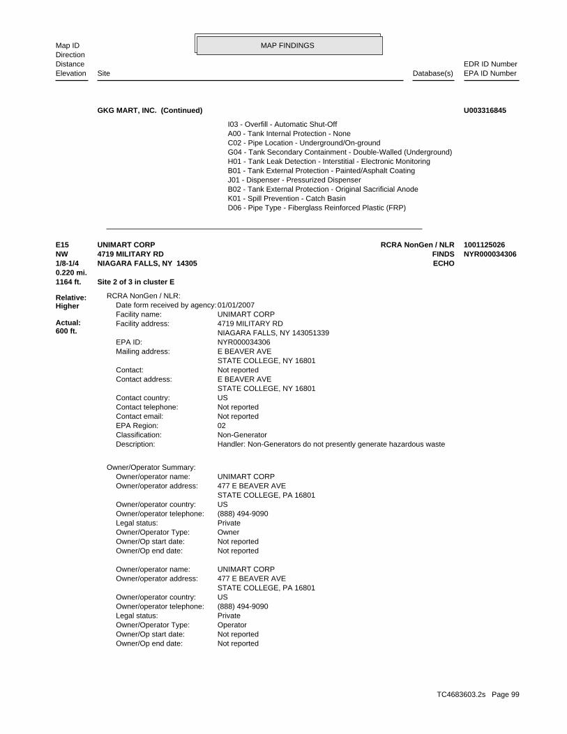
MAP FINDINGSMap IDDirection
EDR ID NumberDistanceEPA ID NumberDatabase(s)SiteElevation
D06 - Pipe Type - Fiberglass Reinforced Plastic (FRP) K01 - Spill Prevention - Catch Basin B02 - Tank External Protection - Original Sacrificial Anode J01 - Dispenser - Pressurized Dispenser B01 - Tank External Protection - Painted/Asphalt Coating H01 - Tank Leak Detection - Interstitial - Electronic Monitoring G04 - Tank Secondary Containment - Double-Walled (Underground) C02 - Pipe Location - Underground/On-ground A00 - Tank Internal Protection - None I03 - Overfill - Automatic Shut-Off
GKG MART, INC. (Continued) U003316845
Not reportedOwner/Op end date: Not reportedOwner/Op start date: OperatorOwner/Operator Type: PrivateLegal status: (888) 494-9090Owner/operator telephone: USOwner/operator country: STATE COLLEGE, PA 16801 477 E BEAVER AVEOwner/operator address: UNIMART CORPOwner/operator name:
Not reportedOwner/Op end date: Not reportedOwner/Op start date: OwnerOwner/Operator Type: PrivateLegal status: (888) 494-9090Owner/operator telephone: USOwner/operator country: STATE COLLEGE, PA 16801 477 E BEAVER AVEOwner/operator address: UNIMART CORPOwner/operator name:
Owner/Operator Summary:
Handler: Non-Generators do not presently generate hazardous wasteDescription: Non-GeneratorClassification: 02EPA Region: Not reportedContact email: Not reportedContact telephone: USContact country: STATE COLLEGE, NY 16801 E BEAVER AVEContact address: Not reportedContact: STATE COLLEGE, NY 16801 E BEAVER AVEMailing address: NYR000034306EPA ID: NIAGARA FALLS, NY 143051339 4719 MILITARY RDFacility address: UNIMART CORPFacility name: 01/01/2007Date form received by agency:
RCRA NonGen / NLR:
1164 ft. Site 2 of 3 in cluster E0.220 mi.
Relative:Higher
Actual:600 ft.
1/8-1/4 ECHONIAGARA FALLS, NY 14305NW FINDS4719 MILITARY RD NYR000034306E15 RCRA NonGen / NLRUNIMART CORP 1001125026
TC4683603.2s Page 99

MAP FINDINGSMap IDDirection
EDR ID NumberDistanceEPA ID NumberDatabase(s)SiteElevation
http://echo.epa.gov/detailed_facility_report?fid=110004531542DFR URL: 110004531542Registry ID: 1001125026Envid:
ECHO:
corrective action activities required under RCRA.program staff to track the notification, permit, compliance, andand treat, store, or dispose of hazardous waste. RCRAInfo allows RCRAevents and activities related to facilities that generate, transport,Conservation and Recovery Act (RCRA) program through the tracking ofRCRAInfo is a national information system that supports the Resource Environmental Interest/Information System
110004531542Registry ID:
FINDS:
No violations foundViolation Status:
BENZENE. Waste name: D018. Waste code:
IGNITABLE WASTE. Waste name: D001. Waste code:
Small Quantity GeneratorClassification: UNIMART CORPSite name: 01/13/1997Date form received by agency:
Not a generator, verifiedClassification: UNIMART CORPSite name: 07/08/1999Date form received by agency:
Not a generator, verifiedClassification: UNIMART CORPSite name: 01/01/2006Date form received by agency:
Historical Generators:
NoUsed oil transporter: NoUsed oil transfer facility: NoUsed oil Specification marketer: NoUsed oil fuel marketer to burner: NoUser oil refiner: NoUsed oil processor: NoUsed oil fuel burner: NoFurnace exemption: NoOn-site burner exemption: NoUnderground injection activity: NoTreater, storer or disposer of HW: NoTransporter of hazardous waste: NoRecycler of hazardous waste: NoMixed waste (haz. and radioactive): NoU.S. importer of hazardous waste:
Handler Activities Summary:
UNIMART CORP (Continued) 1001125026
TC4683603.2s Page 100

MAP FINDINGSMap IDDirection
EDR ID NumberDistanceEPA ID NumberDatabase(s)SiteElevation
HE WILL SEND IN THE INSPECTION REPORT FOR CLOSEOUT NEXT WEEK. NEXT FEW WEEKS. 6/13/07:SAC TELECON JOE BARONICH. MR. BARONICH SAID COLD HAVE BEEN SPILLED. HE WILL SEND IN THE INSPECTION REPORT IN THE ABLE TO UNLOAD THE TANK, MR. BARONICH DID NOT BELIEVE MUCH PRODUCT DETERMINE THE EXTENT OF THE SPILL. BUT BASED ON THE 2 PEOPLE BEING WATER. AREA DID HAVE SOME SNOW COVERING WHICH MADE IT DIFFICULT TO BARONICH INSPECTED THE AREA AND DID FIND A SHEEN IN SOME STANDING SUSPECTS THE OPEN VALVE MAY HAVE BEEN THE RESULT OF VANDALISM. MR. SOON AFTER THIS JUDGMENT WHEN THIS OCCURRED. THEREFORE, THE OWNER RECENTLY WON A COURT JUDGMENT AGAINST A DISGRUNTLED PERSON AND IT WAS IN THEIR YARD AND FOUND THE VALVE ON THE TANK WAS OPEN. THE OWNER YARD. WHEN THEY CAME BACK THE NEXT DAY THEY FOUND SOME OIL SPILLAGE ANOTHER WORKER AND HE LIFTED IT OFF THE TRUCK AND THEY LEFT IT IN THE THEY BOUGHT AND RECEIVED A USED SKID TANK FOR USE ON THEIR FACILITY. MR. BARONICH INSPECTED SITE. MET W/OWNER OF THE FACILITY. OWNER SAID SENT COPY OF REPORT TO HIM. 2/2/07:SAC TELECON JOE BARONICH - NCHD. COMPLAINT. MR. DRUST WILL HAVE SOMEONE FOLLOW UP WITH AN INSPECTION. "1/29/07:SAC TELECON DAVE DRUST - NCHD, NOTIFYING HIM OF THEDEC Memo: Not reportedContact Phone: Not reportedContact Name: 001Spiller Company: NIAGARA FALLS, NY 14305-1423Spiller City,St,Zip: 4833 SAUNDERS SETTLEMENT ROADSpiller Address: NIAGARA LAWN & GARDEN EQUIPMENTSpiller Company: Not reportedSpiller Name: 2007-09-13Spill Record Last Update: 2007-01-29Date Entered In Computer: 0Remediation Phase: FalseUST Trust: FalseRecommended Penalty: Not reportedLast Inspection: TrueCleanup Meets Std: Not reportedCleanup Ceased: CitizenSpill Notifier: Commercial/IndustrialSpill Source: Not reportedWater Affected: Not reportedCID: 2007-01-29Reported to Dept: NIAGARA COUNTY HEALTH DEPT.Referred To: SACALANDInvestigator: 3230SWIS: required. release with no damage. No DEC Response. No corrective action Possible release with minimal potential for fire or hazard or KnownSpill Class: Human ErrorSpill Cause: 0651890 / 2007-09-13Spill Number/Closed Date: 2007-01-22Spill Date: 9DEC Region: 376685Site ID: 326271DER Facility ID: ERFacility Type: 0651890Facility ID:
SPILLS:
1263 ft. ECHOSite 3 of 3 in cluster E0.239 mi. NY MANIFEST
Relative:Lower
Actual:599 ft.
1/8-1/4 FINDSNIAGARA FALLS, NY 14305NNW RCRA NonGen / NLR4833 SAUNDERS SETTLEMENT RD NYD147898035E16 NY SpillsHALLEENS WHOLESALE CARS 1000279902
TC4683603.2s Page 101

MAP FINDINGSMap IDDirection
EDR ID NumberDistanceEPA ID NumberDatabase(s)SiteElevation
Not reportedOwner/Op end date: Not reportedOwner/Op start date: OwnerOwner/Operator Type: PrivateLegal status: (212) 555-1212Owner/operator telephone: USOwner/operator country: NOT REQUIRED, WY 99999 NOT REQUIREDOwner/operator address: SYLVIA RICCUITIOwner/operator name:
Owner/Operator Summary:
Handler: Non-Generators do not presently generate hazardous wasteDescription: Non-GeneratorClassification: 02EPA Region: Not reportedContact email: Not reportedContact telephone: USContact country: NIAGARA FALLS, NY 14305 SAUNDERS SETTLEMENT RDContact address: Not reportedContact: NIAGARA FALLS, NY 14305 SAUNDERS SETTLEMENT RDMailing address: NYD147898035EPA ID: NIAGARA FALLS, NY 143051423 4833 SAUNDERS SETTLEMENT RDFacility address: HALLEENS WHOLESALE CARSFacility name: 01/01/2007Date form received by agency:
RCRA NonGen / NLR:
Tank Test:
FalseOxygenate: Not reportedResource Affected: Not reportedRecovered: GallonsUnits: 55.00Quantity: PetroleumMaterial FA: Not reportedCase No.: #2 fuel oilMaterial Name: 0001AMaterial Code: 2124108Material ID: 01Operable Unit: 1134251Operable Unit ID: 376685Site ID:
Material:
SPILL WAS COVERED UP W/CRUSHED STONE." AND SPILLED ONTO CRUSHED STONE DRIVEWAY. NO CLEAN UP WAS DONE AND "CITIZEN ALLEDGES THAT A DRUM OF FUEL OIL FELL OFF A FLAT BED TRUCKRemarks: INSPECTION REPORT FROM JOE BARONICH. NO FURTHER WORK REQUIRED. " TO SEND IN BUT SHE WILL TRY TO LOCATE IT. 9/13/07:RECEIVED NCHD TELECON LINDA JESSON - NCHD. MS. JESSON DOES NOT HAVE THE REPORT YET ABLE TO SEND IN REPORT. HE WILL FOLLOW UP NEXT WEEK. 7/12/07:SAC 6/28/07:SAC TELECON JOE BARONICH. MR. BARONICH SAID HE HASN’T BEEN
HALLEENS WHOLESALE CARS (Continued) 1000279902
TC4683603.2s Page 102

MAP FINDINGSMap IDDirection
EDR ID NumberDistanceEPA ID NumberDatabase(s)SiteElevation
SPENT SOLVENTS AND SPENT SOLVENT MIXTURES. IN F002, F004, AND F005; AND STILL BOTTOMS FROM THE RECOVERY OF THESE ONE OR MORE OF THE ABOVE HALOGENATED SOLVENTS OR THOSE SOLVENTS LISTED CONTAINING, BEFORE USE, A TOTAL OF TEN PERCENT OR MORE (BY VOLUME) OF FLUOROCARBONS; ALL SPENT SOLVENT MIXTURES/BLENDS USED IN DEGREASING 1,1,1-TRICHLOROETHANE, CARBON TETRACHLORIDE AND CHLORINATED TETRACHLOROETHYLENE, TRICHLORETHYLENE, METHYLENE CHLORIDE, THE FOLLOWING SPENT HALOGENATED SOLVENTS USED IN DEGREASING:. Waste name: F001. Waste code:
IGNITABLE WASTE. Waste name: D001. Waste code:
Not Defined. Waste name: D000. Waste code:
Small Quantity GeneratorClassification: HALLEENS WHOLESALE CARSSite name: 08/03/1989Date form received by agency:
Not a generator, verifiedClassification: HALLEENS WHOLESALE CARSSite name: 07/08/1999Date form received by agency:
Not a generator, verifiedClassification: HALLEENS WHOLESALE CARSSite name: 01/01/2006Date form received by agency:
Historical Generators:
NoUsed oil transporter: NoUsed oil transfer facility: NoUsed oil Specification marketer: NoUsed oil fuel marketer to burner: NoUser oil refiner: NoUsed oil processor: NoUsed oil fuel burner: NoFurnace exemption: NoOn-site burner exemption: NoUnderground injection activity: NoTreater, storer or disposer of HW: NoTransporter of hazardous waste: NoRecycler of hazardous waste: NoMixed waste (haz. and radioactive): NoU.S. importer of hazardous waste:
Handler Activities Summary:
Not reportedOwner/Op end date: Not reportedOwner/Op start date: OperatorOwner/Operator Type: PrivateLegal status: (212) 555-1212Owner/operator telephone: USOwner/operator country: NOT REQUIRED, WY 99999 NOT REQUIREDOwner/operator address: SYLVIA RICCUITIOwner/operator name:
HALLEENS WHOLESALE CARS (Continued) 1000279902
TC4683603.2s Page 103

MAP FINDINGSMap IDDirection
EDR ID NumberDistanceEPA ID NumberDatabase(s)SiteElevation
NYLocation State: NIAGARA FALLSLocation City: Not reportedTotal Tanks: Not reportedLocation Address 2: BPCode: 4833 SAUNDERS SETTLEMENT ROADLocation Address 1: Not reportedFacility Status: NYD147898035EPA ID: USACountry:
NY MANIFEST:
corrective action activities required under RCRA.program staff to track the notification, permit, compliance, andand treat, store, or dispose of hazardous waste. RCRAInfo allows RCRAevents and activities related to facilities that generate, transport,Conservation and Recovery Act (RCRA) program through the tracking ofRCRAInfo is a national information system that supports the Resource Environmental Interest/Information System
110004383809Registry ID:
FINDS:
No violations foundViolation Status:
THESE SPENT SOLVENTS AND SPENT SOLVENT MIXTURES. LISTED IN F001, F002, OR F004; AND STILL BOTTOMS FROM THE RECOVERY OF ONE OR MORE OF THE ABOVE NONHALOGENATED SOLVENTS OR THOSE SOLVENTS CONTAINING, BEFORE USE, A TOTAL OF TEN PERCENT OR MORE (BY VOLUME) OF 2-ETHOXYETHANOL, AND 2-NITROPROPANE; ALL SPENT SOLVENT MIXTURES/BLENDS KETONE, CARBON DISULFIDE, ISOBUTANOL, PYRIDINE, BENZENE, THE FOLLOWING SPENT NONHALOGENATED SOLVENTS: TOLUENE, METHYL ETHYL. Waste name: F005. Waste code:
MIXTURES. BOTTOMS FROM THE RECOVERY OF THESE SPENT SOLVENTS AND SPENT SOLVENT MORE OF THOSE SOLVENTS LISTED IN F001, F002, F004, AND F005; AND STILL SOLVENTS, AND A TOTAL OF TEN PERCENT OR MORE (BY VOLUME) OF ONE OR CONTAINING, BEFORE USE, ONE OR MORE OF THE ABOVE NONHALOGENATED NONHALOGENATED SOLVENTS; AND ALL SPENT SOLVENT MIXTURES/BLENDS MIXTURES/BLENDS CONTAINING, BEFORE USE, ONLY THE ABOVE SPENT ALCOHOL, CYCLOHEXANONE, AND METHANOL; ALL SPENT SOLVENT ACETATE, ETHYL BENZENE, ETHYL ETHER, METHYL ISOBUTYL KETONE, N-BUTYL THE FOLLOWING SPENT NONHALOGENATED SOLVENTS: XYLENE, ACETONE, ETHYL. Waste name: F003. Waste code:
SPENT SOLVENT MIXTURES. F005; AND STILL BOTTOMS FROM THE RECOVERY OF THESE SPENT SOLVENTS AND ABOVE HALOGENATED SOLVENTS OR THOSE SOLVENTS LISTED IN F001, F004, AND USE, A TOTAL OF TEN PERCENT OR MORE (BY VOLUME) OF ONE OR MORE OF THE TRICHLOROETHANE; ALL SPENT SOLVENT MIXTURES/BLENDS CONTAINING, BEFORE ORTHO-DICHLOROBENZENE, TRICHLOROFLUOROMETHANE, AND 1,1,2, CHLOROBENZENE, 1,1,2-TRICHLORO-1,2,2-TRIFLUOROETHANE, METHYLENE CHLORIDE, TRICHLOROETHYLENE, 1,1,1-TRICHLOROETHANE, THE FOLLOWING SPENT HALOGENATED SOLVENTS: TETRACHLOROETHYLENE,. Waste name: F002. Waste code:
HALLEENS WHOLESALE CARS (Continued) 1000279902
TC4683603.2s Page 104

MAP FINDINGSMap IDDirection
EDR ID NumberDistanceEPA ID NumberDatabase(s)SiteElevation
B Incineration, heat recovery, burning.Handling Method: TT - Cargo tank, tank trucksContainer Type: 001Number of Containers: G - Gallons (liquids only)* (8.3 pounds)Units: 00100Quantity: Not reportedWaste Code: Not reportedWaste Code: Not reportedWaste Code: Not reportedWaste Code: Not reportedWaste Code: F005 - UNKNOWNWaste Code: Not reportedMGMT Method Type Code: Not reportedAlt Facility Sign Date: Not reportedAlt Facility RCRA ID: Not reportedManifest Ref Number: Not reportedDiscr Full Reject Indicator: Not reportedDiscr Partial Reject Indicator: Not reportedDiscr Residue Indicator: Not reportedDiscr Type Indicator: Not reportedDiscr Quantity Indicator: Not reportedExport Indicator: Not reportedImport Indicator: Not reportedManifest Tracking Number: Not reportedTSDF ID 2: NYD049836679TSDF ID 1: Not reportedTrans2 EPA ID: ILD099202681Trans1 EPA ID: NYD147898035Generator EPA ID: 09/15/1989Part B Recv Date: 09/14/1989Part A Recv Date: 09/08/1989TSD Site Recv Date: / /Trans2 Recv Date: 09/08/1989Trans1 Recv Date: 09/08/1989Generator Ship Date: Not reportedTrans2 State ID: P78-064ILTrans1 State ID: 1989Year: Not reportedseq: CManifest Status: NYA8197317Document ID:
NY MANIFEST:
7162975101Mailing Phone: USAMailing Country: Not reportedMailing Zip 4: 14305Mailing Zip: NYMailing State: NIAGARA FALLSMailing City: Not reportedMailing Address 2: 4833 SAUNDERS SETTLEMENT ROADMailing Address 1: R HALLEENS WHOLESALE CARSMailing Contact: R HALLEENS WHOLESALE CARSMailing Name: NYD147898035EPAID:
NY MANIFEST:
Not reportedLocation Zip 4: 14305Location Zip:
HALLEENS WHOLESALE CARS (Continued) 1000279902
TC4683603.2s Page 105

MAP FINDINGSMap IDDirection
EDR ID NumberDistanceEPA ID NumberDatabase(s)SiteElevation
http://echo.epa.gov/detailed_facility_report?fid=110004383809DFR URL: 110004383809Registry ID: 1000279902Envid:
ECHO:
100Specific Gravity:
HALLEENS WHOLESALE CARS (Continued) 1000279902
dieselMaterial Name: 0008Material Code: 476493Material ID: 01Operable Unit: 900908Operable Unit ID: 108010Site ID:
Material:
"TANK FAILURE RATE -0.062"Remarks: MJH / / : TELECON 09/05/86, TANK EMPTIED. " "Prior to Sept, 2004 data translation this spill Lead_DEC Field wasDEC Memo: 94948DER Facility ID: 9DEC Region: Not reportedSpiller Extention: Not reportedSpiller Phone: Not reportedSpiller Contact: 001Spiller County: NIAGARA FALLS, NYSpiller City,St,Zip: WITMAR ROADSpiller Address: ANCHOR MOTOR FREIGHTSpiller Company: Not reportedSpiller Name: 1986-10-06Spill Record Last Update: 1986-09-05Date Entered In Computer: 0Remediation Phase: TrueUST Involvement: FalseRecommended Penalty: Not reportedLast Inspection: Tank TesterSpill Notifier: Not reportedWater Affected: Not reportedCID: 1986-09-04Reported to Dept: Not reportedReferred To: MJHINTONInvestigator: 3211SWIS: TrueCleanup Meets Standard: 1986-10-06Cleanup Ceased: Not reportedSpill Class: Commercial/IndustrialSpill Source: Tank Test FailureSpill Cause: 1986-09-04Spill Date: 8603675 / 1986-10-06Spill Number/Closed Date: 108010Site ID:
LTANKS:
1295 ft. Site 1 of 2 in cluster F0.245 mi.
Relative:Lower
Actual:599 ft.
1/8-1/4 NIAGARA FALLS, NY NW WITMAR ROAD N/AF17 NY LTANKSANCHOR MOTOR FREIGHT 1000546352
TC4683603.2s Page 106

MAP FINDINGSMap IDDirection
EDR ID NumberDistanceEPA ID NumberDatabase(s)SiteElevation
"TANK FAILURE RATE -0.205"Remarks: MJH / / : TELECON 09/05/86, TANK EMPTIED. " "Prior to Sept, 2004 data translation this spill Lead_DEC Field wasDEC Memo: 94948DER Facility ID: 9DEC Region: Not reportedSpiller Extention: Not reportedSpiller Phone: Not reportedSpiller Contact: 001Spiller County: NIAGARA FALLS, NYSpiller City,St,Zip: WITMAR ROADSpiller Address: ANCHOR MOTOR FREIGHTSpiller Company: Not reportedSpiller Name: 1986-10-06Spill Record Last Update: 1986-09-05Date Entered In Computer: 0Remediation Phase: TrueUST Involvement: FalseRecommended Penalty: Not reportedLast Inspection: Tank TesterSpill Notifier: Not reportedWater Affected: Not reportedCID: 1986-09-04Reported to Dept: Not reportedReferred To: MJHINTONInvestigator: 3211SWIS: TrueCleanup Meets Standard: 1986-10-06Cleanup Ceased: Not reportedSpill Class: Commercial/IndustrialSpill Source: Tank Test FailureSpill Cause: 1986-09-04Spill Date: 8603676 / 1986-10-06Spill Number/Closed Date: 108011Site ID:
UnknownTest Method: Not reportedLast Modified: SpillsModified By: Not reportedGross Fail: .00Leak Rate: 00Test Method: 0Tank Size: Not reportedTank Number: 1530185Spill Tank Test: 108010Site ID:
Tank Test:
Not reportedOxygenate: Not reportedResource Affected: .00Recovered: GallonsUnits: .00Quantity: PetroleumMaterial FA: Not reportedCase No.:
ANCHOR MOTOR FREIGHT (Continued) 1000546352
TC4683603.2s Page 107

MAP FINDINGSMap IDDirection
EDR ID NumberDistanceEPA ID NumberDatabase(s)SiteElevation
UnknownTest Method: Not reportedLast Modified: SpillsModified By: Not reportedGross Fail: .00Leak Rate: 00Test Method: 0Tank Size: Not reportedTank Number: 1530186Spill Tank Test: 108011Site ID:
Tank Test:
Not reportedOxygenate: Not reportedResource Affected: .00Recovered: GallonsUnits: .00Quantity: PetroleumMaterial FA: Not reportedCase No.: dieselMaterial Name: 0008Material Code: 562535Material ID: 01Operable Unit: 900910Operable Unit ID: 108011Site ID:
Material:
ANCHOR MOTOR FREIGHT (Continued) 1000546352
(518) 486-2923Phone: 001Country Code: 12238Zip Code: NYState: ALBANYCity: 19TH FLOORAddress2: AGENCY BUILDING #1Address1: JOHN EBERHARDContact Name: Not reportedContact Type: NY STATE OFFICE OF PARKS, REC & HIST PRESCompany Name: Mail ContactAffiliation Type: 426480Site Id:
Affiliation Records:
OtherSite Type: 4783061.93996UTM Y: 174064.53987UTM X: N/AExpiration Date: 9DEC Region: STATERegion: PBSProgram Type: 9-601171 / Unregulated/ClosedId/Status:
UST:
1316 ft. Site 2 of 2 in cluster F0.249 mi.
Relative:Lower
Actual:599 ft.
1/8-1/4 NIAGARA FALLS, NY 14304NW MILITARY AND WITMER (ROUTE 31) N/AF18 NY USTRESERVOIR STATE PARK U004157054
TC4683603.2s Page 108

MAP FINDINGSMap IDDirection
EDR ID NumberDistanceEPA ID NumberDatabase(s)SiteElevation
2010-07-20Date Last Modified: aeskalskModified By: Not reportedFax Number: Not reportedEMail: (716) 278-1777Phone: 999Country Code: Not reportedZip Code: NNState: Not reportedCity: Not reportedAddress2: Not reportedAddress1: PARK POLICEContact Name: Not reportedContact Type: NY STATE OFFICE OF PARKS, REC & HIST PRESCompany Name: Emergency ContactAffiliation Type: 426480Site Id:
2010-07-20Date Last Modified: aeskalskModified By: Not reportedFax Number: Not reportedEMail: (716) 297-4484Phone: 001Country Code: Not reportedZip Code: NYState: Not reportedCity: Not reportedAddress2: Not reportedAddress1: KEVIN MCNALLIEContact Name: Not reportedContact Type: RESERVOIR STATE PARKCompany Name: On-Site OperatorAffiliation Type: 426480Site Id:
2010-07-20Date Last Modified: aeskalskModified By: Not reportedFax Number: Not reportedEMail: (716) 278-1799Phone: 001Country Code: 14303Zip Code: NYState: NIAGARA FALLSCity: Not reportedAddress2: PROSPECT PARK, P.O. BOX 1132Address1: DAVID A. SZUBAContact Name: CAPITAL FACILITIES MANAGERSContact Type: NY STATE OFFICE OF PARKS, REC & HIST PRESCompany Name: Facility OwnerAffiliation Type: 426480Site Id:
2010-03-23Date Last Modified: LDGOMEZModified By: Not reportedFax Number: [email protected]:
RESERVOIR STATE PARK (Continued) U004157054
TC4683603.2s Page 109

MAP FINDINGSMap IDDirection
EDR ID NumberDistanceEPA ID NumberDatabase(s)SiteElevation
K00 - Spill Prevention - None J02 - Dispenser - Suction Dispenser E00 - Piping Secondary Containment - None D01 - Pipe Type - Steel/Carbon Steel/Iron I01 - Overfill - Float Vent Valve C03 - Pipe Location - Aboveground/Underground Combination A00 - Tank Internal Protection - None H01 - Tank Leak Detection - Interstitial - Electronic Monitoring B01 - Tank External Protection - Painted/Asphalt Coating G04 - Tank Secondary Containment - Double-Walled (Underground) L04 - Piping Leak Detection - Groundwater Well F00 - Pipe External Protection - None
Equipment Records:
09/30/2011Last Modified: aeskalskModified By: Not reportedPipe Model: Not reportedNext Test Date: Not reportedDate Test: NNTightness Test Method:
GasolineCommon Name of Substance: 0009Material Code: Steel/carbon steelTank Type: UndergroundTank Location: TrueRegistered: 09/23/2011Date Tank Closed: 07/01/1991Install Date: 500Capacity Gallons: Closed - RemovedMaterial Name: Closed - RemovedTank Status: 233485Tank ID: 1Tank Number:
Tank Info:
RESERVOIR STATE PARK (Continued) U004157054
Not reportedWater Affected: Not reportedCID: 1994-08-16Reported to Dept: Not reportedReferred To: SACALANDInvestigator: 3224SWIS: TrueCleanup Meets Standard: 1994-11-21Cleanup Ceased: Willing Responsible Party. Corrective action taken. Known release that creates potential for fire or hazard. DEC Response.Spill Class: Commercial/IndustrialSpill Source: Tank FailureSpill Cause: 1994-08-16Spill Date: 9406642 / 1994-11-21Spill Number/Closed Date: 100658Site ID:
LTANKS:
1329 ft.0.252 mi.
Relative:Lower
Actual:599 ft.
1/4-1/2 LEWISTON, NY NNW WITTMER ROAD N/A19 NY LTANKSNYSDOT S101340796
TC4683603.2s Page 110

MAP FINDINGSMap IDDirection
EDR ID NumberDistanceEPA ID NumberDatabase(s)SiteElevation
Tank Test:
Not reportedOxygenate: Not reportedResource Affected: .00Recovered: Not reportedUnits: .00Quantity: PetroleumMaterial FA: Not reportedCase No.: dieselMaterial Name: 0008Material Code: 379675Material ID: 01Operable Unit: 1004068Operable Unit ID: 100658Site ID:
Material:
"CONTAMINATED SOIL DISCOVERED DURING TANK PULL."Remarks: SAC 11/21/94: SAME AS SPILL NUMBER 9302618,SEE THAT FILE. " "Prior to Sept, 2004 data translation this spill Lead_DEC Field wasDEC Memo: 89330DER Facility ID: 9DEC Region: Not reportedSpiller Extention: Not reportedSpiller Phone: Not reportedSpiller Contact: 001Spiller County: BUFFALO, NYSpiller City,St,Zip: 125 MAIN STREETSpiller Address: NYSDOTSpiller Company: Not reportedSpiller Name: 1994-11-30Spill Record Last Update: 1994-11-21Date Entered In Computer: 0Remediation Phase: TrueUST Involvement: FalseRecommended Penalty: Not reportedLast Inspection: OtherSpill Notifier:
NYSDOT (Continued) S101340796
Not reportedReferred To: MJHINTONInvestigator: 3211SWIS: TrueCleanup Meets Standard: 1987-08-21Cleanup Ceased: Not reportedSpill Class: Commercial/IndustrialSpill Source: Tank Test FailureSpill Cause: 1986-08-27Spill Date: 8603499 / 1987-08-21Spill Number/Closed Date: 138327Site ID:
LTANKS:
1403 ft. Site 1 of 2 in cluster G0.266 mi.
Relative:Lower
Actual:597 ft.
1/4-1/2 NIAGARA FALLS, NY NW NY Spills4749 WITMER ROAD N/AG20 NY LTANKSANCHOR MOTOR FREIGHT S111317964
TC4683603.2s Page 111

MAP FINDINGSMap IDDirection
EDR ID NumberDistanceEPA ID NumberDatabase(s)SiteElevation
SpillsModified By: Not reportedGross Fail: .00Leak Rate: 00Test Method: 0Tank Size: Not reportedTank Number: 1530159Spill Tank Test: 138327Site ID:
Tank Test:
Not reportedOxygenate: Not reportedResource Affected: .00Recovered: GallonsUnits: .00Quantity: PetroleumMaterial FA: Not reportedCase No.: dieselMaterial Name: 0008Material Code: 476325Material ID: 01Operable Unit: 900751Operable Unit ID: 138327Site ID:
Material:
"10,000 GALLON TANK, FAILURE RATE -0.304"Remarks: LANDFILL, TANKS HAVE BEEN CLEANED AND SCRAPPED. " / / : MJH TELECON 08/21/87, CONTAMINATED SOIL DISPOSED OF AT MODERN DISPOSED OF AT MODERN LANDFILL, TANKS HAVE BEEN CLEANED AND SCRAPPED. CLEANING AND SOIL DISPOSAL REMAINING. / / : CONTAMINATED SOIL GROUND NO SIGNIFICANT AMOUNT OF SUBSURFACE CONTAMINATION, TANK FOR TANK REMOVAL GRANTED TO 7/31/87. / / : ALL TANKS REMOVED FROM ALL TANKS ARE SCHEDULED TO BE REMOVED BY JUNE 1987. / / : EXTENSION BIDS ARE BEING SOUGHT FOR TANK REMOVAL, ALL TANKS ARE EMPTY. / / : MJH / / : CONTACTED NCHD, J. DEVALD, 08/27/86. / / : TELCON W/ OWNER, "Prior to Sept, 2004 data translation this spill Lead_DEC Field wasDEC Memo: 118283DER Facility ID: 9DEC Region: Not reportedSpiller Extention: Not reportedSpiller Phone: Not reportedSpiller Contact: 001Spiller County: NIAGARA FALLS, NYSpiller City,St,Zip: 4749 WITMER ROADSpiller Address: ANCHOR MOTOR FREIGHTSpiller Company: Not reportedSpiller Name: 1987-08-25Spill Record Last Update: 1986-08-28Date Entered In Computer: 0Remediation Phase: TrueUST Involvement: FalseRecommended Penalty: 1987-07-31Last Inspection: Tank TesterSpill Notifier: Not reportedWater Affected: Not reportedCID: 1986-08-27Reported to Dept:
ANCHOR MOTOR FREIGHT (Continued) S111317964
TC4683603.2s Page 112

MAP FINDINGSMap IDDirection
EDR ID NumberDistanceEPA ID NumberDatabase(s)SiteElevation
1206896Operable Unit ID: 456754Site ID:
Material:
progress" "50-75 gal spill from in yard accident fd on scene cleanup inRemarks: CLOSED OUT." CLEANED UP & PROPERLY DISPOSED OF...NO FURTHER ACTION NEEDED...SPILL THE DUMPSTER PICK-UP FROM MODERN CORPORATION...THE SPILL HAS BEEN SPILL REPORT TO PAUL DICKY,NCDOH. 11/15/2011: RECEIVED THE INVOICE OF DUMPSTER...THE CLEAN-UP IS ACCEPTABLE...ALSO,I FAXED A COPY OF THIS BRANT,SHOP MANAGER,WILL SEND ME THE DISPOSAL RECEIPTS OF THE REACHED ANY SOIL OR STORM DRAINS,IT WAS ALL CONTAINED/RECOVERED...KEN PROFILED DUMPSTER,WHICH THEY WILL DISPOSE OF...NONE OF THE FUEL ON THE SPILL,THEN PICKED UP ALL THE MATERIAL AND PLACED IT IN THEIR NIAGARA FALLS FIRE DEPT. RESPONDED AND SPREAD SPEEDI-DRY/ABSORBANTS SPILL OUT,ALL ON THEIR ASPHALT DRIVEWAY IN THEIR TERMINAL...THE TRACTOR TRAILER HIT ANOTHER TRAILER CAUSING 70 GAL OF DIESEL FUEL TO "10/17/2011: RJJ AT SITE AT 2300...DUE TO A MINOR ACCIDENT,A CASSENDEC Memo: Not reportedContact Phone: 911 CENTERContact Name: 001Spiller Company: NIAGARA FALLS, NY 14305Spiller City,St,Zip: 4749 WITMER RDSpiller Address: CASSENS TRANSPORT CO.Spiller Company: KEN BRANTSpiller Name: 2011-11-15Spill Record Last Update: 2011-10-17Date Entered In Computer: 0Remediation Phase: FalseUST Trust: FalseRecommended Penalty: Not reportedLast Inspection: TrueCleanup Meets Std: Not reportedCleanup Ceased: OtherSpill Notifier: Commercial/IndustrialSpill Source: Not reportedWater Affected: Not reportedCID: 2011-10-17Reported to Dept: Not reportedReferred To: RJJONAKInvestigator: 3211SWIS: Willing Responsible Party. Corrective action taken. Known release with minimal potential for fire or hazard. DEC Response.Spill Class: UnknownSpill Cause: 1109007 / 2011-11-15Spill Number/Closed Date: 2011-10-17Spill Date: 9DEC Region: 456754Site ID: 399634DER Facility ID: ERFacility Type: 1109007Facility ID:
SPILLS:
UnknownTest Method: Not reportedLast Modified:
ANCHOR MOTOR FREIGHT (Continued) S111317964
TC4683603.2s Page 113

MAP FINDINGSMap IDDirection
EDR ID NumberDistanceEPA ID NumberDatabase(s)SiteElevation
"cleanup in progress - possible equipment nozzle froze @ 1126 - KenRemarks: REQUIRED." REPLACED. 10/3/11:RECEIVED DISPOSAL RECEIPT. NO FURTHER WORK IS RECEIPTS ONCE WORK HAS BEEN COMPLETED. FAULTY NOZZLE HAS BEEN TO APPLY AND SWEEP ADDITIONAL ABSORBENTS. THEY WILL PROVIDE DISPOSAL USED TO CLEAN UP AND CONTAIN THE SPILL. CLEAN UP CONTRACTOR WAS HIRED DICKY. SPILL WAS TO PAVEMENT ONLY. NO DRAINS AFFECTED. ABSORBENTS DICKY WILL INSPECT SITE. RECEIVED NCHD INSPECTION REPORT FROM PAUL "2/4/11:SAC TELECON PAUL DICKY - NCHD, NOTIFYING OF HIM SPILL. MR.DEC Memo: (716) 239-9031Contact Phone: KEN SZYMASZEKContact Name: 999Spiller Company: NIAGARA FALLS, NY 14305Spiller City,St,Zip: 4749 WITMER ROADSpiller Address: CASSENS TRANSPORT COMPANYSpiller Company: Not reportedSpiller Name: 2011-10-03Spill Record Last Update: 2011-02-04Date Entered In Computer: 0Remediation Phase: FalseUST Trust: FalseRecommended Penalty: Not reportedLast Inspection: TrueCleanup Meets Std: Not reportedCleanup Ceased: OtherSpill Notifier: Commercial/IndustrialSpill Source: Not reportedWater Affected: Not reportedCID: 2011-02-04Reported to Dept: NIAGARA COUNTY HEALTH DEPARTMENTReferred To: SACALANDInvestigator: 3211SWIS: Willing Responsible Party. Corrective action taken. Known release that creates potential for fire or hazard. DEC Response.Spill Class: Equipment FailureSpill Cause: 1011112 / 2011-10-03Spill Number/Closed Date: 2011-02-04Spill Date: 9DEC Region: 444746Site ID: 399634DER Facility ID: ERFacility Type: 1011112Facility ID:
Tank Test:
Not reportedOxygenate: Not reportedResource Affected: 70.00Recovered: GallonsUnits: 70.00Quantity: PetroleumMaterial FA: Not reportedCase No.: dieselMaterial Name: 0008Material Code: 2204027Material ID: 01Operable Unit:
ANCHOR MOTOR FREIGHT (Continued) S111317964
TC4683603.2s Page 114

MAP FINDINGSMap IDDirection
EDR ID NumberDistanceEPA ID NumberDatabase(s)SiteElevation
SPILL, SAC WILL FAX REPORT TO HIM AND SOMEONE WILL FOLLOW UP. SAC-NCHD 02/04/00: SAC TELECON DAVE DRUST, NCHD, NOTIFYING HIM OF "Prior to Sept, 2004 data translation this spill Lead_DEC Field wasDEC Memo: Not reportedContact Phone: Not reportedContact Name: 001Spiller Company: NIAGARA FALLS, NYSpiller City,St,Zip: 4749 WITMER ROADSpiller Address: PENSKE TRUCKING LEASINGSpiller Company: RYAN MERKYSpiller Name: 2002-04-24Spill Record Last Update: 2000-02-04Date Entered In Computer: 0Remediation Phase: FalseUST Trust: FalseRecommended Penalty: 2000-02-04Last Inspection: TrueCleanup Meets Std: Not reportedCleanup Ceased: Affected PersonsSpill Notifier: Commercial/IndustrialSpill Source: Not reportedWater Affected: Not reportedCID: 2000-02-04Reported to Dept: NIAGARA CNTY HEALTH DEPTReferred To: SACALANDInvestigator: 3211SWIS: Willing Responsible Party. Corrective action taken. Known release with minimal potential for fire or hazard. DEC Response.Spill Class: Equipment FailureSpill Cause: 9975671 / 2000-03-13Spill Number/Closed Date: 2000-02-04Spill Date: 9DEC Region: 138330Site ID: 118283DER Facility ID: ERFacility Type: 9975671Facility ID:
Tank Test:
Not reportedOxygenate: Not reportedResource Affected: Not reportedRecovered: GallonsUnits: 188.00Quantity: PetroleumMaterial FA: Not reportedCase No.: dieselMaterial Name: 0008Material Code: 2191213Material ID: 01Operable Unit: 1195182Operable Unit ID: 444746Site ID:
Material:
120 into fuel tanks and didn’t leak" Szymaszek called back to advise 67 gallons spilled out - the other
ANCHOR MOTOR FREIGHT (Continued) S111317964
TC4683603.2s Page 115

MAP FINDINGSMap IDDirection
EDR ID NumberDistanceEPA ID NumberDatabase(s)SiteElevation
NIAGARA FALLS, NY -Spiller City,St,Zip: 4749 WITMER ROADSpiller Address: LEASEWAY MOTORCAR TRANSPOSpiller Company: Not reportedSpiller Name: 1997-03-21Spill Record Last Update: 1996-10-23Date Entered In Computer: 0Remediation Phase: FalseUST Trust: FalseRecommended Penalty: 1996-10-25Last Inspection: TrueCleanup Meets Std: Not reportedCleanup Ceased: CitizenSpill Notifier: Commercial/IndustrialSpill Source: Not reportedWater Affected: 297CID: 1996-10-23Reported to Dept: NIAGARA CNTY HEALTH DEPTReferred To: SACALANDInvestigator: 3211SWIS: Willing Responsible Party. Corrective action taken. Known release with minimal potential for fire or hazard. DEC Response.Spill Class: HousekeepingSpill Cause: 9609210 / 1997-03-18Spill Number/Closed Date: 1996-10-01Spill Date: 9DEC Region: 138329Site ID: 118283DER Facility ID: ERFacility Type: 9609210Facility ID:
Tank Test:
Not reportedOxygenate: Not reportedResource Affected: 15.00Recovered: GallonsUnits: 15.00Quantity: PetroleumMaterial FA: Not reportedCase No.: dieselMaterial Name: 0008Material Code: 290213Material ID: 01Operable Unit: 1093958Operable Unit ID: 138330Site ID:
Material:
PAVEMENT IN SNOW...THEY ARE IN ROUTE TO CLEAN UP THE SPILL." "SAID THAT ABOUT 15 GALS. OF DIESEL FUEL/KERO BLEND SPILLED ONRemarks: CLEANED UP." 02/28/00: SAC RECEIVED NCHD INSPECTION REPORT FROM PAUL DICKY, SPILL RNL SAID HE IS WILLING TO ACCEPT THIS AS A DISPOSAL RECEIPT. FOR THE DISPOSAL OF THE MATERIAL, SAC SPOKE TO RNL REGARDING INVOICE, ASKED TO HAVE REPORT RE-FAXED TO HIM. 02/17/00: SAC RECEIVED INVOICE 02/04/00: SAC TELECON PAUL DICKY, NCHD, HE SAID HE WILL FOLLOW UP AND
ANCHOR MOTOR FREIGHT (Continued) S111317964
TC4683603.2s Page 116

MAP FINDINGSMap IDDirection
EDR ID NumberDistanceEPA ID NumberDatabase(s)SiteElevation
Not reportedSpiller Name: 1992-12-03Spill Record Last Update: 1992-10-27Date Entered In Computer: 0Remediation Phase: FalseUST Trust: FalseRecommended Penalty: 1992-10-26Last Inspection: TrueCleanup Meets Std: 1992-11-25Cleanup Ceased: Affected PersonsSpill Notifier: Commercial/IndustrialSpill Source: Not reportedWater Affected: Not reportedCID: 1992-10-26Reported to Dept: Not reportedReferred To: SACALANDInvestigator: 3211SWIS: Willing Responsible Party. Corrective action taken. Known release with minimal potential for fire or hazard. DEC Response.Spill Class: Human ErrorSpill Cause: 9208585 / 1992-11-25Spill Number/Closed Date: 1992-10-26Spill Date: 9DEC Region: 138328Site ID: 118283DER Facility ID: ERFacility Type: 9208585Facility ID:
Tank Test:
Not reportedOxygenate: Not reportedResource Affected: .00Recovered: GallonsUnits: .00Quantity: PetroleumMaterial FA: Not reportedCase No.: hydraulic oilMaterial Name: 0010Material Code: 344939Material ID: 01Operable Unit: 1037302Operable Unit ID: 138329Site ID:
Material:
Not reported HAS A KEROSENE ODOR - KAH ADVISED PAUL DICKY NCHD - HE WILL FOLLOW UP" IS ABOUT 100FOOT STREAM OF LIQUID RUNNING OUT OF THE DUMPSTER THAHT "CALLER CLAIMS THAT SEVERAL DRUMS WERE PUT INTO DUMPSTER - SAYS THERERemarks: COMPLETED." 3/18/97:RECEIVED NCHD INSPECTION REPORT FROM PAUL DICKY,CLEANUP SAC-NCHD 10/23/96:KAH NOTIFIED PAUL DICKY,NCHD-PAUL WILL FOLLOW UP. "Prior to Sept, 2004 data translation this spill Lead_DEC Field wasDEC Memo: Not reportedContact Phone: Not reportedContact Name: 001Spiller Company:
ANCHOR MOTOR FREIGHT (Continued) S111317964
TC4683603.2s Page 117

MAP FINDINGSMap IDDirection
EDR ID NumberDistanceEPA ID NumberDatabase(s)SiteElevation
additional NY_SPILL: detail in the EDR Site Report.Click this hyperlink while viewing on your computer to access
Tank Test:
Not reportedOxygenate: Not reportedResource Affected: .00Recovered: GallonsUnits: 5.00Quantity: PetroleumMaterial FA: Not reportedCase No.: waste oil/used oilMaterial Name: 0022Material Code: 405672Material ID: 01Operable Unit: 975327Operable Unit ID: 138328Site ID:
Material:
"SPILL ON SOIL; OIL SYSTEM IS SHUT DOWN AND CLEANUP TO BE INITIATED."Remarks: LETTERS,CONTAMINATED MATERIAL HAS BEEN DISPOSED. " 11/25/92: NCHD AND LEASEWAY TRANSPORT HAVE SENT REPORT 10/26/92: NCHD AND ON W/PAUL DICKY, NCHD. HE WILL FOLLOW UP. SAC 10/26/92: SAC/TELECON W/PAUL DICKY, NCHD. HE WILL FOLLOW UP. "Prior to Sept, 2004 data translation this spill Lead_DEC Field wasDEC Memo: Not reportedContact Phone: Not reportedContact Name: 001Spiller Company: NIAGARA FALLS, NYSpiller City,St,Zip: 4749 WITMER ROADSpiller Address: ANCHOR MOTOR FREIGHTSpiller Company:
ANCHOR MOTOR FREIGHT (Continued) S111317964
Conditionally Exempt Small Quantity GeneratorClassification: 02EPA Region: Not reportedContact email: (734) 729-9779Contact telephone: USContact country: WAYNE, MI 48184 MICHIGAN AVE SUITE 100Contact address: DAN DANIELCZYKContact: WAYNE, MI 48184 MICHIGAN AVE SUITE 100Mailing address: NYD986986628EPA ID: NIAGARA FALLS, NY 14304 4749 WITMER RDFacility address: LEASEWAY MOTORCAR TRANSPORT COFacility name: 01/01/2007Date form received by agency:
RCRA-CESQG:
ECHONY SPDES
1403 ft. NY MANIFESTSite 2 of 2 in cluster G0.266 mi. FINDS
Relative:Lower
Actual:597 ft.
1/4-1/2 NY SpillsNIAGARA FALLS, NY 14305NW NY LTANKS4749 WITMER RD NYD986986628G21 RCRA-CESQGLEASEWAY MOTORCAR TRANSPORT 1000556106
TC4683603.2s Page 118

MAP FINDINGSMap IDDirection
EDR ID NumberDistanceEPA ID NumberDatabase(s)SiteElevation
NO NAME FOUNDOwner/operator name:
Not reportedOwner/Op end date: 03/27/2004Owner/Op start date: OperatorOwner/Operator Type: PrivateLegal status: Not reportedOwner/operator telephone: USOwner/operator country: NIAGARA FALLS, NY 14304 WITMER RDOwner/operator address: LEASEWAY MOTORCAR TRANSPORT COOwner/operator name:
Not reportedOwner/Op end date: 01/01/2001Owner/Op start date: OwnerOwner/Operator Type: PrivateLegal status: (610) 775-6000Owner/operator telephone: USOwner/operator country: READING, PA 19603 RTE 10 GREEN HILLS PO BOX 563Owner/operator address: LEASEWAY TRANSPORTATION CORPOwner/operator name:
Not reportedOwner/Op end date: Not reportedOwner/Op start date: OwnerOwner/Operator Type: PrivateLegal status: (610) 775-6000Owner/operator telephone: Not reportedOwner/operator country: READING, PA 19603 RTE 10 GREEN HILLS PO BOX 563Owner/operator address: LEASEWAY TRANSPORTATION CORPOwner/operator name:
Not reportedOwner/Op end date: 04/13/2004Owner/Op start date: OwnerOwner/Operator Type: PrivateLegal status: Not reportedOwner/operator telephone: USOwner/operator country: Not reported Not reportedOwner/operator address: ARMOND CERRONE INCOwner/operator name:
Owner/Operator Summary:
hazardous waste the cleanup of a spill, into or on any land or water, of acutely any residue or contaminated soil, waste or other debris resulting from time: 1 kg or less of acutely hazardous waste; or 100 kg or less of hazardous waste during any calendar month, and accumulates at any from the cleanup of a spill, into or on any land or water, of acutely of any residue or contaminated soil, waste or other debris resulting land or water, of acutely hazardous waste; or generates 100 kg or less other debris resulting from the cleanup of a spill, into or on any waste; or 100 kg or less of any residue or contaminated soil, waste or month, and accumulates at any time: 1 kg or less of acutely hazardous or generates 1 kg or less of acutely hazardous waste per calendar month, and accumulates 1000 kg or less of hazardous waste at any time; Handler: generates 100 kg or less of hazardous waste per calendarDescription:
LEASEWAY MOTORCAR TRANSPORT (Continued) 1000556106
TC4683603.2s Page 119

MAP FINDINGSMap IDDirection
EDR ID NumberDistanceEPA ID NumberDatabase(s)SiteElevation
METHYLENE CHLORIDE, TRICHLOROETHYLENE, 1,1,1-TRICHLOROETHANE, THE FOLLOWING SPENT HALOGENATED SOLVENTS: TETRACHLOROETHYLENE,. Waste name: F002. Waste code:
TRICHLORETHYLENE. Waste name: D040. Waste code:
TETRACHLOROETHYLENE. Waste name: D039. Waste code:
METHYL ETHYL KETONE. Waste name: D035. Waste code:
BENZENE. Waste name: D018. Waste code:
LEAD. Waste name: D008. Waste code:
IGNITABLE WASTE. Waste name: D001. Waste code:
Conditionally Exempt Small Quantity GeneratorClassification: LEASEWAY MOTORCAR TRANSPORT COSite name: 04/26/2004Date form received by agency:
Conditionally Exempt Small Quantity GeneratorClassification: LEASEWAY MOTORCAR TRANSPORT COSite name: 01/01/2006Date form received by agency:
Historical Generators:
NoUsed oil transporter: NoUsed oil transfer facility: NoUsed oil Specification marketer: NoUsed oil fuel marketer to burner: NoUser oil refiner: NoUsed oil processor: NoUsed oil fuel burner: NoFurnace exemption: NoOn-site burner exemption: NoUnderground injection activity: NoTreater, storer or disposer of HW: NoTransporter of hazardous waste: NoRecycler of hazardous waste: NoMixed waste (haz. and radioactive): NoU.S. importer of hazardous waste:
Handler Activities Summary:
Not reportedOwner/Op end date: 04/13/2004Owner/Op start date: OwnerOwner/Operator Type: PrivateLegal status: Not reportedOwner/operator telephone: USOwner/operator country: Not reported Not reportedOwner/operator address:
LEASEWAY MOTORCAR TRANSPORT (Continued) 1000556106
TC4683603.2s Page 120

MAP FINDINGSMap IDDirection
EDR ID NumberDistanceEPA ID NumberDatabase(s)SiteElevation
Not reportedWater Affected: Not reportedCID: 1986-08-27Reported to Dept: Not reportedReferred To: MJHINTONInvestigator: 3211SWIS: TrueCleanup Meets Standard: 1986-09-26Cleanup Ceased: Not reportedSpill Class: Commercial/IndustrialSpill Source: Tank Test FailureSpill Cause: 1986-08-27Spill Date: 8603524 / 1986-09-26Spill Number/Closed Date: 199913Site ID:
LTANKS:
No violations foundViolation Status:
SPENT SOLVENT MIXTURES. F005; AND STILL BOTTOMS FROM THE RECOVERY OF THESE SPENT SOLVENTS AND ABOVE HALOGENATED SOLVENTS OR THOSE SOLVENTS LISTED IN F001, F004, AND USE, A TOTAL OF TEN PERCENT OR MORE (BY VOLUME) OF ONE OR MORE OF THE TRICHLOROETHANE; ALL SPENT SOLVENT MIXTURES/BLENDS CONTAINING, BEFORE ORTHO-DICHLOROBENZENE, TRICHLOROFLUOROMETHANE, AND 1,1,2, CHLOROBENZENE, 1,1,2-TRICHLORO-1,2,2-TRIFLUOROETHANE, METHYLENE CHLORIDE, TRICHLOROETHYLENE, 1,1,1-TRICHLOROETHANE, THE FOLLOWING SPENT HALOGENATED SOLVENTS: TETRACHLOROETHYLENE,. Waste name: F002. Waste code:
TRICHLORETHYLENE. Waste name: D040. Waste code:
TETRACHLOROETHYLENE. Waste name: D039. Waste code:
BENZENE. Waste name: D018. Waste code:
LEAD. Waste name: D008. Waste code:
IGNITABLE WASTE. Waste name: D001. Waste code:
Not Defined. Waste name: D000. Waste code:
Small Quantity GeneratorClassification: LEASEWAY MOTORCAR TRANSPORT COSite name: 04/26/1996Date form received by agency:
SPENT SOLVENT MIXTURES. F005; AND STILL BOTTOMS FROM THE RECOVERY OF THESE SPENT SOLVENTS AND ABOVE HALOGENATED SOLVENTS OR THOSE SOLVENTS LISTED IN F001, F004, AND USE, A TOTAL OF TEN PERCENT OR MORE (BY VOLUME) OF ONE OR MORE OF THE TRICHLOROETHANE; ALL SPENT SOLVENT MIXTURES/BLENDS CONTAINING, BEFORE ORTHO-DICHLOROBENZENE, TRICHLOROFLUOROMETHANE, AND 1,1,2, CHLOROBENZENE, 1,1,2-TRICHLORO-1,2,2-TRIFLUOROETHANE,
LEASEWAY MOTORCAR TRANSPORT (Continued) 1000556106
TC4683603.2s Page 121

MAP FINDINGSMap IDDirection
EDR ID NumberDistanceEPA ID NumberDatabase(s)SiteElevation
Not reportedSpill Class: Commercial/IndustrialSpill Source: Tank Test FailureSpill Cause: 1986-08-27Spill Date: 8603525 / 1986-09-26Spill Number/Closed Date: 199914Site ID:
UnknownTest Method: Not reportedLast Modified: SpillsModified By: Not reportedGross Fail: .00Leak Rate: 00Test Method: 0Tank Size: Not reportedTank Number: 1530165Spill Tank Test: 199913Site ID:
Tank Test:
Not reportedOxygenate: Not reportedResource Affected: .00Recovered: GallonsUnits: .00Quantity: PetroleumMaterial FA: Not reportedCase No.: #2 fuel oilMaterial Name: 0001AMaterial Code: 476351Material ID: 01Operable Unit: 900781Operable Unit ID: 199913Site ID:
Material:
"TANK FAILURE"Remarks: SPILL 863499. " MJH / / : TELECON 08/27/86, PRODUCT REMOVED FROM TANK. / / : REFER TO "Prior to Sept, 2004 data translation this spill Lead_DEC Field wasDEC Memo: 166364DER Facility ID: 9DEC Region: Not reportedSpiller Extention: Not reportedSpiller Phone: Not reportedSpiller Contact: 001Spiller County: NIAGARA FALLS, NYSpiller City,St,Zip: 4749 WHITMER ROADSpiller Address: ANCHOR MOTOR FREIGHTSpiller Company: Not reportedSpiller Name: 1986-10-06Spill Record Last Update: 1986-08-28Date Entered In Computer: 0Remediation Phase: FalseUST Involvement: FalseRecommended Penalty: Not reportedLast Inspection: Tank TesterSpill Notifier:
LEASEWAY MOTORCAR TRANSPORT (Continued) 1000556106
TC4683603.2s Page 122

MAP FINDINGSMap IDDirection
EDR ID NumberDistanceEPA ID NumberDatabase(s)SiteElevation
UnknownTest Method: Not reportedLast Modified: SpillsModified By: Not reportedGross Fail: .00Leak Rate: 00Test Method: 0Tank Size: Not reportedTank Number: 1530166Spill Tank Test: 199914Site ID:
Tank Test:
Not reportedOxygenate: Not reportedResource Affected: .00Recovered: GallonsUnits: .00Quantity: PetroleumMaterial FA: Not reportedCase No.: #2 fuel oilMaterial Name: 0001AMaterial Code: 476352Material ID: 01Operable Unit: 900411Operable Unit ID: 199914Site ID:
Material:
"TANK FAILURES, TANK A -0.14, TANK B -0.169"Remarks: SPILL 863499. " MJH / / : TELECON 08/27/86, PRODUCT REMOVED FROM TANK. / / : REFER TO "Prior to Sept, 2004 data translation this spill Lead_DEC Field wasDEC Memo: 166364DER Facility ID: 9DEC Region: Not reportedSpiller Extention: Not reportedSpiller Phone: Not reportedSpiller Contact: 001Spiller County: NIAGARA FALLS, NYSpiller City,St,Zip: 4749 WHITMER ROADSpiller Address: ANCHOR MOTOR FREIGHTSpiller Company: Not reportedSpiller Name: 1986-10-06Spill Record Last Update: 1986-08-28Date Entered In Computer: 0Remediation Phase: FalseUST Involvement: FalseRecommended Penalty: Not reportedLast Inspection: Tank TesterSpill Notifier: Not reportedWater Affected: Not reportedCID: 1986-08-27Reported to Dept: Not reportedReferred To: MJHINTONInvestigator: 3211SWIS: TrueCleanup Meets Standard: 1986-09-26Cleanup Ceased:
LEASEWAY MOTORCAR TRANSPORT (Continued) 1000556106
TC4683603.2s Page 123

MAP FINDINGSMap IDDirection
EDR ID NumberDistanceEPA ID NumberDatabase(s)SiteElevation
Not reportedOxygenate: Not reportedResource Affected: .00Recovered: GallonsUnits: .00Quantity: PetroleumMaterial FA: Not reportedCase No.: waste oil/used oilMaterial Name: 0022Material Code: 445078Material ID: 01Operable Unit: 935741Operable Unit ID: 199915Site ID:
Material:
EVALUEATE POTETIAL ENNVIRONMENTAL IMPACT" "WASTE OIL TANK TESTED AND FAILED. LEASEWAY TO HIRE CONSULTANT TORemarks: TANK CLEANING, NO FURTHER ACTION WILL BE REQUIRED. " RECEIPTS ARE RECEIVED. 04/16/90: RECD REQUESTED PAPERWORK CONFIRMING AND FOUND NO CONTAMINATION. WILL CLOSE FILE WHEN TANK CLEANING CONTRACTOR SELECTION ANTICIPATED SOON. 03/23/90: INSPECTED TANK SITE FOR TANK REMOVAL. 01/03/90: ALL BIDS HAVE BEEN RECIEVED, W/ 12/08/89: RECD DOCUEMENTATION STATING THAT BIDS HAVE BEEN RECIEVED JDC 11/21/89: SPILLER SENT STANDARD FORM LETTER FOR TANK OPTIONS. "Prior to Sept, 2004 data translation this spill Lead_DEC Field wasDEC Memo: 166364DER Facility ID: 9DEC Region: Not reportedSpiller Extention: Not reportedSpiller Phone: Not reportedSpiller Contact: 001Spiller County: CLEVELAND, OH 44122Spiller City,St,Zip: 3700 PARK EAST DRIVESpiller Address: LEASEWAY TRANSPORT INCSpiller Company: Not reportedSpiller Name: 1990-04-17Spill Record Last Update: 1989-11-24Date Entered In Computer: 0Remediation Phase: FalseUST Involvement: FalseRecommended Penalty: 1990-03-23Last Inspection: Tank TesterSpill Notifier: Not reportedWater Affected: Not reportedCID: 1989-11-21Reported to Dept: Not reportedReferred To: COOKEInvestigator: 3211SWIS: TrueCleanup Meets Standard: 1990-04-16Cleanup Ceased: Not reportedSpill Class: Commercial/IndustrialSpill Source: Tank Test FailureSpill Cause: 1989-11-21Spill Date: 8908330 / 1990-04-16Spill Number/Closed Date: 199915Site ID:
LEASEWAY MOTORCAR TRANSPORT (Continued) 1000556106
TC4683603.2s Page 124

MAP FINDINGSMap IDDirection
EDR ID NumberDistanceEPA ID NumberDatabase(s)SiteElevation
NOTIFIED OF SPILL AND WILL HAVE FABIAN ROSATI CONTINUE TO FOLLOW UP ANGER. 4/21/03:SAC TELECON PAUL DICKY - NCHD, MR. DICKY HAS BEEN HAZ MAT TEAM ALSO AT SCENE ALONG WITH NEW YORK STATE POLICE TROOPER USED TO COLLECT PUDDLES OF DIESEL FUEL, JACK LYONS - NIAGARA COUNTY SPILL WAS CONTAINED TO PAVEMENT USING SPEEDI-DRY, VACUUM TRUCK WAS ONCE DISCOVERED APPROXIMATELY 200 GALLONS OF DIESEL WERE SPILLED, - NCHD, TO INSPECT SITE, SPILL OCCURED FROM LEAKING NOZZLE ON PUMP, SAC-NCHD 4/21/03:JAA - DUTY OFFICER, TOOK CALL AND SENT FABIAN ROSATI "Prior to Sept, 2004 data translation this spill Lead_DEC Field wasDEC Memo: (800) 733-1444Contact Phone: DENNIS LESIKAContact Name: 001Spiller Company: NIAGARA FALLS, NY 14304-Spiller City,St,Zip: P.O. BOX 389Spiller Address: LEASEWAY AUTO CARRIERSSpiller Company: Not reportedSpiller Name: 2003-08-11Spill Record Last Update: 2003-04-20Date Entered In Computer: 0Remediation Phase: FalseUST Trust: FalseRecommended Penalty: 2003-04-23Last Inspection: TrueCleanup Meets Std: Not reportedCleanup Ceased: Responsible PartySpill Notifier: Commercial/IndustrialSpill Source: Not reportedWater Affected: 422CID: 2003-04-20Reported to Dept: NIAGARA CNTY HEALTH DEPTReferred To: SACALANDInvestigator: 3200SWIS: Willing Responsible Party. Corrective action taken. Known release that creates potential for fire or hazard. DEC Response.Spill Class: UnknownSpill Cause: 0300700 / 2003-08-11Spill Number/Closed Date: 2003-04-20Spill Date: 9DEC Region: 138326Site ID: 281748DER Facility ID: ERFacility Type: 0300700Facility ID:
SPILLS:
UnknownTest Method: Not reportedLast Modified: SpillsModified By: Not reportedGross Fail: .00Leak Rate: 00Test Method: 0Tank Size: Not reportedTank Number: 1536450Spill Tank Test: 199915Site ID:
Tank Test:
LEASEWAY MOTORCAR TRANSPORT (Continued) 1000556106
TC4683603.2s Page 125

MAP FINDINGSMap IDDirection
EDR ID NumberDistanceEPA ID NumberDatabase(s)SiteElevation
complete, will contain integrated Enforcement and ComplianceCompliance Information System and provides a database that, whenICIS (Integrated Compliance Information System) is the Integrated
environmental facility information found across the State.of Environmental Conservation (DEC) information system for trackingFIS (New York - Facility Information System) is New York’s Department
corrective action activities required under RCRA.program staff to track the notification, permit, compliance, andand treat, store, or dispose of hazardous waste. RCRAInfo allows RCRAevents and activities related to facilities that generate, transport,Conservation and Recovery Act (RCRA) program through the tracking ofRCRAInfo is a national information system that supports the Resource
discharge does not adversely affect water quality.requirements, and include other provisions to ensure that thelimits on what can be discharged, impose monitoring and reportingStates are required to obtain a permit. The permit will likely containdischarge pollutants from any point source into waters of the Unitedissued under the Clean Water Act. Under NPDES, all facilities thatthe Compliance Information System (ICIS) tracks surface water permitsUS National Pollutant Discharge Elimination System (NPDES) module of Environmental Interest/Information System
110004482854Registry ID:
FINDS:
Tank Test:
Not reportedOxygenate: Not reportedResource Affected: .00Recovered: GallonsUnits: 500.00Quantity: PetroleumMaterial FA: Not reportedCase No.: dieselMaterial Name: 0008Material Code: 508775Material ID: 01Operable Unit: 867050Operable Unit ID: 138326Site ID:
Material:
"state police niagara sgt anger enroute to the scene "Remarks: DICKY." 8/11/03:RECEIVED NCHD INSPECTION REPORT BY FABIAN ROSATI FROM PAUL UP. 5/5/03:RECEIVED DISPOSAL RECEIPTS FROM INDUSTRIAL SERVICES. CONTAMINATED MATERIAL WAS GENERATED ALONG W/DIESEL THAT WAS VACUUMED TELECON FABIAN ROSATI, MR. ROSATI IS SATISFIED W/CLEANUP, 7 DRUMS OF W/CONTRACTOR. 4/22/03:SENT DISPOSAL OPTION LETTER. 4/23/03:SAC FOR ADDITIONAL WORK AWAY FROM THE PUMP, HE IS FOLLOWING UP TODAY INSPECTED SITE AND WAS SATISFIED W/CLEANUP NEAR PUMP BUT WAS LOOKING ON THE CLEANUP. 4/22/03:SAC TELECON PAUL DICKY, FABIAN ROSATI
LEASEWAY MOTORCAR TRANSPORT (Continued) 1000556106
TC4683603.2s Page 126

MAP FINDINGSMap IDDirection
EDR ID NumberDistanceEPA ID NumberDatabase(s)SiteElevation
Not reportedTSDF ID 2: NYD981556541TSDF ID 1: Not reportedTrans2 EPA ID: Not reportedTrans1 EPA ID: NYD986986628Generator EPA ID: Not reportedPart B Recv Date: Not reportedPart A Recv Date: 03/24/2008TSD Site Recv Date: Not reportedTrans2 Recv Date: 03/24/2008Trans1 Recv Date: 03/24/2008Generator Ship Date: Not reportedTrans2 State ID: TXR000050930Trans1 State ID: 2008Year: Not reportedseq: Not reportedManifest Status: Not reportedDocument ID:
NY MANIFEST:
7162857016Mailing Phone: USAMailing Country: Not reportedMailing Zip 4: 14305Mailing Zip: NYMailing State: NIAGARA FALLSMailing City: Not reportedMailing Address 2: 4749 WITTMER ROADMailing Address 1: DENNIS LESIKAMailing Contact: LEASEWAY MOTORCAR TRANSPORTMailing Name: NYD986986628EPAID:
NY MANIFEST:
Not reportedLocation Zip 4: 14305Location Zip: NYLocation State: NIAGARA FALLSLocation City: Not reportedTotal Tanks: Not reportedLocation Address 2: BPCode: 4749 WITTMER ROADLocation Address 1: Not reportedFacility Status: NYD986986628EPA ID: USACountry:
NY MANIFEST:
Incident Tracking, Compliance Assistance, and Compliance Monitoring.that support Compliance and Enforcement programs. These include;has the capability to track other activities occurring in the Regionthat information with Federal actions already in the system. ICIS alsoCompliance System (PCS) which supports the NPDES and will integrateit Headquarters. A future release of ICIS will replace the Permitinformation is maintained in ICIS by EPA in the Regional offices andFederal Administrative and Judicial enforcement actions. Thisa single repository for that information. Currently, ICIS contains allreplace EPA’s independent databases that contain Enforcement data withinformation across most of EPA’s programs. The vision for ICIS is to
LEASEWAY MOTORCAR TRANSPORT (Continued) 1000556106
TC4683603.2s Page 127

MAP FINDINGSMap IDDirection
EDR ID NumberDistanceEPA ID NumberDatabase(s)SiteElevation
Not reportedManifest Ref Number: NDiscr Full Reject Indicator: NDiscr Partial Reject Indicator: NDiscr Residue Indicator: NDiscr Type Indicator: NDiscr Quantity Indicator: NExport Indicator: NImport Indicator: 001145315SKSManifest Tracking Number: Not reportedTSDF ID 2: NYD981556541TSDF ID 1: Not reportedTrans2 EPA ID: Not reportedTrans1 EPA ID: NYD986986628Generator EPA ID: Not reportedPart B Recv Date: Not reportedPart A Recv Date: 05/19/2008TSD Site Recv Date: Not reportedTrans2 Recv Date: 05/19/2008Trans1 Recv Date: 05/19/2008Generator Ship Date: Not reportedTrans2 State ID: TXR000050930Trans1 State ID: 2008Year: Not reportedseq: Not reportedManifest Status: Not reportedDocument ID:
Not reportedWaste Code 1_6: Not reportedWaste Code 1_5: Not reportedWaste Code 1_4: Not reportedWaste Code 1_3: Not reportedWaste Code 1_2: D039Waste Code: 1.0Specific Gravity: R Material recovery of more than 75 percent of the total material.Handling Method: DM - Metal drums, barrelsContainer Type: 2.0Number of Containers: G - Gallons (liquids only)* (8.3 pounds)Units: 30.0Quantity: Not reportedWaste Code: Not reportedWaste Code: Not reportedWaste Code: Not reportedWaste Code: Not reportedWaste Code: Not reportedWaste Code: H141MGMT Method Type Code: Not reportedAlt Facility Sign Date: Not reportedAlt Facility RCRA ID: Not reportedManifest Ref Number: NDiscr Full Reject Indicator: NDiscr Partial Reject Indicator: NDiscr Residue Indicator: NDiscr Type Indicator: NDiscr Quantity Indicator: NExport Indicator: NImport Indicator: 000939816SKSManifest Tracking Number:
LEASEWAY MOTORCAR TRANSPORT (Continued) 1000556106
TC4683603.2s Page 128

MAP FINDINGSMap IDDirection
EDR ID NumberDistanceEPA ID NumberDatabase(s)SiteElevation
Not reportedWaste Code: Not reportedWaste Code: Not reportedWaste Code: Not reportedWaste Code: Not reportedWaste Code: Not reportedWaste Code: H141MGMT Method Type Code: Not reportedAlt Facility Sign Date: Not reportedAlt Facility RCRA ID: Not reportedManifest Ref Number: NDiscr Full Reject Indicator: NDiscr Partial Reject Indicator: NDiscr Residue Indicator: NDiscr Type Indicator: NDiscr Quantity Indicator: NExport Indicator: NImport Indicator: 000541560SKSManifest Tracking Number: Not reportedTSDF ID 2: NYD981556541TSDF ID 1: Not reportedTrans2 EPA ID: Not reportedTrans1 EPA ID: NYD986986628Generator EPA ID: Not reportedPart B Recv Date: Not reportedPart A Recv Date: 02/20/2008TSD Site Recv Date: Not reportedTrans2 Recv Date: 02/20/2008Trans1 Recv Date: 02/20/2008Generator Ship Date: Not reportedTrans2 State ID: TXR000050930Trans1 State ID: 2008Year: Not reportedseq: Not reportedManifest Status: Not reportedDocument ID:
Not reportedWaste Code 1_6: Not reportedWaste Code 1_5: Not reportedWaste Code 1_4: Not reportedWaste Code 1_3: Not reportedWaste Code 1_2: D039Waste Code: 1.0Specific Gravity: R Material recovery of more than 75 percent of the total material.Handling Method: DM - Metal drums, barrelsContainer Type: 2.0Number of Containers: G - Gallons (liquids only)* (8.3 pounds)Units: 30.0Quantity: Not reportedWaste Code: Not reportedWaste Code: Not reportedWaste Code: Not reportedWaste Code: Not reportedWaste Code: Not reportedWaste Code: H141MGMT Method Type Code: Not reportedAlt Facility Sign Date: Not reportedAlt Facility RCRA ID:
LEASEWAY MOTORCAR TRANSPORT (Continued) 1000556106
TC4683603.2s Page 129

MAP FINDINGSMap IDDirection
EDR ID NumberDistanceEPA ID NumberDatabase(s)SiteElevation
Not reportedWaste Code 1_3: Not reportedWaste Code 1_2: D039Waste Code: 1Specific Gravity: R Material recovery of more than 75 percent of the total material.Handling Method: DM - Metal drums, barrelsContainer Type: 2Number of Containers: G - Gallons (liquids only)* (8.3 pounds)Units: 28Quantity: Not reportedWaste Code: Not reportedWaste Code: Not reportedWaste Code: Not reportedWaste Code: Not reportedWaste Code: Not reportedWaste Code: H141MGMT Method Type Code: Not reportedAlt Facility Sign Date: Not reportedAlt Facility RCRA ID: Not reportedManifest Ref Number: NDiscr Full Reject Indicator: NDiscr Partial Reject Indicator: NDiscr Residue Indicator: NDiscr Type Indicator: NDiscr Quantity Indicator: NExport Indicator: NImport Indicator: 000256049SKSManifest Tracking Number: Not reportedTSDF ID 2: NYD981556541TSDF ID 1: Not reportedTrans2 EPA ID: Not reportedTrans1 EPA ID: NYD986986628Generator EPA ID: Not reportedPart B Recv Date: Not reportedPart A Recv Date: 08/02/2007TSD Site Recv Date: Not reportedTrans2 Recv Date: 08/02/2007Trans1 Recv Date: 08/02/2007Generator Ship Date: Not reportedTrans2 State ID: TXR000050930Trans1 State ID: 2007Year: Not reportedseq: Not reportedManifest Status: Not reportedDocument ID:
Not reportedWaste Code 1_6: Not reportedWaste Code 1_5: Not reportedWaste Code 1_4: Not reportedWaste Code 1_3: Not reportedWaste Code 1_2: D039Waste Code: 1.0Specific Gravity: R Material recovery of more than 75 percent of the total material.Handling Method: DM - Metal drums, barrelsContainer Type: 2.0Number of Containers: G - Gallons (liquids only)* (8.3 pounds)Units: 20.0Quantity:
LEASEWAY MOTORCAR TRANSPORT (Continued) 1000556106
TC4683603.2s Page 130

MAP FINDINGSMap IDDirection
EDR ID NumberDistanceEPA ID NumberDatabase(s)SiteElevation
TXR000050930Trans1 State ID: 2007Year: Not reportedseq: Not reportedManifest Status: Not reportedDocument ID:
Not reportedWaste Code 1_6: Not reportedWaste Code 1_5: Not reportedWaste Code 1_4: Not reportedWaste Code 1_3: Not reportedWaste Code 1_2: D039Waste Code: 1Specific Gravity: R Material recovery of more than 75 percent of the total material.Handling Method: DM - Metal drums, barrelsContainer Type: 2Number of Containers: G - Gallons (liquids only)* (8.3 pounds)Units: 28Quantity: Not reportedWaste Code: Not reportedWaste Code: Not reportedWaste Code: Not reportedWaste Code: Not reportedWaste Code: Not reportedWaste Code: H141MGMT Method Type Code: Not reportedAlt Facility Sign Date: Not reportedAlt Facility RCRA ID: Not reportedManifest Ref Number: NDiscr Full Reject Indicator: NDiscr Partial Reject Indicator: NDiscr Residue Indicator: NDiscr Type Indicator: NDiscr Quantity Indicator: NExport Indicator: NImport Indicator: 000260587SKSManifest Tracking Number: Not reportedTSDF ID 2: NYD981556541TSDF ID 1: Not reportedTrans2 EPA ID: Not reportedTrans1 EPA ID: NYD986986628Generator EPA ID: Not reportedPart B Recv Date: Not reportedPart A Recv Date: 10/12/2007TSD Site Recv Date: Not reportedTrans2 Recv Date: 10/12/2007Trans1 Recv Date: 10/12/2007Generator Ship Date: Not reportedTrans2 State ID: TXR000050930Trans1 State ID: 2007Year: Not reportedseq: Not reportedManifest Status: Not reportedDocument ID:
Not reportedWaste Code 1_6: Not reportedWaste Code 1_5: Not reportedWaste Code 1_4:
LEASEWAY MOTORCAR TRANSPORT (Continued) 1000556106
TC4683603.2s Page 131

MAP FINDINGSMap IDDirection
EDR ID NumberDistanceEPA ID NumberDatabase(s)SiteElevation
Not reportedTrans1 EPA ID: NYD986986628Generator EPA ID: Not reportedPart B Recv Date: Not reportedPart A Recv Date: 02/21/2007TSD Site Recv Date: Not reportedTrans2 Recv Date: 02/21/2007Trans1 Recv Date: 02/21/2007Generator Ship Date: Not reportedTrans2 State ID: TXR000050930Trans1 State ID: 2007Year: Not reportedseq: Not reportedManifest Status: Not reportedDocument ID:
Not reportedWaste Code 1_6: Not reportedWaste Code 1_5: Not reportedWaste Code 1_4: Not reportedWaste Code 1_3: Not reportedWaste Code 1_2: D039Waste Code: 1Specific Gravity: R Material recovery of more than 75 percent of the total material.Handling Method: DM - Metal drums, barrelsContainer Type: 2Number of Containers: G - Gallons (liquids only)* (8.3 pounds)Units: 28Quantity: Not reportedWaste Code: Not reportedWaste Code: Not reportedWaste Code: Not reportedWaste Code: Not reportedWaste Code: Not reportedWaste Code: H141MGMT Method Type Code: Not reportedAlt Facility Sign Date: Not reportedAlt Facility RCRA ID: Not reportedManifest Ref Number: NDiscr Full Reject Indicator: NDiscr Partial Reject Indicator: NDiscr Residue Indicator: NDiscr Type Indicator: NDiscr Quantity Indicator: NExport Indicator: NImport Indicator: 000335567SKSManifest Tracking Number: Not reportedTSDF ID 2: NYD981556541TSDF ID 1: Not reportedTrans2 EPA ID: Not reportedTrans1 EPA ID: NYD986986628Generator EPA ID: Not reportedPart B Recv Date: Not reportedPart A Recv Date: 06/08/2007TSD Site Recv Date: Not reportedTrans2 Recv Date: 06/08/2007Trans1 Recv Date: 06/08/2007Generator Ship Date: Not reportedTrans2 State ID:
LEASEWAY MOTORCAR TRANSPORT (Continued) 1000556106
TC4683603.2s Page 132

MAP FINDINGSMap IDDirection
EDR ID NumberDistanceEPA ID NumberDatabase(s)SiteElevation
NDiscr Residue Indicator: NDiscr Type Indicator: NDiscr Quantity Indicator: NExport Indicator: NImport Indicator: 000483754SKSManifest Tracking Number: Not reportedTSDF ID 2: NYD981556541TSDF ID 1: Not reportedTrans2 EPA ID: Not reportedTrans1 EPA ID: NYD986986628Generator EPA ID: Not reportedPart B Recv Date: Not reportedPart A Recv Date: 04/20/2007TSD Site Recv Date: Not reportedTrans2 Recv Date: 04/20/2007Trans1 Recv Date: 04/20/2007Generator Ship Date: Not reportedTrans2 State ID: TXR000050930Trans1 State ID: 2007Year: Not reportedseq: Not reportedManifest Status: Not reportedDocument ID:
Not reportedWaste Code 1_6: Not reportedWaste Code 1_5: Not reportedWaste Code 1_4: Not reportedWaste Code 1_3: Not reportedWaste Code 1_2: D039Waste Code: 1Specific Gravity: R Material recovery of more than 75 percent of the total material.Handling Method: DM - Metal drums, barrelsContainer Type: 2Number of Containers: G - Gallons (liquids only)* (8.3 pounds)Units: 28Quantity: Not reportedWaste Code: Not reportedWaste Code: Not reportedWaste Code: Not reportedWaste Code: Not reportedWaste Code: Not reportedWaste Code: H141MGMT Method Type Code: Not reportedAlt Facility Sign Date: Not reportedAlt Facility RCRA ID: Not reportedManifest Ref Number: NDiscr Full Reject Indicator: NDiscr Partial Reject Indicator: NDiscr Residue Indicator: NDiscr Type Indicator: NDiscr Quantity Indicator: NExport Indicator: NImport Indicator: 000368737SKSManifest Tracking Number: Not reportedTSDF ID 2: NYD981556541TSDF ID 1: Not reportedTrans2 EPA ID:
LEASEWAY MOTORCAR TRANSPORT (Continued) 1000556106
TC4683603.2s Page 133

MAP FINDINGSMap IDDirection
EDR ID NumberDistanceEPA ID NumberDatabase(s)SiteElevation
Not reportedWaste Code: Not reportedWaste Code: Not reportedWaste Code: H141MGMT Method Type Code: Not reportedAlt Facility Sign Date: Not reportedAlt Facility RCRA ID: Not reportedManifest Ref Number: NDiscr Full Reject Indicator: NDiscr Partial Reject Indicator: NDiscr Residue Indicator: NDiscr Type Indicator: NDiscr Quantity Indicator: NExport Indicator: NImport Indicator: 000795899SKSManifest Tracking Number: Not reportedTSDF ID 2: NYD981556541TSDF ID 1: Not reportedTrans2 EPA ID: Not reportedTrans1 EPA ID: NYD986986628Generator EPA ID: Not reportedPart B Recv Date: Not reportedPart A Recv Date: 09/28/2007TSD Site Recv Date: Not reportedTrans2 Recv Date: 09/28/2007Trans1 Recv Date: 09/28/2007Generator Ship Date: Not reportedTrans2 State ID: TXR000050930Trans1 State ID: 2007Year: Not reportedseq: Not reportedManifest Status: Not reportedDocument ID:
Not reportedWaste Code 1_6: Not reportedWaste Code 1_5: Not reportedWaste Code 1_4: Not reportedWaste Code 1_3: Not reportedWaste Code 1_2: D039Waste Code: 1Specific Gravity: R Material recovery of more than 75 percent of the total material.Handling Method: DM - Metal drums, barrelsContainer Type: 2Number of Containers: G - Gallons (liquids only)* (8.3 pounds)Units: 30Quantity: Not reportedWaste Code: Not reportedWaste Code: Not reportedWaste Code: Not reportedWaste Code: Not reportedWaste Code: Not reportedWaste Code: H141MGMT Method Type Code: Not reportedAlt Facility Sign Date: Not reportedAlt Facility RCRA ID: Not reportedManifest Ref Number: NDiscr Full Reject Indicator: NDiscr Partial Reject Indicator:
LEASEWAY MOTORCAR TRANSPORT (Continued) 1000556106
TC4683603.2s Page 134

MAP FINDINGSMap IDDirection
EDR ID NumberDistanceEPA ID NumberDatabase(s)SiteElevation
01.00Specific Gravity: R Material recovery of more than 75 percent of the total material.Handling Method: DM - Metal drums, barrelsContainer Type: 002Number of Containers: G - Gallons (liquids only)* (8.3 pounds)Units: 00030Quantity: Not reportedWaste Code: Not reportedWaste Code: Not reportedWaste Code: Not reportedWaste Code: Not reportedWaste Code: D039 - TETRACHLOROETHYLENE 0.73 MG/L TCLPWaste Code: Not reportedMGMT Method Type Code: Not reportedAlt Facility Sign Date: Not reportedAlt Facility RCRA ID: Not reportedManifest Ref Number: Not reportedDiscr Full Reject Indicator: Not reportedDiscr Partial Reject Indicator: Not reportedDiscr Residue Indicator: Not reportedDiscr Type Indicator: Not reportedDiscr Quantity Indicator: Not reportedExport Indicator: Not reportedImport Indicator: Not reportedManifest Tracking Number: Not reportedTSDF ID 2: NYD981556541TSDF ID 1: Not reportedTrans2 EPA ID: NY63664JVTrans1 EPA ID: NYD986986628Generator EPA ID: Not reportedPart B Recv Date: Not reportedPart A Recv Date: 05/19/2006TSD Site Recv Date: Not reportedTrans2 Recv Date: 05/19/2006Trans1 Recv Date: 05/19/2006Generator Ship Date: Not reportedTrans2 State ID: TXR000050930Trans1 State ID: 2006Year: 01seq: Not reportedManifest Status: NYC7644846Document ID:
Not reportedWaste Code 1_6: Not reportedWaste Code 1_5: Not reportedWaste Code 1_4: Not reportedWaste Code 1_3: Not reportedWaste Code 1_2: D039Waste Code: 1Specific Gravity: R Material recovery of more than 75 percent of the total material.Handling Method: DM - Metal drums, barrelsContainer Type: 2Number of Containers: G - Gallons (liquids only)* (8.3 pounds)Units: 28Quantity: Not reportedWaste Code: Not reportedWaste Code: Not reportedWaste Code:
LEASEWAY MOTORCAR TRANSPORT (Continued) 1000556106
TC4683603.2s Page 135

MAP FINDINGSMap IDDirection
EDR ID NumberDistanceEPA ID NumberDatabase(s)SiteElevation
Not reportedTrans2 EPA ID: NY11382JSTrans1 EPA ID: NYD986986628Generator EPA ID: Not reportedPart B Recv Date: Not reportedPart A Recv Date: 03/20/2006TSD Site Recv Date: Not reportedTrans2 Recv Date: 03/20/2006Trans1 Recv Date: 03/20/2006Generator Ship Date: Not reportedTrans2 State ID: TXR000050930Trans1 State ID: 2006Year: 01seq: Not reportedManifest Status: NYC7806058Document ID:
01.00Specific Gravity: R Material recovery of more than 75 percent of the total material.Handling Method: DM - Metal drums, barrelsContainer Type: 002Number of Containers: G - Gallons (liquids only)* (8.3 pounds)Units: 00024Quantity: Not reportedWaste Code: Not reportedWaste Code: Not reportedWaste Code: Not reportedWaste Code: Not reportedWaste Code: D039 - TETRACHLOROETHYLENE 0.73 MG/L TCLPWaste Code: Not reportedMGMT Method Type Code: Not reportedAlt Facility Sign Date: Not reportedAlt Facility RCRA ID: Not reportedManifest Ref Number: Not reportedDiscr Full Reject Indicator: Not reportedDiscr Partial Reject Indicator: Not reportedDiscr Residue Indicator: Not reportedDiscr Type Indicator: Not reportedDiscr Quantity Indicator: Not reportedExport Indicator: Not reportedImport Indicator: Not reportedManifest Tracking Number: Not reportedTSDF ID 2: NYD981556541TSDF ID 1: Not reportedTrans2 EPA ID: NY13034JETrans1 EPA ID: NYD986986628Generator EPA ID: Not reportedPart B Recv Date: Not reportedPart A Recv Date: 01/23/2006TSD Site Recv Date: Not reportedTrans2 Recv Date: 01/23/2006Trans1 Recv Date: 01/23/2006Generator Ship Date: Not reportedTrans2 State ID: TXR000050930Trans1 State ID: 2006Year: 01seq: Not reportedManifest Status: NYC7779958Document ID:
LEASEWAY MOTORCAR TRANSPORT (Continued) 1000556106
TC4683603.2s Page 136

MAP FINDINGSMap IDDirection
EDR ID NumberDistanceEPA ID NumberDatabase(s)SiteElevation
D039 - TETRACHLOROETHYLENE 0.73 MG/L TCLPWaste Code: Not reportedMGMT Method Type Code: Not reportedAlt Facility Sign Date: Not reportedAlt Facility RCRA ID: Not reportedManifest Ref Number: Not reportedDiscr Full Reject Indicator: Not reportedDiscr Partial Reject Indicator: Not reportedDiscr Residue Indicator: Not reportedDiscr Type Indicator: Not reportedDiscr Quantity Indicator: Not reportedExport Indicator: Not reportedImport Indicator: Not reportedManifest Tracking Number: Not reportedTSDF ID 2: NYD981556541TSDF ID 1: Not reportedTrans2 EPA ID: NY63555JUTrans1 EPA ID: NYD986986628Generator EPA ID: Not reportedPart B Recv Date: Not reportedPart A Recv Date: 08/15/2006TSD Site Recv Date: Not reportedTrans2 Recv Date: 08/15/2006Trans1 Recv Date: 08/15/2006Generator Ship Date: Not reportedTrans2 State ID: TXR000050930Trans1 State ID: 2006Year: 01seq: Not reportedManifest Status: NYC7826038Document ID:
01.00Specific Gravity: R Material recovery of more than 75 percent of the total material.Handling Method: DM - Metal drums, barrelsContainer Type: 002Number of Containers: G - Gallons (liquids only)* (8.3 pounds)Units: 00024Quantity: Not reportedWaste Code: Not reportedWaste Code: Not reportedWaste Code: Not reportedWaste Code: Not reportedWaste Code: D039 - TETRACHLOROETHYLENE 0.73 MG/L TCLPWaste Code: Not reportedMGMT Method Type Code: Not reportedAlt Facility Sign Date: Not reportedAlt Facility RCRA ID: Not reportedManifest Ref Number: Not reportedDiscr Full Reject Indicator: Not reportedDiscr Partial Reject Indicator: Not reportedDiscr Residue Indicator: Not reportedDiscr Type Indicator: Not reportedDiscr Quantity Indicator: Not reportedExport Indicator: Not reportedImport Indicator: Not reportedManifest Tracking Number: Not reportedTSDF ID 2: NYD981556541TSDF ID 1:
LEASEWAY MOTORCAR TRANSPORT (Continued) 1000556106
TC4683603.2s Page 137

MAP FINDINGSMap IDDirection
EDR ID NumberDistanceEPA ID NumberDatabase(s)SiteElevation
Not reportedseq: Not reportedManifest Status: NYC7447915Document ID:
01.00Specific Gravity: R Material recovery of more than 75 percent of the total material.Handling Method: DM - Metal drums, barrelsContainer Type: 001Number of Containers: G - Gallons (liquids only)* (8.3 pounds)Units: 00015Quantity: Not reportedWaste Code: Not reportedWaste Code: Not reportedWaste Code: Not reportedWaste Code: Not reportedWaste Code: D039 - TETRACHLOROETHYLENE 0.73 MG/L TCLPWaste Code: Not reportedMGMT Method Type Code: Not reportedAlt Facility Sign Date: Not reportedAlt Facility RCRA ID: Not reportedManifest Ref Number: Not reportedDiscr Full Reject Indicator: Not reportedDiscr Partial Reject Indicator: Not reportedDiscr Residue Indicator: Not reportedDiscr Type Indicator: Not reportedDiscr Quantity Indicator: Not reportedExport Indicator: Not reportedImport Indicator: Not reportedManifest Tracking Number: Not reportedTSDF ID 2: NYD981556541TSDF ID 1: Not reportedTrans2 EPA ID: NYNA1635Trans1 EPA ID: NYD986986628Generator EPA ID: Not reportedPart B Recv Date: Not reportedPart A Recv Date: 04/21/2005TSD Site Recv Date: Not reportedTrans2 Recv Date: 04/21/2005Trans1 Recv Date: 04/21/2005Generator Ship Date: Not reportedTrans2 State ID: TXR000050930Trans1 State ID: 2005Year: Not reportedseq: Not reportedManifest Status: NYC7172572Document ID:
01.00Specific Gravity: R Material recovery of more than 75 percent of the total material.Handling Method: DM - Metal drums, barrelsContainer Type: 002Number of Containers: G - Gallons (liquids only)* (8.3 pounds)Units: 00030Quantity: Not reportedWaste Code: Not reportedWaste Code: Not reportedWaste Code: Not reportedWaste Code: Not reportedWaste Code:
LEASEWAY MOTORCAR TRANSPORT (Continued) 1000556106
TC4683603.2s Page 138

MAP FINDINGSMap IDDirection
EDR ID NumberDistanceEPA ID NumberDatabase(s)SiteElevation
Not reportedManifest Tracking Number: Not reportedTSDF ID 2: NYD981556541TSDF ID 1: Not reportedTrans2 EPA ID: NY33916APTrans1 EPA ID: NYD986986628Generator EPA ID: Not reportedPart B Recv Date: Not reportedPart A Recv Date: 06/13/2005TSD Site Recv Date: Not reportedTrans2 Recv Date: 06/13/2005Trans1 Recv Date: 06/13/2005Generator Ship Date: Not reportedTrans2 State ID: TXR000050930Trans1 State ID: 2005Year: Not reportedseq: Not reportedManifest Status: NYC7551595Document ID:
01.00Specific Gravity: R Material recovery of more than 75 percent of the total material.Handling Method: DM - Metal drums, barrelsContainer Type: 002Number of Containers: G - Gallons (liquids only)* (8.3 pounds)Units: 00030Quantity: Not reportedWaste Code: Not reportedWaste Code: Not reportedWaste Code: Not reportedWaste Code: Not reportedWaste Code: D039 - TETRACHLOROETHYLENE 0.73 MG/L TCLPWaste Code: Not reportedMGMT Method Type Code: Not reportedAlt Facility Sign Date: Not reportedAlt Facility RCRA ID: Not reportedManifest Ref Number: Not reportedDiscr Full Reject Indicator: Not reportedDiscr Partial Reject Indicator: Not reportedDiscr Residue Indicator: Not reportedDiscr Type Indicator: Not reportedDiscr Quantity Indicator: Not reportedExport Indicator: Not reportedImport Indicator: Not reportedManifest Tracking Number: Not reportedTSDF ID 2: NYD981556541TSDF ID 1: Not reportedTrans2 EPA ID: NY10827JFTrans1 EPA ID: NYD986986628Generator EPA ID: Not reportedPart B Recv Date: Not reportedPart A Recv Date: 02/16/2005TSD Site Recv Date: Not reportedTrans2 Recv Date: 02/16/2005Trans1 Recv Date: 02/16/2005Generator Ship Date: Not reportedTrans2 State ID: TXR000050930Trans1 State ID: 2005Year:
LEASEWAY MOTORCAR TRANSPORT (Continued) 1000556106
TC4683603.2s Page 139

MAP FINDINGSMap IDDirection
EDR ID NumberDistanceEPA ID NumberDatabase(s)SiteElevation
Not reportedWaste Code: Not reportedWaste Code: Not reportedWaste Code: D039 - TETRACHLOROETHYLENE 0.73 MG/L TCLPWaste Code: Not reportedMGMT Method Type Code: Not reportedAlt Facility Sign Date: Not reportedAlt Facility RCRA ID: Not reportedManifest Ref Number: Not reportedDiscr Full Reject Indicator: Not reportedDiscr Partial Reject Indicator: Not reportedDiscr Residue Indicator: Not reportedDiscr Type Indicator: Not reportedDiscr Quantity Indicator: Not reportedExport Indicator: Not reportedImport Indicator: Not reportedManifest Tracking Number: Not reportedTSDF ID 2: NYD981556541TSDF ID 1: Not reportedTrans2 EPA ID: NYNA1635Trans1 EPA ID: NYD986986628Generator EPA ID: Not reportedPart B Recv Date: Not reportedPart A Recv Date: 10/04/2005TSD Site Recv Date: Not reportedTrans2 Recv Date: 10/04/2005Trans1 Recv Date: 10/04/2005Generator Ship Date: Not reportedTrans2 State ID: TXR000050930Trans1 State ID: 2005Year: Not reportedseq: Not reportedManifest Status: NYC7600781Document ID:
01.00Specific Gravity: R Material recovery of more than 75 percent of the total material.Handling Method: DM - Metal drums, barrelsContainer Type: 002Number of Containers: G - Gallons (liquids only)* (8.3 pounds)Units: 00030Quantity: Not reportedWaste Code: Not reportedWaste Code: Not reportedWaste Code: Not reportedWaste Code: Not reportedWaste Code: D039 - TETRACHLOROETHYLENE 0.73 MG/L TCLPWaste Code: Not reportedMGMT Method Type Code: Not reportedAlt Facility Sign Date: Not reportedAlt Facility RCRA ID: Not reportedManifest Ref Number: Not reportedDiscr Full Reject Indicator: Not reportedDiscr Partial Reject Indicator: Not reportedDiscr Residue Indicator: Not reportedDiscr Type Indicator: Not reportedDiscr Quantity Indicator: Not reportedExport Indicator: Not reportedImport Indicator:
LEASEWAY MOTORCAR TRANSPORT (Continued) 1000556106
TC4683603.2s Page 140

MAP FINDINGSMap IDDirection
EDR ID NumberDistanceEPA ID NumberDatabase(s)SiteElevation
Not reportedTrans2 State ID: TXR000050930Trans1 State ID: 2005Year: Not reportedseq: Not reportedManifest Status: NYC7693470Document ID:
01.00Specific Gravity: R Material recovery of more than 75 percent of the total material.Handling Method: DM - Metal drums, barrelsContainer Type: 001Number of Containers: G - Gallons (liquids only)* (8.3 pounds)Units: 00016Quantity: Not reportedWaste Code: Not reportedWaste Code: Not reportedWaste Code: Not reportedWaste Code: Not reportedWaste Code: D039 - TETRACHLOROETHYLENE 0.73 MG/L TCLPWaste Code: Not reportedMGMT Method Type Code: Not reportedAlt Facility Sign Date: Not reportedAlt Facility RCRA ID: Not reportedManifest Ref Number: Not reportedDiscr Full Reject Indicator: Not reportedDiscr Partial Reject Indicator: Not reportedDiscr Residue Indicator: Not reportedDiscr Type Indicator: Not reportedDiscr Quantity Indicator: Not reportedExport Indicator: Not reportedImport Indicator: Not reportedManifest Tracking Number: Not reportedTSDF ID 2: NYD981556541TSDF ID 1: Not reportedTrans2 EPA ID: NYNA1635Trans1 EPA ID: NYD986986628Generator EPA ID: Not reportedPart B Recv Date: Not reportedPart A Recv Date: 08/08/2005TSD Site Recv Date: Not reportedTrans2 Recv Date: 08/08/2005Trans1 Recv Date: 08/08/2005Generator Ship Date: Not reportedTrans2 State ID: TXR000050930Trans1 State ID: 2005Year: Not reportedseq: Not reportedManifest Status: NYC7622583Document ID:
01.00Specific Gravity: R Material recovery of more than 75 percent of the total material.Handling Method: DM - Metal drums, barrelsContainer Type: 002Number of Containers: G - Gallons (liquids only)* (8.3 pounds)Units: 00034Quantity: Not reportedWaste Code: Not reportedWaste Code:
LEASEWAY MOTORCAR TRANSPORT (Continued) 1000556106
TC4683603.2s Page 141

MAP FINDINGSMap IDDirection
EDR ID NumberDistanceEPA ID NumberDatabase(s)SiteElevation
Not reportedDiscr Quantity Indicator: Not reportedExport Indicator: Not reportedImport Indicator: Not reportedManifest Tracking Number: Not reportedTSDF ID 2: NYD981556TSDF ID 1: Not reportedTrans2 EPA ID: TXR000050930Trans1 EPA ID: NYD986986628Generator EPA ID: Not reportedPart B Recv Date: Not reportedPart A Recv Date: 03/19/2004TSD Site Recv Date: Not reportedTrans2 Recv Date: 03/19/2004Trans1 Recv Date: 03/19/2004Generator Ship Date: Not reportedTrans2 State ID: NY10827JFTrans1 State ID: 2004Year: Not reportedseq: Not reportedManifest Status: NYC7289910Document ID:
01.00Specific Gravity: R Material recovery of more than 75 percent of the total material.Handling Method: DM - Metal drums, barrelsContainer Type: 001Number of Containers: G - Gallons (liquids only)* (8.3 pounds)Units: 00016Quantity: Not reportedWaste Code: Not reportedWaste Code: Not reportedWaste Code: Not reportedWaste Code: Not reportedWaste Code: D039 - TETRACHLOROETHYLENE 0.73 MG/L TCLPWaste Code: Not reportedMGMT Method Type Code: Not reportedAlt Facility Sign Date: Not reportedAlt Facility RCRA ID: Not reportedManifest Ref Number: Not reportedDiscr Full Reject Indicator: Not reportedDiscr Partial Reject Indicator: Not reportedDiscr Residue Indicator: Not reportedDiscr Type Indicator: Not reportedDiscr Quantity Indicator: Not reportedExport Indicator: Not reportedImport Indicator: Not reportedManifest Tracking Number: Not reportedTSDF ID 2: NYD981556541TSDF ID 1: Not reportedTrans2 EPA ID: NYNA1635Trans1 EPA ID: NYD986986628Generator EPA ID: Not reportedPart B Recv Date: Not reportedPart A Recv Date: 08/08/2005TSD Site Recv Date: Not reportedTrans2 Recv Date: 08/08/2005Trans1 Recv Date: 08/08/2005Generator Ship Date:
LEASEWAY MOTORCAR TRANSPORT (Continued) 1000556106
TC4683603.2s Page 142

MAP FINDINGSMap IDDirection
EDR ID NumberDistanceEPA ID NumberDatabase(s)SiteElevation
142022403Non-Gov Facility Zip Code: NYNon-Gov Facility State Code: BUFFALONon-Gov Facility City: 169 DELAWARE AVENUENon-Gov Facility Supplemental Location: LEASEWAY MOTORCAR TRANSPORT CONon-Gov Facility Street Address: LEASEWAY MOTORCAR TRANSPORT CONon-Gov Facility Org Formal Name: OwnerNon-Gov Facility Affiliation Type Desc: 14202-2403Non-Gov Permit Zip Code: NYNon-Gov Permit State Code: BUFFALONon-Gov Permit City: 169 DELAWARE AVENUENon-Gov Permit Supplemental Location: LEASEWAY MOTORCAR TRANSPORT CONon-Gov Permit Street Address: LEASEWAY MOTORCAR TRANSPORT CONon-Gov Permit Org Formal Name: DMR Mailing AddressNon-Gov Permit Affiliation Type Desc:
NY063FIPS County Code: Not reportedUDF3: Not reportedUDF2: Not reportedDMR Cognizant Official: +43.127778 / -79.025556Lat/Long: Not reportedUDF1: Not reportedTotal App Design Flow(MGD): Not reportedTotal Actual Average Flow(MGD): ActiveLimit Set Status Flag: GILL CREEKState Water Body Name: 5015Primary Facility SIC Code: MinorCurrent Major Minor Status: 03/31/2012Expiration Date: 09State-Region: NYR00C138Permit Number:
SPDES:
93 additional NY_MANIFEST: record(s) in the EDR Site Report.Click this hyperlink while viewing on your computer to access
01.00Specific Gravity: R Material recovery of more than 75 percent of the total material.Handling Method: DM - Metal drums, barrelsContainer Type: 002Number of Containers: G - Gallons (liquids only)* (8.3 pounds)Units: 00030Quantity: Not reportedWaste Code: Not reportedWaste Code: Not reportedWaste Code: Not reportedWaste Code: Not reportedWaste Code: D039 - TETRACHLOROETHYLENE 0.73 MG/L TCLPWaste Code: Not reportedMGMT Method Type Code: Not reportedAlt Facility Sign Date: Not reportedAlt Facility RCRA ID: Not reportedManifest Ref Number: Not reportedDiscr Full Reject Indicator: Not reportedDiscr Partial Reject Indicator: Not reportedDiscr Residue Indicator: Not reportedDiscr Type Indicator:
LEASEWAY MOTORCAR TRANSPORT (Continued) 1000556106
TC4683603.2s Page 143

MAP FINDINGSMap IDDirection
EDR ID NumberDistanceEPA ID NumberDatabase(s)SiteElevation
http://echo.epa.gov/detailed_facility_report?fid=110004482854DFR URL: 110004482854Registry ID: 1000556106Envid:
ECHO:
Not reportedState Water Body: 142022403Non-Gov Facility Zip Code: NYNon-Gov Facility State Code: BUFFALONon-Gov Facility City: 169 DELAWARE AVENUENon-Gov Facility Supplemental Location: LEASEWAY MOTORCAR TRANSPORT CONon-Gov Facility Street Address: LEASEWAY MOTORCAR TRANSPORT CONon-Gov Facility Org Formal Name: OwnerNon-Gov Facility Affiliation Type Desc: Not reportedNon-Gov Permit Zip Code: Not reportedNon-Gov Permit State Code: Not reportedNon-Gov Permit City: Not reportedNon-Gov Permit Supplemental Location: Not reportedNon-Gov Permit Street Address: Not reportedNon-Gov Permit Org Formal Name: Not reportedNon-Gov Permit Affiliation Type Desc:
NY063FIPS County Code: Not reportedUDF3: Not reportedUDF2:
Not reportedState Water Body: 142022403Non-Gov Facility Zip Code: NYNon-Gov Facility State Code: BUFFALONon-Gov Facility City: 169 DELAWARE AVENUENon-Gov Facility Supplemental Location: LEASEWAY MOTORCAR TRANSPORT CONon-Gov Facility Street Address: LEASEWAY MOTORCAR TRANSPORT CONon-Gov Facility Org Formal Name: OwnerNon-Gov Facility Affiliation Type Desc: 14202-2403Non-Gov Permit Zip Code: NYNon-Gov Permit State Code: BUFFALONon-Gov Permit City: Not reportedNon-Gov Permit Supplemental Location: 169 DELAWARE AVENUENon-Gov Permit Street Address: LEASEWAY MOTORCAR TRANSPORT CONon-Gov Permit Org Formal Name: PermitteeNon-Gov Permit Affiliation Type Desc:
NY063FIPS County Code: Not reportedUDF3: Not reportedUDF2:
Not reportedState Water Body:
LEASEWAY MOTORCAR TRANSPORT (Continued) 1000556106
ARMAND CERRONE INCFacility name: 01/01/2007Date form received by agency:
RCRA-CESQG:
ECHONY MANIFEST
1552 ft. FINDS0.294 mi. NY Spills
Relative:Lower
Actual:594 ft.
1/4-1/2 NY USTNIAGARA FALLS, NY 14305NW NY LTANKS4625 WITMER RD NYD01295521722 RCRA-CESQGARMAND CERRONE INC 1000151628
TC4683603.2s Page 144

MAP FINDINGSMap IDDirection
EDR ID NumberDistanceEPA ID NumberDatabase(s)SiteElevation
NoUnderground injection activity: NoTreater, storer or disposer of HW: NoTransporter of hazardous waste: NoRecycler of hazardous waste: NoMixed waste (haz. and radioactive): NoU.S. importer of hazardous waste:
Handler Activities Summary:
Not reportedOwner/Op end date: Not reportedOwner/Op start date: OperatorOwner/Operator Type: PrivateLegal status: (212) 555-1212Owner/operator telephone: USOwner/operator country: NOT REQUIRED, WY 99999 NOT REQUIREDOwner/operator address: ARMAND CERRONEOwner/operator name:
Not reportedOwner/Op end date: Not reportedOwner/Op start date: OwnerOwner/Operator Type: PrivateLegal status: (212) 555-1212Owner/operator telephone: USOwner/operator country: NOT REQUIRED, WY 99999 NOT REQUIREDOwner/operator address: ARMAND CERRONEOwner/operator name:
Owner/Operator Summary:
hazardous waste the cleanup of a spill, into or on any land or water, of acutely any residue or contaminated soil, waste or other debris resulting from time: 1 kg or less of acutely hazardous waste; or 100 kg or less of hazardous waste during any calendar month, and accumulates at any from the cleanup of a spill, into or on any land or water, of acutely of any residue or contaminated soil, waste or other debris resulting land or water, of acutely hazardous waste; or generates 100 kg or less other debris resulting from the cleanup of a spill, into or on any waste; or 100 kg or less of any residue or contaminated soil, waste or month, and accumulates at any time: 1 kg or less of acutely hazardous or generates 1 kg or less of acutely hazardous waste per calendar month, and accumulates 1000 kg or less of hazardous waste at any time; Handler: generates 100 kg or less of hazardous waste per calendarDescription: Conditionally Exempt Small Quantity GeneratorClassification: 02EPA Region: Not reportedContact email: (716) 282-1218Contact telephone: USContact country: NIAGARA FALLS, NY 14305 WITMER RDContact address: ARMAND CERRONEContact: NIAGARA FALLS, NY 14305 WITMER RDMailing address: NYD012955217EPA ID: NIAGARA FALLS, NY 14305 4625 WITMER RDFacility address:
ARMAND CERRONE INC (Continued) 1000151628
TC4683603.2s Page 145

MAP FINDINGSMap IDDirection
EDR ID NumberDistanceEPA ID NumberDatabase(s)SiteElevation
144212DER Facility ID: 9DEC Region: Not reportedSpiller Extention: Not reportedSpiller Phone: Not reportedSpiller Contact: 001Spiller County: TONAWANDA, NY 14150Spiller City,St,Zip: 700 GRAND ISLAND BLVD.Spiller Address: NOCO ENERGYSpiller Company: Not reportedSpiller Name: 1996-01-03Spill Record Last Update: 1995-03-03Date Entered In Computer: 0Remediation Phase: FalseUST Involvement: FalseRecommended Penalty: 1995-02-27Last Inspection: Responsible PartySpill Notifier: Not reportedWater Affected: Not reportedCID: 1995-02-20Reported to Dept: NIAGARA CNTY HEALTH DEPTReferred To: SACALANDInvestigator: 3211SWIS: TrueCleanup Meets Standard: Not reportedCleanup Ceased: Willing Responsible Party. Corrective action taken. Known release with minimal potential for fire or hazard. DEC Response.Spill Class: Commercial/IndustrialSpill Source: Tank OverfillSpill Cause: 1995-02-01Spill Date: 9415202 / 1995-11-13Spill Number/Closed Date: 171366Site ID:
LTANKS:
No violations foundViolation Status:
None. Waste name: NONE. Waste code:
UnverifiedClassification: ARMAND CERRONE INCSite name: 06/16/1981Date form received by agency:
Conditionally Exempt Small Quantity GeneratorClassification: ARMAND CERRONE INCSite name: 01/01/2006Date form received by agency:
Historical Generators:
NoUsed oil transporter: NoUsed oil transfer facility: NoUsed oil Specification marketer: NoUsed oil fuel marketer to burner: NoUser oil refiner: NoUsed oil processor: NoUsed oil fuel burner: NoFurnace exemption: NoOn-site burner exemption:
ARMAND CERRONE INC (Continued) 1000151628
TC4683603.2s Page 146

MAP FINDINGSMap IDDirection
EDR ID NumberDistanceEPA ID NumberDatabase(s)SiteElevation
2004-03-04Date Last Modified: TRANSLATModified By: Not reportedFax Number: Not reportedEMail: (716) 282-1218Phone: 001Country Code: 14305Zip Code: NYState: NIAGARA FALLSCity: Not reportedAddress2: 4625 WITMER ROADAddress1: Not reportedContact Name: Not reportedContact Type: ARMAND CERRONE INCCompany Name: Facility OwnerAffiliation Type: 52042Site Id:
Affiliation Records:
Trucking/Transportation/Fleet OperationSite Type: 4783048.84328UTM Y: 173977.65021UTM X: N/AExpiration Date: 9DEC Region: STATERegion: PBSProgram Type: 9-021016 / Unregulated/ClosedId/Status:
UST:
Tank Test:
Not reportedOxygenate: Not reportedResource Affected: 30.00Recovered: GallonsUnits: 30.00Quantity: PetroleumMaterial FA: Not reportedCase No.: #2 fuel oilMaterial Name: 0001AMaterial Code: 370384Material ID: 01Operable Unit: 1008648Operable Unit ID: 171366Site ID:
Material:
OVERFILLED THE TANK" "CALLER’S COMPANY MADE A FUEL DELIVERY DURING PREVIOUS WEEK ANDRemarks: ANALYTICAL RESULTS SHOWING THE MATERIAL IS NON-HAZARDOUS." RECEIVED,NEED SAMPLE RESULTS,SENT LETTER. 11/13/95: RECEIVED WASTE,THEY INTEND TO BIOTREAT IN THEIR BIOCELL,NCHD REPORT INSPECTED,CLEANUP DONE,NOCO SAMPLED AND RESULTS INDICATE NON-HAZ BIOCELL,NEED SAMPLE RESULTS AND NCHD REPORT. 04/03/95: JAN ALLEN/NCHD AND RESULTS INDICATE NON-HAZ WASTE,THEY INTEND TO BIOTREAT IN THEIR SAC-NCHD 03/03/95: JAN ALLEN/NCHD INSPECTED,CLEANUP DONE,NOCO SAMPLED "Prior to Sept, 2004 data translation this spill Lead_DEC Field wasDEC Memo:
ARMAND CERRONE INC (Continued) 1000151628
TC4683603.2s Page 147

MAP FINDINGSMap IDDirection
EDR ID NumberDistanceEPA ID NumberDatabase(s)SiteElevation
Closed - RemovedMaterial Name: Closed - RemovedTank Status: 160535Tank ID: 1Tank Number:
Tank Info:
2004-03-04Date Last Modified: TRANSLATModified By: Not reportedFax Number: Not reportedEMail: (716) 282-1218Phone: 001Country Code: Not reportedZip Code: NNState: Not reportedCity: Not reportedAddress2: Not reportedAddress1: ARMAND CERRONE INCContact Name: Not reportedContact Type: ARMAND CERRONE INCCompany Name: Emergency ContactAffiliation Type: 52042Site Id:
2004-03-04Date Last Modified: TRANSLATModified By: Not reportedFax Number: Not reportedEMail: (716) 282-1218Phone: 001Country Code: Not reportedZip Code: NNState: Not reportedCity: Not reportedAddress2: Not reportedAddress1: ARMAND CERRONE INCContact Name: Not reportedContact Type: ARMAND CERRONE INCCompany Name: On-Site OperatorAffiliation Type: 52042Site Id:
2004-03-04Date Last Modified: TRANSLATModified By: Not reportedFax Number: Not reportedEMail: (716) 282-1218Phone: 001Country Code: 14305Zip Code: NYState: NIAGARA FALLSCity: Not reportedAddress2: 4625 WITMER ROADAddress1: Not reportedContact Name: Not reportedContact Type: ARMAND CERRONE INCCompany Name: Mail ContactAffiliation Type: 52042Site Id:
ARMAND CERRONE INC (Continued) 1000151628
TC4683603.2s Page 148

MAP FINDINGSMap IDDirection
EDR ID NumberDistanceEPA ID NumberDatabase(s)SiteElevation
I04 - Overfill - Product Level Gauge (A/G) C00 - Pipe Location - No Piping F00 - Pipe External Protection - None B00 - Tank External Protection - None J01 - Dispenser - Pressurized Dispenser H99 - Tank Leak Detection - Other D02 - Pipe Type - Galvanized Steel G99 - Tank Secondary Containment - Other A00 - Tank Internal Protection - None
Equipment Records:
08/02/2004Last Modified: PFKUTLINModified By: Not reportedPipe Model: Not reportedNext Test Date: 06/01/1997Date Test: 03Tightness Test Method:
DieselCommon Name of Substance: 0008Material Code: Steel/carbon steelTank Type: UndergroundTank Location: TrueRegistered: 07/28/2004Date Tank Closed: 07/01/1968Install Date: 5000Capacity Gallons: Closed - RemovedMaterial Name: Closed - RemovedTank Status: 160536Tank ID: 2Tank Number:
I04 - Overfill - Product Level Gauge (A/G) C00 - Pipe Location - No Piping J01 - Dispenser - Pressurized Dispenser H99 - Tank Leak Detection - Other D02 - Pipe Type - Galvanized Steel F00 - Pipe External Protection - None B00 - Tank External Protection - None G99 - Tank Secondary Containment - Other A00 - Tank Internal Protection - None
Equipment Records:
08/02/2004Last Modified: PFKUTLINModified By: Not reportedPipe Model: Not reportedNext Test Date: 06/01/1997Date Test: 03Tightness Test Method:
DieselCommon Name of Substance: 0008Material Code: Steel/carbon steelTank Type: UndergroundTank Location: TrueRegistered: 07/28/2004Date Tank Closed: 07/01/1968Install Date: 4000Capacity Gallons:
ARMAND CERRONE INC (Continued) 1000151628
TC4683603.2s Page 149

MAP FINDINGSMap IDDirection
EDR ID NumberDistanceEPA ID NumberDatabase(s)SiteElevation
486201Material ID: 01Operable Unit: 891619Operable Unit ID: 81060Site ID:
Material:
"CONTAMINATION FOUND WHEN UNCOVERING 6K, 2K & 5K DIESEL UST’S."Remarks: required." located. 10/26/04:Received soil disposal receipts. No further work Service Group. He will send in the receipts once they have been Mr. Cerrone said soil has been disposed of through the Environmental REQUEST RECEIPTS BY 10/15/04. 10/15/04:SAC telecon Michael Cerrone. THIS SOIL. 9/17/04:DRAFTED NO DISPOSAL RECEIPT RECEIVED LETTER. BUT ABOVE STARS GUIDANCE VALUES. OP-TECH WILL NOT BE DISPOSING OF ENVIRONMENTAL SERVICES. RESULTS ARE BELOW TAGM 4046 GUIDANCE VALUES ANALYTICAL RESULTS AND CLEANING CERTIFICATE FROM OP-TECH NCHD INSPECTION REPORT FROM HOLLY D’ANGELO. 9/7/04:RECEIVED BEEN STAGED. 8/2/04:DRAFTED DISPOSAL OPTION LETTER. 8/27/04:RECEIVED INSPECTED SITE AND WAS SATISFIED W/CLEANUP. TWO PILES OF SOIL HAVE TO MS. D’ANGELO. 8/2/04:SAC TELECON HOLLY D’ANGELO. MS. D’ANGELO SPILL. HOLLY D’ANGELO TO FOLLOW UP W/INSPECTION. FAXED COPY OF REPORT SAC-NCHD 7/28/04:SAC TELECON PAUL DICKY - NCHD, NOTIFYING HIM OF "Prior to Sept, 2004 data translation this spill Lead_DEC Field wasDEC Memo: (716) 282-1218Contact Phone: TIM MCKIEContact Name: 001Spiller Company: NIAGARA FALLS, NY 14305-Spiller City,St,Zip: 4625 WITMER RDSpiller Address: ARMAND CERRONESpiller Company: MICHAEL CERRONESpiller Name: 2004-10-27Spill Record Last Update: 2004-07-28Date Entered In Computer: 0Remediation Phase: FalseUST Trust: FalseRecommended Penalty: 2004-07-30Last Inspection: TrueCleanup Meets Std: Not reportedCleanup Ceased: DECSpill Notifier: Commercial/IndustrialSpill Source: Not reportedWater Affected: Not reportedCID: 2004-07-28Reported to Dept: NIAGARA CNTY HEALTH DEPTReferred To: SACALANDInvestigator: 3230SWIS: Willing Responsible Party. Corrective action taken. Known release with minimal potential for fire or hazard. DEC Response.Spill Class: Equipment FailureSpill Cause: 0475217 / 2004-10-26Spill Number/Closed Date: 2004-07-28Spill Date: 9DEC Region: 81060Site ID: 75050DER Facility ID: ERFacility Type: 0475217Facility ID:
SPILLS:
ARMAND CERRONE INC (Continued) 1000151628
TC4683603.2s Page 150

MAP FINDINGSMap IDDirection
EDR ID NumberDistanceEPA ID NumberDatabase(s)SiteElevation
0010Material Code: 558549Material ID: 01Operable Unit: 1015805Operable Unit ID: 171367Site ID:
Material:
"BLOWN HYDRAULIC HOSE FROM BUCKET TRUCK AT ANCHOR MOTOR FRIEGHT"Remarks: CONFIRMS CLEANUP. " SAC-NCHD 08/21/95: RECEIVED NCHD INSPECTION REPORT FROM BOB BUZZELLI "Prior to Sept, 2004 data translation this spill Lead_DEC Field wasDEC Memo: Not reportedContact Phone: Not reportedContact Name: 001Spiller Company: NIAGARA FALLS, NY 14304Spiller City,St,Zip: 1720 NEW ROADSpiller Address: NIAGARA MOHAWKSpiller Company: Not reportedSpiller Name: 1995-08-25Spill Record Last Update: 1995-08-21Date Entered In Computer: 0Remediation Phase: FalseUST Trust: FalseRecommended Penalty: 1995-08-07Last Inspection: TrueCleanup Meets Std: 1995-08-21Cleanup Ceased: Responsible PartySpill Notifier: Commercial VehicleSpill Source: Not reportedWater Affected: Not reportedCID: 1995-07-22Reported to Dept: NIAGARA CNTY HEALTH DEPTReferred To: SACALANDInvestigator: 3211SWIS: Willing Responsible Party. Corrective action taken. Known release with minimal potential for fire or hazard. DEC Response.Spill Class: Equipment FailureSpill Cause: 9504898 / 1995-08-21Spill Number/Closed Date: 1995-07-20Spill Date: 9DEC Region: 171367Site ID: 144212DER Facility ID: ERFacility Type: 9504898Facility ID:
Tank Test:
Not reportedOxygenate: Not reportedResource Affected: .00Recovered: GallonsUnits: .00Quantity: PetroleumMaterial FA: Not reportedCase No.: dieselMaterial Name: 0008Material Code:
ARMAND CERRONE INC (Continued) 1000151628
TC4683603.2s Page 151

MAP FINDINGSMap IDDirection
EDR ID NumberDistanceEPA ID NumberDatabase(s)SiteElevation
4625 WITMER RDMailing Address 1: ARMAND CERRONE INCMailing Contact: ARMAND CERRONE INCMailing Name: NYD012955217EPAID:
NY MANIFEST:
Not reportedLocation Zip 4: 14305Location Zip: NYLocation State: NIAGARA FALLSLocation City: Not reportedTotal Tanks: Not reportedLocation Address 2: BPCode: 4625 WITMER RDLocation Address 1: Not reportedFacility Status: NYD012955217EPA ID: USACountry:
NY MANIFEST:
corrective action activities required under RCRA.program staff to track the notification, permit, compliance, andand treat, store, or dispose of hazardous waste. RCRAInfo allows RCRAevents and activities related to facilities that generate, transport,Conservation and Recovery Act (RCRA) program through the tracking ofRCRAInfo is a national information system that supports the Resource Environmental Interest/Information System
110004346002Registry ID:
FINDS:
Tank Test:
Not reportedOxygenate: Not reportedResource Affected: 2.00Recovered: GallonsUnits: 2.00Quantity: PetroleumMaterial FA: Not reportedCase No.: waste oil/used oilMaterial Name: 0022Material Code: 558550Material ID: 01Operable Unit: 1015805Operable Unit ID: 171367Site ID: Not reportedOxygenate: Not reportedResource Affected: .00Recovered: Not reportedUnits: .00Quantity: PetroleumMaterial FA: Not reportedCase No.: hydraulic oilMaterial Name:
ARMAND CERRONE INC (Continued) 1000151628
TC4683603.2s Page 152

MAP FINDINGSMap IDDirection
EDR ID NumberDistanceEPA ID NumberDatabase(s)SiteElevation
http://echo.epa.gov/detailed_facility_report?fid=110004346002DFR URL: 110004346002Registry ID: 1000151628Envid:
ECHO:
Not reportedMailing Phone: USAMailing Country: Not reportedMailing Zip 4: 14305Mailing Zip: NYMailing State: NIAGARA FALLSMailing City: Not reportedMailing Address 2:
ARMAND CERRONE INC (Continued) 1000151628
1203036 / 2013-09-10Spill Number/Closed Date: 2012-06-01Spill Date: 9DEC Region: 465824Site ID: 420172DER Facility ID: ERFacility Type: 1203036Facility ID:
SPILLS:
Not reportedExpiration Date: Not reportedAuthorization Date: Not reportedAuthorization #: Not reportedWaste Type: Not reportedRegulatory Status: 4.2 - Utilization of GIS and existing spatial dataAccuracy Code: 4782739North Coordinate: 172016East Coordinate: YesActive: [32J11]Activity Number: Vehicle DismantlingActivity Desc: 7162985067Contact Phone: Not reportedContact Email: Niagara Falls, NY 14305Contact City,St,Zip: Not reportedContact Addr2: 4732 Chester AvenueContact Address: William KachinoskiContact Name: 7162985067Owner Phone: [email protected] Email: Niagara Falls, NY 14305Owner City,St,Zip: Not reportedOwner Addr2: 4732 Chester AvenueOwner Address: PrivateOwner Type: William L. KachinoskiOwner Name: 7162823455Phone Number: 9Region Code: ACTIVEFlag:
SWF/LF:
1707 ft.0.323 mi.
Relative:Lower
Actual:593 ft.
1/4-1/2 NIAGARA, NY 14305NW NY Spills4800 WITMER ROAD N/A23 NY SWF/LFKACH’S AUTO SERVICE S108758390
TC4683603.2s Page 153

MAP FINDINGSMap IDDirection
EDR ID NumberDistanceEPA ID NumberDatabase(s)SiteElevation
1215838Operable Unit ID: 465824Site ID:
Material:
from the crusher and also from the drums they put waste oil in." "Caller claims he was at yard two days ago and observed spilled oilRemarks: FURTHER WORK IS REQUIRED. NO PAPER FILE." RECEIPT AFTER THAT. 9/10/13:RECEIVED DISPOSAL DOCUMENTATION. NO THE CONTAMINATED SOIL NEXT WEEK AND WILL BE SUBMITTING DISPOSAL KACHINOSKI. MR. KACHNOSKI SAID THAT HE HAS ARRANGED FOR THE PICKUP OF REQUESTING DISPOSAL RECEIPTS BY 7/31/13. 7/31/13:SAC TELECON BILL MANAGEMENT TO ARRANGE FOR THE DISPOSAL. 7/5/13:DRAFTED LETTER W/MARK CERRONE OF CERRONE CONSTRUCTION AND EILEEN CARBONE OF WASTE THEY STILL HAVE NOT DISPOSED OF THE CONTAMINATED SOIL. HE IS WORKING 1/31/13. 2/27/13:SAC TELECON BILL KACHINOSKI. MR. KACHINOSKI SAID 12/14/12. 12/21/12:DRAFTED LETTER REQUESTING DISPOSAL RECEIPT BY LINED TRAILER. 11/6/12:DRAFTED LETTER REQUESTING DISPOSAL RECEIPT BY SPILL AREA HAS BEEN CLEANED UP. THE CONTAMINATED SOIL WAS PLACED IN A INSPECT SITE. MET W/ANTHONY. HE ALLOWED SAC TO LOOK AT SPILL AREA. KACHINOSKI. MR. KACHINOSKI SAID CLEAN UP HAS BEEN COMPLETED. SAC DRUMS WILL BE DISPOSED AT CWM. 8/13/12:RECEIVED MESSAGE FROM BILL HAVE THE SOIL IN DRUMS AND STONE READY FOR COVER. HE BELIEVES THE DEPENDING IF HE IS CHOSEN. THEY HAVE BEGUN TO DO THE CLEAN UP AND KACHINOSKI HAD TO REPORT FOR JURY DUTY TODAY. HE MAY BE BACK TELECON ANTHONY - KACH’S AUTO SERVICE. ANTHONY SAID THAT BILL ANSWERED PHONE RECOMMENDED CALLING TOMORROW MORNING. 8/8/12:SAC FOR BILL KACHINOSKI. MR. KACHINOSKI WAS NOT AVAILABLE. PERSON WHO PROPERLY. 7/13/12:DRAFTED DISPOSAL OPTION LETTER. 8/7/12:SAC CALLED APPLIED. SAC REQUEST STAINED SOIL BE SCRAPED AND DISPOSED OF NEAR THE CRUSHER AND THEY HAD ONE COLLAPSE TODAY. SPEEDI-DRY BEING STAINED SOIL AROUND A FEW DRUMS OF WASTE OIL. THERE WERE DRUMS OUT "7/12/12:SAC INSPECT SITE. MET W/BILL KACHINOSKI. SMALL AREA OFDEC Memo: Not reportedContact Phone: Not reportedContact Name: 001Spiller Company: NIAGARA FALLS, NY 14305Spiller City,St,Zip: 4800 WITMER ROADSpiller Address: KACH’S AUTO SERVICESpiller Company: WILLIAM L. KACHINOSKISpiller Name: 2013-09-10Spill Record Last Update: 2012-06-27Date Entered In Computer: 0Remediation Phase: Not reportedUST Trust: FalseRecommended Penalty: Not reportedLast Inspection: TrueCleanup Meets Std: Not reportedCleanup Ceased: CitizenSpill Notifier: Commercial/IndustrialSpill Source: Not reportedWater Affected: Not reportedCID: 2012-06-27Reported to Dept: Not reportedReferred To: SACALANDInvestigator: 3230SWIS: Willing Responsible Party. Corrective action taken. Known release with minimal potential for fire or hazard. DEC Response.Spill Class: HousekeepingSpill Cause:
KACH’S AUTO SERVICE (Continued) S108758390
TC4683603.2s Page 154

MAP FINDINGSMap IDDirection
EDR ID NumberDistanceEPA ID NumberDatabase(s)SiteElevation
Tank Test:
Not reportedOxygenate: Not reportedResource Affected: Not reportedRecovered: GallonsUnits: Not reportedQuantity: PetroleumMaterial FA: Not reportedCase No.: auto waste fluidsMaterial Name: 0005AMaterial Code: 2213986Material ID: 01Operable Unit:
KACH’S AUTO SERVICE (Continued) S108758390
AST NOW EMPTY, FUEL OIL NOTED ON GROUND, RMC DUG SEVERAL HOLES AND RMC 12/30/00 RMC/MR BUNDY, HOMEOWNER/SITE. FILLED AST FEW DAYS AGO, "Prior to Sept, 2004 data translation this spill Lead_DEC Field wasDEC Memo: 156437DER Facility ID: 9DEC Region: Not reportedSpiller Extention: (716) 297-7329Spiller Phone: MR BUNDYSpiller Contact: 001Spiller County: NIAGARA FALLS, NYSpiller City,St,Zip: 1025 SAUNDERS SETTLEMENTSpiller Address: DAVID BUNDYSpiller Company: MR BUNDYSpiller Name: 2002-02-22Spill Record Last Update: 2000-12-29Date Entered In Computer: 0Remediation Phase: FalseUST Involvement: TrueRecommended Penalty: 2001-01-04Last Inspection: OtherSpill Notifier: Not reportedWater Affected: 322CID: 2000-12-29Reported to Dept: Not reportedReferred To: RMCROSSEInvestigator: 3211SWIS: TrueCleanup Meets Standard: 2001-08-20Cleanup Ceased: Unable/unwilling Responsible Party. Corrective action taken. (ISR) Known release that creates potential for fire or hazard. DEC Response.Spill Class: Private DwellingSpill Source: Tank FailureSpill Cause: 2000-12-29Spill Date: 0010814 / 2001-08-20Spill Number/Closed Date: 187228Site ID:
LTANKS:
2204 ft.0.417 mi.
Relative:Higher
Actual:605 ft.
1/4-1/2 NIAGARA FALLS, NY NNE 1025 SAUNDERS SETTLEMENT N/A24 NY LTANKSDAVID BUNDY S104877527
TC4683603.2s Page 155

MAP FINDINGSMap IDDirection
EDR ID NumberDistanceEPA ID NumberDatabase(s)SiteElevation
Tank Test:
Not reportedOxygenate: Not reportedResource Affected: 180.00Recovered: GallonsUnits: 200.00Quantity: PetroleumMaterial FA: Not reportedCase No.: #2 fuel oilMaterial Name: 0001AMaterial Code: 544702Material ID: 01Operable Unit: 832103Operable Unit ID: 187228Site ID:
Material:
the tank - " "above ground 275 gal tank bottom let go - spill to the ground aroundRemarks: RMC/FILE. SPILL COMPLETED, ALL PAYMENTS MADE, CLOSE OUT " OPTECH AND LEFT MESSAGE FOR LINDA SCOTT, DUE 4/14/01 08/20/01 03/28/01 RMC/FILE. NEED DISPOSAL DOCUMENTS TO CLOSE OUT, CONTACTED NOTED NO RP LETTER, SENT RP LETTER, DISPOSAL AND BILL DUE 2/28/01 AND TAMPER ON SITE, UPDATE 1/15/01 01/30/01 RMC/FILE. REVIEWED FILE BACKFILLING TODAY, TWO LOADS FOR DISPOSAL, BOBCAT, SMALL EXCAVATOR, SITE ALONG WITH 4 PEOPLE. UPDATE 1/10/01 01/04/01 RMC/SITE. RMC/SUOZZI/SITE. EXCAVATION STARTED, BOB CAT AND SMALL EXCAVATOR ON OPTCEH WILL DIG UP CONTAMINATION ON TUESDAY, 01/02/01 AREA, MR BUNDY SIGNED ROE FORM, RMC CONTACTED PAUL SUOZZI, OPTECH. CHECKED ROADSIDE DITCH, APPEARS TO BE CONTAINED TO THE IMMEDIATE
DAVID BUNDY (Continued) S104877527
is in a commercial area of Witmer Road (within an industrial park), Gill Creek runs along the eastern side of the property. The property slab on grade, brick building, associated parking area and driveway. movie theater. The site currently consists of a vacant single story, the site and the surrounding properties were occupied by a drive-in Technolgies Holdings, aka former Empire Soils). From 1953 until 1986 Tax ID no. 131.09-2-28.2, which is currently owned by MTH (Maxim located in the Town of Niagara, New York. The property consists of The site consists of a 1.72 acre property located at 4287 Witmer RdSite Description:BXANDERSUpdated By:01/14/2013Record Upd:02/21/2002Record Add:932118HW Code:1.72Acres:9Region:NClassification:57077Site Code:HWProgram:
SHWS:
2414 ft. Site 1 of 2 in cluster H0.457 mi.
Relative:Lower
Actual:599 ft.
1/4-1/2 NIAGARA FALLS, NY 14305WNW 4287 WITMER ROAD N/AH25 NY SHWSWITMER ROAD DRIVE IN S113916999
TC4683603.2s Page 156

MAP FINDINGSMap IDDirection
EDR ID NumberDistanceEPA ID NumberDatabase(s)SiteElevation
SUITE 320Owner Addr2: 16415 ADDISON ROADOwner Address: MTH (MAXIM TECHNOLOGIES HOLDINGS)Owner Company: JIM HANEYOwner Name: ESub Type: OwnerOwn Op: Not reportedUpdated By: Not reportedRecord Upd: Not reportedRecord Add: Not reportedDell: Not reportedLat/Long: Not reportedDisp Term: Not reportedDisp Start: Not reportedPond: Not reportedLandfill: Not reportedLagoon: Not reportedStructure: Not reportedDump: Not reportedHealth Problem: currently represent a significant threat to the environment. localized ground water contamination. As such, the site does not do not appear to have been effected by the waste material or the migration was not detected.Surface water and sediment in Gill Creek the low permeable soils, and evidence of groundwater contaminant from the wastes. However, site groundwater impacts are limited due to groundwater impacts (ethylbenzene, toluene, xylene, phenol, chromium) Objectives for commercial property. There is also some localized waste materials at concentrations above 6NYCRR Part 375 Soil Cleanup ethylbenzene, phenol, arsenic,lead, and chromium) were detected in material (containing chromium). Contaminants (including xylene, foundry sands; black fill (containing arsenic); and lime-like include a resin (containing xylene, ethylbenzene, phenol); black The four waste materials that have been identified at the siteEnv Problem: future risk of human health exposure pathways. development of the site and the wastes are exposed, there could be Restricted Commercial soil cleanup objectives. If there is future the wastes present contain contaminants in excess of Part 375 site does not pose a significant threat to the environment, some of does not currently pose exposure pathways to human health, and the consequential amounts of hazardous waste at the site.While the waste investigations performed from 1991 through 2007, there are not water and sediment sampling. Based on the results of several site site groundwater sampling, as well as additional Gill Creek surface foundry sand.The 2006-2007 Site Characterization included additional material, 600 cubic yards- Black material and 50 cubic yards- black cubic yards -Resin material, 5500-6000 cubic yards- Lime-like the site estimated the following quantities of waste material; 75 Witmer Industrial Estates (parcel no. 131.09-2-45). Investigations of across two additional properties -4645 (parcel 131.09-2-46) and 4625 Road property. However, the lime-like waste extends to the south foundry sands, and black fill) are present only on the 4287 Witmer material (containing chromium).Three of the four wastes (resin, black foundry sands; black fill (containing arsenic); and lime-like described as resin (containing xylene, ethylbenzene, phenol); black identified at the site. These four waste materials have been the other side of Gill Creek. To date, four waste materials have been but residential properties are present about 300 feet to the east, on
WITMER ROAD DRIVE IN (Continued) S113916999
TC4683603.2s Page 157

MAP FINDINGSMap IDDirection
EDR ID NumberDistanceEPA ID NumberDatabase(s)SiteElevation
Not reportedUpdated By: Not reportedRecord Updated: Not reportedRecord Added Date: Not reportedCross Ref Type: Not reportedCross Ref Type Code: Not reportedCrossref ID: Not reportedWaste Code: Not reportedWaste Quantity: Not reportedWaste Type: Not reportedHW Code: United States of AmericaOwner Country: ADDISON, TX 75254Owner City,St,Zip:
WITMER ROAD DRIVE IN (Continued) S113916999
UInstitutional controls required: YesPhoto available: NoVideo available: UnknownCleanup required: NDid owner change: Empire Soils Investigations Inc.Current owner: PrivateOwnership entity: 99290801Cooperative agreement #: 0Accomplishment count: Phase I Environmental AssessmentAccomplishment type: HazardousGrant type: Not reportedCleanup funding entity: EPAAssessment funding entity: Not reportedRedevelopment start date: Not reportedRedev. funding entity name: Not reportedRedev. funding source: Not reportedRedevelopment funding: US EPA - Brownfields Assessment Cooperative AgreementAssessment funding source: 2250Assessment funding: Not reportedCleanup funding source: Not reportedCleanup funding: Not reportedAcres cleaned up: Not reportedCompleted date: Not reportedStart date: 131166ACRES property ID: North American Datum of 1983Datum: Center of a Facility or StationPoint of reference: Not reportedMap scale: Address Matching-House NumberHCM label: -79.0306032Longitude: 43.1197084Latitude: been vacant for several years. The property was previously used for commercial operations and hasProperty Description: 1.9Parcel size: 131.09-2-28.2Property #: 4287 WITMER ROAD SITEProperty name: AssessmentGrant type: Niagara CountyRecipient name:
US BROWNFIELDS:
2414 ft. Site 2 of 2 in cluster H0.457 mi.
Relative:Lower
Actual:599 ft.
1/4-1/2 NIAGARA, NY 14305WNW 4287 WITMER ROAD SITE N/AH26 US BROWNFIELDS4287 WITMER ROAD SITE 1014810200
TC4683603.2s Page 158

MAP FINDINGSMap IDDirection
EDR ID NumberDistanceEPA ID NumberDatabase(s)SiteElevation
Not reportedCopper cleaned up: Not reportedChromium cleaned up: Not reportedCadmium cleaned up: Not reportedArsenic cleaned up: NSuperfund Fed. landowner flag: Not reportedGreenspace acreage and type: Not reportedFuture use industrial acreage: Not reportedFuture use commercial acreage: Not reportedFuture use residential acreage: Not reportedFuture use greenspace acreage: Not reportedPast use industrial acreage: 1.9Past use commercial acreage: Not reportedPast use residential acreage: Not reportedPast use greenspace acreage: Not reportedNum. of cleanup and re-dev. jobs: Not reportedCleanup other description: Not reportedVOCs cleaned: Not reportedVOCs found: Not reportedSurface water cleaned: Not reportedSoil cleaned up: Not reportedSoil affected: Not reportedSediments cleaned: Not reportedSediments found: Not reportedPetro products cleaned: Not reportedPetro products found: Not reportedPCBs cleaned up: Not reportedPCBs found: Not reportedPAHs cleaned up: Not reportedPAHs found: Not reportedOther contams found description: Not reportedOther contaminants found: Not reportedOther metals cleaned: Not reportedOther metals found: Not reportedOther cleaned up: Not reportedUnknown media affected: Not reportedNo media affected: Not reportedLead cleaned up: Not reportedLead contaminant found: Not reportedGroundwater cleaned: Not reportedGroundwater affected: Not reportedDrinking water cleaned: Not reportedDrinking water affected: Not reportedControled substance cleaned: Not reportedControled substance found: Not reportedAsbestos cleaned: Not reportedAsbestos found: Not reportedAir cleaned: Not reportedAir contaminated: Not reportedState/tribal NFA date: Not reportedState/tribal program ID: Not reportedState/tribal program date: Not reportedIC in place: Not reportedIC in place date: Not reportedIC cat. enforcement permit tools: Not reportedIC cat. gov. controls: Not reportedIC cat. info. devices: Not reportedIC Category proprietary controls:
4287 WITMER ROAD SITE (Continued) 1014810200
TC4683603.2s Page 159

MAP FINDINGSMap IDDirection
EDR ID NumberDistanceEPA ID NumberDatabase(s)SiteElevation
Not reportedPast Use: Multistory Not reportedUnknown media cleaned up: Not reportedIndoor air media cleaned up: Not reportedBuilding material media cleaned up: Not reportedMedia affected indoor air: Not reportedMedia affected Bluiding Material: Not reportedFuture Use: Multistory Not reportedUnknown contaminant found: Not reportedSVOCs contaminant found: Not reportedSelenium contaminant found: Not reportedPesticides contaminant found: Not reportedNo contaminant found: Not reportedNickel contaminant found: Not reportedMercury contaminant found: Not reportedIron contaminant found: Not reportedCopper contaminant found: Not reportedChromium contaminant found: Not reportedCadmium contaminant found: Not reportedArsenic contaminant found: Not reportedUnknown clean up: Not reportedSVOCs cleaned up: Not reportedSelenium cleaned up: Not reportedPesticides cleaned up: Not reportedNo clean up: Not reportednickel cleaned up: Not reportedmercury cleaned up: Not reportedIron cleaned up:
4287 WITMER ROAD SITE (Continued) 1014810200
kg of acutely hazardous waste at any time; or generates 100 kg or less hazardous waste during any calendar month, and accumulates more than 1 waste during any calendar month; or generates 1 kg or less of acutely cleanup of a spill, into or on any land or water, of acutely hazardous residue or contaminated soil, waste or other debris resulting from the during any calendar month; or generates more than 100 kg of any calendar month; or generates more than 1 kg of acutely hazardous waste Handler: generates 1,000 kg or more of hazardous waste during anyDescription: Large Quantity GeneratorClassification: 02EPA Region: [email protected] email: (908) 771-1108Contact telephone: USContact country: MURRAY HILL, NJ 07974 MOUNTAIN AVEContact address: BRIAN THIESSEContact: MURRAY HILL, NJ 07974 MOUNTAIN AVEMailing address: NYR000118257EPA ID: NIAGARA FALLS, NY 14305 4201 WITMER ROADFacility address: AIRCO PROPERTIES INCFacility name: 09/18/2012Date form received by agency:
RCRA-LQG:
2552 ft. NY MANIFEST0.483 mi. NY INST CONTROL
Relative:Higher
Actual:603 ft.
1/4-1/2 NY ENG CONTROLSNIAGARA FALLS, NY 14305WNW NY SHWS4201 WITMER ROAD NYR00011825727 RCRA-LQGAIRCO PROPERTIES INC 1007112549
TC4683603.2s Page 160

MAP FINDINGSMap IDDirection
EDR ID NumberDistanceEPA ID NumberDatabase(s)SiteElevation
AIRCO PROPERTIES INC F/K/A AIR REDUCT COOwner/operator name:
Not reportedOwner/Op end date: 08/06/1999Owner/Op start date: OwnerOwner/Operator Type: PrivateLegal status: Not reportedOwner/operator telephone: USOwner/operator country: NIAGARA FALLS, NY 14304 WITMER RDOwner/operator address: EA ENGINEERING PCOwner/operator name:
Not reportedOwner/Op end date: 01/01/1964Owner/Op start date: OperatorOwner/Operator Type: PrivateLegal status: (212) 555-1212Owner/operator telephone: Not reportedOwner/operator country: UNKNOWN, NY 99999 UNKNOWNOwner/operator address: EA ENGINEERING PCOwner/operator name:
Not reportedOwner/Op end date: 01/01/1964Owner/Op start date: OwnerOwner/Operator Type: PrivateLegal status: (212) 555-1212Owner/operator telephone: Not reportedOwner/operator country: UNKNOWN, NY 99999 UNKNOWNOwner/operator address: AIRCO PROPERTIES INC FKA AIR REDUCTIONOwner/operator name:
Not reportedOwner/Op end date: 01/01/1979Owner/Op start date: OwnerOwner/Operator Type: PrivateLegal status: Not reportedOwner/operator telephone: USOwner/operator country: MURRY HILL, NJ 07974 MOUNTAIN AVEOwner/operator address: AIRCO PROPERTIES INCOwner/operator name:
Not reportedOwner/Op end date: 01/01/1979Owner/Op start date: OperatorOwner/Operator Type: PrivateLegal status: Not reportedOwner/operator telephone: Not reportedOwner/operator country: Not reported Not reportedOwner/operator address: AIRCO PROPERTIES INCOwner/operator name:
Owner/Operator Summary:
100 kg of that material at any time hazardous waste during any calendar month, and accumulates more than from the cleanup of a spill, into or on any land or water, of acutely of any residue or contaminated soil, waste or other debris resulting
AIRCO PROPERTIES INC (Continued) 1007112549
TC4683603.2s Page 161

MAP FINDINGSMap IDDirection
EDR ID NumberDistanceEPA ID NumberDatabase(s)SiteElevation
21920Amount (Lbs): EMISSION CONTROL DUST OR SLUDGE FROM FERROCHROMIUMSILICON PRODUCTIONWaste name: K090Waste code:
Annual Waste Handled:
Last Biennial Reporting Year: 2013
Biennial Reports:
EMISSION CONTROL DUST OR SLUDGE FROM FERROCHROMIUM PRODUCTION.. Waste name: K091. Waste code:
Large Quantity GeneratorClassification: AIRCO PROPERTIES INC - LANDFILLSite name: 09/16/2003Date form received by agency:
Large Quantity GeneratorClassification: AIRCO PROPERTIES INC, WITMER RD LANDFILLSite name: 02/09/2004Date form received by agency:
Small Quantity GeneratorClassification: AIRCO PROPERTIES INC, WITMER RD LANDFILLSite name: 01/01/2006Date form received by agency:
Not a generator, verifiedClassification: AIRCO PROPERTIES INC, WITMER RD LANDFILLSite name: 01/01/2007Date form received by agency:
Historical Generators:
EMISSION CONTROL DUST OR SLUDGE FROM FERROCHROMIUMSILICON PRODUCTION.. Waste name: K090. Waste code:
NoUsed oil transporter: NoUsed oil transfer facility: NoUsed oil Specification marketer: NoUsed oil fuel marketer to burner: NoUser oil refiner: NoUsed oil processor: NoUsed oil fuel burner: NoFurnace exemption: NoOn-site burner exemption: NoUnderground injection activity: NoTreater, storer or disposer of HW: NoTransporter of hazardous waste: NoRecycler of hazardous waste: NoMixed waste (haz. and radioactive): NoU.S. importer of hazardous waste:
Handler Activities Summary:
Not reportedOwner/Op end date: 08/06/1999Owner/Op start date: OperatorOwner/Operator Type: PrivateLegal status: Not reportedOwner/operator telephone: USOwner/operator country: NIAGARA FALLS, NY 14304 WITMER RDOwner/operator address:
AIRCO PROPERTIES INC (Continued) 1007112549
TC4683603.2s Page 162

MAP FINDINGSMap IDDirection
EDR ID NumberDistanceEPA ID NumberDatabase(s)SiteElevation
with NYSDEC regulations before October 1992. At the SKW plant, the no longer in use, and was closed, graded, and seeded in accordance baghouse dust and ferrosilicon baghouse dust wastes. The landfill is The facility was designed for the disposal of ferrochromium silicon of a solid waste disposal facility, consisting of two landfill cells. acres of the Airco property in 1979. In 1980, SKW commenced operation Alloys, Inc (SKW), a predecessor of CCMA, purchased the western 37 generating ferrochromium silicon wastes in 1984. SKW Metals and waste was reportedly disposed of on the property. Airco discontinued 70,000 tons of this waste was generated and disposed of on site. The 1984. Over that 14-year period, it is estimated that approximately site from 1971, when the bag house was installed, to shortly after ferrochromium silicon dust were disposed of by Airco at the Vanadium Approximately 5,000 tons per year of baghouse dust containing and around waste piles on both the Airco and NiMo/NYPA properties. crushed 55-gallon containers and scrap metal were also observed on disposed of wastes similar to those disposed by Vanadium. Rusted and (subsequently called Carbon/Graphite Group), operated the site and Airco owned the site, an affiliated company, Airco Carbon Airco purchased 62 acres of the Vanadium property in 1964. Although ferrochromium slag, and ferrochromium dust (E.C. Jordan Co., 1991b). reportedly contained calcium hydroxide, ferromanganese slag, contained waste piles deposited by Vanadium. These waste piles (aka National Grid). The property owned by NYPA and NiMo also A portion of this property was subsequently sold to Niagara Mohawk from Vanadium in 1959 for construction of the Niagara Power Project. ferrochromium silicon dust (ABB, 1993). The NYPA purchased property lime slag (calcium hydroxide), ferrochromium silicon slag, and used to dispose of an estimated 594,000 tons of wood, brick, ash, approximately 150 acres. During that time, portions of the site were (consisting of Operable Units 1, 2, and 3) is estimated to be Vanadium originally owned 150 acres. The size of the Vanadium site owned by Vanadium is not fully known. However, it is estimated that Corporation of America (Vanadium). The extent of land originally Uses: From 1920 to 1964, the site was owned by the Vanadium there are no active industrial operations on the property.Historical of the Site.Current Zoning/Uses: Current zoning is industrial and the property; and Gill Creek, located approximately 1,000 feet east Authority (NYPA) reservoir, located approximately 0.8 miles north of approximately 1.4 miles west of the property; the New York Power cover. The nearest water bodies are the Lower Niagara River, located Features: The site consists of a capped landfill with vegetated (#932001) and by the SKW Newco Inc. site (#932001C) to the west. Site site is bounded on the north, south & east by the Vanadium Site industrialized urban area of the Town of Niagara. The 25.142 acre Location: The Airco Properties, Inc. site is located in theSite Description:BXPUTZIGUpdated By:04/07/2016Record Upd:11/04/2011Record Add:932001BHW Code:25.142Acres:9Region:Site is properly closed - requires continued management.Classification:457569Site Code:HWProgram:
SHWS:
No violations foundViolation Status:
AIRCO PROPERTIES INC (Continued) 1007112549
TC4683603.2s Page 163

MAP FINDINGSMap IDDirection
EDR ID NumberDistanceEPA ID NumberDatabase(s)SiteElevation
Remediation at the site is complete. Prior to remediation, theEnv Problem: 45 feet of bedrock in the eastern portion. bedding planes were observed in previous investigations in the upper ground surface (bgs). Vertical fractures and weathered horizontal Eramosa Formation dolostone generally ranges from 7 to 32 feet below bedded.In the vicinity of the Site, the depth to the top of the dolostone/limestone that is weathered to dense, and thin to massively glacial deposits. The Eramosa Formation is described as erosional features evidenced by variations in thickness of the Eramosa Formation beneath the Site is nearly flat-lying but contains of the Eramosa Formation of the Middle Silurian Lockport Group. The The bedrock immediately underlying the glacial till is the dolostone clay. The thickness of this unit ranges from 1 to 7 feet.Bedrock - gravel, and Dolostone rock fragments; but is predominantly silt and unit consists of a dense heterogeneous mixture of clay, silt, sand, generally ranges from 2 to 26 feet.Glacial Till - The glacial till silts, sandy silts, and silty sands. The thickness of this unit glaciolacustrine deposits consist of laminated silty clays, clayey at the ground surface.Glaciolacustrine Deposits - The the slag is covered by soil fill. In other areas, the slag is present and whitish gray, fine-grained, lime-like material. In most areas, The predominant fill material consists of whitish gray slag; cinders; thickness of the fill material generally ranges from 1 to 21 feet. Fill material overlies much of the Site. Where encountered, the material, glaciolacustrine deposits, glacial till, and bedrock.Fill - consists of four units and includes, in descending order: fill Site Geology/Hydrology: The geologic structure beneath the site approximately 88 acres of the eastern portion of the Vanadium site. 12/17/2014. Operable Unit #3 (Site #932001), consists of in effect for OU#2. The site was reclasified to a Class 4 site on seep discovered in the southwest corner of OU#2. An OM&M Plan is and treatment system was constructed in 2003 to address a groundwater protection and 6" of topsoil and seed. A groundwater collection net-geotextile geocomposite, placement of 12" of barrier mil LLDPE liner, installation of a high density polyethylene drainage waste, placement of a 6" soil bedding layer, installation of 40 landfill that required the consolidating and shaping of the existing PSA. In 2000, Airco Properties Inc. performed an IRM closure of the significance of contamination found on OU#2 were conducted during the and disposed on-site. Investigations to assess the extent and to SKW (OU#l). Wastes similar to the Vanadium wastes were generated the former Vanadium site and subsequently sold the western 37 acres Inc., The Air Reduction Company, purchased the remaining 62 acres of Properties, Inc. In 1964, the parent corporation to Airco Properties, #932001B) is a 25.142 acre landfill that is currently owned by Airco (formerly SKW Metals and Alloys Inc.) Operable Unit #2 (Site the site that is currently owned by CC Metals and Alloys Inc #1 (Site #932001C) is a 9.76 acre landfill on the western portion of they could be certified to be performing as designed. Operable Unit units, these OUs were reassigned site numbers as shown below so that term OM&M requirements associated with each of the operable monitoring. Due to the separate ownership, remedial actions and long environmental easement and periodic certification with long term OU#3 - waste consolidation and capping, site management plan, ROD requires: OU#1 - No Further Action; OU#2 - No Further Action; and 1981/1982.A Record of Decision (ROD) was issued in March 2006. The production of ferrochromium alloy materials was discontinued in
AIRCO PROPERTIES INC (Continued) 1007112549
TC4683603.2s Page 164

MAP FINDINGSMap IDDirection
EDR ID NumberDistanceEPA ID NumberDatabase(s)SiteElevation
457569Site Code:ENG CONTROLS:
Not reportedUpdated By: Not reportedRecord Updated: Not reportedRecord Added Date: Not reportedCross Ref Type: Not reportedCross Ref Type Code: Not reportedCrossref ID: Not reportedWaste Code: UNKNOWNWaste Quantity: BERYLLIUMWaste Type: 932001BHW Code: Not reportedWaste Code: UNKNOWNWaste Quantity: CHROMIUMWaste Type: 932001BHW Code: Not reportedWaste Code: UNKNOWNWaste Quantity: COPPERWaste Type: 932001BHW Code: Not reportedWaste Code: UNKNOWNWaste Quantity: ZINCWaste Type: 932001BHW Code: United States of AmericaOwner Country: Murray Hill, NJ 07974Owner City,St,Zip: Not reportedOwner Addr2: 575 Mountain AveOwner Address: Linde North America Inc.Owner Company: Mr. Brian ThiesseOwner Name: ESub Type: OwnerOwn Op: GPSUTTONUpdated By: 9/16/2014 12:45:00 PMRecord Upd: 9/16/2014 12:45:00 PMRecord Add: Not reportedDell: Not reportedLat/Long: Not reportedDisp Term: Not reportedDisp Start: FalsePond: TrueLandfill: FalseLagoon: FalseStructure: FalseDump: groundwater contamination remaining on the site. control the potential for coming in contact with subsurface soil and likely to contact contaminated soils. Measures are in place to The landfill is fenced and properly capped, therefore, people are notHealth Problem: continuing. restricted through an Environmental Easement.OM&M activity is being being managed under a Site Management Plan and site use is collection and treatment system. Long-term operation of the site is the installation of a Part 360 cover system and a groundwater successfully eliminated any off-site movement of contaminants through soil, groundwater and wetlands sediments. Remedial actions have primary contaminants of concern were chromium and elevated pH in
AIRCO PROPERTIES INC (Continued) 1007112549
TC4683603.2s Page 165

MAP FINDINGSMap IDDirection
EDR ID NumberDistanceEPA ID NumberDatabase(s)SiteElevation
environmental easement and periodic certification with long term OU#3 - waste consolidation and capping, site management plan, ROD requires: OU#1 - No Further Action; OU#2 - No Further Action; and 1981/1982.A Record of Decision (ROD) was issued in March 2006. The production of ferrochromium alloy materials was discontinued in with NYSDEC regulations before October 1992. At the SKW plant, the no longer in use, and was closed, graded, and seeded in accordance baghouse dust and ferrosilicon baghouse dust wastes. The landfill is The facility was designed for the disposal of ferrochromium silicon of a solid waste disposal facility, consisting of two landfill cells. acres of the Airco property in 1979. In 1980, SKW commenced operation Alloys, Inc (SKW), a predecessor of CCMA, purchased the western 37 generating ferrochromium silicon wastes in 1984. SKW Metals and waste was reportedly disposed of on the property. Airco discontinued 70,000 tons of this waste was generated and disposed of on site. The 1984. Over that 14-year period, it is estimated that approximately site from 1971, when the bag house was installed, to shortly after ferrochromium silicon dust were disposed of by Airco at the Vanadium Approximately 5,000 tons per year of baghouse dust containing and around waste piles on both the Airco and NiMo/NYPA properties. crushed 55-gallon containers and scrap metal were also observed on disposed of wastes similar to those disposed by Vanadium. Rusted and (subsequently called Carbon/Graphite Group), operated the site and Airco owned the site, an affiliated company, Airco Carbon Airco purchased 62 acres of the Vanadium property in 1964. Although ferrochromium slag, and ferrochromium dust (E.C. Jordan Co., 1991b). reportedly contained calcium hydroxide, ferromanganese slag, contained waste piles deposited by Vanadium. These waste piles (aka National Grid). The property owned by NYPA and NiMo also A portion of this property was subsequently sold to Niagara Mohawk from Vanadium in 1959 for construction of the Niagara Power Project. ferrochromium silicon dust (ABB, 1993). The NYPA purchased property lime slag (calcium hydroxide), ferrochromium silicon slag, and used to dispose of an estimated 594,000 tons of wood, brick, ash, approximately 150 acres. During that time, portions of the site were (consisting of Operable Units 1, 2, and 3) is estimated to be Vanadium originally owned 150 acres. The size of the Vanadium site owned by Vanadium is not fully known. However, it is estimated that Corporation of America (Vanadium). The extent of land originally Uses: From 1920 to 1964, the site was owned by the Vanadium there are no active industrial operations on the property.Historical of the Site.Current Zoning/Uses: Current zoning is industrial and the property; and Gill Creek, located approximately 1,000 feet east Authority (NYPA) reservoir, located approximately 0.8 miles north of approximately 1.4 miles west of the property; the New York Power cover. The nearest water bodies are the Lower Niagara River, located Features: The site consists of a capped landfill with vegetated (#932001) and by the SKW Newco Inc. site (#932001C) to the west. Site site is bounded on the north, south & east by the Vanadium Site industrialized urban area of the Town of Niagara. The 25.142 acre Location: The Airco Properties, Inc. site is located in theSite Description: SJVANDEUUpdated By: 09/16/2014Date Rec Updated: 11/04/2011Date Record Added: ENGControl Type: 15Control Code: 932001BHW Code:
AIRCO PROPERTIES INC (Continued) 1007112549
TC4683603.2s Page 166

MAP FINDINGSMap IDDirection
EDR ID NumberDistanceEPA ID NumberDatabase(s)SiteElevation
collection and treatment system. Long-term operation of the site is the installation of a Part 360 cover system and a groundwater successfully eliminated any off-site movement of contaminants through soil, groundwater and wetlands sediments. Remedial actions have primary contaminants of concern were chromium and elevated pH in Remediation at the site is complete. Prior to remediation, theEnv Problem: 45 feet of bedrock in the eastern portion. bedding planes were observed in previous investigations in the upper ground surface (bgs). Vertical fractures and weathered horizontal Eramosa Formation dolostone generally ranges from 7 to 32 feet below bedded.In the vicinity of the Site, the depth to the top of the dolostone/limestone that is weathered to dense, and thin to massively glacial deposits. The Eramosa Formation is described as erosional features evidenced by variations in thickness of the Eramosa Formation beneath the Site is nearly flat-lying but contains of the Eramosa Formation of the Middle Silurian Lockport Group. The The bedrock immediately underlying the glacial till is the dolostone clay. The thickness of this unit ranges from 1 to 7 feet.Bedrock - gravel, and Dolostone rock fragments; but is predominantly silt and unit consists of a dense heterogeneous mixture of clay, silt, sand, generally ranges from 2 to 26 feet.Glacial Till - The glacial till silts, sandy silts, and silty sands. The thickness of this unit glaciolacustrine deposits consist of laminated silty clays, clayey at the ground surface.Glaciolacustrine Deposits - The the slag is covered by soil fill. In other areas, the slag is present and whitish gray, fine-grained, lime-like material. In most areas, The predominant fill material consists of whitish gray slag; cinders; thickness of the fill material generally ranges from 1 to 21 feet. Fill material overlies much of the Site. Where encountered, the material, glaciolacustrine deposits, glacial till, and bedrock.Fill - consists of four units and includes, in descending order: fill Site Geology/Hydrology: The geologic structure beneath the site approximately 88 acres of the eastern portion of the Vanadium site. 12/17/2014. Operable Unit #3 (Site #932001), consists of in effect for OU#2. The site was reclasified to a Class 4 site on seep discovered in the southwest corner of OU#2. An OM&M Plan is and treatment system was constructed in 2003 to address a groundwater protection and 6" of topsoil and seed. A groundwater collection net-geotextile geocomposite, placement of 12" of barrier mil LLDPE liner, installation of a high density polyethylene drainage waste, placement of a 6" soil bedding layer, installation of 40 landfill that required the consolidating and shaping of the existing PSA. In 2000, Airco Properties Inc. performed an IRM closure of the significance of contamination found on OU#2 were conducted during the and disposed on-site. Investigations to assess the extent and to SKW (OU#l). Wastes similar to the Vanadium wastes were generated the former Vanadium site and subsequently sold the western 37 acres Inc., The Air Reduction Company, purchased the remaining 62 acres of Properties, Inc. In 1964, the parent corporation to Airco Properties, #932001B) is a 25.142 acre landfill that is currently owned by Airco (formerly SKW Metals and Alloys Inc.) Operable Unit #2 (Site the site that is currently owned by CC Metals and Alloys Inc #1 (Site #932001C) is a 9.76 acre landfill on the western portion of they could be certified to be performing as designed. Operable Unit units, these OUs were reassigned site numbers as shown below so that term OM&M requirements associated with each of the operable monitoring. Due to the separate ownership, remedial actions and long
AIRCO PROPERTIES INC (Continued) 1007112549
TC4683603.2s Page 167

MAP FINDINGSMap IDDirection
EDR ID NumberDistanceEPA ID NumberDatabase(s)SiteElevation
of a solid waste disposal facility, consisting of two landfill cells. acres of the Airco property in 1979. In 1980, SKW commenced operation Alloys, Inc (SKW), a predecessor of CCMA, purchased the western 37 generating ferrochromium silicon wastes in 1984. SKW Metals and waste was reportedly disposed of on the property. Airco discontinued 70,000 tons of this waste was generated and disposed of on site. The 1984. Over that 14-year period, it is estimated that approximately site from 1971, when the bag house was installed, to shortly after ferrochromium silicon dust were disposed of by Airco at the Vanadium Approximately 5,000 tons per year of baghouse dust containing and around waste piles on both the Airco and NiMo/NYPA properties. crushed 55-gallon containers and scrap metal were also observed on disposed of wastes similar to those disposed by Vanadium. Rusted and (subsequently called Carbon/Graphite Group), operated the site and Airco owned the site, an affiliated company, Airco Carbon Airco purchased 62 acres of the Vanadium property in 1964. Although ferrochromium slag, and ferrochromium dust (E.C. Jordan Co., 1991b). reportedly contained calcium hydroxide, ferromanganese slag, contained waste piles deposited by Vanadium. These waste piles (aka National Grid). The property owned by NYPA and NiMo also A portion of this property was subsequently sold to Niagara Mohawk from Vanadium in 1959 for construction of the Niagara Power Project. ferrochromium silicon dust (ABB, 1993). The NYPA purchased property lime slag (calcium hydroxide), ferrochromium silicon slag, and used to dispose of an estimated 594,000 tons of wood, brick, ash, approximately 150 acres. During that time, portions of the site were (consisting of Operable Units 1, 2, and 3) is estimated to be Vanadium originally owned 150 acres. The size of the Vanadium site owned by Vanadium is not fully known. However, it is estimated that Corporation of America (Vanadium). The extent of land originally Uses: From 1920 to 1964, the site was owned by the Vanadium there are no active industrial operations on the property.Historical of the Site.Current Zoning/Uses: Current zoning is industrial and the property; and Gill Creek, located approximately 1,000 feet east Authority (NYPA) reservoir, located approximately 0.8 miles north of approximately 1.4 miles west of the property; the New York Power cover. The nearest water bodies are the Lower Niagara River, located Features: The site consists of a capped landfill with vegetated (#932001) and by the SKW Newco Inc. site (#932001C) to the west. Site site is bounded on the north, south & east by the Vanadium Site industrialized urban area of the Town of Niagara. The 25.142 acre Location: The Airco Properties, Inc. site is located in theSite Description: SJVANDEUUpdated By: 09/16/2014Date Rec Updated: 11/04/2011Date Record Added: ENGControl Type: 12Control Code: 932001BHW Code: 457569Site Code:
groundwater contamination remaining on the site. control the potential for coming in contact with subsurface soil and likely to contact contaminated soils. Measures are in place to The landfill is fenced and properly capped, therefore, people are notHealth Problem: continuing. restricted through an Environmental Easement.OM&M activity is being being managed under a Site Management Plan and site use is
AIRCO PROPERTIES INC (Continued) 1007112549
TC4683603.2s Page 168

MAP FINDINGSMap IDDirection
EDR ID NumberDistanceEPA ID NumberDatabase(s)SiteElevation
Eramosa Formation dolostone generally ranges from 7 to 32 feet below bedded.In the vicinity of the Site, the depth to the top of the dolostone/limestone that is weathered to dense, and thin to massively glacial deposits. The Eramosa Formation is described as erosional features evidenced by variations in thickness of the Eramosa Formation beneath the Site is nearly flat-lying but contains of the Eramosa Formation of the Middle Silurian Lockport Group. The The bedrock immediately underlying the glacial till is the dolostone clay. The thickness of this unit ranges from 1 to 7 feet.Bedrock - gravel, and Dolostone rock fragments; but is predominantly silt and unit consists of a dense heterogeneous mixture of clay, silt, sand, generally ranges from 2 to 26 feet.Glacial Till - The glacial till silts, sandy silts, and silty sands. The thickness of this unit glaciolacustrine deposits consist of laminated silty clays, clayey at the ground surface.Glaciolacustrine Deposits - The the slag is covered by soil fill. In other areas, the slag is present and whitish gray, fine-grained, lime-like material. In most areas, The predominant fill material consists of whitish gray slag; cinders; thickness of the fill material generally ranges from 1 to 21 feet. Fill material overlies much of the Site. Where encountered, the material, glaciolacustrine deposits, glacial till, and bedrock.Fill - consists of four units and includes, in descending order: fill Site Geology/Hydrology: The geologic structure beneath the site approximately 88 acres of the eastern portion of the Vanadium site. 12/17/2014. Operable Unit #3 (Site #932001), consists of in effect for OU#2. The site was reclasified to a Class 4 site on seep discovered in the southwest corner of OU#2. An OM&M Plan is and treatment system was constructed in 2003 to address a groundwater protection and 6" of topsoil and seed. A groundwater collection net-geotextile geocomposite, placement of 12" of barrier mil LLDPE liner, installation of a high density polyethylene drainage waste, placement of a 6" soil bedding layer, installation of 40 landfill that required the consolidating and shaping of the existing PSA. In 2000, Airco Properties Inc. performed an IRM closure of the significance of contamination found on OU#2 were conducted during the and disposed on-site. Investigations to assess the extent and to SKW (OU#l). Wastes similar to the Vanadium wastes were generated the former Vanadium site and subsequently sold the western 37 acres Inc., The Air Reduction Company, purchased the remaining 62 acres of Properties, Inc. In 1964, the parent corporation to Airco Properties, #932001B) is a 25.142 acre landfill that is currently owned by Airco (formerly SKW Metals and Alloys Inc.) Operable Unit #2 (Site the site that is currently owned by CC Metals and Alloys Inc #1 (Site #932001C) is a 9.76 acre landfill on the western portion of they could be certified to be performing as designed. Operable Unit units, these OUs were reassigned site numbers as shown below so that term OM&M requirements associated with each of the operable monitoring. Due to the separate ownership, remedial actions and long environmental easement and periodic certification with long term OU#3 - waste consolidation and capping, site management plan, ROD requires: OU#1 - No Further Action; OU#2 - No Further Action; and 1981/1982.A Record of Decision (ROD) was issued in March 2006. The production of ferrochromium alloy materials was discontinued in with NYSDEC regulations before October 1992. At the SKW plant, the no longer in use, and was closed, graded, and seeded in accordance baghouse dust and ferrosilicon baghouse dust wastes. The landfill is The facility was designed for the disposal of ferrochromium silicon
AIRCO PROPERTIES INC (Continued) 1007112549
TC4683603.2s Page 169

MAP FINDINGSMap IDDirection
EDR ID NumberDistanceEPA ID NumberDatabase(s)SiteElevation
Approximately 5,000 tons per year of baghouse dust containing and around waste piles on both the Airco and NiMo/NYPA properties. crushed 55-gallon containers and scrap metal were also observed on disposed of wastes similar to those disposed by Vanadium. Rusted and (subsequently called Carbon/Graphite Group), operated the site and Airco owned the site, an affiliated company, Airco Carbon Airco purchased 62 acres of the Vanadium property in 1964. Although ferrochromium slag, and ferrochromium dust (E.C. Jordan Co., 1991b). reportedly contained calcium hydroxide, ferromanganese slag, contained waste piles deposited by Vanadium. These waste piles (aka National Grid). The property owned by NYPA and NiMo also A portion of this property was subsequently sold to Niagara Mohawk from Vanadium in 1959 for construction of the Niagara Power Project. ferrochromium silicon dust (ABB, 1993). The NYPA purchased property lime slag (calcium hydroxide), ferrochromium silicon slag, and used to dispose of an estimated 594,000 tons of wood, brick, ash, approximately 150 acres. During that time, portions of the site were (consisting of Operable Units 1, 2, and 3) is estimated to be Vanadium originally owned 150 acres. The size of the Vanadium site owned by Vanadium is not fully known. However, it is estimated that Corporation of America (Vanadium). The extent of land originally Uses: From 1920 to 1964, the site was owned by the Vanadium there are no active industrial operations on the property.Historical of the Site.Current Zoning/Uses: Current zoning is industrial and the property; and Gill Creek, located approximately 1,000 feet east Authority (NYPA) reservoir, located approximately 0.8 miles north of approximately 1.4 miles west of the property; the New York Power cover. The nearest water bodies are the Lower Niagara River, located Features: The site consists of a capped landfill with vegetated (#932001) and by the SKW Newco Inc. site (#932001C) to the west. Site site is bounded on the north, south & east by the Vanadium Site industrialized urban area of the Town of Niagara. The 25.142 acre Location: The Airco Properties, Inc. site is located in theSite Description: SJVANDEUUpdated By: 09/16/2014Date Rec Updated: 11/04/2011Date Record Added: ENGControl Type: 22Control Code: 932001BHW Code: 457569Site Code:
groundwater contamination remaining on the site. control the potential for coming in contact with subsurface soil and likely to contact contaminated soils. Measures are in place to The landfill is fenced and properly capped, therefore, people are notHealth Problem: continuing. restricted through an Environmental Easement.OM&M activity is being being managed under a Site Management Plan and site use is collection and treatment system. Long-term operation of the site is the installation of a Part 360 cover system and a groundwater successfully eliminated any off-site movement of contaminants through soil, groundwater and wetlands sediments. Remedial actions have primary contaminants of concern were chromium and elevated pH in Remediation at the site is complete. Prior to remediation, theEnv Problem: 45 feet of bedrock in the eastern portion. bedding planes were observed in previous investigations in the upper ground surface (bgs). Vertical fractures and weathered horizontal
AIRCO PROPERTIES INC (Continued) 1007112549
TC4683603.2s Page 170

MAP FINDINGSMap IDDirection
EDR ID NumberDistanceEPA ID NumberDatabase(s)SiteElevation
gravel, and Dolostone rock fragments; but is predominantly silt and unit consists of a dense heterogeneous mixture of clay, silt, sand, generally ranges from 2 to 26 feet.Glacial Till - The glacial till silts, sandy silts, and silty sands. The thickness of this unit glaciolacustrine deposits consist of laminated silty clays, clayey at the ground surface.Glaciolacustrine Deposits - The the slag is covered by soil fill. In other areas, the slag is present and whitish gray, fine-grained, lime-like material. In most areas, The predominant fill material consists of whitish gray slag; cinders; thickness of the fill material generally ranges from 1 to 21 feet. Fill material overlies much of the Site. Where encountered, the material, glaciolacustrine deposits, glacial till, and bedrock.Fill - consists of four units and includes, in descending order: fill Site Geology/Hydrology: The geologic structure beneath the site approximately 88 acres of the eastern portion of the Vanadium site. 12/17/2014. Operable Unit #3 (Site #932001), consists of in effect for OU#2. The site was reclasified to a Class 4 site on seep discovered in the southwest corner of OU#2. An OM&M Plan is and treatment system was constructed in 2003 to address a groundwater protection and 6" of topsoil and seed. A groundwater collection net-geotextile geocomposite, placement of 12" of barrier mil LLDPE liner, installation of a high density polyethylene drainage waste, placement of a 6" soil bedding layer, installation of 40 landfill that required the consolidating and shaping of the existing PSA. In 2000, Airco Properties Inc. performed an IRM closure of the significance of contamination found on OU#2 were conducted during the and disposed on-site. Investigations to assess the extent and to SKW (OU#l). Wastes similar to the Vanadium wastes were generated the former Vanadium site and subsequently sold the western 37 acres Inc., The Air Reduction Company, purchased the remaining 62 acres of Properties, Inc. In 1964, the parent corporation to Airco Properties, #932001B) is a 25.142 acre landfill that is currently owned by Airco (formerly SKW Metals and Alloys Inc.) Operable Unit #2 (Site the site that is currently owned by CC Metals and Alloys Inc #1 (Site #932001C) is a 9.76 acre landfill on the western portion of they could be certified to be performing as designed. Operable Unit units, these OUs were reassigned site numbers as shown below so that term OM&M requirements associated with each of the operable monitoring. Due to the separate ownership, remedial actions and long environmental easement and periodic certification with long term OU#3 - waste consolidation and capping, site management plan, ROD requires: OU#1 - No Further Action; OU#2 - No Further Action; and 1981/1982.A Record of Decision (ROD) was issued in March 2006. The production of ferrochromium alloy materials was discontinued in with NYSDEC regulations before October 1992. At the SKW plant, the no longer in use, and was closed, graded, and seeded in accordance baghouse dust and ferrosilicon baghouse dust wastes. The landfill is The facility was designed for the disposal of ferrochromium silicon of a solid waste disposal facility, consisting of two landfill cells. acres of the Airco property in 1979. In 1980, SKW commenced operation Alloys, Inc (SKW), a predecessor of CCMA, purchased the western 37 generating ferrochromium silicon wastes in 1984. SKW Metals and waste was reportedly disposed of on the property. Airco discontinued 70,000 tons of this waste was generated and disposed of on site. The 1984. Over that 14-year period, it is estimated that approximately site from 1971, when the bag house was installed, to shortly after ferrochromium silicon dust were disposed of by Airco at the Vanadium
AIRCO PROPERTIES INC (Continued) 1007112549
TC4683603.2s Page 171

MAP FINDINGSMap IDDirection
EDR ID NumberDistanceEPA ID NumberDatabase(s)SiteElevation
contained waste piles deposited by Vanadium. These waste piles (aka National Grid). The property owned by NYPA and NiMo also A portion of this property was subsequently sold to Niagara Mohawk from Vanadium in 1959 for construction of the Niagara Power Project. ferrochromium silicon dust (ABB, 1993). The NYPA purchased property lime slag (calcium hydroxide), ferrochromium silicon slag, and used to dispose of an estimated 594,000 tons of wood, brick, ash, approximately 150 acres. During that time, portions of the site were (consisting of Operable Units 1, 2, and 3) is estimated to be Vanadium originally owned 150 acres. The size of the Vanadium site owned by Vanadium is not fully known. However, it is estimated that Corporation of America (Vanadium). The extent of land originally Uses: From 1920 to 1964, the site was owned by the Vanadium there are no active industrial operations on the property.Historical of the Site.Current Zoning/Uses: Current zoning is industrial and the property; and Gill Creek, located approximately 1,000 feet east Authority (NYPA) reservoir, located approximately 0.8 miles north of approximately 1.4 miles west of the property; the New York Power cover. The nearest water bodies are the Lower Niagara River, located Features: The site consists of a capped landfill with vegetated (#932001) and by the SKW Newco Inc. site (#932001C) to the west. Site site is bounded on the north, south & east by the Vanadium Site industrialized urban area of the Town of Niagara. The 25.142 acre Location: The Airco Properties, Inc. site is located in theSite Description: SJVANDEUUpdated By: 09/16/2014Date Rec Updated: 11/04/2011Date Record Added: ENGControl Type: 16Control Code: 932001BHW Code: 457569Site Code:
groundwater contamination remaining on the site. control the potential for coming in contact with subsurface soil and likely to contact contaminated soils. Measures are in place to The landfill is fenced and properly capped, therefore, people are notHealth Problem: continuing. restricted through an Environmental Easement.OM&M activity is being being managed under a Site Management Plan and site use is collection and treatment system. Long-term operation of the site is the installation of a Part 360 cover system and a groundwater successfully eliminated any off-site movement of contaminants through soil, groundwater and wetlands sediments. Remedial actions have primary contaminants of concern were chromium and elevated pH in Remediation at the site is complete. Prior to remediation, theEnv Problem: 45 feet of bedrock in the eastern portion. bedding planes were observed in previous investigations in the upper ground surface (bgs). Vertical fractures and weathered horizontal Eramosa Formation dolostone generally ranges from 7 to 32 feet below bedded.In the vicinity of the Site, the depth to the top of the dolostone/limestone that is weathered to dense, and thin to massively glacial deposits. The Eramosa Formation is described as erosional features evidenced by variations in thickness of the Eramosa Formation beneath the Site is nearly flat-lying but contains of the Eramosa Formation of the Middle Silurian Lockport Group. The The bedrock immediately underlying the glacial till is the dolostone clay. The thickness of this unit ranges from 1 to 7 feet.Bedrock -
AIRCO PROPERTIES INC (Continued) 1007112549
TC4683603.2s Page 172

MAP FINDINGSMap IDDirection
EDR ID NumberDistanceEPA ID NumberDatabase(s)SiteElevation
thickness of the fill material generally ranges from 1 to 21 feet. Fill material overlies much of the Site. Where encountered, the material, glaciolacustrine deposits, glacial till, and bedrock.Fill - consists of four units and includes, in descending order: fill Site Geology/Hydrology: The geologic structure beneath the site approximately 88 acres of the eastern portion of the Vanadium site. 12/17/2014. Operable Unit #3 (Site #932001), consists of in effect for OU#2. The site was reclasified to a Class 4 site on seep discovered in the southwest corner of OU#2. An OM&M Plan is and treatment system was constructed in 2003 to address a groundwater protection and 6" of topsoil and seed. A groundwater collection net-geotextile geocomposite, placement of 12" of barrier mil LLDPE liner, installation of a high density polyethylene drainage waste, placement of a 6" soil bedding layer, installation of 40 landfill that required the consolidating and shaping of the existing PSA. In 2000, Airco Properties Inc. performed an IRM closure of the significance of contamination found on OU#2 were conducted during the and disposed on-site. Investigations to assess the extent and to SKW (OU#l). Wastes similar to the Vanadium wastes were generated the former Vanadium site and subsequently sold the western 37 acres Inc., The Air Reduction Company, purchased the remaining 62 acres of Properties, Inc. In 1964, the parent corporation to Airco Properties, #932001B) is a 25.142 acre landfill that is currently owned by Airco (formerly SKW Metals and Alloys Inc.) Operable Unit #2 (Site the site that is currently owned by CC Metals and Alloys Inc #1 (Site #932001C) is a 9.76 acre landfill on the western portion of they could be certified to be performing as designed. Operable Unit units, these OUs were reassigned site numbers as shown below so that term OM&M requirements associated with each of the operable monitoring. Due to the separate ownership, remedial actions and long environmental easement and periodic certification with long term OU#3 - waste consolidation and capping, site management plan, ROD requires: OU#1 - No Further Action; OU#2 - No Further Action; and 1981/1982.A Record of Decision (ROD) was issued in March 2006. The production of ferrochromium alloy materials was discontinued in with NYSDEC regulations before October 1992. At the SKW plant, the no longer in use, and was closed, graded, and seeded in accordance baghouse dust and ferrosilicon baghouse dust wastes. The landfill is The facility was designed for the disposal of ferrochromium silicon of a solid waste disposal facility, consisting of two landfill cells. acres of the Airco property in 1979. In 1980, SKW commenced operation Alloys, Inc (SKW), a predecessor of CCMA, purchased the western 37 generating ferrochromium silicon wastes in 1984. SKW Metals and waste was reportedly disposed of on the property. Airco discontinued 70,000 tons of this waste was generated and disposed of on site. The 1984. Over that 14-year period, it is estimated that approximately site from 1971, when the bag house was installed, to shortly after ferrochromium silicon dust were disposed of by Airco at the Vanadium Approximately 5,000 tons per year of baghouse dust containing and around waste piles on both the Airco and NiMo/NYPA properties. crushed 55-gallon containers and scrap metal were also observed on disposed of wastes similar to those disposed by Vanadium. Rusted and (subsequently called Carbon/Graphite Group), operated the site and Airco owned the site, an affiliated company, Airco Carbon Airco purchased 62 acres of the Vanadium property in 1964. Although ferrochromium slag, and ferrochromium dust (E.C. Jordan Co., 1991b). reportedly contained calcium hydroxide, ferromanganese slag,
AIRCO PROPERTIES INC (Continued) 1007112549
TC4683603.2s Page 173

MAP FINDINGSMap IDDirection
EDR ID NumberDistanceEPA ID NumberDatabase(s)SiteElevation
Uses: From 1920 to 1964, the site was owned by the Vanadiumthere are no active industrial operations on the property.Historicalof the Site.Current Zoning/Uses: Current zoning is industrial andthe property; and Gill Creek, located approximately 1,000 feet eastAuthority (NYPA) reservoir, located approximately 0.8 miles north ofapproximately 1.4 miles west of the property; the New York Powercover. The nearest water bodies are the Lower Niagara River, locatedFeatures: The site consists of a capped landfill with vegetated(#932001) and by the SKW Newco Inc. site (#932001C) to the west. Sitesite is bounded on the north, south & east by the Vanadium Siteindustrialized urban area of the Town of Niagara. The 25.142 acreLocation: The Airco Properties, Inc. site is located in theSite Description:457569Site Code:SJVANDEUUpdated By:09/16/2014Dt rec updated:11/04/2011Dt record added:INSTControl Type:JControl Code:932001BHW Code:Environmental EasementControl Name:457569Site Code:
INST CONTROL:
groundwater contamination remaining on the site. control the potential for coming in contact with subsurface soil and likely to contact contaminated soils. Measures are in place to The landfill is fenced and properly capped, therefore, people are notHealth Problem: continuing. restricted through an Environmental Easement.OM&M activity is being being managed under a Site Management Plan and site use is collection and treatment system. Long-term operation of the site is the installation of a Part 360 cover system and a groundwater successfully eliminated any off-site movement of contaminants through soil, groundwater and wetlands sediments. Remedial actions have primary contaminants of concern were chromium and elevated pH in Remediation at the site is complete. Prior to remediation, theEnv Problem: 45 feet of bedrock in the eastern portion. bedding planes were observed in previous investigations in the upper ground surface (bgs). Vertical fractures and weathered horizontal Eramosa Formation dolostone generally ranges from 7 to 32 feet below bedded.In the vicinity of the Site, the depth to the top of the dolostone/limestone that is weathered to dense, and thin to massively glacial deposits. The Eramosa Formation is described as erosional features evidenced by variations in thickness of the Eramosa Formation beneath the Site is nearly flat-lying but contains of the Eramosa Formation of the Middle Silurian Lockport Group. The The bedrock immediately underlying the glacial till is the dolostone clay. The thickness of this unit ranges from 1 to 7 feet.Bedrock - gravel, and Dolostone rock fragments; but is predominantly silt and unit consists of a dense heterogeneous mixture of clay, silt, sand, generally ranges from 2 to 26 feet.Glacial Till - The glacial till silts, sandy silts, and silty sands. The thickness of this unit glaciolacustrine deposits consist of laminated silty clays, clayey at the ground surface.Glaciolacustrine Deposits - The the slag is covered by soil fill. In other areas, the slag is present and whitish gray, fine-grained, lime-like material. In most areas, The predominant fill material consists of whitish gray slag; cinders;
AIRCO PROPERTIES INC (Continued) 1007112549
TC4683603.2s Page 174

MAP FINDINGSMap IDDirection
EDR ID NumberDistanceEPA ID NumberDatabase(s)SiteElevation
mil LLDPE liner, installation of a high density polyethylene drainagewaste, placement of a 6" soil bedding layer, installation of 40landfill that required the consolidating and shaping of the existingPSA. In 2000, Airco Properties Inc. performed an IRM closure of thesignificance of contamination found on OU#2 were conducted during theand disposed on-site. Investigations to assess the extent andto SKW (OU#l). Wastes similar to the Vanadium wastes were generatedthe former Vanadium site and subsequently sold the western 37 acresInc., The Air Reduction Company, purchased the remaining 62 acres ofProperties, Inc. In 1964, the parent corporation to Airco Properties,#932001B) is a 25.142 acre landfill that is currently owned by Airco(formerly SKW Metals and Alloys Inc.) Operable Unit #2 (Sitethe site that is currently owned by CC Metals and Alloys Inc#1 (Site #932001C) is a 9.76 acre landfill on the western portion ofthey could be certified to be performing as designed. Operable Unitunits, these OUs were reassigned site numbers as shown below so thatterm OM&M requirements associated with each of the operablemonitoring. Due to the separate ownership, remedial actions and longenvironmental easement and periodic certification with long termOU#3 - waste consolidation and capping, site management plan,ROD requires: OU#1 - No Further Action; OU#2 - No Further Action; and1981/1982.A Record of Decision (ROD) was issued in March 2006. Theproduction of ferrochromium alloy materials was discontinued inwith NYSDEC regulations before October 1992. At the SKW plant, theno longer in use, and was closed, graded, and seeded in accordancebaghouse dust and ferrosilicon baghouse dust wastes. The landfill isThe facility was designed for the disposal of ferrochromium siliconof a solid waste disposal facility, consisting of two landfill cells.acres of the Airco property in 1979. In 1980, SKW commenced operationAlloys, Inc (SKW), a predecessor of CCMA, purchased the western 37generating ferrochromium silicon wastes in 1984. SKW Metals andwaste was reportedly disposed of on the property. Airco discontinued70,000 tons of this waste was generated and disposed of on site. The1984. Over that 14-year period, it is estimated that approximatelysite from 1971, when the bag house was installed, to shortly afterferrochromium silicon dust were disposed of by Airco at the VanadiumApproximately 5,000 tons per year of baghouse dust containingand around waste piles on both the Airco and NiMo/NYPA properties.crushed 55-gallon containers and scrap metal were also observed ondisposed of wastes similar to those disposed by Vanadium. Rusted and(subsequently called Carbon/Graphite Group), operated the site andAirco owned the site, an affiliated company, Airco CarbonAirco purchased 62 acres of the Vanadium property in 1964. Althoughferrochromium slag, and ferrochromium dust (E.C. Jordan Co., 1991b).reportedly contained calcium hydroxide, ferromanganese slag,contained waste piles deposited by Vanadium. These waste piles(aka National Grid). The property owned by NYPA and NiMo alsoA portion of this property was subsequently sold to Niagara Mohawkfrom Vanadium in 1959 for construction of the Niagara Power Project.ferrochromium silicon dust (ABB, 1993). The NYPA purchased propertylime slag (calcium hydroxide), ferrochromium silicon slag, andused to dispose of an estimated 594,000 tons of wood, brick, ash,approximately 150 acres. During that time, portions of the site were(consisting of Operable Units 1, 2, and 3) is estimated to beVanadium originally owned 150 acres. The size of the Vanadium siteowned by Vanadium is not fully known. However, it is estimated thatCorporation of America (Vanadium). The extent of land originally
AIRCO PROPERTIES INC (Continued) 1007112549
TC4683603.2s Page 175

MAP FINDINGSMap IDDirection
EDR ID NumberDistanceEPA ID NumberDatabase(s)SiteElevation
Location: The Airco Properties, Inc. site is located in theSite Description:457569Site Code:SJVANDEUUpdated By:09/16/2014Dt rec updated:11/04/2011Dt record added:INSTControl Type:31Control Code:932001BHW Code:Monitoring PlanControl Name:457569Site Code:
groundwater contamination remaining on the site.control the potential for coming in contact with subsurface soil andlikely to contact contaminated soils. Measures are in place toThe landfill is fenced and properly capped, therefore, people are notHealth Problem:continuing.restricted through an Environmental Easement.OM&M activity isbeing being managed under a Site Management Plan and site use iscollection and treatment system. Long-term operation of the site isthe installation of a Part 360 cover system and a groundwatersuccessfully eliminated any off-site movement of contaminants throughsoil, groundwater and wetlands sediments. Remedial actions haveprimary contaminants of concern were chromium and elevated pH inRemediation at the site is complete. Prior to remediation, theEnv Problem:45 feet of bedrock in the eastern portion.bedding planes were observed in previous investigations in the upperground surface (bgs). Vertical fractures and weathered horizontalEramosa Formation dolostone generally ranges from 7 to 32 feet belowbedded.In the vicinity of the Site, the depth to the top of thedolostone/limestone that is weathered to dense, and thin to massivelyglacial deposits. The Eramosa Formation is described aserosional features evidenced by variations in thickness of theEramosa Formation beneath the Site is nearly flat-lying but containsof the Eramosa Formation of the Middle Silurian Lockport Group. TheThe bedrock immediately underlying the glacial till is the dolostoneclay. The thickness of this unit ranges from 1 to 7 feet.Bedrock -gravel, and Dolostone rock fragments; but is predominantly silt andunit consists of a dense heterogeneous mixture of clay, silt, sand,generally ranges from 2 to 26 feet.Glacial Till - The glacial tillsilts, sandy silts, and silty sands. The thickness of this unitglaciolacustrine deposits consist of laminated silty clays, clayeyat the ground surface.Glaciolacustrine Deposits - Thethe slag is covered by soil fill. In other areas, the slag is presentand whitish gray, fine-grained, lime-like material. In most areas,The predominant fill material consists of whitish gray slag; cinders;thickness of the fill material generally ranges from 1 to 21 feet.Fill material overlies much of the Site. Where encountered, thematerial, glaciolacustrine deposits, glacial till, and bedrock.Fill -consists of four units and includes, in descending order: fillSite Geology/Hydrology: The geologic structure beneath the siteapproximately 88 acres of the eastern portion of the Vanadium site.12/17/2014. Operable Unit #3 (Site #932001), consists ofin effect for OU#2. The site was reclasified to a Class 4 site onseep discovered in the southwest corner of OU#2. An OM&M Plan isand treatment system was constructed in 2003 to address a groundwaterprotection and 6" of topsoil and seed. A groundwater collectionnet-geotextile geocomposite, placement of 12" of barrier
AIRCO PROPERTIES INC (Continued) 1007112549
TC4683603.2s Page 176

MAP FINDINGSMap IDDirection
EDR ID NumberDistanceEPA ID NumberDatabase(s)SiteElevation
(formerly SKW Metals and Alloys Inc.) Operable Unit #2 (Sitethe site that is currently owned by CC Metals and Alloys Inc#1 (Site #932001C) is a 9.76 acre landfill on the western portion ofthey could be certified to be performing as designed. Operable Unitunits, these OUs were reassigned site numbers as shown below so thatterm OM&M requirements associated with each of the operablemonitoring. Due to the separate ownership, remedial actions and longenvironmental easement and periodic certification with long termOU#3 - waste consolidation and capping, site management plan,ROD requires: OU#1 - No Further Action; OU#2 - No Further Action; and1981/1982.A Record of Decision (ROD) was issued in March 2006. Theproduction of ferrochromium alloy materials was discontinued inwith NYSDEC regulations before October 1992. At the SKW plant, theno longer in use, and was closed, graded, and seeded in accordancebaghouse dust and ferrosilicon baghouse dust wastes. The landfill isThe facility was designed for the disposal of ferrochromium siliconof a solid waste disposal facility, consisting of two landfill cells.acres of the Airco property in 1979. In 1980, SKW commenced operationAlloys, Inc (SKW), a predecessor of CCMA, purchased the western 37generating ferrochromium silicon wastes in 1984. SKW Metals andwaste was reportedly disposed of on the property. Airco discontinued70,000 tons of this waste was generated and disposed of on site. The1984. Over that 14-year period, it is estimated that approximatelysite from 1971, when the bag house was installed, to shortly afterferrochromium silicon dust were disposed of by Airco at the VanadiumApproximately 5,000 tons per year of baghouse dust containingand around waste piles on both the Airco and NiMo/NYPA properties.crushed 55-gallon containers and scrap metal were also observed ondisposed of wastes similar to those disposed by Vanadium. Rusted and(subsequently called Carbon/Graphite Group), operated the site andAirco owned the site, an affiliated company, Airco CarbonAirco purchased 62 acres of the Vanadium property in 1964. Althoughferrochromium slag, and ferrochromium dust (E.C. Jordan Co., 1991b).reportedly contained calcium hydroxide, ferromanganese slag,contained waste piles deposited by Vanadium. These waste piles(aka National Grid). The property owned by NYPA and NiMo alsoA portion of this property was subsequently sold to Niagara Mohawkfrom Vanadium in 1959 for construction of the Niagara Power Project.ferrochromium silicon dust (ABB, 1993). The NYPA purchased propertylime slag (calcium hydroxide), ferrochromium silicon slag, andused to dispose of an estimated 594,000 tons of wood, brick, ash,approximately 150 acres. During that time, portions of the site were(consisting of Operable Units 1, 2, and 3) is estimated to beVanadium originally owned 150 acres. The size of the Vanadium siteowned by Vanadium is not fully known. However, it is estimated thatCorporation of America (Vanadium). The extent of land originallyUses: From 1920 to 1964, the site was owned by the Vanadiumthere are no active industrial operations on the property.Historicalof the Site.Current Zoning/Uses: Current zoning is industrial andthe property; and Gill Creek, located approximately 1,000 feet eastAuthority (NYPA) reservoir, located approximately 0.8 miles north ofapproximately 1.4 miles west of the property; the New York Powercover. The nearest water bodies are the Lower Niagara River, locatedFeatures: The site consists of a capped landfill with vegetated(#932001) and by the SKW Newco Inc. site (#932001C) to the west. Sitesite is bounded on the north, south & east by the Vanadium Siteindustrialized urban area of the Town of Niagara. The 25.142 acre
AIRCO PROPERTIES INC (Continued) 1007112549
TC4683603.2s Page 177

MAP FINDINGSMap IDDirection
EDR ID NumberDistanceEPA ID NumberDatabase(s)SiteElevation
groundwater contamination remaining on the site.control the potential for coming in contact with subsurface soil andlikely to contact contaminated soils. Measures are in place toThe landfill is fenced and properly capped, therefore, people are notHealth Problem:continuing.restricted through an Environmental Easement.OM&M activity isbeing being managed under a Site Management Plan and site use iscollection and treatment system. Long-term operation of the site isthe installation of a Part 360 cover system and a groundwatersuccessfully eliminated any off-site movement of contaminants throughsoil, groundwater and wetlands sediments. Remedial actions haveprimary contaminants of concern were chromium and elevated pH inRemediation at the site is complete. Prior to remediation, theEnv Problem:45 feet of bedrock in the eastern portion.bedding planes were observed in previous investigations in the upperground surface (bgs). Vertical fractures and weathered horizontalEramosa Formation dolostone generally ranges from 7 to 32 feet belowbedded.In the vicinity of the Site, the depth to the top of thedolostone/limestone that is weathered to dense, and thin to massivelyglacial deposits. The Eramosa Formation is described aserosional features evidenced by variations in thickness of theEramosa Formation beneath the Site is nearly flat-lying but containsof the Eramosa Formation of the Middle Silurian Lockport Group. TheThe bedrock immediately underlying the glacial till is the dolostoneclay. The thickness of this unit ranges from 1 to 7 feet.Bedrock -gravel, and Dolostone rock fragments; but is predominantly silt andunit consists of a dense heterogeneous mixture of clay, silt, sand,generally ranges from 2 to 26 feet.Glacial Till - The glacial tillsilts, sandy silts, and silty sands. The thickness of this unitglaciolacustrine deposits consist of laminated silty clays, clayeyat the ground surface.Glaciolacustrine Deposits - Thethe slag is covered by soil fill. In other areas, the slag is presentand whitish gray, fine-grained, lime-like material. In most areas,The predominant fill material consists of whitish gray slag; cinders;thickness of the fill material generally ranges from 1 to 21 feet.Fill material overlies much of the Site. Where encountered, thematerial, glaciolacustrine deposits, glacial till, and bedrock.Fill -consists of four units and includes, in descending order: fillSite Geology/Hydrology: The geologic structure beneath the siteapproximately 88 acres of the eastern portion of the Vanadium site.12/17/2014. Operable Unit #3 (Site #932001), consists ofin effect for OU#2. The site was reclasified to a Class 4 site onseep discovered in the southwest corner of OU#2. An OM&M Plan isand treatment system was constructed in 2003 to address a groundwaterprotection and 6" of topsoil and seed. A groundwater collectionnet-geotextile geocomposite, placement of 12" of barriermil LLDPE liner, installation of a high density polyethylene drainagewaste, placement of a 6" soil bedding layer, installation of 40landfill that required the consolidating and shaping of the existingPSA. In 2000, Airco Properties Inc. performed an IRM closure of thesignificance of contamination found on OU#2 were conducted during theand disposed on-site. Investigations to assess the extent andto SKW (OU#l). Wastes similar to the Vanadium wastes were generatedthe former Vanadium site and subsequently sold the western 37 acresInc., The Air Reduction Company, purchased the remaining 62 acres ofProperties, Inc. In 1964, the parent corporation to Airco Properties,#932001B) is a 25.142 acre landfill that is currently owned by Airco
AIRCO PROPERTIES INC (Continued) 1007112549
TC4683603.2s Page 178

MAP FINDINGSMap IDDirection
EDR ID NumberDistanceEPA ID NumberDatabase(s)SiteElevation
1981/1982.A Record of Decision (ROD) was issued in March 2006. Theproduction of ferrochromium alloy materials was discontinued inwith NYSDEC regulations before October 1992. At the SKW plant, theno longer in use, and was closed, graded, and seeded in accordancebaghouse dust and ferrosilicon baghouse dust wastes. The landfill isThe facility was designed for the disposal of ferrochromium siliconof a solid waste disposal facility, consisting of two landfill cells.acres of the Airco property in 1979. In 1980, SKW commenced operationAlloys, Inc (SKW), a predecessor of CCMA, purchased the western 37generating ferrochromium silicon wastes in 1984. SKW Metals andwaste was reportedly disposed of on the property. Airco discontinued70,000 tons of this waste was generated and disposed of on site. The1984. Over that 14-year period, it is estimated that approximatelysite from 1971, when the bag house was installed, to shortly afterferrochromium silicon dust were disposed of by Airco at the VanadiumApproximately 5,000 tons per year of baghouse dust containingand around waste piles on both the Airco and NiMo/NYPA properties.crushed 55-gallon containers and scrap metal were also observed ondisposed of wastes similar to those disposed by Vanadium. Rusted and(subsequently called Carbon/Graphite Group), operated the site andAirco owned the site, an affiliated company, Airco CarbonAirco purchased 62 acres of the Vanadium property in 1964. Althoughferrochromium slag, and ferrochromium dust (E.C. Jordan Co., 1991b).reportedly contained calcium hydroxide, ferromanganese slag,contained waste piles deposited by Vanadium. These waste piles(aka National Grid). The property owned by NYPA and NiMo alsoA portion of this property was subsequently sold to Niagara Mohawkfrom Vanadium in 1959 for construction of the Niagara Power Project.ferrochromium silicon dust (ABB, 1993). The NYPA purchased propertylime slag (calcium hydroxide), ferrochromium silicon slag, andused to dispose of an estimated 594,000 tons of wood, brick, ash,approximately 150 acres. During that time, portions of the site were(consisting of Operable Units 1, 2, and 3) is estimated to beVanadium originally owned 150 acres. The size of the Vanadium siteowned by Vanadium is not fully known. However, it is estimated thatCorporation of America (Vanadium). The extent of land originallyUses: From 1920 to 1964, the site was owned by the Vanadiumthere are no active industrial operations on the property.Historicalof the Site.Current Zoning/Uses: Current zoning is industrial andthe property; and Gill Creek, located approximately 1,000 feet eastAuthority (NYPA) reservoir, located approximately 0.8 miles north ofapproximately 1.4 miles west of the property; the New York Powercover. The nearest water bodies are the Lower Niagara River, locatedFeatures: The site consists of a capped landfill with vegetated(#932001) and by the SKW Newco Inc. site (#932001C) to the west. Sitesite is bounded on the north, south & east by the Vanadium Siteindustrialized urban area of the Town of Niagara. The 25.142 acreLocation: The Airco Properties, Inc. site is located in theSite Description:457569Site Code:SJVANDEUUpdated By:09/16/2014Dt rec updated:11/04/2011Dt record added:INSTControl Type:32Control Code:932001BHW Code:Site Management PlanControl Name:457569Site Code:
AIRCO PROPERTIES INC (Continued) 1007112549
TC4683603.2s Page 179

MAP FINDINGSMap IDDirection
EDR ID NumberDistanceEPA ID NumberDatabase(s)SiteElevation
soil, groundwater and wetlands sediments. Remedial actions haveprimary contaminants of concern were chromium and elevated pH inRemediation at the site is complete. Prior to remediation, theEnv Problem:45 feet of bedrock in the eastern portion.bedding planes were observed in previous investigations in the upperground surface (bgs). Vertical fractures and weathered horizontalEramosa Formation dolostone generally ranges from 7 to 32 feet belowbedded.In the vicinity of the Site, the depth to the top of thedolostone/limestone that is weathered to dense, and thin to massivelyglacial deposits. The Eramosa Formation is described aserosional features evidenced by variations in thickness of theEramosa Formation beneath the Site is nearly flat-lying but containsof the Eramosa Formation of the Middle Silurian Lockport Group. TheThe bedrock immediately underlying the glacial till is the dolostoneclay. The thickness of this unit ranges from 1 to 7 feet.Bedrock -gravel, and Dolostone rock fragments; but is predominantly silt andunit consists of a dense heterogeneous mixture of clay, silt, sand,generally ranges from 2 to 26 feet.Glacial Till - The glacial tillsilts, sandy silts, and silty sands. The thickness of this unitglaciolacustrine deposits consist of laminated silty clays, clayeyat the ground surface.Glaciolacustrine Deposits - Thethe slag is covered by soil fill. In other areas, the slag is presentand whitish gray, fine-grained, lime-like material. In most areas,The predominant fill material consists of whitish gray slag; cinders;thickness of the fill material generally ranges from 1 to 21 feet.Fill material overlies much of the Site. Where encountered, thematerial, glaciolacustrine deposits, glacial till, and bedrock.Fill -consists of four units and includes, in descending order: fillSite Geology/Hydrology: The geologic structure beneath the siteapproximately 88 acres of the eastern portion of the Vanadium site.12/17/2014. Operable Unit #3 (Site #932001), consists ofin effect for OU#2. The site was reclasified to a Class 4 site onseep discovered in the southwest corner of OU#2. An OM&M Plan isand treatment system was constructed in 2003 to address a groundwaterprotection and 6" of topsoil and seed. A groundwater collectionnet-geotextile geocomposite, placement of 12" of barriermil LLDPE liner, installation of a high density polyethylene drainagewaste, placement of a 6" soil bedding layer, installation of 40landfill that required the consolidating and shaping of the existingPSA. In 2000, Airco Properties Inc. performed an IRM closure of thesignificance of contamination found on OU#2 were conducted during theand disposed on-site. Investigations to assess the extent andto SKW (OU#l). Wastes similar to the Vanadium wastes were generatedthe former Vanadium site and subsequently sold the western 37 acresInc., The Air Reduction Company, purchased the remaining 62 acres ofProperties, Inc. In 1964, the parent corporation to Airco Properties,#932001B) is a 25.142 acre landfill that is currently owned by Airco(formerly SKW Metals and Alloys Inc.) Operable Unit #2 (Sitethe site that is currently owned by CC Metals and Alloys Inc#1 (Site #932001C) is a 9.76 acre landfill on the western portion ofthey could be certified to be performing as designed. Operable Unitunits, these OUs were reassigned site numbers as shown below so thatterm OM&M requirements associated with each of the operablemonitoring. Due to the separate ownership, remedial actions and longenvironmental easement and periodic certification with long termOU#3 - waste consolidation and capping, site management plan,ROD requires: OU#1 - No Further Action; OU#2 - No Further Action; and
AIRCO PROPERTIES INC (Continued) 1007112549
TC4683603.2s Page 180

MAP FINDINGSMap IDDirection
EDR ID NumberDistanceEPA ID NumberDatabase(s)SiteElevation
70,000 tons of this waste was generated and disposed of on site. The1984. Over that 14-year period, it is estimated that approximatelysite from 1971, when the bag house was installed, to shortly afterferrochromium silicon dust were disposed of by Airco at the VanadiumApproximately 5,000 tons per year of baghouse dust containingand around waste piles on both the Airco and NiMo/NYPA properties.crushed 55-gallon containers and scrap metal were also observed ondisposed of wastes similar to those disposed by Vanadium. Rusted and(subsequently called Carbon/Graphite Group), operated the site andAirco owned the site, an affiliated company, Airco CarbonAirco purchased 62 acres of the Vanadium property in 1964. Althoughferrochromium slag, and ferrochromium dust (E.C. Jordan Co., 1991b).reportedly contained calcium hydroxide, ferromanganese slag,contained waste piles deposited by Vanadium. These waste piles(aka National Grid). The property owned by NYPA and NiMo alsoA portion of this property was subsequently sold to Niagara Mohawkfrom Vanadium in 1959 for construction of the Niagara Power Project.ferrochromium silicon dust (ABB, 1993). The NYPA purchased propertylime slag (calcium hydroxide), ferrochromium silicon slag, andused to dispose of an estimated 594,000 tons of wood, brick, ash,approximately 150 acres. During that time, portions of the site were(consisting of Operable Units 1, 2, and 3) is estimated to beVanadium originally owned 150 acres. The size of the Vanadium siteowned by Vanadium is not fully known. However, it is estimated thatCorporation of America (Vanadium). The extent of land originallyUses: From 1920 to 1964, the site was owned by the Vanadiumthere are no active industrial operations on the property.Historicalof the Site.Current Zoning/Uses: Current zoning is industrial andthe property; and Gill Creek, located approximately 1,000 feet eastAuthority (NYPA) reservoir, located approximately 0.8 miles north ofapproximately 1.4 miles west of the property; the New York Powercover. The nearest water bodies are the Lower Niagara River, locatedFeatures: The site consists of a capped landfill with vegetated(#932001) and by the SKW Newco Inc. site (#932001C) to the west. Sitesite is bounded on the north, south & east by the Vanadium Siteindustrialized urban area of the Town of Niagara. The 25.142 acreLocation: The Airco Properties, Inc. site is located in theSite Description:457569Site Code:SJVANDEUUpdated By:09/16/2014Dt rec updated:11/04/2011Dt record added:INSTControl Type:33Control Code:932001BHW Code:O&M PlanControl Name:457569Site Code:
groundwater contamination remaining on the site.control the potential for coming in contact with subsurface soil andlikely to contact contaminated soils. Measures are in place toThe landfill is fenced and properly capped, therefore, people are notHealth Problem:continuing.restricted through an Environmental Easement.OM&M activity isbeing being managed under a Site Management Plan and site use iscollection and treatment system. Long-term operation of the site isthe installation of a Part 360 cover system and a groundwatersuccessfully eliminated any off-site movement of contaminants through
AIRCO PROPERTIES INC (Continued) 1007112549
TC4683603.2s Page 181

MAP FINDINGSMap IDDirection
EDR ID NumberDistanceEPA ID NumberDatabase(s)SiteElevation
Eramosa Formation beneath the Site is nearly flat-lying but containsof the Eramosa Formation of the Middle Silurian Lockport Group. TheThe bedrock immediately underlying the glacial till is the dolostoneclay. The thickness of this unit ranges from 1 to 7 feet.Bedrock -gravel, and Dolostone rock fragments; but is predominantly silt andunit consists of a dense heterogeneous mixture of clay, silt, sand,generally ranges from 2 to 26 feet.Glacial Till - The glacial tillsilts, sandy silts, and silty sands. The thickness of this unitglaciolacustrine deposits consist of laminated silty clays, clayeyat the ground surface.Glaciolacustrine Deposits - Thethe slag is covered by soil fill. In other areas, the slag is presentand whitish gray, fine-grained, lime-like material. In most areas,The predominant fill material consists of whitish gray slag; cinders;thickness of the fill material generally ranges from 1 to 21 feet.Fill material overlies much of the Site. Where encountered, thematerial, glaciolacustrine deposits, glacial till, and bedrock.Fill -consists of four units and includes, in descending order: fillSite Geology/Hydrology: The geologic structure beneath the siteapproximately 88 acres of the eastern portion of the Vanadium site.12/17/2014. Operable Unit #3 (Site #932001), consists ofin effect for OU#2. The site was reclasified to a Class 4 site onseep discovered in the southwest corner of OU#2. An OM&M Plan isand treatment system was constructed in 2003 to address a groundwaterprotection and 6" of topsoil and seed. A groundwater collectionnet-geotextile geocomposite, placement of 12" of barriermil LLDPE liner, installation of a high density polyethylene drainagewaste, placement of a 6" soil bedding layer, installation of 40landfill that required the consolidating and shaping of the existingPSA. In 2000, Airco Properties Inc. performed an IRM closure of thesignificance of contamination found on OU#2 were conducted during theand disposed on-site. Investigations to assess the extent andto SKW (OU#l). Wastes similar to the Vanadium wastes were generatedthe former Vanadium site and subsequently sold the western 37 acresInc., The Air Reduction Company, purchased the remaining 62 acres ofProperties, Inc. In 1964, the parent corporation to Airco Properties,#932001B) is a 25.142 acre landfill that is currently owned by Airco(formerly SKW Metals and Alloys Inc.) Operable Unit #2 (Sitethe site that is currently owned by CC Metals and Alloys Inc#1 (Site #932001C) is a 9.76 acre landfill on the western portion ofthey could be certified to be performing as designed. Operable Unitunits, these OUs were reassigned site numbers as shown below so thatterm OM&M requirements associated with each of the operablemonitoring. Due to the separate ownership, remedial actions and longenvironmental easement and periodic certification with long termOU#3 - waste consolidation and capping, site management plan,ROD requires: OU#1 - No Further Action; OU#2 - No Further Action; and1981/1982.A Record of Decision (ROD) was issued in March 2006. Theproduction of ferrochromium alloy materials was discontinued inwith NYSDEC regulations before October 1992. At the SKW plant, theno longer in use, and was closed, graded, and seeded in accordancebaghouse dust and ferrosilicon baghouse dust wastes. The landfill isThe facility was designed for the disposal of ferrochromium siliconof a solid waste disposal facility, consisting of two landfill cells.acres of the Airco property in 1979. In 1980, SKW commenced operationAlloys, Inc (SKW), a predecessor of CCMA, purchased the western 37generating ferrochromium silicon wastes in 1984. SKW Metals andwaste was reportedly disposed of on the property. Airco discontinued
AIRCO PROPERTIES INC (Continued) 1007112549
TC4683603.2s Page 182

MAP FINDINGSMap IDDirection
EDR ID NumberDistanceEPA ID NumberDatabase(s)SiteElevation
ferrochromium slag, and ferrochromium dust (E.C. Jordan Co., 1991b).reportedly contained calcium hydroxide, ferromanganese slag,contained waste piles deposited by Vanadium. These waste piles(aka National Grid). The property owned by NYPA and NiMo alsoA portion of this property was subsequently sold to Niagara Mohawkfrom Vanadium in 1959 for construction of the Niagara Power Project.ferrochromium silicon dust (ABB, 1993). The NYPA purchased propertylime slag (calcium hydroxide), ferrochromium silicon slag, andused to dispose of an estimated 594,000 tons of wood, brick, ash,approximately 150 acres. During that time, portions of the site were(consisting of Operable Units 1, 2, and 3) is estimated to beVanadium originally owned 150 acres. The size of the Vanadium siteowned by Vanadium is not fully known. However, it is estimated thatCorporation of America (Vanadium). The extent of land originallyUses: From 1920 to 1964, the site was owned by the Vanadiumthere are no active industrial operations on the property.Historicalof the Site.Current Zoning/Uses: Current zoning is industrial andthe property; and Gill Creek, located approximately 1,000 feet eastAuthority (NYPA) reservoir, located approximately 0.8 miles north ofapproximately 1.4 miles west of the property; the New York Powercover. The nearest water bodies are the Lower Niagara River, locatedFeatures: The site consists of a capped landfill with vegetated(#932001) and by the SKW Newco Inc. site (#932001C) to the west. Sitesite is bounded on the north, south & east by the Vanadium Siteindustrialized urban area of the Town of Niagara. The 25.142 acreLocation: The Airco Properties, Inc. site is located in theSite Description:457569Site Code:SJVANDEUUpdated By:09/16/2014Dt rec updated:11/04/2011Dt record added:INSTControl Type:25Control Code:932001BHW Code:Landuse RestrictionControl Name:457569Site Code:
groundwater contamination remaining on the site.control the potential for coming in contact with subsurface soil andlikely to contact contaminated soils. Measures are in place toThe landfill is fenced and properly capped, therefore, people are notHealth Problem:continuing.restricted through an Environmental Easement.OM&M activity isbeing being managed under a Site Management Plan and site use iscollection and treatment system. Long-term operation of the site isthe installation of a Part 360 cover system and a groundwatersuccessfully eliminated any off-site movement of contaminants throughsoil, groundwater and wetlands sediments. Remedial actions haveprimary contaminants of concern were chromium and elevated pH inRemediation at the site is complete. Prior to remediation, theEnv Problem:45 feet of bedrock in the eastern portion.bedding planes were observed in previous investigations in the upperground surface (bgs). Vertical fractures and weathered horizontalEramosa Formation dolostone generally ranges from 7 to 32 feet belowbedded.In the vicinity of the Site, the depth to the top of thedolostone/limestone that is weathered to dense, and thin to massivelyglacial deposits. The Eramosa Formation is described aserosional features evidenced by variations in thickness of the
AIRCO PROPERTIES INC (Continued) 1007112549
TC4683603.2s Page 183

MAP FINDINGSMap IDDirection
EDR ID NumberDistanceEPA ID NumberDatabase(s)SiteElevation
and whitish gray, fine-grained, lime-like material. In most areas,The predominant fill material consists of whitish gray slag; cinders;thickness of the fill material generally ranges from 1 to 21 feet.Fill material overlies much of the Site. Where encountered, thematerial, glaciolacustrine deposits, glacial till, and bedrock.Fill -consists of four units and includes, in descending order: fillSite Geology/Hydrology: The geologic structure beneath the siteapproximately 88 acres of the eastern portion of the Vanadium site.12/17/2014. Operable Unit #3 (Site #932001), consists ofin effect for OU#2. The site was reclasified to a Class 4 site onseep discovered in the southwest corner of OU#2. An OM&M Plan isand treatment system was constructed in 2003 to address a groundwaterprotection and 6" of topsoil and seed. A groundwater collectionnet-geotextile geocomposite, placement of 12" of barriermil LLDPE liner, installation of a high density polyethylene drainagewaste, placement of a 6" soil bedding layer, installation of 40landfill that required the consolidating and shaping of the existingPSA. In 2000, Airco Properties Inc. performed an IRM closure of thesignificance of contamination found on OU#2 were conducted during theand disposed on-site. Investigations to assess the extent andto SKW (OU#l). Wastes similar to the Vanadium wastes were generatedthe former Vanadium site and subsequently sold the western 37 acresInc., The Air Reduction Company, purchased the remaining 62 acres ofProperties, Inc. In 1964, the parent corporation to Airco Properties,#932001B) is a 25.142 acre landfill that is currently owned by Airco(formerly SKW Metals and Alloys Inc.) Operable Unit #2 (Sitethe site that is currently owned by CC Metals and Alloys Inc#1 (Site #932001C) is a 9.76 acre landfill on the western portion ofthey could be certified to be performing as designed. Operable Unitunits, these OUs were reassigned site numbers as shown below so thatterm OM&M requirements associated with each of the operablemonitoring. Due to the separate ownership, remedial actions and longenvironmental easement and periodic certification with long termOU#3 - waste consolidation and capping, site management plan,ROD requires: OU#1 - No Further Action; OU#2 - No Further Action; and1981/1982.A Record of Decision (ROD) was issued in March 2006. Theproduction of ferrochromium alloy materials was discontinued inwith NYSDEC regulations before October 1992. At the SKW plant, theno longer in use, and was closed, graded, and seeded in accordancebaghouse dust and ferrosilicon baghouse dust wastes. The landfill isThe facility was designed for the disposal of ferrochromium siliconof a solid waste disposal facility, consisting of two landfill cells.acres of the Airco property in 1979. In 1980, SKW commenced operationAlloys, Inc (SKW), a predecessor of CCMA, purchased the western 37generating ferrochromium silicon wastes in 1984. SKW Metals andwaste was reportedly disposed of on the property. Airco discontinued70,000 tons of this waste was generated and disposed of on site. The1984. Over that 14-year period, it is estimated that approximatelysite from 1971, when the bag house was installed, to shortly afterferrochromium silicon dust were disposed of by Airco at the VanadiumApproximately 5,000 tons per year of baghouse dust containingand around waste piles on both the Airco and NiMo/NYPA properties.crushed 55-gallon containers and scrap metal were also observed ondisposed of wastes similar to those disposed by Vanadium. Rusted and(subsequently called Carbon/Graphite Group), operated the site andAirco owned the site, an affiliated company, Airco CarbonAirco purchased 62 acres of the Vanadium property in 1964. Although
AIRCO PROPERTIES INC (Continued) 1007112549
TC4683603.2s Page 184

MAP FINDINGSMap IDDirection
EDR ID NumberDistanceEPA ID NumberDatabase(s)SiteElevation
Vanadium originally owned 150 acres. The size of the Vanadium siteowned by Vanadium is not fully known. However, it is estimated thatCorporation of America (Vanadium). The extent of land originallyUses: From 1920 to 1964, the site was owned by the Vanadiumthere are no active industrial operations on the property.Historicalof the Site.Current Zoning/Uses: Current zoning is industrial andthe property; and Gill Creek, located approximately 1,000 feet eastAuthority (NYPA) reservoir, located approximately 0.8 miles north ofapproximately 1.4 miles west of the property; the New York Powercover. The nearest water bodies are the Lower Niagara River, locatedFeatures: The site consists of a capped landfill with vegetated(#932001) and by the SKW Newco Inc. site (#932001C) to the west. Sitesite is bounded on the north, south & east by the Vanadium Siteindustrialized urban area of the Town of Niagara. The 25.142 acreLocation: The Airco Properties, Inc. site is located in theSite Description:457569Site Code:SJVANDEUUpdated By:09/16/2014Dt rec updated:11/04/2011Dt record added:INSTControl Type:14Control Code:932001BHW Code:Soil Management PlanControl Name:457569Site Code:
groundwater contamination remaining on the site.control the potential for coming in contact with subsurface soil andlikely to contact contaminated soils. Measures are in place toThe landfill is fenced and properly capped, therefore, people are notHealth Problem:continuing.restricted through an Environmental Easement.OM&M activity isbeing being managed under a Site Management Plan and site use iscollection and treatment system. Long-term operation of the site isthe installation of a Part 360 cover system and a groundwatersuccessfully eliminated any off-site movement of contaminants throughsoil, groundwater and wetlands sediments. Remedial actions haveprimary contaminants of concern were chromium and elevated pH inRemediation at the site is complete. Prior to remediation, theEnv Problem:45 feet of bedrock in the eastern portion.bedding planes were observed in previous investigations in the upperground surface (bgs). Vertical fractures and weathered horizontalEramosa Formation dolostone generally ranges from 7 to 32 feet belowbedded.In the vicinity of the Site, the depth to the top of thedolostone/limestone that is weathered to dense, and thin to massivelyglacial deposits. The Eramosa Formation is described aserosional features evidenced by variations in thickness of theEramosa Formation beneath the Site is nearly flat-lying but containsof the Eramosa Formation of the Middle Silurian Lockport Group. TheThe bedrock immediately underlying the glacial till is the dolostoneclay. The thickness of this unit ranges from 1 to 7 feet.Bedrock -gravel, and Dolostone rock fragments; but is predominantly silt andunit consists of a dense heterogeneous mixture of clay, silt, sand,generally ranges from 2 to 26 feet.Glacial Till - The glacial tillsilts, sandy silts, and silty sands. The thickness of this unitglaciolacustrine deposits consist of laminated silty clays, clayeyat the ground surface.Glaciolacustrine Deposits - Thethe slag is covered by soil fill. In other areas, the slag is present
AIRCO PROPERTIES INC (Continued) 1007112549
TC4683603.2s Page 185

MAP FINDINGSMap IDDirection
EDR ID NumberDistanceEPA ID NumberDatabase(s)SiteElevation
and treatment system was constructed in 2003 to address a groundwaterprotection and 6" of topsoil and seed. A groundwater collectionnet-geotextile geocomposite, placement of 12" of barriermil LLDPE liner, installation of a high density polyethylene drainagewaste, placement of a 6" soil bedding layer, installation of 40landfill that required the consolidating and shaping of the existingPSA. In 2000, Airco Properties Inc. performed an IRM closure of thesignificance of contamination found on OU#2 were conducted during theand disposed on-site. Investigations to assess the extent andto SKW (OU#l). Wastes similar to the Vanadium wastes were generatedthe former Vanadium site and subsequently sold the western 37 acresInc., The Air Reduction Company, purchased the remaining 62 acres ofProperties, Inc. In 1964, the parent corporation to Airco Properties,#932001B) is a 25.142 acre landfill that is currently owned by Airco(formerly SKW Metals and Alloys Inc.) Operable Unit #2 (Sitethe site that is currently owned by CC Metals and Alloys Inc#1 (Site #932001C) is a 9.76 acre landfill on the western portion ofthey could be certified to be performing as designed. Operable Unitunits, these OUs were reassigned site numbers as shown below so thatterm OM&M requirements associated with each of the operablemonitoring. Due to the separate ownership, remedial actions and longenvironmental easement and periodic certification with long termOU#3 - waste consolidation and capping, site management plan,ROD requires: OU#1 - No Further Action; OU#2 - No Further Action; and1981/1982.A Record of Decision (ROD) was issued in March 2006. Theproduction of ferrochromium alloy materials was discontinued inwith NYSDEC regulations before October 1992. At the SKW plant, theno longer in use, and was closed, graded, and seeded in accordancebaghouse dust and ferrosilicon baghouse dust wastes. The landfill isThe facility was designed for the disposal of ferrochromium siliconof a solid waste disposal facility, consisting of two landfill cells.acres of the Airco property in 1979. In 1980, SKW commenced operationAlloys, Inc (SKW), a predecessor of CCMA, purchased the western 37generating ferrochromium silicon wastes in 1984. SKW Metals andwaste was reportedly disposed of on the property. Airco discontinued70,000 tons of this waste was generated and disposed of on site. The1984. Over that 14-year period, it is estimated that approximatelysite from 1971, when the bag house was installed, to shortly afterferrochromium silicon dust were disposed of by Airco at the VanadiumApproximately 5,000 tons per year of baghouse dust containingand around waste piles on both the Airco and NiMo/NYPA properties.crushed 55-gallon containers and scrap metal were also observed ondisposed of wastes similar to those disposed by Vanadium. Rusted and(subsequently called Carbon/Graphite Group), operated the site andAirco owned the site, an affiliated company, Airco CarbonAirco purchased 62 acres of the Vanadium property in 1964. Althoughferrochromium slag, and ferrochromium dust (E.C. Jordan Co., 1991b).reportedly contained calcium hydroxide, ferromanganese slag,contained waste piles deposited by Vanadium. These waste piles(aka National Grid). The property owned by NYPA and NiMo alsoA portion of this property was subsequently sold to Niagara Mohawkfrom Vanadium in 1959 for construction of the Niagara Power Project.ferrochromium silicon dust (ABB, 1993). The NYPA purchased propertylime slag (calcium hydroxide), ferrochromium silicon slag, andused to dispose of an estimated 594,000 tons of wood, brick, ash,approximately 150 acres. During that time, portions of the site were(consisting of Operable Units 1, 2, and 3) is estimated to be
AIRCO PROPERTIES INC (Continued) 1007112549
TC4683603.2s Page 186

MAP FINDINGSMap IDDirection
EDR ID NumberDistanceEPA ID NumberDatabase(s)SiteElevation
Not reportedLocation Zip 4: 14305Location Zip: NYLocation State: NIAGARA FALLSLocation City: Not reportedTotal Tanks: Not reportedLocation Address 2: BPCode: 4201 WITMER ROADLocation Address 1: Not reportedFacility Status: NYR000118257EPA ID: USACountry:
NY MANIFEST:
groundwater contamination remaining on the site.control the potential for coming in contact with subsurface soil andlikely to contact contaminated soils. Measures are in place toThe landfill is fenced and properly capped, therefore, people are notHealth Problem:continuing.restricted through an Environmental Easement.OM&M activity isbeing being managed under a Site Management Plan and site use iscollection and treatment system. Long-term operation of the site isthe installation of a Part 360 cover system and a groundwatersuccessfully eliminated any off-site movement of contaminants throughsoil, groundwater and wetlands sediments. Remedial actions haveprimary contaminants of concern were chromium and elevated pH inRemediation at the site is complete. Prior to remediation, theEnv Problem:45 feet of bedrock in the eastern portion.bedding planes were observed in previous investigations in the upperground surface (bgs). Vertical fractures and weathered horizontalEramosa Formation dolostone generally ranges from 7 to 32 feet belowbedded.In the vicinity of the Site, the depth to the top of thedolostone/limestone that is weathered to dense, and thin to massivelyglacial deposits. The Eramosa Formation is described aserosional features evidenced by variations in thickness of theEramosa Formation beneath the Site is nearly flat-lying but containsof the Eramosa Formation of the Middle Silurian Lockport Group. TheThe bedrock immediately underlying the glacial till is the dolostoneclay. The thickness of this unit ranges from 1 to 7 feet.Bedrock -gravel, and Dolostone rock fragments; but is predominantly silt andunit consists of a dense heterogeneous mixture of clay, silt, sand,generally ranges from 2 to 26 feet.Glacial Till - The glacial tillsilts, sandy silts, and silty sands. The thickness of this unitglaciolacustrine deposits consist of laminated silty clays, clayeyat the ground surface.Glaciolacustrine Deposits - Thethe slag is covered by soil fill. In other areas, the slag is presentand whitish gray, fine-grained, lime-like material. In most areas,The predominant fill material consists of whitish gray slag; cinders;thickness of the fill material generally ranges from 1 to 21 feet.Fill material overlies much of the Site. Where encountered, thematerial, glaciolacustrine deposits, glacial till, and bedrock.Fill -consists of four units and includes, in descending order: fillSite Geology/Hydrology: The geologic structure beneath the siteapproximately 88 acres of the eastern portion of the Vanadium site.12/17/2014. Operable Unit #3 (Site #932001), consists ofin effect for OU#2. The site was reclasified to a Class 4 site onseep discovered in the southwest corner of OU#2. An OM&M Plan is
AIRCO PROPERTIES INC (Continued) 1007112549
TC4683603.2s Page 187

MAP FINDINGSMap IDDirection
EDR ID NumberDistanceEPA ID NumberDatabase(s)SiteElevation
D002Waste Code: 1.0Specific Gravity: T Chemical, physical, or biological treatment.Handling Method: DM - Metal drums, barrelsContainer Type: 1.0Number of Containers: G - Gallons (liquids only)* (8.3 pounds)Units: 55.0Quantity: Not reportedWaste Code: Not reportedWaste Code: Not reportedWaste Code: Not reportedWaste Code: Not reportedWaste Code: Not reportedWaste Code: H121MGMT Method Type Code: Not reportedAlt Facility Sign Date: Not reportedAlt Facility RCRA ID: Not reportedManifest Ref Number: NDiscr Full Reject Indicator: NDiscr Partial Reject Indicator: NDiscr Residue Indicator: NDiscr Type Indicator: NDiscr Quantity Indicator: NExport Indicator: NImport Indicator: 005167891FLEManifest Tracking Number: Not reportedTSDF ID 2: OHD083377010TSDF ID 1: Not reportedTrans2 EPA ID: Not reportedTrans1 EPA ID: NYR000118257Generator EPA ID: Not reportedPart B Recv Date: Not reportedPart A Recv Date: 04/11/2012TSD Site Recv Date: 04/04/2012Trans2 Recv Date: 03/27/2012Trans1 Recv Date: 03/27/2012Generator Ship Date: NYD986903904Trans2 State ID: NYD986903904Trans1 State ID: 2012Year: Not reportedseq: Not reportedManifest Status: Not reportedDocument ID:
NY MANIFEST:
9087711452Mailing Phone: USAMailing Country: Not reportedMailing Zip 4: 07974Mailing Zip: NJMailing State: NEW PROVIDENCEMailing City: Not reportedMailing Address 2: 575 MOUNTAIN AVEMailing Address 1: MICHAEL RESHMailing Contact: AIRCO PROPERTIES INCMailing Name: NYR000118257EPAID:
NY MANIFEST:
AIRCO PROPERTIES INC (Continued) 1007112549
TC4683603.2s Page 188

MAP FINDINGSMap IDDirection
EDR ID NumberDistanceEPA ID NumberDatabase(s)SiteElevation
Not reportedseq: Not reportedManifest Status: Not reportedDocument ID:
Not reportedWaste Code 1_6: Not reportedWaste Code 1_5: Not reportedWaste Code 1_4: Not reportedWaste Code 1_3: K091Waste Code 1_2: K090Waste Code: 1.0Specific Gravity: L Landfill.Handling Method: CM - Metal boxes, cases, roll-offsContainer Type: 1.0Number of Containers: P - PoundsUnits: 16320.0Quantity: Not reportedWaste Code: Not reportedWaste Code: Not reportedWaste Code: Not reportedWaste Code: Not reportedWaste Code: Not reportedWaste Code: H132MGMT Method Type Code: Not reportedAlt Facility Sign Date: Not reportedAlt Facility RCRA ID: Not reportedManifest Ref Number: NDiscr Full Reject Indicator: NDiscr Partial Reject Indicator: NDiscr Residue Indicator: NDiscr Type Indicator: YDiscr Quantity Indicator: NExport Indicator: NImport Indicator: 001594838GBFManifest Tracking Number: Not reportedTSDF ID 2: NYD049836679TSDF ID 1: Not reportedTrans2 EPA ID: Not reportedTrans1 EPA ID: NYR000118257Generator EPA ID: Not reportedPart B Recv Date: Not reportedPart A Recv Date: 12/01/2011TSD Site Recv Date: 11/30/2011Trans2 Recv Date: 11/30/2011Trans1 Recv Date: 11/09/2011Generator Ship Date: NYR000045724Trans2 State ID: NYR000045724Trans1 State ID: 2011Year: Not reportedseq: Not reportedManifest Status: Not reportedDocument ID:
Not reportedWaste Code 1_6: Not reportedWaste Code 1_5: Not reportedWaste Code 1_4: Not reportedWaste Code 1_3: Not reportedWaste Code 1_2:
AIRCO PROPERTIES INC (Continued) 1007112549
TC4683603.2s Page 189

MAP FINDINGSMap IDDirection
EDR ID NumberDistanceEPA ID NumberDatabase(s)SiteElevation
Not reportedPart B Recv Date: Not reportedPart A Recv Date: 11/20/2003TSD Site Recv Date: Not reportedTrans2 Recv Date: 11/20/2003Trans1 Recv Date: 11/20/2003Generator Ship Date: Not reportedTrans2 State ID: 700243NYTrans1 State ID: 2003Year: 01seq: Not reportedManifest Status: NYG3961215Document ID:
Not reportedWaste Code 1_6: Not reportedWaste Code 1_5: Not reportedWaste Code 1_4: Not reportedWaste Code 1_3: K091Waste Code 1_2: K090Waste Code: 1.0Specific Gravity: L Landfill.Handling Method: CM - Metal boxes, cases, roll-offsContainer Type: 1.0Number of Containers: P - PoundsUnits: 5600.0Quantity: Not reportedWaste Code: Not reportedWaste Code: Not reportedWaste Code: Not reportedWaste Code: Not reportedWaste Code: Not reportedWaste Code: H132MGMT Method Type Code: Not reportedAlt Facility Sign Date: Not reportedAlt Facility RCRA ID: Not reportedManifest Ref Number: NDiscr Full Reject Indicator: NDiscr Partial Reject Indicator: NDiscr Residue Indicator: NDiscr Type Indicator: NDiscr Quantity Indicator: NExport Indicator: NImport Indicator: 007053270JJKManifest Tracking Number: Not reportedTSDF ID 2: NYD049836679TSDF ID 1: Not reportedTrans2 EPA ID: Not reportedTrans1 EPA ID: NYR000118257Generator EPA ID: Not reportedPart B Recv Date: Not reportedPart A Recv Date: 01/19/2011TSD Site Recv Date: Not reportedTrans2 Recv Date: 01/17/2011Trans1 Recv Date: 01/17/2011Generator Ship Date: Not reportedTrans2 State ID: NYR000045724Trans1 State ID: 2011Year:
AIRCO PROPERTIES INC (Continued) 1007112549
TC4683603.2s Page 190

MAP FINDINGSMap IDDirection
EDR ID NumberDistanceEPA ID NumberDatabase(s)SiteElevation
01.00Specific Gravity: L Landfill.Handling Method: CM - Metal boxes, cases, roll-offsContainer Type: 001Number of Containers: P - PoundsUnits: 26660Quantity: Not reportedWaste Code: Not reportedWaste Code: Not reportedWaste Code: Not reportedWaste Code: Not reportedWaste Code: K091 - UNKNOWNWaste Code: Not reportedMGMT Method Type Code: Not reportedAlt Facility Sign Date: Not reportedAlt Facility RCRA ID: Not reportedManifest Ref Number: Not reportedDiscr Full Reject Indicator: Not reportedDiscr Partial Reject Indicator: Not reportedDiscr Residue Indicator: Not reportedDiscr Type Indicator: Not reportedDiscr Quantity Indicator: Not reportedExport Indicator: Not reportedImport Indicator: Not reportedManifest Tracking Number: Not reportedTSDF ID 2: NYD049836679TSDF ID 1: Not reportedTrans2 EPA ID: NYD046765574Trans1 EPA ID: NYR000118257Generator EPA ID:
AIRCO PROPERTIES INC (Continued) 1007112549
with the site however water transfer units (conduits) are located disposal location of site wastes. There are no buildings associated are a large area of elevated ground surface which represents the land and industrial facilities. Site Features: The main site features (Route 31); on the east by Interstate 190; and on the south by vacant automobile depot and vacant property; on the west by Witmer Road the Airco Properties Site 932001B and is bounded on the north by an was once part of a larger site that included the SKW Site 932001C and industrialized urban area of the Town of Niagara. This 88 acre site Location: The Vanadium Corporation site is located in theSite Description:GPSUTTONUpdated By:02/17/2015Record Upd:11/18/1999Record Add:932001HW Code:88Acres:9Region:required.Significant threat to the public health or environment - actionClassification:58904Site Code:HWProgram:
SHWS:
4746 ft.0.899 mi.
Relative:Lower
Actual:589 ft.
1/2-1 NIAGARA, NY 14305SW 4400 LOCKPORT ROAD N/A28 NY SHWSVANADIUM CORPORATION OF AMERICA S106780943
TC4683603.2s Page 191

MAP FINDINGSMap IDDirection
EDR ID NumberDistanceEPA ID NumberDatabase(s)SiteElevation
with long term monitoring. The Remedial Design for OU3 was approved management plan, Environmental Easement and Periodic certification - No Further Action and OU#3 - waste consolidation and capping, site issued in March 2006. The ROD requires: OU#1 - No Further Action OU#2 Corporation of America (NYSDEC, 1997).A record of Decision (ROD) was Cyprus-Foote Mineral Company acquired the interests of the Vanadium Corporation of America is no longer a viable corporation. As of 1988, separate companies; CCMA, Airco, NYPA, and NiMo. The Vanadium 1981/1982.The former Vanadium site is currently owned by four production of ferrochromium alloy materials was discontinued in with NYSDEC regulations before October 1992. At the SKW plant, the no longer in use, and was closed, graded, and seeded in accordance baghouse dust and ferrosilicon baghouse dust wastes. The landfill is The facility was designed for the disposal of ferrochromium silicon of a solid waste disposal facility, consisting of two landfill cells. acres of the Airco property in 1979. In 1980, SKW commenced operation Alloys, Inc (SKW), a predecessor of CCMA, purchased the western 37 generating ferrochromium silicon wastes in 1984. SKW Metals and waste was reportedly disposed of on the property. Airco discontinued 70,000 tons of this waste was generated and disposed of on site. The 1984. Over that 14-year period, it is estimated that approximately site from 1971, when the bag house was installed, to shortly after ferrochromium silicon dust were disposed of by Airco at the Vanadium Approximately 5,000 tons per year of baghouse dust containing and around waste piles on both the Airco and NiMo/NYPA properties. crushed 55-gallon containers and scrap metal were also observed on disposed of wastes similar to those disposed by Vanadium. Rusted and (subsequently called Carbon/Graphite Group), operated the site and Airco owned the site, an affiliated company, Airco Carbon Airco purchased 62 acres of the Vanadium property in 1964. Although ferrochromium slag, and ferrochromium dust (E.C. Jordan Co., 1991b). reportedly contained calcium hydroxide, ferromanganese slag, contained waste piles deposited by Vanadium. These waste piles (aka National Grid). The property owned by NYPA and NiMo also A portion of this property was subsequently sold to Niagara Mohawk from Vanadium in 1959 for construction of the Niagara Power Project. ferrochromium silicon dust (ABB, 1993). The NYPA purchased property lime slag (calcium hydroxide), ferrochromium silicon slag, and used to dispose of an estimated 594,000 tons of wood, brick, ash, approximately 150 acres. During that time, portions of the site were (consisting of Operable Units 1, 2, and 3) is estimated to be Vanadium originally owned 150 acres. The size of the Vanadium site owned by Vanadium is not fully known. However, it is estimated that Corporation of America (Vanadium). The extent of land originally Uses: From 1920 to 1964, the site was owned by the Vanadium there are no active industrial operations on the property.Historical of the Site.Current Zoning/Uses: Current zoning is industrial and the property; and Gill Creek, located approximately 1,000 feet east Authority (NYPA) reservoir, located approximately 0.8 miles north of approximately 1.4 miles west of the property; the New York Power sites. The nearest water bodies are the Lower Niagara River, located Carborundum Globar site #932036, inactive hazardous waste disposal The Vanadium site is also near the Union Carbide site #932035 and the the Site and overhead electrical transmission lines cross the Site. Numerous high voltage electrical transmission towers are located on Upper Niagara River, located to the south, to the NYPA reservoir. beneath the NYPA property. These conduits transfer water from the
VANADIUM CORPORATION OF AMERICA (Continued) S106780943
TC4683603.2s Page 192

MAP FINDINGSMap IDDirection
EDR ID NumberDistanceEPA ID NumberDatabase(s)SiteElevation
to 26 feet.Glacial Till - The glacial till unit consists of a dense and silty sands. The thickness of this unit generally ranges from 2 deposits consist of laminated silty clays, clayey silts, sandy silts, the ground surface.Glaciolacustrine Deposits - The glaciolacustrine slag is covered by soil fill. In other areas, the slag is present at whitish gray, fine-grained, lime-like material. In most areas, the predominant fill material consists of whitish gray slag; cinders; and of the fill material generally ranges from 1 to 21 feet. The material overlies much of the Site. Where encountered, the thickness glaciolacustrine deposits, glacial till, and bedrock.Fill - Fill four units and includes, in descending order: fill material, Geology/Hydrology: The geologic structure beneath OU#3consists of subsequently sold to the Niagara Mohawk Power Corporation.Site the associated underground conduits. A portion of this property was America in 1959 for the construction of the Niagara Power Project and The NYPA purchased the property from the Vanadium Corporation of approximately 88 acres of the eastern portion of the Vanadium site. in effect for OU#2. Operable Unit # 3 (Site #932001), consists of seep discovered in the southwest corner of OU#2. An OM&M Plan is and treatment system was constructed in 2003 to address a groundwater protection and 6" of topsoil and seed. A groundwater collection net-geotextile geocomposite, placement of 12" of barrier mil LLDPE liner, installation ofa high density polyethylene drainage waste, placement of a 6" soil bedding layer, installation of 40 landfill that required the consolidating and shaping of the existing PSA. In 2000, Airco Properties Inc. performed an IRM closure of the significance of contamination found on OU#2 were conducted during the and disposed onsite. Investigations to assess the extent and to SKW(OU#l). Wastes similar to the Vanadium wastes were generated the former Vanadium site and subsequently sold the western 37 acres Inc., The Air Reduction Company, purchased the remaining 62 acres of Properties, Inc. In 1964, the parent corporation to Airco Properties, #932001B) is a 25 acre landfill that is currently owned by Airco (PSA) and the implementation of the IRM.Operable Unit #2 (Site found on OU#l were conducted during the Preliminary Site Assessment Investigations to assess the extent and significance of contamination storm water runoff from OU#l . The IRM was completed in 1998. (IRM) was performed to install a soil cover and to control surface from the former manufacturing facility. An Interim Remedial Measure cells. Investigations on OU#l indicated evidence of building rubble significant waste disposal occurred on OU#l outside of the landfill manufacturing area of the former Vanadium facility. As a result no Corporation of America. The SKW property was historically the SKW generated waste similar to the waste generated by the Vanadium landfill on OU#l to dispose of waste generated by the SKW facility. property from Airco in 1979. SKW constructed a two cell Part 360 Alloys Inc (formerly SKW Metals and Alloys Inc.) SKW purchased the western portion of the site that is currently owned by CC Metals and Operable Unit #1 (Site #932001C) is a 9.76 acre landfill on the below so that they could be certified to be performing as designed. the operable units, these OUs were reassigned site numbers as shown actions and long term OM&M requirements associated with each of are currently being developed.Due to the separate ownership, remedial in the late summer of 2013 and was completed in 2014. Final reports for this site. The remedial action to implement the remedy was begun 2010 and a RA Order was signed in March 2011 to implement the remedy with comments in July 2010. Final RA design report submitted November
VANADIUM CORPORATION OF AMERICA (Continued) S106780943
TC4683603.2s Page 193

MAP FINDINGSMap IDDirection
EDR ID NumberDistanceEPA ID NumberDatabase(s)SiteElevation
Cyprus Minerals (Phelps Dodge Corp.) OU#3Owner Company: Stuart M. BrownOwner Name: 01Sub Type: Disp. OwnerOwn Op: ldennistUpdated By: 10/1/2012 11:54:00 AMRecord Upd: 11/18/1999 12:00:00 PMRecord Add: FalseDell: 43:07:22:0 / 79:02:01:0Lat/Long: unknownDisp Term: unknownDisp Start: FalsePond: TrueLandfill: FalseLagoon: FalseStructure: FalseDump: ground surface. contact with contaminated groundwater unless they dig below the disturbing the soil. People are not expected to come into direct contaminants in the soil by walking on the soil, digging or otherwise The site is not fenced and persons who enter the site could contactHealth Problem: completion. Anticipate RA start in Spring 2011. threats from these areas. OU-3 RA design approved, RA order near IRMs completed for OU-1 and OU-2 have eliminated the significant manganese, hexavalent chromium, cyanide, magnesium, sodium and zinc. noted for vinylchloride, trichloroethene, phenol, chromium, surface water exceed 12.5. Exceedences for groundwater standards were threat has been determined. pH values in groundwater wells and The presence of hazardous waste has been documented and significantEnv Problem: drinking water source in the area. is typically very hard and highly mineralized and is not used as a capability to produce high yields; however, the bedrock groundwater are too low for domestic or industrial purposes. The bedrock has the at the Site. Regionally, groundwater yields from overburden deposits bedrock hydrogeologic zone.There are no current users of groundwater between the till and the weathered bedrock surface; and the upper consisting of the glacial till and the fragment-rich contact zone characterized as a confining unit; a deep hydrogeologic zone of the deeper portion of the glaciolacustrine deposit and glaciolacustrine deposit; intermediate hydrogeologic zone consisting present in the fill material and the upper portion of the order: shallow hydrogeologic zone consisting of perched groundwater beneath the Site consists of four units and includes, in descending in the eastern portion of the Site.The hydrogeologic structure observed in previous investigations in the upper 45 feet of bedrock Vertical fractures and weathered horizontal bedding planes were generally ranges from 7 to 32 feet below ground surface (bgs). the Site, the depth to the top of the Eramosa Formation dolostone weathered to dense, and thin to massively bedded.In the vicinity of Eramosa Formation is described as dolostone/limestone that is evidenced by variations in thickness of the glacial deposits. The the Site is nearly flat-lying but contains erosional features of the Middle Silurian Lockport Group. The Eramosa Formation beneath underlying the glacial till is the dolostone of the Eramosa Formation unit ranges from 1 to 7 feet.Bedrock - The bedrock immediately fragments; but is predominantly silt and clay. The thickness of this heterogeneous mixture of clay, silt, sand, gravel, and Dolostone rock
VANADIUM CORPORATION OF AMERICA (Continued) S106780943
TC4683603.2s Page 194

MAP FINDINGSMap IDDirection
EDR ID NumberDistanceEPA ID NumberDatabase(s)SiteElevation
NYD980654305Crossref ID: Not reportedWaste Code: 6,000 TONSWaste Quantity: FERRO MANGANESE SLAGWaste Type: 932001HW Code: Not reportedWaste Code: UNKNOWNWaste Quantity: CALCIUM HYDROXIDE, REFUSEWaste Type: 932001HW Code: Not reportedWaste Code: 25,000 TONSWaste Quantity: FERRO SILICON DUSTWaste Type: 932001HW Code: Not reportedWaste Code: 21,000 TONSWaste Quantity: FERRO CHROMIUM SILICON SLAG (K090 & D002 WASTE)Waste Type: 932001HW Code: Not reportedWaste Code: UNKNOWNWaste Quantity: (K090 & D002 WASTE)Waste Type: 932001HW Code: Not reportedWaste Code: 50,000 TONSWaste Quantity: FERRO CHROMIUM SILICON ALLOY DUST (K090 & D002)Waste Type: 932001HW Code: Not reportedWaste Code: UNKNOWNWaste Quantity: (K090 & D002 WASTE)Waste Type: 932001HW Code: United States of AmericaOwner Country: White Plains, NY 10601-3170Owner City,St,Zip: Mail Stop 5-EOwner Addr2: 125 Main St.Owner Address: New York Power AuthorityOwner Company: John KahabkaOwner Name: 01Sub Type: OwnerOwn Op: United States of AmericaOwner Country: White Plains, NY 10601-3170Owner City,St,Zip: Mail Stop 11-DOwner Addr2: 123 Main StreetOwner Address: New York Power Authority - OU #3Owner Company: General CounselOwner Name: 02Sub Type: OwnerOwn Op: United States of AmericaOwner Country: Hicksville, NY 11801Owner City,St,Zip: Not reportedOwner Addr2: 175 E. Old Country RoadOwner Address: Niagara Mohawk Power Corp. d/d/a/National GridOwner Company: Donna L. Riccobono Esq.Owner Name: NNNSub Type: OwnerOwn Op: United States of AmericaOwner Country: Phoenix, AZ 85004Owner City,St,Zip: Not reportedOwner Addr2: 333 North Central AvenueOwner Address:
VANADIUM CORPORATION OF AMERICA (Continued) S106780943
TC4683603.2s Page 195

MAP FINDINGSMap IDDirection
EDR ID NumberDistanceEPA ID NumberDatabase(s)SiteElevation
INITIALUpdated By: 2/24/2005 3:54:00 PMRecord Updated: 11/18/1999 12:00:00 PMRecord Added Date: Muni. Waste IDCross Ref Type: 07Cross Ref Type Code: 32-N-04Crossref ID: REGTRANSUpdated By: 5/10/2001 4:31:00 PMRecord Updated: 11/18/1999 12:00:00 PMRecord Added Date: EPA Site IDCross Ref Type: 05Cross Ref Type Code:
VANADIUM CORPORATION OF AMERICA (Continued) S106780943
either the Town or others. A determination of the extent of the pesticides or other waste materials disposed of in this area by identified compounds. There is no knowledge or documentation of TCL volatiles and TCL semi-volatiles, including tentatively collected of the fill material and it was analyzed for TAL Metals, material with a significant chemical odor observed. Samples were construction-related debris, intermixed with a white filter-cake like materials. The fill contained slag, bricks and other inches of road subbase stone overlying one to two feet of fill the facility. Four of the five test pits encountered between 8 and 12 response the Town excavated five test pits along the south side of in the rear (south) of the Town Garage property was noted. In the Site: During recent construction activities on the site, an odor south of the site, on the other side of the rail tracks.Past Use of west of the site. There is also additional housing located directly located adjacent to the Town Hall building approximately 450 feet residential, and agricultural uses. The nearest residential area is parcels are currently used for a combination of commercial, currently active, and is zoned for municipal use. The surrounding vicinity of the yard.Current Zoning and Land Use: The site is rail line. Drainage is provided by surface water ditches in the Highway Garage Building and it is bounded to the south by an active Department. The site sits at the rear of the property, behind the construction materials that are used by the Town of Niagaras Highway consists of a material storage area for stone, pipe and other Road and Lockport Road. Site Features: The main site features site is approximately 0.70 miles east of the intersection of Military at 7105 Lockport Road in the town of Niagara, Niagara County. The Location: The Niagara Highway Garage Site is located in an rural areaSite Description:GPSUTTONUpdated By:12/04/2015Record Upd:11/18/2013Record Add:932163HW Code:0.5Acres:9Region:required.Significant threat to the public health or environment - actionClassification:489113Site Code:HWProgram:
SHWS:
5212 ft.0.987 mi. NY MANIFEST
Relative:Higher
Actual:621 ft.
1/2-1 NY USTNIAGARA FALLS, NY 14305ESE NY SWF/LF7105 LOCKPORT RD N/A29 NY SHWSTOWN OF NIAGARA U001851422
TC4683603.2s Page 196

MAP FINDINGSMap IDDirection
EDR ID NumberDistanceEPA ID NumberDatabase(s)SiteElevation
GPSUTTONUpdated By: 4/28/2015 9:46:00 AMRecord Upd: 4/28/2015 9:46:00 AMRecord Add: Not reportedDell: Not reportedLat/Long: Not reportedDisp Term: Not reportedDisp Start: FalsePond: FalseLandfill: FalseLagoon: FalseStructure: TrueDump: contamination. obtains water from a different source not affected by this other purposes and the site is served by a public water supply that Contaminated groundwater at the site is not used for drinking or in the soil by digging into the subsurface contaminated material. contamination, persons who enter the site could contact contaminants access. Although surface soil is not impacted by site-related The site is fenced and the gate is locked, which restricts publicHealth Problem: and lindane ranging from ND to 1,000 ppb. contamination was detected for total BHCs ranging from ND to 1462 ppb and SVOCs ranging from 0.079 to 263.9 ppm. Local groundwater contaminants identified were total VOCs ranging from ND to 182 ppm ppm with lindane ranging from ND to 6,100 ppm. Other site related contamination. Total BHC concentrations ranged from 0.072 to 6,700 strong chemical odor with extremely high levels of pesticide investigation that identified a white amorphous material with a 9.2 ppm.The Department conducted a Site Characterization exceeds the Part 375 commercial use soil cleanup objective (SCO) of lindane at an estimated concentration of 1,330 ppm. This value and lindane at a total estimated concentration of 1,585 ppm, with family. These compounds included cyclohexane, hexachlorocyclohexane detected elevated tentatively identified compounds (TICs) in the BHC (ppm) ea.) in the subsurface fill material. The analysis also levels of Tri, Di & Tetrachlorobenzenes (<10 parts per million The sample results provided by the Town of Niagara indicated lowEnv Problem: found to range from 6.5 to 10’ below ground surface. glacial till ranging from 4-10’ below ground surface. Bedrock was ranging from 0.5 to 8’ below ground surface. Below the clay is a a brown to dark brown, hard clay, silty clay and/or clayey silt was observered to have a strong chemical odor. Below the fill area is grade. The white amorphous material was found in the fill zone and sand and debris was generally observed from 0.5 to 3 feet below Fill material containing varying degrees of gravel, silt, clay & to prevent disturbance of the cover.Site Geology and Hydrogeology: Department also requested that the Town limit activities in the yard consisting of a demarcation layer and 6" stone cover. The 2015 the Department placed a cover over the identified waste 1,700 cy of the filter cake material is present. In the spring of Lindane ranging from ND to 6,100 ppm. It is estimated that up to results found total BHC’s ranging from 0.072 mg/kg to 6,700 ppm, with like material that is very high in BHC contamination. Analytical results of that study indicated the presence of the white filter cake determined the nature and extent of the contamination on-site. The July 2014 the Department initiated a Site Characterization to waste, including further analysis of the material was performed.In
TOWN OF NIAGARA (Continued) U001851422
TC4683603.2s Page 197

MAP FINDINGSMap IDDirection
EDR ID NumberDistanceEPA ID NumberDatabase(s)SiteElevation
Not reportedContact Addr2: Not reportedContact Address: Not reportedContact Name: Not reportedOwner Phone: Not reportedOwner Email: NIAGRA FALLS, NY 14304Owner City,St,Zip: Not reportedOwner Addr2: 7105 LOCKPORT RD.Owner Address: MunicipalOwner Type: TOWN OF NIAGARAOwner Name: Not reportedPhone Number: 9Region Code: INACTIVEFlag:
SWF/LF:
Not reportedUpdated By: Not reportedRecord Updated: Not reportedRecord Added Date: Not reportedCross Ref Type: Not reportedCross Ref Type Code: Not reportedCrossref ID: Not reportedWaste Code: UNKNOWNWaste Quantity: 1,2-dichlorobenzeneWaste Type: 932163HW Code: Not reportedWaste Code: UNKNOWNWaste Quantity: delta-BHCWaste Type: 932163HW Code: Not reportedWaste Code: UNKNOWNWaste Quantity: benzeneWaste Type: 932163HW Code: Not reportedWaste Code: UNKNOWNWaste Quantity: beta-BHCWaste Type: 932163HW Code: Not reportedWaste Code: UNKNOWNWaste Quantity: alpha-BHCWaste Type: 932163HW Code: Not reportedWaste Code: UNKNOWNWaste Quantity: 1,4-dichlorobenzeneWaste Type: 932163HW Code: Not reportedWaste Code: UNKNOWNWaste Quantity: lindaneWaste Type: 932163HW Code: United States of AmericaOwner Country: Niagara Falls, NY 14305Owner City,St,Zip: Not reportedOwner Addr2: 7105 Lockport RdOwner Address: Town of NiagaraOwner Company: Lee WallaceOwner Name: C01Sub Type: OwnerOwn Op:
TOWN OF NIAGARA (Continued) U001851422
TC4683603.2s Page 198

MAP FINDINGSMap IDDirection
EDR ID NumberDistanceEPA ID NumberDatabase(s)SiteElevation
Not reportedFax Number: Not reportedEMail: (716) 297-2150Phone: 001Country Code: Not reportedZip Code: NNState: Not reportedCity: Not reportedAddress2: Not reportedAddress1: MICHAEL J MOYERContact Name: Not reportedContact Type: TOWN OF NIAGARACompany Name: On-Site OperatorAffiliation Type: 52274Site Id:
2011-10-24Date Last Modified: SLZIEMBAModified By: Not reportedFax Number: RHERMAN@TOWNOFNIAGARAEMail: (716) 297-2150 142Phone: 001Country Code: 14305Zip Code: NYState: NIAGARA FALLSCity: Not reportedAddress2: 7105 LOCKPORT RDAddress1: STEVEN C RICHARDS, SUPRVContact Name: Not reportedContact Type: TOWN OF NIAGARA HIGHWAY DEPARTMENTCompany Name: Mail ContactAffiliation Type: 52274Site Id:
Affiliation Records:
OtherSite Type: 4782071.76812UTM Y: 176095.54129UTM X: 11/14/2016Expiration Date: 9DEC Region: STATERegion: PBSProgram Type: 9-040436 / ActiveId/Status:
UST:
Not reportedExpiration Date: Not reportedAuthorization Date: Not reportedAuthorization #: Not reportedWaste Type: NoneRegulatory Status: Not reportedAccuracy Code: 4781989North Coordinate: 173668East Coordinate: NoActive: [32S08]Activity Number: Landfill - municipal solid wasteActivity Desc: Not reportedContact Phone: Not reportedContact Email: Not reportedContact City,St,Zip:
TOWN OF NIAGARA (Continued) U001851422
TC4683603.2s Page 199

MAP FINDINGSMap IDDirection
EDR ID NumberDistanceEPA ID NumberDatabase(s)SiteElevation
aeskalskModified By: Not reportedPipe Model: Not reportedNext Test Date: Not reportedDate Test: NNTightness Test Method:
GasolineCommon Name of Substance: 0009Material Code: Steel/carbon steelTank Type: UndergroundTank Location: TrueRegistered: 09/01/1989Date Tank Closed: 10/01/1968Install Date: 5000Capacity Gallons: Closed - RemovedMaterial Name: Closed - RemovedTank Status: 161201Tank ID: 1Tank Number:
Tank Info:
2011-10-24Date Last Modified: SLZIEMBAModified By: Not reportedFax Number: Not reportedEMail: (716) 297-2150Phone: 001Country Code: 14305Zip Code: NYState: NIAGARA FALLSCity: Not reportedAddress2: 7105 LOCKPORT RDAddress1: ROBERT HERMANContact Name: HIGHWAY SUPERINTENDENTContact Type: TOWN OF NIAGARACompany Name: Facility OwnerAffiliation Type: 52274Site Id:
2011-10-24Date Last Modified: SLZIEMBAModified By: Not reportedFax Number: Not reportedEMail: (716) 297-2150Phone: 999Country Code: Not reportedZip Code: NNState: Not reportedCity: Not reportedAddress2: Not reportedAddress1: ROBERT HERMANContact Name: Not reportedContact Type: TOWN OF NIAGARACompany Name: Emergency ContactAffiliation Type: 52274Site Id:
2011-10-24Date Last Modified: SLZIEMBAModified By:
TOWN OF NIAGARA (Continued) U001851422
TC4683603.2s Page 200

MAP FINDINGSMap IDDirection
EDR ID NumberDistanceEPA ID NumberDatabase(s)SiteElevation
DieselCommon Name of Substance: 0008Material Code: Steel/carbon steelTank Type: UndergroundTank Location: TrueRegistered: 09/01/1989Date Tank Closed: 01/01/1972Install Date: 3000Capacity Gallons: Closed - RemovedMaterial Name: Closed - RemovedTank Status: 161203Tank ID: 3Tank Number:
D02 - Pipe Type - Galvanized Steel J02 - Dispenser - Suction Dispenser C00 - Pipe Location - No Piping H00 - Tank Leak Detection - None F00 - Pipe External Protection - None B00 - Tank External Protection - None I00 - Overfill - None G00 - Tank Secondary Containment - None A00 - Tank Internal Protection - None
Equipment Records:
10/27/2008Last Modified: aeskalskModified By: Not reportedPipe Model: Not reportedNext Test Date: Not reportedDate Test: NNTightness Test Method:
GasolineCommon Name of Substance: 0009Material Code: Steel/carbon steelTank Type: UndergroundTank Location: TrueRegistered: 09/01/1989Date Tank Closed: 10/01/1968Install Date: 5000Capacity Gallons: Closed - RemovedMaterial Name: Closed - RemovedTank Status: 161202Tank ID: 2Tank Number:
J02 - Dispenser - Suction Dispenser C00 - Pipe Location - No Piping B00 - Tank External Protection - None F00 - Pipe External Protection - None H00 - Tank Leak Detection - None A00 - Tank Internal Protection - None I00 - Overfill - None G00 - Tank Secondary Containment - None D02 - Pipe Type - Galvanized Steel
Equipment Records:
10/27/2008Last Modified:
TOWN OF NIAGARA (Continued) U001851422
TC4683603.2s Page 201

MAP FINDINGSMap IDDirection
EDR ID NumberDistanceEPA ID NumberDatabase(s)SiteElevation
In ServiceMaterial Name: In ServiceTank Status: 161205Tank ID: 5Tank Number:
F02 - Pipe External Protection - Original Sacrificial Anode K01 - Spill Prevention - Catch Basin J02 - Dispenser - Suction Dispenser G04 - Tank Secondary Containment - Double-Walled (Underground) H04 - Tank Leak Detection - Groundwater Well H01 - Tank Leak Detection - Interstitial - Electronic Monitoring C02 - Pipe Location - Underground/On-ground A00 - Tank Internal Protection - None L09 - Piping Leak Detection - Exempt Suction Piping I03 - Overfill - Automatic Shut-Off D02 - Pipe Type - Galvanized Steel B02 - Tank External Protection - Original Sacrificial Anode
Equipment Records:
10/24/2011Last Modified: SLZIEMBAModified By: Not reportedPipe Model: Not reportedNext Test Date: 09/01/1989Date Test: 03Tightness Test Method:
GasolineCommon Name of Substance: 0009Material Code: Steel/carbon steelTank Type: UndergroundTank Location: TrueRegistered: Not reportedDate Tank Closed: 09/01/1989Install Date: 10000Capacity Gallons: In ServiceMaterial Name: In ServiceTank Status: 161204Tank ID: 4Tank Number:
J02 - Dispenser - Suction Dispenser D02 - Pipe Type - Galvanized Steel F00 - Pipe External Protection - None B00 - Tank External Protection - None C00 - Pipe Location - No Piping I00 - Overfill - None G00 - Tank Secondary Containment - None A00 - Tank Internal Protection - None H00 - Tank Leak Detection - None
Equipment Records:
10/27/2008Last Modified: aeskalskModified By: Not reportedPipe Model: Not reportedNext Test Date: Not reportedDate Test: NNTightness Test Method:
TOWN OF NIAGARA (Continued) U001851422
TC4683603.2s Page 202

MAP FINDINGSMap IDDirection
EDR ID NumberDistanceEPA ID NumberDatabase(s)SiteElevation
NY MANIFEST:
8002877857Mailing Phone: USAMailing Country: Not reportedMailing Zip 4: 14305Mailing Zip: NYMailing State: NIAGARA FALLSMailing City: Not reportedMailing Address 2: 7105 LOCKPORT RDMailing Address 1: TOWN OF NIAGARA DEC SITE 932163Mailing Contact: NIAGARA TOWN OF WATER TANKMailing Name: NYR000098665EPAID:
NY MANIFEST:
Not reportedLocation Zip 4: 14305Location Zip: NYLocation State: NIAGARA FALLSLocation City: Not reportedTotal Tanks: Not reportedLocation Address 2: BPCode: 7105 LOCKPORT RDLocation Address 1: Not reportedFacility Status: NYR000098665EPA ID: USACountry:
NY MANIFEST:
K01 - Spill Prevention - Catch Basin J02 - Dispenser - Suction Dispenser F02 - Pipe External Protection - Original Sacrificial Anode G04 - Tank Secondary Containment - Double-Walled (Underground) H01 - Tank Leak Detection - Interstitial - Electronic Monitoring H04 - Tank Leak Detection - Groundwater Well D02 - Pipe Type - Galvanized Steel B02 - Tank External Protection - Original Sacrificial Anode L09 - Piping Leak Detection - Exempt Suction Piping I03 - Overfill - Automatic Shut-Off C02 - Pipe Location - Underground/On-ground A00 - Tank Internal Protection - None
Equipment Records:
10/24/2011Last Modified: SLZIEMBAModified By: Not reportedPipe Model: Not reportedNext Test Date: 09/01/1989Date Test: 03Tightness Test Method:
DieselCommon Name of Substance: 0008Material Code: Steel/carbon steelTank Type: UndergroundTank Location: TrueRegistered: Not reportedDate Tank Closed: 09/01/1989Install Date: 5000Capacity Gallons:
TOWN OF NIAGARA (Continued) U001851422
TC4683603.2s Page 203

MAP FINDINGSMap IDDirection
EDR ID NumberDistanceEPA ID NumberDatabase(s)SiteElevation
Not reportedTrans2 Recv Date: 08/07/2015Trans1 Recv Date: 08/07/2015Generator Ship Date: Not reportedTrans2 State ID: NYD986903904Trans1 State ID: 2015Year: Not reportedseq: Not reportedManifest Status: Not reportedDocument ID:
Not reportedWaste Code 1_6: D018Waste Code 1_5: D014Waste Code 1_4: D032Waste Code 1_3: D031Waste Code 1_2: D013Waste Code: 1Specific Gravity: B Incineration, heat recovery, burning.Handling Method: DM - Metal drums, barrelsContainer Type: 5Number of Containers: P - PoundsUnits: 2500Quantity: Not reportedWaste Code: Not reportedWaste Code: Not reportedWaste Code: Not reportedWaste Code: Not reportedWaste Code: Not reportedWaste Code: H141MGMT Method Type Code: Not reportedAlt Facility Sign Date: Not reportedAlt Facility RCRA ID: Not reportedManifest Ref Number: NDiscr Full Reject Indicator: NDiscr Partial Reject Indicator: NDiscr Residue Indicator: NDiscr Type Indicator: NDiscr Quantity Indicator: NExport Indicator: NImport Indicator: 006690285FLEManifest Tracking Number: Not reportedTSDF ID 2: NYD049836679TSDF ID 1: Not reportedTrans2 EPA ID: Not reportedTrans1 EPA ID: NYR000098665Generator EPA ID: Not reportedPart B Recv Date: Not reportedPart A Recv Date: 08/13/2015TSD Site Recv Date: Not reportedTrans2 Recv Date: 08/07/2015Trans1 Recv Date: 08/07/2015Generator Ship Date: Not reportedTrans2 State ID: NYD986903904Trans1 State ID: 2015Year: Not reportedseq: Not reportedManifest Status: Not reportedDocument ID:
TOWN OF NIAGARA (Continued) U001851422
TC4683603.2s Page 204

MAP FINDINGSMap IDDirection
EDR ID NumberDistanceEPA ID NumberDatabase(s)SiteElevation
006690285FLEManifest Tracking Number: Not reportedTSDF ID 2: NYD049836679TSDF ID 1: Not reportedTrans2 EPA ID: Not reportedTrans1 EPA ID: NYR000098665Generator EPA ID: Not reportedPart B Recv Date: Not reportedPart A Recv Date: 08/13/2015TSD Site Recv Date: Not reportedTrans2 Recv Date: 08/07/2015Trans1 Recv Date: 08/07/2015Generator Ship Date: Not reportedTrans2 State ID: NYD986903904Trans1 State ID: 2015Year: Not reportedseq: Not reportedManifest Status: Not reportedDocument ID:
Not reportedWaste Code 1_6: D018Waste Code 1_5: D014Waste Code 1_4: D032Waste Code 1_3: D031Waste Code 1_2: D013Waste Code: 1Specific Gravity: B Incineration, heat recovery, burning.Handling Method: DM - Metal drums, barrelsContainer Type: 5Number of Containers: P - PoundsUnits: 2500Quantity: Not reportedWaste Code: Not reportedWaste Code: Not reportedWaste Code: Not reportedWaste Code: Not reportedWaste Code: Not reportedWaste Code: H141MGMT Method Type Code: Not reportedAlt Facility Sign Date: Not reportedAlt Facility RCRA ID: Not reportedManifest Ref Number: NDiscr Full Reject Indicator: NDiscr Partial Reject Indicator: NDiscr Residue Indicator: NDiscr Type Indicator: NDiscr Quantity Indicator: NExport Indicator: NImport Indicator: 006690285FLEManifest Tracking Number: Not reportedTSDF ID 2: NYD049836679TSDF ID 1: Not reportedTrans2 EPA ID: Not reportedTrans1 EPA ID: NYR000098665Generator EPA ID: Not reportedPart B Recv Date: Not reportedPart A Recv Date: 08/13/2015TSD Site Recv Date:
TOWN OF NIAGARA (Continued) U001851422
TC4683603.2s Page 205
MAP FINDINGSMap IDDirection
EDR ID NumberDistanceEPA ID NumberDatabase(s)SiteElevation
Not reportedWaste Code 1_6: D018Waste Code 1_5: D014Waste Code 1_4: D032Waste Code 1_3: D031Waste Code 1_2: D013Waste Code: 1Specific Gravity: B Incineration, heat recovery, burning.Handling Method: DM - Metal drums, barrelsContainer Type: 5Number of Containers: P - PoundsUnits: 2500Quantity: Not reportedWaste Code: Not reportedWaste Code: Not reportedWaste Code: Not reportedWaste Code: Not reportedWaste Code: Not reportedWaste Code: H141MGMT Method Type Code: Not reportedAlt Facility Sign Date: Not reportedAlt Facility RCRA ID: Not reportedManifest Ref Number: NDiscr Full Reject Indicator: NDiscr Partial Reject Indicator: NDiscr Residue Indicator: NDiscr Type Indicator: NDiscr Quantity Indicator: NExport Indicator: NImport Indicator:
TOWN OF NIAGARA (Continued) U001851422
TC4683603.2s Page 206

ORPHAN SUMMARY
City EDR ID Site Name Site Address Zip Database(s)
Count: 6 records.
LEWISTON S100119253 CANADELLA CONSTRUCTION 560 MILITARY ROAD NY LTANKSNIAGARA S113916969 NIAGARA TOWN LANDFILL LOCKPORT ROAD 14304 NY SHWSNIAGARA FALLS S113917028 NEW ROAD NEW ROAD NORTH OF PORTER ROAD NY SHWSNIAGARA FALLS S104951989 SUNOCO COMPANY PROPERTY PINE AVENUE AT I-190 NY LTANKSNIAGARA FALLS 1003863640 SKW ALLOYS INC WITMER RD 14305 SEMS-ARCHIVEWHEATFIELD S113916973 LOCKPORT ROAD - STRUZIK PROPERTY SOUTH OF LOCKPORT ROAD, EAST O 14304 NY SHWS
TC4683603.2s Page 207

To maintain currency of the following federal and state databases, EDR contacts the appropriate governmental agencyon a monthly or quarterly basis, as required.
Number of Days to Update: Provides confirmation that EDR is reporting records that have been updated within 90 daysfrom the date the government agency made the information available to the public.
STANDARD ENVIRONMENTAL RECORDS
Federal NPL site list
NPL: National Priority ListNational Priorities List (Superfund). The NPL is a subset of CERCLIS and identifies over 1,200 sites for prioritycleanup under the Superfund Program. NPL sites may encompass relatively large areas. As such, EDR provides polygoncoverage for over 1,000 NPL site boundaries produced by EPA’s Environmental Photographic Interpretation Center(EPIC) and regional EPA offices.
Date of Government Version: 03/07/2016Date Data Arrived at EDR: 04/05/2016Date Made Active in Reports: 04/15/2016Number of Days to Update: 10
Source: EPATelephone: N/ALast EDR Contact: 07/07/2016Next Scheduled EDR Contact: 10/17/2016Data Release Frequency: Quarterly
NPL Site Boundaries
Sources:
EPA’s Environmental Photographic Interpretation Center (EPIC)Telephone: 202-564-7333
EPA Region 1 EPA Region 6Telephone 617-918-1143 Telephone: 214-655-6659
EPA Region 3 EPA Region 7Telephone 215-814-5418 Telephone: 913-551-7247
EPA Region 4 EPA Region 8Telephone 404-562-8033 Telephone: 303-312-6774
EPA Region 5 EPA Region 9Telephone 312-886-6686 Telephone: 415-947-4246
EPA Region 10Telephone 206-553-8665
Proposed NPL: Proposed National Priority List SitesA site that has been proposed for listing on the National Priorities List through the issuance of a proposed rulein the Federal Register. EPA then accepts public comments on the site, responds to the comments, and places onthe NPL those sites that continue to meet the requirements for listing.
Date of Government Version: 03/07/2016Date Data Arrived at EDR: 04/05/2016Date Made Active in Reports: 04/15/2016Number of Days to Update: 10
Source: EPATelephone: N/ALast EDR Contact: 07/07/2016Next Scheduled EDR Contact: 10/17/2016Data Release Frequency: Quarterly
NPL LIENS: Federal Superfund LiensFederal Superfund Liens. Under the authority granted the USEPA by CERCLA of 1980, the USEPA has the authorityto file liens against real property in order to recover remedial action expenditures or when the property ownerreceived notification of potential liability. USEPA compiles a listing of filed notices of Superfund Liens.
Date of Government Version: 10/15/1991Date Data Arrived at EDR: 02/02/1994Date Made Active in Reports: 03/30/1994Number of Days to Update: 56
Source: EPATelephone: 202-564-4267Last EDR Contact: 08/15/2011Next Scheduled EDR Contact: 11/28/2011Data Release Frequency: No Update Planned
TC4683603.2s Page GR-1
GOVERNMENT RECORDS SEARCHED / DATA CURRENCY TRACKING

Federal Delisted NPL site list
Delisted NPL: National Priority List DeletionsThe National Oil and Hazardous Substances Pollution Contingency Plan (NCP) establishes the criteria that theEPA uses to delete sites from the NPL. In accordance with 40 CFR 300.425.(e), sites may be deleted from theNPL where no further response is appropriate.
Date of Government Version: 03/07/2016Date Data Arrived at EDR: 04/05/2016Date Made Active in Reports: 04/15/2016Number of Days to Update: 10
Source: EPATelephone: N/ALast EDR Contact: 07/07/2016Next Scheduled EDR Contact: 10/17/2016Data Release Frequency: Quarterly
Federal CERCLIS list
FEDERAL FACILITY: Federal Facility Site Information listingA listing of National Priority List (NPL) and Base Realignment and Closure (BRAC) sites found in the ComprehensiveEnvironmental Response, Compensation and Liability Information System (CERCLIS) Database where EPA Federal FacilitiesRestoration and Reuse Office is involved in cleanup activities.
Date of Government Version: 11/13/2015Date Data Arrived at EDR: 01/06/2016Date Made Active in Reports: 05/20/2016Number of Days to Update: 135
Source: Environmental Protection AgencyTelephone: 703-603-8704Last EDR Contact: 07/06/2016Next Scheduled EDR Contact: 10/17/2016Data Release Frequency: Varies
SEMS: Superfund Enterprise Management SystemSEMS (Superfund Enterprise Management System) tracks hazardous waste sites, potentially hazardous waste sites,and remedial activities performed in support of EPA’s Superfund Program across the United States. The list wasformerly know as CERCLIS, renamed to SEMS by the EPA in 2015. The list contains data on potentially hazardouswaste sites that have been reported to the USEPA by states, municipalities, private companies and private persons,pursuant to Section 103 of the Comprehensive Environmental Response, Compensation, and Liability Act (CERCLA).This dataset also contains sites which are either proposed to or on the National Priorities List (NPL) and thesites which are in the screening and assessment phase for possible inclusion on the NPL.
Date of Government Version: 03/07/2016Date Data Arrived at EDR: 04/05/2016Date Made Active in Reports: 04/15/2016Number of Days to Update: 10
Source: EPATelephone: 800-424-9346Last EDR Contact: 04/05/2016Next Scheduled EDR Contact: 08/01/2016Data Release Frequency: Quarterly
Federal CERCLIS NFRAP site list
SEMS-ARCHIVE: Superfund Enterprise Management System Archive
TC4683603.2s Page GR-2
GOVERNMENT RECORDS SEARCHED / DATA CURRENCY TRACKING

SEMS-ARCHIVE (Superfund Enterprise Management System Archive) tracks sites that have no further interest underthe Federal Superfund Program based on available information. The list was formerly known as the CERCLIS-NFRAP,renamed to SEMS ARCHIVE by the EPA in 2015. EPA may perform a minimal level of assessment work at a site whileit is archived if site conditions change and/or new information becomes available. Archived sites have been removedand archived from the inventory of SEMS sites. Archived status indicates that, to the best of EPA’s knowledge,assessment at a site has been completed and that EPA has determined no further steps will be taken to list thesite on the National Priorities List (NPL), unless information indicates this decision was not appropriate orother considerations require a recommendation for listing at a later time. The decision does not necessarily meanthat there is no hazard associated with a given site; it only means that. based upon available information, thelocation is not judged to be potential NPL site.
Date of Government Version: 03/07/2016Date Data Arrived at EDR: 04/05/2016Date Made Active in Reports: 04/15/2016Number of Days to Update: 10
Source: EPATelephone: 800-424-9346Last EDR Contact: 04/05/2016Next Scheduled EDR Contact: 08/01/2016Data Release Frequency: Quarterly
Federal RCRA CORRACTS facilities list
CORRACTS: Corrective Action ReportCORRACTS identifies hazardous waste handlers with RCRA corrective action activity.
Date of Government Version: 12/09/2015Date Data Arrived at EDR: 03/02/2016Date Made Active in Reports: 04/05/2016Number of Days to Update: 34
Source: EPATelephone: 800-424-9346Last EDR Contact: 06/30/2016Next Scheduled EDR Contact: 10/10/2016Data Release Frequency: Quarterly
Federal RCRA non-CORRACTS TSD facilities list
RCRA-TSDF: RCRA - Treatment, Storage and DisposalRCRAInfo is EPA’s comprehensive information system, providing access to data supporting the Resource Conservationand Recovery Act (RCRA) of 1976 and the Hazardous and Solid Waste Amendments (HSWA) of 1984. The databaseincludes selective information on sites which generate, transport, store, treat and/or dispose of hazardous wasteas defined by the Resource Conservation and Recovery Act (RCRA). Transporters are individuals or entities thatmove hazardous waste from the generator offsite to a facility that can recycle, treat, store, or dispose of thewaste. TSDFs treat, store, or dispose of the waste.
Date of Government Version: 12/09/2015Date Data Arrived at EDR: 03/02/2016Date Made Active in Reports: 04/05/2016Number of Days to Update: 34
Source: Environmental Protection AgencyTelephone: (212) 637-3660Last EDR Contact: 06/30/2016Next Scheduled EDR Contact: 10/17/2016Data Release Frequency: Quarterly
Federal RCRA generators list
RCRA-LQG: RCRA - Large Quantity GeneratorsRCRAInfo is EPA’s comprehensive information system, providing access to data supporting the Resource Conservationand Recovery Act (RCRA) of 1976 and the Hazardous and Solid Waste Amendments (HSWA) of 1984. The databaseincludes selective information on sites which generate, transport, store, treat and/or dispose of hazardous wasteas defined by the Resource Conservation and Recovery Act (RCRA). Large quantity generators (LQGs) generateover 1,000 kilograms (kg) of hazardous waste, or over 1 kg of acutely hazardous waste per month.
Date of Government Version: 12/09/2015Date Data Arrived at EDR: 03/02/2016Date Made Active in Reports: 04/05/2016Number of Days to Update: 34
Source: Environmental Protection AgencyTelephone: (212) 637-3660Last EDR Contact: 06/30/2016Next Scheduled EDR Contact: 10/17/2016Data Release Frequency: Quarterly
TC4683603.2s Page GR-3
GOVERNMENT RECORDS SEARCHED / DATA CURRENCY TRACKING

RCRA-SQG: RCRA - Small Quantity GeneratorsRCRAInfo is EPA’s comprehensive information system, providing access to data supporting the Resource Conservationand Recovery Act (RCRA) of 1976 and the Hazardous and Solid Waste Amendments (HSWA) of 1984. The databaseincludes selective information on sites which generate, transport, store, treat and/or dispose of hazardous wasteas defined by the Resource Conservation and Recovery Act (RCRA). Small quantity generators (SQGs) generatebetween 100 kg and 1,000 kg of hazardous waste per month.
Date of Government Version: 12/09/2015Date Data Arrived at EDR: 03/02/2016Date Made Active in Reports: 04/05/2016Number of Days to Update: 34
Source: Environmental Protection AgencyTelephone: (212) 637-3660Last EDR Contact: 06/30/2016Next Scheduled EDR Contact: 10/17/2016Data Release Frequency: Quarterly
RCRA-CESQG: RCRA - Conditionally Exempt Small Quantity GeneratorsRCRAInfo is EPA’s comprehensive information system, providing access to data supporting the Resource Conservationand Recovery Act (RCRA) of 1976 and the Hazardous and Solid Waste Amendments (HSWA) of 1984. The databaseincludes selective information on sites which generate, transport, store, treat and/or dispose of hazardous wasteas defined by the Resource Conservation and Recovery Act (RCRA). Conditionally exempt small quantity generators(CESQGs) generate less than 100 kg of hazardous waste, or less than 1 kg of acutely hazardous waste per month.
Date of Government Version: 12/09/2015Date Data Arrived at EDR: 03/02/2016Date Made Active in Reports: 04/05/2016Number of Days to Update: 34
Source: Environmental Protection AgencyTelephone: (212) 637-3660Last EDR Contact: 06/30/2016Next Scheduled EDR Contact: 10/17/2016Data Release Frequency: Varies
Federal institutional controls / engineering controls registries
LUCIS: Land Use Control Information SystemLUCIS contains records of land use control information pertaining to the former Navy Base Realignment and Closureproperties.
Date of Government Version: 05/28/2015Date Data Arrived at EDR: 05/29/2015Date Made Active in Reports: 06/11/2015Number of Days to Update: 13
Source: Department of the NavyTelephone: 843-820-7326Last EDR Contact: 05/16/2016Next Scheduled EDR Contact: 08/29/2016Data Release Frequency: Varies
US ENG CONTROLS: Engineering Controls Sites ListA listing of sites with engineering controls in place. Engineering controls include various forms of caps, buildingfoundations, liners, and treatment methods to create pathway elimination for regulated substances to enter environmentalmedia or effect human health.
Date of Government Version: 09/10/2015Date Data Arrived at EDR: 09/11/2015Date Made Active in Reports: 11/03/2015Number of Days to Update: 53
Source: Environmental Protection AgencyTelephone: 703-603-0695Last EDR Contact: 05/25/2016Next Scheduled EDR Contact: 09/12/2016Data Release Frequency: Varies
US INST CONTROL: Sites with Institutional ControlsA listing of sites with institutional controls in place. Institutional controls include administrative measures,such as groundwater use restrictions, construction restrictions, property use restrictions, and post remediationcare requirements intended to prevent exposure to contaminants remaining on site. Deed restrictions are generallyrequired as part of the institutional controls.
Date of Government Version: 09/10/2015Date Data Arrived at EDR: 09/11/2015Date Made Active in Reports: 11/03/2015Number of Days to Update: 53
Source: Environmental Protection AgencyTelephone: 703-603-0695Last EDR Contact: 05/25/2016Next Scheduled EDR Contact: 09/12/2016Data Release Frequency: Varies
TC4683603.2s Page GR-4
GOVERNMENT RECORDS SEARCHED / DATA CURRENCY TRACKING

Federal ERNS list
ERNS: Emergency Response Notification SystemEmergency Response Notification System. ERNS records and stores information on reported releases of oil and hazardoussubstances.
Date of Government Version: 03/28/2016Date Data Arrived at EDR: 03/30/2016Date Made Active in Reports: 05/20/2016Number of Days to Update: 51
Source: National Response Center, United States Coast GuardTelephone: 202-267-2180Last EDR Contact: 06/28/2016Next Scheduled EDR Contact: 10/10/2016Data Release Frequency: Annually
State- and tribal - equivalent CERCLIS
SHWS: Inactive Hazardous Waste Disposal Sites in New York StateReferred to as the State Superfund Program, the Inactive Hazardous Waste Disposal Site Remedial Program is thecleanup program for inactive hazardous waste sites and now includes hazardous substance sites
Date of Government Version: 05/17/2016Date Data Arrived at EDR: 05/19/2016Date Made Active in Reports: 07/07/2016Number of Days to Update: 49
Source: Department of Environmental ConservationTelephone: 518-402-9622Last EDR Contact: 05/19/2016Next Scheduled EDR Contact: 08/29/2016Data Release Frequency: Annually
VAPOR REOPENED: Vapor Intrustion Legacy Site ListNew York is currently re-evaluating previous assumptions and decisions regarding the potential for soil vaporintrusion exposures at sites. As a result, all past, current, and future contaminated sites will be evaluatedto determine whether these sites have the potential for exposures related to soil vapor intrusion.
Date of Government Version: 08/01/2015Date Data Arrived at EDR: 11/19/2015Date Made Active in Reports: 12/10/2015Number of Days to Update: 21
Source: Department of Environmenal ConservationTelephone: 518-402-9814Last EDR Contact: 05/20/2016Next Scheduled EDR Contact: 08/29/2016Data Release Frequency: Varies
State and tribal landfill and/or solid waste disposal site lists
SWF/LF: Facility RegisterSolid Waste Facilities/Landfill Sites. SWF/LF type records typically contain an inventory of solid waste disposalfacilities or landfills in a particular state. Depending on the state, these may be active or inactive facilitiesor open dumps that failed to meet RCRA Subtitle D Section 4004 criteria for solid waste landfills or disposalsites.
Date of Government Version: 04/06/2016Date Data Arrived at EDR: 04/14/2016Date Made Active in Reports: 06/17/2016Number of Days to Update: 64
Source: Department of Environmental ConservationTelephone: 518-457-2051Last EDR Contact: 07/01/2016Next Scheduled EDR Contact: 10/17/2016Data Release Frequency: Semi-Annually
State and tribal leaking storage tank lists
INDIAN LUST R8: Leaking Underground Storage Tanks on Indian LandLUSTs on Indian land in Colorado, Montana, North Dakota, South Dakota, Utah and Wyoming.
Date of Government Version: 10/13/2015Date Data Arrived at EDR: 10/23/2015Date Made Active in Reports: 02/18/2016Number of Days to Update: 118
Source: EPA Region 8Telephone: 303-312-6271Last EDR Contact: 04/27/2016Next Scheduled EDR Contact: 08/08/2016Data Release Frequency: Quarterly
TC4683603.2s Page GR-5
GOVERNMENT RECORDS SEARCHED / DATA CURRENCY TRACKING

INDIAN LUST R10: Leaking Underground Storage Tanks on Indian LandLUSTs on Indian land in Alaska, Idaho, Oregon and Washington.
Date of Government Version: 01/07/2016Date Data Arrived at EDR: 01/08/2016Date Made Active in Reports: 02/18/2016Number of Days to Update: 41
Source: EPA Region 10Telephone: 206-553-2857Last EDR Contact: 04/29/2016Next Scheduled EDR Contact: 08/08/2016Data Release Frequency: Quarterly
INDIAN LUST R9: Leaking Underground Storage Tanks on Indian LandLUSTs on Indian land in Arizona, California, New Mexico and Nevada
Date of Government Version: 02/25/2016Date Data Arrived at EDR: 04/27/2016Date Made Active in Reports: 06/03/2016Number of Days to Update: 37
Source: Environmental Protection AgencyTelephone: 415-972-3372Last EDR Contact: 04/27/2016Next Scheduled EDR Contact: 08/08/2016Data Release Frequency: Quarterly
INDIAN LUST R6: Leaking Underground Storage Tanks on Indian LandLUSTs on Indian land in New Mexico and Oklahoma.
Date of Government Version: 12/11/2015Date Data Arrived at EDR: 02/19/2016Date Made Active in Reports: 06/03/2016Number of Days to Update: 105
Source: EPA Region 6Telephone: 214-665-6597Last EDR Contact: 04/29/2016Next Scheduled EDR Contact: 08/08/2016Data Release Frequency: Varies
INDIAN LUST R4: Leaking Underground Storage Tanks on Indian LandLUSTs on Indian land in Florida, Mississippi and North Carolina.
Date of Government Version: 02/05/2016Date Data Arrived at EDR: 04/29/2016Date Made Active in Reports: 06/03/2016Number of Days to Update: 35
Source: EPA Region 4Telephone: 404-562-8677Last EDR Contact: 04/26/2016Next Scheduled EDR Contact: 08/08/2016Data Release Frequency: Semi-Annually
INDIAN LUST R1: Leaking Underground Storage Tanks on Indian LandA listing of leaking underground storage tank locations on Indian Land.
Date of Government Version: 10/27/2015Date Data Arrived at EDR: 10/29/2015Date Made Active in Reports: 01/04/2016Number of Days to Update: 67
Source: EPA Region 1Telephone: 617-918-1313Last EDR Contact: 04/29/2016Next Scheduled EDR Contact: 08/08/2016Data Release Frequency: Varies
INDIAN LUST R5: Leaking Underground Storage Tanks on Indian LandLeaking underground storage tanks located on Indian Land in Michigan, Minnesota and Wisconsin.
Date of Government Version: 02/17/2016Date Data Arrived at EDR: 04/27/2016Date Made Active in Reports: 06/03/2016Number of Days to Update: 37
Source: EPA, Region 5Telephone: 312-886-7439Last EDR Contact: 04/27/2016Next Scheduled EDR Contact: 08/08/2016Data Release Frequency: Varies
INDIAN LUST R7: Leaking Underground Storage Tanks on Indian LandLUSTs on Indian land in Iowa, Kansas, and Nebraska
Date of Government Version: 10/09/2015Date Data Arrived at EDR: 02/12/2016Date Made Active in Reports: 06/03/2016Number of Days to Update: 112
Source: EPA Region 7Telephone: 913-551-7003Last EDR Contact: 04/29/2016Next Scheduled EDR Contact: 08/08/2016Data Release Frequency: Varies
TC4683603.2s Page GR-6
GOVERNMENT RECORDS SEARCHED / DATA CURRENCY TRACKING

LTANKS: Spills Information DatabaseLeaking Storage Tank Incident Reports. These records contain an inventory of reported leaking storage tank incidentsreported from 4/1/86 through the most recent update. They can be either leaking underground storage tanks or leakingaboveground storage tanks. The causes of the incidents are tank test failures, tank failures or tank overfills.
Date of Government Version: 05/17/2016Date Data Arrived at EDR: 05/19/2016Date Made Active in Reports: 07/12/2016Number of Days to Update: 54
Source: Department of Environmental ConservationTelephone: 518-402-9549Last EDR Contact: 05/19/2016Next Scheduled EDR Contact: 08/29/2016Data Release Frequency: Varies
HIST LTANKS: Listing of Leaking Storage TanksA listing of leaking underground and aboveground storage tanks. The causes of the incidents are tank test failures,tank failures or tank overfills. In 2002, the Department of Environmental Conservation stopped providing updatesto its original Spills Information Database. This database includes fields that are no longer available from theNYDEC as of January 1, 2002. Current information may be found in the NY LTANKS database. Department of EnvironmentalConservation.
Date of Government Version: 01/01/2002Date Data Arrived at EDR: 07/08/2005Date Made Active in Reports: 07/14/2005Number of Days to Update: 6
Source: Department of Environmental ConservationTelephone: 518-402-9549Last EDR Contact: 07/07/2005Next Scheduled EDR Contact: N/AData Release Frequency: No Update Planned
State and tribal registered storage tank lists
FEMA UST: Underground Storage Tank ListingA listing of all FEMA owned underground storage tanks.
Date of Government Version: 01/01/2010Date Data Arrived at EDR: 02/16/2010Date Made Active in Reports: 04/12/2010Number of Days to Update: 55
Source: FEMATelephone: 202-646-5797Last EDR Contact: 07/07/2016Next Scheduled EDR Contact: 10/24/2016Data Release Frequency: Varies
UST: Petroleum Bulk Storage (PBS) DatabaseFacilities that have petroleum storage capacities in excess of 1,100 gallons and less than 400,000 gallons.
Date of Government Version: 03/29/2016Date Data Arrived at EDR: 03/31/2016Date Made Active in Reports: 04/20/2016Number of Days to Update: 20
Source: Department of Environmental ConservationTelephone: 518-402-9549Last EDR Contact: 06/30/2016Next Scheduled EDR Contact: 10/10/2016Data Release Frequency: No Update Planned
CBS UST: Chemical Bulk Storage DatabaseFacilities that store regulated hazardous substances in underground tanks of any size
Date of Government Version: 01/01/2002Date Data Arrived at EDR: 02/20/2002Date Made Active in Reports: 03/22/2002Number of Days to Update: 30
Source: NYSDECTelephone: 518-402-9549Last EDR Contact: 10/24/2005Next Scheduled EDR Contact: 01/23/2006Data Release Frequency: No Update Planned
MOSF UST: Major Oil Storage Facilities DatabaseFacilities that may be onshore facilities or vessels, with petroleum storage capacities of 400,000 gallons orgreater.
Date of Government Version: 01/01/2002Date Data Arrived at EDR: 02/20/2002Date Made Active in Reports: 03/22/2002Number of Days to Update: 30
Source: NYSDECTelephone: 518-402-9549Last EDR Contact: 07/25/2005Next Scheduled EDR Contact: 10/24/2005Data Release Frequency: No Update Planned
TC4683603.2s Page GR-7
GOVERNMENT RECORDS SEARCHED / DATA CURRENCY TRACKING

CBS: Chemical Bulk Storage Site ListingThese facilities store regulated hazardous substances in aboveground tanks with capacities of 185 gallons or greater,and/or in underground tanks of any size
Date of Government Version: 03/29/2016Date Data Arrived at EDR: 03/31/2016Date Made Active in Reports: 04/20/2016Number of Days to Update: 20
Source: Department of Environmental ConservationTelephone: 518-402-9549Last EDR Contact: 06/30/2016Next Scheduled EDR Contact: 10/10/2016Data Release Frequency: Quarterly
MOSF: Major Oil Storage Facility Site ListingThese facilities may be onshore facilities or vessels, with petroleum storage capacities of 400,000 gallons orgreater.
Date of Government Version: 03/29/2016Date Data Arrived at EDR: 03/31/2016Date Made Active in Reports: 04/20/2016Number of Days to Update: 20
Source: Department of Environmental ConservationTelephone: 518-402-9549Last EDR Contact: 06/30/2016Next Scheduled EDR Contact: 10/10/2016Data Release Frequency: Quarterly
AST: Petroleum Bulk StorageRegistered Aboveground Storage Tanks.
Date of Government Version: 03/29/2016Date Data Arrived at EDR: 03/31/2016Date Made Active in Reports: 04/20/2016Number of Days to Update: 20
Source: Department of Environmental ConservationTelephone: 518-402-9549Last EDR Contact: 06/30/2016Next Scheduled EDR Contact: 10/10/2016Data Release Frequency: No Update Planned
CBS AST: Chemical Bulk Storage DatabaseFacilities that store regulated hazardous substances in aboveground tanks with capacities of 185 gallons or greater,and/or in underground tanks of any size.
Date of Government Version: 01/01/2002Date Data Arrived at EDR: 02/20/2002Date Made Active in Reports: 03/22/2002Number of Days to Update: 30
Source: NYSDECTelephone: 518-402-9549Last EDR Contact: 07/25/2005Next Scheduled EDR Contact: 10/24/2005Data Release Frequency: No Update Planned
MOSF AST: Major Oil Storage Facilities DatabaseFacilities that may be onshore facilities or vessels, with petroleum storage capacities of 400,000 gallons orgreater.
Date of Government Version: 01/01/2002Date Data Arrived at EDR: 02/20/2002Date Made Active in Reports: 03/22/2002Number of Days to Update: 30
Source: NYSDECTelephone: 518-402-9549Last EDR Contact: 07/25/2005Next Scheduled EDR Contact: 10/24/2005Data Release Frequency: No Update Planned
INDIAN UST R4: Underground Storage Tanks on Indian LandThe Indian Underground Storage Tank (UST) database provides information about underground storage tanks on Indianland in EPA Region 4 (Alabama, Florida, Georgia, Kentucky, Mississippi, North Carolina, South Carolina, Tennesseeand Tribal Nations)
Date of Government Version: 02/05/2016Date Data Arrived at EDR: 04/29/2016Date Made Active in Reports: 06/03/2016Number of Days to Update: 35
Source: EPA Region 4Telephone: 404-562-9424Last EDR Contact: 04/26/2016Next Scheduled EDR Contact: 08/08/2016Data Release Frequency: Semi-Annually
TC4683603.2s Page GR-8
GOVERNMENT RECORDS SEARCHED / DATA CURRENCY TRACKING

INDIAN UST R1: Underground Storage Tanks on Indian LandThe Indian Underground Storage Tank (UST) database provides information about underground storage tanks on Indianland in EPA Region 1 (Connecticut, Maine, Massachusetts, New Hampshire, Rhode Island, Vermont and ten TribalNations).
Date of Government Version: 10/20/2015Date Data Arrived at EDR: 10/29/2015Date Made Active in Reports: 01/04/2016Number of Days to Update: 67
Source: EPA, Region 1Telephone: 617-918-1313Last EDR Contact: 04/29/2016Next Scheduled EDR Contact: 08/08/2016Data Release Frequency: Varies
INDIAN UST R9: Underground Storage Tanks on Indian LandThe Indian Underground Storage Tank (UST) database provides information about underground storage tanks on Indianland in EPA Region 9 (Arizona, California, Hawaii, Nevada, the Pacific Islands, and Tribal Nations).
Date of Government Version: 02/25/2016Date Data Arrived at EDR: 04/27/2016Date Made Active in Reports: 06/03/2016Number of Days to Update: 37
Source: EPA Region 9Telephone: 415-972-3368Last EDR Contact: 04/27/2016Next Scheduled EDR Contact: 08/08/2016Data Release Frequency: Quarterly
INDIAN UST R8: Underground Storage Tanks on Indian LandThe Indian Underground Storage Tank (UST) database provides information about underground storage tanks on Indianland in EPA Region 8 (Colorado, Montana, North Dakota, South Dakota, Utah, Wyoming and 27 Tribal Nations).
Date of Government Version: 01/26/2016Date Data Arrived at EDR: 02/05/2016Date Made Active in Reports: 06/03/2016Number of Days to Update: 119
Source: EPA Region 8Telephone: 303-312-6137Last EDR Contact: 04/29/2016Next Scheduled EDR Contact: 08/08/2016Data Release Frequency: Quarterly
INDIAN UST R10: Underground Storage Tanks on Indian LandThe Indian Underground Storage Tank (UST) database provides information about underground storage tanks on Indianland in EPA Region 10 (Alaska, Idaho, Oregon, Washington, and Tribal Nations).
Date of Government Version: 01/07/2016Date Data Arrived at EDR: 01/08/2016Date Made Active in Reports: 02/18/2016Number of Days to Update: 41
Source: EPA Region 10Telephone: 206-553-2857Last EDR Contact: 04/29/2016Next Scheduled EDR Contact: 08/08/2016Data Release Frequency: Quarterly
INDIAN UST R7: Underground Storage Tanks on Indian LandThe Indian Underground Storage Tank (UST) database provides information about underground storage tanks on Indianland in EPA Region 7 (Iowa, Kansas, Missouri, Nebraska, and 9 Tribal Nations).
Date of Government Version: 09/23/2014Date Data Arrived at EDR: 11/25/2014Date Made Active in Reports: 01/29/2015Number of Days to Update: 65
Source: EPA Region 7Telephone: 913-551-7003Last EDR Contact: 04/29/2016Next Scheduled EDR Contact: 08/08/2016Data Release Frequency: Varies
INDIAN UST R6: Underground Storage Tanks on Indian LandThe Indian Underground Storage Tank (UST) database provides information about underground storage tanks on Indianland in EPA Region 6 (Louisiana, Arkansas, Oklahoma, New Mexico, Texas and 65 Tribes).
Date of Government Version: 12/03/2015Date Data Arrived at EDR: 02/04/2016Date Made Active in Reports: 06/03/2016Number of Days to Update: 120
Source: EPA Region 6Telephone: 214-665-7591Last EDR Contact: 04/29/2016Next Scheduled EDR Contact: 08/08/2016Data Release Frequency: Semi-Annually
TC4683603.2s Page GR-9
GOVERNMENT RECORDS SEARCHED / DATA CURRENCY TRACKING

INDIAN UST R5: Underground Storage Tanks on Indian LandThe Indian Underground Storage Tank (UST) database provides information about underground storage tanks on Indianland in EPA Region 5 (Michigan, Minnesota and Wisconsin and Tribal Nations).
Date of Government Version: 11/05/2015Date Data Arrived at EDR: 11/13/2015Date Made Active in Reports: 01/04/2016Number of Days to Update: 52
Source: EPA Region 5Telephone: 312-886-6136Last EDR Contact: 04/27/2016Next Scheduled EDR Contact: 08/08/2016Data Release Frequency: Varies
TANKS: Storage Tank Faciliy ListingThis database contains records of facilities that are or have been regulated under Bulk Storage Program. Tankinformation for these facilities may not be releasable by the state agency.
Date of Government Version: 03/29/2016Date Data Arrived at EDR: 03/31/2016Date Made Active in Reports: 04/20/2016Number of Days to Update: 20
Source: Department of Environmental ConservationTelephone: 518-402-9543Last EDR Contact: 06/30/2016Next Scheduled EDR Contact: 10/10/2016Data Release Frequency: Quarterly
State and tribal institutional control / engineering control registries
ENV RES DECL: Environmental Restrictive DeclarationsThe Environmental Restrictive Declarations (ERD) listed were recorded in connection with a zoning action againstthe noted Tax Blocks and Tax Lots, or portion thereof, and are available in the property records on file at theOffice of the City Register for Bronx, Kings, New York and Queens counties or at the Richmond County Clerk’s office.They contain environmental requirements with respect to hazardous materials, air quality and/or noise in accordancewith Section 11-15 of this Resolution.
Date of Government Version: 02/04/2016Date Data Arrived at EDR: 03/24/2016Date Made Active in Reports: 04/20/2016Number of Days to Update: 27
Source: New York City Department of City PlanningTelephone: 212-720-3300Last EDR Contact: 06/21/2016Next Scheduled EDR Contact: 10/03/2016Data Release Frequency: Varies
RES DECL: Restrictive Declarations ListingA restrictive declaration is a covenant running with the land which binds the present and future owners of theproperty. As a condition of certain special permits, the City Planning Commission may require an applicant tosign and record a restrictive declaration that places specified conditions on the future use and development ofthe property. Certain restrictive declarations are indicated by a D on zoning maps.
Date of Government Version: 11/18/2010Date Data Arrived at EDR: 06/30/2014Date Made Active in Reports: 07/21/2014Number of Days to Update: 21
Source: NYC Department of City PlanningTelephone: 212-720-3401Last EDR Contact: 06/24/2016Next Scheduled EDR Contact: 10/03/2016Data Release Frequency: Varies
ENG CONTROLS: Registry of Engineering ControlsEnvironmental Remediation sites that have engineering controls in place.
Date of Government Version: 05/17/2016Date Data Arrived at EDR: 05/19/2016Date Made Active in Reports: 07/07/2016Number of Days to Update: 49
Source: Department of Environmental ConservationTelephone: 518-402-9553Last EDR Contact: 05/19/2016Next Scheduled EDR Contact: 08/29/2016Data Release Frequency: Quarterly
INST CONTROL: Registry of Institutional ControlsEnvironmental Remediation sites that have institutional controls in place.
TC4683603.2s Page GR-10
GOVERNMENT RECORDS SEARCHED / DATA CURRENCY TRACKING

Date of Government Version: 05/17/2016Date Data Arrived at EDR: 05/19/2016Date Made Active in Reports: 07/07/2016Number of Days to Update: 49
Source: Department of Environmental ConservationTelephone: 518-402-9553Last EDR Contact: 05/19/2016Next Scheduled EDR Contact: 08/29/2016Data Release Frequency: Quarterly
State and tribal voluntary cleanup sites
VCP: Voluntary Cleanup AgreementsNew York established its Voluntary Cleanup Program (VCP) to address the environmental, legal and financial barriersthat often hinder the redevelopment and reuse of contaminated properties. The Voluntary Cleanup Program was developedto enhance private sector cleanup of brownfields by enabling parties to remediate sites using private rather thanpublic funds and to reduce the development pressures on "greenfield" sites.
Date of Government Version: 05/17/2016Date Data Arrived at EDR: 05/19/2016Date Made Active in Reports: 07/07/2016Number of Days to Update: 49
Source: Department of Environmental ConservationTelephone: 518-402-9711Last EDR Contact: 05/19/2016Next Scheduled EDR Contact: 08/29/2016Data Release Frequency: Semi-Annually
INDIAN VCP R1: Voluntary Cleanup Priority ListingA listing of voluntary cleanup priority sites located on Indian Land located in Region 1.
Date of Government Version: 07/27/2015Date Data Arrived at EDR: 09/29/2015Date Made Active in Reports: 02/18/2016Number of Days to Update: 142
Source: EPA, Region 1Telephone: 617-918-1102Last EDR Contact: 07/01/2016Next Scheduled EDR Contact: 10/10/2016Data Release Frequency: Varies
INDIAN VCP R7: Voluntary Cleanup Priority LisitngA listing of voluntary cleanup priority sites located on Indian Land located in Region 7.
Date of Government Version: 03/20/2008Date Data Arrived at EDR: 04/22/2008Date Made Active in Reports: 05/19/2008Number of Days to Update: 27
Source: EPA, Region 7Telephone: 913-551-7365Last EDR Contact: 04/20/2009Next Scheduled EDR Contact: 07/20/2009Data Release Frequency: Varies
State and tribal Brownfields sites
BROWNFIELDS: Brownfields Site ListA Brownfield is any real property where redevelopment or re-use may be complicated by the presence or potentialpresence of a hazardous waste, petroleum, pollutant, or contaminant.
Date of Government Version: 05/17/2016Date Data Arrived at EDR: 05/19/2016Date Made Active in Reports: 07/07/2016Number of Days to Update: 49
Source: Department of Environmental ConservationTelephone: 518-402-9764Last EDR Contact: 05/19/2016Next Scheduled EDR Contact: 08/29/2016Data Release Frequency: Semi-Annually
ERP: Environmental Restoration Program ListingIn an effort to spur the cleanup and redevelopment of brownfields, New Yorkers approved a $200 million EnvironmentalRestoration or Brownfields Fund as part of the $1.75 billion Clean Water/Clean Air Bond Act of 1996 (1996 BondAct). Enhancements to the program were enacted on October 7, 2003. Under the Environmental Restoration Program,the State provides grants to municipalities to reimburse up to 90 percent of on-site eligible costs and 100% ofoff-site eligible costs for site investigation and remediation activities. Once remediated, the property may thenbe reused for commercial, industrial, residential or public use.
Date of Government Version: 05/17/2016Date Data Arrived at EDR: 05/19/2016Date Made Active in Reports: 07/07/2016Number of Days to Update: 49
Source: Department of Environmental ConservationTelephone: 518-402-9622Last EDR Contact: 05/19/2016Next Scheduled EDR Contact: 08/29/2016Data Release Frequency: Quarterly
TC4683603.2s Page GR-11
GOVERNMENT RECORDS SEARCHED / DATA CURRENCY TRACKING

ADDITIONAL ENVIRONMENTAL RECORDS
Local Brownfield lists
US BROWNFIELDS: A Listing of Brownfields SitesBrownfields are real property, the expansion, redevelopment, or reuse of which may be complicated by the presenceor potential presence of a hazardous substance, pollutant, or contaminant. Cleaning up and reinvesting in theseproperties takes development pressures off of undeveloped, open land, and both improves and protects the environment.Assessment, Cleanup and Redevelopment Exchange System (ACRES) stores information reported by EPA Brownfieldsgrant recipients on brownfields properties assessed or cleaned up with grant funding as well as information onTargeted Brownfields Assessments performed by EPA Regions. A listing of ACRES Brownfield sites is obtained fromCleanups in My Community. Cleanups in My Community provides information on Brownfields properties for which informationis reported back to EPA, as well as areas served by Brownfields grant programs.
Date of Government Version: 03/21/2016Date Data Arrived at EDR: 03/22/2016Date Made Active in Reports: 07/13/2016Number of Days to Update: 113
Source: Environmental Protection AgencyTelephone: 202-566-2777Last EDR Contact: 06/22/2016Next Scheduled EDR Contact: 10/03/2016Data Release Frequency: Semi-Annually
Local Lists of Landfill / Solid Waste Disposal Sites
SWRCY: Registered Recycling Facility ListA listing of recycling facilities.
Date of Government Version: 04/06/2016Date Data Arrived at EDR: 04/14/2016Date Made Active in Reports: 06/17/2016Number of Days to Update: 64
Source: Department of Environmental ConservationTelephone: 518-402-8705Last EDR Contact: 07/01/2016Next Scheduled EDR Contact: 10/17/2016Data Release Frequency: Semi-Annually
SWTIRE: Registered Waste Tire Storage & Facility ListA listing of facilities registered to accept waste tires.
Date of Government Version: 08/01/2006Date Data Arrived at EDR: 11/15/2006Date Made Active in Reports: 11/30/2006Number of Days to Update: 15
Source: Department of Environmental ConservationTelephone: 518-402-8694Last EDR Contact: 01/15/2016Next Scheduled EDR Contact: 05/02/2016Data Release Frequency: Annually
INDIAN ODI: Report on the Status of Open Dumps on Indian LandsLocation of open dumps on Indian land.
Date of Government Version: 12/31/1998Date Data Arrived at EDR: 12/03/2007Date Made Active in Reports: 01/24/2008Number of Days to Update: 52
Source: Environmental Protection AgencyTelephone: 703-308-8245Last EDR Contact: 04/27/2016Next Scheduled EDR Contact: 08/15/2016Data Release Frequency: Varies
DEBRIS REGION 9: Torres Martinez Reservation Illegal Dump Site LocationsA listing of illegal dump sites location on the Torres Martinez Indian Reservation located in eastern RiversideCounty and northern Imperial County, California.
Date of Government Version: 01/12/2009Date Data Arrived at EDR: 05/07/2009Date Made Active in Reports: 09/21/2009Number of Days to Update: 137
Source: EPA, Region 9Telephone: 415-947-4219Last EDR Contact: 07/20/2016Next Scheduled EDR Contact: 10/07/2016Data Release Frequency: No Update Planned
ODI: Open Dump InventoryAn open dump is defined as a disposal facility that does not comply with one or more of the Part 257 or Part 258Subtitle D Criteria.
TC4683603.2s Page GR-12
GOVERNMENT RECORDS SEARCHED / DATA CURRENCY TRACKING
Date of Government Version: 06/30/1985Date Data Arrived at EDR: 08/09/2004Date Made Active in Reports: 09/17/2004Number of Days to Update: 39
Source: Environmental Protection AgencyTelephone: 800-424-9346Last EDR Contact: 06/09/2004Next Scheduled EDR Contact: N/AData Release Frequency: No Update Planned
Local Lists of Hazardous waste / Contaminated Sites
US HIST CDL: National Clandestine Laboratory RegisterA listing of clandestine drug lab locations that have been removed from the DEAs National Clandestine LaboratoryRegister.
Date of Government Version: 05/04/2016Date Data Arrived at EDR: 06/03/2016Date Made Active in Reports: 07/13/2016Number of Days to Update: 40
Source: Drug Enforcement AdministrationTelephone: 202-307-1000Last EDR Contact: 05/31/2016Next Scheduled EDR Contact: 06/13/2016Data Release Frequency: No Update Planned
DEL SHWS: Delisted Registry SitesA database listing of sites delisted from the Registry of Inactive Hazardous Waste Disposal Sites.
Date of Government Version: 05/17/2016Date Data Arrived at EDR: 05/19/2016Date Made Active in Reports: 07/07/2016Number of Days to Update: 49
Source: Department of Environmental ConservationTelephone: 518-402-9622Last EDR Contact: 05/19/2016Next Scheduled EDR Contact: 08/29/2016Data Release Frequency: Annually
US CDL: Clandestine Drug LabsA listing of clandestine drug lab locations. The U.S. Department of Justice ("the Department") provides thisweb site as a public service. It contains addresses of some locations where law enforcement agencies reportedthey found chemicals or other items that indicated the presence of either clandestine drug laboratories or dumpsites.In most cases, the source of the entries is not the Department, and the Department has not verified the entryand does not guarantee its accuracy. Members of the public must verify the accuracy of all entries by, for example,contacting local law enforcement and local health departments.
Date of Government Version: 05/04/2016Date Data Arrived at EDR: 06/03/2016Date Made Active in Reports: 07/13/2016Number of Days to Update: 40
Source: Drug Enforcement AdministrationTelephone: 202-307-1000Last EDR Contact: 05/31/2016Next Scheduled EDR Contact: 09/12/2016Data Release Frequency: Quarterly
Local Lists of Registered Storage Tanks
HIST UST: Historical Petroleum Bulk Storage DatabaseThese facilities have petroleum storage capacities in excess of 1,100 gallons and less than 400,000 gallons. Thisdatabase contains detailed information per site. It is no longer updated due to the sensitive nature of the informationinvolved. See UST for more current data.
Date of Government Version: 01/01/2002Date Data Arrived at EDR: 06/02/2006Date Made Active in Reports: 07/20/2006Number of Days to Update: 48
Source: Department of Environmental ConservationTelephone: 518-402-9549Last EDR Contact: 10/23/2006Next Scheduled EDR Contact: 01/22/2007Data Release Frequency: Varies
HIST AST: Historical Petroleum Bulk Storage DatabaseThese facilities have petroleum storage capabilities in excess of 1,100 gallons and less than 400,000 gallons.This database contains detailed information per site. No longer updated due to the sensitive nature of the informationinvolved. See AST for more current data.
TC4683603.2s Page GR-13
GOVERNMENT RECORDS SEARCHED / DATA CURRENCY TRACKING

Date of Government Version: 01/01/2002Date Data Arrived at EDR: 06/02/2006Date Made Active in Reports: 07/20/2006Number of Days to Update: 48
Source: Department of Environmental ConservationTelephone: 518-402-9549Last EDR Contact: 10/23/2006Next Scheduled EDR Contact: 01/22/2007Data Release Frequency: No Update Planned
Local Land Records
LIENS: Spill Liens InformationLien information from the Oil Spill Fund.
Date of Government Version: 02/08/2016Date Data Arrived at EDR: 02/10/2016Date Made Active in Reports: 03/22/2016Number of Days to Update: 41
Source: Office of the State ComptrollerTelephone: 518-474-9034Last EDR Contact: 08/01/2016Next Scheduled EDR Contact: 08/22/2016Data Release Frequency: Varies
LIENS 2: CERCLA Lien InformationA Federal CERCLA (’Superfund’) lien can exist by operation of law at any site or property at which EPA has spentSuperfund monies. These monies are spent to investigate and address releases and threatened releases of contamination.CERCLIS provides information as to the identity of these sites and properties.
Date of Government Version: 02/18/2014Date Data Arrived at EDR: 03/18/2014Date Made Active in Reports: 04/24/2014Number of Days to Update: 37
Source: Environmental Protection AgencyTelephone: 202-564-6023Last EDR Contact: 04/26/2016Next Scheduled EDR Contact: 08/08/2016Data Release Frequency: Varies
Records of Emergency Release Reports
HMIRS: Hazardous Materials Information Reporting SystemHazardous Materials Incident Report System. HMIRS contains hazardous material spill incidents reported to DOT.
Date of Government Version: 06/24/2015Date Data Arrived at EDR: 06/26/2015Date Made Active in Reports: 09/02/2015Number of Days to Update: 68
Source: U.S. Department of TransportationTelephone: 202-366-4555Last EDR Contact: 06/28/2016Next Scheduled EDR Contact: 10/10/2016Data Release Frequency: Annually
SPILLS: Spills Information DatabaseData collected on spills reported to NYSDEC as required by one or more of the following: Article 12 of the NavigationLaw, 6 NYCRR Section 613.8 (from PBS regs), or 6 NYCRR Section 595.2 (from CBS regs). It includes spills activeas of April 1, 1986, as well as spills occurring since this date.
Date of Government Version: 05/17/2016Date Data Arrived at EDR: 05/19/2016Date Made Active in Reports: 07/12/2016Number of Days to Update: 54
Source: Department of Environmental ConservationTelephone: 518-402-9549Last EDR Contact: 05/19/2016Next Scheduled EDR Contact: 08/29/2016Data Release Frequency: Varies
HIST SPILLS: SPILLS DatabaseThis database contains records of chemical and petroleum spill incidents. Under State law, petroleum and hazardouschemical spills that can impact the waters of the state must be reported by the spiller (and, in some cases,by anyone who has knowledge of the spills). In 2002, the Department of Environmental Conservation stopped providingupdates to its original Spills Information Database. This database includes fields that are no longer availablefrom the NYDEC as of January 1, 2002. Current information may be found in the NY SPILLS database. Department ofEnvironmental Conservation.
Date of Government Version: 01/01/2002Date Data Arrived at EDR: 07/08/2005Date Made Active in Reports: 07/14/2005Number of Days to Update: 6
Source: Department of Environmental ConservationTelephone: 518-402-9549Last EDR Contact: 07/07/2005Next Scheduled EDR Contact: N/AData Release Frequency: No Update Planned
TC4683603.2s Page GR-14
GOVERNMENT RECORDS SEARCHED / DATA CURRENCY TRACKING

SPILLS 90: SPILLS90 data from FirstSearchSpills 90 includes those spill and release records available exclusively from FirstSearch databases. Typically,they may include chemical, oil and/or hazardous substance spills recorded after 1990. Duplicate records that arealready included in EDR incident and release records are not included in Spills 90.
Date of Government Version: 12/14/2012Date Data Arrived at EDR: 01/03/2013Date Made Active in Reports: 02/12/2013Number of Days to Update: 40
Source: FirstSearchTelephone: N/ALast EDR Contact: 01/03/2013Next Scheduled EDR Contact: N/AData Release Frequency: No Update Planned
SPILLS 80: SPILLS80 data from FirstSearchSpills 80 includes those spill and release records available from FirstSearch databases prior to 1990. Typically,they may include chemical, oil and/or hazardous substance spills recorded before 1990. Duplicate records thatare already included in EDR incident and release records are not included in Spills 80.
Date of Government Version: 11/02/2010Date Data Arrived at EDR: 01/03/2013Date Made Active in Reports: 03/07/2013Number of Days to Update: 63
Source: FirstSearchTelephone: N/ALast EDR Contact: 01/03/2013Next Scheduled EDR Contact: N/AData Release Frequency: No Update Planned
Other Ascertainable Records
RCRA NonGen / NLR: RCRA - Non Generators / No Longer RegulatedRCRAInfo is EPA’s comprehensive information system, providing access to data supporting the Resource Conservationand Recovery Act (RCRA) of 1976 and the Hazardous and Solid Waste Amendments (HSWA) of 1984. The databaseincludes selective information on sites which generate, transport, store, treat and/or dispose of hazardous wasteas defined by the Resource Conservation and Recovery Act (RCRA). Non-Generators do not presently generate hazardouswaste.
Date of Government Version: 12/09/2015Date Data Arrived at EDR: 03/02/2016Date Made Active in Reports: 04/05/2016Number of Days to Update: 34
Source: Environmental Protection AgencyTelephone: (212) 637-3660Last EDR Contact: 06/30/2016Next Scheduled EDR Contact: 10/17/2016Data Release Frequency: Varies
FUDS: Formerly Used Defense SitesThe listing includes locations of Formerly Used Defense Sites properties where the US Army Corps of Engineersis actively working or will take necessary cleanup actions.
Date of Government Version: 01/31/2015Date Data Arrived at EDR: 07/08/2015Date Made Active in Reports: 10/13/2015Number of Days to Update: 97
Source: U.S. Army Corps of EngineersTelephone: 202-528-4285Last EDR Contact: 06/10/2016Next Scheduled EDR Contact: 09/19/2016Data Release Frequency: Varies
DOD: Department of Defense SitesThis data set consists of federally owned or administered lands, administered by the Department of Defense, thathave any area equal to or greater than 640 acres of the United States, Puerto Rico, and the U.S. Virgin Islands.
Date of Government Version: 12/31/2005Date Data Arrived at EDR: 11/10/2006Date Made Active in Reports: 01/11/2007Number of Days to Update: 62
Source: USGSTelephone: 888-275-8747Last EDR Contact: 07/15/2016Next Scheduled EDR Contact: 10/24/2016Data Release Frequency: Semi-Annually
FEDLAND: Federal and Indian LandsFederally and Indian administrated lands of the United States. Lands included are administrated by: Army Corpsof Engineers, Bureau of Reclamation, National Wild and Scenic River, National Wildlife Refuge, Public Domain Land,Wilderness, Wilderness Study Area, Wildlife Management Area, Bureau of Indian Affairs, Bureau of Land Management,Department of Justice, Forest Service, Fish and Wildlife Service, National Park Service.
TC4683603.2s Page GR-15
GOVERNMENT RECORDS SEARCHED / DATA CURRENCY TRACKING

Date of Government Version: 12/31/2005Date Data Arrived at EDR: 02/06/2006Date Made Active in Reports: 01/11/2007Number of Days to Update: 339
Source: U.S. Geological SurveyTelephone: 888-275-8747Last EDR Contact: 07/15/2016Next Scheduled EDR Contact: 10/24/2016Data Release Frequency: N/A
SCRD DRYCLEANERS: State Coalition for Remediation of Drycleaners ListingThe State Coalition for Remediation of Drycleaners was established in 1998, with support from the U.S. EPA Officeof Superfund Remediation and Technology Innovation. It is comprised of representatives of states with establisheddrycleaner remediation programs. Currently the member states are Alabama, Connecticut, Florida, Illinois, Kansas,Minnesota, Missouri, North Carolina, Oregon, South Carolina, Tennessee, Texas, and Wisconsin.
Date of Government Version: 03/07/2011Date Data Arrived at EDR: 03/09/2011Date Made Active in Reports: 05/02/2011Number of Days to Update: 54
Source: Environmental Protection AgencyTelephone: 615-532-8599Last EDR Contact: 05/20/2016Next Scheduled EDR Contact: 08/29/2016Data Release Frequency: Varies
US FIN ASSUR: Financial Assurance InformationAll owners and operators of facilities that treat, store, or dispose of hazardous waste are required to provideproof that they will have sufficient funds to pay for the clean up, closure, and post-closure care of their facilities.
Date of Government Version: 09/01/2015Date Data Arrived at EDR: 09/03/2015Date Made Active in Reports: 11/03/2015Number of Days to Update: 61
Source: Environmental Protection AgencyTelephone: 202-566-1917Last EDR Contact: 05/18/2016Next Scheduled EDR Contact: 08/29/2016Data Release Frequency: Quarterly
EPA WATCH LIST: EPA WATCH LISTEPA maintains a "Watch List" to facilitate dialogue between EPA, state and local environmental agencies on enforcementmatters relating to facilities with alleged violations identified as either significant or high priority. Beingon the Watch List does not mean that the facility has actually violated the law only that an investigation byEPA or a state or local environmental agency has led those organizations to allege that an unproven violationhas in fact occurred. Being on the Watch List does not represent a higher level of concern regarding the allegedviolations that were detected, but instead indicates cases requiring additional dialogue between EPA, state andlocal agencies - primarily because of the length of time the alleged violation has gone unaddressed or unresolved.
Date of Government Version: 08/30/2013Date Data Arrived at EDR: 03/21/2014Date Made Active in Reports: 06/17/2014Number of Days to Update: 88
Source: Environmental Protection AgencyTelephone: 617-520-3000Last EDR Contact: 05/09/2016Next Scheduled EDR Contact: 08/22/2016Data Release Frequency: Quarterly
2020 COR ACTION: 2020 Corrective Action Program ListThe EPA has set ambitious goals for the RCRA Corrective Action program by creating the 2020 Corrective ActionUniverse. This RCRA cleanup baseline includes facilities expected to need corrective action. The 2020 universecontains a wide variety of sites. Some properties are heavily contaminated while others were contaminated buthave since been cleaned up. Still others have not been fully investigated yet, and may require little or no remediation.Inclusion in the 2020 Universe does not necessarily imply failure on the part of a facility to meet its RCRA obligations.
Date of Government Version: 04/22/2013Date Data Arrived at EDR: 03/03/2015Date Made Active in Reports: 03/09/2015Number of Days to Update: 6
Source: Environmental Protection AgencyTelephone: 703-308-4044Last EDR Contact: 05/12/2016Next Scheduled EDR Contact: 08/22/2016Data Release Frequency: Varies
TSCA: Toxic Substances Control ActToxic Substances Control Act. TSCA identifies manufacturers and importers of chemical substances included on theTSCA Chemical Substance Inventory list. It includes data on the production volume of these substances by plantsite.
TC4683603.2s Page GR-16
GOVERNMENT RECORDS SEARCHED / DATA CURRENCY TRACKING

Date of Government Version: 12/31/2012Date Data Arrived at EDR: 01/15/2015Date Made Active in Reports: 01/29/2015Number of Days to Update: 14
Source: EPATelephone: 202-260-5521Last EDR Contact: 06/24/2016Next Scheduled EDR Contact: 10/03/2016Data Release Frequency: Every 4 Years
TRIS: Toxic Chemical Release Inventory SystemToxic Release Inventory System. TRIS identifies facilities which release toxic chemicals to the air, water andland in reportable quantities under SARA Title III Section 313.
Date of Government Version: 12/31/2014Date Data Arrived at EDR: 11/24/2015Date Made Active in Reports: 04/05/2016Number of Days to Update: 133
Source: EPATelephone: 202-566-0250Last EDR Contact: 05/24/2016Next Scheduled EDR Contact: 09/05/2016Data Release Frequency: Annually
SSTS: Section 7 Tracking SystemsSection 7 of the Federal Insecticide, Fungicide and Rodenticide Act, as amended (92 Stat. 829) requires allregistered pesticide-producing establishments to submit a report to the Environmental Protection Agency by March1st each year. Each establishment must report the types and amounts of pesticides, active ingredients and devicesbeing produced, and those having been produced and sold or distributed in the past year.
Date of Government Version: 12/31/2009Date Data Arrived at EDR: 12/10/2010Date Made Active in Reports: 02/25/2011Number of Days to Update: 77
Source: EPATelephone: 202-564-4203Last EDR Contact: 04/25/2016Next Scheduled EDR Contact: 08/08/2016Data Release Frequency: Annually
ROD: Records Of DecisionRecord of Decision. ROD documents mandate a permanent remedy at an NPL (Superfund) site containing technicaland health information to aid in the cleanup.
Date of Government Version: 11/25/2013Date Data Arrived at EDR: 12/12/2013Date Made Active in Reports: 02/24/2014Number of Days to Update: 74
Source: EPATelephone: 703-416-0223Last EDR Contact: 06/07/2016Next Scheduled EDR Contact: 09/19/2016Data Release Frequency: Annually
RMP: Risk Management PlansWhen Congress passed the Clean Air Act Amendments of 1990, it required EPA to publish regulations and guidancefor chemical accident prevention at facilities using extremely hazardous substances. The Risk Management ProgramRule (RMP Rule) was written to implement Section 112(r) of these amendments. The rule, which built upon existingindustry codes and standards, requires companies of all sizes that use certain flammable and toxic substancesto develop a Risk Management Program, which includes a(n): Hazard assessment that details the potential effectsof an accidental release, an accident history of the last five years, and an evaluation of worst-case and alternativeaccidental releases; Prevention program that includes safety precautions and maintenance, monitoring, and employeetraining measures; and Emergency response program that spells out emergency health care, employee training measuresand procedures for informing the public and response agencies (e.g the fire department) should an accident occur.
Date of Government Version: 08/01/2015Date Data Arrived at EDR: 08/26/2015Date Made Active in Reports: 11/03/2015Number of Days to Update: 69
Source: Environmental Protection AgencyTelephone: 202-564-8600Last EDR Contact: 04/25/2016Next Scheduled EDR Contact: 08/08/2016Data Release Frequency: Varies
RAATS: RCRA Administrative Action Tracking SystemRCRA Administration Action Tracking System. RAATS contains records based on enforcement actions issued under RCRApertaining to major violators and includes administrative and civil actions brought by the EPA. For administrationactions after September 30, 1995, data entry in the RAATS database was discontinued. EPA will retain a copy ofthe database for historical records. It was necessary to terminate RAATS because a decrease in agency resourcesmade it impossible to continue to update the information contained in the database.
TC4683603.2s Page GR-17
GOVERNMENT RECORDS SEARCHED / DATA CURRENCY TRACKING

Date of Government Version: 04/17/1995Date Data Arrived at EDR: 07/03/1995Date Made Active in Reports: 08/07/1995Number of Days to Update: 35
Source: EPATelephone: 202-564-4104Last EDR Contact: 06/02/2008Next Scheduled EDR Contact: 09/01/2008Data Release Frequency: No Update Planned
PRP: Potentially Responsible PartiesA listing of verified Potentially Responsible Parties
Date of Government Version: 10/25/2013Date Data Arrived at EDR: 10/17/2014Date Made Active in Reports: 10/20/2014Number of Days to Update: 3
Source: EPATelephone: 202-564-6023Last EDR Contact: 05/12/2016Next Scheduled EDR Contact: 08/22/2016Data Release Frequency: Quarterly
PADS: PCB Activity Database SystemPCB Activity Database. PADS Identifies generators, transporters, commercial storers and/or brokers and disposersof PCB’s who are required to notify the EPA of such activities.
Date of Government Version: 07/01/2014Date Data Arrived at EDR: 10/15/2014Date Made Active in Reports: 11/17/2014Number of Days to Update: 33
Source: EPATelephone: 202-566-0500Last EDR Contact: 07/15/2016Next Scheduled EDR Contact: 10/24/2016Data Release Frequency: Annually
ICIS: Integrated Compliance Information SystemThe Integrated Compliance Information System (ICIS) supports the information needs of the national enforcementand compliance program as well as the unique needs of the National Pollutant Discharge Elimination System (NPDES)program.
Date of Government Version: 01/23/2015Date Data Arrived at EDR: 02/06/2015Date Made Active in Reports: 03/09/2015Number of Days to Update: 31
Source: Environmental Protection AgencyTelephone: 202-564-5088Last EDR Contact: 07/07/2016Next Scheduled EDR Contact: 10/24/2016Data Release Frequency: Quarterly
FTTS: FIFRA/ TSCA Tracking System - FIFRA (Federal Insecticide, Fungicide, & Rodenticide Act)/TSCA (Toxic Substances Control Act)FTTS tracks administrative cases and pesticide enforcement actions and compliance activities related to FIFRA,TSCA and EPCRA (Emergency Planning and Community Right-to-Know Act). To maintain currency, EDR contacts theAgency on a quarterly basis.
Date of Government Version: 04/09/2009Date Data Arrived at EDR: 04/16/2009Date Made Active in Reports: 05/11/2009Number of Days to Update: 25
Source: EPA/Office of Prevention, Pesticides and Toxic SubstancesTelephone: 202-566-1667Last EDR Contact: 05/20/2016Next Scheduled EDR Contact: 09/05/2016Data Release Frequency: Quarterly
FTTS INSP: FIFRA/ TSCA Tracking System - FIFRA (Federal Insecticide, Fungicide, & Rodenticide Act)/TSCA (Toxic Substances Control Act)A listing of FIFRA/TSCA Tracking System (FTTS) inspections and enforcements.
Date of Government Version: 04/09/2009Date Data Arrived at EDR: 04/16/2009Date Made Active in Reports: 05/11/2009Number of Days to Update: 25
Source: EPATelephone: 202-566-1667Last EDR Contact: 05/20/2016Next Scheduled EDR Contact: 09/05/2016Data Release Frequency: Quarterly
MLTS: Material Licensing Tracking SystemMLTS is maintained by the Nuclear Regulatory Commission and contains a list of approximately 8,100 sites whichpossess or use radioactive materials and which are subject to NRC licensing requirements. To maintain currency,EDR contacts the Agency on a quarterly basis.
TC4683603.2s Page GR-18
GOVERNMENT RECORDS SEARCHED / DATA CURRENCY TRACKING

Date of Government Version: 03/07/2016Date Data Arrived at EDR: 03/18/2016Date Made Active in Reports: 04/15/2016Number of Days to Update: 28
Source: Nuclear Regulatory CommissionTelephone: 301-415-7169Last EDR Contact: 05/06/2016Next Scheduled EDR Contact: 08/22/2016Data Release Frequency: Quarterly
COAL ASH DOE: Steam-Electric Plant Operation DataA listing of power plants that store ash in surface ponds.
Date of Government Version: 12/31/2005Date Data Arrived at EDR: 08/07/2009Date Made Active in Reports: 10/22/2009Number of Days to Update: 76
Source: Department of EnergyTelephone: 202-586-8719Last EDR Contact: 06/09/2016Next Scheduled EDR Contact: 09/19/2016Data Release Frequency: Varies
COAL ASH EPA: Coal Combustion Residues Surface Impoundments ListA listing of coal combustion residues surface impoundments with high hazard potential ratings.
Date of Government Version: 07/01/2014Date Data Arrived at EDR: 09/10/2014Date Made Active in Reports: 10/20/2014Number of Days to Update: 40
Source: Environmental Protection AgencyTelephone: N/ALast EDR Contact: 06/10/2016Next Scheduled EDR Contact: 09/19/2016Data Release Frequency: Varies
PCB TRANSFORMER: PCB Transformer Registration DatabaseThe database of PCB transformer registrations that includes all PCB registration submittals.
Date of Government Version: 02/01/2011Date Data Arrived at EDR: 10/19/2011Date Made Active in Reports: 01/10/2012Number of Days to Update: 83
Source: Environmental Protection AgencyTelephone: 202-566-0517Last EDR Contact: 04/26/2016Next Scheduled EDR Contact: 08/08/2016Data Release Frequency: Varies
RADINFO: Radiation Information DatabaseThe Radiation Information Database (RADINFO) contains information about facilities that are regulated by U.S.Environmental Protection Agency (EPA) regulations for radiation and radioactivity.
Date of Government Version: 07/07/2015Date Data Arrived at EDR: 07/09/2015Date Made Active in Reports: 09/16/2015Number of Days to Update: 69
Source: Environmental Protection AgencyTelephone: 202-343-9775Last EDR Contact: 07/07/2016Next Scheduled EDR Contact: 10/17/2016Data Release Frequency: Quarterly
HIST FTTS: FIFRA/TSCA Tracking System Administrative Case ListingA complete administrative case listing from the FIFRA/TSCA Tracking System (FTTS) for all ten EPA regions. Theinformation was obtained from the National Compliance Database (NCDB). NCDB supports the implementation of FIFRA(Federal Insecticide, Fungicide, and Rodenticide Act) and TSCA (Toxic Substances Control Act). Some EPA regionsare now closing out records. Because of that, and the fact that some EPA regions are not providing EPA Headquarterswith updated records, it was decided to create a HIST FTTS database. It included records that may not be includedin the newer FTTS database updates. This database is no longer updated.
Date of Government Version: 10/19/2006Date Data Arrived at EDR: 03/01/2007Date Made Active in Reports: 04/10/2007Number of Days to Update: 40
Source: Environmental Protection AgencyTelephone: 202-564-2501Last EDR Contact: 12/17/2007Next Scheduled EDR Contact: 03/17/2008Data Release Frequency: No Update Planned
HIST FTTS INSP: FIFRA/TSCA Tracking System Inspection & Enforcement Case ListingA complete inspection and enforcement case listing from the FIFRA/TSCA Tracking System (FTTS) for all ten EPAregions. The information was obtained from the National Compliance Database (NCDB). NCDB supports the implementationof FIFRA (Federal Insecticide, Fungicide, and Rodenticide Act) and TSCA (Toxic Substances Control Act). SomeEPA regions are now closing out records. Because of that, and the fact that some EPA regions are not providingEPA Headquarters with updated records, it was decided to create a HIST FTTS database. It included records thatmay not be included in the newer FTTS database updates. This database is no longer updated.
TC4683603.2s Page GR-19
GOVERNMENT RECORDS SEARCHED / DATA CURRENCY TRACKING

Date of Government Version: 10/19/2006Date Data Arrived at EDR: 03/01/2007Date Made Active in Reports: 04/10/2007Number of Days to Update: 40
Source: Environmental Protection AgencyTelephone: 202-564-2501Last EDR Contact: 12/17/2008Next Scheduled EDR Contact: 03/17/2008Data Release Frequency: No Update Planned
DOT OPS: Incident and Accident DataDepartment of Transporation, Office of Pipeline Safety Incident and Accident data.
Date of Government Version: 07/31/2012Date Data Arrived at EDR: 08/07/2012Date Made Active in Reports: 09/18/2012Number of Days to Update: 42
Source: Department of Transporation, Office of Pipeline SafetyTelephone: 202-366-4595Last EDR Contact: 05/04/2016Next Scheduled EDR Contact: 08/15/2016Data Release Frequency: Varies
CONSENT: Superfund (CERCLA) Consent DecreesMajor legal settlements that establish responsibility and standards for cleanup at NPL (Superfund) sites. Releasedperiodically by United States District Courts after settlement by parties to litigation matters.
Date of Government Version: 12/31/2014Date Data Arrived at EDR: 04/17/2015Date Made Active in Reports: 06/02/2015Number of Days to Update: 46
Source: Department of Justice, Consent Decree LibraryTelephone: VariesLast EDR Contact: 07/15/2016Next Scheduled EDR Contact: 10/10/2016Data Release Frequency: Varies
BRS: Biennial Reporting SystemThe Biennial Reporting System is a national system administered by the EPA that collects data on the generationand management of hazardous waste. BRS captures detailed data from two groups: Large Quantity Generators (LQG)and Treatment, Storage, and Disposal Facilities.
Date of Government Version: 12/31/2013Date Data Arrived at EDR: 02/24/2015Date Made Active in Reports: 09/30/2015Number of Days to Update: 218
Source: EPA/NTISTelephone: 800-424-9346Last EDR Contact: 05/27/2016Next Scheduled EDR Contact: 09/05/2016Data Release Frequency: Biennially
INDIAN RESERV: Indian ReservationsThis map layer portrays Indian administered lands of the United States that have any area equal to or greaterthan 640 acres.
Date of Government Version: 12/31/2005Date Data Arrived at EDR: 12/08/2006Date Made Active in Reports: 01/11/2007Number of Days to Update: 34
Source: USGSTelephone: 202-208-3710Last EDR Contact: 07/15/2016Next Scheduled EDR Contact: 10/24/2016Data Release Frequency: Semi-Annually
FUSRAP: Formerly Utilized Sites Remedial Action ProgramDOE established the Formerly Utilized Sites Remedial Action Program (FUSRAP) in 1974 to remediate sites whereradioactive contamination remained from Manhattan Project and early U.S. Atomic Energy Commission (AEC) operations.
Date of Government Version: 03/11/2016Date Data Arrived at EDR: 03/15/2016Date Made Active in Reports: 06/03/2016Number of Days to Update: 80
Source: Department of EnergyTelephone: 202-586-3559Last EDR Contact: 05/09/2016Next Scheduled EDR Contact: 08/22/2016Data Release Frequency: Varies
UMTRA: Uranium Mill Tailings SitesUranium ore was mined by private companies for federal government use in national defense programs. When the millsshut down, large piles of the sand-like material (mill tailings) remain after uranium has been extracted fromthe ore. Levels of human exposure to radioactive materials from the piles are low; however, in some cases tailingswere used as construction materials before the potential health hazards of the tailings were recognized.
TC4683603.2s Page GR-20
GOVERNMENT RECORDS SEARCHED / DATA CURRENCY TRACKING

Date of Government Version: 09/14/2010Date Data Arrived at EDR: 10/07/2011Date Made Active in Reports: 03/01/2012Number of Days to Update: 146
Source: Department of EnergyTelephone: 505-845-0011Last EDR Contact: 05/23/2016Next Scheduled EDR Contact: 09/05/2016Data Release Frequency: Varies
LEAD SMELTER 1: Lead Smelter SitesA listing of former lead smelter site locations.
Date of Government Version: 11/25/2014Date Data Arrived at EDR: 11/26/2014Date Made Active in Reports: 01/29/2015Number of Days to Update: 64
Source: Environmental Protection AgencyTelephone: 703-603-8787Last EDR Contact: 07/08/2016Next Scheduled EDR Contact: 10/17/2016Data Release Frequency: Varies
LEAD SMELTER 2: Lead Smelter SitesA list of several hundred sites in the U.S. where secondary lead smelting was done from 1931and 1964. These sitesmay pose a threat to public health through ingestion or inhalation of contaminated soil or dust
Date of Government Version: 04/05/2001Date Data Arrived at EDR: 10/27/2010Date Made Active in Reports: 12/02/2010Number of Days to Update: 36
Source: American Journal of Public HealthTelephone: 703-305-6451Last EDR Contact: 12/02/2009Next Scheduled EDR Contact: N/AData Release Frequency: No Update Planned
US AIRS (AFS): Aerometric Information Retrieval System Facility Subsystem (AFS)The database is a sub-system of Aerometric Information Retrieval System (AIRS). AFS contains compliance dataon air pollution point sources regulated by the U.S. EPA and/or state and local air regulatory agencies. Thisinformation comes from source reports by various stationary sources of air pollution, such as electric power plants,steel mills, factories, and universities, and provides information about the air pollutants they produce. Action,air program, air program pollutant, and general level plant data. It is used to track emissions and compliancedata from industrial plants.
Date of Government Version: 10/20/2015Date Data Arrived at EDR: 10/27/2015Date Made Active in Reports: 01/04/2016Number of Days to Update: 69
Source: EPATelephone: 202-564-2496Last EDR Contact: 06/22/2016Next Scheduled EDR Contact: 10/10/2016Data Release Frequency: Annually
US AIRS MINOR: Air Facility System DataA listing of minor source facilities.
Date of Government Version: 10/20/2015Date Data Arrived at EDR: 10/27/2015Date Made Active in Reports: 01/04/2016Number of Days to Update: 69
Source: EPATelephone: 202-564-2496Last EDR Contact: 06/22/2016Next Scheduled EDR Contact: 10/10/2016Data Release Frequency: Annually
US MINES: Mines Master Index FileContains all mine identification numbers issued for mines active or opened since 1971. The data also includesviolation information.
Date of Government Version: 02/09/2016Date Data Arrived at EDR: 03/02/2016Date Made Active in Reports: 04/15/2016Number of Days to Update: 44
Source: Department of Labor, Mine Safety and Health AdministrationTelephone: 303-231-5959Last EDR Contact: 06/02/2016Next Scheduled EDR Contact: 09/12/2016Data Release Frequency: Semi-Annually
US MINES 2: Ferrous and Nonferrous Metal Mines Database ListingThis map layer includes ferrous (ferrous metal mines are facilities that extract ferrous metals, such as ironore or molybdenum) and nonferrous (Nonferrous metal mines are facilities that extract nonferrous metals, suchas gold, silver, copper, zinc, and lead) metal mines in the United States.
TC4683603.2s Page GR-21
GOVERNMENT RECORDS SEARCHED / DATA CURRENCY TRACKING

Date of Government Version: 12/05/2005Date Data Arrived at EDR: 02/29/2008Date Made Active in Reports: 04/18/2008Number of Days to Update: 49
Source: USGSTelephone: 703-648-7709Last EDR Contact: 06/03/2016Next Scheduled EDR Contact: 09/12/2016Data Release Frequency: Varies
US MINES 3: Active Mines & Mineral Plants Database ListingActive Mines and Mineral Processing Plant operations for commodities monitored by the Minerals Information Teamof the USGS.
Date of Government Version: 04/14/2011Date Data Arrived at EDR: 06/08/2011Date Made Active in Reports: 09/13/2011Number of Days to Update: 97
Source: USGSTelephone: 703-648-7709Last EDR Contact: 06/03/2016Next Scheduled EDR Contact: 09/12/2016Data Release Frequency: Varies
FINDS: Facility Index System/Facility Registry SystemFacility Index System. FINDS contains both facility information and ’pointers’ to other sources that contain moredetail. EDR includes the following FINDS databases in this report: PCS (Permit Compliance System), AIRS (AerometricInformation Retrieval System), DOCKET (Enforcement Docket used to manage and track information on civil judicialenforcement cases for all environmental statutes), FURS (Federal Underground Injection Control), C-DOCKET (CriminalDocket System used to track criminal enforcement actions for all environmental statutes), FFIS (Federal FacilitiesInformation System), STATE (State Environmental Laws and Statutes), and PADS (PCB Activity Data System).
Date of Government Version: 07/20/2015Date Data Arrived at EDR: 09/09/2015Date Made Active in Reports: 11/03/2015Number of Days to Update: 55
Source: EPATelephone: (212) 637-3000Last EDR Contact: 06/08/2016Next Scheduled EDR Contact: 09/19/2016Data Release Frequency: Quarterly
DOCKET HWC: Hazardous Waste Compliance Docket ListingA complete list of the Federal Agency Hazardous Waste Compliance Docket Facilities.
Date of Government Version: 03/01/2016Date Data Arrived at EDR: 03/03/2016Date Made Active in Reports: 04/05/2016Number of Days to Update: 33
Source: Environmental Protection AgencyTelephone: 202-564-0527Last EDR Contact: 05/25/2016Next Scheduled EDR Contact: 09/12/2016Data Release Frequency: Varies
UXO: Unexploded Ordnance SitesA listing of unexploded ordnance site locations
Date of Government Version: 10/25/2015Date Data Arrived at EDR: 01/29/2016Date Made Active in Reports: 04/05/2016Number of Days to Update: 67
Source: Department of DefenseTelephone: 571-373-0407Last EDR Contact: 06/20/2016Next Scheduled EDR Contact: 10/03/2016Data Release Frequency: Varies
AIRS: Air Emissions DataPoint source emissions inventory data.
Date of Government Version: 01/25/2016Date Data Arrived at EDR: 02/16/2016Date Made Active in Reports: 03/22/2016Number of Days to Update: 35
Source: Department of Environmental ConservationTelephone: 518-402-8452Last EDR Contact: 04/25/2016Next Scheduled EDR Contact: 08/08/2016Data Release Frequency: Annually
COAL ASH: Coal Ash Disposal Site ListingA listing of coal ash disposal site locations.
TC4683603.2s Page GR-22
GOVERNMENT RECORDS SEARCHED / DATA CURRENCY TRACKING

Date of Government Version: 04/06/2016Date Data Arrived at EDR: 04/15/2016Date Made Active in Reports: 06/17/2016Number of Days to Update: 63
Source: Department of Environmental ConservationTelephone: 518-402-8660Last EDR Contact: 07/01/2016Next Scheduled EDR Contact: 10/17/2016Data Release Frequency: Varies
DRYCLEANERS: Registered DrycleanersA listing of all registered drycleaning facilities.
Date of Government Version: 03/25/2016Date Data Arrived at EDR: 04/12/2016Date Made Active in Reports: 06/17/2016Number of Days to Update: 66
Source: Department of Environmental ConservationTelephone: 518-402-8403Last EDR Contact: 06/13/2016Next Scheduled EDR Contact: 09/26/2016Data Release Frequency: Varies
E DESIGNATION: E DESIGNATION SITE LISTINGThe (E (Environmental)) designation would ensure that sampling and remediation take place on the subject properties,and would avoid any significant impacts related to hazardous materials at these locations. The (E) designationswould require that the fee owner of the sites conduct a testing and sampling protocol, and remediation where appropriate,to the satisfaction of the NYCDEP before the issuance of a building permit by the Department of Buildings pursuantto the provisions of Section 11-15 of the Zoning Resolution (Environmental Requirements). The (E) designationsalso include a mandatory construction-related health and safety plan which must be approved by NYCDEP.
Date of Government Version: 03/14/2016Date Data Arrived at EDR: 03/24/2016Date Made Active in Reports: 04/20/2016Number of Days to Update: 27
Source: New York City Department of City PlanningTelephone: 718-595-6658Last EDR Contact: 06/21/2016Next Scheduled EDR Contact: 10/03/2016Data Release Frequency: Varies
Financial Assurance 1: Financial Assurance Information ListingFinancial assurance information.
Date of Government Version: 04/06/2016Date Data Arrived at EDR: 04/08/2016Date Made Active in Reports: 07/01/2016Number of Days to Update: 84
Source: Department of Environmental ConservationTelephone: 518-402-8660Last EDR Contact: 07/01/2016Next Scheduled EDR Contact: 10/17/2016Data Release Frequency: Quarterly
Financial Assurance 2: Financial Assurance Information ListingA listing of financial assurance information for hazardous waste facilities. Financial assurance is intended toensure that resources are available to pay for the cost of closure, post-closure care, and corrective measuresif the owner or operator of a regulated facility is unable or unwilling to pay.
Date of Government Version: 12/01/2015Date Data Arrived at EDR: 12/29/2015Date Made Active in Reports: 02/11/2016Number of Days to Update: 44
Source: Department of Environmental ConservationTelephone: 518-402-8712Last EDR Contact: 05/16/2016Next Scheduled EDR Contact: 08/29/2016Data Release Frequency: Varies
HSWDS: Hazardous Substance Waste Disposal Site InventoryThe list includes any known or suspected hazardous substance waste disposal sites. Also included are sites delistedfrom the Registry of Inactive Hazardous Waste Disposal Sites and non-Registry sites that U.S. EPA PreliminaryAssessment (PA) reports or Site Investigation (SI) reports were prepared. Hazardous Substance Waste DisposalSites are eligible to be Superfund sites now that the New York State Superfund has been refinanced and changed.This means that the study inventory has served its purpose and will no longer be maintained as a separate entity.The last version of the study inventory is frozen in time. The sites on the study will not automatically be madeSuperfund sites, rather each site will be further evaluated for listing on the Registry. So overtime they willbe added to the registry or not.
TC4683603.2s Page GR-23
GOVERNMENT RECORDS SEARCHED / DATA CURRENCY TRACKING

Date of Government Version: 01/01/2003Date Data Arrived at EDR: 10/20/2006Date Made Active in Reports: 11/30/2006Number of Days to Update: 41
Source: Department of Environmental ConservationTelephone: 518-402-9564Last EDR Contact: 05/26/2009Next Scheduled EDR Contact: 08/24/2009Data Release Frequency: No Update Planned
NY MANIFEST: Facility and Manifest DataManifest is a document that lists and tracks hazardous waste from the generator through transporters to a TSDfacility.
Date of Government Version: 05/01/2016Date Data Arrived at EDR: 05/06/2016Date Made Active in Reports: 06/17/2016Number of Days to Update: 42
Source: Department of Environmental ConservationTelephone: 518-402-8651Last EDR Contact: 05/06/2016Next Scheduled EDR Contact: 08/15/2016Data Release Frequency: Annually
SPDES: State Pollutant Discharge Elimination SystemNew York State has a state program which has been approved by the United States Environmental Protection Agencyfor the control of wastewater and stormwater discharges in accordance with the Clean Water Act. Under New YorkState law the program is known as the State Pollutant Discharge Elimination System (SPDES) and is broader inscope than that required by the Clean Water Act in that it controls point source discharges to groundwaters aswell as surface waters.
Date of Government Version: 05/03/2016Date Data Arrived at EDR: 05/10/2016Date Made Active in Reports: 06/17/2016Number of Days to Update: 38
Source: Department of Environmental ConservationTelephone: 518-402-8233Last EDR Contact: 04/25/2016Next Scheduled EDR Contact: 08/08/2016Data Release Frequency: No Update Planned
UIC: Underground Injection Control WellsA listing of enhanced oil recovery underground injection wells.
Date of Government Version: 06/06/2016Date Data Arrived at EDR: 06/08/2016Date Made Active in Reports: 07/01/2016Number of Days to Update: 23
Source: Department of Environmental ConservationTelephone: 518-402-8056Last EDR Contact: 06/08/2016Next Scheduled EDR Contact: 09/19/2016Data Release Frequency: Quarterly
ECHO: Enforcement & Compliance History InformationECHO provides integrated compliance and enforcement information for about 800,000 regulated facilities nationwide.
Date of Government Version: 09/20/2015Date Data Arrived at EDR: 09/23/2015Date Made Active in Reports: 01/04/2016Number of Days to Update: 103
Source: Environmental Protection AgencyTelephone: 202-564-2280Last EDR Contact: 06/22/2016Next Scheduled EDR Contact: 10/03/2016Data Release Frequency: Quarterly
FUELS PROGRAM: EPA Fuels Program Registered ListingThis listing includes facilities that are registered under the Part 80 (Code of Federal Regulations) EPA FuelsPrograms. All companies now are required to submit new and updated registrations.
Date of Government Version: 05/24/2016Date Data Arrived at EDR: 05/25/2016Date Made Active in Reports: 07/13/2016Number of Days to Update: 49
Source: EPATelephone: 800-385-6164Last EDR Contact: 05/25/2016Next Scheduled EDR Contact: 09/05/2016Data Release Frequency: Quarterly
EDR HIGH RISK HISTORICAL RECORDS
EDR Exclusive Records
TC4683603.2s Page GR-24
GOVERNMENT RECORDS SEARCHED / DATA CURRENCY TRACKING

EDR MGP: EDR Proprietary Manufactured Gas PlantsThe EDR Proprietary Manufactured Gas Plant Database includes records of coal gas plants (manufactured gas plants)compiled by EDR’s researchers. Manufactured gas sites were used in the United States from the 1800’s to 1950’sto produce a gas that could be distributed and used as fuel. These plants used whale oil, rosin, coal, or a mixtureof coal, oil, and water that also produced a significant amount of waste. Many of the byproducts of the gas production,such as coal tar (oily waste containing volatile and non-volatile chemicals), sludges, oils and other compoundsare potentially hazardous to human health and the environment. The byproduct from this process was frequentlydisposed of directly at the plant site and can remain or spread slowly, serving as a continuous source of soiland groundwater contamination.
Date of Government Version: N/ADate Data Arrived at EDR: N/ADate Made Active in Reports: N/ANumber of Days to Update: N/A
Source: EDR, Inc.Telephone: N/ALast EDR Contact: N/ANext Scheduled EDR Contact: N/AData Release Frequency: No Update Planned
EDR Hist Auto: EDR Exclusive Historic Gas StationsEDR has searched selected national collections of business directories and has collected listings of potentialgas station/filling station/service station sites that were available to EDR researchers. EDR’s review was limitedto those categories of sources that might, in EDR’s opinion, include gas station/filling station/service stationestablishments. The categories reviewed included, but were not limited to gas, gas station, gasoline station,filling station, auto, automobile repair, auto service station, service station, etc. This database falls withina category of information EDR classifies as "High Risk Historical Records", or HRHR. EDR’s HRHR effort presentsunique and sometimes proprietary data about past sites and operations that typically create environmental concerns,but may not show up in current government records searches.
Date of Government Version: N/ADate Data Arrived at EDR: N/ADate Made Active in Reports: N/ANumber of Days to Update: N/A
Source: EDR, Inc.Telephone: N/ALast EDR Contact: N/ANext Scheduled EDR Contact: N/AData Release Frequency: Varies
EDR Hist Cleaner: EDR Exclusive Historic Dry CleanersEDR has searched selected national collections of business directories and has collected listings of potentialdry cleaner sites that were available to EDR researchers. EDR’s review was limited to those categories of sourcesthat might, in EDR’s opinion, include dry cleaning establishments. The categories reviewed included, but werenot limited to dry cleaners, cleaners, laundry, laundromat, cleaning/laundry, wash & dry etc. This database fallswithin a category of information EDR classifies as "High Risk Historical Records", or HRHR. EDR’s HRHR effortpresents unique and sometimes proprietary data about past sites and operations that typically create environmentalconcerns, but may not show up in current government records searches.
Date of Government Version: N/ADate Data Arrived at EDR: N/ADate Made Active in Reports: N/ANumber of Days to Update: N/A
Source: EDR, Inc.Telephone: N/ALast EDR Contact: N/ANext Scheduled EDR Contact: N/AData Release Frequency: Varies
EDR RECOVERED GOVERNMENT ARCHIVES
Exclusive Recovered Govt. Archives
RGA HWS: Recovered Government Archive State Hazardous Waste Facilities ListThe EDR Recovered Government Archive State Hazardous Waste database provides a list of SHWS incidents derivedfrom historical databases and includes many records that no longer appear in current government lists. Compiledfrom Records formerly available from the Department of Environmental Conservation in New York.
Date of Government Version: N/ADate Data Arrived at EDR: 07/01/2013Date Made Active in Reports: 12/30/2013Number of Days to Update: 182
Source: Department of Environmental ConservationTelephone: N/ALast EDR Contact: 06/01/2012Next Scheduled EDR Contact: N/AData Release Frequency: Varies
TC4683603.2s Page GR-25
GOVERNMENT RECORDS SEARCHED / DATA CURRENCY TRACKING

RGA LF: Recovered Government Archive Solid Waste Facilities ListThe EDR Recovered Government Archive Landfill database provides a list of landfills derived from historical databasesand includes many records that no longer appear in current government lists. Compiled from Records formerly availablefrom the Department of Environmental Conservation in New York.
Date of Government Version: N/ADate Data Arrived at EDR: 07/01/2013Date Made Active in Reports: 01/10/2014Number of Days to Update: 193
Source: Department of Environmental ConservationTelephone: N/ALast EDR Contact: 06/01/2012Next Scheduled EDR Contact: N/AData Release Frequency: Varies
COUNTY RECORDS
CORTLAND COUNTY:
Cortland County Storage Tank ListingA listing of aboveground storage tank sites located in Cortland County.
Date of Government Version: 05/18/2016Date Data Arrived at EDR: 05/24/2016Date Made Active in Reports: 07/01/2016Number of Days to Update: 38
Source: Cortland County Health DepartmentTelephone: 607-753-5035Last EDR Contact: 05/02/2016Next Scheduled EDR Contact: 08/15/2016Data Release Frequency: Quarterly
Cortland County Storage Tank ListingA listing of underground storage tank sites located in Cortland County.
Date of Government Version: 05/18/2016Date Data Arrived at EDR: 05/24/2016Date Made Active in Reports: 07/01/2016Number of Days to Update: 38
Source: Cortland County Health DepartmentTelephone: 607-753-5035Last EDR Contact: 05/02/2016Next Scheduled EDR Contact: 08/15/2016Data Release Frequency: Quarterly
NASSAU COUNTY:
Registered Tank DatabaseA listing of aboveground storage tank sites located in Nassau County.
Date of Government Version: 04/22/2016Date Data Arrived at EDR: 04/26/2016Date Made Active in Reports: 06/17/2016Number of Days to Update: 52
Source: Nassau County Health DepartmentTelephone: 516-571-3314Last EDR Contact: 07/05/2016Next Scheduled EDR Contact: 10/17/2016Data Release Frequency: No Update Planned
Storage Tank DatabaseA listing of aboveground storage tank sites located in Nassau County.
Date of Government Version: 02/15/2011Date Data Arrived at EDR: 02/23/2011Date Made Active in Reports: 03/29/2011Number of Days to Update: 34
Source: Nassau County Office of the Fire MarshalTelephone: 516-572-1000Last EDR Contact: 05/02/2016Next Scheduled EDR Contact: 08/15/2016Data Release Frequency: Varies
Registered Tank Database in Nassau CountyA listing of facilities in Nassau County with storage tanks.
Date of Government Version: 04/22/2016Date Data Arrived at EDR: 04/26/2016Date Made Active in Reports: 06/17/2016Number of Days to Update: 52
Source: Nassau County Department of HealthTelephone: 516-227-9691Last EDR Contact: 07/05/2016Next Scheduled EDR Contact: 10/17/2016Data Release Frequency: Varies
TC4683603.2s Page GR-26
GOVERNMENT RECORDS SEARCHED / DATA CURRENCY TRACKING

Registered Tank DatabaseA listing of underground storage tank sites located in Nassau County.
Date of Government Version: 04/22/2016Date Data Arrived at EDR: 04/26/2016Date Made Active in Reports: 06/17/2016Number of Days to Update: 52
Source: Nassau County Health DepartmentTelephone: 516-571-3314Last EDR Contact: 07/05/2016Next Scheduled EDR Contact: 10/17/2016Data Release Frequency: No Update Planned
Storage Tank DatabaseA listing of underground storage tank sites located in Nassau County.
Date of Government Version: 02/15/2011Date Data Arrived at EDR: 02/23/2011Date Made Active in Reports: 03/29/2011Number of Days to Update: 34
Source: Nassau County Office of the Fire MarshalTelephone: 516-572-1000Last EDR Contact: 05/02/2016Next Scheduled EDR Contact: 08/15/2016Data Release Frequency: Varies
ROCKLAND COUNTY:
Petroleum Bulk Storage DatabaseA listing of aboveground storage tank sites located in Rockland County.
Date of Government Version: 04/12/2016Date Data Arrived at EDR: 04/15/2016Date Made Active in Reports: 06/17/2016Number of Days to Update: 63
Source: Rockland County Health DepartmentTelephone: 914-364-2605Last EDR Contact: 06/06/2016Next Scheduled EDR Contact: 09/19/2016Data Release Frequency: Quarterly
Petroleum Bulk Storage DatabaseA listing of underground storage tank sites located in Rockland County.
Date of Government Version: 04/12/2016Date Data Arrived at EDR: 04/15/2016Date Made Active in Reports: 06/17/2016Number of Days to Update: 63
Source: Rockland County Health DepartmentTelephone: 914-364-2605Last EDR Contact: 06/06/2016Next Scheduled EDR Contact: 09/19/2016Data Release Frequency: Quarterly
SUFFOLK COUNTY:
Storage Tank DatabaseA listing of aboveground storage tank sites located in Suffolk County.
Date of Government Version: 03/03/2015Date Data Arrived at EDR: 03/10/2015Date Made Active in Reports: 03/23/2015Number of Days to Update: 13
Source: Suffolk County Department of Health ServicesTelephone: 631-854-2521Last EDR Contact: 05/02/2016Next Scheduled EDR Contact: 08/15/2016Data Release Frequency: No Update Planned
Storage Tank DatabaseA listing of underground storage tank sites located in Suffolk County.
Date of Government Version: 03/03/2015Date Data Arrived at EDR: 03/10/2015Date Made Active in Reports: 03/23/2015Number of Days to Update: 13
Source: Suffolk County Department of Health ServicesTelephone: 631-854-2521Last EDR Contact: 05/02/2016Next Scheduled EDR Contact: 08/15/2016Data Release Frequency: No Update Planned
WESTCHESTER COUNTY:
TC4683603.2s Page GR-27
GOVERNMENT RECORDS SEARCHED / DATA CURRENCY TRACKING

Listing of Storage TanksA listing of aboveground storage tank sites located in Westchester County.
Date of Government Version: 02/19/2016Date Data Arrived at EDR: 02/24/2016Date Made Active in Reports: 03/22/2016Number of Days to Update: 27
Source: Westchester County Department of HealthTelephone: 914-813-5161Last EDR Contact: 05/02/2016Next Scheduled EDR Contact: 08/15/2016Data Release Frequency: Varies
Listing of Storage TanksA listing of underground storage tank sites located in Westchester County.
Date of Government Version: 02/19/2016Date Data Arrived at EDR: 02/24/2016Date Made Active in Reports: 03/22/2016Number of Days to Update: 27
Source: Westchester County Department of HealthTelephone: 914-813-5161Last EDR Contact: 05/02/2016Next Scheduled EDR Contact: 08/15/2016Data Release Frequency: Varies
OTHER DATABASE(S)
Depending on the geographic area covered by this report, the data provided in these specialty databases may or may not becomplete. For example, the existence of wetlands information data in a specific report does not mean that all wetlands in thearea covered by the report are included. Moreover, the absence of any reported wetlands information does not necessarilymean that wetlands do not exist in the area covered by the report.
CT MANIFEST: Hazardous Waste Manifest DataFacility and manifest data. Manifest is a document that lists and tracks hazardous waste from the generator throughtransporters to a tsd facility.
Date of Government Version: 07/30/2013Date Data Arrived at EDR: 08/19/2013Date Made Active in Reports: 10/03/2013Number of Days to Update: 45
Source: Department of Energy & Environmental ProtectionTelephone: 860-424-3375Last EDR Contact: 05/13/2016Next Scheduled EDR Contact: 08/29/2016Data Release Frequency: No Update Planned
NJ MANIFEST: Manifest InformationHazardous waste manifest information.
Date of Government Version: 12/31/2013Date Data Arrived at EDR: 07/17/2015Date Made Active in Reports: 08/12/2015Number of Days to Update: 26
Source: Department of Environmental ProtectionTelephone: N/ALast EDR Contact: 07/11/2016Next Scheduled EDR Contact: 10/24/2016Data Release Frequency: Annually
PA MANIFEST: Manifest InformationHazardous waste manifest information.
Date of Government Version: 12/31/2014Date Data Arrived at EDR: 07/24/2015Date Made Active in Reports: 08/18/2015Number of Days to Update: 25
Source: Department of Environmental ProtectionTelephone: 717-783-8990Last EDR Contact: 07/18/2016Next Scheduled EDR Contact: 10/31/2016Data Release Frequency: Annually
RI MANIFEST: Manifest informationHazardous waste manifest information
Date of Government Version: 12/31/2013Date Data Arrived at EDR: 06/19/2015Date Made Active in Reports: 07/15/2015Number of Days to Update: 26
Source: Department of Environmental ManagementTelephone: 401-222-2797Last EDR Contact: 06/06/2016Next Scheduled EDR Contact: 09/05/2016Data Release Frequency: Annually
TC4683603.2s Page GR-28
GOVERNMENT RECORDS SEARCHED / DATA CURRENCY TRACKING

VT MANIFEST: Hazardous Waste Manifest DataHazardous waste manifest information.
Date of Government Version: 05/02/2016Date Data Arrived at EDR: 05/24/2016Date Made Active in Reports: 07/13/2016Number of Days to Update: 50
Source: Department of Environmental ConservationTelephone: 802-241-3443Last EDR Contact: 07/18/2016Next Scheduled EDR Contact: 10/31/2016Data Release Frequency: Annually
WI MANIFEST: Manifest InformationHazardous waste manifest information.
Date of Government Version: 12/31/2015Date Data Arrived at EDR: 04/14/2016Date Made Active in Reports: 06/03/2016Number of Days to Update: 50
Source: Department of Natural ResourcesTelephone: N/ALast EDR Contact: 06/13/2016Next Scheduled EDR Contact: 09/26/2016Data Release Frequency: Annually
Oil/Gas PipelinesSource: PennWell CorporationPetroleum Bundle (Crude Oil, Refined Products, Petrochemicals, Gas Liquids (LPG/NGL), and SpecialtyGases (Miscellaneous)) N = Natural Gas Bundle (Natural Gas, Gas Liquids (LPG/NGL), and Specialty Gases(Miscellaneous)). This map includes information copyrighted by PennWell Corporation. This informationis provided on a best effort basis and PennWell Corporation does not guarantee its accuracy nor warrantits fitness for any particular purpose. Such information has been reprinted with the permission of PennWell.
Electric Power Transmission Line DataSource: PennWell CorporationThis map includes information copyrighted by PennWell Corporation. This information is provided on a besteffort basis and PennWell Corporation does not guarantee its accuracy nor warrant its fitness for anyparticular purpose. Such information has been reprinted with the permission of PennWell.
Sensitive Receptors: There are individuals deemed sensitive receptors due to their fragile immune systems and special sensitivityto environmental discharges. These sensitive receptors typically include the elderly, the sick, and children. While the location of allsensitive receptors cannot be determined, EDR indicates those buildings and facilities - schools, daycares, hospitals, medical centers,and nursing homes - where individuals who are sensitive receptors are likely to be located.
AHA Hospitals:Source: American Hospital Association, Inc.Telephone: 312-280-5991The database includes a listing of hospitals based on the American Hospital Association’s annual survey of hospitals.
Medical Centers: Provider of Services ListingSource: Centers for Medicare & Medicaid ServicesTelephone: 410-786-3000A listing of hospitals with Medicare provider number, produced by Centers of Medicare & Medicaid Services,a federal agency within the U.S. Department of Health and Human Services.
Nursing HomesSource: National Institutes of HealthTelephone: 301-594-6248Information on Medicare and Medicaid certified nursing homes in the United States.
Public SchoolsSource: National Center for Education StatisticsTelephone: 202-502-7300The National Center for Education Statistics’ primary database on elementaryand secondary public education in the United States. It is a comprehensive, annual, national statisticaldatabase of all public elementary and secondary schools and school districts, which contains data that arecomparable across all states.
Private SchoolsSource: National Center for Education StatisticsTelephone: 202-502-7300The National Center for Education Statistics’ primary database on private school locations in the United States.
TC4683603.2s Page GR-29
GOVERNMENT RECORDS SEARCHED / DATA CURRENCY TRACKING

Daycare Centers: Day Care ProvidersSource: Department of HealthTelephone: 212-676-2444
Flood Zone Data: This data, available in select counties across the country, was obtained by EDR in 2003 & 2011 from the FederalEmergency Management Agency (FEMA). Data depicts 100-year and 500-year flood zones as defined by FEMA.
NWI: National Wetlands Inventory. This data, available in select counties across the country, was obtained by EDRin 2002, 2005 and 2010 from the U.S. Fish and Wildlife Service.
State Wetlands Data: Freshwater WetlandsSource: Department of Environmental ConservationTelephone: 518-402-8961
Current USGS 7.5 Minute Topographic MapSource: U.S. Geological Survey
STREET AND ADDRESS INFORMATION
© 2015 TomTom North America, Inc. All rights reserved. This material is proprietary and the subject of copyright protectionand other intellectual property rights owned by or licensed to Tele Atlas North America, Inc. The use of this material is subjectto the terms of a license agreement. You will be held liable for any unauthorized copying or disclosure of this material.
TC4683603.2s Page GR-30
GOVERNMENT RECORDS SEARCHED / DATA CURRENCY TRACKING

TC4683603.2s Page A-1
geologic strata.of the soil, and nearby wells. Groundwater flow velocity is generally impacted by the nature of theGroundwater flow direction may be impacted by surface topography, hydrology, hydrogeology, characteristics
2. Groundwater flow velocity. 1. Groundwater flow direction, and
Assessment of the impact of contaminant migration generally has two principal investigative components:
forming an opinion about the impact of potential contaminant migration.EDR’s GeoCheck Physical Setting Source Addendum is provided to assist the environmental professional in
2013Version Date:5938725 NIAGARA FALLS, NYSouthwest Map:
2013Version Date:5939467 TONAWANDA WEST, NYSoutheast Map:
2013Version Date:5938429 RANSOMVILLE, NYNortheast Map:
2013Version Date:5938723 LEWISTON, NYTarget Property Map:
USGS TOPOGRAPHIC MAP
600 ft. above sea levelElevation:4776658.5UTM Y (Meters): 662351.0UTM X (Meters): Zone 17Universal Tranverse Mercator: 79.004129 - 79˚ 0’ 14.86’’Longitude (West): 43.127198 - 43˚ 7’ 37.91’’Latitude (North):
TARGET PROPERTY COORDINATES
NIAGARA FALLS, NY 143054445 MILITARY ROAD4445 MILITARY ROAD
TARGET PROPERTY ADDRESS
®GEOCHECK - PHYSICAL SETTING SOURCE ADDENDUM®

TC4683603.2s Page A-2
should be field verified.on a relative (not an absolute) basis. Relative elevation information between sites of close proximitySource: Topography has been determined from the USGS 7.5’ Digital Elevation Model and should be evaluated
SURROUNDING TOPOGRAPHY: ELEVATION PROFILES
Ele
vatio
n (f
t)E
leva
tion
(ft)
TP
TP0 1/2 1 Miles
✩Target Property Elevation: 600 ft.
North South
West East
596
600
600
603
621
602
600
599
597
600
602
603
602
602
601
602
624
654
654605
604
603
603
599
596
590
595
597
600
601
605
609
611
611
611
610
609
614
General WSWGeneral Topographic Gradient:TARGET PROPERTY TOPOGRAPHY
should contamination exist on the target property, what downgradient sites might be impacted.assist the environmental professional in forming an opinion about the impact of nearby contaminated properties or,Surface topography may be indicative of the direction of surficial groundwater flow. This information can be used toTOPOGRAPHIC INFORMATION
collected on nearby properties, and regional groundwater flow information (from deep aquifers).sources of information, such as surface topographic information, hydrologic information, hydrogeologic datausing site-specific well data. If such data is not reasonably ascertainable, it may be necessary to rely on otherGroundwater flow direction for a particular site is best determined by a qualified environmental professionalGROUNDWATER FLOW DIRECTION INFORMATION
®GEOCHECK - PHYSICAL SETTING SOURCE SUMMARY®

TC4683603.2s Page A-3
Not Reported
GENERAL DIRECTIONLOCATIONGROUNDWATER FLOWFROM TPMAP ID
hydrogeologically, and the depth to water table.authorities at select sites and has extracted the date of the report, groundwater flow direction as determinedflow at specific points. EDR has reviewed reports submitted by environmental professionals to regulatoryEDR has developed the AQUIFLOW Information System to provide data on the general direction of groundwater
AQUIFLOW®
Search Radius: 1.000 Mile.
* ©1996 Site−specific hydrogeological data gathered by CERCLIS Alerts, Inc., Bainbridge Island, WA. All rights reserved. All of the information and opinions presented are those of the cited EPA report(s), which were completed undera Comprehensive Environmental Response Compensation and Liability Information System (CERCLIS) investigation.
Information is inferred in the CERCLIS investigation report(s) Data Quality:A sole source aquifer is not persent at or near the site Sole Source Aquifer:approximately 10 feet.aquifer(s) underlying the site. Bedrock is present at a depth ofInformation is not available about the hydraulic connection between Hydraulic Connection:approximately 10 feet. Inferred Depth to Water:West Groundwater Flow Direction:NYD981560923 Site EPA ID Number:Forest Glen Mobile Home Subdiv Site Name:1 - 2 Miles SSE Location Relative to TP:1.25 miles Search Radius:
Site-Specific Hydrogeological Data*:
* ©1996 Site−specific hydrogeological data gathered by CERCLIS Alerts, Inc., Bainbridge Island, WA. All rights reserved. All of the information and opinions presented are those of the cited EPA report(s), which were completed undera Comprehensive Environmental Response Compensation and Liability Information System (CERCLIS) investigation.
contamination exist on the target property, what downgradient sites might be impacted.environmental professional in forming an opinion about the impact of nearby contaminated properties or, shouldof groundwater flow direction in the immediate area. Such hydrogeologic information can be used to assist theHydrogeologic information obtained by installation of wells on a specific site can often be an indicatorHYDROGEOLOGIC INFORMATION
YES - refer to the Overview Map and Detail MapLEWISTON
NATIONAL WETLAND INVENTORYNWI ElectronicData CoverageNWI Quad at Target Property
Not ReportedAdditional Panels in search area:
36063C - FEMA DFIRM Flood dataFlood Plain Panel at Target Property:
YES - refer to the Overview Map and Detail MapNIAGARA, NY
FEMA FLOOD ZONEFEMA FloodElectronic DataTarget Property County
and bodies of water).Refer to the Physical Setting Source Map following this summary for hydrologic information (major waterways
contamination exist on the target property, what downgradient sites might be impacted.the environmental professional in forming an opinion about the impact of nearby contaminated properties or, shouldSurface water can act as a hydrologic barrier to groundwater flow. Such hydrologic information can be used to assistHYDROLOGIC INFORMATION
®GEOCHECK - PHYSICAL SETTING SOURCE SUMMARY®

TC4683603.2s Page A-4
Map, USGS Digital Data Series DDS - 11 (1994).of the Conterminous U.S. at 1:2,500,000 Scale - a digital representation of the 1974 P.B. King and H.M. BeikmanGeologic Age and Rock Stratigraphic Unit Source: P.G. Schruben, R.E. Arndt and W.J. Bawiec, Geology
ROCK STRATIGRAPHIC UNIT GEOLOGIC AGE IDENTIFICATION
Stratifed SequenceCategory:PaleozoicEra:SilurianSystem:Lower Silurian (Alexandrian)Series:S1Code: (decoded above as Era, System & Series)
at which contaminant migration may be occurring.Geologic information can be used by the environmental professional in forming an opinion about the relative speedGEOLOGIC INFORMATION IN GENERAL AREA OF TARGET PROPERTY
move more quickly through sandy-gravelly types of soils than silty-clayey types of soils.characteristics data collected on nearby properties and regional soil information. In general, contaminant plumesto rely on other sources of information, including geologic age identification, rock stratigraphic unit and soilusing site specific geologic and soil strata data. If such data are not reasonably ascertainable, it may be necessaryGroundwater flow velocity information for a particular site is best determined by a qualified environmental professionalGROUNDWATER FLOW VELOCITY INFORMATION
®GEOCHECK - PHYSICAL SETTING SOURCE SUMMARY®

EDR Inc.EDR Inc.EDR Inc.EDR Inc.EDR Inc.EDR Inc.EDR Inc.EDR Inc.EDR Inc.EDR Inc.EDR Inc.EDR Inc.EDR Inc.EDR Inc.EDR Inc.EDR Inc.EDR Inc.EDR Inc.EDR Inc.EDR Inc.EDR Inc.EDR Inc.EDR Inc.EDR Inc.EDR Inc.EDR Inc.EDR Inc.EDR Inc.EDR Inc.EDR Inc.EDR Inc.EDR Inc.EDR Inc.EDR Inc.EDR Inc.EDR Inc.EDR Inc.EDR Inc.EDR Inc.EDR Inc.
1
2
0 1/16 1/8 1/4 Miles

TC4683603.2s Page A-6
Min: 7.4Max: 8.4
Min: 0.42Max: 1.4
50%), Lean Claylimit less thanClays (liquidSOILS, Silts andFINE-GRAINED
Soils.200), Clayeypassing No.than 35 pct.Materials (moreSilt-Claysilty clay59 inches33 inches 3
Min: 5.6Max: 7.8
Min: 0.42Max: 1.4
50%), Lean Claylimit less thanClays (liquidSOILS, Silts andFINE-GRAINED
Soils.200), Clayeypassing No.than 35 pct.Materials (moreSilt-Claysilty clay33 inches 7 inches 2
Min: 5.6Max: 7.3
Min: 1.4Max: 4
50%), silt.limit less thanClays (liquidSOILS, Silts andFINE-GRAINED
Soils.200), Clayeypassing No.than 35 pct.Materials (moreSilt-Claysilty clay loam 7 inches 0 inches 1
Soil Layer Information
Boundary Classification Saturatedhydraulicconductivitymicro m/sec
Layer Upper Lower Soil Texture Class AASHTO Group Unified Soil Soil Reaction(pH)
> 20 inchesDepth to Watertable Min:
> 0 inchesDepth to Bedrock Min:
HighCorrosion Potential - Uncoated Steel:
Hydric Status: Not hydric
Somewhat poorly drainedSoil Drainage Class:
water table, or are shallow to an impervious layer.Class D - Very slow infiltration rates. Soils are clayey, have a highHydrologic Group:
silty clay loamSoil Surface Texture:
OdessaSoil Component Name:
Soil Map ID: 1
in a landscape. The following information is based on Soil Conservation Service SSURGO data.for privately owned lands in the United States. A soil map in a soil survey is a representation of soil patternsSurvey (NCSS) and is responsible for collecting, storing, maintaining and distributing soil survey informationThe U.S. Department of Agriculture’s (USDA) Soil Conservation Service (SCS) leads the National Cooperative Soil
DOMINANT SOIL COMPOSITION IN GENERAL AREA OF TARGET PROPERTY
®GEOCHECK - PHYSICAL SETTING SOURCE SUMMARY®

TC4683603.2s Page A-7
Min: 7.4Max: 8.4
Min: 0.42Max: 1.4
50%), silt.limit less thanClays (liquidSOILS, Silts andFINE-GRAINED50%), Lean Clay.limit less thanClays (liquidSOILS, Silts andFINE-GRAINED
Soils.200), Siltypassing No.than 35 pct.Materials (moreSilt-Clayloam59 inches31 inches 3
Min: 6.1Max: 7.8
Min: 0.42Max: 1.4
50%), Lean Claylimit less thanClays (liquidSOILS, Silts andFINE-GRAINED
Soils.200), Clayeypassing No.than 35 pct.Materials (moreSilt-Claysilty clay loam31 inches 9 inches 2
Min: 5.6Max: 7.3
Min: 4Max: 14
50%), silt.limit less thanClays (liquidSOILS, Silts andFINE-GRAINED
Soils.200), Clayeypassing No.than 35 pct.Materials (moreSilt-Claysilt loam 9 inches 0 inches 1
Soil Layer Information
Boundary Classification Saturatedhydraulicconductivitymicro m/sec
Layer Upper Lower Soil Texture Class AASHTO Group Unified Soil Soil Reaction(pH)
> 23 inchesDepth to Watertable Min:
> 0 inchesDepth to Bedrock Min:
HighCorrosion Potential - Uncoated Steel:
Hydric Status: Not hydric
Somewhat poorly drainedSoil Drainage Class:
water table, or are shallow to an impervious layer.Class D - Very slow infiltration rates. Soils are clayey, have a highHydrologic Group:
silt loamSoil Surface Texture:
ChurchvilleSoil Component Name:
Soil Map ID: 2
®GEOCHECK - PHYSICAL SETTING SOURCE SUMMARY®

TC4683603.2s Page A-8
1/2 - 1 Mile WestUSGS40000872393 G361/2 - 1 Mile SSWUSGS40000872168 351/2 - 1 Mile WSWUSGS40000872319 F341/2 - 1 Mile WSWUSGS40000872346 F331/2 - 1 Mile WestUSGS40000872417 E321/2 - 1 Mile ENEUSGS40000872524 311/2 - 1 Mile WestUSGS40000872442 E301/2 - 1 Mile WestUSGS40000872441 E291/2 - 1 Mile WestUSGS40000872440 E281/2 - 1 Mile NNEUSGS40000872631 D271/2 - 1 Mile SEUSGS40000872217 261/2 - 1 Mile NNWUSGS40000872657 251/2 - 1 Mile NEUSGS40000872621 D241/2 - 1 Mile NWUSGS40000872613 231/2 - 1 Mile WNWUSGS40000872468 221/2 - 1 Mile SouthUSGS40000872177 211/2 - 1 Mile SSWUSGS40000872218 201/4 - 1/2 Mile NorthUSGS40000872622 191/4 - 1/2 Mile SEUSGS40000872246 181/4 - 1/2 Mile NNWUSGS40000872600 C171/4 - 1/2 Mile NEUSGS40000872511 161/4 - 1/2 Mile NorthUSGS40000872589 C151/4 - 1/2 Mile SSEUSGS40000872254 141/4 - 1/2 Mile WestUSGS40000872435 131/4 - 1/2 Mile SSWUSGS40000872255 121/4 - 1/2 Mile EastUSGS40000872401 111/4 - 1/2 Mile WSWUSGS40000872356 101/4 - 1/2 Mile SEUSGS40000872308 B91/4 - 1/2 Mile SEUSGS40000872318 B81/8 - 1/4 Mile ESEUSGS40000872402 A71/8 - 1/4 Mile ESEUSGS40000872388 A61/8 - 1/4 Mile WestUSGS40000872426 51/8 - 1/4 Mile ESEUSGS40000872403 A41/8 - 1/4 Mile NNWUSGS40000872487 31/8 - 1/4 Mile SWUSGS40000872364 21/8 - 1/4 Mile SSEUSGS40000872355 1
FEDERAL USGS WELL INFORMATION
LOCATIONFROM TPWELL IDMAP ID
1.000State DatabaseNearest PWS within 0.001 milesFederal FRDS PWS1.000Federal USGS
WELL SEARCH DISTANCE INFORMATION
SEARCH DISTANCE (miles)DATABASE
opinion about the impact of contaminant migration on nearby drinking water wells.professional in assessing sources that may impact ground water flow direction, and in forming anEDR Local/Regional Water Agency records provide water well information to assist the environmental
LOCAL / REGIONAL WATER AGENCY RECORDS
®GEOCHECK - PHYSICAL SETTING SOURCE SUMMARY®
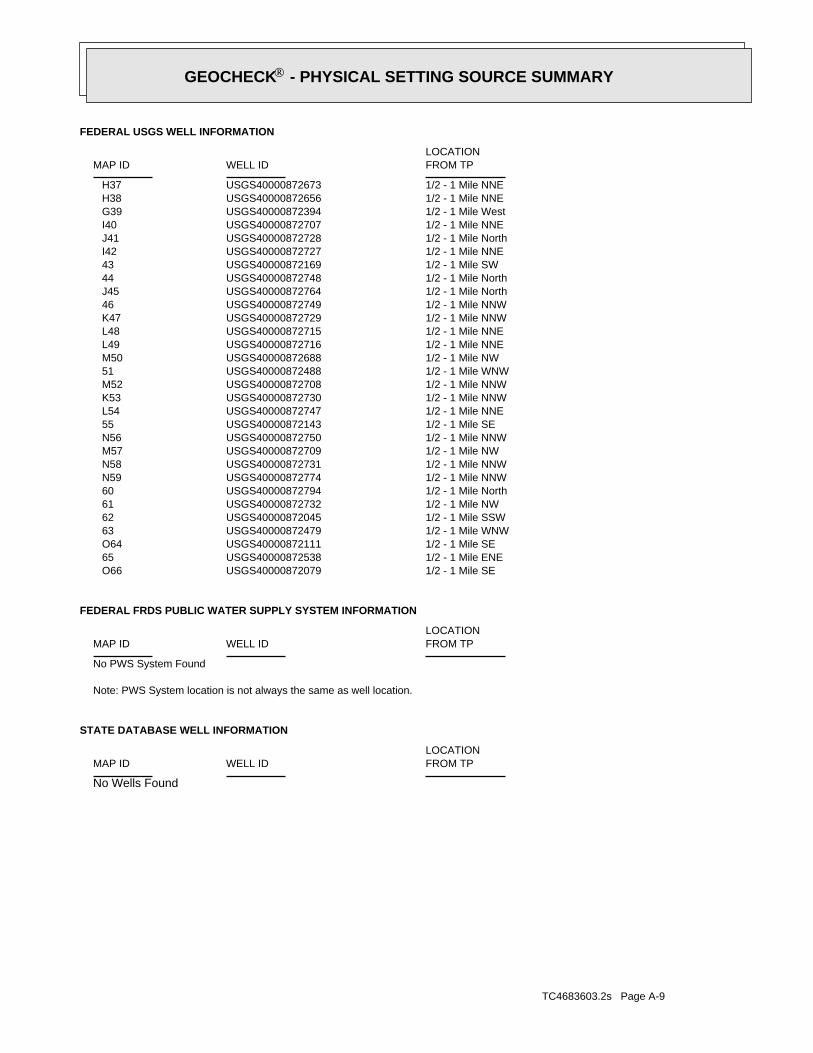
TC4683603.2s Page A-9
No Wells Found
STATE DATABASE WELL INFORMATION
LOCATIONFROM TPWELL IDMAP ID
Note: PWS System location is not always the same as well location.
No PWS System Found
FEDERAL FRDS PUBLIC WATER SUPPLY SYSTEM INFORMATION
LOCATIONFROM TPWELL IDMAP ID
1/2 - 1 Mile SEUSGS40000872079 O661/2 - 1 Mile ENEUSGS40000872538 651/2 - 1 Mile SEUSGS40000872111 O641/2 - 1 Mile WNWUSGS40000872479 631/2 - 1 Mile SSWUSGS40000872045 621/2 - 1 Mile NWUSGS40000872732 611/2 - 1 Mile NorthUSGS40000872794 601/2 - 1 Mile NNWUSGS40000872774 N591/2 - 1 Mile NNWUSGS40000872731 N581/2 - 1 Mile NWUSGS40000872709 M571/2 - 1 Mile NNWUSGS40000872750 N561/2 - 1 Mile SEUSGS40000872143 551/2 - 1 Mile NNEUSGS40000872747 L541/2 - 1 Mile NNWUSGS40000872730 K531/2 - 1 Mile NNWUSGS40000872708 M521/2 - 1 Mile WNWUSGS40000872488 511/2 - 1 Mile NWUSGS40000872688 M501/2 - 1 Mile NNEUSGS40000872716 L491/2 - 1 Mile NNEUSGS40000872715 L481/2 - 1 Mile NNWUSGS40000872729 K471/2 - 1 Mile NNWUSGS40000872749 461/2 - 1 Mile NorthUSGS40000872764 J451/2 - 1 Mile NorthUSGS40000872748 441/2 - 1 Mile SWUSGS40000872169 431/2 - 1 Mile NNEUSGS40000872727 I421/2 - 1 Mile NorthUSGS40000872728 J411/2 - 1 Mile NNEUSGS40000872707 I401/2 - 1 Mile WestUSGS40000872394 G391/2 - 1 Mile NNEUSGS40000872656 H381/2 - 1 Mile NNEUSGS40000872673 H37
FEDERAL USGS WELL INFORMATION
LOCATIONFROM TPWELL IDMAP ID
®GEOCHECK - PHYSICAL SETTING SOURCE SUMMARY®

EDR Inc.EDR Inc.EDR Inc.EDR Inc.EDR Inc.EDR Inc.EDR Inc.EDR Inc.EDR Inc.EDR Inc.EDR Inc.EDR Inc.EDR Inc.EDR Inc.EDR Inc.EDR Inc.EDR Inc.EDR Inc.EDR Inc.EDR Inc.EDR Inc.EDR Inc.EDR Inc.EDR Inc.EDR Inc.EDR Inc.EDR Inc.EDR Inc.EDR Inc.EDR Inc.EDR Inc.EDR Inc.EDR Inc.EDR Inc.EDR Inc.EDR Inc.EDR Inc.EDR Inc.EDR Inc.EDR Inc.
640 640
6 0 0
60
0
0 0
6 0 0
6 0 0
6
0 0
60
0
640
640
6406 0 0
6 0 0
6 00
6 0 06 0 0
6 0 0
6 0 0
6
00
60
0
6 0 06 0 0
600
6 0 06 0 0
600
60
0
60
0
6 0 0
6 0 0
NY

TC4683603.2s Page A-11
24000Sourcemap scale:-79.00671Longitude:43.1253334Latitude:Not ReportedContrib drainagearea units:Not ReportedContrib drainagearea:Not ReportedDrainagearea Units:Not ReportedDrainagearea value:04120104Huc code:
Niagara Project: NF-27Monloc desc:Well: Test hole not completed as a wellMonloc type:NI 358Monloc name:USGS-430731079002501Monloc Identifier:USGS New York Water Science CenterFormal name:USGS-NYOrg. Identifier:
2SW1/8 - 1/4 MileLower
USGS40000872364FED USGS
Note: Other conditions existed that would affect the measured water level.1961-06-02 17.4 Note: Other conditions existed that would affect the measured water level.1961-06-02 17.4
DateFeet belowSurface
Feet toSealevel
-------------------------------------------------Date
Feet belowSurface
Feet toSealevel
-------------------------------------------------
Ground-water levels, Number of Measurements: 2
Not ReportedWellholedepth units:Not ReportedWellholedepth:ftWelldepth units:26Welldepth:1940Construction date:
Not ReportedAquifer type:Not ReportedFormation type:New York and New England carbonate-rock aquifersAquifername:
USCountrycode:NGVD29Vert coord refsys:Level or other surveying methodVertcollection method:feetVert accmeasure units:
1.0Vertacc measure val:feetVert measure units:601.00Vert measure val:NAD83Horiz coord refsys:
Interpolated from mapHoriz Collection method:secondsHoriz Acc measure units:10Horiz Acc measure:92157Sourcemap scale:-79.002821Longitude:43.1250556Latitude:Not ReportedContrib drainagearea units:Not ReportedContrib drainagearea:Not ReportedDrainagearea Units:Not ReportedDrainagearea value:04120104Huc code:
Not ReportedMonloc desc:WellMonloc type:NI 356Monloc name:USGS-430730079001101Monloc Identifier:USGS New York Water Science CenterFormal name:USGS-NYOrg. Identifier:
1SSE1/8 - 1/4 MileHigher
USGS40000872355FED USGS
Map IDDirectionDistanceElevation EDR ID NumberDatabase
®GEOCHECK - PHYSICAL SETTING SOURCE MAP FINDINGS®

TC4683603.2s Page A-12
A4ESE1/8 - 1/4 MileLower
USGS40000872403FED USGS
Note: Other conditions existed that would affect the measured water level.1961-06-01 19.4
DateFeet belowSurface
Feet toSealevel
-------------------------------------------------
Ground-water levels, Number of Measurements: 1
Not ReportedWellholedepth units:Not ReportedWellholedepth:ftWelldepth units:32Welldepth:Not ReportedConstruction date:
Not ReportedAquifer type:Not ReportedFormation type:New York and New England carbonate-rock aquifersAquifername:
USCountrycode:NGVD29Vert coord refsys:Level or other surveying methodVertcollection method:feetVert accmeasure units:
1.0Vertacc measure val:feetVert measure units:604.00Vert measure val:NAD83Horiz coord refsys:
Interpolated from mapHoriz Collection method:secondsHoriz Acc measure units:10Horiz Acc measure:92157Sourcemap scale:-79.0055989Longitude:43.1300556Latitude:Not ReportedContrib drainagearea units:Not ReportedContrib drainagearea:Not ReportedDrainagearea Units:Not ReportedDrainagearea value:04120104Huc code:
Not ReportedMonloc desc:WellMonloc type:NI 388Monloc name:USGS-430748079002101Monloc Identifier:USGS New York Water Science CenterFormal name:USGS-NYOrg. Identifier:
3NNW1/8 - 1/4 MileHigher
USGS40000872487FED USGS
Ground-water levels, Number of Measurements: 0
Not ReportedWellholedepth units:Not ReportedWellholedepth:Not ReportedWelldepth units:Not ReportedWelldepth:Not ReportedConstruction date:
Not ReportedAquifer type:Not ReportedFormation type:Not ReportedAquifername:
USCountrycode:NGVD29Vert coord refsys:Interpolated from topographic mapVertcollection method:feetVert accmeasure units:
10Vertacc measure val:feetVert measure units:591Vert measure val:NAD83Horiz coord refsys:
Interpolated from mapHoriz Collection method:secondsHoriz Acc measure units:10Horiz Acc measure:
®GEOCHECK - PHYSICAL SETTING SOURCE MAP FINDINGS®

TC4683603.2s Page A-13
Not ReportedFormation type:New York and New England carbonate-rock aquifersAquifername:
USCountrycode:NGVD29Vert coord refsys:Level or other surveying methodVertcollection method:feetVert accmeasure units:
1.0Vertacc measure val:feetVert measure units:597.00Vert measure val:NAD83Horiz coord refsys:
Interpolated from mapHoriz Collection method:secondsHoriz Acc measure units:10Horiz Acc measure:92157Sourcemap scale:-79.0083768Longitude:43.1275556Latitude:Not ReportedContrib drainagearea units:Not ReportedContrib drainagearea:Not ReportedDrainagearea Units:Not ReportedDrainagearea value:04120104Huc code:
Not ReportedMonloc desc:WellMonloc type:NI 371Monloc name:USGS-430739079003101Monloc Identifier:USGS New York Water Science CenterFormal name:USGS-NYOrg. Identifier:
5West1/8 - 1/4 MileLower
USGS40000872426FED USGS
1960-08-08 15.8 1960-08-08 15.8
DateFeet belowSurface
Feet toSealevel
-------------------------------------------------Date
Feet belowSurface
Feet toSealevel
-------------------------------------------------
Ground-water levels, Number of Measurements: 2
Not ReportedWellholedepth units:Not ReportedWellholedepth:ftWelldepth units:25Welldepth:1957Construction date:
Not ReportedAquifer type:Not ReportedFormation type:New York and New England carbonate-rock aquifersAquifername:
USCountrycode:NGVD29Vert coord refsys:Interpolated from topographic mapVertcollection method:feetVert accmeasure units:
5.0Vertacc measure val:feetVert measure units:600.00Vert measure val:NAD83Horiz coord refsys:
Interpolated from mapHoriz Collection method:secondsHoriz Acc measure units:10Horiz Acc measure:92157Sourcemap scale:-79.0000432Longitude:43.1264445Latitude:Not ReportedContrib drainagearea units:Not ReportedContrib drainagearea:Not ReportedDrainagearea Units:Not ReportedDrainagearea value:04120104Huc code:
Not ReportedMonloc desc:WellMonloc type:NI 368Monloc name:USGS-430735079000101Monloc Identifier:USGS New York Water Science CenterFormal name:USGS-NYOrg. Identifier:
®GEOCHECK - PHYSICAL SETTING SOURCE MAP FINDINGS®

TC4683603.2s Page A-14
24000Sourcemap scale:-78.9994876Longitude:43.1264445Latitude:Not ReportedContrib drainagearea units:Not ReportedContrib drainagearea:Not ReportedDrainagearea Units:Not ReportedDrainagearea value:Not ReportedHuc code:
agara Project: LW-1Monloc desc:Well: Test hole not completed as a wellMonloc type:NI 367Monloc name:USGS-430735078595901Monloc Identifier:USGS New York Water Science CenterFormal name:USGS-NYOrg. Identifier:
A7ESE1/8 - 1/4 MileHigher
USGS40000872402FED USGS
Ground-water levels, Number of Measurements: 0
Not ReportedWellholedepth units:Not ReportedWellholedepth:Not ReportedWelldepth units:Not ReportedWelldepth:Not ReportedConstruction date:
Not ReportedAquifer type:Not ReportedFormation type:Not ReportedAquifername:
USCountrycode:NGVD29Vert coord refsys:Interpolated from topographic mapVertcollection method:feetVert accmeasure units:
10Vertacc measure val:feetVert measure units:608Vert measure val:NAD83Horiz coord refsys:
Interpolated from mapHoriz Collection method:secondsHoriz Acc measure units:10Horiz Acc measure:24000Sourcemap scale:-78.9997654Longitude:43.125889Latitude:Not ReportedContrib drainagearea units:Not ReportedContrib drainagearea:Not ReportedDrainagearea Units:Not ReportedDrainagearea value:04120104Huc code:
Niagara Project: NF-26Monloc desc:Well: Test hole not completed as a wellMonloc type:NI 362Monloc name:USGS-430733079000001Monloc Identifier:USGS New York Water Science CenterFormal name:USGS-NYOrg. Identifier:
A6ESE1/8 - 1/4 MileHigher
USGS40000872388FED USGS
Note: Other conditions existed that would affect the measured water level.1961-10-04 24.3
DateFeet belowSurface
Feet toSealevel
-------------------------------------------------
Ground-water levels, Number of Measurements: 1
Not ReportedWellholedepth units:Not ReportedWellholedepth:ftWelldepth units:49Welldepth:1958Construction date:
Not ReportedAquifer type:
®GEOCHECK - PHYSICAL SETTING SOURCE MAP FINDINGS®

TC4683603.2s Page A-15
B9SE1/4 - 1/2 MileLower
USGS40000872308FED USGS
Note: Other conditions existed that would affect the measured water level.1961-06-02 14.8 Note: Other conditions existed that would affect the measured water level.1961-06-02 14.8
DateFeet belowSurface
Feet toSealevel
-------------------------------------------------Date
Feet belowSurface
Feet toSealevel
-------------------------------------------------
Ground-water levels, Number of Measurements: 2
Not ReportedWellholedepth units:Not ReportedWellholedepth:ftWelldepth units:45Welldepth:Not ReportedConstruction date:
Not ReportedAquifer type:Not ReportedFormation type:New York and New England carbonate-rock aquifersAquifername:
USCountrycode:NGVD29Vert coord refsys:Level or other surveying methodVertcollection method:feetVert accmeasure units:
1.0Vertacc measure val:feetVert measure units:611.00Vert measure val:NAD83Horiz coord refsys:
Interpolated from mapHoriz Collection method:secondsHoriz Acc measure units:10Horiz Acc measure:92157Sourcemap scale:-79.0003209Longitude:43.1242223Latitude:Not ReportedContrib drainagearea units:Not ReportedContrib drainagearea:Not ReportedDrainagearea Units:Not ReportedDrainagearea value:04120104Huc code:
Not ReportedMonloc desc:WellMonloc type:NI 351Monloc name:USGS-430727079000201Monloc Identifier:USGS New York Water Science CenterFormal name:USGS-NYOrg. Identifier:
B8SE1/4 - 1/2 MileHigher
USGS40000872318FED USGS
Ground-water levels, Number of Measurements: 0
Not ReportedWellholedepth units:Not ReportedWellholedepth:Not ReportedWelldepth units:Not ReportedWelldepth:Not ReportedConstruction date:
Not ReportedAquifer type:Not ReportedFormation type:Not ReportedAquifername:
USCountrycode:NGVD29Vert coord refsys:Interpolated from topographic mapVertcollection method:feetVert accmeasure units:
10Vertacc measure val:feetVert measure units:610Vert measure val:NAD83Horiz coord refsys:
Interpolated from mapHoriz Collection method:secondsHoriz Acc measure units:10Horiz Acc measure:
®GEOCHECK - PHYSICAL SETTING SOURCE MAP FINDINGS®

TC4683603.2s Page A-16
Not ReportedWellholedepth units:Not ReportedWellholedepth:ftWelldepth units:73Welldepth:1958Construction date:
Not ReportedAquifer type:Not ReportedFormation type:New York and New England carbonate-rock aquifersAquifername:
USCountrycode:NGVD29Vert coord refsys:Level or other surveying methodVertcollection method:feetVert accmeasure units:
1.0Vertacc measure val:feetVert measure units:590.00Vert measure val:NAD83Horiz coord refsys:
Interpolated from mapHoriz Collection method:secondsHoriz Acc measure units:10Horiz Acc measure:92157Sourcemap scale:-79.0100435Longitude:43.1250556Latitude:Not ReportedContrib drainagearea units:Not ReportedContrib drainagearea:Not ReportedDrainagearea Units:Not ReportedDrainagearea value:04120104Huc code:
Not ReportedMonloc desc:WellMonloc type:NI 357Monloc name:USGS-430730079003701Monloc Identifier:USGS New York Water Science CenterFormal name:USGS-NYOrg. Identifier:
10WSW1/4 - 1/2 MileLower
USGS40000872356FED USGS
Ground-water levels, Number of Measurements: 0
Not ReportedWellholedepth units:Not ReportedWellholedepth:Not ReportedWelldepth units:Not ReportedWelldepth:Not ReportedConstruction date:
Not ReportedAquifer type:Not ReportedFormation type:Not ReportedAquifername:
USCountrycode:NGVD29Vert coord refsys:Interpolated from topographic mapVertcollection method:feetVert accmeasure units:
10Vertacc measure val:feetVert measure units:606Vert measure val:NAD83Horiz coord refsys:
Interpolated from mapHoriz Collection method:secondsHoriz Acc measure units:10Horiz Acc measure:24000Sourcemap scale:-79.0000431Longitude:43.1236668Latitude:Not ReportedContrib drainagearea units:Not ReportedContrib drainagearea:Not ReportedDrainagearea Units:Not ReportedDrainagearea value:04120104Huc code:
Niagara Project: NF-25Monloc desc:Well: Test hole not completed as a wellMonloc type:NI 348Monloc name:USGS-430725079000101Monloc Identifier:USGS New York Water Science CenterFormal name:USGS-NYOrg. Identifier:
®GEOCHECK - PHYSICAL SETTING SOURCE MAP FINDINGS®

TC4683603.2s Page A-17
24000Sourcemap scale:-79.0058766Longitude:43.1220001Latitude:Not ReportedContrib drainagearea units:Not ReportedContrib drainagearea:Not ReportedDrainagearea Units:Not ReportedDrainagearea value:04120104Huc code:
Niagara Project: NF-23Monloc desc:Well: Test hole not completed as a wellMonloc type:NI 339Monloc name:USGS-430719079002201Monloc Identifier:USGS New York Water Science CenterFormal name:USGS-NYOrg. Identifier:
12SSW1/4 - 1/2 MileLower
USGS40000872255FED USGS
1960-08-08 12.5 1960-08-08 12.5
DateFeet belowSurface
Feet toSealevel
-------------------------------------------------Date
Feet belowSurface
Feet toSealevel
-------------------------------------------------
Ground-water levels, Number of Measurements: 2
Not ReportedWellholedepth units:Not ReportedWellholedepth:ftWelldepth units:31Welldepth:1958Construction date:
Not ReportedAquifer type:Not ReportedFormation type:New York and New England carbonate-rock aquifersAquifername:
USCountrycode:NGVD29Vert coord refsys:Interpolated from topographic mapVertcollection method:feetVert accmeasure units:
5.0Vertacc measure val:feetVert measure units:620.00Vert measure val:NAD83Horiz coord refsys:
Interpolated from mapHoriz Collection method:secondsHoriz Acc measure units:10Horiz Acc measure:92157Sourcemap scale:-78.9972653Longitude:43.1264445Latitude:Not ReportedContrib drainagearea units:Not ReportedContrib drainagearea:Not ReportedDrainagearea Units:Not ReportedDrainagearea value:04120104Huc code:
Not ReportedMonloc desc:WellMonloc type:NI 366Monloc name:USGS-430735078595101Monloc Identifier:USGS New York Water Science CenterFormal name:USGS-NYOrg. Identifier:
11East1/4 - 1/2 MileHigher
USGS40000872401FED USGS
Note: Other conditions existed that would affect the measured water level.1961-10-04 22.0
DateFeet belowSurface
Feet toSealevel
-------------------------------------------------
Ground-water levels, Number of Measurements: 1
®GEOCHECK - PHYSICAL SETTING SOURCE MAP FINDINGS®

TC4683603.2s Page A-18
14SSE1/4 - 1/2 MileHigher
USGS40000872254FED USGS
Note: Other conditions existed that would affect the measured water level.1961-10-04 23.8
DateFeet belowSurface
Feet toSealevel
-------------------------------------------------
Ground-water levels, Number of Measurements: 1
Not ReportedWellholedepth units:Not ReportedWellholedepth:ftWelldepth units:74Welldepth:1958Construction date:
Not ReportedAquifer type:Not ReportedFormation type:New York and New England carbonate-rock aquifersAquifername:
USCountrycode:NGVD29Vert coord refsys:Level or other surveying methodVertcollection method:feetVert accmeasure units:
1.0Vertacc measure val:feetVert measure units:595.00Vert measure val:NAD83Horiz coord refsys:
Interpolated from mapHoriz Collection method:secondsHoriz Acc measure units:10Horiz Acc measure:92157Sourcemap scale:-79.0114324Longitude:43.1278333Latitude:Not ReportedContrib drainagearea units:Not ReportedContrib drainagearea:Not ReportedDrainagearea Units:Not ReportedDrainagearea value:04120104Huc code:
Not ReportedMonloc desc:WellMonloc type:NI 373Monloc name:USGS-430740079004201Monloc Identifier:USGS New York Water Science CenterFormal name:USGS-NYOrg. Identifier:
13West1/4 - 1/2 MileLower
USGS40000872435FED USGS
Ground-water levels, Number of Measurements: 0
Not ReportedWellholedepth units:Not ReportedWellholedepth:Not ReportedWelldepth units:Not ReportedWelldepth:Not ReportedConstruction date:
Not ReportedAquifer type:Not ReportedFormation type:Not ReportedAquifername:
USCountrycode:NGVD29Vert coord refsys:Interpolated from topographic mapVertcollection method:feetVert accmeasure units:
10Vertacc measure val:feetVert measure units:601Vert measure val:NAD83Horiz coord refsys:
Interpolated from mapHoriz Collection method:secondsHoriz Acc measure units:10Horiz Acc measure:
®GEOCHECK - PHYSICAL SETTING SOURCE MAP FINDINGS®

TC4683603.2s Page A-19
Ground-water levels, Number of Measurements: 0
Not ReportedWellholedepth units:Not ReportedWellholedepth:Not ReportedWelldepth units:Not ReportedWelldepth:Not ReportedConstruction date:
Not ReportedAquifer type:Not ReportedFormation type:Not ReportedAquifername:
USCountrycode:NGVD29Vert coord refsys:Interpolated from topographic mapVertcollection method:feetVert accmeasure units:
10Vertacc measure val:feetVert measure units:598Vert measure val:NAD83Horiz coord refsys:
Interpolated from mapHoriz Collection method:secondsHoriz Acc measure units:10Horiz Acc measure:24000Sourcemap scale:-79.0053212Longitude:43.1331111Latitude:Not ReportedContrib drainagearea units:Not ReportedContrib drainagearea:Not ReportedDrainagearea Units:Not ReportedDrainagearea value:Not ReportedHuc code:
Niagara Project: LW-8Monloc desc:Well: Test hole not completed as a wellMonloc type:NI 409Monloc name:USGS-430759079002001Monloc Identifier:USGS New York Water Science CenterFormal name:USGS-NYOrg. Identifier:
C15North1/4 - 1/2 MileHigher
USGS40000872589FED USGS
Ground-water levels, Number of Measurements: 0
Not ReportedWellholedepth units:Not ReportedWellholedepth:Not ReportedWelldepth units:Not ReportedWelldepth:Not ReportedConstruction date:
Not ReportedAquifer type:Not ReportedFormation type:Not ReportedAquifername:
USCountrycode:NGVD29Vert coord refsys:Interpolated from topographic mapVertcollection method:feetVert accmeasure units:
10Vertacc measure val:feetVert measure units:604Vert measure val:NAD83Horiz coord refsys:
Interpolated from mapHoriz Collection method:secondsHoriz Acc measure units:10Horiz Acc measure:24000Sourcemap scale:-79.0005987Longitude:43.1220001Latitude:Not ReportedContrib drainagearea units:Not ReportedContrib drainagearea:Not ReportedDrainagearea Units:Not ReportedDrainagearea value:04120104Huc code:
Niagara Project: NF-24Monloc desc:Well: Test hole not completed as a wellMonloc type:NI 338Monloc name:USGS-430719079000301Monloc Identifier:USGS New York Water Science CenterFormal name:USGS-NYOrg. Identifier:
®GEOCHECK - PHYSICAL SETTING SOURCE MAP FINDINGS®

TC4683603.2s Page A-20
92157Sourcemap scale:-79.0064324Longitude:43.1333889Latitude:Not ReportedContrib drainagearea units:Not ReportedContrib drainagearea:Not ReportedDrainagearea Units:Not ReportedDrainagearea value:04120104Huc code:
Not ReportedMonloc desc:WellMonloc type:NI 413Monloc name:USGS-430800079002401Monloc Identifier:USGS New York Water Science CenterFormal name:USGS-NYOrg. Identifier:
C17NNW1/4 - 1/2 MileHigher
USGS40000872600FED USGS
Note: Other conditions existed that would affect the measured water level.1962-11-15 10.3 Note: Other conditions existed that would affect the measured water level.1962-11-15 10.3
DateFeet belowSurface
Feet toSealevel
-------------------------------------------------Date
Feet belowSurface
Feet toSealevel
-------------------------------------------------
Ground-water levels, Number of Measurements: 2
Not ReportedWellholedepth units:Not ReportedWellholedepth:ftWelldepth units:75Welldepth:1959Construction date:
Not ReportedAquifer type:Not ReportedFormation type:New York and New England carbonate-rock aquifersAquifername:
USCountrycode:NGVD29Vert coord refsys:Level or other surveying methodVertcollection method:feetVert accmeasure units:
1.0Vertacc measure val:feetVert measure units:613.00Vert measure val:NAD83Horiz coord refsys:
Interpolated from mapHoriz Collection method:secondsHoriz Acc measure units:10Horiz Acc measure:92157Sourcemap scale:-78.9975431Longitude:43.1308889Latitude:Not ReportedContrib drainagearea units:Not ReportedContrib drainagearea:Not ReportedDrainagearea Units:Not ReportedDrainagearea value:04120104Huc code:
Not ReportedMonloc desc:WellMonloc type:NI 392Monloc name:USGS-430751078595201Monloc Identifier:USGS New York Water Science CenterFormal name:USGS-NYOrg. Identifier:
16NE1/4 - 1/2 MileHigher
USGS40000872511FED USGS
Map IDDirectionDistanceElevation EDR ID NumberDatabase
®GEOCHECK - PHYSICAL SETTING SOURCE MAP FINDINGS®

TC4683603.2s Page A-21
19North1/4 - 1/2 MileHigher
USGS40000872622FED USGS
Ground-water levels, Number of Measurements: 0
Not ReportedWellholedepth units:Not ReportedWellholedepth:Not ReportedWelldepth units:Not ReportedWelldepth:Not ReportedConstruction date:
Not ReportedAquifer type:Not ReportedFormation type:Not ReportedAquifername:
USCountrycode:NGVD29Vert coord refsys:Interpolated from topographic mapVertcollection method:feetVert accmeasure units:
10Vertacc measure val:feetVert measure units:605Vert measure val:NAD83Horiz coord refsys:
Interpolated from mapHoriz Collection method:secondsHoriz Acc measure units:10Horiz Acc measure:24000Sourcemap scale:-78.9983764Longitude:43.1217223Latitude:Not ReportedContrib drainagearea units:Not ReportedContrib drainagearea:Not ReportedDrainagearea Units:Not ReportedDrainagearea value:04120104Huc code:
Niagara Project: TW-218Monloc desc:Well: Test hole not completed as a wellMonloc type:NI 333Monloc name:USGS-430718078595501Monloc Identifier:USGS New York Water Science CenterFormal name:USGS-NYOrg. Identifier:
18SE1/4 - 1/2 MileHigher
USGS40000872246FED USGS
Note: Other conditions existed that would affect the measured water level.1962-11-15 5.30
DateFeet belowSurface
Feet toSealevel
-------------------------------------------------
Ground-water levels, Number of Measurements: 1
Not ReportedWellholedepth units:Not ReportedWellholedepth:ftWelldepth units:72Welldepth:1959Construction date:
Not ReportedAquifer type:Not ReportedFormation type:New York and New England carbonate-rock aquifersAquifername:
USCountrycode:NGVD29Vert coord refsys:Level or other surveying methodVertcollection method:feetVert accmeasure units:
1.0Vertacc measure val:feetVert measure units:599.00Vert measure val:NAD83Horiz coord refsys:
Interpolated from mapHoriz Collection method:secondsHoriz Acc measure units:10Horiz Acc measure:
®GEOCHECK - PHYSICAL SETTING SOURCE MAP FINDINGS®

TC4683603.2s Page A-22
Not ReportedFormation type:Not ReportedAquifername:
USCountrycode:NGVD29Vert coord refsys:Interpolated from topographic mapVertcollection method:feetVert accmeasure units:
10Vertacc measure val:feetVert measure units:590Vert measure val:NAD83Horiz coord refsys:
Interpolated from mapHoriz Collection method:secondsHoriz Acc measure units:10Horiz Acc measure:24000Sourcemap scale:-79.00921Longitude:43.1208889Latitude:Not ReportedContrib drainagearea units:Not ReportedContrib drainagearea:Not ReportedDrainagearea Units:Not ReportedDrainagearea value:04120104Huc code:
Niagara Project: NF-22Monloc desc:Well: Test hole not completed as a wellMonloc type:NI 324Monloc name:USGS-430715079003401Monloc Identifier:USGS New York Water Science CenterFormal name:USGS-NYOrg. Identifier:
20SSW1/2 - 1 MileLower
USGS40000872218FED USGS
1960-08-08 12.5 1960-08-08 12.5
DateFeet belowSurface
Feet toSealevel
-------------------------------------------------Date
Feet belowSurface
Feet toSealevel
-------------------------------------------------
Ground-water levels, Number of Measurements: 2
Not ReportedWellholedepth units:Not ReportedWellholedepth:ftWelldepth units:19Welldepth:1950Construction date:
Not ReportedAquifer type:Not ReportedFormation type:New York and New England carbonate-rock aquifersAquifername:
USCountrycode:NGVD29Vert coord refsys:Level or other surveying methodVertcollection method:feetVert accmeasure units:
1.0Vertacc measure val:feetVert measure units:605.00Vert measure val:NAD83Horiz coord refsys:
Interpolated from mapHoriz Collection method:secondsHoriz Acc measure units:10Horiz Acc measure:92157Sourcemap scale:-79.0025434Longitude:43.1342222Latitude:Not ReportedContrib drainagearea units:Not ReportedContrib drainagearea:Not ReportedDrainagearea Units:Not ReportedDrainagearea value:04120104Huc code:
Not ReportedMonloc desc:WellMonloc type:NI 420Monloc name:USGS-430803079001001Monloc Identifier:USGS New York Water Science CenterFormal name:USGS-NYOrg. Identifier:
®GEOCHECK - PHYSICAL SETTING SOURCE MAP FINDINGS®

TC4683603.2s Page A-23
24000Sourcemap scale:-79.0150437Longitude:43.1292222Latitude:Not ReportedContrib drainagearea units:Not ReportedContrib drainagearea:Not ReportedDrainagearea Units:Not ReportedDrainagearea value:Not ReportedHuc code:
Niagara Project: LW-3Monloc desc:Well: Test hole not completed as a wellMonloc type:NI 383Monloc name:USGS-430745079005501Monloc Identifier:USGS New York Water Science CenterFormal name:USGS-NYOrg. Identifier:
22WNW1/2 - 1 MileHigher
USGS40000872468FED USGS
Note: Other conditions existed that would affect the measured water level.1961-06-02 12.3
DateFeet belowSurface
Feet toSealevel
-------------------------------------------------
Ground-water levels, Number of Measurements: 1
Not ReportedWellholedepth units:Not ReportedWellholedepth:ftWelldepth units:55Welldepth:1955Construction date:
Not ReportedAquifer type:Not ReportedFormation type:New York and New England carbonate-rock aquifersAquifername:
USCountrycode:NGVD29Vert coord refsys:Level or other surveying methodVertcollection method:feetVert accmeasure units:
1.0Vertacc measure val:feetVert measure units:602.00Vert measure val:NAD83Horiz coord refsys:
Interpolated from mapHoriz Collection method:secondsHoriz Acc measure units:10Horiz Acc measure:92157Sourcemap scale:-79.0050432Longitude:43.1192223Latitude:Not ReportedContrib drainagearea units:Not ReportedContrib drainagearea:Not ReportedDrainagearea Units:Not ReportedDrainagearea value:04120104Huc code:
Not ReportedMonloc desc:WellMonloc type:NI 315Monloc name:USGS-430709079001901Monloc Identifier:USGS New York Water Science CenterFormal name:USGS-NYOrg. Identifier:
21South1/2 - 1 MileHigher
USGS40000872177FED USGS
Ground-water levels, Number of Measurements: 0
Not ReportedWellholedepth units:Not ReportedWellholedepth:Not ReportedWelldepth units:Not ReportedWelldepth:Not ReportedConstruction date:
Not ReportedAquifer type:
®GEOCHECK - PHYSICAL SETTING SOURCE MAP FINDINGS®

TC4683603.2s Page A-24
D24NE1/2 - 1 MileHigher
USGS40000872621FED USGS
Note: Other conditions existed that would affect the measured water level.1962-11-15 4.80
DateFeet belowSurface
Feet toSealevel
-------------------------------------------------
Ground-water levels, Number of Measurements: 1
Not ReportedWellholedepth units:Not ReportedWellholedepth:ftWelldepth units:76Welldepth:1959Construction date:
Not ReportedAquifer type:Not ReportedFormation type:New York and New England carbonate-rock aquifersAquifername:
USCountrycode:NGVD29Vert coord refsys:Level or other surveying methodVertcollection method:feetVert accmeasure units:
1.0Vertacc measure val:feetVert measure units:607.00Vert measure val:NAD83Horiz coord refsys:
Interpolated from mapHoriz Collection method:secondsHoriz Acc measure units:10Horiz Acc measure:92157Sourcemap scale:-79.0108769Longitude:43.1339444Latitude:Not ReportedContrib drainagearea units:Not ReportedContrib drainagearea:Not ReportedDrainagearea Units:Not ReportedDrainagearea value:04120104Huc code:
Not ReportedMonloc desc:WellMonloc type:NI 416Monloc name:USGS-430802079004001Monloc Identifier:USGS New York Water Science CenterFormal name:USGS-NYOrg. Identifier:
23NW1/2 - 1 MileHigher
USGS40000872613FED USGS
Ground-water levels, Number of Measurements: 0
Not ReportedWellholedepth units:Not ReportedWellholedepth:Not ReportedWelldepth units:Not ReportedWelldepth:Not ReportedConstruction date:
Not ReportedAquifer type:Not ReportedFormation type:Not ReportedAquifername:
USCountrycode:NGVD29Vert coord refsys:Interpolated from topographic mapVertcollection method:feetVert accmeasure units:
10Vertacc measure val:feetVert measure units:610Vert measure val:NAD83Horiz coord refsys:
Interpolated from mapHoriz Collection method:secondsHoriz Acc measure units:10Horiz Acc measure:
®GEOCHECK - PHYSICAL SETTING SOURCE MAP FINDINGS®

TC4683603.2s Page A-25
Not ReportedFormation type:New York and New England carbonate-rock aquifersAquifername:
USCountrycode:NGVD29Vert coord refsys:Level or other surveying methodVertcollection method:feetVert accmeasure units:
1.0Vertacc measure val:feetVert measure units:610.00Vert measure val:NAD83Horiz coord refsys:
Interpolated from mapHoriz Collection method:secondsHoriz Acc measure units:10Horiz Acc measure:92157Sourcemap scale:-79.0064324Longitude:43.1356111Latitude:Not ReportedContrib drainagearea units:Not ReportedContrib drainagearea:Not ReportedDrainagearea Units:Not ReportedDrainagearea value:04120104Huc code:
Not ReportedMonloc desc:WellMonloc type:NI 430Monloc name:USGS-430808079002401Monloc Identifier:USGS New York Water Science CenterFormal name:USGS-NYOrg. Identifier:
25NNW1/2 - 1 MileHigher
USGS40000872657FED USGS
1960-08-08 15.8 1960-08-08 15.8
DateFeet belowSurface
Feet toSealevel
-------------------------------------------------Date
Feet belowSurface
Feet toSealevel
-------------------------------------------------
Ground-water levels, Number of Measurements: 2
Not ReportedWellholedepth units:Not ReportedWellholedepth:ftWelldepth units:24Welldepth:1948Construction date:
Not ReportedAquifer type:Not ReportedFormation type:New York and New England carbonate-rock aquifersAquifername:
USCountrycode:NGVD29Vert coord refsys:Level or other surveying methodVertcollection method:feetVert accmeasure units:
1.0Vertacc measure val:feetVert measure units:613.00Vert measure val:NAD83Horiz coord refsys:
Interpolated from mapHoriz Collection method:secondsHoriz Acc measure units:10Horiz Acc measure:92157Sourcemap scale:-78.9975432Longitude:43.1342223Latitude:Not ReportedContrib drainagearea units:Not ReportedContrib drainagearea:Not ReportedDrainagearea Units:Not ReportedDrainagearea value:04120104Huc code:
Not ReportedMonloc desc:WellMonloc type:NI 419Monloc name:USGS-430803078595201Monloc Identifier:USGS New York Water Science CenterFormal name:USGS-NYOrg. Identifier:
®GEOCHECK - PHYSICAL SETTING SOURCE MAP FINDINGS®

TC4683603.2s Page A-26
92157Sourcemap scale:-78.9980988Longitude:43.1347778Latitude:Not ReportedContrib drainagearea units:Not ReportedContrib drainagearea:Not ReportedDrainagearea Units:Not ReportedDrainagearea value:04120104Huc code:
Not ReportedMonloc desc:WellMonloc type:NI 424Monloc name:USGS-430805078595401Monloc Identifier:USGS New York Water Science CenterFormal name:USGS-NYOrg. Identifier:
D27NNE1/2 - 1 MileHigher
USGS40000872631FED USGS
Ground-water levels, Number of Measurements: 0
Not ReportedWellholedepth units:Not ReportedWellholedepth:Not ReportedWelldepth units:Not ReportedWelldepth:Not ReportedConstruction date:
Not ReportedAquifer type:Not ReportedFormation type:Not ReportedAquifername:
USCountrycode:NGVD29Vert coord refsys:Interpolated from topographic mapVertcollection method:feetVert accmeasure units:
10Vertacc measure val:feetVert measure units:607Vert measure val:NAD83Horiz coord refsys:
Interpolated from mapHoriz Collection method:secondsHoriz Acc measure units:10Horiz Acc measure:24000Sourcemap scale:-78.996154Longitude:43.120889Latitude:Not ReportedContrib drainagearea units:Not ReportedContrib drainagearea:Not ReportedDrainagearea Units:Not ReportedDrainagearea value:04120104Huc code:
Niagara Project: TW-217Monloc desc:Well: Test hole not completed as a wellMonloc type:NI 323Monloc name:USGS-430715078594701Monloc Identifier:USGS New York Water Science CenterFormal name:USGS-NYOrg. Identifier:
26SE1/2 - 1 MileHigher
USGS40000872217FED USGS
Note: Other conditions existed that would affect the measured water level.1962-11-15 8.60
DateFeet belowSurface
Feet toSealevel
-------------------------------------------------
Ground-water levels, Number of Measurements: 1
Not ReportedWellholedepth units:Not ReportedWellholedepth:ftWelldepth units:100Welldepth:1959Construction date:
Not ReportedAquifer type:
®GEOCHECK - PHYSICAL SETTING SOURCE MAP FINDINGS®

TC4683603.2s Page A-27
E29West1/2 - 1 MileHigher
USGS40000872441FED USGS
Ground-water levels, Number of Measurements: 0
Not ReportedWellholedepth units:Not ReportedWellholedepth:Not ReportedWelldepth units:Not ReportedWelldepth:Not ReportedConstruction date:
Not ReportedAquifer type:Not ReportedFormation type:New York and New England carbonate-rock aquifersAquifername:
USCountrycode:Not ReportedVert coord refsys:Not ReportedVertcollection method:Not ReportedVert accmeasure units:
Not ReportedVertacc measure val:Not ReportedVert measure units:Not ReportedVert measure val:NAD83Horiz coord refsys:
Interpolated from mapHoriz Collection method:secondsHoriz Acc measure units:5Horiz Acc measure:24000Sourcemap scale:-79.0161548Longitude:43.1281111Latitude:Not ReportedContrib drainagearea units:Not ReportedContrib drainagearea:Not ReportedDrainagearea Units:Not ReportedDrainagearea value:04120104Huc code:
Not ReportedMonloc desc:WellMonloc type:NI 375Monloc name:USGS-430741079005901Monloc Identifier:USGS New York Water Science CenterFormal name:USGS-NYOrg. Identifier:
E28West1/2 - 1 MileHigher
USGS40000872440FED USGS
Note: Other conditions existed that would affect the measured water level.1962-11-15 11.7 Note: Other conditions existed that would affect the measured water level.1962-11-15 11.7
DateFeet belowSurface
Feet toSealevel
-------------------------------------------------Date
Feet belowSurface
Feet toSealevel
-------------------------------------------------
Ground-water levels, Number of Measurements: 2
Not ReportedWellholedepth units:Not ReportedWellholedepth:ftWelldepth units:68Welldepth:1958Construction date:
Not ReportedAquifer type:Not ReportedFormation type:New York and New England carbonate-rock aquifersAquifername:
USCountrycode:NGVD29Vert coord refsys:Level or other surveying methodVertcollection method:feetVert accmeasure units:
1.0Vertacc measure val:feetVert measure units:614.00Vert measure val:NAD83Horiz coord refsys:
Interpolated from mapHoriz Collection method:secondsHoriz Acc measure units:10Horiz Acc measure:
®GEOCHECK - PHYSICAL SETTING SOURCE MAP FINDINGS®

TC4683603.2s Page A-28
Not ReportedWellholedepth units:Not ReportedWellholedepth:ftWelldepth units:110Welldepth:1958Construction date:
Not ReportedAquifer type:Not ReportedFormation type:New York and New England carbonate-rock aquifersAquifername:
USCountrycode:NGVD29Vert coord refsys:Level or other surveying methodVertcollection method:feetVert accmeasure units:
1.0Vertacc measure val:feetVert measure units:607.00Vert measure val:NAD83Horiz coord refsys:
Interpolated from mapHoriz Collection method:secondsHoriz Acc measure units:10Horiz Acc measure:92157Sourcemap scale:-79.0161548Longitude:43.1281111Latitude:Not ReportedContrib drainagearea units:Not ReportedContrib drainagearea:Not ReportedDrainagearea Units:Not ReportedDrainagearea value:04120104Huc code:
Not ReportedMonloc desc:WellMonloc type:NI 377Monloc name:USGS-430741079005903Monloc Identifier:USGS New York Water Science CenterFormal name:USGS-NYOrg. Identifier:
E30West1/2 - 1 MileHigher
USGS40000872442FED USGS
Ground-water levels, Number of Measurements: 0
Not ReportedWellholedepth units:Not ReportedWellholedepth:Not ReportedWelldepth units:Not ReportedWelldepth:Not ReportedConstruction date:
Not ReportedAquifer type:Not ReportedFormation type:Not ReportedAquifername:
USCountrycode:Not ReportedVert coord refsys:Not ReportedVertcollection method:Not ReportedVert accmeasure units:
Not ReportedVertacc measure val:Not ReportedVert measure units:Not ReportedVert measure val:NAD83Horiz coord refsys:
Interpolated from mapHoriz Collection method:secondsHoriz Acc measure units:5Horiz Acc measure:24000Sourcemap scale:-79.0161548Longitude:43.1281111Latitude:Not ReportedContrib drainagearea units:Not ReportedContrib drainagearea:Not ReportedDrainagearea Units:Not ReportedDrainagearea value:04120104Huc code:
Not ReportedMonloc desc:WellMonloc type:NI 376Monloc name:USGS-430741079005902Monloc Identifier:USGS New York Water Science CenterFormal name:USGS-NYOrg. Identifier:
®GEOCHECK - PHYSICAL SETTING SOURCE MAP FINDINGS®

TC4683603.2s Page A-29
Not ReportedFormation type:Not ReportedAquifername:
USCountrycode:NGVD29Vert coord refsys:Interpolated from topographic mapVertcollection method:feetVert accmeasure units:
10Vertacc measure val:feetVert measure units:604Vert measure val:NAD83Horiz coord refsys:
Interpolated from mapHoriz Collection method:secondsHoriz Acc measure units:10Horiz Acc measure:24000Sourcemap scale:-79.0164326Longitude:43.1272778Latitude:Not ReportedContrib drainagearea units:Not ReportedContrib drainagearea:Not ReportedDrainagearea Units:Not ReportedDrainagearea value:04120104Huc code:
Niagara Project: NF-28Monloc desc:Well: Test hole not completed as a wellMonloc type:NI 370Monloc name:USGS-430738079010001Monloc Identifier:USGS New York Water Science CenterFormal name:USGS-NYOrg. Identifier:
E32West1/2 - 1 MileHigher
USGS40000872417FED USGS
Ground-water levels, Number of Measurements: 0
Not ReportedWellholedepth units:Not ReportedWellholedepth:Not ReportedWelldepth units:Not ReportedWelldepth:Not ReportedConstruction date:
Not ReportedAquifer type:Not ReportedFormation type:Not ReportedAquifername:
USCountrycode:NGVD29Vert coord refsys:Interpolated from topographic mapVertcollection method:feetVert accmeasure units:
10Vertacc measure val:feetVert measure units:618Vert measure val:NAD83Horiz coord refsys:
Interpolated from mapHoriz Collection method:secondsHoriz Acc measure units:10Horiz Acc measure:24000Sourcemap scale:-78.9930985Longitude:43.1311667Latitude:Not ReportedContrib drainagearea units:Not ReportedContrib drainagearea:Not ReportedDrainagearea Units:Not ReportedDrainagearea value:04120104Huc code:
Niagara Project: RV-38Monloc desc:Well: Test hole not completed as a wellMonloc type:NI 395Monloc name:USGS-430752078593601Monloc Identifier:USGS New York Water Science CenterFormal name:USGS-NYOrg. Identifier:
31ENE1/2 - 1 MileHigher
USGS40000872524FED USGS
Note: Other conditions existed that would affect the measured water level.1961-10-03 46.2
DateFeet belowSurface
Feet toSealevel
-------------------------------------------------
Ground-water levels, Number of Measurements: 1
®GEOCHECK - PHYSICAL SETTING SOURCE MAP FINDINGS®

TC4683603.2s Page A-30
Not ReportedFormation type:Not ReportedAquifername:
USCountrycode:NGVD29Vert coord refsys:Interpolated from topographic mapVertcollection method:feetVert accmeasure units:
10Vertacc measure val:feetVert measure units:596.7Vert measure val:NAD83Horiz coord refsys:
Interpolated from mapHoriz Collection method:secondsHoriz Acc measure units:5Horiz Acc measure:24000Sourcemap scale:-79.0164325Longitude:43.1242222Latitude:Not ReportedContrib drainagearea units:Not ReportedContrib drainagearea:Not ReportedDrainagearea Units:Not ReportedDrainagearea value:04120104Huc code:
NIAGARA RIVER POWER: C-2Monloc desc:Well: Test hole not completed as a wellMonloc type:NI 352Monloc name:USGS-430727079010001Monloc Identifier:USGS New York Water Science CenterFormal name:USGS-NYOrg. Identifier:
F34WSW1/2 - 1 MileHigher
USGS40000872319FED USGS
Ground-water levels, Number of Measurements: 0
Not ReportedWellholedepth units:Not ReportedWellholedepth:Not ReportedWelldepth units:Not ReportedWelldepth:Not ReportedConstruction date:
Not ReportedAquifer type:Not ReportedFormation type:Not ReportedAquifername:
USCountrycode:NGVD29Vert coord refsys:Interpolated from topographic mapVertcollection method:feetVert accmeasure units:
10Vertacc measure val:feetVert measure units:604Vert measure val:NAD83Horiz coord refsys:
Interpolated from mapHoriz Collection method:secondsHoriz Acc measure units:10Horiz Acc measure:24000Sourcemap scale:-79.0164326Longitude:43.1247778Latitude:Not ReportedContrib drainagearea units:Not ReportedContrib drainagearea:Not ReportedDrainagearea Units:Not ReportedDrainagearea value:Not ReportedHuc code:
Niagara Project: LW-2Monloc desc:Well: Test hole not completed as a wellMonloc type:NI 354Monloc name:USGS-430729079010001Monloc Identifier:USGS New York Water Science CenterFormal name:USGS-NYOrg. Identifier:
F33WSW1/2 - 1 MileHigher
USGS40000872346FED USGS
Ground-water levels, Number of Measurements: 0
Not ReportedWellholedepth units:Not ReportedWellholedepth:Not ReportedWelldepth units:Not ReportedWelldepth:Not ReportedConstruction date:
Not ReportedAquifer type:
®GEOCHECK - PHYSICAL SETTING SOURCE MAP FINDINGS®

TC4683603.2s Page A-31
Not ReportedFormation type:Not ReportedAquifername:
USCountrycode:NGVD29Vert coord refsys:Interpolated from topographic mapVertcollection method:feetVert accmeasure units:
10Vertacc measure val:feetVert measure units:500.00Vert measure val:NAD83Horiz coord refsys:
Interpolated from mapHoriz Collection method:secondsHoriz Acc measure units:5Horiz Acc measure:24000Sourcemap scale:-79.0172659Longitude:43.1261667Latitude:Not ReportedContrib drainagearea units:Not ReportedContrib drainagearea:Not ReportedDrainagearea Units:Not ReportedDrainagearea value:04120104Huc code:
Not ReportedMonloc desc:Well: Test hole not completed as a wellMonloc type:NI 363Monloc name:USGS-430734079010301Monloc Identifier:USGS New York Water Science CenterFormal name:USGS-NYOrg. Identifier:
G36West1/2 - 1 MileHigher
USGS40000872393FED USGS
Ground-water levels, Number of Measurements: 0
ftWellholedepth units:12Wellholedepth:ftWelldepth units:12Welldepth:19800529Construction date:
Not ReportedAquifer type:Not ReportedFormation type:Not ReportedAquifername:
USCountrycode:NGVD29Vert coord refsys:Level or other surveying methodVertcollection method:feetVert accmeasure units:
001Vertacc measure val:feetVert measure units:581.6Vert measure val:NAD83Horiz coord refsys:
Interpolated from mapHoriz Collection method:secondsHoriz Acc measure units:5Horiz Acc measure:24000Sourcemap scale:-79.0105989Longitude:43.1189445Latitude:Not ReportedContrib drainagearea units:Not ReportedContrib drainagearea:Not ReportedDrainagearea Units:Not ReportedDrainagearea value:04120104Huc code:
Niagara (RCRA) Landfill: DO-1Monloc desc:WellMonloc type:NI 312Monloc name:USGS-430708079003901Monloc Identifier:USGS New York Water Science CenterFormal name:USGS-NYOrg. Identifier:
35SSW1/2 - 1 MileLower
USGS40000872168FED USGS
Ground-water levels, Number of Measurements: 0
ftWellholedepth units:350Wellholedepth:Not ReportedWelldepth units:Not ReportedWelldepth:19570119Construction date:
Not ReportedAquifer type:
®GEOCHECK - PHYSICAL SETTING SOURCE MAP FINDINGS®

TC4683603.2s Page A-32
92157Sourcemap scale:-78.9972654Longitude:43.1356111Latitude:Not ReportedContrib drainagearea units:Not ReportedContrib drainagearea:Not ReportedDrainagearea Units:Not ReportedDrainagearea value:04120104Huc code:
Not ReportedMonloc desc:WellMonloc type:NI 429Monloc name:USGS-430808078595101Monloc Identifier:USGS New York Water Science CenterFormal name:USGS-NYOrg. Identifier:
H38NNE1/2 - 1 MileHigher
USGS40000872656FED USGS
Note: Other conditions existed that would affect the measured water level.1962-11-15 8.40 Note: Other conditions existed that would affect the measured water level.1962-11-15 8.40
DateFeet belowSurface
Feet toSealevel
-------------------------------------------------Date
Feet belowSurface
Feet toSealevel
-------------------------------------------------
Ground-water levels, Number of Measurements: 2
Not ReportedWellholedepth units:Not ReportedWellholedepth:ftWelldepth units:100Welldepth:1958Construction date:
Not ReportedAquifer type:Not ReportedFormation type:New York and New England carbonate-rock aquifersAquifername:
USCountrycode:NGVD29Vert coord refsys:Level or other surveying methodVertcollection method:feetVert accmeasure units:
1.0Vertacc measure val:feetVert measure units:611.00Vert measure val:NAD83Horiz coord refsys:
Interpolated from mapHoriz Collection method:secondsHoriz Acc measure units:10Horiz Acc measure:92157Sourcemap scale:-78.9980988Longitude:43.1358889Latitude:Not ReportedContrib drainagearea units:Not ReportedContrib drainagearea:Not ReportedDrainagearea Units:Not ReportedDrainagearea value:04120104Huc code:
Not ReportedMonloc desc:WellMonloc type:NI 431Monloc name:USGS-430809078595401Monloc Identifier:USGS New York Water Science CenterFormal name:USGS-NYOrg. Identifier:
H37NNE1/2 - 1 MileHigher
USGS40000872673FED USGS
Ground-water levels, Number of Measurements: 0
Not ReportedWellholedepth units:Not ReportedWellholedepth:Not ReportedWelldepth units:Not ReportedWelldepth:Not ReportedConstruction date:
Not ReportedAquifer type:
®GEOCHECK - PHYSICAL SETTING SOURCE MAP FINDINGS®

TC4683603.2s Page A-33
1985-03-27 60.8
DateFeet belowSurface
Feet toSealevel
-------------------------------------------------
Ground-water levels, Number of Measurements: 1
ftWellholedepth units:67Wellholedepth:ftWelldepth units:67Welldepth:19841018Construction date:
Not ReportedAquifer type:Not ReportedFormation type:Not ReportedAquifername:
USCountrycode:NGVD29Vert coord refsys:Level or other surveying methodVertcollection method:feetVert accmeasure units:
0.1Vertacc measure val:feetVert measure units:611.26Vert measure val:NAD83Horiz coord refsys:
Interpolated from mapHoriz Collection method:secondsHoriz Acc measure units:5Horiz Acc measure:24000Sourcemap scale:-79.0175437Longitude:43.1261667Latitude:Not ReportedContrib drainagearea units:Not ReportedContrib drainagearea:Not ReportedDrainagearea Units:Not ReportedDrainagearea value:04120104Huc code:
Not ReportedMonloc desc:WellMonloc type:NI 364Monloc name:USGS-430734079010401Monloc Identifier:USGS New York Water Science CenterFormal name:USGS-NYOrg. Identifier:
G39West1/2 - 1 MileHigher
USGS40000872394FED USGS
Note: Other conditions existed that would affect the measured water level.1962-10-30 8.30 Note: Other conditions existed that would affect the measured water level.1962-10-30 8.30
DateFeet belowSurface
Feet toSealevel
-------------------------------------------------Date
Feet belowSurface
Feet toSealevel
-------------------------------------------------
Ground-water levels, Number of Measurements: 2
Not ReportedWellholedepth units:Not ReportedWellholedepth:ftWelldepth units:16Welldepth:1958Construction date:
Not ReportedAquifer type:TillFormation type:Not ReportedAquifername:
USCountrycode:NGVD29Vert coord refsys:Level or other surveying methodVertcollection method:feetVert accmeasure units:
1.0Vertacc measure val:feetVert measure units:611.00Vert measure val:NAD83Horiz coord refsys:
Interpolated from mapHoriz Collection method:secondsHoriz Acc measure units:10Horiz Acc measure:
®GEOCHECK - PHYSICAL SETTING SOURCE MAP FINDINGS®

TC4683603.2s Page A-34
92157Sourcemap scale:-79.0061546Longitude:43.1372778Latitude:Not ReportedContrib drainagearea units:Not ReportedContrib drainagearea:Not ReportedDrainagearea Units:Not ReportedDrainagearea value:04120104Huc code:
Not ReportedMonloc desc:WellMonloc type:NI 450Monloc name:USGS-430814079002301Monloc Identifier:USGS New York Water Science CenterFormal name:USGS-NYOrg. Identifier:
J41North1/2 - 1 MileHigher
USGS40000872728FED USGS
Note: Other conditions existed that would affect the measured water level.1962-11-15 3.00 Note: Other conditions existed that would affect the measured water level.1962-11-15 3.00
DateFeet belowSurface
Feet toSealevel
-------------------------------------------------Date
Feet belowSurface
Feet toSealevel
-------------------------------------------------
Ground-water levels, Number of Measurements: 2
Not ReportedWellholedepth units:Not ReportedWellholedepth:ftWelldepth units:53Welldepth:1961Construction date:
Not ReportedAquifer type:Not ReportedFormation type:New York and New England carbonate-rock aquifersAquifername:
USCountrycode:NGVD29Vert coord refsys:Level or other surveying methodVertcollection method:feetVert accmeasure units:
1.0Vertacc measure val:feetVert measure units:615.00Vert measure val:NAD83Horiz coord refsys:
Interpolated from mapHoriz Collection method:secondsHoriz Acc measure units:10Horiz Acc measure:92157Sourcemap scale:-79.0003211Longitude:43.1367222Latitude:Not ReportedContrib drainagearea units:Not ReportedContrib drainagearea:Not ReportedDrainagearea Units:Not ReportedDrainagearea value:04120104Huc code:
Not ReportedMonloc desc:WellMonloc type:NI 440Monloc name:USGS-430812079000201Monloc Identifier:USGS New York Water Science CenterFormal name:USGS-NYOrg. Identifier:
I40NNE1/2 - 1 MileHigher
USGS40000872707FED USGS
Map IDDirectionDistanceElevation EDR ID NumberDatabase
®GEOCHECK - PHYSICAL SETTING SOURCE MAP FINDINGS®

TC4683603.2s Page A-35
Note: Other conditions existed that would affect the measured water level.1962-03-14 6.70 Note: Other conditions existed that would affect the measured water level.1962-03-14 6.70
DateFeet belowSurface
Feet toSealevel
-------------------------------------------------Date
Feet belowSurface
Feet toSealevel
-------------------------------------------------
Ground-water levels, Number of Measurements: 2
Not ReportedWellholedepth units:Not ReportedWellholedepth:ftWelldepth units:60Welldepth:1961Construction date:
Not ReportedAquifer type:Not ReportedFormation type:New York and New England carbonate-rock aquifersAquifername:
USCountrycode:NGVD29Vert coord refsys:Level or other surveying methodVertcollection method:feetVert accmeasure units:
1.0Vertacc measure val:feetVert measure units:619.00Vert measure val:NAD83Horiz coord refsys:
Interpolated from mapHoriz Collection method:secondsHoriz Acc measure units:10Horiz Acc measure:92157Sourcemap scale:-79.0011545Longitude:43.1372778Latitude:Not ReportedContrib drainagearea units:Not ReportedContrib drainagearea:Not ReportedDrainagearea Units:Not ReportedDrainagearea value:04120104Huc code:
Not ReportedMonloc desc:WellMonloc type:NI 449Monloc name:USGS-430814079000501Monloc Identifier:USGS New York Water Science CenterFormal name:USGS-NYOrg. Identifier:
I42NNE1/2 - 1 MileHigher
USGS40000872727FED USGS
Note: Other conditions existed that would affect the measured water level.1962-11-15 0.40
DateFeet belowSurface
Feet toSealevel
-------------------------------------------------
Ground-water levels, Number of Measurements: 1
Not ReportedWellholedepth units:Not ReportedWellholedepth:ftWelldepth units:100Welldepth:1959Construction date:
Not ReportedAquifer type:Not ReportedFormation type:New York and New England carbonate-rock aquifersAquifername:
USCountrycode:NGVD29Vert coord refsys:Level or other surveying methodVertcollection method:feetVert accmeasure units:
1.0Vertacc measure val:feetVert measure units:608.00Vert measure val:NAD83Horiz coord refsys:
Interpolated from mapHoriz Collection method:secondsHoriz Acc measure units:10Horiz Acc measure:
®GEOCHECK - PHYSICAL SETTING SOURCE MAP FINDINGS®

TC4683603.2s Page A-36
Not ReportedFormation type:New York and New England carbonate-rock aquifersAquifername:
USCountrycode:NGVD29Vert coord refsys:Level or other surveying methodVertcollection method:feetVert accmeasure units:
1.0Vertacc measure val:feetVert measure units:608.00Vert measure val:NAD83Horiz coord refsys:
Interpolated from mapHoriz Collection method:secondsHoriz Acc measure units:10Horiz Acc measure:92157Sourcemap scale:-79.0019878Longitude:43.1375555Latitude:Not ReportedContrib drainagearea units:Not ReportedContrib drainagearea:Not ReportedDrainagearea Units:Not ReportedDrainagearea value:04120104Huc code:
Not ReportedMonloc desc:WellMonloc type:NI 458Monloc name:USGS-430815079000801Monloc Identifier:USGS New York Water Science CenterFormal name:USGS-NYOrg. Identifier:
44North1/2 - 1 MileHigher
USGS40000872748FED USGS
Ground-water levels, Number of Measurements: 0
Not ReportedWellholedepth units:Not ReportedWellholedepth:Not ReportedWelldepth units:Not ReportedWelldepth:Not ReportedConstruction date:
Not ReportedAquifer type:Not ReportedFormation type:Not ReportedAquifername:
USCountrycode:NGVD29Vert coord refsys:Interpolated from topographic mapVertcollection method:feetVert accmeasure units:
10Vertacc measure val:feetVert measure units:592Vert measure val:NAD83Horiz coord refsys:
Interpolated from mapHoriz Collection method:secondsHoriz Acc measure units:10Horiz Acc measure:24000Sourcemap scale:-79.0128212Longitude:43.1189445Latitude:Not ReportedContrib drainagearea units:Not ReportedContrib drainagearea:Not ReportedDrainagearea Units:Not ReportedDrainagearea value:04120104Huc code:
Niagara Project: NF-21Monloc desc:Well: Test hole not completed as a wellMonloc type:NI 313Monloc name:USGS-430708079004701Monloc Identifier:USGS New York Water Science CenterFormal name:USGS-NYOrg. Identifier:
43SW1/2 - 1 MileLower
USGS40000872169FED USGS
Map IDDirectionDistanceElevation EDR ID NumberDatabase
®GEOCHECK - PHYSICAL SETTING SOURCE MAP FINDINGS®

TC4683603.2s Page A-37
92157Sourcemap scale:-79.0078213Longitude:43.1375555Latitude:Not ReportedContrib drainagearea units:Not ReportedContrib drainagearea:Not ReportedDrainagearea Units:Not ReportedDrainagearea value:04120104Huc code:
Not ReportedMonloc desc:WellMonloc type:NI 459Monloc name:USGS-430815079002901Monloc Identifier:USGS New York Water Science CenterFormal name:USGS-NYOrg. Identifier:
46NNW1/2 - 1 MileHigher
USGS40000872749FED USGS
Ground-water levels, Number of Measurements: 0
Not ReportedWellholedepth units:Not ReportedWellholedepth:Not ReportedWelldepth units:Not ReportedWelldepth:Not ReportedConstruction date:
Not ReportedAquifer type:Not ReportedFormation type:Not ReportedAquifername:
USCountrycode:NGVD29Vert coord refsys:Interpolated from topographic mapVertcollection method:feetVert accmeasure units:
10Vertacc measure val:feetVert measure units:608Vert measure val:NAD83Horiz coord refsys:
Interpolated from mapHoriz Collection method:secondsHoriz Acc measure units:10Horiz Acc measure:24000Sourcemap scale:-79.0053213Longitude:43.1378333Latitude:Not ReportedContrib drainagearea units:Not ReportedContrib drainagearea:Not ReportedDrainagearea Units:Not ReportedDrainagearea value:Not ReportedHuc code:
Niagara Project: LW-9Monloc desc:Well: Test hole not completed as a wellMonloc type:NI 463Monloc name:USGS-430816079002001Monloc Identifier:USGS New York Water Science CenterFormal name:USGS-NYOrg. Identifier:
J45North1/2 - 1 MileHigher
USGS40000872764FED USGS
Note: Other conditions existed that would affect the measured water level.1962-03-14 5.10 Note: Other conditions existed that would affect the measured water level.1962-03-14 5.10
DateFeet belowSurface
Feet toSealevel
-------------------------------------------------Date
Feet belowSurface
Feet toSealevel
-------------------------------------------------
Ground-water levels, Number of Measurements: 2
Not ReportedWellholedepth units:Not ReportedWellholedepth:ftWelldepth units:46Welldepth:1961Construction date:
Not ReportedAquifer type:
®GEOCHECK - PHYSICAL SETTING SOURCE MAP FINDINGS®

TC4683603.2s Page A-38
Note: Other conditions existed that would affect the measured water level.1962-11-15 7.00
DateFeet belowSurface
Feet toSealevel
-------------------------------------------------
Ground-water levels, Number of Measurements: 1
Not ReportedWellholedepth units:Not ReportedWellholedepth:ftWelldepth units:47Welldepth:1961Construction date:
Not ReportedAquifer type:Not ReportedFormation type:New York and New England carbonate-rock aquifersAquifername:
USCountrycode:NGVD29Vert coord refsys:Interpolated from topographic mapVertcollection method:feetVert accmeasure units:
5.0Vertacc measure val:feetVert measure units:610.00Vert measure val:NAD83Horiz coord refsys:
Interpolated from mapHoriz Collection method:secondsHoriz Acc measure units:10Horiz Acc measure:92157Sourcemap scale:-79.0092103Longitude:43.1372777Latitude:Not ReportedContrib drainagearea units:Not ReportedContrib drainagearea:Not ReportedDrainagearea Units:Not ReportedDrainagearea value:04120104Huc code:
Not ReportedMonloc desc:WellMonloc type:NI 451Monloc name:USGS-430814079003401Monloc Identifier:USGS New York Water Science CenterFormal name:USGS-NYOrg. Identifier:
K47NNW1/2 - 1 MileHigher
USGS40000872729FED USGS
Note: Other conditions existed that would affect the measured water level.1962-11-15 7.30
DateFeet belowSurface
Feet toSealevel
-------------------------------------------------
Ground-water levels, Number of Measurements: 1
Not ReportedWellholedepth units:Not ReportedWellholedepth:ftWelldepth units:50Welldepth:1961Construction date:
Not ReportedAquifer type:Not ReportedFormation type:New York and New England carbonate-rock aquifersAquifername:
USCountrycode:NGVD29Vert coord refsys:Level or other surveying methodVertcollection method:feetVert accmeasure units:
1.0Vertacc measure val:feetVert measure units:610.00Vert measure val:NAD83Horiz coord refsys:
Interpolated from mapHoriz Collection method:secondsHoriz Acc measure units:10Horiz Acc measure:
®GEOCHECK - PHYSICAL SETTING SOURCE MAP FINDINGS®

TC4683603.2s Page A-39
92157Sourcemap scale:-78.9980988Longitude:43.137Latitude:Not ReportedContrib drainagearea units:Not ReportedContrib drainagearea:Not ReportedDrainagearea Units:Not ReportedDrainagearea value:04120104Huc code:
Not ReportedMonloc desc:WellMonloc type:NI 445Monloc name:USGS-430813078595402Monloc Identifier:USGS New York Water Science CenterFormal name:USGS-NYOrg. Identifier:
L49NNE1/2 - 1 MileHigher
USGS40000872716FED USGS
Note: Other conditions existed that would affect the measured water level.1962-11-15 20.0 Note: Other conditions existed that would affect the measured water level.1962-11-15 20.0
DateFeet belowSurface
Feet toSealevel
-------------------------------------------------Date
Feet belowSurface
Feet toSealevel
-------------------------------------------------
Ground-water levels, Number of Measurements: 2
Not ReportedWellholedepth units:Not ReportedWellholedepth:ftWelldepth units:65Welldepth:1958Construction date:
Not ReportedAquifer type:Not ReportedFormation type:New York and New England carbonate-rock aquifersAquifername:
USCountrycode:NGVD29Vert coord refsys:Level or other surveying methodVertcollection method:feetVert accmeasure units:
1.0Vertacc measure val:feetVert measure units:606.00Vert measure val:NAD83Horiz coord refsys:
Interpolated from mapHoriz Collection method:secondsHoriz Acc measure units:10Horiz Acc measure:92157Sourcemap scale:-78.9980988Longitude:43.137Latitude:Not ReportedContrib drainagearea units:Not ReportedContrib drainagearea:Not ReportedDrainagearea Units:Not ReportedDrainagearea value:04120104Huc code:
Not ReportedMonloc desc:WellMonloc type:NI 444Monloc name:USGS-430813078595401Monloc Identifier:USGS New York Water Science CenterFormal name:USGS-NYOrg. Identifier:
L48NNE1/2 - 1 MileHigher
USGS40000872715FED USGS
Map IDDirectionDistanceElevation EDR ID NumberDatabase
®GEOCHECK - PHYSICAL SETTING SOURCE MAP FINDINGS®

TC4683603.2s Page A-40
Note: Other conditions existed that would affect the measured water level.1962-11-15 7.60
DateFeet belowSurface
Feet toSealevel
-------------------------------------------------
Ground-water levels, Number of Measurements: 1
Not ReportedWellholedepth units:Not ReportedWellholedepth:ftWelldepth units:101Welldepth:1959Construction date:
Not ReportedAquifer type:Not ReportedFormation type:New York and New England carbonate-rock aquifersAquifername:
USCountrycode:NGVD29Vert coord refsys:Level or other surveying methodVertcollection method:feetVert accmeasure units:
1.0Vertacc measure val:feetVert measure units:613.00Vert measure val:NAD83Horiz coord refsys:
Interpolated from mapHoriz Collection method:secondsHoriz Acc measure units:10Horiz Acc measure:92157Sourcemap scale:-79.0125437Longitude:43.1361666Latitude:Not ReportedContrib drainagearea units:Not ReportedContrib drainagearea:Not ReportedDrainagearea Units:Not ReportedDrainagearea value:04120104Huc code:
Not ReportedMonloc desc:WellMonloc type:NI 436Monloc name:USGS-430810079004601Monloc Identifier:USGS New York Water Science CenterFormal name:USGS-NYOrg. Identifier:
M50NW1/2 - 1 MileHigher
USGS40000872688FED USGS
Note: Other conditions existed that would affect the measured water level.1962-11-15 4.10 Note: Other conditions existed that would affect the measured water level.1962-11-15 4.10
DateFeet belowSurface
Feet toSealevel
-------------------------------------------------Date
Feet belowSurface
Feet toSealevel
-------------------------------------------------
Ground-water levels, Number of Measurements: 2
Not ReportedWellholedepth units:Not ReportedWellholedepth:ftWelldepth units:16Welldepth:1958Construction date:
Not ReportedAquifer type:Not ReportedFormation type:New York and New England carbonate-rock aquifersAquifername:
USCountrycode:NGVD29Vert coord refsys:Level or other surveying methodVertcollection method:feetVert accmeasure units:
1.0Vertacc measure val:feetVert measure units:607.00Vert measure val:NAD83Horiz coord refsys:
Interpolated from mapHoriz Collection method:secondsHoriz Acc measure units:10Horiz Acc measure:
®GEOCHECK - PHYSICAL SETTING SOURCE MAP FINDINGS®

TC4683603.2s Page A-41
TillFormation type:Not ReportedAquifername:
USCountrycode:NGVD29Vert coord refsys:Level or other surveying methodVertcollection method:feetVert accmeasure units:
1.0Vertacc measure val:feetVert measure units:613.00Vert measure val:NAD83Horiz coord refsys:
Interpolated from mapHoriz Collection method:secondsHoriz Acc measure units:10Horiz Acc measure:92157Sourcemap scale:-79.0117103Longitude:43.1367222Latitude:Not ReportedContrib drainagearea units:Not ReportedContrib drainagearea:Not ReportedDrainagearea Units:Not ReportedDrainagearea value:04120104Huc code:
Not ReportedMonloc desc:WellMonloc type:NI 441Monloc name:USGS-430812079004301Monloc Identifier:USGS New York Water Science CenterFormal name:USGS-NYOrg. Identifier:
M52NNW1/2 - 1 MileHigher
USGS40000872708FED USGS
Ground-water levels, Number of Measurements: 0
Not ReportedWellholedepth units:Not ReportedWellholedepth:Not ReportedWelldepth units:Not ReportedWelldepth:Not ReportedConstruction date:
Not ReportedAquifer type:Not ReportedFormation type:Not ReportedAquifername:
USCountrycode:NGVD29Vert coord refsys:Interpolated from topographic mapVertcollection method:feetVert accmeasure units:
10Vertacc measure val:feetVert measure units:616Vert measure val:NAD83Horiz coord refsys:
Interpolated from mapHoriz Collection method:secondsHoriz Acc measure units:10Horiz Acc measure:24000Sourcemap scale:-79.0186549Longitude:43.1300555Latitude:Not ReportedContrib drainagearea units:Not ReportedContrib drainagearea:Not ReportedDrainagearea Units:Not ReportedDrainagearea value:Not ReportedHuc code:
Niagara Project: LW-4Monloc desc:Well: Test hole not completed as a wellMonloc type:NI 389Monloc name:USGS-430748079010801Monloc Identifier:USGS New York Water Science CenterFormal name:USGS-NYOrg. Identifier:
51WNW1/2 - 1 MileHigher
USGS40000872488FED USGS
Map IDDirectionDistanceElevation EDR ID NumberDatabase
®GEOCHECK - PHYSICAL SETTING SOURCE MAP FINDINGS®

TC4683603.2s Page A-42
24000Sourcemap scale:-78.997821Longitude:43.1375556Latitude:Not ReportedContrib drainagearea units:Not ReportedContrib drainagearea:Not ReportedDrainagearea Units:Not ReportedDrainagearea value:04120104Huc code:
Niagara Project: RV-39Monloc desc:Well: Test hole not completed as a wellMonloc type:NI 457Monloc name:USGS-430815078595301Monloc Identifier:USGS New York Water Science CenterFormal name:USGS-NYOrg. Identifier:
L54NNE1/2 - 1 MileHigher
USGS40000872747FED USGS
Note: Other conditions existed that would affect the measured water level.1962-11-15 0.80
DateFeet belowSurface
Feet toSealevel
-------------------------------------------------
Ground-water levels, Number of Measurements: 1
Not ReportedWellholedepth units:Not ReportedWellholedepth:ftWelldepth units:50Welldepth:1961Construction date:
Not ReportedAquifer type:Not ReportedFormation type:New York and New England carbonate-rock aquifersAquifername:
USCountrycode:NGVD29Vert coord refsys:Level or other surveying methodVertcollection method:feetVert accmeasure units:
1.0Vertacc measure val:feetVert measure units:612.00Vert measure val:NAD83Horiz coord refsys:
Interpolated from mapHoriz Collection method:secondsHoriz Acc measure units:10Horiz Acc measure:92157Sourcemap scale:-79.0103214Longitude:43.1372777Latitude:Not ReportedContrib drainagearea units:Not ReportedContrib drainagearea:Not ReportedDrainagearea Units:Not ReportedDrainagearea value:04120104Huc code:
Not ReportedMonloc desc:WellMonloc type:NI 452Monloc name:USGS-430814079003801Monloc Identifier:USGS New York Water Science CenterFormal name:USGS-NYOrg. Identifier:
K53NNW1/2 - 1 MileHigher
USGS40000872730FED USGS
Note: Other conditions existed that would affect the measured water level.1962-09-13 6.50
DateFeet belowSurface
Feet toSealevel
-------------------------------------------------
Ground-water levels, Number of Measurements: 1
Not ReportedWellholedepth units:Not ReportedWellholedepth:ftWelldepth units:10Welldepth:1961Construction date:
Not ReportedAquifer type:
®GEOCHECK - PHYSICAL SETTING SOURCE MAP FINDINGS®

TC4683603.2s Page A-43
92157Sourcemap scale:-79.0111548Longitude:43.1375555Latitude:Not ReportedContrib drainagearea units:Not ReportedContrib drainagearea:Not ReportedDrainagearea Units:Not ReportedDrainagearea value:04120104Huc code:
Not ReportedMonloc desc:WellMonloc type:NI 460Monloc name:USGS-430815079004101Monloc Identifier:USGS New York Water Science CenterFormal name:USGS-NYOrg. Identifier:
N56NNW1/2 - 1 MileHigher
USGS40000872750FED USGS
Ground-water levels, Number of Measurements: 0
Not ReportedWellholedepth units:Not ReportedWellholedepth:Not ReportedWelldepth units:Not ReportedWelldepth:Not ReportedConstruction date:
Not ReportedAquifer type:Not ReportedFormation type:Not ReportedAquifername:
USCountrycode:NGVD29Vert coord refsys:Interpolated from topographic mapVertcollection method:feetVert accmeasure units:
10Vertacc measure val:feetVert measure units:600Vert measure val:NAD83Horiz coord refsys:
Interpolated from mapHoriz Collection method:secondsHoriz Acc measure units:10Horiz Acc measure:24000Sourcemap scale:-78.9944873Longitude:43.1181113Latitude:Not ReportedContrib drainagearea units:Not ReportedContrib drainagearea:Not ReportedDrainagearea Units:Not ReportedDrainagearea value:04120104Huc code:
Niagara Project: TW-216Monloc desc:Well: Test hole not completed as a wellMonloc type:NI 303Monloc name:USGS-430705078594101Monloc Identifier:USGS New York Water Science CenterFormal name:USGS-NYOrg. Identifier:
55SE1/2 - 1 MileHigher
USGS40000872143FED USGS
Ground-water levels, Number of Measurements: 0
Not ReportedWellholedepth units:Not ReportedWellholedepth:Not ReportedWelldepth units:Not ReportedWelldepth:Not ReportedConstruction date:
Not ReportedAquifer type:Not ReportedFormation type:Not ReportedAquifername:
USCountrycode:NGVD29Vert coord refsys:Interpolated from topographic mapVertcollection method:feetVert accmeasure units:
10Vertacc measure val:feetVert measure units:606Vert measure val:NAD83Horiz coord refsys:
Interpolated from mapHoriz Collection method:secondsHoriz Acc measure units:10Horiz Acc measure:
®GEOCHECK - PHYSICAL SETTING SOURCE MAP FINDINGS®

TC4683603.2s Page A-44
Note: Other conditions existed that would affect the measured water level.1962-03-14 0.60
DateFeet belowSurface
Feet toSealevel
-------------------------------------------------
Ground-water levels, Number of Measurements: 1
Not ReportedWellholedepth units:Not ReportedWellholedepth:ftWelldepth units:29Welldepth:Not ReportedConstruction date:
Not ReportedAquifer type:Not ReportedFormation type:New York and New England carbonate-rock aquifersAquifername:
USCountrycode:NGVD29Vert coord refsys:Level or other surveying methodVertcollection method:feetVert accmeasure units:
1.0Vertacc measure val:feetVert measure units:613.00Vert measure val:NAD83Horiz coord refsys:
Interpolated from mapHoriz Collection method:secondsHoriz Acc measure units:10Horiz Acc measure:92157Sourcemap scale:-79.0130993Longitude:43.1367222Latitude:Not ReportedContrib drainagearea units:Not ReportedContrib drainagearea:Not ReportedDrainagearea Units:Not ReportedDrainagearea value:04120104Huc code:
Not ReportedMonloc desc:WellMonloc type:NI 442Monloc name:USGS-430812079004801Monloc Identifier:USGS New York Water Science CenterFormal name:USGS-NYOrg. Identifier:
M57NW1/2 - 1 MileHigher
USGS40000872709FED USGS
Note: Other conditions existed that would affect the measured water level.1962-11-15 2.20
DateFeet belowSurface
Feet toSealevel
-------------------------------------------------
Ground-water levels, Number of Measurements: 1
Not ReportedWellholedepth units:Not ReportedWellholedepth:ftWelldepth units:50Welldepth:1961Construction date:
Not ReportedAquifer type:Not ReportedFormation type:New York and New England carbonate-rock aquifersAquifername:
USCountrycode:NGVD29Vert coord refsys:Level or other surveying methodVertcollection method:feetVert accmeasure units:
1.0Vertacc measure val:feetVert measure units:613.00Vert measure val:NAD83Horiz coord refsys:
Interpolated from mapHoriz Collection method:secondsHoriz Acc measure units:10Horiz Acc measure:
®GEOCHECK - PHYSICAL SETTING SOURCE MAP FINDINGS®

TC4683603.2s Page A-45
Not ReportedFormation type:Not ReportedAquifername:
USCountrycode:NGVD29Vert coord refsys:Level or other surveying methodVertcollection method:feetVert accmeasure units:
.2Vertacc measure val:feetVert measure units:664.55Vert measure val:NAD83Horiz coord refsys:
Interpolated from mapHoriz Collection method:secondsHoriz Acc measure units:1Horiz Acc measure:24000Sourcemap scale:-79.0100436Longitude:43.1381111Latitude:Not ReportedContrib drainagearea units:Not ReportedContrib drainagearea:Not ReportedDrainagearea Units:Not ReportedDrainagearea value:04120104Huc code:
NIAGARA PROJECT LEWISTON-1Monloc desc:WellMonloc type:NI 866Monloc name:USGS-430817079003701Monloc Identifier:USGS New York Water Science CenterFormal name:USGS-NYOrg. Identifier:
N59NNW1/2 - 1 MileHigher
USGS40000872774FED USGS
Note: Other conditions existed that would affect the measured water level.1962-11-15 1.50
DateFeet belowSurface
Feet toSealevel
-------------------------------------------------
Ground-water levels, Number of Measurements: 1
Not ReportedWellholedepth units:Not ReportedWellholedepth:ftWelldepth units:100Welldepth:1959Construction date:
Not ReportedAquifer type:Not ReportedFormation type:New York and New England carbonate-rock aquifersAquifername:
USCountrycode:NGVD29Vert coord refsys:Level or other surveying methodVertcollection method:feetVert accmeasure units:
1.0Vertacc measure val:feetVert measure units:613.00Vert measure val:NAD83Horiz coord refsys:
Interpolated from mapHoriz Collection method:secondsHoriz Acc measure units:10Horiz Acc measure:92157Sourcemap scale:-79.0122659Longitude:43.1372777Latitude:Not ReportedContrib drainagearea units:Not ReportedContrib drainagearea:Not ReportedDrainagearea Units:Not ReportedDrainagearea value:04120104Huc code:
Not ReportedMonloc desc:WellMonloc type:NI 453Monloc name:USGS-430814079004501Monloc Identifier:USGS New York Water Science CenterFormal name:USGS-NYOrg. Identifier:
N58NNW1/2 - 1 MileHigher
USGS40000872731FED USGS
Map IDDirectionDistanceElevation EDR ID NumberDatabase
®GEOCHECK - PHYSICAL SETTING SOURCE MAP FINDINGS®

TC4683603.2s Page A-46
61NW1/2 - 1 MileHigher
USGS40000872732FED USGS
Note: Other conditions existed that would affect the measured water level.1962-11-15 20.3 Note: Other conditions existed that would affect the measured water level.1962-11-15 20.3
DateFeet belowSurface
Feet toSealevel
-------------------------------------------------Date
Feet belowSurface
Feet toSealevel
-------------------------------------------------
Ground-water levels, Number of Measurements: 2
Not ReportedWellholedepth units:Not ReportedWellholedepth:ftWelldepth units:60Welldepth:1961Construction date:
Not ReportedAquifer type:Not ReportedFormation type:New York and New England carbonate-rock aquifersAquifername:
USCountrycode:NGVD29Vert coord refsys:Level or other surveying methodVertcollection method:feetVert accmeasure units:
1.0Vertacc measure val:feetVert measure units:618.00Vert measure val:NAD83Horiz coord refsys:
Interpolated from mapHoriz Collection method:secondsHoriz Acc measure units:10Horiz Acc measure:92157Sourcemap scale:-79.0033768Longitude:43.1389444Latitude:Not ReportedContrib drainagearea units:Not ReportedContrib drainagearea:Not ReportedDrainagearea Units:Not ReportedDrainagearea value:04120104Huc code:
Not ReportedMonloc desc:WellMonloc type:NI 468Monloc name:USGS-430820079001301Monloc Identifier:USGS New York Water Science CenterFormal name:USGS-NYOrg. Identifier:
60North1/2 - 1 MileHigher
USGS40000872794FED USGS
1988-12-06 55.40
DateFeet belowSurface
Feet toSealevel
-------------------------------------------------
Ground-water levels, Number of Measurements: 1
ftWellholedepth units:255.5Wellholedepth:Not ReportedWelldepth units:Not ReportedWelldepth:1988Construction date:
Not ReportedAquifer type:
®GEOCHECK - PHYSICAL SETTING SOURCE MAP FINDINGS®

TC4683603.2s Page A-47
Not ReportedFormation type:Not ReportedAquifername:
USCountrycode:NGVD29Vert coord refsys:Interpolated from topographic mapVertcollection method:feetVert accmeasure units:
10Vertacc measure val:feetVert measure units:580Vert measure val:NAD83Horiz coord refsys:
Interpolated from mapHoriz Collection method:secondsHoriz Acc measure units:10Horiz Acc measure:24000Sourcemap scale:-79.0108767Longitude:43.1153334Latitude:Not ReportedContrib drainagearea units:Not ReportedContrib drainagearea:Not ReportedDrainagearea Units:Not ReportedDrainagearea value:04120104Huc code:
Niagara Project: NF-20Monloc desc:Well: Test hole not completed as a wellMonloc type:NI 283Monloc name:USGS-430655079004001Monloc Identifier:USGS New York Water Science CenterFormal name:USGS-NYOrg. Identifier:
62SSW1/2 - 1 MileLower
USGS40000872045FED USGS
Note: Other conditions existed that would affect the measured water level.1962-11-15 0.60
DateFeet belowSurface
Feet toSealevel
-------------------------------------------------
Ground-water levels, Number of Measurements: 1
Not ReportedWellholedepth units:Not ReportedWellholedepth:ftWelldepth units:55Welldepth:1961Construction date:
Not ReportedAquifer type:Not ReportedFormation type:New York and New England carbonate-rock aquifersAquifername:
USCountrycode:NGVD29Vert coord refsys:Level or other surveying methodVertcollection method:feetVert accmeasure units:
1.0Vertacc measure val:feetVert measure units:613.00Vert measure val:NAD83Horiz coord refsys:
Interpolated from mapHoriz Collection method:secondsHoriz Acc measure units:10Horiz Acc measure:92157Sourcemap scale:-79.0139326Longitude:43.1372777Latitude:Not ReportedContrib drainagearea units:Not ReportedContrib drainagearea:Not ReportedDrainagearea Units:Not ReportedDrainagearea value:04120104Huc code:
Not ReportedMonloc desc:WellMonloc type:NI 454Monloc name:USGS-430814079005101Monloc Identifier:USGS New York Water Science CenterFormal name:USGS-NYOrg. Identifier:
®GEOCHECK - PHYSICAL SETTING SOURCE MAP FINDINGS®

TC4683603.2s Page A-48
92157Sourcemap scale:-78.9930983Longitude:43.1170002Latitude:Not ReportedContrib drainagearea units:Not ReportedContrib drainagearea:Not ReportedDrainagearea Units:Not ReportedDrainagearea value:04120104Huc code:
Not ReportedMonloc desc:WellMonloc type:NI 300Monloc name:USGS-430701078593601Monloc Identifier:USGS New York Water Science CenterFormal name:USGS-NYOrg. Identifier:
O64SE1/2 - 1 MileHigher
USGS40000872111FED USGS
1985-03-27 41.2
DateFeet belowSurface
Feet toSealevel
-------------------------------------------------
Ground-water levels, Number of Measurements: 1
ftWellholedepth units:50Wellholedepth:ftWelldepth units:50Welldepth:19840718Construction date:
Not ReportedAquifer type:Not ReportedFormation type:Not ReportedAquifername:
USCountrycode:NGVD29Vert coord refsys:Level or other surveying methodVertcollection method:feetVert accmeasure units:
0.1Vertacc measure val:feetVert measure units:618.32Vert measure val:NAD83Horiz coord refsys:
Interpolated from mapHoriz Collection method:secondsHoriz Acc measure units:5Horiz Acc measure:24000Sourcemap scale:-79.0214328Longitude:43.1297777Latitude:Not ReportedContrib drainagearea units:Not ReportedContrib drainagearea:Not ReportedDrainagearea Units:Not ReportedDrainagearea value:04120104Huc code:
Not ReportedMonloc desc:WellMonloc type:NI 387Monloc name:USGS-430747079011801Monloc Identifier:USGS New York Water Science CenterFormal name:USGS-NYOrg. Identifier:
63WNW1/2 - 1 MileHigher
USGS40000872479FED USGS
Ground-water levels, Number of Measurements: 0
Not ReportedWellholedepth units:Not ReportedWellholedepth:Not ReportedWelldepth units:Not ReportedWelldepth:Not ReportedConstruction date:
Not ReportedAquifer type:
®GEOCHECK - PHYSICAL SETTING SOURCE MAP FINDINGS®

TC4683603.2s Page A-49
O66SE1/2 - 1 MileHigher
USGS40000872079FED USGS
Ground-water levels, Number of Measurements: 0
Not ReportedWellholedepth units:Not ReportedWellholedepth:Not ReportedWelldepth units:Not ReportedWelldepth:Not ReportedConstruction date:
Not ReportedAquifer type:Not ReportedFormation type:Not ReportedAquifername:
USCountrycode:NGVD29Vert coord refsys:Interpolated from topographic mapVertcollection method:feetVert accmeasure units:
10Vertacc measure val:feetVert measure units:622Vert measure val:NAD83Horiz coord refsys:
Interpolated from mapHoriz Collection method:secondsHoriz Acc measure units:10Horiz Acc measure:24000Sourcemap scale:-78.987265Longitude:43.1314446Latitude:Not ReportedContrib drainagearea units:Not ReportedContrib drainagearea:Not ReportedDrainagearea Units:Not ReportedDrainagearea value:04120104Huc code:
Niagara Project: RV-37Monloc desc:Well: Test hole not completed as a wellMonloc type:NI 399Monloc name:USGS-430753078591501Monloc Identifier:USGS New York Water Science CenterFormal name:USGS-NYOrg. Identifier:
65ENE1/2 - 1 MileHigher
USGS40000872538FED USGS
1960-08-07 34.0
DateFeet belowSurface
Feet toSealevel
-------------------------------------------------
Ground-water levels, Number of Measurements: 1
Not ReportedWellholedepth units:Not ReportedWellholedepth:ftWelldepth units:34Welldepth:Not ReportedConstruction date:
Not ReportedAquifer type:Not ReportedFormation type:New York and New England carbonate-rock aquifersAquifername:
USCountrycode:NGVD29Vert coord refsys:Level or other surveying methodVertcollection method:feetVert accmeasure units:
1.0Vertacc measure val:feetVert measure units:609.00Vert measure val:NAD83Horiz coord refsys:
Interpolated from mapHoriz Collection method:secondsHoriz Acc measure units:10Horiz Acc measure:
®GEOCHECK - PHYSICAL SETTING SOURCE MAP FINDINGS®

TC4683603.2s Page A-50
Ground-water levels, Number of Measurements: 0
Not ReportedWellholedepth units:Not ReportedWellholedepth:Not ReportedWelldepth units:Not ReportedWelldepth:Not ReportedConstruction date:
Not ReportedAquifer type:Not ReportedFormation type:Not ReportedAquifername:
USCountrycode:NGVD29Vert coord refsys:Interpolated from topographic mapVertcollection method:feetVert accmeasure units:
10Vertacc measure val:feetVert measure units:605Vert measure val:NAD83Horiz coord refsys:
Interpolated from mapHoriz Collection method:secondsHoriz Acc measure units:10Horiz Acc measure:24000Sourcemap scale:-78.9928205Longitude:43.1161668Latitude:Not ReportedContrib drainagearea units:Not ReportedContrib drainagearea:Not ReportedDrainagearea Units:Not ReportedDrainagearea value:04120104Huc code:
Niagara Project: TW-215Monloc desc:Well: Test hole not completed as a wellMonloc type:NI 293Monloc name:USGS-430658078593501Monloc Identifier:USGS New York Water Science CenterFormal name:USGS-NYOrg. Identifier:
®GEOCHECK - PHYSICAL SETTING SOURCE MAP FINDINGS®

TC4683603.2s Page A-51
0%5%95%1.130 pCi/LBasement0%2%98%0.800 pCi/LLiving Area
% >20 pCi/L% 4-20 pCi/L% <4 pCi/LAverage ActivityArea
Number of sites tested: 177
Federal Area Radon Information for NIAGARA COUNTY, NY
: Zone 3 indoor average level < 2 pCi/L. : Zone 2 indoor average level >= 2 pCi/L and <= 4 pCi/L. Note: Zone 1 indoor average level > 4 pCi/L.
Federal EPA Radon Zone for NIAGARA County: 2
9.21.161.7916WILSONNIAGARA3.60.70.9732WHEATFIELDNIAGARA2.61.311.437SOMERSETNIAGARA3.91.361.8315ROYALTONNIAGARA9.71.612.2962PORTERNIAGARA16.81.292.4817PENDLETONNIAGARA15.61.081.65162NO. TONAWANDANIAGARA12.10.91.35506NIAGARA FALLSNIAGARA6.30.751.0682NIAGARANIAGARA7.91.812.5819NEWFANENIAGARA50.11.452.69114LOCKPORTNIAGARA20.21.482.57133LEWISTONNIAGARA65.43.368.8513HARTLANDNIAGARA13.81.712.7316CAMBRIANIAGARA
_________________________________________Max ResultGeo MeanAvg ResultNum TestsTownCounty
Radon Test Results
State Database: NY Radon
AREA RADON INFORMATION
®GEOCHECK - PHYSICAL SETTING SOURCE MAP FINDINGSRADON
®

TOPOGRAPHIC INFORMATION
USGS 7.5’ Digital Elevation Model (DEM)Source: United States Geologic SurveyEDR acquired the USGS 7.5’ Digital Elevation Model in 2002 and updated it in 2006. The 7.5 minute DEM correspondsto the USGS 1:24,000- and 1:25,000-scale topographic quadrangle maps. The DEM provides elevation datawith consistent elevation units and projection.
Current USGS 7.5 Minute Topographic MapSource: U.S. Geological Survey
HYDROLOGIC INFORMATION
Flood Zone Data: This data, available in select counties across the country, was obtained by EDR in 2003 & 2011 from the FederalEmergency Management Agency (FEMA). Data depicts 100-year and 500-year flood zones as defined by FEMA.
NWI: National Wetlands Inventory. This data, available in select counties across the country, was obtained by EDRin 2002, 2005 and 2010 from the U.S. Fish and Wildlife Service.
State Wetlands Data: Freshwater WetlandsSource: Department of Environmental ConservationTelephone: 518-402-8961
HYDROGEOLOGIC INFORMATION
AQUIFLOW Information SystemR
Source: EDR proprietary database of groundwater flow informationEDR has developed the AQUIFLOW Information System (AIS) to provide data on the general direction of groundwater
flow at specific points. EDR has reviewed reports submitted to regulatory authorities at select sites and hasextracted the date of the report, hydrogeologically determined groundwater flow direction and depth to water tableinformation.
GEOLOGIC INFORMATION
Geologic Age and Rock Stratigraphic UnitSource: P.G. Schruben, R.E. Arndt and W.J. Bawiec, Geology of the Conterminous U.S. at 1:2,500,000 Scale - A digitalrepresentation of the 1974 P.B. King and H.M. Beikman Map, USGS Digital Data Series DDS - 11 (1994).
STATSGO: State Soil Geographic DatabaseSource: Department of Agriculture, Natural Resources Conservation Service (NRCS)The U.S. Department of Agriculture’s (USDA) Natural Resources Conservation Service (NRCS) leads the nationalConservation Soil Survey (NCSS) and is responsible for collecting, storing, maintaining and distributing soilsurvey information for privately owned lands in the United States. A soil map in a soil survey is a representationof soil patterns in a landscape. Soil maps for STATSGO are compiled by generalizing more detailed (SSURGO)soil survey maps.
SSURGO: Soil Survey Geographic DatabaseSource: Department of Agriculture, Natural Resources Conservation Service (NRCS)Telephone: 800-672-5559SSURGO is the most detailed level of mapping done by the Natural Resources Conservation Service, mappingscales generally range from 1:12,000 to 1:63,360. Field mapping methods using national standards are used toconstruct the soil maps in the Soil Survey Geographic (SSURGO) database. SSURGO digitizing duplicates theoriginal soil survey maps. This level of mapping is designed for use by landowners, townships and countynatural resource planning and management.
TC4683603.2s Page PSGR-1
PHYSICAL SETTING SOURCE RECORDS SEARCHED

LOCAL / REGIONAL WATER AGENCY RECORDS
FEDERAL WATER WELLS
PWS: Public Water SystemsSource: EPA/Office of Drinking WaterTelephone: 202-564-3750Public Water System data from the Federal Reporting Data System. A PWS is any water system which provides water to at
least 25 people for at least 60 days annually. PWSs provide water from wells, rivers and other sources.
PWS ENF: Public Water Systems Violation and Enforcement DataSource: EPA/Office of Drinking WaterTelephone: 202-564-3750Violation and Enforcement data for Public Water Systems from the Safe Drinking Water Information System (SDWIS) after
August 1995. Prior to August 1995, the data came from the Federal Reporting Data System (FRDS).
USGS Water Wells: USGS National Water Inventory System (NWIS)This database contains descriptive information on sites where the USGS collects or has collected data on surfacewater and/or groundwater. The groundwater data includes information on wells, springs, and other sources of groundwater.
STATE RECORDS
New York Public Water WellsSource: New York Department of HealthTelephone: 518-458-6731
OTHER STATE DATABASE INFORMATION
Oil and Gas Well DatabaseDepartment of Environmental ConservationTelephone: 518-402-8072These files contain records, in the database, of wells that have been drilled.
RADON
State Database: NY RadonSource: Department of HealthTelephone: 518-402-7556Radon Test Results
Area Radon InformationSource: USGSTelephone: 703-356-4020The National Radon Database has been developed by the U.S. Environmental Protection Agency(USEPA) and is a compilation of the EPA/State Residential Radon Survey and the National Residential Radon Survey.The study covers the years 1986 - 1992. Where necessary data has been supplemented by information collected atprivate sources such as universities and research institutions.
EPA Radon ZonesSource: EPATelephone: 703-356-4020Sections 307 & 309 of IRAA directed EPA to list and identify areas of U.S. with the potential for elevated indoorradon levels.
OTHER
Airport Landing Facilities: Private and public use landing facilitiesSource: Federal Aviation Administration, 800-457-6656
Epicenters: World earthquake epicenters, Richter 5 or greaterSource: Department of Commerce, National Oceanic and Atmospheric Administration
Earthquake Fault Lines: The fault lines displayed on EDR’s Topographic map are digitized quaternary faultlines, preparedin 1975 by the United State Geological Survey
TC4683603.2s Page PSGR-2
PHYSICAL SETTING SOURCE RECORDS SEARCHED

STREET AND ADDRESS INFORMATION
© 2015 TomTom North America, Inc. All rights reserved. This material is proprietary and the subject of copyright protectionand other intellectual property rights owned by or licensed to Tele Atlas North America, Inc. The use of this material is subjectto the terms of a license agreement. You will be held liable for any unauthorized copying or disclosure of this material.
TC4683603.2s Page PSGR-3
PHYSICAL SETTING SOURCE RECORDS SEARCHED

APPENDIX C Historical Aerial Photography

The EDR Aerial Photo Decade Package
Inquiry Number:
6 Armstrong Road, 4th floor Shelton, CT 06484Toll Free: 800.352.0050 www.edrnet.com
4445 Military Road
4445 Military Road
Niagara Falls, NY 14305
July 26, 2016
4683603.9

Contact:EDR Inquiry #
Search Results:
Disclaimer - Copyright and Trademark Notice
EDR and its logos (including Sanborn and Sanborn Map) are trademarks of Environmental Data Resources, Inc. or its affiliates. All other trademarks used herein arethe property of their respective owners.
page-
Environmental Data Resources, Inc. (EDR) Aerial Photo Decade Package is a screening tool designed to assistenvironmental professionals in evaluating potential liability on a target property resulting from past activities. EDR’sprofessional researchers provide digitally reproduced historical aerial photographs, and when available, provide one photoper decade.
When delivered electronically by EDR, the aerial photo images included with this report are for ONE TIME USEONLY. Further reproduction of these aerial photo images is prohibited without permission from EDR. For moreinformation contact your EDR Account Executive.
Year Details SourceScale
EDR Aerial Photo Decade Package Site Name: Client Name:
2011 1"=500' Flight Year: 2011 USDA/NAIP
2009 1"=500' Flight Year: 2009 USDA/NAIP
2008 1"=500' Flight Year: 2008 USDA/NAIP
2006 1"=500' Flight Year: 2006 USDA/NAIP
1995 1"=500' Acquisition Date: March, 28 1995 USGS/DOQQ
1985 1"=500' Flight Date: May, 03 1985 USDA
1981 1"=1000' Flight Date: October, 12 1981 USGS
1978 1"=500' Flight Date: October, 31 1978 USDA
1972 1"=500' Flight Date: May, 13 1972 USGS
1953 1"=500' Flight Date: June, 03 1953 USGS
1938 1"=500' Flight Date: January, 01 1938 FirstSearch
07/26/16
4445 Military Road C & S Engineers, Inc.4445 Military Road 141 Elm Street, Suite 100Niagara Falls, NY 14305 Buffalo, NY 14203
4683603.9 Anna Svirgun
This Report contains certain information obtained from a variety of public and other sources reasonably available to Environmental Data Resources, Inc. It cannotbe concluded from this Report that coverage information for the target and surrounding properties does not exist from other sources. NO WARRANTYEXPRESSED OR IMPLIED, IS MADE WHATSOEVER IN CONNECTION WITH THIS REPORT. ENVIRONMENTAL DATA RESOURCES, INC. SPECIFICALLYDISCLAIMS THE MAKING OF ANY SUCH WARRANTIES, INCLUDING WITHOUT LIMITATION, MERCHANTABILITY OR FITNESS FOR A PARTICULAR USEOR PURPOSE. ALL RISK IS ASSUMED BY THE USER. IN NO EVENT SHALL ENVIRONMENTAL DATA RESOURCES, INC. BE LIABLE TO ANYONE,WHETHER ARISING OUT OF ERRORS OR OMISSIONS, NEGLIGENCE, ACCIDENT OR ANY OTHER CAUSE, FOR ANY LOSS OF DAMAGE, INCLUDING,WITHOUT LIMITATION, SPECIAL, INCIDENTAL, CONSEQUENTIAL, OR EXEMPLARY DAMAGES. ANY LIABILITY ON THE PART OF ENVIRONMENTALDATA RESOURCES, INC. IS STRICTLY LIMITED TO A REFUND OF THE AMOUNT PAID FOR THIS REPORT. Purchaser accepts this Report "AS IS". Anyanalyses, estimates, ratings, environmental risk levels or risk codes provided in this Report are provided for illustrative purposes only, and are not intended toprovide, nor should they be interpreted as providing any facts regarding, or prediction or forecast of, any environmental risk for any property. Only a Phase IEnvironmental Site Assessment performed by an environmental professional can provide information regarding the environmental risk for any property.Additionally, the information provided in this Report is not to be construed as legal advice.Copyright 2016 by Environmental Data Resources, Inc. All rights reserved. Reproduction in any media or format, in whole or in part, of any report or map ofEnvironmental Data Resources, Inc., or its affiliates, is prohibited without prior written permission.
4683603 9 2

4683603.9
2011
= 500'

4683603.9
2009
= 500'

4683603.9
2008
= 500'

4683603.9
2006
= 500'

4683603.9
1995
= 500'

4683603.9
1985
= 500'

4683603.9
1981
= 1000'

4683603.9
1978
= 500'

4683603.9
1972
= 500'

4683603.9
1953
= 500'

4683603.9
1938
= 500'
APPENDIX D Historical Sanborn Fire Insurance Mapping

Certified Sanborn® Map Report
Inquiry Number:
6 Armstrong Road, 4th floor Shelton, CT 06484Toll Free: 800.352.0050 www.edrnet.com
4445 Military Road
4445 Military Road
Niagara Falls, NY 14305
July 26, 2016
4683603.3

Certified Sanborn® Map Report
Certified Sanborn Results:
Disclaimer - Copyright and Trademark Notice
EDR and its logos (including Sanborn and Sanborn Map) are trademarks of Environmental Data Resources, Inc. or its affiliates. All other trademarks used herein are the property of their respective owners.
page-
The Sanborn Library includes more than 1.2 millionfire insurance maps from Sanborn, Bromley, Perris &Browne, Hopkins, Barlow and others which trackhistorical property usage in approximately 12,000American cities and towns. Collections searched:
Library of Congress
University Publications of America
EDR Private Collection
The Sanborn Library LLC Since 1866™
Limited Permission To Make Copies
Sanborn® Library search results
Certification #
Contact:EDR Inquiry #
Site Name: Client Name:
PO #
Project
07/26/16
4445 Military Road C & S Engineers, Inc.4445 Military Road 141 Elm Street, Suite 100Niagara Falls, NY 14305 Buffalo, NY 14203
4683603.3 Anna Svirgun
The Sanborn Library has been searched by EDR and maps covering the target property location as provided by C & S Engineers, Inc. wereidentified for the years listed below. The Sanborn Library is the largest, most complete collection of fire insurance maps. The collectionincludes maps from Sanborn, Bromley, Perris & Browne, Hopkins, Barlow, and others. Only Environmental Data Resources Inc. (EDR) isauthorized to grant rights for commercial reproduction of maps by the Sanborn Library LLC, the copyright holder for the collection. Resultscan be authenticated by visiting www.edrnet.com/sanborn.
The Sanborn Library is continually enhanced with newly identified map archives. This report accesses all maps in the collection as of theday this report was generated.
B6C2-48D0-86F2
NA
4445 Military Road
UNMAPPED PROPERTY
This report certifies that the complete holdings of the Sanborn Library,LLC collection have been searched based on client supplied targetproperty information, and fire insurance maps covering the target propertywere not found.
Certification #: B6C2-48D0-86F2
C & S Engineers, Inc. (the client) is permitted to make up to FIVE photocopies of this Sanborn Map transmittal and each fire insurance map accompanying this reportsolely for the limited use of its customer. No one other than the client is authorized to make copies. Upon request made directly to an EDR Account Executive, theclient may be permitted to make a limited number of additional photocopies. This permission is conditioned upon compliance by the client, its customer and theiragents with EDR's copyright policy; a copy of which is available upon request.
This Report contains certain information obtained from a variety of public and other sources reasonably available to Environmental Data Resources, Inc. It cannotbe concluded from this Report that coverage information for the target and surrounding properties does not exist from other sources. NO WARRANTYEXPRESSED OR IMPLIED, IS MADE WHATSOEVER IN CONNECTION WITH THIS REPORT. ENVIRONMENTAL DATA RESOURCES, INC. SPECIFICALLYDISCLAIMS THE MAKING OF ANY SUCH WARRANTIES, INCLUDING WITHOUT LIMITATION, MERCHANTABILITY OR FITNESS FOR A PARTICULAR USEOR PURPOSE. ALL RISK IS ASSUMED BY THE USER. IN NO EVENT SHALL ENVIRONMENTAL DATA RESOURCES, INC. BE LIABLE TO ANYONE,WHETHER ARISING OUT OF ERRORS OR OMISSIONS, NEGLIGENCE, ACCIDENT OR ANY OTHER CAUSE, FOR ANY LOSS OF DAMAGE, INCLUDING,WITHOUT LIMITATION, SPECIAL, INCIDENTAL, CONSEQUENTIAL, OR EXEMPLARY DAMAGES. ANY LIABILITY ON THE PART OF ENVIRONMENTALDATA RESOURCES, INC. IS STRICTLY LIMITED TO A REFUND OF THE AMOUNT PAID FOR THIS REPORT. Purchaser accepts this Report "AS IS". Anyanalyses, estimates, ratings, environmental risk levels or risk codes provided in this Report are provided for illustrative purposes only, and are not intended toprovide, nor should they be interpreted as providing any facts regarding, or prediction or forecast of, any environmental risk for any property. Only a Phase IEnvironmental Site Assessment performed by an environmental professional can provide information regarding the environmental risk for any property.Additionally, the information provided in this Report is not to be construed as legal advice.
Copyright 2016 by Environmental Data Resources, Inc. All rights reserved. Reproduction in any media or format, in whole or in part, of any report or map ofEnvironmental Data Resources, Inc., or its affiliates, is prohibited without prior written permission.
4683603 3 2

APPENDIX E Historical Topographic Mapping

EDR Historical Topo Map Report
Inquiry Number:
6 Armstrong Road, 4th floor Shelton, CT 06484Toll Free: 800.352.0050 www.edrnet.com
with QuadMatch™
4445 Military Road
4445 Military Road
Niagara Falls, NY 14305
July 26, 2016
4683603.4

EDR Historical Topo Map Report
EDR Inquiry #
Search Results:
P.O.# Project:
Maps Provided:
Disclaimer - Copyright and Trademark Notice
EDR and its logos (including Sanborn and Sanborn Map) are trademarks of Environmental Data Resources, Inc. or its affiliates. All other trademarks used herein are the property of their respective owners.
page-
Coordinates:
Latitude: Longitude: UTM Zone: UTM X Meters: UTM Y Meters: Elevation:
Contact:
Site Name: Client Name:
2013
1980
1965
1950
1901
1900
1896, 1897
1894
07/26/16
4445 Military Road C & S Engineers, Inc.4445 Military Road 141 Elm Street, Suite 100Niagara Falls, NY 14305 Buffalo, NY 14203
4683603.4 Anna Svirgun
EDR Topographic Map Library has been searched by EDR and maps covering the target property location as provided by C& S Engineers, Inc. were identified for the years listed below. EDR’s Historical Topo Map Report is designed to assistprofessionals in evaluating potential liability on a target property resulting from past activities. EDRs Historical Topo MapReport includes a search of a collection of public and private color historical topographic maps, dating back to the late1800s.
NA 43.127198 43° 7' 38" North4445 Military Road -79.004129 -79° 0' 15" West
Zone 17 North662346.384776873.51599.70' above sea level
This Report contains certain information obtained from a variety of public and other sources reasonably available to Environmental Data Resources, Inc. It cannotbe concluded from this Report that coverage information for the target and surrounding properties does not exist from other sources. NO WARRANTYEXPRESSED OR IMPLIED, IS MADE WHATSOEVER IN CONNECTION WITH THIS REPORT. ENVIRONMENTAL DATA RESOURCES, INC. SPECIFICALLYDISCLAIMS THE MAKING OF ANY SUCH WARRANTIES, INCLUDING WITHOUT LIMITATION, MERCHANTABILITY OR FITNESS FOR A PARTICULAR USEOR PURPOSE. ALL RISK IS ASSUMED BY THE USER. IN NO EVENT SHALL ENVIRONMENTAL DATA RESOURCES, INC. BE LIABLE TO ANYONE,WHETHER ARISING OUT OF ERRORS OR OMISSIONS, NEGLIGENCE, ACCIDENT OR ANY OTHER CAUSE, FOR ANY LOSS OF DAMAGE, INCLUDING,WITHOUT LIMITATION, SPECIAL, INCIDENTAL, CONSEQUENTIAL, OR EXEMPLARY DAMAGES. ANY LIABILITY ON THE PART OF ENVIRONMENTALDATA RESOURCES, INC. IS STRICTLY LIMITED TO A REFUND OF THE AMOUNT PAID FOR THIS REPORT. Purchaser accepts this Report "AS IS". Anyanalyses, estimates, ratings, environmental risk levels or risk codes provided in this Report are provided for illustrative purposes only, and are not intended toprovide, nor should they be interpreted as providing any facts regarding, or prediction or forecast of, any environmental risk for any property. Only a Phase IEnvironmental Site Assessment performed by an environmental professional can provide information regarding the environmental risk for any property.Additionally, the information provided in this Report is not to be construed as legal advice.Copyright 2016 by Environmental Data Resources, Inc. All rights reserved. Reproduction in any media or format, in whole or in part, of any report or map ofEnvironmental Data Resources, Inc., or its affiliates, is prohibited without prior written permission.
4683603 4 2

page
Topo Sheet KeyThis EDR Topo Map Report is based upon the following USGS topographic map sheets.
-
2013 Source Sheets
2013Niagara Falls
7.5-minute, 240002013Lewiston
7.5-minute, 240002013Ransomville
7.5-minute, 240002013Tonawanda West
7.5-minute, 24000
1980 Source Sheets
1980Tonawanda West
7.5-minute, 25000Aerial Photo Revised 1972Edited 1980
1980Niagara Falls
7.5-minute, 25000Aerial Photo Revised 1972Edited 1980
1980Lewiston
7.5-minute, 25000Aerial Photo Revised 1972Edited 1980
1980Ransomville
7.5-minute, 25000Aerial Photo Revised 1972Edited 1980
1965 Source Sheets
1965Lewiston
7.5-minute, 24000Aerial Photo Revised 1942
1965Niagara Falls
7.5-minute, 24000Aerial Photo Revised 1942Edited 1965
1965Ransomville
7.5-minute, 24000Aerial Photo Revised 1942Edited 1965
1965Tonawanda West
7.5-minute, 24000Aerial Photo Revised 1942Edited 1965
1950 Source Sheets
1950Tonawanda West
7.5-minute, 24000Aerial Photo Revised 1942
1950Lewiston
7.5-minute, 24000Aerial Photo Revised 1942
1950Ransomville
7.5-minute, 24000Aerial Photo Revised 1942
4683603 4 4

page
Topo Sheet KeyThis EDR Topo Map Report is based upon the following USGS topographic map sheets.
-
1901 Source Sheets
1901Tonawanda
15-minute, 625001901Niagara Falls
15-minute, 62500
1900 Source Sheets
1900Niagara Falls
15-minute, 625001900Tonawanda
15-minute, 62500
1896, 1897 Source Sheets
1896Niagara Falls
15-minute, 625001897Tonawanda
15-minute, 62500
1894 Source Sheets
1894Niagara Falls
15-minute, 62500
4683603 4 5

Historical Topo Map
page
SITE NAME: ADDRESS:
CLIENT:
This report includes information from the following map sheet(s).
-
EW
SW S SE
NW N NE
2013
0 Miles 0.25 0.5 1 1.5
4445 Military Road4445 Military RoadNiagara Falls, NY 14305C & S Engineers, Inc.
TP, Lewiston, 2013, 7.5-minuteNE, Ransomville, 2013, 7.5-minuteSE, Tonawanda West, 2013, 7.5-minuteSW, Niagara Falls, 2013, 7.5-minute
4683603 4 6

Historical Topo Map
page
SITE NAME: ADDRESS:
CLIENT:
This report includes information from the following map sheet(s).
-
EW
SW S SE
NW N NE
1980
0 Miles 0.25 0.5 1 1.5
4445 Military Road4445 Military RoadNiagara Falls, NY 14305C & S Engineers, Inc.
TP, Lewiston, 1980, 7.5-minuteNE, Ransomville, 1980, 7.5-minuteSE, Tonawanda West, 1980, 7.5-minuteSW, Niagara Falls, 1980, 7.5-minute
4683603 4 7

Historical Topo Map
page
SITE NAME: ADDRESS:
CLIENT:
This report includes information from the following map sheet(s).
-
EW
SW S SE
NW N NE
1965
0 Miles 0.25 0.5 1 1.5
4445 Military Road4445 Military RoadNiagara Falls, NY 14305C & S Engineers, Inc.
TP, Lewiston, 1965, 7.5-minuteNE, Ransomville, 1965, 7.5-minuteSE, Tonawanda West, 1965, 7.5-minuteSW, Niagara Falls, 1965, 7.5-minute
4683603 4 8

Historical Topo Map
page
SITE NAME: ADDRESS:
CLIENT:
This report includes information from the following map sheet(s).
-
EW
SW S SE
NW N NE
1950
0 Miles 0.25 0.5 1 1.5
4445 Military Road4445 Military RoadNiagara Falls, NY 14305C & S Engineers, Inc.
TP, Lewiston, 1950, 7.5-minuteNE, Ransomville, 1950, 7.5-minuteSE, Tonawanda West, 1950, 7.5-minute
4683603 4 9

Historical Topo Map
page
SITE NAME: ADDRESS:
CLIENT:
This report includes information from the following map sheet(s).
-
EW
SW S SE
NW N NE
1901
0 Miles 0.25 0.5 1 1.5
4445 Military Road4445 Military RoadNiagara Falls, NY 14305C & S Engineers, Inc.
TP, Niagara Falls, 1901, 15-minuteE, Tonawanda, 1901, 15-minute
4683603 4 10

Historical Topo Map
page
SITE NAME: ADDRESS:
CLIENT:
This report includes information from the following map sheet(s).
-
EW
SW S SE
NW N NE
1900
0 Miles 0.25 0.5 1 1.5
4445 Military Road4445 Military RoadNiagara Falls, NY 14305C & S Engineers, Inc.
TP, Niagara Falls, 1900, 15-minuteE, Tonawanda, 1900, 15-minute
4683603 4 11

Historical Topo Map
page
SITE NAME: ADDRESS:
CLIENT:
This report includes information from the following map sheet(s).
-
EW
SW S SE
NW N NE
1896, 1897
0 Miles 0.25 0.5 1 1.5
4445 Military Road4445 Military RoadNiagara Falls, NY 14305C & S Engineers, Inc.
TP, Niagara Falls, 1896, 15-minuteE, Tonawanda, 1897, 15-minute
4683603 4 12

Historical Topo Map
page
SITE NAME: ADDRESS:
CLIENT:
This report includes information from the following map sheet(s).
-
EW
SW S SE
NW N NE
1894
0 Miles 0.25 0.5 1 1.5
4445 Military Road4445 Military RoadNiagara Falls, NY 14305C & S Engineers, Inc.
TP, Niagara Falls, 1894, 15-minute
4683603 4 13

APPENDIX F City Directory Abstract

4445 Military Road
4445 Military RoadNiagara Falls, NY 14305
Inquiry Number: 4683603.5July 28, 2016
The EDR-City Directory Image Report
6 Armstrong RoadShelton, CT 06484800.352.0050www.edrnet.comEnvironmental Data Resources IncEnvironmental Data Resources IncEnvironmental Data Resources IncEnvironmental Data Resources Inc

TABLE OF CONTENTS
SECTION
Executive Summary
Findings
City Directory Images
Thank you for your business. Please contact EDR at 1-800-352-0050
with any questions or comments.
Disclaimer - Copyright and Trademark Notice
This Report contains certain information obtained from a variety of public and other sources reasonably available to Environmental Data Resources, Inc. It cannot be concluded from this Report that coverage information for the target and surrounding properties does not exist from other sources. NO WARRANTY EXPRESSED OR IMPLIED, IS MADE WHATSOEVER IN CONNECTION WITH THIS REPORT. ENVIRONMENTAL DATA RESOURCES, INC. SPECIFICALLY DISCLAIMS THE MAKING OF ANY SUCH WARRANTIES, INCLUDING WITHOUT LIMITATION, MERCHANTABILITY OR FITNESS FOR A PARTICULAR USE OR PURPOSE. ALL RISK IS ASSUMED BY THE USER. IN NO EVENT SHALL ENVIRONMENTAL DATA RESOURCES, INC. BE LIABLE TO ANYONE, WHETHER ARISING OUT OF ERRORS OR OMISSIONS, NEGLIGENCE, ACCIDENT OR ANY OTHER CAUSE, FOR ANY LOSS OR DAMAGE, INCLUDING, WITHOUT LIMITATION, SPECIAL, INCIDENTAL, CONSEQUENTIAL, OR EXEMPLARY DAMAGES. ANY LIABILITY ON THE PART OF ENVIRONMENTAL DATA RESOURCES, INC. IS STRICTLY LIMITED TO A REFUND OF THE AMOUNT PAID FOR THIS REPORT. Purchaser accepts this Report "AS IS". Any analyses, estimates, ratings, environmental risk levels or risk codes provided in this Report are provided for illustrative purposes only, and are not intended to provide, nor should they be interpreted as providing any facts regarding, or prediction orforecast of, any environmental risk for any property. Only a Phase I Environmental Site Assessment performed by an environmental professional can provide information regarding the environmental risk for any property. Additionally, the information provided in this Report is not to be construed as legal advice.
Copyright 2016 by Environmental Data Resources, Inc. All rights reserved. Reproduction in any media or format, in whole or in part, of any report or map of Environmental Data Resources, Inc. or its affiliates is prohibited without prior written permission.
EDR and its logos (including Sanborn and Sanborn Map) are trademarks of Environmental Data Resources, Inc. or its affiliates. All other trademarks used herein are the property of their respective owners.

EXECUTIVE SUMMARY
DESCRIPTION
Environmental Data Resources, Inc.’s (EDR) City Directory Report is a screening tool designed to assist environmental professionals in evaluating potential liability on a target property resulting from past activities. EDR’s City Directory Report includes a search of available city directory data at 5 year intervals.
RESEARCH SUMMARY
The following research sources were consulted in the preparation of this report. A check mark indicates where information was identified in the source and provided in this report.
Year Target Street Cross Street Source
2013 þ ¨ Cole Information Services
2008 þ ¨ Cole Information Services
2003 þ ¨ Cole Information Services
1999 þ ¨ Cole Information Services
1995 þ ¨ Cole Information Services
1992 þ ¨ Cole Information Services
1987 þ ¨ Polk's City Directory
1982 þ ¨ Polk's City Directory
1976 þ ¨ Polk's City Directory
1972 ¨ ¨ Polk's City Directory
1968 ¨ ¨ Polk's City Directory
1964 ¨ ¨ Polk's City Directory
RECORD SOURCES
EDR is licensed to reproduce certain City Directory works by the copyright holders of those works. The purchaser of this EDR City Directory Report may include it in report(s) delivered to a customer. Reproduction of City Directories without permission of the publisher or licensed vendor may be a violation of copyright.
4683603- 5 Page 1
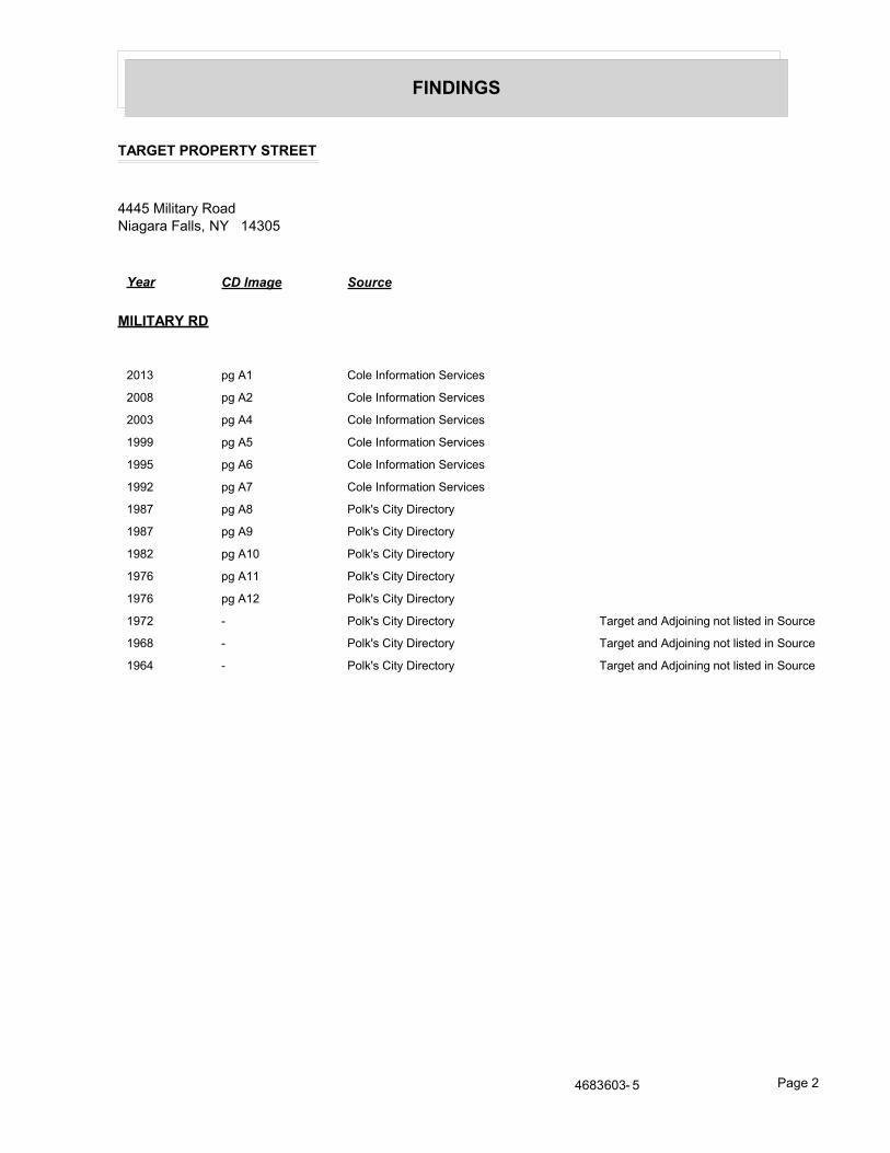
FINDINGS
TARGET PROPERTY STREET
4445 Military RoadNiagara Falls, NY 14305
Year CD Image Source
MILITARY RD
2013 pg A1 Cole Information Services
2008 pg A2 Cole Information Services
2003 pg A4 Cole Information Services
1999 pg A5 Cole Information Services
1995 pg A6 Cole Information Services
1992 pg A7 Cole Information Services
1987 pg A8 Polk's City Directory
1987 pg A9 Polk's City Directory
1982 pg A10 Polk's City Directory
1976 pg A11 Polk's City Directory
1976 pg A12 Polk's City Directory
1972 - Polk's City Directory Target and Adjoining not listed in Source
1968 - Polk's City Directory Target and Adjoining not listed in Source
1964 - Polk's City Directory Target and Adjoining not listed in Source
4683603- 5 Page 2

FINDINGS
CROSS STREETS
No Cross Streets Identified
4683603- 5 Page 3

City Directory Images

-
MILITARY RD
Cole Information Services
4683603.5 Page: A1
SourceTarget Street Cross Street
2013
4220 STERLING EICHELBERGER4235 DE VEAUX SVCES INC
TOPS MARKET4300 BRYK HW & SONS4304 FLORENCE WHITE4314 TWODAYS SALON4316 WILLIAM HETHERINGTON4320 DANIEL RINKER4381 FIRST NIAGARA4404 OCCUPANT UNKNOWN4407 OCCUPANT UNKNOWN
RITE AID PHARMACY4408 COLEEN OLSZEWSKI4416 CHILDREN OF NIAGARA CHILD CARE4419 SCOTT FURNITURE & INTERIORS4424 DYNAMIC CERAMICS
OCCUPANT UNKNOWN4445 CULBERTS WHOLESALE TIRE4500 RAYS MILITARY BARBER SHOP4501 JERAULD DAY4508 KENDALL ATKINSON4509 OCCUPANT UNKNOWN4515 ORSZULAK TODD M DO4519 MOUNT STREET MARYS HOSPITAL OF NIAGA4600 CHANDAN KOMAL
GREGORY SAMBUCHIKOMAL CHANDANSAMBUCHI GREG MD
4601 NICHOLAS PLATTERSCHAEFER PLUMBING SUPPLY CO INC
4611 EYE DEAL EYEWEAR INC4612 BRUCE CAMPBELL4613 SALON DIAZ4615 AL PAWLAK APPLIANCE INC4620 KENNETH BRONSON

-
MILITARY RD
Cole Information Services
4683603.5 Page: A2
SourceTarget Street Cross Street
2008
4220 STERLING EICHELBERGER4235 TOPS SUPERMARKET4300 H W BRYK & SONS INC
SHAKLEE DISTRIBUTORS4304 WARREN WHITE4314 OCCUPANT UNKNOWN
TWODAYS SALON4316 WILLIAM HETHERINGTON4320 DANIEL RINKER4324 RAYS AUTO ELECTRIC4381 H S B C BANK USA NATIONAL ASSN
HSBC BANK USA4406 KARI RAPPLEYEA4407 FAMILY DOLLAR
OCCUPANT UNKNOWNRITE AID PHARMACY 1185
4408 OCCUPANT UNKNOWN4416 CHILDREN OF NIAGARA CHILDS DEPOT
VANONI JACQUIE4419 SCOTT FURNITURE & INTERIORS INC4424 DYNAMIC CERAMICS
FULLONE TRUCKING INCOCCUPANT UNKNOWN
4435 DEYOS AUTOSUPERLINE ALIGNMENT & AUTO SERVICE
4500 KRYSTAL JACKSONRAYS MILITARY BARBER SHOP
4501 JERAULD DAY4508 JACK SPILLMAN4509 THOMAS GREENE4519 OPEN MRI OF NIAGARA FALLS4520 GUILDCARE
MICHELLE GIRVINSCHMIDLI MAYTHOMAS TROMBLEY
4600 GREGORY D SAMBUCHI MDGREGORY SAMBUCHIKOMAL CHANDANNARESH JAINSULTZ JERALD R MD
4601 GILLS PLUMBING SUPPLY INCKELLY PAYNE
4612 BRUCE CAMPBELL4613 ELECTROLYSIS CLINIC
GIFTS UNLIMITEDLEISURE TANNING CENTERRAYMOND ALEKS LMTTHE BIGGER THE BETTER BOUTIQUE
4615 AL PAWLAK APPLIANCE INC4620 KATHLEEN BRONSON

(Cont'd)
-
MILITARY RD
Cole Information Services
4683603.5 Page: A3
SourceTarget Street Cross Street
2008
4627 MATTS TRANSMISSIONS

-
MILITARY RD
Cole Information Services
4683603.5 Page: A4
SourceTarget Street Cross Street
2003
4220 STERLING EICHELBERGER4235 DE VEAUX SERVICES INC
MILITARY GRAUER INCTOPS FRIENDLY MARKETS
4300 ANIMAL CARE SUPPLEMENTS LLCFIT 4 LIFEJEFFREY BRYKTARRA BRYKACS
4304 WARREN WHITE4314 OCCUPANT UNKNOWN
TWODAYS SALON4316 OCCUPANT UNKNOWN4320 MICHAEL BARBER4324 SHEILA COLLINS4381 OCCUPANT UNKNOWN4400 DENNIS COLLINS4401 FAMILY DOLLAR STORE4407 RITE AID EXPRESS HOUR PHOTO
RITE AID PHARMACIES4408 WILLIAM BLAZEJEWSKI4416 CHILDREN OF NIAGARA CHLD DEPOT4419 OCCUPANT UNKNOWN
SCOTT FURNITURE & INTERIORS INC4435 OCCUPANT UNKNOWN
SUPERLINE ALGNMNT & AUTO SRVC4445 CULBERTS WHOLESALE TIRE
OCCUPANT UNKNOWN4453 STEVEN COVELAND4500 BEVERLY HILLS IMPORTS
K JACKSONRAYS MILITARY BARBER SHOP
4501 M SCHROEDER4508 JACK SPILLMAN4515 OCCUPANT UNKNOWN4520 GUY SCHMIDLI4601 GILLS PLUMBING SUPPLY INC
MICHAEL SLEDZIEWSKI4612 BRUCE CAMPBELL4613 ELECTROLYSIS CLINIC
LEISURE TANNING CTROCCUPANT UNKNOWN
4615 AL PAWLAK APPLIANCE INC4620 KATHLEEN BRONSON4627 MATTS TRANSMISSIONS
OCCUPANT UNKNOWN

-
MILITARY RD
Cole Information Services
4683603.5 Page: A5
SourceTarget Street Cross Street
1999
4220 STERLIN EICHELBERGER4235 DEVEAUX SERVICES INCORPORATED
TOPS FRIENDLY MARKETS4300 BRYK H W & SONS
JEFFREY BRYKL MCGILVEARY
4304 WARREN WHITE4314 TWO DAYS SALON4316 WILLIAM HETHERINGTON4381 MARINE MIDLAND BANK4400 DENNIS COLLINS4401 FAMILY DOLLAR STORE4407 RITE AID EXPRESS 1 HOUR PHOTO4408 JEANS TAILORING II & DRYCLEANING
R TRANSPLANT4416 CHILDREN OF NIAGARA CHILDS DEPOT4419 SCOTT FURNITURE COMPANY4435 SUPERLINE ALIGNMENT & AUTO SVCE4445 CULBERTS WHOLESALE TIRE4453 RAYS MILITARY BARBER SHOP4500 BEVERLY HILLS IMPORTS
OCCUPANT UNKNOWN4501 JERAULD DAY4508 OCCUPANT UNKNOWN4509 RAYMOND LESTER4520 PHYLLIS SCHMIDLI
WILLIAM HOUSE4601 GILLS PLUMBING SUPPLY INCORPORATED
JOHN EODICE4612 BRUCE CAMPBELL4613 BUCHOLTZ HEATING & AIR CONDITIONING
LEISURE HAIR CARELEISURE TANNING CENTER
4615 AL PAWLAK APPLIANCE4620 DONNA KOCH4627 GOOD GUYS

-
MILITARY RD
Cole Information Services
4683603.5 Page: A6
SourceTarget Street Cross Street
1995
2748 ST LEO'S RELIGIOUS EDUCATION CENTER4235 DE VEAUX SVCES INC
WESTERN UNION-TO PICK UP OR SEND MONEY TRANS-NIAGARA FALLS-TOPS4300 BRYK H W & SONS
SHAKLEE PRODS DSTRBTR4314 TWO DAYS SALON4324 RAY'S AUTO ELEC4381 MARINE MIDLAND BANK-WESTERN NEW YORK BRANCHES-TOWN OF NIAGARA4408 QUILTMAKERS & FRIENDS4416 CHILDREN OF NIAGARA CHILDS DEPOT4419 SCOTT FURNITURE CO4424 IMAGES HAIR DESIGNS
MILITARY APLNC PARTS & SVCE4435 SUPERLINE ALIGNMENT & AUTO SVCE4445 CULBERT'S WHOLESALE TIRE
WHOLESALE TIRE4449 JEAN'S TAILORING II & DRYCLEANING
NIA-SEAL MANUFACTURING CORPTIRE LINER
4453 RAY'S MILITARY BARBER SHOP4457 DONNAZ PIZZERIA4517 ALL THAT JAZZ FULL SVCE SALON4519 RITE AID PHARMACIES-NIAGARA FALLS-STORE4601 GILLS PLUMBING SUPPLY INC4611 ACCU-STITCH ENTERPRISES INC4613 BUCHOLTZ HEATING & AIR CONDITIONING
CENTRE FOR BALLET & DANCE ARTSLEISURE HAIR CARELEISURE TANNING CENTER
4615 AL PAWLAK APPLIANCEPAWLAK AL APPLIANCE
4627 GOOD GUYSGOOD GUYS SUNOCO
4701 GAINES KATHLEEN E, ATTY4719 UNI-MARTS INC

-
MILITARY RD
Cole Information Services
4683603.5 Page: A7
SourceTarget Street Cross Street
1992
4220 EICHELBERGER, STERLING4235 DE VEAUX SVCES INC
WESTERN UNION-TO PICK UP OR SEND MONEY TRANS-NIAGARA FALLS-TOPS4300 BRYK H W & SONS
NEADOW, ALANSHAKLEE PRODS DSTRBTRVALINT, MATTHEW
4304 WHITE, WARREN C4314 BANEY, JILL4316 BANEY, HELEN R
SOBOTKA, ERVIN C4320 BLEY, L4324 RAY'S AUTO ELEC4400 COLLINS, DENNIS R4407 SAVE-RITE DISCOUNT4408 STENZEL, TAMMY J4416 CHILDREN OF NIAGARA CHILD CARE4419 SCOTT FURNITURE CO4424 MILITARY APLNC PARTS & SVCE4435 SUPERLINE ALIGNMENT & AUTO SVCE4445 CULBERT'S WHOLESALE TIRE
WHOLESALE TIRE4449 MAN ON WHEELS INC4453 RAY'S MILITARY BARBER SHOP4457 DONNAZ PIZZERIA4501 WALDECK, DAVID L, JR4508 CURTIS, SHIRLEY & THOMAS4509 LESTER, RAYMOND V4517 ALL THAT JAZZ FULL SVCE SALON4519 RITE AID DISCOUNT PHARMACIES-PHARMACY
RITE AID DISCOUNT PHARMACIES-STORERITE AID PHARMACIES-PHARMACY
4520 SCHMIDLI, P M4601 GILL, J
GILLS PLUMBING SUPPLY INC4609 TOWNE BARBER SHOP4611 ACCU-STITCH ENTERPRISES INC4612 SCHUL, JONATHAN4613 BUCHOLTZ HEATING & AIR CONDITIONING
CENTRE FOR BALLET & DANCE ARTSFULLER, KLEISURE HAIR CARELEISURE TANNING CENTER
4615 AL PAWLAK APPLIANCEPAWLAK AL APPLIANCE
4620 SCHUL, KEVIN4627 GOOD GUYS
GOOD GUYS SUNOCO

-
MILITARY RD
Polk's City Directory
4683603.5 Page: A8
SourceTarget Street Cross Street
1987

-
MILITARY RD
Polk's City Directory
4683603.5 Page: A9
SourceTarget Street Cross Street
1987
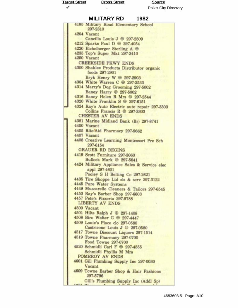
-
MILITARY RD
Polk's City Directory
4683603.5 Page: A10
SourceTarget Street Cross Street
1982

-
MILITARY RD
Polk's City Directory
4683603.5 Page: A11
SourceTarget Street Cross Street
1976

-
MILITARY RD
Polk's City Directory
4683603.5 Page: A12
SourceTarget Street Cross Street
1976

APPENDIX G Phase I Environmental Site Assessment Checklist

PHASE I ENVIRONMENTAL SITE ASSESSMENTRECONNAISSANCE CHECKLIST
Project Name: Military Road Site
Project Site: 4435-4445 Military Road
C&S Project No: Q47.001.001 _______
C&S Site No(s):
Walkover Date(s): 7/21/16 _______

Page 1
A. SITE SETTING1. General Description
Site WalkoverC&S Personnel Cody Martin
Accompanied by
Weather Sunny, 80°F, dry
Snow cover present NoSite DescriptionSite Name
Site Address
Owner
Tax ID No.
Property Size
Adjoining StreetsNorth South East West
N/A Grauer Rd N/A Military RdDevelopment DescriptionBuildings / Improvements Year Constructed Square Footage No. of Floors1.
2.
3.
4.
5.
6.
7.
8.
9.
10.
Site Topographic Relief /Drainage
Flat
UtilitiesWater Sewage Electric / Gas
Town of Niagara Town of Niagara

Page 2
Development Description (continued…)Buildings Construction
1. Single Story, Concrete Block
2.
3.
4.
5.
6.
7.
8.
9.
10.
2. Current Site Use
Those entries below designated by an “X” indicate that the Item or Feature was observed duringthe site visit. These will be discussed in more detail in the Phase I Report.
Category Item or Feature Observed?
Site Operations, Processes,and Equipment
Emergency Generators
Elevators
Air Compressors
Hydraulic Equipment
Incinerator
X-ray or photo lab
Boiler / furnace / chillers
Medical / science lab
Auto service / repair X
Laundering
Painting

Page 3
Aboveground Storage Tanks(AST) / Containers storingPP or HS
Evidence of ASTs X
Drums, barrels, and / or containers ≥ 5 gallons X
Cleaning and / or similar supplies X
Underground Storage Tanks(UST) / Features storing PPor HS
Evidence of USTs or ancillary UST equipment
Patched pavement
Sumps, cisterns, catch basins, and / or dry wells
Grease traps
Septic tanks and / or leach fields
Oil / water separators
Pipeline markers
Interior floor drainsElectrical Transformers /PCBs Pad or pole-mounted transformers and / or capacitors X
Evidence of Releases orPotential Releases
Stressed vegetation
Stained soil Concrete X
Stained pavement
Leachate and / or waste seeps
Trash, debris, and / or other waste materials
Dumping or disposal areasConstruction / demolition debris and / or dumped filldirt X
Surface water discoloration, odor, sheen, and / orfloating productStrong, pungent, or noxious odorsExterior pipe discharges and / or other effluentdischargesLaboratory hoods and / or incinerators
WWTP and / or water treatment systems
Compressor blowdown
Other Notable Site Features
Surface water bodies (lagoons, pits, ponds)
Quarries or pits
Wells X
Building foundations

Page 4
3. Current Site Use Narrative (indicate occupants and uses):
Vacant
4. Past Site Use Narrative (indicate occupants and uses if known):
Auto Repair Shop ______
Barber
5. Current Surrounding Land Use
Direction Description
North Residential –Commercial along Military Road
South Residential –Commercial along Military Road
East Residential beyond Military Road
West Residential beyond Military Road

Page 5
6. Interviews
Name:
Organization / Title:
Years of Experience:
Site Information:
Name:
Organization / Title:
Years of Experience:
Site Information:
Name:
Organization / Title:
Years of Experience:
Site Information:
Name:
Organization / Title:
Years of Experience:
Site Information:

Page 6
Notes on Observed Site Features
Extensive water damage
Roof damage
Two drains in Building 1 Garage 2
No access to other buildings
Storing old tires

APPENDIX H Site Photographs

PHOTOGRAPHIC LOG APPENDIX H
Exhibit:
1
Description:
Facing northwest
along Military Road.
Exterior of the onsite
structure is seen on
the right hand side of
the photo. Parking lot
composed of various
materials including
4445 Military Road
7/21/2016
Date:
Exhibit:
2
Description:
Facing northeast
towards the structure.
Visible deterioration
of the building
including peeled
paint, missing light
fixtures, and boarded
up windows and
4445 Military Road
7/21/2016
Date:
Page 1 of 14

PHOTOGRAPHIC LOG APPENDIX H
Exhibit:
3
Description:
Facing northeast
along the northern
edge of the property.
Rock-covered
driveway leads behind
structure to additional
doorways. Pipes and
utilities visible on
4445 Military Road
7/21/2016
Date:
Exhibit:
4
Description:
Facing southeast
along Military Road.
Deterioration and vine
growth visible on
structure. Parking lot
composed of various
materials.
4445 Military Road
7/21/2016
Date:
Page 2 of 14

PHOTOGRAPHIC LOG APPENDIX H
Exhibit:
5
Description:
Facing southeast
along Military Road.
Visible patched
concrete in the
parking lot.
4445 Military Road
7/21/2016
Date:
Exhibit:
6
Description:
Interior of Culbert's
Wholesale Tire
section of the
structure. Cracked
concrete, falling
insulation, and tires
and debris visible.
4445 Military Road
7/21/2016
Date:
Page 3 of 14

PHOTOGRAPHIC LOG APPENDIX H
Exhibit:
7
Description:
Office interior of
Culbert's Wholesale
Tire section of the
structure. Equipment
and appliances are
visible.
4445 Military Road
7/21/2016
Date:
Exhibit:
8
Description:
Facing east along
Grauer Road. Storm
drain visible among
concrete lot. Stressed
vegetation due to
weather.
4445 Military Road
7/21/2016
Date:
Page 4 of 14

PHOTOGRAPHIC LOG APPENDIX H
Exhibit:
9
Description:
Facing north toward
forest. Visible signs of
stressed vegetation
due to weather.
Evidence of debris in
lot and peeling paint
on structure.
4445 Military Road
7/21/2016
Date:
Exhibit:
10
Description:
Facing north in
northeastern portion
of the Subject
Property. Area near
forest is comprised of
unmaintained grass
and debris.
4445 Military Road
7/21/2016
Date:
Page 5 of 14

PHOTOGRAPHIC LOG APPENDIX H
Exhibit:
11
Description:
Facing southwest
toward eastern edge of
structure. Flora
growth visible along
sturcture wall and
among tire pile.
Boarded up window
seen on right side of
4445 Military Road
7/21/2016
Date:
Exhibit:
12
Description:
Exterior of the eastern
end of the building.
Boarded up door and
window visible along
with peeling paint.
Rusty vent pipe and
staining from
structural beam
4445 Military Road
7/21/2016
Date:
Page 6 of 14

PHOTOGRAPHIC LOG APPENDIX H
Exhibit:
13
Description:
Exterior of the eastern
edge of the structure.
Visible evidence of
boarded up doors and
window. Evidence of
staining and peeling
paint.
4445 Military Road
7/21/2016
Date:
Exhibit:
14
Description:
Vent pipes on the
building roof. Raised
roof area visible in the
center of the
photograph.
4445 Military Road
7/21/2016
Date:
Page 7 of 14

PHOTOGRAPHIC LOG APPENDIX H
Exhibit:
15
Description:
Facing northwest
along the eastern side
of the structure.
Evidence of concrete
lot underneath the
grasscover. Various
debris scattered along
building edge,
4445 Military Road
7/21/2016
Date:
Exhibit:
16
Description:
Facing northeast
along northern edge of
the structure. Visible
evidence of boarded
up windows and
peeling paint. Rusted
pipe visible running
along building edge
4445 Military Road
7/21/2016
Date:
Page 8 of 14

PHOTOGRAPHIC LOG APPENDIX H
Exhibit:
17
Description:
Visual evidence of
rusted metal pipe
among tree.
4445 Military Road
7/21/2016
Date:
Exhibit:
18
Description:
Fallen ceiling
insulation visible in
the structure's interior.
Debris and dirtied
furniture visible.
4445 Military Road
7/21/2016
Date:
Page 9 of 14

PHOTOGRAPHIC LOG APPENDIX H
Exhibit:
19
Description:
Waste drum for used
Anti-freeze visible
among other fluids,
bottles, and debris.
4445 Military Road
7/21/2016
Date:
Exhibit:
20
Description:
Fallen ceiling
insulation and wiring
visible. Evidence of a
hole in the roof.
4445 Military Road
7/21/2016
Date:
Page 10 of 14

PHOTOGRAPHIC LOG APPENDIX H
Exhibit:
21
Description:
Drain covered in webs
and dust. Standing
fluid visible in the
drain.
4445 Military Road
7/21/2016
Date:
Exhibit:
22
Description:
Room full of tires.
Evidence of a
deteriorating roof and
ceiling by various
hanging objects.
Staining visible on
back white wall.
4445 Military Road
7/21/2016
Date:
Page 11 of 14

PHOTOGRAPHIC LOG APPENDIX H
Exhibit:
23
Description:
Various chemicals,
paints, and fluids left
in the 1st Building.
Floor covered in
debris and filth.
4445 Military Road
7/21/2016
Date:
Exhibit:
24
Description:
The interior of the 2nd
Building ceiling
deterioration visible
by the various debris
towards the door.
Evidence of wood,
glass, and other
materials on the tiled
4445 Military Road
7/21/2016
Date:
Page 12 of 14

PHOTOGRAPHIC LOG APPENDIX H
Exhibit:
25
Description:
Tire pileup in a room
of the 2nd Building.
Visible evidence of
peeling paint and
falling insulation.
4445 Military Road
7/21/2016
Date:
Exhibit:
26
Description:
Small floor drain with
surrounding debris.
4445 Military Road
7/21/2016
Date:
Page 13 of 14

PHOTOGRAPHIC LOG APPENDIX H
Exhibit:
27
Description:
Interior of Building
Three. Wood paneling
visible on walls with
deteriorating ceilings.
Evidence of boarded
up door and garage
door. Peeling paint
and debris visible
4445 Military Road
7/21/2016
Date:
Exhibit:
28
Description:
Visible evidence of a
drum and a tank.
Various containers
and bucket scattered
throughout room.
4445 Military Road
7/21/2016
Date:
Page 14 of 14

APPENDIX I FOIL Correspondence


APPENDIX J Vapor Encroachment Screening Report

neercS tnemhcaorcnE ropaV RDEteehskroW tnemhcaorcnE ropaV s’RDE gnisu deraperP
6 Armstrong Road, 4th floorShelton, CT 06484Toll Free: 800.352.0050www.edrnet.com
4445 Military Road4445 Military RoadNiagara Falls, NY 14305
Inquiry Number: 4683603.6sAugust 1, 2016

Thank you for your business.Please contact EDR at 1-800-352-0050
with any questions or comments.
SECTION PAGE
Executive Summary ES1
Primary Map 2
Secondary Map 3
Aerial Photography 4
Map Findings 5
Record Sources and Currency GR-1
Disclaimer - Copyright and Trademark Notice
The EDR Vapor Encroachment Worksheet enables EDR's customers to make certain online modifications that effects maps, textand calculations contained in this Report. As a result, maps, text and calculations contained in this Report may have been somodified. EDR has not taken any action to verify any such modifications, and this report and the findings set forth herein must beread in light of this fact. Environmental Data Resources shall not be responsible for any customer's decision to include or notinclude in any final report any records determined to be within the relevant minimum search distances.
This report contains information obtained from a variety of public and other sources reasonably available to Environmental DataResources, Inc. It cannot be concluded from this Report that coverage information for the target and surrounding properties doesnot exist from other sources. NO WARRANTY EXPRESSED OR IMPLIED, IS MADE WHATSOEVER IN CONNECTION WITHTHIS REPORT. ENVIRONMENTAL DATA RESOURCES, INC. SPECIFICALLY DISCLAIMS THE MAKING OF ANYSUCHWARRANTIES, INCLUDING WITHOUT LIMITATION, MERCHANTABILITY OR FITNESS FOR A PARTICULAR USE ORPURPOSE. ALL RISK IS ASSUMED BY THE USER. IN NO EVENT SHALL ENVIRONMENTAL DATA RESOURCES, INC.BE LIABLE TO ANYONE, WHETHER ARISING OUT OF ERRORS OR OMISSIONS, NEGLIGENCE, ACCIDENT OR ANYOTHER CAUSE, FOR ANY LOSS OR DAMAGE, INCLUDING, WITHOUT LIMITATION, SPECIAL, INCIDENTAL,CONSEQUENTIAL, OR EXEMPLARY DAMAGES.ANY LIABILITY ON THE PART OF ENVIRONMENTAL DATARESOURCES, INC. IS STRICTLY LIMITED TO A REFUND OF THE AMOUNT PAID FOR THIS REPORT.Purchaser accepts this report "AS IS". Any analyses, estimates, ratings, or risk codes provided in this report are provided forillustrative purposes only, and are not intended to provide, nor should they be interpreted as providing any facts regarding, orprediction or forecast of, any environmental risk for any property. Only a Phase I Environmental Site Assesment performed by anenvironmental professional can produce information regarding the environmental risk for any property. Additionally, theinformation provided in this Report is not to be construed as legal advice.
Copyright 2016 by Environmental Data Resources, Inc. All rights reserved. Reproduction in any media or format, in whole or inpart, of any report or map of Environmental Data Resources, Inc., or its affiliates, is prohibited without prior written permission.
EDR and its logos (including Sanborn and Sanborn Map) are trademarks of Environmental Data Resources, Inc. or its affiliates.All other trademarks used herein are the property of their respective owners.
TABLE OF CONTENTS
TC Page 1

A search of available environmental records was conducted by Environmental Data Resources, Inc (EDR). The report wasdesigned to assist parties seeking to meet the search requirements of the ASTM Standard Practice for Assessment ofVapor Encroachment into Structures on Property Involved in Real Estate Transactions (E 2600).
*Each category may include several separate databases, each having a different search distance. For each category, thetable reports the maximum search distance applied. See the section 'Record Sources and Currency' for information onindividual databases.
Summary
STANDARD ENVIRONMENTAL RECORDS Maximum Search Distance* pro
per
ty
1/10
1/10
- 1
/3
Federal NPL 0.333 0 0 0Federal CERCLIS 0.333 1 0 0Federal RCRA CORRACTS facilities list 0.333 0 0 0Federal RCRA TSD facilities list 0.333 0 0 0Federal RCRA generators list property 0 - -Federal institutional controls / engineering controls registries 0.333 0 0 0Federal ERNS list property 0 - -
State and tribal - equivalent NPL not searched - - -State and tribal - equivalent CERCLIS 0.333 0 0 0State and tribal landfill / solid waste disposal 0.333 0 0 1State and tribal leaking storage tank lists 0.333 0 0 8State and tribal registered storage tank lists property 0 - -State and tribal institutional control / engineering control registries property 0 - -State and tribal voluntary cleanup sites 0.333 0 0 0State and tribal Brownfields sites 0.333 0 0 0
Other Standard Environmental Records 0.333 3 0 5
HISTORICAL USE RECORDSFormer manufactured Gas Plants 0.333 0 0 0Historical Gas Stations 0.125 0 1 2Historical Dry Cleaners 0.125 0 0 0Exclusive Recovered Govt. Archives property 0 - -
EXECUTIVE SUMMARY
TC EXECUTIVE SUMMARY 1

TARGET PROPERTY INFORMATION
ADDRESS
4445 MILITARY ROAD4445 MILITARY ROADNIAGARA FALLS, NY 14305
COORDINATES
TARGET PROPERTY SEARCH RESULTS
The target property was identified in the following records.
Latitude (North): 43.127198 - 43° 7′ 37.910156″
Longitude (West): 79.004129 - 79° 0′ 14.859009″
Elevation: 600 ft. above sea level
Site Database(s)
4435-4445 MILITARY ROAD4435-4445 MILITARY ROADTOWN OF NIAGARA, NY 14305
SEMS
4435-4445 MILITARY ROAD PROPERTY4445 MILITARY ROADNIAGARA FALLS, NY 14305-1351
ECHOFINDS
Registry ID:: 110040821064
4435-4445 MILITARY ROAD PROPERTY4445 MILITARY ROADNIAGARA, NY 14305
US BROWNFIELDSACRES property ID: 101783
ACRES property ID: 101783
BEHIND OLD GARAGE4445 MILITARY RDNIAGARA FALLS, NY
NY SpillsSpill Number/Closed Date: 1204052 / 2014-06-02
Site ID: 466910
spillno: 1204052
EXECUTIVE SUMMARY
TC EXECUTIVE SUMMARY 2

No Aquiflow sites reported.
AQUIFLOW
Search Radius: 0.333 Mile.
Available NWI Wetlands:
AvailableFlood Zone:
PHYSICAL SETTING INFORMATION
Min: 5.6Max: 7.3
Min: 1.4Max: 4
50%), silt.limit less thanClays (liquidSOILS, Silts andFINE-GRAINED
Soils.200), Clayeypassing No.than 35 pct.Materials (moreSilt-Claysilty clay loam 7 inches 0 inches 1
Soil Layer Information
Boundary Classification Saturatedhydraulicconductivitymicro m/sec
Layer Upper Lower Soil Texture Class AASHTO Group Unified Soil Soil Reaction(pH)
> 20 inchesDepth to Watertable Min:
> 0 inchesDepth to Bedrock Min:
HighCorrosion Potential - Uncoated Steel:
Not hydricHydric Status:
Somewhat poorly drainedSoil Drainage Class:
water table, or are shallow to an impervious layer.Class D - Very slow infiltration rates. Soils are clayey, have a highHydrologic Group:
silty clay loamSoil Surface Texture:
OdessaSoil Component Name:
Soil Map ID: 1
in a landscape. The following information is based on Soil Conservation Service SSURGO data.for privately owned lands in the United States. A soil map in a soil survey is a representation of soil patternsSurvey (NCSS) and is responsible for collecting, storing, maintaining and distributing soil survey informationThe U.S. Department of Agriculture’s (USDA) Soil Conservation Service (SCS) leads the National Cooperative Soil
DOMINANT SOIL COMPOSITION IN GENERAL AREA OF TARGET PROPERTY
EXECUTIVE SUMMARY
TC EXECUTIVE SUMMARY 3

Min: 5.6Max: 7.3
Min: 4Max: 14
50%), silt.limit less thanClays (liquidSOILS, Silts andFINE-GRAINED
Soils.200), Clayeypassing No.than 35 pct.Materials (moreSilt-Claysilt loam 9 inches 0 inches 1
Soil Layer Information
Boundary Classification Saturatedhydraulicconductivitymicro m/sec
Layer Upper Lower Soil Texture Class AASHTO Group Unified Soil Soil Reaction(pH)
> 23 inchesDepth to Watertable Min:
> 0 inchesDepth to Bedrock Min:
HighCorrosion Potential - Uncoated Steel:
Not hydricHydric Status:
Somewhat poorly drainedSoil Drainage Class:
water table, or are shallow to an impervious layer.Class D - Very slow infiltration rates. Soils are clayey, have a highHydrologic Group:
silt loamSoil Surface Texture:
ChurchvilleSoil Component Name:
Soil Map ID: 2
Min: 7.4Max: 8.4
Min: 0.42Max: 1.4
50%), Lean Claylimit less thanClays (liquidSOILS, Silts andFINE-GRAINED
Soils.200), Clayeypassing No.than 35 pct.Materials (moreSilt-Claysilty clay59 inches33 inches 3
Min: 5.6Max: 7.8
Min: 0.42Max: 1.4
50%), Lean Claylimit less thanClays (liquidSOILS, Silts andFINE-GRAINED
Soils.200), Clayeypassing No.than 35 pct.Materials (moreSilt-Claysilty clay33 inches 7 inches 2
Soil Layer Information
Boundary Classification Saturatedhydraulicconductivitymicro m/sec
Layer Upper Lower Soil Texture Class AASHTO Group Unified Soil Soil Reaction(pH)
EXECUTIVE SUMMARY
TC EXECUTIVE SUMMARY 4

Min: 5.6Max: 7.3
Min: 1.4Max: 4
50%), silt.limit less thanClays (liquidSOILS, Silts andFINE-GRAINED
Soils.200), Clayeypassing No.than 35 pct.Materials (moreSilt-Claysilty clay loam 7 inches 0 inches 1
Soil Layer Information
Boundary Classification Saturatedhydraulicconductivitymicro m/sec
Layer Upper Lower Soil Texture Class AASHTO Group Unified Soil Soil Reaction(pH)
> 20 inchesDepth to Watertable Min:
> 0 inchesDepth to Bedrock Min:
HighCorrosion Potential - Uncoated Steel:
Not hydricHydric Status:
Somewhat poorly drainedSoil Drainage Class:
water table, or are shallow to an impervious layer.Class D - Very slow infiltration rates. Soils are clayey, have a highHydrologic Group:
silty clay loamSoil Surface Texture:
OdessaSoil Component Name:
Soil Map ID: 3
Min: 7.4Max: 8.4
Min: 0.42Max: 1.4
50%), silt.limit less thanClays (liquidSOILS, Silts andFINE-GRAINED50%), Lean Clay.limit less thanClays (liquidSOILS, Silts andFINE-GRAINED
Soils.200), Siltypassing No.than 35 pct.Materials (moreSilt-Clayloam59 inches31 inches 3
Min: 6.1Max: 7.8
Min: 0.42Max: 1.4
50%), Lean Claylimit less thanClays (liquidSOILS, Silts andFINE-GRAINED
Soils.200), Clayeypassing No.than 35 pct.Materials (moreSilt-Claysilty clay loam31 inches 9 inches 2
Soil Layer Information
Boundary Classification Saturatedhydraulicconductivitymicro m/sec
Layer Upper Lower Soil Texture Class AASHTO Group Unified Soil Soil Reaction(pH)
EXECUTIVE SUMMARY
TC EXECUTIVE SUMMARY 5

Min: 5.6Max: 7.3
Min: 4Max: 14
50%), silt.limit less thanClays (liquidSOILS, Silts andFINE-GRAINED
Soils.200), Clayeypassing No.than 35 pct.Materials (moreSilt-Claysilt loam 9 inches 0 inches 1
Soil Layer Information
Boundary Classification Saturatedhydraulicconductivitymicro m/sec
Layer Upper Lower Soil Texture Class AASHTO Group Unified Soil Soil Reaction(pH)
> 23 inchesDepth to Watertable Min:
> 0 inchesDepth to Bedrock Min:
HighCorrosion Potential - Uncoated Steel:
Not hydricHydric Status:
Somewhat poorly drainedSoil Drainage Class:
water table, or are shallow to an impervious layer.Class D - Very slow infiltration rates. Soils are clayey, have a highHydrologic Group:
silt loamSoil Surface Texture:
ChurchvilleSoil Component Name:
Soil Map ID: 4
Min: 7.4Max: 8.4
Min: 0.42Max: 1.4
50%), Lean Claylimit less thanClays (liquidSOILS, Silts andFINE-GRAINED
Soils.200), Clayeypassing No.than 35 pct.Materials (moreSilt-Claysilty clay59 inches33 inches 3
Min: 5.6Max: 7.8
Min: 0.42Max: 1.4
50%), Lean Claylimit less thanClays (liquidSOILS, Silts andFINE-GRAINED
Soils.200), Clayeypassing No.than 35 pct.Materials (moreSilt-Claysilty clay33 inches 7 inches 2
Soil Layer Information
Boundary Classification Saturatedhydraulicconductivitymicro m/sec
Layer Upper Lower Soil Texture Class AASHTO Group Unified Soil Soil Reaction(pH)
EXECUTIVE SUMMARY
TC EXECUTIVE SUMMARY 6

Min: 5.1Max: 7.8
Min: 1.4Max: 14
50%), silt.limit less thanClays (liquidSOILS, Silts andFINE-GRAINED
Soils.200), Siltypassing No.than 35 pct.Materials (moreSilt-Claysilt loam 7 inches 0 inches 1
Soil Layer Information
Boundary Classification Saturatedhydraulicconductivitymicro m/sec
Layer Upper Lower Soil Texture Class AASHTO Group Unified Soil Soil Reaction(pH)
> 0 inchesDepth to Watertable Min:
> 0 inchesDepth to Bedrock Min:
HighCorrosion Potential - Uncoated Steel:
All hydricHydric Status:
Very poorly drainedSoil Drainage Class:
drained and classified.Class C/D - Drained/undrained hydrology class of soils that can beHydrologic Group:
silt loamSoil Surface Texture:
WaylandSoil Component Name:
Soil Map ID: 5
Min: 7.4Max: 8.4
Min: 0.42Max: 1.4
50%), silt.limit less thanClays (liquidSOILS, Silts andFINE-GRAINED50%), Lean Clay.limit less thanClays (liquidSOILS, Silts andFINE-GRAINED
Soils.200), Siltypassing No.than 35 pct.Materials (moreSilt-Clayloam59 inches31 inches 3
Min: 6.1Max: 7.8
Min: 0.42Max: 1.4
50%), Lean Claylimit less thanClays (liquidSOILS, Silts andFINE-GRAINED
Soils.200), Clayeypassing No.than 35 pct.Materials (moreSilt-Claysilty clay loam31 inches 9 inches 2
Soil Layer Information
Boundary Classification Saturatedhydraulicconductivitymicro m/sec
Layer Upper Lower Soil Texture Class AASHTO Group Unified Soil Soil Reaction(pH)
EXECUTIVE SUMMARY
TC EXECUTIVE SUMMARY 7

Min: 5.6Max: 8.4
Min: 0.42Max: 1.4
50%), Lean Claylimit less thanClays (liquidSOILS, Silts andFINE-GRAINED
Soils.200), Siltypassing No.than 35 pct.Materials (moreSilt-Claysilty clay loam59 inches29 inches 3
Min: 5.1Max: 8.4
Min: 0.42Max: 1.4
50%), silt.limit less thanClays (liquidSOILS, Silts andFINE-GRAINED
Soils.200), Siltypassing No.than 35 pct.Materials (moreSilt-Claysilt loam29 inches 7 inches 2
Soil Layer Information
Boundary Classification Saturatedhydraulicconductivitymicro m/sec
Layer Upper Lower Soil Texture Class AASHTO Group Unified Soil Soil Reaction(pH)
EXECUTIVE SUMMARY
TC EXECUTIVE SUMMARY 8

15
16
17
23
30
41
43
61
64
66
96
105
SEARCH RESULTS
Unmappable (orphan) sites are not considered in the foregoing analysis.
STANDARD ENVIRONMENTAL RECORDS
Name Address Dist/Dir Map ID Page
4435-4445 MILITARY ROAD 4435-4445 MILITARY ROAD Property ▲ A1SEMS: Federal CERCLIS
4435-4445 MILITARY ROAD PROPERTY 4445 MILITARY ROAD Property ▲ A2ECHO: Other Standard Environmental RecordsFINDS: Other Standard Environmental Records
4435-4445 MILITARY ROAD PROPERTY 4445 MILITARY ROAD Property ▲ A3US BROWNFIELDS: Other Standard Environmental Records
BEHIND OLD GARAGE 4445 MILITARY RD Property ▲ A4NY Spills: Other Standard Environmental Records
GOOD GUYS AUTO 4627 MILITARY RD 1/10 - 1/3 NW ▲ 8UST: State and tribal registered storage tank listsLIENS: Other Standard Environmental RecordsHIST UST: State and tribal registered storage tank listsLTANKS: State and tribal leaking storage tank lists
BRADING RESIDENCE 4810 ISHERWOOD AVENUE 1/10 - 1/3 SW ▼ 9LTANKS: State and tribal leaking storage tank lists
GKG MART, INC. 4719 MILITARY ROAD 1/10 - 1/3 NW ▲ 10UST: State and tribal registered storage tank listsLTANKS: State and tribal leaking storage tank lists
ANCHOR MOTOR FREIGHT WITMAR ROAD 1/10 - 1/3 NW ▼ 11LTANKS: State and tribal leaking storage tank lists
NYSDOT WITTMER ROAD 1/10 - 1/3 NNW ▼ 12LTANKS: State and tribal leaking storage tank lists
LEASEWAY MOTORCAR TRANSPORT 4749 WITMER RD 1/10 - 1/3 NW ▼ C13FINDS: Other Standard Environmental RecordsECHO: Other Standard Environmental RecordsRCRA-CESQG: Federal RCRA generators listMANIFEST: Other Standard Environmental RecordsNY Spills: Other Standard Environmental RecordsSPDES: Other Standard Environmental RecordsLTANKS: State and tribal leaking storage tank lists
ANCHOR MOTOR FREIGHT 4749 WITMER ROAD 1/10 - 1/3 NW ▼ C14NY Spills: Other Standard Environmental RecordsLTANKS: State and tribal leaking storage tank lists
ARMAND CERRONE INC 4625 WITMER RD 1/10 - 1/3 NW ▼ 15
EXECUTIVE SUMMARY
TC EXECUTIVE SUMMARY 9

115
27
28
29
HISTORICAL USE RECORDS
Name Address Dist/Dir Map ID PageRCRA-CESQG: Federal RCRA generators listFINDS: Other Standard Environmental RecordsECHO: Other Standard Environmental RecordsUST: State and tribal registered storage tank listsMANIFEST: Other Standard Environmental RecordsNY Spills: Other Standard Environmental RecordsLTANKS: State and tribal leaking storage tank lists
KACH'S AUTO SERVICE 4800 WITMER ROAD 1/10 - 1/3 NW ▼ 16NY Spills: Other Standard Environmental RecordsSWF/LF: State and tribal landfill / solid waste disposal
Name Address Dist/Dir Map ID Page
4435 MILITARY RD 4435 MILITARY RD <1/10 SE ▼ A5EDR Hist Auto: Historical Gas Stations
4324 MILTRY RD 4324 MILTRY RD 1/10 - 1/3 SSE ▼ B6EDR Hist Auto: Historical Gas Stations
4324 MILITARY RD 4324 MILITARY RD 1/10 - 1/3 SSE ▼ B7EDR Hist Auto: Historical Gas Stations
EXECUTIVE SUMMARY
TC EXECUTIVE SUMMARY 10

.
12
1611C15
10
8
AA5
B
9

.
640 640
600
60 0
6 0 0
60 0
60
0
6
640600
6 00
600
6 0 0
6 0 06 0 0
6 0 0
6 0 0
6
00
600
6 0 06 0
0
600
1216 11C15 10
8
A
B
9

0 300 1/3 Miles

LEGEND
DATABASE ACRONYM: Applicable categories (A hoverbox with database description).
FACILITY NAMEFACILITY ADDRESS, CITY, ST, ZIP EDR SITE ID NUMBER
▼ MAP ID#Direction Distance Range (Distance feet / miles)
Relative Elevation Feet Above Sea Level
ASTM 2600 Record Sources found in this report. Eachdatabase searched has been assigned to one or morecategories. For detailed information about categorization,see the section of the report Records Searched andCurrency.
Worksheet:
Comments:
Comments may be added on the online Vapor Encroachment Worksheet.
4435-4445 MILITARY ROAD4435-4445 MILITARY ROAD, TOWN OF NIAGARA, NY, 14305 1018149150
▲ A1Target Property
600 ft. Above Sea Level
Federal CERCLIS
Worksheet:
SEMS: Federal CERCLIS >
Site ID: 202067
EPA ID: NYN000202067
Federal Facility: N
NPL: Not on the NPL
Non NPL Status: Removal Only Site (No Site Assessment Work Needed)
MAP FINDINGS
TC Page 15

4435-4445 MILITARY ROAD PROPERTY4445 MILITARY ROAD, NIAGARA FALLS, NY, 14305-1351 1016354649
▲ A2Target Property
600 ft. Above Sea Level
Other Standard Environmental Records
Worksheet:
ECHO: Other Standard Environmental Records >
Envid: 1016354649
Registry ID: 110040821064
DFR URL: http://echo.epa.gov/detailed_facility_report?fid=110040821064
FINDS: Other Standard Environmental Records >
Registry ID: 110040821064
Environmental Interest/Information System:
US EPA Assessment, Cleanup and Redevelopment Exchange System (ACRES) is an federal onlinedatabase for Brownfields Grantees to electronically submit data directly to EPA.
MAP FINDINGS
TC Page 16

4435-4445 MILITARY ROAD PROPERTY4445 MILITARY ROAD, NIAGARA, NY, 14305 1014808569
▲ A3Target Property
600 ft. Above Sea Level
Other Standard Environmental Records
Worksheet:
US BROWNFIELDS: Other Standard Environmental Records >
Recipient name: Niagara County
Grant type: Assessment
Property name: 4435-4445 MILITARY ROAD PROPERTY
Property #: 131.10-2-29
Parcel size: 1.2
Property Description: The site was used for commercial purposes including automobile
businesses and dry cleaners for more than 50 years. The property has
been owned by Paul Grenga since 1977. Payment of real property taxes
is several years in arrears. Environmental concerns have precluded
Niagara County from completing the tax foreclosure process.
Latitude: 43.1267737
Longitude: -79.00377500000002
HCM label: Address Matching-House Number
Map scale: Not Reported
Point of reference: Entrance Point of a Facility or Station
Datum: World Geodetic System of 1984
ACRES property ID: 101783
Start date: Not Reported
Completed date: Not Reported
Acres cleaned up: Not Reported
Cleanup funding: Not Reported
Cleanup funding source: Not Reported
Assessment funding: 1500
Assessment funding source: US EPA - Brownfields Assessment Cooperative Agreement
Redevelopment funding: Not Reported
Redev. funding source: Not Reported
Redev. funding entity name: Not Reported
Redevelopment start date: Not Reported
Assessment funding entity: EPA
Cleanup funding entity: Not Reported
Grant type: Hazardous & Petroleum
Accomplishment type: Phase I Environmental Assessment
Accomplishment count: 0
Cooperative agreement #: 99290801
Ownership entity: Private
Current owner: Paul Grenga
Did owner change: N
Cleanup required: Yes
Video available: No
Photo available: Yes
MAP FINDINGS
TC Page 17

4435-4445 MILITARY ROAD PROPERTY, 4445 MILITARY ROAD, NIAGARA, NY 14305 (Continued)
Institutional controls required: U
IC Category proprietary controls: Not Reported
IC cat. info. devices: Not Reported
IC cat. gov. controls: Not Reported
IC cat. enforcement permit tools: Not Reported
IC in place date: Not Reported
IC in place: Not Reported
State/tribal program date: Not Reported
State/tribal program ID: Not Reported
State/tribal NFA date: Not Reported
Air contaminated: Not Reported
Air cleaned: Not Reported
Asbestos found: Y
Asbestos cleaned: Not Reported
Controled substance found: Not Reported
Controled substance cleaned: Not Reported
Drinking water affected: Not Reported
Drinking water cleaned: Not Reported
Groundwater affected: Y
Groundwater cleaned: Not Reported
Lead contaminant found: Not Reported
Lead cleaned up: Not Reported
No media affected: Not Reported
Unknown media affected: Not Reported
Other cleaned up: Not Reported
Other metals found: Y
Other metals cleaned: Not Reported
Other contaminants found: Y
Other contams found description: Radioactive material
PAHs found: Not Reported
PAHs cleaned up: Not Reported
PCBs found: Not Reported
PCBs cleaned up: Not Reported
Petro products found: Not Reported
Petro products cleaned: Not Reported
Sediments found: Not Reported
Sediments cleaned: Not Reported
Soil affected: Y
Soil cleaned up: Not Reported
Surface water cleaned: Not Reported
VOCs found: Not Reported
VOCs cleaned: Not Reported
Cleanup other description: Not Reported
Num. of cleanup and re-dev. jobs: Not Reported
Past use greenspace acreage: Not Reported
Past use residential acreage: Not Reported
Past use commercial acreage: 1.2
Past use industrial acreage: Not Reported
Future use greenspace acreage: Not Reported
Future use residential acreage: Not Reported
MAP FINDINGS
TC Page 18

4435-4445 MILITARY ROAD PROPERTY, 4445 MILITARY ROAD, NIAGARA, NY 14305 (Continued)
Future use commercial acreage: Not Reported
Future use industrial acreage: Not Reported
Greenspace acreage and type: Not Reported
Superfund Fed. landowner flag: Not Reported
Arsenic cleaned up: Not Reported
Cadmium cleaned up: Not Reported
Chromium cleaned up: Not Reported
Copper cleaned up: Not Reported
Iron cleaned up: Not Reported
mercury cleaned up: Not Reported
nickel cleaned up: Not Reported
No clean up: Not Reported
Pesticides cleaned up: Not Reported
Selenium cleaned up: Not Reported
SVOCs cleaned up: Not Reported
Unknown clean up: Not Reported
Arsenic contaminant found: Y
Cadmium contaminant found: Y
Chromium contaminant found: Y
Copper contaminant found: Y
Iron contaminant found: Not Reported
Mercury contaminant found: Not Reported
Nickel contaminant found: Not Reported
No contaminant found: Not Reported
Pesticides contaminant found: Not Reported
Selenium contaminant found: Not Reported
SVOCs contaminant found: Not Reported
Unknown contaminant found: Not Reported
Future Use: Multistory Not Reported
Media affected Bluiding Material: Y
Media affected indoor air: Not Reported
Building material media cleaned up: Not Reported
Indoor air media cleaned up: Not Reported
Unknown media cleaned up: Not Reported
Past Use: Multistory Not Reported
Recipient name: Niagara, County of
Grant type: Assessment
Property name: 4435-4445 MILITARY ROAD PROPERTY
Property #: 131.10-2-29
Parcel size: 1.2
Property Description: The site was used for commercial purposes including automobile
businesses and dry cleaners for more than 50 years. The property has
been owned by Paul Grenga since 1977. Payment of real property taxes
is several years in arrears. Environmental concerns have precluded
Niagara County from completing the tax foreclosure process.
Latitude: 43.1267737
Longitude: -79.00377500000002
HCM label: Address Matching-House Number
MAP FINDINGS
TC Page 19

4435-4445 MILITARY ROAD PROPERTY, 4445 MILITARY ROAD, NIAGARA, NY 14305 (Continued)
Map scale: Not Reported
Point of reference: Entrance Point of a Facility or Station
Datum: World Geodetic System of 1984
ACRES property ID: 101783
Start date: Not Reported
Completed date: Not Reported
Acres cleaned up: Not Reported
Cleanup funding: Not Reported
Cleanup funding source: Not Reported
Assessment funding: 33501
Assessment funding source: US EPA - Brownfields Assessment Cooperative Agreement
Redevelopment funding: Not Reported
Redev. funding source: Not Reported
Redev. funding entity name: Not Reported
Redevelopment start date: Not Reported
Assessment funding entity: EPA
Cleanup funding entity: Not Reported
Grant type: Hazardous & Petroleum
Accomplishment type: Phase II Environmental Assessment
Accomplishment count: 1
Cooperative agreement #: 97205911
Ownership entity: Private
Current owner: Paul Grenga
Did owner change: N
Cleanup required: Yes
Video available: No
Photo available: Yes
Institutional controls required: U
IC Category proprietary controls: Not Reported
IC cat. info. devices: Not Reported
IC cat. gov. controls: Not Reported
IC cat. enforcement permit tools: Not Reported
IC in place date: Not Reported
IC in place: Not Reported
State/tribal program date: Not Reported
State/tribal program ID: Not Reported
State/tribal NFA date: Not Reported
Air contaminated: Not Reported
Air cleaned: Not Reported
Asbestos found: Y
Asbestos cleaned: Not Reported
Controled substance found: Not Reported
Controled substance cleaned: Not Reported
Drinking water affected: Not Reported
Drinking water cleaned: Not Reported
Groundwater affected: Y
Groundwater cleaned: Not Reported
Lead contaminant found: Not Reported
Lead cleaned up: Not Reported
No media affected: Not Reported
MAP FINDINGS
TC Page 20

4435-4445 MILITARY ROAD PROPERTY, 4445 MILITARY ROAD, NIAGARA, NY 14305 (Continued)
Unknown media affected: Not Reported
Other cleaned up: Not Reported
Other metals found: Y
Other metals cleaned: Not Reported
Other contaminants found: Y
Other contams found description: Radioactive material
PAHs found: Not Reported
PAHs cleaned up: Not Reported
PCBs found: Not Reported
PCBs cleaned up: Not Reported
Petro products found: Not Reported
Petro products cleaned: Not Reported
Sediments found: Not Reported
Sediments cleaned: Not Reported
Soil affected: Y
Soil cleaned up: Not Reported
Surface water cleaned: Not Reported
VOCs found: Not Reported
VOCs cleaned: Not Reported
Cleanup other description: Not Reported
Num. of cleanup and re-dev. jobs: Not Reported
Past use greenspace acreage: Not Reported
Past use residential acreage: Not Reported
Past use commercial acreage: 1.2
Past use industrial acreage: Not Reported
Future use greenspace acreage: Not Reported
Future use residential acreage: Not Reported
Future use commercial acreage: Not Reported
Future use industrial acreage: Not Reported
Greenspace acreage and type: Not Reported
Superfund Fed. landowner flag: Not Reported
Arsenic cleaned up: Not Reported
Cadmium cleaned up: Not Reported
Chromium cleaned up: Not Reported
Copper cleaned up: Not Reported
Iron cleaned up: Not Reported
mercury cleaned up: Not Reported
nickel cleaned up: Not Reported
No clean up: Not Reported
Pesticides cleaned up: Not Reported
Selenium cleaned up: Not Reported
SVOCs cleaned up: Not Reported
Unknown clean up: Not Reported
Arsenic contaminant found: Y
Cadmium contaminant found: Y
Chromium contaminant found: Y
Copper contaminant found: Y
Iron contaminant found: Not Reported
Mercury contaminant found: Not Reported
Nickel contaminant found: Not Reported
MAP FINDINGS
TC Page 21

4435-4445 MILITARY ROAD PROPERTY, 4445 MILITARY ROAD, NIAGARA, NY 14305 (Continued)
No contaminant found: Not Reported
Pesticides contaminant found: Not Reported
Selenium contaminant found: Not Reported
SVOCs contaminant found: Not Reported
Unknown contaminant found: Not Reported
Future Use: Multistory Not Reported
Media affected Bluiding Material: Y
Media affected indoor air: Not Reported
Building material media cleaned up: Not Reported
Indoor air media cleaned up: Not Reported
Unknown media cleaned up: Not Reported
Past Use: Multistory Not Reported
MAP FINDINGS
TC Page 22

BEHIND OLD GARAGE4445 MILITARY RD, NIAGARA FALLS, NY, S112148026
▲ A4Target Property
600 ft. Above Sea Level
Other Standard Environmental Records
Worksheet:
SPILLS: Other Standard Environmental Records >
Facility ID: 1204052
Facility Type: ER
DER Facility ID: 421250
Site ID: 466910
DEC Region: 9
Spill Date: 2012-07-25
Spill Number/Closed Date: 1204052 / 2014-06-02
Spill Cause: Abandoned Drums
Spill Class: Known release with minimal potential for fire or hazard. DEC Response. Willing Responsible Party.Corrective action taken.
SWIS: 3230
Investigator: SACALAND
Referred To: Not Reported
Reported to Dept: 2012-07-25
CID: Not Reported
Water Affected: Not Reported
Spill Source: Commercial/Industrial
Spill Notifier: Citizen
Cleanup Ceased: Not Reported
Cleanup Meets Std: True
Last Inspection: Not Reported
Recommended Penalty: False
UST Trust: Not Reported
Remediation Phase: 0
Date Entered In Computer: 2012-07-25
Spill Record Last Update: 2014-06-02
Spiller Name: Not Reported
Spiller Company: PAUL GRENGA
Spiller Address: Not Reported
Spiller City,St,Zip: NY
Spiller Company: 999
Contact Name: BARABRA LIGHT
Contact Phone: (716) 251-3648
DEC Memo: "7/25/12:SAC TELECON PAUL DICKY - NCHD NOTIFING HIM OF THE COMPLAINT.
MR. DICKY WILL FOLLOW UP WITH AN INSPECTION. 7/26/12:SAC TELECON PAUL
DICKY. MR. DICKY INSPECTED SITE AND CONFIRMED DRUM OF OILY MATERIAL.
HE WILL FOLLOW UP W/LETTER TO PROPERTY OWNER. 7/27/12:RECEIVED NCHD
INSPECTION REPORT. 8/1/12:RECEIVED COPY OF LETTER FROM PAUL DICKY TO
PAUL GRENGA - PRP/PROPERTY OWNER. 9/19/12:SAC TELECON PAUL DICKY. MR.
MAP FINDINGS
TC Page 23

BEHIND OLD GARAGE, 4445 MILITARY RD, NIAGARA FALLS, NY (Continued)
DICKY SAID THAT HIS LETTER TO MR. GRENGA CAME BACK AS NOT DELIVERED.
HE SENT ANOTHER LETTER TO HIM. 5/22/13:DRAFTED DISPOSAL OPTION LETTER
AND ENCLOSED NCHD LETTER. REQUESTED WORK SCHEDULE BY 6/15/13.
6/13/13:DISPOSAL OPTION LETTER SENT TO 4 DIFFERENT ADDRESSES LISTED
TO PAUL GRENGA. 345 3RD ST. LETTER CAME BACK AS UNDELIVERABLE.
7/11/13:SAC INSPECT SITE. DRUM OF MATERIAL STILL ON-SITE. NO RESPONSE
TO DISPOSAL OPTION LETTER. 3 OTHER LETTERS WERE NOT RETURNED. DRAFTED
NO RESPONSE LETTER TO REMAINING 3 ADDRESSES. REQUEST RESPONSE BY
8/15/13. 7/22/13:LETTER SENT TO 1700 PINE AVENUE - SUITE 205 WAS
RETURNED AS NOT DELIVERABLE. 8/22/13:SAC TELECON PAUL GRENGA. MR.
GRENGA SAID OWNER OF PROPERTY IS HIS FATHER WHO IS ALSO PAUL GRENGA.
HOWEVER, THE OLDER MR. GRENGA PASSED AWAY. PROPERTY WAS NEVER PART OF
ESTATE AND NEVER IN PROBATE. THEREFORE, IT REMAINS IN THE FATHER'S
NAME. HE HAS BEEN WORKING WITH THE NIAGARA COUNTY IDA AND SAM
FERRARO. THEY ARE LOOKING TO DO A PHASE II SITE ASSESSMENT TO SEE IF
IT CAN BE DEVELOPED. HE IS GOING TO SPEAK W/MR. FERRARO AND WILL
CONTACT SAC REGARDING THE STATUS NEXT WEEK. MR GRENGA'S CONTACT
INFORMATION IS: 1 NIAGARA 360 RAINBOW BLVD. NIAGARA FALLS, NY 14303
FAX NO. (716)625-1303 CELL PHONE NUMBER: (716)946-5757
EMAIL:[email protected] [email protected] HIS SECRETARY'S
INFORMATION IS: KARI BULLMAN PHONE NUMBER: (716) 465-8787
EMAIL:[email protected] 9/17/13:SAC TELECON PAUL GRENGA. MR.
GRENGA SAID HE WILL FOLLOW UP W/SAM FERRARO TO CHECK ON THE STATUS OF
THE SITE. 10/3/13:RECEIVED MESSAGE FROM AMY FISK - NIAGARA CO. DEPT.
OF ECONOMIC DEVELOPMENT THROUGH PAUL GRENGA THAT PHASE II WORK BY
PANAMERICAN ENVIRONMENTAL WILL BEGIN ON-SITE NEXT WEEK. 10/?/13:SAC
TELECON PAUL GRENGA. REQUESTED DRUM DISPOSAL TAKE PLACE IN THE NEXT
FEW WEEKS. GAVE MR. GRENGA OPTION OF HAVING DEC-SPILLS HIRE
CONTRACTOR TO REMOVE THE DRUM FOR DISPOSAL WITH THE UNDERSTANDING
THAT ALL POTENTIALLY RESPONSIBLE PARTIES COULD BE RESPONSIBLE FOR
COSTS INCURRED BY STATE OF NEW YORK. MR. GRENGA REQUESTED CONTACT
INFORMATION OF SPILLS STATE CONTRACTOR TO ARRANGE FOR THE DISPOSAL OF
THE DRUM. SAC GAVE MR. GRENGA CONTACT INFORMATION FOR TIM MCINERNEY -
NATIONAKL VACUUM. 11/4/13:SAC CALLED TIM MCINERNEY AT THE END OF LAST
WEEK. MR. MCINERNEY SAID HE HAD NOT BEEN CONTACTED BY PAUL GRENGA.
SAC TRIED TO CALL MR. GRENGA BUT HE DID NOT ANSWER AND HISVOICE MAIL
BOX WAS FULL. SAC SENT e-MAIL MESSAGE TO MR. GRENGA REQUESTING HOW HE
MAP FINDINGS
TC Page 24

BEHIND OLD GARAGE, 4445 MILITARY RD, NIAGARA FALLS, NY (Continued)
WANTED TO PROCEED. SAC GAVE HIM OPTION OF GIVING CONTRACTOR HIS
CONTACT INFORMATION, OR HAVING STATE HIRE CONTRACTOR TO DO THE WORK.
GAVE HIM UNTIL 11/8/13 TO DECIDE HOW HE WANTED TO PROCEED.
11/5/13:SAC INSPECT SITE. DRUM REMAINS ON-SITE. PETE GORTON FROM
PANAMERICAN AND GEOPROBE DRILLING CREW ON-SITE. PER MR. GORTON, THIS
WAS THE FIRST DAY THEY HAVE INSTALLED PROBES AT THE SITE. 11/5/13:SAC
RECEIVED MESSAGE FROM PAUL GRENGA REQUESTING SAC GIVE HIS CONTACT
INFORMATION TO CONTRACTOR BUT ALSO WANTED TO KNOW APPROXIMATE COST
INVOLVED WITH DISPOSAL AND CLEAN UP. SAC TELECON TIM MCINERNEY. MR.
MCINERNEY WOULD INSPECT SITE FOR DRUM AND CLEAN UP. 11/8/13:SAC
TELECON TIM MCINERNEY. MR. MCINERNEY INSPECTED SITE TODAY AND FOUND
THE DRUM AND AREA OF CONCERN. SAC TO SEND CONTACT INFORMATION FOR
PAUL GRENGA TO MR. MCINERNEY. SAC SENT e-MAIL TO TIM MCINERNEY WITH
PAUL GRENGA CONTACT INFORMATION. 11/18/13:SAC TELECON TIM MCINERNEY.
MR. MCINERNEY TRIED TO CONTACT PAUL GRENGA BUT HAS BEEN UNSUCCESSFUL.
SAC WILL TRY TO CONTACT MR. GRENGA. 11/19/13:SAC CALLED PAUL GRENGA
AND LEFT MESSAGE REGARDING CONTACTING THE CONTRACTOR FOR THE DRUM
DISPOSAL. RECEIVED E-MAIL MESSAGE IN RESPONSE TO THE VOICE MAIL FROM
SAC THAT HE SPOKE TO THE CONTRACTOR YESTERDAY AND HE AUTHORIZED HIM
TO PERFORM THE CLEAN UP. SAC TELECON TIM MCINERNEY. MR. MCINERNEY
CONFIRMED THAT HE SPOKE TO MR. GRENGA AND HAS BEEN HIRED TO DO THE
WORK. 12/13/13:SAC TELECON TIM MCINERNEY. MR. MCINERNEY SAID THAT HIS
ACCOUNTING DEPT. HAVE CONTACTED KARI BULLMAN AND ARE ARRANGING FOR
PAYMENT AGREEMENT. ONCE THIS IS FINISHED THEY WILL BE ABLE TO
COMPLETE THE WORK. 1/16/14:SAC TELECON TIM MCINENERY. MR. MCINERNEY
SAID CLEAN UP IS DONE AND DRUM HAS BEEN DISPOSED. HE WILL SEND IN
DISPOSAL RECEIPT ONCE HE RECEIVES IT. 2/12/14:RECEIVED MESSAGE FROM
SHANI KOZLOWSKI - NATIONAL VACUUM. MS. KOZLOWSKI SAID THEY HAVE
INVOICED ONE NIAGARA (PRP) ON 1/28/14 BUT HAVE NOT RECEIVED PAYMENT.
6/2/14:RECEIVED DISPOSAL RECEIPT. NO FURTHER WORK IS REQUIRED. NO
PAPER FILE."
Remarks: "CALLER STATES THAT THERE IS A DRUM OF OIL BEHIND AN OLD GARAGE,LEFT
OF HER PROPERTY,WHICH LEAKES OUT OIL ONTO THE GROUND,WHEN IT RAINS."
Material:
Site ID: 466910
Operable Unit ID: 1216886
Operable Unit: 01
Material ID: 2215104
MAP FINDINGS
TC Page 25

BEHIND OLD GARAGE, 4445 MILITARY RD, NIAGARA FALLS, NY (Continued)
Material Code: 0015
Material Name: motor oil
Case No.: Not Reported
Material FA: Petroleum
Quantity: Not Reported
Units: Gallons
Recovered: Not Reported
Resource Affected: Not Reported
Oxygenate: Not Reported
Tank Test:
MAP FINDINGS
TC Page 26

4435 MILITARY RD4435 MILITARY RD, NIAGARA FALLS, NY, 14305 1015499119
▼ A5SE <1/10 (30 ft. / 0.006 mi.)
1 ft. Lower Elevation 599 ft. Above Sea Level
Historical Gas Stations
Worksheet:
EDR Historical Auto Stations: Historical Gas Stations >
Name: SUPERLINE ALIGNMENT & AUTO SVCE
Year: 1999
Address: 4435 MILITARY RD
Name: SUPERLINE ALIGNMENT & AUTO SVCE
Year: 2000
Address: 4435 MILITARY RD
Name: SUPERLINE ALGNMNT & AUTO SRVC
Year: 2001
Address: 4435 MILITARY RD
Name: SUPERLINE ALGNMNT & AUTO SRVC
Year: 2002
Address: 4435 MILITARY RD
Name: SUPERLINE ALGNMNT & AUTO SRVC
Year: 2003
Address: 4435 MILITARY RD
Name: SUPERLINE ALNGMNT & AUTO SRVC
Year: 2004
Address: 4435 MILITARY RD
Name: SUPERLINE ALIGNMENT & AUTO SERVICE
Year: 2005
Address: 4435 MILITARY RD
Name: SUPERLINE ALIGNMENT & AUTO SERVICE
Year: 2006
Address: 4435 MILITARY RD
Name: DEYOS AUTO
Year: 2008
Address: 4435 MILITARY RD
Name: SUPERLINE ALIGNMENT & AUTO SERVICE
Year: 2009
Address: 4435 MILITARY RD
Name: DEYOS AUTO REPAIR
Year: 2010
Address: 4435 MILITARY RD
MAP FINDINGS
TC Page 27

4324 MILTRY RD4324 MILTRY RD, NIAGARA FALLS, NY, 14304 1015493622
▼ B6SSE 1/10 - 1/3 (593 ft. / 0.112 mi.)
1 ft. Lower Elevation 599 ft. Above Sea Level
Historical Gas Stations
Worksheet:
EDR Historical Auto Stations: Historical Gas Stations >
Name: RAYS AUTO ELECTRIC
Year: 2010
Address: 4324 MILTRY RD
MAP FINDINGS
TC Page 28

4324 MILITARY RD4324 MILITARY RD, NIAGARA FALLS, NY, 14305 1015493621
▼ B7SSE 1/10 - 1/3 (593 ft. / 0.112 mi.)
1 ft. Lower Elevation 599 ft. Above Sea Level
Historical Gas Stations
Worksheet:
EDR Historical Auto Stations: Historical Gas Stations >
Name: RAYS AUTO ELECTRIC
Year: 2004
Address: 4324 MILITARY RD
Name: RAYS AUTO ELECTRIC
Year: 2005
Address: 4324 MILITARY RD
Name: RAYS AUTO ELECTRIC
Year: 2008
Address: 4324 MILITARY RD
Name: RAYS AUTO ELECTRIC
Year: 2009
Address: 4324 MILITARY RD
MAP FINDINGS
TC Page 29

GOOD GUYS AUTO4627 MILITARY RD, NIAGARA FALLS, NY, 14305 U003317381
▲ 8NW 1/10 - 1/3 (812 ft. / 0.154 mi.)
Equal Elevation 600 ft. Above Sea Level
State and tribal leaking storage tank lists
State and tribal registered storage tank lists
Other Standard Environmental Records
Worksheet:
UST: State and tribal registered storage tank lists >
Id/Status: 9-382663 / Unregulated/Closed
Program Type: PBS
Region: STATE
DEC Region: 9
Expiration Date: N/A
UTM X: 174187.82312
UTM Y: 4782890.65807
Site Type: Retail Gasoline Sales
Affiliation Records:
Site Id: 53412
Affiliation Type: Facility Owner
Company Name: MATTHEW C YORIO & ROY A DEAN
Contact Type: Not Reported
Contact Name: Not Reported
Address1: 1383 SHERWOOD AVE
Address2: Not Reported
City: NORTH TONAWANDA
State: NY
Zip Code: 14120
Country Code: 001
Phone: (716) 692-8873
EMail: Not Reported
Fax Number: Not Reported
Modified By: TRANSLAT
Date Last Modified: 2004-03-04
Site Id: 53412
Affiliation Type: Mail Contact
Company Name: GOOD GUYS AUTOMOTIVE
Contact Type: Not Reported
Contact Name: MATTHEW YORIO & ROY DEAN
Address1: 4627 MILITARY ROAD
Address2: Not Reported
City: NIAGARA FALLS
State: NY
Zip Code: 14305
Country Code: 001
Phone: (716) 297-3086
EMail: Not Reported
Fax Number: Not Reported
Modified By: TRANSLAT
MAP FINDINGS
TC Page 30

GOOD GUYS AUTO, 4627 MILITARY RD, NIAGARA FALLS, NY 14305 (Continued)
Date Last Modified: 2004-03-04
Site Id: 53412
Affiliation Type: On-Site Operator
Company Name: GOOD GUYS AUTO
Contact Type: Not Reported
Contact Name: ROY A DEAN
Address1: Not Reported
Address2: Not Reported
City: Not Reported
State: NN
Zip Code: Not Reported
Country Code: 001
Phone: (716) 297-3086
EMail: Not Reported
Fax Number: Not Reported
Modified By: TRANSLAT
Date Last Modified: 2004-03-04
Site Id: 53412
Affiliation Type: Emergency Contact
Company Name: MATTHEW C YORIO & ROY A DEAN
Contact Type: Not Reported
Contact Name: ROY A DEAN
Address1: Not Reported
Address2: Not Reported
City: Not Reported
State: NN
Zip Code: Not Reported
Country Code: 001
Phone: (716) 692-8873
EMail: Not Reported
Fax Number: Not Reported
Modified By: TRANSLAT
Date Last Modified: 2004-03-04
Tank Info:
Tank Number: 100
Tank ID: 165099
Tank Status: Closed - Removed
Material Name: Closed - Removed
Capacity Gallons: 4000
Install Date: Not Reported
Date Tank Closed: 05/01/1988
Registered: True
Tank Location: Underground
Tank Type: Steel/carbon steel
Material Code: 0009
Common Name of Substance: Gasoline
MAP FINDINGS
TC Page 31

GOOD GUYS AUTO, 4627 MILITARY RD, NIAGARA FALLS, NY 14305 (Continued)
Tightness Test Method: NN
Date Test: Not Reported
Next Test Date: Not Reported
Pipe Model: Not Reported
Modified By: TRANSLAT
Last Modified: 03/04/2004
Equipment Records:
G00 - Tank Secondary Containment - None
I00 - Overfill - None
H00 - Tank Leak Detection - None
F00 - Pipe External Protection - None
J02 - Dispenser - Suction Dispenser
A01 - Tank Internal Protection - Epoxy Liner
C00 - Pipe Location - No Piping
B00 - Tank External Protection - None
D01 - Pipe Type - Steel/Carbon Steel/Iron
Tank Number: 101
Tank ID: 170008
Tank Status: Closed - Removed
Material Name: Closed - Removed
Capacity Gallons: 4000
Install Date: 05/01/1988
Date Tank Closed: 10/01/1999
Registered: True
Tank Location: Underground
Tank Type: Steel/carbon steel
Material Code: 0009
Common Name of Substance: Gasoline
Tightness Test Method: NN
Date Test: Not Reported
Next Test Date: Not Reported
Pipe Model: Not Reported
Modified By: TRANSLAT
Last Modified: 03/04/2004
Equipment Records:
F00 - Pipe External Protection - None
H04 - Tank Leak Detection - Groundwater Well
A00 - Tank Internal Protection - None
I00 - Overfill - None
G04 - Tank Secondary Containment - Double-Walled (Underground)
B02 - Tank External Protection - Original Sacrificial Anode
MAP FINDINGS
TC Page 32

GOOD GUYS AUTO, 4627 MILITARY RD, NIAGARA FALLS, NY 14305 (Continued)
C01 - Pipe Location - Aboveground
H01 - Tank Leak Detection - Interstitial - Electronic Monitoring
D01 - Pipe Type - Steel/Carbon Steel/Iron
J02 - Dispenser - Suction Dispenser
Tank Number: 200
Tank ID: 165100
Tank Status: Closed - Removed
Material Name: Closed - Removed
Capacity Gallons: 4000
Install Date: Not Reported
Date Tank Closed: 05/01/1988
Registered: True
Tank Location: Underground
Tank Type: Steel/carbon steel
Material Code: 0009
Common Name of Substance: Gasoline
Tightness Test Method: NN
Date Test: Not Reported
Next Test Date: Not Reported
Pipe Model: Not Reported
Modified By: TRANSLAT
Last Modified: 03/04/2004
Equipment Records:
G00 - Tank Secondary Containment - None
I00 - Overfill - None
B00 - Tank External Protection - None
F00 - Pipe External Protection - None
C00 - Pipe Location - No Piping
H00 - Tank Leak Detection - None
A01 - Tank Internal Protection - Epoxy Liner
J02 - Dispenser - Suction Dispenser
D01 - Pipe Type - Steel/Carbon Steel/Iron
Tank Number: 202
Tank ID: 170009
Tank Status: Closed - Removed
Material Name: Closed - Removed
Capacity Gallons: 4000
Install Date: 05/01/1988
Date Tank Closed: 10/01/1999
Registered: True
Tank Location: Underground
Tank Type: Steel/carbon steel
MAP FINDINGS
TC Page 33

GOOD GUYS AUTO, 4627 MILITARY RD, NIAGARA FALLS, NY 14305 (Continued)
Material Code: 0009
Common Name of Substance: Gasoline
Tightness Test Method: NN
Date Test: Not Reported
Next Test Date: Not Reported
Pipe Model: Not Reported
Modified By: TRANSLAT
Last Modified: 03/04/2004
Equipment Records:
H01 - Tank Leak Detection - Interstitial - Electronic Monitoring
G04 - Tank Secondary Containment - Double-Walled (Underground)
A00 - Tank Internal Protection - None
I00 - Overfill - None
F00 - Pipe External Protection - None
H04 - Tank Leak Detection - Groundwater Well
B02 - Tank External Protection - Original Sacrificial Anode
C01 - Pipe Location - Aboveground
D01 - Pipe Type - Steel/Carbon Steel/Iron
J02 - Dispenser - Suction Dispenser
Tank Number: 300
Tank ID: 165101
Tank Status: Closed - Removed
Material Name: Closed - Removed
Capacity Gallons: 4000
Install Date: Not Reported
Date Tank Closed: 05/01/1988
Registered: True
Tank Location: Underground
Tank Type: Steel/carbon steel
Material Code: 0009
Common Name of Substance: Gasoline
Tightness Test Method: NN
Date Test: Not Reported
Next Test Date: Not Reported
Pipe Model: Not Reported
Modified By: TRANSLAT
Last Modified: 03/04/2004
Equipment Records:
G00 - Tank Secondary Containment - None
I00 - Overfill - None
B00 - Tank External Protection - None
MAP FINDINGS
TC Page 34

GOOD GUYS AUTO, 4627 MILITARY RD, NIAGARA FALLS, NY 14305 (Continued)
F00 - Pipe External Protection - None
A01 - Tank Internal Protection - Epoxy Liner
H00 - Tank Leak Detection - None
C00 - Pipe Location - No Piping
D01 - Pipe Type - Steel/Carbon Steel/Iron
J02 - Dispenser - Suction Dispenser
LIENS: Other Standard Environmental Records >
Region: 9
PIN: 02187
Spill No: 95-06178
Tax Map Id: 131.10-1-20
Lien Request Received: 05/16/2005
Request Sent To APA Or Vendor: 05/18/2005
Draft Lien Received From Vendor: 07/13/2005
Approved Lien To Administrator: Not Reported
Signed By Administrator: Not Reported
Received From Administrator: Not Reported
Sent For Filing: Not Reported
Resent For Filing: Not Reported
Proof Of Service Received: Not Reported
Sent To OAG: 07/13/2005
Amount: $11,344.87
Release Required: Not Reported
Sent To Administrator: Not Reported
Signed By Adminstrator: Not Reported
Received From Adminsitrator: Not Reported
Release Sent To OAG: Not Reported
Complete: YES
Release: NO
HIST UST: State and tribal registered storage tank lists >
PBS Number: 9-382663
SPDES Number: Not Reported
Emergency Contact: ROY A DEAN
Emergency Telephone: (716) 692-8873
Operator: ROY A DEAN
Operator Telephone: (716) 297-3086
Owner Name: MATTHEW C YORIO & ROY A DEAN
Owner Address: 1383 SHERWOOD AVE
Owner City,St,Zip: NORTH TONAWANDA, NY 14120
Owner Telephone: (716) 692-8873
Owner Type: Corporate/Commercial
Owner Subtype: Not Reported
Mailing Name: GOOD GUYS AUTOMOTIVE
Mailing Address: 4627 MILITARY ROAD
Mailing Address 2: Not Reported
MAP FINDINGS
TC Page 35

GOOD GUYS AUTO, 4627 MILITARY RD, NIAGARA FALLS, NY 14305 (Continued)
Mailing City,St,Zip: NIAGARA FALLS, NY 14305
Mailing Contact: MATTHEW YORIO & ROY DEAN
Mailing Telephone: (716) 297-3086
Owner Mark: Second Owner
Facility Status: 2 - Unregulated by PBS (the total capacity is less than 1,101 gallons) and Subpart 360-14.
Facility Addr2: Not Reported
SWIS ID: 2911
Old PBS Number: Not Reported
Facility Type: RETAIL GASOLINE SALES
Inspected Date: 05/23/1996
Inspector: JFO
Inspection Result: Not Reported
Federal ID: Not Reported
Certification Flag: False
Certification Date: 09/20/1996
Expiration Date: 06/28/1996
Renew Flag: False
Renewal Date: Not Reported
Total Capacity: 0
FAMT: True
Facility Screen: No Missing Data
Owner Screen: Minor Data Missing
Tank Screen: 0
Dead Letter: False
CBS Number: Not Reported
Town or City: NIAGARA FALLS (C)
County Code: 29
Town or City: 11
Region: 9
Tank Id: 100
Tank Location: UNDERGROUND
Tank Status: Closed-Removed
Install Date: Not Reported
Capacity (gals): 4000
Product Stored: UNLEADED GASOLINE
Tank Type: Steel/carbon steel
Tank Internal: Epoxy Liner
Tank External: Not Reported
Pipe Location: Not Reported
Pipe Type: STEEL/IRON
Pipe Internal: Not Reported
Pipe External: Not Reported
Second Containment: None
Leak Detection: None
Overfill Prot: Not Reported
Dispenser: Suction
Date Tested: Not Reported
Next Test Date: Not Reported
Missing Data for Tank: Minor Data Missing
MAP FINDINGS
TC Page 36

GOOD GUYS AUTO, 4627 MILITARY RD, NIAGARA FALLS, NY 14305 (Continued)
Date Closed: 05/01/1988
Test Method: Not Reported
Deleted: False
Updated: True
Lat/long: Not Reported
Tank Id: 200
Tank Location: UNDERGROUND
Tank Status: Closed-Removed
Install Date: Not Reported
Capacity (gals): 4000
Product Stored: LEADED GASOLINE
Tank Type: Steel/carbon steel
Tank Internal: Epoxy Liner
Tank External: Not Reported
Pipe Location: Not Reported
Pipe Type: STEEL/IRON
Pipe Internal: Not Reported
Pipe External: Not Reported
Second Containment: None
Leak Detection: None
Overfill Prot: Not Reported
Dispenser: Suction
Date Tested: Not Reported
Next Test Date: Not Reported
Missing Data for Tank: Minor Data Missing
Date Closed: 05/01/1988
Test Method: Not Reported
Deleted: False
Updated: True
Lat/long: Not Reported
Tank Id: 300
Tank Location: UNDERGROUND
Tank Status: Closed-Removed
Install Date: Not Reported
Capacity (gals): 4000
Product Stored: UNLEADED GASOLINE
Tank Type: Steel/carbon steel
Tank Internal: Epoxy Liner
Tank External: Not Reported
Pipe Location: Not Reported
Pipe Type: STEEL/IRON
Pipe Internal: Not Reported
Pipe External: Not Reported
Second Containment: None
Leak Detection: None
Overfill Prot: Not Reported
Dispenser: Suction
Date Tested: Not Reported
MAP FINDINGS
TC Page 37

GOOD GUYS AUTO, 4627 MILITARY RD, NIAGARA FALLS, NY 14305 (Continued)
Next Test Date: Not Reported
Missing Data for Tank: Minor Data Missing
Date Closed: 05/01/1988
Test Method: Not Reported
Deleted: False
Updated: True
Lat/long: Not Reported
LTANKS: State and tribal leaking storage tank lists >
Site ID: 189840
Spill Number/Closed Date: 8710327 / 1988-05-17
Spill Date: 1988-03-10
Spill Cause: Tank Test Failure
Spill Source: Gasoline Station or other PBS Facility
Spill Class: Not Reported
Cleanup Ceased: 1988-05-17
Cleanup Meets Standard: True
SWIS: 3211
Investigator: MJHINTON
Referred To: Not Reported
Reported to Dept: 1988-03-11
CID: Not Reported
Water Affected: Not Reported
Spill Notifier: Tank Tester
Last Inspection: 1988-04-13
Recommended Penalty: False
UST Involvement: True
Remediation Phase: 0
Date Entered In Computer: 1988-03-14
Spill Record Last Update: 1988-05-19
Spiller Name: Not Reported
Spiller Company: RICHARDS SUNOCO
Spiller Address: 4627 MILITARY ROAD
Spiller City,St,Zip: NIAGARA FALLS, NY
Spiller County: 001
Spiller Contact: Not Reported
Spiller Phone: Not Reported
Spiller Extention: Not Reported
DEC Region: 9
DER Facility ID: 158420
DEC Memo: "Prior to Sept, 2004 data translation this spill Lead_DEC Field was
MJH 03/09/88: MF TELECON MR. GARRETT, SECOND COMPLAINT OF THIS
PROBLEM. LQR HANDLED LAST COMPLAINT (STILL OPEN). DEC TO INVESTIGATE.
03/11/88: MJH SENT LETTER 03/11/88 REQUESTING REMOVAL WITHIN 30 DAYS.
04/13/88: TANKS EMPTIED TO BE REMOVED NEW TANKS ON SITE WAITING FOR
TOWN PERMIT TO INSTALL. 05/17/88: TANKS REMOVED VERY LITTLE OR NO
CONTAMINATED SOIL FOUND CLEANUP SATISFACTORY NO FURTHER ACTION
MAP FINDINGS
TC Page 38

GOOD GUYS AUTO, 4627 MILITARY RD, NIAGARA FALLS, NY 14305 (Continued)
NECESSARY. "
Remarks: "TWO 4000 GALLON TANKS FAILED SYSTEM TEST"
Material:
Site ID: 189840
Operable Unit ID: 915246
Operable Unit: 01
Material ID: 462099
Material Code: 0009
Material Name: gasoline
Case No.: Not Reported
Material FA: Petroleum
Quantity: .00
Units: Gallons
Recovered: .00
Resource Affected: Not Reported
Oxygenate: Not Reported
Tank Test:
Site ID: 189840
Spill Tank Test: 1533414
Tank Number: Not Reported
Tank Size: 0
Test Method: 00
Leak Rate: .00
Gross Fail: Not Reported
Modified By: Spills
Last Modified: Not Reported
Test Method: Unknown
Site ID: 189841
Spill Number/Closed Date: 9975268 / 1999-07-07
Spill Date: 1999-07-01
Spill Cause: Tank Failure
Spill Source: Gasoline Station or other PBS Facility
Spill Class: Known release with minimal potential for fire or hazard. DEC Response. Willing Responsible Party.Corrective action taken.
Cleanup Ceased: Not Reported
Cleanup Meets Standard: True
SWIS: 3211
Investigator: SACALAND
Referred To: Not Reported
Reported to Dept: 1999-07-07
CID: Not Reported
Water Affected: Not Reported
Spill Notifier: Citizen
Last Inspection: Not Reported
Recommended Penalty: False
UST Involvement: True
MAP FINDINGS
TC Page 39

GOOD GUYS AUTO, 4627 MILITARY RD, NIAGARA FALLS, NY 14305 (Continued)
Remediation Phase: 0
Date Entered In Computer: 1999-07-07
Spill Record Last Update: 1999-10-18
Spiller Name: MATT YORIO
Spiller Company: GOOD GUYS AUTOMOTIVE
Spiller Address: 4627 MILITARY ROAD
Spiller City,St,Zip: NAIGARA FALLS, NY 14305-
Spiller County: 001
Spiller Contact: Not Reported
Spiller Phone: Not Reported
Spiller Extention: Not Reported
DEC Region: 9
DER Facility ID: 158420
DEC Memo: "Prior to Sept, 2004 data translation this spill Lead_DEC Field was
SAC 07/07/99: SAC NOTE, THIS SITE IS BEING FOLLOWED UP UNDER SPILL
NUMBER 9506178, SITE IS A FORMER SUNOCO STATION AND NOT A FORMER
UNI-MART, UNI-MART IS STILL IN EXISTENCE ON THE CORNER OF MILITARY
ROAD AND WITMER ROAD A FEW HUNDRED FEET AWAY. CLOSEOUT THIS SPILL,
FOLLOWUP UNDER 9506178"
Remarks: "CALLER NOTED GASOLINE ODORS COMING FROM SEWERS IN FRONT OF OLD
GASOLINE STATION WHICH IS NOW A TRANSMISSION SHOP "
Material:
Site ID: 189841
Operable Unit ID: 1091407
Operable Unit: 01
Material ID: 291783
Material Code: 0009
Material Name: gasoline
Case No.: Not Reported
Material FA: Petroleum
Quantity: .00
Units: Gallons
Recovered: .00
Resource Affected: Not Reported
Oxygenate: Not Reported
Tank Test:
MAP FINDINGS
TC Page 40

BRADING RESIDENCE4810 ISHERWOOD AVENUE, NIAGARA, NY, S101340808
▼ 9SW 1/10 - 1/3 (1158 ft. / 0.219 mi.)
7 ft. Lower Elevation 593 ft. Above Sea Level
State and tribal leaking storage tank lists
Worksheet:
LTANKS: State and tribal leaking storage tank lists >
Site ID: 72362
Spill Number/Closed Date: 9409829 / 1995-01-09
Spill Date: 1994-10-22
Spill Cause: Tank Failure
Spill Source: Private Dwelling
Spill Class: Known release that creates potential for fire or hazard. DEC Response. Willing Responsible Party.Corrective action taken.
Cleanup Ceased: 1995-01-09
Cleanup Meets Standard: True
SWIS: 3230
Investigator: SACALAND
Referred To: NIAGARA CNTY HEALTH DEPT
Reported to Dept: 1994-10-22
CID: Not Reported
Water Affected: Not Reported
Spill Notifier: Police Department
Last Inspection: 1994-11-30
Recommended Penalty: False
UST Involvement: True
Remediation Phase: 0
Date Entered In Computer: 1994-10-24
Spill Record Last Update: 1995-01-11
Spiller Name: Not Reported
Spiller Company: LOUISE LYNCH
Spiller Address: 4810 ISHERWOOD AVENUE
Spiller City,St,Zip: NIAGARA FALLS, NY 14305
Spiller County: 001
Spiller Contact: Not Reported
Spiller Phone: Not Reported
Spiller Extention: Not Reported
DEC Region: 9
DER Facility ID: 68319
DEC Memo: "Prior to Sept, 2004 data translation this spill Lead_DEC Field was
SAC-NCHD 11/25/94: B.BUZZELLI SENT TANK REMOVAL LETTER TO RP.
01/09/95: RECEIVED INSPECTION REPORT AND SAMPLE RESULTS FROM
B.BUZZELLI/NCHD. "
Remarks: "HIT OLD FUEL OIL TANK WHILE DIGGING TO PUT IN A PORCH."
Material:
Site ID: 72362
MAP FINDINGS
TC Page 41

BRADING RESIDENCE, 4810 ISHERWOOD AVENUE, NIAGARA, NY (Continued)
Operable Unit ID: 1003784
Operable Unit: 01
Material ID: 556750
Material Code: 0001A
Material Name: #2 fuel oil
Case No.: Not Reported
Material FA: Petroleum
Quantity: .00
Units: Not Reported
Recovered: .00
Resource Affected: Not Reported
Oxygenate: Not Reported
Tank Test:
MAP FINDINGS
TC Page 42

GKG MART, INC.4719 MILITARY ROAD, NIAGARA FALLS, NY, 14304 U003316845
▲ 10NW 1/10 - 1/3 (1164 ft. / 0.22 mi.)
Equal Elevation 600 ft. Above Sea Level
State and tribal leaking storage tank lists
State and tribal registered storage tank lists
Worksheet:
UST: State and tribal registered storage tank lists >
Id/Status: 9-088684 / Unregulated/Closed
Program Type: PBS
Region: STATE
DEC Region: 9
Expiration Date: N/A
UTM X: 174136.18897
UTM Y: 4782961.10915
Site Type: Retail Gasoline Sales
Affiliation Records:
Site Id: 52651
Affiliation Type: Facility Owner
Company Name: GAS-N-ALL INC
Contact Type: Not Reported
Contact Name: Not Reported
Address1: 1316 MAIN ST
Address2: Not Reported
City: NIAGARA FALLS
State: NY
Zip Code: 14301
Country Code: 001
Phone: (716) 285-9641
EMail: Not Reported
Fax Number: Not Reported
Modified By: TRANSLAT
Date Last Modified: 2004-03-04
Site Id: 52651
Affiliation Type: Mail Contact
Company Name: GAS-N-ALL INC
Contact Type: Not Reported
Contact Name: Not Reported
Address1: 1316 MAIN ST
Address2: Not Reported
City: NIAGARA FALLS
State: NY
Zip Code: 14301
Country Code: 001
Phone: (716) 285-9641
EMail: Not Reported
Fax Number: Not Reported
Modified By: TRANSLAT
MAP FINDINGS
TC Page 43

GKG MART, INC., 4719 MILITARY ROAD, NIAGARA FALLS, NY 14304 (Continued)
Date Last Modified: 2004-03-04
Site Id: 52651
Affiliation Type: On-Site Operator
Company Name: SHOP-N-DINE INC
Contact Type: Not Reported
Contact Name: GAS-N-ALL INC
Address1: Not Reported
Address2: Not Reported
City: Not Reported
State: NN
Zip Code: Not Reported
Country Code: 001
Phone: (716) 297-9101
EMail: Not Reported
Fax Number: Not Reported
Modified By: TRANSLAT
Date Last Modified: 2004-03-04
Site Id: 52651
Affiliation Type: Emergency Contact
Company Name: GAS-N-ALL INC
Contact Type: Not Reported
Contact Name: PETER W BARBER
Address1: Not Reported
Address2: Not Reported
City: Not Reported
State: NN
Zip Code: Not Reported
Country Code: 001
Phone: (716) 832-3881
EMail: Not Reported
Fax Number: Not Reported
Modified By: TRANSLAT
Date Last Modified: 2004-03-04
Tank Info:
Tank Number: 001
Tank ID: 169366
Tank Status: Closed Prior to Micro Conversion, 03/91
Material Name: Closed Prior to Micro Conversion, 03/91
Capacity Gallons: 10000
Install Date: 07/01/1981
Date Tank Closed: Not Reported
Registered: True
Tank Location: Underground
Tank Type: Equivalent technology
Material Code: 0009
Common Name of Substance: Gasoline
MAP FINDINGS
TC Page 44

GKG MART, INC., 4719 MILITARY ROAD, NIAGARA FALLS, NY 14304 (Continued)
Tightness Test Method: 03
Date Test: 01/01/1989
Next Test Date: Not Reported
Pipe Model: Not Reported
Modified By: TRANSLAT
Last Modified: 03/04/2004
Equipment Records:
I00 - Overfill - None
G00 - Tank Secondary Containment - None
A00 - Tank Internal Protection - None
B00 - Tank External Protection - None
F00 - Pipe External Protection - None
C00 - Pipe Location - No Piping
J01 - Dispenser - Pressurized Dispenser
D02 - Pipe Type - Galvanized Steel
H99 - Tank Leak Detection - Other
Tank Number: 002
Tank ID: 169367
Tank Status: Closed Prior to Micro Conversion, 03/91
Material Name: Closed Prior to Micro Conversion, 03/91
Capacity Gallons: 10000
Install Date: 07/01/1981
Date Tank Closed: Not Reported
Registered: True
Tank Location: Underground
Tank Type: Equivalent technology
Material Code: 0009
Common Name of Substance: Gasoline
Tightness Test Method: 03
Date Test: 01/01/1989
Next Test Date: Not Reported
Pipe Model: Not Reported
Modified By: TRANSLAT
Last Modified: 03/04/2004
Equipment Records:
G00 - Tank Secondary Containment - None
I00 - Overfill - None
A00 - Tank Internal Protection - None
F00 - Pipe External Protection - None
B00 - Tank External Protection - None
C00 - Pipe Location - No Piping
MAP FINDINGS
TC Page 45

GKG MART, INC., 4719 MILITARY ROAD, NIAGARA FALLS, NY 14304 (Continued)
D02 - Pipe Type - Galvanized Steel
H99 - Tank Leak Detection - Other
J01 - Dispenser - Pressurized Dispenser
Tank Number: 003
Tank ID: 169368
Tank Status: Closed Prior to Micro Conversion, 03/91
Material Name: Closed Prior to Micro Conversion, 03/91
Capacity Gallons: 10000
Install Date: 07/01/1981
Date Tank Closed: Not Reported
Registered: True
Tank Location: Underground
Tank Type: Equivalent technology
Material Code: 0009
Common Name of Substance: Gasoline
Tightness Test Method: 03
Date Test: 01/01/1989
Next Test Date: Not Reported
Pipe Model: Not Reported
Modified By: TRANSLAT
Last Modified: 03/04/2004
Equipment Records:
I00 - Overfill - None
A00 - Tank Internal Protection - None
G00 - Tank Secondary Containment - None
B00 - Tank External Protection - None
F00 - Pipe External Protection - None
C00 - Pipe Location - No Piping
H99 - Tank Leak Detection - Other
J01 - Dispenser - Pressurized Dispenser
D02 - Pipe Type - Galvanized Steel
Tank Number: 1
Tank ID: 166989
Tank Status: Closed - Removed
Material Name: Closed - Removed
Capacity Gallons: 10000
Install Date: 07/01/1981
Date Tank Closed: 10/01/1989
Registered: True
Tank Location: Underground
Tank Type: Equivalent technology
Material Code: 0009
MAP FINDINGS
TC Page 46

GKG MART, INC., 4719 MILITARY ROAD, NIAGARA FALLS, NY 14304 (Continued)
Common Name of Substance: Gasoline
Tightness Test Method: NN
Date Test: Not Reported
Next Test Date: Not Reported
Pipe Model: Not Reported
Modified By: aeskalsk
Last Modified: 01/31/2011
Equipment Records:
G00 - Tank Secondary Containment - None
I00 - Overfill - None
A00 - Tank Internal Protection - None
C00 - Pipe Location - No Piping
H00 - Tank Leak Detection - None
F00 - Pipe External Protection - None
B00 - Tank External Protection - None
J02 - Dispenser - Suction Dispenser
D00 - Pipe Type - No Piping
Tank Number: 2
Tank ID: 166990
Tank Status: Closed - Removed
Material Name: Closed - Removed
Capacity Gallons: 10000
Install Date: 07/01/1981
Date Tank Closed: 10/01/1989
Registered: True
Tank Location: Underground
Tank Type: Equivalent technology
Material Code: 0009
Common Name of Substance: Gasoline
Tightness Test Method: NN
Date Test: Not Reported
Next Test Date: Not Reported
Pipe Model: Not Reported
Modified By: aeskalsk
Last Modified: 01/31/2011
Equipment Records:
G00 - Tank Secondary Containment - None
I00 - Overfill - None
A00 - Tank Internal Protection - None
C00 - Pipe Location - No Piping
H00 - Tank Leak Detection - None
MAP FINDINGS
TC Page 47

GKG MART, INC., 4719 MILITARY ROAD, NIAGARA FALLS, NY 14304 (Continued)
F00 - Pipe External Protection - None
B00 - Tank External Protection - None
J02 - Dispenser - Suction Dispenser
D00 - Pipe Type - No Piping
Tank Number: 3
Tank ID: 166991
Tank Status: Closed - Removed
Material Name: Closed - Removed
Capacity Gallons: 10000
Install Date: 07/01/1981
Date Tank Closed: 10/01/1989
Registered: True
Tank Location: Underground
Tank Type: Equivalent technology
Material Code: 0009
Common Name of Substance: Gasoline
Tightness Test Method: NN
Date Test: Not Reported
Next Test Date: Not Reported
Pipe Model: Not Reported
Modified By: aeskalsk
Last Modified: 01/31/2011
Equipment Records:
I00 - Overfill - None
G00 - Tank Secondary Containment - None
A00 - Tank Internal Protection - None
C00 - Pipe Location - No Piping
H00 - Tank Leak Detection - None
B00 - Tank External Protection - None
F00 - Pipe External Protection - None
J02 - Dispenser - Suction Dispenser
D00 - Pipe Type - No Piping
Tank Number: 4
Tank ID: 166992
Tank Status: In Service
Material Name: In Service
Capacity Gallons: 10000
Install Date: 10/01/1989
Date Tank Closed: Not Reported
Registered: True
Tank Location: Underground
Tank Type: Steel/carbon steel
MAP FINDINGS
TC Page 48

GKG MART, INC., 4719 MILITARY ROAD, NIAGARA FALLS, NY 14304 (Continued)
Material Code: 2712
Common Name of Substance: Gasoline/Ethanol
Tightness Test Method: 21
Date Test: 08/24/2009
Next Test Date: Not Reported
Pipe Model: Not Reported
Modified By: aeskalsk
Last Modified: 01/31/2011
Equipment Records:
A00 - Tank Internal Protection - None
L07 - Piping Leak Detection - Pressurized Piping Leak Detector
C02 - Pipe Location - Underground/On-ground
F04 - Pipe External Protection - Fiberglass
I03 - Overfill - Automatic Shut-Off
G04 - Tank Secondary Containment - Double-Walled (Underground)
H01 - Tank Leak Detection - Interstitial - Electronic Monitoring
B01 - Tank External Protection - Painted/Asphalt Coating
B02 - Tank External Protection - Original Sacrificial Anode
J01 - Dispenser - Pressurized Dispenser
K01 - Spill Prevention - Catch Basin
D06 - Pipe Type - Fiberglass Reinforced Plastic (FRP)
Tank Number: 5
Tank ID: 166993
Tank Status: In Service
Material Name: In Service
Capacity Gallons: 10000
Install Date: 10/01/1989
Date Tank Closed: Not Reported
Registered: True
Tank Location: Underground
Tank Type: Steel/carbon steel
Material Code: 0008
Common Name of Substance: Diesel
Tightness Test Method: 21
Date Test: 01/27/2010
Next Test Date: Not Reported
Pipe Model: Not Reported
Modified By: aeskalsk
Last Modified: 01/31/2011
Equipment Records:
I03 - Overfill - Automatic Shut-Off
MAP FINDINGS
TC Page 49

GKG MART, INC., 4719 MILITARY ROAD, NIAGARA FALLS, NY 14304 (Continued)
L07 - Piping Leak Detection - Pressurized Piping Leak Detector
C02 - Pipe Location - Underground/On-ground
F04 - Pipe External Protection - Fiberglass
A00 - Tank Internal Protection - None
G04 - Tank Secondary Containment - Double-Walled (Underground)
H01 - Tank Leak Detection - Interstitial - Electronic Monitoring
B01 - Tank External Protection - Painted/Asphalt Coating
J01 - Dispenser - Pressurized Dispenser
B02 - Tank External Protection - Original Sacrificial Anode
K01 - Spill Prevention - Catch Basin
D06 - Pipe Type - Fiberglass Reinforced Plastic (FRP)
Tank Number: 6
Tank ID: 166994
Tank Status: In Service
Material Name: In Service
Capacity Gallons: 10000
Install Date: 10/01/1989
Date Tank Closed: Not Reported
Registered: True
Tank Location: Underground
Tank Type: Steel/carbon steel
Material Code: 2712
Common Name of Substance: Gasoline/Ethanol
Tightness Test Method: 21
Date Test: 08/10/2009
Next Test Date: Not Reported
Pipe Model: Not Reported
Modified By: aeskalsk
Last Modified: 01/31/2011
Equipment Records:
L07 - Piping Leak Detection - Pressurized Piping Leak Detector
F04 - Pipe External Protection - Fiberglass
I03 - Overfill - Automatic Shut-Off
A00 - Tank Internal Protection - None
C02 - Pipe Location - Underground/On-ground
G04 - Tank Secondary Containment - Double-Walled (Underground)
H01 - Tank Leak Detection - Interstitial - Electronic Monitoring
B01 - Tank External Protection - Painted/Asphalt Coating
J01 - Dispenser - Pressurized Dispenser
B02 - Tank External Protection - Original Sacrificial Anode
MAP FINDINGS
TC Page 50

GKG MART, INC., 4719 MILITARY ROAD, NIAGARA FALLS, NY 14304 (Continued)
K01 - Spill Prevention - Catch Basin
D06 - Pipe Type - Fiberglass Reinforced Plastic (FRP)
Affiliation Records:
Site Id: 53996
Affiliation Type: On-Site Operator
Company Name: GKG MART, INC.
Contact Type: Not Reported
Contact Name: GKG MART, INC.
Address1: Not Reported
Address2: Not Reported
City: Not Reported
State: NN
Zip Code: Not Reported
Country Code: 001
Phone: (716) 523-7229
EMail: Not Reported
Fax Number: Not Reported
Modified By: SLZIEMBA
Date Last Modified: 2014-11-06
Site Id: 53996
Affiliation Type: Emergency Contact
Company Name: GURMAIL SINGH
Contact Type: Not Reported
Contact Name: DILBAG SINGH
Address1: Not Reported
Address2: Not Reported
City: Not Reported
State: NN
Zip Code: Not Reported
Country Code: 999
Phone: (716) 523-7229
EMail: Not Reported
Fax Number: Not Reported
Modified By: SLZIEMBA
Date Last Modified: 2014-11-06
Site Id: 53996
Affiliation Type: Mail Contact
Company Name: GKG MART, INC.
Contact Type: Not Reported
Contact Name: GURMAIL SINGH
Address1: 1099 ESCARPMENT DRIVE
Address2: Not Reported
City: LEWISTON
State: NY
Zip Code: 14092
Country Code: 001
Phone: (716) 523-7229
MAP FINDINGS
TC Page 51

GKG MART, INC., 4719 MILITARY ROAD, NIAGARA FALLS, NY 14304 (Continued)
EMail: [email protected]
Fax Number: Not Reported
Modified By: SLZIEMBA
Date Last Modified: 2014-11-06
Site Id: 53996
Affiliation Type: Facility Owner
Company Name: GURMAIL SINGH
Contact Type: OWNER
Contact Name: GURMAIL SINGH
Address1: 1099 ESCARPMENT DRIVE
Address2: Not Reported
City: LEWISTON
State: NY
Zip Code: 14092
Country Code: 001
Phone: (716) 523-7229
EMail: Not Reported
Fax Number: Not Reported
Modified By: SLZIEMBA
Date Last Modified: 2014-12-03
Tank Info:
Tank Number: 001
Tank ID: 169366
Tank Status: Closed Prior to Micro Conversion, 03/91
Material Name: Closed Prior to Micro Conversion, 03/91
Capacity Gallons: 10000
Install Date: 07/01/1981
Date Tank Closed: Not Reported
Registered: True
Tank Location: Underground
Tank Type: Equivalent technology
Material Code: 0009
Common Name of Substance: Gasoline
Tightness Test Method: 03
Date Test: 01/01/1989
Next Test Date: Not Reported
Pipe Model: Not Reported
Modified By: TRANSLAT
Last Modified: 03/04/2004
Equipment Records:
I00 - Overfill - None
G00 - Tank Secondary Containment - None
A00 - Tank Internal Protection - None
B00 - Tank External Protection - None
MAP FINDINGS
TC Page 52

GKG MART, INC., 4719 MILITARY ROAD, NIAGARA FALLS, NY 14304 (Continued)
F00 - Pipe External Protection - None
C00 - Pipe Location - No Piping
J01 - Dispenser - Pressurized Dispenser
D02 - Pipe Type - Galvanized Steel
H99 - Tank Leak Detection - Other
Tank Number: 002
Tank ID: 169367
Tank Status: Closed Prior to Micro Conversion, 03/91
Material Name: Closed Prior to Micro Conversion, 03/91
Capacity Gallons: 10000
Install Date: 07/01/1981
Date Tank Closed: Not Reported
Registered: True
Tank Location: Underground
Tank Type: Equivalent technology
Material Code: 0009
Common Name of Substance: Gasoline
Tightness Test Method: 03
Date Test: 01/01/1989
Next Test Date: Not Reported
Pipe Model: Not Reported
Modified By: TRANSLAT
Last Modified: 03/04/2004
Equipment Records:
G00 - Tank Secondary Containment - None
I00 - Overfill - None
A00 - Tank Internal Protection - None
F00 - Pipe External Protection - None
B00 - Tank External Protection - None
C00 - Pipe Location - No Piping
D02 - Pipe Type - Galvanized Steel
H99 - Tank Leak Detection - Other
J01 - Dispenser - Pressurized Dispenser
Tank Number: 003
Tank ID: 169368
Tank Status: Closed Prior to Micro Conversion, 03/91
Material Name: Closed Prior to Micro Conversion, 03/91
Capacity Gallons: 10000
Install Date: 07/01/1981
Date Tank Closed: Not Reported
Registered: True
Tank Location: Underground
MAP FINDINGS
TC Page 53

GKG MART, INC., 4719 MILITARY ROAD, NIAGARA FALLS, NY 14304 (Continued)
Tank Type: Equivalent technology
Material Code: 0009
Common Name of Substance: Gasoline
Tightness Test Method: 03
Date Test: 01/01/1989
Next Test Date: Not Reported
Pipe Model: Not Reported
Modified By: TRANSLAT
Last Modified: 03/04/2004
Equipment Records:
I00 - Overfill - None
A00 - Tank Internal Protection - None
G00 - Tank Secondary Containment - None
B00 - Tank External Protection - None
F00 - Pipe External Protection - None
C00 - Pipe Location - No Piping
H99 - Tank Leak Detection - Other
J01 - Dispenser - Pressurized Dispenser
D02 - Pipe Type - Galvanized Steel
Tank Number: 1
Tank ID: 166989
Tank Status: Closed - Removed
Material Name: Closed - Removed
Capacity Gallons: 10000
Install Date: 07/01/1981
Date Tank Closed: 10/01/1989
Registered: True
Tank Location: Underground
Tank Type: Equivalent technology
Material Code: 0009
Common Name of Substance: Gasoline
Tightness Test Method: NN
Date Test: Not Reported
Next Test Date: Not Reported
Pipe Model: Not Reported
Modified By: aeskalsk
Last Modified: 01/31/2011
Equipment Records:
G00 - Tank Secondary Containment - None
I00 - Overfill - None
A00 - Tank Internal Protection - None
C00 - Pipe Location - No Piping
MAP FINDINGS
TC Page 54

GKG MART, INC., 4719 MILITARY ROAD, NIAGARA FALLS, NY 14304 (Continued)
H00 - Tank Leak Detection - None
F00 - Pipe External Protection - None
B00 - Tank External Protection - None
J02 - Dispenser - Suction Dispenser
D00 - Pipe Type - No Piping
Tank Number: 2
Tank ID: 166990
Tank Status: Closed - Removed
Material Name: Closed - Removed
Capacity Gallons: 10000
Install Date: 07/01/1981
Date Tank Closed: 10/01/1989
Registered: True
Tank Location: Underground
Tank Type: Equivalent technology
Material Code: 0009
Common Name of Substance: Gasoline
Tightness Test Method: NN
Date Test: Not Reported
Next Test Date: Not Reported
Pipe Model: Not Reported
Modified By: aeskalsk
Last Modified: 01/31/2011
Equipment Records:
G00 - Tank Secondary Containment - None
I00 - Overfill - None
A00 - Tank Internal Protection - None
C00 - Pipe Location - No Piping
H00 - Tank Leak Detection - None
F00 - Pipe External Protection - None
B00 - Tank External Protection - None
J02 - Dispenser - Suction Dispenser
D00 - Pipe Type - No Piping
Tank Number: 3
Tank ID: 166991
Tank Status: Closed - Removed
Material Name: Closed - Removed
Capacity Gallons: 10000
Install Date: 07/01/1981
Date Tank Closed: 10/01/1989
Registered: True
Tank Location: Underground
MAP FINDINGS
TC Page 55

GKG MART, INC., 4719 MILITARY ROAD, NIAGARA FALLS, NY 14304 (Continued)
Tank Type: Equivalent technology
Material Code: 0009
Common Name of Substance: Gasoline
Tightness Test Method: NN
Date Test: Not Reported
Next Test Date: Not Reported
Pipe Model: Not Reported
Modified By: aeskalsk
Last Modified: 01/31/2011
Equipment Records:
I00 - Overfill - None
G00 - Tank Secondary Containment - None
A00 - Tank Internal Protection - None
C00 - Pipe Location - No Piping
H00 - Tank Leak Detection - None
B00 - Tank External Protection - None
F00 - Pipe External Protection - None
J02 - Dispenser - Suction Dispenser
D00 - Pipe Type - No Piping
Tank Number: 4
Tank ID: 166992
Tank Status: In Service
Material Name: In Service
Capacity Gallons: 10000
Install Date: 10/01/1989
Date Tank Closed: Not Reported
Registered: True
Tank Location: Underground
Tank Type: Steel/carbon steel
Material Code: 2712
Common Name of Substance: Gasoline/Ethanol
Tightness Test Method: 21
Date Test: 08/24/2009
Next Test Date: Not Reported
Pipe Model: Not Reported
Modified By: aeskalsk
Last Modified: 01/31/2011
Equipment Records:
A00 - Tank Internal Protection - None
L07 - Piping Leak Detection - Pressurized Piping Leak Detector
C02 - Pipe Location - Underground/On-ground
F04 - Pipe External Protection - Fiberglass
MAP FINDINGS
TC Page 56

GKG MART, INC., 4719 MILITARY ROAD, NIAGARA FALLS, NY 14304 (Continued)
I03 - Overfill - Automatic Shut-Off
G04 - Tank Secondary Containment - Double-Walled (Underground)
H01 - Tank Leak Detection - Interstitial - Electronic Monitoring
B01 - Tank External Protection - Painted/Asphalt Coating
B02 - Tank External Protection - Original Sacrificial Anode
J01 - Dispenser - Pressurized Dispenser
K01 - Spill Prevention - Catch Basin
D06 - Pipe Type - Fiberglass Reinforced Plastic (FRP)
Tank Number: 5
Tank ID: 166993
Tank Status: In Service
Material Name: In Service
Capacity Gallons: 10000
Install Date: 10/01/1989
Date Tank Closed: Not Reported
Registered: True
Tank Location: Underground
Tank Type: Steel/carbon steel
Material Code: 0008
Common Name of Substance: Diesel
Tightness Test Method: 21
Date Test: 01/27/2010
Next Test Date: Not Reported
Pipe Model: Not Reported
Modified By: aeskalsk
Last Modified: 01/31/2011
Equipment Records:
I03 - Overfill - Automatic Shut-Off
L07 - Piping Leak Detection - Pressurized Piping Leak Detector
C02 - Pipe Location - Underground/On-ground
F04 - Pipe External Protection - Fiberglass
A00 - Tank Internal Protection - None
G04 - Tank Secondary Containment - Double-Walled (Underground)
H01 - Tank Leak Detection - Interstitial - Electronic Monitoring
B01 - Tank External Protection - Painted/Asphalt Coating
J01 - Dispenser - Pressurized Dispenser
B02 - Tank External Protection - Original Sacrificial Anode
K01 - Spill Prevention - Catch Basin
D06 - Pipe Type - Fiberglass Reinforced Plastic (FRP)
Tank Number: 6
MAP FINDINGS
TC Page 57

GKG MART, INC., 4719 MILITARY ROAD, NIAGARA FALLS, NY 14304 (Continued)
Tank ID: 166994
Tank Status: In Service
Material Name: In Service
Capacity Gallons: 10000
Install Date: 10/01/1989
Date Tank Closed: Not Reported
Registered: True
Tank Location: Underground
Tank Type: Steel/carbon steel
Material Code: 2712
Common Name of Substance: Gasoline/Ethanol
Tightness Test Method: 21
Date Test: 08/10/2009
Next Test Date: Not Reported
Pipe Model: Not Reported
Modified By: aeskalsk
Last Modified: 01/31/2011
Equipment Records:
L07 - Piping Leak Detection - Pressurized Piping Leak Detector
F04 - Pipe External Protection - Fiberglass
I03 - Overfill - Automatic Shut-Off
A00 - Tank Internal Protection - None
C02 - Pipe Location - Underground/On-ground
G04 - Tank Secondary Containment - Double-Walled (Underground)
H01 - Tank Leak Detection - Interstitial - Electronic Monitoring
B01 - Tank External Protection - Painted/Asphalt Coating
J01 - Dispenser - Pressurized Dispenser
B02 - Tank External Protection - Original Sacrificial Anode
K01 - Spill Prevention - Catch Basin
D06 - Pipe Type - Fiberglass Reinforced Plastic (FRP)
LTANKS: State and tribal leaking storage tank lists >
Site ID: 417711
Spill Number/Closed Date: 0905447 / 2010-08-26
Spill Date: 2009-08-10
Spill Cause: Tank Test Failure
Spill Source: Gasoline Station or other PBS Facility
Spill Class: No spill occured. No DEC Response. No corrective action required.
Cleanup Ceased: Not Reported
Cleanup Meets Standard: True
SWIS: 3211
Investigator: SACALAND
Referred To: Not Reported
Reported to Dept: 2009-08-10
MAP FINDINGS
TC Page 58

GKG MART, INC., 4719 MILITARY ROAD, NIAGARA FALLS, NY 14304 (Continued)
CID: Not Reported
Water Affected: Not Reported
Spill Notifier: Tank Tester
Last Inspection: Not Reported
Recommended Penalty: False
UST Involvement: Not Reported
Remediation Phase: 0
Date Entered In Computer: 2009-08-10
Spill Record Last Update: 2010-08-26
Spiller Name: Not Reported
Spiller Company: GKG
Spiller Address: 4719 MILITARY ROAD
Spiller City,St,Zip: NIAGARA FALLS, NY 14304
Spiller County: 999
Spiller Contact: MR. SINGH
Spiller Phone: (716) 523-7229
Spiller Extention: Not Reported
DEC Region: 9
DER Facility ID: 366857
DEC Memo: "11/17/09:DRAFTED LETTER REQUESTING A COPY OF THE PASSING TIGHTNESS
TEST REPORTS FOR TANKS 5 & 6 BY 12/31/09. 12/24/09:RECEIVED COPIES OF
TIGHTNESS TEST RESULTS FOR TANKS 4,5,&6. RECEIVED FAILING AND PASSING
TEST REPORTS FOR TANK 4. RECEIVED FAILING TEST REPORT TANK 5.
RECEIVED PASSING TEST REPORT FOR TANK 6. RECEIVED PASSING TIGHTNESS
TEST FOR PIPING. 12/28/09:SAC TELECON TED GINTHER - PRIME TIME
SERVICES. MR. GINTHER SAID HE BELIEVES TANK NUMBER 5 WAS TESTED TWICE
AND FAILED BOTH TIMES. THAT TANK HAS NOT BEEN PUT INTO SERVICE.
1/14/10:SAC TELECON JOHN GRAMZ - PRIME TIME SERVICES. MR. GRAMZ
BELIEVES THAT TANK FAILED BECAUSE OF A BAD RISER PIPE. IT WILL
PROBABLY FIXED THIS SPRING AND THEN THE TANK WILL BE RE-TESTED.
1/21/10:DRAFTED LETTER REQUESTING RE-TEST OR REMOVAL OF TANK #5.
7/7/10:SAC REVIEW FILE. NO RESPONSE TO 1/21/10 LETTER. REQUESTED
RESPONSE BY 8/31/10. 8/26/10;RECEIVED RETEST RESULTS FOR TANK 5. TANK
5 PASSED THE TIGTHNESS TEST FROM 1/27/10. SAC APOKE TO AES. BASED ON
FAILING TEST, IT APPEARS A LOOSE FITTING COULD HAVE BEEN THE REASON
FOR THE FAILURE. NO FURTHER WORK IS REQUIRED."
Remarks: "INTERSTITIAL SPACE IS DRY. 1 INCH OF WATER IN THE 2 TANKS THAT
FAILED. TANKS 5 AND 6 ARE FARTHEST AWAY FROM BUILDING ARE THE TANKS
THAT FAILED. MR. GRAMZ BELIEVES THE TANKS PROBABLY NEED TO BE
REPAIRED LIKE A RISER PIPE REPLACEMENT."
Material:
Site ID: 417711
MAP FINDINGS
TC Page 59

GKG MART, INC., 4719 MILITARY ROAD, NIAGARA FALLS, NY 14304 (Continued)
Operable Unit ID: 1173925
Operable Unit: 01
Material ID: 2166103
Material Code: 0009
Material Name: gasoline
Case No.: Not Reported
Material FA: Petroleum
Quantity: Not Reported
Units: Not Reported
Recovered: Not Reported
Resource Affected: Not Reported
Oxygenate: Not Reported
Tank Test:
MAP FINDINGS
TC Page 60

ANCHOR MOTOR FREIGHTWITMAR ROAD, NIAGARA FALLS, NY, 1000546352
▼ 11NW 1/10 - 1/3 (1295 ft. / 0.245 mi.)
1 ft. Lower Elevation 599 ft. Above Sea Level
State and tribal leaking storage tank lists
Worksheet:
LTANKS: State and tribal leaking storage tank lists >
Site ID: 108010
Spill Number/Closed Date: 8603675 / 1986-10-06
Spill Date: 1986-09-04
Spill Cause: Tank Test Failure
Spill Source: Commercial/Industrial
Spill Class: Not Reported
Cleanup Ceased: 1986-10-06
Cleanup Meets Standard: True
SWIS: 3211
Investigator: MJHINTON
Referred To: Not Reported
Reported to Dept: 1986-09-04
CID: Not Reported
Water Affected: Not Reported
Spill Notifier: Tank Tester
Last Inspection: Not Reported
Recommended Penalty: False
UST Involvement: True
Remediation Phase: 0
Date Entered In Computer: 1986-09-05
Spill Record Last Update: 1986-10-06
Spiller Name: Not Reported
Spiller Company: ANCHOR MOTOR FREIGHT
Spiller Address: WITMAR ROAD
Spiller City,St,Zip: NIAGARA FALLS, NY
Spiller County: 001
Spiller Contact: Not Reported
Spiller Phone: Not Reported
Spiller Extention: Not Reported
DEC Region: 9
DER Facility ID: 94948
DEC Memo: "Prior to Sept, 2004 data translation this spill Lead_DEC Field was
MJH / / : TELECON 09/05/86, TANK EMPTIED. "
Remarks: "TANK FAILURE RATE -0.062"
Material:
Site ID: 108010
Operable Unit ID: 900908
Operable Unit: 01
Material ID: 476493
MAP FINDINGS
TC Page 61

ANCHOR MOTOR FREIGHT, WITMAR ROAD, NIAGARA FALLS, NY (Continued)
Material Code: 0008
Material Name: diesel
Case No.: Not Reported
Material FA: Petroleum
Quantity: .00
Units: Gallons
Recovered: .00
Resource Affected: Not Reported
Oxygenate: Not Reported
Tank Test:
Site ID: 108010
Spill Tank Test: 1530185
Tank Number: Not Reported
Tank Size: 0
Test Method: 00
Leak Rate: .00
Gross Fail: Not Reported
Modified By: Spills
Last Modified: Not Reported
Test Method: Unknown
Site ID: 108011
Spill Number/Closed Date: 8603676 / 1986-10-06
Spill Date: 1986-09-04
Spill Cause: Tank Test Failure
Spill Source: Commercial/Industrial
Spill Class: Not Reported
Cleanup Ceased: 1986-10-06
Cleanup Meets Standard: True
SWIS: 3211
Investigator: MJHINTON
Referred To: Not Reported
Reported to Dept: 1986-09-04
CID: Not Reported
Water Affected: Not Reported
Spill Notifier: Tank Tester
Last Inspection: Not Reported
Recommended Penalty: False
UST Involvement: True
Remediation Phase: 0
Date Entered In Computer: 1986-09-05
Spill Record Last Update: 1986-10-06
Spiller Name: Not Reported
Spiller Company: ANCHOR MOTOR FREIGHT
Spiller Address: WITMAR ROAD
Spiller City,St,Zip: NIAGARA FALLS, NY
Spiller County: 001
Spiller Contact: Not Reported
MAP FINDINGS
TC Page 62

ANCHOR MOTOR FREIGHT, WITMAR ROAD, NIAGARA FALLS, NY (Continued)
Spiller Phone: Not Reported
Spiller Extention: Not Reported
DEC Region: 9
DER Facility ID: 94948
DEC Memo: "Prior to Sept, 2004 data translation this spill Lead_DEC Field was
MJH / / : TELECON 09/05/86, TANK EMPTIED. "
Remarks: "TANK FAILURE RATE -0.205"
Material:
Site ID: 108011
Operable Unit ID: 900910
Operable Unit: 01
Material ID: 562535
Material Code: 0008
Material Name: diesel
Case No.: Not Reported
Material FA: Petroleum
Quantity: .00
Units: Gallons
Recovered: .00
Resource Affected: Not Reported
Oxygenate: Not Reported
Tank Test:
Site ID: 108011
Spill Tank Test: 1530186
Tank Number: Not Reported
Tank Size: 0
Test Method: 00
Leak Rate: .00
Gross Fail: Not Reported
Modified By: Spills
Last Modified: Not Reported
Test Method: Unknown
MAP FINDINGS
TC Page 63
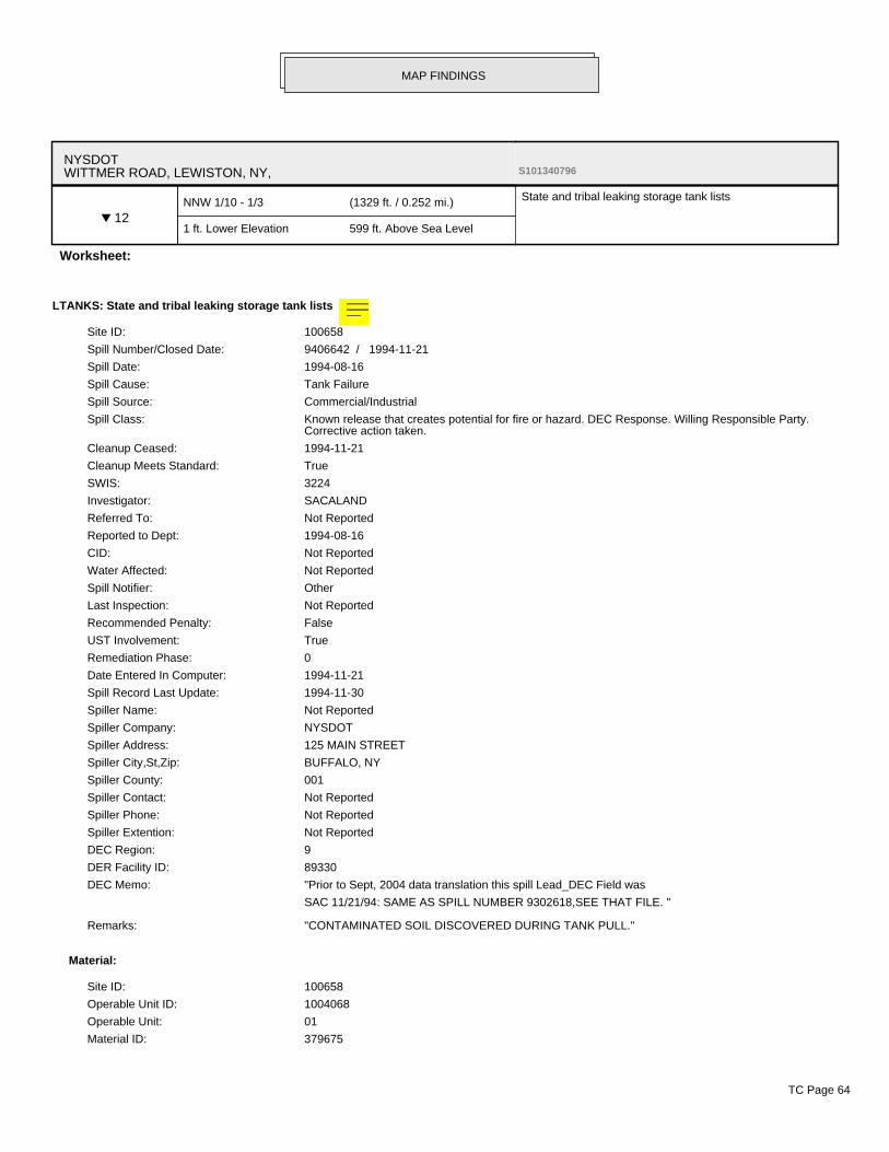
NYSDOTWITTMER ROAD, LEWISTON, NY, S101340796
▼ 12NNW 1/10 - 1/3 (1329 ft. / 0.252 mi.)
1 ft. Lower Elevation 599 ft. Above Sea Level
State and tribal leaking storage tank lists
Worksheet:
LTANKS: State and tribal leaking storage tank lists >
Site ID: 100658
Spill Number/Closed Date: 9406642 / 1994-11-21
Spill Date: 1994-08-16
Spill Cause: Tank Failure
Spill Source: Commercial/Industrial
Spill Class: Known release that creates potential for fire or hazard. DEC Response. Willing Responsible Party.Corrective action taken.
Cleanup Ceased: 1994-11-21
Cleanup Meets Standard: True
SWIS: 3224
Investigator: SACALAND
Referred To: Not Reported
Reported to Dept: 1994-08-16
CID: Not Reported
Water Affected: Not Reported
Spill Notifier: Other
Last Inspection: Not Reported
Recommended Penalty: False
UST Involvement: True
Remediation Phase: 0
Date Entered In Computer: 1994-11-21
Spill Record Last Update: 1994-11-30
Spiller Name: Not Reported
Spiller Company: NYSDOT
Spiller Address: 125 MAIN STREET
Spiller City,St,Zip: BUFFALO, NY
Spiller County: 001
Spiller Contact: Not Reported
Spiller Phone: Not Reported
Spiller Extention: Not Reported
DEC Region: 9
DER Facility ID: 89330
DEC Memo: "Prior to Sept, 2004 data translation this spill Lead_DEC Field was
SAC 11/21/94: SAME AS SPILL NUMBER 9302618,SEE THAT FILE. "
Remarks: "CONTAMINATED SOIL DISCOVERED DURING TANK PULL."
Material:
Site ID: 100658
Operable Unit ID: 1004068
Operable Unit: 01
Material ID: 379675
MAP FINDINGS
TC Page 64

NYSDOT, WITTMER ROAD, LEWISTON, NY (Continued)
Material Code: 0008
Material Name: diesel
Case No.: Not Reported
Material FA: Petroleum
Quantity: .00
Units: Not Reported
Recovered: .00
Resource Affected: Not Reported
Oxygenate: Not Reported
Tank Test:
MAP FINDINGS
TC Page 65

LEASEWAY MOTORCAR TRANSPORT4749 WITMER RD, NIAGARA FALLS, NY, 14305 1000556106
▼ C13NW 1/10 - 1/3 (1403 ft. / 0.266 mi.)
3 ft. Lower Elevation 597 ft. Above Sea Level
Federal RCRA generators list
State and tribal leaking storage tank lists
Other Standard Environmental Records
Worksheet:
FINDS: Other Standard Environmental Records >
Registry ID: 110004482854
Environmental Interest/Information System:
US National Pollutant Discharge Elimination System (NPDES) module of the Compliance InformationSystem (ICIS) tracks surface water permits issued under the Clean Water Act. Under NPDES, all facilitiesthat discharge pollutants from any point source into waters of the United States are required to obtain apermit. The permit will likely contain limits on what can be discharged, impose monitoring and reportingrequirements, and include other provisions to ensure that the discharge does not adversely affect waterquality.
RCRAInfo is a national information system that supports the Resource Conservation and Recovery Act(RCRA) program through the tracking of events and activities related to facilities that generate, transport,and treat, store, or dispose of hazardous waste. RCRAInfo allows RCRA program staff to track thenotification, permit, compliance, and corrective action activities required under RCRA.
FIS (New York - Facility Information System) is New York's Department of Environmental Conservation(DEC) information system for tracking environmental facility information found across the State.
ICIS (Integrated Compliance Information System) is the Integrated Compliance Information System andprovides a database that, when complete, will contain integrated Enforcement and Complianceinformation across most of EPA's programs. The vision for ICIS is to replace EPA's independentdatabases that contain Enforcement data with a single repository for that information. Currently, ICIScontains all Federal Administrative and Judicial enforcement actions. This information is maintained inICIS by EPA in the Regional offices and it Headquarters. A future release of ICIS will replace the PermitCompliance System (PCS) which supports the NPDES and will integrate that information with Federalactions already in the system. ICIS also has the capability to track other activities occurring in the Regionthat support Compliance and Enforcement programs. These include; Incident Tracking, ComplianceAssistance, and Compliance Monitoring.
ECHO: Other Standard Environmental Records >
Envid: 1000556106
Registry ID: 110004482854
DFR URL: http://echo.epa.gov/detailed_facility_report?fid=110004482854
RCRA-CESQG: Federal RCRA generators list >
Date form received by agency: 01/01/2007
Facility name: LEASEWAY MOTORCAR TRANSPORT CO
Facility address: 4749 WITMER RD
NIAGARA FALLS, NY 14304
EPA ID: NYD986986628
Mailing address: MICHIGAN AVE SUITE 100
WAYNE, MI 48184
Contact: DAN DANIELCZYK
Contact address: MICHIGAN AVE SUITE 100
WAYNE, MI 48184
MAP FINDINGS
TC Page 66

LEASEWAY MOTORCAR TRANSPORT, 4749 WITMER RD, NIAGARA FALLS, NY 14305 (Continued)
Contact country: US
Contact telephone: (734) 729-9779
Contact email: Not Reported
EPA Region: 02
Classification: Conditionally Exempt Small Quantity Generator
Description: Handler: generates 100 kg or less of hazardous waste per calendar month, and accumulates 1000 kgor less of hazardous waste at any time; or generates 1 kg or less of acutely hazardous waste percalendar month, and accumulates at any time: 1 kg or less of acutely hazardous waste; or 100 kg orless of any residue or contaminated soil, waste or other debris resulting from the cleanup of a spill,into or on any land or water, of acutely hazardous waste; or generates 100 kg or less of any residueor contaminated soil, waste or other debris resulting from the cleanup of a spill, into or on any land orwater, of acutely hazardous waste during any calendar month, and accumulates at any time: 1 kg orless of acutely hazardous waste; or 100 kg or less of any residue or contaminated soil, waste or otherdebris resulting from the cleanup of a spill, into or on any land or water, of acutely hazardous waste
Owner/Operator Summary:
Owner/operator name: ARMOND CERRONE INC
Owner/operator address: Not Reported
Owner/operator country: US
Owner/operator telephone: Not Reported
Legal status: Private
Owner/Operator Type: Owner
Owner/Op start date: 04/13/2004
Owner/Op end date: Not Reported
Owner/operator name: LEASEWAY TRANSPORTATION CORP
Owner/operator address: RTE 10 GREEN HILLS PO BOX 563
READING, PA 19603
Owner/operator country: Not Reported
Owner/operator telephone: (610) 775-6000
Legal status: Private
Owner/Operator Type: Owner
Owner/Op start date: Not Reported
Owner/Op end date: Not Reported
Owner/operator name: LEASEWAY TRANSPORTATION CORP
Owner/operator address: RTE 10 GREEN HILLS PO BOX 563
READING, PA 19603
Owner/operator country: US
Owner/operator telephone: (610) 775-6000
Legal status: Private
Owner/Operator Type: Owner
Owner/Op start date: 01/01/2001
Owner/Op end date: Not Reported
Owner/operator name: LEASEWAY MOTORCAR TRANSPORT CO
Owner/operator address: WITMER RD
NIAGARA FALLS, NY 14304
Owner/operator country: US
Owner/operator telephone: Not Reported
Legal status: Private
Owner/Operator Type: Operator
Owner/Op start date: 03/27/2004
MAP FINDINGS
TC Page 67

LEASEWAY MOTORCAR TRANSPORT, 4749 WITMER RD, NIAGARA FALLS, NY 14305 (Continued)
Owner/Op end date: Not Reported
Owner/operator name: NO NAME FOUND
Owner/operator address: Not Reported
Owner/operator country: US
Owner/operator telephone: Not Reported
Legal status: Private
Owner/Operator Type: Owner
Owner/Op start date: 04/13/2004
Owner/Op end date: Not Reported
Handler Activities Summary:
U.S. importer of hazardous waste: No
Mixed waste (haz. and radioactive): No
Recycler of hazardous waste: No
Transporter of hazardous waste: No
Treater, storer or disposer of HW: No
Underground injection activity: No
On-site burner exemption: No
Furnace exemption: No
Used oil fuel burner: No
Used oil processor: No
User oil refiner: No
Used oil fuel marketer to burner: No
Used oil Specification marketer: No
Used oil transfer facility: No
Used oil transporter: No
Historical Generators:
Date form received by agency: 01/01/2006
Site name: LEASEWAY MOTORCAR TRANSPORT CO
Classification: Conditionally Exempt Small Quantity Generator
Date form received by agency: 04/26/2004
Site name: LEASEWAY MOTORCAR TRANSPORT CO
Classification: Conditionally Exempt Small Quantity Generator
. Waste code: D001
. Waste name: IGNITABLE WASTE
. Waste code: D008
. Waste name: LEAD
. Waste code: D018
. Waste name: BENZENE
. Waste code: D035
. Waste name: METHYL ETHYL KETONE
. Waste code: D039
. Waste name: TETRACHLOROETHYLENE
. Waste code: D040
MAP FINDINGS
TC Page 68
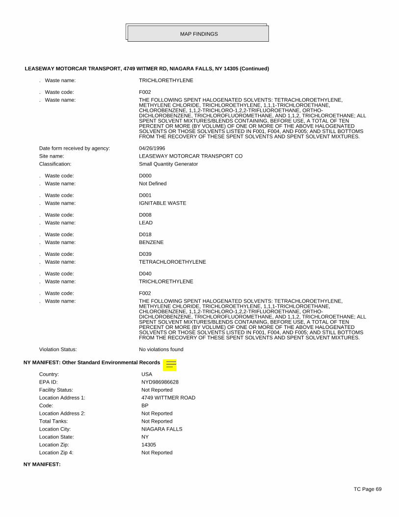
LEASEWAY MOTORCAR TRANSPORT, 4749 WITMER RD, NIAGARA FALLS, NY 14305 (Continued)
. Waste name: TRICHLORETHYLENE
. Waste code: F002
. Waste name: THE FOLLOWING SPENT HALOGENATED SOLVENTS: TETRACHLOROETHYLENE,METHYLENE CHLORIDE, TRICHLOROETHYLENE, 1,1,1-TRICHLOROETHANE,CHLOROBENZENE, 1,1,2-TRICHLORO-1,2,2-TRIFLUOROETHANE, ORTHO-DICHLOROBENZENE, TRICHLOROFLUOROMETHANE, AND 1,1,2, TRICHLOROETHANE; ALLSPENT SOLVENT MIXTURES/BLENDS CONTAINING, BEFORE USE, A TOTAL OF TENPERCENT OR MORE (BY VOLUME) OF ONE OR MORE OF THE ABOVE HALOGENATEDSOLVENTS OR THOSE SOLVENTS LISTED IN F001, F004, AND F005; AND STILL BOTTOMSFROM THE RECOVERY OF THESE SPENT SOLVENTS AND SPENT SOLVENT MIXTURES.
Date form received by agency: 04/26/1996
Site name: LEASEWAY MOTORCAR TRANSPORT CO
Classification: Small Quantity Generator
. Waste code: D000
. Waste name: Not Defined
. Waste code: D001
. Waste name: IGNITABLE WASTE
. Waste code: D008
. Waste name: LEAD
. Waste code: D018
. Waste name: BENZENE
. Waste code: D039
. Waste name: TETRACHLOROETHYLENE
. Waste code: D040
. Waste name: TRICHLORETHYLENE
. Waste code: F002
. Waste name: THE FOLLOWING SPENT HALOGENATED SOLVENTS: TETRACHLOROETHYLENE,METHYLENE CHLORIDE, TRICHLOROETHYLENE, 1,1,1-TRICHLOROETHANE,CHLOROBENZENE, 1,1,2-TRICHLORO-1,2,2-TRIFLUOROETHANE, ORTHO-DICHLOROBENZENE, TRICHLOROFLUOROMETHANE, AND 1,1,2, TRICHLOROETHANE; ALLSPENT SOLVENT MIXTURES/BLENDS CONTAINING, BEFORE USE, A TOTAL OF TENPERCENT OR MORE (BY VOLUME) OF ONE OR MORE OF THE ABOVE HALOGENATEDSOLVENTS OR THOSE SOLVENTS LISTED IN F001, F004, AND F005; AND STILL BOTTOMSFROM THE RECOVERY OF THESE SPENT SOLVENTS AND SPENT SOLVENT MIXTURES.
Violation Status: No violations found
NY MANIFEST: Other Standard Environmental Records >
Country: USA
EPA ID: NYD986986628
Facility Status: Not Reported
Location Address 1: 4749 WITTMER ROAD
Code: BP
Location Address 2: Not Reported
Total Tanks: Not Reported
Location City: NIAGARA FALLS
Location State: NY
Location Zip: 14305
Location Zip 4: Not Reported
NY MANIFEST:
MAP FINDINGS
TC Page 69
LEASEWAY MOTORCAR TRANSPORT, 4749 WITMER RD, NIAGARA FALLS, NY 14305 (Continued)
EPAID: NYD986986628
Mailing Name: LEASEWAY MOTORCAR TRANSPORT
Mailing Contact: DENNIS LESIKA
Mailing Address 1: 4749 WITTMER ROAD
Mailing Address 2: Not Reported
Mailing City: NIAGARA FALLS
Mailing State: NY
Mailing Zip: 14305
Mailing Zip 4: Not Reported
Mailing Country: USA
Mailing Phone: 7162857016
NY MANIFEST:
Document ID: Not Reported
Manifest Status: Not Reported
seq: Not Reported
Year: 2008
Trans1 State ID: TXR000050930
Trans2 State ID: Not Reported
Generator Ship Date: 03/24/2008
Trans1 Recv Date: 03/24/2008
Trans2 Recv Date: Not Reported
TSD Site Recv Date: 03/24/2008
Part A Recv Date: Not Reported
Part B Recv Date: Not Reported
Generator EPA ID: NYD986986628
Trans1 EPA ID: Not Reported
Trans2 EPA ID: Not Reported
TSDF ID 1: NYD981556541
TSDF ID 2: Not Reported
Manifest Tracking Number: 000939816SKS
Import Indicator: N
Export Indicator: N
Discr Quantity Indicator: N
Discr Type Indicator: N
Discr Residue Indicator: N
Discr Partial Reject Indicator: N
Discr Full Reject Indicator: N
Manifest Ref Number: Not Reported
Alt Facility RCRA ID: Not Reported
Alt Facility Sign Date: Not Reported
MGMT Method Type Code: H141
Waste Code: Not Reported
Waste Code: Not Reported
Waste Code: Not Reported
Waste Code: Not Reported
Waste Code: Not Reported
Waste Code: Not Reported
Quantity: 30.0
MAP FINDINGS
TC Page 70

LEASEWAY MOTORCAR TRANSPORT, 4749 WITMER RD, NIAGARA FALLS, NY 14305 (Continued)
Units: G - Gallons (liquids only)* (8.3 pounds)
Number of Containers: 2.0
Container Type: DM - Metal drums, barrels
Handling Method: R Material recovery of more than 75 percent of the total material.
Specific Gravity: 1.0
Waste Code: D039
Waste Code 1_2: Not Reported
Waste Code 1_3: Not Reported
Waste Code 1_4: Not Reported
Waste Code 1_5: Not Reported
Waste Code 1_6: Not Reported
Document ID: Not Reported
Manifest Status: Not Reported
seq: Not Reported
Year: 2008
Trans1 State ID: TXR000050930
Trans2 State ID: Not Reported
Generator Ship Date: 05/19/2008
Trans1 Recv Date: 05/19/2008
Trans2 Recv Date: Not Reported
TSD Site Recv Date: 05/19/2008
Part A Recv Date: Not Reported
Part B Recv Date: Not Reported
Generator EPA ID: NYD986986628
Trans1 EPA ID: Not Reported
Trans2 EPA ID: Not Reported
TSDF ID 1: NYD981556541
TSDF ID 2: Not Reported
Manifest Tracking Number: 001145315SKS
Import Indicator: N
Export Indicator: N
Discr Quantity Indicator: N
Discr Type Indicator: N
Discr Residue Indicator: N
Discr Partial Reject Indicator: N
Discr Full Reject Indicator: N
Manifest Ref Number: Not Reported
Alt Facility RCRA ID: Not Reported
Alt Facility Sign Date: Not Reported
MGMT Method Type Code: H141
Waste Code: Not Reported
Waste Code: Not Reported
Waste Code: Not Reported
Waste Code: Not Reported
Waste Code: Not Reported
Waste Code: Not Reported
Quantity: 30.0
Units: G - Gallons (liquids only)* (8.3 pounds)
Number of Containers: 2.0
MAP FINDINGS
TC Page 71

LEASEWAY MOTORCAR TRANSPORT, 4749 WITMER RD, NIAGARA FALLS, NY 14305 (Continued)
Container Type: DM - Metal drums, barrels
Handling Method: R Material recovery of more than 75 percent of the total material.
Specific Gravity: 1.0
Waste Code: D039
Waste Code 1_2: Not Reported
Waste Code 1_3: Not Reported
Waste Code 1_4: Not Reported
Waste Code 1_5: Not Reported
Waste Code 1_6: Not Reported
Document ID: Not Reported
Manifest Status: Not Reported
seq: Not Reported
Year: 2008
Trans1 State ID: TXR000050930
Trans2 State ID: Not Reported
Generator Ship Date: 02/20/2008
Trans1 Recv Date: 02/20/2008
Trans2 Recv Date: Not Reported
TSD Site Recv Date: 02/20/2008
Part A Recv Date: Not Reported
Part B Recv Date: Not Reported
Generator EPA ID: NYD986986628
Trans1 EPA ID: Not Reported
Trans2 EPA ID: Not Reported
TSDF ID 1: NYD981556541
TSDF ID 2: Not Reported
Manifest Tracking Number: 000541560SKS
Import Indicator: N
Export Indicator: N
Discr Quantity Indicator: N
Discr Type Indicator: N
Discr Residue Indicator: N
Discr Partial Reject Indicator: N
Discr Full Reject Indicator: N
Manifest Ref Number: Not Reported
Alt Facility RCRA ID: Not Reported
Alt Facility Sign Date: Not Reported
MGMT Method Type Code: H141
Waste Code: Not Reported
Waste Code: Not Reported
Waste Code: Not Reported
Waste Code: Not Reported
Waste Code: Not Reported
Waste Code: Not Reported
Quantity: 20.0
Units: G - Gallons (liquids only)* (8.3 pounds)
Number of Containers: 2.0
Container Type: DM - Metal drums, barrels
Handling Method: R Material recovery of more than 75 percent of the total material.
MAP FINDINGS
TC Page 72

LEASEWAY MOTORCAR TRANSPORT, 4749 WITMER RD, NIAGARA FALLS, NY 14305 (Continued)
Specific Gravity: 1.0
Waste Code: D039
Waste Code 1_2: Not Reported
Waste Code 1_3: Not Reported
Waste Code 1_4: Not Reported
Waste Code 1_5: Not Reported
Waste Code 1_6: Not Reported
Document ID: Not Reported
Manifest Status: Not Reported
seq: Not Reported
Year: 2007
Trans1 State ID: TXR000050930
Trans2 State ID: Not Reported
Generator Ship Date: 08/02/2007
Trans1 Recv Date: 08/02/2007
Trans2 Recv Date: Not Reported
TSD Site Recv Date: 08/02/2007
Part A Recv Date: Not Reported
Part B Recv Date: Not Reported
Generator EPA ID: NYD986986628
Trans1 EPA ID: Not Reported
Trans2 EPA ID: Not Reported
TSDF ID 1: NYD981556541
TSDF ID 2: Not Reported
Manifest Tracking Number: 000256049SKS
Import Indicator: N
Export Indicator: N
Discr Quantity Indicator: N
Discr Type Indicator: N
Discr Residue Indicator: N
Discr Partial Reject Indicator: N
Discr Full Reject Indicator: N
Manifest Ref Number: Not Reported
Alt Facility RCRA ID: Not Reported
Alt Facility Sign Date: Not Reported
MGMT Method Type Code: H141
Waste Code: Not Reported
Waste Code: Not Reported
Waste Code: Not Reported
Waste Code: Not Reported
Waste Code: Not Reported
Waste Code: Not Reported
Quantity: 28
Units: G - Gallons (liquids only)* (8.3 pounds)
Number of Containers: 2
Container Type: DM - Metal drums, barrels
Handling Method: R Material recovery of more than 75 percent of the total material.
Specific Gravity: 1
Waste Code: D039
MAP FINDINGS
TC Page 73

LEASEWAY MOTORCAR TRANSPORT, 4749 WITMER RD, NIAGARA FALLS, NY 14305 (Continued)
Waste Code 1_2: Not Reported
Waste Code 1_3: Not Reported
Waste Code 1_4: Not Reported
Waste Code 1_5: Not Reported
Waste Code 1_6: Not Reported
Document ID: Not Reported
Manifest Status: Not Reported
seq: Not Reported
Year: 2007
Trans1 State ID: TXR000050930
Trans2 State ID: Not Reported
Generator Ship Date: 10/12/2007
Trans1 Recv Date: 10/12/2007
Trans2 Recv Date: Not Reported
TSD Site Recv Date: 10/12/2007
Part A Recv Date: Not Reported
Part B Recv Date: Not Reported
Generator EPA ID: NYD986986628
Trans1 EPA ID: Not Reported
Trans2 EPA ID: Not Reported
TSDF ID 1: NYD981556541
TSDF ID 2: Not Reported
Manifest Tracking Number: 000260587SKS
Import Indicator: N
Export Indicator: N
Discr Quantity Indicator: N
Discr Type Indicator: N
Discr Residue Indicator: N
Discr Partial Reject Indicator: N
Discr Full Reject Indicator: N
Manifest Ref Number: Not Reported
Alt Facility RCRA ID: Not Reported
Alt Facility Sign Date: Not Reported
MGMT Method Type Code: H141
Waste Code: Not Reported
Waste Code: Not Reported
Waste Code: Not Reported
Waste Code: Not Reported
Waste Code: Not Reported
Waste Code: Not Reported
Quantity: 28
Units: G - Gallons (liquids only)* (8.3 pounds)
Number of Containers: 2
Container Type: DM - Metal drums, barrels
Handling Method: R Material recovery of more than 75 percent of the total material.
Specific Gravity: 1
Waste Code: D039
Waste Code 1_2: Not Reported
Waste Code 1_3: Not Reported
MAP FINDINGS
TC Page 74

LEASEWAY MOTORCAR TRANSPORT, 4749 WITMER RD, NIAGARA FALLS, NY 14305 (Continued)
Waste Code 1_4: Not Reported
Waste Code 1_5: Not Reported
Waste Code 1_6: Not Reported
Document ID: Not Reported
Manifest Status: Not Reported
seq: Not Reported
Year: 2007
Trans1 State ID: TXR000050930
Trans2 State ID: Not Reported
Generator Ship Date: 06/08/2007
Trans1 Recv Date: 06/08/2007
Trans2 Recv Date: Not Reported
TSD Site Recv Date: 06/08/2007
Part A Recv Date: Not Reported
Part B Recv Date: Not Reported
Generator EPA ID: NYD986986628
Trans1 EPA ID: Not Reported
Trans2 EPA ID: Not Reported
TSDF ID 1: NYD981556541
TSDF ID 2: Not Reported
Manifest Tracking Number: 000335567SKS
Import Indicator: N
Export Indicator: N
Discr Quantity Indicator: N
Discr Type Indicator: N
Discr Residue Indicator: N
Discr Partial Reject Indicator: N
Discr Full Reject Indicator: N
Manifest Ref Number: Not Reported
Alt Facility RCRA ID: Not Reported
Alt Facility Sign Date: Not Reported
MGMT Method Type Code: H141
Waste Code: Not Reported
Waste Code: Not Reported
Waste Code: Not Reported
Waste Code: Not Reported
Waste Code: Not Reported
Waste Code: Not Reported
Quantity: 28
Units: G - Gallons (liquids only)* (8.3 pounds)
Number of Containers: 2
Container Type: DM - Metal drums, barrels
Handling Method: R Material recovery of more than 75 percent of the total material.
Specific Gravity: 1
Waste Code: D039
Waste Code 1_2: Not Reported
Waste Code 1_3: Not Reported
Waste Code 1_4: Not Reported
Waste Code 1_5: Not Reported
MAP FINDINGS
TC Page 75

LEASEWAY MOTORCAR TRANSPORT, 4749 WITMER RD, NIAGARA FALLS, NY 14305 (Continued)
Waste Code 1_6: Not Reported
Document ID: Not Reported
Manifest Status: Not Reported
seq: Not Reported
Year: 2007
Trans1 State ID: TXR000050930
Trans2 State ID: Not Reported
Generator Ship Date: 02/21/2007
Trans1 Recv Date: 02/21/2007
Trans2 Recv Date: Not Reported
TSD Site Recv Date: 02/21/2007
Part A Recv Date: Not Reported
Part B Recv Date: Not Reported
Generator EPA ID: NYD986986628
Trans1 EPA ID: Not Reported
Trans2 EPA ID: Not Reported
TSDF ID 1: NYD981556541
TSDF ID 2: Not Reported
Manifest Tracking Number: 000368737SKS
Import Indicator: N
Export Indicator: N
Discr Quantity Indicator: N
Discr Type Indicator: N
Discr Residue Indicator: N
Discr Partial Reject Indicator: N
Discr Full Reject Indicator: N
Manifest Ref Number: Not Reported
Alt Facility RCRA ID: Not Reported
Alt Facility Sign Date: Not Reported
MGMT Method Type Code: H141
Waste Code: Not Reported
Waste Code: Not Reported
Waste Code: Not Reported
Waste Code: Not Reported
Waste Code: Not Reported
Waste Code: Not Reported
Quantity: 28
Units: G - Gallons (liquids only)* (8.3 pounds)
Number of Containers: 2
Container Type: DM - Metal drums, barrels
Handling Method: R Material recovery of more than 75 percent of the total material.
Specific Gravity: 1
Waste Code: D039
Waste Code 1_2: Not Reported
Waste Code 1_3: Not Reported
Waste Code 1_4: Not Reported
Waste Code 1_5: Not Reported
Waste Code 1_6: Not Reported
Document ID: Not Reported
MAP FINDINGS
TC Page 76

LEASEWAY MOTORCAR TRANSPORT, 4749 WITMER RD, NIAGARA FALLS, NY 14305 (Continued)
Manifest Status: Not Reported
seq: Not Reported
Year: 2007
Trans1 State ID: TXR000050930
Trans2 State ID: Not Reported
Generator Ship Date: 04/20/2007
Trans1 Recv Date: 04/20/2007
Trans2 Recv Date: Not Reported
TSD Site Recv Date: 04/20/2007
Part A Recv Date: Not Reported
Part B Recv Date: Not Reported
Generator EPA ID: NYD986986628
Trans1 EPA ID: Not Reported
Trans2 EPA ID: Not Reported
TSDF ID 1: NYD981556541
TSDF ID 2: Not Reported
Manifest Tracking Number: 000483754SKS
Import Indicator: N
Export Indicator: N
Discr Quantity Indicator: N
Discr Type Indicator: N
Discr Residue Indicator: N
Discr Partial Reject Indicator: N
Discr Full Reject Indicator: N
Manifest Ref Number: Not Reported
Alt Facility RCRA ID: Not Reported
Alt Facility Sign Date: Not Reported
MGMT Method Type Code: H141
Waste Code: Not Reported
Waste Code: Not Reported
Waste Code: Not Reported
Waste Code: Not Reported
Waste Code: Not Reported
Waste Code: Not Reported
Quantity: 30
Units: G - Gallons (liquids only)* (8.3 pounds)
Number of Containers: 2
Container Type: DM - Metal drums, barrels
Handling Method: R Material recovery of more than 75 percent of the total material.
Specific Gravity: 1
Waste Code: D039
Waste Code 1_2: Not Reported
Waste Code 1_3: Not Reported
Waste Code 1_4: Not Reported
Waste Code 1_5: Not Reported
Waste Code 1_6: Not Reported
Document ID: Not Reported
Manifest Status: Not Reported
seq: Not Reported
MAP FINDINGS
TC Page 77

LEASEWAY MOTORCAR TRANSPORT, 4749 WITMER RD, NIAGARA FALLS, NY 14305 (Continued)
Year: 2007
Trans1 State ID: TXR000050930
Trans2 State ID: Not Reported
Generator Ship Date: 09/28/2007
Trans1 Recv Date: 09/28/2007
Trans2 Recv Date: Not Reported
TSD Site Recv Date: 09/28/2007
Part A Recv Date: Not Reported
Part B Recv Date: Not Reported
Generator EPA ID: NYD986986628
Trans1 EPA ID: Not Reported
Trans2 EPA ID: Not Reported
TSDF ID 1: NYD981556541
TSDF ID 2: Not Reported
Manifest Tracking Number: 000795899SKS
Import Indicator: N
Export Indicator: N
Discr Quantity Indicator: N
Discr Type Indicator: N
Discr Residue Indicator: N
Discr Partial Reject Indicator: N
Discr Full Reject Indicator: N
Manifest Ref Number: Not Reported
Alt Facility RCRA ID: Not Reported
Alt Facility Sign Date: Not Reported
MGMT Method Type Code: H141
Waste Code: Not Reported
Waste Code: Not Reported
Waste Code: Not Reported
Waste Code: Not Reported
Waste Code: Not Reported
Waste Code: Not Reported
Quantity: 28
Units: G - Gallons (liquids only)* (8.3 pounds)
Number of Containers: 2
Container Type: DM - Metal drums, barrels
Handling Method: R Material recovery of more than 75 percent of the total material.
Specific Gravity: 1
Waste Code: D039
Waste Code 1_2: Not Reported
Waste Code 1_3: Not Reported
Waste Code 1_4: Not Reported
Waste Code 1_5: Not Reported
Waste Code 1_6: Not Reported
Document ID: NYC7644846
Manifest Status: Not Reported
seq: 01
Year: 2006
Trans1 State ID: TXR000050930
MAP FINDINGS
TC Page 78

LEASEWAY MOTORCAR TRANSPORT, 4749 WITMER RD, NIAGARA FALLS, NY 14305 (Continued)
Trans2 State ID: Not Reported
Generator Ship Date: 05/19/2006
Trans1 Recv Date: 05/19/2006
Trans2 Recv Date: Not Reported
TSD Site Recv Date: 05/19/2006
Part A Recv Date: Not Reported
Part B Recv Date: Not Reported
Generator EPA ID: NYD986986628
Trans1 EPA ID: NY63664JV
Trans2 EPA ID: Not Reported
TSDF ID 1: NYD981556541
TSDF ID 2: Not Reported
Manifest Tracking Number: Not Reported
Import Indicator: Not Reported
Export Indicator: Not Reported
Discr Quantity Indicator: Not Reported
Discr Type Indicator: Not Reported
Discr Residue Indicator: Not Reported
Discr Partial Reject Indicator: Not Reported
Discr Full Reject Indicator: Not Reported
Manifest Ref Number: Not Reported
Alt Facility RCRA ID: Not Reported
Alt Facility Sign Date: Not Reported
MGMT Method Type Code: Not Reported
Waste Code: D039 - TETRACHLOROETHYLENE 0.73 MG/L TCLP
Waste Code: Not Reported
Waste Code: Not Reported
Waste Code: Not Reported
Waste Code: Not Reported
Waste Code: Not Reported
Quantity: 00030
Units: G - Gallons (liquids only)* (8.3 pounds)
Number of Containers: 002
Container Type: DM - Metal drums, barrels
Handling Method: R Material recovery of more than 75 percent of the total material.
Specific Gravity: 01.00
Document ID: NYC7779958
Manifest Status: Not Reported
seq: 01
Year: 2006
Trans1 State ID: TXR000050930
Trans2 State ID: Not Reported
Generator Ship Date: 01/23/2006
Trans1 Recv Date: 01/23/2006
Trans2 Recv Date: Not Reported
TSD Site Recv Date: 01/23/2006
Part A Recv Date: Not Reported
Part B Recv Date: Not Reported
Generator EPA ID: NYD986986628
MAP FINDINGS
TC Page 79

LEASEWAY MOTORCAR TRANSPORT, 4749 WITMER RD, NIAGARA FALLS, NY 14305 (Continued)
Trans1 EPA ID: NY13034JE
Trans2 EPA ID: Not Reported
TSDF ID 1: NYD981556541
TSDF ID 2: Not Reported
Manifest Tracking Number: Not Reported
Import Indicator: Not Reported
Export Indicator: Not Reported
Discr Quantity Indicator: Not Reported
Discr Type Indicator: Not Reported
Discr Residue Indicator: Not Reported
Discr Partial Reject Indicator: Not Reported
Discr Full Reject Indicator: Not Reported
Manifest Ref Number: Not Reported
Alt Facility RCRA ID: Not Reported
Alt Facility Sign Date: Not Reported
MGMT Method Type Code: Not Reported
Waste Code: D039 - TETRACHLOROETHYLENE 0.73 MG/L TCLP
Waste Code: Not Reported
Waste Code: Not Reported
Waste Code: Not Reported
Waste Code: Not Reported
Waste Code: Not Reported
Quantity: 00024
Units: G - Gallons (liquids only)* (8.3 pounds)
Number of Containers: 002
Container Type: DM - Metal drums, barrels
Handling Method: R Material recovery of more than 75 percent of the total material.
Specific Gravity: 01.00
Document ID: NYC7806058
Manifest Status: Not Reported
seq: 01
Year: 2006
Trans1 State ID: TXR000050930
Trans2 State ID: Not Reported
Generator Ship Date: 03/20/2006
Trans1 Recv Date: 03/20/2006
Trans2 Recv Date: Not Reported
TSD Site Recv Date: 03/20/2006
Part A Recv Date: Not Reported
Part B Recv Date: Not Reported
Generator EPA ID: NYD986986628
Trans1 EPA ID: NY11382JS
Trans2 EPA ID: Not Reported
TSDF ID 1: NYD981556541
TSDF ID 2: Not Reported
Manifest Tracking Number: Not Reported
Import Indicator: Not Reported
Export Indicator: Not Reported
Discr Quantity Indicator: Not Reported
MAP FINDINGS
TC Page 80

LEASEWAY MOTORCAR TRANSPORT, 4749 WITMER RD, NIAGARA FALLS, NY 14305 (Continued)
Discr Type Indicator: Not Reported
Discr Residue Indicator: Not Reported
Discr Partial Reject Indicator: Not Reported
Discr Full Reject Indicator: Not Reported
Manifest Ref Number: Not Reported
Alt Facility RCRA ID: Not Reported
Alt Facility Sign Date: Not Reported
MGMT Method Type Code: Not Reported
Waste Code: D039 - TETRACHLOROETHYLENE 0.73 MG/L TCLP
Waste Code: Not Reported
Waste Code: Not Reported
Waste Code: Not Reported
Waste Code: Not Reported
Waste Code: Not Reported
Quantity: 00024
Units: G - Gallons (liquids only)* (8.3 pounds)
Number of Containers: 002
Container Type: DM - Metal drums, barrels
Handling Method: R Material recovery of more than 75 percent of the total material.
Specific Gravity: 01.00
Document ID: NYC7826038
Manifest Status: Not Reported
seq: 01
Year: 2006
Trans1 State ID: TXR000050930
Trans2 State ID: Not Reported
Generator Ship Date: 08/15/2006
Trans1 Recv Date: 08/15/2006
Trans2 Recv Date: Not Reported
TSD Site Recv Date: 08/15/2006
Part A Recv Date: Not Reported
Part B Recv Date: Not Reported
Generator EPA ID: NYD986986628
Trans1 EPA ID: NY63555JU
Trans2 EPA ID: Not Reported
TSDF ID 1: NYD981556541
TSDF ID 2: Not Reported
Manifest Tracking Number: Not Reported
Import Indicator: Not Reported
Export Indicator: Not Reported
Discr Quantity Indicator: Not Reported
Discr Type Indicator: Not Reported
Discr Residue Indicator: Not Reported
Discr Partial Reject Indicator: Not Reported
Discr Full Reject Indicator: Not Reported
Manifest Ref Number: Not Reported
Alt Facility RCRA ID: Not Reported
Alt Facility Sign Date: Not Reported
MGMT Method Type Code: Not Reported
MAP FINDINGS
TC Page 81

LEASEWAY MOTORCAR TRANSPORT, 4749 WITMER RD, NIAGARA FALLS, NY 14305 (Continued)
Waste Code: D039 - TETRACHLOROETHYLENE 0.73 MG/L TCLP
Waste Code: Not Reported
Waste Code: Not Reported
Waste Code: Not Reported
Waste Code: Not Reported
Waste Code: Not Reported
Quantity: 00030
Units: G - Gallons (liquids only)* (8.3 pounds)
Number of Containers: 002
Container Type: DM - Metal drums, barrels
Handling Method: R Material recovery of more than 75 percent of the total material.
Specific Gravity: 01.00
Document ID: NYC7172572
Manifest Status: Not Reported
seq: Not Reported
Year: 2005
Trans1 State ID: TXR000050930
Trans2 State ID: Not Reported
Generator Ship Date: 04/21/2005
Trans1 Recv Date: 04/21/2005
Trans2 Recv Date: Not Reported
TSD Site Recv Date: 04/21/2005
Part A Recv Date: Not Reported
Part B Recv Date: Not Reported
Generator EPA ID: NYD986986628
Trans1 EPA ID: NYNA1635
Trans2 EPA ID: Not Reported
TSDF ID 1: NYD981556541
TSDF ID 2: Not Reported
Manifest Tracking Number: Not Reported
Import Indicator: Not Reported
Export Indicator: Not Reported
Discr Quantity Indicator: Not Reported
Discr Type Indicator: Not Reported
Discr Residue Indicator: Not Reported
Discr Partial Reject Indicator: Not Reported
Discr Full Reject Indicator: Not Reported
Manifest Ref Number: Not Reported
Alt Facility RCRA ID: Not Reported
Alt Facility Sign Date: Not Reported
MGMT Method Type Code: Not Reported
Waste Code: D039 - TETRACHLOROETHYLENE 0.73 MG/L TCLP
Waste Code: Not Reported
Waste Code: Not Reported
Waste Code: Not Reported
Waste Code: Not Reported
Waste Code: Not Reported
Quantity: 00015
Units: G - Gallons (liquids only)* (8.3 pounds)
MAP FINDINGS
TC Page 82

LEASEWAY MOTORCAR TRANSPORT, 4749 WITMER RD, NIAGARA FALLS, NY 14305 (Continued)
Number of Containers: 001
Container Type: DM - Metal drums, barrels
Handling Method: R Material recovery of more than 75 percent of the total material.
Specific Gravity: 01.00
Document ID: NYC7447915
Manifest Status: Not Reported
seq: Not Reported
Year: 2005
Trans1 State ID: TXR000050930
Trans2 State ID: Not Reported
Generator Ship Date: 02/16/2005
Trans1 Recv Date: 02/16/2005
Trans2 Recv Date: Not Reported
TSD Site Recv Date: 02/16/2005
Part A Recv Date: Not Reported
Part B Recv Date: Not Reported
Generator EPA ID: NYD986986628
Trans1 EPA ID: NY10827JF
Trans2 EPA ID: Not Reported
TSDF ID 1: NYD981556541
TSDF ID 2: Not Reported
Manifest Tracking Number: Not Reported
Import Indicator: Not Reported
Export Indicator: Not Reported
Discr Quantity Indicator: Not Reported
Discr Type Indicator: Not Reported
Discr Residue Indicator: Not Reported
Discr Partial Reject Indicator: Not Reported
Discr Full Reject Indicator: Not Reported
Manifest Ref Number: Not Reported
Alt Facility RCRA ID: Not Reported
Alt Facility Sign Date: Not Reported
MGMT Method Type Code: Not Reported
Waste Code: D039 - TETRACHLOROETHYLENE 0.73 MG/L TCLP
Waste Code: Not Reported
Waste Code: Not Reported
Waste Code: Not Reported
Waste Code: Not Reported
Waste Code: Not Reported
Quantity: 00030
Units: G - Gallons (liquids only)* (8.3 pounds)
Number of Containers: 002
Container Type: DM - Metal drums, barrels
Handling Method: R Material recovery of more than 75 percent of the total material.
Specific Gravity: 01.00
Document ID: NYC7551595
Manifest Status: Not Reported
seq: Not Reported
Year: 2005
MAP FINDINGS
TC Page 83

LEASEWAY MOTORCAR TRANSPORT, 4749 WITMER RD, NIAGARA FALLS, NY 14305 (Continued)
Trans1 State ID: TXR000050930
Trans2 State ID: Not Reported
Generator Ship Date: 06/13/2005
Trans1 Recv Date: 06/13/2005
Trans2 Recv Date: Not Reported
TSD Site Recv Date: 06/13/2005
Part A Recv Date: Not Reported
Part B Recv Date: Not Reported
Generator EPA ID: NYD986986628
Trans1 EPA ID: NY33916AP
Trans2 EPA ID: Not Reported
TSDF ID 1: NYD981556541
TSDF ID 2: Not Reported
Manifest Tracking Number: Not Reported
Import Indicator: Not Reported
Export Indicator: Not Reported
Discr Quantity Indicator: Not Reported
Discr Type Indicator: Not Reported
Discr Residue Indicator: Not Reported
Discr Partial Reject Indicator: Not Reported
Discr Full Reject Indicator: Not Reported
Manifest Ref Number: Not Reported
Alt Facility RCRA ID: Not Reported
Alt Facility Sign Date: Not Reported
MGMT Method Type Code: Not Reported
Waste Code: D039 - TETRACHLOROETHYLENE 0.73 MG/L TCLP
Waste Code: Not Reported
Waste Code: Not Reported
Waste Code: Not Reported
Waste Code: Not Reported
Waste Code: Not Reported
Quantity: 00030
Units: G - Gallons (liquids only)* (8.3 pounds)
Number of Containers: 002
Container Type: DM - Metal drums, barrels
Handling Method: R Material recovery of more than 75 percent of the total material.
Specific Gravity: 01.00
Document ID: NYC7600781
Manifest Status: Not Reported
seq: Not Reported
Year: 2005
Trans1 State ID: TXR000050930
Trans2 State ID: Not Reported
Generator Ship Date: 10/04/2005
Trans1 Recv Date: 10/04/2005
Trans2 Recv Date: Not Reported
TSD Site Recv Date: 10/04/2005
Part A Recv Date: Not Reported
Part B Recv Date: Not Reported
MAP FINDINGS
TC Page 84

LEASEWAY MOTORCAR TRANSPORT, 4749 WITMER RD, NIAGARA FALLS, NY 14305 (Continued)
Generator EPA ID: NYD986986628
Trans1 EPA ID: NYNA1635
Trans2 EPA ID: Not Reported
TSDF ID 1: NYD981556541
TSDF ID 2: Not Reported
Manifest Tracking Number: Not Reported
Import Indicator: Not Reported
Export Indicator: Not Reported
Discr Quantity Indicator: Not Reported
Discr Type Indicator: Not Reported
Discr Residue Indicator: Not Reported
Discr Partial Reject Indicator: Not Reported
Discr Full Reject Indicator: Not Reported
Manifest Ref Number: Not Reported
Alt Facility RCRA ID: Not Reported
Alt Facility Sign Date: Not Reported
MGMT Method Type Code: Not Reported
Waste Code: D039 - TETRACHLOROETHYLENE 0.73 MG/L TCLP
Waste Code: Not Reported
Waste Code: Not Reported
Waste Code: Not Reported
Waste Code: Not Reported
Waste Code: Not Reported
Quantity: 00034
Units: G - Gallons (liquids only)* (8.3 pounds)
Number of Containers: 002
Container Type: DM - Metal drums, barrels
Handling Method: R Material recovery of more than 75 percent of the total material.
Specific Gravity: 01.00
Document ID: NYC7622583
Manifest Status: Not Reported
seq: Not Reported
Year: 2005
Trans1 State ID: TXR000050930
Trans2 State ID: Not Reported
Generator Ship Date: 08/08/2005
Trans1 Recv Date: 08/08/2005
Trans2 Recv Date: Not Reported
TSD Site Recv Date: 08/08/2005
Part A Recv Date: Not Reported
Part B Recv Date: Not Reported
Generator EPA ID: NYD986986628
Trans1 EPA ID: NYNA1635
Trans2 EPA ID: Not Reported
TSDF ID 1: NYD981556541
TSDF ID 2: Not Reported
Manifest Tracking Number: Not Reported
Import Indicator: Not Reported
Export Indicator: Not Reported
MAP FINDINGS
TC Page 85

LEASEWAY MOTORCAR TRANSPORT, 4749 WITMER RD, NIAGARA FALLS, NY 14305 (Continued)
Discr Quantity Indicator: Not Reported
Discr Type Indicator: Not Reported
Discr Residue Indicator: Not Reported
Discr Partial Reject Indicator: Not Reported
Discr Full Reject Indicator: Not Reported
Manifest Ref Number: Not Reported
Alt Facility RCRA ID: Not Reported
Alt Facility Sign Date: Not Reported
MGMT Method Type Code: Not Reported
Waste Code: D039 - TETRACHLOROETHYLENE 0.73 MG/L TCLP
Waste Code: Not Reported
Waste Code: Not Reported
Waste Code: Not Reported
Waste Code: Not Reported
Waste Code: Not Reported
Quantity: 00016
Units: G - Gallons (liquids only)* (8.3 pounds)
Number of Containers: 001
Container Type: DM - Metal drums, barrels
Handling Method: R Material recovery of more than 75 percent of the total material.
Specific Gravity: 01.00
Document ID: NYC7693470
Manifest Status: Not Reported
seq: Not Reported
Year: 2005
Trans1 State ID: TXR000050930
Trans2 State ID: Not Reported
Generator Ship Date: 08/08/2005
Trans1 Recv Date: 08/08/2005
Trans2 Recv Date: Not Reported
TSD Site Recv Date: 08/08/2005
Part A Recv Date: Not Reported
Part B Recv Date: Not Reported
Generator EPA ID: NYD986986628
Trans1 EPA ID: NYNA1635
Trans2 EPA ID: Not Reported
TSDF ID 1: NYD981556541
TSDF ID 2: Not Reported
Manifest Tracking Number: Not Reported
Import Indicator: Not Reported
Export Indicator: Not Reported
Discr Quantity Indicator: Not Reported
Discr Type Indicator: Not Reported
Discr Residue Indicator: Not Reported
Discr Partial Reject Indicator: Not Reported
Discr Full Reject Indicator: Not Reported
Manifest Ref Number: Not Reported
Alt Facility RCRA ID: Not Reported
Alt Facility Sign Date: Not Reported
MAP FINDINGS
TC Page 86

LEASEWAY MOTORCAR TRANSPORT, 4749 WITMER RD, NIAGARA FALLS, NY 14305 (Continued)
MGMT Method Type Code: Not Reported
Waste Code: D039 - TETRACHLOROETHYLENE 0.73 MG/L TCLP
Waste Code: Not Reported
Waste Code: Not Reported
Waste Code: Not Reported
Waste Code: Not Reported
Waste Code: Not Reported
Quantity: 00016
Units: G - Gallons (liquids only)* (8.3 pounds)
Number of Containers: 001
Container Type: DM - Metal drums, barrels
Handling Method: R Material recovery of more than 75 percent of the total material.
Specific Gravity: 01.00
Document ID: NYC7289910
Manifest Status: Not Reported
seq: Not Reported
Year: 2004
Trans1 State ID: NY10827JF
Trans2 State ID: Not Reported
Generator Ship Date: 03/19/2004
Trans1 Recv Date: 03/19/2004
Trans2 Recv Date: Not Reported
TSD Site Recv Date: 03/19/2004
Part A Recv Date: Not Reported
Part B Recv Date: Not Reported
Generator EPA ID: NYD986986628
Trans1 EPA ID: TXR000050930
Trans2 EPA ID: Not Reported
TSDF ID 1: NYD981556
TSDF ID 2: Not Reported
Manifest Tracking Number: Not Reported
Import Indicator: Not Reported
Export Indicator: Not Reported
Discr Quantity Indicator: Not Reported
Discr Type Indicator: Not Reported
Discr Residue Indicator: Not Reported
Discr Partial Reject Indicator: Not Reported
Discr Full Reject Indicator: Not Reported
Manifest Ref Number: Not Reported
Alt Facility RCRA ID: Not Reported
Alt Facility Sign Date: Not Reported
MGMT Method Type Code: Not Reported
Waste Code: D039 - TETRACHLOROETHYLENE 0.73 MG/L TCLP
Waste Code: Not Reported
Waste Code: Not Reported
Waste Code: Not Reported
Waste Code: Not Reported
Waste Code: Not Reported
Quantity: 00030
MAP FINDINGS
TC Page 87

LEASEWAY MOTORCAR TRANSPORT, 4749 WITMER RD, NIAGARA FALLS, NY 14305 (Continued)
Units: G - Gallons (liquids only)* (8.3 pounds)
Number of Containers: 002
Container Type: DM - Metal drums, barrels
Handling Method: R Material recovery of more than 75 percent of the total material.
Specific Gravity: 01.00
The NY_MANIFEST database contains 93 additional records for this site. Please contact your EDR Account Executive for more information.
SPILLS: Other Standard Environmental Records >
Facility ID: 0300700
Facility Type: ER
DER Facility ID: 281748
Site ID: 138326
DEC Region: 9
Spill Date: 2003-04-20
Spill Number/Closed Date: 0300700 / 2003-08-11
Spill Cause: Unknown
Spill Class: Known release that creates potential for fire or hazard. DEC Response. Willing Responsible Party.Corrective action taken.
SWIS: 3200
Investigator: SACALAND
Referred To: NIAGARA CNTY HEALTH DEPT
Reported to Dept: 2003-04-20
CID: 422
Water Affected: Not Reported
Spill Source: Commercial/Industrial
Spill Notifier: Responsible Party
Cleanup Ceased: Not Reported
Cleanup Meets Std: True
Last Inspection: 2003-04-23
Recommended Penalty: False
UST Trust: False
Remediation Phase: 0
Date Entered In Computer: 2003-04-20
Spill Record Last Update: 2003-08-11
Spiller Name: Not Reported
Spiller Company: LEASEWAY AUTO CARRIERS
Spiller Address: P.O. BOX 389
Spiller City,St,Zip: NIAGARA FALLS, NY 14304-
Spiller Company: 001
Contact Name: DENNIS LESIKA
Contact Phone: (800) 733-1444
DEC Memo: "Prior to Sept, 2004 data translation this spill Lead_DEC Field was
SAC-NCHD 4/21/03:JAA - DUTY OFFICER, TOOK CALL AND SENT FABIAN ROSATI
- NCHD, TO INSPECT SITE, SPILL OCCURED FROM LEAKING NOZZLE ON PUMP,
ONCE DISCOVERED APPROXIMATELY 200 GALLONS OF DIESEL WERE SPILLED,
SPILL WAS CONTAINED TO PAVEMENT USING SPEEDI-DRY, VACUUM TRUCK WAS
USED TO COLLECT PUDDLES OF DIESEL FUEL, JACK LYONS - NIAGARA COUNTY
MAP FINDINGS
TC Page 88

LEASEWAY MOTORCAR TRANSPORT, 4749 WITMER RD, NIAGARA FALLS, NY 14305 (Continued)
HAZ MAT TEAM ALSO AT SCENE ALONG WITH NEW YORK STATE POLICE TROOPER
ANGER. 4/21/03:SAC TELECON PAUL DICKY - NCHD, MR. DICKY HAS BEEN
NOTIFIED OF SPILL AND WILL HAVE FABIAN ROSATI CONTINUE TO FOLLOW UP
ON THE CLEANUP. 4/22/03:SAC TELECON PAUL DICKY, FABIAN ROSATI
INSPECTED SITE AND WAS SATISFIED W/CLEANUP NEAR PUMP BUT WAS LOOKING
FOR ADDITIONAL WORK AWAY FROM THE PUMP, HE IS FOLLOWING UP TODAY
W/CONTRACTOR. 4/22/03:SENT DISPOSAL OPTION LETTER. 4/23/03:SAC
TELECON FABIAN ROSATI, MR. ROSATI IS SATISFIED W/CLEANUP, 7 DRUMS OF
CONTAMINATED MATERIAL WAS GENERATED ALONG W/DIESEL THAT WAS VACUUMED
UP. 5/5/03:RECEIVED DISPOSAL RECEIPTS FROM INDUSTRIAL SERVICES.
8/11/03:RECEIVED NCHD INSPECTION REPORT BY FABIAN ROSATI FROM PAUL
DICKY."
Remarks: "state police niagara sgt anger enroute to the scene "
Material:
Site ID: 138326
Operable Unit ID: 867050
Operable Unit: 01
Material ID: 508775
Material Code: 0008
Material Name: diesel
Case No.: Not Reported
Material FA: Petroleum
Quantity: 500.00
Units: Gallons
Recovered: .00
Resource Affected: Not Reported
Oxygenate: Not Reported
Tank Test:
SPDES: Other Standard Environmental Records >
Permit Number: NYR00C138
State-Region: 09
Expiration Date: 03/31/2012
Current Major Minor Status: Minor
Primary Facility SIC Code: 5015
State Water Body Name: GILL CREEK
Limit Set Status Flag: Active
Total Actual Average Flow(MGD): Not Reported
Total App Design Flow(MGD): Not Reported
UDF1: Not Reported
Lat/Long: +43.127778 / -79.025556
DMR Cognizant Official: Not Reported
MAP FINDINGS
TC Page 89

LEASEWAY MOTORCAR TRANSPORT, 4749 WITMER RD, NIAGARA FALLS, NY 14305 (Continued)
UDF2: Not Reported
UDF3: Not Reported
FIPS County Code: NY063
Non-Gov Permit Affiliation Type Desc: DMR Mailing Address
Non-Gov Permit Org Formal Name: LEASEWAY MOTORCAR TRANSPORT CO
Non-Gov Permit Street Address: LEASEWAY MOTORCAR TRANSPORT CO
Non-Gov Permit SupplementalLocation:
169 DELAWARE AVENUE
Non-Gov Permit City: BUFFALO
Non-Gov Permit State Code: NY
Non-Gov Permit Zip Code: 14202-2403
Non-Gov Facility Affiliation TypeDesc:
Owner
Non-Gov Facility Org Formal Name: LEASEWAY MOTORCAR TRANSPORT CO
Non-Gov Facility Street Address: LEASEWAY MOTORCAR TRANSPORT CO
Non-Gov Facility SupplementalLocation:
169 DELAWARE AVENUE
Non-Gov Facility City: BUFFALO
Non-Gov Facility State Code: NY
Non-Gov Facility Zip Code: 142022403
State Water Body: Not Reported
UDF2: Not Reported
UDF3: Not Reported
FIPS County Code: NY063
Non-Gov Permit Affiliation Type Desc: Permittee
Non-Gov Permit Org Formal Name: LEASEWAY MOTORCAR TRANSPORT CO
Non-Gov Permit Street Address: 169 DELAWARE AVENUE
Non-Gov Permit SupplementalLocation:
Not Reported
Non-Gov Permit City: BUFFALO
Non-Gov Permit State Code: NY
Non-Gov Permit Zip Code: 14202-2403
Non-Gov Facility Affiliation TypeDesc:
Owner
Non-Gov Facility Org Formal Name: LEASEWAY MOTORCAR TRANSPORT CO
Non-Gov Facility Street Address: LEASEWAY MOTORCAR TRANSPORT CO
Non-Gov Facility SupplementalLocation:
169 DELAWARE AVENUE
Non-Gov Facility City: BUFFALO
Non-Gov Facility State Code: NY
Non-Gov Facility Zip Code: 142022403
State Water Body: Not Reported
UDF2: Not Reported
UDF3: Not Reported
FIPS County Code: NY063
Non-Gov Permit Affiliation Type Desc: Not Reported
Non-Gov Permit Org Formal Name: Not Reported
Non-Gov Permit Street Address: Not Reported
Non-Gov Permit SupplementalLocation:
Not Reported
MAP FINDINGS
TC Page 90

LEASEWAY MOTORCAR TRANSPORT, 4749 WITMER RD, NIAGARA FALLS, NY 14305 (Continued)
Non-Gov Permit City: Not Reported
Non-Gov Permit State Code: Not Reported
Non-Gov Permit Zip Code: Not Reported
Non-Gov Facility Affiliation TypeDesc:
Owner
Non-Gov Facility Org Formal Name: LEASEWAY MOTORCAR TRANSPORT CO
Non-Gov Facility Street Address: LEASEWAY MOTORCAR TRANSPORT CO
Non-Gov Facility SupplementalLocation:
169 DELAWARE AVENUE
Non-Gov Facility City: BUFFALO
Non-Gov Facility State Code: NY
Non-Gov Facility Zip Code: 142022403
State Water Body: Not Reported
LTANKS: State and tribal leaking storage tank lists >
Site ID: 199913
Spill Number/Closed Date: 8603524 / 1986-09-26
Spill Date: 1986-08-27
Spill Cause: Tank Test Failure
Spill Source: Commercial/Industrial
Spill Class: Not Reported
Cleanup Ceased: 1986-09-26
Cleanup Meets Standard: True
SWIS: 3211
Investigator: MJHINTON
Referred To: Not Reported
Reported to Dept: 1986-08-27
CID: Not Reported
Water Affected: Not Reported
Spill Notifier: Tank Tester
Last Inspection: Not Reported
Recommended Penalty: False
UST Involvement: False
Remediation Phase: 0
Date Entered In Computer: 1986-08-28
Spill Record Last Update: 1986-10-06
Spiller Name: Not Reported
Spiller Company: ANCHOR MOTOR FREIGHT
Spiller Address: 4749 WHITMER ROAD
Spiller City,St,Zip: NIAGARA FALLS, NY
Spiller County: 001
Spiller Contact: Not Reported
Spiller Phone: Not Reported
Spiller Extention: Not Reported
DEC Region: 9
DER Facility ID: 166364
DEC Memo: "Prior to Sept, 2004 data translation this spill Lead_DEC Field was
MJH / / : TELECON 08/27/86, PRODUCT REMOVED FROM TANK. / / : REFER TO
SPILL 863499. "
Remarks: "TANK FAILURE"
MAP FINDINGS
TC Page 91

LEASEWAY MOTORCAR TRANSPORT, 4749 WITMER RD, NIAGARA FALLS, NY 14305 (Continued)
Material:
Site ID: 199913
Operable Unit ID: 900781
Operable Unit: 01
Material ID: 476351
Material Code: 0001A
Material Name: #2 fuel oil
Case No.: Not Reported
Material FA: Petroleum
Quantity: .00
Units: Gallons
Recovered: .00
Resource Affected: Not Reported
Oxygenate: Not Reported
Tank Test:
Site ID: 199913
Spill Tank Test: 1530165
Tank Number: Not Reported
Tank Size: 0
Test Method: 00
Leak Rate: .00
Gross Fail: Not Reported
Modified By: Spills
Last Modified: Not Reported
Test Method: Unknown
Site ID: 199914
Spill Number/Closed Date: 8603525 / 1986-09-26
Spill Date: 1986-08-27
Spill Cause: Tank Test Failure
Spill Source: Commercial/Industrial
Spill Class: Not Reported
Cleanup Ceased: 1986-09-26
Cleanup Meets Standard: True
SWIS: 3211
Investigator: MJHINTON
Referred To: Not Reported
Reported to Dept: 1986-08-27
CID: Not Reported
Water Affected: Not Reported
Spill Notifier: Tank Tester
Last Inspection: Not Reported
Recommended Penalty: False
UST Involvement: False
Remediation Phase: 0
Date Entered In Computer: 1986-08-28
Spill Record Last Update: 1986-10-06
MAP FINDINGS
TC Page 92

LEASEWAY MOTORCAR TRANSPORT, 4749 WITMER RD, NIAGARA FALLS, NY 14305 (Continued)
Spiller Name: Not Reported
Spiller Company: ANCHOR MOTOR FREIGHT
Spiller Address: 4749 WHITMER ROAD
Spiller City,St,Zip: NIAGARA FALLS, NY
Spiller County: 001
Spiller Contact: Not Reported
Spiller Phone: Not Reported
Spiller Extention: Not Reported
DEC Region: 9
DER Facility ID: 166364
DEC Memo: "Prior to Sept, 2004 data translation this spill Lead_DEC Field was
MJH / / : TELECON 08/27/86, PRODUCT REMOVED FROM TANK. / / : REFER TO
SPILL 863499. "
Remarks: "TANK FAILURES, TANK A -0.14, TANK B -0.169"
Material:
Site ID: 199914
Operable Unit ID: 900411
Operable Unit: 01
Material ID: 476352
Material Code: 0001A
Material Name: #2 fuel oil
Case No.: Not Reported
Material FA: Petroleum
Quantity: .00
Units: Gallons
Recovered: .00
Resource Affected: Not Reported
Oxygenate: Not Reported
Tank Test:
Site ID: 199914
Spill Tank Test: 1530166
Tank Number: Not Reported
Tank Size: 0
Test Method: 00
Leak Rate: .00
Gross Fail: Not Reported
Modified By: Spills
Last Modified: Not Reported
Test Method: Unknown
Site ID: 199915
Spill Number/Closed Date: 8908330 / 1990-04-16
Spill Date: 1989-11-21
Spill Cause: Tank Test Failure
Spill Source: Commercial/Industrial
Spill Class: Not Reported
MAP FINDINGS
TC Page 93

LEASEWAY MOTORCAR TRANSPORT, 4749 WITMER RD, NIAGARA FALLS, NY 14305 (Continued)
Cleanup Ceased: 1990-04-16
Cleanup Meets Standard: True
SWIS: 3211
Investigator: COOKE
Referred To: Not Reported
Reported to Dept: 1989-11-21
CID: Not Reported
Water Affected: Not Reported
Spill Notifier: Tank Tester
Last Inspection: 1990-03-23
Recommended Penalty: False
UST Involvement: False
Remediation Phase: 0
Date Entered In Computer: 1989-11-24
Spill Record Last Update: 1990-04-17
Spiller Name: Not Reported
Spiller Company: LEASEWAY TRANSPORT INC
Spiller Address: 3700 PARK EAST DRIVE
Spiller City,St,Zip: CLEVELAND, OH 44122
Spiller County: 001
Spiller Contact: Not Reported
Spiller Phone: Not Reported
Spiller Extention: Not Reported
DEC Region: 9
DER Facility ID: 166364
DEC Memo: "Prior to Sept, 2004 data translation this spill Lead_DEC Field was
JDC 11/21/89: SPILLER SENT STANDARD FORM LETTER FOR TANK OPTIONS.
12/08/89: RECD DOCUEMENTATION STATING THAT BIDS HAVE BEEN RECIEVED
FOR TANK REMOVAL. 01/03/90: ALL BIDS HAVE BEEN RECIEVED, W/
CONTRACTOR SELECTION ANTICIPATED SOON. 03/23/90: INSPECTED TANK SITE
AND FOUND NO CONTAMINATION. WILL CLOSE FILE WHEN TANK CLEANING
RECEIPTS ARE RECEIVED. 04/16/90: RECD REQUESTED PAPERWORK CONFIRMING
TANK CLEANING, NO FURTHER ACTION WILL BE REQUIRED. "
Remarks: "WASTE OIL TANK TESTED AND FAILED. LEASEWAY TO HIRE CONSULTANT TO
EVALUEATE POTETIAL ENNVIRONMENTAL IMPACT"
Material:
Site ID: 199915
Operable Unit ID: 935741
Operable Unit: 01
Material ID: 445078
Material Code: 0022
Material Name: waste oil/used oil
Case No.: Not Reported
Material FA: Petroleum
Quantity: .00
Units: Gallons
MAP FINDINGS
TC Page 94

LEASEWAY MOTORCAR TRANSPORT, 4749 WITMER RD, NIAGARA FALLS, NY 14305 (Continued)
Recovered: .00
Resource Affected: Not Reported
Oxygenate: Not Reported
Tank Test:
Site ID: 199915
Spill Tank Test: 1536450
Tank Number: Not Reported
Tank Size: 0
Test Method: 00
Leak Rate: .00
Gross Fail: Not Reported
Modified By: Spills
Last Modified: Not Reported
Test Method: Unknown
MAP FINDINGS
TC Page 95

ANCHOR MOTOR FREIGHT4749 WITMER ROAD, NIAGARA FALLS, NY, S111317964
▼ C14NW 1/10 - 1/3 (1403 ft. / 0.266 mi.)
3 ft. Lower Elevation 597 ft. Above Sea Level
State and tribal leaking storage tank lists
Other Standard Environmental Records
Worksheet:
SPILLS: Other Standard Environmental Records >
Facility ID: 1109007
Facility Type: ER
DER Facility ID: 399634
Site ID: 456754
DEC Region: 9
Spill Date: 2011-10-17
Spill Number/Closed Date: 1109007 / 2011-11-15
Spill Cause: Unknown
Spill Class: Known release with minimal potential for fire or hazard. DEC Response. Willing Responsible Party.Corrective action taken.
SWIS: 3211
Investigator: RJJONAK
Referred To: Not Reported
Reported to Dept: 2011-10-17
CID: Not Reported
Water Affected: Not Reported
Spill Source: Commercial/Industrial
Spill Notifier: Other
Cleanup Ceased: Not Reported
Cleanup Meets Std: True
Last Inspection: Not Reported
Recommended Penalty: False
UST Trust: False
Remediation Phase: 0
Date Entered In Computer: 2011-10-17
Spill Record Last Update: 2011-11-15
Spiller Name: KEN BRANT
Spiller Company: CASSENS TRANSPORT CO.
Spiller Address: 4749 WITMER RD
Spiller City,St,Zip: NIAGARA FALLS, NY 14305
Spiller Company: 001
Contact Name: 911 CENTER
Contact Phone: Not Reported
DEC Memo: "10/17/2011: RJJ AT SITE AT 2300...DUE TO A MINOR ACCIDENT,A CASSEN
TRACTOR TRAILER HIT ANOTHER TRAILER CAUSING 70 GAL OF DIESEL FUEL TO
SPILL OUT,ALL ON THEIR ASPHALT DRIVEWAY IN THEIR TERMINAL...THE
NIAGARA FALLS FIRE DEPT. RESPONDED AND SPREAD SPEEDI-DRY/ABSORBANTS
ON THE SPILL,THEN PICKED UP ALL THE MATERIAL AND PLACED IT IN THEIR
PROFILED DUMPSTER,WHICH THEY WILL DISPOSE OF...NONE OF THE FUEL
MAP FINDINGS
TC Page 96

ANCHOR MOTOR FREIGHT, 4749 WITMER ROAD, NIAGARA FALLS, NY (Continued)
REACHED ANY SOIL OR STORM DRAINS,IT WAS ALL CONTAINED/RECOVERED...KEN
BRANT,SHOP MANAGER,WILL SEND ME THE DISPOSAL RECEIPTS OF THE
DUMPSTER...THE CLEAN-UP IS ACCEPTABLE...ALSO,I FAXED A COPY OF THIS
SPILL REPORT TO PAUL DICKY,NCDOH. 11/15/2011: RECEIVED THE INVOICE OF
THE DUMPSTER PICK-UP FROM MODERN CORPORATION...THE SPILL HAS BEEN
CLEANED UP & PROPERLY DISPOSED OF...NO FURTHER ACTION NEEDED...SPILL
CLOSED OUT."
Remarks: "50-75 gal spill from in yard accident fd on scene cleanup in
progress"
Material:
Site ID: 456754
Operable Unit ID: 1206896
Operable Unit: 01
Material ID: 2204027
Material Code: 0008
Material Name: diesel
Case No.: Not Reported
Material FA: Petroleum
Quantity: 70.00
Units: Gallons
Recovered: 70.00
Resource Affected: Not Reported
Oxygenate: Not Reported
Tank Test:
Facility ID: 1011112
Facility Type: ER
DER Facility ID: 399634
Site ID: 444746
DEC Region: 9
Spill Date: 2011-02-04
Spill Number/Closed Date: 1011112 / 2011-10-03
Spill Cause: Equipment Failure
Spill Class: Known release that creates potential for fire or hazard. DEC Response. Willing Responsible Party.Corrective action taken.
SWIS: 3211
Investigator: SACALAND
Referred To: NIAGARA COUNTY HEALTH DEPARTMENT
Reported to Dept: 2011-02-04
CID: Not Reported
Water Affected: Not Reported
Spill Source: Commercial/Industrial
Spill Notifier: Other
Cleanup Ceased: Not Reported
Cleanup Meets Std: True
MAP FINDINGS
TC Page 97

ANCHOR MOTOR FREIGHT, 4749 WITMER ROAD, NIAGARA FALLS, NY (Continued)
Last Inspection: Not Reported
Recommended Penalty: False
UST Trust: False
Remediation Phase: 0
Date Entered In Computer: 2011-02-04
Spill Record Last Update: 2011-10-03
Spiller Name: Not Reported
Spiller Company: CASSENS TRANSPORT COMPANY
Spiller Address: 4749 WITMER ROAD
Spiller City,St,Zip: NIAGARA FALLS, NY 14305
Spiller Company: 999
Contact Name: KEN SZYMASZEK
Contact Phone: (716) 239-9031
DEC Memo: "2/4/11:SAC TELECON PAUL DICKY - NCHD, NOTIFYING OF HIM SPILL. MR.
DICKY WILL INSPECT SITE. RECEIVED NCHD INSPECTION REPORT FROM PAUL
DICKY. SPILL WAS TO PAVEMENT ONLY. NO DRAINS AFFECTED. ABSORBENTS
USED TO CLEAN UP AND CONTAIN THE SPILL. CLEAN UP CONTRACTOR WAS HIRED
TO APPLY AND SWEEP ADDITIONAL ABSORBENTS. THEY WILL PROVIDE DISPOSAL
RECEIPTS ONCE WORK HAS BEEN COMPLETED. FAULTY NOZZLE HAS BEEN
REPLACED. 10/3/11:RECEIVED DISPOSAL RECEIPT. NO FURTHER WORK IS
REQUIRED."
Remarks: "cleanup in progress - possible equipment nozzle froze @ 1126 - Ken
Szymaszek called back to advise 67 gallons spilled out - the other
120 into fuel tanks and didn't leak"
Material:
Site ID: 444746
Operable Unit ID: 1195182
Operable Unit: 01
Material ID: 2191213
Material Code: 0008
Material Name: diesel
Case No.: Not Reported
Material FA: Petroleum
Quantity: 188.00
Units: Gallons
Recovered: Not Reported
Resource Affected: Not Reported
Oxygenate: Not Reported
Tank Test:
Facility ID: 9975671
Facility Type: ER
DER Facility ID: 118283
Site ID: 138330
MAP FINDINGS
TC Page 98

ANCHOR MOTOR FREIGHT, 4749 WITMER ROAD, NIAGARA FALLS, NY (Continued)
DEC Region: 9
Spill Date: 2000-02-04
Spill Number/Closed Date: 9975671 / 2000-03-13
Spill Cause: Equipment Failure
Spill Class: Known release with minimal potential for fire or hazard. DEC Response. Willing Responsible Party.Corrective action taken.
SWIS: 3211
Investigator: SACALAND
Referred To: NIAGARA CNTY HEALTH DEPT
Reported to Dept: 2000-02-04
CID: Not Reported
Water Affected: Not Reported
Spill Source: Commercial/Industrial
Spill Notifier: Affected Persons
Cleanup Ceased: Not Reported
Cleanup Meets Std: True
Last Inspection: 2000-02-04
Recommended Penalty: False
UST Trust: False
Remediation Phase: 0
Date Entered In Computer: 2000-02-04
Spill Record Last Update: 2002-04-24
Spiller Name: RYAN MERKY
Spiller Company: PENSKE TRUCKING LEASING
Spiller Address: 4749 WITMER ROAD
Spiller City,St,Zip: NIAGARA FALLS, NY
Spiller Company: 001
Contact Name: Not Reported
Contact Phone: Not Reported
DEC Memo: "Prior to Sept, 2004 data translation this spill Lead_DEC Field was
SAC-NCHD 02/04/00: SAC TELECON DAVE DRUST, NCHD, NOTIFYING HIM OF
SPILL, SAC WILL FAX REPORT TO HIM AND SOMEONE WILL FOLLOW UP.
02/04/00: SAC TELECON PAUL DICKY, NCHD, HE SAID HE WILL FOLLOW UP AND
ASKED TO HAVE REPORT RE-FAXED TO HIM. 02/17/00: SAC RECEIVED INVOICE
FOR THE DISPOSAL OF THE MATERIAL, SAC SPOKE TO RNL REGARDING INVOICE,
RNL SAID HE IS WILLING TO ACCEPT THIS AS A DISPOSAL RECEIPT.
02/28/00: SAC RECEIVED NCHD INSPECTION REPORT FROM PAUL DICKY, SPILL
CLEANED UP."
Remarks: "SAID THAT ABOUT 15 GALS. OF DIESEL FUEL/KERO BLEND SPILLED ON
PAVEMENT IN SNOW...THEY ARE IN ROUTE TO CLEAN UP THE SPILL."
Material:
Site ID: 138330
Operable Unit ID: 1093958
Operable Unit: 01
Material ID: 290213
Material Code: 0008
MAP FINDINGS
TC Page 99

ANCHOR MOTOR FREIGHT, 4749 WITMER ROAD, NIAGARA FALLS, NY (Continued)
Material Name: diesel
Case No.: Not Reported
Material FA: Petroleum
Quantity: 15.00
Units: Gallons
Recovered: 15.00
Resource Affected: Not Reported
Oxygenate: Not Reported
Tank Test:
Facility ID: 9609210
Facility Type: ER
DER Facility ID: 118283
Site ID: 138329
DEC Region: 9
Spill Date: 1996-10-01
Spill Number/Closed Date: 9609210 / 1997-03-18
Spill Cause: Housekeeping
Spill Class: Known release with minimal potential for fire or hazard. DEC Response. Willing Responsible Party.Corrective action taken.
SWIS: 3211
Investigator: SACALAND
Referred To: NIAGARA CNTY HEALTH DEPT
Reported to Dept: 1996-10-23
CID: 297
Water Affected: Not Reported
Spill Source: Commercial/Industrial
Spill Notifier: Citizen
Cleanup Ceased: Not Reported
Cleanup Meets Std: True
Last Inspection: 1996-10-25
Recommended Penalty: False
UST Trust: False
Remediation Phase: 0
Date Entered In Computer: 1996-10-23
Spill Record Last Update: 1997-03-21
Spiller Name: Not Reported
Spiller Company: LEASEWAY MOTORCAR TRANSPO
Spiller Address: 4749 WITMER ROAD
Spiller City,St,Zip: NIAGARA FALLS, NY -
Spiller Company: 001
Contact Name: Not Reported
Contact Phone: Not Reported
DEC Memo: "Prior to Sept, 2004 data translation this spill Lead_DEC Field was
SAC-NCHD 10/23/96:KAH NOTIFIED PAUL DICKY,NCHD-PAUL WILL FOLLOW UP.
3/18/97:RECEIVED NCHD INSPECTION REPORT FROM PAUL DICKY,CLEANUP
COMPLETED."
Remarks: "CALLER CLAIMS THAT SEVERAL DRUMS WERE PUT INTO DUMPSTER - SAYS THERE
MAP FINDINGS
TC Page 100

ANCHOR MOTOR FREIGHT, 4749 WITMER ROAD, NIAGARA FALLS, NY (Continued)
IS ABOUT 100FOOT STREAM OF LIQUID RUNNING OUT OF THE DUMPSTER THAHT
HAS A KEROSENE ODOR - KAH ADVISED PAUL DICKY NCHD - HE WILL FOLLOW UP"
Material:
Site ID: 138329
Operable Unit ID: 1037302
Operable Unit: 01
Material ID: 344939
Material Code: 0010
Material Name: hydraulic oil
Case No.: Not Reported
Material FA: Petroleum
Quantity: .00
Units: Gallons
Recovered: .00
Resource Affected: Not Reported
Oxygenate: Not Reported
Tank Test:
Facility ID: 9208585
Facility Type: ER
DER Facility ID: 118283
Site ID: 138328
DEC Region: 9
Spill Date: 1992-10-26
Spill Number/Closed Date: 9208585 / 1992-11-25
Spill Cause: Human Error
Spill Class: Known release with minimal potential for fire or hazard. DEC Response. Willing Responsible Party.Corrective action taken.
SWIS: 3211
Investigator: SACALAND
Referred To: Not Reported
Reported to Dept: 1992-10-26
CID: Not Reported
Water Affected: Not Reported
Spill Source: Commercial/Industrial
Spill Notifier: Affected Persons
Cleanup Ceased: 1992-11-25
Cleanup Meets Std: True
Last Inspection: 1992-10-26
Recommended Penalty: False
UST Trust: False
Remediation Phase: 0
Date Entered In Computer: 1992-10-27
Spill Record Last Update: 1992-12-03
Spiller Name: Not Reported
Spiller Company: ANCHOR MOTOR FREIGHT
Spiller Address: 4749 WITMER ROAD
MAP FINDINGS
TC Page 101

ANCHOR MOTOR FREIGHT, 4749 WITMER ROAD, NIAGARA FALLS, NY (Continued)
Spiller City,St,Zip: NIAGARA FALLS, NY
Spiller Company: 001
Contact Name: Not Reported
Contact Phone: Not Reported
DEC Memo: "Prior to Sept, 2004 data translation this spill Lead_DEC Field was
SAC 10/26/92: SAC/TELECON W/PAUL DICKY, NCHD. HE WILL FOLLOW UP.
10/26/92: NCHD AND ON W/PAUL DICKY, NCHD. HE WILL FOLLOW UP.
11/25/92: NCHD AND LEASEWAY TRANSPORT HAVE SENT REPORT
LETTERS,CONTAMINATED MATERIAL HAS BEEN DISPOSED. "
Remarks: "SPILL ON SOIL; OIL SYSTEM IS SHUT DOWN AND CLEANUP TO BE INITIATED."
Material:
Site ID: 138328
Operable Unit ID: 975327
Operable Unit: 01
Material ID: 405672
Material Code: 0022
Material Name: waste oil/used oil
Case No.: Not Reported
Material FA: Petroleum
Quantity: 5.00
Units: Gallons
Recovered: .00
Resource Affected: Not Reported
Oxygenate: Not Reported
Tank Test:
The NY_SPILL database contains 0 additional records for this site. Please contact your EDR Account Executive for more information.
LTANKS: State and tribal leaking storage tank lists >
Site ID: 138327
Spill Number/Closed Date: 8603499 / 1987-08-21
Spill Date: 1986-08-27
Spill Cause: Tank Test Failure
Spill Source: Commercial/Industrial
Spill Class: Not Reported
Cleanup Ceased: 1987-08-21
Cleanup Meets Standard: True
SWIS: 3211
Investigator: MJHINTON
Referred To: Not Reported
Reported to Dept: 1986-08-27
CID: Not Reported
Water Affected: Not Reported
Spill Notifier: Tank Tester
Last Inspection: 1987-07-31
Recommended Penalty: False
MAP FINDINGS
TC Page 102

ANCHOR MOTOR FREIGHT, 4749 WITMER ROAD, NIAGARA FALLS, NY (Continued)
UST Involvement: True
Remediation Phase: 0
Date Entered In Computer: 1986-08-28
Spill Record Last Update: 1987-08-25
Spiller Name: Not Reported
Spiller Company: ANCHOR MOTOR FREIGHT
Spiller Address: 4749 WITMER ROAD
Spiller City,St,Zip: NIAGARA FALLS, NY
Spiller County: 001
Spiller Contact: Not Reported
Spiller Phone: Not Reported
Spiller Extention: Not Reported
DEC Region: 9
DER Facility ID: 118283
DEC Memo: "Prior to Sept, 2004 data translation this spill Lead_DEC Field was
MJH / / : CONTACTED NCHD, J. DEVALD, 08/27/86. / / : TELCON W/ OWNER,
BIDS ARE BEING SOUGHT FOR TANK REMOVAL, ALL TANKS ARE EMPTY. / / :
ALL TANKS ARE SCHEDULED TO BE REMOVED BY JUNE 1987. / / : EXTENSION
FOR TANK REMOVAL GRANTED TO 7/31/87. / / : ALL TANKS REMOVED FROM
GROUND NO SIGNIFICANT AMOUNT OF SUBSURFACE CONTAMINATION, TANK
CLEANING AND SOIL DISPOSAL REMAINING. / / : CONTAMINATED SOIL
DISPOSED OF AT MODERN LANDFILL, TANKS HAVE BEEN CLEANED AND SCRAPPED.
/ / : MJH TELECON 08/21/87, CONTAMINATED SOIL DISPOSED OF AT MODERN
LANDFILL, TANKS HAVE BEEN CLEANED AND SCRAPPED. "
Remarks: "10,000 GALLON TANK, FAILURE RATE -0.304"
Material:
Site ID: 138327
Operable Unit ID: 900751
Operable Unit: 01
Material ID: 476325
Material Code: 0008
Material Name: diesel
Case No.: Not Reported
Material FA: Petroleum
Quantity: .00
Units: Gallons
Recovered: .00
Resource Affected: Not Reported
Oxygenate: Not Reported
Tank Test:
Site ID: 138327
Spill Tank Test: 1530159
Tank Number: Not Reported
Tank Size: 0
MAP FINDINGS
TC Page 103

ANCHOR MOTOR FREIGHT, 4749 WITMER ROAD, NIAGARA FALLS, NY (Continued)
Test Method: 00
Leak Rate: .00
Gross Fail: Not Reported
Modified By: Spills
Last Modified: Not Reported
Test Method: Unknown
MAP FINDINGS
TC Page 104

ARMAND CERRONE INC4625 WITMER RD, NIAGARA FALLS, NY, 14305 1000151628
▼ 15NW 1/10 - 1/3 (1552 ft. / 0.294 mi.)
6 ft. Lower Elevation 594 ft. Above Sea Level
Federal RCRA generators list
State and tribal leaking storage tank lists
State and tribal registered storage tank lists
Other Standard Environmental Records
Worksheet:
RCRA-CESQG: Federal RCRA generators list >
Date form received by agency: 01/01/2007
Facility name: ARMAND CERRONE INC
Facility address: 4625 WITMER RD
NIAGARA FALLS, NY 14305
EPA ID: NYD012955217
Mailing address: WITMER RD
NIAGARA FALLS, NY 14305
Contact: ARMAND CERRONE
Contact address: WITMER RD
NIAGARA FALLS, NY 14305
Contact country: US
Contact telephone: (716) 282-1218
Contact email: Not Reported
EPA Region: 02
Classification: Conditionally Exempt Small Quantity Generator
Description: Handler: generates 100 kg or less of hazardous waste per calendar month, and accumulates 1000 kgor less of hazardous waste at any time; or generates 1 kg or less of acutely hazardous waste percalendar month, and accumulates at any time: 1 kg or less of acutely hazardous waste; or 100 kg orless of any residue or contaminated soil, waste or other debris resulting from the cleanup of a spill,into or on any land or water, of acutely hazardous waste; or generates 100 kg or less of any residueor contaminated soil, waste or other debris resulting from the cleanup of a spill, into or on any land orwater, of acutely hazardous waste during any calendar month, and accumulates at any time: 1 kg orless of acutely hazardous waste; or 100 kg or less of any residue or contaminated soil, waste or otherdebris resulting from the cleanup of a spill, into or on any land or water, of acutely hazardous waste
Owner/Operator Summary:
Owner/operator name: ARMAND CERRONE
Owner/operator address: NOT REQUIRED
NOT REQUIRED, WY 99999
Owner/operator country: US
Owner/operator telephone: (212) 555-1212
Legal status: Private
Owner/Operator Type: Owner
Owner/Op start date: Not Reported
Owner/Op end date: Not Reported
Owner/operator name: ARMAND CERRONE
Owner/operator address: NOT REQUIRED
NOT REQUIRED, WY 99999
Owner/operator country: US
Owner/operator telephone: (212) 555-1212
MAP FINDINGS
TC Page 105

ARMAND CERRONE INC, 4625 WITMER RD, NIAGARA FALLS, NY 14305 (Continued)
Legal status: Private
Owner/Operator Type: Operator
Owner/Op start date: Not Reported
Owner/Op end date: Not Reported
Handler Activities Summary:
U.S. importer of hazardous waste: No
Mixed waste (haz. and radioactive): No
Recycler of hazardous waste: No
Transporter of hazardous waste: No
Treater, storer or disposer of HW: No
Underground injection activity: No
On-site burner exemption: No
Furnace exemption: No
Used oil fuel burner: No
Used oil processor: No
User oil refiner: No
Used oil fuel marketer to burner: No
Used oil Specification marketer: No
Used oil transfer facility: No
Used oil transporter: No
Historical Generators:
Date form received by agency: 01/01/2006
Site name: ARMAND CERRONE INC
Classification: Conditionally Exempt Small Quantity Generator
Date form received by agency: 06/16/1981
Site name: ARMAND CERRONE INC
Classification: Unverified
. Waste code: NONE
. Waste name: None
Violation Status: No violations found
FINDS: Other Standard Environmental Records >
Registry ID: 110004346002
Environmental Interest/Information System:
RCRAInfo is a national information system that supports the Resource Conservation and Recovery Act(RCRA) program through the tracking of events and activities related to facilities that generate, transport,and treat, store, or dispose of hazardous waste. RCRAInfo allows RCRA program staff to track thenotification, permit, compliance, and corrective action activities required under RCRA.
ECHO: Other Standard Environmental Records >
Envid: 1000151628
Registry ID: 110004346002
DFR URL: http://echo.epa.gov/detailed_facility_report?fid=110004346002
MAP FINDINGS
TC Page 106

ARMAND CERRONE INC, 4625 WITMER RD, NIAGARA FALLS, NY 14305 (Continued)
UST: State and tribal registered storage tank lists >
Id/Status: 9-021016 / Unregulated/Closed
Program Type: PBS
Region: STATE
DEC Region: 9
Expiration Date: N/A
UTM X: 173977.65021
UTM Y: 4783048.84328
Site Type: Trucking/Transportation/Fleet Operation
Affiliation Records:
Site Id: 52042
Affiliation Type: Facility Owner
Company Name: ARMAND CERRONE INC
Contact Type: Not Reported
Contact Name: Not Reported
Address1: 4625 WITMER ROAD
Address2: Not Reported
City: NIAGARA FALLS
State: NY
Zip Code: 14305
Country Code: 001
Phone: (716) 282-1218
EMail: Not Reported
Fax Number: Not Reported
Modified By: TRANSLAT
Date Last Modified: 2004-03-04
Site Id: 52042
Affiliation Type: Mail Contact
Company Name: ARMAND CERRONE INC
Contact Type: Not Reported
Contact Name: Not Reported
Address1: 4625 WITMER ROAD
Address2: Not Reported
City: NIAGARA FALLS
State: NY
Zip Code: 14305
Country Code: 001
Phone: (716) 282-1218
EMail: Not Reported
Fax Number: Not Reported
Modified By: TRANSLAT
Date Last Modified: 2004-03-04
Site Id: 52042
Affiliation Type: On-Site Operator
Company Name: ARMAND CERRONE INC
Contact Type: Not Reported
Contact Name: ARMAND CERRONE INC
MAP FINDINGS
TC Page 107

ARMAND CERRONE INC, 4625 WITMER RD, NIAGARA FALLS, NY 14305 (Continued)
Address1: Not Reported
Address2: Not Reported
City: Not Reported
State: NN
Zip Code: Not Reported
Country Code: 001
Phone: (716) 282-1218
EMail: Not Reported
Fax Number: Not Reported
Modified By: TRANSLAT
Date Last Modified: 2004-03-04
Site Id: 52042
Affiliation Type: Emergency Contact
Company Name: ARMAND CERRONE INC
Contact Type: Not Reported
Contact Name: ARMAND CERRONE INC
Address1: Not Reported
Address2: Not Reported
City: Not Reported
State: NN
Zip Code: Not Reported
Country Code: 001
Phone: (716) 282-1218
EMail: Not Reported
Fax Number: Not Reported
Modified By: TRANSLAT
Date Last Modified: 2004-03-04
Tank Info:
Tank Number: 1
Tank ID: 160535
Tank Status: Closed - Removed
Material Name: Closed - Removed
Capacity Gallons: 4000
Install Date: 07/01/1968
Date Tank Closed: 07/28/2004
Registered: True
Tank Location: Underground
Tank Type: Steel/carbon steel
Material Code: 0008
Common Name of Substance: Diesel
Tightness Test Method: 03
Date Test: 06/01/1997
Next Test Date: Not Reported
Pipe Model: Not Reported
Modified By: PFKUTLIN
Last Modified: 08/02/2004
MAP FINDINGS
TC Page 108

ARMAND CERRONE INC, 4625 WITMER RD, NIAGARA FALLS, NY 14305 (Continued)
Equipment Records:
A00 - Tank Internal Protection - None
G99 - Tank Secondary Containment - Other
B00 - Tank External Protection - None
F00 - Pipe External Protection - None
D02 - Pipe Type - Galvanized Steel
H99 - Tank Leak Detection - Other
J01 - Dispenser - Pressurized Dispenser
C00 - Pipe Location - No Piping
I04 - Overfill - Product Level Gauge (A/G)
Tank Number: 2
Tank ID: 160536
Tank Status: Closed - Removed
Material Name: Closed - Removed
Capacity Gallons: 5000
Install Date: 07/01/1968
Date Tank Closed: 07/28/2004
Registered: True
Tank Location: Underground
Tank Type: Steel/carbon steel
Material Code: 0008
Common Name of Substance: Diesel
Tightness Test Method: 03
Date Test: 06/01/1997
Next Test Date: Not Reported
Pipe Model: Not Reported
Modified By: PFKUTLIN
Last Modified: 08/02/2004
Equipment Records:
A00 - Tank Internal Protection - None
G99 - Tank Secondary Containment - Other
D02 - Pipe Type - Galvanized Steel
H99 - Tank Leak Detection - Other
J01 - Dispenser - Pressurized Dispenser
B00 - Tank External Protection - None
F00 - Pipe External Protection - None
C00 - Pipe Location - No Piping
I04 - Overfill - Product Level Gauge (A/G)
NY MANIFEST: Other Standard Environmental Records >
MAP FINDINGS
TC Page 109

ARMAND CERRONE INC, 4625 WITMER RD, NIAGARA FALLS, NY 14305 (Continued)
Country: USA
EPA ID: NYD012955217
Facility Status: Not Reported
Location Address 1: 4625 WITMER RD
Code: BP
Location Address 2: Not Reported
Total Tanks: Not Reported
Location City: NIAGARA FALLS
Location State: NY
Location Zip: 14305
Location Zip 4: Not Reported
NY MANIFEST:
EPAID: NYD012955217
Mailing Name: ARMAND CERRONE INC
Mailing Contact: ARMAND CERRONE INC
Mailing Address 1: 4625 WITMER RD
Mailing Address 2: Not Reported
Mailing City: NIAGARA FALLS
Mailing State: NY
Mailing Zip: 14305
Mailing Zip 4: Not Reported
Mailing Country: USA
Mailing Phone: Not Reported
SPILLS: Other Standard Environmental Records >
Facility ID: 0475217
Facility Type: ER
DER Facility ID: 75050
Site ID: 81060
DEC Region: 9
Spill Date: 2004-07-28
Spill Number/Closed Date: 0475217 / 2004-10-26
Spill Cause: Equipment Failure
Spill Class: Known release with minimal potential for fire or hazard. DEC Response. Willing Responsible Party.Corrective action taken.
SWIS: 3230
Investigator: SACALAND
Referred To: NIAGARA CNTY HEALTH DEPT
Reported to Dept: 2004-07-28
CID: Not Reported
Water Affected: Not Reported
Spill Source: Commercial/Industrial
Spill Notifier: DEC
Cleanup Ceased: Not Reported
Cleanup Meets Std: True
Last Inspection: 2004-07-30
Recommended Penalty: False
UST Trust: False
MAP FINDINGS
TC Page 110

ARMAND CERRONE INC, 4625 WITMER RD, NIAGARA FALLS, NY 14305 (Continued)
Remediation Phase: 0
Date Entered In Computer: 2004-07-28
Spill Record Last Update: 2004-10-27
Spiller Name: MICHAEL CERRONE
Spiller Company: ARMAND CERRONE
Spiller Address: 4625 WITMER RD
Spiller City,St,Zip: NIAGARA FALLS, NY 14305-
Spiller Company: 001
Contact Name: TIM MCKIE
Contact Phone: (716) 282-1218
DEC Memo: "Prior to Sept, 2004 data translation this spill Lead_DEC Field was
SAC-NCHD 7/28/04:SAC TELECON PAUL DICKY - NCHD, NOTIFYING HIM OF
SPILL. HOLLY D'ANGELO TO FOLLOW UP W/INSPECTION. FAXED COPY OF REPORT
TO MS. D'ANGELO. 8/2/04:SAC TELECON HOLLY D'ANGELO. MS. D'ANGELO
INSPECTED SITE AND WAS SATISFIED W/CLEANUP. TWO PILES OF SOIL HAVE
BEEN STAGED. 8/2/04:DRAFTED DISPOSAL OPTION LETTER. 8/27/04:RECEIVED
NCHD INSPECTION REPORT FROM HOLLY D'ANGELO. 9/7/04:RECEIVED
ANALYTICAL RESULTS AND CLEANING CERTIFICATE FROM OP-TECH
ENVIRONMENTAL SERVICES. RESULTS ARE BELOW TAGM 4046 GUIDANCE VALUES
BUT ABOVE STARS GUIDANCE VALUES. OP-TECH WILL NOT BE DISPOSING OF
THIS SOIL. 9/17/04:DRAFTED NO DISPOSAL RECEIPT RECEIVED LETTER.
REQUEST RECEIPTS BY 10/15/04. 10/15/04:SAC telecon Michael Cerrone.
Mr. Cerrone said soil has been disposed of through the Environmental
Service Group. He will send in the receipts once they have been
located. 10/26/04:Received soil disposal receipts. No further work
required."
Remarks: "CONTAMINATION FOUND WHEN UNCOVERING 6K, 2K & 5K DIESEL UST'S."
Material:
Site ID: 81060
Operable Unit ID: 891619
Operable Unit: 01
Material ID: 486201
Material Code: 0008
Material Name: diesel
Case No.: Not Reported
Material FA: Petroleum
Quantity: .00
Units: Gallons
Recovered: .00
Resource Affected: Not Reported
Oxygenate: Not Reported
Tank Test:
MAP FINDINGS
TC Page 111

ARMAND CERRONE INC, 4625 WITMER RD, NIAGARA FALLS, NY 14305 (Continued)
Facility ID: 9504898
Facility Type: ER
DER Facility ID: 144212
Site ID: 171367
DEC Region: 9
Spill Date: 1995-07-20
Spill Number/Closed Date: 9504898 / 1995-08-21
Spill Cause: Equipment Failure
Spill Class: Known release with minimal potential for fire or hazard. DEC Response. Willing Responsible Party.Corrective action taken.
SWIS: 3211
Investigator: SACALAND
Referred To: NIAGARA CNTY HEALTH DEPT
Reported to Dept: 1995-07-22
CID: Not Reported
Water Affected: Not Reported
Spill Source: Commercial Vehicle
Spill Notifier: Responsible Party
Cleanup Ceased: 1995-08-21
Cleanup Meets Std: True
Last Inspection: 1995-08-07
Recommended Penalty: False
UST Trust: False
Remediation Phase: 0
Date Entered In Computer: 1995-08-21
Spill Record Last Update: 1995-08-25
Spiller Name: Not Reported
Spiller Company: NIAGARA MOHAWK
Spiller Address: 1720 NEW ROAD
Spiller City,St,Zip: NIAGARA FALLS, NY 14304
Spiller Company: 001
Contact Name: Not Reported
Contact Phone: Not Reported
DEC Memo: "Prior to Sept, 2004 data translation this spill Lead_DEC Field was
SAC-NCHD 08/21/95: RECEIVED NCHD INSPECTION REPORT FROM BOB BUZZELLI
CONFIRMS CLEANUP. "
Remarks: "BLOWN HYDRAULIC HOSE FROM BUCKET TRUCK AT ANCHOR MOTOR FRIEGHT"
Material:
Site ID: 171367
Operable Unit ID: 1015805
Operable Unit: 01
Material ID: 558549
Material Code: 0010
Material Name: hydraulic oil
Case No.: Not Reported
Material FA: Petroleum
Quantity: .00
Units: Not Reported
MAP FINDINGS
TC Page 112

ARMAND CERRONE INC, 4625 WITMER RD, NIAGARA FALLS, NY 14305 (Continued)
Recovered: .00
Resource Affected: Not Reported
Oxygenate: Not Reported
Site ID: 171367
Operable Unit ID: 1015805
Operable Unit: 01
Material ID: 558550
Material Code: 0022
Material Name: waste oil/used oil
Case No.: Not Reported
Material FA: Petroleum
Quantity: 2.00
Units: Gallons
Recovered: 2.00
Resource Affected: Not Reported
Oxygenate: Not Reported
Tank Test:
LTANKS: State and tribal leaking storage tank lists >
Site ID: 171366
Spill Number/Closed Date: 9415202 / 1995-11-13
Spill Date: 1995-02-01
Spill Cause: Tank Overfill
Spill Source: Commercial/Industrial
Spill Class: Known release with minimal potential for fire or hazard. DEC Response. Willing Responsible Party.Corrective action taken.
Cleanup Ceased: Not Reported
Cleanup Meets Standard: True
SWIS: 3211
Investigator: SACALAND
Referred To: NIAGARA CNTY HEALTH DEPT
Reported to Dept: 1995-02-20
CID: Not Reported
Water Affected: Not Reported
Spill Notifier: Responsible Party
Last Inspection: 1995-02-27
Recommended Penalty: False
UST Involvement: False
Remediation Phase: 0
Date Entered In Computer: 1995-03-03
Spill Record Last Update: 1996-01-03
Spiller Name: Not Reported
Spiller Company: NOCO ENERGY
Spiller Address: 700 GRAND ISLAND BLVD.
Spiller City,St,Zip: TONAWANDA, NY 14150
Spiller County: 001
Spiller Contact: Not Reported
Spiller Phone: Not Reported
MAP FINDINGS
TC Page 113

ARMAND CERRONE INC, 4625 WITMER RD, NIAGARA FALLS, NY 14305 (Continued)
Spiller Extention: Not Reported
DEC Region: 9
DER Facility ID: 144212
DEC Memo: "Prior to Sept, 2004 data translation this spill Lead_DEC Field was
SAC-NCHD 03/03/95: JAN ALLEN/NCHD INSPECTED,CLEANUP DONE,NOCO SAMPLED
AND RESULTS INDICATE NON-HAZ WASTE,THEY INTEND TO BIOTREAT IN THEIR
BIOCELL,NEED SAMPLE RESULTS AND NCHD REPORT. 04/03/95: JAN ALLEN/NCHD
INSPECTED,CLEANUP DONE,NOCO SAMPLED AND RESULTS INDICATE NON-HAZ
WASTE,THEY INTEND TO BIOTREAT IN THEIR BIOCELL,NCHD REPORT
RECEIVED,NEED SAMPLE RESULTS,SENT LETTER. 11/13/95: RECEIVED
ANALYTICAL RESULTS SHOWING THE MATERIAL IS NON-HAZARDOUS."
Remarks: "CALLER'S COMPANY MADE A FUEL DELIVERY DURING PREVIOUS WEEK AND
OVERFILLED THE TANK"
Material:
Site ID: 171366
Operable Unit ID: 1008648
Operable Unit: 01
Material ID: 370384
Material Code: 0001A
Material Name: #2 fuel oil
Case No.: Not Reported
Material FA: Petroleum
Quantity: 30.00
Units: Gallons
Recovered: 30.00
Resource Affected: Not Reported
Oxygenate: Not Reported
Tank Test:
MAP FINDINGS
TC Page 114

KACH'S AUTO SERVICE4800 WITMER ROAD, NIAGARA, NY, 14305 S108758390
▼ 16NW 1/10 - 1/3 (1707 ft. / 0.323 mi.)
7 ft. Lower Elevation 593 ft. Above Sea Level
State and tribal landfill / solid waste disposal
Other Standard Environmental Records
Worksheet:
SPILLS: Other Standard Environmental Records >
Facility ID: 1203036
Facility Type: ER
DER Facility ID: 420172
Site ID: 465824
DEC Region: 9
Spill Date: 2012-06-01
Spill Number/Closed Date: 1203036 / 2013-09-10
Spill Cause: Housekeeping
Spill Class: Known release with minimal potential for fire or hazard. DEC Response. Willing Responsible Party.Corrective action taken.
SWIS: 3230
Investigator: SACALAND
Referred To: Not Reported
Reported to Dept: 2012-06-27
CID: Not Reported
Water Affected: Not Reported
Spill Source: Commercial/Industrial
Spill Notifier: Citizen
Cleanup Ceased: Not Reported
Cleanup Meets Std: True
Last Inspection: Not Reported
Recommended Penalty: False
UST Trust: Not Reported
Remediation Phase: 0
Date Entered In Computer: 2012-06-27
Spill Record Last Update: 2013-09-10
Spiller Name: WILLIAM L. KACHINOSKI
Spiller Company: KACH'S AUTO SERVICE
Spiller Address: 4800 WITMER ROAD
Spiller City,St,Zip: NIAGARA FALLS, NY 14305
Spiller Company: 001
Contact Name: Not Reported
Contact Phone: Not Reported
DEC Memo: "7/12/12:SAC INSPECT SITE. MET W/BILL KACHINOSKI. SMALL AREA OF
STAINED SOIL AROUND A FEW DRUMS OF WASTE OIL. THERE WERE DRUMS OUT
NEAR THE CRUSHER AND THEY HAD ONE COLLAPSE TODAY. SPEEDI-DRY BEING
APPLIED. SAC REQUEST STAINED SOIL BE SCRAPED AND DISPOSED OF
PROPERLY. 7/13/12:DRAFTED DISPOSAL OPTION LETTER. 8/7/12:SAC CALLED
FOR BILL KACHINOSKI. MR. KACHINOSKI WAS NOT AVAILABLE. PERSON WHO
MAP FINDINGS
TC Page 115

KACH'S AUTO SERVICE, 4800 WITMER ROAD, NIAGARA, NY 14305 (Continued)
ANSWERED PHONE RECOMMENDED CALLING TOMORROW MORNING. 8/8/12:SAC
TELECON ANTHONY - KACH'S AUTO SERVICE. ANTHONY SAID THAT BILL
KACHINOSKI HAD TO REPORT FOR JURY DUTY TODAY. HE MAY BE BACK
DEPENDING IF HE IS CHOSEN. THEY HAVE BEGUN TO DO THE CLEAN UP AND
HAVE THE SOIL IN DRUMS AND STONE READY FOR COVER. HE BELIEVES THE
DRUMS WILL BE DISPOSED AT CWM. 8/13/12:RECEIVED MESSAGE FROM BILL
KACHINOSKI. MR. KACHINOSKI SAID CLEAN UP HAS BEEN COMPLETED. SAC
INSPECT SITE. MET W/ANTHONY. HE ALLOWED SAC TO LOOK AT SPILL AREA.
SPILL AREA HAS BEEN CLEANED UP. THE CONTAMINATED SOIL WAS PLACED IN A
LINED TRAILER. 11/6/12:DRAFTED LETTER REQUESTING DISPOSAL RECEIPT BY
12/14/12. 12/21/12:DRAFTED LETTER REQUESTING DISPOSAL RECEIPT BY
1/31/13. 2/27/13:SAC TELECON BILL KACHINOSKI. MR. KACHINOSKI SAID
THEY STILL HAVE NOT DISPOSED OF THE CONTAMINATED SOIL. HE IS WORKING
W/MARK CERRONE OF CERRONE CONSTRUCTION AND EILEEN CARBONE OF WASTE
MANAGEMENT TO ARRANGE FOR THE DISPOSAL. 7/5/13:DRAFTED LETTER
REQUESTING DISPOSAL RECEIPTS BY 7/31/13. 7/31/13:SAC TELECON BILL
KACHINOSKI. MR. KACHNOSKI SAID THAT HE HAS ARRANGED FOR THE PICKUP OF
THE CONTAMINATED SOIL NEXT WEEK AND WILL BE SUBMITTING DISPOSAL
RECEIPT AFTER THAT. 9/10/13:RECEIVED DISPOSAL DOCUMENTATION. NO
FURTHER WORK IS REQUIRED. NO PAPER FILE."
Remarks: "Caller claims he was at yard two days ago and observed spilled oil
from the crusher and also from the drums they put waste oil in."
Material:
Site ID: 465824
Operable Unit ID: 1215838
Operable Unit: 01
Material ID: 2213986
Material Code: 0005A
Material Name: auto waste fluids
Case No.: Not Reported
Material FA: Petroleum
Quantity: Not Reported
Units: Gallons
Recovered: Not Reported
Resource Affected: Not Reported
Oxygenate: Not Reported
Tank Test:
SWF/LF: State and tribal landfill / solid waste disposal >
MAP FINDINGS
TC Page 116

KACH'S AUTO SERVICE, 4800 WITMER ROAD, NIAGARA, NY 14305 (Continued)
Flag: ACTIVE
Region Code: 9
Phone Number: 7162823455
Owner Name: William L. Kachinoski
Owner Type: Private
Owner Address: 4732 Chester Avenue
Owner Addr2: Not Reported
Owner City,St,Zip: Niagara Falls, NY 14305
Owner Email: [email protected]
Owner Phone: 7162985067
Contact Name: William Kachinoski
Contact Address: 4732 Chester Avenue
Contact Addr2: Not Reported
Contact City,St,Zip: Niagara Falls, NY 14305
Contact Email: Not Reported
Contact Phone: 7162985067
Activity Desc: Vehicle Dismantling
Activity Number: [32J11]
Active: Yes
East Coordinate: 172016
North Coordinate: 4782739
Accuracy Code: 4.2 - Utilization of GIS and existing spatial data
Regulatory Status: Not Reported
Waste Type: Not Reported
Authorization #: Not Reported
Authorization Date: Not Reported
Expiration Date: Not Reported
MAP FINDINGS
TC Page 117

To maintain currency of the following databases, EDR contacts the appropriate agency on a monthly or quarterly basis, as required.
Number of Days to Update: Provides confirmation that EDR is reporting records that have been updated within 90 days from the
date the government agency made the information available to the public.
STANDARD ENVIRONMENTAL RECORDS
PRP: Potentially Responsible Parties
Standard Environmental Record Source: Other Standard Environmental Records
Search Distance: Property
A listing of verified Potentially Responsible Parties
Date of Government Version: 10/25/2013 Source: EPA
Number of Days to Update: 3 Telephone: 202-564-6023
Last EDR Contact :05/12/2016
RMP: Risk Management Plans
Standard Environmental Record Source: Other Standard Environmental Records
Search Distance: Property
When Congress passed the Clean Air Act Amendments of 1990, it required EPA to publish regulations and guidance forchemical accident prevention at facilities using extremely hazardous substances. The Risk Management Program Rule (RMPRule) was written to implement Section 112(r) of these amendments. The rule, which built upon existing industry codes andstandards, requires companies of all sizes that use certain flammable and toxic substances to develop a Risk ManagementProgram, which includes a(n): Hazard assessment that details the potential effects of an accidental release, an accident historyof the last five years, and an evaluation of worst-case and alternative accidental releases; Prevention program that includessafety precautions and maintenance, monitoring, and employee training measures; and Emergency response program thatspells out emergency health care, employee training measures and procedures for informing the public and response agencies(e.g the fire department) should an accident occur.
Date of Government Version: 08/01/2015 Source: Environmental Protection Agency
Number of Days to Update: 69 Telephone: 202-564-8600
Last EDR Contact :04/25/2016
AIRS: Air Emissions Data
Standard Environmental Record Source: Other Standard Environmental Records
Search Distance: Property
Point source emissions inventory data.
Date of Government Version: 01/25/2016 Source: Department of Environmental Conservation
Number of Days to Update: 35 Telephone: 518-402-8452
Last EDR Contact :04/25/2016
AST: Petroleum Bulk Storage
Standard Environmental Record Source: State and tribal registered storage tank lists
Search Distance: Property
Registered Aboveground Storage Tanks.
Date of Government Version: 03/29/2016 Source: Department of Environmental Conservation
Number of Days to Update: 20 Telephone: 518-402-9549
Last EDR Contact :06/30/2016
BROWNFIELDS: Brownfields Site List
Standard Environmental Record Source: State and tribal Brownfields sites
RECORD SOURCES AND CURRENCY
TC GR 1

Search Distance: 0.333 Mile
A Brownfield is any real property where redevelopment or re-use may be complicated by the presence or potential presence ofa hazardous waste, petroleum, pollutant, or contaminant.
Date of Government Version: 05/17/2016 Source: Department of Environmental Conservation
Number of Days to Update: 49 Telephone: 518-402-9764
Last EDR Contact :05/19/2016
CBS: Chemical Bulk Storage Site Listing
Standard Environmental Record Source: State and tribal registered storage tank lists
Search Distance: Property
These facilities store regulated hazardous substances in aboveground tanks with capacities of 185 gallons or greater, and/or inunderground tanks of any size
Date of Government Version: 03/29/2016 Source: Department of Environmental Conservation
Number of Days to Update: 20 Telephone: 518-402-9549
Last EDR Contact :06/30/2016
CBS AST: Chemical Bulk Storage Database
Standard Environmental Record Source: State and tribal registered storage tank lists
Search Distance: Property
Facilities that store regulated hazardous substances in aboveground tanks with capacities of 185 gallons or greater, and/or inunderground tanks of any size.
Date of Government Version: 01/01/2002 Source: NYSDEC
Number of Days to Update: 30 Telephone: 518-402-9549
Last EDR Contact :07/25/2005
CBS UST: Chemical Bulk Storage Database
Standard Environmental Record Source: State and tribal registered storage tank lists
Search Distance: Property
Facilities that store regulated hazardous substances in underground tanks of any size
Date of Government Version: 01/01/2002 Source: NYSDEC
Number of Days to Update: 30 Telephone: 518-402-9549
Last EDR Contact :10/24/2005
COAL ASH: Coal Ash Disposal Site Listing
Standard Environmental Record Source: Other Standard Environmental Records
Search Distance: 0.333 Mile
A listing of coal ash disposal site locations.
Date of Government Version: 04/06/2016 Source: Department of Environmental Conservation
Number of Days to Update: 63 Telephone: 518-402-8660
Last EDR Contact :07/01/2016
CORTLAND CO. AST: Cortland County Storage Tank Listing
Standard Environmental Record Source: State and tribal registered storage tank lists
A listing of aboveground storage tank sites located in Cortland County.
Date of Government Version: 05/18/2016 Source: Cortland County Health Department
RECORD SOURCES AND CURRENCY
TC GR 2

Number of Days to Update: 38 Telephone: 607-753-5035
Last EDR Contact :05/02/2016
CORTLAND CO. UST: Cortland County Storage Tank Listing
Standard Environmental Record Source: State and tribal registered storage tank lists
A listing of underground storage tank sites located in Cortland County.
Date of Government Version: 05/18/2016 Source: Cortland County Health Department
Number of Days to Update: 38 Telephone: 607-753-5035
Last EDR Contact :05/02/2016
DEL SHWS: Delisted Registry Sites
Standard Environmental Record Source: State and tribal - equivalent CERCLIS
Search Distance: 0.333 Mile
A database listing of sites delisted from the Registry of Inactive Hazardous Waste Disposal Sites.
Date of Government Version: 05/17/2016 Source: Department of Environmental Conservation
Number of Days to Update: 49 Telephone: 518-402-9622
Last EDR Contact :05/19/2016
DRYCLEANERS: Registered Drycleaners
Standard Environmental Record Source: Other Standard Environmental Records
Search Distance: 0.25 Mile
A listing of all registered drycleaning facilities.
Date of Government Version: 03/25/2016 Source: Department of Environmental Conservation
Number of Days to Update: 66 Telephone: 518-402-8403
Last EDR Contact :06/13/2016
E DESIGNATION: E DESIGNATION SITE LISTING
Standard Environmental Record Source: Other Standard Environmental Records
Search Distance: Property
The (E (Environmental)) designation would ensure that sampling and remediation take place on the subject properties, andwould avoid any significant impacts related to hazardous materials at these locations. The (E) designations would require thatthe fee owner of the sites conduct a testing and sampling protocol, and remediation where appropriate, to the satisfaction of theNYCDEP before the issuance of a building permit by the Department of Buildings pursuant to the provisions of Section 11-15 ofthe Zoning Resolution (Environmental Requirements). The (E) designations also include a mandatory construction-relatedhealth and safety plan which must be approved by NYCDEP.
Date of Government Version: 03/14/2016 Source: New York City Department of City Planning
Number of Days to Update: 27 Telephone: 718-595-6658
Last EDR Contact :06/21/2016
ENG CONTROLS: Registry of Engineering Controls
Standard Environmental Record Source: State and tribal institutional control / engineering control registries
Search Distance: Property
Environmental Remediation sites that have engineering controls in place.
Date of Government Version: 05/17/2016 Source: Department of Environmental Conservation
Number of Days to Update: 49 Telephone: 518-402-9553
Last EDR Contact :05/19/2016
ENV RES DECL: Environmental Restrictive Declarations
RECORD SOURCES AND CURRENCY
TC GR 3

Standard Environmental Record Source: State and tribal institutional control / engineering control registries
The Environmental Restrictive Declarations (ERD) listed were recorded in connection with a zoning action against the notedTax Blocks and Tax Lots, or portion thereof, and are available in the property records on file at the Office of the City Registerfor Bronx, Kings, New York and Queens counties or at the Richmond County Clerk's office. They contain environmentalrequirements with respect to hazardous materials, air quality and/or noise in accordance with Section 11-15 of this Resolution.
Date of Government Version: 02/04/2016 Source: New York City Department of City Planning
Number of Days to Update: 27 Telephone: 212-720-3300
Last EDR Contact :06/21/2016
ERP: Environmental Restoration Program Listing
Standard Environmental Record Source: State and tribal Brownfields sites
Search Distance: 0.333 Mile
In an effort to spur the cleanup and redevelopment of brownfields, New Yorkers approved a $200 million EnvironmentalRestoration or Brownfields Fund as part of the $1.75 billion Clean Water/Clean Air Bond Act of 1996 (1996 Bond Act).Enhancements to the program were enacted on October 7, 2003. Under the Environmental Restoration Program, the Stateprovides grants to municipalities to reimburse up to 90 percent of on-site eligible costs and 100% of off-site eligible costs forsite investigation and remediation activities. Once remediated, the property may then be reused for commercial, industrial,residential or public use.
Date of Government Version: 05/17/2016 Source: Department of Environmental Conservation
Number of Days to Update: 49 Telephone: 518-402-9622
Last EDR Contact :05/19/2016
HIST AST: Historical Petroleum Bulk Storage Database
Standard Environmental Record Source: State and tribal registered storage tank lists
Search Distance: Property
These facilities have petroleum storage capabilities in excess of 1,100 gallons and less than 400,000 gallons. This databasecontains detailed information per site. No longer updated due to the sensitive nature of the information involved. See AST formore current data.
Date of Government Version: 01/01/2002 Source: Department of Environmental Conservation
Number of Days to Update: 48 Telephone: 518-402-9549
Last EDR Contact :10/23/2006
HIST LTANKS: Listing of Leaking Storage Tanks
Standard Environmental Record Source: State and tribal leaking storage tank lists
Search Distance: 0.333 Mile
A listing of leaking underground and aboveground storage tanks. The causes of the incidents are tank test failures, tankfailures or tank overfills. In 2002, the Department of Environmental Conservation stopped providing updates to its original SpillsInformation Database. This database includes fields that are no longer available from the NYDEC as of January 1, 2002.Current information may be found in the NY LTANKS database. Department of Environmental Conservation.
Date of Government Version: 01/01/2002 Source: Department of Environmental Conservation
Number of Days to Update: 6 Telephone: 518-402-9549
Last EDR Contact :07/07/2005
HIST SPILLS: SPILLS Database
Standard Environmental Record Source: Other Standard Environmental Records
Search Distance: Property
This database contains records of chemical and petroleum spill incidents. Under State law, petroleum and hazardous chemicalspills that can impact the waters of the state must be reported by the spiller (and, in some cases, by anyone who hasknowledge of the spills). In 2002, the Department of Environmental Conservation stopped providing updates to its originalSpills Information Database. This database includes fields that are no longer available from the NYDEC as of January 1, 2002.Current information may be found in the NY SPILLS database. Department of Environmental Conservation.
RECORD SOURCES AND CURRENCY
TC GR 4

Date of Government Version: 01/01/2002 Source: Department of Environmental Conservation
Number of Days to Update: 6 Telephone: 518-402-9549
Last EDR Contact :07/07/2005
HIST UST: Historical Petroleum Bulk Storage Database
Standard Environmental Record Source: State and tribal registered storage tank lists
Search Distance: Property
These facilities have petroleum storage capacities in excess of 1,100 gallons and less than 400,000 gallons. This databasecontains detailed information per site. It is no longer updated due to the sensitive nature of the information involved. See USTfor more current data.
Date of Government Version: 01/01/2002 Source: Department of Environmental Conservation
Number of Days to Update: 48 Telephone: 518-402-9549
Last EDR Contact :10/23/2006
HSWDS: Hazardous Substance Waste Disposal Site Inventory
Standard Environmental Record Source: Other Standard Environmental Records
Search Distance: 0.333 Mile
The list includes any known or suspected hazardous substance waste disposal sites. Also included are sites delisted from theRegistry of Inactive Hazardous Waste Disposal Sites and non-Registry sites that U.S. EPA Preliminary Assessment (PA)reports or Site Investigation (SI) reports were prepared. Hazardous Substance Waste Disposal Sites are eligible to beSuperfund sites now that the New York State Superfund has been refinanced and changed. This means that the studyinventory has served its purpose and will no longer be maintained as a separate entity. The last version of the study inventoryis frozen in time. The sites on the study will not automatically be made Superfund sites, rather each site will be furtherevaluated for listing on the Registry. So overtime they will be added to the registry or not.
Date of Government Version: 01/01/2003 Source: Department of Environmental Conservation
Number of Days to Update: 41 Telephone: 518-402-9564
Last EDR Contact :05/26/2009
INST CONTROL: Registry of Institutional Controls
Standard Environmental Record Source: State and tribal institutional control / engineering control registries
Search Distance: Property
Environmental Remediation sites that have institutional controls in place.
Date of Government Version: 05/17/2016 Source: Department of Environmental Conservation
Number of Days to Update: 49 Telephone: 518-402-9553
Last EDR Contact :05/19/2016
LIENS: Spill Liens Information
Standard Environmental Record Source: Other Standard Environmental Records
Search Distance: Property
Lien information from the Oil Spill Fund.
Date of Government Version: 02/08/2016 Source: Office of the State Comptroller
Number of Days to Update: 41 Telephone: 518-474-9034
Last EDR Contact :08/01/2016
LTANKS: Spills Information Database
Standard Environmental Record Source: State and tribal leaking storage tank lists
Search Distance: 0.333 Mile
RECORD SOURCES AND CURRENCY
TC GR 5

Leaking Storage Tank Incident Reports. These records contain an inventory of reported leaking storage tank incidents reportedfrom 4/1/86 through the most recent update. They can be either leaking underground storage tanks or leaking abovegroundstorage tanks. The causes of the incidents are tank test failures, tank failures or tank overfills.
Date of Government Version: 05/17/2016 Source: Department of Environmental Conservation
Number of Days to Update: 54 Telephone: 518-402-9549
Last EDR Contact :05/19/2016
MOSF: Major Oil Storage Facility Site Listing
Standard Environmental Record Source: State and tribal registered storage tank lists
Search Distance: Property
These facilities may be onshore facilities or vessels, with petroleum storage capacities of 400,000 gallons or greater.
Date of Government Version: 03/29/2016 Source: Department of Environmental Conservation
Number of Days to Update: 20 Telephone: 518-402-9549
Last EDR Contact :06/30/2016
MOSF AST: Major Oil Storage Facilities Database
Standard Environmental Record Source: State and tribal registered storage tank lists
Search Distance: Property
Facilities that may be onshore facilities or vessels, with petroleum storage capacities of 400,000 gallons or greater.
Date of Government Version: 01/01/2002 Source: NYSDEC
Number of Days to Update: 30 Telephone: 518-402-9549
Last EDR Contact :07/25/2005
MOSF UST: Major Oil Storage Facilities Database
Standard Environmental Record Source: State and tribal registered storage tank lists
Search Distance: Property
Facilities that may be onshore facilities or vessels, with petroleum storage capacities of 400,000 gallons or greater.
Date of Government Version: 01/01/2002 Source: NYSDEC
Number of Days to Update: 30 Telephone: 518-402-9549
Last EDR Contact :07/25/2005
NASSAU CO. AST: Registered Tank Database
Standard Environmental Record Source: State and tribal registered storage tank lists
A listing of aboveground storage tank sites located in Nassau County.
Date of Government Version: 04/22/2016 Source: Nassau County Health Department
Number of Days to Update: 52 Telephone: 516-571-3314
Last EDR Contact :07/05/2016
NASSAU CO. UST: Registered Tank Database
Standard Environmental Record Source: State and tribal registered storage tank lists
A listing of underground storage tank sites located in Nassau County.
Date of Government Version: 04/22/2016 Source: Nassau County Health Department
Number of Days to Update: 52 Telephone: 516-571-3314
Last EDR Contact :07/05/2016
NCFM AST: Storage Tank Database
Standard Environmental Record Source: State and tribal registered storage tank lists
RECORD SOURCES AND CURRENCY
TC GR 6

A listing of aboveground storage tank sites located in Nassau County.
Date of Government Version: 02/15/2011 Source: Nassau County Office of the Fire Marshal
Number of Days to Update: 34 Telephone: 516-572-1000
Last EDR Contact :05/02/2016
NCFM UST: Storage Tank Database
Standard Environmental Record Source: State and tribal registered storage tank lists
A listing of underground storage tank sites located in Nassau County.
Date of Government Version: 02/15/2011 Source: Nassau County Office of the Fire Marshal
Number of Days to Update: 34 Telephone: 516-572-1000
Last EDR Contact :05/02/2016
NY MANIFEST: Facility and Manifest Data
Standard Environmental Record Source: Other Standard Environmental Records
Search Distance: Property
Manifest is a document that lists and tracks hazardous waste from the generator through transporters to a TSD facility.
Date of Government Version: 05/01/2016 Source: Department of Environmental Conservation
Number of Days to Update: 42 Telephone: 518-402-8651
Last EDR Contact :05/06/2016
RES DECL: Restrictive Declarations Listing
Standard Environmental Record Source: State and tribal institutional control / engineering control registries
Search Distance: Property
A restrictive declaration is a covenant running with the land which binds the present and future owners of the property. As acondition of certain special permits, the City Planning Commission may require an applicant to sign and record a restrictivedeclaration that places specified conditions on the future use and development of the property. Certain restrictive declarationsare indicated by a D on zoning maps.
Date of Government Version: 11/18/2010 Source: NYC Department of City Planning
Number of Days to Update: 21 Telephone: 212-720-3401
Last EDR Contact :06/24/2016
ROCKLAND CO. AST: Petroleum Bulk Storage Database
Standard Environmental Record Source: State and tribal registered storage tank lists
A listing of aboveground storage tank sites located in Rockland County.
Date of Government Version: 04/12/2016 Source: Rockland County Health Department
Number of Days to Update: 63 Telephone: 914-364-2605
Last EDR Contact :06/06/2016
ROCKLAND CO. UST: Petroleum Bulk Storage Database
Standard Environmental Record Source: State and tribal registered storage tank lists
A listing of underground storage tank sites located in Rockland County.
Date of Government Version: 04/12/2016 Source: Rockland County Health Department
Number of Days to Update: 63 Telephone: 914-364-2605
Last EDR Contact :06/06/2016
SHWS: Inactive Hazardous Waste Disposal Sites in New York State
Standard Environmental Record Source: State and tribal - equivalent CERCLIS
RECORD SOURCES AND CURRENCY
TC GR 7

Search Distance: 0.333 Mile
Referred to as the State Superfund Program, the Inactive Hazardous Waste Disposal Site Remedial Program is the cleanupprogram for inactive hazardous waste sites and now includes hazardous substance sites
Date of Government Version: 05/17/2016 Source: Department of Environmental Conservation
Number of Days to Update: 49 Telephone: 518-402-9622
Last EDR Contact :05/19/2016
SPDES: State Pollutant Discharge Elimination System
Standard Environmental Record Source: Other Standard Environmental Records
Search Distance: Property
New York State has a state program which has been approved by the United States Environmental Protection Agency for thecontrol of wastewater and stormwater discharges in accordance with the Clean Water Act. Under New York State law theprogram is known as the State Pollutant Discharge Elimination System (SPDES) and is broader in scope than that required bythe Clean Water Act in that it controls point source discharges to groundwaters as well as surface waters.
Date of Government Version: 05/03/2016 Source: Department of Environmental Conservation
Number of Days to Update: 38 Telephone: 518-402-8233
Last EDR Contact :04/25/2016
SPILLS: Spills Information Database
Standard Environmental Record Source: Other Standard Environmental Records
Search Distance: Property
Data collected on spills reported to NYSDEC as required by one or more of the following: Article 12 of the Navigation Law, 6NYCRR Section 613.8 (from PBS regs), or 6 NYCRR Section 595.2 (from CBS regs). It includes spills active as of April 1,1986, as well as spills occurring since this date.
Date of Government Version: 05/17/2016 Source: Department of Environmental Conservation
Number of Days to Update: 54 Telephone: 518-402-9549
Last EDR Contact :05/19/2016
SUFFOLK CO. AST: Storage Tank Database
Standard Environmental Record Source: State and tribal registered storage tank lists
A listing of aboveground storage tank sites located in Suffolk County.
Date of Government Version: 03/03/2015 Source: Suffolk County Department of Health Services
Number of Days to Update: 13 Telephone: 631-854-2521
Last EDR Contact :05/02/2016
SUFFOLK CO. UST: Storage Tank Database
Standard Environmental Record Source: State and tribal registered storage tank lists
A listing of underground storage tank sites located in Suffolk County.
Date of Government Version: 03/03/2015 Source: Suffolk County Department of Health Services
Number of Days to Update: 13 Telephone: 631-854-2521
Last EDR Contact :05/02/2016
SWF/LF: Facility Register
Standard Environmental Record Source: State and tribal landfill / solid waste disposal
Search Distance: 0.333 Mile
Solid Waste Facilities/Landfill Sites. SWF/LF type records typically contain an inventory of solid waste disposal facilities orlandfills in a particular state. Depending on the state, these may be active or inactive facilities or open dumps that failed tomeet RCRA Subtitle D Section 4004 criteria for solid waste landfills or disposal sites.
RECORD SOURCES AND CURRENCY
TC GR 8

Date of Government Version: 04/06/2016 Source: Department of Environmental Conservation
Number of Days to Update: 64 Telephone: 518-457-2051
Last EDR Contact :07/01/2016
SWRCY: Registered Recycling Facility List
Standard Environmental Record Source: State and tribal landfill / solid waste disposal
Search Distance: 0.333 Mile
A listing of recycling facilities.
Date of Government Version: 04/06/2016 Source: Department of Environmental Conservation
Number of Days to Update: 64 Telephone: 518-402-8705
Last EDR Contact :07/01/2016
SWTIRE: Registered Waste Tire Storage & Facility List
Standard Environmental Record Source: State and tribal landfill / solid waste disposal
Search Distance: 0.333 Mile
A listing of facilities registered to accept waste tires.
Date of Government Version: 08/01/2006 Source: Department of Environmental Conservation
Number of Days to Update: 15 Telephone: 518-402-8694
Last EDR Contact :01/15/2016
TANKS: Storage Tank Faciliy Listing
Standard Environmental Record Source: State and tribal registered storage tank lists
Search Distance: Property
This database contains records of facilities that are or have been regulated under Bulk Storage Program. Tank information forthese facilities may not be releasable by the state agency.
Date of Government Version: 03/29/2016 Source: Department of Environmental Conservation
Number of Days to Update: 20 Telephone: 518-402-9543
Last EDR Contact :06/30/2016
TANKS NASSAU: Registered Tank Database in Nassau County
Standard Environmental Record Source: State and tribal registered storage tank lists
A listing of facilities in Nassau County with storage tanks.
Date of Government Version: 04/22/2016 Source: Nassau County Department of Health
Number of Days to Update: 52 Telephone: 516-227-9691
Last EDR Contact :07/05/2016
UIC: Underground Injection Control Wells
Standard Environmental Record Source: Other Standard Environmental Records
Search Distance: Property
A listing of enhanced oil recovery underground injection wells.
Date of Government Version: 06/06/2016 Source: Department of Environmental Conservation
Number of Days to Update: 23 Telephone: 518-402-8056
Last EDR Contact :06/08/2016
UST: Petroleum Bulk Storage (PBS) Database
Standard Environmental Record Source: State and tribal registered storage tank lists
RECORD SOURCES AND CURRENCY
TC GR 9

Search Distance: Property
Facilities that have petroleum storage capacities in excess of 1,100 gallons and less than 400,000 gallons.
Date of Government Version: 03/29/2016 Source: Department of Environmental Conservation
Number of Days to Update: 20 Telephone: 518-402-9549
Last EDR Contact :06/30/2016
VAPOR REOPENED: Vapor Intrustion Legacy Site List
Standard Environmental Record Source: State and tribal - equivalent CERCLIS
Search Distance: 0.333 Mile
New York is currently re-evaluating previous assumptions and decisions regarding the potential for soil vapor intrusionexposures at sites. As a result, all past, current, and future contaminated sites will be evaluated to determine whether thesesites have the potential for exposures related to soil vapor intrusion.
Date of Government Version: 08/01/2015 Source: Department of Environmenal Conservation
Number of Days to Update: 21 Telephone: 518-402-9814
Last EDR Contact :05/20/2016
VCP: Voluntary Cleanup Agreements
Standard Environmental Record Source: State and tribal voluntary cleanup sites
Search Distance: 0.333 Mile
New York established its Voluntary Cleanup Program (VCP) to address the environmental, legal and financial barriers thatoften hinder the redevelopment and reuse of contaminated properties. The Voluntary Cleanup Program was developed toenhance private sector cleanup of brownfields by enabling parties to remediate sites using private rather than public funds andto reduce the development pressures on "greenfield" sites.
Date of Government Version: 05/17/2016 Source: Department of Environmental Conservation
Number of Days to Update: 49 Telephone: 518-402-9711
Last EDR Contact :05/19/2016
WESTCHESTER CO. AST: Listing of Storage Tanks
Standard Environmental Record Source: State and tribal registered storage tank lists
A listing of aboveground storage tank sites located in Westchester County.
Date of Government Version: 02/19/2016 Source: Westchester County Department of Health
Number of Days to Update: 27 Telephone: 914-813-5161
Last EDR Contact :05/02/2016
WESTCHESTER CO. UST: Listing of Storage Tanks
Standard Environmental Record Source: State and tribal registered storage tank lists
A listing of underground storage tank sites located in Westchester County.
Date of Government Version: 02/19/2016 Source: Westchester County Department of Health
Number of Days to Update: 27 Telephone: 914-813-5161
Last EDR Contact :05/02/2016
2020 COR ACTION: 2020 Corrective Action Program List
Standard Environmental Record Source: Other Standard Environmental Records
Search Distance: 0.25 Mile
RECORD SOURCES AND CURRENCY
TC GR 10

The EPA has set ambitious goals for the RCRA Corrective Action program by creating the 2020 Corrective Action Universe.This RCRA cleanup baseline includes facilities expected to need corrective action. The 2020 universe contains a wide varietyof sites. Some properties are heavily contaminated while others were contaminated but have since been cleaned up. Stillothers have not been fully investigated yet, and may require little or no remediation. Inclusion in the 2020 Universe does notnecessarily imply failure on the part of a facility to meet its RCRA obligations.
Date of Government Version: 04/22/2013 Source: Environmental Protection Agency
Number of Days to Update: 6 Telephone: 703-308-4044
Last EDR Contact :05/12/2016
COAL ASH DOE: Steam-Electric Plant Operation Data
Standard Environmental Record Source: Other Standard Environmental Records
Search Distance: Property
A listing of power plants that store ash in surface ponds.
Date of Government Version: 12/31/2005 Source: Department of Energy
Number of Days to Update: 76 Telephone: 202-586-8719
Last EDR Contact :06/09/2016
COAL ASH EPA: Coal Combustion Residues Surface Impoundments List
Standard Environmental Record Source: Other Standard Environmental Records
Search Distance: 0.333 Mile
A listing of coal combustion residues surface impoundments with high hazard potential ratings.
Date of Government Version: 07/01/2014 Source: Environmental Protection Agency
Number of Days to Update: 40 Telephone: Not Reported
Last EDR Contact :06/10/2016
CONSENT: Superfund (CERCLA) Consent Decrees
Standard Environmental Record Source: Federal NPL
Search Distance: 0.333 Mile
Major legal settlements that establish responsibility and standards for cleanup at NPL (Superfund) sites. Released periodicallyby United States District Courts after settlement by parties to litigation matters.
Date of Government Version: 12/31/2014 Source: Department of Justice, Consent Decree Library
Number of Days to Update: 46 Telephone: Varies
Last EDR Contact :07/15/2016
CORRACTS: Corrective Action Report
Standard Environmental Record Source: Federal RCRA CORRACTS facilities list
Search Distance: 0.333 Mile
CORRACTS identifies hazardous waste handlers with RCRA corrective action activity.
Date of Government Version: 12/09/2015 Source: EPA
Number of Days to Update: 34 Telephone: 800-424-9346
Last EDR Contact :06/30/2016
DEBRIS REGION 9: Torres Martinez Reservation Illegal Dump Site Locations
Standard Environmental Record Source: State and tribal landfill / solid waste disposal
Search Distance: 0.333 Mile
RECORD SOURCES AND CURRENCY
TC GR 11

A listing of illegal dump sites location on the Torres Martinez Indian Reservation located in eastern Riverside County andnorthern Imperial County, California.
Date of Government Version: 01/12/2009 Source: EPA, Region 9
Number of Days to Update: 137 Telephone: 415-947-4219
Last EDR Contact :07/20/2016
DOT OPS: Incident and Accident Data
Standard Environmental Record Source: Other Standard Environmental Records
Search Distance: Property
Department of Transporation, Office of Pipeline Safety Incident and Accident data.
Date of Government Version: 07/31/2012 Source: Department of Transporation, Office of Pipeline Safety
Number of Days to Update: 42 Telephone: 202-366-4595
Last EDR Contact :05/04/2016
Delisted NPL: National Priority List Deletions
Standard Environmental Record Source: Other Standard Environmental Records
Search Distance: 0.333 Mile
The National Oil and Hazardous Substances Pollution Contingency Plan (NCP) establishes the criteria that the EPA uses todelete sites from the NPL. In accordance with 40 CFR 300.425.(e), sites may be deleted from the NPL where no furtherresponse is appropriate.
Date of Government Version: 03/07/2016 Source: EPA
Number of Days to Update: 10 Telephone: Not Reported
Last EDR Contact :07/07/2016
ECHO: Enforcement & Compliance History Information
Standard Environmental Record Source: Other Standard Environmental Records
Search Distance: Property
ECHO provides integrated compliance and enforcement information for about 800,000 regulated facilities nationwide.
Date of Government Version: 09/20/2015 Source: Environmental Protection Agency
Number of Days to Update: 103 Telephone: 202-564-2280
Last EDR Contact :06/22/2016
EPA WATCH LIST: EPA WATCH LIST
Standard Environmental Record Source: Other Standard Environmental Records
Search Distance: Property
EPA maintains a "Watch List" to facilitate dialogue between EPA, state and local environmental agencies on enforcementmatters relating to facilities with alleged violations identified as either significant or high priority. Being on the Watch List doesnot mean that the facility has actually violated the law only that an investigation by EPA or a state or local environmentalagency has led those organizations to allege that an unproven violation has in fact occurred. Being on the Watch List does notrepresent a higher level of concern regarding the alleged violations that were detected, but instead indicates cases requiringadditional dialogue between EPA, state and local agencies - primarily because of the length of time the alleged violation hasgone unaddressed or unresolved.
Date of Government Version: 08/30/2013 Source: Environmental Protection Agency
Number of Days to Update: 88 Telephone: 617-520-3000
Last EDR Contact :05/09/2016
ERNS: Emergency Response Notification System
Standard Environmental Record Source: Federal ERNS list
Search Distance: Property
RECORD SOURCES AND CURRENCY
TC GR 12

Emergency Response Notification System. ERNS records and stores information on reported releases of oil and hazardoussubstances.
Date of Government Version: 03/28/2016 Source: National Response Center, United States Coast Guard
Number of Days to Update: 51 Telephone: 202-267-2180
Last EDR Contact :06/28/2016
FEMA UST: Underground Storage Tank Listing
Standard Environmental Record Source: State and tribal registered storage tank lists
Search Distance: Property
A listing of all FEMA owned underground storage tanks.
Date of Government Version: 01/01/2010 Source: FEMA
Number of Days to Update: 55 Telephone: 202-646-5797
Last EDR Contact :07/07/2016
FINDS: Facility Index System/Facility Registry System
Standard Environmental Record Source: Other Standard Environmental Records
Search Distance: Property
Facility Index System. FINDS contains both facility information and 'pointers' to other sources that contain more detail. EDRincludes the following FINDS databases in this report: PCS (Permit Compliance System), AIRS (Aerometric InformationRetrieval System), DOCKET (Enforcement Docket used to manage and track information on civil judicial enforcement cases forall environmental statutes), FURS (Federal Underground Injection Control), C-DOCKET (Criminal Docket System used to trackcriminal enforcement actions for all environmental statutes), FFIS (Federal Facilities Information System), STATE (StateEnvironmental Laws and Statutes), and PADS (PCB Activity Data System).
Date of Government Version: 07/20/2015 Source: EPA
Number of Days to Update: 55 Telephone: Not Reported
Last EDR Contact :06/08/2016
FTTS: FIFRA/ TSCA Tracking System - FIFRA (Federal Insecticide, Fungicide, & Rodenticide Act)/TSCA (Toxic SubstancesControl Act)
Standard Environmental Record Source: Other Standard Environmental Records
Search Distance: Property
FTTS tracks administrative cases and pesticide enforcement actions and compliance activities related to FIFRA, TSCA andEPCRA (Emergency Planning and Community Right-to-Know Act). To maintain currency, EDR contacts the Agency on aquarterly basis.
Date of Government Version: 04/09/2009 Source: EPA/Office of Prevention, Pesticides and Toxic Substances
Number of Days to Update: 25 Telephone: 202-566-1667
Last EDR Contact :05/20/2016
FTTS INSP: FIFRA/ TSCA Tracking System - FIFRA (Federal Insecticide, Fungicide, & Rodenticide Act)/TSCA (Toxic SubstancesControl Act)
Standard Environmental Record Source: Other Standard Environmental Records
A listing of FIFRA/TSCA Tracking System (FTTS) inspections and enforcements.
Date of Government Version: 04/09/2009 Source: EPA
Number of Days to Update: 25 Telephone: 202-566-1667
Last EDR Contact :05/20/2016
FUDS: Formerly Used Defense Sites
Standard Environmental Record Source: Other Standard Environmental Records
Search Distance: 0.333 Mile
RECORD SOURCES AND CURRENCY
TC GR 13

The listing includes locations of Formerly Used Defense Sites properties where the US Army Corps of Engineers is activelyworking or will take necessary cleanup actions.
Date of Government Version: 01/31/2015 Source: U.S. Army Corps of Engineers
Number of Days to Update: 97 Telephone: 202-528-4285
Last EDR Contact :06/10/2016
FUELS PROGRAM: EPA Fuels Program Registered Listing
Standard Environmental Record Source: Other Standard Environmental Records
Search Distance: Property
This listing includes facilities that are registered under the Part 80 (Code of Federal Regulations) EPA Fuels Programs. Allcompanies now are required to submit new and updated registrations.
Date of Government Version: 05/24/2016 Source: EPA
Number of Days to Update: 49 Telephone: 800-385-6164
Last EDR Contact :05/25/2016
FUSRAP: Formerly Utilized Sites Remedial Action Program
Standard Environmental Record Source: Other Standard Environmental Records
Search Distance: 0.333 Mile
DOE established the Formerly Utilized Sites Remedial Action Program (FUSRAP) in 1974 to remediate sites where radioactivecontamination remained from Manhattan Project and early U.S. Atomic Energy Commission (AEC) operations.
Date of Government Version: 03/11/2016 Source: Department of Energy
Number of Days to Update: 80 Telephone: 202-586-3559
Last EDR Contact :05/09/2016
HIST FTTS: FIFRA/TSCA Tracking System Administrative Case Listing
Standard Environmental Record Source: Other Standard Environmental Records
Search Distance: Property
A complete administrative case listing from the FIFRA/TSCA Tracking System (FTTS) for all ten EPA regions. The informationwas obtained from the National Compliance Database (NCDB). NCDB supports the implementation of FIFRA (FederalInsecticide, Fungicide, and Rodenticide Act) and TSCA (Toxic Substances Control Act). Some EPA regions are now closing outrecords. Because of that, and the fact that some EPA regions are not providing EPA Headquarters with updated records, itwas decided to create a HIST FTTS database. It included records that may not be included in the newer FTTS databaseupdates. This database is no longer updated.
Date of Government Version: 10/19/2006 Source: Environmental Protection Agency
Number of Days to Update: 40 Telephone: 202-564-2501
Last EDR Contact :12/17/2007
HMIRS: Hazardous Materials Information Reporting System
Standard Environmental Record Source: Other Standard Environmental Records
Search Distance: Property
Hazardous Materials Incident Report System. HMIRS contains hazardous material spill incidents reported to DOT.
Date of Government Version: 06/24/2015 Source: U.S. Department of Transportation
Number of Days to Update: 68 Telephone: 202-366-4555
Last EDR Contact :06/28/2016
ICIS: Integrated Compliance Information System
Standard Environmental Record Source: Other Standard Environmental Records
Search Distance: Property
RECORD SOURCES AND CURRENCY
TC GR 14

The Integrated Compliance Information System (ICIS) supports the information needs of the national enforcement andcompliance program as well as the unique needs of the National Pollutant Discharge Elimination System (NPDES) program.
Date of Government Version: 01/23/2015 Source: Environmental Protection Agency
Number of Days to Update: 31 Telephone: 202-564-5088
Last EDR Contact :07/07/2016
INDIAN LUST R1: Leaking Underground Storage Tanks on Indian Land
Standard Environmental Record Source: State and tribal leaking storage tank lists
Search Distance: 0.333 Mile
A listing of leaking underground storage tank locations on Indian Land.
Date of Government Version: 10/27/2015 Source: EPA Region 1
Number of Days to Update: 67 Telephone: 617-918-1313
Last EDR Contact :04/29/2016
INDIAN LUST R10: Leaking Underground Storage Tanks on Indian Land
Standard Environmental Record Source: State and tribal leaking storage tank lists
LUSTs on Indian land in Alaska, Idaho, Oregon and Washington.
Date of Government Version: 01/07/2016 Source: EPA Region 10
Number of Days to Update: 41 Telephone: 206-553-2857
Last EDR Contact :04/29/2016
INDIAN LUST R4: Leaking Underground Storage Tanks on Indian Land
Standard Environmental Record Source: State and tribal leaking storage tank lists
LUSTs on Indian land in Florida, Mississippi and North Carolina.
Date of Government Version: 02/05/2016 Source: EPA Region 4
Number of Days to Update: 35 Telephone: 404-562-8677
Last EDR Contact :04/26/2016
INDIAN LUST R5: Leaking Underground Storage Tanks on Indian Land
Standard Environmental Record Source: State and tribal leaking storage tank lists
Leaking underground storage tanks located on Indian Land in Michigan, Minnesota and Wisconsin.
Date of Government Version: 02/17/2016 Source: EPA, Region 5
Number of Days to Update: 37 Telephone: 312-886-7439
Last EDR Contact :04/27/2016
INDIAN LUST R6: Leaking Underground Storage Tanks on Indian Land
Standard Environmental Record Source: State and tribal leaking storage tank lists
LUSTs on Indian land in New Mexico and Oklahoma.
Date of Government Version: 12/11/2015 Source: EPA Region 6
Number of Days to Update: 105 Telephone: 214-665-6597
Last EDR Contact :04/29/2016
INDIAN LUST R7: Leaking Underground Storage Tanks on Indian Land
Standard Environmental Record Source: State and tribal leaking storage tank lists
LUSTs on Indian land in Iowa, Kansas, and Nebraska
Date of Government Version: 10/09/2015 Source: EPA Region 7
RECORD SOURCES AND CURRENCY
TC GR 15

Number of Days to Update: 112 Telephone: 913-551-7003
Last EDR Contact :04/29/2016
INDIAN LUST R8: Leaking Underground Storage Tanks on Indian Land
Standard Environmental Record Source: State and tribal leaking storage tank lists
LUSTs on Indian land in Colorado, Montana, North Dakota, South Dakota, Utah and Wyoming.
Date of Government Version: 10/13/2015 Source: EPA Region 8
Number of Days to Update: 118 Telephone: 303-312-6271
Last EDR Contact :04/27/2016
INDIAN LUST R9: Leaking Underground Storage Tanks on Indian Land
Standard Environmental Record Source: State and tribal leaking storage tank lists
LUSTs on Indian land in Arizona, California, New Mexico and Nevada
Date of Government Version: 02/25/2016 Source: Environmental Protection Agency
Number of Days to Update: 37 Telephone: 415-972-3372
Last EDR Contact :04/27/2016
INDIAN ODI: Report on the Status of Open Dumps on Indian Lands
Standard Environmental Record Source: Other Standard Environmental Records
Search Distance: 0.333 Mile
Location of open dumps on Indian land.
Date of Government Version: 12/31/1998 Source: Environmental Protection Agency
Number of Days to Update: 52 Telephone: 703-308-8245
Last EDR Contact :04/27/2016
INDIAN UST R1: Underground Storage Tanks on Indian Land
Standard Environmental Record Source: State and tribal registered storage tank lists
Search Distance: Property
The Indian Underground Storage Tank (UST) database provides information about underground storage tanks on Indian landin EPA Region 1 (Connecticut, Maine, Massachusetts, New Hampshire, Rhode Island, Vermont and ten Tribal Nations).
Date of Government Version: 10/20/2015 Source: EPA, Region 1
Number of Days to Update: 67 Telephone: 617-918-1313
Last EDR Contact :04/29/2016
INDIAN UST R10: Underground Storage Tanks on Indian Land
Standard Environmental Record Source: State and tribal registered storage tank lists
The Indian Underground Storage Tank (UST) database provides information about underground storage tanks on Indian landin EPA Region 10 (Alaska, Idaho, Oregon, Washington, and Tribal Nations).
Date of Government Version: 01/07/2016 Source: EPA Region 10
Number of Days to Update: 41 Telephone: 206-553-2857
Last EDR Contact :04/29/2016
INDIAN UST R4: Underground Storage Tanks on Indian Land
Standard Environmental Record Source: State and tribal registered storage tank lists
The Indian Underground Storage Tank (UST) database provides information about underground storage tanks on Indian landin EPA Region 4 (Alabama, Florida, Georgia, Kentucky, Mississippi, North Carolina, South Carolina, Tennessee and TribalNations)
Date of Government Version: 02/05/2016 Source: EPA Region 4
RECORD SOURCES AND CURRENCY
TC GR 16

Number of Days to Update: 35 Telephone: 404-562-9424
Last EDR Contact :04/26/2016
INDIAN UST R5: Underground Storage Tanks on Indian Land
Standard Environmental Record Source: State and tribal registered storage tank lists
The Indian Underground Storage Tank (UST) database provides information about underground storage tanks on Indian landin EPA Region 5 (Michigan, Minnesota and Wisconsin and Tribal Nations).
Date of Government Version: 11/05/2015 Source: EPA Region 5
Number of Days to Update: 52 Telephone: 312-886-6136
Last EDR Contact :04/27/2016
INDIAN UST R6: Underground Storage Tanks on Indian Land
Standard Environmental Record Source: State and tribal registered storage tank lists
The Indian Underground Storage Tank (UST) database provides information about underground storage tanks on Indian landin EPA Region 6 (Louisiana, Arkansas, Oklahoma, New Mexico, Texas and 65 Tribes).
Date of Government Version: 12/03/2015 Source: EPA Region 6
Number of Days to Update: 120 Telephone: 214-665-7591
Last EDR Contact :04/29/2016
INDIAN UST R7: Underground Storage Tanks on Indian Land
Standard Environmental Record Source: State and tribal registered storage tank lists
The Indian Underground Storage Tank (UST) database provides information about underground storage tanks on Indian landin EPA Region 7 (Iowa, Kansas, Missouri, Nebraska, and 9 Tribal Nations).
Date of Government Version: 09/23/2014 Source: EPA Region 7
Number of Days to Update: 65 Telephone: 913-551-7003
Last EDR Contact :04/29/2016
INDIAN UST R8: Underground Storage Tanks on Indian Land
Standard Environmental Record Source: State and tribal registered storage tank lists
The Indian Underground Storage Tank (UST) database provides information about underground storage tanks on Indian landin EPA Region 8 (Colorado, Montana, North Dakota, South Dakota, Utah, Wyoming and 27 Tribal Nations).
Date of Government Version: 01/26/2016 Source: EPA Region 8
Number of Days to Update: 119 Telephone: 303-312-6137
Last EDR Contact :04/29/2016
INDIAN UST R9: Underground Storage Tanks on Indian Land
Standard Environmental Record Source: State and tribal registered storage tank lists
The Indian Underground Storage Tank (UST) database provides information about underground storage tanks on Indian landin EPA Region 9 (Arizona, California, Hawaii, Nevada, the Pacific Islands, and Tribal Nations).
Date of Government Version: 02/25/2016 Source: EPA Region 9
Number of Days to Update: 37 Telephone: 415-972-3368
Last EDR Contact :04/27/2016
INDIAN VCP R1: Voluntary Cleanup Priority Listing
Standard Environmental Record Source: State and tribal voluntary cleanup sites
Search Distance: Property
A listing of voluntary cleanup priority sites located on Indian Land located in Region 1.
Date of Government Version: 07/27/2015 Source: EPA, Region 1
Number of Days to Update: 142 Telephone: 617-918-1102
RECORD SOURCES AND CURRENCY
TC GR 17

Last EDR Contact :07/01/2016
INDIAN VCP R7: Voluntary Cleanup Priority Lisitng
Standard Environmental Record Source: State and tribal voluntary cleanup sites
A listing of voluntary cleanup priority sites located on Indian Land located in Region 7.
Date of Government Version: 03/20/2008 Source: EPA, Region 7
Number of Days to Update: 27 Telephone: 913-551-7365
Last EDR Contact :04/20/2009
LEAD SMELTER 1: Lead Smelter Sites
Standard Environmental Record Source: Other Standard Environmental Records
Search Distance: Property
A listing of former lead smelter site locations.
Date of Government Version: 11/25/2014 Source: Environmental Protection Agency
Number of Days to Update: 64 Telephone: 703-603-8787
Last EDR Contact :07/08/2016
LEAD SMELTER 2: Lead Smelter Sites
Standard Environmental Record Source: Other Standard Environmental Records
A list of several hundred sites in the U.S. where secondary lead smelting was done from 1931and 1964. These sites may posea threat to public health through ingestion or inhalation of contaminated soil or dust
Date of Government Version: 04/05/2001 Source: American Journal of Public Health
Number of Days to Update: 36 Telephone: 703-305-6451
Last EDR Contact :12/02/2009
LIENS 2: CERCLA Lien Information
Standard Environmental Record Source: Federal CERCLIS
Search Distance: Property
A Federal CERCLA ('Superfund') lien can exist by operation of law at any site or property at which EPA has spent Superfundmonies. These monies are spent to investigate and address releases and threatened releases of contamination. CERCLISprovides information as to the identity of these sites and properties.
Date of Government Version: 02/18/2014 Source: Environmental Protection Agency
Number of Days to Update: 37 Telephone: 202-564-6023
Last EDR Contact :04/26/2016
LUCIS: Land Use Control Information System
Standard Environmental Record Source: Federal institutional controls / engineering controls registries
Search Distance: 0.333 Mile
LUCIS contains records of land use control information pertaining to the former Navy Base Realignment and Closureproperties.
Date of Government Version: 05/28/2015 Source: Department of the Navy
Number of Days to Update: 13 Telephone: 843-820-7326
Last EDR Contact :05/16/2016
MLTS: Material Licensing Tracking System
Standard Environmental Record Source: Other Standard Environmental Records
Search Distance: Property
RECORD SOURCES AND CURRENCY
TC GR 18

MLTS is maintained by the Nuclear Regulatory Commission and contains a list of approximately 8,100 sites which possess oruse radioactive materials and which are subject to NRC licensing requirements. To maintain currency, EDR contacts theAgency on a quarterly basis.
Date of Government Version: 03/07/2016 Source: Nuclear Regulatory Commission
Number of Days to Update: 28 Telephone: 301-415-7169
Last EDR Contact :05/06/2016
NPL: National Priority List
Standard Environmental Record Source: Federal NPL
Search Distance: 0.333 Mile
National Priorities List (Superfund). The NPL is a subset of CERCLIS and identifies over 1,200 sites for priority cleanup underthe Superfund Program. NPL sites may encompass relatively large areas. As such, EDR provides polygon coverage for over1,000 NPL site boundaries produced by EPA's Environmental Photographic Interpretation Center (EPIC) and regional EPAoffices.
Date of Government Version: 03/07/2016 Source: EPA
Number of Days to Update: 10 Telephone: Not Reported
Last EDR Contact :07/07/2016
NPL Site Boundaries
Sources:
EPA''s Environmental Photographic Interpretation Center (EPIC)Telephone: 202-566-0690
EPA Region 1Telephone: 617-918-1102
EPA Region 2Telephone: 212-637-4293
EPA Region 3Telephone: 215-814-5418
EPA Region 4Telephone: 404-562-8681
EPA Region 5Telephone: 312-353-1063
EPA Region 6Telephone: 214-655-6659
EPA Region 7Telephone: 913-551-7247
EPA Region 8Telephone: 303-312-6118
EPA Region 9Telephone: 415-947-4579
EPA Region 10Telephone: 206-553-4479
NPL LIENS: Federal Superfund Liens
Standard Environmental Record Source: Federal NPL
Search Distance: Property
Federal Superfund Liens. Under the authority granted the USEPA by CERCLA of 1980, the USEPA has the authority to fileliens against real property in order to recover remedial action expenditures or when the property owner received notification ofpotential liability. USEPA compiles a listing of filed notices of Superfund Liens.
Date of Government Version: 10/15/1991 Source: EPA
Number of Days to Update: 56 Telephone: 202-564-4267
RECORD SOURCES AND CURRENCY
TC GR 19

Last EDR Contact :08/15/2011
ODI: Open Dump Inventory
Standard Environmental Record Source: Other Standard Environmental Records
Search Distance: 0.333 Mile
An open dump is defined as a disposal facility that does not comply with one or more of the Part 257 or Part 258 Subtitle DCriteria.
Date of Government Version: 06/30/1985 Source: Environmental Protection Agency
Number of Days to Update: 39 Telephone: 800-424-9346
Last EDR Contact :06/09/2004
PADS: PCB Activity Database System
Standard Environmental Record Source: Other Standard Environmental Records
Search Distance: Property
PCB Activity Database. PADS Identifies generators, transporters, commercial storers and/or brokers and disposers of PCB'swho are required to notify the EPA of such activities.
Date of Government Version: 07/01/2014 Source: EPA
Number of Days to Update: 33 Telephone: 202-566-0500
Last EDR Contact :07/15/2016
PCB TRANSFORMER: PCB Transformer Registration Database
Standard Environmental Record Source: Other Standard Environmental Records
Search Distance: Property
The database of PCB transformer registrations that includes all PCB registration submittals.
Date of Government Version: 02/01/2011 Source: Environmental Protection Agency
Number of Days to Update: 83 Telephone: 202-566-0517
Last EDR Contact :04/26/2016
Proposed NPL: Proposed National Priority List Sites
Standard Environmental Record Source: Federal NPL
Search Distance: 0.333 Mile
A site that has been proposed for listing on the NationalPriorities List through the issuance of a proposed rule in the FederalRegister.EPA then accepts public comments on the site, responds to the comments,and places on the NPL those sites thatcontinue to meet therequirements for listing.
Date of Government Version: 03/07/2016 Source: EPA
Number of Days to Update: 10 Telephone: Not Reported
Last EDR Contact :07/07/2016
RAATS: RCRA Administrative Action Tracking System
Standard Environmental Record Source: Other Standard Environmental Records
Search Distance: Property
RCRA Administration Action Tracking System. RAATS contains records based on enforcement actions issued under RCRApertaining to major violators and includes administrative and civil actions brought by the EPA. For administration actions afterSeptember 30, 1995, data entry in the RAATS database was discontinued. EPA will retain a copy of the database for historicalrecords. It was necessary to terminate RAATS because a decrease in agency resources made it impossible to continue toupdate the information contained in the database.
Date of Government Version: 04/17/1995 Source: EPA
Number of Days to Update: 35 Telephone: 202-564-4104
RECORD SOURCES AND CURRENCY
TC GR 20

Last EDR Contact :06/02/2008
RADINFO: Radiation Information Database
Standard Environmental Record Source: Other Standard Environmental Records
Search Distance: Property
The Radiation Information Database (RADINFO) contains information about facilities that are regulated by U.S. EnvironmentalProtection Agency (EPA) regulations for radiation and radioactivity.
Date of Government Version: 07/07/2015 Source: Environmental Protection Agency
Number of Days to Update: 69 Telephone: 202-343-9775
Last EDR Contact :07/07/2016
RCRA NonGen / NLR: RCRA - Non Generators / No Longer Regulated
Standard Environmental Record Source: Other Standard Environmental Records
Search Distance: Property
RCRAInfo is EPA's comprehensive information system, providing access to data supporting the Resource Conservation andRecovery Act (RCRA) of 1976 and the Hazardous and Solid Waste Amendments (HSWA) of 1984. The database includesselective information on sites which generate, transport, store, treat and/or dispose of hazardous waste as defined by theResource Conservation and Recovery Act (RCRA). Non-Generators do not presently generate hazardous waste.
Date of Government Version: 12/09/2015 Source: Environmental Protection Agency
Number of Days to Update: 34 Telephone: 703-308-8895
Last EDR Contact :06/30/2016
RCRA-CESQG: RCRA - Conditionally Exempt Small Quantity Generators
Standard Environmental Record Source: Federal RCRA generators list
Search Distance: Property
RCRAInfo is EPA's comprehensive information system, providing access to data supporting the Resource Conservation andRecovery Act (RCRA) of 1976 and the Hazardous and Solid Waste Amendments (HSWA) of 1984. The database includesselective information on sites which generate, transport, store, treat and/or dispose of hazardous waste as defined by theResource Conservation and Recovery Act (RCRA). Conditionally exempt small quantity generators (CESQGs) generate lessthan 100 kg of hazardous waste, or less than 1 kg of acutely hazardous waste per month.
Date of Government Version: 12/09/2015 Source: Environmental Protection Agency
Number of Days to Update: 34 Telephone: 703-308-8895
Last EDR Contact :06/30/2016
RCRA-LQG: RCRA - Large Quantity Generators
Standard Environmental Record Source: Federal RCRA generators list
Search Distance: Property
RCRAInfo is EPA's comprehensive information system, providing access to data supporting the Resource Conservation andRecovery Act (RCRA) of 1976 and the Hazardous and Solid Waste Amendments (HSWA) of 1984. The database includesselective information on sites which generate, transport, store, treat and/or dispose of hazardous waste as defined by theResource Conservation and Recovery Act (RCRA). Large quantity generators (LQGs) generate over 1,000 kilograms (kg) ofhazardous waste, or over 1 kg of acutely hazardous waste per month.
Date of Government Version: 12/09/2015 Source: Environmental Protection Agency
Number of Days to Update: 34 Telephone: 703-308-8895
Last EDR Contact :06/30/2016
RCRA-SQG: RCRA - Small Quantity Generators
Standard Environmental Record Source: Federal RCRA generators list
Search Distance: Property
RECORD SOURCES AND CURRENCY
TC GR 21

RCRAInfo is EPA's comprehensive information system, providing access to data supporting the Resource Conservation andRecovery Act (RCRA) of 1976 and the Hazardous and Solid Waste Amendments (HSWA) of 1984. The database includesselective information on sites which generate, transport, store, treat and/or dispose of hazardous waste as defined by theResource Conservation and Recovery Act (RCRA). Small quantity generators (SQGs) generate between 100 kg and 1,000 kgof hazardous waste per month.
Date of Government Version: 12/09/2015 Source: Environmental Protection Agency
Number of Days to Update: 34 Telephone: 703-308-8895
Last EDR Contact :06/30/2016
RCRA-TSDF: RCRA - Treatment, Storage and Disposal
Standard Environmental Record Source: Federal RCRA TSD facilities list
Search Distance: 0.333 Mile
RCRAInfo is EPA's comprehensive information system, providing access to data supporting the Resource Conservation andRecovery Act (RCRA) of 1976 and the Hazardous and Solid Waste Amendments (HSWA) of 1984. The database includesselective information on sites which generate, transport, store, treat and/or dispose of hazardous waste as defined by theResource Conservation and Recovery Act (RCRA). Transporters are individuals or entities that move hazardous waste fromthe generator offsite to a facility that can recycle, treat, store, or dispose of the waste. TSDFs treat, store, or dispose of thewaste.
Date of Government Version: 12/09/2015 Source: Environmental Protection Agency
Number of Days to Update: 34 Telephone: 703-308-8895
Last EDR Contact :06/30/2016
ROD: Records Of Decision
Standard Environmental Record Source: Federal NPL
Search Distance: 0.333 Mile
Record of Decision. ROD documents mandate a permanent remedy at an NPL (Superfund) site containing technical andhealth information to aid in the cleanup.
Date of Government Version: 11/25/2013 Source: EPA
Number of Days to Update: 74 Telephone: 703-416-0223
Last EDR Contact :06/07/2016
SCRD DRYCLEANERS: State Coalition for Remediation of Drycleaners Listing
Standard Environmental Record Source: Other Standard Environmental Records
Search Distance: 0.333 Mile
The State Coalition for Remediation of Drycleaners was established in 1998, with support from the U.S. EPA Office ofSuperfund Remediation and Technology Innovation. It is comprised of representatives of states with established drycleanerremediation programs. Currently the member states are Alabama, Connecticut, Florida, Illinois, Kansas, Minnesota, Missouri,North Carolina, Oregon, South Carolina, Tennessee, Texas, and Wisconsin.
Date of Government Version: 03/07/2011 Source: Environmental Protection Agency
Number of Days to Update: 54 Telephone: 615-532-8599
Last EDR Contact :05/20/2016
SEMS: Superfund Enterprise Management System
Standard Environmental Record Source: Federal CERCLIS
Search Distance: 0.333 Mile
SEMS (Superfund Enterprise Management System) tracks hazardous waste sites, potentially hazardous waste sites, andremedial activities performed in support of EPA's Superfund Program across the United States. The list was formerly know asCERCLIS, renamed to SEMS by the EPA in 2015. The list contains data on potentially hazardous waste sites that have beenreported to the USEPA by states, municipalities, private companies and private persons, pursuant to Section 103 of theComprehensive Environmental Response, Compensation, and Liability Act (CERCLA). This dataset also contains sites whichare either proposed to or on the National Priorities List (NPL) and the sites which are in the screening and assessment phasefor possible inclusion on the NPL.
RECORD SOURCES AND CURRENCY
TC GR 22

Date of Government Version: 03/07/2016 Source: EPA
Number of Days to Update: 10 Telephone: 800-424-9346
Last EDR Contact :04/05/2016
SEMS-ARCHIVE: Superfund Enterprise Management System Archive
Standard Environmental Record Source: Other Standard Environmental Records
Search Distance: 0.333 Mile
SEMS-ARCHIVE (Superfund Enterprise Management System Archive) tracks sites that have no further interest under theFederal Superfund Program based on available information. The list was formerly known as the CERCLIS-NFRAP, renamed toSEMS ARCHIVE by the EPA in 2015. EPA may perform a minimal level of assessment work at a site while it is archived if siteconditions change and/or new information becomes available. Archived sites have been removed and archived from theinventory of SEMS sites. Archived status indicates that, to the best of EPA's knowledge, assessment at a site has beencompleted and that EPA has determined no further steps will be taken to list the site on the National Priorities List (NPL),unless information indicates this decision was not appropriate or other considerations require a recommendation for listing at alater time. The decision does not necessarily mean that there is no hazard associated with a given site; it only means that.based upon available information, the location is not judged to be potential NPL site.
Date of Government Version: 03/07/2016 Source: EPA
Number of Days to Update: 10 Telephone: 800-424-9346
Last EDR Contact :04/05/2016
SSTS: Section 7 Tracking Systems
Standard Environmental Record Source: Other Standard Environmental Records
Search Distance: Property
Section 7 of the Federal Insecticide, Fungicide and Rodenticide Act, as amended (92 Stat. 829) requires all registeredpesticide-producing establishments to submit a report to the Environmental Protection Agency by March 1st each year. Eachestablishment must report the types and amounts of pesticides, active ingredients and devices being produced, and thosehaving been produced and sold or distributed in the past year.
Date of Government Version: 12/31/2009 Source: EPA
Number of Days to Update: 77 Telephone: 202-564-4203
Last EDR Contact :04/25/2016
TRIS: Toxic Chemical Release Inventory System
Standard Environmental Record Source: Other Standard Environmental Records
Search Distance: Property
Toxic Release Inventory System. TRIS identifies facilities which release toxic chemicals to the air, water and land in reportablequantities under SARA Title III Section 313.
Date of Government Version: 12/31/2014 Source: EPA
Number of Days to Update: 133 Telephone: 202-566-0250
Last EDR Contact :05/24/2016
TSCA: Toxic Substances Control Act
Standard Environmental Record Source: Other Standard Environmental Records
Search Distance: Property
Toxic Substances Control Act. TSCA identifies manufacturers and importers of chemical substances included on the TSCAChemical Substance Inventory list. It includes data on the production volume of these substances by plant site.
Date of Government Version: 12/31/2012 Source: EPA
Number of Days to Update: 14 Telephone: 202-260-5521
Last EDR Contact :06/24/2016
UMTRA: Uranium Mill Tailings Sites
Standard Environmental Record Source: Other Standard Environmental Records
RECORD SOURCES AND CURRENCY
TC GR 23

Search Distance: 0.333 Mile
Uranium ore was mined by private companies for federal government use in national defense programs. When the mills shutdown, large piles of the sand-like material (mill tailings) remain after uranium has been extracted from the ore. Levels of humanexposure to radioactive materials from the piles are low; however, in some cases tailings were used as construction materialsbefore the potential health hazards of the tailings were recognized.
Date of Government Version: 09/14/2010 Source: Department of Energy
Number of Days to Update: 146 Telephone: 505-845-0011
Last EDR Contact :05/23/2016
US AIRS (AFS): Aerometric Information Retrieval System Facility Subsystem (AFS)
Standard Environmental Record Source: Other Standard Environmental Records
Search Distance: Property
The database is a sub-system of Aerometric Information Retrieval System (AIRS). AFS contains compliance data on airpollution point sources regulated by the U.S. EPA and/or state and local air regulatory agencies. This information comes fromsource reports by various stationary sources of air pollution, such as electric power plants, steel mills, factories, anduniversities, and provides information about the air pollutants they produce. Action, air program, air program pollutant, andgeneral level plant data. It is used to track emissions and compliance data from industrial plants.
Date of Government Version: 10/20/2015 Source: EPA
Number of Days to Update: 69 Telephone: 202-564-2496
Last EDR Contact :06/22/2016
US AIRS MINOR: Air Facility System Data
Standard Environmental Record Source: Other Standard Environmental Records
A listing of minor source facilities.
Date of Government Version: 10/20/2015 Source: EPA
Number of Days to Update: 69 Telephone: 202-564-2496
Last EDR Contact :06/22/2016
US BROWNFIELDS: A Listing of Brownfields Sites
Standard Environmental Record Source: Other Standard Environmental Records
Search Distance: 0.333 Mile
Brownfields are real property, the expansion, redevelopment, or reuse of which may be complicated by the presence orpotential presence of a hazardous substance, pollutant, or contaminant. Cleaning up and reinvesting in these properties takesdevelopment pressures off of undeveloped, open land, and both improves and protects the environment. Assessment, Cleanupand Redevelopment Exchange System (ACRES) stores information reported by EPA Brownfields grant recipients onbrownfields properties assessed or cleaned up with grant funding as well as information on Targeted Brownfields Assessmentsperformed by EPA Regions. A listing of ACRES Brownfield sites is obtained from Cleanups in My Community. Cleanups in MyCommunity provides information on Brownfields properties for which information is reported back to EPA, as well as areasserved by Brownfields grant programs.
Date of Government Version: 03/21/2016 Source: Environmental Protection Agency
Number of Days to Update: 113 Telephone: 202-566-2777
Last EDR Contact :06/22/2016
US CDL: Clandestine Drug Labs
Standard Environmental Record Source: Other Standard Environmental Records
Search Distance: Property
A listing of clandestine drug lab locations. The U.S. Department of Justice ("the Department") provides this web site as a publicservice. It contains addresses of some locations where law enforcement agencies reported they found chemicals or other itemsthat indicated the presence of either clandestine drug laboratories or dumpsites. In most cases, the source of the entries is notthe Department, and the Department has not verified the entry and does not guarantee its accuracy. Members of the publicmust verify the accuracy of all entries by, for example, contacting local law enforcement and local health departments.
Date of Government Version: 05/04/2016 Source: Drug Enforcement Administration
RECORD SOURCES AND CURRENCY
TC GR 24

Number of Days to Update: 40 Telephone: 202-307-1000
Last EDR Contact :05/31/2016
US ENG CONTROLS: Engineering Controls Sites List
Standard Environmental Record Source: Federal institutional controls / engineering controls registries
Search Distance: Property
A listing of sites with engineering controls in place. Engineering controls include various forms of caps, building foundations,liners, and treatment methods to create pathway elimination for regulated substances to enter environmental media or effecthuman health.
Date of Government Version: 09/10/2015 Source: Environmental Protection Agency
Number of Days to Update: 53 Telephone: 703-603-0695
Last EDR Contact :05/25/2016
US FIN ASSUR: Financial Assurance Information
Standard Environmental Record Source: Other Standard Environmental Records
Search Distance: Property
All owners and operators of facilities that treat, store, or dispose of hazardous waste are required to provide proof that they willhave sufficient funds to pay for the clean up, closure, and post-closure care of their facilities.
Date of Government Version: 09/01/2015 Source: Environmental Protection Agency
Number of Days to Update: 61 Telephone: 202-566-1917
Last EDR Contact :05/18/2016
US HIST CDL: National Clandestine Laboratory Register
Standard Environmental Record Source: Other Standard Environmental Records
Search Distance: Property
A listing of clandestine drug lab locations that have been removed from the DEAs National Clandestine Laboratory Register.
Date of Government Version: 05/04/2016 Source: Drug Enforcement Administration
Number of Days to Update: 40 Telephone: 202-307-1000
Last EDR Contact :05/31/2016
US INST CONTROL: Sites with Institutional Controls
Standard Environmental Record Source: Federal institutional controls / engineering controls registries
Search Distance: Property
A listing of sites with institutional controls in place. Institutional controls include administrative measures, such as groundwateruse restrictions, construction restrictions, property use restrictions, and post remediation care requirements intended to preventexposure to contaminants remaining on site. Deed restrictions are generally required as part of the institutional controls.
Date of Government Version: 09/10/2015 Source: Environmental Protection Agency
Number of Days to Update: 53 Telephone: 703-603-0695
Last EDR Contact :05/25/2016
US MINES: Mines Master Index File
Standard Environmental Record Source: Other Standard Environmental Records
Search Distance: Property
Contains all mine identification numbers issued for mines active or opened since 1971. The data also includes violationinformation.
Date of Government Version: 02/09/2016 Source: Department of Labor, Mine Safety and HealthAdministration
Number of Days to Update: 44 Telephone: 303-231-5959
RECORD SOURCES AND CURRENCY
TC GR 25

Last EDR Contact :06/02/2016
DOD: Department of Defense Sites
Standard Environmental Record Source: Other Standard Environmental Records
Search Distance: 0.333 Mile
This data set consists of federally owned or administered lands, administered by the Department of Defense, that have anyarea equal to or greater than 640 acres of the United States, Puerto Rico, and the U.S. Virgin Islands.
Date of Government Version: 12/31/2005 Source: USGS
Number of Days to Update: 62 Telephone: 888-275-8747
Last EDR Contact :07/15/2016
INDIAN RESERV: Indian Reservations
Standard Environmental Record Source: Other Standard Environmental Records
Search Distance: Property
This map layer portrays Indian administered lands of the United States that have any area equal to or greater than 640 acres.
Date of Government Version: 12/31/2005 Source: USGS
Number of Days to Update: 34 Telephone: 202-208-3710
Last EDR Contact :07/15/2016
PWS: Public Water System Data
Standard Environmental Record Source: Other Standard Environmental Records
Search Distance: Property
This Safe Drinking Water Information System (SDWIS) file contains public water systems name and address, population servedand the primary source of water
Date of Government Version: 12/17/2013 Source: EPA
Number of Days to Update: 279 Telephone: Not Reported
Last EDR Contact :05/31/2016
RECORD SOURCES AND CURRENCY
TC GR 26

HISTORICAL USE RECORDS
RGA HWS: Recovered Government Archive State Hazardous Waste Facilities List
Standard Environmental Record Source: Exclusive Recovered Govt. Archives
Search Distance: Property
The EDR Recovered Government Archive State Hazardous Waste database provides a list of SHWS incidents derived fromhistorical databases and includes many records that no longer appear in current government lists. Compiled from Recordsformerly available from the Department of Environmental Conservation in New York.
Date of Government Version: Not Reported Source: Department of Environmental Conservation
Number of Days to Update: 182 Telephone: Not Reported
Last EDR Contact :06/01/2012
RGA LF: Recovered Government Archive Solid Waste Facilities List
Standard Environmental Record Source: Exclusive Recovered Govt. Archives
Search Distance: Property
The EDR Recovered Government Archive Landfill database provides a list of landfills derived from historical databases andincludes many records that no longer appear in current government lists. Compiled from Records formerly available from theDepartment of Environmental Conservation in New York.
Date of Government Version: Not Reported Source: Department of Environmental Conservation
Number of Days to Update: 193 Telephone: Not Reported
Last EDR Contact :06/01/2012
EDR Hist Auto: EDR Exclusive Historic Gas Stations
Standard Environmental Record Source: Historical Gas Stations
Search Distance: 0.125 Mile
EDR has searched selected national collections of business directories and has collected listings of potential gas station/fillingstation/service station sites that were available to EDR researchers. EDR's review was limited to those categories of sourcesthat might, in EDR's opinion, include gas station/filling station/service station establishments. The categories reviewed included,but were not limited to gas, gas station, gasoline station, filling station, auto, automobile repair, auto service station, servicestation, etc. This database falls within a category of information EDR classifies as "High Risk Historical Records", or HRHR.EDR's HRHR effort presents unique and sometimes proprietary data about past sites and operations that typically createenvironmental concerns, but may not show up in current government records searches.
Date of Government Version: 02/20/2007 Source: EDR, Inc.
Number of Days to Update: 42 Telephone: Not Reported
Last EDR Contact :02/21/2007
EDR Hist Cleaner: EDR Exclusive Historic Dry Cleaners
Standard Environmental Record Source: Historical Dry Cleaners
Search Distance: 0.125 Mile
EDR has searched selected national collections of business directories and has collected listings of potential dry cleaner sitesthat were available to EDR researchers. EDR's review was limited to those categories of sources that might, in EDR's opinion,include dry cleaning establishments. The categories reviewed included, but were not limited to dry cleaners, cleaners, laundry,laundromat, cleaning/laundry, wash & dry etc. This database falls within a category of information EDR classifies as "High RiskHistorical Records", or HRHR. EDR's HRHR effort presents unique and sometimes proprietary data about past sites andoperations that typically create environmental concerns, but may not show up in current government records searches.
Date of Government Version: 02/20/2007 Source: EDR, Inc.
Number of Days to Update: 42 Telephone: Not Reported
Last EDR Contact :02/21/2007
EDR MGP: EDR Proprietary Manufactured Gas Plants
Standard Environmental Record Source: Former manufactured Gas Plants
Search Distance: 0.333 Mile
RECORD SOURCES AND CURRENCY
TC GR 27

The EDR Proprietary Manufactured Gas Plant Database includes records of coal gas plants (manufactured gas plants)compiled by EDR's researchers. Manufactured gas sites were used in the United States from the 1800's to 1950's to produce agas that could be distributed and used as fuel. These plants used whale oil, rosin, coal, or a mixture of coal, oil, and water thatalso produced a significant amount of waste. Many of the byproducts of the gas production, such as coal tar (oily wastecontaining volatile and non-volatile chemicals), sludges, oils and other compounds are potentially hazardous to human healthand the environment. The byproduct from this process was frequently disposed of directly at the plant site and can remain orspread slowly, serving as a continuous source of soil and groundwater contamination.
Date of Government Version: 08/28/2009 Source: EDR, Inc.
Number of Days to Update: 55 Telephone: Not Reported
Last EDR Contact :11/30/2012
RECORD SOURCES AND CURRENCY
TC GR 28

TOPOGRAPHIC INFORMATION
USGS 7.5' Digital Elevation Model (DEM)Source: United States Geologic SurveyEDR acquired the USGS 7.5' Digital Elevation Model in 2002 and updated it in 2006. The 7.5' minute DEM corresponds to theUSGS 1:24,000- and 1:25,000-scale topographic quadrangle maps. The DEM provides elevation data with consistent elevationunits and projection.
HYDROLOGIC INFORMATION
Flood Zone Data: This data, available in select counties across the country, was obtained by EDR in 1999 from the FederalEmergency Management Agency (FEMA). Data depicts 100-year and 500-year flood zones as defined by FEMA.
NWI: National Wetlands Inventory. This data, available in select counties across the country, was obtained by EDR in 2002 and2005 from the U.S. Fish and Wildlife Service.
HYDROGEOLOGIC INFORMATION
AQUIFLOW Information SystemSource: EDR proprietary database of groundwater flow informationEDR has developed the AQUIFLOW Information System (AIS) to provide data on the general direction of groundwater flow atspecific points. EDR has reviewed reports submitted to regulatory authorities at select sites and has extracted the date of thereport, hydrogeologically determined groundwater flow direction and depth to water table information.
GEOLOGIC INFORMATION
STATSGO: State Soil Geographic DatabaseSource: Department of Agriculture, Natural Resources Conservation Services. The U.S. Department of Agriculture's (USDA)Natural Resources Conservation Service (NRCS) leads the national Conservation Soil Survey (NCSS) and is responsible forcollecting, storing, maintaining and distributing soil survey information for privately owned lands in the United States. A soil mapin a soil survey is a representation of soil patterns in a landscape. Soil maps for STATSGO are compiled by generalizing moredetailed (SSURGO) soil survey maps.
SSURGO: Soil Survey Geographic DatabaseSource: Department of Agriculture, Natural Resources Conservation Services (NRCS)Telephone: 800-672-5559SSURGO is the most detailed level of mapping done by the Natural Resources Conservation Services, mapping scalesgenerally range from 1:12,000 to 1:63,360. Field mapping methods using national standards are used to construct the soil mapsin the Soil Survey Geographic (SSURGO) database. SSURGO digitizing duplicates the original soil survey maps. This level ofmapping is designed for use by landowners, townships and county natural resource planning and management.
STREET AND ADDRESS INFORMATION
2006 Tele Atlas North America, Inc. All rights reserved. This material is proprietary and the subject of copyright protection andother intellectual property rights owned by or licensed to Tele Atlas North America, Inc. The use of this material is subject to theterms of a license agreement. You will be held liable for any unauthorized copying or disclosure of this material.
RECORD SOURCES AND CURRENCY
TC GR 29
Copyright © 2022 FDOKUMEN