Exhibit GG. Progress Point Site Phase I Cultural Resources ...
48
Exhibit GG. Progress Point Site Phase I Cultural Resources Assessment Report
-
Upload
khangminh22 -
Category
Documents
-
view
4 -
download
0
Transcript of Exhibit GG. Progress Point Site Phase I Cultural Resources ...
Exhibit GG. Progress Point Site Phase I Cultural Resources
Assessment Report
- 1TerraXplorations
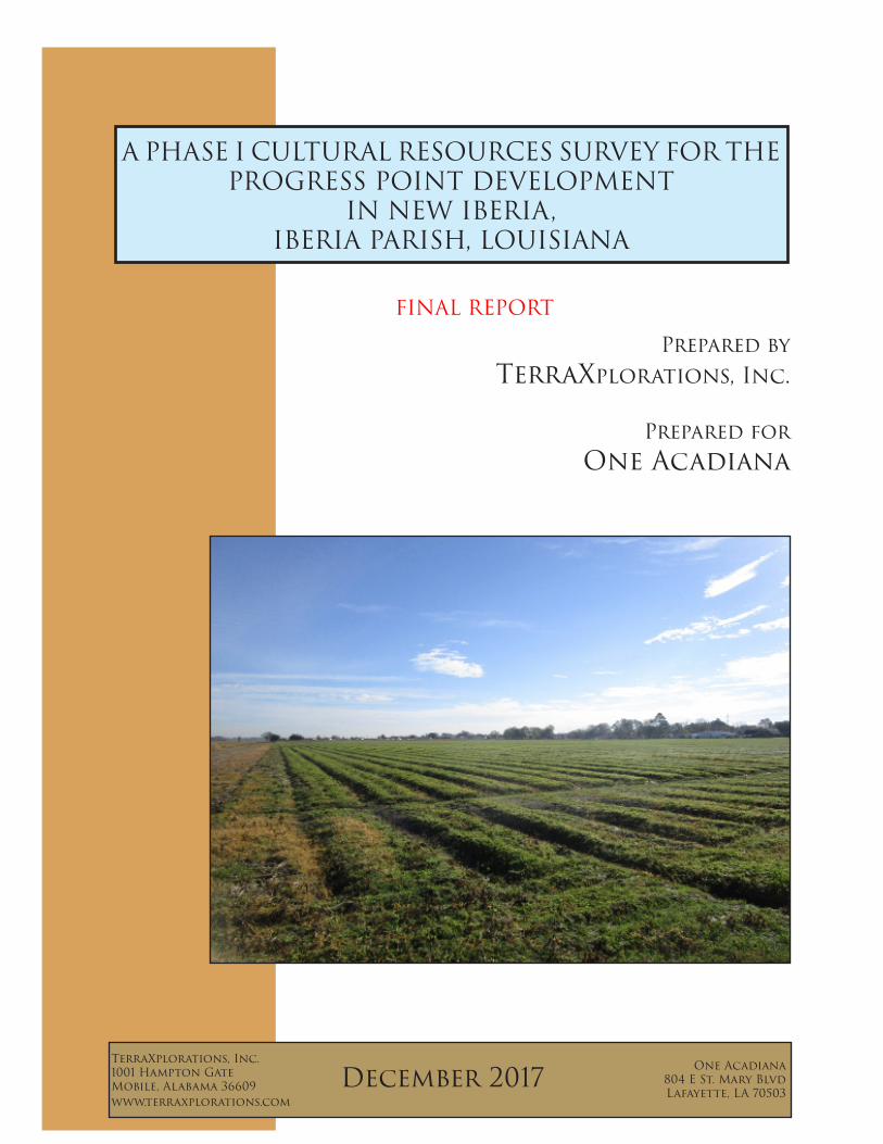
Prepared by TerraXplorations, Inc.
Prepared for One Acadiana
TerraXplorations, Inc.1001 Hampton GateMobile, Alabama 36609www.terraxplorations.com
One Acadiana804 E St. Mary BlvdLafayette, LA 70503
A PHASE I CULTURAL RESOURCES SURVEY FOR THE PROGRESS POINT DEVELOPMENT
IN NEW IBERIA,IBERIA PARISH, LOUISIANA
December 2017
FINAL REPORT
kaltakjian
Text Box
Progress Point Site Phase I Cultural Resources Assessment Report
- iTerraXplorations
A PHASE I CULTURAL RESOURCES SURVEY FOR THE PROGRESS POINT DEVELOPMENT
IN NEW IBERIAIBERIA PARISH, LOUISIANA
FINAL REPORT
byKelsey Johnson
Prepared by
TerraXplorations, Inc.1001 Hampton Gate
Mobile, Alabama 36609
Prepared for
One Acadiana804 E St. Mary BlvdLafayette, LA 70503
Principal InvestigatorPaul D. Jackson
TerraX Report No. 2017.227
December 2017

- iTerraXplorations
ABSTRACT
On December 13-15, 2017, TerraXplorations, Inc. (TerraX) of Mobile, Alabama performed a cultural resources survey of 45.1 acres (18.25 hectares) for the proposed Progress Point development in New Iberia, Louisiana. The Phase I survey was performed by Alec Ballesteros and Matt Sumrall under the direction of Paul D. Jackson, Principal Investigator. Shanda Davidson served as Architectural Historian. The investigation identified one archaeological site (16IB174), which is recommended ineligible for the National Register. No historic structures will be affected by the proposed project. Accordingly, no further archaeological studies are recommended for the proposed project.

ii - Table of Contents
TABLE OF CONTENTS
Abstract ...........................................................................................................................................................iTable of Contents .......................................................................................................................................... iiChapter 1: Introduction................................................................ ................................................................. 1Chapter 2: Project Area Environment ........................................................................................................... 7Chapter 3: Cultural History............................................................................................................................11Chapter 4: Previous Research ......................................................................................................................19 Literature and Document Search. ....................................................................................................19Chapter 5: Methodology and Field Results .................................................................................................23
Field Methods .......................................................................................................................... .... 23Laboratory Methods and Collection Curation .............................................................................. 23Results of Field Investigation ........................................................................................................ 23
Chapter 6: Summary and Recommendations .............................................................................................. 29References .................................................................................................................................................. 31
LIST OF FIGURES
Figure 1.1. Aerial of project area.. .................................................................................................................2Figure 1.2. Map of project area (based on 1983 Youngsville, LA and 1983 New Iberia North, LA USGS 7.5’ series topographic quadrangles)..... ................................................................................................................3Figure 1.3. View of western linear extension from project area facing southwest......... ...............................4Figure 1.4. View of project area facing southeast from the northwest corner..... ..........................................4Figure 1.5. View of Site 16IB174 facing south from datum....... ...................................................................5Figure 1.6. View of grassy area near eastern boundary facing southeast...... ................................................5Figure 2.1. Physiographic map (Louisiana Geological Survey 2010). ..........................................................7Figure 2.2. Soil Map (Web Soil Survey 2017)................................................................................................9Figure 4.1. Map showing the survey area, the one-mile search radius, previous cultural resources surveys, and recorded historic resources (based on the 1983 Youngsville and 1983 New Iberia North, Louisiana USGS 7.5’ series topographic quadrangle).... ..............................................................................................20Figure 4.2. Project area on 1911 Iberia Parish Soil Map..............................................................................22Figure 5.1. Aerial depicting shovel test locations within the project area.....................................................24Figure 5.2. View of a typical shovel test profile...........................................................................................25Figure 5.3. Map of Site 16IB174 location....................................................................................................26Figure 5.4. Sketch map of Site 16IB174.......................................................................................................27

- iiiTerraXplorations

- 1TerraXplorations
Chapter 1Introduction
TerraXplorations, Inc. (TerraX) of Mobile, Alabama was contracted by One Acadiana to conduct a cultural resources survey for the proposed Progress Point development in New Iberia, Iberia Parish, Louisiana. The Phase I survey was conducted on December 13 and 14, 2017 by Alec Ballesteros, Lucinda Freeman and Matt Sumrall with Paul D. Jackson serving as Principal Investigator. Shanda Davidson served as Architectural Historian. The purpose of this study was to determine if any prehistoric or historic properties exist within the limits of the project area, and if so, to document and assess each based on the National Register of Historic Places (NRHP) criteria.
The total project area, encompassing approximately 45.2 acres (18.29 hectares) lies northeast of Highway 90 within an agricultural field outside of New Iberia, Louisiana (Figure 1.1). The terrain is flat. The subject property is found within Section 17, Township 12S, Range 6E as seen on the 1983 Youngsville and 1983 New Iberia North, Louisiana, USGS 7.5’ series topographic quadrangle (Figure 1.2). Photographs depicting the present state of the land within the project area are provided (Figures 1.3-1.6).
This report of Phase I investigations is presented as follows. Chapter 2 contains information regarding the past and present environmental conditions in the project area. Chapter 3 details the cultural background of the area. Chapter 4 describes the background research for this project. Chapter 5 presents the methodology and results of fieldwork. Chapter 6 concludes the report and summarizes our findings and recommendations. Appendix A contains the curation agreement.

2 - Chapter 1: Introduction
Source: Esri, DigitalGlobe, GeoEye, Earthstar Geographics,CNES/Airbus DS, USDA, USGS, AeroGRID, IGN, and the GIS UserCommunity
- Survey Area
0 0.50.25Miles
0 10.5Kilometers®
Figure 1.1. Aerial of project area.

- 3TerraXplorations
Copyright:© 2013 National Geographic Society, i-cubed
- Survey Area
0 0.50.25Miles
0 10.5Kilometers®
Base Map: 1983 Youngsville, LA& 1983 New Iberia North, LA
USGS 7.5' Topographic Quadrangle
Figure 1.2. Map of project area (based on 1983 Youngsville, LA and 1983 New Iberia North, LA
USGS 7.5’ series topographic quadrangles).
4 - Chapter 1: Introduction
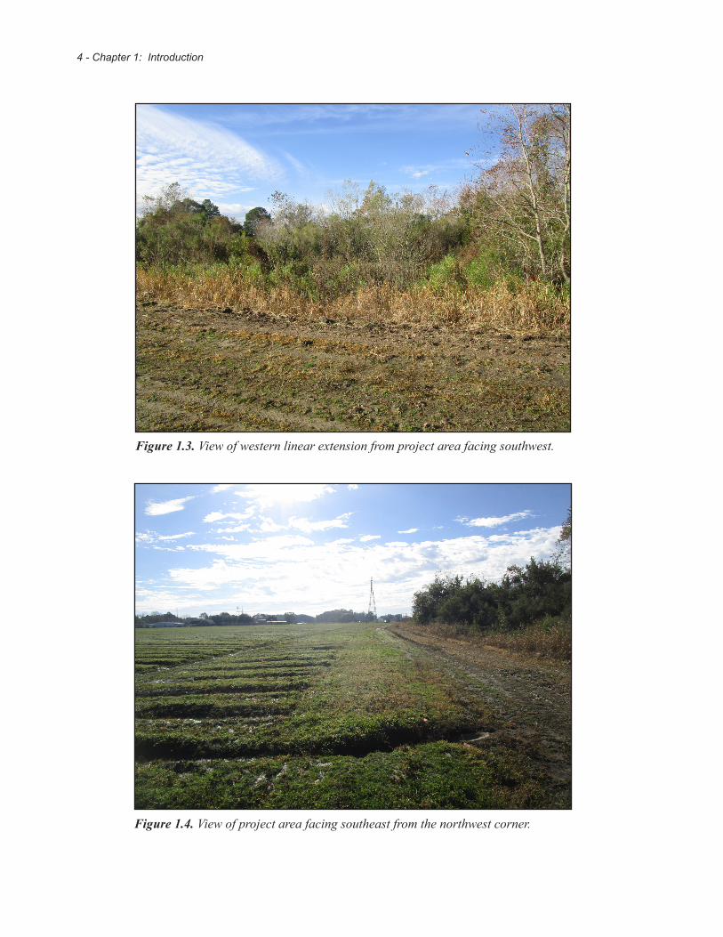
Figure 1.3. View of western linear extension from project area facing southwest.
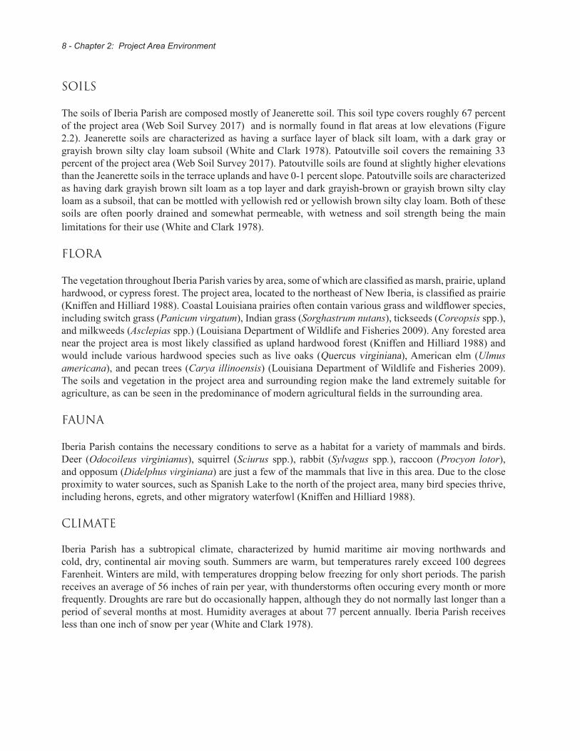
Figure 1.4. View of project area facing southeast from the northwest corner.

- 5TerraXplorations
Figure 1.5. View of Site 16IB174 facing south from datum.
Figure 1.6. View of grassy area near eastern boundary facing southeast.

6 - Chapter 1: Introduction

- 7TerraXplorations
Chapter 2Project Area Environment
Physiography
The project area is located north of Vermilion Bay and west of Bayou Teche in the Vermilion-Teche river basin in south-central Louisiana. The southern portion of Iberia Parish was once part of the Mississippi River delta approxiamtely 5,000-4,500 years before present (Kniffen and Hilliard 1988). The modern topography of the area is gently undulating. Elevations within Iberia Parish range from roughly 5 feet above sea level to 30 feet above sea level, with the exception of the Avery Island salt dome that rises 150 feet above sea level. The physiography of the parish can be classified into four distinct types: terrace upland, alluvial plain, the marshes and tidal swamps, and salt domes. The terrace upland is located near the west-central part of the parish, while the alluvial plains are located in the northern and eastern parts of the parish (Figure 2.1). The project area lies in the alluvial plain roughly 20 feet above sea level, where the soils were deposited by the Mississippi, Atchafalaya, and Red rivers. It is not likely that this area flooded often, as Bayou Teche served as a natural levee that protected the area from flooding from the Atchafalaya River (White and Clark 1978).
Figure 2.1. Physiographic map (Louisiana Geological Survey 2010).
Generalized Geologic Mapof Louisiana
(Revised 2010)
Open water
Alluvium(Holocene)
Coastal marshes(Holocene)
Terraced braided-stream deposits(Pleistocene)
Citronelle andWillis Formations(Pliocene)
Terraces(Pleistocene)
FlemingFormation(Miocene)
CatahoulaFormation(Oligocene/Miocene[?])
Wilcox Group(Paleocene/Eocene)
JacksonGroup(Eocene)
ClaiborneGroup(Eocene)
VicksburgGroup(Oligocene)
Louisiana State UniversityLouisiana Geological SurveyChacko J. John, Director and State Geologisthttp://www.lgs.lsu.edu
Pearl River
Mississippi
RiverLake
Pontchartrain
Sabi
ne
Riv
er
Toledo Bend
Reservoir
Red
River
Calca
sieu
Riv
er
Ouachita R.
GULF OF MEXICO
Atchafalaya
River
State waters
Federal Waters
0 25 50 75 100Miles
0 25 50 75 100Kilometers
8 - Chapter 2: Project Area Environment
SOILS
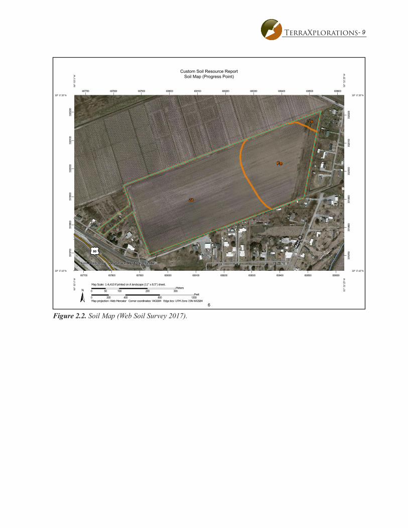
The soils of Iberia Parish are composed mostly of Jeanerette soil. This soil type covers roughly 67 percent of the project area (Web Soil Survey 2017) and is normally found in flat areas at low elevations (Figure 2.2). Jeanerette soils are characterized as having a surface layer of black silt loam, with a dark gray or grayish brown silty clay loam subsoil (White and Clark 1978). Patoutville soil covers the remaining 33 percent of the project area (Web Soil Survey 2017). Patoutville soils are found at slightly higher elevations than the Jeanerette soils in the terrace uplands and have 0-1 percent slope. Patoutville soils are characterized as having dark grayish brown silt loam as a top layer and dark grayish-brown or grayish brown silty clay loam as a subsoil, that can be mottled with yellowish red or yellowish brown silty clay loam. Both of these soils are often poorly drained and somewhat permeable, with wetness and soil strength being the main limitations for their use (White and Clark 1978).
FLORA
The vegetation throughout Iberia Parish varies by area, some of which are classified as marsh, prairie, upland hardwood, or cypress forest. The project area, located to the northeast of New Iberia, is classified as prairie (Kniffen and Hilliard 1988). Coastal Louisiana prairies often contain various grass and wildflower species, including switch grass (Panicum virgatum), Indian grass (Sorghastrum nutans), tickseeds (Coreopsis spp.), and milkweeds (Asclepias spp.) (Louisiana Department of Wildlife and Fisheries 2009). Any forested area near the project area is most likely classified as upland hardwood forest (Kniffen and Hilliard 1988) and would include various hardwood species such as live oaks (Quercus virginiana), American elm (Ulmus americana), and pecan trees (Carya illinoensis) (Louisiana Department of Wildlife and Fisheries 2009). The soils and vegetation in the project area and surrounding region make the land extremely suitable for agriculture, as can be seen in the predominance of modern agricultural fields in the surrounding area.
FAUNA
Iberia Parish contains the necessary conditions to serve as a habitat for a variety of mammals and birds. Deer (Odocoileus virginianus), squirrel (Sciurus spp.), rabbit (Sylvagus spp.), raccoon (Procyon lotor), and opposum (Didelphus virginiana) are just a few of the mammals that live in this area. Due to the close proximity to water sources, such as Spanish Lake to the north of the project area, many bird species thrive, including herons, egrets, and other migratory waterfowl (Kniffen and Hilliard 1988).
CLIMATE
Iberia Parish has a subtropical climate, characterized by humid maritime air moving northwards and cold, dry, continental air moving south. Summers are warm, but temperatures rarely exceed 100 degrees Farenheit. Winters are mild, with temperatures dropping below freezing for only short periods. The parish receives an average of 56 inches of rain per year, with thunderstorms often occuring every month or more frequently. Droughts are rare but do occasionally happen, although they do not normally last longer than a period of several months at most. Humidity averages at about 77 percent annually. Iberia Parish receives less than one inch of snow per year (White and Clark 1978).
- 9TerraXplorations
6
Custom Soil Resource ReportSoil Map (Progress Point)
3319
700
3319
800
3319
900
3320
000
3320
100
3320
200
3319
700
3319
800
3319
900
3320
000
3320
100
3320
200
607700 607800 607900 608000 608100 608200 608300 608400 608500 608600
607700 607800 607900 608000 608100 608200 608300 608400 608500 608600
30° 0' 30'' N
91° 5
3' 1
'' W
30° 0' 30'' N
91° 5
2' 2
5'' W
30° 0' 10'' N
91° 5
3' 1
'' W
30° 0' 10'' N
91° 5
2' 2
5'' W
N
Map projection: Web Mercator Corner coordinates: WGS84 Edge tics: UTM Zone 15N WGS840 200 400 800 1200
Feet0 50 100 200 300
MetersMap Scale: 1:4,410 if printed on A landscape (11" x 8.5") sheet.
Soil Map may not be valid at this scale.
Figure 2.2. Soil Map (Web Soil Survey 2017).

10 - Chapter 2: Project Area Environment

- 11TerraXplorations
CHAPTER 3CULTURAL HISTORY
PALEOINDIAN (10,000 TO 6,000 B.C.)
The earliest substantial human occupation in the Western Hemisphere is defined as the Paleoindian period. In Louisiana, and generally in the Southeast, this period has provisionally been grouped into three broad temporal categories defined as Early, Middle, and Late or transitional subperiods (Anderson et al. 1990; O’Steen et al. 1986:9).
It was thought that the population of the Paleoindian period was highly adaptive, mobile hunter-gatherers, whose ancestors had migrated from Siberia into North America between 12,000 to 10,000 B.P. The migration is believed to have occurred during the Pleistocene Epoch, when glaciers were expanding and retreating from fluctuations in the climate from cold to warm episodes (Anderson 1996). The population movements were presumably made possible when the colder periods of the Pleistocene Epoch captured large quantities of the earth’s water in glaciers. This lowered sea levels and exposed large portions of the continent; allowing human populations to follow the Pleistocene mammals across the Americas. However, new discoveries are changing this long-held belief. More recent evidence of a pre-Clovis culture has emerged, based on excavations at Meadowcroft Rockshelter in Pennsylvania, the Topper Site in South Carolina, and Cactus Hill in Virginia, that places modern humans in the New World some 2,000 years earlier than previously believed. Pre-Clovis tools include small bladelets, indicating an exploitation of a broader environment. While the controversy continues, it is widely recognized that Clovis points were in the southeastern U.S. around 12,000 B.P.
Paleoindian occupations are usually represented by the presence of a specialized type of projectile point. These points are large and feature channels or flutes that are created by the removal of a long, vertical flake from the center of one or both faces of the point (Walthall 1980). Clovis, Folsom, Quad, Dalton, Plainview, and Scottsbluff are point types indicative of this period and region (Gagliano and Gregory 1965). The size of the points reflects the hunting strategy of these early inhabitants, which focused on hunting large Pleistocene mammals. Bones of large Pleistocene vertebrates (mastodon, mammoth, ground sloth, etc), which are contemporaries of the Paleoindians, are found in alluvial and backswamp deposits (Gagliano and Gregory 1965). Paleoindian sites are rare, especially with the changing geography of much of southern Louisiana. The rising sea levels have left coastal sites underwater, and the flooding and meandering of the Mississippi River has buried other sites under layers of silt. Caddo Parish, in the northwestern part of the state, contains both Early and Late Paleoindian material (Neuman and Hawkins 1993). According to the Paleoindian Database of the Americas (PIDBA), less than 10 fluted projectile points have been found in Vermilion Parish. Two Late Paleoindian sites were documented in East Baton Rouge Parish (Anderson et al. 2010).
MESOINDIAN (6,000 TO 2,000 B.C.)
The three sub-periods of the Archaic period proper are believed to roughly encapsulate the transition from highly mobile, camp-based collector lifeways to more sedentary and opportunistic foraging lifeways.
During the Early Archaic period it is reasonable to assume there was a trend towards a more sedentary lifeway. Anderson (1996) discussed evidence that indicated a trend which emphasized foraging adaptations in the Georgia Coastal Plain region during this time. Willey, Phillips, (Willey and Phillips 1958) and Caldwell (1958) viewed the Archaic stage as a dramatic shift from previous Paleoindian lifeways. However, this

12 - Chapter 3: Cultural History
might have been true in northern regions where the drastic climatic shift precipitated large-scale population movements and material culture change, but in the non-glacial regions of the Southeast this change would have been much more gradual which would lead to imperceptible cultural adaptation (Walthall 1980).
When considering the cultural material typically present from this time period, the most evident change can be found in the change in morphology of the biface in contrast to the previous period. Rather than the long, fluted blades from the Paleoindian period, the Early Archaic bifaces have well-documented pan-regional sequences that includes the Side-Notched Tradition, the Corner-Notched Tradition, and the Bifurcate Tradition. The spears used by the Mesoindians were different than those of the earlier period; they were shorter, had a greater variety of stone points crafted from locally available stone, and were more simply crafted (Neuman and Hawkins 1993). Bone, antler, and shell tools and ornaments were also added to the tool assemblage during this period.
Fiber-tempered pottery in much of the Southeastern United States is generally considered using the rubric of Stallings Island, Orange, Wheeler, and Norwood Series, and it is thought to mark the transition between the Late Archaic and Early Woodland periods (i.e., Terminal Archaic). Also in the later portion of the Archaic period, people began horticulture to supplement their diets. Archaeological evidence indicates that people grew small portions of squash, sunflowers, and other seed-bearing plants in simple gardens (Sassaman and Anderson 2004:105).
NEOINDIAN (2,000 B.C. TO A.D. 1600)
Southeastern archaeologists generally distinguish the beginning of the Neoindian period (ca. 2250 to 1950 B.P.) by the introduction and regular use of stamped pottery and increased ceremonialism in ritual events and mortuary practices. During the Neoindian period, the introduction and intensification of horticulture, construction of earthworks, and elaboration of artistic expression and burial ritual are all thought to be related to a reorganization of social structure. The advent of horticulture would have meant that, at least for part of the year, groups would have had to remain sedentary in order to plant, tend, and harvest crops. Shell and earthen mounds were now regularly built throughout this area of Louisiana.
Although many technologies used during the Neoindian period were actually developed during the earlier Archaic periods, it was during the Neoindian stage that changes in social organization and economy from small dispersed bands of hunter-gatherers to large, semi-permanent settlement began to take place. A much heavier reliance on horticulture followed and these changes were evidenced in the archaeological record. This period includes the Poverty Point, Tchefuncte, Marksville, Troyville-Coles Creek, and Plaquemine- Mississippian Cultures.
The Poverty Point Culture (2,000 to 700 B.C.) is named after the well documented Poverty Point Site (16WC5) in Louisiana. During this culture, Indians lived in small, dispersed groups, while others built and maintained regional centers. These centers served as ceremonial, political and trade areas. Gibson (1974) suggested this was the first time that a chiefdom was established. Trade across large areas is evidenced by copper from the Great Lakes; quartz crystals, novaculite, hematite, and magnetite from Missouri and Arkansas; gray chert from Ohio; and steatite from Alabama (Hunter et al. 1991). Tools unique to this culture include oval-shaped stone plummets that were presumably used as net weights or clay cooking balls. Neuman and Hawkins (1993) point out that this culture also includes planned villages, clay figurines, stone beads, pendants, and microtools.
- 13TerraXplorations
The Tchefuncte Culture (500 B.C. to A.D. 200) followed the Poverty Point Culture and are set apart from earlier cultures by being the first Louisiana Indians to manufacture large amounts of pottery. In coastal Louisiana the shell middens are located in two primary areas, the Pontchartrain Basin around Grand Lake, and along the midden reaches of the Vermilion River (Hunter et al. 1991). The pottery was used to store and stew foods in a much more efficient manner. Unlike the previous Poverty Point Culture, the Tchefuncte Indians did not rely on imported trade materials to make tools and ornaments, instead they used local materials (Neuman and Hawkins 1993).
The Marksville Culture (A.D. 1 to 400) is generally recognized as a part of the Pan-Southeastern Middle Woodland tradition (Jeter et al. 1989:138). Trade, once again, increased from an area market to an inter-regional system linked to Adena-Hopewell influences from the Upper and Middle Mississippi Valley (Weinstein and Rivet 1978). These influences were most notable in the ceramics designs and even mortuary practices. Springer (1973:167) suggests late Marksville may exhibit a shift from the characteristic kin ties to a settlement with differing social classes.
The Troyville-Coles Creek period (A.D. 400 to 1100) is best known for the distinct spatial patterns present on the sites. These typically consist of a small series of small platform mounds positioned around a central plaza (Neuman 1984). This period also saw numerous examples of complicated stamping of ceramics in Louisiana and the bow and arrow was introduced. The introduction of the bow and arrow might have played a role in the collapse of the Troyville-Cole Creek culture. The increase in available food led to an increase in population; the population reached carrying capacity and the communities could no longer provide necessary support. The final change that precipitated this period and could have been a factor in the cultural collapse was a change in weather patterns. Weather from around A.D. 500 to 800 was cooler and drier. This changed the availability of food at a time when Indian societies were already stressed to provide for the growing populations. These stresses led to an increase in warfare that continued into the following period (Stoltman 1978:725).
The Plaquemine culture (A.D. 1200 to 1700) takes its name from the Medora Site (16WBR1), which is found in the town of Plaquemine, Louisiana. This period was witness to the zenith of the organization and complexity of eastern Woodland culture. An almost simultaneous similar florescence occurred over many parts of the Southeast, resulting in the development of large, hierarchical societies centered at impressive mound complexes such as Cahokia in present day Illinois, Spiro in Oklahoma, Moundville in Alabama, and Etowah in northwest Georgia. The Plaquemine culture differs further from their earlier Troyville-Coles Creek ancestors in the brushing and engraving techniques observed in their pottery (Smith et al. 1983).
The Caddo culture (A.D. 800 to 1540) began to emerge in northwest Louisiana while the Plaquemine culture thrived across the remainder of the state. These periods represent the last major periods of unadulterated Indian cultural development in the Southeast. The term Caddo refers to a group of closely related Indian groups who occupied northwestern Louisiana, northeastern Texas, southwestern Arkansas, and southeastern Oklahoma (Smith et al. 1983). Burial practices, deities, and differing ceramic techniques distinguish the Early Caddo period from the Coles Creek period. The Middle Caddoan period saw a decline in mound building with large population centers replaced by small upland settlements along streams. Single burials with few offerings were chosen over shaft burials (Webb and Gregory 1986). Late Caddo shows an increase in floodplain settlements with a return to mound building. The historic Caddo period saw the rise of several tribes with unique dialect and customs. In Louisiana, the five Caddo speaking tribes included the Ouachita, Natchitoches, Adaes, Doustioni, and Yatasi. These Caddo tribes remained in Louisiana until 1835, leaving for Oklahoma soon after they sold nearly one million acres of land to the United States (Cliff and Peter 1994).

14 - Chapter 3: Cultural History
EUROPEAN EXPLORATION (A.D. 1542 TO 1699)
By the time Europeans made contact with the inhabitants of North America, the people living in this area had developed a complex society with a trade network that brought in exotic items from across the continent (Buxton and Crutchfield 1985). The trading paths that connected villages would later be used by European explorers and settlers to enter the area.
It is thought the first Europeans the Indians living in the area could have met were Hernando De Soto and his men. De Soto had sailed with Pizarro for Peru and returned to Spain a fabulously rich man. Politically well connected, he was granted the right by Charles V of Spain to conquer Florida, which at that time included the project area. De Soto landed near Tampa Bay in 1537 with 1,000 men and spent the next four years wandering the interior of the southeast U.S. determined to duplicate his earlier success (Alchian 2008). The Spanish left a path of destruction across the lands they traveled, torturing and murdering indiscriminately as they sought anything of value they could take from the local inhabitants.
Spanish incursions into the interior introduced diseases that had evolved among the populations in Europe and Asia. The people living in the “New World” had no natural defenses for these pathogens and consequently, they died in staggering numbers. Only in the last generation of scholarship has the scope of this human catastrophe been recognized. Most scholars currently accept that it was possible that 90 to 95 percent of the pre-contact population died as a result of this pandemic (Ethridge 2003). It would be difficult to overestimate the negative effects such a disaster would have on any human society. Evidence of the disruption Southeastern cultures experienced can be found in the archaeological record. Platform mound building ceased shortly after 1540 and Indian trade networks, ancient at the time of contact, also seem to have been disrupted. Exotic high status items like native copper disappear from the archaeological record and seem to be slowly replaced by exotic items of European manufacture (Hahn 2004). As the Indian population struggled to recover from this catastrophe, the European presence along the coast grew.
When Europeans returned to the interior they would often comment on the number of unoccupied villages they encountered, completely intact but missing their population. What typically brought Europeans back to the interior was trade and this trade would have dire consequences for the Indian people. European trade goods proved addictive. The experience of having a steady supply of cloth, iron tools, and muskets quickly transformed these items from luxuries into necessities. The Indians had the dilemma of coming up with something the English wanted in trade. For a while there was a large market for enslaved Indians and later for deer skins and furs. This trade led to entanglement in the affairs of the colonial powers, usually with negative effects.
After De Soto, the next European to enter the Louisiana region was a Frenchman named Robert Cavalier de la Salle. In 1682, his company sailed down the Mississipppi River to the Gulf of Mexico and encountered native Bayougoula people in modern day Iberville Parish (Bryant et al. 1982:31-32). La Salle attempted to return to the area two years later but could not relocate the Mississippi River and eventually became stranded on the Texas Coast. In 1699, Pierre Le Moyne d’Iberville arrived with the second French expedition of the area. Rather than working south along the Mississippi River, Iberville chose to follow the coast to the Mississippi River and then work north. Iberville travelled up the river to modern day Point Coupee Parish. After this successful expedition Louisiana was opened to settlement (Bryant et al. 1982:33-36).
- 15TerraXplorations
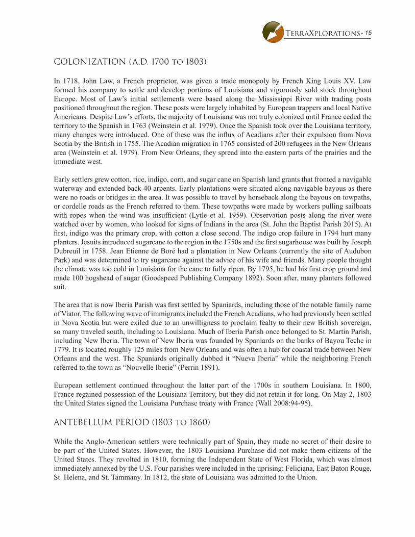
COLONIZATION (A.D. 1700 to 1803)
In 1718, John Law, a French proprietor, was given a trade monopoly by French King Louis XV. Law formed his company to settle and develop portions of Louisiana and vigorously sold stock throughout Europe. Most of Law’s initial settlements were based along the Mississippi River with trading posts positioned throughout the region. These posts were largely inhabited by European trappers and local Native Americans. Despite Law’s efforts, the majority of Louisiana was not truly colonized until France ceded the territory to the Spanish in 1763 (Weinstein et al. 1979). Once the Spanish took over the Louisiana territory, many changes were introduced. One of these was the influx of Acadians after their expulsion from Nova Scotia by the British in 1755. The Acadian migration in 1765 consisted of 200 refugees in the New Orleans area (Weinstein et al. 1979). From New Orleans, they spread into the eastern parts of the prairies and the immediate west.
Early settlers grew cotton, rice, indigo, corn, and sugar cane on Spanish land grants that fronted a navigable waterway and extended back 40 arpents. Early plantations were situated along navigable bayous as there were no roads or bridges in the area. It was possible to travel by horseback along the bayous on towpaths, or cordelle roads as the French referred to them. These towpaths were made by workers pulling sailboats with ropes when the wind was insufficient (Lytle et al. 1959). Observation posts along the river were watched over by women, who looked for signs of Indians in the area (St. John the Baptist Parish 2015). At first, indigo was the primary crop, with cotton a close second. The indigo crop failure in 1794 hurt many planters. Jesuits introduced sugarcane to the region in the 1750s and the first sugarhouse was built by Joseph Dubreuil in 1758. Jean Etienne de Boré had a plantation in New Orleans (currently the site of Audubon Park) and was determined to try sugarcane against the advice of his wife and friends. Many people thought the climate was too cold in Louisiana for the cane to fully ripen. By 1795, he had his first crop ground and made 100 hogshead of sugar (Goodspeed Publishing Company 1892). Soon after, many planters followed suit.
The area that is now Iberia Parish was first settled by Spaniards, including those of the notable family name of Viator. The following wave of immigrants included the French Acadians, who had previously been settled in Nova Scotia but were exiled due to an unwilligness to proclaim fealty to their new British sovereign, so many traveled south, including to Louisiana. Much of Iberia Parish once belonged to St. Martin Parish, including New Iberia. The town of New Iberia was founded by Spaniards on the banks of Bayou Teche in 1779. It is located roughly 125 miles from New Orleans and was often a hub for coastal trade between New Orleans and the west. The Spaniards originally dubbed it “Nueva Iberia” while the neighboring French referred to the town as “Nouvelle Iberie” (Perrin 1891).
European settlement continued throughout the latter part of the 1700s in southern Louisiana. In 1800, France regained possession of the Louisiana Territory, but they did not retain it for long. On May 2, 1803 the United States signed the Louisiana Purchase treaty with France (Wall 2008:94-95).
ANTEBELLUM PERIOD (1803 to 1860)
While the Anglo-American settlers were technically part of Spain, they made no secret of their desire to be part of the United States. However, the 1803 Louisiana Purchase did not make them citizens of the United States. They revolted in 1810, forming the Independent State of West Florida, which was almost immediately annexed by the U.S. Four parishes were included in the uprising: Feliciana, East Baton Rouge, St. Helena, and St. Tammany. In 1812, the state of Louisiana was admitted to the Union.

16 - Chapter 3: Cultural History
After the discovery of how to granulate sugar by Jean Etienne de Boré at his plantation, southern areas along the Mississippi River quickly became very profitable sugar cane farming enterprises (Bryant et al. 1982:52). Cotton was still king until the War of 1812, when the British blockade kept out sugar from foreign markets. Many planters switched to the economic boon of sugar (Carmon 2007). As a result of these successful plantations, Louisiana’s population growth exploded in the first part of the nineteenth century.
WAR AND AFTERMATH (1860 TO 1890)
Louisiana’s settlement and economy were put on hold during the Civil War as Union and Confederate forces contested Louisiana, and in particular, the head of the Mississippi River. New Orleans fell to Union forces in 1862, followed by Baton Rouge. Defensive fortifications were constructed at Port Hudson in an attempt to block Union troops from going upriver to Vicksburg. In May of 1863, Major General Nathaniel P. Banks led 30,000 Union soldiers against Port Hudson, defended by 7,500 Confederates under General Franklin Gardner. This was the first time that commissioned African American troops were used, with devastating results. Due to faulty information, the African Americans were sent into a position where they were hemmed in by swamps on either side and were easy targets for Confederate forces on a high bluff above them. The battle lasted for 48 days, until Vicksburg surrendered on July 4, 1863 and the Union called off the Port Hudson fighting. Although the Union won, they suffered some 4,300 casualties to the Confederate’s 700 (Eberwine et al. 2009).
Louisiana saw an economic reorganization after the end of hostilities. This “reconstruction” process left the great majority of its people despondent and poor. Wealthy land owners returned home to find their houses and outbuildings burned and their cropland in the hands of tenant farmers and newly freed slaves. Many sugar mills were destroyed or vandalized; mule teams had been stolen and seed cane needed to be replenished. The capital with which to accomplish this was scarce among Louisiana planters. Difficult at first, the sugar market did continue as a driving economic force in regions of Louisiana. Disputes between land owners and the labor force became prevalent post-Civil War. The large sugar plantations embraced wage labor over shared tenancy. Since the pay offered was meager, it was not satisfactory to many workers. Workers also resisted living in the old antebellum slave quarters, but most planters felt they could not afford to build new houses. The planters were even more dismayed when wages began to rise due to the lack of a reliable labor source (Lee et al. 2010).
In 1866, there were over six million acres of federal land that had been surveyed but not purchased. The Southern Homestead Act was meant to offer this land at nominal fees to poor people. The very next year, the Act was repealed and the land was available to any buyer. With prices as low as 45 cents an acre, wealthy buyers could, and did, purchase over 100,000 acres each. Over a million acres were bought up by Northerners. The mid-1870s saw rampant vigilante violence. In 1877, Louisiana rejoined the Union, being one of the last southern states to do so. In the 1880s, thousands of acres were unplanted due to lack of labor and capital.
At this time, approximately 85 percent of the state was forested. Longleaf pine existed in virgin stands of trees up to 200 years old. The open areas beneath the trees were free of underbrush and this environment was very conducive to easy lumbering. Cypress trees were predominant in the swamps and in the early twentieth century, Louisiana led the nation in cypress production. Pine forests were more plentiful, but there were plenty of mills for both tree species (Fricker 2015).
Slowly the lumber industry become more and more important for its economic potential for Louisiana residents (Bryant et al. 1982:63). Innovations in the 1880s and 1890s, such as the skidder, pullboats (barges),
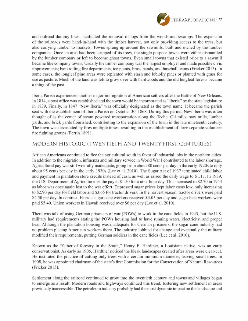
- 17TerraXplorations
and railroad dummy lines, facilitated the removal of logs from the woods and swamps. The expansion of the railroads went hand-in-hand with the timber harvest, not only providing access to the trees, but also carrying lumber to markets. Towns sprang up around the sawmills, built and owned by the lumber companies. Once an area had been stripped of its trees, the single purpose towns were either dismantled by the lumber company or left to become ghost towns. Even small towns that existed prior to a sawmill became like company towns. Usually the timber company was the largest employer and made possible civic improvements; bankrolling fire departments, ice plants, brass bands, and baseball teams (Fricker 2015). In some cases, the longleaf pine areas were replanted with slash and loblolly pines or planted with grass for use as pasture. Much of the land was left to grow over with hardwoods and the old longleaf forests became a thing of the past.
Iberia Parish experienced another major immigration of American settlers after the Battle of New Orleans. In 1814, a post office was established and the town would be incorporated as “Iberia” by the state legislature in 1839. Finally, in 1847 “New Iberia” was officially designated as the town name. It became the parish seat with the establishment of Iberia Parish on October 30, 1868. During this period, New Iberia was often thought of as the center of steam powered transportation along the Teche. Oil mills, saw mills, lumber yards, and brick yards flourished, contributing to the expansion of the town in the late nineteenth century. The town was devastated by fires multiple times, resulting in the establishment of three separate volunteer fire fighting groups (Perrin 1891).
MODERN HISTORIC (TWENTIETH AND TWENTY-FIRST CENTURIES)
African Americans continued to flee the agricultural south in favor of industrial jobs in the northern cities. In addition to the migration, influenza and military service in World War I contributed to the labor shortage. Agricultural pay was still woefully inadequate, going from about 80 cents per day in the early 1920s to only about 95 cents per day in the early 1930s (Lee et al. 2010). The Sugar Act of 1937 terminated child labor and payment in plantation store credits instead of cash, as well as raised the daily wage to $1.17. In 1939, the U.S. Department of Agriculture set the pay at $1.50 for a nine-hour day. This increased to $2.70 in 1944 as labor was once again lost to the war effort. Depressed sugar prices kept labor costs low, only increasing to $2.90 per day for field labor and $3.65 for tractor drivers. In the harvest season, tractor drivers were paid $4.50 per day. In contrast, Florida sugar cane workers received $4.05 per day and sugar beet workers were paid $5.40. Union workers in Hawaii received over $6 per day (Lee et al. 2010).
There was talk of using German prisoners of war (POWs) to work in the cane fields in 1943, but the U.S. military had requirements stating the POWs housing had to have running water, electricity, and proper heat. Although the plantation housing was inadequate for German prisoners, the sugar cane industry had no problem placing American workers there. The industry lobbied for change and eventually the military modified their requirements, putting German soldiers in the cane fields (Lee et al. 2010).
Known as the “father of forestry in the South,” Henry E. Hardtner, a Louisiana native, was an early conservationist. As early as 1905, Hardtner noticed the bleak landscapes created after areas were clear-cut. He instituted the practice of cutting only trees with a certain minimum diameter, leaving small trees. In 1908, he was appointed chairman of the state’s first Commission for the Conservation of Natural Resources (Fricker 2015).
Settlement along the railroad continued to grow into the twentieth century and towns and villages began to emerge as a result. Modern roads and highways continued this trend, fostering new settlement in areas previously inaccessible. The petroleum industry probably had the most dynamic impact on the landscape and

18 - Chapter 3: Cultural History
economy in Louisiana. The need for gasoline and lubricating oil intensified the search for more resources in the state and the discovery at Spindle Top salt dome near Beaumont and at Jennings in Jefferson Davis Parish firmly placed Louisiana as a centerpiece in the petroleum industry. The largest oil reserves in Louisiana are south of Baton Rouge. These discoveries led to the construction of massive pipelines across the prairies to Baton Rouge and Beaumont, Texas (Kniffen and Hilliard 1988:166-170). Even today, Louisiana’s primary economies are agriculture and petroleum.
In the mid-twentieth century, sugar cane planting strategies led to three harvests from one planting, although later harvests were not as productive as the first one. Several factors can lead to a poor harvest, including soil compaction by heavy machinery, poor drainage, cold temperatures, plant diseases, and loss of nutrients. Although sugar cane needs plenty of water, too much on poorly drained fields can result in root rot and other diseases. Drainage ditches and canals are necessary for good crop yields. Planting is generally done in August, September, and October, with only one-quarter of the cane germinating. The large plantations may have had as many as 30 structures for the workers and a company store, since the plantations were often far removed from town. In the 1950s, about 41 percent of the farm operators were owners, 20 percent were part-owners, four percent were managers, and 35 percent were tenants. Less than a quarter of the tenants paid cash rent; the rest were share-cash or share-crop tenants (Lytle et al. 1959).

- 19TerraXplorations
Chapter 4Previous Research
Literature and Document Search
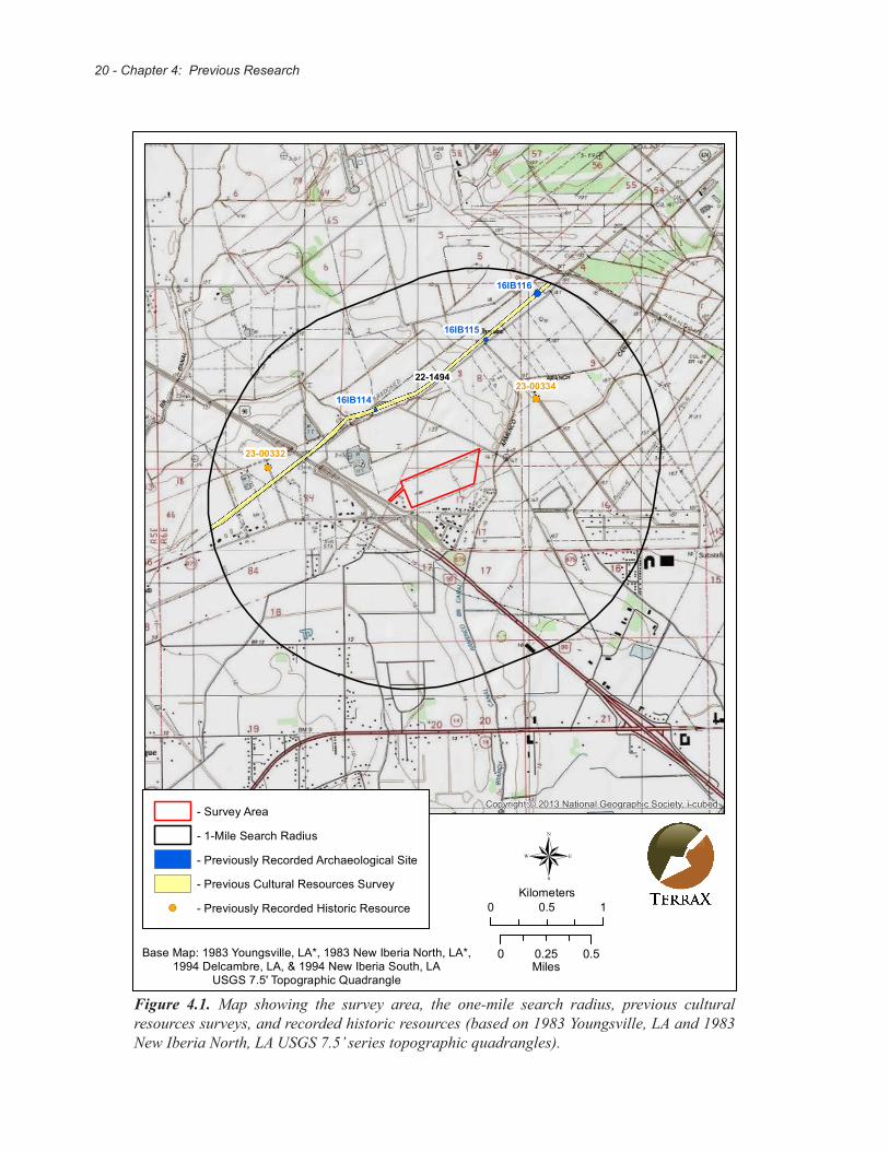
Background research was conducted prior to the survey to identify previously recorded historic and prehistoric properties within a one-mile radius of the proposed project area located in Iberia Parish, Louisiana. This search included an online query of the Louisiana Division of Archaeology (LDOA) Cultural Resources Viewer (LDOA 2017) performed on December 13, 2017. A one-mile (1.6 kilometers [km]) radius search was conducted around the project area for previously recorded archaeological sites, previous cultural resources surveys, and previously recorded historic structures. An examination of the Historic Standing Structure Survey Files at the State Library in Baton Rouge, Louisiana was performed on December 12, 2017 to ascertain whether any historic resources have been recorded within or near the study area that are not depicted on the LDOA Cultural Resources Viewer (LDOA 2017). Lastly, a query into the National Register of Historic Places (NRHP) (National Park Service 2017) was conducted. The project area is found within Section 17, Township 12S, Range 6E as seen on the 1983 New Iberia North and 1983 Youngsville, Louisiana, USGS 7.5’ series topographic quadrangles.
A search of the LDOA Cultural Resources Viewer (LDOA 2017) listed three recorded sites within a mile of the proposed project area. Background research revealed one previously conducted cultural resources survey within a mile of the study area. Two NRHP listed properties are located within a mile of the project area (Figure 4.1).
LDOA# 22-1494 Level II Archaeological Investigation of the Proposed Erath-South Section 28 Pipeline Right-of-way, Vermilion, Iberia, and St. Martin Parishes Louisiana. R. Christopher Goodwin and Associates, Inc. performed this investigation in July 1990. Survey consisted of 28 miles stretching from Erath to the existing South Section 28 pipeline in St. Martin Parish. A total of 18 cultural resources loci and sites were identified, three of which are within a one mile radius of the Progress Point survey area.
Site 16IB114 was a cultural deposit located in a plowed field. Artifacts yielded during investigation of this site consisted of transfer-printed whiteware, annular ware, brick, a metal plow blade, and tableware glass. Artifacts were all recovered within the plow zone and further site disturbance was recorded by railroad construction, canal dredging, and road realignments, suggesting the artifacts found may have been redeposited. The transfer-printed whiteware dates to after 1820.
Site 16IB115 was a historic artifact scatter (25m x 30m) located slightly north of Highway 3212 near the LaSalle intersection. Artifacts yielded during investigation of this site included whiteware, stoneware, earthenware, annular ware, a ceramic marble, brick fragments, bottle glass, tableware glass, and a plastic button. All artifacts were recovered from the surface or the upper level of the plow zone. Using diagnostic artifacts, it was determined this site dates to the late nineteenth or early twentieth century.
Site 16IB116 was also an artifact scatter located north of Highway 3212, to the east of 16IB115. Artifacts yielded at this site included whiteware, stoneware, porcelain, bottle glass, and tableware glass. All artifacts were recovered from the surface or upper plowzone. Using diagnostic artifacts, it was determined this site dates to the late nineteenth and early twentieth centuries (Goodwin et al. 1990).
20 - Chapter 4: Previous Research
16IB116
16IB115
16IB114
22-149423-00334
23-00332
Copyright:© 2013 National Geographic Society, i-cubed- Survey Area
- 1-Mile Search Radius
- Previously Recorded Archaeological Site
- Previous Cultural Resources Survey
!( - Previously Recorded Historic Resource 0 10.5Kilometers
®
Base Map: 1983 Youngsville, LA*, 1983 New Iberia North, LA*,1994 Delcambre, LA, & 1994 New Iberia South, LA
USGS 7.5' Topographic Quadrangle
0 0.50.25Miles
Figure 4.1. Map showing the survey area, the one-mile search radius, previous cultural resources surveys, and recorded historic resources (based on 1983 Youngsville, LA and 1983 New Iberia North, LA USGS 7.5’ series topographic quadrangles).

- 21TerraXplorations
An examination of the Historic Standing Structure Survey Files at the State Library in Baton Rouge, Louisiana was reviewed for this project. Within the one-mile search radius there are two previously identified historic resources (23-00332 and 23-00334) (see Figure 4.1).
Resource 23-00332 is a group of structures that was recorded on June 12, 1979 by Gretchen Dewailly and Ruth Fontenot. The structures are located in Section 84, Township 12S, Range 6E, on Highway 675 near New Iberia, Louisiana. They were historically known as the Old Theo David Home and at the time of recording were owned by Ulysse Gonsoulin. This structure group dates to 1880-1910 and consisted of a larger one and a half story gabled structure with a gallery across the front, a small shot gun house, and several barns. The larger structure rests on concrete blocks and brick piers. Mr. Gonsoulin stated the upper floor of the larger structure was used as a dancehall and was decorated with murals. This resource has an unknown NHRP eligibilty.
Resource 23-00334 is also a group of structures that was recorded on June 13, 1979 by Gretchen Dewailly and Ruth Fontenot. The structures are located in Section 9, Township 12S, Range 6E, on Parish Road 907 near New Iberia, Louisiana. This structure group dates to 1900-1930 and consists of four small cabins that are almost identical with only minor variations. Three of the cabins are located on one side of the road and the remaining cabin is located across the road. All are of gabled construction with single chimneys and rest on concrete blocks. This resource has an unknown NHRP eligibility.
None of the previously recorded sites or historic structures lie within the survey area. The Progress Point development will not impact any previously recorded cultural resources.
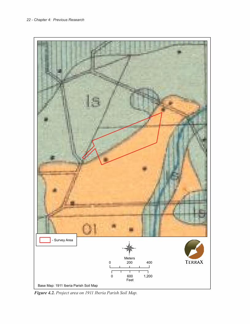
Lastly, several historic maps were inspected for structures within the project boundaries. The 1911 Iberia Parish Soil Map shows one structure within the project area (Figure 4.2). The 1939 and 1970 St. Martinville, LA USGS 15’ topographic quadrangle maps do not show any structures within the project boundaries.
22 - Chapter 4: Previous Research
- Survey Area
0 1,200600Feet
®0 400200
Meters
Base Map: 1911 Iberia Parish Soil Map
Figure 4.2. Project area on 1911 Iberia Parish Soil Map.

- 23TerraXplorations
Chapter 5Field Methodology and Results
Field methods
The field survey conducted implemented standard archaeological survey techniques. Full land coverage requirements were achieved through visual inspections of the entire survey area and subsurface testing. While conducting visual inspections, any exposed surfaces were carefully examined for cultural material.
Subsurface testing was performed along 30-m interval transects comprised of shovel tests spaced 30 m apart. When cultural material is found, a series of shovel tests are placed in cardinal directions at 10-m intervals around the positive shovel tests. Testing continues until two consecutive negative shovel tests are excavated in each direction. Standard shovel tests consist of 30 centimeter (cm) diameter cylindrical holes excavated to the top of the sterile subsoil layer or until water was encountered. Soils from each test were screened through 1/4-inch (0.64 cm) hardware cloth for the purpose of recovering any cultural material that may exist at that location. If cultural material is encountered, the material is sorted by provenience and placed into bags labeled with the pertinent excavation information before being transported to TerraX’s laboratory.
Labratory Methods and Collection Curation
All cultural materials recovered during field projects are delivered to TerraX’s laboratory in Tuscaloosa, Alabama for processing. Here, materials are sorted by provenience, cleaned, and analyzed. Along with the cultural material, all project records, photographs, and maps produced while conducting the investigation are transported for curation at the at the Troy University Archaeological Research Center in Troy, Alabama. A copy of the curation agreement can be found in Appendix A.
Results of Field Investigation
This Phase I investigation included the attempt of 192 shovel tests along nine transects. The first eight transects ran through the project area at bearings of approximately 225 degrees and 65 degrees. The final transect covered the linear extension to the west. Of the 192 attempted shovel tests, 191 were negative and one was positive. A map has been produced showing placement of shovel tests within the study area (Figure 5.1). Shovel test profiles generally revealed 0-35 cm of brown silt over a yellowish brown clay (Figure 5.2).
The project area has a low likelihood for encountering significant cultural resources. The project area is north of Highway 90 outside of New Iberia, Iberia Parish, Louisiana, and is bordered to the north by an agricultural field and to the east, south, and west by a residential area. The linear extension runs from the edge of the frontage road near the Jefferson Island Road interchange off of Highway 90 and extends to the west side of the project area. The extension runs between two houses through a field currently being used as a pasture for a few horses. The western edge of the project area is bounded by a small irrigation canal and the eastern edge is bounded by an area of overgrown grass that separates the field from lots with mobile homes.
The study area lies within a mostly level fallow agricultural field approximately 800m north of the Armenco Branch Canal. The project area is mostly flat with no noticeable elevation change. The eastern edge of the project area consists of an area of overgrown grass. Surface visibility is excellent, although occasionally obstructed by grass.

24 - Chapter 5: Field Methods and Results
Figure 5.1. Aerial depicting shovel test locations within the project area.
!(!(
!(!(
!(!(
!(!(
!(!(
!(!(
!(!(
!(!(
!(!(
!(!(
!(
!(!(
!(!(
!(!(
!(!(
!(!(
!(!(
!(!(
!(!(
!(!(
!(!(
!(
!(!(
!(!(
!(!(
!(!(
!(!(
!(!(
!(!(
!(!(
!(!(
!(!(
!(
!(!(
!(!(
!(!(
!(!(
!(!(
!(!(
!(!(
!(!(
!(!(
!(!(
!(!(
!(
!(!(
!(!(
!(!(
!(!( !(
!(!(
!(!(
!(!(
!(!(
!(!(
!(!(
!(!(
!(!(
!(!(
!(!(
!(!( !(
!(!(
!(!(
!(!(
!(!(
!(!(
!(!(
!(!(
!(
!(!(
!(!(
!(!(
!(!(
!(!(
!(!(
!(!(
!(!(
!(!(
!(!(
!(!(
!(!(
!(
!(!(
!(!(
!(!(
!(!( !(
!(!(
!(!(
!(!(
!(!(
!(!(
!(!(
!(!(
!(!(
!(!(!(
!(!(!(!( !(
Source: Esri, DigitalGlobe, GeoEye, Earthstar Geographics,CNES/Airbus DS, USDA, USGS, AeroGRID, IGN, and the GIS UserCommunity
!( - Positive Shovel Test
!( - Negative Shovel Test
- Survey Area ®
0 600300Feet
0 200100Meters
- 25TerraXplorations
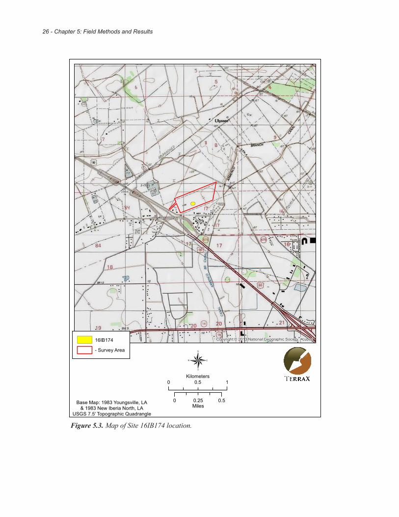
Site #16IB174 The site consists of a large surface scatter approximately 78m running roughly east-west, with a minor axis running approximately 62m north-south. Artifacts found beneath the surface in Transect 3 Shovel Test 9 were found between 5 and 15cm below the surface. However, additional shovel tests placed at 10-m intervals between the positive shovel test and the two consecutive neighboring negative shovel tests in four directions failed to yield any artifacts (Figure 5.3). The site was located approximately 140m northeast of where the structure is placed on the 1911 Iberia Parish soil map. No remains of a structure were found during this investigation. The land is recorded as being granted to a Theogene Viator in 1860. It is unknown if he lived at the site. The 1870 census recorded Mr. Viator as a farmer who lived in Ward 4 in Iberia Parish. The 1880 census recorded Mr. Viator as a sugar planter who lived in Petite Anse, Iberia Parish.
The material yielded from the positive shovel test and surface collection included one brick fragment, one cut nail, one undecorated porcelain, whiteware (six undecorated, three hand painted, four annular banded), yellowware (two undecorated, three annular banded), stoneware (one alkaline, two Bristol, three brown), one Bisque porcelain fragment, two Prosser porcelain buttons, one milkglass fragment, one light green glass stopper, container glass (four olive green, four aqua, two amber, three amethyst, one amethyst with machine made bead finish, two cobalt blue, one colorless), and one aqua glass insulator fragment. A complete list of artifacts recovered can be found in Appendix B. Only two of these artifacts came from the shovel test (one olive and one aqua piece of container glass). The artifacts date to roughly mid-nineteenth to early twentieth century. It is possible they were associated with the structure shown on the 1911 soil map, or maybe an earlier structure that was not recorded. Another possibility is that the artifacts were deposited in this location at a later date.
Considering the amount of disturbance, absence of cultural features, and lack of context, Site 16IB174 is recommended ineligible for NRHP consideration under Criterion D. Furthermore, no significant events, persons, or distinctive characteristics can be attributed to this site and nothing discovered suggests this site is remarkable or uncommon. Accordingly, this site does not meet Criteria A through C concerning NRHP consideration. No further archaeological work is necessary for Site 16IB174.
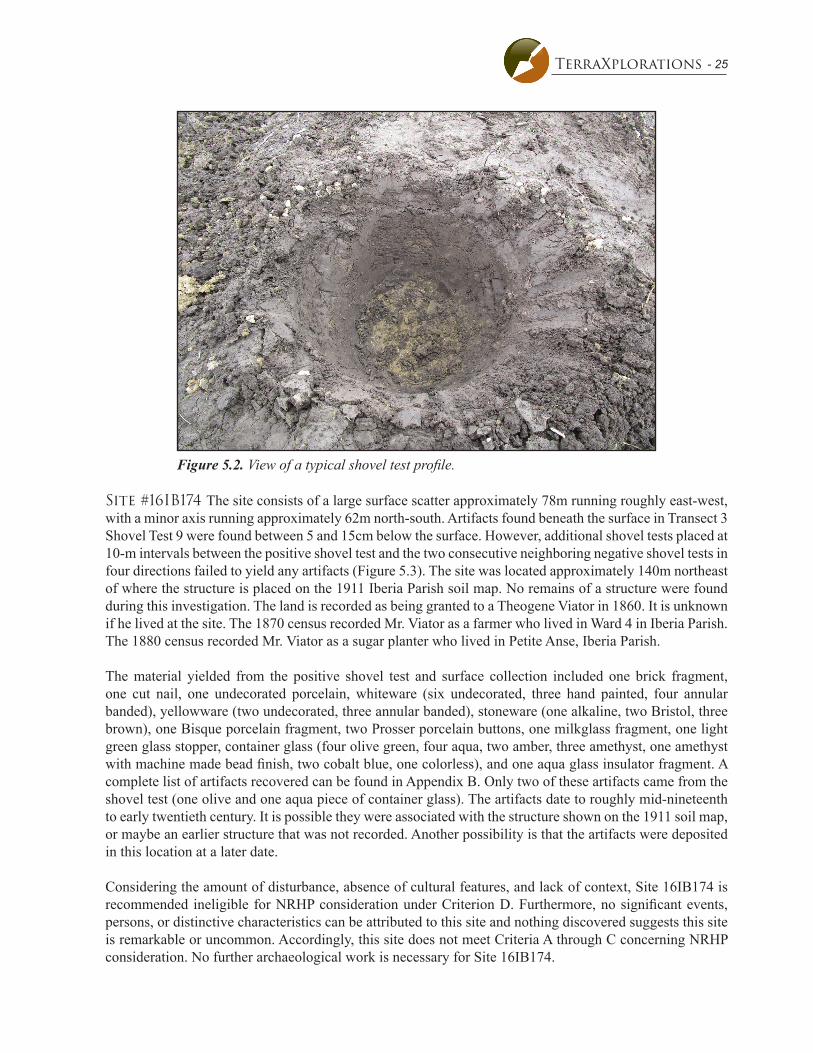
Figure 5.2. View of a typical shovel test profile.
26 - Chapter 5: Field Methods and Results
Copyright:© 2013 National Geographic Society, i-cubed16IB174
- Survey Area
0 0.50.25Miles
0 10.5Kilometers®
Base Map: 1983 Youngsville, LA& 1983 New Iberia North, LA
USGS 7.5' Topographic Quadrangle
Figure 5.3. Map of Site 16IB174 location.

- 27TerraXplorations
N
Site 16IB174Sketch Map
meters
- Site boundary
fallow field
3-9
- Negative shovel test
0 10 20
fallow field
fallow field
fallow field
- Positive datum
- Surface artifact scatter
Figure 5.4. Sketch map of Site 16IB174.

28 - Chapter 5: Field Methods and Results

- 29TerraXplorations
Chapter 6Summary and Recommendations
TerraX, under contract with One Acadiana conducted a cultural resources survey for the proposed Progress Point development in New Iberia, Louisiana in compliance with federal and state regulations. The Phase I survey was performed on December 13 and 14, 2017 by Alec Ballesteros, Lucinda Freeman and Matt Sumrall with Paul D. Jackson serving as Principal Investigator. The investigation identified one archaeological site (16IB174). The site was a historic surface scatter composed of mainly glass and ceramics, with two fragments of glass found not further than 15cm below the surface. The artifacts most likely date to the mid nineteenth to early twentieth centuries. TerraXplorations recommends Site 16IB174 as ineligible for the National Register of Historic Places due the pervasive nature of disturbance at the site and the unknown original context of the artifacts. Accordingly, no further archaeological studies are recommended for the proposed project.

30 - Chapter 6: Summary
- 31TerraXplorations
REFERENCES
Alchian, Linda K. 2008 Spanish Explorers of the Elizabethan Age. Elizabethan Era website. Electronic document, http:// www.elizabethan-era.org.uk/spanish-explorers.htm, accessed October 13, 2014.
Anderson, David G. 1996 Models of Paleoindian and Early Archaic Settlement in the Lower Southeast. In The Paleoindian and Early Archaic Southeast, edited by David G. Anderson and Kenneth E. Sassaman, pp. 29-57.
The University of Alabama Press, Tuscaloosa.
Anderson, David G., R. Jerald Ledbetter, and Lisa O’Steen1990 PaleoIndian Period Archaeology of Georgia. University of Georgia, Laboratory of Archaeology
Series Report No. 28, Georgia Archaeological Research Design Paper No. 6. Athens, Georgia.
Anderson, David G., D. Shane Miller, Stephen J. Yerka, J. Christopher Gillam, Erik N. Johanson, Derek T. Anderson, Albert C. Goodyear, and Ashley M. Smallwood 2010 PIDBA (Paleoindian Database of the Americas) 2010: Current Status and Findings. Archaeology
of Eastern North America 38:63-90. Electronic document, http://pidba.utk.edu/maps.htm, accessed June 18, 2015.
Buxton, B.M., and M.L. Crutch eld1985 The Great Forest: An Appalachian Story. Appalachian Consortium Press.
Caldwell, Joseph R.1958 Trend and Tradition in the Prehistory of the Eastern United States. Memoir 88. American
Anthropological Association, Menasha.
Carmon, Alana A.2007 Center for Culture and Eco-Tourism. St. Mary Parish. Electronic document,
http://ccet.louisiana.edu/tourism/parishes/Acadiana_Parishes/saintmary.html, accessed June 18, 2015.
Clark, Henry L., and Almond G. White 1978 Soil Survey of Iberia Parish, Louisiana. United States Department of Agriculture, Soil Conservation Service in cooperation with Louisiana Agricultural Experiment Station and Louisiana State Soil
and Water Conservation Committee.
Cliff, Maynard B., and Duane E. Peter (editors)1994 Test Excavations at the Caney Branch I and Caney Branch II Sites (16Bo198 and 16Bo200),
Louisiana Army Ammunition Plant, Bossier Parish, Louisiana. Prepared for the U.S. Army Corps of Engineers, Fort Worth District and on le at the Division of Archaeology, Baton Rouge.
Ethridge, Robbie 2003 Creek Country: The Creek Indians and their World. The University of North Carolina Press. Chapel
Hill and London.

32 - References
Fricker, Donna2015 Historic Context: The Louisiana Lumber Boom, c.1880-1925. Electronic document, http://www.
crt.state.la.us/Assets/OCD/hp/nationalregister/historic_contexts/The_Louisiana_Lumber_Boom_ c1880-1925.pdf, accessed June 23, 2015.
Gagliano, S.M., and H.F. Gregory 1965 A Preliminary Survey of Paleo-Indian Points from Louisiana. Louisiana Studies 4(1), Louisiana Studies Institute, Northwestern State College, Natchitoches.
Gibson, Jon L. 1974 The Tchefuncte Culture in the Bayou Vermilion Basin, South Central Louisiana. Bulletin of the Texas Archaeological Society 45:67-95.
Goodwin, R. Christopher, James M. Wojtala, William A. Morgan, William P. Athens, Jennifer A. Cohen, Julie H. McClay, and Susan Barrett Smith
1990 Level II Archaeological Investigation of the Proposed Erath-South Section 28 Pipeline Right-of-way, Vermilion, Iberia, and St. Martin Parishes Louisiana. R. Christopher Goodwin and Associates, Inc. Submitted to Southern Natural Gas Company, Birmingham.
Hahn, Steven C.2004 The Invention of the Creek Nation, 1670-1763. University of Nebraska Press, Lincoln and London.
Hunter, Donald G., Summer L. Shuman, Brenda Rykels, and Wayne Lawrence Coco1991 Whitney Plantation: Archaeology on the German Coast. Coastal Environments, Inc. Submitted to
Walk, Haydel, and Associates, Inc., New Orleans.
Jeter, M.D., J.C. Rose, G.L. Williams, and A.M. Harmon1989 Lower Mississippi Valley and Trans-Mississippi South in Arkansas and Louisiana. Arkansas
Archaeological Survey, Research Series No. 37.
Kniffen, Fred B., and Sam Bowers Hilliard 1988 Louisiana: Its Land and People. Louisiana State University Press, Baton Rouge.
Lee, Aubra “Butch,” D. Ryan Gray, Dayna Bowker Lee, Benjamin Maygarden, Justine McKnight, Rhonda L. Smith, and Jill-Karen Yakubik
2010 A Half-Watch of Work: Class, Labor, and Resistance on a Southern Sugar Plantation: Data Recovery at North Bend Plantation [16SMY66/132], St. Mary Parish, Louisiana. LDOA report no. 22-3527.
Louisiana Department of Wildlife and Fisheries 2009 The Natural Communities of Louisiana. Louisiana Natural Heritage Program, Louisiana Department
of Wildlife and Fisheries, Baton Rouge, Louisiana. Accessed online on December 13, 2017.
Louisiana Division of Archaeology (LDOA) 2017 Louisiana Archaeological Site Files. Louisiana Division of Archaeology, Baton Rouge, Louisiana.
Accessed online on December 13, 2017.
- 33TerraXplorations
Louisiana Geological Survey 2010 Generalized Geology of Louisiana. Prepared by the Louisiana Geological Survey staff. Electronic
document, http://www.lgs.lsu.edu/deploy/uploads/gengeomapla.pdf, accessed March 24, 2016.
Lytle, S.A., B.F. Grafton, Alexander Ritchie, and H.L. Hill 1959 Soil Survey of St. Mary Parish, Louisiana. United States Department of Agriculture, Soil Conservation Service. In cooperation with Louisiana Agricultural Experiment Station.
National Park Service 2017 National Register of Historic Places. Department of the Interior, Washington, D.C. Available online
at www.cr.nps.gov/nr. Accessed on December 13, 2017.
Neuman, Robert W.1984 An Introduction to Louisiana Archaeology. Louisiana State University Press, Baton Rouge.
Neuman, Robert W., and Nancy W. Hawkins1993 Louisiana Prehistory. Department of Culture, Recreation and Tourism, Louisiana Archaeological
Survey and Antiquities Commission No. 6. Baton Rouge. Electronic document, http://www.crt. state.la.us/dataprojects/archaeology/virtualbooks/LAPREHIS/paleo.htm, accessed June 18, 2015.
O’Steen, Lisa D., R. Jerald Ledbetter, Daniel T. Elliott, and William W. Barker.1986 Paleo-Indian Sites of the Inner Piedmont of Georgia: Observations of Settlement in the Oconee
Watershed. Early Georgia 14(1-2):1-63.
Perrin, William Henry 1891 History of Iberia Parish, Louisiana. Southwest Louisiana Biographical and Historical, pp. 91-118.
The Gulf Publishing Company.
Sassaman, Kenneth E., and David G. Anderson2004 Late Holocene Period, 3750 to 650 B.C. In Handbook of North American Indians, Volume 14,
Southeast. Edited by Raymond D. Fogelson, pp. 101-114. Smithsonian Institution. Washington, D.C.
Smith, Steven D., Phillip G. Rivet, Kathleen M. Byrd and Nancy W. Hawkins1983 Louisiana Comprehensive Archaeological Plan. Division of Archaeology, Louisiana Department
of Culture, Recreation and Tourism, Baton Rouge.
Springer, James W.1973 The Prehistory and Cultural Geography of Coastal Louisiana. Unpublished Ph.D. dissertation, Yale
University.
Stoltman, James B.1978 Temporal Models in Prehistory: An Example from Eastern North America. Current Anthropology
19(4):703-746.
Wall, Bennett H.2008 Louisiana: A History. Published by Harlan Davidson.

34 - References
Walthall, John A.1980 Prehistoric Indians of the Southeast, Archaeology of Alabama and the Middle South. University of
Alabama Press, Tuscaloosa. Web Soil Survey2017 Soil Survey Staff, Natural Resources Conservation Service, United States Department of
Agriculture. Electronic document, http://websoilsurvey.nrcs.usda.gov/.
Webb, Clarence H., and Hiram F. Gregory 1986 The Caddo Indians of Louisiana. Anthropological Study Series No. 2, 2nd Edition, Department of Culture, Recreation and Tourism, Louisiana Archaeological Surveys and Antiquities Commission,
Baton Rouge.
Weinstein, Richard A., and Philip Rivet1978 Beau Mire: A Late Tchula Period Site of the Tchefuncte Culture, Ascension Parish, Louisiana.
Anthropological Report No. 1. Louisiana Archaeological Survey and Antiquities Commission, Baton Rouge.
Willey, Gordon R,. and Philip Phillips1958 Method and Theory in American Archaeology. University of Chicago Press, Chicago, Illinois.

- 35TerraXplorations
Appendix ACuration Agreement

36 - References

- 37TerraXplorations
Date: September 30, 2017 Paul Jackson TerraXplorations 3130 East University Blvd Tuscaloosa Al 34504.
Dear Paul,
As per your request, this letter is to confirm our standing agreement with you to provide curation services to Terra Explorations on an as-needed basis. As you know, we are recognized by a variety of Federal agencies as a repository meeting the standards in 36 CFR Part 79 and have formal agreements to provide curation under these guidelines to multiple federal agencies such as the Army National Guard and Natural Resources Conservation Service.
Please be advised that once a year we must be notified of all reports in which we were named as the repository. Project collections must be submitted within one calendar year of completion. Small projects may be complied for periodic submission. The AHC survey policy specifies which materials must be curated (Administrative Code of Alabama, Chapter 460-X-9). Renewal of this agreement is contingent upon compliance.
We appreciate this opportunity to be of assistance and look forward to working with you in the future.
Sincerely,
Jason Mann Director Archeological Research Center Troy University

38 - References

- 39TerraXplorations
Appendix BArtifact List

40 - References

Artifact Inventory List
Site Location Type Count Weight (g) Accession #
16IB174TR 3 ST 9/I/5-15 CMBS 1Bag:
glass (aqua embossed base [with suction scar "W; 1 8 U"]) 1 2017.227002glass (olive green container) 1 0.0 2017.227001
Location Totals 2 0.0
Surface/Surface 2Bag:
Alkaline glaze stoneware base 1 2017.227037bblue hand painted whiteware 1 2017.227029blue annnular banded whiteware (2=1) 3 2017.227031blue hand painted green annular banded whiteware rim 1 0.0 2017.227030blue hand painted whiteware base 1 0.0 2017.227027Bristol glazed exterior/ unglazed interior stoneware 1 2017.227039brown annular banded yellowware 1 2017.227034brown glazed exterior/ Bristol glazed interior stoneware base 1 2017.227041brown glazed exterior/ unglazed interior stoneware 1 2017.227040burned purple annular banded whiteware rim with partial handle 1 2017.227028ferrous metal machine-cut nail fragment 1 2017.227042glass (amber container) 2 0.0 2017.227004glass (amethyst container) 1 0.0 2017.227009glass (amethyst lip with bead finish) 1 0.0 2017.227011glass (amethyst molded container) 2 0.0 2017.227010glass (aqua base) 1 2017.227007glass (aqua container) 1 0.0 2017.227005glass (aqua embossed container) 1 0.0 2017.227006glass (aqua insulator fragment) 1 0.0 2017.227008glass (cobalt blue base [with suction scar]) 1 2017.227013glass (cobalt blue container) 1 0.0 2017.227012glass (colorless container) 1 0.0 2017.227003glass (light green stopper) 1 0.0 2017.227015glass (milk container) 1 0.0 2017.227016glass (olive green container) 3 0.0 2017.227014Prosser porcelain button fragment 1 0.0 2017.227018Prosser porcelain button with 4 holes 1 0.0 2017.227017stoneware base brown glazed exterior/ unglazed interior 1 2017.227042undecorated bisque porcelain fragment with partial handle 1 2017.227019undecorated burned whiteware plate 1 2017.227026undecorated porcelian 2 0.0 2017.227020undecorated whiteware 1 0.0 2017.227021undecorated whiteware base with unknown maker's mark 1 0.0 2017.227025undecorated whiteware base with unknown maker's mark 1 0.0 2017.227023undecorated whiteware base with unknown maker's mark 1 0.0 2017.227024undecorated yellowware 1 2017.227035undecorated yellowware 1 2017.227036undecoratedwhiteware base 1 0.0 2017.227022undifferentiated brick fragment 1 2017.227044white annular banded yellowware rim 1 2017.227033
Page 1 of 2

Site Location Type Count Weight (g) Accession #
white glazed blue and yellow annular banded exterior/ yellow interior yellowware
1 2017.227032
white glazed exterior/ brown glazed interior stoneware base 1 2017.227038
Location Totals 49 0.0
Site Totals 51 0.0
51 0.0Project Totals
Page 2 of 2