
Sampling for Chemical Analysis Preliminary Considerations in Sampling

Optimal spatial sampling schemes for
environmental surveys
S IMONE D I Z IO , LARA FONTANELLA and LU IG I
I P POL I T I *
Department of Quantitative Methods and Economic Theory, University G.D’Annunzio, VialePindaro 42, 65127 Pescara, Italy E-mail: [email protected]
A practical problem in spatial statistics is that of constructing spatial sampling designs forenvironmental monitoring network. This paper presents a fractal-based criterion for the
construction of coverage designs to optimize the location of sampling points. The algorithmdoes not depend on the covariance structure of the process and provides desirable results forsituations in which a poor prior knowledge is available. The statistical characteristics of the
method are explored by a simulation study while a design exercise concerning the Pescara areamonitoring network is used to demonstrate potential designs under realistic assumptions.
Keywords: fractal dimension, sampling, optimal spatial designs, space-filling designs
1352-8505 � 2004 Kluwer Academic Publishers
1. Introduction
Most environmental applications, such as the definition of contaminated areas,require a prior mapping of the target pollutant agents over the study region(Goovaerts, 2000). Therefore, the construction of an optimal monitoring networkbecomes a common problem with spatial dependence playing a crucial role. A widerange of methods used for constructing optimal spatial sampling designs have beenmainly determined using minimum error variance algorithms and Cressie (1993)summarizes the main aspects of these approaches. In particular, regular samplinggrids (Yfantis et al., 1987; Christakos and Olea, 1992), such as equilateral triangulargrid, are usually recommended to achieve sampling schemes with minimal krigingvariance. However, as remarked by Van Groenigen (2000) there are some drawbacksthat ‘‘prohibit’’ the use of such a sampling grid. In practice, geographical informa-tion on sampling constraints, preliminary observations and information on spatialcorrelation can considerably improve sampling strategies (Van Groenigen and Stein,1998). Because of these practical sampling limits, research efforts have been shifted
1352-8505 � 2004 Kluwer Academic Publishers
*Corresponding author.
Environmental and Ecological Statistics 11, 397–414, 2004

towards optimal placement of the individual monitoring stations over a particularregion of interest S. In this case, using the stochastic Spatial Simulated Annealing(SSA) algorithm, Van Groenigen (2000) and Lark (2002) have shown that optimalsampling schemes can be achieved by minimizing the average or maximum krigingprediction variance. However, the basic problem of this approach is that before theactual sampling takes place there is only a little prior knowledge of the field. Thus, ana priori specification of the covariance structure, in order to construct an optimaldesign, may be difficult and miss-specifications may produce designs that are notoptimal. In such situations, coverage or space-filling criteria (Nychka et al., 1997;Stevens and Olsen, 2000; Stevens and Olsen, 2004) that do not involve the covariancefunction of the process seem to represent alternative solutions. Remaining in thiscontext, by computing the fractal dimension of n points representing the set of themonitoring stations fv1; . . . ; vng � S, we propose a coverage criterion which is shownto perform comparably to designs that minimize the kriging prediction variance.
The paper is organized as follows. Section 2 provides an introduction of fractalsembedded in two dimensions, while the notion of optimal spatial sampling schemesis discussed in Section 3. In this Section we also discuss issues associated with therealization of the Fractal Spatial Simulated Annealing – FSSA – algorithm whichleads to optimal sampling designs independent of the data process. The advantagesof the proposed procedure are shown in Section 4 by a simulation study while,Section 5, concludes the experimental part presenting the design exercise of con-structing an optimal network of environmental monitoring stations in the city ofPescara (Italy). Last, we discuss the obtained results and some related issues inSection 6.
2. Fractal characterization of spatial variation
If the spatial correlation structure is not known, which is normally the case, a two-stage sampling procedure is usually considered. In the first stage, one takesexploratory samples to obtain the estimate of the variogram parameters (Cressie,1993). Although sampling in the first stage depends on prior knowledge about thefield, a practical solution might be that of applying regular sampling designs in orderto obtain a good uniform coverage of S. Yfantis et al. (1987) have shown that thisapproach ensures efficiency of kriging estimation in terms of mean squared error(MSE). A point worth noting is that for a sample of points uniformly distributed inthe domain S and for any given site vi, the number HðrÞ, of other points within acircle of radius r, is proportional to the area of the circle (i.e., to pr2). Since this alsoholds for the average number, ~HðrÞ (obtained over all the n points), it followsimmediately that ~HðrÞ / pr2. As it can be seen, this is a power law whose exponentplays a crucial role and (in theory), if the same uniform pattern was present at eachresolution scale, then the exponent 2 should remain the same for any value of rrevealing a scale invariant property of the spatial structure. However, it should benoted that this rule represents a limit case of a more generic power law which can beexpressed as ~HðrÞ / jrD, where D is known as the fractal dimension introduced byMandelbrot (1982) to describe self-similar structures. In particular, unlike the con-cept of the Euclidean dimension, fractal dimension need not be an integer and is a
Di Zio et al.398

quantitative measure of irregularity or ‘roughness’ of patterns. Hence, because ofthese favorable properties, we propose to use the fractal dimension as a criterion forselecting optimal sampling schemes. A variety of methods have been used todetermine the fractal dimension and they generally yield similar results. The methodused here is known as the cluster or correlation method (Hastings andSugihara, 1993) which, after a log-transform of the power law, i.e., logð ~HðrÞÞ �logðjÞ þ D logðrÞ, estimates D as the slope of the best fitting line produced when logð ~HðrÞÞ is regressed against log ðrÞ. In this case, up to edge effects or geographicalconstraints, it is expected that the more the points tend to cover uniformly the regionof interest, the more D approaches to 2, which represents the topological dimensionof the study area as well as the maximum theoretical value of D. Accordingly, thedifference ð2� DÞ might be fruitfully used as a coverage measure that describes thelevel of inhomogeneity in the spatial distribution of environmental monitoringnetworks.
3. Optimal spatial sampling schemes
In this section we discuss methods for constructing optimal spatial sampling designs.Scientists are often handling data provided by monitoring networks over which theyhave little control. Traditionally, political, geographic and economic reasons deter-mine the design of monitoring networks. However, without a statistical supportsystem such designs cannot be considered optimal. The notion of optimal design isintuitive and corresponds to the objective of locating nmonitoring sites in an optimalfashion over S. Commonly, the ‘‘best’’ sampling design (network) is that whichminimizes some variance criterion. For example, in the field of regionalized variables(Matheron, 1963) the average or maximum prediction variance of the kriging esti-mates may be considered as a reasonable measure of the goodness of a samplingscheme (Van Groenigen, 2000; Lark, 2002). In particular, provided the variogram isknown or can be assumed, the efficiency of the sampling scheme can be evaluatedbefore the actual sampling takes place. However, in most cases this is an unrealisticassumption and unlike the variogram case, in this paper it will be shown that by usingthe fractal dimension it is possible to achieve an optimal sampling design which doesnot depend on the data process. Let us suppose that the continuous design region Scan be approximated by a set of N sites of a R� C grid. Accordingly, the con-
struction of an optimal spatial sampling design of size n reduces to finding the ‘‘best’’
configuration among all�
N
n
�possible sampling plans. It seems clear that naive
optimization is computationally prohibitive and a clever search algorithm is needed.
3.1. The fractal spatial Simulated annealing algorithm
In the framework of Markov–Chain Monte Carlo simulation we propose the FSSA– algorithm which is a modified version of the procedure discussed in Van Groenigen(2000) and Lark (2002). In particular, as an alternative to covariance-based optimaldesigns, the fitness ðobjectiveÞ function Oð�Þ is defined by a fractal-based criterion.
Optimal Spatial Sampling Schemes 399
This criterion, can be thought of as a measuring how well the set of n monitoringstations fv1; . . . ; vng covers the domain of interest S. Below we give the major detailsof such a procedure.
The algorithm starts with an initial random configuration of monitoring stationsV ð0Þ ¼ fvð0Þ1 ; . . . ; vð0Þn g and determines the coverage fitness function OðV ð0ÞÞ ¼ 2� Dð0Þ
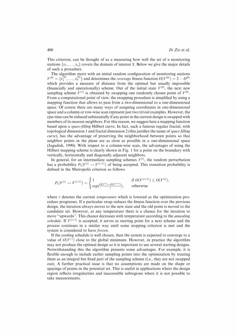
which provides a measure of distance from the optimal but usually impossible(financially and operationally) scheme. Out of the initial state V ð0Þ, the next newsampling scheme V ð1Þ is obtained by swapping one randomly chosen point of V ð0Þ.From a computational point of view, the swapping procedure is simplified by using amapping function that allows to pass from a two-dimensional to a one-dimensionalspace. Of course there are many ways of assigning coordinates in one-dimensionalspace and a column or row-wise scan represent just two trivial examples. However, thecpu-time can be reduced substantially if any point in the current design is swappedwithmembers of its nearest-neighbors. For this reason, we suggest here amapping functionbased upon a space-filling Hilbert curve. In fact, such a famous regular fractal, withtopological dimension 1 and fractal dimension 2 (this justifies the name of space fillingcurve), has the advantage of preserving the neighborhood between points so thatneighbor points in the plane are as close as possible in a one-dimensional space(Jagadish, 1990). With respect to a column-wise scan, the advantages of using theHilbert mapping scheme is clearly shown in Fig. 1 for a point on the boundary withvertically, horizontally and diagonally adjacent neighbors.
In general, for an intermediate sampling schemes V ðiÞ, the random perturbationhas a probability PsðV ðiÞ ! V ðiþ1ÞÞ of being accepted. This transition probability isdefined in the Metropolis criterion as follows
PsðV ðiÞ ! V ðiþ1ÞÞ ¼ 1 if OðV ðiþ1ÞÞ � OðV ðiÞÞ;expðOðV
ðiÞÞ�OðV ðiþ1ÞÞs Þ; otherwise
(
where s denotes the current temperature which is lowered as the optimization pro-cedure progresses. If a particular swap reduces the fitness function over the previousdesign, the iteration always moves to the new state and the old point is moved to thecandidate set. However, at any temperature there is a chance for the iteration tomove ‘‘upwards’’. This chance decreases with temperature according to the annealingschedule. If V ðiþ1Þ is accepted, it serves as starting point for a next scheme and theprocess continues in a similar way until some stopping criterion is met and thesystem is considered to have frozen.
If the cooling schedule is well chosen, then the system is expected to converge to avalue of OðV ð�ÞÞ close to the global minimum. However, in practice the algorithmmay not produce the optimal design so it is important to use several starting designs.Notwithstanding this the algorithm presents some advantages. For example, it isflexible enough to include earlier sampling points into the optimization by treatingthem as an integral but fixed part of the sampling scheme (i.e., they are not swappedout). A further practical issue is that no assumptions are made on the shape orspacings of points in the potential set. This is useful in applications where the designregion reflects irregularities and inaccessible subregions where it is not possible totake measurements.
Di Zio et al.400

4. Some experimental results
4.1 Achieving the optimal design
As usual for a point swapping procedure, the algorithm may not always converge tothe optimal design, that is the design that minimizes the objective function overallpossible designs of a given size. In fact, although for an infinite calculation time theglobal solution is always found (Aarts and Korst, 1990), for a realistic calculationtime and a well defined cooling schedule, it is expected that the FSSA converges to avalue close to the global minimum. Thus, starting with several initial configurations,the system leads to a set of final configurations which are close to the optimal one. Inorder to have some knowledge concerning the possibility of achieving the optimaldesign or at least one which is close to the optimal, the optimization procedure wascarried out using 500 random starting configurations to obtain, potentially, 500 bestdesigns. We considered a 10� 10 square region containing 100 potential sites and adesign size of n ¼ 10; 15; 20; 25. Recognizing that it is difficult, in general, to assess
Figure 1. Hilbert and column mapping schemes for a (8�8) grid. In gray it is shown thesecond-order neighborhood system of the point of coordinates (8,4).
Optimal Spatial Sampling Schemes 401

whether or not we have really achieved the best design, we shall refer to the overallbest of these 500 designs as the optimal design. Thus, to asses how close the designsare to the optimal we may consider the following index
D0 ¼1
500
X500i¼1
1� O�ð�ÞOið�Þ
� �2; ð1Þ
where O�ð�Þ is the objective function value for the overall best design and Oið�Þ is theoptimized objective function value at the i-th simulation. The closer the measure is tozero, the smaller are the deviations from the optimal criterion value of the 500optimized values. Assessing how much improvement is observed in the objectivefunction by using the point-swapping algorithm is a further practical issue. In thiscase, let the OiðV ð0ÞÞ; i ¼ 1; . . . ; 500 be the coverage measure corresponding to thei-th random starting design. The average percent improvement in the coverage cri-terion may be defined as
D1 ¼1
500
X500i¼1
ð1� Oið�ÞOiðV ð0ÞÞ Þ
" #� 100: ð2Þ
The closer this measure is to zero, the smaller is the improvement obtained by using aswapping algorithm. Values of D0 and D1 are given in Table 1. Results from thistable and Fig. 2 indicate that for a small design size the FSSA algorithm does notfind a common minimum often. However, the values of D0 tend to zero as n becomeslarger showing that the designs tend to be close one another in terms of the criterionvalues. This is also evident in Fig. 2 where we can observe that the box plots,showing the Oið�Þ distribution for each n, become smaller and smaller in size as nincreases. Finally, note that D1 shows a large improvement in criterion value as aresult of optimization since, starting from a value of 37%, the improvement increasessubstantially with n. Maintaining fixed the ratio n=N , similar findings were alsoobserved for different lattice dimensions.
4.2 FSSA versus average kriging prediction variance
To demonstrate the advantages of the proposed sampling procedure a simulationstudy was also performed to compare minimal average kriging prediction variancedesigns with those based upon the fractal dimension. Di Zio et al. (2002) showed thatfractal designs closely approximate those that minimize the average kriging predictionvariance. In particular, they provided some empirical evidence that the objective
Table 1. Coverage adequacy measures for different design size.
Design Size D0 D1
10 0.092 37.01
15 0.018 45.9620 0.009 47.3325 0.003 48.78
Di Zio et al.402

function associated with fractal designs show high levels of correlation with theobjective function based on the kriging variance. In this paper, we continue this studyby comparing the results concerning both parameter estimation and predictionproblems. Rather than an exhaustive studywe have selected some simulations to give aflavor of the types of behavior that our procedure exhibit under particular conditions.Considering constant, linear and quadratic trend functions, the first step regards thesimulation of a spatial process (Cressie, 1993) over an area characterized by inacces-sible subregions. Note that the presence of such inaccessible areas does not allow aregular sampling grid for a fixed design size n. Then, assuming that the covariancestructure may be represented by a Spherical model (Cressie, 1993) with range¼ 6,nugget¼ 2 and partial sill ¼ 20, 1000 realizations of the spatial process have beensimulated on a 10� 10 regular grid. The simulation area together with the inaccessiblesubregions, - where it is not possible to take measurements,—are shown in Fig. 3.
For each realization and for all the example situations, we have used the dataobserved on the optimal fractal-configuration to re-estimate the model parametersby Restricted maximum likelihood (REML) (Cressie, 1993). As in Section 4:1, for adesign size of n ¼ 25 such a configuration was obtained by choosing the overall bestof 500 designs and is thus kept fixed in the simulation. The final step of the simu-lation considers the further problem of spatial prediction. Therefore, the remainingunmonitored points have been used to compute the kriging prediction variance.Finally, the estimation results and the prediction variances have been comparedwith those obtained using minimal kriging variance designs and are illustrated inTables 2–5. Also for the kriging designs the best configuration was chosen followingthe same criterion used for the fractal approach. However, notice that in this case, tocreate the monitoring network by using the semi-variogram criterion (Van Groeni-gen, 2000; Lark, 2002) we have been constrained to assume the model parameters asknown.
n=10 n=15 n=20 n=25
0.4
0.45
0.5
0.55
0.6
0.65
Design Size
Figure 2. Box plots of the distribution of optimized objective function values, Oið�Þ. Each boxplot corresponds to 500 simulations and a different design size.
Optimal Spatial Sampling Schemes 403

As is evident from the tables, although the restricted maximum likelihood esti-mator is biased (above all for the quadratic trend case), both procedures performvery similarly providing good results. However, since the kriging approach showslower standard errors and a lower average kriging prediction variance, it should bepreferred whenever the covariance structure can be considered known. On the otherhand, in absence of such a knowledge, it is clear that the fractal approach representsa very good alternative solution.
Figure 3. Simulation area with inaccessible subregions —shaded cells.
Table 2. The means (and standard errors) of the parameter estimates from 1000simulations of a zero mean spatial process and, in the last column, the Average KrigingPrediction Variance (AKPV). The true parameters are: range = 6; partial sill = 20and nugget = 2.
Methods Mean Range Partial Sill Nugget AKPV
Fractal design 0.0410 5.9280 18.4615 1.7090 6.6587
(1.8280) (1.8814) (8.1208) (2.2538) (2.4028)Kriging design 0.0716 5.9372 18.4881 1.5452 6.1421
(1.7269) (1.8347) (7.7160) (2.2963) (2.1588)
Table 3. The means (and standard errors) of the parameter estimates from 1000simulations of a spatial process with a linear trend surface. The true simulationparameters are: range = 6; partial sill = 20, nugget = 2, b0 = 12, b1 = 2.5 andb2 = )1.8.
Methods b0 b1 b2 Range Partial Sill Nugget AKPV
Fractal design 12.075 2.510 )1.822 6.104 17.266 1.497 6.273
(4.403) (0.496) (0.502) (2.107) (8.567) (2.099) (2.279)Kriging design 11.947 2.523 )1.814 6.131 17.680 1.379 5.693
(3.948) (0.452) (0.448) (1.990) (8.390) (2.088) (1.984)
Di Zio et al.404

4.3 Comparison of sampling schemes in absence of priorinformation
In this section we compare four different sampling techniques which might be usedwhen no prior information on the field is available. In particular, with severalexamples, we compare the FSSA procedure with: (1) Simple Random Sampling(SRS), (2) Systematic Triangular Sampling (STS), and (3) Hierarchically Random-ized Designs (HR). This last sampling technique, that is based on the key concepts ofrecursive partitioning and hierarchical randomization, is here used to obtain spatiallybalanced equal probability samples, although, as described in Stevens and Olsen(1999, 2000), unequally probability sampling is also possible. The choice of includingthis technique in the simulation study was motivated by the fact that the concept ofrecursive partitioning is essentially the same as that used to construct space-fillingcurves and, as for FSSA, it also allows to preserve some of the proximity relation-ships of the two-dimensional population domain. Furthermore, notice that althoughin this particular simulation we do not consider geographical constraints, the HRmethod is also flexible enough to exclude inaccessible domain patterns from thesampling procedure (Stevens and Olsen, 2004).
The simulation design considers a (16� 16) spatial lattice in which n sites areobserved and (256� n) used for prediction only. The objective is to compare the foursampling procedures in terms of their ability in predicting the values of a fixed finiterealization of a zero-mean spatial process. In particular, to compare them for dif-ferent covariance structures, the simulation scheme is based on the following
Table 5. The means (and standard errors) of the covariance parameter estimatesfrom 1000 simulations of a spatial process with a quadratic trend surface and, in thelast column, the Average Kriging Prediction Variance (AKPV).The true parametersare: range = 6; partial sill = 20 and nugget = 2.
Methods Range Partial Sill Nugget AKPV
Fractal design 5.962 14.744 1.308 5.972
(1.629) (7.888) (1.955) (2.129)Kriging design 5.864 14.410 1.140 4.804
(1.644) (7.328) (1.999) (1.765)
Table 4. The means (and standard errors) of the parameter estimates from 1000simulations of a spatial process with a quadratic trend surface. The true simulationparameters for the trend are: b0 = 90.5, b1 = 12.6, b2 = 15.1, b3 = )0.65,b4 = )0.041, b5 = )0.58.
Methods b0 b1 b2 b3 b4 b5
Fractal 90.726 12.611 15.015 )0.653 )0.037 )0.577Design (7.991) (2.187) (2.090) (0.161) (0.159) (0.161)Kriging 90.569 12.626 15.046 )0.653 )0.036 )0.578design (6.073) (1.730) (1.729) (0.141) (0.117) (0.139)
Optimal Spatial Sampling Schemes 405

parameterization: range=4, partial sill=20 and nugget=2 for spherical and expo-nential covariance functions, and range=4, sill=20 and v ¼ 0:8 for the MaternCovariance model (Stein, 1999, p. 50), where m is a parameter which controls thesmoothness of the spatial field. For a design size of n ¼ 64, apart from the triangularscheme which is fixed, we have also produced 200 different point configurations foreach of the remaining three techniques (i.e., HR, FSSA and SRS) in order to assesstheir predictive ability. Thus, for a given realization of the spatial process and for agiven configuration of monitoring sites, the predictive ability can be tested bycomputing the following measures of design adequacy (Cressie, 1993)
I1 ¼1
N � n
XN�n
i¼1
xðviÞ � xðviÞri
; ð3Þ
I2 ¼
ffiffiffiffiffiffiffiffiffiffiffiffiffiffiffiffiffiffiffiffiffiffiffiffiffiffiffiffiffiffiffiffiffiffiffiffiffiffiffiffiffiffiffiffiffiffiffiffiffiffiffi1
N � n
XN�n
i¼1
xðviÞ � xðviÞð Þ2
r2i
vuut ; ð4Þ
I3 ¼1
N � n
XN�n
i¼1
xðviÞ � xðviÞð Þ2; ð5Þ
AKPV ¼ 1
N � n
XN�n
i¼1
r2i ; ð6Þ
where xðviÞ is the realization of the spatial process observed at site vi, xðviÞ is itskriging prediction and r2i is the corresponding kriging prediction variance. If themodel fits well, then we expect that: I1 is close to 0, I2 is close to 1, and that the closerthe measure I3 is to zero, the smaller are the relative prediction errors, irrespective ofwhether the selected covariance model is appropriate or not. Furthermore, for twodifferent designs A and B, if it happens that AKPVA < AKPVB, then we might alsoexpect that design A is better than design B.
Results of simulation, for 50 different realizations, are shown in Tables 6–8 whereare given the average (and standard error, s.e.) values of the four indexes and themaximum likelihood (ML) estimates of the covariance parameters.
Table 6. The means (and s.e.) of the indexes (3–6) and covariance parameter estimatesover 50 realizations of a zero-mean spatial process simulated with spherical covariance
function. The true parameters are: range = 4; partial sill = 20 and nugget = 2. (*)For each of the 50 realizations, 200 configurations are considered, so that the averageis over 1000 runs.
Designs Range Partial Sill Nugget I1 I2 I3 AKPV
STS 4.520 18.618 3.001 )0.013 1.111 11.287 9.471
(0.932) (4.786) (2.615) (0.118) (0.129) (1.218) (1.959)SRS(*) 4.183 18.602 2.025 0.001 1.101 13.986 12.084
(1.109) (4.927) (2.403) (0.139) (0.144) (2.210) (2.596)FSSA(*) 4.169 18.687 2.057 0.000 1.094 12.677 10.944
(1.011) (4.707) (2.673) (0.128) (0.140) (1.822) (2.382)HR(*) 4.213 18.660 2.025 0.001 1.092 12.419 10.612
(1.139) (4.620) (2.694) (0.124) (0.141) (1.700) (2.317)
Di Zio et al.406

As it can be seen, the ML estimator is biased for all the covariance parameter-izations and for all the sampling designs. However, the triangular scheme showsmore biased estimates above all for the nugget parameter. This might be explainedbecause of the lack of information at small distances that, as expected, is moreobvious for the triangular scheme.
Because I1 is always close to zero, all techniques give reasonable predictions,although STS in Tables 6 and 7, CCS in Table 7 and HR in Table 8, show slightlylarger values. However, a good discrimination between sampling techniques isprovided by the indexes I3 and AKPV which, as expected, show in all situations thelowest and the highest values for the STS and SRS techniques, respectively. On theother hand, it does appear that there is not much difference between FSSA and HRwhich show intermediate prediction variances. Notice that although the empiricalMSE, I3, should be very close to AKPV, we observe several cases in which this doesnot hold; this might probably be due to the fact that the estimated covariance
Table 7. The means (and s.e.) of the indexes (3–6) and covariance parameter estimatesover 50 realizations of a zero-mean spatial process simulated with exponentialcovariance function. The true parameters are: range = 4; partial sill = 20 andnugget = 2. (*) For each of the 50 realizations, 200 configurations are considered, so
that the average is over 1000 runs.
Designs Range Partial Sill Nugget I1 I2 I3 AKPV
STS 4.354 20.636 2.647 0.013 1.096 16.018 14.165(1.431) (3.698) (2.562) (0.110) (0.197) (3.646) (1.738)
SRS(*) 3.915 21.120 2.037 0.022 1.046 17.881 16.458
(0.185) (2.080) (0.061) (0.139) (0.092) (2.250) (2.022)FSSA(*) 3.898 21.262 2.026 0.004 1.026 16.497 15.792
(0.180) (2.255) (0.055) (0.106) (0.089) (2.015) (2.095)
HR(*) 3.867 21.249 2.030 0.001 1.037 16.496 15.599(0.273) (2.304) (0.051) (0.119) (0.091) (1.632) (2.409)
Table 8. The means (and s e) of the indexes (3–6) and covariance parameter estimatesover 50 realizations of a zero-mean spatial process simulated with Matern CovarianceModel. The true parameters are: range = 4; sill = 20 and m = 0.8. (*) For each of the50 realizations, 200 point configurations are considered, so that the average is over
1000 runs.
Designs Range Sill v I1 I2 I3 AKPV
STS 5.078 21.152 0.821 0.005 1.002 4.394 4.567(3.044) (5.780) (0.240) (0.085) (0.119) (0.502) (1.169)
SRS(*) 4.553 20.312 0.796 )0.010 1.056 6.808 6.053
(1.767) (5.667) (0.191) (0.134) (0.135) (0.968) (1.257)FSSA(*) 4.950 20.003 0.800 )0.002 1.058 5.695 5.242
(2.916) (5.832) (0.231) (0.113) (0.132) (0.834) (1.186)
HR(*) 4.870 20.650 0.810 0.019 1.055 5.090 4.802(2.450) (5.518) (0.215) (0.121) (0.166) (0.675) (1.198)
Optimal Spatial Sampling Schemes 407

parameters could lead to biased estimates of r2i . The prediction variances are alsosignaled by I2 and the fact that the index is always greater than one in all theexamples, confirm that the prediction variances are not extremely large. However,while for the Matern model I2 is very close to one, for the spherical model it showshigher values which can be explained by the greater discrepancy existing between I3and AKPV. Finally, notice that similar results were also observed for different valuesof the range parameter.
5. Pescara area monitoring network
The FSSA algorithm is applied to design an environmental monitoring network inthe city of Pescara. The city is located in the middle-east side of Italy. Fig. 1 shows aphoto-interpretation of the city and its immediate surroundings. The size of the areais approximately 3:5 km � 3:5 km. The study area is clearly delineated bygeographical constraints such as the Adriatic sea on the east side and the Pescarariver in the middle of the map. There are also some parks which limit the allocationof the monitoring stations. Since there are only four environmental monitoringstations which are not able to capture the main features of the spatial distribution, itwould be of primary interest to create a larger and more efficient monitoring net-work. To this purpose this ‘‘design exercise’’ is organized in two steps: (i) First, 20monitoring stations are allocated according to the Fractal-criterion to ensure a goodcoverage of the area. (ii) Successively, assuming that a pollutant has been recorded atthe current monitoring stations we consider the further problem of augmenting theexisting network with five additional sites. However, since the four existing moni-toring stations do not provide a useful environmental data set, we have deliberatelydecided to simulate a pollutant over the region of interest. This simulation is de-scribed in Section 5:1.
The continuous design region is approximated by a set of 256 potential sites over a16� 16 regular grid. The centroid of each cell of the grid is mapped by the Hilbertcurve shown in Fig. 4 to preserve as much as possible the neighborhood structure.However, due to geographical constraints some cells have been excluded. Afterhaving constrained the 4 existing monitoring stations (marked by F on the map) tobe permanently positioned at ‘‘critical’’ traffic-zones of the city, the procedureconsiders the optimal allocation of the remaining 16 monitoring stations (marked by� on the map) over the study region. Fig. 5 shows the optimized sampling schemefor the fractal dimension approach. As it can be noted, the monitoring stations tendto cover the whole area of interest in a uniform manner.
5.1 Augmenting the existing network
When the number of observations is judged inadequate for spatial interpolationof a variable, additional observations can be selected from a given setD ¼ ðv�1; . . . ; v�mÞ of possible sites. Although the FSSA algorithm allows for aug-menting the existing network by retaining the existing monitoring stations weconsider the problem of selecting five additional sites for minimal kriging variance
Di Zio et al.408

using SSA. In fact, once a good coverage of the area is achieved, the monitoringnetwork can be used for the estimation of the experimental variogram and henceof the kriging prediction variance rðvjV ðOptÞÞ, where V ðOptÞ ¼ fv1; . . . ; vng is theoptimized design. This shows that our approach can also be used in conjunctionwith covariance-based criteria. Let V þi ¼ fV ðOptÞ; v�i g denote the set of ðnþ 1Þstations obtained by adding one site v�i to the existing network. A possible cri-terion is to choose the site v�i for which v�i ¼ arg min fmax rðvjjV þiÞg orv�i ¼ arg min fave rðvjjV þiÞ. Of course, this technique can be extended to selectany number of sites.
0 2 4 6 8 10 12 14 160
2
4
6
8
10
12
14
16
Hilbert Curve
Figure 4. Hilbert curve for a 16�16 square grid.
Figure 5. Optimized sampling scheme for the city of Pescara. F= fixed stations; b = ‘free’stations.
Optimal Spatial Sampling Schemes 409

5.1.1 Simulation of the spatial field
In many spatial statistical studies the large scale variation is commonly captured by apolynomial trend of order p in the co-ordinates of the site vi. Preliminary informa-tion about the city, justify the choice of a six-parameter quadratic surface (Cressie,1993) to approximate a point source (Di Battista and Ippoliti, 1999; Martin et al.,2000) near the center of the city, where it is known that a variety of factors asemissions from motor vehicles and heating systems produce the highest values ofpollutants. Specifically, in this simulation the quadratic trend is characterized by thefollowing parameters: b0 ¼ 102:160, b1 ¼ 11:573, b2 ¼ 14:295, b3 ¼ �0:737,b4 ¼ �0:036, b5 ¼ �0:713. This parameter configuration, which highlights a pointsource at the coordinate ð7:5; 10Þ, gives a measurement level which is higher than theItalian attention level fixed for the CO, NO2 and SO2 pollutants. With respect thesmall scale variation it is also assumed that the covariance between X ðviÞ and X ðvjÞhas a stationary isotropic spherical structure with range ¼ 3, partial sill ¼ 200, andnugget¼ 50. Thus, using this parameterization, we have simulated the spatial fieldover all the region.
5.1.2 Parameter estimation and optimal allocation of additional sites
We have used the optimal configuration of the 20 monitoring stations to estimate thesimulation parameters. The trend and covariance parameters are estimated withRestricted maximum likelihood (Cressie, 1993), resulting in bb0 ¼ 103:384,bb1 ¼ 11:954, bb2 ¼ 12:712, bb3 ¼ �0:866, bb4 ¼ 0:274, bb5 ¼ �0:660, drange ¼ 3:314,dpartialsill ¼ 217:471, and dnugget ¼ 37:511.
These parameters have then been used in the SSA algorithm to calculate theaverage universal kriging variance as fitness function. Fig. 6 shows a contour plot ofthe data, together with the optimized sampling scheme when five additional moni-toring sites are used for the optimization.
The objective of locating sampling points in a uniform manner seems to beconfirmed also in this last example. When stations are added to the existingnetwork, the algorithm tends to fill in the gaps over the region. Of particularinterest is also the position occupied by a new site at coordinate ð6; 12Þ where thecontour plot of the data exhibits the existence of a ‘‘hill’’ interpretable as apossible point source.
6. Conclusions
There are several results that indicate systematic or regular designs have favorableproperties in a variety of reasonable scenarios (Matern, 1960; Olea, 1984). Yfantiset al. (1987) also recommend the equilateral triangular design to achieve efficiencyof kriging estimation in terms of MSE. However, there are also some drawbacksthat limit the use of such a sampling grid. For example, from a design-basedapproach, a variance estimator is not available, while from a model-based ap-proach, the absence of observations at distances smaller than the grid-spacingseparation, does not allow for an estimation of the variogram at small spatial
Di Zio et al.410

lags. Thus, considering also geographical constraints problems, research effortshave been shifted towards optimal placement of the individual monitoring sta-tions over a particular region of interest S. Assuming that the correlationstructure is not known a priori, we have observed that the FSSA algorithm canbe fruitfully used to take an exploratory sample to establish the nature of thefield and variogram. Unlike the systematic sampling scheme (Cressie, 1993), wehave also shown that the FSSA algorithm is flexible enough to handle geo-graphical constraints and to keep fixed monitoring stations to take measurementswhere peaks might be expected. Results in Section 5:1, in fact, provides anexample of integration of the FSSA algorithm with kriging to optimally addpotential sites. Since we were interested in the quality of kriging predictions, wehave mainly used the kriging variance as a tool to evaluate the quality of thesampling scheme. Provided the design size is not very small, the fractal designappears to give a very good approximation to covariance-based criteria in avariety of situations. The comparison study in Section 4:3, carried out in absenceof prior information (on the field) and geographical constraints, also confirmedthat space-filling criteria, such as FSSA and HR represent valid alternatives tothe triangular scheme.
In conclusion we have generally observed that initial work with the approachpresented here suggests that it is a promising possibility in constructing surveydesigns. However, further work needs to be done to refine the methodology. Forexample, we believe that the choice of an appropriate neighborhood to perform the
0 2 4 6 8 10 12 14 160
2
4
6
8
10
12
14
16
148.9348
161.4661
161.4661
161.4661
161.
4661
173.9974
173.9974
173.
997417
3.99
74
173.
9974
173.9974
173.9974
186.5288
186.5288
186.
5288
186.5288
186.528818
6.52
88
186.5288
199.
0601
199.0
601
199.0601199.0601
199.0601
211.5915
211.
5915
211.5915
211.5915224.1228
224.1228
236.6542
236.6542
249.1855
* Fixed Stations (20)Added Stations (5) O
Figure 6. Optimized sampling scheme for the city of Pescara. Five additional sites are
introduced using average kriging variance. O = ‘additional’ stations.
Optimal Spatial Sampling Schemes 411

‘‘swapping’’ procedure along the Hilbert curve, represents an important pointwhere to focus further researches to achieve a substantial reduction in cpu-time.Furthermore, the choice of the Hilbert curve was based according to the restricteddefinition of ‘‘closeness’’ adopted by Jagadish (1990). However, for the purpose ofinducing an order in two-dimensional space that preserves spatial proximity, itcould also be worth to consider the adoption of other space-filling curves (e.g.,Peano’s curve). For a discussion on this theme, see, for example, Mark (1990) andGibson and Lucas (1982).A further important point is represented by estimation of fractal dimension. Al-though not clearly mentioned in the literature of fractals, as in point patternanalysis, one might also be interested in considering the effects of boundary con-ditions on the estimate of D. In fact, the procedure described in Section 2, nec-essarily exclude pairs of points for which the second event is outside S andtherefore unobservable. When the study region is regular, one way to avoid thisproblem is to use a toroidal edge correction for which, the top of the study region isassumed to be joined to the bottom and the left to the right. This implies that thestudy region is regarded as the central region of a 3� 3 grid of regular regions,each identical to the study region. In this case, since the points in the copies areallowed to be ‘‘neighbors’’ of any point selected in S, the number of points in-volved in the computation increases and we have observed that, as expected, theadjusted estimate of fractal estimation is greater than the one obtained withoutedge corrections. However, from an intensive simulation study concerning fractalestimation of a sequence of point configurations, we have also noted that, up to aconstant of proportionality, the estimates of the adjusted and non-adjusted esti-mators are so similar that the objective function ð2� DÞ shows the same behaviorin both cases. Consequently, although the consideration of edge effects could beimportant to adjust the bias of the estimator, we have empirically seen that it doesnot influence the minimization process of the FSSA algorithm. In any case, theinvestigation of the adjusted estimator in the FSSA procedure, also consideringalternative boundary correction methods (see Gatrell et al., 1996; Yamada andRogerson, 2003), remains a topic for future work. The simulations were carried outusing Matlab (Mathworks, 2000).
Acknowledgments
The authors would like to thank the referees for their valuable comments. We arealso grateful to Don L. Stevens Jr. for his suggestions related to HierarchicallyRandomized designs.
References
Aarts, E. and Korst, J. (1990) Simulated Annealing and Boltzmann Machines—A stochastic
Approach to Combinatorial Optimization and Neural Computing, Wiley, New York.Di Battista, T. and Ippoliti, L. (1999) A spatial model building strategy. Journal of the Italian
Statistical Society, 8, 2, 3.
Di Zio et al.412

Christakos, G. and Olea, R.A. (1992) Sampling design for spatially distributed hydrogeologicand environmental processes. Advances Water Resources, 15, 219–37.
Cressie, N. (1993). Statistics for Spatial Data, Wiley, New York.Di Zio, S., Fontanella, L., and Ippoliti, L. (2002) Fractal Geometry For Optimal
Spatial Sampling Designs. LASR Conference 2002. STATISTICS OF LARGEDATASETS. Functional and Image Data, Bioinformatics and Data Mining, University
of Leeds, UK.Gatrell, A.C., Bailey, C.T., Diggle, P.J., and Rowlingson, B.S. (1996) Spatial point pattern
analysis and its application in geographical epidemiology. Trans. Inst. Br. Geogr. NS 21
256–274 1996, ISSN 0020–2754, Royal Geographical Society (with the Institute of BritishGeographers).
Gibson, L. and Lucas, D. (1982) Spatial data processing using balanced ternary. Proceedings
of the IEEE Computer Society Conference on Pattern Recognition and Image Processing.IEEE Computer Society Press, Silver Springs, MD.
Goovaerts P. (2000) Estimation on simulation of soil properties? On optimisation problemwith conflicting criteria. Geoderma, 97 (3), 165–186 (22).
Hastings, H.M. and Sugihara, G. (1993) Fractals: A user’s Guide for the Natural Sciences.Oxford University Press, Oxford, p. 235.
Jagadish, H.V. (1990) Linear clustering of objects with multiple attributes. SIGMOD
Conference, 332–42.Lark, R.M. (2002) Optimized spatial sampling of soil for estimation of the variogram by
maximum likelihood. Geoderma., 105, 49–80.
Mandelbrot, B.B. (1982) The Fractal Geometry of Nature, Freeman, New YorkMark, D.M. (1990) Neighbor-based properties of some orderings of two-dimensional space.
Geographical Analysis, 2, 145–57
Martin, R.J., Di Battista, T., Ippoliti, L., and Nissi, E. (2000) A Point Source Model for SpatialData. Technical Report STAT. 503/2000, Sheffield University.
Matern, B. (1960) Spatial variation. Meddelanden fran Statens Skogsforskningsinstitut,Stockholm, Sweden.
Matheron, G. (1963) Principles of geostatistics. Economic Geology, 58, 1246–66.Mathworks (2000) Matlab, version 6.1. Natick, Massachusetts.Nychka, D., Yang, Q., and Royle, J.A. (1997) Constructing spatial designs using regression
subset selection, in Statistics for the Environment Barnett V. and Turkman K.F. (eds.),Vol. 3 Pollutation Assessment and Control. Wiley, New York.
Olea, R.A. (1984) Sampling design optimization for spatial functions. Mathematical Geology,
16, 369–92.Stevens, Jr. D.L. and Olsen, A.R. (1999) Spatially restricted surveys over time for aquatic
resources. Journal of Agricultural, Biological and Environmental Statistics, Vol. 4 (4),pp. 415–28.
Stevens, Jr. D.L. and Olsen, A.R. (2000) Spatially-restricted Random sampling Designs forDesign-based and Model-based estimation. In Accuracy 2000: Proceedings of the 4thInternational Symposium on Spatial Accuracy Assessment in Natural Resources and
Environmental Sciences, Delft University Press, The Netherlands. pp. 609–16.Stevens, Jr. D.L. and Olsen, A.R. (2004) Spatially balanced sampling of natural resources.
Journal of the American Statistical Association, 99 (465), 262–278 (17).
Van Groenigen, J.W. (2000) The influence of variogram parameters on optimal samplingscheme for mapping by kriging. Geoderma, 97, 223–36.
Van Groenigen, J.W. and Stein, A. (1998) Spatial Simulated Annnealing for constrained
optimization of spatial sampling schemes, Journal of Environmental Quality, 27, 1078–86.
Optimal Spatial Sampling Schemes 413

Yamada, I. and Rogerson, P. (2003) An empirical comparison of edge effects correctionmethods applied to K-function analysis. Geographical Analaysis. 35, 2.
Yfantis, E.A., Flatman, G.T., and Behar, J.V. (1987) Efficiency of kriging estimation forsquare, triangular, and hexagonal grids. Mathematical Geology, 19, 183–205.
Biographical sketches
Simone Di Zio received the Ph.D degree in Statistics from the University G.d’An-nunzio of Chieti in 2002 and a Postdoctoral Research Fellowship from 2002 to 2003.He is a member of the Department of Quantitative Methods and Economic Theorywhere he is currently a teaching and research assistant. His research interests are inspatial statistics and Geographical Information Systems.
Lara Fontanella received the Ph.D degree in Statistics from the UniversityG.d’Annunzio of Chieti in 2001 and a Postdoctoral Research Fellowship from 2001to 2002. She is a member of the Department of Quantitative Methods and EconomicTheory where she is currently a researcher in Statistics. Her research interests are inmultivariate analysis, spatial and spatio-temporal geostatistical models with partic-ular consideration to environmental phenomena.
Luigi Ippoliti received the Ph.D degree in Statistics from the UniversityG.d’Annunzio of Chieti in 2000. Since 1995 he has been working at the Departmentof Quantitative Methods and Economic Theory where he is currently an AssociateProfessor in Statistics. In addition to spatial and spatio-temporal statistics, hiscurrent interest include image analysis, multivariate analysis and computationalstatistics.
Di Zio et al.414
Copyright © 2022 FDOKUMEN