Nav-Aids Presentation NA
55
NAVIGATIONAL AIDS Presented By: NEHA AGARWAL MANAGER(CNS) Airports Authority of India
Transcript of Nav-Aids Presentation NA

NAVIGATIONAL AIDS
Presented By:
NEHA AGARWALMANAGER(CNS)
Airports Authority of India

SERVICES PROVIDED AIR TRAFIC CONTROL COMMUNICATION FACILITIES ENGINEERING CARGO COMMERCIAL FIRE SAFETY LAND MANAGEMENT TERMINAL MANAGEMENT OTHER ALLIED SERVICES

COMMUNICATION OPERATIONS
COMMUNICATION TECHNICAL
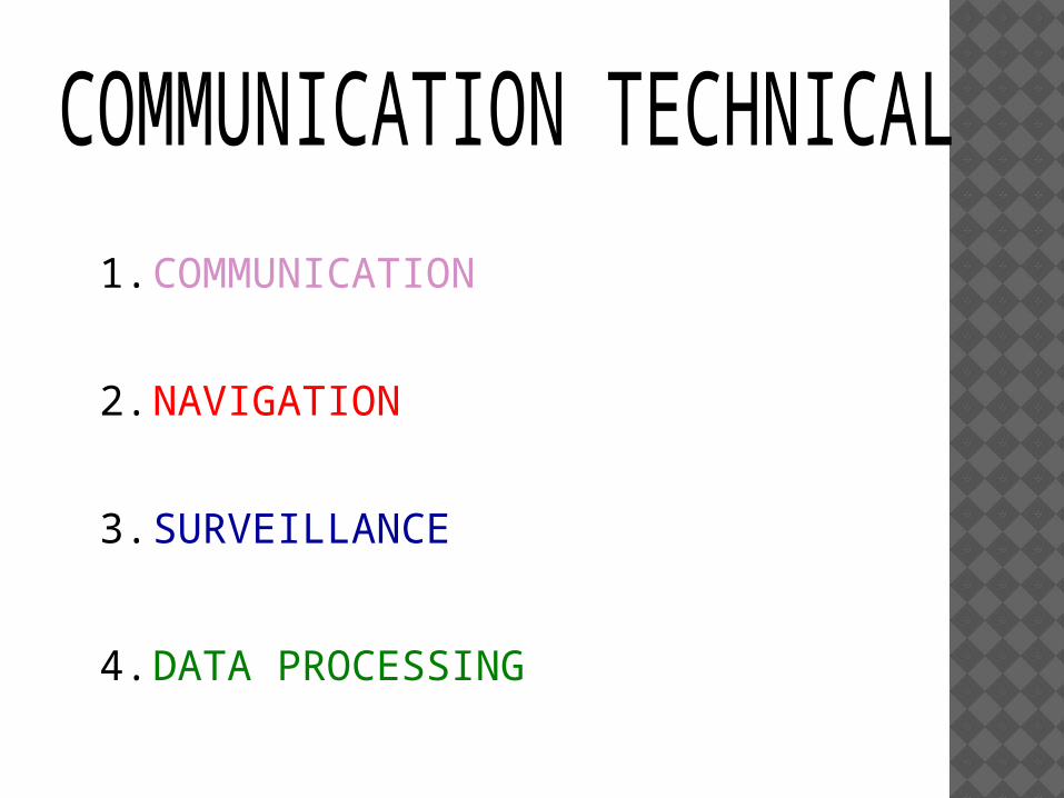
1.COMMUNICATION
2.NAVIGATION
3.SURVEILLANCE
4.DATA PROCESSING

WHAT IS NAVIGATION Navigation is the 'ART' of determining the position of an aircraft over earth's surface and guiding its progress from one place to another.
To accomplish this ART, some sort of ‘AIDS' are required by the PILOTS.

NAVIGATIONAL AIDS USED IN AAI
NDB: Non Directional Beacon VOR: VHF Omni Range DME: Distance Measuring Equipment ILS: Instrument Landing System Satellite Navigation
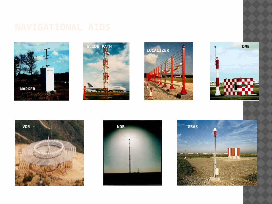
NAVIGATIONAL AIDS
VOR GBAS
DME
NDB
MARKER
GLIDE PATHLOCALIZER

NAVIGATIONAL AIDS NDB: Non Directional Beacon VOR: VHF Omni Range DME: Distance Measuring Equipment ILS: Instrument Landing System Satellite Navigation Cockpit Flight Calibration Nav-Aids at I.G.I. Airport
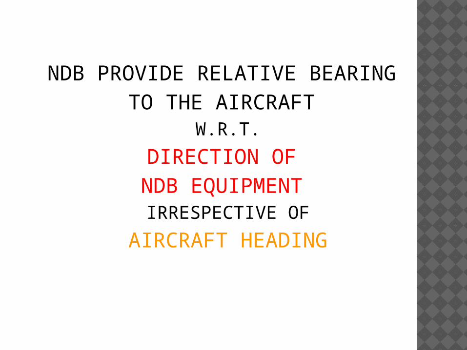
NDB PROVIDE RELATIVE BEARING TO THE AIRCRAFT
W.R.T.DIRECTION OF NDB EQUIPMENT IRRESPECTIVE OF
AIRCRAFT HEADING

6
3
12
1521
24
N
S
EW30
33
DIRECTION FINDER (NDB)

6
3
12
1521
24
N
S
EW30
33
DIRECTION FINDER (NDB)
NDB

NAVIGATIONAL AIDS NDB: Non Directional Beacon VOR: VHF Omni Range DME: Distance Measuring Equipment ILS: Instrument Landing System Satellite Navigation Cockpit Flight Calibration Nav-Aids at I.G.I. Airport
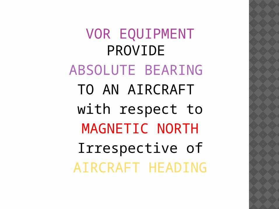
VOR EQUIPMENT PROVIDE
ABSOLUTE BEARING TO AN AIRCRAFT with respect toMAGNETIC NORTHIrrespective ofAIRCRAFT HEADING

VOR
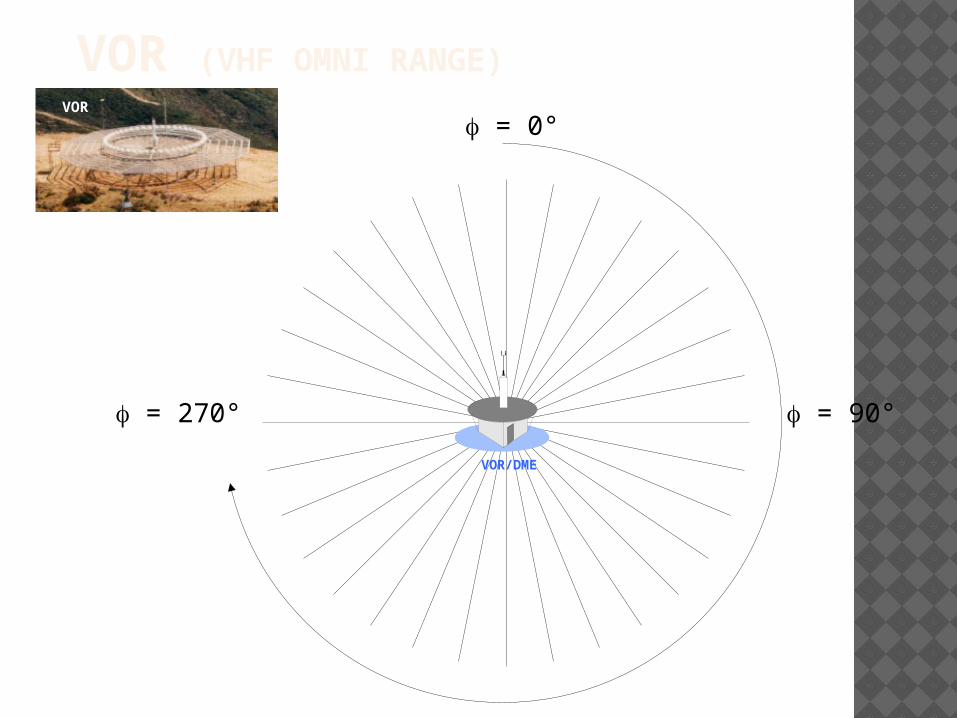
VOR (VHF OMNI RANGE) = 0°
= 90° = 270°VOR/DME
VOR

0°10°
20°30°
40°
50°
60°
70°
80°
90°
100°
110°
120°
130°
140°150°
160°170°
180°190°
200°210°
220°
230°
240°
250°
260°
270°
280°
290°
300°
310°
320°330°
340°350°VOR RADIALS
Radial 180
Radial 230
Radial 110
Radial 50

180°
N360°
CDI DEVIATIONS
VOR/DME
OBS = 360

TO
180°
N360°
CDI DEVIATIONS AND TO/FROM INDICATIONS
CourseOBS = 360°
VOR/DME
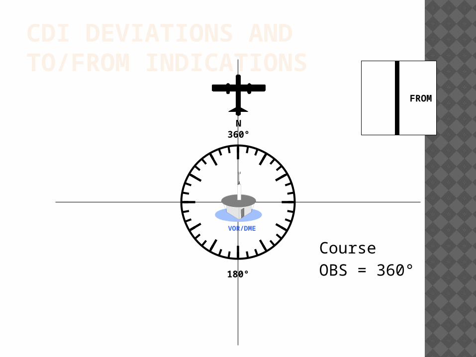
FROM
180°
N360°
CDI DEVIATIONS AND TO/FROM INDICATIONS
CourseOBS = 360°
VOR/DME

TOCDI DEVIATIONS
CourseOBS = 30
180°
N360°

TOCDI DEVIATIONS
CourseOBS = 30
180°
N360°
VOR/DME

NAVIGATIONAL AIDS NDB: Non Directional Beacon VOR: VHF Omni Range DME: Distance Measuring Equipment ILS: Instrument Landing System Satellite Navigation Cockpit Flight Calibration Nav-Aids at I.G.I. Airport

DME EQUIPMENT PROVIDESLANT DISTANCE
of theAIRCRAFT
fromGROUND EQUIPMENT

DEFINITION DME is stand for Distance Measuring Equipment.
DME is a type of en-route navigation system for aircraft.
DME often installed near VOR stations so as to provide combined bearing and distance.
When DME is installed with the VOR, it is referred to as a VOR/DME.

DME (DISTANCE MEASURING EQUIPMENT)

DME INDICATOR DME enables aircraft to establish its range to the ground station: Distance in nautical miles, Ground speed in knots, Flying time to the station in minutes

NAVIGATIONAL AIDS NDB: Non Directional Beacon VOR: VHF Omni Range DME: Distance Measuring Equipment ILS: Instrument Landing System Satellite Navigation Cockpit Flight Calibration Nav-Aids at I.G.I. Airport
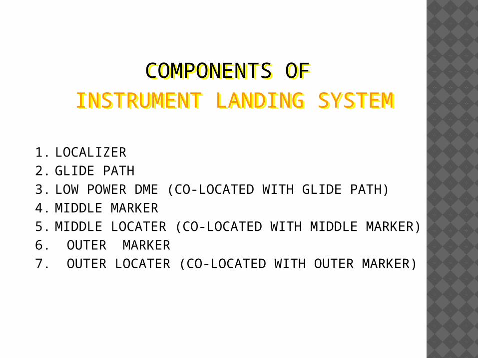
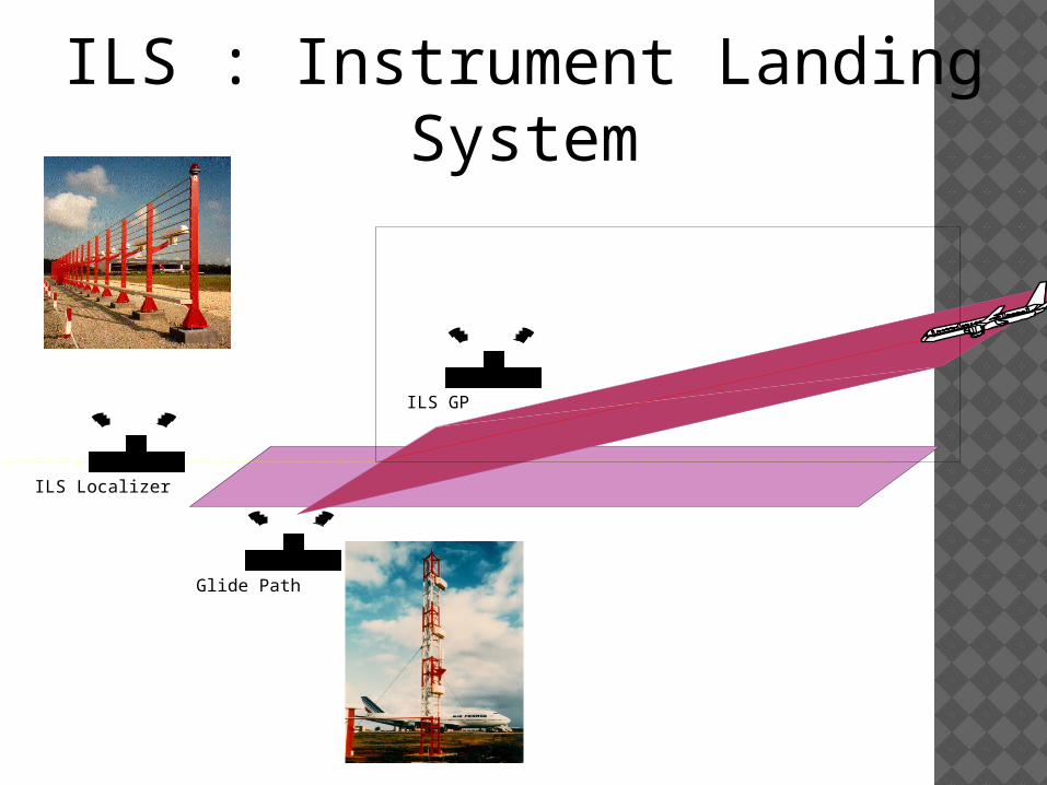
COMPONENTS OF INSTRUMENT LANDING SYSTEM
1. LOCALIZER2. GLIDE PATH3. LOW POWER DME (CO-LOCATED WITH GLIDE PATH)4. MIDDLE MARKER5. MIDDLE LOCATER (CO-LOCATED WITH MIDDLE MARKER)6. OUTER MARKER7. OUTER LOCATER (CO-LOCATED WITH OUTER MARKER)
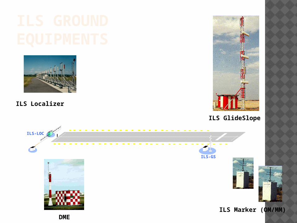
ILS-LOC
ILS-GS
ILS GROUND EQUIPMENTS
ILS Marker (OM/MM)DME
ILS GlideSlope
ILS Localizer

RUN WAY LLZ ANT
1000to1500ft
LLZ BLDG
200 ft
GPGP & DMEANTENNA
1000ft
Runway threshold
MMOM
3500ft4 NM
AIRCRAFT
450ft
INSTRUMENT LANDING SYSTEM LAYOUT
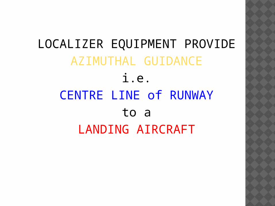
LOCALIZER EQUIPMENT PROVIDEAZIMUTHAL GUIDANCE
i.e.CENTRE LINE of RUNWAY
to aLANDING AIRCRAFT

GLIDE PATH EQUIPMENT PROVIDE
VERTICAL GUIDANCEi.e.
GLIDE SLOPE on RUNWAYto a
LANDING AIRCRAFT
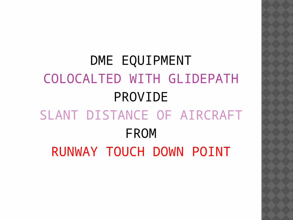
DME EQUIPMENTCOLOCALTED WITH GLIDEPATH
PROVIDESLANT DISTANCE OF AIRCRAFT
FROMRUNWAY TOUCH DOWN POINT

MARKER EQUIPMENTSINSTALLED AT FIX DISTANCES
fromRUNWAY THRESHOLD
PROVIDEHEIGHT OVER MARKER
which help toESTABLISH ON CORRECT GLIDE PATH

LOCATER EQUIPMENTSCOLOCATED WITH MARKERS
HELPSTO LOCATEMARKER

NORTH
SOUTH
EASTWEST090 Deg
60 27
NOMENCLATURE OF RUNWAY END
ILS : Instrument Landing System
Glide Path
ILS GP
ILS Localizer

ILS RECEPTOR (LIKE VOR)
Glide Path indicator
Localizer indicator
O M I

ILS LOCALIZER NEEDLE

GLIDE SLOPE NEEDLE
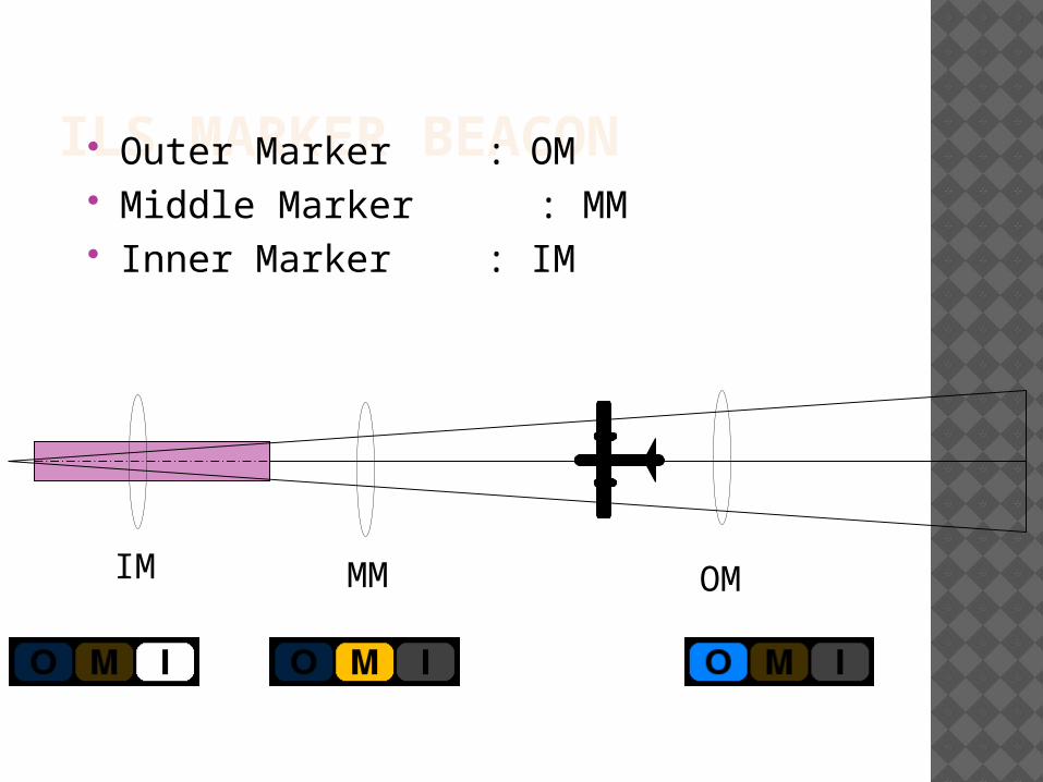
ILS MARKER BEACON Outer Marker : OM Middle Marker : MM Inner Marker : IM
OMMMIM

CRITICAL AREA is an area of defined dimensions about the LOCALIZER and GLIDE PATH
where vehicles, including aircraft,
and any obstructions (e.g. buildings, fences, trees, etc.) will cause unacceptable disturbances
to the ILS performance.

SENSITIVE AREAis an area extending beyond
the critical area where the parking and/or movement of
vehicles, including aircraft, and the
presence of buildings, trees, fences, etc. may affect the
ILS performance.

NAVIGATIONAL AIDS NDB: Non Directional Beacon VOR: VHF Omni Range DME: Distance Measuring Equipment ILS: Instrument Landing System Satellite Navigation Cockpit Flight Calibration Nav-Aids at I.G.I. Airport

SATELLITE NAVIGATION
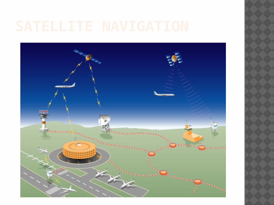
SATELLITE NAVIGATION

NAVIGATIONAL AIDS NDB: Non Directional Beacon VOR: VHF Omni Range DME: Distance Measuring Equipment ILS: Instrument Landing System Satellite Navigation Cockpit Flight Calibration Nav-Aids at I.G.I. Airport

THE COCKPIT

NAVIGATIONAL AIDS NDB: Non Directional Beacon VOR: VHF Omni Range DME: Distance Measuring Equipment ILS: Instrument Landing System Satellite Navigation Cockpit Flight Calibration Nav-Aids at I.G.I. Airport

FLIGHT CALIBRATION Calibration is the validation of signals transmitted by an equipment.
VOR, ILS, NDB, DME are different navigation
aids that need periodic flight inspection.
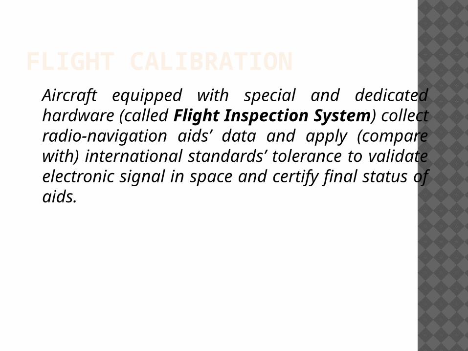
FLIGHT CALIBRATIONAircraft equipped with special and dedicated hardware (called Flight Inspection System) collect radio-navigation aids’ data and apply (compare with) international standards’ tolerance to validate electronic signal in space and certify final status of aids.
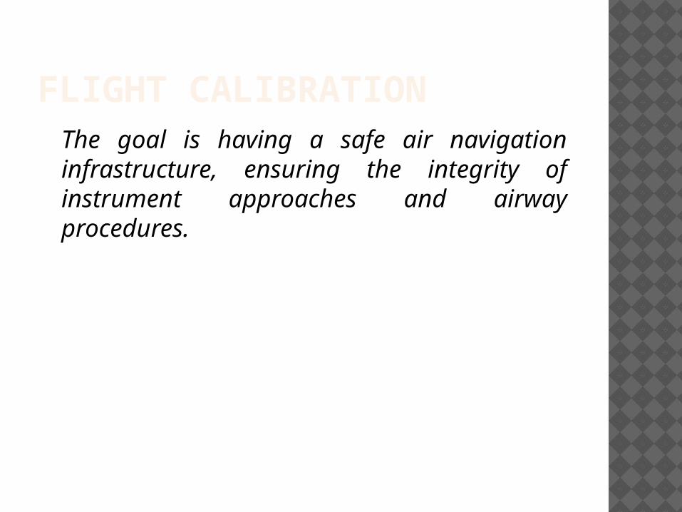
FLIGHT CALIBRATIONThe goal is having a safe air navigation infrastructure, ensuring the integrity of instrument approaches and airway procedures.

NAVIGATIONAL AIDS NDB: Non Directional Beacon VOR: VHF Omni Range DME: Distance Measuring Equipment ILS: Instrument Landing System Satellite Navigation Cockpit Flight Calibration Nav-Aids at I.G.I. Airport
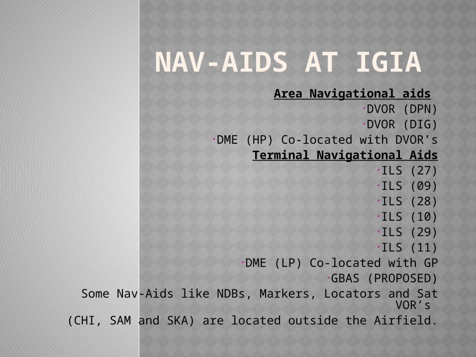
NAV-AIDS AT IGIA Area Navigational aids
•DVOR (DPN)•DVOR (DIG)
•DME (HP) Co-located with DVOR’sTerminal Navigational Aids
•ILS (27)•ILS (09)•ILS (28)•ILS (10)•ILS (29)•ILS (11)
•DME (LP) Co-located with GP•GBAS (PROPOSED)
Some Nav-Aids like NDBs, Markers, Locators and Sat VOR’s
(CHI, SAM and SKA) are located outside the Airfield.

THANK YOU