infoworks-icm-and-the-power-of-the-geoplan.pdf - Innovyze
31
-
Upload
khangminh22 -
Category
Documents
-
view
1 -
download
0
Transcript of infoworks-icm-and-the-power-of-the-geoplan.pdf - Innovyze

Ask Questions! Type queries into the Question Field in the GoToWebinar interface.
The webinar will be recorded and posted on innovyze.com along with the PowerPoint and Q&A document.
All registrants will receive a link to these files.
Housekeeping


Today’s Presenter
Pascal LangProduct Manager
Innovyze

• Models, insights and consumers
• Visualisations and outputs in InfoWorks ICM
• Leveraging connectivity functions
Agenda

Models, insights and consumers

Represent a wide range of environments…
Estuary
Surface runoff
Groundwater
Evaporation
Precipitation
Coast
Evaporation

And flooding sources
Solution : A single, fully integrated, catchment model.

• Large variability in object types and structures
• Hydrology and hydraulics
• Sewers, rivers, overland all 1D and 2D
• Numerous inputs
Models are complex
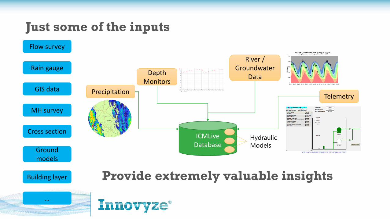
Just some of the inputs
ICMLiveDatabase
PrecipitationTelemetry
Depth Monitors
Hydraulic
Models
River / Groundwater
Data
Flow survey
Rain gauge
GIS data
MH survey
Cross section
Ground models
Building layer
…
Provide extremely valuable insights

Varying client expectations
• Immediate action
• Field based
• Mobile device
• Short term response planning
• Operational office base
• Overview at a glance
• Current/near future capacity
• Office based
• Templated reports
• Long term cost/benefit
• Office based
• Report oriented
Asset Planning
Developer Services
Field Crews
Control Centre
Modelling

Poll
Who are your main clients / consumers of modelling outputs?

• Reports
• Short emails
• On screen visualisation
• Notifications
• Dashboards
A single view isn’t sufficient

Poll
How do you most frequently send/receive hydraulic model insights?

Visualisations and outputs in InfoWorks ICM

1. Statistical reports
2. Worst case reports
3. Return period analysis
4. Many more…
Reporting tools

Themes, layers and labels are key

• Applicable to any object
• Both object properties and results
• Multiple themes per object possible
Themes

• Map controls (ArcGIS/ArcEngine/MapXtreme)
• Layer or image files
• Includes ability to use WMS
Layers

• Can be auto or custom labels
• Applied to GeoPlan or long sections
• Can be formatted and saved
Labels

• Easy to follow
• Ideally shown and explained by modeller
• Particularly powerful to convey outputs to non engineers
3D View

• Powerful for visual comparison
• Possible to query across both results
• Alternate results are treated as Sim2
Open as alternate results

• Generated by ICMLive
• Typically emails
• Can include alert details as well as graphs
Notifications

Leveraging connectivity functions

• Coordinates
• Model ID
• Postcode
• Street name and number
Different languages
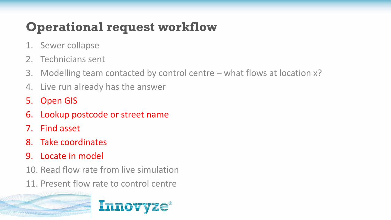
1. Sewer collapse
2. Technicians sent
3. Modelling team contacted by control centre – what flows at location x?
4. Live run already has the answer
5. Open GIS
6. Lookup postcode or street name
7. Find asset
8. Take coordinates
9. Locate in model
10. Read flow rate from live simulation
11. Present flow rate to control centre
Operational request workflow

• WMS
• GIS find
• Google/Bing Maps find
• View online
Leveraging connectivity functions
http://blog.innovyze.com/2018/03/05/using-web-map-services-wms-in-infoworks-icm/

Poll
Does your organisation hold either of these API keys, if so, which?

Would you like more information after today’s webinar?
• I would like to meet with an Innovyze engineer to discuss my work and how InfoWorks ICM and ICMLive might be helpful.
• Please send pricing information
• I would like training information for this products, beyond what Innovyzeprovides in free webinars.
• I would like to showcase my work – contact me!
• Nothing at this time.
More Info?

QUESTIONS

Thanks for joining us
Pascal LangProduct Manager
+44 1491 524136TELEPHONE:[email protected]
WWW.INNOVYZE.COM