Hidden Corner
55
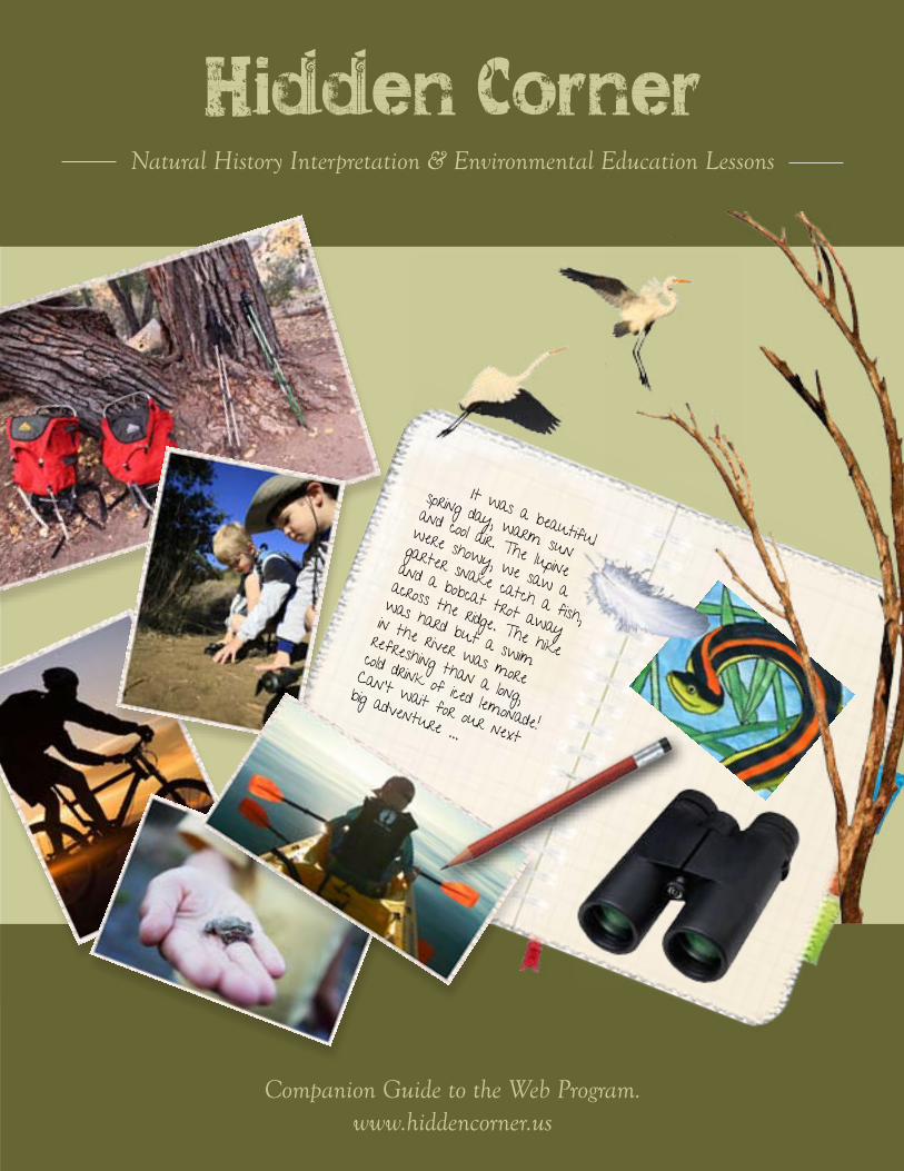
Companion Guide to the Web Program. www.hiddencorner.us Hidden Corner Natural History Interpretation & Environmental Education Lessons It was a beautiful spring day, warm sun and cool air. The lupine were showy, we saw a garter snake catch a fish, and a bobcat trot away across the ridge. The hike was hard but a swim in the river was more refreshing than a long, cold drink of iced lemonade! Can’t wait for our next big adventure ...
-
Upload
khangminh22 -
Category
Documents
-
view
0 -
download
0
Transcript of Hidden Corner
Companion Guide to the Web Program.www.hiddencorner.us
Hidden CornerNatural History Interpretation & Environmental Education Lessons
It was a beautiful
spring day, warm sun
and cool air. The lupine
were showy, we saw a
garter snake catch a fish,
and a bobcat trot away
across the ridge. The hike
was hard but a swim
in the river was more
refreshing than a long,
cold drink of iced lemonade!
Can’t wait for our next
big adventure ...

The aim of this handbook was to provide back-ground information on each topic, the actual lesson or activity, and worksheets or resources. These provide what you
need to customize each lesson to a desired grade level.
Some lessons are fairly short and can be completed in a single trip or session, while others require two or three sessions. How much you do will depend on how much time you would like to invest, and on your personal goals. Many of the lessons could serve as a springboard into unit studies or broader discussions. As an element of geoeducation, the primary aim of these environmental education lessons is to connect participants to
our landscape, to increase their knowledge, and to engender a greater level of care, rather than to meet state standards.
This guide is a compilation of lessons and materials provided by non-profit organizations, educational institutions and agencies for public educational use. Wherever possible sources have been acknowledged in the reference section of each lesson. Most lessons were adapted to fit local conditions and venues or activities. Hidden Corner takes no credit for these and would like to thank those who donated lessons.
ContentsPart I: Lessons for the Sea Kayaking Section
Refugio Kayak . . . . . . . . . . . . . . . . . . . . . . . . . . Kelp ForestEl Capitan Kayak . . . . . . . . . . . . . . . . . . . . . . . . Wierd WavesChannel Islands Kayak . . . . . . . . . . . . . . . . . . . Island of the Blue DolphinsHarbor Kayak . . . . . . . . . . . . . . . . . . . . . . . . . . . Seashore Life
Part II: Lessons for the Cycling Section
Goleta Beach Cycle . . . . . . . . . . . . . . . . . . . . . . Wonderful WetlandsCarpinteria Cycle . . . . . . . . . . . . . . . . . . . . . . . Marine EnvironmentsEl Capitan Cycle . . . . . . . . . . . . . . . . . . . . . . . . Fog Rolls In Nojoqui Cycle . . . . . . . . . . . . . . . . . . . . . . . . . . . Symbiosis in the WoodlandsSanta Rosa Road Cycle . . . . . . . . . . . . . . . . . . . Sustainable Agriculture
Part III: Lessons for the Hiking Section
San Rafael Hike . . . . . . . . . . . . . . . . . . . . . . . . . Snakes Alive Devereux Slough Hike . . . . . . . . . . . . . . . . . . . Vernal Pools Gaviota Peak Hike . . . . . . . . . . . . . . . . . . . . . . . Hidden Communities Figueroa Mountain Hike . . . . . . . . . . . . . . . . . Fascinating Food Chains Rattlesnake Canyon Hike . . . . . . . . . . . . . . . . . Riparian Habitat Lake Cachuma Hike . . . . . . . . . . . . . . . . . . . . . Exploring a Watershed Santa Cruz Island Hike . . . . . . . . . . . . . . . . . . . Island Biodiversity Point Conception Hike . . . . . . . . . . . . . . . . . . . Racing the Tide
Part IV: Lessons for the Rambling Section
Coal Oil Point Ramble . . . . . . . . . . . . . . . . . . . . Foot and BillEl Capitan Ramble. . . . . . . . . . . . . . . . . . . . . . . Carving Up the Scat Tecolote Creek Ramble. . . . . . . . . . . . . . . . . . . . Ecological Intrigue Figueroa Mountain Ramble . . . . . . . . . . . . . . . Oak Woodland Communities Jalama Beach Ramble . . . . . . . . . . . . . . . . . . . . Surviving ExtremesCoronado Preserve Ramble . . . . . . . . . . . . . . . Monarch MigrationGaviota Springs Ramble . . . . . . . . . . . . . . . . . . Journey from the Center of the Earth
“When we try to pick out anything by itself, we find it hitched to everything else in the Universe.”
John Muir
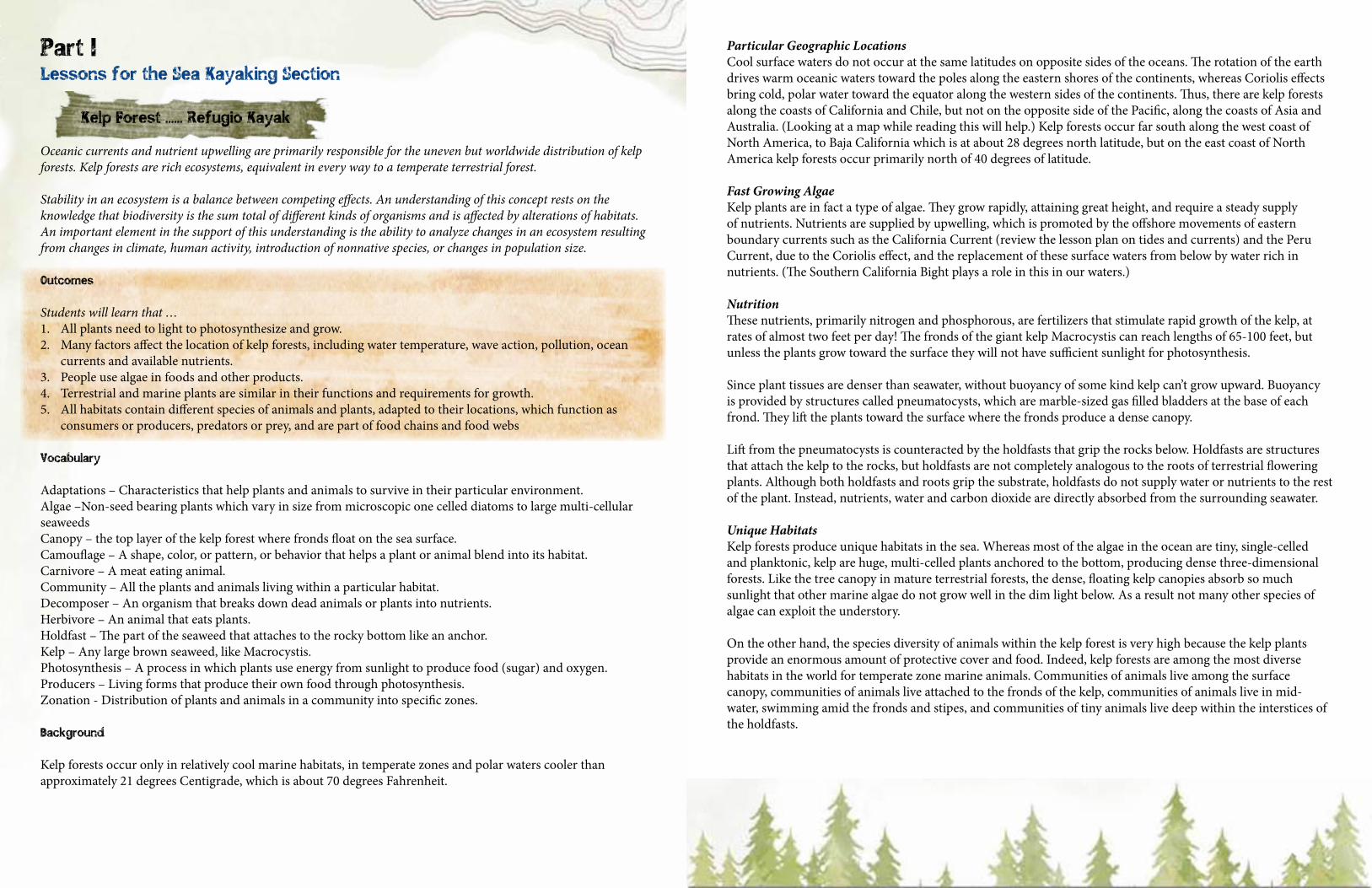
Kelp Forest ...... Refugio Kayak
Oceanic currents and nutrient upwelling are primarily responsible for the uneven but worldwide distribution of kelp forests. Kelp forests are rich ecosystems, equivalent in every way to a temperate terrestrial forest.
Stability in an ecosystem is a balance between competing effects. An understanding of this concept rests on the knowledge that biodiversity is the sum total of different kinds of organisms and is affected by alterations of habitats. An important element in the support of this understanding is the ability to analyze changes in an ecosystem resulting from changes in climate, human activity, introduction of nonnative species, or changes in population size.
Outcomes
Students will learn that …1. All plants need to light to photosynthesize and grow. 2. Many factors affect the location of kelp forests, including water temperature, wave action, pollution, ocean
currents and available nutrients.3. People use algae in foods and other products.4. Terrestrial and marine plants are similar in their functions and requirements for growth.5. All habitats contain different species of animals and plants, adapted to their locations, which function as
consumers or producers, predators or prey, and are part of food chains and food webs
Vocabulary
Adaptations – Characteristics that help plants and animals to survive in their particular environment.Algae –Non-seed bearing plants which vary in size from microscopic one celled diatoms to large multi-cellular seaweedsCanopy – the top layer of the kelp forest where fronds float on the sea surface.Camouflage – A shape, color, or pattern, or behavior that helps a plant or animal blend into its habitat.Carnivore – A meat eating animal.Community – All the plants and animals living within a particular habitat.Decomposer – An organism that breaks down dead animals or plants into nutrients.Herbivore – An animal that eats plants.Holdfast – The part of the seaweed that attaches to the rocky bottom like an anchor.Kelp – Any large brown seaweed, like Macrocystis.Photosynthesis – A process in which plants use energy from sunlight to produce food (sugar) and oxygen.Producers – Living forms that produce their own food through photosynthesis. Zonation - Distribution of plants and animals in a community into specific zones.
Background
Kelp forests occur only in relatively cool marine habitats, in temperate zones and polar waters cooler than approximately 21 degrees Centigrade, which is about 70 degrees Fahrenheit.
Particular Geographic LocationsCool surface waters do not occur at the same latitudes on opposite sides of the oceans. The rotation of the earth drives warm oceanic waters toward the poles along the eastern shores of the continents, whereas Coriolis effects bring cold, polar water toward the equator along the western sides of the continents. Thus, there are kelp forests along the coasts of California and Chile, but not on the opposite side of the Pacific, along the coasts of Asia and Australia. (Looking at a map while reading this will help.) Kelp forests occur far south along the west coast of North America, to Baja California which is at about 28 degrees north latitude, but on the east coast of North America kelp forests occur primarily north of 40 degrees of latitude.
Fast Growing AlgaeKelp plants are in fact a type of algae. They grow rapidly, attaining great height, and require a steady supply of nutrients. Nutrients are supplied by upwelling, which is promoted by the offshore movements of eastern boundary currents such as the California Current (review the lesson plan on tides and currents) and the Peru Current, due to the Coriolis effect, and the replacement of these surface waters from below by water rich in nutrients. (The Southern California Bight plays a role in this in our waters.)
NutritionThese nutrients, primarily nitrogen and phosphorous, are fertilizers that stimulate rapid growth of the kelp, at rates of almost two feet per day! The fronds of the giant kelp Macrocystis can reach lengths of 65-100 feet, but unless the plants grow toward the surface they will not have sufficient sunlight for photosynthesis.
Since plant tissues are denser than seawater, without buoyancy of some kind kelp can’t grow upward. Buoyancy is provided by structures called pneumatocysts, which are marble-sized gas filled bladders at the base of each frond. They lift the plants toward the surface where the fronds produce a dense canopy.
Lift from the pneumatocysts is counteracted by the holdfasts that grip the rocks below. Holdfasts are structures that attach the kelp to the rocks, but holdfasts are not completely analogous to the roots of terrestrial flowering plants. Although both holdfasts and roots grip the substrate, holdfasts do not supply water or nutrients to the rest of the plant. Instead, nutrients, water and carbon dioxide are directly absorbed from the surrounding seawater.
Unique HabitatsKelp forests produce unique habitats in the sea. Whereas most of the algae in the ocean are tiny, single-celled and planktonic, kelp are huge, multi-celled plants anchored to the bottom, producing dense three-dimensional forests. Like the tree canopy in mature terrestrial forests, the dense, floating kelp canopies absorb so much sunlight that other marine algae do not grow well in the dim light below. As a result not many other species of algae can exploit the understory.
On the other hand, the species diversity of animals within the kelp forest is very high because the kelp plants provide an enormous amount of protective cover and food. Indeed, kelp forests are among the most diverse habitats in the world for temperate zone marine animals. Communities of animals live among the surface canopy, communities of animals live attached to the fronds of the kelp, communities of animals live in mid-water, swimming amid the fronds and stipes, and communities of tiny animals live deep within the interstices of the holdfasts.
Part I Lessons for the Sea Kayaking Section
It is important to emphasize the absolute dependence of these animal communities upon the kelp itself. The kelp plants provide the very fabric within and about which all of these animals live. When the kelp forest is destroyed by storms, by the warm waters of an El Niño event, or by overgrazing by sea urchins (visit the unit study on otters to broaden context), then the animals that depend upon the structure or nutrition of the dominant species of giant kelp are all eliminated.
A Natural BalanceKelp forests are surprisingly unstable ecosystems. This has been demonstrated along the west coast of the North America when the living communities within the kelp forests have been altered by human activity. For example, several hundred years ago Russian hunters discovered the large populations of sea otters that lived amid the kelp forests of the northwest coast. Sea otters have the most dense, and luxurious pelts of all animals. The sea otters were soon harvested to the point of extinction, and then slowly the kelp beds began to disappear. Why so?One of the favorite foods of sea otters is the sea urchin, and in the absence of otters the urchin populations expanded rapidly. The urchins soon exhausted all of the smaller algae upon which they normally fed and then turned to eating the less nutritious holdfasts of the giant kelp. When the holdfasts were destroyed, the buoyant fronds floated away, and entire kelp forests vanished. During the past 50 years marine biologists have documented the return of many of these kelp beds because populations of sea otters, now a protected species, are extending slowly south along the coast, eating sea urchins, and restoring the natural balance of nature.
Kelp forests have also been disrupted when large amounts of untreated raw sewage is dumped in the ocean. Sea urchins are not only grazers of benthic algae but they are also excellent scavengers of particulate material in the water, which they capture on their spines and with their tube feet.
The sewage was food to the urchins, and their populations exploded until the entire bottom was carpeted almost solidly with sea urchins. But occasionally the ocean currents would shift, sewage would become temporarily unavailable, and the exploding populations of urchins would feed instead on kelp holdfasts. The result was that kelp beds in those areas disappeared.
Treatment plants in the Los Angeles basin have nearly eliminated the release of raw sewage into coastal waters, reducing the threat to kelp forests from overgrazing by urchin.
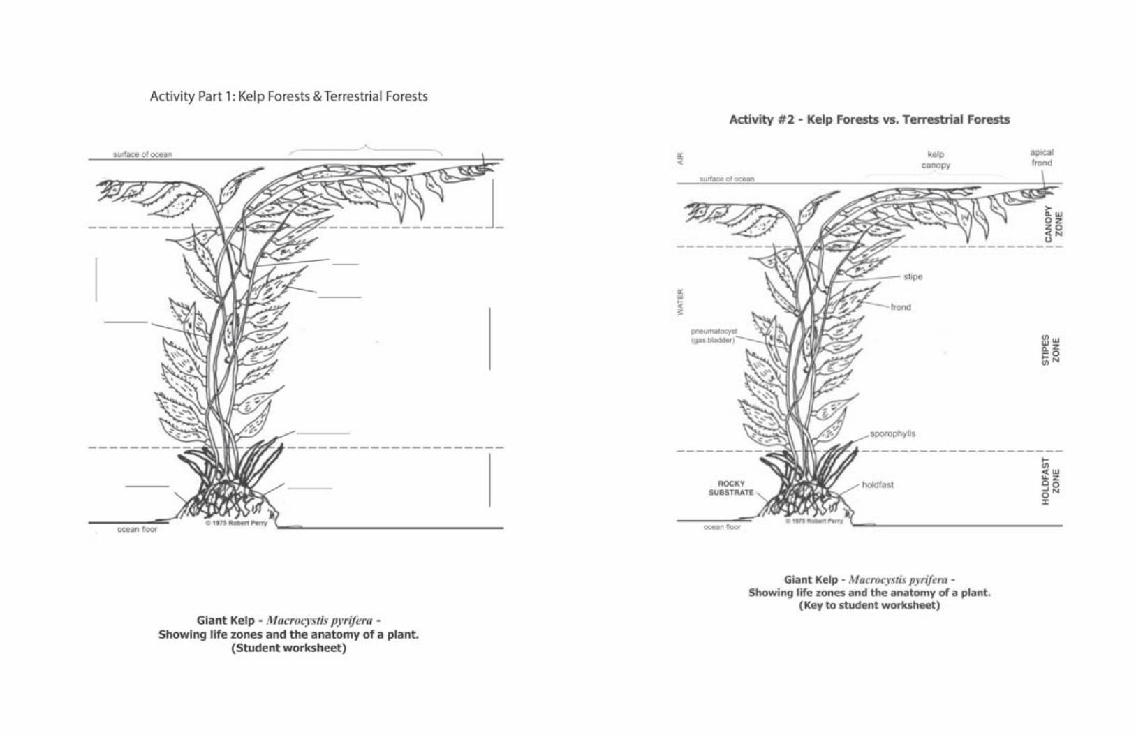
Activity: Kelp Forests compared to Terrestrial Forests
Part 1: Community Morphology and Relationships
ObjectiveStudents will compare terrestrial plants and forests to the kelp plant and forest and the communities surrounding them.
Materials (See end of lesson.)1. Kelp plant or picture 2. Worksheet 3. Books or internet source about kelp communities 4. Plants
Procedures1. Discuss the primary requirements needed by terrestrial plants for growth: sunlight, fertilizer, water,
protection from bad weather and nutrition. 2. Ask which plant parts help meet these needs? What requirements do marine plants like kelp need to grow?
How do you think their needs are met?3. On the kelp worksheet label each part of the kelp plant and speculate on its function. Teacher discusses
possible answers and explains functions of the following parts: apical fronds (terminal blades), holdfast, fronds, stipes, sporophylls, and the pneumatocysts (gas bladders).
4. Different animals live in different zones of the kelp forest. Write the zones down on sticky notes and the animals on separate strips of papers. Locate the animals in their associated zones. (Zones and animals listed below.) You could also make drawings of a few selected animals and glue them on at the proper zone. Canopy: sea otters, plankton, sea birds. Stipe: turban snail, blue rockfish, kelp bass, senorita, crabs, sea lions, barnacles, garabaldi, sheephead, surfperch, hydroids, bryozoans, isopods. Holdfast: brittle star, horn shark, sea cucumber, abalone, sea urchins, bat star, tube worms, amphipods, crabs, sponges, clams, octopus, eel, young fish.
5. Students to list kelp forest producers, herbivores, carnivores, decomposers, filter feeders and scavengers. 6. In groups construct a kelp forest food web. Students can describe adaptations of kelp forest animals for
capturing their food and avoiding predators (speed, stinging cells, shell cover, pincers, camouflage, ability to burrow etc.)
7. Generate a list of differences and similarities between a kelp forest and a terrestrial forest. Discuss the actual communities of plants and animals that live in each.
EvaluationCheck the students’ worksheets and journals for correctness of ideas. What does ecology mean? Explain the functions of the kelp plant parts. How can humans affect kelp forests?
Part 2: Identify Kelp Forest Locations and Reasons.
Materials (See end of lesson.)Kelp forest location map, temperature map, ocean circulation map and color pencils.
Procedure1. Students to search online for a map showing locations of kelp forests. 2. Ask students to write a hypothesis about the location of kelp forests. 3. Given more information they can adjust their hypotheses. A. Temperature of water: Kelp grows in colder
waters (21°C or less). B. Ocean circulation/upwelling: Ocean currents circulate in circular paths, bringing colder waters to the west coast of continents and upwelling nutrient rich water. C. Pollution: During heavy rains sewage and silt runoff into the ocean causes kelp to die off due to reduced penetration of sunlight. D. Heavy wave action: During stormy weather holdfasts are ripped from the bottom and kelp forests are thinned. Why do kelp forests exist in certain locations? Adjust hypothesis as needed.
EvaluationAre kelp forests where you expected them to be? What factors cause kelp forests to be located where they are? What effect, if any, would El Niño have on kelp forests? Why are kelp forests important to humans?
References and Resources
Castro, Peter and Michael E. Huber (1997) Marine Biology, McGraw Hill Higher Education.UCLA Marine Science Center Kelp Forest Lesson Plans. A Curriculum in Marine Science for Grades 4 – 12.
Worksheets follow ...
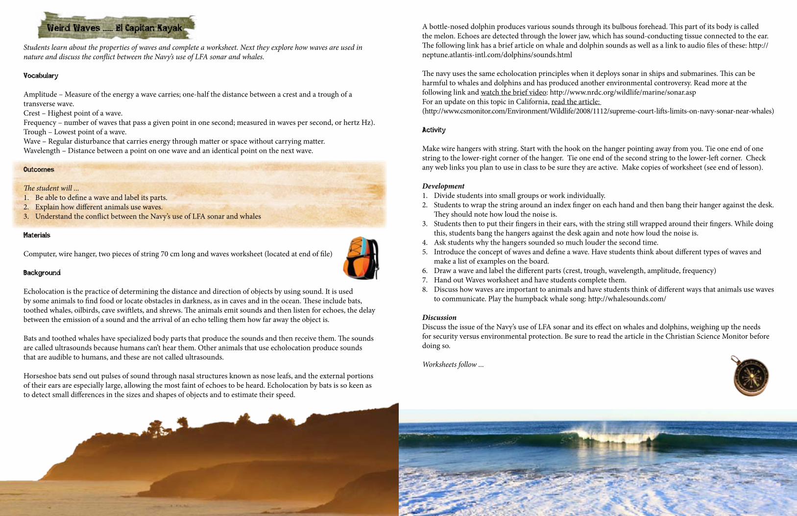
Weird Waves ...... El Capitan Kayak
Students learn about the properties of waves and complete a worksheet. Next they explore how waves are used in nature and discuss the conflict between the Navy’s use of LFA sonar and whales.
Vocabulary
Amplitude – Measure of the energy a wave carries; one-half the distance between a crest and a trough of a transverse wave.Crest – Highest point of a wave.Frequency – number of waves that pass a given point in one second; measured in waves per second, or hertz Hz).Trough – Lowest point of a wave.Wave – Regular disturbance that carries energy through matter or space without carrying matter.Wavelength – Distance between a point on one wave and an identical point on the next wave. Outcomes
The student will ...1. Be able to define a wave and label its parts. 2. Explain how different animals use waves.3. Understand the conflict between the Navy’s use of LFA sonar and whales
Materials
Computer, wire hanger, two pieces of string 70 cm long and waves worksheet (located at end of file)
Background
Echolocation is the practice of determining the distance and direction of objects by using sound. It is used by some animals to find food or locate obstacles in darkness, as in caves and in the ocean. These include bats, toothed whales, oilbirds, cave swiftlets, and shrews. The animals emit sounds and then listen for echoes, the delay between the emission of a sound and the arrival of an echo telling them how far away the object is.
Bats and toothed whales have specialized body parts that produce the sounds and then receive them. The sounds are called ultrasounds because humans can’t hear them. Other animals that use echolocation produce sounds that are audible to humans, and these are not called ultrasounds.
Horseshoe bats send out pulses of sound through nasal structures known as nose leafs, and the external portions of their ears are especially large, allowing the most faint of echoes to be heard. Echolocation by bats is so keen as to detect small differences in the sizes and shapes of objects and to estimate their speed.
A bottle-nosed dolphin produces various sounds through its bulbous forehead. This part of its body is called the melon. Echoes are detected through the lower jaw, which has sound-conducting tissue connected to the ear. The following link has a brief article on whale and dolphin sounds as well as a link to audio files of these: http://neptune.atlantis-intl.com/dolphins/sounds.html
The navy uses the same echolocation principles when it deploys sonar in ships and submarines. This can be harmful to whales and dolphins and has produced another environmental controversy. Read more at the following link and watch the brief video: http://www.nrdc.org/wildlife/marine/sonar.aspFor an update on this topic in California, read the article: (http://www.csmonitor.com/Environment/Wildlife/2008/1112/supreme-court-lifts-limits-on-navy-sonar-near-whales)
Activity
Make wire hangers with string. Start with the hook on the hanger pointing away from you. Tie one end of one string to the lower-right corner of the hanger. Tie one end of the second string to the lower-left corner. Check any web links you plan to use in class to be sure they are active. Make copies of worksheet (see end of lesson).
Development1. Divide students into small groups or work individually.2. Students to wrap the string around an index finger on each hand and then bang their hanger against the desk.
They should note how loud the noise is.3. Students then to put their fingers in their ears, with the string still wrapped around their fingers. While doing
this, students bang the hangers against the desk again and note how loud the noise is.4. Ask students why the hangers sounded so much louder the second time.5. Introduce the concept of waves and define a wave. Have students think about different types of waves and
make a list of examples on the board.6. Draw a wave and label the different parts (crest, trough, wavelength, amplitude, frequency)7. Hand out Waves worksheet and have students complete them.8. Discuss how waves are important to animals and have students think of different ways that animals use waves
to communicate. Play the humpback whale song: http://whalesounds.com/
DiscussionDiscuss the issue of the Navy’s use of LFA sonar and its effect on whales and dolphins, weighing up the needs for security versus environmental protection. Be sure to read the article in the Christian Science Monitor before doing so.
Worksheets follow ...

Waves Worksheet 1: Name:
Define the following words.
Wave ___________________________________________________________________________________
_________________________________________________________________________________________
_________________________________________________________________________________________
Crest ____________________________________________________________________________________
_________________________________________________________________________________________
_________________________________________________________________________________________
Trough ___________________________________________________________________________________
_________________________________________________________________________________________
_________________________________________________________________________________________
Wavelength ________________________________________________________________________________
_________________________________________________________________________________________
_________________________________________________________________________________________
Amplitude _______________________________________________________________________________
_________________________________________________________________________________________
_________________________________________________________________________________________
Frequency ________________________________________________________________________________
_________________________________________________________________________________________
_________________________________________________________________________________________
Worksheet 2
1. Label the parts of a wave using the following vocabulary words:Wavelength, Amplitude, Crest, Trough.
2. Write down briefly what you think should be done about navy sonar and whales.
_________________________________________________________________________________________
_________________________________________________________________________________________
_________________________________________________________________________________________
_________________________________________________________________________________________
_________________________________________________________________________________________
_________________________________________________________________________________________
_________________________________________________________________________________________
_________________________________________________________________________________________
_________________________________________________________________________________________
_________________________________________________________________________________________
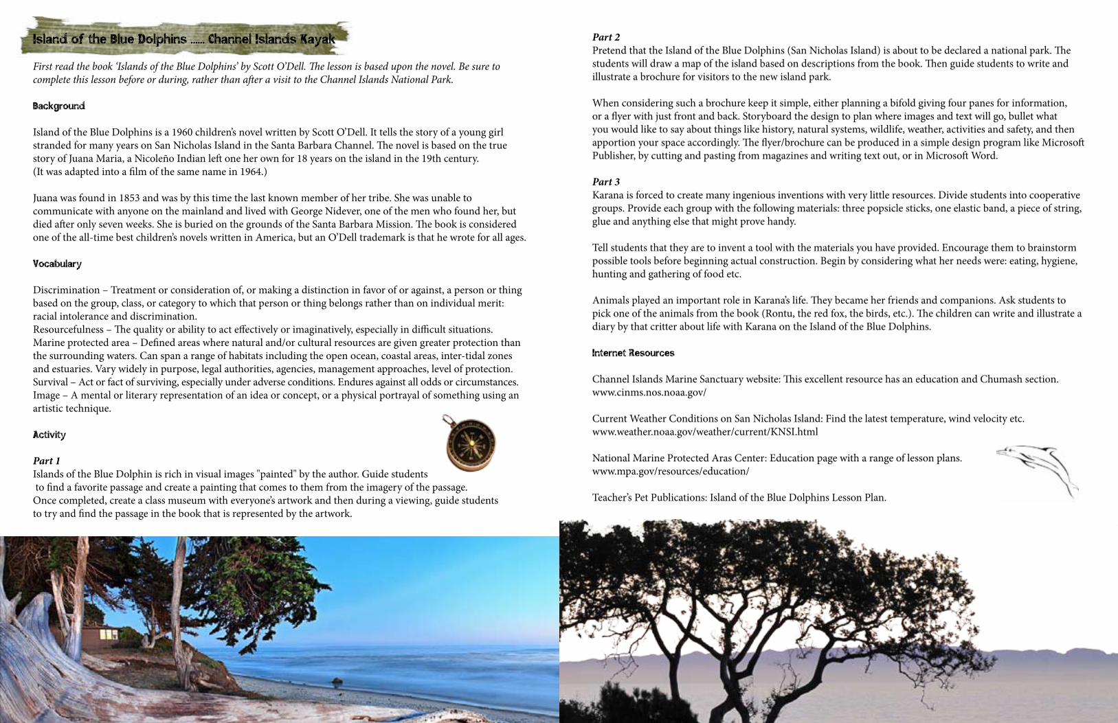
Island of the Blue Dolphins ...... Channel Islands Kayak
First read the book ‘Islands of the Blue Dolphins’ by Scott O’Dell. The lesson is based upon the novel. Be sure to complete this lesson before or during, rather than after a visit to the Channel Islands National Park.
Background
Island of the Blue Dolphins is a 1960 children’s novel written by Scott O’Dell. It tells the story of a young girl stranded for many years on San Nicholas Island in the Santa Barbara Channel. The novel is based on the true story of Juana Maria, a Nicoleño Indian left one her own for 18 years on the island in the 19th century. (It was adapted into a film of the same name in 1964.)
Juana was found in 1853 and was by this time the last known member of her tribe. She was unable to communicate with anyone on the mainland and lived with George Nidever, one of the men who found her, but died after only seven weeks. She is buried on the grounds of the Santa Barbara Mission. The book is considered one of the all-time best children’s novels written in America, but an O’Dell trademark is that he wrote for all ages.
Vocabulary
Discrimination – Treatment or consideration of, or making a distinction in favor of or against, a person or thing based on the group, class, or category to which that person or thing belongs rather than on individual merit: racial intolerance and discrimination.Resourcefulness – The quality or ability to act effectively or imaginatively, especially in difficult situations. Marine protected area – Defined areas where natural and/or cultural resources are given greater protection than the surrounding waters. Can span a range of habitats including the open ocean, coastal areas, inter-tidal zones and estuaries. Vary widely in purpose, legal authorities, agencies, management approaches, level of protection.Survival – Act or fact of surviving, especially under adverse conditions. Endures against all odds or circumstances.Image – A mental or literary representation of an idea or concept, or a physical portrayal of something using an artistic technique.
Activity
Part 1Islands of the Blue Dolphin is rich in visual images "painted" by the author. Guide students to find a favorite passage and create a painting that comes to them from the imagery of the passage. Once completed, create a class museum with everyone’s artwork and then during a viewing, guide students to try and find the passage in the book that is represented by the artwork.
Part 2Pretend that the Island of the Blue Dolphins (San Nicholas Island) is about to be declared a national park. The students will draw a map of the island based on descriptions from the book. Then guide students to write and illustrate a brochure for visitors to the new island park.
When considering such a brochure keep it simple, either planning a bifold giving four panes for information, or a flyer with just front and back. Storyboard the design to plan where images and text will go, bullet what you would like to say about things like history, natural systems, wildlife, weather, activities and safety, and then apportion your space accordingly. The flyer/brochure can be produced in a simple design program like Microsoft Publisher, by cutting and pasting from magazines and writing text out, or in Microsoft Word.
Part 3Karana is forced to create many ingenious inventions with very little resources. Divide students into cooperative groups. Provide each group with the following materials: three popsicle sticks, one elastic band, a piece of string, glue and anything else that might prove handy.
Tell students that they are to invent a tool with the materials you have provided. Encourage them to brainstorm possible tools before beginning actual construction. Begin by considering what her needs were: eating, hygiene, hunting and gathering of food etc.
Animals played an important role in Karana’s life. They became her friends and companions. Ask students to pick one of the animals from the book (Rontu, the red fox, the birds, etc.). The children can write and illustrate a diary by that critter about life with Karana on the Island of the Blue Dolphins.
Internet Resources
Channel Islands Marine Sanctuary website: This excellent resource has an education and Chumash section. www.cinms.nos.noaa.gov/
Current Weather Conditions on San Nicholas Island: Find the latest temperature, wind velocity etc. www.weather.noaa.gov/weather/current/KNSI.html
National Marine Protected Aras Center: Education page with a range of lesson plans. www.mpa.gov/resources/education/
Teacher’s Pet Publications: Island of the Blue Dolphins Lesson Plan.
Part II Lessons for the Hiking Section
Snakes Alive ...... San Rafael Hike
Outcomes
Students will understand …1. Snakes thrive in a wide range of habitat in every region of the world.2. Different types of snakes have different physical characteristics that help them survive and succeed in their
particular habitats.3. Snakes are adapted to specific niches.4. The Garter Snake is an example of a genus with a number of slightly different species that are adapted to
fairly specific bioregions.
Vocabulary
Brill – a transparent scale that covers the eyes of snakes. Turns milky white in appearance, clouding its eyes when the snake is ready to slough its skin.
Jacobson’s organ – a sack-shaped organ, found in the mouth of all reptiles, that sends chemicals from the tip of the tongue to the brain. Used to taste the air.
Nocturnal – active at night. Nocturnal snakes prefer to hunt after the sun goes down.
Sloughing – the process by which a snake crawls out of its skin, enabling it to grow larger. A snake will rub up against a rough rock to begin the process of sloughing its skin.
Venom – a protein mixture made in modified salivary glands that destroys body tissue or attacks the nerve or muscle tissue of prey. It can do great damage to unsuspecting prey. Some venom like that of the Garter snakes is harmful to prey but does not have a strong affect humans.
Background
Garter snakes are most often from 18 to 30 inches in length with young smaller than 10 inches. This primarily aquatic snake is active in the day, at dusk and at night and can be active from January through November depending on local conditions. A medium-sized snake they can grow to 40 inches in length and have been recorded catching trout up to 8 inches in length. They have toxins in their saliva, which kill prey but might just produce an unpleasant reaction in humans. They are not considered to be dangerous.
There are 13 recognized garter snake species in California alone. Each of these are to be found in very specific habitats that share general commonalities such as water, brush or woodland, but which produce reptiles differing slightly in appearance and favored prey. As a whole these snakes typically eat tadpoles, newt larvae, small frogs and toads, fish, and occasionally worms and fish eggs. They forage for food along creek banks, near wetlands and even in and under water.
This positioning in terms of prey and habitat reflects a very peculiar niche for these snakes. All share the same general feeding niche but some are found high up in the Sierra Nevada mountains and others are found on the coast, in the desert or even on an island.
The subspecies reflect this diversity despite all of them sharing a common feeding niche and fairly common habitat requirements.
All have a head a little wider than the neck and keeled dorsal scales. Their appearance is quite variable which in conjunction with their particular habitats, is why a number of species have been identified. There are however two basic patterns, both having a drab olive, brown, or dark gray ground color, with no dorsal stripe, except for a spot on the neck.
The striped morph has a yellowish to gray lateral stripe on each side, and a fairly uniform dorsal coloring, with only faint spotting. The unstriped morph does not have the lateral stripes but has two rows of small dark spots on each side. Lighter areas can give the impression that its somewhat checkered. The underside is pale yellow or orange, unmarked, or with dark smudging.
A dark morph is found along the outer coast in San Luis Obispo County, a dark green and a reddish color along the Piru River in Ventura County and a separate melanistic population on Catalina Island. These color variations in part reflect a variety of niche subspecies.
As a whole the western Garter snake ranges continuously from near Salinas in Monterey County south along the coast mostly west of the south Coast Ranges, to southern California where it ranges east through the Transverse Ranges (and into the desert in Victorville), and south through the Peninsular Ranges into northern Baja California. It also occurs on Catalina Island. It lives from sea level to almost 7,000 feet in the Sierra Nevada, which is a fairly broad range of altitude for a snake.
These snakes are generally found around pools, creeks and other water sources, often in rocky areas, oak woodland, chaparral, brush, and coniferous forest.
To give an example of how close some of these subspecies are, and yet being different, the formerly classified Thamnophis digueti was considered a subspecies of Thamnophis couchii (the most threatened of these garter snakes), but it has been lumped in (synonymized) with Thamnophis hammondii.
The Santa Catalina population of Thamnophis hammondii is also treated as a distinct subspecies by the California Department of Fish and Game and is called the Santa Catalina garter snake (also of special concern in terms of conservation).
Acitivity
You could see a garter snake on any one of a number of the Hidden Corner trails— Rattlesnake Canyon, Tecolote Creek, Seven Fountains, Coronado Preserve and others no doubt have resident populations but you can almost be assured of seeing one along the Manzana River in the San Rafael Wilderness. They are frequently seen near the trail or in pools along the way. This provides a good opportunity not only to see one of these snakes, but to field some of the following questions.
1. Ask your students to share any experience they have had or any prior knowledge they have about snakes. Tell them they are amateur herpetologists, or snake experts. (Herpetologists also study amphibians.)
2. Let students know that their goal, as a group, will be to create a garter snake field guide, with each student contributing a section on one subspecies.
3. Divide into groups, giving each group time to use available research materials, including the Internet. Instruct students to work together to do preliminary research on snakes in order to provide some information about niche habitat and feeding for snakes as a whole, before honing in on the garter snake.
4. Once subspecies have been made allocated, help students to develop their research plans. Students should plan to research topics such as physical characteristics, habitat, range, speed, size, prey, predators, behavior, biology, and if they wish, any legends or stories associated with their snakes. One of the best tools will be the CaliforniaHerps.com website. This link will take you to the Two-Striped Garter Snake. Scroll down to the bottom of the page for a list of other California garter snakes: http://www.californiaherps.com/snakes/pages/t.hammondii.html
5. Have each student produce a written description of a snake, suitable for inclusion in the group field guide. At this point it will be important to distinguish why each snake is regarded as a subspecies. The description should be accompanied by illustrations or photocopies of pictures of the snake.
6. When all descriptions have been revised, polished, and proofread, compile them, in alphabetical order, into a folder or binder that other students or other classes can use to find out more about snakes.
Adaptations for Older StudentsOlder students could do more in-depth research on snake anatomy, including this in their field guide with labeled diagrams, as well as pictures.
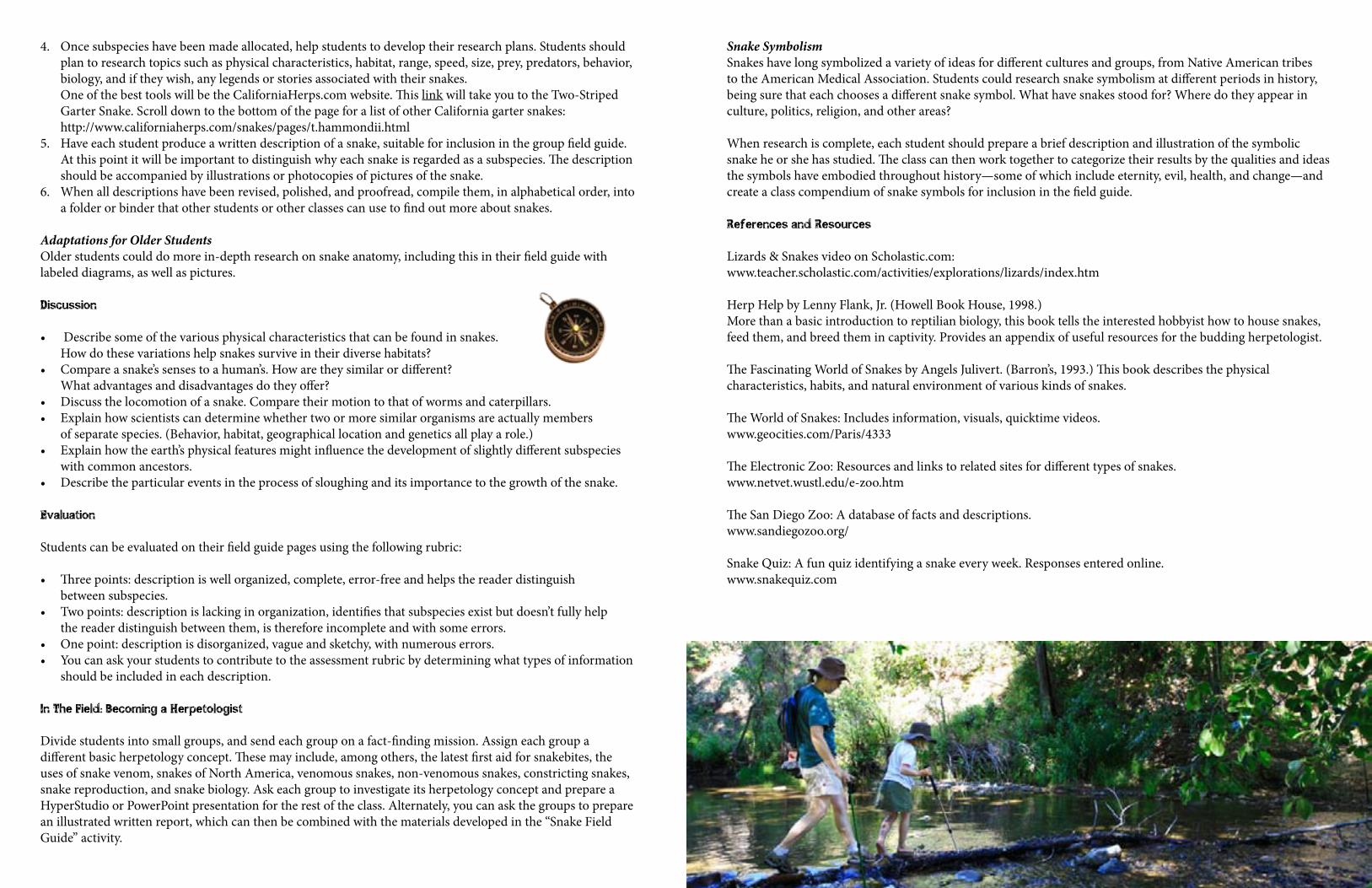
Discussion
• Describe some of the various physical characteristics that can be found in snakes. How do these variations help snakes survive in their diverse habitats?
• Compare a snake’s senses to a human’s. How are they similar or different? What advantages and disadvantages do they offer?
• Discuss the locomotion of a snake. Compare their motion to that of worms and caterpillars.• Explain how scientists can determine whether two or more similar organisms are actually members
of separate species. (Behavior, habitat, geographical location and genetics all play a role.)• Explain how the earth’s physical features might influence the development of slightly different subspecies
with common ancestors.• Describe the particular events in the process of sloughing and its importance to the growth of the snake.
Evaluation
Students can be evaluated on their field guide pages using the following rubric:
• Three points: description is well organized, complete, error-free and helps the reader distinguish between subspecies.
• Two points: description is lacking in organization, identifies that subspecies exist but doesn’t fully help the reader distinguish between them, is therefore incomplete and with some errors.
• One point: description is disorganized, vague and sketchy, with numerous errors.• You can ask your students to contribute to the assessment rubric by determining what types of information
should be included in each description.
In The Field: Becoming a Herpetologist
Divide students into small groups, and send each group on a fact-finding mission. Assign each group a different basic herpetology concept. These may include, among others, the latest first aid for snakebites, the uses of snake venom, snakes of North America, venomous snakes, non-venomous snakes, constricting snakes, snake reproduction, and snake biology. Ask each group to investigate its herpetology concept and prepare a HyperStudio or PowerPoint presentation for the rest of the class. Alternately, you can ask the groups to prepare an illustrated written report, which can then be combined with the materials developed in the “Snake Field Guide” activity.
Snake SymbolismSnakes have long symbolized a variety of ideas for different cultures and groups, from Native American tribes to the American Medical Association. Students could research snake symbolism at different periods in history, being sure that each chooses a different snake symbol. What have snakes stood for? Where do they appear in culture, politics, religion, and other areas?
When research is complete, each student should prepare a brief description and illustration of the symbolic snake he or she has studied. The class can then work together to categorize their results by the qualities and ideas the symbols have embodied throughout history—some of which include eternity, evil, health, and change—and create a class compendium of snake symbols for inclusion in the field guide.
References and Resources
Lizards & Snakes video on Scholastic.com: www.teacher.scholastic.com/activities/explorations/lizards/index.htm Herp Help by Lenny Flank, Jr. (Howell Book House, 1998.)More than a basic introduction to reptilian biology, this book tells the interested hobbyist how to house snakes, feed them, and breed them in captivity. Provides an appendix of useful resources for the budding herpetologist. The Fascinating World of Snakes by Angels Julivert. (Barron’s, 1993.) This book describes the physical characteristics, habits, and natural environment of various kinds of snakes. The World of Snakes: Includes information, visuals, quicktime videos. www.geocities.com/Paris/4333 The Electronic Zoo: Resources and links to related sites for different types of snakes. www.netvet.wustl.edu/e-zoo.htm The San Diego Zoo: A database of facts and descriptions.www.sandiegozoo.org/ Snake Quiz: A fun quiz identifying a snake every week. Responses entered online. www.snakequiz.com
Vernal Pool Inhabitants ...... Devereux Slough Hike
Learn about the unique vernal pool ecosystem and calculating placement of species in a pool after doing research.
Outcomes
1. Students will become familiar with the unique vernal pool habitat, how and where it can form, its cyclical nature, and why it is currently threatened.
2. Students will understand how species of the vernal community are uniquely adapted to this habitat. 3. Students can predict where and when different lifecycle stages occur in parts of the vernal pool habitat. 4. Students will calculate population density based on a simplified model of a vernal pool. 5. Students can calculate rates of vernal pool contraction.
Vocabulary
Vernal – Of, relating to, or occurring in the spring.Stagnant – Not circulating or flowing, standing.Life Cycle – A period involving all different generations of a species succeeding each other through reproduction.Crustacean – Any mainly aquatic arthropod usually having a segmented body and chitinous exoskeleton.Take – Used in terms of the Federal Endangered Species Act it means to harass, harm, pursue, hunt, shoot, wound, kill, trap, capture, or collect, or to attempt to engage in any such activity.
Background
HabitatThe vernal pool habitat is a fast- changing, cyclical, freshwater aquatic habitat with species adapted to survive periods of drought. A vernal pool forms when clay, basalt or other impermeable soils underlying the topsoil allow pools to form in depressions during winter rains. Impermeable soils prevent surface water from seeping into the ground. The pools fill up during the winter, begin drying out in spring and summer, and are often completely dry during late summer and fall.
California vernal pool habitat is known as a seasonal wetland, (i.e., wet only part of the year). The water is essentially stagnant, which means that dissolved oxygen levels are relatively low. This affects which species can survive in vernal pools. Most original vernal pool habitat is gone and much of what is left is fragmented and/or is currently threatened by development. The vernal pool habitat in Coal Oil Point Reserve is protected, and the areas around it have been restored or are currently undergoing restoration.
CyclesThe lives of the inhabitants of a vernal pool are closely linked to natural seasonal changes. They must complete part or all of their life cycle before drought comes and the pond dries up. As the pools evaporate in the spring, flower seeds will sprout at different times at the edge of the water line, leaving a “bathtub ring” of flowers at the pool margins. The vernal pool amphibians, such as salamanders and frogs, develop rapidly in order to move onto land before the pool dries up.
Tadpole shrimp, a crustacean similar to brine shrimp, have a different strategy: they lay drought-resistant eggs that survive the dry period and hatch the following year (or even several years later) when the pool refills.
Individual pools within an area differ in their depth and water chemistry, and so support different species. It’s not so easy to predict what’s in every pool in a given few acres.
Unique AdaptationsMost of the vernal-pool species are sedentary (i.e. they live out their lives in one place and don’t migrate or travel much). Plant species are often adapted to very particular conditions, and die out if those change.
Salamanders and bees can walk or fly around, but aren’t built for long-distance travel. Any place suitable for a displaced salamander, for example, will likely have resident salamanders already. Tadpole shrimp can’t travel far. They live through dry months as eggs. Destroying a pool (whether the pool is visible or not) kills them. Many species of meadowfoam, goldfields, popcorn flower, and some grasses live only in vernal pools. Diminishing habitat narrows genetic bases. This in turn diminishes a species’ ability to adapt to changing conditions.
Sensitive EcosystemsEdge effects will harm more pools than are directly obliterated: runoff from parking lots and lawns alters water chemistry; soils get trampled or have other soils dumped on them; predators get more access (that’s a big part of any edge effect). Fragmenting a continuous ecosystem interrupts any migration or genetic exchange that normally takes place.
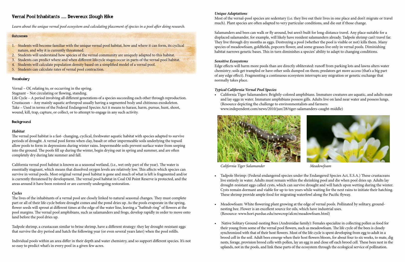
Typical California Vernal Pool Species• California Tiger Salamanders: Brightly-colored amphibians. Immature creatures are aquatic, and adults mate
and lay eggs in water. Immature amphibians possess gills. Adults live on land near water and possess lungs.(Resource depicting the challenge to environmentalists and farmers: www.independent.com/news/2010/jun/28/tiger-salamanders-caught-middle) California Tiger Salamander Meadowfoam
• Tadpole Shrimp: (Federal endangered species under the Endangered Species Act, E.S.A.) These crustaceans live entirely in water. Adults must remain within the shrinking pool and die when pool dries up. Adults lay drought-resistant eggs called cysts, which can survive drought and will hatch upon wetting during the winter. Cysts remain dormant and viable for up to ten years while waiting for the next rains to initiate their hatching. These shrimp provide ample food for migrating waterfowl along the Pacific flyway.
• Meadowfoam: White flowering plant growing at the edge of vernal pools. Pollinated by solitary, ground- nesting bee. Flower is an excellent source for oils, which have industrial uses. (Resource: www.hort.purdue.edu/newcrop/afcm/meadowfoam.html)
• Native Solitary Ground-nesting Bees (Andrenidae family): Females specialize in collecting pollen as food for their young from some of the vernal pool flowers, such as meadowfoam. The life cycle of the bees is closely synchronized with that of their host flowers. Most of the life cycle is spent developing from egg to adult in a brood cell in the soil. Adult bees emerge when their host flowers bloom, for about four to six weeks, to mate, dig nests, forage, provision brood cells with pollen, lay an egg in and close off each brood cell. These bees nest in the uplands, not in the pools, and link these parts of the ecosystem through the ecological service of pollination.
Vernal Pool Inhabitants Handout: Questions and Activities
Preview questions: What do you currently know about the subject? What would you like to find out?
1. In California, what climatic, geologic and geographic conditions would explain the formation and shrinkage of vernal pools in the summer?
2. Why are amphibians particularly suited to vernal pool habitat?3. Suggest a couple reasons why no fish live in vernal pools?4. Assume you are a scientist studying a vernal pool. Calculate the following:
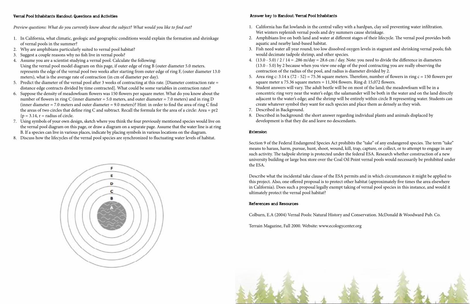
Using the vernal pool model diagram on this page, if outer edge of ring B (outer diameter 5.0 meters. represents the edge of the vernal pool two weeks after starting from outer edge of ring F, (outer diameter 13.0 meters), what is the average rate of contraction (in cm of diameter per day).
5. Predict the diameter of the vernal pool after 3 weeks of contracting at this rate. [Diameter contraction rate = distance edge contracts divided by time contracted]. What could be some variables in contraction rates?
6. Suppose the density of meadowfoam flowers was 150 flowers per square meter. What do you know about the number of flowers in ring C (inner diameter = 5.0 meters, and outer diameter = 7.0 meters) and in ring D (inner diameter = 7.0 meters and outer diameter = 9.0 meters)? Hint: in order to find the area of ring C find the areas of two circles that define ring C and subtract. Recall the formula for the area of a circle: Area = pr2 {p = 3.14, r = radius of circle.
7. Using symbols of your own design, sketch where you think the four previously mentioned species would live on the vernal pool diagram on this page, or draw a diagram on a separate page. Assume that the water line is at ring B. If a species can live in various places, indicate by placing symbols in various locations on the diagram.
8. Discuss how the lifecycles of the vernal pool species are synchronized to fluctuating water levels of habitat.
Answer key to Handout: Vernal Pool Inhabitants
1. California has flat lowlands in the central valley with a hardpan, clay soil preventing water infiltration. Wet winters replenish vernal pools and dry summers cause shrinkage.
2. Amphibians live on both land and water at different stages of their lifecycle. The vernal pool provides both aquatic and nearby land-based habitat.
3. Fish need water all year round; too low dissolved oxygen levels in stagnant and shrinking vernal pools; fish would decimate tadpole shrimp, and other species.
4. (13.0 - 5.0) / 2 / 14 = .286 m/day = 28.6 cm / day. Note: you need to divide the difference in diameters (13.0 - 5.0) by 2 because when you view one edge of the pool contracting you are really observing the contraction of the radius of the pool, and radius is diameter divided by 2.
5. Area ring c: 3.14 x (72 - 52) = 75.36 square meters. Therefore, number of flowers in ring c = 150 flowers per square meter x 75.36 square meters = 11,304 flowers. Ring d: 15,072 flowers.
6. Student answers will vary. The adult beetle will be on most of the land; the meadowfoam will be in a concentric ring very near the water’s edge; the salamander will be both in the water and on the land directly adjacent to the water’s edge; and the shrimp will be entirely within circle B representing water. Students can create whatever symbol they want for each species and place them as densely as they wish.
7. Described in Background. 8. Described in background: the short answer regarding individual plants and animals displaced by
development is that they die and leave no descendants.
Extension
Section 9 of the Federal Endangered Species Act prohibits the “take” of any endangered species. The term “take” means to harass, harm, pursue, hunt, shoot, wound, kill, trap, capture, or collect, or to attempt to engage in any such activity. The tadpole shrimp is protected under the federal ESA. Research whether construction of a new university building or large box store over the Coal Oil Point vernal pools would necessarily be prohibited under the ESA.
Describe what the incidental take clause of the ESA permits and in which circumstances it might be applied to this project. Also, one offered proposal is to protect other habitat (approximately five times the area elsewhere in California). Does such a proposal legally exempt taking of vernal pool species in this instance, and would it ultimately protect the vernal pool habitat?
References and Resources
Colburn, E.A (2004) Vernal Pools: Natural History and Conservation. McDonald & Woodward Pub. Co.
Terrain Magazine, Fall 2000. Website: www.ecologycenter.org
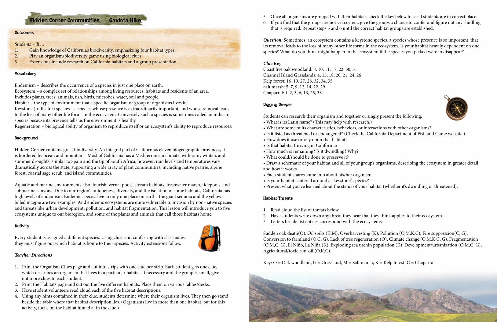
Hidden Corner Communities ...... Gaviota Hike
Outcomes
Students will …1. Gain knowledge of California’s biodiversity, emphasizing four habitat types. 2. Play an organism/biodiversity game using biological clues. 3. Extensions include research on California habitats and a group presentation.
Vocabulary
Endemism – describes the occurrence of a species in just one place on earth.Ecosystem – a complex set of relationships among living resources, habitats and residents of an area. Includes plants, trees, animals, fish, birds, microbes, water, soil and people.Habitat – the type of environment that a specific organism or group of organisms lives in.Keystone (Indicator) species – a species whose presence is extraordinarily important, and whose removal leads to the loss of many other life forms in the ecosystem. Conversely such a species is sometimes called an indicator species because its presence tells us the environment is healthy.Regeneration – biological ability of organism to reproduce itself or an ecosystem’s ability to reproduce resources.
Background
Hidden Corner contains great biodiversity. An integral part of California’s eleven biogeographic provinces, it is bordered by ocean and mountains. Most of California has a Mediterranean climate, with rainy winters and summer droughts, similar to Spain and the tip of South Africa, however, rain levels and temperatures vary dramatically across the state, supporting a wide array of plant communities, including native prairie, alpine forest, coastal sage scrub, and island communities.
Aquatic and marine environments also flourish: vernal pools, stream habitats, freshwater marsh, tidepools, and submarine canyons. Due to our region’s uniqueness, diversity, and the isolation of some habitats, California has high levels of endemism. Endemic species live in only one place on earth. The giant sequoia and the yellow-billed magpie are two examples. And endemic ecosystems are quite vulnerable to invasion by non-native species and threats like urban development, pollution, and habitat fragmentation. This lesson will introduce you to five ecosystems unique to our bioregion, and some of the plants and animals that call those habitats home.
Activity
Every student is assigned a different species. Using clues and conferring with classmates, they must figure out which habitat is home to their species. Activity extensions follow.
Teacher Directions
1. Print the Organism Clues page and cut into strips with one clue per strip. Each student gets one clue, which describes an organism that lives in a particular habitat. If necessary and the group is small, give out more clues to each student.
2. Print the Habitats page and cut out the five different habitats. Place them on various tables/desks.3. Have student volunteers read aloud each of the five habitat descriptions.4. Using any hints contained in their clue, students determine where their organism lives. They then go stand
beside the table where that habitat description lies. (Organisms live in more than one habitat, but for this activity, focus on the habitat hinted at in the clue.)
5. Once all organisms are grouped with their habitats, check the key below to see if students are in correct place.6. If you find that the groups are not yet correct, give the groups a chance to confer and figure out any shuffling
that is required. Repeat steps 5 and 6 until the correct habitat groups are established.
Question: Sometimes, an ecosystem contains a keystone species, a species whose presence is so important, that its removal leads to the loss of many other life forms in the ecosystem. Is your habitat heavily dependent on one species? What do you think might happen to the ecosystem if the species you picked were to disappear?
Clue KeyCoast live oak woodland: 8, 10, 11, 17, 23, 30, 31 Channel Island Grasslands: 4, 15, 18, 20, 21, 24, 26 Kelp forest: 16, 19, 27, 28, 32, 34, 35 Salt marsh: 5, 7, 9, 12, 14, 22, 29Chaparral: 1, 2, 3, 6, 13, 25, 33
Digging Deeper
Students can research their organism and together or singly present the following: •WhatisitsLatinname?(Thismayhelpwithresearch.)•Whataresomeofitscharacteristics,behaviors,orinteractionswithotherorganisms?•Isitlistedasthreatenedorendangered?(ChecktheCaliforniaDepartmentofFishandGamewebsite.)•Howdoesituseorrelyuponthathabitat?•IsthathabitatthrivinginCalifornia?•Howmuchisremaining?Isitdwindling?Why?•Whatcould/shouldbedonetopreserveit?•Drawaschematicofyourhabitatandallofyourgroup’sorganisms,describingtheecosystemingreaterdetailand how it works.•Eachstudentsharessomeinfoabouthis/herorganism.•Isyourhabitatcenteredarounda“keystone”species?•Presentwhatyou’velearnedaboutthestatusofyourhabitat(whetherit’sdwindlingorthreatened).
Habitat Threats
1. Read aloud the list of threats below.2. Have students write down any threat they hear that they think applies to their ecosystem.3. Letters beside list entries correspond with the ecosystems.
Sudden oak death(O), Oil spills (K,M), Overharvesting (K), Pollution (O,M,K,C), Fire suppression(C, G), Conversion to farmland (O,C, G), Lack of tree regeneration (O), Climate change (O,M,K,C, G), Fragmentation (O,M,C, G), El Niño, La Niña (K), Exploding sea urchin population (K), Development/urbanization (O,M,C, G), Agricultural/toxic run-off (O,K,C).
Key: O = Oak woodland, G = Grassland, M = Salt marsh, K = Kelp forest, C = Chaparral
Communities
1. Here, the predatory Channel Island Fox moves quietly.2. Mule deer feed in grassland and move into scrubbier areas at night for cover.3. A common prey species, the brush rabbit causes bare-area patterning around dense shrubs.4. The spotted owl nests in the cavities of broken-topped snags (standing dead trees) in ancient stands.5. Here, the snowy egret wiggles its wide, yellow feet, attracting fish to eat by stirring up the mud.6. Opportunistic alligator lizard eats grubs, ground-nesting bird eggs, and larvae in small, hard leaf litter.7. Copepods, amphipods, and other diatoms cycle nutrients in the mud, help break down decaying plant matter.8. Here, songbirds feed and breed.9. Several species of thin pipefishes swim through the blades of grass and narrow channels here.10. Lace lichens hang from the dense, spreading branches in a tree, picking up nutrients from the air.11. Here, the bobcat hunts squirrels, birds, and snakes and climbs wide-crowned trees to escape mountain lion.12. Cycler of nutrients, the polychaete worm burrows into the mud and eats decaying plant material and diatoms.13. Ticks thrive here, sitting at just the right height to attach to humans and warm-blooded animals, like deer.14. Here, the salt marsh harvest mouse eats and builds its nest in pickleweed.15. Patches of open ground between cover make it possible for birds of prey to see and catch their food.16. Humans harvest tons of this fast-growing species annually to produce algin (used in bread, beer, make-up.)17. Here, the acorn woodpecker stores acorns by pounding them into the bark of trees.18. Here, the black bear uses hollowed-out logs and tree cavities for dens and shelters.19. The sea otter wraps itself up in the canopy to keep from floating away on ocean currents.20. Here, the gray squirrel makes nests in the trees.21. Here, wildflowers add color to the uniformly hued habitat.22. During spring, this area can serve as a leopard shark nursery.23. Here, the agile Cooper’s hawk eats the songbirds feeding and nesting in the dense, wide crown of a tree.24. During the day, the brown bat roosts in trees hollowed by fire. At night, it feeds on insects near streams.25. The pepsis wasp eats nectar or pollen in the low, dry vegetation. It paralyzes tarantulas as food for its larvae.26. The gopher snake hunts for rodents amongst the ground cover, its prey including the deer mouse.27. The bright gold garibaldi, California’s state marine fish, searches for worms, crabs, sponges, and anemones.28. The purple sea urchin, a main prey species of the sea otter, eats holdfasts and lower stipes.29. Here, the secretive light-footed clapper rail nests on the ground among cordgrass and other plants.30. Insects abound in this habitat, providing food for birds and lizards.31. Underground, tree seedlings must be infected with mycorrhizal fungus or oak mushroom in order to grow.32. A poor swimmer, the horn shark camouflages itself here, against the ocean’s rocky bottom, among holdfasts.33. The California thrasher, found only here, feeds on the ground. Its short wings can navigate dense scrub.34. Big, gender-switching fish called the California sheephead, eats sea urchins and other marine invertebrates.35. Here, the pelagic cormorant dives into the cold ocean to prey on the fish among the weaving seaweed.
Island GrasslandsIsland grasslands are made up mostly of grasses with a sprinkling of wildflowers, sedges and ferns. Sparrows and meadowlarks, low shrubs, mice, lizards and non-poisonous snakes are to be found there while hawks, falcons and owls scan sunny meadows for prey. Perennial bunchgrasses once dominated these habitats with root systems that resprouted year by year. Occasional fires kept them healthy by reducing accumulated growth to nutrient-rich ash, but in the nineteenth century ranchers introduced European grasses that compete with native grasses for sunlight and moisture. Fire suppression also affected the ability of these grasses to compete with invasives and they quickly declined. Coastal ChaparralA coastal vegetation community extending from southwestern Oregon to Baja California, chaparral consists of dry-adapted evergreen shrubs, low conifers, and hardwood trees that are in places too dense and scratchy for humans to walk through. Major chaparral flora include manzanita, madrone, chamise, pines, toyon, bay, junipers, ceanothus, buckwheat, yucca, and scrub oak. Chaparral takes its name from “chaparro,” which means scrub oak in Spanish. The drought-resistant leaves of most chaparral plants are hard, small, and leathery. Chaparral is found in Mediterranean climates around the world. This plant community grows in thin, less-fertile soils. Oils in plant leaves are flammable, but the system is resilient to repeated burning. Endemic wild-flower species grow here, and specialized forms adapt to local conditions, such as maritime and serpentine chaparral. Coast Live Oak WoodlandSeveral oak species grow in California; however, those of the coast live oak woodland are adapted to fog. Limited to coastal regions from Sonoma County (north of San Francisco) to Baja California, Mexico, the coast live oak grows 19 to 82 feet tall and forms a dense, wide, irregular crown. The drought-resistant coast live oak is evergreen (it does not lose its leaves). Its dark-green leaves resemble holly leaves. Its bark becomes deeply furrowed with age. Leaf litter covers the ground. In wetter areas, the closed canopy provides shade, where toyon, blackberry, and poison oak may grow. In drier areas, oaks spread out and mix with grassland, herbs, or other oaks. Individual trees may live over 250 years; how- ever, coast live oak stands are typically from 40 to 110 years old, and much of this habitat has disappeared from Southern California.
Kelp ForestThe kelp forest centers around giant kelp, an astoundingly productive seaweed that can grow 18 inches a day and reach 2,000 feet in length. The giant kelp grows in cool water less than 68 degrees Fahrenheit along upwelling coasts, where cold nutrient-rich water cycles upward from below. The kelp is really algae that need sunlight, which must penetrate all the way down to the rocky floor, where the kelp attaches itself by a holdfast. The kelp’s stipe grows upward like a stem, and the blades, which look like leaves, take in sunlight. Gas-filled bulbs help it float. New generations of giant kelp grow from the top, so the canopy is the youngest part of a stand. It can be so dense at the surface that birds and other animals can walk over it. The giant kelp is associated with other algae, including bull kelp, acid seaweed, bacteria, and many important organisms which find food and shelter there. Salt Marsh (Coastal Wetland)Coastal wetland or salt marsh occurs in protected shoreline areas where there are very little or no waves, like estuaries, bays, rivermouths, and lagoons. Thanks to the calm water, this productive ecosystem retains a rich brew of decaying organic matter from specialized, salt-adapted plants living in the marsh and nearby. A dynamic habitat, the salt marsh changes with the tide and includes a combination of aquatic, semi-aquatic, and terrestrial habitats that result from periodic flooding from ocean currents, rainfall, or runoff. By absorbing excess chemicals, nutrients, and water, salt marshes help prevent flooding and control pollution.
References and Resources:
Pavlik, B.M, Muick, P.C., Johnson, S. and Popper, M. (1991) Oaks of California. Cachuma Press. Ornduff, R. Faber, P.M. and Keeler-Wolf, T. (2003) Introduction to California Plant Life. UC California Press.
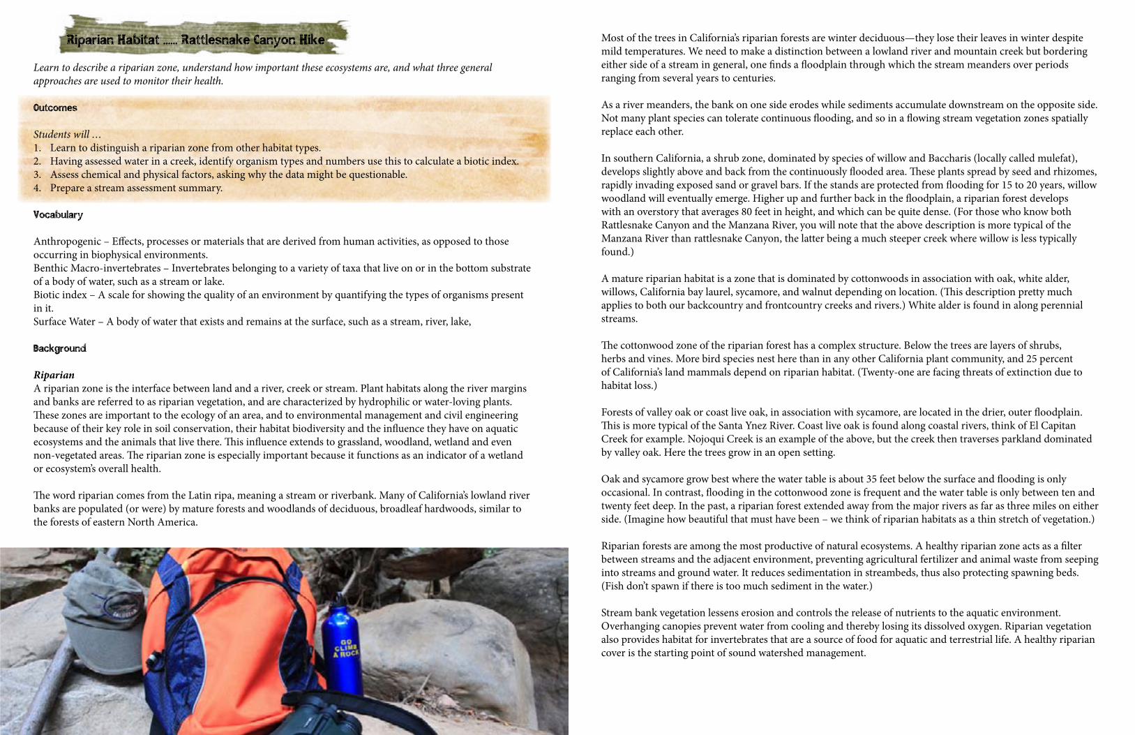
Riparian Habitat ...... Rattlesnake Canyon Hike
Learn to describe a riparian zone, understand how important these ecosystems are, and what three general approaches are used to monitor their health.
Outcomes
Students will …1. Learn to distinguish a riparian zone from other habitat types.2. Having assessed water in a creek, identify organism types and numbers use this to calculate a biotic index.3. Assess chemical and physical factors, asking why the data might be questionable.4. Prepare a stream assessment summary.
Vocabulary
Anthropogenic – Effects, processes or materials that are derived from human activities, as opposed to those occurring in biophysical environments.Benthic Macro-invertebrates – Invertebrates belonging to a variety of taxa that live on or in the bottom substrate of a body of water, such as a stream or lake.Biotic index – A scale for showing the quality of an environment by quantifying the types of organisms present in it.Surface Water – A body of water that exists and remains at the surface, such as a stream, river, lake,
Background
RiparianA riparian zone is the interface between land and a river, creek or stream. Plant habitats along the river margins and banks are referred to as riparian vegetation, and are characterized by hydrophilic or water-loving plants. These zones are important to the ecology of an area, and to environmental management and civil engineering because of their key role in soil conservation, their habitat biodiversity and the influence they have on aquatic ecosystems and the animals that live there. This influence extends to grassland, woodland, wetland and even non-vegetated areas. The riparian zone is especially important because it functions as an indicator of a wetland or ecosystem’s overall health.
The word riparian comes from the Latin ripa, meaning a stream or riverbank. Many of California’s lowland river banks are populated (or were) by mature forests and woodlands of deciduous, broadleaf hardwoods, similar to the forests of eastern North America.
Most of the trees in California’s riparian forests are winter deciduous—they lose their leaves in winter despite mild temperatures. We need to make a distinction between a lowland river and mountain creek but bordering either side of a stream in general, one finds a floodplain through which the stream meanders over periods ranging from several years to centuries.
As a river meanders, the bank on one side erodes while sediments accumulate downstream on the opposite side. Not many plant species can tolerate continuous flooding, and so in a flowing stream vegetation zones spatially replace each other.
In southern California, a shrub zone, dominated by species of willow and Baccharis (locally called mulefat), develops slightly above and back from the continuously flooded area. These plants spread by seed and rhizomes, rapidly invading exposed sand or gravel bars. If the stands are protected from flooding for 15 to 20 years, willow woodland will eventually emerge. Higher up and further back in the floodplain, a riparian forest develops with an overstory that averages 80 feet in height, and which can be quite dense. (For those who know both Rattlesnake Canyon and the Manzana River, you will note that the above description is more typical of the Manzana River than rattlesnake Canyon, the latter being a much steeper creek where willow is less typically found.)
A mature riparian habitat is a zone that is dominated by cottonwoods in association with oak, white alder, willows, California bay laurel, sycamore, and walnut depending on location. (This description pretty much applies to both our backcountry and frontcountry creeks and rivers.) White alder is found in along perennial streams.
The cottonwood zone of the riparian forest has a complex structure. Below the trees are layers of shrubs, herbs and vines. More bird species nest here than in any other California plant community, and 25 percent of California’s land mammals depend on riparian habitat. (Twenty-one are facing threats of extinction due to habitat loss.)
Forests of valley oak or coast live oak, in association with sycamore, are located in the drier, outer floodplain. This is more typical of the Santa Ynez River. Coast live oak is found along coastal rivers, think of El Capitan Creek for example. Nojoqui Creek is an example of the above, but the creek then traverses parkland dominated by valley oak. Here the trees grow in an open setting.
Oak and sycamore grow best where the water table is about 35 feet below the surface and flooding is only occasional. In contrast, flooding in the cottonwood zone is frequent and the water table is only between ten and twenty feet deep. In the past, a riparian forest extended away from the major rivers as far as three miles on either side. (Imagine how beautiful that must have been – we think of riparian habitats as a thin stretch of vegetation.)
Riparian forests are among the most productive of natural ecosystems. A healthy riparian zone acts as a filter between streams and the adjacent environment, preventing agricultural fertilizer and animal waste from seeping into streams and ground water. It reduces sedimentation in streambeds, thus also protecting spawning beds. (Fish don’t spawn if there is too much sediment in the water.)
Stream bank vegetation lessens erosion and controls the release of nutrients to the aquatic environment. Overhanging canopies prevent water from cooling and thereby losing its dissolved oxygen. Riparian vegetation also provides habitat for invertebrates that are a source of food for aquatic and terrestrial life. A healthy riparian cover is the starting point of sound watershed management.
Many of our riparian forests have been replaced by orchards or have been damaged to some extent by grazing. Just think of all the citrus and avocado orchards that line our front-country creeks. Typically, less than 10 percent of our original riparian cover remains. The rich, alluvial soils of floodplains are ideal agricultural land and stock grazing results in the removal of palatable plants, eating and trampling of seedlings, invasion of non-palatable weed species, and the degradation of stream banks.
Another major impact has been the construction of dams and reservoirs which have altered the levels of many streams and inundated valleys once occupied by riparian communities.
A third impact relates to urbanization where flood control is needed. Control includes removal of riparian vegetation to speed the movement of floodwaters, dredging, channelization, and enclosing a stream in concrete. (The rate of conversion of agricultural land to urban land has increased dramatically in the past several decades. In the five years from 1977 to 1982, the counties of Los Angeles, Orange, San Bernardino and Riverside urbanized 100,000 agricultural acres; and 60,000 acres were converted in San Diego County.) The remaining riparian belts contain cottonwood and willow that provide important habitat for sensitive bird species like the endangered least Bell’s vireo, the southwestern willow flycatcher, western yellow-billed cuckoo, yellow warbler, and yellow-breasted chat, and various species of amphibians and fish that are also endangered.
Assessment
There are three general approaches to monitoring health of fresh water ecosystems:
1. Chemical and physical parameters: Various analytical tests are readily available and fairly easy to complete, and can be used to evaluate the chemical and physical properties of surface waters.
2. Because conditions can change quickly based on weather, seasonal fluctuations or human activity, samples are usually taken at various times during the year.
3. Study of the aquatic life: Studying the presence of certain species at or within the water can be used to evaluate the overall health of an aquatic ecosystem. Because of their abundance and because they have been studied extensively for decades, little creatures called benthic macro-invertebrates are especially useful in calculating a biotic index. A biotic index is the measure of stream or river’s health based on the diversity and abundance of these organisms.
4. Macro-invertebrates have what are known as referenced tolerance values. These indicate the degree of sensitivity of particular groups to pollution. For example, if the predominant species in a water body are known to be very tolerant of pollution that would provide an indication that the habit is under stress. In contrast, if the predominant species identified are known to be sensitive to stressors that would provide a good indication of a healthy aquatic ecosystem.
5. Physical assessment: Visual observations of the in-stream habitat and riparian zone can be made to assess the evidence of potential impacts.
The most comprehensive evaluation of a freshwater body and adjacent habitat will include all three methods. Various approaches can be used: a group may wish to establish a baseline which they can then compare to with ongoing monitoring at prescribed intervals, or they mish wish to compare two different sections of a stream, for example higher up along the Rattlesnake Canyon Trail and then lower down at the creek mouth after it has flowed through an urban area.
Lesson
The lesson will consist of two parts: a class exercise and a field repetition of the class exercise. The class exercise uses values and information provided in the data sheets below, and the field exercise puts what you learn into practice, requiring you to take your own measurements and collect your own data before also analyzing it.
Class ExerciseTwo sets of chemical and physical data, two macro-invertebrate samples and stream photos have been provided. Using the reference data provided, students will compare the results from the three sets of data (biotic index, chemical and physical parameters), describe water quality and establish whether the results of the various assessments coincide.
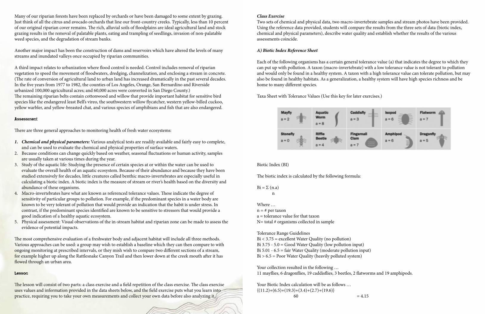
A) Biotic Index Reference Sheet
Each of the following organisms has a certain general tolerance value (a) that indicates the degree to which they can put up with pollution. A taxon (macro-invertebrate) with a low tolerance value is not tolerant to pollution and would only be found in a healthy system. A taxon with a high tolerance value can tolerate pollution, but may also be found in healthy habitats. As a generalization, a healthy system will have high species richness and be home to many different species.
Taxa Sheet with Tolerance Values (Use this key for later exercises.)
Biotic Index (BI)
The biotic index is calculated by the following formula:
Bi = Σ (n.a) n
Where …n = # per taxon a = tolerance value for that taxon N= total # organisms collected in sample
Tolerance Range GuidelinesBi < 3.75 = excellent Water Quality (no pollution)Bi 3.75 - 5.0 = Good Water Quality (low pollution input)Bi 5.01 - 6.5 = fair Water Quality (moderate pollution input)Bi > 6.5 = Poor Water Quality (heavily polluted system)
Your collection resulted in the following … 11 mayflies, 6 dragonflies, 19 caddisflies, 3 beetles, 2 flatworms and 19 amphipods.
Your Biotic Index calculation will be as follows … {(11.2)+(6.5)+(19.3)+(3.4)+(2.7)+(19.6)} 60 = 4.15
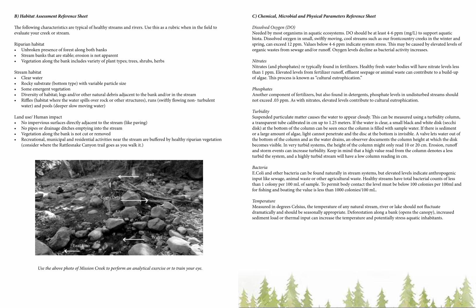
B) Habitat Assessment Reference Sheet
The following characteristics are typical of healthy streams and rivers. Use this as a rubric when in the field to evaluate your creek or stream.
Riparian habitat• Unbroken presence of forest along both banks• Stream banks that are stable; erosion is not apparent• Vegetation along the bank includes variety of plant types; trees, shrubs, herbs
Stream habitat• Clear water• Rocky substrate (bottom type) with variable particle size• Some emergent vegetation• Diversity of habitat; logs and/or other natural debris adjacent to the bank and/or in the stream• Riffles (habitat where the water spills over rock or other structures), runs (swiftly flowing non- turbulent
water) and pools (deeper slow moving water)
Land use/ Human impact• No impervious surfaces directly adjacent to the stream (like paving)• No pipes or drainage ditches emptying into the stream• Vegetation along the bank is not cut or removed• Recreational, municipal and residential activities near the stream are buffered by healthy riparian vegetation
(consider where the Rattlesnake Canyon trail goes as you walk it.)
Use the above photo of Mission Creek to perform an analytical exercise or to train your eye.
C) Chemical, Microbial and Physical Parameters Reference Sheet
Dissolved Oxygen (DO)Needed by most organisms in aquatic ecosystems. DO should be at least 4-6 ppm (mg/L) to support aquatic biota. Dissolved oxygen in small, swiftly moving, cool streams such as our frontcountry creeks in the winter and spring, can exceed 12 ppm. Values below 4-6 ppm indicate system stress. This may be caused by elevated levels of organic wastes from sewage and/or runoff. Oxygen levels decline as bacterial activity increases.
NitratesNitrates (and phosphates) re typically found in fertilizers. Healthy fresh water bodies will have nitrate levels less than 1 ppm. Elevated levels from fertilizer runoff, effluent seepage or animal waste can contribute to a build-up of algae. This process is known as “cultural eutrophication.”
PhosphatesAnother component of fertilizers, but also found in detergents, phosphate levels in undisturbed streams should not exceed .03 ppm. As with nitrates, elevated levels contribute to cultural eutrophication.
TurbiditySuspended particulate matter causes the water to appear cloudy. This can be measured using a turbidity column, a transparent tube calibrated in cm up to 1.25 meters. If the water is clear, a small black and white disk (secchi disk) at the bottom of the column can be seen once the column is filled with sample water. If there is sediment or a large amount of algae, light cannot penetrate and the disc at the bottom is invisible. A valve lets water out of the bottom of the column and as the water drains, an observer documents the column height at which the disk becomes visible. In very turbid systems, the height of the column might only read 10 or 20 cm. Erosion, runoff and storm events can increase turbidity. Keep in mind that a high value read from the column denotes a less turbid the system, and a highly turbid stream will have a low column reading in cm.
BacteriaE.Coli and other bacteria can be found naturally in stream systems, but elevated levels indicate anthropogenic input like sewage, animal waste or other agricultural waste. Healthy streams have total bacterial counts of less than 1 colony per 100 mL of sample. To permit body contact the level must be below 100 colonies per 100ml and for fishing and boating the value is less than 1000 colonies/100 mL.
TemperatureMeasured in degrees Celsius, the temperature of any natural stream, river or lake should not fluctuate dramatically and should be seasonally appropriate. Deforestation along a bank (opens the canopy), increased sediment load or thermal input can increase the temperature and potentially stress aquatic inhabitants.
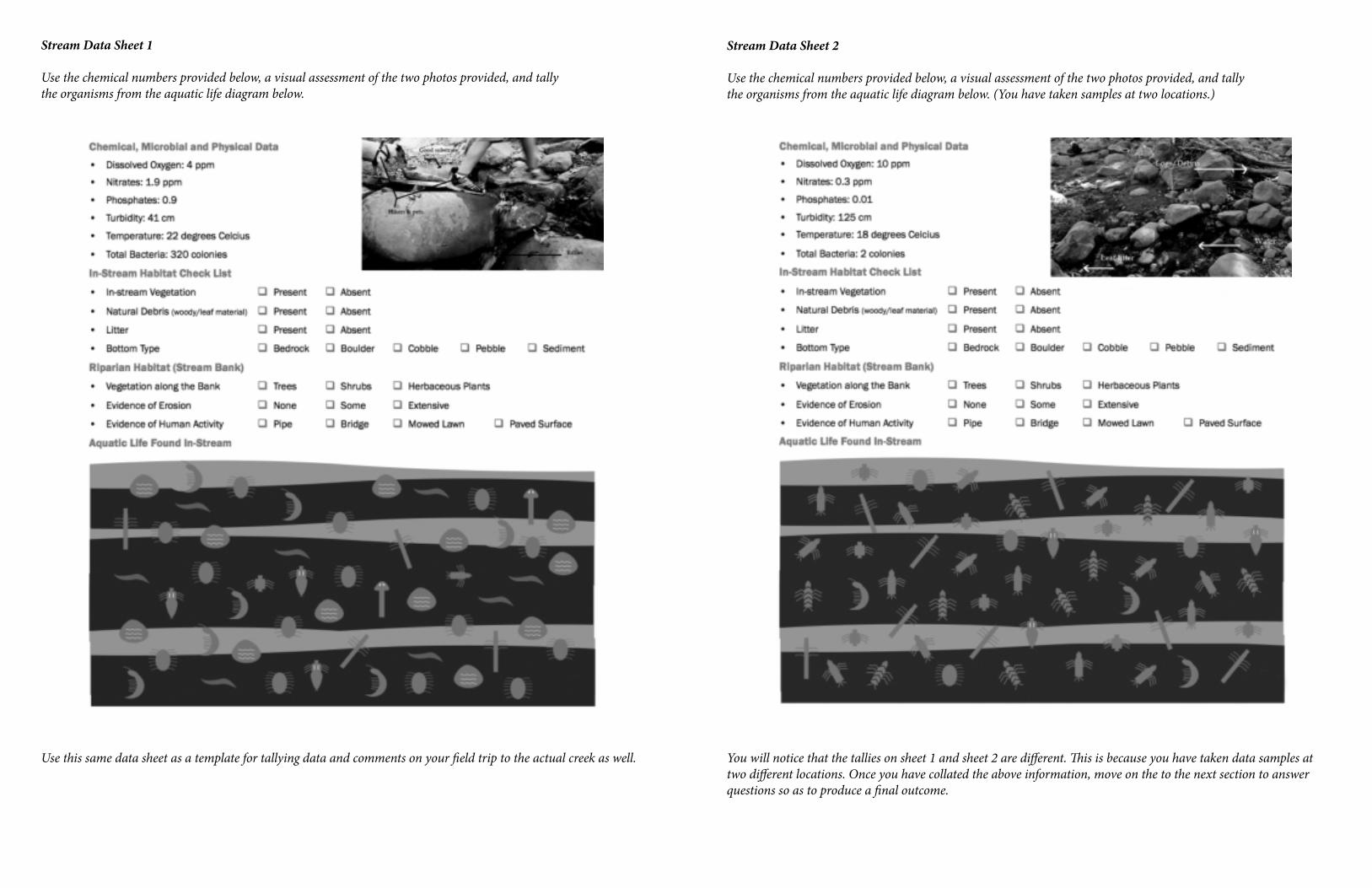
Stream Data Sheet 1
Use the chemical numbers provided below, a visual assessment of the two photos provided, and tally the organisms from the aquatic life diagram below.
Use this same data sheet as a template for tallying data and comments on your field trip to the actual creek as well.
Stream Data Sheet 2
Use the chemical numbers provided below, a visual assessment of the two photos provided, and tally the organisms from the aquatic life diagram below. (You have taken samples at two locations.)
You will notice that the tallies on sheet 1 and sheet 2 are different. This is because you have taken data samples at two different locations. Once you have collated the above information, move on the to the next section to answer questions so as to produce a final outcome.
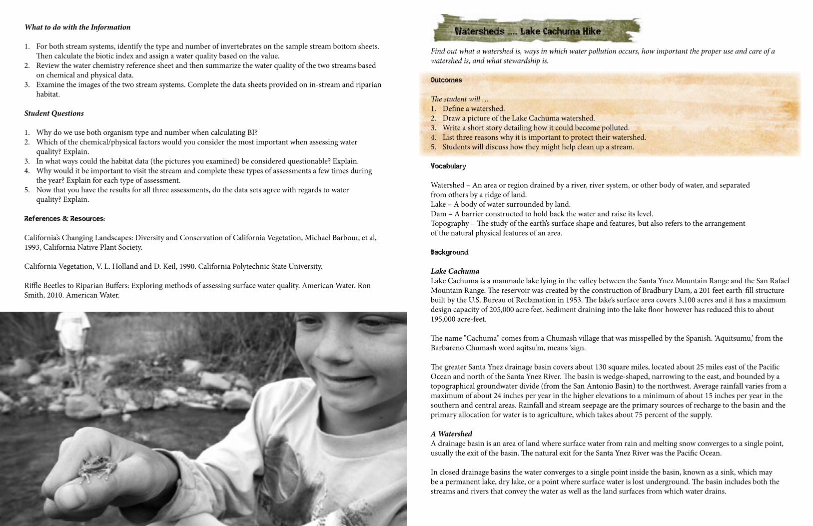
What to do with the Information
1. For both stream systems, identify the type and number of invertebrates on the sample stream bottom sheets. Then calculate the biotic index and assign a water quality based on the value.
2. Review the water chemistry reference sheet and then summarize the water quality of the two streams based on chemical and physical data.
3. Examine the images of the two stream systems. Complete the data sheets provided on in-stream and riparian habitat.
Student Questions
1. Why do we use both organism type and number when calculating BI?2. Which of the chemical/physical factors would you consider the most important when assessing water
quality? Explain.3. In what ways could the habitat data (the pictures you examined) be considered questionable? Explain.4. Why would it be important to visit the stream and complete these types of assessments a few times during
the year? Explain for each type of assessment.5. Now that you have the results for all three assessments, do the data sets agree with regards to water
quality? Explain.
References & Resources:
California’s Changing Landscapes: Diversity and Conservation of California Vegetation, Michael Barbour, et al, 1993, California Native Plant Society.
California Vegetation, V. L. Holland and D. Keil, 1990. California Polytechnic State University.
Riffle Beetles to Riparian Buffers: Exploring methods of assessing surface water quality. American Water. Ron Smith, 2010. American Water.
Watersheds ...... Lake Cachuma Hike
Find out what a watershed is, ways in which water pollution occurs, how important the proper use and care of a watershed is, and what stewardship is.
Outcomes
The student will …1. Define a watershed.2. Draw a picture of the Lake Cachuma watershed.3. Write a short story detailing how it could become polluted.4. List three reasons why it is important to protect their watershed.5. Students will discuss how they might help clean up a stream.
Vocabulary
Watershed – An area or region drained by a river, river system, or other body of water, and separated from others by a ridge of land.Lake – A body of water surrounded by land.Dam – A barrier constructed to hold back the water and raise its level.Topography – The study of the earth’s surface shape and features, but also refers to the arrangement of the natural physical features of an area.
Background
Lake CachumaLake Cachuma is a manmade lake lying in the valley between the Santa Ynez Mountain Range and the San Rafael Mountain Range. The reservoir was created by the construction of Bradbury Dam, a 201 feet earth-fill structure built by the U.S. Bureau of Reclamation in 1953. The lake’s surface area covers 3,100 acres and it has a maximum design capacity of 205,000 acre·feet. Sediment draining into the lake floor however has reduced this to about 195,000 acre-feet.
The name "Cachuma" comes from a Chumash village that was misspelled by the Spanish. ‘Aquitsumu,’ from the Barbareno Chumash word aqitsu’m, means ‘sign.
The greater Santa Ynez drainage basin covers about 130 square miles, located about 25 miles east of the Pacific Ocean and north of the Santa Ynez River. The basin is wedge-shaped, narrowing to the east, and bounded by a topographical groundwater divide (from the San Antonio Basin) to the northwest. Average rainfall varies from a maximum of about 24 inches per year in the higher elevations to a minimum of about 15 inches per year in the southern and central areas. Rainfall and stream seepage are the primary sources of recharge to the basin and the primary allocation for water is to agriculture, which takes about 75 percent of the supply.
A WatershedA drainage basin is an area of land where surface water from rain and melting snow converges to a single point, usually the exit of the basin. The natural exit for the Santa Ynez River was the Pacific Ocean.
In closed drainage basins the water converges to a single point inside the basin, known as a sink, which may be a permanent lake, dry lake, or a point where surface water is lost underground. The basin includes both the streams and rivers that convey the water as well as the land surfaces from which water drains.
A drainage divide separates adjacent basins from each other and could take the form of a ridge, hill or mountain. Other terms used to describe a drainage basin are catchment, catchment area, catchment basin, drainage area, river basin, water basin and watershed. Technically a watershed refers to a divide that separates one drainage area from another drainage area. However, in the United States and Canada, the term is often used to mean the drainage basin or catchment area itself. Drainage basins drain into other drainage basins in a hierarchical pattern, with smaller sub-basins combining into larger basins.
Materials
1. Per group or individual: Scrap paper, water-based markers (blue, black, brown, & red), paper towel, spray water bottle
2. Computer access (for teacher)3. For water pollution demonstration (optional) – see instructions for details: Two clear half gallon bottles,
utility knife, drill, coffee filter, two inches of sand (six cm.) tape, water, red food coloring4. Map of the Santa Ynez Valley (Lake Cachuma) watershed (References)5. Colored pencils (per student)6. Drawing paper7. Examples of fish, plant life, or animals found in the SY watershed8. Writing paper and pencils
Lesson Part 1
1. Ask learners to list ten ways that they use water. Ask them to write each use on a different self-sticking note. Allow three to five minutes to quickly discuss their responses. Post various responses on a sheet of paper.
2. Ask learners to create category labels. Examples might be Recreation, Health, Household, and Work. Have them post their uses under the appropriate category. If there are duplicate uses, post one on top of the other or indicate how many on one sticky note.
3. Discuss where the water comes from. 4. Share the following as part of the discussion.
On average, a person in the US uses 100 gallons of water a day. A dairy cow must drink three gallons of water to produce one gallon of milk. An ear of corn needs 26 gallons of water to grow. A meal at a fast food restaurant can take 1,400 gallons of water to make (burger, fries and drink).
Water Usage Number of Gallons UsedFlush a toilet 5Full bath in tub 36-50Wash hands (with water running) 2Brush teeth (with water running) 2-10Dishwasher 60Wash clothes 50Drinking water 2-12Cooking 10Washing the car 100
Write the word Watershed on the board or on paper. Ask learners for definitions. In explaining it, start just with the word ‘shed.’ What does that mean? Think of a rain suit or umbrella. Then provide a simple definition for a watershed: a body of land that drains into a river, lake, or other body of water.
(Teacher Note: Boundaries are high points of land that slope downward towards the body of water). Add that all water in our area is part of a common watershed, and that the earth is made up of numerous watersheds, some containing more of the Earth’s freshwater than others.
Do the following activity to demonstrate what a watershed is. It can be done individually or in groups. Ask each to ...
1. Crumple a piece of paper into a loose ball.2. Partially open the paper, and place it on a desk. The paper should still be crumpled enough to have portions
that resemble mountain ridges and valleys. Be sure there is a paper towel under the paper.3. Using a blue water-based marker, have students mark “creeks” or rivers on their papers, and also have them
mark where they think the water will collect as it runs downhill. This could represent a lake.4. Using a black water-based marker, have learners outline the ridges that separate one creek/ river from another.5. Using brown water-based markers, have learners draw exposed soil that could erode or wash away into the
lake as the water flows through the watershed.6. Using red water-based markers, have learners draw in some pollutants that may be found in their watershed,
such as soap from washing cars, pesticides from lawns, and animal waste from a nearby farm.7. Keeping the model on the desks, have learners spray (or you go around with a sprayer and spray) a very light
mist of water over it.8. Observe where water runs down and collects. 9. Ask the learners: If this is a model of a watershed...
- What does you suppose the paper represent? - What does the mist/spray represent? - What does the water that runs down into the creases represents? - Why does water flow down into the creases? - What does the water flowing in the creases represent? - What does the water that “pools up” represent? - What happened to the ink from the markers as the water flowed? - Where will the ink eventually end up (the highest or lowest place)? - How is this a problem if the inks represent pollutants?”
10. Ask learners to consider how this is similar to and/or different from the Santa Ynez Valley and Cachuma Lake area. Where in the community would there be the most pollutants?
11. Ask learners to identify where the rain, snow, etc. that falls in the Cachuma Lake catchment drains from. They may name local rivers, creeks or ridges etc, or consider storm systems that blow in from various directions. Look at the Santa Ynez Valley in Google Earth as you discuss this, or if at Lake Cachuma, visit the museum to view a map with names.
12. Indicate the lowest point in the watershed (the point to which all water flows) and have students trace the path they believe the water would flow to get there. If you use a physical map or copy, draw arrows showing the direction the water flows. (An overhead projector with map transparency would work well.)
13. Students could write a short paragraph explaining how water gets from their house, school, or community in general to an “end” point, or from the surrounding ridgelines at Cachuma Lake to their faucet at home.
Maps can be found at the EPA Surf Your Watershed site (or use the following urls: http://cfpub.epa.gov/surf/huc.cfm?huc_code=04080206 www.epa.gov/students/ surf_your_watershed.htm Background information on your watershed can be found at the Know Your Watershed site: www.ctic.purdue.edu/KYW/brochures/ GetToKnow.html
Lesson Part 2
Think about your answer, pair with a partner and discuss, and then share with the class or group. Tell learners that having discovered more about the Cachuma Lake watershed, they need to think of at least one way to use the watershed and one way it could be harmed.
1. Look at the maps in Part 1 and continue the discussion of pollution. 2. As you look at the map, discuss how the health of a watershed is determined by many factors, including the
use of land throughout the watershed (ranching, vineyards, oil drilling and recreation), and what pollutants each use may put into the watershed.
3. Discuss the types of land use mentioned above. Do the ranches or vineyards use nitrates from fertilizers and livestock waste? Are there small businesses that might pollute the watershed?
4. Discuss how each of these uses could lead to pollution, not only by being directly put into the drainage area, but also indirectly through other rivers, and streams, and through groundwater. (Water that soaks into the ground.)
5. Discuss ways in which pollution could occur: run-off of crop and forest land, failing septic systems, construction sites, irrigation drainage systems, automobile exhaust, etc. How can waste materials like old motor oil, pesticides, and raw sewage (from overflowing septic tanks) get into the watershed?
6. Do the following water pollution demonstration (optional) at this point to show how easily contaminants can get into the water source: - Using two clear plastic two liter bottles create a model of the water table. With a utility knife cut the bottom two inches of a plastic two-liter (half gallon) bottle off. - Drill six holes in the bottom of the remaining piece. This can be done with a low speed drill or a hot nail. - Cut off the top two inches (five cm) of the other bottle. Insert the bottom of the first bottle into the second bottle with the holes pointing up. - Cut a coffee filter or other filtering material to fit into the second bottle. Cover the coffee filter and the bottle bottom with two inches (five cm) of sand. You may tape the top of the second bottle back on, but it is not necessary. You now have a working model of ground water and pollution. - To demonstrate how water pollution seeps into ground pour one cup of water on the sand. The water will filter through the sand and collect at the bottom of the bottle. - To demonstrate pollution, place five drops of red food coloring on the sand to simulate a pollutant. Slowly pour one cup of water on top of the food coloring. It will filter through the sand and appear in the bottom of the bottle. The ground water has been polluted. Is the soil above the water polluted? How do you clean the ground water? - Generate a list of reasons why it’s important to protect the watershed. - Explain that responsible use of watershed is an example of stewardship.
Assessment
Option 1Tell learners that they work for the EPA (Environmental Protection Agency) and that they have to write a report about the conditions of a local watershed. The report is to be sent to the local government of a city explaining that ranching and farming in the area are polluting the Lake Cachuma water supply. They should include reasons why it is important to create policies to enforce the law, and research ways in which sustainable, non-polluting farming can be practiced.
Option 2: Dear Mom and Dad, did you know …Students can write a letter to their parents, explaining their study of the watershed and asking them to help devise a plan to reduce water usage in their household. Learners could share information from their family’s plan with the class. The entire class can brainstorm a list of ideas to include in their letters.
Extension
Research the difference between point source and non-point source pollution, algal blooms, PCBs, PAHs and DDT. Have them debate the question: Should industries be allowed to dump PCB, PAH and other pollutants in the watershed? Why or why not?
References and Resources
Purdue University website:www.ctic.purdue.edu/KYW/brochures/GetToKnow.html
Various Environmental Protection Agency websites:www.epa.gov/owow/nps/kids/whatwrng.htm www.epa.gov/surfwww.cfpub.epa.gov/surt/huc.cfm? huc_code=04080206 www.epa.gov/students/surf_your_watershed.htm
Smith, J., Howe, C. and Hendersen, J. (2010) Climate Change and Water: International Perspectives on Mitigation and Adaptation. American Water Works Association.
Biodiversity ...... Santa Cruz Hike
Explore the subject of biodiversity; delve into its practical meaning and do a simple biodiversity index study to provide application.
Outcomes
Students will … 1. Be able to define biodiversity.2. Be able to describe the difference between biodiversity and monoculture.3. Be able to describe why biodiversity is important, and why and how it is threatened.
Vocabulary
Biodiversity – The variety of life. Its complexity is measured in terms of variations at genetic, species, and ecosystem levels.Monoculture – The growing of just one species of organism.Floristic region – Geographic region that can be delineated according to plants, vegetation types, soils and climates.Endemism – An organism that is unique to one particular area or region.Endangered – Reference to the status of an organism as determined by the International Union for Conservation of Nature and Natural Resources (IUCN) Red List. See www.iucnredlist.org Mediterranean climate – A moderate climate and considered highly desirable to live in. Characterized by hot dry summers and cool, wet winters, it is found in just five narrowly focused areas in the world. Natural Resources – Resources, actual and potential that are supplied by nature. May include timber, fresh water, minerals or fish and is generally valued in economic terms.
Background
What is Biodiversity?Biological diversity or Biodiversity is the variety of life around us, life of all kinds, from the largest animal to the smallest plant. Its complexity is measured in terms of variations at genetic, species, and ecosystem levels.
Californian biodiversity is extremely rich. Our geology and topography—the mountains, plateaus and coastal plains—result in a wide range of soils. Along with our Mediterranean climate, this produces habitats that support a high number of plant and animal species.
Identified as a Biodiversity Hotspot, The California Floristic Province as it is known, is a zone of Mediterranean-type climate, characterized by high levels of plant endemism—that is plants that grow here and nowhere else. The hotspot is home to the giant sequoia, the planet’s largest living organism and its taller but less immense relative, the coastal redwood.
The region also holds a number of threatened endemic species and critically endangered species like the California condor of which there are only 356 alive. Our floristic region is in the largest avian breeding ground in the United States.
Wilderness destruction caused by commercial farming is one of the primary threats to the region, this because the California Floristic Province generates half of all the agricultural products used by US consumers. The hotspot is also heavily threatened by expansion of urban areas, pollution, and road construction.
Biodiversity plays a critical role in meeting human needs directly while maintaining the ecological processes upon which our survival depends. It is the biological and social capital, which supports all our lives and is not only important to our survival but is a key measure of the health of our planet.
Why is Biodiversity Important?Biodiversity is important for several reasons. It provides economic benefits, protects human health and safety, and offers recreational or aesthetic enjoyment.
Every living thing has a place in what many call the "balance of nature." Upsetting that balance can have untold effects, and more often than not, we are the losers. Biodiversity can be seen as a "Living Bank Balance"
Biodiversity is a necessity therefore, not a luxury. Although we may not readily appreciate it, biodiversity provides us with many of the things that sustain our lives. Plants, animals and microorganisms supply humans with a host of free ecological services. They generate soil, control pests, balance atmospheric gasses and many other biological processes. These processes are vital to our existence, and for the health of the planet. For this reason it is essential that we protect biodiversity—the variations in species, their lives and their habitats—because biodiversity is necessary for sustaining not just life, but our standard of living.
Biodiversity is also important because of its economic significance. All farm crops and animals are descendants of wild organisms, and they are also a component of biodiversity. Some old crop varieties have more taste or display greater disease resistance, and they may be better suited to future changes in climate. Fruit crops rely on the many insects that pollinate their flowers. We also take food from the wild, like venison or salmon. Fisherman, with their nets and rods, are simply harvesting the natural biodiversity of the oceans or rivers.
Biodiversity is an important part of sustainable development. It is a measure of sustainable development—growth today that does not deprive the quality of life of future generations. Sustainable development is regarded as a major target for industry and the planning system, and measuring biodiversity is the only way to be sure that this target is being achieved.
Biodiversity is important as a provider of natural services. The natural world also provides many services, which we may not always readily recognize. Many succulents for example play an important role in locking up carbon dioxide, one of the gases produced from the burning of fossil fuels. The tiny plants that float in the top few feet of the sea also absorb huge amounts of this carbon dioxide … as long as the sea remains healthy. Forests and ponds also contribute to natural water purification.
Biodiversity is important as a source of natural products. Although we are able to produce more and more drugs synthetically, we still rely on plants for many of our medicines. Medicines for heart disease, for example, are still produced today from wild foxgloves. We can never tell which species might prove useful: medical researchers studying the development of cancers, for example, are now using chemicals extracted from jellyfish.
Biodiversity is an important part of cultural heritage. Plants and animals are part of our traditions and culture. The California Poppy is our state flower, the Grizzly Bear our state emblem. The Central Coast’s botanical habitats are also key assets for our tourism industry. People come from far afield to admire the colors and patterns of our landscape—features that are produced by biodiversity.
Biodiversity is a hidden treasure that enriches all our lives. We may not notice the migrating Grey whales or a tiny Red-Legged Frog but most of us would like to know that we might have a chance to see them one day. And biodiversity is not just about rarities. The Red-Headed Finch and the hummingbird are equally important parts of biodiversity. Our lives would be missing something if they disappeared.
Activity Introduction
When scientists speak of biodiversity they refer to the organisms and their genes in an ecosystem. A biologically diverse ecosystem, such as an old growth forest is healthy, complex and stable. Nature tends to increase diversity through the process of succession from one generation to the next.
The opposite of biodiversity is referred to as monoculture, or the growing of one species of organism, such as a lawn, a wheat field or cornfield. Because all of the species are identical, there are few complex food webs and disease can spread quickly. Monoculture has been described as a banquet table for disease organisms. When disease does strike it spreads quickly and results in devastation.
Monoculture often requires extensive use of pesticides and herbicides (to fight nature’s tendency to diversify communities) and is very labor and energy intensive (fighting nature is tough). Humans also often try to reduce diversity because it is easier to harvest a crop (whether it is wheat, corn, a lawn or a secondary forest) if it all contains the same species. But this is proving to create many serious problems.
The first activity illustrates how to use math to calculate the diversity index of a selected habitat. The closer to 1 the diversity index is, the more diverse and healthy the habitat is. This is a very simplified version of diversity index. The more accurate versions are called the Simpson and Shannon Indexes.
Activity 1: Calculating a Biodiversity Index
Each team of two students is given the items as listed below. The beans and gummy bears etc. represent the animals that live in a square meter area of a particular habitat. Vitamin bottles or small Tupperware containers represent the habitat and these are labeled 1, 2, 3 etc. Put different beans or gummy bears and differing amounts of each are put into the bottle/container.
Fifteen or more bottles are labeled as follows: four bottles 1, 5, 13, 9 (to represent chaparral) three bottles 4, 8, 12 (to represent lawns or wheat fields) two bottles 2, 6 (to represent the savanna oak woodland) two bottles 10, 14 (to represent riparian habitat) two bottles 3, 7 (represent beaches) and two bottles 11, 15 (represent grasslands).
Items to put in: kidney beans, white beans, lima beans, lentils, gummy bears, barley, sunflower seed, etc.
The habitat with the greatest diversity is chaparral, while the lowest is of course lawn and wheat fields. To calculate the diversity index, multiply the number of species (types) with the number of organisms.
Set up the bottles: List the habitats and ask students to figure out the diversity of their bottle. They are then to estimate what habitat it represents. The highest diversity in this example is .75. It may actually be higher in nature.
# Species # Each Total Organisms Diversity
Chaparral 15 1 each of 10 species 2 each of 5 species 20 15/20 = 0.75Savanna Oak 12 2 24 12/24 = 0.5Riparian 12 2 24 12/24 = 0.5Beach 7 3 21 7/21 = 0.333Grasslands 7 3 21 7/21 = 0.333Lawn/wheat fields 2 100 of 1 species 5 of another species 105 2/105 = 0.019
Activity 2: How Biodiversity Stops Disease From Spreading
When a habitat is diverse and contains a wide variety of different species, it is much healthier and more stable. One reason being that disease doesn’t spread as easily in a diverse community. Here’s why: if one species falls prey to a disease, others of its kind are far enough away (due to the variety of other organisms) that the disease is often stopped by one or two individuals.
In this simulation, side one of a card represents the monoculture typical of second growth forests. These contain large stands of trees grown for timber sales and are an example of the opposite of diversity. In this case, Douglas firs were planted after an old growth forest was cut down. Disease attacks one of the firs, and because of the proximity of the other like trees, it spreads quickly.
Side two of the card represents an old growth forest that is a biologically diverse community. This forest contains Douglas firs but they are spread out. In this scenario one of them still gets a disease, but this time it does not spread because the other Douglas firs are few and far between.
Side 1 of the card:All cards are marked with D. Tell recipients they are all Douglas firs. Each person gets one card. Each person is to meet five other people and write their names on the card. All to remain standing after they write down the names.
A facilitator or one other person will symbolize the disease and will touch one of the students. Ask that person to sit down (they are dead) and then to read the names on their card. As the names are read, those students sit too since they have been "touched." Then ask another one of those sitting (dead) to read the names on their card. Continue until almost all are sitting.
Ask them to explain why the disease spread so fast. (They are so alike genetically, and lack diversity.)
Side 2 of the card:Flip over the card. Label two cards with Ds for Douglas firs; the rest with other letters: N for Noble Fir, C for Western Red Cedar, M for Vine Maples, H for Western Hemlocks, W for White Fir, L for Lodge pole Pine, WP for Western White Pine, B for Bigleaf Maple, WD for Western Dogwood). Explain that in some forests (especially old growth), there are a variety of trees.
Repeat the steps as described for side 1 of the card with a facilitator ‘touching’ various cards but now, only those students that are of the same variety as the diseased tree that touched them will sit. Trees of a different variety will of course not sit down if touched by a diseased tree. Almost all students will remain standing (didn’t die). Ask students to explain why the disease didn’t spread this time. The answer is because of genetic or biological diversity, but facilitate further discussion using the questions below.
Follow up questions:1. What does biological diversity mean?2. Why didn’t all the different trees get the disease? (Many diseases are species-specific but the time taken
for a disease to pass from distantly placed individuals of the same species can weaken its genetic ability to overpower a specie. In both cases the answer relates to genetics.)
3. Why didn’t the disease spread as fast among the Douglas firs as it did in the first simulation?4. In which forest would you need to use more chemicals to control disease: the Douglas fir forest or the more
diversified, old growth forest? Why?
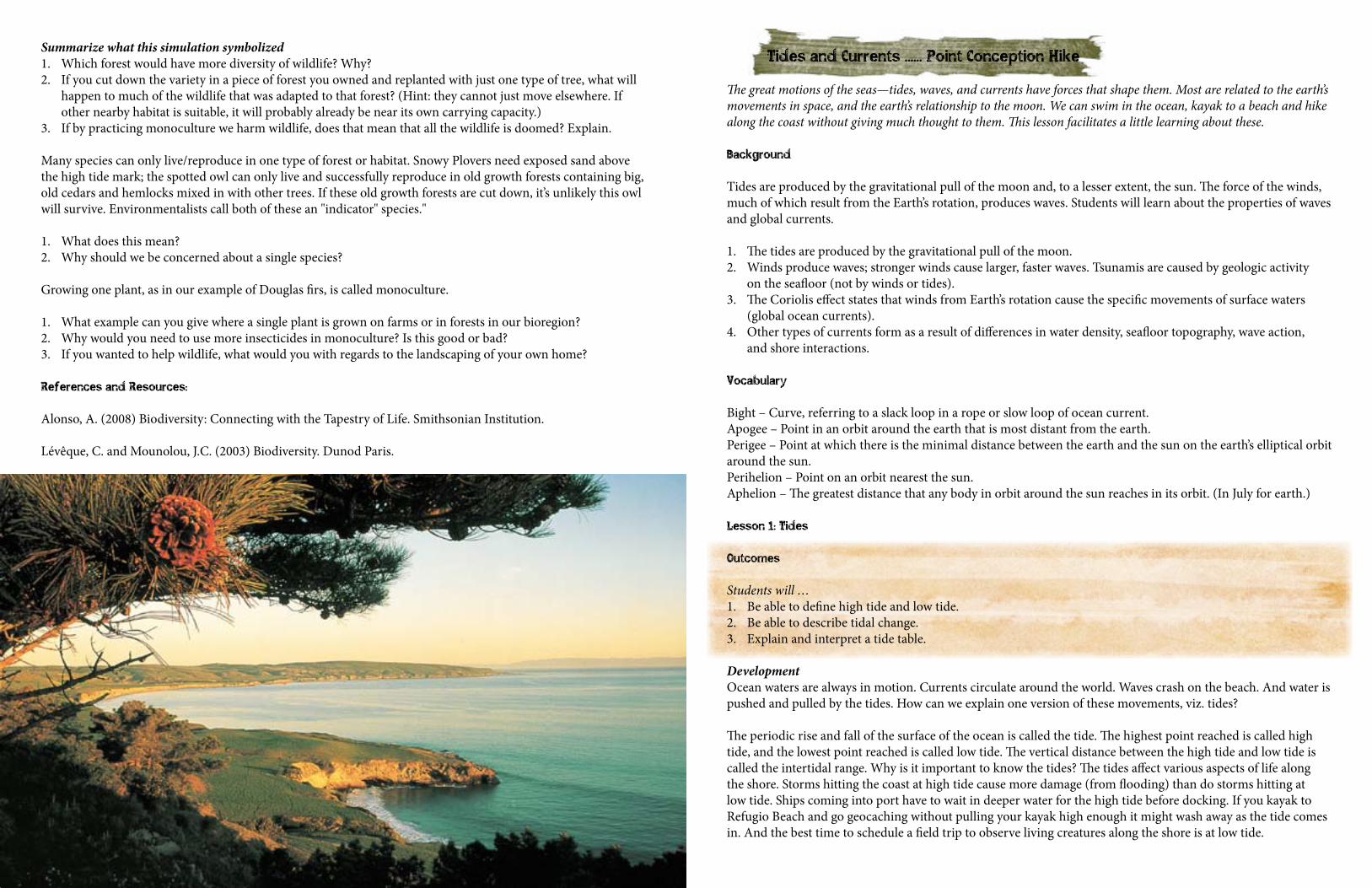
Summarize what this simulation symbolized1. Which forest would have more diversity of wildlife? Why? 2. If you cut down the variety in a piece of forest you owned and replanted with just one type of tree, what will
happen to much of the wildlife that was adapted to that forest? (Hint: they cannot just move elsewhere. If other nearby habitat is suitable, it will probably already be near its own carrying capacity.)
3. If by practicing monoculture we harm wildlife, does that mean that all the wildlife is doomed? Explain.
Many species can only live/reproduce in one type of forest or habitat. Snowy Plovers need exposed sand above the high tide mark; the spotted owl can only live and successfully reproduce in old growth forests containing big, old cedars and hemlocks mixed in with other trees. If these old growth forests are cut down, it’s unlikely this owl will survive. Environmentalists call both of these an "indicator" species."
1. What does this mean? 2. Why should we be concerned about a single species?
Growing one plant, as in our example of Douglas firs, is called monoculture.
1. What example can you give where a single plant is grown on farms or in forests in our bioregion?2. Why would you need to use more insecticides in monoculture? Is this good or bad? 3. If you wanted to help wildlife, what would you with regards to the landscaping of your own home?
References and Resources:
Alonso, A. (2008) Biodiversity: Connecting with the Tapestry of Life. Smithsonian Institution. Lévêque, C. and Mounolou, J.C. (2003) Biodiversity. Dunod Paris.
Tides and Currents ...... Point Conception Hike
The great motions of the seas—tides, waves, and currents have forces that shape them. Most are related to the earth’s movements in space, and the earth’s relationship to the moon. We can swim in the ocean, kayak to a beach and hike along the coast without giving much thought to them. This lesson facilitates a little learning about these.
Background
Tides are produced by the gravitational pull of the moon and, to a lesser extent, the sun. The force of the winds, much of which result from the Earth’s rotation, produces waves. Students will learn about the properties of waves and global currents.
1. The tides are produced by the gravitational pull of the moon.2. Winds produce waves; stronger winds cause larger, faster waves. Tsunamis are caused by geologic activity
on the seafloor (not by winds or tides).3. The Coriolis effect states that winds from Earth’s rotation cause the specific movements of surface waters
(global ocean currents).4. Other types of currents form as a result of differences in water density, seafloor topography, wave action,
and shore interactions.
Vocabulary
Bight – Curve, referring to a slack loop in a rope or slow loop of ocean current.Apogee – Point in an orbit around the earth that is most distant from the earth.Perigee – Point at which there is the minimal distance between the earth and the sun on the earth’s elliptical orbit around the sun.Perihelion – Point on an orbit nearest the sun.Aphelion – The greatest distance that any body in orbit around the sun reaches in its orbit. (In July for earth.)
Lesson 1: Tides
Outcomes
Students will …1. Be able to define high tide and low tide. 2. Be able to describe tidal change. 3. Explain and interpret a tide table.
DevelopmentOcean waters are always in motion. Currents circulate around the world. Waves crash on the beach. And water is pushed and pulled by the tides. How can we explain one version of these movements, viz. tides?
The periodic rise and fall of the surface of the ocean is called the tide. The highest point reached is called high tide, and the lowest point reached is called low tide. The vertical distance between the high tide and low tide is called the intertidal range. Why is it important to know the tides? The tides affect various aspects of life along the shore. Storms hitting the coast at high tide cause more damage (from flooding) than do storms hitting at low tide. Ships coming into port have to wait in deeper water for the high tide before docking. If you kayak to Refugio Beach and go geocaching without pulling your kayak high enough it might wash away as the tide comes in. And the best time to schedule a field trip to observe living creatures along the shore is at low tide.
How do you know when it is high tide or low tide? Local papers often print the daily tide table for a region. An area that has two high and two low tides each day has a semidiurnal tide. The East Coast (Atlantic) of the United States has a semidiurnal tidal pattern. The Gulf Coast has one high and one low tide each day, called a diurnal tide. The West Coast (Pacific) has a pattern of mixed tides (similar to that of the East Coast), with two high and two low tides each day.
ActivityHand out a map of the Santa Barbara Channel or print out the Google Earth map linked from the HiddenCorner.us Bioregion page. Then gather tide information from the two web links just below and have students locate on the map the sites listed in the Santa Barbara Channel’s tide tables. Enter the high tides and low tides for each site.
www.wavecast.com/tides www.weatherflow.com/navair/analysis.html www.maps.google.com/maps?ll=34.63813,-120.01389&z=9&t=h&hl=en
Lesson 2: Explaining the rhythm of tides
Outcomes
Students will …1. Be able to explain how gravity causes tides.2. Be able to describe the tidal changes.3. Discuss the role of the moon and the sun in tidal change.
DevelopmentA tide table shows that the ocean advances and retreats along the shore in a periodic fashion. Both of the above websites show the big difference between high tide and low tide. Why does that happen?
A pulling force called gravity is responsible for the tides. Sir Isaac New- ton (1642–1727) discovered that gravity is a pulling force exerted between any two bodies in space. Earth and the moon exert this force on each other. The pull of the moon on Earth causes the ocean water that is facing the moon to be pulled toward the moon, producing a tidal bulge, which is a high tide. The following web animation shows this action very nicely:http://astro.unl.edu/classaction/animations/lunarcycles/tidesim.html
How does the tide vary during the month? When the sun and the moon are aligned with Earth, and pulling on it from the same side, the highest tides, called spring tides, are produced. Spring tides occur during the phases of the moon called new moon and full moon, which are exactly two weeks apart. When the pull of the sun and the moon on Earth are at right angles, a moderate neap tide is produced. The following link explains these tides: http://home.hiwaay.net/~krcool/Astro/moon/moontides/
The highest tides occur at perigee, when the moon is closest to Earth; and the lowest tides occur at apogee, when the moon is farthest from Earth. In addition, Earth moves closest to the sun in January, called perihelion, and farthest away in July, called aphelion. The combination of perigee (close to moon) and perihelion (close to sun) will produce the highest tides of all.
ActivityOrganize the class into small groups. Have each team sketch diagrams that show how high tides and low tides are produced during the new and full moons. (Group leaders can draw them on the board in a formal classroom.) Students should copy the correct diagrams into their nature journals.
Lesson 3: Ocean Currents
Outcomes
Students will …1. Identify global ocean currents.2. Describe the location and direction of ocean currents.3. Explain how ocean currents move.
DevelopmentAn ocean current is a mass of moving water and energy. The largest currents that move across the ocean are called global ocean currents. Some ocean currents move clockwise, while others move counter-clockwise. The global ocean currents move in a clockwise direction in the northern hemisphere and in a counter-clockwise direction in the southern hemisphere. The spinning of Earth causes the winds to move in these directions; and the winds drive the ocean’s surface currents. This circular drift of the oceans in opposite directions in the two hemispheres is known as the Coriolis effect. The continents in turn deflect the ocean currents, causing them to move in giant circles called gyres.
Revisit our Google Earth map of our bioregion and the Santa Barbara Channel. Zoom out until you can see both the mainland and the islands. Consider what the Chumash would have had to consider when planning a tomol canoe crossing from the mainland to Santa Cruz Island, and also between the islands, for example from Santa Cruz to Anacapa islands. If they had paddled from Santa Barbara, Point Conception and Ventura in a direct line, would the journey have taken place at equal pace (the distances vary but would their average speed have been the same)? We are now considering on a smaller, bioregional scale the patterns one might expect from moving currents.
There are a few things to consider before we can answer this navigational question. What is the major California current doing, how will wind in the Channel affect this and how will the islands themselves affect the currents?
For a start, the California current moves south along the West Coast, ending near Baja. But both wind and the islands influence an area known as the southern California Bight, with wind driving the surface water to the right of the wind flow, which is offshore, and also drawing water up from below to replace it. This upwelling further cools the already cool California Current, producing California’s coastal fog and cold coastal waters in the summer. This southern California Bight thus acts like a counter-current or eddy in many parts, especially around the Channel Islands.
Visit this link and the South California Coastal Ocean Observing System to see just how detailed these currents are in the Channel. Zoom in to Ventura, Santa Barbara and Point Conception to now answer the question about charting a tomol canoe route to Santa Cruz island, and from Santa Cruz to Anacapa. Bear in mind that tides will be accentuated between the islands, changing flow in and out between them as the tide rises and falls. http://www.sccoos.org/data/hfrnet/
ActivityHave students identify the location and direction of five more major ocean currents.
References & Resources
Download an extensive tides and currents lesson plan for more information on world currents at this link:
Halversen, C. Beals, K. and Strang, C. (2001) Ocean Currents: Marine Science Activities for Grades 5 to 8.
Part III Lessons for the Cycling Section
Introduction to Wetlands ...... Goleta Slough Cycle
Learn about the different kinds of wetlands, how productive and diverse they are, how they function as system filters and why they are threatened. Build a wetland model.
Outcomes
Part 1Students will … 1. Define a wetland using a number of different criteria.2. List characteristics of wetlands. 3. Describe the functions of a wetland. 4. Observe a demonstration using a wetland model.
Part 2Students will … 1. Distinguish salt marshes and estuaries as unique types of wetlands.2. Observe the effects of varying concentrations of salt on the aquatic plant Elodea and draw conclusions about
its ability to tolerate these.
Vocabulary
Bog – A plant community that develops and grows in permanently water logged areas having a thick layer of peat (partly decayed organic material).Estuary – The bay area of a river, where it widens to meet the ocean, that receives and mixes with tidal salt water.Marshes – Wet areas sometimes found at the edges of ponds, lakes, and rivers, usually treeless and having plants with soft stems, grasses, rushes, and sedges.Salinity – Saltiness, or the amount of salt, in water or other liquids.Swamps – Land with saturated soils for some of the year that supporting a natural vegetation of mostly trees and shrubs.
Background
Wetlands are remarkably productive and diverse waters that stand between upland and open water. Thinking about this it immediately makes sense that they might function as filters between inland watersheds and the ocean. But as important as they are to water quality, flood storage, and biodiversity, they are vanishing at such a quick rate in some parts of the country that within our lifetime they may just be a memory.
Wetlands are areas of land that are wet at least part of the year. They are often transition zones between dry land and open water. Some wetlands are consistently covered with water, while others are flooded only at certain times. All wetlands do have water-soaked soil at some time, which affects the kinds of plants and animals that live there. Wetlands can be found in all parts of the world and are classified into many types.
There are freshwater and saltwater wetlands. Some examples of freshwater wetlands are swamps, marshes, bogs, pasture ponds, and prairie potholes. Saltwater wetlands include mangrove swamps and saltwater marshes (a good example of which is the Carpinteria Salt Marsh).
Estuaries are the bodies of water found where rivers empty into the sea; they include saltwater wetlands. The water in estuaries is a mixture of fresh and salt (sea) water, and its salinity usually varies with its distance from the open ocean. A good example of an estuary is Devereux Slough in Coal oil Point Reserve.
Of InterestEconomists estimate that one acre of wetlands provides about $10,000 worth of ecosystem services which include: filtering and recharging drinking water, preventing flooding, protecting our coasts from hurricanes and storms, and providing habitat for diverse wildlife populations.
DefinitionThere are many different ways of defining a wetland. Some have evolved as scientists learn more about these unique ecosystems. Different scientific fields may define wetlands differently. Different government agencies may define wetlands differently. For our purpose, the following general definition seems to fit well. R.L. Smith (Ecology and Field Biology, 3rd edition, Harper and Row, New York,1980) states, “Wetlands are a half-way world between terrestrial and aquatic ecosystems and exhibit some characteristics of each.”
CriteriaA wetland must have standing water present for at least part of the year. The water may be meteoric, from surface water, or from groundwater. Typically groundwater, levels are very close to, or at, the ground surface, however, this is not a requirement. There must be some kind of water source to provide needed water to the wetland.
Wetlands must also have a type of soil that is considered “hydric” or that can hold water. Sand and other highly permeable soils do not make good wetland soils. Soils that have high clay content or have low permeability are the typical types of soil found in most wetland areas, especially in our bioregion. The mineral content in the soil can determine the type of wetland that may be present.
Wetlands must have the right kind of biology. Plants and animals that are identified as “wetland” varieties should live in the vicinity of the defined wetland area. There are many different types of plants that can define a wetland area (in other words, they cannot grow unless the water levels are right). The biology of the area is just as important as the type of soils and the hydrology of the area. If these three conditions exist, the area may be considered a wetland area.
Throughout history, wetlands have played an important role in the development of life. Yet, few true wetlands exist today, due to massive destruction and draining of the wetland areas. Many people still do not see the importance of wetlands and wetland preservation.
One important aspect of wetlands is that they can filter and clean water. They are often nicknamed the kidneys of the water cycle, because they can clean up the water. A lot of different government agencies and private companies are experimenting with using wetlands to clean up a variety of contamination from sewage to petroleum. Certain wetland plants such as bulrush, cattails, and water hyacinths can actually “suck up” the contamination like a straw. Wetlands are also being used for storm water controls. Rather than allowing muddy water to run directly into streams and causing sediment problems in the streams, water is directed into a wetland area, filtered naturally, and then slowly discharged back into the stream.
EstuariesAn estuary is a partially enclosed coastal body of water where salt water from the ocean mixes with fresh water draining from the land. Bays, inlets and tidal river valleys are all examples of estuaries. Estuaries are among the most productive ecosystems on the planet. Over 80 percent of the fish and shellfish we eat spend at least part of their lives in estuaries.
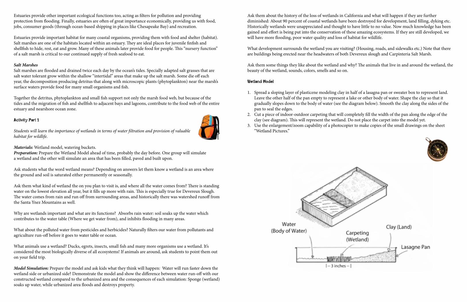
Estuaries provide other important ecological functions too, acting as filters for pollution and providing protection from flooding. Finally, estuaries are often of great importance economically, providing us with food, jobs, consumer goods (through ocean-based shipping in places like Chesapeake Bay) and recreation.
Estuaries provide important habitat for many coastal organisms, providing them with food and shelter (habitat). Salt marshes are one of the habitats located within an estuary. They are ideal places for juvenile finfish and shellfish to hide, rest, eat and grow. Many of these animals later provide food for people. This “nursery function” of a salt marsh is critical to our continued supply of fresh seafood to eat.
Salt MarshesSalt marshes are flooded and drained twice each day by the ocean’s tides. Specially adapted salt grasses that are salt water tolerant grow within the shallow “intertidal” areas that make up the salt marsh. Some die off each year, the decomposition producing detritus that along with microscopic plants (phytoplankton) near the marsh’s surface waters provide food for many small organisms and fish.
Together the detritus, phytoplankton and small fish support not only the marsh food web, but because of the tides and the migration of fish and shellfish to adjacent bays and lagoons, contribute to the food web of the entire estuary and nearshore ocean zone.
Activity Part 1
Students will learn the importance of wetlands in terms of water filtration and provision of valuable habitat for wildlife. Materials: Wetland model, watering buckets.Preparation: Prepare the Wetland Model ahead of time, probably the day before. One group will simulate a wetland and the other will simulate an area that has been filled, paved and built upon.
Ask students what the word wetland means? Depending on answers let them know a wetland is an area where the ground and soil is saturated either permanently or seasonally.
Ask them what kind of wetland the on you plan to visit is, and where all the water comes from? There is standing water on the lowest elevation all year, but it fills up more with rain. This is especially true for Devereux Slough. The water comes from rain and run off from surrounding areas, and historically there was watershed runoff from the Santa Ynez Mountains as well.
Why are wetlands important and what are its functions? Absorbs rain water: soil soaks up the water which contributes to the water table (Where we get water from), and inhibits flooding in many areas.
What about the polluted water from pesticides and herbicides? Naturally filters our water from pollutants and agriculture run-off before it goes to water table or ocean.
What animals use a wetland? Ducks, egrets, insects, small fish and many more organisms use a wetland. It’s considered the most biologically diverse of all ecosystems! If animals are around, ask students to point them out on your field trip.
Model Simulation: Prepare the model and ask kids what they think will happen: Water will run faster down the wetland side or urbanized side? Demonstrate the model and show the difference between water run-off with our constructed wetland compared to the urbanized area and the consequences of each simulation: Sponge (wetland) soaks up water, while urbanized area floods and destroys property.
Ask them about the history of the loss of wetlands in California and what will happen if they are further diminished: About 90 percent of coastal wetlands have been destroyed for development, land filling, dyking etc. Historically wetlands were unappreciated and thought to have little to no value. Now much knowledge has been gained and effort is being put into the conservation of these amazing ecosystems. If they are still developed, we will have more flooding, poor water quality and loss of habitat for wildlife.
What development surrounds the wetland you are visiting? (Housing, roads, and sidewalks etc.) Note that there are buildings being erected near the headwaters of both Devereux slough and Carpinteria Salt Marsh.
Ask them some things they like about the wetland and why? The animals that live in and around the wetland, the beauty of the wetland, sounds, colors, smells and so on.
Wetland Model
1. Spread a sloping layer of plasticene modeling clay in half of a lasagna pan or sweater box to represent land. Leave the other half of the pan empty to represent a lake or other body of water. Shape the clay so that it gradually slopes down to the body of water (see the diagram below). Smooth the clay along the sides of the pan to seal the edges.
2. Cut a piece of indoor-outdoor carpeting that will completely fill the width of the pan along the edge of the clay (see diagram). This will represent the wetland. Do not place the carpet into the model yet.
3. Use the enlargement/zoom capability of a photocopier to make copies of the small drawings on the sheet “Wetland Pictures.”
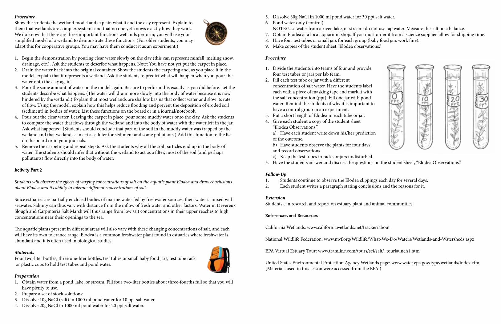
ProcedureShow the students the wetland model and explain what it and the clay represent. Explain to them that wetlands are complex systems and that no one yet knows exactly how they work. We do know that there are three important functions wetlands perform; you will use your simplified model of a wetland to demonstrate these functions. (For older students, you may adapt this for cooperative groups. You may have them conduct it as an experiment.)
1. Begin the demonstration by pouring clear water slowly on the clay (this can represent rainfall, melting snow, drainage, etc.). Ask the students to describe what happens. Note: You have not yet put the carpet in place.
2. Drain the water back into the original container. Show the students the carpeting and, as you place it in the model, explain that it represents a wetland. Ask the students to predict what will happen when you pour the water onto the clay again.
3. Pour the same amount of water on the model again. Be sure to perform this exactly as you did before. Let the students describe what happens. (The water will drain more slowly into the body of water because it is now hindered by the wetland.) Explain that most wetlands are shallow basins that collect water and slow its rate of flow. Using the model, explain how this helps reduce flooding and prevent the deposition of eroded soil (sediment) in bodies of water. List these functions on the board or in a journal/notebook.
4. Pour out the clear water. Leaving the carpet in place, pour some muddy water onto the clay. Ask the students to compare the water that flows through the wetland and into the body of water with the water left in the jar. Ask what happened. (Students should conclude that part of the soil in the muddy water was trapped by the wetland and that wetlands can act as a filter for sediment and some pollutants.) Add this function to the list on the board or in your journals.
5. Remove the carpeting and repeat step 6. Ask the students why all the soil particles end up in the body of water. The students should infer that without the wetland to act as a filter, most of the soil (and perhaps pollutants) flow directly into the body of water.
Activity Part 2
Students will observe the effects of varying concentrations of salt on the aquatic plant Elodea and draw conclusions about Elodea and its ability to tolerate different concentrations of salt.
Since estuaries are partially enclosed bodies of marine water fed by freshwater sources, their water is mixed with seawater. Salinity can thus vary with distance from the inflow of fresh water and other factors. Water in Devereux Slough and Carpinteria Salt Marsh will thus range from low salt concentrations in their upper reaches to high concentrations near their openings to the sea.
The aquatic plants present in different areas will also vary with these changing concentrations of salt, and each will have its own tolerance range. Elodea is a common freshwater plant found in estuaries where freshwater is abundant and it is often used in biological studies.
MaterialsFour two-liter bottles, three one-liter bottles, test tubes or small baby food jars, test tube rack or plastic cups to hold test tubes and pond water.
Preparation1. Obtain water from a pond, lake, or stream. Fill four two-liter bottles about three-fourths full so that you will
have plenty to use.2. Prepare a set of stock solutions:3. Dissolve 10g NaCl (salt) in 1000 ml pond water for 10 ppt salt water.4. Dissolve 20g NaCl in 1000 ml pond water for 20 ppt salt water.
5. Dissolve 30g NaCl in 1000 ml pond water for 30 ppt salt water. 6. Pond water only (control).
NOTE: Use water from a river, lake, or stream; do not use tap water. Measure the salt on a balance.7. Obtain Elodea at a local aquarium shop. If you must order it from a science supplier, allow for shipping time. 8. Have four test tubes or small jars for each group (baby food jars work fine).9. Make copies of the student sheet “Elodea observations.”
Procedure
1. Divide the students into teams of four and provide four test tubes or jars per lab team.
2. Fill each test tube or jar with a different concentration of salt water. Have the students label each with a piece of masking tape and mark it with the salt concentration (ppt). Fill one jar with pond water. Remind the students of why it is important to have a control group in an experiment.
3. Put a short length of Elodea in each tube or jar. 4. Give each student a copy of the student sheet
“Elodea Observations.” a) Have each student write down his/her prediction of the outcome. b) Have students observe the plants for four days and record observations. c) Keep the test tubes in racks or jars undisturbed.
5. Have the students answer and discuss the questions on the student sheet, “Elodea Observations.” Follow-Up1. Students continue to observe the Elodea clippings each day for several days.2. Each student writes a paragraph stating conclusions and the reasons for it.
ExtensionStudents can research and report on estuary plant and animal communities.
References and Resources
California Wetlands: www.californiawetlands.net/tracker/about
National Wildlife Federation: www.nwf.org/Wildlife/What-We-Do/Waters/Wetlands-and-Watersheds.aspx
EPA Virtual Estuary Tour: www.tramline.com/tours/sci/salt/_tourlaunch1.htm
United States Environmental Protection Agency Wetlands page: www.water.epa.gov/type/wetlands/index.cfm (Materials used in this lesson were accessed from the EPA.)
Elodea Observations I predict that
ObservationsTube Day 1 Day 2 Day 3 Day 4Control 0ppt
#1 10ppt
#2 20ppt
#3 30ppt
Questions
1. Which of the four containers had the healthiest looking pants?
2. Describe in a paragraph what happened over four days to the other containers of Elodea.
3. Based on the experiment, how much salt can Elodea tolerate and still remain healthy?
4. What would this mean about where you find Elodea in an estuary?
Marine Environments ...... Carpinteria Cycle
There are different marine life zones, and four major types of marine environments, each having different communities of organisms that characteristic them. Sandy beach and rocky coast environments are described and compared and the various communities found within estuary environments are described, i.e., salt marsh, mud flat, and mangrove.
Outcomes
Students will be able to …1. Identify the major marine life zones. 2. Visualize the zones geographically. 3. Name the four major types of marine environments and describe the characteristics
of the sandy and rocky environments.
Background
The ocean contains several different life zones, each one characterized by particular communities of plants and animals that are adapted to live in those environments.
1. Supratidal zone: an area of the upper beach that gets a fine mist of salt spray from the crashing waves. Has beach plants, including grasses, shrubs, and trees.
2. Intertidal zone: the turbulent area between high tide and low tide, where clams, barnacles, mussels, worms, and seaweeds live. A long line of seaweed called the strandline marks the high tide on beaches.
3. Subtidal zone: the area below the intertidal zone. This zone includes the surf zone, an area of wave turbulence. Fish, crabs, sea stars, and sea urchins are typical inhabitants of this zone.
4. Neritic zone: lies above the continental shelf, the shallow part of the seafloor that surrounds the continents. It is the main area of commercial fishing.
5. Oceanic zone: extends beyond the neritic zone and includes most of the open ocean. Together, the neritic and oceanic zones make up the largest marine life zone, i.e., the pelagic zone. The upper part (or photic zone), which most light penetrates to about 100 meters, contains more life (due to photosynthesis by algae) than does the vast area below it (i.e., aphotic zone), which remains in darkness.
6. Benthic zone: includes the entire ocean floor, from the intertidal zone to the ocean basin. Organisms that live on the seafloor are called benthos. Benthic organisms often show unique adaptations to conditions on the ocean floor.
Activity Part 1: Major life zones in the ocean and along the coast
Show students a world map and ask them to describe the parts of the ocean that they think contains the most life and the parts that contain the least life.
Development1. A life zone is a region that contains specific organisms that interact with one another and with their
environment. The surroundings of a living thing are called its environment. Write out the aim: What are the major life zones in the ocean and along the coast?
2. Draw a profile of the coast and ocean, going from the supratidal zone to the oceanic zone. 3. Imagine walking from the upper part of a sandy beach down to the sea, and then kayaking out to sea for a
short distance. What major marine life zones would you pass through? Write down the zones provided in the teacher’s background after identifying them on the diagram.
4. Have students write in their notebooks or nature journals a brief description of each life zone discussed in the lesson and one thing they find fascinating or interesting about it.
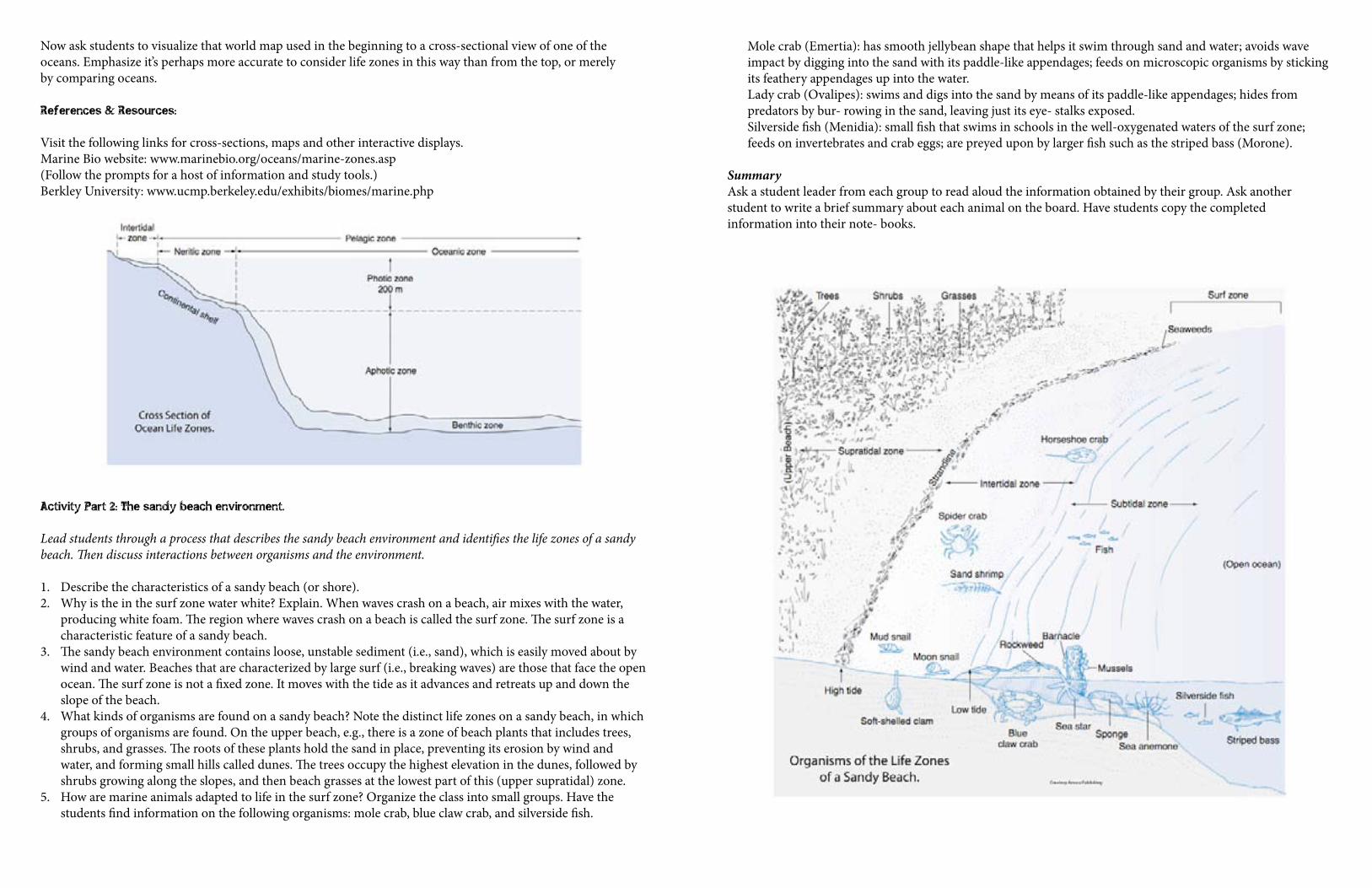
Now ask students to visualize that world map used in the beginning to a cross-sectional view of one of the oceans. Emphasize it’s perhaps more accurate to consider life zones in this way than from the top, or merely by comparing oceans.
References & Resources:
Visit the following links for cross-sections, maps and other interactive displays.Marine Bio website: www.marinebio.org/oceans/marine-zones.asp (Follow the prompts for a host of information and study tools.)Berkley University: www.ucmp.berkeley.edu/exhibits/biomes/marine.php
Activity Part 2: The sandy beach environment.
Lead students through a process that describes the sandy beach environment and identifies the life zones of a sandy beach. Then discuss interactions between organisms and the environment.
1. Describe the characteristics of a sandy beach (or shore). 2. Why is the in the surf zone water white? Explain. When waves crash on a beach, air mixes with the water,
producing white foam. The region where waves crash on a beach is called the surf zone. The surf zone is a characteristic feature of a sandy beach.
3. The sandy beach environment contains loose, unstable sediment (i.e., sand), which is easily moved about by wind and water. Beaches that are characterized by large surf (i.e., breaking waves) are those that face the open ocean. The surf zone is not a fixed zone. It moves with the tide as it advances and retreats up and down the slope of the beach.
4. What kinds of organisms are found on a sandy beach? Note the distinct life zones on a sandy beach, in which groups of organisms are found. On the upper beach, e.g., there is a zone of beach plants that includes trees, shrubs, and grasses. The roots of these plants hold the sand in place, preventing its erosion by wind and water, and forming small hills called dunes. The trees occupy the highest elevation in the dunes, followed by shrubs growing along the slopes, and then beach grasses at the lowest part of this (upper supratidal) zone.
5. How are marine animals adapted to life in the surf zone? Organize the class into small groups. Have the students find information on the following organisms: mole crab, blue claw crab, and silverside fish.
Mole crab (Emertia): has smooth jellybean shape that helps it swim through sand and water; avoids wave impact by digging into the sand with its paddle-like appendages; feeds on microscopic organisms by sticking its feathery appendages up into the water. Lady crab (Ovalipes): swims and digs into the sand by means of its paddle-like appendages; hides from predators by bur- rowing in the sand, leaving just its eye- stalks exposed. Silverside fish (Menidia): small fish that swims in schools in the well-oxygenated waters of the surf zone; feeds on invertebrates and crab eggs; are preyed upon by larger fish such as the striped bass (Morone).
Summary Ask a student leader from each group to read aloud the information obtained by their group. Ask another student to write a brief summary about each animal on the board. Have students copy the completed information into their note- books.
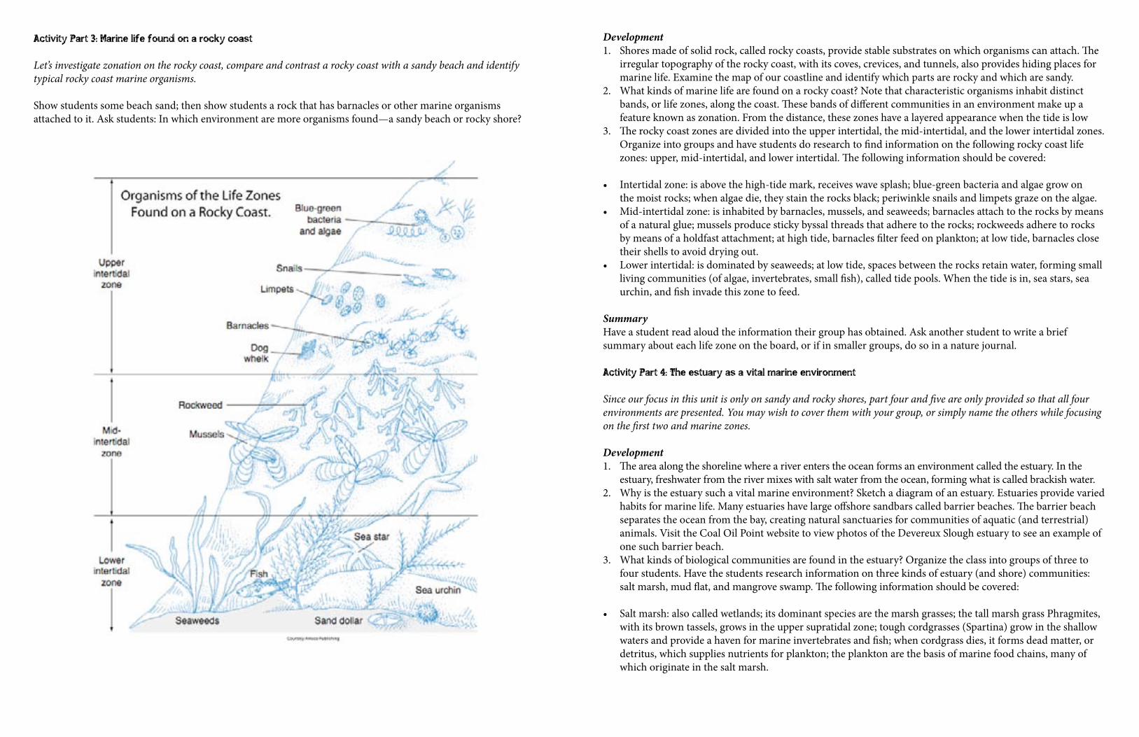
Activity Part 3: Marine life found on a rocky coast
Let’s investigate zonation on the rocky coast, compare and contrast a rocky coast with a sandy beach and identify typical rocky coast marine organisms.
Show students some beach sand; then show students a rock that has barnacles or other marine organisms attached to it. Ask students: In which environment are more organisms found—a sandy beach or rocky shore?
Development 1. Shores made of solid rock, called rocky coasts, provide stable substrates on which organisms can attach. The
irregular topography of the rocky coast, with its coves, crevices, and tunnels, also provides hiding places for marine life. Examine the map of our coastline and identify which parts are rocky and which are sandy.
2. What kinds of marine life are found on a rocky coast? Note that characteristic organisms inhabit distinct bands, or life zones, along the coast. These bands of different communities in an environment make up a feature known as zonation. From the distance, these zones have a layered appearance when the tide is low
3. The rocky coast zones are divided into the upper intertidal, the mid-intertidal, and the lower intertidal zones. Organize into groups and have students do research to find information on the following rocky coast life zones: upper, mid-intertidal, and lower intertidal. The following information should be covered:
• Intertidal zone: is above the high-tide mark, receives wave splash; blue-green bacteria and algae grow on the moist rocks; when algae die, they stain the rocks black; periwinkle snails and limpets graze on the algae.
• Mid-intertidal zone: is inhabited by barnacles, mussels, and seaweeds; barnacles attach to the rocks by means of a natural glue; mussels produce sticky byssal threads that adhere to the rocks; rockweeds adhere to rocks by means of a holdfast attachment; at high tide, barnacles filter feed on plankton; at low tide, barnacles close their shells to avoid drying out.
• Lower intertidal: is dominated by seaweeds; at low tide, spaces between the rocks retain water, forming small living communities (of algae, invertebrates, small fish), called tide pools. When the tide is in, sea stars, sea urchin, and fish invade this zone to feed.
Summary Have a student read aloud the information their group has obtained. Ask another student to write a brief summary about each life zone on the board, or if in smaller groups, do so in a nature journal.
Activity Part 4: The estuary as a vital marine environment
Since our focus in this unit is only on sandy and rocky shores, part four and five are only provided so that all four environments are presented. You may wish to cover them with your group, or simply name the others while focusing on the first two and marine zones.
Development 1. The area along the shoreline where a river enters the ocean forms an environment called the estuary. In the
estuary, freshwater from the river mixes with salt water from the ocean, forming what is called brackish water.2. Why is the estuary such a vital marine environment? Sketch a diagram of an estuary. Estuaries provide varied
habits for marine life. Many estuaries have large offshore sandbars called barrier beaches. The barrier beach separates the ocean from the bay, creating natural sanctuaries for communities of aquatic (and terrestrial) animals. Visit the Coal Oil Point website to view photos of the Devereux Slough estuary to see an example of one such barrier beach.
3. What kinds of biological communities are found in the estuary? Organize the class into groups of three to four students. Have the students research information on three kinds of estuary (and shore) communities: salt marsh, mud flat, and mangrove swamp. The following information should be covered:
• Salt marsh: also called wetlands; its dominant species are the marsh grasses; the tall marsh grass Phragmites, with its brown tassels, grows in the upper supratidal zone; tough cordgrasses (Spartina) grow in the shallow waters and provide a haven for marine invertebrates and fish; when cordgrass dies, it forms dead matter, or detritus, which supplies nutrients for plankton; the plankton are the basis of marine food chains, many of which originate in the salt marsh.
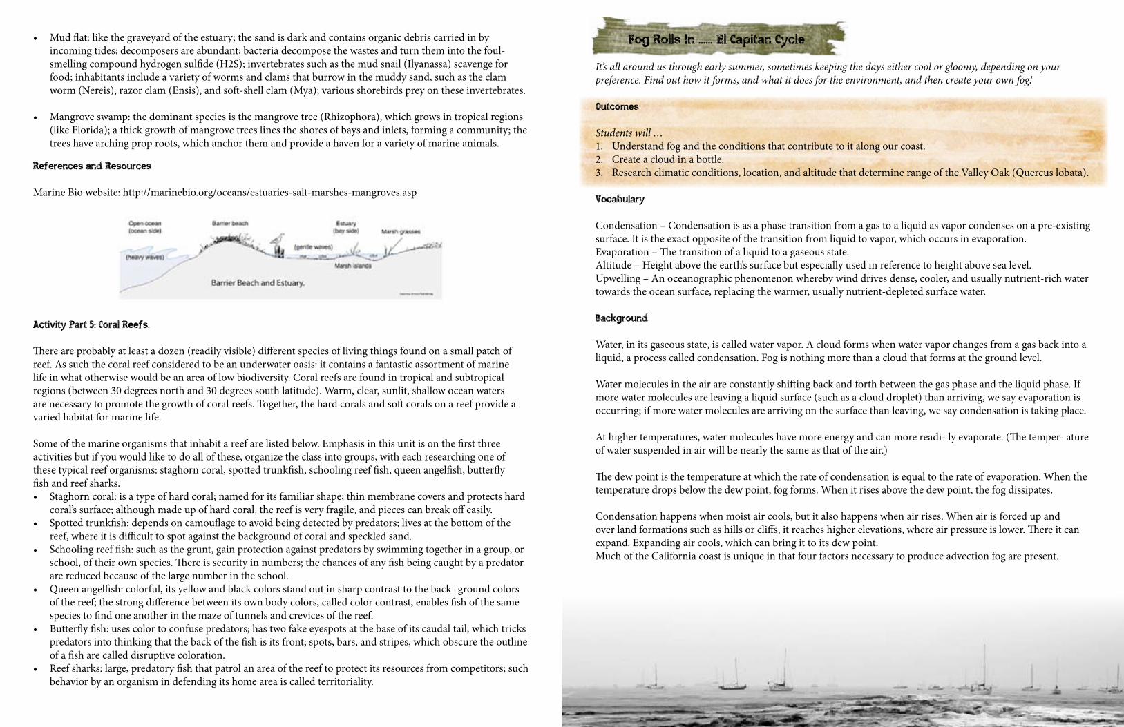
References and Resources
Marine Bio website: http://marinebio.org/oceans/estuaries-salt-marshes-mangroves.asp
Activity Part 5: Coral Reefs.
There are probably at least a dozen (readily visible) different species of living things found on a small patch of reef. As such the coral reef considered to be an underwater oasis: it contains a fantastic assortment of marine life in what otherwise would be an area of low biodiversity. Coral reefs are found in tropical and subtropical regions (between 30 degrees north and 30 degrees south latitude). Warm, clear, sunlit, shallow ocean waters are necessary to promote the growth of coral reefs. Together, the hard corals and soft corals on a reef provide a varied habitat for marine life.
Some of the marine organisms that inhabit a reef are listed below. Emphasis in this unit is on the first three activities but if you would like to do all of these, organize the class into groups, with each researching one of these typical reef organisms: staghorn coral, spotted trunkfish, schooling reef fish, queen angelfish, butterfly fish and reef sharks.• Staghorn coral: is a type of hard coral; named for its familiar shape; thin membrane covers and protects hard
coral’s surface; although made up of hard coral, the reef is very fragile, and pieces can break off easily.• Spotted trunkfish: depends on camouflage to avoid being detected by predators; lives at the bottom of the
reef, where it is difficult to spot against the background of coral and speckled sand. • Schooling reef fish: such as the grunt, gain protection against predators by swimming together in a group, or
school, of their own species. There is security in numbers; the chances of any fish being caught by a predator are reduced because of the large number in the school.
• Queen angelfish: colorful, its yellow and black colors stand out in sharp contrast to the back- ground colors of the reef; the strong difference between its own body colors, called color contrast, enables fish of the same species to find one another in the maze of tunnels and crevices of the reef.
• Butterfly fish: uses color to confuse predators; has two fake eyespots at the base of its caudal tail, which tricks predators into thinking that the back of the fish is its front; spots, bars, and stripes, which obscure the outline of a fish are called disruptive coloration.
• Reef sharks: large, predatory fish that patrol an area of the reef to protect its resources from competitors; such behavior by an organism in defending its home area is called territoriality.
• Mud flat: like the graveyard of the estuary; the sand is dark and contains organic debris carried in by incoming tides; decomposers are abundant; bacteria decompose the wastes and turn them into the foul-smelling compound hydrogen sulfide (H2S); invertebrates such as the mud snail (Ilyanassa) scavenge for food; inhabitants include a variety of worms and clams that burrow in the muddy sand, such as the clam worm (Nereis), razor clam (Ensis), and soft-shell clam (Mya); various shorebirds prey on these invertebrates.
• Mangrove swamp: the dominant species is the mangrove tree (Rhizophora), which grows in tropical regions (like Florida); a thick growth of mangrove trees lines the shores of bays and inlets, forming a community; the trees have arching prop roots, which anchor them and provide a haven for a variety of marine animals.
Fog Rolls In ...... El Capitan Cycle
It’s all around us through early summer, sometimes keeping the days either cool or gloomy, depending on your preference. Find out how it forms, and what it does for the environment, and then create your own fog!
Outcomes
Students will …1. Understand fog and the conditions that contribute to it along our coast. 2. Create a cloud in a bottle. 3. Research climatic conditions, location, and altitude that determine range of the Valley Oak (Quercus lobata).
Vocabulary
Condensation – Condensation is as a phase transition from a gas to a liquid as vapor condenses on a pre-existing surface. It is the exact opposite of the transition from liquid to vapor, which occurs in evaporation.Evaporation – The transition of a liquid to a gaseous state.Altitude – Height above the earth’s surface but especially used in reference to height above sea level.Upwelling – An oceanographic phenomenon whereby wind drives dense, cooler, and usually nutrient-rich water towards the ocean surface, replacing the warmer, usually nutrient-depleted surface water.
Background
Water, in its gaseous state, is called water vapor. A cloud forms when water vapor changes from a gas back into a liquid, a process called condensation. Fog is nothing more than a cloud that forms at the ground level.
Water molecules in the air are constantly shifting back and forth between the gas phase and the liquid phase. If more water molecules are leaving a liquid surface (such as a cloud droplet) than arriving, we say evaporation is occurring; if more water molecules are arriving on the surface than leaving, we say condensation is taking place.
At higher temperatures, water molecules have more energy and can more readi- ly evaporate. (The temper- ature of water suspended in air will be nearly the same as that of the air.)
The dew point is the temperature at which the rate of condensation is equal to the rate of evaporation. When the temperature drops below the dew point, fog forms. When it rises above the dew point, the fog dissipates.
Condensation happens when moist air cools, but it also happens when air rises. When air is forced up and over land formations such as hills or cliffs, it reaches higher elevations, where air pressure is lower. There it can expand. Expanding air cools, which can bring it to its dew point.Much of the California coast is unique in that four factors necessary to produce advection fog are present.
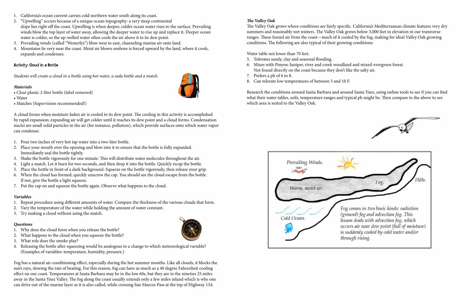
1. California’s ocean current carries cold northern water south along its coast.2. “Upwelling” occurs because of a unique ocean topography: a very steep continental
slope lies right off the coast. Upwelling is when deeper, colder ocean water rises to the surface. Prevailing winds blow the top layer of water away, allowing the deeper water to rise up and replace it. Deeper ocean water is colder, so the up-welled water often cools the air above it to its dew point.
3. Prevailing winds (called “Westerlys”) blow west to east, channeling marine air onto land.4. Mountains lie very near the coast. Moist air blown onshore is forced upward by the land, where it cools,
expands and condenses.
Activity: Cloud in a Bottle
Students will create a cloud in a bottle using hot water, a soda bottle and a match.
Materials•Clearplastic2-literbottle(labelremoved)•Water•Matches(Supervisionrecommended!)
A cloud forms when moisture-laden air is cooled to its dew point. The cooling in this activity is accomplished by rapid expansion; expanding air will get colder until it reaches its dew point and a cloud forms. Condensation nuclei are small solid particles in the air (for instance, pollution), which provide surfaces onto which water vapor can condense:
1. Pour two inches of very hot tap water into a two-liter bottle.2. Place your mouth over the opening and blow into it to ensure that the bottle is fully expanded.
Immediately seal the bottle tightly.3. Shake the bottle vigorously for one minute. This will distribute water molecules throughout the air.4. Light a match. Let it burn for two seconds, and then drop it into the bottle. Quickly recap the bottle.5. Place the bottle in front of a dark background. Squeeze on the bottle vigorously, then release your grip.6. When the cloud has formed, quickly unscrew the cap. You should see the cloud escape from the bottle.
If not, give the bottle a light squeeze.7. Put the cap on and squeeze the bottle again. Observe what happens to the cloud.
Variables1. Repeat procedure using different amounts of water. Compare the thickness of the various clouds that form.2. Vary the temperature of the water while holding the amount of water constant.3. Try making a cloud without using the match.
Questions1. Why does the cloud form when you release the bottle? 2. What happens to the cloud when you squeeze the bottle? 3. What role does the smoke play?4. Releasing the bottle after squeezing would be analogous to a change to which meteorological variable?
(Examples of variables: temperature, humidity, pressure.)
Fog has a natural air-conditioning effect, especially during the hot summer months. Like all clouds, it blocks the sun’s rays, slowing the rate of heating. For this reason, fog can have as much as a 40 degree Fahrenheit cooling effect on our coast. Temperatures at Santa Barbara may be in the low 60s, but they are in the nineties 25 miles away in the Santa Ynez Valley. The fog along the coast usually extends only a few miles inland which is why one can drive out of the marine layer as it is also called, while crossing San Marcos Pass at the top of Highway 154.
The Valley OakThe Valley Oak grows where conditions are fairly specific. California’s Mediterranean climate features very dry summers and reasonably wet winters. The Valley Oak grows below 3,000 feet in elevation in our transverse ranges. These funnel air from the coast—much of it cooled by the fog, making for ideal Valley Oak growing conditions. The following are also typical of their growing conditions:
Water table not lower than 70 feet.5. Tolerates sandy, clay and seasonal flooding.6. Mixes with Pinyon-Juniper, river and creek woodland and mixed-evergreen forest.
Not found directly on the coast because they don’t like the salty air.7. Prefers a ph of 6 to 8.8. Can tolerate low temperatures of between 5 and 10 F.
Research the conditions around Santa Barbara and around Santa Ynez, using online tools to see if you can find what their water tables, soils, temperature ranges and typical ph might be. Then compare to the above to see which area is suited to the Valley Oak.
Symbiotic Relationships ...... Nojoqui Falls Cycle
A variety of symbiotic relationships play out around us in everyday places. Learn more about these, and how the Acorn Woodpecker, Sycamore and Oak trees, Mistletoe and Lace Lichen share and enhance the environment at Nojoqui Falls.
Outcomes
Students will …1. Discover which plants and animals have symbiotic relationships and how this impacts each organism.2. Explore the advantages and disadvantages of different types of symbiosis.3. Learn how the Acorn Woodpecker relies on sycamore trees for nesting, on oaks for food and on other
woodpeckers for reproduction.4. Investigate the lives of Spanish Moss and Mistletoe, learning which categories of symbiosis each falls into.
Vocabulary
Commensalisms – A relationship between two kinds of organisms in which one obtains food or benefits from another without either inflicting damage, or benefiting it in return.Mutualism – A symbiotic relationship between individuals of different species in which both individuals benefit from the association.Parasitism – The relationship between two different kinds of organisms in which one receives benefits from the other by causing damage to it. Symbiosis – The living together of two dissimilar organisms.
Background
Acorn WoodpeckerThis well-named bird collects acorns and in autumn stores the crop tightly tucked into individual holes so that squirrels can’t pry them out. The storage trees at Nojoqui Falls are usually mature or dead sycamores and oak trees. The birds themselves are very gregarious and the acorn holes are made and shared by a colony year after year. Acorns seem to be emergency provisions; the woodpeckers will also catch flying insects and eat grubs that are attracted to the stowed acorns.
The Acorn Woodpecker has a black back and chest, white belly with black lateral stripes, white rump, and white wing-patches. Its head is patterned in a distinctive pattern, having a white forehead and yellowish to white throat. It is black about the bill with a stripe of black surrounding the eyes and running down to join the black of the nape and back. White irises make its eyes prominent. The crown of the male is red, the female black and red.
Acorn Woodpeckers’ habitat is oak country where these trees are interspersed with other tree species. They are more common where different species of oak occur.The birds have a complex social structure, living in family groups of up to a dozen or more, together drilling meticulous holes in dead snags, utility poles, or buildings. They work on their ‘storage bins’ continuously over the years, and trees may have up to 50,000 holes! All members of the group defend the granaries, which would serve as the food-cache of a lifetime for many animals. Colonies typically have a primary granary and one or more secondary ones.
Despite spending so much time gathering acorns, this only makes up about half of their diet—mostly during the winter. They also eat sap from holes, fruit, flower nectar, seeds, and insects.
Each group of woodpeckers has from one to seven breeding males and one to three breeding females. The rest of the group do not breed but help raise the young. Demonstrating real teamwork, all of the eggs are laid in a single nest, which is excavated by both breeders and helpers. Each female can lay up to five eggs, but clutches made up of eggs from more than one laying female have had up to 17 eggs.
This introduces understandable competition—if several breeding females are working together, a bird may destroy another’s eggs before laying her own. All group members help incubate, brood and feed the young.
MistletoeThe oak mistletoe (Phoradendron villosum) found in California has male plants that produce only pollen, and female plants that produce flowers and fleshy, white seedpods. Each pod is filled with a sticky fluid and one seed covered with a tough membrane. Seeds mature in the winter, which is when birds eat the fruit. Birds digest all but the seed, which is then defecated onto tree branches.
Thus Mistletoe is a parasitic shrub that grows on the branches of other trees—most typically sycamores at Nojoqui Falls Park. The stems are green with smooth-edged, oval evergreen leaves. The fruit appears as white or yellowish berries in small, dense clusters and it takes years for mistletoe to grow large enough to begin producing seeds and fruit.
The stems and leaves are toxic, causing acute gastrointestinal problems when ingested, along with diarrhea and a low heart rate. These same toxins however have been used for a wide range of medicinal purposes and pharmaceuticals.
Mistletoe is typically known as a parasite because it grows on the stems of trees, drawing water and minerals from the host. The haustoria in mistletoe penetrate the water-conducting tissue or xylum of the trees to intercept water flowing to its leaves. They also infiltrate between the cells where they absorb nutrients. Mistletoe is however capable of photosynthesis and uses this process to provide most of its sugars, despite drawing surgars from the host in its early life stages.
Photosynthesis (wiki-commons)
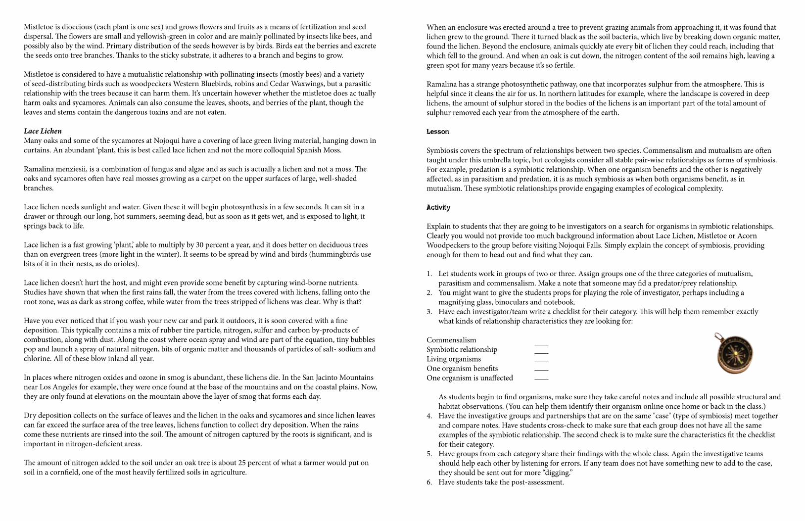
Mistletoe is dioecious (each plant is one sex) and grows flowers and fruits as a means of fertilization and seed dispersal. The flowers are small and yellowish-green in color and are mainly pollinated by insects like bees, and possibly also by the wind. Primary distribution of the seeds however is by birds. Birds eat the berries and excrete the seeds onto tree branches. Thanks to the sticky substrate, it adheres to a branch and begins to grow.
Mistletoe is considered to have a mutualistic relationship with pollinating insects (mostly bees) and a variety of seed-distributing birds such as woodpeckers Western Bluebirds, robins and Cedar Waxwings, but a parasitic relationship with the trees because it can harm them. It’s uncertain however whether the mistletoe does ac tually harm oaks and sycamores. Animals can also consume the leaves, shoots, and berries of the plant, though the leaves and stems contain the dangerous toxins and are not eaten.
Lace LichenMany oaks and some of the sycamores at Nojoqui have a covering of lace green living material, hanging down in curtains. An abundant ‘plant, this is best called lace lichen and not the more colloquial Spanish Moss.
Ramalina menziesii, is a combination of fungus and algae and as such is actually a lichen and not a moss. The oaks and sycamores often have real mosses growing as a carpet on the upper surfaces of large, well-shaded branches.
Lace lichen needs sunlight and water. Given these it will begin photosynthesis in a few seconds. It can sit in a drawer or through our long, hot summers, seeming dead, but as soon as it gets wet, and is exposed to light, it springs back to life.
Lace lichen is a fast growing ‘plant,’ able to multiply by 30 percent a year, and it does better on deciduous trees than on evergreen trees (more light in the winter). It seems to be spread by wind and birds (hummingbirds use bits of it in their nests, as do orioles).
Lace lichen doesn’t hurt the host, and might even provide some benefit by capturing wind-borne nutrients. Studies have shown that when the first rains fall, the water from the trees covered with lichens, falling onto the root zone, was as dark as strong coffee, while water from the trees stripped of lichens was clear. Why is that?
Have you ever noticed that if you wash your new car and park it outdoors, it is soon covered with a fine deposition. This typically contains a mix of rubber tire particle, nitrogen, sulfur and carbon by-products of combustion, along with dust. Along the coast where ocean spray and wind are part of the equation, tiny bubbles pop and launch a spray of natural nitrogen, bits of organic matter and thousands of particles of salt- sodium and chlorine. All of these blow inland all year.
In places where nitrogen oxides and ozone in smog is abundant, these lichens die. In the San Jacinto Mountains near Los Angeles for example, they were once found at the base of the mountains and on the coastal plains. Now, they are only found at elevations on the mountain above the layer of smog that forms each day.
Dry deposition collects on the surface of leaves and the lichen in the oaks and sycamores and since lichen leaves can far exceed the surface area of the tree leaves, lichens function to collect dry deposition. When the rains come these nutrients are rinsed into the soil. The amount of nitrogen captured by the roots is significant, and is important in nitrogen-deficient areas.
The amount of nitrogen added to the soil under an oak tree is about 25 percent of what a farmer would put on soil in a cornfield, one of the most heavily fertilized soils in agriculture.
When an enclosure was erected around a tree to prevent grazing animals from approaching it, it was found that lichen grew to the ground. There it turned black as the soil bacteria, which live by breaking down organic matter, found the lichen. Beyond the enclosure, animals quickly ate every bit of lichen they could reach, including that which fell to the ground. And when an oak is cut down, the nitrogen content of the soil remains high, leaving a green spot for many years because it’s so fertile.
Ramalina has a strange photosynthetic pathway, one that incorporates sulphur from the atmosphere. This is helpful since it cleans the air for us. In northern latitudes for example, where the landscape is covered in deep lichens, the amount of sulphur stored in the bodies of the lichens is an important part of the total amount of sulphur removed each year from the atmosphere of the earth.
Lesson
Symbiosis covers the spectrum of relationships between two species. Commensalism and mutualism are often taught under this umbrella topic, but ecologists consider all stable pair-wise relationships as forms of symbiosis. For example, predation is a symbiotic relationship. When one organism benefits and the other is negatively affected, as in parasitism and predation, it is as much symbiosis as when both organisms benefit, as in mutualism. These symbiotic relationships provide engaging examples of ecological complexity.
Activity
Explain to students that they are going to be investigators on a search for organisms in symbiotic relationships. Clearly you would not provide too much background information about Lace Lichen, Mistletoe or Acorn Woodpeckers to the group before visiting Nojoqui Falls. Simply explain the concept of symbiosis, providing enough for them to head out and find what they can.
1. Let students work in groups of two or three. Assign groups one of the three categories of mutualism, parasitism and commensalism. Make a note that someone may fid a predator/prey relationship.
2. You might want to give the students props for playing the role of investigator, perhaps including a magnifying glass, binoculars and notebook.
3. Have each investigator/team write a checklist for their category. This will help them remember exactly what kinds of relationship characteristics they are looking for:
Commensalism Symbiotic relationship Living organisms One organism benefits One organism is unaffected
As students begin to find organisms, make sure they take careful notes and include all possible structural and habitat observations. (You can help them identify their organism online once home or back in the class.)
4. Have the investigative groups and partnerships that are on the same "case" (type of symbiosis) meet together and compare notes. Have students cross-check to make sure that each group does not have all the same examples of the symbiotic relationship. The second check is to make sure the characteristics fit the checklist for their category.
5. Have groups from each category share their findings with the whole class. Again the investigative teams should help each other by listening for errors. If any team does not have something new to add to the case, they should be sent out for more “digging.”
6. Have students take the post-assessment.
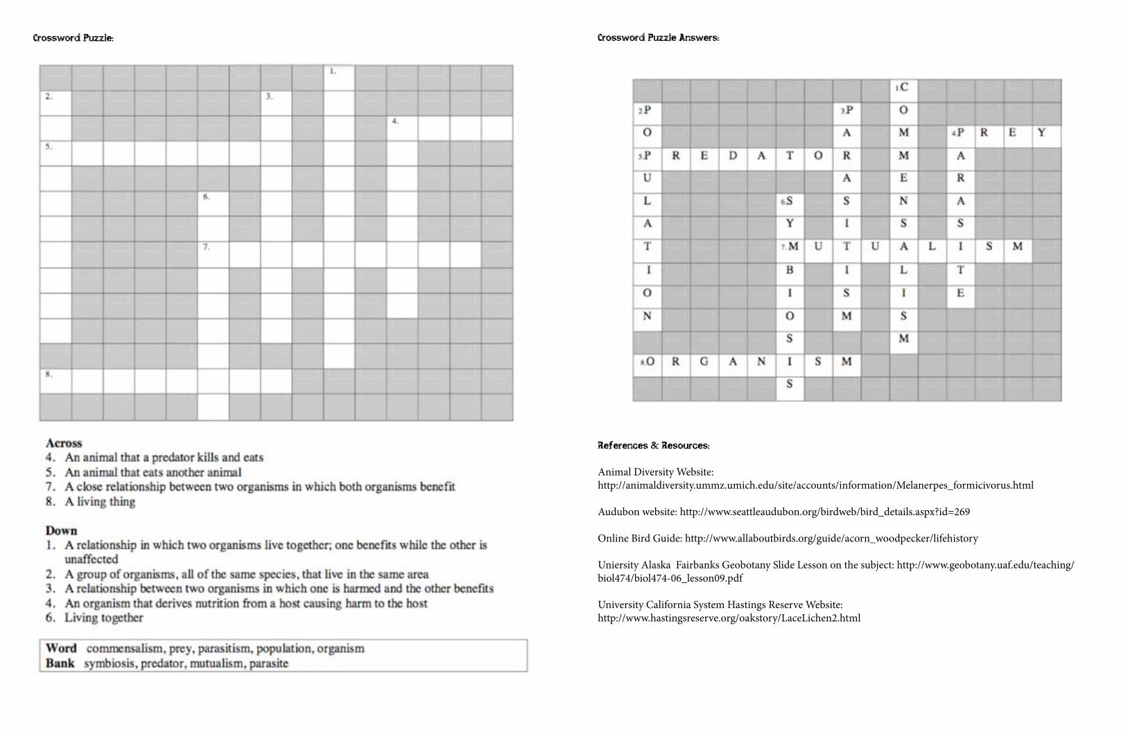
Crossword Puzzle:
Crossword Puzzle Answers:
References & Resources:
Animal Diversity Website: http://animaldiversity.ummz.umich.edu/site/accounts/information/Melanerpes_formicivorus.html
Audubon website: http://www.seattleaudubon.org/birdweb/bird_details.aspx?id=269
Online Bird Guide: http://www.allaboutbirds.org/guide/acorn_woodpecker/lifehistory
Uniersity Alaska Fairbanks Geobotany Slide Lesson on the subject: http://www.geobotany.uaf.edu/teaching/biol474/biol474-06_lesson09.pdf
University California System Hastings Reserve Website:http://www.hastingsreserve.org/oakstory/LaceLichen2.html
Sustainable Agriculture ...... Santa Ynez River Cycle
‘Journey’ through an understanding of sustainable agriculture, and what sets it apart from regular agriculture. Pay an online visit to a vineyard along Santa Rosa Road that practices sustainable agriculture, showing you what thy do via video. Note: This lesson could be divided into two parts with the second part focusing on systems with attention given to outcomes 4, 5 and 6.
Outcomes
Students will …1. Be able to define the term “sustainable”2. Distinguish between the aims and practices used to achieve the goals of sustainable agriculture
and sustainable food systems.3. Demonstrate awareness of economic, environmental, and community impacts of agriculture.4. Know ways that agro-ecosystems function to support sustainable agriculture.5. Know the parts of a local food system.6. Be able to give examples of practices used in sustainable agriculture, such as organic production, crop
rotation, rotational grazing, value-added marketing, and natural habitat restoration.
Vocabulary
Sustainable agriculture – Farming that is profitable, environmentally sound, and beneficial to both family and community.Goal – A desired end.Practice – An action to achieve a goal.Off-farm – From outside the farm.Organic – A set of production practices that rely on minimal use of off-farm inputs and aim to restore, maintain, or enhance the ecological systems that benefit agriculture.System – An interdependent group of items forming a unified whole.Ecosystem – The interactions of energy, the physical environment, and living organisms.Agro-ecosystem – An ecosystem that is managed to produce food or fiber.Food system – The system that produces, processes, distributes, and consumes food.Value-added marketing: a type of marketing that improves the price received by the producer.Value-added product – A product with a better price because of special attributes.Habitat restoration – Recreation of a desirable (often native) natural habitat.
Section A:
Background: What is Sustainable Agriculture?In the words of one farmer, sustainable agriculture is a journey rather than a destination. The word “sustainable” comes from the word “sustain” which means to maintain, support, or to endure. People involved in sustainable agriculture are trying to identify and solve the problems in our current agricultural system in order to provide food and fiber in a healthy environment for people over the long term. No one has developed a fully sustainable method of agriculture, but many are working at improving current practices.
The Three Legs of SustainabilityWhat happens if one of the legs breaks on a three-legged stool breaks, or one leg is missing entirely? The stool won’t stand. The three legs are the economic, environmental, and social impacts of agriculture. If our agricultural system has unacceptable impacts in any one of these spheres, it can’t support producers and contribute to the community over the long term.
In other words, sustainable agriculture must provide a fair and reasonably secure living for farm families and their workers, it should minimize harm to the natural environment and it should maintain the good health of basic natural resources such as soil, water and air. It should also support viable rural communities and fair treatment of all people involved in the food system, from farm workers to consumers.
The 1990 Farm Bill defines sustainable agriculture as:An integrated system of plant and animal production practices having a site-specific application that will, over the long term:
1. Satisfy human food and fiber needs.2. Enhance environmental quality and the natural resource base upon which the agricultural economy depends.3. Make the most efficient use of nonrenewable resources and on-farm resources and integrate, where
appropriate, natural biological cycles and controls.4. Sustain the economic viability of farm operations.5. Enhance the quality of life for farmers and society as a whole. Goals versus PracticesProfitable economics, healthy environment, and vital communities are all goals. This is what we trying to achieve. Practices are actions we take to achieve those goals. With that in mind, consider this question: Why don’t we define sustainable agriculture in terms of practices?
There are two important reasons: First, we expect that our knowledge will increase in the future, so practices used now may not be considered the best practices ten years from now. Second, the effect of a practice can vary enormously depending on how and where it is performed. For example, plowing on a steep hillside is unsustainable because it causes too much soil erosion. However, occasional plowing on level ground can be a sustainable tool for some cropping systems.
In order to attain our goals, we need to take certain actions, or follow certain practices. Examples of sustainable practices include crop rotation, riparian buffer strips, rotational grazing, and direct marketing. These are not all the possible practices and if they don’t help us achieve our goals, they are not sustainable, no matter the practice.
Activity: Understanding Goals & Practices
10 minutes: Divide class into small groups of three or four students. Ask each student to write down a goal they have and list the steps they can take to reach it. Next, assign one person to take notes for the group and be the reporter. Have each person share his or her answers in the small group. Talk about how everyone’s tools and steps are unique to their goal. Have each small group report their findings back to the whole class.
5 minutes: Have each student write down a goal they have and list the steps they can take or tools they can use to reach it. Then have each student turn to their neighbor and discuss how the steps and tools are unique to each person’s goal. Invite a few students to share their examples with the whole group.
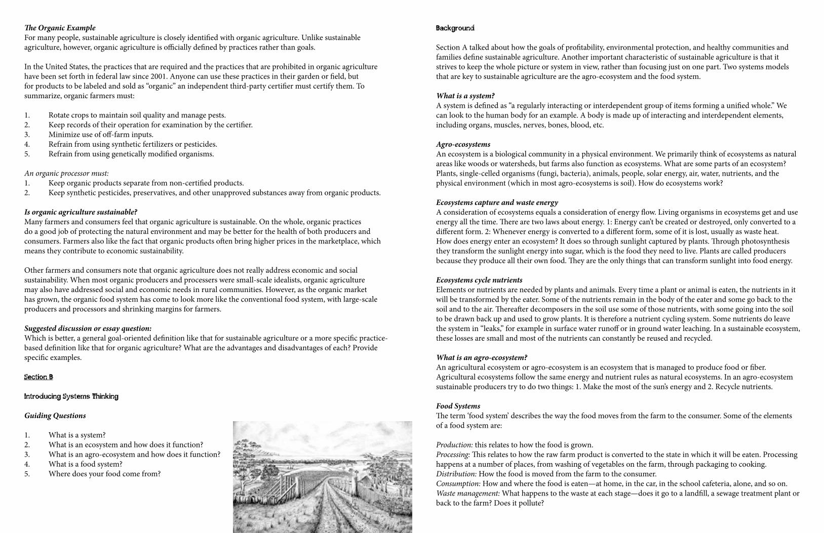
The Organic ExampleFor many people, sustainable agriculture is closely identified with organic agriculture. Unlike sustainable agriculture, however, organic agriculture is officially defined by practices rather than goals.
In the United States, the practices that are required and the practices that are prohibited in organic agriculture have been set forth in federal law since 2001. Anyone can use these practices in their garden or field, but for products to be labeled and sold as “organic” an independent third-party certifier must certify them. To summarize, organic farmers must:
1. Rotate crops to maintain soil quality and manage pests. 2. Keep records of their operation for examination by the certifier.3. Minimize use of off-farm inputs.4. Refrain from using synthetic fertilizers or pesticides.5. Refrain from using genetically modified organisms. An organic processor must:1. Keep organic products separate from non-certified products.2. Keep synthetic pesticides, preservatives, and other unapproved substances away from organic products.
Is organic agriculture sustainable?Many farmers and consumers feel that organic agriculture is sustainable. On the whole, organic practices do a good job of protecting the natural environment and may be better for the health of both producers and consumers. Farmers also like the fact that organic products often bring higher prices in the marketplace, which means they contribute to economic sustainability.
Other farmers and consumers note that organic agriculture does not really address economic and social sustainability. When most organic producers and processers were small-scale idealists, organic agriculture may also have addressed social and economic needs in rural communities. However, as the organic market has grown, the organic food system has come to look more like the conventional food system, with large-scale producers and processors and shrinking margins for farmers.
Suggested discussion or essay question: Which is better, a general goal-oriented definition like that for sustainable agriculture or a more specific practice-based definition like that for organic agriculture? What are the advantages and disadvantages of each? Provide specific examples.
Section B
Introducing Systems Thinking
Guiding Questions
1. What is a system?2. What is an ecosystem and how does it function?3. What is an agro-ecosystem and how does it function?4. What is a food system?5. Where does your food come from?
Background
Section A talked about how the goals of profitability, environmental protection, and healthy communities and families define sustainable agriculture. Another important characteristic of sustainable agriculture is that it strives to keep the whole picture or system in view, rather than focusing just on one part. Two systems models that are key to sustainable agriculture are the agro-ecosystem and the food system.
What is a system?A system is defined as “a regularly interacting or interdependent group of items forming a unified whole.” We can look to the human body for an example. A body is made up of interacting and interdependent elements, including organs, muscles, nerves, bones, blood, etc.
Agro-ecosystemsAn ecosystem is a biological community in a physical environment. We primarily think of ecosystems as natural areas like woods or watersheds, but farms also function as ecosystems. What are some parts of an ecosystem? Plants, single-celled organisms (fungi, bacteria), animals, people, solar energy, air, water, nutrients, and the physical environment (which in most agro-ecosystems is soil). How do ecosystems work?
Ecosystems capture and waste energyA consideration of ecosystems equals a consideration of energy flow. Living organisms in ecosystems get and use energy all the time. There are two laws about energy. 1: Energy can’t be created or destroyed, only converted to a different form. 2: Whenever energy is converted to a different form, some of it is lost, usually as waste heat. How does energy enter an ecosystem? It does so through sunlight captured by plants. Through photosynthesis they transform the sunlight energy into sugar, which is the food they need to live. Plants are called producers because they produce all their own food. They are the only things that can transform sunlight into food energy.
Ecosystems cycle nutrientsElements or nutrients are needed by plants and animals. Every time a plant or animal is eaten, the nutrients in it will be transformed by the eater. Some of the nutrients remain in the body of the eater and some go back to the soil and to the air. Thereafter decomposers in the soil use some of those nutrients, with some going into the soil to be drawn back up and used to grow plants. It is therefore a nutrient cycling system. Some nutrients do leave the system in “leaks,” for example in surface water runoff or in ground water leaching. In a sustainable ecosystem, these losses are small and most of the nutrients can constantly be reused and recycled.
What is an agro-ecosystem?An agricultural ecosystem or agro-ecosystem is an ecosystem that is managed to produce food or fiber. Agricultural ecosystems follow the same energy and nutrient rules as natural ecosystems. In an agro-ecosystem sustainable producers try to do two things: 1. Make the most of the sun’s energy and 2. Recycle nutrients.
Food SystemsThe term ‘food system’ describes the way the food moves from the farm to the consumer. Some of the elements of a food system are:
Production: this relates to how the food is grown.Processing: This relates to how the raw farm product is converted to the state in which it will be eaten. Processing happens at a number of places, from washing of vegetables on the farm, through packaging to cooking.Distribution: How the food is moved from the farm to the consumer.Consumption: How and where the food is eaten—at home, in the car, in the school cafeteria, alone, and so on.Waste management: What happens to the waste at each stage—does it go to a landfill, a sewage treatment plant or back to the farm? Does it pollute?
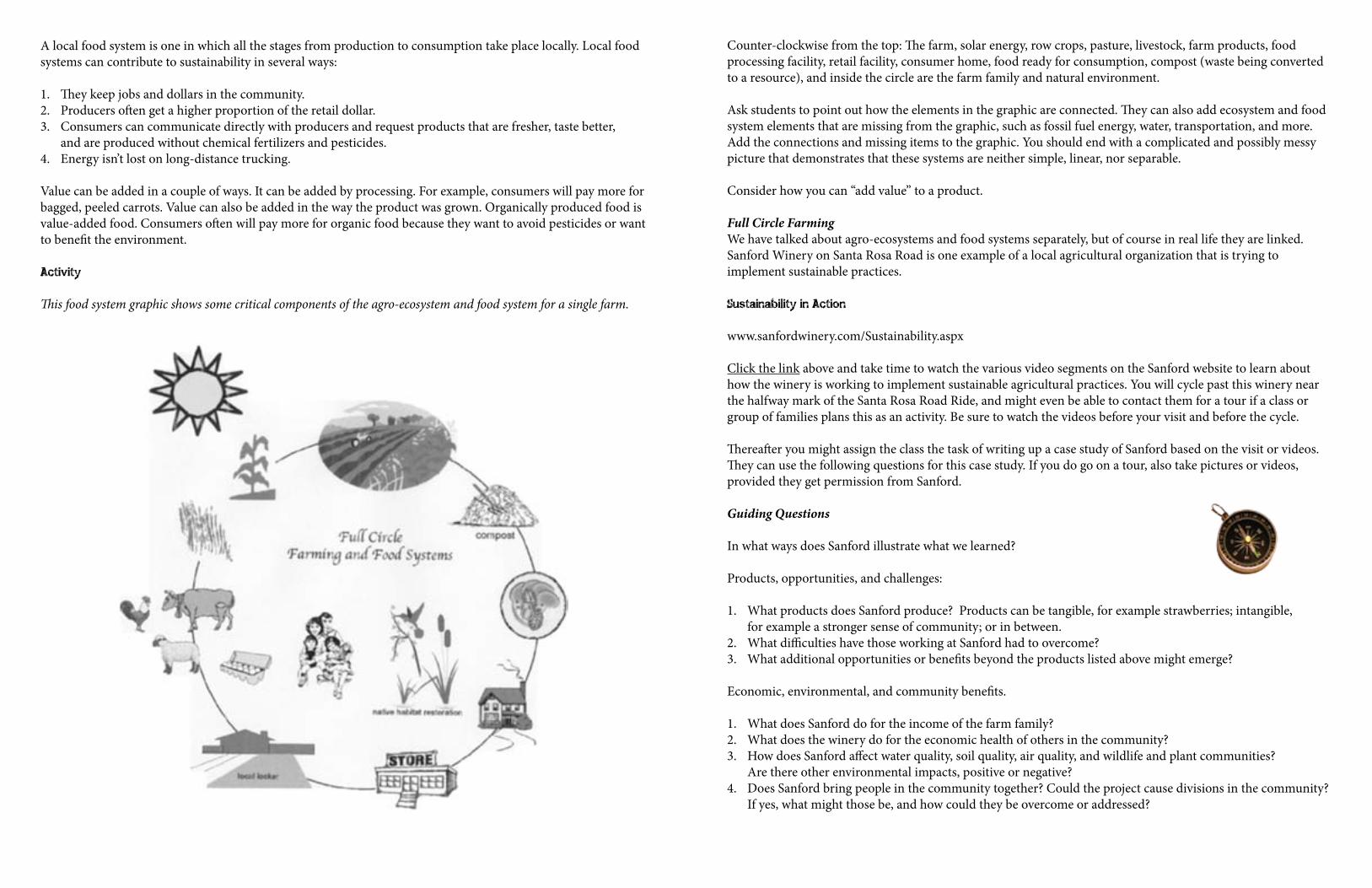
A local food system is one in which all the stages from production to consumption take place locally. Local food systems can contribute to sustainability in several ways:
1. They keep jobs and dollars in the community.2. Producers often get a higher proportion of the retail dollar.3. Consumers can communicate directly with producers and request products that are fresher, taste better,
and are produced without chemical fertilizers and pesticides.4. Energy isn’t lost on long-distance trucking.
Value can be added in a couple of ways. It can be added by processing. For example, consumers will pay more for bagged, peeled carrots. Value can also be added in the way the product was grown. Organically produced food is value-added food. Consumers often will pay more for organic food because they want to avoid pesticides or want to benefit the environment.
Activity
This food system graphic shows some critical components of the agro-ecosystem and food system for a single farm.
Counter-clockwise from the top: The farm, solar energy, row crops, pasture, livestock, farm products, food processing facility, retail facility, consumer home, food ready for consumption, compost (waste being converted to a resource), and inside the circle are the farm family and natural environment.
Ask students to point out how the elements in the graphic are connected. They can also add ecosystem and food system elements that are missing from the graphic, such as fossil fuel energy, water, transportation, and more. Add the connections and missing items to the graphic. You should end with a complicated and possibly messy picture that demonstrates that these systems are neither simple, linear, nor separable.
Consider how you can “add value” to a product.
Full Circle FarmingWe have talked about agro-ecosystems and food systems separately, but of course in real life they are linked.Sanford Winery on Santa Rosa Road is one example of a local agricultural organization that is trying to implement sustainable practices.
Sustainability in Action
www.sanfordwinery.com/Sustainability.aspx
Click the link above and take time to watch the various video segments on the Sanford website to learn about how the winery is working to implement sustainable agricultural practices. You will cycle past this winery near the halfway mark of the Santa Rosa Road Ride, and might even be able to contact them for a tour if a class or group of families plans this as an activity. Be sure to watch the videos before your visit and before the cycle.
Thereafter you might assign the class the task of writing up a case study of Sanford based on the visit or videos. They can use the following questions for this case study. If you do go on a tour, also take pictures or videos, provided they get permission from Sanford.
Guiding Questions
In what ways does Sanford illustrate what we learned?
Products, opportunities, and challenges:
1. What products does Sanford produce? Products can be tangible, for example strawberries; intangible, for example a stronger sense of community; or in between.
2. What difficulties have those working at Sanford had to overcome? 3. What additional opportunities or benefits beyond the products listed above might emerge?
Economic, environmental, and community benefits.
1. What does Sanford do for the income of the farm family? 2. What does the winery do for the economic health of others in the community? 3. How does Sanford affect water quality, soil quality, air quality, and wildlife and plant communities?
Are there other environmental impacts, positive or negative? 4. Does Sanford bring people in the community together? Could the project cause divisions in the community?
If yes, what might those be, and how could they be overcome or addressed?
CreatingCreate and present your own sustainable enterprise; Design and present your own farm agro-ecosystem, processing venture, or local food system after researching the sustainable agriculture project ideas in the Resources section below. Or evaluate and present one of the 48 case study enterprises from the New American Farmer—available in PDF format here.
Remember that sustainable agriculture and food systems utilize ecologically sound practices to create value-added products for markets that improve local community economies and quality of life. So your sustainable enterprise could be about growing, processing, or developing a value-added product, creating a community-based food project, or restoring natural resource and ecological systems that support farming and food systems.
1. Give each team 30 or more minutes to research the project idea or case study on the suggested web sites, the links on those web sites, and other resources in your classroom, library, or community.
2. Give each team 10 or more minutes to prepare their report.3. Have each team present a 5 to 10-minute report on their project idea or case study to the class.4. Encourage at least 3 questions from the audience for each team presentation.
References and Resources:
1. Plant buffer strips and other natural habitat to protect water quality. •NRCSBufferStripInitiative:http://www.nhq.nrcs.usda.gov/CCS/Buffers.html•FarmBureau’sAgandtheEnvironment Program: http://www.agandenvironment.com/ffa_grant.htm
2. Work with a local fruit and vegetable farmer to grow and or process food for your school cafeteria.3. Grow and market certified organic crops or meats.4. Raise and market pasture or free-range poultry.
•AmericanPasturedPoultryProducersAssociation:http://www.apppa.org •PasturedPoultryAppropriateTechnologyTransferforRuralAreas(ATTRA) •http://www.attra.ncat.org/attra-pub/poultryoverview.html:SeealsotheATTRAhomepage •http://www.attra.orgor1800-346-9140 •SAREpublication“ProfitablePoultry”:http://www.sare.org/bulletin/poultry/ •OrganicPoultryResourceManual:http://www.iowaagopportunity.org/poultry/poultrymanual.html
5. Help start a community garden in your town. •StartingaCommunityGarden.AmericanCommunityGardeningAssociation:www.communitygarden.org
6. Plant or restore a native area for habitat and/or seed production.
Part IV Lessons for the Rambling Section
Owl Food Chain ...... El Capitan Ramble
To introduce students to the idea that energy is passed from one organism to the next in a food chain, helping them understand the predator/prey relationship by researching a specific bird and what it eats to survive.
Outcomes
Students will …1. Learn that animals eat other animals and plants to survive. 2. Examine these complex relationships in a more in-depth manner, beginning to understand them in the
context of their own environment.
Vocabulary
Pellets – Undigested remains of an owl’s food that is regurgitated.Trophic level – A position in a food chain that is occupied by a number of organisms that feed in a similar way. The Red-Tailed Hawk, although diurnal, occupies the same trophic level as a nocturnal Great Horned Owl. Food web – A food web is many food chains linked together to show a more accurate model of all possible feeding relationships of organisms in an ecosystem.Talons – a raptor’s claws, used for grabbing their prey and tearing it apart.Nocturnal – Active at night.Regurgitate – Cough up or bring up.Competitor – An organism that competes for the same food source. Two different species of owls might be competitors. (The Great Horned Owl will hunt other owls.)
Background
Many students have difficulty understanding that energy flows from one organism to another. Students understand that animals eat each other or plants. They also understand that animals need non-living things like water, space, and shelter to survive. But it’s more challenging to understand that when an organism dies, this energy is transferred back to the ecosystem to be reused and/or that some of it is lost in the process.
Most students have studied plants and have been introduced to the idea that plants make their own food. They have been told that all energy initially comes from the sun. Some students are capable of writing the formula for photosynthesis but many have no idea how this is possible, nor do they see its relevance to their daily lives.
This lesson will show that owls eat rodents, needing this energy to survive. Owls excrete the parts of the rodent that they are unable to digest, leading students to infer that they are recycled in the soil. Using commercial owl pellets, students can try to identify the type of rodent eaten by the owl. Students are capable of creating a food chain based on prior knowledge: Owl-vole-grain or seeds-sun.
Attention should be drawn to the transfer of energy that occurs as one organism eats another. It is important that students learn the differences between how plants and animals obtain food, and from it the energy they need.
At this point, the teacher has the option of discussing one food chain or creating a food web using other animals that might live in the forest.
Activity
Materials
Owl pellets (See www.pellet.com or www.acornnaturalists.com)Vole transparency (See www.pellet.com/view_product.aspx?categoryID=1&subcategoryID=3) Recycled egg cartonToothpicksLarge white glueAluminum foil5" X 8" index card, no linesFine black felt tip markerOwl Research Notes student sheet
Development
Ask the following questions:• Haveyoueverbeencampingatnight?• Whatsoundsdidyouhear?• Wereyouafraid?• Whatdoyouknowaboutowls?• Whatspeciesofowlsliveinourarea?WhatspeciesliveinNorthAmerica?• Haveyouheardanowlnearbyatnight?
Encourage a lively discussion that will allow you to assess what the students already know about owls. After going over the above questions, brainstorm a class list of possible food sources for an owl that might live in one of our local ecosystems like oak woodland.
Ask students: Can you estimate the number of small mammals an owl might eat in one day? How about one week? Is an owl harmful or helpful to man? How?
Researching an owl
Before students work with the owl pellets, they will conduct some research on owls to gain more knowledge about them. The following activity can be done by individuals or by students working in pairs. Provide each
student (or pair of students) with a copy of the owl research sheet. Each student or pair can research the Great Horned Owl, or the teacher can research which owls
are found in our area, and allocate an owl to each student. The Great Horned Owl, Barn Owl, Western Screech Owl and Spotted Owl are a few examples.
The Owls of North America page on The Owl Pages website is useful for research on most species but you can also use a field guide. Create a research timeline for the students. Students can report orally on their research or hand in the worksheet.
Recreating the skeleton of a small mammal from an owl pellet
1. Instruct students to unwrap the pellet from the aluminum foil. 2. Students should carefully tease the bones from the fur using toothpicks.3. Tell students to sort the bones into sections of egg cartons for safe storage and future classification.
Make sure students label the top of the egg carton with the their names and period. (Sorting may take a few periods or sessions, gluing and identification of bones another couple as well.)
4. Students should use the vole skeleton model to arrange the bones on a large index card.5. Then, students should glue the bones in place and label them. Students may "trade" bones with other students
to complete their skeleton. Any bones that may be missing can be drawn in using a fine tip black marker. 6. Turn in the completed skeleton for evaluation.
Summary and Evaluation
Have students analyze the bone structure of the skeleton, and try to identify the small mammal that was eaten by the owl to survive. List all food possibly eaten by that small mammal for energy. Where does the energy in the food come from? What happens to the energy when the owl dies? Have students construct a food web for the ecosystem using words or pictures.
References and Resources
Online field guide: www.enature.com/fieldguides Science Netlinks: www.sciencenetlinks.com
Contact Eyes in the Sky through Santa Barbara Audubon for a live Great Horned Owl demonstration: www.santabarbaraaudubon.org/sbasbop.html
Owl research sheet follows below ...
Owl Research Notes
Name: Date:
Common Name of Owl
Scientific Name
Physical Appearance:
Height
Weight
Wing Span
Eggs Produced
Nesting Habits
Migratory Pattern
Typical Diet
Unique Characteristics
Sketch a picture of an owl in your nature journal.
Wetland Community Ecology ...... Tecolote Creek Ramble
Learn how to conduct a standard ecology survey of an ecosystem, utilizing scientifically rigorous inquiry and methodology while also learning to look at Tecolote Creek ecosystem through new eyes. Plan two visits or adapt the parts into a single unit.
Outcomes
Students will …1. Explain how biotic and abiotic factors cycle in an ecosystem.2. Analyze changes in an ecosystem resulting from natural causes.3. Explain how symbiotic behavior produces interactions within ecosystems.4. Develop an understanding of natural resources, interdependence of organisms and environmental quality. The goal is to help students understand the importance of conducting a good site survey for scientific inquiry and investigation. This lesson will help them understand field sampling and testing techniques for wetland transects, help them collect water samples for open-ended laboratory lessons and help students understand how to explain their field testing results in light of their site survey, and background information collected from the site.
Students will conduct a one square meter survey of Tecolote Creek. They will report their findings by preparing an ecological survey map and data sheet. Students will study the organisms found in their site using standard methods, including microscopic examination if they can, and the use of taxonomic keys. Students can then corroborate their results online and draw comparisons and conclusions.
Expect to get wet or dirty. Some will need to get their feet in the water. Materials for Part 1:
Binoculars, five jars with lid covers and five plastic beakers.
Materials for Part 2:
String or colored yarn and wooden stakesPoster board or colored sheets of paper (for map making)Small hand shovel (trowel), metal tray (for collecting soil)Small vials of alcohol with snap or screw-on coversForceps or tweezers, single-edged razor bladesHand lenses or magnifiers (optional: stereo and compound microscopes)Clear contact paper (for mounting plants), plant pressesInsect blocks (balsa wood) and insect pinsInsect trap equipment (funnels, jars, test tubes, stoppers)
Vocabulary
Transect – A square on the ground, typically one meter by one meter that is used for scientific sample collection, analysis and study.Survey – To take a general or comprehensive view of an area, to inspect it with a view to tabulating the results.Topography – A detailed description of a place in terms of its physical relief and contours. A topography map shows lines that connects points of equal height, this then showing slopes, cliffs, ridges, valleys and watersheds.
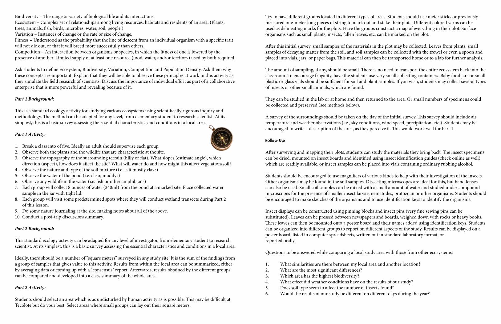
Biodiversity – The range or variety of biological life and its interactions.Ecosystem – Complex set of relationships among living resources, habitats and residents of an area. (Plants, trees, animals, fish, birds, microbes, water, soil, people.)Variation – Instances of change or the rate or size of change.Fitness – Understood as the probability that the line of descent from an individual organism with a specific trait will not die out, or that it will breed more successfully than others.Competition – An interaction between organisms or species, in which the fitness of one is lowered by the presence of another. Limited supply of at least one resource (food, water, and/or territory) used by both required.
Ask students to define Ecosystem, Biodiversity, Variation, Competition and Population Density. Ask them why these concepts are important. Explain that they will be able to observe these principles at work in this activity as they simulate the field research of scientists. Discuss the importance of individual effort as part of a collaborative enterprise that is more powerful and revealing because of it.
Part 1 Background: This is a standard ecology activity for studying various ecosystems using scientifically rigorous inquiry and methodology. The method can be adapted for any level, from elementary student to research scientist. At its simplest, this is a basic survey assessing the essential characteristics and conditions in a local area.
Part 1 Activity:
1. Break a class into of five. Ideally an adult should supervise each group. 2. Observe both the plants and the wildlife that are characteristic at the site.3. Observe the topography of the surrounding terrain (hilly or flat). What slopes (estimate angle), which
direction (aspect), how does it affect the site? What will water do and how might this affect vegetation/soil?4. Observe the nature and type of the soil mixture (i.e. is it mostly clay?)5. Observe the water of the pond (i.e. clear, muddy?)6. Observe any wildlife in the water (i.e. fish or other amphibians)7. Each group will collect 8 ounces of water (240ml) from the pond at a marked site. Place collected water
sample in the jar with tight lid. 8. Each group will visit some predetermined spots where they will conduct wetland transects during Part 2
of this lesson. 9. Do some nature journaling at the site, making notes about all of the above.10. Conduct a post-trip discussion/summary.
Part 2 Background:
This standard ecology activity can be adapted for any level of investigator, from elementary student to research scientist. At its simplest, this is a basic survey assessing the essential characteristics and conditions in a local area.
Ideally, there should be a number of “square meters” surveyed in any study site. It is the sum of the findings from a group of samples that gives value to this activity. Results from within the local area can be summarized, either by averaging data or coming up with a "consensus" report. Afterwards, results obtained by the different groups can be compared and developed into a class summary of the whole area.
Part 2 Activity:
Students should select an area which is as undisturbed by human activity as is possible. This may be difficult at Tecolote but do your best. Select areas where small groups can lay out their square meters.
Try to have different groups located in different types of areas. Students should use meter sticks or previously measured one-meter long pieces of string to mark out and stake their plots. Different colored yarns can be used as delineating marks for the plots. Have the groups construct a map of everything in their plot. Surface organisms such as small plants, insects, fallen leaves, etc. can be marked on the plot.
After this initial survey, small samples of the materials in the plot may be collected. Leaves from plants, small samples of decaying matter from the soil, and soil samples can be collected with the trowel or even a spoon and placed into vials, jars, or paper bags. This material can then be transported home or to a lab for further analysis.
The amount of sampling, if any, should be small. There is no need to transport the entire ecosystem back into the classroom. To encourage frugality, have the students use very small collecting containers. Baby food jars or small plastic or glass vials should be sufficient for soil and plant samples. If you wish, students may collect several types of insects or other small animals, which are found.
They can be studied in the lab or at home and then returned to the area. Or small numbers of specimens could be collected and preserved (see methods below).
A survey of the surroundings should be taken on the day of the initial survey. This survey should include air temperature and weather observations (i.e., sky conditions, wind speed, precipitation, etc.). Students may be encouraged to write a description of the area, as they perceive it. This would work well for Part 1.
Follow Up:
After surveying and mapping their plots, students can study the materials they bring back. The insect specimens can be dried, mounted on insect boards and identified using insect identification guides (check online as well) which are readily available, or insect samples can be placed into vials containing ordinary rubbing alcohol.
Students should be encouraged to use magnifiers of various kinds to help with their investigation of the insects. Other organisms may be found in the soil samples. Dissecting microscopes are ideal for this, but hand lenses can also be used. Small soil samples can be mixed with a small amount of water and studied under compound microscopes for the presence of smaller insect larvae, nematodes, protozoan or other organisms. Students should be encouraged to make sketches of the organisms and to use identification keys to identify the organisms.
Insect displays can be constructed using pinning blocks and insect pins (very fine sewing pins can be substituted). Leaves can be pressed between newspapers and boards, weighed down with rocks or heavy books. These leaves can then be mounted onto a poster board and their names added using identification keys. Students can be organized into different groups to report on different aspects of the study. Results can be displayed on a poster board, listed in computer spreadsheets, written out in standard laboratory format, or reported orally.
Questions to be answered while comparing a local study area with those from other ecosystems:
1. What similarities are there between my local area and another location?2. What are the most significant differences?3. Which area has the highest biodiversity?4. What effect did weather conditions have on the results of our study?5. Does soil type seem to affect the number of insects found?6. Would the results of our study be different on different days during the year?
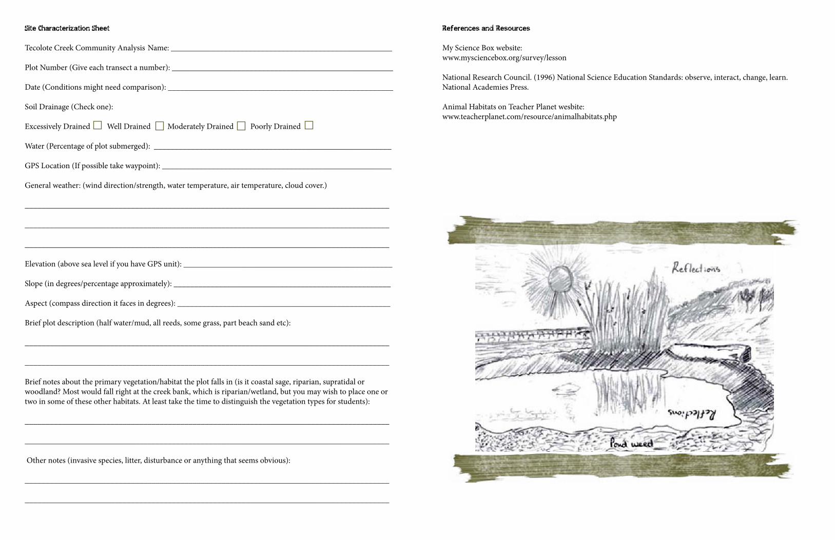
Site Characterization Sheet
Tecolote Creek Community Analysis Name: ______________________________________________________
Plot Number (Give each transect a number): ______________________________________________________
Date (Conditions might need comparison): _______________________________________________________
Soil Drainage (Check one):
Excessively Drained Well Drained Moderately Drained Poorly Drained
Water (Percentage of plot submerged): __________________________________________________________
GPS Location (If possible take waypoint): ________________________________________________________
General weather: (wind direction/strength, water temperature, air temperature, cloud cover.)
_________________________________________________________________________________________ _________________________________________________________________________________________
_________________________________________________________________________________________
Elevation (above sea level if you have GPS unit): ___________________________________________________
Slope (in degrees/percentage approximately): _____________________________________________________
Aspect (compass direction it faces in degrees): ____________________________________________________
Brief plot description (half water/mud, all reeds, some grass, part beach sand etc):
_________________________________________________________________________________________ _________________________________________________________________________________________
Brief notes about the primary vegetation/habitat the plot falls in (is it coastal sage, riparian, supratidal or woodland? Most would fall right at the creek bank, which is riparian/wetland, but you may wish to place one or two in some of these other habitats. At least take the time to distinguish the vegetation types for students):
_________________________________________________________________________________________ _________________________________________________________________________________________
Other notes (invasive species, litter, disturbance or anything that seems obvious):
_________________________________________________________________________________________ _________________________________________________________________________________________
References and Resources
My Science Box website: www.mysciencebox.org/survey/lesson
National Research Council. (1996) National Science Education Standards: observe, interact, change, learn. National Academies Press.
Animal Habitats on Teacher Planet wesbite: www.teacherplanet.com/resource/animalhabitats.php
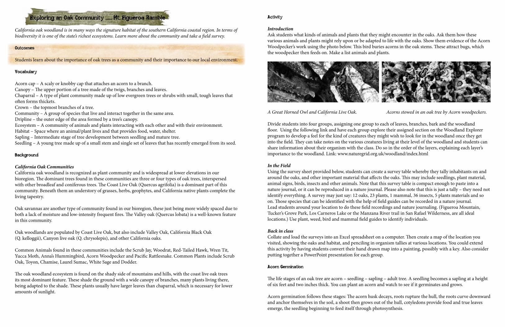
Exploring an Oak Community ...... Mt. Figueroa Ramble
California oak woodland is in many ways the signature habitat of the southern California coastal region. In terms of biodiversity it is one of the state’s richest ecosystems. Learn more about the community and take a field survey.
Outcomes
Students learn about the importance of oak trees as a community and their importance to our local environment.
Vocabulary
Acorn cap – A scaly or knobby cap that attaches an acorn to a branch.Canopy – The upper portion of a tree made of the twigs, branches and leaves.Chaparral – A type of plant community made up of low evergreen trees or shrubs with small, tough leaves that often forms thickets.Crown – the topmost branches of a tree.Community – A group of species that live and interact together in the same area.Dripline – the outer edge of the area formed by a tree’s canopy.Ecosystem – A community of animals and plants interacting with each other and with their environment.Habitat – Space where an animal/plant lives and that provides food, water, shelter.Sapling – Intermediate stage of tree development between seedling and mature tree.Seedling – A young tree made up of a small stem and single set of leaves that has recently emerged from its seed.
Background
California Oak CommunitiesCalifornia oak woodland is recognized as plant community and is widespread at lower elevations in our bioregion. The dominant trees found in these communities are three or four types of oak trees, interspersed with other broadleaf and coniferous trees. The Coast Live Oak (Quercus agrifolia) is a dominant part of this community. Beneath them an understory of grasses, herbs, geophytes, and California native plants complete the living tapestry.
Oak savannas are another type of community found in our bioregion, these just being more widely spaced due to both a lack of moisture and low-intensity frequent fires. The Valley oak (Quercus lobata) is a well-known feature in this community.
Oak woodlands are populated by Coast Live Oak, but also include Valley Oak, California Black Oak (Q. kelloggii), Canyon live oak (Q. chrysolepis), and other California oaks.
Common Animals found in these communities include the Scrub Jay, Woodrat, Red-Tailed Hawk, Wren Tit, Yucca Moth, Anna’s Hummingbird, Acorn Woodpecker and Pacific Rattlesnake. Common Plants include Scrub Oak, Toyon, Chamise, Laurel Sumac, White Sage and Dodder.
The oak woodland ecosystem is found on the shady side of mountains and hills, with the coast live oak trees its most dominant feature. These shade the ground with a wide canopy of branches, many plants living there, being adapted to the shade. These plants usually have larger leaves than chaparral, which is necessary for lower amounts of sunlight.
Activity
IntroductionAsk students what kinds of animals and plants that they might encounter in the oaks. Ask them how these various animals and plants might rely upon or be adapted to life with the oaks. Show them evidence of the Acorn Woodpecker’s work using the photo below. This bird buries acorns in the oak stems. These attract bugs, which the woodpecker then feeds on. Make a list animals and plants.
A Great Horned Owl and California Live Oak. Acorns stowed in an oak tree by Acorn woodpeckers.
Divide students into four groups, assigning one group to each of leaves, branches, bark and the woodland floor. Using the following link and have each group explore their assigned section on the Woodland Explorer program to develop a feel for the kind of creatures they might wish to look for in the woodland once they get into the field. They can take notes on the various creatures living at their level of the woodland and students can share information about their organism with the class. Do so in the order of the layers, explaining each layer’s importance to the woodland. Link: www.naturegrid.org.uk/woodland/index.html
In the FieldUsing the survey sheet provided below, students can create a survey table whereby they tally inhabitants on and around the oaks, and other important material that affects the oaks. This may include seedlings, plant material, animal signs, birds, insects and other animals. Note that this survey table is compact enough to paste into a nature journal, or it can be reproduced in a nature journal. Please also note that this is just a tally – they need not identify everything. A survey may just say: 12 oaks, 23 plants, 1 mammal, 36 insects, 5 plants materials and so on. Those species that can be identified with the help of field guides can be recorded in a nature journal.Lead students around your location to do these field recordings and nature journaling. (Figueroa Mountain, Tucker’s Grove Park, Los Carneros Lake or the Manzana River trail in San Rafael Wilderness, are all ideal locations.) Use plant, weed, bird and mammal field guides to identify individuals.
Back in classCollate and load the surveys into an Excel spreadsheet on a computer. Then create a map of the location you visited, showing the oaks and habitat, and penciling in organism tallies at various locations. You could extend this activity by having students convert their hand drawn map into a painting, possibly with a key. Also consider putting together a PowerPoint presentation for each group.
Acorn Germination
The life stages of an oak tree are acorn – seedling – sapling – adult tree. A seedling becomes a sapling at a height of six feet and two inches thick. You can plant an acorn and watch to see if it germinates and grows.
Acorn germination follows these stages: The acorn husk decays, roots rupture the hull, the roots curve downward and anchor themselves in the soil, a shoot then grows out of the hull, cotyledons provide food and true leaves emerge, the seedling beginning to feed itself through photosynthesis.
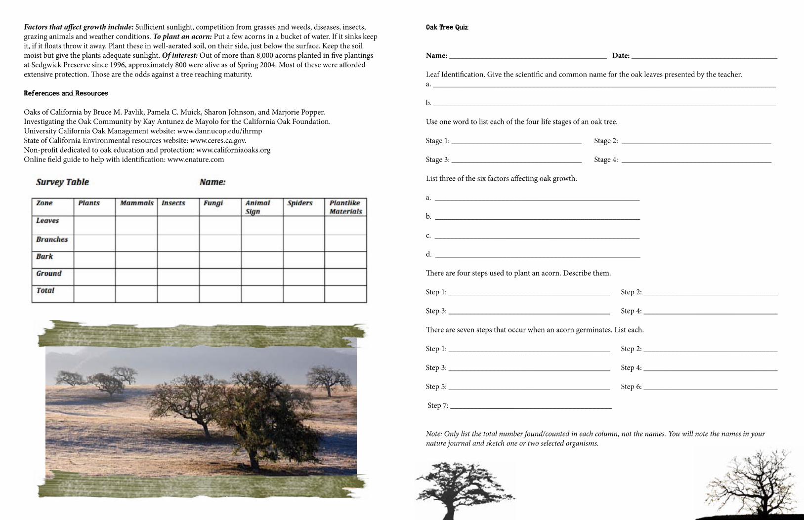
Factors that affect growth include: Sufficient sunlight, competition from grasses and weeds, diseases, insects, grazing animals and weather conditions. To plant an acorn: Put a few acorns in a bucket of water. If it sinks keep it, if it floats throw it away. Plant these in well-aerated soil, on their side, just below the surface. Keep the soil moist but give the plants adequate sunlight. Of interest: Out of more than 8,000 acorns planted in five plantings at Sedgwick Preserve since 1996, approximately 800 were alive as of Spring 2004. Most of these were afforded extensive protection. Those are the odds against a tree reaching maturity.
References and Resources
Oaks of California by Bruce M. Pavlik, Pamela C. Muick, Sharon Johnson, and Marjorie Popper.Investigating the Oak Community by Kay Antunez de Mayolo for the California Oak Foundation.University California Oak Management website: www.danr.ucop.edu/ihrmp State of California Environmental resources website: www.ceres.ca.gov.Non-profit dedicated to oak education and protection: www.californiaoaks.orgOnline field guide to help with identification: www.enature.com
Oak Tree Quiz
Name: ________________________________________ Date: _____________________________________ Leaf Identification. Give the scientific and common name for the oak leaves presented by the teacher.a. _______________________________________________________________________________________
b. _______________________________________________________________________________________
Use one word to list each of the four life stages of an oak tree. Stage 1: _________________________________ Stage 2: ______________________________________
Stage 3: _________________________________ Stage 4: ______________________________________ List three of the six factors affecting oak growth.
a. ____________________________________________________
b. ____________________________________________________
c. ____________________________________________________
d. ____________________________________________________
There are four steps used to plant an acorn. Describe them.
Step 1: _________________________________________ Step 2: __________________________________
Step 3: _________________________________________ Step 4: __________________________________ There are seven steps that occur when an acorn germinates. List each.
Step 1: _________________________________________ Step 2: __________________________________
Step 3: _________________________________________ Step 4: __________________________________
Step 5: _________________________________________ Step 6: __________________________________
Step 7: _________________________________________
Note: Only list the total number found/counted in each column, not the names. You will note the names in your nature journal and sketch one or two selected organisms.
The Intertidal Zone ...... Jalama Beach Ramble
This lesson contains four activities with discussion questions related to a video. These parts may be used individually or together, depending on the needs and time constraints of your group. Note: You can access and view additional video clips for this lesson in the Teacher resources section of the American Field Guide website: (www.pbs.org/americanfieldguide/teachers)
Outcomes
Students will …1. Develop an understanding of reproduction and heredity: the characteristics of an organism can be described
as a combination of traits. Some traits are inherited and others result from interactions with the environment.2. Develop an understanding of regulation and behavior: all organisms must be able to obtain and use
resources, grow, reproduce, and maintain stable internal conditions while living in a constantly changing external environment. Regulation of an organism’s internal environment involves sensing the external environment and changing physiological activities to keep conditions within a range to survive.
3. Learn that an organism’s behavior evolves through adaptation to its environment. How a species moves, obtains food, reproduces, and responds to danger is based in the natural history of that species.
Vocabulary
Littoral zone – In coastal environments and biomes, the littoral zone extends from the high water mark, which is rarely inundated, to shoreline areas that are permanently submerged. It includes the intertidal zone and is often used to mean the same as the intertidal zone. Abiotic – Non-living chemical and physical factors in the environment.Biotic – Of, pertaining to, or produced by life or living organisms.Adaptation – The process whereby a population becomes better suited to its habitat. This process takes place over many generations, and is one of the basic phenomena of biology.
Background
The Intertidal Zone presents a unique set of challenges for the organisms that live there. Extreme fluctuations in moisture level, heat, salinity, and sunlight make it a habitat suitable for only a few high ly conditioned species. Tidepools are marked by conditions that change dramatically over a very small area, also going from only occasionally wet to usually submerged in a matter of a few feet. The intertidal zone is thus known for its great diversity and has always been fascinating to children who love to collect shells and see the sea creatures who live there.
Activities in this lesson are designed to enable students to investigate the creatures of intertidal zones and how they’ve adapted to their conditions.
Activity: Part 1 Explorers Share their Observations
1. Students are to imagine that they’re 18th Century scientific explorers on an expedition to an uncharted part of the world. While landing at remote beaches they observe organisms that nobody from their society has ever seen before. They should write brief descriptions to illustrate the organisms to people at home.
2. Explain that scientists have to rely on descriptive skills when identifying organisms. Especially before popular use of photography, biologists had to describe the features of organisms to distinguish between species. Today, careful description still is a foundation of scientific research.
3. Split the group into two halves, with each side turning their backs to the other. Each person should have a pencil and a piece of paper. Hand a different shell to people, and explain that they are to verbally describe that shell to the person behind them in a way that the person can then draw it. They cannot use the name of the organism (like clam) or scientific terms (e.g. muscle scar). Encourage them to include measurements and specific data about the size and shape so that the person drawing can make annotations. Have a number of rulers available so that they can measure their shells if they choose to. One could have a contest to see whose drawing most closely resembles the original object.
Materials
A variety of shells (starfish, mussels, gastropods, limpets, etc.) with enough for one perstudent. Rulers.
Objectives
Students will …1. Practice description skills using marine organisms.2. Learn the difficulty of painting a verbal picture.3. Will develop an appreciation for the descriptive skills necessary for a scientist.
Activity: Part 2 Conditions in the Littoral Zone
Watch the Tidepools video from this link, made available by California Marine Protected Areas. (http://www.youtube.com/watch?v=wTRIuOA13mU)
Ask students to pay attention to any information regarding conditions in the rocky intertidal zone and to adaptations organisms have for survival. After watching, make a list of factors that might influence your life if you live in a shoreline area. These might include: salinity, heat, moisture, predation, finding food, sunlight, staying put, etc.
Encourage some discussion: given the conditions present in each zone, how do students think organisms might survive. They should address the different factors that they listed after watching the video above. The objective of this exercise is for students to brainstorm and to be creative in thinking about adaptations.
Objectives
Students will …1. Use discussion to generate ideas about how organisms adapt to the environment.2. Learn specific adaptations for the Rocky Intertidal Zone.
Activity: Part 3 Adapting to Challenge
Introduce the ideas of challenge, advantage and adaptation to challenge. Guide students through these three topics on this Seaworld Educational link: (www.seaworld.org/wild-world/ecosystems/info-books/tide-pools/intertidal-ecology.htm)
Now discuss factors that organisms living in the intertidal zone have to contend with. Some abiotic factors include changes in temperature, salinity, light, moisture, and wave action. Biotic factors include finding food, avoiding predation, and mating.
List these factors on the board. Discuss some of the adaptations referred to and then divide students into groups of two or three. Provide each group with the shells of one or two marine organisms and ask them to think about the factors they have learned about and listed during the discussion. What special features do they think their particular organism might have had to enable it to survive in the intertidal zone?
Students could share their results with the class. Ask them to choose one organism or one unique adaptation to explain to the group.
Additional resource: www.enchantedlearning.com/biomes/intertidal/intertidal.shtml
Objectives
Students will …1. Consider the various abiotic influences on organisms living at the edge of the ocean.2. Examine organisms to determine adaptations for survival.3. Learn that organisms use different strategies for survival.
Activity Part 4: Hold On to Your Home!
Adaptations that are necessary for life on a sandy beach are different from those necessary for life on a rocky coastline. In both areas, one of the great challenges is to hold on, but the Technique will differ greatly. Now heading out to the intertidal zone, in this activity, students will experiment with observe organisms in the sand, on and between rocks, and in the water to determine and distinguish between various methods useful for “holding on” in each environment.
Objectives
Students will …1. Compare rocky wiith sandy substrates to determine the difficulties of living in each.2. Observe and consider how adaptations enable organisms to survive.3. Learn that organisms have adaptations to protect them from a range of influences.
Background
On a sandy coast, the substrate is constantly shifting while on a rocky coast it is not. However, on a sandy coast, the sand is able to absorb some of the energy of the waves, but the rocks cannot. How an organism maintains its location will depend on where it lives. Those that can stick will do better in rocky areas, while things that can dig will do better in sandy areas. Storm waves can wash away the sand or will increase the energy present on the rocks, uncovering or dislodging many organisms. This is often reflected by the increase in shells at the beach after high waters. And even the crabs found in many of our rocky areas, although they don’t stick or dig, are ideally suited to crawling into crevices where they lodge themselves out of the way of crashing waves, and in such a position as to avoid being pulled out by receding waters. Just try and retrieve one to find out how well they can hide!
And although an organism can avoid being washed away, it still has to deal with other influences. For example, if students had to bury an organism, how would it avoid predation? It won’t be able to move quickly but the fact that it is buried does give it some protection. It might get food by sticking out a tongue-type organ that allows it to filter the water.
Worksheet
Imagine you are a small, ‘shelly’ creature at the coast. You live in a place called the intertidal or littoral zone, the area between the lowest low tide and the highest high tide. As an intertidal creature, what are some challenges you might have to deal with?
Make a list here: ___________________________________________________________________________
__________________________________________________________________________________________ __________________________________________________________________________________________
Coastlines generally can be divided into two types: sandy and rocky. In this activity, you are going to experiment with each type to determine some adaptations that can help you survive there. Your challenge in this activity is to observe the ways that creatures stay put.
1. List four organisms, two in the sand and two in the rocks. _________________________________________
__________________________________________________________________________________________ __________________________________________________________________________________________ __________________________________________________________________________________________
__________________________________________________________________________________________
2. Watch what happens to the sandy creatures when a wave comes in. Write your observations in the space provided on the worksheet. ___________________________________________________________________
__________________________________________________________________________________________
__________________________________________________________________________________________
__________________________________________________________________________________________
3. Consider and note down how it appears to you that the organism avoids being washed away. In particular, you should observe how the differently shaped organisms use different methods to stay put.
__________________________________________________________________________________________
__________________________________________________________________________________________
__________________________________________________________________________________________
__________________________________________________________________________________________ __________________________________________________________________________________________
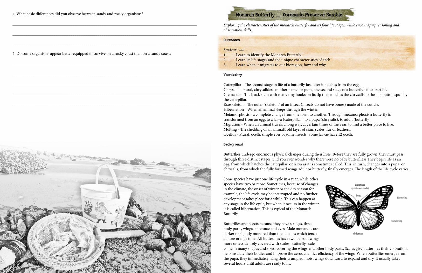
4. What basic differences did you observe between sandy and rocky organisms?
_________________________________________________________________________________________
_________________________________________________________________________________________
_________________________________________________________________________________________
5. Do some organisms appear better equipped to survive on a rocky coast than on a sandy coast?
_________________________________________________________________________________________
_________________________________________________________________________________________
_________________________________________________________________________________________
_________________________________________________________________________________________
_________________________________________________________________________________________
Monarch Butterfly ...... Coronado Preserve Ramble
Exploring the characteristics of the monarch butterfly and its four life stages, while encouraging reasoning and observation skills.
Outcomes
Students will …1. Learn to identify the Monarch Butterfly.2. Learn its life stages and the unique characteristics of each.3. Learn when it migrates to our bioregion, how and why.
Vocabulary
Caterpillar - The second stage in life of a butterfly just after it hatches from the egg.Chrysalis - plural, chrysalides: another name for pupa, the second stage of a butterfly’s four-part life.Cremaster - The black stem with many tiny hooks on its tip that attaches the chrysalis to the silk button spun by the caterpillar.Exoskeleton - The outer "skeleton" of an insect (insects do not have bones) made of the cuticle.Hibernation - When an animal sleeps through the winter.Metamorphosis - a complete change from one form to another. Through metamorphosis a butterfly is transformed from an egg, to a larva (caterpillar), to a pupa (chrysalis), to adult (butterfly).Migration - When an animal travels a long way, at certain times of the year, to find a better place to live.Molting - The shedding of an animal’s old layer of skin, scales, fur or feathers.Ocellus - Plural, ocelli: simple eyes of some insects. Some larvae have 12 ocelli.
Background
Butterflies undergo enormous physical changes during their lives. Before they are fully grown, they must pass through three distinct stages. Did you ever wonder why there were no baby butterflies? They begin life as an egg, from which hatches the caterpillar, or larva as it is sometimes called. This, in turn, changes into a pupa, or chrysalis, from which the fully formed wings adult or butterfly, finally emerges. The length of the life cycle varies.
Some species have just one life cycle in a year, while other species have two or more. Sometimes, because of changes in the climate, the onset of winter or the dry season for example, the life cycle may be interrupted and no further development takes place for a while. This can happen at any stage in the life cycle, but when it occurs in the winter, it is called hibernation. This is typical of the Monarch Butterfly. Butterflies are insects because they have six legs, three body parts, wings, antennae and eyes. Male monarchs are darker or slightly more red than the females which tend to a more orange tone. All butterflies have two pairs of wings more or less densely covered with scales. Butterfly scales come in many shapes and sizes, covering the wings and other body parts. Scales give butterflies their coloration, help insulate their bodies and improve the aerodynamics efficiency of the wings. When butterflies emerge from the pupa, they immediately hang their crumpled moist wings downward to expand and dry. It usually takes several hours until adults are ready to fly.
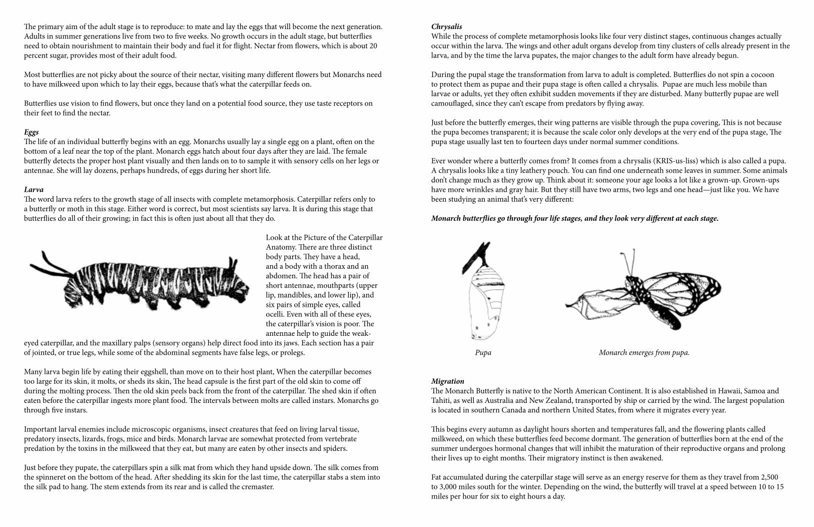
The primary aim of the adult stage is to reproduce: to mate and lay the eggs that will become the next generation. Adults in summer generations live from two to five weeks. No growth occurs in the adult stage, but butterflies need to obtain nourishment to maintain their body and fuel it for flight. Nectar from flowers, which is about 20 percent sugar, provides most of their adult food.
Most butterflies are not picky about the source of their nectar, visiting many different flowers but Monarchs need to have milkweed upon which to lay their eggs, because that’s what the caterpillar feeds on.
Butterflies use vision to find flowers, but once they land on a potential food source, they use taste receptors on their feet to find the nectar.
EggsThe life of an individual butterfly begins with an egg. Monarchs usually lay a single egg on a plant, often on the bottom of a leaf near the top of the plant. Monarch eggs hatch about four days after they are laid. The female butterfly detects the proper host plant visually and then lands on to to sample it with sensory cells on her legs or antennae. She will lay dozens, perhaps hundreds, of eggs during her short life.
LarvaThe word larva refers to the growth stage of all insects with complete metamorphosis. Caterpillar refers only to a butterfly or moth in this stage. Either word is correct, but most scientists say larva. It is during this stage that butterflies do all of their growing; in fact this is often just about all that they do.
Look at the Picture of the Caterpillar Anatomy. There are three distinct body parts. They have a head, and a body with a thorax and an abdomen. The head has a pair of short antennae, mouthparts (upper lip, mandibles, and lower lip), and six pairs of simple eyes, called ocelli. Even with all of these eyes, the caterpillar’s vision is poor. The antennae help to guide the weak-
eyed caterpillar, and the maxillary palps (sensory organs) help direct food into its jaws. Each section has a pair of jointed, or true legs, while some of the abdominal segments have false legs, or prolegs. Many larva begin life by eating their eggshell, than move on to their host plant, When the caterpillar becomes too large for its skin, it molts, or sheds its skin, The head capsule is the first part of the old skin to come off during the molting process. Then the old skin peels back from the front of the caterpillar. The shed skin if often eaten before the caterpillar ingests more plant food. The intervals between molts are called instars. Monarchs go through five instars.
Important larval enemies include microscopic organisms, insect creatures that feed on living larval tissue, predatory insects, lizards, frogs, mice and birds. Monarch larvae are somewhat protected from vertebrate predation by the toxins in the milkweed that they eat, but many are eaten by other insects and spiders.
Just before they pupate, the caterpillars spin a silk mat from which they hand upside down. The silk comes from the spinneret on the bottom of the head. After shedding its skin for the last time, the caterpillar stabs a stem into the silk pad to hang. The stem extends from its rear and is called the cremaster.
ChrysalisWhile the process of complete metamorphosis looks like four very distinct stages, continuous changes actually occur within the larva. The wings and other adult organs develop from tiny clusters of cells already present in the larva, and by the time the larva pupates, the major changes to the adult form have already begun.
During the pupal stage the transformation from larva to adult is completed. Butterflies do not spin a cocoon to protect them as pupae and their pupa stage is often called a chrysalis. Pupae are much less mobile than larvae or adults, yet they often exhibit sudden movements if they are disturbed. Many butterfly pupae are well camouflaged, since they can’t escape from predators by flying away.
Just before the butterfly emerges, their wing patterns are visible through the pupa covering, This is not because the pupa becomes transparent; it is because the scale color only develops at the very end of the pupa stage, The pupa stage usually last ten to fourteen days under normal summer conditions.
Ever wonder where a butterfly comes from? It comes from a chrysalis (KRIS-us-liss) which is also called a pupa. A chrysalis looks like a tiny leathery pouch. You can find one underneath some leaves in summer. Some animals don’t change much as they grow up. Think about it: someone your age looks a lot like a grown-up. Grown-ups have more wrinkles and gray hair. But they still have two arms, two legs and one head—just like you. We have been studying an animal that’s very different: Monarch butterflies go through four life stages, and they look very different at each stage.
Pupa Monarch emerges from pupa.
MigrationThe Monarch Butterfly is native to the North American Continent. It is also established in Hawaii, Samoa and Tahiti, as well as Australia and New Zealand, transported by ship or carried by the wind. The largest population is located in southern Canada and northern United States, from where it migrates every year.
This begins every autumn as daylight hours shorten and temperatures fall, and the flowering plants called milkweed, on which these butterflies feed become dormant. The generation of butterflies born at the end of the summer undergoes hormonal changes that will inhibit the maturation of their reproductive organs and prolong their lives up to eight months. Their migratory instinct is then awakened.
Fat accumulated during the caterpillar stage will serve as an energy reserve for them as they travel from 2,500 to 3,000 miles south for the winter. Depending on the wind, the butterfly will travel at a speed between 10 to 15 miles per hour for six to eight hours a day.
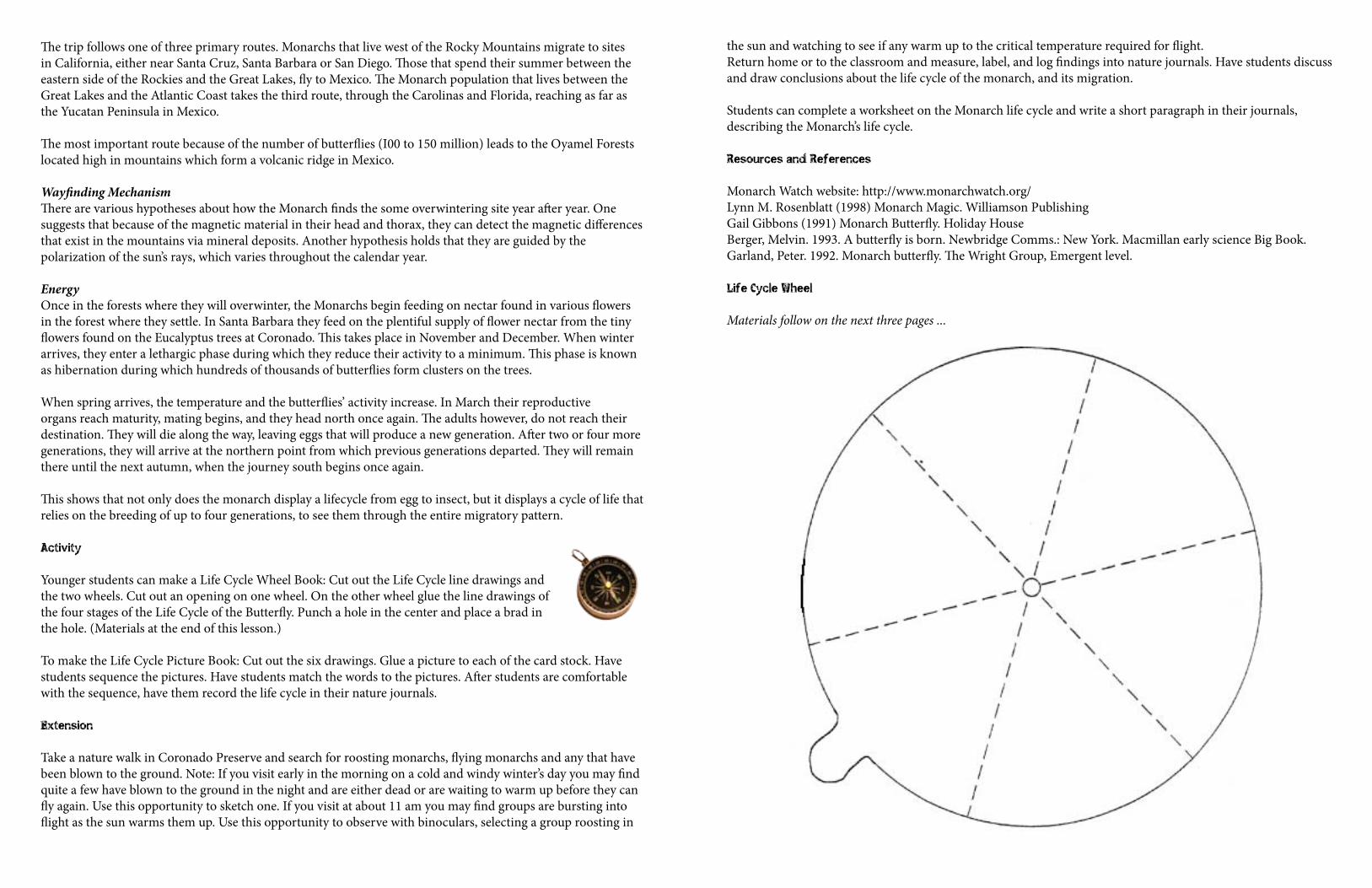
The trip follows one of three primary routes. Monarchs that live west of the Rocky Mountains migrate to sites in California, either near Santa Cruz, Santa Barbara or San Diego. Those that spend their summer between the eastern side of the Rockies and the Great Lakes, fly to Mexico. The Monarch population that lives between the Great Lakes and the Atlantic Coast takes the third route, through the Carolinas and Florida, reaching as far as the Yucatan Peninsula in Mexico.
The most important route because of the number of butterflies (I00 to 150 million) leads to the Oyamel Forests located high in mountains which form a volcanic ridge in Mexico.
Wayfinding MechanismThere are various hypotheses about how the Monarch finds the some overwintering site year after year. One suggests that because of the magnetic material in their head and thorax, they can detect the magnetic differences that exist in the mountains via mineral deposits. Another hypothesis holds that they are guided by the polarization of the sun’s rays, which varies throughout the calendar year.
EnergyOnce in the forests where they will overwinter, the Monarchs begin feeding on nectar found in various flowers in the forest where they settle. In Santa Barbara they feed on the plentiful supply of flower nectar from the tiny flowers found on the Eucalyptus trees at Coronado. This takes place in November and December. When winter arrives, they enter a lethargic phase during which they reduce their activity to a minimum. This phase is known as hibernation during which hundreds of thousands of butterflies form clusters on the trees.
When spring arrives, the temperature and the butterflies’ activity increase. In March their reproductive organs reach maturity, mating begins, and they head north once again. The adults however, do not reach their destination. They will die along the way, leaving eggs that will produce a new generation. After two or four more generations, they will arrive at the northern point from which previous generations departed. They will remain there until the next autumn, when the journey south begins once again.
This shows that not only does the monarch display a lifecycle from egg to insect, but it displays a cycle of life that relies on the breeding of up to four generations, to see them through the entire migratory pattern.
Activity
Younger students can make a Life Cycle Wheel Book: Cut out the Life Cycle line drawings and the two wheels. Cut out an opening on one wheel. On the other wheel glue the line drawings of the four stages of the Life Cycle of the Butterfly. Punch a hole in the center and place a brad in the hole. (Materials at the end of this lesson.)
To make the Life Cycle Picture Book: Cut out the six drawings. Glue a picture to each of the card stock. Have students sequence the pictures. Have students match the words to the pictures. After students are comfortable with the sequence, have them record the life cycle in their nature journals.
Extension
Take a nature walk in Coronado Preserve and search for roosting monarchs, flying monarchs and any that have been blown to the ground. Note: If you visit early in the morning on a cold and windy winter’s day you may find quite a few have blown to the ground in the night and are either dead or are waiting to warm up before they can fly again. Use this opportunity to sketch one. If you visit at about 11 am you may find groups are bursting into flight as the sun warms them up. Use this opportunity to observe with binoculars, selecting a group roosting in
the sun and watching to see if any warm up to the critical temperature required for flight. Return home or to the classroom and measure, label, and log findings into nature journals. Have students discuss and draw conclusions about the life cycle of the monarch, and its migration.
Students can complete a worksheet on the Monarch life cycle and write a short paragraph in their journals, describing the Monarch’s life cycle.
Resources and References
Monarch Watch website: http://www.monarchwatch.org/Lynn M. Rosenblatt (1998) Monarch Magic. Williamson Publishing Gail Gibbons (1991) Monarch Butterfly. Holiday HouseBerger, Melvin. 1993. A butterfly is born. Newbridge Comms.: New York. Macmillan early science Big Book.Garland, Peter. 1992. Monarch butterfly. The Wright Group, Emergent level.
Life Cycle Wheel
Materials follow on the next three pages ...
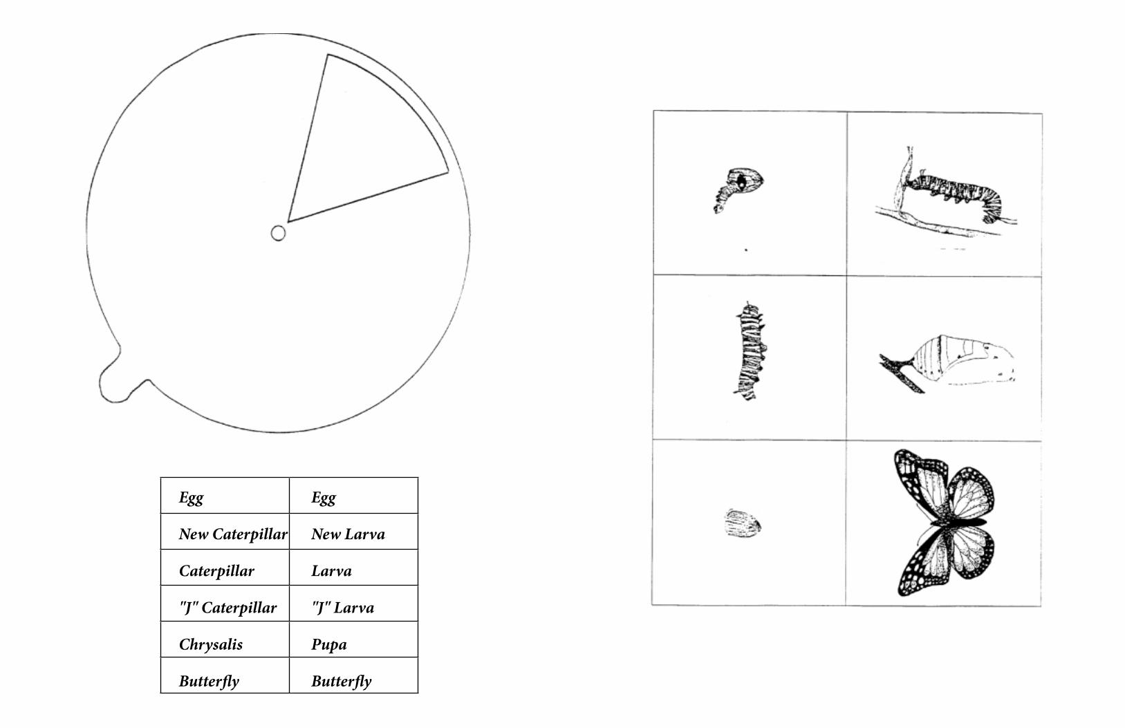
Egg Egg
New Caterpillar New Larva
Caterpillar Larva
"J" Caterpillar "J" Larva
Chrysalis Pupa
Butterfly Butterfly
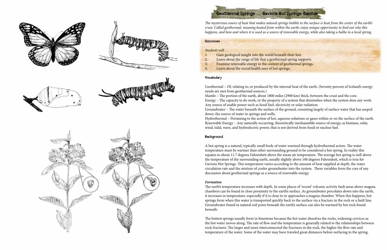
Geothermal Springs ...... Gaviota Hot Springs Ramble
The mysterious source of heat that makes natural springs bubble to the surface is heat from the center of the earth’s crust. Called geothermal, meaning heated from within the earth; enjoy unique opportunity to find out why this happens, and how and where it is used as a source of renewable energy, while also taking a bathe in a local spring.
Outcomes
Students will …1. Gain geological insight into the world beneath their feet.2. Learn about the range of life that a geothermal spring supports.3. Examine renewable energy in the context of geothermal springs.4. Learn about the social/health uses of hot springs.
Vocabulary
Geothermal – Of, relating to, or produced by the internal heat of the earth. (Seventy percent of Iceland’s energy needs are met from geothermal sources.)Mantle – The portion of the earth, about 1800 miles (2900 km) thick, between the crust and the core.Energy – The capacity to do work, or the property of a system that diminishes when the system does any work. Any source of usable power such as fossil fuel, electricity or solar radiation.Groundwater – The water beneath the surface of the ground, consisting largely of surface water that has seeped down: the source of water in springs and wells.Hydrothermal – Pertaining to the action of hot, aqueous solutions or gases within or on the surface of the earth.Renewable Energy – Any naturally occurring, theoretically inexhaustible source of energy, as biomass, solar, wind, tidal, wave, and hydroelectric power, that is not derived from fossil or nuclear fuel.
Background
A hot spring is a natural, typically small body of water warmed through hydrothermal action. The water temperature must be warmer than other surrounding ground to be considered a hot spring. In reality this equates to about 11.7 degrees Fahrenheit above the mean air temperature. The average hot spring is well above the temperature of the surrounding earth, usually slightly above 100 degrees Fahrenheit, which is true for Gaviota Hot Springs. This temperature varies according to the amount of heat supplied at depth, the water circulation rate and the mixture of cooler groundwater into the system. These variables form the core of any discussion about geothermal springs as a source of renewable energy.
FormationThe earth’s temperature increases with depth. In some places of ‘recent’ volcanic activity fault areas above magma chambers can be found in close proximity to the earth’s surface. As groundwater percolates down into the earth, it increases in temperature, especially if it is close to or approaches a magma chamber. When this happens, hot springs form when this water is transported quickly back to the surface via a fracture in the rock or a fault line. Groundwater found in natural soil pores beneath the earth’s surface can also be warmed by hot rock found beneath.
The hottest springs usually form in limestone because the hot water dissolves the rocks, widening crevices as the hot water moves along. The rate of flow and the temperature is generally related to the relationships between rock fractures: The larger and more interconnected the fractures in the rock, the higher the flow rate and temperature of the water. Some of the water may have traveled great distances before surfacing in the spring.
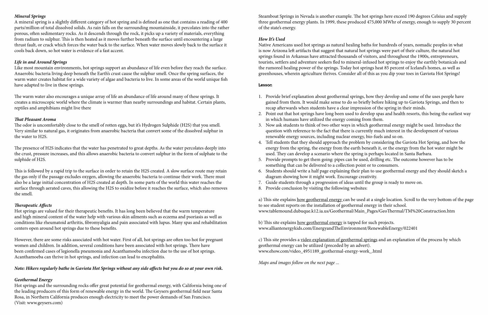
Mineral SpringsA mineral spring is a slightly different category of hot spring and is defined as one that contains a reading of 400 parts/million of total dissolved solids. As rain falls on the surrounding mountainside, it percolates into the rather porous, often sedimentary rocks. As it descends through the rock, it picks up a variety of materials, everything from radium to sulphur. This is then heated as it moves further beneath the surface until encountering a large thrust fault, or crack which forces the water back to the surface. When water moves slowly back to the surface it cools back down, so hot water is evidence of a fast accent.
Life in and Around SpringsLike most mountain environments, hot springs support an abundance of life even before they reach the surface. Anaerobic bacteria living deep beneath the Earth’s crust cause the sulphur smell. Once the spring surfaces, the warm water creates habitat for a wide variety of algae and bacteria to live. In some areas of the world unique fish have adapted to live in these springs.
The warm water also encourages a unique array of life an abundance of life around many of these springs. It creates a microscopic world where the climate is warmer than nearby surroundings and habitat. Certain plants, reptiles and amphibians might live there
That Pleasant AromaThe odor is uncomfortably close to the smell of rotten eggs, but it’s Hydrogen Sulphide (H2S) that you smell. Very similar to natural gas, it originates from anaerobic bacteria that convert some of the dissolved sulphur in the water to H2S.
The presence of H2S indicates that the water has penetrated to great depths. As the water percolates deeply into the crust, pressure increases, and this allows anaerobic bacteria to convert sulphur in the form of sulphate to the sulphide of H2S.
This is followed by a rapid trip to the surface in order to retain the H2S created. A slow surface route may retain the gas only if the passage excludes oxygen, allowing the anaerobic bacteria to continue their work. There must also be a large initial concentration of H2S created at depth. In some parts of the world this water reaches the surface through aerated caves, this allowing the H2S to oxidize before it reaches the surface, which also removes the smell.
Therapeutic AffectsHot springs are valued for their therapeutic benefits. It has long been believed that the warm temperature and high mineral content of the water help with various skin ailments such as eczema and psoriasis as well as conditions like rheumatoid arthritis, fibromyaligia and pain associated with lupus. Many spas and rehabilitation centers open around hot springs due to these benefits.
However, there are some risks associated with hot water. First of all, hot springs are often too hot for pregnant women and children. In addition, several conditions have been associated with hot springs. There have been confirmed cases of legionella pneumonia and Acanthamoeba infection due to the use of hot springs. Acanthamoeba can thrive in hot springs, and infection can lead to encephalitis.
Note: Hikers regularly bathe in Gaviota Hot Springs without any side affects but you do so at your own risk.
Geothermal EnergyHot springs and the surrounding rocks offer great potential for geothermal energy, with California being one of the leading producers of this form of renewable energy in the world. The Geysers geothermal field near Santa Rosa, in Northern California produces enough electricity to meet the power demands of San Francisco. (Visit: www.geysers.com)
Steamboat Springs in Nevada is another example. The hot springs here exceed 190 degrees Celsius and supply three geothermal energy plants. In 1999, these produced 475,000 MWhr of energy, enough to supply 30 percent of the state’s energy.
How It’s UsedNative Americans used hot springs as natural healing baths for hundreds of years, nomadic peoples in what is now Arizona left artifacts that suggest that natural hot springs were part of their culture, the natural hot springs found in Arkansas have attracted thousands of visitors, and throughout the 1900s, entrepreneurs, tourists, settlers and adventure seekers fled to mineral-infused hot springs to enjoy the earthly botanicals and the rumored healing power of the springs. Today hot springs heat 85 percent of Iceland’s homes, as well as greenhouses, wherein agriculture thrives. Consider all of this as you dip your toes in Gaviota Hot Springs!
Lesson
1. Provide brief explanation about geothermal springs, how they develop and some of the uses people have gained from them. It would make sense to do so briefly before hiking up to Gaviota Springs, and then to recap afterwards when students have a clear impression of the spring in their minds.
2. Point out that hot springs have long been used to develop spas and health resorts, this being the earliest way in which humans have utilized the energy coming from them.
3. Now ask students to think of two other ways in which geothermal energy might be used. Introduce the question with reference to the fact that there is currently much interest in the development of various renewable energy sources, including nuclear energy, bio-fuels and so on.
4. Tell students that they should approach the problem by considering the Gaviota Hot Spring, and how the energy from the spring, the energy from the earth beneath it, or the energy from the hot water might be used. They can develop a scenario where the spring is perhaps located in Santa Barbara.
5. Provide prompts to get them going: pipes can be used, drilling etc. The outcome however has to be something that can be delivered to a collection point or to consumers.
6. Students should write a half page explaining their plan to use geothermal energy and they should sketch a diagram showing how it might work. Encourage creativity.
7. Guide students through a progression of ideas until the group is ready to move on.8. Provide conclusion by visiting the following websites:
a) This site explains how geothermal energy can be used at a single location. Scroll to the very bottom of the page to see student reports on the installation of geothermal energy in their school.www.tablemound.dubuque.k12.ia.us/Geothermal/Main_Pages/GeoThermal/TM%20Construction.htm
b) This site explains how geothermal energy is tapped for such projects.www.alliantenergykids.com/EnergyandTheEnvironment/RenewableEnergy/022401
c) This site provides a video explanation of geothermal springs and an explanation of the process by which geothermal energy can be utilized (preceded by an advert).www.ehow.com/video_4951189_geothermal-energy-work_.html
Maps and images follow on the next page ...
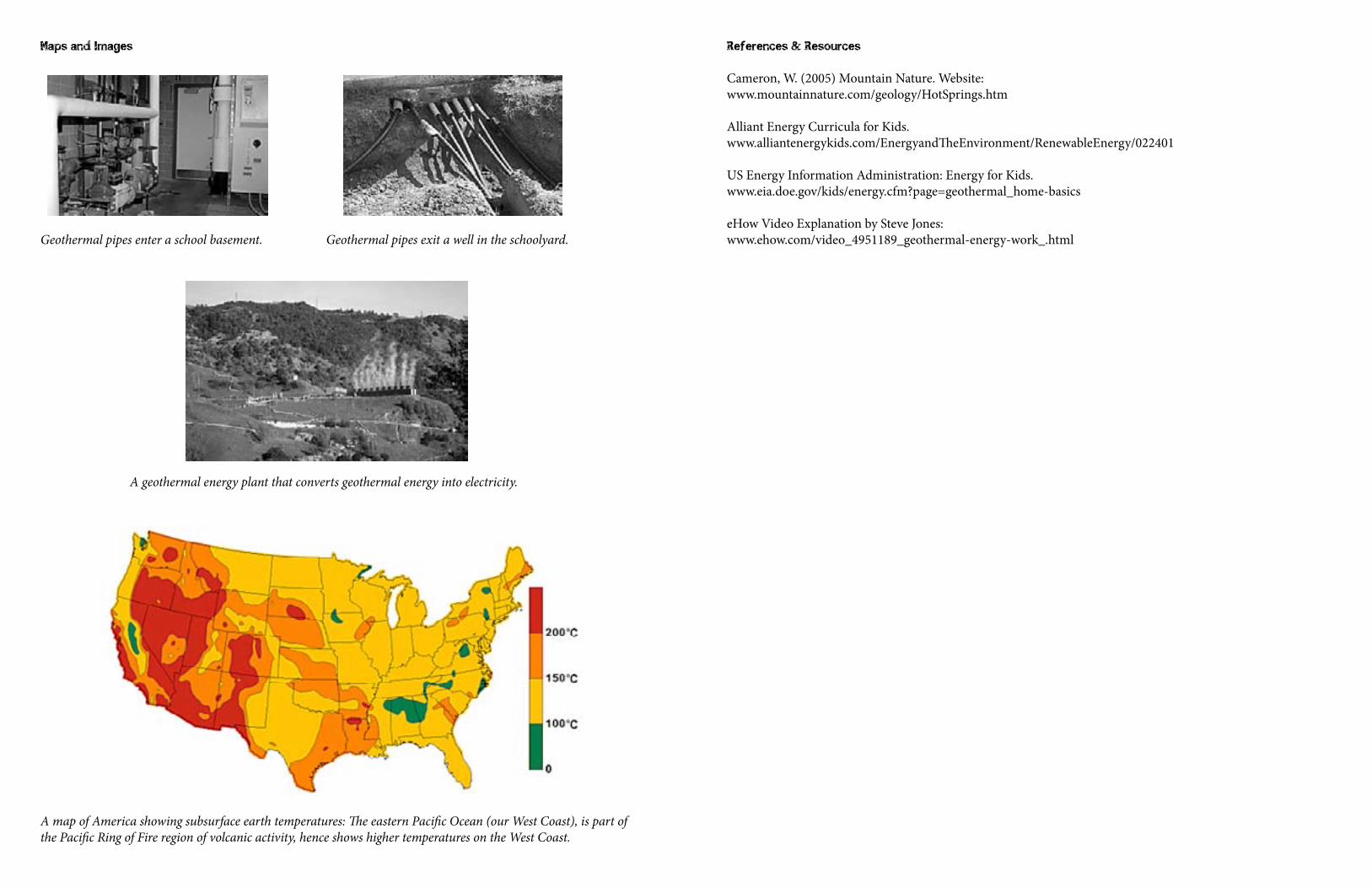
Maps and Images
Geothermal pipes enter a school basement. Geothermal pipes exit a well in the schoolyard.
A geothermal energy plant that converts geothermal energy into electricity.
A map of America showing subsurface earth temperatures: The eastern Pacific Ocean (our West Coast), is part of the Pacific Ring of Fire region of volcanic activity, hence shows higher temperatures on the West Coast.
References & Resources
Cameron, W. (2005) Mountain Nature. Website:www.mountainnature.com/geology/HotSprings.htm
Alliant Energy Curricula for Kids.www.alliantenergykids.com/EnergyandTheEnvironment/RenewableEnergy/022401
US Energy Information Administration: Energy for Kids.www.eia.doe.gov/kids/energy.cfm?page=geothermal_home-basics
eHow Video Explanation by Steve Jones:www.ehow.com/video_4951189_geothermal-energy-work_.html